International Research Journal of Engineering and Technology (IRJET)
e-ISSN: 2395-0056
Volume: 06 Issue: 05 | May 2019
p-ISSN: 2395-0072
www.irjet.net
Tool: Segregration of Bands in Sentinel Data And Calculation of NDVI Shradha Arvind Jadhav1, Dr. Prashant Pathavardhan2 1Student
of Electronics & Communication Engg, G.I.T College Belgaum of Electronics & Communication Engg, G.I.T College Belgaum ---------------------------------------------------------------------***--------------------------------------------------------------------2Proffesor
Abstract- Division of various vegetation types in satellite pictures is a basic issue in remote detecting. This is a direct result of the nearby reflectance between various vegetation types that it makes troublesome isolation of them in satellite pictures. To encourage this issue, diverse satellite inferred vegetation files including: Standardized Distinction Vegetation Record (NDVI), Improved Vegetation File (EVI), and Upgraded Vegetation List 2 (EVI2) were gotten from the Progressed Spaceborne Warm Outflow and Reflection Radiometer (ASTER) and Landsat-5 TM information. Key Words: Satellite pictures, Remote Detecting, Vegetation, NDVI, EVI, EVI2
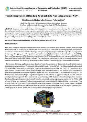
INTRODUCTION Late years have seen propels in remote detecting in numerous fields with applications at a spatial scale which go from worldwide to nearby. As an outcome, the need to watch the Earth with increasingly specific and complex sensors and information examination strategies to acquire progressively precise data has expanded. For vegetation discovery and mapping, as a rule vegetation records, for example, Standardized Contrast Vegetation File (NDVI), Improved Vegetation List (EVI), Balanced out Vegetation File (StVI), Changed distinction vegetation file (TDVI) and Upgraded Vegetation List 2 (EVI2) are utilized. The examination researched the use of various vegetation based satellite-determined lists including: NDVI, EVI, and EVI2 for location and mapping from sentinel information. For remote detecting applications, band data is of central significance in the period of satellite information investigation and elucidation. The dispatch of Sentinel-2A is a key piece of Worldwide Observing for Condition and Security (GMES) program bolstered by the European Space Organization (ESA) and European Commission (EC) guaranteeing a superior information coherence than other applicable satellites, for example, SPOT and Landsat satellite arrangement, because of its high spatial goals and short return to time. To acquire more recovery data, its Multispectral Instrument (MSI) is a significant segment on this satellite as appeared in Fig. 1. The MSI holds an anastigmatic telescope with three mirrors with an understudy width of about 150mm limiting canteen versatile bends, and the optical structure has been advanced to accomplish cutting edge imaging quality over its 290km field of view. MSI likewise includes 13 phantom groups going from unmistakable, NIR to SWIR at various goals. This setup is chosen as the best trade off between client prerequisites and mission execution. Four groups at 10m goals meet the fundamental necessities for land order; six groups at 20m goals give extra data on vegetation identifying. The staying three groups at 60m add to environmental and geophysical parameters.
Fig. 1 Multi Spectral Imager View on Sentinel-2A Š 2019, IRJET
|
Impact Factor value: 7.211
|
ISO 9001:2008 Certified Journal
|
Page 1614