International Research Journal of Engineering and Technology (IRJET) Volume: 03 Issue: 12 | Dec -2016
e-ISSN: 2395 -0056 p-ISSN: 2395-0072
www.irjet.net
Multi focus image fusion based on spatial frequency Latha.P*, Shalini.A,Maithili.Ananda kumari.A Assistant Professor CSE*1,2,3,4 Kingston Engineering College*1,2,3 Priyadarshini Engineering College4 Vellore, India*1,2,3,4 Abstract:Spatial–spectral feature
fusion is well acknowledged as an effective method for hyper spectral (HS) image classification. Many previous studies have been devoted to this subject. However, these methods often regard the spatial–spectral high-dimensional data as 1-D vector and then extract informative features for classification. In this paper, we propose a new HS image classification method. Specifically, matrix-based spatial– spectral feature representation is designed for each pixel to capture the local spatial contextual and the spectral information of all the bands, which can well preserve the spatial–spectral correlation. Then, matrix-based discriminant analysis is adopted to learn the discriminative feature subspace for classification. To further improve the performance of discriminative subspace, a random sampling technique is used to produce a subspace ensemble for final HS image classification. Experiments are conducted on three HS remote sensing data sets acquired by different sensors, and experimental results demonstrate the efficiency of the proposed method.
similar spectral natures in the study scene. The other one is that classifiers often need to process highdimensional data with a small number. A typical HS image contains hundreds of spectral bands.
Index Terms—hyperspectral (HS) image classification, matrix-based discriminant analysis (MDA), support vector machine (SVM).
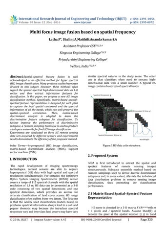
Figure.1 HS data cube structure.
I. INTRODUCTION The rapid development of imaging spectroscopy technologies, current sensors are able to acquire hyperspectral (HS) data with high spatial and spectral resolutions simultaneously. For instance, the Reflective Optics System Imaging Spectrometer (ROSIS) sensor covers a range of 115 spectral channels with the spatial resolution of 1.3 m. HS data can be presented as a 3-D cube consisting of two spatial dimensions and one spectral dimension, which provides an avenue for accurate classification of land cover scenes. HS image classification often suffers from two issues. The first one is that the widely used classification models based on pixelwise spectral information always lead to a salt and pepper thematic map because the intraclass spectral responses vary and interclass land covers may have very © 2016, IRJET
| Impact Factor value: 4.45
|
2. Proposed System MDA is first introduced to extract the spatial and spectral features of remote sensing images simultaneously. Subspace ensemble method based on random samplings used to derive diverse discriminant subspaces and, in some extent, alleviate the imbalanced data distribution problem in remote sensing image classification, thus promoting the classification performance.
2.1 Matrix-Based Spatial–Spectral Feature Representation HS scene is denoted by a 3-D matrix X Rm×n×l with m × n pixels and l spectral bands. Assume thatX(k) ij denotes the pixel at the spatial location (i, j) in band ISO 9001:2008 Certified Journal
|
Page 330