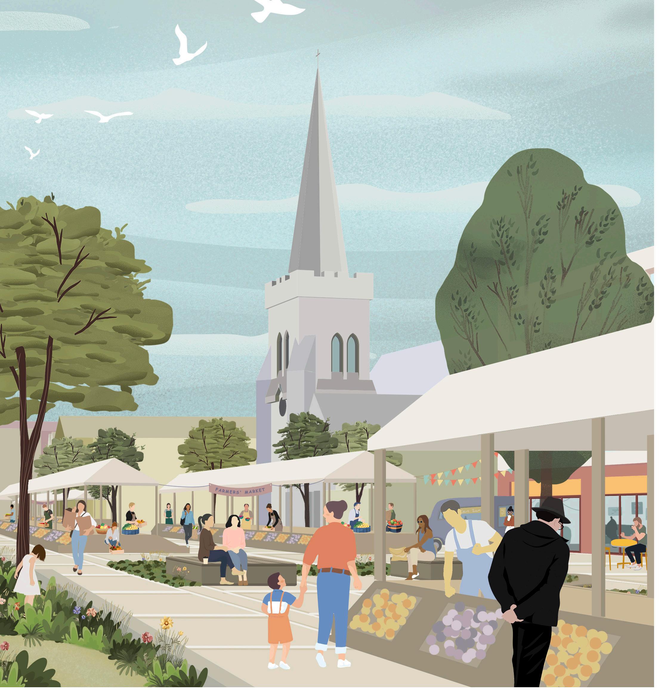
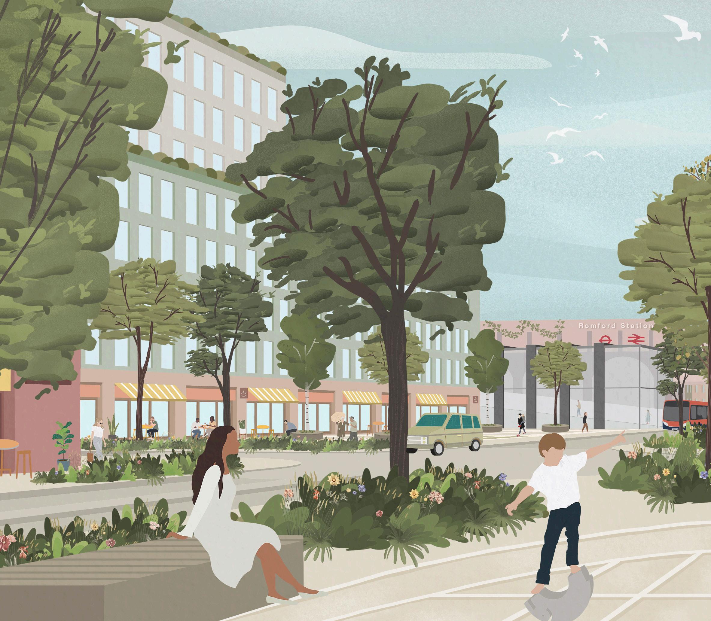
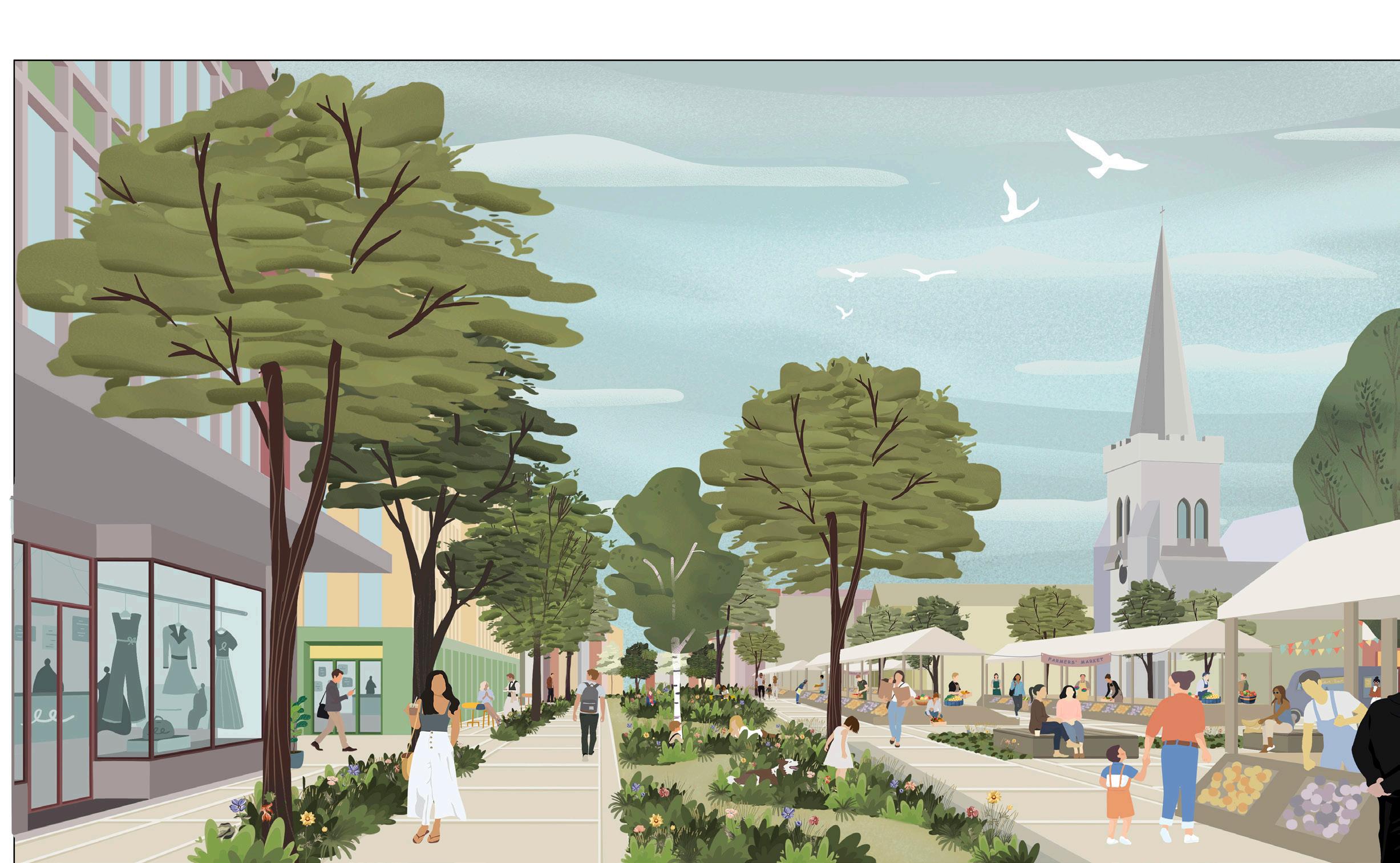
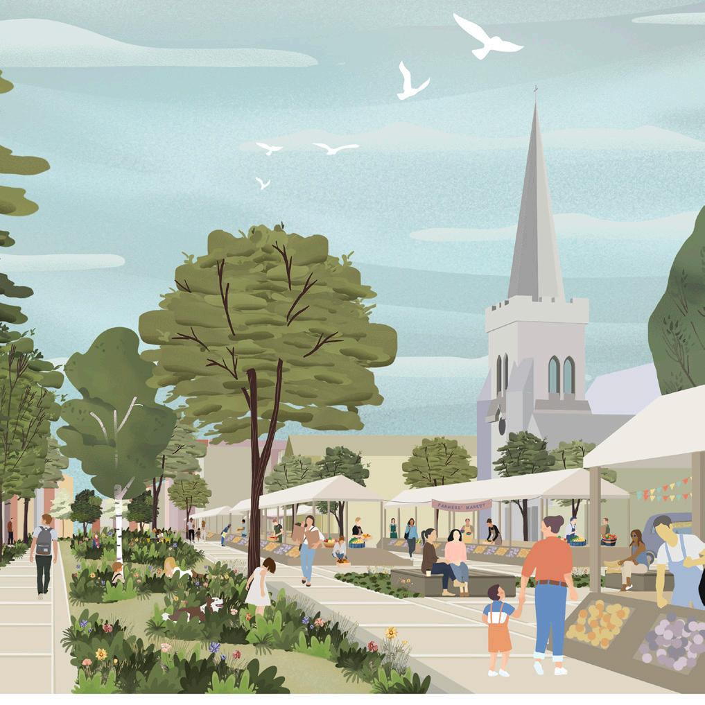
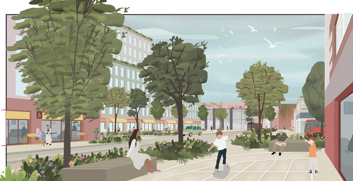
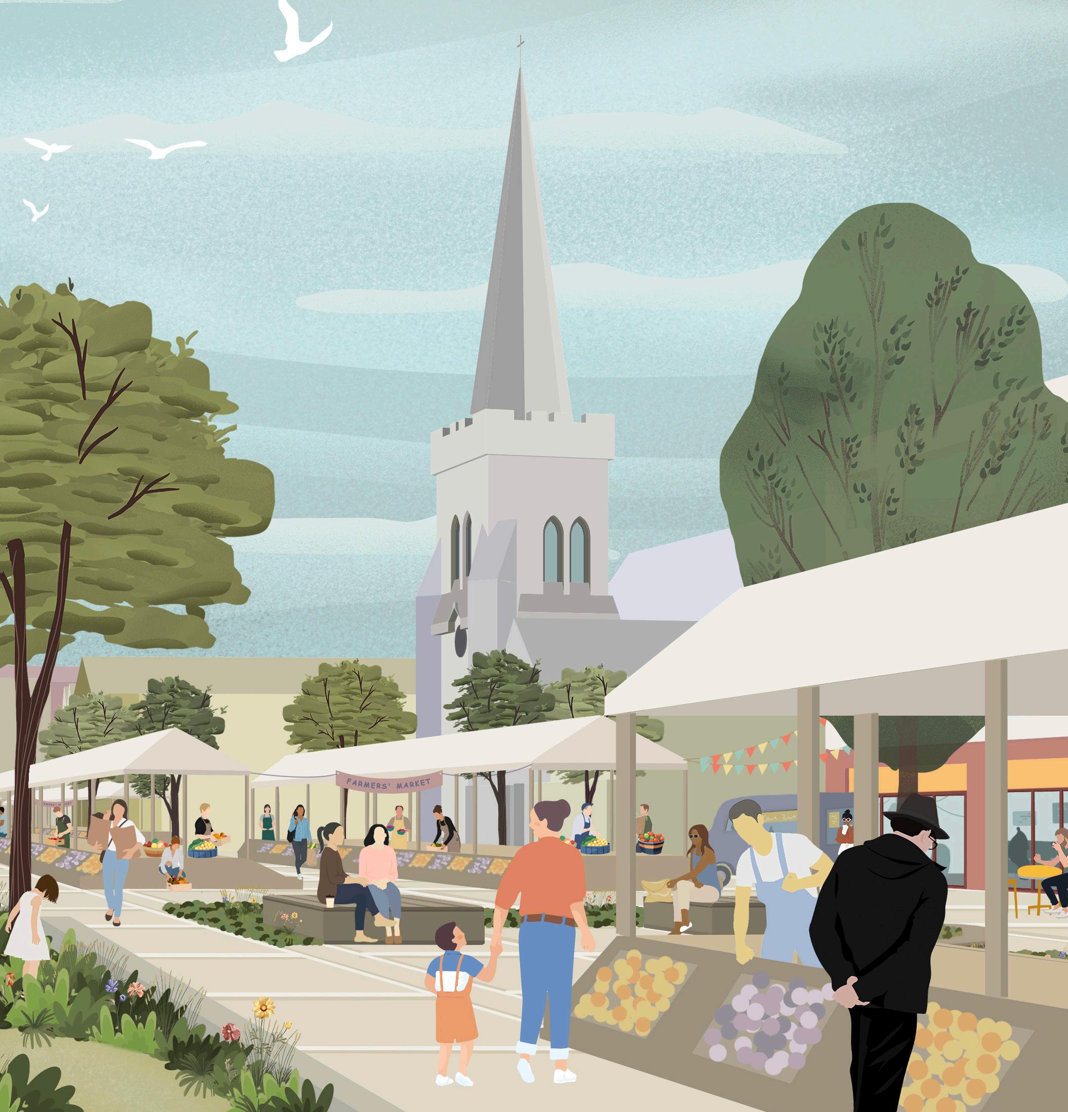
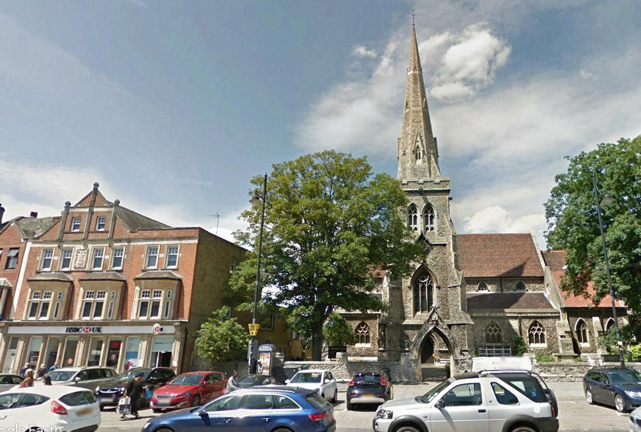
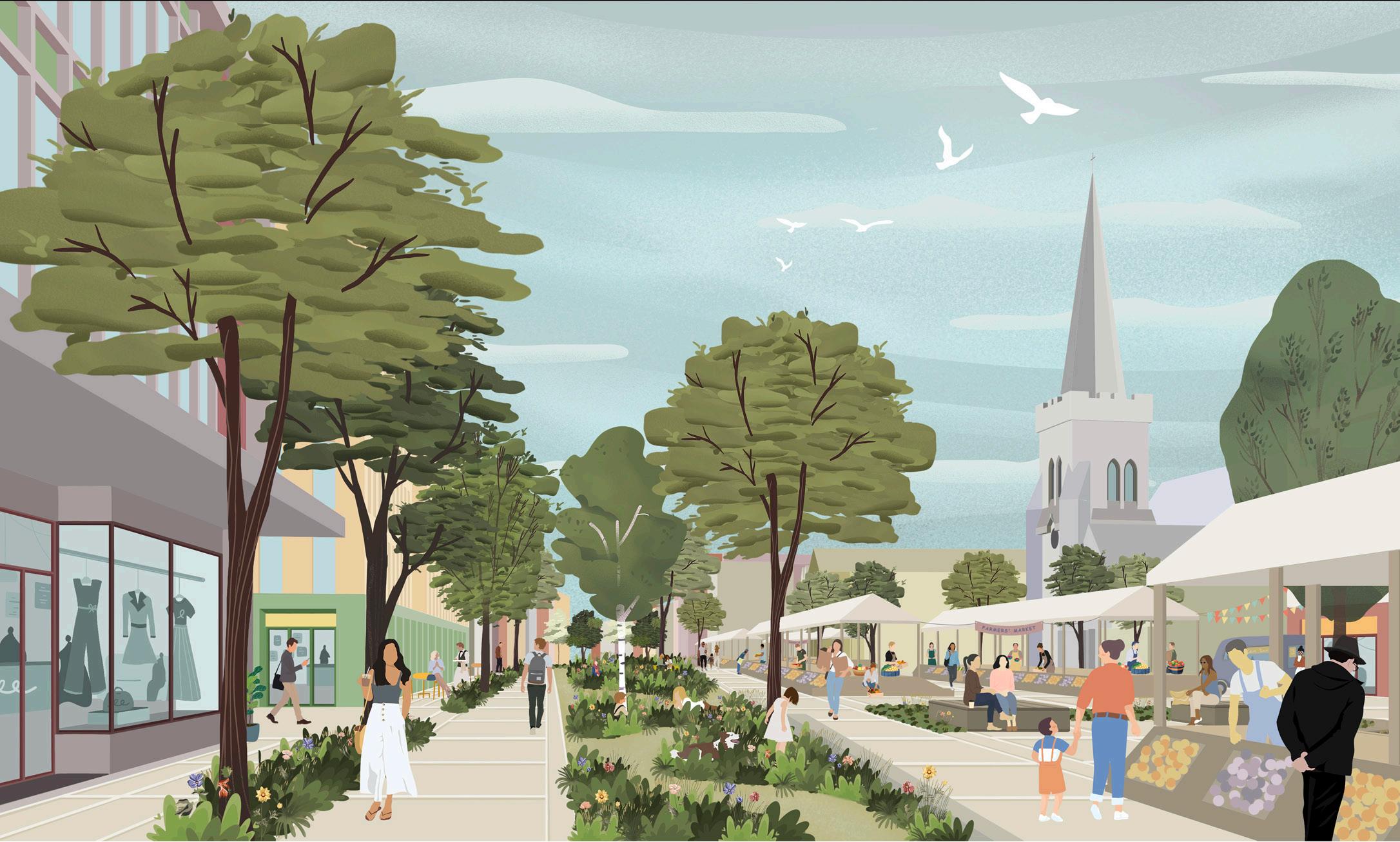
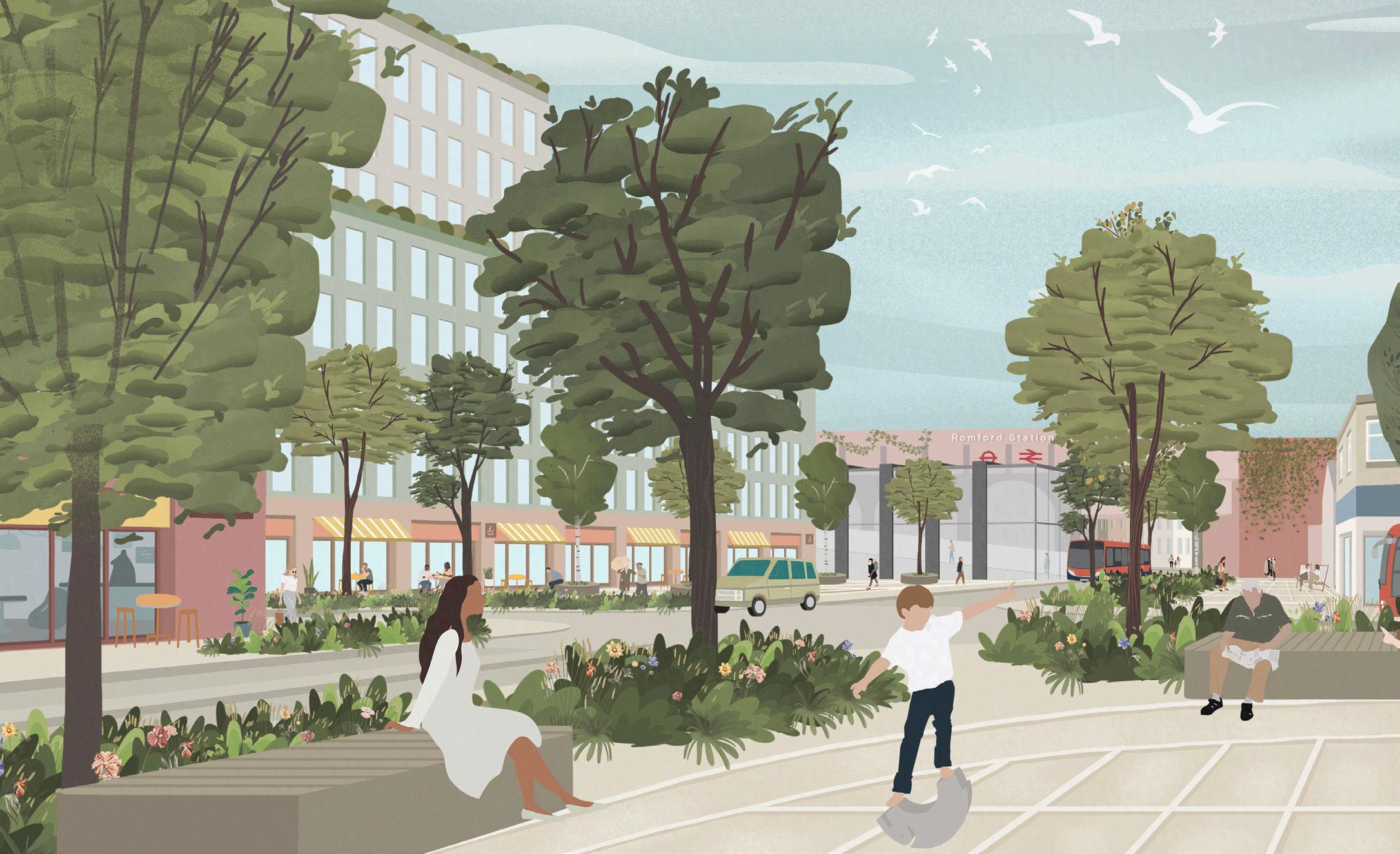
Fig. 01. A vision and framework for future transformation and regeneration of the town and surrounding area – Illustrative view of Romford town centre, looking north towards St Edward the Confessor Church
Foreword from the Leader of the Council
This Masterplan showcases the potential that Romford has to offer and will help us to set out our vision and framework for future infrastructure and development in the town and surrounding area.
Romford has a rich heritage and a strong identity, which must be protected, nurtured and celebrated. Working with residents and stakeholders on this programme for a number of years, we know that there is ambition and appetite to see improvement to our town and community, but that will not be at the expense of the uniqueness, history and heritage of our historic market town.
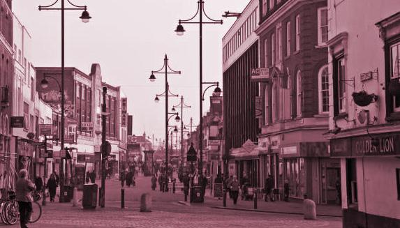
Romford has many celebrated assets and much heritage, such as the Market Place and its market, St Edward the Confessor Church, and a conservation area at its heart. Enhancing character and reinforcing heritage is a key part of the Masterplan, and its low to mid-rise townscape is a major ingredient that should be maintained.
Romford is for everyone and it should offer positive experiences for all. The community is the most important part of it and makes the place what it is. It will continue to accommodate the elderly, families, and young people alike, offering a liveable setting, with additional infrastructure to support new and existing communities.
Set out in this Masterplan are the vision, objectives and strategies to direct Romford’s future for us all.
There are several key components to this, forming the backbone of what the Masterplan strives to achieve in the coming years:
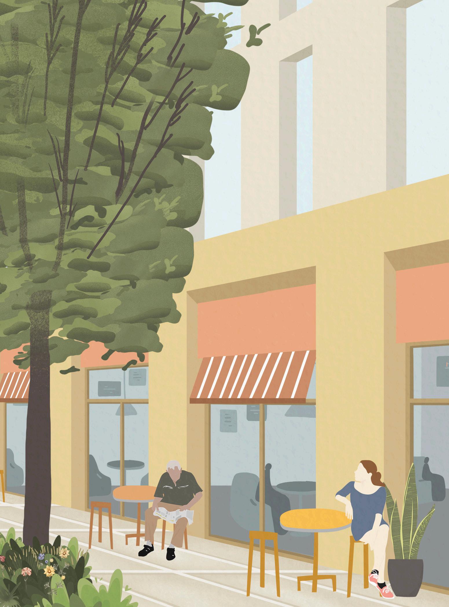
• Key public realm interventions, particularly in the Market Place, can help to enhance Romford, as well as improve the setting of its heritage. Creating a positive setting for the future of Romford’s market is a key component of Romford’s identity and culture.
• The town centre sits in the centre of a particularly green borough, surrounded by fantastic green spaces and parks, and situated on the River Rom. It has the potential to bring these natural assets into the town centre, greening the town centre, enhancing, and highlighting these assets. We want to put the ‘Rom’ back in Romford and there are plans to improve its setting as part of the town.
• Romford uniquely sits between Essex and London, and can integrate with both. There is potential to broaden the offer of the town centre to support its future and attract growth and investment. This has the potential to attract a greater variety of retail, restaurants, cafés, leisure and cultural uses to sit alongside the existing
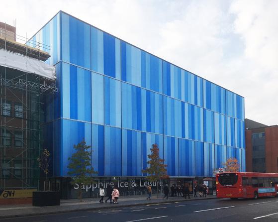
amenities, such as Sapphire Ice and Leisure.
• Further, positive growth and investment can introduce new social infrastructure in the form of education, community and healthcare facilities, alongside new employment opportunities. We will ensure that Council infrastructure investments continue to support Romford’s future.
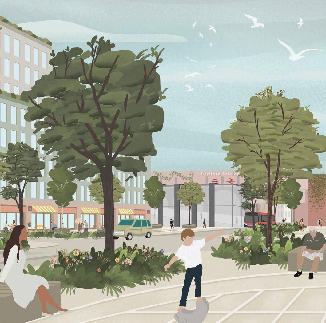
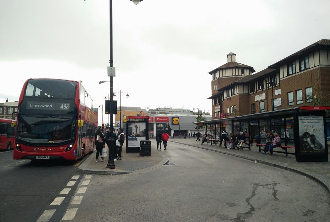
• Public transport enhancements, such as further station improvements, and continued bus hub upgrades, form part of this and are vital to support sustainable travel. There is also opportunity to take advantage of what the Elizabeth Line brings – attracting investment in Romford and greater improvements to the area.
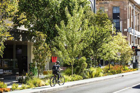
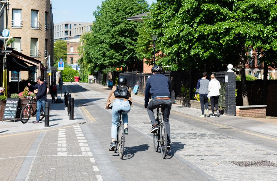
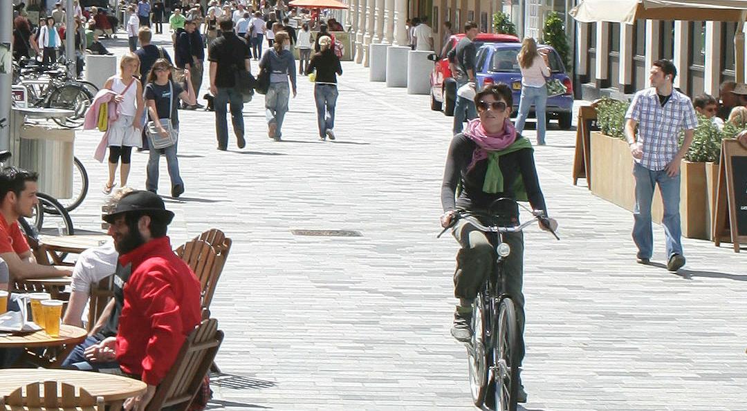
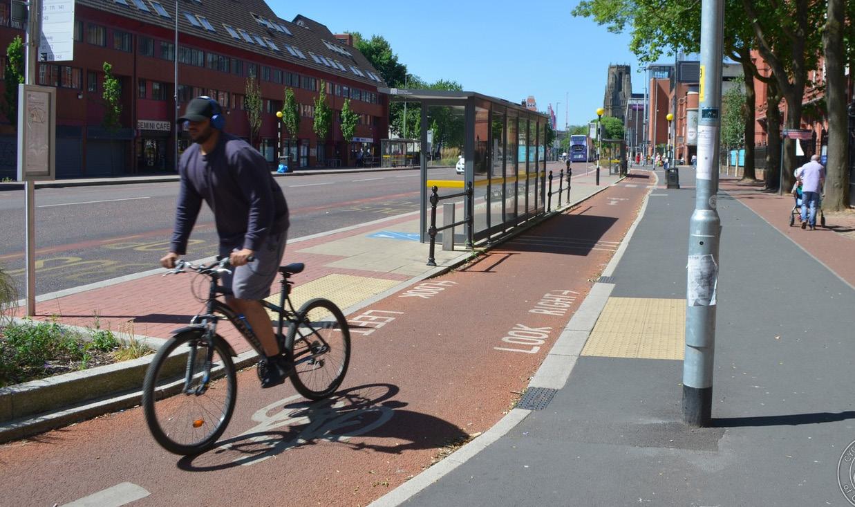
• Improving health and wellbeing for all, improving the lives of everyone, and as part of Havering's Healthy Weight Strategy to reduce obesity, a corporate priority for the Council. This includes improving streets, spaces and facilities for active travel – cycling and walking – and enhancing public spaces for recreation, including seating.
• Sustainable development will support the local economy and local businesses. To be ‘Made in Romford’ can be something unique and high-quality; it will support the local community with new social infrastructure, and community initiatives for energy; and will help to target being zero-carbon by 2030 through building design and construction, promoting public transport and active travel, and ensuring sustainably-sourced energy powers Romford.
I want Havering to be a destination of choice and for Romford to continue to be the beloved historic market town that protects our community, celebrates our history and heritage and is somewhere that people can live well, visit, work and enjoy. This Masterplan for Romford is one-step closer to us protecting and fulfilling that bold ambition. Councillor Ray Morgon
1 MASTERPLAN INTRODUCTION
This chapter explains why Romford needs a Masterplan, how it will create a framework for good growth to guide future development and interventions, and the current status of this document.
1.1 A MASTERPLAN FOR ROMFORD
1.1.1 Aim & Purpose
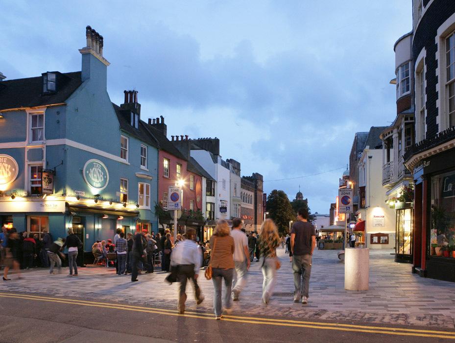
Romford town centre has undergone a continual and impressive evolution over time, being a market town since the 13th century, and becoming the civic and cultural heart of the London Borough of Havering. This Masterplan will be instrumental in guiding Romford’s ongoing evolution over the next 20 years. Its aim is to draw on Romford’s unique character and to continue to evolve it into a place which respects and reveals its history whilst looking forward to deliver growth and opportunities benefiting the entire community.
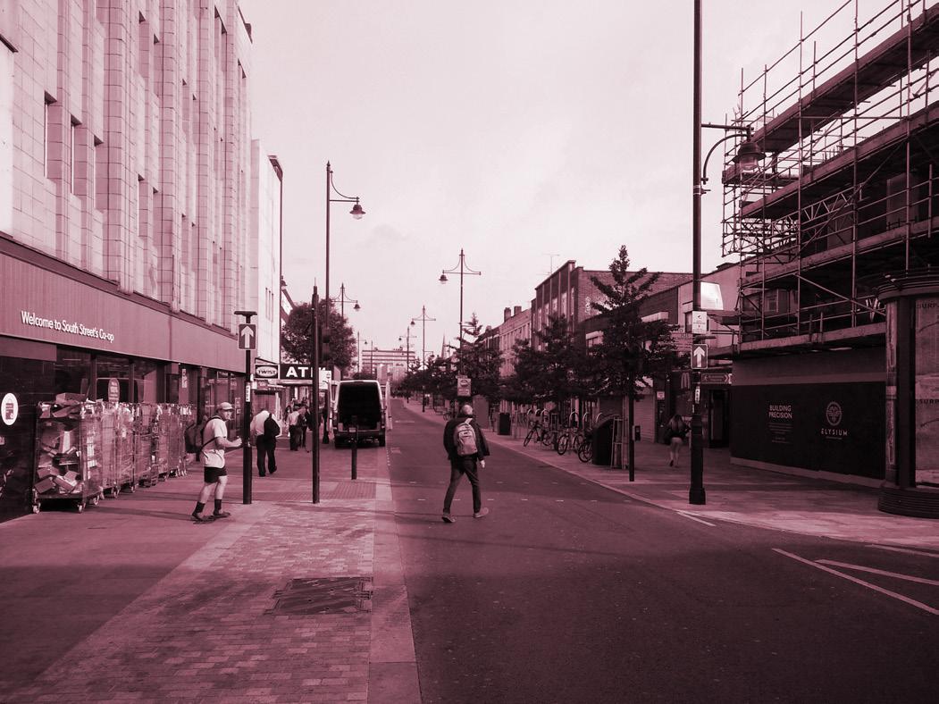
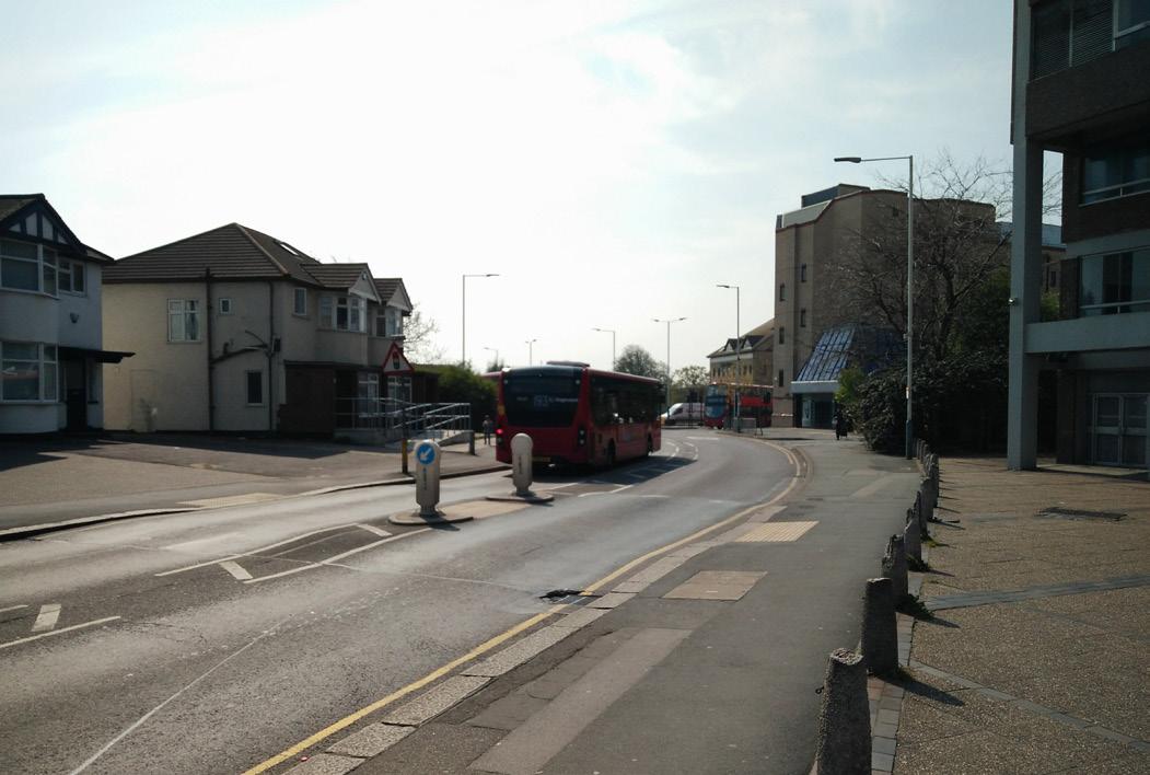
Romford is the borough’s primary centre and supports a vibrant mix of comparison shopping, employment, leisure, night-time economy, and housing, and is identified as a Metropolitan town centre. It is a key transport hub within the borough and benefits from improved accessibility since the Elizabeth Line opened. The Council has continually invested in the town centre and wider communities.
Most recently, this includes improving public realm in the Market Place and Western Road, upgrading its public transports hubs, and delivering improvements to the ring road through the Liveable Neighbourhoods programme.
Romford offers transformative regeneration and development opportunities and is expected to accommodate significant levels of housing and economic growth in the coming years. It is identified as an Opportunity Area in the London Plan and the town centre has been designated both as a Housing Zone1 and is at the centre of a Strategic Development Area (SDA) in the Havering Local Plan (2016-2031). A Masterplan is needed to guide these opportunities in a way that respects Romford’s qualities and history, strengthens pride in the town, and makes it a distinct and attractive place to live, work, and visit.
1 A 'Housing Zone', is an area identified in the GLA's Housing Strategy which can bring accelerated housing development.
1.1.2 Masterplan Scope
The Havering Local Plan sets out a comprehensive policy for Romford, Policy 1. The Masterplan develops and supplements this by creating a framework for the delivery of good growth1 over the next 15-20 years, setting out a vision for Romford supported by objectives, strategies, and site guidance. The Masterplan does not repeat policies in the Local Plan, though some specific references are made.
1 The concept of Good Growth – growth that is socially and economically inclusive and environmentally sustainable –underpins the London Plan and ensures that it is focused on sustainable development – The London Plan, 2021
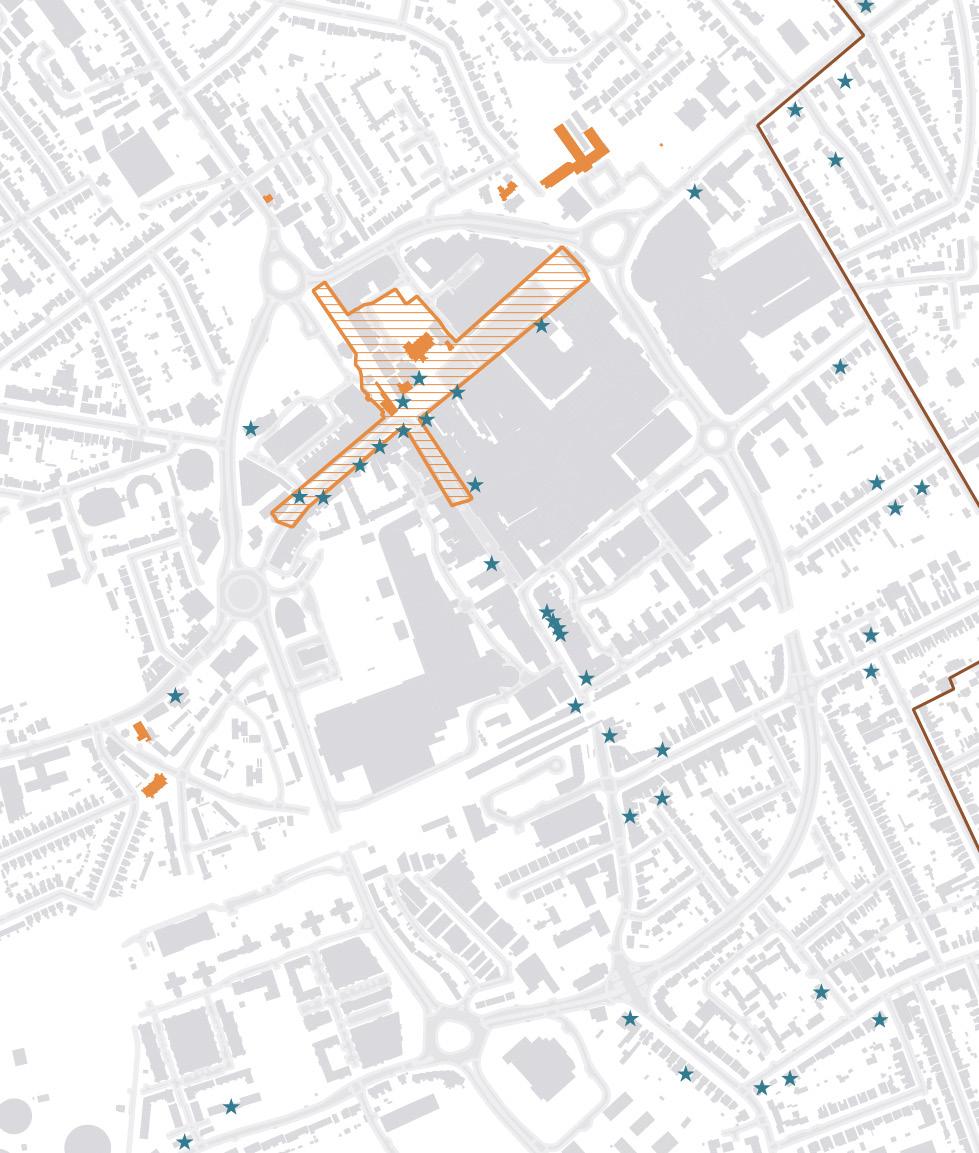
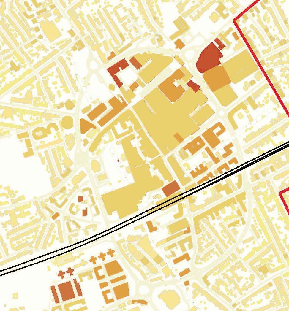
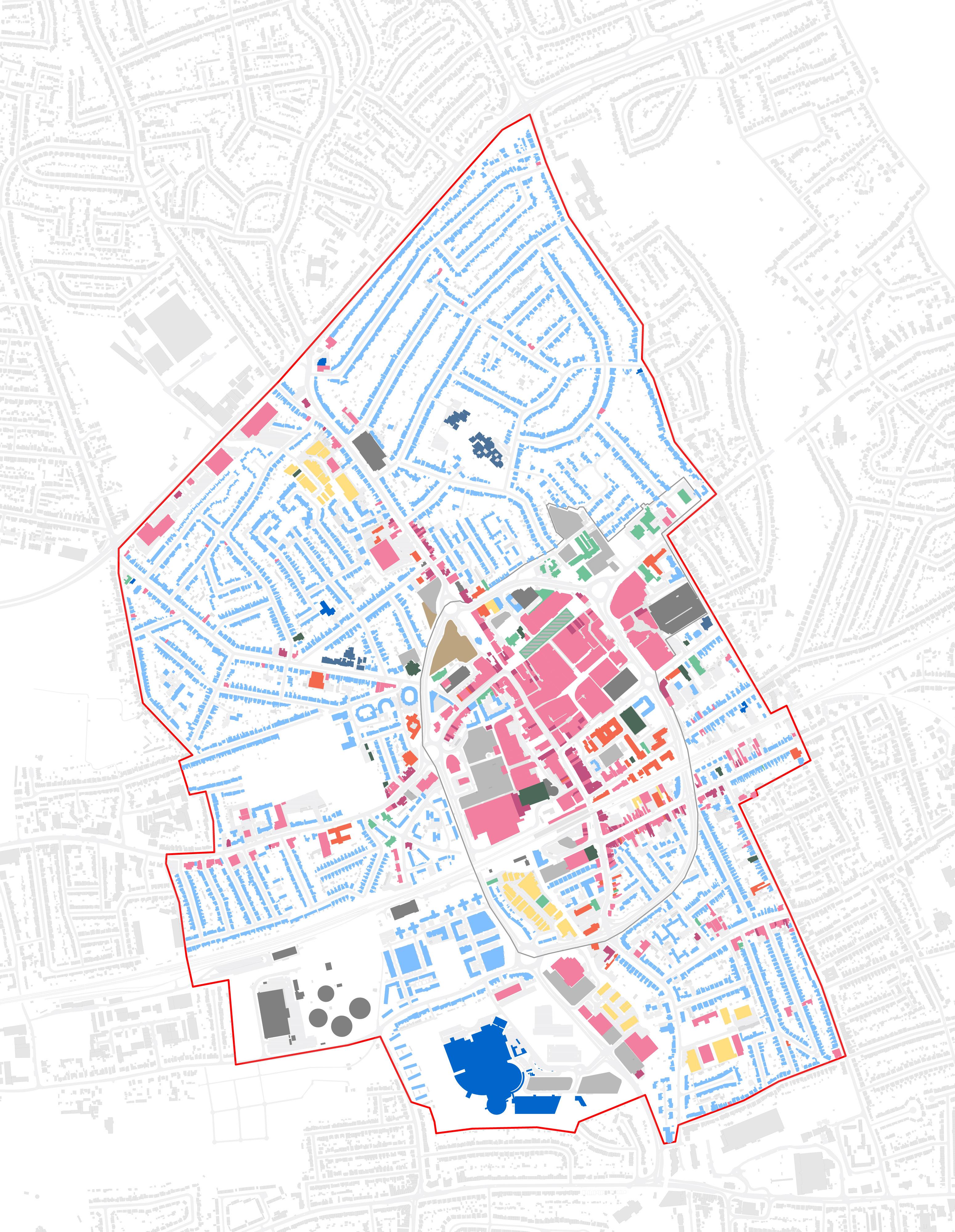
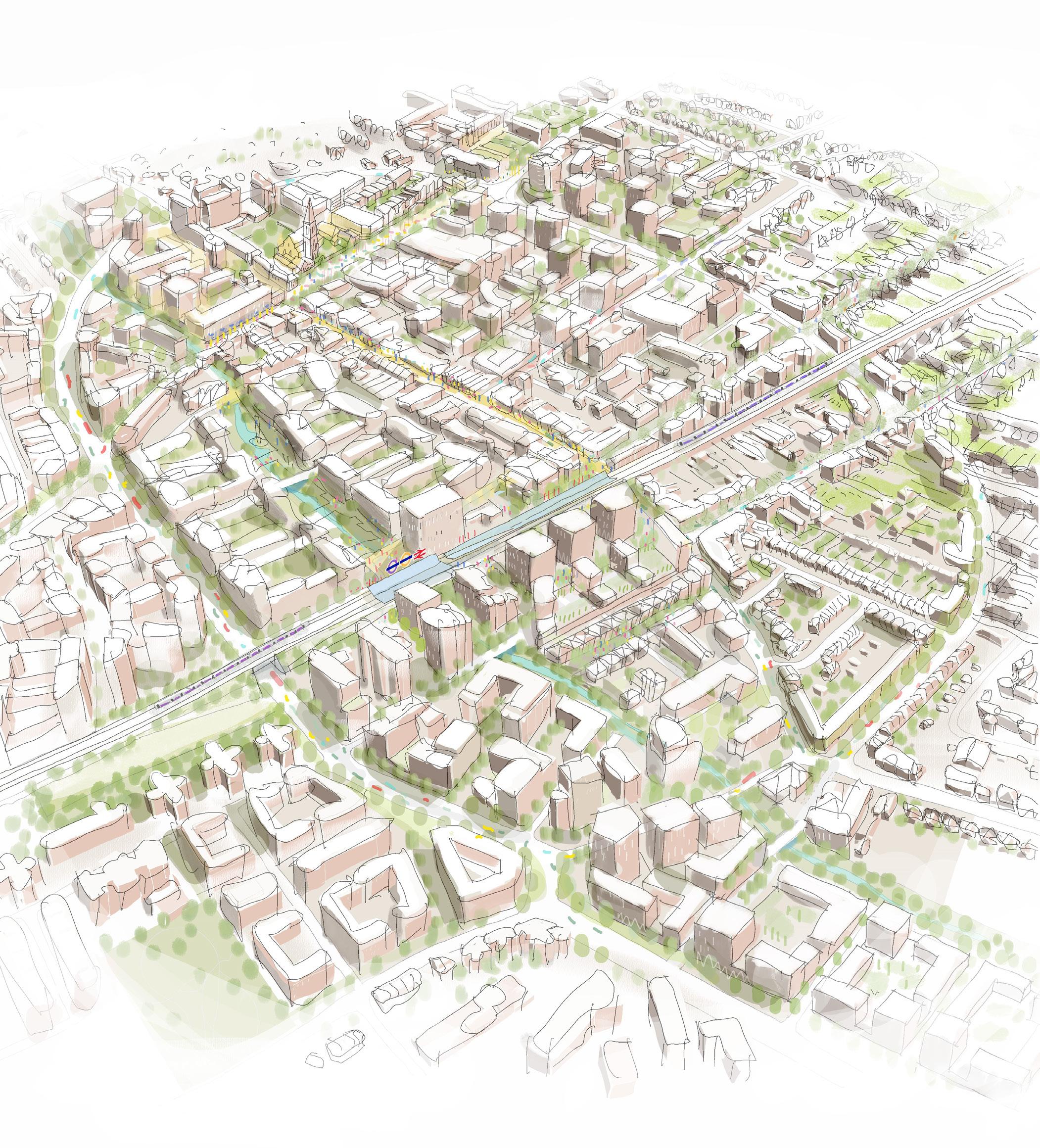
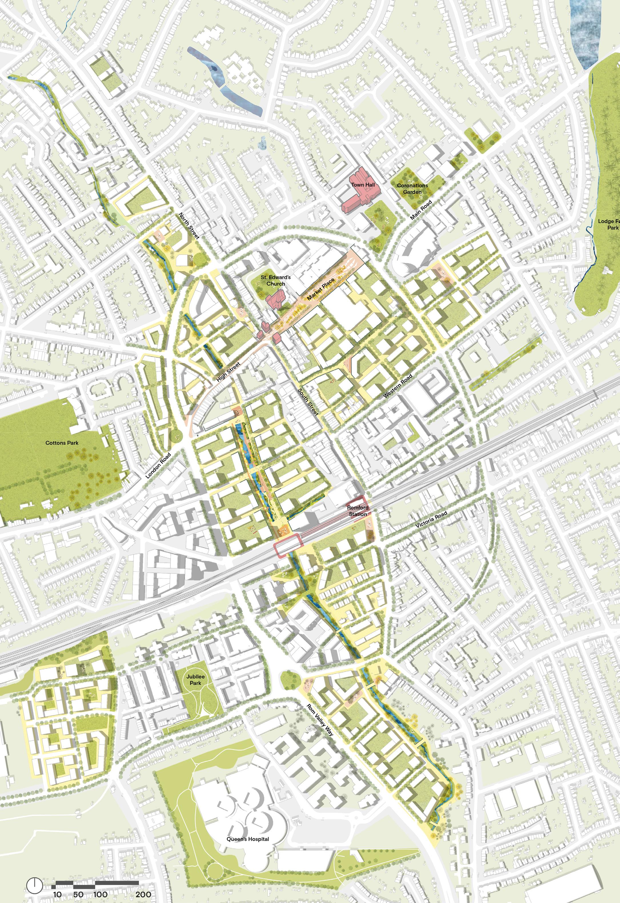
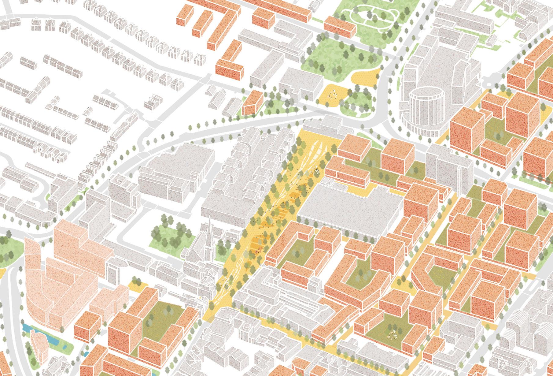
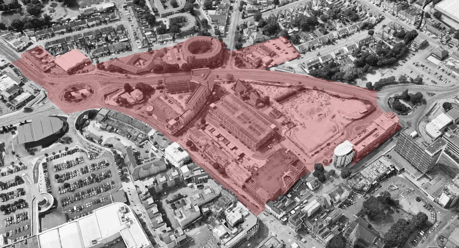
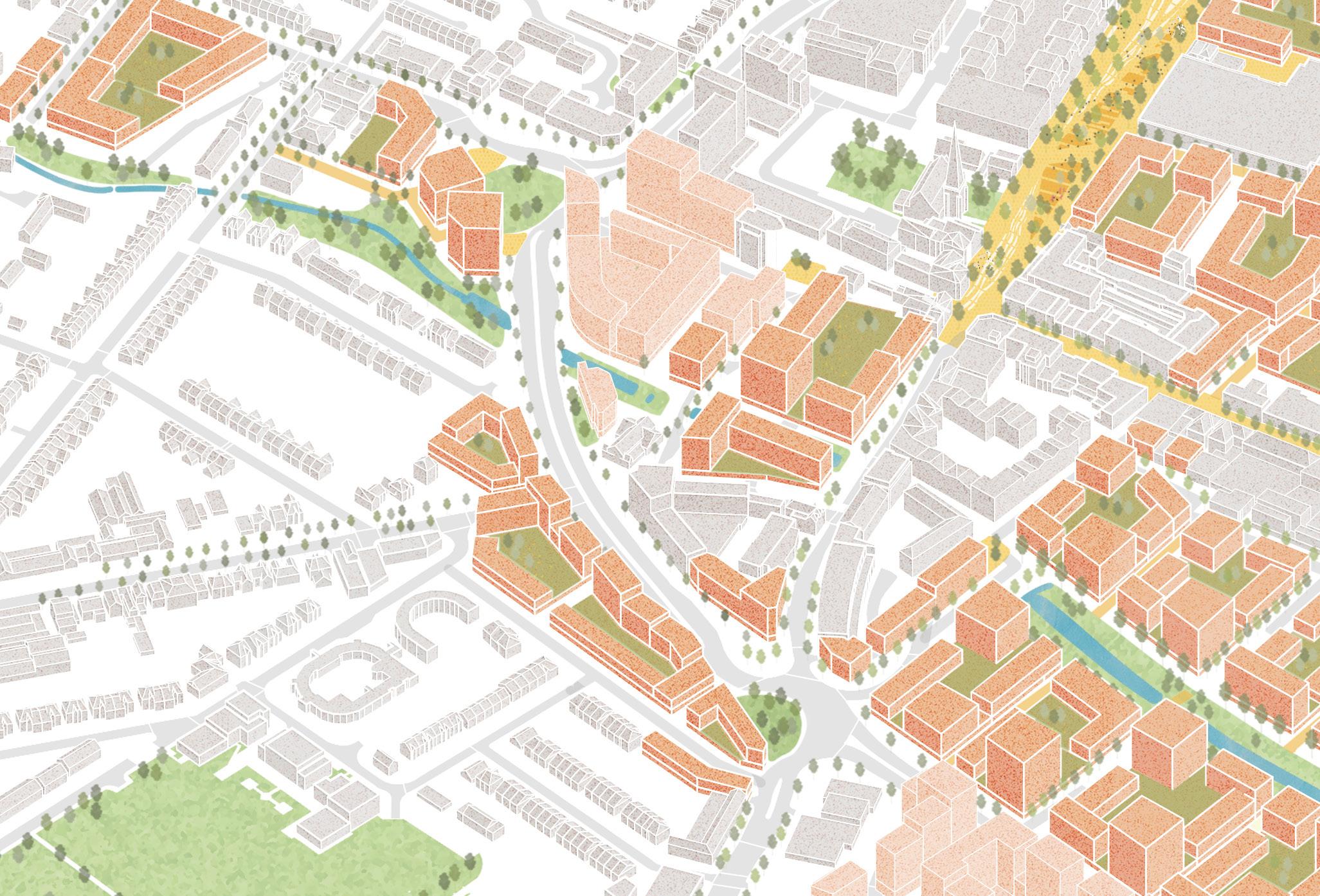
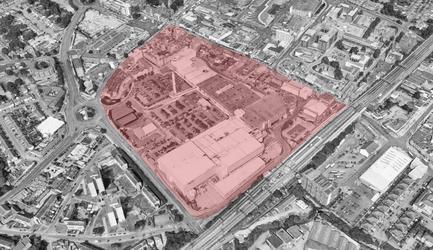
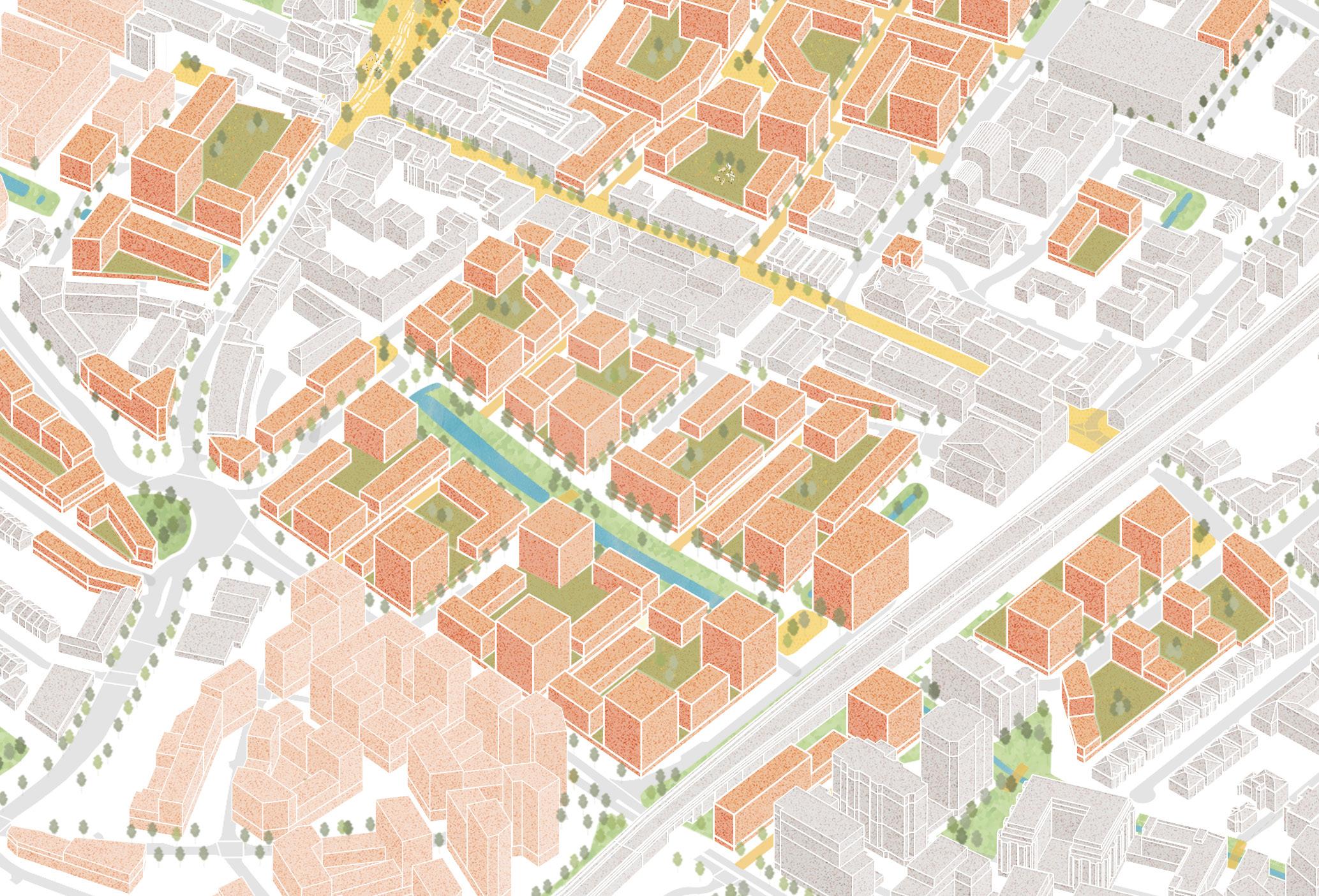
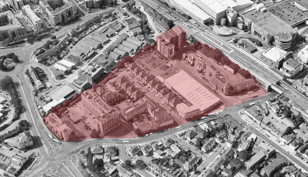
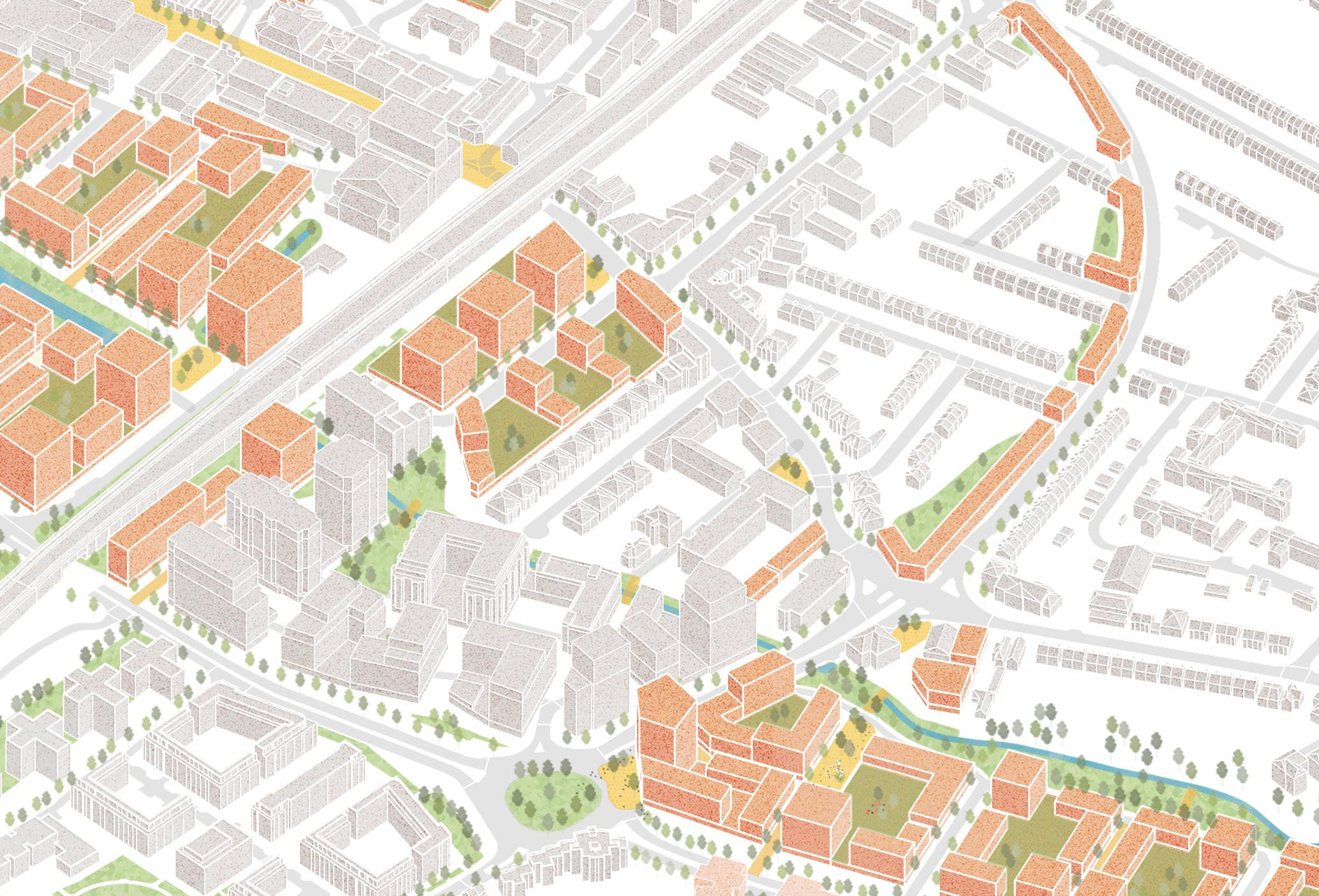
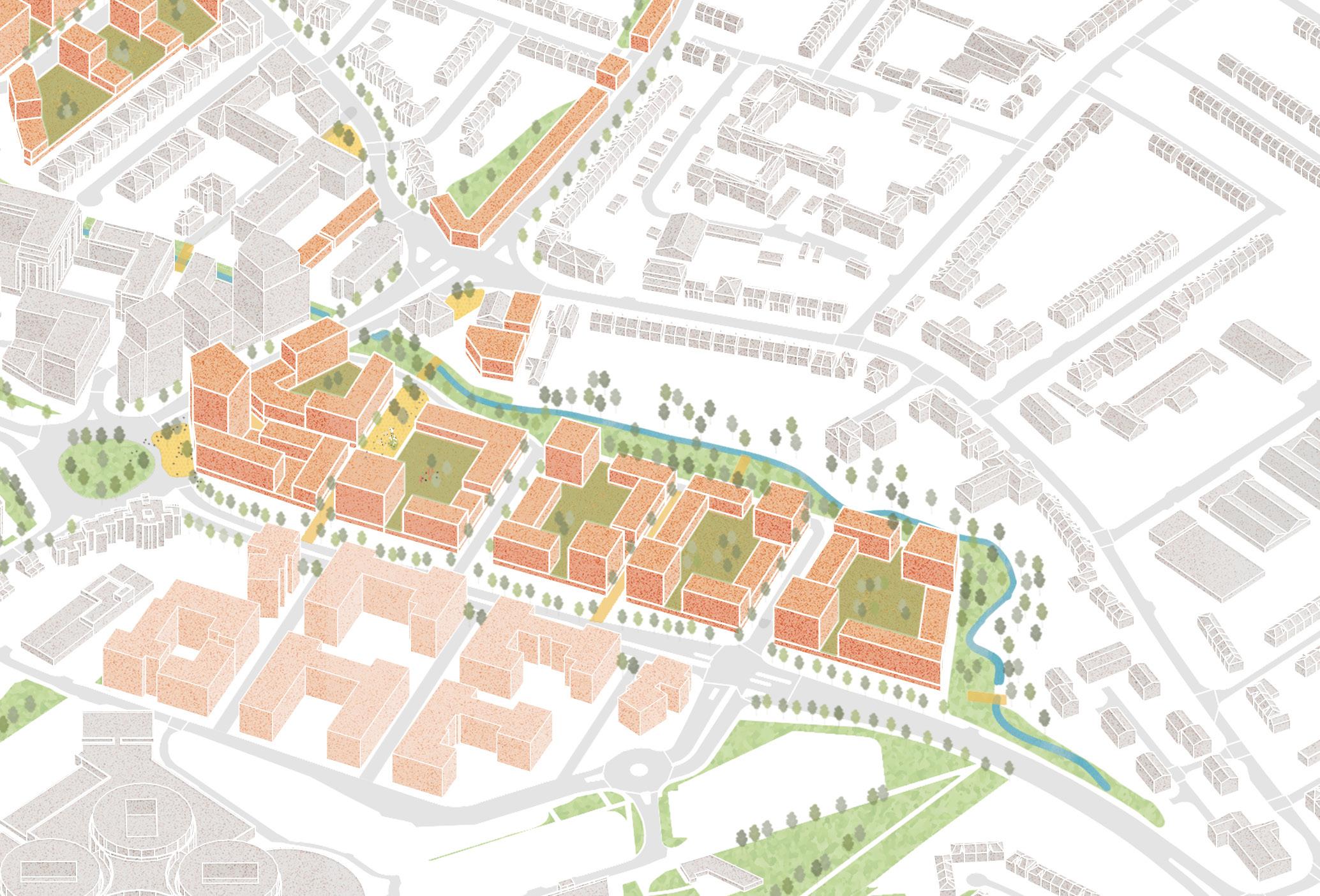
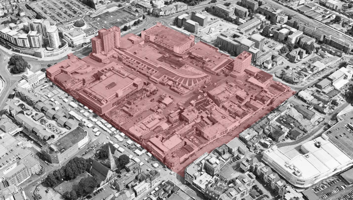
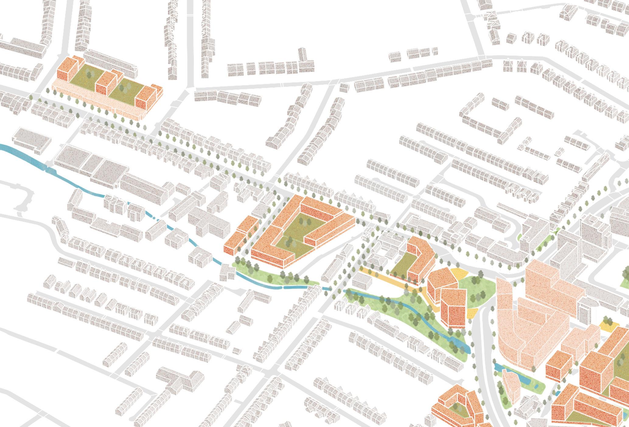
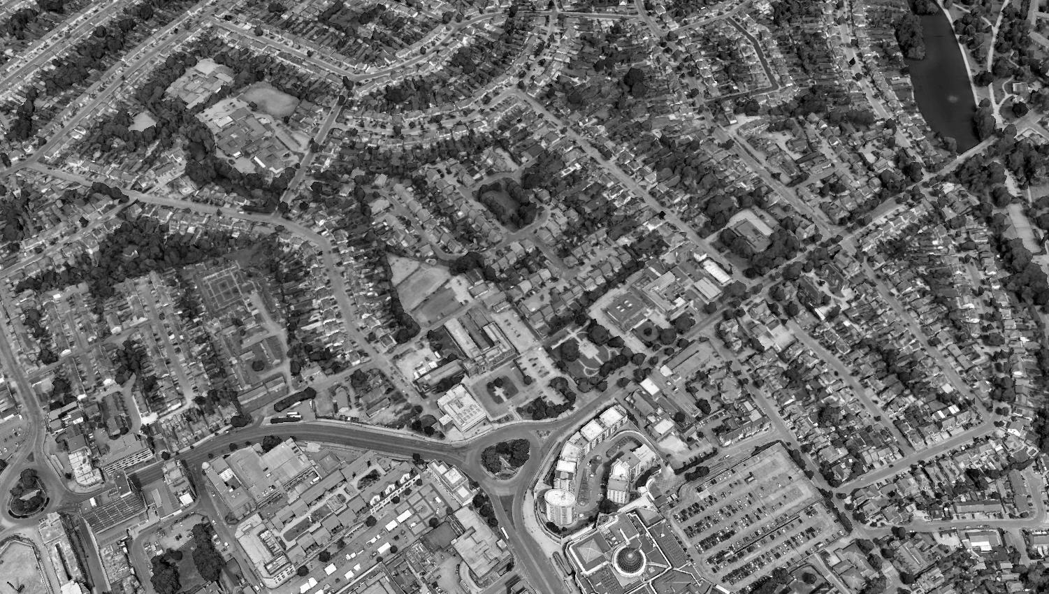
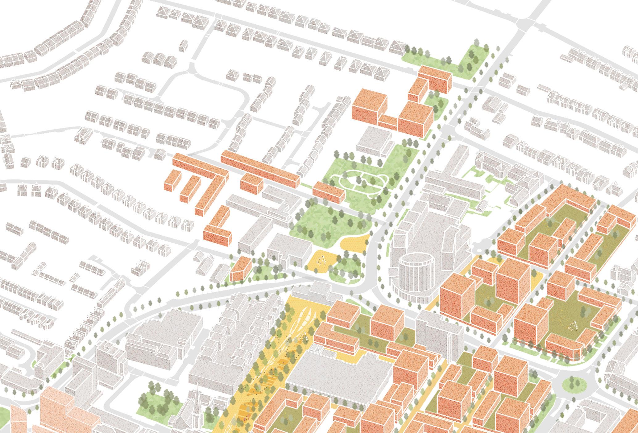
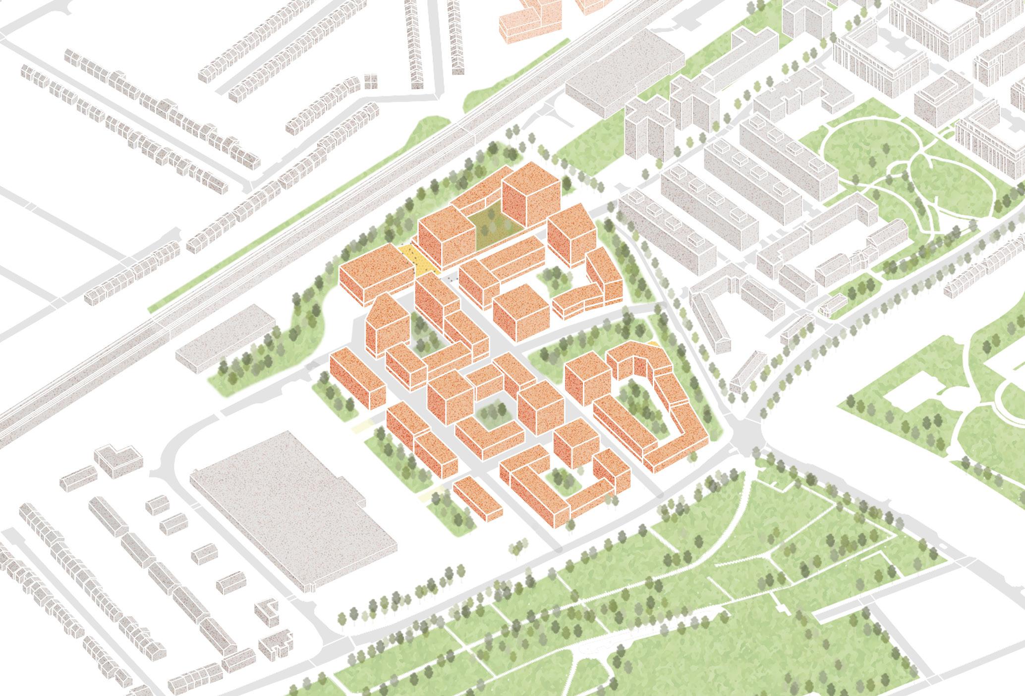
For example, policies on affordable housing are covered only by the Local Plan. The Masterplan focusses on a core area in and immediately around the town centre, with some strategies covering the SDA area, as shown in Fig. 02. It is important to note that all supporting drawings, including the Masterplan in Chapter 4, are illustrative, and represent one way to translate the Masterplan vision and objectives into a coherent, inclusive and well-designed plan for the area.
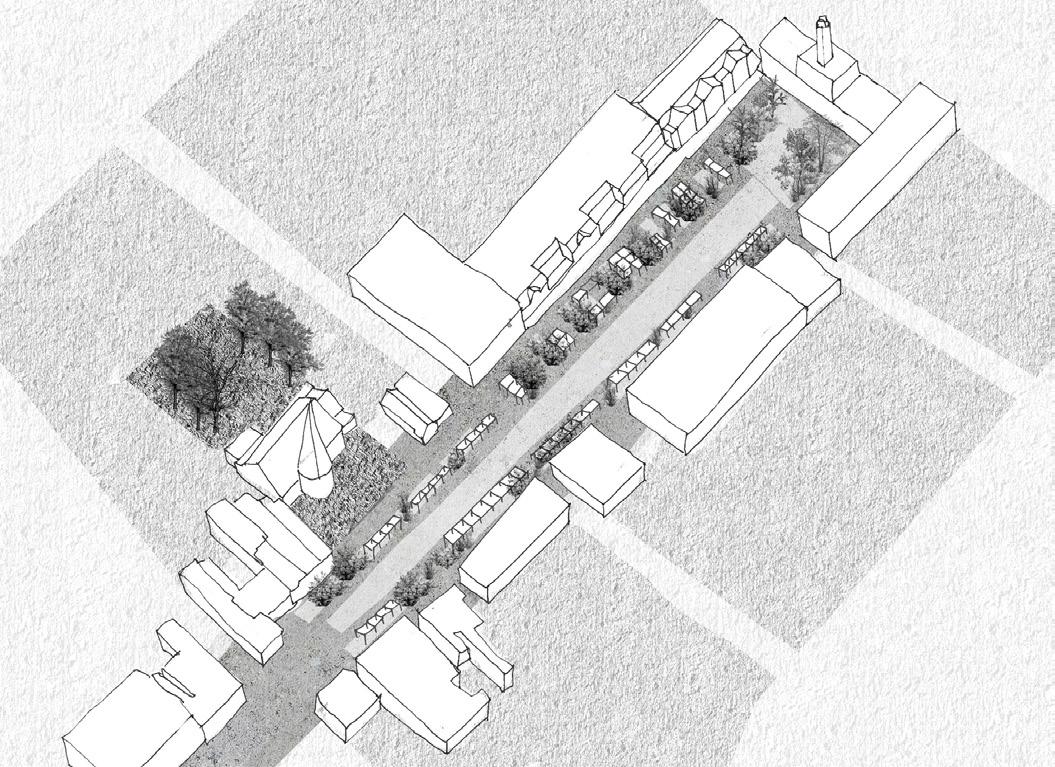
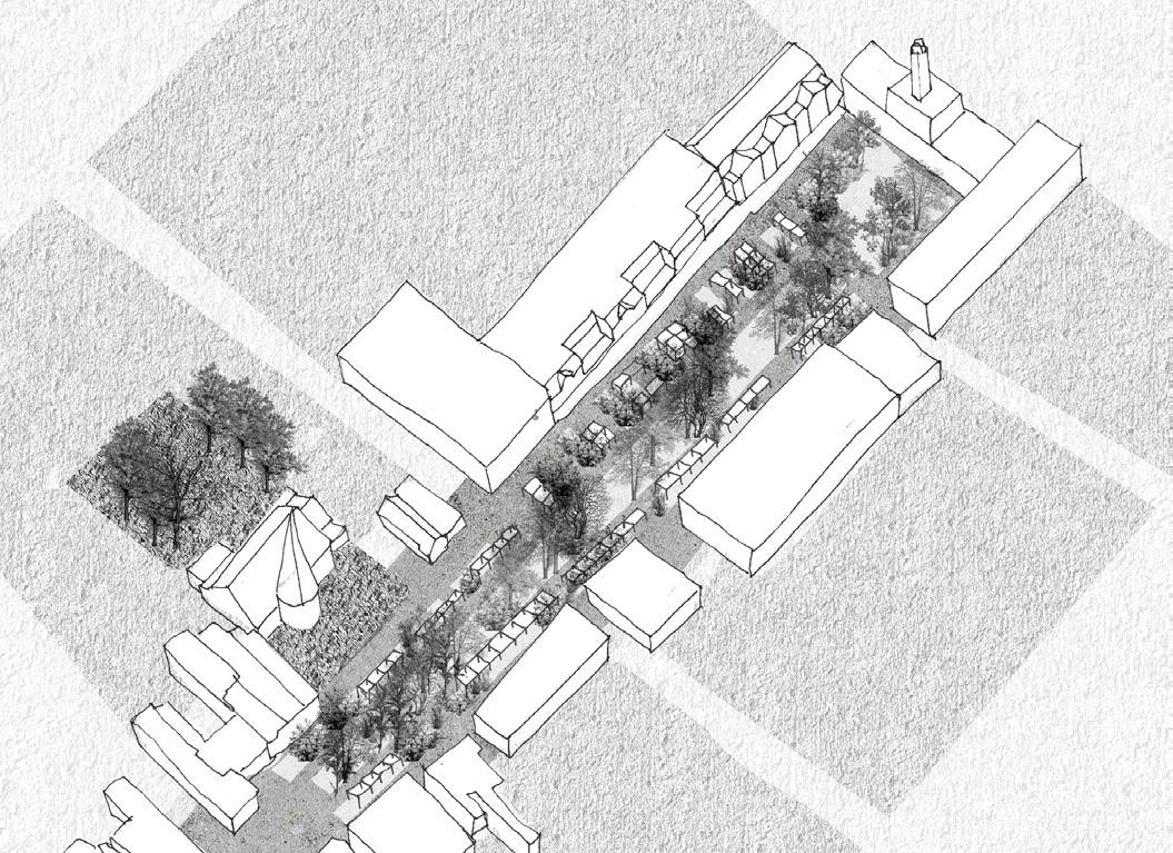
South Street: pedestrianised central spine with food & beverage, retail, employment and leisure uses.
Fig. 02. Study Area – map showing Romford SDA boundary and Metropolitan town centre boundary
Brewery Shopping Centre
Mercury Shopping Centre
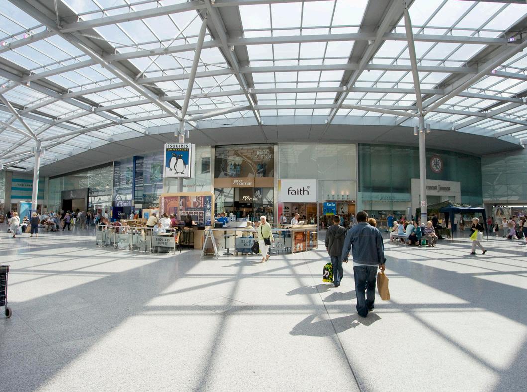
Liberty Shopping Centre, the town centre retail core
The Market Place: the heart of the town centre and a key public space
Romford Shopping Hall
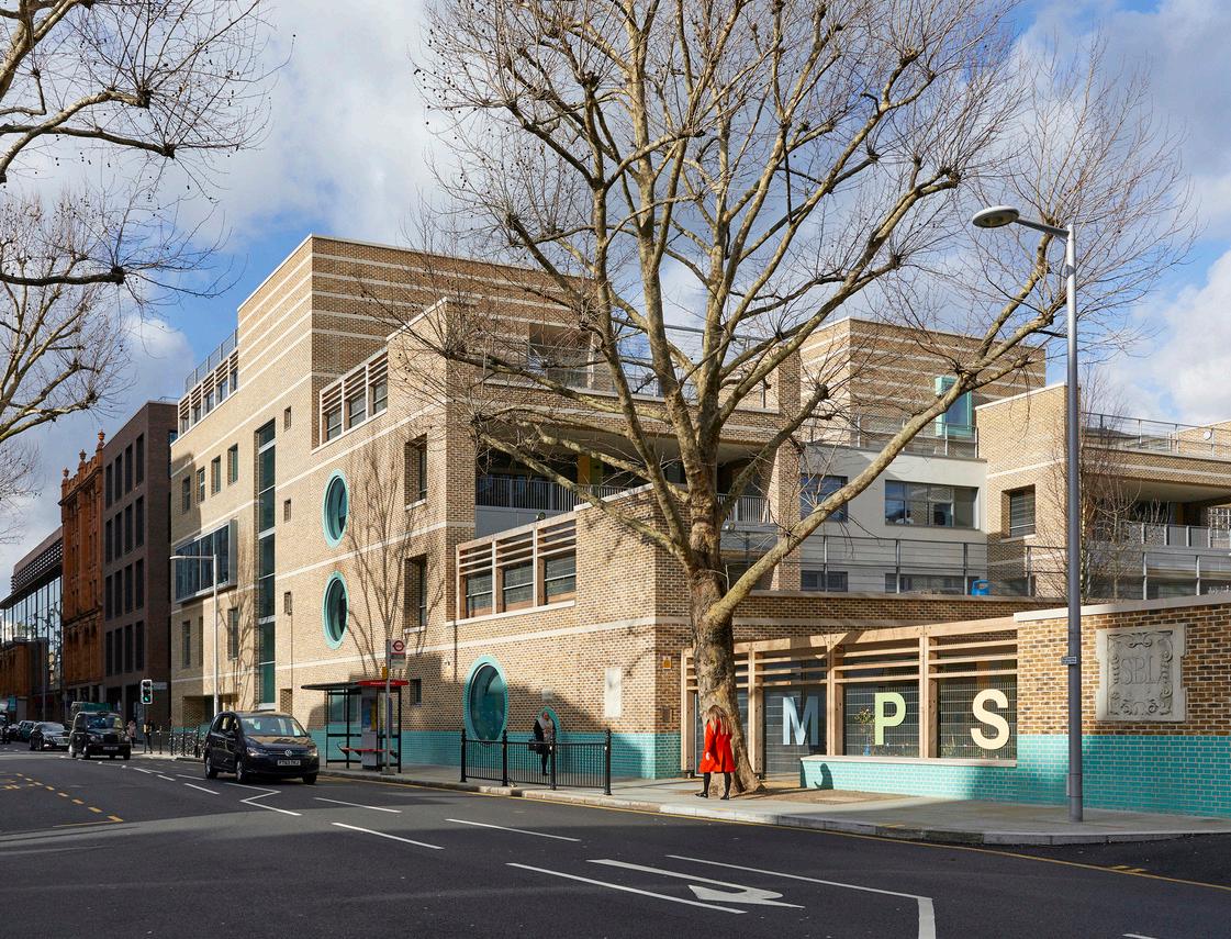
St Edward the Confessor church
Sapphire Ice & Leisure Centre
Romford Station Queen's Hospital
Romford Strategic Development Area
town centre boundary
Town Hall campus
1.1.3 Masterplan Structure
This document comprises the following chapters:
Chapter 1 — Masterplan Introduction
An overview of the Masterplan, policy context and status of this document.
Chapter 2 — Romford in Context
A summary of the existing and emerging physical, social and economic contexts.
Chapter 3 — Romford in Context
A summary of the public and stakeholder engagement undertaken, and key learnings from this, and how this has shaped the Masterplan, from the vision through to site guidance.
Chapter
4
— A Vision for Change
The overarching spatial vision for the future of Romford together with the objectives to deliver this vision, grouped into eight themes – Character and Townscape, Movement and Connectivity, Space and Landscape, Uses and Mix, The Economy, Sustainability, Inclusivity, Health and Wellbeing and Delivery.
Chapter 5 — Masterplan Themes
Thematic guidance for delivering the objectives and making good growth happen through infrastructure, interventions, regeneration and development.
Chapter 6 — Site Guidance
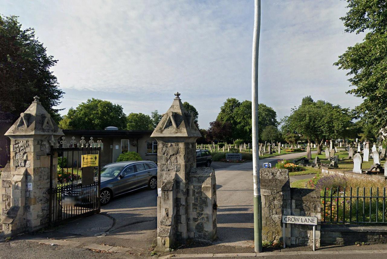
Design guidance for ten opportunity sites: the Market Place, St Edwards Way, the Brewery, Station Gateway, Rom Valley, the Liberty, the Mercury, North Street, Civic Campus and Crow Lane.
Chapter 7 — Implementation
How and when good growth is going to be delivered.
The Masterplan is supported by the following documents:
• A Baseline Report – provides a detailed analysis of the existing context and sets out objectives and options for growth.
• A Consultation Report – summarises the consultation methods, extensive range of events, written comments received, and how this feedback has been incorporated into the Masterplan.
1.1.4 Status
This Masterplan is a Supplementary Planning Document, subject to consultation, that sits alongside and supplements the Havering Local Plan. The guidance within this document provides a material consideration to help determine planning applications within the masterplan area. That means that in addition to satisfying the requirements of national, regional and Havering's Local Planning policies, proposals will also need to demonstrate how the guidance in this SPD has been considered.
1.1.5 Growth
The London Plan sets an indicative capacity of 5,000 new homes and 5001 new jobs for Romford by 2041. The Havering Local Plan requires a minimum of 5,000 homes over the first 10 years of the plan period and calls for over 6,000 new high-quality homes in the Romford Strategic Development Area (SDA) over the plan period, alongside a significantly enhanced retail offer and the infrastructure to support the increased residential population.
Crucially, this growth is expected to be delivered over time – as outlined in Chapter 4 Vision for Change and Chapter 7 Implementation.
1 GLA 'London Employment Sites Database', 2021, gives an 'indicative additional employment capacity by Opportunity Area' of 700 jobs for Romford
2 ROMFORD IN CONTEXT
This chapter sets out Romford's strategic and local context alongside the current character and composition of the town centre.
2.1 WIDER CONTEXT
2.1.1 Intersection of Essex and London
Romford is the administrative and cultural heart of the London Borough of Havering, located at the edge of London bordering Essex. A pivotal node along a historic east-west trading route and the contemporary Thames Estuary corridor, its identity has evolved from this juxtaposition between its origins as an Essex market town and an extension of the growing metropolis of London. As a result, Romford’s mix and character is uniquely East London and aptly summarised by the famous architectural historian Nikolaus Pevsner:
Romford’s immediate context, and the majority of Havering, is characterised by suburban development. Almost half of the borough is green space, a large portion of which is designated as Green Belt land. Identified in the London Plan as a metropolitan centre, Romford has grown as the area’s primary centre to become one of the largest commercial, retail and leisure areas in east London drawing residents and visitors locally and from Greater London, Essex and beyond.
“…the character of its buildings is shared equally between the suburbia of its western neighbours and the rural vernacular of the Essex countryside. This mix is unique in East London, comprising still remote medieval parish churches along the Thames marshlands, tiny rural villages, farmhouses set in open fields, a scattering of mansions, leafy Edwardian suburbia, and at its heart the brash commercialism of Romford.”
– Cherry, O’Brien, Pevsner: The Buildings of England: London 5: East (Penguin, 2005)
2.1.2 Connectivity
Romford is well connected by rail, bus, and car, particularly with excellent east-west public transport connections. The centrally located Romford station sits on a busy east-west railway with National Rail services into Essex and London, as well as Overground services to Upminster. The arrival of the Elizabeth Line has further improved east-west connectivity services to Shenfield and through central London. However, north-south public transport connections are less well supported.
With numerous bus stops across the town centre, travelling by bus is often the preferred local public transport method.
The A12 to the north provides good regional road connections, and easy access to the M25.
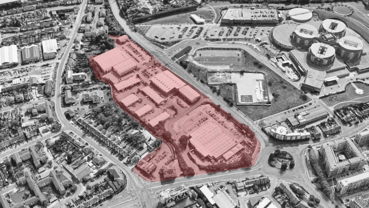
2.1.3 Romford Strategic Development Area
In part due to its strategic location and accessibility, Romford has experienced increased interest from landowners and developers. Consequently, it is identified in the Havering Local Plan as one of two Strategic Development Areas (SDA) alongside Rainham and Beam Park. The SDA is focused on Romford Metropolitan town centre but covers approximately 346ha. This area is also identified in the London Plan as an Opportunity Area; it is within the Elizabeth Line East Growth corridor; and is one of outer London’s major growth and regeneration areas.
03. Romford's context and connectivity
Fig.
2.2 EXISTING CHARACTER
2.2.1 Romford's Character
Romford’s character has emerged from its strategic location at the intersection of Essex and London. Originating as a crossroads at a ford on the River Rom, Romford grew as a market town and still maintains some distinct characteristics of an Essex market town. During the 20th century, Romford was met by the expanding London Metroland and underwent substantial transformations into the lively commercial and civic heart of Havering it is today.
Both the historic and existing character of Romford are detailed further in the accompanying Baseline Report, available on the London Borough of Havering’s website. The following is a summary of key aspects to help contextualise the Masterplan Themes and interventions.
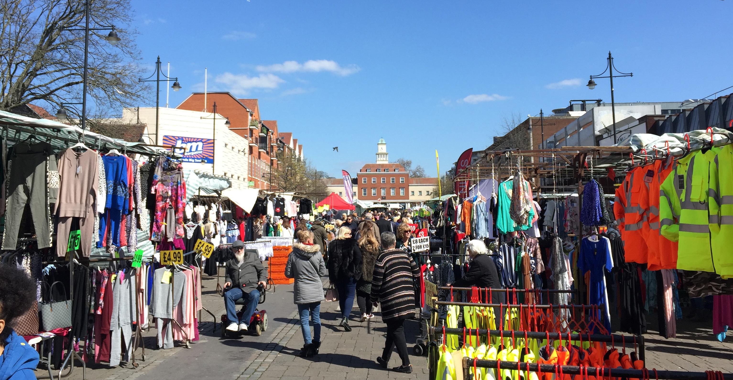
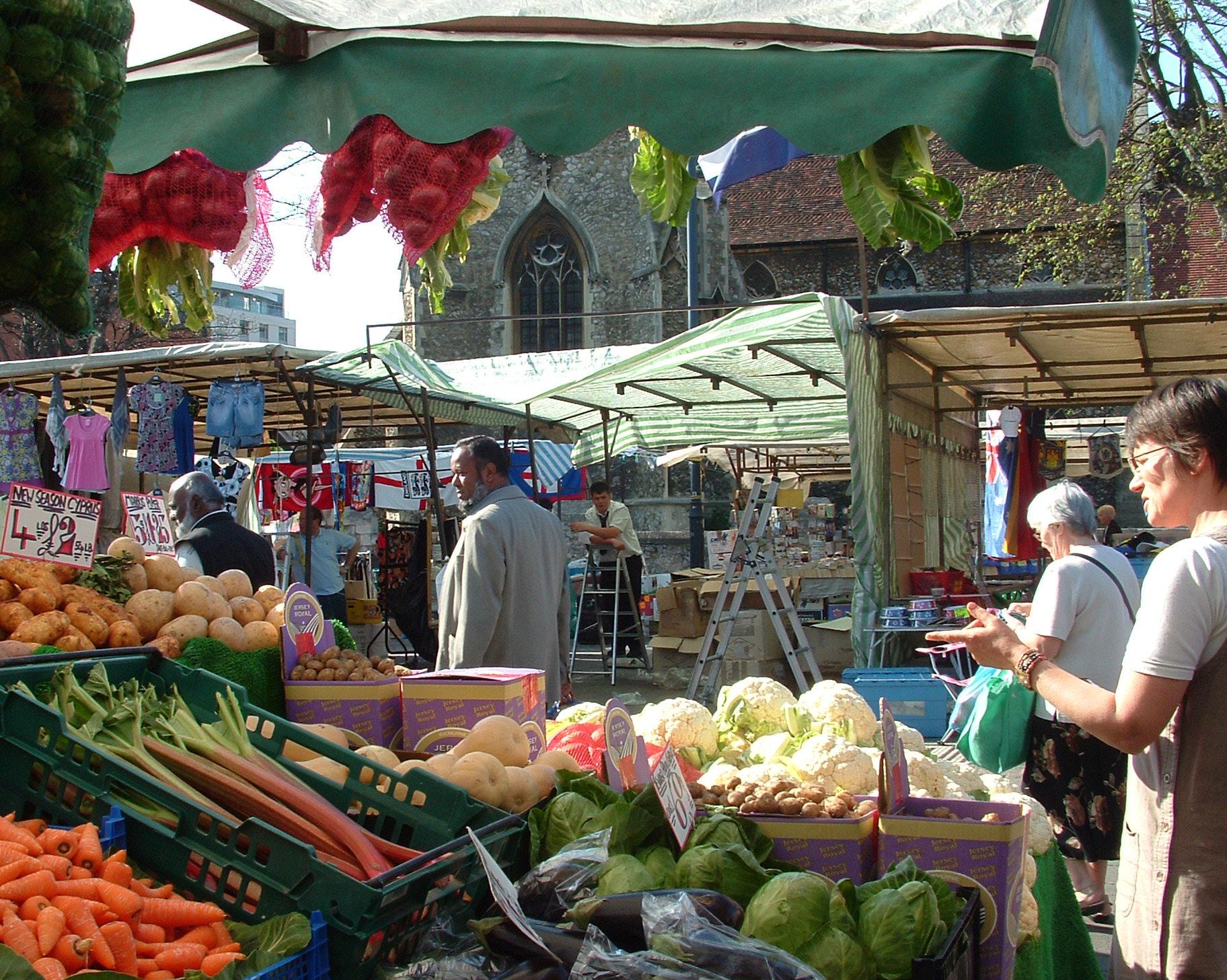
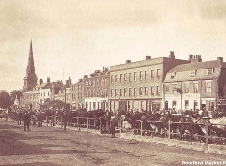
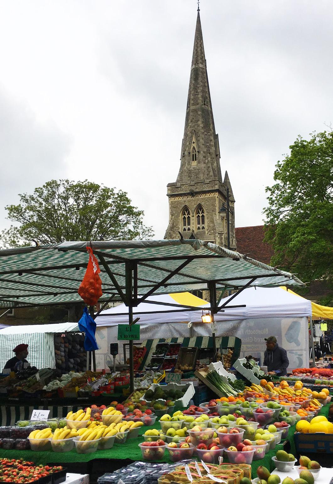
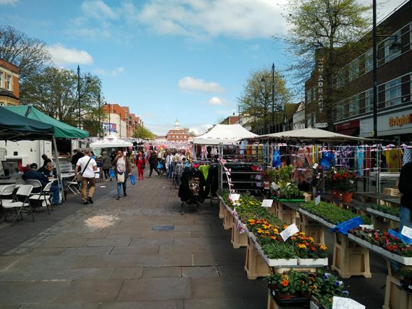
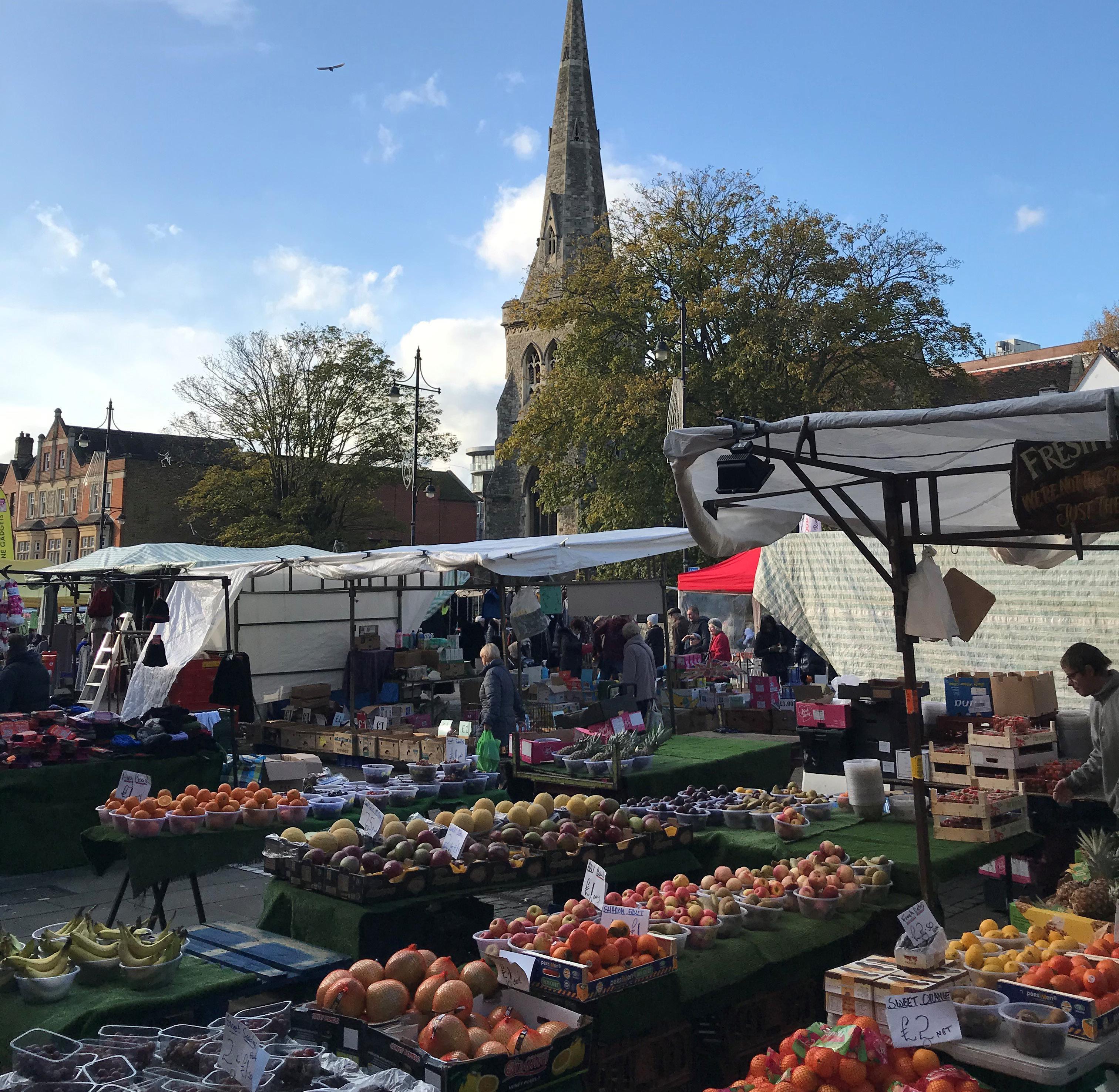
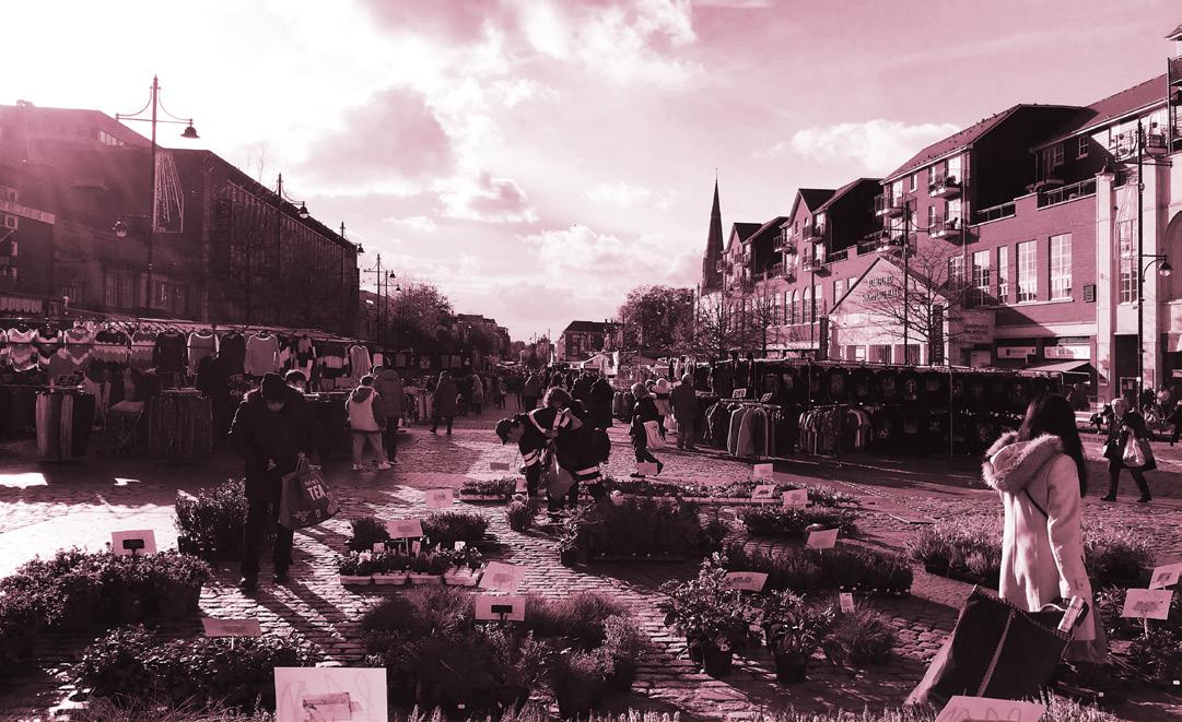
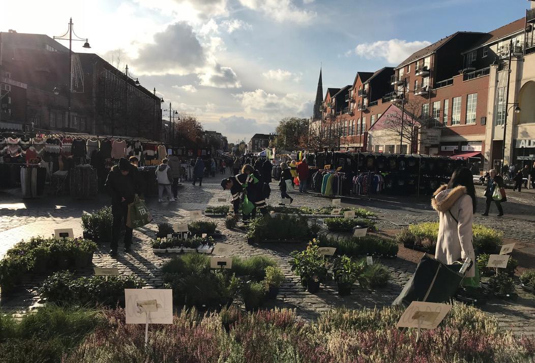
Romford Market
2.2.2 Historic Context and Morphology
Romford grew up linearly as a market town along the route of the old Roman Road between London and Colchester. It obtained a Market Charter in 1247 and is one of the few market towns which have continuously retained trading, with the historic market in the same location as Market Place today.
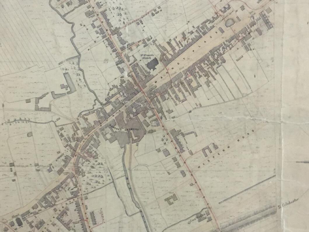
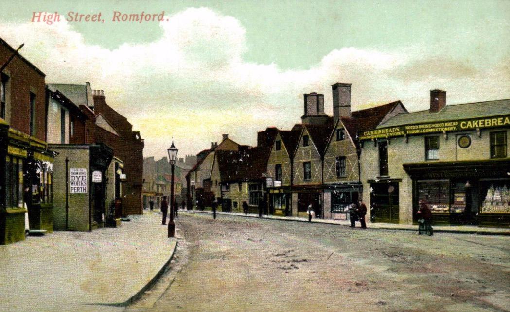
For much of its existence, Romford was a substantial village centred around the market. Unusually, it grew without a tangle or grid of streets beyond its main crossroads, which still form the central spines of activity along Market Place and South Street. By the early 1800’s it was estimated there was still only a population of approximately 3,000, but the arrival of the railway in 1839 was the tipping point for rapid growth. By this time Romford had expanded into a settlement of four quadrants around the crossroads and the station’s arrival on South Street stimulated further southward growth. The town continued to expand primarily along the central cross until the early 1900s, reaching a population of more than 40,000 by the inter-war period.
The inter-war period was a defining time of expansion and physical change. In the spirit of the age, Romford modernised demolishing historic buildings in the process. South Street was widened to usher in a new and brighter shopping era. The Romford Arcade, The Quadrant and Romford Shopping Hall led the transformation of Romford into a modern retail and leisure destination.
The spirit of renewal returned in the 1960s and was accompanied by rapid expansion on the town’s periphery. Proposals for a new major shopping centre, the Liberty, were realised in conjunction with most of the ambitious 1976 County Plan for Essex. The plan radically altered Romford with the introduction of the ring road, pedestrianisation of the central crossroads and Market Place, use of large-scale zoning, and segregation of vehicles from pedestrians. A vision of its time, it strengthened shopping and office functions of the town centre but at the expense of heritage assets, housing, green space and some of the positive historic defining qualities of Romford.
is becoming a small town but building along South Street is still very limited despite the arrival of the railway embankment. The Market Place is still the main feature along with the crossroads.
redevelopment.
Map of Romford 1777, Chapman and Andre. Romford’s early linearity is beginning to expand into a settlement of four quarters around a crossroads although the expansion is chiefly along the north arm as well as east-west.
Gotto map of Romford, 1848. Romford
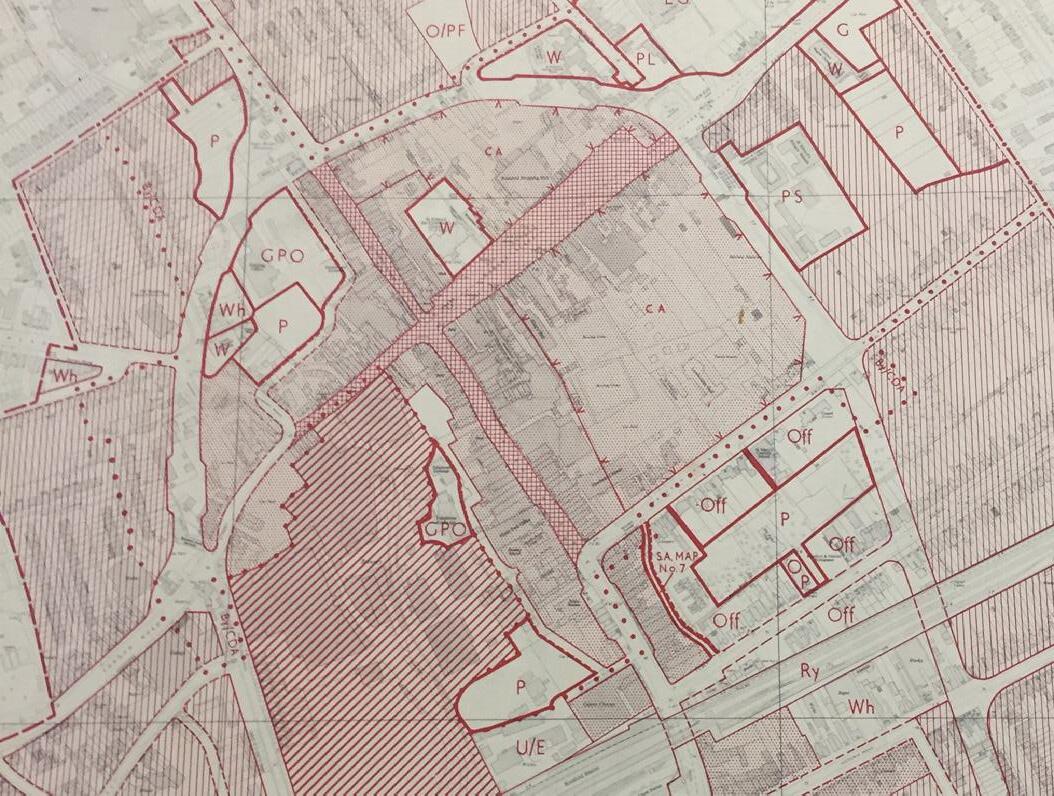
The 1976 County Plan for Essex showing areas identified for
2.2.3
Key Heritage Assets
Though much of Romford’s historic built fabric has been lost, tracing its morphology helps to identify important surviving historic elements. Celebrating and revealing these will be central to planning the next phase of regeneration of the town in order that Romford evolves as a layered place, with these layers working harmoniously together, whose evolution can be read through remaining architecture and infrastructure fragments.
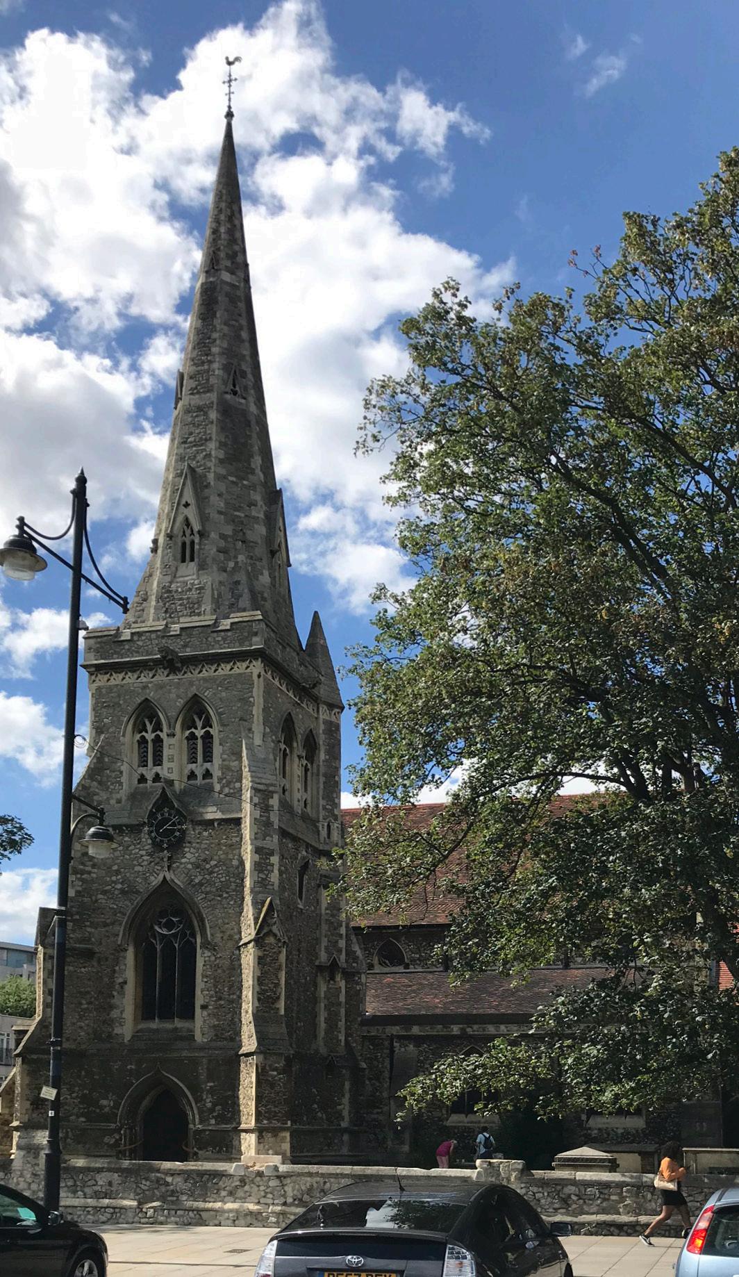
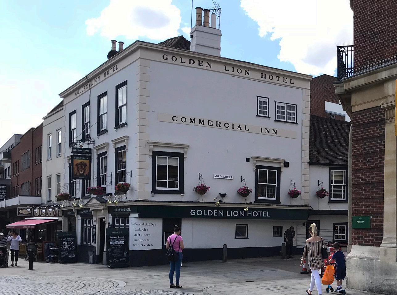
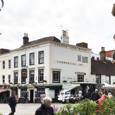
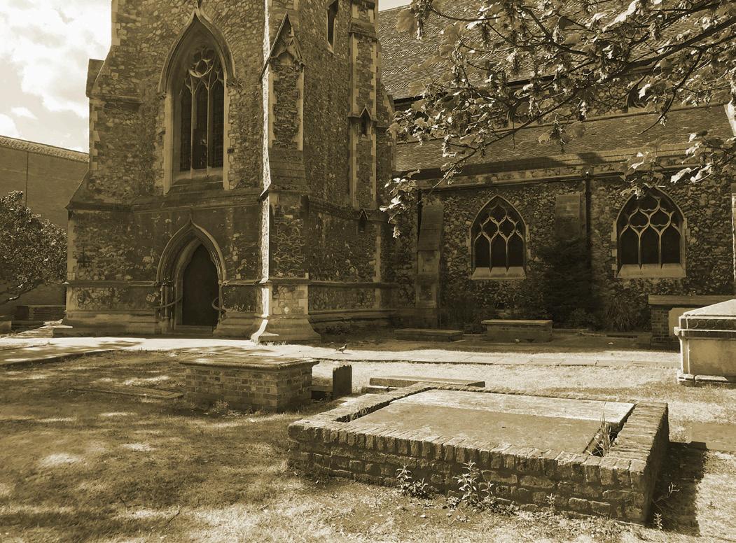
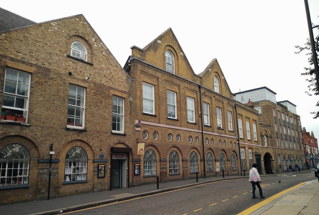
Romford still has a concentration of heritage assets around the Market Place and High Street, particularly at the crossroads with South Street. These buildings form the heart of the Romford Conservation Area and contribute positively to the character of Market Place. Of particular significance are the Golden Lion Pub and St Edward the Confessor Church. The Romford Conservation Area is currently on the Heritage at Risk Register, adding further importance to improving its setting and the built context of existing assets within the area.
There exists a secondary pocket of Locally Listed buildings lining South Street that contributes to its traditional shopping street character.
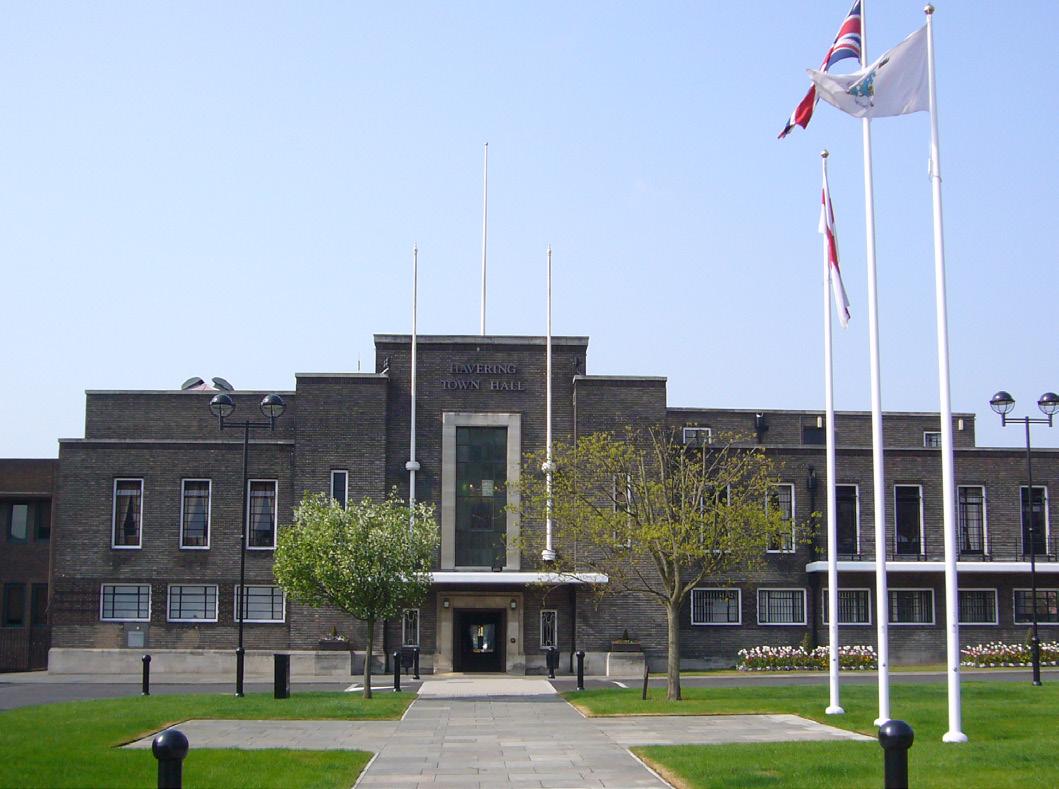
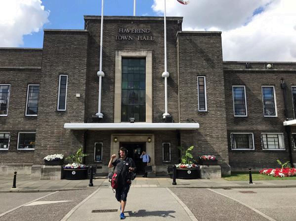
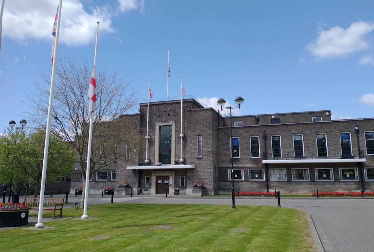
In addition to the historic centre around Market Place and South Street, the Grade II listed Havering Town Hall forms the attractive centrepiece of a number of civic buildings.
The Market Place itself is a key asset, as is the market itself. The Market Place is the foundational space of Romford, it developed to about 400 by 50 metres (one of the largest near London). A complexity of yards and alleys, many of which connect with the Market Place, once added variety, depth, and lengthened the active frontages, and some of these still remain.
Romford has an unusually extensive collection of interwar buildings and these offer a positive component of the town centre, reflecting also an expression of a desire that the town reinforce its sense of itself as a market town separate from London’s Metroland.
A review of Archaeological Priority Areas (APAs) within Havering has recently been completed. The Romford and Roman Settlement APA covers a substantial element of the masterplan area, and will be a consideration for some interventions.
Fig. 04. Key Heritage Assets at the core of the town centre
Grade II* Parish Church of the Blessed Virgin Mary and St Edward the Confessor
Grade II listed Golden Lion public house
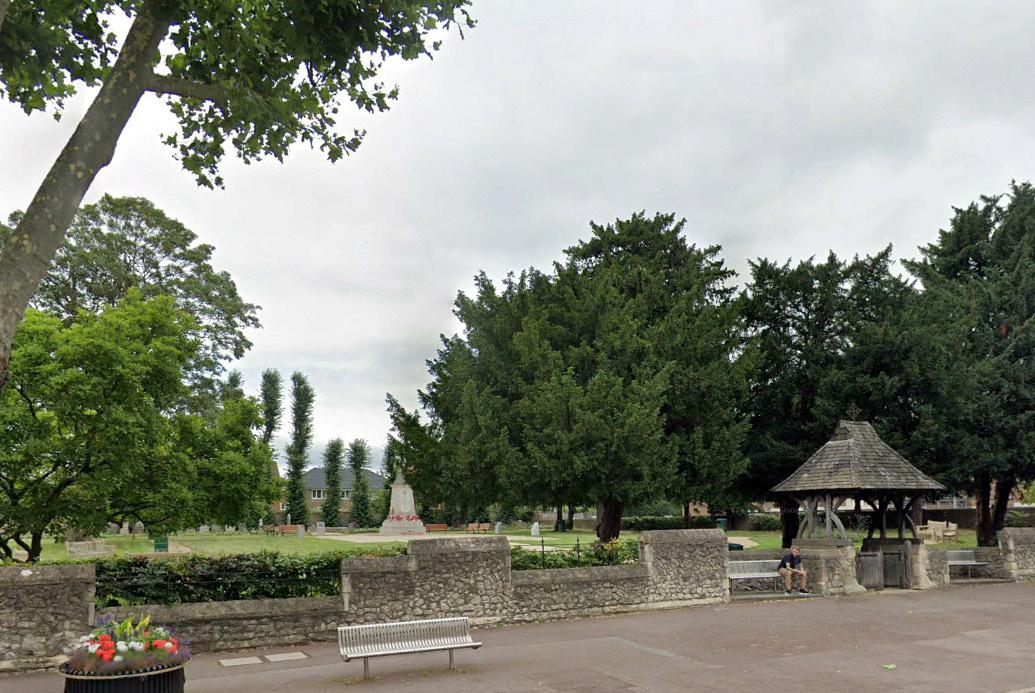
An iconic landmark in Romford's townscape and skyline, the Grade II* Parish Church of the Blessed Virgin Mary and St Edward the Confessor was built in 1849 by John Johnson. Its churchyard is included in the London Parks & Gardens Trust’s London Inventory of Historic Green Spaces
Golden Lion Public House is a Grade II listed building dating from the 17th century. Coaching inns and public houses, especially those on the Market Place and High Street were defining and prevalent much loved features of Romford before redevelopment in the 1930s and 1960s.
The Grade II listed Havering Town Hall
The
Romford has lost almost its entire collection of Georgian buildings including many frontages on the north side of Market Place
Romford's Market Place and Conservation Area
2.2.4
Existing Structure and Townscape
Romford is a vibrant and varied Metropolitan town centre that can be characterised by its historic core, Market Place, retail and leisure offer, civic functions, and attractive suburban context. The urban structure and townscape of Romford can be largely categorised into three distinct characters:
Historic core, Market Place and traditional shopping streets
The heart of Romford is still defined by the historic crossroads formed by the Market Place, South Street, North Street and the High Street. Frontages of plots along these routes still often reflect the finer, historic urban grain of Medieval burgage plots.
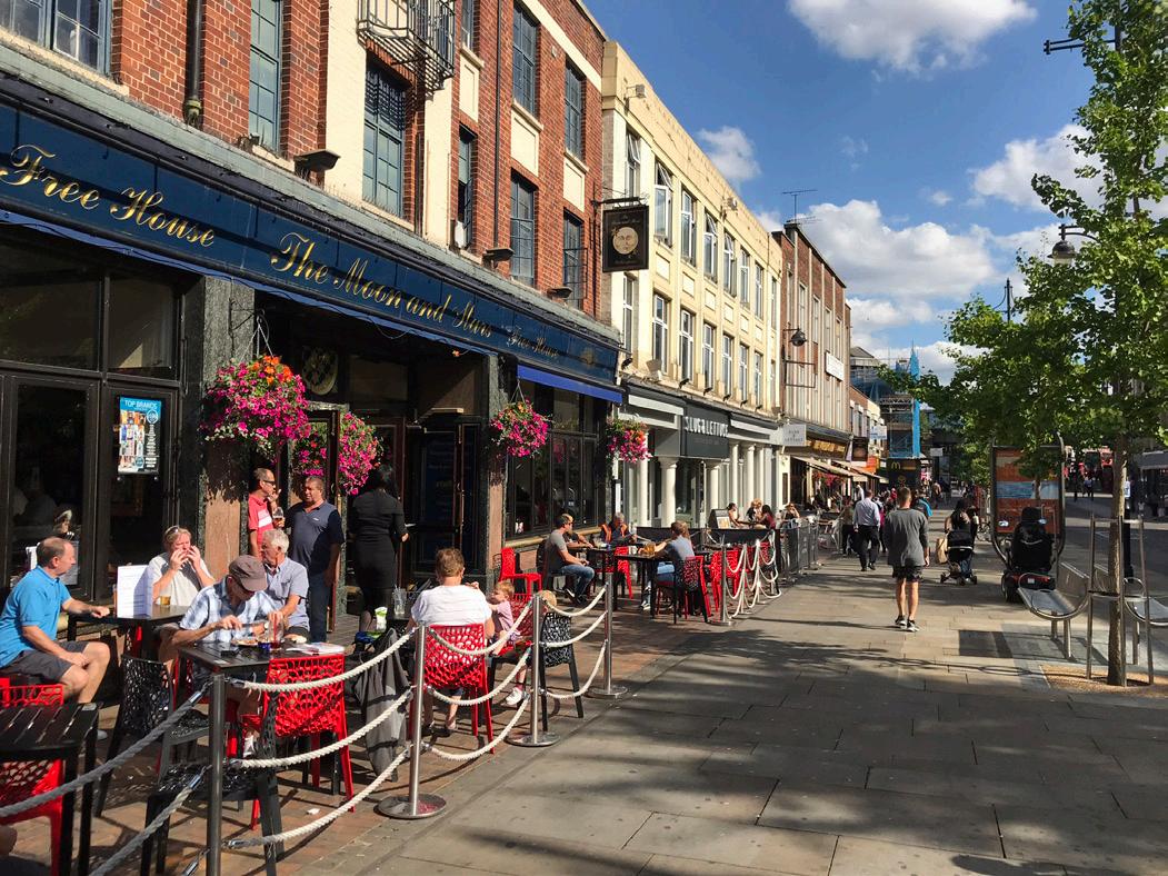
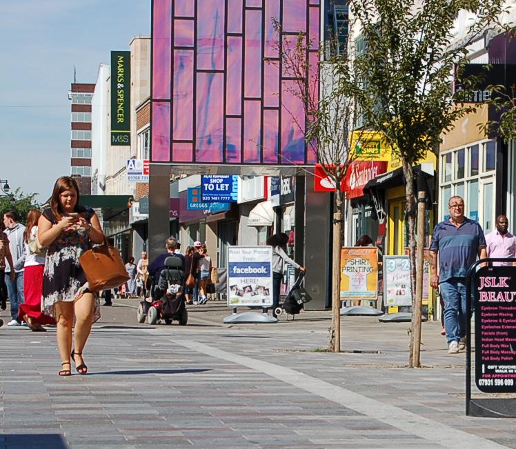
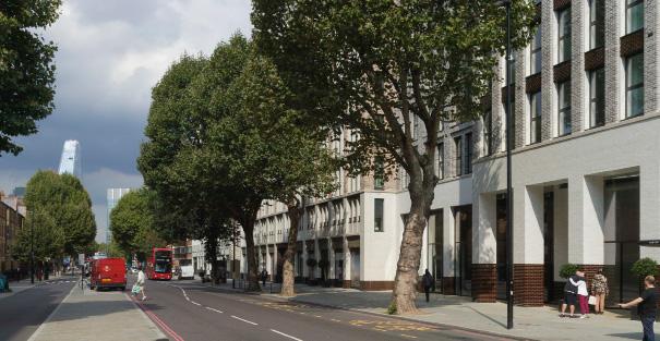
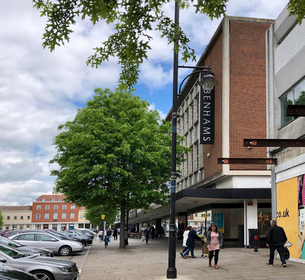
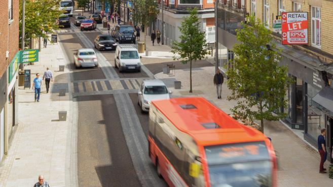
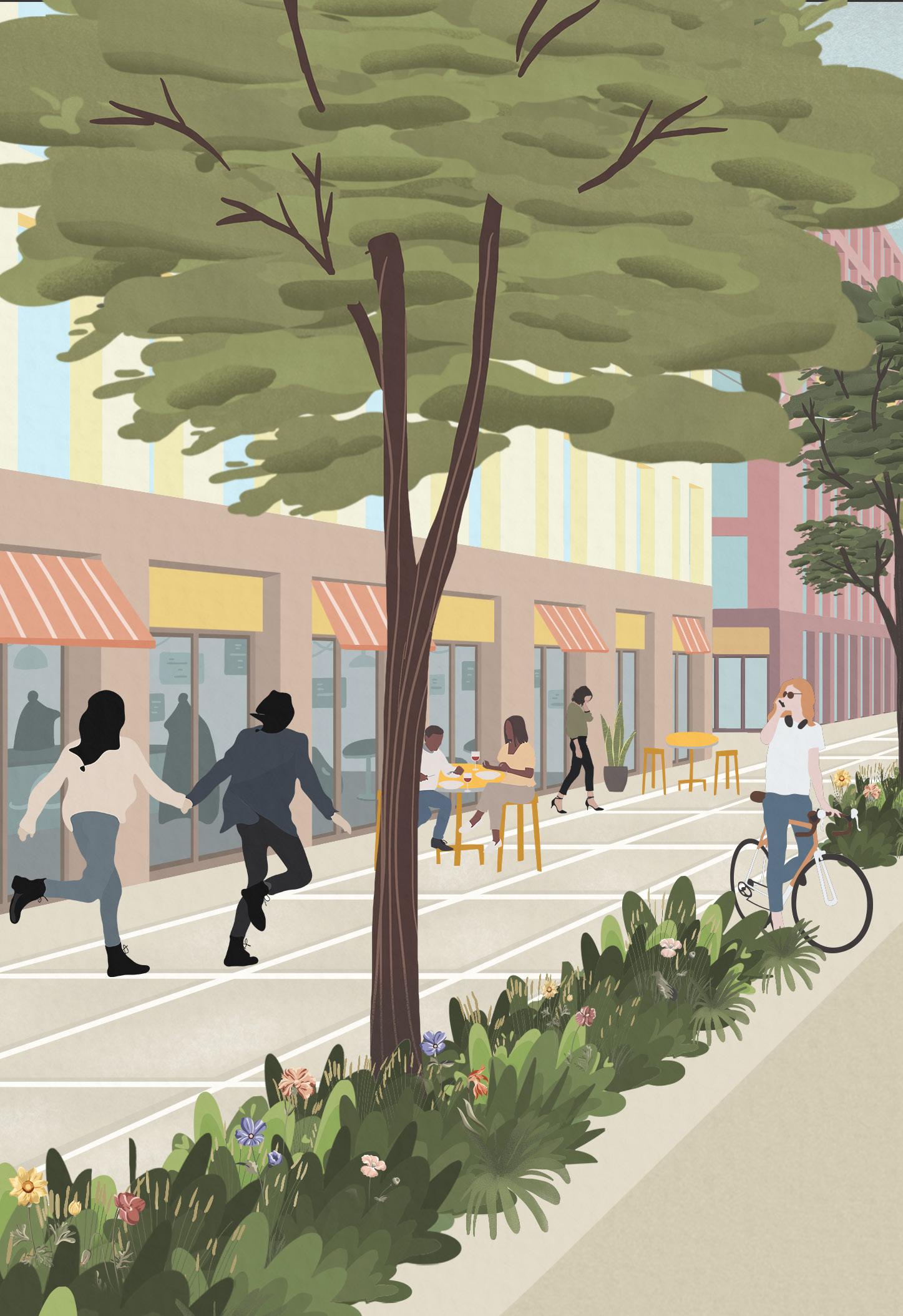
The traditional shopping streets along South Street, North Street and the High Street are made up of predominantly 2-4 storey buildings and many attractive façades. Active frontages here create a generally positive and engaging environment supported by pedestrianised areas.
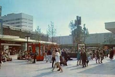
Central Romford’s public realm and active frontages today remain essentially those leading off the crossroads, with pubs, cafés and retail forming the predominant focus of activity. Arcades and lanes also still provide some of the town centre's retail component.
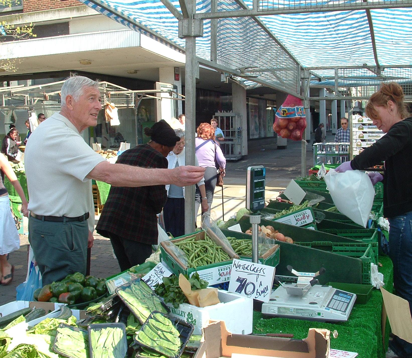
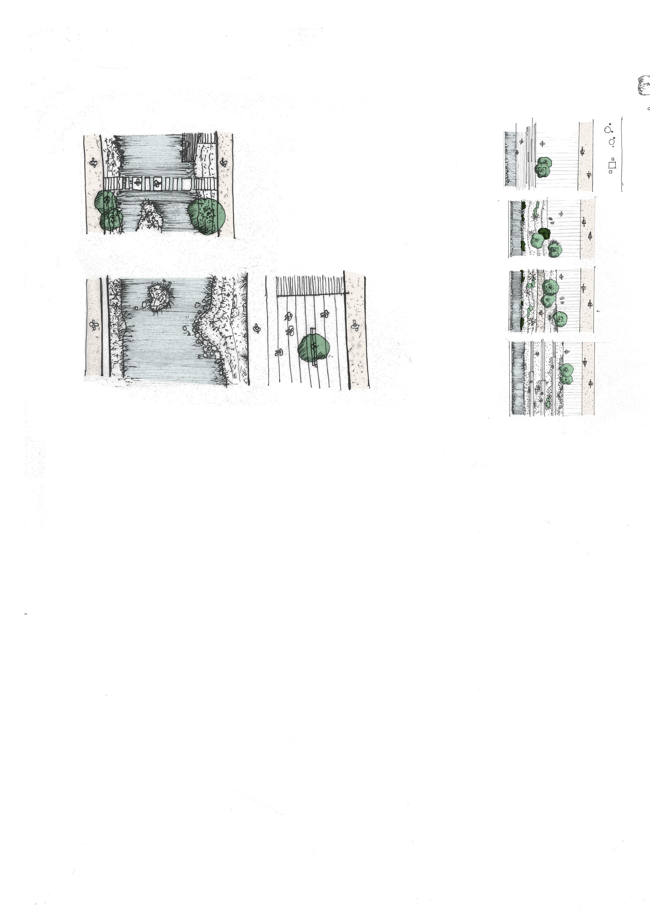
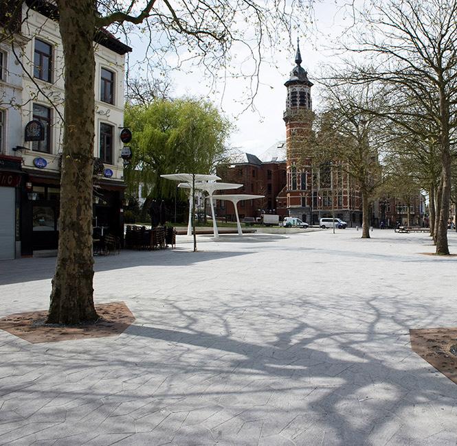
The Market Place remains Romford’s largest civic space and is arguably the most important public space containing some of Romford’s most historic and recognisable architecture including St Edward the Confessor Church. It is a unique, wide space originally formed to one side of London Road. Despite some redevelopment, including the Liberty shopping centre, it is defined like South Street by a fine urban grain of 2-4 storey buildings with active frontages. On Wednesdays, Fridays and Saturdays the Market Place still hosts the vibrant Romford market. Although the space is used for car parking on other days, it is also used for events throughout the year.
Romford Market with the church as a backdrop
Several Art Deco buildings were built along South Street in the 1920s-30s which contribute to its distinct character
Modern retail core and shopping centres
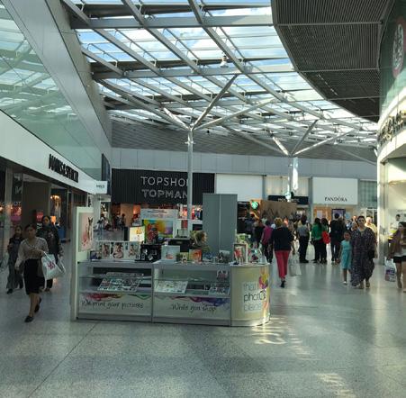
The remainder of the town centre is predominantly defined by larger footprint buildings and a coarser urban grain that resulted from the consolidation of plots over time. While the introduction of several large shopping centres and car parks established Romford as a satellite destination it also eroded much of the historic character and public realm. These buildings are typically characterised by large footprints with internal active frontages. Apart from the Brewery, the shopping centres are closed to the public outside operational hours creating barriers to movement.
Although the shopping centres draw residents and visitors, contributing economic vibrancy, they present large amounts of service frontages which contribute to poor quality public realm, and there is a fracture between the shopping centres and the town in which they sit.
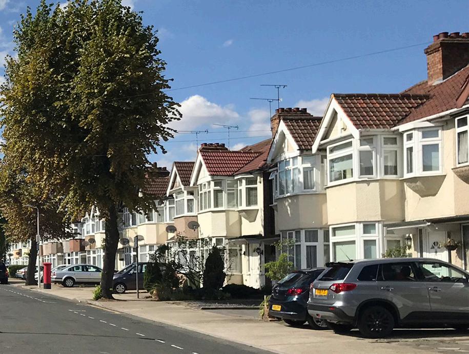
Residential areas
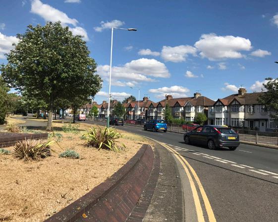
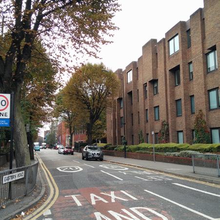
Romford town centre’s immediate context is predominantly comprised of two-storey housing in a uniform style typical of 1930s suburbia. Houses are set back from the street with clearly defined plots and a fine urban grain. These residential areas are separated from town centre uses by the four-lane ring road.
The Liberty Shopping Mall provides internal frontages and is a significant attractor but also creates disconnected public realm, particularly after closing
The realisation of the ring road was an ambitious project that successfully rerouted traffic from Market Place and parts of North Street and South Street. However, it also created a physical barrier to the town centre, restricting integration with the surrounding residential areas.
There are still some remaining pockets of residential areas within the ring road. The introduction of the railway bisected the southern quadrants of the town, limiting connectivity and redevelopment. Thus, the urban grain south of the railway typically remained of a finer grain. In particular, the south-east quadrant is predominantly suburban housing with active, high street uses concentrated along Victoria Road. The southwest quadrant has undergone more recent redevelopments and comprises a mix of scales and uses including housing, light industry and commercial uses.
Typical 1930s residential architecture on Kingsmead Avenue in the south of the town centre
2.2.5 Heights
Romford town centre accommodates buildings with a variety of heights, with many around 2-6 storeys. There are some taller buildings – the tallest of which are along Mercury Gardens, and further taller buildings of a similar scale are proposed or planned. Outside the town centre is predominantly 2-3 storey housing, with some newer developments of 4-6 storeys, as well as 10-11 storeys along Union Road and the now demolished Waterloo estate. Some taller buildings are also coming forward in the development pipeline including hybrid planning permission on the former Waterloo estate for development varying in height from 3-16 storeys as well as proposals along North Street for development up to 7-storeys.
2.2.6 Landscape and public realm
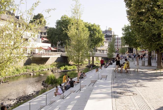
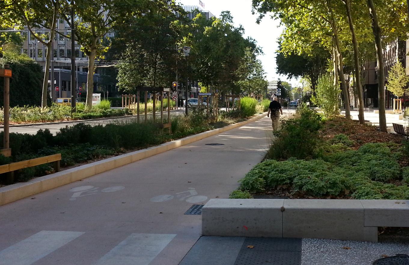
Beautiful green spaces and parks such as Raphael Park and Cottons Park are within easy reach of the town centre. Public spaces within the town centre are characterised by hard landscaping with limited greenery. The Market Place is the most significant public space within the town centre, with South Street also performing an important role as a linear, largely pedestrianised public space linking Market Place with Romford station. The Market Place varies greatly in character between market and non-market days, with its car park use on non-market days impacting on safe pedestrian movement and enjoyment of the space.
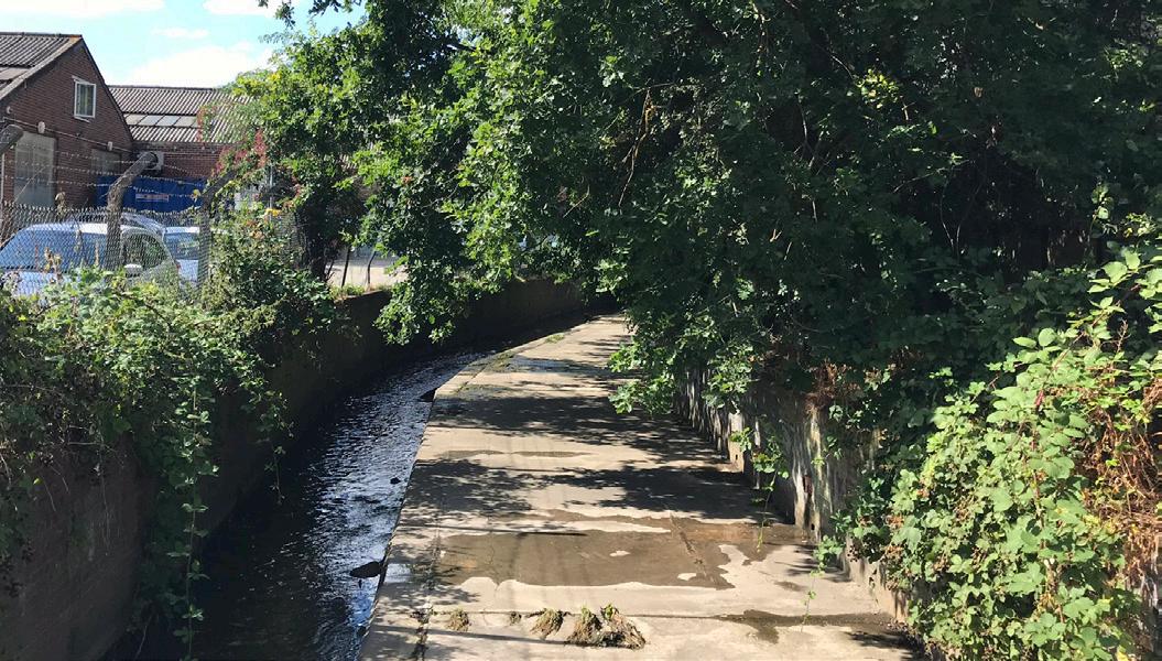
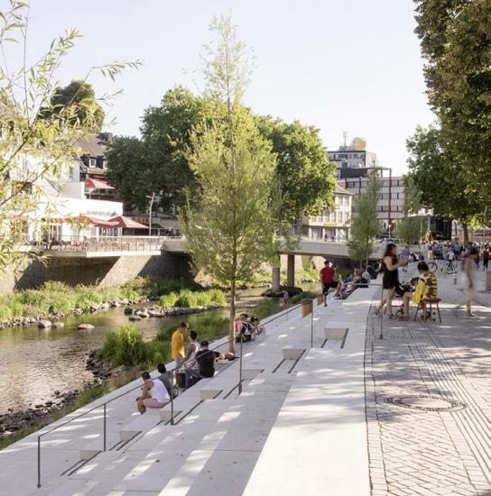
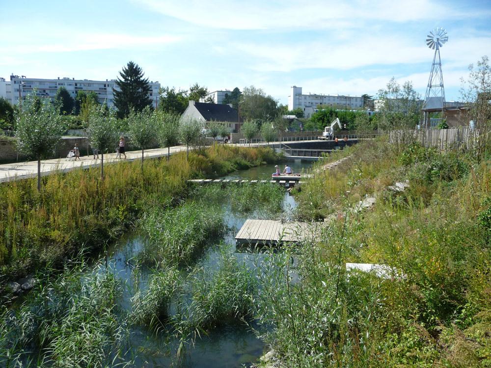
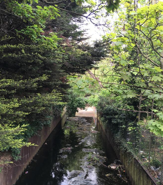
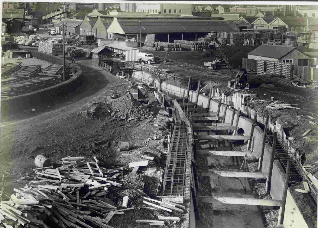
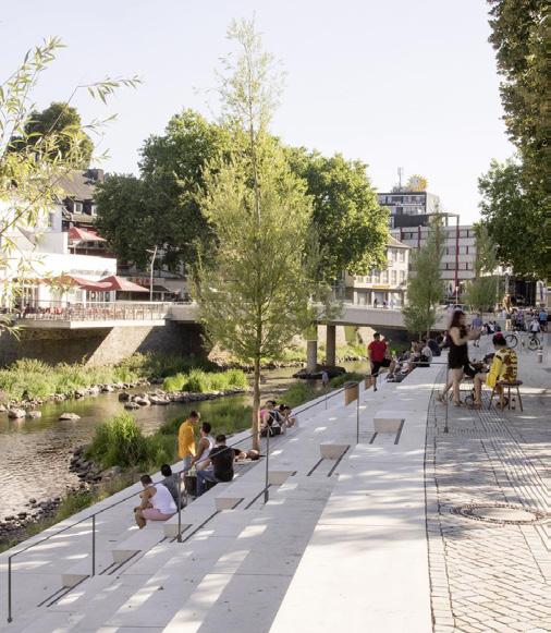
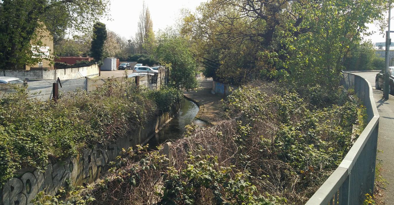
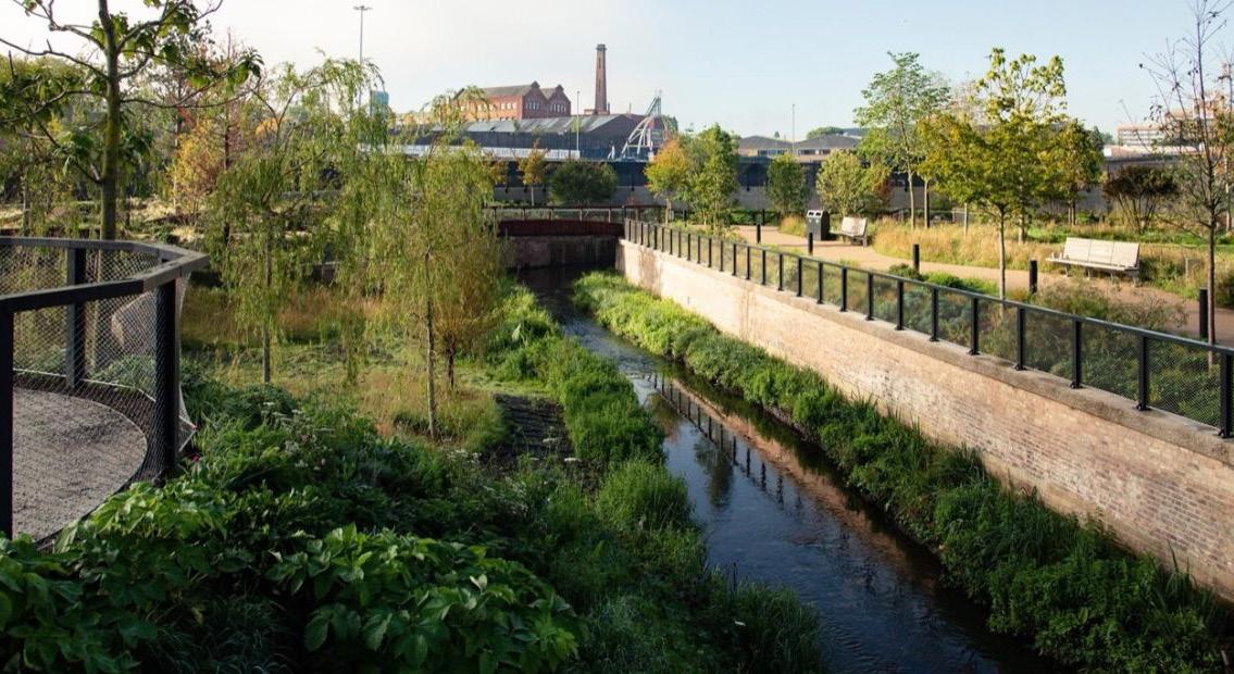
Although surrounded by Green Belt land and attractive parks, the town centre is lacking in green spaces, planting and seating, and there is a fracture between the urban and natural ecosystems. The churchyard adjoining the Market Place is an important green space, though is very compact in size. The River Rom runs north-south through Romford with a section culverted under the Brewery, and large sections canalised. It offers an opportunity to create a new public linear park, improving the ecology and providing an attractive, waterfront public space that is distinctly Romford.
Fig. 05. Existing Heights
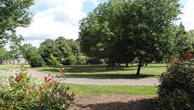
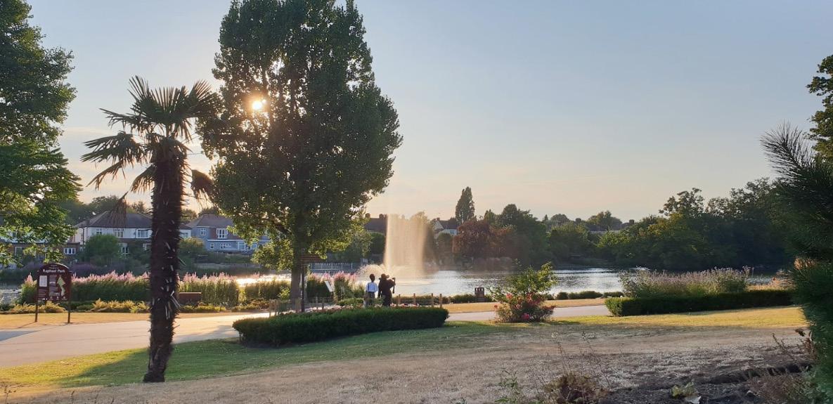
Cottons Park is the closest park to Romford town centre and an attractive and actively used green space
Canalised section of the River Rom that could be renaturalised to form an attractive, linear amenity space running through the town centre
Mercury House is one of the tallest buildings in Romford
Market Place and South Street are characterised by lower rise buildings predominately between 3-6 storeys
Surrounding low-rise residential context of predominantly two-storey housing in a uniform style typical of 1930s suburbia. Houses are set back from the street, with clearly defined blocks and a fine architectural grain.
Ring road successfully bi-passes traffic away from South Street and Market Place
Historic urban grain and concentration of heritage assets within the Romford Conservation Area
The High Street is part of the historic east-west Roman Road connection
Culverted River Rom underneath The Brewery & large surface car park
The Brewery is busy and popular, providing part of the core leisure offer, though creates a courser grain of development than its surroundings
The rear of the Brewery offers a poor quality urban environment and poor arrival experience when viewed from the railway
HighStreet
Historic Market Place with regular market
Romford Shopping Hall
Town Hall and Civic Quarter
Mercury & Liberty are busy and popular large floorplate shopping centres with associated parking. There are large areas of servicing and blank frontage creating inactive street frontages. An underground pedestrian connections links them underneath the ring road
South Street
MarketPlace VictoriaRoad
Collection of office buildings, many of which have been converted to residential
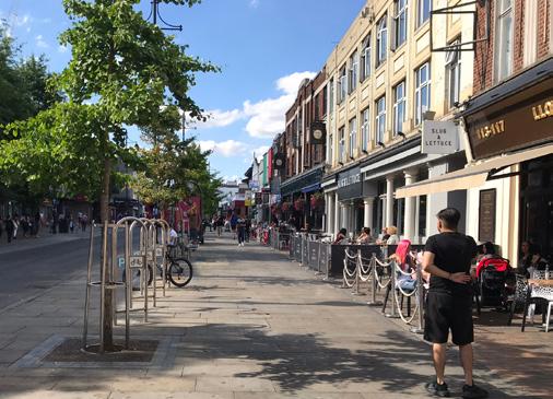
South Street is a busy and popular pedestrianised central spine with food & beverage, retail, uses. The character of the street is defined by 2-3 storey buildings with an active continuous frontage.
Victoria Road provides a mix of employment, services and retail. The street edge is defined by 1-3 storey buildings. Wide pedestrian sidewalks are shared with parking, detracting from the pedestrian experience
Local employment areas though with limited connectivity to the town centre
The railway line creates a barrier across the town centre. Connectivity is limited to pinch points at the station and where it crosses the ring road
Pedestrian crossings under roundabouts are considered unsafe and unattractive to users
Fig. 06. Existing character and opportunities
Pedestrian crossings at large vehic-
The ring road is a wide physical barrier, with poor quality pedestrian crossing, that severs the town centre from the surrounding context.
Commercial focus
Secondary focus
Road as a barrier
Railway viaduct as barrier
Inactive frontage
Civic focus
Hospital
Conservation Area
Listed buildings
Car parking
Bus hub
Romford Railway Station
River Rom & Black's Brook
Culverted waterway
ular junction.
2.3 USES
Town centres across the UK have been through un-precedented levels of change and challenge in recent years. Fundamental shifts in consumer behaviour and preferences have destabilised many established businesses, with high streets across the country losing many household names and brands as well as smaller independent retailers.
Romford market
Fig. 07. Existing uses within SDA boundary
Town Hall
Romford Market
Historic pubs Retail and food & beverage
Large-floorplate retail with large surface & rooftop car parks
Shopping Centres Office conversions to residential
food & beverage
Surburban housing
Leisure centre
2.3.1 Current & Future Trends
2.3.1.1 Retail and Leisure
Whilst the contraction of the retail sector in a store format has been declining for a reasonably long period (albeit at a faster rate in recent years) as people switch to online shopping the decline in the food and beverage sector has been a more recent challenge. Whereas 3-4 years ago the casual dining sector was growing rapidly, many businesses have now ceased to exist, leaving further voids on the high street.
However, as these trends have challenged the traditional high street offer, new activities and offers have grown,
again driven by consumer tastes. Competitive socialising concepts, such as 'Escape Rooms', have injected new life into the leisure sector, often populating former retail units with new activities, whilst an increased focus on health and wellbeing has seen a rapid expansion of active leisure uses. Greater interest in differentiated and / or personalised products has driven renewed interest in independent retail, or more customised product lines in existing stores. A greater interest in food provenance, healthy living and sustainability has supported a range of food retail offers.
2.3.1.2 The Commercial context
Throughout these volatile conditions the Romford commercial market has remained relatively stable, with a significant retail provision remaining to provide a diverse offering including national retailers present and more locally focused independents. In the main it provides a mid-tier retail offering, which aligns well with its immediate (and most regular) catchment. The Market is an attractive component of this.
The nature of the market in Romford is heavily influenced by the competition it faces from easily accessible retail mega-destinations to the east and west, in particular Westfield Stratford, Bluewater and Lakeside, which both offer more than just shopping with a greater array of food and beverage choices, and leisure options. Further competition is provided by the likes of Chelmsford, which has seen significant investment and extensions to its retail provision, including an increase and diversification of its restaurant / dining offer.
2.3.1.3 Evening and Night time Economy
Beyond retail Romford has an established late night economy, with a number of bars, clubs and late-night venues. However the offer is relatively narrow and targeted at alcohol orientated entertainment, which causes a series of anti-social behaviours issues which affect the perception of the town centre.
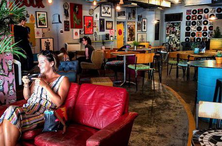
The wider leisure market is therefore relatively underserved, with a limited evening economy offer, modest levels of cultural activity and little (if any) alternatives to stand up drinking establishments. Current cultural / leisure provision is focused on the Brookside Theatre, Sapphire Centre, Retailery and the town centres two cinemas. Looking forward this would appear an area of opportunity, particularly as the town centre population grows – with both existing and new residents could be attracted to spend their leisure time in Romford rather than travelling to some of the competing centres highlighted in our analysis.
There is a need for well-designed public spaces (streets, parks, routes to stations) and ground floors uses to provide a safe night-time experience for all, and in particular women, girls and gender diverse people.
2.3.1.4 Offices
The office market in Romford has fared less well than the core retail market. Where once the town centre was a major office location in East London a high number of permitted developments undertaken after occupiers left the town centre have depleted stock, with a lack of demand seeing values stagnate. Unlike it’s competitors, Romford has seen no office development in a number of years and there is none in the current pipeline despite its accessibility and cost advantages. Many office buildings around Eastern Road have also seen conversion to residential through permitted development rights.
Whilst larger offices have struggled there are signs that small offers can be successful. There are a number of relatively new workspace schemes in the town centre, reflecting more strategic trends in the office sector as businesses move towards smaller, more flexible space. The introduction of this workspace into the town centre mix is positive and is helping to build back the town centre workforce across a range of sectors. Ultimately, building on this foundation and improving the commercial offer to attract new businesses to Romford would help to generate greater use of the town centre throughout the day and evening.
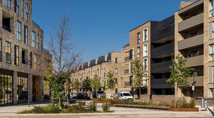
2.3.1.5 Residential
Unsurprisingly given the housing pressures in London, the offer of Romford and its connectivity, the residential sector has continued to perform well in the town centre. There are a number of large scale residential-led schemes which have been recently completed or are under construction in and out of the town centre.
Values are still relatively modest in London terms, and new build schemes are cheaper on average in Romford compared to neighbouring boroughs such as Redbridge, and parts of Barking and Dagenham. This has supported predominantly flatted development in the town centre itself. Connectivity has supported a broadening of the tenure offer, with a significant pipeline of Build to Rent units coming forward. The commencement of Elizabeth Line services has further increased the attractiveness of Romford as a place to live and work, and will likely continue to generate additional residential demand.
2.4 TRANSFORMATIONAL CHANGE
2.4.1 Opportunities for change
Romford town centre has significant potential for transformational change over time. The opportunities for change, however, vary in relationship to many factors including the quality of existing development, landownership, heritage value, vacancy levels, plot coverage and appetite for change. These factors have been considered
Minimal change
Conserve
in identifying which plots should form part of the 'Site Guidance Areas' in Chapter 6, or areas which are capable of delivering significant opportunities. An illustrative diagram opposite sets out these areas broadly which has informed the approach and level of intervention set out in the Masterplan.
Consolidate and reinforce existing building types and street pattern / frontage.
Enhance the character and deliver a moderate uplift and intensification of built density.
Substantially increase developments by introducing new building types with scope to creating a new street pattern / frontage.
3 ENGAGEMENT
This chapter sets out how public and stakeholder engagement has been used to shape the Masterplan, from the vision through to site guidance.
3.1 ENGAGEMENT SUMMARY
Executive Summary
1.0 Executive Summary
3.1.1 Engagement process
Introduction
engagement on the Romford Town Centre Masterplan in 2019 there was a due to the pandemic, change in administration and economic uncertainty. This impacted a number of pieces of work but Havering Council took the decision in 2024 to take the necessary steps to finalise the Masterplan.
The Masterplan has been informed by an extensive engagement process both for the initial development of the Masterplan in 2018-2019 and for the Masterplan refresh in 2024.
Following engagement on the Romford Town Centre Masterplan in 2019 there was a pause due to the pandemic, change in administration and economic uncertainty. This pause impacted a number of pieces of work but Havering Council took the decision in early 2024 to take the necessary steps to finalise the Masterplan.
April to 3rd May 2024 we ran an intensive engagement exercise to talk to people of Havering about refreshing the Masterplan and adopting it as a piece of planning guidance over the coming months.
2018-2019 Masterplan Engagement
From 8th April to 3rd May 2024 we ran an intensive engagement exercise to talk to the people of Havering about refreshing the Masterplan and adopting it as a piece of formal planning guidance over the coming months.
• Member walkabouts
people informed
Keeping people informed
• 1:1 workshops with landowners developers
• 'Your Romford' website with +6000 visits
Decaux Posters from 25th March to 10th April. 60 sites across the whole of the borough, 6-sheet advertising
• JC Decaux Posters from 25th March to 10th April. 60 sites across the whole of the borough, 6-sheet advertising
• 3 x Living in Havering newsletters to over 62,000 email addresses
• 2 x Your Romford mailing list reminders to 330 sign-ups
Living in Havering newsletters to over 62,000 email addresses Your Romford mailing list reminders to 330 sign-ups mailout to Havering’s headteachers mailout to Havering Planning Policy Consultation database to 118 consultees
• 1 x mailout to Havering’s headteachers
Activities delivered Reach
• 55,000+ e-newsletters and 100,000 households informed through the Living in Havering magazine
• 1 x mailout to Havering Planning Policy Consultation database to 118 consultees
• Targeted instagram ads reaching >9000 accounts
• Pop-up engagement around the town centre
• Instagram posts x10 across make:good and Havering Council channels
Targeted instagram ads reaching >9000 accounts Instagram posts x10 across make:good and Havering Council channels (formerly Twitter) posts x10 across make:good and Havering Council channels Market traders flyers to 70 stalls in Havering Daily articles in the Romford Recorder: https://www.romfordrecorder.co.uk/news/24222482.readers-views-haveringcouncil-town-centre-consultation/ https://www.romfordrecorder.co.uk/news/24214202.havering-councillaunches-consultation-romfords-future/ Romford’ website and blog: www.yourromford.co.uk
• Quality Review Panels and regular Member Workshops
• X (formerly Twitter) posts x10 across make:good and Havering Council channels
• Market traders flyers to 70 stalls
• Article in Havering Daily
• Public design workshops and exhibitions
• Two articles in the Romford Recorder:
2024 Masterplan Refresh Engagement
• https://www.romfordrecorder.co.uk/news/24222482.readers-views-haveringcouncil-town-centre-consultation/ https://www.romfordrecorder.co.uk/news/24214202.havering-councillaunches-consultation-romfords-future/ ‘Your Romford’ website and blog: www.yourromford.co.uk
4.1 Feedback summary
Introduction Activities delivered
Across the programme we reached 724 people and received 665 pieces of feedback
Across the programme we reached 724 people and received 665 pieces of feedback
Headline sentiment
Overall the sentiment about the Masterplan was positive, reflected in 73% of respondents either strongly or somewhat agreeing with the principles of the Masterplan during the recent Masterplan Refresh Engagement.
Headline sentiment 2024 engagement
The overall sentiment about the Masterplan was positive with 73 % of respondents saying that they either strongly agreed or somewhat agreed with the ideas in the
4.1 Feedback summary
• Digital launch on YourRomford.co.uk
• Pop-up engagement around the town centre
4.1 Feedback summary
• Instagram posts and 62,000+ e-newsletters
• Stakeholder round table
• 5 pop ups around the town centre
• 1 secondary school workshop
2 primary school workshops
• Tagging onto activities
• 2 young people workshops
• Member workshops and Quality Review Panel
ups around the town centre
1 stakeholder workshop
secondary school workshop
primary school workshops
young people workshops
stakeholder workshop
Your Romford
4.0 4.1 Feedback summary
The overall sentiment about the Masterplan was positive with 73 % of respondents saying that they either strongly agreed or somewhat agreed with the ideas in the
People supported the idea of starting with the market as a focus for improvement but wanted heights and number of new houses to be clarified in the final plan.
This aligns with the feedback we received in 2019 where people were very supportive of the Masterplan with particular support for improving the market, the River Rom and
People supported the idea of starting with the market as a focus for improvement but wanted heights and number of new houses to be clarified in the final plan.
A more detailed breakdown of the engagement process can be found in the 2019 and 2024 Engagement Summary Reports with a brief summary of the engagement learnings and how these have informed the Masterplan presented opposite.
This aligns with the feedback we received in 2019 where people were very supportive of the Masterplan with particular support for improving the market, the River Rom and
Maccreanor Lavington and the Council will now finalise the Masterplan. The intention is that statutory consultation on the Masterplan is conducted by Havering in summer 2024 before it is formally adopted as a piece of planning policy in winter 2024.
Maccreanor Lavington and the Council will now finalise the Masterplan. The intention is that statutory consultation on the Masterplan is conducted by Havering in summer 2024 before it is formally adopted as a piece of planning policy in winter 2024.
Fig. 09. The overarching priorities from the 2019 Masterplan engagement process, illustrated above, were broadly aligned and agreed with in the 2024 Masterplan Refresh engagement process. Excerpts from Romford Masterplan Engagement Report, 2019 and 2024.
3.1.2 Learnings
from the Engagement Process
Throughout the development of the Masterplan, feedback from the consultation process has been fed into and used to create and refine the vision, objectives, strategies, and site guidance. In both the 2024 Masterplan Refresh Engagement and the 2019 initial Masterplan engagement work, the following ideas received the most public support and have been used as the foundation for the major spatial moves of the Masterplan.
Aligning with 2019 key supported moves
Improving the Market Place and supporting a rejuvenated market
Opening up the River Rom and delivering a new major piece of green public realm
Overall improvement to the public realm to increase attractiveness and footfall in the town centre
Engagement Update Summary
From 8th April to 3rd May:
we ran 5 pop-ups and 5 workshops with children and young people, plus 1 stakeholder workshop and an online survey
In addition to the key moves below, the Masterplan vision and objectives were developed collaboratively with Members through extensive iterative workshops. Following public engagement, these were refined further to better align with the feedback and local community vision(s) for Romford town centre.
Ideas with most public support 2024
The Market Place: focusing on the Market as a key transformation area for Romford
The River Rom: opening up the Rom and creating a high-quality, exciting pieces of public realm
Public Realm: creating improved public realm so people want to dwell in the town centre
Behaviour: The above goals were identified in the context of addressing challenges with antisocial behaviour in the town centre.
most supported ideas were:
4 A VISION FOR CHANGE
This chapter sets out the vision and overarching objectives of the Masterplan.
4.1 THE VISION FOR ROMFORD
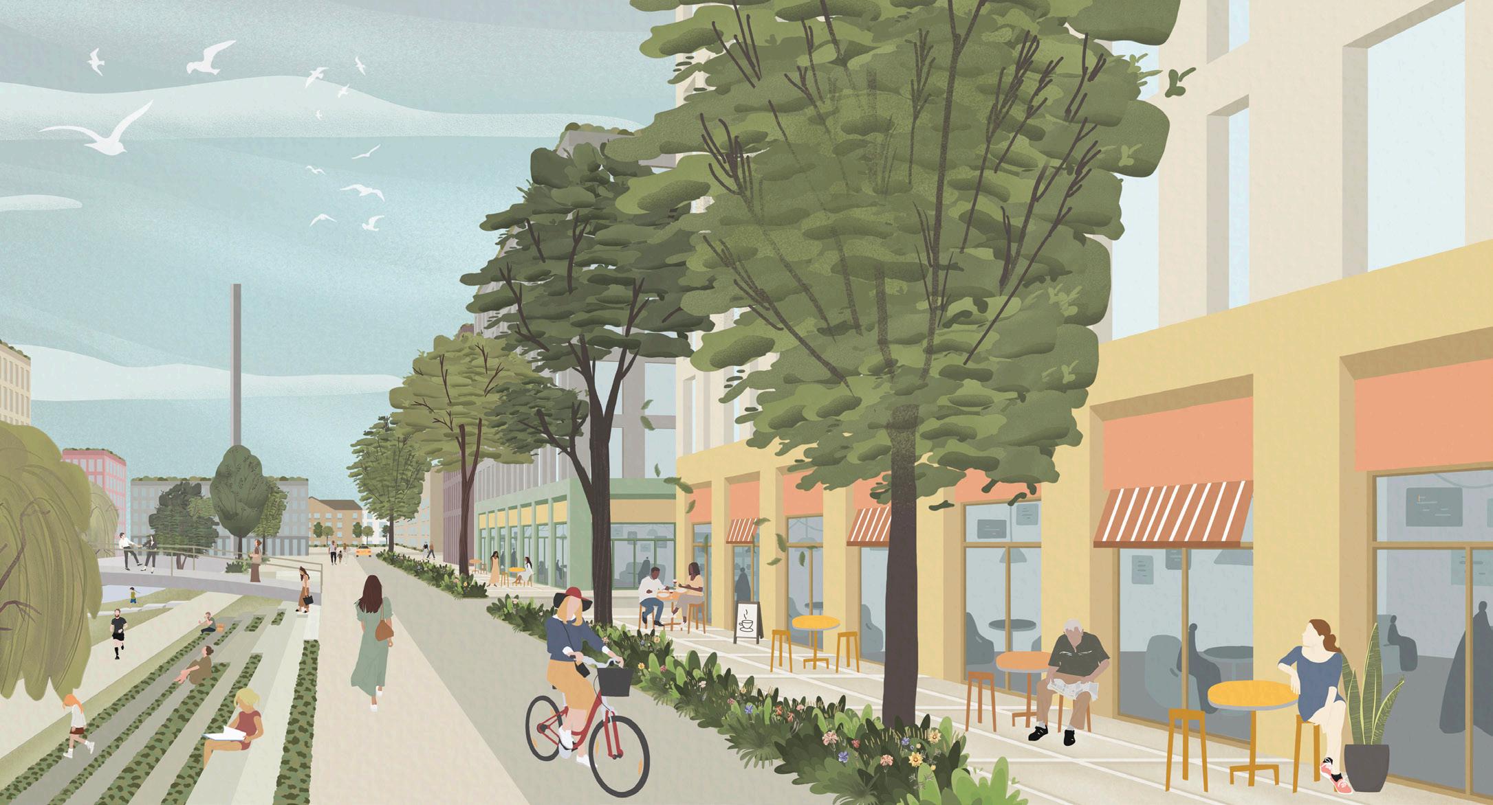
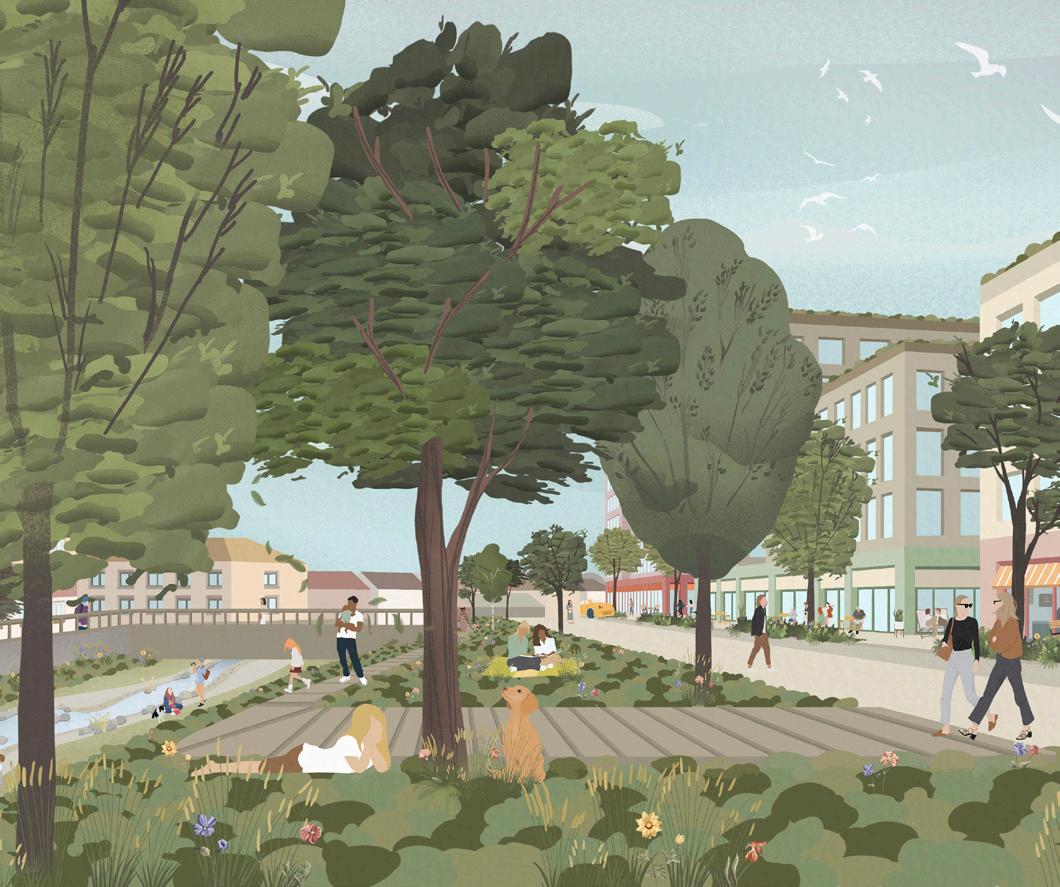
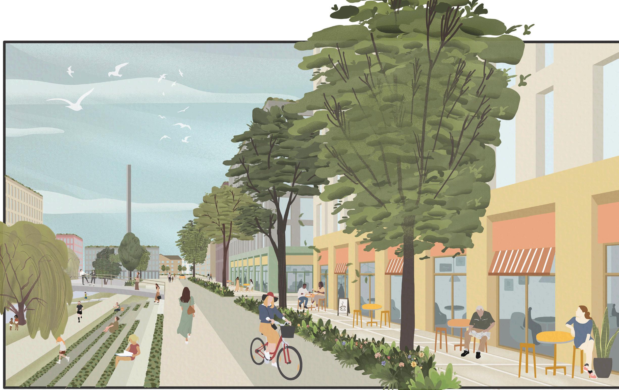
Building on its unique character and history, Romford will be a mixed, vibrant, inclusive and distinct regional town centre. It will consist of an enhanced retail offer complemented by a rejuvenated market, with a focus on local goods, culture, services, greening of the town centre, and celebrating the River Rom. It will maintain its role as a major leisure destination, with an enlarged employment offer, an early evening food and beverage offer, with existing and new residential communites supported by additional health and school facilities.
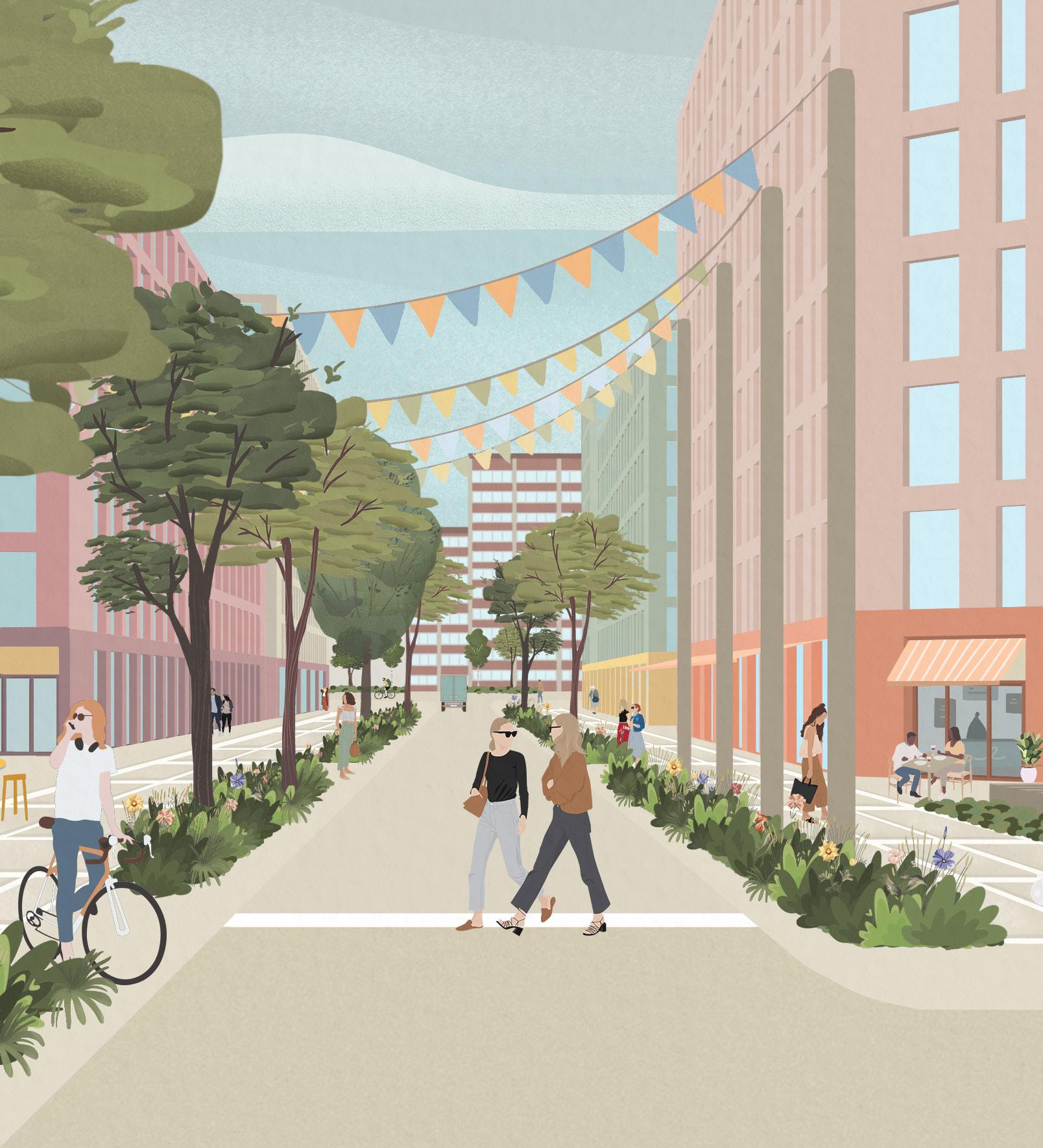
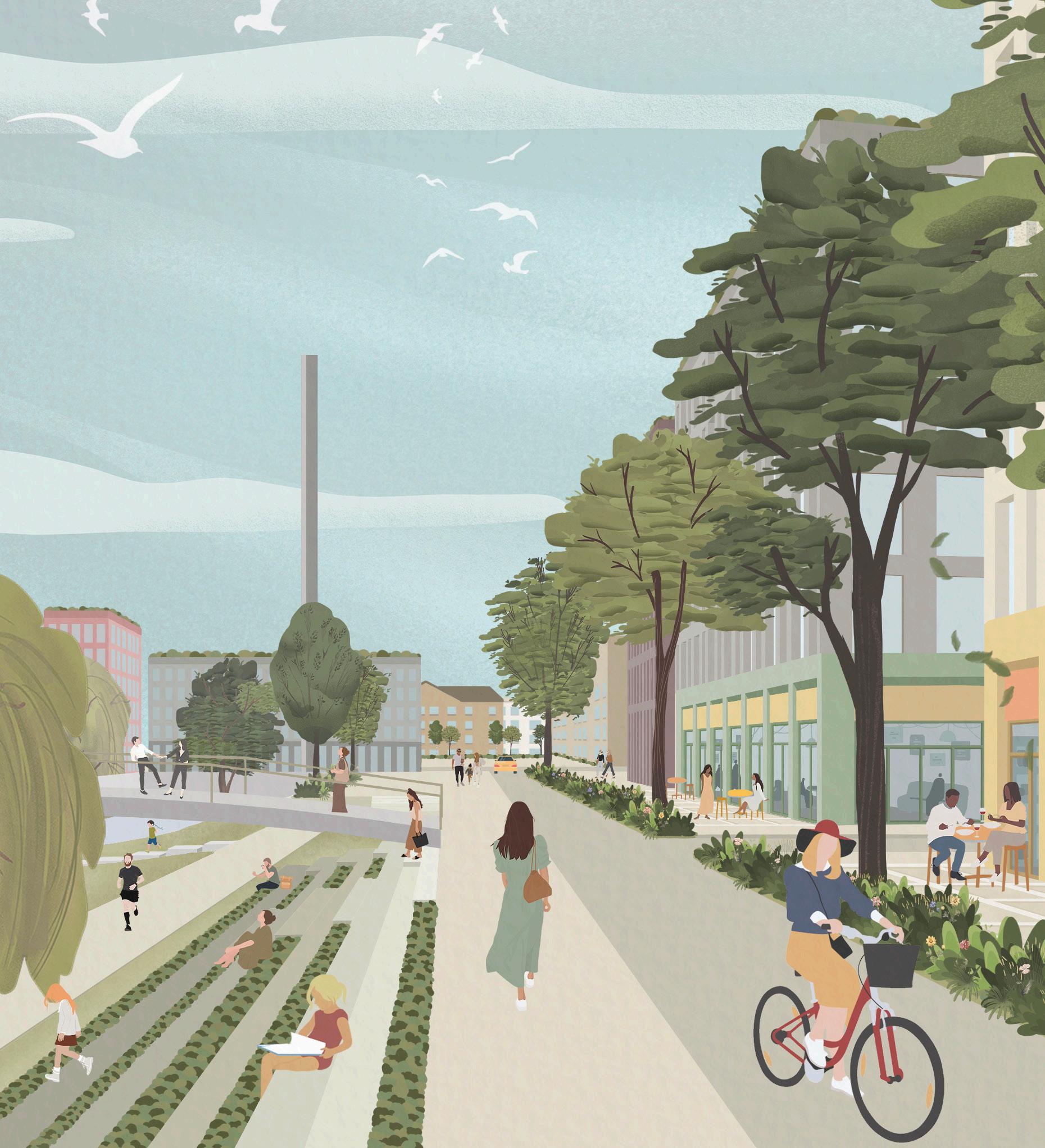
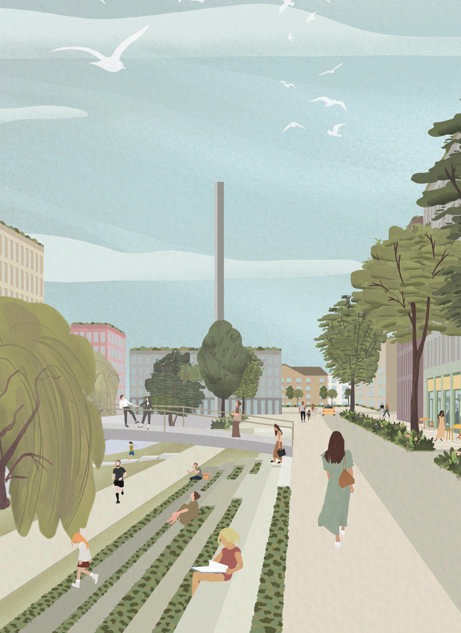
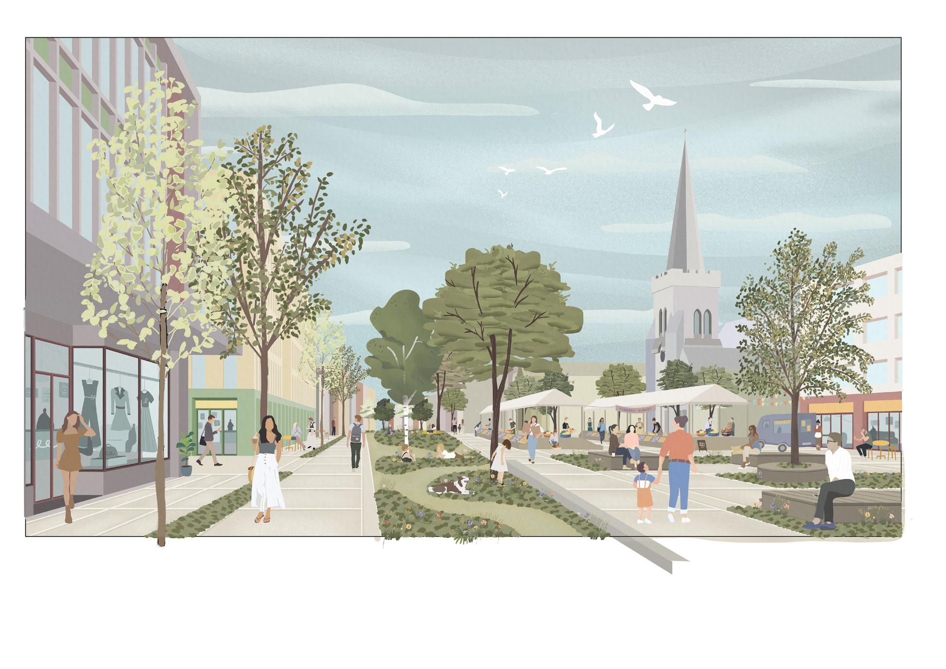
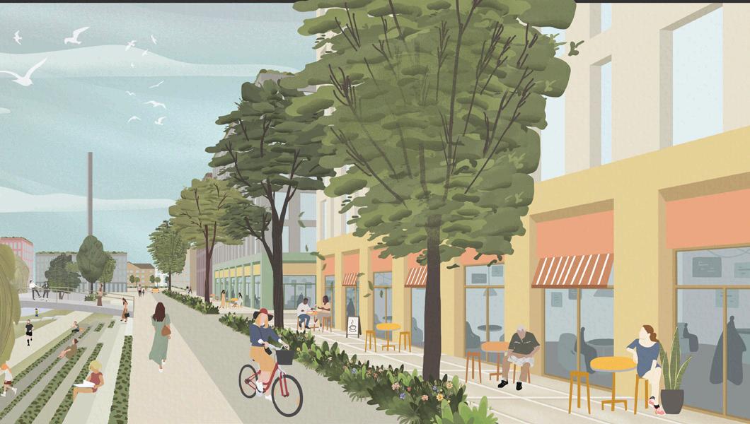
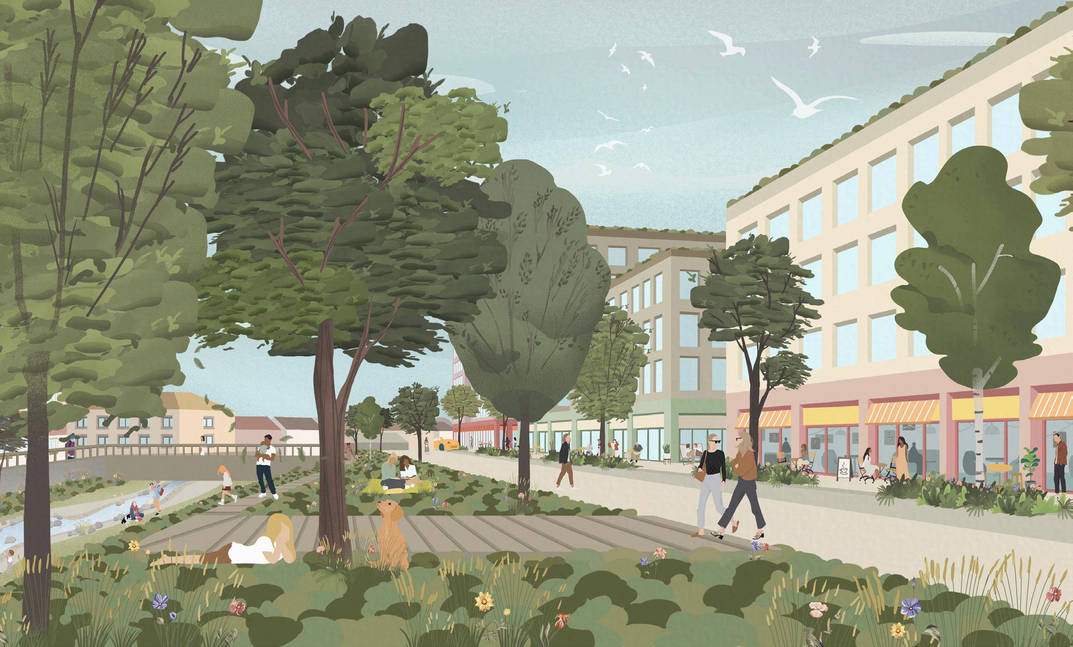
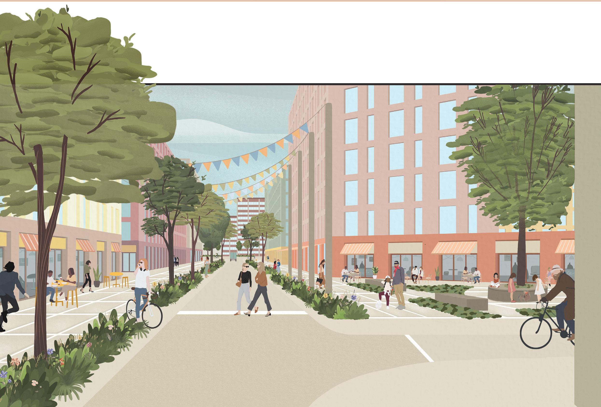
Fig. 11. An infrastructure-led approach
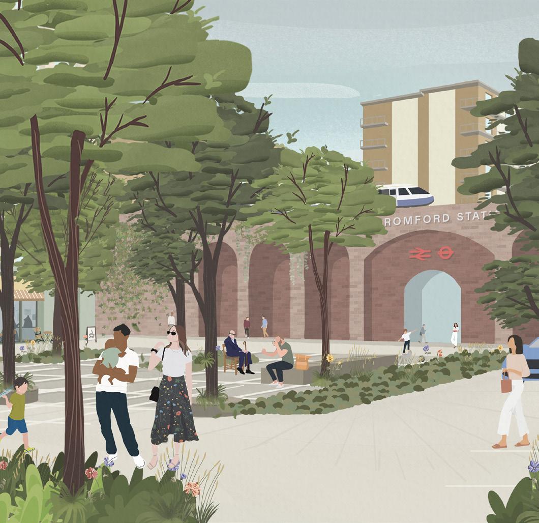
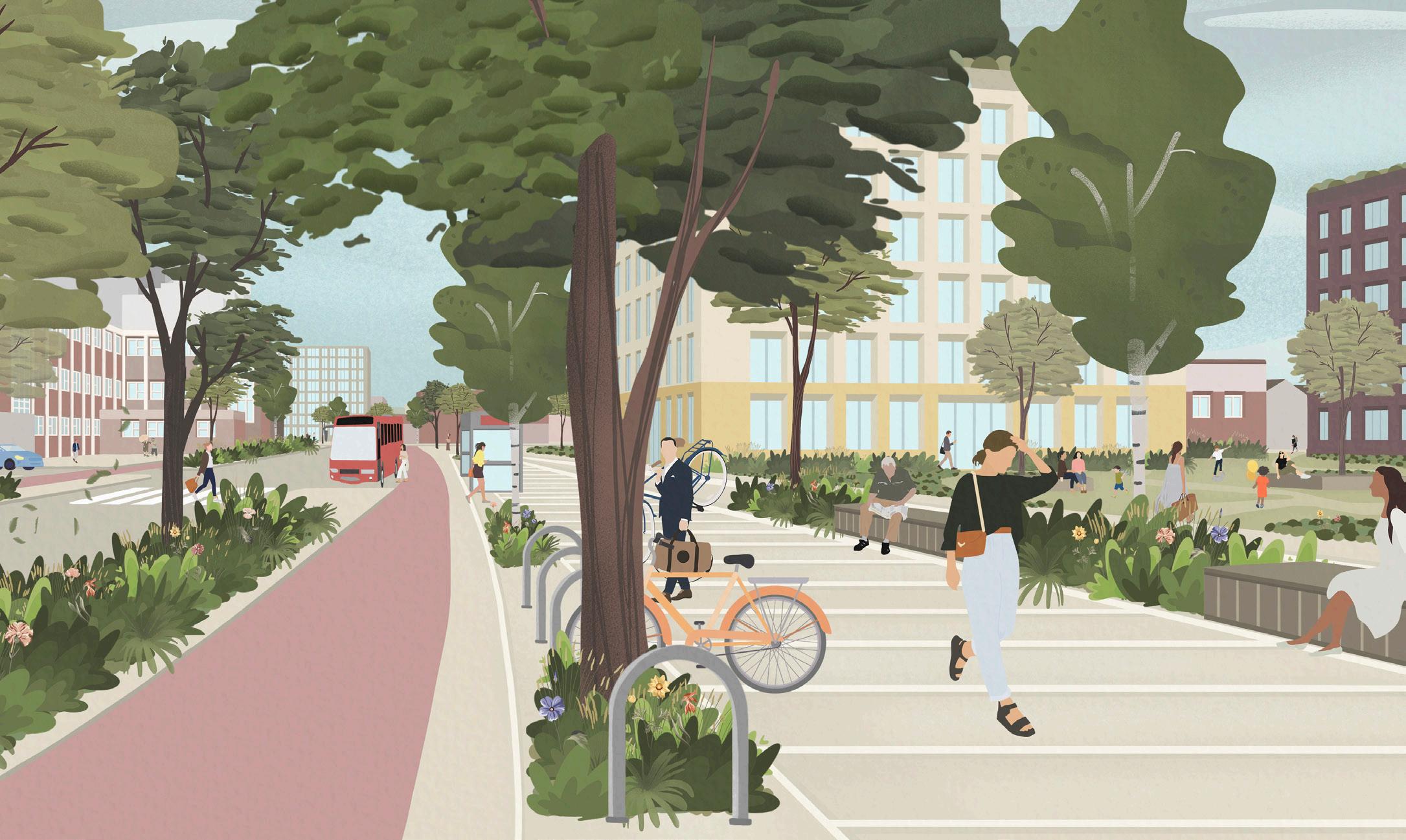
Illustrative view of Romford station and public space on South Street
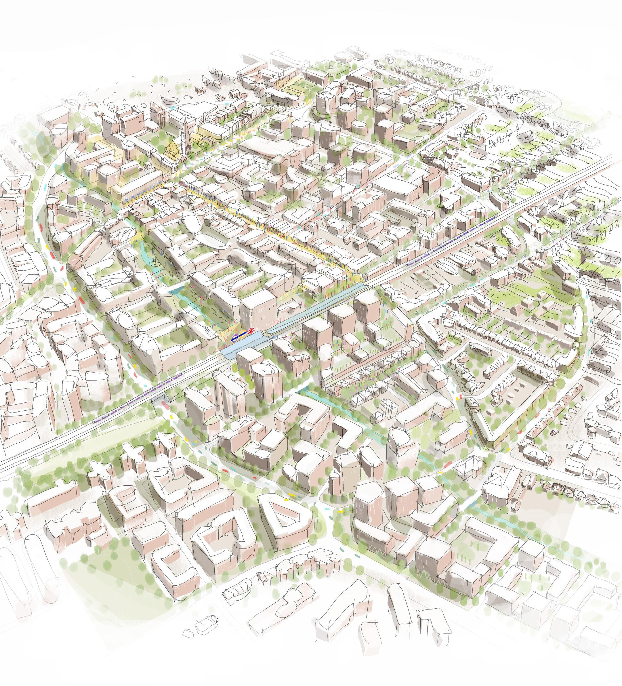
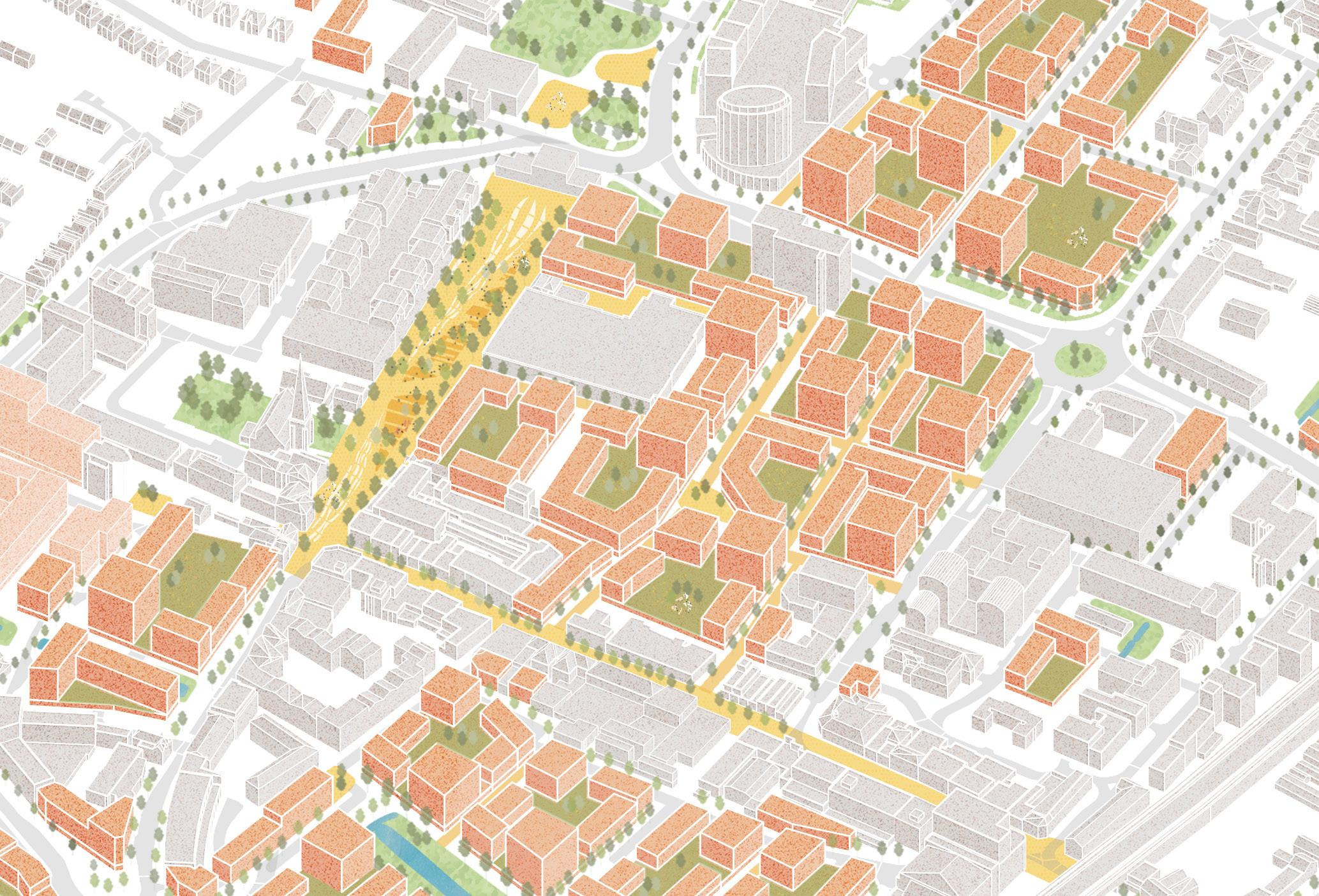
Fig. 12. Illustrative Masterplan
4.2 BUILDING A RESILIENT FUTURE
The vision draws on the vision for Romford set out in the Havering Local Plan, as well as an extensive consultation process, reflecting a truly collaborative foundation for the Masterplan.
4.2.1 Masterplan key moves
A series of key spatial moves have been developed based on the objectives and vision. These key moves, illustrated in the illustrative Masterplan, are wider spatial principles that establish the physical structure and interventions to achieve the long-term vision for Romford town centre. These consist of a qualitatively enhanced natural and built environment for the benefit of existing and future local residents, workers, businesses, charities and organisations.
Opening up the River Rom
The River Rom will be deculverted and partially renaturalised through the town centre to create an ecological linear park.
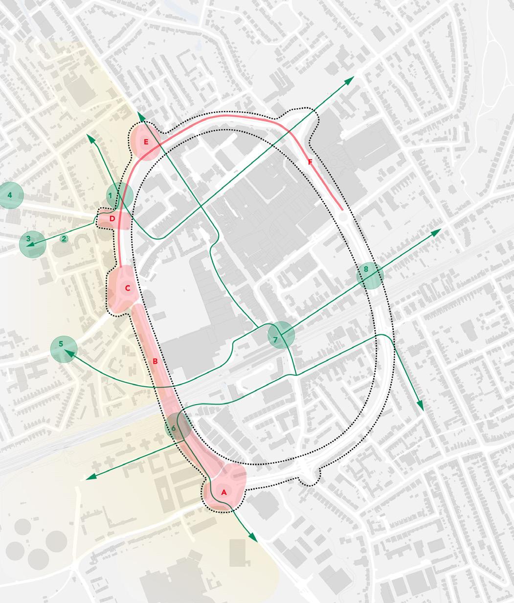
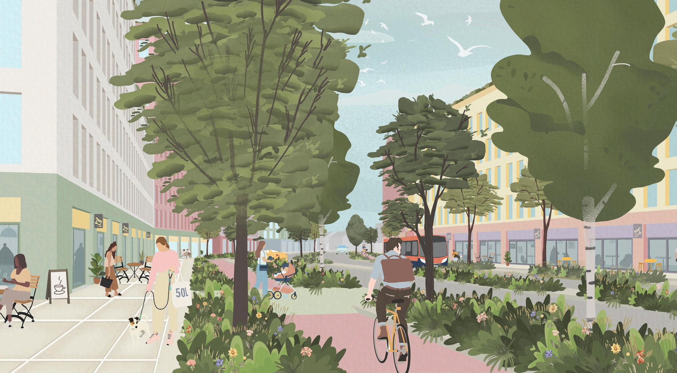
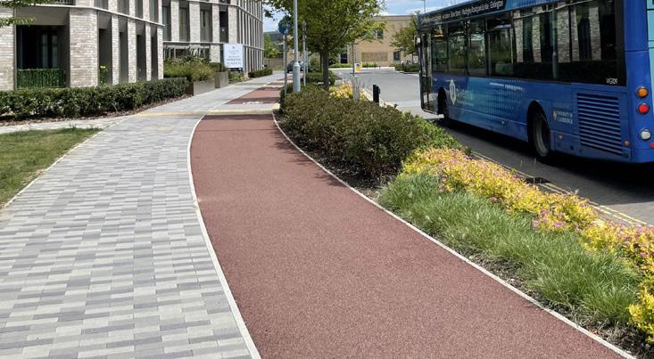
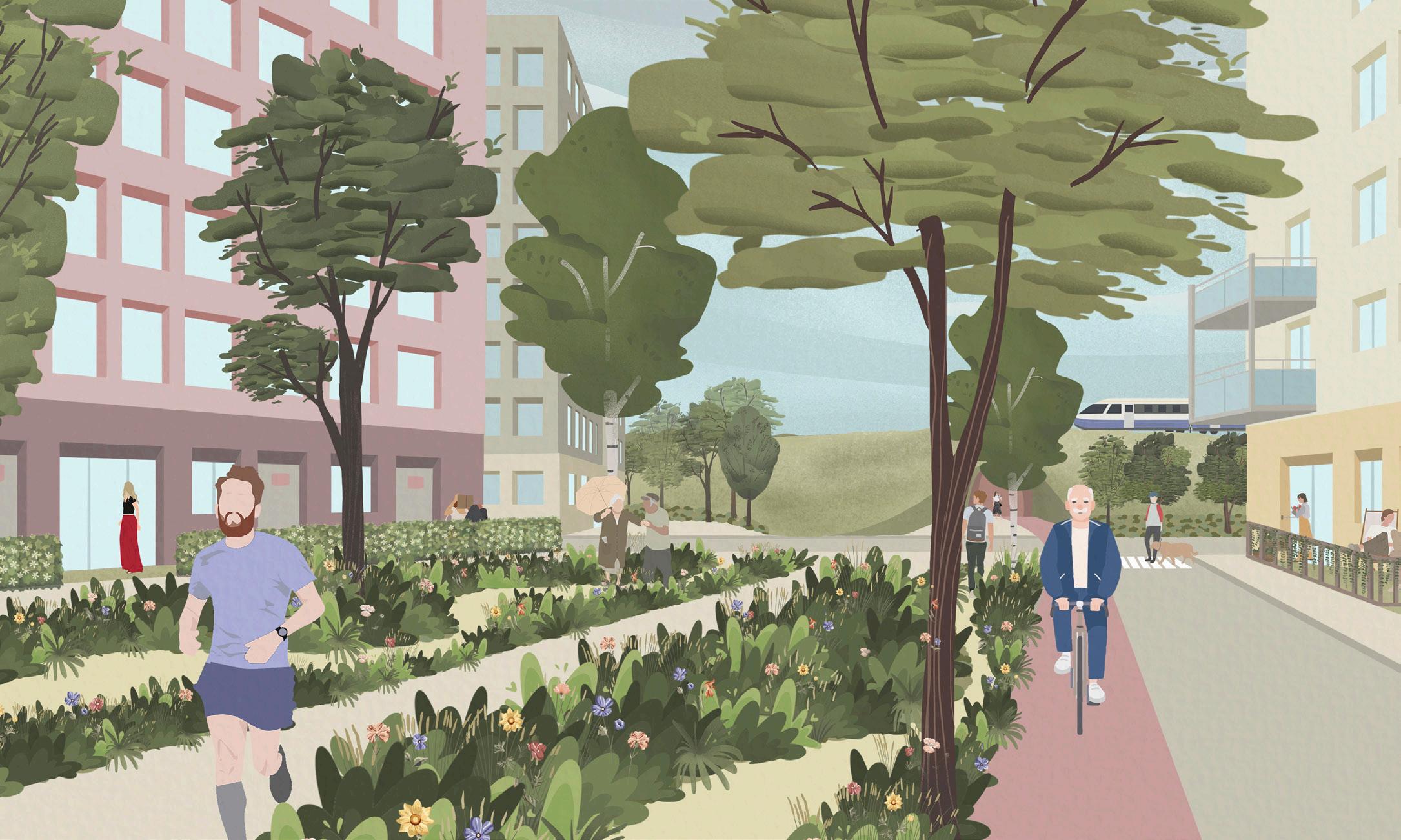
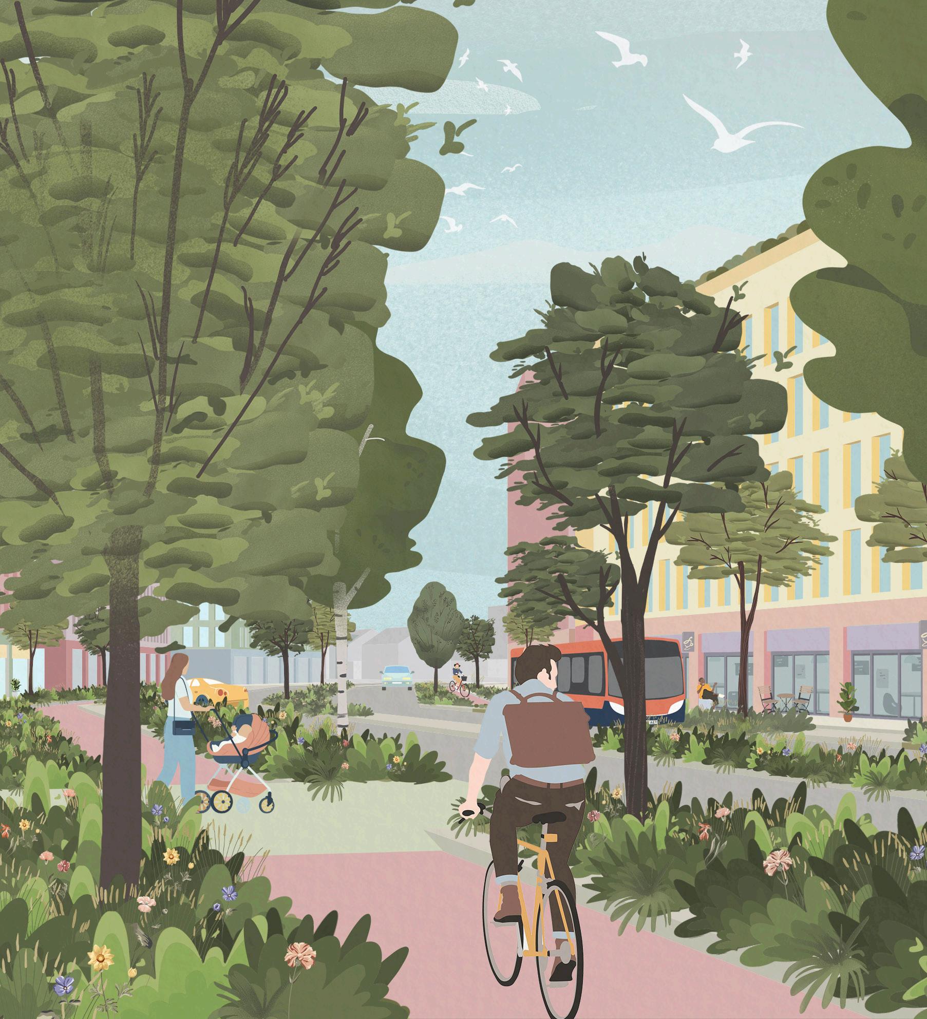
Recharacterising the ring road
Transforming the ring road along its length into an active travel corridor with at-grade crossings, planting and an urban boulevard character, better integrating the town centre with the surrounding neighbourhoods and improving the experience of pedestrians and cyclists.
Celebrating Romford Market & Market Place
Reinforce the importance of the Market Place as a key civic space by upgrading public realm, ultimately removing car parking, improved frontages and introducing spaces that can support a variety of events and formal and informal gatherings, particularly in support of the Romford Market.
Create a finer urban grain
Introducing new streets and spaces that reflect the finer historic urban grain of the town centre with smaller, more walkable blocks with varied and engaging building frontages.
Ensuring a safe and inclusive town centre
Creating and ensuring that Romford town centre is safe both in real terms and by perception, that is for everyone, and that is inclusive, equitable and distinct.
Wider green links
Introduce new green links that can act as walking and cycling corridors both through the town centre and connecting to wider key public green spaces and parks, as part of a connected landscape.
New and improved station entrances
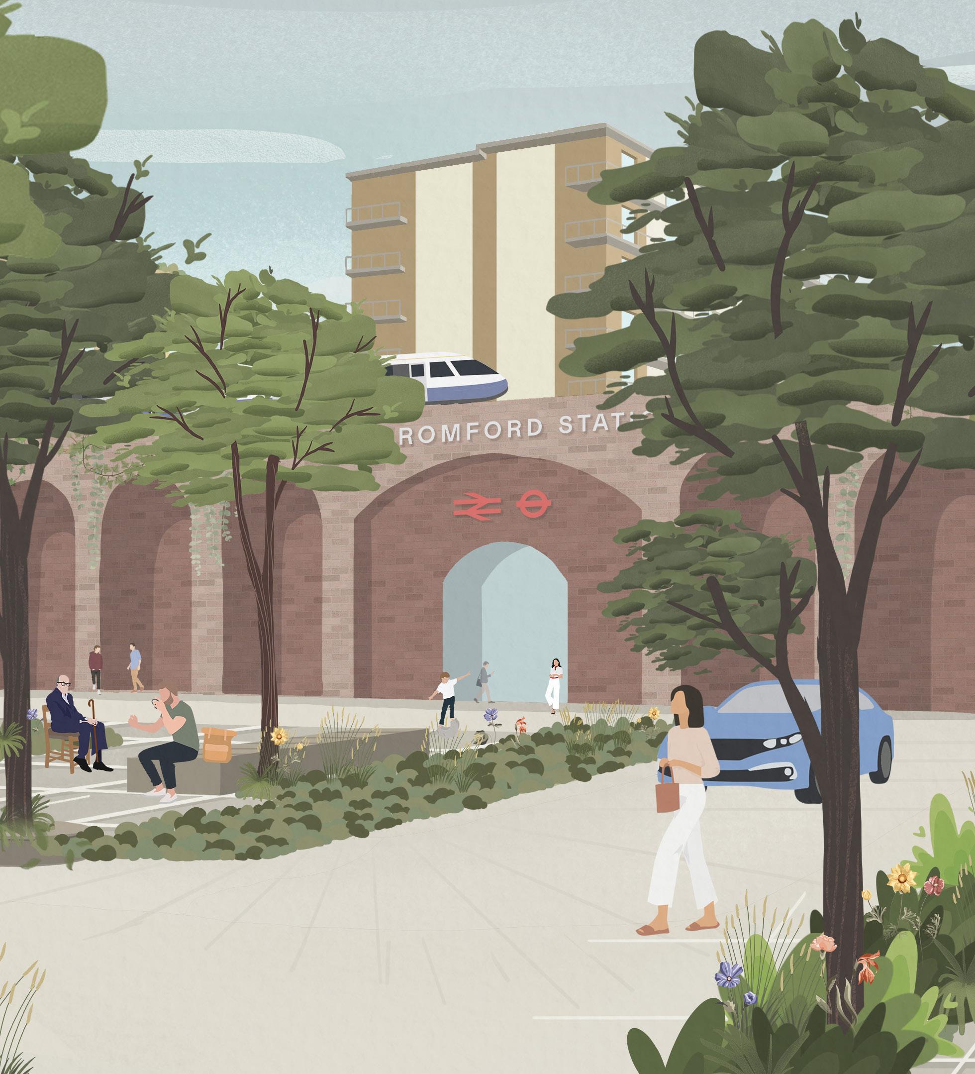
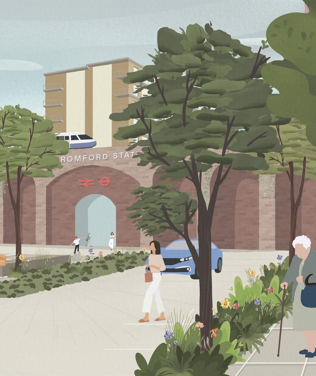
Creating a new station with a attractive public spaces that acts as a gateway to the town centre and improving the existing station entrance with public realm enhancements, seating and wayfinding.
4.2.2 An infrastructure-led approach
Bringing new and improved infrastructure to Romford as part of its growth over time through an infrastructure-led approach is of key importance to the Masterplan. The Masterplan advocates bringing forward infrastructure enhancements for the town centre collectively, as well as using growth to bring infrastructure with it alongside other resources.
Supporting community is a primary concern for the Masterplan. Enhancing and providing infrastructure over time such as schools and healthcare, public realm enhancements, (in particular those for the Market Place), and public transport and active travel facilities, (such as Liveable Neighbourhoods improvements to the ring road), all play a role in providing such support.
4.2.3
Growth over time
The illustrative Masterplan shows the combined potential of the interventions proposed throughout this Masterplan, showcasing the scale of the opportunity. This is just one way in which the Masterplan’s vision and objectives could be translated into a coherent and well-designed plan for the area. Importantly, the Masterplan advocates for growth and change over time, looking at a 15-20 year trajectory for Romford to ensure the current vibrancy and successes are maintained and enhanced by future development. The illustrative timeline in Fig. 13 indicatively shows how mixed-use development might occur during the Masterplan period. This also shows how growth could be larger than outlined through the Havering Local Plan in response to increased development interest, highlighting how imperative the Masterplan is in guiding that growth. This growth will also unlock opportunities to help fund public realm enhancements and other infrastructure projects that will support the future of Romford.
The selected development sites and interventions have significant potential to enhance and benefit Romford but may not all come forward. Equally, further opportunities,
sites and interventions may come forward, and these too can be guided by the Masterplan's vision, objectives and strategies. Trigger points such as infrastructure improvements to the ring road and measured shifts to active travel can also be used to determine appropriate points to commence development in certain locations.
Acknowledging evolution will happen incrementally, the illustrative Masterplan includes for context the consented schemes for land at Rom Valley Way and Waterloo Road. Although not consented, the proposed Bridge Close proposals have also been included given their advanced stage, degree of public consultation and level of agreement between the Local Planning Authority and prospective developers on principles of layout and scale.
The Masterplan illustrates that development will need to be multi-use to support the vision, and in tandem with an increase in population and jobs comes improved retail space, an expanded leisure / cultural offer, a broadening of the business / economic base as well as further enhancements such as new and improved public spaces.
Fig. 13. Illustrative timeline of Masterplan interventions and growth in addition to commitments in the Havering Local Plan
4.3 KEY THEMES & OBJECTIVES
4.2.4 Seven key themes
The vision informs all guidance set out in this Masterplan and is expanded through seven key themes, which categorise a list of objectives to guide its delivery. These objectives relate to the overarching policy objectives in the Havering Local Plan. Each objective is in turn supported by strategies in Chapter 5 which provide guidance on implementing these objectives and delivering good growth. The relationship between the vision, themes, objectives and strategies is illustrated in Fig. 14
These objectives have been developed collaboratively, and have been informed by the extensive engagement process. The themes were introduced at the start of the engagement process to help categorise Masterplan ideas and feedback, and in line with this, breaking the objectives down into these seven key themes is intended to allow them to be more easily navigated here.
4.3.1 Space & Landscape
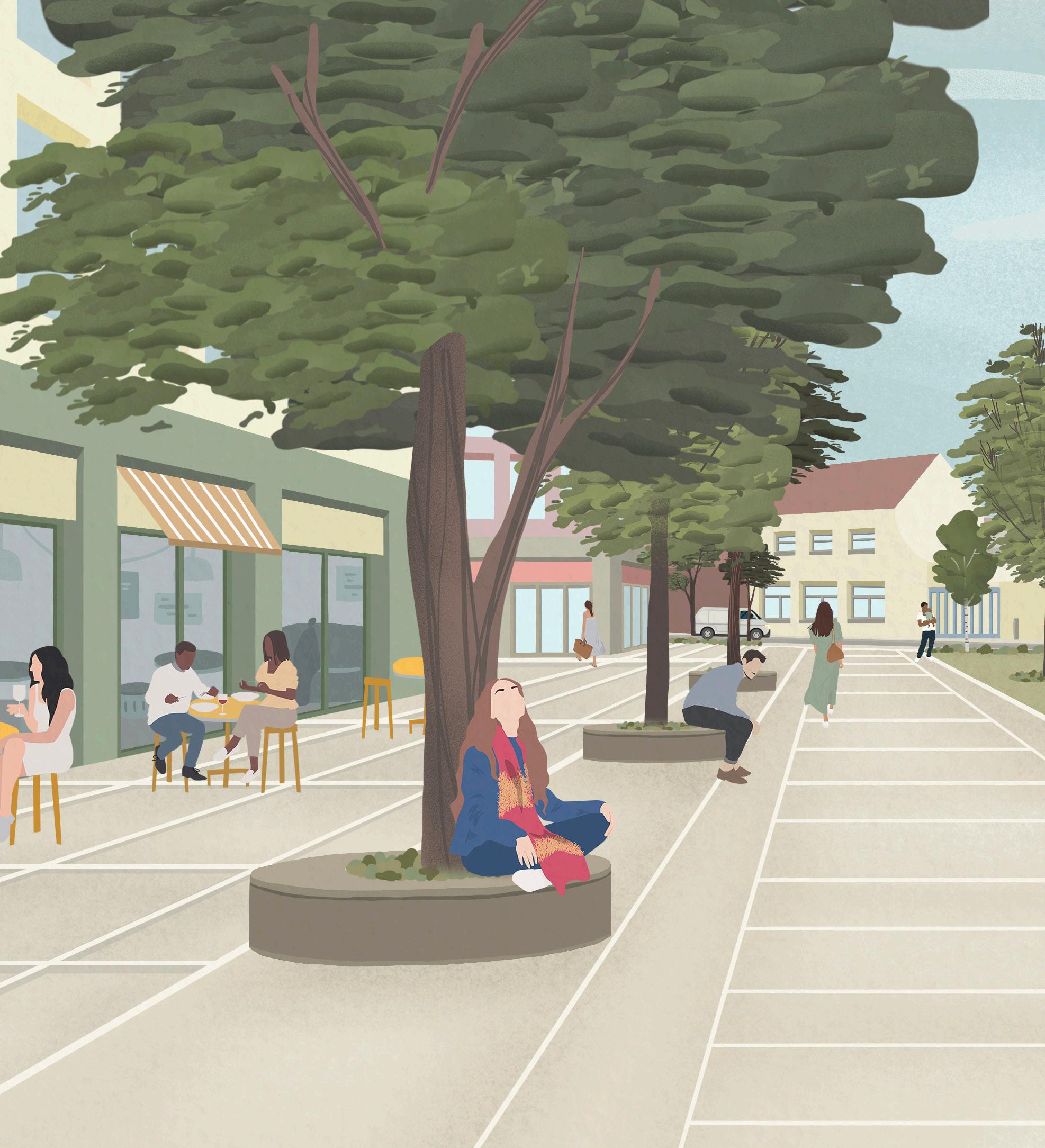
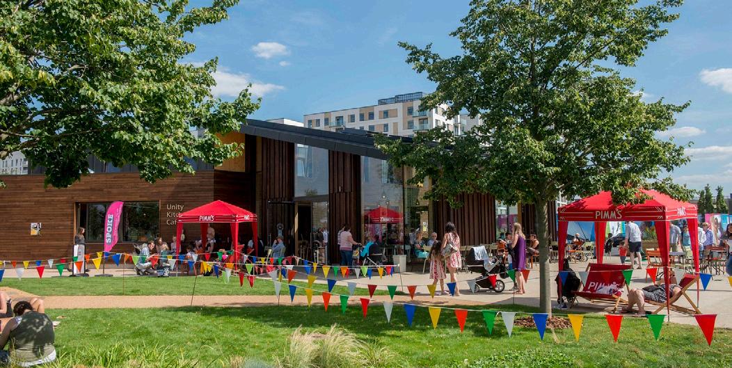
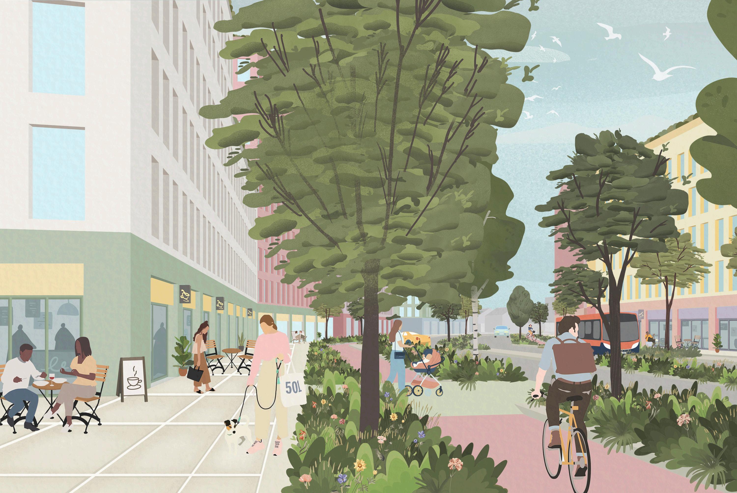
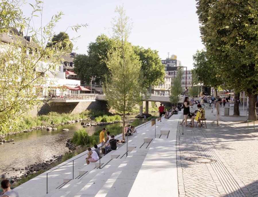
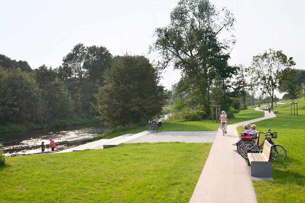
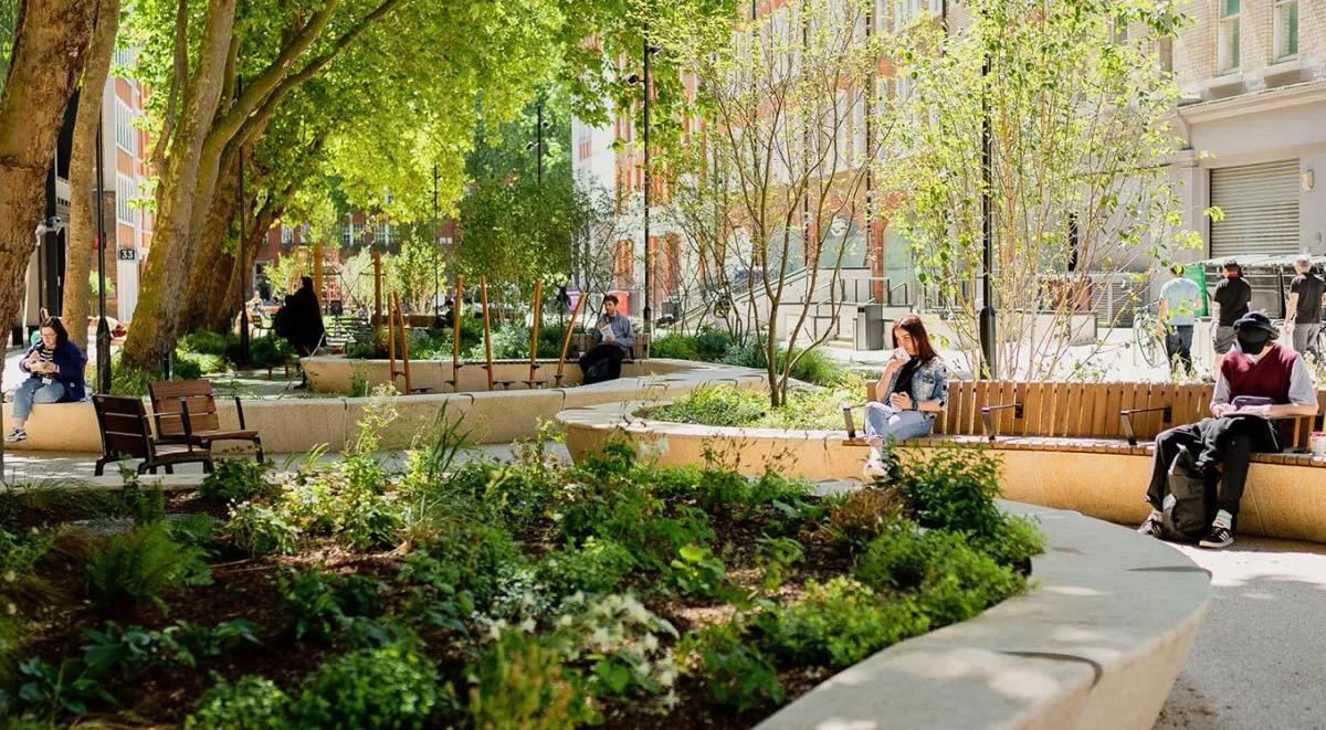
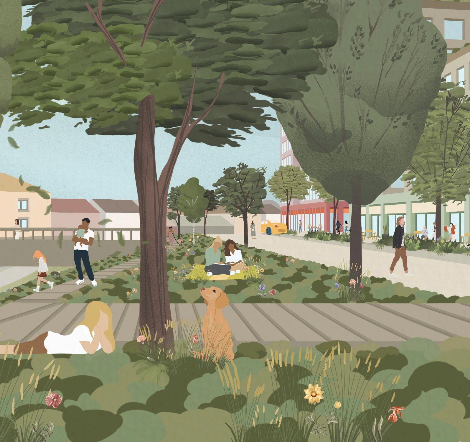
The Masterplan promotes a wide range of public spaces including high-quality streets, pocket parks, squares and roof gardens. Blue (water) and green (ecological) networks through the town centre will be strengthened. The River Rom will be the centre piece of these networks as a new linear riverside park. The river will be partially deculverted and renaturalised, celebrating this important asset, improving water quality, enhancing ecology and creating an attractive public space. New street tree planting and pocket parks will offer a necklace of green spaces linking larger parks and gardens, ensuring a greener Romford.
Objectives
SL1. Link the town centre with existing nearby green spaces in order to improve habitat linkages and increase urban greening to enable and encourage walking and cycling.
SL2. Create new green spaces and enhance existing spaces to support a family friendly town centre and larger resident population and to help people adopt healthy lifestyles and to better connect them with nature.
SL3. Design safe, inclusive, clean, usable and engaging public spaces that are actively managed and take account of on-going management and maintenance requirements.
SL4. Set out an urban greening and tree strategy that helps transform the visual qualities and character of the town centre and improve the area’s resilience to climate changes and mitigate the urban heat island effect.
SL5. Transform the market in to the major public civic space in the town centre, that is able to host a range of events and activities.
SL6. Improve town centre wayfinding through routes and spaces with clear hierarchies, including across the ring road and routes to the station.
SL7. Celebrate the River Rom providing public access, improving its immediate landscape, including deculverting and naturalising hard engineered edges.
SL8. Safeguard and enhance the biodiversity of the area.
SL9: Contribute to achieving the Good Ecological Status of the Water Framework Directive for the River Rom in line with the relevant actions and measures set out in the Thames River Basin Management Plan.
4.3.2 Movement & Connectivity
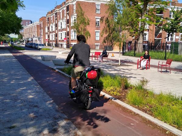
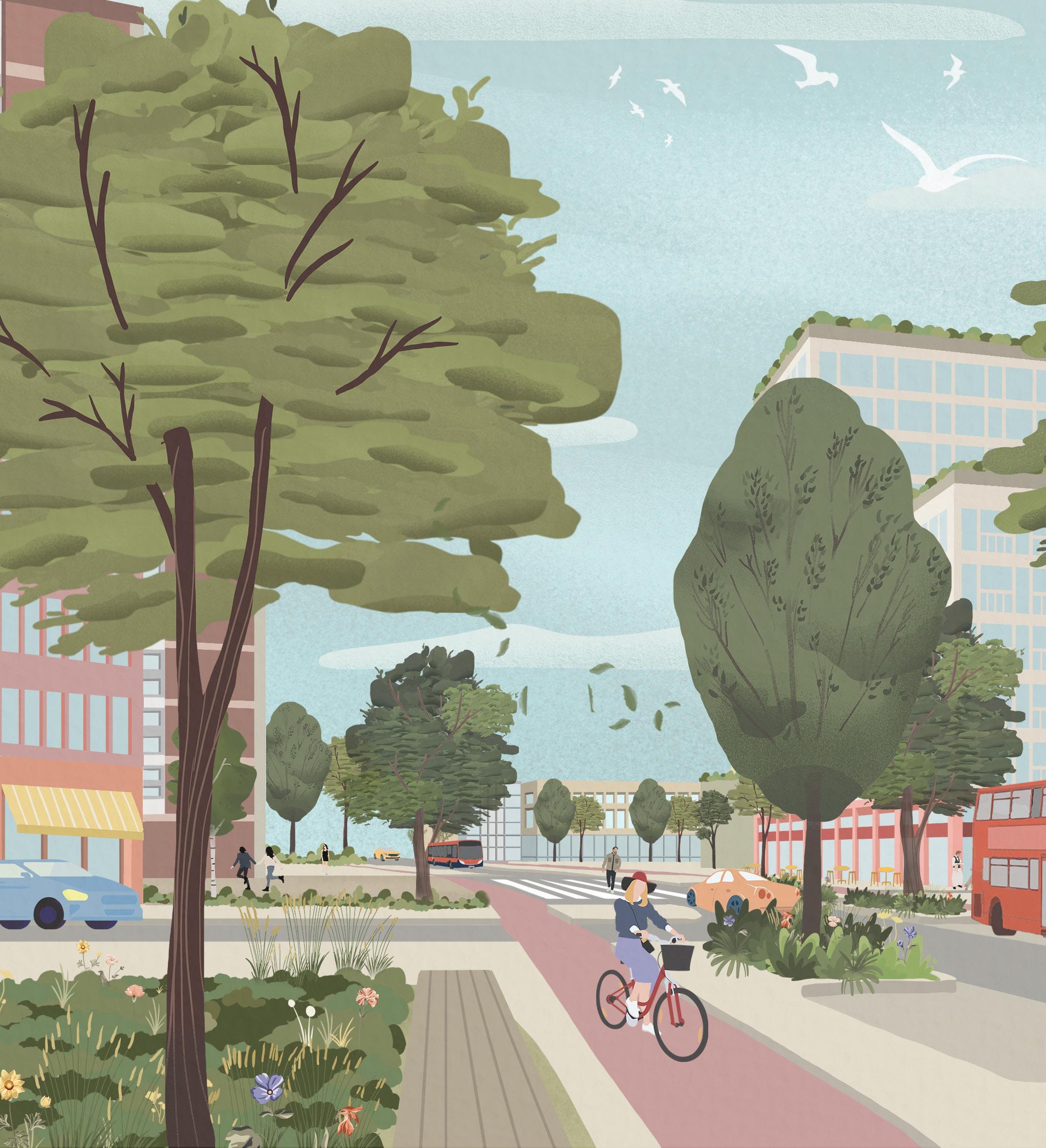
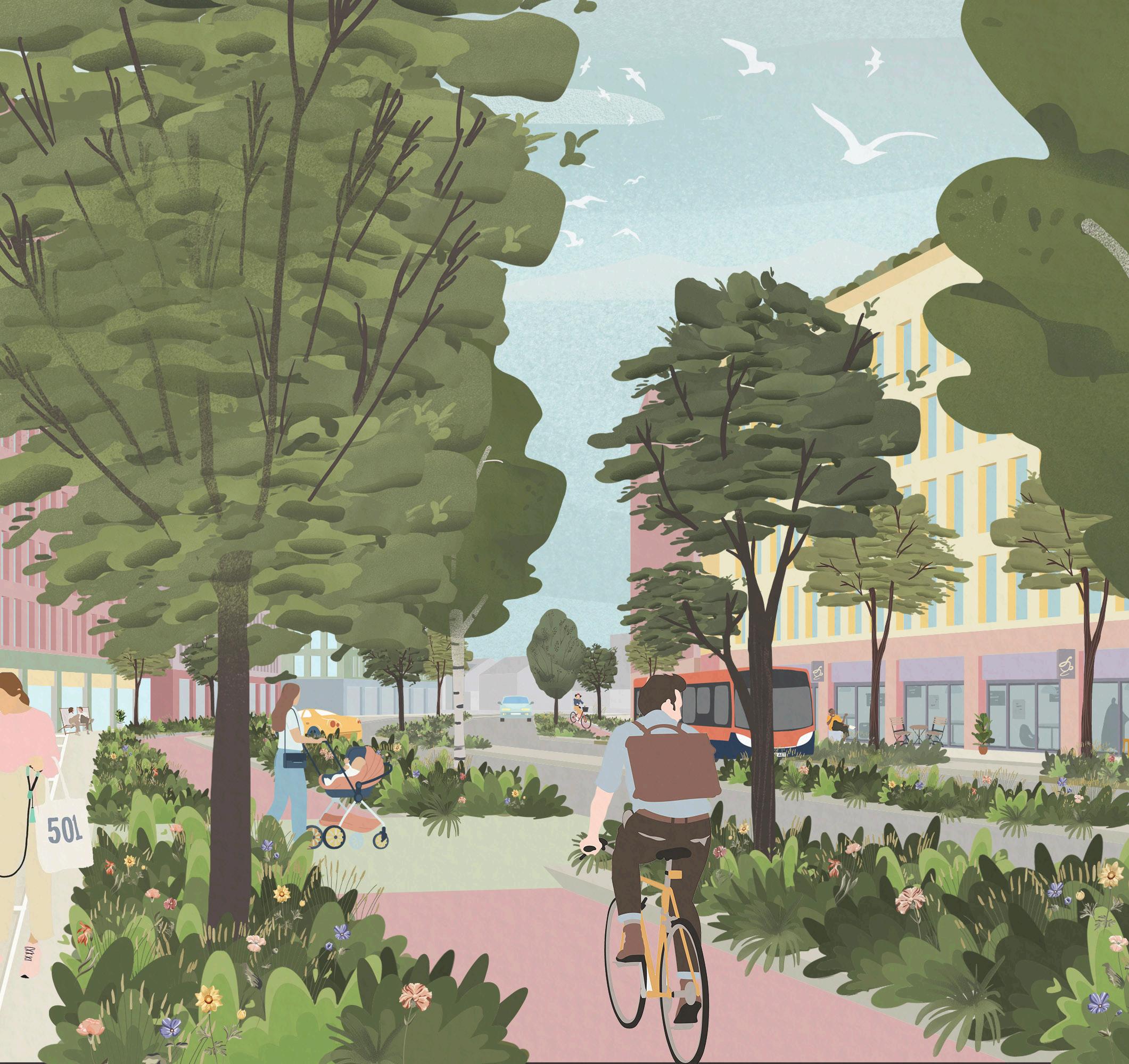
The Masterplan improves access, connectivity and permeability across Romford. Public transport and active travel choices, such as walking and cycling, are promoted to encourage healthy lifestyles and considered equitably with other modes of travel to help reduce private vehicle use and congestion. Reconfigured streets and public realm will create a more attractive, safe and inclusive Romford with engaging spaces to walk, cycle and dwell.
Objectives
MC1. Make the ring road more permeable for all modes of transport by turning it in to a green street with uses that front it, tackle congestion ‘hot spots’ along it and incorporate peninsularisation of the existing roundabouts to reclaim land for other uses.
MC2. Improve connections between the town centre and existing schools, health and community facilities and open spaces outside of the ring road and encourage walking and cycling by making routes family friendly, safe and enjoyable.
MC3. Improve the arrival gateways into Romford by rail, bus, road, on foot and by bike.
MC4. Improve the capacity and passenger experience of Romford Station and surrounding area and create an additional station entrance on Exchange Street.
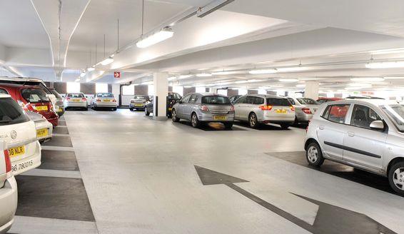
MC5. Roll out a town centre public car parking strategy which rationalises car parking including removal of surplus, under-used or poorly located spaces, and creates attractive car parking areas that people feel safe to use.
MC6. Improve the bus network to encourage activity across the town centre and Queens Hospital, whilst ensuring it is easy to use.
MC7. Accommodate a potential north-south rapid transit system through the town centre in a positive way and that enhances local connectivity.
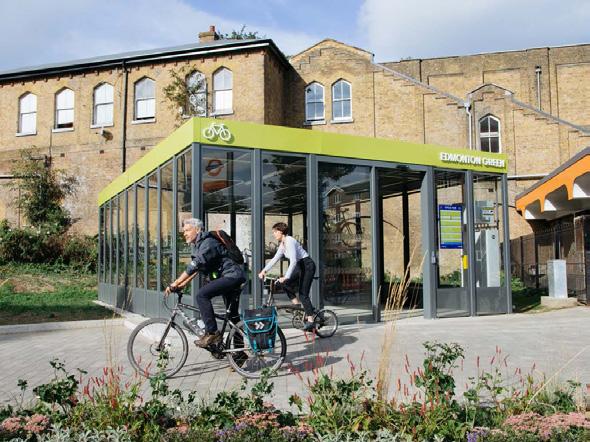
MC8. Enable and promote active travel as an attractive alternative to vehicular travel, in line with the Healthy Streets Approach.
4.3.3 Sustainability
The Masterplan offers the opportunity to ensure growth is built on a platform of sustainable infrastructure with significant environmental and wellbeing benefits. Therefore, environmental, social and economic sustainability is a golden thread that runs through all themes of the Masterplan. Each theme incorporates corresponding sustainability objectives and the specific objectives listed here relate to environmental resilience, energy and carbon, materials, and the circular economy.
Objectives
S1. Transition Romford to a Zero Carbon Town by 2030 and use the Council’s Carbon Offset Fund to achieve it.
S2. Encourage zero carbon development through energy efficient design that considers both operational and embodied carbon.
S3. Develop a strategy for an integrated heat and power network linking wind and solar energy generation, battery storage, ambient heat networks and waste heat sources, with consideration to future proofing, the climate emergency and greater use of electric vehicles.
S4. Create / consider the establishment of a local energy company, such as a Community Interest Company, to supply affordable and reliable energy heat and power to the residents of Romford.
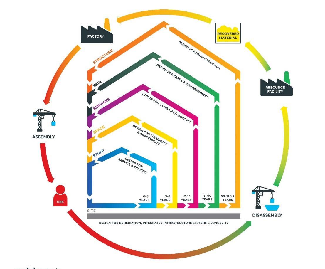
S5. Adopt the principles of the circular economy for all development, incentivising building adaptation and reuse. Incorporating strategies to ensure zero waste to landfill through reuse and recycling of building elements and designing for longevity, adaptability, flexibility and disassembly, taking account of building layers and their lifecycle.
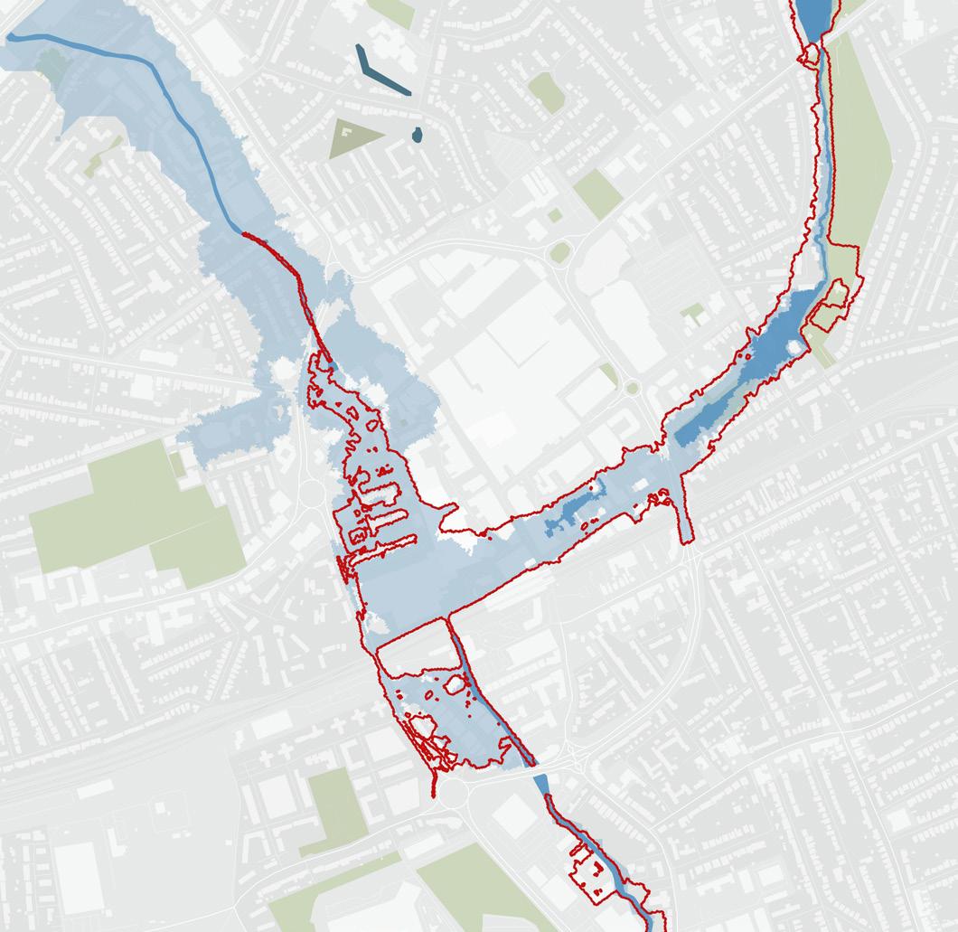
S6: Improving blue and green infrastructure to mitigate and reduce the risk of flooding on the River Rom catchment as well as increasing biodiversity to provide environmental resilience to the effects of the climate emergency.
S7: Enable and promote active travel through improved public transportation and the creation of walking and cycling routes.
S8: Promote local, shared food growing opportunities including small allotments, communal gardens and growing spaces within developments.
4.3.4 Inclusivity, Health & Wellbeing
The Masterplan ensures that all developments, public realm, transport and projects have inclusive design at their heart and are informed by discussion with a range of local people. The Masterplan provides guidance to promote social cohesion and to create opportunities to diversify and to also improve health wellbeing through better accessibility, infrastructure and resources.
Objectives
IHW1. Use the Healthy Streets Approach to facilitate active travel choices such as cycling and walking that can improve accessibility, air quality, health and economic performance.
IHW2. Ensure open spaces and streets are designed to encourage active lifestyles, travel and play and identify opportunities for local food growing.
IHW3. Create green and accessible streets and public spaces that can accommodate vibrant uses, as well as offering places of tranquillity and rest for members of the community of all ages and abilities.
IHW4. Ensure that places are child-friendly and facilitate independent movement by young people around the area.
IHW5: Ensure that the town centre is as accessible and inclusive and safe as possible for all, including women and girls, day and night.
4.3.5 Character & Townscape
The Masterplan draws on the existing qualities and unique assets of Romford to become an increasingly characterful and vibrant place. The setting of Romford's historic places and buildings will be enhanced, including Romford Conservation Area, Listed Buildings and Locally Listed Buildings. New developments will contribute by positively supporting existing or evolving character areas through new and enhanced buildings, streets and spaces that provide a pleasant place to walk through, and to live, work and relax in.
Objectives
CT1. Develop a greater sense of character, consistency and quality in Romford’s built environment and public realm.
CT2. Curate, nurture and enhance existing assets, including Romford Conservation Area, designated and non-designated heritage assets, and buildings of positive character, in order to collectively build a distinctive and coherent Romford character, embedding the role of Romford's heritage in shaping its future.
CT3. Ensure development is responsive to the needs of a growing local population and actively position the town centre in order that it provides an attractive offer to businesses and visitors.
CT4. Seek to redevelop or reanimate underutilised sites and buildings such as surface car parks.
CT5. Ensure developments enhance and reinforce the overall character and townscape of Romford, responding to its history and townscape.
CT6. Building heights should respond to the character of their setting with any taller elements, in excess of 6-storeys, carefully considered through a formal process.
4.3.6 Uses & Mix
The Masterplan promotes a diverse Romford that is active throughout all times of the day. In the central area smaller shops and a more varied food and drink offer will support the vibrancy of the centre and an enhanced early evening economy. Employment and business space will be enhanced, with new provision focused around the station, Waterloo Road and Rom Valley Way. Key locations and public spaces will be anchored by cultural and leisure uses to drive footfall. New residential within the town centre will support existing and new businesses but will also require corresponding social infrastructure including schools, public spaces, heath facilities and transport.
Objectives
US1. Strengthen Romford’s Metropolitan town centre status by focussing retail and other ‘main town centre uses’ around North Street / High Street, South Street, the Market Place, Romford Shopping Hall and the Liberty, Brewery and Mercury sites and improving the overall retail offer.
US2. Diversify the range of uses within the town centre and nurture a safe and attractive early night-time economy, to support the town’s vitality and long-term viability by giving people a number of reasons to spend time there.
US3. Encourage the expansion of Romford’s arts and culture scene as key attractors of visitors, businesses and residents by supporting proposals for additional cultural venues, such as live music venues and suitable workspace, and enhancing the theatre offer.
US4. Incorporate active frontages throughout the town centre.
US5. Encourage additional office space around Romford Station and other business space (including workspace) as part of mixed-use developments in other parts of the town centre.
US6. Optimise the amount of housing throughout the SDA, without overdeveloping, to provide much needed new homes, provide activity throughout the day and aid financial viability of mixed-use schemes.
US7. Ensure that the growth in housing and residential population is matched by additional necessary childcare, school places, health facilities and community space as part of mixed-use developments in locations that are accessible by walking and cycling and ensure that provision keeps pace with growth.
US8. Require meanwhile suitable uses where buildings have been vacant for longer than 12 months and encourage developers of multi-phased schemes to identify a suitable meanwhile use strategy and programme of cultural activities to enliven otherwise vacant / underused land and buildings during the development process.
4.3.7 The Economy
The Masterplan capitalises on Romford's unique position at the interface between Essex and London to promote Romford as a destination, to support existing businesses and attract new occupiers. The Masterplan seeks to make Romford more attractive, diverse and inclusive by broadening the early evening and night-time economies, revitalising Market Place and enhancing retail, business and residential offers. This diversification will create new jobs and support the vitality and long-term viability of Romford.
Objectives
E1. Capitalise on Romford’s unique position at the interface between Essex and London and new Elizabeth Line services to attract new business occupiers to the town centre.
E2. Revitalise and champion the Market Place to support a thriving and local market that is distinct and positive.
E3. Promote Romford as a destination for business by increasing and diversifying the range and type of work and employment spaces available for local residents.
E4. Encourage Romford’s entrepreneurial and innovative spirit by providing spaces for businesses to start and grow including maximising the amount of affordable workspace to help socially sustainable local enterprises and cultural industries establish themselves and thrive.
E5. Create interrelated environmental, social and economic improvements that create a sense of place, increase civic pride, involve local people and create positive change.
E6. Seek opportunities to create socially sustainable local enterprises that support a sustainable Romford.
E7. Capture opportunities and deliver them more locally and equitably, for example through the creation of local social enterprises and community led schemes.
E8. Identify opportunities for local businesses to take advantage of the opportunities presented by the circular economy including reprocessing of materials, leasing materials and the sharing economy.
5 MASTERPLAN THEMES
This chapter sets out strategies for the Masterplan, all of which are designed to deliver the objectives and the vision.
5.1 INTRODUCTION
The Masterplan Themes are categorised into the eight key themes of the Masterplan, and seek to deliver on the vision and objectives described in the previous chapter. The strategies set out thematic guidance for delivering these objectives and good growth, and offer illustrative designs to further guide development. The strategies are grouped into two streams: those to guide the delivery of physical infrastructure and interventions; and those to direct development and growth.
The objectives for Implementation are supported by guidance in a separate chapter, 'Implementation'. This follows Chapter 6 Site Guidance, as it also responds to the content of that chapter.
The Strategies are focused largely around the town centre and core study area, with some strategies covering a wider area – such as for connectivity and active travel – within the SDA boundary. Where Strategies do not explicitly refer to the wider SDA, the spirit of these strategies – for example townscape – can be used to help guide development, conscious of the sensitive suburban context and the need to support Romford's character going forwards.
These Strategies have been overlaid to form the overall illustrative Masterplan, shown in the previous chapter.
Illustrations are used throughout to support the Masterplan. These are based on illustrative proposals outlined in more detail in the Site Guidance chapter. These are indicative, though offer a flavour of the nature of intervention that the Masterplan supports.
As set out in the Vision and in Chapter 7 Implementation, interventions in the Masterplan are anticipated to come forward over time, with the Masterplan looking at a 15-20 year trajectory. Where interventions may come forward in the longer term, these can react to 'triggers', such as modal shift towards active travel, which can prompt and support these interventions. Within this section interventions which can come forward in the short-term are also introduced to help catalyse further positive growth. Reference is also made to ongoing Havering projects, to the Liveable Neighbourhoods work around the ring road, and strategies that relate to this. The Masterplan seeks to build on this work and take it further over the longer timeframe of the Masterplan, whilst supporting their shorter term success.
5.2 SPACE & LANDSCAPE
5.2.1 Overview
In order to deliver a liveable place for the existing and new communities, the town centre must provide sufficient high-quality, multi-functional open spaces to support an increase in residential and non-residential accommodation. Green and blue infrastructure will contribute to community health and wellbeing, climate resilience and biodiversity and to the overall quality of the neighbourhood.
The following strategies seek to balance the quantum and quality of open public open space, including parks and squares, active and healthy green streets, and smaller open spaces. As part of this, the River Rom is renaturalised and deculverted. These strategies are strategically placed to strengthen existing connections into the wider landscape and form an interconnected green and blue network across the town centre that can enhance biodiversity.
The Masterplan draws on existing initiatives and projects, such as the 'River Rom Restoration Project' and the 'Land of the Fanns' partnership to restore river landscapes through Romford, and the Liveable Neighbourhoods work looking to green the ring road.
Romford sits in the context of a multitude of fantastic parks and amenity spaces yet currently is lacking in quality green spaces. The Masterplan delivers a coordinated public realm strategy that introduces public spaces across the town centre, greening Romford. The following strategies bring green spaces, planting, and blue infrastructure including the renaturalised River Rom and sustainable drainage systems into the town centre.
Central to these strategies is the reduction of fluvial and surface water flood risks. This includes measures to control surface water runoff at source and interventions on the River Rom corridor in line with Policy SI12 of the London Plan.
5.2.2 Strategies
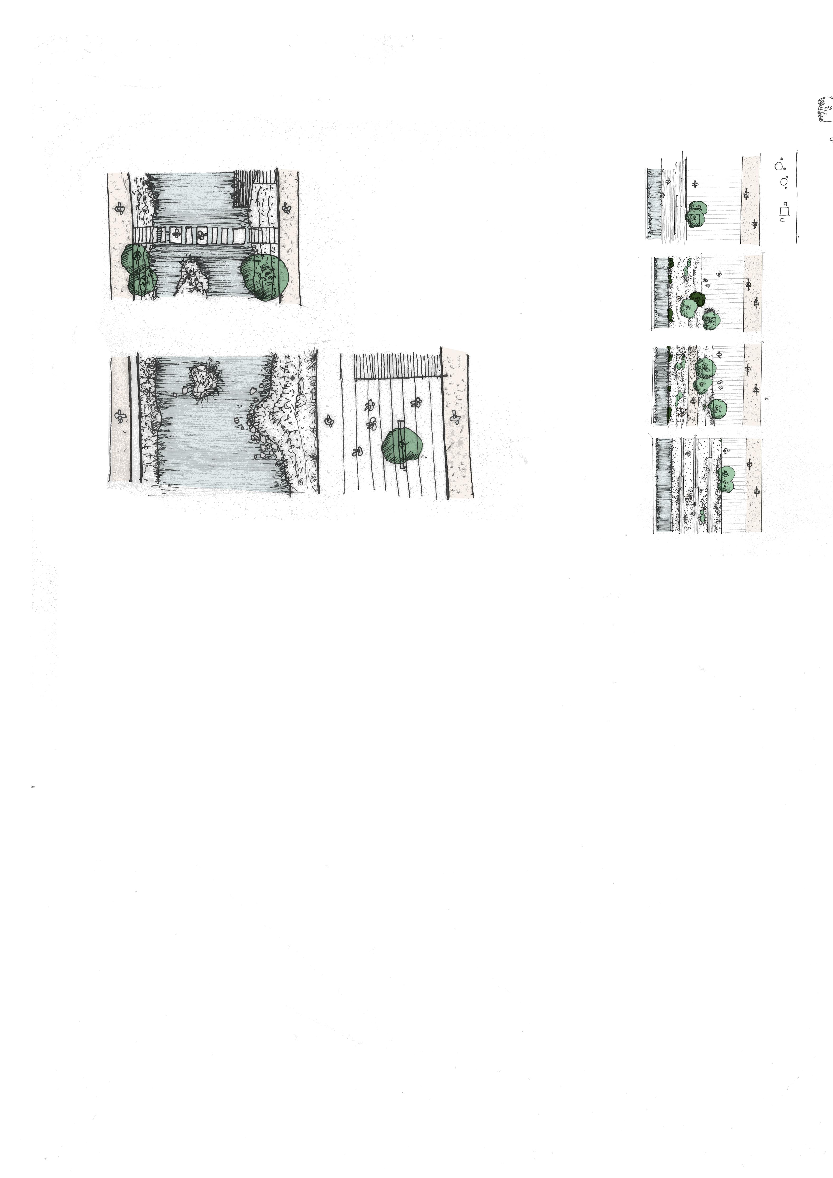
The following space and landscape strategies set out guidance to create attractive, high-quality, sustainable public realm based on a network of blue and green infrastructure and landscaped public spaces.
Green Strategy
A network of primary, secondary and tertiary green corridors and spaces providing public amenity, active travel routes for walking and cycling, increased biodiversity and playspace distributed across the town centre.
Blue Strategy
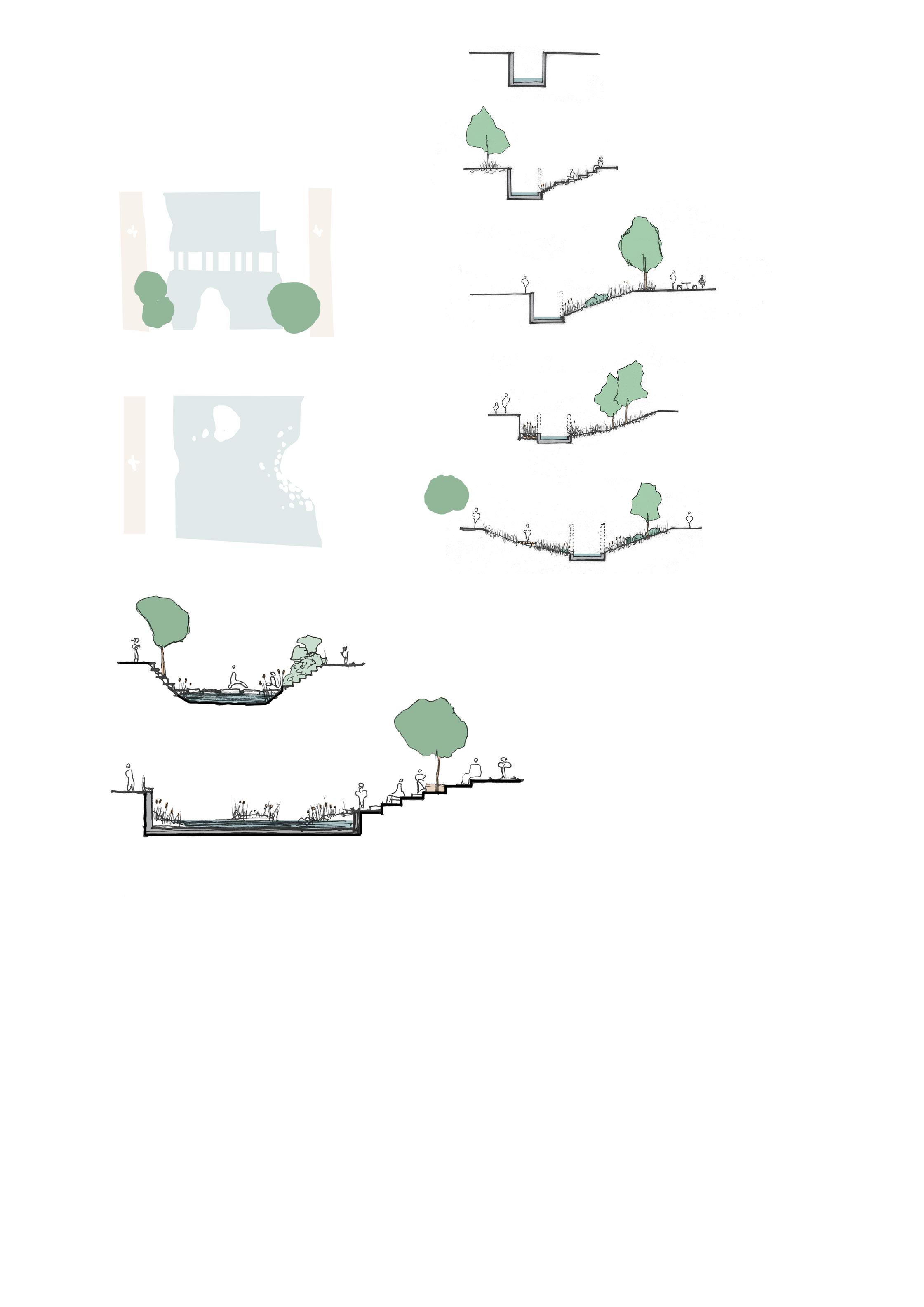
Reestablishing the River Rom, and to a lesser extent Black's Brook, as key features of the town centre through renaturalising or deculverting the rivers, landscaping, and Nature-based Sustainable Drainage System (SuDS) features.
Public Realm Strategy
Introducing new public spaces across the town centre with guidance on public realm design including planting, materials, and lighting.
Key Interventions
Specific design guidance for two significant public spaces that will define the future of the town centre: the Market Place and Brewery Gardens.
Resilience
Promote climate resilience and adaptation, through sustainable design of streets, spaces and buildings integrated with responsive green infrastructure.
Improve continuity and coherence of open spaces along main road by creating a knitted public realm of pavilion style outdoor rooms between buildings
Reintroduce historic Laurie Square as a new civic space for the Town Hall Campus
A reinvigorated Market Place
South Street is celebrated as an attractive and vibrant central spine through the town centre
Deculverting and renaturalising the River Rom and improving its setting Potential for enhancements to Cotton Park to support its role as a town centre park
Brewery Gardens: a new linear river park through Romford centered around the deculverted and renaturalised River Rom
New street tree planting and pocket parks will offer a necklace of green spaces connecting Cottons Park with Lodge Farm Park
Existing Station entrance
New Station entrance
Wayfinding in the town also needs to be improved – particularly around the edges and across the ring road. TfL’s Healthy Streets approach will be followed
Renaturalising the River Rom and improving its setting
Retain existing greenery of the roundabouts and consolidate as part of public realm in new adjacent developments
Cottons Park
Lodge Farm Park
5.2.2.1 Green Strategy
The Masterplan promotes urban greening, to provide amenity and an attractive environment but also enhanced biodiversity, heat reduction, carbon reduction and shading. The primary green network comprises two east-west green routes and the Rom corridor. Ecological continuity of the corridors is provided through Nature-based SuDS and tree canopies interspersed with larger green spaces such as the Market Place and Brewery Gardens. The two green spines are within 5 minutes walk of any location in the town centre and when combined with the two parks at the extremities form a 3km green loop which can be walked in 45mins or cycled in 15mins.
1. Northern Green Corridor
The northern, east-west green corridor connects Cotton and Lodge Farm parks via the Market Place.
2. Southern Green Corridor
The southern, east-west green corridor runs between Cotton and Lodge Farm parks via the Waterloo Estate, Exchange Street and Eastern Road. It connects to the renaturalised Rom and proposed new station entrance.
3. Rom Corridor
The River Rom should be deculverted and renaturalised as much as possible in and outside the town centre to improve biodiversity and enable access to the river. This approach is in line with the London Plan's Policy SI17, and will make a significant contribution to fluvial flood resilience as well as to help decrease flood risk elsewhere on the River Rom catchment. Improvements should also include a pedestrian and cycle link running north-south through the town. Further, this brings opportunity for enhanced amenities, incidental play opportunities, along the River Rom and Black's Brook. Buildings should be set back a minimum of 8m from the top of the river bank to achieve a wide naturalised riparian corridor, in line with Policy 31 of the Havering Local Plan, and provide maintenance access to the river edge and any fluvial flood defences.
The proposed naturalised green open spaces for the Rom Valley and Brewery sites, alongside and around an open River Rom, can be classified as Suitable Alternative Green Spaces (SANGS).
Fig. 16. Map of
Green corridors – Malop Street, Victoria
Secondary network: Key Green Spaces
Two significant additions to the town centre landscape are proposed: Brewery Gardens and a greening programme for the Market Place. These two spaces will increase urban greening, biodiversity and provide key amenity benefits.
Tertiary network: The Green Grid
A tertiary green network connects the main parks through pocket parks, waterfronts and a network of green streets and swales. This is made up of street trees, swales, pocket parks and green waterside verges that perform as part of the flood strategy. The tertiary network is key in establishing a dense, interconnected and high-performing green grid.
Ecology
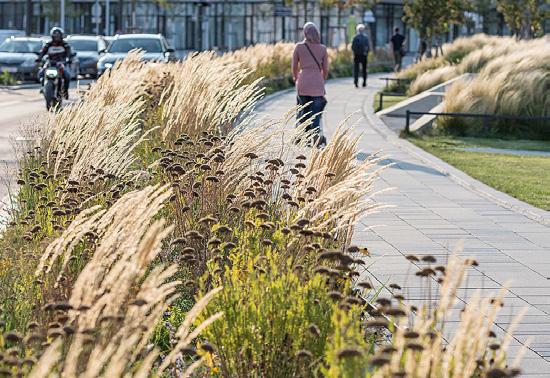
Soft landscape design and ecology must be consistent with and reinforce Romford’s location at the interface between Natural England’s classifications of North Thames Terraces and the Essex Plateau. Planting must be composed of a diverse range of native species in accordance with emerging Nature Conservation Strategies, whilst ensuring species are climate change resilient, and also drought resistant where possible. There is potential to incorporate innovations such as wildflower lawns that can be walked on and used in place of amenity grass to create a more naturalised environment.
Amenity
Alongside designated nature areas, primary green spaces must provide local play space, sports and leisure programme. Together, green spaces should establish a network of safe, legible, and connected walking and cycling routes through and beyond the town centre.
Child Friendly Romford
Havering prides itself on being a place for families, as both a place to start and a place to stay. However, the town centre does not cater well for children. There is a deficiency in formal and informal play space and critically is not a place most people would describe a child-friendly in terms of mobility. New developments must deliver high-quality and varied play space which should respond to and reinforce local character in line with the following recommendations.
Local (for years 5-11) and Neighbourhood play (for teenagers) should be provided in parks and public space as a combination of designated and informal playable space. Doorstep Play (for children under 5) should to be provided within individual plots, courtyards and along green streets.
The location and type of play should be considered together to create a journey – allowing children to roam and play freely, and away from traffic. All playable spaces must be located in areas that are not too exposed to wind, receive a minimum of 4 hours of sunlight on 21st March and have a comfortable micro climate. Active and passive surveillance should be used to provide a safe, child-friendly environment.
Queen Elizabeth Olympic Park, London: incorporating informal play alongside cafés and parks
Play and sports spaces should cater for adults, for example providing adequate seating. Equipment should be multi-use and designed to promote imaginative play, rather than solely ‘off-the-shelf’ equipment.
Connections to the town centre must be improved for all but taking particular account of families and children who do not use cars.
The following quote from Dinah Borat from the Greater London Authority (GLA) Good Growth By Design, Making London Child Friendly, illustrates the importance of considering children in the design of places and spaces:
“Independent mobility is the everyday freedom we all need to get around our local neighbourhood and city as we choose. For children and young people it might be to reach destinations like school and the shops, but it is also about being active outside as part of play, or hanging out with friends...We need to focus on improving the independent mobility of young Londoners if we are to reverse the negative trend, and give back their freedom to enjoy spaces, be part of the community, and grow up as happy, healthy people.”
Raphael Park, Romford: celebrating existing local assets
5.2.2.2 Blue Strategy
The Rom, and to a lesser extent Black’s Brook, are central to Romford's history and should form key elements of its future identity. Proposals must work to maximise the experience, activation and ecological potential of these existing waterways through naturalisation and ecological enhancements.
Culverted and canalised sections should be renaturalised, wherever possible, to enhance environmental and recreational qualities of the watercourse. Key public spaces are located strategically along the waterfronts.
The Masterplan blue strategies should be considered in tandem with the Havering Local Flood Risk Management Strategies (LFRMS) and Surface Water Management Plan (SWMP), which are currently in draft.
Street and public space design should enhance the environmental and aesthetic value of the landscape by forming a web of parks, swales and other Nature-based SuDS features, illustrated in Fig. 17, that enhance the quality and character of the area, whilst ensuring its resilience to surface water flooding and reducing fluvial flood risk.
01 Parc de Bottière-Chénaie, Nantes: Atelier des paysages Bruel-Delmar riverbed width 10-13m
SuDS forming part of street design, creating attractive environments and also draining to nearby water courses
02 Siegen to new shores, Siegen: Atelier Loidt riverbed width 30m
Fig. 17. Map of blue strategy
Siegen, Germany: river corridor width 30m
5.2.2.3 Public Realm Design
Public realm should create a high-quality, consistent landscape that reinforces Romford's status as the cultural and administrative heart of Havering. The key public spaces are illustrated in Fig. 18. These include the Market Place, Brewery Gardens, new and upgraded station entrances and a network of smaller squares and pocket parks whose locations are indicatively shown, with the target of ensuring all new major developments bring significant public space. These spaces can be encouraged to host cultural events to support community activity and positive interpretation of the physical environment. In addition, development must be in line with the previous green and blue strategies and the following design principles.
Planting must be composed primarily of native species with some non-native species to offer climate resilience. Planting should be locally sourced, within 100 miles of the site as they will have more climate resilience and will not become invasive or be detrimental to local ecology now or in the future.
Reintroduce historic Laurie Square as a new civic space for the Town Hall Campus Reinvigorated Market Place with new seating, tree planting and event space
of smaller spaces
Materials should be robust, long-lasting, practical to maintain and attractive. More than 50% of materials in the landscape must be from secondary sources. A coordinated maintenance strategy will be needed to ensure that all public spaces are kept in good condition over time.
The BRE standard of a minimum of 2 hours of sunlight in public spaces should be met. Computational Fluid Dynamics (CFD) testing must be carried out to understand and address wind issues and mitigation integrated into building and public space design to address any identified issues.
The street scene should avoid clutter, with potential for components such as lampposts to be designed so they can incorporate other uses including vehicle charging, sensors, signage and CCTV. Street lighting and public space lighting must be designed to minimise light pollution whilst providing good levels of light for pedestrians, supporting safe night time activity. Particular care should be taken in sensitive areas including along quiet green streets, along
Remove car parking from the Market Place and from other public spaces across the town centre in order to create more attractive and usable spaces, whilst providing tidy, formalised parking locations elsewhere
park edges and the Rom. Lighting should be designed to minimise energy use. In more busy and focal areas care should be taken to ensure the spaces are appropriately lit and that they create a safe and welcoming environment at night for everyone, as well as during the day.
In supporting inclusivity of public spaces, giving careful consideration to people with babies and toddlers, and caregivers can ensure the design benefits everyone. Alongside access to better services, affordable transport and safe, clean and green spaces for families and others to gather, this approach will support a truly inclusive Romford.
Waste collection systems should be integrated into the public realm to minimise impact around plots whilst also facilitating high levels of recycling within easy reach of units.
Where possible, opportunities for spaces for growing food should be sought, particularly as part of new development. These should be encouraged as community assets.
5.2.2.4 The Market
The market is a central component of Romford's culture and heritage. The Masterplan will create an enhanced setting in which the market can thrive, through improved frontage on the Market Place and improved public realm in the Market Place.
The market has declined in volume in recent years, however, it is still regarded as an asset and there is strong support shown through the Masterplan Public Engagement, summarised in Fig. 19, for its retention and to nurture future growth. In the meantime, the Masterplan proposes a new setting for the market to accommodate a flexible number of stalls, that can help provide a sense of vibrancy if fewer stalls are present, and also allow expansion should further stalls arrive.
Continuing to run a programme of activities and events within the Market Place, public realm improvements, and supporting its vitality with cafés and restaurants and
complementary retail at its edges will help in enhancing the market, bringing extra footfall and increasing dwell times. This will also help generate a culture of activity in the Market Place outside market days as opposed to simply utilising the space as a car park.
Uses around the town centre, particularly in the Liberty and Romford Shopping Hall, must complement the market and not compete directly with it. Instead, the rest of the town centre can help in supporting Romford's key asset, allowing the town centre to thrive.
9.2
9.3 Feedback from young people
Model making key themes and elements
Thematic feedback
The volume and detail in the feedback we have received and how important it is as a location that provides a range In the main people want to see Romford sustain, thrive and
When asked what ideas people were most supportive of
A vibrant Market Square Station entrance
When thinking about the market there were suggestions for distinct play areas with elements such as climbing walls/frames, slides, swings etc and the potential to create swing seats. There were also suggestions for high impact landmarks such as colourful gateway signage, pergolas and performance space, and other kinds of decoration and public art such as interactive floor lighting, fountains, festoon lighting, colourful artwork. There were also suggestions for more planting trees and edible that could be sold on stalls.
Elements that made more of an arrival impact were suggested: gateway signage and lighting, information points, seating, water fountain (drinking + feature) play elements (climbing, slide swings). Space for animals/ nature trees and planting were also suggested.
The market as a key part of Romford’s identity was equal top priority for most respondents. Linking together specialist markets, improvements to landscaping and trees coupled with varied programming that animated this space.
Signposting the market from the station and creating art, signage and reflecting the heritage were all seen as key approaches to supporting the market to thrive.
“We need a vibrant market with activities and culture as the
Fig. 19. Feedback from young people – Romford Masterplan Engagement Summary, 2024
is market stalls slots (approx. linear route linking to the greenspace behind as part of remnants such as there is different reclaim into one of the Market colossal area areas. square acts scale of as well into stages or landscape subtlely until evolve to restore the Romford’s wilderness.
5.2.2.5 Key Interventions
The Market Place, alongside Brewery Gardens, are two key public spaces in the town centre that will help define Romford's future character. Approaches to these spaces are included here to help demonstrate the objectives and strategies that they relate to, with further detail provided in relation to the Market Place within the Site Guidance chapter.
The Market Place
The Market Place hosts the local market, foundational to Romford, and consists of a large open space in a formal composition at the heart of the town. It forms a linear axis bisecting the town from High Street to the ring road. On market days, the space is primarily populated by market stalls and otherwise is designated for car parking. The only open green space is the historic churchyard cemetery behind the church.
The intention is to improve the structure of the Market Place to make it better able to host a market and other events, whilst remaining flexible and adaptable. An intimate scale of buildings and supportive uses fronting the space will help to positively animate it, alongside improving connections into the space. More detail on these proposals as well as illustrative layouts are set out in the Site Guidance Chapter.
Romford Town Centre
9.1.9 Phasing
Key features of the future of the Market Place:
The existing Market Square is primarily populated by market stalls and designated carpark slots (approx. 180 spaces). There is a linear route leading to the opening linking to the ring road. The only open greenspace is the churchyard cemetary behind St Edward the Confessor, as part of historic grain.
• Remain the primary civic space for the town centre
• Continue to accommodate the market, and allow for a flexible provision of temporary stalls
• Accommodate greening in the form of trees and planting
• Accommodate space for events
Using the infrastructural remnants or marks on the ground such as one of carpark, whether there is a potential to cultivate different plants species in areas and reclaim disused unattractive plots into one of ecological asset
• Provide seating and informal spots to stop and dwell, in an attractive and safe environment
Market Place Implementation over Time
There is an opportunity to commence enhancements immediately:
• Utilised infrastructural remnants or marks on the ground can be used to help define and programme the space.
• Transform under-utilised areas into ecological assets through temporary or permanent soft landscape.
In the near term, further enhancements can be made:
• Use the axis running through the Market Place to divide the large 1ha area into smaller pockets of spaces.
• Articulate the square acts to recall the scale of the historic market.
• Activate the segments with different programmes, such as attractive event spaces, stage or fairground.
In the longer term can be full transformation of the space:
• Introduce pieces of a natural landscape in phases until the terrain evolves and can perform a role as part of the wider green corridor, restoring the lost connection between Romford and its rural context.
• Remove car parking in order to be continuously usable and attractive as a civic space
• Enhance lighting and create a welcoming and safe feeling across the space at all times of day and night.
The axis coursing through the Market Square can divide the colossal area of 1 ha into smaller pocket areas. The articulation of the square acts as present to recall to the scale of the Market from the past as well as activating the segments into attractive event spaces, stages or fairground.
The return of the natural landscape can be implimented subtlely until the terrain will gradually evolve to a green corridor and restore the lost connection between Romford’s centre and the rural wilderness.
The Masterplan proposes the market to be a core component of this civic space, and central to ensuring that Romford's Market is successful and vibrant will be having a strong management strategy.
Car parking from the Market Place should be rationalised by consolidating in other locations to accommodate a more generous, usable and attractive public realm, whilst still allowing servicing access for the market within the space.
Market space
Event space
Market greening
Seating
Public realm connectors
Green space connectors
Improved pedestrian crossing
24. Market Place strategy illustrating the market as a civic space, anchoring surrounding public realm, with flexible space for the market and events, and with greening and seating
Fig.
Fig. 23. Enhancing public space and helping the market to flourish – Illustrative view of the Market Place, looking west
Brewery Gardens
A naturalised section of the Rom forms the centrepiece of the proposed Brewery Gardens. This will be a new 1.1 ha linear public space running alongside a deculverted and renaturalised portion of the River Rom. The key design principles are illustrated in Fig. 25 and Fig. 26 with additional design guidance for the wider, immediate context. Opening and renaturalising the river will enable the creation of an ecological corridor for different species of plants and wildlife for migration. Biodiversity should be maximised through the creation of habitats along the riparian corridor using native marginal planting and
Retain the Brewery chimney as a landmark
diverse hydro-morphological in-channel features such as riffles and pools. Soft riverbanks and the use of soft engineering solutions should be implemented where possible. Clear justification should be provided where hard banks are required.
New opportunities for recreation and education should be incorporated along the riverbanks for residents and visitors to have ‘doorstep’ access to nature. This amenity will be a hugely positive asset for the anticipated new neighbourhoods adjacent and nearby.
Eastern bank forms a landscaped linear parks with swales, Nature-based SuDS, generous planting, cafés and restaurants alongside spaces to sit and direct access to the waterfront
Activate spaces along the river with new uses such as cafés and restaurants. Provide pleasant spaces along the River Rom that allow people to sit, stop, eat, drink and enjoy the town centre
Provide direct access to the water and create green spaces and quiet places along the River Rom
Western bank provides service and access route to ground floor active uses and residential above
Creating pleasant cycling and walking routes along the Rom and connect the Rom to the wider cycling and walking network through and across the town centre
Fig. 25. Illustrative plan of the Brewery Gardens showing key moves
Fig. 26. Illustrative section through the Brewery Gardens
Brewery Gardens:Riverbed scale
Brewery Gardens Character
The River Rom bank’s width should be considered an ecosystem. Landscaping should both improve its natural dynamics and reinforce its role in the city by keeping the low vegetation on the river side to allow visual connectivity to the water.
The River Brent restoration in Tokyngton Park incorporates low vegetation to preserve the connection to the water
Mix pockets of green space with urban space and local species in keeping with the natural ecology of the Rom
The Parc de Bottière-Chénaie in Nantes incorporates stepped, naturalised banks with an adjacent pedestrian route and direct access points to the water
Nantes: Atelier des paysages Bruel-Delmar
01 Parc de Bottière-Chénaie, Nantes: Atelier des paysages riverbed width 10-13m
Fig. 27. Capitalising on natural assets, greening the town centre and engaging with the river –Illustrative view of Brewery Gardens, looking north along the River Rom
5.3 MOVEMENT & CONNECTIVITY
5.3.1 Overview
The Masterplan actively seeks to enhance the quality of access to Romford for all modes of travel, drawing on the excellent public transport and vehicular access, and in particular by making local walking and cycling journeys more attractive. The introduction of more green spaces, trees, and Nature-based Sustainable Urban Drainage Systems (SuDS) to the streets will create bespoke attractive and resilient environments.
The Masterplan also builds on the Romford Liveable Neighbourhood proposals which seek to make walking and cycling easier and more attractive. This includes the ambition for roundabouts with underpasses to be transformed into at-grade crossings, creating more attractive walking and cycling access across the ring road to the town centre, and increasing green space around the ring road. A first phase to upgrade the North Street roundabout area is likely to come forward in the shorter term.
Public realm improvements, also in line with the Liveable Neighbourhood works, are proposed south of the ring road along Rom Valley Way. These improvements will create more favourable conditions for pedestrians and cyclists and support active travel for large scale development proposals coming forward in this area of Romford.
The Masterplan promotes further enhancements in the longer term, targeting compact junctions in place of roundabouts, freeing up developable and public realm space, whilst maintaining key vehicular north-south and east-west connections beyond the town centre. Though outside of the scope of this Masterplan, proposals must place transport capacity and safety considerations at the heart of any interventions in the movement network.
Public transport is vital to the success of Romford, and strategies for rail and buses, including a proposed new station entrance, help reinforce but also enhance this key component.
5.3.2 Strategies
The following strategies aim to create a balanced network of urban streets, offering a choice of ways to get around and prioritising active travel and public transport.
Walking and Cycling Strategy
Enabling and encouraging walking and cycling through the creation of a network of walking and cycling routes and transforming all streets and spaces into attractive, accessible spaces with equal priority for pedestrians and cyclists.
Active Travel Strategy
Promoting cycling, walking and public transport as the preferred means of transportation.
Public Transport Strategy
Promoting integrated public transport through improving the experience of the existing bus and train network and possibly incorporating a potential new north-south rapid transit link.
Car Parking Strategy
Rationalising and distributing sufficient car parking across the town centre including removal of surplus, under-used or poorly located spaces (from a land use optimisation perspective), locating the remaining car parking adjacent to the ring road, to reduce the dominance of private vehicles in the town centre.
Ring Road Strategy
Recharacterise the ring road, downgrading in parts, transforming it into a more attractive and accessible multi-modal street.
Town Centre Servicing
Develop a street-based, coordinated, time-controlled servicing strategy.
Peninsularisation of Roundabouts with underpasses into at-grade crossings with potential to also become junctions
Potential new bus routing
Network of local streets
Crossing the ring road
Route along the River Rom
Bus routes & bus stops
Potential north-south rapid transit link
Potential
Improved
5.3.2.1 Walking & Cycling
Havering's Local Implementation Plan has set an ambitious target for 65% of residents to be walking, cycling, and using public transport by 2041. The Masterplan supports this goal by encouraging walking and cycling locally and transforming streets and spaces to make them more attractive, accessible, inclusive, equitable and safe.
Crossing the ring road easily and safely is a key part of this, and the Masterplan draws on the what is outlined in the Romford Liveable Neighbourhoods work which will see roundabouts with underpasses transformed into at-grade crossings – a positive way to enable and encourage more people to walk and cycle into the town centre.
The network of walking and cycling routes within and around Romford can be enhanced and extended by upgrading streets to offer wide pavements and cycle lanes / space for cyclists, and by introducing new pedestrian and cycle friendly streets and connections. These will create attractive routes into the town centre to enable and encourage people to step out of their cars and relieve pressure on roads and town centre parking.
A consistent palette of materials and wayfinding markers should be used across the public realm. These should be robust, high-quality, long lasting and easy to maintain.
Cycle infrastructure must be embedded in the design of streets around Romford. Cycle lanes should be segregated or given dedicated space on routes identified in Fig. 29 and Fig. 30; with cycling and pedestrian priority given on quieter internal streets without the need for segregated cycle lanes. Bike ramps should be incorporated where necessary in public realm schemes, where changes in level has to be by steps. Romford already has higher cycle parking standards than the rest of the Borough, and this can be further enhanced as part of new and improvement public realm work, and in particular through cycle parking hubs around the station.
Enabling and encouraging walking and cycling is important in supporting an equitable Romford, allowing people without access to cars, or who choose to walk or cycle, a connection with the town centre.
Making sure streets are for active travel and social interaction, rather than purely places for the car, aligns with the Havering Local Plan as well as the Mayor's Transport Strategy, 2018. It is an important step towards Havering's own Local Implementation Plan target of 65% of residents walking, cycling or using public transport, and the Mayor’s Transport Strategy target of increasing mode share for walking, cycling and public transport towards 80%, both by 2041.
With such a shift comes great benefits. As well as health benefits, economic benefits are outlined in TfL's evidence base on the 'economic benefits of walking and cycling', stating that people who walk to the town centre spend up to 40% more than those who drive; and that cycle parking delivers 5 times the retail spend per square metre than the same area of car parking.
Improving routes for walking and cycling can often be low-intervention upgrades that can be delivered early, encouraging a shift away from the car for shorter journeys.
The Masterplan recommends that the planning application process is used to secure generous cycle parking and other cycle infrastructure (such as lockers, showers and electric bike charging) for non-residential buildings, as well as to encourage provision of cycle repair shops.
The River Rom corridor should be developed as a continuous north-south pedestrian and cycle movement connection through Romford town centre, also better connecting the town centre with its surrounding neighbourhoods and with recreational areas along the Rom. The path infrastructure should be within close proximity of the river course, above the 1:5 flood level, offering visual amenity and a physical connection to the river, in order to provide an experience of nature. There should be regular cycle and pedestrian crossing points provided no more than 125m apart along the river to avoid long isolated paths through landscape without means of exit – this allows for a safer environment and one that better plugs into the wider network. Walking and cycling paths must be inclusive using appropriate stairs and ramps. The river corridor should be widened to contain sufficient space for the necessary infrastructure.
Fig. 29. Walking & cycling connectivity across the town centre
Pedestrian & cycling
Romford Station Cycle
Pedestrian and cycle friendly streets
Segregated cycle lane
Dedicated cycle lane
Walking & cycling along the Rom
5.3.2.2 Active Travel
Walking or cycling to the town centre and the railway station for journeys under 2km should be the most attractive modes if not taking public transport. Some of the trips within 2km are already quicker and more convenient by bicycle than by car.
There are also an abundance of attractive nearby parks and amenities within 2km of the town centre and the station which can be easily reached on foot or by bike for those living in the centre.
The Masterplan proposes that routes across the SDA be enhanced to provide for active travel Fig. 30 highlights how much of the town centre's context is within a 2km catchment.
Primary active travel network (Segregated cycle lane) Primary active travel network (Dedicated cycle lane)
30. Enhancing routes for active travel within 2km of the town centre
Cottons Park (700m)
Romford Grayhound Stadium (1km)
Jubilee Park (1km)
PlayFootball Romford (1km)
Romford Cemetery (1 km)
Romford & Gidea Park RFC (1.6km)
Jutsums Park (1.7 km)
Police Station
Gidea Park Station
Lodge Farm Park (1.2km)
Park (1km)
Romford Golf Course (2km)
Hylands
Grenfell Park (1.5km)
Central Park Dagenham (1.8km from Romford Station)
Rom Skate Park (2km)
Harrow Lodge Park (2km)
Crown Farm (2km)
Haynes Park (2.1km)
Nearby attractive amenities – Raphael Park, Romford
5.3.2.3 Street Hierarchy
The Masterplan proposes a finer urban grain, based on streets, that creates a clear hierarchy, and clear definition of urban blocks and their public frontage. Streets are designed to be shared by multiple modes of transport – pedestrians, cyclists, buses, vehicles, mobility scooters, etc. This will form a marked shift from the current car-dominated approach to roads in the town centre.
The pedestrianised areas in the town centre are maintained. This will extend into the Market Place, with car parking removed from the space so it can perform as the town centre's primary civic space without hindrance.
The street hierarchy map highlights 'active travel streets' that are primarily for pedestrians, and also for cyclists where appropriate, with potential for controlled vehicle access where required such as is currently the case in parts of South Street. A network of pedestrian and cycle priority 'local streets' provide access in and around the town centre, which also incorporates 'civic space', in addition to the primary active travel network.
The town centre currently has many exposed back conditions, and the intention is for these to be enclosed within new blocks.
Buildings can be serviced from the street. This will require careful timing controls to ensure minimal intrusion on the public realm and on other transport movements.
The ring road is currently a highway condition and can be transformed into an urban street.
A series of street sections are included as part of the Movement strategies which further explain the make-up of the proposed streetscapes. Importantly, it can be seen that generous spaces are given to pedestrians and cyclists, with only minimum spaces offered to vehicles, ensuring a more equitable environment that can encourage active travel.
Smart cities components can become a part of Romford's street design. Specifically, smart technologies to support coordinated town centre parking could help reduce town centre vehicle movements by informing users which spaces are available, potentially through an app. Additionally, smart benches, parklets, EV charging points, electronic advertising, traffic modelling and enforcement by CCTV which can also monitor noise, speed, and emissions can all be integrated.
Fig. 31. Street hierarchy
5.3.2.4 Public transport
The Masterplan promotes the integration of public transport solutions in Romford, and seeks to improve the accessibility and experience of those using the town centre. In particular, the railway, buses and a potential new north-south connection across Havering, are the core public transport offer. Key to the Masterplan is the introduction of a new station entrance at the western end of the platforms, adjacent to the River Rom, and facilitating and integrating bus and rail connections around the station, with potential also for a mobility hub and enhanced cycle parking.
Bus network
Bus routes around Romford provide good coverage of the area and influence the high PTAL rating the town centre gets. If a modal shift towards active travel is achieved, bus travel will be important for those travelling more than 2km to get to the town centre, and for those less able to walk or cycle. Retaining the bus movements through the town centre, therefore, allows passengers to access the core of the town.
The environment in front of the existing station entrance can be improved partly by removing or reducing bus movements under the viaduct. It is recommended that further engagement and feasibility discussions should be evolved in partnership with TfL to consider potential rerouting of services. Select alternations to the existing bus routing that could improve the experience of moving around the town centre could include removing buses from Chandlers Way and providing an interchange for the existing station at Victoria Road and South Street. Consideration should also be given to connecting the potential new station entrance to the west with stops on Waterloo Road.
The bus stands to the south of the railway are at capacity and deemed by TfL to be in a good location – close to route termini. The area also has driver facilities, allowing for change of shifts and comfort breaks. Regeneration of this area should consider possible reprovision or relocation of these facilities, subject to discussions with TfL.
Policy 1 of the Havering Local Plan makes specific mention of the importance of bus connectivity with Queen's Hospital, and easy access must be maintained.
As outlined in the Liveable Neighbourhoods work, there is potential to introduce dedicated bus lanes on the ring road to alleviate impact from congestion, promote bus use and improve bus journey times.
Fig. 32. Transport network
Railway & station entrances
Romford currently has excellent rail links to London and Essex, with a connection also to Upminster. On the back of the arrival of the Elizabeth line, and of the expected growth in the town centre, a new station entrance is proposed to the west of the existing entrance, (in addition to upgrades already completed to the existing entrance) an excellent opportunity exists to open up links to the west, create a new public space, and incorporate routes along the River Rom. Conceptually, this new entrance could make use of the historic archway through the viaduct previously used for goods trains. The entrance can also alleviate pressure on the current station entrance, and support new growth and connectivity in the west of the town centre and along the River Rom.
Further work and collaboration with Network Rail and other relevant operating companies will be necessary to improve the existing station entrance and introduce new north and south entrance ways. Further collaborative work will also be necessary to investigate the provision of a second western entrance to Romford station.
North-south Borough connection
North-south connectivity for public transport in the borough is currently poor with the main transport routes running east-west to connect to central London. A new public transport corridor is being investigated by the Council to improve the north-south connections, with the route going through Romford. The Masterplan includes a suggested route along the western flank of the ring road, connecting with the new station entrance, safeguarding the historic core of the town as a pedestrian space and providing better public transport connections to the new developments on the western side of the centre.
The proposed route could take the form of dedicated bus lanes. A bus network would allow for reliability improvements in the existing network. The expansion of a good public transport network will also help further reduce reliance on private cars in the borough, potentially further reducing the number of vehicles on the road and the parking demand in the town centre. The route could provide an interchange with the new station entrance on Exchange Street. This could help unlock and support new development. The route should not create a physical barrier and should allow sufficient capacity for other modes. The route could also better integrate key neighbourhoods and the Queens Hospital with the town centre.
Fig. 33. Creating a new entrance on Exchange Street to link the west of the town centre, create a new public space, and relieve pressure on the existing entrance
Fig. 34. Improvements to the existing station entrance can be achieved through potential rerouting of bus movements, and through careful upgrades to the station building
Car parking
5.3.2.5 Town centre car parking
The Masterplan proposes a coordinated town centre parking strategy for retail, leisure and employment uses, to ensure a sustainable, attractive, and safe provision. Parking should be integrated into urban blocks and wrapped with active uses, or be provided as formalised on-street spaces that support a tidy and attractive street scene and public realm.
Town centre parking (separate to that of residential parking provision, covered in the Havering Local Plan and London Plan) should be spread around the town centre, offering points of provision around the ring road for those arriving from all directions, reducing the need to drive around the ring road searching for a space, reducing the risk of queueing along the ring road, and reducing the dominance of private vehicles in the town. The Masterplan promotes better quality, safer, more attractive built car parking, integrated into building structures to optimise land use. The locations chosen in the Masterplan for these are near the ring road for convenient access and near to public transport options. Reliance should not be placed on one or two car parks. Formalised on-street parking provision should be included as part of public realm upgrades, potentially also on the ring road, particularly to allow easy access to resources and amenities for those less able to walk or cycle, such as Blue Badge holders. Ad-hoc and unformalised parking and parking in the Market Place should be removed from the town centre to support high-quality public realm across the town centre. Provision should be made for attractive electric vehicle charging points both in the street and in built parking structures, that do not obstruct the public realm.
As a result of improved active travel options into the town centre for journeys under 2km, car parking requirements could drop significantly. Demand could drop by a third if these local journeys can be walked or cycled due to the high proportion of local journeys currently taken by car, with new residential developments in the town centre being well set up for walking and cycling. TfL Roads Task Force – Technical note 14: 'Who travels by car in London and for what purpose?' states:
• 1/3 of car trips are currently shorter than 2km
• 80% of car trips are currently shorter than 5km
• Around 6 in 10 car driver trips are made alone
Fig. 35. Integrated parking set behind active uses with potential for other uses and further car parking stacked above. Formalised on-street parking can be provided as part of the street section between trees.
The Masterplan seeks to safeguard a suitable quantum of town centre parking, and this quantum can be monitored over time and considered holistically for the town centre rather than on a site-by-site basis. Latest figures show there is currently an over-provision of town centre parking, with many car parks proving unattractive with under-utilised spaces most of the time (such as the Brewery multi-storey car park), leaving heavy use of more attractive car parks (such as the Brewery surface car park). New developments which incorporate town centre parking can therefore respond to overall demand, as well as an expected shift to active travel, and provide a proportionate and coordinated provision of spaces overall, as outlined in the diagram opposite. Car parking use should be monitored, ensuring that delivery and provision of parking is aligned with the Masterplan's aspirations.
Parking provision should be flexible where possible, and allow for a reduction in capacity over time or adaptation to alternative uses, in keeping with increases in active travel. Taxi drop-offs should be included in suitable locations across the street network as part of public realm upgrades.
Town centre parking
Town centre parking
Integrated stacked car parking with communal residential courtyard above – Canada Water, London
Fig. 36. Proposed town centre parking locations
5.3.2.6
Roundabouts
The Masterplan highlights the potential for peninsularisation of roundabouts around the ring road (removing a portion of the roundabout to create a peninsula of the central island), making pedestrian at-grade crossings, and showcasing increased developable land and public realm. This would draw on the work outlined by the Liveable Neighbourhoods project. Developments adjacent to the ring road should therefore be conscious of the opportunity this brings and to support future transformation opportunities.
The Liveable Neighbourhoods outlines interventions that will greatly improve the experience for pedestrians and cyclists crossing roundabouts in the shorter term. In the longer term the Masterplan proposes peninsularisation of roundabouts to remove underpasses and introduce at-grade crossings, whilst increasing space for public realm and potentially also new development. Such alterations would require traffic modelling to ensure existing journey times, including buses, can be maintained and potentially improved thanks to uptake in active travel options.
Peninsularisation roundabouts should be considered over time, following more immediate interventions as outlined by the ongoing Liveable Neighbourhood work, and can react to 'trigger points' such as measured shifts towards active travel locally. The key target is to create desirable active travel links into the town centre, to allow active travel to flourish, and to consider all modes of travel not just vehicles.
5.3.2.7 Town centre servicing
The Masterplan promotes a coordinated servicing strategy which is street-based and time-controlled. Streets which are dedicated only to servicing must be avoided in order to remove 'back' conditions such as along Exchange Street. Service yards need to be rationalised and, where, possible, given active frontages to the street. Parts of Exchange Street could, for example, be inhabited by new development. In other locations, a multi-purpose streetscape can accommodate servicing at particular times without interference to other activities, for example as currently works successfully in parts of South Street. In this way, streets in the town centre can be safe and attractive for all to use. Any off-street servicing should be integrated within built structures, with impact on the facade minimised. A bespoke delivery strategy should be created for Romford drawing on the high-level strategic approach outlined in the Masterplan here.
Fig. 37. Romford ring road, Liveable Neighbourhoods proposals
5.3.2.8 Ring Road
The ring road must be recharacterised and softened to make it a more attractive and safe environment for all users, breaking it into a series of discrete streets. Connections across it and along it can be greatly improved, particularly for walking and cycling, whilst acknowledging its role at a wider scale to deliver traffic into and past Romford. By supporting a more multi-modal offer, moving beyond the current car-focused infrastructure and providing an attractive arrival for pedestrians, cyclists and public transport users, this approach can increase town centre capacity. Development should also positively front the ring road to activate it and help it become an urban street.
In the short-term, removing barriers to crossing such as guard rails, fencing, and highway barriers wherever possible, and introducing at-grade crossings will help to change perceptions of the road, particularly in terms of permeability for both pedestrians and cyclists. Further, the outlined in the Liveable Neighbourhoods project along the western arm will be able to – as an initial phase – remove safety and connectivity concerns surrounding underpasses. This work also start greening the ring road, which can be taken further through future upgrade work. As part of this, introducing a significant number of large street trees will positively impact the experience on the ring road, particularly for pedestrians and cyclists.
In the longer term there is significant opportunity in the reconfiguration of the ring road into an urban street. This can manifest in different ways at different points, with major traffic routing occupying the western and northern edges of the ring, and buses and lighter traffic movements occupying the eastern and southern edges. Carriageways in all locations can be narrowed without reducing capacity.
Therefore, the western and northern edges can accommodate two lanes in each direction as necessary, whilst allowing generous pavements and segregated cycle lanes. These can also accommodate the north-south rapid transit link proposed across the Borough.
On the eastern and southern edges a single lane in either direction is proposed, which can offer new opportunities for development sites at its edges. Space can also be reallocated for more pleasant walking and cycling routes.
Motor vehicles Annual Average daily flow on the ring road vary between around 25,400 to 34,500.1 Assuming people choose walking and cycling over car use for trips under 2km in the future, with no other change in travelling habit these numbers should reduce by a third to around 15,000 to 25,500 cars per day.
Development along the ring road should define a continuous street edge and frontage, helping to urbanise the street. Trees, segregated cycle lanes, further planting, and potentially on-street parking should all be used to help buffer buildings from the carriageway, without needing to create overtly wide and baron spaces. Ring road improvements should be funded by developer contributions from such sites along the ring road.
Street sections on the following pages further outline the potential for recharacterising the ring road at different points.
1 Department for Transport, Road traffic statistics 2023 –https://roadtraffic.dft.gov.uk
5.3.2.9
Ring road characteristics
With the recharacterisation of the ring road, specific upgrades are shown here in relation to the overall strategy. With major routes maintained along the red portions of the ring road, capacity is maintained whilst creating a more equitable and attractive streetscape – enabling people to walk and cycling along and across the northern and west sections of the ring road. Along the blue portions of the ring road there is less need for through-traffic and fewer lanes are included in the south-eastern portion, whilst still providing dedicated space for buses where necessary.
1. Thurloe Gardens
Reconfiguration of the eastern and southern parts of the ring road to create a quieter street and create development sites at the edges. The number of lanes is reduced in response to discouraging through-traffic on this portion of the ring road, bringing opportunities for development along the inside curve of the ring road. Space is provided for a segregated cycle lane. A central, slightly raised, strip in the centre of the roadway – as in Park Lane, Poynton – allows the carriageway to feel constricted in order to slow traffic, whilst still allowing space for buses and larger vehicles which can traverse the strip.
These proposals are indicative and will need to carefully consider fluctuations in width and pinch-points such as under the railway. In all cases, dedicated at-grade crossings are included to bring better connections across the ring road, and street greening and Nature-based SuDS are introduced. Given the busy nature of these streets, segregated cycle lanes are also included. Before After
A quiet street with space for buses and bikes. Park Lane, Poynton
Fig. 38. Recharacterising the ring road
2 St Edwards Way and Waterloo Road
Major route reconfigured as an urban street, with bus lanes, bus stops, segregated cycle lanes and tree planting, retaining two carriageway lanes in both directions for vehicles. A central green strip with planting is introduced and carriageways narrowed to sufficient widths. Space for bus stops and potential on-street parking is included at the edges. A segregated cycle lane can run asymmetrically with two-way cycle traffic. Pavements remain broad, and are fronted positively by suitable ground floor uses. Before After
3. Oldchurch Road
New street profile with fewer lanes and a reduction in carriageway width, whilst maintaining space for pedestrians, cycle lanes, and cars, with generous tree planting along the pavement. The number of lanes is reduced in response to discouraging through-traffic on this portion of the ring road, bringing opportunities for larger pavements relating to positive ground floor frontages. A segregated cycle is provided asymmetrically to allow two-way cycle traffic. As with Thurloe Gardens a central, slightly raised, strip in the centre of the roadway allows the carriageway to feel constricted in order to slow traffic, whilst still allowing space for buses and larger vehicles which can traverse the strip.
Before After
Successful major route with positive frontages on both sides and space for segregated cycles, Blackfriars, London
Mixed-use streets for bikes, pedestrians, cars and parking. Stamford New Road, Altrincham
4. Mercury Gardens
A recharacterised Mercury Gardens as an urban street, with bus lanes, landscape strips, and generous tree planting, creating a pleasant environment, activity and new at-grade crossings. The number of lanes is reduced in response to discouraging through-traffic on this portion of the ring road, whilst still accommodating space for buses. Dedicated space for bus stops is provided, with potential also for on-street parking. Segregated cycle lanes are provided on both sides, as well as broad pavements that are fronted positively by ground floor uses.
5. Rom Valley Way
Major route upgraded to include bus lanes, and segregated cycle lanes. Bus standing spaces can be reaccommodated parallel to the highway, and dedicated spaces given for bus stops outside of the carriageway. Carriageways can be narrowed to sufficient widths, with a central green strip formalised to improve natural drainage and enhance the appearance of the street. Broad pavements with street greening can formalised and rationalised on both sides.
Before After Before After
Urban street with space for cyclists, pedestrians, and public transport. Kensington High Street, London
Major street with Nature-based SuDS and segregated cycle lane. Rue Garibaldi, Lyon
Fig. 39. Creating equitable streets for all types of transport along the ring road – Illustrative view of Waterloo Road, looking north towards the High Street and St Edwards Way
5.4 SUSTAINABILITY
5.4.1 Overview
To remain successful, now and into the future, Romford must be liveable, productive and inclusive.
The Masterplan seeks to ensure that the regeneration and transformation of Romford captures the opportunity to transform the town centre into a sustainable and resilient place. Accordingly, the sustainability strategies have been designed to capture growth equitably and deliver it locally, ensuring that the regeneration delivers sustainable infrastructure along with significant environmental and wellbeing benefits.
5.4.2 Strategies
The Romford Town Centre Masterplan enshrines sustainability within four strategies:
Environmental resilience
Creating a town centre that is resilient to changes in climate and builds strength in ecosystem services
Biodiversity net gain and urban greening factor
Going beyond National and London policies, showcasing Romford as a forward-thinking town centre that champions biodiversity and urban greening.
Energy and carbon
Setting a pathway to zero carbon through the design of buildings and infrastructure
Circular economy and materials
Maintain materials at their highest value through construction and operation, by reuse and repurposing, and avoiding waste.
Fig. 40. Creating accessible and liveable neighbourhoods – Illustrative view of public spaces along the River Rom, Rom Valley
5.4.2.1 Environmental
Resilience
Opening up the River Rom
The River Rom runs Northwest to Southeast through Romford town centre, and is joined by the Black’s Brook north of Exchange Street in the town centre. The River Rom is a tributary of the River Beam, which feeds into the Thames Estuary.
Within the town centre, both watercourses flow within culverts or concrete engineered channels and their environmental quality is very poor as a result. The culverts have lower hydraulic capacity than the natural river channel, which results in significant fluvial flood risks to areas along the Black’s Brook culvert and areas upstream of the town centre, as shown in Fig. 44 and Fig. 45
The climate emergency is predicted to increase rainfall intensities, which will in turn increase the risk of surface water and fluvial flooding. The National Planning Policy Framework (NPPF) strategic policies set out the requirements for planning measures to address climate change mitigation and adaptation, for climate change to be considered for development, depending on development type and flood zone, with requirements for the Thames river basin district up to 70%. Romford already has a history of flooding, demonstrating the lack of suitability of the current infrastructure and the need for the town to improve resilience to existing and expected risk.
The layout and amount of green space of an urban environment plays a vital part in the desirability of a space, as well as the natural biodiversity, which has seen severe decline in recent years. The nature of the culverts is contributing to the very poor environmental quality of the river and limiting any opportunity for biodiversity.
Romford Town Centre Masterplan opens up the River Rom through the town centre, removing culverts and naturalising its course to provide a continuous ecological corridor of public realm through Romford, and enhanced hydraulic capacity. The river course is naturalised beyond the town centre as well, tying into 'The River Rom Restoration Project' and the ‘Land of the Fanns’ partnership. This will significantly enhance resilience and biodiversity, linking the town centre to greener areas downstream in the Chase Reservoir. In addition, it will provide a more desirable place to live and work and encourage the use and interest of the outdoors and create opportunities for the local community. Removal of the concrete channel base and replacement with natural gravels will improve ecology and connect the river with groundwater, improving land drainage.
Fig. 41. Potential to deculvert and renaturalise the River Rom
Areas where waterways should be deculverted and partially renaturalised Area where the River Rom should be renaturalised as much as possible Culverted areas of the River Rom
Consideration will also be given to deculverting sections of the Black's Brook through Romford town centre. Where this is not possible, spatial provision will be made for future deculverting and renaturalising of the Black's Brook when developing land along the culverted watercourse, in line with Policy SI17 of the London Plan to contribute to further reductions in flood risk and restoration of the ecological status of the watercourse.
The capacity of the proposed river section will at least match the capacity of the existing section, to ensure there is no increase of flood risk upstream on the River Rom, or on the culverted Black’s Brook or existing surface water sewers discharging into the river. Opportunities associated with widening of the river channel, creation of a floodplain and potential reduction of fluvial flood risk, on the river catchment in the town centre, will be explored. The river corridor enhancement proposals will also aim to reduce and in any case avoid any increase of flood risk in any surrounding areas in line with paragraph 173 of NPPF. Opportunities for making use of the increased floodplain capacity to reduce flood risk will be explored, and the necessary flow controls will be introduced in the river channel. The design development of these interventions will be supported by a comprehensive hydraulic model.
The river corridor, including the channel and surrounding parks, will be designed considering the 1 in 100 year + 70% flood event reducing flood risk to the town to a standard that is resilient to the climate emergency, either by containment within the river corridor and / or by reconnecting the watercourse to its undeveloped floodplain. Building entry thresholds will be set above the 1:100+70% fluvial flood level, allowing for an appropriate freeboard of typically at least 300mm.
A continuous safe pedestrian route will be provided along the length of the river corridor, supporting access and active travel, and containing a range of enhanced public spaces including play areas.
The pedestrian route will be provided above the 1 in 100 year + 70% level play areas and hardstanding public realm areas will typically be above the 1 in 30 year flood level and will be designed for submergence in extreme events. Footpaths along the river edge will typically be above the 1 in 5 year flood level, and will be designed for occasional submergence. Consideration will be given to the potential damage caused by river flooding and removal of debris associated with fluvial flooding when defining an acceptable frequency of flooding for different surface and land use types, in close consultation with Lead Local Flood Authority.
The catchment area is described by the Environment Agency as “fast responding and flashy” with significant associated flood risk, however river flows are low in summer and dry periods. The river corridor enhancements will include the creation of a low flow channel to concentrate flows in dry periods and maintain depth, velocity and water quality. The water quality of the Rom in the town centre is monitored by the Environment Agency, and the intention is for this to improve. Sinuosity should be introduced in the alignment of the channel within the constraints of available gradients, with the creation of diverse hydro-morphological in-channel features such as riffles and pools where possible. The bed will include gravel and / or shingle to maximise the potential for varied ecological habitats.
The river corridor section will be wider above the low flow channel to accommodate higher flows and make space for water. This can be achieved with a combination of stepped terracing of the river section and graded planted slopes.
Soft riverbanks and the use of soft engineering solutions (for example planted ledges retained with coir roll and battens) should be implemented where possible, aiming to renaturalise most of both banks of the River Rom with native marginal planting. This will allow the watercourse to regain as much lost riparian habitat on the banks as possible, increase its resilience to environmental degradation
Fig. 42. Flood storage attached to river course
Fig. 43. Drainage and storage of pluvial water
associated with urban environments, aiming to achieve Water Framework Directive ‘Good Ecological Potential’ status. Restoring natural processes in the watercourses is key to renaturalisation. The removal of artificial elements in and adjacent to the watercourse that constrain natural functioning provides a huge benefit within an urban environment and should be prioritised.
The size and depth of the low flow channel will need to be defined based on hydraulic modelling in low flow condition. Consideration will need to be given to lateral stability of the channel alignment, erosion and river solid transport / deposition. Similarly, the geometry of the high flow channel will be based on detailed river hydraulic modelling in flood condition. The planting will also need to be based on an understanding of flow and water level regimes.
Scour protection and erosion control will need to be to be considered along the length of the river, ensuring that upstream and downstream erosion control are aligned. Scour protection will be required in particular at the outfall of the section of the river that will remain culverted, bridge abutments, and drainage outfalls into the river, to prevent the potential degradation of ecological habitats and affecting the stability of these infrastructures.
Comprehensive hydraulic and hydrological river modelling will be required to assess the hydrological implications of any interventions on the river channel and corridor. This will carefully consider:
• Changes to channel conveyance and floodplain storage capacity;
• Flood risks to the Masterplan and surrounding areas (upstream, downstream and adjacent to the town centre) associated with extreme events including climate change;
• Low flow condition and associated water quality considerations; and
• Erosion and hydro-morphological changes to the watercourse.
The modelling work will be carried out by competent consultants using best practice and latest established modelling tools. The modelling approach, extent of the model, boundary conditions and modelling scenarios will be agreed with technical specialists at the Environment Agency. The model will be calibrated as far as practical against available flow and water level records and historical flood events. The modelling results will be reviewed and validated by the Environment Agency.
Nature-based SuDS: Sustainable drainage integrated within the landscape
Nature-based Sustainable Drainage Systems (SuDS) control and manage surface water runoff, reducing flood risk, enhancing amenity functions and increasing biodiversity. The Masterplan promotes the integration of drainage and attenuation features with landscaping proposals to create a network of blue-green corridors that can convey and discharge surface water drainage flows into the River Rom.
All developments should implement a Nature-based SuDS strategy, including attenuation of peak discharge, integrated with landscaping and ecological proposals to improve the diversity and strength of ecology along the river corridor.
Strategic sustainable drainage principles are as follows:
• Comply with the Nature-based SuDS hierarchy set out in Policy SI13 of the London Plan
• Limit discharge to greenfield runoff rates – Policy SI13 of the London Plan and the Havering Local Plan
• Control surface water runoff at source and control of pollution to the water environment in line with the requirements in the SuDS Manual (CIRIA C 753) and Havering's SuDS Developer Guide and the DEFRA Non-Statutory Technical Standards for Sustainable Drainage Systems
• Enhance amenity and biodiversity by integrating Naturebased SuDS systems within the landscaping proposal
All developments are to be designed in accordance with BS EN 752, in order that there is no surface flooding for the 1:30 year event and no flooding to buildings for 1:100 + 40% event. There must be no increase to off-site flood risk, limiting peak discharge to greenfield runoff rate and containing 1:100 + 40% event on site. Allowing low risk areas to flood minimises construction impact while reducing the impact of flooding.
As part of restoring the ecological status of the River Rom, it is particularly important to prevent discharge of pollutants into the surface water drainage system. Control at source improves water quality and reduces flows, achievable with use of green roofs, permeable pavement and rain gardens. Consideration will also need to be given to control of the potential leaching of ground contaminants into the watercourse.
Nature-based SuDS systems will also be included in the riparian zone of the River Rom, to help intercept diffuse urban pollution. Where possible, Nature-based SuDS systems will also be retrofitted on roads, and other infrastructures to help address water quality issues and ensure the Rom is protected.
Surface water flood risk caused by intense rainfall events should be decreased through localised sustainable drainage solutions. This will also contribute to reducing peak discharge from developed areas into the River, and reduce fluvial flood risk. The introduction of Nature-based SuDS within the Masterplan will contribute to increasing resilience to the effects of the climate emergency on rainfall intensities and flooding. The requirement for a sustainable drainage approach will be accompanied by a requirement to develop and implement a maintenance plan for all proposed Nature-based SuDS, to ensure performance is maintained over the design life of these systems.
All developments along the Rom corridor should include drainage infrastructure adequate to avoid direct run off into the river. Developments should prioritise the use of permeable surfaces along the riverside, subject to consideration of the potential pollution risks associated with the mobilisation and leaching of ground contaminants.
Ecology
The Rom is part of a diverse and interconnected river corridor. The environmental quality of the existing culverted section of the river, and concrete channel section downstream of the railway is currently very poor. One of the key aspirations of the Masterplan is to open up and renaturalise the river through Romford Town, linking the enhanced urban river sections to the wilder parts of the river further downstream in the Chase Local Nature Reserve. This will help create an interconnected and ecologically varied river corridor.
Reducing water footprint
Serious water stress is forecasted for the River Thames basin and South East of England as a result of the climate emergency and water use. Water use within buildings also contributes to greenhouse gases due to the energy footprint associated with water abstraction, treatment, supply and wastewater treatment. Reducing the quantity of water used in each home and business will therefore help to achieve zero carbon, and also reduce stress on water supply.
Water demands will be reduced through the use of water efficient fittings, control of leakage and metering. Water use within residential building will be reduced to a maximum of 110 litres / person / day in line with Policy SI5 of the
Fig. 44. Flood risk from surface water, generated by high intensity rainfall events*
Fig. 45. Flood risk from rivers
London Plan. Non-residential buildings will be designed to achieve BREEAM Excellent rating for water efficiency.
The whole life benefits of rainwater harvesting and water recycling to further reduce potable water demand will be considered on a case by case basis, taking into account whole life carbon emission. It is recommended to explore opportunities for implementing latest weather-controlled rainwater harvesting technology allowing to harvest rainwater from attenuation storage capacity without the need for dedicated harvesting storage in a land and material efficient way.
5.4.2.2 Biodiversity net gain and urban greening factor
Romford suffers from a paucity of green space. Urban greening reduces the urban heat island effect and has a positive influence on community wellbeing. The GLA highlights the degree that Romford suffers from the urban heat island effect1, and green infrastructure can provide some mitigation of this effect by shading roof surfaces and through evapotranspiration2. The provision of ecologically rich green spaces has been shown to enhance development value and creates additional economic activity. The Masterplan promotes inclusion of a range of interlinked green spaces that can support different habitats. This includes the use of Nature-based SuDS, provision of street trees, green roofs, green walls, rain gardens, hedgerows, shrubs and bushes, flower gardens and grassland. These support natural solutions to urban drainage
Biodiversity net gain and urban greening factor are two ways of measuring the net quantity and quality of green spaces and natural habitats within all developments including green spaces, new buildings and public realm.
Biodiversity net gain (BNG)
Biodiversity net gain means that natural habitats are quantifiable improved as a result of development. The Masterplan seeks all new development to be able to demonstrate a net biodiversity gain of greater than 10%, pushing beyond National Planning Policy minimum of 10%, as calculated using the statutory biodiversity metric tool. This means that that through development, more or better natural habitats will be delivered, including taking account of any loss.
Urban greening factor (UGF)
Fig. 46. Enhanced amenity along the River Rom and Black's Brook for pedestrians and cyclists alongisde Nature-based SuDS
Urban Greening Factor is a way of measuring the net resultant quality and quantity of all 'natural features' of a development. Urban greening can be achieved through a variety of approaches tailored to the site and type of development and could include elements such as green roofs, Nature-based SuDS, street trees and planting, waterspaces, growing spaces or communal gardens.
The Masterplan requires new development to demonstrate an urban greening factor above those in the London Plan, (minimum of 0.4 for residential and 0.3 for commercial development). The calculation of the urban greening factor should follow the method established by the GLA.
1 https://apps.london.gov.uk/heatmap/, accessed August 2024
2 London Plan 2021
Although minimum thresholds have been established by National and London Planning Policies, they should not be regarded as targets and developments are encourage to exceed these values. The Masterplan seeks to push beyond these, taking a lead from Havering's green context and showcasing Romford as a forward-thinking town centre. Environments should always be designed so they are able to thrive, supporting a diverse range of materials, flora and fauna that is interconnected throughout Romford. This is achieved through early and careful considerations of the ground conditions and climate, including seasonal variations and anticipated changes due to the climate emergency.
Considering BNG and UGF at the earliest stages of development and in discussions with planning will help result in both the maximum uplifts but also in linking enhancements so they contribute to the wider greening ambitions set out in the Havering Local Plan, supporting strategies including the Parks and Open Spaces Strategy, Nature Conservation and Biodiversity Strategy as well as this Masterplan.
Developments should deliver BNG and UGF within the footprint of their sites, though it may also be appropriate to combine some biodiversity and urban greening enhancements across developments collectively. In these instances, priority can be given to contributing to wider Romford blue and green networks and projects such as deculverting and partially renaturalising the River Rom, greening the Market Place, or linking wider green spaces through landscaped, active travel routes.
5.4.2.3 Strategies for a Zero Carbon Town
The Romford Energy Network
In response to more stringent policy, there are several trends that are driving a transition to more local and dynamic energy supply networks. Decarbonisation of the power grid is changing the method of heating from gas to electricity, with use of low carbon technologies such as heat pumps. Policy has also driven down the costs of technology and systems including battery storage, wind turbines and photovoltaics. Integrated approaches to energy supply include low and ambient temperature heat networks, smart and dynamic electricity grids and potential to adapt and expand, such as to allow for car charging and feeding into the grid.
There are currently no planned energy networks for Romford. This is an opportunity to leapfrog to a 5th Generation Low Temperature Heat Network which can balance and recover waste heat from commercial buildings to supply heat to residential buildings. The network can be seasonally balanced by dumping heat to the ground in summer, and extracting heat in winter, through ground source heat pumps. There is also opportunity for interconnection with high temperature networks fed from low carbon sources such as energy from waste, co-location of data centres or deep freeze industry with buildings with consistent heat demand.
Fig. 47. Example of integrated smart energy system
This approach can be complemented by opportunities to support greater decarbonisation of the grid through renewable energy generation and storage. The future need for a “dynamic” grid will require storage banks which will allow the grid to draw electricity from dynamic stores (such as electric vehicles) during times of need and deposit during surges. Development of offsite renewables farms outside of the city support the potential to deliver Zero Carbon within Romford town centre.
Whilst some renewable energy can be delivered through new development applications, there is also opportunity to lease roof space on commercial buildings within Central Romford. If half of the available roof space could be given over to Photovoltaic Arrays (PVs), approximately 5 hectares of PV panels could be installed to generate 10GWh per year, equal to 2-3% of the borough’s annual domestic electricity consumption1
The Romford Energy Company
There are a number of models coming forward to change the way we purchase, generate and distribute energy. Many local authorities are looking to establish arms lengths energy companies to drive forward the provision of local heat and power networks.
More innovative business models incorporate community representation or are formed using social purpose vehicles such as a Community Interest Company. This provides a focus on customers and the provision of reliable, affordable and low carbon energy. Profits can be reinvested into expansion of networks, retrofit projects and subsidise bills for the most vulnerable.
Zero Carbon Developments
New developments (including major refurbishments) should follow the energy hierarchy with a focus on passive design solutions. The Masterplan supports the shift to zero-emission vehicles, and where car parking facilities are provided, EV charging facilities should be provided to support this.
Development proposals should include a detailed energy strategy to demonstrate how the zero-carbon target will be met within the framework of the energy hierarchy. The cost of delivering passive homes and buildings is falling dramatically with leading construction companies able to deliver at competitive rates. Therefore, new developments should target a 10% against Part L through fabric measures alone. The overall minimum reduction of 35% against Part L will be met through a combination of low carbon heat and renewable heat sources. This decrease in energy consumption should be continually improving to strive towards a Zero Carbon development.
In the future all developments, whether stand alone or large developments, should allow for future connection to the Low Temperature Heat Network and potential for a twoway connection to the grid to allow for future renewables. Larger developments should explore opportunities for a Low Temperature Heat Network as highlighted in Fig. 47.
Co-location
New developments should be encouraged to bring forward proposals that encourages a mix of heating and cooling demands to allow for sharing of energy both at a micro and macro scale.
New development should be encouraged make use of existing energy sources such as waste heat from existing uses, such as data centres. Furthermore, where possible new development should be located to incentivise supply any waste heat to complementary uses such as leisure uses.
1 Department for Business, Energy and Industrial Strategy, “Electricity Comsumption, Borough, 2017,” GOV.UK, 2019.
C
Offsetting and Targets
Remaining operational emissions to Zero Carbon will be offset through contributions to Romford’s Carbon Reduction Fund. This can pool resources to help reduce carbon through initiatives such as carbon sinking (growing trees), installing vehicle charging points, investing in renewable energy sources, or in the Romford energy company.
Energy strategies should also set out both regulated and unregulated operational consumption and will be expected to monitor and report on energy performance through post occupancy evaluation.
Longer term, developments should aim towards 15-20 kWh/m2/yr for heating and cooling demand (Passivhaus aims for 15 kWh/m2/yr) to reduce overall operational energy. Overall operational energy should be within 55 kWh/m2/yr as highlighted in the RIBA 2030 Climate Challenge targets.
The reduction of embedded carbon is also expected and is closely linked to design strategies for the Circular Econ-
omy. In the short to medium, it should be demonstrated that embodied impacts of developments should target the aspirational benchmarks as outlined in the GLA Whole Life Carbon Assessment Guidance. In the longer term, embodied carbon should be reduced to with align with LETI 2030 band A.
Be Seen – Post Occupancy Evaluation
The drive towards zero-carbon development requires comprehensive monitoring of energy demand and carbon emissions to ensure planning commitments are being delivered. Post Occupancy Evaluation also provides useful insight to inform the design and operation of energy infrastructure.
Major developments are required to monitor and report on energy performance, such as by displaying a Display Energy Certificate (DEC) and reporting to the Mayor for at least five years via an online portal, enabling the GLA to identify good practice and report on the operational performance of new development in London.
Table 10. Life Cycle Embodied Carbon, A 1-5, B1-5, Cl-4
5.4.2.4 Strategies for a Circular Economy
Circular construction
The built environment sector is the largest global user of materials, using over 400 million tonnes of materials per year in the UK. The production, delivery, use and disposal of building materials accounts for significant quantities of energy and CO2 emissions ('embodied energy' and 'embodied CO2'), and natural resources (including waste to landfill and water). Production and use of materials can also release toxic emissions, HCFC / CFCs and have negative impacts on biodiversity. Materials need to be selected carefully to create safer, higher quality spaces for building users whilst minimising environmental impacts over their lifecycle.
The construction industry is also a significant generator of waste in the UK, with over 90 million tonnes of waste produced annually by construction and demolition. Typically, construction projects achieve high diversion from landfill rates (>95%) but reuse levels are low.
Construction projects are moving beyond the waste hierarchy and emphasis on recycling towards a circular economy approach, which seeks to retain the value and quality of materials over time and take a much more strategic whole-life-thinking approach to the design of buildings and infrastructure to avoid waste.
All new development should achieve zero waste to landfill during demolition & construction, and maximise reuse and recycling, exceeding GLA’s 2020 target of 95%.
By bringing stakeholders together and working in partnership with developers, local communities, deconstruction specialists and waste authorities, opportunities for reusing and repurposing the existing fabric of the town centre can be realised. In addition to the benefits of avoided waste and reduced impact of construction logistics, new supply chains can be established and new business opportunities can be developed.
It is encouraged that development should engage and report on the metrics set out in the UKGBC Circular Economy Metrics for Buildings paper.1
Fig. 49. Example of integrated smart energy system – diagram courtesy of Circular Flanders
Principles for Circular Construction
• Existing buildings should be adapted and reused as much as possible
• Where the adaptive reuse of the whole building is not appropriate, development teams should investigate reusing parts of the existing building and conduct pre-demolition audits to identify the value of materials and opportunities for reuse and recycling of building elements
• Buildings should be carefully deconstructed rather than demolished where feasible to help retain the value and quality of materials, support reuse, and limit dust and noise disruption to local residents
• Materials from the existing development should be reused on-site where possible, as part of new structures or for lower grade uses such as for aggregate, fill or landscaping
• Surplus materials not required for the development should be collected for reuse and recycling in other building schemes as a priority
48. Typical lifecycle length of the six 'building layers': site, structure, skin, services, space, and stuff. Adapted from the 6S' by Stewart Brand, by Useful Projects
Fig.
• Designing out waste principles should be adopted, e.g. use of prefabricated building elements, standard sizes and procuring accurate quantities of materials
• Design new developments for longevity, adaptability, flexibility and disassembly taking account of building layers and their lifecycle (see Fig. 48 for typical lifecycle of building layers)
• Buildings should be designed to be easy to maintain and upgrade over time, this will extend a building’s lifecycle
• Embodied carbon of materials should be reduced, through lean design and sustainable materials specifications
• Design teams should specify healthy, responsibly sourced materials
• Projects should aim for at least 20% reused or recycled content by value, sourced locally
• Major building elements should be carefully evaluated to balance traditional criteria such as aesthetics, technical performance and cost alongside environmental and social criteria
Waste Collection and Circular Economy Busi-
ness
Opportunities
Havering is part of the East London Waste Authority (ELWA) which is seeking to continually improve municipal recycling rates and collection efficiency through collaboration of local councils. New developments are required to consider how they can contribute to this. Havering’s recycling rate has been improving over time, with a household recycling rate of 37% in 2017 / 18, which is above the London average.
The collection of waste has a significant impact on the urban realm. Waste storage can have a negative impact on the pedestrian experience and devalue the public realm. There is a strong preference within the Masterplan for underground storage facilities and smart waste bins.
Waste arising from Romford town centre stem from three principal areas:
• Commercial and retail
• Public realm and landscaping
• Residential and municipal waste
By focussing on the waste and material streams through the development of the town centre, Romford could develop approaches that:
• Design out waste arisings by working with retailers to reduce packaging waste and creating spaces in the Masterplan for businesses that provide sharing, leasing or fixing services
• Support smart waste collection infrastructure, enabling optimised waste collection, reducing numbers and impact of vehicle movements in the town centre and associated pollution
• Use underground waste storage, which can be commercially beneficial due to increased efficiency at certain scales
• Work with the ELWA to drive upgrading of waste collection fleet to reduce emissions
• Develop a single commercial and retail waste collection service which could be operated by a local business provider or social enterprise, and be incentivised to increase the value of waste materials and work with businesses to reduce the amount of waste generated
• Follow the waste hierarchy as set out by DEFRA1
Additionally, all new developments should also be designed to enable high levels of material recovery. In addition to the requirements in Havering Local Plan Policy 35 waste management, developments should:
• Provide enough space on-site to securely and safely store waste and recycling bins
• Bins should be stored at ground level and there should be a flat route between the storage area and the point where they will be collected from
• Bins should be stored as near to the boundary of a site as possible, and in the case of large bins (over 240L) no further than 10 metres
• Space for composting organic waste should be provided in residential development. This should be designed as part of private or communal green spaces on a site and be in an easily accessible location that is well drained and receives as much sun as possible
1 Department for Environment, Food and Rural Affairs, “Guidance on Applying the Waste Hierarchy,” 2011.
5.5 INCLUSIVITY, HEALTH & WELLBEING
5.5.1 Overview
The spatial qualities and design of places greatly impact whether they promote inclusivity, health and wellbeing. These three core considerations are at the foundation of the Masterplan strategies and key moves, from the design and layout of street sections to the mix of uses. Any development within the town centre should be designed to be equitable to all people, modes of travel and make it easier and more attractive to make healthy lifestyle choices.
The diagram below illustrates how inclusivity, health and wellbeing have been integrated across the different Masterplan strategy sections, in order that Romford town centre continues to evolve as a place that is accessible to all and positively contributes to the health of communities.
Enhancing Social Cap
Strengthen community bonds by creating spaces and opportunities for social inter action, collaboration, and support.
Minimizing Construction Impac
Use tools to reduce health impacts from demolition and construction activities.
Enhancing Community Wellbeing
Improve traf c ow, air quality, public spaces, and urban greenery to boost community health.
Supporting Active Travel
Adopt the Healthy Streets
Approach to improve cycling, walking, and overall accessibility.
Include active play areas in public spaces and parks.
Create open spaces and streets that encourage active lifestyles and local food growing. Integrating Active Play
Designing for Act
Havering is committed to improving and protecting population health under the Health and Social Care Act (2012) and using all levels at its disposal to improve health and wellbeing. Havering's Joint Health and Wellbeing Strategy 2019 / 20-2023 / 24 set out the top priorities for the borough and the Masterplan Strategies build on this good work by setting out practical and quantifiable targets, tools and recommendations. Although these are integrated across the other strategies and chapters of the Masteraplan, this section sets out additional strategies as well as collating and expanding on how throughout, the Masterplan strategies contribute specifically to inclusivity, health and wellbeing.
Natural Resources
Promote sustainable development that ensures equitable access to clean water, air, and green spaces.
romoting Healthy Lifestyles
Develop better walking, cycling, nature connections, and recreational spaces for healthier living.
Improving Air Quality
Develop high-quality housing and jobs, and enhance social infrastructure to tackle poor health.
Creating Vibrant Public Spaces
Develop inviting streets and public areas for a lively yet tranquil town center.
Addressing Health Determinants
Develop high-quality housing and jobs, and enhance social infrastructure to tackle poor health.
ing Town Centers
Ensure town centers offer varied amenities, including family-friendly evening dining.
5.5.2 Strategies
The Masterplan helps to deliver Havering’s joint Health and Wellbeing Strategy and support the delivery of Havering's statutory duties of protecting and improving health through:
Promoting development that tackles determinants of poor health
• Providing additional high-quality homes and jobs
• Distributing social infrastructure equitably
• Using tools to manage and minimise the adverse health impacts from demolitions and construction, including noise, dust and heavy traffic
• Putting air quality improvements at the heart of transport of and environmental strategies
• Space and landscape have a fundamental role to play in Romford to improve the population’s physical and mental health and wellbeing which, in the form of preventative measures, can help reduce the pressure on acute services at Queen’s hospital.
• Ensuring that areas are well designed for children is essential to them being active from an early age, promoting long-term health and wellbeing.
Helping local people adopt healthy lifestyles
• Ensuring open spaces and streets are designed to encourage active lifestyles by using the Healthy Streets Approach to facilitate active travel choices such as cycling and walking that can improve accessibility, health and economic performance
• Provide for outdoor non-formal sports and activities
• Promoting development and projects that secure improved public realm and, better connections with nature making active travel choices more attractive
• Improved recreation space
• Providing additional facilities for young people
Promoting development and projects that improve communities and places
• Reducing traffic and improving air quality
• Creating a mix of high-quality streets and public spaces that accommodate vibrant town centre activities, as well as offering places of tranquillity
• Providing additional open space that encourages social interaction
• Greening spaces
• Encouraging food growing opportunities
• Incorporating active play throughout the public realm and in appropriate parks and open spaces
• Developing land use and management strategies that ensure that the town centre provides a broader offer –including early evening eating out – to ensure that it is safe and attractive for all – including families with children
• Capitalise on the opportunity for social and community infrastructure and cultural facilities to support culture and identity that responds to the local character, and community demographics, and promote co-creation
• There is potential for the circular economy to drive innovation, support local jobs and enhance community bonds, for example, ‘Repair cafés’ or zero waste hubs
5.5.2.1 Inclusive design
Inclusive design means designing places that take account of the entire community in order that everyone can participate in urban life equally, easily and confidently. Inclusive design principles form the basis of all public realm, open space, and movement strategies. These have been informed through discussions with a wide range of local people, community groups as well as inclusive design professionals.
In addition, as developments come forward pre-application discussions should be used to highlight the need to embed the following inclusive design principles:
• Provide frequent seating places in the public realm, particularly on busier streets with some seating options available in shaded areas.
• Secure inclusive public realm and open space designs that are barrier free and take account of different mobilities
• Ensure new physical barriers are not created whilst rectifying existing ones.
• Ensure the town centre is inclusive and accessible for everyone and provide accessible car parking in easy reach of amenities and prioritised over other car parking.
• Enhance accessibility to buildings and places through the reprovision of public toilets, changing places and provision of cycle parking for accessible cycles.
• Design out, wherever possible, step level changes in streets and the public realm. Where necessary make level access routes equally clear and intuitive.
• Include sensory interesting landscape features such as smells, water, sounds.
• Integrate accessible play equipment.
• Ensure childcare facilities maximise positive impacts of access to work.
• Provide secure cycle parking for non-standard cycles
• Create opportunities to diversify and improve lifestyles through better accessibility, infrastructure and resources.
• Make places that are child-friendly and facilitate independent movement by young people, in line with the Mayor of London’s ‘Making London Child-Friendly’ (February 2020).
Explained What terminology do I need to know?
• Secure provision of ‘Changing Places' facilities in public toilets that include a height adjustable changing bench, a peninsular toilet and a celling hoist.
• Provide baby changing facilities in public toilets
• Enhance the positive impact of social cohesion through provision for voluntary and community sectors and additional space for civic functions.
Streets Approach & Streets Indicators
• Consider the provision of community gardens and food growing space to enhance access to healthy food
• Strengthen the shop mobility scheme.
Healthy Streets Approach: system of policies and strategies to help Londoners use cars less and walk, cycle and use public transport more.
• Create opportunities to promote social cohesion by providing well-lit, attractive and overlooked public informal seating and gathering places.
• Enhance spaces to be safe and attractive for all – including women, girls, gender-diverse people and the disabled – to use at any time of day or night, ensuring they are well lit, that furniture and planting do not create areas to hide behind or within, removing underpasses and replacing these with at-grade crossings, and encouraging positive social interaction.
The 10 Indicators:
► Pedestrians from all walks of life
• Utilise genuine co-design of spaces with everyone, including women, girls, gender-diverse people and the disabled, ensuring spaces are gender-informed, and that potential issues of diversity and inclusion beyond the site boundary are considered.
► Easy to cross
► Shade and shelter
► Places to stop and rest
• Ensuring spaces are well designed for babies, toddlers and caregivers extends the design benefits everyone, as the population has access to better services, affordable transport and safe, clean and green spaces for families and others to gather.
► Not too noisy
► People choose to walk, cycle and use public transport
• Ensure the needs of all age groups are supported, considering in particular the changing needs of younger people, as well as the needs of older adults.
► People feel safe
► Things to see and do
► People feel relaxed
Fig. 50. Components of a 'healthy street' – TfL, Healthy Streets for London
► Clean air
5.5.2.2 Active travel
The Romford Masterplan champions active travel options through improved streetscape and public realm enhancements. In order to achieve a successful shift towards active travel, it is acknowledged that cycling and walking must be presented as attractive alternatives before any reduction in car infrastructure be considered. Research demonstrates that good urban design has clear and tangible benefits to climate emergency resilience, health, wellbeing, the environment and experience, improved air quality, liveability, and it is in response to this that the Masterplan strategies are sculpted.
By promoting cycle infrastructure and pleasant environments for walking across Romford, these important steps towards a shift in transport culture are readily achievable, and to the betterment of the town centre as a whole.
Reductions in health problems associated with inactive lifestyles through Healthy Streets design – TfL, Healthy Streets for London
Fig. 51.
Attractive and inclusive space provided for active travel – Old Bethnal Green Road
Multi-modal streets promoting active travel to create a positive environment for local businesses – Walthamstow Village, Mini-Holland
5.6 CHARACTER AND TOWNSCAPE
5.6.1 Overview
This section sets out character and townscape strategies to help enhance and preserve Romford’s assets including key buildings and spaces such as the Market Place, South Street and the High Street, Romford Conservation Area, Listed Buildings and Locally Listed Buildings, whilst accommodating new and emerging characters from new development. Romford's character is described here through:
• Character Areas of built fabric; supported by • Townscape of spaces and streets
The character strategies here strike a balance between preserving and enhancing Romford' vibrant and unique existing character. and projecting a positive future for Romford through new or evolving characters. Fig. 52 illustrates the future character areas that make up the fabric of the town centre. These are informed by the existing character of each area, defined by uses and activities in and around them. They indicate the potential for change through colour intensity, with white areas indicating parts to be reinforced and maintained – primarily the Conservation Area and its surrounds which includes the Market Place, High Street, and parts of South Street and North Street; but also the wider suburban residential context into which development should be sensitively feathered. Areas suitable for change may be enhanced and improved through new interventions, or in some cases transformed and changed to support Romford's future. Transformation of character must always relate to the overall town centre character and the Conservation Area at its core. In some places a reinvention of character is outlined, suggesting change through reprovision that evolves the area positively.
The strategies outline how to develop Romford's character through new developments and interventions to ensure a positive future Romford that is attractive and distinct, whilst accommodating new and emerging characters from new development where demonstrated to be appropriate.
5.6.2 Strategies
The following strategies establish character and townscape guidance to reinforce or develop the qualities of the character areas, overleaf.
Character areas
These are mapped in Fig. 52 to guide uses and activity across different parts of the town centre.
Contextual height & massing
Approach to building height and form in relation to context and street width.
Townscape
Axonometric guidance for townscaping and building form in relation to context, street width and height strategy
Urban Grain
Strategies for developing a finer urban grain, based on streets and blocks, that create positive street edges, enclose back conditions, subdivide existing sites, and responds to the Romford Conservation Area and heritage assets.
Streetscape
A series of sections through key streets and spaces that provide guidance on building heights, street widths and layouts, and uses which together help establish the character of these areas.
Views & Heritage
Key views in the town centre which should be preserved and enhanced through careful massing that responds to the existing character, proportions and historic buildings. This embeds the role of Romford's heritage in shaping its future by capitalising on existing assets and improving their setting.
5.6.2.1 Character Areas
St Edwards Way
Enhanced residential-led character, with local retail and commercial uses addressing the High Street.
North Street
A new residential neighbourhood with opportunities for small scale employment, local retail and social infrastructure
St Edwards Way North
Residential area at the edge of the town centre to be sensitively enhanced through potential incremental intervention
Shopping Hall
Reinvention of character creating an improved context for the Conservation Area with a mix of commercial and community uses that should support the Romford Market
Market Place
Robust, historic character to reinforce and maintain in the heart of the town centre
Civic Campus
Enhanced character defined by the town hall and library, intensified with residential and employment opportunities
Liberty & Mercury
Reinvention of the existing primary retail core from shopping centres to streets, incorporating employment uses, food and beverage, and residential.
Waterloo & the Brewery
Transformation of character into a new neighbourhood forming part of the primary retail offer and principle location for leisure, cultural uses, food and beverage, mixed with residential
Station Gateway
Transformation of character into employment and residential-led neighbourhoods with improved station access
Crow Lane
Ongoing transformation of character including a recently built residential neighbourhood with major social infrastructure and planned redevelopment of the former ice rink site.
Fig. 52. Future character areas
Rom Valley
Transformation of character into a new neighbourhood with employment uses, social infrastructure local commercial and residential
Thurloe Gardens
Residential area at the edge of the town centre to be sensitively enhanced through potential incremental intervention
Victoria Road
Enhanced character with potential for development along the rail corridor should maintain a mixed-use high street character along Victoria Road
Slaney Road
Reinvention of character of offices and cultural uses, also reinforcing the character of South Street
Black Brook
Reinvention of the existing primary retail core from shopping centres to streets, incorporating employment uses, food and beverage, and residential.
5.6.2.2 Contextual height & massing
New buildings must respect the setting of Romford and its historic character. To preserve the existing character and townscape qualities of Romford, heights of new buildings should be in-line with the diagram, right.
At its centre, in and around the Romford conservation area, is an area suitable for 2-5 storeys, closely aligned with the heights of existing buildings, in particular heritage assets. Across the rest of the town centre and its vicinity is an area suitable for 4-6 storeys, with buildings of compact urban form and a mid-rise townscape that must respect the existing heights and townscape around them.
In specific areas it is suitable for buildings of predominantly 4-8 storeys, with potential for some taller elements (over 8-storeys). This broadly aligns with the area identified as suitable for tall buildings (defined as 6-storeys / 18 metres or higher) in the draft Havering Character Study, 2024. The frequency of taller elements should not be so great as to become the predominant height datum, requiring instead the predominant height to remain at 4-8 storeys. Taller elements will also be required to demonstrate their appropriateness for consideration by the Council by way of:
1. The location of the scheme
• Taller elements will only be acceptable in locations within the identified area where existing character will be improved or complemented by the proposed development
2. The design quality of the scheme
• Reflect Romford’s outer London location and its contexts
• Respond positively to the historical context and Romford's role as a market town, with a distinctively Romford response
• Ensure substantial sky component, the amount of sky visible from a window, by spacing taller elements
• Feather into the surrounding context, allowing for a stepped transition with heights lowering towards the surrounding low-rise suburban context and the historic core centred around the Conservation Area
• Offer a positive and effective ground floor relationship with the street and public realm, positively contributing to their character
3. The community benefits from the scheme
• Provide new public amenity space
• Contribute to the greening of Romford
Predominantly 4-8 storeys (with potential for some taller elements, subject to demonstrating appropriateness) Listed buildings Locally listed buildings Conservation Area
• Incorporate non-residential ground floor uses that contribute to the vitality of the town centre (where relevant, location dependent)
• Clearly demonstrate that the level of community benefit, including amount of affordable housing, would not be achievable without the inclusion of tall buildings
Applications for schemes with taller elements (over 8-storeys) should:
• Be subject to the Council’s Planning Performance Agreement (PPA) process;
• Engagement at early stages – during brief formation / site selection process;
• Secure Endorsement from the Council’s Quality Review Panel (QRP), in relation to the height of the proposed scheme;
• Demonstrate exceptional design quality;
• Provide a greater degree of detail as part of the application process to help safeguard higher quality; and
• Have community support, demonstrated through effective community engagement.
Fig. 53. Height strategy
5.6.2.3 Townscape
The townscape of Romford is enhanced and reinforced through a consistent and contextual scale and proportion of streets and spaces, that produces a predominantly 3-8 storey urbanism in the town centre, feathering into the
Condition
Areas suitable for 4-6 storeys
Areas suitable for 4-8 storeys and taller elements
Conservation Area and into the wider context which must be maintained and respected. The character of streets can be broadly classified into three types, shown on the map overleaf, specific guidance for which is set out below.
Guidance
• Proposals must respect the existing character, scale and urban grain
• Ground floor frontages should be active uses that contribute to and enhance the existing commercial offer
• Proposals must enhance the setting of existing heritage assets and should not impact their backdrop
• Activate with small scale and intimate development, reinstating narrower frontages
• Townscape should be sympathetic to the Conservation Area and to historic assets such as Listed and Locally Listed buildings, offering them a positive context
• Heights and massing should reflect the widths of streets, typically not exceeding 1:1 proportions in keeping with local townscape. For example, a street with a width of 12m should accommodate buildings up to 12 m tall
• Massing should be medium-rise and broadly maintain a 4-6 storey townscape as identified in Fig. 53, with variety in height encouraged
• Transitions in height from the adjacent context should not exceed 2-storeys
• There is greater scope for contemporary or innovative architecture. However, the existing character of individual streets should be respected and developments enhance existing positive attributes, buildings and spaces
• Buildings of predominantly 4-8 storeys, with taller elements that will be required to demonstrate their appropriateness
• There is greater scope for taller elements in the areas identified in Fig. 53
• Where taller elements are proposed and demonstrated to be appropriate, maintain a predominant height consistent with the street width that follows the overarching 4-8 storey townscape, with taller elements set back or made architecturally discrete and proportioned elegantly to avoid monolithic blocks that will negatively impact views
• All taller elements must be incorporated into urban blocks, provide a variety of height, and must feather into their context
• Point towers are not supported
• Use modulation to break up long elevations
Market Place, South Street, North Street and the High Street
5.6.2.4 Urban Grain
The Market Place, South Street, High Street and North Street define the core structure of the layout of Romford's streets. Outside of these, the Masterplan proposes to recalibrate the urban grain, and establish a finer grain of urban blocks based on a network of streets that also makes incremental delivery more feasible. These should be made up of robust urban blocks that positively define and enclose street edges, and where necessary enclosing current back conditions.
Currently, the town centre is comprised of a series of largescale urban blocks, often with large uses within them, such as the shopping centres. Breaking these down into a finer urban grain will improve pedestrian permeability across the town centre and will allow streets to be publicly open all of the time, as opposed to only during shopping centre operating hours.
Where large-scale uses such as retail and leisure are introduced or reprovided these should be placed at the centre of new, finer grain and smaller urban blocks, accessed from the street, and set behind smaller uses providing active frontages at the edges of the urban block. These smaller units should be around 5-10 m wide to ensure streets are filled with regular front doors.
Enhancing arcades and introducing new contemporary arcades can be a useful tool in creating a finer urban grain in Romford, given their positive history in the town centre, such as the Quadrant Arcade.
A complexity of lanes, yards and alleys should be maintained and also introduced, helping to add variety and depth to the urban grain. Historical examples are found along the edge of the Market Place, and the loss of these should be resisted, helping to reinforce this aspect of local identity. Restoration of the Quadrant Arcade would also support local identity. Narrow side streets could add interest, variation, surprise and also different economic opportunities.
The network of streets should create a townscape of a sequence of revelations, avoiding a uniformity of grid structure, and providing interesting spaces at junctures throughout the town centre.
Fig. 54. New streets highlighted that introduce a finer urban grain
5.6.2.5 Streetscape
The character and composition of key streets and spaces, shown in the map opposite, are illustrated here. The height of new buildings should relate to the width of streets, typically up to a 1:1 proportion, unless fronting a wide space such as the Market Place, and should relate to the context set by neighbouring buildings.
1. Narrow internal streets
Narrower streets and lanes creating a more intimate atmosphere, with potential for ground floor residential –avoiding single storey ground floor residential – or small commercial units in appropriate locations.
4. Mercury Gardens
Broad, busy and active street with predominantly 6 to 8-storey townscape.
2. Broad internal streets
Broader streets with active commercial ground floors, with a predominantly 6-storey townscape.
5. Thurloe Gardens
Reconfiguration of the southeastern part of the ring road to create a quieter street with development sites at the edges with mid-rise townscape.
3. Waterloo Road
Broad, busy and active street with predominantly 6 to 8-storey townscape.
6. Crow Lane internal residential street
New residential streets with predominantly 4 to 6 storey townscape in proportion to the widths of streets.
7. North Street new internal street
New residential, pedestrian and cyclist priority street with predominantly 4-6 storey townscape.
Views & Heritage
There are four main categories of views within the town centre: central key views, kinetic / long views, intimate views and emerging views. Examples of these views are illustrated on the diagram opposite. These specific views highlighted are not exhaustive but illustrate the existing positive qualities and characteristics that should be preserved and enhanced through detailed height and massing studies that ensure development responds positively to and respects existing character, proportions and nearby historic buildings, recognising their embodied heritage value.
There should be a greater continuity of frontages – also through consistent and sympathetic shop signage – particularly in the Conservation Area and along North Street and High Street, with restoration of these frontages, and recognition and protection of Romford’s unusually extensive collection of inter-war buildings.
Central Key Views
A subtle sequence of views that reflect the pedestrian experience within the town centre along key historic routes culminating at the crossroads of South Street and the Market Place.
The built character and predominant roof line along the edges of the Market Place, South Street, North Street and the High Street in and around the Conservation Area should be maintained with any new buildings reinforcing the existing positive qualities, without impacting their backdrop.
3. South Street looking north towards the church spire
1. Market Place looking west towards the church spire
2. South Street looking south towards
Kinetic / Long Views
Historic routes / views from beyond the ring road which allows the historic centre of Romford to be clearly articulated by the church spire. This demonstrates the value of negative space behind the spire.
Emerging Views
Views that emerge from the Masterplan morphology for example the green corridor of the Rom. The new townscape should "create new views and juxtapositions which add to the variety and texture of the setting", (CABE Historic England, Building in Context)
Intimate Views
Intimate views with a domestic scale, historic character and clear focal point which should be preserved and enhanced as well as providing a precedent for the new 21st century routes which will permeate the large 20th century blocks.
5. Main Road looking towards Town Hall
10 Illustrative view towards proposed station entrance
9. Illustrative view of Rom Valley
11. Illustrative view of Brewery Gardens
7. View along Kings Arms Yard
6. Ring road looking towards spire
8. View of church from churchyard
5.7 USES AND MIX
5.7.1 Overview
The Uses and Mix strategies relate closely to Character and Townscape, with Character Areas defining locations for focuses of uses across the town centre.
The Masterplan focuses a retail core of activity around the Market Place and South Street, with other locations working in harmony to support the central area.
Acknowledging the changing nature of the retail, the Masterplan seeks to deliver smaller shops and a more varied food and drink offer, all working to support a unique and distinctive Romford. A key target is to create a more varied offer, that promotes activity at different times of day, and that can grow the early evening economy.
Employment and business space will be focused around the station, Waterloo Road and Rom Valley Way, and could be further supported by a potential north-south rapid transit route through the town centre. The Masterplan encourages growing pockets of cultural activity alongside leisure uses, using anchors to catalyse activity and drive footfall. New residential development brings further opportunities, and the Masterplan uses these to support town centre activities for everyone and as a means to deliver new resources and infrastructure.
The key moves informing the strategies are:
• Focus comparison retail, commercial and leisure in the heart of the centre
• Grow the town's cultural offer
• Focus office-based employment around the station
• Ensure continuity of key assets
• Clustering land uses in order to efficiently utilise and encourage vibrancy in the urban landscape
• Integrate additional housing with other uses
• Integrate additional workspace with other uses
5.7.2 Strategies
This section provides strategies for the following uses:
Retail, leisure and cultural infrastructure
• Safeguarding Romford's role as the principle centre of the Borough whilst reconfiguring the retail, leisure and cultural format and typology to be more street based and more aligned with emerging and future trends.
Business space
• Increasing the mix of employment uses within the town centre, enhancing and expanding business and employment space to capitalise on the arrival of the Elizabeth Line, and the interface of London and Essex, whilst delivering local opportunities and adding to the town centre vitality and the spend.
Flexible space
• Creating flexible building typologies that adaptable and flexible to accommodate a range of retail, social and commercial uses.
Meanwhile uses
• Creating spaces and opportunities for meanwhile activities to occur within the town centre, supporting transition and contributing to the attractiveness and cultural offer.
Housing
• Creating a series of integrated, liveable neighbourhoods, where dwelling within the town centre is a meaningful and attractive opportunity.
Social infrastructure
• Integrating the delivery of schools, healthcare facilities and community uses in the most appropriate locations, to support a desirable and liveable town centre.
with cultural events
Cafés and restaurants fronting the new Brewery Gardens
Recharacterise the ring road and Rom Valley Way with active frontages
Focus comparison retail, commercial and leisure in the heart of the centre
Grow and nurture the cultural offer
Cafés and Restaurants
& workspaces
Focus office-based employment around the station
Predominantly employment focus
Flexible town centre frontage
Primary retail, cafe and restaurants focus
Secondary retail, cafe and restaurants focus
Potential cultural and leisure use
Potential locations for social infrastructure
5.7.2.1
Retail, Leisure and Culture
Retail
The most recent Retail Needs Assessment (LSH, February 2024) recognises the strategic challenges facing town centres generally and the impact this is having on future space requirements for Romford. Overall, whilst there is an expectation of future growth in the sector, based on expenditure and population growth, it concludes that there is no requirement to allocate additional sites and future needs can be met by reusing existing stock and already committed developments. Critically the assessment does not identify a need to contract the retail / leisure floorspace provision within Romford, and supports the continued operation of existing provision and planned developments that deliver new space.
The delivery of the Masterplan vision for Romford will offer opportunities to strengthen demand for retail / leisure activity by increasing the potential expenditure by raising the number of immediate residents in the catchment and supporting increased income levels – further supporting the retention of the overall retail / leisure capacity – but accepting the balance of uses may change within that stock.
Accommodating the correct form of retail will be important in future-proofing Romford, moving toward smaller retail and more adaptable units. Importantly, changes and developments will need to transition the town centre, and not extinguish its current role of accommodating a commercial focus.
Looking ahead the strategy for the town centre should:
• Seek to consolidate and focus retail space over time into the core of the town centre around North Street / High Street, Market Place and South Street
• Provide a new focus and purpose for the market, as a place for diverse independent retail activity and start ups
• Encourage increased café, informal dining and food offerings
• Support diversified / innovative models of sustainable activity, such as The Heart and Soul, which mixes café, venue and workspace
• Ensure the important role that retail and leisure plays for the town centre (such as the shopping centres) is maintained where possible throughout regeneration work
Leisure and cultural infrastructure
The investment in the Sapphire Ice and Leisure Centre has attracted a new audience to the town centre and shown a wider range of activities can succeed in Romford, complementing the existing commercial leisure off that includes bowling, cinemas and bars.
In the future, the leisure and culture offer should develop to become a core part of the town centre at day and night time by:
• Giving non-drinking establishments more prominence through improved street frontages
• Clustering uses into the heart of the town centre to complement the dining offer
• Clustering resources such as retail and food & beverage alongside leisure and cultural infrastructure to complement one another
• Nurture existing cultural facilities and providing space for them to expand in the town centre
• Encouraging creative business activity through increased workspace provision
• Delivering a structured programme of events (particularly in the Market Place) that continues to attract visitors and shift perceptions
• Encourage cultural venues, such as for theatre and music, to thrive
Experiential retail that supports local production and helps activate streets and spaces – 19th & Mercer, Seattle
An expanded leisure offer that helps support a more experiential town centre, integrated with retail – Alley Oop, Vancourver
Integrating cultural activities and uses – sometimes temporary – into the town centre and spaces such as the Market Place –The Playing Field, Southampton
Cafés and restaurants that promote activity throughout the day and support an early evening economy, activating streets and spaces across the town centre, particularly South Street and the Market Place – New Road, Brighton
5.7.2.2 Business space
Havering is an entrepreneurial borough, with a large proportion of small, micro and start up enterprises within the borough. Changes to working patterns, increasing levels of self-employment, improved connectivity and the existing business make up will all drive demand for employment space in the future. New anchors, such as public institutions, could be utilised to bring further employment interest. The diversity of the economy will require a range of spaces types:
Offices
• Whilst much of Romford’s historic office stock has been lost to residential, it remains an important and well-connected centre for businesses seeking to service London and Essex
• However, the nature of space requires modernisation and refocussing to locations that maximise the benefits of connectivity to businesses
• The provision of office space in high-quality environments, within 400m of the Station is critical for optimising the offer to businesses
• Space should be flexible and create opportunities for direct occupancy or operation through serviced office providers
Workspace
• Romford should be a focus for start up and growing businesses, however at present there is little space provided for them
• Small, flexible and affordable workspace provision will address this gap and encourage greater business activity
• A mix of shared workspace, small studio offices and workshops should be delivered through mixed-use development
• In line with local and London-wide policy an element (10%) of this space should be at ‘affordable’ rent levels
Industrial space
• The Masterplan area already accommodates some industrial space, albeit these sites have been earmarked for mixed-use development
• New forms of light industrial / residential co-location development can retain and improve this important component of the local economy
• A key focus will be south of the town centre where there is strong connectivity via Rom Valley Way
5.7.2.3 Flexible space
To ensure that ground floor non-residential space is fit-forpurpose and provides flexibility for future changes of use and adaptability over time, the ground floor of mixed-use buildings in the Romford SDA should have a minimum floor-to-floor height of 4.5 m. Proposed space should also and take account of the checklist in the GLA’s Vacant Ground Floors in Mixed-Use Development (December 2016) in relation to detailed design of space, access and servicing requirements etc.
5.7.2.4 Meanwhile uses
Large strategic developments can take five or more years to build-out over a number of phases. To ensure that Romford remains attractive and vibrant during a period of significant change and to continue to engage local people in the regeneration process, the Council encourages landowners and prospective developers of multi-phased schemes to identify a suitable meanwhile use strategy and programme of cultural activities to activate and enliven otherwise vacant / underused land and buildings during the development process. The Council will expect this issue to be addressed early on when discussing proposals at the pre-application stage and when determining planning applications. During construction or points where no use is possible, hoarding should create an attractive street façade, using for example dibond hoarding. As part of a transition of parts of the town centre, existing larger floorplates and volumes could be innovatively used for experiential meanwhile uses, testing in support of town centre enhancement.
5.7.2.5 Housing
Optimising housing
The Council encourages the inclusion of housing in mixeduse schemes throughout the Romford SDA in order to: (a) provide much needed additional homes; (b) create attractive compact places that reduce the need to travel and are attractive and safe throughout the day, and; (c) help deliver financially viable development and associated social infrastructure. To do this, the strategy is to carefully integrate housing with other uses, which will often be located on the ground and lower floors of buildings in the town centre, and ensure that homes have their individual or communal front doors on to streets, without breaking up commercial frontages. The optimum amount of housing on any particular site will be determined by a design-led approach based on a detailed contextual area character appraisal and character impact assessment. The design-led approach must be based on the requirements of London Plan Policy D3 in terms of form and layout, resident experience and quality and character.
Type and tenure
The Masterplan strategy is to encourage a range of housing to rent and buy as part of mixed-use development across the Romford SDA, with build-to-rent developments being most suited to the town centre. The Council will use its own land to deliver at least 50% affordable housing (Social / Affordable Rent and Intermediate) and to maximise affordable housing provision in development by others.
Dwelling Mix
Given the characteristics of the Romford SDA and the Council’s vision and objectives for it, a pragmatic approach to dwelling mix should be adopted when designing major general needs housing schemes in the area. Such schemes should maximise the amount of family-sized homes, in Line with Local Plan Policy consistent with the choice of an appropriate design and outdoor space requirements and the overall need to optimise the amount of development on a site. Appropriate building typologies include incorporating duplexes at ground and first floor (with access to garden spaces and the inclusion of housing at first floor and above with access to podium gardens. Prospective developers will need to explain and justify their proposed dwelling mix for a particular site at the pre-application and applications stages.
Residential apartments creating a new source of town centre footfall and activity, with potential to stack above other uses and also provide active residential ground floors on quieter streets – Brentford High Street London
5.7.2.6
Social Infrastructure
The Masterplan seeks to ensure the delivery of childcare, schools, health facilities, community and cultural facilities in and around the Romford SDA, aligning this with the anticipated growth of residential communities.
The proposed improved pedestrian and cycle routes and public realm across the Romford SDA should improve connectivity between areas of growth and existing facilities – to help make the best use of these now and in the future. In addition, the Council is working with childcare and school providers, the North East London Integrated Care Board, and the Barking, Havering and Redbridge University Hospital NHS Trust (BHRUT) to ensure that necessary additional provision of facilities and services keeps pace with population growth.
Childcare
A new nursery is planned as part of the proposed Bridge Close development. The Site Guidance for the key Opportunity Sites (set out in Chapter 6) highlight other opportunities and, where appropriate, the Council will negotiate the inclusion of high-quality facilities during pre-application discussions on these and other sites. Locating childcare facilities in proximity to development areas can support a positive work-life balance, and maximise the positive impacts of access to work.
Schools
The Council has a statutory duty to ensure that there are sufficient school places. The Council plans school places on a planning area basis; the Romford Masterplan area falls under the Romford primary planning area and the Central secondary planning area.
Primary Schools
Primary schools are the heart of a community and need to be integrated with where people live, in order that children can walk or cycle to school. Policy 1 of the Havering Local Plan makes clear that development proposals in the Romford SDA that generate a primary school child yield equivalent to 1Form of Entry (FE) (210 pupils) will be expected to provide adequate space on site for the provision of a school – unless it can be robustly demonstrated that existing or planned education provision can cater for the additional demand for school places.
Expansion opportunities at existing schools are now very limited and additional primary schools will need to be provided as part of large mixed-use developments in order that additional school places to cater for the expected increase in residents are provided in the right place at the right time. The Council’s maximum preferred size of new primary school is 3 FEs across 7-year groups, with a nursery and a special educational needs and disabilities (SEND) unit for pupils with Educational Health Care plans.
A new 3FE primary school (Free School) is currently proposed as part of the Bridge Close development. This is due to cater mainly for additional children living in homes on the Bridge Close, Waterloo Estate and Rom Valley sites and should meet demand during the medium-term. Using the Council’s school planning assumption of 0.27 primary school pupil per household, the level of growth proposed in this Masterplan will require 10-13FE as follows:
Taking account of location, likely numbers of additional homes and overall site suitability, the sites identified in Fig. 58 should accommodate new 3FE+ primary schools in the first phase of development that includes housing.
Short-term 2021 / 22 to 2025 / 26
Medium-term 2026 / 27 to 2030 / 31
permanent expansion at a local school, in addition to bulge classes to meet the need for places
3FE need (3FE to be provided as part of a new school in the proposed Bridge Close development, due to open school year 2029 – 30)
Long-term 2031 / 32 to 2035 / 36 3FE need
Future 2036 / 37 to 2040 / 41
Table 11. Primary school provision
Secondary schools
Most older children can be expected to travel independently to school. Expansion opportunities at existing schools are now very limited and there is the need for a new secondary school or schools within Havering’s Central school planning area to meet the expected increased need. The Council’s preferred size of new secondary school is between 5FE and 8FE across year groups, between 750 and 1,200 pupils (excluding sixth form places), and all new secondary schools will also need to have a SEND unit to cater for pupils with Education Health Care Plans.
A combination of expansion of existing secondary schools, slower than expected housing growth and less children from neighbouring boroughs attending Havering schools means that the overall need for secondary school places up to 2031 is fewer and less urgent than identified in Policy 1 of the Havering Local Plan. The Council’s current estimates and using the Council’s school planning assumption of 0.13 secondary school pupils per household the level of growth proposed in this Masterplan will require 8FE as follows:
Taking account of the absence of an identified suitable site, a new secondary school to cater for increasing demand is not likely to be able to be implemented until the longterm (2031 / 32 to 2035 / 36). The Masterplan does not identify a suitable site for the secondary school, however, the Council is seeking to identify potential suitable sites in the Central school planning area for the necessary additional secondary school provision and will look to allocate a site for a secondary school / mixed-use development in the Havering Local Plan.
Delivery period
Short-term
2021 / 22 to 2025 / 26
Medium-term
2026 / 27 to 2030 / 31
Long-term 2031 / 32 to 2035 / 36
Future
2036 / 37 to 2040 / 41
Secondary school provision
Need to be met by expansions already implemented.
Expansion of a secondary school in the Central planning area.
New secondary school to open 6-8FE.
Need to be met by new secondary school opened during the long-term period.
Fig. 58. Potential Primary School locations
Primary school integrated into an urban block – Marlborough Primary School, Chelsea
Table 12. Secondary school provision
5.7.2.7 Healthcare facilities
The Masterplan seeks to have positive health impact. Improvements to the quality of the built environment, increasing the options for active travel and active lifestyles, and enhancing the natural environment, all support this approach, and alongside this is the need for healthcare facilities to support the town centre and its growing needs over time.
Primary healthcare provision
Based on current government guidance a planning standard of 1 GP per 1,800 people, the level of growth proposed by the Masterplan would require approximately an additional 13-15 Full Time Equivalent GPs. Some additional primary health provision is already planned, including a new 1,600m² health hub as part of the proposed Bridge Close development and a new 1,000 to 1,500m² health centre on the site of the Old Victoria Hospital (just outside of the Romford SDA). Together, this should cater for the additional GP facilities for the short and medium-terms. However, further provision will need to be provided in the long-term and beyond.
Health hubs
There is the opportunity to provide additional health hubs which have space for about 8 GPs, community services and advice, based on an integrated care model that dissolves the divide between primary care and community health services. In addition to catering for the anticipated population growth, such hubs will also provide opportunities for services to relocate from existing inadequate doctor surgeries – which do not meet current expectations on infections control, disability access etc. – and be part of more integrated health facilities.
Taking account of existing and planned facilities, access to public transport, timing of provision and overall site suitability, Fig. 59 identifies potential for two health hubs of about 1,500m² each in the long and future terms, in addition to the healthcare facility planned as part of the proposed Bridge Close development. An NHS facility as part of the Ice Rink site on Rom Valley Way is also planned. The Council will work with the North East London Integrated Care Board, BHRUT and others to develop proposals as and when these sites come forward for development, taking account of need and health strategies at that time.
Queens Hospital
The original design for Queens Hospital was to serve a local population of approximately 400,000, but it now serves a population of over 800,000 which is projected to increase further. There is a need to reconfigure space within the Hospital to meet the increasing demand. Whilst some administrative and / or outpatient services can be moved to other settings, there is a need for additional clinical space. The hospital site is constrained making expansion on site very difficult. The adjacent, currently vacant, former ice rink site offers the best opportunity to provide accommodation with acceptable linkages to the hospital and any redevelopment of this site should include suitable accommodation for the hospital.
5.7.2.8 Community
The Council will help broker discussions between community groups and prospective developers at the pre-application stage to help highlight opportunities for use by both existing and new communities to foster greater social cohesion. Redevelopment within the town centre and Romford Strategic Development Area must maintain – or re-provide – and improve existing community uses, taking account of changing social infrastructure needs.
To improve facilities for children and young adults in the town centre, the Masterplan proposes a landmark multi-purpose youth hub. This could include a sports hall and outdoor courts, music and multi-media room and space to provide projects encouraging enterprise and improving employability, health and wellbeing.
Redevelopment needs to maintain and improve public toilets and a space for a reprovided Romford Shopmobility scheme in the town centre, to ensure that it is an attractive and inclusive place to visit. The Site Guidance for the Brewery and Liberty Opportunity Sites (Chapter 6) provide detailed guidance.
Fig. 60. Promoting healthy, active lifestyles, and creating attractive environments to walk and cycle
Illustrative view of St Edwards Way, looking north towards North Street
5.8 THE ECONOMY
5.8.1 Overview
There are a number of fundamental changes in the retail, leisure, office and workspace sectors which are completely transforming the approach to commercial floorspace mix and the nature of activity within town centres and urban areas. Town centres can no longer be reliant on the traditional anchors to underpin activity, so there is a requirement for more creative and innovative strategies to support development and growth. Likewise, employment practices are continually evolving, which is shaping significant changes in occupier requirements for more flexible space in well-connected urban locations, steering away from more traditional floorplates and lease terms.
Romford is a market town with a strong sense of history and heritage and a unique positioning at the meeting point between London and Essex. The arrival of the Elizabeth line further improved the town’s connectivity to Central London, and is already changing perceptions of the town and its nature as part of the strengthening and diversifying outer London offer, whilst retaining its character and connectivity with Essex to the east, and the wider south east. Romford’s character as a historic market town makes it a unique proposition in this context, which in turn presents opportunities
Havering’s population has grown steadily over the last 15 years, with the retired (over 65s+) and young children (0-15 years) growing significantly. Romford itself has experienced a different trend seeing a marked increase in young adults aged 15-24 and significant decrease in the retired aged 65 and over.
These trends, coupled with wider socio-demographic characteristics, suggests that the Romford economy faces some challenges, with a high proportion of its catchment having relatively low disposable incomes and not being immediately available to work or start businesses.
Despite some of these characteristics the borough continues to experience a growth in its business base and business survival rates that reflects London generally. There has been a broad spread of sectors that have driven this growth and, in the main, these reflect the sectors that are driving economic growth across London – professional services, digital / tech, creative for example.
East London has experienced significant growth in the creative economy in recent years as businesses have pushed out of more central locations in search of well-connected, but cheaper, locations. Havering has seen some of this growth, however it continues to lag behind neighbouring boroughs in this key growth sector. There could be multiple reasons for this under-performance linked to perceptions, provision of appropriate workspace or a lack of cultural infrastructure.
Given many businesses are seeking to be located in urban locations to enable their employees to benefit from the range of amenities provided and also be served by a range of transport services there is an opportunity for Romford to attract a greater scale of activity through the delivery of appropriate workspace. This should seek to provide smaller, serviced office and co-working spaces to reflect new dynamics in the occupier market, small light industrial units for the ongoing production based sector activity and studio spaces that can accommodate the creative sector.
To support the creative sector in particular there may need to be a wider response to help develop a creative and cultural ethos across the town centre that helps attract and retain both businesses and employees in the sector. For example, within the Masterplan this will not only require new workspace but other cultural venues and programming within existing spaces.
Ultimately the economy of the town centre will be driven by both its resident population (who may choose to start or locate their businesses here) and businesses attracted to the town centre because of its wider attributes and offer. For example, Romford can capitalise on opportunities in the digital economy. Bringing new businesses to the town centre will diversify the employment mix within the town centre, and can generate positive externalities supporting the opportunity for a dynamic and interesting mix of town centre retail & leisure uses.
The strategic positioning of Romford will be a key influencing factor in realising the opportunity. It provides the opportunity to cater for the residential and business space needs of those who are being squeezed out of more central parts of London but still require connectivity to it, as well as those in Essex seeking to be part of London without
needing to be in Central London (whilst also maintaining proximity and connectivity to Essex). Its unique position as a ‘gateway’ between London and Essex, puts Romford in a strong position to draw on a diverse audience which will strengthen its offer as a vibrant and successful town centre, promoting diversity of offer across town centre uses.
The Masterplan is confident that Romford will be able to deliver at least 2,000 additional jobs by 2041, particularly through taking the opportunities outlined in this Masterplan. The Masterplan provides for a significant change in the scale and mix of non-residential uses within the town centre, all of which will provide space to accommodate new jobs and have a positive impact on employment opportunities.
Source: Lawlor, 2013
Source:, TfL 2014
Walking and Cycling: The Economic Benefits, TfL
Source: TfL, 2013
Source: Raje and Saffrey, 2016
5.8.2 Strategies
Town centre destination
• Work with a range of existing and new partners to support the town centre as a destination
Local job opportunities
• Use the planning application process to secure the delivery of employment strategies and financial contributions that help local people take up additional job opportunities and help local businesses take up supply opportunities
Creative and innovative
• Use creative and innovative strategies to support development and growth rather than reliance on traditional anchors to underpin activity
Distinctive market town
• Harness Romford’s character as a historic market town that makes it a unique proposition for business
Strategic positioning
• Acknowledge the strategic position of Romford at the gateway between London and Essex, and utilise the opportunity to be a front of house for the Thames Estuary Production Corridor
Rich mix of employment
• Promote a variety of employment types and opportunities through a range of building typologies, from light industrial through to office-based work, retail and leisure
• Take opportunity to attract a greater scale of activity through the delivery of appropriate workspace
Diversify the town centre mix
• Take advantage of bringing new businesses to the town centre that will diversify the employment mix within the town centre, and can generate positive externalities supporting the opportunity for a dynamic and interesting mixes of town centre retail & leisure uses
A creative and cultural ethos
• Develop a creative and cultural ethos across the town centre that helps attract and retain both businesses and employees
Integrated and easily accessible
• Promote active travel to support a higher spend in the town centre from those walking and cycling
6 SITE GUIDANCE
This chapter sets out site guidance for key areas in and around the town centre. These areas offer the most potential to deliver positive, transformation changes and are instrumental in the delivery of the overarching objectives and vision for Romford. It is anticipated that further analysis and design work would take place on a site by site basis as these come forward.
6.1 SITE GUIDANCE OVERVIEW
6.1.1 Introduction
This section covers site guidance for 10 key sites across the Masterplan area. The guidance reflects a design led process, and these respond to and coordinate with the Vision, Objectives and Strategies covered in this Masterplan.
These site guidance areas have been chosen because of the potential for their transformative nature. The guidance sets out enhancements across a number of themes, with potential for development of sites within them. They do not necessarily propose total redevelopment, but rather represent study areas in order that proposed development can be successfully contextualised by retained or enhanced buildings and spaces. As such, a core redevelopment area is identified within each site guidance area, highlighting where transformational change should be focused.
These briefs acknowledge that there are a number of ways these sites could be developed but emphasises the need for a robust site Masterplan and phasing strategy for the whole site before individual sites can come forward.
Where massing for new development is proposed, this takes into account the guidance set out in the GLA Optimising Site Guidance LDG, 2024.
Each site guidance is structured as follows:
Existing context
Explaining current character, uses, and the nature of the site in its current form.
Objectives
Covering the following:
• Vision: identifying the core objectives through mapping and vision text that sets out what the transformative nature of the site can achieve.
Development principles:
Explained through a number of themes:
• Land use: proposed uses or programmes for the site, including references to reuse or retention, providing broad ranges for potential capacity per use.
• Open space, streetscape, and ecology: identification of key spaces, opportunities for greening, enhancements and potential recharacterisation of streets, and potential to enhance ecology.
• Access and movement: setting out a street and movement structure, alongside public transport and potential enhancements to movement such as at-grade crossings.
• Character and townscape: highlighting the nature of the future character and townscape and what the interventions should achieve.
• Implementation: identification of potential approaches to intervention and how development may come forward.
Each concludes with an illustrative layout and massing, to offer an interpretation of how the Objectives and Development Principles may manifest.
MARKETPLACE
Fig. 61. Site guidance areas
6.2 MARKET PLACE
6.2.1 Existing
Context
The Market Place is the historic heart of Romford, is one of the towns greatest assets, and lies at the central crossroads of the town centre. It is currently a generous open space that is used weekly for the popular and well-loved Romford Market, as well as civic or community events and as a surface car park on alternate days. It forms an essential part of the conservation area and has several listed buildings, buildings of architectural or historic merit and a consistent townscape of 2-5 storeys with a fine grain reflecting the historic pattern of development. Some newer buildings and the prevalence of cars detract somewhat from the overall character and quality of this
important town centre civic space, and the conservation area is currently on the Heritage at Risk Register, meaning opportunities to enhance its setting and the historical environment should be capitalised on.
Existing roundabout currently forms a barrier to the Market Place
St Edward the Confessor church and cluster of historic buildings give the Market Place a unique character in Romford
Existing pedestrian links and arcades provide connectivity to the Liberty Shopping Centre Toll Gate House Building and access to St Edwards Way roundabout
Largest civic space in the town centre hosting the popular Romford Market and events and used as a surface car park on non-market days
Fig. 62. Existing Market Place physical context
Romford Shopping Hall
Shopping Centre
Existing
Table 13. Existing Market Place uses
St Edward the Confessor church
Market Place looking southeast (non-market day)
Market Place looking towards Tollgate House
Market Place looking southeast (market day)
Aerial view of site guidance area, looking north
Objectives
6.2.2.1
Vision
The vision for the Market Place is to enhance its role as the town centre's key civic space. The Market Place should remain a flexible civic space suitable for hosting the market as well as public and community events. Public realm, landscape design and new buildings fronting it should be of the highest quality reflecting the Market Place's prominent civic role and historic origins.
Creating a vibrant civic space that incorporates formal and informal gathering spaces alongside urban greening – Eddington, Cambridge
Enhance existing buildings around the Market Place and ensure uses complement the market
Improving the connection between the Market Place and Civic Campus and wider Romford
Improving the legibility of routes to the north and south
Retaining and enhancing the fine, historic urban grain
6.2.3 Development Principles
6.2.3.1 Land Use
Situated at the commercial heart of the town centre, ground floor should incorporate active uses to contribute to making the Market Place a destination. The primary focus should be on retail, leisure, services, and food and beverage but some limited office and convenience shopping. Upper floors can provide residential uses with potential to incorporate some office, commercial and hotel uses.
Table 14. Key Deliverables
Public town centre car parking 0 spaces
Illustrative section through market place showing 3-4 storey buildings helping to animate and define the space
St.EdwardsWay
Potential to create different characters across the Market Place including a focal area for events
Improve the quality of the public realm while retaining the Market Place as a civic space suitable for hosting the Romford Market and as a public route
Context
Key active travel route connecting Main Road into the town centre
Ensure frontages around the Market Place support the market and positively engage with the space
Commercial ground floor uses should activate the space and work in harmony with the market
Potential plot
Residential above
Market Area / Public Space
Public Space
Predominantly employment focus
Primary retail, cafe and restaurants focus
Enhanced existing frontages
Potential cultural focus
Potential leisure focus / event space
Potential plot subdivision
Potential new station entrance
Guidance area boundary
64. Indicative ground floor uses strategy
Open Space, Streetscape and Ecology
The existing quality of public ream and planting along the Market Place should be enhanced and respond to the scale of the space. The landscape and public realm should have a civic quality and be robust enough to accommodate the market, events and significant daily footfall. This could include a linear tree arrangement defining the entire market space and a tree arrangement supporting designed functions such as seating areas. Landccaping should support market and event fuctions through careful consideration of tree and softscape placement. Paving can be used to demarcate market stall spaces, event areas and spill-out spaces from ground floor uses.
Maintain historic east-west connectivity through the Market Place on the southern side along the old Roman Road for pedestrians and cyclists 6.2.3.2
Scale and massing of new buildings on either side of the Market Place should respond to the unique setting, existing local character and rooflines, incorporating active uses that complement the market
A mix of public seating, high-quality paving and spill-out areas organised to provide different activity zones – Eddington, Cambridge
Event space area designed to accommodate differing activities throughout the year
MarketPlace
New seating area set within a strengthened group of trees
Enhanced lanes and alleyways drawing on historic links as well as new ones, to create positive interconnectivity across the Liberty and into the Market Place
Green links
Hard-paved open space
Soft landscaped open space
Market stalls
Seating
Active frontages – employment, retail, cafe and restaurants
Guidance area extents
Fig. 65. Indicative public open space provision and locations
6.2.3.3
Access and Movement
The Market Place currently forms part of the key eastwest route through the town centre and part of the wider proposed east-west green, active travel corridor linking the town centre to the wider green spaces.
Permeability should be enhanced between the Market Place and surrounding context by enabling cycle access from the northeast, and by creating an at grade crossing at St Edwards Way, improving and opening up the north-south routes connecting into the Market Place and improving the pedestrian experience within Market Street by enhancing public realm, removing car parking and creating additional attractive places to sit and dwell.
6.2.3.4
Character and Townscape
The character and townscape of the Market Place should reflects its historic importance and central role as a civic and public spaces. The design of the Market Place must be flexible enough to respond to different programmes: markets, events, public space, shopping street. Consideration should be given into designing different characters along the length of the public space. This could include spill-out zones for ground floor cafés, space for performances and a more intimate space with planting and seating for informal social gathering or enjoying a lunchtime sandwich in the historic setting.
6.2.3.5 Implementation
Key to the future success of the Market Place as an attractive, civic public space is for the removal of surface car parking. Priority should then be given to improving the quality of planting and landscape design to create an attractive place to walk, rest and socialise. This includes providing an at-grade crossing at St Edwards Way and improving north-south routes.
Retained buildings along the Market Place are enhanced to support the distinctive character of the space and of Romford
Enhance lighting and create a welcoming and safe feeling across the space at all times of day and night.
Enhance the character of the space with spill-out ground floors of cafés, and restaurants
Proposed buildings should fit the 3-5 storey townscape, taking into consideration existing context and key views.
Enhance lighting and create a welcoming and safe feeling across the space at all times of day and night.
N Proposed massing Consented developments Existing context
Fig. 68. Illustrative massing strategy
Fig. 69. Transform the Market Place into vibrant public space with new planting, seating and character areas that can be used for various activities including the Romford Market
6.3 ST EDWARDS WAY
6.3.1 Existing
Context
St Edwards Way comprises a string of sites, shown in the aerial opposite. The majority of the sites have a PTAL of 6a, although the Como Street Car Park has a PTAL of 5. The area is partially within Romford town centre and Romford Conservation Area, an Archaeological Priority Area and Critical Drainage Area. Several frontages are designated Primary Frontages (no. 7-9 and 21-23 North Street and 2-4 High Street) and Secondary Frontages (no. 6-46 High Street).
Romford United Services and Social Club Site (RUSSC): Approx 0.4ha comprising a 2-storey social club and music venue
Yew Tree Gardens site: Approx. 0.8ha site comprising a 5-storey Rotunda residential apartment building and the Yew Tree Day Resource Centre
Grays Auto Centre site: car repair garage and parking occupies prominent corner site approx 0.3 ha
Potential contamination from existing and previous uses in the site
Tree Day Centre & Youth Zone (equivalent to be reprovided)
RUSSC (equivalent to be reprovided)
Public car parking Angel Way Car Park
*net, approx. proposed for redevelopment within core development area
Guard rails along the meridian strip and pedestrian subways creates a harsh environment along St Edwards Way
Former Angel Retail Park, currently under construction
Currently under construction adjacent 8-storey residential buildings
Golden Lion Hotel and 4-6 High Street (retained)
Trinity Methodist Church to be retained
Angel Way Car Park
No. 18-46 High Street could be retained, comprising shops, offices and residential
Salvation Army Citadel, former Woolpack Inn and apartments (all retained)
Prominent corner site comprising the Council's 'Youth Zone' with housing above
Noise / poor air quality from St Edwards Way and London Road
Table 15. Existing St Edwards Way uses
River Rom St Edwards Way
North Street roundabout looking towards Angel Way
Romford High Street circa 1908
N Aerial view of site guidance area, looking northwest
Objectives
6.3.2.1 Vision
The vision for St Edwards Way is a collection of urban mixed-use areas that knit the town centre into the existing urban grain, rationalising it, drawing in connections to the town centre from the north-west whilst reconfiguring and urbanising part of St Edwards Way with defined edges and active uses. It transforms the character of the ring road from highway to urban street to create an attractive street-based part of town that is safe and convenient for pedestrians and cyclists. It incorporates a supporting retail and commercial mix of uses, enhanced employment, a range of housing types, sizes and tenures, and supporting social infrastructure.
The Angel Way / St Edwards Way / High Street areas have long been identified for development. However, taking a more comprehensive approach to redevelopment will help reshape this part of the ring road as an urban street, ensure that buildings properly address the street and optimise development potential.
Potential to draw on Liveable Neighbourhoods work through the peninsularisation of London Road and North Street roundabouts and subways into signal-controlled junctions that prioritise buses and cyclists, incorporates at-grade crossings
Provide a replacement community / leisure use at ground floor level fronting St Edwards Way and Mawney Road
Deliver a residential-led mixed-use development which provides active frontages to St Edwards Way, Mawney Road and Mark’s Road, with vehicular access from Yew Tree Gardens, with 300-500 public town centre car parking spaces
Reprovide youth facility
Remodel St Edwards Way into a tree-lined urban street
Deliver a residential-led mixed-use development with attractive frontages to St Edwards Way and London Road. Include non-residential uses on London Road frontage. Vehicular access from Yew Tree Gardens
Identification of spaces for new open space and pocket parks needed, in addition to River Rom
Direct link between Trinity Methodist Church and Angel Place
Naturalise the eastern bank of the River Rom and incorporate a site-wide Naturebased Nature-based SuDS strategy that benefits amenity, biodiversity and reduces flood risk
New street profile
Potential crossings
River Rom
Route along the River Rom
New pavement line
Potential public space
Locally listed building
Listed building
Illustrative Masterplan layout
Positively engages with the River Rom
Guidance area extents
10 50 100
6.3.3 Development Principles
16. St Edwards Way Key Deliverables 6.3.3.1 Land Use
A retail focus along the High Street and North Street should be supported by new areas of retail around Angel Way that respond to the new setting of the River Rom. Community and leisure uses need to be reprovided on site, as well as healthcare facilities, and these can also utilise the new setting around the River Rom. Employment uses should front the ring road.
Ground floor spaces can accommodate early-years child-care facilities, smallscale retail and café / restaurants
Retain Trinity Methodist church and integrate with other community uses
Buildings along St Edwards Way should accommodate integrated primary employment uses on the ground floor.
Potential for residential car parking in plinth interior at ground and first floor along St Edwards Way.
Residential-led mixed-use development, reproviding retail to ground floor fronting High Street. Design, bulk and massing to provide a sensitive response to adjacent Listed Golden Lion pub building and garden.
72. Indicative ground floor uses strategy
MarketPlace
Rom
Fig.
Table
6.3.3.2 Open Space, Streetscape and Ecology
Development should capitalise on the River Rom by creating a lively green landscape, a green walking and cycling network and improved biodiversity. The primary green link along the High Street will form part of the east-west green connection across the town centre, connecting Cottons Park in the west with Lodge Farm Park in the east.
Greening of the ring road will form part of the wider strategy to create a more attractive environment around the ring road, and will support enhancing biodiversity across the town centre.
Create a mixture of green cycling and active routes along the Rom and active, hard-paved social spaces – Siegen, Germany | Kardinaal Mercier Square, Belgium
Improvement of Angel Place with active frontages and green areas
River Rom can be deculverted in part to increase positive impact on surroundings and define new public spaces
Provide Nature-based SuDS in the streetscape that connect to the River Rom
Existing mature trees should be retained and tree planting along streets, including the ring road, maximised
Angel Place and the front of Trinity Methodist Church should be improved, providing attractive hard-paved social spaces
Positive engagement with the River Rom
Primary green link
Greening the ring road
Hard-paved open space
River Rom
Active uses – employment, retail, cafe / restaurants
Potential plot subdivision
Guidance area extents 10 50 100
73. Indicative public open space provision and locations
02 Siegen to new shores, Siegen: Atelier Loidt riverbed width 30m
01 Parc de Bottière-Chénaie, Nantes: Atelier des paysages Bruel-Delmar riverbed width 10-13m
Fig.
6.3.3.3 Access and Movement
The access and movement network must promote active travel, utilising green links along the River Rom and new and improved connections across the ring road to accommodate attractive walking and cycling routes. The street layouts must observe the street user hierarchy and provide access for all. All streets need to contribute to the public open space network with some incorporating sustainable drainage systems and street trees.
The ring road could accommodate part of the Borough's potential north-south rapid transit link, manifesting potentially as dedicated bus lanes.
Ring road enhancements are outlined further in the Themes chapter, and make reference to the peninsularisation of the roundabout at North Street in the longer term into a signalised junction, which can free up land for more public realm improvements incorporated into new developments. In the shorter term the Liveable Neighbourhoods greening of the roundabout will create a more attractive crossing point for pedestrians and cyclists.
The existing Angel Way car park is removed, and town centre car parking provided as part of the wider town centre parking strategy.
New street profile supported by a continuous active plinth with employment and commercial uses. Space for buses, bikes, pedestrians, cars and on-street parking formalised alongside tree planting
Introduce at-grade crossings, with potential to impliment peninsularisation of North Street and London Road roundabouts into signal-controlled junctions
Investigate possible provision of the potential northsouth rapid transit link
Recharacterise St Edwards Way into an urban, tree-lined street
Proposed
Entrance
6.3.3.4
Character and Townscape
St Edwards Way straddles two character areas identified in the Themes chapter. There is potential for intensification of both character areas, mindful of the need to feather into the wider context to the north and west, and to the fringes of the Romford conservation area to the south and east. Continuous frontage along the High Street characterises the southern edge, whilst the River Rom characterises a central green space running north-south through the area, crossing under the ring road. Angel Place in the east of the area draws in a character of retail activity from North Street, with the area as a whole blending into a more residential context to the north-west.
6.3.3.5 Implementation
In its current form St Edwards Way is a mix of sites in multiple ownership. To date a piecemeal approach has been taken to redevelopment which has not successfully delivered any wider Masterplan benefits for the town centre. It is considered that a comprehensive approach to delivery will be critical to ensure the area comes forward in a complementary and well considered fashion. At present there are some sites already under development, alongside others which provide scope for further early intervention and delivery, with sites west of the ring road likely coming forward later.
Create a new linear park along the deculverted Rom that provides recreation spaces, walking and cycling routes and connects to the wider green network
Further consideration of removal of the later additions to the Trinity Church will be required
Complete urban blocks with new massing, related to adjacent context, to define streets and create legible street network
Recharacterise the ring road by creating new developments on both sides with positive frontages
Waterloo Estate (proposed)
Fig. 75. Illustrative plan with key existing and proposed character features
Consider townscape in respect of key views along North Street and the High Street as outlined in the Character strategy, and of being respectful to the neighbouring heritage assets and conservation area context
N Proposed massing Consented developments Existing context
Fig. 76. Aerial view
Fig. 77. Creating a multi-modal street with opportunities to cross at grade, and active frontages on both sides – Illustrative view of St Edwards Way, looking north towards North Street
6.4.1
Existing Context
This brief covers the whole street block framed by the High Street in the north, South Street to the east, railway lines to the south and Waterloo Road to the west. However, it focuses on providing guidance for the future of the existing Brewery development which sits within this street block (approx. 7 ha) and the site of Nos. 37-59 High Street. Both sites have a PTAL of mainly 6a (although the central part of the Brewery site has a PTAL of 4 and 5).
Family entertainment / Health and Fitness 10 pin bowling, Kidspace, etc.
Petrol station, bus station public toilets, recycling facilities, Romford Shopmobility space, car park
Public car parking The Brewery car parks 1,742 spaces *net, approx. proposed for redevelopment within core development area
5 / 6 Storey Logan Court and Malt House place residential to remain
High street comprises 3-storey 1950s terraces with flats above shops and garages at the rear
Pedestrian subways at London Road roundabout
Copper brewing tun, vessel used to mash grains and water, reminder of brewery Arcade Place pedestrian walk Brewery pedestrian walk Exchange Street is a service street creating an unattractive environment Access to multi-storey car park
Former Ind Coope Star Brewery site dominated by large surface car park and 'big-box' retail and leisure buildings
ment
Close development Brewery chimney retained as landmark
Table 17. Existing Brewery uses
Havering Museum – High Street
Waterloo Street
Brewery Car Park
Culverting the River Rom in the Brewery, 1960
N
Aerial view of site guidance area, looking north
6.4.2 Objectives
6.4.2.1 Vision
Deliver a predominantly commercial development of retail, leisure / culture and business uses that maintains the Brewery's role as a primary destination in Romford, with potential for civic uses, an expanded employment offer and / or housing at ground and on upper floors, with the River Rom forming the central focus of the area.
New high-quality development provides attractive views in to Romford for people arriving by train in to Romford Station, and along Waterloo Road strengthens links with South Street and the High Street, safeguards and enhances heritage assets, creates an attractive frontage to Waterloo Road and is centred around an attractive north-south open space which celebrates the River Rom.
Reprovide public toilets, including a Changing Places' facility and Romford Shopmobility scheme alongside inclusive public realm
Incorporate brewing tun into the landscape as reminder of site history
Deliver new primary school located away from Waterloo Road
Reprovide bus standing and bus driver facilities along Waterloo Road
Reprovide a supermarket, comparison shopping, commercial leisure space and a new cultural space for the town
Accommodate potential new western entrance to Romford Station on to Exchange Street
Transform Waterloo Rd into a tree-lined urban street by providing active frontages, taking account of proposed Waterloo Estate development, and reducing severance with new at-grade crossings
Integrating leisure and experience into retail and expanding the food and beverage offer – Canada Water, Southwark | Sport Mall, Santiago
Create north-south pedestrian and cycle link along the River Rom
Integrate with and support South Street and the wider town centre offer
SouthStreet
Accommodate vehicle serving requirements of existing substation
Provide business space, with offices located on the southern part of the site
Create positive frontage along Exchange Street through infill development along the eastern side and new block definition along the western side, accommodating servicing of existing businesses / homes fronting South St, Brewery Walk and Havana Close
Create a new central park and open up the culverted River Rom and Black's Brook as part of a site-wide Nature-based SuDS strategy that benefits amenity, biodiversity, and reduces flood risk
New street profile
Potential crossings
Renaturalised waterways
Routes along waterways
New pavement line
Potential public space
Guidance area extents
Positively engage with River Rom
Locally listed building
Listed building
Illustrative Masterplan layout
Resolve backs with new frontage
Pedestrian bridge
Existing station entrance
Potential new station entrance
6.4.3 Development Principles
The redevelopment should enhance town centre activity and vitality reproviding a retail and food & beverage focus alongside leisure uses, evolving incrementally to allow a continuous town centre offer, seeking to reprovide a similar quantum of floorspace to that which is currently on the site, acknowledging that some units may reduce in size in response to changing market requirements. These uses should take advantage of the new setting of the deculverted River Rom, and should be focused on the eastern portion of the site, more closely associated with South Street, and taking advantage of westerly aspect onto the river. Blocks fronting the western side of the River Rom offer quiet yet accessible locations suitable for providing a primary school.
Potential for commercial uses to create positive frontage along Exchange Street, or ground floor residential maisonettes if considered holistically
Potential cultural / leisure uses like a cinema
HighStreet
Activate river edge along Rom with retail, cafés, restaurant and housing
Potential location for school
Potential ground floor residential maisonettes
Buildings along ring road integrate employment / commercial uses at ground floor
Accommodate car parking in block(s) interior at ground and first floors
Incorporate commercial and employment uses adjacent to the railway
new station entrance and public space
SouthStreet
Flexibility of uses outside focus areas with potential for ground floor residential – avoiding single storey ground floor residential – or small retail, cafe, restaurant, leisure, cultural or employment units
Clustering of commercial uses around culture / leisure to support one another
Fig. 80. Indicative ground floor uses strategy
Table 18. Brewery Key Deliverables
6.4.3.2 Open Space, Streetscape and Ecology
Development should take full advantage of the Rom by creating a lush green landscape that celebrates the water course, opens it up for public access and improves biodiversity. Each of the plots identified must provide a public open space, along the Rom and within the block structure, incorporating both hard and soft public spaces.
Create green spaces and quiet places along the River Rom alongside places to sit, eat drink and enjoy the town centre –Riverside Lünen, Germany
SouthStreet HighStreet
Active frontages and attractive spaces along the river. Approx. 6m ecological shelf on riverbank 2m 2m 6m
Locations for 2no. new public arrival spaces
River Rom to form part of wider green walking and cycling network and be landscaped for recreation and sports
Incorporate bird and bat boxes on buildings fronting the River Rom
Renaturalised Black's Brook to be landscaped and incorporated into wider public realm
Primary green link
Greening the ring road
Landscaped open space
Hard-paved open space
River Rom and Black's Brook
Active uses – employment, retail, cafe / restaurants
Pedestrian bridge
Potential plot subdivision
Guidance area extents
6.4.3.3
Access and Movement
The access and movement network must promote active travel, utilising a green links along the River Rom to accommodate attractive walking and cycling routes. The street layouts must observe the street user hierarchy and provide access for all. All streets need to contribute to the public open space network with some incorporating sustainable drainage systems and street trees. The site has good access to buses and the railway station.
Recharacterise the ring road as an urban street, creating a pleasant environment, space for buses, rapid transit links pedestrians and cyclists, new at-grade crossings and active frontages – Blackfriars, London
Create an attractive link between South Street and the Brewery and improve links to the High Street
New street profile with continuous active plinth with employment and commercial uses. Space for buses, trams, bikes, pedestrians, cars and on-street parking alongside tree planting
New north-south green link along Rom with walking and cycling route
Exchange Street to become a positively fronted street that can accommodate servicing as necessary
and
Reallocate street spaces, potentially incorporating bus lanes, bus waiting areas, and the potential rapid transit link
Accommodate
6.4.3.4
Character and Townscape
The Brewery site straddles two character areas, knitting with town centre activity to the east, and with more residential to the west. The River Rom forms the transition boundary between the characters areas and defines the central space and focus of the area.
Experience retail, new examples of leisure and restaurants and cafés can all activate the edge of the river, with the river offering a unique setting as a counterpoint to the other retail provision in the town centre.
6.4.3.5 Implementation
A number of existing retailer and leisure uses are keen to be reprovided within any development and it is considered that early discussions with anchor tenants will be critical to derisk proposals and to ensure that new units are fit for purpose and that operational continuity is considered through any redevelopment period. Part of the surface car park could come forward for development first, decanting some existing uses into this first phase alongside some car parking provision. Once decanted, existing buildings can then be redeveloped step by step around the site, ensuring continuous operation of commercial activity.
Potential redevelopment along the High Street should maintain the existing character and townscape, and can deliver a new link between the High Street and Brewery
Character of the western side of the Brewery is more residential orientated, contrasting the eastern side which has core town centre uses
Introduce a finer urban grain
Positively front ring road with employment space responding to forthcoming proposed development to the west
Opportunity for large quantum of employment space near station entrances
Waterloo Estate (consented scheme)
Accommodating a potential new station entrance and public space characterises southern end of Brewery Gardens and encourages footfall along the Rom and through the railway viaduct
Fig. 83. Illustrative plan with key existing and proposed character features
Exchange Street becomes positively fronted by new infill buildings along the eastern edge – such as at the corner of Exchange Street and Arcade Place – and by new blocks along the western edge
Retained buildings along South Street and High Street are recontextualised to enhance the distinctive character of Romford
Reprovide core retail, leisure and food and beverage units in the east part of the site, using west-facing frontage on the Rom as a key part of its attraction
Brewery chimney retained as landmark in Brewery Gardens park
Fig. 84. Aerial view of illustrative massing strategy
Fig. 85. Accommodating a potential new station entrance on Exchange Street to link the west of the town centre and relieve pressure on
Fig. 86. View of proposed new central green link along the River Rom with active spaces on either side
6.5 STATION GATEWAY
6.5.1
Existing Context
This brief covers the area immediately south of the railway station framed in the north by the railway embankment and Romford Station, South Street to the east, Oldchurch Gardens to the south and the River Rom to the west. The majority of the site has a PTAL of 6b, although the south-eastern part of the site has a PTAL of 6a.
The northern part of this site, by the Station, has long been identified for development. However, taking a more comprehensive approach to regeneration will help deliver greater levels of betterment, as well as additional homes and other uses, and optimise potential for Romford.
Leisure
Sui Generis
Other
Fitness First Unknown
Night shelter (20 beds) Unknown
BT depot, bus stops, bus driver facilities, EA vehicular access to the River Rom
*net, approx. proposed for redevelopment within core development area
Noise from trains and Romford Station
Romford station and proposed southern entrance from gateway to site
Railway embankment green corridor
Existing footbridge
Location of proposed Bridge Close development
Risk of flooding from River Rom (Flood Zone 2)
The gated Oldchurch Road Access Ramp providing vehicular access to the Environment Agency to maintain and manage the River Rom and its structures
Harsh environment along Oldchurch Road with guard rail along the meridian strip and at-grade crossings at South Street and Waterloo Road only
Turning area which acts as 'drop off' for station
Hostile junction
Hope4Havering night shelter
Supermarket and surface car park
Prominent route to the station with discontinuous active frontages
Traffic noise and poor air quality along South Street and Oldchurch Road
Table 19. Station Gateway uses
View west down Atlanta Boulevard
Historic photo of South Street to the railway embankment looking to south circa 1910
View looking south down South Street
South Street bus stop
N
Aerial view of site guidance area, looking northwest
6.5.2 Objectives
6.5.2.1
Vision
Deliver an employment and residential neighbourhood, that forms a welcoming gateway to the town centre from the south.
A naturalised River Rom and associated green open space helps to unite a fragmented part of the town. New high-quality development with improved street definition results in an improved setting for the station and for the southern part of South Street and the River Rom.
Encourage a mix of employment uses (co-working, offices, studios, maker-spaces) and community and event spaces –Trinity Works, Colchester | Storey's Field Centre, Cambridge
Create pedestrian and cycle route under the railway and accommodate a potential new western station entrance
Provide business space (office / workspace) and other main town centre uses in the northern part of the site
Include a new pedestrian / cycle bridge landing space to connect with Bridge Close
Take account of and complement proposals for Bridge Close
Positively engage with the River Rom by naturalising the eastern bank and providing min 1.2ha public, accessible open space as a component of a sitewide Nature-based SuDS strategy, that benefits amenity, biodiversity, and reduces flood risk
Reprovide bus standing spaces, including driver facilities and vehicular drop-off for the station
Transform Atlanta Boulevard in to a tree-lined street that provides an attractive east-west pedestrian and cycle route between Waterloo and Thurloe Gardens
New street profile
Potential crossings
River Rom
Route along the River Rom
Potential public space
Positively engage with the Rom
Locally listed buildings
Illustrative Masterplan layout
New pedestrian bridge
Existing station entrance
Potential new station entrance
Guidance area extents
Fig. 88. Station Gateway site opportunities and
Development Principles
6.5.3.1 Land Use
Station Gateway should deliver an employment focus around the station, with the greatest intensity of activity taking advantage of footfall around the railway station and hub of bus stops on South Street. Other retail should be focused along South Street as well as taking advantage of the enhanced riverside setting.
Lorem ipsum
Active ground floor uses should respond to the east-west route across the site connecting Victoria Road with a new bridge over the River Rom and with the new station entrance to the west.
Station Gateway
6.5.3.2 Open Space, Streetscape and Ecology
Development should take full advantage of the Rom by creating a lush green landscape that celebrates the water course, opens it up for public access and improves biodiversity. Developments will be set back from the river bank allowing for ecological enhancement and introduction of Nature-based SuDS features within the river corridor. Each of the plots identified must provide a public open space along the Rom and within the block structure, incorporating both hard and soft public spaces.
Create a mixture of informal public playspace alongside cafés and high-quality semi-private residential courtyards – Queen Elizabeth Olympic Park, London | Lieven Neighbourhood, Amsterdam
Integrate naturalised river edge with landscape and coordinate with access along and across the river
Create arrival space for pedestrian / cycling bridge across the Rom
River Rom to form part of wider green walking and cycling network and landscaped for recreation and sports
Incorporate potential new bridge links into the landscape
Coordinate relationship with River Rom with proposed Bridge Close development
Fig. 90. Indicative public open space provision and locations
Improve public space fronting existing railway station supported by a public space with active frontages
Introduce trees and planting in streets, as well as Nature-based SuDS to drain towards the River Rom
Maximise and enhance this green space as a landscape asset and mitigate overshadowing
Ensure a safe and attractive environment for people along the river edge
Primary green link
Greening the ring road
Landscaped open space
Hard-paved open space
River Rom
Active uses – employment, retail, cafe / restaurants
Pedestrian bridge
Potential plot subdivision
Guidance area extents
6.5.3.3
Access and Movement
The access and movement network must promote active travel, utilising a green links along the River Rom to accommodate attractive walking and cycling routes. The street layouts must observe the street user hierarchy and provide access for all. All streets need to contribute to the public open space network with some incorporating sustainable drainage systems and street trees.
Create multi-model streets for bikes, pedestrians, cars with integrated on-street car parking and tree planting – Stamford New Road Altrincham
Potentially reroute buses along Victoria Road to improve public realm in front of existing station
Improve public space in front of existing station entrance
Create new link under the railway for pedestrians and cyclists that is open at all times, well lit and safe to use, alongside new station entrance
Accommodate potential new western station entrance
Create east-west pedestrian cycle route via a new bridge over the River Rom connecting to Bridge Close
Create new north-south green link along the River Rom with attractive walking and cycling routes
Recharacterise Oldchurch Road and create new at-grade crossings to the Rom Valley to improve pedestrian access to the town centre
Improve all existing internal streets to be pedestrian / cyclist priority with vehicular
for servicing and
New street profile along Oldchurch Road with employment and commercial uses, with increased space for pedestrians and bicycles.
/
Entrance
Entrance
6.5.3.4
Character and Townscape
The Station Gateway site is part of the Station Gateway character area. Given the prominent location adjacent to the station there is significant potential to improve the character of the southern part of the town centre, and to create an attractive gateway from the south. The employment focus around the station defines the northern part of the site, with the green space along the Rom to the west providing a quieter atmosphere.
The new street and block layout in the southern portion reacts to retained buildings, enclosing these in urban blocks.
6.5.3.5 Implementation
This area is critical to the future image and perception of the town centre, with the new Elizabeth Line services contributing to raising the profile of Romford to businesses, residents and visitors. Early engagement with TfL, Network Rail and the TOC will be critical to unlock development adjacent to the station and railway line. Phasing of delivery should focus north to south, starting close to the station to maximise value and demand driven by accessibility, and improving the town centre gateway. This also offers the potential to also build on market improvements created by the proposed Bridge Close development. Later phases can allow value improvement to ‘ripple’ along South Street.
Define character adjacent station with new employment uses that bring footfall and activity throughout the day, and support other commercial uses
Accommodate potential new western station entrance to form key role in connecting to the north along the river and improving the surrounding character
Location of proposed Bridge Close development
Potential inclusion of employment uses between existing buildings, taking advantage of amenity space along the Rom
Fig. 92. Illustrative plan with key existing and proposed character features
Improve public space to enhance station entrance and town centre gateway arrival
Recontextualise existing buildings and complete urban blocks Positively engage with the Rom and the linear green space
Illustrative View Point
N Proposed massing Consented developments Existing context
Fig. 93. Illustrative massing strategy
Fig. 94. Reinforce the existing station entrance with an enhanced arrival public, providing an attractive approach into the town centre and the rail station
6.6 ROM VALLEY
6.6.1
Existing Context
This guidance area comprises a relatively flat area of land to the south of the ring road, lower in places than the adjacent Rom Valley Way. Most of the site has a PTAL of 6a / 6b, although the southern part has a PTAL of 4.
The north, south, and western parts of the site are largely occupied by large-scale, non-food retail sheds that make up the Rom Valley Retail Park and associated car parking. The central and eastern part of the site is occupied by 45 small industrial / commercial units, with an associated café and car parking that make up the Seedbed Centre. The north-east part of the site, east of the River Rom, comprises a collection of buildings that include restaurant, retail, and office uses.
bus
Locally listed Page Calnan Building, 222 South Street, to be retained if possible
Surface car park serving adjacent office building built over River Rom
Predominantly 2-3 storey houses and 4 storey flats fronting South Street with garden / parking at the rear
The Seedbed Centre is a Locally Significant Industrial Location (LSIL) which needs to be reprovided on the site
The whole Rom Valley is within an Archaeological Priority Area, Air Quality Management Area and the Romford Housing Zone
Table 21. Existing Rom Valley uses
View south down Rom Valley Way
View south down the River Rom
View from car park of Rom Valley Way retail park
Locally listed Page Calnan building, built circa 1930
Aerial view of site guidance area, looking southwest
6.6.2 Objectives
6.6.2.1 Vision
Deliver a predominantly residential neighbourhood, with an employment focus along Rom Valley Way, supported by appropriate small-scale retail, community and leisure uses fronting the Rom. Development should transform this out of town shopping and employment area into an attractive and vibrant place, with improved street definition and active frontages that take advantage of and enhance the River Rom. It should provide a transition into the town centre and feather into the residential hinterland, with an opportunity for emphasis on family housing.
Activate the spaces along the River Rom with cafés, restaurants and a mix of employment uses – Canada Water, London | Blackhorse Workshop, London
Reprovide SME business space in range of units (30 – 150 m²) of at least 3,500 m² fronting the fronting Oldchurch Road and Rom Valley Way, serviced from streets within the site
Oldchurch Road
Downgraded Oldchurch Road including peninsularisation of the roundabout to increase developable area, public realm and provide active frontages
Deliver a primary school in the first phase of the development, located away from busy roads
Enhance connection to Oldchurch Park
Complement the approved scheme west of Rom Valley Way to help turn this in to a tree-lined urban street that is easier for pedestrians and cyclists to cross
Retain existing mature trees along the northern boundary and include generous new landscaping enhancing biodiversity, ecology and connections to existing networks
Retain and integrate the Page Calnan building on South Street
Positively engage with the River Rom through a min. of 1ha naturalised greenspace, as a component of a site-wide Nature-based SuDS strategy, that benefits amenity, biodiversity, and reduces flood risk
Provide new cycling and walking routes, including enhanced at-grade crossings and bridges, through the site and along the Rom to improve connectivity to the surrounding area
New street profile
New / improved crossings
Route along the River Rom River Rom
Locally listed building
Potential public space
Illustrative Masterplan layout
Positively engage with the River Rom
Existing pedestrian bridge
Potential pedestrian bridge
Guidance area extents
6.6.3 Development Principles
6.6.3.1 Land Use
Rom Valley should be reconfigured to provide an urban block structure and uses mix, with employment uses and supporting retail providing the core focus of activity.
Employment uses should be focused along Rom Valley Way and Oldchurch Road, with retail and restaurants focused along the enhanced setting of the River Rom.
The eastern aspect of blocks fronting the River Rom offer quiet yet accessible locations suitable for providing a primary school.
Light / General Industry Min 3,500 m²
Leisure / Culture Opportunity for small-scale units / childcare facilities
Primary School 3FE school
Total built area
Car parking
– 120,000 m²
Accessible parking provision only
Activate river edge with smallscale retail, cafe and restaurants at ground floor
Potential locations for the school and childcare facilities to capitalise on amenity space along river away from Rom Valley Way
Reprovide industrial units along Rom Valley Way, with service access along internal streets. Residential or commercial can be stacked above with separate access points
Integrate employment and commercial uses at ground floor, particularly in relation to Rom Valley Way and Oldchurch Road, avoiding ground floor residential except on internal streets
amenity space
/ ancillary / parking
Employment uses fronting ring road and retail uses fronting internal streets. Residential or commercial can be stacked above with consideration given to mitigation of nuisance such as noise
Flexibility of uses outside focus areas with potential for ground floor residential on internal streets – avoiding single storey ground floor residential –or small retail, cafe, restaurant, leisure, cultural or employment units
plot Residential above
Predominantly employment focus
Primary retail, cafe and restaurants focus
Potential cultural focus
Potential leisure focus
Guidance area boundary l s c
Potential locations for school
Potential plot subdivision
Table 22. Rom Valley Key Deliverables
6.6.3.2 Open Space, Streetscape and Ecology
Development should take full advantage of the Rom by creating a lush green landscape that celebrates the water course, opens it up for public access and improves biodiversity. This section of the Masterplan offers most opportunities to enhance the course of the river and restore its ecological value. Developments will be set back from the river bank allowing for a wider corridor supporting ecological enhancement, amenity functions and introduction of Nature-based SuDS features. Each of the four plots identified must provide a public open space, along the Rom and within the block structure, incorporating both hard and soft public spaces.
Create pedestrian and cycleway along the River Rom – Riverside, Lünen, Germany
Riverside section
Maximise and enhance this green space as a landscape asset and mitigate overshadowing
Oldchurch Road
Homebase Square section
A
Positive engagement with the River Rom
River Rom to form part of wider green walking and cycling network and landscaped for recreation and sports
Integrate bird and bat boxes in buildings that front onto the River Rom
Introduce trees and planting in streets, as well as Nature-based SuDS to drain towards the River Rom
Primary green link
Greening the ring road
Landscape open space
Hard-paved open space
River Rom
Active uses – employment, retail, cafe / restaurants
Pedestrian bridge
Potential plot subdivision
Guidance area extents
6.6.3.3 Access and Movement
The access and movement network must promote active travel, utilising green links along and across the River Rom to accommodate attractive walking and cycling routes. Access between the hospital and town centre for pedestrians and cyclists is a key feature of this site, with at-grade crossings over Rom Valley Way and Oldchurch Road being vitally important. The site has good access to public transport (buses and rail services from Romford Station are 500m to the north of the site) and the possible provision of a north-south rapid transit would improve this.
Create urban streets with space for pedestrians, cyclists and public transport – Oxford Road, Manchester
New bridge links across the Rom provide pedestrian and cycling access from the north-eastern block to the larger plots along Rom Valley Way, and between The Maltings and the site
Opportunity to reallocate street space along the Rom Valley way, potentially incorporating the potential north-south rapid transit link
Enable and encourage active travel access to Queen's Hospital, including improved crossings
Recharacterise Rom Valley Way into an urban street accessible to cars, public transports, cyclists and pedestrians utilising the generous space either side of the carriageways as public realm
Servicing
Route along the River Rom
Pedestrian bridge
Guidance extents
Segregated cycle lane
Dedicated / segregated cycle lane
Proposed Station Entrance P
Indicative town centre parking location
Existing Station Entrance
6.6.3.4
Character and Townscape
The Rom Valley site forms part of the Rom Valley character area. Its employment focus provides the clearest indication for the make-up of ground floor programme, particularly along Rom Valley Way where the more hostile edge condition can be more boldly fronted by employment uses.
The massing should feather from north to south and from west to east into the residential context, boldly defining the busy roads, and creating a softer edge along the River Rom.
6.6.3.5 Implementation
It is important that the existing employment uses within the Seedbed centre are preserved through the redevelopment and that a phased approach starting at the south of the site is considered and provides for this.
Location of proposed Bridge Close development
Upgrade Oldchurch Road to an urban street potentially reducing width to increase area of adjacent plots
New hard-landscaped open public space clearly defined by surrounding blocks and activated with retail, cafés / restaurants
Quieter character along the River Rom and internal streets provides opportunity for family units
Improve public realm and the experience for pedestrians and cyclists along the Rom Valley Way including tree planting, bi-directional cycle routes, footway improvement
Potential to incorporate a northsouth rapid transit link
Consented Ice Rink development
Fig. 100. Illustrative plan with key existing and proposed character features
Illustrative View Point
Page Calnan building retained and recontextualised
Clearly define green open space along the River Rom with urban blocks
Listed building
Locally listed building * *
N Proposed massing Consented developments Existing context
Fig. 101. Illustrative massing strategy
Fig. 102. Creating pleasant spaces along the River Rom that encourage people to stop, sit, and enjoy. The River Rom can also become part of a wider cycling and walking network through and across the town centre
6.7 LIBERTY
6.7.1 Existing
Context
This brief covers an area framed by Market Place, Mercury Gardens, Western Road and South Street. The majority of the site has a PTAL of 6a or 6b, with parts of Market Place and South Street having a PTAL of 4.
The original open-air Liberty Centre was opened in 1968 and enclosed and extended in 2003. It currently comprises 105 units primarily of non-food retail, including many household names, a post office, cafés / restaurants and financial services. Servicing for the shopping centre is from the roof level with vehicle access at two points along Mercury Gardens. Redevelopment of any part of the site will need to maintain servicing access for retained units. Lambourne
Small shops and businesses on Market Place comprise a range of uses
The Market Place, the most historically and culturally significant space in Romford, is home to Romford market
Northwestern area in a critical drainage area Former Debenhams Hotel
The shopping centre, serviced from the roof, fills a large portion of the town centre, creating a very large urban grain
Finer grain plots on South Street including a range of shops, cafés / restaurants, hairdressers and offices. Upper floors accommodate a range of uses, including housing
House was built at the same time and has been refurbished to provide serviced office suites. The former Debenhams department store, built in 1963, comprises approx. 22,000 m² of non-food retail. Mercury House provides office space. The adjoining Mercury Gardens car park, built at the same time, is unused.
Disused car park
Mercury House
Mercury Gardens is a busy, 4-lane highway with guard rails along its length and limited crossings. Basement level connection between the shopping centres closes at night
Vehicular and servicing access to the Liberty and former Debenhams ramping up to roof level access
Noise and poor air quality from Mercury Gardens
Western Road, a busy bus route, provides access to the Liberty multi-storey car park
Major route
Secondary routes
Car Park / servicing access
Pedestrian access
Underground pedestrian access
River Rom
Mature trees
Locally listed building
Listed Buildings
Core redevelopment area
Guidance area extents
Romford Conservation Area
Lambourne House
View of former Debenhams store along Market Place
View of one of the Liberty entrances on South Street
Liberty Shopping Centre, completed in 1972
Aerial view of site guidance area, looking northeast
Table 23. Existing Liberty uses
6.7.2.1 Vision
Phased evolution to an enhanced and nuanced commercial-focused area that provides active ground floor commercial and employment uses with residential accommodation on upper floors. Development to be sensitive to and supportive of the special character and setting of the conservation area, positively engaging with a rejuvenated Market Place with listed buildings, breaking up the existing large scale blocks to deliver a finer urban grain.
The finer urban grain can incorporate a network of publicly accessible streets that stay open at all times, and allow for street addresses for ground floor uses and for residential above.
Retain predominantly retail (A1) frontage at ground level along South Street and Market Place, with cafés / restaurants / cultural uses along Market Place to animate and bring vibrancy to the space, support a revitalised market, and positively contribute to improving the public realm
Retain and refurbish the existing retail building at Nos. 56-72
The Market, keeping a predominantly retail frontage along Market Place and Swan Walk at ground floor. Allow the conversion of the rest of the building to a range of potential uses
Provide a primary and community health care hub, potentially on new square
Create new public space, Liberty Square, at important junction of new streets
Provide business space, with offices located on the southern part of the site
Integrate with and ‘knit in’ with adjoining buildings on Market Place, King’s Arms Yard and South Street
Create positive, active ground floor conditions and spaces to eat and drink throughout the day – 19th & Mercer, Seattle | New Road, Brighton
Create a finer urban grain by providing a new route through existing block
MarketPlace
Positively contribute to Romford Conservation Area and heritage assets by providing high-quality buildings that respect the finer urban grain of historic connections to the Market Place and create a finer urban grain across the site, and that maintain and enhance the view of St Edwards Church from Romford Station entrance on South Street, and enhance identified views in and out of Market Place
Positively repurpose the subterranean passage beneath Mercury Gardens
MercuryGardens
SouthStreet WesternRoad
Allow for incremental development to maintain town centre vitality and activity and maintain long-term servicing access from Mercury Gardens
Provide active frontages to Mercury Gardens and Western Road, taking account of adjacent proposed developments. Reduce severance by turning them into urban-tree lined streets
Reprovide public toilets (including a ‘Changing Places’ facility) and space for the Romford Shopmobility
Provide a network of east-west and north-south streets with legible walking and cycling routes, vehicular servicing routes and facilities and some surface level car parking for disabled persons
New street profile
New / improved crossings
Route along the River Rom
River Rom
Listed building
Locally listed building
Potential public space
Illustrative Masterplan layout
Existing pedestrian bridge
Potential pedestrian bridge
Guidance area extents
6.7.3 Development Principles
6.7.3.1 Land Use
The site should be divided into sub-plots taking the form of urban blocks, creating a finer urban grain. Retail should form the focus of ground floor activity around the internal streets as well as along South Street and the Market Place, and regeneration should evolve the area incrementally to allow a continuous town centre offer, reflecting the important role the retail and leisure offer the site currently has for Romford. Uses along the Market Place should seek to positively engage with the space and help support it as the most important civic space in the town centre. Employment uses should front the ring road. Residential and employment uses can occupy upper floors.
Table
Flexibility of uses outside focus areas with potential for ground floor residential – avoiding single storey ground floor residential – or small retail, cafe, restaurant, leisure, cultural or employment units
Potential arrangement of uses, with employment uses fronting Mercury Gardens or Western Road, and retail, cafés and restaurants fronting the internal streets
Consider reprovision of key stores through phasing and decanting Uses should work in harmony with the Market and complement one another
Recontextualise retained frontages along South Street and Market Place
New urban grain structure allows for flexibility of plots, street-based servicing and a publicly accessible network of streets
Buildings along Mercury Gardens to integrate employment / commercial uses on ground floor Buildings along South Street, Market Place and Western Road should activate the street edge, including some small-scale retail and café / restaurants on the ground floor
New block structure based on the existing building footprints
locations for health centre Central buildings should include small-scale retail, café / restaurants and cultural / leisure uses on the ground floor, all supported by a new public space – Liberty Square.
Predominantly employment focus
Primary retail, cafe and restaurants focus
Existing building footprints
Potential cultural focus
Potential leisure focus
Guidance area boundary l h c
Potential locations health centre
Potential plot subdivision
24. Liberty Key Deliverables
6.7.3.2 Open Space, Streetscape and Ecology
Reprovide a truly public space at the centre of the area which can be positively engaged with at its edges by new buildings. The Market Place and South Street should be enhanced and celebrated as focal spaces for the town centre.
Create places to sit and dwell, places to socialise and be active throughout the day – Croydon South End High Street, London
Positively engage with and help activate the Market Place, promoting it as the primary town centre public space Illustrative landscape proposal for the Market Place is given in the Market Place site guidance
Opportunity for a new hard-paved public space in the centre of the site with pockets of green spaces – this is proposed to be a repurposing of the old existing central space in the shopping mall.
Potential intimate public space behind the Bull pub
MarketPlace
Deliver significant public realm and pedestrian experience improvements on Market Place, Mercury Gardens and Western Road
Manage the pedestrian interaction and experience with the bus interchange on Western Road
Former sculpture was a local landmark that could be reintroduced using local artwork
SouthStreet WesternRoad
Public spaces activated by retail, cafés, restaurants and leisure uses to ensure Romford is a bustling town centre
50 100
Introduce trees and planting in streets, as well as Naturebased SuDS to drain towards the Black's Brook
Primary green link Greening the ring road Hard-paved open space
Active uses – employment, retail, cafe and restaurants focus Guidance area extents
6.7.3.3
Access and Movement
The access and movement network must promote active travel, utilising green links to the town centre. All streets must be clear, safe and accessible for pedestrians and cyclists to encourage active travel.
Given the removal of the service access on the roof, buildings to include coordinated commercial deliveries and waste strategy.
Introduce at-grade crossings across Mercury Gardens to ensure easy connectivity, and larger pavements to enhance links to the Town Hall
Create a finer urban grain with new streets and smaller blocks for increased permeability and legible walking and cycling connections with Mercury Road, Market Place, South Street and Western Road
Recharacterise Mercury Gardens as an urban street, creating a pleasant environment, activity and new at-grade crossings
Pedestrian and cycling priority internal streets with carefully managed access for servicing and deliveries for commercial / employment units
Maintain servicing access for any retained units, with particular consideration for those currently with roof level servicing – careful phasing required. New servicing can be timed, on-street servicing
Town Hall campus
Create urban street with space for pedestrians, cyclists and public transports – The Cuts, Canada Water
6.7.3.4 Character and Townscape
The Liberty forms the western component of the Liberty & Mercury character area. Going forward it should remain part of the primary retail focus of the town centre, but become better knitted into its context, offering a supportive role to the Market Place and encouraging permeability through the town centre at all times of day.
It will be paramount to the town centre that the shopping centre can perform its commercial function during redevelopment, with each element coming forwards piece by piece to ensure the town centre is not devoid of its primary retail attractor.
6.7.3.5 Implementation
The Liberty is a complex mix of buildings and a carefully phased approach will be critical to create value and ensure the ongoing retail function is maintained and not undermined. There are a number of vacant / under-utilised blocks which could come forward early whilst preserving occupied and well-performing retail units. Blocks are in multiple ownerships and a coordinated delivery strategy and agreement will be required. Phasing will need to be informed by landownership, existing lease agreements and the ability to change / reroute internal servicing / M&E infrastructure. A key consideration is the ability to continue servicing individual units given the current roof level access and coordination of parking provision in line with the Masterplan parking strategy.
Carefully consider level changes in coordination with links across the ring road at grade level
Appropriate building heights and massing will be informed by detailed contextual character analysis and impact studies
Retained buildings along South Street and the Market Place are recontextualised to enhance the distinctive character of Romford
Reprovide key anchors
Incorporate lanes and tighter streets connecting to South Street and Market Place akin to the historic urban fabric
Create finer urban grain by dividing site into a number of smaller plots
Introduce a finer urban grain
Fig. 108. Illustrative plan with key existing and proposed character features
Potential for various buildings such as the former Debenhams department store and Lambourne House to be retained and refurbished within the proposed block structure
The rhythm of the blocks will need refining as sites came forward
The structure of the urban block allows for phased redevelopment, with potential for individual plots to come forward independently within the new structure, whilst maintaining servicing access for retained units
Consider townscape in respect of key views along South Street and the Market Place as outlined in the Character strategy
Listed building
Locally listed building * *
Illustrative View Point
N Proposed massing Consented developments Existing context
Fig. 109. Illustrative massing strategy
Fig. 110. Create new public spaces within the town centre to create attractive places to sit and enjoy the town centre, and will give a facelift to existing spaces, such as along South Street, to encourage outside activity and interaction
6.8 MERCURY
6.8.1 Existing
Context
Mercury sits between the Main Road, Junction Road, Western Road and Mercury Gardens characterised by the Mercury shopping centre. The Mercury is a 3-storey enclosed shopping centre, opened in 1990, with approx. 40 stores and leisure uses. Servicing and parking access is from Western Road, with exits onto Western Road, Junction Road and Dolphin Approach. The car park is shared with the supermarket which forms the ground floor of the mixed-use retail, hotel and a residential development built in 2008 / 09. The site mainly has a PTAL of 6a, although the northern part has a PTAL of 4.
Romford Job Centre
Romford Baptist Church
Verve development presents a blank ground floor to Main Road with 7-9 storey residential above
Dolphin Approach provides vehicular access to residential car parking, the Romford Baptist church car park, and an exit for Mercury car park
Predominantly 2-4 storey residential along eastern edge of Junction Road
Western Road Medical Centre
Predominately 2-storey semi-detached houses on southern edge of Western Rd Grade
Road traffic noise and poor air quality along the Mercury Gardens frontage. A harsh environment with guard rail along the meridian strip. The nearest pedestrian crossing is South of the Western Road roundabout
Table 25. Existing Mercury uses
By Stevewalpole - CC BY-SA 4.0, https://commons. wikimedia.org/w/index.php?curid=88083312
View towards Mercury Gardens
View west across Mercury Car Park
View towards Dolphin Approach
Dophin Leisure centre circa 2000, demolished 2004
N
Aerial view of site guidance area, looking north
6.8.2 Objectives
6.8.2.1 Vision
A residential-led development together with business and other suitable ‘main town centre uses’ on lower floors fronting Mercury Gardens.
New streets will improve permeability and, together with the redevelopment of the Liberty opposite, high-quality buildings will transform the character of Mercury Gardens into a tree-lined urban street. A new local open space at its centre will provide opportunity food and beverage units.
Create high-quality apartments at appropriate scales with ground floor uses activating streets and spaces – Elephant & Castle, Southwark | Canada Water, Southwark
Accommodate the vehicle servicing needs of the supermarket, the Romford Baptist Church and existing homes on Dolphin Approach
Reprovide 'short-stay' only car parking for the supermarket and any new retail space in the north west corner of the site. Integrate servicing into the design of plots to minimise disruption to the public realm
Find a positive reuse for the pedestrian connection below surface level between Liberty and Mercury
Provide an active built frontage to Mercury Gardens which takes account of proposals for the Liberty opposite and reduces the severance effect of the road itself by helping to turn it in to a tree-lined urban street which is easier to cross by pedestrians and cyclists
Provide active built frontages to Dolphin Approach, Junction Road and Western Road which help improve the visual quality and natural surveillance of these streets and ‘knit in’ with the surrounding area
Deliver a primary school in the first phase of the development away from the busy Mercury Gardens
Guidance area extents
Development Principles
The Mercury should be divided into sub-plots taking the form of urban blocks, creating a finer urban grain. Its retail core has the potential to adapt from a shopping centre focus that responds to its location at the edge of the town centre, with a unique offer. Employment uses and main town centre retail uses should be focused on Mercury Gardens, with local retail and residential defining the new public space at the centre of the plot and internal streets to the east of Mercury Gardens.
Quiet streets behind Mercury Gardens offer suitable locations for a primary school.
Potential location for new public space and playspace A primary school and / or childcare facilities can be accommodated at ground floor in various locations
Buildings along Mercury Gardens should integrate employment uses at ground floor, and can also include retail, cafés and restaurants to positively front the ring road
Buildings adjacent to the public open space to include smallscale retail, cafe / restaurants and family housing
Fig. 113. Indicative ground floor uses strategy
6.8.3.2
Open Space, Streetscape and Ecology
There is potential to provide a new, local public space at the heart of the site and to positively engage with the new green links along Mercury Gardens and Main Road.
Create positive public environments that encourage social activity and residential streets that are also green links – Ruskin Square, East Croydon | St Andrews, Bromley-by-Bow
6.8.3.3
Access and Movement
The access and movement network must promote active travel, utilising green links to the town centre. All streets must be clear, safe and accessible for pedestrians and cyclists to encourage active travel.
Given the reconfiguration of the block and potential reprovision of town centre uses, a coordinated servicing strategy will be needed.
Maintain servicing access along Dolphin Approach
All internal streets to be pedestrian and cyclist priority with access for servicing and deliveries only. Buildings to include coordinated commercial waste, servicing and delivery strategies
Potential to enhance pedestrian link between Dolphin Approach and Main Road
Opportunity for north-south and east-west at-grade crossings
New walking and cycling connections with town centre across the ring road
Create a finer grain with new streets and smaller blocks Downgrade Mercury Gardens to an urban street, creating a more pleasant environment. Introduce new at-grade crossings, cycle lanes and bigger pavements for pedestrians
Urban street with space for pedestrians, cyclists and public transport – New Islington, Manchester
6.8.3.4 Character and Townscape
The Mercury forms the eastern component of the Liberty & Mercury character area. To the west is Mercury Gardens and Liberty site and to the east is a residential neighbourhood consisting primarily of single family detached and semi-detached houses. Massing should feather from west to east into the residential context, defining the edge of Mercury Gardens, and enclosing into an urban block the existing buildings in the south-east of the area.
6.8.3.5 Implementation
It is important that the redevelopment of the Mercury shopping centre links back spatially into the town centre and that an early move to rework the existing car parking and to provide a mix of residential and retail uses is considered.
The street grid intentionally does not align directly with that across Mercury Gardens, ensuring that a series of townscape revelations can play out to pedestrians passing across the town centre
Mercury Gardens should be recalibrated to allow for a more attractive streetscape for pedestrians and cyclists. Reduce width of carriageway to provide cycle route and more space for pedestrians
Integrate bus stops along Mercury Gardens into the landscape
The ring road currently forms a barrier and new at-grade crossings should be provided to integrate with the rest of the town centre
Fig. 116. Illustrative plan with key existing and proposed character features
Graduate height and massing down towards the sensitive residential context and neighbouring low-rise townscape
Fig. 118. Recharacterise the ring road as an urban street, creating active frontages, spaces for cyclists, pedestrians, buses and cars, new at-grade crossings and on-street parking formalised along tree planting
6.9 NORTH STREET
6.9.1
Existing Context
The North Street site guidance area lies north-west of the town centre and extends from the roundabout at St Edwards Way along North Street to Seymer Road. It incorporates the sites to the west of North Street between the former Como Street car park to the Matalan site and stretches to the bus garage on the eastern side of the street. The area has a PTAL ranging from 4 at the bus garage to 6a at the roundabout. The surrounding context is characterised by largely low-rise surburban housing to the east and west. North Street itself provides a varied local high street offer although suffers from poor quality public realm and lack of greenery. St Edwards Way to the south has a generously planted meridian but creates a barrier to connectivity with the town centre.
Table 27. Existing North Street uses
Matalan and car park
Former Como Street Car Park
North Street bus depot
North Street high street shops
Aerial view of site guidance area, looking north
6.9.2 Objectives
6.9.2.1 Vision
The vision for North Street is for it to evolve as an integrated and cohesive area that feels like an extension of Romford town centre. This means improving movement for pedestrians and cyclists across St Edwards Way as well as along North Street itself.
The urban grain is currently disjointed with isolated blocks punctuated by car parking and open spaces. The existing fabric should be stitched together to create a consistent street frontage. This should be supported with public realm improvements, street planting and a new public space that acts as a spill-out space for ground floor commercial uses and a positive gateway to the town centre.
Should the bus garage be moved and reprovided elsewhere, there is potential to redevelop this site. The bus garage frontage should be retained, with potential for employment uses, and new housing set back from the street and sensitive to surrounding residential housing
New development should front the high street and provide active ground floors
Roundabout transformed into new
6.9.3 Development Principles
6.9.3.1 Land Use
The quanta of existing employment and retail should be reprovided with potential to enhance the local high street offer with new ground floor commercial uses fronting onto North Street. Residential uses are provided above the ground floor.
Should the bus garage be moved and reprovided elsewhere, there is potential to redevelop this site. The front facade of the bus depot should be retained, and can provide an anchor employment use, with residential set back from the street. A new school is proposed on the Matalan site, complementing and providing a transition in massing to the suburban character to the west.
Consistent building line fronting the High Street with allowance for public realm and optional spill-out zones Plot divisions should preserve and create permeability to the
Table 28. North Street Key Deliverables
6.9.3.2 Open Space, Streetscape and Ecology
A new public space at the southern end of North Street provides a spill-out zone for ground floor commercial uses as well as an attractive gateway to the town centre.
Public realm, including street trees and greening, is enhanced along the length of North Street to create a unified character and improve environment for pedestrians, cyclists and ground floor retail and employment uses.
Partially renaturalising the River Rom and creating an active travel link to the town centre – Mayfield Park, Manchester
Enhanced public realm along the length of the High Street including new street trees, Nature-based SuDS and improved pedestrian and cyclist routes
Create a new green link along the River Rom, connecting through the town centre. The link should be used for recreation, sports and include walking and cycling routes and resting places
Connectiving to the River Rom with new green routes
Roundabout transformed to new public space
Retained and enhanced existing planting
6.9.3.3 Access and Movement
The access and movement network must deliver improved connectivity between the surrounding neighbourhoods to the north and the town centre. To facilitate this the existing roundabout should be downgraded into a signalled junction with an at-grade crossing through peninsularisation, improving the experience of pedestrians and freeing up space for a new public space and improved public realm. The proposed layout allows for the retention of the roundabout in the shorter term.
Active travel should be improved along of North Street with the introduction of a dedicated cycle lane along its length.
Creating generous pavements with new street trees and a cycle-priority route – High Street, Altrincham
Upgraded pedestrian and seregated cycle link along North Street
Main routes – new profiles
Bus route
Potential rapid transit link
Internal street
Active Travel Street
New pedestrian crossings
Improved pedestrian crossings
Servicing access
Route along the River Rom
Pedestrian bridge
Guidance extents
Segregated cycle lane
Dedicated / segregated cycle lane
Proposed Station Entrance P
Indicative town centre parking location
Existing Station Entrance
Active travel link along the River Rom
Improving connectivity to the town centre by transforming the roundabout into a signalled junction with at-grade crossings
6.9.3.4
Character and Townscape
The character along North Street should build on its local high street character with selective new development and upgrades to the existing offer to create a more attractive and consistent streetscape. Massing and heights should respond to the predominantly low-rise context by stepping down and creating a transition from the town centre. This should be reflected in both a lowering of heights and a finer grain of footprints, avoiding bulky massing and identical facades incongruous with the historic pattern of smaller, narrower plots.
6.9.3.5 Implementation
The former Como Street car park provides an early opportunity to catalyse development north of St Edwards Way, provide an anchor development and improved links to the town centre.
This should be brought forward in conjunction with the recharacterisation of the roundabout in order to deliver maximum public benefits as well as creating an attractive environment for new development.
Urban blocks with central semi-public courtyards and positive frontages to the Rom and High Street
Massing allows permeability to the River Rom and positively fronts onto public spaces
The portion of the Romford Bus Garage building fronting North Street is worthy of retention and reuse, in particular the central primary component of the façade which comprises attractive architectural details and design composition, and is in a relatively good state of repair. It is envisaged that this could be incorporated into redevelopment of the wider block, and could accommodate employment uses.
Fig. 126. New link from North Street through to the town centres with spill-out zones for active ground floor uses
6.10 CIVIC CAMPUS
6.10.1 Existing Context
Civic Campus is the existing administrative heart of Havering with a cluster of civic buildings punctuated by high-quality public green spaces. This includes Havering Town Hall, Romford Central Library, the Magistrate's Court and Coronation Gardens. Many of the buildings and spaces are of high-quality and lend the area a unique character in Romford that should be retained and enhanced. The area has a PTAL of 4 at its eastern edge, with 5-6a elsewhere.
East and north along Main Road there is a transition to the low-rise suburban context characteristic of the wider Romford Strategic Development Area. While to the west, Tollgate House marks the beginning of the town centre and the historic Market Place.
Town Hall Car Park Surface car park 61 spaces
A collection of civic buildings punctuated by green spaces gives Civic Campus a unique character
Romford Town Hall
Romford
Table 29. Existing Civic Campus uses
Romford Town Hall
Coronation Gardens
Havering Town Hall car park
Main Street and Oakland Avenue looking west
Aerial view of site guidance area, looking north
6.10.2 Objectives
6.10.2.1 Vision
The vision for Civic Campus is to improve the setting of the existing buildings and use new development to fill gaps in the streetscape to create a more unified area and stitching together pockets of built form.
New development and enhancements should focus on enhancing the existing pattern of pavilion buildings with complementary green pocket parks and civic open spaces.
Reinforce the existing character by integrating pocket parks, squares and green spaces between new developments
Optimising the site and delivering new homes through sensitive infilling of open space and surface car parks
Retention of high-quality civic buildings, and retain or reprovide civic functions.
Recharaterising the roundabout to deliver improved public realm and crossings
Creating a direct link to the Market Place and town centre
Fig. 128. Mercury site opportunities and
Civic buildings with corresponding civic-quality public spaces – Town Hall, Waltham Forest
6.10.3 Development Principles
6.10.3.1 Land Use
Existing civic uses should be retained or reprovided, with any building reuse to accommodate community or public functions to continue to evolve the area as the civic heart of the borough. Any future relocation of the Town Hall function may provide an opportunity for a new significant community, culture, or civic anchor for the neighbourhood. An analysis of the future of the Town Hall site is needed to determine if it is appropriate to keep the current function on site. Residential may be incorporated to help enable further positive development and public realm enhancement.
Uses and buildings that do not contribute to the vision and character for the area should be prioritised for redevelopment.
New developments create positive street frontages to existing streets
uses fronting onto to new pocket parks and public spaces New green spaces fronting onto the main route to the town centre improving the setting of civic buildings and the gateway to Romford
Fig. 129. Indicative ground floor uses strategy
Table 30. Civic Campus Key Deliverables
6.10.3.2 Open Space, Streetscape and Ecology
There exist several high-quality green spaces as well as mature street trees along Main Road that provide an attractive setting for buildings. The focus should be on improving the continuity and coherence between these public spaces, creating a tapestry of buildings and green open spaces. To facilitate this, a new public open space is proposed in front of Romford Town Hall as well as pocket parks on the existing petrol station site and between proposed developments along Main Road.
OaklandsAve
Creating pocket parks and green spaces between new developments – Alfred Place Gardens, London
6.10.3.3 Access and Movement
Main Road is already a high-quality route linking to the town centre and proposed as one of the key 'green links' that connect the town centre to the wider green network. Improvements should be targeted at making active travel choices more attractive including the addition of segregated cycle lanes, increased planting and places to sit.
Crucial to improving the cohesiveness between the civic heart of the borough and town centre is the recharacterisation of St Edwards Way and the existing roundabout. This should be downgraded to a signalled, at-grade crossing with a clear pedestrian link to the Market Place.
street with space for pedestrians, cyclists, Naturebased SuDS, and public transport – Eddington, Cambridge
Urban
6.10.3.4 Character and Townscape
The existing character of Civic Campus should be enhanced by improving the setting of retained buildings and linking together public spaces to improve coherence and continuity. This site links the town centre towards suburban residential context and the Gidea Park conservation area. Thus, new development should be sympathetic to the sensitive context and provide a transition in height from the town centre to the low-rise suburban context. Where development is proposed, this should step down from the taller buildings on the south side of Main Road, towards to lower-rise context.
6.10.3.5 Implementation
Improving connectivity both along Main Road and to the town centre will be key for the future success and character of Civic Campus. Priority should be given to recharacterising the roundabout and facilitating a more direct pedestrian and cyclist routes through to the Market Place
The Town Hall car park also provides an early opportunity to deliver public realm enhancements and improve the experience of arrival in Romford town centre.
Sensitive infills complete urban blocks and provide a transition to surrounding residential neighbourhoods
New development should reinforce the urban development pattern of green spaces surrounding high-quality civic architecture
Proposed massing Consented developments Existing context N
Fig. 133. Recharacterised streetscape with cycle lanes, SuDS, improved public realm and connected pocket parks
Fig. 134. Illustrative massing strategy
6.11 CROW LANE
6.11.1 Existing Context
Crow Lane comprises the former gas works stretching between Crow Lane, the railway, Nursery Walk and the Royal Mail distribution hub. It is largely made up of vacant land with some remnants of previous uses. To the east, new residential-led development of between 3 and 10-storeys provide a medium density context transitioning towards the town centre. Directly to the south lies the Romford Cemetery; to the north is the railway embankment; immediately adjacent to the west is the Royal Mail Centre, allocated as a Locally Significant Industrial Site (LSIS); and to the east is a mix of residential apartment buildings and houses. The area has a PTAL of predominantly 2, rising to 3 at its south-eastern edge.
Railways defines the northern boundary with limited N-S connectivity apart from an existing cut through the embankment
Contemporary residential development to the east of the site creates a transition towards the town centre
Largely vacant site with remnants of the former gas works
Pedestrian access
Pedestrian railway underpass Bus stop
River Rom
Mature trees
Locally listed building
Listed Buildings
Core redevelopment area
Guidance area extents
Existing Crow Lane Uses*
Royal Mail site
Romford Cemetery
Aerial view of the site looking southeast
Crow Lane looking west
Aerial view of site guidance area, looking north
6.11.2 Objectives
6.11.2.1 Vision
The vision for Crow Lane is that it should emerge as a cohesive and attractive residential neighbourhood with high-quality public realm and improved walking and cycling connections to the town centre and through the railway embankment.
New buildings should complement each other to create a unified character across the neighbourhood for example through the use of similar materials, colour palettes or form avoiding exact copies of buildings.
A mix of scales and architectural styles come together to form a unified neighbourhood character – Chobham Manor, London New
Enhanced active travel link through the railway embankment
Single ownership allows for rational division of blocks
New central public space with active uses create a neighbourhood focal point
New / improved crossings Upcoming Green Buffer Positively engage with the Rom
6.11.3 Development Principles
6.11.3.1 Land Use
A primarily residential neighbourhood, Crow Lane can support a limited amount of retail and commercial spaces to support the local residential population. These should be clustered centrally to improve visibility and cross-usage
Employment uses, potentially creative workspaces, could be located next to the railway embankment to provide a buffer to residential uses. Due to the somewhat peripheral location to the town centre, these could be smaller-floorplate buildings that could support, for example, SMEs or creative workspaces.
Employment uses fronting onto small pocket park
Employment uses concentrated around the rail line and active uses fronting onto new public spaces
Context
Potential plot
Residential above
Predominantly employment focus
Primary retail, cafe and restaurants focus
Potential cultural focus
Potential locations for social infrastructure
Potential plot subdivision
Guidance area boundary
Fig. 137. Indicative ground floor uses strategy
Table 32. Crow Lane Key Deliverables
6.11.3.2 Open Space, Streetscape and Ecology
There is an opportunity for a new local park, located centrally, to support the increased residential population. This should be connected with an improved north-south green link through the viaduct. This is envisioned as a green 'linear park' with spaces to sit, dwell, play or exercise along its length.
All streets within Crow Lane should be generously planted and provide active places to walk, cycle and meet. Local playspace opportunities should also be integrated into the street profiles.
Fig. 138. Indicative public open space provision and locations
Enhanced connection through the tunnel between Cotleigh Road and Nursery Walk
Enhanced green buffer to the railway embankment
New north-south green link with landscaped public open spaces along active travel route
Courtyard blocks provide central amenity spaces for residents and could include doorstep play and growing spaces
New central public space with positive residential ground floors
Primary green link
Greening the ring road
Hard-paved open space
Active uses – employment, retail, cafe and restaurants focus Guidance area extents
6.11.3.3 Access and Movement
New routes should plug into the existing movement network and enhance permeability and connectivity to the wider context. All new streets should be active travel priority and reflect the character of the primarily residential context.
The new street along the northern end of Crow Lane, connecting to Union Road should provide an active travel route with segregated cycle lanes connecting to the town centre. Nursery Way should also be improved to provide a more desirable link north-south and under the railway embankment.
Residential street with generous planting, pedestrian footpaths and parking integrated into the landscape design – St Andrews, Bromley-by-Bow
Improved pedestrian and cyclist connection under the rail lines
Primary active travel route through the site linking directly to the town centre
New internal streets should form a rational and permeable network of residential streets that prioritise cycling and walking
Improved pedestrian crossings
Servicing access
Route along the River Rom
Pedestrian bridge
Guidance extents
Segregated cycle lane
Dedicated / segregated cycle lane
Proposed Station Entrance P
Indicative town centre parking location
Existing Station Entrance
6.11.3.4 Character and Townscape
A new-built residential area, Crow Lane should provide high-quality homes in courtyard or mansion-block typologies that provide generous landscaped spaces for residents.
Heights and massing should step down and create a transition to the low-rise context to the west and south. Taller elements could be located along the railway embankment with mid-rise development along Nursery Way that reflect the heights and massing of the contemporary development to the east.
6.11.3.5 Implementation
The Crow Lane area encompasses large land ownership parcels which provides a unique opportunity for a rational layout with new routes that effectively link into the wider context. However, the constraints across the site require careful consideration in order to ensure a rational and legible layout is practicable. Priority should be given to improving the north-south connection through the embankment and delivering a local public space early to establish Crow Lane as a desirable residential area suitable for a range of ages including young families.
Taller elements should be located closer to the railway and step down towards the south
Courtyard or mansion blocks can deliver medium-density development while maximizing quality including dual-aspect homes, positively defining streets, providing central amenity spaces and sunlight and daylight
Respect potential easements and utilise the opportunity for open spaces in these locations
Include breaks in massing to introduce views out and improve microclimates within internal courtyards
N Proposed massing Consented developments Existing context
Fig. 141. Illustrative massing strategy
Fig. 142. New green space and upgraded link along Nursery Walk connecting under the railway embankment, with new active travel routes, planting and active ground floors
7 IMPLEMENTATION
This chapter sets out the anticipated level of growth the Masterplan could bring, and sets out an approach to implementation that should be incremental
7.1 INCREMENTAL IMPLEMENTATION
7.11.1 Delivery considerations
The Masterplan has been informed by market and delivery considerations to help ensure that it is deliverable and can succeed in facilitating a high-quality, successful place.
The Masterplan is intended to guide regeneration and development of Romford town centre over the longterm. Given the scale and complexity of a number of the development brief approaches it is reasonable to assume that many will be delivered in phases over short, medium and longer time periods – allowing time for the market to adjust and demand and supply characteristics to change.
7.11.2 Delivery Periods
It is important to consider the likely delivery profile of growth, in order to plan properly for the expected stepped increase in residential population and activity. To do this, the Masterplan adopts the five-year housing periods in the Havering Local Plan and extends these to 2040 / 41. The Council has then profiled the delivery of additional homes, taking account of discussions with land owners and prospective developers, likely market absorption rates and the ability to deliver accompanying necessary social infrastructure.
7.11.3 Population Increase
The development of the Masterplan considered a number of growth scenarios, which were evaluated against a series of objectives including sustainability, design, socio-economic, social and high-level delivery considerations.
Based on the potential growth scenarios and the Council’s infrastructure planning assumptions, as set out in the Infrastructure Delivery Plan 2018, of an average of 2.39 people per household and 2% of homes being vacant at any given time, the Masterplan allows for a population increase of between approximately 24,000 and 27,000 people. It should be stressed that such an increase would happen over time and be linked with the expected stepped delivery of homes and infrastructure.
It should be recognised that many variables could impact on this assumed level and rate of growth, such as changes to the housing market and economy. For this reason the Masterplan is formulated as a flexible framework which sets out a vision, objectives and growth assumptions that are to be regularly reviewed. This is discussed further under the Monitoring and Review heading below.
The Masterplan also provides for a significant change in the scale and mix of non-residential uses within the town centre, all of which will provide space to accommodate new jobs, and the Masterplan is confident that Romford will be able to deliver at least 2000 additional jobs by 2041.
In tandem with an increase in population and jobs comes an expected increase in expenditure in the town centre as well as further enhancements such as new and improved public spaces. By leveraging existing assets and bringing forward regeneration and a series of development opportunities it creates significant opportunities for improved retail space, an expanded leisure / cultural offer, a broadening of the business / economic base alongside the uplift in the town centre residential provision.
* Indicative and approximate only, based on potential growth scenarios
Fig. 143. Illustrative view of St Edwards Way: recharacterising the ring road to become an urban street with active travel
Table 33. Growth Potential
7.2 PARTNERSHIP WORKING
7.2.1 Collaborative Working
The Council will continue to work collaboratively with partners to support a comprehensive approach to regeneration. In doing so, it will:
• Work constructively with the GLA and TfL to use allocated funding, or potential funding opportunities to best effect
• Use its joint venture partnerships with private sector partners to deliver the proposed regeneration of the Waterloo Estate and Bridge Close sites
• Work collaboratively with land owners and developers to shape new development
• Work with the Romford Business District (BID) to realise shared objectives for the town centre
• Engage with the Environment Agency, Natural England and others over strategically important flood risk and nature conservation issues
• Use Housing Revenue Account (HRA) capital to support new council housing in the area; including taking on additional borrowing in the HRA
• Use general fund reserves / borrowing and / or pension fund resources to fund affordable housing, Build for Rent housing
• Work with Designing out Crime Officers and the Secured by Design scheme as development projects progress
7.2.2 Romford Delivery Board
The Council will review how best to ensure / monitor implementation which may include boards such as an officer level Delivery Board. Council to consider suitable models and governance mechanisms for a board, and establish terms of reference when a board is established. A board could potentially contribute towards overseeing work on:
• Co-ordinating and driving forward the delivery of the Masterplan’s vision and objectives;
• Commissioning further studies and strategies;
• Forming a Developers Forum to co-ordinate development;
• On-going engagement with local people and businesses, including the Romford BID;
• On-going liaison with infrastructure providers and developers to co-ordinate works;
• Liaison with other Boards, including the Health and Wellbeing Board; and
• Monitoring overall progress against identified milestones.
7.3 LAND OWNERSHIP
7.3.1 Council ownership
The Council owns significant locations within the Romford SDA and the Council will use its land ownership in ways which help deliver the Masterplan’s vision and objectives.
There are a number of delivery routes which could be pursued that offer a range of risk and reward profiles. These include:
• Self delivery – where all of the construction and sales risks are borne by a single party. This does have the benefit that all the returns also flow back to that same party.
• Joint Venture – these are typical for larger more complex sites as they can be costly and lengthy to establish. Under a joint venture agreement both parties tend to operate on a 50 / 50 basis to bring forward a scheme with costs and returns shared amongst partners. This structure can be quite common between the public and private sector.
• Development Agreement – is a sale where there are obligations around performance such as planning consent and programme timing placed by the landowner on the developer. In the event that these conditions are not satisfactorily met there are remedies for breach which can include step in rights or an option to take the land back.
• Land Sale – this can be on the basis of ‘Subject to Planning’ or ‘Unconditional’, where a parcel of land is typically sold to a developer in return for an upfront sum of money. There are very few conditions attached to the sale so if the scheme does not progress there is little the former landowner can do to drive delivery.
• Strategic Master Developer – this is where a developer takes an oversight role in achieving a planning consent for a large / complex site. The delivery of these site can then either be taken forward by the developer or often plots of land are sold to individual parties to deliver in accordance with the planning obtained. This approach is often taken with large and complex sites where the strategic developer wants to mitigate their risk position.
7.3.2 Site assembly
In situations where a site (or sites) in third party ownership are not coming forward for development, the Council will be prepared to commence Compulsory Purchase Order (CPO) proceedings and / or use powers under the Housing and Planning Act (2016) in order to achieve the comprehensive approach to delivery that it requires.
7.3.3 Comprehensive development
Adjoining land owners will be expected to work collaboratively to realise the full potential of sites that are in multiple ownerships and bring forward comprehensive development. This includes exploring the use of formal Collaboration and Equalisation Agreements, jointly commissioned site-wide Masterplans and the submission of single site-wide planning applications. To be acceptable, any planning applications for part of a large site in multiple ownerships will need to be accompanied by a site-wide Masterplan and delivery statement to demonstrate that proposals for that part of the site would:
• Make a positive contribution to the Masterplan’s areawide vision and objectives and, if covered by Site Guidance, the Guidance’s site-specific vision and objectives
• Help deliver the area-wide Illustrative Masterplan and, if covered by a Site Guidance, the site-specific guidance of layout, scale and massing
• Not prejudice development of the remaining parts of the site (including those with extant planning consent) in line with the Masterplan’s area wide vision, objectives and Illustrative Masterplan and, if covered by a Site Guidance, the Guidance’s site-specific vision, objectives and guidance
7.4 INFRASTRUCTURE DELIVERY, AND MONITORING
7.4.1 Delivery
In order to help focus on delivery and assist monitoring, the Council will continue to identify Romford SDA infrastructure requirements in a discreet section in future Infrastructure Delivery Plans and include a separate Romford SDA heading in future annual CIL / S106 Infrastructure Funding Statements.
The Masterplan team have worked collaboratively with the Council to explore the approach to delivery over the Masterplan period.
7.4.2 Funding
The Council will seek to maximise funding from the following sources:
• Transport – TfL Local Implementation Plan funding
• Education – Basic Need Grant, SEND capital grant and funding from the Free Schools Programme
• Government's Developer Loans for School's programme (October 2019)
• Section 106 planning obligations – financial contributions and provision of land and / or facilities in-kind
• The use of Council general fund reserves / borrowing
• Health & Wellbeing – work closely with the Havering Placed Based Partnership that promotes health and wellbeing.
The Council will use the Masterplan as an advocacy document to help bid for funding opportunities from the Mayor of London and the Government and its agencies as and when opportunities arise e.g. future rounds of the Mayor’s Good Growth Fund, the Government’s Future High Street Fund, Historic England’s High Street Action Zones scheme and Arts Council funding.
7.4.3 Monitoring
Demographic changes, child care sufficiency and school places requirements will be monitored by the Council’s Pupil Place Planning and School Organisation Team and will be reported in the annual update of the Council’s Children and Young People Education Place Planning Plan.
Demographic changes and the need for health care facilities will be monitored by the North East London Integrated Care Board and reported annually to the Havering Health and Wellbeing Board.
Transport Infrastructure need and delivery will be monitored on an annual basis and reported to the Romford Delivery Board.
7.4.4
Implementing key projects over time
It is important to consider that the key projects outlined in the Masterplan within the Site Guidance chapter will not come forward in the immediate term at once, but rather more that the town centre will evolve to deliver these schemes and proposed interventions over the next 5 – 20 years. This will be important to ensure that the existing vibrancy of the town centre is not negatively impacted and that the market is not flooded by a number of competing schemes at a single point in time.
Phased delivery approaches have been considered, and these can take account of decanting or reprovision of uses.
Within this Masterplan (including within the Site Guidance chapter) a number of infrastructure requirements and enabling projects are referenced. Many of these infrastructure requirements fall into specific, spatial infrastructure projects. These projects can collectively support the community as part of Romford's growth over time, and can help shape and enhance its future.
Fig. 144. Enhancing public spaces and greening Romford – Illustrative view of Rom Valley looking south along the River Rom
7.4.5 Infrastructure projects
The delivery of the vision for Romford will require a range of infrastructure to be provided to either before or in line with site development. The Local Plan identified the strategic infrastructure needs for Romford and the likely timing within which these should be delivered. Work is ongoing to unlock the funding of these interventions, including engaging with infrastructure bodies and funding programmes. Where development directly impacts the need for additional infrastructure, or where strategic infrastructure has a direct benefit to development sites, it is expected that contributions towards the identified infrastructure will be required from landowners / developers.
Project Description
New Healthcare Centre at Bridge Close, Romford (part of Queens Campus & Central Romford Health Masterplan)
Project to deliver a new healthcare centre as part of the Bridge Close redevelopment in Romford.
At the time of writing, the Bridge Close hybrid planning application has been submitted to the Council and is currently being reviewed. A health centre is included in the Outline phase of the application.
The Healthcare Centre is planned to support increasing population densities in south and central Romford occurring as a result of the regeneration programme. At present, it is planned that ownership of the centre will be retained by the Council, with space then rented to NELICB.
The project supersedes a similar project included in the 2018 IDP, and will also address healthcare floorspace need outlined in the Romford Masterplan.
This project forms part of the Queens Campus & Central Romford Health Masterplan joint work between the Council and NHS partners.
New healthcare facility at Rom Valley Gardens (part of Queens Campus & Central Romford Health Masterplan)
Project to deliver expanded services and floorspace in the vicinity of Queens Hospital, Romford.
The type of department that would be located in the expanded / satellite site is still to be decided. Satellite sites are being looked at as a possibility because Queens Hospital is landlocked, and land-ownership is complex.
As part of this review, a revised Queens Campus Masterplan will be presented which may include expansion and adjustments to the existing site.
New healthcare provision at the former Ice Rink site is planned to be at least partly funded / delivered through S106.
This project forms part of the Queens Campus & Central Romford Health Masterplan joint work between the Council and NHS partners, expected to commence in 2025. Ongoing: under system review and planning Expected 2027 – 28 Approx. £20,000,000£25,000,000
Table 34. Infrastructure projects
Project
Bridge Close 3FE primary school and SEND Facility
2FE primary school needed in Romford area
Project to deliver a 3 Form Entry primary school and Special Education Needs Facility as part of the proposed Bridge Close development.
This will be from a new building, delivered as part of wider regeneration ongoing in the Romford Strategic Development Area.
At the time of writing, the Bridge Close hybrid planning application has been submitted to the Council and is currently being reviewed. An early years centre is included in the Outline phase of the application.
The need for new primary school facilities in the Romford area is outlined in the Romford Masterplan, and as part of redevelopment of existing major sites in Romford including the Rom Valley Way area.
The approved planning application for the Seedbed Centre on Rom Valley Way allows some area for the future provision of a new primary school (planning ref P2072.22, P2071.22).
Car park electric vehicle charging points
Improvements to wayfinding for walking and cycling at Queens Hospital
Project to deliver electric vehicle charging points across the borough.
At time of publication, the Council had undertaken some pilot projects at the Town Hall. The Council is developing a strategy / technical feasibility document to plan out appropriate locations for charging points.
Funding from the Office of Zero Emission Vehicles (OZEV) has been made available which will see 68 charge points delivered in Council operated car parks and up to 80 onstreet charging points delivered across the borough.
Project to improve wayfinding around Queens Hospital, where legibility is poor for pedestrians.
An external consultant (Project Centre) were commissioned to carry out feasibility work in the area and identify suitable locations for wayfinding signage between Queens Hospital and Romford Station. Wayfinding should also be considered in long-term regeneration / public projects coming forward in the area, including Bridge Close, Rom Valley Way improvements scheme and River Rom public realm improvements.
During the coronavirus pandemic, the project was paused. It is hoped that this project can be revisited in 2025 / 26 now that indicative LIP funding has been confirmed for Havering. Funding
Project Description
Development of River Rom channel in Romford into part of a continuous north-south pedestrian and cycle link
This is a pipeline project aims to address the need for improved north-south walking and cycling connections in Romford, with significant opportunity to this along the River Rom riverbank specifically.
Improvements to a stretch of the River Rom have been secured as part the approved scheme for the Seedbed Centre on Rom Valley Way (planning ref P2072.22). At the time of publication, improvements to further stretches of the River Rom are proposed as part of ongoing discussions for further planning applications, including Bridge Close (planning ref P1765.23)
However, the project scope needs to be developed further in order that development along the River Rom can be properly utilised to help deliver this link.
This project is closely linked to Project PR10, which seeks to commission a new strategy for the River Rom and its surrounding area.
In addition, this project is closely linked to Project F08, which seeks to deculvert and naturalise sections of the River Rom in Romford town centre to fluvial flooding mitigation.
Project
Funding not confirmed Not known Not known
Romford Station improvements including potential second entrance to station
Public realm upgrades to Romford Ring Road (Western Ring Road, Phase 1)
Following the recent completion of improvements to Romford Station ticket hall, future ambitions include improvements to public realm around the station area, and exploration into an additional station entrance at Brewery Gardens.
Proposed public realm upgrades to Romford Ring Road building on previous work undertaken for the 'Liveable Neighbourhoods' scheme.
The proposed construction works seek to improve road safety; reduce crime and the fear of crime; improve air quality; make the ring road easier and more pleasant to cross on foot and by bicycle; and reduce bus journey times.
The western side of the ring road was prioritised and planned as Phase 1 to support wider, long-term regeneration schemes in Romford town centre, including Bridge Close and Waterloo Estate. This will help promote economic activity in the town centre and provide active travel links across the ring road.
Ongoing: Partially delivered Not known
Ongoing: The aim is to deliver the scheme in smaller phases that are being funded from Developer’s S106 contributions, CIL and other external funding.
Initial North Street roundabout phase –expected 2025 / 2026
Future phases TBC
Initial North Street roundabout phase estimated at £2.5 million (cost from 2021)
Future phases estimated at approx. £7m (cost from 2017), NB these costs have now increased due to inflationary pressures and rising costs of construction.
Greening central Romford
Junction redesign at Romford Station
Project to provide additional green infrastructure through tree planting and rain gardens to the area around 21-23 North Street.
Project to deliver a redesigned junction at Romford Station, which will improve cycle movements around the Eastern Road / South Street junction.
Ongoing, funding secured 2025 £3 – 400,000
Ongoing: Progressing as planned By end of Romford town centre area-based SPD period
Not known
Project
Modal filter on Mildmay Road
Potential project to deliver a modal filter on Mildmay Road, a residential area west of the Romford ring road.
This is an emerging potential project from the Romford town centre SPD, which demonstrates the need to improve permeability and improved pedestrian / cyclist experience on the Romford ring road and neighbouring streets Although this scheme would sit outside of the Romford ring road, it would complement existing planned public realm improvements as part of the Romford Liveable Neighbourhoods Programme Phases 1 & 2 (see Projects PR03 and PR04).
Project
Funding not confirmed By end of Romford town centre area-based SPD period
New pedestrian crossing between Willow Street and Cherry Street
Potential project to deliver a new pedestrian crossing between Willow Street and Cherry Street.
This is an emerging potential project from the Romford town centre SPD, which demonstrates the need to improve permeability and improved pedestrian / cyclist experience on the Romford ring road and neighbouring streets.
Although this scheme would sit outside of the Romford ring road, it would complement existing planned public realm improvements as part of the Romford Liveable Neighbourhoods Programme Phases 1 & 2 (see Projects PR03 and PR04).
Funding not confirmed By end of Romford town centre area-based SPD period
Not known
Not known
Upgraded and relocated pedestrian crossing between St Andrews Road and Cottons Park
Potential project to upgrade and relocate an existing pedestrian crossing between St Andrews Road and Cottons Park.
This is an emerging potential project from the Romford town centre SPD, which demonstrates the need to improve permeability and improved pedestrian / cyclist experience on the Romford ring road and neighbouring streets.
Although this scheme would sit outside of the Romford ring road, it would complement existing planned public realm improvements as part of the Romford Liveable Neighbourhoods Programme Phases 1 & 2 (see Projects PR03 and PR04).
Funding not confirmed By end of Romford town centre area-based SPD period Not known
Deculverting sections of the River Rom in Romford town centre, to include fluvial flooding mitigation strategy
Project to deliver deculverted and / or partial decultvertisation sections of the River Rom in Romford town centre, which would allow the river to return to its natural fluvial course in certain areas which would in turn mitigate flood risk.
At the time of publication, improvements to a stretch of the River Rom are secured as part the approved scheme for the Seedbed Centre on Rom Valley Way (planning ref P2072.22).
Improvements to further stretches of the River Rom are proposed as part of ongoing discussions for further planning applications, including Bridge Close (planning ref P1765.23)
This project is closely related to Project LCT10, which seeks to develop the River Rom channel in Romford into a continuous north-south pedestrian and cycle link.
Funding not confirmed Not known Not known
In the following table are the longer term deliverables:
Project Description Project
Expansion of Victoria Hospital, Pettits Lane, Romford (part of Queens Campus & Central Romford Health Masterplan)
Project to develop at site of the former Victoria Hospital, Pettits Lane, Romford. Initially planned to support additional primary care capacity in Romford, and to relocate services from converted residential dwellings which are less efficient to run.
It is likely that project will involve expansion of the existing hospital site and / or development of a new building. The site is currently owned by NHS Property Services. It is anticipated that part of the site will be sold off to fund development works.
There is currently no funding allocated for the scheme. It is hoped that some S106 contributions can be sought to support delivery of the scheme.
This project forms part of the Queens Campus & Central Romford Health Masterplan joint work between the Council and NHS partners.
Ongoing: under review and system planning Not known Approx. £20,000,000£25,000,000
Air Quality Monitoring Station (Romford)
Council-led project to deliver automatic air quality monitoring in Romford.
This project is a revised version of a previous air quality monitoring project which was not financially viable.
The automatic air quality monitoring station is expected to provide high-quality real time data on air quality in Romford, which will help the Council to understand if / when air quality presents a public health issue.
NB: This is a Council-funded public protection / public health project (this project is not costed in HuDu model projections and will be funded through the Council, not the NHS).
Ongoing: Scope reduced Not known £190,000
New 6-8FE secondary school in Romford SDA
Reprovision of bus standings at Brewery site
Reprovision of bus standings at Romford Station Gateway site
Dedicated bus lanes on Romford Ring Road
This is a potential pipeline project which has emerged from work done to develop a new SPD for Romford town centre (not yet published or adopted).
Project would involve collaboration with TfL to reinstate bus standings at the Brewery site in Romford.
Project would involve collaboration with TfL to reinstate bus standings at Romford Station.
Creation of dedicated bus lanes on Romford Ring Road would seek to improve public transport journey times; further capacity / feasibility studies would be required to take this project forward
Funding not confirmed During the period 2031 / 32 to 2035 / 36 Not known
Funding not confirmed Not known Not known
Funding not confirmed Not known Not known
Funding not confirmed Not known Not known
Project
Public realm upgrades to Romford Ring Road
(Eastern Ring Road, Phase 2
Proposed public realm upgrades to Romford Ring Road build on previous work undetaken for the 'Liveable Neighbourhoods' scheme.
The programme is made up of 2 phases: Phase 1 (western ring road, see Project PR03 above) and Phase 2 (eastern ring road,).
Both phases seek to improve road safety; reduce crime and the fear of crime; improve air quality; make the ring road easier and more pleasant to cross on foot and by bicycle; and reduce bus journey times. It seeks to ensure that the street network in and around Romford is ready for the future.
Phase 2 (Eastern Ring Road) is made up of improvements to the eastern side of the ring road, including St Edwards Way and Mercury Gardens. Although it is agreed that the eastern side of the ring road would benefit from improvements, the exact remit of Phase 2 has not been finalised.
Funding for Phase 2 (Eastern Ring Road) is not currently secured – this is a longer term ambition.
Funding not confirmed TBC, delayed due to TfL situation and uncertain funding
Approx. £400,000£10,000,000, depending on scope of works agreed
Improved cycle track on Marks Road, Romford
This is a potential pipeline project which has emerged from work done to develop a new SPD for Romford town centre (not yet published or adopted).
Funding not confirmed Not known Not known Rom Valley Way public realm improvements
Project would seek to implement cycling infrastructure (e.g. separate bidirectional cycle lane) on Marks Road, connecting Romford town centre with residential areas.
This project involves a number of improvements to streetscape and landscape at Rom Valley Way, an arterial road which lies south of the Romford Ring Road.
These improvements to Rom Valley Way build on previous work undetaken for the 'Liveable Neighbourhoods' Programme (Phases 1 & 2).
A full feasibility study of proposed improvements was put together by external consultants (Urban Movement). A favoured option for improvements has been chosen, which includes widened footways, bidirectional cycle tracks, wide planting strips (to create additional greening and also separate cycle tracks from the carriageway), loading pads / bays, bus stop shelters, tree planting and new seating.
Section 106 agreements are currently being negotiated on various developments in the vicinity of the scheme, including the Ice Rink site which was awarded intention to grant planning approval in April 2024.
Funding partially secured Not known £4,500,000
Project Description
Romford Market improvements
Rationalisation of Romford town centre car parking
Project to explore options for improvements to the historic Romford Market. The project was paused in its early stages due to the Covid pandemic, but early considerations looked at options for:
• Layout changes / potential to extend the market into South Street
• Permanent market stall infrastructure and / or weather protection
• Increasing trading days
• Improving the market’s identity / 'look & feel'.
Early in 2020, Asset Management engaged Hawkins Brown Architects and an advisor from the Mayor’s London Market Board to initiate some preliminary research on the historic Romford Market, and also undertake some initial consultation to understand what local residents / traders would like to see from the market. This work was undertaken with the aim of developing a series of initial options for wider consultation on improvements. This was paused at the beginning of the Covid pandemic and has not recommenced
At the time of publication, the Council’s Regeneration and Asset Management teams were working together to develop potential early proposals for market improvements and identify likely funding sources if significant infrastructure investment is likely.
Potential proposals include significant tree planting and landscaping, parking rationalisation and the provision of an event space.
Potential project to deliver large-scale rationalisation of Council car parks.
Rationalising and distributing sufficient car parking across the town centre including removal of surplus, under-used or poorly located spaces (from a land use optimisation perspective), locating the remaining car parking adjacent to the ring road, to reduce the dominance of private vehicles in the town centre. At the time of writing there is a proposal to develop the Council owned Angel Way car park. Further car parks including Mercury, Brewery and Liberty car parks are in private ownership.
Project
Funding not confirmed
Ambition to collect S106 contributions from future development in the local area Not known, project paused since March 2020 £2,000,000
Integrated servicing plots in Romford town centre regeneration areas
Project to deliver integrated servicing plots as part of wider, long-term regeneration schemes in Romford town centre, including Bridge Close, Waterloo Estate, and any development which comes forward in the long-term as part of the area-based SPD for Romford town centre. Integrated servicing plots would promote good public realm by ensuring that shops, restaurants and business can receive deliveries / accessible access easily and without disrupting cyclists and pedestrians. They contribute to minimised disruption of the public realm.
Funding not confirmed By end of Romford town centre area-based SPD period Not known
Funding not confirmed By end of Romford town centre area-based SPD period Not known
Project Description Project
Reconfiguration of street and public realm improvements between Trinity Methodist Church and Angel Way
Potential project to reconfigure the street layout and make public realm improvements at Trinity Methodist Church and Angel Way.
This is an emerging potential project from the Romford town centre SPD, which demonstrates the need to improve permeability and improved pedestrian / cyclist experience on the Romford ring road and neighbouring streets. Although this scheme would sit inside of the Romford Ring Road, it would complement existing planned public realm improvements as part of the Romford Liveable Neighbourhoods Programme Phases 1 & 2 (see Projects PR03 and PR04).
Funding not confirmed By end of Romford town centre area-based SPD period Not known
Reprovision of existing Islamic Centre at Bridge Close
New youth space in Romford town centre
Delivery of new public toilets at Brewery site
Romford Ambulance Deployment Centre
Reprovision of an existing Islamic Centre as part of wider regeneration at Bridge Close.
Potential project to deliver a new youth centre / space by fitting out a vacant shop / commercial unit in Romford town centre.
The project would help meet demand for more youth spaces / centres across the borough, particular in densely populated areas such as Romford. It is hoped that the space will include a youth lounge, counselling rooms and other facilities for young people.
Research undertaken during the course of the SPD demonstrated that Romford town centre would benefit from public toilet provision in this area.
Project to deliver a new ambulance station in Romford as part of the Bridge Close regeneration scheme.” Due to the ongoing regeneration programme at Bridge Close there is a need to reprovide the existing ambulance station within Romford. Havering Council is working with the London Ambulance Service NHS Trust (LAS), NHS England (London Region), North East London Integrated Care Board (NEL ICB) and Greater London Authority (GLA) to plan the delivery relocation of the new existing ambulance station with an equivalent capable of serving the needs of the residents of Romford, Havering and North East London.
Ongoing: Progressing as planned Not known Not known
Funding not confirmed Not known Not known –TBC
Funding not confirmed Not known Not known
Ongoing: under review and system planning Not known Not known
Romford District Energy Network and Low Temperature Heat Network
Sub-station improvements at Brewery site
Discussions around potential need for alternative energy solutions in Romford have been part wider research for an area-based SPD in Romford.
District energy heat networks allow localities to reduce dependency on the National Grid and whilst simultaneously incorporating local low carbon sources. Meanwhile, low-temperature district heating reduces the amount of energy lost in converting and transporting energy to buildings. It enables renewable and waste energy sources to be used for heating and cooling, such as solar thermal collectors, biomass-fired heating plants and large heat pumps. District-scale energy / heating projects such as this will support Havering to meet its target to become a carbon-neutral borough by 2040.
Discussions around potential need for substation improvements at the Brewery site in Romford have been discussed as part of wider research for an area-based SPD in Romford.
Such improvements would need to be planned / phased in line with ongoing development in the area, and as such are still a pipeline project.
Funding not confirmed Not known Not known
Funding not confirmed Not known Not known
7.5 EARLY WINS AND MEANWHILE USES
7.5.1 Catalytic projects
The Council may seek to consider the development of stalled projects such as the former ice rink site and under utilised components of the Liberty Shopping Centre to kick start major development across the town centre. Given the prominence of these sites their re development will have a major impact on the rejuvenation of the town centre and will send out a strong message to other developers. The Council may seek to take an active role in engaging with landowners to drive forward delivery across these sites.
7.6 POSITIVE DEVELOPMENT MANAGEMENT
7.6.1 A positive approach to development management
The Council will use this Masterplan to take a positive approach to development management by:
• Capturing and steering emerging proposals through pro-active pre-application discussions
• Safeguarding the development potential of nearby land / buildings
• Using the Quality Review Panel to review and improve emerging schemes
• Shaping proposals and securing high-quality details
/ specification through the effective use of planning conditions and obligations
• Using planning conditions to secure Construction Logistics Plans and Environmental Management Plans to minimise disruption during construction
• Using planning obligations to secure on-site social infrastructure, mitigation measures and financial contributions for local training / job brokerage and use of local services / businesses
7.6.2 Community Infrastructure Levy (CIL) and S106 financial contributions
The Council’s CIL Charging Schedule became effective on 1 September 2019.
The Council will use Havering CIL and S106 planning obligations together to best effect to deliver the infrastructure and mitigation measures necessary to deliver the Masterplan’s vision and objectives.
The Council’s annual Infrastructure Funding Statements will set out the infrastructure projects in Romford that the Council intends to be wholly or partially funded by CIL and S106 financial contributions.
In addition to Havering CIL, developers will need to pay Mayoral CIL.
7.7 MASTERPLAN MONITORING AND REVIEW
The Council intends to develop the Masterplan in to an SPD and this process, including further engagement with landowners / developers and consultation, will allow for review and changes.
The Council is committed to starting an early update of the Havering Local Plan. The Masterplan will be reviewed again once the Havering Local Plan has been updated and as necessary thereafter.
The Masterplan will be reviewed against its effectiveness in delivering the vision and objectives for the Romford SDA, including the proposed level of growth and accompanying social infrastructure, and the indicators in the Havering Local Plan monitoring framework set out in Table 10 of the Havering Local Plan. The Masterplan will be adjusted, where necessary, to make it more effective and to respond to any change to relevant Havering Local Plan policies.
Fig. 145. Illustrative view of Liberty Square: introducing a finer urban grain and new public spaces
APPENDIX
ABBREVIATIONS & GLOSSARY
Abbreviations
BHRUT Barking, Havering Redbridge University Hospital NHS Trust
CFC Chlorofluorocarbons
CIL Community Infrastructure Levy
CIRIA Construction Industry Research and Information Association
DEFRA Department for Environment, Food & Rural Affairs
DOCO Metropolitan Police Service Designing Out Crime Officers
GLA Greater London Authority
HCFC Hydrochlorofluorocarbons
LSIS Locally Significant Industrial Site
NPPF National Planning Policy Framework
Romford SDA Romford Strategic Development Area
SBD Secured By Design
SMEs Small and Medium-sized enterprises, including micro-businesses
SPG Supplementary Planning Guidance, prepared by the Mayor of London
SPD Supplementary Planning Document, prepared by boroughs
SuDS Sustainable Drainage Systems
TfL Transport for London
Definitions
→ Affordable Workspace
Flexible workspace which is let to a Workspace Provider and which will allow for occupation by the end users in one or more sectors on terms:
• substantially below market levels of rents and charges when compared with an equivalent letting of the space and facilities on the open market; and
• at a rate comparable with similar facilities available in Havering or (if sufficient comparator premises do not exist in the borough) across London as a whole; and
• at rates which mean that occupation is feasible to a large number of small / start-up businesses in the relevant sector(s).
→ Community Infrastructure Levy (CIL)
This is a tool for the Mayor and the boroughs to help deliver infrastructure to support the development of the area. Where in place, it is a non-negotiable financial contribution paid by developers of most types of new development (subject complicated rules and exceptions).
→ Community Use Agreements
Are in place to secure community access for 'pay & play' opportunities for the general public and community club use. Community use agreements outline hours of availability, management arrangements, pricing policies and sports development plans.
→
Cultural infrastructure
The buildings, structures and places where culture is either consumed (Cultural Consumption spaces) or produced (Cultural Production spaces).
→ Cycle Lanes
The terminology used follows TfL's, as set out in 'London Cycling Design Standards'. The term 'segregated cycle lane' is used to indicate full separation on links; and 'dedicated cycle lane' indicates dedicated on-carriageway lanes.
→ Development Plan
The London Plan, the Havering Local Plan, other Development Plan Documents and Neighbourhood Plans.
→ Family-sized housing Homes with 3 or more bedrooms.
→ Flexible Workspace
Managed, commercial premises, particularly suitable for small / start-up businesses and which are divided into a collection of small units held by occupiers on a shortterm, easy-in, easy-out basis and with communally-shared services, facilities and support for the entrepreneurial activities of the occupiers.
→ Locally Significant Industrial Site
Sites of local significance for industry and warehousing, in the context of Policy 20 of the Havering Local Plan.
→ Main town centre uses
Retail development, including warehouse clubs and factory outlet centres; leisure, entertainment and more intensive sport and recreation uses, including cinemas, restaurants, drive-through restaurants, bars and pubs, nightclubs, casinos, health and fitness centres, indoor bowling centres and bingo halls; offices; and arts, culture and tourism development, including theatres, museums, galleries and concert halls, hotels and conference facilities.
→ National Planning Policy Framework (NPPF)
This sets out the Government’s planning policies for England and how these should be applied.
→ Pocket Park
The use of the term pocket park is in line with the GLA (Greater London Authority) definition, meaning: a piece of land of up to 0.4 hectares; often located in an urban area surrounded by buildings; providing a place for people to gather, relax, or enjoy outdoors..
→ Section 106 (S106) agreements
These agreements confer planning obligations on persons with an interest in land in order to achieve the implementation of relevant planning policies as authorised by Section 106 of the Town and Country Planning Act 1990.
→ Social Infrastructure
Covers facilities such as health provision, early years provision, schools, colleges and universities, community, recreation and sports facilities, places of worship, policing and other criminal justice or community safety facilities, children and young people’s play and informal recreation facilities. This list is not intended to be exhaustive and other facilities can be included as social infrastructure.
→ S106 obligation
A legal agreement entered into under Section 106 of the Town and Country Planning Act 1990 to mitigate the impacts of a development proposal or a Unilateral Undertaking.
→ Strategic developments (applications referable to the Mayor)
The planning applications that must be referred to the Mayor under the Town and Country Planning (Mayor of London) Order 2008 and any amendments hereto.
→ Statement of Community Involvement (SCI)
Explains how the borough will involve the community when preparing planning policy and guidance and deciding planning applications.
→ Supplementary Planning Guidance (SPG) Gives guidance on the implementation of policies in the London Plan.
→ Supplementary Planning Document (SPD) Gives guidance on the implementation of policies in the Havering Local Plan.