Architecture and Urban Design Portfolio - Harsha Raju
harsha raju architecture + urban design portfolio
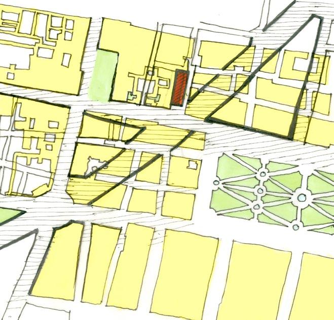
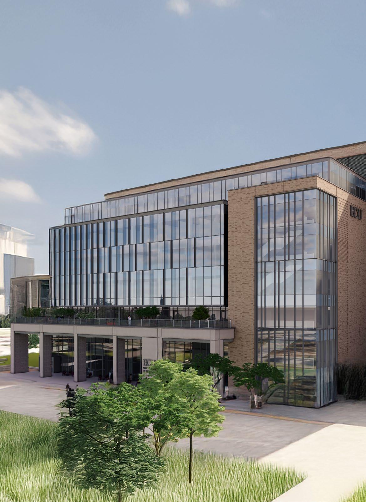
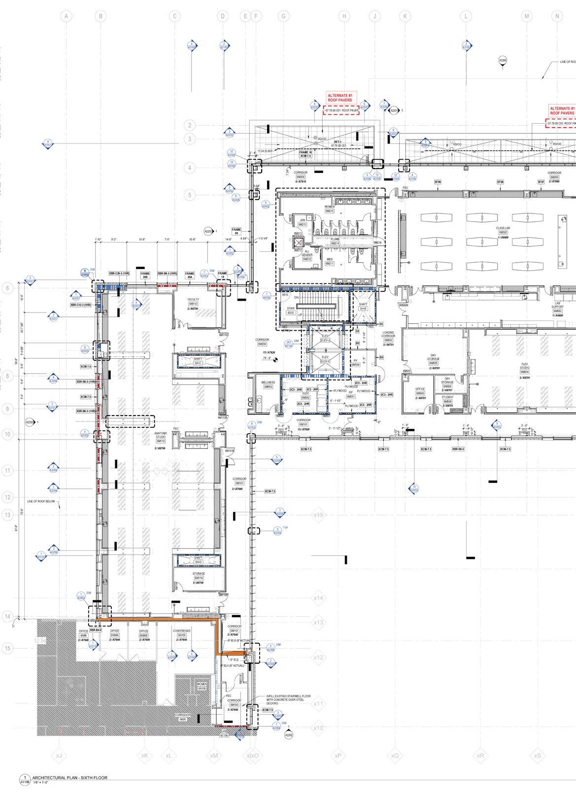
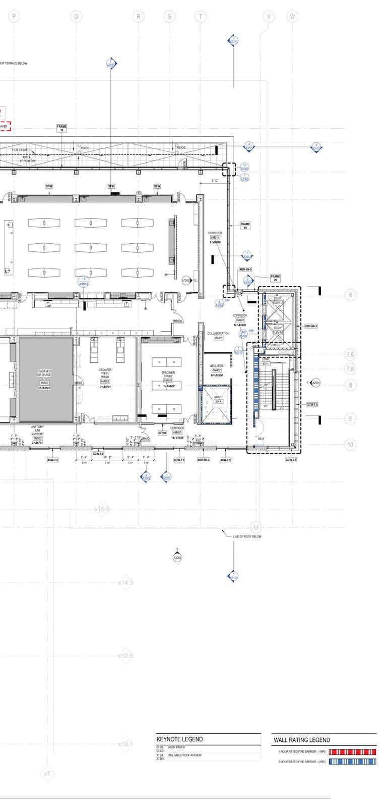
ECU Brody School of Medicine
Location Greenville, North Carolina
Professional Internship, Summer & Fall 2024
Firm BSA LifeStructures
Mentor Kevin Hunt, Architecture Lead
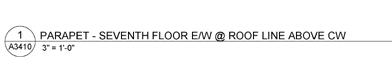
Contributions Worked on construction documentation, including parapet details, plan details, wall section details, material specifications , and code path drawings. Collaborated with the architects at BSA and SmithGroup to resolve documentation challenges. Engaged in team discussions to refine technical details
The ECU Brody School of Medicine’s New Medical Education Building is a 195,000 sqft, $265 million project designed to expand ECU’s medical education facilities.
The project required architectural, structural, and systems coordination between BSA LifeStructures and SmithGroup to develop a comprehensive construction package.
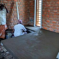
During my internship, the project was in the construction documentation phase, where efforts were focused on refining technical drawings and material specifications.
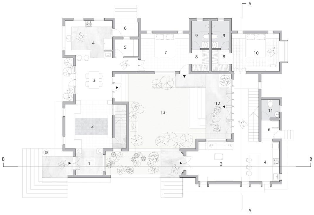
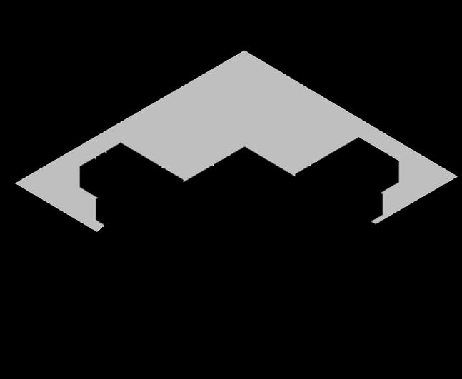
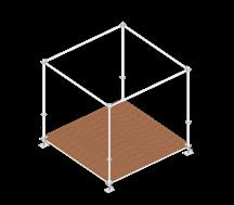
Floor Plan
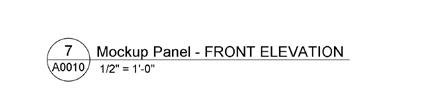
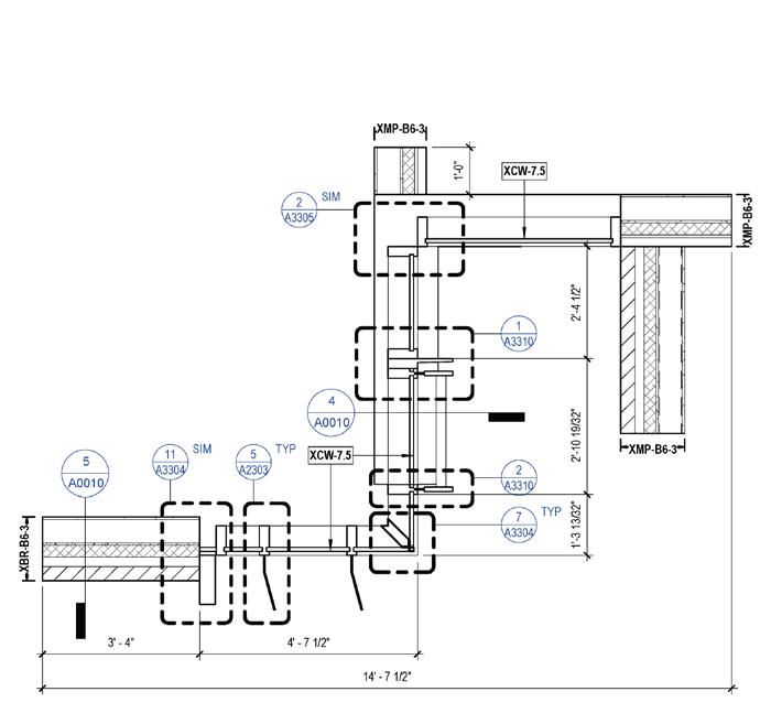
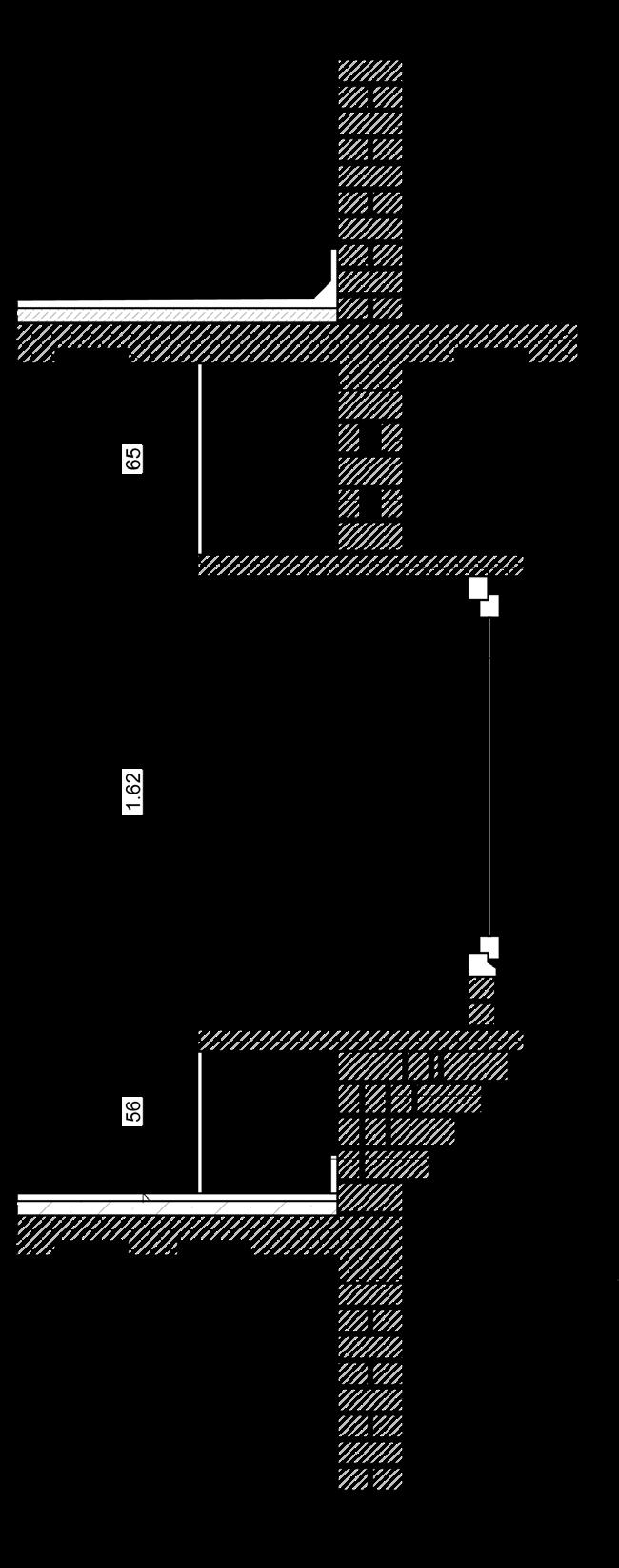
The Brody School of Medicine project is an addition to the existing building, requiring careful integration of expansion joints and structural connections. Work focused on refining key details to ensure seamless coordination between new and existing construction.
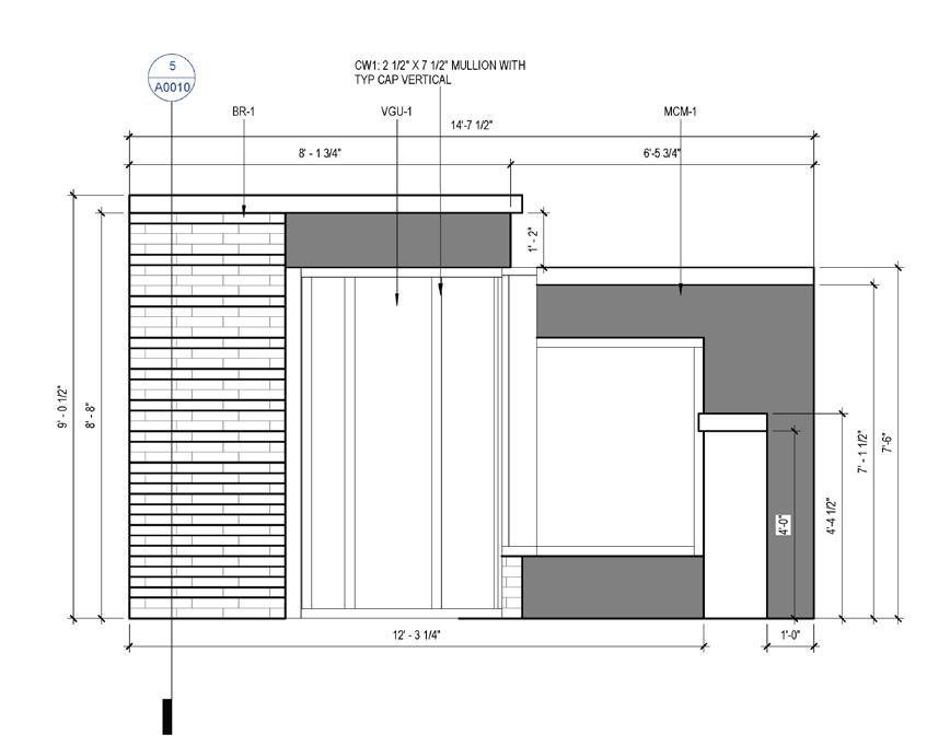
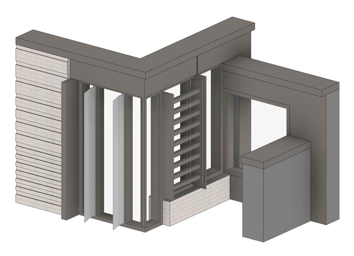
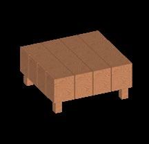
Mockup Panel
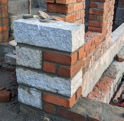
Led the development of a full-scale mockup panel, refining the design through collaborative iterations. The design progressed to the approval drawings stage without revisions from others. The panel incorporated a specialty brick wall, multiple cladding types including brick and composite metal panels, different mullion types, parapet caps, and lintel and sill connections.
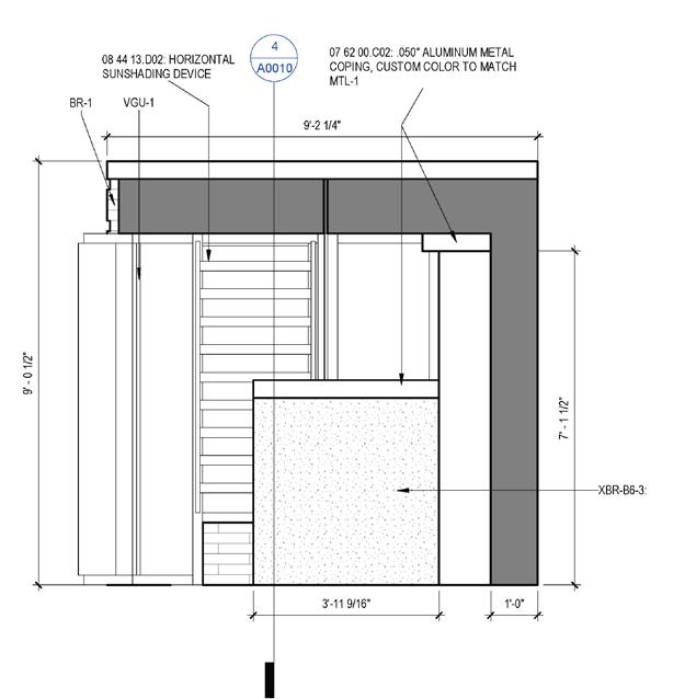
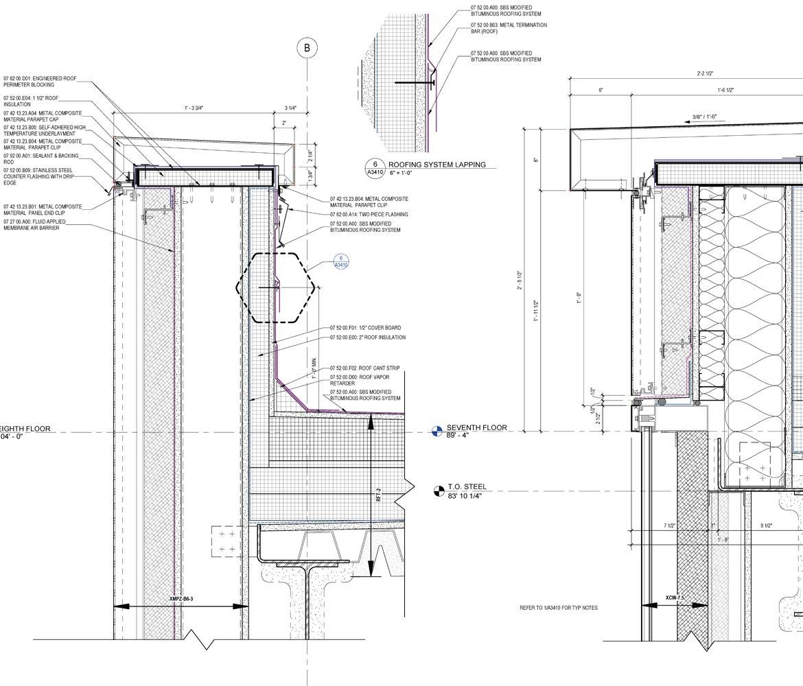
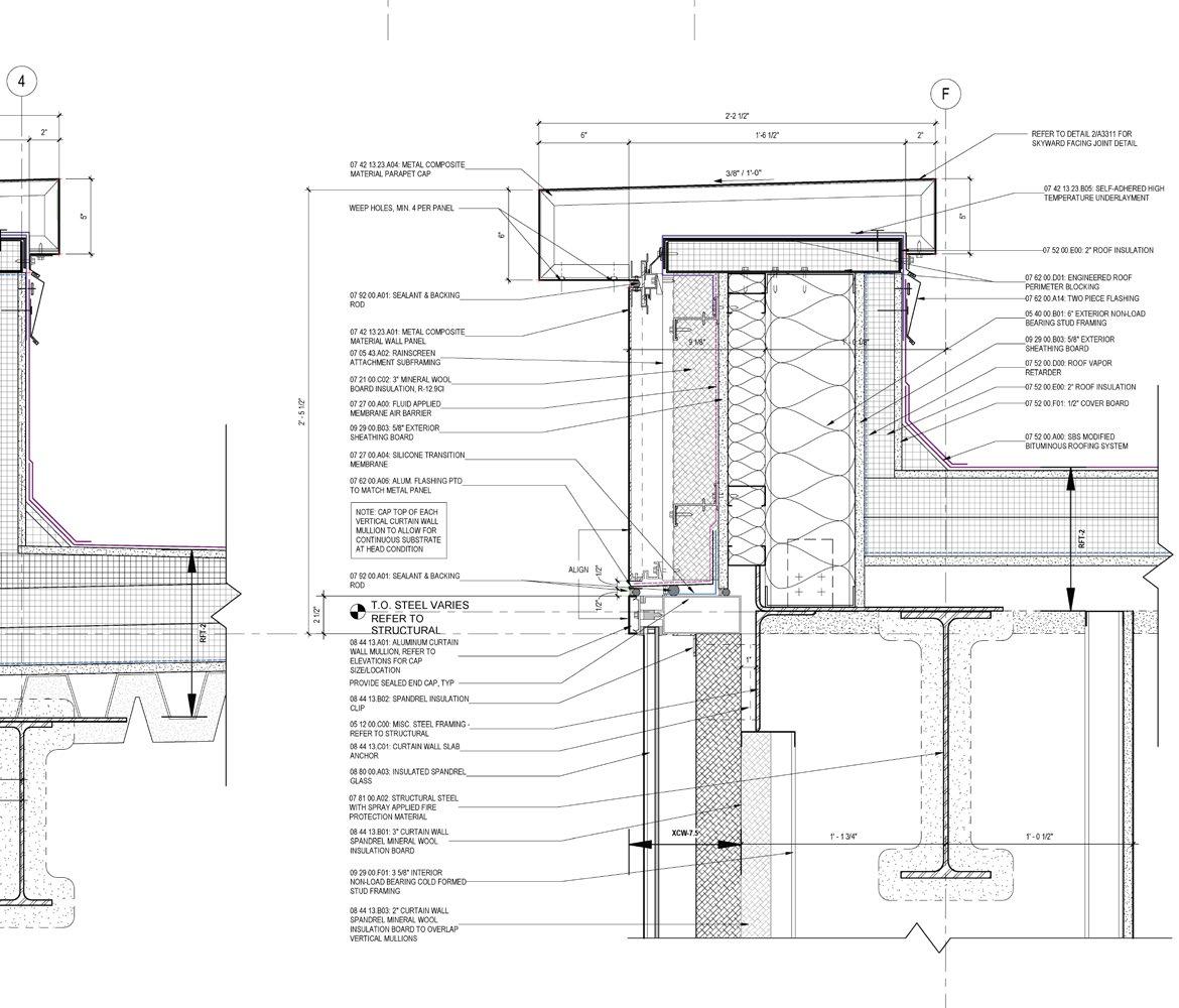
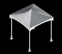
Parapet Details
Developed critical façade details, focusing on the integration of thermal, air, and moisture barriers to enhance building performance. Work involved understanding metal flashing details, roofing systems, and metal composite parapet caps.
Rural Twin House
Location Munivalai, Tamilnadu, India
Professional Associate Architect, 2020-2022
Firm Atelier NORD, Chennai, India
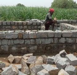
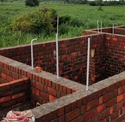
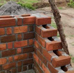
Contributions Led the project as the principal designer, overseeing all phases from concept through construction. Collaborated on design, detailing, and strategic planning; sourced materials, coordinated with local artisans and masons, and remained on-site to ensure execution matched intent.
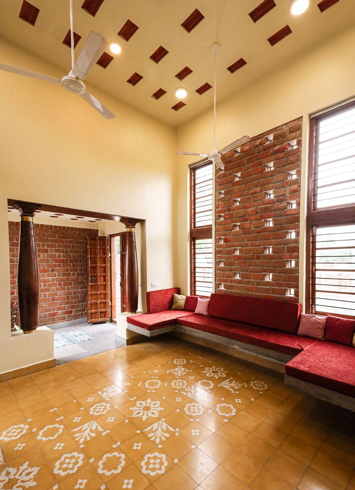
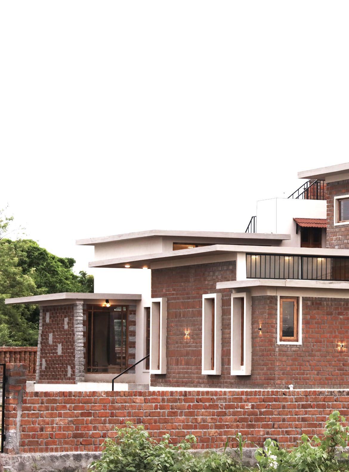
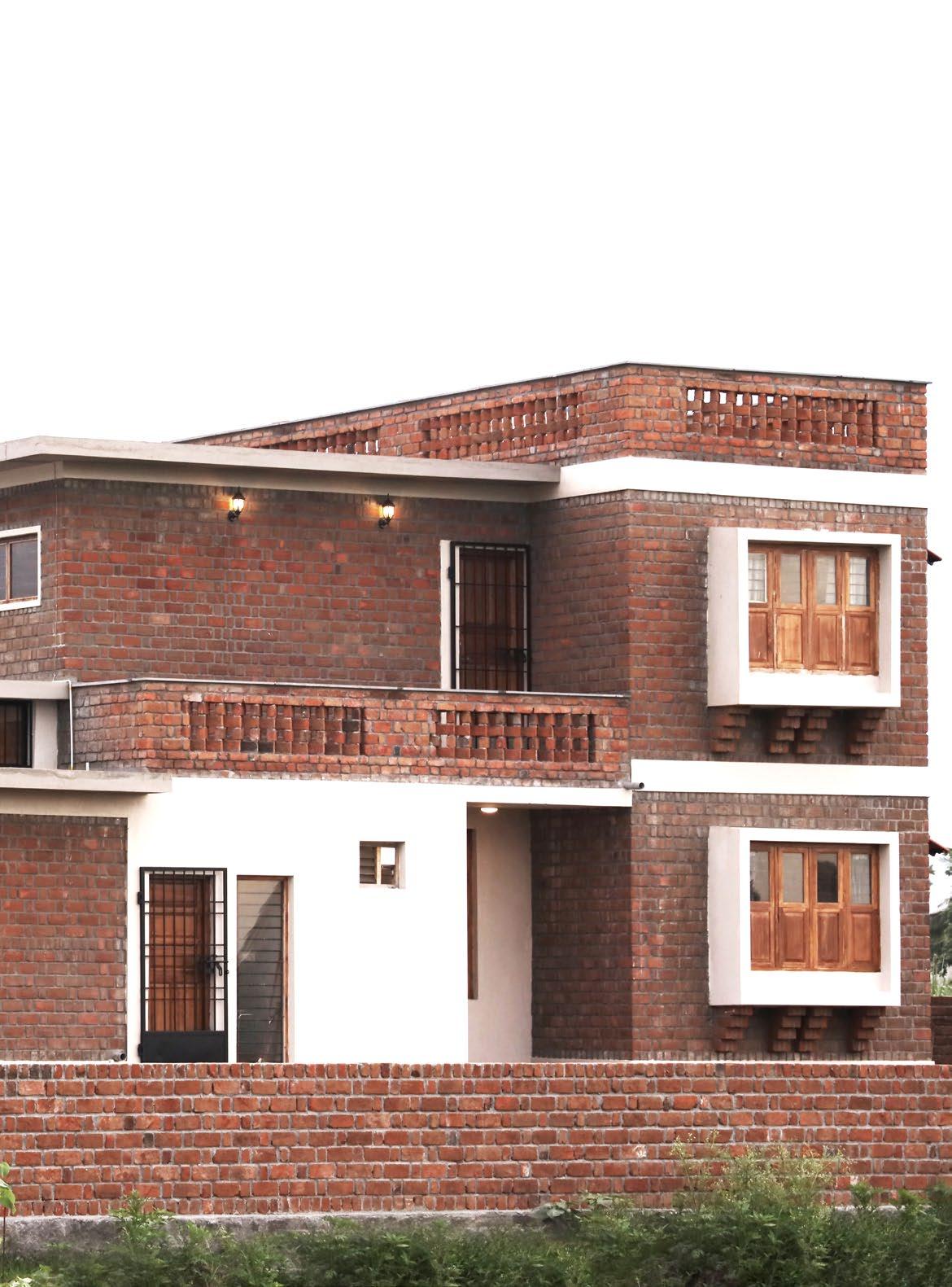
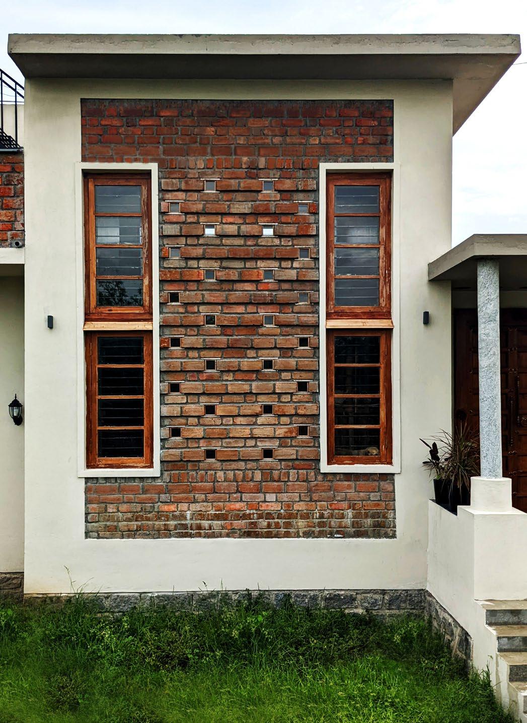
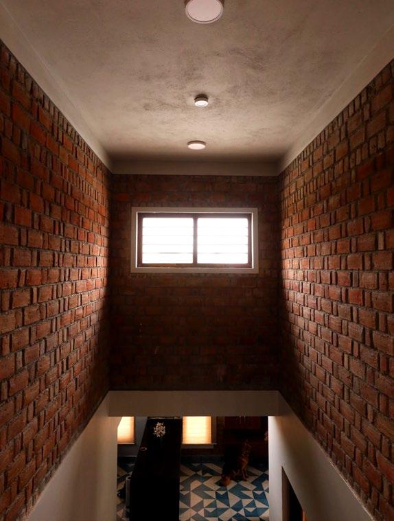
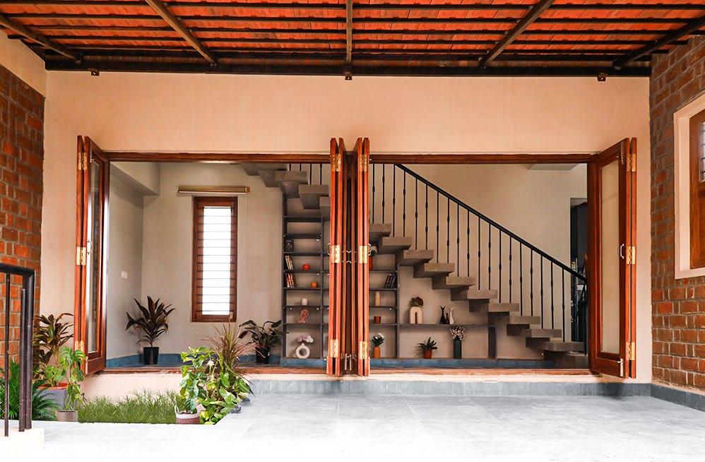
Located in Munivalai, South India, this twinhouse residence was designed for a client returning to his village to start an organic farm. The program required two homes, one for the client and one for his parents, internally connected by a semi-private courtyard.
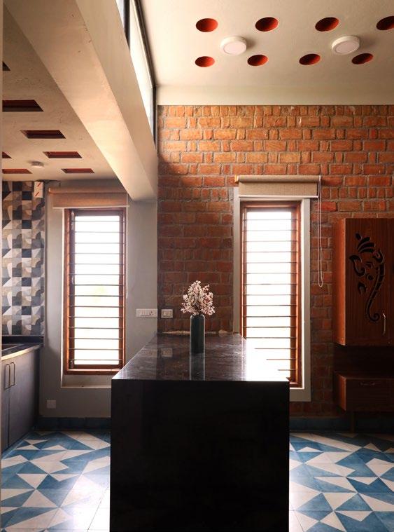
Working within a tight budget, the project emphasized ecological sensitivity through the use of reclaimed materials, low-embodiedenergy construction, and passive design strategies. Materials were recovered from onsite demolitions and sourced within an eightmile radius, including rubble stones, reclaimed teak doors and windows, handmade bricks, and Athangudi tiles. Construction techniques took inspiration from British-Indian Architect Laurie Baker ’s principles, using load-bearing walls, rat-trap bond masonry, and filler slab roofing with terracotta pots and reclaimed Mangalore tiles.
View from the South West side of the Residence showing different levels of roof slabs, Clerestory window and the Bay Windows of
The village has a moderate-hot climate, with maximum radiation coming from the South and the West. The predominant wind direction is West. Therefore, the house was designed in such a way that the tallest part of the building is in the south which shades the courtyard, and the bedrooms. Fenestrations were placed carefully to make maximum use of the predominant wind direction. In the north, they were sized bigger to utilize the reflected sunlight with minimal radiation
By limiting the roof heights of every space specific to their needs, we reduced material usage which in turn created interesting levels in the facade. The Rural Twin house thus stands as an expression of a collage of these indigenous and reclaimed materials. Today their second life continues.
Random Rubble Foundation
Clay Tile Filler Slab
Rat-Trap Bond
Brick Walls
Electrical Pipes in Walls
Stone and Brick Wall Masonry
Built-in Furniture
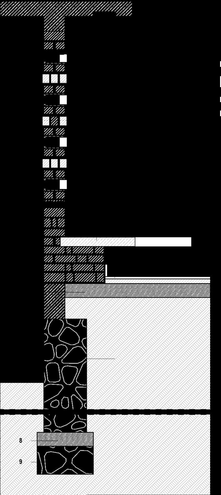
Section through Bay Window (1 : 20)
Coping
Brickwork 225 mm
Filler Slab 140 mm
Mangalore Clay TIles 80 x 80mm
Rat-Trap Bond Brickwork 225mm
Storage Unit
RCC Slab 100mm
Wood Panel Glass Window
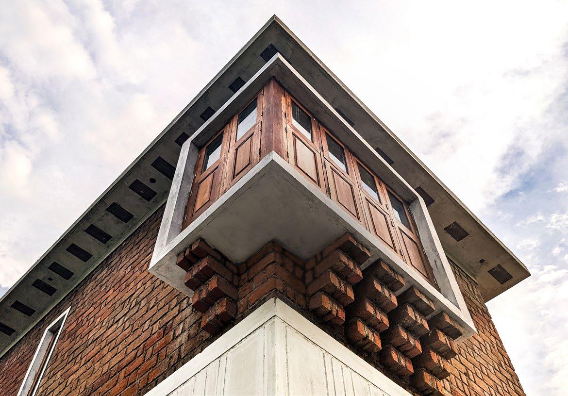
Brick Corbel Detail
Storage Unit
Filler Slab 140 mm
Isometric
Image showing
Stone
Flemish Bond Brickwork 225mm
showing Brick Corbel under Bay Window
Isometric projection showing the brick arrangement pattern of Corbel normal to the wall
Isometric projection showing the brick corbel detail under the Bay Window Slab at the Sill level
Section through Living North Facade (1 : 20)
1 Filler Slab 140 mm
Built-in Couch (RCC Slab)
Athangudi Floor Tiles
PCC 150mm
Plinth Beam 225x381mm
Random Rubble Foundation
Rammed Earth
PCC 150mm
Boulder Stones
GI Metal Plate 10mm thk.
8mm Toughened Glass
Wooden Frame
25mm Thk. Mortar
Detail A (1 : 5)
Breakfast Counter, Filler Roof Slabs and the Reused Windows Clerestory Window at the double-height space above the stairs
View of the Courtyard showing the Patio, the reclaimed Teak wood French Doors, the Concrete Staircase and the Storage below
Unreal
Engine Visualization: The Slow House by DS+R
Location Long Island, New York State Academic Digital Twin, Fall 2024
Instructor Shawn Protz
Contributions Researched and identified the exact project site, modeled the building in Rhino, and developed the terrain and context in Unreal Engine. Visualized the environment and edited the final walkthrough video using Adobe Premiere Pro.
The project reconstructs The Slow House, an unbuilt residence by Diller and Scofidio from the early 1990s, as an immersive digital twin. Though never realized, the house remains a key reference for its treatment of form, media, and the framed view. Using local press releases from the time and cross-referencing other sources, the site was identified and reconstructed.
The project explores how digital tools can recover and reframe lost architecture. By translating archival intent into real-time experience, the work engages questions of memory, representation, and presence within virtual environments.
Screenshots from the cinematic walkthrough visualizing the interior of The Slow House. The sequence emphasizes slowness, scale, and mediated perception through light and movement.
Full Video: Cinematic Walkthrough Research Archive: Are.na Channel
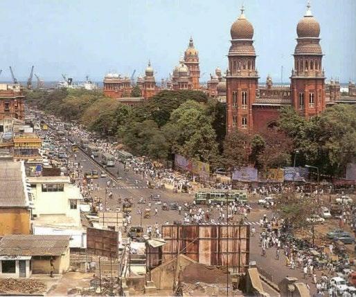
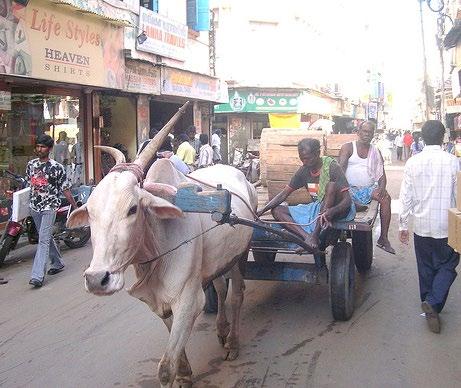
Revitalization of George Town
Location Chennai, India
Academic Bachelors Thesis, Spring 2017
Advisor Ganeshkumar Chandrasekaran
Contributions Designed and detailed the project, developing a modular street market system for urban reuse. Produced all drawings, diagrams, and visualizations presented in the project.
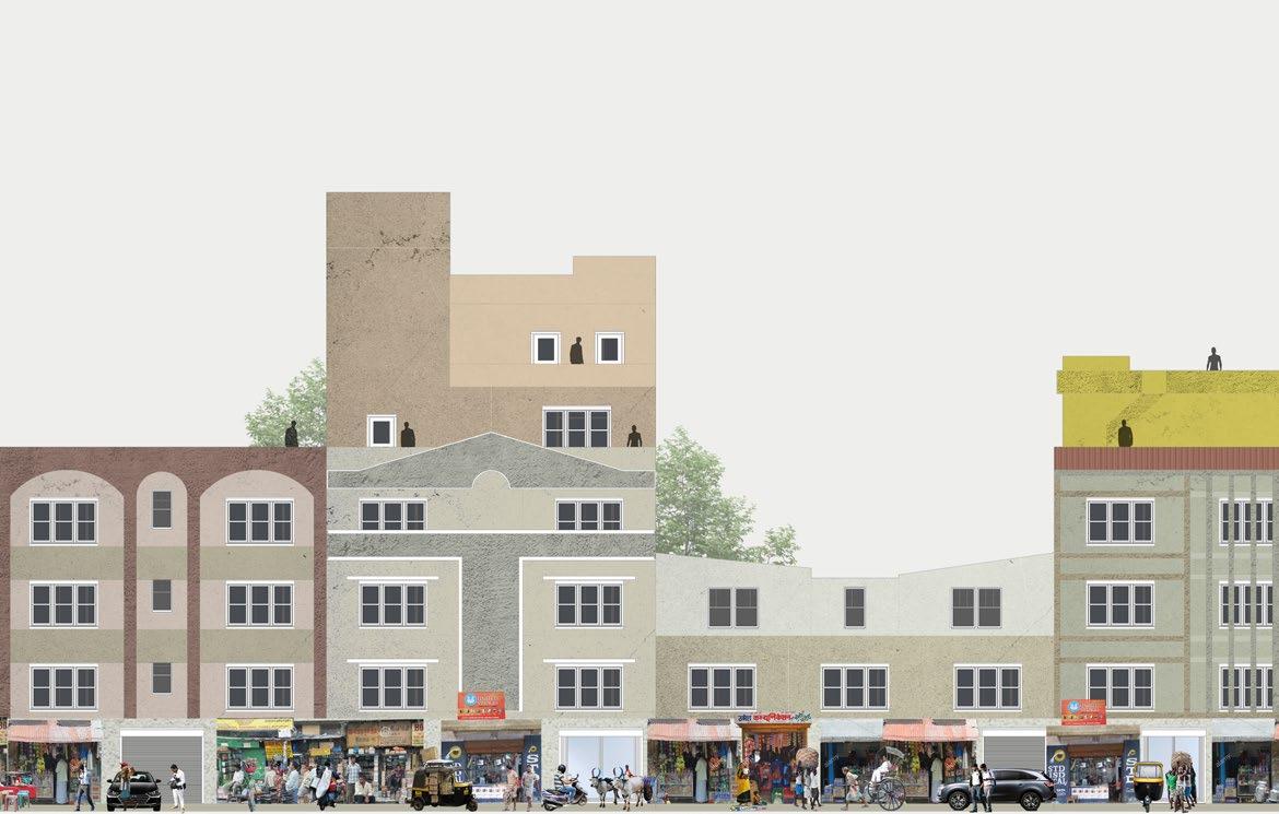
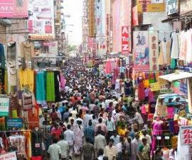
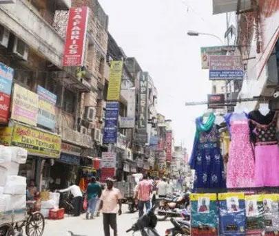
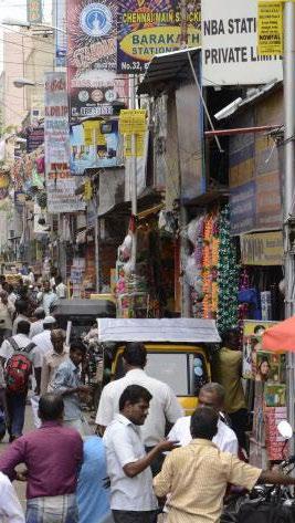
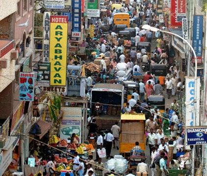
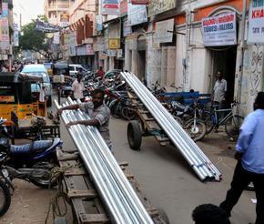
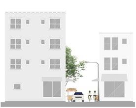
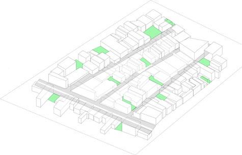
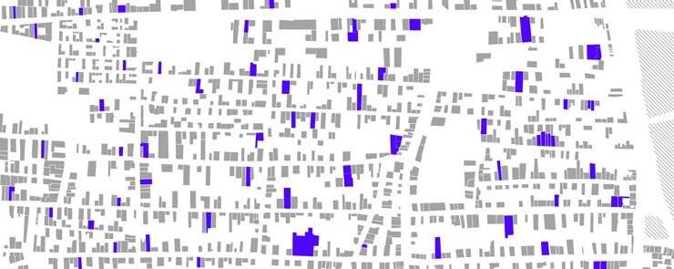
The project proposes the redesign of Vallalar Nagar, a central district in George Town, Chennai, to improve pedestrian mobility and support the local street economy. The area is one of the city’s most active commercial zones, yet lacks basic public infrastructure such as parks, squares, and walkable sidewalks.
A modular system is introduced to organize mobile shops and informal vendors, offering flexible configurations for shelves, tables, and electrical access. This system aims to improve the trading capacity of the street, formalize existing activity, and create safer, more accessible public spaces for vendors and pedestrians.
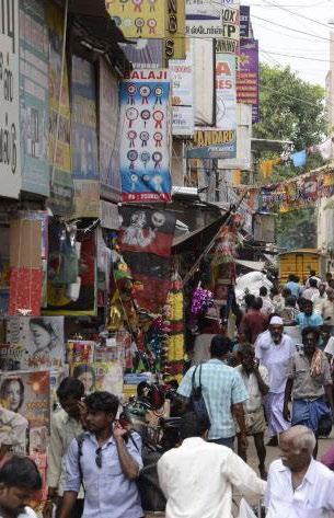
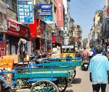
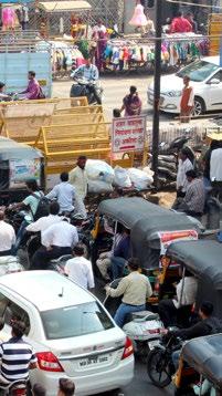
In George Town, streets are often too narrow to accommodate both movement and trade. Sidewalks are nearly absent, and vendors spill into the carriageway, leaving pedestrians to navigate through traffic. The boundary between public circulation and private use is blurred, creating constant friction and little sense of shared space
Existing Site Conditions
Residential Building
Retail Building
Green Space
Commercial Land
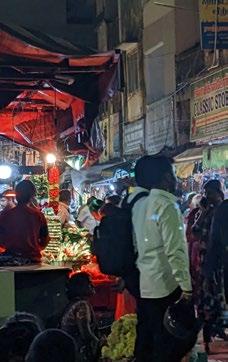
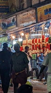
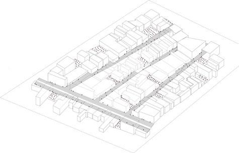
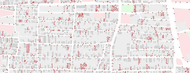
Street Hawkers
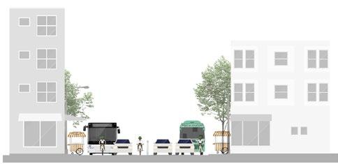
Major Road - 30ft
Minor Road - 15ft
Street - 10ft
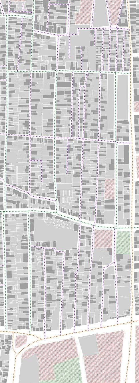
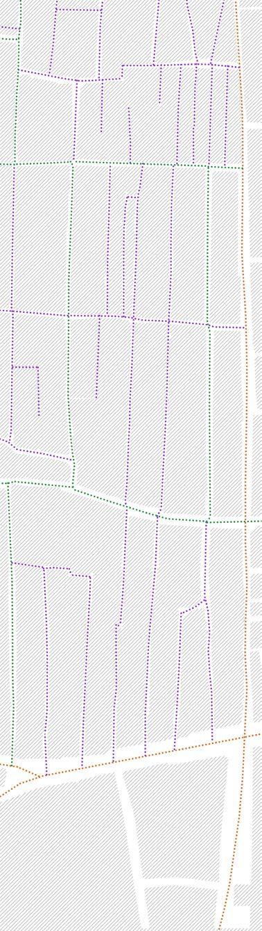
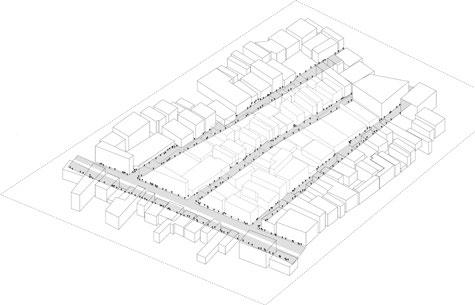
Master Plan - George Town
George Town is predominantly composed of residential and mixed-use residential zones. The area is designated as a ‘ Continuous Building Area,’ allowing two-story structures with a maximum Floor Area Ratio (FAR) of 1.5
However, the majority of buildings in the district are non-compliant with current development regulations. Many have been constructed without formal approvals from the city corporation, resulting in widespread regulatory violations and a built fabric that lacks consistency with the intended planning framework.
Road width - 10 ft
Road width - 15 ft
Road width - 30 ft
Typical Road Sections
Building Standards
The existing street infrastructure is significantly underdeveloped, with sidewalks that are narrow, inconsistent, and often interrupted. There is minimal spatial definition between the pedestrian zone and adjacent private properties, resulting in blurred boundaries that reduce walkability and hinder safe, accessible movement.
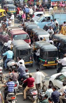
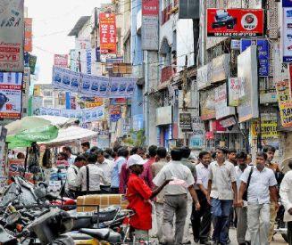
This district serves as a major center of trade, with a high concentration of informal vendors However, the absence of a clear circulation framework and a lack of regulatory enforcement have allowed encroachments into the street. This contributes to intense congestion and creates conflict between pedestrian activity and vehicular flow, making the area difficult to navigate and unsafe for both.
Existing density of street hawkers along the sidewalks of streets and roads
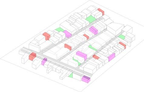
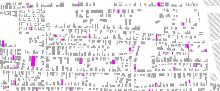
Reclaiming underutilized and vacant lots and demolish underused facilities
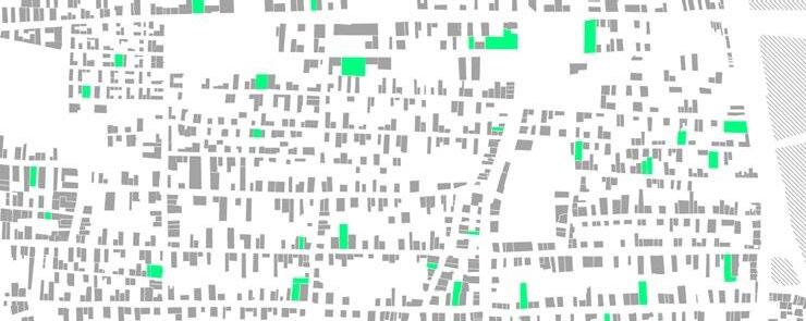
Renovating and utilizing available vacant lands
Relocating street hawkers to proposed lands to reduce street congestion
Proposal
Reclaim underused plots
Underutilized and vacant lands
Existing Structures
Demolish underused facilities
Underused facilities
Existing Structures
Renovate existing resources
Renovate facilities
Existing Structures
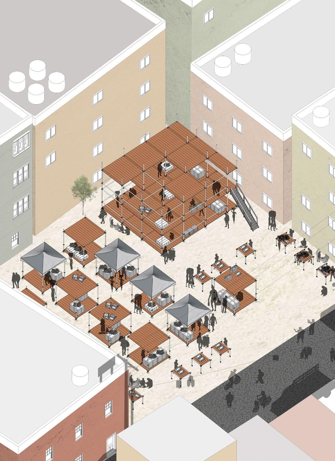
A new designated area for street hawkers is proposed to accommodate existing market activity while alleviating congestion along primary streets. This relocation strategy aims to formalize informal trade and improve overall circulation within the district.
0’ 250’ 125’
Modular Design
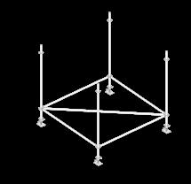
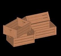
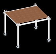
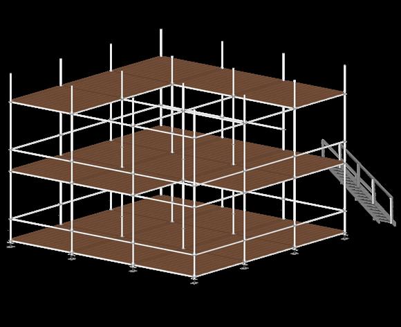
The vendor units are constructed using scaffolding as the primary structural framework, with pallet wood forming the base platform. Roofing is adaptable and can be assembled using either pallet wood or tarpaulin, depending on seasonal or contextual needs.
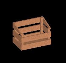
Designed for flexibility, the units are modular and fully demountable. Their components can be reconfigured or scaled based on vendor requirements, allowing for easy relocation or resizing. Storage boxes made from pallet wood add functionality while maintaining material consistency.
The system emphasizes durability, sustainability, and ease of deployment. During festivals or peak trading seasons, smaller units can be combined to create multi-level stalls, supporting higher vendor capacity within the same footprint.
Creating multi level stalls by merging minor units
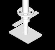
Details of scaffolding joints
Base frame Pallet Wood Floor
Support Frame Temporary Shade
Tarpaulin Roof Pallet Wood Roof
Mobile Structure
Pallet Wood Storage Units
Equity Across Raleigh
Location Raleigh, NC
Academic Cartography, Spring 2024
Instructors Sara Queen, Tania Allen
Contributions Researched and visualized socio-economic data using ArcGIS Pro, RawGraphs, and Python. Developed all maps, diagrams, and data visualizations presented in the project.
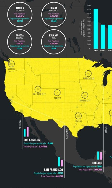
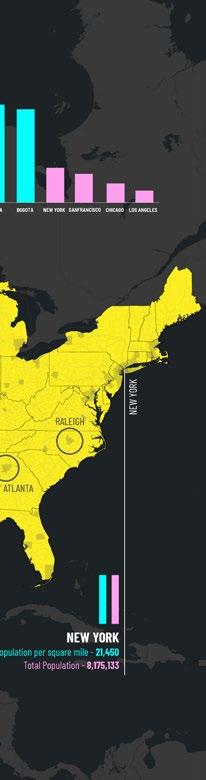
The research, emphasizing Raleigh, comprises three interconnected map series with seven maps that study socioeconomic disparities in Wake County. It is an exploration of ArcGIS Pro, visualizing various Open Data available on the Raleigh Gov website, along with RawGraphs and a bit of Python
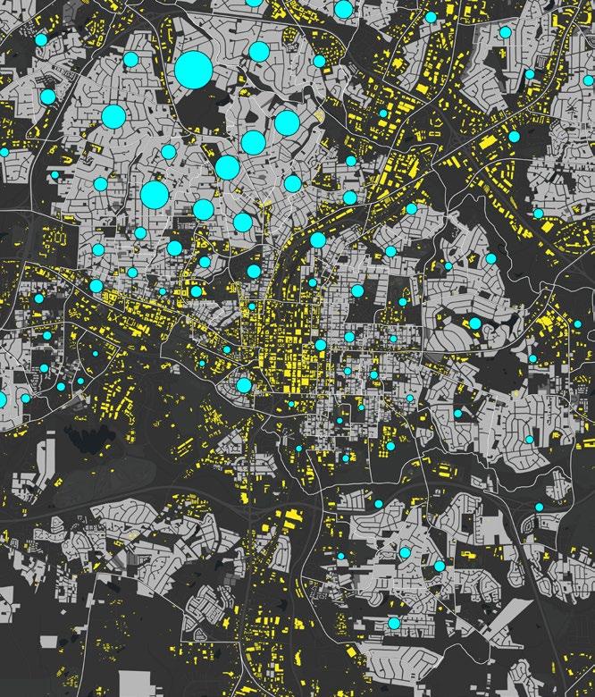
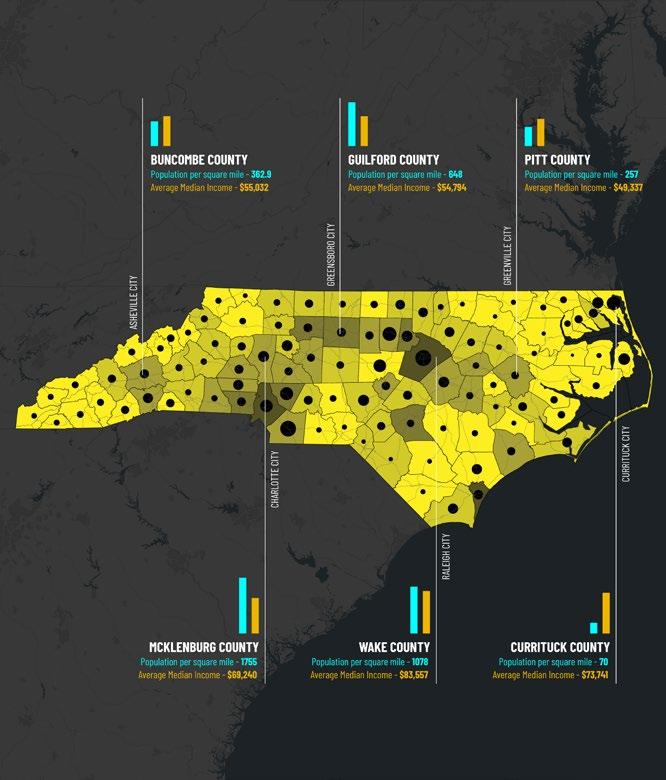
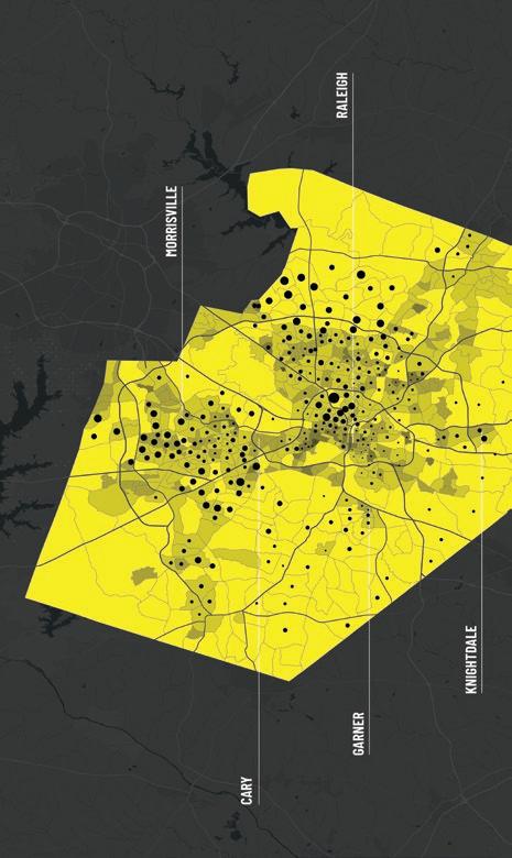
Map Series 01 compares population density and median income across different scales: North Carolina, Wake County, and Raleigh Zooming in from the NC scale, observations reveal a significant income disparity between the northwest and southeast of Raleigh. On the US scale, the map identifies the densely populated cities in the country.
City Scale - Raleigh
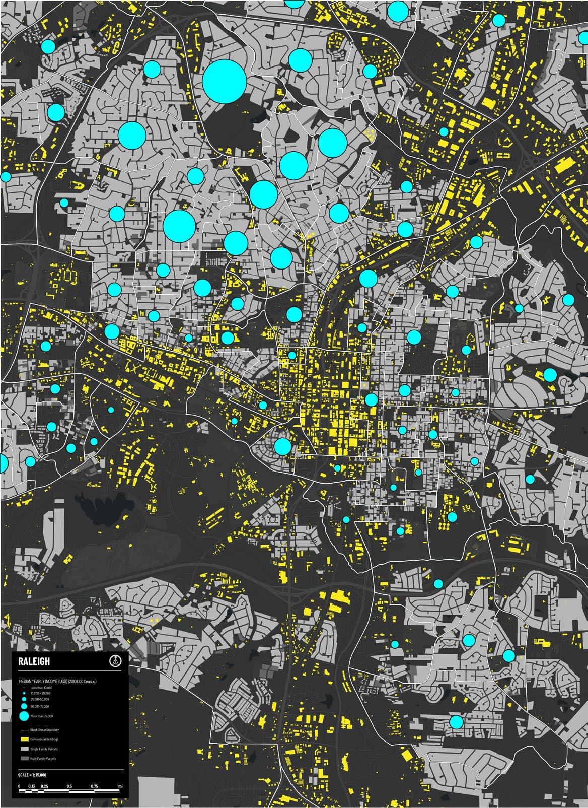
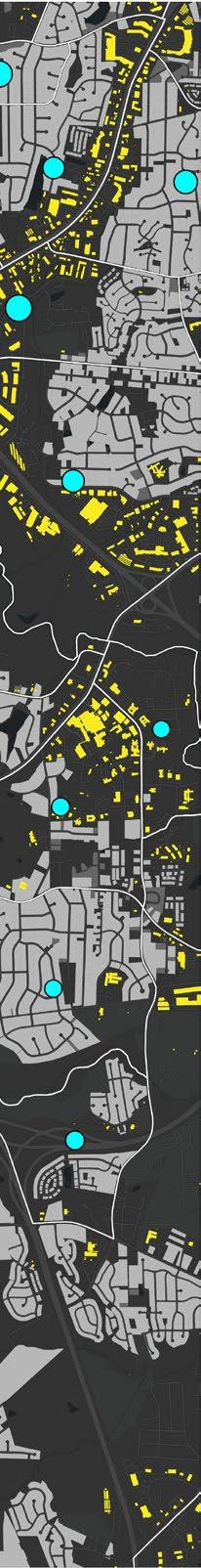
Median Income and Single-family Parcels
This map plots median annual income as blue circles overlaid on single- and multi-family parcels, shown in light and dark grey fills respectively, in Raleigh. Block group boundaries are outlined in white, and commercial buildings are highlighted in bright yellow to help identify downtown Raleigh
The low population density around downtown is explained by the dominance of single-family residential parcels. Notably, single-family parcels in the northwest show significantly higher median income levels compared to those in the southeast.
The map demonstrates that population density primarily reflects the distribution of single-family housing. Median income levels, however, vary independently of density. This analysis continues in Map
Relational Map
Income Gap in Wake County
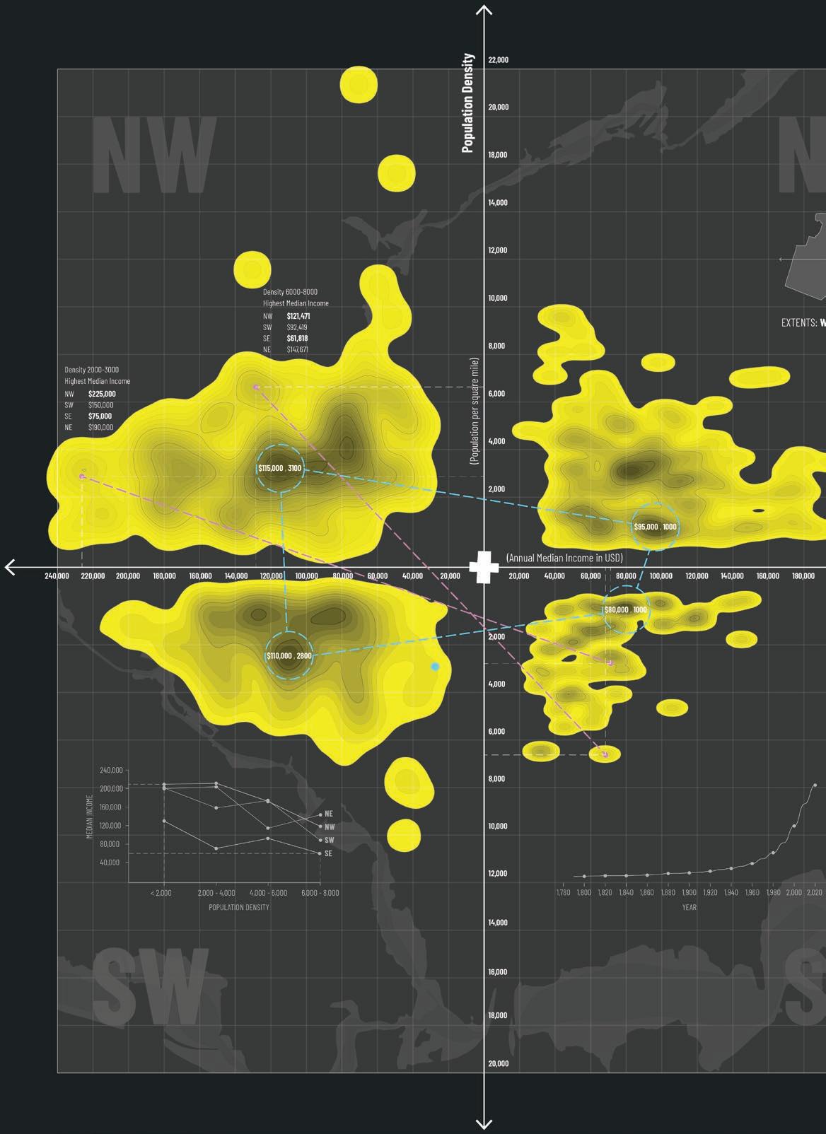
This map continues the research from Map Series 01. It presents a contour graph with median annual income on the X-axis and population density on the Y-axis, dividing Wake County into four geographic quadrants. The Raleigh State Capitol serves as the origin point, symbolizing the heart of the county.
Key observations are highlighted with pink dotted lines, which emphasize disparities in income across quadrants with similar population densities. For example, in areas with a density between 2,000 and 3,000 people per square mile, the northwest quadrant shows a median income of $225,000, while the southeast quadrant shows only $75,000
As supplemental information, a line graph in the southwest quadrant compares median income levels across all four quadrants. Another graph in the southeast quadrant illustrates significant population growth over the past six decades. An underlay of floodplain areas further reveals that the southeast quadrant contains more flood-prone zones than the others.
Autographic and Thick Mapping
Experiencing Southeast Raleigh
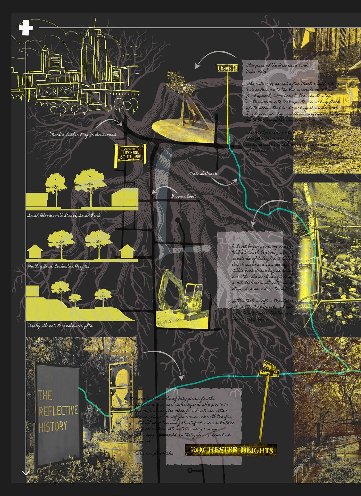
This experiential map brings together my observations from walks through Chavis Park, South Park, and Rochester Heights. These neighborhoods are located in the southeast quadrant of Map Series 02. An indigenous oak tree forms the backdrop, with its roots beginning at the Raleigh State Capitol in the top left corner. The tree serves as a metaphor for the city’s growth and evolution since its founding in 1792.
The black road network highlights Garner Road, which runs vertically through all three focus areas. Martin Luther King Jr. Boulevard cuts across from downtown. A sketch of the Raleigh skyline, visible from each of the neighborhoods, is placed in the upper left. The skyline reveals itself intermittently and feels like it plays hide-and-seek as one walks through Southeast Raleigh. The blue line represents Walnut Creek, which includes wetlands and walkable greenway trails.
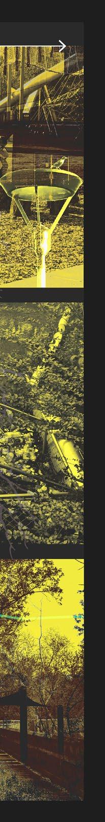
Three collages along the right edge of the map capture distinct moments from each area and reflect their unique character. Wall sections on the left show variations in road widths, housing types, and topography across Southeast Raleigh. The text next to the images is not easily legible, which serves as a reminder that stories are present, but sometimes they require closer attention to be seen.
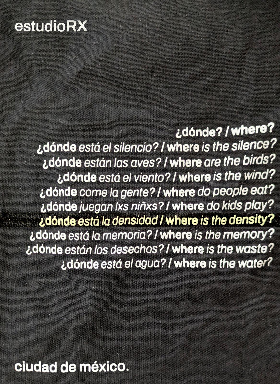
Where is the Density?
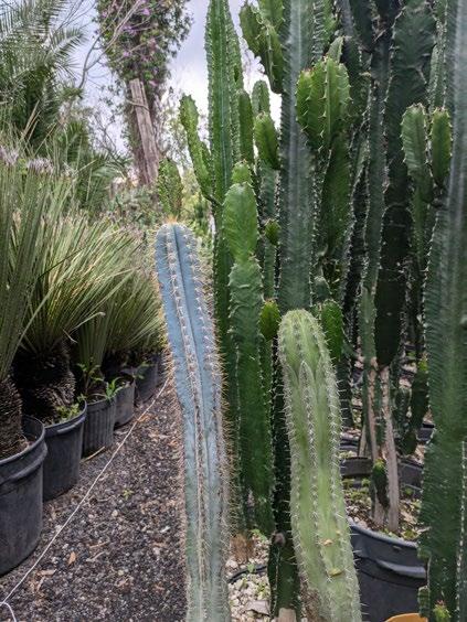
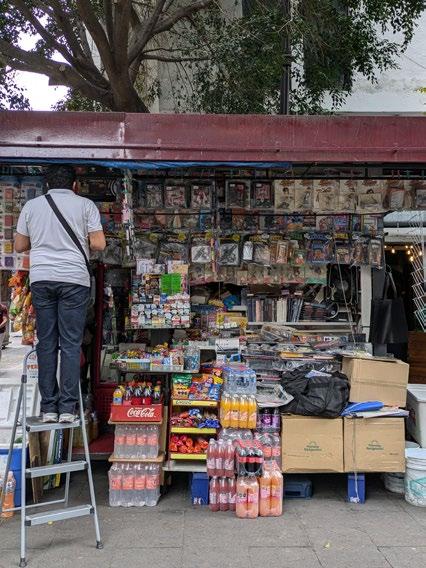
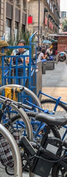
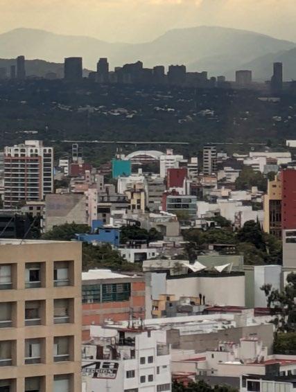
Location Mexico City, Mexico
Academic CDMX Studio, Fall 2024 Instructors Gabriela Carrillo, Patricia Morgado
Team Harsha Raju, Bonnie Kadhim (NCLA), Dhamar Sanchez (UNAM), Andres Quiroz (UNAM)
Contributions Documented site conditions through sketches, photographs, and video. Collaboratively developed the video through concept, sequencing, and final editing. Participated in the design charrette with a site-specific focus on the intersection of Calzada and Paseo De La Reforma.
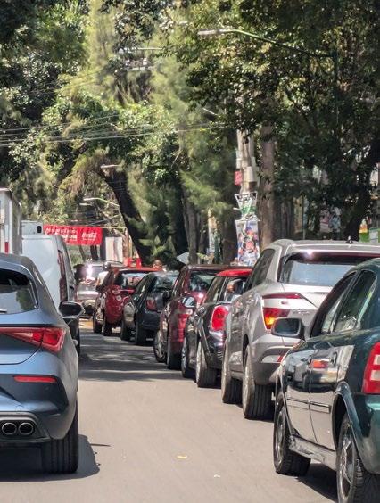
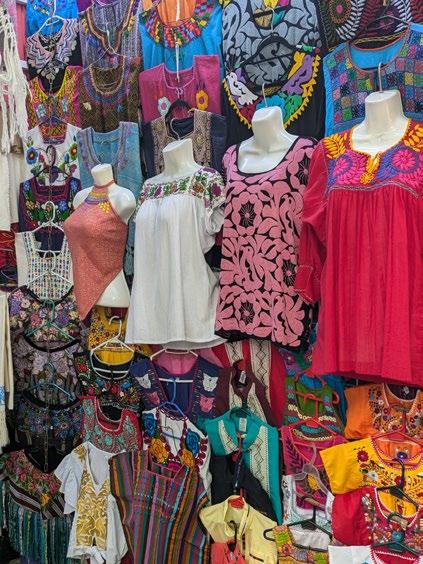
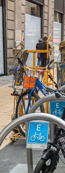
The project stems from a week-long travel and design charrette in Mexico City with students from NC State Architecture and Landscape and the Universidad Nacional Autónoma de México (UNAM). Guided by architect Gabriela Carrillo, the experience focused on observing public space through walking, sketching, and collaborative documentation.
Our team responded to the prompt “Where is the density?” and produced a video capturing the patterns of infrastructure, ritual, and informal activity. The video was developed collaboratively and selected as the best in the final review.
¿Dónde está la densidad?
Link: Video – Where Is the Density?
We live in a city, vast and dense Striving to thrive amidst the immense
We flee the traffic, noise, and haste, To laugh and cry in a secret space.
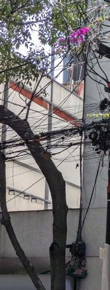
The poles hold more than electric lines Forgotten vows, the political lies
We gather things that catch our eye We hold them close, as years pass by!
We chop, sauté, and stir the stew When flavors fade, we add what’s new.
Amid the chaos, the endless race, We carve out order, a sacred space!
PaseoDeLaReforma
San Hipólito’s Crowds and Metro: Above and Below
Calzada
San Hipolito Church Alameda Central
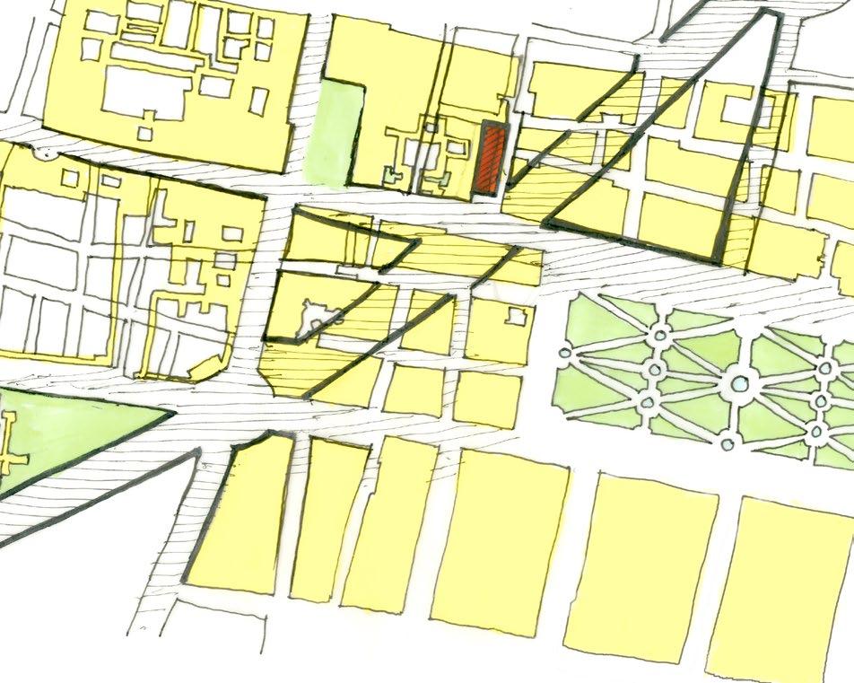
Reforma Meets Calzada: Then and Now
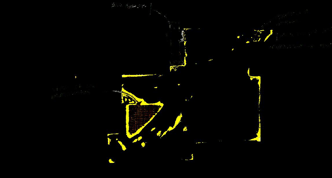
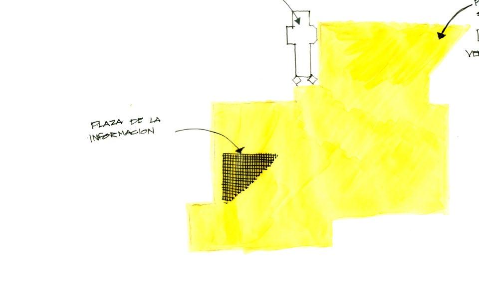
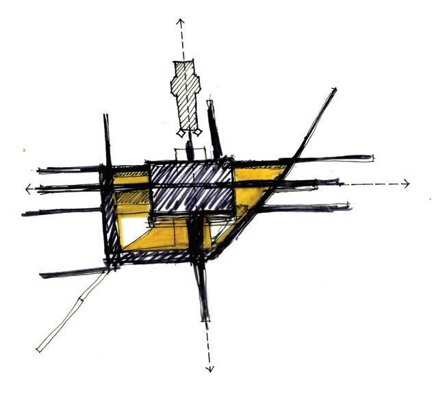
This spread documents how density unfolds at the intersection of Calzada and Paseo de la Reforma, where ritual, transit, and informal use compete for space. The visuals trace competing layers of use at the intersection.
In a 1865 map, Paseo De La Reforma stops well before meeting Calzada, and the San Hipolito Church had a much larger complex. The sketch to the left overlays the current map onto the 1865 map to show how the extension of Paseo De La Reforma cut through existing blocks and created the intersection with Calzada.
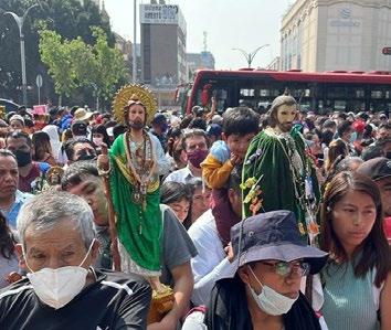
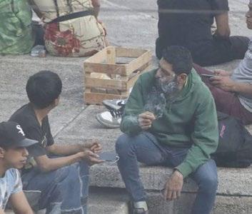
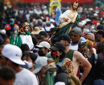
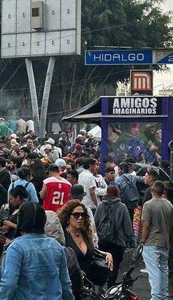
The monthly veneration of Saint Tadeo at San Hipolito Church brings large crowds that spill into the intersection, blocking traffic and creating congestion. Meanwhile, Plaza de la Información, marked on the sketch, is an underutilized corner of the intersection often associated with activities like drug sales and pot smoking, reflecting the fragmented use of the surrounding spaces.
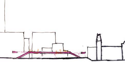
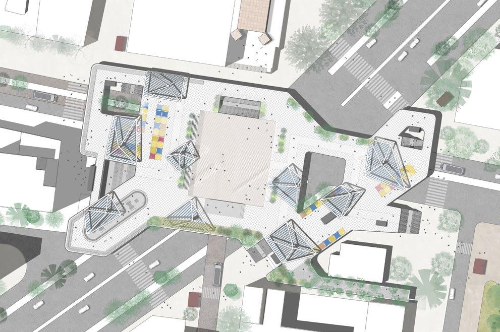
The sketch also highlights the Metro Hidalgo station and its multiple underground routes, which further intensify the area’s density and contribute to surface-level congestion.
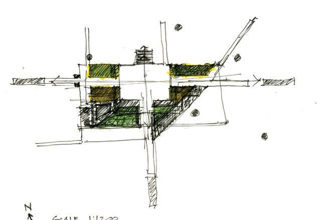
Initial design studies explored an elevated plaza connected to all Metro Hidalgo exit points, allowing pedestrians to bypass surface traffic and move safely across the intersection.
At its center, a flexible square aligns with San Hipolito Church, extending its public space for monthly gatherings, and serving as a venue for concerts, markets, and civic events on other days.