
FLOOD


FLOOD


FLOOD AWARENESS WEEK IS MARCH 9-15, 2025.
FLOOD AWARENESS WEEK IS MARCH 9-15, 2025.
FLOODING IS THE MOST COMMON AND FLOODING IS THE MOST COMMON AND COSTLY NATURAL DISASTER, BUT ONLY 3% OF COSTLY NATURAL DISASTER, BUT ONLY 3% OF VIRGINIANS HAVE FLOOD INSURANCE VIRGINIANS HAVE FLOOD INSURANCE.
ONE INCH OF WATER IN A HOME HAS THE ONE INCH OF WATER IN A HOME HAS THE POTENTIAL TO CAUSE $25,000 IN DAMAGES POTENTIAL TO CAUSE $25,000 IN DAMAGES
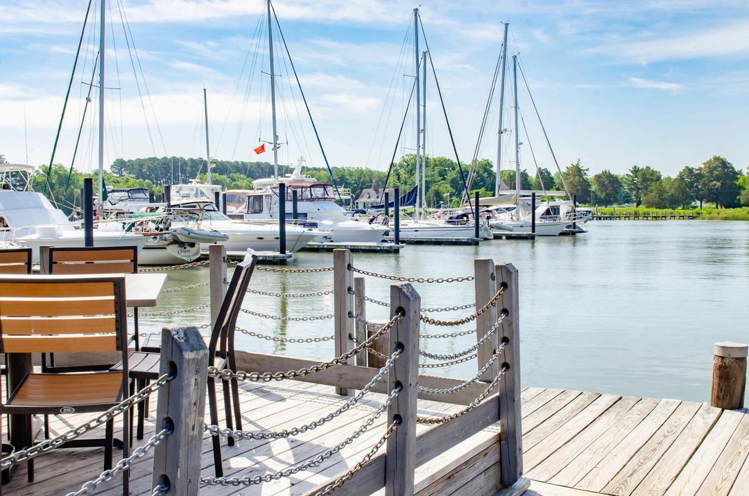
Gloucester County is a participant in the National Flood Insurance Program (NFIP) and was recently rated a Class 5 community by the FEMA Community Rating System (CRS), which allows property owners to obtain federally backed flood insurance at a 25% premium discount
This insurance is available to any owner of insurable property in this county (with the exception of those properties located in FEMA designated coastal barrier areas) Flood insurance policies are available from local insurance companies
The actual cost may vary depending on the degree of flood hazard and the amount of coverage desired Residents who live or own property in flood hazard areas are urged to purchase flood insurance to protect themselves from losses due to flooding.
Fast Facts on the National Flood Insurance Program:
Coverage for contents is not automatically included with building coverage Ask your insurance agent about contents coverage
Standard homeowners insurance policies do not cover losses due to floods.
There is a 30 day waiting period before coverage goes into effect
This insurance is required if purchasing a home through a federally-backed mortgage Purchase flood insurance to protect yourself from losses due to flooding.

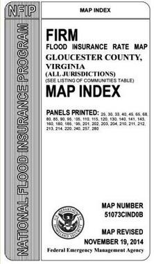
The Flood Insurance Rate Maps (FIRMs) are available to view at the Gloucester County Building Inspection Office. Staff there is available to help you determine if your property is located in a designated coastal barrier area or floodplain You may contact them at 804-693-2744 from 8 a.m. to 4:30 p.m. Monday through Friday
Flood Map Index
Flood Map Index
Gloucester County FIRMs include the Flood Map Index, 36 Individual Map Panels and the Flood Insurance Study (FIS) These also may be viewed at the FEMA Map Service Site
Flood Information Portal
The Flood Information Portal also allows you to enter your physical address to determine your proximity to any Special Flood Hazard Area / Flood Zone
New Flood Transition
Flood Information Portal New Flood Transition
The Gloucester County FIRMs include a new flood transition Coastal A Zone that lies between the VE (wave height greater than 3 feet) and AE (wave height less than 3 feet) flood zones
REMEMBER: Turn Around, Don’t Drown! The majority of flood-related deaths occur in vehicles!


Check frequently on the storm’s progress until all Watches and Warnings from the National Weather Service are canceled for your area.
HURRICANE WATCH:
HURRICANE WATCH: Hurricane may threaten within 36 hours.
Be prepared to take action if a warning is issued
Keep informed of the storm’s progress
HURRICANE WARNING:
HURRICANE WARNING: Hurricane expected to strike within 24 hours
Leave waterfront and low-lying, floodprone areas
Leave mobile homes for more substantial shelter.
Stay in your home if it is sturdy, on high ground and not near the water If you are asked to evacuate by authorities, GO!
Stay tuned to radio, NOAA Weather Radio, or television for hurricane advisories and safety information.
THE SAFFIR-SIMPSON SCALE
This scale rates hurricanes in order of their damage potential
COASTAL FLOOD ADVISORY
A Coastal Flood Advisory is issued when minor or nuisance coastal flooding is occurring or imminent
COASTAL FLOOD WATCH
A Coastal Flood Watch is issued when moderate to major coastal flooding is possible Such flooding would potentially pose a serious risk to life and property
COASTAL FLOOD WARNING
A Coastal Flood Warning is issued when moderate to major coastal flooding is occurring or imminent This flooding will pose a serious risk to life and property
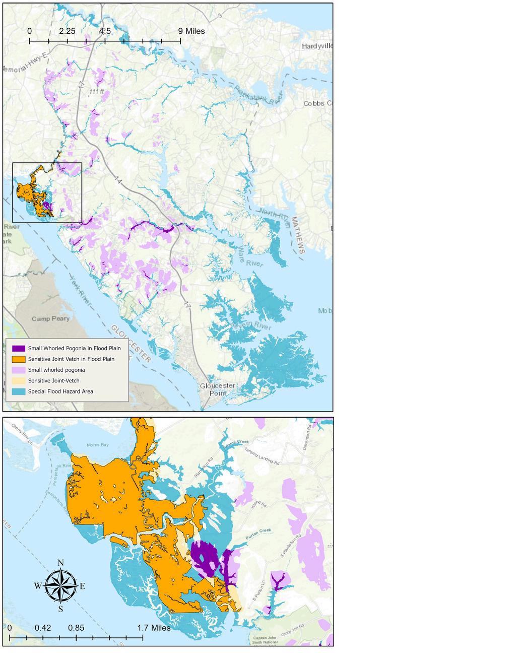

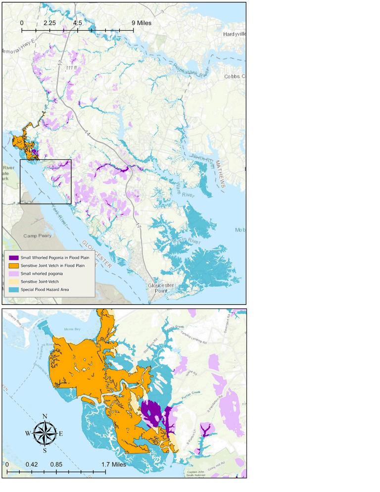
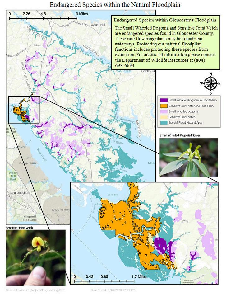
The Small Whorled Pogonia and Sensitive Joint Vetch are endangered species found in Gloucester County. These rare flowering plants may be found near waterways Protecting our natural floodplain functions includes protecting these species from extinction. For more information, please contact our local Virginia Ecological Services Office at 804-693-6694
The 2025 Atlantic Hurricane Season lasts from June 1 through Nov. 30, according to the National Hurricane Center Though our area can be impacted by a number of factors during this time, flooding is always a main concern.
There are ways to permanently retrofit a building Retrofitting means making changes to an existing building to protect it from flooding Six ways to retrofit are discussed in the FEMA publication 312 A Homeowners Guide to Retrofitting available on www FEMA gov
Elevation: Raising your house so the lowest floor is three feet above flood level.
Wet floodproofing: Allowing water to strategically enter the house.
Dry floodproofing: Sealing against water entering your house.
Gloucester County Flood Insurance Rate Maps (FIRMs) can be viewed online at gloucesterva gov/flood-management under Flood Information and Property Flood Information.
Search the FEMA Map Service Center at msc fema gov Gloucester County FIRMs are also available for viewing by visiting the Gloucester County Building Inspections Department at 6489 Main Street, Suite 247. For more info, call 804-693-2744.
We want to touch on High-Risk Areas (Special Flood Hazard Area or SFHA). See page 6 of this guide for Zone-area definitions
Zone A or V on the Flood Map
In high-risk areas, there is at least a 1 in 4 chance of flooding during a 30-year mortgage All home and business owners in these areas with mortgages from federally regulated or insured lenders are required to buy flood insurance
For information regarding flood depths, please visit Virginia’s map center at https://consapps dcr virginia gov/VFRIS/
Relocation: Moving your house to higher ground.
Levee and floodwall: Constructing barriers around your house.
Demolition: Demolishing home. Rebuild, meeting flood requirements.


Nearly all homeowners’ insurance policies do not include flood insurance. Check with your insurance agent for pricing If you are in a FEMA flood zone, hurricane zone, evacuation zone or dam break inundation zone, you need flood insurance!
If you DO hold an NFIP Flood Insurance Policy and your home is flooded, FEMA will cover up to $100,000 in contents and repair or replacement costs up to $250,000
If you DO NOT hold an NFIP Flood Insurance Policy and your home is flooded, FEMA may pay a relatively small amount through its Individuals and Households Program (IHP) which typically covers the cost for limited temporary housing and rarely provides support towards the cost for repairs The average IHP claim in Virginia is $3,900 IHP is not a substitute for insurance and it is intended to meet basic needs
Zone X on the Flood Map
Zone X properties submit over 20% of NFIP claims and receive one third of disaster assistance for flooding Flood insurance isn’t federally required in these areas, but it is recommended for all property owners and renters Ask your insurance agent about a Preferred Risk.
Always check with the Gloucester County Building Inspection Department before you build on, clear, grade or fill your property All floodplain development requires a permit from Gloucester County
For more information, call 804-693-2744 or visit www gloucesterva gov/buildinginspection
The dam controlling Beaverdam Reservoir is regulated as a High Hazard Dam The Dam is maintained and inspected by the Department of Public Utilities in conformance with State and Federal Regulations However, all dams have the potential for failure
If you live between Beaverdam Reservoir and the Ware River, please visit https://gloucestergis timmons com/#/ and click on “Potential Inundation Areas” under “Public Safety and Planning” to determine if your home is at risk for flooding due to dam failure
In the event of potential dam failure, Gloucester County will trigger procedures within its Emergency Action Plan to notify homeowners with the County’s BEE Alert Emergency Notification System and the Sheriff’s Office will assist in evacuation efforts within the dam inundation zone
If an evacuation is triggered, at-risk property owners must vacate their properties and seek high ground If you live within the Courthouse side of Beaverdam swamp, then you should evacuate toward Main Street If you live on the north side of Beaverdam Swamp, and its vicinity, then you must evacuate toward Mathews County
Do not cross bodies of water, bridges or travel through low-lying areas as conditions may change rapidly When evacuating, remember that a majority of flood-related fatalities occur on the road.
For more information, contact Gloucester’s Emergency Management Department at 804693-1390 or DEM@gloucesterva info

To report power outages and get estimated time for power to be restored, add the Dominion Power outage map to your bookmark list on your phone or tablet The site is updated every 15 minutes!
Determine your flood zone by calling 804-693-2744
Remember: Turn Around, Don’t Drown!
Keep your insurance documents and other personal information in a watertight container
Obtain building permits before you build. Call 804-693-2744. Keep your ditches and storm water features clean for free-flowing rainwater and receding storm surges
Floodwaters don’t care where FEMA draws a line. Low-cost policies are available for homes outside the 1% floodplain
Know your evacuation zone! Go to vaemergency gov to determine your evacuation zone
Gloucester has many endangered plants and animals that depend on the flood zone Preserve the floodplain’s natural features and keep our Bay clean to protect our remaining native species
Spread the word to your family and neighbors. We all have a role in protecting our community from physical and financial devastation by insuring our risks

Don’t walk through flowing water. Currents can be deceptive and can knock you off of your feet If you must walk, carry a stick or pole to test the ground

Don’t drive through flooded areas If you come to a flooded road, turn around You don’t know the depth of the water or condition of the road underneath
Evacuate the flood hazard area Don’t delay in evacuating once you get word to leave Stick to designated evacuation routes
Maintain your drainage:
Maintain Your Drainage:
Check ditches and remove debris or obstructions
Remove loose objects and debris from the roof
Check for long-term standing water in gutters and correct any blockages
Keep trees trimmed and away from the roof
Ensure downspouts funnel water away from the building and do not allow water to accumulate near the perimeter
These programs, and how they are administered, have a direct effect on water quality in the community.
Always check with the Gloucester County Building Inspection Department (804-693-2744) before you build on, clear, grade or fill your property All floodplain development requires a permit.
For questions about Resource Protection Areas, please call 804-693-1217

To help preserve and protect these valuable resource areas Gloucester County has adopted the following locally administered programs:
To help preserve and protect these valuable resource areas, Gloucester County has adopted the following locally-administered programs:
Mitigation Open Space Plan
Chesapeake Bay Preservation
Erosion and Sediment Control
Wetlands Protection
Floodplain Management Plan
The County has also implemented a program to protect endangered species in the floodplain.
Gloucester County offers financial assistance advice to inform and guide citizens through the various funding and insurance opportunities Please contact Engineering Services at 804-6935480 to learn more Financial assistance advice includes the following topics:
Pre-flood assistance
FEMA mitigation grants; State or local programs, such as grants, loans, and rebates; Housing improvement assistance programs; The U.S. Department of Agriculture’s rural development grants and loans for mitigation; The potential to reduce flood insurance premiums for certain mitigation projects (e.g., elevating the building above the base flood elevation); and Exempting the improvements from property tax increases
Post-flood assistance
Flood insurance; Flood insurance’s Increased Cost of Compliance benefit for substantially damaged structures; FEMA’s Hazard Mitigation Grant Program; and The U S Small Business Administration’s post-flood mitigation loans
Flat land bordering a river and made up of sand, silt, and clay deposited during floods. When a river overflows, the floodplain is covered with water.
Substantial improvement/damage means any reconstruction, rehabilitation, addition or other improvement to a structure, the total cost of which equals or exceeds 50% of the market value of the structure before the start of construction of the improvement
If your home is located within a flood zone and you plan to make substantial improvements, the Gloucester County Flood-plain Management Ordinance requires the lowest floor to be elevated to 3 feet above base flood elevation (BFE)
For more information, contact the Gloucester Building Inspection Department at 804-693-2744
Flood hazard areas identified on the Flood Insurance Rate Map (FIRM) are identified as a Special Flood Hazard Area (SFHA) SFHA are defined as the area that will be inundated by the flood event having a 1-percent chance of being equaled or exceeded in any given year The 1-percent annual chance flood is also referred to as the base flood or 100-year flood Flood hazard areas and definitions:
A Zone:
(Rising water flood zone) Areas subject to inundation Mandatory flood insurance purchase requirements and floodplain management standards apply
AE Zone:
(Rising water flood zone; wave height less than 3 feet) Areas subject to inundation Mandatory flood insurance purchase requirements and floodplain management standards apply
AO Zone:
Area of shallow flooding to an average depth of 1 to 3 feet where a clearly defined channel does not exist, where the path of flooding is unpredictable, and where velocity flow may be evident Such flooding is characterized by ponding or sheet flow
VE Zone:
(Wave action flood zone; Wave height greater than 3 feet) Areas subject to inundation with additional hazards due to storminduced velocity wave action Mandatory flood insurance purchase requirements and floodplain management standards apply
X - 500-Year Flood Zone:
Moderate flood hazard areas (0 2-percentannual-chance or 500year) flood
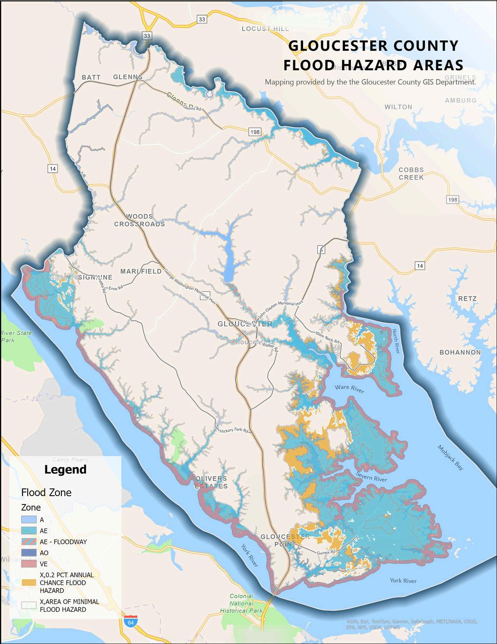
Minimal flood hazard with area outside 500-year flood zone X Zone:
Coastal A Zone:
This new flood transition zone lies between the VE (wave height greater than 3 feet) and AE (wave height less than 3 feet) flood zones and has been added to the new FIRMs. This transition zone is designated on the FIRMs by a line identified as a Limit of Moderate Wave Action (LiMWA) (wave heights between 1 5 and 3 feet)
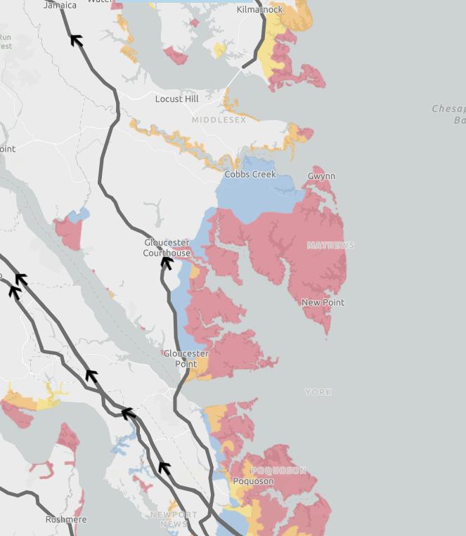
The Commonwealth of Virginia has developed hurricane evacuation zones for coastal Virginia designed to enhance current evacuation plans, boost public safety, and improve travel efficiency in the event of hurricanes or other disasters
Visit www KnowYourZoneVA org Zones are designated A through D. They provide residents with clarity on whether they should evacuate in an emergency or shelter at home, based on their physical street address and the nature of the emergency event
The evacuation zones are data driven and based on a highly detailed map that identified lowlying properties vulnerable to flooding The maps are based on historic storm surge measurements combined with projected effects of storms of different intensity, path, speed, tides and other meteorological factors
EVACUATION ZONES: A B C D
BEE Alert is a high-speed emergency notification system used to alert the public to impending disasters on their landline or registered cell phones. To receive notifications on your cell phone by text or email, visit gloucesterva gov/emergency-management or call 804693-1390


TheGloucesterCountyBuildingInspectionsDepartment providesfloodprotectionassistanceinthefollowingways:
Providesinformationonhowtoselectaqualified contractorandwhotocontactifdissatisfiedwitha contractor’sperformance
Conductssitevisitstoreviewflooding,drainageor sewerproblems
Providesone-on-oneadvicetopropertyownerson floodproofingandretrofittingtechniques,aswellas improvementanddamagerequirements
HelpslocateyourpropertyontheFloodInsurance RateMaps(FIRMS)
ProvidesmapinformationonLiMWA,BFEsuchasAE8and500yearflooding.
AlsoprovidesinformationonResourceProtection Areas(RPA)at804-693-1217