9 minute read
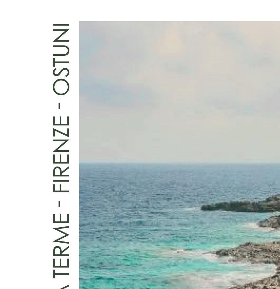
ON THE PATHS OF CINQUE TERRE

from GATEmag n° 30
by GATEmagIta

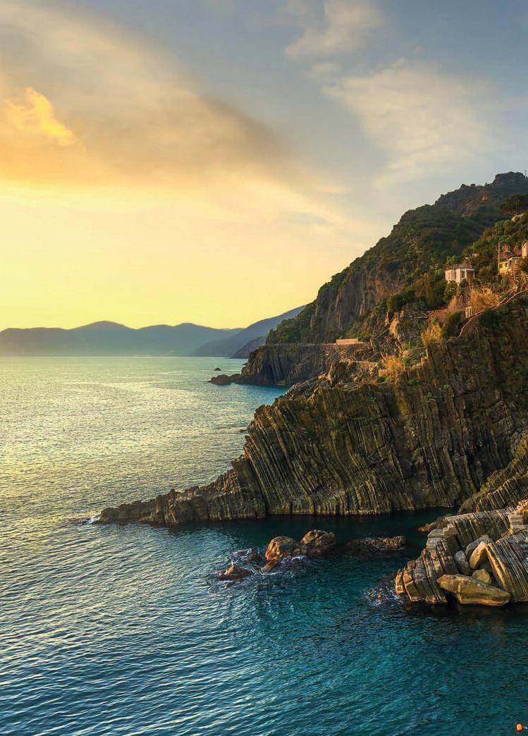
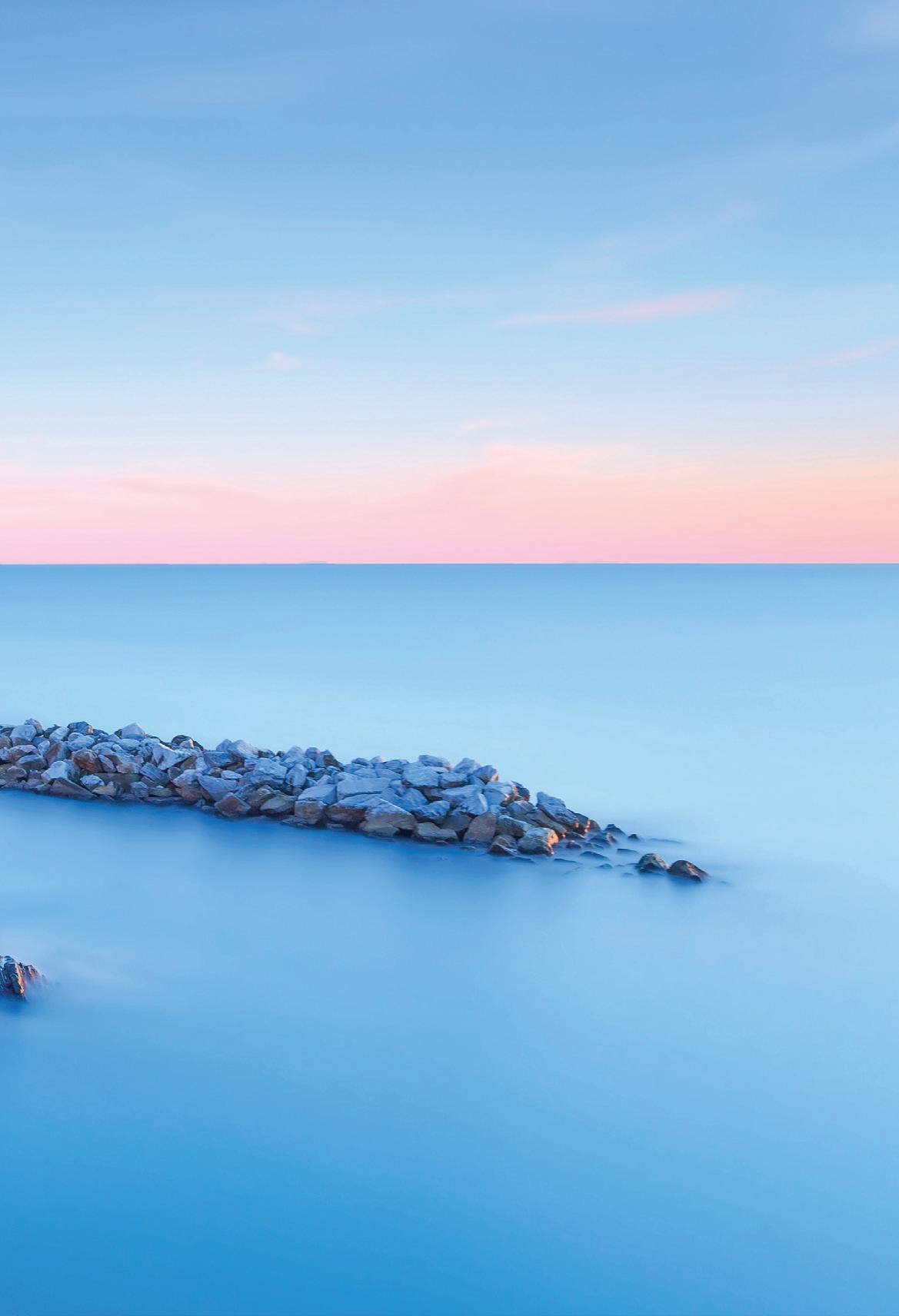
TO BE ENJOYED ON FOOT ARE 18 KILOMETERS OF WONDERFUL ROCKY LIGURIAN COAST DOMINATED BY A CHAIN OF MOUNTAINS PARALLEL TO THE COAST AND ENRICHED BY PRECIOUS BEACHES, BAYS AND DEEP SEABEDS. BUT ALSO BY TERRACES PLANTED WITH VINES AND OLIVE TREES WITH THE TYPICAL ANCIENT DRY STONE WALLS.
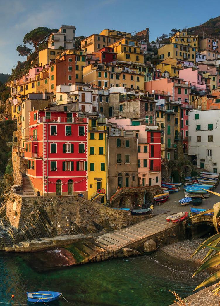
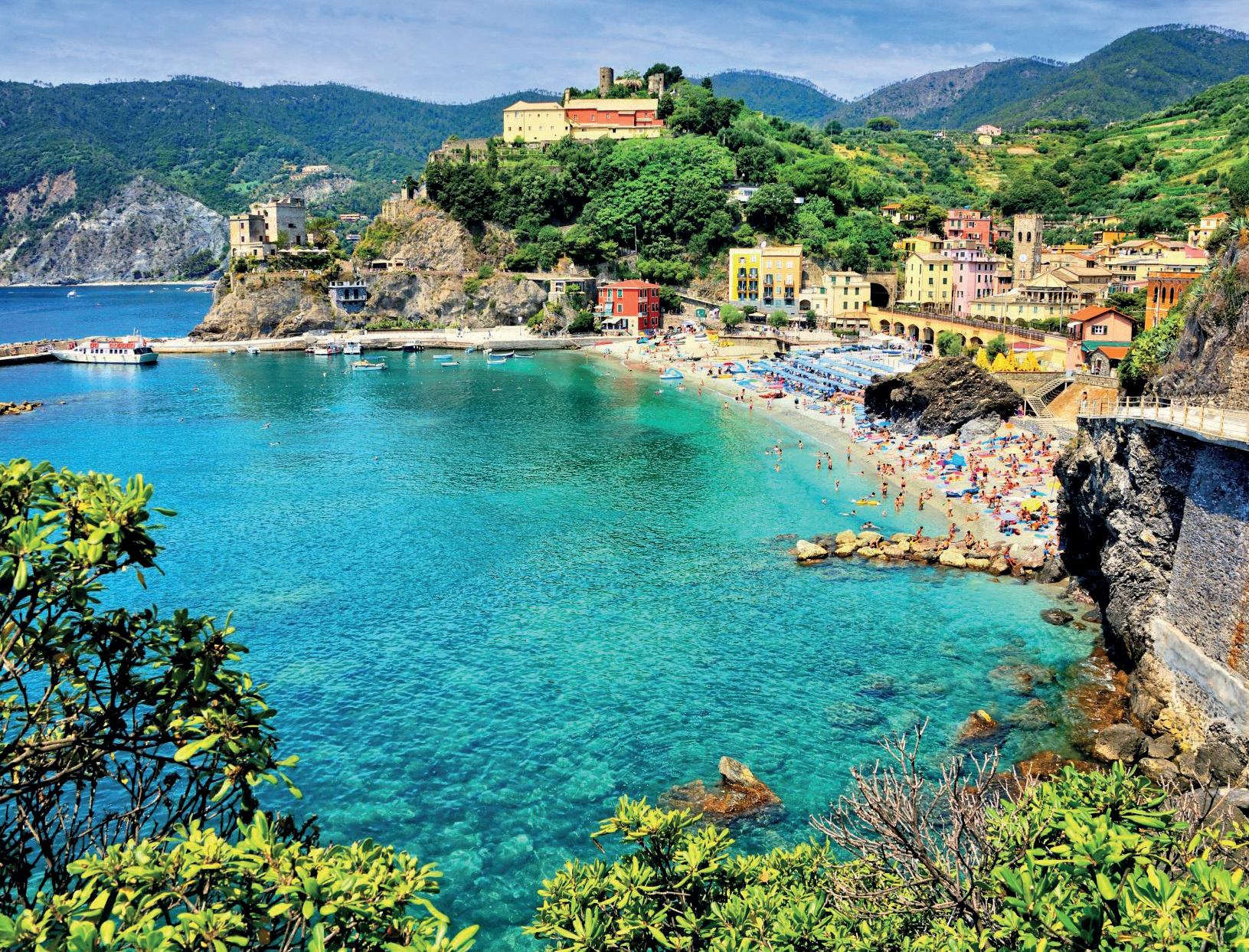
Le Cinque Terre - Monterosso al Mare, Vernazza, Corniglia, Manarola e Riomaggiore - offrono un patrimonio naturalistico di grande varietà. Insieme a Porto Venere e alle isole di Palmaria, Tino e Tinetto, sono state incluse nella World Heritage List dell’UNESCO come esempio significativo di come l’uomo può modellare l’ambiente, rispettandolo.
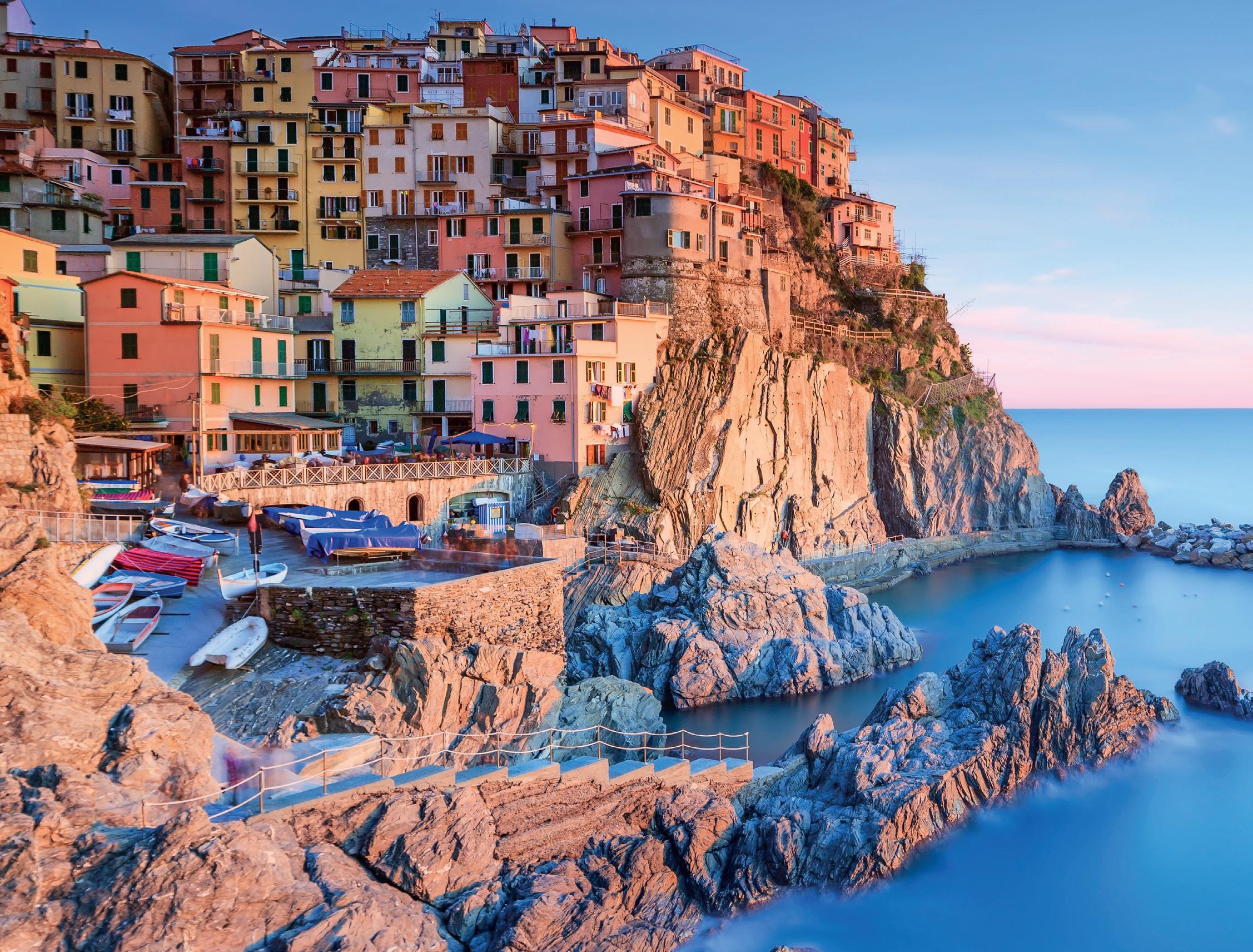
Dal profilo frastagliato, le Cinque Terre sono caratterizzate da speroni di pietra a picco sul mare, minuscole insenature, baie, anfratti, spiaggette tra gli scogli sono la caratteristica, un paesaggio unico al mondo con mare cristallino. Non solo mare però. Le Cinque Terre sono famose per il vino e altri prodotti tipici come l’olio, il miele, i limoni e le acciughe. Una cucina di qualità che si associa a vini DOC come il bianco delle Cinque Terre e lo Sciacchetrà.
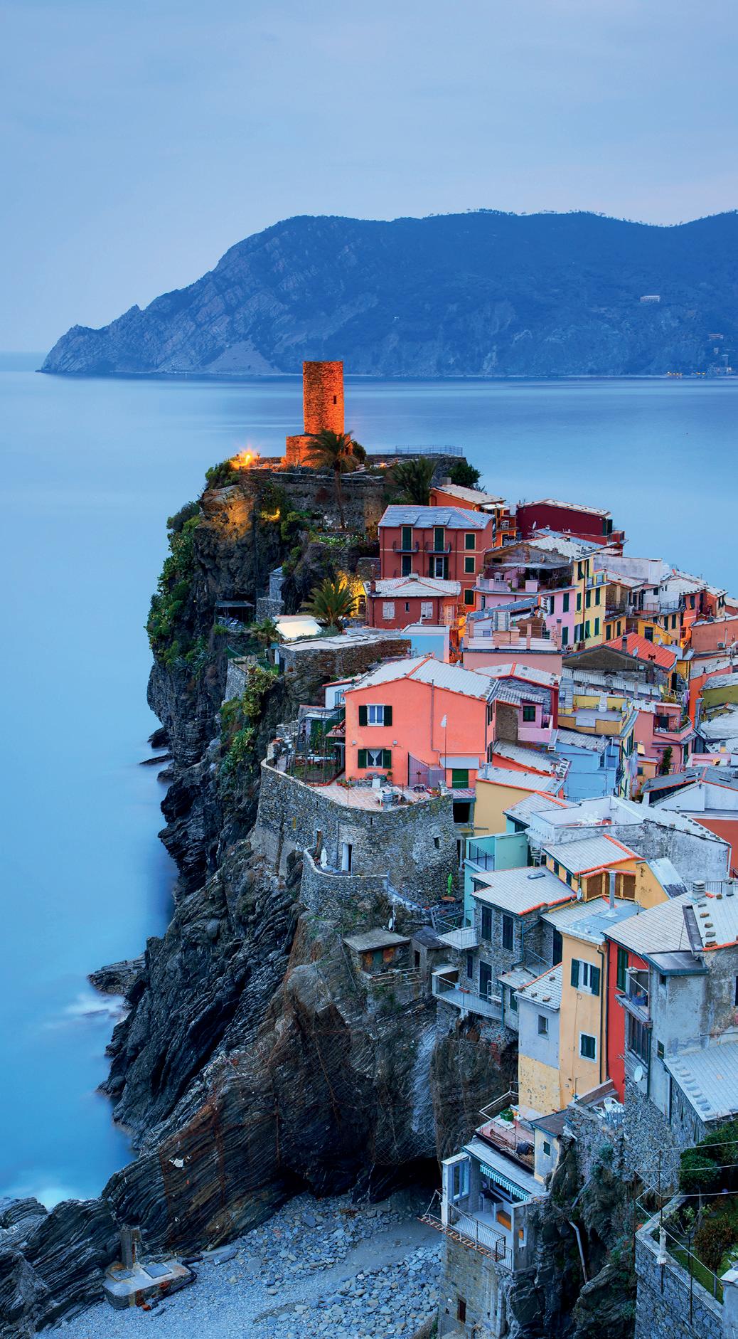
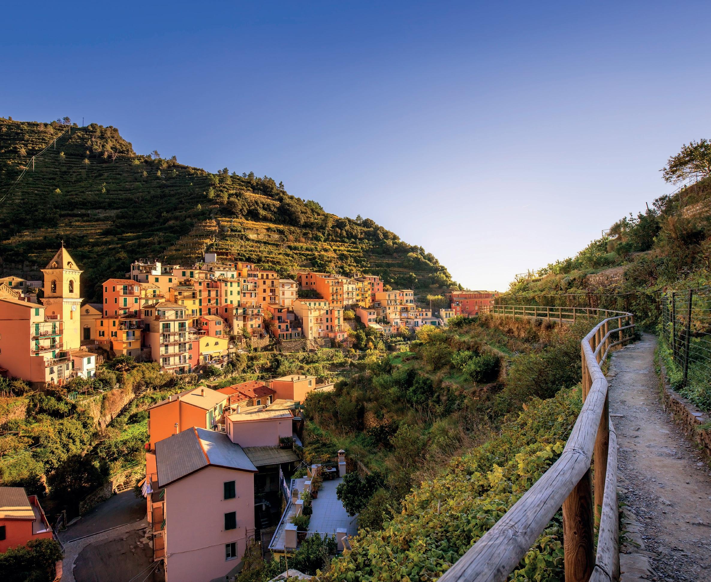
I cinque borghi marinari racchiudono anche piacevoli sorprese nella loro tipica architettura in cui si evidenzia la storia di queste terre. I santuari mariani, innanzitutto, collegati tra loro da sentieri, i resti dei castelli e delle fortificazioni murate eretti per contrastare la minaccia saracena e le chiese nel tipico stile gotico-ligure che le contraddistingue. Ogni località merita una visita per scoprirne la storia secolare. Non a caso le Cinque Terre sono un sito Unesco, patrimonio mondiale dell’umanità.
La notorietà delle Cinque Terre nel mondo è in gran parte dovuta ai sentieri e percorsi che la attraversano. A picco sul mare o lungo le verdi colline dell’interno, i panorami da favola sui cinque borghi hanno contribuito in modo determinante alla fama della zona. Percorrere le Cinque Terre a piedi è un’esperienza unica che sicuramente ci sentiamo di consigliare. Dal 2021, poi, è stata creata la Cinque Terre Card, una carta dei servizi acquistabile presso i centri d’accoglienza del Parco Nazionale delle Cinque Terre e online. Con la Cinque Terre Card è possibile usufruire di servizi quali visite guidate secondo programmazione, utilizzo del servizio bus gestito da ATC all’interno dei paesi e partecipazione ai laboratori del Centro di Educazione Ambientale del Parco.
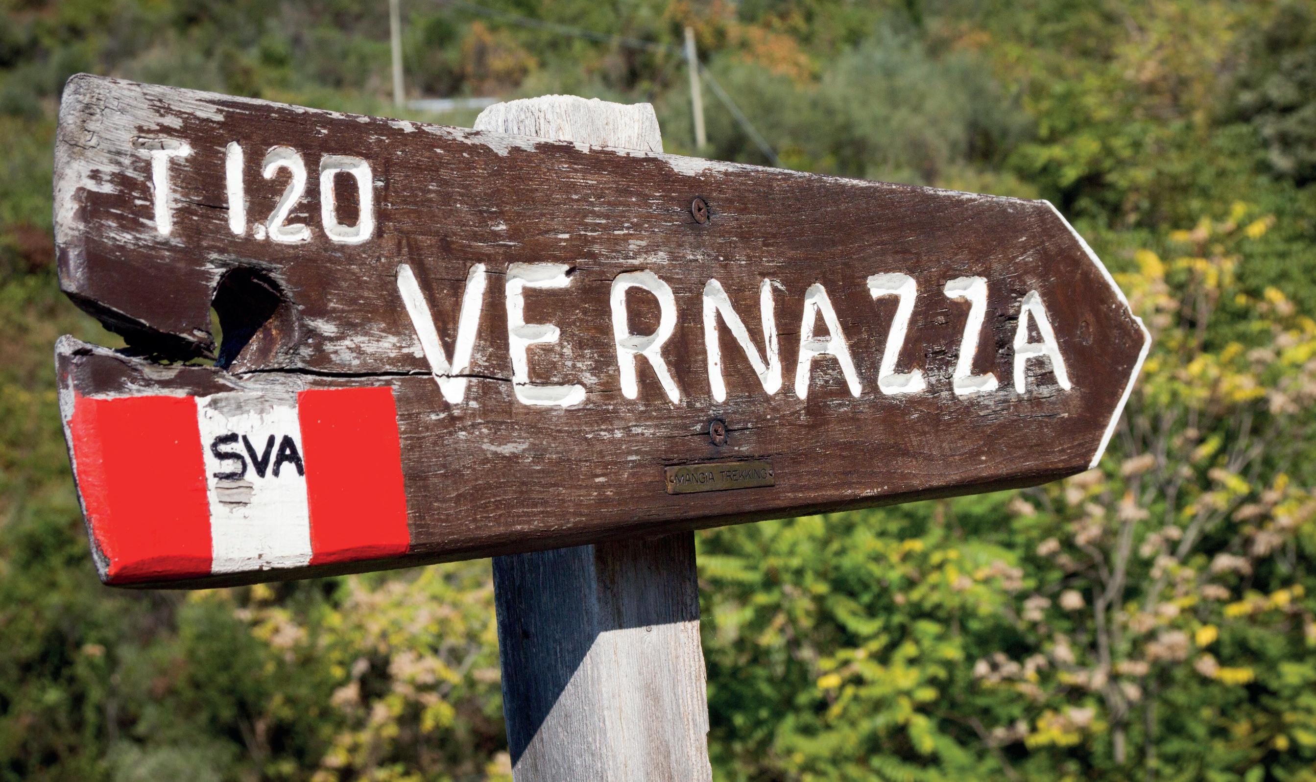
Ma entriamo ora nel dettaglio di questi sentieri che vi guideranno alla scoperta di uno dei tratti di costa italiana più affascinanti e sorprendenti per varietà di scenari e ricchezza territoriale. In totale le Cinque ben 48 sentieri con più di 120 chilometri che collegano i borghi alla costa con panorami mozzafiato. Durante la stagione estiva, i due sentieri più famosi da Monterosso a Vernazza e da Vernazza a Corniglia sono a pagamento, tutti gli altri sono gratuiti.
IL SENTIERO MONTEROSSO – VERNAZZA , di difficoltà media e lungo circa 4 km, inizia nella parte orientale del centro storico di Monterosso. Dopo un corto tratto di strada pedonale, alla fine del golfo, inizia una lunga scalinata che attraversa vigneti e uliveti, continuando con un tratto pianeggiante in mezzo ad una rigogliosa macchia mediterranea. Il percorso comprende rapidi pendii a picco sul mare e favolosi panorami. Quando il sentiero inizia a scendere verso Vernazza si attraversano oliveti e campi coltivati, poi si entra nel paese lungo i vicoli per terminare nel magnifico porticciolo.
IL SENTIERO VERNAZZA – CORNIGLIA , di difficoltà media e lungo circa 3,5 km, può essere percorso in entrambi le direzioni. Un suggerimento è di prendere l’autobus alla stazione ferroviaria di Corniglia (biglietto incluso nella Cinque Terre Card) per arrivare al paese situato sulla collina e poi proseguire a piedi per il sentiero fino a Vernazza. Il sentiero in questo tratto è relativamente pianeggiante e nell’ultima parte in discesa. Da Vernazza sulla strada principale del paese, si accede attraverso le viuzze all’inizio del sentiero e attraverso una scalinata si arriva in pochi minuti alla torre sopra le fortificazioni. La salita continua, abbastanza ripida fino al punto panoramico Punta Palma, da dove si prosegue con dislivelli alti e bassi difficili e ci si affaccia sulla spiaggia di Guvano immersi in campi coltivati, oliveti, vigneti e prati fioriti. Continuando sul percorso si raggiunge il paese di Corniglia, il più piccolo dei cinque villaggi.
IL SENTIERO CORNIGLIA – MANAROLA , lungo circa 5 km e mezzo e di media/alta difficoltà, inizia dalla stazione di Corniglia dove si può prendere l’autobus o affrontare una scalinata di circa 380 gradini (scalinata della Lardarina) fino al paese. Da Corniglia si prosegue poi con un’altra salita di circa 30 minuti percorrendo una vecchia mulattiera attraversando vigneti e terrazzamenti con viste mozzafiato. Si arriva poi a Volastra, passando per il Santuario della Madonna della Salute, e da qui si inizia la discesa verso Manarola tra la macchia mediterranea. Se si percorre il sentiero da Manarola, per evitare il tratto più ripido fino a Volastra, consigliamo di utilizzare il servizio bus che da Manarola porta a Volastra in circa 10 minuti.
IL SENTIERO MANAROLA - RIOMAGGIORE , lungo circa 2 km e di media/alta difficoltà, è piuttosto corto ma molto ripido con scalini alti e irregolari. Questo sentiero è stata la prima via di collegamento tra i paesi Manarola e Riomaggiore, prima che fosse costruita la Via dell’Amore. Il percorso inizia a Manarola nei pressi della chiesa di San Lorenzo con una ripida scalinata che termina in un tratto pianeggiante. Si prosegue fino al crinale Costa Corniolo dove si scorge nell’entroterra il paese di Volastra, Groppo e sul lato costiero Corniglia, Monterosso con Punta Mesco. Iniziando la discesa, tra vigneti e trenini a cremagliera utilizzati per trasportare l’uva, si intravede Riomaggiore. Si termina vicino alla stazione ferroviaria.
IL SENTIERO RIOMAGGIORE – PORTOVENERE , lungo circa 13 km e di media difficoltà, è piuttosto impegnativo e si può percorrere in entrambe le direzioni. Cominciando da Riomaggiore, in condizioni meteo ideali, si possono vedere le isole Elba, Capraia, Corsica, Palmaria, Tino e Tinetto. Da Riomaggiore il sentiero inizia con una lunga discesa fino ad arrivare all’antico Santuario di Montenero (XV secolo), punto panoramico sulla costa delle Cinque Terre e ottimo posto per una breve sosta. Inizia poi la parte più suggestiva del percorso: una splendida scogliera con una magnifica vista sul mare con il crinale detto “dei tramonti”, la palestra di roccia del Muzzerone per poi scendere verso Spezia lungo le mura fortificate di Portovenere.
IL SENTIERO LEVANTO – MONTEROSSO, lungo circa 8 km e di media difficoltà, parte a Levanto dalla passeggiata a mare. Si segue la gradinata verso il Castello e poi si prosegue sulla vecchia mulatteria tra pini e vegetazione mediterranea dove è possibile ammirare il panorama sul golfo di Levanto. Il sentiero prosegue attraverso la foresta fino a Punta Mesco e, dopo aver passato le rovine della Cappella di Sant’Antonio e il vecchio faro, si scende con una bellissima vista sulle Cinque Terre, verso Monterosso.
EN Cinque Terre - Monterosso al Mare, Vernazza, Corniglia, Manarola and Riomaggiore - offer a naturalistic heritage of great variety. Together with Porto Venere and the islands of Palmaria, Tino and Tinetto, they have been included in the UNESCO World Heritage List as a significant example of how man can shape the environment, respecting it.
With a jagged profile, the Cinque Terre are characterized by stone spurs overlooking the sea, tiny inlets, bays, ravines, and small beaches among the rocks are the characteristics of a unique landscape in the world with crystal clear sea. Not just the sea though. Cinque Terre is famous for their wine and other typical products such as oil, honey, lemons and anchovies. A quality cuisine that is associated with DOC wines such as the white of the Cinque Terre and the Sciacchetrà.
The five seaside villages also contain pleasant surprises in their typical architecture which highlight the history of these lands. First of all, the Marian sanctuaries, connected by paths, the remains of castles and walled fortifications built to counter the Saracen threat and the churches in the typical Ligurian-Gothic style that distinguish them. Each locality deserves a visit to discover its centuries-old history. It is no coincidence that Cinque Terre is a UNESCO site, a world heritage site. The notoriety of Cinque Terre in the world is largely due to the paths and trails that cross it. Overlooking the sea or along the green hills of the interior, the fabulous views over the five villages have contributed significantly to the fame of the area. Going through Cinque Terre on foot is a unique experie nce that we would certainly recommend. Starting in 2021 the Cinque Terre Card was created, a service card that can be purchased at the reception centers of the Cinque Terre National Park and online. With the Cinque Terre Card it is possible to take advantage of services such as guided tours according to programming, use of the bus service managed by ATC within the towns and participation in the laboratories of the Park’s Environmental Education Centre. But let’s now go into the details of these paths that will guide you in the discovery of one of the most fascinating and surprising stretches of Italian coast for the variety of sceneries and territorial wealth.In total there are 48 paths with more than 120 kilometers that connect the villages to the coast with breathtaking views. During the summer season, the two most famous paths from Monterosso to Vernazza and from Vernazza to Corniglia are subject to a fee, all the others are free.
THE MONTEROSSO – VERNAZZA TRAIL , of medium difficulty and about 4 km long, begins in the eastern part of the historic center of Monterosso. After a short stretch of pedestrian road, at the end of the gulf, a long stairway begins which crosses vineyards and olive groves, continuing with a flat stretch in the middle of luxuriant Mediterranean scrub. The route includes rapid slopes overlooking the sea and fabulous panoramas. When the path begins to descend towards Vernazza, it crosses olive groves and cultivated fields, and then enters the town along the alleys to end up in the magnificent small port.
THE VERNAZZA – CORNIGLIA TRAIL , of medium difficulty and about 3.5 km long, can be followed in both directions. A suggestion is to take the bus at the Corniglia train station (ticket included in the Cinque Terre Card) to get to the village located on the hill and then continue on foot along the path up to Vernazza. The path in this section is relatively flat and downhill in the last part. From Vernazza on the main road of the town, you enter through the narrow streets at the beginning of the path and through a staircase you arrive in a few minutes at the tower above the fortifications. The climb continues, quite steep up to the Punta Palma panoramic point, from where it continues with difficult high and low gradients and overlooks the Guvano beach surrounded by cultivated fields, olive groves, vineyards and flowery meadows. Continuing on the route you reach the town of Corniglia, the smallest of the five villages.
THE CORNIGLIA – MANAROLA PATH, about 5 and a half km long and of medium/high difficulty, starts from the Corniglia station where you can take the bus or tackle a staircase of about 380 steps (scalinata della Lardarina) up to the village. From Corniglia we then continue with another climb of about 30 minutes along an old mule track crossing vineyards and terraces with breathtaking views. You then arrive at Volastra, passing through the Sanctuary of the Madonna della Salute, and from here you begin the descent toward Manarola among the Mediterranean scrub. If you take the path from Manarola, to avoid the steepest stretch up to Volastra, we recommend using the bus service that takes you from Manarola to Volastra in about 10 minutes.
THE MANAROLA - RIOMAGGIORE PATH, about 2 km long and of medium/high difficulty, is rather short but very steep with high and irregular steps. This path was the first connecting road between the villages of Manarola and Riomaggiore, before the Via dell’Amore was built. The route begins in Manarola near the church of San Lorenzo with a steep staircase that ends in a flat section. Continue up to the Costa Corniolo ridge where you can see the towns of Volastra and Groppo in the hinterland and on the coastal side Corniglia, Monterosso with Punta Mesco. Starting the descent, between vineyards and cogwheel trains used to transport the grapes, Riomaggiore can be glimpsed. It ends near the train station.
THE RIOMAGGIORE – PORTOVENERE PATH, about 13 km long and of medium difficulty, is quite demanding and can be followed in both directions. Starting from Riomag- giore, in ideal weather conditions, you can see the islands of Elba, Capraia, Corsica, Palmaria, Tino and Tinetto. From Riomaggiore the path begins with a long descent until you reach the ancient Sanctuary of Montenero (15th century), a panoramic point on the Cinque Terre coast and an excellent place for a short stop. Then begins the most evocative part of the route: a splendid cliff with a magnificent view of the sea with the ridge called “dei tramonti”, the Muzzerone climbing wall to then descend towards Spezia along the fortified walls of Portovenere.
THE LEVANTO – MONTEROSSO PATH, about 8 km long and of medium difficulty, starts in Levanto from the promenade. Follow the steps towards the Castle and then continue on the old mule track between pine trees and Mediterranean vegetation where it is possible to admire the panorama of the Gulf of Levanto. The path continues through the forest to Punta Mesco and, after passing the ruins of the Chapel of Sant’Antonio and the old lighthouse, descends with a beautiful view of the Cinque Terre, towards Monterosso.