

Central Winds Park Master Plan Report
February 7, 2025


Acknowledgments
City Commissioners
Kevin McCann, Mayor
Paul Diaz, City Commissioner - District 1
Victoria Bruce, City Commissioner - District 2
Sarah Baker, City Commissioner - District 3
Cade Resnick, Deputy Mayor & City Commissioner - District 4
Mark Caruso, City Commissioner - District 5
Parks and Recreation Advisory Committee
Chairperson - Jim Van Kleunen
Committee Member - Desma Underwood
Committee Member - Jason Byrne
Committee Member - Paul Diaz
Committee Member - Jose Galan
City Staff
Director of Community Development - Terrilyn Rolle, AICP
Project Manager - Talbert Jackson, MSURP, Senior Planner
Director of Parks and Development - Leonard Hartman
Parks Manager - Michael Krist
Senior GIS Analyst - Jeff Stanford
City of Winter Springs Residents


01.
Introduction
The Central Winds Master Plan update provides a visioning document for future enhancements to the park. The resulting document reflects an understanding of existing site usage and conditions, including natural resources and economic feasibility of an event center, public engagement, and collaborative design to reflect the needs and desires of the community.
IN THIS CHAPTER
PARK OVERVIEW HISTORICAL CONTEXT
Overview
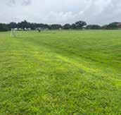
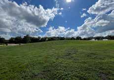
Central Winds Park serves as the heart of outdoor recreation and community events in Winter Springs. As a community park, the park provides access to a wide variety of recreation opportunities. The park is perhaps best known as the home for sports, both practices and competitive play, which activate the park with players and spectators nearly every evening. Perhaps more quiet but no less impressive are the passive and natural areas of the park. The natural environment of the site includes views of Lake Jesup, along with various natural communities and mature tree canopy, which create a tranquil setting for passive recreation. The park includes playgrounds, picnic pavilions, and nature trails that take advantage of the natural setting. These amenities draw users visiting to access these specific opportunities as well as incidental users such as athletes between games. Additionally, passive areas of the park are used by the adjacent high school as part of their track and field program.
Central Winds Park also functions as a regional park throughout the year, hosting large events drawing visitors from the Central Florida region as a whole. One of the most well-known events is the annual Central Florida Scottish Highland Games, a two-day gathering held every January including competitions in Scottish heavy athletics, Highland dance, bagpiping, and baking. The event and games take place primarily on the Event Lawn. They draw thousands of visitors to the park, transforming park operations and circulation systems. Additionally, the park hosts a variety of events for the community year-round, including an egg hunt, fishing tournaments, pickleball tournaments, 4th of July celebration, Hometown Harvest, Christmas festivities, and other community gatherings.
Central Winds Park, with its breadth of recreation amenities and natural areas, is a vibrant destination for Winter Springs residents and beyond. This Master Plan provides a guide for the future of Central Winds Park that capitalizes on the successes of the park today, addresses current challenges of the park, and provides enhanced amenities for the future of the park. The Master Plan contemplates strengths and challenges of park uses, circulation and wayfinding networks, natural resources, and aspects of economic feasibility within the park to provide a cohesive guiding vision.


1989
Park land identified 1992
Phase I of Central Winds Opens, includes Upper Fields, Event Lawn, and passive park area
2002
Central Winds Expansion
new Lower Fields area; Concept Plan developed, including Recreation Center with Pool in the current location of the Event Lawn, and a Spine Road
2006
Central Winds Park Master Plan developed to propose improvements and incorporate new western edge property; Spine Road adjusted to current configuration; Recreation Center remains in plans
2010
Permanent Dog Park added 2016
ADA Improvements provided for Upper Fields; Spine Road constructed Park Master Plan Update proposing Recreation Center at Reclamation Facility Site
2017
Spine Road completed; stage added
2021
Paved parking at Lower Fields
2024
Pickleball complex completed 2025 Master Plan Update anticipated February

The Park Today
An understanding of the park today provides the foundation for a future vision of Central Winds Park. To best understand the successes and challenges of the park, the project team conducted a series of site visits observing characteristics such as:
+ Circulation and Wayfinding
+ Natural Resources
+ Condition of amenities and infrastructure
+ Park usage and patterns These site visits were conducted during both light and heavy usage periods—including daytime, evening, and weekends—to best understand park function. Additionally, the project team gathered pertinent site information such as existing utilities, infrastructure, and natural resources data to understand specific site considerations. Collaboration with City staff provided key insight into operational challenges and needs within the park. The following section details the current state of the park.
IN THIS CHAPTER
BEST MOMENTS
CHALLENGES AND CONSIDERATIONS
NATURAL RESOURCES ASSESSMENT
EVENT HALL FEASIBILITY
Best Moments
Today, Central Winds Park has a variety of positive characteristics that contribute to its popularity and status as a signature park in Winter Springs. Understanding the best moments within the park provides two key insights: understanding features of the park to remain or be highlighted in the future design, and understanding successes in particular areas of the park that may be replicated in other areas of the design.
Vibrancy
Central Winds Park boasts a dedicated community of park users who regularly enjoy the park during all hours of operation. Due to its large variety of amenities, the park draws a wide variety of park visitors, all with different goals in mind. The park is frequently busy with sports players, nature lovers, dog parents, and families alike. Future visioning for the park should avoid disrupting existing park uses and enhance the user experience of the park. Central Winds Park is the heart of activity in Winter Springs. Preservation of this vibrancy while implementing various phase of the plan will keep the community coming, while providing the opportunity for users to experience other areas of the park they may not have enjoyed in the past.
Special Events
Outside of day-to-day operations, Central Winds Park serves as the location for a variety of events including the Central Florida Scottish Highland Games as well as community year-round events such as egg hunts, fishing tournaments, pickleball tournaments, 4th of July celebrations, Hometown Harvest, and Christmas events among others. Aside from drawing visitors regionally, these events serve to cultivate a sense of community within Winter Springs contributing to the appeal of living in city. While the final design will primarily focus on providing a positive user experience for the day-today user, flexibility and circulation for special events should be integrated into the design to continue to provide this function.


Existing Tree Canopy
Existing tree canopy within Central Winds Park provides needed shade and clean air for park users. Currently, the park includes pockets of tree canopy concentrated along the lake edge and passive recreation area, as well in the Upper Fields parking lot. Additionally, a number of beautiful character oaks dot the site, providing unique visual character. Potential future improvements of the site should not only protect the existing tree canopy, but highlight and capitalize upon it. Expanding tree canopy throughout the site could help provide additional shade while creating visual character throughout the site. Implementation of this feature should balance use and maintenance of the sports fields with the benefits of natural tree canopy.
Natural Resources
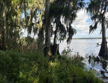
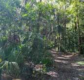
Situated along the southern shore of Lake Jesup, the park provides views of both the lake and a variety of natural communities such as wetlands and mixed uplands. Currently, some limited natural trails exist within the site, which could be enhanced. There are opportunities to expand and celebrate access to these natural amenities, by providing access to the lake as well as highlighting natural communities occurring within the site.
Sustainable Stormwater Practices
The newly constructed pickleball courts and adjacent parking area utilize Low Impact Development (LID) strategies for stormwater management, introducing a new design approach and visual identity to the park. This inclusion of sustainable stormwater management practices hints at an opportunity to expand these practices to other areas of the park. Leveraging the park as a tool for resilience, sustainable stormwater practices could improve existing drainage challenges, providing additional habitat, and high visibility opportunities for environmental education.
Challenges and Considerations
Identifying challenges and considerations within Central Winds Park provides guidance for the improvements and enhancements to be incorporated as part of the vision of the park. While the park today exhibits many successes, improvements can be made to remove friction points in park user experience and provide ease of operations and maintenance within the park. Site conditions could limit the extent of future improvements and form part of the foundation for the approach of visioning.
Site Hydrology
Natural Systems
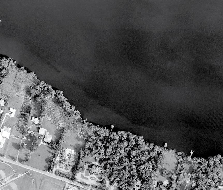
Bordering Lake Jesup’s southern shore, the northern edge of Central Winds Park includes both FEMA AE Flood Zone and wetlands, limiting the development of structures within certain areas of the site. Views into Lake Jesup are limited by the presence of protected wetlands. Opening views into Lake Jesup are limited by wetlands regulation, although targeted mechanical interventions may be possible. Currently, access to Lake Jesup is limited to the existing fishing pier along the western edge of the park. A new potential boardwalk would provide further opportunities for the public to engage with the lake (1). Passive recreation is nestled near the wetlands where natural surface trails (2) provide access to natural communities that could be further highlighted as a feature of the park.
Drainage
Drainage systems within sports fields are often complex, as field surfaces should provide level playing surfaces while directing rainwater flow. An engineered natural turf field should not exceed a 1.5% slope while still directing a positive rainwater flow. Drainage in the Lower Fields is managed through a series of stormwater swales and ponds. However, some evidence of drainage issues can be observed where the parking lot meets the southern fields (3). Additionally, dry retention areas between the northern fields break up the space and limit pedestrian circulation between various fields (4). This not only impacts sports field users but also limits the flexibility of the fields for multipurpose use, such as during large events like the Highland Games.
Other smaller drainage issues, such as existing drainage issues surrounding the pavilions in the passive park area (5), can be observed in the park.


Existing Circulation
Vehicular Circulation
The vehicular entry point for the park is Central Winds Boulevard, which may be accessed off of State Road 434 (SR-434) to the south or Orange Avenue to the north (1). This road forms a spine to the park and provides access to the Upper and Lower Fields, as well as the Event Lawn and passive park portions of the site. To access the western portion of the site, drivers must use Hicks Avenue to the south and onto a secondary north-south spine. With no other vehicular connections to the park, this circulation pattern separates the western edge from the rest of the park.
There are both formal and informal parking lots within the park. To access the Upper Fields, drivers must first cross a fence where they will find a formal parking lot associated with the baseball quad (2). Additional parking for the Upper Fields is available along the southern edge of the fields which is mostly informal parking. Users of the Lower Fields can find formal parking along the southern edge of the fields and the Central Winds Parkway. An informal parking lot located between the Lower Fields and passive park area provides parking for both (3). On the western edge, parking is mostly provided adjacent to the pickleball courts. During events, overflow parking is provided along the western edge of the dog park, which may warrant a vehicular access point to SR-434.
Pedestrian Circulation
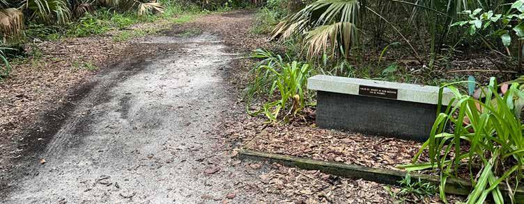
Formal pedestrian circulation is mostly limited to sidewalks within the Upper Fields (4). Some additional sidewalk access has been added with the recent development of the pickleball court area. The Lower Fields include a sidewalk connection from the parking lot to the softball quad, however, pedestrian access to the other fields is limited and assumes park users will walk through fields. The passive park area includes some unpaved paths and trails mostly limited to nature trails. This limited network of paved sidewalks means that much of the park is inaccessible and does not meet ADA standards (5). A more robust sidewalk network providing access to all amenities is needed for the park to be inclusive of all potential users.
The Cross Seminole Trail, bordering the southern edge, provides a great asset to park users and opportunities to connect to a greater regional network. The intersection between the Cross Seminole Trail and the turn at the end of Hicks Avenue currently creates a potential blind spot and zone of conflict between trail users and vehicular traffic. An improved intersection design should be considered to create a safer crossing.


Wayfinding and Navigation
A comprehensive strategy to improve navigation for both pedestrians and vehicles will enhance the overall visitor experience

Internal Navigation and Parking
The park is divided into multiple areas with distinct amenities and associated parking locations, but signage directing visitors to the correct parking areas is limited. Existing signs are often undersized, making them difficult to read from a vehicle, which can lead to confusion and frustration among users.
Access and Arrival
Navigating Central Winds Park proves to be challenging. Clear connections between the park and major roadways are missing, making the park hard to find. The current directional signs are not scaled appropriately, making it difficult to find the correct turns when trying to locate amenities. Once inside, there are no gateway signs to define the park's boundaries or create a welcoming "you have arrived" moment for visitors.


Orientation and Exploration
The park also lacks an overview map, which hinders visitors from gaining a full understanding of the park’s layout and offerings. Without this tool, visitors tend to stick to familiar destinations and may not discover or explore other areas in and around the park.


Operations and Maintenance
Through conversations and collaboration with City staff, the project team gained insight into maintenance and operations challenges within the park which may be addressed through this Master Plan. The following provides a summary of specific operational challenges.
Lighting
While the Upper Fields are lit, there is currently no sports lighting on the Lower Fields, limiting usage hours particularly in the winter months. Similarly, lighting is desired for the Event Lawn to facilitate event use.
Flexibility
Central Winds Park serves as the community hub for events and must maintain and enhance the flexibility of its open spaces to best accommodate events. Surface elevation changes related to stormwater in the Lower Fields would provide additional flexible event space.
Access Control
The Upper Fields are currently fenced to provide access control and enforce hours of usage on a day-to-day basis. During events, this fencing serves to separate accessible parking and vendor parking for general admission parking areas. Future fencing is planned along the edge of Orange Avenue and Central Winds Boulevard to help control access to the site.
Amphitheater Space
Views into the amphitheater from the road are limited, impacting the ease of security and awareness of the amenity. The park's adjacency to Lake Jesup provides an opportunity to provide views into the lake, although this is limited due to the wetlands.
Shade and Pavilions
Additional shade is desired throughout the park, including a shade structure near the existing fishing pier. Canopy shade should balance providing a comfortable environment and maintaining spatial flexibility. Existing group pavilions are currently heavily used and booked, and there may be an opportunity to provide more pavilions to serve the community.


Disjointed Areas
At its inception in 1992, Central Winds Park consisted only of the area that includes the Upper Fields, Event Lawn, and passive park area. Over the years, the park expanded west slowly developing additional amenities such as the Lower Field expansion in 2002 and the addition of the western edge property in 2006. The latest improvement to the park is the pickleball complex and associated parking completed recently in 2024. As a result, Central Winds Park exhibits a symptom common in many large community parks that have expanded incrementally in size—the park displays a disjointed visual style and does not appear as a single park. Instead, the park is often experienced in sections which may contribute to siloed use of the park. Rather than exploring the whole park and enjoying all its park amenities, individual park users may tend to remain within the area related to their specific intended park use. This is further exacerbated by circulation patterns and wayfinding challenges that separate the park and prevent pedestrian connectivity from area to area of the park.
The park may be subdivided into six distinct areas:
+ Event Lawn
+ Upper Fields
+ Lower Fields
+ Western Edge
+ Passive Park
+ Natural Edge
While it is expected that large parks will group similar activities together to create “zones”, these areas can be planned to invite users to explore the entire park. Visioning for the park should consider unifying the various areas of the park through circulation, wayfinding, and materials to provide a cohesive and inviting park experience.


LOWER FIELDS
CITY OWNED PROPERTY
LOWER FIELDS
WESTERN EDGE
PASSIVE PARK
NATURAL EDGE
ORANGEAVENUE

Natural Resources Assessment
Introduction
The City of Winter Springs is investigating the potential installation of a boardwalk along the northwestern section of Central Winds Park. GAI Consultants, Inc. (GAI) has been retained by the City of Winter Springs to assess Central Winds Park for the presence and landward extent of wetlands and other jurisdictional surface waters as well as the presence of, or likely utilization by, threatened or endangered species. Central Winds Park was investigated during a field inspection as well as through a review of published data containing information about the park’s topography, soils, vegetation, and wildlife. The purpose of our research was to document the presence and extent of wetlands on the park, the park’s potential to support listed plants and animals, the opportunities for enhancement of the existing vegetative communities, and the potential constraints on planned future development of the park resulting from their presence. No subsurface soil, water quality, archaeological, or hazardous materials investigations were conducted by GAI. This assessment documents the findings of this investigation and the potential ecological permitting requirements and management obligations related to wetlands or listed species documented to occur within or adjacent to the park. These findings reflect conditions at the time of the investigation and do not preclude the possibility that site conditions may change. The opinions expressed are those of the writer and should not be viewed as binding on any governmental agency.
Methodology
The site was investigated through review of published information (see Information Sources). Further, we conducted a review of the state’s database of species occurrence records and the bald eagle nest location database. Site inspections were conducted on July 30, 2024; August 21, 2024; and September 4, 2024 by ecologists familiar with the natural communities of Florida to determine the vegetative communities present within the park, and to determine the presence of, or potential for use by, listed plant or animal species. The field inspection also allowed the ecologists to confirm or amend the information collected from database searches and the review of published information. Vegetative community types and general observations were recorded via field data sheets and photographs taken of Central Winds Park. A list of plant species encountered was recorded for the park. This list reflects representative species observed within the park and is not necessarily a complete floristic inventory. The park was reviewed for the presence of listed animals through actual observation, signs of scat, prints, or other indications of their presence or utilization of the site.
Statements regarding listed species are based on limited field observations and existing data records, and do not preclude the possibility that listed species may occasionally forage on-site or may move into the park in the future.
Existing Site Conditions
Location
Central Winds Park covers approximately 100.98 acres in Section 38 and 39, Township 20 South, Range 30 East in Seminole County, Florida. The park is bordered by Hicks Avenue, Central Winds Drive, Choices in Learning Charter School, and east SR-434 to the south; by Winter Springs High School and residential development to the east; by residential development and Lake Jesup to the north; and by undeveloped lands and residential development to the west.
Topography and Drainage
The park is generally flat, with slopes descending from the south to the north. The United States Geological Survey (USGS) topographic map (Casselberry, Florida Quadrangle) depicts the elevation of Central Winds Park at its highest point of 43± feet and its lowest point of 10± feet National Geodetic Vertical Datum (NGVD). The site lies within the Lake Jesup drainage basin within the St. Johns River Water Management District (SJRWMD).
Soils
Soil mapping often provides an indication of the historic and current conditions of a site, the potential for presence of sensitive plant communities (e.g., wetlands, scrub), and the potential for presence of listed plants and animal species that are typically limited to specific plant communities. The United States Department of Agriculture (USDA), Natural Resources Conservation Service (NRCS), on the USDA Web Soil Survey of Seminole County, Florida, identified six soil types in the site. The soil types are listed in the table below.
Astatula-Apopka fine sands, 0 to 5% slopes (6)
EauGallie and Immokalee fine sands (13)
drained
Manatee, Floridana, and Holopaw Soils, frequently flooded (19) Very poorly draines
Myakka and EauGallie fine sands (20) Poorly drained
Pomello fine sand, 0 to 5% slopes (27) Moderately well drained
Tavares-Millhopper fine sands, 0 to 5% slopes (31) Moderately well drained
1 USDA Web Soil Survey, NRCS
2 Hydric Soils of Florida Handbook, Florida Association of Environmental Soil Scientists
Land Cover and Vegetation
The land use and vegetative communities occurring on the park were identified based on published Geographic Information System (GIS) data and the site inspection and classified using the Florida Land Use, Cover and Forms Classification System (FLUCCS), 1999.
The northwestern corner of the site is classified as rural residential (1180), upland mixed coniferous/ hardwood (4340), and reservoirs (5300). The tree canopy in the upland mixed coniferous/ hardwood area consist of laurel oak (Quercus laurifolia), live oak (Quercus virginiana), hackberry (Melia azedarach), slippery elm (Ulmus rubra), cabbage palm (Sabal palmetto), camphor tree (Cinnamomum camphora), pignut hickory (Carya), and water oak (Q. nigra). Subcanopy vegetation of the park includes elderberry (Sambucus nigra), wild coffee (Psychotria), black cherry (Prunus serotina), Brazilian pepper (Schinus terebinthfolia), and paper mulberry (Broussonetia papyrifera). The herbaceous and ground cover component of this community includes shepherd’s needles (Bidens alba), wild poinsettia (Euphorbia heterophylla), Caesar weed (Urena lobata), balsampear (Momordica charantia), scarlet sage (Salvia coccinea), Shield fern (Dryopteris sp), guinea grass (Panicum maximum), and basketgrass (Oplismenussp). Nuisance and exotic species were observed within this section of the site which included chinaberry, earpod, camphor tree, paper mulberry, and Brazilian pepper. The northwest section also supports mixed wetland hardwoods (6170). Dominant canopy species include hackberry, Cypress (Taxodium ascendens), water hickory (Carya aquatica), cabbage palm, Chinaberry (Melia azedarach), and camphor tree. The understory and shrub layer consist of laurel greenbrier (Smilax laurifolia), Earleaf greenbrier (S. auriculata), paper mulberry, and Brazilian pepper. The remaining areas of the park are classified as community recreational facilities (1860) with two reservoirs (5300) at the west section. This area includes park space, turfgrasses and weeds, with remnant native vegetation including live oak, laurel oak, and Caesar weed.
Threatened and Endangered Species
The U.S. Fish and Wildlife Service (USFWS) and the Florida Fish and Wildlife Conservation Commission (FWC) list wildlife species that are considered “endangered” or “threatened.” The FWC uses an additional category— “species of special concern” (SSC)— for several animals that may ultimately be listed as endangered or threatened. This classification provides the SSC-listed animal with a level of protection that varies from species to species. The USFWS and the Florida Department of Agriculture and Consumer Services (FDACS) also compile lists of protected plant species. The USFWS classifies protected plants as either endangered or threatened, while the FDACS’ plant list is categorized into endangered, threatened, and “commercially exploited” species.
Prior to the field inspection, various online data sources were accessed in order to collect information concerning the possible presence of state- and/or federally listed threatened or endangered species within the park. These sites included:
• the USFWS’ website for federally listed species found within Seminole County;
• the USFWS’ Information for Planning and Consultation (IPaC) system;
• the FWC’s website to identify state-listed species known to occur within Seminole County;
• the Audubon Society’s Audubon Florida Eaglewatch Nest Application; and
• the Florida Natural Areas Inventory (FNAI) database and Biodiversity Matrix for known occurrences of listed species or critical habitat.
In addition, GIS data layers providing species occurrence records were obtained from the FWC and the FNAI and used in our determination of whether protected species may occur within the vicinity of Central Winds Park. Our field inspection consisted of a series of meandering pedestrian transects throughout the park to evaluate existing land use and ascertain the likelihood that it may support protected species through the observation of individuals, tracks, burrows, scat, or other indications of listed plants and/or animals.
From our search of the USFWS’ and FWC’s occurrence records, a review of the habitat requirements of these plants and animals, and subsequent field inspection, it was determined that there is concern for the potential presence of the bald eagle, gopher tortoise, eastern indigo snake, and a few listed plants with broad habitat requirements that may include the habitat types that occur on-site. Additional species listed in USFWS occurrence records were also evaluated in greater detail in order to document the basis for not considering them of concern for this parcel, including: Audubon’s crested caracara, eastern black rail, Everglade snail kite, Florida scrub-jay,
Okeechobee gourd, and pigmy fringe-tree. These findings do not preclude the possibility that these or other protected animals may move into the area or occasionally forage on the subject parcel. A discussion of the probability of occurrence for these species is provided below.
Bald Eagle
GAI conducted a bald eagle nest search, following the procedures of the FWC’s Historic Eagle Nest Locator Database (2018) and the Audubon Society’s Audubon Florida Eaglewatch Nest Application (2022). The bald eagle has been removed from the FWC’s list of threatened and endangered species and is no longer listed under the federal Endangered Species Act. However, it should be noted that protection of the bald eagle continues under the federal Bald and Golden Eagle Protection Act, the Migratory Bird Treaty Act, and by the revised management plans issued by the FWC and the USFWS. The FWC database search revealed that the park does not occur within or near the designated protection zone of any eagle nests. The closest nest (designated SE097) is located approximately 0.66 mile to the southeast of the site. Unless a new nest is identified within 660 feet of the site, no coordination with the FWC is necessary.
Audubon’s Crested Caracara
Audubon’s crested caracara is listed as federally threatened. It is a raptor that inhabits a variety of open herbaceous habitats. Central Winds Park lies at the northern edge of the species’ historic range, and the species has rarely been seen in the Orlando metropolitan area in recent years. There is no open herbaceous habitat available for this species on the park; thus, the species is highly unlikely to occur; thus, improvements would be considered to have no effect on the Audubon’s Crested Caracara.
Eastern Black Rail
The eastern black rail is listed as federally threatened. It is a small, secretive bird that inhabits marshes and wetlands in eastern North America. No suitable habitat is available for this species in the park. The species is unlikely to occur, and the species is unlikely to pose any constraints to development of uplands in the park; thus, improvements would be considered to have no effect on the Eastern Black Rail.
Everglade Snail Kite
The Everglade snail kite is listed as federally endangered. It is a medium-sized hawk that preys almost exclusively on apple snails. No foraging habitat for this species is available within the park. The species is unlikely to pose any constraints to development of uplands on the park; thus, the park would be considered to have no effect on the Everglades Snail Kite.
Florida Scrub-Jay
The Florida scrub-jay (scrub-jay) prefers low growing oak scrub habitats, including sand pine and scrubby flatwoods. Optimal habitat includes scrub oak with most of the oaks and other shrubs limited to one to four meters (m) in height, interspersed with numerous small patches of bare sand. Fire is a frequent natural event in scrub habitats and serves to maintain the habitat. Fire suppression and development of the habitat has made this species vulnerable to extinction.
Scrub-jays are similar in size and shape to their relative, the blue jay, but they differ strikingly in color pattern and exhibit subtle markings as opposed to the blue jay. They have a pale blue head, nape, wings, and tail and are pale gray on the back and belly. A white eyebrow blends with a frosted white forehead. The throat and upper breast are faintly striped and bordered by pale blue, forming a distinct bib. The scrub-jay is relatively sedentary and rarely sustains a flight of more than a kilometer. The scrub-jay is a non-migratory species.
Although the park is within the USFWS’ consultation area for the scrub-jay, there is no suitable habitat for this species within the park. Additionally, no scrub-jays were observed within the Central Winds Park. Therefore, improvements should have no effect on the Florida scrub-jay.
Gopher Tortoise
The gopher tortoise is listed as threatened by the FWC. The gopher tortoise requires well-drained and loose sandy soils for burrowing and low-growing herbs and grasses for food. These habitat conditions are best provided in the sandhill (longleaf pine-xeric oak) community, although tortoises are known to use many other habitats, including sand pine scrub, xeric oak hammocks, dry prairies, pine flatwoods, and ruderal sites, including pastures. No potentially occupied burrows were observed on the park by GAI during our 30 July 2024, 21 August 2024, and 4 September 2024 site inspections.
Eastern Indigo Snake
Gopher tortoise burrows harbor and protect several commensal species, including the eastern indigo snake, which is listed by both the USFWS and the FWC as threatened. This species was not observed during the field investigation. The FWC recognizes the limitations of current survey methodologies to locate this species and generally manages for this species under the regulatory umbrella of the gopher tortoise. If eastern indigo snakes are observed within or adjacent to the park, a
management plan can be prepared consisting of educational pamphlets for the construction crew instructing them not to kill the snakes, and to allow them to pass through the work area unmolested. Therefore, a determination of no effect has been made for this species.
Okeechobee Gourd
The Okeechobee gourd is listed as federally endangered. It is a vine like plant found in wetlands in the bottomlands of the St. Johns River and the southern shore of Lake Okeechobee. Heart-shaped leaves and cream-colored flowers will climb trees during the wet season and will produce orange sized gourds. When the dry season begins, the seeds from these gourds will then fall to the ground for future offspring.
The habitat for the Okeechobee Gourd is usually found in pond apple swamps and mucky soils on Lake Okeechobee shores and islands and in the floodplain forests along St. Johns River. The site is located in the core habitat, but this species was not observed during inspection of the park. Therefore, a determination of no effect has been made for this species.
Pigmy Fringe-tree
Pygmy fringe-tree is listed as federally endangered. It is a large shrub that occurs primarily in scrub and other xeric habitats, primarily on the Lake Wales ridge and is a fire-dependent species. The site is far from the pygmy fringe-tree’s core habitat on the Lake Wales ridge, it is very unlikely to occur, and this species was not observed during inspection of the park. Therefore, a determination of no effect has been made for this species.
Other Listed Plants
Most listed plants documented to occur in Seminole County are either associated with wetlands or scrub habitat. No further coordination with the FDACS is currently required as it relates to listed plants.
Wetland Jurisdiction and Permitting
Central Winds Park lies within the Lake Jesup Hydrologic Basin. Flags apparently denoting the landward extent of wetlands along the southern edge of Lake Jesup were observed during our most recent site visit.
The U.S. District Court judge suspended the FDEP’s State 404 [ermitting program in response to a lawsuit brought by Non-Governmental Organizations (NGOs) regarding the implementation of the Endangered Species Act under the State 404 program. It is unclear as to the timeframe for this issue to be resolved, or if Section 404 permitting will ultimately revert back to the U.S. Army Corps of Engineers. In conclusion, the impact to wetlands/surface waters have been determined to be de minimis.
Summary
This Natural Resources Assessment was conducted to document the presence of wetlands on Central Winds Park and the potential use of the site by, or potential presence within the site of, protected species and the potential constraints and management obligations posed by their presence.
Central Winds Park was observed to contain a forested wetland plant community; the landward extent of the wetland within the park contains upland habitats as well. During the site visit, it was observed that the wetland was already delineated by an outside source; this has been flagged.
Central Winds Park was found to have no gopher tortoise burrows and no gopher tortoises were observe within the park area. Due to there being no presence of gopher tortoise burrows, there is no potential for eastern indigo snakes to be located on the property. No other protected species or listed plant species were observed, nor are they likely to occur on the site.
No plants listed by the USFWS were observed within the park. No coordination with the USFWS or the FDACS is required regarding listed plant species. It should be noted that the incidental destruction of state-listed rare or commercially exploited plants, as may be caused by vegetation clearing associated with construction or agriculture, are neither regulated nor prohibited by the FDACS. This assessment should be updated if more than one year passes prior to site development activities.
Along the proposed boardwalk, interpretive signage would be recommended to explain the significance of Lake Jesup, what types of fish and reptiles reside there, as well as facts about the wetland and upland communities along the boardwalk and what plant species occur there.
Information Sources
Information sources used for the Central Winds Park assessment included:
• Aerial photography provided in GIS format by ESRI and Microsoft Bing Maps.
• Audubon Florida Eaglewatch Public Nest App. ArcGIS Web Application 2024.
• Florida Association of Professional Soil Classifiers. Hydric Soils of Florida Handbook, 1 ed. 1990.
• Florida Department of Agriculture and Consumer Services, Division of Plant Industry. 2010. "Notes of Florida’s Endangered and Threatened Plants."
• Florida Department of Transportation, January 1999, Florida Land Use, Cover and Forms Classification System.
• Florida Fish and Wildlife Conservation Commission. Florida’s Endangered and Threatened Species. Updated December 2022.
• Florida Fish and Wildlife Conservation Commission, Gopher Tortoise Permitting Guidelines, July 2012, revised April 2023.
• Florida Natural Areas Inventory, Species and Communities database.
• USDA Web Soil Survey. Natural Resources Conservation Service. Seminole County Tabular data: 2023, Spatial data: 2019.
• United States Fish and Wildlife Service - Information for Planning and Consultation (IPaC) system. 2024.
• South Florida Water Management District Mapping.
• Atlas of Florida Plants Institute for Systematic Botany.
• USGS 7.5 Minute Topographic Quadrangle Map Narcoossee, FL 2021.
Event Hall Feasibility
Even Florida’s smallest communities are capable of supporting events attended by individuals and groups of different size. Such buildings are used to support both large and small functions, with the most substantial bringing external visitation and contributing to spending inside the local economic system. This feasibility assessment aims to determine the most productive type of facility for the City of Winter Spring’s Central Winds Park lakefront park environment.
Specific research tasks conducted for this assessment include, but were not limited to, the following:
+ Analyzed selected market attributes, such as, demographic and economic statistics, accessibility, hotel statistics, and area attractions.
+ Outlined key industry trends.
+ Identified comparable markets and existing facilities for reference.
+ Collected sufficient data to characterize physical and market characteristics of five special purpose event facilities in the defined comparable markets.
+ Developed a competitive market assessment (public and private venues) for the proposed facility from a market demand perspective.
+ Summarized the most relevant findings from the data collected by identifying certain common themes, issues, and needs that impact planning and operational considerations associated with financial feasibility.
Approach
GAI’s Community Solutions Group (“GAI” or “CSG”) approach draws largely, but not exclusively, on an analysis and comparison of selected communities and the nature of facilities those communities have, and have not, been able to support for various reasons. For this feasibility assessment, GAI identified communities similar to the City of Winter Springs (“City”) in terms of size, population, past or expected rate of population growth, and population density. These communities, in social instances, were used to draw certain comparisons and draw inferences about their community character and market dynamics.
In particular, this assessment focuses on the kinds of venues or facilities operating in these settings and the level of activity or scale sustained by a likely target population. In those several communities, there is a mix of both publicly and privately owned venues and properties. Several of the communities used as points of reference have specific amenities or settings, while a handful have substantive historic features. The population of these communities and their related characteristics are essentially surrogate indicators for economic activity, community interactions, spending, diversity of interests, cultural emphasis, and usual type of civic activity.
Comparing certain indicators with those of other communities, along with their experience with other development activity or concepts, offers inferences about the opportunity to implement certain concepts locally. The comparable cities considered in this assessment were Fort Pierce, Ocoee, Oviedo, Venice, and Winter Garden.
Meeting and Event Industry Context and Operational Function
When evaluating the potential and function of the contemplated facility, it is helpful to provide a general overview of the types of existing facilities and their purposes. Effectively, every facility of this kind can be placed in a typology, based on relatively uniform attributes or characteristics, as defined below.
+ Conventions: Events traditionally held by professional associations of international, national, regional, state or local scope. Many of these groups tend to hold annual events that rotate among various destinations within a particular region. In addition, certain large corporations hold annual conventions.
+ Conferences: Meetings held by professional associations, non-local corporations and local area companies. While sometimes used interchangeably with the term “convention,” these events tend to be smaller, on average, than conventions and tend to be less exhibition focused.
+ Tradeshows: Events traditionally held by professional associations of international, national, regional, state or local scope, as well as private events hosted by one or more corporations. Some of these groups tend to hold annual events that rotate among various destinations within a particular region, similar to conventions, while others are fixed in specific cities each year.
+ Consumer Shows: Exhibit-based shows are typically open to the general public and generally draw from the local area. These events tend to charge a nominal fee for entry and typically include events such as home & garden shows, boat shows, auto shows, gun shows, antique shows, career fairs, etc.
+ Meetings/ Banquets: Events include functions hosted by local service clubs intended to share information, generate interest and spur membership. Other private events include local corporate meetings/ training, exams, wedding receptions, anniversary/ birthday parties and private banquets.
There are a number of very common themes across these event facility categories. Overall, the attributes of the buildings tend to correspond closely to the nature of the targeted users, which in turn relates to the size of the community and the region. In most cases, the facilities will be publicly owned or actively supported in some way through public means.
To function as an actual conference or convention center, access and attraction value are essential to drawing meeting delegates or attendees associated with most professional and corporate groups. While Central Winds Park’s lakefront setting has benefits and visceral appeal, the location and nearby supporting facilities likely do not rise to the level necessary to sustain an ongoing meeting activity beyond those associated with local objectives. The setting, however, is certainly a compelling backdrop to typical social events more likely to align with the location.
Benchmark Comparables
As part of this assessment, data from five select comparable markets was analyzed to provide a frame of reference to assist the City in drawing conclusions regarding the contemplated Lodge/Event Facility.
GAI’s approach drew largely, but not exclusively, on the analysis and comparison of selected facilities located in comparable markets.
Creating a destination attraction is not limited to local populations, but will be greatly influenced by demand from local, distant local, domestic, and international visitors. However, sizing the most immediate market is generally the best approach to identifying comparable markets and properties. In Florida, there is a total of 411 incorporated municipalities distributed across 67 counties, with a vast majority, nearly 80%, representing an area of less than 15 square miles. With a land area of approximately 14.9 square miles, the City falls within this majority. Further, the City has a population density of about 2,621 persons per square mile and the City’s total population experienced a compound annual growth rate (“CAGR”) of 1.1% for the 14-year period from 2010 through 2023.
Focusing on a select few incorporated municipalities having relatively similar population densities and population growth rates to the City included the following group of markets:
These markets have a variety of civic, community, recreation, and event centers that have provided informative benchmarks. The following facilities were chosen as part of the benchmark comparable analysis because they are located in markets with similar attributes and amenities as the City, and/or host similar target demand segments, these facilities include:
+ River Walk Center – Fort Pierce, FL
+ Lakeshore Center – Ocoee, FL
+ Oviedo Amphitheatre & Cultural Center – Oviedo, FL
+ Venice Community Center – Venice, FL
+ Tanner Hall & Little Hall at Newton Park – Winter Garden, FL
To note, not all the profiled facilities may be directly comparable to the contemplated Lodge/Event Facility at Central Winds Park due to a variety of factors, however, each facility has provided useful information regarding their operational characteristics which can be beneficial in estimating the potential use and demand of the contemplated Lodge/Event Facility within the City.
GAI collected and analyzed general character overview and operating data from the profiled set of facilities listed above through published reports and independent research. The data shown throughout this assessment is based on available information for each of the profiled facilities. In some of the analysis, individual facilities are not specifically identified because some information was provided confidentially. In addition, tracking and reporting the number of events and revenues is not necessarily uniform across all venues and can vary depending on the marketability of an individual facility.
The pages that follow provide a brief description of the history, physical profile, and general character of the benchmark comparable facilities.
Sources: US Census Bureau (2010-2023); GAI Consultants, Inc.
It is important to note, CSG made an effort to choose markets with facilities that were located on a waterfront property and/or within a park setting.
Specifically, this assessment focuses on the physical, market, and financial aspects of each facility. Additionally, visitation and the types of programs and/or events with level of activity or scale achieved by the facilities are valuable data points. In these multiple facilities there is a mix of private and public event rentals, outdoor amenities, and accessibility. These related characteristics are beneficial indicators to the potential market opportunities that are most likely achievable as a result of the contemplated Lodge/Event Facility, as well as an identification of the long-term market potential.
River Walk Center – Fort Pierce
The River Walk Center is a picturesque venue for meetings, events, and special occasions such as weddings, quinceaneras, or baby showers. It also offers yoga, exercise classes, art, and dance classes Monday to Friday. The 5,934-square-foot facility features stunning views of the Indian River Lagoon and is a landmark in Downtown Fort Pierce. Originally built in 1974 and significantly renovated in 1995, the River Walk Center is owned and operated by the City of Fort Pierce and is located within Indian River Memorial Park (Veterans Park). Users of the facility often combine outdoor and indoor spaces with the Indian River Memorial Park (Veterans Park) featuring beautiful fountains, a large, manicured lawn, and an arched gateway. The facility includes a 2,300-square-foot patio overlooking the Indian River Lagoon. Within River Walk Center there are two spaces which can accommodate various-sized meetings and events: Pierce Hall (2,750 square feet, up to 150 guests) and the Sunrise Room (530 square feet, up to 40 guests). Additional amenities include a raised stage and a catering kitchen. The River Walk Center provides an ideal location for business meetings, corporate functions, weddings, receptions, banquets, parties and retreats. Conveniently located near US-1 in Downtown Fort Pierce, it is surrounded by numerous lodging accommodations and restaurants.
Lakeshore Center – Ocoee
The Lakeshore Center, owned by the City of Ocoee, opened in 2014 and was renovated and expanded in 2019. The Lakeshore Center replaced the City’s previous community center, which had been on the site for over 36 years. The facility, which cost an estimated $2.6 million to build, is situated on the serene Starke Lake, featuring lush lawns and the adjacent historic Withers-Maguire House. This makes the Lakeshore Center ideal for both professional and personal gatherings. On the lakeside of the center is an outdoor plaza, which expands the indoor space to accommodate additional activities. The patio flooring includes anchoring points for tents up to 20 feet by 40 feet. Speakers along the porch provide an additional outdoor event space, offering elements of indoor programming to outdoor participants. The 15,016-square-foot facility comprises a 5,356-square-foot Banquet Hall with movable insulated walls— allowing it to be configured into one, two, or three smaller spaces, each with access to the lobby and its own audiovisual capabilities. Additionally, there is a 912-square-foot pre-function lobby and a 1,755-square-foot Lakeview Room. The Lakeshore Center can support multiple events across several rooms or large events hosting up to 400 people in a single room.
Additional amenities include Bill Breeze Park, a beautiful 1-acre lawn with lake views and ample parking, providing the perfect outdoor setting for events. The Wedding Pavilion, a picturesque pavilion nestled amidst lush greenery, offers a breathtaking backdrop and an open-air design with lush synthetic turfgrass, ensuring a smooth, level surface for year-round enjoyment. The
Outdoor Garden, a lush expanse of synthetic turfgrass shaded by towering oak trees, complements the Withers-Maguire House and serves as a versatile outdoor space for overflow guests or as the focal point of an event. The historic WithersMaguire House includes two ready rooms to supplement other spaces within the Lakeshore Center and a large wraparound porch that accommodates expansion of events to the adjacent outdoor spaces. Event activity held at the Lakeshore Center consists of weddings, receptions and banquets, conferences, education and theatrical performances, fashion shows, parties, and other community events.
Oviedo Amphitheatre & Cultural Center – Oviedo
Located within Center Lake Park in the City’s newly redeveloped Oviedo on the Park, the Amphitheatre and Cultural Center is owned and operated by the City of Oviedo. The Center features a spacious ballroom, a grand Amphitheatre, an outdoor patio, and views of Center Lake offering a backdrop for any event. Built in 2015, the Cultural Center and Amphitheater were part of the roughly $3 million improvement project by the City to enhance Center Lake Park alongside the Oviedo on the Park development. The Center features a beautiful 3,100-square-foot room with windows overlooking both the lake and fountain, exposed wood ceiling beams that provide a modern and open feel, warm neutral colors, a stage, an optional 16-foot by 16-foot wooden dance floor, and a catering kitchen. The Center can accommodate 180 people (banquet style, no dance floor), 160 people (banquet style with dance floor), or 225 people (theater style). Additionally, the Center offers three outdoor venues: the Side Stage and Lawn, Event Lawn, and Amphitheatre Stage, each with unique views of Center Lake Park. The Center also includes amenity buildings such as a coffee shop, boathouse and boat rental building, and restroom facilities. Typical events hosted include weddings, receptions, banquets, parties, performances, and more.
Venice Community Center – Venice
The Venice Community Center, a 45,000-square-foot facility owned and operated by Sarasota County, hosts a variety of events, such as expos, weddings, seminars, concerts, proms, and numerous educational, recreational, and social activities. Originally built in 1976, the Community Center was expanded by 7,000 square feet and fully renovated and upgraded in 2005. The Community Center offers rental spaces such as a ballroom, a commercial kitchen, nine meeting rooms, private dressing rooms, a state-of-the-art professional sound and lighting booth, and ample parking. In addition to private events, the Community Center hosts both free and fee-based public events, activities, and classes. The Community Center features a 10,000-square-foot ballroom that can seat up to 1,000 guests, an 1,800-square-foot stage with theatrical lighting, and 8 adjustable multi-purpose rooms suitable for meetings, classes, and parties.
Tanner Hall & Little Hall at Newton Park – Winter Garden
Located less than a mile from Winter Garden’s historic downtown district, Tanner Hall and Little Hall are nestled in Newton Park. Tanner Hall features floor-to-ceiling windows that offer views of the landscaped grounds and Lake Apopka, along with a brick-floored covered patio and a lakeside gazebo. Little Hall, a charming companion building to Tanner Hall, includes a gathering room with a brick fireplace and a screened porch. Originally built in 1950, Tanner Hall spans 7,628 square feet and includes a 5,000-square-foot main hall that can accommodate 300 people, or 200 people in a banquet setting. It also has a catering kitchen equipped with a refrigerator, convection oven, and ice machine, as well as a 20-foot by 20-foot wooden dance floor centered in the main hall. Little Hall, also built in 1950, covers 1,034 square feet and features 800-squarefoot gathering room and a 500-square-foot screened porch. Within the picturesque setting of Newton Park, Tanner Hall and Little Hall are ideally suited for meetings, events, and special occasions such as weddings, quinceañeras, baby showers, and more. Both facilities can be reserved individually or together for larger events. The following table illustrates the average rental rates for the above-described comparable benchmark facilities.
Oviedo - Amphitheatre & Cultural Center
Winter Garden - Tanner Hall & Little Hall
$1,400.00
Fort Pierce - River Walk Center
Ocoee - Lakeshore Center
Competitive Assessment
The contemplated Lodge/Event Facility at Central Winds Park is envisioned to be able to host a variety of diverse event activity that is appealing to both local residents and out-oftown visitors. In order to assess the contemplated Lodge/Event Facility’s potential demand and marketability, it is useful to profile the supply of existing facilities in a specific market area. Type of facility, geographic location, facility size, and capacity are factors that impact how competitive, or complementary area facilities may be to the contemplated Lodge/Event Facility. While this section provides an overview of select facilities within
the market area—which has been defined as a 5-mile radius of comparable benchmark facilities for the purposes of this assessment that may offer elements similar in nature to those envisioned at the contemplated Lodge/Event Facility—it is not meant to be an all-inclusive inventory of facilities.
The table below details the competitive venues for each of the benchmark comparable facilities as well as the venues which would compete with the contemplated Lodge/Event Facility. All of the venues identified in the table below have meeting/ banquet space that may be used for a variety of event types.
Tuscawilla Country Club Winter Springs/ Oviedo Country Club Entire Clubhouse up to 250 guests; Azalea Room up to 60 guests; Magnolia Room up to 150 guests starting at $10,950
Gallery J Winter Springs Gallery Venue Under the Stars Room - up to 100 guests starting at $2,000
The Wedding Barn Winter Springs/ Oviedo Wedding Venue up to 200 guests $800-$24,000
The Place: Weddings and Events
Vista Lago Beach House Fort Pierce Estate up to 50 guests starting at $2,500
500 Orange Fort Pierce Historic Venue up to 250 guests $1,200-$3,200
Gator Trace Golf & Country Club Fort Pierce Country Club up to 140 guests quote basis
Havert L. Fenn Center Fort Pierce Conference Center up to 2,000 attendees (banquet) $500-$6,500
The Lake House Fort Pierce Estate up to 100 guests $6,900-$8,900
Jessie Brock Community Center Ocoee/ Winter Garden Civic Center Main Hall - up to 175 guests $100/hr.
Serenity Ranch Ocoee Estate up to 2,000 guests starting at $7,000
Pines of Windermere Ocoee Event Venue Large Building up to 300 guests / Small Building up to 50 guests starting at $1,000
Canterbury Conference Center Oviedo Conference Center up to 200 attendees quote basis
Twin Rivers Golf Club Oviedo Country Club up to 100 guests starting at $1,400
Pelican Pointe Golf and Country Club Venice Country Glub up to 250 guests quote basis
Hotel Venezia by Wyndham Venice Hotel up to 850 guests (banquet) / up to 1,500 attendees (conference) quote basis
Oakland Manor House Winter Garden Estate up to 50 guests starting at $1,800
Broadly, the events supported by the competitive facilities described fall into these categories or classes:
+ Social, Military, Education, Religious, and Fraternal (SMERF): These events are fundamentally reunion-type group meetings.
+ Educational meetings and/or religious gatherings: This category is very price-sensitive and typically generates lower revenue from ancillary services compared to other events.
+ Corporate Meetings: For this assessment, corporate meetings largely represent local business gatherings. Some may be categorized as luncheons or receptions that combine business-related meetings with social gatherings after hours.
+ Banquet/Social: These events mainly represent weddings, receptions, and award ceremonies serving the local market.
There are very clear distinctions between public and private venues or facilities in terms of their community roles. Multicultural community activities, seminars, fundraisers, senior activities, and receptions dominate the event schedule of public venues. Anecdotally, private venues tend to emphasize highervalue business by focusing on corporate events, receptions, and weddings.
Activity at private facilities is likely to reflect primarily weekend dates. These venues focus on managing future bookings and commitments. They often book well in advance and require substantial, often non-refundable, deposits to enhance revenue planning. In some cases, all fees must be paid when the venue is booked. Not surprisingly, weekday events and weekend events at newer, well-finished public venues have different deposit schedules and rates.
Several common features have the ability to enhance the success of facilities that host a variety of event types, including the following:
+ Focused short- and long-term operating objectives of the facility.
+ Recognizable identity and marketing efforts to target market segments.
+ Importance of providing a well-designed, flexible facility for diverse event types.
+ Building program elements, amenities, and supporting infrastructure that appropriately accommodates the desired target market(s).
+ Space configuration that has the ability to effectively host simultaneous events.
+ Accessibility to and from the facility.
+ Ability to maximize revenue streams including the sale of food/beverage, technology, and audio/visual services.
+ Proximity to supporting amenities such as hotels, restaurants, retail, and entertainment establishments.
There are several factors that should be considered in conjunction with any plans for a new Lodge/Event Facility. First and foremost is the need for flexible function space. The benefit of such space is the ability to better accommodate various market segments and therefore increase revenue generation and overall economic impact. Hosting certain event types such as performances, consumer shows, meetings, and banquets would require equipment such as tables, chairs, as well as pipe and drape to create individual exhibit booths, portable dance floor, stage, and integrated technology for audio/ visual equipment. Additionally, the ability to provide food and beverage service(s) with either a full kitchen or a catering or warming kitchen provides an opportunity to increase event activity, contributing to the overall marketability of the facility while enhancing revenues.
Given the unique attributes of the waterfront Central Winds Park, it is likely that the Lodge/Event Facility would need to be able to accommodate a variety of diverse event activity rather than one or two primary demand generators. Therefore, it is important to design a facility that is flexible and well-suited to host local conferences, meetings, seminars, banquets, consumer shows, community assemblies, social gatherings, and other special events in order to enhance the usage of the Lodge/Event Facility.
Conclusions
There is some overlap between the market area of the contemplated Event/Lodge Facility and the market area of the Oviedo Amphitheatre and Cultural Center. However, growth within central Seminole County—which encompasses both cities—remains strong, a sound indication that there is likely adequate demand to support additional event space within the area without cannibalizing activity occurring in existing facilities. This is further evidenced in western Orange County, where, similarly, the market area for Winter Garden’s Tanner Hall and Little Tanner Hall overlaps with the market area for Ocoee’s Lakeshore Center.
Obviously, without conducting detailed financial analysis driven by a preferred business model, GAI cannot opine on actual financial feasibility or the metrics for judging financial success. However, the activity and character of the identified facilities indicate that they all serve important community, civic, and social functions. Similar opportunities exist locally within Winter Springs.
The preferred mission and final form of operational infrastructure will depend on the actual building and final decisions about respective responsibilities between and among the City, facility operator(s), and prospective users. As indicated from the competitive venues evaluated, there appears to be limited options within the market area to accommodate events sized greater than 250 guests, although the benchmark comparables each contain facilities that can accommodate events of greater than 250 guests within their respective market areas. Therefore, a facility of some 10,000 square feet to 15,000 square feet to accommodate likely user groups described and to complement activity within Central Winds Park would not be unreasonable. Spaces within the building should be well finished and divisible to support a variety of functions simultaneously. Parking needs are variable, but an event in a facility in this size range and configuration could draw between approximately 300 and 400 people. The venue should also be sited and designed to be easily expanded, potentially to twice its size at some point in the future.
Public Engagement
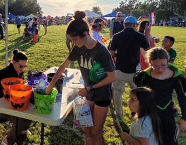
Hometown Harvest Public Engagement Summary
Process
The purpose of this open house was to receive community feedback related to how the park is currently used, as well as ideas for improvements or additions to Central Winds Park in the future. The event was held at the Central Winds Park event space during the Hometown Harvest festival and included input stations set up by GAI to review the existing and proposed amenities for the park. GAI facilitated a park-wide scavenger hunt and eight boards/stations. The boards included an initial observation board, orientation board, and six park existing conditions boards sub-dividing the park into smaller areas. These areas were the Event Lawn, the Upper Fields, the Lower Fields, the western edge, the passive park, and the natural edge. Spanish language assistance was provided for Spanish speakers throughout the event.
To Start...
The park is split into 6 sections. Pick the section you’re in to start the adventure!


While only 24 participants formally signed-in to the event, over 100 people participated in the scavenger hunt and likely provided input during the public workshop.

Scavenger Hunt
To engage children participating in the event and familiarize participants with the park, GAI provided a scavenger hunt. Participants were asked to explore the park and respond to six park trivia questions specific to Central Winds. Each question answered correctly would earn participants one prize or piece of candy. There were over 100 scavenger hunt booklets provided which were all passed out within the first two hours.
type of ball is on the floor of the playground?
playground?
many benches are on the path to the dock?
colors are the Pickle Ball Courts?
middle of the field?
Public Input Boards
Boards included an initial observation board, orientation board, and six boards subdividing the park into smaller areas. These areas were the Event Lawn, the Upper Fields, the Lower Fields, the western edge, the passive park, and the natural edge. Each of the park area boards included a summary of the existing conditions, a key map, an aerial map with the boundary and amenity labels, existing conditions photos, proposed amenities character imagery, and two large areas for public input. Participants had the opportunity to review each of the boards and provide feedback onto a sticky note that they placed on the board to answer the following two questions: “What are your favorite aspects of this are of the park?” and “What would you like to see in the future?”. The orientation board showed a park map and asked participants to provide feedback regarding the park wayfinding.

Input
Participants generally value the varied amenities provided within the park, which create a vibrant community-oriented atmosphere. Participants noted heavy usage of the fields as well as the playgrounds. Many participants also emphasized the importance of maintaining and expanding the existing tree canopy.
Overall, improvements suggested on the boards focus on enhancing natural features of the park. More shade/ trees were mentioned in every area of the park except the natural area. Participants emphasized having access to natural areas with new amenities, such as the waterfront boardwalk and trails, allowing them to appreciate the character trees and immerse themselves better in nature. Activities and opportunities that were mentioned for the natural area included fishing and interpretive signage.
Additionally, they noted a desire for more shaded seating areas and gathering spaces for the community to come together. Regarding the play areas, the community expressed a need for new or upgraded play areas and liked the idea of nature play or a destination play area.
Enhanced connectivity and improved navigation were other key themes from public engagement. Participants noted a need for more sidewalk infrastructure to connect the various park amenities and provide an opportunity to further engage with the Cross-Seminole Trail. Along with enhanced circulation, participants noted that the park is currently confusing to navigate with few and too-small signs. Participants discussed larger signs and more consistent entry sequence treatments to extend the feel of the park and aid in navigation of the site.
Other major comments included lighting for the lower fields and more restrooms.


03. Master Plan
The resulting Master Plan reflects the understanding of the park as it exists today and incorporates opportunities and desires discovered through site visits, public engagement, and collaboration with City staff.
IN THIS CHAPTER
OVERALL SITE PLAN GUIDING PRINCIPLES
ENVIRONMENT
ORIENTATION
GATHERING
Overall Site Plan

BOARDWALK CONNECTION
PAVILION
SHADE SAILS
EVENT HALL
BOARDWALK
BOARDWALK CONNECTION
OVERFLOW PARKING
WALKING LOOP
DISC GOLF/ OVERFLOW PARKING
REARRANGED TRAIL CROSSING
SECONDARY ENTRY
LARGE PAVILION

UPPER LAWN ACTIVITY AREA STEPPED LAWN
ENTRY PLAZA

Upper Fields – Minimal Interventions
Improvements to the Upper Fields focus on minor interventions to improve user experience of the park. Parking has been removed from directly in front of the playground to provide a buffer between play equipment and vehicular traffic, and to enhance safety (A). A walking loop has been added to the outside of the fields, accompanied by additional canopy trees for shade (B). A vegetative buffer is proposed at the entrance to the maintenance area to provide visual screening (C). There is an opportunity to engage with the Cross-Seminole Trail by providing gates into the trail from the park and upgrading the existing fencing (D). Parking along the southern portion of the fields has been formalized to include paved or stabilized parking with shade trees to demarcate parking spaces (E).
LEGEND
Lower Fields & West Edge – Enhance User Experience and Address Challenges
Improvements to the Lower Fields focus heavily on providing accessible paths between various amenities through a connective walking loop along the perimeter of the fields (A).
Along the eastern edge, a second north-south spine allows a walkway along the lower portion of the fields, which may provide seating opportunities for game spectators. The western edge of this walking loop provides a north-south connection along Hicks Avenue, which is currently missing. A centralized concession stand provides a gathering space for park users (D). The building could include a warming kitchen and restrooms, which could lend itself to be operated by the sports leagues with City maintenance, or through a permanent vendor.
This plan also addresses drainage challenges within this area of the park, including an exfiltration system between the northernmost fields to eliminate elevation changes impeding
flexible use of these as Event Lawn spaces (E). There is an opportunity to enhance existing drainage to provide LID vegetation and improve the performance of these structures. Additionally, drainage adjacent to the existing parking lot could be addressed with a combination of bioswales and increased permeability at the existing parking lot to reduce rainwater flowing into the fields.
Finally, this plan proposes additional vehicular circulation, including the provision of a secondary entrance through SR-434 to alleviate pressure during special events (I). This roadway would connect behind the dog park and utilize the existing Cityowned parcel west of the park as overflow parking. A potential realignment of Hicks Avenue and the Cross Seminole Trail could provide increased visibility to enhance user safety (H).
Natural Area, Event Hall & Event Lawn – Re-Envision
As various elements within the passive park area reach the end of their useful life and potential needs arise, there is an opportunity to re-envision the northern section of the park to best utilize its natural resources and meet the needs of the community. This Master Plan considers the addition of an approximately 12,500-square-foot Event Hall (H) within the passive park area with the primary entry coming from Hicks Avenue. The Event Hall and surrounding area includes the building, Event Lawn space, decorative gardens, and outdoor room (H-K). Support infrastructure, such as parking and stormwater, has also been considered as part of the conceptual layout (L-M). Additionally, the passive park space has been rearranged to include additional group pavilions (F) and a disc golf course (E). The playground (G) has been relocated between the passive area and the Event Lawn to serve both spaces.
Upgrades to the Event Lawn aim to improve functionality of the space. The Event Lawn could be regraded to improve views into the space. The Event Lawn is divided into three sections: an upper entry plaza (O), an upper lawn activity area (P), and a lower lawn seating area (R). An outer walkway and diagonal walkway help define the space while providing organizing structure for vendors and food trucks (Q).
Finally, there are opportunities to build upon the natural areas of the park and provide additional recreational opportunities. Enhancements upon the existing nature trails (S) could include interpretative signage and enhanced materials. These could connect to a potential future boardwalk (D). The western edge becomes a gateway into this natural area, with enhancements to the observation deck (A) and a group pavilion (B).
Guiding Principles
The Master Plan reflects the Guiding Principles developed from listening to the public, staff, and site visits. These Guiding Principles provide a framework and vision for future enhancements of the park. The following section details each of these Guiding Principles as they relate to the proposed improvements of the park. It also provides recommendations and best practices for implementation.
Environment

Central Winds Park provides opportunities for Winter Springs residents to experience the natural world. The park can provide both ecological services and sustainable access to nature. By strategically employing landscape strategies, the park can become a natural respite from urban surroundings.
Orientation

The plan and conceptual design address orientation challenges within the park to enhance the user experience and provide easy access to all amenities. A robust pedestrian circulation system, along with improved wayfinding, removes friction points and invites users to explore the park.
Gathering

As the recreation heart of the City, Central Winds Park provides gathering places for the community through both its regular uses and special events. The design of the park both incorporates gathering hubs for daily use and maintains flexibility for special event use. Lighting and fencing provide operational enhancements.
Environment Environment as Ecology
Story of Water
The story of water at Central Winds Park begins with the wetlands and Lake Jesup, whose natural landscapes create the character of the park. The wetlands have been providing a filter and enhancing stormwater quality for stormwater flowing from the higher elevations of the park into Lake Jesup long before park development occurred. As the park developed, the path of water has been altered through grading and additional impermeable materials, requiring additional stormwater storage and treatments to maintain water quality at Lake Jesup. With this development, additional stormwater infrastructure has been added into the park—including stormwater ponds, swales, and exfiltration systems designed to convey water and provide treatment and storage for stormwater—prior to reaching the lake or infiltrating into the soil.
Taking a cue from the natural functioning of wetlands, low impact design (LID) is an approach to land development that works with nature to manage stormwater as close to its source as possible. This approach to stormwater drainage can be observed in the recent development of the pickleball courts. LID provides an opportunity to leverage design for the betterment of stormwater quality. It employs principles such as preserving and re-creating natural site features; as well as minimizing imperviousness to create functional, appealing site drainage that treats stormwater as a resource rather than a waste product. Examples of LID interventions include rainwater catchment, stormwater infiltration gardens, green roofs, and low irrigation landscapes. The creation of stormwater planters and bioswales are two of the most common practices to capture water from the roads, parking lots, rooftops, and other hardscape areas.
Filtration
Plant foliage, fibrous roots, sand, or other porous media help slow the flow of stormwater while also sequestering suspended sediments, resulting in cleaner water “down stream”.


Percolation
Permeable soils and sands allow for stormwater to infiltrate vertically into groundwater flows.

Bio-remediation
Stormwater soaks in areas where various types of plants, bacterias, fungi, and the presence of light remove, transfer, stabilize, and/or destroy contaminants in the stormwater


Key Concepts
In contrast with conventional means of stormwater management that aim to control, detain, and retain water using mechanical means, LID seeks to slow and spread the flow of water to eventually soak back into the natural hydrological cycle. These interventions mimic the natural processes occurring in naturally occurring wetlands.
+ Slow – Slow the velocity of stormwater runoff by replacing or covering impervious surface area with foliage surface area such tree canopy and grasses. This allows for suspended pollutants to settle rather than accumulate in stormwater flow.
+ Spread – Allow for water to slowly spread horizontally and vertically across space, so that a greater quantity of natural elements can help filter water. This also helps reduce erosion from stormwater flow.
+ Soak – Provide an area where water will reside for a period of time in which it will be subject to evaporation and infiltration back into the hydrological cycle.
Along with the improvement of stormwater quality, LID interventions, when combined with a comprehensive view of water in the park, provide opportunities for community education through the use of interpretative signage that connects the story of naturally occurring processes to the design interventions which mimic them.


Environment as Placemaking
The existing environmental characteristics of the park shape the experience and character of the park and impact the approach to landscape treatments within it. Expanding upon existing types of landscapes currently found in the park, landscape treatments may be extended to visually unify various areas of the park. The southern entrance of the park, along Central Winds Parkway, marks the most urban character of the park, reflected in formal landscapes with regular spacing. Moving toward the farther reaches of the park, the landscape becomes more pastoral and eventually blends into the existing natural habitats. This gradual change in character is driven by the existing character of the park and can be reinforced through the proposed landscape treatment and materiality of the park.
The landscape approach can be organized into four different landscape treatments: formal, pastoral, natural, and low impact development (LID).

Formal
Concentrated along Central Winds Parkway, Upper Fields parking lot, and the Cross Seminole Trail edge. This planting is noted by regular spacing and formal plant arrangements.


Pastoral
Present along sports field edges and passive areas and including large character oak trees. This planting consists of naturalistic clusters of trees as they would occur at natural edges. As a result, this planting strategy may be used to blend from the formal planting at entry points to the natural habitats.


Natural
The undisturbed areas of the park, including natural wetlands and native tree canopy that line much of the northern edge of the park. Approach to vegetation in this landscape focuses primarily on protection and restoration of existing habitats.


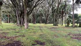


Low Impact Development
Performance-based planting addressing stormwater quality and speed to reduce scouring. This landscape palette focuses on moisture and drought-tolerant plants, including cypress trees and a variety of grasses, among others.


Environment as Recreation
The natural features present within Central Winds Park provide unique opportunities to connect park users with nature could be enhanced and expanded.
While existing natural trails provide access on land to the northwest section of the park, which consists of mixed wetland hardwoods, water access is limited within the site. Views to Lake Jesup are obstructed by protected wetland vegetation currently limiting park users' connection to the water. Currently, the only water access is in the form of the fishing pier at the western end of the park.
The City of Winter Springs is interested investigating the potential installation of a boardwalk along the northwestern section of Central Winds Park. This potential boardwalk could provide both recreational and ecological benefits to the park. Some of those benefits include:
+ Providing a connection between the terrestrial and aquatic portions of the park that a single trail end point (or even multiple points) cannot.
+ Providing an opportunity to create “Living EcoClassrooms” along the lakeshore for STEM-based learning.
+ Acting as a breakwater along the shoreline and actually protect the shoreline from wave action and erosion during storm events.
+ Providing views into Lake Jesup not available within the park.
+ Creating a signature destination for the City of Winter Springs.

Orientation
Orientation within the park has been observed to be a challenge by park users, resulting in confusing navigation and a lack of awareness of everything Central Winds Park has to offer. Orientation is a function of two aspects of the park: availability of circulation networks and communication of directions through wayfinding.
Circulation
Vehicular
Park users arrive to Central Winds Park via SR-434 and, to a lesser degree, Orange Avenue. With a single entrance and exit to the park, the connection from Central Winds Parkway to SR-434 can become congested, especially during special events. This Master Plan contemplates the addition of a secondary entrance along SR-434 to the west of the existing dog park, which would provide additional entry and exit points during events.
Internal vehicular circulation is provided by Central Winds Parkway serving as a spine road throughout the primary amenities of the park. The smaller Hicks Avenue provides access to the western edge of the park. A proposed connection between the western edge and the passive park area provides circulation redundancies and connects the different areas of the park. With the potential development of the Event Hall, there is an opportunity to elevate the existing Hicks Avenue connection to provide a main entrance to the Event Hall that is separate from the experience of the main park. Overall, the enhanced roadway connections provide ease of connectivity both within the park and to the community as a whole.
Parking
Once a user arrives at the park in a vehicle, parking becomes the next challenge. Currently, formal parking lots are provided at the Upper Fields, the southern end of the Lower Fields, and at the new pickleball complex. Additional unpaved parking exists along the southern edge of the Lower Fields and, informally, under the existing tree canopy between the Lower Fields and the passive park area. This Master Plan recommends the addition of some paved parking areas to be developed with LID practices in mind to reduce additional stormwater impacts on the site.
Proposed additional parking includes:
+ Formalize parking along the southern edge of the Upper Fields
+ A new paved parking lot to be associated to the new Event Hall and provide parking for the Lower Fields
+ Additional parking along Hicks Avenue to provide parking for the dog park and support the Lower Fields
To provide additional parking capacity during high attendance events, overflow parking may be maintained under the existing tree canopy by the Lower Fields, as well as the City-owned parcel adjacent to the park along the western edge.
Cross Seminole Trail
The Cross Seminole Trail extends throughout the southern border of the park, connecting the site to the greater regional trail. This trail provides opportunities for additional recreation, both as a starting point for trail users and as a potential destination along the trail. Connectivity in the form of pathway connections and gates may enhance user experience of the trail and park interface. The current intersection of the trail at Hicks Avenue could be improved to enhance visibility and safety through a realignment of the road and trail. Improvements to this intersection require coordination between the City and Seminole County.
Pedestrian
Pedestrian connectivity through paved sidewalks, while present in the Upper Fields, is scarce throughout the park. This lack of connectivity limits accessibility within the park, and creates unclear circulation patterns—discouraging exploration of the park. Adding a robust circulation network provides clear pathways to reach the various activities, enhancing accessibility throughout. Additionally, pathways themselves can be an amenity used for exercise, strolling, and enjoying nature. The proposed circulation network aims to connect all amenities and areas of the park, while providing walking loops as another amenity for park users.
Additionally, Central Winds Park includes natural areas that provide nature-based recreation through clearly marked and maintained trails and the boardwalk. Development of naturebased recreation opportunities must always balance access to nature with the protection of natural resources. Contextsensitive development of trails provide access to natural areas, while preventing trampling of natural habitats.
Materials used for nature trails can vary widely. Pervious materials such as natural mulch or gravel are commonly used and provide a natural trail surface while minimizing impacts on water flows. However, these materials may have limited accessibility and require some maintenance. Impermeable materials such as asphalt or concrete pathways are fully

accessible and lower maintenance; however, these can have heavier impacts on the natural environment. More recent products on the market, such as aggregate binders or flexible porous paving, provide benefits of both—maintaining permeability while providing fully accessible pathways with limited maintenance needs. Yet another costeffective approach is to mix and match materials, providing a fully accessible concrete or asphalt primary path with secondary permeable natural mulch or gravel pathways.


Existing Asphalt Concrete
Organic-Lock
Flexipave
Loose Gravel
Wayfinding Best Practices
Wayfinding Principles
At the core of the Central Winds Park wayfinding system and information strategy are users—residents and visitors who have an interest in the future success for the park. The design of information should be user-centered, accessible, coordinated, easy to use, and at the heart of journey planning.
It is important to consider the full scope of opportunities and applications and how they relate to users’ experience before setting out strategic recommendations.
The strategy for Central Winds Park has been developed based on 10 key wayfinding principles, so that all modes, communications, and developments speak with one voice. This gives park visitors information they can relate to, so they can make informed choices.
1. Seamless
Integrating information across modes reflects the real journeys that people will make.
2. Stepping Stones
Using stepping stones will assist people’s memory and provide connections for the traveler.
3. System Naming
Naming places and things in the environment in a consistent way allows people to communicate what and where places are.
4. System Codes
Using codes as shortcuts for memory and for simplifying complicated systems by including colors, numbers, icons and names as an extra layer of information.
5. Progressive Disclosure
Signing key information at key locations. Providing the right information at the right time. Progressive disclosure provides a rationale for what information is needed where.
6. Predictable
Achieving predictability will depend on information consistency, integrity and, most of all, availability.
7. Don’t Make Me Think
Keeping it simple. The simpler the information, the easier it will be to understand.
8. Inclusive
Providing information so that it does not exclude any group or individual, with particular focus on disability groups.
9. Help Me to Learn
Using information that is easy for the visitor to learn. Teach people easy route choices.
10. Tone of Voice
Providing information with the right tone of voice in the right way, so that people will more likely engage with it.
Structuring Information
Structuring information to provide progressive disclosure is key to creating a legible system. Without a structure, the system has no reference point or rules, and will quickly result in impromptu decisions.
The structure has two broad levels:
+ Naming: What assets are called and how those names relate to each other in a hierarchy
+ Selection Criteria: When and how those assets are shown in the system
The sign typology or palette designed for the park should reflect the hierarchy in a consistent way, regardless of sign type. This reinforces the system structure and allows the user to experience Central Winds Park in a consistent and memorable way.
The sign palette could contain several types that can be broadly categorized into four areas:
+ Identification
+ Vehicular
+ Pedestrian & Cycling
+ Interpretive & Educational Within these categories, information can be further divided into:
+ Illustration based (mapping + educational graphics)
+ Text based (directional + educational content)
Central Winds Park Cityof Winter Springs Parking Pedestrian - Walk Amenity
Progressive Disclosure
Regulatory Requirements
When designing a wayfinding system, there are several regulations to consider. When working on Department of Transportation (DOT) roads, the signs need to follow DOT requirements to be approved for installation. To make sure signs are universal, and all users are considered in the design process, the signs should be Americans with Disabilities Act (ADA) compliant.
MUTCD Requirements
Throughout the U.S., any vehicular-oriented directional sign located along a publicly accessible roadway must be compliant with the Federal Highway Administration (FHWA) standards. The FHWA’s Manual on Uniform Traffic Control Devices (MUTCD), Chapter 2D-50, prescribes the requirements for vehicular directional sign design, messaging, and placement.
In the design development phase, MUTCD 2D-50 will serve as a guide ensuring that contrast, legibility, destination order, etc., of designs are being followed successfully. The requirements GAI will consider in the concept design phase for Central Winds Park are demonstrated in the illustration on the right.
Signage Design Guidelines
Radius Corners to prevent injury
Destination Limit no more than 3 on FDOT roads and no more than 5 inside the park Contrast at least 70%
Clearance minimum 7ft from ground to bottom of sign
Approved Fonts
FHWA Series
Standard Alphabets for Highway Signs Highway Gothic (for FDOT roads) Destination
Destination Order and Arrow Placement Ahead Left Right
Grouping within Destination Order Nearest to Farthest
Source: MUTCD – 2009 Edition
Americans With Disabilities Act (ADA) Requirements
The ADA became law in 1990. The ADA is a civil rights law that prohibits discrimination against individuals with disabilities in all areas of public life, including jobs, schools, transportation, and all public and private places that are open to the public.
The ADA Manual mainly covers interior wayfinding; however, it also needs to be considered and interpreted when designing public exterior places, such as parks.
Visual character and size
The wayfinding system for all parks needs to be inclusive and consider all users, especially those with disabilities.

Mounting and size restrictions

Source: 2010 ADA Standards
Placement Criteria
Vehicular Directional
Signs must be placed a minimum of 100 feet in advance of an intersection where visitors will need to turn to reach Central Winds, amenities, or parking locations.
Place signs on the right side of the road (viewers' right) at 18 inches minimum from edge of pavement, facing travel lanes entering the park.
These signs shall be located adjacent to the right-of-way of major access routes within the park.
Place signs in front of any obstructions to avoid blocking sign messages.
Measurements and distances listed serve as guidelines and shall not supersede State or Municipal codes
Pedestrian Directional
Pedestrian Directional signs are intended to direct pedestrians and cyclists on a trail or sidewalk toward adjacent facilities/amenities by communicating through graphic icons, text, and arrows.
Criteria
+ Signs should be located at a minimum of 2 feet from paths/sidewalks and 3 feet from trees or benches
+ Signs near a curb should be placed either parallel or perpendicular to the curb
+ Placement of signs near existing light fixtures where appropriate is desired
+ Place signs at decision points to direct users to amenities that are not easily visible
Vegetation and Trees
When placing signs near existing trees, it's important to exercise caution. Tree roots are typically found 10 inches below ground level. Signage should be placed at least 6 feet away from any tree trunk. Work around the tree should not be conducted within 40 inches of the trunk (prohibited zone). If excavations are necessary within a distance equal to four times the tree's circumference (precautionary zone), mechanical excavations should be avoided.
Signage Location Plan


Wayfinding Sign Palette
Based on the study of the park and the user needs and touchpoints during circulation, a sign palette/sign types for Central Winds Park was created with recommended sign types and overall scale and proportions.
Sign Type A (Gateway Sign)
Place identification signs at the park’s entrances and boundary points to warmly welcome visitors and indicate that they have arrived at their destination. To accommodate space limitations, it is advisable to create vertical gateways that are eye-catching yet occupy a smaller foot print within the park.

Sign Type B (Vehicular Directional Sign)
Install directional signs guiding visitors to and from Central Winds, along with its amenities. Sign Type B should direct guests to the appropriate parking areas for the specific amenities they intend to visit.
Sign Type C (Parking Lot Arrival Sign)
Place identification signs at the entrances of all parking lots to indicate the destinations/ amenities available for visitors parking in those areas.
Downtown Inverness
Add parking lot arrival signs to display the information visitors need when entering the park. It is a good opportunity to introduce a park map, display directional information, as well as all regulatory information needed to enjoy the park.
Place pedestrian kiosks inside the park, along pedestrian corridors, and near key amenities like restrooms. These signs serve as reinforcement and encourage exploration to other areas of the park.
Install interpretive signs and offer educational opportunities along the trails, highlighting the park's natural, historical, and cultural elements. This can enrich visitors' experiences, making their journey through the park more informative and engaging.
Sign Type D (Parking Lot Arrival Sign)
Sign Type E (Pedestrian Kiosk)
Sign Type F (Interpretive Sign)
Design Considerations
Durable Materials
When designing a wayfinding system, it is imperative that the material selection matches the environmental conditions in which they will exist. Specifications of durable materials for the sign program shall consider the environment, temperatures and climate in the region. In all cases, the manufacturer guidelines will be the primary reference for material suitability.

Wood
All wood types will discolor to some extent in this climate. Steps to limit this include application of UV stabilizers via film, adhesives, sealants or oils; these require maintenance to keep the finish. Wood stain imparts its own color to the wood and is UV stable.

Stone
Stone is a good product for withstanding weather conditions. Abrasion to polished surfaces exposed to strong wind and sand may weaken it, so location and finish is an important consideration.

Metal
Steel and aluminum should be coated to prevent weathering damage. Powder coating, painting, and anodizing will give an even, hard-wearing finish.

Glass
A good product for withstanding weather conditions. Abrasion to polished surfaces exposed to strong winds and sand may weather, so location and finish is an important consideration.

Plastic
Polycarbonate is stronger and resists yellowing longer, but is easier to scratch. Acrylic is less expensive. Both are stronger and lighter than untempered glass.

Porcelain Enamel
Fused graphics on a steel substrate make porcelain enamel a very durable material that is resistant to UV rays and durable against mild sand abrasion.

Vinyl Surface (3M)
10-year outdoor durability for black and white; 8 years for colored films. UV-resistant clear film is also available.

Painted Surface
Powder coating is typically more durable and scratch resistant than paint. Outdoor durability is approximately 10 years, but can last up to 15 years if maintained properly and regularly.

Durable Powder Coated Graphic (Alto)
Graphics embedded in powder coat through heat and vacuum process. Fabrication allows for graphics on a flat, textured or three-dimensional surface.

Engineered Timber
Engineered timber can be durable outdoors, but it's not entirely waterproof and may not be the best choice in certain environments, especially in Florida due to rain and high humidity.

High Pressure Laminate (Folia, Fossil & Izone)
Subsurface laminate panel that is impervious to moisture, UV rays, scratching and graffiti. Warranted not to color fade for 7 to 10 years, based upon manufacturer.
Gathering
Hubs
Central Winds Park serves as the gathering place for Winter Springs residents, drawing visitors for casual use, organized play, and special events. Hubs for gathering provide casual venues for community building particularly on a day-to-day basis and are key in creating a sense of community within the park. Each area of the park should include a community hub in the form of pavilions and other shaded structures. These hubs may serve as places for birthday parties, after game celebrations, or casual picnics that help bolster a sense of community. Potential community hubs have been identified throughout the park.
Flexible Lawn
Central Winds Park plays host to many Winter Springs special events. Maintaining flexible lawn spaces that double as functional spaces on a day-to-day basis provides the park with operational flexibility.
Other Factors
Fencing
Fencing can provide access control to various areas of the park and guide circulation. Currently, the park includes fencing which limiting pedestrians and vehicular access. Fencing may be divided into two types of access control. Decorative picket fencing which limits both pedestrian and vehicular entry points. Rail fencing, on the other hand, limits only vehicular access and delimits informal parking areas. Additional fencing may be needed from an operational standpoint to provide access control for the Lower Fields while maintaining road access along Central Winds Parkway.
Fencing may serve a placemaking function in providing unifying design throughout the park. Similar to the approach to landscape, fencing can reinforce the visual identify of the park. The most urban area of the park, near the southern entrance, may be identified with decorative picket fencing which gives way to more pastoral rail fencing within the park.
While fencing provides access control and placemaking, implementation should take care to not create a hardened and fortified edge which may create an unwelcoming user experience. Instead, fence placement should weave through landscaped areas and leave sufficient open space.

Formal
The existing decorative fencing treatment can continue to the new proposed fencing to provide aesthetic continuity. Additionally, the existing chain link fencing along the trail should be upgraded to better match the park aesthetic to either a similar picket treatment or black vinyl coated chain link fencing.

Pastoral
There are currently two styles rail fencing within the park. Future improvements to the site should standardize a single type of fencing and apply that throughout.


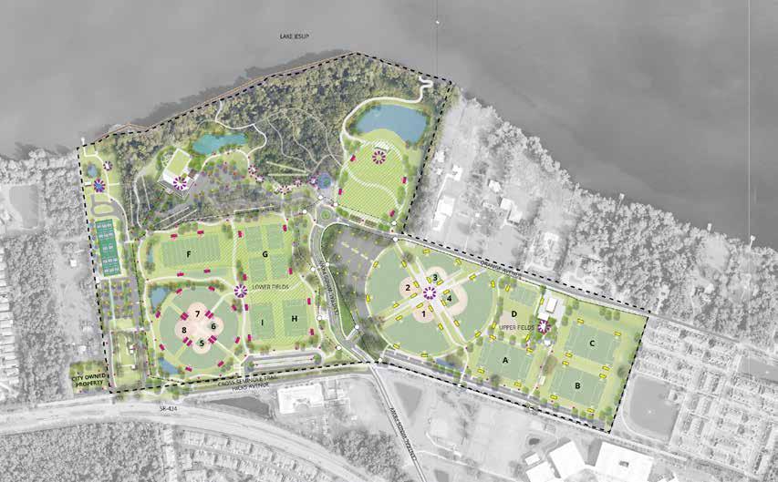
LIGHTING LAYOUT IS DIAGRAMMATIC. FURTHER DESIGN AND PHOTOMETRICS ARE NEEDED.
Lighting
Lighting contributes to the day-to-day functionality of the park as well as during special events. In Florida, lighting can be a determinant of park use, with cooler comfortable weather occurring in the winter when the days are short. Currently, lighting is mostly concentrated in the Upper Fields with some additional lighting provided in parking lots. This lack of lighting impacts the availability of fields available throughout the city by limiting the playable time of the Central Winds Park fields. Temporary lighting is often brought in for special events that extend into nighttime hours. Given the regular programming of the park, an expansion of lighting would provide greater programming flexibility and expand access to recreation amenities. The lighting scheme includes two types of lighting: sports lighting, covering large areas, and area lighting, appropriate for pedestrian areas and parking. Light poles and fixtures should be standardized throughout the park to provide a cohesive aesthetic and reinforce the park's sense of place. Special consideration should be given to placement of lighting to prevent light spillage into adjacent residential areas and natural areas.


Sports Lighting Parking Lighting Area Lighting

Implementation 04.
The Implementation section provides guidance for the implementation of this Master Plan, including a phased approach; infrastructure considerations for the implementation of the design; and an order of magnitude statement of probable cost to aid for financial planning.
IN THIS CHAPTER
PHASING
INFRASTRUCTURE CONSIDERATIONS
STATEMENT OF PROBABLE COST
Phasing
The Central Winds Master Plan implementation has been broken down into phases to allow for the planning of funds as well as the continual functioning of the park. Phases do not necessarily reflect a chronology of projects; rather, this suggested phasing plan is based on the grouping of projects based on different areas of the park. This phasing plan could be implemented in a different order, depending on need and availability of funds.
The phasing plan has been divided into nine distinct phases.
Phase 1 – Upper Fields Circulation
This first phase includes circulation enhancements in the Upper Fields including the addition of sidewalks and shade trees to improve user experience. Additionally, formalizing of the existing parking along the southern edge including providing a buffer between the playground and the road. The addition of openings to the Cross Seminole Trail can be implemented as part of this phase.
Phase 2 – Lower Fields
The second phase includes enhancements to the Lower Fields, including stormwater improvements and sidewalk circulation patterns, which will enable greater usability of the space. This phase also includes additional sports lighting and area lighting to expand hours of use. A centralized concession stand with restrooms will require additional utility extensions such as potable water and sewer.
Phase 2A has been identified as a potential additional alternative to realign the Cross Seminole Trail and coordinate hardscape and stormwater improvements with improvements to the Lower Fields.
Phase 3 – Central Winds Parkway Fence and Plaza
The third phase includes the addition of a fence along Central Winds Parkway for access control as well as the construction of the entry plaza.
Phase 4 – Event Lawn
Phase 4 includes improvements to the Event Lawn, including mass regrading, addition of walkways, construction of a bandshell, and addition of a destination playground.
Phase 5 – West Edge
Improvements to the West Edge focus on reorganizing the vehicular circulation to include a secondary entrance along SR-434. Additional parking can be implemented along Hicks Avenue, and by providing both paved and unpaved parking at the adjacent City-owned property.
Phase 6 – Event Hall
The Event Hall represents a major redevelopment for the park re-envisioning the passive area of the park into community and event space. This project includes the development of a 12,500-square-foot Event Hall, along with area development such as an Event Lawn, summer kitchen, and ornamental gardens. Support development includes stormwater, parking, and utility improvements needed to support development of the site. Specific design of this project is subject to change during the design process of the building.
Phase 7 – Nature Trails
The seventh phase of the park consists of improvements to the nature trails including enhanced surface materials, expanded network of trails, and the addition of passive amenities such as group pavilions and a disc golf course.
Phase 8 – West Edge Waterfront
Enhancements to the west edge waterfront are minimal and include sidewalk enhancements as well as the addition of a large pavilion and shade coverings over the existing observation deck.
Phase 9 – Upper Fields Parking
While the Upper Fields parking lot today showcases a large tree canopy, asphalt upheaval and tree condition indicate signs of a need to prepare for a tree succession plan and reimagine the parking lot. A new future parking lot should consider LID strategies and provide sufficient root space for future canopy trees.
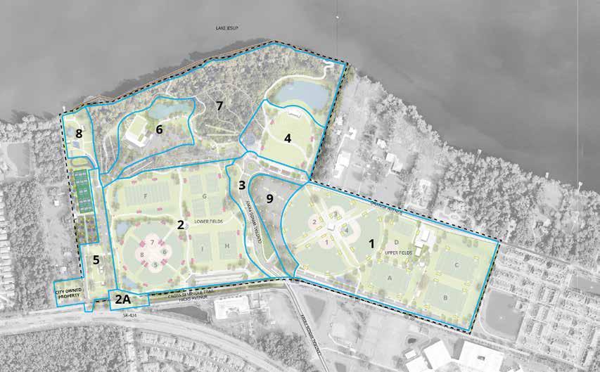
Infrastructure Considerations
Stormwater
Water Management District Permit History
Central Winds Park, located in Winter Springs, was originally permitted through the St. Johns River Water Management District (SJRWMD) in 1991 under Application No. 222557-1. A significant update to the water management permit occurred in 2004, when a 33-acre expansion to the west was added to accommodate additional athletic fields (Application No. 222557-7). The most recent update, in 2022, involved the addition of 8.7 acres for pickleball courts under Application No. 222557-12.
It is important to note that no centralized stormwater system exists for the park. Each expansion or improvement has individually addressed its stormwater impacts. Historical permits have provided relevant stormwater data, including seasonal high groundwater table elevations, soil classifications, and drainage basin characteristics. However, assumptions must be validated through additional analyses, such as geotechnical studies, topographic surveys, subsurface exploration, CCTV inspections, and/or bathymetric surveys prior to construction.
Stormwater Management Requirements
The dry retention and exfiltration stormwater management facilities (SMFs) must meet the following criteria:
+ The greater of 1.25 inches over the impervious area or 0.5 inches over the entire drainage basin must be treated.
+ Online systems require an additional 0.5 inches of treatment over the entire drainage basin area.
+ The wet detention SMFS must meet the following criteria:
+ The greater of 2.5 inches over the impervious area or 1 inch over the entire drainage basin must be treated.
+ All SMFs must meet the following criteria:
+ Discharge rates must not exceed predevelopment runoff levels, with attenuation designed for the 25-year, 24-hour rainfall event per SJRWMD guidelines.
+ The site outfalls to Lake Jesup, an impaired waterbody for phosphorus and nitrogen. Stormwater management facilities must achieve an 80% reduction in total phosphorus (TP) and a 95% reduction in total nitrogen (TN).
Proposed Stormwater Management Facilities
This master plan includes four proposed stormwater management facilities for specific drainage basins.
Drainage Basin 1 – Soccer Fields
+ Proposed Improvements: A new walking loop, large pavilion, and infill of existing retention areas to enhance access to athletic fields.
+ Stormwater Management Facility: An underground exfiltration field.
+ Purpose: To replace the existing dry retention area lost to infill and provide additional treatment and attenuation for the pavilion.
+ Design: Preliminary calculations estimate 11,210 linear feet of 18-inch perforated PVC pipe in a gravel trench (151’ X 184’ footprint).
+ Exemptions: Recreation paths that do not adversely impact drainage conditions are exempt from treatment under Section 660-330.050.
Drainage Basin 2A – Entry Plaza
+ Proposed Improvements: A new entry plaza and walking paths near the activity lawn.
+ Stormwater Management Facility: An underground exfiltration field.
+ Purpose: To provide treatment and attenuation for new impervious surfaces.
+ Design: Preliminary calculations estimate 1,000 linear feet of 24-inch perforated PVC pipe in a gravel trench (19’ X 155’ footprint).
+ Exemptions: Recreation paths with no adverse drainage impacts are exempt under Section 660-330.050.
Drainage Basin 2B – Playground
+ Proposed Improvements: A new play area and walking paths near the activity lawn.
+ Stormwater Management Facility: A dry retention depressional area.
+ Purpose: To provide treatment and attenuation for new impervious surfaces.
+ Design: A depressional area 130 feet long by 24 feet wide would provide adequate storage to meet SJRWMD requirements.
+ Exemptions: Recreation paths with no adverse drainage impacts are exempt under Section 660-330.050.
Drainage Basin 3 – Event Hall
+ Proposed Improvements: A new event hall, parking lot, walking paths, and associated site work.
+ Stormwater Management Facility: A wet detention pond. Bioswales/rain gardens are also proposed within the landscape medians in the parking lot.
+ Purpose: To provide treatment and attenuation for the proposed facilities.
+ Design: The proposed 0.8-acre wet pond meets SJRWMD requirements.
Future Code Compliance
Projects permitted after December 2025 must adhere to updated nutrient removal requirements. If not permitted before this date, additional measures such as shallow swales along walking trails, bioretention areas, or rain gardens in parking lots may be required to address nutrient loading. These modifications will not significantly affect the site layout.
FEMA Flood Zone –
According to FEMA's Flood Insurance Rate Map, portions of the site near Lake Jesup fall within Zone AE, with a base flood elevation (BFE) of 9.0 NAVD 88. It is assumed that the proposed work within this master plan does not affect the existing floodplain. Any impacts to the floodplain will require equal compensation utilizing the cup-for-cup method.


Utility Engineering
The City of Winter Springs will require extensions to existing fire, potable water, wastewater, and reclaimed water services to accommodate the proposed event hall and large pavilion. The following report outlines the anticipated utility extensions and requirements for each project.
Event Hall
+ Size and Program: The event hall will be approximately 12,500 square feet, with a catering-style kitchen and typical restroom facilities.
+ Utility Extensions: Extensions to existing potable water, wastewater forcemain, and reclaimed water lines will be required. The existing potable (2-inch) and reclaimed (16-inch) water utilities are located in Hicks Avenue and will be extended down Orange Avenue to accommodate the project. Additionally, an existing 8-inch potable water main in Central Winds Parkway will extended down Orange Avenue to accommodate the fire criteria. The kitchen will require a grease interceptor.
+ Lift Station Requirement: A package lift station with forcemain connection will be required due to the existing wastewater line being a forcemain. Existing forcemain pressures must be determined prior to lift station design.
+ Initial Estimates: A 6-inch fire line, 2-inch potable water service, 4-inch forcemain, and a reclaimed water service for irrigation are anticipated for the proposed event hall. The 6-inch fire line and 2-inch potable water service are proposed to “loop” to maintain adequate pressure throughout the system.
Large Pavilion
+ Size and Program: The large pavilion will be located near the western baseball fields and will include restroom and concession facilities with a warming kitchen.
+ Utility Extensions: New potable water and wastewater services will be required. Existing utilities in Hicks Avenue will be extended east between the existing baseball and football fields to service the project. Note that these services will require crossing existing stormwater pipes.
+ Grinder Pump Station Requirement: A package lift station with forcemain connection will be required due to the existing wastewater line being a forcemain. Existing forcemain pressures must be determined prior to grinder pump design.
+ Initial Estimates: A 2-inch potable water service and 4-inch forcemain are anticipated for the proposed large pavilion.
Natural Gas
Florida Public Utilities (FPU) provides natural gas to the project area. The existing natural gas main runs along the eastbound ROW of State Road 434. FPU is capable of serving this site with Natural Gas; however, the existing facilities will need to be extended to the project area if they’re needed.
To determine the availability of infrastructure to accommodate the proposed project, individual utility companies were contacted by GAI engineering staff. The following is a list of the utility service providers for the proposed site:
Reclaim Water, Wastewater, and Water
City of Winter Springs
1126 East State Road 434
Winter Springs, FL 32708
Phone: 407-327-1800 x588
Electric
Duke Energy
452 East Crown Point Road
Winter Garden, FL 34787
Phone: 407-629-1010
Natural Gas
Florida Public Utilities
1705 7th Street Southwest
Winter Haven, FL 33880
Phone: 386-785-4554
Telephone
AT&T
1120 South Roger Circle
Boca Raton, FL 33487
Phone: 561-683-2729
CATV, Fiber, Telephone
Charter Communications
3767 All American Boulevard
Orlando, FL 32810
Phone: 813-302-0800
Fiber
Uniti Fiber, LLC
107 Saint Francis Street
Mobile, AL 36602
Phone: 251-214-7059
Fiber
WOW Fiber Internet
3001 North Gandy Boulevard
Pinellas Park, FL 33782
Phone: 303-927-4994
Fiber
Zayo Group 1805 29th Street, #2050
Boulder, CO 80301
Phone: 406-496-6510
Traffic Controls
Seminole County Traffic Engineering 140 Bush Loop Sanford, FL 32773
Phone: 321-377-2405
Statement of Probable Cost
Estimating construction costs during the concept design phase of a project is a practice that blends both art and engineering. It involves navigating a terrain of uncertainties, which encompass variables such as materials, existing site conditions and the time elapsed between concept development and project bidding by general contractors. Additionally, costs may vary according to the implementation strategy and may be influenced by the combination or further breakdown of individual phases. These factors collectively exert a significant influence on the ultimate, realized costs.
While there are market uncertainties that can affect the final project cost, this rough order of magnitude cost estimate is based on our team’s experience working in Florida on municipal, recreational designs and park projects and current market knowledge. Architectural costs have been provided at a square foot basis for planning purposes, however, these may vary based on materials, finishes, and final program determinations.
To implement the wayfinding recommendations effectively, a finalized design adhering to best practices is necessary. Each
sign type recommended will require a specific design along with detailed materials and specifications. Although we've outlined the types and quantities of signs, we can only provide a cost estimate once these details are finalized. The cost of a wayfinding system will vary based on the sizes and materials chosen during the design process. Wayfinding costs have not been included within the cost estimate as these are reliant on the development of wayfinding design and may vary based on scale and materials.
by others.
GAI has no control over the cost of labor or materials, the General Contractors or any Subcontractor’s method of determining prices, competitive bidding and market conditions. This opinion/cost analysis is made on the basis of experience, qualifications, and best judgment of a professional construction consultant familiar with the construction industry. GAI cannot, and does not, guarantee that proposals, bids or actual construction costs will not vary from this or subsequent cost opinions. GAI staff of professional cost consultants has prepared this opinion in accordance with generally accepted principles and practices. This staff is available to discuss its contents with any interested party.
2 - Lower Fields
GAI has no control over the cost of labor or materials, the General Contractors or any Subcontractor’s method of determining prices, competitive bidding and market conditions. This opinion/cost analysis is made on the basis of experience, qualifications, and best judgment of a professional construction consultant familiar with the construction industry. GAI cannot, and does not, guarantee that proposals, bids or actual construction costs will not vary from this or subsequent cost opinions. GAI staff of professional cost consultants has prepared this opinion in accordance with generally accepted principles and practices. This staff is available to discuss its contents with any interested party.
Phase 2A - Seminole Trail Realignment
GAI has no control over the cost of labor or materials, the General Contractors or any Subcontractor’s method of determining prices, competitive bidding and market conditions. This opinion/cost analysis is made on the basis of experience, qualifications, and best judgment of a professional construction consultant familiar with the construction industry. GAI cannot, and does not, guarantee that proposals, bids or actual construction costs will not vary from this or subsequent cost opinions. GAI staff of professional cost consultants has prepared this opinion in accordance with generally accepted principles and practices. This staff is available to discuss its contents with any interested party.
GAI has no control over the cost of labor or materials, the General Contractors or any Subcontractor’s method of determining prices, competitive bidding and market conditions. This opinion/cost analysis is made on the basis of experience, qualifications, and best judgment of a professional construction consultant familiar with the construction industry. GAI cannot, and does not, guarantee that proposals, bids or actual construction costs will not vary from this or subsequent cost opinions. GAI staff of professional cost consultants has prepared this opinion in accordance with generally accepted principles and practices. This staff is available to discuss its contents with any interested party.
Phase 5 - West Edge Park
