SR200/A1A CORRIDOR MASTER PLAN

JULY 2021


JULY 2021


GAI Consultants, Inc. 618 East South Street, Suite 700 Orlando, Florida 32801 (407) 423-8398
GAI Contacts: Blake Drury, AICP, Director, Planning + Urban Design B.Drury@GAIConsultants.com Wes Shaffer, AICP, Senior Project Planner W.Shaffer@GAIConsultants.com
THE SR200/A1A CORRIDOR WILL INSPIRE IDENTITY, COMFORT, AND FUTURE OPPORTUNITY AS A MULTI - FUNCTIONAL, SAFE, AND SUSTAINABLE CORRIDOR THAT CONNECTS PEOPLE TO THE PLACES
WHERE THEY ASPIRE TO LIVE, WORK, AND PLAY.
Nassau County is defining the future of the SR200/A1A Corridor. The concepts in the SR200/A1A Corridor Master Plan emerged with the support of Nassau County residents, property owners, business operators, and county officials. The collective vision for the SR200/A1A Corridor will define the future of the community. This plan charts a path toward that future-one that is livable, sustainable, and economically vital-driven by five planning priorities:
Nurture Nature
Maintain, enhance, and extend the natural environment by creating opportunities for residents to access and enjoy Florida’s unique natural areas.
Grow Sustainably
Help stage vibrant shopping center and neighborhood growth through development that creates places for people, supports local businesses, encourages an active lifestyle, and comprises a mix of housing options.
Connect Communities
Improve linkages between neighborhoods, shopping centers, and amenities through a network of slow, safe, and livable primary and secondary streets, trails, bike paths, and pedestrian infrastructure.
Catalyze Culture
Build on heritage while establishing new cultural assets that celebrate community creativity and identity in the public realm.
Future Proof
Prepare for a future by looking ahead to build a resilient community in the face of growing climate concern and technological advancements.
This plan resulted from a two-year intensive planning effort that included an in-depth analysis of history, culture, growth trends, land uses, economic development, visual quality, and environmental impacts.
The SR200/A1A Corridor Master Plan process reflects Nassau County’s recognition that the pattern of development along the SR200/A1A Corridor is not fiscally sustainable, does not reflect best practices in planning and design, and does not represent the interests of the community as expressed in the Vision 2032 Plan and the Nassau County Comprehensive Plan. The Corridor is both the consequence and cause of a car-oriented, sprawling development pattern. Its many wide lanes, strip commercial land uses, and non-existent bike and transit infrastructure induce demand for automobile use rendering the option to walk or bike as impractical and unsafe. Creating a more livable corridor that serves the community while also supporting movement and connectivity to schools, employment, daily needs and recreation—among many other activities—is essential to creating vibrant and healthy places in this part of the County.
The transportation and land use conditions within the SR200/A1A Corridor are inextricably linked, and have been throughout the history of the Corridor. The roadway initially served its purpose of connecting communities and facilitating the movement of materials to processing. As the roadway grew and its development form matured and expanded, the surrounding land uses reacted to this expanded mobility. The effect–many more trips but a limited new network–has led to the current situation of congestion and frustration on the part of many roadway users.
This plan resulted from a two-year intensive planning effort that included an in-depth analysis of history, culture, growth trends, land uses, economic development, visual quality, and environmental impacts.
SR200/A1A has historically served as a prime timber transportation corridor from rural western Nassau County to the paper mills on Fernandina Beach. The Timber to Tides Trail reflects how the Corridor functions as a gateway to Amelia Island, Florida’s premiere tourist destination, and the historic Town of Fernandina Beach. The average daily trips on SR200/AIA is approximately 40,000 vehicles. It is the main route used by residents and visitors traveling from Fernandina Beach and Yulee to the I-95 interchange and western Nassau County.
I-95 at SR200/A1A is currently the second interchange in Florida with services (gas, food, hotels) for visitors traveling south on I-95. SR200/A1A is the entryway for tourists who exit I-95 to access Amelia Island; it also serves as a primary emergency evacuation route for the County.
Nassau County is growing, having experienced an increase of over 23,000 people and 10,000 housing units over the last 20 years. The Florida Bureau of Economic and Business Research (BEBR) predicts Nassau will continue to develop as the ninth-fastest growing county in the State of Florida over the next 10 years.
Most of this growth will happen along the SR200/ A1A Corridor have where a burgeoning suburban strip development patterns have taken root over the last three decades. While new growth patterns provide greater
access to employment, housing, and commercial amenities for area residents, it must be directed in a manner that preserves natural habitat, mitigates for traffic congestion, establishes efficient land use patterns, encourages health and wellness, and facilitates a livable and sustainable community.
Although SR200/A1A is undergoing a major update to six lanes, its wide vehicular lanes, unshaded sidewalks, and unprotected bicycle lanes will still prioritize the automobile over pedestrians and bicyclists. Nevertheless, the Nassau County community has an opportunity to establish nodes of compact, walkable activity at key areas along the corridor-linked by safe routes for bicycling and future transit, a sense of place, and a historic identity. This plan presents a vision grounded in this idea of a new direction.
Community engagement reveals that people living in this part of the County-young and elder, working and retired-share a desire for a safe, comfortable, and beautiful corridor that connects them to the places they seek to access. Historically, planners have interpreted this desire to mean wide roads, high speeds, and ample parking. Today, however, we realize that such car-oriented design results in unwelcomed outcomes, such as greater congestion, increased exposure to health hazards, community isolation, and excessive public expenditures.
Nassau County is defining the future of the SR200/A1A Corridor. The concepts in the SR200/A1A Corridor Master Plan emerged with the support of Nassau County residents, property owners, business operators, and County officials. The collective vision for the SR200/A1A Corridor will define the future of the community. This plan charts a path toward that future – one that is livable, sustainable, and economically vital.
COMMUNITY VISION:
THE SR200/A1A CORRIDOR WILL INSPIRE IDENTITY, COMFORT, AND FUTURE OPPORTUNITY AS A MULTI-FUNCTIONAL, SAFE, AND SUSTAINABLE CORRIDOR THAT CONNECTS PEOPLE TO THE PLACES WHERE THEY ASPIRE TO LIVE, WORK, AND PLAY.
Nurture Nature
Maintain, enhance, and extend the natural environment by creating opportunities for residents to access and enjoy Florida’s unique natural areas.
Grow Sustainably
Help stage vibrant shopping center and neighborhood growth through development that creates places for people, supports local businesses, encourages an active lifestyle, and comprises a mix of housing options.
Connect Communities
Improve linkages between neighborhoods, shopping centers, and amenities through a network of slow, safe, and livable primary and secondary streets, trails, bike paths, and pedestrian infrastructure.
Catalyze Culture
Build on heritage while establishing new cultural assets that celebrate community creativity and identity in the public realm.
Future Proof
Prepare for a future by looking ahead to build a resilient community in the face of growing climate concern and technological advancements.
REDEVELOP: The Historic Center REPOSITION: Suburban Centers
TRANSITION: Emerging Centers
ESTABLISH: The Gateway to the Corridor
ACTIVATE: Workplace Growth
LINK: Neighborhoods
EMPHASIZE: Green Corridors
The SR200/A1A Corridor Master Plan is a roadmap for Nassau County to manage change in the Corridor over time. It is structured to respond to a changing economic environment and the evolving demographic and market conditions. The plan aims to ensure that new investments occur within a larger framework and are closely aligned with a future vision of the corridor. This framework is made up of a VISION, supported by five PLANNING PRIORITIES (representing the values inherent in the community), and seven COMMUNITY CHARACTER FRAMEWORKS (representing the physical outcomes of the values). These are implemented initially through 10 TARGETED ACTIONS
The VISION describes the SR200/A1A Corridor of the future. It is intended to be aspirational and broad, setting the course for the future.
The PLANNING PRIORITIES reflect the values inherent in the community, while the COMMUNITY CHARACTER FRAMEWORKS show the physical outcomes of the values. As development progresses, these principles are intended to remain more or less constant to provide a baseline for new implementation and investment actions. In this way, the plan will evolve to meet changing conditions.
The TARGETED ACTIONS show how the elements of the plan come together, and describes key actions for the County to take to execute elements of the plan. They each represent one of potentially many solutions consistent with the guiding principles. The plans and imagery shown with the TARGETED ACTIONS are intended to be indicative of the character and intent of the recommended actions.
IMPLEMENTATION describes incremental steps for evolving circumstances, including a transect-based land development code for the Corridor.

The SR200/A1A Corridor Master Plan convened a series of community conversations to elicit observations, general concerns, broad community or individual values. Many specific ideas for change are rooted in people’s everyday experiences along the SR200/A1A Corridor. This chapter presents analysis of the physical, demographic, and regulatory characteristics of the Corridor and surrounding areas to gain insights about its function, which helps inform the master plan vision, principles, and strategic approach.
HISTORIC CONTEXT
WAVES OF DEVELOPMENT
DEMOGRAPHICS
EMPLOYMENT
REAL ESTATE MARKET CHARACTERISTICS
PLANNING CONTEXT
EXISTING LAND USES
NATURAL ENVIRONMENT
TRANSPORTATION NETWORK
EXISTING CORRIDOR CHARACTER
MEETING THE COMMUNITY
Text in this section provided by Adrienne
Burke, Esq., AICP
Previously known as SR13 in the early 20th century, SR200/A1A has, throughout its history, served as a major transportation corridor. What began as a prime timber transportation corridor is increasingly functioning as a conduit for the daily mobility needs of a burgeoning residential community, as well as a gateway for tourism on Ameila Island—while still carrying timber for processing in Fernandina Beach.
Beginning in the late 18th century, the Corridor featured many small communities. Among these communities were:
Old Yulee - The heart of Old Yulee is the area around modern day SR200/A1A/US 17. Remnants of the historic railroad community, established as part of David Levy Yulee’s cross-state railroad, are still visible around the existing rail line. Historically, this area was known as Hart’s Road because of the rail station located on Hart’s Road, which was established by Isaiah Hart, and linked the Georgia border to Jacksonville, generally along the path of US 17. The C.A. Snowball subdivision, south of SR200, was likely linked to the family of J.C. Snowball, who was at one time one of Florida’s 11 listed architects (c.1880s) and owner of a general store. The Flood family store, north of SR200, has roots in the 19th century when Isaac Flood began a mercantile shop.
Just north of the A1A/US 17 intersection, at the northwest corner of US 17 and Page’s Dairy Road, is the site of the historic Yulee one-room schoolhouse for white children, which was located next door to the Yulee community church. The tow wooden structures were ultimately demolished for a replacement school still exists today as the former Yulee Middle School.
Lofton - Lofton Creek, one of the defining waterways in eastern Nassau County, was spanned by a railroad bridge as part of Yulee’s railroad system that was destroyed by the end of the Civil War. The Lofton area was also home to a sawmill site on the Florida Railroad which was at one time operated by the Shave family. Thomas Shave was part of the Shave and Powell family, which operated timber-related industries such as sawmills and turpentine stills in Nassau. Thomas J. Shave, Jr. was a County Commissioner, and the bridge to Amelia Island bears his name.
Chester - The community of Chester, located on the banks of the St. Mary’s River, was home to Native Americans and subsequent British settlers under both British and Spanish rule. Originally private property, the area became a small community by 1881, first named Conesville after the Cone family. The community became known as Chester, after the Chester and
Company lumber mill. The Goodbread and Hardee families also lived in Chester; it later become the location of the Bell River Packing Company, which packed oysters, crab, shrimp and fish. Chester was also home to a post office, medical office, homes and schools.
Piney Community - Anecdotally, the area that today encompasses Wildlight was home to an African American community called Piney. Still Quarters Road, located nearby was an area where turpentine still workers lived. Turpentine, a fluid created from the resin of pine trees, was a major industry in Nassau County, due to the presence of pine forests. Historically, a significant number of turpentine workers were African American. Harper Chapel is a community institution in the area.
Italia and Hero - Italia and Hero are just two of many lost Nassau County communities that were once postal stops, and often associated with either saw mills or the railroad. Thirty-five separate post offices have existed in Nassau since 1821, representing numerous settlements throughout the County that have been lost to time.
Nueva Esperanza - Established during the second Spanish occupation (c.1790s) by the O’Neil family, Nueva Esperanza (New Hope) Plantation was located on Lanceford Creek in the area of Barnwell and Blackrock Roads. An original home burned in 1812; it was subsequently rebuilt and then replaced with another in 1881. The plantation had outbuildings and homes for enslaved workers, at one time estimated to be around 100 people. Isabel O’Neil later married into the Barnwell family and retained connections to the property through the mid-20th century.
O’Neil and Nassauville - After the end of plantations such as New Hope, many African American families remained or relocated to the O’Neil/Nassauville vicinity. Work was available at the nearby canning factories or in the timber industry. Over time, the community grew to include homes, churches, and a community cemetery-still in use for families historically connected to the area. Hardy, Blue, Hooper, Albert, Prince, Coleman, and Calhoun are just a few of the family names in the community.

1940 Census Map showing the corridor (highlighted in yellow - note SR13 designation) and many of the historic communities such as Italia, Hero, Yulee, Lofton, O’Neil, Nassauville, and Chester. Source: National Archives and Records Administration
Nassau County is part of the Gullah Geechee Cultural Heritage Corridor, a National Heritage Area that extends from North Carolina to Florida. The corridor recognizes the unique culture of Gullah Geechee people, descendants of Africans who were enslaved on the rice, indigo, and cotton plantations of the lower Atlantic coast.
Bryant Academy was one of three African American schools in Nassau County after consolidation of African American schools in the early 1950s. Named after principal James B. Bryant, a leader in African American education in Northeast Florida, the school was the central institution for African American students in the Yulee area until desegregation in the 1960s. The other schools were Pine Forest Community High in Callahan and Peck High in Fernandina Beach. Eastern Nassau County is home to many historic African American churches. Rev. George Prince is connected to the establishment of Mount Olive Baptist and O’Neil Memorial Baptist. The Prince subdivision is located on the north side of SR200/A1A. Prince Albert founded the Prince Chapel AME Church in the Goffinsville/Nassauville area. Third Mount Zion Baptist is an anchor for the Mount Zion Loop neighborhood.
At the turn of the 20th century, industry in Eastern Nassau County was still a rural community centered around the timber and shrimp industries. Compared to Florida’s Gulf Coast, commercial fishing in Nassau remained smallscale; however, an abundance of cheap pulpwood, rail connections, and low-wage labor helped fuel a rapid rise in timber-based manufacturing. In the late 1930s, the Container Corporation of America (now WestRock) established a paperboard mill in Fernandina Beach. Shortly thereafter, the rayon manufacturer Rayonier opened a sulfite mill, starting a timber-industry that supports $35 million in annual wages and $2 million in annual sales taxes. Today, Rayonier serves as a leading global supplier of high purity cellulose, a natural polymer used in cell phones, computer screens, filters, textiles, and pharmaceuticals.
The 1930s also saw a shift in the hauling of timber from rail car to truck travel. In the years since, SR200/A1A has served as essential infrastructure for the timber industry, and is part of Florida’s Strategic Intermodal System , due to it connecting the Port of Fernandina with I-95. Consequently, this section of SR200/A1A carries a heavy volume of truck traffic, making up as much as 10% of the 40,000 daily
vehicle trips, according to the North Florida Transportation Planning Organization.
Prior to the construction of I-95, US 17 was the major north-south route for Florida tourists along the East Coast. The rise of the automobile increased tourism. I-95 through Nassau County was largely completed by the end of the 1960s as a new modern alternative to Highway 17, increasing traffic and travel through the community. I-95 intersects SR200/A1A, the County’s major east-west thoroughfare.
Through the 1990s and early 2000s, the area along SR200/A1A began to suburbanize as the temperate climate, pristine marshes, and tranquil beaches attracted Jacksonville workers and retirees from all over the United States to settle in East Nassau County, and Amelia Island in particular. Between 2000 and 2010, Eastern Nassau County’s population grew by more than 11,000 people, 62% of whom were ages 55 and up, according to Census estimates. Historic aerial imagery shows the proliferation of golf course-neighborhoods, a keystone signal of retirement communities, first dotting the barrier island then appearing inland along the SR200/A1A Corridor.
As the Jacksonville Metropolitan Area rebounded from the Great Recession, so did the pressures of development in places like East Nassau County, where the rush-hour commute time to and from Jacksonville’s Central Business District is still under 40 minutes by car. The University of Florida’s Bureau of Economic and Business Research projects a 20% increase in population between 2019 and 2030 for Nassau County. If about 62% of that population settles within East Nassau (which has been the case since the 1990 Census), then the area will gain more than 10,000 residents over the next 10 years. Accordingly, SR200/ A1A will need to carry more people and the goods they demand.
Large construction projects with long durations may impact the time frame in which property owners pursue development. FDOT traffic counts show a steady increase in Average Annual Daily Trips (AADT) since 2008. However, AADT declined in 2018, which may be linked to impacts from the ongoing construction project. As reconstruction of SR200/A1A nears completion, it is anticipated that development directly adjacent to the corridor will increase based on current market trends and population projections.
Because SR200/A1A is the only east-west corridor through East Nassau County, the demographic study area encompasses the full north-south dimension of the County between I-95 and the Intracoastal Waterway. The study area contains a total population of just about 29,000 people in over 12,500 households, which accounts for about 32% of the total population of Nassau County. The population within the study area has grown by about 26% since 2010, with the total number of households increasing by a similar proportion. Comparatively Nassau County experienced population growth of approximately 23% since 2010, of which the majority was captured within the study area.
Demographics (2020)
Source: ESRI; GAI CSG
About 61% of the population increase since 2000 has been made up of people between 55 and 74 years old
Population age 55 - 74
Other Population
The frequency of development along the corridor can be characterized as series of waves with increasing intensity over time. Prior to World War II, the rate of development was relatively modest and slow, peaking in 1939. Since WWII, development rates have been rising, cresting about every 15 years until reaching a zenith in 2005. During the Great Recession, development rates dipped to levels not seen since the mid-80s, but appear to be rebounding since 2012.
Data derived from the Nassau County Property Appraiser indicates that 2003 is the median year built for structures within the study area. Generally, the oldest structures are located along the railroad in areas such as Becker, Yulee, and O’Neil, or in Nassauville near the Nassau River. Development since 2000 has been located in upland areas, toward the east side of the corridor and primarily consists of single-family residential neighborhoods, characterized by suburban design elements such as cul-de-sacs.
settlements along Nassau River, such as Nassauville and Hedges. Since 1989, approximately 62% of the total number of structures built have been suburban singlefamily residential. Much of this development is spillover from an Amelia Island market that caters to an affluent retiree community, occurring east of Amelia Concourse.
Over 80% of the structures existing in the study area today were built within the last 30 years.
Prior to 1989, development was predominantly rural in character and concentrated at major crossroads along SR200, such as US 17, Miner Road, and Blackrock Road, and
In the 2010s, new single-family developments appeared north of SR200/A1A and west of Amelia Concourse. These neighborhoods are generally geared toward younger couples, many with children. Most of the workforce housing is located in older subdivisions, multifamily developments, and single-family development in close proximity to SR200. In the immediate future, Wildlight and the greater Eastern Nassau County Planning Area is expected to be the most active area of new construction, as well as the Three Rivers (now Tributary) Development of Regional Impact (DRI), which is entitled with 3,200 single family units.
Source: Nassau County Property Appraiser GIS Data
A jobs-to-housing balance is one measurement of economic sustainability. This metric measures the relationship between the number of jobs and potential employees in a specific area. Through its Comprehensive Plan, Nassau County has sought to address issues of a jobs-to-housing balance in a meaningful way by including background data and analysis for the Future Land Use Element, which supplements conventional numerical analysis with a qualitative jobs-housing analysis that emphasizes economic development and job creation. Nassau County’s goal is to reduce out-of-County commuting and develop in a fiscally sustainable way.
The U.S. Census Bureau, Center for Economic Studies (CES) reported total employment within the SR200/A1A Corridor to be 6,309 in 2018, with 1,314 of those both employed and residing within the Corridor. According to CES Inflow/ Outflow data, nearly 5,000 of those employed within the study area reside outside of the study area, and just under 10,000 of those residing within the study area leave the study area for employment. Like the other counties around Duval County, East Nassau County increasingly serves as a bedroom community for Jacksonville. The total employed population of the study area exceeds the number of jobs within the study area by nearly 5,770, indicating a job deficit within the study area.
The retail industry is the largest employer in the SR200 Corridor.


Source: US Census Bureau CES; GAI CSG


Average Annual Pay and Number of Employees for Selected Industries (2019)
The study area consists of over 13,000 workers, two-thirds of whom work outside of the study area. Approximately one-third of area residents work in Fernandina Beach. The number of workers in the study area has been increasing. Between 2010 and 2018, the number of workers living in the area increased by 3,415. Of this increase, 23% were

Just over 6,300 primary jobs exist within the study area. Nearly a quarter of these jobs are occupied by people who live within the study area. An additional 2,137 area employees live within 10 miles of the study area. Retail trade, accommodations, and food service industries represent 38% of the jobs located within the study area. The second most frequent job sector is administration and support, waste management, and remediation at 17%.
Most workers who live in the SR200 Corridor work elsewhere
4,995
Work in the SR200 Corridor, live elsewhere
1,314 Live and work in the SR200 Corridor
10,765
Live in the SR200 Corridor, work elsewhere
Source: U.S. Census Bureau. LEHD Origin-Destination Employment Statistics
Within the study area there are approximately 854 businesses, of which 16% are retail in nature. The next largest business segment within the study area is health care/social assistance which accounts for 6% of the businesses within the study area.
The retail industry is also the largest employer within the study area followed again by healthcare/social assistance, accounting for 52% and 14% of those employed within the study area, respectively. This theme continues throughout Nassau County, with the retail industry accounting for roughly 48% of jobs in the County. While the retail industry has the largest number of employees within Nassau County, average annual pay in the retail industry is lower than all other industries at $26,568 annually or $511 weekly.
The retail market is more acutely impacted by roadway construction activity which may inhibit ease of access to retail properties. In 2020, there is approximately 2,764,563 square feet of retail space within the study area. Retail occupancy rates at 97.6% in 2020 have been on a slight decline over the last couple of years. However, occupancy rates have experienced a 3.7% increase over the last 10 years, from 2010 to 2020. Rental rates saw an average of $15.08 per square foot in 2020. However, rental rates remain lower than the 10-year average of $17.37 per square foot, illustrating a decrease in average rental rates of 13.2% from 2010 to 2020. Rental rates within the retail market are cyclical and can be more volatile than in the office and industrial market. This may be attributable to shorter leasing terms experienced in the retail market compared to other market segments. Given the extensive roadway construction activity along SR200/A1A in recent years, rental rate decline could be a product of concessions by leasing agents to offset such impacts. At the time of final revisions to this document, the COVID-19 pandemic has resulted in the closing of stores like salons and gyms, and many restaurants have scaled back or closed.
Although rental rates have increased over the last year, near 100% occupancy within the office market indicates a softening of the study area office market. In 2020, there is approximately 294,375 square feet of office space within
Source: CoStar; GAI CSG
NOTE: At the time of final revisions to this document, the COVID-19 pandemic has resulted in the closing of stores like salons and gyms, and many restaurants have scaled back or closed.
the study area. Office occupancy rates climbed to 99.5% in 2020, which is the highest that office occupancy has been over the past 10 years. As office space nears full-occupancy, rental rates have also been increasing in recent years. Office space rental rates are the highest they have been within the study area at $28.81 per square foot in 2020, illustrating an increase of 10.8% from 2010 to 2020.
With nearly 100% occupancy over the last three consecutive years, rental rates are now driven by the secondary market in the form of direct/sub-leasing. This indicates that the Industrial/Flex market may be under supplied. Within the study area there is approximately 1,224,630 square feet of industrial/flex space which has been experiencing full occupancy for the last three years. As space remains at full-occupancy, average rental rates in 2020 increased over 2019. Rental rates averaged $3.62 per square foot in 2020. However, rental rates remain lower than the 10year average of $3.90 per square foot, illustrating a 7.2% decrease in average rental rates over the last 10 years. The large majority of Industrial/Flex space located within the study area was constructed between 1990 and 1999, making the age and quality of space available for lease within the market largely similar in nature.
Rental rates are the highest that they have been in the last 10 years. Within the study area there are approximately 1,177 rental apartment units. Rental apartment occupancy is 83.2% in 2020, reflecting a slight decline of 8.6% over the last 10 years. However, apartment rental rates are the highest that they have been in the last 10 years at $1,294 per unit/$1.30 per square foot.
Increased rental rates seen in 2020 can be largely attributable to the completion of a new 297-unit multifamily apartment property. Only three other apartment properties of 100+ units are located within the study area; one totaling 300-units constructed in 2015, one totaling 193-units constructed in 2007, and the other totaling 240-units constructed in 2008. Occupancy rates typically decline with the delivery of new market-rate apartment supply due to lease-up activity, as can be seen in the rental apartment occupancy decline in 2020.
Source: CoStar; GAI CSG
In 2007, Nassau County laid out a 25-year vision for the County through a transparent planning and consensusbuilding process that engaged a wide spectrum of the public. The community priorities identified through this process became a primary source for the goals, objectives, and policies of the Nassau County Comprehensive Plan. The five topics ranked most important to residents during the process were Growth Management, Recreation and Open Space, Infrastructure, Environment, and Education and School Facilities. The overarching Vision 2032 Statement is:
“Nassau County is committed to managing growth and creating sustainable economic development in a way that maintains and improves the quality of life and unique character of the communities by utilizing its strengths – the people, the abundance of unspoiled natural resources, and its strategic location as the ‘Eastern Gateway to Florida.’”
Beyond the Vision Statement, three specific issue areas are directly applicable to the planning of the SR200/A1A Corridor:
• Quality of Life Issue Area 1: Conservation and Preservation of the Natural Environment
Goal: Conserve and/or preserve existing natural areas, including wetlands, floodplains, river corridors (such as, the St. Mary’s River), streams, creeks, and wildlife habitats.
• Infrastructure and Growth Management Issue Area 2: Multi-Modal Transportation
Goal: Achieve a network of safe and efficient multimodal transportation that is capable of meeting the transportation needs of residents and visitors at an acceptable level of service in a safe and efficient manner.
• Infrastructure and Growth Management Issue Area 3: Mixed-Use Development
Goal: Encourage mixed-use developments designed to accommodate multiple community activities and services in close proximity. By reducing infrastructure demand, mixed-use developments can generate a positive fiscal impact on County’s financial resources.
The Nassau County Comprehensive Plan establishes the policies and priorities guiding future growth in the County. The Comprehensive Plan identifies six essential outcomes for the County to achieve for effective growth management. While all six essential outcomes are important, three are directly applicable to current planning efforts in the SR200/A1A Corridor:
• A Future Land Use Plan That Is a Useful Tool for Managing Growth – retrofitting the existing pattern of urban sprawl by proposing planning policies and incentives to encourage and redirect future development to more appropriate areas, including compact, mixed-use development with jobs and housing proximate to each other.
• A Land Development Code That Creates More Efficient Development Patterns – guiding growth into compact and concentrated mixed-use communities requires a land development code that integrates land use and transportation while paying close attention to the ultimate form of development.
• A Land Acquisition/Management Program for Recreation and Conservation – identifying critical protection of unique natural features found in the County to conserve natural resources and link this “green infrastructure” with parks and open space.
Guidance for the future growth of the Corridor is found throughout the Comprehensive Plan. Notable objectives and policies applicable to the Corridor include:
• The County shall direct development into patterns which will avoid the proliferation of urban sprawl. (Objective FL.08). Urban sprawl, defined in FS163.364, includes characteristics such as development that:
• Promotes, allows, or designates for development in substantial areas of the jurisdiction to develop as low-intensity, lowdensity, or single-use development or uses.
• Promotes, allows, or designates urban development in radial, strip, isolated, or ribbon patterns generally emanating from existing urban developments.
• Results in poor accessibility among linked or related land uses.
• The County shall discourage Urban Sprawl by requiring higher density compact development to occur in areas that are planned to be served by public facilities, providing for sound and costefficient public facility planning. It will also require lower density development to occur in areas that
are environmentally sensitive or in areas that are not planned to receive a high level of public facilities or services. (Policy FL.08.04)
• The County shall direct commercial and multi-family residential uses into clustered or nodal development patterns, that eliminate or reduce strip or ribbon development following major County or state roads. (Policy FL.08.05)
• The County shall develop, construct, and maintain a multi-modal transportation network, which is consistent with the existing and future land use patterns. (Objective T.02)
• The County shall encourage and promote the safe integration and utilization of bicycle and pedestrian movement on the County transportation system, within public facilities, commercial development, residential areas, recreational facilities, and other areas that allow public access. (Objective T.04)
• SR200 Access Management Overlay District –designating a 1,000 foot wide corridor from Edwards Road to the Intracoastal Waterway as a further means for the County to manage development along SR200/A1A. The purpose of this district is to reduce traffic congestion. Development that takes place within this district will be managed with the aim of protecting the public investment in the existing transportation system and reducing the need for expensive remedial measures. In addition, the polices of this overlay district will further the orderly layout and use of land, protect community character and conserve natural resources by promoting welldesigned road and access systems and discouraging the unplanned division of land. (Policy T.05.07)
• The County shall protect natural communities and ecological systems that provide important natural functions for maintenance of environmental quality and wildlife habitats. (Objective CS.02)
• The County shall promote the use of Low Impact Development (LID) techniques approved by the St. Johns River Water Management District within new subdivisions in order to protect the water resources of the County, preserve open space, minimize land disturbance and link green infrastructure components. (Policy CS.08.06)
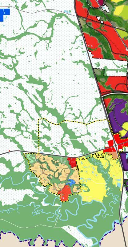
Nassau County Future Land Use Map - Several large-scale moves are shown: thin slivers of commercial land use along the SR200/A1A Corridor backed up by large swaths of low and medium density residential areas, the clear divide between the large agricultural area north of SR200/A1A and west of I-95 and the area of development east of I-95, and the significant amount of development contemplated as part of the ENCPA.

[ ] Conservation I and II
[ ] Agricultural
[ ] Low Density
[ ] Medium Density
[ ] High Density
[
• The County shall seek to preserve and expand its “green infrastructure” by creating and protecting a network of waterways, wetlands, woodlands, wildlife habitats, greenways, and other natural areas which sustain clean air, water, and natural resources: provide for a sustainable economy; provide recreational opportunities and enrich the quality of life for County residents and visitors. (Objective CS.03)
The 2030 Future Land Use Data and Analysis summarizes the County’s direction to development relative to the Corridor:
• The jobs-to-housing analysis set forth in this Land Use Need Analysis indicates the need to direct development to an urban area, provide for compact, mixed use and economic development opportunity areas. It also recognizes the need to provide rural design criteria to avoid sprawl. Nassau County seeks to use the logical boundary of Interstate 95 to separate urban and rural development patterns:
• Development in an urban form and pattern will be directed between Interstate 95 and the County’s Level III Hurricane Evacuation Zone. Urban development will result in a more compact, walkable, mixed-use communities that contribute to reducing the County’s overall Vehicular Miles traveled (VMT) average and limiting the increase in Green House Gas (GHG) emissions.
• Development in a rural form and pattern will be located west of Interstate 95. This will preserve the existing rural and agricultural character of the western two-thirds of the Nassau County. This long-range development approach will effectively transition Nassau County’s economy from that of a “bedroom community” into a more diversified “regional employment center”. Based upon the community visions and readily available roads, rails, other infrastructure and public services, the County seeks to concentrate the majority of its future urban development in a designated Urban Development Area (UDA) and adjacent Economic Development Opportunity Areas (EDOAs).
The study area includes three overlay districts: East Nassau Community Planning Area (ENCPA), William Burgess Overlay, and SR200/A1A Overlay. These overlays represent a shift toward a more modern planning philosophy.
• East Nassau Community Planning Area. In 2007, Nassau County began a partnership with landowner Rayonier to master plan the development of 24,000 acres of timberland located in Eastern Nassau County. The ENCPA is a State-approved Sector Plan adopted in July 2011. A Sector Plan allows for large-scale planning that recognizes the integral relationships between transportation, land use and urban design.
• William Burgess Overlay. The William Burgess Overlay District establishes a series of compact mixed-use activity centers consistent with the expressed goals in the Vision 2032 plan while also serving to alleviate traffic from the State Road 200/ A1A Corridor, plan for future infrastructure, civic spaces/uses and projected population growth.
• SR200/A1A Overlay. The SR200/A1A Overlay District provides a further means for the County to manage development along SR200/A1A. This district is shown in map form as part of the Future Land Use Map Series. It lies generally within 1,000 feet of each side of SR200/A1A and stretches from Edwards Road to the Intracoastal Waterway. At this time, this overlay district pertains to signage and access management however, it is anticipated that the SR200/A1A Corridor Master Plan can reshape this overlay to include additional land use regulations.
NATURAL ENVIRONMENT
[ ] Mixed Wetland Forest
[ ] Cypress
[ ] Mixed Wetland Hardwoods
[ ] Saltwater Marsh
[ ] Floodplains
[ ] Drainage Basin Divide
[ ] Study Area

Map of wetlands and floodplains in eastern Nassau Countythe significance of the Lofton Creek system is a driving element for the layout of the community.
An analysis of the physical characteristics of the corridor and surrounding areas provides insights into its function. Observational studies of the current conditions help to inform the master plan vision, principles, and strategic approach. The following presents an overview of the data and analysis collected to inform the planning process.
The majority of the study area is located within the Nassau River Basin which drains approximately 418 square miles in Northeast Florida. The basin has 29 tributary streams, including the Nassau River, considered an Outstanding Florida Water resource by the Florida Department of Environmental Protection. East of Chester Road, the area generally drains north to the St. Marys River.
A network of freshwater wetlands, including marshes, wet meadows, swamps, and shallow ponds, pock mark the study area. Intensive silviculture and pockets of
development have fragmented much of these wetland areas. Overall, the wetlands function as a filter system for rivers and lakes, acting as a sink and a source for nutrients for wildlife habitat. The Corridor intersects with several major wetland tracts, such as Lofton Creek, creating view sheds that represent the quintessential North Florida nature that has attracted people to the corridor over the last few decades.
According to GIS data provided by Nassau County, much of the study area is outside of flood hazard zones. Areas with greater flood risk are adjacent to the rivers and other tributaries. These areas can be difficult to develop due to insurance and regulatory requirements. These conditions can severely limit the actual development of an area.
The wetlands and floodplains throughout the study area are a critical source of natural stormwater retention and serve as protective resources against major storm events. Additionally, wetland areas generate some economic activity in the form of eco-tourism.
Typical of historic growth eras in this part of the County, the pattern of existing land uses within the Corridor varies significantly from east to west. Of the 13 linear miles of Corridor, approximately 8 miles is frontage to properties designated with Commercial Future Land Use (FLU). The Commercial FLU category allows for all retail sales and service facilities as well as ancillary facilities, such as parking, driveways, and landscaped areas. While development is guided by the Future Land Use Map (FLUM) indicates the proposed location, densities, intensities, and distribution of land uses to the year 2030, the existing pattern is not as consistent as appears on the FLUM due to the varying timelines of development and the parcelization and ownership pattern in parts of the corridor.
West of the CSX Railroad, the northern portion of the corridor is largely timberland under various Rayonier corporate ownerships. This land is part of the ENCPA and planned to develop into a mix of residential, commercial, and workplace uses over a long planning horizon. The first phase of this development is called Wildlight, with a mixed-use village center emerging immediately east of the SR200/A1A and I-95 interchange. The interchange land is a mix of typical travel-related commercial uses. The southern portion of this part of the Corridor is a mix of existing and emerging residential neighborhoods and the County’s governmental complex. This area is envisioned to develop as a series of compact mixed-use centers under the William Burgess Overlay District.
The Yulee community has many of the hallmarks of its era of development. These include a linear development pattern along the US 17 and SR200/A1A corridors as well as a wide mix of commercial and industrial land uses. To the east, between Yulee and Lofton Creek, parcels are quite small and shallow (ranging from about 120 to 500 feet in depth), and are transitioning from residential to commercial uses.
Within the Corridor, industrial areas are concentrated north of SR200, and south of the CSX Railroad, between Gene Lasserre Boulevard and Blackrock Road. East of this area, the Corridor transitions to more recently developed commercial shopping centers (notably several are designated with Industrial FLU) focused on larger intersections such as Amelia Concourse. Parcels in these areas are much deeper than in the middle portion of the Corridor, allowing for more efficient commercial development.
The far eastern portion of the Corridor converts back to a mix of commercial and transitioning residential land uses. In this area, parcels with access to SR200/A1A are quite shallow, constrained by the rail on the north side and existing residential neighborhoods to the south.

Map of existing land uses indicated by Florida Department of Revenue land use codes (2018) shows the built and emerging residential neighborhoods south of the SR200/A1A Corridor, the vast areas of remaining pine plantation, and the varied and linear pattern of commercial uses along the corridor clustered at the I-95 interchange, Yulee, and between Lofton Creek and Blackrock Road.

[ ] Residential Vacant
[ ] Residential Association (HOA, Condo..)
[ ] Residential Single Family
[ ] Residential Mfr Home
[ ] Residential Townhome
[ ] Residential Multi-Family
[ ] Senior Housing / Assisted Living
[ ] Commercial Vacant
[ ] Commercial Retail / Services
[ ] Commercial Entertainment
[ ] Commercial Auto Related
[ ] Office
[ ] Industrial Vacant
[ ] Industrial
[ ] Warehousing
[ ] Transport, Communications, and Utilities
[ ] Institutional Vacant
[ ] Institutional
[ ] School
[ ] Parks and Open Space
[ ] Ag Pasture/Timber/Crops/Groves
[ ] Vacant Non-Ag
[ ] Pine Plantation (LC 4410)
[ ] Forested Wetland
[ ] Marsh
[ ] Study Area Boundary
[ ] County Line
SR200/A1A is the primary arterial and main spine for the Corridor’s transportation network. Prior to the current construction project to widen the roadway from 4 to 6 lanes, average daily trips on SR200/AIA numbered approximately 37,000 to 40,000. The roadway is currently under construction and scheduled for completion in 2020. This widening will increase the roadway’s segment capacity significantly, with projections showing capacity increases from about 40,000 vehicles per day to nearly 60,000 vehicles per day.
As the primary arterial, SR200/A1A must perform a multitude transportation functions:
• Serve as a timber transportation corridor from rural western Nassau County to the paper mills in Fernandina Beach.
• Function as the primary gateway to Amelia Island, a premier tourist destination, and the historic Town of Fernandina Beach.
• In case of emergency, serves as a primary evacuation route.
• I-95 at SR200/A1A is currently the first interchange in Florida with services (gas, food, hotels) for visitors traveling south on I-95, or the last in Florida for visitors traveling north.
Due to many factors such as limited rail crossings, significant wetland systems, and neighborhood development patterns, a parallel supporting roadway network is limited. This development pattern means that in addition to its regional traffic, the corridor must also carry a significant load of local traffic. This situation creates additional traffic pressure on the roadway. At Lofton Creek, the major wetland system bisecting the corridor, there are two crossings-SR200/A1A and Pages Dairy Road-which connects to SR200/A1A just west of US 17 and extends east to Chester Road. However, the efficiency of Pages Dairy Road as parallel support for SR200/A1A is limited by the railroad running parallel between the two, with only one railroad crossing at Felmor Road between US 17 and Lofton Creek. Connectivity is also hampered with northsouth connections. These intersections, generally limited to signalized intersections, have additional pressure on them as more traffic is focused to these locations.
Physically, SR200/A1A consists of a curb and gutter section under construction, with swales to manage drainage at edges of right-of-way, within a variable width right-of-way of 190 to 200 feet. At the completion of the construction project, the roadway will contain on-street bike lanes and continuous sidewalks along its length.
View of westbound half of SR200/A1A Corridor before current ongoing construction project. The roadway has many highway design elements (swales, high-speed design, large radii) and little to differentiate it from any other arterial roadway across the state. While some elements will be improved post construction (added sidewalks and landscaping), placemaking must happen outside the right-of-way.

ROADWAY NETWORK
[ ] SR200/A1A Corridor
[ ] Expressway
[ ] Regional Highways
[ ] Collector Roadways
[ ] Local Streets
[ ] Unimproved Roads
[ ] Study Area
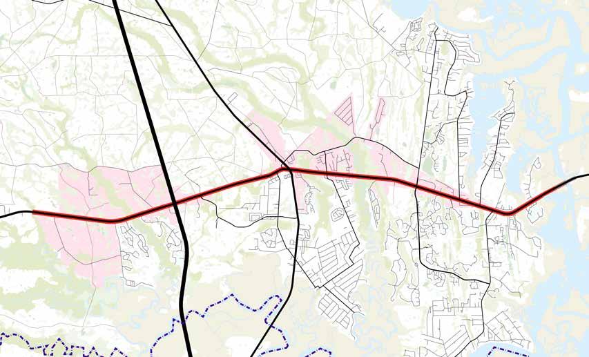
Map of existing roadway network shows lack of east/west connectivity outside of SR200/A1A corridor due to creek geography.
Examples of the varied roadway cross-sections and development conditions existing throughout the corridor. From top to bottom, rural highway west of I-95 transitioning to urban arterial with first generation commercial buildings near US 17 in Yulee, becoming a suburban commercial corridor at the eastern end of the study area.


The physical characteristics of SR200/ A1A lead to lead to opportunities and barriers for place-based interventions across the Corridor. These characteristics include six basic elements: Paths (streets, sidewalks, bike trails), Nodes (places where paths cross), Edges (natural boundaries such as Lofton Creek), Districts (designations such as William Burgess District), and Landmarks (distinct entities like The Old Food Store).
The way these elements come together reflect the identity people attribute to places.
Rd/SR200


A pathway’s significance is based on the extent of its connectivity. For instance, I-95 and US17 are major pathways because they connect hundreds of cities and towns along the Atlantic Seaboard. Paths that connect fewer places, such as Chester Road, have less regional significance but may still have local importance. From west to east, major paths include SR200/A1A itself, I-95, US17, Amelia Concourse, and CR 107. Minor paths include Police Lodge Rd, Pages Dairy Road, Miner Road, and Blackrock Road.
Similar to paths, the significance of a node-or the intersection of two paths-is related to the level of activity that occurs around it. The intersection of two major paths creates greater activity than the intersection of two minor paths. From west to east, the two most significant nodes are at the intersection of I-95 and SR200/A1A and the intersection of US-17 and SR200/A1A. Substantial nodes also exist at the intersections of SR200/A1A with Amelia Concourse and with CR 107.
US-17/SR200

Districts are areas with common elements that distinguish other areas.
Historic Yulee is an example the combination of historic presence of the railway distinguish places. Wildlight is also an where a consistent palette style stands out against surrounding


common identifying their character from example of a district in which historic landmarks and the distinguish it from other an example of a district palette of modern architecture surrounding areas.
Edges are linear elements that are not paths. They are usually, but not always, the boundaries between two kinds of places. Wetlands and waterbodies like Lofton Creek are distinctive edges that create a sequence of changes as one moves along the Corridor. The railway also forms an important edge that in many cases constricts movement or growth.
CORRIDOR CHARACTER
[ ] Paths
[ ] Nodes
[ ] Edges
[ ] Landmarks
[ ] Districts (Various Colors)

Landmarks are physical points of reference that are crucial to the identity of a place. The Old Food Store at the railroad crossing on SR200/ A1A is a significant landmark that signals arrival in Historic Yulee. Similarly, the “Down Under” sign at the Thomas J. Shave, Jr. Bridge is a recognizable landmark that signals arrival in “mainland” East Nassau.
From January to June 2019, over 400 people participated in workshops, interviews, and an online survey to share their thoughts and perspectives about the SR200/A1A Corridor. The Department of Planning and Economic Opportunity led a series of in-person engagements, which included workshops, roundtables, and tabling events. These engagements were located at places that represent origin or destinations for people using the Corridor.
A short survey was provided at tabling events as well as on the County website. Over 322 survey responses were collected from a combination of local residents, business owners, students, artists, and more. Overall, respondents indicated a strong desire for more trees, sidewalk/bicycle paths, and social spaces such as parks and public markets. Respondents also indicated a desire to feel safe along the corridor, often citing a high incidence of truck traffic and overall vehicle congestion as concerns for safety. The following provides a summary of the survey results:
• 322 responses, most frequently local user, median age 53.
• 82% of respondents rated their experience along SR200/A1A as somewhat or strongly negative, frequently citing congestion, construction, and ugliness as sources of frustration.
• 76% of respondents indicated that they use SR200/ A1A daily. Over 40% of respondents claim that they use SR200/A1A for shopping, 20% for work, and 17% for visiting friends.
• 74% of respondents rated their feeling of personal safety along SR200/A1A as somewhat or very poor, citing inadequate sidewalks and bicycle paths as the most frequent source of discomfort, other than construction.
• 65% of respondents specifically mentioned trees, parks, or amenities commonly found in gathering spaces (e.g., benches, restrooms, etc).
Workshop participants were asked to describe a day-inthe-life along the Timber to Tides Trail in the year 2029. These stories provided an impression of the needs and aspirations of people that is often lost in survey responses. Examples of these stories are provided in the Appendix.
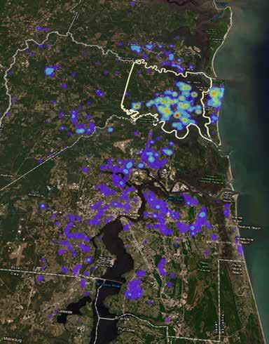
Participants used sticker-dots to indicate places or resources they believe are either assets or constraints for future growth. This activity provides a conceptual geographic perspective on which areas of the corridor are successful and which areas need improvement. Generally, participants indicated a greater number of assets than constraints which, from an asset-based perspective, is an encouraging sign of the public’s optimism for the potential of the corridor.
The areas that workshop participants indicated as assets are shown as green dots in the image to the right. These included clusters at:
• the I-95 interchange, noted as regional accessibility;
• Government center and FSCJ campus on William Burgess Boulevard;
• new development at Wildlight;
• historic area of Yulee;
• Lofton Creek; and
• retail shops at Amelia Concourse.
As part of the same exercise, workshop participants were asked to identify constraints, or things that might negatively affect future growth in the corridor. These are shown as red dots in the image to the right. These included clusters at:
• tourist commercial uses at the I-95 interchange;
• wetlands that limit connectivity opportunities;
• traffic along the corridor (particularly constructionrelated impacts as this occurred while the roadway was under construction); and
• perceived traffic problems at key signalized intersections

Map of areas that workshop participants indicated were assets to build on for future growth.
Map of areas that workshop participants indicated were constraints that should be addressed to enable improved future conditions in the corridor.

Over the course of several months, the planning team had in-person and online interactions and conversations with hundreds of residents, business owners, civic leaders, and others interested in the future of the SR200/A1A Corridor. The conversations often included observations, general concerns, broad community or individual values, and many specific ideas for change rooted in people’s everyday experiences along the Corridor. This diagram characterizes a sampling of the input from the community. Nearly all the community input could be categorized into one of five topic areas, which are shown to the right. Each of these topics has specific issues associated with it. These issues and opportunities drive the Corridor Master Plan.


• Right now, people shop and leave. It would be nice to have venues for gathering and enjoying recreational activities: museums, parks, outdoor amphitheaters, etc.
• Hope to be able to drive or have public transportation to take me to different places to enjoy the theater, parks, walking trails/sidewalks.
• The entrance to paradise.
• Canopy of trees lining the entire way to Amelia Island - A drive everyone talks about on Travel Advisor.
• I would like to see the retention of its rural flavor along with some nature preserves. Possibly some areas for nature related activities: Fishing, kayaking, hunting etc.
• Using road to get to parks, restaurant row, local concert hall, etc… instead of a fight for survival to get from point A to point B.
• I would like to see sidewalks and shops/restaurants so that you can walk to stores and restaurants similar to the atmosphere on Center Street in Fernandina.
• SR200 remains a mobility option for private vehicles and trucks moving goods and people. The destination based uses interconnect in some places creating nodes that turn away from SR200 and toward off corridor places of interest like creeks, woods, commercial town centers.
• I would like to see the road finished, sidewalks for people to enjoy, local shops, nice entertainment. I would like to see something we can be proud of and not another Dunn or Blanding Blvd!
• I don’t know what types of businesses will be around, but from the Hwy alone I want a clean, organized, smooth flow of traffic that connects 95, A1A (and its tributaries), and the island in quick and accessible way. Not more than 15 years ago you could leave the island and be on 95 in 15 minutes or less. That is impossible and its a travesty as 95 is the major connector for, well, everything. It should not require an Homeric odyssey to get to.
• The corridor with be a through fare to the island, with exits to service roads that get to businesses, residences, parks, etc.
• I can walk or bicycle to shopping and parks. There are sidewalks from my neighborhood to shopping centers and services, and lots of greenery. It’s beautiful! There is a park near where I live and one near where I work.
• It’s easy to find a shady public place to enjoy the day and be in the outdoors. There’s even a hiking trail I can visit to get some exercise. It’s great!
• My ideal is if they would stop expanding. By 2029 this will just be a little Jacksonville.
• A day where I can walk or ride public transportation to local destinations such as grocery shopping would be ideal
• I would be able to go to the bank, market, and have lunch all within a 3-10 block area without having to move my car to once it is parked. Stroll along the sidewalk, window shop, stop for coffee or ice cream. Wander back to my vehicle and drive back home. OR not even have to use my car-living close enough to walk to the center of town.
• I love riding bikes as a family, so feeling safe enough to that would be amazing. Right now, it seems very commercialized and box store. Nothing seems specific to this community. I would love to see local business bloom and the community support it along SR200.
• I would like to see safer bike trails and sidewalks that are not so dangerously close to the flow of traffic. Well maintained street light with spaced trash bins along the way to deter litter would be a welcomed change. I am fully able to get around walking unassisted as well as drive well.
• I would love to be able to access work, stores, groceries, parks, etc via sidewalk. A pedestrian bridge over the highway would be amazing too.
• I hope I am not using the corridor at all because the County figured out a way to create compact mixeduse communities that allow people to work, live, play and stay in my 1/2 mile node. I don’t want to be forced to use SR200 for day-to-day activity.
• Walk or bike everywhere safely!
• Attractive roadway Well maintained Nice structures more walkable bikeable - A true “Main Street” for Nassau County.
A connection to the natural environment
The natural environment plays an important role in the life of the community. This includes both the visual definition of the forests on the west, the Lofton Creek corridor and wetlands in the central part of the corridor, to the expansive views of salt marshes on the east and the recreational benefits of open spaces, trails, and blueways.
Sustainability of the current development pattern
Many of the conversations touched on a recognition in the community that the existing pattern of automobiledriven development that is not a sustainable model for the future. While community members appreciate the commercial offerings along the corridor, they would prefer a more compact pattern of development.
Lack of transportation connectivity
A majority of the comments come back to transportation and the underlying issue of a lack of connectivity within the corridor aside from SR200/A1A. This fact causes issues with volume (both regional and local trips sharing the same roadway) and turning movements (traffic forced into a limited number of intersections) creating user frustration.
Desire for more identity and special character
The area’s lack of a special character was a common point of discussion. As a population with many transplanted residents, there is a distinct longing for a place that is more reflective of a special character and definable identity. Many focused on what they did not want to the corridor to become rather than defining a set character.
Concerns about the resiliency of the community
Woven into comments about transportation and sustainability of the development pattern were threads of concern over the community’s resiliency-to disasters as well as physical and economic change.

The Vision describes the SR200/A1A Corridor of the future. It is intended to be aspirational and broad, setting a course for the future. The Planning Priorities reflect the values inherent in the community. As time goes on, they are intended to remain more or less constant to provide a baseline for new implementation actions to be developed.
COMMUNITY VISION
PLANNING PRIORITIES
[1] Nurture Nature
[2] Grow Sustainably
[3] Connect Communities
[4] Catalyze Culture
[5] Future Proof
THE SR200/A1A CORRIDOR IDENTITY, COMFORT, AND FUTURE MULTI-FUNCTIONAL, SAFE, AND THAT CONNECTS PEOPLE WHERE THEY ASPIRE TO COMMUNITY

CORRIDOR WILL INSPIRE FUTURE OPPORTUNITY AS A AND SUSTAINABLE CORRIDOR PEOPLE TO THE PLACES TO LIVE, WORK, AND PLAY.

Community engagement reveals that people living along the SR200/A1A Corridor—young and old, working and retired—share a desire for a safe, comfortable, and beautiful corridor that connects them to the places they are seeking access to. Historically, planners have interpreted this desire to mean wide roads, high speeds, and ample parking. Today, however, most people agree that such caroriented design results in unwelcome outcomes such as greater congestion, increased exposure to health hazards, community isolation, and excessive public expenditures.
By contrast, it is evident from communities around the world that human-scale design more readily serves the needs and aspirations of people by promoting walking and bicycling. In doing so, people gain the ability to move fluidly between their home, work, and shopping, all while encountering greater social and emotional enrichment along the way.
Human-scale design places significant emphasis on the public realm, or the spaces we share in between buildings. Elements that support a quality public realm include
density, “eyes on the street”, multi-functionality, and visual interest. Imagine a neighborhood filled with a variety of shops, workplaces, parks, and civic spaces-all located close to where you live, with wide walking paths shaded by ample tree canopy; landmarks that help you navigate the space; windows that reveal and invite human interaction; and spontaneous opportunities to gather with friends. Places like this enable feelings of comfort, pleasure, and purpose within the public realm.
Although SR200/A1A is undergoing a major update to six lanes, its wide vehicle travel ways, unshaded sidewalks, and unprotected bicycle lanes will still prioritize the automobile over walkers and bicyclists. Nevertheless, the Nassau County community has an opportunity to establish nodes of compact, walkable activity at key areas along the corridor-linked by safe routes for bicycling and future transit, and a sense of place as well as historic identity. This chapter presents a vision grounded in this idea of a new direction.
Maintain, enhance, and extend the natural environment by creating opportunities for residents to access and enjoy Florida’s unique natural areas.
Help stage vibrant shopping center and neighborhood growth through development that creates places for people, supports local businesses, encourages an active lifestyle, and comprises a mix of housing options.
Improve linkages between neighborhoods, shopping centers, and amenities through a network of slow, safe, and livable primary and secondary streets, trails, bike paths, and pedestrian infrastructure.
Build on heritage while establishing new cultural assets that celebrate community creativity and identity in the public realm.
Prepare for a future by looking ahead to build a resilient community in the face of growing climate concern and technological advancements.

Maintain, enhance, and extend the natural environment by creating opportunities for residents to access and enjoy Florida’s unique wilderness.
East Nassau County’s natural environment has historically been an important asset to the local economy. Today, locals and visitors recognize the area’s rivers, marshes, and tree canopy as destinations for recreation and eco-tourism. The public communicated a clear desire for greater access to nature, parks, shade, etc. However, a sprawling, car-oriented development pattern disproportionately diminishes natural lands. Both the comprehensive plan and land development code can help assure that development “nurtures nature” by offsetting loss of habitat.
• Require drought-resistant and native landscaping
• Require base level of tree canopy cover and tree preservation standards along with tree planting
• Establish vegetation protection areas
• Enhance environmental wayfinding with “natureinspired” signage
• Provide “pocket-parks” or small park spaces along sidewalks and bike paths
• Encourage solar-ready construction
• Provide incentives for green roof construction
• Underground utility lines to allow unobstructed views of natural areas
• Provide incentives for retrofitting historic structures for energy and water efficiency
• Integrate stormwater facilities into park and trail design
• Connect bike paths to “blueways” such as Lofton Creek, Lanceford Creek, and Plummer Creek

Help stage vibrant center and neighborhood growth through development that creates places for people, supports local businesses, encourages an active lifestyle, and comprises a mix of housing options.
The built environment across the SR200/A1A Corridor is characterized by a low-density, car-oriented development pattern. Public input consistently included the desire to move away from “strip mall” development toward mixed-use developments, with multi-family housing infill supporting a balance of uses while providing workforce housing. The current development pattern also requires greater public expenditure to maintain, as it under-realizes tax revenue potential while stretching County services across larger expanses of area.
One of the specific goals expressed in the County’s Vision 2032 final report and the Comprehensive Plan is to encourage mixed-use developments designed to accommodate multiple community activities and services in close proximity. By reducing infrastructure demand, mixeduse developments can generate a positive fiscal impact on County’s financial resources. It is the County’s objective to coordinate community efforts to develop high-value mixed-use developments that achieve this goal. Furthering sprawl will eat up additional greenfield land, exacerbate congestion along the corridor, and diminish the value of public investments. Modifying land use policy and leveraging other planning tools can support the strategic growth of the Corridor.
• Provide incentives for variety of residential types and unit sizes
• Reduce or eliminate minimum off-street parking count requirements
• Allow accessory dwelling unit and live/work unit development
• Allow greater density/intensity near activity centers and anchor institutions such as hospitals and universities
• Reduce minimum lot and dwelling size as well as setback requirements
• Allow for a mix-of uses in more zoning districts, including residential zones
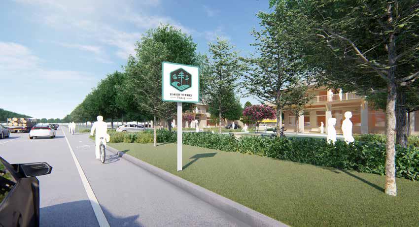
Improve linkages between neighborhoods, shopping centers, and amenities through a network of slow, safe, and livable primary and secondary streets, trails, bike paths, and pedestrian infrastructure.
Today, SR200/A1A is the only east-west route for most local trips. As the corridor has seen extensive growth, the number of potential pathways between neighborhoods and activity centers has received only limited expansion, causing congestion and limiting the capacity of the overall network. A majority of survey respondents use SR200 for “local trips” such as grocery shopping. To the extent that the transportation system could distribute these trips across a broader network of streets, then congestion on SR200 would be reduced.
The SR200/A1A Corridor should be the focus of complete streets in a connected network. Alternative connections can and must include safe, comfortable, and accessible routes for walking/bicycling.
• Establish maximum block sizes and/or provide midblock pedestrian crossings
• Provide “SR200/A1A” multi-use trail, spanning the full length of the Corridor
• Widen sidewalk to provide bicycle connectivity between SR200 trail and neighborhoods north of the CSX Railroad and south of SR200 (Miner Road, Chester Road, Blackrock Road)
• Ensure that bike and pedestrian paths, including crosswalks, have adequate lighting
• Require pedestrian connectivity between development sites and districts
• Screen/hide drive-throughs
• Provide spaces for respite and protection from weather conditions along bicycle/walking paths
• Require a greater allocation of space for pedestrians within public right-of-way
• Buffer sidewalks from travel lanes when possible with tree lawns

Build on heritage while establishing new cultural assets that celebrate community creativity and identity through the public realm.
The existing development pattern of the SR200/A1A Corridor discourages the meeting spaces that allow for social interaction. Creating spaces in which cultures can collide, such as parks, food halls, and art and performance venues, can help catalyze a sense of community. Utilizing historic buildings and spaces add a layer of authenticity to a place while providing affordable spaces for creatives and small businesses to thrive. Varied architectural styles can promote a unique sense of character, while wayfinding and signage can highlight the corridor’s heritage, particularly along the Gullah Geechee Cultural Heritage Corridor.
• Require developers to display artwork as part of their development program
• Emphasize the gateway area at I-95 as entry to Florida with unique signage and public art displays
• Renovate Yulee Junior High School to include floor area for artisan/maker space, commercial kitchens, etc.
• Allow for artisan and small-scale manufacture uses within mixed-use zones
• Provide cultural “breadcrumbs” (such as signage and public art) along US 17, SR200/A1A, and at the I-95 Gateway that celebrates the Gullah Geechee Cultural Heritage Corridor

Prepare for a future by looking ahead to build a resilient community in the face of growing climate concern and technological advancements.
Digital technologies and business models, such as sameday delivery, are changing how people live, work, and play throughout the U.S. Simultaneously, climate change and its impacts are challenging the resiliency of communities around the world, particularly those near the coast. The SR200/A1A Corridor of the future will almost certainly need to function in unforeseen ways, which means land use policy and design should be flexible and adaptive. In the current term, changes that are occurring include a revolution in artificial intelligence, prompting autonomous vehicles; a changing retail landscape, driven by justin-time home delivery; and climate-related changes, including increased risk of flooding and intensification of storm events. Human-scaled communities are the most responsive to innovation and least exposed to major economic and environmental disruptions, because they support strong social networks that help people adapt to change.
• Support a culture of innovation throughout County government
• Reduce or remove exclusionary land use policies such as minimum dwelling/lot sizes
• Encourage and support entrepreneurship through incubator development
• Create a “resilience plan” outlining opportunities for distributed energy generation, localized food production, and greater utilization of green infrastructure
• Consider pilot for autonomous vehicle mobility solutions between activity centers

These frameworks represent the physical outcomes of the community values. Like the Vision and Planning Priorities, they are intended to provide high-level direction for future growth.
CORRIDOR FRAMEWORK PLAN
THE ELEMENTS OF COMMUNITY
CHARACTER AREAS
Historic Center
Suburban Centers
Emerging Centers
The Gateway to the Corridor
Workplace Growth
Neighborhoods
Green Corridors
The Community Character Frameworks illustrate the organizing elements and recommended development pattern for the SR200/A1A Corridor. The frameworks address how the County may think about the future of areas in the Corridor-philosophically and from a market and economic development perspective. The frameworks are intended to act as a link between the Planning Priorities and the desired physical form of the places within the Corridor.
The concept for the area is to concentrate development intensity at the centers, which are the focus of neighborhoods, linked together by green connections. These centers are placed at the most highly connected locations in the Corridor, where SR200/A1A is crossed by major regional access roadways. These occur at I-95 (The Corridor Gateway), US-17 (The Historic Center), and Amelia Concourse (Suburban Center), and are intended to be highly connected, walkable, mixed- or multi-use places.
Between these centers, a more linear development pattern marks Emerging Centers and serves to transition development (land uses and intensities) from the corridor to adjacent neighborhoods to the north and south. Development gives way to nature in Green Corridors at regular intervals marked by large green areas where natural systems cross SR200/A1A. These areas are intended to preserve flow-ways and provide a framework for future greenway connections.
The repositioned development pattern will help to revitalize the area by creating a more connected, walkable, and green community. The natural features can be used as amenities to spur additional high-quality residential development. The intent is to create and maintain over time a more walkable development pattern, creating centers of commercial activity with elements of higherintensity residential, office, and limited commercial areas to link Neighborhoods to the Corridor. All of these changes will serve to help maintain and enhance the existing neighborhoods.
There are six distinct types of character areas within the Corridor that help to illustrate the plan concept. Identification of these character areas provided guidance in developing future land use and infrastructure policies for the plan area. The Character Areas are envisioned to be implemented through a transect-based system described in the following pages.

REDEVELOP: The Historic Center
REPOSITION: Suburban Centers
TRANSITION: Emerging Centers
ESTABLISH: The Gateway to the Corridor
ACTIVATE: Workplace Growth
LINK: Neighborhoods
EMPHASIZE: Green Corridors
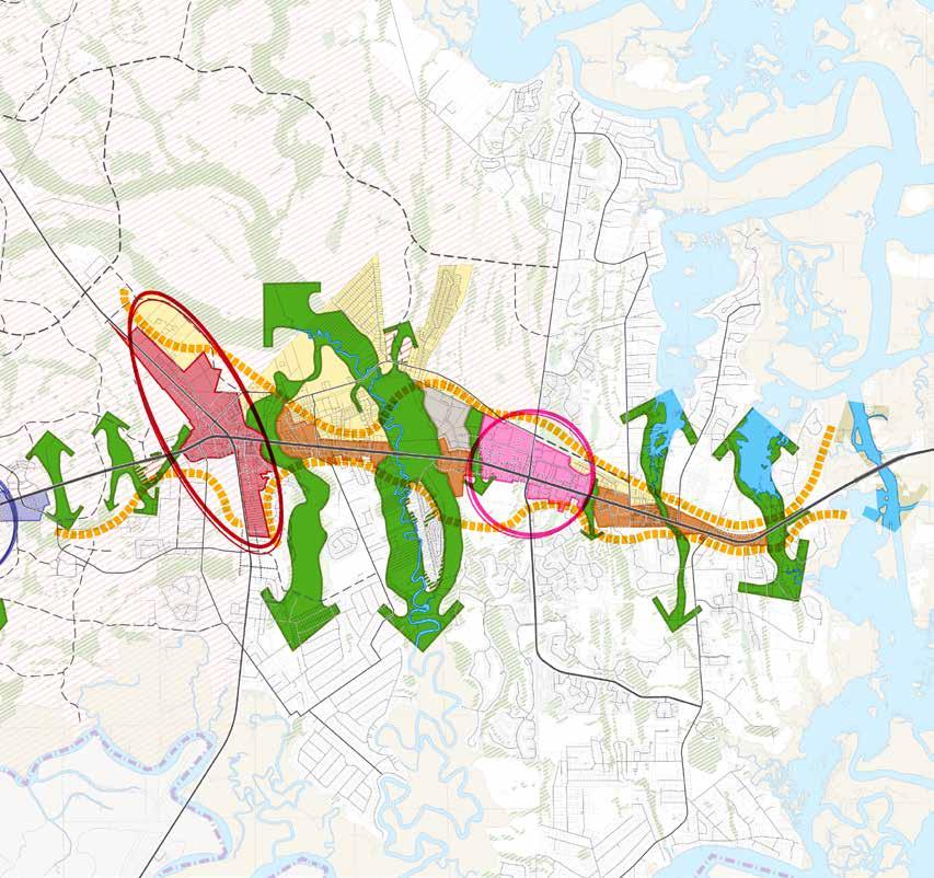
While every community has its unique character, the land uses from community to community are generally consistent. Places exist within the natural environment and are made up of neighborhoods (primarily residential uses), commercial districts (downtowns), civic buildings, parks, and the streets and infrastructure that knit them together.
The Community Character Frameworks help describe the ways that these elements come together to create a strong place that maximizes its relationship to natural amenities, such as parks and creeks, and remains livable as it grows. In this way, the design of these elements should be consistent with the vision for the surrounding area, as described in the frameworks.
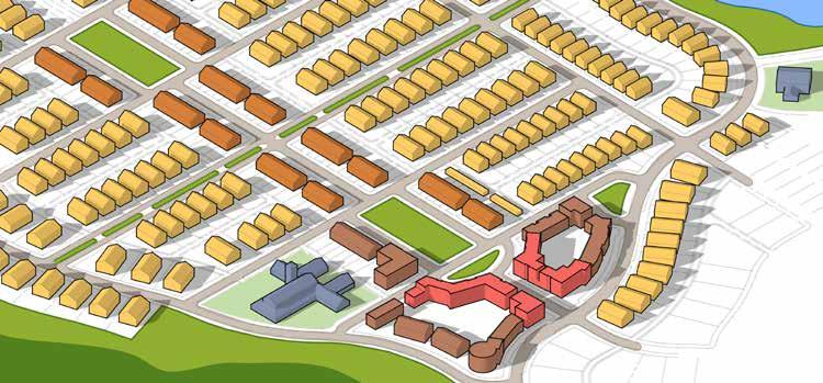

The US 17 corridor and Yulee community is the historic heart of the SR200/A1A Corridor. A catalytic project, the repositioning and reuse of the Yulee Middle School site, would inject development momentum to this vital part of the community.

The shopping centers at SR200/A1A and Amelia Concourse are relatively recent development. Their form will likely change incrementally over the years. The focus for community character at these suburban centers should be to offer opportunities for new land use categories (specifically residential) for infill. With this infill development should come an improved public realm, with parking lot drive aisles transformed into livable street connections, as well as parks and plazas infilled to improve amenity value for these locations.
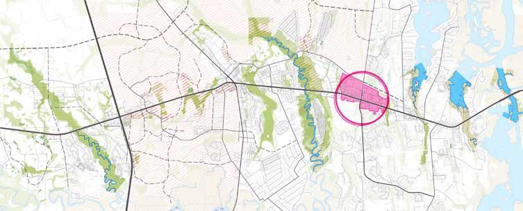
The I-95 and SR200/A1A interchange is undergoing a major change with the construction of a diverging diamond interchange. Private development investment typically lags behind roadway improvements as businesses are cautious to open while construction is ongoing. However, when this improvement is completed, development in this area is likely to explode, given the transportation upgrades and the development momentum associated with nearby Wildlight. As the most regionally connected spot in the corridor, there is a high degree of opportunity to create a standout mixed-use development at this location.

The shallow parcels in between established locations along the corridor present the opportunity to transition from a linear development pattern shut off from its neighbors to a connected form-linking adjacent uses to high-quality development along SR200/A1A. Development here should focus on shared infrastructure (e.g. joint access or master stormwater) to mitigate the small, shallow nature of parcelization in this part of the corridor. The County should strive to connect such area with adjacent properties when possible.
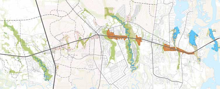
Neighborhood locations throughout the corridor should be protected from commercial intrusion while being linked to existing and emerging places through a more robust local street network, pedestrian and bike connections, and a highquality public realm.
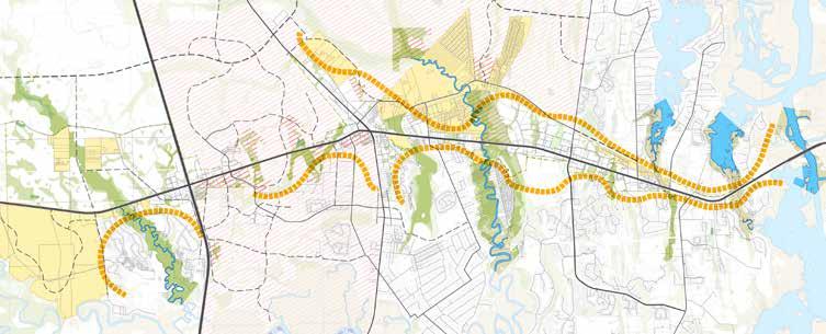
The wetland systems that cross the corridor are a defining visual element of community character. They should be protected and emphasized in plans of adjacent development. Far from being something that is relegated to a “back of house” location, these systems should be celebrated as important natural resources, presenting the opportunity for future greenway and blueway connections valued by the community.


The Targeted Actions are 10 key initial actions that each represent one of the potentially many applications of the Planning Priorities and Frameworks as well as solutions consistent with the guidance of the Corridor Master Plan. They have been all created in thoughtful consultation with community stakeholders. The plans and imagery shown with each concept are intended to be indicative of the character and intent of the recommended actions.
[1] TRANSITIONING FROM STRIPS TO CENTERS
[2] IMPROVING NON-MOTORIZED CONNECTIVITY
[3] IMPLEMENTING LIVABILITY ELEMENTS IN NEIGHBORHOODS AND CENTERS
[4] ENCOURAGING LOW IMPACT DESIGN STORMWATER TREATMENT
[5] BRANDING THE CORRIDOR
[6] PROTECTING VIEWSHEDS FOR CORRIDOR CHARACTER
[7] REINVIGORATING HISTORIC YULEE
[8] REDEVELOPING SURPLUS COUNTY PROPERTY
[9] ESTABLISHING GATEWAY CHARACTER
[10] IMPLEMENTING A TRANSECT-BASED LAND DEVELOPMENT CODE
Areas where major streets such as I-95, US-17, and Chester Road intersect with SR200/A1A have the highest potential for achieving a development program that could produce significant community activity. As market conditions continue to favor growth in the Corridor, these centers should capture the focus of development. The repositioning of typical shopping strips may frequently involve the following four changes to commercial strips:
• Compact Density. High densities and intensities of development are a critical condition for centers’ success. Compact organization, scale, and layout of the center can help intensive projects become more human scale.
• Mix of Uses and Building Types. Detached residential units, townhomes, multifamily apartments, civic buildings, grocery stores, schools, recreation facilities, retail, restaurants, and office uses should all be located within a 10-minute walk of intersections with SR200/A1A.
• Framing the Street. Buildings are set close to the street, helping to define its width extents, which works to slow traffic while creating a sense of place.
• Internal Circulation. A combination of public streets and private drive-aisles establish an internal network of streets, complete with sidewalks that help distribute vehicle movements across a greater area while enabling walkable access to all buildings.
This illustrated example from Winter Springs, FL shows all of the components of typical strip developments - grocery stores, restaurants and convenience commercial uses. These common uses are organized in a pattern that creates compact linkage with residential uses, facilitates a broad mix of building types and uses, creates internal circulation, and frames the main traffic corridor, slowing the speed and creating a distinct character that is different from other places in the corridor.


Example from US 278 - main connection to Hilton Head Island, SC, showing form of development that maintains compact density, integrates a mix of uses and building types, offers internal circulation, and creates positive framing of the roadways through combination of landscape and building presence.
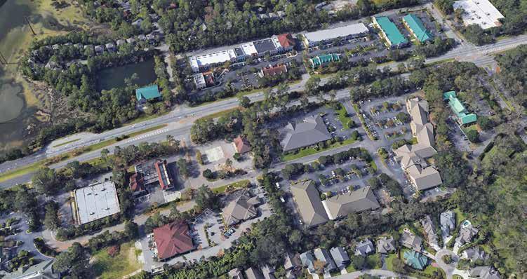
The form of centers is driven by buildings with traditional architecture placed at the edge of the right-of-way to spatially frame the space, as in this example from Baldwin Park in Orlando.

Example from US 278 - main connection to Hilton Head Island, SC, with traditional architecture of gas station builds a cohesive character in the corridor.

Expanding the options of transportation modes is a viable alternative to adding capacity to an existing roadway or building another parallel roadway in the same corridor. Many short- or medium-distance trips could involve more human-powered transport, such as walking and bicycling, which could reduce congestion along the SR200/A1A Corridor while offering more equitable transportation options for people of all ages, abilities, and incomes. A key linkage in the bike and pedestrian network should be a multi-use path along the full length of the corridor. Moreover, design interventions at key intersections, particularly within corridor centers, is crucial for slowing cars down and enhancing comfort for pedestrians and bicyclists.
Examples of multimodal connectivity to consider in the corridor include:
• Multi-Use Trail. SR200/A1A should be augmented with a wide multi-use path that is separated from the vehicle travel way and serves as a backbone for a wider regional trail network. Although the corridor also includes on-street bicycle lanes, the off-street trail would receive wider use and would be preferred by most bicyclists who use this route.
• Human-Scale Streetscape. The streetscape along SR200/A1A should include elements that help transition from the large, vehicle-oriented right-ofway into an environment geared toward people. Landscape of developments fronting the corridor should include broad tree canopy and active building facades, such as windows and front porches, that help make walking feel comfortable and safe. Shade trees and structures should be regularly provided for refuge from the elements.
• Low Speed Intersections. The intersections along SR200/A1A should be configured to allow visibility and predictability for all users, creating an environment in which complex movements feel safe, easy, and intuitive. Intersecting streets and driveways are relatively narrow (widths up to 35 feet for driveways and 65 feet for streets), which lower turning speeds. The introduction of median refuges could provide space for respite while crossing the corridor and create additional buffer between humans and turning vehicles.


Example from Daniel Island, SC of typical shopping center uses (note Publix store) that “engage” the main road and multi-use trail that is separated from traffic by an ample tree lawn.

Example from Oviedo, FL of gateway to shopping center incorporating trailhead for multi-use trail adjacent to arterial roadway but separated from traffic. The trail engages the commercial uses and provides an alternative to the on-street bike lanes.
Example from PGA Boulevard in Palm Beach Gardens of new development incorporating human-scale streetscape elements (engaging architecture and landscape) along with separated multi-use trail.

Access to parks, housing, employment opportunities, and social networks are determinants of where people choose to live. The design of the built environment plays a significant role in improving access or creating barriers to these elements. As development and redevelopment occurs across the corridor, it will be crucial for designers to establish a framework that supports livability.
• Diversity of Built Form. Buildings generally have a consistent scale and architectural style, but differ in form and use. Mixed-use commercial, apartment, townhome, duplex, detached single-family typologies should be distributed within neighborhoods and centers.
• Pedestrian First Design. A system of alleys and parking areas set behind buildings help to prioritize walking and biking along building faces by limiting conflict points with automobiles.
• Extensive Tree Canopy. Significant tree canopy along sidewalks, park spaces, and in plazas substantially enhance the comfort and visual interest of the development. Trees preserved or planted to the south and west of buildings achieve substantive energy conservation.
• Chain of Parks. A series of parks with pedestrian connections to building courtyards helps establish a cohesive network green and open spaces that greatly reinforce social interaction.


Low impact design (LID) is an approach to land development that works with nature to manage stormwater as close to its source as possible. LID employs principles such as preserving and recreating natural landscape features, minimizing imperviousness to create functional, and appealing site drainage that treat stormwater as a resource rather than a waste product.
Examples of LID interventions include rainwater catchment, stormwater infiltration gardens, green roofs, and low irrigation landscapes. The creation of stormwater planters and bioswales are two of the most common practices that capture water from the roads.
LID is not only an effective means of sustainable stormwater management but can also be integrated into placemaking design and used in landscaping buffers between districts.
In contrast with conventional means of stormwater management which aim to control, detain, and retain water using mechanical means, LID seeks to slow and spread the flow of water to eventually soak back into the natural hydrological cycle, in the following manner.
Slow - slow the velocity of stormwater runoff by replacing or covering impervious surface area with foliage surface area such tree canopy, grasses, and ground cover. This allows for suspended pollutants to settle rather than accumulate in stormwater flow.
Spread - allow for water to slowly spread horizontally and vertically across space so that a greater quantity of natural elements can help filter water. This also helps reduce erosion from stormwater flow.
Soak - provide area where water will reside for a period of time in which it will be subject to evaporation and infiltration back into the hydrological cycle.
Filtration
Plant foliage, fibrous roots, sand or other porous media, help slow the flow of stormwater while also sequestering suspended sediments resulting in cleaner water “down stream”.


Infiltration


Permeable soils and sands allow for stormwater to infiltrate vertically into groundwater flows.


Bioremidiation
Stormwater soaks in areas where various types of plants, bacterias, fungi, and the presence of light remove, transfer, stabilize, and/or destroy contaminants in the stormwater.


Bioretention Cell
Bioretention cells, also known as rain gardens, consist of layers of vegetation and permeable soils that help capture and retain stormwater from impervious road surfaces. A combination of bioremediation, evapotranspiration, and evaporation help remove pollutants from the stormwater.
Cells can be placed within bulb-outs, on street corners, or any other location where stormwater is likely to flow. Biorention cells can be used in tandem with more conventional means of stormwater conveyance.




Vegetative basins or dry ponds are designed to receive runoff and exfiltrate it into the ground. Dry ponds help mitigate flooding from major storm events while also


allowing suspended solids to settle out. Vegetated basins provide the additional benefits of increased aesthetic appeal, wildlife habitat, and improved air quality.


Bioswales are gently sloped, planted channels for treating and conveying stormwater. Similar to conventional stormwater structures, bioswales are used to convey water;
however, they differ in that the foliage, roots, and stones all help filter the water, while allowing it to infiltrate the ground.


Evapotranspiration


Sedementation


Recharge trenches, also known as sand filters, are filled with porous media, such as sand or aggregate that collect runoff and exfiltrate it into the ground. Sand filters, below ground or at grade, are used to treat the first flush of stormwater runoff. Stormwater enters a forebay or filter


strip where sediment drops out and runoff energy is dissipated. It is then distributed over a porous bed where nutrients, heavy metals, and hydrocarbons are captured, and microorganisms facilitate a biochemical breakdown of contaminants.

As an alternative to conventional wet ponds, constructed wetlands are shallow, vegetated depressions with permanent standing water that offer a spectrum of ecosystem services to manage and treat stormwater. Constructed wetlands offer the many benefits of natural wetlands and marshes to provide a comprehensive
stormwater BMP. Constructed wetlands aid in peak flow reduction, and provide conditions for sediment drop-out. Their high biodiversity of plants, animals, and microorganisms enhance evapotranspiration, filtration, and biological and chemical stormwater treatment.


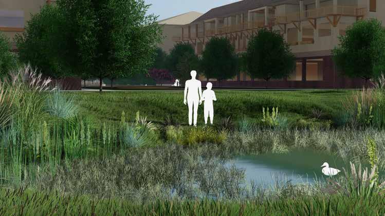


A wet pond is a constructed basin designed to retain a permanent pool of stormwater with limited biological treatment. Wet ponds aid in peak flow reduction and promote sedimentation. Stormwater may enter the pond


as sheet flow across a filter strip or swale. Once water reaches permanent pool storage, additional sediment settling and biological uptake occur as stormwater is slowly released over 24-72 hours.


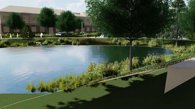


As new development has filled the corridors, the character of the place has eroded as it now is a typical strip. Multiple names for the corridor on maps and used in everyday conversation (SR200, A1A, or Buccaneer Trail) do little to create an engaging vision about the character of the place. In public engagement conversations, the area’s lack of a special character was a frequent comment. With many transplanted residents, there is a distinct longing for a place that is more reflective of a special character and definable identity.
At the completion of roadway construction, the corridor should be re-branded. During the planning process, the name Timber to Tides Trail was used to represent a forward-looking identity for the place. This should be incorporated into a coordinated wayfinding system throughout the corridor that creates a consistent reference point and vision in people’s minds. An example of this type of signage is shown below.

The Timber to Tides logo was created to offer coherence and consistency across the multiple phases of this project: from the public input process to the final publishing of this plan. Beyond this, it would work well as an identity for the Corridor that translates to wayfinding devices. Each element of the logo has meaning related to the overall intent of the project:
• The hexagon is considered one of the most efficient shapes in nature, and represents the desire to use resources logically and efficiently as the corridor grows.
• Pine trees represent the corridor’s roots as a primary route for timber transportation. Timber is still a major economic driver and will remain a part of the area’s future.
• Waves of water represent the waves of growth and opportunity that are reaching the shores of East Nassau County. However, these waves also signify the need to respond to an uncertain future as seas level rise and technological changes disrupt the status quo.


Maintaining natural areas and protecting viewsheds along the corridor was a primary objective/demand of the public as determined in the outreach process. This can be accomplished by strategic acquisition of preservation parcels along the SR 200 corridor. This action will preserve natural areas, create and protect viewsheds, assist in defining transitions between natural areas and development nodes, and provide for visual relief from development when traversing the corridor.

Map showing parcels identified for acquisition to advance viewshed and natural area preservation. Parcels identified for acquisition are outlined in RED.
To create a catalyst for redevelopment in the Yulee community, the former Yulee Junior High School could be reinvented as incubator space for local artisans and smallbatch producers. Each Saturday morning, people from Hilliard to Amelia Island might descend upon the historic campus to shop local wares, taste local flavors, and enjoy local music. Children check-out “Nature Backpacks” from the library, which gives them the tools and information to explore the LID ecosystem immediately adjacent. The library serves as a civic anchor that ties together a mixedincome, compact, and walkable neighborhood. The remainder of the site offers the opportunity for more than 200 infill multi-family units, while an adjacent Countyowned site offers mixed use development opportunity.
Food Hall: Unlike food courts made up of fast food chains, food halls typically mix local artisan restaurant, butcher shops and other food-oriented boutiques under one roof. Recent publications indicate that demand for food hall experiences has been on the rise since 2017, with expected growth moving into the 2020s.
Artisan Incubator: Artists and artisans face a challenge of finding affordable space in locations proximate to potential consumers. Artisan incubator space will help local entrepreneurs establish their craft, brand, and followingwhile also attracting people to the area to vie for their wares or view their wares their wares.
Nature Smart Library: Connecting children to nature is recognized by the urban league as a priority of urban planning and design moving forward. The “Nature Smart” library initiative blends the great resources and services provided by library with programming that engages children and parents in exploration of the natural environment.
The development scenario outlined on these pages is intended to allow the County and School Board to understand the development possibility for the site. Several different site configurations were studied within the framework of the market positioning analysis. Financial analysis was conducted for the plan and program to determine the potential return to the School Board as landowner in terms of residual land value. The market value of the plan is also provided as a consideration as it relates to potential government tax revenues.
The plan represents 214 multi-family units on 8.2 acres of land, for a gross density of 26.1 units/acre. The units would have a projected rental rate of $1.30/square foot. The project also includes a master stormwater pond and surrounding park space intended to serve and catalyze development on adjacent parcels. Hard and soft costs for vertical development, parking, and sitework, including the master pond area, are estimated at $31,096,200. The estimated market value of the completed project is $41,926,600.
Master stormwater design - Opportunity to create large stormwater pond to serve entire quadrant and facilitate redevelopment of other sites. The pond can also be designed as a park space to create amenity value for community.
“Nature Smart” Library - Plan incorporates location for library or other civic use within envisioned park space.
Realign Koen Lane - Street realigned to better connect residential/park space on north with other redevelopment sites to the south.
New street with trail extension - Extension of envisioned street connecting to Page’s Dairy Road east of US 17.
Multi-unit infill - Two- and three-story, multifamily residences to create housing options in the community; live/work is also possible
Artisan space (adaptive reuse) - Adaptive reuse of portions of school building for community use (e.g., artists spaces, community food hub).
Trail extension across railway - Connect to main SR200 east/west trail.
Linear park - Park envisioned to visually link redevelopment to SR200.
Mixed-use commercial/residential - Mixed use with commercial component on US 17 frontage.
Multi-unit and single-unit attached residential infillResidential facing park space east of US 17.
Bioretention Cell - New streets can be designed with LID planters for stormwater treatment.
Bioswale - Small bioswales can be integrated into individual redevelopment blocks.
Infiltration Basin (Dry Basin) - Opportunity to design dry pond space into park as passive recreation space. Wet Pond - Opportunity for larger-scale wet pond with vegetated edges and trail connection in park.


View of potential redeveloped Yulee Middle School (right) with active courtyard space and community buildings. County site (left) is redeveloped with active ground floor uses to activate an urbanized Pages Dairy Road, which includes on-street parking and LID stormwater planters.

VIEW

View of potential master stormwater system built in conjunction with redevelopment of Yulee Junior High School. Stormwater serves wide area, freeing up adjacent sites for increased development and is organized within park with ample trail and play space.
The Nassau Place catalyst site presents an opportunity for an unprecedented collaborative partnership between Nassau County and a private developer to provide a mixed-income, multi-family housing development. This development would benefit from proximity to major employment opportunities to the west, as well as retail, eating and drinking, and entertainment venues to the east. A multi-use trail along SR200/A1A will provide multimodal connectivity to area recreational hot spots.
Multi-Family Residential: A mix of unit sizes, including “micro-units,” help support housing affordability and the mix of incomes.
Shared Open Space: Shared open space, with adequate building transparency (windows) to promote a sense of safety and provide residents access to nature, space for social gathering, and low impact stormwater management.
Integrated Play Areas: Children living in apartments need safe spaces to play in and benefit from the connections they make with playmates living in the same area. By integrating play spaces into high-visibility parts of the apartment complex, children can safely explore and interact with the built environment.
Master Stormwater Plan: A master stormwater system that is integrated with trails and landscaping maximize developable area while creating great outdoor places for recreation.
The development scenario outlined here is intended to demonstrate development possibilities for the site. Several different site configurations were studied. A financial analysis was conducted for the plan to determine the potential return to the County as landowner in terms of residual land value. The market value of each development plan is also provided as a consideration as it relates to potential government tax revenues.
The plan represents 270 multi-family units on 15.2 acres of land, for a gross density of 17.7 units/acre. The units would have a projected rental rate of $1.30/square foot. Hard and soft costs for vertical development, parking, and sitework are estimated at $39,840,700. The estimated market value of the completed project is $51,831,300.
Master stormwater pond - Master pond provides stormwater management as well as visual amenity value. Connect internal walk system to a “pond walk” around pond edge.
Multi-family residential with shared park spaceResidential units oriented toward shared courtyard spaces (see image next page).
SR200/A1A multi-use trail extension - Potential to extend connective trail along north side of SR200/ A1A through redevelopment to offer non-motorized transportation options.
Commercial fronting - As streets redevelopment occurs, new buildings will front to create a presence and sense of enclosure to the roadway.
Bioswale - Opportunity to utilize bioswale for storm conveyance through park space (see next page for image).
Constructed Wetland - Shallow constructed wetland in treatment train from bioswale to wet pond.
Wet Pond - Master stormwater pond with vegetated edges.
Recharge Trench - Small parcel redevelopment may consider use of recharge trench for exfiltration.

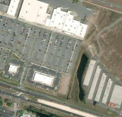
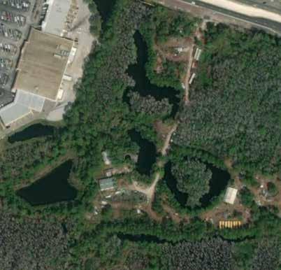


PROPOSED USES


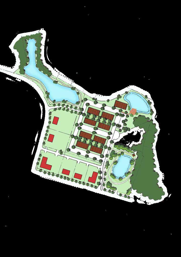
[ ] Multi-Family Residential (3-story)
[ ] Retail


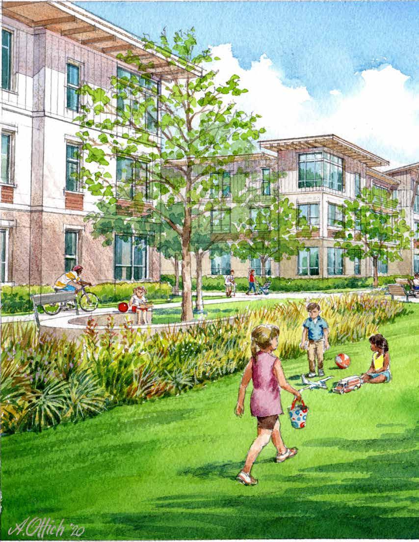
development with interior park space that stormwater management in the form of swales.

Positioned near the I-95 interchange and the burdgeoning Wildlight community, the former Sheriff’s facility is positioned to benefit from its development potential and be an asset that the County could monetize. This plan presents the opportunity for the site to become a place where multiple generations of people will live and play.
Public art can attract residents to a common gathering space to share selfies and moments of respite. Medical offices located in proximity to the assisted living facility will make it more convenient for residents to get the care they need. Commercial fronting on SR200/A1A can be buffered by state-of-the-art LID stormwater features.
Assisted Living Facility: Amelia Island has four Assisted Living Facilities (ALFs), but there are none in the study area, As the retiree population increases, so will the need for ALFs.
Nature and Public Art: Reputable studies show that high exposure to green space, public art, and social gathering places improves quality of care, cognitive function, and mental wellbeing among the disabled and elderly.
Medical Office: Modern medical offices are becoming more like “health malls,” as people are demanding a higher standard of customer-centric healthcare. These modern facilities also lend themselves to a “lifestyle of health,” featuring with gyms, cafes, and walking tracks. Other supporting uses such as urgent-care centers are also being commonly developed. Such a combination of amenities can serve an agglomeration of health services, working off of the other medical facilities emerging in this area.
Several different site configurations were studied within the framework of the market positioning analysis. Financial analysis was conducted for the plan and program to determine the potential return to the County as landowner in terms of residual land value. The market value of each development plan is also provided as a consideration as it relates to potential government tax revenues.
The plan represents a 32,000 square feet of ALF, 138,000 square feet of medical office, and 48,000 square feet of other commercial space on the 18.3-acre site. Hard and soft costs for vertical development, parking, and sitework are estimated at $13,979,200. The estimated market value of the completed project is $20,435,700.
LID landscape buffer - Utilize SR200 buffer for LID stormwater and landscape.
Retail development - Retail frontage opportunities on SR200 - maintain pedestrian orientation.
Open space with public art - Create public space to organize various spaces into coherent development.
Medical office development - Opportunity to build off of expanding medical uses in vicinity of Wildlight community.
Master stormwater pond - Master pond with vegetated edge (see image next page).
Assisted Living Facility - Opportunity for assisted living element in corridor.
Potential Pedestrian/Bike Overpass - Create elevated overpass across SR200 for improved connectivity.
Bioretention Cell - new streets should include LID planters as bulb-outs.
Bioswale - opportunity for swale drainage in parking lots at start of treatment train.
Wet Pond - opportunity for amenitized pond treated as park space.

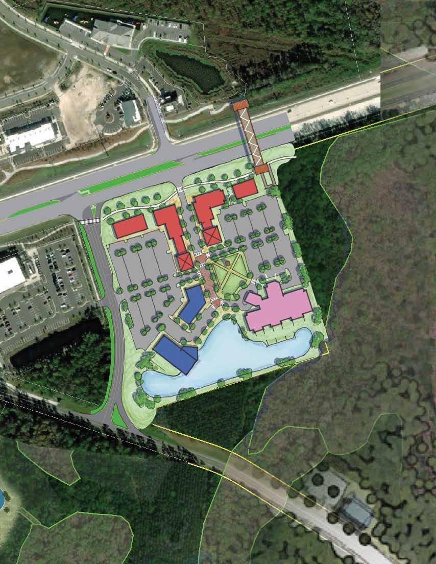

[8] REDEVELOPING SURPLUS COUNTY PROPERTY - OLD SHERIFF’S OFFICE
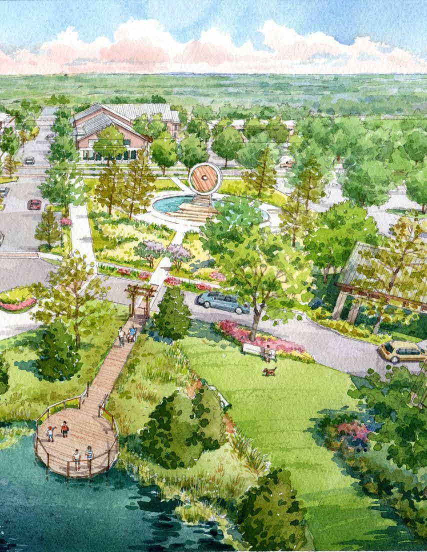
Aerial view of potential medical arts campus development at former Sheriff’s site showing well-organized public realm, areawide low-impact development stormwater management, and architecture reflecting local vernacular style.

As the first chance to define character for visitors to the Corridor, development at the I-95 interchange at SR200/ A1A should set the tone with a new model. This will be the first destination for travelers arriving to Florida. Visitors will stretch their legs at the central green, find food and entertainment, and relax all within a cozy, walkable district.
Future residents of this area will enjoy access to anchor amenities, such as the entertainment and retail outlets. Office floor area can provide space for growing local employment-making it more convenient for residents to live, work, and play within a compact neighborhood.
Anchor Use: A theatre with a signature architectural style can serve as an entertainment centerpiece for the area.
Central Green Organizing Element: A central park framed by mixed-use buildings creates a flexible gathering space for special events or everyday leisure.
Anchor Retail: With broad appeal, an anchor retail user will attract a significant cross-section of the shopping public to the center.
Internal Block Structure: Internal street network, complete with sidewalks and street trees, helps distribute car traffic while providing for walkability throughout the center.
Master Stormwater Plan: Master stormwater system, amenitized with trails and landscaping, helps maximize developable area while creating great outdoor places for recreation.
Several different site configurations were studied within the framework of the market positioning analysis. Financial analysis was conducted for the plan and program to determine the viability of a project of this type gauged by potential return to the developer in terms of residual land value. The market value of each development plan is also provided as a consideration as it relates to potential government tax revenues.
The plan represents approximately 700 multi-family units and 167,000 SF of commercial on 29.7 acres of land, for a gross density of 24.1 units/acre. The units would have a projected rental rate of $1.35/square foot. Non-residential program of approximately 167,000 square feet is also included. Hard and soft costs for vertical development, parking, and sitework are estimated at $120,988,700. The estimated market value of the completed project is $159,389,500.
SR200 trail extension - Opportunity to tie new development at this location to other parts of the corridor, particularly with non-motorized transportation.
Retail development pulled to street - Prominent presence of building and landscape (rather than parking) along street frontage.
Residential over office - Integration of range of uses within the center to create activity throughout the day.
Central green - Public space as organizing element of development. Maintain visibility from SR200.
Theater - Active anchor use to drive visitors to destination.
Anchor retail - Location against I-95 with extension of street grid through to create to finer-grain building pattern.
Mixed-use development - Key site to explore possibility of mixed-uses (ground floor commercial with upper floor residential).
Hudson Drive extension - Extend Hudson Drive to create opportunity for new signalized intersection at SR200.
Internal block structure - Blocks shown are within standards for T-5 block sizes.
Neighborhood park - Public space with neighborhood park elements for community residents (also open to public).
Low-Impact Stormwater Opportunities

Master stormwater chain - Connected system of LowImpact Stormwater treatment.
Bioretention Cell - All new streets should be designed to include stormwater planters in streetscape.
Bioswale - Bioswales through parking lots gather and treat stormwater in a low-impact fashion.
Infiltration Basin (Dry Basin) - Dry stormwater elements can be included in neighborhood park space.
Wet Pond - Large pond with landscaped edges and trail amenity for neighborhood.

Recharge Trench - Option for smaller sites with limited area for stormwater treatment.




[ ] Multi-Family Residential (2-story)
[ ] Multi-Family over Retail (3-story)
[ ] Multi-Family over Office (3-story)

[ ] Retail
[ ] Theater


View of potential development fronting SR200/A1A showing engaging architecture, significant landscaped edge to the roadway, linear trail, and wayfinding/branding signage.

Transect Approach
Developers expect a timely and predictable approval process, and citizens expect that new development will not harm them and will be consistent with the community’s vision. In order to meet these expectations and facilitate the envisioned mixed- and multi-use development in a manner that produces a high-quality public realm, a “Transect Approach” to should be used implement the concepts of the plan. The rural-to-urban transect approach to planning looks at the land uses and built environment to determine what kind of new and infill development is appropriate in general areas. Nassau County is using the
Transect Approach to determine appropriate growth in Nassau County. The figure below shows the spectrum of transects within Nassau County. The transect spectrum depicts the generalized rural-to-urban transition based on eight general transects, ranging from natural preserved area to the urban core. In addition to the general transect zones, a Special District classification is utilized for development that falls outside of the typical transect zones. In the SR200/A1A Corridor, these would include an industrial park category, the Tributary DRI, and the Nassau Wildlife Management Area.


The transect system of spatial and land use organization is also generally known as “form based districts” in which provisions are made for the mixture of uses, building design, density, height, street design, parks, open space, parking, and other similar components of our local environments. While it is the intent of Nassau County to stay true to the traditional spectrum of the transect, Nassau County has slightly augmented the traditional spectrum to fit the local environment. The Nassau County-specific
transects and their application to the SR200/A1A Corridor are shown in the transect map below and further described in the following pages.


This zone consists of lands approximating or reverting to a wilderness condition, such as lands unsuitable for settlement due to topography, hydrology, or vegetation. These areas include known wetlands, National Wetland Inventory (NWI) lands, and wetlands identified by the St. John’s Water Management District (SJRWMD); these may also include lands within the Coastal High Hazard Area (CHHA) and other environmentally sensitive areas.
Comparative Transect Diagram

Example Application in SR200/A1A Corridor
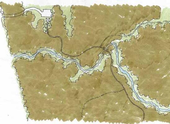
Natural zones support the growth and diversity of flora, fauna, and fungi; enabling ecosystems that provide communities with critical water/air filtration and a host of other benefits.
Extending County services into natural zones to support exurban development is fiscally irresponsible and harms long-term growth. Natural preservation helps assure that ecosystem resources are available for future generations and funds are funneled into more productive investments.
Natural zones are an essential element of community identity and encourages opportunities for recreation and ecotourism. Moreover, exposure to nature is regularly cited as a determinant of physical, mental, and emotional health in humans.
The T-1 Zone will serve as a natural conduit between communities in which people can walk, bike, or paddle their way from place to place.
Natural areas are protective resources that mitigate the impacts of climate change. Sufficient area with natural vegetation reduces inundation on land from major storm events and surges, and provides natural stormwater management.
This zone consists of sparsely settled lands in open or cultivated state. Typical buildings are single family homes, agricultural buildings, or cabins. Planting is generally naturalistic, and setbacks are relatively deep. Typical land uses are single family ranchettes ranging in 5 to 20 acres in size. Typical building height is up to three stories. Cluster subdivisions and other techniques are encouraged, and in some cases mandated, to preserve the rural aesthetic and preserve a rural way of life. The development pattern can easily become suburban in principle if not regulated properly. It is the intent to clearly differentiate the T-2 Zone from the T-2.5 and T-3 Zone.

Application in SR200/A1A Corridor

The T-2 transect is where human settlement directly interfaces with natural areas. Cluster development and large tracts of open space intend to harmonize natural and human habitat.
County services are not always present within T-2 Zones; however, cluster development can rationalize community-based services and help protect natural areas, wetlands, and floodplains.
Many T-2 settlements have existed for many years, and their historic assets define a rural identity unique to the region.
Rural communities are connected via low-impact roadways as well as green- and blueways.
Rural zones may be suitable for future development; in the interim, rural zones provide critical ecosystem services and are potential areas for sustainable agriculture.
This zone consists of low density residential areas between the rural zones and suburban zone. Building sites in these zones are generally 1 to 5 acres, and typical land uses are single family homes, cabins, and villas. Planting is naturalistic and setbacks are relatively deep. Typical building height is up to three stories. This Transect exists as a means to preserve a buffer around the T-2 Rural Zone. By providing designated areas to transition from rural to suburban allows for boundaries to be established and keep T-1.5 to T-2 lands rural and mitigate encroachment of the T-3 Zone into rural areas.
Comparative Transect Diagram
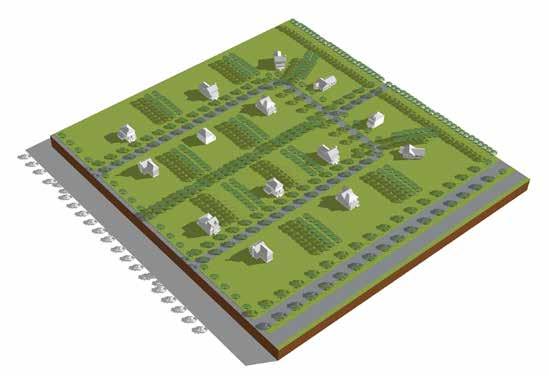

Greater residential densities necessitates the introduction of water-smart practices, increased tree canopy requirements, and master stormwater planning to help offset increased burden on natural areas.
The limited implementation of T-2.5 should ensure that area densities justify the extension of County services, such as water, sewer, police, and fire. Cluster development is a method for rationalizing efficient extension of services, while also protecting natural areas.
Common spaces such as parks should facilitate interaction between neighborhood residents.
Connect Communities Streets and blocks should interconnect, and cul-de-sacs should only occur when surrounded by conservation area on three sides. Pedestrian and bicycle pathways are abundant and designed for safety.
Rural transition areas should still allow for significant wildlife habitat and conserve vital natural resources that protect against major weather events.
This zone consists of low density residential areas ranging from 2 to 5 dwelling units per acre, adjacent to the urban transitional zone. Limited non-residential uses are allowed. Planting is generally structured, and setbacks are relatively shallow. Blocks may be medium in length, and the roads irregular to accommodate natural conditions. Housing types in this zone are typically single family detached homes with some single family attached product. Typical building height is up to three stories. Use of clustering and other similar techniques are required to create a more compact, walkable, and sustainable suburban development pattern.
Comparative Transect Diagram

Application in SR200/A1A Corridor

Minimum impact to tree canopy, tree preservation, and water-smart landscaping can assure that low-density residential development retains wildlife connectivity and water quality.
Suburban development patterns are part of the mixed-housing portfolio that a community should have but it must not be the predominant pattern.
Common spaces such as parks should facilitate interaction between neighborhood residents. Connect Communities Streets and blocks should interconnect, and cul-de-sacs should only occur where surrounding by conservation area on three sides. Pedestrian and bicycle pathways are abundant and designed for safety.
Suburban zones should still allow for significant wildlife habitat and conserve vital natural resource that protect against major weather events.
This zone consists of medium density residential areas ranging from 5 to 10 dwelling units per acre, and a mixture of uses, adjacent to the urban edge. Blocks are generally medium sized to allow for a mixture of residential single family attached/detached product (limited detached product) and multi-family. More robust non-residential uses are allowed in this zone than compared to T-3. Typical building height is up to three stories. Development in this transect shall be compact and walkable, with retail, service, and civic uses/facilities necessary to support day-to-day life of residents without predominant use of the automobile.
Comparative Transect Diagram

Example Application in SR200/A1A Corridor
Nurture Nature
An emphasis on LID practices, including generous tree canopy cover requirements and master stormwater planning mitigate for environmental impact.
The T-3.5 transect zone provides an opportunity for a mix of neighborhoodscale uses that help reduce trips to large communityscale zones.
Human-scale buildings pulled to the street help frame a public realm that emphasizes social infrastructure resources, such as adequate sidewalks, tree canopy, and amenitized stormwater facilities. These elements are conducive for human-to-human interaction.
An internal block structure helps establish logical connections between the corridor and places of business off the corridor.

Buildings relate to each other in ways that allow for new and different development to take shape in the future. For instance, shared parking and common areas lend themselves to a variety of potential uses.
This zone is intended to be a compact mixed-use zone arranged primarily as residential urban fabric. Density is 8 to 15 units per acre. It may have a wide range of building types and a mixture of uses is required. Setbacks and landscaping are variable. Streets with curbs and sidewalks define medium-sized blocks. Typical building height is up to four stories. This transect is the prototypical compact mixed use village center providing for everything necessary to support communal life within walking distance. The development pattern and program shall be as such to support the intent. This is not a primarily residential zone.


An emphasis on LID practices, including generous tree canopy cover requirements and amenitized master/shared stormwater ponds allows for the T-4 to achieve medium densities while also mitigating environmental impact.
The T-4 transect allows for a mix of housing types that support a range of affordable options and mixed-income neighborhoods.
Ample park space adjacent to active residential and/or commercial facades, as well as wide sidewalks, adequate bicycle paths, and other forms of social infrastructure enable cohesive community interactions. Connect Communities
Blocks are compact, connected, and feature speed calming devices such as bulb-outs, so that walkers and bicyclists feel safe and traffic is distributed across a broader network of streets.
The mix of housing types fosters diverse labor markets that can meet the needs of a changing economic environment.
This zone consists of a mixture of uses, but can be primarily non-residential or multifamily. Densities and intensities vary. While generally arranged to accommodate vehicular traffic, application of high-quality urban form and walkability is integral, as this transect serves as the connective tissue between individual urban nodes. Residential density varies from 0 to 18 units an acre. It may have a wide range of building types. Streets with curbs and sidewalks define medium-sized to large blocks. Building heights can reach up to six stories and shall define the street edge. The first floor of all buildings shall engage the public realm in a meaningful way.
Comparative Transect Diagram

Within the SR200/A1A Corridor, T-4.5 is generally applied in areas constrained by barriers such as railways.
Example Application in SR200/A1A Corridor
An emphasis on LID practices, including generous tree canopy cover requirements and master stormwater planning allow for the T-4.5 transect to introduce commercial uses while also mitigating environmental impact.
The T-4.5 transect helps make sensible use of geographically constrained sites along the corridor.
Although the T-4.5 transect allows for greater automobile access, its public realm design will ensure social infrastructure resources, such as adequate sidewalks and tree canopy are conducive for human-tohuman interaction.

An internal block structure helps establish logical connections between the corridor and places of business off the corridor.
Buildings relate to each other in ways that allow for new and different development to take shape in the future. For instance, shared parking and common areas lend themselves to a variety of potential uses. Master stormwater systems help maximize the developable potential of land while mitigating potential flooding from major storm events.
This zone consists of higher density, mixed-use buildings that accommodate retail, office, and residential uses. It has a tight network of streets, with wide sidewalks, steady street tree planting, and buildings set close to the sidewalks. It has shallow to no setbacks, and building heights can reach six stories. Densities range from 10 to 25 units per acre. The first floor of all buildings shall engage the public realm in a meaningful way.

Natural zones support the growth and diversity of flora, fauna, and fungi, enabling ecosystems that provide communities with critical water/air filtration and a host of other benefits.
patterns, characterized by compact, walkable places with a mix of uses are more fiscally beneficial than conventional suburban developments that are spread out and auto-dependent.
From dense, diverse, and transit-connected communities emerge public life qualities that reflect human innovation, artistic expression, and social interaction-the ingredients of culture. Civic and gathering spaces within T-5 should substantially contribute to cultural life.

The T-5 transect will enable greater walkability, bikeability, and transit accessibility, which will strengthen connections between and across communities.
Dense, mixed-use developments designed to celebrate public life have a greater propensity to grow employment opportunities, support public transit, promote attainable housing, and offset carbon emissions.
Implementing the key ideas of the plan requires detailed development guidance, goals, and policies within specific areas. These specific area policies are recommended to be included in the transect-based land development code in order to provide developers and decisionmakers guidance on what is expected at time of development or redevelopment. They should be required in addition to the design standards specified within the ultimate code. The guidance should include recommended transect zone designations and suggested mobility and connectivity improvements, consistent with the intent of the Corridor Master Plan.
The specific-area policies depict a conceptual roadway network throughout the SR200/A1A Corridor, intended to enhance connectivity. While the network roads’ exact locations may deviate from what is shown to meet the ultimate design configuration of site redevelopments, the intent of creating a comprehensive connected network should always be maintained.
The legend to the right indicates which streets correspond to a street type, and whether the street is part of the public mobility network.
Mobility Network Roads/Trails, highlighted blue, are conceived to be publicly owned and maintained facilities that are considered particularly critical to the connectivity and mobility of the SR200/A1A Corridor and advance the Vision and Planning Priorities in this Master Plan.
Development and redevelopment of streets are intended to meet the minimum requirements of the specified street type (see suggested cross-section details at the end of this chapter).

Mobility Network Road/Trail
BLVD Type A
BLVD Type B
Main Street Type A
Main Street Type B
Main Street Type C
Neighborhood Street
Rural Road
[ ] T-1 Natural Zone
[ ] T-2 Rural Zone
[ ] T-2.5 Rural Transitional Zone
[ ] T-3 Suburban Zone
[ ] T-3.5 Urban Transitional Zone
[ ] T-4 Urban Edge/Urban General Zone
[ ] T-4.5 Urban Corridor Zone
[ ] T-5 Urban Center
[ ] T-7.3 Industrial Park
[ ] T-7.4 Three Rivers DRI
[ ] T-7.5 Nassau Wildlife Management Area

1. SR200 Off-Street Trail. An off-street trail with a minimum width of 10 feet must extend along the north side of SR200 to provide multi-modal connectivity throughout the corridor.
2. Underground Utilities. All utility systems located along SR200 must be installed underground. Aboveground utility systems will not be permitted, except where certain appurtenances and accessories must be installed above-ground for servicing public right-ofway.
3. Intersection Improvements. The intersection of SR200 and Edwards Road must be signalized prior to Certificate of Occupancy for the first adjacent building. Intersection improvements must also included for enhanced bike/pedestrian amenities.
4. Street Connection. A street connection, designed to meet public street standards, must be provided between Timbercreek Boulevard and Edwards Road, parallel to SR200. Main Street Type B section required (see Section 4.9.7.3).
5. Edwards Road Extension. Edwards Road must extend north as specified in the 2045 Long Range Transportation Plan.
6. Heritage Trail Marker. Area opportunity to recognize Nassau County history related to former Italia/Hero communities.
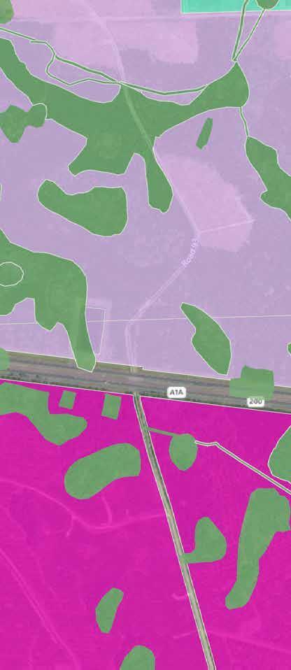
Figure 13: Four Creeks Recommended Transects, Connectivity,

1. SR200 Off-Street Trail. An off-street trail with a minimum width of 10 feet must extend along the north side of SR200 to provide multi-modal connectivity throughout the corridor.
2. Underground Utilities. All utility systems located along SR200 must be installed underground. Aboveground utility systems will not be permitted, except where certain appurtenances and accessories must be installed above-ground for servicing public right-ofway.
3. Hudson Drive Realignment. Provide road connection (Main Street Type B) between intersection at Wildwood/SR200 and Johnson Lake Road (also known as Semper Fi Drive).
4. Semper Fi Drive Extension North. Extend Semper Fi Drive to north side of SR200. Provide Main Street Type C section for entire length of Semper Fi Drive within the Overlay District.
5. Northwest Internal Block Network. Provide internal block structure and cross access within T-5 area north of SR200. Main Street Type B section required.
6. Southeast Internal Block Network. Provide internal block structure and cross access within T-5 area south of SR200. Neighborhood Street section required.
7. Northeast Internal Block Network. Provide internal block structure and cross access within T-5 area north of SR200. Main Street Type B section required.
8. Main Street C Extension North. Provide northsouth Main Street Type C and off-street path connecting to SR200 Off-Street Trail.
9. Heritage Trail Marker. Area opportunity to recognize Nassau County history related to Mid-Century Florida Tourism.
10. Heritage Trail Marker. Area opportunity to recognize Nassau County history related to former Piney Community/Turpentine History.


1. SR200 Off-Street Trail. An off-street trail with a minimum width of 10 feet must extend along the north side of SR200 to provide multi-modal connectivity throughout the corridor.
2. Underground Utilities. All utility systems located along SR200 must be installed underground. Aboveground utility systems will not be permitted, except where certain appurtenances and accessories must be installed above-ground for servicing public right-of-way.
3. New Koen Lane. Realign Koen Lane connection between Pages Dairy Road and US 17 to improve development viability and site assembly within catalyst site (Neighborhood Street Type). Extend trail along west side of street to connect to SR200 Off-Street Trail.
4. Pages Dairy Street/Trail Connection. A new street with a parallel off-street trail and a minimum width of 10 feet must provide connectivity between SR200 and Pages Dairy Road to support multi-modal connectivity throughout the corridor.
5. New Pages Dairy Road and Trail. Extend Pages Dairy Road west and south, perpendicular to Goodbread Road and US 17 with trail connection (Neighborhood Street Type).
6. West Koen Street. Retain right-of-way along West Koen Street. Street type not specified.
7. Cross Access. Provide internal cross-access between properties.
8. Left Turn Prohibited. Left-turn movements prohibited at intersection of Pages Dairy Road and US 17.
9. Internal Grid. Establish internal street grid that enables future cross access between Jones Road, Palmetto Lane, Palmetto Street, and Pages Dairy Road.
10. Palmetto Extension. Extend Palmetto Street to Britt Lynn Lane (section not specified).
11. Internal Cross Access. Provide cross-access, parallel to SR200, connecting to Shoppes at Midtown site with Brannan Way.
12. Pinewood Drive Extension. Extend Pinewood Drive south, parallel with US 17 (Main Street Type B).
13. East-West Road. Provide east-west connection between US 17 and Pinewood Drive (Main Street Type B).
14. Enhanced Existing Pinewood Drive. Enhance the existing segment of Pinewood Drive with multi-use trail as redevelopment happens (Neighborhood Street Type).
15. Internal Street Network. Provide connected block structure.
Figure 15: Historic Yulee Recommended Transects, Connectivity,
16. Pages Dairy South Connection. Extend Pages Dairy south of SR200, connecting with Sowell Road (Main Street Type B).
17. Heritage Trail Marker. Area opportunity to recognize Nassau County history related to Muir Park/Walk Across Florida.
18. Heritage Trail Marker. Area opportunity to recognize Nassau County history related to Old Yulee/Hart’s Road/Railroad History.
19. Heritage Trail Marker. Area opportunity to recognize Nassau County history related to Yulee School History


1. John Goodbread Redevelopment. Redevelopment must meet minimum block size standards described in applicable Transect standards.
2. Neighborhood Protection. Non-residential uses must not be permitted to expand north or east beyond Goodbread Road.
3. Relief from Bufferyards. Commercial constrained by shallow depths allowed reduction in landscape buffer requirements along US 17.
4. Trail Extension. Extend multi-use trail along Goodbread Road. Minimum 10 foot width required. Mobility Network Road/Trail BLVD Type A

Figure 16: Northern Yulee Recommended Transects, Connectivity,

1. SR200 Off-Street Trail. An off-street trail with a minimum width of 10 feet must extend along the north side of SR200 to provide multi-modal connectivity throughout the corridor.
2. Underground Utilities. All utility systems located along SR200 must be installed underground. Aboveground utility systems will not be permitted, except where certain appurtenances and accessories must be installed above-ground for servicing public right-of-way.
3. Yanie Road Extension. Extend Yanie Road north to eventually provide connection with John Street, Clyde Street, and Robert Street (no street type specified).
4. Felmor Road Enhancement. As redevelopment occurs, Felmor Road must be redesigned to accommodate a multi-use trail (with a minimum width of 10 feet) connecting SR200 to Pages Dairy Road. Enhanced crossings are required at Williams Ave intersection.
5. New Williams Avenue East-West Road. As development occurs, Williams Avenue must extend east and west to enhance connectivity off of SR200 (Neighborhood Street Type).
6. Weldon Road Extension. Provide cross-access extension along Weldon Road between Harry Green Road and Felmor Road.
7. Di Charia Street Cross-Access. Provide cross-access parallel to SR200, aligning with Di Charia Street.
8. St Peter Boulevard East-West Road. Provide cross-access connection, parallel to SR200, between Santa Barbara Street and Lofton Creek Campground (Neighborhood Street Type).
9. Kutana Drive Improvements and Extension. Improve Kutana Drive and establish connection with Miner Road.
10. Heritage Trail Marker. Area opportunity to recognize Nassau County history related to Bryant Academy/ African American Education.


1. SR200 Off-Street Trail. An off-street trail with a minimum width of 10 feet must extend along the north side of SR200 to provide multi-modal connectivity throughout the corridor.
2. Underground Utilities. All utility systems located along SR200 must be installed underground. Aboveground utility systems will not be permitted, except where certain appurtenances and accessories must be installed above-ground for servicing public right-of-way.
3. Cross-Access. Provide cross-access, parallel to SR200, between Meadowfield Bluffs Road and Christian Way.
4. Manage Access on SR200. Access to sites is required from rear driveways and/or streets in order to avoid excessive conflict points along SR200 trail.
5. Block Network. Provide street network, subject to minimum block size requirements, between License Road and Amelia Concourse. Intersections along SR200 must align with access points on the north side of SR200.
6. Block Network. Provide internal vehicle network between SR200 and Courtney Isles Way, providing for walkability with complete sidewalk and planting.
7. Block Network. Provide internal vehicle network between SR200 and Courtney Isles Way, with connections to Pages Dairy Rd. Vehicle network must be designed to public street standards.
8. North-South Trail Extension. Extend multi-use trail north and south from SR200, connecting Pages Dairy Road with Amelia Concourse. Provide enhanced bike/ pedestrian crossings at railroad and SR200.
9. LID Improvements. Incorporate amenitized LID treatments as surrounding properties redevelop.
10. Heritage Trail Marker. Area opportunity to recognize Nassau County history related to Chester Community.
11. Pages Dairy Road. Extend to Black Rock per FTMS.

Figure 18: Tradeplex Recommended Transects, Connectivity,

1. SR200 Off-Street Trail. An off-street trail with a minimum width of 10 feet must extend along the north side of SR200 to provide multi-modal connectivity throughout the corridor.
2. Underground Utilities. All utility systems located along SR200 must be installed underground. Aboveground utility systems will not be permitted, except where certain appurtenances and accessories must be installed above-ground for servicing public right-of-way.
3. Chester Road Trail Extension. Extend multi-use trail north along Chester Road from SR200 Trail with enhanced crossing amenities at the railroad. Trail width must be a minimum of 10 feet.
4. Cross Access. Internal block structure required to provide cross access (Main Street Type B).
5. Cross Access. Internal block structure required to provide cross access (Main Street Type A & B).
6. Master Stormwater System. Redevelopment site must share master stormwater system
7. Cross Access. Internal block structure required to provide cross access (no street type specified).
8. Cross Access. Internal cross access required.
9. Blackrock Road Neighborhood to Rural Street. Extend multi-use trail north along west side of Blackrock Road from SR200 Trail with enhanced crossing at the railroad. Trail width must be a minimum of 10-feet (Neighborhood Street Type transition into Rural Street Type).
10. Arrigo Blvd-Mt Zion Loop Block Network. Establish block network with connectivity with residential to the south
11. Baker-Prince Connection. Connect Baker Dr and N Prince Dr.
12. S Prince Extension. Extend S Prince Dr to connect with Mt Zion Loop.
13. Pages Dairy Road. Extend to Chester per FTMS.

19: Nassau Center Recommended Transects, Connectivity,

1. SR200 Off-Street Trail. An off-street trail with a minimum width of 10 feet must extend along the north side of SR200 to provide multi-modal connectivity throughout the corridor.
2. Underground Utilities. All utility systems located along SR200 must be installed underground. Aboveground utility systems will not be permitted, except where certain appurtenances and accessories must be installed above-ground for servicing public right-of-way.
3. Barnwell Road Trail Extension. Extend multi-use trail north along Barnwell Road from SR200 Trail with enhanced crossing amenities at the railroad. Trail width must be a minimum of 10 feet.
4. O’Neil Scott Road Trail Extension. Extend multi-use trail north along O’Neil Scott Road from SR200 Trail with enhanced crossing amenities at the railroad. Trail width must be a minimum of 10 feet.
5. Preferred Access along Pine Grove. Pine Grove Road is the preferred cross access road to properties along SR200.
6. Cross Access along Railroad. Provide cross access along railroad with no access along SR200 to avoid conflicts with SR200 Trail.
7. Heritage Trail Marker. Area opportunity to recognize Nassau County history related to African American churches.
8. Heritage Trail Marker. Area opportunity to recognize Nassau County history related to New Hope (Nueva Esperanza) Plantation.
9. Heritage Trail Marker. Area opportunity to recognize Nassau County history related O’Neil/Nassauville African American history.
10. Heritage Trail Marker. Area opportunity to recognize Nassau County history related Goffinsville/Mercantile history.

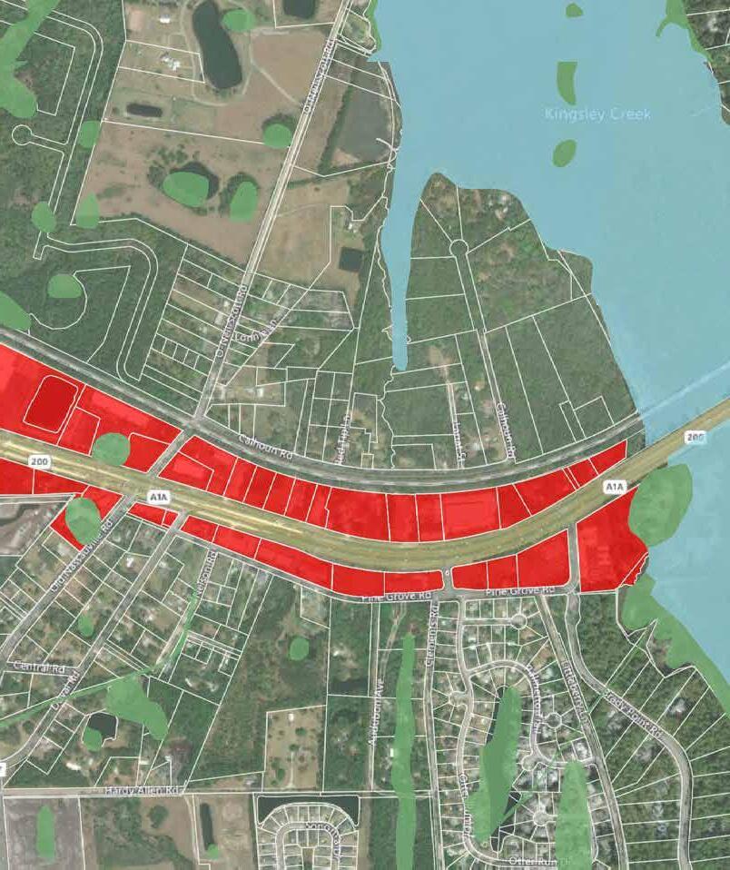
1. SR200 Off-Street Trail. An off-street trail with a minimum width of 10 feet must extend along the north side of SR200 to provide multi-modal connectivity throughout the corridor.
2. Underground Utilities. All utility systems located along SR200 must be installed underground. Aboveground utility systems will not be permitted, except where certain appurtenances and accessories must be installed above-ground for servicing public right-of-way.
3. Cross-Access. Provide cross access from Marsh Lakes Drive to Piney Island Drive south of SR200 with no access along SR200.
Figure


General
Thoroughfare type Boulevard Movement Free movement
Vehicular design speed 35 MPH
Traffic lanes 4 lanes
Transportation provision Shared lane
Walkway type Multi-use path
Planting type Planting strip/Tree wells
Tree spacing 30 ft o.c. average
Frontage type Terrace, Forecourt, Stoop, Shopfront
Width
A. Right-of-way width
B. Pavement width
Streetscape C. Multi-use trail (min)
Travelway
Travel lane
Median/Two-way turn lane
Curb and gutter

General
Thoroughfare type Boulevard
Movement Free movement
Vehicular design speed 35 MPH
Traffic lanes 2 lanes
Parking lane Parallel, both sides
Transportation provision Shared lane
Walkway type Multi-use path
Planting type Planting strip/Tree wells
Tree spacing 30 ft o.c. average
Frontage type Terrace, Forecourt, Stoop, Shopfront, Gallery, Arcade Width
Median/Two-way turn lane
Parking lane (and curb & gutter)

General
Thoroughfare type Main Street
Movement Slow
Vehicular design speed 25 MPH
Traffic lanes 2 lanes
Parking lanes Angle-In
Transportation provision Shared lane
Walkway type Multi-use path
Planting type Planting strip/Tree wells
Tree spacing 30 ft o.c. average
Frontage type Terrace, Forecourt, Stoop, Shopfront Width
Pavement
Streetscape
Multi-use trail (min)
Travel lane
Parking lane
Curb and gutter

General
Thoroughfare type Main Street
Movement Slow
Vehicular design speed 25 MPH
Traffic lanes 2 lanes
Parking lane Parallel, both sides
Transportation provision Shared lanes
Walkway type Multi-use path, both sides
Planting type Planting strip/Tree wells
Tree spacing 30 ft o.c. average
Frontage type Terrace, Forecourt, Stoop, Shopfront, Gallery Width
Right-of-way width
Streetscape
Travelway
Main Street Type C

General
Thoroughfare type Main Street
Movement Slow
Vehicular design speed 25 MPH
Traffic lanes 2 lanes
Parking lanes Occasionally
Transportation provision Shared lane
Walkway type Multi-use path
Planting type Planting strip/Tree wells
Tree spacing 30 ft o.c. average
Frontage type Common Yard, Porch & Fence, Terrace Width
Right-of-way width
Travelway

General
Thoroughfare type Street
Movement Yield
Vehicular design speed 20 MPH
Traffic lanes 2 lanes
Parking lane
One side with approval by County Engineer
Transportation provision Shared lanes
Walkway type
Sidewalk one side, multi-use path one side
Planting type Planting strip
Tree spacing
Frontage type
30 ft o.c. average
Common yard, porch & fence, terrace
Streetscape

General
Thoroughfare type Road
Movement Free movement
Vehicular design speed 25 MPH
Traffic lanes 2 lanes
Parking lanes None
Transportation provision Shoulders
Walkway type Multi-use path, one side
Planting type Landscape strip
Tree spacing 30 ft o.c. average
Frontage type Common Yard, Porch & Fence, Terrace


PROGRAMS, POLICIES, AND PUBLIC IMPROVEMENTS: GETTING STARTED
[1] Nurture Nature
[2] Grow Sustainably
[3] Connect Communities
[4] Catalyze Culture
[5] Future Proof
A key premise of the Plan is that public sector actions will drive private sector development responses. This is often seen when the State or County invests in roadway improvements and developers respond by building new businesses or homes that take advantage of the public investment. The Master Plan lays out many potential public actions and investments as well as the County’s desired community form in the Corridor so that new development leveraged by these investments fits the preferred vision for the future. This section defines a recommended set of these actions and investments for the County to pursue.
The County can play several roles in redevelopment of the corridor. At a basic level, it can modify regulations like zoning to achieve redevelopment goals. In certain cases, it can make infrastructure improvements where individual private owners acting as individuals may not be able to act. It can develop new policies to influence development of a certain type. In some cases, the County can also act as a catalytic developer where land and circumstances allow. This role as developer is key to “moving the needle” in the SR200/A1A corridor because the County owns three highprofile sites in key locations.
1 Adopt a transect-based land development code for the Corridor. Code includes requirement to underground utility lines along SR200/A1A with pay-in-lieu program for small sites.
2 Working with FDOT, develop corridor-wide master plan for east-west multi-use trail, spanning the extent of the Timber to Tides Trail. Develop interim guidance for consistent trail sections outside of SR200/A1A right of way to be required of new development.
3 Working with the School Board, develop a concept level master plan for the entire Yulee Junior High School site. As part of this plan, identify combined master stormwater facility and park space to be developed as a public amenity and serve as incentive for other private investment.
4 Develop corridor-wide branding and signage initiative for gateway and corridor wayfinding.
NN-1, NN-2, NN3, NN-5, NN-8, GS-2, GS-3, GS-4, GS-5, CN-1, CN-4, CN-5, CN-6, CN8, CU-2, CU-4, FP-1
CN-2, CN-3
Policy/regulatory modification; no public cost
Encourage private sector review of code
Potential budget:
$250,000-$500,000 for comprehensive study
CU-3, GS-6
5 Seek developer for Old Sheriff’s Office site. GS-6
6 Seek developer for Admin Center as uses currently on that site transition to new complex. GS-6
Stormwater/park potential budget:
$4,000,000-$6,000,000
School Board
Seek Developer (consider RFP for developer)
Potential budget: $1,000,000
Varies depending on deal structure Developer
Varies depending on deal structure Developer
The work necessary to advance the plan must occur on multiple fronts. The plan is a guide for the future. It describes the important shared community values, which should form the basis for future planning and development decisions. The structure of the plan is intended to allow the County to be agile enough to meet changing development conditions while holding true to the important tenets of the plan.
The 10 Targeted Actions are examples of ways to advance the Vision, but they should not be interpreted as the only ways to advance the Vision. Therefore, the actions listed below are longer term moves toward the Vision. As time passes, new opportunities will arise and contexts will change-the actions should always be evaluated for their potential impact and continued relevance to advancing the Vision and Planning Priorities.
Maintain, enhance, and extend the natural environment by creating opportunities for residents to access and enjoy Florida’s unique wilderness.
NN-1 Require water efficient landscaping
NN-2 Require minimum tree canopy cover and tree preservation standards
NN-3 Establish vegetation protection areas (such as the T-1 zone)
NN-4 Enhance environmental wayfinding with “nature-inspired” signage
o Nassau County, St. Johns River Water Management District
County
o o Nassau County, Private property owners
o Nassau County, FDEP, Florida DACS, John Muir Ecological Park
NN-5 Provide “pocket-parks” or small park spaces along sidewalks and bike paths With Development o Private developers
NN-6 Encourage solar-ready construction
NN-7 Provide incentives for “green roof” construction. Examples may include reduced area required for development open space, increased density allowances, or impact fee credits/ reduction.
NN-8 Require underground utility lines to allow unobstructed views of natural areas
NN-9 Provide incentives for retrofitting historic structures for energy and water efficiency
Nassau County, National Renewable Energy Laboratory, Florida Power & Light
Nassau County, FDOT, Florida Power & Light
Nassau County, West Nassau Historical Society, Private solar/water businesses
NN-10 Connect stormwater facilities with nature/ bicycle paths With Development o o Private developers
NN-11 Connect bike paths to “blueways” such as Lofton Creek, Lanceford Creek, and Plummer Creek Medium o Nassau County, Local outdoor recreation businesses
NN-12 Provide funding in budget for program to acquire parcels along SR200 with the desired outcome of providing strategic viewsheds and preserving natural areas
Help stage vibrant center and neighborhood growth through development that creates places for people, supports local businesses, encourages an active lifestyle, and comprises a mix of housing options.
GS-1 Encourage developers to build a wide variety of residential unit sizes
GS-2 Eliminate or reduce minimum off-street parking count requirements
GS-3 Allow accessory dwelling unit and live/work unit development
GS-4 Allow greater density/intensity near activity centers and anchor institutions such as hospitals
GS-5 Reduce minimum lot and dwelling size as well as setback requirements
GS-6 Utilize County assets as catalytic development sites
County, Private development community
Nassau County
Nassau County, Private property owners
Nassau County, Private development community
County
Improve linkages between neighborhoods, centers, and amenities through a network of slow, safe, and livable primary and secondary streets, trails, bike paths, and pedestrian infrastructure.
CN-1 Establish maximum block sizes and/or provide mid-block pedestrian crossings
CN-2 Provide “SR200” multi-use trail, spanning the extent of the Timber to Tides Trail
CN-3 Widen sidewalk to provide bicycle connectivity between SR200 trail and neighborhoods north of railway and south of SR200 (Miner Rd, Chester Road, Blackrock Road)
CN-4 Ensure that bike and pedestrian paths, including crosswalks, have adequate lighting
CN-5 Require pedestrian connectivity between development sites and districts
CN-6 Limit the number and location of drivethrough uses
CN-7 Provide spaces for respite and protection from weather conditions along bicycle/walking paths
CN-8 Require a greater allocation of space for pedestrians within public right-of-way
With Development
County
County, FDOT
County, Private development community
Nassau County
Nassau County
County, Private development community
County, Private development community
Build from old and establish new cultural assets that celebrate community creativity and identity through the public realm.
Potential Action
CU-1 Require developers to acquire and publicly display artwork as part of their development program Short o Nassau County, Private development community
CU-2 Eliminate or reduce minimum off-street parking count requirements Short o o Nassau County, Private property owners
CU-3 Renovate Yulee Junior High School to include floor area for artisan/maker space, commercial kitchens, etc.
CU-4 Allow for artisan and small-scale manufacture uses within mixed-use zones
o Nassau County, School Board
o o Nassau County, Private development community
CU-5 Provide cultural “breadcrumbs” (such as signage and public art) along US 17, SR200, and at the I-95 Gateway that celebrates the Gullah Geechee Cultural Heritage Corridor Medium o Nassau County, Gullah Geechee Cultural Heritage Corridor Commission
Prepare for a future by looking ahead to build a resilient community in the face of growing climate concern and technological advancements.
Potential Action
FP-1 Reduce or remove exclusionary land use policies such as minimum dwelling/lot sizes
o Nassau County
FP-2 Encourage and support entrepreneurship through incubator development Medium o Nassau County
FP-3 Create a “resilience plan” outlining opportunities for distributed energy generation, localized food production, and greater utilization of green infrastructure Medium o Nassau County
FP-4 Consider pilot for autonomous vehicle mobility solutions between activity centers Long o Nassau County, FDOT


