JANUARY 2024


JANUARY 2024
Prepared for:
Prepared by:
GAI Consultants, Inc. 618 East South Street, Suite 700 Orlando, Florida 32801 (407) 423-8398
GAI Contact: Blake Drury, Director, Planning + Urban Design B.Drury@GAIConsultants.com
Portion of Action Plan Area outside any CRA
Portion of Action Plan Area within the Midtown CRA
CRESCENT HEIGHTS NEIGHBORHOOD
WESTGATE-CENTRAL NEIGHBORHOOD
Portion of Action Plan Area within the Dixieland CRA
Portion of Action Plan Area within the Midtown CRA
Portion of Action Plan Area within the Downtown CRA
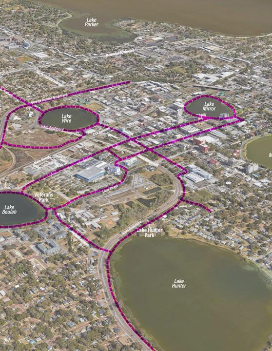
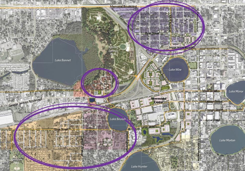
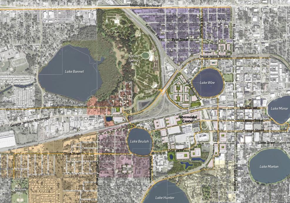
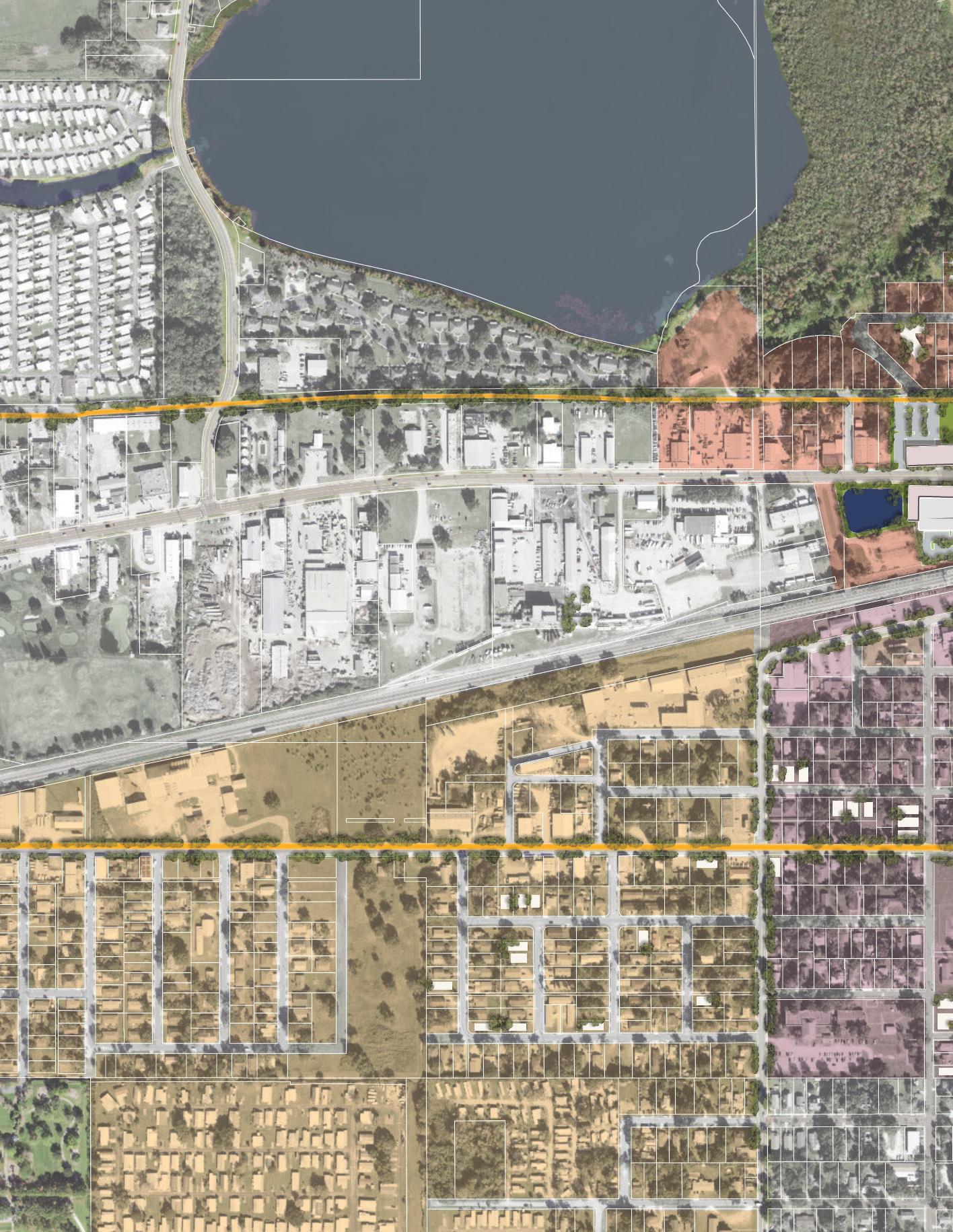
Downtown West historically has not been a defined geographic area within the City of Lakeland, although it encompasses several distinct neighborhoods, three Community Redevelopment Areas, four larger Sector Plan Areas, and serves as a gateway to the central city. The area is also separated by major transportation facilities and these along with other physical attributes have resulted in the development of fragmented plans for the area rather than a unified approach to advance opportunities and overcome challenges. More recently, significant developments and planned infrastructure improvements have drawn attention to the area as a logical extension of downtown. This Action Plan sets out a unified vision for Downtown West and specific actions to integrate infrastructure, access, and land use.
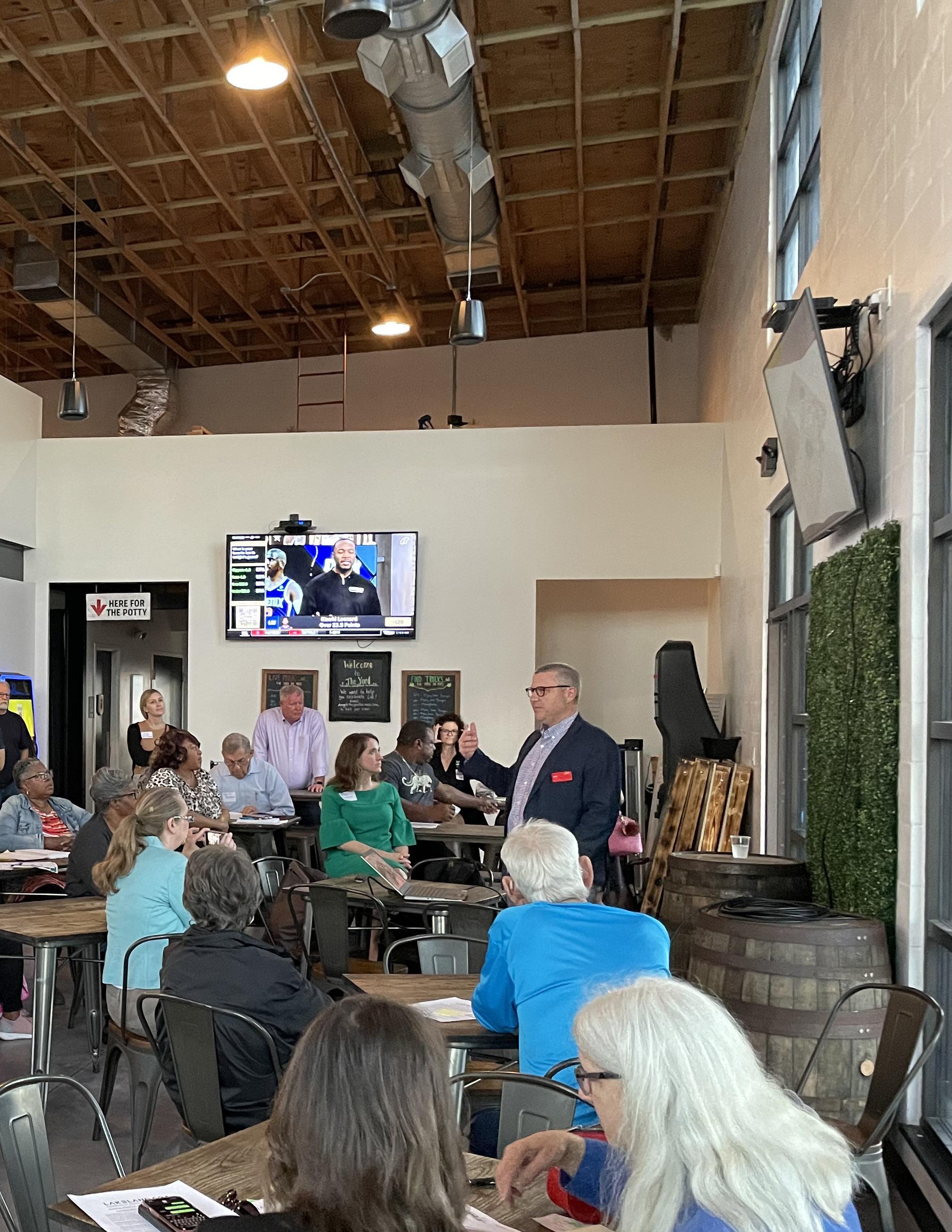
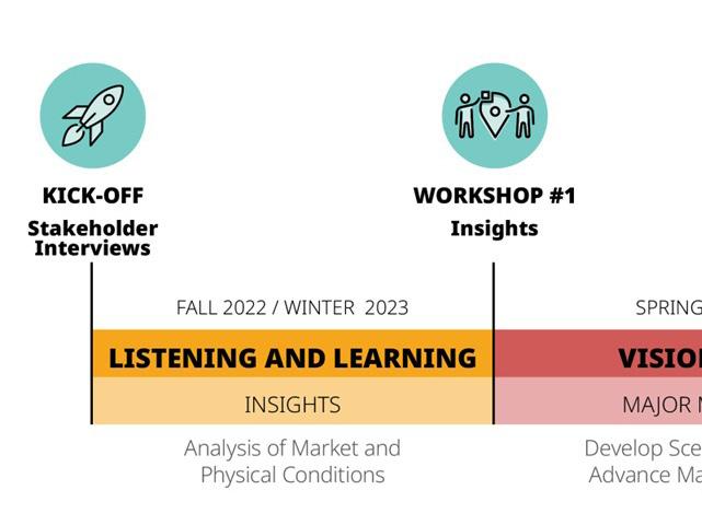
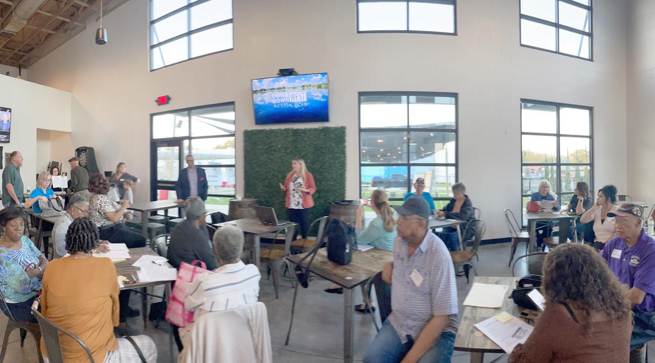
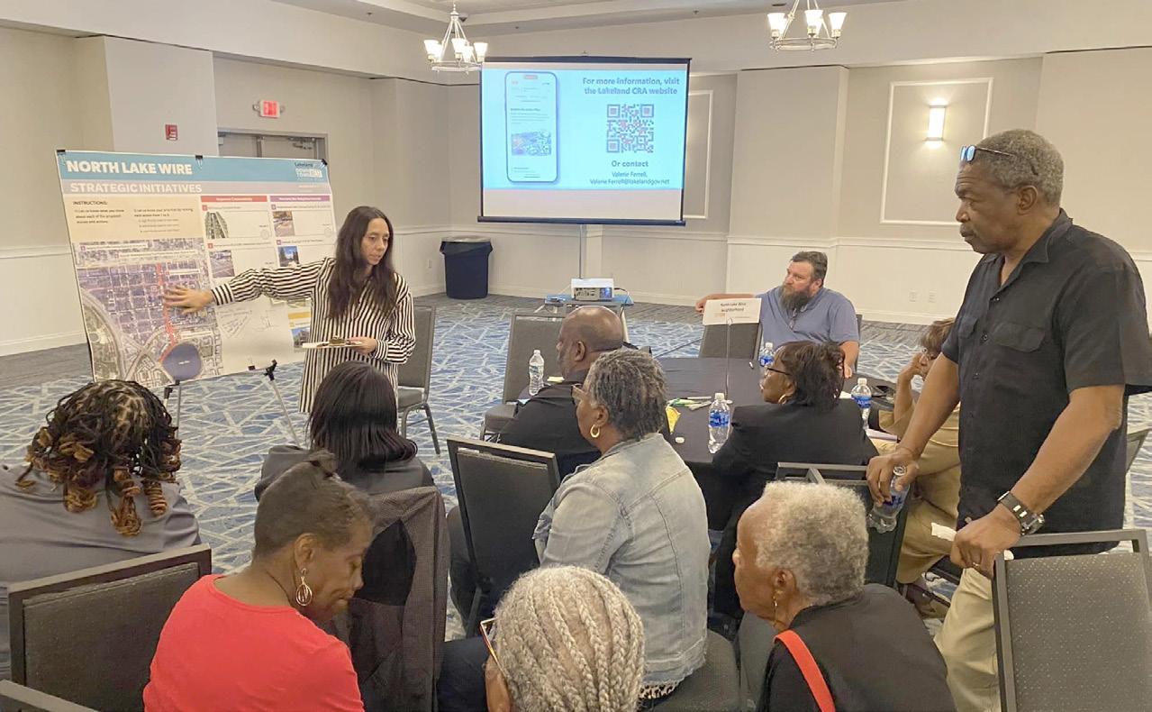
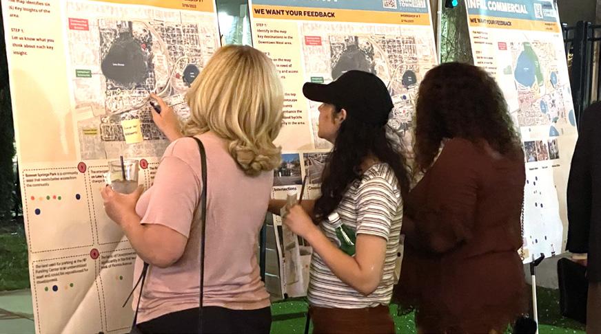
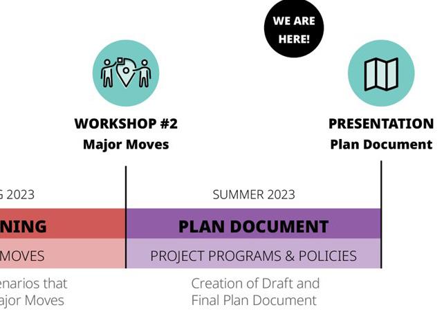
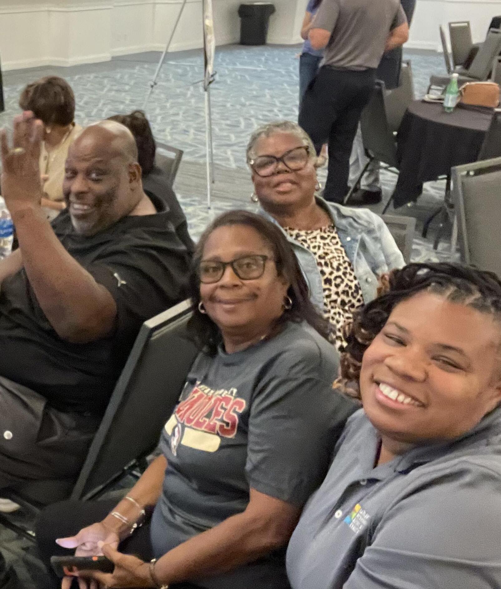
The Action Plan reflects the aspirations of residents, neighborhood leaders, business owners, and the City of Lakeland in re-creating a thriving environment that connects neighborhoods and community assets. Through stakeholder group meetings and field work (Section 1 - Listening and Learning), the planning team spent time in Downtown West, conducting interviews, photo documenting, and creating maps to establish the community’s hope for the future of the area (Section 2 - Shared Vision). This includes both short- and long-term initiatives for the future of Downtown West (Section 3 - Major Moves). It provides a clear set of strategies (Section 4 - Strategic Initiatives) to guide decision making and recommendations for budgeting (Section 5 - Action Framework).
The plan was made together with residents, community leaders, and the City’s professional staff. The planning team spent time in Downtown West, talking to people, taking pictures, making maps, and, most importantly, listening to what the community had to say about their neighborhood and what they hope for its future. This plan includes ideas for what Downtown West could be like in the near and far-off future. It gives a clear set of ideas to help make decisions about how the community should grow and change. It also talks about how to put these ideas into action and how to pay for them.

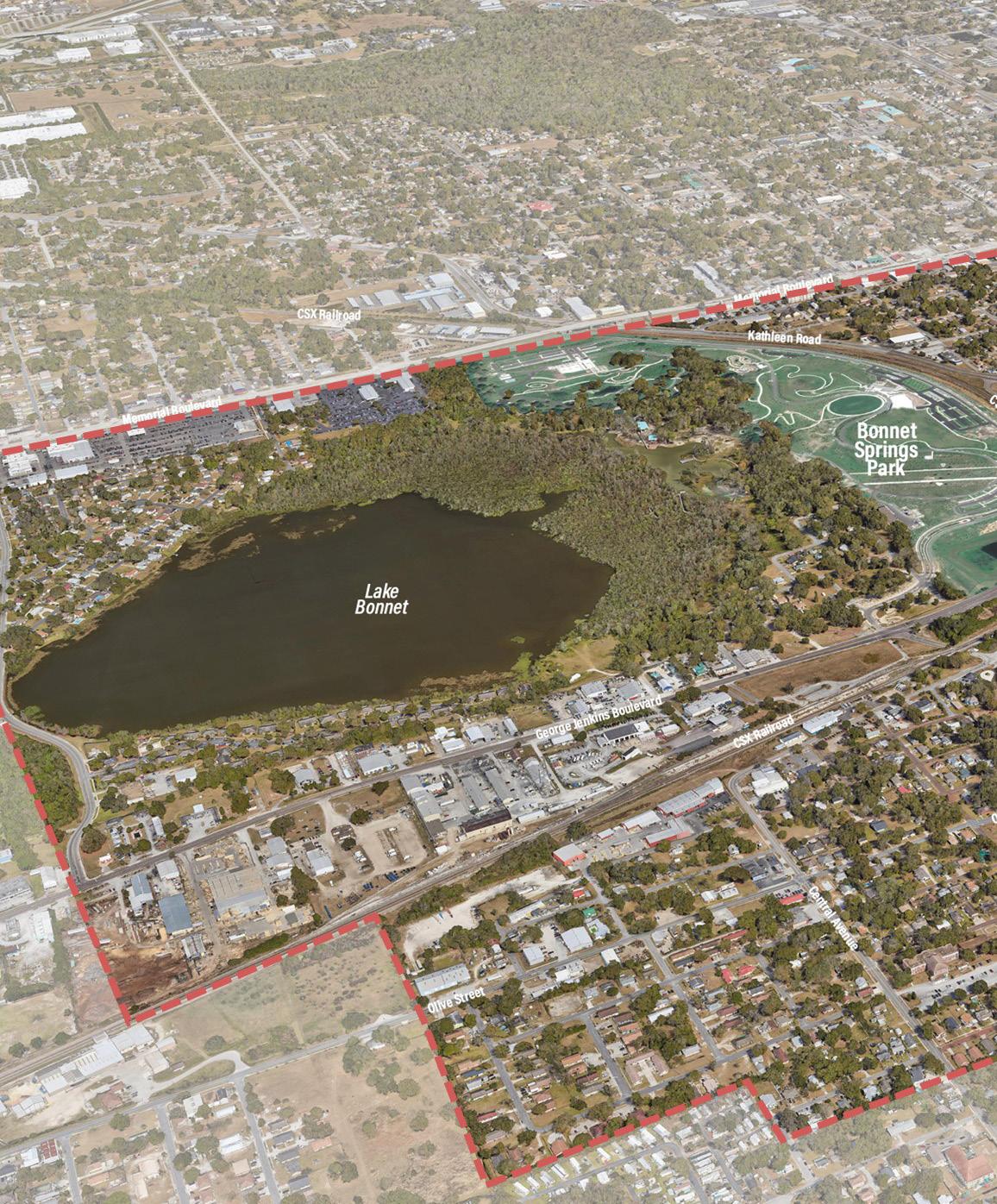
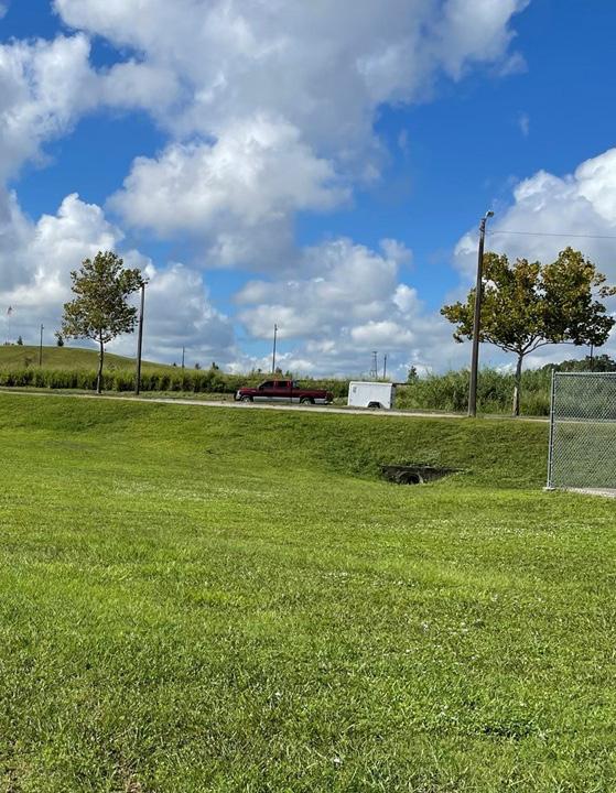
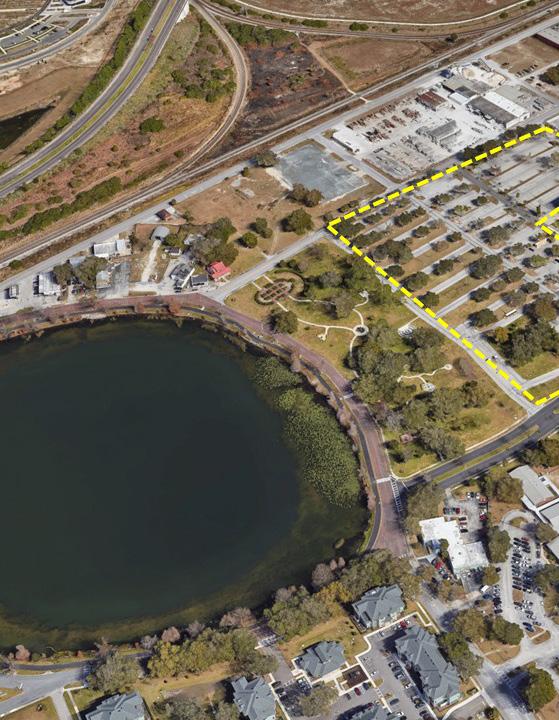
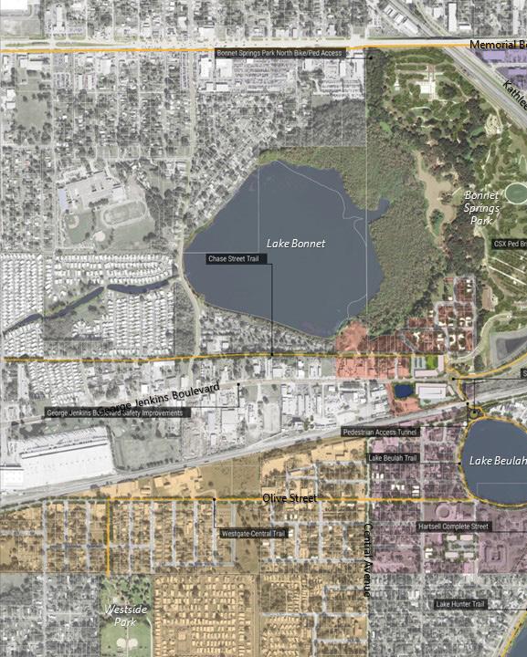
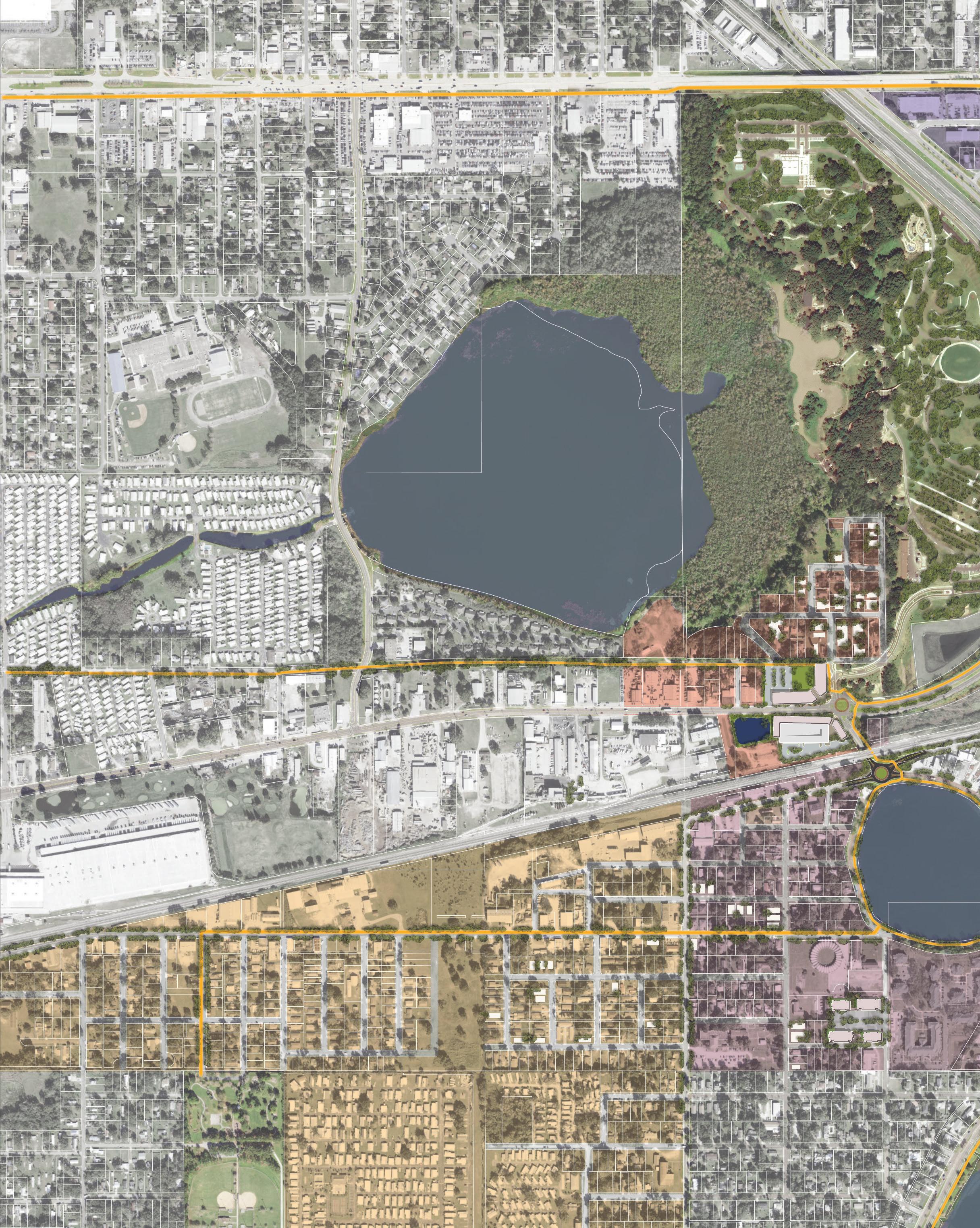
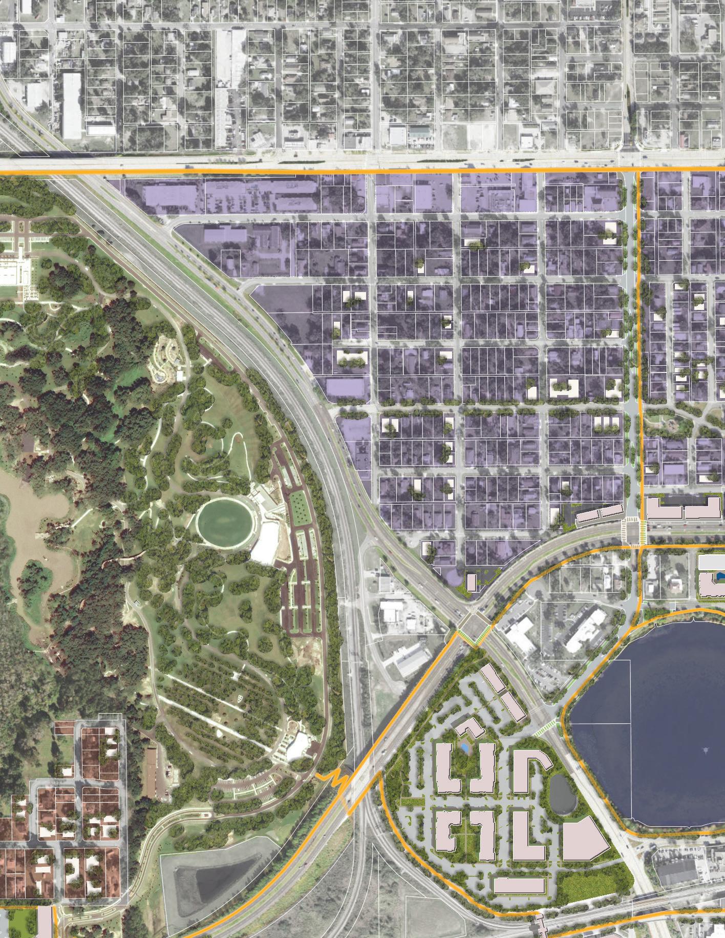
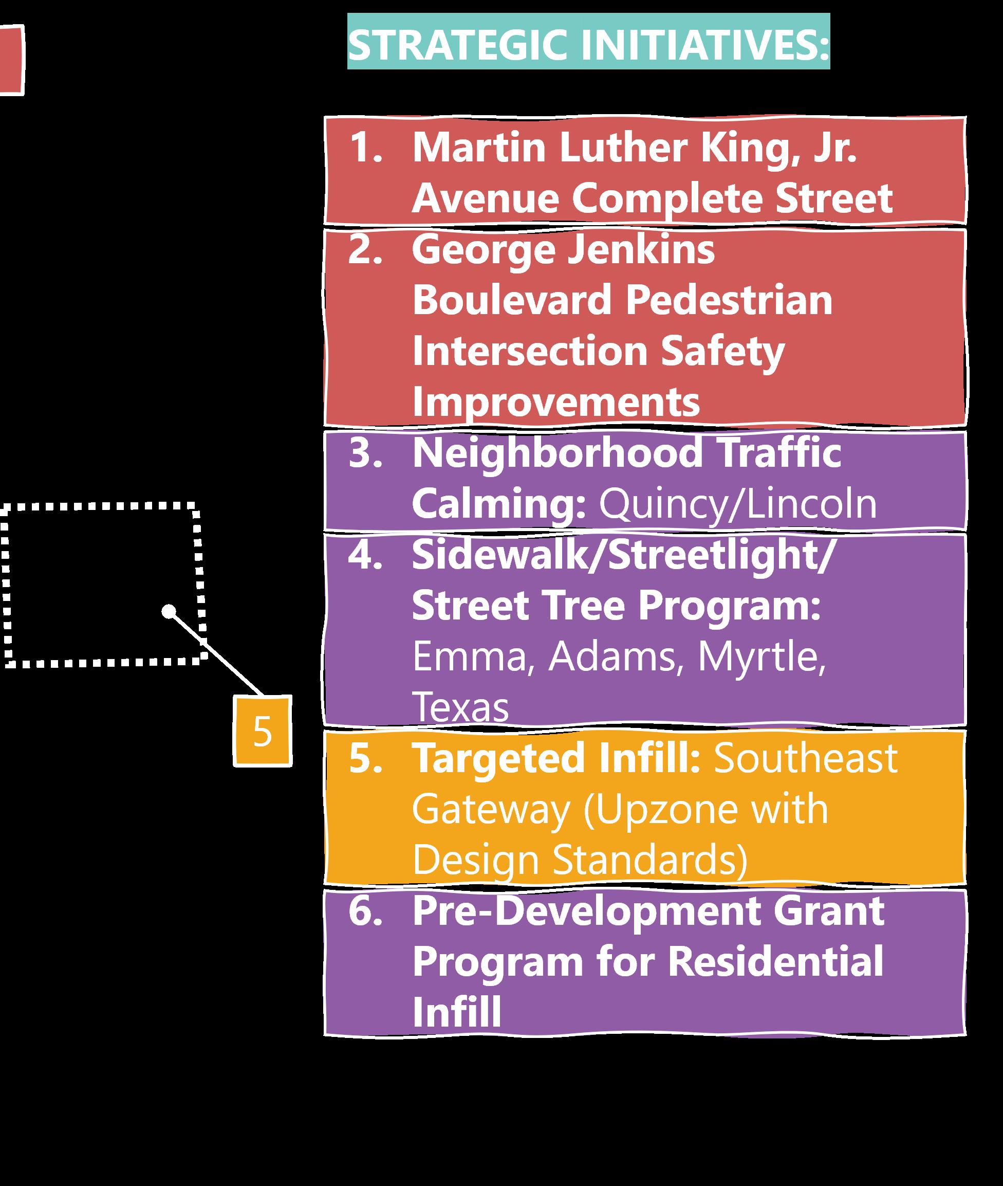
[1] Bonnet Springs Park is a community asset that needs better access from the community.
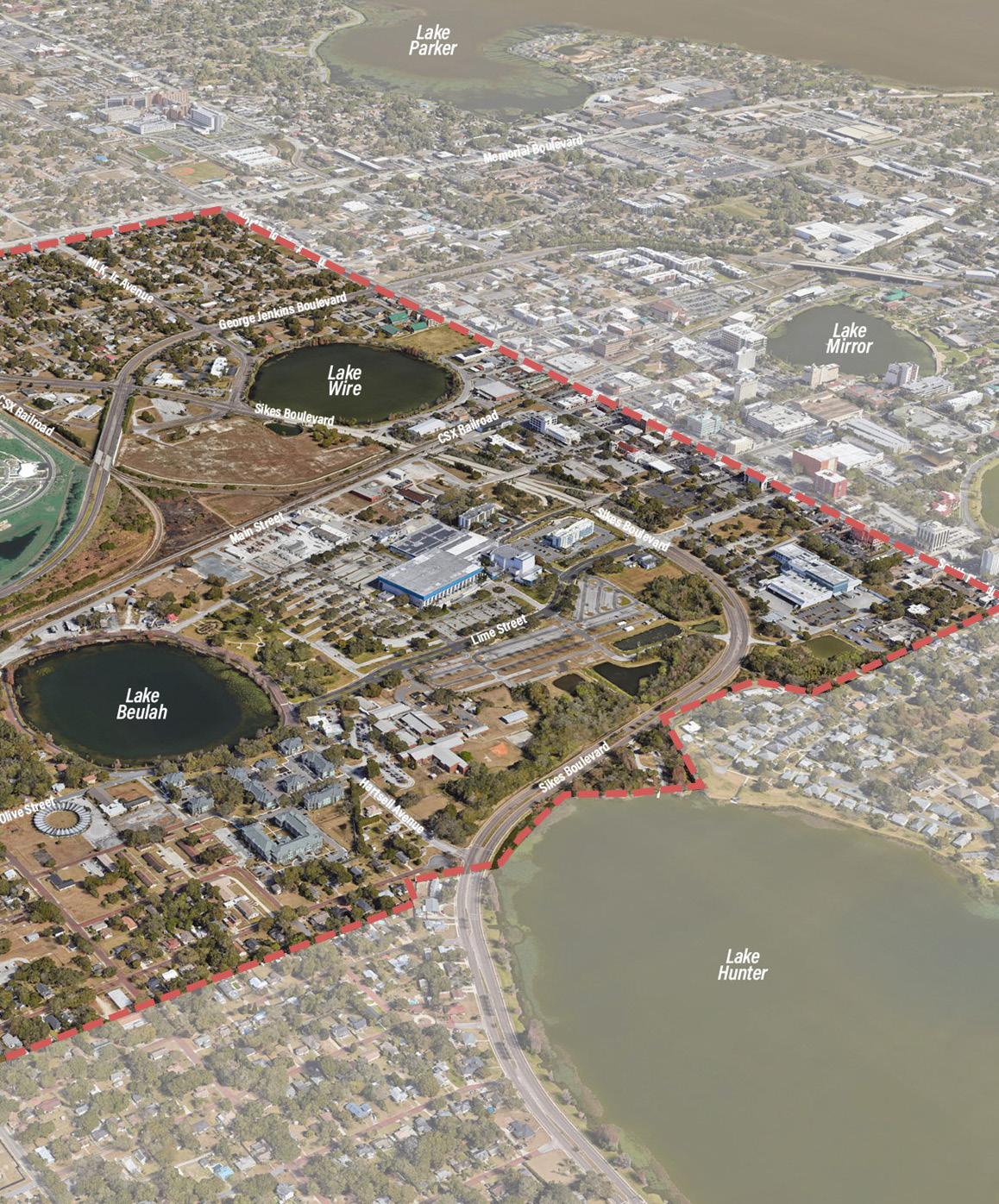
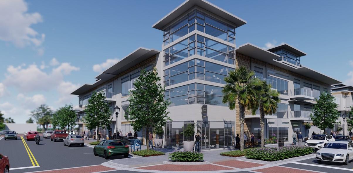
[2] The emergent development projects on Lake Wire have the potential to change the face of the district.
[3] The fabric of Downtown erodes significantly in the first two blocks west of Florida Avenue.
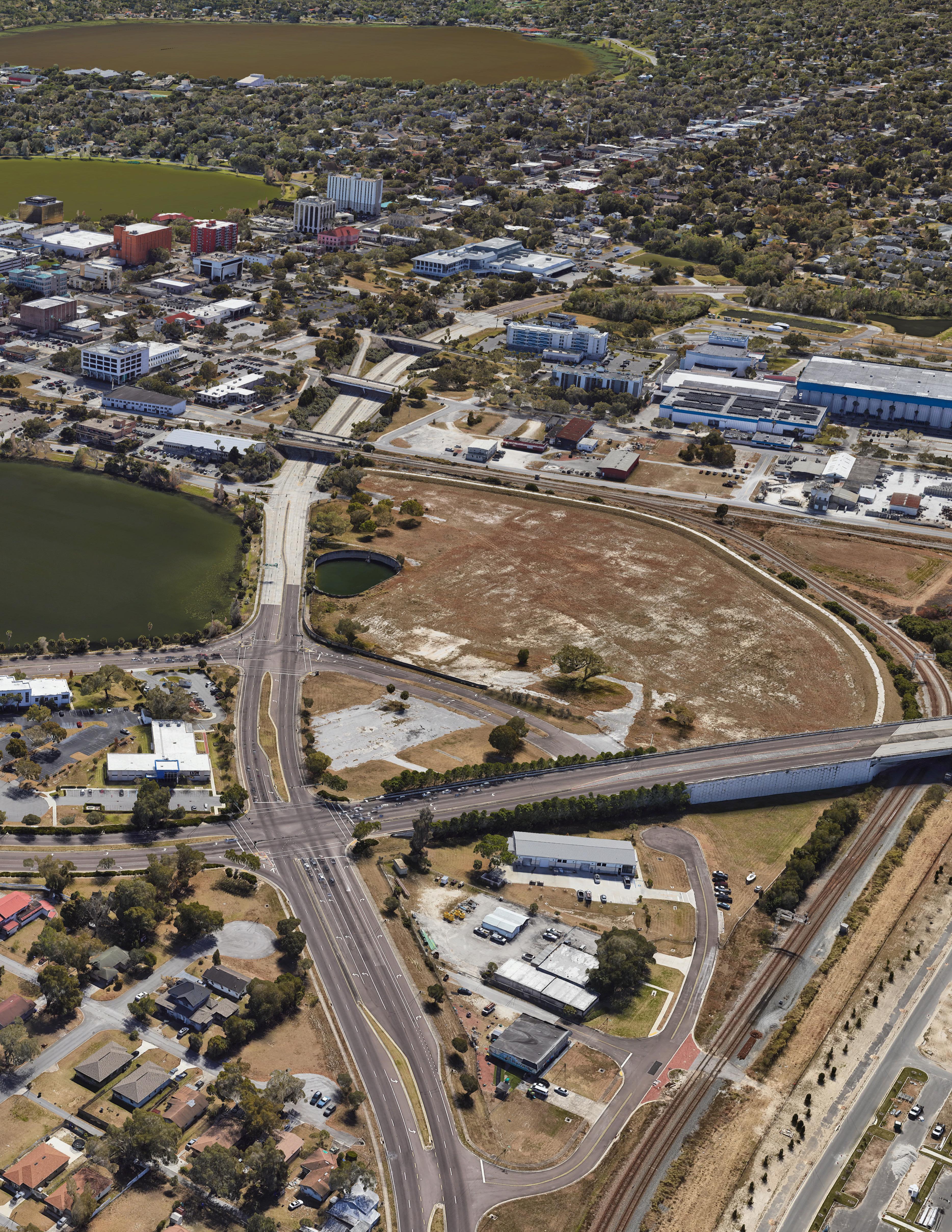
[4] The land used for parking at the RP Funding Center is an underutilized asset and could be repositioned for development.
[5] The district has the potential to provide important linkages between planned trail connections.
[6] The North Lake Wire Neighborhood has made improvements but is held back by speculation.
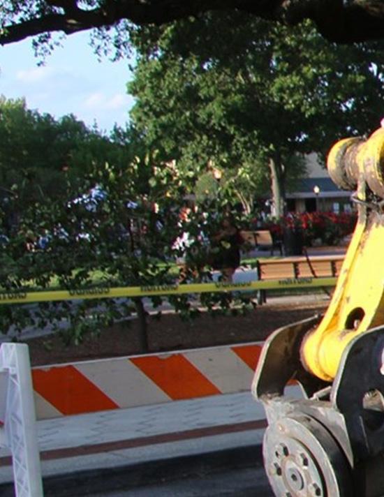
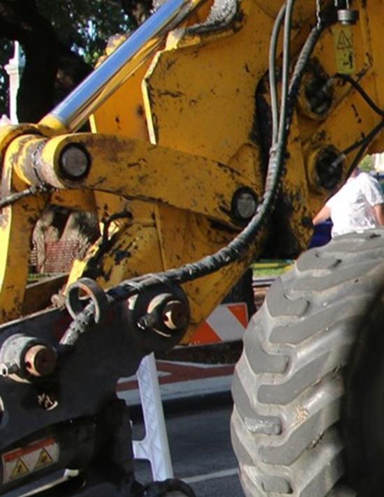
Bonnet Springs Park is a community needs better access from the community.
Bonnet Springs Park is a world-class community amenity, located Downtown and surrounding neighborhoods. However, accessing is challenging, especially for those who rely on walking or biking. Boulevard, Kathleen Road, and the CSX Railway (the latter two barriers to access.
community asset that community. located mere blocks from accessing this urban oasis biking. George Jenkins two seen here) are major
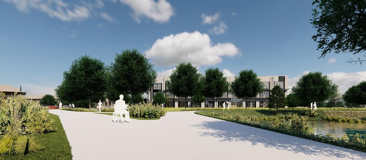
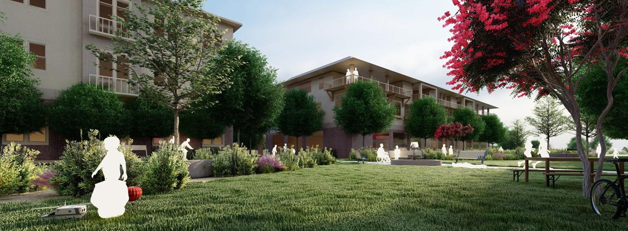
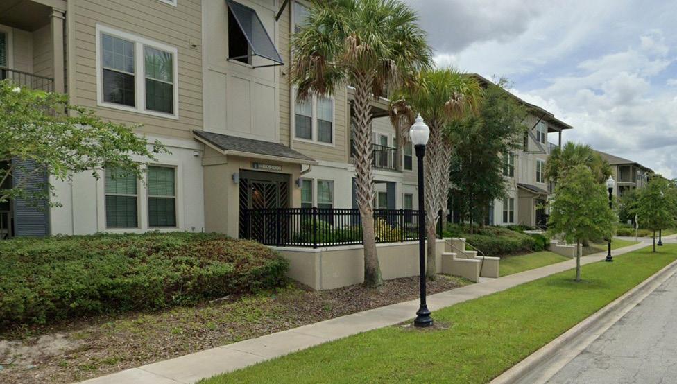
New residential developments approved alongside Lake Wire signify a new era for Downtown West, bringing with it new housing options and an evolving skyline. While new residents will add to the dynamism and vibrancy of the area, this next generation will change aspects of the community’s identity.
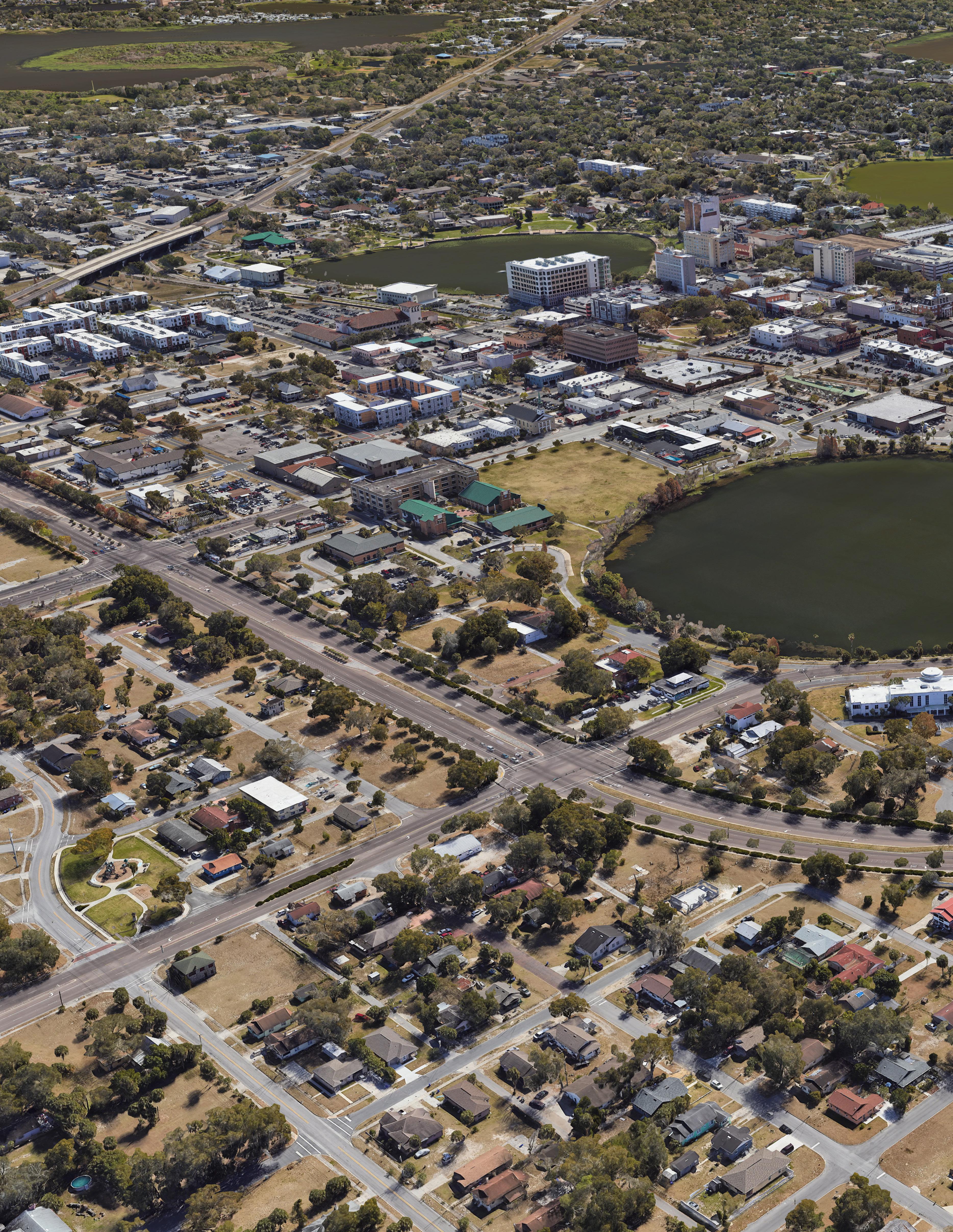
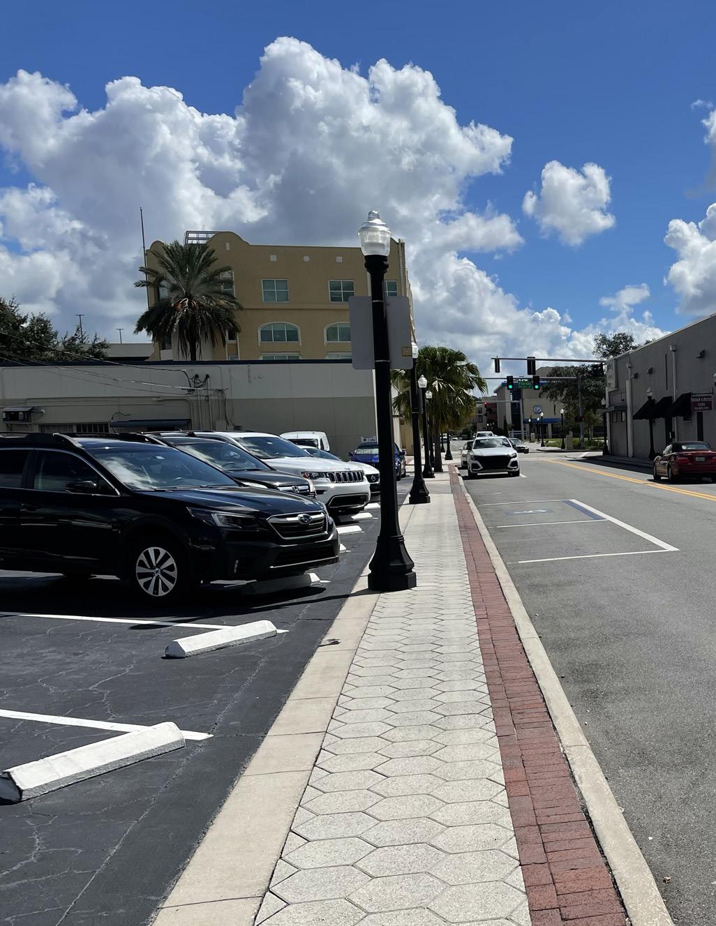
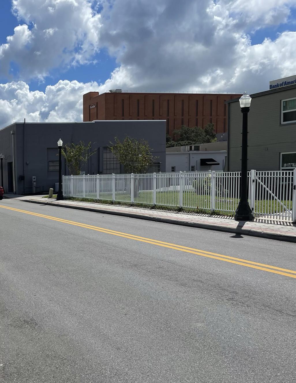
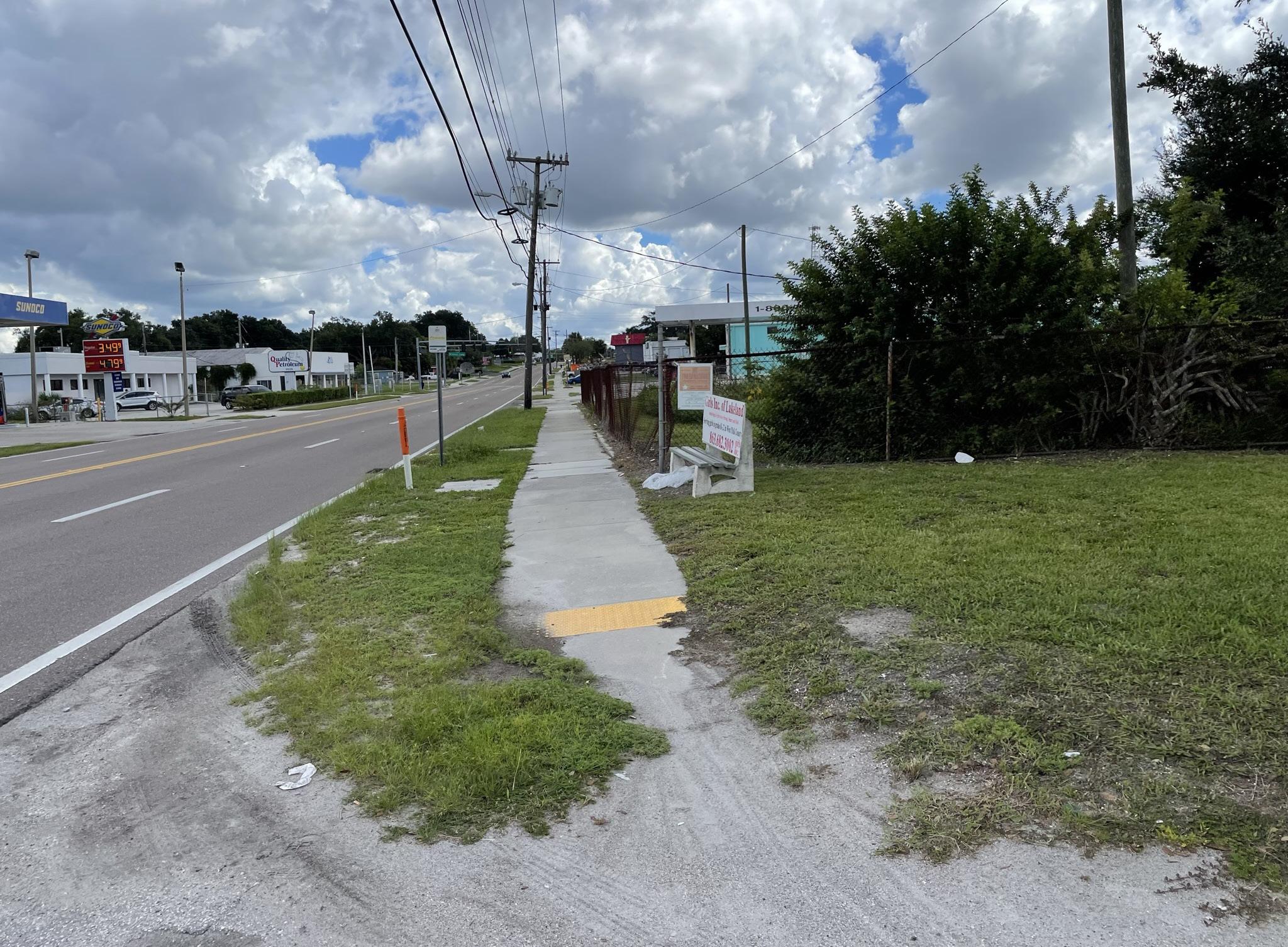
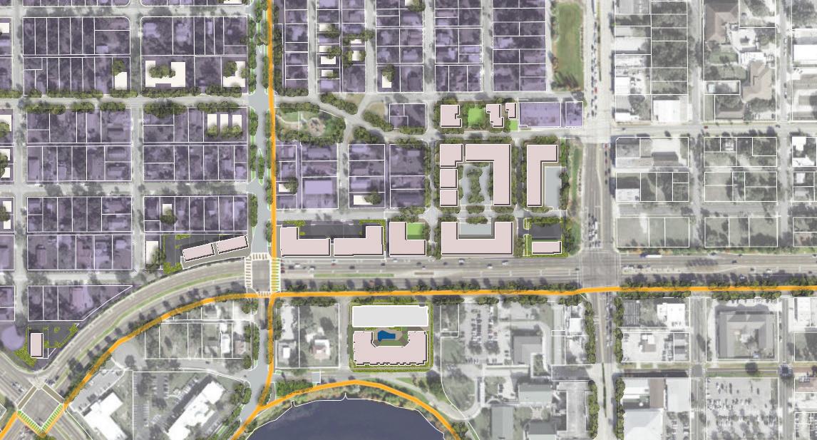
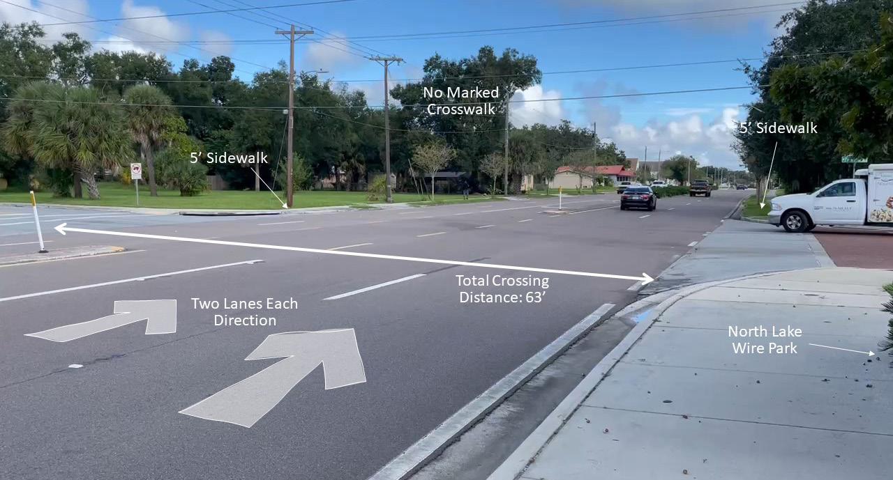
The fabric of Downtown erodes significantly in the first two blocks west of Florida Avenue. The absence of active building edges or street tree canopy contributes to an unappealing and barren urban environment. An abundance of surface parking lots, leading to a treacherous arterial road is very uninviting.
The land used for parking at the RP Funding Center is an underutilized asset and could be repositioned for development.
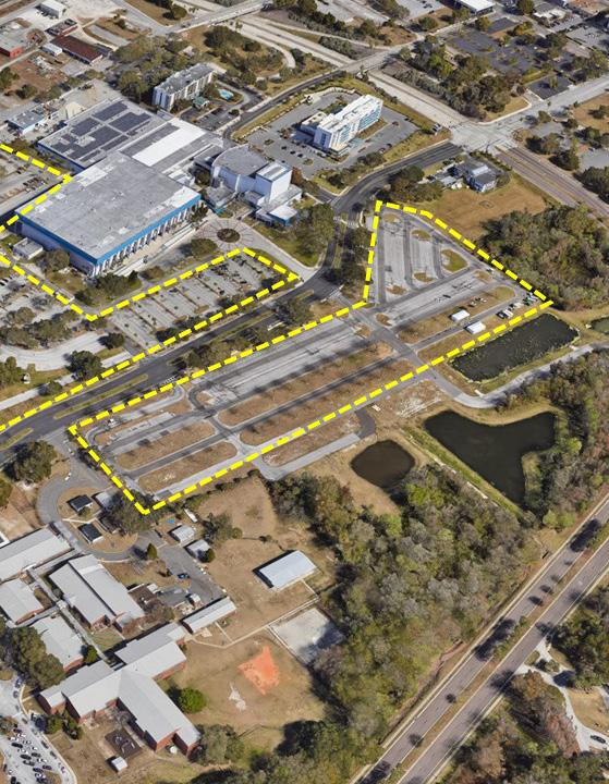
Reimagining underutilized surface parking around the RP Funding Center represents a major opportunity for the city to enhance the vibrancy of downtown. For instance, higher-density, mixeduse development could include much needed housing, retail spaces, and office space, all within walking distance of downtown.
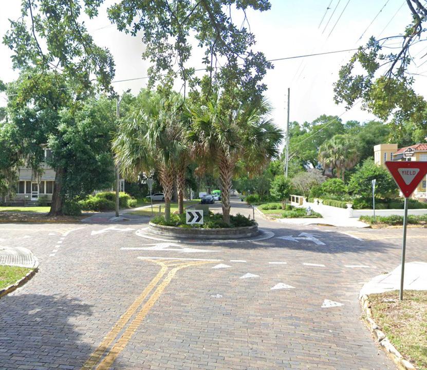
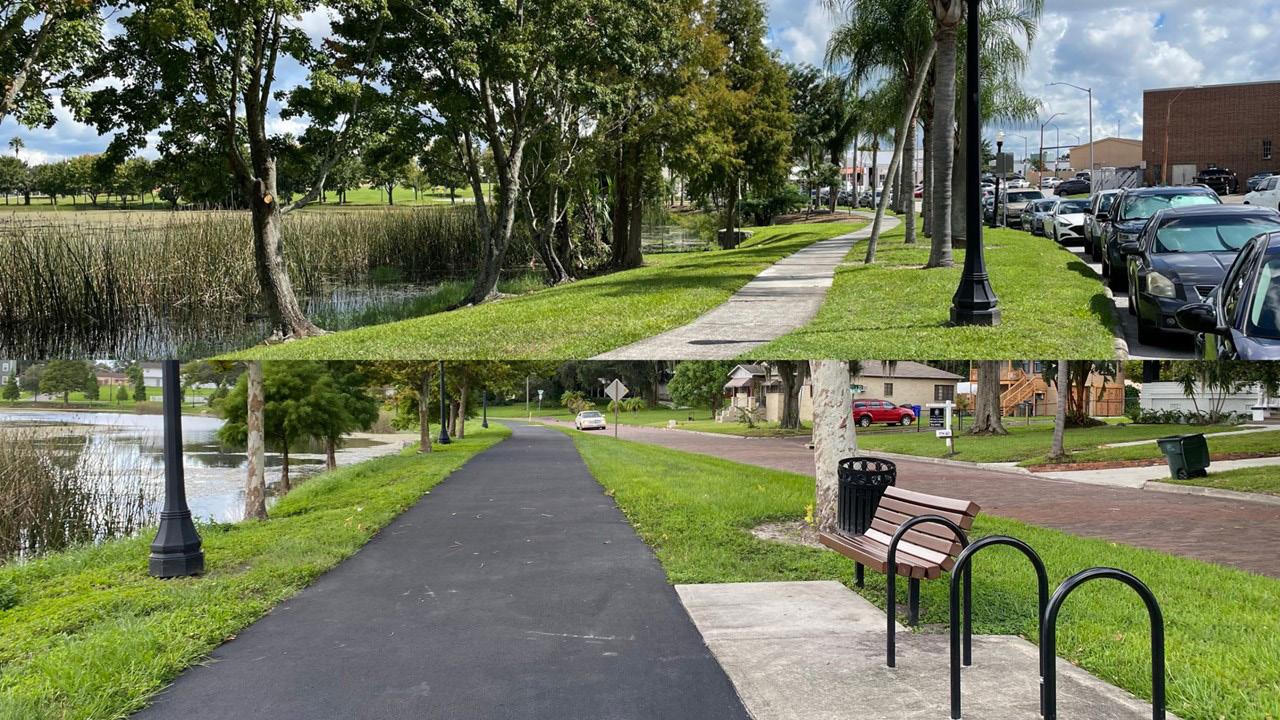
The district has the potential to provide important linkages between planned trail connections.
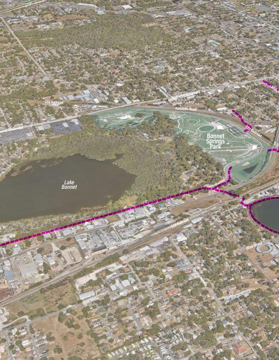
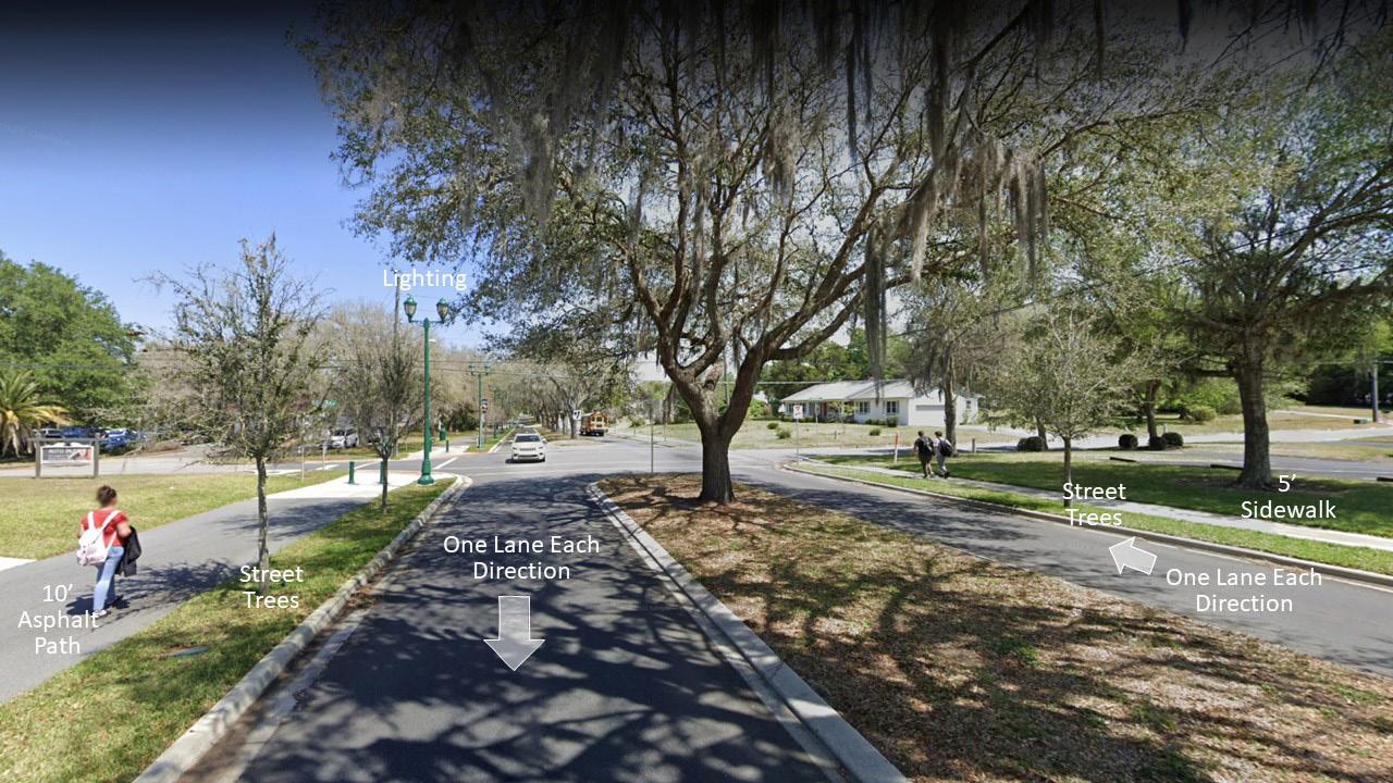
As public support for walkability and bikeability grows, Downtown West is an important area for connecting a blossoming trail network that links Downtown with many surrounding neighborhoods.
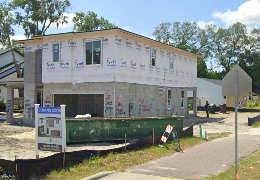
North Lake Wire Neighborhood has made improvements but is held back by speculation.
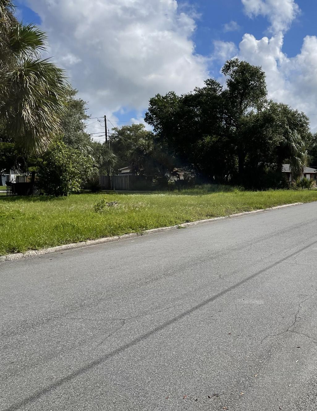
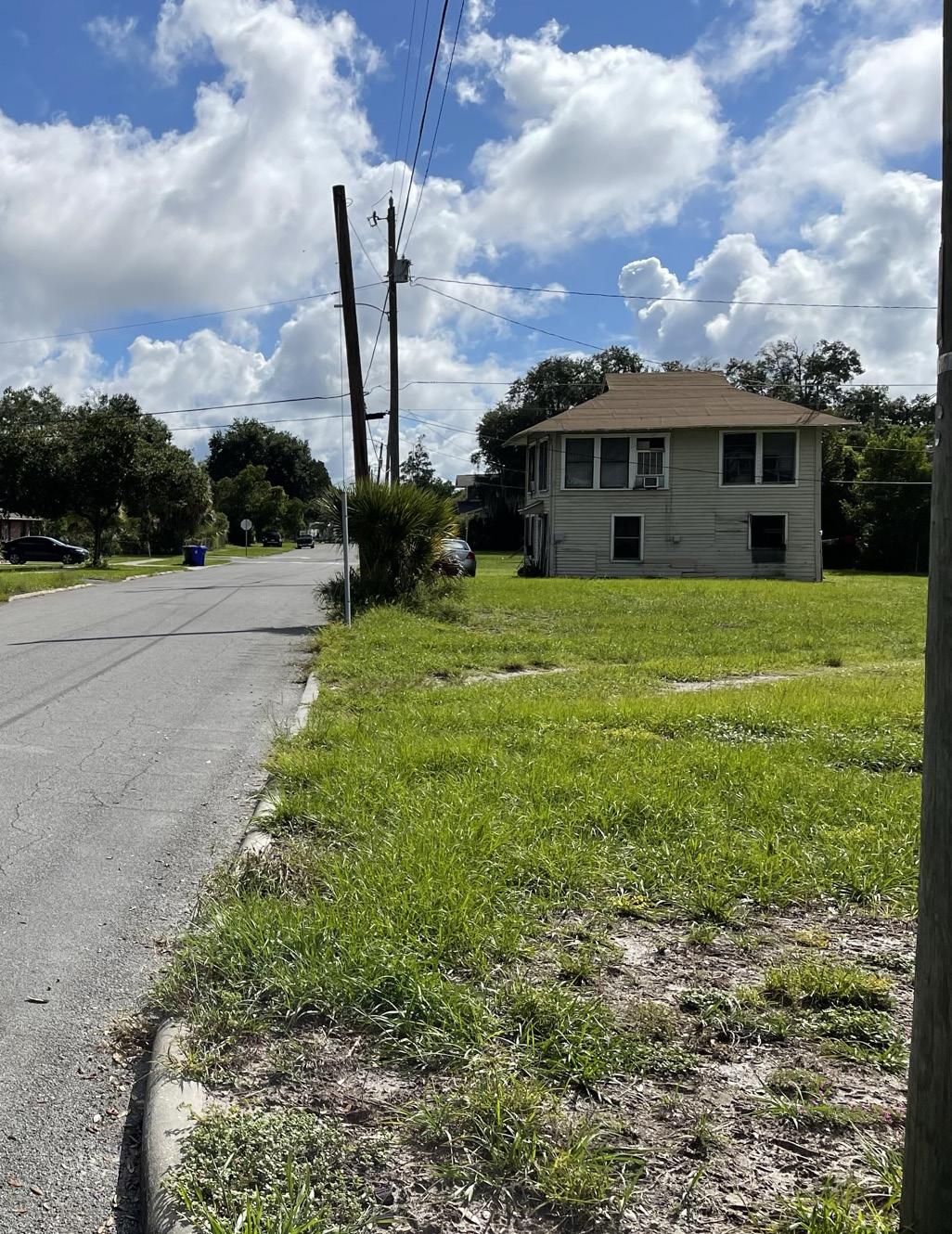
A lack of new housing development is due, in part, to speculation, as investors and developers buy up land in hope of selling it later at a higher price. This practice can drive up the cost of land in the area, making it difficult for families and individuals to afford to buy or build homes.

TIME, STRESS, and EASE of USE for PEDESTRIANS and BIKES.
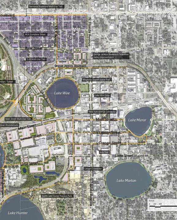
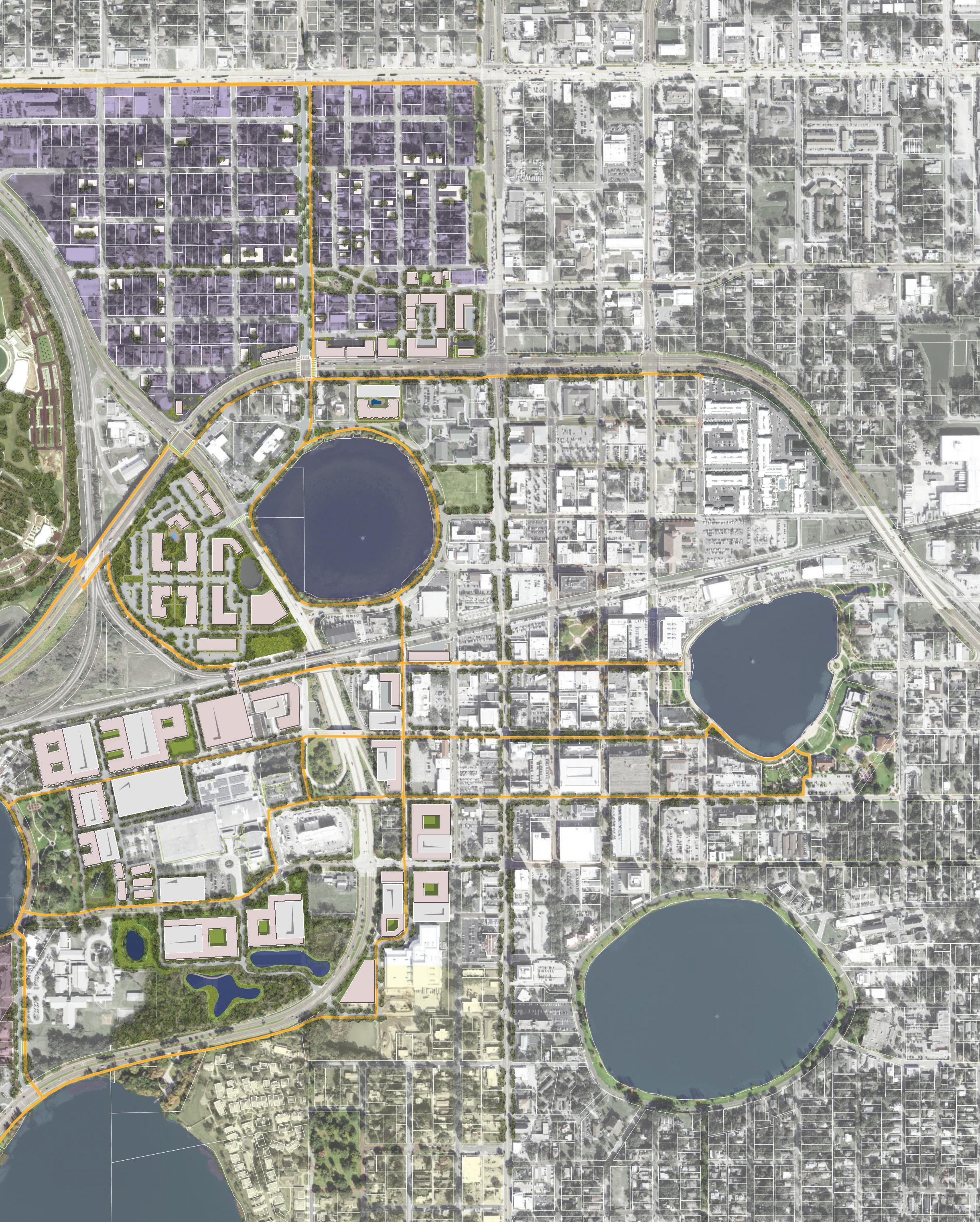
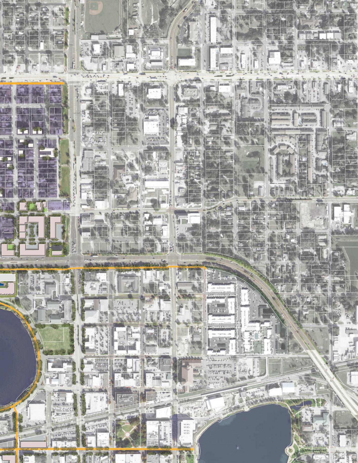
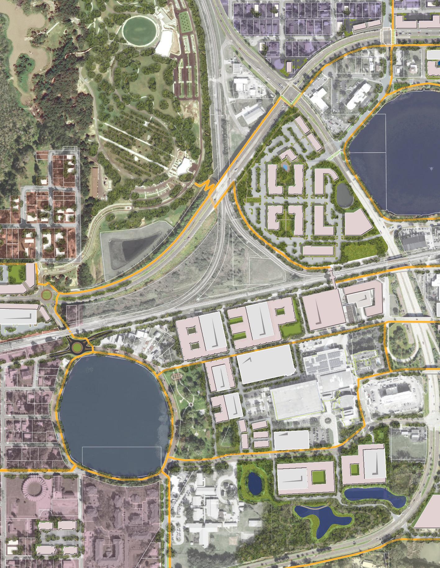
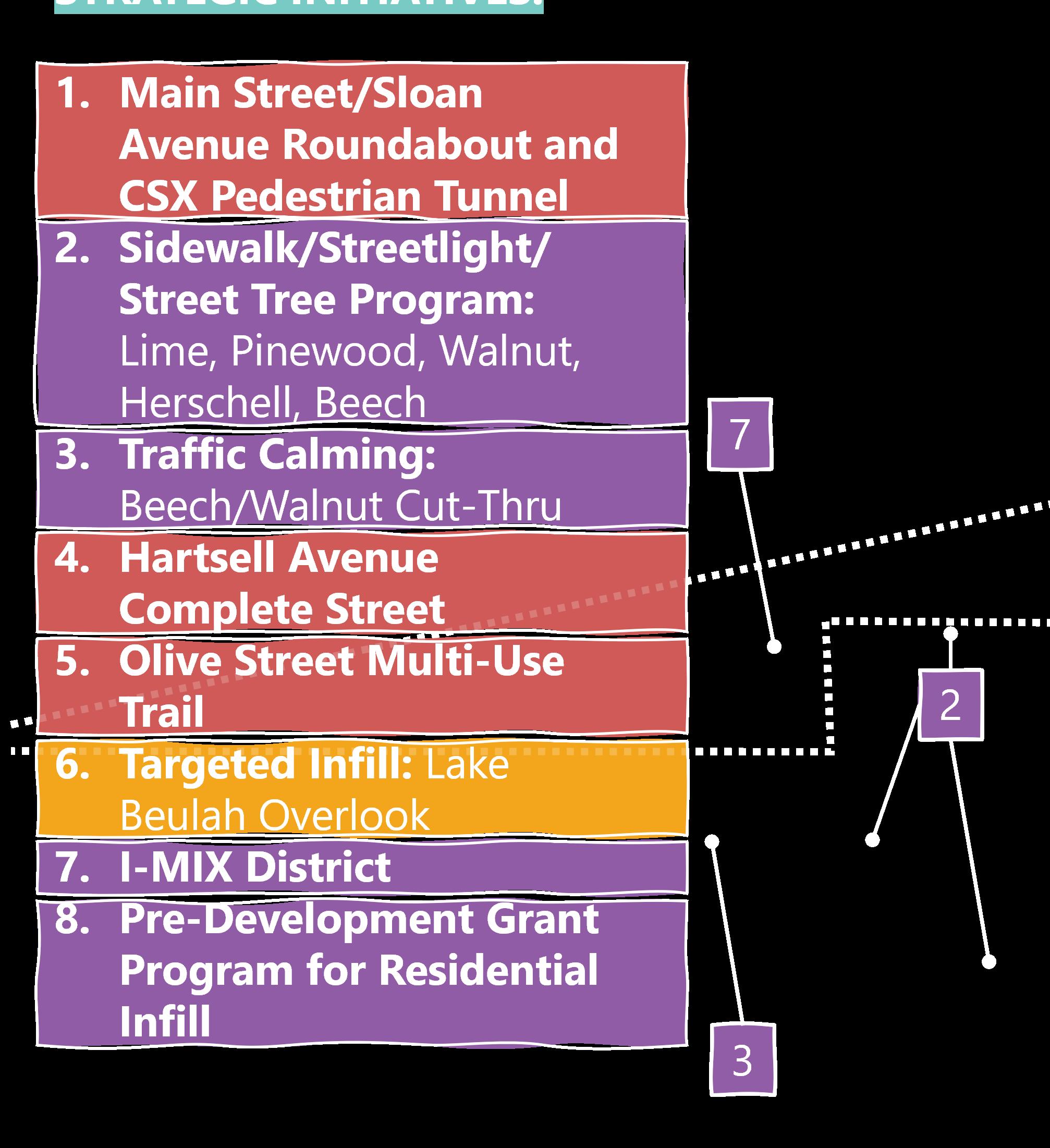
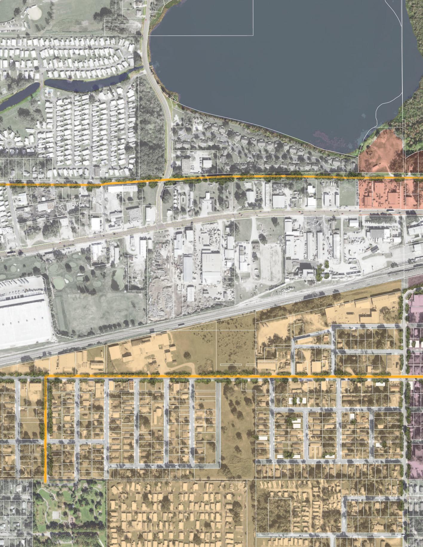
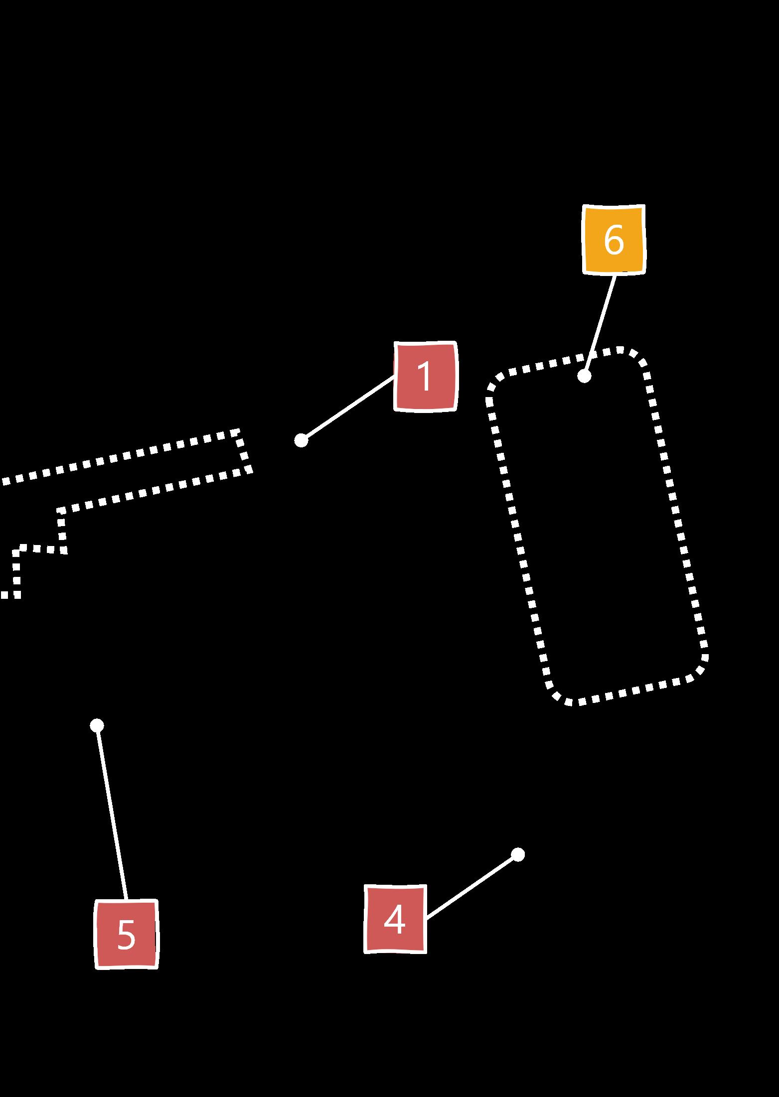
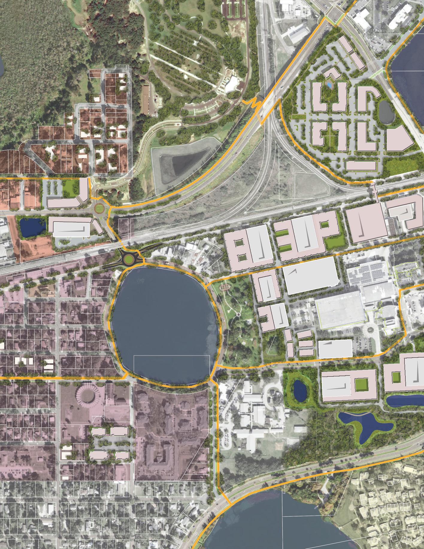
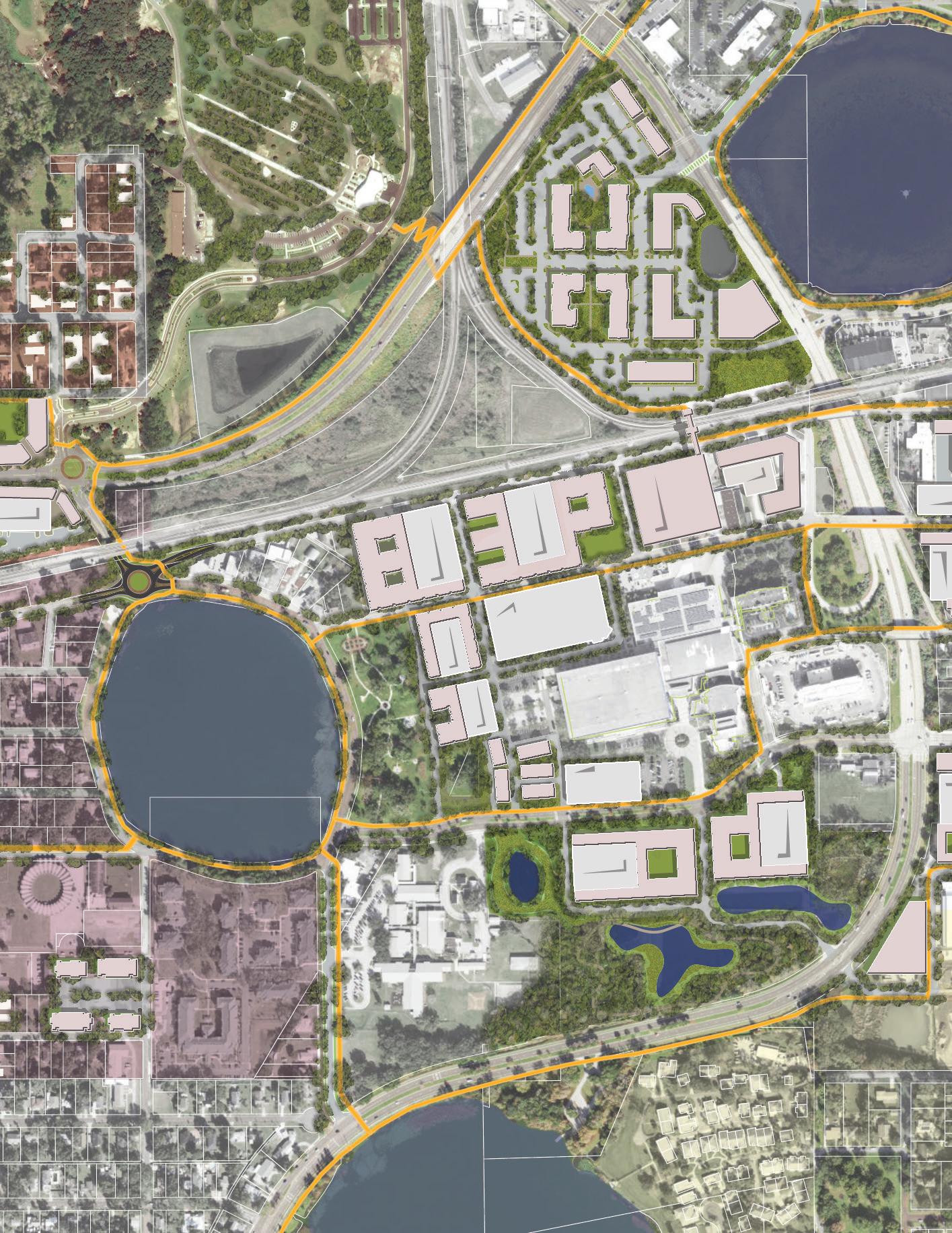
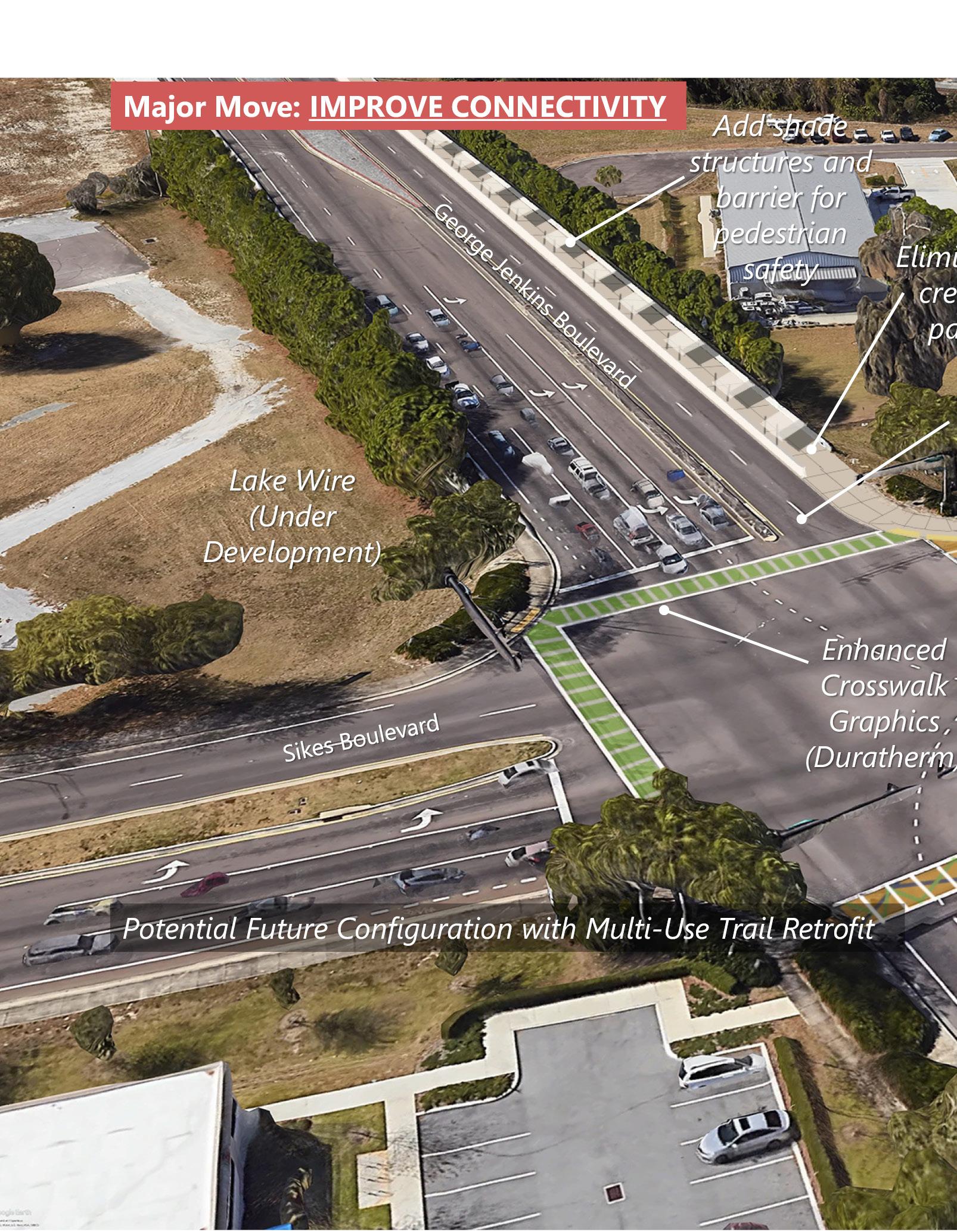
Create improved connectivity for everyone, everywhere. This initiative includes an east-west multi-use trail along Chase Street, George Jenkins Blvd, and Magnolia Street; a north-south connection via a complete street on MLK, Jr., sidewalk widening around Lake Wire, and a cycle track on New York Avenue; and a west connection via a Sloan pedestrian tunnel, sidewalk widening around Lake Beulah, and a complete street on Hartsell Avenue.
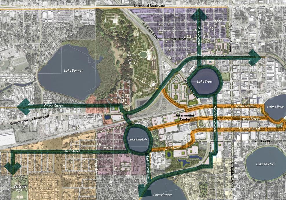
These INITIATIVES advance CONNECTIVITY for ALL by improving time, reducing stress, and creating a network that’s easier to use for pedestrians and bikes:
• East/West Bike and Pedestrian Spine connecting from west of Brunell Parkway to Bonnet Springs Park, the North Lake Wire Neighborhood and ultimately across North Florida Avenue to Mirrorton.
• North/South Bike and Pedestrian Spine connecting the Lake Hunter Trail to the New York Avenue Cycletrack, an improved path around Lake Wire, and a trail contemplated as part of the MLK Avenue Complete Street.
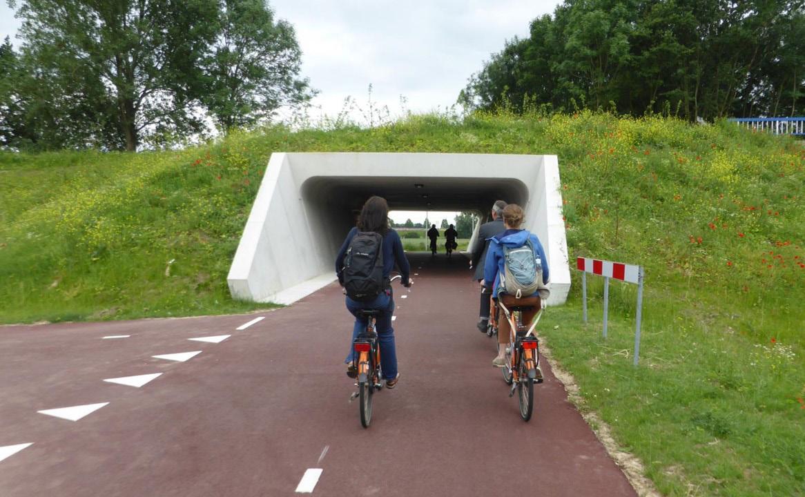
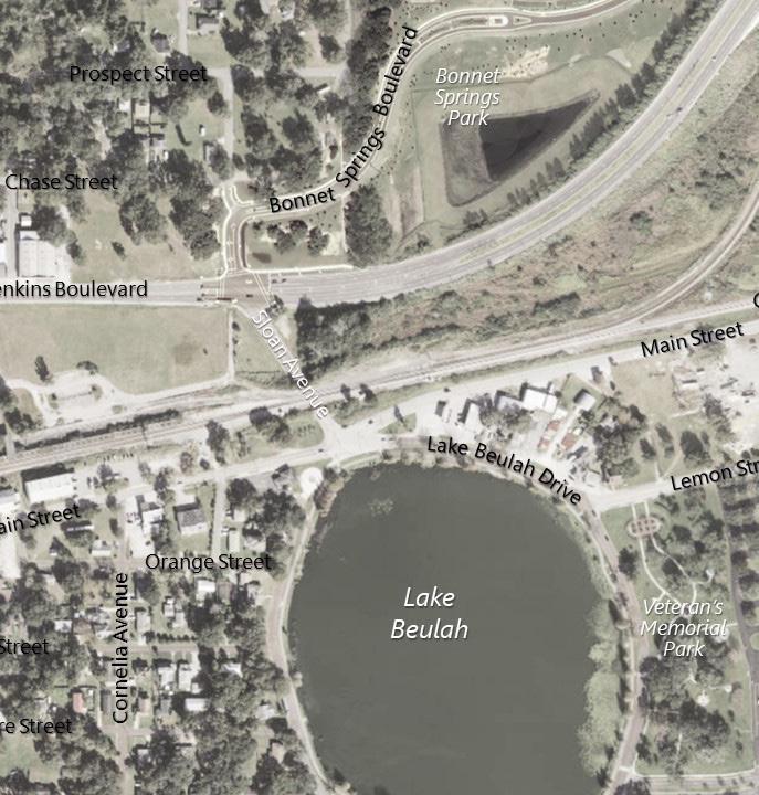
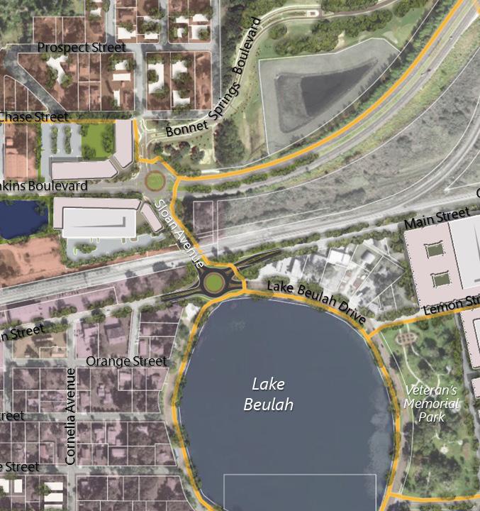
• Westside Connector linking North/South and East/West Spines to Lake Beulah via the Hartsell Avenue Trail and an improved pedestrian underpass linking Lake Beulah to Bonnet Springs Park.
• Olive Street Multi-Use Trail connecting Westgate-Central Neighborhood to the Westside Connector.
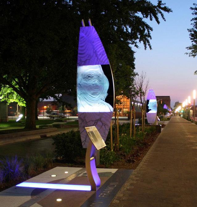
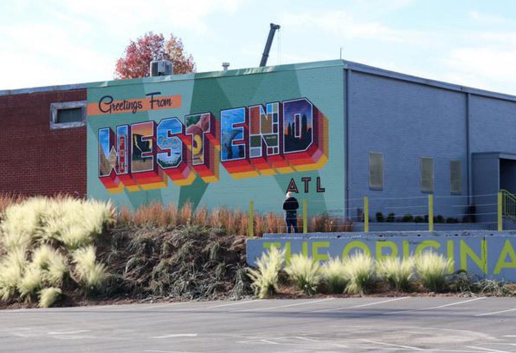
• Arts Loop Trail on Main, Orange, and Lemon Streets linking Lake Mirror to Lake Beulah and a series of public art installations.
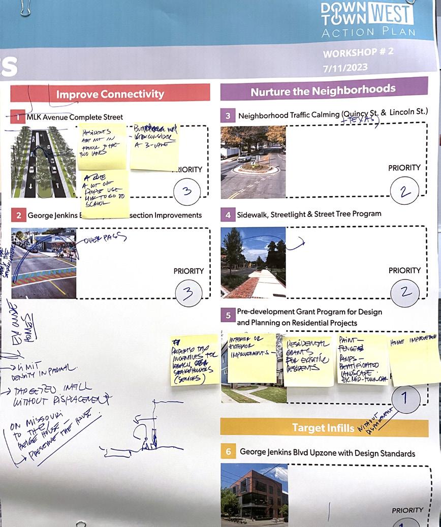
Prioritize neighborhood beautification like sidewalks, streetlights, and street trees together with sewer connections, neighborhood traffic calming, and an infill grant program. The plan leaves no communities behind! Neighborhoods in Downtown West include North Lake Wire, Crescent Heights, Westgate CentralLake Beulah, and portions of western Downtown. NURTURE
These INITIATIVES NURTURE the NEIGHBORHOODS through implementation of infrastructure that improves the livability of neighborhoods in Downtown West:
• Extending wastewater service throughout the Crescent Heights Neighborhood to support infill development.
• Implementing a Pre-Development Grant Program to support infill residential construction. The grant could be used to defray costs of design, survey, permitting, and other activities required prior to construction.
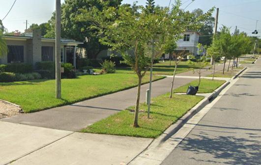
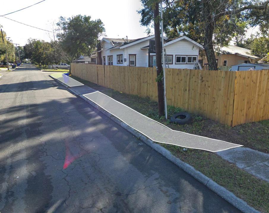
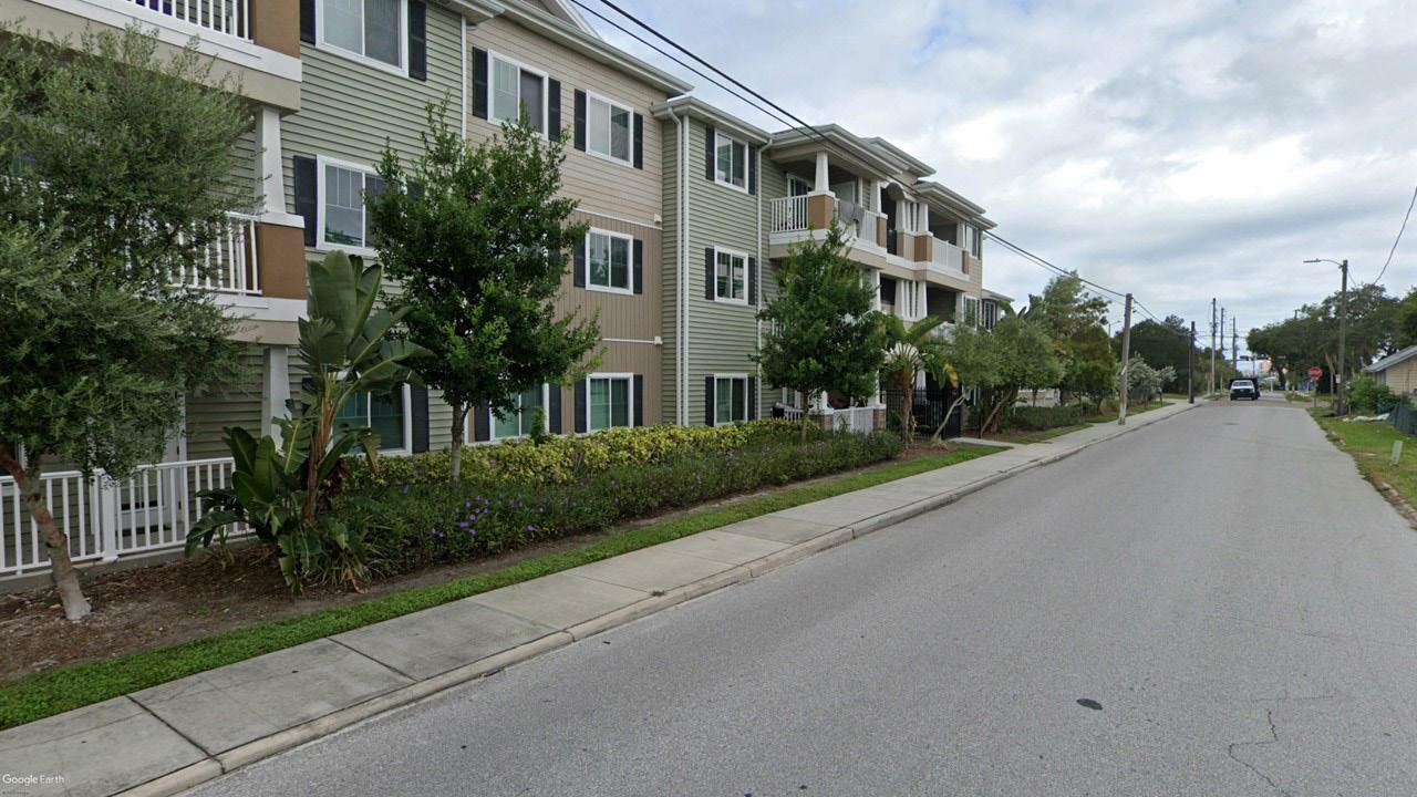
• Sidewalk/Street Tree/Streetlight Program throughout Downtown West neighborhoods to connect gaps in sidewalk coverage and support infill development and safety and walkability for all residents.
• Neighborhood Traffic Calming targeted in North Lake Wire Neighborhood and Crescent Heights Neighborhood to address speeding associated with cut-thru traffic without origins or destinations in the neighborhood.
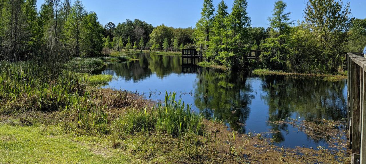
• North Lake Hunter Stormwater Park designed as a passive open space reconfiguration/expansion of the wetlands and stormwater ponds on the south end of the RP Funding Center site.
• I-Mix District allowing compatible residential uses as a mixed-use option in lower-intensity industrial areas.
Prioritize the facilitation of new residential options near community services, transit, and amenities in places where it complements existing neighborhoods. This targeted infill could include “missing middle” housing like duplexes and townhomes, and an Arts Gateway that mixes residential types compatible with light industrial uses.
These INITATIVES help the City TARGET INFILL to add to the residential base of Downtown through increased density in Downtown West:
• Policy changes and design guidelines to encourage higher density residential/mixed-use development along George Jenkins Boulevard in the southeast corner of North Lake Wire Neighborhood.
• Consolidating parking on the RP Funding Center site to facilitate development along the Lime Street Corridor and the western portion of the site overlooking Lake Beulah
• Encouraging infill development on the parking lots along the New York Avenue corridor.
• Preparing for next generation residential development on the sites adjacent to the proposed Intermodal Center to further the City’s goals for transit-oriented development densities and forms.
• Facilitating the development of sites north and south of George Jenkins Boulevard at the entrance to Bonnet Springs Park, potentially as an “Arts Gateway” mixed-use development.
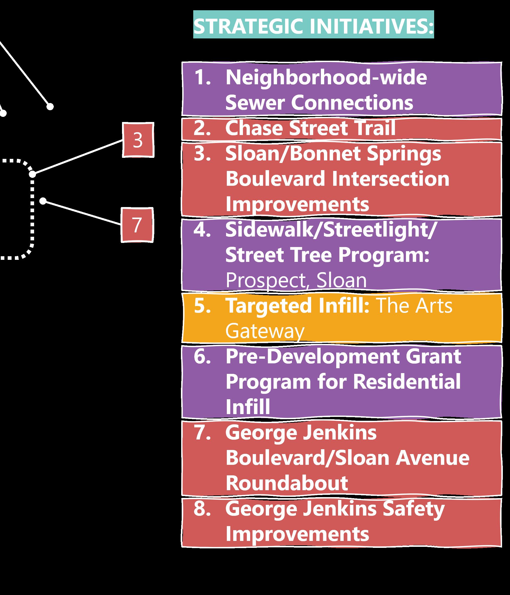
The plan is based on a set of KEY INSIGHTS that describe the situation in Downtown West. The KEY INSIGHTS are addressed by three MAJOR MOVES that are implemented in individual STRATEGIC INITIATIVES. The projects cover each neighborhood across the wide geography of Downtown West and have been loosely grouped into projects that should be considered now, soon (in 5 to 7 years), and later (beyond 7 years).
[1] Bonnet Springs Park is a community asset that needs better access from the community.
[2] New developments on Lake Wire are changing the face of the district.
[3] The fabric of Downtown erodes significantly in the first two blocks west of Florida Avenue.
[4] The land used for parking at the RP Funding Center is an underutilized asset and could be repositioned for development.
[5] The district has the potential to provide important linkages between planned trail connections.
[6] The North Lake Wire Neighborhood has made improvements but is held back by speculation.
IMPROVE CONNECTIVITY for all starting with pedestrians and bikes. IMPROVING TIME, STRESS, and EASE of USE for BIKES and PEDESTRIANS
For additional information, presentations, and interactive GIS visualization, please visit the CRA’s Downtown West StoryMap.
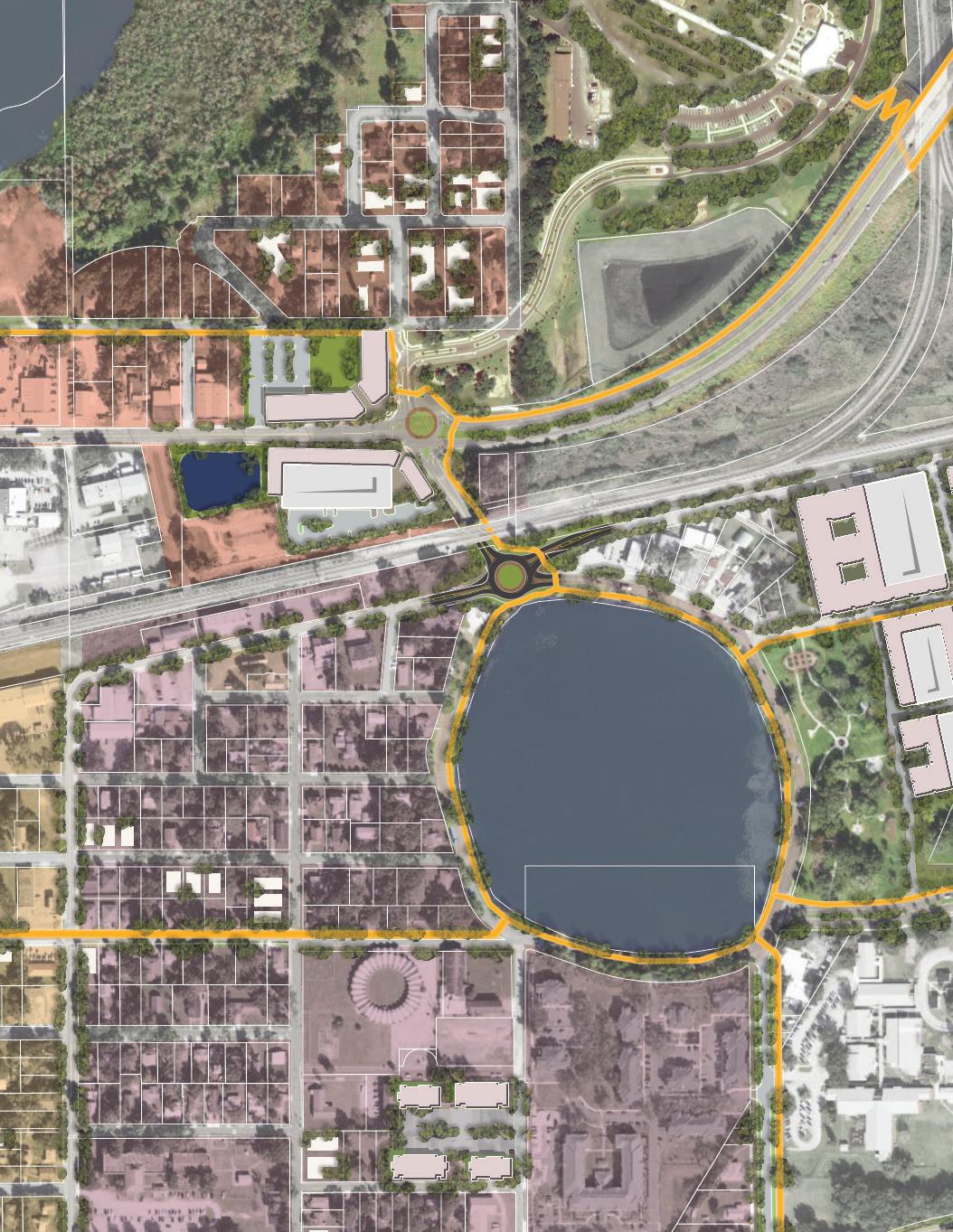
ROUNDABOUT + CSX PED TUNNEL
TRAIL BRIDGE RETROFIT
PATH UPGRADES
PED BRIDGE OVER RR
BONNET SPGS INTERSECTION
ROUNDABOUT
IMPROVEMENTS
NEIGHBORHOOD-WIDE SEWER CONNECTIONS
SIDEWALK/STREET TREE/LIGHT PROGRAM
GRANT PROGRAM
GRANT PROGRAM
SIDEWALK/STREET TREE/LIGHT PROGRAM
CHN-2 CHASE STREET TRAIL
WCB-4 HARTSELL AVENUE COMPLETE STREET
WCB-5 OLIVE STREET MULTI-USE TRAIL
NLW-1 MLK AVE COMPLETE STREET
NLW-2 GJB INTERSECTION IMPROVEMENTS
LWD-2 MAGNOLIA SHARED SPACE TRAIL
LWD-5 ARTS LOOP PATH
MEMORIAL BLVD BICYCLE/PEDESTRIAN OVERPASS
SUNRAIL EXTENSION/STATION
US 98 BRT
CHN-4 SIDEWALK/STREET TREE/LIGHT PROGRAM
CHN-6 PRE-DEV GRANT PROGRAM
NLW-3 QUINCY/LINCOLN TRAFFIC CALMING
WCB-3 NEIGHBORHOOD TRAFFIC CALMING
WCB-7 I-MIX DISTRICT
LWD-6 N LAKE HUNTER STORMWATER PARK
UPZONE W/ DESIGN STANDARDS
WCB-6 LAKE BEULAH OVERLOOK
LWD-9 NEW YORK AVENUE CORRIDOR
CHN-5 ARTS GATEWAY
LWD-7 INTERMODAL CENTER
LWD-8 LIME STREET CORRIDOR
Consider Soon
Consider Later
The plan builds on several key connectivity initiatives that are currently programmed or under construction. These initiatives include:
• FIVE POINTS ROUNDABOUT [PORTION OF WCB-1] (UNDER CONSTRUCTION)
• City Construction Funding $1.25M
• CRA Contribution $1.15M
• CHASE STREET TRAIL [CHN-2] (CONSTRUCTION IN FY 2026)
• City Design Funding – Currently Under Bid
• FDOT Construction Funding $1.5M
• CRA Contribution $300,000
• NEW YORK AVENUE BICYCLE/PEDESTRIAN OVERPASS [LWD-4] (CONSTRUCTION IN FY 2026)
• FDOT Design Funding – Currently Underway
• FDOT Construction Funding $9.2M
• City/CRA Contribution $85,000
• HARTSELL TRAIL [WCB-4] (DESIGN FY24)
• FDOT Design Funding $100,000
• FDOT Construction Funding: Draft Tentative Work Program shows $850,000 in FY 2026. Must be adopted by Legislature.
• CRA Contribution $75,000
• WEST LAKE HUNTER TRAIL PHASE I (LIME TO HARTSELL) (CONSTRUCTION IN FY 2028)
• FDOT Design Funding $805,000
• FDOT Construction Funding $1.7M
• MEMORIAL BOULEVARD PROJECT DEVELOPMENT & ENVIRONMENTAL STUDY FROM WALKER AVE TO SR 33/ LAKELAND HILLS BOULEVARD (STUDY FY 2024)
• FDOT Study Funding $1.3M
• FDOT Construction Funding Pending Work Program Release 2033/32
• CRA Contribution to construction could be significant, however project construction currently scheduled after Midtown sunset
• LAKELAND INTERMODAL CENTER
• PD&E Study Scope Under Development
• Funding $2.0M
• TPO has requested $5M for Design
• No funding available for construction at this time.
• PD&E Study for SunRail Extension is requested for addition to FY 2024 of FDOT Work Program
The following eight projects are recommended to be advanced within the next five years based on their ability to fundamentally alter the course of Downtown West toward the MAJOR MOVES and the City’s perceived readiness for the activity. These projects have been developed through consultation with the community and vetted with respect to community priorities. Please refer to the description of the activities associated with each project included on the following pages.
• Crescent Heights Neighborhood-Wide Sewer Connections [CHN-1]
$TBD
• Residential Pre-Development Grant Program [WCB-8 and NLW-6]
$750,000 [Midtown CRA]
• Sidewalk/Street Tree/Light Program [NLW-4 and WCB-2]
$1,000,000 [Midtown CRA]
• George Jenkins Boulevard Safety Improvements [CHN-8]
$125,000 [Midtown CRA]
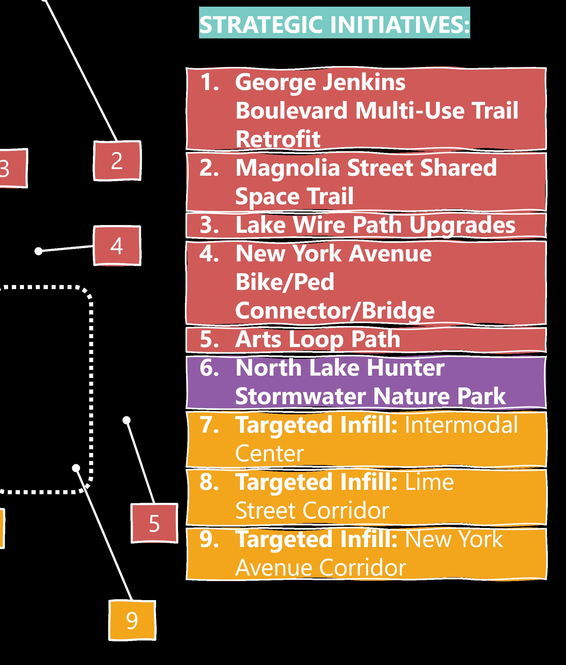
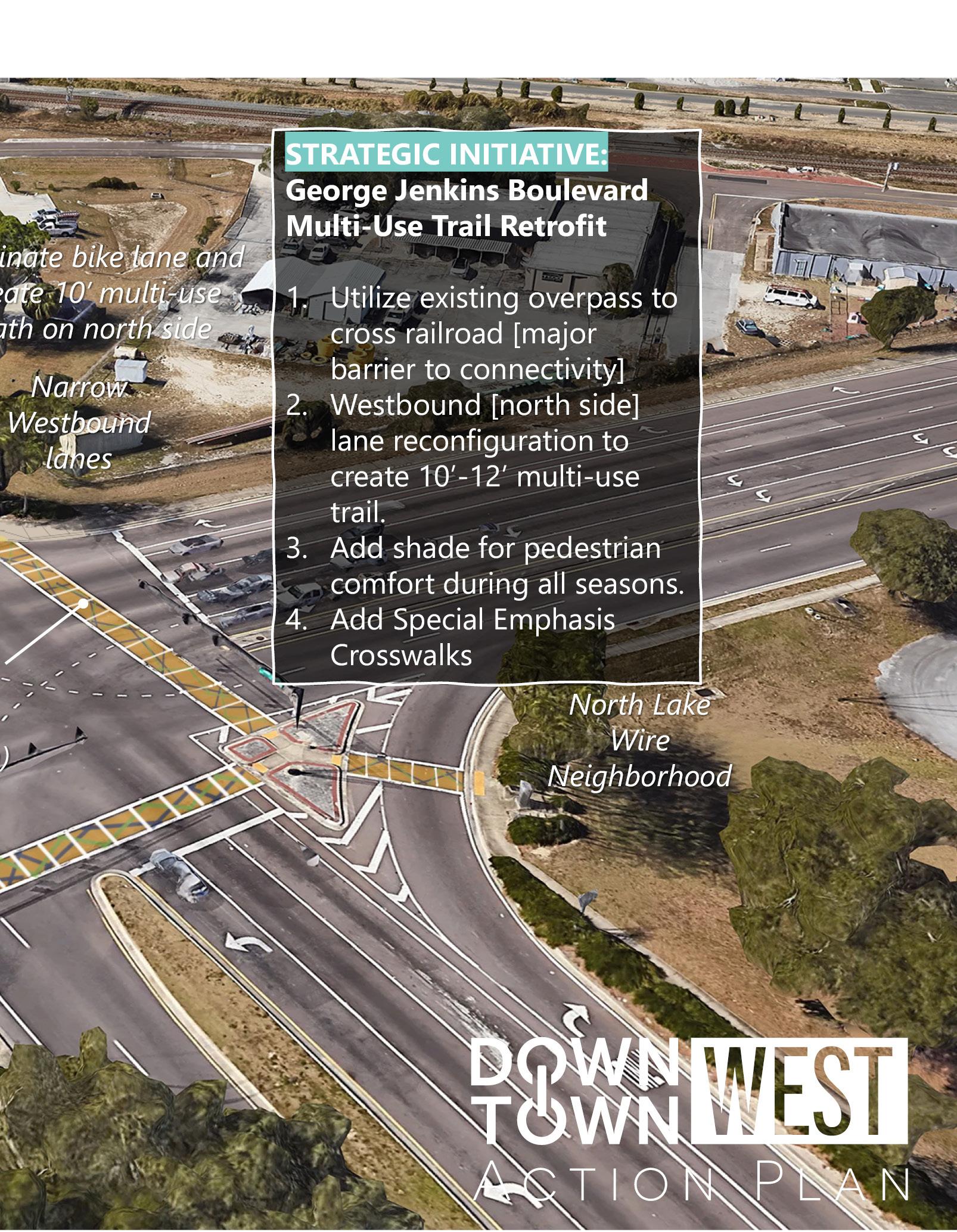
• George Jenkins Boulevard Multi-Use Trail Bridge Retrofit [LWD-1]
$2,000,000 [Midtown CRA] $200,000 [Downtown CRA]
• George Jenkins Boulevard/Sloan/Roundabout and Ped Connection [WCB-1, CHN-3, and CHN-7]
$200,000 [Midtown CRA] $200,000 [Downtown CRA]
• Lake Wire Path Upgrades [LWD-3]
$700,000 [Downtown CRA]
• Southeast Gateway Upzone w/ Design Standards [NLW-5] Not Applicable
Five Year Totals: $4,325,000 [Midtown CRA] $1,100,000 [Downtown CRA]
Recommendation: Connect Crescent Heights to sewer. Potential redevelopment efforts in Crescent Heights are limited by the lack of sewer serving the neighborhood. With the Western Trunk line project, scheduled for completion in 2026, the system will have enough capacity to support sewer flows from the neighborhood. Implementation Partners: Water Utility/Public Works lead
Recommendation: Prototype a pre-development loan to grant program to support infill residential construction. The grant could be used to defray costs of design, survey, and other activities required prior to construction.
Amount: up to $15,000; must be repaid if construction does not commence within two years
Eligibility: New build single-family, duplex, or townhome projects within Downtown West Midtown CRA locations (renovations/expansions of existing homes not eligible)
Uses: Schematic design, design development (30%, 60%, 90%), construction documents, landscape design, civil site engineering, survey
Implementation Partners: CRA program development lead; support Community Planning and Housing
Recommendation: Target sidewalk, street tree, and streetlight improvements in North Lake Wire and Lake Beulah Neighborhoods as shown on Strategic Initiatives maps.
Implementation Partners: CRA organizational lead; Improvement design and implementation by Public Works Engineering, Construction and Maintenance, Transportation, Traffic Operations, Lakeland Electric; Community Planning for public engagement and neighborhood coordination
Recommendation: Develop safety study with FDOT on George Jenkins Boulevard west of Sloan. This is a four lane undivided section with no dedicated left turn lanes. Large volumes of truck turning movements create visibility impacts and other safety issues. The study should investigate character of traffic, new mobility impacts created by Bonnet Springs Park, and potential alternate roadway configurations such as a three-lane section.
Implementation Partners: Transportation lead; Support from Public Works Engineering, Traffic Operations, Community Planning; Corridor property owners and business owners/operators
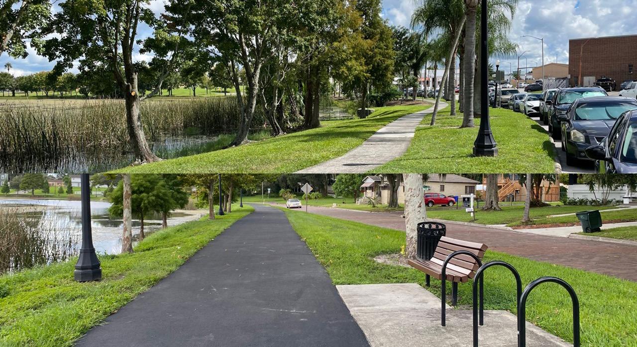
Recommendation: Widen the walkway to at least an 8’ asphalt path and add amenities at key locations such as the end of terminating streets. The walk around Lake Wire is generally a 5’ concrete sidewalk. With the increased population in the neighborhood from multiple new residential projects, a wider walk with increased amenities (benches, trash cans, bike racks, shade trees) is appropriate. Coordinate with FDOT for improvements along Sikes Boulevard edge and with MLK Avenue Complete Street concepts for adjacent walks.
Implementation Partners: CRA organizational lead; Improvement design by Parks, Recreation & Cultural Arts and implementation by Public Works Engineering, Construction and Maintenance, Transportation coordination with FDOT, Traffic Operations at intersections/crosswalks connecting path; Community Planning for public engagement and neighborhood coordination
Recommendation: Work with FDOT and Bonnet Springs Park to fast track the GJB multi-use trail bridge retrofit to provide safe and comfortable pedestrian access over the CSX railroad.
Implementation Partners: Transportation organizational lead; Community Planning for public engagement and neighborhood coordination; Bonnet Springs Park for bike/pedestrian connection to park; CRA input and support
[WCB-1, CHN-3, AND CHN-7]
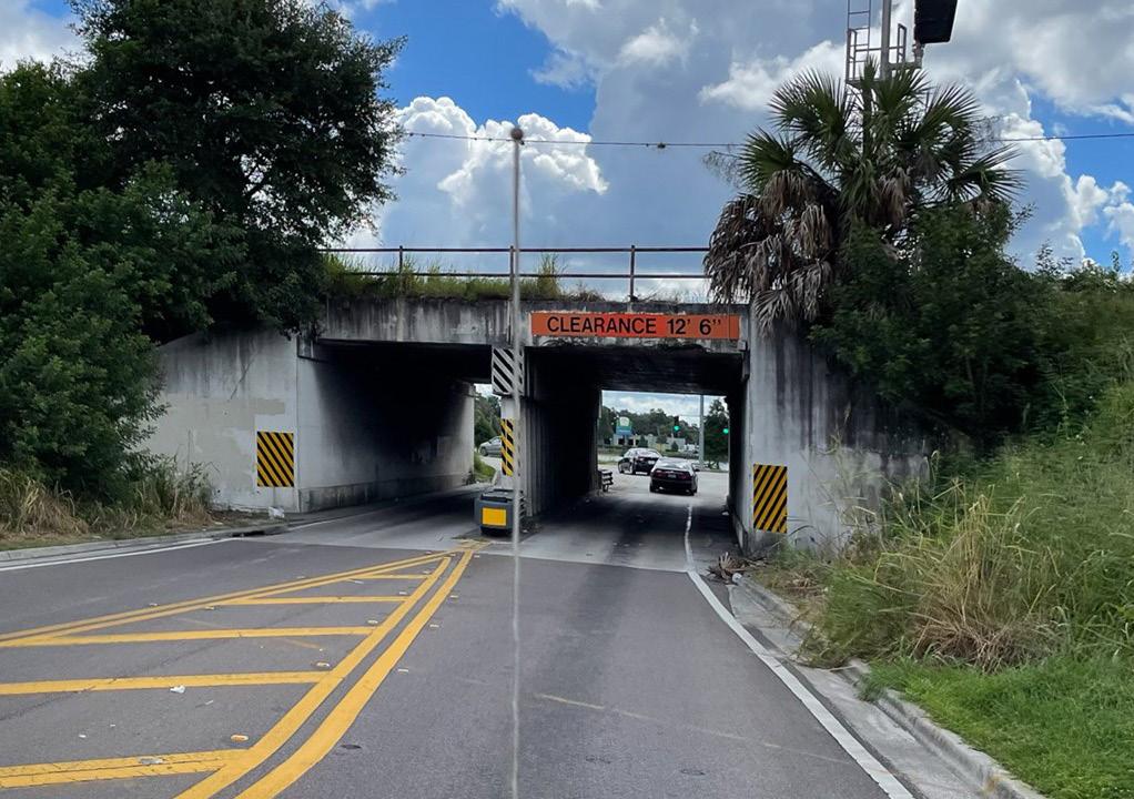
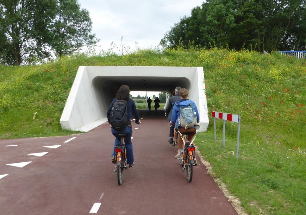
Recommendation: Work with FDOT and CSX to develop a feasibility study for a roundabout at the George Jenkins Boulevard / Bonnet Springs Boulevard / Sloan Avenue intersection including options for roadway and pedestrian improvements to the Sloan Avenue underpass.
Implementation Partners: CRA organizational lead; Transportation lead and coordination with FDOT; Public Works Engineering, Traffic Operations; Community Planning for public engagement and stakeholder/neighborhood coordination (including Bonnet Springs Park and Crescent Heights residents)
DESIGN STANDARDS [NLW-5]
Recommendation: Rezone to MF22 and develop design guidelines for the southeast corner of the North Lake Wire neighborhood bound by MLK, Jr. Avenue, Parker Street, North Florida Avenue, and George Jenkins Boulevard. This is a good location for increased density at the edge of the neighborhood. Development should target a density range of 24 to 30 units per acre and encourage higher densities adjacent to George Jenkins Boulevard transitioning to lower densities on the north more similar to the existing neighborhood.
Implementation Partners: Community Planning lead with support from CRA
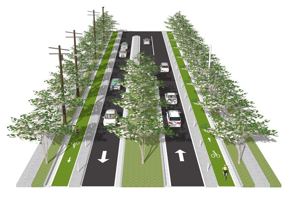
Recommendation: Develop a neighborhoodbased concept plan for a complete street on MLK , Jr. Avenue from Sikes Boulevard north to Memorial Boulevard. This street is potentially a significant bike and pedestrian connection from the neighborhood to Lake Wire and Downtown. As currently designed, the road is significantly under capacity and frequently above desired operating speed. During the public engagement process, the community recognized these issues that create a barrier through heart of the neighborhood. They were generally in favor of a complete street retrofit in principle, but differed on details. The concept plan process should evaluate the performance of the street for all users, including moving users like bikes, pedestrians, buses, and static users such as adjacent residents and businesses and consider mobility and placemaking goals of the neighborhood.
OLIVE STREET MULTI-USE TRAIL [WCB-5]: Continue planning for sidepath or multi-use trail in Olive Street rightof-way connecting the Westgate-Central Neighborhood to the north-south trail connections proposed from Lake Hunter along Hartsell Avenue to Lake Beulah and Bonnet Springs Park.
GEORGE JENKINS BOULEVARD INTERSECTION IMPROVEMENTS [NLW-2]: Plan for intersection improvements at George Jenkins and MLK to improve pedestrian safety and reduce the barrier effect of George Jenkins Boulevard for residents of North Lake Wire, allowing safer and more comfortable access to Lake Wire and Downtown.
MAGNOLIA SHARED SPACE TRAIL [LWD-2]: Study the reallocation of right-of-way space along Magnolia Street to introduce protected bike/pedestrian path. This is part of the major east west path system and could conceiveably be a safe bike and pedestrian connection along the south side of the Intown Bypass all the way to Mirrorton.
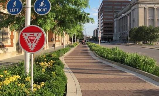
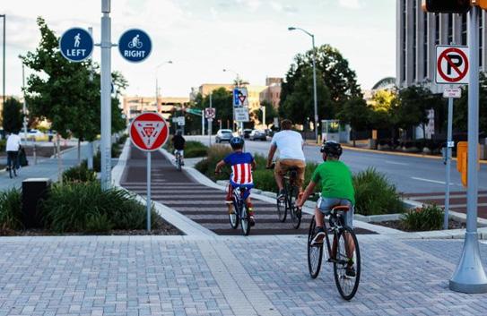
ARTS LOOP PATH [LWD-5]: Develop “branded” trail loop of wide (8’ +) sidewalks/trails on Main, Orange, and Lemon Streets linking Lake Mirror to Lake Beulah. Punctuate loop with a series of public art installations (supplementing current locations) and include wayfinding and interpretive signage.
I-MIX DISTRICT [WCB-7]: Consider developing an overlay or other zoning mechanism to allow compatible residential uses as a mixed-use option in lower-intensity industrial areas. This can allow for certain types of residential to be feasible development options in areas near established neighborhoods that are transitioning from industrial uses.
NORTH LAKE HUNTER STORMWATER PARK [LWD-6]: Implement a passive open space reconfiguration and expansion of the wetlands and stormwater ponds on the south end of the RP Funding Center site. This may be supplemented with trails and boardwalks to create a larger-scale natural park space connecting open spaces around Lake Hunter to Veterans Memorial Park.
Target Infill: Lake Beulah Overlook
Target Infill: Arts Gateway
Target Infill: Intermodal Center
Target Infill: Lime Street Corridor
Target Infill: New York Corridor