The design team wishes to extend heartfelt gratitude to the City of Plantation community for their invaluable contributions to the Plantation Central Park Master Plan. The community’s unwavering dedication and active involvement have been instrumental in crafting this visionary document. Their input, creative ideas, feedback, and ongoing participation have been pivotal in shaping the direction of this Master Plan. Additionally, we express our deep appreciation for the indispensable partnership with the Parks and Recreation Department staff, Advisory Board and Council Members. Their expertise, support, and collaborative spirit have provided essential insights and practical solutions, significantly enriching the substance and vision of this report. Their commitment to our shared goals has been a driving force behind the success of this project.
This Master Plan stands as a testament to the remarkable power of collaboration and community engagement. It embodies the shared vision, dedication, and collective commitment of all involved parties. The entire team eagerly anticipates witnessing the profoundly positive impact of this plan on the City of Plantation’s parks and the lives of its cherished residents.
Prepared by WJ Architects, Inc.
815 NW 57th Avenue Suite #219
Miami, FL 33126
Diego Martinez - Project Manager Diego@wjarc.com
Jason Jensen
Natalia Livian
Jamison Sweat
Art Terry
WITH
GAI Community Solutions Group
618 E. South Street, Suite 700 Orlando, Florida 32801
• Development Standards of General Applicability Sec. 27-290
- Parcel Numbers
- Zoning District
- Future Land Use
- Neighboring Zoning Districts
• Development Standards Matrix - NonResidential Zoning Districts
• Off-Street / On Street Parking Regulations: Sec. 27-123
- Requirements for recreational and community facilities either public or private
• Site Scope
- Federal Regulations
- State Regulations
- Local Regulations
- Conclusion
- Easement Exhibit
• Recreational Building Scope
- Federal Regulations
- Local Regulations
III. PROGRAM EFFECTIVENESS
• Site Scope
- Outdoor Sport Facilities
- Aquatic Center
- Outdoor Amenities
- ADA Improvements
- Wayfinding and Signage
- Pedestrian Circulation
- Vehicular Circulation
- Conclusion
• Recreation Center Building Scope
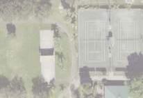
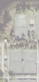
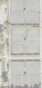
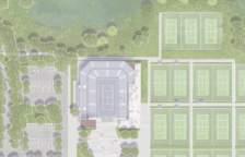
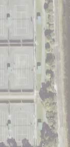
• Tennis Center Building Scope
• Restroom Building Scope
- Soccer Pavilion and Corporate Pavilion
• Conclusion
IV. CONSTRUCTION COST ESTIMATES
• Phase 1
• Phase 2
• Phase 3
• Wayfinding
V. PARKING CALCULATION
• Parking Requirements per Program
- City of Delray Beach
- City of Doral: (Land Development Code sec 77-737)
- City of St. Petesburg: (Use Permissions and Parking - Requirements Matrix and Zoning Matrix)
• Parking Calculation Table
EXECUTIVE SUMMARY
The planning of the Plantation Central Park master plan is the result of a collaborative effort that included the Parks and Recreation Department, City staff, and community stakeholders. Its core purpose is to establish a comprehensive evaluation framework to guide the selection of an appropriate redevelopment approach that effectively embodies the goals and aspirations that align with the City of Plantation Parks & Recreation Master Plan. The active engagement of community participants during the initial two phases of development underscores the inclusivity and collective ownership of this endeavor.
Distinguished by its profound significance in the community’s historical context, Plantation Central Park serves as a focal point, like a town square, offering an array of activities such as sports, family gatherings, political events, and various seasonal community celebrations like the Rock the Park concert series, the Trunk-or-Treat and the weekly Farmers Markets. The exhaustive investigation of three Master Plan development options, categorized as two moderate options and a major option, illustrates the thoroughness of the process. Each alternative was developed based on a comprehensive analysis of the park’s existing conditions, inherent opportunities, and pertinent constraints identified during the initial phase of the process.
The objective of each proposed alternative is to address the needs and deficiencies of the existing park, pool, recreational building, and tennis complex while simultaneously fostering adaptability to accommodate future demands and trends. Notably, the Master Plan concepts place an emphasis on the prioritization of core facility requirements, while strategically considering the necessary
sequence and phasing of construction to ensure seamless service continuity and uninterrupted use of the fields during the renovation periods.
The Plantation Central Park master plan seeks to elevate the park’s profile by enhancing its offerings and amenities. This process is focused towards fulfilling the dynamic requirements of the community and cultivating a vibrant, multifunctional space conducive to fostering an inclusive and cohesive social environment.
As a result of the initial community feedback, staff input, and due diligence, elements from the three options presented were selected and one final master plan divided in three phases emerged as the preferred option to move forward with a Master Plan. The decision to proceed with the proposed configuration of the new recreational building, parking layout, and park enhancements and reconfiguration aligns closely with the city’s overarching vision for Central Park, reflecting their commitment to creating a vibrant and functional community space.
DISCOVERY PERIOD AND EVALUATION OF MASTER PLAN
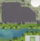
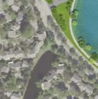
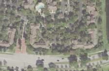
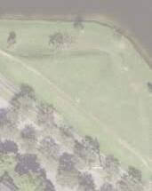
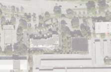
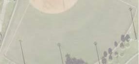
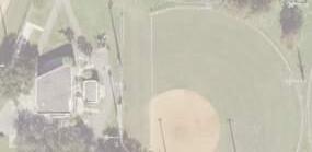
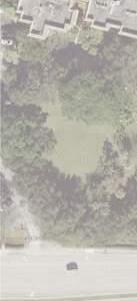
Plantation Central Park was originally inaugurated in 1982, located at 600 Central Park Drive in the heart of Broward County. The original park was built on 77 acres of land that was purchased in 1979. The visionary project was conceived to cater to the needs of the community which at the time included a population of 50,000 people and was steadily increasing. The parks initial infrastructure upon its completion in 1982 offered an array of athletic amenities that included:
• 8 baseball and softball fields
• 3 multi-purpose fields
• 2 press boxes, fully equipped for scorekeeping, situated strategically in the multi-purpose fields.
• 2 story multi-purpose Recreational Center structure housing essential facilities such as concessions, storage facilities, and restrooms.
• Cutting-edge Musco field lighting, still in operational use today, illuminating all 8 baseball fields.
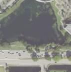
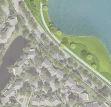
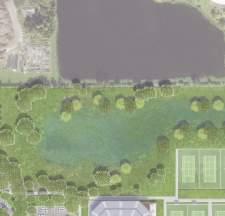
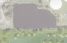
• 1-mile exercise/walking trail throughout and around an 8.5-acre lake.
In response to the exponential growth in population and the surging participation in youth sports programs, notably the Police Athletic League (PAL), a series of enhancements and supplementary amenities were introduced over the years, culminating in a substantial expansion initiative undertaken in 2002. These amenities included:
• The incorporation of fitness stations along the existing exercise and walking trail.
• The enlargement of parking facilities to accommodate the growing number of visitors.
• Illuminated walkways to enhance accessibility and safety.
• An awards pavilion, serving as a fitting backdrop for ceremonies.
• A community playground
In 2002 the city had surpassed a population of 84,000 residents and the city youth athletic program was achieving unprecedented popularity. With this, the city took the decision of expanding Central Park and acquired an additional 30 acres of land to facilitate the development of:
• 4 multi-purpose athletic fields spanning a combined 11 acres, equipped with state-of-the-art Musco field lighting.
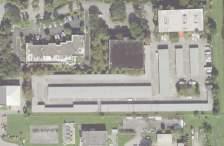
• A new 5,800-square-foot structure housing essential functions such as a maintenance office, secondary concession facilities, and restrooms designed with ADA accessibility in mind.
• The integration of 1.5 miles of supplementary walkways, thoughtfully illuminated throughout the park.
• The provision of designated bleacher pads to enhance the spectator experience during events and competitions.
In 2023, the design team consisting of Wannemacher Jensen Architects, GAI Consultants and Sports Facilities Agecy was hired by the city to re-envision and develop a master plan for Central Park. In the initial stages, the team developed three concept designs for the site. The three concepts were designed to provide the full list of program elements expressed as desirable by the city, stakeholders, and the community.
Concept 1 “Moderate”
Among the three proposed concepts, Moderate Concept 1 was designed to minimize alterations to the site. It primarily focused on limited site modifications to accommodate additions such as playgrounds, expanded walking paths, parking enhancements, and the construction of a new recreation center. Additionally, this concept introduced a new Tennis Center building as part of its development.
Key takeaways from Concept 1:
• Keeping the Running track.
• Making walking paths larger throughout the park.
• Improve orientation and size of baseball fields.
• Relocated Event Lawn and stage to be centrally located.
• Proposed more parking spaces at the northwest corner along Central Park drive.
• Proposed new location of the new Recreational Center.
Concept 2 “Moderate”
In contrast to the previous concept, Moderate Concept 2 features more extensive enhancements and development throughout the park. It includes a greater number of site modifications to accommodate new playgrounds, expanded walking paths and increased parking capacity, and a new Tennis Center building. In addition, the proposed recreation center was enlarged to accommodate more indoor programs and activities.
Key takeaways from Concept 2:
• Proposed new location of outdoor basketball courts with a covered structure.
• Proposed new parking layout next to the pool area.
• Proposed keeping both the existing recreational center and the new recreational center.
• The addition of another entry point to the park along Park Central Drive.
Concept 3 “Major”
Moderate Concept 3 can be characterized by its substantial impact on the site, making it the option that brings about significant changes to the parks layout and introduces extensive alterations. It encompasses several proposed changes outlined in the other two concepts, along with the addition of a larger recreational center that would house a triple gym and an auditorium component. This concept also proposed a new Tennis Center building that incorporates a new stadium to be used for large events and competitions.
Key takeaways from Concept 3:
• Proposed new stadium with programming space for events and competitions.
• Larger program for the new Recreational Center.
• A new playground adjacent to the new Recreational Center.
• Proposed adjacency between the multi-purpose lawn with the new playground and Recreation Center.
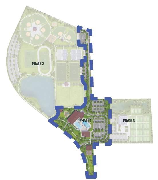
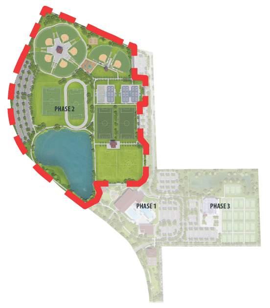
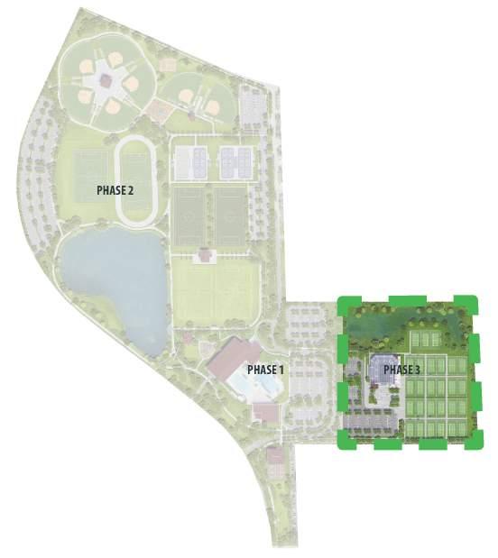
During the planning and design phases, it became evident that each of the initially proposed concepts had its own set of strengths and weaknesses. The city, in collaboration with the design team, recognized the potential for creating a more comprehensive and well-rounded Master Plan by combining the advantages presented by all three initial concepts. This decision was born out of a desire to leverage the best elements of each concept, thus optimizing the overall functionality, aesthetics, and usability of the future Plantation Central Park. To execute this unified vision effectively, the Master Plan was divided into three phases, each carefully structured to address specific aspects of the park’s development, ensuring a methodical and coherent approach to its transformation.
Evaluation of the Final Master Plan will be based upon the following criteria:
1. Physical Constructability: based upon known site conditions, availability of utilities and adjacent land uses. Does the proposed Master Plan offer a reasonable construction process?
2. Regulatory Compliance: How do current local, state, or federal regulations regarding land use and/or the environment favor the proposed concept design?
3. Partnership Compatibility: In which ways is the proposed concept likely to attract a private development partner, if any?
4. Program Effectiveness: Does the proposed Master Plan, buildings and site improvements, meet the requested program elements of the city, the stakeholders, and/or the public?
5. Construction Cost Estimates: What is the proposed capital outlay for the design concept?
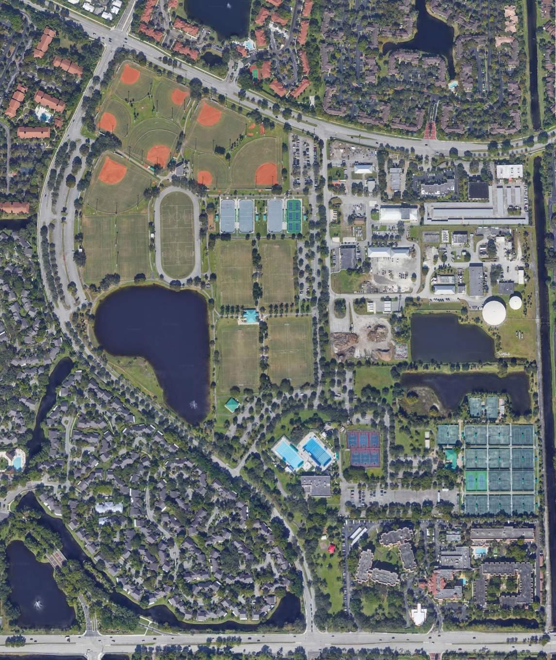
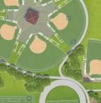
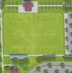
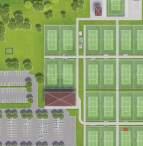
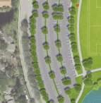
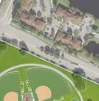
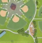
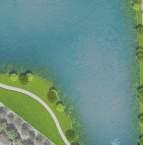
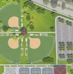
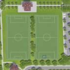
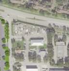
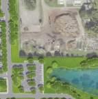
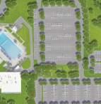
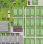
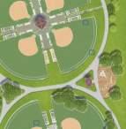
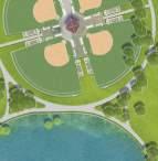
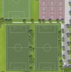
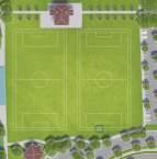
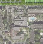
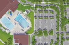
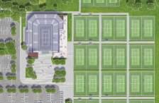
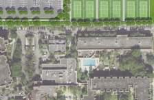
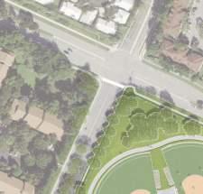
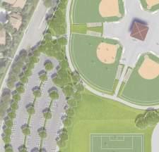
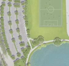
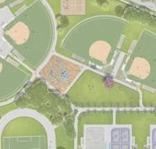
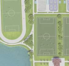
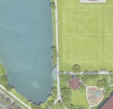
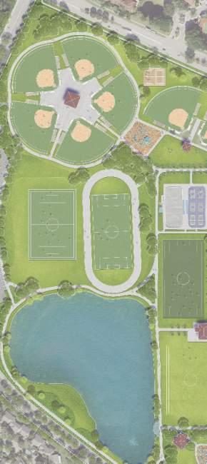
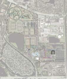
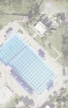
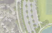
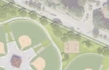
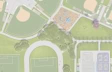
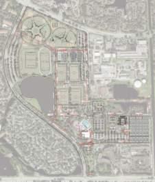
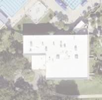
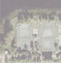
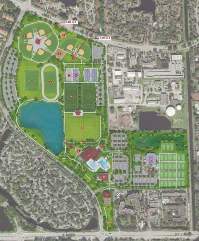
SITE PLAN & FLOOR PLAN
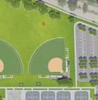
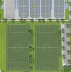
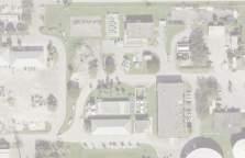
Plantation Central Park Site Plan
(7) Baseball/So!ball Diamonds
Concession/Restroom
(2) Beach Volleyball Courts
Playground
320’x210’ Soccer Field
Running Track with 360’x 180’ Soccer Field
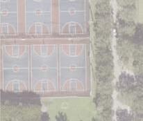
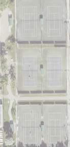
Hockey Rink
(18) Pickleball courts
(2) Ar"ficial Turf 360’x 180’ Soccer Fields
Event Lawn with (2) 360’x180’ Fields
Overlook
Stage
Overflow Parking
Recrea"on Center
Splash pad & Pool area
Courtyard
Exis"ng recrea"on center
Tennis Stadium
Tennis Center Plaza
(4) Covered Basketball Courts
Off-Street Parking
Big and Small Dog Park with shade structures
Exis"ng Parking Count: 1,133
Provided Parking Count: 1,584
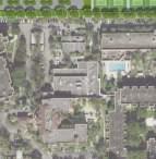
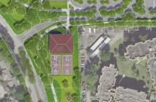
Recreation Center Floor Plans
BUILDING PROGRAM LEGEND
COMMONS / CIRCULATION
ADMINISTRATION OFFICES
VERTICAL CIRCULATION
UTILITY STORAGE / BUILIDING SUPPORT
RESTROOMS / CHANGING ROOMS
LIFE GUARD / AQUATICS
GYM / FITNESS/ DANCE / AEROBICS
CONCESSIONS / CAFE/ KITCHEN
AUDITORIUM / STAGE / ACTIVITY ROOMS
LEVEL 1 TOTAL PROGRAM AREA = 43,575 SF
LEVEL 1 BUILT FOOTPRINT = 46,260 SF
TOTAL BUILT ARE (LEVEL 1 AND LEVEL 2) = 66,240 SF
Recreation Center - Ground Level
ADMINISTRATION
VERTICAL
UTILITY
RESTROOMS
TRACK
KITCHEN
MEETING
Tennis Center Stadium Floor Plans
BUILDING PROGRAM LEGEND
COMMONS / CIRCULATION
VERTICAL CIRCULATION UTILITY STORAGE / BUILIDING SUPPORT
I. PHYSICAL CONSTRUCTABILITY
Based on the information provided by the city and the site reconnaissance conducted by the design team, no critical limitations have been identified that would impede the redevelopment of Plantation Central Park in alignment with the proposed phasing of the Concept Master Plan presented.
An evaluation of available utilities including potable water, sewer and re-use water indicates that utility capacity exists for the redevelopment of the park. The existing stormwater infrastructure that surrounds the site also appears adequate to support the project’s development.
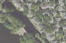
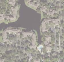
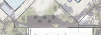
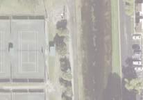
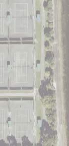
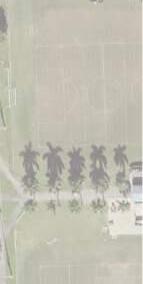
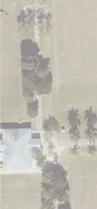
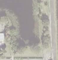
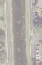
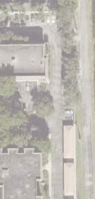
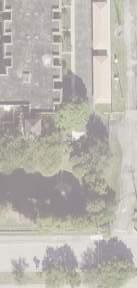
Constructability challenges for this site mainly include the presence of burrowing owls’ nests, the existing wells to remain, and the existing bodies of water. The burrowing owls are a protected species in the state of Florida. Their habitats should be preserved whenever possible. Their relocation is required if there are hardscape changes within a 15 feet radius of the nest. Relocation strategies are available if needed. The existing wells to remain are categorized as water wells and monitoring wells. The master plan design was careful to not affect them. There are two existing bodies of water, the large pond, and the wetland area North of the tennis courts. Like the owls, the wetland is also a protected area that should not be modified. The teams collaborated to find new approaches and creative solutions to work around these challenges.
1. Existing Location of Burrowing Owl Nests:
• The presence of Burrowing Owl nests in the project area necessitates an environmental report to analyze and document the owls, their habitats and surrounding environments. The owls are a protected species under Rule 68A-27, F.A.C, and the Federal Migratory Bird Treaty Act. These protective measures extend not only to the owls themselves but also to their habitats and surroundings.
• To address this concern, it is imperative to have a certified biologist as an integral part of the project team. Their expertise is pivotal in conducting video scoping and, if needed, relocating the owl burrows. This process is tightly regulated due to the potential impact on the owls and their essential behavioral patterns, including breeding, feeding, and sheltering.
• Recent developments in conservation regulations have made protocols for surveying, permitting, and relocation more stringent. In 2017, the Florida Burrowing Owl was officially reclassified from a species of special concern to a state-designated threatened species, highlighting the heightened importance of their protection.
• The Florida Fish and Wildlife Conservation Commission (FWC) has issued Species Conservation Measures and Permitting Guidelines, which include specific requirements for conducting surveys and relocating burrows. Notably, the biologist responsible for this work must meet certain experience thresholds, indicating the specialized nature of this task.
• Early-stage project planning surveys play a pivotal role in identifying Burrowing Owl burrows within the project area. These surveys inform the development of appropriate avoidance, minimization, and mitigation measures to ensure the owls’ welfare.
• The scope of these surveys varies depending on the project’s scale:
- For small-scale projects (one acre or less), comprehensive surveys involving the documentation of potentially occupied and abandoned burrows are required.
- Larger-scale projects (greater than one acre) can employ parallel transects to detect and record burrow locations, with careful consideration given to survey visibility.
• Project planning surveys must cover 100% of potential habitat on the project site, and the area within 33 feet of the project footprint must also be surveyed to identify burrows that may be impacted.
• Surveys should be conducted no more than 90 days prior to the submission of a permit application.
• It’s essential to note that the use of a burrow scope in Potentially occupied burrows is considered take and is prohibited without a permit.
In conclusion, a thorough understanding of the regulations and best practices related to Burrowing Owl preservation is paramount to the successful development of Plantation Central Park. The presence of a certified biologist and adherence to these guidelines will ensure that the project proceeds in a manner that respects the ecological integrity of the area while also meeting the community’s needs.
2. Existing Wetlands and Bodies of Water:
To effectively address the complex environmental factors associated with the project and minimize potential delays, the project team must include an experienced environmental consultant. This consultant’s expertise will prove invaluable in navigating Florida’s intricate environmental regulations. Of particular concern is the presence of a sizable body of water covering approximately 9.10 acres and an adjoining wetland spanning about 3.9 acres, both classified as freshwater ponds (PUBHx).
The Florida Environmental Resources Permit (ERP) Program, jointly administered by the Florida Department of Environmental Protection (FLDEP) and regional Water Management Districts (WMDs), imposes stringent regulations on activities that affect surface water flows, including those generating stormwater runoff and altering wetlands. The ERP program sets a fundamental standard that activities must not adversely impact water resources, including water quality, quantity, and the ecological value of wetlands. It operates independently of the federal §404 program and securing both state and federal permits is essential. Therefore, having an environmental consultant on the team is crucial to navigate these regulations and ensure successful project execution while safeguarding Florida’s natural resources.
3. Existing Locations of Water Wells:
An existing water well is defined as a well that currently supplies or has the potential to supply water for consumption by a community water system.
The Broward County Commission has recently approved a revision to the wellfield protection ordinance, which was initially adopted in June 2013. This ordinance, found in Chapter 27, Article XIII of the Broward County Code of Ordinances, delineates wellfield protection zones and includes all wells located within Plantation Central Park.
Both the Federal Government and the State of Florida have established programs aimed at safeguarding sources of public drinking water. The Environmental Protection Agency (EPA) administers the federal program. Concurrently, the State of Florida manages its program through the Florida Department of Environmental Protection (FDEP). These initiatives collectively work to protect and preserve the quality and safety of public drinking water sources.
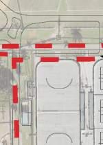
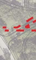
Well Locations Exhibit
Monitoring Wells Water Wells
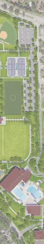
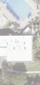
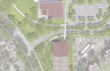
Phase 1: Recreation Center and Vehicular Access
Phase 1 of the proposed Master Plan will serve as the initial stage, focusing on the central infrastructure that binds the entire project together. A key element of this phase is the establishment of a new primary vehicular access road, which will seamlessly connect all areas of the park. The new access road will be designed to facilitate the connection to parking facilities in proximity to various park components, ensuring convenient access for visitors and staff. Furthermore, drop-off areas will be incorporated to serve both the new and existing Recreational Centers.
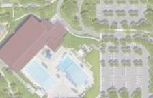
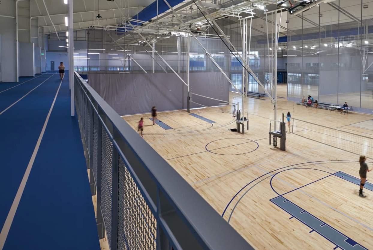
The construction of the new Recreational Center and Aquatic Center will be executed while the existing facility remains fully operational. The new Recreational Center will offer an array of amenities, including a triple gym equipped with an overhead running and walking track, and a multi-use auditorium to host a variety of events. Included is a wellness center featuring multifunctional spaces tailored for fitness classes. Additionally, the building will house offices and support spaces for the aquatic department. The program also encompasses diverse community spaces, a café, concession facilities, locker rooms, bathrooms, and storage areas.
Within the existing pool area, an expansion of the pool deck is planned to accommodate team gatherings during events and pool meets. A new splash pad will be integrated into a location near the New Recreational Center, enhancing the overall aquatic experience within the park.
Upon the completion of the new Recreational Center, the existing Recreational Center building will undergo an extensive interior renovation. This renovated space will serve as the dedicated offices for the City of Plantation Park and Recreation Department.
There are several site enhancements which are planned during Phase 1. These include the installation of a wider walking path and the creation of a playground adjacent to the new Recreational Center. Additionally, the existing corporate pavilion will undergo significant renovations. South of the Recreational Center and Aquatic Center, four new outdoor basketball courts and shade structure. Adjacent to these basketball courts, a dog park will be incorporated, featuring separate areas for both large and small dogs.
Phase 2 : Fields and Park Enhancements
During Phase 2 of the development plan, the focus will primarily be on the construction of various park and field components. To ensure minimal disruption to ongoing activities and leagues, this phase will be divided into two distinct parts.
The initial part of Phase 2 will involve the construction of the northwest corner of the park, encompassing all the baseball fields, two multipurpose fields, the walkways surrounding the lake, and the parking facilities along the western edge adjacent to Central Park Drive. During this initial part, certain areas will remain accessible to the public. These include the four multipurpose fields situated to the south, along with the restroom and concession building, as well as all pickleball courts and the skating rink, along with their respective surrounding walkways. Parking facilities completed in Phase 1, located on the eastern side of the site and at the new Recreational Center, will also be available for use during the initial construction of Phase 2.
Baseball/Softball/
Soccer/Lacrosse/ Football66
Skating Rink11
Sand Volleyball02
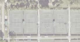
Pickleball Courts1718
Restroom Builidng / Concessions23
Playground22
Walkways8’- 9’12’-15’
For the second part of Phase 2, all the areas that underwent construction in the initial portion will be reopened to the public. This strategic approach ensures that the park can continue hosting activities and events throughout the entirety of Phase 2. During this phase, construction activities will shift to the multipurpose fields in the southern section, including the renovation of the existing restroom and concession building, and all pickleball courts and the skating rink. At this juncture, visitors will have access to the parking areas established in Phase 1, as well as the new parking lot situated on the western side along Central Park Drive.
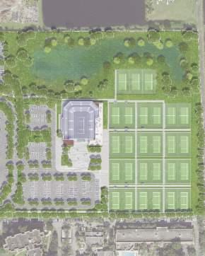
Like previous phases, Phase 3 will be divided into two distinct portions of construction to minimize disruption to the operations of the Tennis Center.
The initial portion of construction will focus primarily on the north side of the Tennis Center. Here, the new ‘state of the art’ Stadium and Tennis building program will be developed. Alongside the construction of eight tennis courts and their accompanying walkways. Additionally, this phase will include work on the parking area, which will be designed to accommodate media needs during events. This approach will enable the existing tennis building to remain operational, while 18 other courts will remain accessible to the community, along with a portion of the existing parking facilities.
In the subsequent portion of construction, the Stadium with the Tennis Center program will be fully accessible, alongside the eight renovated tennis courts and newly completed parking facilities. During this phase, the demolition of the existing Tennis Center building will be undertaken, making way for the proposed Tennis Plaza. This open space will serve as a multifunction area for gatherings and various multipurpose events. Additionally, the remaining 18 tennis courts, walkways, and parking facilities will undergo construction, effectively marking the final stage of development within the comprehensive Master Plan for the Park. This phased approach ensures a smooth and efficient transition throughout the entirety of Phase 3, preserving the operational integrity of the Tennis Center while advancing the transformational vision for the park.
Phase 3 : Veltri Tennis Center
Conclusion:
While constructability challenges are expected to be minimal, there are several crucial environmental factors that must be considered during the implementation of the proposed phases. These challenges include the existing locations of Burrowing owl nests and drainage wells. However, it is worth highlighting that utility capacity is readily available, and there are no significant environmental concerns that would pose obstacles to the successful realization of the proposed development phases.
To provide further guidance for budget considerations, it is advisable to commission a geotechnical report. This report will serve to assess the potential impact of unsuitable soil conditions on structural requirements, the need for storm drain ponds, or the presence of contaminants such as arsenic. The findings from the geotechnical report can significantly influence the overall budget and scope of the proposed Master Plan. Therefore, conducting this evaluation is essential for prudent project management and trying to proactively address any potential unforeseen challenges.
Stormwater Constructability
Stormwater Design:
The stormwater management system will need to be sized to treat the first inch of runoff from the developed project, or the total runoff of 2.5 inches times the percentage of imperviousness, whichever is greater. The stormwater management system will be required to attenuate (reduce) the stormwater discharge rate to not exceed the historical stormwater runoff rate. SFWMD requires that attenuation accommodate the 25-year, 72-hour rainfall event. The project site utilizes two onsite wet retention ponds that ultimately outfall to Canal #2 within the OPWCD. Special care shall be shown when modifying the stormwater management system to maintain existing conditions or provide a net benefit to the OPWCD systems. The site may also need to be evaluated for pollutant discharge. The West Hollywood Canal is impaired for Dissolved Oxygen.
The addition of the wet pond to the east of the project site in SFWMD permit number 06-00220-S does not account for any additional water quality treatment volume through future expansions. 1-inch of stormwater runoff over the project area (approximately 110-acres) continues to govern the water quality volume requirements of the park with the proposed improvements. The proposed work increases the impervious area to an approximate total of 41-acres. The addition of the new impervious area may require pond expansion, additional stormwater storage, and/or control structure modification to ensure flood staging and attenuation meet or improve existing conditions.
Stormwater Phasing:
Both onsite wet ponds are eligible to be expanded as needed to accommodate additional stormwater treatment and storage. The pond on the west of the project site should be expanded during Phase 1 of construction to provide storage and treatment to the new recreation center, basketball courts, entrance road, pickleball courts, and baseball restroom facilities. The elimination of several regions of existing impervious areas in Phase 1 will proportionately offset the treatment requirement by the proposed improvements. Improvements in Phase 2 can be stored and treated in new retention areas proposed to reduce or eliminate the need to alter the wet pond on the west of the project site. Care must be taken to maintain or improve the discharge attenuation into the Central Park Drive stormwater trunk line. The existing control structure in the pond may need to be modified or replaced to achieve this.
The pond to the east of the project site can be expanded during Phase 3 of construction to accommodate the proposed tennis stadium and associated parking lot. This pond ultimately outfalls to OPWCD Canal #2. OPWCD requires stormwater discharge into Canal #2 to be maintained or improved in association with any proposed changes. The existing control structure in the pond may need to be modified or replaced to achieve this. Additional coordination with OPWCD may be required to accurately expand the capacity of the pond.
Any existing stormwater infrastructure located beneath proposed buildings will be required to be demolished and relocated to accommodate construction feasibility. Rain leaders from the proposed buildings can be tied directly into the proposed stormwater infrastructure. Stormwater conveyance piping should be stubbed out in earlier phases of construction to accommodate later phases with minimal impacts to the systems installed earlier. Plantation Central Park is phased in a way that stormwater infrastructure improvements in each phase can be constructed without the need to tie into future expansion.
Utility Design:
Potable Water
The final connection location(s) for the project site would be determined following additional utility survey data collection and coordination with City Wastewater, the Utilities Department, and the project’s Mechanical, Electrical, and Plumbing (MEP) engineer. The project will be subject to water and wastewater connection fees based on the specific use and size of the proposed structures.
An 8 inch DIP water main provides service to the existing park facility. Water main lines located beneath the newly proposed buildings will be relocated to accommodate construction feasibility. New water services will have to be provided to the baseball bathroom facilities to the north of the project site, the new Recreation Center building, and the Tennis Stadium.
The difference between the existing and the proposed fixture unit counts was evaluated to determine the necessity of upgrading existing utility sizes. 28 lavatories, 26 water closets, 7 urinals, and 10 drinking fountains currently in Plantation Central Park are proposed to increase to 42 lavatories, 96 water closets, 15 urinals, and 18 drinking fountains per the master plan. This increase in domestic water demand does not warrant an increase to the existing 8 inch DIP water main. Provide 2 inch or 3 inch domestic services to each proposed building as necessary. See the attached fixture unit breakdown spreadsheets.
The existing 8 inch DIP water main also provides fire service throughout the park. The construction of the new Recreation Center will require new fire hydrant locations to be adequately serviced. Additionally, the proposed parking lot and through-road layout require the relocation of several fire hydrants to maintain feasible service areas. See the attached utility exhibit.
Sanitary Sewer
The final connection location(s) for the project site would be determined following additional utility survey data collection and coordination with City Wastewater, the Utilities Department, and the project’s Mechanical, Electrical, and Plumbing (MEP) engineer. The project will be subject to water and wastewater connection fees based on the specific use and size of the proposed structures.
Four sanitary lift stations serve Plantation Central Park. Lift station one is located at the existing soccer field restroom facility. Lift station two is located to the south of the existing soccer fields. Lift station three is located to the north of the existing basketball courts. Lift station four is located at the existing tennis court restroom facility. The 2-inch PE sanitary force main increases to 4-inch PVC at the outfall of lift station three. The sanitary force main ultimately outfalls to a sanitary manhole and 8-inch gravity sewer line at the south of the project site. The facilities at the soccer fields are proposed to remain and therefore lift stations one and two can remain. The proposed project requires the elimination/ relocation of lift stations three and four. New sanitary services will have to be provided to the baseball bathroom facilities to the north of the project site, the new Recreation Center, and the Tennis Stadium. New lift stations will be sized to accommodate the increased wastewater demands posed by the proposed buildings. Existing sanitary sewer lines beneath the new Recreation Center will be resized and relocated to accommodate construction feasibility.
The difference between the existing and the proposed fixture unit counts was evaluated to determine the necessity of upgrading existing utility sizes. 28 lavatories, 26 water closets, 7 urinals, and 10 drinking fountains currently in Plantation Central Park are proposed to increase to 46 lavatories, 96 water closets, 15 urinals, and 18 drinking fountains per the master plan. This increase in wastewater demand does not warrant an increase to the existing 4-inch force main line. The existing 2-inch force main at lift station four near the Tennis will require upgrade to a 4-inch force main with the construction of the proposed Tennis Stadium. See the attached fixture unit breakdown spreadsheets.
Power and Communications:
The final connection location(s) for the project site would be determined following additional utility survey data collection and coordination with City Wastewater, the Utilities Department, and the project’s Mechanical, Electrical, and Plumbing (MEP) engineer. The project will be subject to water and wastewater connection fees based on the specific use and size of the proposed structures.
Third-party utility providers did not provide mapping of their facilities at the time of this report issuance.
Utility Phasing:
Phase 1 of the Central Park master plan includes the construction of the new Recreation Center and the relocation of the basketball courts. The existing 8-inch DIP water main and 4-inch PVC sanitary force main lie beneath the proposed location of the new Recreation Center. These utilities will require relocation to accommodate construction feasibility. Sanitary and domestic water services will need to be provided to the Recreation Center building and the basketball court restroom facility. These facilities are the only additional demand on the existing domestic water and sanitary sewer systems during this phase of construction. The basketball court facilities can connect wastewater service to the nearby sanitary manhole and gravity line. Additionally, the water line stubbed out in front of the existing Recreation Center can be extended to accommodate the basketball facilities. Lift station three falls within the proposed parking lot in this phase. A new location for a new lift station is proposed along the park entrance through-road. The lift station will be designed to accommodate the additional wastewater demand of the new Recreation Center and basketball restrooms. The water main and services necessary for Phase 3 of the master plan will be stubbed out during Phase 1 to
limit future construction impact on the utilities installed during Phase 1. Water and wastewater services to both soccer field restroom facilities, around lift stations one and two, the existing Recreation Center, and tennis court restroom facilities shall be maintained during Phase 1 construction.
Phase 2 of the Central Park master plan includes the construction of the new baseball field facilities. The soccer field improvements and pickleball relocation have no impact on Phase 2 utilities. Sanitary and domestic water services will need to be provided to the proposed baseball restroom/ concession facilities. Both proposed services reside within the Central Park Drive right-of-way. The utilities proposed during this phase do not have any impact on the other two phases of the master plan. No existing utilities within Phase 2 need to be maintained during the construction of Phase 2.
Phase 3 of the Central Park master plan includes the construction of the new Tennis Stadium and associated facilities. Sanitary and domestic water services will need to be provided to the proposed Tennis Stadium. Lift station four falls within the proposed footprint of the new tennis facilities. A new location for a new lift station is proposed adjacent to the new parking lot. The lift station will be designed to accommodate the additional wastewater demand of the new Tennis Stadium. With the water main previously stubbed out during Phase 1 construction, Phase 3 will be able to be constructed with no impacts to Phase 1 or its facilities. No existing utilities within Phase 3 need to be maintained during the construction of Phase 3. Water and wastewater services to both soccer field restroom facilities, the existing Recreation Center, and the new Recreation Center shall be maintained during Phase 3 construction.
Page intentionally left blank
Utility Exhibit
Proposed Sanitary
Existing Sanitary
Proposed Water
Existing Water
Proposed Fire Hydrant
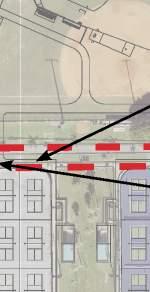
Location Map
Proposed 8” DIP Water Main
Existing Lift Station #2
Existing 8” DIP Water Main
Existing point of connection to water service for proposed South facilities
Existing PE Sanita Forcema
Existing 8” DIP Water Main
Proposed Lift Station #3
Existing 8” DIP Water Main
Proposed 4” PVC Sanitary Forcemain
Proposed Lift Station #4
Existing 4” PVC Sanitary Forcemain
Existing 12” Gravity Sanitary Line
Existing Sanitary Manholes
Existing point of connection to sanitary service for proposed South facilities
Utility Exhibit
Proposed Sanitary
Existing Sanitary
Proposed Water
Existing Water
Proposed Fire Hydrant
Location Map
Proposed 8” DIP Water Main
Existing Lift Station #2
Existing 8” DIP Water Main
Existing point of connection to water service for proposed South facilities
Existing PE Sanita Forcema
Existing 8” DIP Water Main
Proposed Lift Station #3
Existing 8” DIP Water Main
Proposed 4” PVC Sanitary Forcemain
Proposed Lift Station #4
Existing 4” PVC Sanitary Forcemain
Existing 12” Gravity Sanitary Line
Existing Sanitary Manholes
Existing point of connection to sanitary service for proposed South facilities
Wayfinding and Location Plans
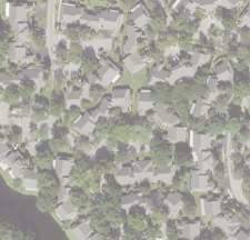
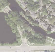
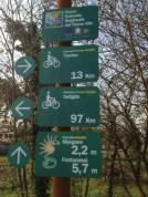
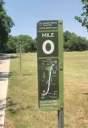
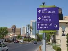
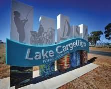
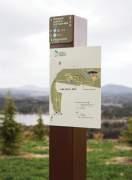
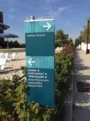
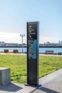
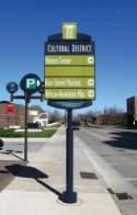
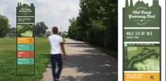
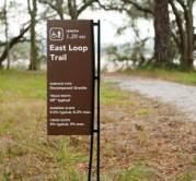
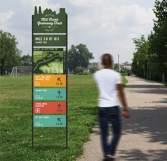
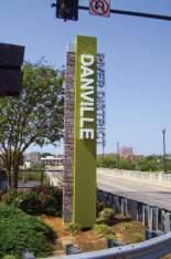
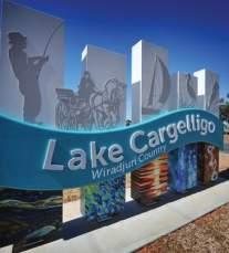
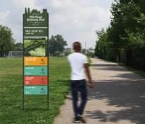
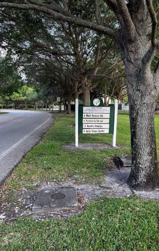
Wayfinding is an essential component to the way people navigate and experience their surroundings. The system designed for Plantation Central Park needs to be distinct, yet efficient in guiding vehicular and pedestrian circulation. Proper signage will serve as a tool for users to find park entrances, parking locations, specific amenities, or any other destination they may seek while inside the park. Plantation Central Park is a hidden gem within Plantation, although it is currently not very visible from the streets and roadways. The addition of signage will create a better connection between Plantation Central Park and the city; highlight the park’s presence; and clearly identify entry points, so that users can more easily access and enjoy the park.
Plantation Central Park should be safe and easy to navigate—incorporating a wayfinding system that is fully inclusive and caters to visitors with a wide range of abilities. In an effort to help users intuitively navigate the park, a family of signs was designed and strategically placed within the park to welcome, inform, and direct visitors. The design team developed a strategy for placement to optimize the number of signs required.
II. REGULATORY COMPLIANCE
Development Standards of General Applicability Sec. 27-290
Parcel Numbers:
• 504105310010 - Griffith Plat 152-29 B Parcel ‘X’ –
Owner: City of Plantation
• 504105060010 - Plantation Central Park Plat 113-26 B
Parcel A – Owner: City of Plantation
Zoning District:
S-CP (City Park)
Future Land Use: Park
Principal uses, and Structures permitted
(1) Parks, public or private, active, or passive including playgrounds, ballfields, interpretative trails, educational exhibits, and the like.
(2) Recreational facilities such as swimming pools, tennis courts, exercise, and activity rooms.
Accessory uses, and structures allowed
The following types of use are allowed when a part of, or accessory to, the principal use:
(1) Parking lots.
(2) Restrooms, rest areas, picnic facilities.
Review and approval process
On all future building permit requests where site plan design approval is obtained from the City Council or Administration as a condition precedent to obtaining building permits for the developments so approved, the plans and specifications for utility installations, on-site paving and drainage shall first be reviewed and approved as to existing codes, ordinances and resolutions by the Utilities Department and the City Engineer. Pursuant to section 5-11.
Neighboring Zoning Districts:
• PRD-15Q** – Residential Neighborhood on the West
• CF-P – Adjacent Municipal Facility Property at Northeast
• PRD-9Q – Residential Neighborhood on the North
• PRD-25Q – Adjacent Residential Neighborhood at Southeast
Development Standards Matrix - Non-Residential Zoning Districts
All standards for the development and/or use of property zoned S-CP shall be established pursuant to the site and development plan.
Sec. 27-89: Table 89-1 Dimensional Standards S-CP
ZoningDistrictS-CP
(minimum, feet)N/A
Height (maximum, feet/maximum stories)As Deemed by City Council
Building Setbacks (minimum, feet)As Deemed by City Council
Floor Area RatioN/A
Plot Coverage (maximum, percent)N/A
Off-Street / On Street Parking Regulations: Sec. 27-123
Requirements for Recreational and Community Facilities either Public or Private:
• Auditoriums or theater or assembly halls - 1 per 4 fixed seats plus 1 per 40 sq. ft. of floor area for movable seats.
• Recreation (commercial)—indoor - 1 per 200 sq. ft.
• Recreation (commercial)—outdoor - 1 per 200 sq. ft. of land area involved in such use.
• Gymnasiums or spectator sports with stadium seating; racetracks - 1 per 4 seats or 1 per 200 sq. ft.; whichever is greater.
• Government Administrative Office - 1 per 250 sq. ft.
• Community Center - 1 per 400 sq. ft.
• Racquet Sports Facility - Shall provide 3 spaces per court.
• Skating Rinks – 1 per 200 sq. ft.
• Publicly owned recreation buildings and facilitiesParking spaces in amount determined by the board to be reasonably adequate to serve the public.
• Landscaping requirements - All parking lots shall be landscaped in accordance with the provisions of Section 27-255
• Per section 27-124 – Uses not specifically mentioned: The requirements for off-street parking for any unspecified uses in this section shall be determined by the Planning, Zoning and Economic Development Director.
Other uses not listed have been calculated based upon other city or county regulations as listed in the parking calculation table provided (See page 71)
Site Scope
Federal Regulations:
The federal jurisdiction pertaining to any of the selected project concept options is primarily limited to specific areas of concern, as outlined below:
• Federal Wetland Impacts: Federal oversight extends to any potential impacts on wetlands or activities involving dredging and filling within Waters of the United States. The US Army Corps of Engineers holds jurisdiction over such matters.
• Endangered Species: The US Fish and Wildlife agency may exercise federal jurisdiction if there are federally listed plant or animal species on the project site. The protection and conservation of these species are of paramount importance.
• Burrowing Owls: The existing site houses nine nests of Burrowing Owls. In cases where habitat relocation is necessary, an evaluation process will be undertaken to ensure compliance with federal regulations.
State Regulations:
• EPA Cleanup Sites: Federal jurisdiction could come into play if there are any Environmental Protection Agency (EPA) cleanup sites located on or near the park site. Compliance with federal guidelines and potential intervention by federal agencies may be required in such instances.
As a proactive measure, it is crucial to conduct an Environmental Assessment Report to thoroughly evaluate the site. This assessment is essential to confirm that there are no EPA cleanup sites that necessitate federal intervention and to ensure compliance with all applicable federal regulations. By undertaking this assessment, potential issues can be identified and addressed appropriately to ensure the project aligns with federal requirements and environmental protection standards.
Jurisdiction over the project by the State of Florida is limited to permits required by the South Florida Water Management District including an Environmental Resource Permit for stormwater management and the Florida Department of Environmental Protection for any proposed expansion of the potable water and sanitary systems. In addition, the Florida Department of Health will have jurisdiction over the proposed aquatic facility for issuing a public swimming facility operating permit.
Water Management District:
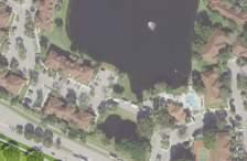
The proposed site is located within the jurisdiction of the South Florida Water Management District (SFWMD) and the Old Plantation Water Control District (OPWCD). The proposed stormwater management system may require an Environmental Resource Permit (ERP) modification issued by SFWMD, a permit issued through OPWCD, and review and approval by the City of Plantation and/or Broward County. Calculations will need to be prepared to show conformance with current SFWMD requirements. There is room within the site bounds to accommodate pond storage if required. Historic SFWMD permit number 06-00220-S was last modified in March 2001 to provide additional stormwater treatment and storage for the proposed 30.4-acre park expansion. A portion of the expansion was routed into the existing western wet pond and the remainder was routed to the proposed eastern wet pond. The proposed wet pond was connected to the (modified) existing control structure to maintain the existing stormwater basin routing.
The ERP application would be submitted electronically to the SFWMD ePermitting website. Upon receipt of the ERP application and construction documents, SFWMD has thirty (30) days to review the submitted information and supply either the permit or a request for additional information. The plans are to be revised and submitted if additional information is required. Once resubmitted, SFWMD begins the thirty (30) day review process over. Fees vary by the size of the phase and will be established at the time of permit. We anticipate a range of $1,200 to $4,500 per phase.
A site permit is required to be submitted for any project affecting canals within the OPWCD jurisdiction. Existing OPWCD permit modifications cost $1,500 for the first 5 acres, an additional $150 per subsequent acre (or fraction of an acre), and cost recovery for engineering/attorney services required. The city will review the stormwater management system as part of the Site Plan Development Review.
In addition, the Florida Department of Health will have jurisdiction over the proposed aquatic facility for issuing a public swimming facility operating permit.
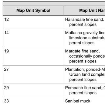
Natural Resources Conservation Service
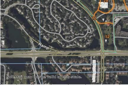
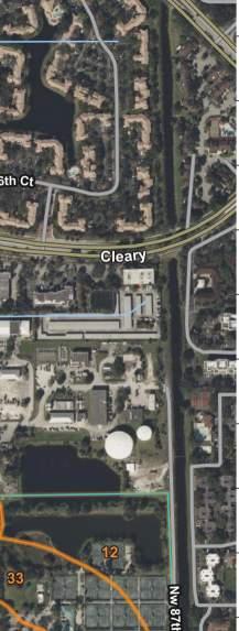
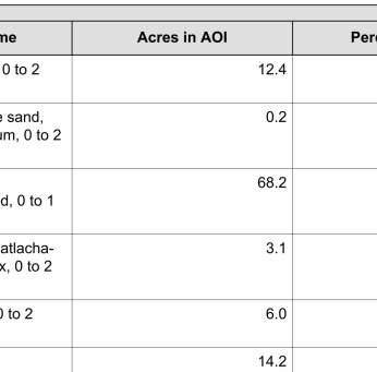
Based upon soil data obtained from the United Department of Agriculture (USDA) Natural Resources Conservation Service (NRCS) Web Soil Survey, the site contains the following soil types.
19Margate fine sand, occasionally ponded, 0 to 1 percent slopes
27Plantation ponded-Matlacha-Urban land complex, 0 to 2 percent slopes
29Pompano fine sand, 0 to 2 percent slopes
33Sanibel muck
Department of Environmental Protection:
In order to properly manage stormwater runoff from a construction site, the general contractor (GC) selected must obtain coverage through the Florida Department of Environmental Protection (FDEP) under the National Pollutant Discharge Elimination System (NPDES) stormwater permit.
The NPDES permit ensures that the operator will implement appropriate pollution control techniques to minimize erosion and sedimentation.
To obtain coverage under the NPDES permit, the GC must submit a Notice of Intent (NOI) form prior to use of the Generic Permit for Stormwater Discharge from Small and Large Construction Activities (Rule 62-621.300(4), F.A.C.) along with preparing a Stormwater Pollution Prevention Plan (SWPPP). The SWPPP will contain such measures as silt fencing, hay bales, and temporary construction entrances to deter the export of onsite silts to the County’s storm sewer system. The proposed development area is considered a Large Construction Activity requiring a $500 permit application fee.
Proposed work on the existing potable and wastewater systems within the project site will require permitting through FDEP. Permit applications will require review and approval of the City of Plantation’s Utility Department prior to application submittal. Permit fees are anticipated to be approximately $650 for potable water per phase and $600 to $1,000 for wastewater per phase. The contractor will be required to file an NPDES Notice of Intent (NOI) in order to proceed with the construction of any phase of the proposed master plan.
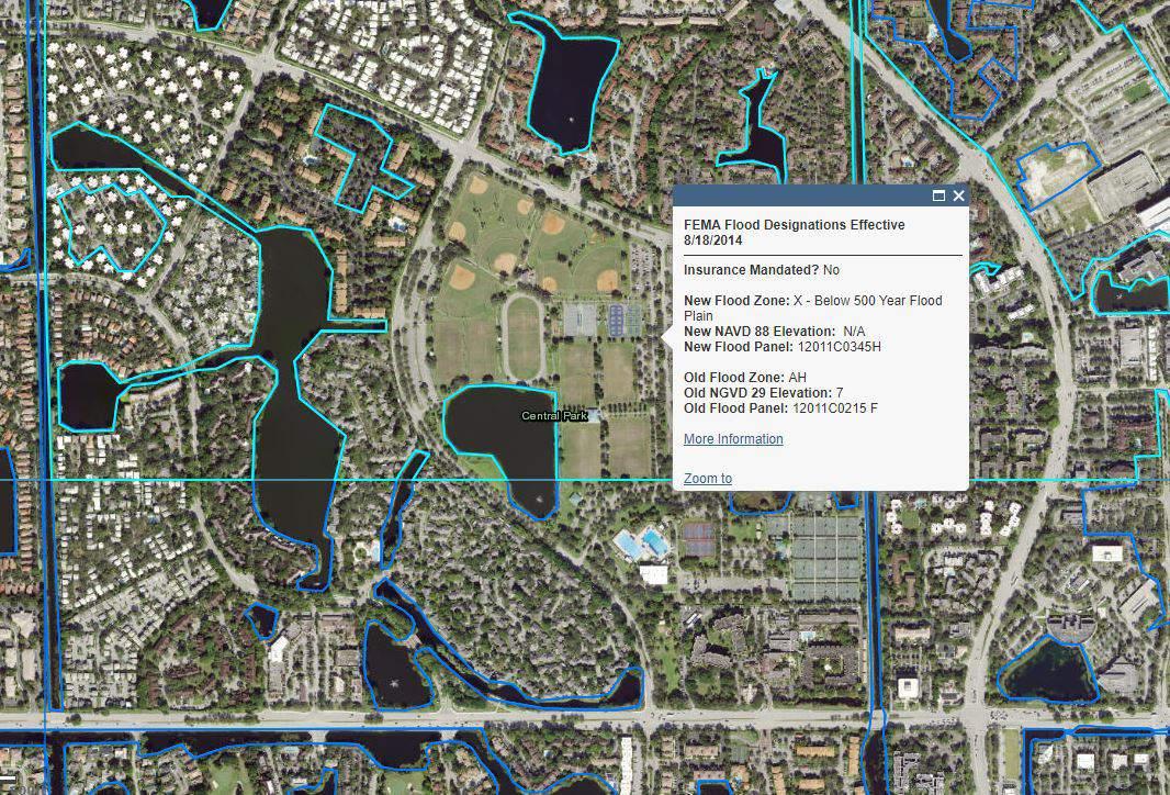
FEMA
Natural Resources Conservation Services Table
As shown on the FEMA Flood Insurance Rate Map for Broward County, Florida, the proposed site area resides primarily in Zone X, which represents areas located outside of the 500-year flood zone. The areas immediately surrounding the two onsite wet ponds fall within flood Zone AE. The pond on the west side of the project site has a flood elevation of 7.0 feet. The pond on the east side of the project site has a flood elevation of 6.0 feet. OPWCD Canal #2 abutting the eastern property line of the project site falls within Zone AE, at a determined base flood elevation of 6.0 feet. Refer to the Flood Zone Map in the Appendix.
Proposed buildings shall be constructed with a finished floor elevation a minimum of 1 foot above the base flood elevation. This can be achieved based on existing site grades.
Local Regulations:
The city of Plantation will require a Site Plan Development Review Application to be submitted and approved prior to the construction of any phase of the proposed master plan. Prior to submitting an application review to the city, a pre-development meeting must be held with the Zoning Department. The city of Plantation requires a site plan application submittal to include a development review application, market study (if applicable), master plan (if applicable), verification of ownership, signed & sealed survey, and phasing plan (if applicable). The submitted plan sheets are also required to include a site plan, floor plans, building elevations, site details, photometric plans, landscape plans, and engineering plans in compliance with the requirements laid out in the “Master Plan / Site Plan: Minimum Requirements” checklist document. The Planning and Zoning Department’s Fee Calculation Form must be filled out and submitted before submitting a Development Review Application. A non-residential site plan application fee is listed at $3,000 plus a $4,000 Trust Account plus $50 per 1,000 square feet. If an application is submitted after the published agenda closing dates, the review may be rescheduled to the next available meeting.
The current regulations governing the project, as derived from the City’s Zoning Ordinance and Land Development Code, encompass various aspects such as allowable use, landscaping, parking, tree removal, and perimeter landscape area.
These regulations form the foundation upon which the proposed concept has been developed, ensuring that it aligns with the established guidelines. This compliance with regulatory standards underscores the commitment to responsible and sustainable development within the city.
• Zoning: The current site is zoned S-CP (City Park District), which is the proper zoning category for this use and for the program elements proposed.
• Landscaping: Landscape plans are typically not developed at the concept plan phase, however there is adequate and appropriately located and sized open space to meet the City’s minimum landscape requirements for all three concepts.
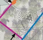
Easement Review:
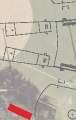
The historic surveys provided by the Client show various easements throughout the project site. Utility easements exist throughout the site providing service to various park facilities. A 20’ drainage easement exists between the park’s
wet pond to the east of the project site and the adjacent public works wet pond directly above it. Additionally, utility easements exist around the four existing onsite sanitary lift stations. In the review of the documents provided to GAI, construction restrictions over these existing easements were not noted. Coordination with the utility providers will be required to determine restrictions of the easements, which easements can be maintained, and which will need to be amended. See the attached easement exhibit to see how the existing easements relate to the project scope of work. It is advised that an additional survey be conducted prior to pursuing construction documents.
Well Field Restrictions:
Plantation Central Park is host to numerous water wells and monitoring well locations. Care was taken to lay out the features of the proposed master plan to maintain access to existing water wells. See the attached well field exhibit to see how the existing well locations relate to the project scope of work. Said wells fall within the jurisdiction of the Broward County Department of Health and the South Florida Water Management District. Caution shall be taken to maintain the work site to minimize the potential entrance of contaminants into the borehole and the groundwater resource. Development setbacks from the wells are defined in Table I of Chapter 62-532 based on the permitted use of the well. Only water from a potable water source shall be used in the construction, repair, or abandonment of a water well, including water for cleaning of well materials, drilling equipment, and water used to mix drilling fluids. Whenever there is an interruption in work on the well, such as an overnight shutdown, the well opening shall be sealed with a tamper-resistant cover. The permitting authority may conduct inspections as is necessary to ensure conformity with applicable standards. Duly authorized representatives of the permitting authority shall be given access, at reasonable times, to any premises for the purpose of such inspection. If during construction, repair, or abandonment, the Department or the permitting authority finds the work does not meet the requirements of rules and standards adopted pursuant to Chapter 373, F.S., the Department or the permitting authority shall give the owner and water well contractor written notice pursuant to the requirements in Section 120.60, F.S. In the event that a well must be abandoned or relocated, a permit must be filed with the South Florida Water Management District conforming to regulations outlined in form 62532.900.
Availability of Existing Infrastructure:
Existing site infrastructure data was provided by City of Plantation and reviewed by GAI. To further determine the availability of infrastructure to accommodate the proposed project, individual utility companies were contacted by GAI engineering staff. The following is a list of the utility service providers for the proposed site:
Stormwater, Wastewater, and Water
City of Plantation
500 NW 65th Avenue Plantation, FL 33317
Contact: Danny Pollio Phone: 954-513-3518
Email: dpollio@plantation.org
CATV, Fiber, and Telephone
Hotwire Communications
10360 USA Today Way Miramar, FL 33025
Contact: Walter Davila Phone: 954-699-0900
Email: dvalia@hotwirecommunication.com
Electric
Florida Power & Light – Broward NW 44th Street Fort Lauderdale, FL 33323
Contact: Joel Bray Phone: 386-586-6403
Email: joel.bray@fpl.com
Conclusion:
Telephone
AT&T
1120 S. Rogers Circle Boca Raton, FL 33487
Contact: Dino Farruggio Phone: 561-683-2729
Email: G27896@ATT.com
CATV and Fiber
Comcast Cable 6565 Nova Drive Davie, FL 33317
Contact: Ricardo Davidson Phone: 786-586-6403
Email: ricardoa_davidson@cable.comcast.com
The proposed concept places a strong emphasis on both tree preservation and optimizing parking space availability. The primary goal is to retain as many existing trees on-site as possible, recognizing their environmental and aesthetic value. Simultaneously, the design strives to maximize the total number of proposed parking spaces to ensure ample parking capacity for park visitors and events.
This balanced approach seeks to harmonize the natural beauty and ecological benefits of mature trees with the practical need for parking infrastructure, providing a well-rounded and sustainable solution for the park’s layout.
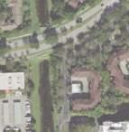
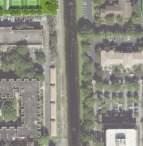
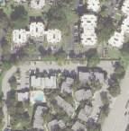
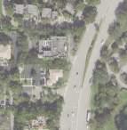
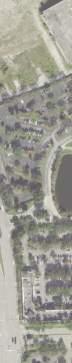
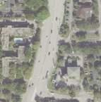
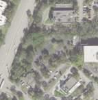
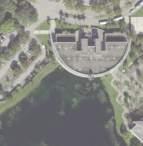
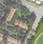
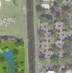
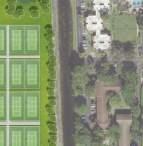
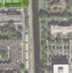
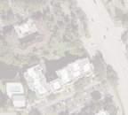
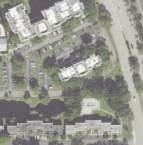
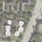
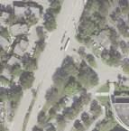
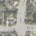
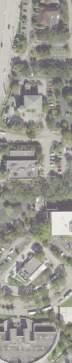
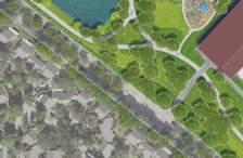
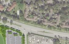
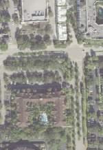
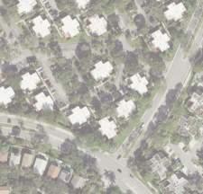
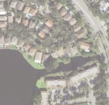
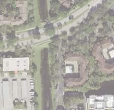
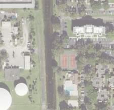
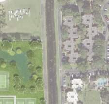
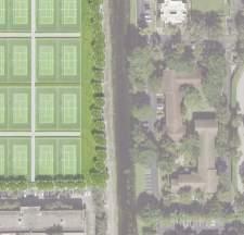
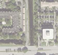
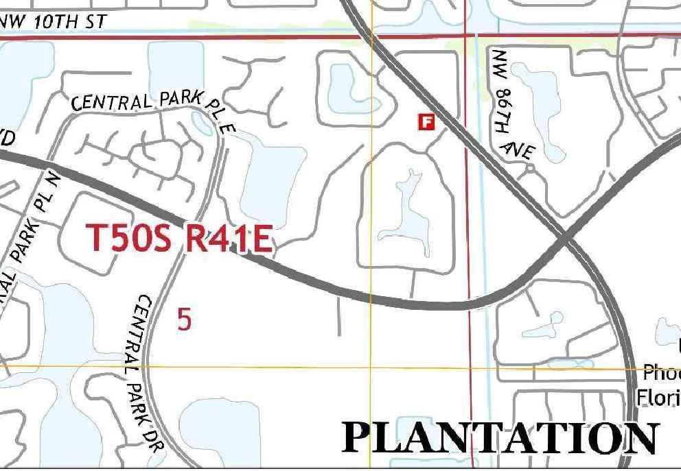
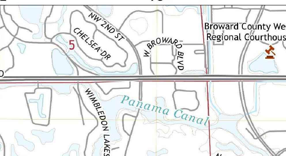
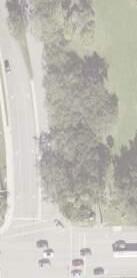
PROJECT LOCATION
PROJECT LOCATION
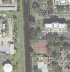
Location Map
Line Parcel
15’ Utility Easement per P.B. 113, PG. 26, B.C.R.
12’ Utility Easement (Per PLAT)
Line Parcel “X”
20’ Utility Easement (Per PLAT)
Most Westerly E. Line of Parcel
12’ Utility Easement (Per PLAT)
Lift Station 1 Easement
20’ Utility Easement (Per PLAT)
N
W
“X”
Easement Exhibit
W Line, Parcel “X” Entire Property Line Non-Vehicular Access Line (Per PLAT)
12’ Utility Easement (Per P.B. 113 PG.26, B.C.R.)
30’ Utility Easement (Per P.B. 113 PG.26, B.C.R.)
S Line, Parcel “X”
Restricted Access for Emergency Vehicles Only (per PLAT)
15’ Utility Easement (Per P.B. 113 PG.26, B.C.R.)
20’ Utility Easement (Per P.B. 113 PG.26, B.C.R.)
Location Map
Entire Property Line Non-Vehicular Access Line (Per PLAT)
Entire Property Line Non-Vehicular Access Line (Per PLAT)
12’ Utility Easement (Per PLAT)
S Line, Parcel “X”
Lift Station 4 Easement
25’ Utility Easement (Per PLAT)
20’ Utility Easement (Per PLAT)
15’ Utility Easement (Per PLAT)
15’ x 30’ Utility Easement (Per PLAT)
30’ Utility Easement (Per PLAT)
Recreational Building Scope
Federal Regulations:
According to the FEMA Flood Map, the site falls within Zone X, signifying that it is not situated in a flood-prone area, providing assurance against flood-related concerns for the project.
FEMA Flood Map
Local Regulations:
The site’s primary zoning designation is SC-P, which currently has no overlays. However, it’s important to note that the City’s Zoning Ordinance and Land Development Code clearly outline the allowable uses for recreational facilities within the CF-P zoning district, in alignment with the Future Land Use designation of CF (community facilities). To ensure full compliance with these regulations, a thorough review and approval process is in place for CF-P districts, which includes strict adherence to specific guidelines and regulations.
The key aspect of this process involves the submission and evaluation of a site and development plan. These plans will be subject to selection and approval by the Site Plan Review and Appearance Board, which plays a crucial role in assessing the appropriateness and conformity of proposed projects within the CF-P zoning district.
This structured approach ensures that recreational facilities in the designated zoning district align with the city’s regulatory framework and adhere to established standards, promoting orderly and responsible development while safeguarding the broader community’s interests.
Plot Size (minimum, acres)20,000
Lot Width (minimum, feet)125 Lot Depth (minimum, feet)125 Height (maximum, feet/maximum stories) (whichever is less)55/5 Building Setbacks (minimum, feet)
For uses requiring a minimum lot area of 20,000 Square feet.25 Front, Side, and Rear.
For uses requiring a minimum lot area of 40,000 Square feet.35 Front, Side, and Rear.
For uses requiring a minimum lot area of 20,000 Square feet.50 Front, Side, and Rear.
Additional Side and Rear yard setbacks5/ Each Additional Story over two Lot Coverage (maximum, percent)
Sec. 27-90: Table 90-1 Dimensional Standards CF-P
III. PROGRAM EFFECTIVENESS
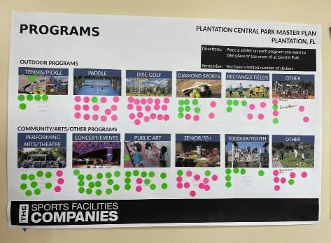
During the project’s initial planning phases, City Parks and Recreation leadership, key stakeholders, and members of the public played an integral role in expressing their specific program elements and priorities.
The programmatic elements listed below are key items that were requested to remain-in-place or be incorporated into the master plan design.
• Running Track
• Improve lighting in walkways
• Proper Driveways / Parking
• Pickleball Courts
• Fitness Center
• Better accessibility to the park
• Soccer Fields
• Multi-Purpose Rooms
• More Restrooms
• Indoor Basketball Courts
• Covered Playgrounds
• Multi-Purpose Lawn
• Splash Pad Area
• Wayfinding and Signage
• Baseball Fields
• Dog Park
• Covered Outdoor Basketball Courts
Site Scope
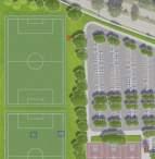
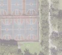
Outdoor Sports Facilities
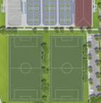
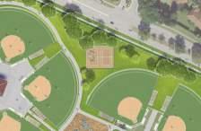
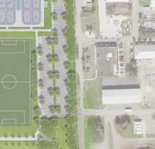
Since the inception of the project, a steadfast principle has been established: with the exception of reducing the count of baseball fields by one, there must be no reduction in the number of outdoor fields and courts. Notably, the existing baseball fields exhibit varying dimensions. The city’s approach has been to set a minimum size requirement of 200’ for these fields. This deliberate decision allows for the allocation of space to accommodate other elements within the park’s layout.
The commitment to maintaining the overall number of fields and courts within the park remains a principal goal. Moreover, this commitment to preserving recreational assets has been complemented by the addition of two new sand volleyball courts the enlargement of all walkways around the park, increasing the size of open park areas in various sections. These enhancements serve to enrich the park’s amenities and provide a broader spectrum of activities for the community to enjoy.
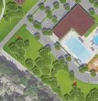
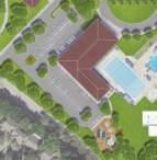
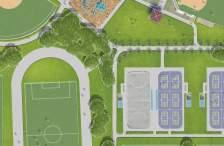
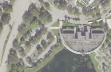
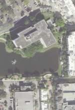
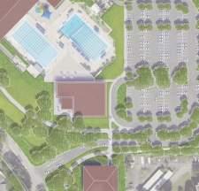
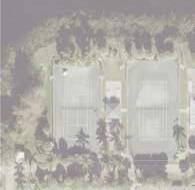
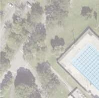
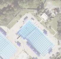
Aquatic Center
The existing aquatic facility at Plantation Central Park is comprised of two lap lane pools, one of which features diving platforms designed for various competitions and events, along with an existing splash pad. There are no proposed changes to the lap lane pools or diving platforms during the construction process. A new splash pad is proposed adjacent to the new recreational building. The existing splash pad will be demolished, as well as the non-ADA compliant restroom building adjacent to the pools.
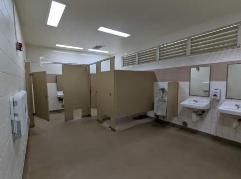
The removal of an existing bathroom building, and the current splash pad opens the space for an extended pool deck. This expanded area will serve various purposes, catering to team gatherings during competitions and other events. New ADA compliant restrooms and locker rooms will be incorporated into the new recreational building, enhancing the overall functionality of the aquatic facility.
The new splash pad introduced on the north side of the facility, positioned adjacent to the upcoming recreational center building, will have greater capacity and better accessibility for both users and staff supervisors. This design solution ensures that while certain elements are updated and enhanced, the fundamental features of the aquatic facility will remain intact, providing continued uninterrupted access for the community.
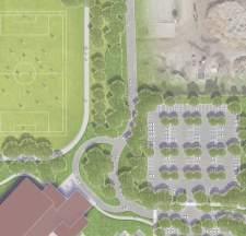
Outdoor Amenities
In response to the feedback from the community, upgrades to the playgrounds have been incorporated into the project. Enhancements include increased capacity, separate ageappropriate structures, as well as, accessible play equipment. In addition, a large playground area is proposed between the new recreational building and the multi-purpose fields. The new location will create a large uninterrupted open gathering space that supports and unites both programmatic elements.
Another significant addition to the park’s design is the implementation of wider walking paths integrated with exercise stations spread throughout the park. This enhancement not only enriches the park’s amenities but also offers a holistic recreational experience that resonates with the community’s aspirations for an active and healthy outdoor environment.
ADA Improvements
Considerable attention has been devoted to enhancing accessibility and inclusivity within the park’s design. This comprehensive approach encompasses multiple facets, addressing the needs of individuals with disabilities and those requiring accommodation. The key components considered for improved accessibility encompass:
• Accessibility: The park design prioritizes accessible pathways, ramps, and facilities to ensure individuals with mobility challenges can navigate the park with ease.
• Parking: Designated accessible parking spaces with appropriate signage have been integrated to facilitate convenient access for people with disabilities.
• Walkways: The layout includes accessible walkways that adhere to ADA (Americans with Disabilities Act) standards, providing a smooth and safe passage for all visitors.
• Seating: Thoughtful placement of accessible seating options throughout the park ensures comfort and convenience for individuals with diverse needs.
• Shade: Shaded areas and structures have been strategically positioned to offer respite from the sun, benefiting everyone, including those with sensitivities to heat.
• Signage: Clear and inclusive signage with proper contrast, font sizes, and legibility considerations are employed to guide and inform visitors, including those with visual impairments. All elements in the sign palette design follow ADA standards, including placement.
These considerations not only promote equitable access but also enhance the overall park experience for all individuals, fostering an inclusive and welcoming environment for everyone in the community.
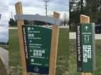
Wayfinding and Signage:
To develop and deliver a wayfinding strategy and Master Plan for Central Park, the design team needed to understand the park’s characteristics, needs, challenges, and opportunities.
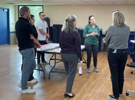
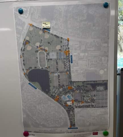
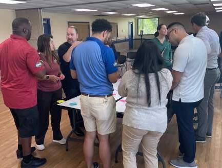
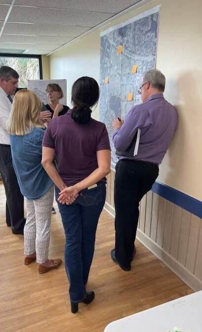
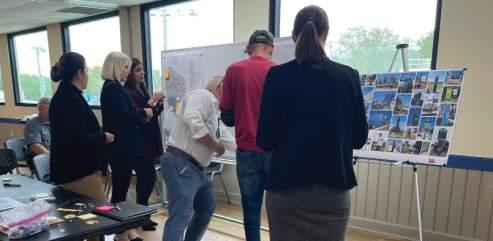
The project team performed a site visit on March 20, 2023, to passively observe how users interacted with the space. Observations included how people entered the park, where they parked their vehicle, the purpose for their visit, and how long they stayed. Understanding the user and their needs is key when creating a functional, user-centered system. On the following day (March 21), the team had a guided tour with park staff to review the park’s existing conditions, its needs, and its amenities. The tour was followed by the project kickoff meeting; the meeting was conducted via
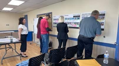
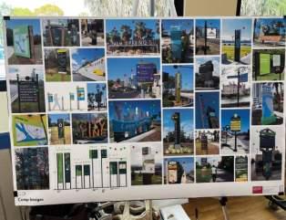
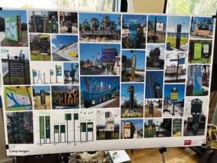
a planning workshop that included City stakeholders and public members to discuss the needs, backgrounds, and expectations for the project. A wayfinding design exercise was held as part of the workshop to help the design team determine the preferred look and feel of the future sign system. The participants were given and asked to place three green dots on the designs they liked, and three red dots on the signs they disliked.
The result of the exercise is graphically shown below. The images shown are the same ones used during the workshop. The red overlay represents dislikes, and the lower opacity was applied to images without any dots. Overall, participants agreed on likes and dislikes; however, some images will have a half-red overlay. Those images represent the designs that had both red and green dots on them.
March 21, 2023 Project Kickoff MeetingStaff and Public Green Dot Red Dot Board - Design Exercise
After the workshop, the team gathered enough information to move on to the schematic design phase. A need identified from this exercise was park signage, such as rules and regulations, directional/navigation, entrance markers, parking, and amenity and miles markers.
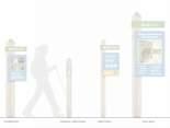
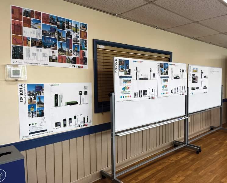
Based on the results of the design exercise, site visit, and desktop research, the project team created three schematic design options with three different design considerations.
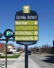
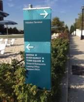
• Option A highlights the City of Plantation’s brand and identity and follows the design direction and language some of the liked images of signs.
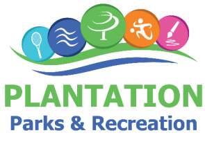
• Option B involved the creation of a color-coding experience throughout the park, following the logo and the image used by the Parks and Recreation Department, along with some of the language and design style aligned with the likes from the design exercise.
• Option C followed a similar intent utilizing the brand and identity of the Parks and Recreation logo and colors but created patterns for specific amenities and activities throughout the park.
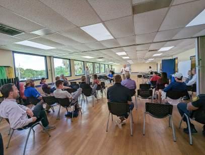
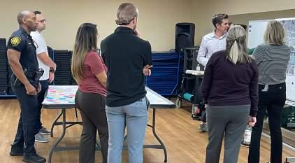
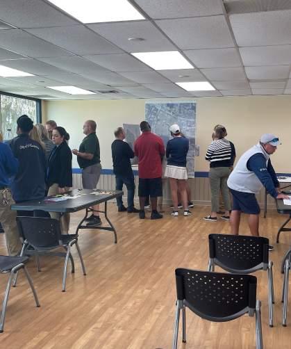
The three design options were presented at the staff and public meetings on May 8, 2023. The meeting included a wayfinding station, and participants had the opportunity to provide feedback on the design options—i.e., preferred design, liked elements, and disliked elements. The team gathered notes at the meeting and highlighted the common themes and components to determine a design route moving forward. After reviewing the notes, the consolidated public results were:
• Preference for icons over patterns
• Preference for Option C overall – organic shape and use of logo element at top
• Add white between the green and blue on all signs
• Preference for dark background over white
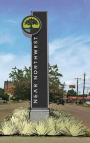
• Add City logo to gateways
• Keep “Central Park” close to not lose legibility on gateways
• While the public preferred Option C in general, the gateways from Option B were liked best
• Reference to liking the arrow standing out like in Option B
• Preferred option to be a hybrid of Options B and C.
The result of the multiple meetings and input gatherings enabled the team to create a unique design tailored for the City of Plantation that fits the vision and future of Plantation Central Park and its users.
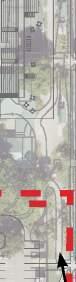
LED Gateway Options for Central Park
May 8, 2023 Public Meeting Boards
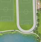
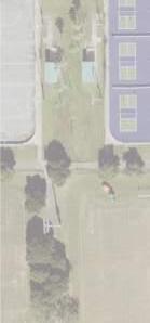
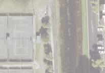
Pedestrian Circulation
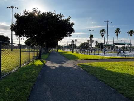
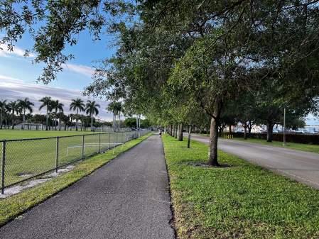
The proposed trail enhances the current layout to safely connect users between amenities. Its wider width allows for a safe, enjoyable experience, enabling users to walk, run, and bike between all areas. Serving both daily resident visitors and regional event guests, the pedestrian promenade lined with palms will accommodate the increased volume of people involved in future sporting events. Expanding the park’s pedestrian circulation increases the ease of police/fire patrols and aid in case of emergency.
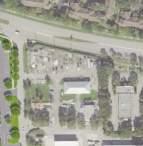
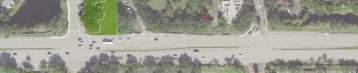
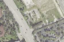
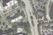
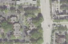
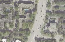
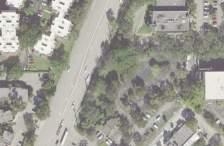
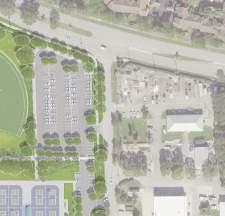
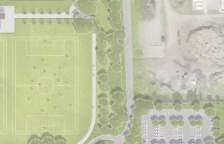
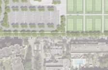
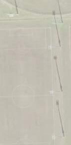
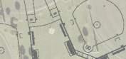
Vehicular Circulation
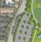
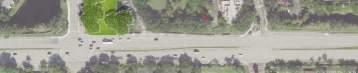
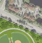
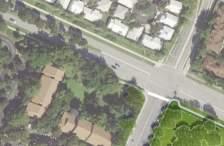
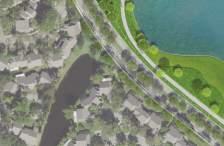
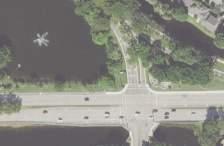
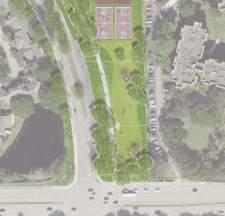
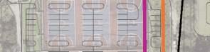
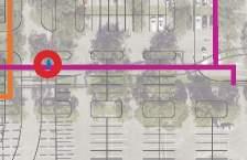
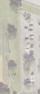
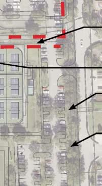
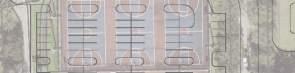
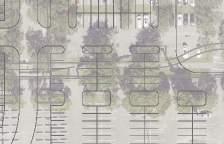
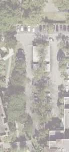
The project site has direct frontage along Cleary Boulevard, Central Park Drive, West Broward Boulevard, and Northwest 91st Avenue. In the Master Plan, the existing south entrance to the park along Central Park Drive has been eliminated in favor of reinstating the historic entrance south of the existing recreation center. This entrance drive was relocated to accommodate the location of the new recreation center. The parking along the existing south entrance drive was also eliminated, further supporting the location of the historic entrance. The north entrance to the park is proposed to be relocated from its existing entrance off Northwest 91st Avenue to Northwest 91st Avenue itself, extending Public Works portion of the road into Central Park. By extending Northwest 91st Avenue southward, a dedicated Boulevard through the park is created. This Boulevard enhances pedestrian and vehicular safety by reducing through traffic in the parking lots. The proposed parking was designed to accommodate pedestrian safety. Various parking areas are proposed in close proximity to the different park amenities reducing vehicular pedestrian interactions. Where pedestrian crossings are anticipated, ample sidewalks and designated crosswalks are proposed.
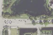
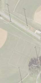
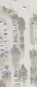
Conversations with park users elicited feedback regarding the unsafe conditions created by the pickup/drop-off lines deterring vehicle flow during summer camps or big events. The existing parking is poorly circulated and takes up valuable park space. With the proposed vehicular circulation
route, vehicles have space to stack in a location that doesn’t affect the primary road. To limit the amount of vehicle and pedestrian interaction, the parking areas are proposed to be entirely separate from the main road to avoid potential collisions. Having landscape areas between the parking and the main drive will help improve the experience of driving through the park, making it feel more natural and peaceful. The circulation around the facilities will adjust to the new layout; for example, the drop-off area to the existing recreation center will be redesigned for ease of pickup/dropoff.
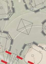
Shifting Central Park’s main entrance of the park to its original location provides an opportunity to revitalize the currently underutilized southern portion of the park. Relocating the basketball courts and incorporating the two dog parks to the south brings life back into the space. For ease of user access to the amenities south of the entrance drive, additional parking off Central Park Blvd. has been integrated to the master plan design.
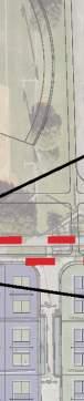
The restructured parking for the tennis area is designed so that the northern portion adjacent to the stadium can be closed out. Orange Bowl Tournament and the Junior Orange Ball, have previously experienced problems due to media trailers not having a dedicated staging area, resulting in restricted parking access for visitors. This area will be reserved for media trailers and all their equipment, keeping them safely separated from the overall pedestrian and vehicular event circulation.
Conclusion
Conversations with park users elicited feedback regarding the unsafe conditions created by the pickup/drop-off lines deterring vehicle flow during summer camps or big events. The existing parking is poorly circulated and takes up valuable park space. With the proposed vehicular circulation route, vehicles have space to stack in a location that doesn’t affect the primary road. To limit the amount of vehicle and pedestrian interaction, the parking areas are proposed to be entirely separate from the main road to avoid potential
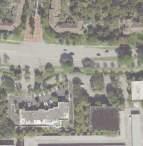
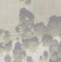
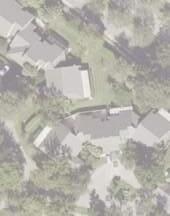
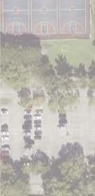
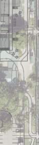
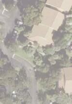
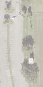
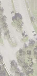
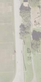
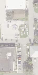
Existing Park Conditions - Current Circulation Layout
conflicts and congestion.
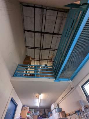
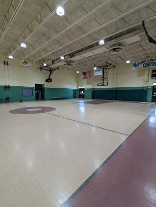
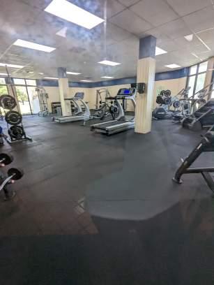
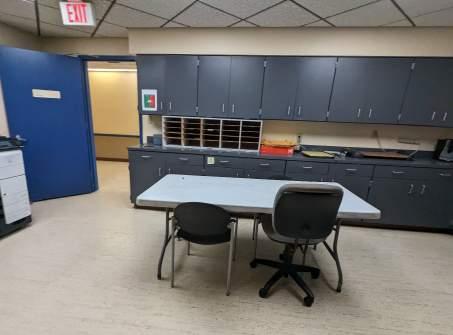
Recreation Center Building Scope
The effectiveness of the program has been inherently shaped by the active engagement of the community, primary stakeholders, and the Department of Parks and Recreation during the early stages of Master Plan development. This collaborative effort has been instrumental in aligning the proposed building program with both immediate and long-term goals, ensuring functionality and adaptability as Plantation Central Park evolves.
To help develop program effectiveness, particular attention has been given to environmental design considerations, including the potential pursuit of LEED (Leadership in Energy and Environmental Design) or equivalent sustainable building practices. Additionally, the concept of Building Hardening, which includes provisions for storm shelter functionality, has been introduced as a valuable component within the building scope. These measures not only reflect a commitment to environmental responsibility but also contribute to the park’s resilience and safety, further enhancing its value to the community.
The new 66,240 sq. ft. Recreational Center will offer an array of amenities, a triple gym with an overhead running track, a versatile auditorium suitable for hosting a myriad of events, and a wellness center featuring multifunctional spaces tailored for fitness classes. Additionally, the building will house offices and support spaces for the aquatic department. The remainder of the program encompasses diverse community spaces, a café, concession facilities, locker rooms, bathrooms, and storage areas.
As a key component of the master plan strategy, the design of the pool building program has been strategically integrated with the recreation building. This integration serves multiple purposes, including the reduction of operational costs and the creation of additional revenue streams. By combining the uses of all activity rooms with the pool and other amenities, this approach maximizes the flexibility and utility of the facilities, ultimately benefiting the community.
A significant expansion is planned adjacent to the existing pool deck. This expansion will provide ample space for team gatherings during competitions, enhancing the overall functionality of the pool area. Additionally, a new splash pad is set to be incorporated into a nearby location in close proximity to the new Recreational Center. These additions not only cater to diverse recreational needs but also contribute to the park’s appeal and versatility as a community resource.
Following the completion of the new building, a strategic transition plan will be implemented. The existing Recreational Center operations will migrate to the new facility, enabling the commencement of interior renovations within the existing building. It is anticipated that the majority of this renovated space will be allocated for the offices of the Parks and Recreation Department. This phased approach ensures a seamless transition while optimizing the utilization of space and resources to better serve the community.
Tennis Center Building Scope
The vision of the Parks and Recreation Department for the Tennis Center is ambitious and multifaceted, aimed at elevating its profile and capabilities. The city has expressed a clear desire to expand the Tennis Center’s potential in several key areas:
• New 1,500 seat Stadium: This addition is intended to enable the Tennis Center to host larger and more prestigious tournaments, propelling it to a higher level within the state’s tennis community.
• New Facility Spaces: Within the stadium, the city intends to house the existing amenities offered by the Tennis Center. This consolidation of facilities can enhance operational efficiency and convenience for both staff and visitors.
• Café Area: The inclusion of a café area is envisioned to provide a convenient space for visitors to relax while waiting for court availability or companions, enhancing the user’s experience.
• Security and Membership Check-In: Improvements in security and membership management are a priority. Implementing a system to accurately track who enters and exits the facilities is essential for efficient court administration and maintenance scheduling.
• Parking Accommodations: Addressing parking concerns is crucial, especially during significant events and media coverage. The plan includes a designated area for media parking to ensure adequate guest and athlete parking availability. This solution aims to minimize parking challenges and inconveniences.
• Lighting Enhancements: Enhancing the lighting in and around the Tennis Center is another key focus. Adequate lighting ensures safety and accessibility during early morning and evening hours.
In summary, this comprehensive vision for the Tennis Center reflects a commitment to growth, accessibility, and excellence. It seeks to position the center as a prominent venue for tennis tournaments and events while addressing practical and logistical considerations for visitors and staff.
Restroom Building Scope
Soccer Pavilion and Corporate Pavilion
The existing Soccer Pavilion and Corporate Pavilion, along with their restroom facilities, are in need of significant interior finish renovations. While the structural integrity of these pavilions remains intact, there are essential upgrades required to bring the restrooms up to code, ensuring they meet all ADA clearances and requirements.
The city has placed a strong emphasis on renovating the restroom finishes to enhance ease of maintenance. This approach is intended to streamline the upkeep process, ultimately reducing the time and effort required to ensure the facilities remain in optimal condition.
Conclusion
The Program Effectiveness section underscores the collaborative approach that has been pivotal in shaping the project’s priorities. Involving the City officials, City Parks and Recreation leadership, stakeholders, and the public has led to a well-defined set of activities and amenities that align with the evolving needs of the community, including improved lighting, expanded parking, pickleball courts, fitness centers, soccer fields, multi-purpose rooms, additional restrooms, covered playgrounds, and more. The commitment to preserving and enhancing the number of outdoor fields and courts, alongside the addition of features like sand volleyball courts, larger walkways, and open park areas, reflects the city’s dedication to expanding recreational assets. The Aquatic Center’s improvements, including a new splash pad while preserving the lap lane pools, remain central. Diverse amenities, such as accessible playgrounds, shelters, pavilions, exercise stations, and trails, cater to varied recreational needs.
A critical consideration in this renovation effort is the current insufficiency of restroom facilities throughout the park given its size and the variety of amenities it offers. To address this challenge, two additional restroom facilities are being proposed for the park. The objective is to ensure that there is an adequate number of toilets and plumbing fixtures available to visitors while also shortening the distances between restrooms. This strategic placement will enable park-goers to access restroom facilities within a short walking distance, enhancing their overall experience and convenience within the park.
Emphasis on ADA improvements ensures accessibility for all, including pathways, parking, seating, and signage. The Wayfinding and Signage plan simplifies park navigation. Enhanced pedestrian and vehicular circulation enhance safety, accommodating increased user volumes for sporting events while optimizing parking and traffic flow. This meticulous planning, guided by user feedback, results in a comprehensive Master Plan for Plantation Central Park, poised to meet evolving community needs and create a vibrant recreational space for all. In conclusion, the comprehensive scope for the recreational building, tennis center, and restroom facilities underscores a commitment to community engagement, environmental responsibility, and program effectiveness. These plans address immediate and long-term goals while enhancing functionality and adaptability. The integration of sustainable building practices, storm shelter provisions, and amenities aims to elevate the park’s profile and accessibility, positioning it as a premier recreational destination that caters to diverse community needs and fosters a sense of pride and belonging.
IV. CONSTRUCTION COST ESTIMATES
Estimating construction costs during the concept design phase of a project is a practice that blends both art and engineering. It involves navigating a terrain of uncertainties, which encompass variables such as materials, finishes, existing site conditions and the time elapsed between concept development and project bidding by general contractors. These factors collectively exert a significant influence on the ultimate, realized costs.
While there are market uncertainties that can affect the final project cost, our team’s experience working in Florida on municipal, recreational designs and park projects has provided us with the experience to prepare a cost estimate based on current market knowledge.
Phase 1
Our aim is to provide a cost estimate that aligns with the current market conditions while offering transparency in the financial aspects of the three-phase development of Plantation Central Park.
2.Roadway Boulevard60,000SF$5.50$330,000.00
3.Parking200,000SF$5.50$1,100,000.00Parking and access to pool equip
13.Pickleball Court1LS$50,000.00$50,000.00Refurbish * Escalation is an allowance based on 5% per single year only. After year 1, Escalation Costs would need to be re-evaluated based on current market conditions.
31.Connect to Existing Sanitary1EA$5,500.00$5,500.00
32.8" Sanitary PVC420LF$145.00$60,900.00
33.Water Service420LF$95.00$39,900.00
SUBTOTAL$20,245,452.50
General Conditions1LS7%$1,417,181.68 Mobilization1LS4%$809,818.10
Project Supervision1LS3%$607,363.58
Contractor Profit1LS10%$2,024,545.25
Soft Cost/A&E Fees1LS10%$2,024,545.25
Contingency1LS15%$3,036,817.88
Escalation *1LS5%$1,012,272.62
TOTAL PHASE 2$31,177,996.85 * Escalation is an allowance based on 5% per single year only. After year 1, Escalation Costs would need to be re-evaluated based on current market conditions.
CPHASE 3
1.Demolition/Earthwork200,000SF$2.50$500,000.00
2.Parking122,000SF$5.50$671,000.00
3.8' Concrete Sidewalk350SF$5.50$1,925.00
4.Tennis Building8,600SF$425.00$3,655,000.00
5.TENNIS STADIUM1,500Seats$8,000.00$12,000,000.00
6.Relocated Tennis Court3EA$90,000.00$270,000.00
7.Relocated Wall Tennis1EA$45,000.00$45,000.00
8.Tennis Plaza32,000SF$5.50$176,000.00
9.Fence600LF$50.00$30,000.00
10.Sports Lighting -Tennis Per Field3EA$150,000.00$450,000.00
11.Area Lighting1LS$100,000.00$100,000.00Parking lot & pedestrian
18.Connect to Existing Sanitary1EA$5,500.00$5,500.00
19.8" Sanitary PVC200LF$145.00$29,000.00
20.Water Service200LF$95.00$19,000.00
SUBTOTAL$18,214,890.00
General Conditions1LS7%$1,275,042.30
Mobilization1LS4%$728,595.60
Project Supervision1LS3%$546,446.70
Contractor Profit1LS10%$1,821,489.00
Soft Cost/A&E Fees1LS10%$1,821,489.00
Contingency1LS15%$2,732,233.50
Escalation *1LS5%$910,744.50 TOTAL PHASE 3$28,050,930.60
* Escalation is an allowance based on 5% per single year only. After year 1, Escalation Costs would need to be re-evaluated based on current market conditions.
DPARK SIGNAGE
1.A - Portrait Gateway2EA$35,000.00$70,000.00
2.B - Landscape Gateway2EA$42,500.00$85,000.00
3.C - Parking Directional6EA$3,500.00$21,000.00
4.D - Parking Lot Directional9EA$4,600.00$41,400.00
5.E - Parking Lot Arrival8EA$5,200.00$41,600.00
6.F1 - Pedestrian Kiosk4EA$13,000.00$52,000.00
F1 and F2 serve same function (F1 used for cost estimate) City to determine which sign type shall be implemented and where
Signs to be placed based on loop distances at later phase
Page intentionally left blank
V. PARKING CALCULATION
Parking Requirements per Program
Parking count development regulations used for parking calculation include:
City of Delray Beach:
• Senior rooms / multi-purpose rooms – craft center 50 sq. ft. per parking space.
• Office - 1 parking space per 250 sq. ft.
City of Doral: (Land Development Code sec 77-737)
• Running track - Skating Rink 250 sq. ft. per parking space.
• Fitness room - Skating Rink 250 sq. ft. per parking space.
• Dance aerobics – Exercise studio 100 sq. ft. per parking space.
• Green rooms – General auditorium 100 sq. ft. per parking space.
• Teen room – Banquet Hall 100 sq. ft. per parking space.
• Double Gym - Skating Rink 250 sq. ft. per parking space.
City of St. Petersburg: (Use Permissions and Parking
Requirements Matrix and Zoning Matrix)
• Baseball fields - 10 parking spaces per athletic field or large group court; For the Pompey Master Plan the count was increased to 20 spaces per athletic field.
• Basketball Courts - 4 parking spaces per small group court.
• Pool - 1/75 sq. ft. for the 1st 1000 sq. ft. water surface; 1/125 sq. ft. thereafter.