


Board of County Commissioners
Commissioner Mary Alford - District 1
Commissioner Marihelen Wheeler, Chair - District 2
Commissioner Anna Prizzia, Vice Chair - District 3
Commissioner Ken Cornell - District 4
Commissioner Charles Chestnut, IV - District 5
Alachua County Staff
Michele L. Lieberman - County Manager
Gina Peebles - Assistant County Manager - Chief of Staff
Jason Maurer - Parks & Open Space Director
Consultant Team

Christopher Potts, PE – Director of Engineering
Kyle Willems, PE – Design & Operations Manager
Logan Peters, PE – Project Manager
Jack Charnas, EI – Design Engineer
Gabe Sanz, EI – Production Engineer

Andrea Penuela – Landscape Architect
Hannah Hollinger – Project Planner
Wes Schaffer – Senior Project Planner
Paloma Prieto – Landscape Designer

Kailyn Haskovec – Research Analyst
Ethan Adams – Senior Data Analyst & IT Manager
1.1 INTRODUCTION AND PURPOSE
Alachua County comprises nine incorporated cities and towns that offer a multitude of municipal park and recreation opportunities. These areas collectively are estimated to contain over half the County’s population. The Alachua County Parks & Open Space Master Plan serves as a roadmap to guide how the County’s system can effectively enrich recreation experiences for all County residents and visitors. To accomplish this, the Master Plan provides an in-depth review of existing conditions, needs, and desires before developing a blueprint for the future of the system. The Master Plan aims to be a proactive plan for the Parks & Open Space Department to better prepare for future growth and anticipate needs of the greater Alachua County community.
The purpose of the Alachua County Parks & Open Space Master Plan is to provide a roadmap for the future of the County’s park system.
Specifically, the Master Plan should strive to achieve the following:
• Ensure consistency with the overall vision of the Comprehensive Plan
• Evaluate current park properties and facilities
• Evaluate and make recommendations regarding priorities for the improvement and expansion of these facilities
• Plan for a future parks system that responds to growth within Alachua County
• Make recommendations for prioritization of future land acquisition and park facility construction
• Identify and make recommendations on how the County might partner with other agencies to maximize its park and open space resources
• Locate and identify existing bicycle and pedestrian pathways in the County and recommend safe connections between park properties
• Create an action plan that is implementable, and identify acquisitions and projects for the future
• Provide a conceptual blueprint for improving, sustaining, and enhancing the quality of life in Alachua County
The County’s Parks & Open Space system is currently guided by the Recreation Element of the Comprehensive Plan. Our goal is to develop a system that provides an integrated recreation and open space system for Alachua County.
The Master Plan process aims to provide a thorough and context-sensitive look into the Alachua County Parks & Open Space System to provide implementable recommendations that enhance the system to best serve the needs of the community. The following process guides the project, resulting in a Master Plan that is tailor-made to suit the specific needs and context of Alachua County.
The existing conditions assessment forms the foundation upon which future planning of the parks system can occur. By identifying and valuing the current parks system—combined with the planning context within which the parks system operates—the project team can understand the strengths and weaknesses of the parks system. This phase of the project consisted of a documentation review summary, which included providing planning context to the current system, demographics and population summary, and analysis of facilities.
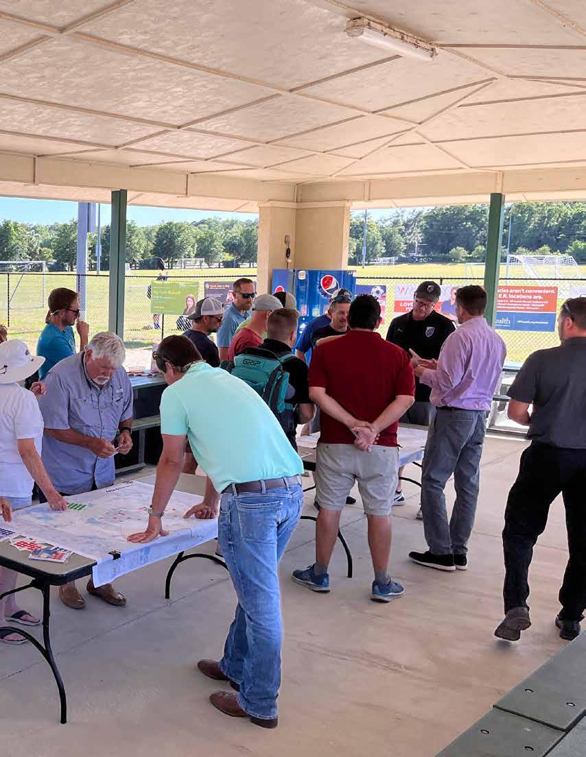
After establishing an initial planning framework, further refinement of the needs and aspirations identified by the community were developed through a comprehensive public input program that included in-person public workshops and focus groups to engage more deeply with the community. Additionally, a full statistically valid and open survey was conducted to determine needs and opportunities for improvement. The data collected in this portion of the process informs an initial planning framework specific to the assets and needs of Alachua County Parks & Open Space.
Next, the framework for the future parks & open space system is developed based on findings of the Existing Conditions Analysis and Public Input. An evaluation of the Level of Service examines current measurement tools and proposes a revised measurement tool to more accurately demonstrate where current and future population and ecological needs will demand parks and recreation investment. This framework provides high-level guidance for improvements to the system.
Following the establishment of a framework, the project team develops a series of Guiding Principles synthesized from the existing conditions observed and the community input data. The development of guiding principles will reflect the unique opportunities for enhancement of the Alachua County Parks system. The principles provide the foundation upon which the Master Plan recommendations are based. With specific recommendations in place, the project team creates a strategic roadmap toward the realistic implementation of proposed enhancements. By closely collaborating with County staff, the project team develops improvement costs, which estimate, prioritize, and compile a Capital Improvement Plan that will provide the County a clear path toward implementation.
1.2
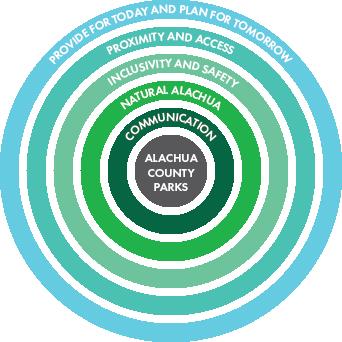
The following Guiding Principles create a foundation affirming that the Master Plan serves to further goals and objectives which have been vetted through the Master Planning process. Guiding Principles are derived from key issues highlighted by the community through statisticallyvalid and open surveys, public workshops, and focus groups. Due to this process, Guiding Principles respond directly to the needs and desires of the community to assure that the resulting Master Plan Vision is responsive to the specific needs of Alachua County residents.
The Guiding Principles are aspirations for the Alachua County park system as a whole and ultimately guide all recommendations in the Master Plan. A variety of public input venues helped to identify key needs and desires within the community, which in turn inform and develop the Guiding Principles, refer to Section 2.3 (p. 116) for further breakdown of Public Input methodology and responses. As a result, these aspirations are a direct reflection of the specific needs and desires of Alachua County residents.
The combination of these Guiding Principles serve as the basis of the Vision for the future of Alachua County Parks by providing Objectives and Implementation Strategies to aid in attaining these aspirations.
Based on public engagement, the following Guiding Principles have been identified:
• Provide for Today and Plan for Tomorrow
• Proximity and Access
• Inclusivity and Safety
• Natural Alachua
• Communication
The Alachua County PRMP aims to further the County’s goal of social equity to provide all residents of Alachua County with opportunities to access play and recreation. In particular, three Guiding Principles focus on providing social equity throughout the system: Provide for Today and Plan for Tomorrow, Proximity and Access, & Inclusivity and Safety.
The Comprehensive Plan 2019-2040 defines social equity as follows:
Principle of fairness, with attention to provision of opportunity to those portions of the community that are less well off; as applied to Comprehensive Plan, related issues include the provision of affordable housing, economic opportunity, and choice of living environments for all members of the community without regard to sex, race, age, religion, ethnicity, national origin, etc.


Parks provide for the needs of current users and respond to future trends.
• To achieve equity, Parks throughout the county are of a consistent quality and meet basic standards.
• Amenities offered respond to the needs of surrounding park users achieved through a community engagement process.
• Amenities planned for future parks respond to trends and forecasting.
All residents have access to opportunities for play and recreation:
• Each resident lives within a close range of either a neighborhood park (1-mile urban or 2-miles rural) or a community park (3-miles urban or 6-miles rural).
• A robust network of trails and pathways connect users with park amenities.
• Parks provide amenities to facilitate multi-modal access.
Parks are safe and welcoming to multicultural users of all ages and abilities:
• Each park provides facilities usable by people of all ages and abilities.
• Each park promotes safe and inclusive spaces for all users.
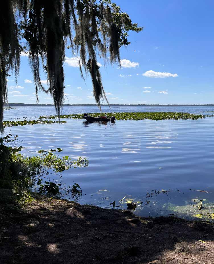
Alachua County residents have access to nature-based recreation:
• Residents have access to nature trails and water-based activities.
• Parks leverage natural assets for environmental education and interpretation
Park users are aware of park and programming offerings:
• Residents can easily find and share information about available amenities and upcoming events.
• Partnership between departments and agencies allow for efficient and expanded park programming opportunities.
The following breakdown of Guiding Principles provides a further explanation of the desired Objectives for each Guiding Principle as well as the Implementation Strategies that serve as the blueprint to reach these aspirations. Collectively, these Objectives and Implementation Strategies guide the specific recommendations provided in the Vision.
The park system should provide residents with equitable park amenities while reflecting and responding to the specific needs and desires of the community and future trends.
• Provide all residents of Alachua County with equitable access to quality parks
• Maintain and enhance existing parks
• Determine additional park amenities needed within the community
• Respond to future trends when planning for future park offerings
• Establish minimum park standards
• Enhance existing parks with upgraded facilities and amenities
• Expand offerings of sports courts and fields
• Establish additional dog off-leash areas
Park users throughout Alachua County live in both urban and rural areas, but all users should have access to parks within a close range of their household. The approach to park access takes into account the various modes in which users may access parks.
• Provide park access within close proximity to all residents of Alachua County
• Improve pedestrian and bike linkages throughout the County
• Promote a healthy community by motivating park users to use active modes of transportation to and from parks
• Establish a geographic level of service where each resident lives within a close range of a neighborhood park (1-mile urban or 2-miles rural) or a community park (3-miles urban or 6-miles rural).
• Coordinate with Growth Management on implementation of their Trails Master Plan.
• Work closely with Public Works to provide safe, walkable connections into all parks such as marked crosswalks to improve driver awareness of pedestrians/cyclists to create a welcoming environment for those choosing active transportation.
• Include amenities that encourage a variety of multi-modal access points including bike racks and pedestrian entry points.
The park system should make a concerted effort to make park users feel welcome and included. Furthermore, parks should be designed and maintained to provide residents with a reasonable level of safety.
• Provide all residents of Alachua County with equitable access to quality parks
• Maintain and enhance existing parks with safety in mind
• Plan park amenities, such as signage in multiple languages, to appeal to diverse park user groups
• Respond to future trends when planning for future park offerings
• Establish minimum park standards
• Enhance existing parks with upgraded facilities and amenities including boundless playgrounds with appeal to children of various physical and emotional abilities
• Expand offerings of sports courts and fields
• Establish additional dog off-leash areas
Alachua County has a strong appreciation for the region’s natural resources and the importance of their protection. Access to nature not only benefits people physically and mentally, but also promotes better stewardship of natural resources.
• Promote nature-based recreation that fosters environmental stewardship and wellness.
• Protect natural resources and habitat to preserve biodiversity and ecological services.
• Provide access to lake/water edge amenities for non-boaters, such as additional piers and boardwalks.
• Increase access to green spaces and nature-based recreation, such as nature trails by partnering with Conservation Lands to co-locate active park amenities in disturbed areas (when feasible).
• Provide environmental education wherever possible, such as pollinator gardens and interpretative signage.
• Preserve open space.
Public input indicated an opportunity to increase the effectiveness of communication about parks and recreation opportunities. It should be easy for park users to find information about park offerings both print and digital formats. Additionally, improved communication and partnerships with other departments and agencies could facilitate park activation and improved operations.
• Improve digital and in print communication of events and programming at parks throughout the County and municipalities
• Raise public awareness of the existing park system to enhance knowledge of offerings for all Alachua County residents
• Increase opportunities for community-based grassroots organizations to engage with parks & open space
• Foster partnerships between departments and agencies
• Develop a Parks & Open Space communications strategy in partnership with Communications
• Expand social media marketing and webpage presence
• Develop a brand for Alachua County Parks & Open Spaces
• Facilitate special events with community-based grassroots organizations
• Improve internal communication between County departments and agencies
• Partner with municipalities within the County to create a comprehensive awareness of parks & open space offerings through all jurisdictions
• Work with County Public Information Office to build strategy for parks & open space
1.3
The Alachua County Parks Vision aims to provide an equitable park system with access to quality parks for all Alachua County residents. Development of the Vision is the direct result of the Guiding Principles developed through the public input process (Section 2.3, p. 116) to create a blueprint for the future of Alachua County Parks. In this way, the Vision seeks to provide implementable steps to meet the needs and desires of Alachua County residents.
The Vision for Alachua County Parks is provided in the following pages and is directly derived from the Guiding Principles. Recommendations put forth aim to advance the objectives of the system and meet the needs of Alachua County residents. Concrete recommendations provide implementable steps to achieving this vision.
The following map provides a breakdown of the general location and park-type recommendations and the corresponding Guiding Principles. Notably, Communication recommendations function on a system-wide scale.


Coordinate with Growth Management on implementation of their Trails Master Plan
Proximity & Access
Work closely with Public Works to provide safe, walkable connections into all parks such as marked crosswalks to improve driver awareness of pedestrians/cyclists to create a welcoming environment for those choosing active transportation
Note: Prioritize parks with existing sidewalk network, provide entry points as sidewalk grids extend and/or with additional trail connections
Santa Fe Lake extend sidewalk along ROW into park x Include amenities that encourage a variety of multimodal access points including bike racks and pedestrian entry points
Implementation Strategy
Establish a geographic level of service where each resident lives within a close range of a neighborhood park (1-mile urban or 2-miles rural) or a community park (3-miles urban or 6-miles rural). Meet new geographic LOS through the following strategies:
1. Reclassifying existing parks based on amenities to provide Neighborhood or Community LOS
Proximity & Access
2. Upgrading existing parks with additional neighborhood or community park amenities
District Location Projects
All County-wide x
3. Expanding existing parks by acquiring adjacent properties and adding new amenities/ facilities
All Lake Alto, Rotary Park at Jonesville, Santa Fe Lake, Earl P. Powers, Owens-Illinois, Cuscowilla Nature and Retreat Center, Kate Barnes Boat Ramp at Marjorie Kinnan Rawlings Park x
2 Poe Springs Offer free entry during non-peak times and add/ enhance neighborhood amenities such as playground, sports court, picnic areas x
2 Jane B. Walker Park Add neighborhood amenities x
4 Cynthia Moore Chestnut Park and Clark Butler Nature Preserve Add community amenities x
4 Hawthorne Dog Park Add neighborhood amenities x
5 Cellon Oak Expand existing park and add new community parks amenities such as play area, sports fields/courts, open space, group and small pavilions, restroom building, shade trees, off-street parking x x
Recommendations for Level of Service are the result of a comprehensive Level of Service analysis process aimed at providing equitable access to parks for all Alachua County residents. For more detailed methodology information, refer to Section 3.1, p. 154.
Recommendations for Level of Service are the result of a comprehensive Level of Service analysis process aimed at providing equitable access to parks for all Alachua County residents. For more detailed methodology information, refer to Section 3.1, p. 154.
Establish Park Equity Standards All County-wide x
Incorporate gathering space into parks that promotes social interaction between diverse users such as pavilions and picnic tables as well as flexible lawn spaces for gathering and events.
Provide inclusive amenities that go beyond basic handicap accessibility.
5 Cellon Oak Add pavilion x 4 Hawthorne Dog Park Add pavilion and picnic tables x
2 Jane B. Walker Park Add pavilion and picnic tables x
5 Lake Alto Add large group pavilion x
2 McCall Park Add periodic benches along new trails x
5 Monteocha Park Add small pavilions x
All New Parks Consider gathering spaces in new parks x x x
4 Earl P. Powers Park Complete accessible circulation x
4 Kate Barnes Boat Ramp at Marjorie Kinnan Rawlings Park Enhance sidewalk connectivity x 5 Monteocha Park Enhance sidewalk connectivity x 4 Santa Fe Lake Provide sidewalk connection between family area and boat ramp x
Install inclusive playgrounds that go beyond ADA accessibility. Playgrounds should offer activities for all children regardless of level of ability with unitary surfacing such as pouredin-place rubber, and maneuverable routes for wheelchair access.
Implement CPTED recommendations to improve safety and comfort of park users.
Provide protection from the elements at all parks.
All All Parks As playgrounds are replaced or implemented on-going
All All Parks on-going
All All Parks Provide pavilions at all parks on-going
Provide access to lake/water edge amenities for nonboaters, such as additional piers and boardwalks
Increase access to green spaces and nature-based recreation, such as nature trails by partnering with Conservation Lands to colocate active park amenities in disturbed areas (when feasible).
Provide environmental education wherever possible, such as pollinator gardens and interpretative signage
4 Owens-Illinois Boardwalk access to water's edge with observation platform x
4 Holden Pond Park Replace fishing platform x 4 Lochloosa Provide bank grade stabilization and fishing spots x
2 McCall Park Walking trails, boardwalks, observation platforms x
3 GRU Wetlands Park Work with GRU on Wetlands Park set to open 2024 x
5 Cellon Oak Pollinator garden, interpretative signage x 4 Cynthia Moore Chestnut Park and Clark Butler Nature Preserve Pollinator garden, interpretative signage x 4 Earl P. Powers Park Interpretative signage x 2 High Springs Boat Ramp Interpretative signage x
Holden Pond Park Interpretative signage x 4 Kate Barnes Boat Ramp at Marjorie Kinnan Rawlings Park Interpretative signage, nature trail towards bank x 5 Lake Alto Interpretative signage x
Lochloosa Interpretative signage x 4 Melrose Boat Ramp Interpretative signage x 2 Poe Springs Interpretative signage, environmental education programs, volunteer opportunities on-going 2 McCall Park tbd, interpretative signage x Preserve open space
County-wide on-going
A park system is only as effective as its ability to communicate to its users. In order to create a truly equitable park system, residents throughout Alachua County should have access to and knowledge of parks and recreation offerings. Park users do not perceive departmental or jurisdictional boundaries, rather they seek to understand what kinds of recreational amenities are around them. Therefore interdepartmental and interjurisdictional partnerships are key to providing a well-rounded experience for all Alachua County residents.
Additionally, parks serve as key public spaces and should provide equitable opportunities to host grassroots events and community building activities. An effective communications strategy helps build community advocacy and excitement about the parks system as a whole.
Within Alachua County, enhanced communication between departments and agencies provides access to a wider range of resources and collaboration opportunities that reduce redundant efforts and provide creative problem solving and activation.
The following recommendations provide a blueprint for Alachua County Parks & Open Space to raise awareness, build community, and enhance operations. While some of these recommendations have recommended timelines, many are on-going efforts to continually engage with the community and provide open lines of communication both internally and externally. All recommendations under this Guiding Principle are to be implemented on a system-wide scale to provide resources for Alachua County residents at large.
Develop a Parks & Open Space communications strategy in partnership with Communications on-going
Expand social media marketing and webpage presence x
Develop a brand for Alachua County Parks & Open Space focusing on Master Plan implementation and generating excitement within the community
Create awareness campaign for Master Plan initiatives x
Develop hashtag campaign to crowdsource marketing content and highlight grassroots activities x
Provide opportunities for community engagement throughout Master Plan implementation, e.g., public workshops for new parks on-going
Facilitate special events with community-based grassroots organizations
Improve internal communication between County departments and agencies
Partner with municipalities within the County to create a comprehensive awareness of parks & open space offerings through all jurisdictions
Work with County Public Information Office to build strategy for parks & open space
Provide point of contact for grassroots organization wishing to use parks for events on-going
Create crowdsourced events calendar for ease of communications. Foster access to grassroots events without complex permitting processes to create equitable opportunities for event access. on-going Create “superhost” program to highlight key event partners on-going
Continue to develop partnerships with other departments and agencies for the provision of amenities and activation of parks (i.e., Land Conservation, Public Works, Sheriff’s Office, Alachua County Public Schools) on-going
Develop inventory of park offerings through the County including municipal parks x Provide interactive map of parks offerings throughout the County for public use x
Build and implement communications strategy x Re-evaluate strategy at 5 years x
Park Equity Standards provide a baseline for all parks in Alachua County. Through these standards, Alachua County Parks & Open Space can provide consistent and equitable access to high-quality amenities and facilities throughout the County. The elements determined provide a base level standard for amenities provided within each park type to meet the identified Level of Service. A park that does not include all the elements of its park type is considered deficient in Level of Service (LOS). Elements have been broadly defined to provide flexibility as to the exact type and quantity of amenities needed to be responsive to both site conditions and public needs through a public engagement process.
Neighborhood Parks are generally five (5) or more acres in size providing access to recreational amenities to a neighborhood. These parks include a mix of passive and active amenities with little programming. In urban areas, it is expected that nearby residents will be able to access neighborhood parks within walking distance or a short drive. In rural contexts, a short drive is expected.
• Preserve open space within parks to maintain passive uses
• Position play areas away from sports courts, near parking but away from streets
• Incorporate seating, picnic areas, and pavilions near play areas to provide gathering spaces (e.g., pavilion, outdoor stage, grouped picnic tables/benches) and weather protection
• Provide shade trees along pathways
Size 5-acre min.
Geographic Level of Service
• Urban: 1-mile
• Rural: 2-miles
Elements
• Play area
• Sports Court
• Unprogrammed Open Space
• Small Pavilions and Picnic Tables
• Off-street Parking – sufficient for daily use patterns and ADA requirements
Community Parks are generally 20 or more acres in size providing access to active amenities and public and community events across a larger geographic area. Community parks are active parks with recreational programming that can accommodate a large geographic service area, especially in lower density and rural residential areas. In both urban and rural contexts, it is expected that many users will drive to these parks.
• Position play areas away from sports courts, near parking but away from streets
• Locate restroom(s) in centralized areas and near play areas
• Place sports lighting away from surrounding residential areas
• Based on space constraints, sports fields may be used as flexible open space for events
• Locate pavilions in key activity areas such as near play areas, recreation field complexes, and near sports courts to provide gathering spaces and weather protection
• Provide periodic bench seating along primary pathways and walking loops
• Provide shade trees along pathways
Size
20-acre min.
Geographic Level of Service:
• Urban: 3-mile
• Rural: 6-miles
Elements
• Play area
• Sports Fields and/or Sports Courts
• Flexible Open Space
• Mix of Group Pavilions and Small Pavilions
• Restroom Building
• Off-street Parking – sufficient for daily use patterns and ADA requirements
Crime Protection Through Environmental Design (CPTED, pronounced “septed”) is an approach to reducing crime through the design and management of the built environment. CPTED strategies aim to reduce targeting of victims, deter offender decisions preceding criminal acts, and build a sense of community among residents to reduce opportunities for crime and fear of crime.
Natural access control aims to reduce opportunities for crime by restricting access to a site creating defensible entry points that provide safe entry for users of the space, while dissuading criminal activity. Access control uses design to clearly differentiate between public and private space and controls flow of users through lighting and landscape.
RECOMMENDATIONS:
• Clearly marked entry points
• Fences where necessary – Restrict number of entry points into an amenity
• Lockable gates & Building locks – Reduce access into specific areas/ after-hours
• Strategic lighting – Lead users to specific entry points and prevent use of undesired amenities after hours
Natural surveillance focuses on creating clear unobstructed views to prevent crime. By increasing visibility, there are less opportunities for criminals to hide and engage in undesired activities. This strategy also reduces ambush points, or areas where criminals can hide and attack a victim.
RECOMMENDATIONS:
• Group like activities together – Allow observation into surrounding facilities causing intruders to stand out
• 2’ – 6’ rule – Maintain landscape cleared above 2’ and below 6’ to allow visibility and surveillance
• Right plant, right place – Plant and maintain landscape to allow visibility
• Lighting – Avoid lighting that will create glare or low light spots
Territoriality relies on developing a sense of ownership by park users. This empowers community members to challenge/report intruders and increase surveillance into the facility. This strategy causes intruders to stand out and deters criminal activity.
RECOMMENDATIONS:
• Celebrated entry – Define a facility and create a clear boundary/sense of entry
• Encourage volunteer partnerships – Encourage a sense of ownership within the community
• Materiality – Provide cohesive design throughout the park that defines park vs. non-park boundary
• Buffer/separate private non-facility property – Define the territory as a public amenity and encourage use of the space
A well-maintained space reinforces the idea that someone is observing and caring for a space. Observing and repairing vandalism dissuades repeat vandalism while maintaining lighting and landscape ensures natural surveillance.
RECOMMENDATIONS:
• Maintain landscape and lighting – Ensure natural surveillance
• Repair vandalism – Reinforce sense of ownership and perception of surveillance
• Select durable items – Prevent vandalism and reduce maintenance costs
The following tables provide a breakdown of recommendations within this Master Plan per County Commission District as they pertain to specific Guiding Principles as well as the expected timeline of implementation. A series of recommendations, labeled “All Districts”, are to be implemented on a system-wide scale and pertain to parks in every district. Recommendations have been developed through a county-wide lens to provide equitable access to quality parks for all Alachua County residents.
Provide for Today & Plan for Tomorrow
Establish additional off-leash areas
Proximity & Access
Establish a geographic level of service where each resident lives within a close range of a neighborhood park (1-mile urban or 2-miles rural) or a community park (3-miles urban or 6-miles rural)
Meet new geographic LOS through the following strategies:
Determine locations based on new parks’ master planning process
& Safety
1. Reclassifying existing parks based on amenities
2. Upgrading existing parks with additional amenities
3. Expanding existing parks by acquiring adjacent properties and adding new amenities
4. Acquiring and developing new parks in unserved areas x
Coordinate with Growth Management on implementation of their Trails Master Plan x
Include amenities that encourage a variety of multi-modal access points, including bike racks and pedestrian entry points
Provide amenities in response to evolving connectivity improvements throughout the County such as additional sidewalks and trails
Establish Park Equity Standards x
Incorporate gathering space into parks that promotes social interaction between diverse users, such as pavilions and picnic tables as well as flexible lawn spaces for gathering and events
Install inclusive playgrounds that go beyond ADA accessibility. Playgrounds should offer activities for all children regardless of level of ability with unitary surfacing, such as pouredin-place rubber, and maneuverable routes for wheelchair access
Implement CPTED recommendations to improve safety and comfort of park users
Provide protection from the elements at all parks
Consider gathering spaces in new parks
As playgrounds are replaced or implemented
Provide pavilions at all parks
Preserve open space
Develop a Parks & Open Space communications strategy in partnership with Communications
Expand social media marketing and webpage presence x
Develop a brand for Alachua County Parks & Open Space focusing on Master Plan implementation and generating excitement within the community
Create awareness campaign for Master Plan initiatives and other departmental initiatives x Develop hashtag campaign to crowdsource marketing content and highlight grassroots activities x
Provide opportunities for community engagement throughout Master Plan implementation, e.g. public workshops for new parks on-going
Facilitate special events with community-based grassroots organizations
Improve internal communication between County departments and agencies
Partner with municipalities within the County to create a comprehensive awareness of parks & open space offerings through all jurisdictions
Work with Communications Office to build strategy for parks & open space
Provide point of contact for grassroots organization wishing to use parks for events on-going
Create crowdsourced events calendar for ease of communications. Foster access to grassroots events without complex permitting processes to create equitable opportunities for event access. on-going
Create “superhost” program to highlight key event partners on-going
Continue to develop partnerships with other departments and agencies for the provision of amenities and activation of parks (i.e., Land Conservation Lands, Public Works, Sheriff’s Office, Alachua County Public Schools) on-going
Develop inventory of park offerings through the County including municipal parks x
Provide interactive map of parks offerings throughout the County for public use x
Build and implement communications strategy x Re-evaluate strategy at 5 years x
Provide for Today & Plan for Tomorrow
Enhance existing parks with upgraded facilities and amenities
Cuscowilla Nature and Retreat Center
Expand offerings of sports courts and fields
Veterans Memorial Park
Develop site-specific master plan to build on existing amenities and enhance offerings for the general public
Provide public access during non-peak usage x
New fields (SE corner, slated as "Future Fields" on plans) x
Meet new geographic LOS by: 4. Acquiring and developing new parks in unserved areas
Work closely with Public Works to provide safe, walkable connections into all parks such as marked crosswalks to improve driver awareness of pedestrians/ cyclists to create a welcoming environment for those choosing active transportation
Veterans Memorial Park
New Community Parks x Proximity & Access
Note: Prioritize parks with existing sidewalk network, provide entry points as sidewalk grids extend and/or with additional trail connections
New Rural Community Park (G) x
Add crosswalk connections west across SW 75th St x
Provide for Today & Plan for Tomorrow
Establish additional off-leash areas
Jane B. Walker Park
& Access
Expand offerings of sports courts and fields
Meet new geographic LOS by:
2. Upgrading existing parks with additional neighborhood or community park amenities
4. Acquiring and developing new parks in unserved areas
New community parks x
Poe Springs
Offer free entry during nonpeak times and add/enhance neighborhood amenities such as playground, sports court, picnic areas x
Jane B. Walker Park Add neighborhood amenities x
New Neighborhood Parks
Acquire property and develop with neighborhood park amenities such as play area, sports court, open space, small pavilions and picnic tables, shade trees, offstreet parking
New Community Parks
Acquire property and develop with community park amenities such as play area, sports fields/ courts, open space, group and small pavilions, restroom building, shade trees, off-street parking
New Urban Neighborhood Park (D) x
New Rural Community Park (A) x
New Rural Community Park (C)
Proximity & Access
Work closely with Public Works to provide safe, walkable connections, such as marked crosswalks, into all parks to improve driver awareness of pedestrians/cyclists to create a welcoming environment for those choosing active transportation
Note: Prioritize parks with existing sidewalk network, provide entry points as sidewalk grids extend and/or with additional trail connections
Rotary Park at Jonesville Add crosswalks along NW 32nd Ave x
Jane B. Walker Park Add sidewalk and crosswalks with development
Poe Springs Provide pedestrian entry and sidewalk connection into park
Inclusivity & Safety
Incorporate gathering space into parks, such as pavilions and picnic tables, that promotes social interaction between diverse users as well as flexible lawn spaces for gathering and events
Increase access to green spaces and nature-based recreation , such as nature trails by partnering with Conservation Lands to co-locate active park amenities in disturbed areas (when feasible)
Provide environmental education wherever possible, such as pollinator gardens and interpretative signage
Jane B. Walker Park Add pavilion and picnic tables x
McCall Park Add periodic benches along new trails x
McCall Park Walking trails, boardwalks, observation platforms
High Springs Boat Ramp Interpretative signage x
Poe Springs on-going
McCall Park interpretative signage x
Much of District 3 lies within the municipal boundaries of the City of Newberry and it is therefore expected that the City of Newberry will provide access to parks to residents within its municipal boundary with Master Plan recommendations focusing on providing service to park users in unincorporated Alachua County. However, it is recommended that Alachua County work closely with the City of Newberry to ensure the provision of parks for residents within municipal boundaries.
Meet new geographic LOS by:
4. Acquiring and developing new parks in unserved areas
Proximity & Access
Increase access to green spaces and nature-based recreation, such as nature trails by partnering with Conservation Lands to co-locate active park amenities in disturbed areas (when feasible).
New Neighborhood Parks
Acquire property and develop with neighborhood park amenities such as play area, sports court, open space, small pavilions and picnic tables, shade trees, offstreet parking
GRU Wetlands Park
New Urban Neighborhood Park (E) x
Work with GRU on Wetlands Park set to open 2024 x
Provide for Today & Plan for Tomorrow
Enhance existing parks with upgraded facilities and amenities
Copeland Park
Cynthia Moore Chestnut Park and Clark Butler Nature Preserve
Kate Barnes Boat Ramp at Marjorie Kinnan Rawlings Park
Holden Pond Park
Lochloosa Park
Establish additional offleash areas
Expand offerings of sports courts and fields
Meet new geographic LOS by:
2. Upgrading existing parks with additional neighborhood or community park amenities
4. Acquiring and developing new parks in unserved areas
Proximity & Access
New playground x
Stormwater plan to address drainage issues x
Replace existing restroom x
Add play area x
Restabilize and even out grade x
Hawthorne Dog Park x
New community parks x
Cynthia Moore Chestnut Park and Clark Butler Nature Preserve
Hawthorne Dog Park
New Neighborhood Parks
Acquire property and develop with neighborhood park amenities such as: play area, sports court, open space, small pavilions and picnic tables, shade trees, off-street parking
New Community Parks
Acquire property and develop with community park amenities such as: play area, sports fields/courts, open space, group and small pavilions, restroom building, shade trees, off-street parking
Add community amenities x
Add neighborhood amenities x
New Rural Neighborhood Park (H)
New Rural Neighborhood Park (I)
New Rural Community Park (J)
New Rural Community Park (K)
Work closely with Public Works to provide safe, walkable connections, such as marked crosswalks, into all parks to improve driver awareness of pedestrians/cyclists to create a welcoming environment for those choosing active transportation
Note: Prioritize parks with existing sidewalk network, provide entry points as sidewalk grids extend and/or with additional trail connections
Squirrel Ridge Park
Santa Fe Lake
Incorporate gathering space into parks, such as pavilions and picnic tables, that promotes social interaction between diverse users, as well as flexible lawn spaces for gathering and events
Provide inclusive amenities that go beyond basic handicap accessibility
Hawthorne Dog Park
Provide access to lake/water edge amenities for non-boaters including additional piers and boardwalks.
Earl P. Powers Park
Kate Barnes Boat Ramp at Marjorie Kinnan Rawlings Park
Santa Fe Lake
Provide environmental education wherever possible including pollinator gardens and interpretative signage.
Owens-Illinois
Holden Pond Park
Lochloosa
Cynthia Moore Chestnut Park and Clark Butler Nature Preserve
Earl P. Powers Park
Holden Pond Park
Kate Barnes Boat Ramp at Marjorie Kinnan Rawlings Park
Lochloosa
Melrose Boat Ramp
Pave existing sidewalk connection into park x
Extend sidewalk along ROW into park x
Add pavilion and picnic tables x
Complete accessible circulation x
Enhance sidewalk connectivity x
Provide sidewalk connection between family area and boat ramp x
Boardwalk access to water's edge with observation platform x
Replace fishing platform x
Provide bank grade stabilization and fishing spots x
Pollinator garden, interpretative signage x
Interpretative signage x
Interpretative signage x
Interpretative signage, nature trail towards bank x
Interpretative signage x
Interpretative signage x
Provide for Today & Plan for Tomorrow
Proximity & Access
Enhance existing parks with upgraded facilities and amenities
Monteocha Park New pavilion and playground
Establish additional off-leash areas DeSoto Park
Meet new geographic LOS by:
3. Expanding existing parks by acquiring adjacent properties and adding new amenities/facilities
Cellon Oak
4. Acquiring and developing new parks in unserved areas New Neighborhood Parks
Acquire property and develop with neighborhood park amenities such as: play area, sports court, open space, small pavilions and picnic tables, shade trees, off-street parking
New Rural Neighborhood Park (B)
Inclusivity & Safety
Incorporate gathering space into parks, such as pavilions and picnic tables, that promotes social interaction between diverse users, as well as flexible lawn spaces for gathering and events
Provide inclusive amenities that go beyond basic handicap accessibility
Provide environmental education wherever possible including pollinator gardens and interpretative signage.
Cellon Oak Add pavilion
Lake Alto Add large group pavilion x Monteocha Park Add small pavilions
Park
Cellon Oak Pollinator garden, interpretative signage x Lake Alto Interpretative signage
2 - HOW DID WE GET HERE?
2.1
To gain a baseline understanding of the parks & open space system, the project team reviewed the system's existing conditions. Each section provides unique insight into the current state of Alachua County's parks. A review of existing documentation provides a planning context for the Master Plan, including an understanding of previous planning efforts and current goals and programs within the County. The demographics and population analysis helps identify how current demographics may impact the use of parks, along with how future population growth may impact the system. Finally, the analysis of facilities provides a snapshot of current park offerings, conveying a full understanding of existing assets.
With these pieces in place, the service area analysis aims to understand how Park & Open Space is serving the needs of the Alachua County population, based on the County’s Comprehensive Plan.
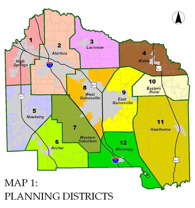
The previous Alachua County Recreation Master Plan was split into two phases. Phase I (2002) provided an inventory and analysis of existing recreation within Alachua County to determine the needs in the community. The analysis included both county and city facilities, and compared existing park acreages by type and population projections to SCORP guidelines to determine acreage needs county-wide, along with needs by planning district. A similar approach determined needs for additional amenities as dictated by Statewide Comprehensive Outdoor Recreation Plan (SCORP) guidelines. Additionally, an accessibility level of service metric provided a service area radius for each park type. The community park level of service further divided this accessibility metric to provide a 3-mile service area for urban areas and 6 miles for rural areas. Phase I determined 11 planning districts within Alachua County for the purposes of service delivery.
Phase II (2005) focused on building specific recommendations from capital improvements, as well as provided organizational structure recommendations and possible funding sources. Public participation served to verify and expand on park needs determined in Phase I to identify specific community needs and programming desires. Capital improvements projects covered projects at municipal, county, and school district levels to fill recreational gaps throughout the county.
In general, projects identified were prioritized based on the following criteria:
• high local priority
• provide a county-wide benefit
• centrally located
• use existing facilities
• take advantage of partnerships
• serve residents of different ages, abilities, and interests
• promote principles of sustainability
• are cost feasible
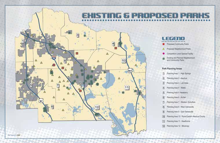
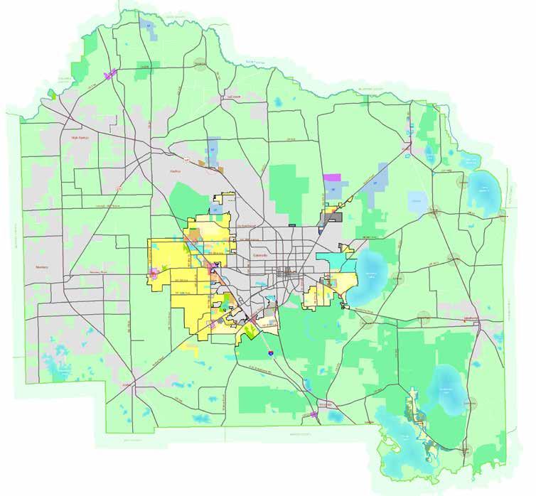
Existing & Proposed Parks Map
The Program Delivery Recommendations Report essentially refines the general recommendations generated in Phase I using a more intensive public/provider participation process to build consensus on local recreation needs and priorities. Appendix A provides a summary of public input. The focus of this Report is to convey:
1. What recreation facilities are needed in each Planning District; 2. What it will cost to construct, operate and maintain them; and 3. What the best organizational structure is to provide for the recreational needs of the County.
The Report addresses these topics by planning district and provides a composite plan for the system as a whole. It begins with a needs assessment, provides a 20‐year capital improvements master plan, and explores four alternative organizational structures. Map 1 shows the boundaries of the twelve Planning Districts determined in the first phase of the planning process.
Planning Districts for Program Delivery Recommendations
Additionally, the plan identified the following Top 10 county-wide Recreational Desires:
• Better maintenance and use of existing parks
• Increased awareness of existing recreation opportunities
• More neighborhood and community parks
• Enhanced access to natural areas and interpretive information
• Interconnected system of greenways and trails
• Multi‐purpose recreation centers/community buildings
• Public swimming pools
• Athletic practice fields
• Competition tournament facilities
• Skate parks
Phase II provided a 20-year capital improvements master plan, which extended to 2023 and identified the need for just under $147 million in capital projects. These included county, city, and school board projects, with upgrades to existing parks representing 72% of the total capital allocation.
New Parks recommended included:
• 18 Urban Neighborhood Parks
• 18 Suburban Neighborhood Parks
• 3 Community Parks
• 2 Special Facilities
The Program Delivery Recommendations report provided recommendations and a capital improvements master plan applicable for each of the 11 planning districts developed during Phase I of the Master Plan.
Phase II (2005) focused on building specific recommendations for capital improvements, while providing organizational structure recommendations and possible funding sources. A public involvement effort served to verify and expand on the park needs determined in Phase I by identifying specific community needs and programming desires. Capital improvements projects covered the municipality, county, and school district levels to fill recreational gaps throughout the county.
The Alachua County Comprehensive Plan defines goals, objectives, and policies for the future growth of the county. The included Recreation Element provides the primary framework for the development and maintenance of the Alachua County parks system, while other elements, such as Future Land Use, Conservation and Open Space, and Public School Facilities interlink goals supporting the vision for the County. Alachua County partners with municipalities to provide activity-based recreation, while resource-based recreation is provided by the County through the Alachua County Forever program. The State Park system provides additional resource-based recreation independent of the Comprehensive Plan.
The Recreation Element establishes a Level of Service (LOS) for parks to provide a minimum park acreage per 1,000 residents of unincorporated Alachua County. Additionally, LOS measurements respond to changes in the unincorporated population due to annexation. Essentially, this policy assumes that municipalities within Alachua County will provide service to their residents, while Alachua County will meet the needs of residents in unincorporated areas.
Measurement of LOS metrics includes County-funded or developed facilities operated by other jurisdictions, as well as facilities provided by other entities for which Alachua County has cooperative use agreements. Below is a breakdown of minimum LOS standards for recreation, as determined by policy 1.1.2.
According to the information obtained via Geographic Information System (GIS), Alachua County currently maintains 95 acres of activity-based park land and 611 acres of resource-based park land. Based on a 2035 unincorporated population estimate of 127,471 persons, Alachua County will have a surplus of 31 acres of activitybased park land, and will need 24 acres of resource-based park land to meet their LOS standards.
Park type classifications provide a service delivery model for various types of recreation needs. A comparative review generates an understanding of how Alachua County compares with other jurisdictions in its definition of park types and distributions.
In this review, Alachua County park types and definitions, as defined in the Recreation Element of the Comprehensive Plan, have been compared to the those of the City of Gainesville and neighboring Marion and Clay Counties. Additionally, Lake County serves as a comparison point—as Lake County similarly includes urban, suburban, and rural areas as well as encompasses several incorporated municipalities of various scales.
Generally, Alachua County’s definitions are comparable to those used in other jurisdictions. Major differences are summarized below. A complete breakdown of the park type classification and definition comparison is detailed in the attached Park Type Classification Comparative Matrix.
Alachua County includes a Tot Lot park classification that allows for the accommodation of play structures in conditions where land may not be readily available. In other municipalities, this park type may be called a Neighborhood Park.
The Pocket Park designation provides a classification for unique opportunities in high-density areas. This classification is also present in the City of Gainesville and Lake County as a “Mini Park.”
Special Use Parks provide a catch-all classification for park types of varying sizes and county-wide service areas. Special Use Parks can be classified generally or more specifically as activity-based or resource-based parks. A general classification can be seen in Lake County (Special Facility), City of Gainesville (Special Use Parks), and Marion County (Memorial Parks).
Alachua County does not include a general catch-all category, but rather includes two separate special use park classifications—Special Use Activity Park and Special Use Resource Park. The separation of these provides a distinction between activity-based parks that are driven by demand and resource-based parks driven by availability. The City of Gainesville is the only other jurisdiction to have a specific activity-based park type: Sports Complex. Resource-based parks are defined in other jurisdictions under different monikers: the City of Gainesville uses “Local Nature Parks”; Marion County uses “Specialty Park”, as well as a more specific “Water Access”; and Clay County calls out “Boat Ramps.” Acreages within these definitions vary.
Notably missing from Alachua County’s park type classifications is a “Regional Parks” classification, which typically describes resource-based parks with service areas extending beyond county boundaries. Note that, if included within parks analysis, Alachua County’s nature preserves would meet this definition.
Additionally, a trail system category is present in both City of Gainesville (Linear Corridors) and Marion County (Greenways). Lake County includes an additional county-wide resource-based park classification, known as “District Parks”, which serves as a catch-all category for large parks over 75 acres that do not reach a regional scale service area. Based on the assets currently held by Alachua County, neither of these categories are applicable.
Acreages allotted generally align with definitions in other jurisdictions included within this comparative review, particularly when considering the Tot Lot category, which may be classified as a Neighborhood Park in other municipalities. Special Use Park acreages vary across jurisdictions as they are dependent on the specific resources of each park system. However, the acreages provided by the definitions in Alachua County for its Special Use Parks are appropriate based on the use case.
A unique condition for Alachua County is its wide variety of densities that make urban, suburban, and rural communities difficult to define in a standard manner. For example, the density and lifestyle in the City of Gainesville is different from that found in the City of High Springs; however, each of these is very different from a rural community like Cross Creek. This is captured in the current service area definition for Community Parks, such that a park located within an “urban” area can range in service from ½ mile to 3 miles, and “rural” service areas extend as far as 6 miles. While density is somewhat addressed through the capacity metrics dictating average maximum population and acreage per population, this does not address the geographic distribution of these parks. A more robust service area definition for each of these park types is needed to best serve each of these unique communities.
Tot Lot
Alachua County 1 acre 1/4 mi. residential avg. pop. 2,500 max. 0.5 acre/1,000 pop.
Lake County
City of Gainesville
Marion County
Clay County
Pocket Park
Alachua County <5 acres 1/4 mi.
Typ. high density
Lake County: Mini Park
Note: classification to be phased out <5 acres 1/4 mi. 0.5 acre/1,000 pop.
City of Gainesville: Mini Park 1/4-5 acres 1/4 mi.
Typ. high density
Low volume streets and trails
Marion County
Clay County
Neighborhood Parks
Alachua County 5+ acres 1/4 - 1/2 mi. in neighborhood area; avg. pop. 5,000 max; 2 acres/1,000 pop.
Lake County
Note: classification to be phased out 5-19 acres typ. 10 acres 1/4-1/2 mi. in neighborhood area; 2 acres/1,000 pop.
City of Gainesville 5-20 acres typ. May be smaller 1/2 mi.
Marion County 1-10 acres typ. 5-10ac 1/4 - 1/2 mi.
Clay County 1/2 -10 acres 5 mi.
Data Source
Alachua County: Alachua County Comprehensive Plan 2019-2040 - Recreation Element
Lake County: Lake County Comprehensive Plan 2030 - Parks and Recreation Element
City of Gainesville: City of Gainesville Parks Comprehensive Plan - Recreation Element
Marion County: Marion County Parks and Recreation Master Plan, 2016
Clay County: Clay County 2040 Comprehensive Plan - Recreation and Open Space
Walking, bike riding, or short drive by car
Walk or bike
Examples: play structures, benches, picnic areas, open spaces, landscaping--
Unique opportunity, generally no active recreation
Unique opportunity; located in high density areas including downtown
Examples: walks, benches, gardens, etc.
Balance of resource and activitybased
Balance of resource and activitybased
Examples: benches, child play areas, shade trees, picnic facilities
Informal active and passive recreation
Examples: play structures, recreation buildings, court games, hard courts, tennis courts, internal trails, shuffleboard, volleyball courts, picnic areas, open areas, landscaping
Casual play with very little programming
Examples: playgrounds, multi-purpose courts/fields, tennis courts, landscape areas, benches, recreation buildings, picnic areas and walkways
Examples: tennis courts, racquetball courts, shade trees, picnic facilities, child play areas, limited soccer and baseball fields
Facilities under 5 acres must include 2 of the following: basketball courts, tennis courts, racquetball courts, softball/baseball fields, gymnasium or recreation center, and soccer fields.
Community Parks
Alachua County
Lake County
City of Gainesville
20+ acres Urban: 1/2-3 mi. Rural: up to 6 mi.; avg. pop. 5,000 max; 2 acres/1,000 pop.
20-50 acres Urban: 3 mi. Rural: 6 mi.; 5 acres/1,000 pop.w
acres
walking, biking, but most often by car
mi. pedestrians, bicycles, autos, and buses
Marion County 20-75+ acres typ. 30-50 acres County-wide Clay County 5-40 acres
Special-Use Parks: General
Alachua County
Lake County: Special Facility varies County; acres/1,000 pop. not applicable; located based on the center of activity where pop. demands it car, bikeways or trails
City of Gainesville:
Special Use Parks N/A N/A
Marion County: Memorial Park <1 acre 1/4 mi.
Clay County
Data Source
Alachua County: Alachua County Comprehensive Plan 2019-2040 - Recreation Element
Lake County: Lake County Comprehensive Plan 2030 - Parks and Recreation Element
City of Gainesville: City of Gainesville Parks Comprehensive Plan - Recreation Element
Marion County: Marion County Parks and Recreation Master Plan, 2016
Clay County: Clay County 2040 Comprehensive Plan - Recreation and Open Space
Primarily activity-based
Primarily activity-based but can be resource-based as well
Examples: athletic fields, swimming pools, multipurpose fields, recreation centers, picnic areas, open space areas
Examples: athletic fields, swimming pools, multipurpose fields, recreation centers; natural areas provide: biking, fitness, picnicking, and open space activities; other community services may be located within community park
Intensive-use, activity-based Include a wide range and large concentration of facilities: lighted tennis courts, racquetball courts, soccer and baseball fields, a swimming pool, offstreet parking, playgrounds, and picnic facilities.
Parks between 10-20 acres can be classified as a community park if at least two different types of the following facilities are provided: baseball/softball fields, swimming pool, gymnasium, recreation center, and/or soccer or football fields.
Balance of resource- and activitybased
May be resource-based or activity-based
resource-based: picnicking, boating, swimming, hiking, camping, and play areas;
activity-based: equestrian center, golf course, senior center, or museum
Provide unique or unusual facilities for specialized recreational users
Pocket park, memorial, or special use park that serves a limited area or provides a unique recreation opportunity
Special-Use Parks: Activity-Based Park
Alachua County: Special Use Activity Park 20+ acres county-wide
Lake County
City of Gainesville: Sports Complex 15-100 acres urban area-wide bicycles, auto, buses
Marion County Clay County
Special-Use Parks: Resource-Based Park
Alachua County: Special Use Resource Park varies county-wide
Lake County
City of Gainesville: Local Nature Parks <100 acres urban area-wide
Marion County: Specialty Park dependent on resource statewide – 2 hr. drive
Marion County: Water Access 2-15 acres typ. 5-10 acres 3 mi. – dependent on resource avail.
Clay County: Boat Ramps District Parks
Data Source
Alachua County: Alachua County Comprehensive Plan 2019-2040 - Recreation Element
Lake County: Lake County Comprehensive Plan 2030 - Parks and Recreation Element
City of Gainesville: City of Gainesville Parks Comprehensive Plan - Recreation Element
Marion County: Marion County Parks and Recreation Master Plan, 2016
Clay County: Clay County 2040 Comprehensive Plan - Recreation and Open Space
activity-based may include a single purpose or activity, such as soccer complex, golf course, senior center, etc.
“intensive-use” recreation areas that provide a concentration of facilities for leagues and tournaments; one or more of the following facilities are necessary but not necessarily sufficient to classify a site as a “sports complex”: (1) at least four adult-size or youth-size baseball/softball fields; (2) at least six regulation-size soccer fields; (3) a professional or semi-professional sports stadium; (4) a combination of at least one gymnasium, four tennis courts, and four racquetball courts; and/or (5) a region-serving water theme park
resource-based natural resources, such as lakes and rivers, or cultural resources, such as museums, historical, sites, etc. Include picnic areas, boating, swimming, hiking, camping and play areas
resource-based includes trails, benches, picnic facilities, boardwalks, and exhibits
resource-based canoe/kayak/tube launch, historically significant facilities
boat ramp facility with associated picnic facilities, etc.
boat ramps
Alachua County - - -
Lake County
75+ acres county-wide; 30-40 min. driving time; 5 acres/1,000 pop.
City of Gainesville - - -
Marion County
Clay County
Regional Parks
Alachua County - - -
Lake County
250+ acres multi-county; up to 60 min. drive; 20 acres/1,000 pop; car, bikeways, or trails
City of Gainesville 30+ acres 10 mi.
Marion County 200+ acres regionally - 1 hr. drive
Clay County 150+ acres 1 hr. drive
Trail Systems
Alachua County
Lake County
City of Gainesville: Linear Corridors trail based bicyclists, hikers, horseback riders, canoeists, and joggers
Marion County: Greenway trail based dependent on size of trail network
Clay County
Data Source
Alachua County: Alachua County Comprehensive Plan 2019-2040 - Recreation Element
Lake County: Lake County Comprehensive Plan 2030 - Parks and Recreation Element
City of Gainesville: City of Gainesville Parks Comprehensive Plan - Recreation Element
Marion County: Marion County Parks and Recreation Master Plan, 2016
Clay County: Clay County 2040 Comprehensive Plan - Recreation and Open Space
- -
resource-based natural-resource: picnicking, boating, swimming, hiking, camping, and play areas; can be activity-based in outlying areas of the county
- -
resource-based camping, equestrian activities, canoeing, boating, fishing
outdoor amphitheaters, skate parks, hiking/nature trails, public golf course, cone/kayak, nature/environmental centers, track and field facility, fishing piers, gyms, racquetball courts, disc golf course
resource-based campgrounds, hiking, trails, playgrounds, boating facilities, lodging, recreation rentals, etc.
resource-based
trailhead to larger network of linear parks and trails, environmental education
While this comparative review looks at the definitions set forth in Alachua County’s Comprehensive Plan, there is a discrepancy between the definitions and the actual classifications used within the Parks & Open Space System. Parks within the system are currently classified by the Parks & Open Space System as follows:
The definitions currently used do not match those defined in the Comprehensive Plan. Additional categories have been added to best fit the assets within Alachua County, such as Historic, Nature, and Regional Resource. Additionally, the categories of Tot Lot, Pocket Park, and Special Use Activity Park are not currently used. It is recommended that park type classifications be revised in the Comprehensive Plan to more accurately reflect the current and future needs of the park system. Categories will be defined through the visioning process, and recommended nomenclature for continuity between both plans will be proposed.
The Future Land Use Element provides for the orderly and efficient use of land within Alachua County. With such varied densities and urban typologies as those present within Alachua County, the Element provides definitions that may be key in developing park service delivery models, as well as guidance on where to locate park facilities to best serve the community. In particular, the Future Land Use Element provides definitions for both urban and rural clusters.
Areas designated for urban development on the Future Land Use Map are Urban Clusters. These areas include residential densities ranging from 1 unit per acre to 24 units per acre or greater, non-residential development. They are generally served by urban services.
Historic rural settlements outside of the urban cluster are called Rural Clusters. These areas, which generally lack public services and facilities identified as necessary for more intense urban development, serve as a focus for an existing rural community. Policies and related development regulations for Rural Clusters preserve their existing rural character, ensure compatibility with the surrounding Rural/Agriculture areas, and protect the historic and natural resources that make these communities unique.
Alachua County has benefited from the passage of an infrastructure surtax in 2008, 2016, and 2022. The current surtax is a 10-year, one percent, sales tax. One half is dedicated to acquire and improve conservation lands as well as improve and maintain parks and recreational facilities within Alachua County. The current iteration is to be collected in Alachua County from January 1, 2023 to December 31, 2032. As described in the surtax ordinance, the funds approved through the referendum are to be expended on either Wild Spaces, through the acquisition of water and land resources deemed high-priority projects through the Alachua County Forever (ACF) Program; or Public Places, through the creation of new public recreation locations as well as the improvement and operation of parks and facilities.
The Infrastructure Surtax Oversight Board oversees expenditures. The Board consists of seven members and three alternate members representing Alachua County, the City of Gainesville, and other incorporated cities within Alachua County. In general, most funds allocated to the incorporated cities are utilized to fund park improvements and new parks, while conservation land acquisitions and improvements are generally carried out by the County.
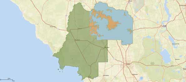
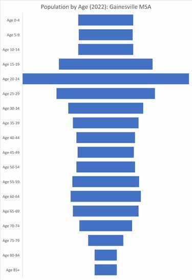
When evaluating demographics, it is beneficial to look at both Alachua County and its surrounding Metropolitan Statistical Area (MSA) to understand the role that the County plays in the overall area. An MSA is formally defined as “a region consisting of a city or county and surrounding communities linked by social and economic factors established by the U.S. Office of Management and Budget (OMB). “ Therefore, the demographic profile for the Gainesville MSA—which covers all of Alachua County, Gilchrist County, and Levy County—is provided in addition to the area of interest, Alachua County.
Demographic study areas

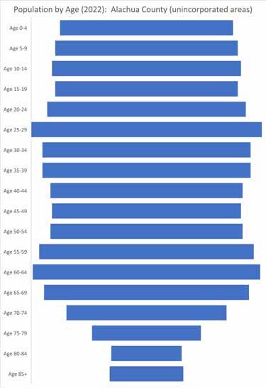
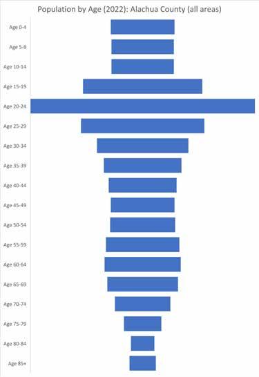
According to 2022 estimates, unincorporated Alachua County has a population of 112,471, which accounts for roughly 40% of Alachua County’s total population, including both unincorporated and incorporated populations. About 82% of the County’s total population makes up the greater MSA. Historically, Alachua County represented roughly the same proportion of the MSA’s total population; this trend is estimated to continue through 2027, as Alachua County and the MSA see a consistent increase in population.
The proportion of each age group in unincorporated Alachua County is consistent starting in the infant years to late adult years, but decreases in the elderly years. In Alachua County and the MSA, the highest percentage of the population falls into the 20-24 age groups for both areas, followed by the 25-29 and 15-19 age groups. The highest population percentages are estimated to remain in these cohorts, with less than a 1% change estimated for all age groups.
The total number of households within unincorporated Alachua County is estimated to grow approximately 3.3% through 2027 to 47,041. Like population, the total households within unincorporated Alachua County represent roughly 40% of the total households within the total County, and 81% of the County’s total population makes up the greater MSA. These proportions are estimated to remain consistent through the 2027 projection period.
As of 2022, unincorporated Alachua County has a median household income of $78,120, which is projected to increase to $96,707 by 2027. This median household income is 27% higher than Alachua County and 31% higher than the MSA. This median household income is estimated to remain consistently higher through 2027.
With varying incomes, unincorporated Alachua County residents have a higher spending per capita compared to the total County and MSA, with the highest spending on recreation and health membership fees, recreational lessons fees, and participant sports fees. Individuals invest most in camping equipment, water sports equipment, boat/trailer/camper/RV rentals.
Data Source
Population by Age (2022)
Alachua County comprises 192 parks, including 25 state parks, 110 municipal parks, 47 school parks, 10 nonprofit parks, and a number of privately owned facilities.
Alachua
The City of Alachua is home to 6 parks: 4 neighborhood parks, 1 community rural park, and 1 community park. Facilities include play fields, picnic facilities, a community center, and supplemental facilities. The total park acreage in the City of Alachua is 31.26 ac.
Archer
The City of Archer is home to 6 parks: 3 neighborhood parks, 1 community rural park, and 2 pocket parks. Facilities include play fields, and supplemental facilities. The total park acreage in the City of Archer is 21.97 ac.
Gainesville
The City of Gainesville is home to 54 parks: 11 neighborhood parks, 4 community rural parks, 6 community urban parks, 21 pocket parks, and 12 special facilities. Facilities include play fields, picnic facilities, playgrounds, gym/ center, trails, and supplemental facilities. The total park acreage in the City of Gainesville is 8,740.77 ac.
Hawthorne
The City of Hawthorne is home to 2 parks: 1 community rural park and 1 neighborhood park. Facilities include play fields, supplemental facilities, and a boat ramp. The total park acreage in the City of Hawthorne is 34 ac.
High Springs
The City of High Springs is home to 6 parks: 3 community rural parks and 3 pocket parks. Facilities include play fields, playgrounds, supplemental facilities, and trails. The total park acreage in the City of High Springs is 31.74 ac.
LaCrosse
The Town of LaCrosse is home to 1 neighborhood park, which include soccer fields. The total park acreage in the Town of LaCrosse is 5.08 ac.
Micanopy
The Town of Micanopy is home to 2 parks: 1 community rural park and 1neighborhood park. Facilities include play fields, playgrounds, and picnic facilities. The total park acreage in the Town of Micanopy is 9.57 ac.
Newberry
The City of Newberry is home to 4 parks: 3 neighborhood parks and 1special facilities park. Facilities include play fields, supplemental facilities, playgrounds, and picnic facilities. The total park acreage in the City of Newberry is 50.39ac.
Waldo
The City of Waldo is home to 3 parks: 2 neighborhood parks and 1 special facilities park. Facilities include play fields, picnic facilities, a community center, trails, and supplemental facilities. The total park acreage in the City of Waldo is 15.21 ac.
Alachua County is home to 29 county parks: 16 special facilities parks, 7 neighborhood parks, 3 nature parks, 2 community urban parks, and 1 community rural park. Facilities include play fields, picnic facilities, playgrounds, trails, and numerous supplemental facilities. The total county park acreage in the Alachua County is 1,388.19 ac.
The Alachua County School Board is home to 47 school parks. Facilities include play fields, playgrounds, trails, gymnasiums, and supplemental facilities in a range of conditions from excellent to good. The total school park acreage owned by the Alachua County School Board is 1,092.07 ac.
Improvements being made at Lake Forest Elementary School, including shade structures, swings, and trail/sidewalk improvements, will allow amenities at the school to be accessed by the public after-hours.
Alachua County is home to 25 state parks, preserve and historic sites including 9 special facilities, 8 regional parks, 2 district parks, and 6 neighborhood parks. Facilities include trails, a gym/center and a number of special facilities. The total state park, preserve and historic sites acreage in Alachua County is 60,148.22 ac.
Alachua County is home to 10 non-profit parks. Facilities include play fields, playgrounds, pools and a number of supplemental facilities. The total non-profit park acreage in Alachua County is 280.78 ac.
Alachua County also includes a number of privately owned parks, including the facilities at the University of Florida, Santa Fe Community College, private senior citizen communities, and other private owners. Additionally, Gainesville Regional Utilities (GRU) currently owns and maintains recreation land adjacent Veterans Memorial Park, and will develop a groundwater recharge wetland for public recreation use in the future.
Parks under private ownership have been excluded from this table.
GLANCE:
will the wetland be located?
Groundwater recharge wetland to replenish the Floridan benefit our water resources Road, near Diamond Sports Park in SW Gainesville Construction expected to be complete in 2026 use of reclaimed water to recharge the aquifer simultaneously creating wetland habitat and a park for the
project site encompasses approximately 75 acres near Sports Park, along Parker Road in southwest Gainesville. This area was selected because of its sandy, well-drained soils, which are integral to aquifer recharge because of the proximity to GRU’s existing reclaimed system.
Gainesville Regional Utilities (GRU) is constructing a groundwater recharge wetland in partnership with the Suwanee River Water Management District (SRWMD) and Florida Department of Environmental Protection (FDEP). The project is located north of the Diamond Sports Park and encompasses approximately 75 acres. The park will consist of a series of shallow basins that will filter the water and reduce nutrient loads while recharging the aquifer.
Multi-agency partnership spearheaded by GRU
other wetlands like this exist?
Groundwater Recharge Wetland Project
The constructed wetlands will be open to the public and include passive recreation opportunities like walking, jogging, wildlife viewing, photography, and environmental education.
Sweetwater Wetlands Park in Gainesville is an example of man-made wetland. Also a multi-agency project led by Sweetwater Wetland Park’s primary function is to water quality, but it offers many other benefits abundant wildlife habitats as well as recreational educational opportunities.
Construction will occur in phases, with the first phase to be completed in 2026.
Artistic rendering of visitors at wetland park
Regional Utilities (GRU), in partnership with the Suwannee River Water Management District the Florida Department of Environmental Protection (FDEP), is constructing a wetland park. will help replenish, or recharge, the Floridan aquifer, which will benefit the Santa Fe River, its community.
Groundwater recharge wetland project site
groundwater recharge wetland?
similar wetlands can be found throughout Florida, including as close as Ocala. Each wetland is treasured creating an abundance of green space and for having its own unique characteristics. This wetland system smaller than Sweetwater Wetlands Park, but the experience will be equally enjoyable.
recharge wetlands are man-made wetlands sandy soils that allow water to gradually through the soil and recharge the aquifer.
will the wetland be built?
are widely acclaimed in the scientific commeans to provide groundwater recharge with low-nutrient reclaimed water. The process groundwater supplies, raise aquifer levels and at springs, rivers and other nearby water completed, this phase of the wetland will Floridan aquifer with three million gallons per high-quality, low-nutrient water.
the wetland look like?
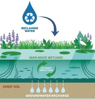
construction will occur in phases. The first phase is expected to be complete in 2026. GRU and and regional partners are currently in the project’s planning, permitting and design phase. multi-agency investment and cost-share funding from the SRWMD and FDEP will help pay for the Alachua County plans to manage public access and allow hiking, wildlife viewing and other passive Specific project details, including basin layout, trails and parking will be designed in collaboration with partners, stakeholders and neighbors.
Source: GRU.com
For more information about the project or to become involved, visit gru.com/rechargewetland or email rechargewetland@gru.com
Groundwater recharge wetland schematic
park will be designed as a beautiful space for the public to enjoy. The property will have several totaling 20 to 45 acres. Each basin will be planted with native wetland plants, including many species that will provide pollinator habitat in addition to enhancing the aesthetics of the park.

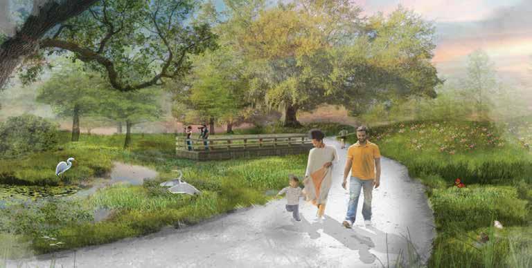
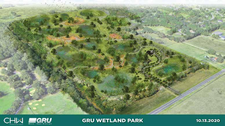
Alachua County Parks & Open Space manages a total of 29 park properties of which 4 are currently undeveloped and inaccessible to the public. Combining park inventories collected by the County and in-person site visits, the project team gained a baseline understanding of where the parks system stands today. The following is a summary of the parks currently within the system. Undeveloped parks have been excluded from the analysis of facilities.
29
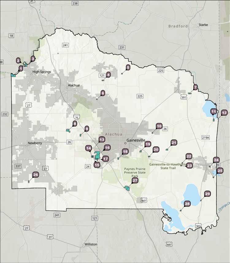
Cellon Oak Park is a small passive park located in the northern Alachua County. It is home to the Florida CoChampion Live Oak, with a canopy spread of 160 feet. The park and tree are named after its former owner, Ralph W. Cellon. The site offers picturesque views suitable for weddings and family pictures, as well as two picnic tables, grill, and a small parking area. Future development is limited by the need to protect this unique tree’s root system and prevent soil compaction.
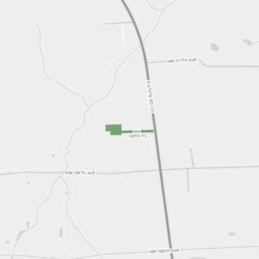
Location 410 NW 169th Pl Gainesville, FL
Current Park Type Nature
Acreage 5.69
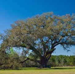
Copeland Park is located east of the Gainesville Regional Airport and serves the Coco Plum neighborhood and surrounding areas. Upon arrival, there is a small parking lot with an adjacent playground that is functional but in need of updating. An ADAaccessible path leads from the parking lot to the restroom building along the edge of a baseball field, which needs additional maintenance. Past the restrooms, there is a small picnic area and a basketball court which has been recently resurfaced. There are plans to extend the existing ADA path to connect to the basketball court and picnic tables, providing access to these amenities. The perimeter fence is generally in good condition, but there is need for repair along the eastern edge of the property.
Overall, this park is functional providing access to active amenities within its service area. However, improvements could be made, particularly to the playground, to improve curb appeal and enhance usage. There are signs of undesired activity and playground upgrades would help reinforce its image as a family-friendly space and provide a draw for users.
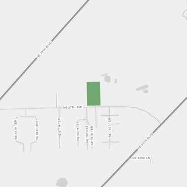
7020 NE 27th Ave
Location
Gainesville, FL
Current Park Type Neighborhood
Acreage 5.00
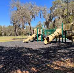
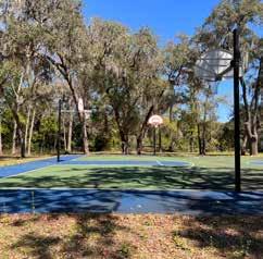
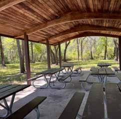
Cuscowilla Nature and Retreat Center is a 211-acre special use park located northwest of Micanopy along Hwy 441. The park contains a variety of activities including basketball, volleyball, and a swimming pool. Additionally, the park includes cabins and opportunities for hiking and fishing along its many wooded acres.
Alachua County recently renovated the park with improvements, such as ADA upgrades, resurfacing of the parking area, waterfront dock, climbing tower, and a butterfly garden.
The public may access the pool on summer weekends and holidays by purchasing a $5 day pass and residents can purchase a $20 seasonal pass. Additionally, Cuscowilla Nature and Retreat Center offers a variety of rental spaces, including overnight cabin stays, tent camping, meetings, weddings, and private pool parties. The park is publicly available outside of camp programs and private rentals.
Location
210 SE 134 Ave Micanopy, FL
Current Park Type Special Use Resource
Acreage 211
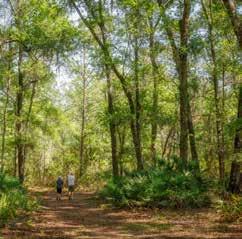
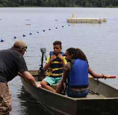
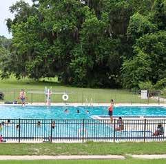
Cynthia Moore Chestnut Park and Clark Butler Nature Preserve offers both recreation areas and nature preserve. A scenic drive off SE 35th Road leads to a paved parking area with a stormwater facility to the south and park amenities to the north. The park is shady and includes a restroom building, various pavilions, playground, volleyball court, basketball courts, and a large multi-purpose field. The park is generally well maintained, although the playground turf surfacing is tearing at the seams and is slated to be replaced with a soft surface material. Additionally, there are plans to add another pavilion to serve the multi-purpose field. All pavilions are available for rent.
There are apparent drainage issues throughout the park—specifically within the multi-purpose field and around the playground and restroom building. These drainage issues are likely undermining the surfacing of the playground and could contribute to accelerating deterioration of park infrastructure. A stormwater master plan could help address these issues and prevent future wear on the park.
Location
2315 SE 35th St. Gainesville, FL
Current Park Type Neighborhood
Acreage 27.00
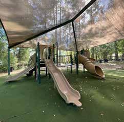
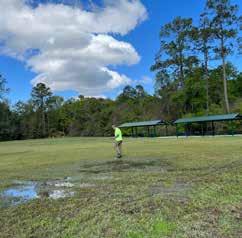
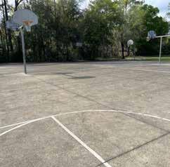
DeSoto Park is a small strip of land nestled between Hwy 441 and NW 120th Lane in northwest Gainesville. It currently contains two pavilions and picnic tables, and serves primarily as a parking/rest area along the existing highways. This property is used for sandbag distribution during declared emergencies.
Location 11855 NW Hwy 441 Gainesville, FL
Current Park Type Neighborhood
Acreage 0.63
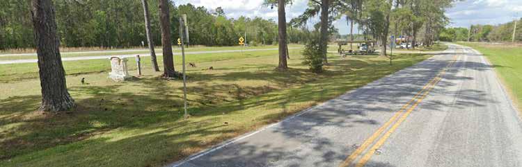
Source: Google Earth, 2021
Earl P. Powers Park is located off SE Hawthorne Road and provides access to Newnan’s Lake. The park serves primarily as a boat ramp and natural resource access site, but has been developed to include recreation amenities including a restroom building, paved parking lot (accommodating both boat trailer and regular vehicles). The boat ramp access canal bifurcates the park east of the parking lot, with a well-maintained playground and pavilions to the north and a picnic area and sidewalk leading to an observation deck toward the south. The observation deck allows non-boaters to enjoy scenic views of Newnan’s Lake and wildlife. There is a concentration of active fishers who utilize the banks of the canal and the observation deck. While there are many amenities, there is a lack of accessible circulation, particularly around the play area. With its access to natural resources and engaged user group, there are opportunities for environmental interpretatation and experiential learning.
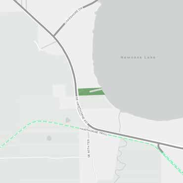
Location
5910 SE Hawthorne Rd. Gainesville, FL
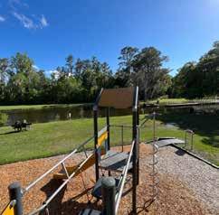
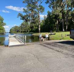
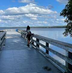
Grove Park is a rural park providing active recreation to residents of the Hawthorne area. The park includes a playground, picnic area, basketball court, and baseball field. The playground has been recently replaced and includes an ADA-accessible sidewalk as well as a permanent shade structure.
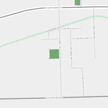
Location SE 152nd St. Hawthorne, FL
Current Park Type Neighborhood
Acreage 4.32
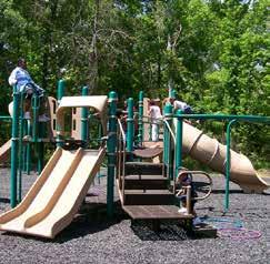
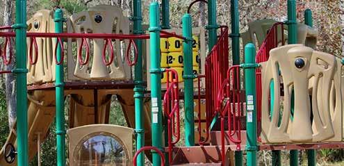
The High Springs boat ramp provides access to the Santa Fe River. From this point, it is possible to reach River Rise Preserve State Park, where the Santa Fe River emerges from underground within a 3-mile paddle upriver, and Poe Springs Park within a 5-mile paddle downriver. This boat ramp lies along a 26-mile designated paddling trail, enabling nature enthusiasts to access several springs and natural attractions along the way.
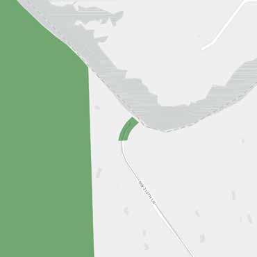
Location
6300 SE 152nd St. Hawthorne, FL
Current Park Type Neighborhood
Acreage 4.32
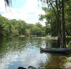
Holden Pond Park offers boat ramp access into Holden Pond and Little Orange Lake on the outskirts of Hawthorne. The park includes a covered pavilion, picnic tables, shelter, and a parking lot (half paved asphalt and half stabilized grade). There is currently no ADA access. Because of its rural setting, this park does not have pedestrian access, and is likely to remain a drive-to destination.
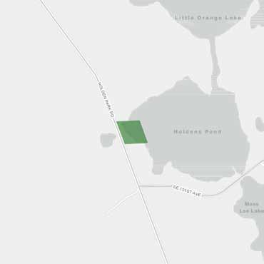
Location
9725 Holden Park Rd. Hawthorne, FL
Current Park Type Special Use Resource
Acreage 5.00
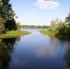
Kanapaha Botanical Gardens is a 63-acre site leased and managed by the North Florida Botanical Society. The gardens contain a variety of major collections, including Florida’s largest bamboo garden and the largest herb garden in the Southeast. An entry fee is usually required, however, there are a variety of events during which entry fees are waived.
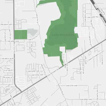
Location
4800 SW 58th Dr. Gainesville, FL
Current Park Type Special Use Resource
Acreage 62.00
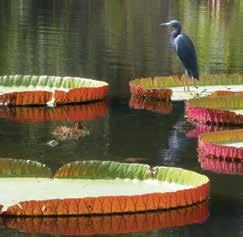
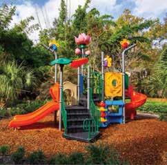
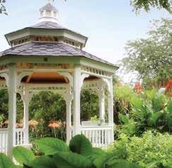
Photos courtesy of kanapaha.org
The Kate Barnes Boat Ramp at Majorie Kinnan Rawlings Park, located in Cross Creek, provides access to Orange Lake as well as the Marjorie Kinnan Rawlings Historic State Park next door. The park includes a boat ramp, play area, restrooms, large pavilion, and picnic areas under dense oak canopy. The asphalt parking lot serves both the park and the historic site. Due to this relationship, the park serves both Cross Creek residents and regional tourists. Overall, the park provides an appropriate variety of activities for its location. However, the restroom building needs attention and could be upgraded. ADA improvements are planned which would provide accessible paths throughout the park to the restrooms, play area, and entrance to the state park.
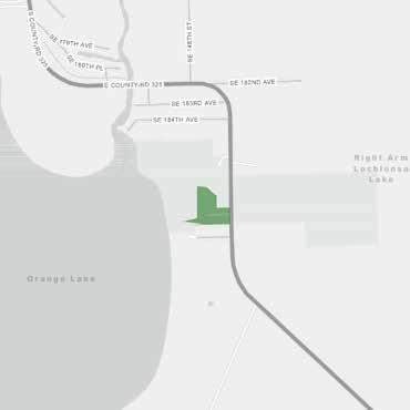
Location
18800 S CR 325 Cross Creek, FL
Current Park Type Special Use Resource
Acreage 12.00
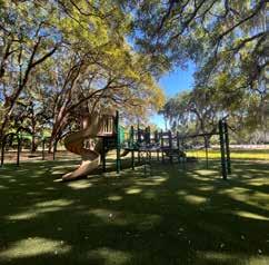
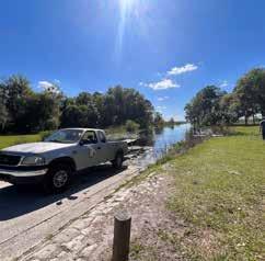
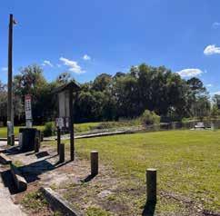
Lake Alto Park, located in Waldo, provides access to Lake Alto, and features a boat launch, play area, and picnic area. The park serves as a trailhead for hiking within Lake Alto Preserve. The recently installed playground includes an integrated shade structure. A new floating dock was recently added, with other improvements planned including restrooms, gazebo upgrades, shoreline preservation observation areas, and ADA-compliant paths to all amenities. There is an opportunity to include interpretative signage throughout this park.

Location
17800 NE 134th Pl Waldo, FL
Current Park Type Special Use Resource
Acreage 22.33
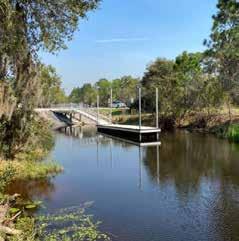
Photos courtesy of alachuacounty.us
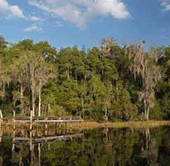
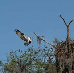
Lochloosa Park provides access to Lochloosa Lake in southeast Alachua County. The park includes restroom facilities, as well as a boat ramp and observation deck with great views from the shoreline. Park development is essentially maxed out, with a permeable parking lot taking up much of the site. Over time, the parking area has settled and become uneven. There are also signs of erosion along the shoreline that may need additional vegetation and stabilization. This park is popular with both boaters and fishers, as it provides access to Lochloosa Lake Fish Management Area within a small, narrow footprint.
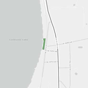
Location 16204 SE 207th Ln. Hawthorne, FL
Current Park Type Special Use Resource
Acreage 1.24
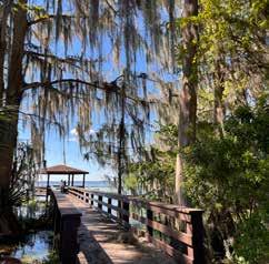
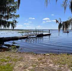
Mark S. Hopkins Park is located just outside of Gainesville and is the first pocket park developed by Alachua County serving the residents of the Sugar Foot Oaks neighborhood. It is designed for easy pedestrian access and includes a playground, half basketball court, and picnic tables. The relatively new park has been embraced by the community, with neighborhood kids actively using the park. Adjacent to the park, various service centers operated by SWAG provide family services, health clinic, and early childhood education.
Location
817 SW 64th Terrace Gainesville, FL
Current Park Type Neighborhood
Acreage 0.26
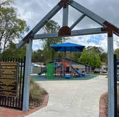
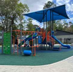
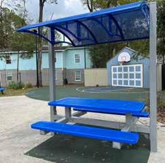
Melrose Boat Ramp is a concrete boat ramp located in Melrose near the county line. It provides access to Melrose Bay and connects to Lake Santa Fe. The boat launch has limited parking. Launch is limited to boats with 12-hp motors or less, and is also a popular destination for kayakers.
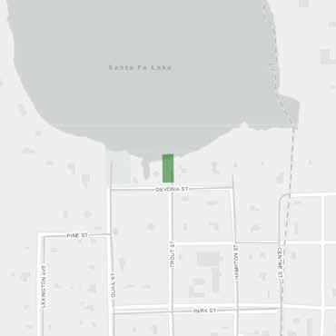
Location
End of Trout St. Melrose, FL
Current Park Type Special Use Resource
Acreage 0.25
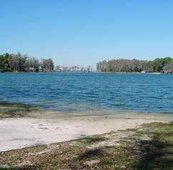
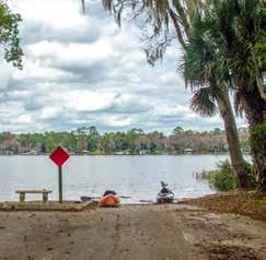
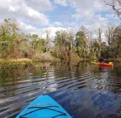
Monteocha Park is located in north Alachua County and serves the rural community of Gordon. The park includes a baseball field, playground, a recently resurfaced basketball court, picnic areas and grills. Parking is on stabilized grade, and there is no sidewalk infrastructure.
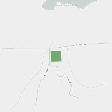
Location
803 NW 192nd Ave. Gainesville, FL
Current Park Type Neighborhood
Acreage 5.00
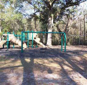
Owens-Illinois Park is a peaceful park off the eastern shore of Newnan’s Lake. A boat launch with dock provides canal access to Newnan’s Lake, and the asphalt road with parking provides access to the playground, restrooms, pavilions, and picnic areas under dense tree canopy. The park is set back from the lake and does not provide lake views; however, a wildlife observation area is planned.
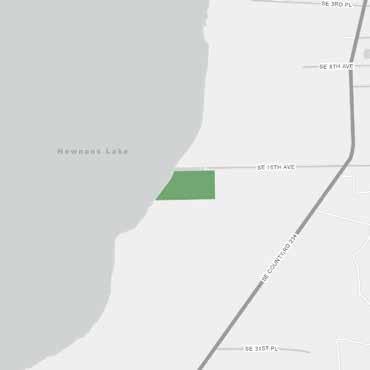
Location
11309 SE 16th Ave. Windsor, FL
Current Park Type Special Use Resource Acreage 21.57
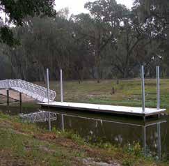
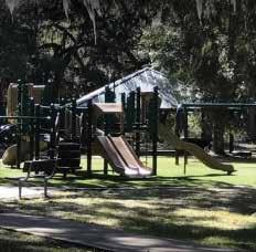
Poe Springs Park is a large, regional resource park providing access to scenic Poe Springs and the Santa Fe River. A paved drive leads to a variety of amenities including hiking trails, picnic areas, playground, sand volleyball court and multi-purpose field with backstop. Access to the spring is provided via a recently replaced boardwalk through cypress swamp. Spring amenities include a swimming area, pavilion, restrooms, and a recently added kayak dock. A boat ramp is located farther downstream. Two pavilions are available for rent, as well as a small lodge that includes a kitchen and restrooms. Poe Springs Park has a $6 park entry fee and is subject to capacity closures. There is a multi-use trail facility leading from downtown High Springs along NW 182nd Avenue to Poe Springs Park.
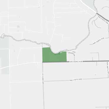
Location
28800 NW 182nd Ave. High Springs, FL
Current Park Type Regional Resource
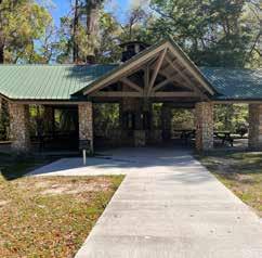
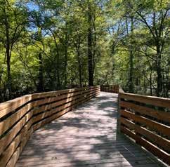
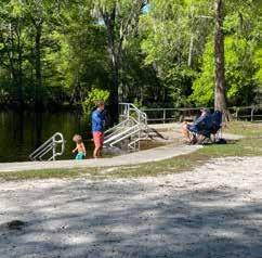
Rotary Park at Jonesville is a large sportsplex providing soccer fields, ballfields, a tennis complex, basketball court (striped for pickleball), playground, and picnic tables. A 1-mile loop trail provides fitness opportunities throughout the park, and a disc golf course meanders through the back wooded section. The fields and courts are well maintained and the tennis courts were recently renovated. Shaded sidewalks provide pedestrian access along the perimeter of the park, and canopy trees have been added where feasible. Various sports organizations utilize the facilities including Gatorball Baseball Academy, Gainesville Soccer Alliance, Jonesville Tennis, and Gainesville Chain Hawks Disc Golf Club.
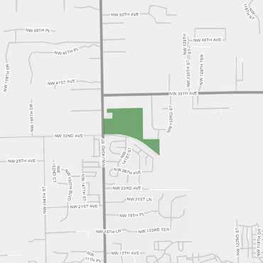
Location 14100 NW 32nd Ave. Gainesville, FL
Current Park Type Special Use Resource
Acreage 87.00
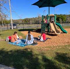
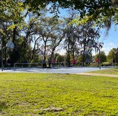
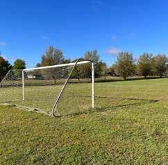
Santa Fe Lake Park is located just outside Melrose near the eastern edge of the County. The park provides access to Santa Fe Lake through a series of canals. The park can be divided into two sections: the family area located toward the entrance, and the boat ramp. The family area includes a recently installed, shaded playground with adjacent exercise equipment, picnic tables, and paved parking. However, there is no pedestrian connection between the family area and the boat ramp. The boat ramp area features restrooms, picnic tables, and boat launch. Boats too large for nearby Melrose Boat Ramp launch in this location instead. Pavilions are available for rent. Planned improvements for this park include a new restroom building.
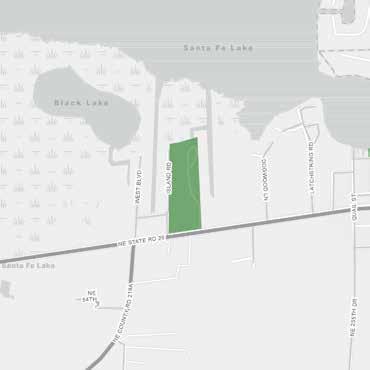
Location 24500 NE SR 26 Melrose, FL
Current Park Type Special Use Resource
Acreage 24.98
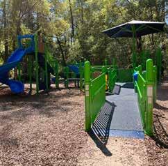
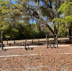
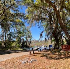
The Scott-Phifer House is a historic site that was home to the only antebellum house on the east side of the county. Currently, the property is fenced and contains the foundation of the house and historic beams with inscribed Roman numerals. A historic marker was placed on the site in 2016. Foundation ruins may be observed from outside the fenced area.

Location
5600 SE 155th St. Hawthorne, FL
Current Park Type Historic Acreage 2.80
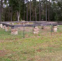
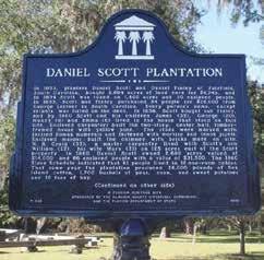
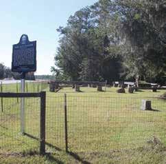
Squirrel Ridge Park, located south of the City of Gainesville, offers the departments only designated dog park. Amenities include separately fenced areas for large and small dogs, dog pools, and wash station. A restroom facility is planned. The park shares a driveway with Meridian Behavioral Healthcare and includes a parking lot of both gravel and stabilized grade. Some of the gravel parking is uneven; therefore, it is recommended to pave a portion to provide greater accessibility. The park has recently been upgraded with a new inclusive playground and adjacent fitness equipment. Accessible paths are planned. Additionally, the park includes the Crime Victim Memorial Garden, with memorial benches and manicured gardens. The open field adjacent to Williston Road is used as a play field for rugby and soccer.
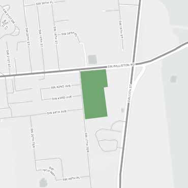
Location 1603 SW Williston Rd. Gainesville, FL
Current Park Type Community
Acreage 17.24
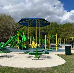
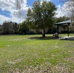
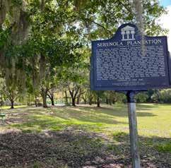
Veterans Memorial Park, located west of Gainesville, contains a wide variety of both active and passive amenities. A Veterans Memorial is prominently located in the median of the parking lot and a police memorial is located adjacent to the Freedom Community Center. The community center is available for rentals, and has an adjacent covered picnic area and restrooms. To the west of the parking lot are multiple soccer fields. A large playground, sand volleyball, and basketball court are located on the north side of the park. The playground is being replaced with a new inclusive playground. The existing baseball field is slated to be replaced with a splash pad and support facilities including a restroom area, primary driveway entry, and parking area. A shaded fitness trail with exercise equipment is popular among walkers. Just east of the parking lot is a full roller hockey rink complete with bleachers.
The eastern portion of the park, which operates under a use agreement with the City of Gainesville, is far more passive and includes picnic tables, informational signs, a pavilion, and a large stone monument. There is some potential to further activate this area.
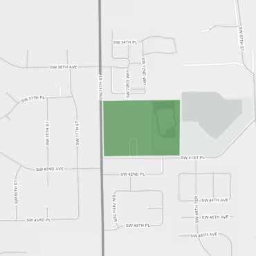
Location
7400 SW 41st Pl. Gainesville, FL
Current Park Type Community
Acreage 44.95 including joint-use
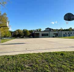
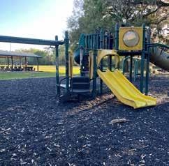
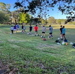
Watermelon Pond Park provides access to the 440acre Watermelon Pond Preserve, a sandhill lake habitat providing opportunities for wildlife viewing and a multi-use trail system located south of Newberry. The park features a parking lot, picnic table, informational signage, and a boat ramp.
Location
10700 SW 250th St. Newberry, FL
Current Park Type Special Use Resource
Acreage 12.00
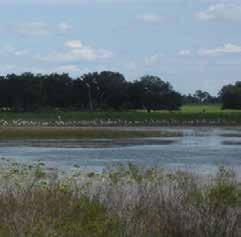
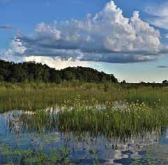
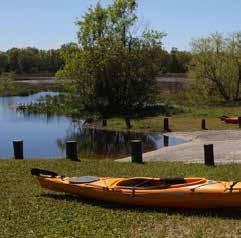
2.2
EXISTING SERVICE AREA
A review of the existing Service Area standards provides insights not only into the performance of the system, but also the metrics being used to measure it. By analyzing the current Service Area standards, this Master Plan is able to provide recommendations that consider not only physical improvements within the system but also regulatory improvements, allowing the system to be responsive to future growth.
Recreation Element Policy 1.1.2 of Alachua County’s Comprehensive Plan provides a multifaceted set of standards for parks level of service (LOS). The population-based, county-wide park acreage standards are adopted as minimum maintenance LOS standards; calculations detailing service provision for current and projected populations are shown previously in this report (Section 2.1, p. 58).
Additional LOS standards are provided in Table 1 of the Recreation Element. These standards outline typical location, service distance, size, average population served, and area per 1,000 population for each park type.
Abridged Table 1, Alachua County Comprehensive Plan – Recreation Element
SITE TYPE TYPICAL LOCATION TYPICAL SIZE (ACRES) AVERAGE POPULATION SERVED AREA PER 1,000 POPULATION
Neighborhood Park Within .25 to .5 mile distance in neighborhood area
Community Park Within .5 to 3 miles distance for urban areas and up to 6 miles for rural areas; usually serves two or more neighborhoods
Minimum of 5 acres
TYPICAL FACILITIES/ CHARACTERISTICS
5,000 maximum 2 acres Play structures, recreation buildings, court games, hard courts, tennis courts, internal trails, shuffleboard, volleyball courts, picnic areas, open areas, landscaping
Minimum of 20 acres 5,000 maximum 2 acres Athletic fields, swimming pools, multi-purpose fields, recreation centers, picnic areas, open space areas
Multiple table entries have been excluded from the above abridged table.
Tot Lots and Pocket Parks: none currently owned/maintained by Alachua County Parks
Special Use Activity Parks and Special Use Resource Parks: County-wide service area does not require service area analysis.
Through inclusion of this wide variety of metrics, these LOS standards intend to simultaneously address geographic distribution and park capacity. However, the project team has found that data appropriate for an accurate analysis utilizing all provided metrics is not reasonably and reliably available; therefore, the intended effect of these LOS standards is not able to be evaluated. Put into narrative format, the Neighborhood Parks service area standards provide an exemplary scenario to illustrate both the complicated nature of the current LOS standards, and the shortcomings of available data.
Service Area Minimum: the greater of either a .25-mile distance in a neighborhood area, or the distance required to accumulate 2,500 people (the minimum neighborhood park size of 5 acres sets the minimum number of people served at 2,500 people).
Service Area Maximum: the greater of either a .5-mile distance in a neighborhood area, or the distance required to accumulate the maximum park population capacity of 1,000 people per 2 park acres, not to exceed 5,000 people.
Evaluation utilizing these metrics would require accurate population data within geographies as small as .25-mile, while best-available population data is typically associated with larger geographic units, such as U.S. Census blocks or Transportation Analysis Zones. In addition, geographic definitions of “neighborhood areas” would be required in order to determine the areas where neighborhood parks would need to be provided. “Neighborhood areas” are not defined in the Comprehensive Plan Recreation Element Definitions. In light of these analytical constraints, the project team performed a targeted existing service area analysis to focus on evaluating the geographic distribution of Alachua County’s parks.
Using the Recreation Element’s existing park classifications and location criteria, the current Level of Service Analysis reveals a relatively limited geographic service area across the county. Virtually all of the service area is concentrated within the urban cluster or incorporated areas. These areas correspond with the highest population densities; however, this analysis suggests there is a significant share of County residents who are “unserved” by County parks. This current LOS analysis assumes the following, based on the criteria outlined in the Recreation Element:
Tot Lots are typically 1 acre in size and serve residents within a 0.25-mile radius. There are no Tot Lots owned or maintained by the County; therefore, they do not appear within the existing LOS analysis.
Pocket Parks are typically no larger than 5 acres and serve residents within a 0.25-mile radius. Mark S. Hopkins Park (13) represents the only Pocket Park owned and maintained by the County.
Neighborhood parks are at least 5 acres in size and serve residents within a 0.25- to 0.5-mile radius. Of the seven neighborhood parks owned and maintained by the County today, only two have service areas that are substantially located outside of an urban cluster or incorporated areas.
Community parks are at least 20 acres in size and serve residents within a 0.5- to 3-mile radius within an urban context, and up to a 6-mile radius within a rural context. Of the three community parks owned and maintained by the County today, zero have service areas that are substantially located outside of an urban cluster or incorporated areas.
Special Use Activity and Special Resource Parks have a “County-wide” service area; however, this analysis purposely excludes these park types from the LOS results shown on the map figure because it does not add clarity about what the existing LOS is.
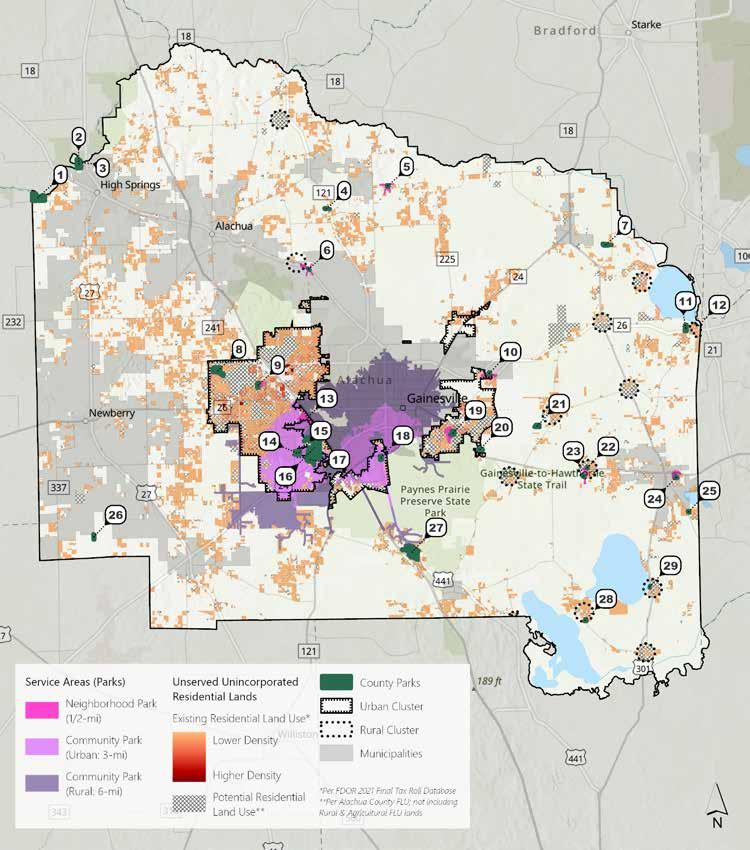
Public engagement is a critical component in gauging the community’s needs and desires to guide the production of the Master Plan. Input through community surveys, public workshops, and focus groups all serve to shape the vision of the Master Plan. Utilizing these methods can help the project team gain intimate knowledge of the parks & open space system through the experience of park users, and help identify the strengths and weaknesses of the existing system. By matching the existing conditions of the park system with the needs and desires expressed through public engagement, it is possible to form a vision that responds directly to the specific needs of the Alachua County community.
The purpose of this study was to gather community feedback on the Alachua County parks, recreation, facilities, amenities, future planning, communication, and more. This survey research effort and subsequent analysis were designed to assist Alachua County in developing a plan to reflect the community’s needs and desires.
To help understand Alachua County residents’ current usage, satisfaction, and priorities for parks and recreation facilities and programs, a statisticallyvalid survey was developed for distribution across the county. Residents living within Alachua County limits were considered the population for this study. In total, 4,000 surveys were randomly sent to selected households across the area. Residents were mailed a paper survey that included a postage-paid envelope with the option to also take the survey online through a password-protected website. Reminder postcards were sent to 3,000 households to boost response. Additionally, an “open link” survey was distributed via social media and promoted through other efforts by the County approximately two weeks after the statistically-valid survey.
A total of 303 statistically-valid surveys were completed (representing a +/5.6% margin of error). Furthermore, 2,337 open surveys were collected from residents who did not participate in the statistically-valid survey. Results were used to aid the decision-making process on current opportunities and to plan for future needs among residents.
The underlying data from the survey was weighted by Commission District to ensure equal representation of the population across Alachua County in the statistically-valid survey sample. Using U.S. Census data, the district distributions in the total sample were adjusted to more closely match the actual population of Alachua County’s five Commission Districts.
Overall satisfaction with the quality of parks, facilities, and programs provided by Alachua County is generally positive: 43% of Invite respondents rated 4 on a scale of 1-5, with 5 being “very satisfied”. Invite respondents are slightly more satisfied, rating an average 3.8 vs. 3.5 out of 5.
Nature-based parks and amenities are of high use and importance to the Invite sample. A total of 22% Invite respondents use trails and pathways at least once a week, and 14% said they use County parks at least once a week. Nature walking/jogging trails were also rated as the highest use, with 81% of Invite respondents saying they use them when visiting the Alachua County Parks & Open Space facilities.
Respondents live in close proximity to the parks they visit most often. Nearly half (47%) of both samples live 1-4 miles away. The majority (89%) of the Invite respondents use a motor vehicle to get to parks; however, there is also a strong presence of walkers/runners (34%) and bicyclists (27%). Responses were similar for Open link respondents. Respondents would generally prefer to walk no more than 15 minutes to different park types.
Walking, jogging, and running are the most frequent activities for the Invite sample (70%). Open link respondents are split between walking, jogging, and running, with playgrounds/play areas being the most used activities or amenities. Trails and pathways are the most frequently used facility, followed by County parks for both samples. Open link respondents report using the facilities and services more frequently.
Invite respondents place high importance on walkways and trails and County parks & open space; these averaged 4.4 and 4.2, respectively, on a scale of 1-5, with 5 being “very important”. Gymnasiums for indoor sports and events and indoor recreation centers are of the lowest importance.
On a scale of 1-5, in which 5 is “completely meeting the needs,” almost all categories for the Invite sample are meeting the needs of the community sufficiently, with a rating of 3.0 or above, except for indoor aquatics (2.8). Open link respondents rated the categories lower than Invite respondents for “meeting the needs of the community”, and agree that indoor aquatics should be an area of attention.
The top area that, if addressed, would increase use by the Invite sample is “closer facilities to where I live or work” and for the Open link sample is additional facilities and amenities. The top 5 most important areas are the same across sample types, suggesting similar needs across the community.
There is some room for improvement for the County to increase the effectiveness of communication about parks and recreation opportunities. The average rating given by Invite respondents was 2.5 on a scale of 1-5, with 5 being “very effective”, while the Open link averaged 2.2. Currently, the most common way residents receive information from Alachua County Parks & Open Space is through word of mouth; however, the two most preferred methods of communication by both respondent samples is email, followed by social media. Invite respondents are more likely to use the Alachua County website, local media, and the activity guide/brochure.
Additional trails, adding more parks, and making improvements to and/or renovating existing parks or facilities are the most important future needs, according to both respondent samples. There is also a need for programs for residents of all ages, including kids, teens, and seniors.
Respondents have a long tenure living in Alachua County; more than half of Invite respondents report that they resided in the County for over 20 years, with the average length of time being nearly 24 years.
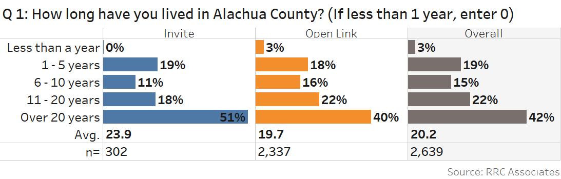
Overall satisfaction with the quality of Alachua County parks, facilities, and programs is generally positive: 43% of Invite respondents rate their satisfaction as 4 on a scale of 1-5, with 5 being “very satisfied”. Invite respondents are slightly more satisfied than Open Link respondents, with an average 3.8 vs. 3.5 out of 5.
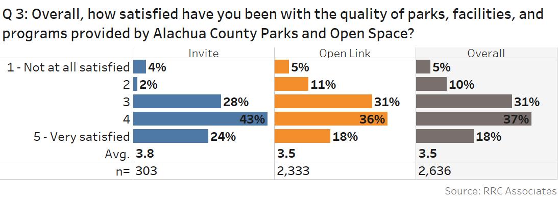
A total of 2,228 comments were collected for the question, “What is the name of one park in Alachua County you and your household visit most often?”. The top 5 parks are Depot Park, Jonesville Park (these two mentioned much more than others), Veterans Memorial Park, Possum Creek Park, and Westside Park. Only Jonesville Park and Veterans Memorial Park are Alachua County owned and managed parks. The others are City of Gainesville parks.
A large portion of respondents live in close proximity to the parks they visit most often. Nearly half (47%) of both samples live 1-4 miles away.
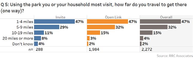
Walking, jogging, and running are the most frequent activities for Invite respondents (70%). Open link respondents are split between walking, jogging or running, and playgrounds/play areas as the most used activities or amenities. Invite respondents participate in organized sports infrequently, whereas Open link respondents rarely fish/boat.
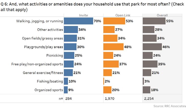
Trails and pathways are the most frequently used facility for both samples, followed by County parks. Open link respondents report frequently using a greater variety of facilities and services, with larger shares responding that they use several facilities or services at least once a week.
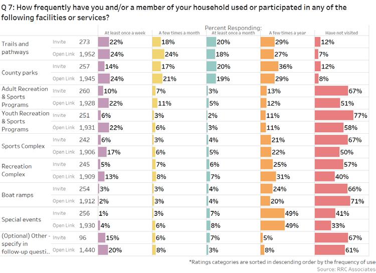
Invite respondents use nature walking/jogging trails, restrooms, open space, or lawn and picnic areas most frequently. Open link respondents use nature walking/jogging trails, restrooms, playgrounds, and open space or lawn most frequently. They also use athletic fields and splashpads more often than Invite respondents.
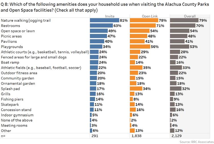
The majority of respondents use a motor vehicle to travel to parks and/or recreation facilities, followed by walking/ running and bicycling.
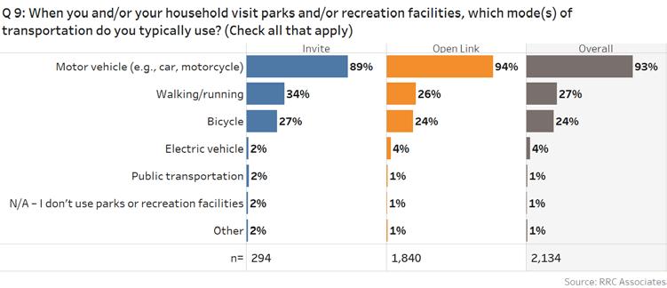
The preferred mode of transportation is also motor vehicle. Preference is split between walking/running and bicycling, with 13% selected for each.
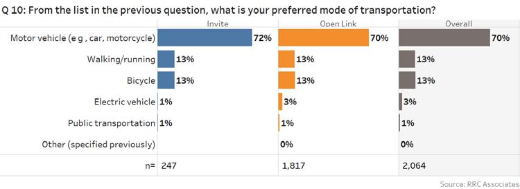
Open-Ended Comments
A total of 1,110 comments were collected in response to “Is there anything limiting your use of preferred transportation”. The word cloud below highlights the top 150 most frequently used words. Distance from parks and limited parking were the main complaints. However, limited parking primarily refers to parking at Depot Park which is City of Gainesville park.
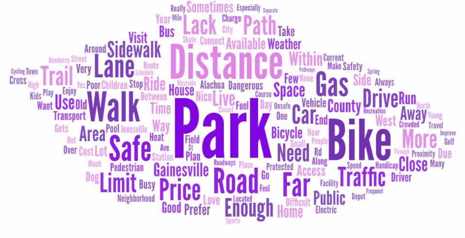
Most respondents prefer to walk no more than 15 minutes to each of the park types.
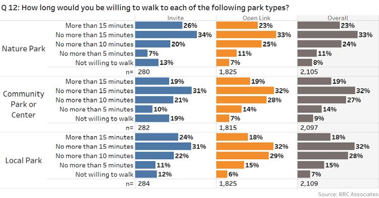
By Invite Sample
On a scale of 1-5, with 5 being “very important,” Invite respondents place high importance on walkways and trails and County parks & open space, averaging 4.4 and 4.2, respectively. Gymnasiums for indoor sports and events and an indoor recreation center are of the lowest importance.
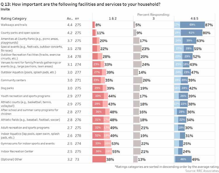
By Invite Sample
On a scale of 1-5, where 5 is “completely meeting the needs,” for the Invite respondents, almost all categories meet the needs of the community sufficiently, with a rating of 3.0 or above, except for indoor aquatics (2.8).
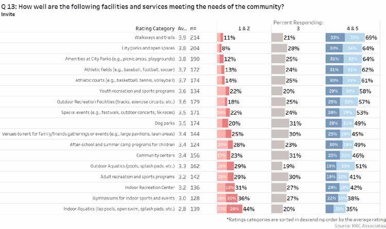
By Open Link Sample
Walkways and trails, County parks & open space, amenities at County parks, outdoor recreation facilities, special events, and outdoor aquatics represent the top important categories for Open link respondents, with a rating of 3.5 and above. Open link respondents also agree gymnasiums for indoor sports and events are of lesser importance.
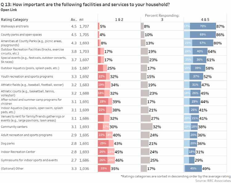
By Open Link Sample
Open link respondents scored the categories lower than Invite respondents for “meeting the needs of the community”. They also agree that indoor aquatics has room for improvement.
The average importance-performance matrix provides comparison between the importance of select facilities and programs and how well respondents feel the County is meeting the needs of the community in those same areas.
This following diagram provides an overview of how to interpret these matrices.
These are key areas for potential improvements. Improving these facilities/programs would likely positively affect the degree to which community needs are met overall.
These “niche” facilities/programs have a small but passionate following, so measuring participation when planning for future improvements may prove to be valuable.
These amenities are important to most respondents and should be maintained in the future; however, these are less of a priority for improvements, as needs are currently adequately met.
Current levels of support appear to be adequate. Future discussions evaluating whether the resources supporting these facilities/programs outweigh the benefits may be constructive.
The top area that, if addressed, would increase use by Invite respondents is “closer facilities to where I live or work”; for Open link respondents, it is “additional facilities and amenities”. Improved communications about offerings, additional lighting, and better condition/maintenance of parks or facilities are other key areas. The top 5 most important areas are the same across sample types, indicating similar needs across the community.
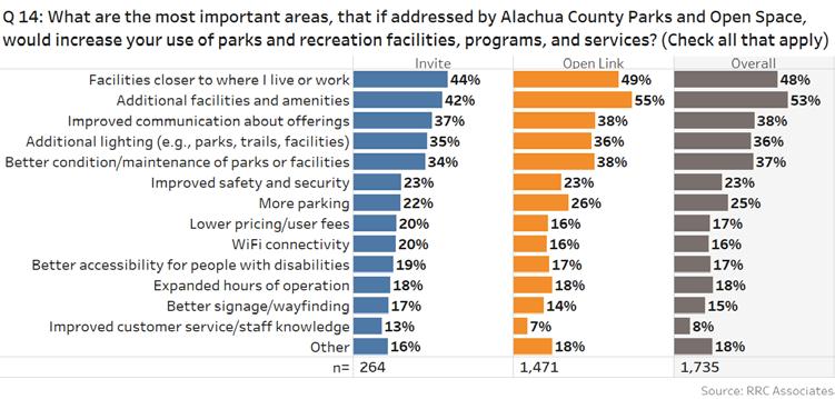
By Invite Sample Average
There are no facilities or amenities in the high importance/low needs met category, which is a good sign that the County is doing well. Invite respondents are particularly happy with walkways and trails, and rated them with high importance.
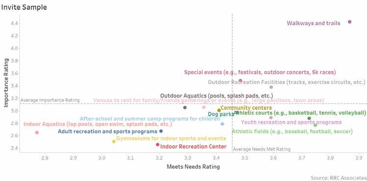
By Open Link Sample Average
Open link respondents prove to be more variable across the average, with walkways and trails scoring high in both categories. Outdoor aquatics is the only amenity in the high importance/low needs met category.
There is room for improvement for the County to increase the effectiveness of communication about parks and recreation opportunities. The average rating given by Invite respondents was a 2.5 on a scale of 1-5, with 5 being “very effective”; the Open link respondents averaged 2.2.
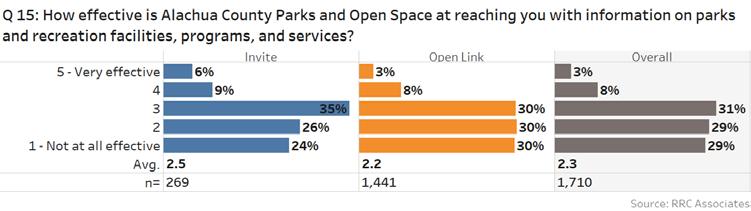
Most individuals receive information about parks and recreation opportunities through word of mouth. Invite respondents use local media more frequently, and Open link respondents use social media more frequently.
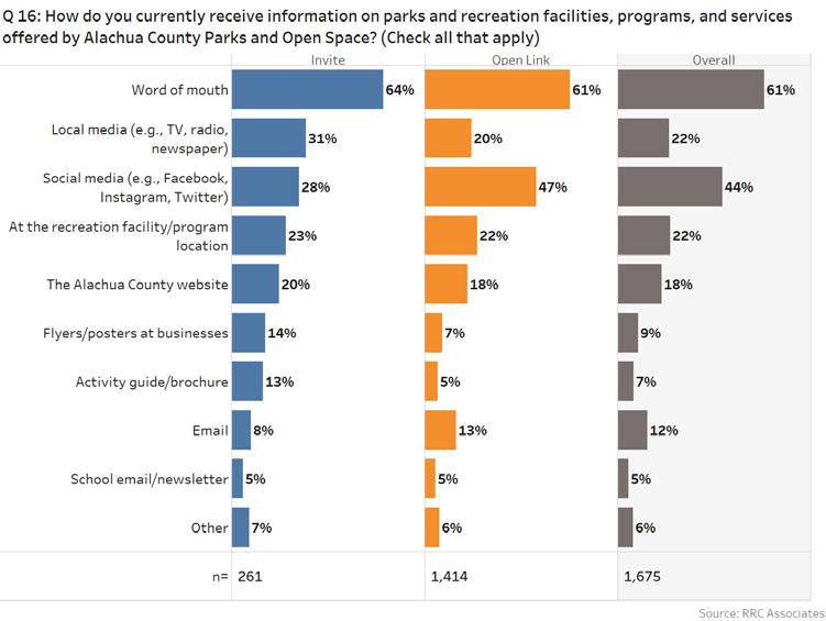
The two most preferred methods of communication by both samples is email, followed by social media. Invite respondents are more likely to use the Alachua County website, local media, and the activity guide/brochure.
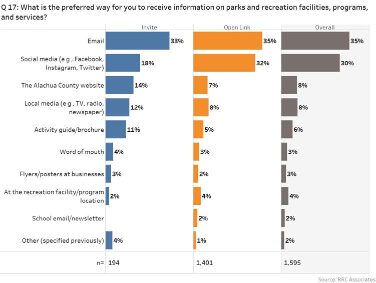
Additional trails, adding more parks, and making improvements to and/or renovating existing parks or facilities are rated most important for both samples.
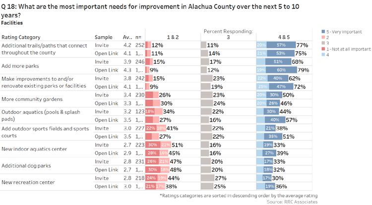
Programs and services are of higher importance to both samples. There is a need for programs for residents of all ages, including kids, teens, and seniors.
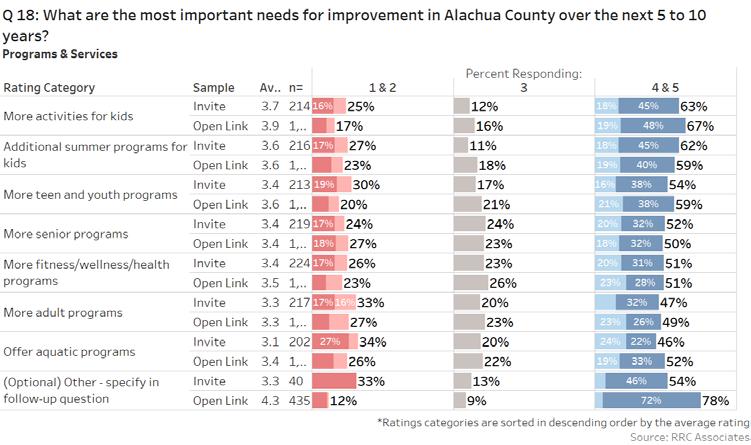
The two samples agree on the top three priorities: additional trails, add more parks, and make improvements to and/ or renovate existing parks or facilities. The open link respondents feel stronger about outdoors aquatics and adding outdoor sports fields and sports courts.
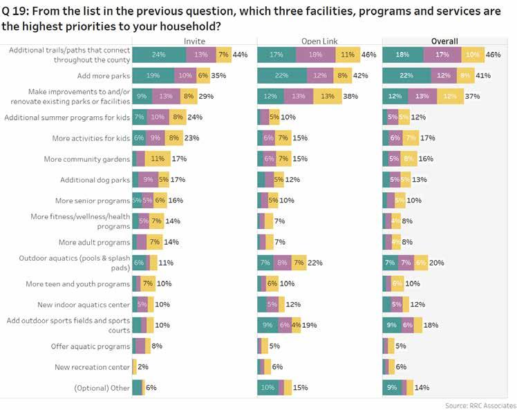
Respondents were offered an opportunity at the end of the survey to provide any additional comments and suggestions for Alachua County. A total of 933 additional comments were received. Common themes are outlined below, and a list of full responses is included in the Appendix.
“Thank you for all you do. These services are the main reason I love Gainesville.”
“I think Alachua has done an amazing job so far, it’s about attuning/ fine tuning to meet changing population demographics now. Thank you!”
“Add more disc golf courses. The only 2 large courses in the area will not be enough to sustain the large amount of traffic due to the huge growth of disc golf in the last year. We need 1-2 more ones in the county.”
“Alachua Counties disc golf scene has exploded in recent years. While the 2 existing courses are great we could really use another.”
“Add or maintain restrooms at parks, all parks should have a restroom with water fountain.”
“Bathrooms need more management, they are aways filthy.”
“Please maintain the bathrooms better. Thanks!”
“Additional park spaces for roller skating could add to the culture of Alachua County, and nighttime lighting and a covered or (even better!) indoor space could add to its usability.”
“It would be nice to have a free outdoor skating rink. I would go more often to parks that had this if it were an option. Preferably a covered one to get protection from the rain and summer sun.”
“Keep Alachua county green! Thank you for prioritizing parks and recreations spaces with trees and fields.”
“Keep green park areas with facilities for walking, jogging and gardens and picnic areas as well as concession stands. Residents need parks for children to play, take dogs for walks, NEAR their homes. And seniors need places to meet and relax safely.”
The greater portion of respondents who completed the survey was female. Invite respondents skewed a bit older, while Open link respondents were somewhat younger.
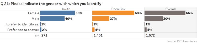
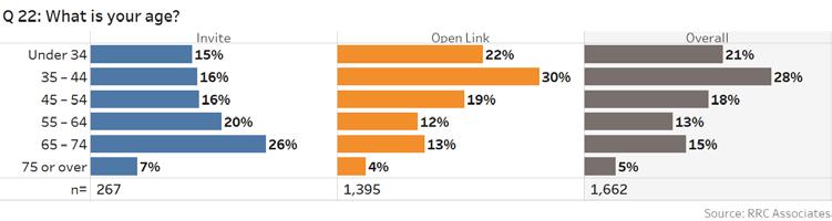
A greater percentage of Open link respondents are couples with children at home. Invite respondents are relatively dispersed in terms of household makeup.
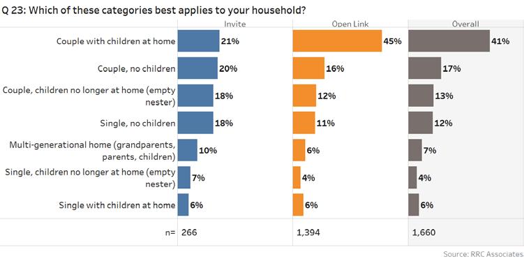
Most respondents are not students, own their own home, and are registered voters in Alachua County.
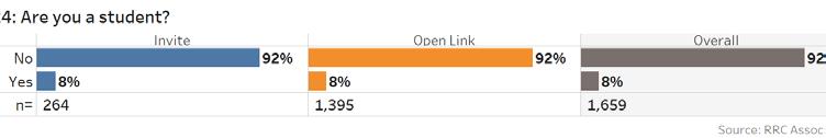
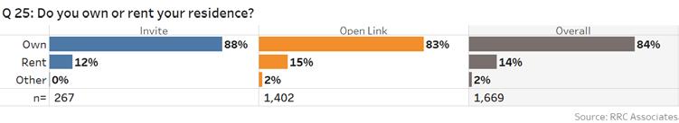
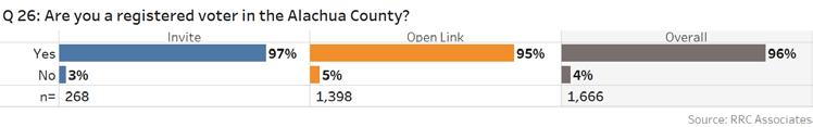
A total of 13% of Invite respondent households has a need for ADA-accessible facilities and services.
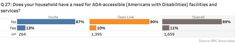
About half of Invite respondents have a dog.
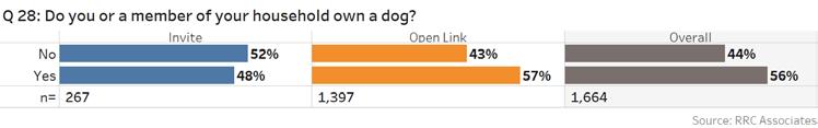
Most respondents are not of Hispanic, Latino, or Spanish origin and are white. A total of 6% consider themselves Asian and 6% are Black or African-American, with smaller shares representing other races.
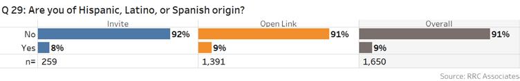
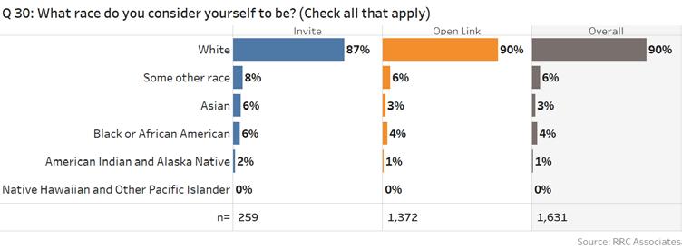
Invite respondents are low- to mid-income level, while Open link respondents skew slightly more affluent.
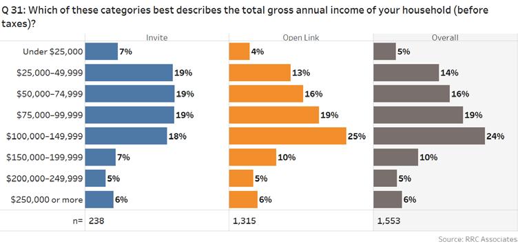
PAGE INTENTIONALLY LEFT BLANK
The team facilitated four public workshops at public parks, allowing Alachua County residents various opportunities to give their input. Public workshops were held in an informal open-house style, with various stations providing opportunities for input and conversation between residents and the project team. Workshops were conducted during weekday evening hours to accommodate work schedules, and were held in frequently used parks.
Public workshops have two major goals: to receive input from the community as to their needs and desires, and to educate new park advocates who are excited and engaged with their park system. Each of the various stations were specially designed to reach these goals.
The following is a breakdown of the stations and the type of input collected at each point.
As participants entered the workshop, they were greeted at a welcome table and given a brief summary of the project and public workshop format. Comment cards were distributed for participants to fill out and return by the end of the workshop.
Comment cards included the following prompts:
I am ___ years old and I live in____________.
I like parks that______________.
In the future, I hope Alachua County Parks can become places for_______________.
Can’t wait to _______ in the parks!
The prompts aimed to target the residents’ aspirational goals and desires for the park system to follow.
Participants were asked to mark the locations of where they live and work, and what parks they play in on the County map using sticker dots. The facilitator guided participants through the map and pointed out the various parks currently existing within the system to help ensure participants understood the map and directions for the activity. Sticker dots were colorcoded, with red sticker dots used to mark where participants live, blue dots marking where they work, and green dots marking where they play. Participants were prompted to elaborate on why they may prefer to commute to a park.
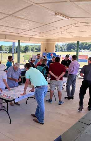
Purpose
This activity provided the project team with an understanding of which parks are most used, how other park systems contribute to providing service within Alachua County, and why participants may be driving long distances to reach a park. As part of this activity, participants were given a map highlighting the location of all the County parks to help further their awareness of park locations that they might have not previously known about.
Participants were given an Alachua County map that highlighted County parks. Residents were asked to write directly on the map, indicating general or specific comments regarding the vision they have about parks in their area. This activity was facilitated by a team member who helped participants expand on the written comments and draw out additional desires and needs for the community.
Purpose
This activity gathered input on geographically specific aspirations for the community for their County’s park system, including where park amenities may be missing, desired amenities, and potential missing connections.
Participants given six options for amenities (Sports Fields/Courts, Trails, Natural Areas, Recreation Centers, Playgrounds, and Other) they would like to see more of in their area. They were then asked to vote for their preferred option by placing stickers on a map, and could further expand on their specific choice with the station facilitator.
Purpose
This activity served as a conversation starter to help participants identify what they determine to be key components of a successful park, as well as provide insight on the desired programming of specific communities. This input helped identify why some parks may be loved in a community, while others remain unused and abandoned regardless of proximity or access. It also helped identify amenities that may be missing or in high demand within the park system.
The survey station, equipped with a laptop, was available to capture participants’ responses via the Open link survey. Participants could complete the survey during the workshop, and a written link was provided, so that the survey could be shared and promoted to others or be taken at another time.
PUBLIC WORKSHOP #1
May 10, 2022, 5:30-7:30 pm
Veterans Memorial Park 7400 SW 41st Pl, Gainesville, FL
PUBLIC WORKSHOP #2
May11, 2022, 5:30-7:30 pm Jonesville Park NW 32nd Ave NW 143rd St, Gainesville, FL
PUBLIC WORKSHOP #3
May 24,2022, 5:30-7:30pm
T.B. McPherson 1717 SE 15th St, Gainesville, FL
The project team facilitated public workshop meetings at three different locations, including two County parks. All meetings were advertised as being open to all County residents. As a result, there was overlap between attendees of different meetings. Input has been organized based on general comments and specific station input.
Throughout the first two workshops, participants expressed the value of senior-focused resources as well as youth activities. Residents prioritized amenities that could provide activities for different ages and levels of ability. Residents expressed the importance of parks that serve many different types of users, with features such as additional active amenities and social spaces. Based on their input, an ideal park would provide a variety of amenities serving the entire family, sufficient parking, and protection from the elements.
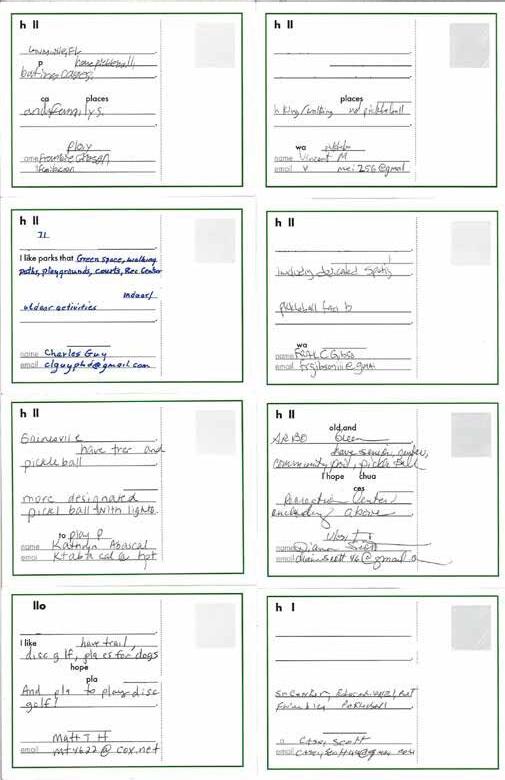
The community showed a strong desire for sports, such as pickleball, soccer,
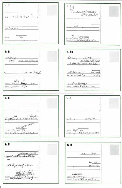
Across all age groups, participants valued active, multi-generational spaces—they also emphasized the need for spaces that bring community together and are equally accessible from all locations of the County. Participants expressed a desire for central gathering spaces (e.g., pavilion, outdoor stage, grouped picnic tables/benches) to help foster a sense of community. Many also noted the importance of nature trails and court-specific sports, such as pickleball and disc golf. Individuals also requested more trees, dog-friendly spaces, and an interconnected trail system.
Most participants in the first two public workshops lived in western Alachua County. Fewer blue dots showed “work”, as many of participants were retired. The majority of “work” indicated was in or around the City of Gainesville. The green dots showed a wide geographic distribution of park usage throughout the entire County, with a clear concentration of use at Rotary Park at Jonesville, Veterans Memorial Park, and eastern City of Gainesville parks. The second two public workshops included primarily participants living in the City of Gainesville, with only one located outside City boundaries. However, the green dots indicated park usage throughout the County, with groupings in Veterans Memorial Park, Kanapaha Botanical Gardens, Hawthorne State Trail (especially for cycling and hiking), and Cuscowilla Nature and Retreat Center. The few blue dots clustered in western and central City of Gainesville, were again likely due to many of the participants being retired.
Remarks written on the map included the desire for new parks, community gardens, dog parks, natural areas, and multi-use fields, as well as a community center for indoor and outdoor activities. For specific sports, participants asked that 18-hole disc golf course and covered pickleball courts be added into the parks system. Participants expressed a desire for multi-purpose trails to connect key destinations (referred to by some as an “infinity loop”), as many of the existing parks are inaccessible due to missing/unsafe bicycle infrastructure or lack of sufficient parking. There is also a desire for more amenities providing public access to lake edges, as many edges are inaccessible without a boat; some users suggest the need for more lake beaches and fishing piers. Participants also noted that air boat noise coming from Orange Lake and Lochloosa Lake can impact the park experience at Kate Barnes Boat Ramp at Marjorie Kinnan Rawlings Park. Comments at the station noted properties not managed by Alachua County, such as securing and expanding the green space and accessibility of the existing McRorie Community Garden in downtown Gainesville.
The dot voting activity showed that the overall priority for the participants are trails and natural areas, followed by sports fields and community centers. Safer multi-modal trails to connect “in-town” destinations and mountain bike trails were specifically written in. On the other hand, playgrounds did not receive a high number of votes. Under the “Others” category, additional desires included dog park, splash pad, community garden, senior center, exploration center, community center, fishing areas, and a community pool, along with an overall desire for more green space.
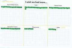
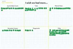
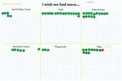
FOCUS GROUP #1
May 10, 2022, 10:30 am
Veterans Memorial Park
7400 SW 41st Pl, Gainesville, FL
FOCUS GROUP #2
May 10, 2022, 2:00 pm
Veterans Memorial Park
7400 SW 41st Pl, Gainesville, FL
FOCUS GROUP #3
May 19,2022, 6:00pm
Zoom Virtual Meeting
FOCUS GROUP #4
May 24, 2022, 4:00pm
T.B. McPherson
1717 SE 15th St, Gainesville, FL
The project team conducted focus groups with various members of the Alachua County community, such as sports leagues, program coordinators, and environmental groups for the purposes of targeted engagement and candid discussion about the County’s Parks & Open Space System. Focus group meetings provided the project team an opportunity to gather vital information at the initial stages of the Master Plan process from people with intimate knowledge of the parks, programs, and activities currently available in the County.
Utilizing a sample list of the types of people to invite, County staff extended participation invitations to community members to participate in 1 of 4 focus group meetings. Individuals were brought together to share their experiences and knowledge with the project team, and to engage in conversation centered on a series of prompted questions prepared by the project team.
Prompted Questions:
1. How long have you been a resident of Alachua County?
2. How would you describe the existing Alachua County Parks & Open Space System? What are the strengths and weaknesses?
3. Do you or your family visit County parks? If so, which ones? Any City parks? Parks in next door counties?
4. How do you receive information about programs and facilities?
5. Big Idea Activity: Using the provided sticky note, write down a guiding principle for the County’s Parks & Open Space Department. We will vote on these ideas together and determine what are some of your high priorities for the system. (Ideas: take care of what we have, canopy and wildlife, health and fitness, ability to walk from home, accessibility, and inclusivity, etc.)
6. Anything else? Here is your chance to tell us something we may be missing.
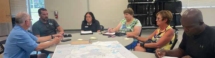
The following are summaries of the discussion and responses gathered at each focus group meeting.
How long have you been a resident of Alachua County?

Focus group participants consisted primarily of long-time Alachua County residents, with the majority of participants having been residents for more than a decade.
How would you describe the existing Alachua County Parks & Open Space System? What are the strengths and weaknesses?
Strengths
Activities
Good number of parks
Clean
Accessible
Responsive to community interests
Well-maintained
Playgrounds
Pleasant
Variety of amenities
Good staff
Weaknesses
Limited exposure, communication, and marketing
No infrastructure to attract bigger leagues
Facilities need to expand
Lack of parking & lighting
No recreation or senior center
Not walking distance for many users
Not prepared for growth
Organized sports need more help
More maintenance needed
Understaffed & underfunded
Upgrades needed
Safety concerns
Do you or your family visit County parks? If so, which ones?
Any City parks? Parks in next door counties?

Participants use a combination of County, City, and State facilities for their recreation needs. State Parks contribute resource-based recreation for many Alachua County residents. Active recreation use was primarily focused on Veterans Memorial Park and Jonesville Rotary Park.
How do you get information about programs and facilities?

Throughout the various focus groups, participants expressed a need to improve communications about park offerings. Many felt that while the information existed, it was not always easy to find or presented in the most user-friendly way. Participants suggested that establishing a hierarchy of information between different parks would facilitate finding information about amenities in small neighborhood parks, while more complex parks could more easily communicate information about additional offerings such as reservations and events.
Additionally, participants felt that some information may be better served appearing both online and offline to reach a wider population, such as senior residents and residents who may not have access to the internet.

Participants were asked to share their “big ideas” for the Alachua County parks system, as well as vote on their priorities. Most participants prioritized maintaining and improving the existing park system; however, many also mentioned providing park access for all residents throughout the County, along with better communication of the park offerings to encourage usage and engagement with the community.
Participants were interested in how attracting sports leagues at a regional scale could be beneficial to the park system and the local economy. Some opined that a park suited for regional league play could attract sponsors and generate income that could be used to improve the maintenance budget for the smaller parks.
Additionally, participants were interested in a maintenance plan for the parks. A particular topic of concern was turf management within sportsfields, as continuous play can cause erosion and an uneven playfield. The thought was that the County could explore the options of rotating sportsplay to allow the turf to recuperate, as well as evaluate the need for an additional sports complex to address capacity issues. One attendee was passionate about the need to recoup lost amenities from redevelopment—especially dedicated, covered space for roller sports, including roller skating, roller derby, and hockey. Existing space is not properly maintained, and prior suitable space was repurposed.
The online focus group emphasized the importance of ecological/natural areas to be intentionally incorporated into every park, in addition to the recreational amenities, such as pollinator gardens and interconnected trail systems.
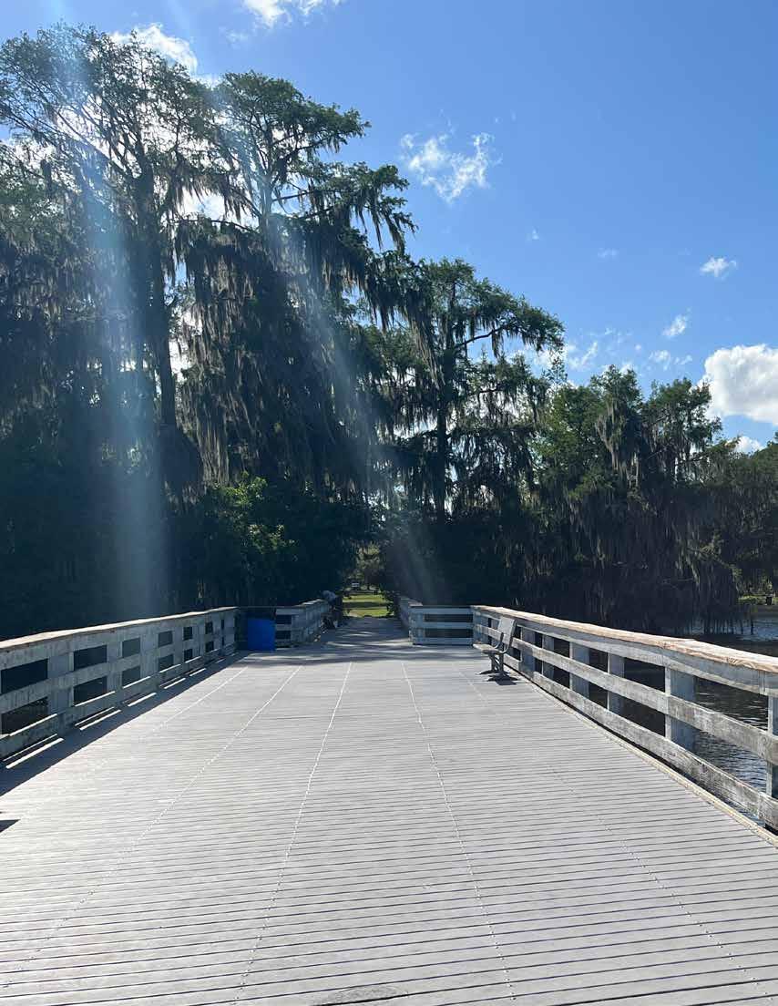
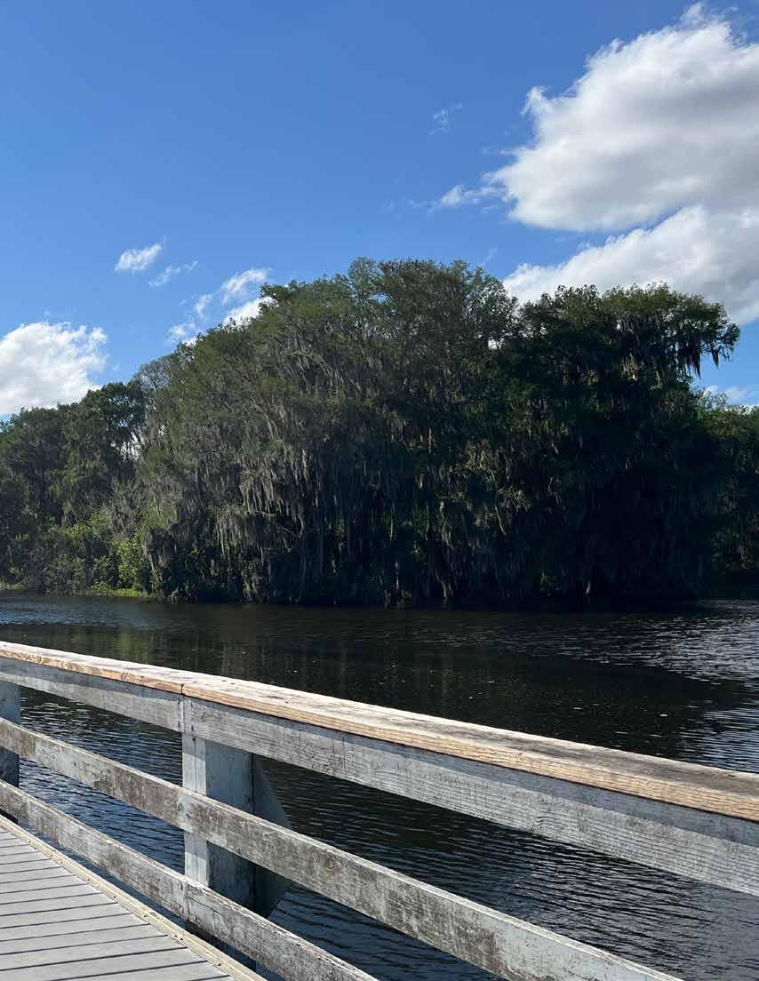
3 - HOW DO WE GET THERE?
3.1 LEVEL OF SERVICE
The Level of Service analysis guides the Vision by determining where gaps in service exist and how future system improvements and acquisitions can help to fill those gaps. Based on the newly established geographic level of service, each resident should live within a close range of a neighborhood park (1-mile urban or 2-miles rural) or a community park (3-miles urban or 6-miles rural).
The updated geographic LOS should be met using the following strategies:
1. Reclassify existing parks based on amenities
2. Upgrade existing parks with additional amenities
3. Expand existing parks by acquiring adjacent properties and adding new amenities/facilities
4. Acquire and develop new parks in unserved areas
The following section details the process by which these recommendations have been determined to provide an equitable level of service throughout Alachua County.
The map shown herein illustrates the results of the service area analysis after reclassifying a handful of parks in cases where the existing amenities were congruent with a different park classification. By reclassifying these parks, the LOS analysis begins to reveal greater service within the rural context. Five of the seven reclassified park have service areas that reach rural residents.
This reclassification analysis assumes the following, based on the definitions and criteria outlined in the Recreation Element:
Tot Lots and Pocket Parks are excluded from the reclassified LOS analysis, because their implementation is generally more opportunistic, and the amenities they offer can be limited.
The reclassified LOS analysis maintains the existing LOS criteria for neighborhood parks; therefore, the map herein illustrates the same level of service.
The reclassified LOS analysis maintains the existing LOS criteria for community parks; therefore, the map herein illustrates the same level of service.
Seven of the 13 Special Use Activity and Special Resource Parks include amenities commonly found in neighborhood and/or community parks. As such, the reclassification analysis modifies their LOS criteria from a “County-wide” service area to a neighborhood or community park service area. In doing so, the map herein illustrates an additional five neighborhood parks and two community parks. This analysis reclassifies the following parks as either neighborhood or community:
• Lake Alto (Neighborhood)
• Rotary Park at Jonesville (Community)
• Santa Fe Lake (Neighborhood)
• Early P. Powers (Neighborhood)
• Owens-Illinois (Neighborhood)
• Cuscowilla Nature & Retreat Center(Community)
• Kate Barnes Boat Ramp at Marjorie Kinnan Rawlings Park (Neighborhood)
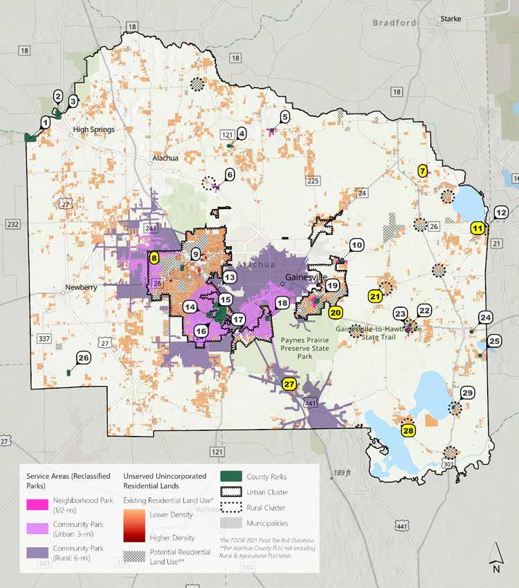
The map shown illustrates the results of the service area analysis performed using LOS criteria recommended by this Master Plan. This recommended LOS criterion is based on survey results in which nearly 3 in 4 respondents stated a preference for using motor vehicles to access parks. The results of this LOS analysis reveal a greater portion of service within the rural context.
Tot Lots and Pocket Parks are excluded from the proposed LOS analysis, because their implementation is generally more opportunistic, and the amenities they offer can be limited.
The proposed LOS criteria expands service area radius for neighborhood parks from 0.5 to 1-miles within urban contexts and adds a 2-mile service area radius within rural contexts. This change applies to ten parks, seven of which have service areas that are predominantly in rural contexts. The proposed LOS criteria affect the following neighborhood parks:
• Monteocha
• DeSoto Park
• Lake Alto
• Copeland
• Santa Fe Lake
• Cynthia Moore Chestnut Park and Clark Butler Nature Preserve
•Earl P. Powers
•Owens-Illinois
The proposed LOS analysis maintains the existing LOS criteria for community parks; therefore, the map herein illustrates the same level of service.
Parks of these types provide county-wide service, per the LOS standards, therefore service areas are not depicted on the map. While the location of these parks is largely dependent on the location of specific resources, they are fairly well-distributed across the County, with many located on the periphery of the County in areas that do not have neighborhood or community parks.
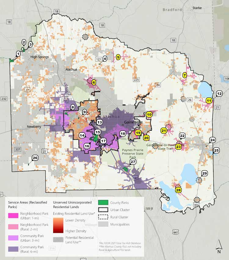
The map shown illustrates the results of the service area analysis performed with the expectation that numerous parks might expand in size or range of amenities. This Master Plan assumes that five parks are candidates for expansion—two of which would significantly increase service within rural areas. The following parks assume development or expansion:
• Poe Springs from Resource to Neighborhood Park
• Cellon Oak from Nature to Community Park
• Hawthorne Dog Park (to be developed as a Neighborhood Park)
• Cynthia Moore Chestnut Park and Clark Butler Nature Preserve expanded into Community Park
Tot Lots are excluded from the expansion LOS analysis, because their implementation is generally more opportunistic, and the amenities they offer can be limited.
The expansion LOS criteria expands service area radius for neighborhood parks from 0.5 to 1 mile within urban contexts, and adds a 2-mile service area radius within rural contexts. A new 5-acre minimum has been established as part of the Park Equity Standards. This change applies to 10 parks, 7 of which have service areas that are predominantly in rural contexts.
The proposed LOS analysis maintains the existing LOS criteria for community parks; therefore, the map herein illustrates the same level of service. A new 20-acre minimum has been established as part of the Park Equity Standards.
Parks of these types provide county-wide service, per the LOS standards; therefore, service areas are not depicted on the map. While the location of these parks is largely dependent on the location of specific resources, they are fairly well-distributed across the County, with many located on the periphery of the County in areas that do not have neighborhood or community parks.
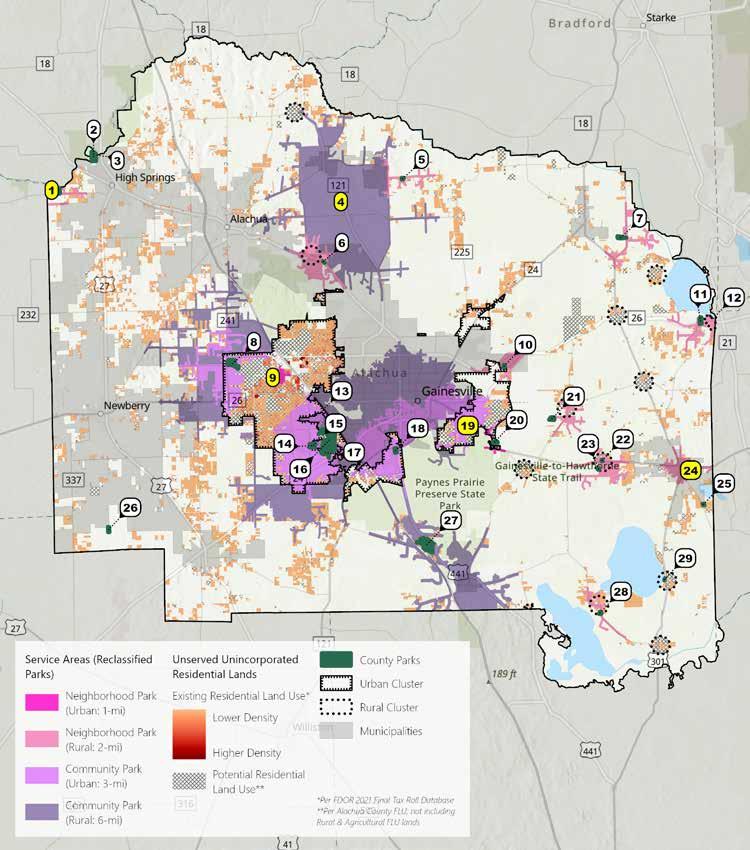
• Reviewed service areas provided by existing County community and neighborhood parks (shown in purple).
• Reviewed remaining unserved current and future residential areas throughout Alachua County (shown in orange).
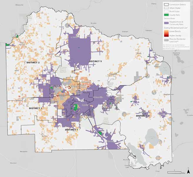
• Highlighted groupings of unserved areas as “significant unserved areas” (shown in yellow). These areas are guided by existing and future residential land uses. These overlays served as a filter for the remaining steps of the analysis. Step 2
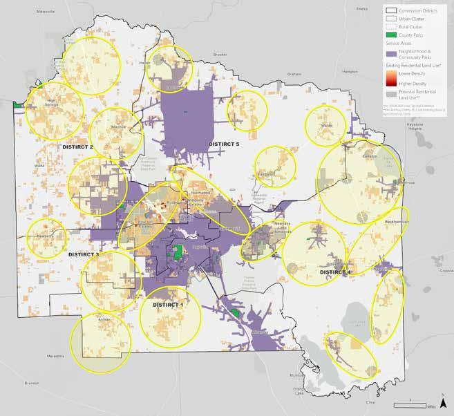
Step 3: Review Significant Unserved Areas with Projected Population Growth
• Reviewed significant unserved areas overlays (shown in yellow) with 2022-2027 census tract level population growth projections.
Findings: The significant unserved area overlays vary in projected population growth. Additional steps were needed to narrow the geographic areas that the parks growth analysis focused on— i.e., areas that are not located within an incorporated municipal boundary or not located within conservation land.
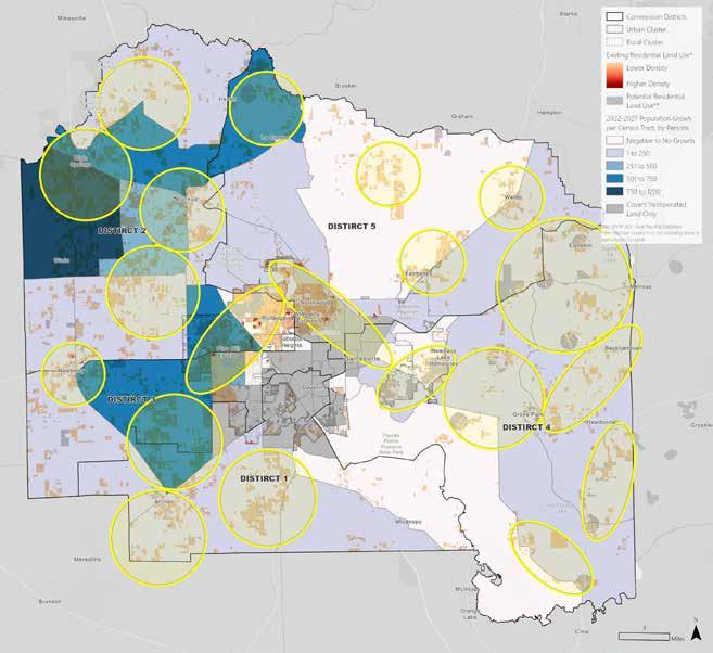
Step 4: Review Incorporated Areas
• Added incorporated areas (shown in dark grey) for visual analysis.
Findings: Overlap of incorporated areas with the significant unserved areas overlays was sufficient to warrant use of the incorporated areas layer to further refine the geographic areas of concern.
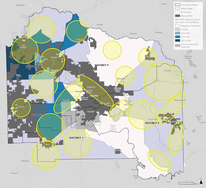
Step 5: Remove Incorporated Areas
• Removed the significant unserved areas overlays where they are majority intersected (greater than 50% of the area) with incorporated areas. The significant unserved areas that are being removed are shown in red.
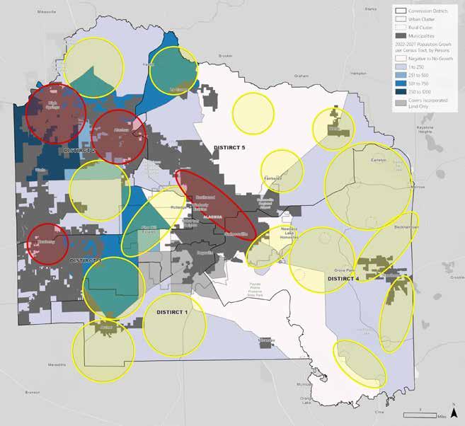
Step 6: Review Conservation Areas
• Added conservation and preservation areas (shown in green) for visual analysis.
Findings: Overlap of conservation areas with the significant unserved areas overlays was sufficient to warrant use of the conservation areas layer to further refine the geographic areas of concern.
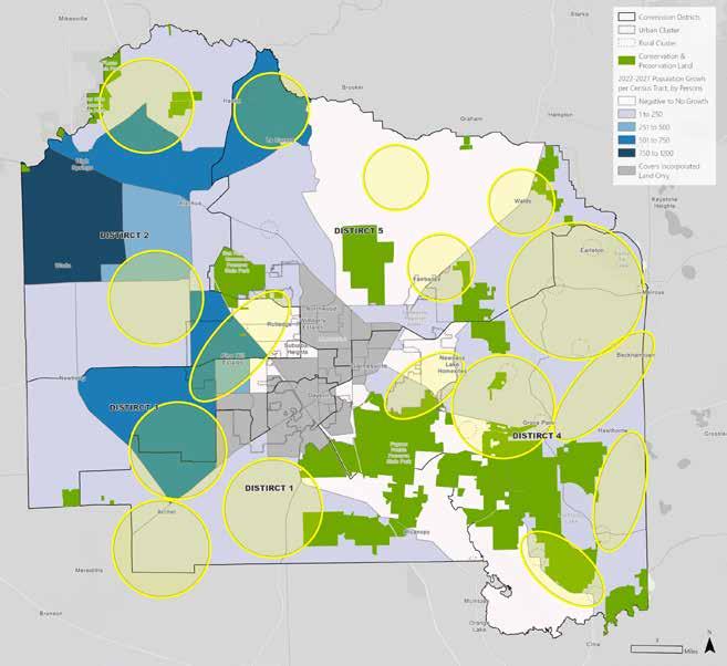
Step 7: Remove Conservation Areas
• Removed the significant unserved areas overlays where they are majority intersected (greater than 50% of the area) with conservation areas. The significant unserved areas that are being removed are shown in red.
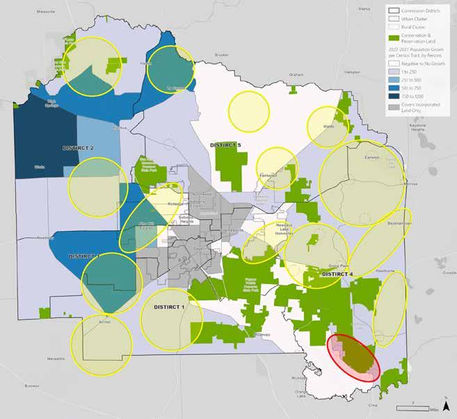
Step 8: Remove Significant Unserved Areas with Low Projected Population Growth
• Reviewed the significant unserved area overlays with the filtered population growth projections.
Findings: Determined that the overlays located within the north and central east Alachua County (shown in red) should be removed from further analysis due to low projected population growth through the 2022-2027 period.
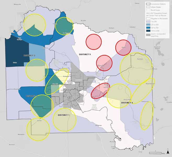
Step 9: Prioritize Significant Unserved Areas Based On Projected Population Growth
• Reviewed the remaining significant unserved area overlays with the population growth projections and prioritize the census tracts projecting higher population growth.
Findings: Determined that the overlays located within the northwest and central west Alachua County (shown in yellow) are projecting higher population growth, and the east and southwest Alachua County (shown in orange) are projecting lower population growth through the 2022-2027 period. This helps prioritize land acquisition areas.
Step 10: Review Remaining Significant Unserved Areas for Land Acquisition
• Reviewed the significant unserved area overlays with the filtered population growth projections.
Findings: The priority land acquisition areas were identified per County Commission District.
Commission District 1: Areas 1E, 2A, 2B
Commission District 2: Areas 1A, 1C, 1D
Commission District 3: Areas 1D, 1E
Commission District 4: Areas 2C, 2D, 2E, 2F
Commission District 5: Areas 1B, 1D, 2D
The 10-step Priority Land Acquisition Process identified key significant unserved areas within Alachua County. The following Land Acquisition Scenarios have been developed to fill the existing gaps in service and provide equitable geographic access to parks for all Alachua County residents.
Land Acquisition Scenarios developed focus on three strategies:
• Scenario 1: Acquiring and Developing New Neighborhood Parks
• Scenario 2: Acquiring and Developing New Community Parks
• Scenario 3: Acquiring and Developing a mix of New Neighborhood Parks and New Community Parks
Service areas shown within these scenarios account for the new established geographic level of service standards.
• Urban: 1-mile
• Rural: 2-miles
• Urban: 3-miles
• Rural: 6-miles
Scenarios shown are general guides for future park locations, not identification of individual parcels. For this reason, general radii of potential levels of service have been shown, rather than specific network-based coverage, which would vary based on exact parcel location. Scenarios developed here are to be used for planning purposes only, with exact impacts of land acquisition to be determined on a case-by-case basis.
This scenario fills in the identified key significant unserved areas solely with new Neighborhood Parks. While it is possible to plug gaps with Neighborhood Parks, this requires many new parks and is an efficient service delivery model, as it is simpler to consolidate amenities to community parks and maintain a smaller number of parks.

This scenario fills the identified key significant unserved areas with new community parks. While this is a more efficient service delivery model in that it requires a fewer number of parks and more consolidated services, this approach may not be applicable in all areas particularly, areas near other community parks or where large tracts of land may not be readily available.
A mix of new neighborhood and community parks is responsive to the needs of the community by providing a mix of amenities and responding to the availability of land throughout the County. This approach allows more rural areas to be served by centralized Community Parks, which will provide a wide range of amenities, including sports fields. Smaller Neighborhood Parks provide access to amenities closer to larger residential hubs where residents may not have much of their own land, and large tracts of land may not be readily available for acquisition. This approach assumed the acquisition and expansion of land surrounding Cellon Oak for the development of a larger Community Park. If not possible, it is recommended that a different Community Park be established near it to provide service within this area.
3.2
The Alachua County Parks & Open Space Master Plan provides a blueprint for the future of Alachua County parks. The following implementation section provides a Capital Improvements Plan to provide planning guidance for the implementation of recommendations set forth within the Vision.
Based on the Vision developed through this Master Planning process, in order to extend appropriate access and level of service to the currently unserved residential areas within Alachua County, it is anticipated that the following park land should be acquired:
Neighborhood Parks (min. 5 acres)
• 2 - Urban Neighborhood Parks (within Urban Cluster)
• 4 - Rural Neighborhood Parks (outside Urban Cluster)
Community Parks (min. 20 acres)
• 5 - Rural Community Parks (outside Urban Cluster)
A land price analysis was developed to determine land acquisition cost in Alachua County. The analysis measured the potential sale price for all vacant land within Alachua County—including vacant residential, commercial, industrial, agriculture, institutional, and government land—and estimated the price per acre for each land use category. To estimate the cost for acquiring park lands within the County, an aggregate average of the price per acre for these vacant properties was applied. This analysis also examined the cost per acre within and outside the urban service boundary using a similar methodology. The analysis revealed that the cost per acre is much higher within the urban service boundary which may be attributed to the availability of utilities and services within the urban service cluster. Additionally, since the price per acre for land acquisition generally decreases with larger acreage purchases, it can be inferred that the price per acre is higher for a neighborhood park versus a community park.
Based on Alachua County recent vacant land sales (2021-2022)
Note: The projects listed above are example projects based on the Parks Master Plan. The budgets and timeframes are estimates with the intention provide the Parks & Open Space Department with flexibility to allocate funds for all future projects.
Copeland Park Play Amenities $350,000
Cynthia Moore
Chestnut Park & Clark Butler Nature Preserve Stormwater Improvements & Community Amenities
Kate Barnes Boat Ramp @ Marjorie
Kinnan Rawlings Park
Holden Pond Park
& Permitting
& Permitting
Lochloosa Park Grading & Stabilization
Hawthorne Dog Park Neighborhood Park Amenities
Squirrel Ridge Park Pedestrian Enhancements
Santa Fe Lake Pedestrian Enhancements
Earl P. Powers Park Complete accessible