

ACKNOWLEDGMENTS
Orange Blossom Trail Development Board
Vanessa Pinkney - Executive Director
Rhonda Stapleton - Former Director of Programs
Board Members:


Orange Blossom Trail Development Board
Vanessa Pinkney - Executive Director
Rhonda Stapleton - Former Director of Programs
Board Members:
Maxwell Spann - President
Emmett O’Dell - Vice President
Christine Hill - Treasurer
Commissioner Victoria Siplin
Tasha M. Golis
Richard Fender
Tangia Hill-Smikle
Demetrius Summerville
Carl E. McPhail
Florida House of State Representatives
Bruce Antone - District 46 Representative
Orange County Florida
Jason Reynolds - Chief Planner
Neighborhood Preservation & Revitalization Division
Orange County Sheriff’s Office
Cpt. Bruce McMullen
Lt. Don Woods
City of Orlando
Jason Burton - Chief Planner
Chris Deloatche - Planner
Orlando Police Department
Cpt. Daniel Schad
Steering Committee Members
Vencina Cannady
C.J Davila
Brian Hanson
Dedra Jenkins
Edward Johnson
John Lamont
Terry Prather
Max Spann
Myles Weisman
Consultant Team: GAI Community Solutions Group
Owen Beitsch
Kristin Caborn
Dave Darsey
Tom Kohler
Patrick Panza
Claudia Ray
Pete Sechler
Andrew Sheppard
Laura Smith

This is the first-ever comprehensive master plan prepared for an 8.3-mile corridor of Orange Blossom Trail (OBT), from State Road 50 to State Road 528 (also known as the Beachline Expressway) in Orange County, Florida. Funded by a grant from the Florida Department of Economic Opportunity (DEO), the Orange Blossom Trail Development Board (OBTDB) initiated the planning effort to specifically identify and address issues impacting the corridor’s viability. This master plan is one of the three plans created as part of the DEO grant, the other two are: 1) a Community Redevelopment Area (CRA) Plan Update and 2) a Safe Neighborhood Plan Update. All the plans complement each other, but only the master plan illustrates the overall vision and framework for the entire 8.3-mile corridor. The OBT master plan lays out a roadmap for OBT as an area that can be economically competitive and socially relevant in today’s world.
Working closely with the OBTDB, the OBTNext planning team, composed of City of Orlando and Orange County staff and law enforcement officers, walked, talked, photographed, mapped, analyzed, and most importantly, listened the community about the nuances of the OBT corridor and neighborhoods.
Grounded in extensive public outreach, community input, and data analysis, this plan seeks to respond to the changing economic environment, and the evolving demographic and market conditions in the community. It would also ensure that incremental moves occur within a larger framework and are aligned with a future vision of the OBT corridor and surrounding neighborhoods developed by the community.
The plan framework is made up of a Vision, supported by six Guiding Principles—implemented initially through six Big Moves and Catalyst Projects
The Vision describes the future of the OBT area. It is intended to be aspirational and broad, setting the course for the future. The Guiding Principles describe the future goals for the OBT corridor and neighborhoods in broad principles. They are informed by the general topics driven from the issues and opportunities’ insights. As time progresses, these principles are intended to remain constant, providing a baseline for new big moves and actions to be developed, and for the plan to evolve to meet changing conditions.
The Big Moves outline the key actions OBTDB may take to execute the plan. The actions are organized by policy and regulations, as well as organizational, administrative, physical improvements. They have been created in thoughtful consultation with community members and stakeholders. The plans and imagery shown with each move are intended to be indicative of the character and intent of the recommended actions.
The overall vision of the OBT corridor breaks down to five Districts and Catalyst Sites. These sites illustrate redevelopment scenarios and specific projects driven by the Big Moves. The implementation of the vision for the corridor will require a number of public, private, and public/private investment and series of projects. The Catalyst Sites design are conceptual and will require additional due diligence and refinement before implementation.
Assessment and existing conditions
• THE CORRIDOR (STUDY AREA)
• CHARACTER
• SCALE
• HISTORY
• OBT TODAY
• THE REGION
• ORANGE BLOSSOM TRAIL DEVELOPMENT BOARD PROGRAMS
• JURISDICTION
• FUTURE LAND USE
• GROWTH (1990–2016)
• VACANT AND
• GOVERNMENT-OWNED PARCELS
• TRANSPORTATION
• POLICING & CODE
• ENFORCEMENT
• POPULATION
• JOBS
• AREA WELL-BEING
VISION: An
General topics gathered during the public engagement
• CRIME & SAFETY
• IMAGE & CHARACTER
• NEIGHBORHOOD & HOUSING
• OPEN & RECREATIONAL SPACES
• STREETS & LINKAGES
• JOBS & EDUCATION
• INVESTMENT & DEVELOPMENT
• GOVERNANCE
DEVELOP DESTINATIONS TO ATTRACT DEVELOPMENT, BUSINESS, JOBS & TRAINING
ENCOURAGE A VIBRANT AND DIVERSE CORRIDOR
MAKE SAFE AND LIVABLE STREETS FOR ALL MODES OF TRANSPORTATION
IMPROVE ACCESS TO OPEN SPACE AND RECREATIONAL ACTIVITIES
CREATE FLEXIBLE AND AFFORDABLE HOUSING OPPORTUNITIES
The corridor background information collected was analyzed to establish the platform upon which the master plan was developed. In addition to assessing the scale, character, and regional connectivity, it provides a snap shot of OBT’s history, as well as what OBT is today. It provides demographic data and insight into the possibilities for enhancing homeownership and jobgenerating opportunities, as well as leveraging vacant and government-owned parcels into development opportunities. Its focus is on providing direction for enhanced governance for actions and resources to support the residents and businesses for a more prosperous future.
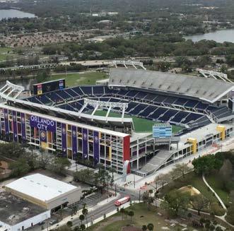
The assessment process included recognizing the Study Area’s scale, jurisdictional issues distinguishing areas in the County from those in the City, and impacts on land use and code enforcement regulations, as well as responses to public safety calls. The plan addresses the overall visual appearance and character of the corridor’s frontage and adjacent neighborhoods. It considers the impact of OBT’s strategic location regionally and its connectivity to major destinations such as Orlando International Airport, Universal Studios, International Drive, and the Orange County Convention Center, as well as regional destinations located within the Study Area—Florida Mall and Camping World Stadium.
The assessment included recognizing existing OBTDB programs, city and county programs, as well as other institutional, neighborhood, and non-profit organizations whose resources were directed to residents or businesses in the Study Area. Initiatives ranged from the Community Redevelopment Agency, Safe Neighborhood Programs, neighborhood associations, LIFT Orlando, city and county housing assistance, as well as support for job placement services to name a few. Thus, the background assessment for the corridor included both the physical and the social elements in a comprehensive scan of the Study Area.




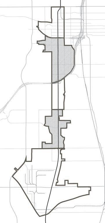
The Orange Blossom Trail (OBT) corridor defined as our Study Area is 8.3-mile segment located in central Orange County, Florida, from State Road 50 (SR 50) also known as Colonial Drive, to the intersection of Florida’s Turnpike and State Road 528 (SR 528) also known as the Beachline. The land area encompasses approximately 8 square miles (4,766 acres).
The Corridor is located west of Downtown Orlando and the South Downtown District. The overall area is bisected by State and Interstate Highways systems and by major east/west corridors.


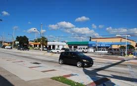

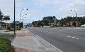

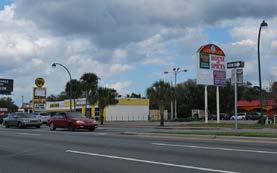


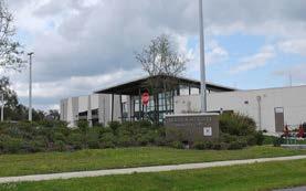
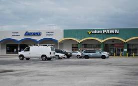
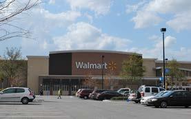
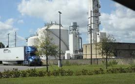


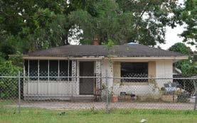
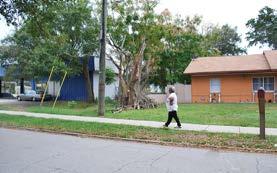
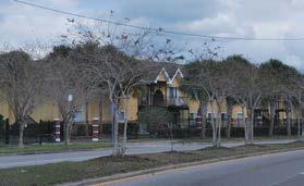


The OBT corridor compared to another corridor in the region lacks of differentiation: the overall character and first impression of the corridor conveys it to be a place that lacks investment, is not aesthetically attractive, and has predominantly auto-related and hotel uses. The buildings are not well maintained, and the road lacks adequate streetscape elements. Due the length of the corridor, we have divided the Study Area into five distinct areas for the purpose of analysis. Area boundaries were selected based on existing conditions, such as major intersections and/or neighborhoods.
Area 1 (From SR 50 to SR 408) is predominantly noted as the home of Camping World Stadium, Lorna Doone Park, a mix of light industrial and warehousing uses, and is the new home of the Orlando Police Department Headquarters. Area 1 is within the city limits of Orlando and has a significant open space and recreational asset—Lake Lorna Doone and the adjacent park. The area has few residential neighborhoods inside its boundaries. The neighborhood has a large concentration of vacant parcels and structures and boarded-up homes.
Area 2 (From SR 408 to I-4) Its most noted asset is the Jones High School campus. The residential neighborhood in this area is Holden Heights. It shares jurisdictional boundaries with the City and the County. Commercial uses front OBT and Michigan Street, while single family residential uses dominate the Kaley Street to Gore Street areas, and the Nashville Street corridor. The open space includes the Grand Avenue School campus and adjacent park, Kaley Square, and the Jones High School athletic facilities.
Area 3 (From I-4 to Holden Avenue) OBT frontage is predominately commercial retail, anchored at the Holden Avenue intersection by the Orange Blossom Center and Southgate Plaza. The adjacent neighborhood between OBT and Rio Grande Avenue is predominately singlefamily rentals, with a high incidence of criminal activity. The neighborhoods east of OBT are stable with a majority of owner-occupied single family residences.
Area 4 (From Holden Avenue to Oak Ridge Road) The area includes a large concentration of multi-family units off of Americana Boulevard, west of OBT. This segment of corridor has a significant number of auto-related businesses. It also includes hotel uses. There are no open or recreational spaces or facilities.
Area 5 (Oak Ridge Road to SR 528) is the largest segment in the Study Area, comprises over 2,500 acres, and is home to the Florida Mall, the Lake Ellenor Office Park, and a large light industrial area. This area is almost exclusively industrial, retail, and office uses served by rail. It also provides regional access by Sand Lake Road, the 528 tollway, Florida’s Turnpike, and John Young Parkway. Area 5 has the largest concentration of hotel uses. Auto-related land uses are also significant in the area. The area is noted for its significant number of educational institutions.


Due to the size of the Study Area, portions of it lie both in unincorporated Orange County and in the City of Orlando. The larger portion of the Study Area is located within unincorporated Orange County. To put the Study Area into context, the length of the corridor, 8.3 miles, is the same distance as SR 17-92 from East Robinson in downtown Orlando to SR 436 in Seminole County. That segment of 17-92 traverses the communities of Orlando, Winter Park, Maitland, and Fern Park—with each having its distinct frontage and commercial environment. Likewise, OBT is not to be treated as a monolithic corridor, but as separate subareas, each with its own identity based on land uses and commercial activities.The scale of developments are generally one- to three-story structures, with vehicular access and parking predominating the frontage.


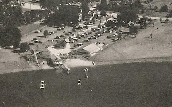
It has been more than 70 years since Orange Blossom Trail was touted by promoters as “Central Florida’s Scenic Route”, a way to visit more than just Florida’s beautiful beaches. It was advertised to find inland destinations, such as Silver Springs, Cypress Gardens, and Bok Tower. This route through Central Florida once offered a drive that boasted roadside orange groves whose fragrant aroma engulfed travelers. In the post-WWII-era, highway travel boomed and tourists sought the most scenic routes to complement their journey. Today, tourists are more likely to choose the fastest route via interstate or toll road to get to their desired destination. Over the last 70 years, tourism has changed from being as much about the journey as the destination, to being more about the destination. This shift has resulted in many of the once-famed highways throughout Florida becoming more commercialized corridors to serve the local and regional residential population, as opposed to traveling tourists.

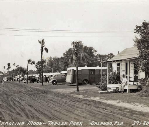
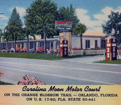

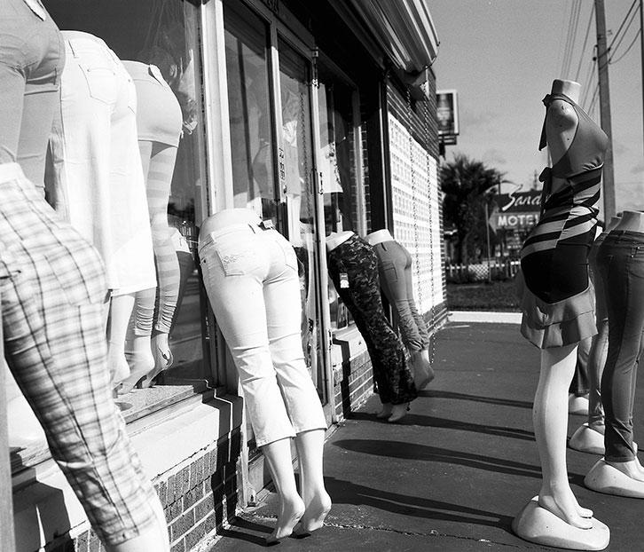
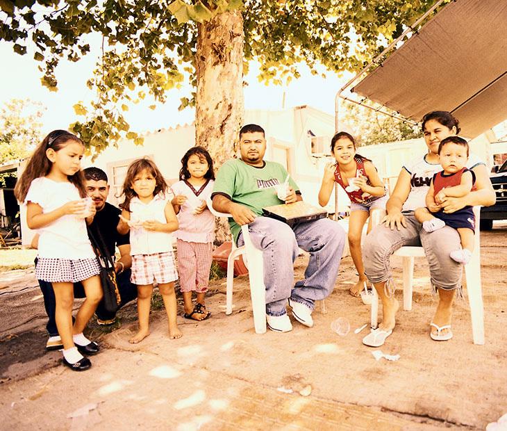
OBT reflects a disparate picture of life along the corridor. From Florida Mall as the retail destination for locals and international shoppers alike to the south, to crime ridden apartment complexes along Americana Boulevard in the middle, to the $200 million renovated Camping World Stadium to the north, there are over 38,000 employed in the Study Area, yet few are residents of the corridor. There are well-established neighborhoods enjoying lakefront views, and other single family areas burdened with illicit criminal activity. There are successful restaurants, retail establishments, and industrial warehousing areas as well as poorly managed motels accommodating prostitution. There are wonderful recreational and sports amenities, such as the Jones High School campus and Lorna Doone Park. There are institutions of learning from Head Start to college, yet there is need for more support for residents to be competitive in the job market.
In sum, the corridor is a microcosm of the region as a whole, with involved individuals, successful businessmen and women, craftsmen, creative artists, as well as those struggling with the basic needs of life. It is a place of history, talent, and potential, all in need of continued support.
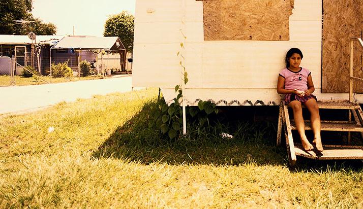
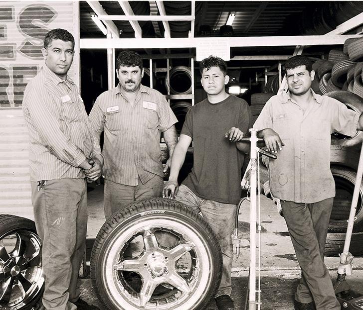


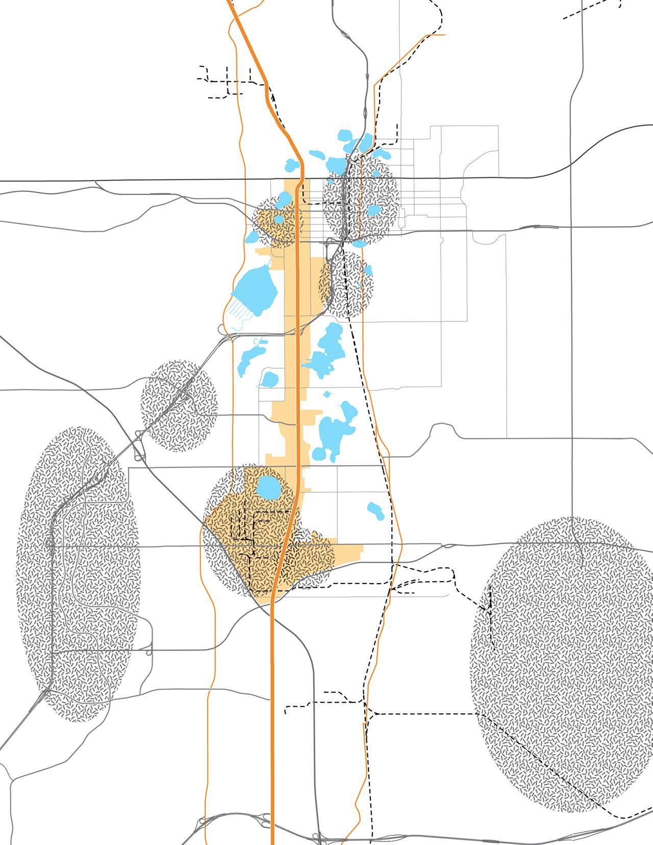


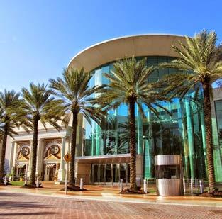


Today, the segment of OBT that extends from the intersection of Florida’s Turnpike and SR 528 to SR 50 is anchored on the north by Camping World Stadium, and on the south by the Florida Mall Hotel and Conference Center. With access to I-4, Florida’s Turnpike, and SR 528, this segment of OBT is in proximity of Orlando International Airport, Orange County Convention Center, Universal Studios, Sea World, Millenia Mall, and many other tourist destinations. However, this segment of OBT has lost its tourism traffic and has become a residential and commercial corridor that has experienced substantial economic decline over the last few decades. The area now struggles with crime, vacant and dilapidated structures, and an overall disinvestment in the area.
The Sunrail line runs east of the corridor. Four stations are less than a mile away from the corridor: Lynx Station and Church Street (located in Downtown Orlando), Orlando Station (located in South Downtown), and Sand Lake Road Station.
Future plans for the region include the design and construction of the Orlando International Airport (OIA) Connector. The OIA Connector is a 15.8-mile corridor, connecting the OIA South to the Destination Parkway Transit Center and the Orlando/Orange County Convention Center on International Drive. The recommended expansion to the system is a two-component Bus Rapid Transit (BRT) local and express system. The express BRT component will run along Sand Lake Road. The local BRT segment of the system would begin at the Sand Lake Sunrail Station, on Sand Lake Road, and then head to Winegard Road and Oak Ridge Road. Semi-exclusive bus lanes would be constructed on portions of Oak Ridge Road. The express and local BRT on all other roadways would operate in mixed traffic and would include the installation of traffic signal priority to allow BRT to move through signalized intersections more efficiently.


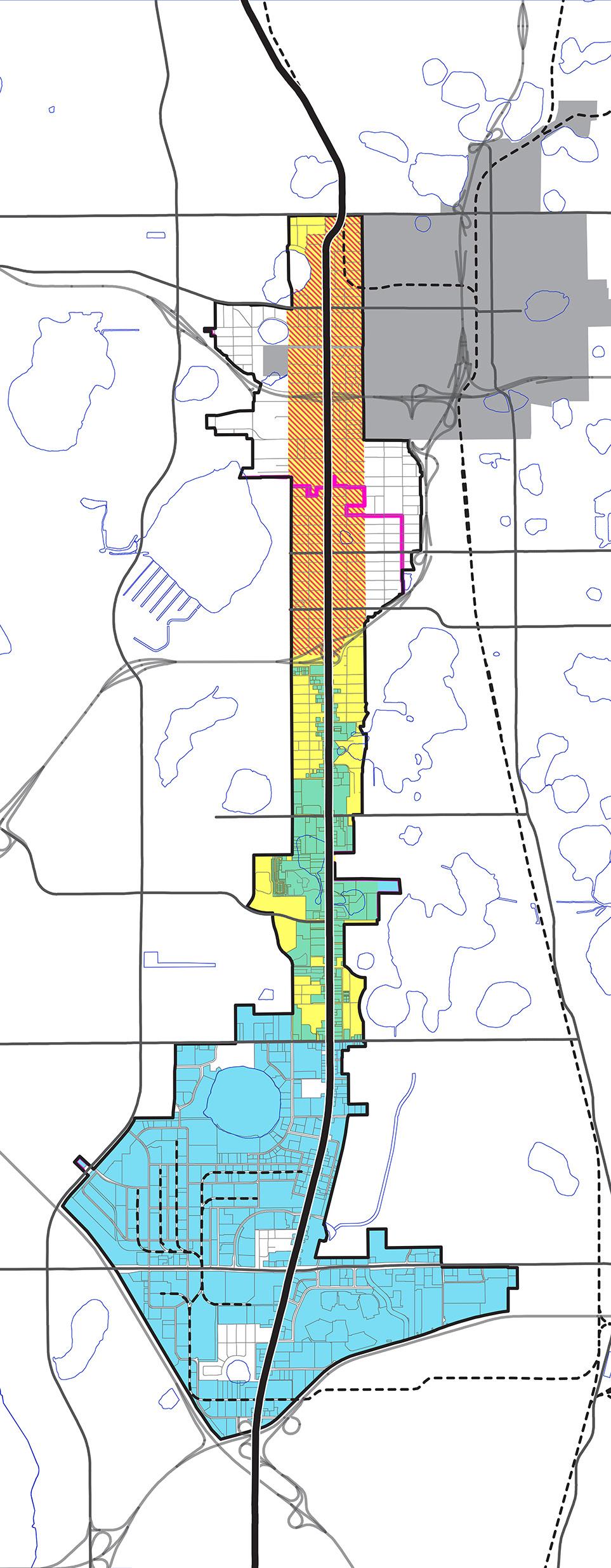
The Study Area contains a number of special program areas designed to aid in the safety and redevelopment of the OBT corridor. The portion of the Study Area that contains the Orange Blossom Trail Community Redevelopment Area (OBT CRA) and the Orange Blossom Trail Safe Neighborhood Program (OBT SNP) extends through most of the Study Area, with the exception of the southernmost area surrounding the intersection of Florida’s Turnpike and SR 528. The portion of the Study Area located south of I-4 contains the Orange Blossom Trail Municipal Service Taxing Unit (OBT MSTU).
Created in 1990, the OBT CRA’s mission is to revitalize the area along the OBT corridor. The CRA collects ad valorem taxes on new or expanded properties in the area and reinvests those funds into the designated area.
The OBT SNP was spearheaded by the OBT Development Board (OBTDB) in 1990. The program provides assistance to Orange County’s older and transitioning neighborhoods. It was designed to assist residents in reclaiming their communities from crime, deterioration, and blight. The program partners citizens with the Orange County Sheriff’s Office, Orange County Government, the private sector, community stakeholders, and others to collaboratively preserve and stabilize neighborhoods. In 1992, OBTDB lobbied for legislation that became a law requiring offenders pay $20 for misdemeanor convictions and $50 for felony convictions. These funds finance efforts to reduce crime and blight.
In 1987, the OBT MSTU funding source (additional voluntary taxation on commercial and industrial properties along OBT) was created. Its goal was for the planning, design, construction, and maintenance of enhancement elements that augmented the FDOT roadway-widening project from I-4 to SR 528 on OBT.

City/County Boundary
OBT Next Study Area Boundary




Due to the size of the Study Area, portions of it lie both in unincorporated Orange County and in the City of Orlando. As a result, there are multiple elected official districts within the Study Area. The northern portion of the study area is mostly within the City of Orlando and is split between districts governed by City Commissioner Regina Hill and City Commissioner Samuel Ing. The larger portion of the Study Area is located within unincorporated Orange County and is divided among districts governed by County Commissioner Victoria Siplin, County Commissioner Pete Clarke, and County Commissioner Jennifer Thompson. The Study Area stretching across the districts of five different commissioners in two different jurisdictions requires substantial coordination and collaboration between the City and the County in efforts to improve the area.
Comm. Regina Hill
Comm. Samuel B. Ings
Comm. Victoria Siplin
Comm. Pete Clarke
Comm. Jennifer Thompson


1


2

3
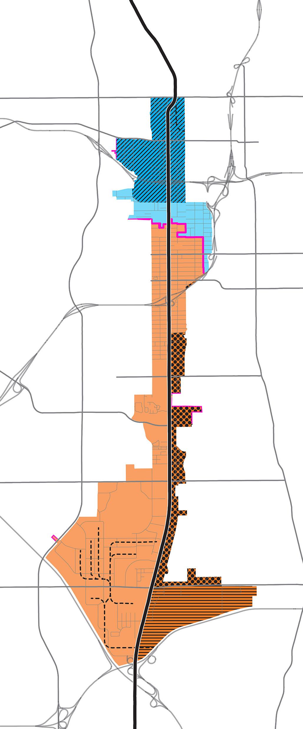
The future land use in Area 1 is mixed use, industrial, public/ recreational, and institutional. The mixed use is concentrated along OBT with industrial and residential extending behind the mixed use.
Area 2 contains of residential low intensity on the east side of OBT and residential medium intensity on the west side of OBT. The properties that front OBT in the area generally located around the intersection of OBT and Michigan Street are a mixture of mixed use corridor medium intensity, commercial activity center, and neighborhood activity center.
Area 3 follows a pattern that is typical of a commercial corridor. Retail uses are centralized along the corridor, and residential uses are located adjacent to the commercial uses and set back from the major roadway.
Area 4 includes a combination of residential categories, including low density residential, low-medium density residential, and medium density residential. Additionally, the only Future Land Use found along the OBT frontage is Commercial. There are a couple of small pockets of Office located at the far north and far south of Area 4.
Area 5 is best described as a commerce and employment hub, and the Future Land Uses within Area 5 mirror that description. Commercial is concentrated along OBT and around the Florida Mall site, and Industrial is concentrated around the freight rail lines and existing industrial activity centers. With just two small pockets of residential Future Land Use Designations, Area 5 is not intended to be an area for residential growth.
4
City of Orlando Future Land Use
Residential Low Intensity (Max: 12 DU/Acre and/or 0.3 FAR)
Residential Medium Intensity (Max: 30 DU/Acre and/or 0.3 FAR)
Mixed Use Corridor Medium Intensity (Max: 200 DU/Acre and/or 1 FAR)
Community Activity Center (Max: 40 DU/Acre and/or 0.7 FAR)
Office Medium Intensity (Max: 40 DU/Acre and/or 0.7 FAR)
Industrial (Max: 0.7 FAR)
Public/Recreational & Institutional (None)
Parks
5


ANon-residential uses within the Study Area are largely made up of industrial uses. Industrial accounts for over 13.5 million square feet, with retail at nearly 6 million square feet, and office just under 3 million square feet. While each segment contains non-residential uses, the greatest concentration of non-residential uses is concentrated in Segment C. Similarly, industrial has experienced the greatest amount of growth, followed by retail, then office. While office accounts for the smallest amount of non-residential square footage within the Study Area, it has also experienced the smallest amount of growth. Of the total office square footage within the Study Area, the largest amount (2,858,214 square feet) was built in 1990 or earlier with just over 70,000 square feet added between 1991 and 2016. During this same time period, retail square footage grew by 1,632,577 square feet and industrial grew by 3,451,459. Industrial and retail uses added the greatest amount of square footage to the Study Area after 1990; however, the majority of the retail and industrial square footage was also built in 1990 or earlier. In total, the Study Area added just over 5 million square feet of non-residential square footage in the last 26 years, with industrial uses accounting for 67% of this square footage.


1 2 3
There are a number of conditions that present opportunities for redevelopment. These include vacant properties, and properties owned by government entities. The Study Area contains 4,766 acres of land, of which 468 acres are vacant. Additionally, there are roughly 228 acres of land owned by government entities within the Study Area.
Area 1 is roughly 521 acres, with just over 40 acres made up of vacant land. Of the total vacant land within Area 1, more than 58% is non-residential. Over 17% of the land within Area 1 is owned by Orange County Government or the City of Orlando.
Area 2 is roughly 856 acres, with just over 87 acres of vacant land. Of the total vacant land within Area 2, more than 52% is non-residential. Over 9% of the land is owned by Orange County, the City of Orlando, or the OBT CRA.
Area 3 is roughly 322 acres, with nearly 39 acres of vacant land. Of the total vacant land within Area 3, more than 67% is non-residential. Nearly 2% of the land is owned by Orange County or the City of Orlando.
Area 4 is roughly 554 acres, with over 95 acres of vacant land. Of the total vacant land within Area 4, more than 86% is non-residential. Roughly 1.4% of the land is owned by Orange County.
4
Area 5 is the largest in the Study Area, having a total of 2,513 acres and more than 207 acres of vacant land. Of the total vacant land within Area 5, nearly 95% is non-residential. Approximately 2% of the land within Area 5 is owned by Orange County or the City of Orlando.
5

AOBT, also known as U.S. Route 441, has a storied history that was once touted by promoters as “Central Florida’s Scenic Route”. However, the construction of I-4 and changing travel habits led to a decline in its commercial competitiveness. Starting in the late 1960s, the corridor’s demise has followed that of other once-famed highways, serving a more commercialized local and regional market. As other more strategically located destinations (i.e., adjacent to I-4) evolved, the 8-mile stretch of the study area fell on hard times.
OBT is now one of the three service corridors for trucks in the region, according to MetroPlan Orlando. The other two corridors are Orange Avenue and John Young Parkway, both a mile east and west of OBT, respectively. MetroPlan identifies the OBT corridor as a Sustainable Development Corridor in their 2040 Long Range Transportation Plan. MetroPlan also developed a Sustainable Land Use Forecast for their 2030 Long Range Transportation Plan, which discusses how Smart Growth can improve the efficiencies of the transportation system. It is necessary to address future land uses and the transportation system at the same time, in order to transform the OBT corridor into a Sustainable Development Corridor.
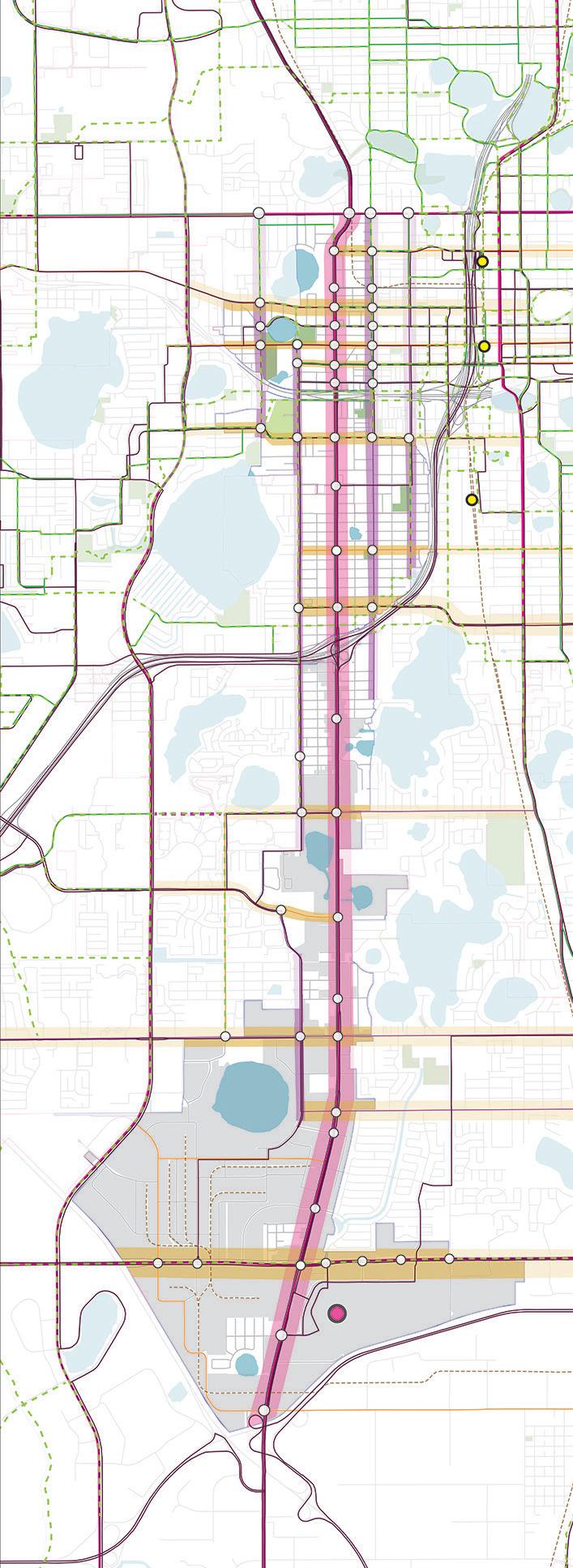
The northernmost segment within the study area, from SR 50 to I-4 (segment A on the map), carries an average of 28,000 cars a day. This is a 5-lane road with an 80-foot right-of-way (ROW). The segments that run from I-4 to SR 528 (segments B and C on the map), carry an average of 61,000 cars a day, almost 3 times that of segment A. These segments have a 7-lane road with a 100-foot ROW. Both segments have limited sidewalk and landscape features.
Orange Blossom Trail
Major North/South Streets
Major East/West Streets
MSTU Parcels
Existing Bicycle Facilities
Future Bicycle Facilities
Bus Routes (LYNX System)
Lynx Super Stop
Traffic Signals
Sunrail Stations
Orlando International Airport (OIA) Express Bus Alignment
Orlando International Airport (OIA) Local BRT Route
Orlando International Airport (OIA) Proposed Stops
John Young/Sand Lake Overpass Project
Holden Avenue Extension Project
In 1987, a Municipal Service Taxing Unit funding source was created to enhance the safety and aesthetics of segments B and C. The total cost of the OBT Roadway Enhancement Project was $78 million. No enhancements to the road have been made to segment A.
The street configuration adjacent to OBT from SR 50 to Holden Avenue still maintains the historic grid pattern configuration of the 300 foot by 600 foot block. The traditional grid system is segmented by the two highways (SR 408 and I-4), while the segment from Holden Avenue to SR 528 follows a suburban street pattern. As a result of grid system pattern, there are more intersections and traffic signals along OBT on segment A in comparison to segment B.
The map identifies key north/south and east/west streets within the study area. The key north/south streets are Rio Grande Avenue and Westmoreland Drive, neighborhood streets that are sometimes used by the locals as an alternative route to OBT. Both streets have a lower volume of traffic compared to OBT. Rio Grande Avenue carries a maximum of 11,500 cars a day, and Westmoreland Drive, a maximum of 2,100 cars a day. The key east/west streets that have an impact in the larger context of the area are SR 50, Robinson Street, Washington Street (which becomes Old Winter Garden Road and connects Downtown Orlando to the City of Ocoee), South Street and Anderson Street (which run as a one-way pair and connect Rio Grande Avenue to Conway Road), Gore Street, Kaley Street, Michigan Street, Holden Avenue, Americana Boulevard, Oak Ridge Road, and Sand Lake Road.
The following are a list of current and future transportation projects that are incorporated within the Central Florida regional system.
• State Road 408 and Interstate 4 Project:
The Orlando-Orange County Expressway Authority has widened SR 408 through the study area and, along with the Florida Department of Transportation (FDOT), is investing over $120 million to reconfigure the I-4/SR 408 interchange. These improvements, in addition to those on I-4 South to OBT, will increase capacity, reduce traffic safety issues, and provide better access to the CRA area. With the projected improvements of the ramp system to Michigan Street, the current interchange with Kaley Street will be eliminated, reinforcing W. Kaley Street as a two-lane neighborhood street serving as the main east/west gateway to the Holden Heights community. The new ramp access and egress points should also reduce cut-through traffic in the Holden Heights area along Kaley Street. The new roadway network should direct the heaviest traffic to Michigan Street, OBT, and SR 408.
• Orlando International Airport (OIA) Connector:
The OIA Connector is a 15.8-mile corridor, connecting the OIA South Terminal and the Destination Parkway Transit Center. The recommended alternative is a two-component Bus Rapid Transit (BRT) local and express system. The Express BRT component within the study area runs along Sand Lake Road and contains two stops. It begins at the Sand Lake Sunrail Station, outside our study area, then follows Sand Lake Road, Winegard Road, and Oak Ridge Road within the study area. The route has four stops in the study area. Semi-exclusive bus lanes would be constructed on portions of Oak Ridge Road. The Express and Local BRT on all other roadways would operate in mixed traffic and would include the installation of traffic signal priority to allow BRT to move more efficiently through signalized intersections.
• LYNX Improvements (Bus System)
The OBT corridor is one of three routes with the highest bus ridership in the LYNX system. The top three routes according to the Fiscal Year (FY) 2016 Annual Ridership Report are:
- 8 - W Oak Ridge Road/International Drive: 2,308,173
- 21 - Downtown Orlando/Universal Studios: 948,266
- 107 - Downtown Orlando/Florida Mall: 1,127,280
LYNX’S future plans for the OBT Corridor are the following:
- The 2017 Annual update of the Transit Development Plan (TDP) recommends increasing the LYNX 107 services to every 15 minutes all day on weekdays, increasing the FastLink 441 frequency to 30 minutes during peak periods, and creating a new BRT from Downtown Orlando to Florida Mall by FY 2022.
- Vision 2030 identifies the section of OBT from Downtown Orlando to the Florida Mall as the number 12 Emphasis Corridor. Recommendations start with Express services and move up to BRT operating Mixed Traffic and Exclusive Travel lanes by 2030.
• John Young/Sand Lake Overpass
FDOT has designed an overpass at the intersection of John Young Parkway and Sand Lake Road. The design was completed in 2015 and according to the Orange County Commissioner’s District 6 Future Roadway Program Map, the construction would have begun in 2016 and ended in 2018, but they are behind schedule.
• Holden Avenue Extension
Holden Avenue is a main east-west road the study area. Currently, the road ends at Texas Avenue and doesn’t connect all the way through to John Young Parkway. Orange County Commissioner’s District 6 Future Roadway Program Map illustrates the possibility of creating that connection and calls for a Holden Avenue Phase I Project from OBT to John Young Parkway. The ROW acquisition process is 38% complete, and according to the information on the map the construction was supposed to start in 2016 and end in 2018.
• Kaley Avenue Intersection Improvements
Orange County Commissioner’s District 6 Future Roadway Program Map identifies the improvement to the intersection of Kaley Avenue and Rio Grande Avenue as one of the County’s projects. The design of the intersection was completed in October 2012, but the status of the construction timeline is unknown.
• Oak Ridge Road Pedestrian/Bicycle Safety Study 2017
MetroPlan Orlando has identified two segments of OBT for pedestrian enhancements. The enhancements are listed as priority #14 in their FY 2017/2018–2029/30 Prioritized Project List, approved by the board in 2012. The two segments identified are 30th Street to Gore Street (1.4 miles) and Church Street to SR 50 (0.9 miles). Both projects are within the OBT CRA boundaries, and the project sponsor is Orange County. The total estimated cost for both projects is approximately $6.4 million.
• Parramore Safe Routes Improvement Projects
The City of Orlando has been working on a Parramore Safe Routes to School Plan as part of an effort to provide safe transportation alternatives for the children who will be attending the new PS8
Community School. The school is scheduled to open in Fall 2017 and it will service children living in the Parramore neighborhood and part of Holden Heights.
The following is a list of the current and future projects to be made within the PS8 school district boundary. The City estimates the total improvement investment will be $5,698,750.
- Westmoreland Drive Multi-Purpose Path for Bicycles and Pedestrians: The path is currently under construction and when completed will run from SR 50 to Miller Street.
- Westmoreland Drive Road Resurfacing: The City plans to invest $1,849,351 in the resurfacing of Westmoreland Drive.
- Decorative Crosswalks: the City plans to invest $412,620 on improving key intersections. The intersections are Westmoreland Drive and Amelia Street, Parramore Avenue and Amelia Street, and Parramore Avenue and Robinson Street.
- Pedestrian Signal and Sidewalk and Ramp Upgrades: the City plans to invest a total of approximately $500,000 on improvements at key intersections and streets. The plan doesn’t specify the location of the improvements.
The OBT corridor is known today as an area where illicit activities such as prostitution, drug and child trafficking are common. The corridor has suffered from a lack of investment for many years. Due to this disinvestment, along with vacant buildings, absentee business and homeowners, poorly managed hotels and apartment complexes, and the well-connected street system, criminals find plenty of easy opportunity. The Americana Boulevard area, where a large concentration of apartment complexes are clustered, is known as the Central Florida capital for heroin activity ,according the Orange County Sheriff’s Office. All of these factors contribute to the fact that the OBT area is one of the most distressed zip codes in Orange County.
Part 1 Crimes data for the years 2014 to 2016 from the City of Orlando and Orange County shows that crime has increased in the corridor and surrounding areas by 6%, while crime activity in Orange County as a whole has decreased 3% in the same time period. For more details on the types of crimes and percentages, please see table on the next page.
The presence of the police in the corridor has increased with the new OPD headquarters located on the corner of OBT and South Street. The call responses are faster and more efficient, and the residents and business owners have noticed an increase of police presence in the area. Regularly organized community and public engagement events help raise the trust of the police in the community, but there remain challenges. One challenge is that it is often too late to catch the criminals when police arrive on the scene. Additionally, the neighborhood residents are afraid to file formal complaints due to the fear of retaliation from their neighbors or the stigma of being labeled as a “snitch”.
The Orlando Police Department offers grants to businesses to purchase surveillance cameras for their properties. They also provide free crime risk assessments and consulting to business owners to make their properties safer using the Crime Prevention Through Environmental Design (CPTED) of the principles:
• Natural Surveillance
• Natural Access Control
• Territorial Reinforcement
• Maintenance
The mission of the City of Orlando Code Enforcement is to protect the health, safety, and welfare of the citizens of Orlando, and to preserve the aesthetic and character of Orlando through the enforcement of housing, lot cleaning, parking, and land development codes. The City of Orlando has three inspectors assigned to the study area. All inspectors focus their attention on commercial and residential areas.
Code enforcement works primarily on a complaint-based system and very rarely condemns existing structures. Some of the common violations the department handles are:
• Lot Maintenance: the poor maintenance of lots is prominent in the study area. The area is full of lots with overgrown weeds, garbage, stagnant water, and unsanitary materials— which are all prohibited by the city.
• Unregistered/Inoperable Vehicles
• Animal Control
• Signs
• Signs in Right of Way
• Parking on Grass
• Illegal Dumping: this is very common in the study area. There are items of all sizes in streets and lots at all times. The city recommends that citizens call the police if they see someone dumping trash. If they come across large items, they need to contact code enforcement.
• Trees
• Boats/Recreational Vehicles
• Noise
• Permits
• Commercial Vehicles
• Home Businesses
• Business Tax Receipts
Due to the perception that the calls are not anonymous, the challenge in the OBT area is that the majority of the citizens don’t report the violations due to a fear of retaliation from the neighbors involved in illicit activities.
The Standard Code Enforcement Process is the following:
• Citizen reports complaint by phone or online.
• Complaint is registered and assigned a case number.
• Inspector is assigned to the case.
• An inspection is conducted (approximately 48 hours).
• If a violation is found, a Notice of Violation is issued.
• Property is re-inspected (depending on violation 15–60 days)
• If the violation has not been corrected, the case is referred to the Code Board and/or abatement is completed by City.
• Outcome/end result benefits the entire neighborhood.
Part I Crimes are serious crimes that occur with regularly in all are of the country, and they area likely to be reported to the police. The data is divided by eight categories, shown in the table below. The Uniform Crime Reports (UCR) compiles Part 1 data nationwide and is published annually by the Federal Bureau of Investigation (FBI). (Source: Orlando Police Department and Orange County Sheriff Office)
The condemning of a building follows a similar process from the one described above. The first step is to make sure the structure is unsafe for habitation. The criteria for “unsafe” is defined in Chapter 5 of the City Code. The code enforcement department works in coordination with the building and fire department to determine if the structure is unsafe. Considerations include sanitation, electricity, water, and construction.
The City organizes Community Clean Up Events in some of the neighborhoods within the study area. Local commissioners and organizations such as Keeping Orlando Beautiful help facilitate and support the event. Other organizations like Pathway to Parramore, with the support of city representatives and the Orlando Police, tour the Parramore Neighborhood once a week and identify properties in distress and in violation of the codes.
Orange County Code Enforcement is a division of Community, Environmental and Development Services Department. The division’s mission is to investigate and prosecute violations dealing with the Orange County Codes, which govern signage, nuisances such as junk vehicles and over grown lots, housing standards, adult entertainment, and residential and commercial zoning. The OBT corridor has two inspectors dedicated solely to the area. The following are examples of code violations:
• Abandoned or disabled vehicles
• Recreational vehicles and boats
• Construction without building permit
• Dual rear wheel vehicles in residential areas
• Signs
• Lot cleaning violations: Accumulation of trash, junk, and debris. Excessive growth of grass and weeds.
• International property maintenance code violations: Property owners ensure that buildings and structures are maintained in safe and sanitary condition. The code has standards pertaining to cooking facilities, structural soundness, plumbing, electrical systems, fire hazards, ventilation, heating, and sleeping facilities.
• Unsafe Residential Buildings: Residential buildings or structures that are unsafe, unsanitary, and/or unfit for human habitation, which constitute a fire hazard, or are otherwise dangerous to human life, are considered unsafe structures and subject to demolition.
The OBT corridor faces many code enforcement challenges. There are a significant amount of non-conforming lots in the commercial and residential area in violation of the code. Unless a new business comes in or a new home gets built, it is very difficult for the department to require the lot to be brought up to code. The second challenge is the amount of buildings and structures that are not being maintained in safe and sanitary condition. According to the county, an unsafe house is one that is severally dilapidated, improperly maintained, or has electrical, structural, or plumbing problems. If the owner does not repair or demolish an unsafe structure, the county may be ordered by the Code Enforcement Board or the Special Magistrate to perform the demolition. The owner must reimburse the county for the demolition, or the County may pursue enforced collection. The other method of enforcement is Nuisance Abatement, which is a unit of the Orange County Sheriff’s Office. The mission of the unit is to promote, protect, and improve the health, safety, and welfare of the citizens of the county by imposing administrative fines and other non-criminal penalties as a method for abating drugs, prostitution, dealing in stolen property, and criminal street gang activities that constitute a public nuisance. All these methods are necessary in the OBT corridor to bring the area up to code and ensure a safe community.
Law Enforcement and Code Enforcement officers continually work together on common problems in the corridor, but there are still challenges, since the two jurisdictions often have conflicting procedures and objectives. A few years ago, the OBTDB hosted regular meetings with representatives from the City and County Code Enforcement Departments, Orlando Police and the County Sheriff’s Office. The purpose of the meetings was to address the issues and challenges of the corridor regarding crime prevention, code violations, and the general well-being of the corridor. Collaboration like this is essential for the safety of the community.
Demographic data was compiled from a variety of sources, including Environmental Systems Research Institute (ESRI), the U.S. Bureau of Labor Statistics, and the U.S. Census Bureau. Projections and current year data are based on the American Community Survey Census five year estimates. The population growth, race, education and income data from the Study Area (Corridor) was compared to Orange County data. The graph below depict the statistical data and findings.
The Study Area has a population of 16,884 according to 2016 Census Estimates, which accounts for roughly 1.3% of the total population of Orange County. Steady population growth is projected to continue in the Corridor through 2021. The majority of the population (54.3%)that live in the Corridor is Black.
While the Study Area mirrors Orange County in some areas, that is not the case for educational attainment. Overall, just 22.5% of the Study Area has a population that has achieved a college degree of some type (Associate, Bachelor, or Advanced), as compared to 46% of the total Orange County population.
Median household incomes are projected to increase from 2016–2021 within the Study Area. Compared to Orange County, the average and median household incomes are significantly lower within the Study Area.


Building/Grounds –
Sales and Sales Related
Construction/Extraction
Production
Transportation/Material Moving
Construction/Extraction
Food Preparation/Serving Related
Office/Administrative Support
The most striking result of the market analysis was the number of jobs that were actually imported to the Study Area, and how few of those jobs were actually held by area residents. The preponderant number of jobs were in service-related industries—sales, hospitality, food-related services, or maintenance.
Construction-related jobs and office/administration employment were most prevalent in certain subareas. The makeup of the employment mix was skewed to more modest paying service jobs. The lack of resident employment in these fields indicates opportunities for more directed support for job readiness and job placement programs.


Transportation/Material Moving Sales and Sales Related
Office/Administrative Support
Building/Grounds - Cleaning/Maintenance
Transportation/Material Moving
Food Preparation/Serving Related
Management of Companies
4 (Holden Ave to Oak Ridge Rd)
Food Preparation/Serving Related
Building/Grounds – Cleaning/Maintenance
Office/Administrative Support
Construction/Extraction
5 (Oak Ridge Rd to Sand Lake Rd)
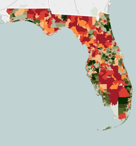
More than 50 million live in economically distressed communities, according to a report from the nonprofit Economic Innovation Group (EIG). The report, which examines economically distressed ZIP codes, finds one-fifth of the U.S. ZIP codes to be in economic distress. The report’s findings are based on a new Distress Community Index (DCI), which combines seven complementary metrics using lthe atest available Census Bureau data to assess the economic well-being of communities across the U.S. The table on the right shows the seven categories used in the report.
Our study area comprises three ZIP codes: 32805, 32839, and 32809. The 32805 is the number-one distressed ZIP code in Orange County, with a score of 94.4
The map above depicts a clear picture of neighborhoods in distress and the spatial inequality. Dark red (32805) shows the most distressed neighborhoods (Parramore, West Lake, and Holden Heights), located west of I-4. The most prosperous communities are in dark green (Downtown Orlando), located east of I-4.
The EIG study makes the important point the spatial inequality is different from income inequality. Income inequality is not only a function of the type of jobs the economy generates, according to the report, but also of much broader array of variables, such as consumption, or population growth. Too many Americans live in distressed neighborhoods, and too few cities combine growth with inclusive prosperity.
We recommend the use of the Distress Community Index to measure the future growth and well-being of the Study Area.
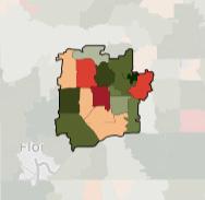
- Distress Score: 94.9
- State Rank: 44 of 923
- Orange County Rank: 1 of 43
- Distress Score: 67.8
- State Rank: 325 of 923
- Orange County Rank: 7 of 43
- Distress Score: 66.2
- State Rank: 343 of 923
- Orange County Rank: 9 of 43 32805 32839
The livability of a corridor is measured by many factors, including how well the corridor can support movement and connect people to their neighborhoods, daily needs, jobs, and recreation. A successful corridor is a place where people want to go, spend time, invest and stay, and a place that supports all modes of transportation. Above all, a successful corridor is a safe place.
Our study began with a public engagement process that included discussions and feedback sessions with the community members and stakeholders along the corridor, followed by the technical analysis of the physical environment, crime, market, and demographic data. The insights gathered from these exercises raised issues and concerns that exposed that segments of the corridor and surrounding areas in distress. Together with the assets and positive influences in the corridor, these insights can lead to new opportunities and ideas for action, which will be outlined in the later section of the plan
This section of the plan groups the issues, assets, and ideas into the following topics:
• Crime and Safety
• Character and Image
• Neighborhood and Housing
• Open and Recreational Space
• Street Network and Connectivity
• Education and Training
• Business and Economic Development
• Governance
The following pages address the content within each of the topics.
Blight in area for many years
Corridor doesn’t provide a good first impression
Litter on streets and properties
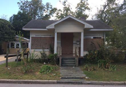
Rundown buildings
Appearance and use of buildings doesn’t contribute to the area
Undesirable uses of buildings for the area
Lack of a cohesive vision for the area
Lack of investment in public realm and private property
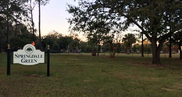
Parks and recreational facilities need improvements
Homeless population sleeps in parks
Lack of playground facilities
Not all lakes are publicly accessible
Lack of neighborhood parks in the area
Lack of lighting in some parks
Area is perceived as unsafe
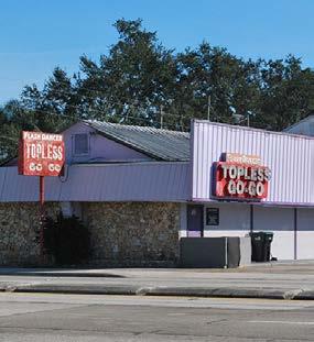
Prostitution activity on streets, in homes, and hotels
Drug activity at bus stops
Gang activity in Americana Boulevard area
Poor management of some hotels and apartment complexes
Not enough police activity
Police arrive on the scene too late
Neighbors often don’t follow through with complaints to police
Squatters in some abandoned properties
Lack of code enforcement of residential and commercial properties

Neighborhoods are suffering from prostitution and drug activities
80% percent of properties are renter occupied
3% of total study area consists of vacant residential parcels
Vacant homes attract squatters
Lack of code enforcement
Some homes in poor condition
High concentration of multi-family residential in one area
Limited access to food
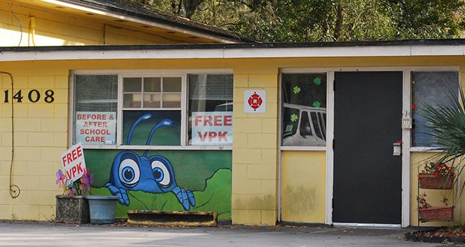
Lack of youth activities after school and on the weekends
Limited access to affordable housing opportunities and ownership
Neighborhood associations poorly organized
Lack of streetscape on OBT due limited right-of-way
Residents, business owners, and visitors don’t feel safe walking on streets
Very difficult to cross OBT from east to west
Highways and main roads cut the Study Area into segments
Streets don’t provide appropriate bicycle facilities
Intersections and crosswalks are not safe and need improvements
Not enough lighting on some streets
Prostitution activity on neighborhood streets
Litter on streets, especially under interstate bridges
Perception that only auto-related businesses exist
Poorly managed hotels bring illicit activity to the corridor
Lack of mixed-use areas
Some parcels don’t have adequate infrastructure to redevelop
Businesses get vandalized by gangs
Regular drug activity at bus stops and strip malls
Very little office development in the area
Majority of new development is happening to the south of the corridor

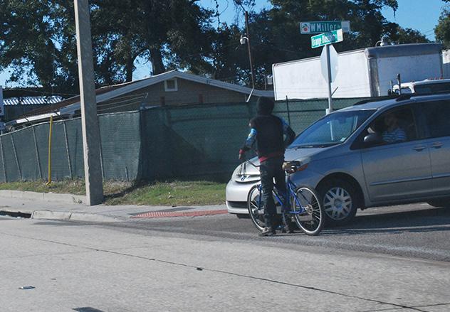
Lack of training and community space
Lack of after-school and weekend activities for children
Lack of educational programs for children and adults
Multi-jurisdictional corridor (City and County)
Lack of organization and commitment in the area
Investment in the area mainly from private development
Some key destinations located in the corridor are:
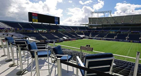
Camping World Stadium
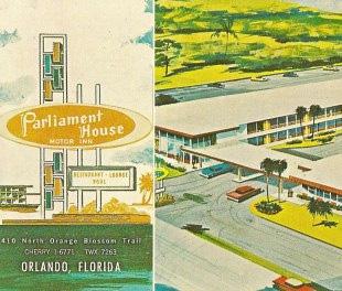
Parliament House
Cowboys
Florida Mall
Florida Hotel
Woodlands Restaurant
Rossi
Italian Restaurant

Vacant land offers opportunities for infill redevelopment
Key vacant parcels are owned by the City, County, and CRA
Price of land is still affordable compared to other areas
The industrial complex attracts 23,000 jobs to the area
The complex is home of distribution centers such as:
• Shrewin-Williams Distribution Center
• Publix Distribution Center
• CVS Caremark Distribution Center
The complex is also home to a number of educational facilities
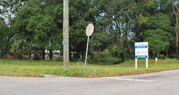
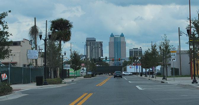
Street grid system in the northern segment of the corridor
Accessibility to the area via the highway system
Proximity to Downtown Orlando and South Downtown
Proximity to regional destinations such as:
• Millenia Mall
• Convention Center
• International Drive
Proximity to Sunrail Stations

Kaley Square LLC
John H. Jackson Center
New Holden Heights Community Center
Carter Street and Holden Heights Association
Polis Institute
LIFT Orlando
West Lake Partnership
Holden Heights Community Development Corporation
Involvement of UF and UCF in the neighborhoods
Pathway to Parramore influence in the area
Parramore Kidz Zone
Newly relocated Orlando Police Headquarters
Proximity to new Parramore PS8 School
Grand Avenue School Site and Park
Jones High School and Sports Complex
Cluster of private and tech schools around Lake Ellenor
Head Start in Callahan Center
Orange County South Branch Library

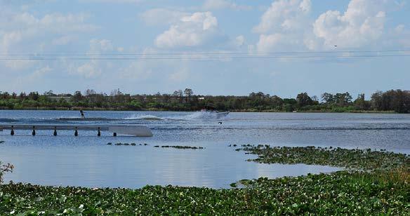
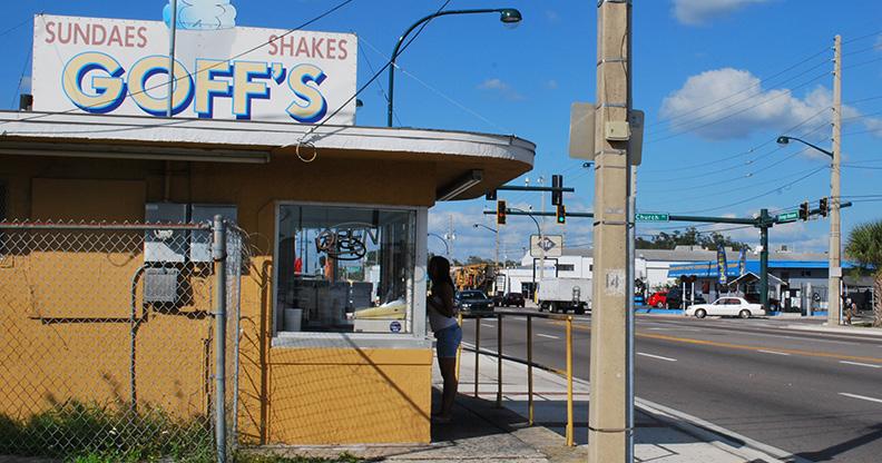
Some of the key character buildings are:
Goff’s Sundaes and Shakes
Parliament House
First Class Cleaners
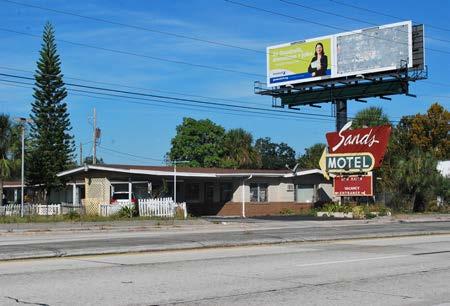
Sands Motel
The corridor has a great system of lakes, including:
• Rock Lake
• Lake Lorna Doone
• Clear Lake
• Lake June
• Lake Holden
• Lake Tyler
• Lake Ellenor

Create distinctive character areas and destinations
Use arts and culture to enhance the area
Remove or restrict adult entertainment uses
Remove or restrict number of hotels on the corridor
Provide home repair grants to residents
Provide business improvement grants to business owners
Organize regular “Clean-Up Day” activities
Create a branding campaign for the area
Provide adequate lighting on streets and parks
Condemn or enforce fees on unsafe structures
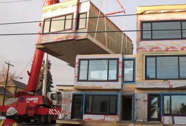
Identify existing parks that need low cost improvements
Utilize vacant residential parcels for open space
Create new open space through redevelopment
Create a featured open space at Lake June
Create Business and Neighborhood Watch
Increase law enforcement presence
Create a safety campaign for the area
Create a combined Code Enforcement and Police Task Force
Organize engagement meetings with residents, police, and code enforcement
Make residents aware that all complaints are private
Make residents aware of all safety programs provided by the city and county
Restrict traffic flow on some neighborhood streets
Encourage residents and business owners to install cameras on their property
Provide grants for residents and business owners to purchase cameras
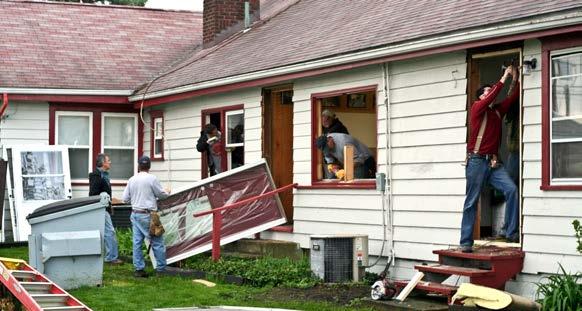
Utilize vacant lots for infill residential development
Allow town homes in the low-density residential zoning areas
Provide home improvement grants
Provide educational courses on home improvement and maintenance
Organize regular neighborhood clean-up days
Create affordable housing and homeownership opportunities
Make the residents aware of existing city and county housing programs
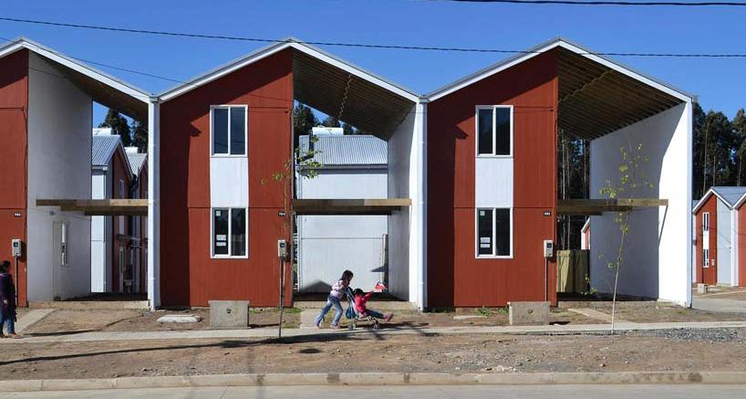
Encourage a flexible and modular architecture style
Create “OBT Neighborhood Partnership” with all neighborhood associations
Expand Safe Neighborhood Program to include the entire Holden Heights area
Organize regular community events such as block parties and markets
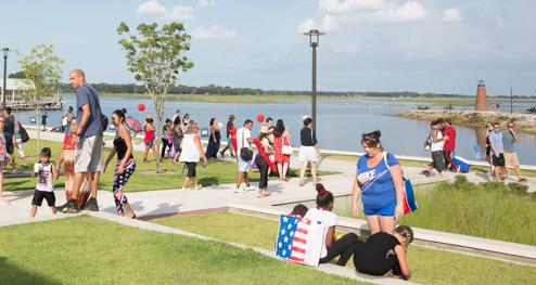
Capitalize on roadway system and regional location of the area
Improve key intersections and crosswalks
Create adequate and safe bicycle facilities
Create safe mid-block crossings
Create easement /setback requirements on new development for streetscape
Study the possibility of turning some one-way streets into two-way streets
Apply complete streets standards on each road, including OBT
Improve security at bus stops along OBT
Improve bus shelters on neighborhood streets

Create distinctive character areas and target new development
Market each area and destination
Encourage mixed-use development in key locations on the corridor
Allow and expand mixed-use zoning at key locations
Create shared parking and infrastructure standards on small blocks and parcels
Create an OBT Business Organization
Require improved management by hotel owners to avoid illicit activities
Encourage better property maintenance by business owners
Partner with key industries and organizations within and outside the area


Encourage technical training facilities to relocate to the area
Create partnerships with UCF, UF, Valencia, and other higher education institutions
Utilize city- and county-owned land to attract job-generating developments
Create community space within new developments
Develop more community centers for the area

Create multi-jurisdictional task forces such as:
• Code and Law Enforcement Task Force
• Neighborhood Associations Task Force
• Business Owners and Entrepreneurship Task Force
• Development and Growth Task Force
• Programs and Events Task Force
Demand a commitment to the area from elected officials
Demand a commitment to the area from City and County Staff
The master plan framework includes Vision, Guiding Principles, and Big Moves. This framework creates an organizational structure for the numerous individual ideas and comments from the community as planning concepts.
The Guiding Principles are informed by the general topics driven from the Issues and Opportunities insights. The Vision is driven by the definition of community resilience and the six foundations for building Community Resilience as developed by the Post Carbon Institute. Community resilience is defined as the ability of a community to maintain and evolve its identity in the face of both short- and long-term changes, while cultivating environmental, social, and economic sustainability.
The six foundations of building community resilience are:
• People: The power to envision the future community, and build its resilience, resides with the community members.
• System thinking: This is a set of essentials for understanding the complex, interrelated crises now unfolding and what they mean for our similarly complex communities.
• Adaptability: A community that adapts to change is resilient. But because communities and the challenges we face are dynamic, adaptation is an ongoing process.
• Transformability: Some challenges are so big it is not possible for the community to simply adapt. Instead, fundamental, transformative changes may be necessary.
• Sustainability: Community resilience is not sustainable if it serves only us, and only now; it needs to work for other communities, future generations, and the ecosystems on which we all depend.
• Courage: As individuals, and as a community, we need courage to confront challenging issues and take responsibility for our collective future.
The overall vision of the OBT corridor for the master plan is driven by the OBTDB’s current vision and mission. The Board works as a conduit between local governments, property owners, developers, and technical groups—with the sole purpose of improving the lives of residents. The Board endeavors to plan and implement projects intended to revitalize the OBT area.
The following pages outline the content within each of the topics.
• TRANSFORMATION: To change and reposition.
• SAFETY: To prevent crime.
• EQUITY: To be affordable and provide access.
• GROWTH: To be diverse and sustainable.
• CONNECTIVITY: To provide linkages and networks
THESE PRINCIPLES GUIDE THE MASTER PLAN. THEY ARE THE UMBRELLA UNDER WHICH FRAMEWORKS AND SPECIFIC VISION CONCEPTS HAVE BEEN DEVELOPED. THESE PRINCIPLES ARE INTENDED TO REMAIN CONSTANT, PROVIDING A BASELINE FOR NEW FRAMEWORKS TO BE DEVELOPED AND THE MASTER PLAN TO EVOLVE TO MEET CHANGING CONDITIONS AS TIME GOES ON.
The OBT corridor—The Trail—will encourage transformative and bold changes to improve the perception of the corridor as safe, economically vibrant, diverse, and collectively managed and governed. This will reposition “The Trail” in the Central Florida region as a place of distinctive districts and destinations bringing an influx of new residents, jobs, business, tourism, education, and entertainment. It will emphasize the creation of affordable housing and preserve the good tradition, culture, and history of its neighborhoods. It will empower the people living and working along The Trail to envision a livable place and create a sense of pride.
The OBT corridor—The Trail—will focus on crime prevention practices and ensuring The Trail is a safe area. It will work among jurisdictions to create programs, increase policing and strong code enforcement to reduce crime and improve the character of the area. It will empower its residents to file complaints against violators and criminals along the corridor and in the neighborhoods. The Trail will have safer streets for pedestrians and cyclists.
The OBT corridor—The Trail—will have equitable neighborhoods with access to jobs, training, housing, food and community services, a place where residents live with dignity and security. The Trail would be an inclusive place that promotes social justice. It will provide affordable housing opportunities and home literacy programs for existing and new residents. It will provide access to quality open and community spaces to recreate, learn, and promote active living. It will foster partnerships with schools and higher education institutions. It will provide access to quality health care and good schools, youth programs, daycare, and social and cultural amenities.
TheOBT corridor—The Trail—will have five growing distinct districts receiving an influx of new jobs and serve as the center for traditional jobs and emerging high-production industries. The districts will be in constant change and will adapt to the different influences of the market. The corridor will realize full potential of vacant and underutilized land, enhanced access to housing and jobs, as well as reinvestment in government-owned properties and large, contiguous parcels for future infill development. The corridor will attract economically vibrant mixed uses of businesses and development. All new development will follow sustainable practices and provide adequate infrastructure. Neighborhoods will be strong and diverse, and will provide existing and new residents with an affordable and mixed income housing stock with opportunities for homeownership and home literacy.
The OBT corridor—The Trail—will improve connections with the adjacent community, and the larger Central Florida Region and strengthen the connection with downtown Orlando. It will see improved mobility in the form of enhanced public transportation and more walkable and bikeable streetscapes. It will create linkages among local and regional destinations and encourage a network of business, neighborhoods, and local organizations.
The Big Moves outline the key actions for the OBTDB to take in order to execute the plan. The actions are organized by policy and regulations, and organizational, administrative, and physical improvements. They have been created in thoughtful consultation with community members and stakeholders. The plans and imagery shown with each move are intended to be indicative of the character and intent of the recommended actions.
B1
B2
B3
B4
B5
B6
DEVELOP DESTINATIONS TO ATTRACT DEVELOPMENT, BUSINESS, JOBS & TRAINING
ENCOURAGE A VIBRANT AND DIVERSE CORRIDOR
MAKE SAFE AND LIVABLE STREETS FOR ALL MODES OF TRANSPORTATION
IMPROVE ACCESS TO OPEN SPACE AND RECREATIONAL ACTIVITIES
BUILD STRONG NEIGHBORHOODS
CREATE FLEXIBLE AND AFFORDABLE HOUSING OPPORTUNITIES
BIG MOVES ARE DEVELOPMENT OPPORTUNITIES THAT OUTLINE KEY ACTIONS AND PARTNERS FOR THE CITY OF ORLANDO, ORANGE COUNTY, THE OBTDB, AND THE COMMUNITY THAT COULD BE EXAMINED AS IMPLEMENTATION ITEMS IN SPECIFIC LOCATIONS. THE MOVES ARE CONCEPTUAL AND WILL REQUIRE ADDITIONAL DUE DILIGENCE, LOCAL REFINEMENT, AND FUNDING STRATEGIES TO IMPLEMENT.
Six distinctive branded districts will be created to help reposition the trail regionally. This will attract sustainable growth, economic development, academic institutions, food and entertainment business, and bring traditional and non-traditional jobs and industry to the corridor.

1 2 3 DEVELOP DESTINATIONS TO ATTRACT DEVELOPMENT, BUSINESS, JOBS & TRAINING
MAKE SAFE AND LIVABLE STREETS FOR ALL MODES OF TRANSPORTATION
With adequate bicycle facilities and streetscape elements, the streets in the corridor will be safe and connected, creating a rich environment for business, as well as safe pedestrian activities.

ENCOURAGE A VIBRANT AND DIVERSE CORRIDOR
By supporting sustainable growth, adequate infrastructure, mixed use development, connectivity and open space, the trail will be repositioned as a more attractive, safe, livable, and accessible place for people to invest and work.

Now Soon Later
Policy [Code and Regulations] Zoning and Land Use Code, Housing and Building Codes, Street Design...
Administrative [Organization and Program] Partnerships, Task Forces, Grants, Events...
Infrastructure [Physical Improvements] - Parks, Streets, Stormwater, Sewer, Lakes...
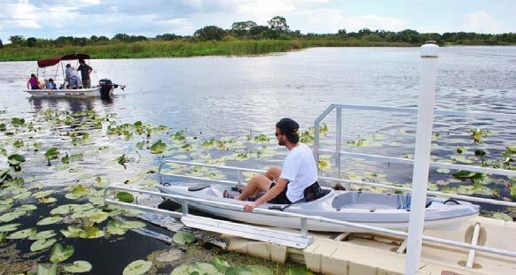
BUILD STRONG NEIGHBORHOODS
5
Neighborhoods will be safe, vibrant, healthy, and diverse—giving access to housing, parks, culture, and education.
4
IMPROVE ACCESS TO OPEN SPACE AND RECREATIONAL ACTIVITIES
Investment in the community will establish parks, lakes, recreational facilities, and open spaces as primary elements of civic identity and will enhance the experience in The Trail and surrounding neighborhoods.

6
CREATE FLEXIBLE AND AFFORDABLE HOUSING OPPORTUNITIES
Existing and new residents will have access to diverse housing opportunities, home literacy and programs that will allow them to become future homeowners.
CREATE
BUILD
DEVELOP
IDENTIFY
EXPAND THE MIXED-USE
PRESERVE AND RESTORE ICONIC BUILDINGS
CREATE BUILDING FACADES AND SITE IMPROVEMENTS PROGRAMS
ESTABLISH A LAW AND CODE TASK FORCE FOR THE CORRIDOR
REPREHEND, CONDEMN OR/AND DEMOLISH UNSAFE STRUCTURES
IDENTIFY AND REPREHEND BUSINESS THAT ARE RUNNING ILLICIT ACTIVITIES
RE-DESIGN THE
BLOSSOM TRAIL AS A
ENCOURAGE
PLAYERS/ PARTNERS
Orlando Downtown Development
City and County Planning and Economic Development
Orlando Main Street Program
LIFT Orlando
Florida Citrus Sports
UF, UCF, Valencia and other Educational Institutions
Property & Business Owners
Orlando Downtown Development
City and County Planning and Economic Development
City and County Historic Preservation
City and County Sustainability
City and County Code Enforcement
City and County Real Estate Department
City of Orlando Police
Orange County Sheriff Office
City and County Transportation
MetroPlan Orlando
LYNX
Property & Business Owners
City and County Planning
City and County Sustainability
City and County Code Enforcement
City of Orlando Police
Orange County Sheriff Office
City and County Transportation
MetroPlan Orlando
LYNX
BUILD
IMPROVE
DESIGN
PARTNERS
City and County Planning City
Developers
Residents
Schools/Churches
Local Organizations
RESTRICTING ACCESS ON SOME OF THE NEIGHBORHOOD STREETS
PROVIDE BASIC NEIGHBORHOOD INFRASTRUCTURE
UTILIZE VACANT PARCELS FOR TEMPORARY ACTIVITIES
ALLOW
CREATE
DEVELOP
DEVELOP
City and County Neighborhood Revitalization
City and County Planning
City and County Transportation
City and County Code
Enforcement
City of Orlando Police
Orange County Sheriff Office
Neighborhood Associations
Residents
Institutions
Community Centers
City and County Real Estate
City and County Housing
City and County Planning
Central Florida Foundation
Land Bank/Trust Organizations
Six distinctive branded districts will be created to help reposition the trail regionally. This will attract sustainable growth, economic development, academic institutions, food and entertainment business, and bring traditional and non-traditional jobs and industry to the corridor.
The first big move involves defining and changing the character of the corridor. We can say the overall corridor lacks differentiation and character and is fragmented by the highway system (SR 408 and I-4) and key east-west roads (Holden Avenue, Oak Ridge Road and Sand Lake Road). The corridor has three well-identifed segments: A, B, and C (see map of the right). Each segment has a unique character based on the land use, business types and block pattern.
The corridor has 4 main regional destinations: the Camping World Stadium, The Florida Mall and Hotel, and the Industrial and Office complex with 23,000 jobs. It also has other smaller destinations such as bars, restaurants, clubs, and technical schools. These destinations are places where people from outside the corridor come and spend time and money. But the corridor also has approximately 20 hotels and businesses that are not well managed, and as a consequence illicit activities occur at these locations, attracting drugs, prostitution, and crime to the area.
The goal is to create six distinctive character areas (districts and hubs), develop key addresses and destinations, establish a strong identity and brand for each area, and create an awareness campaign that will reposition and promote the transformation of the corridor.


Six distinctive branded districts will be created to help reposition the trail regionally. This will attract sustainable growth, economic development, academic institutions, food and entertainment business, and bring traditional and non-traditional jobs and industry to the corridor. Each district will have a different redevelopment approach, based on the understanding of the existing jobs and key players, which informed the vision and character of each one of the future districts. Each district should be encouraged to grow as a connected series of commercial stores, mixed used development with stores and office on the ground floor, and more intense and focused nodes at key intersections. Each district should incorporate the assets of the area, such as key buildings, institutions, parks, and lake system as well as the relationship to the adjacent and abutting residential areas. The intent is not to create 8 miles of the same character, but to focus time, effort, and investment toward building a unique corridor and the opportunites that exist both in the public realm (the streets and parks) and the private realm (lots and buildings).
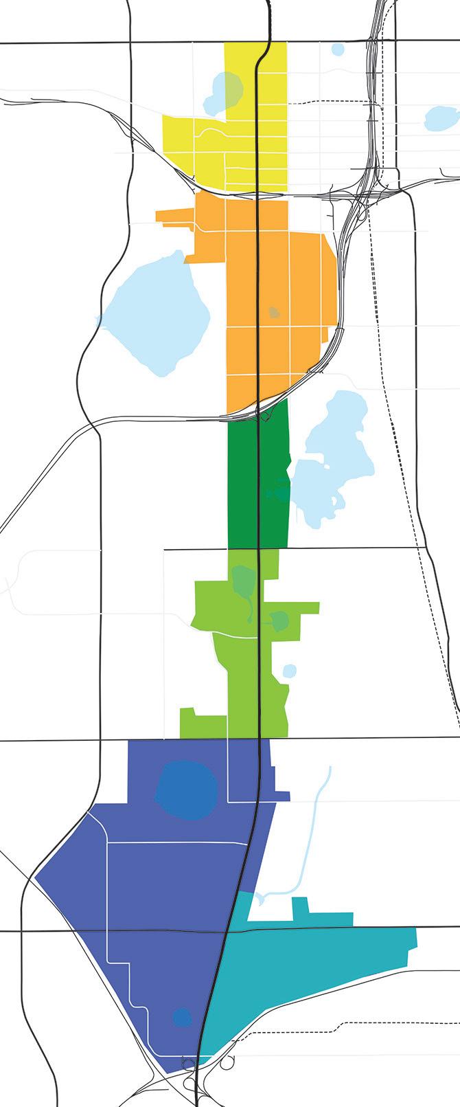

West Downtown: This portion of the corridor is situated and connected to become a hub for sports and entertainment uses and be supported by quality food and beverage businesses.

Holden Heights: This hub, with 26% of the existing jobs related to construction, possesses a wider variety of building types from residential to commercial and industrial. It can become a place to attract higher education institutions and businesses related to Design and Construction.

Holden: With a wide variety of restaurants from different parts of the world and being surrounded by neighborhoods, this is the perfect portion of the corridor to create a district for authentic food supported by other office and service uses.

Americana: The overall corridor is full of auto-related uses, but the Americana Boulevard area has large parcels that can support a hub for all auto-related businesses especially used-car sales.


Lake Ellenor: This portion of the corridor has a high concentration of educational institution around Lake Ellenor and it is the home of a regional industrial and office complex, attracting 23,000 employees to the area, making this place a great District for Educations and Jobs.
Florida Mall: The Florida Mall and Hotel are a regional destination for local residents as well as tourists bringing a high volume of people to this area. This hub should keep supporting retail and hospitality uses as it grows and becomes a key east west connector between the airport and the international drive area.
• LIFT Orlando
• Entertainment Venues
• Local Business
• Entrepreneurs
• Design and Construction Business
• University of Florida College Design, Construction and Planning
• Non-Profit Organizations
• Local Restaurants
• Darden Restaurants
• PepsiCo
• University of Central Florida
• Orange County
Public Schools
• Tech Collages
• Private Schools
• Florida Mall
• Florida Hotel
• Existing Hotels
To boost economic development and attract people and investment to the OBT area, it is important to create destinations and addresses in each one of the future hubs and districts. These destinations will happen on neighborhood streets like Nashville Avenue and Woods Avenue, complementing the future uses and activities of the OBT corridor.The following are four key destinations proposed in the master plan:
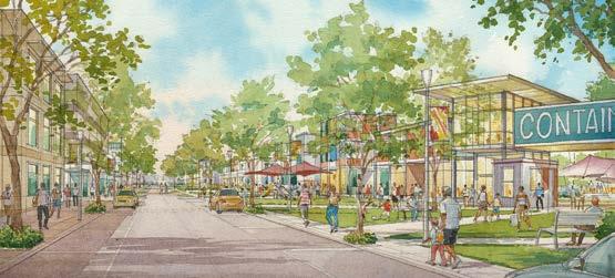


Develop South Nashville Avenue as a mixed-use walkable street
KEY PARTNERS:
• LIFT Orlando
• Entertainment Venues
• Local Business
• Entrepreneurs
Transform South Woods Avenue as a Maker’s Row. An industrial street for designers, builders, contractors, and educators
KEY PARTNERS:
• Design and Construction Business
• University of Florida College Design, Construction and Planning
• Non-Profit Organizations
Extend Nashville Avenue as local residential and restaurant destination with mixed-use development
KEY PARTNERS:
• Local Restaurants
• Darden Restaurants
• PepsiCo
Develop a higher education campus around Lake Ellenor
KEY PARTNERS:
• University of Central Florida
• Orange County Public Schools
• Tech Collages
• Private Schools
4
Build a unique brand for each of the districts and hubs. Ideas include the design of street banners, website, and social media platform, and teaming up with local corporations, business, and institutions to help sponsor the design and creation of the brand elements. See below an example of a billboard in the form of a bench launch by IBM. 3
Develop a partnership organization with all six districts, members, and key partners to help promote each of the areas and carry out projects related to business development, placemaking, infrastructure, and branding. The focus should be on a holistic approach to revitalization, based on the 4-point approach of design, promotion, economic restructuring, and organization.
KEY PARTNERS:
• City and County Economic Development Department
• Districts/Hub Partners
• City and County Police and Code Enforcement
• Orlando Main Street Director
• Local Business Owners

KEY PARTNERS:
• City and County Economic Development Department
• Districts/Hub Partners
• Local corporations, institutions and business
• Orlando Main Street Director


5
To reposition and promote the transformation of the OBT corridor, it is important to inform the business and residents that the OBTDB is working on the improvements for the well-being of the area via a campaign. The campaign will focus on restoring the belief in the area and build up the sense of pride.
KEY PARTNERS:
• Local corporations, institutions, business and residents
• Churches
• Local Organizations and institutions
• City and County Code Enforcement


Transform South Wood Avenue as an industrial area for designers, builders, contractors, and educators


The trail will be repositioned as a more attractive, safe, livable, and accessible place for people to invest and work by supporting sustainable growth, adequate infrastructure, mixed use development, connectivity, and open space.

Parcel & Block Infrastructure Building Use and Density
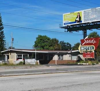

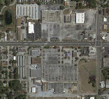

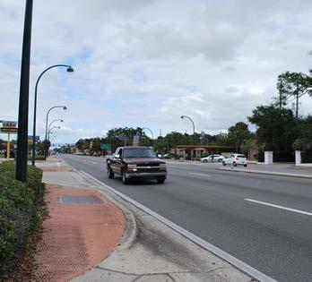
The corridor has a combination of very shallow and small parcels that have proven to be very difficult to assemble in a way that supports commercial reinvestment. On the other hand, there are a few locations along the corridor where we can find large contiguous parcels under one ownership, which makes them easy to redevelop in the short term.
The commercial uses of the corridor are mostly auto-related and hotel uses. Most of the buildings are one and two stories high. The tallest buildings are located within the industrial and office complex in the southern segment of the corridor.
The overall character of the OBT is not attractive. The main purpose of the road is to move cars, focusing very little on the pedestrian and bicycle experience. There is a lack of shade and streetscape elements, as well as a lack of well-defined crosswalks and bicycle infrastructure.The buildings are generally pushed to the back of the property and parking surfaces are in the front. Businesses don’t do a very good job of maintaining their properties and sometimes they build fences along their perimeter.
Commercial properties, in aged corridors, are difficult to assemble in a way that supports commercial reinvestment and protects the neighborhoods. This is because the corridor fronting properties don’t have the adequate parcel depth to redevelop, and the parcels are owned by different entities. Another challenge is the majority of the business accesses are happening on the primary street (OBT) and not on the secondary streets; therefore, the amount of curb cuts facing OBT prevents the business from providing with the adequate streetscape elements.
Existing Parcel/Block Configuration

Future Parcel/Block Configuration 1
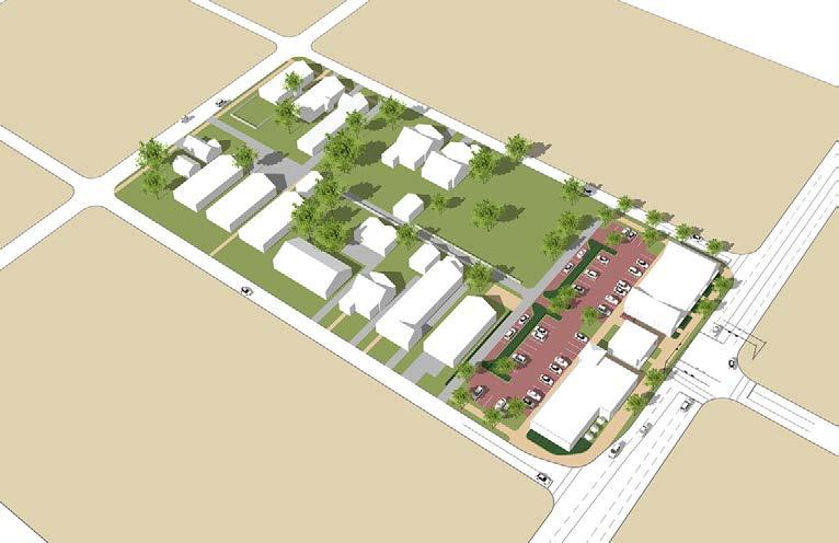
1. Parcel Depth: Higher density development requires additional functional depth of sites in order to provide building pads, parking, and proper transition to the adjacent neighborhoods. By establishing a uniform parcel depth of approximately 200 feet, commercial properties will be better able to support street front buildings and rear parking, service cross access and stormwater, and provide an adequate buffer between the commercial use and residential homes.
Future Parcel/Block Configuration 2
2. Building Placement: The new building should be placed fronting the primary street when possible. When the road ROW is not sufficient to provide adequate sidewalk of 10 feet with a minimum 6-foot landscape strip, the building should be placed 16 feet behind the ROW line, and the development provided with the necessary streetscape elements (sidewalk, trees, lighting, and bicycle racks).
3. Parking: Parking should be located at the rear of the parcel and encourage the concept of shared parking among uses to avoid fragment parcel and allow the space to be utilized efficiently.

4. Stormwater: Stormwater system for the block should be located between the parking and the residential homes and work as a buffer between the two uses. The system can be shared among parcels. Other ways to treat stormwater is by using a Low Impact Development (LID) design.
5. Alley: The site access should include an alley (if not present already) to provide access to parking from the side street, so the primary street edge can be maintained for building edge
KEY PARTNERS:
• City and County Planning and Building Department


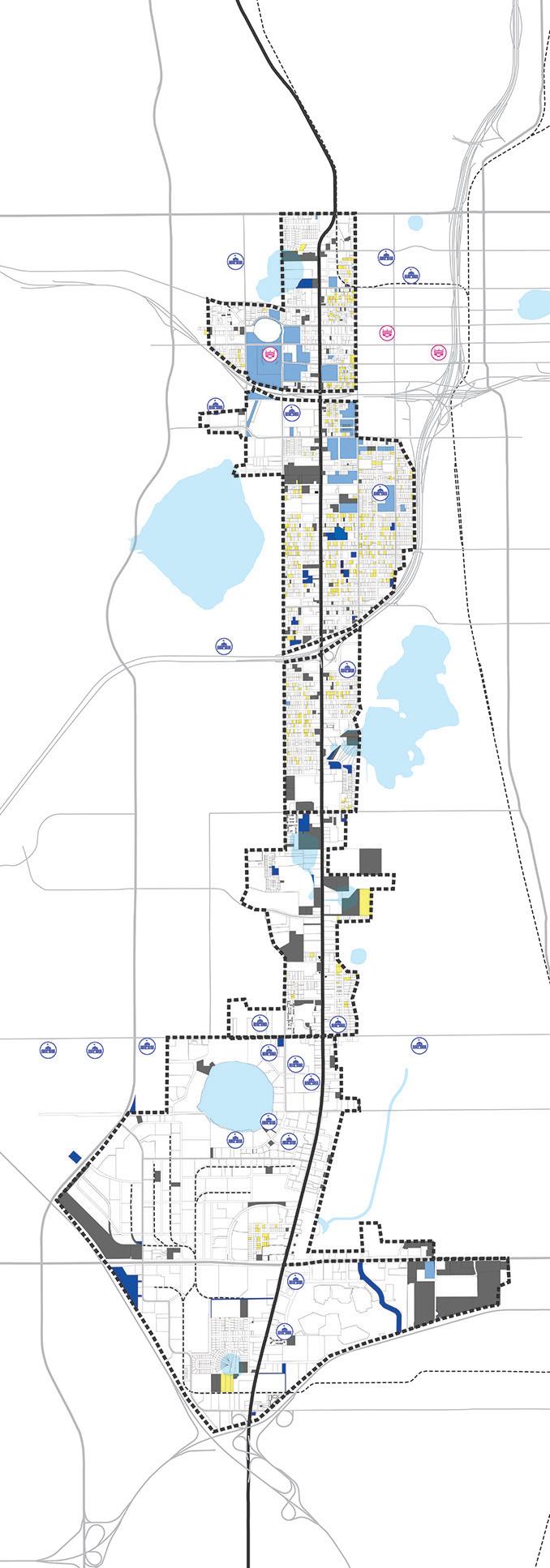


There are a number of conditions that present opportunities for redevelopment. These include vacant properties, government-owned properties (see map on the left), and large contiguous parcels (see map on next page). Almost 10% of the parcels within the study area are vacant, which includes both residential and non-residential parcels. Additionally, there are roughly 228 acres of land owned by government entities within the study area. We also mapped the location of schools and higher education facilities.
After doing an analysis of the parcels (see corridor assessment report for detailed analysis), we have identified roughly 11 areas where redevelopment can happen in the medium and long term. Some of those sites are located within the OBT CRA boundaries.
Those area are the following:
1. Former McNamara Site (OBT CRA)
2. Parliament House Site (OBT CRA)
3. West Arts District Area (OBT & Downtown CRA)
4. Camping World Stadium Area (OBT CRA)
5. Woods Avenue Area (OBT CRA)
6. Nashville Avenue Area (OBT CRA)
7. Lake June and Kaley Square Area (OBT CRA)
8. Lake Holden Hotel Site
9. Holden Avenue Intersection Site
10. Lake Tyler Site
11. Lake Ellenor Site
KEY PARTNERS:
• City and County Planning Department
• City and County Economic Department
• City and County Real Estate Department
• Downtown Orlando CRA
• OBT CRA


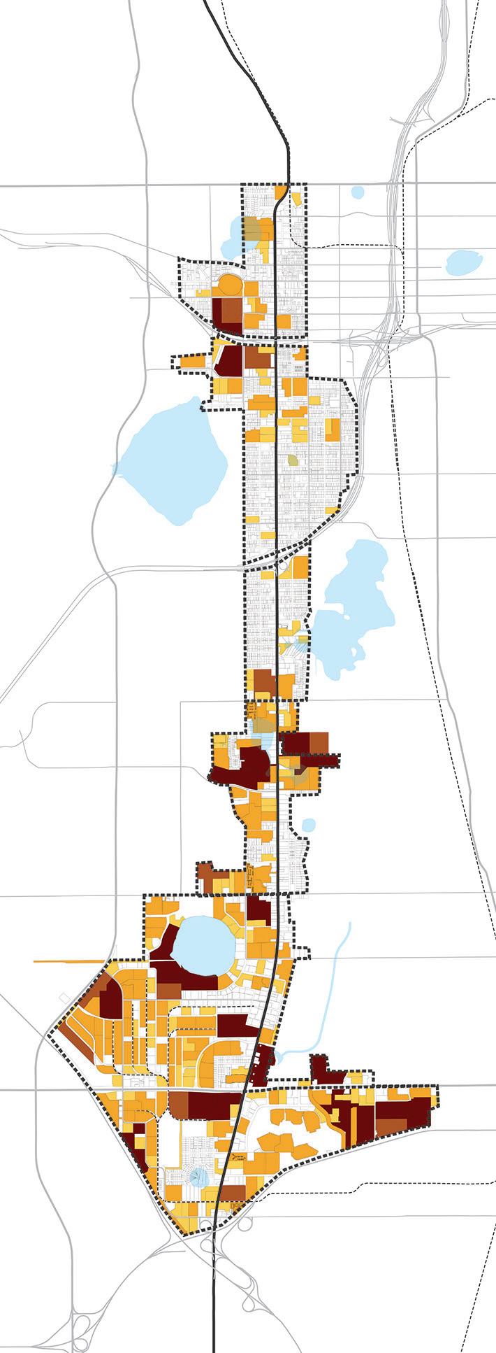


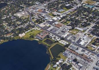

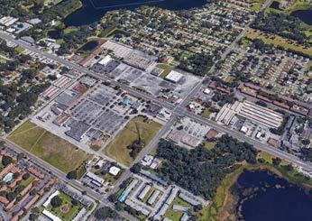
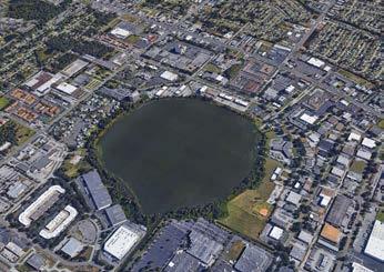


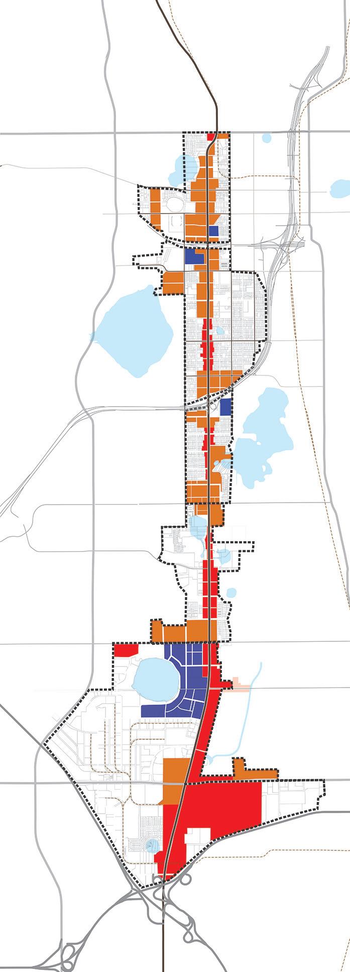


The parcels facing the OBT corridor between SR 50 and SR 408 are the only ones currently zoned as mixed use (all within the City of Orlando limits). The rest of the corridor future land use is generally commercial, industrial, neighborhood activity center and neighborhood center. Key locations on the corridor have the potential to develop as higher density developments; therefore, there is a need to expand the mixed use zoning and future land use in both jurisdictions to allow future redevelopment in the area. Allowing mixed uses on the corridor is going to help break the existing monotony and transform the corridor into a more diverse place.
The proposed areas to allow mixed use zoning go hand in hand with the creation of key address and new destinations in the corridor boosting redevelopment and investment.
• City and County Planning Department

Proposed Mixed-Use Future Land Use
Proposed General Commercial Future Land Use
Proposed Institutional Future Land Use
Lakes
District/Hub Boundaries


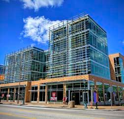

The U.S. Environmental Protection Agency describes the term “low impact development” (LID) as systems and practices that use or mimic natural processes that result in the infiltration, evapotranspiration, or use of stormwater in order to protect water quality and associated aquatic habitat. LID practices aim to preserve, restore and create green space using soils, vegetation, and rainwater harvest techniques. LID is an approach to land development (or redevelopment) that works with nature to manage stormwater as close to its source as possible. LID employs principles such as preserving and recreating natural landscape features, minimizing effective imperviousness to create functional and appealing site drainage that treat stormwater as a resource rather than a waste product. There are many practices that


have been used to adhere to these principles such as Bioretention facilities, rain gardens, vegetated rooftops, rain barrels and permeable pavements. By implementing LID principles and practices, water can be managed in a way that reduces the impact of built areas and promotes the natural movement of water within an ecosystem or watershed. We also encourage the use of sustainable practices for buildings like the use of solar panel and any other energy efficient practice.
• City and County Planning and Building Department
• City and County Sustainability Department
• City and County Public Works Department
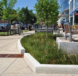


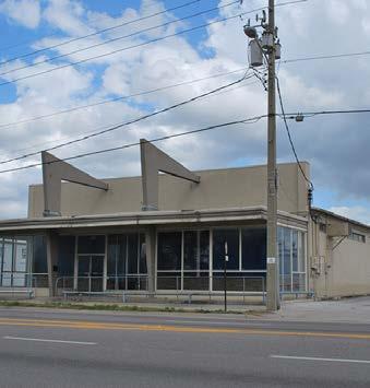

Preserve and restore key iconic buildings and signs originally built when OBT was the “Central Florida Scenic Route” This buildings will help bring back the historic character of the corridor back.
These buildings are:
• Parliament House Building and Sign
• First Class Cleaners Building
• Goff’s Sundaes and Shakes
• Sands Motel Sign
• 435 N Orange Blossom Trail Building
• 315 N Orange Blossom Trail Building
KEY PARTNERS:
• City Historic Preservation Department
• OBT CRA


Building facade and parcel landscape improvements grant programs are a quick way to improve the aesthetic of the existing buildings along the corridor—at the same time, some of these improvements can help prevent crime. Improvements that can be implemented are the following:
• Facade repair
• Lighting
• Sign repair
• Murals (no graffiti)
• Landscape shrubs and flower ground cover
• Canopy and flowering trees
KEY PARTNERS:
• City and County Planning Department
• OBT CRA

Create a multi-jurisdictional OBT “Law and Code” Task Force for the non-residential uses along the corridor to help create programs that would prevent crime and improve the aesthetic of the corridor. Some of initial actions we recommend are:
• Provide grants for business to purchase cameras (Orlando Police Department already has a program in place).
• Provide free crime assessment and consulting to business owners to make their properties safer using the Crime Prevention through Environmental Design (CPTED).
• Create a business watch program.
• Installation of cameras at key destinations, intersections and bus stops.
• Periodic visits to properties that in violation of the code.
• Make business aware of all the programs the city and county offer.
KEY PARTNERS:
• City of Orlando Police Department
• Orange County Sheriff Office
• City and County Code Enforcement
• City and County Transportation Department
• LYNX
• Local Business Owners


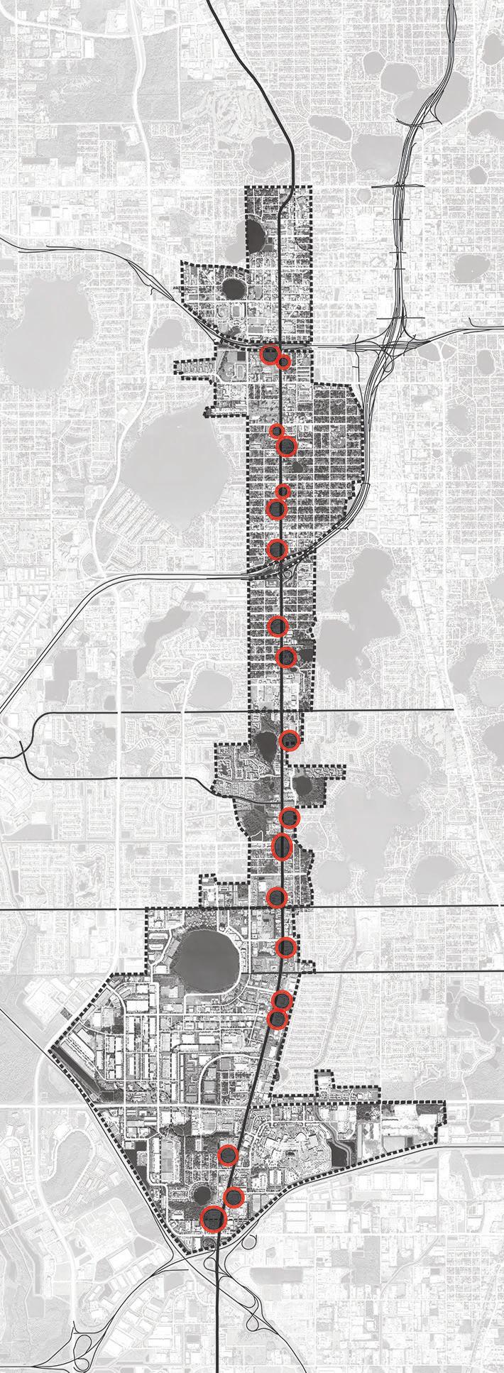


Establish a multi-jurisdictional strategy to identify all non-residential “unsafe” structures along the corridor. According to the city and county code, an “unsafe” building is one that is severely dilapidated, improperly maintained, or has electrical, structural, or plumbing problems. The city and county both have a system in place to reprehend, condemn or demolish an unsafe structure. An example of an “unsafe” structure is the Super Inn Hotel located north of I-4.
KEY PARTNERS:
• City of Orlando Police Department
• Orange County Sheriff Office
• City and County Code Enforcement
• City and County Building and Fire Department
• Local Business Owners
• OBT Safe Neighborhood
The poor management of some of the hotels along the corridor attracts illicit activities like drug dealing, prostitution, and other types of crime. Both law enforcement departments are aware, and have specific crime data of which businesses and hotels are letting illicit activities happen on their properties. A strong police effort and action is necessary to eradicate these activities.
Some of the hotels that law enforcement identify as problematic for the corridor are:
• Vacation Lodge Hotel
• Orange Inn Motel
• Budget Motel
• Sands Hotel
• Melody Hotel
• Maxwell Garden Apartments
• Arrow Hotel
• Knight Inn Orlando
• Great Value Suites
• Sunstyle Suites Inn
• Econo Lodge Inn and Suites
• Baymont Inn and Suites
KEY PARTNERS:
• City of Orlando Police Department
• Orange County Sheriff Office
• City and County Code Enforcement
• City and County Building and Fire Department
• Hotel and Business Owners
• OBT Safe Neighborhood
OBT is now one of the three service corridors for trucks in the region, according to MetroPlan Orlando. The other two corridors are Orange Avenue and John Young Parkway, both a mile east and west of OBT, respectively. MetroPlan identifies the OBT corridor as a Sustainable Development Corridor in their 2040 Long Range Transportation Plan. MetroPlan also developed a Sustainable
Land Use Forecast for their 2030 Long Range Transportation Plan, which discusses how Smart Growth can improve the efficiencies of the transportation system. It is necessary to address future land uses and the transportation system at the same time, in order to transform the OBT corridor into a Sustainable Development Corridor.
Four-lane Road with a Center Turn Lane
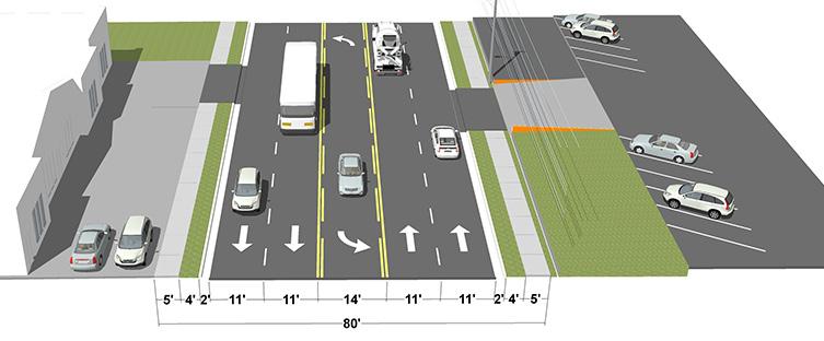


This segment of OBT carries an average of 28,000 cars a day. This is a four-lane road with a center turn lane. Not many roadway improvements have happened in the past few years.
Four-lane Road with 6-foot Landscape Strips on Both Sides
Four-lane Road with 6-foot Landscape Strips on Both Sides
On this concept, the 14-foot center turn lane was removed, and the extra space was split in two to create a six-foot landscape strip for street trees and lighting with banners. This strip will help improve the pedestrian experience on the corridor by providing a buffer between the car and the people walking on the sidewalk. The strip can incorporate LID standards. The use of the center lane and areas where the lane is not needed for left turns should be evaluated for a landscaped median, based on existing traffic generators and circulation patterns. When redevelopment happens the new building should be place 16-foot behind the ROW line to allow the construction of a 6-foot landscape strips and a 10-foot sidewalk. Because there is no room for bicycle facilities on this segment of OBT, the existing 9-foot sidewalk can work as “informal” bicycle facility.
In 1987, a Municipal Service Taxing Unit funding source was created to enhance the safety and aesthetics of the OBT from I-4 to SR 528. The total cost of the OBT Roadway Enhancement Project was $78 million. No road enhancements have been made to segment from SR 50 to I-4; however, this segment of corridor is on the MetroPlan Orlando Fiscal Year 2017/18 Priority Project List as number 14 for two different Pedestrian Enhancement Projects. Phase 2a from 30th Street to Gore Street ($3.9 million) and phase 2b from Church Street to SR 50 ($2.5 million).
These are only concepts based on the input gathered during the master plan process. Further transportation analysis and design alternatives are needed to develop the final concepts.
KEY PARTNERS:
• City and County Planning Department
• City and County Transportation Department
• City and County Public Works Department
• MetroPlan Orlando
• Water Management District

Six-lane Road with a Center Turn Lane and Landscape Median
This segment of the OBT carries an average of 61,000 cars a day. This is a six-lane road with a center turn lane and landscape median. There are a few areas along the corridor that offer a mid-block crossing for pedestrians, but the challenge is that all crossings, including intersections, are very far apart; therefore, pedestrians still cross the road anywhere.
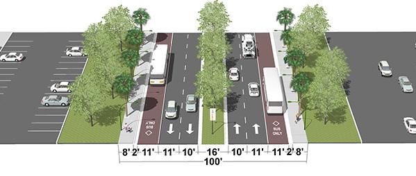
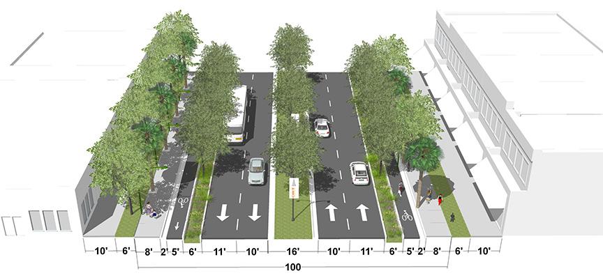
Four-lane Road with Center Turn Lane with Landscape Median and Designated Bus Lanes
This concept shows the option of having designated bus lanes for express services (in the short term can operate as mixed traffic lane) and later can move up to the proposed BRT line that will operate from Downtown to the Florida Mall.
Four-lane Road with Center Turn Lane with Landscape Median and Protected Bicycle Lanes on Both Sides
This concepts shows the option of providing protected bicycle lanes (cycle-track) on OBT. Bus services will only operate as a mixed traffic. When redevelopment happens, new buildings should be placed 16 feet behind the ROW line to allow the construction of a 6-foot landscape strip and a 10-foot sidewalk.

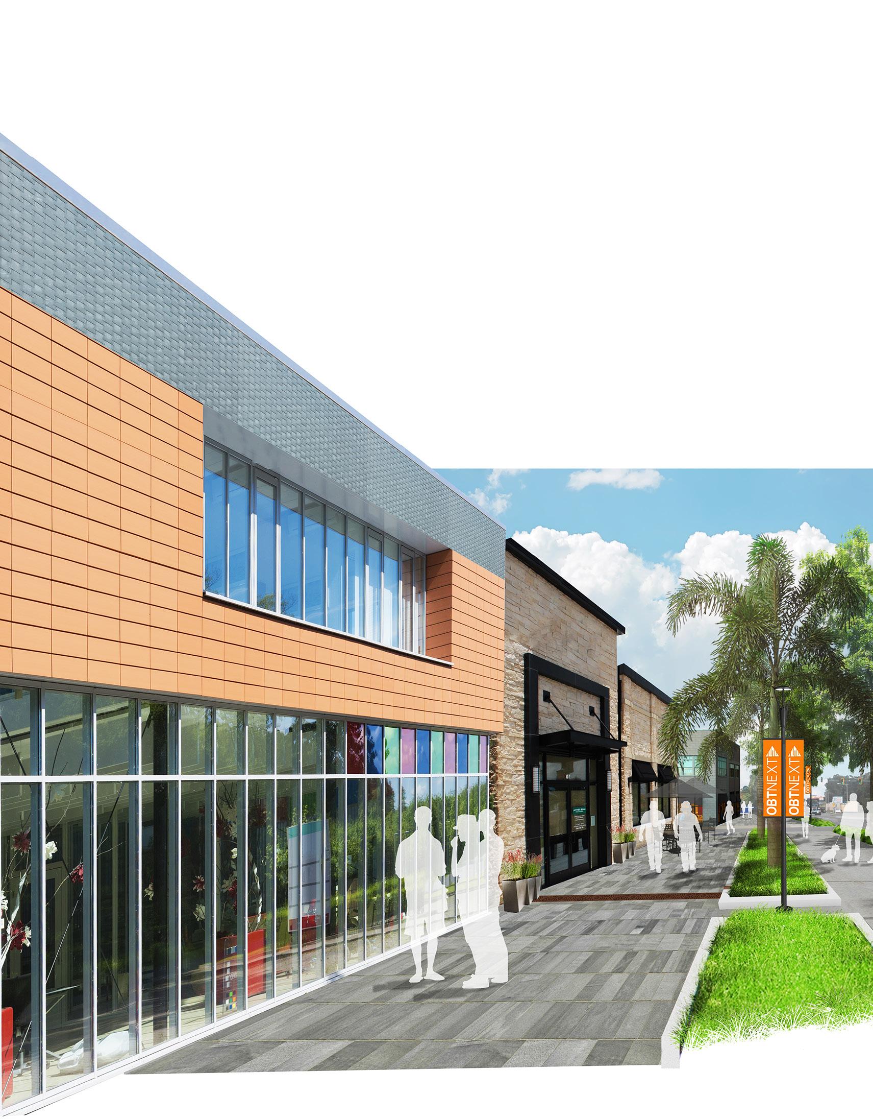
New Development and Land Use
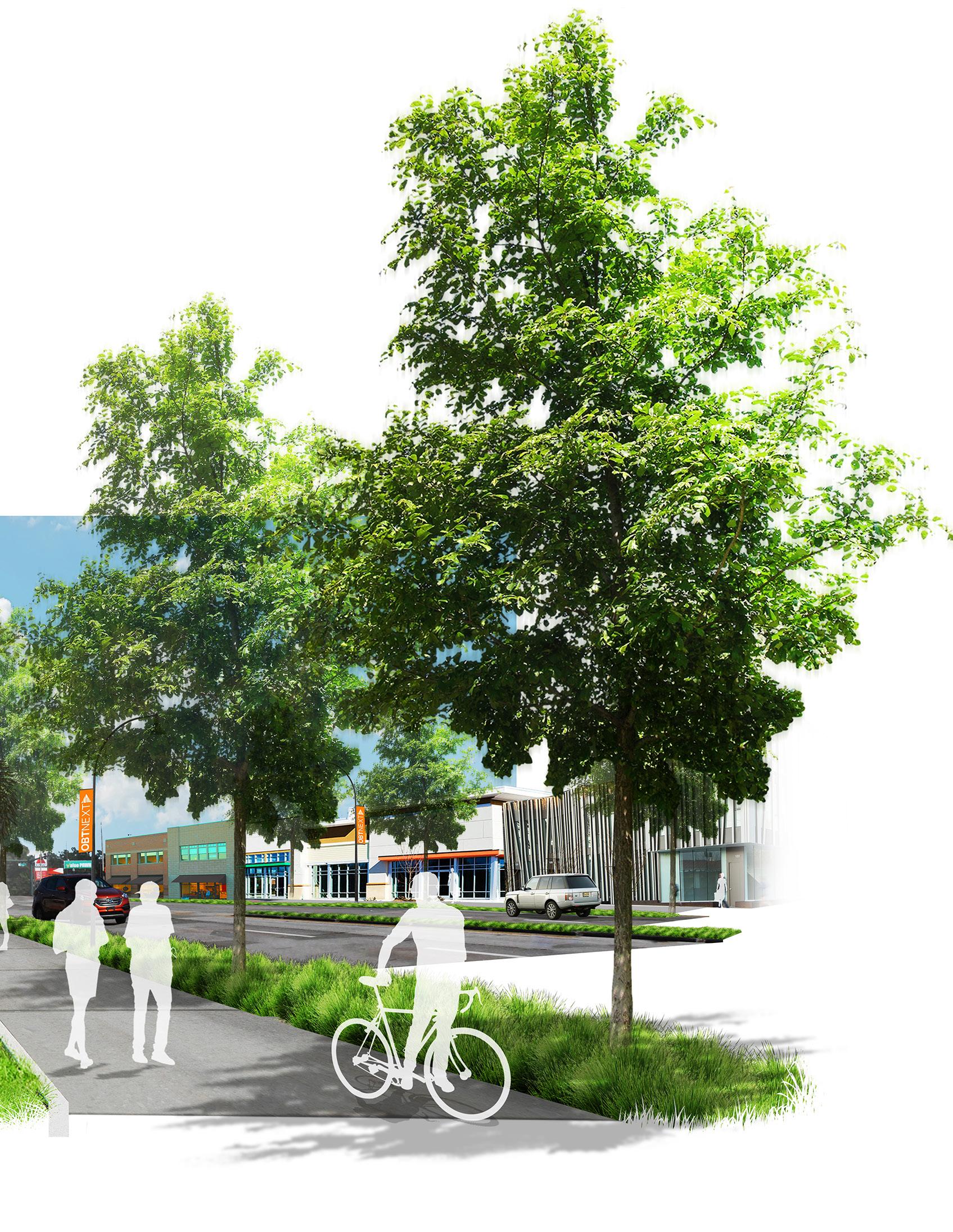
Current Street Network and Land Pattern
Streets provide the means of travel, allowing children to get to school and parents to get to work. Streets create places for exchange, bringing together neighbors and drawing customers to shops, offices, and parks. Streets comprise more that 80% of public space in urban cities, but they often fail to provide their surrounding communities with a space where people can safely walk, bicycle, drive, take transit and socialize.
We have two very distinct street patterns in the study area. The northern segment from SR 50 to Holden Avenue still maintains the historic grid pattern configuration of the 300 foot by 600 foot block. However, the street network and connectivity south of Holden Avenue changes drastically. The blocks are bigger, and the streets follow a suburban pattern.
The streets in the corridor will be safe, connected, create the environment for business, and will promote safe pedestrian activities, provide adequate bicycle facilities and streetscape elements.


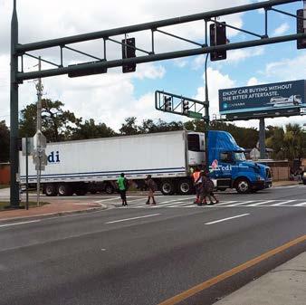
The Complete Street philosophy holds that streets should be designed to serve a broad range of users—both young and old, on foot or on bicycle, in a car or in a bus—rather than being designed primarily for cars and trucks. The National Complete Streets Coalition defines the Complete Streets as the following: “Complete Streets are streets for everyone. They are designed and operated
to enable safe access for all users. Pedestrians, bicyclists, motorists, and public transportation users of all ages and abilities are able to safely move along and across a complete street. Complete Streets make it easy to cross the street, walk to shops, and bicycle to work. They allow buses to run on time and make it safe for people to walk to and from train stations.”
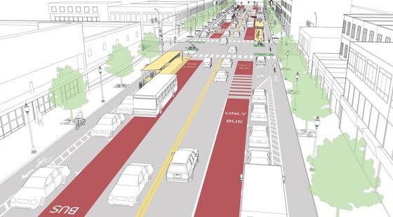

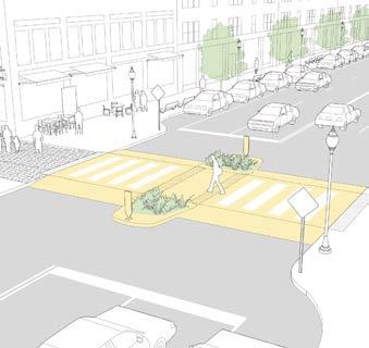

A complete street approach for the Study Area should view each transportation improvement to a roadway as an opportunity to create safer, more accessible streets for all users, including pedestrians, cyclists, and public transportation passengers.
Roadways should be designed based on their full functioning potential rather than just the needs of cars and trucks. A broad range of users must be considered, including:
Moving Users:
• Car
• Buses
• Trucks
• Bikes
• Pedestrians
Static Users
• Stores
• Offices
• Business
• Residences
The National Association of City Transportation Officials (NACTO) developed a series of Street Design Guidelines with a series of tactics and a toolbox for cities and to use and make safer, more livable, and more economically vibrant streets. We recommend that the city and the county be a part of the NACTO network and follow the guidelines for street design. The pictures on the left show a few of the designs NACTO has proposed for complete streets, mid-block crossings, and raised intersection treatments for residential streets.
We also recommend to follow the guidelines of the new FDOT Complete Street Design Manual and Implementation Plan.
KEY PARTNERS:
• City and County Planning Department
• City and County Transportation Department
• City and County Public Works Department
• MetroPlan Orlando
• Water Management District
• FDOT


The overall street and connectivity network for the entire study area is important. We recommend focus on the improvements of streets and intersections within Areas 1, 2, and 3 (see map).

Regional Streets are urban thoroughfares, they feature short blocks, enable access to the local streets network for trips with local destinations, and reinforce speed operation (35 mph and not 45 mph). These streets can support mid-block crossing when necessary.
Community Streets are complete streets. They support vehicular, bike, and pedestrian connectivity, access to the local street network, and reinforce slow speed operation (25 mph not 35 mph) through streescape improvements and on-street parking where appropriate. These street will support a comprehensive bicycle network with protected bike lanes where appropriate. First roadway improvements should be focus in the Community Streets.
Local Streets: should prioritize pedestrian and bike travel. Vehicular speed should be low, and retrofits to support pedestrians, such improved sidewalks, streetscape and crosswalks should be encourage.
Feature Streets: These are new address streets to be build through redevelopment. They are pedestrian priority streets that would contribute to the vision and character of the area, they support new business, jobs and housing.
Signalized Intersections: The signalized intersections will increasingly serve as the principle pedestrian crossing for pedestrian and bicycles. School children cross OBT every day and they need to be provided with a safe way to cross the road. Prioritize improvements on existing signalized intersections on OBT, Rio Grande Avenue and Westmorland Drive. Some of the improvements need it are: lighting, crosswalk marking, banners, signs and landscape features.
Future Signalized Intersections: As the area redevelops and new signalized intersections will occur due the demand from higher density and pedestrian and bicycle crossing
Rio Grande Avenue was developed to accommodate access and egress and to and from Camping World Stadium and its activities. The existing typical section for the segment from SR 408 to I-4 is a 4-lane road with center turn lane, limited landscape elements, and no bike lanes in an 80-foot ROW. The road carries 11,500 cars a day, making this segment a candidate for a road diet. We proposed converting Rio Grande Avenue into a 2-lane road with center turn lane and protected bike lanes (one-way or two-way cycle-track) and a 5’-6’ planting strip on both sides.
Existing Street Condition (From SR 408 to I-4)
4-Lane Road with Center Turn Lane (80’ ROW)

Concept 1
2-Lane Road with Center Turn Lane and Protected Bike
on Both Sides of the Road
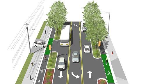
One-Way Cycle-Track
Westmoreland Drive is north-south street connecting the Parramore and Holden Heights neighborhoods. The typical street section is a 2-lane road, with sidewalks and planting in a 60’ ROW. The City recently completed the construction of multipurpose trail to accommodate joint pedestrian and bike usage. These new improvements stop at the city limit (Miller Street). It is recommended that the widened sidewalks be extended Pineloch Elementary School located south of I-4. Concept 2 shows a long term vision of the street taking advantage of the full ROW width of the road.
Existing Street Condition
Road (60’ ROW)

Concept 1
2-Lane Road with Multi-Purpose (Path from SR 50 to Miller Street is under construction)

Concept 2
2-Lane Road with Center Turn Lane and Protected Bike
on one Side of the Road
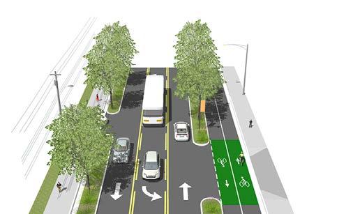
Two-Way Cycle-Track
Concept 2 (Long Term Vision)
2-Lane Road with Parking one side and Protected Bike Lanes

Washington Street is a part of State Road 526, a 12-mile east-west route connecting Downtown Orlando and the City of Ocoee. The segment in the City of Orlando limits has two street configurations. The section east of OBT (shown below) is a 2-lane road in a 60-foot ROW with no bicycle facilities and limited streetscape elements. The improvements we proposed are: (1) move one of the curbs 3 or 4 feet to allow room for protected bike lanes; (2) plant street trees; and (3) add street lights.
Existing Street Condition
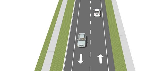
Concept 1
2-Lane Road with Parking and Protected Bike Lanes
Add Street Trees and Lighting

One-Way Cycle-Track
The Washington Street segment west of OBT is a 4-lane road with a center turn lane and very limited streetscape elements in a 90-foot ROW. We propose a short-term project to reconstruct the sidewalks and landscape strip into a 9-foot walk area with a 6-foot planting strip. The road can turn into a 2-lane road with a center turn lane, with on-street parking, protected bike lanes (two-way cycle track) and landscape buffer in the future.
Existing Street Condition

Concept 1 – Streetscape Improvements
4-Lane Road with Center Turn Lane and Median
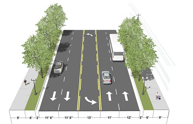
Concept 2
2-Lane Road with Parking and Protected Bike Lanes

Two-Way Cycle-Track
Add Street Trees and Lighting
Concept 2 – Complete Street
2-Lane Road Center Turn Lane/On-Street Parking and Protected Bike Lane
Two-Way Cycle-Track
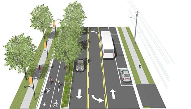
Amelia Street is currently a four-lane road in a 60’ ROW, and can be redesigned and reconstructed as a complete street by taking away two of the traffic lanes and reconfiguring the street to be a two-lane road with on-street parking and protected bike lanes.
Anderson Street is currently a one-way street running east. The purpose of this was for Anderson Street and South Street to work as a one-way pair to get people in and out of events at Camping World Stadium as quickly as possible. It is not necessary for the street to function as a one-way pair today, so we proposed a two-way conversion of the road and to add shared bike markings, street trees, and lighting.
Existing Street Condition
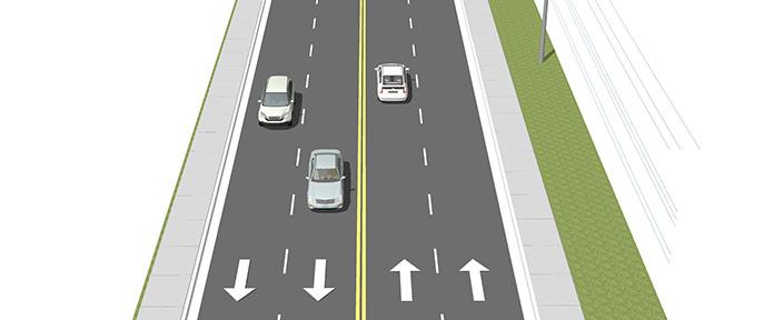

On-Street Parking
Two-Way Cycle-Track
Existing Street Condition


Street Trees and Lighting
KEY PARTNERS:
• City and County Planning Department
• City and County Transportation Department
• City and County Public Works Department
• MetroPlan Orlando
• Water Management District
• FDOT
South Street is currently a one-way street running west. The purpose of this was for Anderson Street and South Street to work as a one-way pair to get people in and out of events at Camping World Stadium as quickly as possible. It is not necessary for the street to function as a one-way pair today, so we proposed a two-way conversation of the road and to add shared bike markings, street trees, and lighting.
Existing Street Condition – One-Way Street
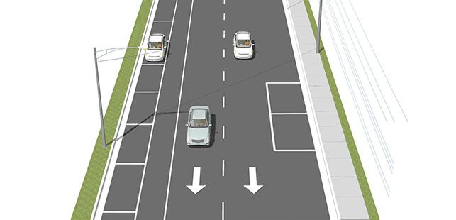
Concept 1 – Convert to 2-Way Street
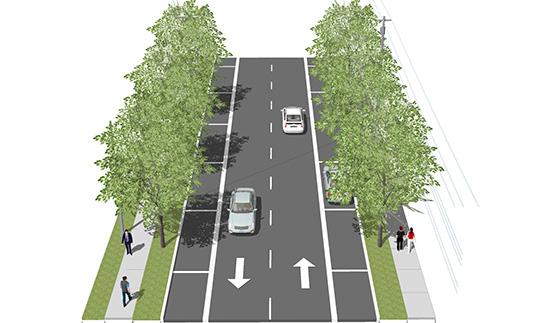
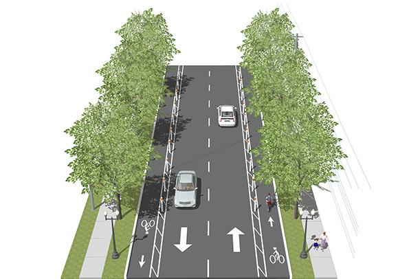
Partnerships with LYNX, MetroPlan Orlando, and other transportation agencies are key for future plans to improve connectivity, and to make streets more pedestrian, bicycle, and transit friendly. Those agencies have the potential to provide budget for studies, analysis and design for capital improvement projects, as well as implementation strategies.
The OBT corridor is one of three routes with the highest bus ridership in the LYNX system. The top three routes according to the Fiscal Year (FY) 2016 Annual Ridership Report are:
- 8 – W Oak Ridge Road/International Drive: 2,308,173
- 21 – Downtown Orlando/Universal Studios: 948,266
- 107 – Downtown Orlando/Florida Mall: 1,127,280
LYNX’s future plans for the OBT corridor are the following:
• LYNX 2030 Vision Plan identifies the section of OBT from Downtown Orlando to Florida Mall as the #12 Emphasis Corridor
- Recommendations start with Express service and move up to BRT operating in Mixed Traffic and Exclusive Travel lanes (depending on the portion of the corridor) by 2030
• The 2013 Comprehensive Operational Analysis calls for BRT on 441 from Downtown Orlando to Florida Mall, as well high-level alignment of the BRT
- In the interim, expand services on FastLink 441
• The 2017 Annual update of the Transit Development Plan recommends:
- Increasing the Link 107 service to every 15 minutes all day on weekdays
- Increasing the FastLink 441 frequency to 30 minutes during peak periods
- Creating a new BRT from Downtown Orlando to Florida Mall by FY 2022
OBT is now one of the three service corridors for trucks in the region, according to MetroPlan Orlando. The other two corridors are Orange Avenue and John Young Parkway, both a mile east and west of OBT, respectively. MetroPlan identifies the OBT corridor as a Sustainable Development Corridor in their 2040 Long Range Transportation Plan. MetroPlan also developed a Sustainable Land Use Forecast for their 2030 Long Range Transportation Plan, which discusses how Smart Growth can improve the efficiencies of the transportation system. It is necessary to address future land uses and the transportation system at the same time, in order to transform the OBT corridor into a Sustainable Development Corridor. The Fiscal Year 2017/18 Priority Projects list pedestrian enhancement Projects for two segments of OBT.
• City and County Transportation Department
• FDOT
• OBT CRA
• MetroPlan Orlando
• LYNX
LID is an approach to streets that works with nature to manage stormwater as close to its source as possible. LID employs principles such as preserving and re-creating natural landscape features, and minimizing effective imperviousness to create functional and appealing site drainage that treats stormwater as a resource rather than a waste product. The creation of stormwater planters and biowales are two of the most common practices to capture water from the roads.
KEY PARTNERS:
• City and County Planning Department
• City and County Sustainability Department
• City and County Public Works Department

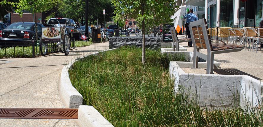
A transportation pilot project is a small scale experimental project, easy and quick to implement, and is cost effective. It is an attempt to predict an appropriate sample size design for bike lanes, intersections, lane reduction, crosswalks, and sidewalks prior to the final and long term improvement. These projects can be achieved with the use of paint, planters and art. An example on the right depicts a project in Rio de Janeiro where extra asphalt space was transform into pedestrian space with only the use of paint, plants and cones.
The use of art within the ROW also encourages improvement of the character of the area. See sample of project on the right.
KEY PARTNERS:
• City and County Transportation Department
• City and County Planning Department
• FDOT
• MetroPlan Orlando
• LYNX
• OBT CRA
• OBT Safe Neighborhood Program
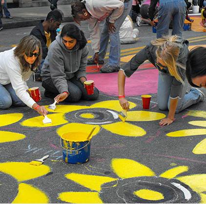


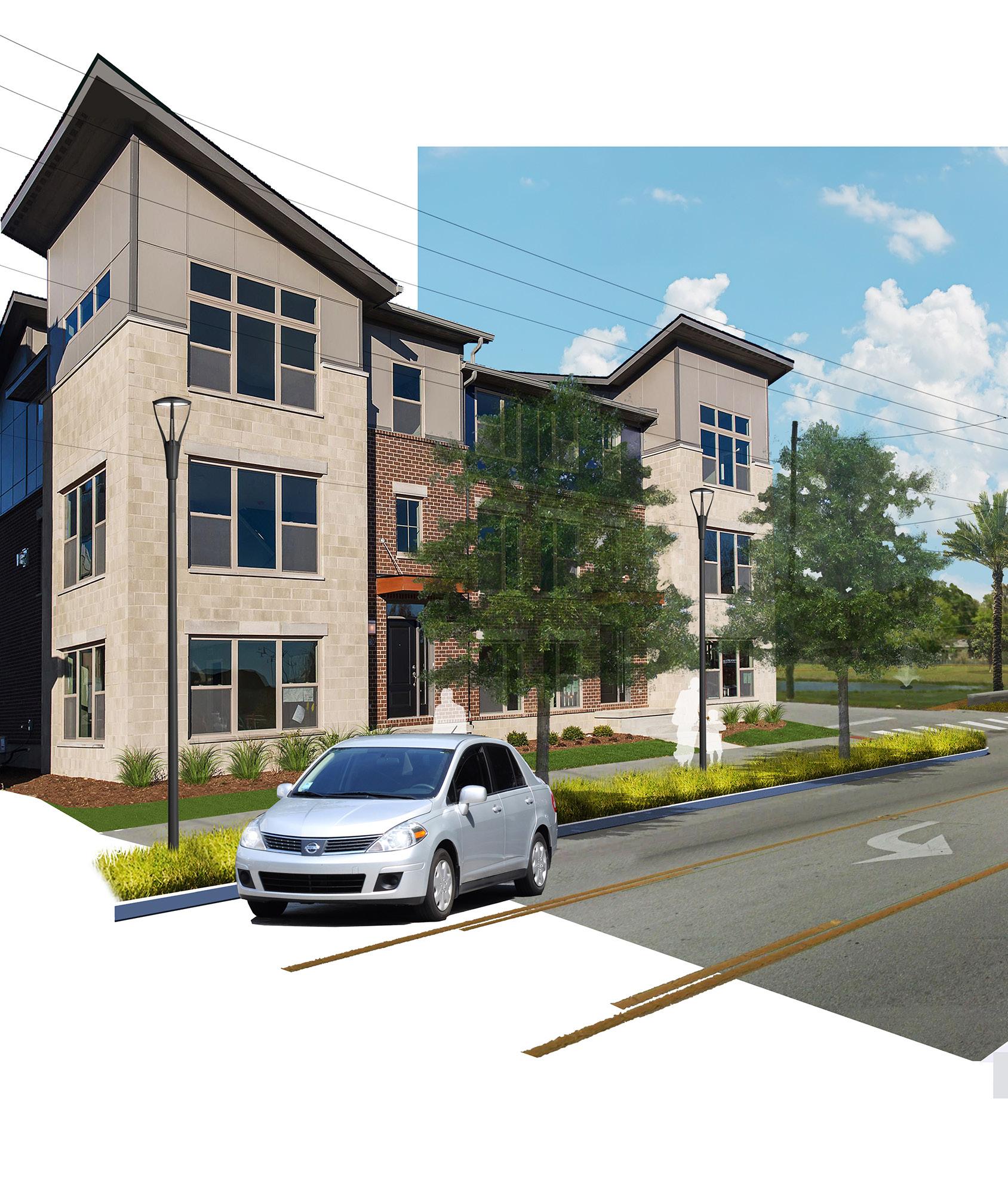


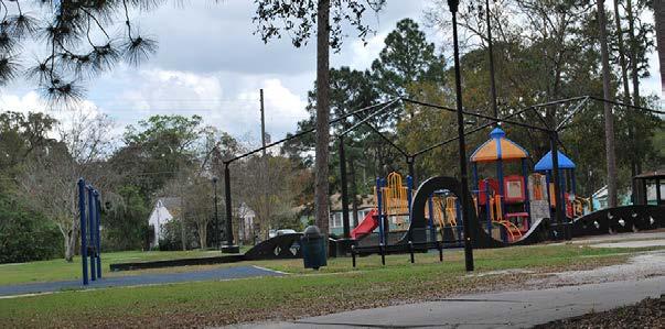

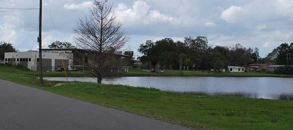

Investment in the community will establish parks, lakes, recreational facilities, and open spaces as primary elements of civic identity and will enhance the experience along The Trail and surrounding neighborhoods.
Open space provides recreational areas for residents and helps to enhance the beauty, health, and environmental quality of neighborhoods. Lack of community and public access to safe and open green spaces is a concern in the Study Area.
The entire study area it is roughly 8 square miles (4,766 acres). There are 135 acres of parks in the study area, which includes 69 acres of Orange County Parks and 64 acres of City of Orlando Parks. The total population of the study area (2016 estimate) is 16,884. This provides a level of service of approximately 8 acres of park land per 1,000 residents—which is a generous number and provides great opportunities for residents to take advantage of nearby options to recreate.The challenge is that many of these parks lack appropriate infrastructure, maintenance, and programing, making them unattractive and unsafe.
The existing parks are concentrated in the segment from SR 50 to Kaley Avenue—Areas 1 and 2—which coincides with the highest residential population, where it would be advantageous to have higher level of service and access to recreation.
• Lorna Doone Park (City Park)
• McCracken Field (City Recreational Facilitiy)
• John H Center Pool and Fields (City Recreational Facilty)
• Carter Park (City Park)
• Grand Avenue Park (City PArk)
• Kaley Square (County Park)
• Orlando Sports Campus (Outside the Orange Blossom Trail Safe Neighborhood Area)
• Clear Lake Park (Outside the Orange Blossom Trail Safe Neighborhood Area)
There are six lakes located in the study area. However, currently only two lakes, Lake Lorna Doone and Lake June, provide public access, serving the densely residential Areas 1 and 2. Lake Lorna Doone has a large active park on the southern half of the lake that currently has renovations in design by the City of Orlando. Lake June is located adjacent to the Holden Heights Community Center. Although the lake is open and accessible to the public, it doesn’t have the adequate infrastructure of a park and open space, and is therefore not used by the community. It is prime for development into a park. Clear Lake is located outside of the study area, just west of Area 2. This lake is influential for the residents of Area 2 (Holden Heights), because it provides two large parks and ample public access that is easy to get to. Seeking to provide public access to lakes is important because of the opportunity for passive connection to nature and the restorative benefits of being near the water.
Redevelopment activities in the study area need contain provisions to provide access to lakes, with a focus on Rock Lake, Lake Holden, Lake Tyler, and Lake Ellenor. Public access should be meaningful, and not forced in small slivers of land that would be obtrusive to adjacent property owners. For instance, the sample photo below shows a successful redevelopment project in Winter Park: Trader Joe’s Plaza on 17-92, which provides public access to Lake Killarney. Easy and safe pedestrian access from nearby neighborhoods ensures that the sites will be utilized.
KEY PARTNERS:
• City and County Planning Department
• City and County Parks Department
• OBT CRA
• Future Developers

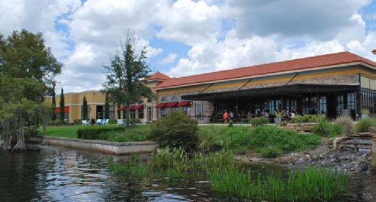
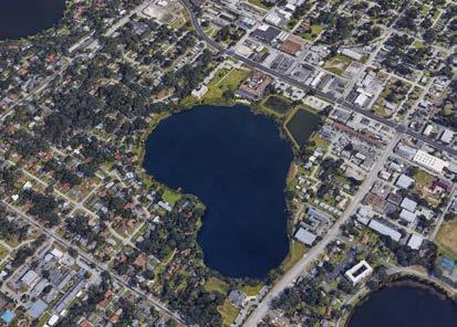

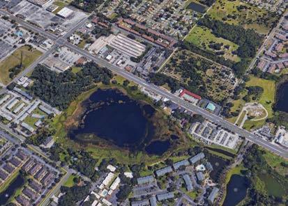
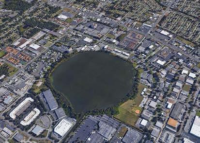
Parks make up the fabric of the community and provide quality of life to residents. The existing parks need to feel safe for people to utilize them. Improvements to basic infrastructure, such as security lighting and benches, will help provide comfort for the normal user and attract more people to the park. Maintenance and upkeep is the single most important aspect influencing the perception of safety. Security lighting helps to ensure opportunities for natural surveillance and allows law enforcement personnel to see the interior of a park from a distance. Programming and amenities need to be
responsive to the needs of the surrounding neighborhoods, and easy pedestrian access to each site will facilitate usage. Art, color, lights, and educational elements can be used to quickly improve the parks. Also, inviting the community to be a part of the design and implementation process, would be is a great way for them to reclaim and take ownership of their open space.
KEY PARTNERS:
• City and County Parks Department
• OBT Safe Neighborhood Program
• Neighborhood Associations
• Community Member
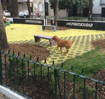
Demographics in the study area (2016) indicate that there are 27% children under age 19 and almost 71% adults age 20–74. Although this is a large age span, it is indicative of a lot of families and residents in the work force living in the residential areas. There is a relatively small senior population, about 3%. Park programming and amenities need to focus on self-directed play that can appeal to all ages. For instance, having a walking trail perimeter that can be used by adults, while simultaneously watching children on a playground helps to keep people in parks longer, and therefore more active. Community centers, faith-based organizations, and nonprofits need to ensure that programming provides opportunities for the whole family during non-working hours.
KEY PARTNERS:
• City and County Planning Department
• City and County Housing Division
• City and County Parks Department
• OBT Safe Neighborhood Program
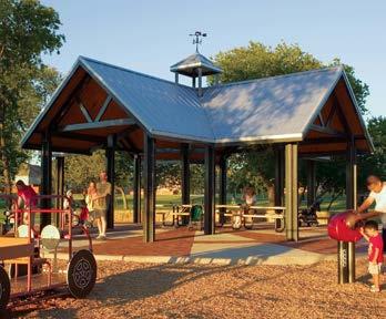

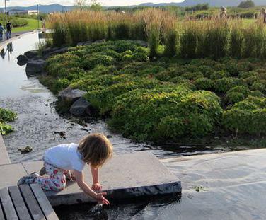


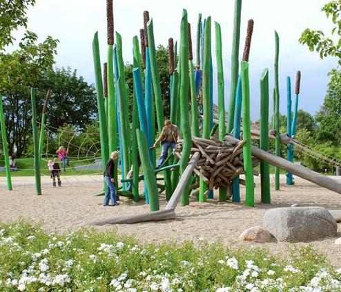
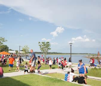
There are approximately 85 acres of vacant residential land and 150 acres of non-residential land located in the study area. Vacant parcels tend to attract the abnormal user and have a negative impact on the area. They need to be kept clear and/or secured as well as patrolled so they are not a haven for crime. Active code enforcement is necessary while any parcels remain vacant. Utilization of CPTED principals such as natural surveillance will curtail crime. Consideration should be given to develop them into temporary or permanent open space, provided they are easy to access and patrol.

KEY PARTNERS:
• City and County Planning Department
• City and County Parks Department
• OBT Safe Neighborhood Program
• Neighborhood Associations
• Community Member
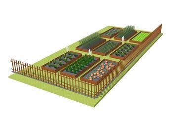
Funds are limited in the City of Orlando and Orange County to buy new land for parks, or more importantly, to maintain new parks. Funds need to focus on maintaining what exists to ensure safety and functionality. We propose to create a public-private partnership with the developers to create new parks and community spaces accessible to the general public in exchange for development
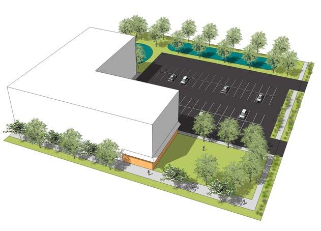
incentives. The developer would have the responsibility to design, build, and maintain the open space. The community and open space should be located facing the primary or secondary street. Both spaces should be located next to each other. A community building space is a multi-purpose room (from 1,000 to 3,000 square feet) dedicated to the general public foe them to host educational programs, markets, and any other community events. An open space is a small- to medium-sized park (pocket park, dog park, playground) that would support the new development and be open to the general public.
KEY PARTNERS:
• City and County Planning Department
• City and County Housing Division
• City and County Parks Department
• OBT CRA
• OBT Safe Neighborhood Program


Neighborhoods will be safe, vibrant, healthy, and diverse— giving access to housing, parks, culture, and education.

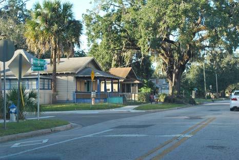
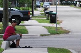
The OBT area will have healthy neighborhoods that support diverse, mixed-income, multi-generational community. Neighborhoods should be safe, secure places with walkable and bikeable access to basic daily amenities, such as strengthened schools, proximate parks, and local retail services.
The OBT corridor has a total of 15 neighborhood and condominium associations, and half of them are part of the OBT Safe Neighborhood Program. The program provides assistance to Orange County’s older and transitioning neighborhoods. It was designed to assist residents in reclaiming their communities from crime, deterioration, and blight. The program partners citizens with the Orange County Sheriff’s Office, Orange County Government, the private sector, community stakeholders, and others to collaboratively preserve and stabilize neighborhoods.
During the public engagement process, the overall theme was safety and neighborhood image.The constant illicit activities on streets and homes deteriorates the livelihood of the area. Residents attribute that to absentee landlords and lack of homeownership.
The planning team looked at the current percentage of owner- and renter-occupied in Areas 1, 2 ,and 3. The data shows 20% homeownership in Areas 1 and 2, and 40% homeownership in Area 3—the highest percentage in the overall corridor. It is projected that in 2021, those numbers are going to remain the same. See table below:
The OBT neighborhoods have great educational institutions, community centers, and local organizations willing to work together in making their community stronger.
1 3 4 5 2

LORNA DOONE CALLAHAN PARRAMORE
WEST ORLANDO PARTNERSHIP
HOLDEN HEIGHTS
HOLDEN PARTNERSHIP
HOLDEN SHORES
HOLDEN SOUTH (Proposed Name)
AMERICANA (Proposed Name)
AMERICANA PARTNERSHIP
SAND LAKE PARTNERSHIP
The OBT Area has a number of established neighborhood associations and condominiums. The neighborhoods within Areas 1 and 2 have been working the past few years, along with the City, County, elected officials, local organizations, and institutions to build the strengths and vision of future for those neighborhoods and community members. Not much planning effort has occurred in Area 3, 4, and 5 neighborhoods. During our public engagement process, we discovered some of the neighborhoods don’t belong to an association; therefore, we initially proposed to formalize some of the neighborhoods and create two new associations:
• Holden South Association
• Americana Association
Each association, along with community members, local organizations, and institutions can be combine into a four different partnerships and form the “OBT Neighborhood Partnership” to help strengthen and revitalize their community in the future.
KEY
• City and County Neighborhood Division
• City of Orlando Police Department
• Orange County Sheriff Office
• City and County Code Enforcement
• Homeowners Association
• Residents
• Educational Institutions
• Churches
• Local Organization
• OBT Safe Neighborhood Program
Create a multi-jurisdictional “Law and Code” Task Force to support the community members and associations along the corridor. The task force will meet regularly and develop a plan to help prevent crime and improve the aesthetic of the residential neighborhoods. Some of initial actions we recommend are:
• Periodic policing
• Provide grants for homeowners to purchase cameras
• Provide free crime assessment and consulting to homeowners on how make their properties safer
• Create a neighborhood watch program
• Install cameras at key streets, intersections, and bus stops
• Periodic visits to properties in violation of the code
• Create an awareness campaign to make residents aware of all the programs the city and county offers regarding safety and code violations
• Organize regular community cleanup and other engagement events
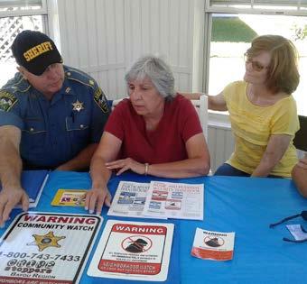
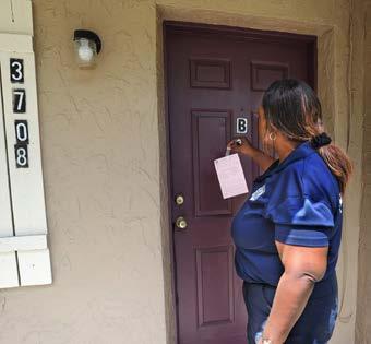
KEY PARTNERS:
• City of Orlando Police Department
• Orange County Sheriff Office
• City and County Code Enforcement
• LYNX
• Local Business Owners
• Residents
• Neighborhood Associations
• OBT Safe Neighborhood Program
The opportunity to strengthen the residential fabric is the most promising. Initiatives to identify and purchase strategically located parcels that can be developed as infill residential products with an emphasis on homeownership are key to the redevelopment of the neighborhood. The development of key partnerships with federal, state, and local government entities, organizations, and institutions will help bring the right resources to strengthen the residential infill.
Focus the residential infill efforts in Areas 1 and 2. The proposed areas/site for residential infill development are:
• Parramore:
- Two residential pockets east of OBT
• Holden Heights:
- Nashville Avenue area west of OBT
- Lake June and Kaley Square Area
KEY PARTNERS:
• City and County Housing Division
• City and County Real Estate Department
• LIFT Orlando
• CDBG
• HOME
• SAIL
• HOPE IV
• Habitat for Humanity
• Florida Realtor Foundation
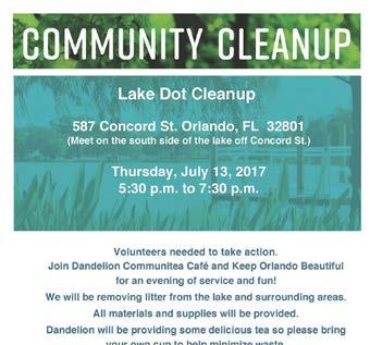

Illicit activities like prostitution and drug dealing are part of everyday life activities in neighborhoods such as Parramore and Holden Heights. Some of the people performing these activities do not necessarily live in the neighborhood and are taking advantage of the opportunities the area provides, such as the well-connected streets (perfect for street walker) and the proximity to run-down hotels. We recommend the installation of temporary intersection diverters to restrict cut-though traffic and discourage access to certain areas with high instances of illicit criminal activities. Further study is needed to determine the location of the diverters.
KEY PARTNERS:
• City and County Planning Department
• City and County Transportation Department
• City and County Law Enforcement
• OBT Safe Neighborhood Program
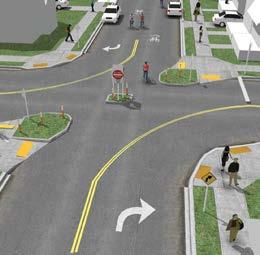
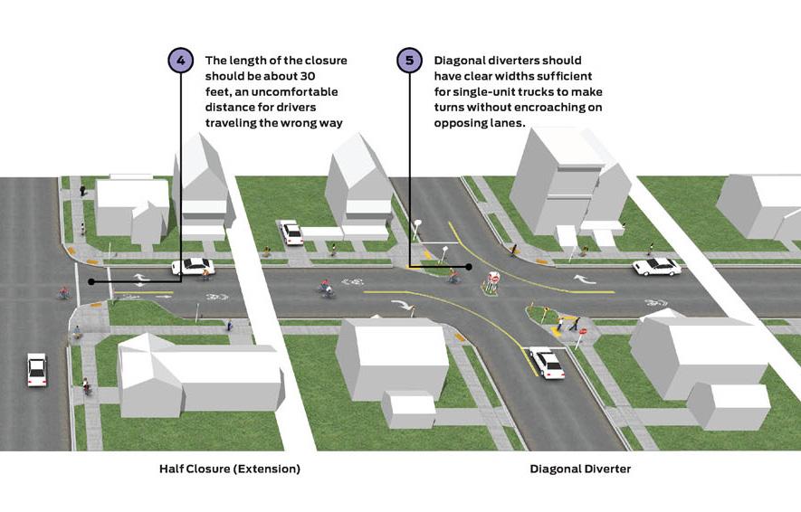
Source: NACTO
Basic infrastructure improvements associated with the neighborhoods are needed and should be made a priority. This may include basic electrical, drainage, sewer, stormwater, sidewalks, lighting, bike lanes, tree planting, roadway reconstruction, traffic calming and speed management, and safe routes for children to go to school.
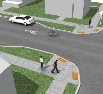
KEY PARTNERS:
• City and County Planning Department
• City and County Transportation Department
• City and County Public Works
• City and County Law Enforcement
• OBT Safe Neighborhood Program
• OBT CRA

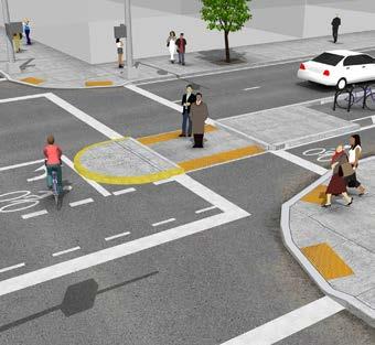
There are approximately 85 acres of vacant residential land. Vacant parcels tend to attract the abnormal user and have a negative impact on the neighborhood. Consideration should be given to develop them into temporary pop-up spaces with a diverse use of program and activities. These spaces will work as small catalyst site that would help activate the community and bring positive change. Some of recommended ideas are:
• Movie on the Park
• Markets
• Festivals
• Art
• Bike Shop and Repair
• Education Hub
Supporting Uses

KEY PARTNERS:
• City and County Planning Department
• City and County Parks Department
• OBT CRA
• Neighborhood Associations
• OBT Safe Neighborhood Program
• Institutions and Organizations
• Churches


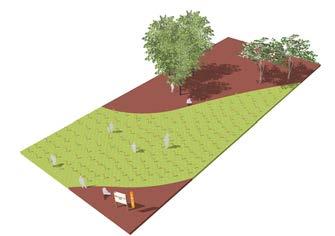

Edible landscapes and gardens offer an alternative to conventional residential landscape Edible plants can be just as attractive, with the additional benefit of producing fruits and vegetables. Edible landscape can combine fruit and nut trees, along with ornamental plants into an aesthetically pleasing design. These landscapes can help increase the food security of the households, save on grocery bills, and improve the aesthetic of the front lawn of the home. A change of police needs to happens to allow edible gardens on the front lawn of the homes located within Orange County jurisdictions. Only the City of Orlando zoning allows gardens at the front of residential homes.

KEY PARTNERS:
• City and County Planning Department
• Neighborhood Associations
• OBT Safe Neighborhood Program
• Local Food Growing Organizations.
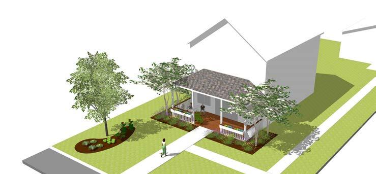
There are a good amount of homes in need of repair and maintenance. Creating a home facade and site improvements program/grant would help bring those homes to life and improve the character and image of the neighborhoods. These programs can be educational, simple and branded in a way they look attractive an accessible to all residents. The money for the materials and labor can be provided via grant, donations, volunteering or they resident can learn how to raise the money through crown-sourcing techniques. Some ideas for programs are:
• Learn how to add color to your facade!
• Learn how to design and build a front porch.
• Learn how to raise money to improve your home.
KEY PARTNERS:
• City and County Planning Department
• OBT Safe Neighborhood Program
• OBT CRA
• Design and Construction Professionals
• Design and Construction Student
• Design and Construction Stores
• Residents
• Local Organizations
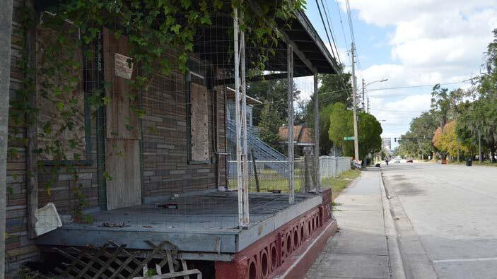
Community and educational events are necessary to keep the livelihood of a neighborhood. Events are great opportunities to bring people together and reclaim the streets and open space from crime and illicit activities. Large and small scale events are encouraged on a weekly and monthly basis. Events should be fun and attractive for people of all ages, income, and culture. Example of big events are block parties, festivals, and concerts. Examples of small events are historic neighborhood and educational tours, movies on the park, markets, and food trucks. It is important to have consistency and good community strategies via mail, email, and social media to help with the promotion and outreach.


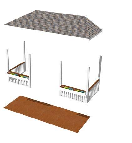
KEY PARTNERS:
• Neighborhood Associations
• OBT Safe Neighborhood Program
• Institutions and Organizations
• Churches
• Community Centers
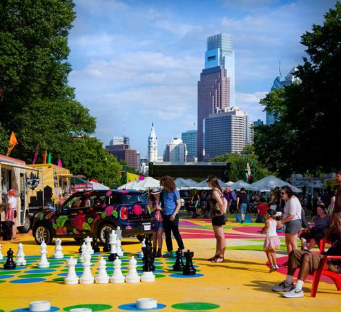
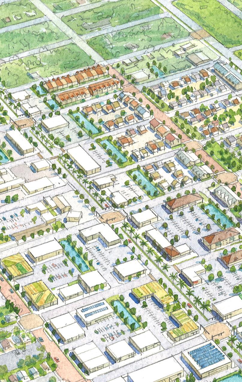

Existing and new residents will have access to diverse housing opportunities, home literacy, and programs that will allow them to become future homeowners.
What is needed in the OBT corridor to achieve the baseline real estate market analysis, and ultimately the grander vision, are a series of policy and programmatic changes—some necessitated through a reexamination of the existing legal framework. The latter dictates paths traditionally followed for real estate development generally and the control of land specifically. It is a legal system focused on very strong property rights, always understandable but sometimes highly challenging. In communities with a history of absentee landlords, larger numbers of renters, patterns of code violations, and high concentrations of minority residents—all existing in an established legal context—can thwart ownership of property essential to maintaining sound neighborhoods. Poor credit and titles, exacerbated by inadequate record keeping, often act together to keep otherwise useable lands vacant or underutilized. In varying ways, the socio-economic factors in place have made it difficult for the existing marketplace to function without some substantial improvements or repositioning of those resources normally supporting real estate activity, especially housing. Without suggesting deep systemic modifications will occur easily, many of the identified issues reinforce one another and are a drag on (re)development. We believe there are certain ideas to be explored in more detail, which should, at the very least, be a foundation for more comprehensive strategies.


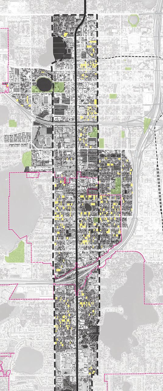

Create a comprehensive inventory of vacant parcels, vacant structures, ownership and non-conforming lots to advance infill residential opportunities. During the master planning process, we were able to map the vacant parcels and identify properties owned by key organizations such as Habitat for Humanity, and Florida Realtor Foundation, as well as parcels owned by the city, county, and CRA. An inventory of existing vacant structure is necessary to understand the total inventory of vacant parcel and structures within the study area. Because of the changing dynamics of the neighborhoods, this inventory should be updated every 6 months.
• City and County Planning Department
• County Property Appraiser
• OBT CRA
A number of properties in the OBT area remain vacant because the cost of clearing clouds from their title is frequently prohibitive, sometimes greater than the nominal value of the property itself. Other sites are inherently negative influences to adjacent or nearby properties as the result of recurring code violations. These violations, stemming from physical condition or patterns of criminal conduct, require a protracted legal process to remedy, which must be shortened if code enforcement is to become more effective as a regulatory tool. At some point, the resulting fines themselves can be an impediment to redevelopment or improvements. Such properties may also have their own title issues, making them difficult to sell even when code violations are corrected or removed.
For those properties with title issues, we believe it is appropriate to explore statutory and legislative tools, allowing such properties to accelerate the normal legal processes when property is held and used exclusively for affordable housing.
KEY PARTNERS:
• City and County Planning Department
• City and County Law Enforcement
• City and County Real Estate Department
• City and County Elected Officials
• County Property Appraiser
• OBT CRA
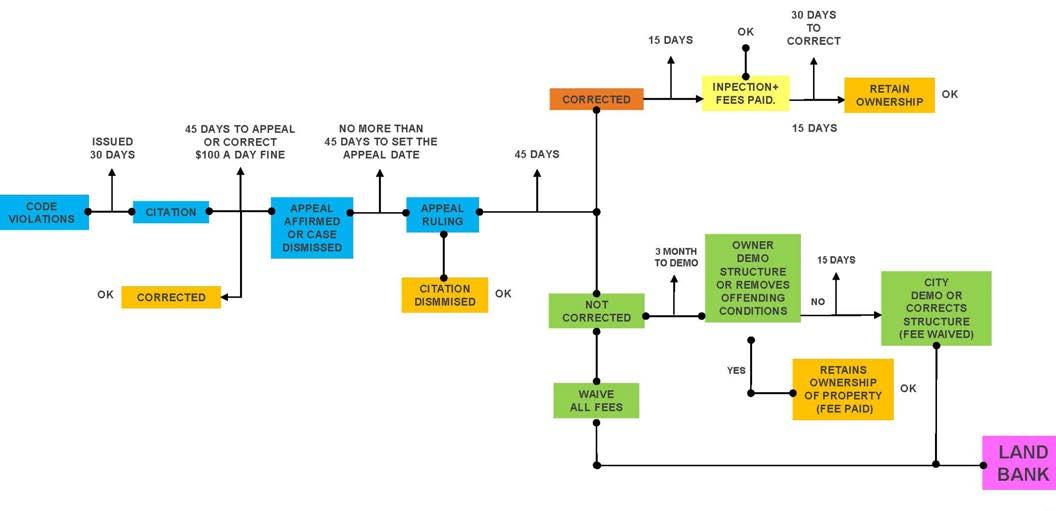
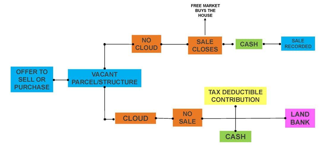
The primary function of a land bank is to act as an institutional intermediary in those neighborhoods or areas where the availability of suitable lands and/or the capital to acquire suitable lands is not well matched. The incongruence can occur for many reasons but usually stems from spatial, timing, regulatory, or credit-related issues.
While a land bank can be engaged in many activities, its primary mission is stabilize the value of land, typically in a badly depressed neighborhood, through acquisition and disposition of properties targeted to certain objectives. A land bank often provides the needed ownership, control, or stewardship of land until: (1) the flow of neighborhood financial resources is sufficient to deploy the resource; or (2) the lands can be assembled to support a desired initiative that is part of a larger plan. In the case of OBT, maintaining a deployable inventory of property becomes imperative, because implementation opportunities are often derailed when vacant sites face title or control issues. Such problems can be difficult to correct quickly and efficiently, especially given limited financial resources.

Clouds are “defects” or “errors” constraining the sale of a parcel
We envision the land bank building its inventory through direct purchases (where funds are available), personal and public gifts (to realize a social or program goal), abandonment (unclaimed property assigned to the local government), forfeitures (property received or claimed in lieu of taxes, fines or other public liens), and other means to be explored. In particular, we look to alter public policy clearing properties of historical legal clouds when conveyed to the bank and subsequently made available for sale and development.
”Clouds” on titles and the means to correct them are a challenge in Florida’s legal environment, which is focused on property rights. The diagram below suggests the way in which a land bank might be able to work with land owners and others, as well as local governments in, or about to be in, control of real property assets that might be leveraged to advance planning goals in the OBT area.
KEY PARTNERS:
• City and County Planning Department
• City and County Housing Division
• County Property Appraiser
• Area Wide Community Banks
• Neighborhood and Community Groups
• OBT CRA

Land Bank/Trust can help clear the cloud
Clouds can be “cleared” or removed through a legal process
Once removed, a parcel is free to be used in any permissible way
PROPOSED PROCESS TO REMOVE TITLE CLOUDS TO CREATE VIABLE REAL ESTATE ASSETS GRAPH
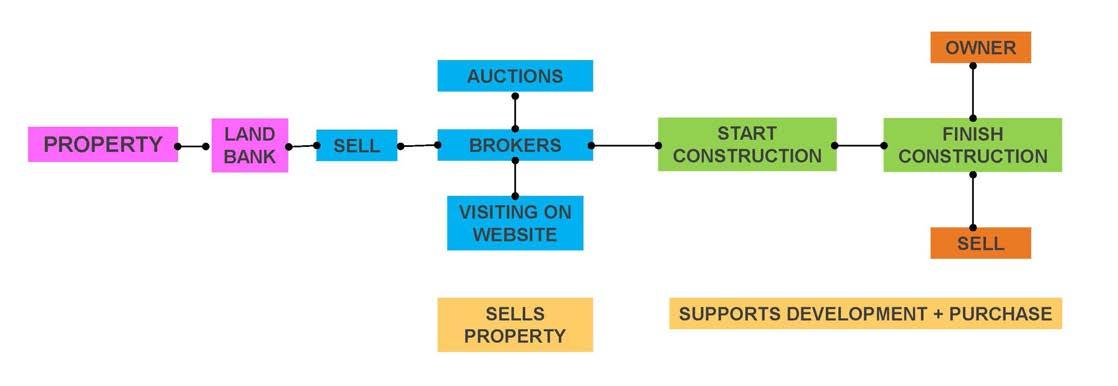
In economically distressed areas, it has historically been difficult to build and promote financial literacy. Formal programs targeted to economically disadvantaged residents tend toward programs narrowly centered on the financial skills and responsibilities associated with owning a house. While such programs fulfill an obvious mission, we believe an intervention strategy connecting home preparedness and broader financial education with actual job skills development fills an important role in OBT’s many neighborhoods. In the approach we envision, training in the construction trades—very broadly defined—would be offered to residents engaged in housing initiatives. Residents would be schooled as “technicians”, qualifying them to engage in the construction industry while also positioning them to take advantage
of housing planned for delivery within targeted OBT neighborhoods. In effect, the program envisioned is not about contributing “sweat equity” to acquire a potential home, but about acquiring and advancing job skills. Financial literacy and homeownership preparedness become part of the required curriculum while jobs are the focus. Houses constructed might be available to those engaged in construction training, but the linkage, however beneficial, is complementary and incidental, not obligatory.
KEY PARTNERS:
• City and County Housing Division
• OBT CRA
• OBT Safe Neighborhood
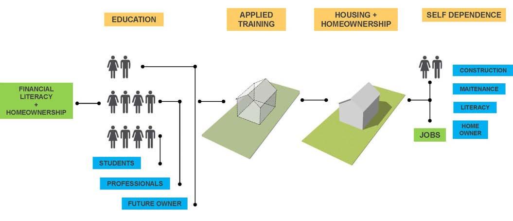
The vibrancy of the larger OBT area depends on the mix and variety of housing. We envision a community where households and families of various size and income can find housing which accommodates their needs but in a form which resists concentrations of either the very poor or very wealthy. Research has shown the interaction enhances mobility and offers role models that less advantaged populations can adopt and embrace.
To achieve this vision of mixed income housing, the available housing cannot be artificially priced at levels at odds with the market. While some income segments may require assistance, varied housing forms, densities, social support networks, job training and delivery systems are contemplated, allowing both multi and single family, ownership and rental, to be delivered largely with minimum price supports except to aid the most disadvantaged. Generally, this objective is more easily achieved in multi-family housing, possibly with commercial uses supporting the appropriate price points.
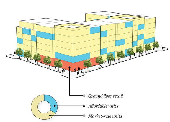
KEY PARTNERS:
Ground floor retail
Affordable units
Market rate units
• City and County Planning Department
• City and County Housing Division
• County Property Appraiser
• Neighborhood and Community Groups
• OBT CRA
Accessory units must be more widely embraced and encouraged. The addition of such units could intensify neighborhoods, provide alternative housing, extend multi-generational options, and offset the cost of the main. Accessory units, however, face obstacles from virtually every aspect of the planning, approval, and review systems currently in place. As well as navigating the normal approval and permitting processes, there is the added challenge of assuring Florida’s valuable and coveted homestead exemption is not invalidated when otherwise qualifying homeowners receive rental payments for these units normally viewed as commercial receipts.
KEY PARTNERS:
• City and County Planning Department
• City and County Real Estate Department
• City and County Elected Officials
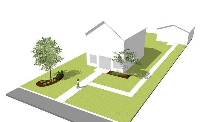
We envision a variety of housing typologies in OBT’s neighborhoods that offer visual interest and income diversity. Some plans will be designed to accommodate smaller and less affluent populations whose shelter needs may ultimately dictate larger and more costly housing. A robust design will allow a house to “grow or expand” to address life’s changing circumstances. Allowing a house to adopt to personal needs over time can occur by embracing flexible designs incorporating new technologies for delivery and new materials. The concept involves a functional envelope with core plumbing and electrical intended for immediate use but allowing the basic space to be incrementally enlarged or extended into designated spaces controlled by the occupant. The smallest units would generally be more affordable while allowing the cost and size of the unit to sync with changing lifestyles and income. Over an extended period, some units would be enlarged
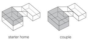
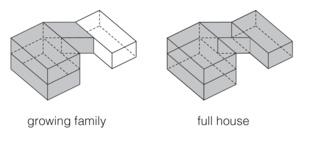
externally, while others might simply be upgraded or modified within. Like other recommendations, the approach envisioned in this form of housing delivery may require a reexamination of the exiting legal framework, primarily that associated with codes and land development regulations. Some of these housing typologies might be constructed with resources from the land bank described. Some of these housing typologies might be constructed as part of the broader focus on financial literacy and skills development.
KEY PARTNERS:
• City and County Planning Department
• City and County Building Department
• Local Architects
• Higher Education Architecture Schools
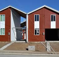


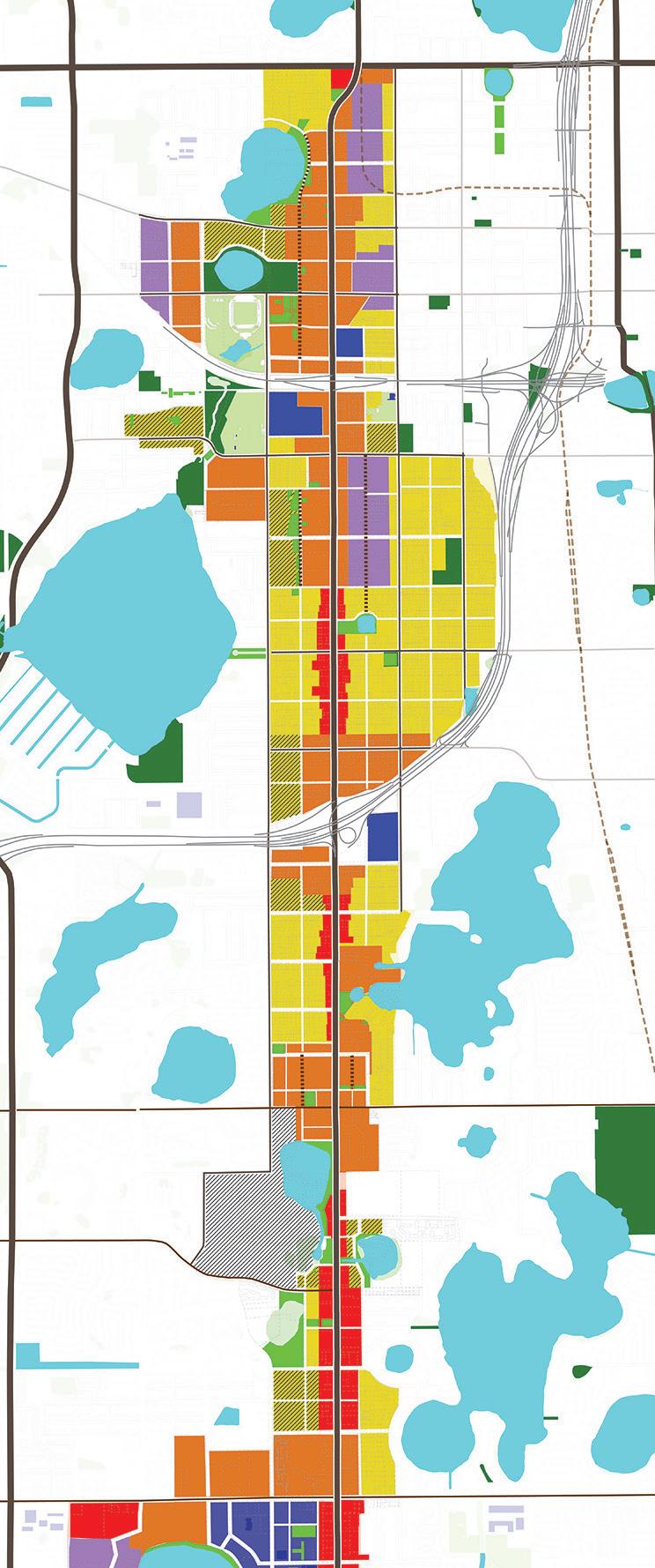

In particular, we believe a major change needs to occur in the way regulations address certain zoning classifications, as well as accessory units, minimum sizes of units, the review and approval of alternative housing structures, and lot size. In some cases, to advance more diversified housing and income groups, it might be prudent to think about policies promoting inclusionary housing opportunities.
• City and County Planning Department
• City and County Housing Division
• City and County Elected Officials

Sports & Entertainment District
Design/Construction & Education Hub
Authentic Food District
Auto and Services Hub
Education and Jobs District
The overall vision of the OBT Corridor breaks down on Districts/Hubs and Catalysis Sites. The sites illustrate redevelopment scenarios and specific projects driven by the Six Big Moves.
B1
DEVELOP DESTINATIONS TO ATTRACT DEVELOPMENT, BUSINESS, JOBS & TRAINING
ENCOURAGE A VIBRANT AND DIVERSE CORRIDOR B2
MAKE SAFE AND LIVABLE STREETS FOR ALL MODES OF TRANSPORTATION B3
IMPROVE ACCESS TO OPEN SPACE AND RECREATIONAL ACTIVITIES B4
BUILD STRONG NEIGHBORHOODS B5
CREATE FLEXIBLE AND AFFORDABLE HOUSING OPPORTUNITIES
The implementation of the vision for the corridor will require a number of public, private, and public/private investment and series of projects.
The Catalyst Sites design are conceptual and they will require additional due diligence and refinement before implementation.

Five distinctive branded districts will be created to help reposition the trail regionally. This will attract sustainable growth, economic development, academic institutions, food and entertainment business, and bring traditional and non-traditional jobs and industry to the corridor. Each district will have a different redevelopment approach, based on the understanding of the existing jobs and key players, which informed the vision and character of each one of the future districts. Each district should be encouraged to grow as a connected series of commercial stores, mixed used development with stores and office on the ground floor, and more intense and focused nodes at key intersections. Each district should incorporate the assets of the area, such as key buildings, institutions, parks, and lake system as well as the relationship to the adjacent and abutting residential areas. The intent is not to create 8 miles of the same character, but to focus time, effort, and investment toward building a unique corridor and the opportunites that exist both in the public realm (the streets and parks) and the private realm (lots and buildings).
To boost economic development and attract people and investment to the OBT area, it is important to create destinations and addresses in each one of the future hubs and districts. These destinations will happen on neighborhood streets like Nashville Avenue and Woods Avenue, complementing the future uses and activities of the OBT corridor.The following are four key destinations proposed in the master plan:
Maker’s Row
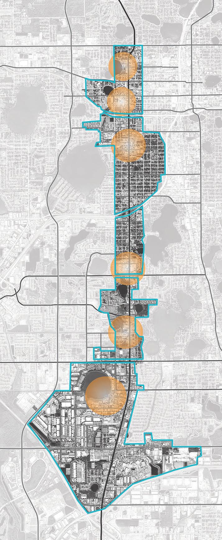


Sports & Entertainment District
This portion of the corridor is situated and connected to become a hub for sports and entertainment uses and be supported by quality food and beverage businesses.
Design/Construction & Education Hub
This hub, with 26% of the existing jobs related to construction, possesses a wider variety of building types from residential to commercial and industrial. It can become a place to attract higher education institutions and businesses related to Design and Construction.
Authentic Food District
With a wide variety of restaurants from different parts of the world and being surrounded by neighborhoods, this is the perfect portion of the corridor to create a district for authentic food supported by other office and service uses.
Auto and Services Hub
The overall corridor is full of auto-related uses, but the Americana Boulevard area has large parcels that can support a hub for all auto-related businesses, especially used-car sales.
Education and Jobs District
This portion of the corridor has a high concentration of educational institutions around Lake Ellenor, and it is the home of a regional industrial and office complex that attracts 23,000 employees to the area, making this place a great district for educations and jobs.


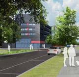
The vision for the West Orlando area is one that revolves around sports and entertainment activities. Anchoring the City’s West Church Street sports and entertainment corridor, the 65,000 seat Camping World Stadium will be the catalyst for new complementary development centered on the region’s largest outdoor venue.
This portion of the corridor is situated and connected to become a hub for sports and entertainment uses and be supported by quality food and beverage businesses.
The recent public investments in the stadium, the recently completed Police Department Headquarters, and the proposed enhancements to Lorna Doone Park, have reinforced confidence in the redevelopment potential for the area. Such key parcels as the former McNamara care dealership site, the Parliament House site, the numerous Dr. Phillips holdings, along with the large publicly-owned properties provide the real estate platform for significant future private investment.

Mixed-Use Development Zone
Industrial Development Zone
Community Streets
Local Streets
Feature and New Streets
Bike Lanes
Existing Buildings
Future Development
Recreational Parks
Church and OPD Schools


Preserve/repurpose the Parliament House building as part of the mixed use complex along Rock Lake.
Redevelop the former McNamara car dealership site into a mixed use development fronting Colonial Drive
Leverage the real estate assets on the east side of the stadium to support an employment, food, and entertainment hub.
Provide infill residential development opportunities.
Support the “West Arts” area as a destination.
Support the repurposing of the warehousing uses as complementary entertainment, art, and food service venues.
Improve streetscape and intersections on OBT
Develop Nashville Ave. as key address and feature Street
Extend Nashville Ave. through new development
Make Norton Ave. a service road
Re-design Amelia St., Washington St., South St., and Anderson St. into a complete street [ See B3 Make Safe And Livable Streets For All Modes Of Transportation]
Convert South St. and Anderson St. into two-way streets [ See B3 Make Safe And Livable Streets For All Modes Of Transportation]
Improve and make Springdale Green a City Park
Create a linear park along Rock Lake and access to the lake
Create new open space through redevelopment
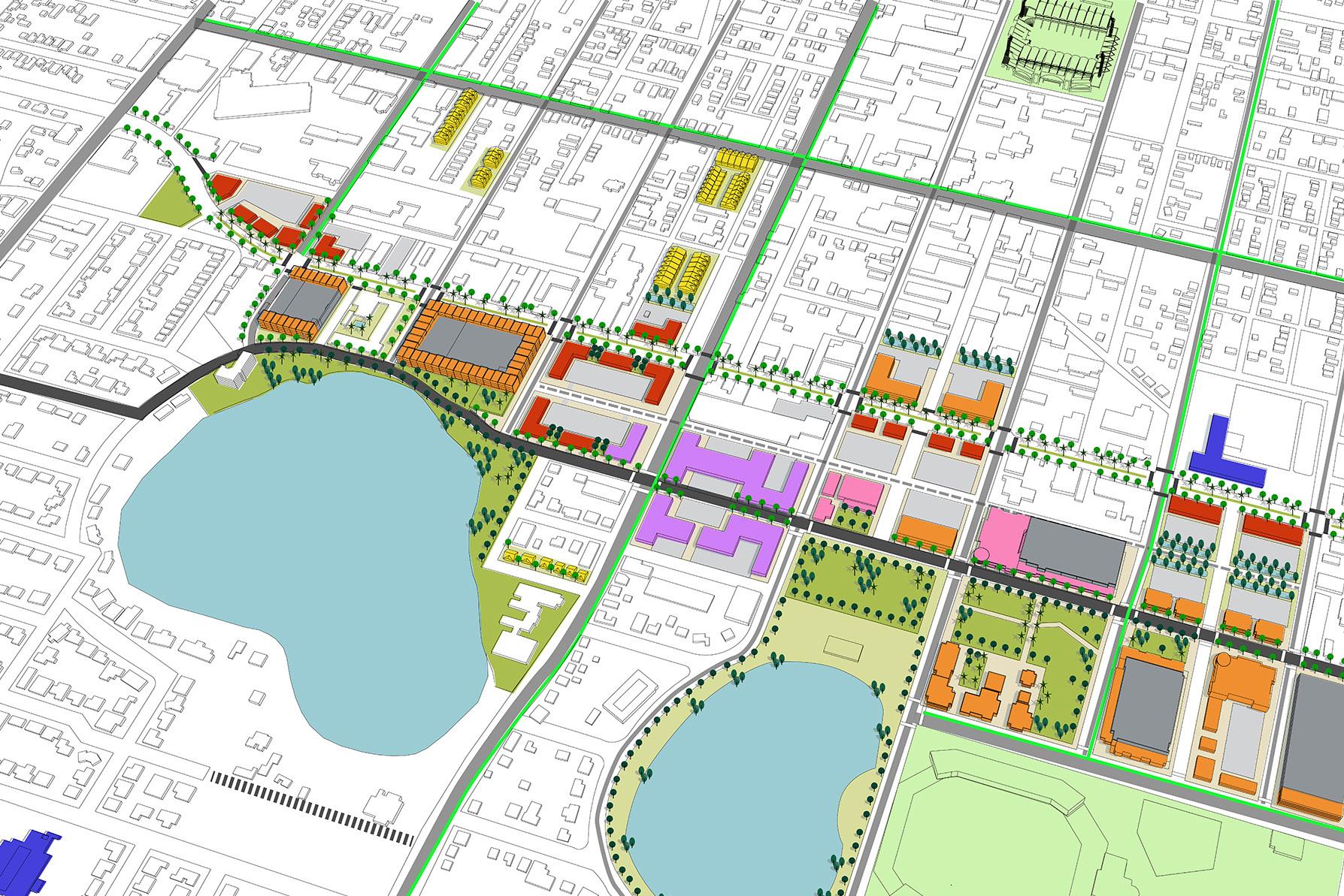
Develop South Nashville Avenue as a Mixed-Use Walkable Street
•
•
•
•
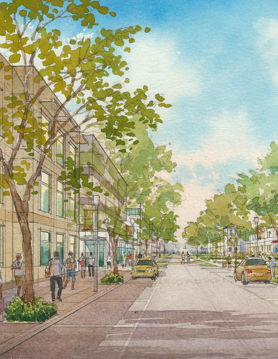


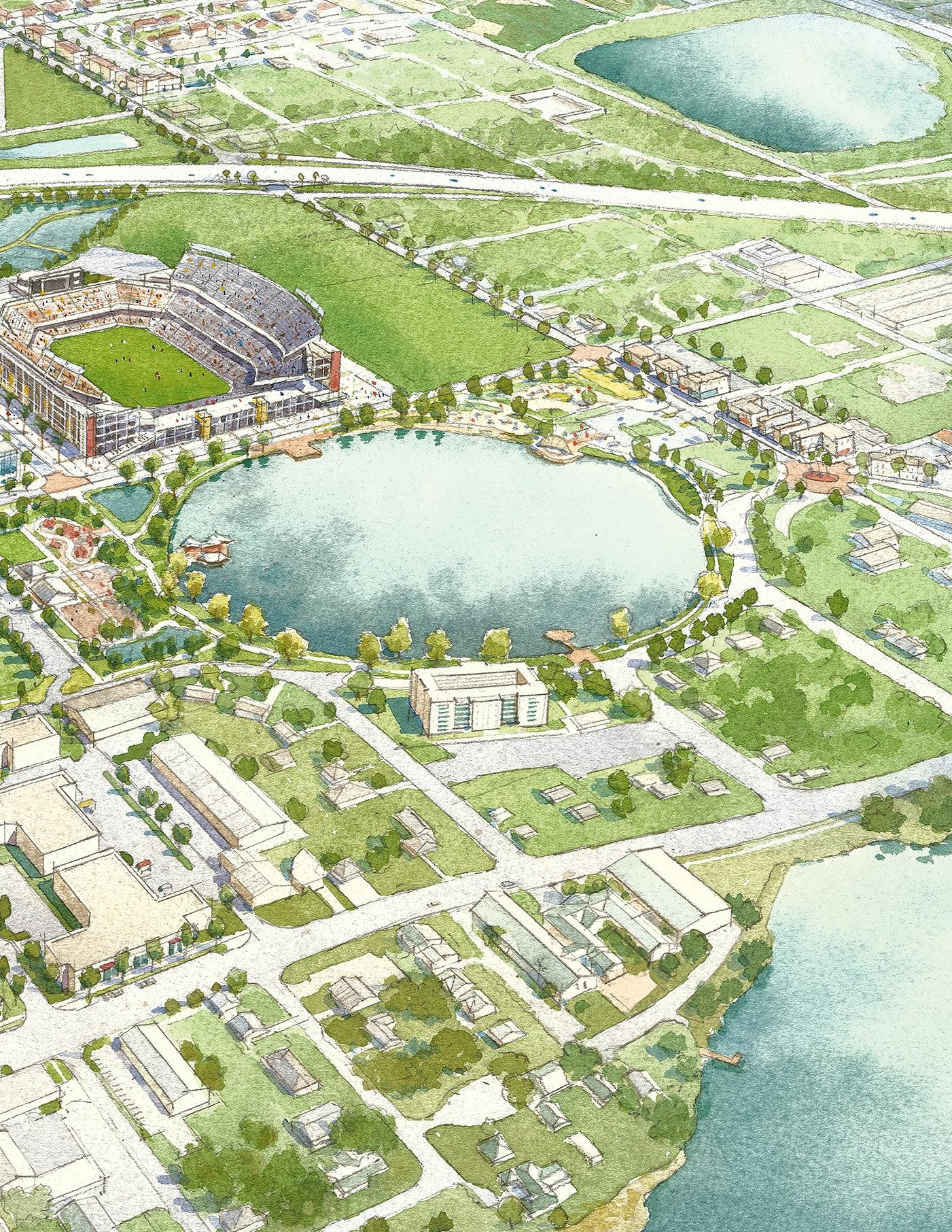
World Camping Stadium
The vision for Holden Heights is to enhance the integrity of the residential character of the neighborhoods and to provide the supporting systems for children and families. These supporting systems include creating neighborhood education, training, and workforce programs in the areas of design, construction and related industries that provide long term employment opportunities

This hub, with 26% of the existing jobs related to construction, possesses a wider variety of building types from residential to commercial and industrial. It can become a place to attract higher education institutions and businesses related to Design and Construction.
Improved Intersections
Commercial Zone
Mixed-Use Development Zone
Industrial Development Zone
Community Streets
Local Streets
Feature and New Streets
Bike Lanes
Existing Buildings
Future Buildings
Lakes
Parks
Recreational Parks
Community Centers and Churches
Schools


Institutional facilities such as Jones High School, Grand Avenue School and Park, Kaley Square, and the recently completed Holden Heights Community Center, are area components which can serve as venues to host programs that strengthen the neighborhood fabric.
The opportunities for Holden Heights fall into two categories- the physical realm reflecting the neighborhood character and the programmatic, addressing the educational, economic, social, and recreational resources available to the residents.
Develop the properties along a reconstructed Woods Avenue as a design and construction district – designating it as “Makers Row”
Develop the Lake June and Holden Heights community Center as a feature neighborhood destination
Develop the residential parcels around Kaley Square
Repurpose the Grand Avenue School building
Develop the properties along Nashville Avenue incorporating a reuse of the Mears property into a mixed use development
Build a neighborhood center that would support the residents on the west side of Rio Grande
Improve streetscape and intersections on OBT
Reconstruct Woods Avenue as a Maker’s Row
Continue 19th Street around Lake June
Extend and transform Nashville Avenue into a community street
Improve streetscapes walkability on Gore, Grand, Miller and Kaley
Extend Westmoreland Multipurpose path to Pineloch Elementary
Make Rio Grande a complete street with protected bike lanes
Improve and activate Kaley Square
Transform Lake June and Holden Heights Community Center into a park
Create pocket park around the neighborhood
Improve Grand Avenue Park
Build a linear park along Nashville Avenue with redevelopment

Transform South Woods Avenue as an Industrial area for designers, builders, contractors an educators
KEY PARTNERS:
• Design and Construction Business
• University of Florida College Design, Construction and Planning
• Non-Profit Organizations


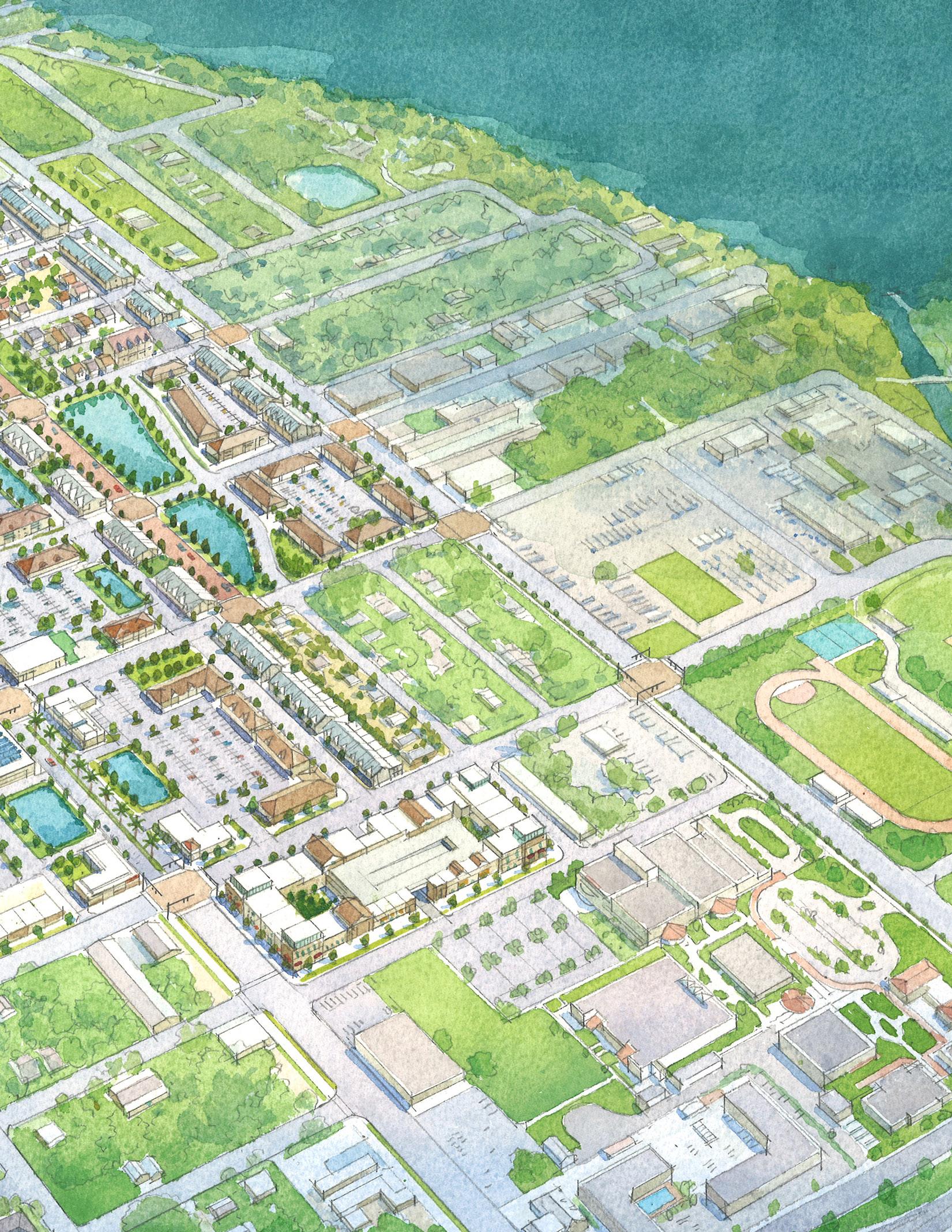
The vision for the Holden area is themed around authentic foods building on the numerous restaurant and food vendors currently serving the area and the region as a whole. Following the Main Street formula, the marketing of the area as a food destination for authentic varieties of ethnic cuisine is a primary goal.
With a wide variety of restaurants from different parts of the world and being surrounded by neighborhoods, this is the perfect portion of the corridor to create a district for authentic food supported by other office and service uses.
Improved Intersections
Commercial Zone
Mixed-Use Development Zone
Industrial Development Zone
Community Streets
Local Streets
Feature and New Streets
Bike Lanes
Existing Buildings
Future Buildings
Lakes
Parks
Recreational Parks
Churches
Schools
The intersection of Holden Avenue and Orange Blossom Trail provide the greatest opportunity for redevelopment and to reinforce the aspirations identified in the vision. These two relatively underutilized strip commercial properties are ripe for new investment and repurposing existing uses as well as providing pads for complementary new mixed uses. The underutilization of these two large sites will allow for creative urban design in transforming the overall character of the area.
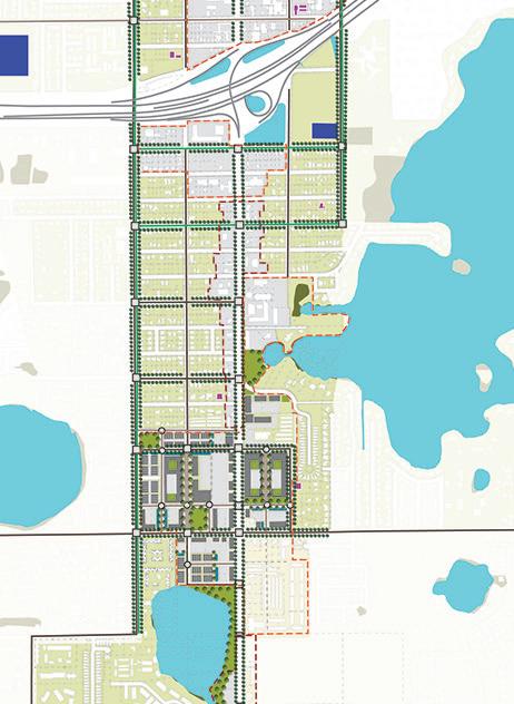

and intersections on
Extend Nashville Avenue through new development [Restaurant Row]
Improve streetscape and intersections on Holden Ave
Improve streetscape and intersections on Rio Grande Avenue
Create a feature open space through development [Restaurant Square]
Create public access to Lake Tyler through development
Create public access to Lake Holden through redevelopment
Build pocket parks in vacant residential properties
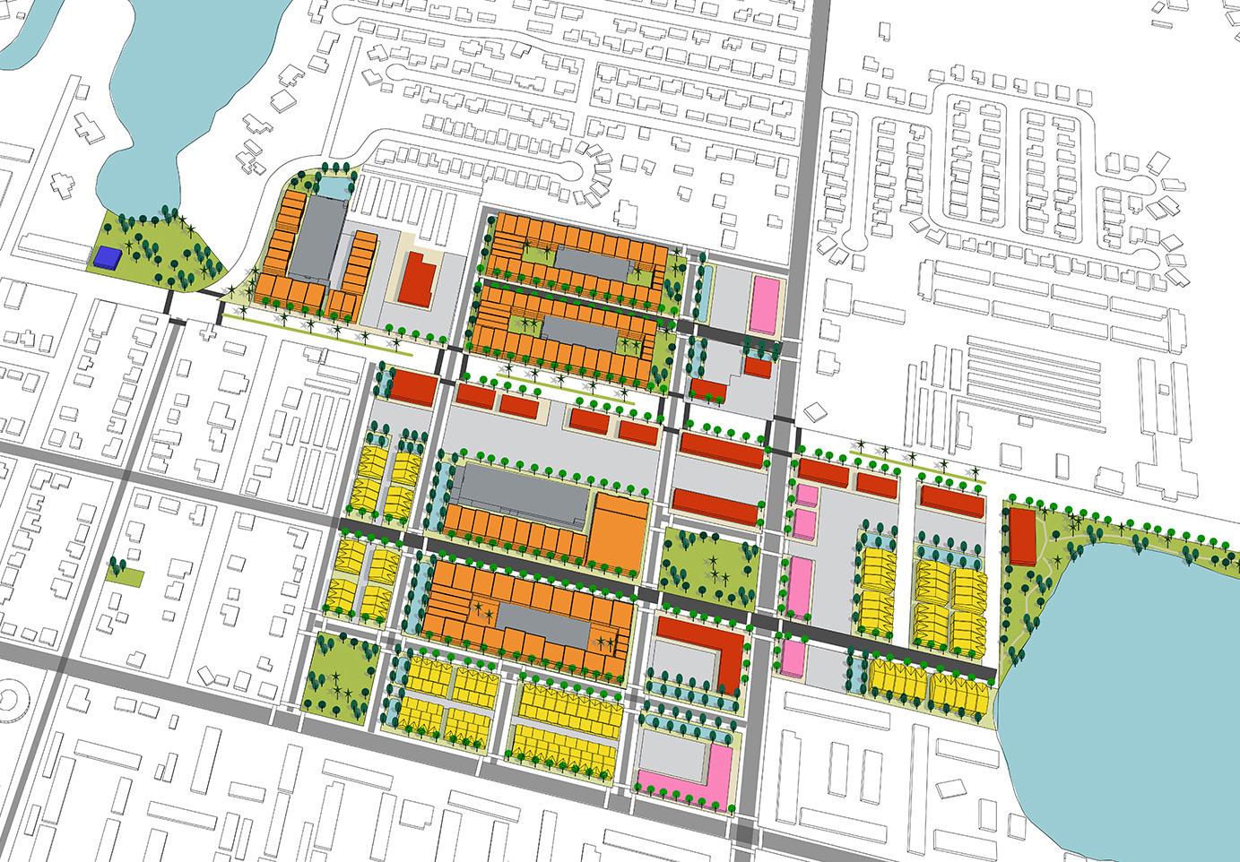
Extend Nashville Avenue as local residential and restaurant destination with mixed-use development
KEY PARTNERS:
• Local Restaurants
• Darden Restaurants
• PepsiCo

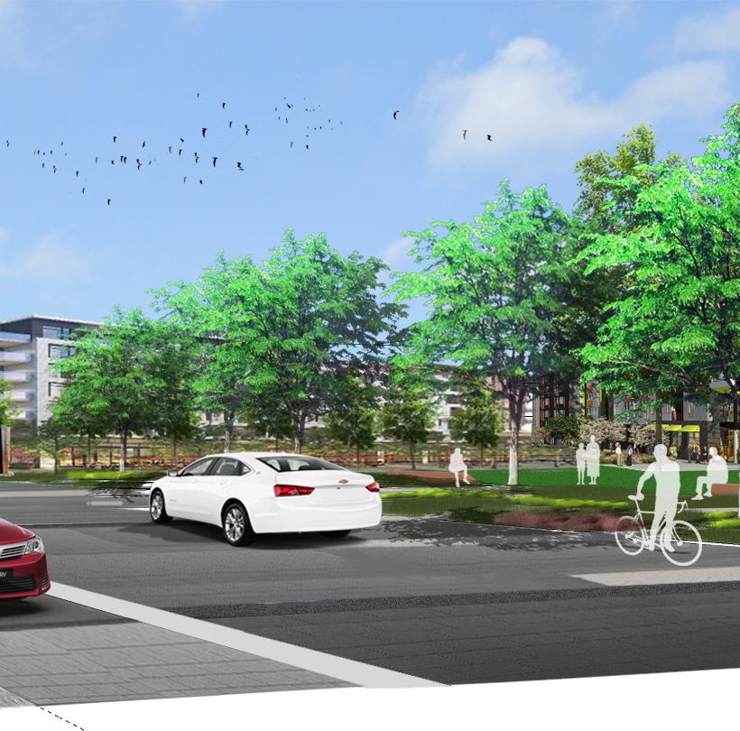


The section of OBT from Holden Avenue to Oak Ridge Road is an unassuming urban area consisting of a mix of strip commercial uses fronting the roadway while supporting numerous multi-family developments just off the corridor. The vision for the area is one that supports and enhances the predominant land uses fronting the street- the sales and servicing of autos, trucks and motorcycles. Through targeted marketing, code enforcement, and upgraded urban design policies, this stretch of the road could be a preeminent regional destination for auto related sales and services.
The overall corridor is full of auto-related uses, but the Americana Boulevard area has large parcels that can support a hub for all auto-related businesses, especially used-car sales.
Improved Intersections
Commercial Zone
Mixed-Use Development Zone
Industrial Development Zone
Community Streets
Local Streets
Feature and New Streets
Bike Lanes
Existing Buildings
Future Buildings Lakes Parks
Recreational
Churches
To provide an overall more inviting urban area, the creation of an urban linear open space tying Lake Tyler to Americana Boulevard and ultimately through to Duskin Avenue will soften the commercial character of the frontage, while creating open spaces and recreational amenities for the adjacent neighborhood residents. In addition, consideration should be given to reconstructing the grid system on the west side of OBT to improve parking and circulation to those uses fronting the street as well as create more housing development opportunities.
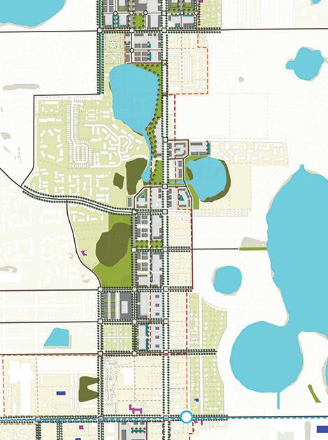
Redevelop the properties fronting the corridor specifically to support the enhancement of existing auto related activities and to encourage future development in auto related services
Reconstruct the street grid from Americana Boulevard to Wakulla Way through redevelopment
Build a linear park around Lake Tyler
Create a system of parks and conservation areas
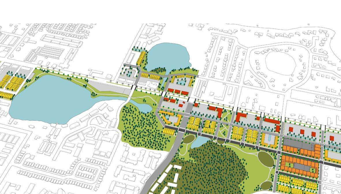

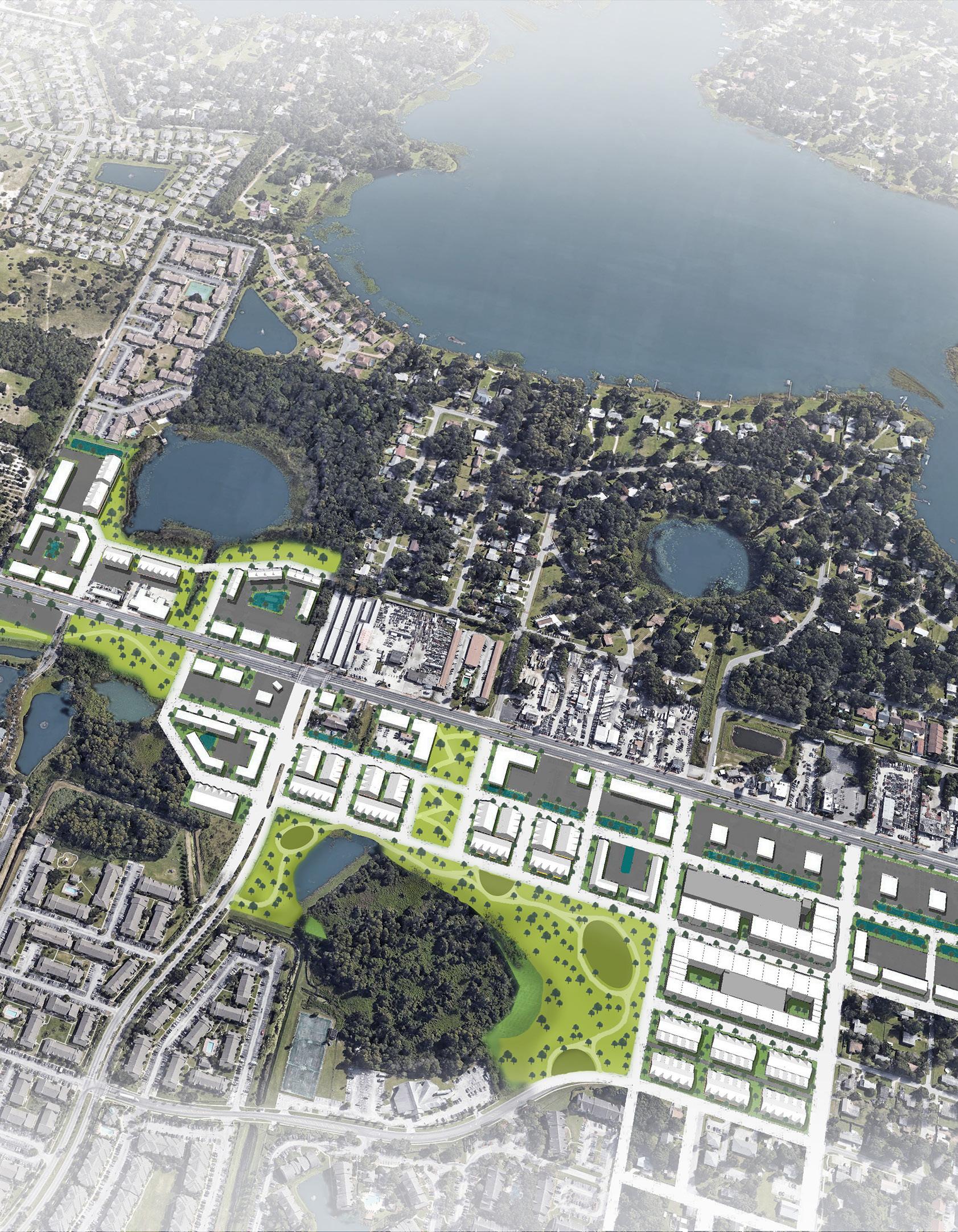
Encompassing over 2500 acres of the OBT study area, the Lake Ellenor area major land uses include retail, light industrial, office and institutional. As a result, the vision for this section of the Orange Blossom Trail corridor is to maintain and enhance its regional significance as a destination for the employment, retail sales and continuing education opportunities.
As a major metro subarea destination, the most significant opportunities will be the overall improvements to the regional transit and roadway system to enhance access for employees, students, shoppers, and visitors. Working with the regional and county transportation planners and providers, the continued transit improvements to Sand Lake Road and Oak Ridge Road with connections to other key designations, such as the international airport and International Drive tourist areas, will provide corridor residents with access to jobs and visitors greater convenience to the Florida Mall and adjacent retail. The improved transportation system will also provide students greater access and mobility to the number of public and private educational institutions around Lake Ellenor. This portion of the corridor has a high concentration of educational institutions around Lake Ellenor, and it is the home of a regional industrial and office complex that attracts 23,000 employees to the area, making this place a great district for educations and jobs.
Improved Intersections
Commercial Zone
Mixed-Use Development Zone
Industrial Development Zone
Community Streets
Local Streets
Feature and New Streets
Bike Lanes
Existing Buildings
Future Buildings
Lakes
Parks
Recreational Parks
Churches
Schools
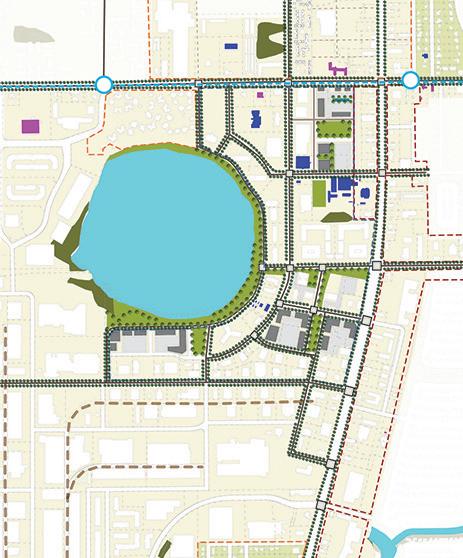
Redevelop and encourage the creation of a specific campus setting reinforcing the educational character of the uses around Lake Ellenor.
Improve streetscape and intersections on OBT
Redesign Landcaster Road and Orlando Orlando Central Parkway as campus streets
Build a Campus Blvd around Lake Ellenor with redevelopment
Build a linear park around Lake Ellenor
Build parks around campus through redevelopment

Develop a higher education campus around Lake Ellenor
KEY PARTNERS:
• University of Central Florida
• Orange County Public Schools
• Tech Collages
• Private Schools

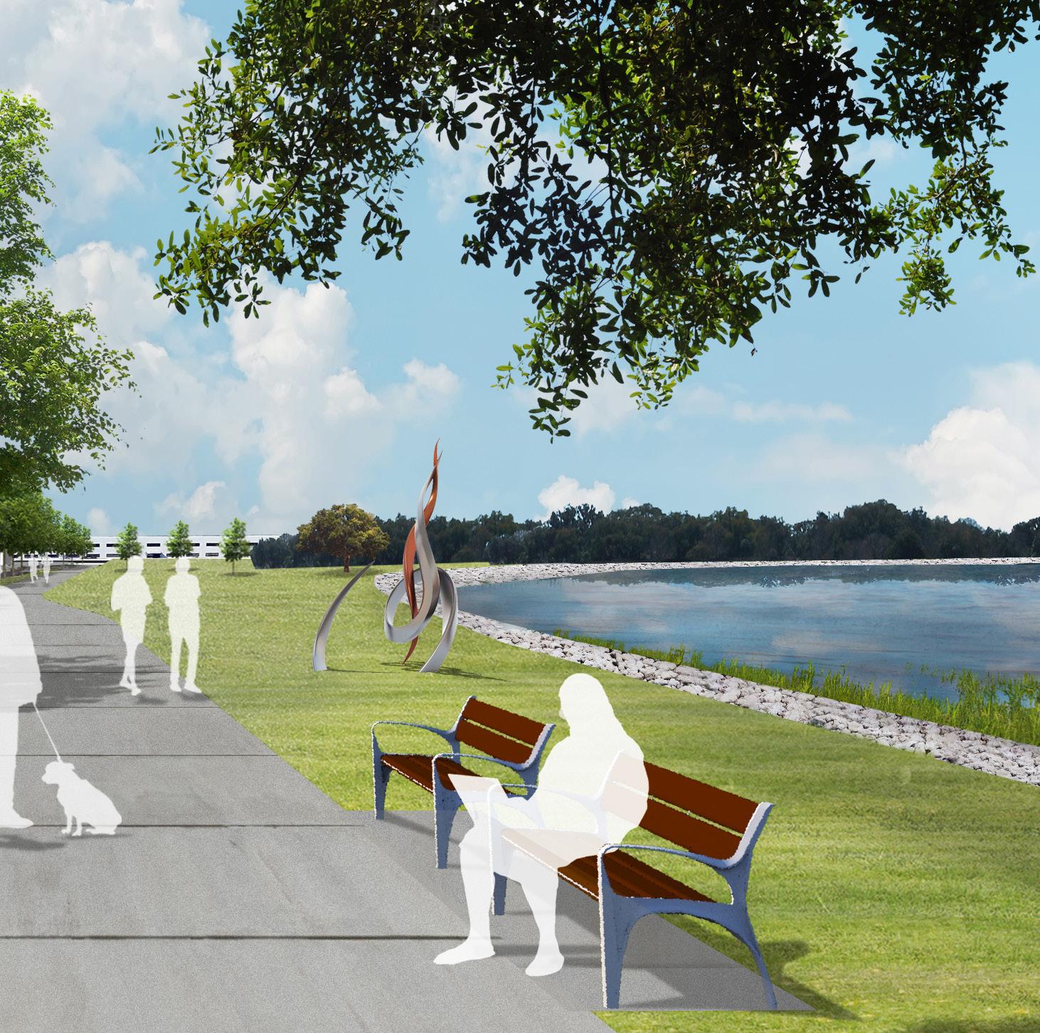


Improved Intersections
Commercial Zone
Mixed-Use Development Zone
Industrial Development Zone
Community Streets
Local Streets
Feature and New Streets
Lanes
Existing Buildings Future Buildings


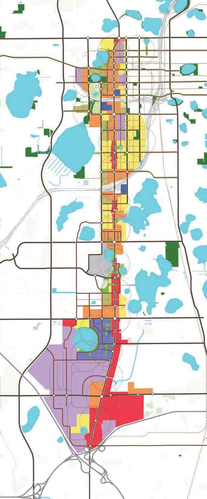

STREET NETWORK
Regional Streets
Community Streets
Local Streets
Feature Streets
Byicle Network
Improved Intersections
Proposed Signal Intersections

FUTURE USE AND ZONING
Flexible and Inclusive Residential
Mixed Use
General Commercial
Industrial
Open Space
Institutional