LaVilla

Neighborhood Development Strategy
April 15, 2021


Neighborhood Development Strategy
April 15, 2021
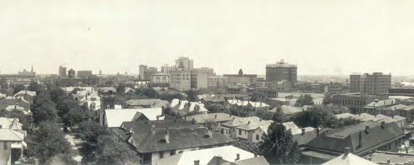
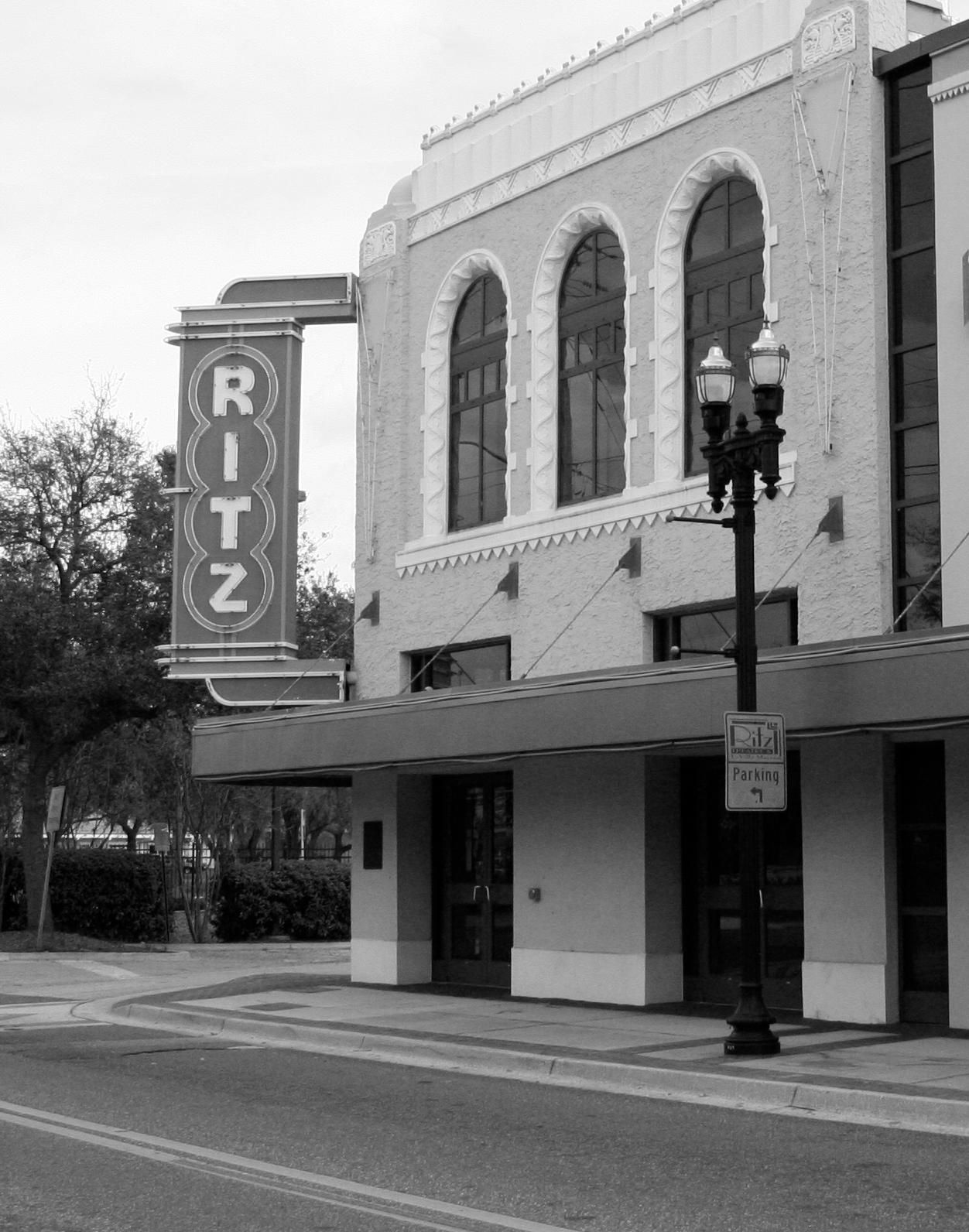
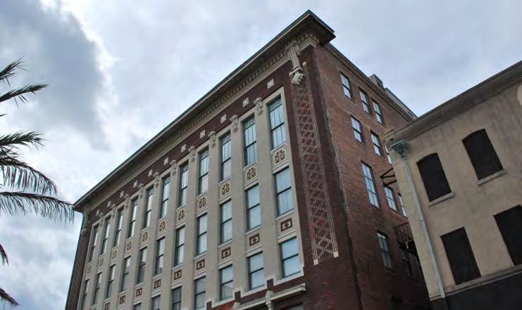
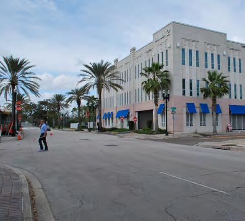
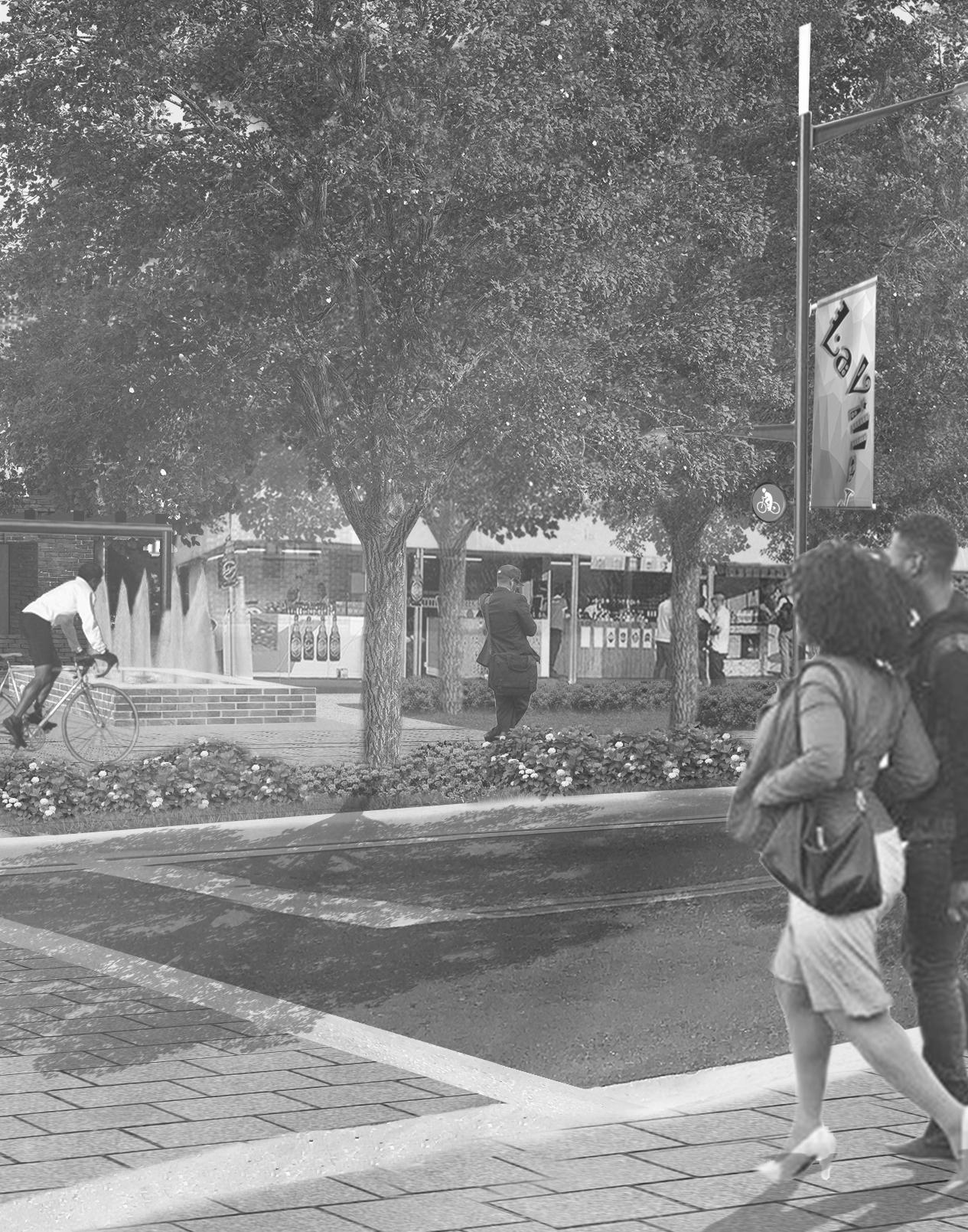
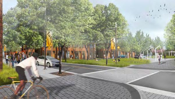
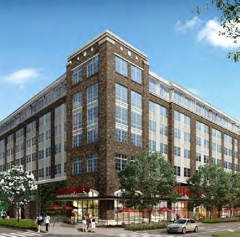
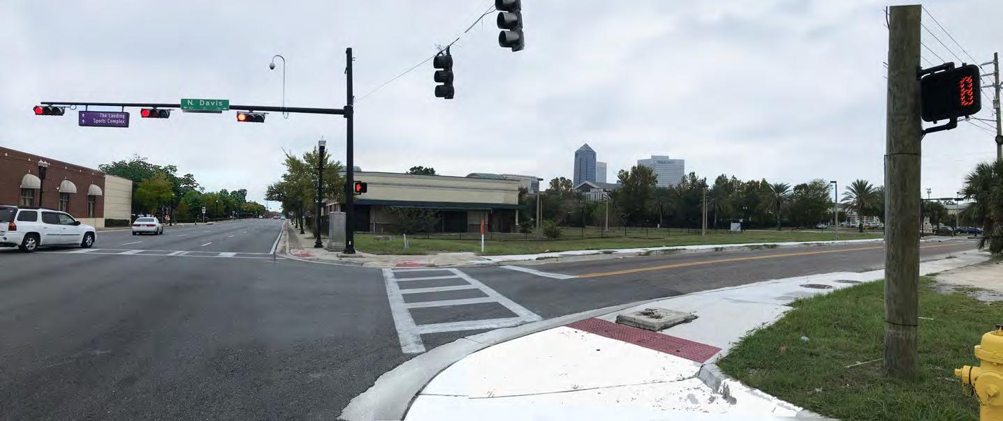
Corner of Duval and Broad Street, atop
Modern LaVilla began as a center of gravity for Freedman after the Emancipation Proclamation of 1863 African-American Union soldiers stationed in LaVilla helped provide a sense of security for African-Americans in the area An office of the Freedmen’s Bureau was located in LaVilla and provided a multitude services for newly liberated people The influence of these institutions helped form a social anchor that attracted new African-American residents from Florida, Georgia, and the Carolinas during the early years of post-war Reconstruction In 1866, LaVilla incorporated as a town with approximately 1,100 residents, over 70% of whom were African-American
With access to the St John’s River and a rail station, LaVilla became an important corner of commerce in an urbanizing Southeast United States Employment prospects burgeoned as an agglomeration economy formed around lumber, construction, and a growing winter resort industry in Jacksonville
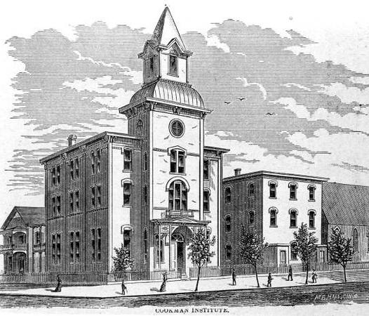
In the early 1870s, The Cookman Institute was founded, offering higher education to African-American freed men and women alongside youth The Institute contributed to an increasingly professional and skilled AfricanAmerican community as LaVilla’s economy diversified, providing greater commercial and manufacturing employment into the 1880s
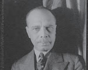
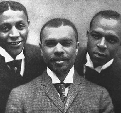
In his autobiography, Along This Way, LaVilla native James Weldon Johnson wrote, “Long after the close of the Reconstruction period Jacksonville was known far and wide as a good town for Negroes ” Indeed, LaVilla functioned socially and politically with a great deal of autonomy as neighborhood churches, schools and associations enabled residents to benefit from a budding African-American community AfricanAmericans increasingly owned businesses and were active participants in the political makeup of their town
Despite these signs of progress, African-Americans in LaVilla still faced threat of harm in the form of poverty, exposure to health hazards, and exclusion from a socioeconomic structure that favored white people
In 1887, the City of Jacksonville annexed LaVilla, expanding its tax base to afford growing infrastructure demands The annexation, coupled with a wave of Jim Crow measures, effectively dismantled African-American political power in LaVilla, reasserting the white, elite interests of the greater Jacksonville area
Without political representation, LaVilla residents focused on strengthening their social and cultural resources Emerging from the third largest urban fire in US history, Jacksonville’s LaVilla experienced a cultural renaissance through the first half of the 20th Century
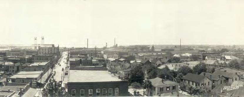
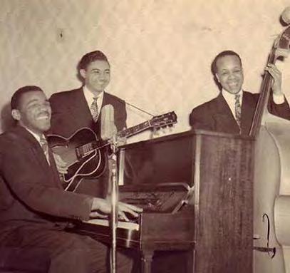
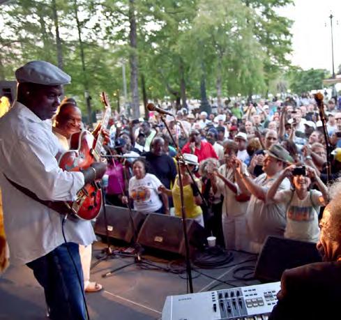
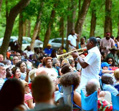
Two streets were particularly significant in nurturing cultural growth in LaVilla: “The Line” on Ward Street (now Houston Street) which hosted four blocks of bordellos (a k a brothels), serving as Jacksonville’s RedLight District; and Ashley Street, the region’s epicenter of Ragtime, Blues, and Jazz performances
The Line was born in part from Jacksonville’s disdain for sex-workers, expelling them from Jacksonville’s original city limits into the surrounding suburbs Ward Street in LaVilla was a natural fit for bars, billiards, boutique hotels, and bordellos as it was centrally located between the train station and Jacksonville’s downtown core Madams such as Cora Crane hired musicians to play in their parlors to mask noises and other nuisances associated with bordello activities This investment in the music community helped promote musical culture in the area, influencing the rise of Ashley Street as a major destination for ragtime, blues, and jazz music
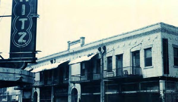
With rail connections to the west, Jacksonville and New Orleans became cultural exchange partners, particularly for African-American artists An increasingly segregated Jacksonville meant that LaVilla, specifically Ashley Street, became the landing spot for traveling black musicians Standing today, Genovar Hall housed blackowned businesses such as Lenape Bar & Tavern, one of Ashley Street’s most popular live venues, with musicians such as Dizzie Gillespie, Billie Holiday, James Brown, and a young Ray Charles performing there At one time, the Wynn Hotel occupied the top floors of Genovar Hall
and was the preferred hotel of Louis Armstrong while visiting Jacksonville
As was the case with many urban areas nationwide, LaVilla experienced a sharp decline in population and quality of life through the latter half of the 20th Century
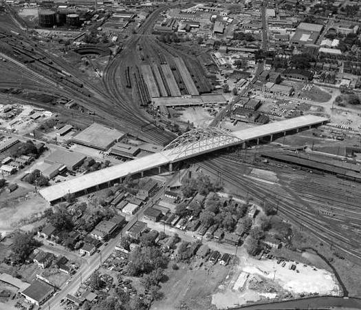
At the close of WWII, the Jacksonville Expressway system was proposed with routes specifically designed to eliminate the “spread of blight ” The first leg of the expressway, completed in 1958, became a fracturing barrier along LaVilla’s west edge Through the ‘70s and ‘80s, LaVilla experienced a precipitous decline in commerce and industry, fueling the rise of illicit drug activity
At the start of the 1990s, The River City Renaissance (RCR) Plan aimed to revitalize Jacksonville’s downtown The plan focused on making room for future development through the acquisition and clearing of property, many acres of which occurred in LaVilla
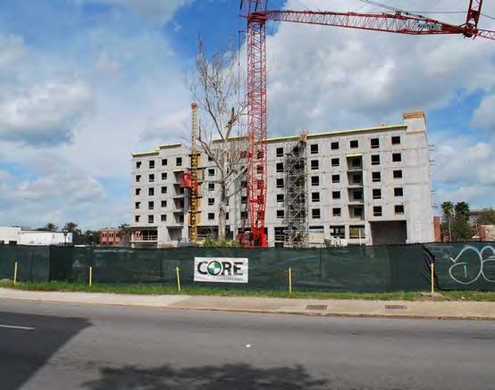
The rooming houses lining Monroe, bordellos along Houston, and the theaters of Ashley Street were completely demolished The RCR plan resulted in a number of development projects that are cherished by Jacksonville residents today such as the Times-Union Center for Performing Arts and renovations made to the Jaguars stadium However, nearly thirty years after the start of RCR, LaVilla is only now seeing glimmers of redevelopment in the form of new workforce housing projects
As part of the baseline research and community outreach effort associated with producing the LaVilla Development Strategy, the consultant team held three public meetings in the Fall of 2018 These meetings focused on the topics of “LaVilla History,” “LaVilla Today,” and “The Future of LaVilla ”
At the first meeting, attendees were asked to prioritize a series of topics related to LaVilla’s revitalization By far the most indicated high-priority topic was “Preserving History”, while the lowest was “Infrastructure,” with “Mobility” and “Housing” falling in the middle
The “LaVilla History” meeting included comments from the attendees on the question: “What was the impact of the razing of LaVilla in the mid-1990s on you personally, your family, or the community as a whole?” Meeting facilitator C M Brown summarized the sentiment of the attendees in the following paragraphs:
LaVilla was a multi-experience community where African-American residents reared families, enjoyed arts and entertainment, and owned business. This community on the edge of Downtown was referred to as the “Harlem of the South.” Today people are no longer aware of LaVilla’s history, which is culturally significant both nationally and internationally.
The loss of LaVilla and its places means there are few community-connected spaces to share or capture the stories of African-American people overcoming second-‐class citizenship and creating original culture (music, institutions, traditions, etc.). The importance of African-American people reared in Jacksonville like James Weldon Johnson, John Rosamond Johnson, A. Philip Randolph, Clara White and others has been lost as well. The little-‐known story of LaVilla is not just important to African-American History, but significant to American History.
LaVilla’s destruction left a vacuum between the past and the present, and contributed to creating a disconnected core city making the overall Downtown experience less dynamic – and arguably less authentic. Distrust of local government, among many African-American people, persists because LaVilla has not been fully redeveloped nearly 25-‐years after its destruction.
Extension of Center City: No other area has this direct connection
Courthouses: natural draw for small professional offices; LaVilla is where surface and on-street parking is “offloaded” by courthouse users (the cheap and not-toofar location)
Crossing Broad and Jefferson: flavor and character of office changes (e g Interline, Sally, Harmony Dental)
Proximity to FSCJ campus (Kings Rd/Pearl St) and UF Health campus
Social services and homeless in NE quadrant present challenge to users who might develop there
Infill: Seeing small, affordable projects happen organically (100-150 units, below market rate)
Regional connections: Expressway access in a region where sites are defined by their expressway reach
Skyway/JRTC: access to downtown (perceived and real)
No direct access to the River: All prime sites in Downtown are within two blocks of the River
Physical barriers define neighborhood and strongly influence market:
• Center and Federal Reserve – even bigger barriers than RR to south
• Interstate on West
• Kings Road: high speed physical barrier to cross

MULTIMODAL TRANSPORTATION: Infrastructure & Public Transit
Tra c Signal Locations 0-25 mph
25-30 mph
30-40 mph
55-65 mph
60,000 - 160,000
20,000 - 60,000
10,000 - 20,000
5,000 - 10,000
0 - 5,000


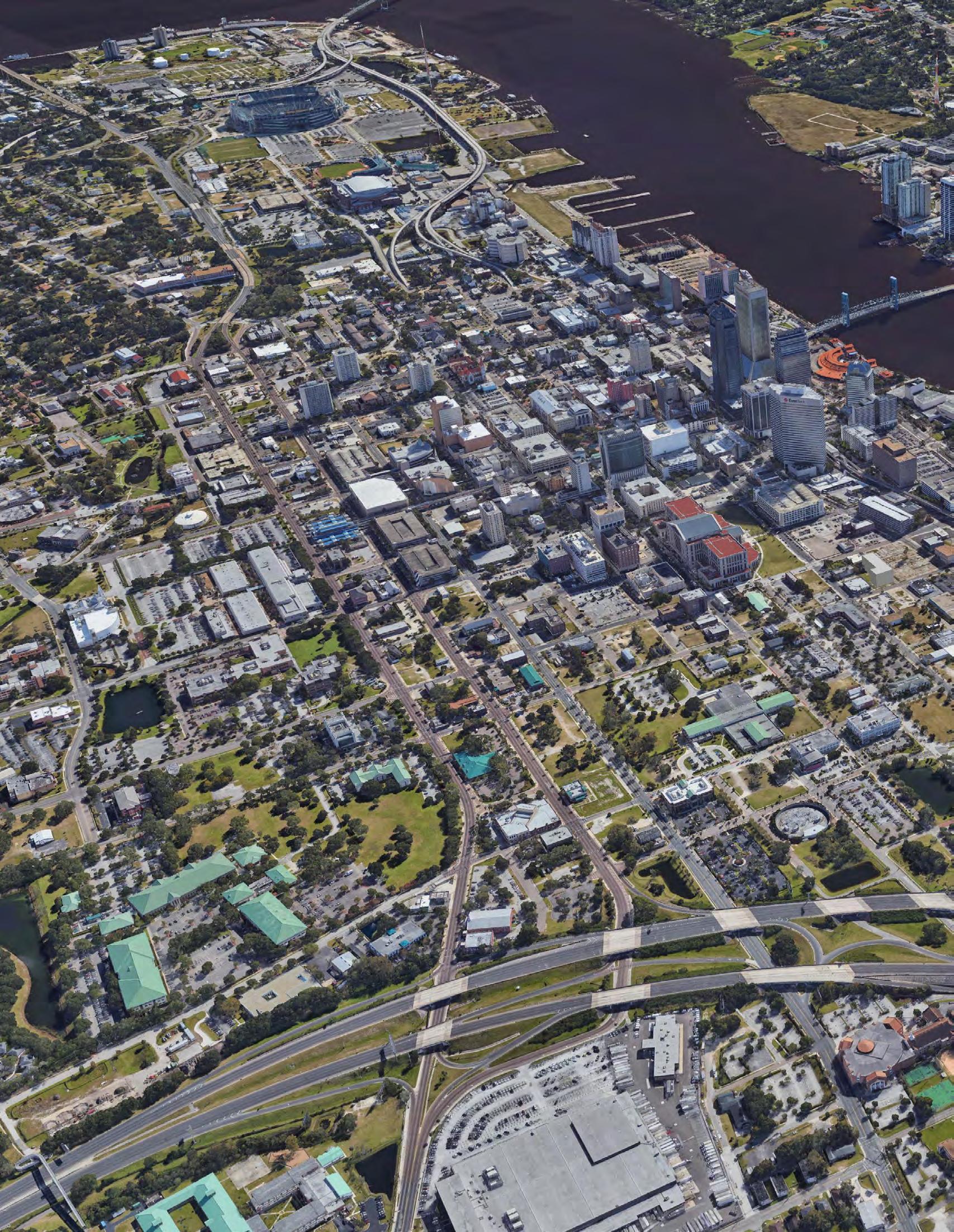
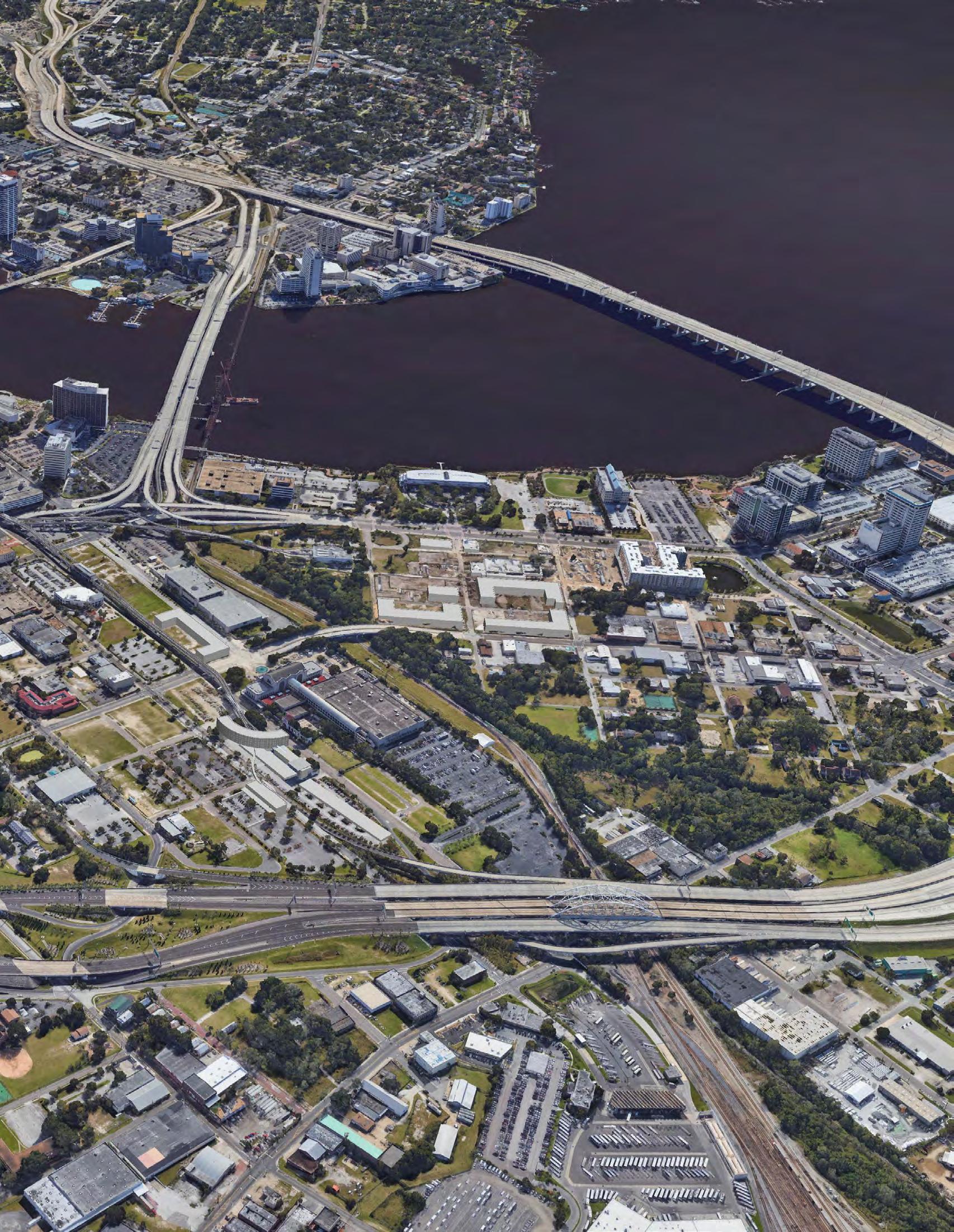
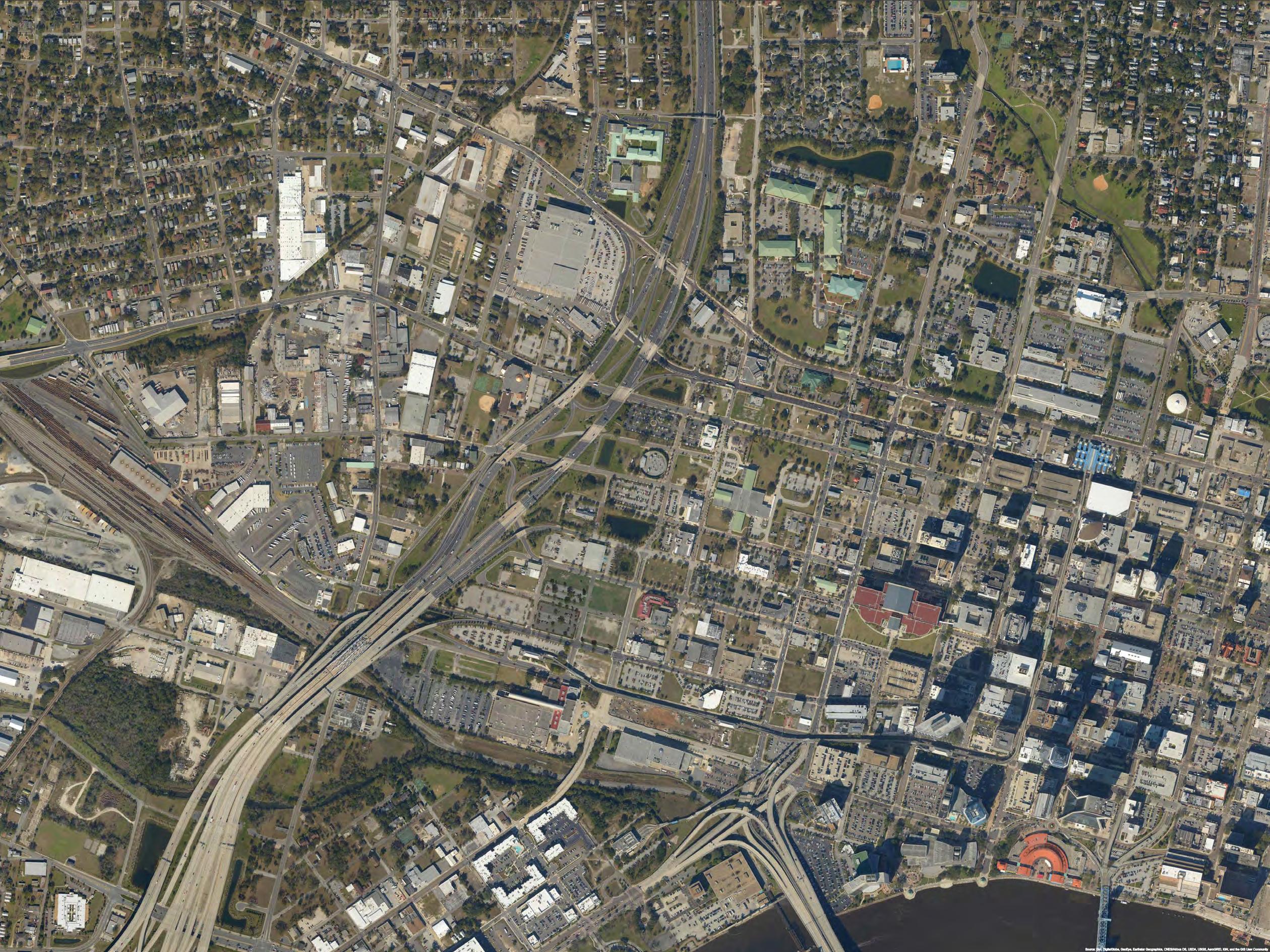
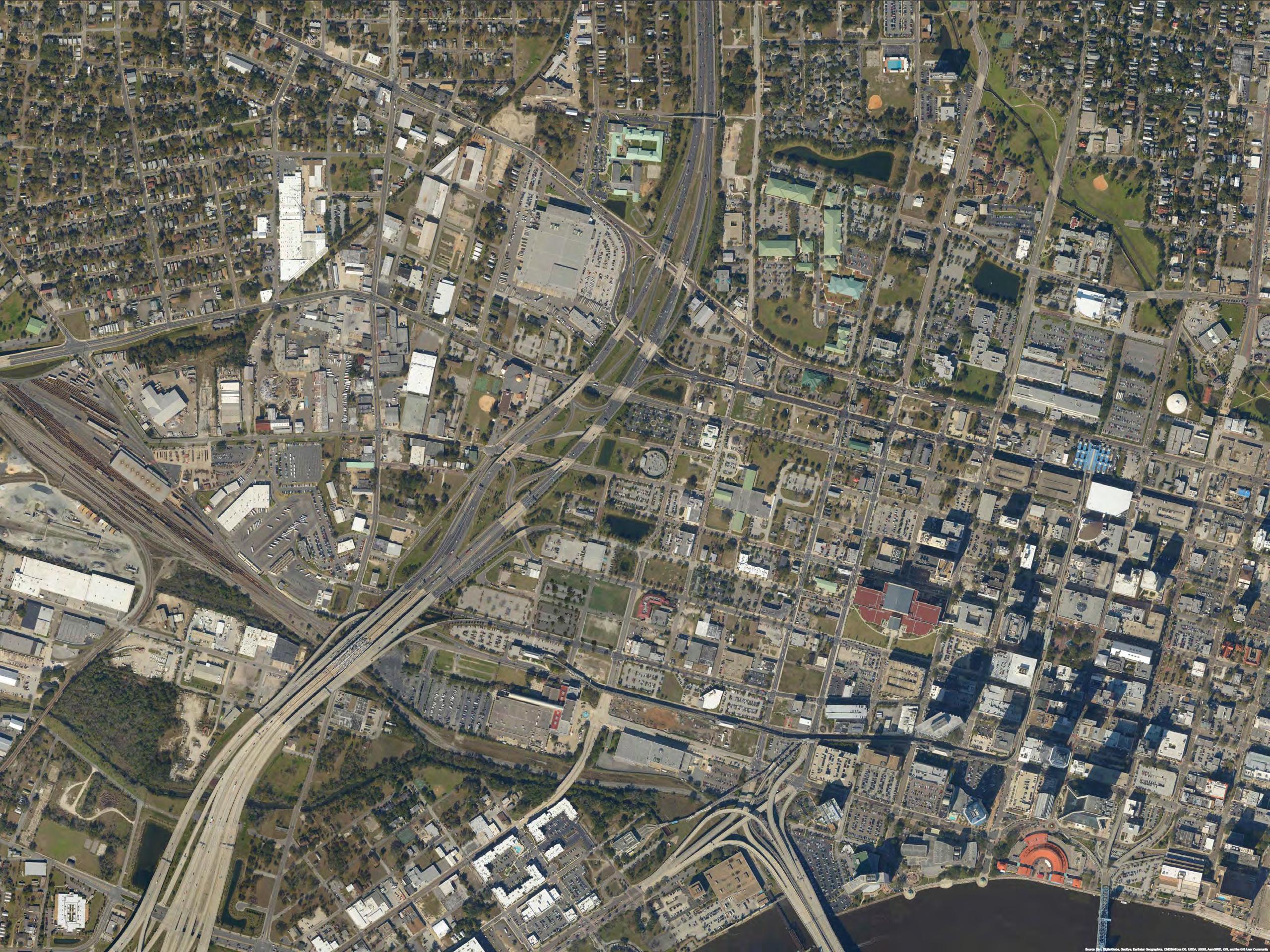
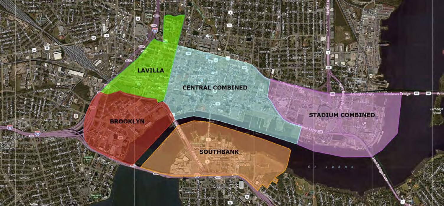
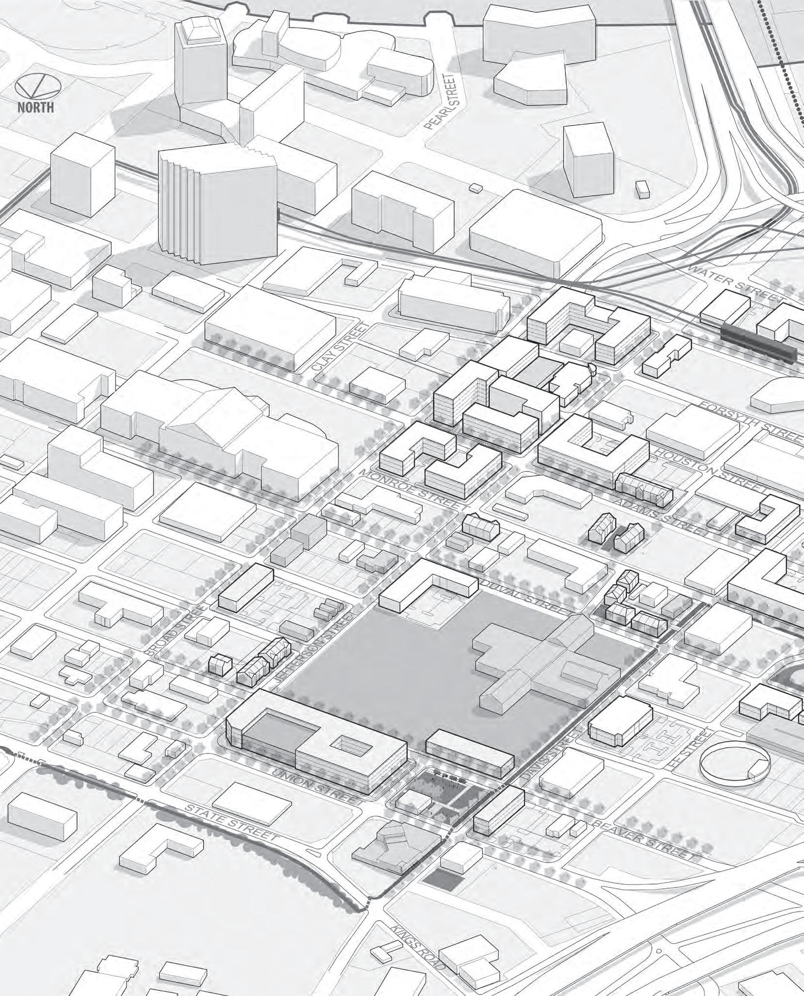
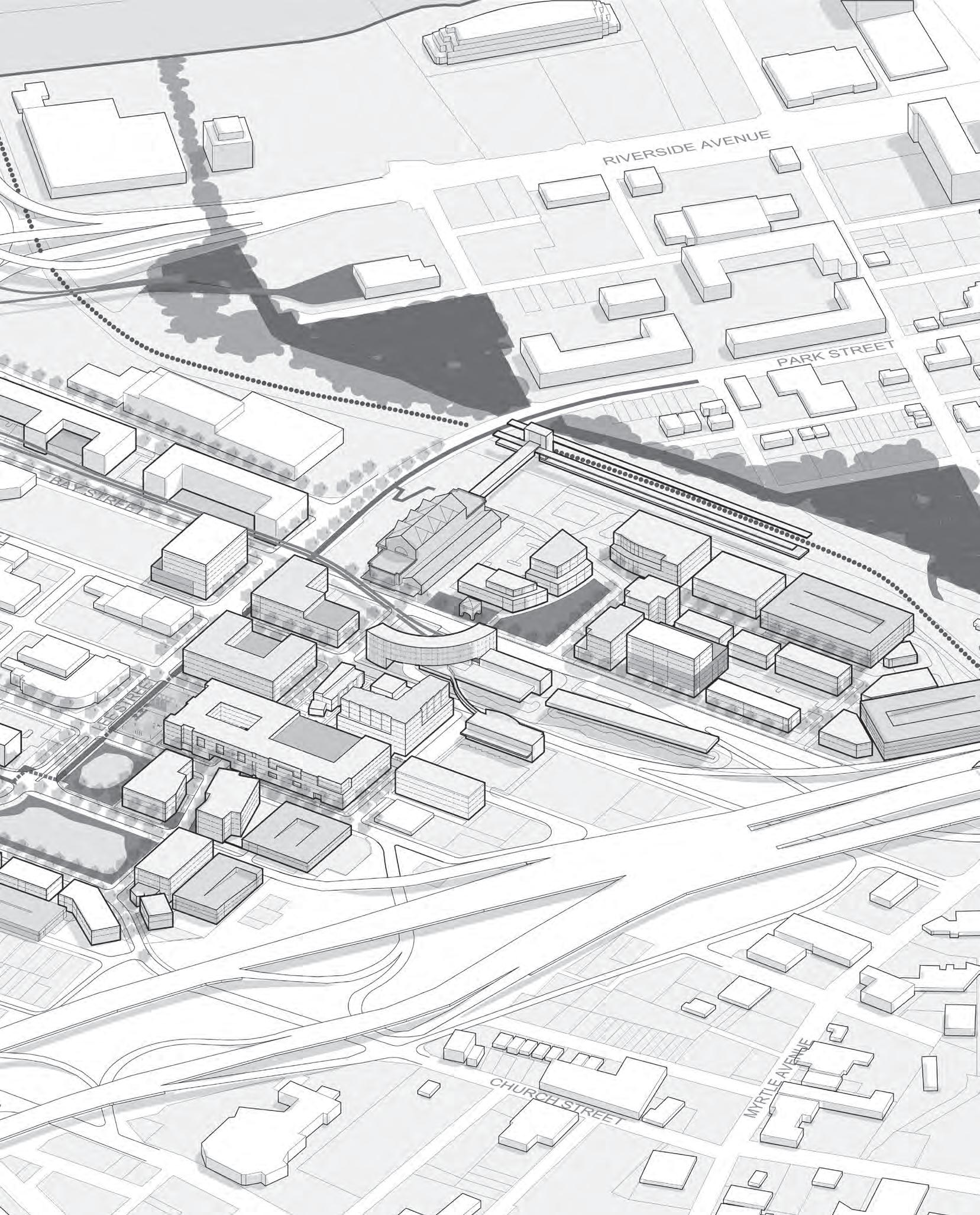
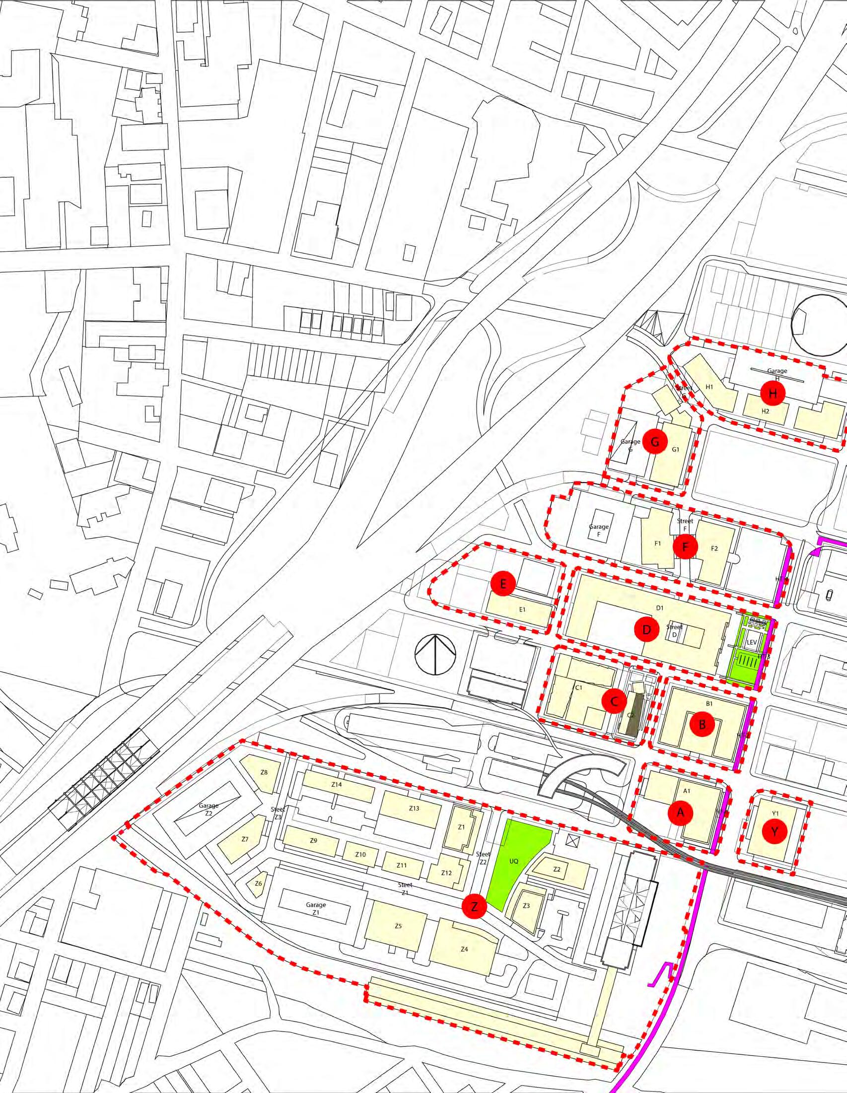
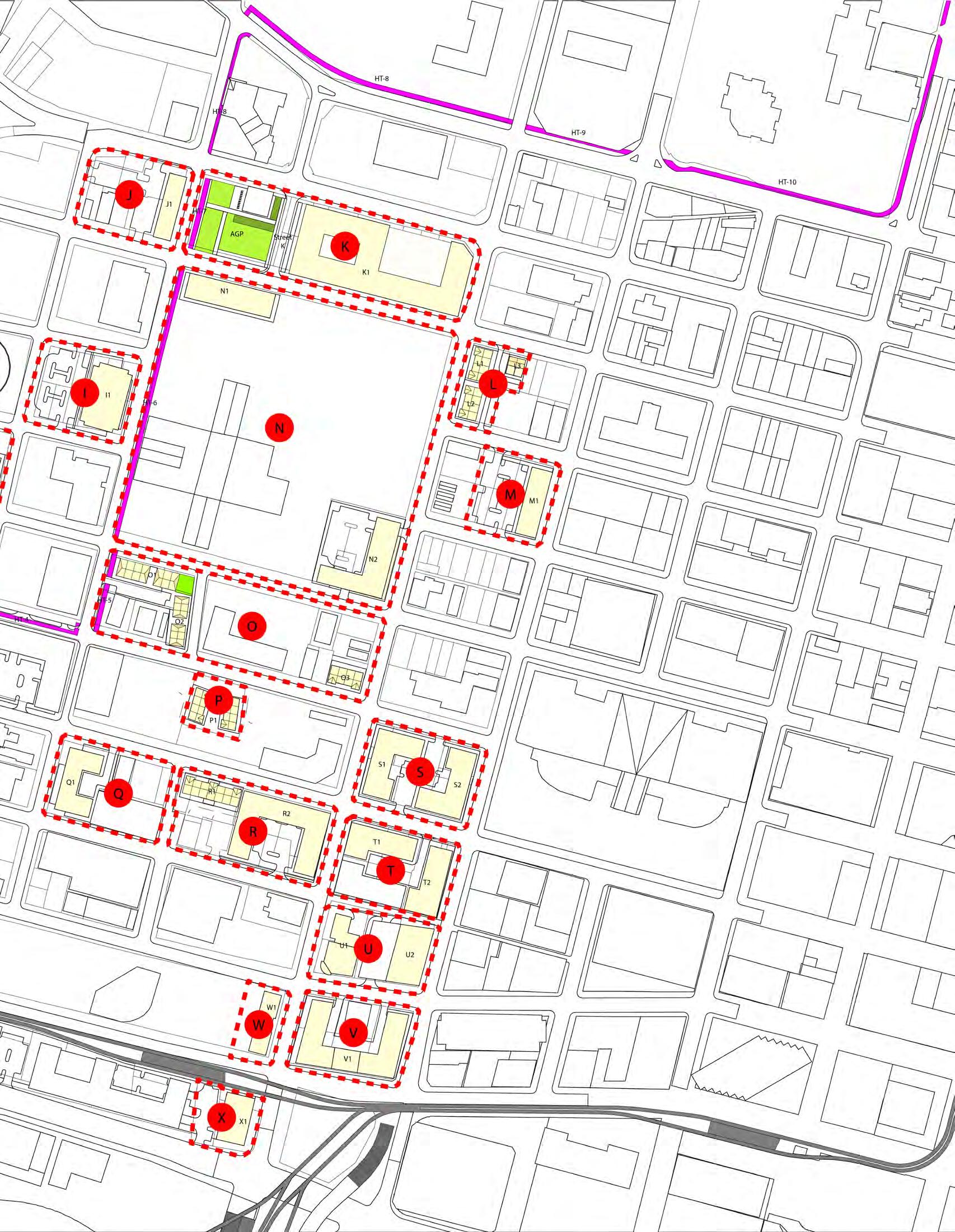
The portion of Downtown Jacksonville which is the focus of this analysis encompasses roughly 3 35 square miles or about 2,144 acres In an effort to inventory and document activity within this area, the area has been divided into smaller areas that closely match the boundaries of the neighborhoods within Downtown Jacksonville, and some neighborhoods were combined with others to more accurately reflect how neighborhoods function together LaVilla, Brooklyn, and Southbank neighborhoods maintained their individual neighborhood boundaries However the other neighborhoods within this downtown area were combined into two distinct areas; the Stadium Combined area encompasses the Stadium and River Park neighborhoods, and the Central Combined area encompasses the Riverfront, Central Civic Core, Cathedral, Institutional, and Church neighborhoods
Table 1.0 - Downtown Jacksonville Neighborhoods
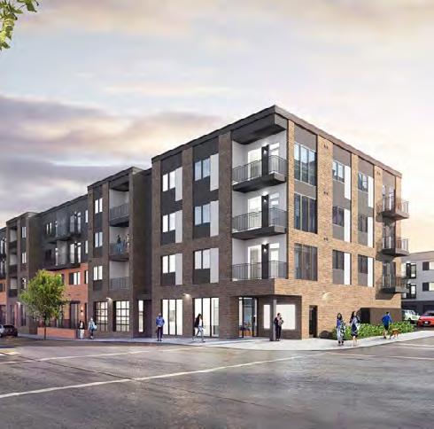
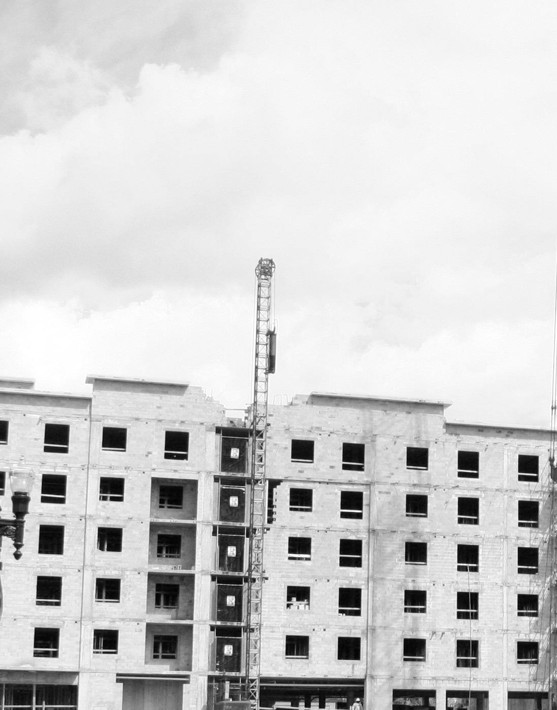
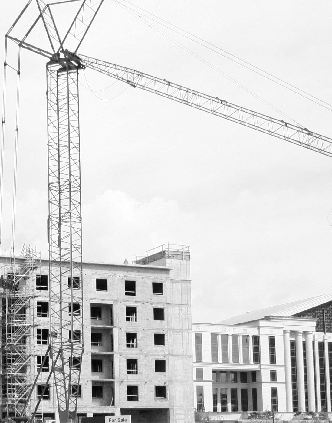
Within Downtown Jacksonville there have been many impactful development and redevelopment projects While there has been activity within the other neighborhoods, in recent years development and redevelopment has been largely within the Brooklyn and Central Combined neighborhoods The following is a list of projects that are either planned, currently under construction, or recently completed in Downtown Jacksonville
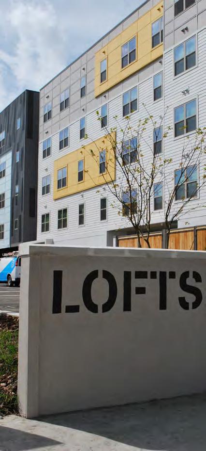
• Lofts at Monroe: 906 W Monroe Street Five Story, 108-unit apartment property located at the intersection of North Davis and Monroe Streets Construction was completed in late 2018, and the property is currently fully leased Current Asking Rental Rates: $760 per unit/$1 13 per SF
• Lofts at Jefferson Street Station: 700 Water Street Located just south of the JTA Skyway’s Jefferson Street Station, the 133-unit multifamily apartment project will include 80 units set aside for affordable housing and 53 units for workforce housing Building will be comprised of four residential floors over one level of parking (150 spaces) 5,489 additional square feet will be used for recreation/amenity purposes Completion expected Fall 2019
• Broadstone River House Apartments: 1501 RiverPlace Boulevard Six-story, 263-unit multifamily project which will replace a 3 7-acre surface parking lot adjacent to the Duval County School Board Expected completion Summer 2019 with anticipated rental rates of $1,718 per unit/$1 84 per SF
• San Marco Apartments: 1444 Home Street 4-story 147unit apartment complex currently under construction Completion expected in late 2019
Brooklyn
• Vista Brooklyn: 200 Riverside Avenue 10-story apartment/retail mixed use building Property will include 14,000 square feet of retail space and 308 apartment units Completion is expected in early 2021
Central Combined
• Houston Street Manor Senior Living Apartments: 139 Jefferson Street North 7-Story building will have five apartment floors with 72-units of senior housing and 2-stories of parking Currently under construction with completion expected in early 2019 Anticipated Rental Rates: $772 per unit/$0 93 per SF
• Duval Legal Center: 218 N Broad Street Originally constructed in 1910, fully-renovated into 2-story, 4,752 square foot building with 10 fully furnished executive office suites The property is currently listed for sale for $2,450,000, Price/SF: $515 57
• Elena Flats: 122 E Duval Street Extensive renovations underway to convert the former rooming house into a 4-unit market-rate apartment building Anticipated rental rates are $2,514 per unit/$1 48 per SF Completion expected in Fall 2019
• Laura St Apartments: 225 North Laura Street Three Story Building restoration will contain four apartments on the upper two floors and a restaurant on the third floor Scheduled completion for May 2019
• Barnett Building: 112 W Adams Street Old Barnett National Bank building restoration to include 50,000 square feet of commercial office space and 110 apartments Scheduled completion by Spring 2019
• Laura Street Trio: Three historic buildings; the Florida Life Building, the Marble Bank, and the Bisbee Building Mixed-use program featuring international banking, 145-room Marriott flagged boutique-style hotel, higher education, new retail and restaurants, along with over 100 residential loft apartments
In comparing the LaVilla neighborhood to the Central Combined and Brooklyn neighborhoods, which have been experiencing strong redevelopment activity recently, it becomes clear that the Central Combined neighborhood has the highest densities and intensities Residential densities within the LaVilla and Brooklyn neighborhoods are similar, however the office/retail intensities in the Brooklyn neighborhood are significantly greater than those in the LaVilla neighborhood The neighborhood with the greatest percentage of vacant land is Brooklyn, however the LaVilla and Central Combined neighborhoods have only slightly lower percentages of vacant land than the Brooklyn neighborhood
Table 1.1
In terms of the age of the structures located within these three neighborhoods, the structures within the LaVilla neighborhood have the oldest average year built overall, while the Central Combined neighborhood has the newest average year built overall Single family structures within the Lavilla neighborhood on average are older than those in the Central Combined and Brooklyn neighborhoods, while office/retail and industrial structures within the LaVilla neighborhood are on average newer than the Central Combined and Brooklyn neighborhoods
Table 1.2 - Average Year Built of Structure
Occupancy rates within Downtown Jacksonville are slightly lower than the larger Jacksonville Market, however rental rates within Downtown Jacksonville are higher than those within the larger Jacksonville Market Within Downtown Jacksonville the Stadium Combined area has the highest occupancy at 98 8%, the Central Combined area has the largest amount of office space at over 8 million square feet, and the Brooklyn area has the highest rental rates at $22 64
The Jacksonville Market has experienced an increase of roughly 890,000 square feet of office space since 2010, with Downtown Jacksonville not adding any new office space since 2010 Occupancy rates for both the larger Jacksonville Market and Downtown Jacksonville have increased since 2010 at 9 3% and 5 7%, respectively Rental rates have also increased for both the larger Jacksonville Market and Downtown Jacksonville since 2010 at 8 2% and 9 7%, respectively
While the Stadium Combined area has the highest occupancy rate and also experienced the largest growth in occupancy since 2010 at 15 0%, it was the only area to experience a decline in rental rates The greatest growth in rental rates was seen in the LaVilla area at 14 3%, followed by the Brooklyn area at 13 0% The LaVilla area also has the second smallest amount of overall office square footage at approximately 656,000 square feet, followed by the Stadium Combined area with the smallest amount of office square footage at approximately 99,500 square feet
Absorption of office space in Downtown Jacksonville accounted for about 13 3% of absorption within the larger Jacksonville Market, an increase from 10 02% in 2010 Within Downtown Jacksonville, all of the areas experienced increased absorption when compared to absorption in 2010 except the Stadium Combined area The Central Combined and Southbank areas accounted for the largest percentage of the absorption experienced in Downtown Jacksonville at 65 4% and 28 6%, respectively
Downtown Jacksonville accounts for approximately 21 3% of the total office square footage within the Jacksonville Market Among the areas within Downtown Jacksonville the Central Combined area captures a substantial percentage of the office square footage at 60%, which accounts for approximately 12 8% of the office square footage within the larger Jacksonville Market The distribution of office space is summarized in Table 2 1
While Class A office space can be found in most areas of Downtown Jacksonville, there is none within the Lavilla area or Stadium Combined area The largest amount of Class A office space is concentrated within the Central Combined area followed by Southbank then Brooklyn Occupancy rates for Class A office space are highest in the Brooklyn area, which also has the highest occupancy rates for Class B office space
While Class B office space can be found in all parts of Downtown Jacksonville, the largest concentration of this type of office space is within the Central Combined area followed by Brooklyn, LaVilla, Southbank, and Stadium Combined The distribution of office space by class of space is summarized in the table below
Sales transactions for office buildings and office space in Downtown Jacksonville for the 4-year period from 2015 through 2018 totaled 27 transactions for roughly 600,000 square feet of space Sale prices for office buildings averaged $96 30 per square foot, with the highest average sale price being seen in the Lavilla area at $137 06 per square foot and the lowest average sale price being seen in the Stadium Combined area at $10 23 per square foot Sales prices for individual office space within a condominium office building averages $168 44 per square foot, with the highest average sale price being within the Stadium Combined area at $307 69 per square foot Office sales activity for the 4-year period from 2015 through 2018 is summarized in Table 2 3
Occupancy within the Jacksonville Market and Downtown Jacksonville are both at 95 5%, however rental rates are slightly higher in the larger Jacksonville Market Within Downtown Jacksonville the LaVilla and Stadium Combined areas have the highest occupancy at 100%, the Central Combined area has the largest amount of retail space at nearly 700,000 square feet and is the only area within Downtown Jacksonville with reported rental rates
The Jacksonville Market has experienced an increase of roughly 5,087,000 square feet of retail space since 2010, with Downtown Jacksonville accounting for just 143,729 square feet of that retail growth Occupancy rates for both the larger Jacksonville Market and Downtown Jacksonville have increased since 2010 at 10% and 24 8%, respectively While rental rates have increased approximately 1 0% in the Downtown Market since 2010, they have decreased approximately 14 0% in Downtown Jacksonville since 2010
The occupancy rate within Downtown Jacksonville was 97 3% in 2017, up from 86 5% in 2010 The occupancy rates for areas within Downtown Jacksonville range from 93 0% to 100%, which is higher than 2010 when the low end of the range was 84 1% Since 2010 Downtown Jacksonville saw the addition of approximately 144,000 square feet, the largest growth in retail square footage within Downtown Jacksonville occurred in the Brooklyn area with the addition of approximately 139,000 square feet
Table 3.0 - Retail Market Summary
Absorption of retail space in Downtown Jacksonville accounted for just 2 0% of absorption within the larger Jacksonville Market in 2017, an increase from 0 2% in 2010 Absorption of retail space within Downtown Jacksonville increased by approximately 58,500 square feet since 2010, with the greatest absorption being experienced within the Central Combined area which saw absorption of 53,213 square feet
Downtown Jacksonville accounts for approximately 1 3% of the total retail square footage within the Jacksonville Market Among the areas within Downtown Jacksonville the Central Combined area captures the largest percentage of the retail square footage at 55 7%, however none of the Downtown Jacksonville neighborhoods capture more than 1% of the retail space within the larger Jacksonville Market The distribution of retail space is summarized in Table 3 1
Sales transaction for commercial property in Downtown Jacksonville for the 4-year period from 2015 through 2018 totaled 20 transactions for roughly 38,000 square feet of improved commercial space and approximately 4 5 acres of unimproved commercial land Sales prices for improved commercial space averaged $80 52 per square foot, with the highest average sale price being seen in the Lavilla area at $109 02 per square foot Sales prices for unimproved vacant commercial land averaged $20 41 per square foot or $889,062 34 per acre, with the highest average sale price being seen in the LaVilla area at $25 92 per square foot or $1,129,178 84 per acre Commercial sales activity for the 4-year period from 2015 through 2018 is summarized in Table 3 2 below
Occupancy within the Jacksonville Market is slightly higher than that of Downtown Jacksonville at 94% and 93 3%, respectively However rental rates within Downtown Jacksonville are higher than those within the larger Jacksonville Market Occupancy rates within the larger Jacksonville Market have increased since 2010, while occupancy rates experienced decline since 2010 Rental rates have increased for both the larger Jacksonville Market and Downtown Jacksonville over the last seven years at 27 3% and 24 6%, respectively
The Jacksonville Market has experienced an increase of roughly 9,312 new apartment units since 2010, with Downtown Jacksonville accounting for about 740 of those new apartment units Within Downtown Jacksonville the LaVilla area has the highest occupancy at 100% and the Central Combined area has the largest number of apartment units at 1,080 apartment units The Brooklyn area has the highest rental rates at $1 65 and experienced the largest growth in units since 2010 with the addition of over 600 new apartment units
While the Southbank neighborhood has the lowest occupancy within Downtown Jacksonville and was the only area within Downtown Jacksonville to experience a decline in occupancy since 2010 falling from 94 1% occupancy in 2010 to 94 0% occupancy in 2017, this area also experienced the largest growth in rental rates at 49 1% over 2010 rates
Absorption of apartment units in Downtown Jacksonville accounted for about 4 1% of absorption within the larger Jacksonville Market in 2017, an increase from 2010 when the area accounted for 2 0% of the absorption within the Jacksonville Market Within Downtown Jacksonville, all of the neighborhoods experienced positive absorption growth when compared to absorption in 2010 except the Southbank neighborhood which saw decreased absorption compared to unit absorption in 2010 While LaVilla area accounted for the largest percentage of the absorption experienced in Downtown Jacksonville at 86 1%, this is largely attributed to the opening of a new affordable apartment property in late 2017 which was fully occupied upon opening
Downtown Jacksonville accounts for approximately 2 1% of the total apartment units within the Jacksonville Market Among the areas within Downtown Jacksonville the Central Combined area captures the largest percentage of the apartment units at 45 7%, which accounts for just 1% of the apartment units within the larger Jacksonville Market The distribution of apartment units is summarized in Table 4 1
Table 4.1- Apartment Market Characteristics by Location
Sales transaction for residential property in Downtown Jacksonville for the 4-year period from 2015 through 2018 totaled 183 transactions for 156 dwelling units, approximately 0 5 acres of vacant land and 4 multifamily buildings Sales prices for single-family dwelling units averaged $98 22 per square foot, with the highest average sales price being seen in the Central Combined area at $109 68 per square foot Sales prices for condominium dwelling units averaged $202 74 per square foot, with the highest average sales price being seen in the Southbank area at $231 39 per square foot Sales prices for unimproved vacant residential land averaged $10 56 per square foot or $459,819 30 per acre Sales prices for multi-family properties averaged $191,096 per unit or $78 79 per square foot, with the highest average sale price per unit being seen in the Southbank area at $216,934 per unit and the highest average sale price per square foot being seen in the Central Combined area at $104 43 per square foot
Residential sales activity for the 4-year period from 2015 through 2018 is summarized in Table 4 2
LAVILLA’S Major DIFFERENTIATORS in the market:
• Access and visibility: Parcels on west surrounding JRTC have great regional access and visibility from interstate
• Catalytic sites in public control
Downtown Jacksonville is an OFFICE market
Over 20% of region’s office space
No new square footage added in Downtown submarket since 2010, but absorbing lots of square footage as vacancy rates drop
Central Combined: lower rents, higher vacancies, falling vacancy rates
Brooklyn: higher rents, low vacancy Brooklyn is “full”
Office market not moving east toward sports venues
OPPORTUNITIES/STRATEGIC DIRECTION
• Opportunity to position for some office in LaVilla
• “Overflow” from Brooklyn
• Anchor around JRTC to benefit from exposure and access
Significant retail will not locate in Downtown; prefers suburban locations with more concentrated buying power
In-town retail only found in “historic” centers like Five Points, San Marco, etc…
Brooklyn experience: retail limited to what is supported by retail and office, but even that hasn’t performed as expected (lots vacant or on second or third users)
OPPORTUNITIES/STRATEGIC DIRECTION
• A small amount of retail is necessary to “activate the street” and draw marketrate residential users
• Even token amounts of retail in LaVilla will likely need on-going incentives
Seeing more residential development downtown, but overall numbers are still small
New projects are highly rent-sensitive (Brooklyn $1 65/SF, LaVilla $0 88/SF)
Missing Middle: Residential in Downtown submarket is driven either by proximity to River or affordability – lack of a true “urban district” where the amenity is the combination of all the factors
OPPORTUNITIES/STRATEGIC DIRECTION
• What could be done with publicly-owned parcels?
• “Ride the Wave” of affordable projects?
• Incentivize/support market rate residential
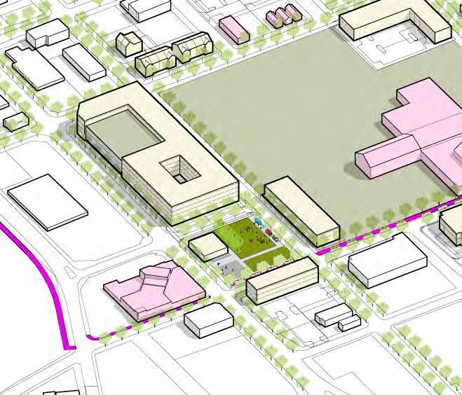
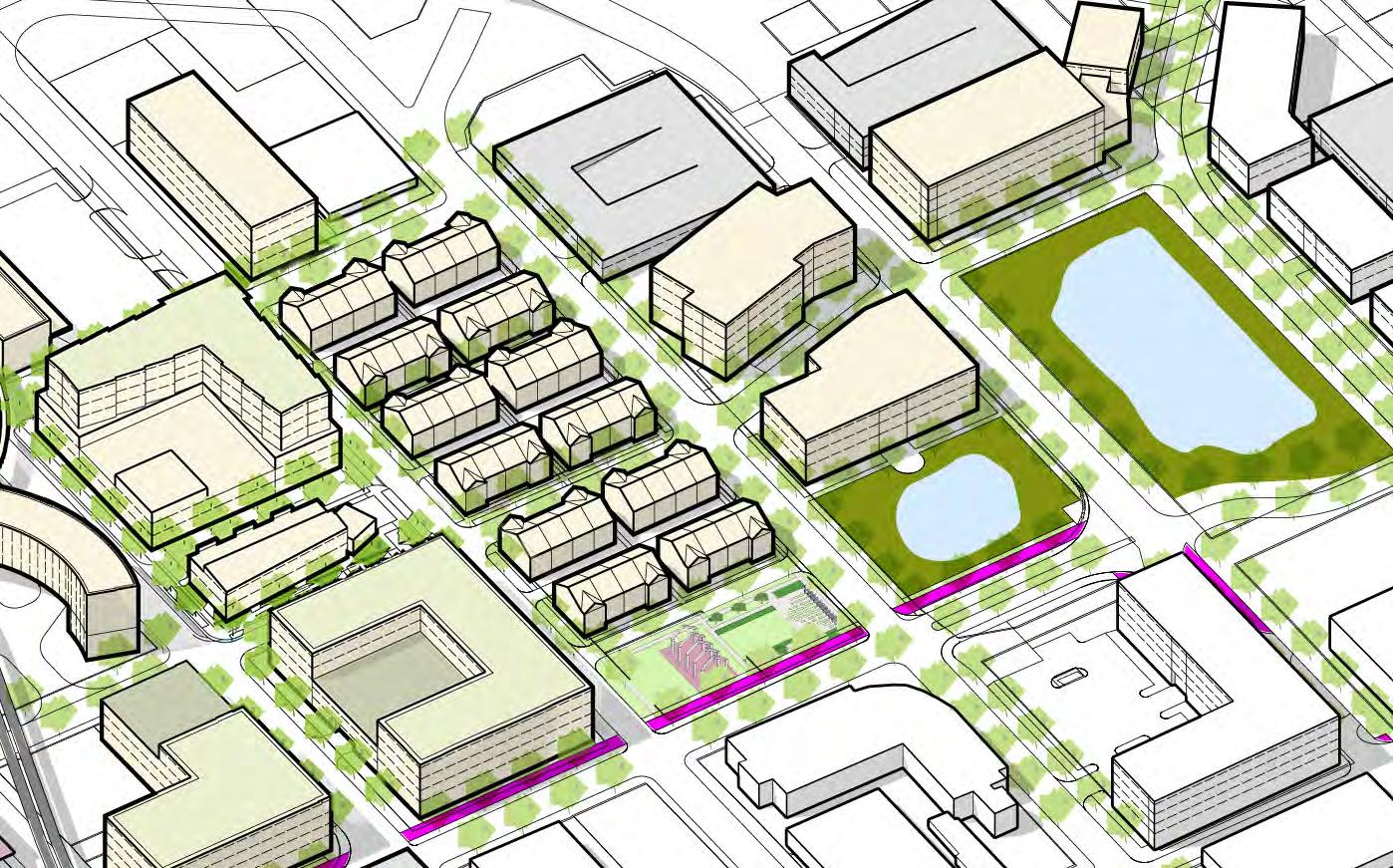
Potential Development on City Controlled Site
Key Neighborhood Character Building
Other Potential Development
Potential Park Improvement
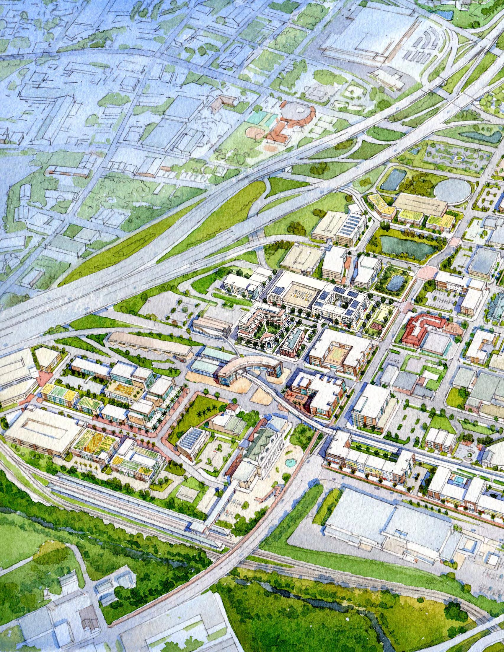
The Development Strategy for LaVilla is based in the dynamic combination of LaVilla’s position within Downtown and the unique land holdings of the City. These two factors, paired with the neighborhood’s rich history and the opportunity for transit-oriented development, point to the neighborhood’s future position:
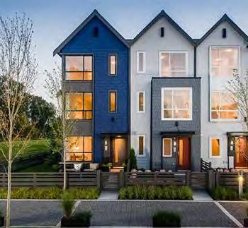
• Emphasize the addition of residential units to LaVilla including workforce and senior housing to meet the needs of the growing urban core.
• Introduce fee-simple products in the form of townhomes and other attached unit types in order to offer greater ownership opportunities.
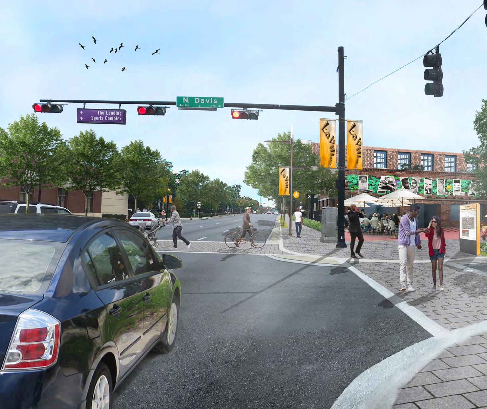
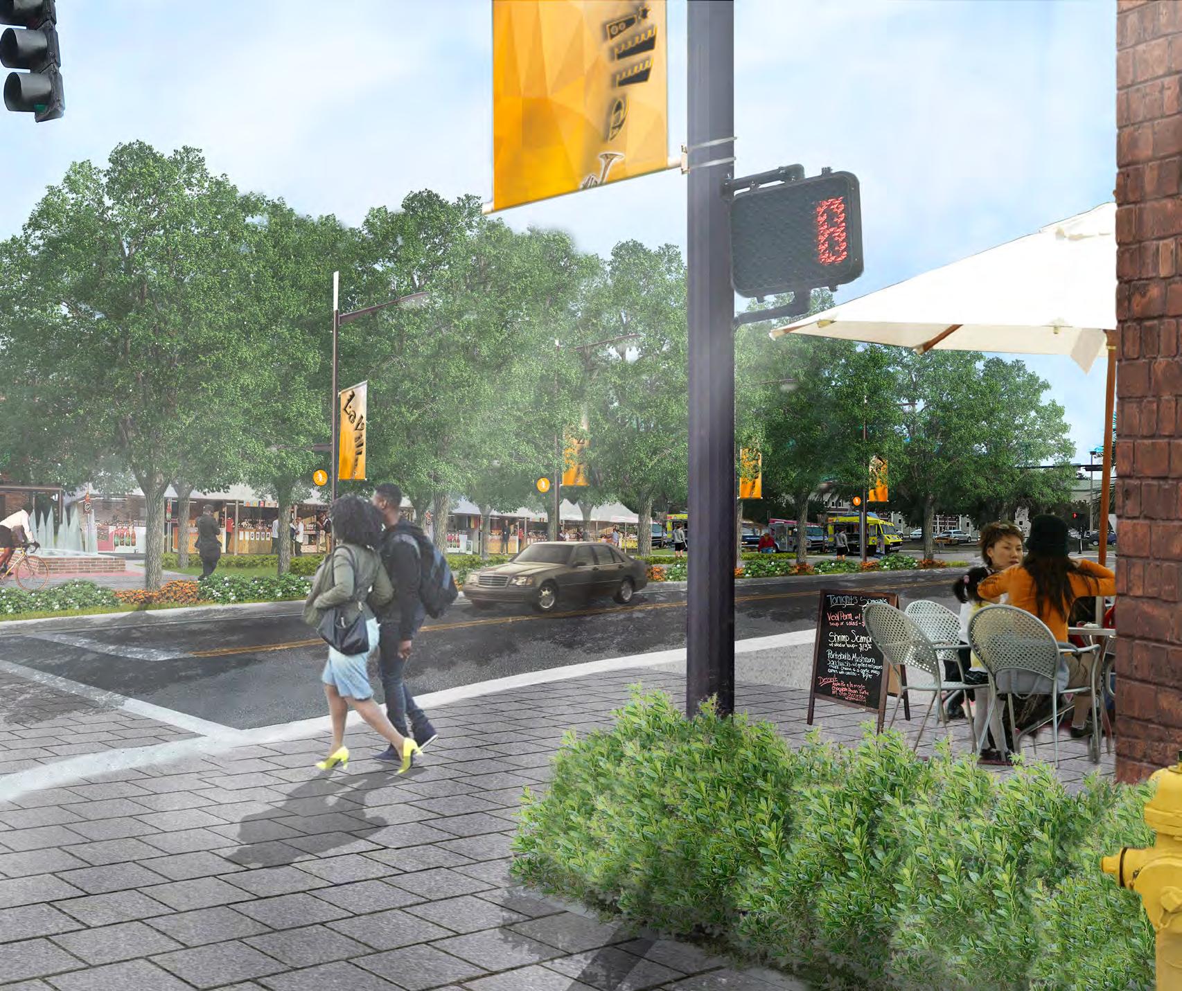
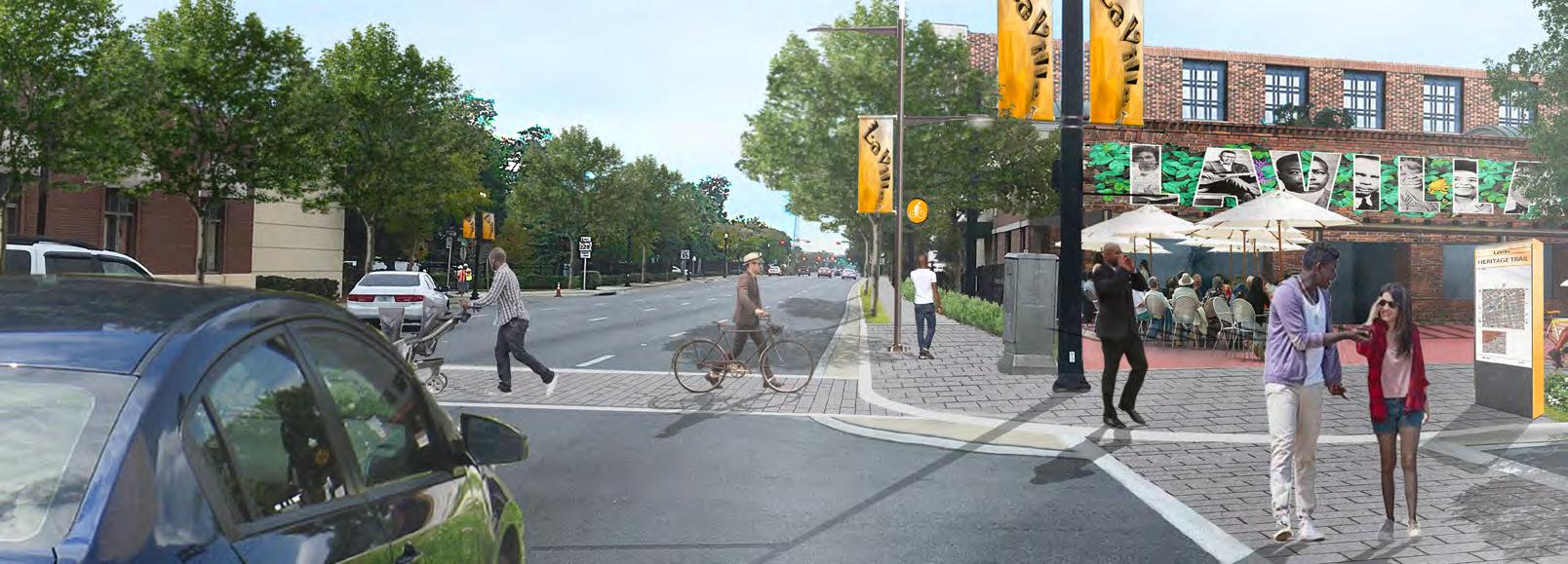
• Introduce the Heritage Trail along Park/Lee and Davis Streets, Connecting Brooklyn with the “Emerald Necklace.”
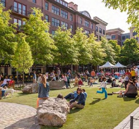
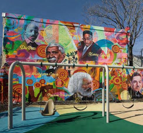
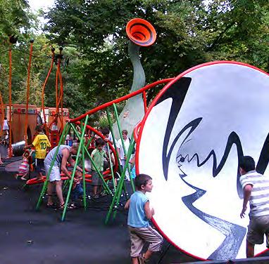
• Expand “Lift Ev’ry Voice and Sing” Park and design to celebrate James Weldon Johnson and the AfricanAmerican experience.
• Create a gateway park space at the corner of Davis and Union.
• Develop a connection to the River along Water Street to the Riverwalk node at Pearl Street.
• Organize urban form to emphasize east/west connections to the Downtown via Adams Street & Duval Street.
• Celebrate the “three doors” to LaVilla with art and recreational amenities.
• Cultivate a platform for community culture at the heart of LaVilla’s arts cluster.
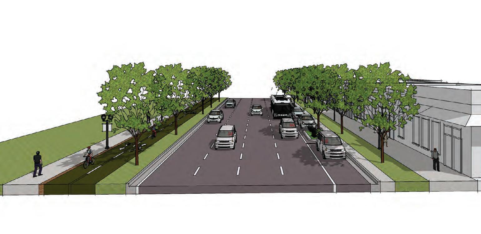
• Road Diets (Water Street facilitate connection to river, Park/Lee Street, and Beaver Street)
• Two-Way Initiatives (Adams Street, Monroe Street, Forsyth Street, Union Street)
• Main Streets adaptation to Duval and Adams
Principle DESIGN THE PUBLIC REALM TO ENHANCE THE IDENTITY OF STATION AREAS AND MAKE THEM ATTRACTIVE, SAFE, AND CONVENIENT PLACES THAT CAN BE FOCAL POINTS FOR DEVELOPMENT.
Goals
Maintain a pattern of blocks to allow the district to be adaptable through time. Blocks formed by a well-connected grid-based street network can accommodate many functions and support a variety of land use activities In this manner, a manageable block structure and appropriate building scale and orientation can enable a district to transform lot by lot
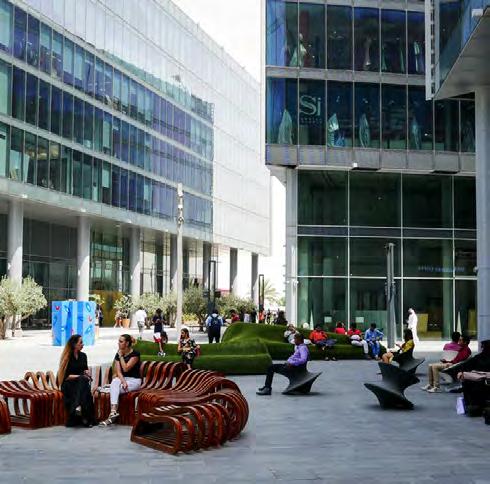
Integrate plazas or small parks into transit station design. Transit stations represent permanent infrastructure and are unique public investments Public spaces, like parks and plazas, reinforce the important civic role of the transit station and act as development catalysts around transit stations Orient buildings to front on these important civic open spaces
Activate the street edge to foster pedestrian interest. Primary access to buildings around transit stations should be designed for pedestrians first Building design at street level should incorporate elements that reflect a human scale Buildings with entrances and many windows on the street both frame the space and activate the street, making the pedestrian realm a desirable place to congregate Minimize setbacks and locate parking to the rear Provide windows and doors at street level and minimize walking distance to entrances Screen unsightly elements, such as dumpsters, loading docks, service entrances and outdoor storage from the public realm Include active uses on the ground floor of parking structures
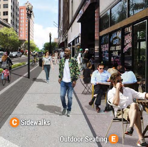
Treat the street as a public space. The street is the most commonly used public space in the city It should be designed not just to move vehicles but also to move people; to be auto-accommodating but not auto-dominated Design of the sidewalk should be as important as design of the street Lights, shading, benches, and landscaping should be included to make the pedestrian experience safe and enjoyable
Principle CONCENTRATE A MIX OF COMPLEMENTARY, WELL-INTEGRATED LAND USES WITHIN WALKING DISTANCE OF THE TRANSIT STATION.
Provide increased land use intensity near transit stations. Higher intensity land uses which bring many potential transit customers should be incorporated within close walking distance of transit stations The increased density that this pattern of development provides makes transit service more cost-effective since the route is able to serve more people Uses with lower densities that are less supportive of transit should not generally be located adjacent to transit stations
Encourage highest density uses closest to the transit station
Provide a mix of land uses. A well-balanced community has both a horizontal and vertical mix of land uses A mix of uses creates a vibrant 24-hour neighborhood with a variety of activities throughout the day and week Consider special traffic generators--such as cultural, educational, entertainment or recreational uses--to locate in station areas As a goal, the area around a station should offer a range of living, shopping, working, and recreational opportunities within a compact, walkable area In LaVilla, neighborhood-serving retail space should be included on the ground floor of all new nonresidential buildings and, where feasible, in new residential buildings By clustering these uses around community focal points and public spaces, more people benefit from access to transit service and other public amenities, creating a “park once” environment where people are able to walk between uses instead of driving
Accommodate parking in an appropriate manner. Parking is a critical component of a pedestrian-oriented environment The size, design, and location of parking facilities should be sensitive to the pedestrian The amount of required parking spaces should be reduced in the station area and parking, both for the transit station and for surrounding land uses, should be provided in a manner that is contextsensitive Within TOD areas, minimize or, if possible, eliminate, surface parking and encourage shared parking facilities On-street parking is a pedestrian-friendly way to provide convenient access to street-front businesses, as the parked cars provide a buffer between pedestrians and moving traffic Surface parking lots, where necessary and contextappropriate, can be made pedestrian-friendly by designing them to include walkways for pedestrians and trees for shade and comfort Parking lots should also be placed away from streets and behind buildings creating street environments that are activated and pedestrian accessible
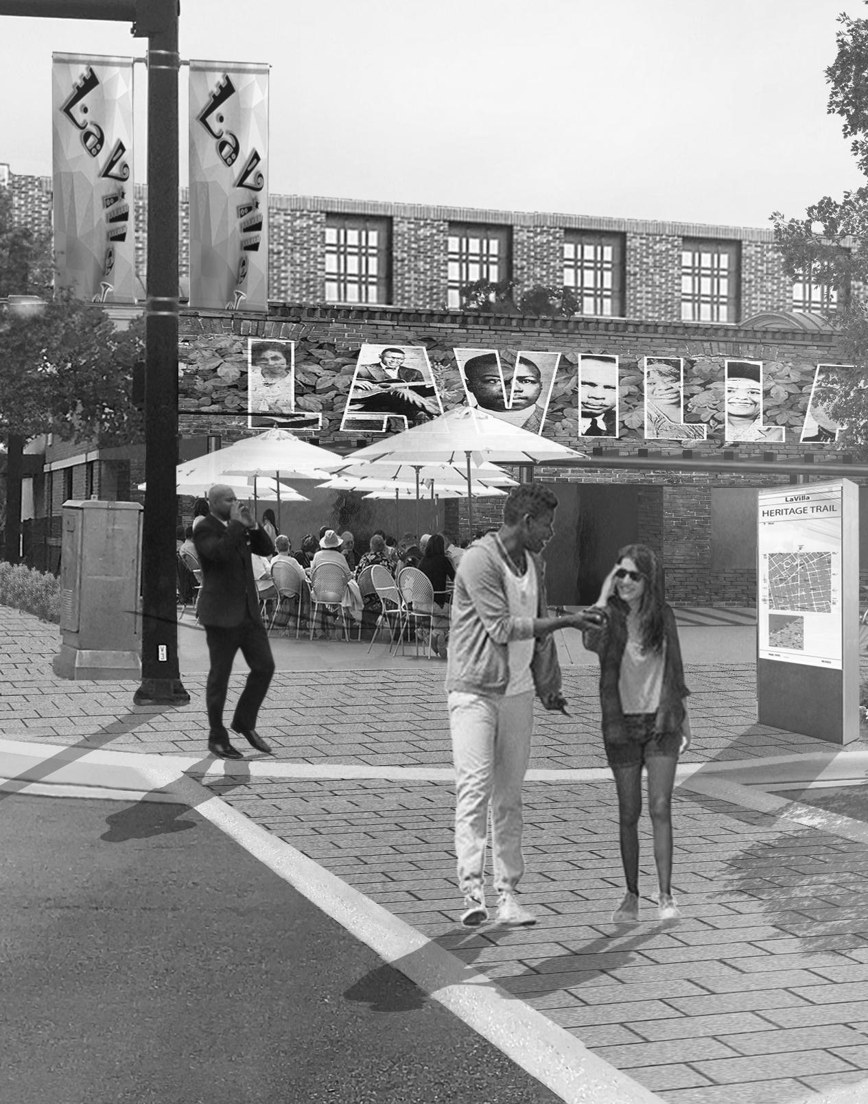
From the blues of Ashley Street to the red-light legends of “the Line,” every block of LaVilla has a tale to tell These stories are remarkable and compel people to learn more about LaVilla’s legacy The neighborhood built environment should thoughtfully engage people in the experience of LaVilla’s heritage while inspiring new stories for future generations to learn about
The LaVilla Heritage Trail ties together the past, present, and future of the neighborhood Envisioned as more than a bicycle and pedestrian connection, the trail would have small plaza areas at several key locations along its length These offer locations for interpretive art and signage that captures the story of the neighborhood where a proud community overcame second-class
Opportunities:
Cultural Points of Interest
Potential Interpretive Exhibit
citizenship to create original culture Traversed from end to end, the user can begin to understand the importance of African-American people reared in Jacksonville like James Weldon Johnson, John Rosamond Johnson, A Philip Randolph, Clara White and others
The LaVilla Heritage Trail can play a key role in the future of the neighborhood structure, as well The Trail presents an opportunity to connect the existing and emergent park system along Hogan’s Creek to the similar system envisioned along McCoy’s Creek at LaVilla’s southern edge This improved connectivity has the potential to create a “development address” for the neighborhood, similar to what’s been experienced along Indianapolis’ Cultural Trail or Atlanta’s BeltLine
1. Introduce the Heritage Trail along Park/Lee and Davis Streets, connecting Brooklyn with the “Emerald Necklace ”
2. Expand “Lift Ev’ry Voice and Sing” Park and design to celebrate James Weldon Johnson and the AfricanAmerican experience
3. Create a gateway park space at the corner of Davis and Union

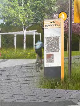
LAVILLA HERITAGE TRAIL: Making the neighborhood’s history visible
The route shown by the dotted line connects between Hogan’s Creek on the north and McCoy’s Creek on the South, a distance of approximately two miles This entire length, with the exception of the connecting block on Monroe Street, is in public ownership (City, JTA, School Board, State, and FSCJ), and has ample room to provide an off-street trail

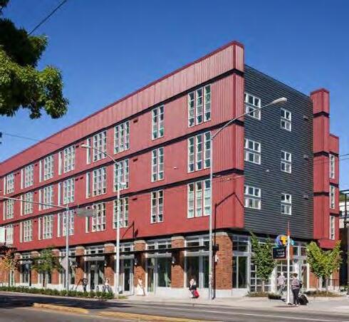
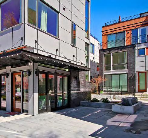
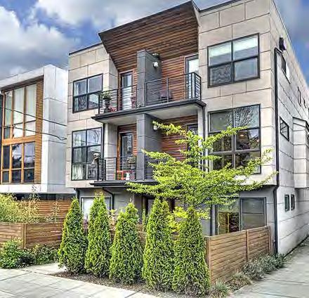
For most of LaVilla’s existence, a mix of housing types allowed for a diversity of households to call LaVilla home Over the last few decades, stratification of housing types has intensified as people “fled” Jacksonville’s urban core during the latter half of the 20th Century
Today, people are returning to Jacksonville’s core and as one of the original suburbs, LaVilla is ideally placed in proximity to employment, amenities, and recreation offered throughout the Downtown to provide an urban lifestyle that people demand
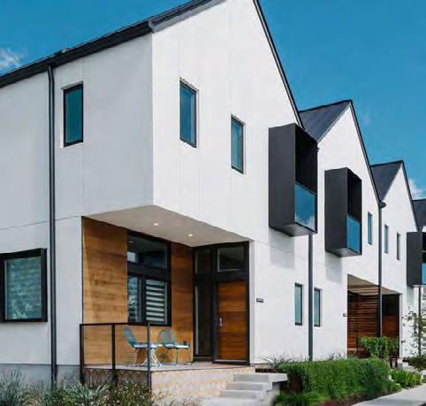
Between high and mid-rise housing within the Downtown and detached single family housing offered outside the urban core, “middle housing” types are missing from the market
By re-introducing a variety of these middle housing types such as townhome, multiplex, and live/work units to LaVilla, a broader spectrum of households, such as young families, professionals, students, and retirees can once again access the urban neighborhood lifestyle that LaVilla will offer
1. Emphasize the addition of residential units to LaVilla including workforce and senior housing to meet the needs of the growing urban core
2. Introduce fee-simple products in the form of townhomes and other attached unit types in order to offer greater ownership opportunities
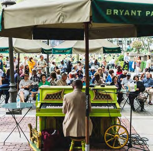
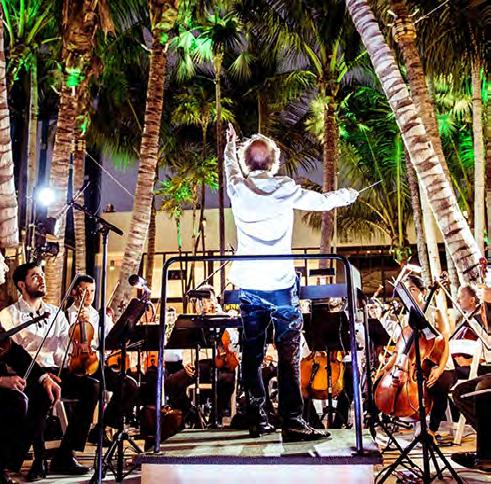
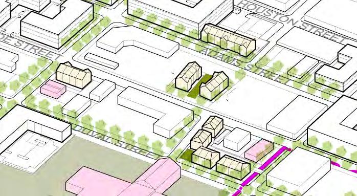
At its cultural peak, LaVilla offered distinct experiences around a myriad of special places Live music reverberating from the walls of the Bijou, Airdome, Globe, Frolic, and Strand theaters, filled Ashley Street with the sounds of jazz and blues The smell of fresh bread emanating from the New Star Bakery signaled one’s arrival to the corner of Adams and Jefferson Special places served LaVilla’s past and are imperative for its future
The neighborhood must be connected to the St John’s River to be part of the Downtown community This connection must be direct, safe, comfortable to bike and walk, and legible as a significant amenity to those living in the neighborhood
As a livable urban neighborhood, enhanced links to
Opportunities:
Neighborhood Connections
Parks
Gateways
Water Access Area
Connection to Water Nodes
Transportation Hubs
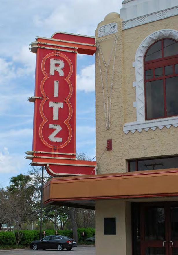
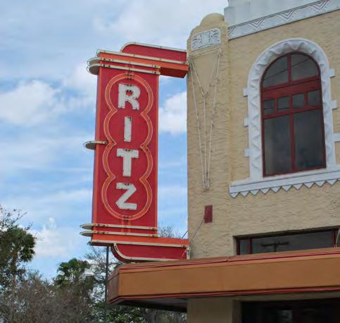
surrounding communities will enable LaVilla residents easier access to the assets of Jacksonville’s core including St John’s River amenities to the south, Downtown retail to the east, and UF Health employment to the north The “three doors” of LaVilla will serve as an invitation into the neighborhood while evoking a special sense of place The “Heritage Trail” will offer a bikeable and walkable connection between McCoy’s Creek to the south and Hogan’s Creek to the north (the strings of the “Emerald Necklace”) Small block sizes, a mix of uses, and human scale urban form will promote intimate experiences around a variety of signature economic and cultural attractants such as the “Lift Ev’ry Voice and Sing” chain of parks, arts & culture gateway near the re-emergent Ritz Theater, and a walkable commercial district extending from the Downtown along Adams Street
1. Develop a connection to the River along Water Street to the Riverwalk node at Pearl Street
2. Organize urban form to emphasize east/west connections to the Downtown via Adams Street & Duval Street
3. Celebrate the “three doors” to LaVilla with art and recreational amenities
4. Cultivate a platform for community culture at the heart of LaVilla’s arts cluster


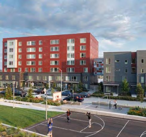
Long Term Office
Multi-Family
Regional Office Location
Regional Office Location
Lift Ev’ry Voice and Sing Park
Lift Ev’ry Voice and Sing Park
• Dedicated to the birth site of LaVilla’s Johnson Brothers
• Designed to celebrate the African American experience and LaVilla’s legacy
• Centering feature of the neighborhood, providing a third place
Residential Infill
• Position for either multi-family or attached forsale product (multi-family concept shown above)
• Target at or slightly under market value
• Activate park edge
• Maintain block structure
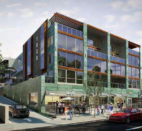
Office and/or Residential Lofts
• Residential if developed in near term
• Potentially an office site given time
• Activate Lee/trail edge and park with retail uses
Long Term Office
• Complementary with JTA hub
• Activate Lee and Forsyth streets with retail uses
Regional Office Location
• High visibility/access from I-95
• Improved block structure
• Targeted ground floor retail on Adams Street

James Weldon Johnson’s first memories are of the home his father built during the Reconstruction years of LaVilla: the maple trees planted in the front yard, the square piano stamped with the name “Bacon,” the “roar of the sea” from the conch shells on the shelf It was these moments and countless other experiences throughout LaVilla that inspired him to write “Lift Ev’ry Voice and Sing ”
The park which commemorates his contributions to our nation will invite people from all walks of life to share space and rejoice the rising sun of a new day in LaVilla From piano playing to pop-up spoken word, the Lift Ev’ry Voice and Sing Park will be a place of recognition and liberty The images shown on these pages indicate potential elements that could be part of such a park, but they should not be considered any sort of final proposal The park development process in LaVilla must incorporate a robust public discourse as part of the design process
LaVilla Arts Gateway
For Rent Multifamily
Re-purpose Existing Building
Gateway Park
• Celebrates innovation and entrepreneurship of LaVilla’s arts era
• Public mixing area at the center of the arts gateway
• Flexible, pop-up programming
Re-purpose Existing Building
• Indoor pop-up space for studios, performances, museums, etc
• Expressive exterior, mural space, etc
Gateway Park
Mixed-Use Building
For-Rent Multifamily
• Face on Gateway Park & Beaver Street
• Adds people to the center of Arts Gateway
• Ground floor retail on park side; limited retail on Beaver side
Mixed-Use Building
• Ground floor commercial with retail focus
• Longer term proposition
• Activate park
LaVilla School of Arts Pavilion
• Potential public “face” for school arts programming
• Galleries, small performances, etc

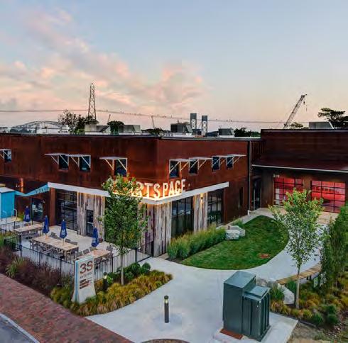

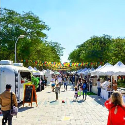
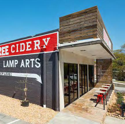
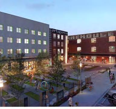
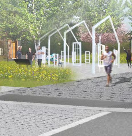
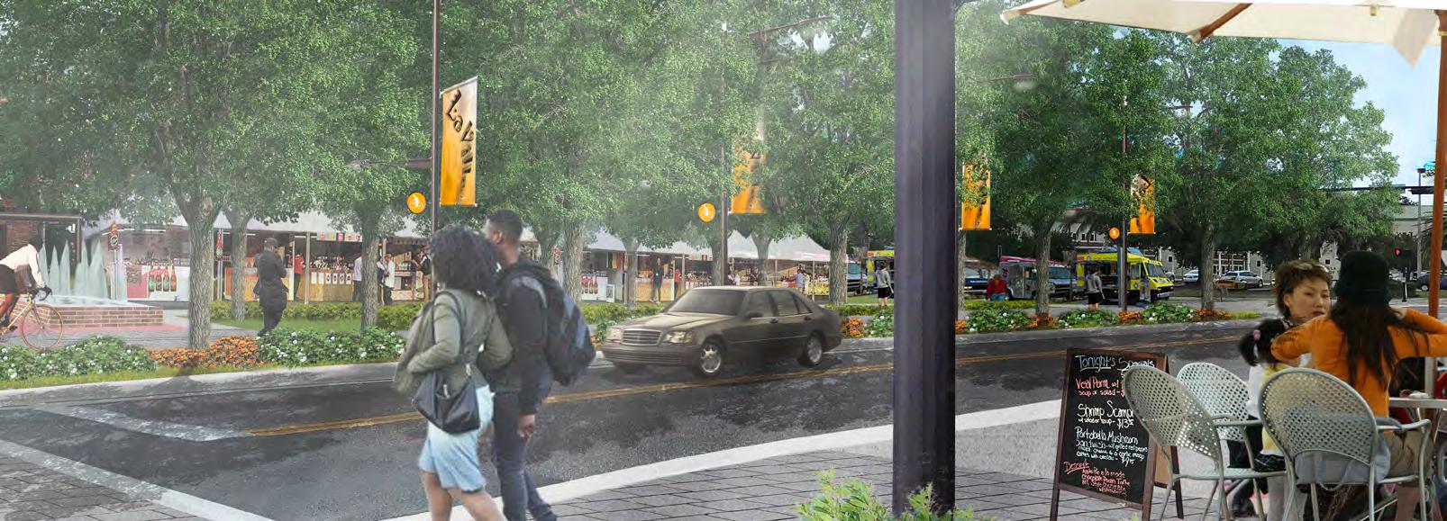
Gateway Park is a flexible space that celebrates the innovation and entrepreneurship of the LaVilla community during its cultural hay day Once a thriving hub of jazz and blues in the southeast, attracting a vibrant artistic audience, Gateway Park will restore LaVilla as a destination for artists traveling from city-to-city This dynamic space provides a canvas for an ever-changing expression of LaVilla culture in the form of pop-up performances, markets, and exhibits Gateway Park will act as a creative mecca for cultivating Jacksonville’s multi- generational artistic community
Research/Manufacturing
Jacksonville Regional Transportation Center
Focus on Innovation
• Insulated and compact to enable creative “friction” between students and professors
• Accessible by transit and bicycle allowing connectivity and interplay with surrounding neighborhoods
Counter Balance with Stadium District
• Western anchor on Bay Street
• Pushes/pulls activity through the central Downtown
Academic Partner with Growing Industries
• High-tech opportunities with JTA autonomous vehicle development
• Links with UF Health and other hospitals in advanced healthcare technologies
Initially, LaVilla’s streets consisted of deep sand, suitable for horse-trotting but unbearable for walking By the time John Cunningham opened his bicycle shop on West Forsyth in 1889, LaVilla’s newly paved streets were bustling with people walking and biking
At the turn of the 20th Century, LaVilla streets served as conduits for Sunday excursions in which families would travel by foot between a variety of performances, demonstrations, and shows throughout the neighborhood
Today, Sundays are quiet on LaVilla streets, except for the sounds of automobiles passing by Cars on- and
off-ramping from I-95 speed through Union, Adams, and Monroe The handful of pedestrians that are present must cross taxing lengths to get from one side of the street to the other, reminiscent of the sand-drudging days of early LaVilla
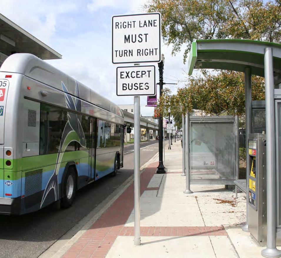
Modern mobility considers many different and new aspects beyond simply motorist traffic New technologies are being invented daily, and the City of Jacksonville has already been growing their mobility potential with facilities like bus rapid transit, autonomous vehicle technology, and other shared mobility The Jacksonville Transit Authority
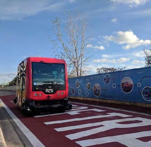
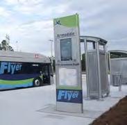
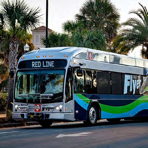
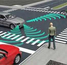
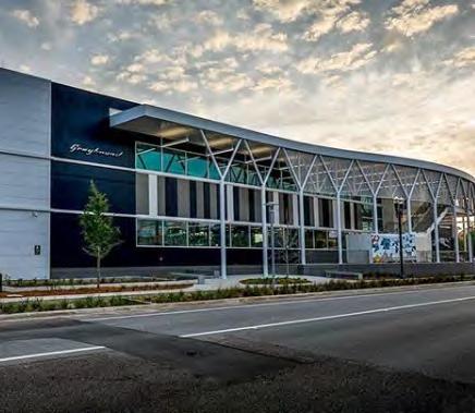
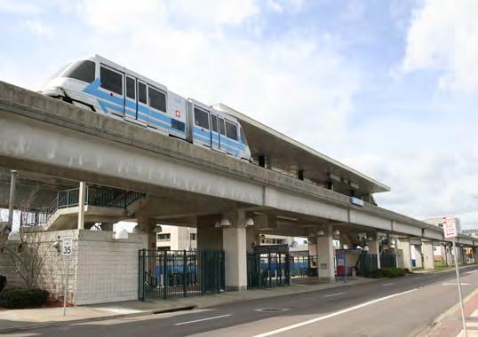
(JTA) has invested in the Ultimate Urban Circulator (U2C) which leverages the elevated Skyway with autonomous transit technology that will provide high frequency and flexible service into Downtown and south into Brooklyn and Riverside Neighborhoods Additionally, JTA has built the Jacksonville Regional Transit Center (JRTC) in the heart of the LaVilla Neighborhood and it serves as a major transit hub connecting LaVilla locally and regionally with the Skyway (and future U2C), the future First Coast Flyer BRT Purple Line, intercity bus facilities (Greyhound), and local bus lines All of these investments set the table for future redevelopment in LaVilla to move beyond traditional parking and vehicular requirements as new residents will have multiple opportunities to get around town and to regional amenities with a multitude of travel modes by simply “their car ”
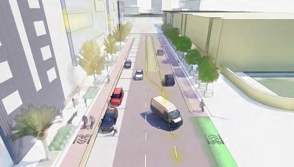
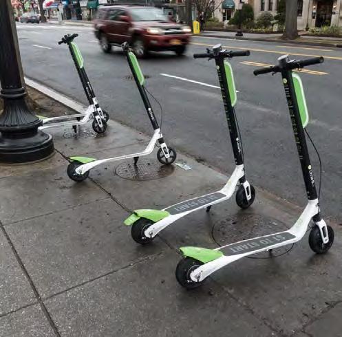
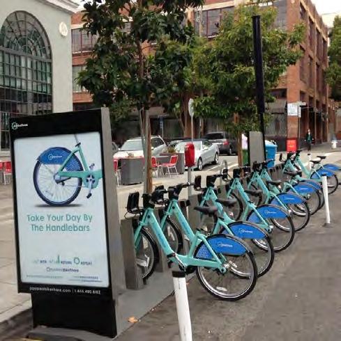
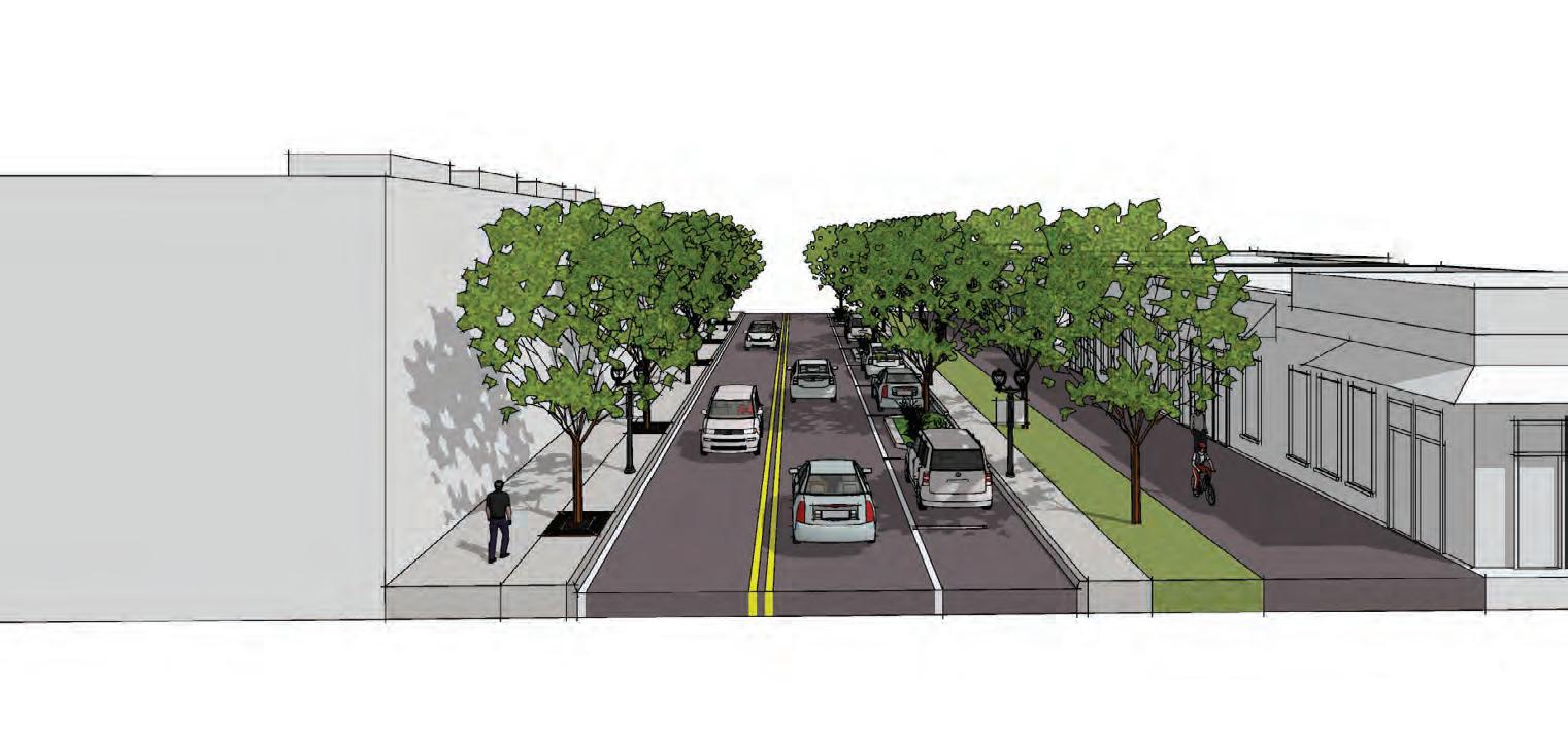
As the urban neighborhood of LaVilla grows with redevelopment, there is an opportunity to renew the existing streets as “Complete Streets” that serve all users of the street network system A Complete Streets approach brings a balance between the various users of the street: motorists, transit users, bicyclists, pedestrians, etc Streets that feel safe, facilitate many modes of mobility, and offer visual/interactive interest empower a greater diversity of people, young and old, to share the streets The streetscapes proposed for the LaVilla Neighborhood are also flexible and accommodate the every growing multimodal technologies like bike share, e-scooters, and ride-hailing services through adequate public space at intersections and additional curb space
at key destination locations This flexibility is created by accommodating a minimum 15’-0” setback from the curb line, which may include additional building setback easements on the existing private property, that will create a “pedestrian zone” with wider sidewalks, landscape areas, and adequate space for site furnishings as well as the previously mentioned multimodal technologies
As shown previously, the neighborhood development plan also creates a hierarchy of primary and secondary streets that assist with access management and continue to help shift the dynamic of transportation mode usage patterns as users feel safer to bike, walk, or ride a bus With the restructuring of the street network system and the implementation of complete streets, redevelopment is primed to replace the many existing surface lots and bring balance back to the streets of LaVilla, restoring them as places for people This is a crucial factor in creating a vibrant, healthy, and equitable LaVilla community
Additionally, the 2030 Mobility Plan, the 2017 Pedestrian and Bicycle Master Plan, and the City of Jacksonville Design Guidelines and Best Practices Handbook have already set in motion a series of streetscape investments (on Forsyth and Adams Streets), new bicycle infrastructure (Lee/Park Street, Davis Street) and other pedestrian projects on Bay and Water Streets These planned projects and design guidelines have been integrated into the proposed LaVilla Streetscapes on the following pages
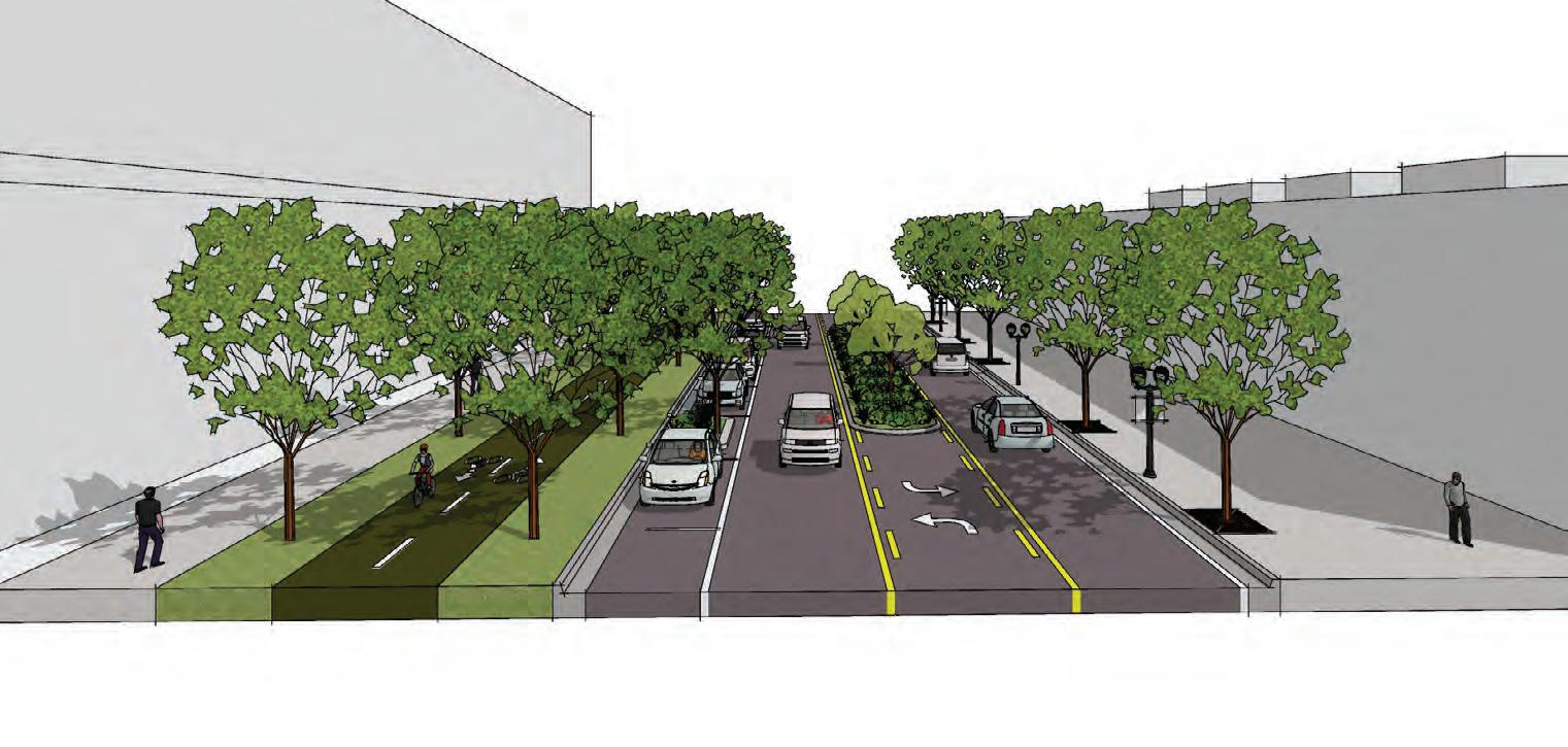
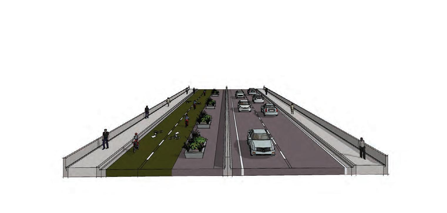
Reduce Water Street from 5-lanes to 3-lanes and add a cycletrack on the north-side to at least Pearl Street to facilitate better connections to the River.
The south existing curb would be held, and the current street edge-to-street edge of 70’ would be reduced to 44’ The existing on-street parking on the north side would shift south in this alignment
The current volumes on Water Street are roughly 3,480 AADT, with a maximum daily capacity of 35,154 –resulting in a utilization (or volume to capacity ratio) of 10% With this road diet, the v/c ratio would increase
to 20% A v/c ratio less than 85% generally indicates that adequate capacity is available, and vehicles are not expected to experience significant queues and delays
The additional space recovered by the road diet allows for a two-way cycletrack on the on the north side of the road buffered by two 7’ landscape areas to provide ample shade
Proposed Water Street
3 Lanes, Center Turn Lane, Continuous Sidewalk, On-Street Parking, Two Way Cycle Track on North Side
Two-Way Conversion Initiatives
Extend 2-Waying of Bay Street to Jefferson/Broad to facilitate movement. Bay Street has already been converted to 2-way between the I-95 exit ramp and Lee Street It currently has a maximum daily capacity of 33,720 AADT and 2018 counts show 5,946 AADT with v/c ratio of 18% Converting to two-way travel would effectively eliminate one lane This results in an increase to the v/c ratio to 26% A v/c ratio less than 85% generally indicates that adequate capacity is available, and vehicles are not expected to experience significant queues and delays
Support 2-Waying of Forsyth in the Mobility Master Plan from Lee Street
The 2017 update to the 2030 City of Jacksonville Mobility Master Plan lists the conversion of one way to two-way of Forsyth Street (to Lee Street) as a #1 priority under Motorized Transportation Projects
Forsyth Street has a maximum daily capacity of 20,088 AADT and 2018 counts show 9,635 AADT with a v/c ratio of 48% This percentage allows for flexibility to consider two way traffic in the future
Extend 2-Waying of Adams per the Mobility Master Plan to Stuart instead of Lee Street
The 2017 update to the 2030 City of Jacksonville Mobility Master Plan lists the conversion of one way to two-way of Adams Street (to Lee Street) as a #2 priority under Motorized Transportation Projects This two-way conversion should extend to Stuart Street
Adams Street has a maximum daily capacity of 30,420 AADT and 2018 counts show 6,279 AADT with a v/c ratio of 21% Converting to two-way travel would effectively eliminate one lane This results in an increase to the v/c ratio to 31% A v/c ratio less than 85% generally indicates that adequate capacity is available, and vehicles are not expected to experience significant queues and delays
Convert 2-Waying of Monroe Street in concert with Adams Street to facilitate movement. While not mentioned in the 2017 update to the 2030 City of Jacksonville Mobility Master Plan, Monroe Street is effectively the opposite pair to Adams Street Converting only one street to two way will limit the overall efficiency of the street network
Monroe Street has a maximum daily capacity of 20,088 AADT and 2018 counts show 2,538 AADT with a v/c ratio of 13% This low percentage provides ample room for traffic growth and two-way traffic as well as future development
2-Way Duval/Church from I-95 to Jefferson/Broad Church Street currently connects under I-95 to Cleveland Street and eventually to Myrtle Street, however it ends at Davis Street to the east Connecting Church south to Duval Street near Johnson Street will allow for the connection to continue past Davis Street and into the Downtown Core It currently has a maximum daily capacity of 20,088 AADT and 2018 counts show 1,629 AADT with v/c ratio of 8% This low percentage provides ample room for traffic growth and two-way traffic as well as future development
Main Street Initiatives
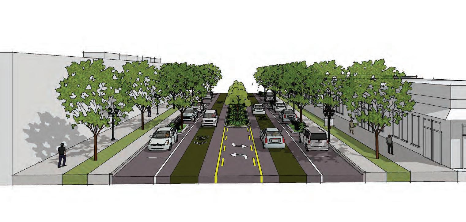
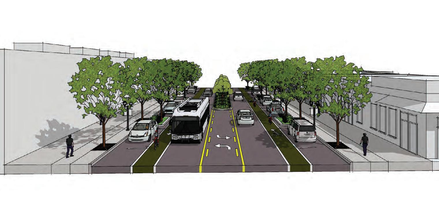
Adams Street and Duval Street
In addition to the conversion from one-way to two-way, the existing curb-to-curb width on Adams and Duval would allow for a two-way left turn lane that would be a spot median allowing for mid-block crossings as necessary On-Street parking could be added in both directions cutting into the existing curb where applicable Spot bulb-out landscape and tree islands are added to facilitate traffic calming and mid-block crossings as necessary
Bicycle mobility is accommodated through the application of “priority sharrows” as shown in the City of Jacksonville Bicycle and Pedestrian Master Plan
Priority sharrows feature a painted “lane” with a sharrow marking in the travel lane notifying motorists that bicycles shared the lane
There are some locations along Adams Street and Duval Street where the existing building is built right up to the existing right-of-way In these conditions, the sidewalk narrows to 5’ In the remainder of the corridor, new development would be setback 15’ (per the City of Jacksonville Downtown Streetscape Guidelines) which would allow for a 5’ tree lawn and a 10’ pedestrian zone (sidewalk)
This corridor would also feature raised intersections at cross streets to support slower traffic and a higher emphasis on pedestrian safety
Proposed Duval + Adams Street (With setback easement) 3 Lanes, On-Street Parking, Continuous Sidewalk, “Priority Sharrow” Lanes
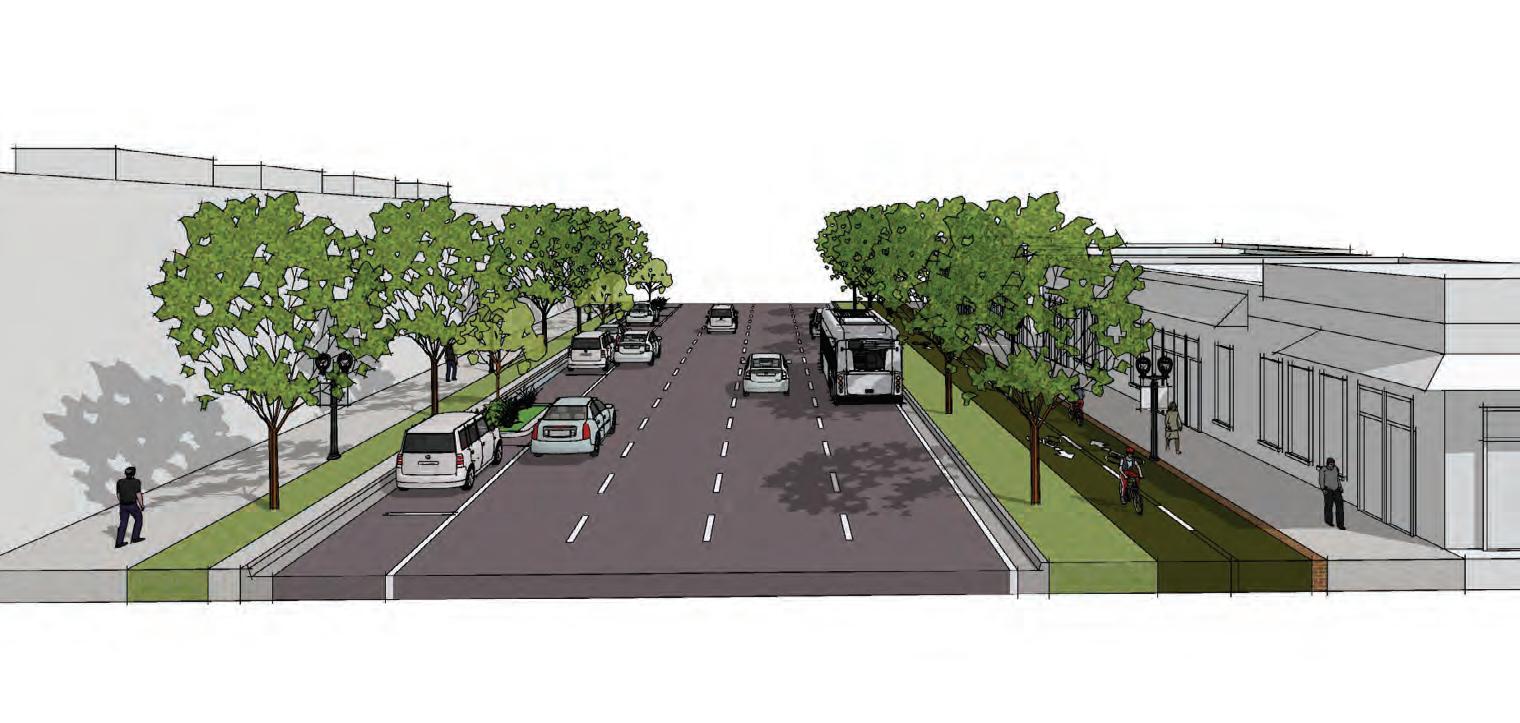
The Lee Street / Park Street Bridge from Brooklyn to LaVilla is current 4 lanes, two in each direction This segment has an estimated maximum daily capacity of 31,806 AADT and 2017 counts show 2,250 AADT with a v/c ratio of 7% Converting to two-way travel would effectively eliminate two lanes This results in an increase to the v/c ratio to 14% A v/c ratio less than 85% generally indicates that adequate capacity is available, and vehicles are not expected to experience significant queues and delays
The two-way traffic would be shift east to run on the east side of the existing barrier The remaining space would be allotted for a two-way cycletrack (through repainting the lanes) and added landscape to buffer the cycletrack from the barrier and motorist traffic The landscape would be in containers and/or movable
The east existing curb would be held, and the current street edge-to-street edge of 40’ would be increased to 47’ to accommodate on-street parking on both sides of the street The on-street parking would include bulbouts in the mid-block and at the intersections as well as the inclusion of a spot median in the two-way left turn as necessary
New development on the west side of Lee Street would be setback 15’-0” which would allow for a 14’-0” shared use path (branded as the LaVilla Heritage Trail) and an additional 4’ for street trees planted in grates adjacent to the on-street parking
Proposed Lee Street
3 Lanes, Continuous Sidewalk, Shared Use Path on West Side
Proposed Lee Street Bridge 2 Lanes, Continuous Sidewalk, Two Way Cycle Track on West Side
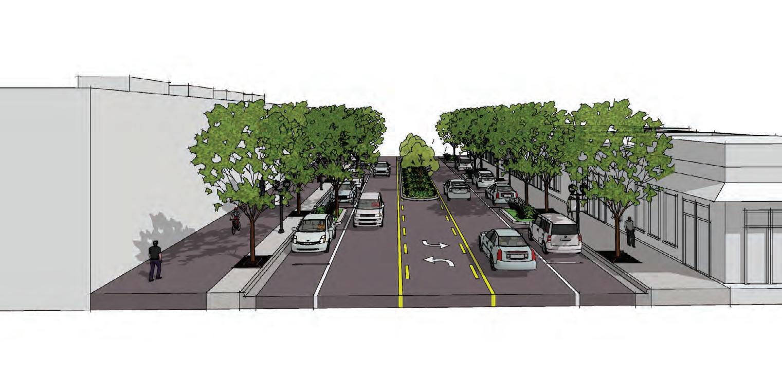
Davis Street
The west existing curb would be held, and the current street edge-to-street edge of 30’ would be maintained; however, the lanes would be re-striped to 11’-0” in each direction and the remaining 8’ would be utilized for on-street parking The on-street parking would include bulb-outs in the mid-block and at the intersections as well as the inclusion of a spot median in the two-way left turn as necessary
New development on the east side of Davis Street (or through an easement at the LaVilla School of Arts) would be setback 15’-0” which would allow for a 15’-0” shared use path (branded as the LaVilla Cultural Trail) and an additional 6’ for a street tree lawn and a 4’ step strip adjacent to the on-street parking
Beaver Street
Beaver Street is a 4-lane facility with no turn lanes and an estimated AADT between 9,000 and 11,600 throughout the study area 4-lane facilities with less than 20,000 AADT are generally considered to be good candidates for road diets and often lead to better traffic efficiency with the introduction of a two-way left turn lane
The current curb-to-curb width of Beaver Street is 40’ In the road diet, this would be re-striped to three 10’ lanes (including the two-way left turn lane with spot medians as necessary) and two 5’ standard bicycle lanes On-Street parking would be cut into the existing curb as necessary along with bulb-outs at mid-block locations and intersections The remaining space would be dedicated to street trees in grates and sidewalk area As redevelopment occurs, an additional 15’ would be added to the pedestrian zone creating a wide sidewalk boulevard with ample space for outdoor dining and other programmed streetscape furnishings
Proposed Davis Street
2 Lanes, Continuous Sidewalk, On-Street Parking + Shared Use Path on East Side
Street Edge-to-Street Edge
Proposed Street Edge to Street Edge
Proposed ROW (65’-0”)
Proposed Beaver Street (Ex Buildings setback off ROW)
3 Lanes, Continuous Sidewalk, Bike Lanes, On-Street Parking
Help calm traffic on Union & State through restriping, adding on-street parking on one side with bulb-outs, and narrower intersections.
Union and State Streets are a one-way pair that together process 54,500 AADT, the highest amount in the study area and generally in the Downtown Core The existing lanes are 12’ wide which provides an opportunity to re-stripe each street to 10’ lanes and add 8’ on-street parking on the south (State Street) and north (State Street) sides This on-street parking would also include bulb-outs within each segment and at the intersections to allow for street tree planting to help calm the traffic by enclosing the overall driver viewshed
A two-way cycletrack would be added to each street (on the north side for State Street, and south side for Union Street) as part of the 15’ building setback easement for future or existing development In addition to the cycletrack, an 8’ sidewalk (with a one-foot bricked separator) would be added adjacent to the cycletrack and a 15’ sidewalk would be added adjacent to the on-street parking
These priority projects represent the most critical immediate moves for the DIA to engage the vision. Project details are shown on the following pages.
1
5 Arts Gateway Apartments Scattered Site For-Sale Infill
4 LaVilla Heritage Trail Water Street Road Diet
3
Park Block Residential
Arts Gateway Apartments
Intent:
It is essential to activate the key entrance into LaVilla in the first phase of development This project benefits from visibility and access, but those same attributes make it unlikely the site will be suitable for less-dense for-sale townhomes The opportunity exists to reposition the vacant site into multi-family adjacent to FSCJ and proximate to the UF Health campus and other Downtown destinations The residential would benefit greatly from the development of the adjacent Gateway Park The residents would create additional park users and full-time “eyes on the street” to improve safety perceptions for both the park and the residents
Market Positioning:
• Rental multi-family at market rate
Program:
• 285 units in 5-6 story residential wrapping parking garage, parked at 1 5 spaces per unit Unit mix of 1/1, 2/2, and 3/2 skewed toward 1- and 2-bed units
Site area:
• 2 4 Ac +/-
Key Considerations:
• Target market land price
• Assign some portion of land proceeds to construct Gateway Park concurrently with development (or, alternatively, mark down land at equal value to park construction and require park to be built by developer with City design and oversight )
• Require new street between residential and park (by developer, but may be potential City concession)
• Require design standards for building that activate important street edges, particularly new Gateway Park edge
• Evaluate incentives for ground floor retail space along park side
Next Step:
• Develop detailed program and RFP for solicitation
Multi-family Residential
Lift Ev’ry Voice and Sing Park
For-Rent Multi-Family Scenario
Attached Residential
For-Sale Townhome Scenario
Lift Ev’ry Voice and Sing Park
Intent:
Development of the blocks adjacent to Lift Ev’ry Voice and Sing Park can have the dual benefit of introducing new product into the neighborhood and potentially financing improvements to and expansion of the park The expanded park sends a signal of the City’s intent with the development of true neighborhood amenities in LaVilla, while the residential provides activity and natural surveillance over the park, improving safety for all
Market Positioning:
• These blocks should be evaluated for development as either multi-family for-rent residential or for-sale attached townhomes
Program:
• Multi-family program: 270 units in 5-6 story residential wrapping parking garage, parked at 1 5 spaces per unit Unit mix of 1/1, 2/2, and 3/2 skewed toward 1- and 2-bed units
• Townhome program: 32 units in 4-unit “tuckunder” townhomes Orientation away from higher traffic streets
Site area:
• 2 25 Ac +/- (East block 0 75 Ac, west block 1 5 Ac)
Key Considerations:
• Initial analysis of for-sale product indicates that a market land price puts unit price above $400,000 This may exceed the market currently supportable in the neighborhood The alternative for-rent apartment project, similar in density to the Arts Gateway project, may be more attainable while delivering a similar return to the City
• In either development scenario, assign some portion of land proceeds to expand Lift Ev’ry Voice and Sing Park concurrently with development (or, alternatively, mark down land at equal value to park construction and require park to be built by developer with City design and oversight )
• In either development scenario, require new street between residential and park (by developer, but may be potential City concession)
• In either development scenario, require Johnson Street between Houston and Adams to remain an open public street In multi-family scenario, development may be allowed to bridge Johnson Street
• In either development scenario, require design standards for building that activate important street edges, particularly new Lift Ev’ry Voice and Sing Park edge
Next Step:
• Develop detailed program and RFP for solicitation
Intent:
The Trail is an important piece of “connective tissue” for the neighborhood For its entire length, with the exception of the connecting block on Monroe Street, the land needed for the trail is in public ownership (City, JTA, School Board, State, and FSCJ), and each site has ample room to provide an off-street trail The trail, even absent other development, would be a benefit to the wider community due to its improvement of the walking and cycling environment Downtown
Key Considerations:
• The first piece of the trail will set the tone for what follows It should be high quality design and finish
Next Steps:
• Engage other public owners to build momentum for project
• Conceptual design of full length of trail
• Engage arts community for design of logo and public art to be included at key nodes
Intent:
Reduce Water Street from 5-lanes to 3-lanes and add a cycletrack on the north side of the street to at least Pearl Street to facilitate better connections to the River
Key Considerations:
• The neighborhood needs a safe and direct connection to the Riverwalk The north side of Water Street provides the safest and most direct route, avoiding the ramps from the Acosta Bridge
• The volume to capacity ratio on Water Street is extremely low currently, and would still be low enough with a road diet that vehicles would not be expected to experience significant queues and delays
Next Steps:
• Conceptual design for road diet, incorporating lessons learned from Riverplace Boulevard construction
Intent:
A program of developing infill townhomes on City-owned parcels throughout the neighborhood can serve two purposes First, the units can be kept affordable through a variety of front-end (e g land markdowns) and ongoing means (e g land trusts) This improves the range of housing available in the neighborhood The subject properties are small and disjointed, which does not lend itself to larger development
Market Positioning:
• For-sale attached townhomes at significantly below market cost
Program:
• Approximately 50 townhome units in a variety of configurations based on site constraints
Site area:
• Varies
Key Considerations:
• Set up land trust (land owned by non-profit with 99-year lease to homeowner) to mitigate affordability effect of high value of downtown land
• Need initial construction subsidy to significantly reduce cost A portion of proceeds from the sale of other City properties in neighborhood could be earmarked for this purpose
Next Step:
• Assess potential developability of individual sites
• Investigate land trust model
Catalyst Sites are important locations that, when developed, will improve the character and underlying market in the neighborhood. For these sites, we recommend a series of targeted actions to build foundation for longer-term positive change in the community.
Innovation Campus Concept:
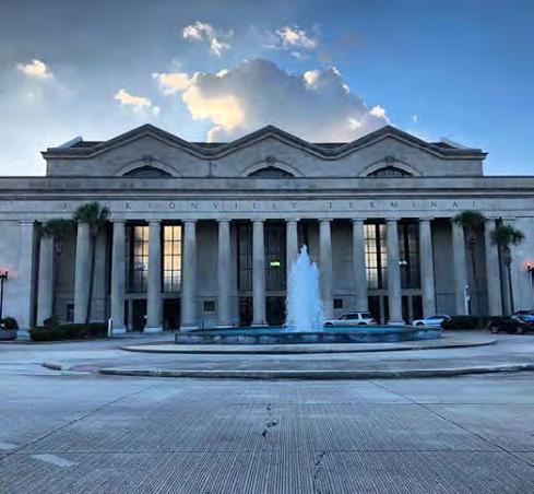
• Opportunity for large campus use including former Jacksonville Terminal
Initial moves:
• Foster interest in the site through adjacent development
• Engage potential end users in initial discussions
• Do not preclude single site user through piecemeal development at the edges of site Any potential development smaller than the entire site should require a full master plan of the site to identify that development’s relationship to the future whole
• Encourage multi-family development adjacent to the area while market matures to support non-residential uses
Duval Gateway
Concept:
• Realign Duval to Church Street under I-95 to improve physical and perceptional connection of western sites to core of Downtown This repositions land owned by the City and others adjacent to I-95 for “destination” uses as the market matures
Initial moves:
• Concept design of street connection
• Study relocation options for existing public facilities on site
• Engage adjacent land owners in alignment discussions
It is essential to activate the key entrance into LaVilla in the first phase of development This project benefits from visibility and access, but those same attributes make it unlikely the site will be suitable for less-dense for-sale townhomes The opportunity exists to reposition the vacant site into multi-family adjacent to FSCJ and proximate to the UF Health campus and other Downtown destinations The residential would benefit greatly from the development of the adjacent Gateway Park The residents would create additional park users and full-time “eyes on the street” to improve safety perceptions for both the park and the residents
Emphasize the addition of residential units to LaVilla including workforce and senior housing to meet the needs of the growing urban core
Introduce the Heritage Trail along Park/Lee and Davis Streets, connecting Brooklyn with the “Emerald Necklace ”
Bay St. to Jefferson St.
Extend 2-Waying of Bay Street to Jefferson/Broad to facilitate movement
Development of the blocks adjacent to Lift Ev’ry Voice and Sing Park can have the dual benefit of introducing for-sale product into the neighborhood and potentially financing improvements to and expansion of the park The expanded park sends a signal of the City’s intent with the development of true neighborhood amenities in LaVilla, while the residential provides activity and natural surveillance over the park, improving safety for all
Introduce fee-simple products in the form of townhomes and other attached unit types in order to offer greater ownership opportunities
Develop a connection to the River along Water Street to the Riverwalk node at Pearl Street
Expand “Lift Ev’ry Voice and Sing” Park and design to celebrate James Weldon Johnson and the African-American experience
Forsyth from Lee St.
Support 2-Waying of Forsyth in the Mobility Master Plan from Lee Street
Extend 2-Waying of Adams per the Mobility Master Plan to Stuart instead of Lee Street
Create a gateway park space at the corner of Davis and Union
Monroe with Adams
Convert 2-Waying of Monroe Street in concert with Adams Street to facilitate movement
Duval/Church from to Jefferson
2-Way Duval/Church from I-95 to Jefferson/Broad
The Trail is an important piece of “connective tissue” for the neighborhood For its entire length, with the exception of the connecting block on Monroe Street, the land needed for the trail is in public ownership (City, JTA, School Board, State, and FSCJ), and each site has ample room to provide an off-street trail
The trail, even absent other development, would be a benefit to the wider community due to its improvement of the walking and cycling environment Downtown
Reduce Water Street from 5-lanes to 3-lanes and add a cycletrack on the north side of the street to at least Pearl Street to facilitate better connections to the River
Catalyst Sites are important locations that, when developed, will improve the character and underlying market in the neighborhood For these sites, we recommend a series of targeted actions to build foundation for longer-term positive change in the community
Organize urban form to emphasize east/west connections to the Downtown via Adams Street & Duval Street
Reduce Water Street from 5-lanes to 3-lanes and add a cycletrack on the north-side to at least Pearl Street to facilitate better connections to the River
Celebrate the “three doors” to LaVilla with art and recreational amenities
Cultivate a platform for community culture at the heart of LaVilla’s arts cluster
Main Street Initiatives:
Adams St.
Redevelop Adams St entrance into LaVilla with ground floor commercial and walkable environment
Reduce to 3-Lanes with protected bicycle lane
Lee Street
Add traffic calming elements and multi-use trail
Davis Street
Add traffic calming elements and multi-use trail
Main Street Initiatives:
Duval St.
Redevelopment Duval St entrance into LaVilla as walkable environment
Beaver Street
Reduce to 3-lane and add traffic calming elements
Union & State
Help calm traffic on Union & State through re-striping, adding on-street parking on one side with bulb-outs, and narrower intersections
UNION STREET STATE STREET
BEAVER STREET
ASHLEY STREET
CHURCH STREET
DUVAL STREET
MONROE STREET
ADAMS STREET
FORSYTH STREET
BAY STREET STREET
HOUSTON STREET
JEFFERSON STREET
BROAD STREET
Block
A
B
C
A-1 Office and/or Retail
HT-1 Heritage Trail Segment 1
B1 Mixed Use (Residential/Commercial)
HT-2 Heritage Trail Segment 2
C1 Mixed Use (Residential/Commercial)
C2 Mixed Use (Residential/Commercial)
Street C Street (alley) D
D1 Multifamily Residential
LEV Lift Ev’ry Voice and Sing Park
HT-3 Heritage Trail Segment 3
Street D Street (alley) E E1 Residential/Office Building F
F1 Office Building
F2 Office Building
HT-4 Heritage Trail Segment 4
Garage F Parking
Street F Street
G1 Office Building
G
Garage G Parking
Street G Church to Duval Realignment H
H1 Office Building
H2 Office Building
H3 Office Building
Garage H Parking I I1 Office Building J J1 Mixed Use (Residential/Retail)
K1 Multifamily Residential
K2 Renovated Commercial
AGP Arts Gateway Park
HT-5 Heritage Trail Segment 5
Street K Street (alley)
Segment 7
O1
O2
O3
Townhome Residential
Townhome Residential
Townhome Residential
HT-6 Heritage Trail Segment 6
P1
Q1
R1
R2
S1
Townhome Residential
Multifamily Residential
Townhome Residential
Multifamily Residential
Multifamily Residential
S2 Multifamily Residential
T1
T2
U1
Multifamily Residential
Multifamily Residential
Multifamily Residential
U2 Multifamily Residential
V1 Mixed Use (Retail/Office)
W1 Mixed Use (Residential/Retail)
X1 Multifamily Residential
Y1 Mixed Use (Retail/Office)
Z1
Academic Building
Z2 Academic Building
Z3 Academic Building
Z4 Research/Manufacturing
Z5 Research/Manufacturing
Z6 Student Housing
Z7 Student Housing
Z8 Student Housing
Z9 Student Housing
Z10 Student Housing
Z11 Student Housing
Z12 Student Housing
Z13 Student Housing
Z14 Student Housing
UQ Urban Quad Garage A1 Parking Garage A2 Parking
RD-1 Water Street Road Diet
RD-2 Park St Bridge Road Diet
RD-3 Lee St Road Diet
RD
RD-4 Davis St Road Diet
RD-5 Beaver St Road Diet
RD-6 Union St Road Diet
RD-7 State St Road Diet
CS-1 Two-way: Bay to Jefferson
CS-2 Two-way: Forsyth from Lee
CS
CS-3 Two-way: Monroe with Adams
CS-4 Two-way: Duval/Church from Jefferson
Several funding and financial options are available to support the various priority projects identified in the LaVilla Neighborhood Development Strategy including the use of grants, tax incentives, and assessments Since the identified projects are planned or proposed, the various funding and financing options are similarly conceptual
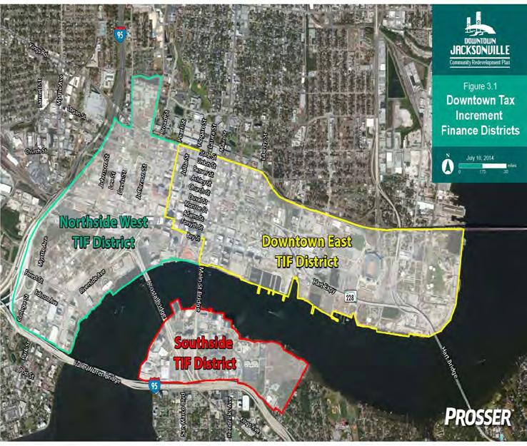
Although other resources will likely be necessary, we believe the most comprehensive and appropriate financial option depends on the use of the Northside West Redevelopment Trust Fund, supplemented by other specialized or targeted resources
The Redevelopment Trust Fund is comprised of tax increment revenues, dedicated to redevelopment within the boundaries of the Northside West TIF District
City Ordinance 81-562-24 established the NWRTF in 1981 and specified the base valuation of the property located within the boundaries of the District at $214,636,423
As the value of properties contained within the Northside Redevelopment area have increased over the years, 95% of taxes assessed by the City on these properties has been reinvested via the Redevelopment Trust Fund
Florida Statutes specify that these tax increment funds are to be used only for projects, improvements, acquisitions, and programs within the associated geographical boundary as well as for approved Community Redevelopment Area Agency administrative expenses
In the case of the LaVilla Neighborhood Development Plan, major planned improvements center on housing developments, but the plan also contemplates streetscape enhancements and new park spaces If handled creatively, some of the latter might be addressed within the context of adjacent development so they are ultimately implemented as private costs
Looking to increment revenue as a source of development incentives is common in Duval County
and the City of Jacksonville as well as elsewhere in Florida Exactly how these arrangements work will vary by local policy but the inducement to contribute incentive dollars using increment is an obvious means of encouraging immediate and continuing new development opportunities
We would assume that such an arrangement will involve a development agreement between the Downtown Improvement Authority or Community Redevelopment Agency and the private venture consistent with the overarching redevelopment strategy for the larger area
Such an agreement outlines the obligations of the private party to engage in specific activities subject to the adopted and regulating plan Such an agreement would normally stipulate the maximum time to complete predevelopment and final development commitments The agreement would similarly stipulate which costs could be targeted or funded with increment
As a practical matter, cash payments made directly to the developers, benchmarked to actual performance, may be more effective although they may also be used for debt
• Tax increment receipts do not constitute an additional tax for the project
• Many models in Florida applied in varied ways
• Scale of collections has potential material impacts
• Flexible in terms of its application of funds
• Nominal, if any, impacts on existing budget
• Can be bonded or used on a “cash” basis
• Bondable using many different approaches
• Approach pairs well with other financial resources
• Of the assorted options may require the least strategy and effort to advance and to implementation
Disadvantages of Increment Based Incentives:
• Money unlikely to be immediately available (for new TIF districts)
• Can be difficult to monetize revenue stream without other obligations
• Significant reporting procedures
In the case of the NWRTF, administered by the DIA, the most obvious tax increment program is the MultiFamily Housing REV Grant
The Multi-Family Housing REV Grant program provides for a recovery of a portion of the incremental increase in ad-valorem taxes, on real and tangible personal property, which is produced as a result of the multi-family housing development The amount of the grant is determined by the number of units developed, plus the amount of greenspace and cultural amenities the development provides, and the amount of retail/ commercial space included in a mixed-use development
To be eligible for the program the development must develop at least 25 new multi-family rental housing units in Downtown Jacksonville The DIA will confirm compliance with the eligibility requirements and additional commitments made by the Developer with quarterly reviews of rent rolls and annual audits and additional monitoring as needed
The City of Jacksonville owns or controls several key properties within the LaVilla Neighborhood Development Strategy The plan contemplates that certain properties should be made available to support market rate housing Based on other analyses completed by CSG, the value and ultimate cost of that housing largely depends on the cost of the underlying land While lands might be contributed in many ways to
support development, we generally envision that these lands will be transferred or placed into service at some discounted rate or extended and highly favorable terms to be determined Such discounts, normally subject to the terms of a development agreement or contract for purchase and sale, are a significant means of inducing new development targeted to a specific objective
Advantages of Contributed Lands:
• They are major assets available to encourage or reinforce major objectives
• The properties in question comprise an existing and easily deployed asset Of substantive financial value Typically, land costs can consume some 20% of a project’s total development costs
• Utilizing these properties is primarily an accounting issue rather than a new cost because any monies invested in these publicly owned properties constitute a sunk cost Effectively these public holdings represent prior investments already made
• May be a means to assure that supporting public objectives, such as open space elements, are emphasized in a planned project
• Once deployed for private development, they are added to the tax rolls
Disadvantages of Contributed Lands:
• Typically, the subject of potentially complex development proposals
• Appraisal and valuation practices sometime generate controversy
• It can be difficult to achieve a balance between desired public benefits and cost reduction goals intended to induce the private market to perform
• Requires major time and attention to any implementing agreements
These controlled and available parcels should play a substantial role in achieving objectives of the Neighborhood Development Strategy They can be used to anchor the more difficult but also the most catalytic projects How these properties get released and deployed properly is the subject of more detailed strategic thinking
Impact fees are legislatively imposed charges levied against specific types of construction activity to offset or absorb capital costs created by threshold levels of new development They are normally applied to the capital costs of certain roads, schools, parks, other facilities or infrastructure, and various public safety costs
Advantages of Impact Fees:
• Dollars allocated to site specific activities identified in enabling ordinances
• Criteria for fees are updated periodically
• Updated or revised by ordinance and resolution
Disadvantages of Impact Fees:
• They are major assets available to encourage or reinforce major objectives
Observation or recommendation
We believe these dollars can provide a significant advantage to private initiatives in the targeted area relative to other parts of the community acknowledging the LaVilla neighborhood as a policy priority They are not an additional levy but rather a relief of an existing burden or cost
Special assessments fees are levied to achieve a specific level of benefit or service They can take many forms under various provisions of Florida law Depending upon their purpose or the means of implementation, such assessments may be imposed simply by the legislative body or they could be authorized by referendum in some cases
Special assessments are a financial resource with flexible application to absorb or offset both operational and capital costs These assessments must, however, be shown to provide a demonstrable benefit to property and the charge cannot exceed the benefit which is more than simply an increase in value They can be applied to the capital or operational costs of roads, lighting, parks, and other facilities or infrastructure broadly defined
Advantages of Special Assessments:
• Easily used to secure long term debt
• Often a very reliable financial mechanism until tax increment or other incentive funds become available
• Dollars can be allocated to site or area specific activities identified in enabling ordinances
• Ties a very specific activity or improvement to a particular charge or revenue steam
• May easily be updated or revised by ordinance and resolution
• If imposed under statutory certain provisions, has a very particular term subject to expiration
• Can be used for capital and operations
Disadvantages of Special Assessments:
• An additional charge for services perceived as more properly absorbed by tax [general fund] dollars
• May be difficult to justify added charges or fees in disadvantaged neighborhoods
• If subjected to referendum, may not be adopted
We believe these dollars are perfectly appropriate for some corridor improvements such as sidewalks, lighting, related upgrades, and continued street maintenance because of their material association with property They are worthy of consideration for park activities that will obviously benefit some properties in the neighborhood and could provide some of the financial resources for larger road improvements Special assessments do not necessarily have to pay for the full cost of any specific improvement
Grants are typically performance and/or criteria based awards directed to a variety of initiatives and originating from many different local, state, and national resources They are typically competitive although “need” may be a sufficient premise for the competition As well as coming from governmental sources, grants are sometimes provided by major area banks and institutions, foundations, and many smaller non-profits Federal and state grant opportunities are highly limited As such, their value and availability today are highly speculative That said, we have identified a limited number of resources or programs which have made awards in the past for few years and which are worth noting These include:
Streetscape/Mobility Improvements:
• Transportation Alternatives Program (TALT/ TALU) funding approved by the North Florida TPO (Transportation Planning Organization) for transportation alternatives including on- and offroad pedestrian and bicycle facilities, infrastructure projects for improving pedestrian/bicycle access to public transportation and enhanced mobility, recreational trail program projects and safe routes to school projects The TPO generally applies TAP funding to multi-use trails and school safety walk projects
• Surface Transportation Block Grant Program which are flexible funds that the North Florida TPO can directly program on federal aid highways, bridge projects, transit capital projects, intracity/intercity bus facilities, and, in some instances, road diets
Park Development/Improvements:
• Florida Recreation Development Assistance Program (FRDAP) is a competitive, reimbursement grant program providing financial assistance for acquisition or development of land for public outdoor recreation Eligible participants include all county governments, municipalities in Florida and other legally constituted local governmental entities with the responsibility for providing outdoor recreational sites and facilities for the general public
• Land and Water Conservation Fund (LWCF) a federal competitive program, administered through The Land and Recreation Grants Program, that provides grants for acquisition or development of land for public outdoor recreation Eligible participants include all county governments, municipalities in Florida and other legally constituted local governmental entities with the responsibility for providing outdoor recreational sites and facilities for the general public
• Special Category Historic Funding, administered through the Florida Department of State, Division of Cultural Affairs, can be used to support the design, fabrication, and installation of museum exhibits (i e historic elements included along the LaVilla Heritage Trail, Arts Gateway Park, and Lift Ev’ry Voice Park
Advantages of Grants:
• They are often dollars extended without recurring obligations to the recipient
• They can often be paired with, or inserted into, any financial scheme
• They can be available for both capital and operational activities
• May create a long-term partnership with granting entities or institutions
• May be flexible in some cases as circumstances evolve
Disadvantages of Grants:
• Not likely to be an immediate financial resource
• Usually highly competitive and can be costly to pursue
• Major reporting and accountability requirements
Observation or recommendation
Because grant dollars are highly speculative, they are not a sturdy foundation for an implementation plan, especially if there are near term objectives which must be satisfied Grants are better viewed as enhancements to financial options which are imminent and controlled by the parties or groups looking to realize immediate change through a plan To the degree grant dollars appear to be available and matched to the circumstances, they are worth exploring That said, in our opinion, they are most suited to upgrades or longer-term activities, or to seed some initiatives which would otherwise be impossible to launch
There are many projects or programs underway in Lavilla and the larger community which should be coordinated and leveraged to support the priority projects identified in the LaVilla Neighborhood Development Strategy The priority projects identified in the development strategy represent the most immediate moves for the DIA to engage the plan’s vision
Ideally, these near-term projects, or their staffing and design, should be carefully considered and evaluated for their potential to advance or share funds or resources that might align with key elements of the plan It is, for example, a marginal cost to create a wider paved surface
capable of supporting a bike lane Over many projects or programs, careful planning, coordination, and scheduling can save dollars that often may be sufficient in scale to support the equivalent of still other projects
Effectively, the recommendation is a strong commitment to leverage and coordinate where opportunities to do so might otherwise be lost Without suggesting such opportunities have been lost in the present case, they are known to have been overlooked in other settings resulting in modifications or the addition of staff at points which may have been avoided
Today, there are several projects in LaVilla either recently developed or under development now, such as two workforce housing projects along Water Street In the case of both projects, alterations made to the streetscape could have contemplated the Water Street Road Diet, saving on material and time to the ultimate implementation of the road diet As LaVilla continue to redevelop, future opportunities to coordinate plans will result in cost/resource efficiencies
Advantages of Coordination:
• Recognizes and leverages investments in staff and other program resources which have already been committed
• The costs often leverage dollars without recurring additional obligations
• These efforts are wholly marginal costs so they are extremely efficient from an economic standpoint
• Can literally be paired with, or inserted into, any financial or program scheme
• May be flexible in some cases as circumstances evolve
Disadvantages of Special Assessments:
• Requires very forward-looking thinking
• Rarely aligns perfectly with existing budget priorities
• May alter a preferred sequence of events
Observation or recommendation
The costs stemming from enhanced coordination are real but they are incremental or marginal so they can generate real savings overall The usual approach is to view costs on a per unit basis where the approach
here necessarily requires a broader, more management intensive, and more comprehensive plan of action well into the future
Because grant dollars are highly speculative, they are not a strong foundation for an implementation plan, especially if there are near term objectives which must be satisfied Grants are better viewed as enhancements to financial options which are imminent and controlled by the parties or groups looking to realize immediate change through a plan To the degree grant dollars appear to be available and matched to the circumstances, they are worth exploring That said, in our opinion, they are most suited to upgrades, or longer term activities, or to seed some initiatives which would otherwise be impossible to launch
In concert with the strategies outlined, we place a strong emphasis on the incremental receipts generated by the Northside West Tax Increment District, supported or leveraged by other resources Some combination of cash (pay as you go), loans (short term obligations), and debt (long term obligations) are necessary to advance or secure all the improvements and development we have identified within the larger scope of the LaVilla Development Strategy The precise legal structure will need to be defined by your legal counsel but our recommendations conform with Florida law as we generally understand it
We believe there are initial improvements which benefit the overall area and should, or must, be made to support or advance development opportunities in LaVilla Similarly, there are other improvements that should be tied to, or made a part of specific projects or parcels In the case of the latter, the cost or money for these might be considered incentives to the developer Other improvements might be made to certain areas of LaVilla when or where needed Finally, there are ongoing programs linked with several key improvements These focused programs assure coordination and support to sustain the energy launched by these improvements
As the general discussion outlines above, some programs or improvements are more suited to one investment
vehicle and/or certain kinds of activities Impact fees, for example, are onetime costs, and the related fees can be received (or credited) only as development actually occurs
Having made these observations, we are of the opinion that key initial investments identified in the plan the basic plan structure because their scale may be prohibitive if done on a “pay as you go” basis The critical early investments may require general funds, assessments which could expire as TIF proceeds become sufficient, or loans, including loans to the entity directly involved in TIF initiatives
Funding Source