


Prepared
Robin
Donald
The Clermont community is committed to ensuring the ongoing social, cultural and economic value of its downtown and waterfront. For the last 100 years, the hills, historic downtown, adjacent neighborhoods and the Lake Minneola waterfront have been the defining characteristics of the community, creating a setting for a livable, small town feel that is connected to friend and family, the local Florida environment, and an emergent identification with healthy living. The downtown and waterfront is the place which all of Clermont takes ownership in, and it is a place where residents, business owners, and institutions have invested themselves to enjoy the high quality of life of this intimate community.
Clermont and its waterfront are also emerging as a regionally significant address. Since the development of the South Lake Trail, the Olympic Training Center, and the strong regional growth, the South Lake County area has developed a unique character brand and identity associated specifically with Clermont. Today, Clermont has become a destination for tourism, athletic training and competition, recreation, commerce, and culture. The community’s
current challenge is to leverage these assets while protecting and enhancing the character of the ‘real Clermont’ to the benefit of those who live and work here.
As a community, Clermont has engaged in discussions about its character, vision, and future. This was accomplished, in part, through an extensive visioning process and recently adopted re-branding. The outcome of these efforts is the development of a platform of engaged stakeholders who are optimistic about the future, and prepared to tackle challenges in order to maximize Clermont’s potential as a beautiful, livable community of choice.
The plan on the following pages advances this work as part of a more focused initiative to enhance the downtown and waterfront. This plan builds on the community conversation outcomes from the visioning process and defines and prioritizes common aspirations, new opportunities, and specific enhancements necessary for the continued quality development of a great waterfront community.
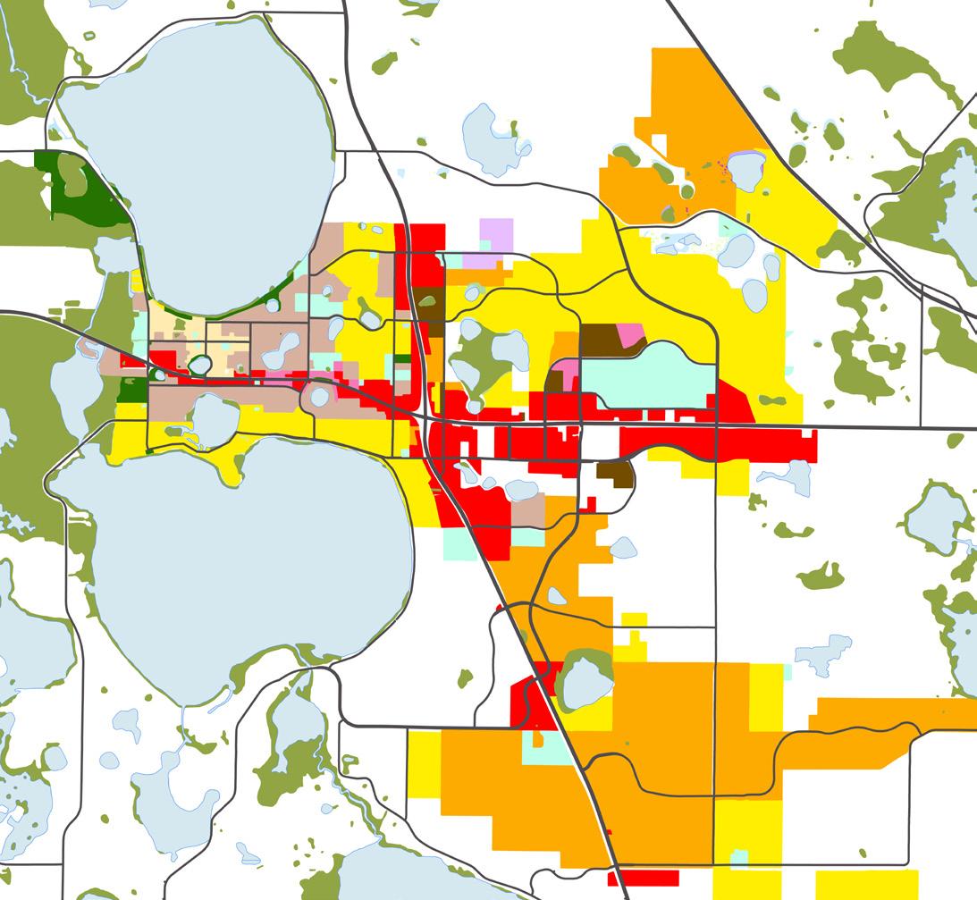
The settlement pattern in Clermont has evolved since the end of World War II, when the city comprised the area between Lakes Minneola and Minnehaha along SR 50 and the Orange Belt RR. Even 20 years ago the city was fairly compact and largely still found west of US 27. The past two decades have seen growth to the east and south, away from downtown and the waterfront.
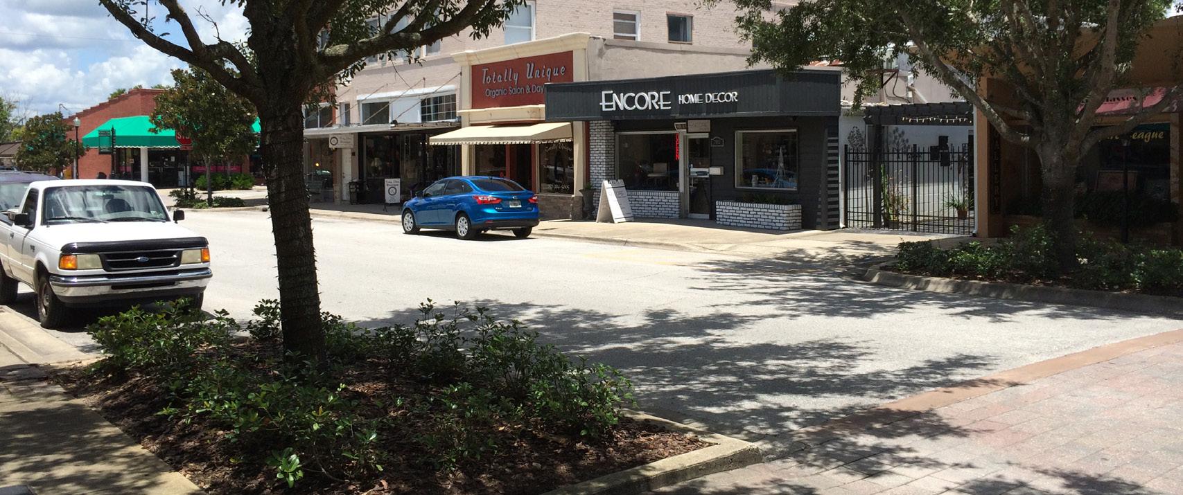
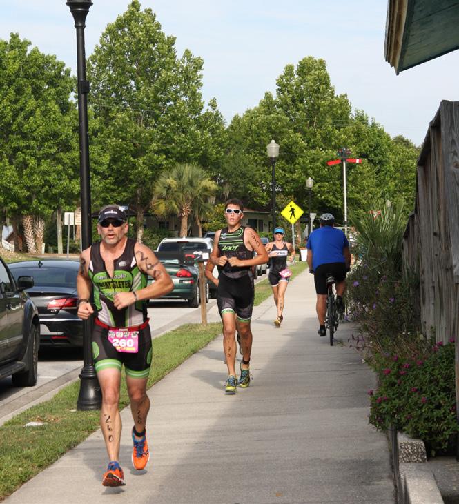
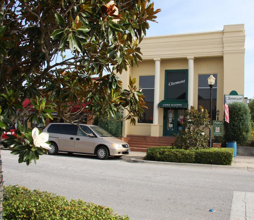
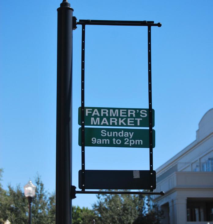
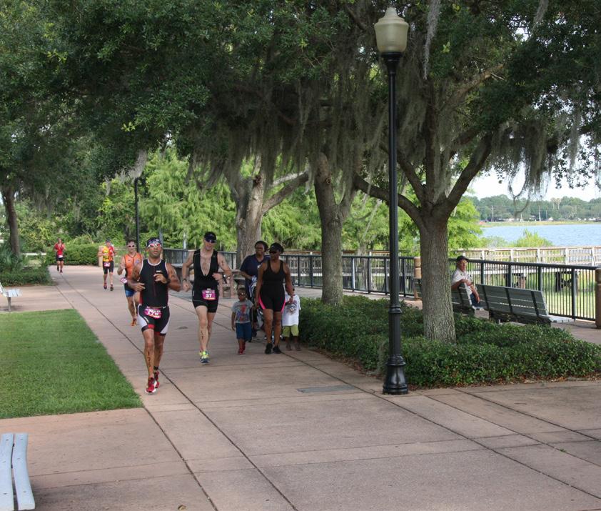
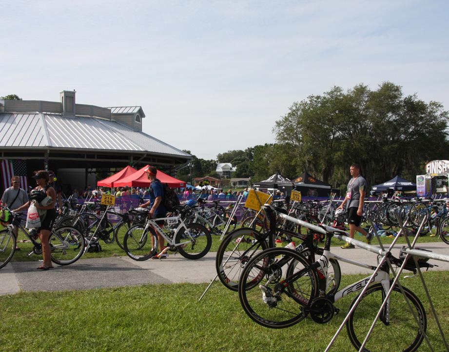
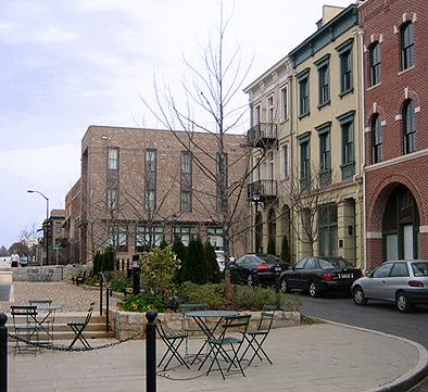
Images from downtown and the close-in neighborhoods, clockwise from below: The Farmer’s Market is one of many special events that bring people to downtown; One of many service-type uses downtown; Races like this triathlon have the potential to bring many more people to downtown if they occur closer to 8th Street; The shopping core on Montrose Street has streetscape and on-street parking already in place


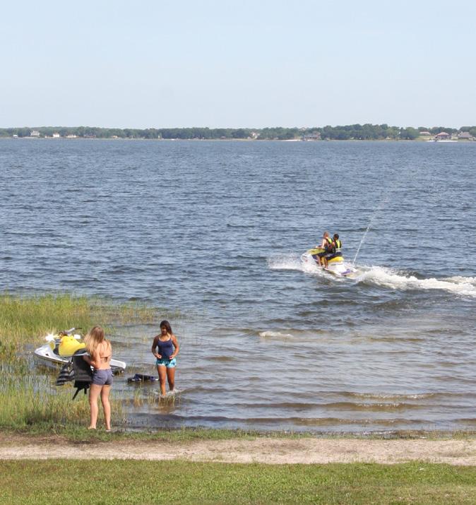
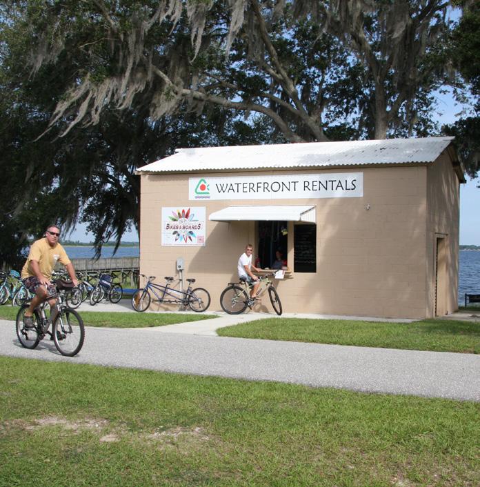
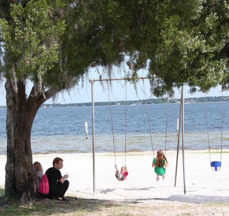
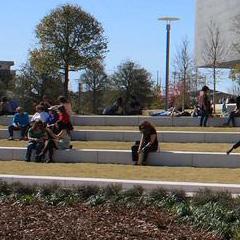
Images from the downtown waterfront, clockwise from above: Watersports, like jetskiing, sailing, and kayaking, are year-round activities at the lake edge; Footrace jockeying for the same space as leisure walkers at 8th Street; Waterfront rentals provide a node of activity along the waterfront; Passive activities, like these shaded swingsets, can be found in several locations on the waterfront; Staging for large events is an important element to design.
BE FUTURE
• Demand for this product will lag residential development.
• If the number of events and festivals in the downtown area can increase, this will augment restaurant/food and beverage demand.
• It is likely that food and beverage operations will be local in nature.
• Increases in traditional retail will be difficult. Most retailers prefer the higher traffic areas along SR 50 and US 27.
WE BELIEVE THERE IS CURRENTLY DEMAND FOR NEW RESIDENTIAL UNITS IN THE DOWNTOWN CLERMONT AREA
• The residential market has rebounded locally and state-wide.
• Multi-family for-sale prices have started to increase again, though they are still far off from market peak.
• Current residential prices are about what was achieved in the years just prior (2003-2004) to the peak market years.
• The rental market is strong, with high occupancies. Rents are typical for suburban product at about $1.00+ per SF.
• For-sale townhome or condo development would be more appropriate for smaller in-fill locations.
• Rental apartments would be more appropriate for larger sites that could accommodate 100+ units.
• Development in the core of downtown needs to have access to zoning (either by right or through incentives) to allow 25 to 40 units per acre, which achieves 3-4 story surface parked development.
Since 2000, 28% off all multi-family units sold in the city were in downtown. (50 units)
Recent citywide multi-family for-rent occupancies range from about 91% to 98%.
Multi-family units in Downtown averages about $30,000 to $75,000 per unit.
Downtown Clermont CRA has about 167,000 SF of retail space.
Clermont has the highest percentage of restaurant space compared to other nearby cities (19.6%)
Several other Central Florida cities have seen a renaissance along their waterfronts, and offer some interesting comparisons and lessons to Clermont.
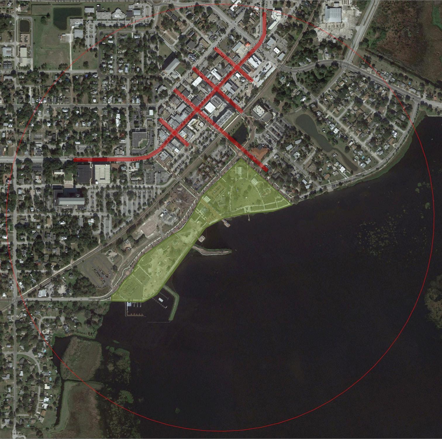
Tavares: The waterfront park space is immediately adjacent to downtown’s shopping/retail district (shown in red on the image). This proximity allows events that happen at the park to “drive” retail and restaurant customers to the district’s shopping streets.
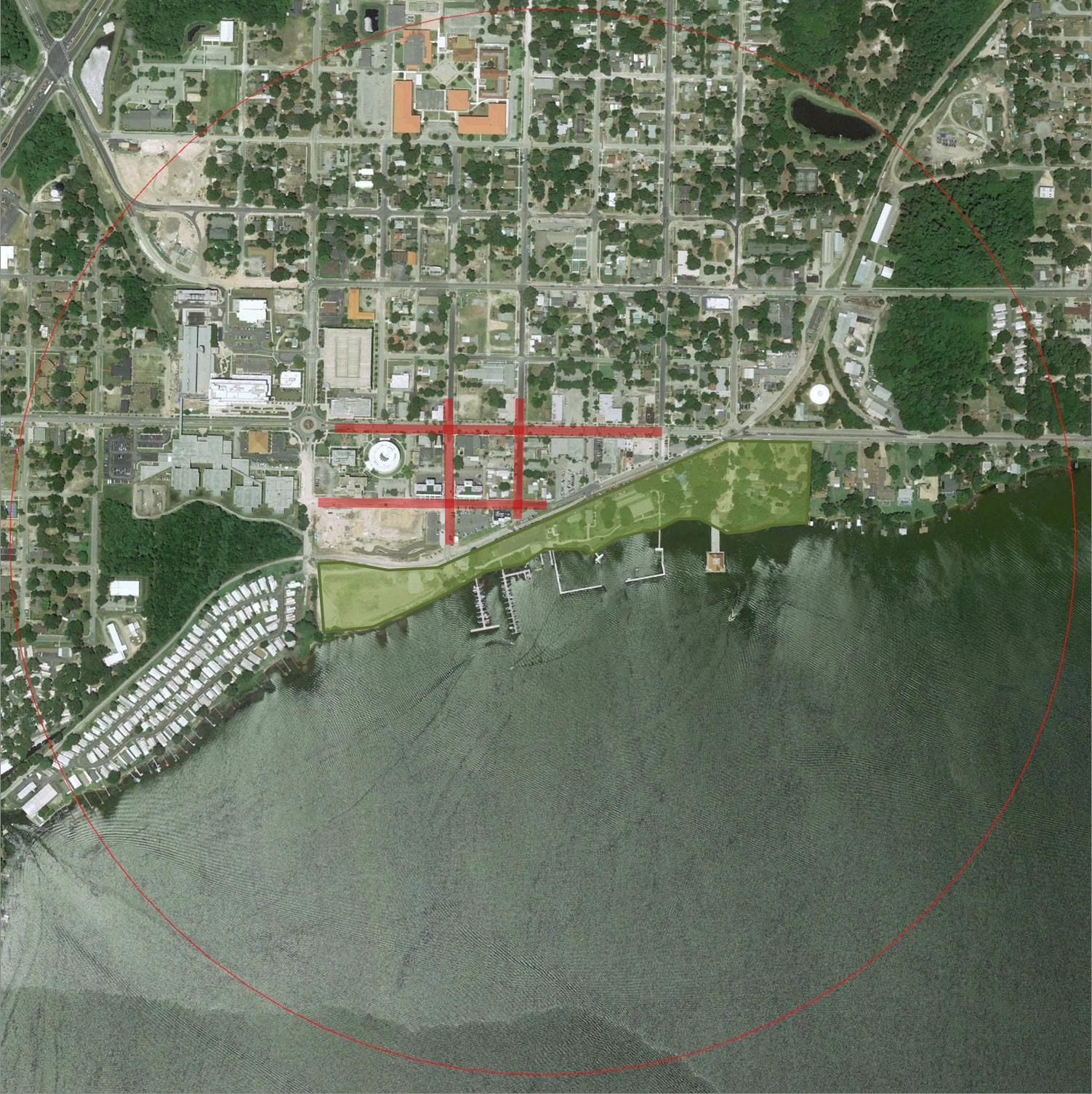
Eustis: The waterfront park is again proximate to downtown, which allows a strong relationship between downtown uses like shopping and restaurants and the lake amenity.
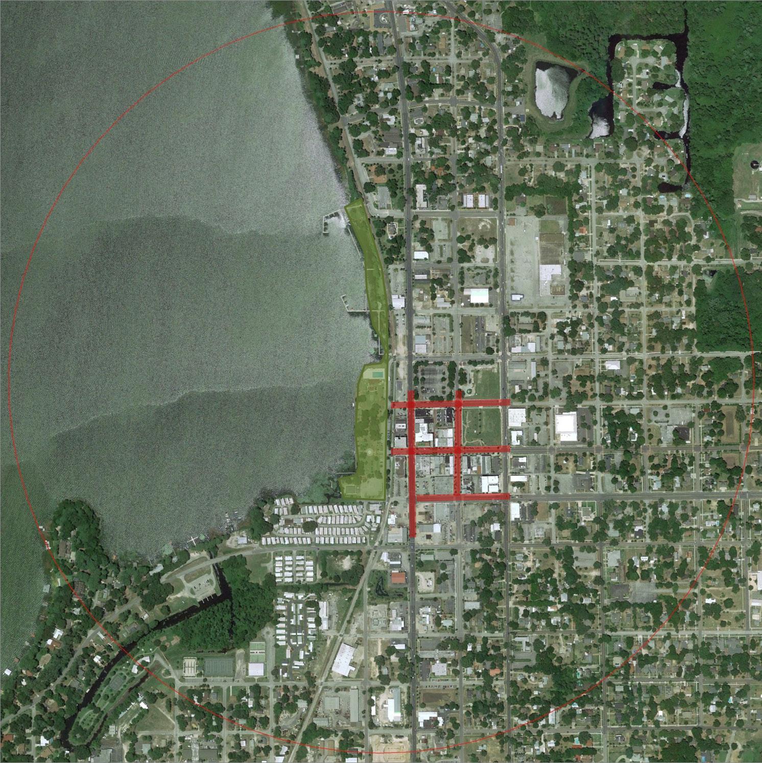
Kissimmee: Kissimmee’s multi-million dollar Lakefront Park brings a very large amount of diverse activities to the area two blocks from the main street of the district, linked by a pedestrianfriendly street.
The plan is based on a set of THEMES that describe the future downtown waterfront. The THEMES are organized into four MOVES that are implemented in individual PROJECTS. The projects cover the wide geography of downtown (as shown on the following pages) and have been loosely grouped into projects that should be considered now, soon (in 2 to 5 years), and later (beyond 5 years) based on their ability to fundamentally alter the course of downtown toward the MOVES and the City’s perceived readiness for the activity.
Downtown is an established “place” but needs to encourage more people to stay longer, more often, in order to grow and thrive.
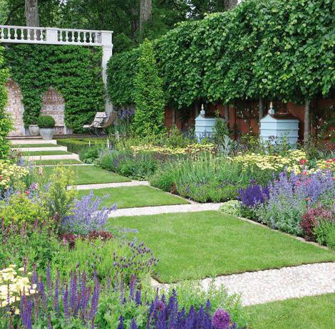
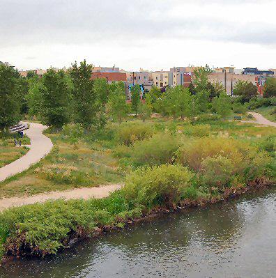
The waterfront presents an opportunity to have a linear park experience with many more leisure and recreational activities than are currently provided.
The community cares about the aesthetics of both natural and constructed places, but the perception of downtown from major routes is undifferentiated and unremarkable.
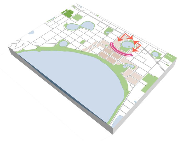
Downtown, along with the other two emerging centers at the NTC and Clermont Community Center, needs to be better connected to the surrounding neighborhoods.
The success of downtown will be built on a foundation of supporting infrastructure and city services.
Create a Window to Downtown on SR 50
Connect the Parks and Neighborhoods
Add Energy and Activity to the Downtown Core
Re-Orient and Diversify Waterfront Activities
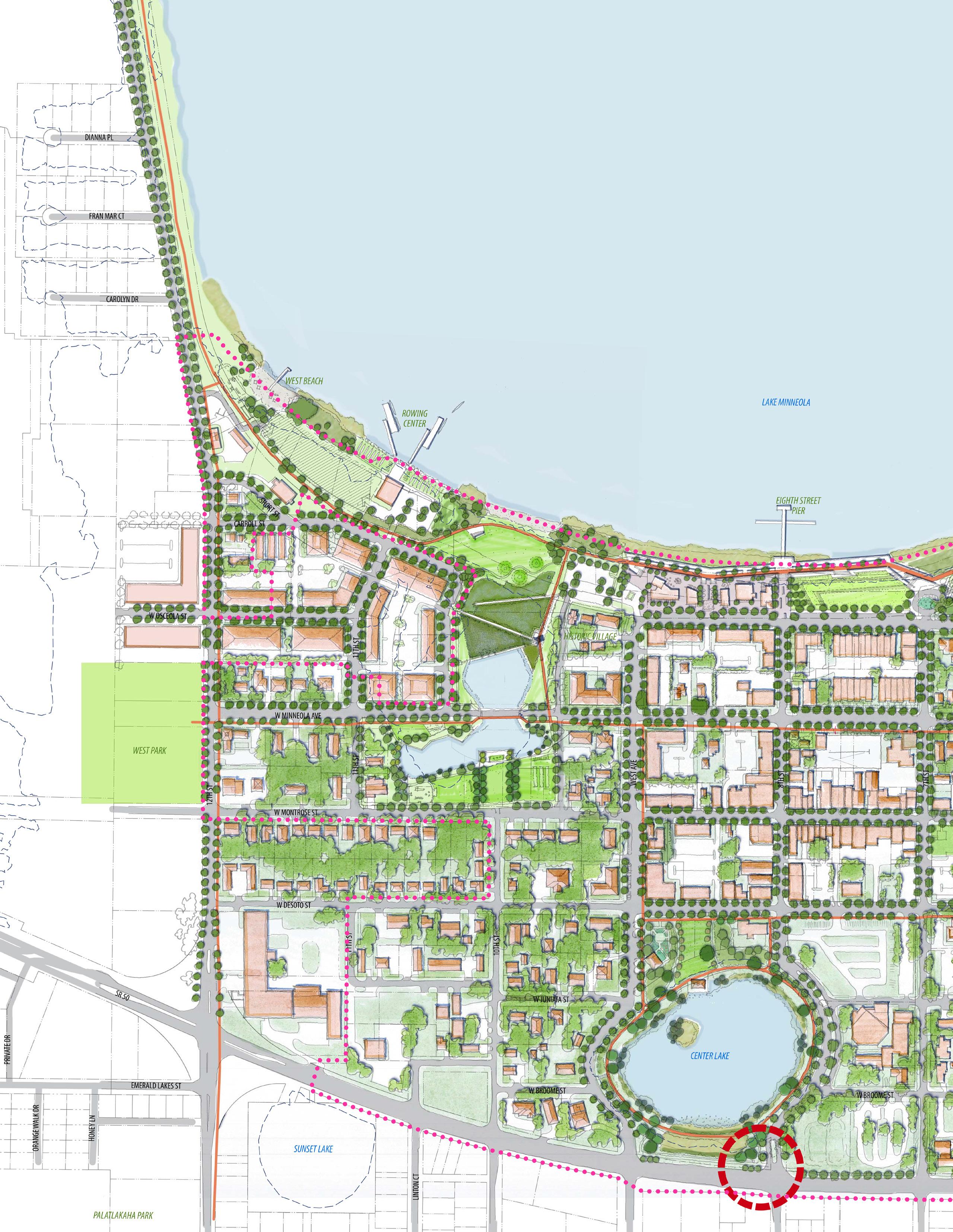
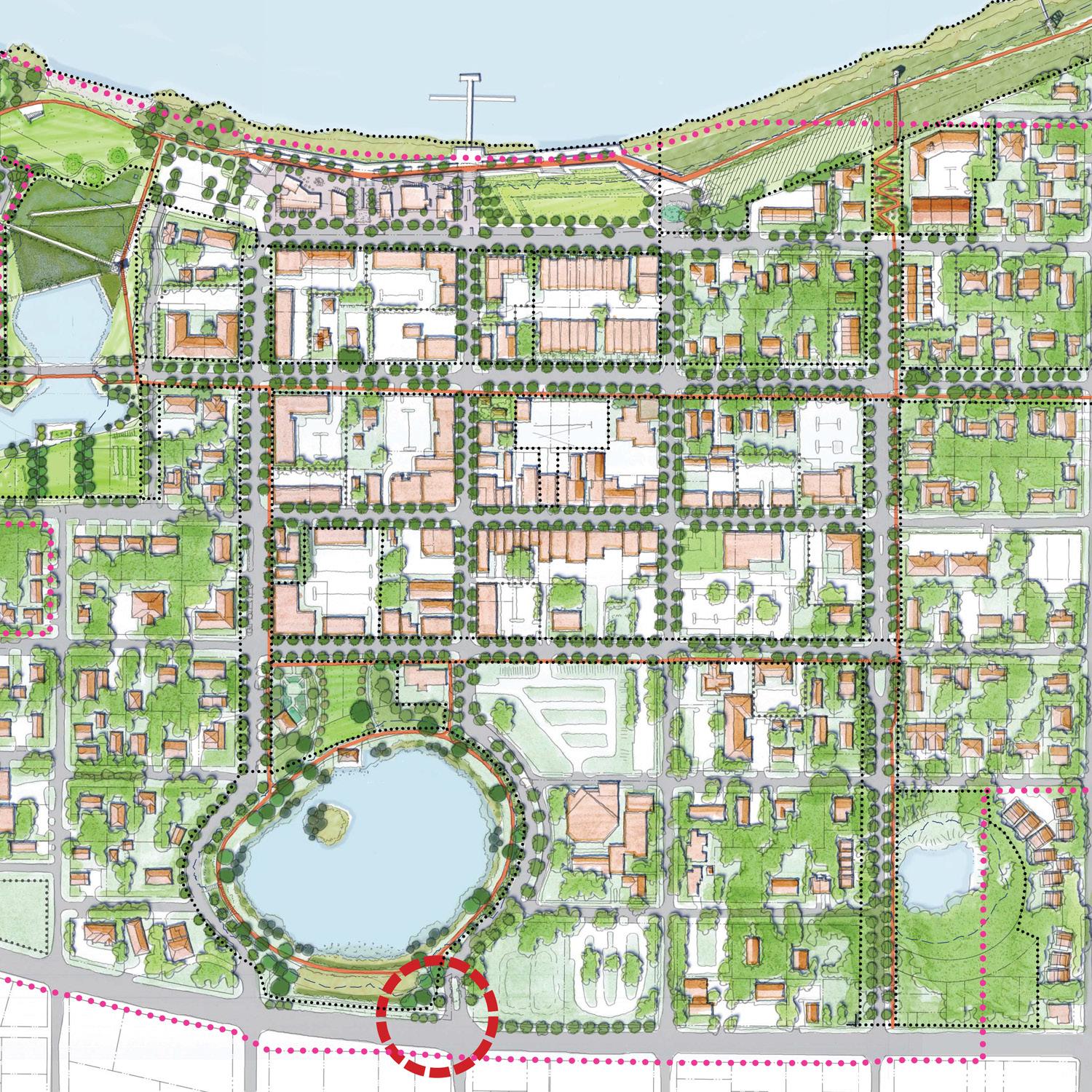
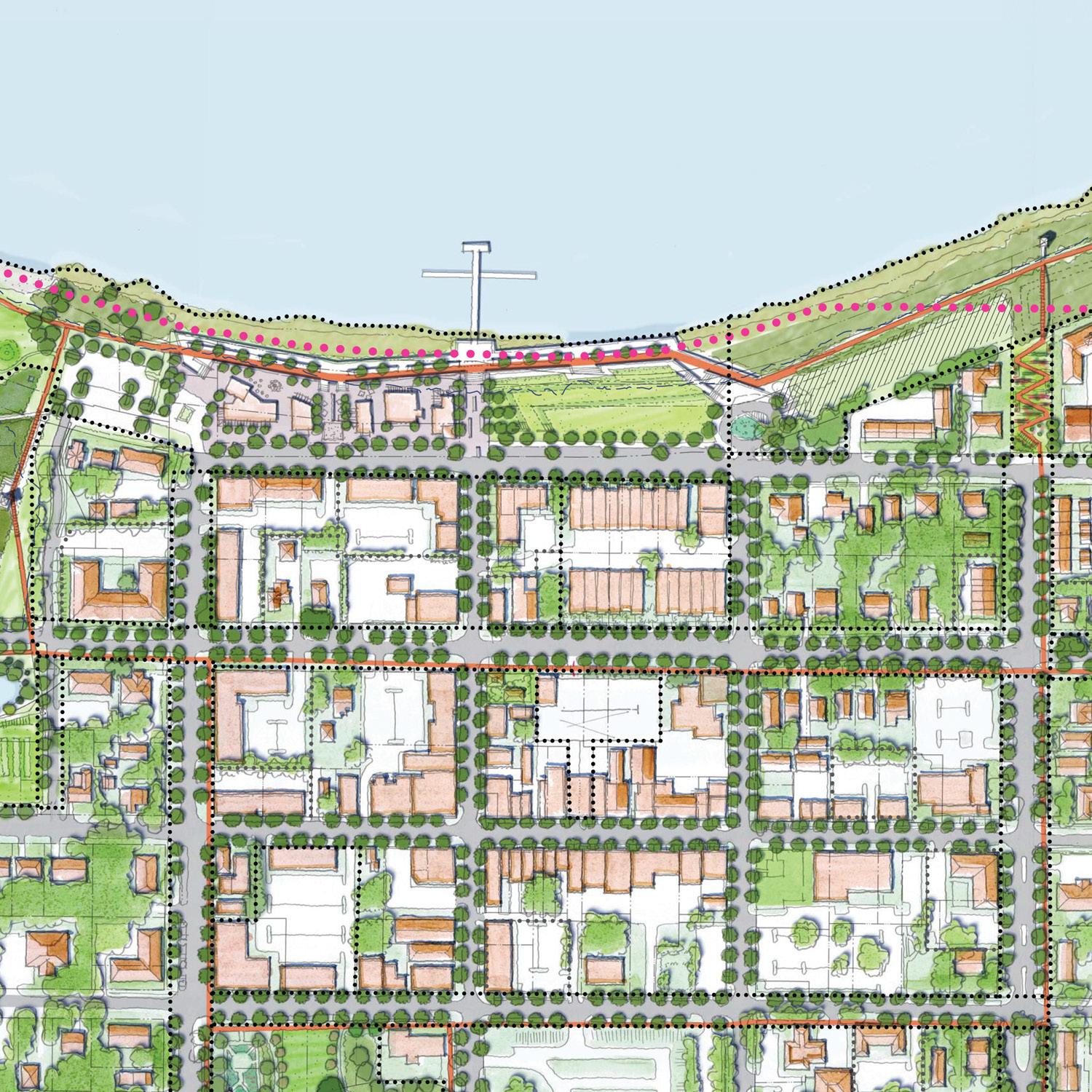
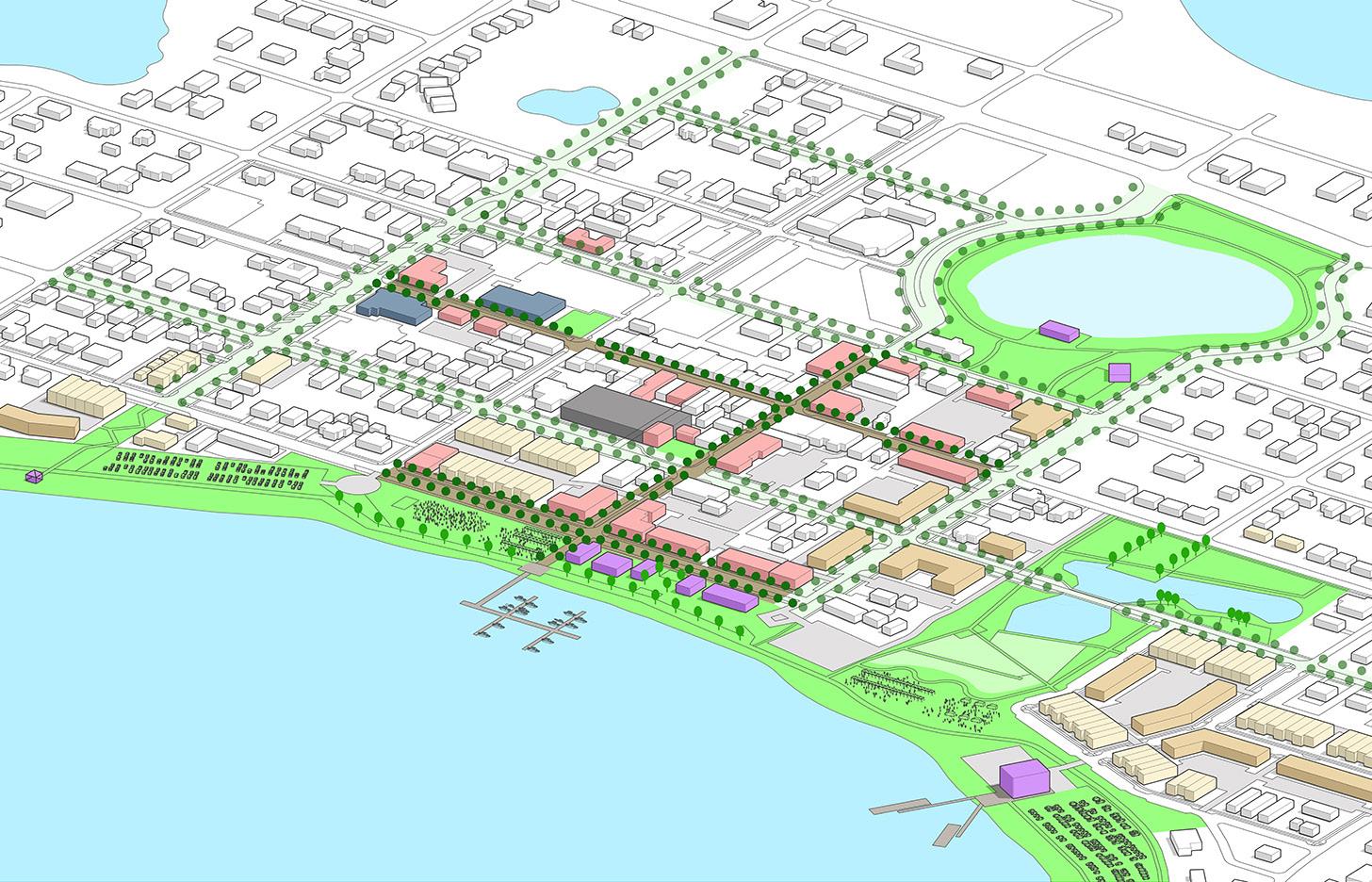
This is the long-range vision for Downtown Clermont as a place for people, with a great waterfront and quality sense of place, visual character, and image, which is connected to the greater city and is supported by high-performing infrastructure and services. A number of potential infrastructure improvements that could implement the vision are shown. The improvements are conceptual in nature; as each is considered, a further level of design needs to be undertaken to define the project and confirm its purpose in implementing the vision. Some are long-term, requiring land assembly and significant construction. Some require public policy changes while others are private redevelopment projects. The recommended first six projects are indicated by letter, and are described on the following pages.
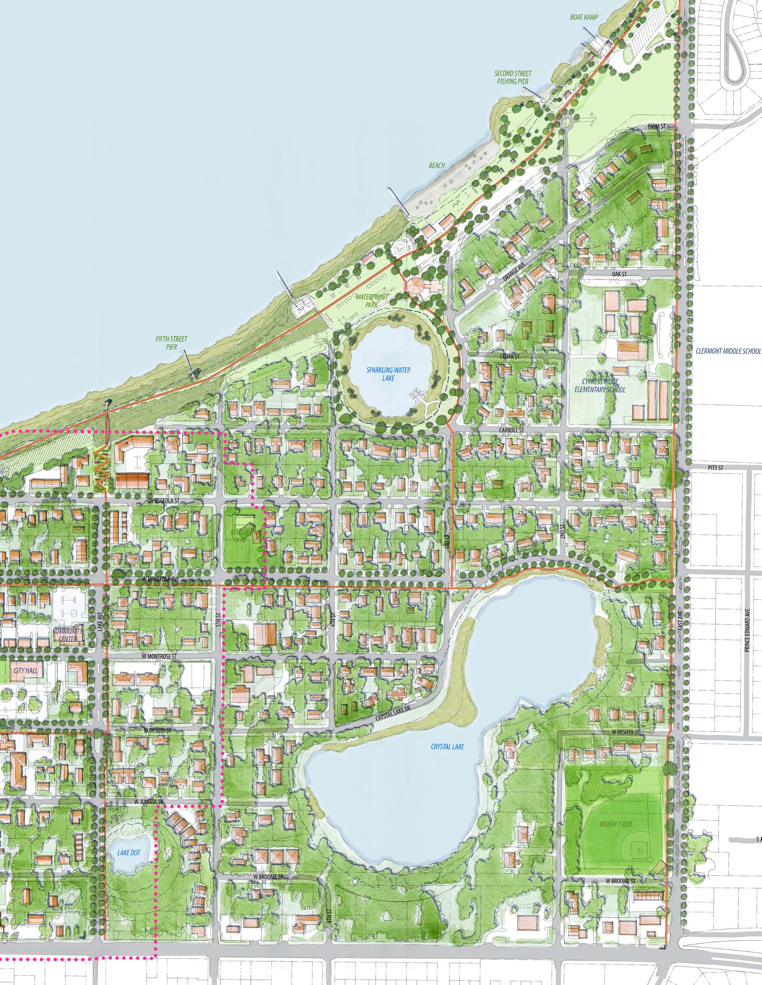

Destination (Downtown Waterfront)


Destination

(Bike Route)
Ridge (Bike Route)
Destination (Community Center)
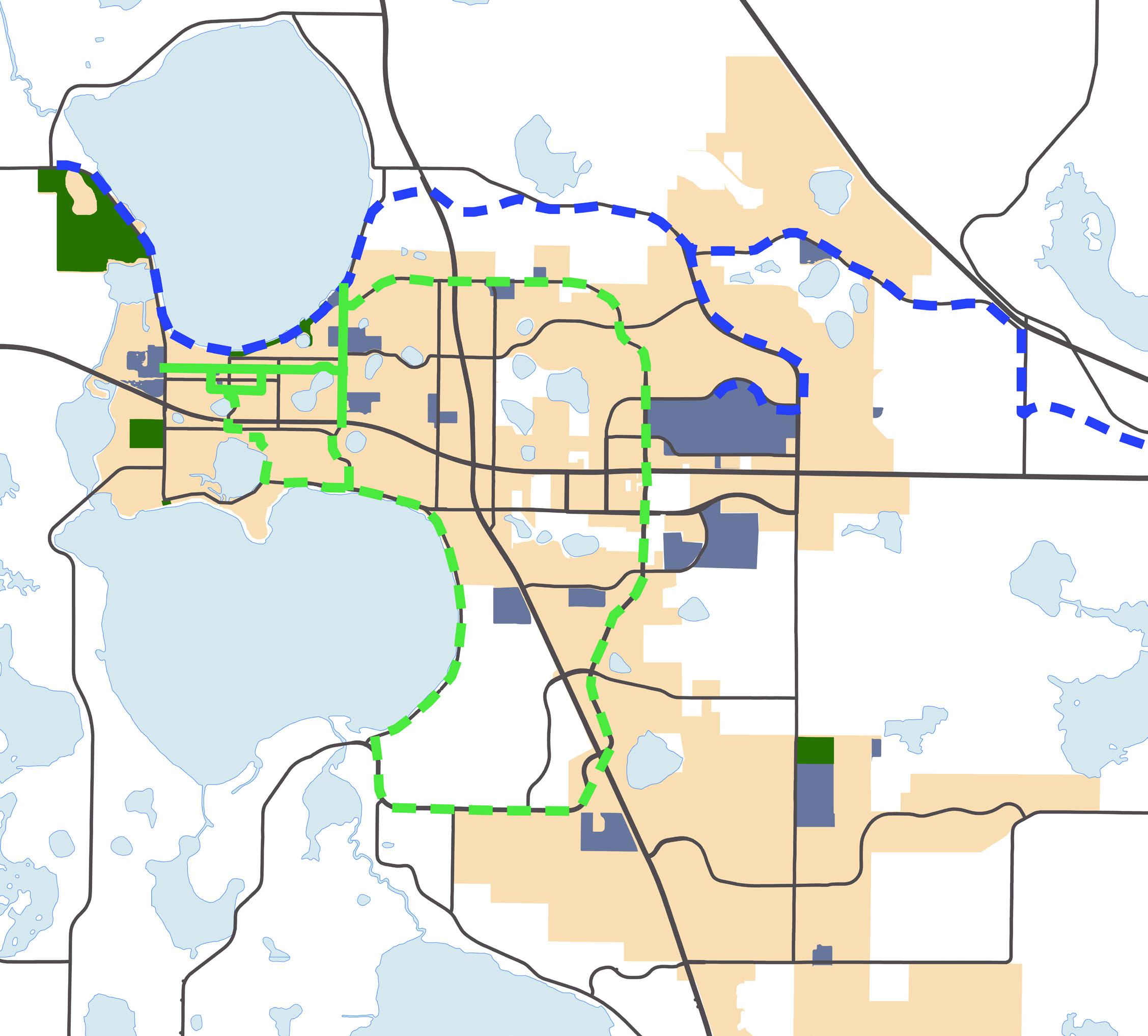
The improvements envisioned at the Downtown Waterfront need to be connected to the wider city. The map above shows a potential system of treelined boulevards that link the city’s neighborhoods to important community destinations, like downtown, the community center, and the training center. These boulevards could be in the form of upgraded landscape and bike lanes in locations where they are not already provided, and can be implemented incrementally as roadway resurfacing projects are undertaken.
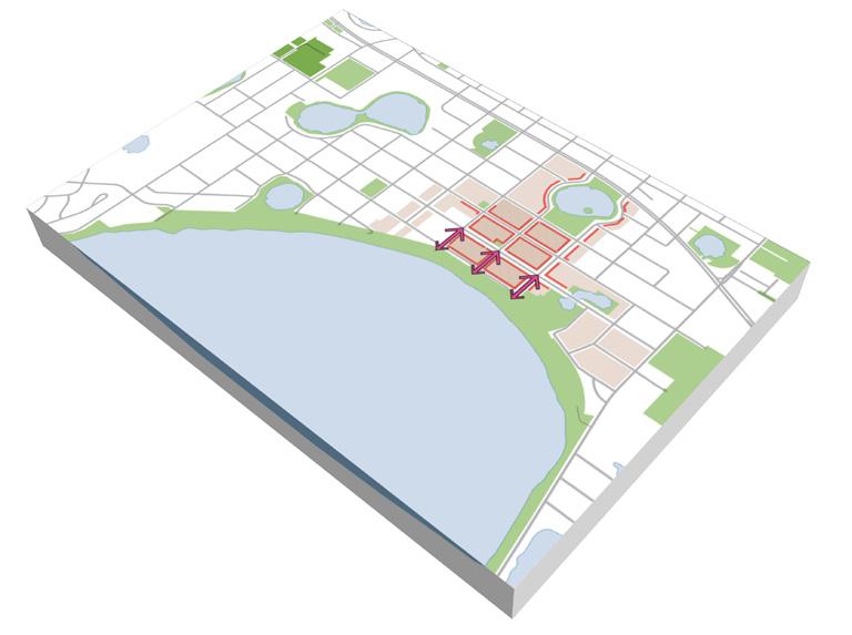
One of the key elements of the plan is to maximize the number of people who come downtown, either by living (residential), staying (hotel), or visiting (events).
Having a space that can handle events from small festivals to huge races and regattas is imperative at the foot of 8th Street. The Promenade, as shown above, provides such as venue, along with a continuous waterfront path experience and pier with docking capabilities at the foot of 8th Street. Here activity can generate business for Montrose Street businesses and others in the vicinity.
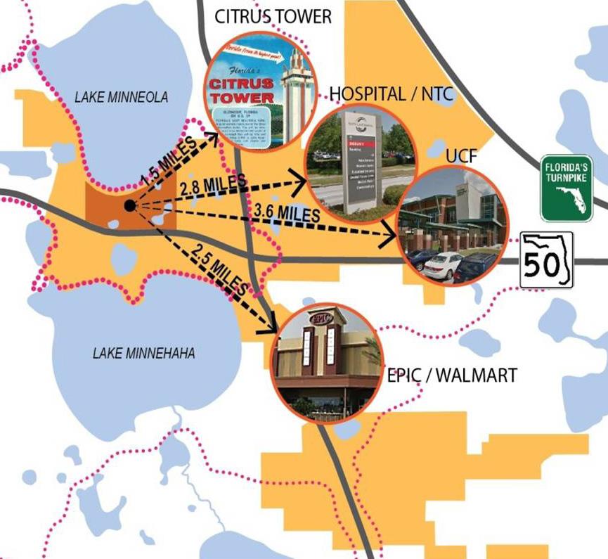
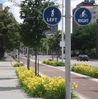
Finding destinations in downtown, either from the South Lake Trail or SR 50, will be key in building the downtown Clermont brand in the community’s consciousness. It is of particular importance as a key location along the Coast to Coast trail, as cross-state cyclists looking for destinations will be helped by a a robust system of signage and wayfinding. This system is recommended to include elements such as monument signs, vehicular directional signs, and pedestrian directional signs. The visual elements of the signage should include the “Clermont Choice of Champions” branding.
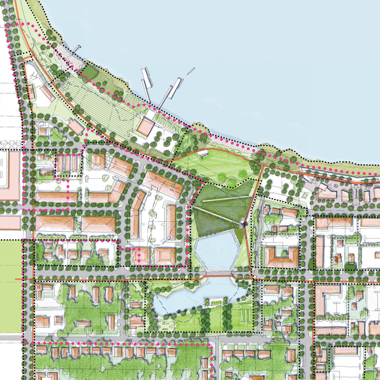
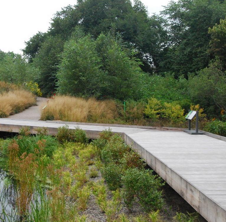
Development in the western portion of downtown is limited by on-site stormwater requirements, often making sites here 15% less functional than in other portions of downtown served by regional ponds. In addition, the waterfront has several dry ponds that impact the environmental experience of the waterfront. West Lake Wetlands Park serves to combine those elements into a utility stormwater pond serving west downtown and freeing up lakefront land for park or amenity development. In addition, this area should be designed as a park space and event area for larger races and include a filter marsh to polish the storm runoff before it reaches Lake Minneola.
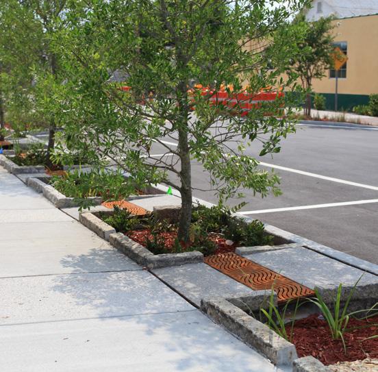
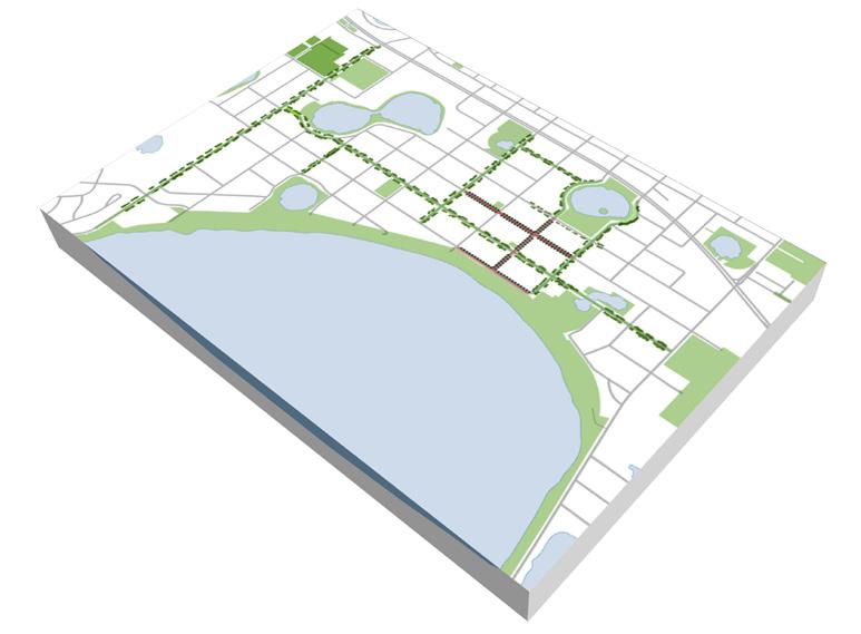
Several “Green Streets” are recommended for downtown. Green Streets are locations that combine low-impact stormwater drainage techniques with improved pedestrian streetscapes and that form the spine of the connected pedestrian and cycling environment in downtown, connecting the uphill parks to the neighborhoods and to Lake Minneola. The first of these streets is Minneola Avenue from Lake Avenue to the proposed West Lake Wetlands Park. The street would include stormwater planters, on-street parking, upgraded street tree planting, a 5’ sidewalk on the north side of the street and a 12’ multi-purpose path on the south side of the street.
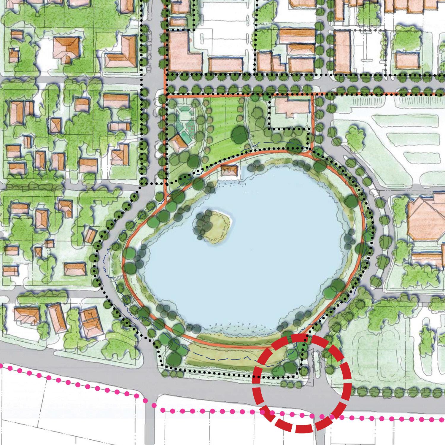
The current perception of downtown from SR 50 is undifferentiated and unremarkable. The streetscape does not change to reflect the downtown and the signage is outdated. A series of landscape improvements at 8th Street and SR 50 are recommended to make the entrance into downtown consistent with the quality environment found on the lake side. This landscape would include sidewalks, street trees, and incremental low-impact stormwater management techniques.
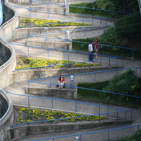
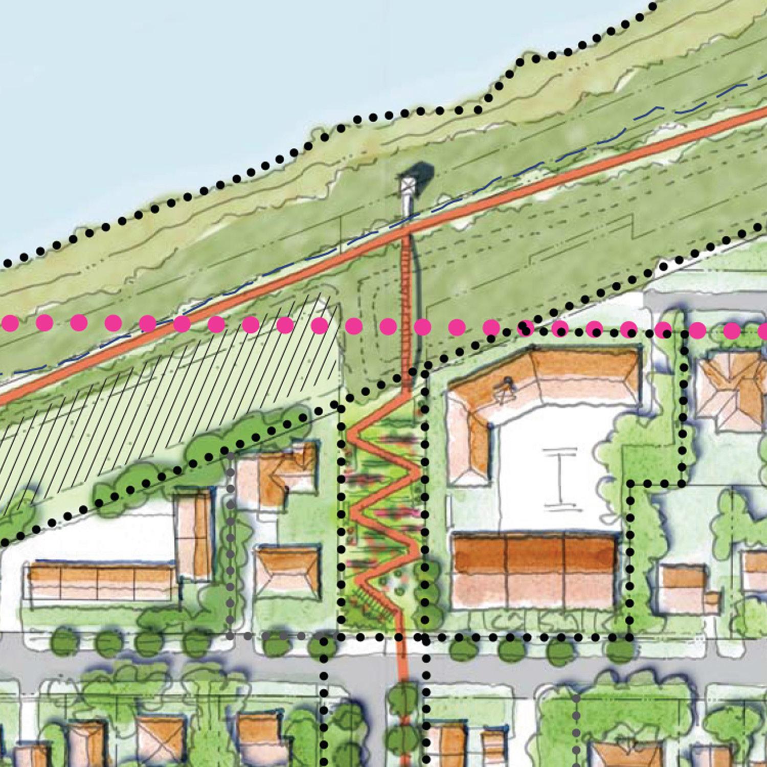
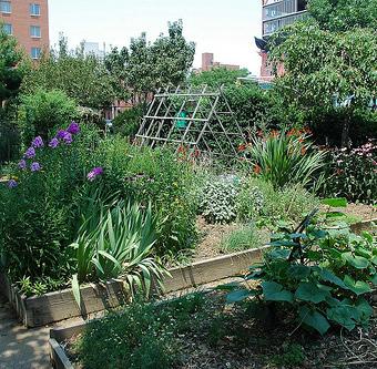
As the trail system is expanded away from the Lake Minneola waterfront into downtown and the closein neighborhoods, there is opportunity to make a connection at the end of Lake Avenue. In this location, steep topography has led to an unbuilt street right-ofway with the potential to carry a trail that connects to the proposed trail on Minneola Street. This trail would be configured in a “switchback” design to lessen the grade for all users and would conceptually contain a community garden space in between the switchbacks that is accessible from both uphill and downhill sides.
The Master Plan Vision Clermont is a place for people, with a great waterfront and quality sense of place, visual character, and image; connected to the greater city and supported by high-performing infrastructure and services.