

Future realism with a scientific flair and an entertaining twist -Independent and Sponsor freeMAY 2025 – Edition - 5th Year-

Future realism with a scientific flair and an entertaining twist -Independent and Sponsor freeMAY 2025 – Edition - 5th Year-
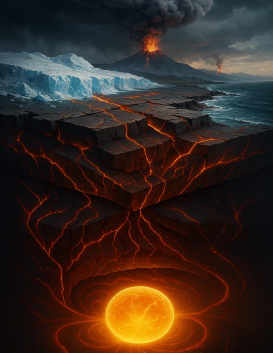
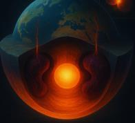
The "SUBTERRA 6.0" framework presented in this chroncle charts humanity's evolving understanding and utilization of our planet's inner workings, from ancient observations of geological phenomena to tomorrow's revolutionary technologies that promise to redefine our energy landscape.
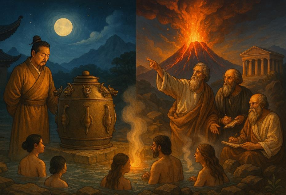
Long before formal scientific inquiry, ancient civilizations developed remarkable observational knowledge of Earth's behavior.
From Chinese seismoscopes detecting distant earthquakes to Polynesian understanding of volcanic island formation, early humans recognized patterns in our planet's dynamic processes.
The Greek concept of four classical elements earth, water, air, and fire—represented an early attempt to systematize geological observation.
While utilizing surface manifestations of geothermal activity in hot springs and steam vents, these early societies lacked theoretical frameworks to explain Earth's internal engines of change.

The 18th and 19th centuries witnessed the birth of modern geology. James Hutton's revolutionary principle of uniformitarianism established that Earth's features formed through slow processes observable today.
Geological mapping pioneered by William Smith revealed Earth's stratigraphic history, while the gradual acceptance of continental drift
theory though initially rejected laid groundwork for later breakthroughs. This era established geology as a rigorous discipline with predictive capability, though Earth's deeper structure remained largely theoretical, inferred primarily from surface measurements and mineral studies.
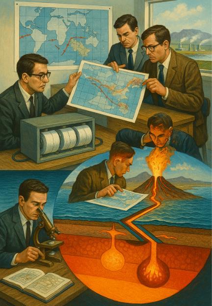
The mid-20th century brought the transformative theory of plate tectonics, fundamentally reshaping our understanding of Earth as a dynamic system.Seismological advances revealed our planet's layered structure—crust, mantle, and core—while the mapping of seafloor spreading and subduction zones explained volcanism, mountain
building, and earthquake patterns within a unified theoretical framework. This generation's breakthroughs were technological as much as conceptual: seismic networks, deep ocean drilling, and radiometric dating provided empirical evidence confirming Earth's continuous crustal motion and recycling.
Meanwhile, practical applications emerged, with geothermal development in volcanic regions providing sustainable energy in locations like Iceland and New Zealand.
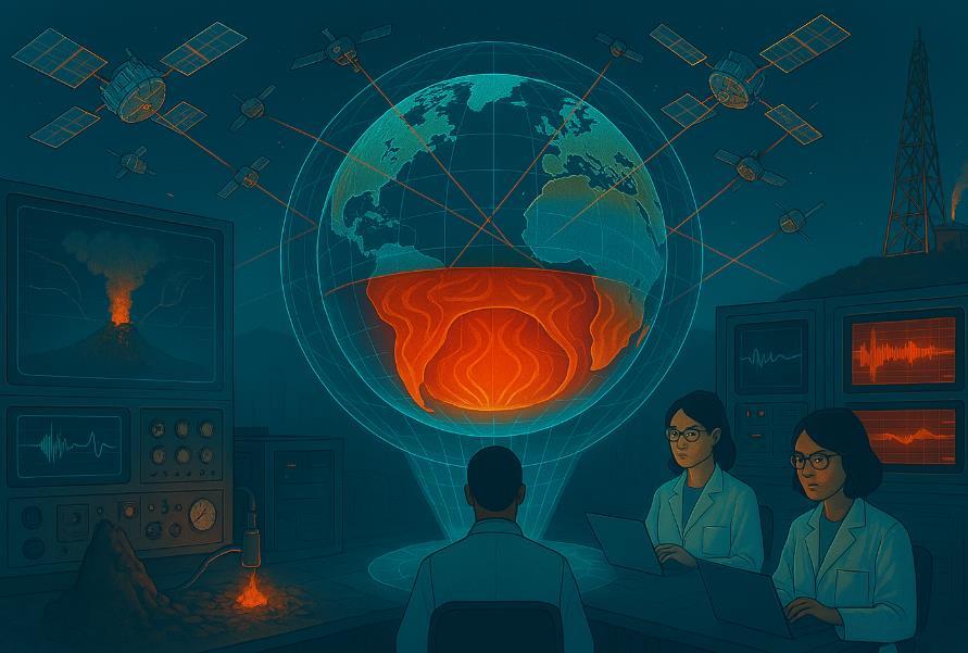
The late 20th century brought unprecedented views into Earth's subsurface. Advanced seismic tomography constructed threedimensional images of mantle structures, revealing complex convection patterns driving plate movements. Satellite geodesy measured crustal deformation with millimeter precision, while
computer modeling simulated Earth's internal processes across vast timescales. Volcanology matured into a predictive science through integration of geochemistry, gas monitoring, and deformation analysis.
This generation's hallmark was integration—combining multiple observational techniques to construct comprehensive models of Earth system dynamics from core to surface.
Meanwhile, enhanced geothermal systems (EGS) began extending energy production beyond naturally occurring hydrothermal reservoirs, though technical and economic challenges limited widespread adoption.
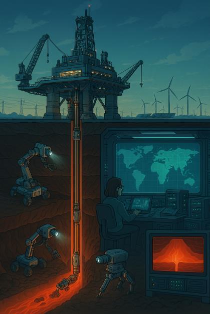
We currently stand at the threshold of the fifth generation, where revolutionary advances in materials science, robotics, and computational modeling are transforming our ability to access and utilize Earth's deeper heat resources.
Ultra-deep drilling technologies, capable of reaching depths previously considered impossible, now tap supercritical fluids with unprecedented energy density.
Autonomous robotic systems navigate and map complex subsurface environments, while quantum computing enables simulation of billionyear geological processes with unprecedented accuracy.
These technologies collectively expand geothermal's potential beyond traditional hydrothermal systems to encompass virtually any location worldwide, given sufficient drilling depth. Autonomous robotic systems navigate and map complex subsurface environments, while quantum computing enables simulation of billion-year geological processes with unprecedented accuracy.
These technologies collectively expand geothermal's potential beyond traditional hydrothermal systems to encompass virtually any location worldwide, given sufficient drilling depth.
Most significantly, fifth-generation approaches fundamentally reimagine geothermal energy—not as a niche renewable limited to volcanic regions,
But as a universally accessible planetary resource capable of meeting global baseload energy demands while providing essential gridstabilizing services alongside intermittent renewables.
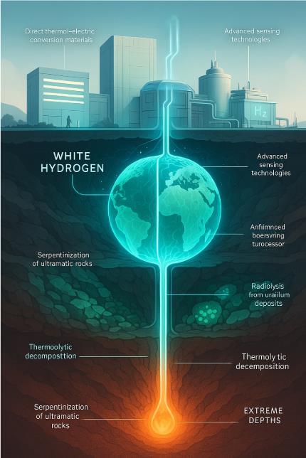
The sixth generation—SUBTERRA 6.0—represents not merely an incremental improvement but a paradigm shifts in how we conceptualize Earth's subsurface resources.
This emerging frontier transcends traditional geothermal applications to develop entirely new energy pathways from Earth's internal processes.
At the heart of this revolution lies the phenomenon known as "white hydrogen naturally occurring molecular hydrogen produced through geological processes deep within our planet.
The chapters that follow explore each generational stage in detail, examining the scientific breakthroughs, technological innovations, and visionary individuals that have advanced our understanding and utilization of Earth's subsurface resources.
Through this evolutionary framework, we gain not merely technical knowledge but a deeper appreciation for humanity's ongoing dialogue with the dynamic planet beneath our feet.


In 1912, German meteorologist, polar explorer and geophysicist Alfred Wegener proposed an idea that would shake the foundations of Earth sciences: continental drift. Wegener theorized that Earth's continents were once joined together in a supercontinent he called Pangaea and had since drifted apart.
While today this might seem like common knowledge, at the time, it was a radical notion that many geologists outright rejected.
Wegener’s hypothesis was based on multiple lines of evidence:
Fossil Distribution: Identical fossils of prehistoric species, such as Mesosaurus, were found on continents now separated by vast oceans (e.g., South America and Africa), suggesting they were once connected.
Geological Fit: The coastlines of continents, particularly Africa and South America, appeared to fit together like puzzle pieces.
Climate Clues: Evidence of ancient glaciation in warm regions (like India and South America) indicated that these lands had once been positioned closer to the poles.
Mountain Ranges: Similar rock formations and mountain belts, such as the Appalachian Mountains in North America and the Scottish Highlands, suggested they had once been part of a larger, unified landmass.
Despite these compelling clues, Wegener lacked a mechanism to explain how continents moved.
His suggestion that centrifugal forces and tidal interactions drove continental motion was weak, and the idea was dismissed by
mainstream geologists of his time. When Wegener died in 1930, his theory remained largely ignored.
Three decades later, scientific advances in oceanography, seismology, and rock magnetism would vindicate Wegener’s vision. The discovery of seafloor spreading in the 1960s provided the missing mechanism for continental movement, leading to the birth of plate tectonic theory.
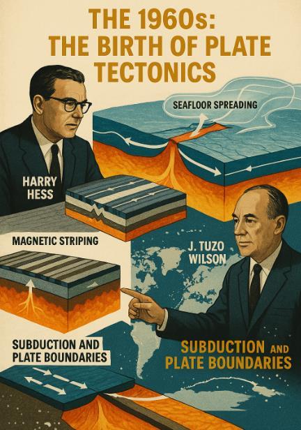
Seafloor Spreading (Harry Hess, 1962): Hess, an American geologist, proposed that new oceanic crust forms at mid-ocean ridges and spreads outward, pushing continents apart. This process explained how the Atlantic Ocean was widening over time.
Magnetic Striping (Fred Vine & Drummond Matthews, 1963): By studying the magnetic orientation of seafloor rocks, scientists discovered symmetrical patterns of magnetic reversals on either side of mid-ocean ridges, confirming that the ocean floor was indeed spreading.
(J. Tuzo Wilson, 1965): Wilson introduced the concept of plate boundaries, where Earth's rigid outer shell is divided into tectonic plates that move, collide, and sink into the mantle at subduction zones.
Global Seismic Data: Earthquake patterns aligned with plate boundaries, further supporting the idea that Earth’s surface was divided into moving plates.
These discoveries transformed Wegener’s continental drift into a robust, evidence-backed theory: plate tectonics. Unlike Wegener’s vision of continents plowing through oceanic crust, scientists now understood that entire lithospheric plates—including both oceanic and continental crust—move together atop the semi-fluid mantle.
Today, plate tectonics is one of the fundamental theories of Earth science, explaining everything from earthquakes and volcanoes to mountain formation and ocean basin evolution. Alfred Wegener, once dismissed as an outsider, is now recognized as a visionary who laid the groundwork for one of the most important scientific revolutions of the 20th century.
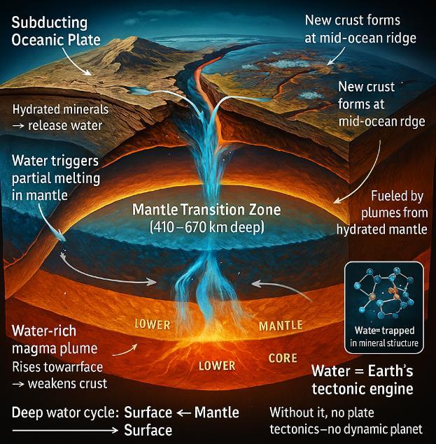
Roughly 410 to 670 kilometers beneath our feet lies a remarkable boundary layer called the mantle transition zone. New research suggests this region may hold the key to one of Earth's most fundamental processes: plate tectonics. Scientists have discovered that
this deep boundary between Earth's upper and lower mantles serves as a massive water reservoir, storing moisture within specialized minerals formed under extreme pressure.
This hidden water isn't like the oceans above. Instead, it exists within the crystalline structure of rocks, fundamentally changing their properties and Earth's geology.
Most of us are familiar with the water cycle we can see rain falls, rivers flow to oceans, water evaporates, and clouds form. But geologists have identified a deeper, slower water cycle operating on geological timescales.
When oceanic plates plunge beneath continental plates at subduction zones, they carry water-rich minerals deep into Earth's interior. These minerals eventually reach the mantle transition zone, where unique pressure conditions allow them to hold significant amounts of water within their crystal structures.
Over millions of years, this water doesn't stay put. The research suggests that plumes of water-rich rock rise from this transition zone toward the surface. As they rise, the water they contain fundamentally alters the mechanical properties of the overlying rocks.
The presence of water within rising plumes from the transition zone has profound effects on Earth's rigid outer shell. Water essentially "softens" rock, reducing its viscosity—or resistance to flow—making it easier for tectonic plates to move, bend, and break.
This mechanism appears crucial for enabling plate tectonics to operate. Without this water-induced weakening, Earth's outer shell might remain rigid and unmoving, more like Venus or Mars, which lack Earth's dynamic plate system.
Evidence from the South China Sea : Compelling evidence for this process comes from the South China Sea, where researchers studying 30-million-year-old olivine rocks found surprisingly high water content. These rocks, collected from a mid-ocean ridge, contained twice the amount of water typically found in such settings.

This discovery suggests that unusually water-rich magma from the mantle transition zone helped break apart the continental crust in this region, facilitating the formation of the South China Sea basin. The water essentially reduced the continental crust's viscosity, making it easier to pull apart.
Water as a Geological Catalyst Water's influence extends beyond just enabling plate movement. When present in magma, water:
Lowers the melting point of rock, facilitating magma generation in subduction zones where most volcanoes form.
Makes volcanic eruptions more explosive by forming gas bubbles as pressure decreases during magma ascent.
Concentrates on valuable metals like copper, gold, and silver, creating economically important ore deposits.
Triggers earthquakes by enabling sudden movement along faults.
This research highlights why Earth remains geologically active while other rocky planets in our solar system have become largely dormant. The continuous cycling of water between the surface and deep interior maintains Earth's geological engine, creating and recycling continental crust, regulating atmospheric composition, and providing the stableyet-dynamic environment needed for life to flourish.
Without the water stored in and released from the mantle transition zone, Earth might lack the diverse landscapes, mineral resources, and climate stability that have supported the evolution of complex life.
The Big Picture: The discovery of water's role in the mantle transition zone changes our understanding of plate tectonics. Rather than viewing surface plates as isolated components, we now see Earth as an integrated system where deep processes directly influence surface geography.
This research reveals that Earth's habitability depends not just on the water in our oceans and atmosphere, but also on the hidden moisture cycling through our planet's deep interior. Water truly drives Earth's geological engine, making our planet uniquely dynamic in our solar system.
Earth's Oldest Continental Foundations Disintegrate Through TimeEarth's continental configurations have transformed dramatically over billions of years. While positions across the
planet have shifted, certain regions of continental crust maintained remarkable stability since Earth's early history.
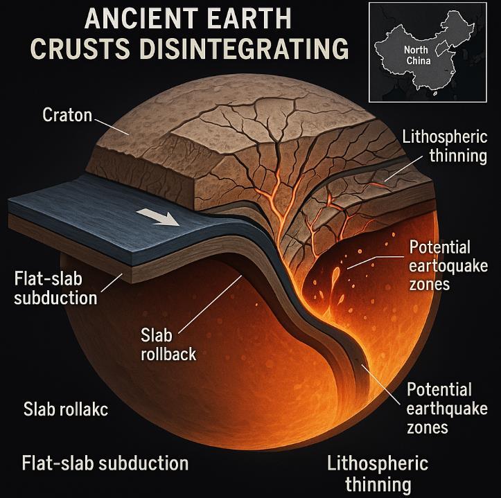
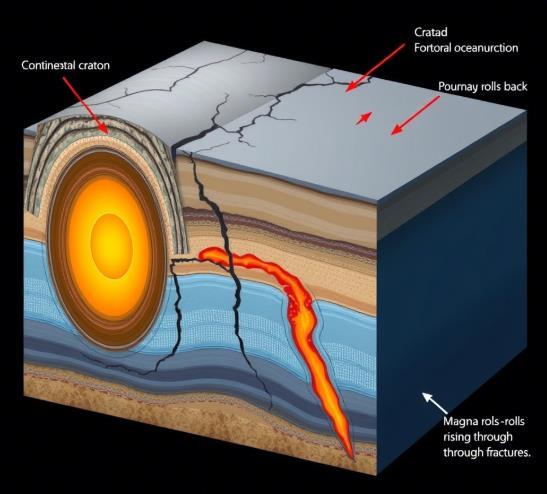
Recent research published in Nature Geoscience reveals the mechanisms by which cratons deform and eventually disintegrate, a process scientists term "decratonization." Professor Shaofeng Liu and colleagues from China University of Geosciences focused their investigation on the North China Craton (NCC) in the western Pacific, analyzing its evolution over 200 million years.
Cratons have traditionally been considered Earth's most enduring regions due to their thick lithospheric roots. However, mounting evidence questions their long-term stability.
While mantle plumes (buoyant segments of mantle rising to the surface) can induce lithospheric thinning through thermal erosion, oceanic subduction increasingly appears to be a primary driver of craton deformation.
The team employed four-dimensional mantle flow models of Earth's plate-mantle system, integrating data on surface topography evolution, lithospheric deformation, and seismic tomography—a technique using seismic waves to generate 3D models of Earth's interior.
The researchers identified two major stages that led to the North China Craton's deformation:
The shallowly-dipping oceanic Izanagi plate subducted from the east, causing the overriding NCC crust to thicken as it compressed and shortened.
This created topographic highs, including mountain ranges that extended as far as the Taihang Mountains.
Subsequent Slab Rollback: A rapid retreat of the subducting plate led to lithospheric extension and significant thinning—approximately 26% compared to its initial thickness.
This resulted from the NCC's movement changing from eastward to southward, slowing the convergence between the two plates.
These processes unfolded over millions of years in multiple phases. The Jurassic and early Cretaceous periods (approximately 200-136 million years ago) saw north-east trending thrust faults and transpressional movement.
From 136 million years ago, several episodes of crustal extension occurred, briefly interrupted by compression between 93-80 million years ago in the late Cretaceous, before extension continued to the present day.
Validation Through Advanced Models To confirm their findings, the scientists generated three flow models reconstructing the region's tectonic history.
The validated flat-slab rollback model accurately reproduced a massive structure—a 4,000-kilometer wide and up to 660-kilometer deep slab within the mantle transition zone—which eventually formed a large mantle wedge.
Geological evidence supports this model, with carbonates recycled from the subducted slab into the upper mantle forming characteristic carbonated peridotite rock formations visible today.
The North China Craton's disintegration signals a broader phenomenon.
Professor Liu notes similar processes affecting the North American, South American, and Yangtze cratons, though with varying intensity of subduction rollback.
This accelerating breakdown of Earth's oldest continental foundations has serious implications. As cratons near plate boundaries destabilize, tectonic plate movement accelerates, potentially triggering earthquakes along previously quiet fault lines and volcanic eruptions in unexpected locations.
"Ancient lithosphere can be broken apart near oceanic plates," Professor Liu explains, highlighting how even Earth's most stable geological structures eventually yield to tectonic forces.
This research provides crucial insights for hazard assessment in regions previously considered stable.
Urban areas built on what were thought to be solid cratonic foundations may now require reevaluation of building codes and emergency response protocols.
Regions with no historical record of significant seismic activity might suddenly face moderate earthquakes, while dormant volcanic systems could reactivate with little warning.
The implications extend to infrastructure planning, where long-term projects like nuclear power plants, dams, and waste repositories have traditionally favored cratonic settings precisely for their presumed stability.
Monitoring systems designed for known fault zones may need expansion to cover previously ignored areas, particularly where cratons interface with more active tectonic boundaries.
Perhaps most concerning is the psychological unpreparedness of populations living in these regions.
Unlike communities in recognized seismic zones, residents of cratonic areas typically lack generational knowledge of earthquake safety practices and may not recognize early warning signs of geological disturbance.
Public education and early warning systems will become increasingly vital as our understanding of craton vulnerability
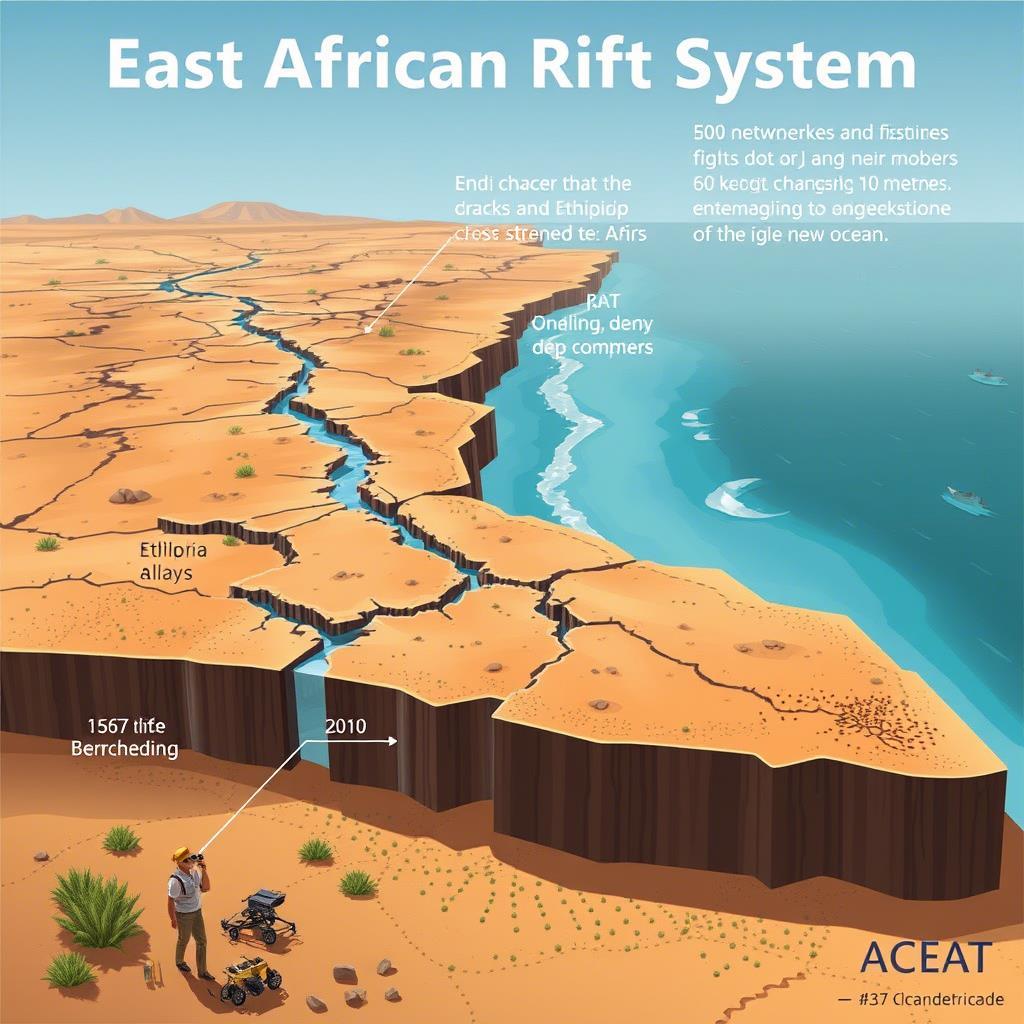
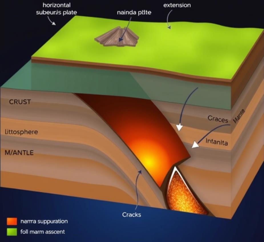
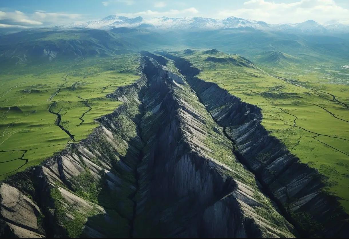
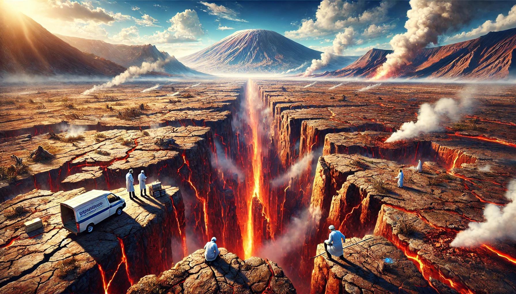
The accelerating separation of the African continent represents one of Earth's most dramatic ongoing geological events. The process, driven by complex interactions between tectonic plates, is creating the East African Rift System (EARS), which will eventually split the continent into two major landmasses.
The current rate of separation (0.8 cm/year) may seem modest, but geological processes often demonstrate non-linear progression. Several factors suggest this process could accelerate.
The rifting process is accompanied by significant magmatic activity beneath the surface. As magma rises through weakened crust, it creates additional pressure and heat, further weakening the surrounding rock. This can lead to a feedback loop where separation begets more separation.
As the rift widens, gravity plays an increasingly important role. The weight of the surrounding continental masses creates tension on the weakened zones, potentially accelerating the splitting process. The deeper the rift becomes, the more pronounced this effect becomes.
Climate change accelerate this process through several mechanisms. Increased rainfall in the region leads to greater erosion of rift walls, while temperature fluctuations cause more rapid rock expansion and contraction. Changes in groundwater levels affect crustal stability, and melting ice masses globally causes isostatic rebound, influencing plate movements.
The immediate concerns for local populations include significant seismic activity. The ongoing rifting process generates frequent earthquakes as rocks break and shift. These are likely to increase in both frequency and intensity as the rift continues to develop. Cities and towns along the rift valley, particularly in Ethiopia, Kenya, and Tanzania, face considerable seismic risks.
The region already hosts numerous active volcanoes. As the crust continues to thin and fracture, new volcanic vents may form, and existing ones could become more active. This poses risks from lava flows, ash falls affecting agriculture and air travel, release of toxic gases, and secondary hazards like mudflows and landslides.
The formation of new depressions and eventual marine incursions will dramatically alter local ecosystems and climate patterns. This could affect agricultural productivity, water resources, local weather patterns, and wildlife migration routes.
While the complete separation may take hundreds of thousands of years, the intermediate effects are already observable and will likely intensify. Communities in the rift zone need to develop long-term adaptation strategies, including robust early warning systems for geological hazards, earthquake-resistant construction standards, emergency evacuation plans, and land-use planning those accounts for geological risks
This unprecedented geological event offers scientists a unique opportunity to study continental breakup in real-time, while also presenting significant challenges for regional development and safety planning.
The acceleration of these processes due to climate change and gravitational forces makes it imperative to maintain comprehensive monitoring systems and develop adaptive management strategies for affected regions.

Beneath the Pacific rim lies a geological ghost—a colossal tectonic entity that disappeared millions of years ago yet continues to influence the dynamic architecture of our planet.
In a remarkable feat of scientific detective work, researchers have now resurrected this vanished giant, piecing together the existence and fate of a "mega-plate" that once dominated the western Pacific. This discovery—the Pontus plate—provides a missing chapter in Earth's tectonic narrative and fundamentally reshapes our understanding of the forces that have sculpted our planet's surface.
Our planet's outer shell fractures and flows in a perpetual ballet of creation and destruction. Tectonic plates those massive jigsaw pieces of lithosphere—migrate across Earth's surface, collide in slow-motion catastrophes, and ultimately disappear through subduction.
This planetary recycling program has operated for billions of years, continuously refreshing Earth's surface while driving the circulation of elements essential for life itself.
Subduction zones represent the ultimate fate of oceanic plates— tectonic graveyards where dense crustal material plunges into Earth's interior. As one plate dives beneath another, it descends into the semifluid mantle, generating the seismic convulsions we experience as earthquakes.
This descent creates distinctive geological signatures: deep oceanic trenches marking the collision line, volcanic arcs fueled by melting subducted material, and distinctive rock formations preserving evidence of these ancient boundaries.
The mechanics of subduction explain how something as massive as a tectonic plate could simply vanish. Over millions of years, entire oceanic plates slide beneath continental margins, leaving only fragments and geophysical echoes as testament to their existence.
The most dramatic modern example—the Pacific "Ring of Fire"— outlines this process in action, with volcanic chains and seismic activity
marking the boundaries where today's Pacific plate subsides beneath surrounding continental plates.
The Pontus plate's rediscovery represents a triumph of multidisciplinary geoscience. Dr. Suzanna van de Lagemaat and her team at Utrecht University embarked on a geological treasure hunt spanning both laboratory analysis and arduous fieldwork in some of Earth's most complex tectonic provinces.
Their quest revealed something extraordinary: evidence of an enormous oceanic plate that once covered approximately 15 million square kilometers roughly a quarter of today's Pacific Ocean.
The first clues emerged in the rugged terrains of northern Borneo and Palawan in the Philippines, where researchers identified rock
formations with peculiar magnetic signatures. These ancient rocks told an unexpected story—they had formed far to the north of their current position and migrated southward on a plate previously unknown to science.
What initially appeared to be fragments of a familiar tectonic entity proved to be remnants of something much more significant—the longhypothesized Pontus plate.
Paleomagnetism provided the critical evidence. When rocks form, magnetic minerals within them align with Earth's magnetic field, preserving directional information like a fossilized compass.
By analyzing these alignments in rocks across Southeast Asia and the western Pacific, researchers reconstructed the ancient latitude where these formations originated.
The pattern revealed a consistent, unexpected story fragments scattered across thousands of kilometers once belonged to a single, massive plate that had entirely subducted beneath surrounding plates.
Seismic tomography essentially CT scanning of Earth's interior using earthquake waves further substantiated the discovery. Researchers had long observed anomalous structures deep beneath East Asia where seismic waves travel faster than expected, indicating colder, denser material lurking in the mantle.
These seismic anomalies represented the ghostly remnants of the Pontus plate massive slabs of subducted lithosphere still making their slow descent through the mantle, even 20 million years after disappearing from Earth's surface.
The Pontus discovery illuminates one of Earth's most complex tectonic regions the boundary zone where the great Panthalassa and Tethyan
realms once met. Following the breakup of the supercontinent Pangea some 200 million years ago,
Earth's tectonic system organized into these two distinct domains: the interior Tethyan realm where plates moved predominantly east-west between fragmenting continents, and the exterior Panthalassa realm— the vast global ocean where plates subducted in multiple directions.
These two tectonic provinces intersected in what would become Southeast Asia and the western Pacific a geological crucible where plates formed, collided, and vanished in rapid succession. Within this chaotic junction,
Pontus played a critical role, spanning from present-day southern Japan to New Zealand and forming a crucial link between Pacific plates and the Eurasian margin.
For at least 150 million years, this massive oceanic plate participated in the tectonic machinery of the western Pacific before ultimately being consumed by surrounding subduction zones.
The reconstruction reveals a massive, continuous subduction system along the western Pacific margin—a great conveyor belt that systematically drew the Pontus plate beneath surrounding continental plates.
This "super-subduction zone" represented one of the most significant tectonic boundaries in Earth's middle-age, separating the eastern Pacific plates (ancestors of today's Pacific plate) from the Pontus domain through an immense trench system now long vanished.
The resurrection of this tectonic phantom transcends mere geological cataloging. By filling a significant gap in our planetary history, the Pontus discovery carries implications ranging from natural resource formation to hazard assessment.
Tectonic reconfiguration drives Earth's long-term climate evolution, mineral concentration, and the distribution of biological habitats across geological time.
The comprehensive tectonic model enabled by understanding Pontus provides context for how mineral deposits formed, mountains rose, and ancient coastlines evolved across East Asia and the Pacific rim.
More immediately relevant, this enhanced understanding of subduction processes refines our grasp of earthquake and volcanic hazards.
The western Pacific particularly regions like Japan, the Philippines, and Indonesia experiences some of Earth's most devastating seismic and
volcanic events precisely because they sit atop complex subduction systems partially inherited from Pontus-era tectonics.
Though the plate itself has vanished, its legacy persists in the structure and stress patterns of the modern western Pacific. The geological inheritance of ancient plate boundaries continues to influence where strain accumulates and releases in today's crust.
Furthermore, tracking the fate of subducted slabs through the mantle provides critical insights into Earth's internal dynamics.
The Pontus remnants, still identifiable through seismic imaging as they sink toward the core-mantle boundary, reveal how material circulates within our planet's interior.
This deep circulation drives everything from the generation of Earth's magnetic field to the composition of magmas that eventually, possibly and certainly…. reach the surface as volcanic eruptions.
Perhaps most profoundly, the Pontus discovery reminds us of Earth's ceaseless transformation. The solid ground beneath our feet represents merely a snapshot in an ongoing process of crustal creation, movement, and recycling.
Over geological timescales, our planet behaves less like a static object and more like a dynamic system in constant flux continents migrate, oceans open and close, and entire tectonic plates vanish only to be "rediscovered" millions of years later through scientific ingenuity.
The resurrection of the Pontus plate illustrates how modern geoscience can reconstruct vanished worlds from subtle clues preserved in rock, sediment, and even the seismic structure of Earth's deep interior.
By combining advanced computational modeling, field observations, paleomagnetism, and seismic imaging, researchers have accomplished what would have seemed impossible mere decades ago—the detailed reconstruction of a long-vanished tectonic entity spanning millions of square kilometers.
As we continue to unravel Earth's tectonic history, each discovery like Pontus adds resolution to our understanding of planetary evolution. The western Pacific's complex geological tapestry becomes more comprehensible, and with it, our ability to anticipate future tectonic activity improves.
In a region where geological hazards directly impact hundreds of millions of people, such knowledge translates directly into more accurate risk assessment and preparedness.
The story of Pontus—a tectonic giant that disappeared into Earth's interior yet left traces for scientists to reconstruct 20 million years later—embodies the essence of geological discovery. It demonstrates that our planet's history, while partially obscured by time and tectonic recycling, remains accessible through careful observation and analysis.
As technology advances and our observational capabilities expand, who knows what other lost tectonic realms await rediscovery in Earth's dynamic archives?
The Pontus plate is unlikely to be the last vanished giant to be resurrected from the depths of geological time—each new discovery promises to further illuminate the magnificent, everchanging planet beneath our feet.

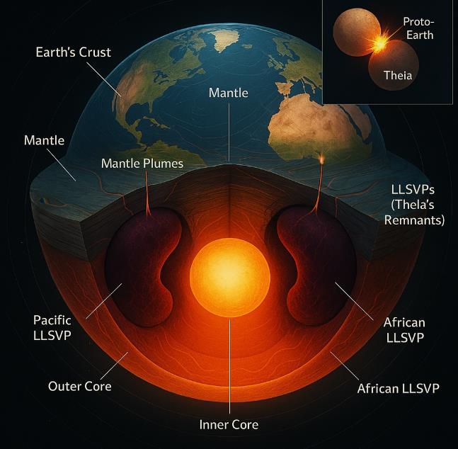
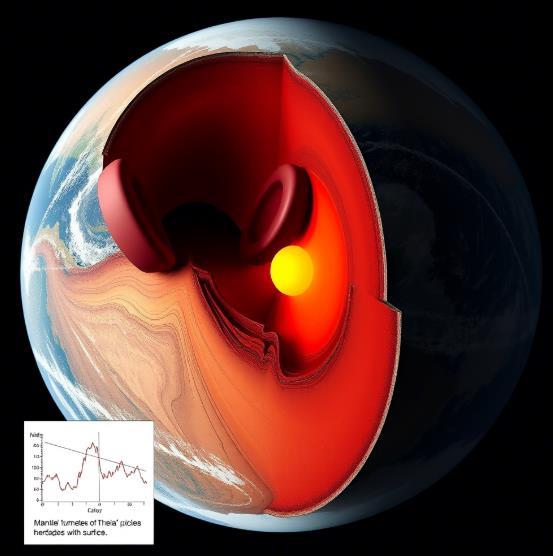
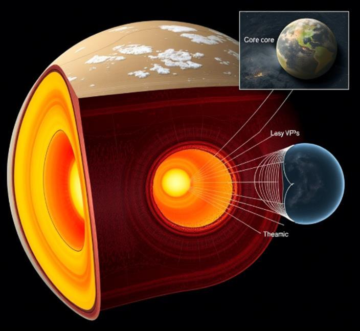
Deep beneath our feet lie two colossal anomalies—mysterious continent-sized provinces that have puzzled geophysicists for decades. These enigmatic structures, straddling Earth's core like a pair of immense headphones,
may represent the most extraordinary archaeological discovery in planetary science: the entombed remains of an alien world that collided with early Earth and gave birth to our Moon.
These mammoth structures, rising nearly 1,000 kilometers from the core-mantle boundary and spanning thousands of kilometers across, represent the largest anomalies within our planet's mantle.
Seismologists have long observed how earthquake waves abruptly decelerate when passing through these regions beneath West Africa and the Pacific Ocean—a telltale signature of material substantially denser and chemically distinct from surrounding mantle rock. Known technically as Large Low-Shear Velocity Provinces (LLSVPs), these behemoths have defied conventional explanation. Until now.
A revolutionary hypothesis proposes that these anomalous structures are not merely products of Earth's internal evolution but rather the remnants of Theia—the Mars-sized protoplanet that struck primordial Earth 4.5 billion years ago in the cataclysmic impact that created our Moon.
This cosmic collision, arguably the most consequential event in Earth's biography, has left a deeper legacy than previously imagined—the heart of the impactor itself, preserved in Earth's deep interior for over four billion years.
"This crazy idea is at least possible," notes Qian Yuan, a geodynamics researcher at Arizona State University who has assembled multiple lines of evidence supporting this extraordinary claim.
The hypothesis, once merely whispered in laboratory corridors and conference halls, has emerged as a serious scientific proposition that connects planetary formation processes with the deep architecture of our modern Earth.
The evidence for this alien inheritance comes from various sources. Seismic tomography has precisely mapped these anomalous provinces, revealing their remarkable stability and distinct composition.
Geochemical investigations of volcanic rocks from Iceland and Samoa islands whose magma sources trace directly to these deep mantle structures contain isotopic signatures of radioactive elements formed exclusively during Earth's first 100 million years.
This suggests the LLSVPs have remained largely intact since the time of the Moon-forming impact, preserving a chemical record from Earth's infancy.
Perhaps most compelling is the evolving understanding of Theia itself. While earlier models of the Moon-forming impact envisioned a Mars-sized body striking early Earth, recent work suggests Theia may have been nearly Earth-sized.
Such a massive impactor would have possessed a substantial iron core surrounded by a silicate mantle. During the collision, computer simulations suggest Theia's core would have merged with Earth's, while portions of its mantle—denser than Earth's— could have sunk and accumulated at the core-mantle boundary.
This scenario elegantly explains several long-standing puzzles. The Moon's composition—notably its depleted iron content and similarity to Earth's mantle aligns with a model where lighter materials were ejected into orbit following the impact, eventually coalescing into our satellite.
Meanwhile, the distinctive density and chemical composition of the LLSVPs align with what we might expect from Theia's mantle materials after surviving a violent merger with early Earth.
The implications of this hypothesis extend far beyond academic curiosity. If confirmed, it would mean that Earth is partially composed of another planet—a chimeric world containing the essence of both primordial Earth and its cosmic impactor. Moreover, these alien remnants appear to have played a crucial role in Earth's subsequent evolution.
The LLSVPs function as thermal blankets atop the core, influencing heat flow patterns that drive mantle convection and, by extension, plate tectonics. They serve as launch points for massive upwellings of hot material called mantle plumes, which create volcanic hotspots like Hawaii, Iceland, and Samoa at the surface.
This discovery would also transform our understanding of planetary collisions throughout the solar system and beyond. Rather than simply causing surface reshaping or ejection of material, giant impacts may
leave internal fingerprints that persist for billions of years, fundamentally altering the composition and dynamics of the resulting worlds.
The scientific detective work behind this hypothesis showcases the remarkable interdisciplinary nature of modern Earth science. Seismologists mapping Earth's interior with earthquake waves, geochemists analyzing isotopic fingerprints in volcanic rocks, and astrophysicists modeling planetary collisions have converged on a narrative that connects Earth's deepest structures with its cosmic origin story
"I think it's completely viable until someone tells me it's not," remarks Edward Garnero, a seismologist not involved in the research, capturing both the scientific plausibility and the healthy skepticism that greets such paradigm-challenging ideas.
Testing this hypothesis further will require ingenious approaches. Future seismic studies may reveal more detailed structural information about the LLSVPs.
Advanced geochemical techniques might identify unique isotopic signatures that differentiate Theian material from primordial Earth rock. Sophisticated computer simulations could determine whether Theia's mantle would indeed sink and accumulate as observed rather than mixing homogeneously throughout Earth's interior.
If confirmed, the presence of Theia's remains within Earth would constitute one of the most profound discoveries in planetary science— tangible evidence of the violent collision that not only created our Moon but fundamentally shaped Earth's internal architecture and subsequent evolution.
The very ground beneath our feet may contain the preserved heart of another world, a cosmic time capsule from the solar system's turbulent youth, silently influencing Earth's dynamics for billions of years.
This ancient alien within this cosmic inheritance reminds us that Earth's biography is inseparably linked to the broader narrative of our solar system's formation.
Our planet emerges not as an isolated body following a linear evolution but as the product of cosmic catastrophes that stitched together multiple worlds into the life-sustaining planet we inhabit today.
The LLSVPs, these mysterious continental-scale anomalies deep within our planet, may represent the most tangible evidence of Earth's cosmic assembly—an alien heart beating slowly at the core of our world.

1788 – Marques de Pombal (Portugal) Father of Seismology
The 1755 Lisbon earthquake not only devastated the city but also served as a catalyst for the development of modern seismology, largely due to the decisive actions of Sebastião José de Carvalho e Melo, the Marquis of Pombal.
His comprehensive approach to disaster response and urban planning introduced several pioneering practices that have influenced the field of seismology and disaster management.
In the immediate aftermath of the earthquake, Pombal implemented swift measures to maintain order and address the crisis.
Recognizing the importance of understanding the earthquake's characteristics, he initiated a detailed survey known as the "Parochial Memories of 1758."
https://www.bbc.com/reel/video/p0ckfxtn/the-earthquake-that-changed-thecourse-of-history
This involved sending a standardized questionnaire to every parish in Portugal, gathering data on the earthquake's effects, including the duration and intensity of tremors, observable changes in water levels, and unusual animal behavior prior to the event. This systematic data collection is considered one of the earliest examples of seismological inquiry
Understanding the need for resilient infrastructure, Pombal oversaw the reconstruction of Lisbon with a focus on earthquake-resistant design.
He commissioned architects and engineers to develop new construction methods, leading to the creation of the "Pombaline" architectural style.
This style incorporated wooden frameworks within masonry walls, known as the "gaiola" (cage) system, designed to absorb and dissipate seismic energy.
Additionally, Pombal ordered the testing of architectural models by simulating earthquakes through marching troops around them, making these buildings among the first in Europe designed with seismically protective features.
Pombal's vision extended beyond immediate reconstruction to comprehensive urban planning. He redesigned Lisbon's downtown area, implementing wide, rectilinear avenues and large public squares to facilitate movement and reduce congestion.
This layout not only improved aesthetics and functionality but also enhanced safety in the event of future disasters.
Moreover, Pombal addressed public health concerns by ensuring the prompt removal and burial of corpses to prevent disease outbreaks, demonstrating an understanding of the link between urban planning and public health.
Through these initiatives, the Marquis of Pombal established practices that have had a lasting impact on seismology and disaster management.
His emphasis on empirical data collection, innovative engineering solutions, and comprehensive urban planning set new standards for how societies respond to and prepare for natural disasters.
Pombal's approach transformed a national tragedy into a foundational moment for scientific and urban development, influencing methodologies in earthquake study and resilient city planning that continue to inform contemporary practices.


The recent Japanese government report on the Nankai Trough megathrust earthquake presents alarming data that demands our attention and preparation. The scientific evidence points to a looming catastrophe of unprecedented scale.
Deep beneath the waters south of Japan lies one of Earth's most dangerous geological features: the Nankai Trough. Here, in slow motion, the Philippine Sea plate is subducting beneath the Eurasian plate upon which Japan sits. This seemingly imperceptible movement masks a terrifying truth: energy is accumulating along this boundary,
like a spring being compressed tighter and tighter (Japanese Government source, 2024).
When that spring finally releases? The data suggests devastation.
The Japanese government's disaster management working group has released updated projections that, while slightly reduced from their 2014 estimates, remain staggering:
• Up to 298,000 fatalities (down from the previous estimate of 323,000)
• 215,000 deaths from tsunami inundation
• 73,000 deaths from building collapse
• 9,000 deaths from post-earthquake fires
• Potential economic damage approaching $2 trillion USD
The historical data tells a clear story. The Nankai Trough has produced megaquakes every 100-200 years over the past 1,400 years. The last major event occurred in 1946, 79 years ago. We are statistically entering the window of high probability.
A government panel recently adjusted the probability of a megaquake occurring within the next 30 years to between 75-82%. In statistical terms, this is not a question of if, but when (Japanese Government, 2024).
Last August, Japan's Meteorological Agency (JMA) issued its first "megaquake advisory" since the devastating 2011 earthquake and tsunami that triggered the Fukushima nuclear disaster.
While the subsequent 7.1 magnitude earthquake caused only 14
injuries, the advisory triggered widespread panic buying and resource shortages throughout the region.
This public reaction to a mere warning illustrates the psychological impact of living under the shadow of potential catastrophe.
The following is a narrative exploration of what might unfold, based on scientific projections:

“…The morning begins like any other in coastal Kochi Prefecture. Fishermen prepare their boats, schoolchildren walk to class, and office workers crowd onto trains.
Few notice the subtle anomalies—unusual tidal patterns observed by
harbor masters, peculiar behavior among certain marine species, and the slight tremors detected only by the most sensitive instruments.
At 2:17 PM, the first jolt strikes without warning. For a moment, there's confusion—earthquakes are common in Japan.
But this one doesn't stop. The shaking intensifies, reaching an unprecedented magnitude of 9.1. Buildings designed to withstand earthquakes begin to sway dangerously. Older structures crumble. The ground itself seems to liquefy in places.
For three minutes an eternity during a seismic event the earth convulses. Then comes a deceptive calm. Along the coast, the ocean mysteriously recedes, exposing seabed never before seen by human eyes.
Those educated about tsunami warnings recognize this deadly harbinger and flee inland, but many others remain curious or confused.
Forty-five minutes later, the first tsunami wave arrives not a single wave but a relentless surge of water that climbs to heights of over 30 meters in some locations.
It crashes through seawalls, engulfs entire towns, and pushes kilometers inland. The receding water drags thousands back into the sea.
Secondary disasters multiply: gas lines rupture, triggering fires that cannot be contained due to damaged water systems; landslides cut off evacuation routes; power outages disable communication networks; critical infrastructure fails….”
The megathrust earthquake along the Nankai Trough, long predicted by scientists, has arrived.
What follows will test the resilience not just of Japan's sophisticated disaster response systems, but of its very social fabric.
The scientific consensus is clear: the Nankai Trough megaquake is coming. The question is not if but when, and how prepared we will be when it strikes.
Japan, having experienced the traumatic lessons of Kobe in 1995 and Tohoku in 2011, continues to lead the world in earthquake-resistant infrastructure, early warning systems, and disaster response protocols.
Yet the scale of the projected Nankai event suggests that even these advanced preparations may be insufficient.
The data points to an impending catastrophe of historic proportions. The warning has been issued; it is now up to governments, communities, and individuals to heed it.
Citation: Japanese Government Disaster Management Working Group Report (2024). Nankai Trough Megaquake Risk Assessment.

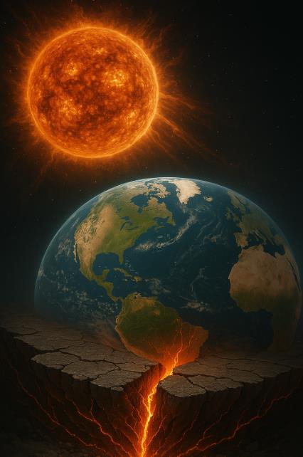
Bathed in the golden glow of our nearest star, Earth has long moved to the rhythm of the Sun's energy. But could this celestial choreography extend beyond simply warming our oceans and growing our crops?
Emerging research suggests the Sun's fiery temperament might actually shake the very ground beneath our feet.
Japanese scientists from the University of Tsukuba and the National Institute of Advanced Industrial Science and Technology have uncovered an intriguing pattern: periods when the Sun flares with increased sunspots seem to coincide with upticks in earthquake activity on our planet. This cosmic connection hints at an unexpected relationship between solar tantrums and terrestrial tremors.
"The Sun doesn't directly cause earthquakes," explains the research team, "but it may act as a subtle trigger." Their proposed mechanism paints a fascinating picture of solar influence. As the Sun's heat drives atmospheric temperature shifts, it creates a cascade of effects reaching deep into Earth's crust.
Rocks warmed by these temperature changes become more brittle and susceptible to fracturing. Meanwhile, underground water, responding to these thermal fluctuations, shifts its pressure against tectonic plate boundaries—potentially providing the final push needed for stressed fault lines to snap.
To investigate this solar-seismic relationship, the researchers developed sophisticated mathematical models that wove together three distinct data streams: earthquake records, solar activity measurements, and surface temperature patterns.
Their results proved compelling earthquake forecasts, particularly for shallow tremors closer to Earth's surface, became noticeably more accurate when surface temperature data entered the equation. This mathematical evidence underscores the delicate interplay between the Sun's thermal influence and our planet's seismic behavior.
This sun-earthquake connection isn't a new idea. Back in 1853, astronomer Rudolf Wolf first proposed links between sunspots and
seismic events, sparking nearly two centuries of scientific exploration. More recent studies published in Scientific Reports analyzed two decades of data, revealing correlations between solar proton density and large earthquakes (magnitude above 5.8), with earthquakes following solar events by approximately one day.
Some scientists suggest these correlations might stem from reverse piezoelectric effects, where solar particles create electric fields that induce subtle changes in Earth's crust. Other researchers have focused on geomagnetic storms disturbances in Earth's magnetic field caused by solar wind as potential earthquake triggers.
One compelling case study notes that after a significant geomagnetic storm on March 24, 1991, Alaska experienced a major earthquake approximately two months later, suggesting these magnetic disruptions might influence seismic activity.
Gravitational forces present another possible connection. Both the Sun and Moon exert tidal forces on our planet, creating periodic stress on Earth's crust. While evidence remains mixed, some research indicates these tidal stresses might serve as triggering mechanisms for earthquakes in regions already under significant tectonic strain.
Not all scientists embrace these theories, however. The U.S. Geological Survey maintains a cautious stance, stating that no definitive causal relationship between space weather events and earthquakes has been conclusively demonstrated. They emphasize that Earth's internal processes remain the primary earthquake drivers, which would occur regardless of solar activity.
While tectonic forces undoubtedly remain the main actors in Earth's seismic drama, this research illuminates the Sun's potential role as a supporting character not the star of the show, but perhaps an important influence on when the curtain rises on seismic events. By incorporating solar activity predictions into existing earthquake models, scientists inch closer to more accurate forecasting systems, potentially giving humanity precious additional time to prepare for nature's most destructive performances.
The profound relationship between our star and our planet continues to reveal itself in unexpected ways, reminding us that in Earth's complex systems, even distant influences can have significant local impacts. As research progresses in this interdisciplinary frontier, we may discover even more subtle connections between the heavens above and the earth below.
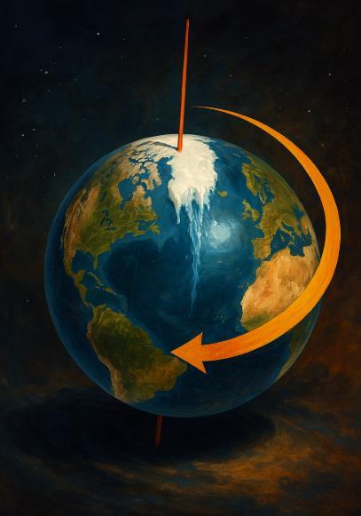
Earth may seem like a giant, stoic marble spinning steadily in space, but beneath that illusion of stability lies a planet constantly shifting its weight. Picture it less like a rigid globe and more like a slowly spinning top on a soft, uneven rug—its balance delicate, its movements traceable not just in centuries but in seconds.
Scientists have long known that our planet doesn't spin with perfect consistency. Small wobbles and shifts in its rotation have been observed for over a century. But what's alarming climate researchers and geophysicists today is how dramatically human activity is accelerating these natural planetary rhythms.
As the 20th century marched toward an era of warming, the icy strongholds of the North began to crumble. Nowhere has this been more dramatic than Greenland. There, over the span of just a few decades, some 7,500 gigatons of ice have melted into the ocean—a mass equivalent to 20 million Empire State Buildings turned to water and poured into the sea.
"This isn't just environmental change—it's a fundamental redistribution of Earth's mass," explains Dr. Surendra Adhikari, a geophysicist at NASA's Jet Propulsion Laboratory. "When you move weight around on a spinning body be it a figure skater pulling in their arms or a planet redistributing ice and water you change how it spins."
The rate of ice loss is accelerating. Between 2002 and 2021, Greenland lost ice at an average rate of 279 billion tons per year more than double the rate during the 1990s.
Meanwhile, Antarctica is shedding roughly 150 billion tons annually. Combined with mountain glacier retreat worldwide, Earth is experiencing one of the most rapid mass redistributions in its recent geological history.
This mass exodus of ice from land to sea has made Greenland one of the largest contributors to global sea level rise. But the water doesn't just spread evenly across the globe. It flows. It bulges. It pools according to Earth's rotation, ocean currents, and gravitational anomalies.
"Water released from melting ice doesn't distribute uniformly across the oceans," notes Dr. Isabella Velicogna, a professor of Earth System Science at the University of California, Irvine. "It's influenced by Earth's rotation, causing it to accumulate more in some regions than others."
Counterintuitively, sea levels actually fall near melting ice sheets as the ice's gravitational pull diminishes, while rising disproportionately in areas thousands of miles away. This uneven redistribution creates a complex pattern of mass change that pulls on Earth's rotational axis.
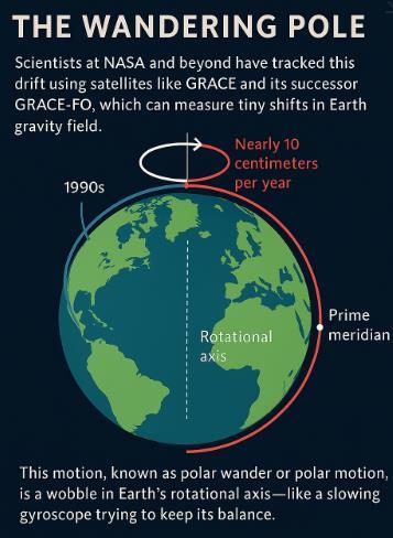
Scientists at NASA and beyond have tracked this drift using satellites like GRACE (Gravity Recovery and Climate Experiment) and its successor GRACE-FO, which can measure tiny shifts in Earth's gravity field. What they found was astonishing: since the 1990s, the North Pole has been drifting—once steadily toward Canada, now angling eastward toward the UK at nearly 10 centimeters per year. That may not sound like much, but on a planetary scale, it's a hard swerve.
"It's as if Earth is trying to adjust its spin to accommodate this new weight distribution," says Dr. Jonathan Overpeck, an interdisciplinary climate scientist at the University of Michigan. "The poles are literally moving in response to our climate crisis."
This motion, known as polar wander or polar motion, is a wobble in Earth's rotational axis like a slowing gyroscope trying to keep its balance. While Earth has always experienced some degree of polar wandering due to natural processes, the current rate and direction have climate change fingerprints all over them.
A 2021 study published in Geophysical Research Letters confirmed that glacial melting, particularly in Greenland, has been the dominant driver of polar drift direction since the 1990s, accounting for nearly 70 percent of the observed shift. And Greenland's ice loss continues to accelerate, promising further changes to Earth's wobble.
Not all of Earth's shifting weight is visible from the surface. Deep beneath the crust, mantle convection the slow churning of semimolten rock also redistributes mass over geological time.
This process, operating over millions of years, has always influenced Earth's rotation in subtle ways.
"The mantle flows like an extremely viscous fluid, carrying continents along for the ride," explains Dr. Richard Gross, a research scientist at NASA's Jet Propulsion Laboratory. "It's part of what makes Earth a dynamic planet rather than a static one."
Even post-glacial rebound, where the crust rises as the pressure of ancient ice sheets lifts, plays into this story. Parts of Canada and Scandinavia are still rising at rates up to a centimeter per year, responding to ice sheets that melted over 10,000 years ago. It's as if Earth is slowly exhaling after carrying the weight of the Ice Age for millennia.
But these natural processes operate on timescales of thousands to millions of years. What's unprecedented is how human activity has accelerated mass redistribution to create measurable changes within decades.
Earth's rotational changes do more than just move the poles. They also affect the distribution of water across the planet's surface, creating a feedback loop with the climate system.
Dr. Jianli Chen, a research scientist at the University of Texas Center for Space Research, has studied how polar motion interacts with oceanic currents.
"Changes in Earth's rotation can modify ocean circulation patterns, potentially affecting regional climate and marine ecosystems," he notes.
This interplay between rotation and water distribution could eventually influence patterns of drought and rainfall. As Earth's axis shifts, the seasonal timing of the equinoxes changes slightly, potentially altering the duration and intensity of seasons in different hemispheres over time.
"We're conducting a planetary-scale experiment," says Dr. Jerry Mitrovica, a professor of geophysics at Harvard University. "Moving this much mass this quickly is bound to have consequences we haven't fully anticipated."
These changes in rotation and mass aren't just abstract curiosities they're actively rewiring Earth's geological stress patterns, with potentially dangerous consequences for regions already balanced on tectonic knife-edges.
Earth's tectonic plates those colossal jigsaw pieces that make up our planet's outer shell respond directly to changes in mass distribution and rotational forces. As Earth's spin axis shifts and its rotational speed fluctuates by fractions of a millisecond, the resulting changes in centrifugal force can significantly alter stress patterns across fault lines worldwide.
"What we're seeing is essentially a redistribution of the planet's stress budget," explains Dr. Roland Bürgmann, a seismologist at the University of California, Berkeley. "Areas previously in equilibrium may be pushed toward failure, while others gain temporarily relief. The concern is that these rotational changes could synchronize with existing tectonic stresses to trigger earthquake sequences in vulnerable regions."
Research published in Science Advances suggests that even tiny changes in rotation can translate to substantial shifts in crustal strain enough to potentially trigger fault ruptures in areas already near critical stress thresholds, particularly in tectonically active regions like the Pacific Ring of Fire, the Mediterranean, and the Himalayan front.
The volcanic connection is equally concerning. As ice melts from volcanic regions, the reduced pressure allows magma to form more readily and rise closer to the surface. This process, known as
decompression melting, has been directly observed beneath Iceland and parts of Alaska.
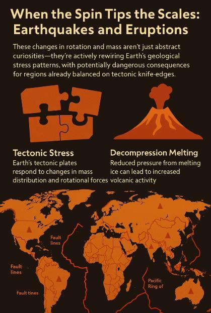
"The historical record is clear on this point," notes Dr. Peter Vajda, a volcanologist with the Earth Science Institute at the Slovak Academy of Sciences. "Major periods of deglaciation throughout Earth's history have been followed by significant spikes in volcanic eruption frequency—often with a lag time of just decades, not centuries."
Iceland offers the most visible modern example. Since 2010, the country has experienced multiple major eruptions, including Eyjafjallajökull (2010), Grímsvötn (2011), Holuhraun (2014-2015), and a series of eruptions on the Reykjanes Peninsula beginning in 2021.
While scientists are careful not to attribute any single eruption directly to climate change, the increasing frequency aligns with models predicting enhanced volcanic activity in response to ice unloading.
Similar concerns exist for volcanic regions in Alaska, the Cascades, the Andes, and parts of Antarctica, where glacial coverage is thinning rapidly.
The potential for ash clouds disrupting air travel, lava flows threatening communities, and volcanic gases altering local air quality represents yet another unforeseen consequence of our planetary rebalancing act.
Think of Earth as a tightly wound system of interconnected forces. Tweak the spin, shift the weight, and geological dominoes begin to fall halfway around the world.
Tracking these subtle planetary changes requires extraordinary precision. Modern geodesy the science of measuring Earth's shape, orientation, and gravity field relies on a suite of space-based technologies that would have seemed like science fiction just decades ago.
GRACE and GRACE-FO satellites detect minute changes in Earth's gravity field by measuring the distance between two spacecraft as they orbit.
When flying over regions with stronger gravity (like massive mountain ranges or water bodies), the lead satellite accelerates slightly,
increasing the distance between the pair a change that can be measured down to the micron.
"We're essentially weighing the planet month by month," says Dr. Byron Tapley, founding director of the Center for Space Research at the University of Texas at Austin and the original principal investigator on the GRACE mission.
Meanwhile, Very Long Baseline Interferometry (VLBI) uses multiple radio telescopes across the globe to track Earth's orientation by observing distant quasars. This network can detect changes in Earth's spin axis down to a few millimeters.
These precision measurements are more than technical achievements they represent humanity's growing ability to comprehend our planet as a dynamic system responding to our actions
So yes, Earth still spins. But it's not quite the same planet it was a century ago.
The poles are no longer where they used to be. The oceans are deeper. The ground beneath our feet is subtly rearranging.
"The Earth system has a memory," reflects Dr. Eric Rignot, a glacier scientist at the University of California, Irvine. "What we do today will continue to affect planetary dynamics for centuries to come."
Climate action could slow the rate of polar drift by reducing future ice melt, but some degree of continued change is already locked in.
Ice sheets have a delayed response to warming, meaning the mass shifts already set in motion will continue for decades regardless of immediate climate measures.
And while these changes may be slow and silent to human perception, they are unmistakably real etched into the way the Earth wobbles, tilts, and turns through space. In our warming world, even the planet's spin can't escape the ripple effects of human activity.

As Earth continues its cosmic journey, it does so with new rhythms, new patterns powerful evidence of how thoroughly we have become shapers of our planet's most fundamental movements.
Sidebar: The Language of Earth's Movements
Polar Motion: The shift in the position of Earth's rotational axis relative to its crust.
Chandler Wobble: A natural oscillation in Earth's rotation discovered in 1891, with a period of about 433 days. Length of Day (LOD): Small variations in Earth's rotational speed, measured in milliseconds.
True Polar Wander: Long-term migration of Earth's poles relative to the crust, distinct from plate tectonics. Post-Glacial Rebound: The rising of land masses that were depressed by ice sheet weight during the last Ice Age.

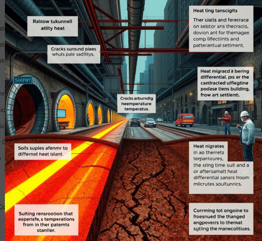
Beneath the concrete arteries of our urban centers lurks an invisible menace thermal metamorphosis scientists term "subterranean climate change."
While global attention fixates on atmospheric warming, a parallel climate crisis unfolds silently underfoot, threatening to undermine the very foundations upon which our cities stand.
Recent studies published in Nature Communications reveal the alarming extent of this hidden phenomenon. Human-engineered environments—subway networks pulsing with electric energy, labyrinthine utility tunnels, and vast building foundations— continuously inject heat into surrounding soils.
This anthropogenic thermal loading creates persistent underground temperature anomalies that radiate outward, fundamentally altering the geotechnical properties of urban substrates.
The data tells a compelling story. Major global metropolises— including New York, London, and Tokyo—now experience subsurface temperature increases ranging from 0.1°C to over 2°C per decade. These seemingly modest numbers mask profound structural implications.
As soils warm, critical moisture evaporates, transforming oncestable materials into compromised substrates.
The resulting differential settlement creates invisible stress patterns that manifest in fractured foundations, ruptured utility corridors, and pavement deformation—the silent harbingers of infrastructure failure.
This thermal metamorphosis catalyzes more than physical deformation. Elevated temperatures accelerate chemical degradation processes, particularly in metal infrastructure. Corrosion rates in buried pipelines, electrical conduits, and reinforced concrete structures escalate dramatically in thermally altered soils.
With infrastructure corrosion extracting billions annually from global economies, unmitigated subterranean warming threatens to multiply this financial hemorrhage while compromising critical urban systems.
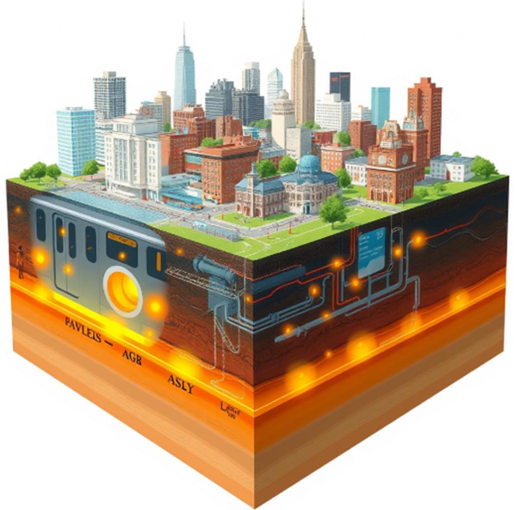
This phenomenon creates a troubling feedback loop with surface conditions. Urban heat islands—zones where temperatures soar due to concentrated development and minimal vegetation— function as thermal gateways.
Surface heat migrates downward through conductive pathways, intensifying the subsurface warming initiated by underground infrastructure.
This bidirectional heat exchange creates thermal anomalies far exceeding predictions based on atmospheric warming alone.
This phenomenon creates a troubling feedback loop with surface conditions. Urban heat islands zones where temperatures soar due to concentrated development and minimal vegetation function as thermal gateways.
The cascading consequences extend beyond physical infrastructure to economic and social systems. Emergency repairs to heat-damaged subsurface systems impose massive financial burdens while disrupting transportation networks, utility services, and commercial activities.
These impacts disproportionately affect vulnerable populations, adding another dimension of inequality to climate adaptation challenges.
The scientific community and forward-thinking urban planners emphasize that addressing this crisis demands innovative approaches.
Advanced thermal insulation technologies for underground structures, strategic urban greening initiatives that cool surface temperatures, and revolutionized building practices that minimize subterranean heat transfer represent critical intervention points.
Most importantly, cities must integrate underground thermal management into comprehensive climate resilience frameworks.
Subterranean climate change represents not merely a technical challenge but an existential one for urban sustainability. By confronting the thermal revolution occurring beneath our streets, cities can safeguard vital infrastructure investments, ensure public safety, and secure long-term urban viability.
Ignoring this invisible thermal transformation risks allowing our cities to slowly cook from below—a scenario where the ground beneath our feet becomes increasingly hostile territory.

1942- Howell Williams (Welsh) Founder of Volcanology
In the shadow of Mount Mazama's catastrophic collapse some 7,700 years ago, a geological detective painstakingly reconstructed North America's most violent volcanic cataclysm.
The azure waters of Oregon's Crater Lake concealed their explosive origins until Howel Williams decoded the landscape's hidden narrative, forever transforming our understanding of volcanic processes.
This Welsh-born geologist, whose meticulous fieldwork and artistic renderings breathed life into ancient eruptions, would establish volcanology as a rigorous scientific discipline and inspire generations of researchers to probe Earth's fiery depths.
Born in 1898 in Liverpool to Welsh parents, Williams' journey to become the father of modern volcanology followed an unlikely path. His early academic training focused on mining engineering at Liverpool University, but the devastating battlefields of World War I altered his trajectory.
After serving in France, Williams returned with a heightened appreciation for life's fragility and a desire to comprehend Earth's most fundamental processes.
This philosophical shift led him to Cambridge University, where he studied petrology and igneous rocks under Alfred Harker, laying the foundation for his eventual specialization in volcanic systems.
Williams arrived in America in 1926, joining the faculty at the University of California, Berkeley, where he would remain for his entire career.
The western United States, with its abundant and diverse volcanic features, provided the perfect laboratory for his emerging interests. Rather than focusing narrowly on laboratory analysis, Williams pioneered a holistic approach to volcanology, combining meticulous field observations with petrographic analysis and an artist's eye for landscape interpretation.
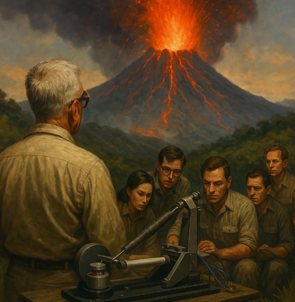
His groundbreaking 1942 monograph, "The Geology of Crater Lake National Park, Oregon," revolutionized volcanology by establishing the mechanisms of caldera formation. Prior geological thinking assumed such massive depressions formed primarily through erosion or simple collapse.
Williams demonstrated conclusively that Crater Lake formed when Mount Mazama catastrophically emptied its magma chamber during an explosive eruption, causing the mountain's summit to collapse inward. This insight that volcanoes could effectively implode after major eruptions proved applicable to volcanic systems worldwide.
Perhaps most remarkable about Williams' Crater Lake work was his ability to reconstruct an event that occurred over seven millennia earlier without modern tools. Through careful mapping of ash deposits, interpretation of rock sequences, and assessment of pyroclastic flows,
He assembled a compelling chronology of the mountain's destruction. His hand-drawn diagrams works of both scientific precision and artistic beauty visualized this sequence with clarity that continues to appear in textbooks decades later.
Beyond his research, Williams transformed volcanology through his educational influence. His 1954 textbook "Petrography" became the standard for generations of geologists, while his 1979 "The Volcanoes of the Earth" synthesized his lifetime of volcanic knowledge. He inspired hundreds of students with his enthusiasm, clarity, and ability to interpret ancient eruptions from seemingly ordinary rock outcrops.
Williams brought unique skills to volcanology. Artistically gifted, he translated complex relationships into elegant illustrations that communicated volcanic processes clearly. His phenomenal memory allowed him to synthesize observations across disparate field sites, recognizing patterns that eluded others. Most importantly, he possessed extraordinary observational powers, extracting maximal information from limited evidence.
Unlike many specialists, Williams maintained a holistic perspective on volcanic systems. He integrated field observations, petrographic analysis, and regional geological context to construct comprehensive models of volcanic evolution. This approach established a methodological template for modern research, demonstrating the necessity of multiple analytical angles when investigating complex volcanic systems.
Williams conducted his groundbreaking research when volcanology was transitioning from descriptive natural history to quantitative science. His work bridged these approaches, combining observational traditions with emerging analytical methods. His career spanned dramatic advances in geological thinking, from the pre-plate tectonics era through the revolutionary paradigm shift of the 1960s.
Most significantly, Williams elevated volcanology from a peripheral specialty to a rigorous scientific discipline with distinct methodologies. His foundation became essential for volcanic hazard assessment following late 20th-century disasters like Mount St. Helens (1980) and Nevado del Ruiz (1985).
When Howel Williams passed away in 1980 coincidentally the year Mount St. Helens erupted he left a legacy extending far beyond his publications. Today, as volcanologists deploy advanced technologies to understand active volcanoes, they build upon the observational framework Williams pioneered. His fundamental approach reading the stories written in volcanic landscapes—remains at the heart of the discipline he helped create.
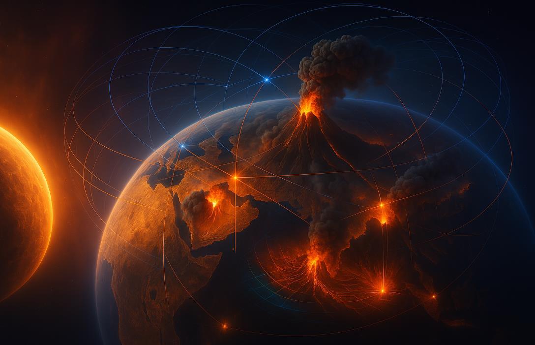
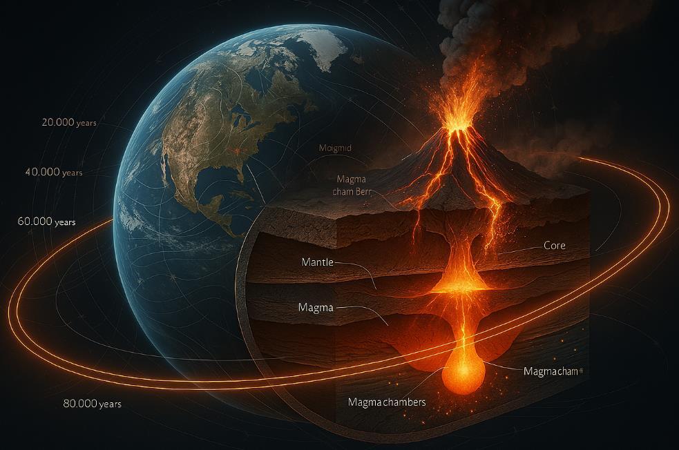
Our planet responds to a cosmic metronome—an orbital cadence that may orchestrate more than just the seasons. Groundbreaking research from the Center for Marine Environmental Sciences (MARUM) has uncovered compelling evidence linking Earth's orbital variations to massive volcanic eruptions that reshaped our planet's history and potentially triggered mass extinction events.
By synchronizing geological climate archives from the South Atlantic and Northwest Pacific with unprecedented precision down to 5,000year intervals scientists have identified critical junctures where orbital shifts coincided with cataclysmic volcanic activity.
This connection challenges conventional understanding of Earth's systems, suggesting our planet's interior responds to its celestial motion around the sun in ways previously unimagined.
The evidence lies in ancient seafloor sediments, where researchers discovered distinct changes in osmium isotope compositions—chemical fingerprints that match precisely with the massive eruption phases of India's Deccan Traps.
These ancient lava flows, towering 1.24 miles thick in places, appear to have erupted in pulses dictated by Earth's orbital variations—known as Milankovitch cycles—which affect the amount and distribution of solar radiation reaching our planet.
"Just like a metronome, we used the rhythmic changes in solar insolation imprinted in geological data," explains Thomas Westerhold, who led the study.
These orbital-driven pulses apparently triggered sequential volcanic episodes with dramatically different environmental impacts, creating a complex interplay between cosmic mechanics and terrestrial geology.
The research team's findings, enhanced by contributions from the University of Tokyo and Utah State University, reveal a sophisticated mechanism at work. Early eruptions released primarily sulfur-rich emissions, causing localized devastation without global temperature spikes.
Later pulses delivered carbon-heavy outflows that significantly altered global climate, leaving distinct markers in marine fossil records and potentially contributing to the mass extinction event that ended the Cretaceous period.
This layered effect helps explain why some volcanic episodes had relatively minor climate impacts while others proved catastrophic.

When sulfur dioxide reaches the upper atmosphere,it can produce temporary cooling effects. In contrast, carbon dioxide emissions drive longer-term warming—creating a complex pattern of climate perturbation that varies with each eruption phase.
The weathering of these massive volcanic deposits adds another dimension to the climate puzzle. As fresh volcanic rock chemically breaks down, it pulls carbon dioxide from the atmosphere potentially moderating the greenhouse effect over longer timescales.
However, during periods of intense eruption, the carbon input overwhelms this weathering sink, tipping the planet toward warming.
What makes this discovery particularly significant is its implication for Earth system science.
Rather than viewing volcanic activity and orbital variations as separate phenomena, researchers now recognize them as potentially linked components of a grand planetary system where external astronomical forces may influence internal geological processes.
This perspective offers new insights into Earth's climate history and the complex triggers behind major extinction events. By understanding these ancient patterns of cause and effect, scientists gain valuable context for interpreting current climate changes, though today's rapid warming stems primarily from human-caused greenhouse gas emissions rather than orbital or volcanic factors.
As research techniques continue to advance, allowing ever more precise dating of ancient events, scientists expect to uncover more examples of this orbital-volcanic connection throughout Earth's history—revealing our planet as an integrated system where cosmic rhythms can indeed activate terrestrial fire with global consequences.

The Cosmic Connection
Imagine Earth as a dancer, swinging through space in a complex rhythm around the sun. This dance isn't perfect—our planet's path changes subtly over thousands and millions of years due to gravitational pulls from other celestial bodies.
These orbital variations aren't just astronomical curiosities; they may be setting the stage for some of Earth's most catastrophic volcanic events.
Recent research has uncovered something remarkable: the timing of massive volcanic eruptions appears to coincide with specific phases of Earth's orbital cycles. Like a conductor's baton signaling the crescendo
in a symphony, these orbital shifts may trigger the release of molten rock from deep within our planet.
When we examine ancient rocks and seafloor sediments, we can see both the record of Earth's orbital variations and the chemical signatures of massive volcanic eruptions.
Scientists like Thomas Westerhold from the Center for Marine Environmental Sciences (MARUM) have been methodically studying these geological archives, aligning climate records from the South Atlantic and Northwest Pacific with extraordinary precision down to 5,000-year intervals, which in geological time is merely "a blink of an eye."
What they found was striking. By measuring osmium isotope compositions in ocean sediments, they discovered two distinct shifts that perfectly matched dated pulses of massive volcanism in India's Deccan Traps—an enormous formation of volcanic rock up to 1.24 miles thick in places.
Structural geologists, understand that Earth's crust and upper mantle respond to forces and stresses. When Earth's orbit changes, it alters the distribution of mass on the planet's surface through changes in ice, ocean, and atmospheric patterns. These mass redistributions create subtle but important changes in pressure on the planet's crust.
From a volcanologist perspective, these pressure changes can trigger fault movements and create pathways for magma to rise. The planet's internal plumbing system is exceptionally sensitive to these forces more so than we previously recognized.
For volcanologists, the evidence points to a domino effect: orbital shifts create climate changes, which redistribute mass, which alters crustal
pressure, which influences magma movement, which ultimately leads to eruptions. These eruptions then release massive amounts of gases that further affect climate in a complex feedback loop.
The research shows that these massive eruptions release varying mixtures of gases that affect our climate differently:
Early eruption phases may be rich in sulfur dioxide, which can cause temporary cooling. Later phases might release more carbon dioxide, leading to warming. The weathering of volcanic rocks eventually draws carbon dioxide out of the atmosphere.
This complex interplay explains why one wave of eruptions caused modest warming, while later pulses had more dramatic climatic effects.
The Deccan Traps in India tell a particularly important story. Around 66.5 million years ago, a massive first phase of eruptions began. This wasn't just any volcanic event it was one of the largest flood basalt eruptions in Earth's history.
Approximately 200,000 years later, around 66.3 million years ago, a second major phase of eruptions occurred. Both phases coincided with disruptions to the global carbon cycle and left their fingerprints in ocean sediments worldwide.
The timing is particularly interesting because it coincides with the end of the Cretaceous period and the extinction of dinosaurs.
While a meteorite impact played a significant role in that extinction event, the Deccan eruptions had already been stressing global ecosystems before the impact occurred.
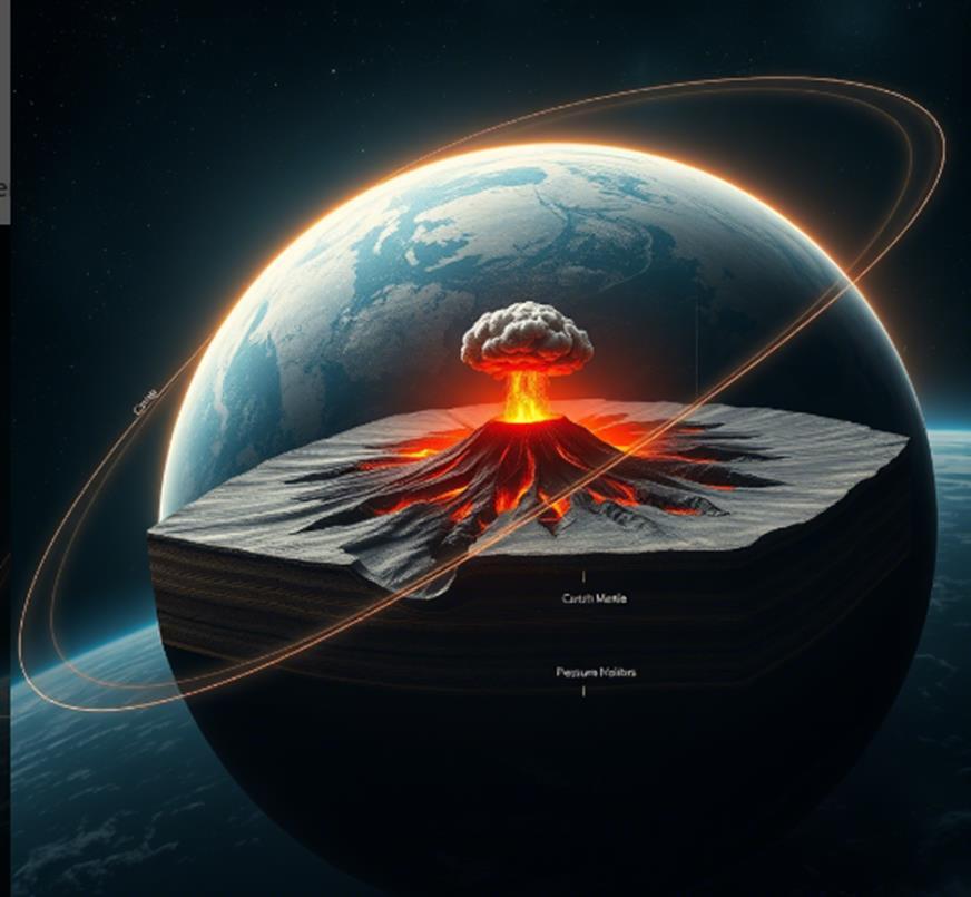
The million-dollar question: Could we be approaching another orbital trigger point for major volcanic activity?
Earth's current orbital position is within known variation patterns. Our planet's eccentricity (how elliptical its orbit is), obliquity (tilt), and precession (wobble) are all changing according to cycles that take thousands to hundreds of thousands of years to complete.
However, several factors make our current situation different from past critical periods:
The background conditions of today's climate system have been significantly altered by human activities. Our monitoring capabilities allow us to detect early warning signs of volcanic unrest. Known active volcanic systems are under constant surveillance.
What we don't yet know with certainty is exactly when the next orbital configuration might align to increase the probability of major eruptions.
The research suggests these alignments occur on cycles ranging from 20,000 to 100,000 years, with particularly significant events happening on million-year timescales.
Volcanologists and seismologists monitor several key indicators that might signal an approaching major volcanic event influenced by orbital factors:
Increases in microseismic activity beneath known volcanic provinces. Ground deformation patterns indicating magma movement. Changes in gas emissions from existing volcanic systems. Shifts in regional stress fields as detected by earthquake patterns.
Today's monitoring networks are vastly more sophisticated than ever before, giving us unprecedented ability to detect these warning signs.
Based on the current research, we cannot predict precisely when the next orbitally-triggered major volcanic event will occur. What we do know is that Earth's orbital cadence continues, and the forces that have triggered past eruptions are still at work.
The historical record suggests we're dealing with timescales of tens of thousands to millions of years between major events. The most recent significant eruption influenced by these orbital factors occurred tens of thousands of years ago.
While it's scientifically certain that another major eruption will eventually happen, the timescale is likely beyond human lifetimes.
What's more important is that this research helps us better understand the complex interplay between Earth's orbit, climate, and internal dynamics knowledge that improves our ability to interpret volcanic risks on shorter timescales.
The Earth's orbital clock is ticking, but it ticks slowly. Our challenge is to continue improving our understanding of how this cosmic metronome influences the fiery forces beneath our feet.
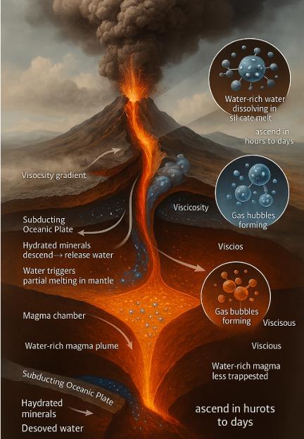
The Invisible Force Behind Volcanic Drama When we witness the awesome spectacle of a volcanic eruption, we're seeing the end result of complex processes happening deep within Earth. What many don't realize is that water—the same substance that fills our oceans and falls as rain—is the key player in these dramatic geological events.
As volcanologists have discovered, water dissolved in magma acts as the explosive force behind many of Earth's most violent eruptions.
Inside the Earth, magma exists under enormous pressure. Under these conditions, water dissolves into the molten rock much like carbon dioxide dissolves into a sealed soda bottle.
This dissolved water can make up anywhere from less than 1% to more than 6% of the magma's composition, but even these small percentages have enormous consequences.
The process works like this: As magma rises toward the surface, pressure decreases. Just as opening a soda bottle releases pressure and creates bubbles, the drop in pressure causes dissolved water in magma to transform into gas bubbles. These bubbles expand rapidly up to 1,000 times their original volume creating tremendous force.
"The formation of these gas bubbles is what drives explosive eruptions," explains Dr. Terry Plank of Columbia University, who has studied water in magmas extensively. "It's essentially the same physics as shaking a champagne bottle and popping the cork."
Water's effect on magma isn't limited to bubble formation. It also fundamentally changes how magma flows by reducing its viscosity essentially making it more "runny." This creates a fascinating paradox in volcanic systems.
Initially, water-rich magma flows more easily, which might suggest quieter eruptions as gases escape. However, as magma rises and water begins to form bubbles and escape, the remaining magma becomes increasingly thick and sticky. This increased viscosity traps the remaining gas bubbles, building pressure until the magma can no longer contain it resulting in explosive eruptions.
"This is why monitoring water content is so crucial for hazard assessment," notes volcanologist Dr. Michael Poland of the USGS. "Magma with moderate water content around 3-4% can be particularly dangerous because it's in the 'sweet spot' for explosivity."
Not all eruptions are created equal, and water content helps explain why. Volcanoes like Hawaii's Kilauea, which produce fluid lava flows, typically erupt magma with low water content. In contrast, volcanoes like Mount St. Helens or Pinatubo, known for their devastating explosive eruptions, involve magma with much higher water content.
Recent research has revealed something surprising: extremely high water content (above 5.5%) can sometimes make eruptions less explosive.
This happens because the very fluid magma allows gases to escape more easily before pressure can build to explosive levels. It's the moderate water levels that often create the most hazardous conditions.
One of the most alarming aspects of water-rich magma is how quickly it can move. While traditional models suggested magma might take weeks or months to reach the surface, providing ample warning time, we now know water-rich magmas can ascend in mere hours or days.
This rapid ascent means eruptions can occur with minimal warning. Mt. Pinatubo in the Philippines showed signs of unrest for only about two
months before its catastrophic 1991 eruption, which was driven by water-rich magma.
"Water-rich magma can essentially punch through the crust like a bullet," explains Dr. Diana Roman of the Carnegie Institution for Science. "These systems can go from dormant to erupting in timeframes that make evacuation and emergency response extremely challenging."
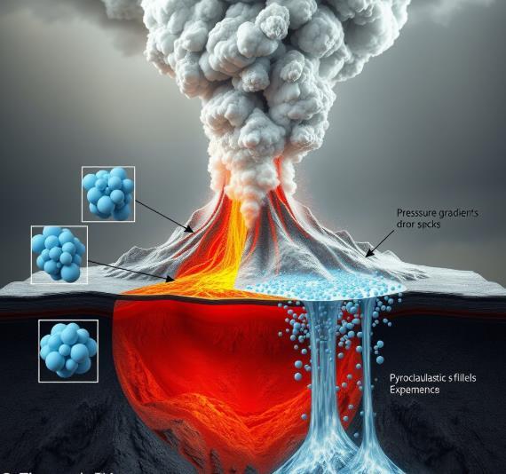
The Warning Signs How do volcanologists detect water in magma before an eruption? Monitoring gas emissions is key.
As magma rises, water is one of the first volatiles to escape, often appearing as increased water vapor in volcanic plumes. Modern spectrometers can detect these changes in gas composition, potentially providing crucial early warnings.
Seismic signals also help. The formation and movement of gas bubbles in rising magma creates distinctive patterns of earthquake activity. Lowfrequency tremors often indicate gas-rich magma on the move.
"We're getting better at reading these signals," says Dr. Janine Krippner, a volcanologist and science communicator. "But water-rich systems still present one of our biggest challenges due to their potential for rapid escalation."
Communities near volcanoes with water-rich magmatic systems face unique hazards. The potential for rapid onset, highly explosive eruptions means emergency planning must account for minimal warning times.
Volcanic hazard maps must consider the extended reach of pyroclastic flows, widespread ashfall, and other hazards associated with explosive eruptions.
Recent eruptions like Hunga Tonga-Hunga Ha'apai in 2022 demonstrate the extraordinary power of water-magma interactions.
This eruption, amplified by interaction with ocean water, produced an explosion heard thousands of kilometers away and pressure waves that circled the globe multiple times.
Looking Forward Understanding water's role in volcanic systems is now central to hazard assessment.
Advanced monitoring techniques, including satellite observation of ground deformation and real-time gas monitoring, are improving our ability to detect water-rich magmas before they erupt.
For communities living in volcanic regions, this research translates to more accurate hazard assessments and emergency planning. While we can't prevent eruptions, understanding the role of water helps scientists better anticipate when and how volcanoes might erupt, potentially saving thousands of lives.
As Dr. Krippner emphasizes, "Water might seem like the most benign substance on Earth, but inside a volcano, it's nature's high explosive.
Respecting this power is essential for those of us who study—and live near—these magnificent but dangerous phenomena."
For decades, volcanologists relied on classical magnetometers to measure Earth's magnetic fields—devices robust enough to detect shifts signaling underground volcanic activity. These classical instruments, typically fluxgate or proton-precession magnetometers, measure magnetic intensity effectively, but they often lack the ultra-sensitivity needed to capture subtle precursors to volcanic eruptions.
Enter quantum magnetometers cutting-edge tools leveraging the quirks of quantum physics to deliver unprecedented sensitivity and precision. Unlike their classical counterparts, quantum magnetometers operate on atomic-level phenomena, harnessing atomic spin states to detect minuscule changes in Earth's magnetic field.
Quantum magnetometers come in different flavors, each fascinatingly exotic. Optically Pumped Magnetometers (OPMs) excite atoms like rubidium or cesium using lasers, measuring tiny magnetic fluctuations as these atoms shift states.
Nitrogen-Vacancy (NV) centers, defects embedded in diamonds, offer another approach, sensing magnetic fields with impressive spatial accuracy. SQUID (Superconducting Quantum Interference Devices), meanwhile, detect magnetic shifts so minute they're measured in femtoteslas a billion times smaller than Earth's average field.
But why does volcanology need quantum magic?
The crucial advantage is sensitivity. Quantum magnetometers can detect subtle magnetic signals indicating magma movement beneath volcanoes. By tracking these signals, scientists can anticipate volcanic eruptions earlier, potentially saving countless lives. Real-world deployments demonstrate this vividly.
On Sicily's iconic Mount Etna, quantum magnetometers continuously monitor magnetic shifts, helping researchers identify changes related
to magma flow and underground mass movement long before traditional instruments would detect them.
In Hawaii, around the active volcanic systems like Kilauea, quantum magnetometers play a pivotal role in ongoing research efforts. These devices detect faint signals from subsurface magma shifts, refining eruption predictions and bolstering early warning systems.
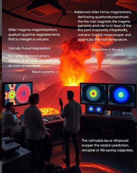
Another quantum advantage? Practicality. Many quantum sensors operate effectively at room temperature—no cumbersome cryogenic cooling necessary. They offer vector measurements, meaning they provide comprehensive data on both the strength and direction of magnetic fields, painting a more detailed picture of volcanic activity.
As quantum magnetometers become mainstream in volcanology, the science moves from mere reaction to proactive anticipation. Integrating quantum sensing technology into global volcanic monitoring networks could significantly enhance hazard assessment and eruption forecasting worldwide.
Quantum magnetometers represent not just a step forward, but a quantum leap—transforming our ability to listen to Earth's subtle magnetic whispers before they explode into fiery shouts.
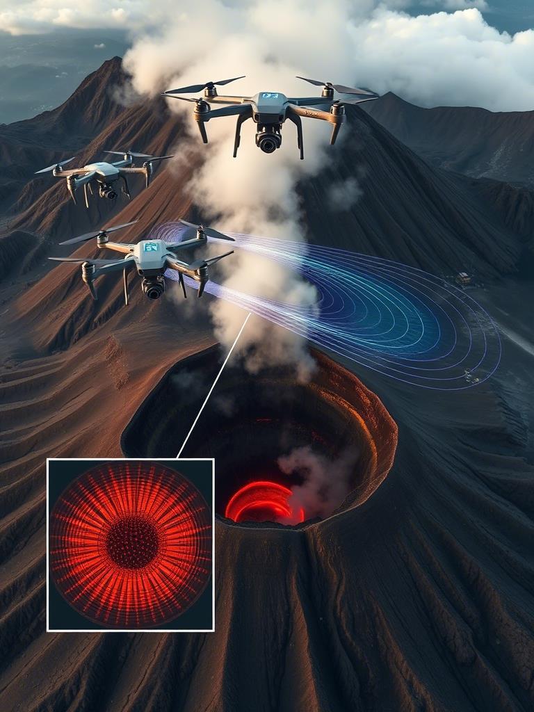
In recent years, volcanologists have embraced a groundbreaking approach airborne magnetic surveys using helicopters and, increasingly, sophisticated drones equipped with advanced magnetometers. These airborne magnetometers are transforming volcanic monitoring by providing rapid, detailed, and safe measurements of magnetic anomalies over hazardous terrain.
Traditionally, volcanic magnetic field mapping relied heavily on groundbased magnetometers, which often presented logistical challenges, particularly in areas that are difficult to access or dangerous during heightened volcanic activity. A irborne surveys initially took flight using helicopter-based magnetometers, capable of swiftly covering large areas and offering detailed spatial resolution. Helicopters provided an ideal platform, safely hovering above eruptive craters and unstable terrain, quickly delivering vital data for volcanic assessment.
The advent of drone technology has further revolutionized airborne magnetometry, offering numerous benefits over helicopter platforms.
Modern drones are lighter, more agile, and significantly more costeffective, enabling frequent and thorough surveys that were previously impractical. Equipped with compact, lightweight magnetometers— including both classical and quantum varieties—drones can perform precise low-altitude flights, capturing high-resolution magnetic data at unprecedented detail.
Drone-based magnetometry has been effectively deployed in volcanic environments globally. For example, drones have flown over Iceland’s volatile volcanoes, providing detailed magnetic maps indicating magma movement and storage beneath the surface, which are crucial for forecasting eruptions.
Similar drone surveys conducted at Mount Merapi in Indonesia provided invaluable insights into the volcano’s internal structure and magma dynamics.
One of the most exciting advancements is integrating drone technology with cutting-edge quantum magnetometers.
Quantum sensors’ unparalleled sensitivity allows drones to detect minuscule magnetic field variations associated with subtle volcanic processes, such as underground magma shifts or small fractures forming beneath a volcano's surface.
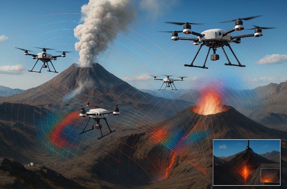
This precision significantly enhances volcanologists’ ability to anticipate volcanic activity, improving both early warning systems and risk mitigation strategies.
Beyond sensitivity, drone magnetometry provides operational efficiency. Rapid deployment and real-time data transmission capabilities allow scientists to make timely and informed decisions, particularly during volcanic crises.
Moreover, the reduced environmental footprint and risk associated with unmanned aerial surveys represent an additional advantage over traditional airborne methods.
As drone-based magnetometry continues to evolve, it promises a new era in volcanic research and hazard management.
By combining cutting-edge drone platforms with sophisticated magnetometric sensors, volcanologists can now safely and efficiently monitor the restless activity beneath Earth’s fiery mountains, gaining vital insights to protect lives and communities.

Steam curled through the early morning Tuscan air as Prince Piero Ginori Conti strode across the volcanic terrain of Larderello. The year was 1904, and beneath his feet, the Earth's ancient power rumbled and hissed, escaping through fissures in the ground that locals had called "the Devil's cauldrons" for centuries.
Unlike the superstitious villagers who had long avoided these steaming vents, Conti saw opportunity in what nature had provided. An aristocrat by birth but an innovator at heart, he paused to watch the ghostly wisps dance across the landscape and whispered to himself, "Within this steam lies the future."
Born into the noble Ginori family and married into the industrial Conti dynasty, Piero possessed a unique perspective that bridged Italy's aristocratic past and industrial future. While managing his family's boric acid business in the geothermally active region of Tuscany, he grew increasingly fascinated by the steam that naturally erupted from the earth.
"These vapors have heated the Roman baths and cooked food for centuries," he told skeptical colleagues. "But they could do so much more."
Where others saw merely a curiosity or nuisance, Conti envisioned power clean energy that required no coal, produced no smoke, and would never be exhausted. It was an idea that seemed almost magical in the coal-dominated industrial landscape of early 20th century Europe.
On July 4, 1904, Conti gathered a small team of engineers and local officials at Larderello for a demonstration that would change energy
history. The setup was modest: a small piston engine connected to a dynamo, all powered by the natural steam that emerged from the earth.
As dusk fell across the Tuscan hills, tension mounted. Conti gave the signal, and valves were opened. Steam rushed through pipes, pushing pistons that turned the dynamo. And then, like stars being born, five electric light bulbs flickered to life—the first artificial lights ever powered by the Earth's internal heat.
"Magnifico!" exclaimed one witness. "It is like stealing fire from the gods!"
Conti smiled as he watched the mesmerized faces illuminated by this new light source. "The Earth has always offered this gift," he replied. "We have simply learned to accept it."
What began with five light bulbs quickly expanded as Conti's vision grew bolder. By 1913, just nine years after his initial experiment, the world's first commercial geothermal power plant rose at Larderello, generating 250 kilowatts of electricity—enough to power the surrounding villages and factories.
When World War I created coal shortages across Europe, Conti's geothermal plant continued functioning without interruption, providing crucial power to Italian industries and even the railway system. Engineers and scientists from around the world began making pilgrimages to Larderello to witness this revolutionary energy source.
"The beauty of this concept is beyond expectation," Conti would often tell visitors. "We extract nothing that cannot be replenished, we burn nothing that pollutes the air, and yet we create light and power as reliably as any coal plant."
Conti was no mere dreamer—he was a practical innovator who understood the challenges of harnessing geothermal energy. The super-heated steam contained minerals and acids that quickly corroded conventional equipment.
To solve this problem, Conti pioneered indirect cycle systems where geothermal fluids would heat a secondary, clean working fluid that would actually power the turbines. This innovation protected the equipment and increased efficiency, setting standards still used in modern geothermal plants.
His engineers developed specialized drilling techniques to reach deeper, hotter reservoirs, and designed condensers that could handle the unique properties of geothermal steam. Each solution brought new challenges, but Conti approached them with tireless creativity."Nature
does not reveal her secrets easily," he noted in his journal. "But she rewards persistence."
Today, more than a century after Conti's first experiment, the Larderello fields remain one of the world's most productive geothermal areas, generating enough electricity to power over a million Italian homes. The complex, now operated by Enel Green Power, has expanded to include dozens of plants across the region.
The technology Conti pioneered has spread worldwide, from the geyser fields of New Zealand to the volcanic landscapes of Iceland and the western United States. Modern geothermal plants produce over 15,000 megawatts globally—all building on principles first demonstrated with those five light bulbs in 1904.
Perhaps most importantly, in an age increasingly concerned with climate change and sustainable energy, Conti's vision seems more prescient than ever. The geothermal energy he championed produces minimal emissions, has a tiny physical footprint compared to other power sources, and provides constant, reliable power day and night, regardless of weather conditions.
As we face the energy challenges of the 21st century, the legacy of this forward-thinking Italian aristocrat reminds us that solutions sometimes lie right beneath our feet, waiting for visionaries who can see beyond the steam to the power within.
Prince Piero Ginori Conti didn't just harness the Earth's heat—he showed humanity a path toward harmony with nature's forces, a path we're still following today. In the swirling steam vents of Larderello, he recognized not the devil's cauldron, but the clean energy future that still powers our world.
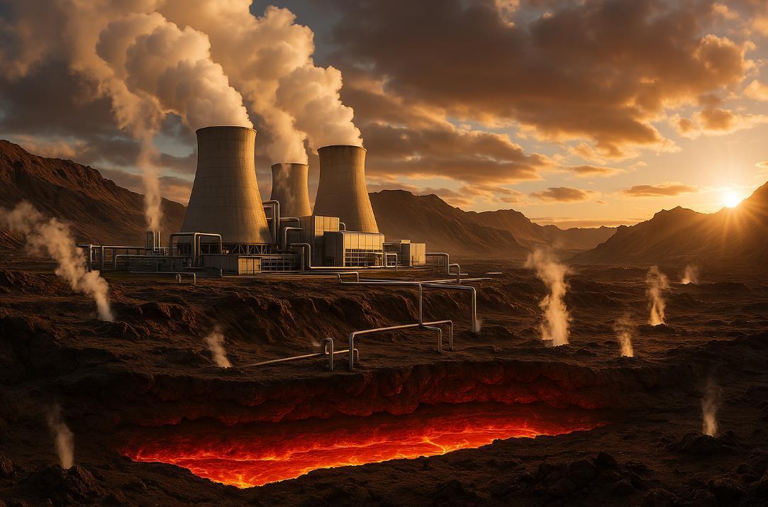
Deep beneath our feet lies an energy source of staggering potential—constant, reliable, and remarkably clean. Geothermal energy, harnessing the Earth's natural heat, represents not merely another renewable option but a transformative force in our global energy landscape.
This subterranean powerhouse delivers electricity 24/7/365, unaffected by weather patterns, daylight limitations, or seasonal fluctuations that challenge other renewables.
When developed with environmental stewardship in mind, geothermal power offers a compelling value proposition: clean, stable energy that competes economically with conventional sources while delivering substantial environmental dividends.
Perhaps most critically in our era of geopolitical energy insecurity, geothermal energy provides immunity from the volatile price swings of international commodity markets, offering nations blessed with these resources a path to genuine energy independence.
The numbers tell a story of enormous opportunity. Our planet harbors approximately 70-80 gigawatts (GW) of known geothermal potential yet astonishingly, only about 15 percent of these identified reserves have been developed for electricity generation after more than a century of technological capability.
This dramatic underutilization represents not just a missed opportunity but a curious blind spot in our global energy transition strategy. Why has this sleeping giant remained so dormant when its advantages are so clear?
The answer lies in a distinctive challenge inherent to geothermal development: substantial upfront resource risk.
Unlike solar or wind farms where resource mapping provides relatively high certainty before construction begins, geothermal resources remain largely mysterious until exploration drilling occurs.
Early-stage uncertainty regarding reservoir size, temperature, pressure, and production potential creates a formidable barrier. Private investors, understandably cautious, often balk at committing millions to exploratory wells with no guaranteed return.
This high-risk exploratory phase has effectively kept vast geothermal fields untapped, despite their proven viability in numerous regions worldwide.
Yet when we examine geothermal energy's comprehensive benefits profile, the case for overcoming these barriers becomes compelling.
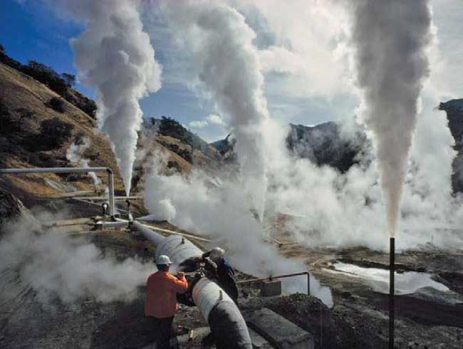
Unlike intermittent renewables that require massive storage solutions to provide reliable power, geothermal delivers firm, baseload capacity the bedrock of stable electrical grids.
This dispatchable, on-demand power complements variable renewables perfectly, providing essential grid stability without the greenhouse gas emissions of fossil fuel "peaker" plants.
Furthermore, geothermal facilities maintain remarkably small environmental footprints, typically requiring minimal land area while producing negligible emissions during operation.
From an economic perspective, geothermal's long-term value proposition is particularly striking. While initial capital costs are substantial, operating expenses remain extraordinarily low throughout a plant's multi-decade lifespan.
With essentially zero fuel costs, geothermal power plants insulate consumers from the price volatility that plagues fossil fuel generation. For nations with indigenous geothermal resources, this translates to enhanced energy security, reduced import dependence, and greater economic resilience during global energy crises.
These facilities often operate continuously for 30+ years, providing communities with generational energy security and price stability.
Current global geothermal electricity generation hovers around 10-12 GW a fraction of its potential. This underutilization is particularly striking because, unlike some renewable technologies still in development stages, geothermal power generation employs mature, proven technologies.
The primary constraint is not technological capability but rather the financial risk structure of geothermal projects. Exploration drilling, typically costing $3-9 million per well, presents a significant hurdle.
This substantial capital requirement, deployed before resource confirmation, creates an asymmetric risk profile that frequently deters private investment despite attractive long-term economics.
Globally, governments have successfully implemented various mechanisms to mitigate early-stage geothermal exploration risks.
These strategic interventions have proven remarkably effective where deployed, unlocking geothermal's potential through several complementary approaches.
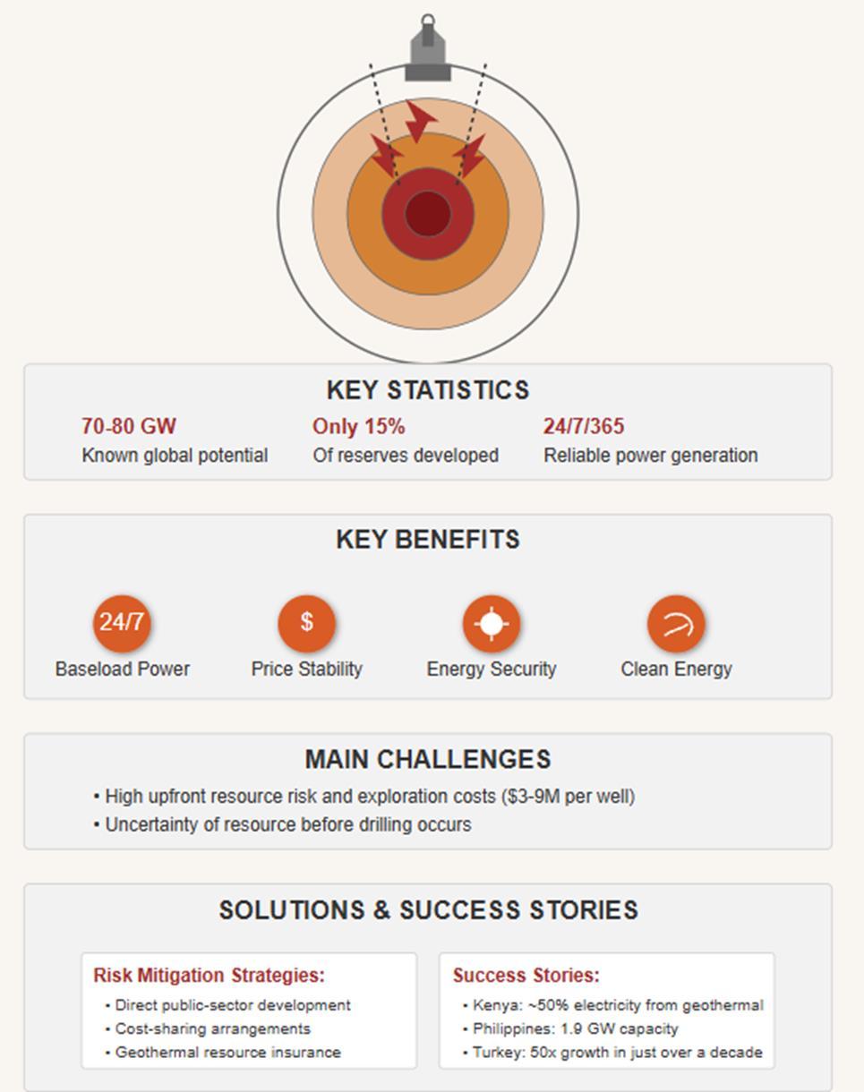
Direct public-sector development represents one successful model, with government entities undertaking initial exploration and subsequently transferring proven resources to private developers.
This approach has successfully brought more than 3.5 GW of geothermal capacity online worldwide. The model effectively leverages public resources to absorb early-stage risk, enabling private capital to flow once resources are confirmed.
Kenya's remarkable geothermal success story exemplifies this approach, with the government-backed Geothermal Development Company systematically de-risking resources before private sector involvement.
Cost-sharing arrangements offer another effective strategy, with public entities co-financing initial exploration wells.
This partnership approach has catalyzed the development of an additional 3 GW globally, mobilizing substantial private investment that might otherwise have remained sidelined.
By distributing financial risk between public and private sectors, these arrangements create viable pathways for project advancement while maintaining appropriate market incentives for efficient development.
Geothermal resource insurance schemes provide a third model, though less extensively adopted due to high premiums and limited market scale. These programs distribute risk across project portfolios,providing critical financial protection during exploration phases.
As the geothermal market expands, these insurance mechanisms hold significant promise for further de-risking development pathways and attracting institutional investors previously deterred by exploration uncertainties.
Finally, traditional fiscal incentives including tax credits, grants, and favorable loan terms—further reduce the financial barriers to project initiation.
These mechanisms enhance overall project economics, encouraging greater exploratory activity and lowering the cost of capital for geothermal developments.
When strategically implemented, such incentives have demonstrated substantial leverage effects, mobilizing private capital far exceeding public expenditures.
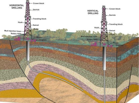
Real-world success stories provide compelling evidence of geothermal's transformative potential when early-stage risks are appropriately addressed.
Kenya, a global leader in geothermal development, now generates nearly half of its electricity from geothermal sources—an achievement realized through sustained government-supported exploration and strategic investment. This remarkable transition has enhanced the nation's energy independence while providing stable, affordable electricity that supports economic development.
Similarly, the Philippines harnesses approximately 1.9 GW of geothermal capacity, leveraging strategic public-private partnerships and proactive governmental initiatives. The country's geothermal resources have become a cornerstone of its energy strategy, providing reliable baseload power while reducing reliance on imported fuels.
This approach has yielded not only environmental benefits but also significant economic advantages through improved balance of payments and reduced exposure to global fuel price volatility.
Turkey's geothermal story demonstrates the potential for rapid sector growth when enabling conditions are established. The country has increased its geothermal capacity from a modest 30 MW in 2008 to approximately 1.5 GW today a fifty-fold expansion in just over a decade.
This remarkable growth trajectory, primarily driven by targeted fiscal and risk-sharing incentives, highlights the transformative speed possible when financial barriers to geothermal development are systematically addressed.
The United States, with over 3.7 GW of installed geothermal capacity, continues to develop its substantial resources through sustained federal and state-level policy support.
Early public investments in resource identification and exploration, coupled with consistent financial incentives, have established the U.S. as a global geothermal leader. However, even in this mature market,
significant untapped potential remains particularly in the western states—awaiting more comprehensive risk mitigation strategies to unlock full development.
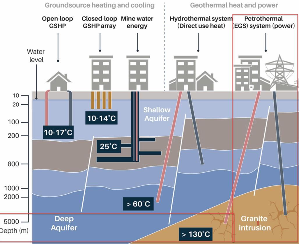
Beyond conventional hydrothermal resources, technological innovation continues expanding geothermal's frontier.
Enhanced geothermal systems (EGS) represent perhaps the most revolutionary advancement, artificially creating permeability in subsurface rock formations to access heat previously considered inaccessible.
This technological pathway could potentially increase geothermal's global capacity by orders of magnitude, making it available in regions without traditional hydrothermal resources.
Recent EGS demonstrations have shown promising results, suggesting a future where geothermal energy becomes a universal rather than geographically limited resource.
Advances in drilling technologies, borrowed and adapted from the oil and gas sector, are progressively reducing costs and risks associated with geothermal exploration. Innovations in materials science are enabling equipment to withstand the extreme temperatures and corrosive environments common in geothermal wells.
Meanwhile, significant progress in subsurface imaging and characterization technologies is improving resource identification accuracy, reducing exploration risks through better pre-drilling assessment capabilities.
Closed-loop geothermal systems represent another innovative approach, circulating working fluids through sealed wellbores without directly extracting or injecting fluids into subsurface formations.
This technique minimizes environmental impacts and enables development in areas previously considered unsuitable for conventional geothermal approaches.
Similarly, hybrid systems integrating geothermal with other renewables or energy storage technologies are creating more flexible, versatile clean energy solutions.
In today's rapidly evolving energy landscape, geothermal energy offers a unique combination of attributes perfectly aligned with contemporary challenges.
By providing firm, continuous baseload power, geothermal complements variable renewables like solar and wind, ensuring grid reliability without fossil fuel backup systems.
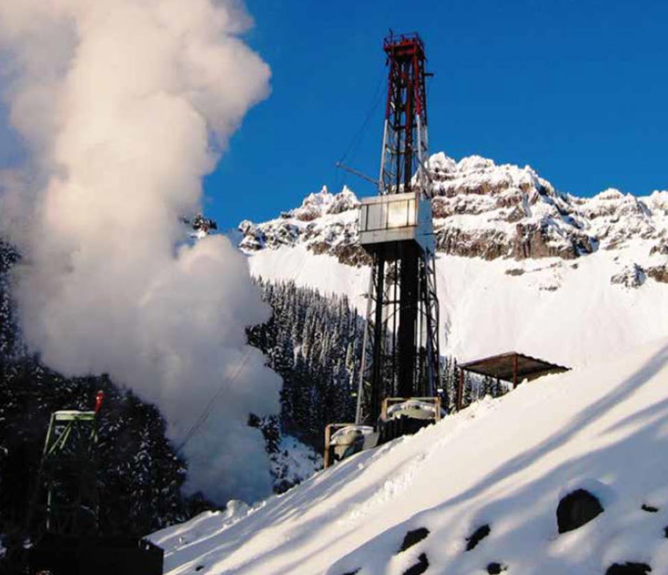
This capacity makes geothermal not merely another renewable option but an essential enabler of high-renewable energy systems—the cornerstone that can support and accelerate broader decarbonization efforts.
Strategic investment and public-sector engagement in geothermal exploration can transform this resource from a niche renewable option into a foundational element of global energy strategy.
In a world increasingly prioritizing sustainability, energy security, and climate resilience, geothermal stands ready as an essential component of our energy future.
The technology exists, the resources are abundant, and the economic case is compelling when appropriate risk management mechanisms are established.
For policymakers and industry leaders, the opportunity is clear: unlock geothermal's full potential through strategic risk mitigation, securing reliable, clean, and sustainable power for future generations.
This sleeping giant of clean energy offers not just environmental benefits but genuine energy security in an increasingly unstable world.
The time has come to awaken geothermal's full potential and establish it as a cornerstone of a resilient, sustainable global energy system—a true clean energy giant too long overlooked but perfectly positioned for our contemporary challenges.
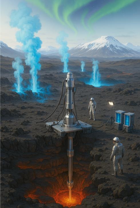
Beneath Iceland's stark landscape lies an audacious scientific endeavor—a project so ambitious it borders on mythological. Engineers and geologists are preparing to tunnel directly into the molten heart of a volcano, piercing the thin barrier between human infrastructure and Earth's primordial furnace. The Krafla Magma Testbed (KMT) represents humanity's most direct engagement with the planet's internal energy system—a bold attempt to harness the virtually limitless power that has remained tantalizingly beyond our technological grasp.
Iceland stands at the geological crossroads of two worlds—straddling the Mid-Atlantic Ridge where the North American and Eurasian tectonic plates inexorably pull apart at approximately 2.5 centimeters annually. This unique position creates a volcanic hotspot of extraordinary intensity, transforming the island nation into Earth's premier natural laboratory for geothermal innovation. Icelanders have cultivated an intimate relationship with their volatile geology, converting what other societies might view as hazards into the foundation of their energy sovereignty.
The statistics tell a remarkable story of geological alchemy. Geothermal energy provides over 70 percent of Iceland's primary energy consumption, with nearly 90 percent of Icelandic homes heated directly by geothermal waters. The capital city of Reykjavík—its name literally meaning "Bay of Smokes" in reference to the steam rising from geothermal vents—has evolved an intricate network of geothermal infrastructure.
Hot water circulates beneath streets and sidewalks, melting snow in winter without mechanical removal, while the same systems deliver constant warmth to buildings throughout the volcanic island.
What distinguishes conventional geothermal systems from the revolutionary KMT approach is a matter of temperature and proximity
to the source. Traditional geothermal wells typically tap heated water or steam at temperatures ranging from 150°C to 300°C.
These conventional systems, while effective, access only the periphery of Earth's thermal engine the diluted remnants of heat that has migrated from deeper sources. The KMT project aims to bypass these intermediaries entirely, establishing direct access to magma chambers where temperatures exceed 900°C.
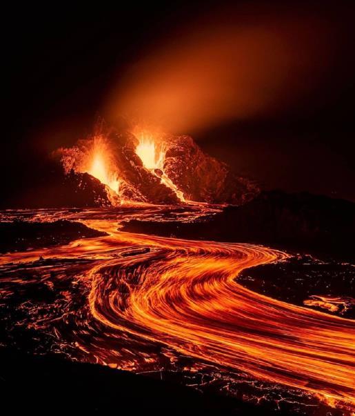
The genesis of this revolutionary project traces back to a serendipitous event in 2009 when drillers at Iceland's Krafla volcanic caldera accidentally penetrated a magma pocket at just 2.1 kilometers depth. Rather than resulting in catastrophe, this unplanned encounter provided unprecedented scientific insights—a brief window into the direct interface between human technology and molten rock. Engineers were stunned to discover they could maintain an open conduit to the magma, allowing for observations and measurements previously considered impossible. This accidental breakthrough catalyzed a profound question: Could humanity establish a permanent scientific observatory within an active magma chamber?
After years of meticulous planning, the KMT initiative formally launched in 2017, assembling an international consortium of research institutions, energy companies, and government agencies. The project's ambition has now crystallized into a concrete timeline initial drilling operations will commence in 2026, with a follow-up expedition planned for 2028. By 2030, scientists expect to have established permanent measurement and analysis facilities directly connected to Krafla's magma reservoir.
The technical challenges are formidable. Drilling into active magma environments requires entirely new technological approaches. Conventional drilling equipment would fail catastrophically in the extreme temperatures and corrosive conditions near magma chambers. The KMT team has developed specialized drilling systems incorporating advanced ceramics, refractory metals, and active cooling systems that can withstand temperatures exceeding 1000°C. Novel sensors capable of operating in these hostile conditions will provide real-time data on temperature, pressure, gas composition, and magma movement.
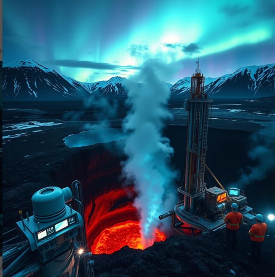
The scientific objectives of this pioneering venture extend far beyond mere technological achievement. By establishing a direct observational platform within an active magma chamber, researchers aim to transform our understanding of volcanic systems. Current volcanic monitoring relies primarily on indirect measurements—seismic activity, ground deformation, gas emissions—that provide limited insight into the complex processes occurring within magma reservoirs. The KMT will enable direct observation of magma crystallization, volatile degassing, and the subtle pressure changes that precede eruptions.
This unprecedented access to magmatic systems carries profound implications for volcanic hazard assessment. Volcanologists have long sought more reliable eruption precursors to enhance early warning systems—a quest hampered by limited understanding of pre-eruptive processes. Direct magma chamber monitoring could identify subtle chemical or physical changes that telegraph imminent eruptions, potentially revolutionizing volcanic forecasting and saving countless lives in volcanically active regions worldwide.
Beyond its scientific value, the KMT holds transformative potential for geothermal energy production. Conventional geothermal systems access heat indirectly, typically extracting energy from water or steam heated by proximity to magmatic systems. Direct magma energy extraction sometimes called "super-hot" or "supercritical" geothermal could increase energy yields by an order of magnitude. A single supercritical geothermal well might produce 5-10 times the energy of a conventional well, potentially transforming the economics of geothermal energy globally.
The thermodynamic advantages are compelling. Magma chambers represent thermal reservoirs of extraordinary energy density, with temperatures five times greater than conventional geothermal resources. This temperature differential enables vastly more efficient energy conversion using advanced heat exchangers and specialized working fluids. Preliminary calculations suggest that a small network of super-hot geothermal wells could provide baseload electricity equivalent to a conventional nuclear power plant while occupying a fraction of the land area and eliminating concerns about radioactive waste.
Iceland provides the ideal testing ground for this revolutionary approach. The country has already achieved complete energy independence through its sophisticated integration of conventional geothermal and hydroelectric resources. Icelandic expertise in
geothermal engineering is globally recognized, with Icelandic companies designing and implementing geothermal projects across multiple continents.
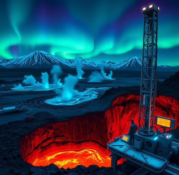
The nation's geological setting with relatively shallow and accessible magma chambers creates the optimal conditions for the world's first magma energy demonstration.
The environmental implications extend beyond clean electricity generation. If successful, super-hot geothermal technologies could provide process heat for energy-intensive industries currently
dependent on fossil fuels. Aluminum smelting, hydrogen production, carbon capture systems, and direct air capture technologies all require substantial thermal inputs that could be supplied by magma-derived heat. The cascading benefits could accelerate decarbonization across multiple industrial sectors currently resistant to clean energy transition.
Critics raise legitimate concerns about potential risks. Drilling into active magma systems could theoretically trigger volcanic activity or release dangerous gases if improperly managed. The KMT consortium has implemented exhaustive safety protocols, including continuous monitoring systems, redundant well control mechanisms, and comprehensive emergency response procedures. The project's location within an existing geothermal field with decades of operational experience provides additional risk mitigation.
As the 2026 initial drilling date approaches, the scientific community watches with anticipation. The KMT represents one of humanity's most ambitious attempts to directly study and harness Earth's internal processes. Should it succeed, the project could establish entirely new paradigms in both volcanology and renewable energy transforming our relationship with the dynamic planet beneath our feet.
In an age where terrestrial energy frontiers seemed largely mapped and conventional resources increasingly constrained, the Krafla Magma Testbed opens an entirely new dimension in humanity's energy portfolio.
By tapping directly into Earth's magmatic forge, we may access an energy resource so vast it defies meaningful quantification—the very thermal engine that has powered our planet's geological evolution for billions of years. In this case, reality indeed surpasses fiction, as Icelandic scientists prepare to accomplish what Jules Verne could only imagine: a journey to the heart of Earth's volcanic system.
In the annals of scientific discovery, some findings shine brightly in our collective memory while others fade into obscurity, their significance only realized generations later. Such is the curious case of natural hydrogen a potential energy source that could reshape our future, yet whose discovery story has remained largely untold for over a century.
While Dmitri Mendeleev is universally celebrated for creating the periodic table that hangs in every chemistry classroom across the globe, few know of his pioneering observation that would later become central to the emerging field of "white hydrogen" research.
In 1888, the renowned Russian chemist documented something peculiar occurring in a Ukrainian coal mine—hydrogen gas seeping naturally from cracks in the earth. This wasn't manufactured hydrogen or a byproduct of human activity; it was nature's own creation, bubbling up from beneath the surface.
Mendeleev, already famous for organizing the elements into the revolutionary periodic system that predicted undiscovered elements with remarkable accuracy, noted this phenomenon meticulously. Yet this observation would become a mere footnote in his illustrious career, overshadowed by his more famous contribution to chemistry.
Why did this discovery lie dormant for so long? The answer lies partly in the limitations of technology and partly in scientific preconceptions.
Natural hydrogen remained elusive in scientific literature due to its relative rarity in sedimentary rocks—the primary focus of geological exploration for decades. More critically, when scientists did look for
gases in geological samples, they unwittingly masked hydrogen's presence through their very methods of detection. The use of hydrogen as a carrier gas in chromatography—a standard analytical technique— ironically rendered natural hydrogen invisible in countless samples.
It was the perfect scientific blind spot: impossible to find because the very tools used to look for it concealed its existence.
Nearly a hundred years passed before natural hydrogen would again capture scientific attention. In 1987, researchers working in Mali made a discovery that would eventually reignite interest in Mendeleev's forgotten observation. They encountered natural hydrogen in quantities that couldn't be ignored or explained away as contamination.
This finding in African soil marked the beginning of what would slowly evolve into renewed scientific interest in what we now call "white hydrogen" a potentially clean, naturally occurring energy source.
The torch of discovery has now been taken up by researchers across the globe. In France, the groundbreaking work of Jacques Pironon and Philippe de Donato from the National Centre of Scientific Research and the GeoRessources Laboratory has proven particularly significant.
Their explorations in the Lorraine region have not only confirmed Mendeleev's century-old observation but expanded our understanding of how and where natural hydrogen forms. Their work represents the leading edge of a scientific field that is finally receiving the attention it deserves.. From those initial documented seepages to modern exploration in Lorraine, the narrative of natural hydrogen has come full circle.
As our world searches desperately for clean energy alternatives, this rediscovered legacy of Mendeleev might prove as important to humanity's future as his periodic table has been to our past.
The great chemist's comprehensive genius—seeing and recording what others missed—continues to guide scientific discovery more than a century after his time.
Perhaps this is the true nature of scientific progress: not just building upon what we know, but sometimes reaching back to recover what we've forgotten
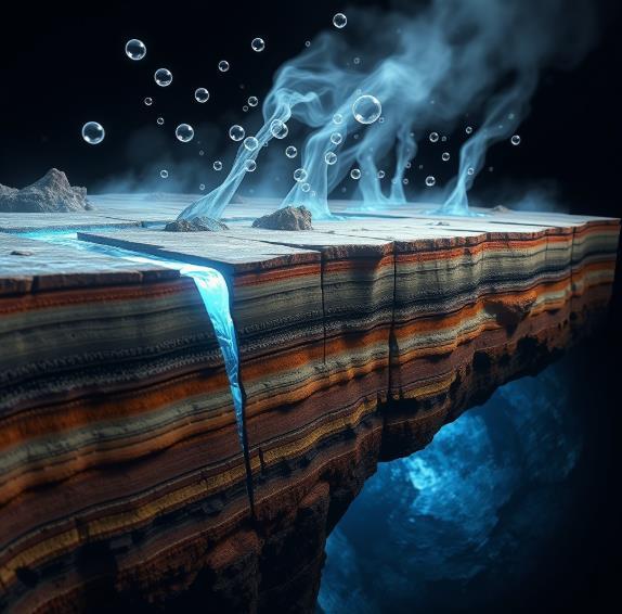
Earth produces hydrogen through several geochemical pathways. Radiolysis is a slow but persistent mechanism, where radioactive elements such as uranium, thorium, and potassium in rocks emit radiation, splitting water molecules to release hydrogen.
Over geological time, this has generated pockets of hydrogen in deep rock fractures.
In contrast, serpentinisation rapidly produces substantial amounts of hydrogen. When water infiltrates iron-rich minerals, especially olivine, the resulting chemical reaction oxidises the iron and splits water into hydrogen.
This reaction transforms olivine into serpentine minerals and magnetite, generating hydrogen abundantly at mid-ocean ridges, volcanic regions, and ancient continental formations known as ophiolites. Serpentinisation is considered Earth's primary source of geological hydrogen.
A third, more speculative source involves deep-seated hydrogen emanating from Earth’s mantle and possibly the core. Geological evidence shows magma degassing and mantle processes liberate hydrogen along tectonic boundaries and volcanic zones. Some researchers propose the existence of vast, deep hydrogen reservoirs in Earth’s interior, though this remains controversial.
Despite ongoing production, retaining hydrogen in exploitable quantities remains challenging. Hydrogen molecules are small and highly mobile, diffusing through porous rocks and faults at rates thousands of times faster than hydrocarbons. Surface features such as “fairy circles” shallow depressions with altered vegetation often mark hydrogen seeps, highlighting significant gas loss to the atmosphere.
Hydrogen is also readily consumed underground by microbes, particularly hydrogenotrophic organisms, converting it into methane or hydrogen sulfide. Additionally, abiotic chemical reactions can rapidly transform hydrogen into water, methane, or hydrocarbons.
These processes limit the natural accumulation of hydrogen, making large reserves relatively uncommon.
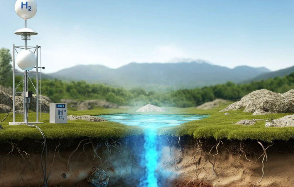
Scientists propose innovative extraction strategies to address these challenges and exploit natural hydrogen effectively. One method involves locating hydrogen traps, geological structures similar to oil and gas reservoirs.
If hydrogen migrates upward and encounters impermeable cap rocks (shale or salt layers), it can accumulate in porous reservoirs beneath, making commercial extraction feasible. Proven cases, such as Bourakebougou in Mali, illustrate that hydrogen can be naturally trapped and economically extracted.
Alternatively, direct extraction methods target active hydrogen production zones. Rather than relying solely on pre-existing gas pools,
drilling directly into reactive rock formations may capture hydrogen flows at their source.
Early trials, such as exploratory drilling in Nebraska, demonstrate feasibility, requiring only simple boreholes in naturally fractured rock formations.
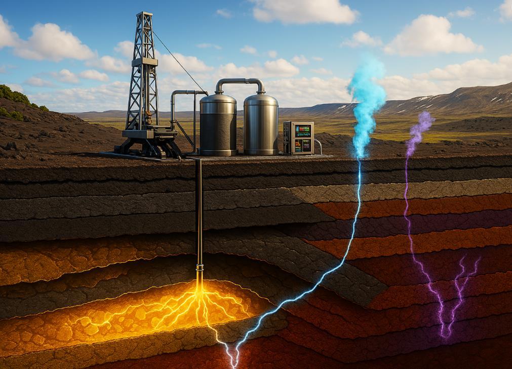
A more proactive approach involves enhanced hydrogen production, stimulating subterranean hydrogen generation through water injection into iron-rich rock formations. Injecting carbon dioxide alongside water could simultaneously sequester CO₂ through mineralisation reactions, producing hydrogen as a valuable byproduct. Experimental research indicates that catalysts could further enhance these reactions, potentially enabling economical hydrogen generation at lower temperatures accessible via standard drilling.
Realising Earth's hidden hydrogen potential requires technological advancements, targeted exploration, and careful management. Researchers are developing specialised detection tools, including geochemical sensors and remote sensing technologies, to improve hydrogen prospecting. Routine monitoring of hydrogen in oil, gas, and groundwater wells will also help map global distributions more precisely.
Finally, environmental considerations are crucial. Although burning hydrogen is carbon-free, uncontrolled leakage into the atmosphere could indirectly affect climate systems by prolonging methane’s atmospheric lifetime or increasing stratospheric water vapour. Mitigating leaks and responsibly managing extraction infrastructure will thus be essential components of a successful natural hydrogen industry.
In conclusion, Earth’s underground hydrogen factories represent a compelling frontier in renewable energy research. Leveraging natural geological processes to harvest carbon-free fuel presents a revolutionary opportunity for global energy systems. The coming decades will determine whether this hidden hydrogen can transition from geological curiosity to foundational pillar in our sustainable energy future.
In unexpected locations around the world, scientists have struck an energy goldmine – not of oil or coal, but of naturally occurring hydrogen gas. Recent discoveries of "white" hydrogen in France, Albania, Mali, and the United States are stirring excitement about a potential new clean energy source beneath our feet.
France has recently made headlines for what some are calling a hydrogen "gold rush" beneath its soil. In 2023, researchers probing old mining sites in the Lorraine region stumbled onto a massive reservoir of natural hydrogen. The initial find, deep under the town of Folschviller in Moselle, was estimated at 46 million tons of H₂ – an astonishing figure that amounts to nearly half of the world's annual hydrogen production.
Then in early 2025, a second major hydrogen deposit was announced in the same area of Lorraine, of a similar scale and economic value (approximately $92 billion). These twin finds suggest the region's ironrich geology – a legacy of iron mining – has been naturally producing hydrogen over millennia via reactions between water and rock.
France's hydrogen jackpot could be a game-changer. If the tens of millions of tons of H₂ in Lorraine can be extracted efficiently, it would be enough to meet global hydrogen demand for several years. French experts note that such natural hydrogen, being already in place underground, "doesn't require energy-intensive processes like electrolysis and doesn't depend on fossil fuels."
In the mountains of Albania, an old chromium mine has become an unlikely hotspot for natural hydrogen research. Earlier this year, a team led by French geochemist Laurent Truche descended nearly a kilometer into a chromite mine in Bulqizë, Albania – and witnessed hydrogen gas seeping out of a borehole at such a rate that it churned the water in a 30-square-meter pool into a "natural jacuzzi" of bubbling gas.
The hydrogen content measured about 84% of the gas – a remarkably pure stream by natural standards. Truche, who had been searching for natural hydrogen for years, said he had "never seen hydrogen bubbles that big" and described the find as "really intense."
What makes the Albanian discovery so intriguing is not just the presence of hydrogen, but the rate at which it is emerging. Researchers estimate the Bulqizë mine is outgassing roughly 200 tons of H₂ per year – the highest natural hydrogen flow ever recorded. The geological context here is key: Bulqizë sits in an ophiolite complex (ancient seafloor rocks thrust onto land) rich in iron and magnesium minerals that generate hydrogen when they react with water.
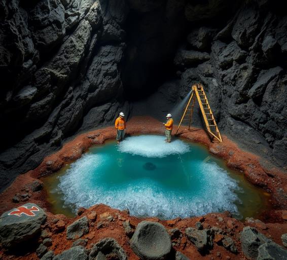
Initial media reports hailed the Albanian site as possibly holding "200 million tons" of hydrogen. However, scientists urge caution. Based on measurements, Truche estimated the underground reservoir feeding the seeps is on the order of 5,000 to 50,000 tons of hydrogen in total –significant, but relatively small in commercial terms.
Yet the importance of Albania's hydrogen spring lies less in its volume and more in the insight it provides. It proves that certain geologic settings can yield high-purity hydrogen and even actively replenish it. Scientists are flocking to study how the hydrogen is produced and trapped there, hoping to apply that knowledge to find similar hidden reservoirs worldwide.
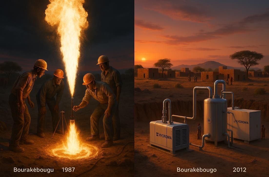
Mali's encounter with white hydrogen dates back decades. In 1987, drillers searching for water in the rural village of Bourakébougou noticed a mysterious breeze rising from a borehole – and when a worker struck a match, the well erupted in flame. The harmlessseeming "breeze" was almost pure hydrogen gas, which combusted in a flash. Startled and concerned for safety, the workers capped and cemented the well shut.
Fast forward to 2012: a Malian entrepreneur named Aliou Diallo returned to Bourakébougou with an energy startup (now called Hydroma) to re-open the hydrogen well. In a world first, they began capturing the hydrogen and burning it in generators to produce
If these natural hydrogen deposits can be tapped, what could it mean for energy and the environment? The allure of white hydrogen is that it offers a ready-made clean fuel. Hydrogen is an energy-dense gas (by weight it contains about three times the energy of gasoline) and can fuel vehicles, power plants, and industrial processes without direct carbon emissions.
Industries like steelmaking, cement, shipping and aviation – which are hard to electrify – are eager for clean hydrogen to replace coal, coke, and oil. Natural hydrogen could directly feed these needs without the steep costs of manufacturing green hydrogen or the emissions of gray hydrogen.
From an environmental standpoint, white hydrogen is remarkably clean. The total lifecycle greenhouse impact of natural H₂ is just 0.4 kg CO₂ per kg H₂ (mostly from drilling and handling), vastly lower than any manufactured hydrogen. And unlike fossil fuels, when hydrogen is used, it doesn't release CO₂ – only water.
However, it's important to stay realistic. How much hydrogen is actually available to mine, and how fast can it be harvested? Those remain open questions. Some scientists believe Earth could hold trillions of tons of hydrogen in total. But it comes with a big catch: most of that hydrogen is likely in places we could never economically drill (for instance, extremely deep or under the ocean floor).
Early case studies suggest these reserves tend to be geographically isolated and of varying sizes. We might find a pocket holding millions of tons in one spot but only small trickles in others. Even when reservoirs
replenish themselves, it might happen over centuries far too slow to count as "renewable" on human timescales.
Environmentally, one oft-overlooked concern is hydrogen's effect if it leaks. Hydrogen itself doesn't warm the planet, but once released into the air, it can indirectly lead to higher concentrations of greenhouse gases like methane and ozone by altering atmospheric chemistry. Thus, controlling leakage will be critical if we start drilling and distributing hydrogen at large scale.
The emergence of white hydrogen has added an intriguing dimension to the global energy transition. Optimists envision that as more natural hydrogen reservoirs are discovered, countries lacking fossil fuels could leapfrog into a hydrogen-powered future. Some have suggested it might democratize energy production, since the geological conditions for hydrogen are not the same places that oil and gas are found.
Experts urge not to view white hydrogen as a silver bullet. The danger is thinking that hidden hydrogen will swoop in to save the day, thus delaying urgent investments in proven solutions. The better mindset is to explore natural hydrogen alongside other clean energy efforts, not instead of them.
The discoveries in France, Albania, Mali, and the U.S. have cracked open an exciting new frontier in energy science. White hydrogen has gone from a geological curiosity to a serious topic of research and development in just a few years. The idea of drilling wells for a renewable, zero-carbon gas is undeniably alluring, and early results show it's not fantasy – the gas is there, under our feet, waiting.
Yet the story is only beginning. As countries and companies venture to unlock these subterranean hydrogen pockets, the world will be watching to see if white hydrogen truly lives up to its promise.

Our world has always operated according to forces beyond human understanding—massive continental shelves moving beneath us like the slow, deliberate mechanics of an ancient machine. But now, that mechanism accelerates with concerning intensity. We have engineered a convergence of environmental crises on a global scale.
First, our climate folly melts ice at unprecedented rates, sending billions of tons of water cascading into our oceans.
This isn't merely rising seas threatening coastal real estate it's a massive redistribution of Earth's weight, pressing down on tectonic weak points with the subtlety of a wrecking ball striking a cracked foundation.
Second, subtle but measurable shifts in Earth's orbital mechanics and pole wobble add their own chaotic variables to this planetary equation.
The cosmic clockwork that has kept our world in relative balance now introduces new gears and levers that our geological systems struggle to accommodate.
Third—and yes, this might sound absurd until you do the math—8 billion humans and their infrastructure exert their own pressure.
When Taylor Swift concerts generate seismic readings, it's not just a fun headline—it's a reminder that our collective weight and activity register on planetary scales.
Our cities, dams, and mass migrations all contribute to the pressure cooker we call home.
The mathematics is ruthless: Accelerated tectonic movement + redistributed oceanic pressure = a world where the extraordinary becomes ordinary.
Volcanoes long considered dormant will clear their throats with spectacular displays. Earthquake frequency will increase beyond historical patterns. Coastal regions will face tsunami threats that defy our current warning systems.
Is this alarmism? Ask the inhabitants of Pompeii how alarmist their local volcanologists seemed the day before Vesuvius decided to redecorate.
Here's the delicious irony we've finally awakened to the dangers in the air we breathe, rightfully concerned about fossil fuel emissions and atmospheric pollution.
We march for clean air, invest billions in renewable energy, and scrutinize carbon footprints. We're all looking up, scanning the skies for solutions.
But the true existential threat isn't just descending from above it's surging from below.
This isn't "Don't Look Up" but rather " Look Down"—a planetary warning we continue to ignore. While we're fixated on the atmosphere, the lithosphere is rewriting its own rulebook.
While politicians debate carbon taxes, the planet is rearranging its innards with the casual indifference of a cosmic bartender mixing a
molten cocktail. Nature doesn't negotiate, compromise, or wait for favorable polling numbers.
Continue our collective geological ignorance, building cities on fault lines and treating volcanic warnings like inconvenient theories
Embrace a new relationship with our temperamental planetary roommate
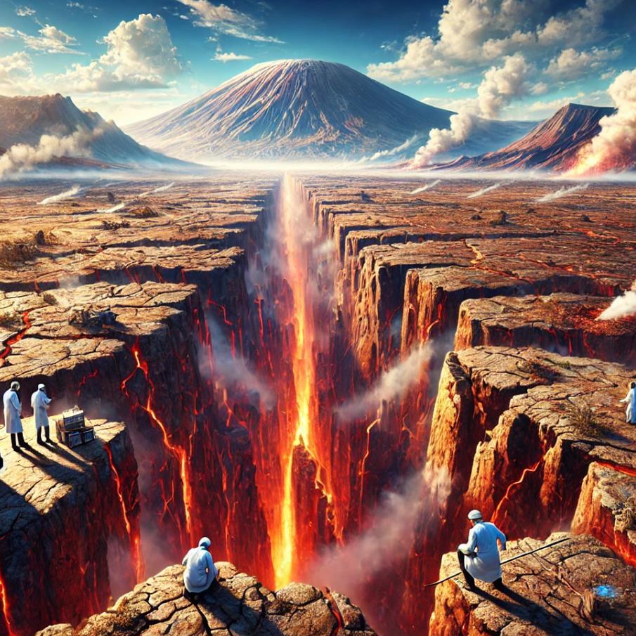
The nations that will survive this geological renaissance won't be the wealthiest or most powerful—they'll be the ones that respect Earth's warnings and adapt accordingly. Japan has already shown the way, designing for disaster rather than pretending it won't come.
We stand at a curious moment in human history perhaps the first species aware of impending natural upheaval yet still arguing about whether to prepare for it.
Earth doesn't care about our debates. Magma doesn't pause for elections. Tectonic plates won't wait for budget approvals.
The volcano's secret weapon isn't lava or ash—it's our own extraordinary capacity for denial.
So laugh if you must at these warnings. Frame them as doomsday prophecies if it helps you sleep at night.
The Earth will continue its acceleration with or without your approval, indifferent to your social media takes.
But know this: Our destiny isn't written in the stars but in the rock beneath our feet. And those rocks are moving faster than ever before. The choice—as always in human history—remains ours. For now.
Until it isn't.
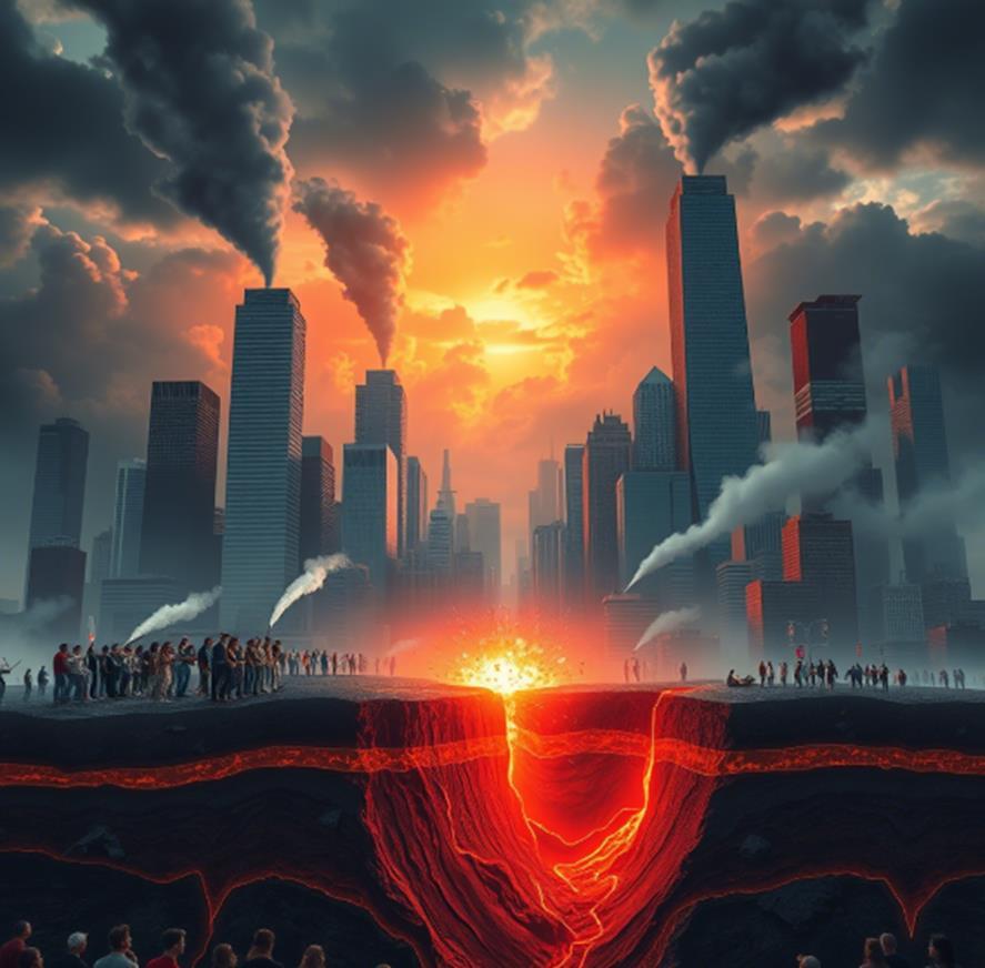
interesting engineering popular mechanics
Inverse mckinsey
technology review azoai scientific american the conversation
neuroscience news medium live science eetimes
investorplace spectrum
scmp robb report science post serverobotics
future sciences futurism
spectra we forum gates notes azorobotics
Business insider wired technology review arstechnica new atlas trust my science
robotics and automation phonandroid
silicon india freethin