

reality check


Welcome to the “Reality Check” Books series your unrestrainedjourney throughthe landscape of geopolitics, science andtechnology, free from the gripof sponsors and the constraints of university dogma.
Here, you'll explore innovations and discoveries in their purestform.Icutthroughthenoiseofhiddenagendaswith keen, unbiased analysis, celebrating true achievements, while boldly addressing the challenges.
Asthe editorofthe "FuturologyChronicle", celebrating its fifths year with nine thematic issues annually, I infuse each edition with a blend of future-focused realism, scientific insight, and an engaging twist.
This rich background breathes life into every of my books, establishing them as pillars of independent thought, free from external influences and entrenched biases.
My aim? Not to shepherd you to predetermined conclusions but to ignite your capacity for independent thought, free from obscured motives.
Join me in a firm commitment of knowledge and the bold spirit of open inquiry, as we expose the undeniable truths behind an undisputable “Reality Check”.


The cryosphere, Earth's frozen domain, has evolved through distinct phases of human understanding and interaction, culminating in what we now recognize as "Cryosphere 4.0."
This evolution reflects our changing relationship with cold environments and technologies, from initial discovery to integrated applications across disciplines.
The first generation, "Cryosphere 1.0," emerged during early exploration when adventurers and naturalists documented the existence of glaciers, sea ice, and permafrost without fully understanding their significance.
This observational period provided the basic mapping and description of Earth's frozen regions but lacked systematic scientific study. Early polar expeditions brought back firsthand accounts of these mysterious landscapes, creating the foundation of our knowledge base.
"Cryosphere 2.0" developed throughout the 20th century as scientific methodologies were applied to study these frozen environments. This period saw the classification of different ice forms, the establishment of glaciology and cold-region hydrology as formal disciplines, and the first measurements of ice sheet mass balance.
Researchers began recognizing the cryosphere as an integrated Earth system component rather than isolated frozen features. Field stations in polar and alpine regions providedcontinuous data, revealing seasonalpatterns and long-term trends.
The third generation, "Cryosphere 3.0," emerged in the satellite era, when remote sensing technologies revolutionized our monitoring capabilities. Globalobservation systems revealed the true extent and interconnectedness of Earth's frozen domains.
Climate change awareness grew as satellite data demonstrated clear retreat patterns across ice sheets, sea ice,andmountainglaciers.Internationalscientific collaboration intensified with projects like the International Polar Year, and climate models began incorporating cryosphere components to predict future scenarios.
"Cryosphere 4.0," is characterized by integration and application across disciplines. This latest evolution represents a paradigm shift from merely studying frozen environments to actively utilizing cryogenic principles in technology, industry, science, and health.
Advanced technologies now enable real-time monitoring and predictive modeling, with artificial intelligence analyzing vast datasets to detect subtle changes in ice dynamics. Simultaneously, industrial applications harness
extremely cold energy storage, quantum computing, medical treatments, and environmental remediation.
What distinguishes Cryosphere 4.0 is this convergence of natural science with practical applications - the recognition that principles derived from Earth's frozen environments can revolutionize technology and improve human welfare.
From fusionenergy's superconductingmagnetsto cryotherapy chambersandquantumcomputers,thescienceofextreme cold now extends far beyond traditional environmental studies.
This holistic approach acknowledges the cryosphere not just as a climate indicator but as a source of innovative solutions to contemporary challenges.
As we advance through the Cryosphere 4.0 era, the boundaries between environmental science, industrial applications, and human health continue to blur.
Our relationship with Earth's frozen domains has evolved from observation to interaction, from description toapplication, creating afascinating nexus where natural processes inform technological innovation. This integrated understanding represents the culmination of our journey through four generations of cryosphere science and technology.
The cryosphere represents the frozen component of Earth's climate system—all regions where water transitions to its solid state at or below 0°C (32°F).
This critical threshold marks the phase change from liquid to crystalline structure, creating the diverse frozen elements thatcomposethissystem:icesheets,glaciers,seaice,snow cover, freshwater ice, permafrost, and icebergs.
Unlike other geospheres, the cryosphere is discontinuous, spanning multiple latitudes and elevations. While concentrated at the poles and high mountain regions, it extends seasonally into temperate zones and reaches vertically from subsurface permafrost to high-altitude glaciers.
This frozen system occupies approximately 20% of Earth's surface during the winter in the Northern Hemisphere, though this extent has been diminishing as global temperatures rise.
The cryosphere's unique properties, high albedo (reflectivity), thermal insulation, physical rigidity, and capacity for freshwater storage make it disproportionately influential in Earth's climate regulation.
Aswatermoleculestransitionbelowthefreezingthreshold, they release latent heat, restructure into crystalline
patterns, and dramatically alter their interaction with solar radiation, atmosphere, and oceans.
Thisbook examinesthe cryosphere initsentirety, with particular focus on the dramatic transformations occurring at both poles and in glaciated regions worldwide.

Through rigorous analysis of observational data, satellite measurements, and climate modeling, I will explore:
➢ The accelerating changes in Arctic and Antarctic Sea ice extent, volume, and seasonality
➢ The critical state of the Greenland and Antarctic ice sheets and their contributions to sea level rise
➢ The worldwide retreat of mountain glaciers and its implications for water security
➢ The frontiers of neutrino detection researchutilizing iceasdetectionmedium,includinginnovationsatIce Cube Observatory and other cryosphere neutrino detection facilities
➢ The scientific advances enhancing our understanding of cryosphere processes, including cutting-edge monitoring technologies and modeling capabilities
➢ The complex feedback mechanisms through which cryosphere changes amplify or moderate broader climate shifts
➢ Absolute zero research and the quest for ultra-low temperature physics in polar environments, exploring quantum phenomena that emerge only in extreme cold, and the specialized equipment developed for these investigations
By examining these interconnected elements of Earth's frozen regions, this book aims to provide a comprehensive assessment of the state of the cryosphere in today's rapidly warming world.
The evidence presented herein draws from multiple scientificdisciplines, offering aholisticview ofsome of the most visible and consequential manifestations of our changing climate.

Antarctica and the Arctic are Earth's two polar extremes—mirrors in latitude, but stark opposites in geopolitics, science, and geology.
At the southern end lies Antarctica: a vast, ice-covered continent governed not by sovereign claims, but by an extraordinary feat of diplomacy and scientific intent.

The 1959 Antarctic Treaty, signed by twelve nations during the Cold War, demilitarised the region and designated it as a reserve for peace and science.
This framework—now upheld by over 50 countries— enables international cooperation in glaciology, climate science, astrophysics, and biology, all conducted under a rigorous protocol of environmental protection and data sharing.
In contrast, the Arctic remains a loosely governed patchwork of overlapping interests. There is no binding Arctic treaty equivalent to the Antarctic model. Instead, cooperation exists through softer mechanisms like the Arctic Council, formed in 1996, which promotes dialogue but leaves sovereignclaims andresource ambitions largely intact.
The region is ringedupby eight nations, many of whichsee the retreating ice as a geopolitical and economic opening. Scientific collaboration occurs, but it competes with military presence, shipping lanes, and energy exploration.

The geopolitical divergence between the poles has intensified in recent decades. In Antarctica, seven nations maintain territorial claims Argentina, Australia, Chile, France, New Zealand, Norway, and the United Kingdom with some claims overlapping.
However, theAntarcticTreatyeffectivelyfreezesthese claims, prohibiting new ones and suspending disputes over existing ones.
This diplomatic compromise has created a demilitarized zone where scientific bases operate under national flags but serve international research agendas.

TheArcticpresentsamorecomplexgeopoliticallandscape.
Russia, with the longest Arctic coastline, has aggressively asserted its dominance through military installations, icebreaker fleets, and expansive continental shelf claims.
The United States, Canada, Norway, and Denmark (via Greenland) pursue their own strategic interests, leading to heightened naval activity and surveillance.
China, despite having no Arctic territory, has declared itselfa"near-Arcticstate"andinvestedheavilyinpolar research capabilities and infrastructure projects along a self-proclaimed "Polar Silk Road"-signaling how the northern pole has become an arena for global power projection beyond regional actors.
Antarctica's mineral wealth remains locked away by the Madrid Protocol of 1991, which banned mining and oil drilling for at least 50 years.
This remarkable conservation agreement prioritizes scientific value over extraction, creating the world's largest protected area. Research stations focus on atmospheric monitoring, ice core drilling, and studying extremophile organisms rather than resource surveys.
The Arctic, conversely, harbors an estimated 30% of the world's undiscoverednaturalgas and13% of undiscovered oil reserves beneath its thinning ice.
The economic imperative drives national strategies: Russia has developed extensive natural gas facilities in the Yamal Peninsula, while Norway continues Arctic petroleum exploration.
Indigenous communities, who have inhabitedthe Arctic for millennia, find themselves caught between traditional lifeways and the economic pressures of modernization a
human dimension entirely absent in uninhabited Antarctica.
Bothpolesfaceexistentialthreatsfromclimatechange,but with distinctly different implications. Antarctica's ice sheet contains enough frozen water to raise global sea levels by 58 meters if completely melted.
Its stability affects coastal communities worldwide, creating a shared global interest in its preservation that transcends regional politics. The West Antarctic Ice Sheet's potential collapse has become a rallying point for climate diplomacy.
Arctic warming, proceeding at more than twice the global average rate, creates immediate local consequences alongside global ones.
The opening of ice-free shipping routes—primarily the Northern Sea Route along Russia's coast and the Northwest Passage through Canada's archipelago has sparked sovereignty disputes and security concerns.
Russia and China view these emerging pathways as strategic corridors for commercial and potentially military vessels, while Canada and the United States disagree over the legal status of newly navigable waters.
Indigenous Sovereignties andKnowledge Systems Perhaps the starkest human contrast between the poles is the
presence of indigenous populations in the Arctic—Inuit, Sámi, Nenets, Chukchi, and other peoples whose traditional territoriesandknowledgesystemspredatemodernnationstates.
Their perspectives on sovereignty challenge conventional geopolitical frameworks, emphasizing stewardship rather than ownership. Indigenous knowledge offers valuable insights into environmental changes that complement satellite observations and computer models.
Antarctica has no indigenous human population, making its governance a purely international construct without competing local claims.
This absence of permanent human inhabitants has enabled its unique legal status as a scientific preserve but also means there are no traditional knowledge systems tied to its landscapes and rhythms.
Beneath these divergent governance models lies a deeper geological divide. Antarctica is a continent in full sense: a mountainous landmass overlaid by a kilometer-thick ice sheet.
Its geomorphology—defined by cratons, rift valleys, and subglacial lakes makes it a unique laboratory for studying Earth's tectonic history, past climates, and even potential analogs for life on icy moons.
The solid Earth beneath provides stable platforms for long-term seismic and geophysical observations.
The Arctic, by contrast, is an ocean hemmed in by continents, capped with a shifting mosaic of seasonal and multi-year sea ice. It lacks a central landmass; its base is not solid ground but bathymetric depth—a seafloor shared by naval ambitions and undersea cables.


Recent research published in Climate of the Past by Utrecht University has resolved a longstanding geological mystery: ice-rafted debris (IRD) discovered atOcean DrillingProgramSite696ontheSouthOrkney Microcontinentdatesto37millionyearsago—3million years before the established timeline for large-scale Antarctic glaciation.
The mystery emerged in 2017 when researchers found Antarctic rock fragments embedded in sediments far older than the Eocene-Oligocene transition (34 Ma), traditionally considered the onset of continental-scale Antarctic ice sheet formation.
The debris could only have traveled such distances via iceberg transport, yet conventional understanding placed Antarcticainarelativelywarm,ice-freestateduringthelate Eocene.
Master's student Mark Elbertsen, under supervision of Peter Bijl and Erik van Sebille, employed high-resolution ocean modeling to trace potential iceberg trajectories during the late Eocene.
Their simulations revealed that icebergs originating from regions now occupied by the Filchner Ice Shelf and
Dronning Maud Land could have reached South Orkney, provided they possessed sufficient initial mass.
The study determined that icebergs required minimum masses exceeding 100 megatons and thicknesses of several tens of meters to survive the warm Weddell Sea transit.
While these dimensions approach the larger end of contemporary Antarctic icebergs, they remain within feasible parameters. Crucially, the mineral composition of the debris matched bedrock in the southern Weddell Sea region, confirming the modeled source areas.
Late Eocene melt rates calculated by the team exceeded present-day values dramatically, reaching 25 meters per day—yet sufficient initial iceberg mass enabled successful transport to South Orkney.
These findings demonstrate that localized ice caps existed during the late Eocene, likely in high-altitude regions receiving adequate snowfall despite elevated global temperatures.
The research suggests glaciation proceeded more gradually through the Eocene rather than via abrupt onset at the Eocene-Oligocene boundary.
Specific cooling intervals, such as the Priabonian Oxygen Isotope Maximum (37 Ma), may have enabled ice sheet development in climatically favorable regions.

Thisworkhassignificant implicationsforunderstandingice sheet dynamics under warming scenarios. If substantial glaciation occurred during Eocene warmth, Antarctic ice responses to current climate change may differ from predictions based solely on Oligocene-Miocene models.
The findings also highlight the importance of regional topographic and atmospheric circulation patterns in sustaining ice masses during globally warm periods.
Modern observationsofcurrentAntarcticice lossmust consider these complex historical dynamics. As contemporary mega icebergs calve with increasing frequency, understanding ancient iceberg behavior provides crucial context for predicting future ice sheet trajectories and their impacts on global sea levels.
Beneath 2-3 kilometers of East Antarctic ice lies a geological time capsule: a well-preserved landscape of valleys and ridges carved by rivers at least 14 million years ago, when the continent resembled temperate rainforests rather than a frozen wilderness.
Using satellite data and sophisticated radio-echo sounding equipment, researchers from Durham and Newcastle Universities mapped this 32,000-square-kilometer ancient terrain in the Wilkes Land area.
The discovery, led by Duncan Young of the University of Texas Institute for Geophysics and described in Nature Communications in October 2023, represents an extraordinary glimpse into pre-glacial Antarctica.
Stewart Jamieson, lead author from Durham University, emphasizes the significance:
"We know less about the land under Antarctica's ice than the surface of Mars, yet that landscape controls how ice flows and responds to climate change."
ThispreservedtopographylikelydatesbacktotheMiocene epoch, possibly extending to the Oligocene, when Antarctica was transitioning from its last temperate period toward full glaciation.

The presence ofthis well-preserved reliefdefies conventional understandingofglacierdynamics.The immenseweightand constant motion of overlying ice typically grin
ds such features away over millions of years. Yet this highland remains intact, suggesting unique preservation mechanisms that researchers now seekto understandand locate elsewhere beneath the ice sheet.
Discovery was facilitated by modified WWII-era DC-3 aircraft equipped with ice-penetrating radar, conducting hundreds of flights since 2008 across previously uncharted East Antarctic territories.

Subtle surface undulations detected in satellite imagery first indicated the hidden terrain, subsequently confirmed through aerial surveys.
The implications extend beyond geological curiosity. The Wilkes Basin containing this ancient landscape holds sufficient ice to raise global sea levels by over 7.6 meters.
Understanding this subglacial topography provides crucial data for ice sheet modeling, helping predict Antarctic responses to continued global warming.
As Young notes, these surveys "keep giving" insights into Earth's cryosphere evolution, offering vital benchmarks for assessing future ice sheet stability.

A23a: The Wandering Colossus In the remote waters of the Southern Ocean, a primordial giant has completed an epic journey decade in the making.

The A23a iceberg, undisputed titan of the world's freefloating ice masses, has finally run aground approximately 73 kilometers off the shores of South Georgia Island as of early March 2025.
This monumental event marks the conclusion of one of Earth's most remarkable geophysicalmigrations, a journey that began in the distant year of 1986.
Born fromthe Filchner-Ronne Ice Shelf, A23arepresents the natural calving process that has shaped Antarctica's periphery for millennia. What makes this particular iceberg
extraordinary is both its immense scale approximately 3,500 square kilometers, exceeding the landmass of Rhode Island and its remarkably delayed journey.

While most large icebergs drift immediately with circumpolar currents upon calving, A23a remained effectively stationary
for over three decades, grounded on the seafloor of the Weddell Sea in what glaciologists term a "iceberg graveyard."
Itsliberationbeganquietly around2020,whensubtleshifts in ocean currents, bathymetry, and possibly the iceberg's own melting profile finally allowed it to slip free from its long captivity.

Once mobile, A23a entered the fabled "iceberg alley," the primary pathway that delivers Antarctic ice northward toward South Georgia. Its passage was not without interruption in 2024, the iceberg became temporarily trapped in a fascinating oceanographic phenomenon known as a Taylor column, a vertical vortex that forms when currents encounter underwater mountains, causing the massive ice structure to spin counterclockwise upon itself before continuing its journey.
35 ~
The iceberg's arrival near South Georgia initially raised significant concerns among marine biologists and conservation experts. Previous iceberg groundings near the island, such as A38 in 2004, caused ecological disturbancesbyblockingaccesstocritical foraginggrounds for the island's penguin and seal populations.
However, current assessments suggest minimal immediate impact on wildlife from A23a's present position, and there may even be ecological benefits as the iceberg's gradual dissolution releases nutrients that can stimulate primary productivity in the surrounding waters.
The fate of A23a is now a study in thermodynamics and oceanography.ExposedtorelativelywarmSouthernOcean waters, the iceberg will progressively fragment and melt.
This process has important implications for regional shipping, as smaller fragments pose greater navigational hazards than a single large mass. Scientists are keenly monitoring this final chapter in A23a's story, as it provides valuable insights into how Antarctic ice interacts with a warming ocean system.
While A23a's journey captivates with its dramatic movement, another Antarctic ice formation commands attention through its potential consequences rather than its mobility. Thwaites Glacier in West Antarctica, often referred to by the ominous moniker "Doomsday Glacier,"

Unlike the freely floating A23a, Thwaites is a massive terrestrial glacier flowing from Antarctica's interior toward the Amundsen Sea. Its nickname reflects the sobering reality that its potential collapse could trigger catastrophic sea level rise worldwide.
Currentscientific assessmentsindicatethat Thwaitesalone contains enough ice to raise global sea levels by approximately 65 centimeters, but its greater significance lies inits role asacriticalbuttress holding backthe broader
~ representsafundamentallydifferenticephenomenonwith global implications.
West Antarctic Ice Sheet, which contains ice equivalent to over 3 meters of potential sea level rise.
The mechanics of Thwaites' vulnerability are complex but increasingly well-understood. Recent research has revealed that warm ocean water is penetrating much further beneath the glacier than previously thought, with significant incursions occurring ona daily basis due to tidal pulsing.
This process is causing "vigorous melting" at the glacier's grounding line, the critical juncture where the ice transitions from resting on bedrock to floating on the ocean.
What makes Thwaites particularly concerning is its geometric configuration. The glacier rests on a reversesloped bed that deepens inland, creating the potential for a self-reinforcing retreat mechanism once the grounding line begins to recede. Each year,
Thwaites sheds approximately 50 billion tons of ice, contributing roughly 4% to the global sea level rise. Recent observations show that the glacier's main ice stream is likely to widen over the coming decades, potentially accelerating this ice loss.
Unlike the natural calving that produced A23a, Thwaites' accelerating retreat is fundamentally linked to anthropogenic climate change. The warming ocean waters driving its melting are part of larger shifts in Southern Ocean
circulation patterns influenced by changing wind regimes and atmospheric warming.
Scientists from the International Thwaites Glacier Collaboration have deployed sophisticated technologies, including the underwater robot Icefin, to study these processes at unprecedented resolution.
These two Antarctic ice formations—A23a and Thwaites— represent profoundly different glaciological phenomena with distinct implications.
A23aexemplifies the naturalcalving anddrift patterns that have shaped Antarctica's ice shelves for millennia, now playing out its final act in the warmer waters of the subAntarctic. Its story, while spectacular, represents a known and predictable cycle in Earth's cryosphere.
Thwaites, conversely, embodies the uncertain future of Antarctic ice in a warming world. Its behavior reflects the impact of human-induced climate change on glacial systems that have remained relatively stable throughout human civilization.
While recent research suggests that the most catastrophic scenarios such as complete collapse this century may be less likely than once feared, the glacier's continuing retreat remains one of the most significant wild cards in projections of future sea level rise.

The stark contrast between these two ice giants provides a compelling framework for understanding Antarctica's dual nature.
On one hand, it is a dynamic natural system with inherent cycles of growth and decay; on the other, it is increasingly responsive to human-induced planetary changes with
potentially profound consequences for coastal communities worldwide.
AsweobserveA23acompletingitsdecades-long journeyto South Georgia, we are witnessing the conclusion of a natural ice cycle that began when atmospheric carbon dioxide levels were approximately 350 parts per million.
Meanwhile, Thwaites continues to respond to an atmosphere now exceeding 420 parts per million, writing a new and uncertain chapter in Earth's cryosphere history—one whose conclusion remains to be determined by humanity's collective response to climate change in the coming decades.
British researchers from UCL, Cambridge University, and the British Antarctic Survey have intensified their investigation of the Brunt Ice Shelf after observing unprecedented calving patterns producing colossal icebergs.

The team, led by Dr. Oliver Marsh and Dr. Liz Thomas, deployed comprehensive geophysical instrumentation
including seismic monitors, GPR systems, and hourlyreporting GPS networks to analyze fracture propagation mechanics preceding massive calving events.
Recent calving episodes produced two exceptional icebergs: A-74 (2021) and A-81 (2023), with A-81 exceeding Greater London's surface area.
Concurrent monitoring of A-76a through the Drake Passage and A-23a, the world's largest iceberg after 37 years of grounding, provides critical comparative datasets for understanding ice shelf dynamics.

The research employs shallow ice core extraction combined with multi-parameter geophysical monitoring to characterize pre-calving conditions.
Laboratory analysis at UCL's Rock and Ice Physics Laboratory quantifies grain size distributions, impurity concentrations, and seismic properties across active rift zones including Chasm-1 and the Halloween Crack.
Preliminary findings indicate rapid stress redistribution patterns preceding fracture events, challenging existing calving prediction models.
Ice shelf thickness variations correlate with rift evolution rates, suggesting accelerated fracture development under warming scenarios.
The team documented distinct seismic signatures during critical rift propagation phases, potentially enabling early warning systems for major calving events.
Ocean-ice interaction studies reveal substantial meltwater release patterns as icebergs transit through warmer waters.
RRS SirDavidAttenborough'sopportunisticencounterwith A-23ayieldedunprecedentedwatercolumnsampling data, demonstrating nutrient flux dynamics and phytoplankton response patterns around trillion-ton ice masses.
The RIFT-TIP project framework integrates historical strain monitoring data spanning 50 years with contemporary high-resolution observational datasets. Results indicate calving event frequency has doubled since 2020,
correlating with enhanced ice shelf thinning rates and increased basal melt gradients.
Physical modeling advances incorporate discovered fracture mechanics, enabling more accurate projections of largescale calving events. British researchers established that mega-icebergs modify local ocean circulation patterns, impacting Antarctic ecosystem distribution and carbon sequestration processes.

The Brunt Ice Shelf's accessibility and extensive monitoring infrastructure provides an ideal natural laboratory for developing predictive calving models applicable across Antarctic ice shelves.
This research contributes essential empirical data for refining global sea-level rise projections, while advancing understanding of ice shelf-ocean feedback mechanisms under accelerating climate change conditions.
The Antarctic continent presents a stark dichotomy in ice sheet dynamics that challenges simplified climate change narratives.
Recent analysis of historical aerial photography from 1937 recovered from Norwegian archives where they remained hidden since World War II reveals that East Antarctica's glaciers have demonstrated remarkable stability over nearly a century, while West Antarctica experiences accelerating ice loss.
This comprehensive temporal dataset, compiled by researchers from the University of Copenhagen, spans approximately 2,000 kilometers of East Antarctic coastline—aregioncontainingicevolumeequivalenttothe entire Greenland Ice Sheet.
By comparing these forgotten aerial photographs with modern satellite imagery, researchers established that East Antarctic ice has not only maintained stability but exhibited slight growth over the 85-year observational period, partially attributed to increased regional snowfall.
"The historical imagery provides critical baseline data previously unavailable to glaciologists," explains lead researcher Mads Dømgaard.

"These
observations significantly enhance our capacity to differentiate between natural glacial cycles and anthropogenically driven changes."
This East Antarctic stability stands in marked contrast to West Antarctica, where numerous studies document rapid ice loss. The Thwaites Glacier oftencalledthe "Doomsday Glacier" has doubled its retreat rate over the past three decades and continues to accelerate.
Similarly, recent submersible explorations beneath the Dotson Ice Shelf reveal extensive submarine melting evidenced by complex erosional features, including teardrop-shaped scoops extending hundreds of meters in length.
This East Antarctic stability stands in marked contrast to West Antarctica, where numerous studies document rapid ice loss. The Thwaites Glacier—often called the "Doomsday Glacier"—has doubled its retreat rate over the past three decades and continues to accelerate.
Similarly, recent submersible explorations beneath the Dotson Ice Shelf reveal extensive submarine melting evidenced by complex erosional features, including teardrop-shaped scoops extending hundreds of meters in length.
The mechanisms driving this continental asymmetry lie primarily in oceanic interactions. West Antarctic glaciers terminate in the Amundsen Sea, where Circumpolar Deep Water a relatively warm water mass infiltrates sub-ice cavities, accelerating basal melting.
Conversely, East Antarctica's coastal waters maintain cooler temperatures, offering greater protection to ice shelves.
Despite East Antarctica's current stability, researchers observe concerning early indicators of potential future vulnerability.
"We'redetectingweakeningseaiceconditionsthatlimitthe growth of floating ice tongues compared to historical extents," notes Dømgaard.

"This suggests oceanic forcing may eventually trigger retreat in previously stable regions. «These contrasting ice
dynamics have significant implications for global sea level projections.
Complete destabilization of West Antarctic ice could contribute over 3 meters to global sea level, while East Antarctica contains substantially more potential over 50 meters though currently under less immediate threat.
The 1937 Norwegian expedition images, originally captured for cartographic purposes but never published due to World War II, represent irreplaceable baseline data. When combined with Australian aerial surveys from 19501974 and contemporary satellite monitoring, they form one of glaciology's longest observational records.
«Long-term observational datasets are crucial for calibrating ice sheet models and generating accurate sea level projections," emphasizes Anders Bjørk, who leads the historical imagery analysis group. "Without these recovered archives, our understanding of East Antarctica's ice dynamics would remain significantly limited."
Asclimatewarmingcontinues,monitoringbothAntarctic regions remains critical. While East Antarctica currently provides a relative bright spot amid the trend concerning globalice losstrends, itsvastice reservoirs demand continued vigilance and comprehensive monitoring.

In honor of Photographer Sebastiao Salgado (1944-2025)
Genesis portfolio - Weddel strait image – Antarctica
Beneath Antarctica's ancient ice, a powerful geological awakening promises hope for our changing world.
As geoscientists unveil Earth's dynamic mantle response to ice sheet changes, we're witnessing nature's own climate buffering system in action corresponding to our planet's remarkable resilience and self-regulation.
The mantle, that molten heart of our planet, isn't merely a passive observer of surface changes. It's actively responding to ice loss with elastic precision, pushing land upward as glacial weight diminishes.
This "pulse" from deep Earth creates a natural braking system for ice sheet retreat, potentially reducing sea level rise by over half a meter by 2500 under responsible emission scenarios.
What excites environmental geoscientists most is this intimate dance between Earth's surface and its flowing interior.
Antarctica's diverse mantle characteristics from the thick, viscous foundation beneath East Antarctica to the more responsive layers under West Antarctica demonstrate how our planet adapts uniquely to different regions.
This geological diversity offers multiple pathways for climate stabilization. The viscous mantle beneath East Antarctica acts like Earth's memory foam, slowly rising as glacial pressure releases, creating new coastlines that naturally slow ice sheets advance into warming seas.
Meanwhile, West Antarctica's more dynamic mantle provides faster responses, offering immediate geological cushioning effects.

This discovery transforms our understanding of Earth as a living, breathing system where deep planetary processes actively participate in climate regulation.
While our emissions choices remain crucial, we now see that Earth itself is working alongside us, providing geological time to implement meaningful change.
The mantle's response reminds us that when we reduce emissions, we're not just slowing warming— we're giving Earth's own regulatory systems time to activate, creating a powerful alliance between human action and planetary resilience.
In a surprising turn of events that captivated the scientific community, Antarctica's massive ice sheet has demonstrated itsdynamicnature in waysthatchallenge our understanding of polar ice behavior. After nearly twodecadesofalarmingiceloss,satellitesfromNASA's GRACE and GRACE-FO (Gravity Recovery and Climate Experiment - Follow-On) missions have documented a significantandunexpectedreversal:between 2021and 2023, the Antarctic Ice Sheet (AIS) gained approximately 108 gigatons of ice annually.
These satellite missions, which have been monitoring Earth's ice sheets since 2002, detect tiny changes in gravity that reveal ice mass fluctuations with unprecedented precision.
This remarkable shift occurred primarily in East Antarctica, with the Wilkes Land and Queen Mary Land regions showing the most dramatic changes. Four major glacier basins Totten, Denman, Moscow University, and Vincennes Bay transformed from areas of rapid ice depletion to zones of substantial accumulation. These glaciers, which had previously contributed significantly to global sea level rise, temporarily reversed their contribution during this period.
The primary mechanism behind this unexpected ice gain appears to be anomalously high precipitation.
Unusuallyintense snowfallblanketedlarge portionsof the continent, depositing fresh ice faster than existing ice could melt or discharge into the ocean.
This natural variability in precipitation patterns reminds us that while long-term climate trends drive overall changes in polar ice, year-to-year weather fluctuations can temporarily mask or even counteract these broader patterns.

The implications for global sea levels have been equally noteworthy. During the first decade of satellite monitoring (2002-2010), Antarctic ice loss contributed approximately 0.20 millimeters per year to sealevelrise. This contribution nearly doubled to 0.39 millimeters annually from 2011 to
~ 57 ~
2020. However, the recent mass gains have temporarily reversed this trend, actually lowering global sea levels by about 0.30 millimeters per year between 2021 and 2023 a rare positive development in climate measurements.
While this respite from rising seas provides a momentary breath of relief, geoscientists emphasize that this phenomenon likely represents a short-term anomaly rather than a fundamental reversal of climate change impacts.
The underlying factors contributing to long-term ice loss—including warming ocean waters eroding ice shelves frombelow and rising air temperatures affecting surface stability—remain firmly in place.
Most climate models project that as global warming continues, Antarctica will resume and potentially accelerate its contribution to sea level rise in coming decades.
This episode illustrates the complexity of Earth's climate system, particularly in polar regions where natural variability can be especially pronounced. Antarctica remains extraordinarily sensitive to both atmospheric and oceanic conditions, responding to shifts in circulation patternsthatcantemporarilyintensifysnowfallevenasthe planet continues to warm overall.
The recenticegainalso highlights the criticalimportance of continuous, long-term monitoring of Earth's ice sheets. Without sophisticated satellite systems providing consistent
measurements over decades, scientists might misinterpret short-term fluctuations as indicating fundamental shifts in climate trajectory. This comprehensive monitoring allows researchers to distinguish between weather-driven anomalies and climate-driven trends.
For coastal communities worldwide, this temporary slowing of sea level rise offers a brief window of opportunity rather than a reason for complacency.
The underlying physics of climate change remain unchanged, and most projections indicate Antarctica will resume contributing to rising seas as global temperatures continue to climb.
The Antarctic ice sheet's recent behavior reminds us that Earth's systems are dynamic and complex, capable of surprising variations even within long-term trends.
This complexity demands rigorous science, sustained observation, and nuanced interpretation as we navigate the challenges of climate change in the 21st century.
Recent research published in Geochemistry, Geophysics, Geosystems by Allie Coonin (2024) examines the relationship between Antarctic ice sheet melt and subglacial volcanic activity, revealing a potential positive feedback mechanism driven by crustal pressure changes.
The West Antarctic Ice Sheet (WAIS) overlies the West Antarctic Rift System (WARS), home to over 100 volcanic features distributed along western Antarctica's coast. As the WAIS experiences significant mass loss approximately 150 billion tons annually—the reduction in ice-sheet overburden pressure creates conditions conducive to increased volcanic activity.
The research employed 4,000 computer simulations modeling the response of magma chambers to iceunloading scenarios. Results demonstrate that decreasing ice mass reduces lithostatic pressure on underlying magmachambers, causing compressedmagmato expand. This expansion generates elevated fluid pressure against chamber walls, potentially triggering eruptions that might otherwise remain dormant for decades to centuries.
Volatile-bearing magma presents additional concerns. As temperature and pressure conditions change, dissolved
gases (primarily CO2 and H2O) exsolve from the melt phase, analogous to carbonation emerging from an opened beverage container. This degassing process increases chamber pressurization, further promoting eruption likelihood.
The study identifies a concerning feedback mechanism: subglacial eruptions release thermal energy into the basal ice environment, accelerating bottom-up melting. This process reduces ice mass further, perpetuating the unloading-erosion cycle.

A single magma chamber could generate sufficient heat to melt approximately 3 million cubic meters of ice, with effects compounding across numerous chambers in the region.
Temporal considerations are critical to understanding this phenomenon. The process operates over centennial to millennial timescales, meaning anthropogenic warming has already initiated irreversible changes regardless of future mitigation efforts.
Historical evidence from previous deglaciation episodes demonstrates similar correlations between ice sheet retreat and increased volcanic frequency.
Current climate models inadequately account for these glacio-volcanic interactions. The additional thermal input from subglacial eruptions represents an unquantified variable in sea-level rise projections. Furthermore, postunloading magma chamber properties remain altered indefinitely increased magma compressibility persists long after deglaciation ceases, suggesting elevated volcanic potential will continue for geological timescales.
While this process unfolds slowly by human standards, its potential to accelerate ice sheet instability warrants inclusion in long-term climate projections and hazard assessment protocols.
The Antarctic Circumpolar Current (ACC), Earth's most powerful ocean conveyor, faces an unprecedented crisis. Research published in Environmental Research Letters reveals this colossal current—stronger than the GulfStreambyafactoroffiveandcarrying abillion liters per second—will decelerate by 20% by 2050 due to Antarctic ice sheet melt.
The mechanism is deceptively simple yet profoundly consequential. As Antarctic ice sheets hemorrhage into the Southern Ocean, vast quantities of cold freshwater disrupt ocean density stratification. This freshwater intrusion forms a buoyant layer that counteracts deep water formation, effectively choking the current's primary driving mechanism. High-resolution modeling using Australia's GADI supercomputer demonstrates this freshwater "cap" progressively slows the ACC, regardless of emissions scenarios.
The ACC's role as Earth's oceanic pacemaker cannot be overstated. Flowing clockwise around Antarctica, it connects the Atlantic, Pacific, and Indian basins, regulating global heat transport and carbon sequestration. The current maintains a thermal barrier around Antarctica, preventing warm waters from accessing vulnerable ice shelves. As this barrier weakens, a feedbackloop emerges:
slower circulation allows more warm water intrusion, accelerating ice melt, which further degrades circulation.
The cascading effects extend beyond physical oceanography.
The ACC serves as Antarctica's biological moat, preventing southern bull kelp rafts and associated fauna from colonizing pristine Antarctic waters.
Current degradationthreatens to compromise this barrier, potentially introducing invasive species to fragile polar ecosystems. Additionally, reduced circulation diminishes the ocean's capacity to absorb atmospheric carbon and heat, amplifying global warming.
This slowdown contrasts sharply with historical patterns. “Paleoceanographic” records spanning 5.3 million years indicate the ACC accelerated during warm periods and decelerated during ice ages.
The current anthropogenic slowdown represents an unprecedented reversal, suggesting we've entered uncharted climatic territory.
Geospatial analysis reveals the West Antarctic Ice Sheet as the primary meltwater source, contributing disproportionately to ACC degradation. These findings corroborate concerns about the Thwaites and Pine Island glaciers, whose accelerating discharge directly feeds this ocean-atmosphere feedback system.

The temporal urgency demands recognition. Evidence suggests Antarctic meltwater influx has already initiated detectable ACC deceleration.
Projections indicate this trend will persist even under aggressive mitigation scenarios, as committed ice loss continues for decades. The window for preserving currentstrength circulation patterns may already be closing.
This research underscores a fundamental limitation in climate modeling: previous assessments inadequately
resolved small-scale ocean processes governing current dynamics. High-resolution modeling reveals complexities that traditional approaches missed, suggesting other climate projections may similarly underestimate system sensitivities.
The ACC slowdown represents a critical juncture in Earth'socean-atmosphere system. Unlike atmospheric phenomena, oceanic circulation changes unfold over multi-decadal timescales, embedding today's emissions into decades of future climate impacts.
Theimplicationstranscendregionalconcerns, affecting global sea level trajectories, marine biogeochemistry, and climate stability across hemispheres.

The EnigmaofOpen WaterinaFrozen Continent: Inthe vast frozen expanse of Antarctic Sea ice, scientists have been fascinated by a recurring anomaly that defies the surrounding freeze: polynyas massive openings in otherwise continuous ice cover that function as "windows" between ocean and atmosphere.
Most intriguing among these is the Maud Rise Polynya, a phenomenon that has puzzled cryosphere researchers since its discovery in the 1970s.
Unlike coastal polynyas that form predictably through wind-driven ice displacement, the Maud Rise Polynya emerges far from land in the heart of the Weddell Sea. Initially thought to be an annual occurrence, researchers discovered its appearance is actually sporadic until 2017,
when it dramatically reappeared and persisted for several weeks, expanding to cover approximately 80,000 square kilometers, an area nearly twice the size of Switzerland.
UnravelingtheMystery:NewResearchFindings: Recent research published in Science Advances has finally illuminated the complex mechanisms driving this phenomenon. According to an international team of scientists, the 2017 polynya resulted from a perfect storm of oceanographic and atmospheric conditions interacting with the unique underwater topography of the region.
Beginning in 2015, the circumpolar current encircling the Weddell Sea began to intensify significantly. This strengthening current forced warm, saline deep water toward the surface, a process known as upwelling. The vertical mixing of heat and salt into surface waters subsequently initiated ice melt from below, creating conditions favorable for polynya formation.
However, the study revealed that polynya persistence requires an additional sustained salt flux to maintain convection. Researchers discovered this critical factor occurs when the Weddell Gyre flows around Maud Rise an underwater mountain rising approximately 3,000 meters from the seafloor.
As currents navigate this bathymetric feature, they generate eddies that transport salt to the seamount's summit. From there, Ekman transport—a physical process
driven by the interaction between wind, ocean currents, and the Earth's rotation—redirects this salt concentration to the northern flank of Maud Rise, precisely where the polynya established itself.
To collect crucial data on salinity, temperature, and depth profiles in this remote and hostile environment, scientists employed an innovative research approach: marine mammal oceanographers. Southern elephant seals and Weddell seals were equipped with small, lightweight CTD (Conductivity-Temperature-Depth) sensors attached harmlessly to their fur. These non-invasive devices, approximately the size of a small mobile phone, fall off naturally during the animals' annual molt.
The instrumented seals provided an unprecedented window into under-ice conditions impossible to access through conventional methods. As the mammals pursued their natural diving behaviors—often reaching depths exceeding 500 meters and traveling hundreds of kilometers beneath solid ice cover—the sensors continuously recorded oceanographic data.
Satellite uplinks transmitted this information whenever the seals surfaced, creating detailed three-dimensional profiles of water properties throughout the polynya region.

This collaborative approach between biologists and physical oceanographers has proven remarkably effective, with a single seal capable of collecting more winter ocean profiles in a season than all traditional ship-based measurements combined over decades.
The program also provides valuable insights into seal behavior and habitat preferences while minimizing human presence in these sensitive ecosystems.
Polynyas represent far morethancurious anomalies inthe Antarctic cryosphere they function as criticalcomponents inglobal ocean circulation and carbon cycling.
These open-water regions serve as intense heat and carbon dioxide exchange zones between ocean and atmosphere during winter months when surrounding ice typically insulates these interactions.
The formation of dense, cold water within polynyas drives what oceanographers call "bottom water formation" the creation of extremely dense water masses that sink to the seafloor and flow northward.
This Antarctic Bottom Water constitutes a fundamental driver of global thermohaline circulation, the planetaryscale ocean conveyor belt that distributes heat, nutrients, and dissolved gases throughout the world's oceans.
Furthermore, polynyas create oases of biological productivity in otherwise barren winter seas. When sunlight penetrates these ice-free windows in spring, it triggers phytoplankton blooms that support rich food webs, from krill to penguins, seals, and whales.
These productivity hotspots may become increasingly significant as climate change alters traditional patterns of Antarctic Sea ice formation.
Future Research Directions: Scientists now hypothesize that the processes governing the Maud Rise Polynya may also contribute to broader sea ice trends across the Southern Ocean.
The researchteam has identifiedsignals suggesting similar ocean-atmosphere interactions may be increasing water column instability throughout Antarctica's marine cryosphere, potentially presaging more widespreadseaice reductions.
Climate models incorporating these newly understood dynamics will help predict future polynya behavior and its implications for Antarctic ice sheets, ocean circulation, and global climate regulation.
Continued monitoring through autonomous floats, satellite observations, and marine mammal oceanographers will be essential to track these evolving processes as Earth's climate system adjusts to increasing greenhouse gas concentrations.
As with many cryosphere phenomena, polynyas represent a delicate balance in our planet's climate machinery—one thatscientistsare racingto understand as that balance undergoes unprecedented change.
Beneath Antarctica's seemingly flat ice sheet lies a complexlandscape ofmountainsandvalleystraversed by meandering rivers that significantly influence ice sheet dynamics. Recent research reveals these subglacial hydrological systemsmayevolve dramatically as the ice sheet responds to warming conditions.
The subglacial terrain of Antarctica has been mapped over two decades using ice-penetrating radar, gravity measurements, and magnetic field analysis. This mapping has revealed extensive river networks feeding hundreds of subglacial lakes.
These rivers exhibit unique flow characteristics, governed not only by gravity but also by the immense pressure of overlying ice allowing water to flow uphill in some locations, ascending hundreds of feet up subglacial mountains.
Researchers at the University of Waterloo have spent 11 years mapping these rivers bycombining topographic data with precise ice thickness measurements. Their findings show that Antarctica's fastest-moving glaciers, particularly the unstable Thwaites and Pine Island glaciers, have abundant subglacial water lubricating their movement.
These regions coincide with volcanic features and rift valleys emitting high geothermal heat. The interaction between subglacial rivers and ice shelves represents a critical mechanism affecting Antarctic ice stability. As subglacial rivers discharge into the ocean beneath floating ice shelves, they create turbulent, upside-down waterfalls.
This turbulence draws warm, dense, salty water upward against the ice shelf base, significantly accelerating melt rates and creating thinning "hot spots" that can reduce ice thickness by 100-300 feet annually.
Projections for the TottenGlacier inEast Antarctica which contains enough ice to raise global sea levels by 12 feet suggest subglacialdischarge couldincrease nearly five-fold by 2100, reaching approximately 5,700 cubic feet per second.
Flow velocities may increase to about three feet per second, comparable to fast-flowing rivers in the western United States.
This enhancedsubglacialdischarge couldincrease ice shelf melt rates by 20-50% across substantial areas, creating structuralweaknesses that mayleadto prematureiceshelf failure.
Most current ice sheet models do not incorporate these hydrological dynamics, suggesting we may be underestimating future ice loss rates.

As our understanding of geothermal heat flow and subglacial hydrology improves, these processes will need integration into climate projection models to provide more accurate assessments of Antarctic contributions to sea level rise adding another component to the complex puzzle of climate change impacts requiring careful monitoring.
In the cold darkness beneath Antarctica's floating ice shelves lies a secret landscape that, until recently, no human eyes had ever witnessed.
Like discovering the dark side of the moon, scientists have now mapped this hidden sphere, revealing an alien topography sculpted by the silent forces of ocean and ice.

"It was as if a giant had taken an ice cream scoop," describes AnnaWåhlin, oceanographer at the University of Gothenburg, staring at sonar images captured by an unmanned submersible named Ran.
The vehicle traveled over 1,000 kilometers beneath the 350-meter-thickDotsonIceShelf,unveilinganotherworldly terrain of peaks, valleys, and teardrop-shaped hollows carved into the ice's underbelly.
These mysterious scoops—some extending 300 meters in length and plunging 20 meters deep—pepper the western edge of the shelf like inverted dunes.
Their curved forms tell stories of warm currents eroding the ice from below, invisible architects reshaping Antarctica's frozen cathedral.

Eastern sections reveal Grand Canyon-like features with swirling patterns and plateaus, while the center displays terraced formations like giant frozen steps.
Ancient vertical fractures cut through the ice, their edges smoothedby decades of flowing water, while newer cracks remain sharp, their fates not yet determined by the relentless sea.
This hidden landscape does more than inspire wonder—it holds crucial clues about ice shelf stability.
Astheseshelvesthin,theylosetheirabilitytobuttressland ice, potentially accelerating glacial flow into the ocean.
The Thwaites Glacier alone contains enough ice to raise global sea levels by 65 centimeters.
In mapping this upside-down world, scientists hope to unravel the mechanisms driving Antarctic ice loss. The shapes beneath tell a story of warming seas and changing currents—a blue abyss whose secrets may help forecast our planet's future coastlines.
Recent satellite imagery has revealed fascinating evidence of emperor penguins' resilience and adaptability in Antarctica'schanging landscape.Advancedremotesensing technology has uncovered four previously unknown penguin breeding colonies, bringing the total number identified in Antarctica to 66, showcasing these birds' remarkableabilitytorespondtoenvironmentalchallenges.

Peter Fretwell, anaward-winning cartographer andleading scientist with the British Antarctic Survey (BAS), has pioneered the use of the EU's twin Sentinel-2 spacecraft to provide very high-resolution satellite imagery for counting and studying polar wildlife. Through this innovative approach, Fretwell has discovered almost half of the world's known emperor penguin colonies. Due to Antarctica's vast size and remoteness, satellites represent the only practical method for identifying emperor penguin breeding colonies. These colonies are detected from space primarily through the birds' distinctive guano, which appears as reddishbrown stains against the white ice when large numbers gather during breeding season.
The first of thefour newlydiscoveredsitesis locatedon the northern side of the Lazarev Ice Shelf on the Dronning Maud Land coast, tentatively named 'Lazarev North.'
This colony likely represents a relocation of a previously knowncolony that hasn't beenseenatits originalsite since 2014. The movement appears tobeinresponseto changes in the ice shelf extension or sea-ice conditions.
The second unreported site is at Verleger Point on the coast of Marie Byrd Land in West Antarctica, estimated to host around 500 breeding pairs based on Maxar WorldView-3 imagery from October 2021.
The third newly discovered colony is situated north of the eastern side of the West Ice Shelf, located 30-40 km north oftheiceedgeamongstlargeicebergsthattypicallyground inshallowwatersandaidintheformationofstablefastice.
This significant colony, estimatedto containapproximately 5,000 pairs, was likely overlooked in previous surveys due to its considerable distance from the coastline.
The fourthsite is on the northernside of the Gipps Ice Rise, which bounds the southern edge of the Larsen C Ice Shelf. This small colony, estimated at around 200 pairs, had previously been difficult to detect as it was located against ice cliffs or in a small ice creek.
A recent calving event in 2021 changed the ice-shelf topography, forcing the colony out onto open fast ice and making it more visible to satellite detection.
Emperor penguins, the tallest and heaviest of all living penguin species, are found exclusively in Antarctica where they survive in extreme conditions.
They huddle together during the Antarctic winter to court, mate, lay and hatch eggs, and rear their chicks in groups.
These remarkable birds breed on sea-ice connected to the coast—known as fast ice—which is diminishing in parts of Antarctica and becoming increasingly variable due to climate change.
"Emperor penguins have takenit upon themselves to try to find more stable sea ice," Dr. Fretwell reported.

. Forexample, one penguincolony near Halley Bay appears to have movedaround30 kilometers totheeast.The Gipps colony also shows evidence inthe satellite recordof having shifted its location over time.
"When we do get future ice losses, emperors can and will move," Dr. Fretwell remarked. "It's in their nature...It just shows this is a species that has to be dynamic."
The discovery of these colonies fills several distribution gaps mentioned in previous research and increases the global population estimate by approximately 5,700 pairs.
With the resolution of satellites continuing to improve, thereremains thepossibility that additionalsmallbreeding

While these discoveries don't significantly increase the known emperor penguin population, the satellite images provide valuable information about penguin colony movements in response to changing environmental conditions.
Repeated satellite imagery has enabled scientists to document emperor penguins' attempts to re-establish breeding colonies after catastrophic losses, such as at Halley Bay, which was once the second largest colony in Antarctica until it broke up in 2016.
The monitoring of these populations is crucial for tracking changes and implementing conservation measures.
~ aggregationsmaystillbediscoveredthathavebeenmissed by coarser imagery.
Current models suggest concerning trends for emperor penguinsifcarbonemissionscontinueatpresentrates,but the dynamic nature of these birds offers hope that they may find ways to adapt to changing conditions, at least in the short term

The satellite technology that enables these discoveries represents a triumph of human ingenuity applied to conservation science.
By continuing to develop and refine these monitoring techniques, scientists can better understand emperor penguin population dynamics and potentially develop more effective conservation strategies tailored to the species' adaptive behaviors.
This growing body of knowledge highlights the importance of continued research and climate action to protect these magnificent creatures and their fragile Antarctic habitat.
Inabrazendisplayoffrozenthievery,researchershave uncoveredevidence thatSvalbard'sglaciers aren'tjust retreating—they're moonlighting as pickpockets.
Scientists using AI to analyze satellite images have caughttheseicymiscreantsred-handed(orshouldthat be cold handed?), where 91% of glaciers have been making a hasty retreat since 1985.
The crafty culprits have nicked over 800 square kilometres of ice,an area larger than New York City, presumably while wearing striped jumpers and carrying swag bags.
Local authorities are struggling to issue APBs for the absconding ice, whichappears to be melting into the ocean to destroy all evidence.
"We've been monitoring these slippery characters since the '80s," said one researcher, who requested anonymity for fear of snowball reprisals.
"Using artificial intelligence, we've mapped their movements with unprecedentedprecision.Theythink they're clever, but their calving fronts give them away every time."
The ringleader of this frozen crime wave appears to be aparticularlydodgyglacierthataccelerateditsretreat dramatically in 2016, a year of record warmth.
Scientists believe this glacier may have been tipped off about impending climate investigations and decided to make a break for it.

Source of inspiration from the publication https://the-cryosphere.net.
Mostalarmingly,theseglacialgangsappeartobeoperating on a seasonal schedule, typically beginning their retreat between May and July, reaching peak absconding rates in August and September, before attempting to return to the scene in November presumably hoping nobody would notice.
Ocean warming has been identified as the primary accomplice, with a correlation of R²=0.97 with retreat rates. "It's like the getaway driver," explained one glaciologist.
"The warm water shows up, and suddenly all the ice is legging it."
As one researcher grimly noted, "These may be the onlythievesinhistorywhose disappearance threatens coastlines worldwide."


The Unprecedented Retreat: The world's sea ice has fallen to its lowest recorded levels in modern history. Satellite data reveals a sobering reality: the frozen oceansthathelpregulateourplanet'stemperatureare disappearing atan alarming rate.In February2025, the combined extent of Arctic and Antarctic sea-ice reached just 15.76 million square kilometers— breaking the previous record low of 15.93 million square kilometers set in early 2023.
This isn't just a statistical anomaly. The Arctic's end-ofsummer ice extent has declined dramatically from an average of 7 million square kilometers in the 1980s to just 4.5 million square kilometers in the 2010s. While Antarctic
sea-ice had shown remarkable resilience until the mid2010s,recentyearshavedemonstratedatroublingshift.As Walter Meier, senior research scientist at the US National Snow and Ice Data Center, notes:
"Every year, every data point that we get suggests that this isn't a temporary shift, but something more permanent, like what we've seen in the Arctic."

The decline appears driven by a confluence of factors. Warmerairtemperaturesandoceanwatersplaysignificant roles. In the Antarctic, ice shelves have experienced extreme surface melting due to high air temperatures.
Meanwhile, the Arctic is experiencing temperatures approximately 20°C above normal for February—a phenomenon described as "quite astonishing" by researchers at the British Antarctic Survey.
The implications extend beyond mere measurements. Sea ice functions as Earth's reflective shield abright layer that redirects much of the sun's energy back into space. As this mirror shrinks, the darker ocean absorbs more heat, creating a feedback loop that accelerates warming.
Research indicates polar sea-ice has already lost approximately 14% of its natural cooling effect since the early-to-mid 1980s.
The UN's Intergovernmental Panel on Climate Change projects that the Arctic will likely be essentially free of sea ice at theendof summer at leastonce before2050, though some studies suggest this milestone could arrive sooner. This transformationrepresents one of the mostvisible and measurablechangestoourplanet'ssystemsinthemodern era.
In March 2025, NASA and the National Snow and Ice Data Center(NSIDC)confirmedwhatmanyscientistshadfeared: Arcticwinterseaicereacheditslowestmaximumextenton record. On March 22, the ice peaked at just 5.53 million square miles (14.33 million square kilometers), falling below the previous record low set in 2017 and measuring
510,000 square miles (1.32 million square kilometers) below the 1981-2010 average.
This decline is not occurring in isolation. The Antarctic summer iceretreatedto 764,000 square miles (1.98 million square kilometers) on March1, tying for the second-lowest minimum extent ever recorded 30% below what was typical prior to 2010.
These dual retreats have produced a sobering global milestone: Earth's total sea ice coverage hit an all-time low in mid-February 2025. Global ice coverage declined by more than a million square miles (2.5 million square kilometers)frompre-2010averages.Themissingicecovers an area equivalent to the entire continental United States east of the Mississippi River.
"We're going to come into this next summer season with less ice to begin with," noted Linette Boisvert, an ice scientist at NASA's GoddardSpace Flight Center. "It doesn't bode well for the future."
Scientists track these changes primarily through satellites in the Defense Meteorological Satellite Program, which measure Earth's microwave radiation. These instruments can distinguish between open water and sea ice even through cloud cover, allowing for consistent global monitoring.
This modern data continues a record that began with the Nimbus-7 satellite operated jointly by NASA and NOAA between 1978 and 1985.
While the Arctic's decline follows a clear decades-long trend, the Antarctic presents more questions.
As Walt Meier, an ice scientist with NSIDC observed: "It's not yet clear whether the Southern Hemisphere has entered a new norm with perennially low ice or if the Antarctic is inapassing phase that willrevert toprior levels in the years to come."
What remains certain is that the global picture shows a planet with significantly less reflective ice coverage than at any point in our modern observational record.
As sea ice retreats, another critical climate buffer is showing signs of weakness. Arctic fjords, which have functioned as effective carbon sinks, are experiencing profound changes that may diminish their capacity to absorb carbon from the atmosphere.
Researchledby JochenKnies at theiC3 Polar ResearchHub has revealed evidence that climate change is weakening these natural carbon capture systems.
The study focused on dynamic fjord ecosystems such as Kongsfjorden in Svalbard, where rapid environmental
changes are reshaping both phytoplankton communities and carbon storage capabilities.
Phytoplankton microscopic organisms forming the foundation of Arctic food webs play an essential role in carbon cycling and climate regulation.
As sea ice melts, increased sunlight penetration initially allows phytoplankton populations to grow, triggering a surge in biological activity. This presents what appears to be a positive development: enhanced productivity in warming waters.

However, this apparent benefit conceals a more complex reality. As waters warm, they become more stratified, creating distinct layers that limit the vertical mixing of
nutrients. This stratificationcreates adouble-edgedsword: while phytoplankton biomass may increase in the short term, the efficiency of carbon capture is likely to decline over time.
"Whileweanticipategreaterprimaryproduction,thereality is that warmer, stratified waters could hinder the fjords' ability to serve as effective carbon sinks," explains Knies, highlighting the nuanced consequences of warming Arctic waters.
The situation is further complicated by glacial dynamics. Meltwater from glaciers delivers essential nutrients that support marine ecosystems. As glaciers retreat and eventually disappear, this nutrient supply becomes unpredictable,potentially disrupting theecologicalbalance that sustains carbon absorption.
The Interconnected System:
The parallel decline of sea ice and carbon sink effectiveness illustrates the interconnected nature of Earth's climate systems. These changes extend beyond local impacts on polar bears or penguins—they influence fundamental planetary functions.
Sea ice plays a crucial role in the global ocean conveyor belt, the mass movement of water that distributes heat around the planet and moderates’ temperaturesin regions like the UK and northwestern Europe. Continued loss of
Antarctic Sea ice has scientists concerned about potential disruptions to this circulation system.
Similarly, the compromised carbon sink capacity of Arctic fjords represents one more weakened buffer in Earth's natural climate regulation mechanisms. While these fjords represent just one component of global carbon cycling, their changing function signals broader systemic shifts in how our planet processes and stores carbon.
The concurrent timing of these changes record low sea ice and weakening carbon sinks is not coincidental. Both represent responses to the same underlying warming trend, with each change potentially amplifying others through various feedback mechanisms.
The data presents a clear picture: Earth's polar regions are transforming rapidly, with measurable consequences for global climate systems. The Arctic is warming nearly four times fasterthantheglobalaverage, making it abellwether for climate change impacts.
Whilenaturalvariabilitycontinuestoinfluenceyear-to-year conditions, the long-term trendshows aconsistent pattern of declining ice extent and changing carbon dynamics. The combined effect reduces Earth's natural cooling capabilities while potentially limiting its capacity to absorb atmospheric carbon.
These changes highlight the importance of understanding climate not as isolated phenomena but as interconnected systems with complex feedback mechanisms. The transformations occurring at the poles reflect and influence climate patterns worldwide, from weather extremes to sea level rise.
As we observe these transformations, the message becomes increasingly clear: Earth's natural climate buffers its reflective ice and carbon-absorbing waters are showing signs of strain. Their continued function depends on our collective response to the underlying warming trend that drives these changes.
The polar regions have long served as Earth's environmental barometers. Today, they are indicating a system in transition, with implications that extend far beyond the ice edge.

The cryosphere data from 2024 reveal concerning patterns consistent with long-term thermal forcing in the Arctic region. According to National Snow and Ice Data Center analyses, the Arctic Sea ice reached its annual minimum extent on September 11, 2024, measuring 4.28 million square kilometersapproximately 1.94 million km² below the 1981-2010 climatological baseline.
This represents the seventh-lowest minimum in the continuous satellite recorddating backto 1979, reinforcing the persistent negative anomaly trend observed in recent decades.
ComplementaryanalysesfromMercatorOceanindicateda slightly lower minimum of 3.90 million km² on September 12, establishing a 30% reduction from the 1993-2010 reference period.
More alarming from a volumetric perspective, threedimensional ice measurements revealed a total mass of merely 2.84 thousand km³, representing a catastrophic 77% reduction from historical norms. This volumetric collapse significantly exceeds the two-dimensional areal reduction, suggesting progressive thinning of the remaining ice pack concurrent with its spatial contraction.
The temporal distribution of minimum sea ice extent records provides compelling evidence of anthropogenic forcing, as all eighteen lowest September extents have occurred within the most recent eighteen-year period (2007-2024). Statistical analysis of the satellite record indicates a monotonic decline rate of approximately 12.5% per decade relative to the 1981-2010 minimum extent, a trend consistent with positive feedback mechanisms associated with Arctic amplification.
Geophysical consequences of diminished sea ice extent were evident in maritime accessibility patterns.
The southern corridor of the Northwest Passage became entirely ice-free during September 2024, permitting unimpeded transArctic navigation between Atlantic and Pacific basins - a condition historically considered anomalous but increasingly commonplace in contemporary climate regimes. The northern route, however, maintained partial ice cover, illustrating the spatial heterogeneity of Arctic warming effects
The 2024 observations acquire additional significance within the global cryosphere context, as concurrent Antarctic Sea ice decline contributed to unprecedented global sea ice minima.
This bipolar cryosphere reduction represents a significant perturbation to the planetary albedo, with implications for radiative forcing that transcend regional scales.
While the 2024 minimum did not establish a new historical nadir, exceeding the record minima of 2012 and 2020, its positioning well below the climatological mean reinforces the statistical robustness of the long-term decay trend.
The persistence of this negative trajectory, despite interannual variability, provides strong validation of thermodynamic models projecting continued ice loss under current greenhouse gas emission scenarios
These observations collectively indicate that the Arctic cryosphere continues to experience profound transformation, with the potential for ice-free summer
conditions becoming increasingly probable within coming decades.

A state unprecedented in recent geological history and portending significant implications for global circulation patterns, ecological systems, and human activities in highlatitude regions.
The Arctic Earth's frozen crown is melting at an alarming rate, warming more than twice as fast as the rest of the planet.Thisdramatictransformation isn'tjustchangingthe Arctic itself; it could be setting the stage for climate upheaval across Europe and beyond.
The Arctic's Fever: Not Just About Ice. When scientists talk about "Arctic amplification," they're describing a troubling phenomenon where the top of our world heats up disproportionately compared to everywhere else. While initially blamed simply on disappearing sea ice (which reflects less sunlight as white ice turns to dark water), we now know the story runs deeper.
This supercharged warming stems from multiple reinforcing mechanisms: fundamental physics like Planck and lapse-rate effects, diminished vertical mixing in the atmosphere, shifting cloud patterns that trap more heat, and critical changes in how oceans and air exchange thermal energy.
The Wobbling Weather Wall Perhaps most concerning is what happens to the polar jet stream that river of fastmoving air circling the Northern Hemisphere that traditionally acts as aboundary betweencoldArctic air and warmer southern air masses.
In 2012, climate scientists Jennifer Francis and Stephen Vavrus proposed a compelling hypothesis: as the temperature difference between the Arctic and midlatitudes shrinks, the jet stream weakens and begins to meander wildly, like a river flowing down a gentler slope. Theselargeatmosphericwaves,calledRossbywaves,could become "stuck" in place for extended periods, potentially lockingregionsintopersistentextremeweatherpatterns whether punishing heatwaves, relentless rainfall, or bitter cold snaps.

Despite its elegant logic, the climate science community remains divided on this theory.
Observationaldatahasn't consistently shownthe expected slowing of these atmospheric waves or increased blocking events, particularly during winter when Arctic warming peaks.
Computer climate models similarly fail to produce consistent projections, often showing compensating factors— like warming in the tropical upper atmosphere—that counteract theeffectsof reducedtemperaturegradients at the surface.
Curiously, the most detectable impacts appear during summer,despitethisbeingwhenArcticamplificationisless pronounced.
Recent breakthrough research connects extreme summer weather events to phenomena called "wave resonance" and "double jet structures."
These atmospheric configurations emerge from enhanced temperature contrasts created by rapidly warming continents and increasingly dry soils potentially creating atmospheric conditions that trap weather patterns and multiply extreme events.
As scientists delve deeper, they're discovering that the relationship between Arctic warming and European weather is not straightforward. Regional factors like variationsinEurasiansnowcoverorchangesinthetropical upper atmosphere may be equally or more influentialthan Arctic Sea ice loss in shaping mid-latitude extremes. The causality runs both ways in this complex climate system with feedback loops connecting surface conditions, atmospheric wave dynamics, and seasonal sensitivities in ways we're still working to understand.

While definitive answers remain elusive, one thing is clear: thetransformationoftheArcticrepresentsoneofthemost profound changes to Earth's climate system in human history.
As this frozen sphere continues its unprecedented warming, scientists race to untangle its consequences for Europe's climate future—consequences that could be far more chaotic and disruptive than previously imagined.
Recent research has upended the long-held belief that melting Arctic Sea ice would make northern shipping routes, such as the Northwest Passage, more accessible and economically viable. Instead, the situation is more complex and hazardous than previously anticipated.

Thickice choke points have emergedas aprimary concern. As climate change causes thinner, first-year seaice to melt, it paradoxically allows centuries-old, thicker multiyear ice from the central Arctic and Greenland to flow into key shipping corridors. This thick ice creates dangerous bottlenecks, making navigation riskier and reducing the periods when ships can safely traverse these routes.

Contrary toearlier projections, the melting does not simply create open, navigable waters, but introduces new, unpredictable hazards that require sophisticated navigation skills and vessel reinforcement.
While there has been a fourfold increase in Arctic voyages since 1990 and some regions have seen longer shipping seasons, the most critical routes are now less accessible due to these ice hazards.
Actual ship traffic data from 2007–2021 show that safe navigation windows through the Northwest Passage are shrinking, not expanding as once hoped.
Increasing sea fog compounds these challenges. More open water and changing hydrological cycles have led to reduced visibility that complicates navigation, leading to delays, longer voyage times, and increased demands on crews.
These operational complexities translate directly to higher costs andgreaterrisks. Arcticcoastalcommunities face the consequences of these shipping challenges firsthand.
Withshortenedandunpredictable shipping seasons, many settlements must rely on expensive air transport for essentialgoods, threatening foodsecurity andaffordability for residents who already face harsh living conditions.
The shipping industry now recognizes that more icebreakers, specialized vessels,improved crew training, and infrastructure investments will be needed to adapt to these new risks.
The vision of a major shift from traditional routes like the Panama Canal to the Northwest Passage remains impractical in the short term.
"It's true that the Arctic sea ice in general is showing significant retreat and melting, and will continue to do so, but our new study shows that it's not asimple story,"notes Alison Cook from the Scottish Association for Marine Science. Increased hazards are fundamentally changing the long-time dream of ice-free northern sea routes.
In geopolitics, Russia and China continue betting on Arctic shipping corridors, but the reality is far more indecisive than previously recognized.

Even as the Arctic becomes increasingly ice-free around2030, ice inconsistencywillremainasignificant risk for shipping routes, with thick, unpredictable ice formations continuing to pose serious navigational threats for the foreseeable future.
The Atlantic Meridional Overturning Circulation (AMOC) stands as a stark reminder of how delicate Earth's climate equilibrium truly is. This vast oceanic conveyor belt, which has helped moderate global temperatures for millennia, now faces unprecedented disruption from accelerating Arctic ice melt, creating a climate paradox few could have anticipated: global warming potentially triggering regional cooling. When examining the relationship between the cryosphere and global climate systems, the evidence reveals a troubling cascade of effects. Arctic sea ice loss fundamentally weakens the AMOC, which normally functions by transporting warm tropical waters northward while cold, dense, saline waters sink and flow southward. This circulation has historically regulated temperatures across the Northern Hemisphere, particularly in Europe, which benefits from temperatures 5-10°C warmer than its latitude would otherwise suggest.
Historical records from the Last Interglacial period (approximately 130,000-115,000 years ago) provide a sobering analog to our current situation. During this period, when temperatures reached 1-2°C above preindustrial levels similar to today's warming enhancedArctic melting weakenedthe AMOC. This created
what scientists term a "climate seesaw," where the Nordic Seas experienced abrupt cooling while other oceans continued warming. The irony becomes clear: excessive planetary warming may trigger significant regionalcooling.

The mechanism driving this paradox is straightforward yet profound. As global temperatures rise, Arctic ice melts at
accelerating rates, injecting vast quantities of freshwater into the North Atlantic. This freshwater reduces water density, preventing the crucial sinking of cold, salty water that powers the AMOC's circulation.
When this happens, the transport of tropical warmth to northern regions diminishes dramatically, potentially leaving parts of Europe and North America vulnerable to colder conditions despite an overall warming planet.
Current projections suggesting Arctic summer ice could disappear by 2050 raise alarming questions about the AMOC's stability. Should freshwater input exceed critical thresholds—estimated at 0.1-0.5 million cubic meters per second—the AMOC could weaken significantly or potentially collapse altogether. Recent data shows we are approaching these thresholds more rapidly than earlier models predicted.
The implications extend far beyond temperature. A compromised AMOC would fundamentally reshape global precipitation patterns. The IntertropicalConvergence Zone would shift southward, triggering droughts across the AfricanSahelwhile increasing rainfallinnorthernAustralia. European weather would become more extreme and less predictable wetter winters in the northwest, drier conditions in the south, and heightened risk of summer droughts across northern regions.
Winter storms would intensify, bringing more extreme precipitation events and flooding.
Perhaps most concerning for coastal communities is the amplification of sea level rise. A weakened AMOC reduces oceanic heat uptake, accelerating thermal expansion. This could add up to 50 centimeters of additional sea level rise along North America's eastern seaboard and Europe's western coastlines regions already vulnerable to rising waters from melting ice sheets.
Whileglobaltemperatureincreasesmighttemporarilyslow for15-20yearsfollowinganAMOCcollapse,thisrepresents not a solution but a complication. Regional cooling in the North Atlantic could persist for over a century, creating a patchwork of climate disruptions that would challenge agricultural systems and ecosystem stability.
Marine food webs would suffer as nutrient transport from deep waters diminishes, threatening fisheries. Parts of the UK and northern Europe could become unsuitable for traditional farming practices, requiring rapid adaptation.
Climate models currently predict a 30-50% AMOC decline by 2100 due to continuing Arctic ice loss. While complete collapse remains a lower probability this century, even moderate slowdowns could destabilize weather patterns globally. The system's threshold behavior means that seemingly gradual changes can trigger abrupt transitions once critical tipping points are crossed.
This Arctic-Atlantic connection exemplifies why the cryosphere demands urgent attention. The effects of melting ice extend far beyond local environments, influencing planetary circulation systems that determine climate conditions worldwide. What happens in the Arctic doesnotstayintheArctic—itreverberatesthroughoceanic and atmospheric systems globally.
The AMOC's response to cryosphere change highlights a crucial reality check: climate change is not a simple, uniform warming process but rather a complex reorganization of Earth's energy distribution systems. As ice continues melting at unprecedented rates, we face not just steadily rising temperatures but potentially abrupt, non-linear changes in weather patterns and regional climates.
Understanding these connections between the cryosphere and ocean circulation becomes essential for accurate climate projections and adaptation planning. The stability of the AMOC represents one of several climate "tipping elements" closely linked to ice dynamics, underscoring why preserving what remains of Earth's ice should be considered a global priority of the highest order.
The Beaufort Gyre, a massive clockwise ocean current system in the Amerasian Arctic Ocean, stands at a critical crossroads as climate change transforms the region. This powerful oceanic feature, which acts as the Arctic's freshwater battery, may dramatically weaken or even disappear by century's end according to new climate model projections.
The gyre functions as a freshwater reservoir, accumulating relatively fresh water through a complex interaction between the Beaufort High pressure system and sea ice. Like a giant oceanic flywheel, it has historically regulated freshwater distribution throughout the Arctic, influencing everything from ocean currents to nutrient cycles.
Recent analysis of 27 global climate models reveals a concerning trajectory. Under both intermediate and highemission scenarios, most models predict significant gyre decline by 2100. This transformation appears driven primarily by a weakening Beaufort High pressure system, whose influence becomes paradoxically more pronounced as Arctic sea ice thins.
The implications extend far beyond the Arctic Circle. Potential stratification changes could fundamentally alter the Atlantic-Arctic meridional overturning circulation,
essentially shifting this critical ocean conveyor belt northward. As the gyre weakens, researchers anticipate reduced salinity contrasts between its core and surroundingwatermasses,includingArcticoutflowregions that feed into the North Atlantic.

For oceanographers, the gyre's decline represents a profound disruption to a system that has helped regulate Earth's climate.
The Arctic's freshwater battery may effectively discharge, potentially reorganizing water flows between the Atlantic and Pacific Oceans.
While model uncertainties remain, this research highlights yet another complexdimension of climate change impacts. Beaufort Gyre's potential transformation illustrates how climate change disrupts not just visible elements like sea ice but also underlying oceancirculation patterns that have remained relatively stable for millennia.
This current Arctic Ocean system, invisible to casual observers but vital to global climate regulation, may soon become another casualty of our warming world.

Earth's magnetic north pole has embarked on one of the most remarkable journeys in modern geophysics, requiring scientists to recalibrate our understanding of the planet's internal dynamics.
The recent release of the World Magnetic Model 2025 (WMM2025) by the National Oceanic and Atmospheric Administration (NOAA) and the British Geological Survey (BGS) pinpoints the current position of this wandering geophysical feature, now located at 85.762°N latitude and 139.298°E longitude, firmly in Russia's Arctic territorial waters and continuing its eastward drift.
Historicalcontext reveals thepole's extraordinary mobility. When British explorer Sir James Clark Ross first identified magnetic north in Canada's Arctic Archipelago in 1831, he could scarcely have imagined the odyssey this invisible point would undertake. For over a century, the pole maintainedarelativelymodestmigrationrate,typicallyless than 15 kilometers annually.
However, beginning in the 1990s, the pole's behavior changed dramatically. Its movement accelerated to an unprecedented 55-60 kilometers per year by the early 2000s, creating a geophysical sprint that caught scientists by surprise.
The WMM2025 update confirms that while the pole continues its relentless journey toward Siberia, its pace has unexpectedly moderated.
The most substantial deceleration in recorded history has reduced the pole's velocity to approximately 35 kilometers annually, still rapid by historical standards but significantly slower than its peak migration rate.
This abrupt change invelocity has become afocal point for geophysicists seeking to understand the underlying mechanisms driving magnetic field variations.
Unlike the geographic North Pole, which represents the fixed point where Earth's rotational axis intersects the surface, the magnetic pole's position is governed by complex fluid dynamics in the planet's outer core, approximately 2,900 kilometers beneath our feet.
There, molten iron alloys circulate in convective patterns, generating electrical currents that produce Earth's protective magnetosphere. Recent research suggests that the pole's accelerated drift and subsequent deceleration reflect a geophysical tug-of-war between two lobes of magnetic flux at the core-mantle boundary one beneath Canada weakening, another beneath Siberia strengthening.
The WMM2025 model represents a significant technical advancement over its predecessors. Its enhanced spatial resolution—improved from 3,300 kilometers to just 300
kilometers at the equator allows for unprecedented precision in mapping magnetic field variations.
This improvement is critical for modern navigation systems, from smartphone compasses to aircraft instrumentation, which depend on accurate magnetic declination values the angular difference between magnetic and true north that varies by location.
For aviation, maritime operations, and military systems, these updates are not merely academic exercises but operational necessities. Without regular recalibration to account for the pole's movement, navigational errors accumulate over time and distance.
A mere one-degree deviation in compass heading can translate to positional errors of over 150 kilometers on transcontinental journeys potentially catastrophic for precision navigation.
Beyond practical applications, the pole's wandering pattern offers researchers a window into Earth's geodynamics the self-sustaining process generating our planet's magnetic field.
This protective shield deflects harmful solar radiation and cosmic particles that would otherwise render Earth's surface inhospitable. The field's behavior throughout geological history has been far from static
Paleomagnetic evidence recorded in ancient rocks reveals numerous polarity reversals, with north and south magnetic poles completely exchanging positions, typically occurring every 300,000 years on average.
With the last complete reversal occurring approximately 780,000 years ago, some researchers speculate we may be overdue for another—though such events unfold over centuries or millennia, not human lifespans.
For now, geophysicists continue to monitor the pole's trajectory, which models suggest will maintain its Siberian course for at least the next five years.
The underlying physical mechanisms, however, remain imperfectly understood, highlighting significant gaps inour knowledge of Earth's interior processes.
The ongoing magnetic survey campaigns, satellite observations, and computational modeling efforts reflect humanity's enduring fascination with the invisible forces shaping our planet.
And here's where geopolitics enters the geophysical arena.
As the magnetic north pole continues its inexorable drift towardRussianterritorialwaters, one might wonder only half-jokingly if this represents nature's strange geopolitical statement.

Has Russia somehow influenced this fundamental planetary process? Of course not. The pole's migration path reflects deep Earth processes operating on timescales far beyond human politics or national boundaries.
Still, one can imagine the theatrical potential: Russian officials ceremoniously welcoming the magnetic pole to their sovereign territory, perhaps even suggesting their
nation's natural gravitational pull has attracted this fundamental force.
Would they issue the pole a passport? Declare it a protected Russian geophysical monument? While scientifically absurd, such political theater would not be entirely out of character in our era of territorial posturing.
The reality, of course, is that Earth's magnetic field knows nothing of human borders or geopolitical tensions Its behavior reflects processes originating nearly 3,000 kilometers beneath our feet, in a sphere where national boundaries become meaningless.
The pole's drift toward Siberia is merely coincidental geography, not evidence of Russian scientific supremacy orsomefantastical"supermagnet"pullingtheplanet's magnetic flux northward.
Nevertheless, as we witness this remarkable geophysical migration, we're reminded that Earth's most fundamental processes continue to surprise us, operating on timescales and complexities that transcend both our complete understanding and our political boundaries.
Themagneticnorthpoleacknowledgesnopassportsas it continues its journey eastward, indifferent to the nations it passes through on its ancient, continuing migration.
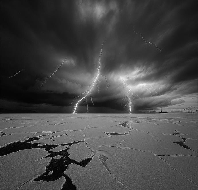
In August 2023, an unprecedented meteorological event shattered the ancient silence of the high Arctic.
A thunderstorm d just 27 kilometers from the North Pole itself, a phenomenon so rare that meteorological
records had never documented anything like it in this region.
The worldwide lightning detection network recorded 342 strikes, with 122 concentrated in a single storm cell hovering merely 1.5 kilometers above the ice cap.
“This wasn't supposed to happen here”

The physics of thunderstorm formation requires specific conditions: substantial surface heating, atmospheric instability, and moisture availability all traditionally absentinthefrozenArctic.Yetastheregionwarmsatmore than twice the global average rate, these prerequisites are increasingly being met.
"Whatwewitnessedwasn'tjustweatheritwasclimate change manifesting in real-time," explains Dr. Morten Thorne, polar meteorologist at the University of Copenhagen. "The Arctic atmospheric structure is fundamentally transforming."
Recent climate data reveal the mechanism behind this transformation. Warming southern air masses now regularly surge northward, carrying unprecedented moisture loads over the increasingly ice-free Arctic Ocean. When these warm, humid air parcels encounter remnant cold air, they create the precise instability that generates thunderstorms.
The implications extend far beyond the novelty of thunder echoing across polar ice. Lightning strikes in a region with minimal fire-adaptedecosystems couldtrigger devastating tundra fires, releasing additional carbon from ancient permafrost. The electromagnetic energy from lightning also produces nitrogen oxides, further altering atmospheric chemistry in a region already experiencing rapid change.
Perhaps most concerning is what these storms represent in the broader climate context. Computer models had predicted these events wouldn't occur until mid-century their arrival decades ahead of schedule suggests climate disruption is outpacing even our most aggressive projections.
"Arctic thunderstorms aren't just a scientific curiosity," notes Dr. Thorne. "They're canaries in the climate coal mine—dramatic evidence that we've pushed the system into new territory."
As the Arctic continues warming, what was once extraordinary will likelybecome commonplace. Thunder over polar ice, once unimaginable, now stands as measurable evidence of our rapidly changing world.
As Earth's ancient frozen regions surrender to relentless warming, scientists are sounding agrave alarm: the Arctic's melting cryosphere could unleash dormant diseases from a bygone era onto a vulnerable modern world. (image source: Science Direct)

Climate change is dramatically transforming the Arctic landscape, creating perilous new pathways for infectious diseasetransmission.Acomprehensiveinternationalstudy published in the journal Science of the Total Environment warns that as permafrost—soil that has remained frozen for thousands of years—continues to thaw, dormant microbes preserved in the remains of dead organisms could reawaken, potentially triggering outbreaks with significant public health implications.
"Permafrost thawing could release ancient bacteria or viruses that have been frozen for thousands of years," explains Dr. Khaled Megahed Abass, co-author of the groundbreaking research. These microbial time travelers, having survived in suspended animation, may find new hosts in our modern ecosystems, where no natural immunity exists against them.
The threat intensifies as increasing industrialactivity brings humans into unprecedented contact with previously isolated Arctic environments. Approximately 75% of all known human infectious diseases are zoonotic—capable of jumping from animals to people and about 63% are climate-sensitive. As warming accelerates fastest in polar regions,thesestatisticstakeonunsettlingnewsignificance.
Indigenous communities are particularly vulnerable to these emerging threats. Their traditional food systems often involve close contact with wild animals, creating
elevated exposure risks as disease patterns shift. Health services in remote Arctic regions are already limited, compounding the potential impact of emerging disease outbreaks.

image source – Science direct
Researchers have identified several zoonotic diseases already circulating in Arctic ecosystems, including brucellosis, tularemia, and E. coli.
The parasite Toxoplasma gondii also poses a growing concern as changing environmental conditions alter its transmission patterns among wildlife and humans.
133 ~
The distribution of Nephropathia epidemica (Puumala virus) across Norway, Sweden, and Finland demonstrates how disease patterns are already shifting inresponse to climate variables.
What makes this situation particularly concerning is the One Health connection: environmental stressors including pollutionfrom long-range industrialchemicals, biodiversity loss, and ecosystem alterations are working synergistically to amplify disease transmission. This creates a complex web of interactions that makes prediction and prevention exceptionally challenging.
"Whathappensinthe Arcticdoesn'tstayinthe Arctic," Dr. Abass warns. "The environmental stressors we studied have ripple effects that reach far beyond the polar regions."
As previously isolated ecosystems become more accessible, wildlife migration patterns shift northward, introducing new disease vectors into regions unprepared for them.
Meanwhile, increased shipping, tourism, and resource extraction bring more humans into contact with these changing environments, creating novel transmission opportunities for pathogens both ancient and emerging.
Scientists are advocating for a coordinated, multinational approach to address these growing concerns.
Enhanced surveillance systems, more robust environmental monitoring, and climate-resilient public health infrastructure represent crucial first steps. Equally important is the integration of Indigenous knowledge, which often detects subtle ecosystem changes before conventional scientific monitoring can identify them.
The authors of the study emphasize the importance of taking action before outbreaks occur. Their recommendations include developing better disease surveillance, strengthening environmental monitoring networks, and building more responsive public health systems specifically designed to address the unique challenges of the Arctic environment.
As one researcher soberly noted, "Climate change is not only melting ice, but also the barriers between ecosystems, animals, and people."
This permafrost-disease connection represents yet another urgent reason to address our warming planet—before ancient pathogens find new hosts in our modern world.

The Arctic Ocean is experiencing an unprecedented ecological transformation as warming waters trigger a massive redistribution of marine life.
Once confined to more temperate zones, species like salmon andhumpbackwhales are now pushing northward into Arctic regions, fundamentally altering ecosystems that have remained relatively stable for millennia.
Salmon invasion reshapes Arctic waters as these fish not only make occasional appearances but have established spawning populations where they were historically absent. In communities like Kaktovik, Alaska, where salmon were once a rare catch, locals now report regular harvests.
More alarmingly, research by Elizabeth Mik'aq Lindley confirms that warming waters now provide suitable temperatures forsalmon eggs to successfully incubate and hatch in Arctic streams—a biological threshold never before crossed.
This northward migration extends to larger marine mammals as well. Traditional whale migration patterns collapse as bowhead whales, iconic

Arctic natives, delay theirseasonalmovements inresponse to diminishing sea ice. Marine ecologist Clarissa Ribeiro Teixeira notes these magnificent creatures must now search for food in new areas and adapt to different prey types as their traditional feeding grounds transform.
Meanwhile, humpback whales encroach on native territories, appearing with increasing frequency in waters near Utqiaġvik, Alaska. This incursion creates direct competition with bowheads for critical food sources like krill and copepods.
The ecological balance that has sustained these waters for generations now stands on a precipice of change.
For Indigenous communities like the Iñupiat, these shifts represent more than abstract ecological concerns. Subsistence hunting faces existential threat as unpredictable whale migrations complicate traditional hunting practices that have sustained these communities for countless generations. When ancestral knowledge of animal movements no longer applies, food security and cultural continuity face unprecedented challenges. The scope of this transformation is difficult to overstate. With the Arctic warming nearly four times faster than the global average and the last nine years registering as the warmest on record in the region, scientists expect these biological shifts to accelerate. What we witness today
represents merely the opening chapter of a comprehensive ecological reorganization.
This thermal exodus demands both scientific vigilance and policy action. Researchers continue monitoring these changes, often collaborating with local hunters and fishers whose generational knowledge provides invaluable context to emerging data.
Yet observation alone cannot address the fundamental driver of these shifts: the relentless accumulation of heattrapping pollution in our atmosphere.
As salmon spawn in Arctic streams and humpbacks swim waters where they were once strangers, we witness nature's response to our changing climate a mass migration thatrewrites the ecologicalstory ofan entire ocean andthe human communitiesthatdepend upon it.
Recent geophysical mapping has revealed the existence of the Davis Strait proto microcontinent (DSPM), a major continental lithospheric fragment stranded beneath Greenland's western margin. This discovery fundamentally alters our understanding of Paleogene tectonic reorganization in the North Atlantic region.

The DSPM representsanunusually thick(19-24 km)section of continental crust that became isolated during the complex rifting process between Greenland and North America during the Paleogene period (61-33 Ma). Unlike typicalseafloorspreadingscenarios, thisfragmentescaped complete fragmentation when tectonic forces shifted from northeast-southwest to north-south orientation approximately 49-58 million years ago.
Advanced gravimetric analysis and seismic imaging confirmed this proto-microcontinent's existence, buried beneath the oceanic crust of the Davis Strait.
The reorientation of ridge systems during the MidPaleogene effectively cleaved the DSPM from the main continentalmasses, creating astrandedfragment of protocontinental lithosphere. By 33 Ma, when seafloor spreading terminated, Greenland's collision withEllesmere Island permanently locked this geological entity in place.
The research team led by Dr. Jordan Phethean and Luke Longley employed innovative modeling techniques to reconstruct the area's tectonic evolution.
Their findings demonstrate that the Davis Strait region served as a natural laboratory for microcontinent formation, isolated from subsequent geological complexity that affected surrounding regions.
The DSPM discovery establishes criticalparallels withother submerged microcontinents globally. Jan Mayen near
Iceland, the East Tasman Rise southeast of Tasmania, and the Gulden Draak Knoll off western Australia appear to share common formation mechanisms involving partial rifting and tectonic stress reorientation.
These findings provide unprecedented insights into continental calving processes the mechanism by which continental fragments separate from main landmasses during rift development.
The DSPM represents a snapshot of intermediate-stage continental breakup, offering valuable data for understanding similar geological phenomena worldwide.
The study significantly enhances predictive modeling for ongoing tectonic processes. As Dr. Phethean notes, rifting and microcontinent formation continue actively, with each seismic event potentially advancing continental separation.
Understanding these mechanisms becomes crucial for forecasting future continental configurations and assessing regional tectonic hazards.
This discovery transforms the Davis Strait from a simple oceanic passage into a complex geological boundary preserving evidence of ancient continental fragmentation, providing a template for decoding similar processes globally.

The Arctic's vast permafrost—ancient frozen soil that has imprisoned billions of tons of carbon for millennia—is undergoing a profound transformation with potentially catastrophic global implications. Recent research reveals disturbing evidence that this critical carbon storage system is failing, unleashing greenhouse gases that could accelerate climate change beyond our ability to control it.
A landmark study published in Nature Climate Change, representing the most comprehensive assessment of carbon fluxes across the Arctic-boreal zone (ABZ) to date, delivers a sobering verdict: 34 percent of these northern regions have already flipped from carbon sinks to carbon sources. When wildfire emissions are factored in, this figure rises to an alarming 40 percent.
"Carbon cycling in the permafrost region is really starting to change," warns Dr. Anna Virkkala, lead author of the groundbreaking study at Woodwell Climate Research Center. "Our study may act as a warning sign of bigger changes ahead, and offers a map of places we'll need to better monitor in the coming decades."
What makes these findings particularly troubling is their robust methodology. Drawing onCO2 datafrom 200 study sites spanning three decades (1990-2020)—a dataset four
times larger than previous analyses—researchers meticulously tracked the Arctic's respiratory patterns at unprecedented 1km resolution. This detailed approach has finally allowed scientists to quantify what many have feared: the great northern carbon sink is faltering.

The mechanisms driving this transformation reveal a complex climate feedback loop. While longer growing seasons have increased carbon uptake during summer
144 ~
months, this benefit is being overwhelmed by accelerated carbon emissions during non-growing seasons.
Rising temperatures have awakened once-dormant microbial communities within thawing permafrost, enabling them to decompose ancient organic matter and release CO2 and methane that had been safely sequestered for thousands of years.
"The high resolution of these data means that we can now see how variable the Arctic is when it comes to carbon," explains Dr. Sue Natali, co-author andleader of Permafrost Pathways at Woodwell Climate. "That variability isn't surprising because the Arctic isn't one single place—it's a massive area with diverse ecosystems and climatic conditions."
This research aligns with other recent studies examining CO2 and methane emissions from lakes, rivers, and wetlands that similarly found the permafrost region transforming intoanetcarbonsource.Together,theypaint apicture of acriticalplanetary system inthe early stages of collapse.
The implications extend far beyond the Arctic. Permafrost contains approximately twice as much carbon as is currently in Earth's atmosphere. As this frozen carbon reservoir continues to destabilize, it threatens to trigger a dangerousaccelerationofglobalwarming—whatscientists call a "carbon bomb."
145 ~
This shift represents a fundamental change in Earth's carbon cycle dynamics. For millennia, these northern ecosystems have helped regulate global climate by capturing and storing atmospheric carbon. Their transformation into carbon sources creates a positive feedback loop: warming releases more carbon, which causes more warming, which releases still more carbon.
Most troubling is that these changes appear to be selfreinforcing. More frequent and intense wildfires release carbon directly while also removing insulating vegetation cover, accelerating permafrost thaw. Increased precipitation in a warmer Arctic can turn previously dry peatlands into methane-emitting wetlands.
As Dr. Marguerite Mauritz from the University of Texas-El Paso and study co-author notes, "Highly collaborative efforts like this are critical for understanding how shifting seasonal dynamics and disturbance patterns can have regional and even global impacts."
The message from the Arctic is clear: Earth's ancient carbon reservoirs are destabilizing, and what escapes could reshape our planet's future.
Beyondcollapsing infrastructure andmelting seaice, Arctic warming is creating an entirely new biological frontier as permafrost the frozen foundation of the north surrenders to unprecedented temperature increases. Scientists are now confronting questions about what lives within this ancient frozen soil and what happens when these long-dormant microorganisms return to active life.

Geophysicist Vladimir Romanovsky from the University of Alaska Fairbanks has witnessed this transformation firsthand. During recent fieldwork near Prudhoe Bay, he encountered what he calls "siltsand" a viscous, adhesive mixture that exemplifies how thawing landscapes are evolving into entirely new ecosystems with unknown
microbial compositions. "I knew I shouldn't go there, but it was a good shortcut," he recounts of his encounter with this deceptively dangerous terrain.
Permafrost represents an enormous microbial reservoir containing thousands of minimally characterized species. Recent research describes it as "a reservoir of minimally characterized microbial life" that encompasses far more than the sensationalized "zombie viruses" that have captured public imagination.
Beyond anthrax, smallpox and influenza found in preserved corpses, the permafrost microbiome includes countless bacteria, fungi, and even nematode worms that have been successfully revived after thousands of years of suspended animation.
The thawing Arctic presents multiple pathways for potential pathogen emergence. As climate change accelerates, permafrost collapse is generating new waterways that connect previously isolated microbial communities with rivers and oceans.
Mining operations, coastal erosion, and newly formed sinkholesexposeancientorganic matter to the atmosphere. Meanwhile,increasedshipping activity whichjumped583 percent in some Arctic ports within just five years—moves ballast water containing microbes between Arctic waters and ports as far away as West Africa.
The risk intensifies as industrial development brings more workers into contact with these emerging ecosystems. Resource extraction operations create conditions ideal for disease transmission, with mobile workforces living in closequartersbeforereturningtopopulationcenters."You don't need a huge dispersal of a pathogen," notes climate researcher Camilo Mora. "You just need person-to-person transmission in close quarters and one infected person to carry the disease quickly to a more populated area."
Whileexpertsremaindividedaboutthespecificrisksposed by these emerging microbes, many advocate for applying the One Health approach, which recognizes the interconnectedness of human, animal, and environmental health. Veterinary virologist Marion Koopmans recommends focused surveillance at the interfaces where humans directly encounter new ecosystems.
Unlike the familiar threats from tropical regions, the awakening Arctic microbiome represents a journey into uncharted biological territory—one that unfolds as humanity continues pumping heat-trapping gases into our atmosph

TheinauguralWorldDayforGlacierswascelebratedon March 21, 2025.
This new United Nations observance seeks to raise global awareness about the critical importance of glaciers, the urgent threats they face due to climate change, and the need for international action to preserve them for future generations.
Over two billion people depend on glaciers and snowmelt for freshwater. Current projections warn that up to one-third of glacier sites could disappear by 2050 if current warming trends continue.
Glaciers are essential for regulating global sea levels, supporting ecosystems, shaping landscapes, and acting as "water towers"that sustain both people and nature.
The rapid retreat of glaciers threatens water security, increases the risk of glacial lake outburst floods, and disrupts agriculture, hydropower, and the livelihoods of mountain communities worldwide.
ThefirstWorldDayforGlacierscoincidedwithWorldWater Day, with high-level events held at the United Nations Headquarters in New York and in Paris.

These gatherings brought together global leaders, scientists, policymakers, and youth to discuss glacier preservation, water security, and climate adaptation strategies.
The celebration featuredcomprehensive paneldiscussions with UN leaders and government officials, scientific presentationsonglacierresearch,andthelaunchofthe UN World Water Development Report 2025, which focused on mountains and glaciers as vital water sources.
The day also included policy dialogues on international water cooperation and adaptation, along with networking opportunities for stakeholders and the public.
This landmark event marked the beginning of the International Year of Glaciers' Preservation (2025) and the Decade of Action for Cryosphere Sciences (2025–2034),
initiatives designed to foster research and coordinated global responses to glacier loss. The campaign's central message emphasized that glacier melting is already occurring at an alarming rate, making immediate action a global responsibility.
It called for ambitious reductions in fossil fuel consumption,moretransboundarywatercooperation,and greater community engagement to protect water resources and vulnerable populations.
154 ~
Youthengagement and public awareness were highlighted as crucial elements for long-term glacier preservation efforts.
The World Meteorological Organization (WMO), a specialized agency of the United Nations and the authoritative global voice on Earth's atmosphere, climate, and water resources, played a vital role in the observance.
The WMO promotes internationalcooperation in meteorology, climatology, hydrology, and related geophysical sciences among its 193 member states and territories. It facilitates the free exchange of data, research, and forecastswhilesupportingthedevelopmentofobservation networks, standardizing data collection, and advancing research and technology transfer.
The organization contributes significantly to disaster risk reduction, public safety, environmental protection, and policy formulation at national and international levels.
For the World Day for Glaciers, the WMO co-coordinated activities alongside UNESCO and other UN partners.
The agency maintains a leading role in monitoring glacier changes, issuing guidance on cryosphere measurements, and supporting adaptation strategies for communities affected by glacier loss.
This collaboration demonstrates how international scientific bodies can work together to address pressing environmental challenges.
The first-ever World Day for Glaciers in 2025 marked a historic moment in global efforts to address the accelerating loss of glaciers and its far-reaching impacts.
Spearheaded by the United Nations, with major coordination from the WMO and UNESCO, this observance underscores the urgent need for international cooperation, scientific research, and policy action to safeguard glaciers and ensure water security for billions worldwide.
Earth's mountain glaciers are vanishing at alarming rates as global temperatures rise, transforming landscapes and threatening water resources for billions of people worldwide. Recent comprehensive assessments reveal that glaciers outside Greenland and Antarctica have been shedding an average of 273 billion tons of ice annually since 2000, with the pace accelerating by 36% just in the past decade.

This massive meltwater contribution has already raised global sea levels by approximately 18 mm, equivalent to decades of human water consumption.
Scientists estimate the world's glaciers have lost roughly 5% of their total volume since 2000, with dramatic regional variations - the European Alps, for instance, have lost up to 36% of glacier volume in just two decades. Whilewarmingtemperaturesdrivethiswidespreadretreat, additional factors like changing precipitation patterns and dark soot deposits on ice surfaces accelerate the decline. Half of humanity relies on water from mountain snow and glaciers for drinking, agriculture, or hydropower generation. As these frozen reservoirs shrink, they initially release additional meltwater downstream a phenomenon scientists call peak water - but once this peak passes, flow inevitably declines, threatening water supplies for millions during dry seasons.
The situation has become so critical that the United Nations warns glaciers in one third of World Heritage sites will disappear by 2050 regardless of future climate action, including iconic ice caps in the Alps,
Kilimanjaro. Africa’s last remaining glaciers and many low latitude ice fields will likely vanish entirely within the next two to three decades.
In the European Alps, glacierlossratesrank among the fastest on Earth. Alpine glaciers, typically smaller and at lower elevations than their Himalayan or Andean
Switzerland's glaciers lost 6% of their remaining ice in the single hot year of 2022 - the most extreme annual loss ever recorded. By 2023, Switzerland had shed 10% of its glacier ice in just two years, illustrating the accelerating pace of change.
Italy's Marmolada Glacier - the largest in the Dolomite Alps - exemplifies this crisis. Scientists describe the glacier as being in an "irreversible coma" or terminal decline. It has lost 70 hectares of surface area (equivalent to 98 football fields) in just five years, thinning by up to 7-10 cm daily during summer months. Since measurements began in 1888, Marmolada has retreated 1.2 km and lost over 80% of its area and 94% of its volume.
At current rates, experts predict its complete disappearance by 2040. In 2022, a massive ice collapse on Marmoladaafter anunusually warm winter killed11 hikers - a tragedy scientists view as "a sign of what's to come in the Dolomites, where all glaciers are forecast to disappear by 2050."
The rapid decline stems primarily from regional warmingthe European Alps have warmed approximately 2°C since preindustrial times, exceeding the global average -
159 ~ counterparts,proveespeciallyvulnerabletowarming.Over the past century, these glaciers have lost more than half their volume, with recent summers producing record breaking melt rates.
combined with reduced snowfall. Warmer winters mean more precipitation falls as rain rather than snow, while bare ice in summer absorbs more heat than snow covered surfaces.
Human activities exacerbate these problems locally. Some ski operators now drape thermal blankets over portions of glaciers each summer to reflect sunlight and slow melting, though this provides only minor, temporary relief.
Paradoxically, the Alps'popularity withtourists may hasten glacier disappearance. Heavy foot traffic, skiinfrastructure, and vehicle pollution deposit dust and soot on ice, darkening its surface and accelerating melt.
In Turkey's Cilo mountain range, scientists report that rare glaciers have been "largely damaged and degraded" by both warming and human interference. Over three decades, these glaciers have lost 55% of their area, and ice once 200 meters thick now measures less than 50 meters.
Turkish experts advocate closing these glaciers to visitors and possibly covering them with protective materials to minimize disturbance - measures that illustrate the growing desperation to preserve remaining ice.
The socioeconomic and environmental consequences extend far beyond the mountains themselves.
Glaciersfunctionas Europe's"watertowers,"storingwinter precipitation as ice and releasing it through summer melt,
sustaining major rivers like the Rhine, Rhône and Po that are crucial for agriculture, hydropower, and drinking water across the continent. As these natural reservoirs dwindle, Europe faces increasing water stress during summer months and drought years.
Alpinecommunitiesalsoconfrontgrowingnaturalhazards. Retreating glaciers leave behind expanding glacial lakes and unstable slopes prone to rockfalls.
Authorities in the Mont Blanc region monitor proglacial lakes that could burst, while the Marmolada collapse highlighted the risk of sudden ice avalanches as warming destabilizes glacial structures.
The disappearance of Alpine glaciers transforms iconic landscapes and affects tourism and recreation economies.
Once gleaming icefalls and snowfields have given way to bare rock, impacting mountain guiding services, summer skiing (many glacier ski areas have closed or significantly contracted), and even historic mountaineering routes established over centuries.
Some high-altitude refuges and trails now face water shortages as nearby glacial streams vanish. Alpine ecosystems are changing dramatically - cold adapted species that depended on glacier microclimates decline while new communities of hardy vegetation colonize newly exposed terrain.
Looking ahead to 2050, projections for the Alps offer little comfort. Even under optimistic scenarios, substantial ice loss appears inevitable due to past warming.
Atleastone thirdofAlpine glacierice willdisappearby midcentury even in the best-case scenario (if global temperatures somehow stopped rising immediately). More realistic assessments predict around 46% of the remaining Alpine glacier volume will vanish by 2050 if current trends continue. Should the extreme melting observed in the past decade accelerate further, the region could lose up to 65% of its remaining ice by midcentury.
These model-based forecasts align with recent observations. Swissresearchersnotethat previous projectionsunderestimated how rapidly small, low elevation glaciers would disappear. European glaciers are now losing mass faster than anticipated in the UN's last climate assessment report, suggesting many of the Alps' approximately 4,000 glaciers will effectively vanish by 2050. By century's end, scientists warn that over 80-90% of Alpine glacier volume could disappear if emissions remain high.
For the Alps, coming decades will bring an increasingly ice freelandscape.Withinageneration,manybeloved "permanent" ice fields in the Dolomites, Pyrenees, and lower Alps will likely exist only in historical photographs. Just the highest, most shaded portions of massive glaciers like those in the
Mont Blanc region may survive as diminished remnants. Communities now prepare for summers when the Alps' iconic white peaks appear rocky gray, andurgently develop adaptation strategies for water management and hazard mitigation.
The Andes harbor the largest concentration of glacier ice outside polar regions, providing critical freshwater for tens of millions of people across South America. These natural reservoirs release water during dry seasons,sustainingagriculture,cities,andhydropower generation. Yet Andean glaciers are retreating at alarming rates, thinning by approximately 0.7 meters annually - 35% faster than the global average ice loss.
Rising temperatures drive this decline - the tropical Andes have warmed roughly 0.7°C in recent decades - alongside shifting precipitation patterns. Many Andean glaciers, particularly in the tropical and dry regions of Peru, Bolivia, andChile,dependonwetseasonsnowfallfor replenishment. Climate change disrupts these patterns, causing more precipitation to fall as rain rather than snow, while extended droughts in regions like Chile's Atacama starve glaciers of new accumulation.
Additional factors contribute to accelerated melting. Soot and ash from wildfires, including smoke from Amazon forest fires, can travel to Andean glaciers and darken their surfaces, increasing solar absorption.
163 ~

Andean Fitz Roy Glacier- Patagonia – Argentina
Satellite data and ground surveys confirm significant mass loss throughout the range - smaller tropical glaciers have completely vanished, including Bolivia's once renowned Chacaltaya Glacier, which disappeared entirely in the 2000s. Even the massive Patagonian Ice Fields show rapid retreat of major outlets like Upsala and SanRafaelglaciers.
NASA observations identify portions of the Patagonian Ice Field as experiencing some of Earth's fastest glacial melt rates.
The impacts on Andean communities and ecosystems are particularly acute because so many people depend directly on glacier meltwater. 90 million people rely on water from Andean glaciers for drinking, irrigation, and electricity. In arid coastal cities like Lima, Peru or La Paz, Bolivia, glacier melt from high elevation ice fields sustains dry season river flows.
As these natural reservoirs shrink, water shortages and allocation conflicts intensify. Scientists and policymakers increasingly warn of a "looming Andean water crisis."
Many watersheds are approaching peak water - the point where glacier meltwater output reaches maximum levels before declining. Research indicates that over 95% of glacier fed catchments in the Andes will reach peak water by 2030. After this peak, runoff willdecline dramatically. By the mid-2040s, glacier contribution to river flow could decrease by 40% inthe tropicalAndes and37% inthe drier Andes of Chile and Argentina compared to recent levels.

In practical terms, rivers that currently flow year-round will experience reduced flow during dry months, threatening water supplies for urban areas, agriculture, and hydropower generation. Countries like Peru and Chile,
which depend heavily on hydroelectricity, already face challenges replacing diminishing meltwater. During recent droughts,Chileimplementedwaterrestrictionsandsought alternative energy sources as snow and ice reserves dwindled. Farmers in high Andean valleys who rely on centuries old irrigation systems fed by glacier streams increasingly report water shortages.
Peru's Cordillera Blanca region illustrates these growing challenges. Hundreds of glaciers in this range feed the Santa River valley but have lost over one third of their volume inrecent decades. This initially increasedriver flow (peak water) but now contributes to declining discharge.
The city of Huaraz and surrounding agricultural communities face not only future water scarcity but also the threat of glacial lake outburst floods.
As glaciers retreat, theyoftenleave behindlarge meltwater lakes contained by unstable natural dams of loose debris. Dozens of these lakes throughout the Andes pose flood risks should these barriers fail.
Lake Palcacocha above Huaraz exemplifies this danger. The lake has expanded dramatically as its source glacier receded, necessitating expensive engineering projects to lower water levels and protect downstream communities. Similar climate driven hazards increase regionwide - from flashfloods to landslides on slopes destabilized by ice loss.
These changes threaten food and energy security across South America. The Andean region constitutes an agricultural heartland, from Peru's arid coastal plains to Chile's vineyards and Bolivia's high plateaus, all dependent on meltwater irrigation.
As dry season flows diminish toward 2050, agricultural productivity may decline unless farmers adopt drought resistant crops or implement improved water storage systems.Hydropower generation, representing substantial portions of electricity production in Ecuador and Peru, will become less reliable.
University of Sheffield researchers emphasize the immediacy of these threats, noting that "what scientists have predicted for years is now coming true."
Without rapid climate action and adaptation measures, water and food security for up to 90 million people in the Andes region face serious risk. Governments increasingly consider constructing major water reservoirs and revising water management policies, though such infrastructure requires significant investment and time to implement. Rural and impoverished communities often remain most vulnerable to these changes.
The Himalayan mountains and adjoining ranges (Karakoram, Hindu Kush, and others) contain Earth's
largest ice reservoir outside polar regions, often called the "Third Pole."
This massive frozen resource feeds many of Asia's great rivers - including the Indus, Ganges, Brahmaputra, Yangtze, and Mekong - supporting nearly 2 billion people downstream who depend on seasonal meltwater for agriculture, drinking water, and energy production.
These vital glaciers are melting at accelerating rates, with projections showing substantiallosses by midcentury. The region has warmedapproximately 0.28°C per decade since the 1950s (roughly 1.5°C total), driving widespread glacial retreat. Recent satellite analyses reveal Himalayan glaciers now losing mass at double the rate observed just decades ago - early 21st century warming has dramatically accelerated ice loss compared to rates in the 1970s and 1980s.
Overall,theHimalayashavelostapproximately15-20% of their ice volume in the past 40 years, though rates vary considerably across the region. Eastern Himalayan glaciers (Nepal, Bhutan) show rapid retreat, while some in the western Karakoram temporarily stabilized due to a phenomenon known as the "Karakoram anomaly." However, even this anomaly appears to be weakening as global warming intensifies.
Comprehensive assessments indicate many smaller, lower elevation Himalayan glaciers "may not survive the present century" if current trends continue.

Climate factors primarily drive Himalayan glacier lossrising air temperatures extend melt seasons and reduce snowfallaccumulationat highelevations. However, unique regional factors exacerbate the situation.
Black carbon from fossil fuel combustion and biomass burning in South Asia's densely populated plains travels via air currents to the high Himalayas, where it settles on snow and ice. This darkened surface absorbs more solar radiation, accelerating melting rates. Studies confirm this effect significantly impacts the regionessentially, air pollution from lowland areas hastens high mountain glacier decline.
169 ~
Changes in the South Asian monsoon and westerly weather patterns further influence Himalayan glaciers. Some areas receive increased winter snowfall that could benefit glaciers, but warmer temperatures and intense precipitation events (which sometimes trigger avalanches or landslides that remove ice) often counteractanypotentialgains.The Himalayan glaciers face pressure from both increasing temperatures and erratic precipitation patterns. The consequences extend beyond the mountains themselves.Oftendescribedas the "Water Towers ofAsia," Himalayan glaciers and seasonal snowpack regulate river flows that billions depend upon. In the Indus Basin, meltwaterfromsnowandicecontributesup to40%oftotal river flow, critical for Pakistan's agricultural productivity andhydropowergeneration.During droughtyearsorweak monsoon seasons, glacier melt provides essential water that keeps streams flowing.
As glaciers shrink, scientists project a peak water phenomenonsimilar to thatexpectedintheAndes, though possibly delayed. Many Himalayan watersheds may reach peak meltwater contribution around mid century (2040s2050s). After this point, dry season river flows would diminish, threatening irrigation for millions of farmers. Approximately 120 million farmers in the Indus, Ganges, and Brahmaputra basins directly depend on glacierandsnowmeltfortheirlivelihoods.These water
supplies could begin declining as early as mid century as ice reserves deplete.
Current research suggests that even limiting global warming to 1.5°C would still result in the Himalayas losing about one third of their glacial volume by 2100. Under high emission scenarios, losses could reach two thirds or more of current ice volume by century's end. For 2050, this suggests a substantial portion - perhaps 20-40% of Himalayan glacier mass gone by mid century depending on emission pathways - with numerous smaller glaciers disappearing completely in worst case scenarios.
The International Centre for Integrated Mountain Development's comprehensive assessment concludes that even limiting warming to 1.5°C would still result in approximately 30% glacier loss across the Hindu Kush Himalaya region by 2100, while current high emission trajectories could produce 70-80% loss by century's end. This suggests that by 2050, the region will experience severe ice loss but not yet the worst case endstateperhaps halfof theprojectedendcenturylossesmayoccur by mid century, with melting rates increasing over time.
The implications for the Himalayan region encompass multiple dimensions. Regarding human security, diminished water availability could affect up to 1.65 billion downstream people who benefit from Himalayan meltwater.
Urban areas across South Asia may experience water shortages during extended dry periods. Hydropower projects from Bhutan to Pakistan that depend on consistent river flow could generate less electricity during summer months.
The potential for international tensions over shared water resources like the Indus (between India and Pakistan) or Brahmaputra (between China and India/Bangladesh) may increase if flows diminish - a scenario some experts term "climate induced water stress."
The retreat of glaciers dramatically alters high altitude ecosystems. As permafrost thaws and snow cover diminishes, slope stability decreases, leading to more frequent landslides. Glacial lakes expand rapidly; over 200 glacier fedlakes inthe Himalayas are currently classifiedas dangerous due to outburst flood risk. Nepal, Bhutan, and India have experienced several glacial lake outburst floods in recent years, including a 2021 flood in Uttarakhand, India, linked to glacier collapse. These catastrophic events can destroy villages, infrastructure, and hydropower facilities. Such hazards will likely increase in coming decades as warming continues.
The Himalayas' unique biodiversity faces significant threats. Cold adapted species like snow leopards and specialized alpine plants lose habitat as the snowline rises
Africa'sglaciers,thoughlimitedtojustafewequatorial mountains, hold immense scientific and cultural significance. These last remaining African ice fieldsfoundon Mount KilimanjaroinTanzania, MountKenya in Kenya, and the Rwenzori Mountains along the Uganda/Democratic Republic of Congo borderrepresent remnants from the last ice age and provide visible indicators of climate change.

Mount Kenya demonstrates the rapid pace of glacier loss across Africa. In the early 20th century, substantial glaciers
173 ~ and glaciers retreat. The ICIMOD report warns that even under low emission scenarios, serious impacts on species and ecosystems will occur due to glacier and snow losssome already observable today.
covered its upper slopes, but today only scattered ice patches remain. A veteran Kenyan mountain guide recalls that during the 1990s, Mount Kenya's summit featured ice caves and year round snow cover - "it was very beautiful," he laments. Today, the largest glacier (Lewis Glacier) has fragmented into just two small ice bodies, the largest measuring only a few dozen meters across.
The retreat documented through photographs and scientific studies is staggering: Lewis Glacier has lost approximately 90% of its volume since 1934, while satellite monitoring shows Mount Kenya's total ice area now represents only 4.2% of its extent in 1900 - meaning over 95% of the mountain's glacier surface has already disappeared.
Scientists project that by 2030, Mount Kenya could become completely ice free, potentially becoming one of the first major mountains to lose all its glaciers in modern times.
Kilimanjaro shows similar patterns, with over 85% of its famous summit ice fields (the "snows of Kilimanjaro") lost during the past century. As of 2020, only about 8.5% of Kilimanjaro's year 1900 ice area remained.
TheRwenzoriMountains,oncehometonumerousglaciers, now retain just a few small ice patches on their highest summits, also projected to disappear within one to two decades.
174 ~
A 2023 UNESCO report concluded that Kilimanjaro's and Mount Kenya's glaciers will very likely vanish by the 2040s, if not sooner.
Unlike inthe Himalayas or Andes, industrial pollutionplays minimal role in African glacier retreat. The local environments remain relatively pristine, so the decline stems almost entirely from climate shifts rather than local human activities.
Tourism economies feel the impact as well. Many hikers and climbers visit these peaks specifically to witness the famous glaciers. Mount Kenya guides report visitor disappointment upon discovering reduced ice coverage, while certain technical climbing routes have closed as supporting ice features vanish.
In the Rwenzori (a UNESCO World Heritage Site known for otherworldly, glacier capped landscapes), retreating ice altershighaltitudewetlands andthreatensspecializedcold adapted species.
From a water resource perspective, African glaciers were never large enough to serve as critical reservoirs for downstream communities. Research confirms that even at their maximum extent, these glaciers contributed minimally to river flows, which derive primarily from rainfall. The Lewis Glacier's meltwater once fed a small stream used by local villagers, but this contribution has effectively vanished along with the glacier itself.
Therefore, the primary significance of Africa's glacier loss involves environmental and cultural dimensions rather than water security concerns.
As one Kenyan hydrologist observed, these glaciers represent "a heritage, natural wonders that have witnessed someoftheoldestremnantsofAfrican geography.Wemust protect these wonders." While preventing their complete disappearance would require immediate, dramatic global climate action, documenting their decline and preparing for their absence has become essential
By midcentury, Africa's glaciers will likely exist only in photographs and scientific records - a stark testament to how even the highest tropical mountains could not escape global warming's impact.
Human impacts vary by region - water supply challenges dominate concerns in the Andes and Himalayas, cultural and ecological losses predominate in Africa, while the Alps face a combination of water security, tourism impact, and natural hazard issues.
These projections need not represent an unavoidable disaster scenario; they underscore the urgentneedfor both global climate action and local adaptation strategies.
Immediate reductionincarbon emissions could preserve a meaningfulportionof these glaciers beyond2050. Limiting warming to 1.5°C might save approximately two thirds of
glacier volume in World Heritage sites otherwise lost to warming. This could determine whether iconic mountains retain some perennial ice at mid-century or lose it entirely.
The fate of mountainglaciers by 2050 willserve as avisible indicator of humanity's response to climate change. If we drastically reduce emissions, glacier loss, though substantial, might stabilize later this century, preserving some ice for future generations.

Without such action, we face a world with far fewer glaciers: the Alps largely ice free, the Andes and Himalayas with diminished water storage capacity, and Africa's glaciers existing only in historical records.
The retreat of these "frozen rivers" represents "the most visible evidence of globalwarming" - their decline sends an unmistakable message about climate change. As one glacier researcher observed, "We hope we might be wrong,
but this is hard science... This is something we can really see happening.
By midcentury, mountainlandscapes worldwide willreflect the consequences of decisions made today. Whether that future includes irreversible loss or successful adaptation and preservation depends largely on current climate action.
Mountain glaciers are retreating worldwide, challenging humanity to acknowledge the warning signsandrespond - both topreserve whatremainsand to prepare for a world where water resources and mountain environments once taken for granted have fundamentally changed.
Recent groundbreaking research has unveiled the precise astronomical mechanisms governing Earth's glacial cycles, revealing a predictable cosmic pattern that has shaped climate oscillations for hundreds of millennia.
By analyzing the morphology of glacial transitions rather than relying solely on absolute dating methods, scientists have identified the exact orbital configurations that trigger both the onset and conclusion of ice ages.
The Milankovitch theory has long proposed that glacialinterglacial cycles result from variations in Earth's orbital parameters. However, determining the specific roles of precession (Earth's wobble, cycling every ~21,000 years), obliquity (axial tilt, varying over ~41,000 years), and eccentricity (orbital shape, changing over ~100,000 years) has remained elusive until now.
Barker and colleagues circumvented dating limitations by examining the characteristic shapes of glacial-interglacial transitions across multiple paleoclimate records spanning 900,000 years.
Their findings demonstrate that these transitions follow a deterministic pattern dictated by the relative phasing of orbital parameters.
Deglaciation appears primarily triggered by precession, which modulates peak summer intensity at mid-to-high
latitudes. Specifically, terminations consistently begin with the first precession minimum (maximum summer insolation) that occurs while obliquity is increasing, following an eccentricity minimum.
This precise orbital configuration allows for maximum summer warming across the expanded ice sheets of the Northern Hemisphere.
In contrast, glacial inception is predominantly controlledbyobliquity,whichaffectsthetotalsummer energyreceivedathighlatitudes.Asobliquity decreases, lesssummerinsolation reachespolarregions, allowing icetoaccumulategraduallyathighlatitudeswherethe first ice sheets form.
The duration of warm interglacial periods also follows this orbital pacing. When precession peaks early relative to the obliquity phase, deglaciation proceeds more slowly, effectively delaying the northwardretreat of icesheetsand creating protracted transitions between glacial and interglacial states.
This deciphered pattern allows scientists to retrospectively "predict" all deglacial and interglacial periods over nearly a million years using orbital geometry alone.
The remarkable consistency of these relationships confirms that the ~100,000-year glacial cycles of the midto-late Pleistocene are largely deterministic rather than stochastic.
180 ~
Based on these patterns, the researchers estimate that, if not for human-caused greenhouse gas emissions, Earth would be due for another ice age in about 11,000 years as its axial tilt continues to decline. This statement, however, warrants further consideration in light of anthropogenic climate change.
The phrase "if not for human-caused greenhouse gas emissions" could mean that the next ice age might actually begin much earlier perhaps in 5,000 years in a scenario where current warming triggers a complete reversal of climate dynamics.
This would create a paradoxical trajectory where Earth continues warming progressively for the next 2,000 years (assuming current emission trends), followed by an accelerated cooling phase culminating in the next glacial period.
Such a scenario would represent an extreme climate whiplash effect, transitioning from unprecedented warming to rapid cooling within a geologically brief timespan.
While this orbital framework provides crucial insights into Earth's natural climate rhythms, it also underscores how significantly human activities have disrupted these long-established patterns, potentially altering the timing and nature of future glacial cycles in ways that remain incompletely understood.
Recent groundbreaking research has unveiled an unexpected truth about Earth's mountain glaciers: no two are alike, despite their seemingly uniform appearance. Just as snowflakes possess unique crystalline structures, the glaciers they eventually form carry distinct molecular signatures that tell complex stories of geography, climate, and human influence.
A comprehensive global study led by Florida State University scientists has demonstrated that mountain glaciers those found in alpine regions worldwide rather than the massive polar ice sheets possess unique organic carbon fingerprints that vary significantly by region. By examining meltwater from 136 glaciers across 11 regions spanning six continents, researchers discovered that each glacier's dissolved organic matter has a distinctive composition that can be predicted with remarkable accuracy based on its location.
The molecular-level analysis employed ultrahigh resolution 21-tesla mass spectrometry to characterize the dissolved organic matter (DOM) in glacial meltwater. This technique allowed researchers to identify thousands of individual molecular compounds within each sample, revealing extraordinary chemical diversity.
The DOM comprises a complex mixture of aliphatic and aromatic compounds, carboxylic acids, and various nitrogen-containing structures that form distinct regional patterns detectable through multivariate statistical analysis.
This molecular diversity stems from two primary sources: in situ production and atmospheric deposition. In remote regions like Greenland and New Zealand, where industrial impact is minimal, the organic carbon primarily originates from microbial activity within the glacier itself. These autochthonous carbon sources include metabolites from cyanobacteria, algae, and heterotrophic bacteria that inhabit the glacier surface in specialized microhabitats knownascryoconiteholes,aswellaswithintheweathering crust and subglacial environments.
Conversely, glaciers downwind from industrial centers, such as those in Alaska and Nepal, contain higher proportions of carbon derived from fossil fuel combustion byproducts. These allochthonous inputs are typically characterized by more condensed aromatic structures, including polycyclic aromatic hydrocarbons (PAHs) and black carbon particles.
Using stable and radiocarbon isotopic analyses (δ¹³C and Δ¹⁴C), scientists can now differentiate between these carbon sources and determine a glacier's "carbon signature" with approximately 80% accuracy.
The geochemical cycling of this glacial organic carbon becomes particularly significant in the context of accelerating climate change. As mountain glaciers retreat, they release their stored carbon into proglacial streams and rivers at unprecedented rates.
The biogeochemical properties of this released DOM including its aromaticity, molecular weight distribution, and oxygen-to-carbon-ratios directly influence its bioavailability and photo reactivity in downstream ecosystems.
Inindustrial-influencedregions, the exportedcarbon tends to be older and more recalcitrant, potentially altering aquatic food webs and carbon sequestration patterns in recipient water bodies.
Glaciers in the critical zone, the near-surface environment where rock, soil, water, air, and living organisms interact, serve as important archives of atmospheric deposition history.
Their stratigraphic layers can preserve decades to centuries of anthropogenic pollutants, including black carbon, heavy metals, and persistent organic pollutants.
As these glaciers melt, they not only release contemporary surface depositions but also legacy pollutants from deeper ice layers, creating complex temporal patterns in downstream water chemistry.
The research reconciles previously competing theories about glacial carbon sources, demonstrating that regional differences explain why some studies found microbial origins while others identified industrial pollution as the primary carbon source.

This spatial distinctiveness challenges the conventional view of glaciers as inert, homogeneous environments, revealing them instead as dynamic participants in Earth's carbon cycle with regionally specific impacts.
The implications extend beyond biogeochemistry into glacial hydrology and ecosystem function. As climate change modifies glacial meltwater regimes, shifting from snow-dominated to rain-dominated systems in many mountain regions, the timing and quantity of carbon export will fundamentally change.
These alterations to carbon flux pathways may have cascading effects on microbial community composition, nutrient cycling, and trophic relationships in glacier-fed watersheds, potentially affecting economically valuable fisheries worldwide.
With many mountain glaciers projected to disappear this century due to warming temperatures, understanding theirunique carbon signaturesbecomes increasingly crucial for predicting ecological responses to their eventual loss.
Recent research has established a compelling connection between climate-driven glacierretreatand increased seismic activity, challenging previous assumptions about the independence of these Earth systems. A groundbreaking Colorado State University study published in Geology demonstrates that climate changecandirectlyinfluenceearthquakefrequencyby altering the stress conditions along fault lines. The research team, led by Cece Hurtado, examined the SangredeCristoMountainsinsouthernColorado arange with an active fault along its western edge that was historically coveredbyglaciers during the last ice age.Their findings revealed that fault slip rates have accelerated fivefold since glacial retreat, providing empirical evidence for a mechanism previously explored mainly through theoretical models.
"Climate change is happening at a rate that is orders of magnitude faster than we see in the geologic record," Hurtado notes. This unprecedented rate of change has significant implications for tectonically active regions experiencing rapid glacial retreat, such as Alaska, the Himalayas, and the Alps.
The underlying mechanism involves isostatic rebound—as massive ice loads that once suppressed fault movement disappear, the crust responds by adjusting upward, effectively "releasing the brake" on tectonic movement. This process creates favorable conditions for fault slippage and potential earthquake generation.
While scientists have long understood how tectonic processes influence climate through mountain building and altered atmospheric circulation, the reverse relationship has receivedlimitedattention. This study joins a small but growing body of evidence demonstrating climate's influence on tectonic activity.
Using remote-sensing data and field measurements, researchers reconstructed past glacial coverage, calculated thepressuretheseicemassesexertedonunderlyingfaults, and measured subsequent fault displacement. The Sangre de Cristo range proved ideal for this analysis due to its location along the Rio Grande rift, providing a baseline slip rate for comparison.
The implications extend beyond academic interest into the sphere of practical hazard assessment.
Seismologists attempting to reconstruct prehistoric earthquakerecordsanddeterminerecurrenceintervalsfor active faults must now consider these climate-driven hydrologic processes in their calculations.

As associate professor Sean Gallen explains, "This work implies that the repeat time isn't necessarily going to be
periodic. You can have periods where you have a bunch of earthquakes in quick succession and a lot of time where you don't have any."
For regions experiencing rapid glacial retreat or water body evaporation, this research suggests that increased earthquake monitoring may be warranted as climate change accelerates, potentially introducing new seismic risks in areas previously considered stable.
Scientists at the University of Otago have developed breakthrough methods to predict how mountain glaciers and ice sheets move, potentially creating an early warning system that could save thousands of lives in vulnerable Himalayan communities.

The groundbreaking study, published in Nature Geoscience, brings together researchers from universities across the globe who collaborated to better understand ice deformation—a key process driving glacier movement and the catastrophic landslides they can trigger.
In mountain regions like the Himalayas spanning India, Nepal, Pakistan, and China, these "rock tsunamis" can devastate entire villages without warning when destabilized glaciers collapse. As climate change accelerates the melting of these ancient ice formations, the risk of such disasters increases dramatically.

Leadauthor Dr. Sheng Fanexplains that scientists can now create more sophisticated mathematical models called "flow laws" that accurately predict how ice behaves under various conditions.
"Current models don't fully capture ice's complexity, especially in mountain environments. Our improved flow laws could detect early warning signs of an impending collapse," says Dr. Fan.
The team analyzed 70 years of experimental data from laboratories worldwide and applied advanced statistical methods to account for uncertainties in previous models.
This refined understanding of ice physics means scientists can now identify subtle changes in glacier movement that often precede catastrophic failures.
Professor David Prior, co-author of the study, emphasizes the humanitarian implications: "Mountain communities have traditionally relied on observation and local knowledge to assess glacier dangers. With climate change altering glacial behavior in unprecedented ways, these traditional warning signs are becoming less reliable. Our models could bridge that gap, providing communities with crucial advance notice."
The research team envisions an integrated early warning system that combines satellite monitoring, ground sensors, and their refined ice flow models to detect dangerous changes in glacier stability. When risk thresholds are exceeded, automated alerts could give vulnerable communitiesprecious time toevacuate.
"Mountain glaciers can move suddenly and unpredictably, releasing millions of tons of ice and rock with devastating force," notes Dr. Fan. "By understanding the physics that drive these movements, we're creating a tool that could potentially save thousands of lives."

The researchers are now working with international partners to implement their models in high-risk regions, connecting scientific advances with local disaster management systems.
As warming temperatures continue to destabilize mountain glaciers worldwide, this early warning system represents a critical adaptation measure for communitiesliving inthe shadowof these increasingly unpredictable ice giants.
New research using artificial intelligence to analyze satellite imagery from 1985 to 2023 has unveiled an alarming pattern of glacier retreat across Svalbard, providing unprecedenteddetailaboutthe accelerating impacts of climate change on Earth's cryosphere.
The study, published in Nature Communications, employed deep learning techniques to process millions of satellite images, effectively automating what would have been an impossible manual task. This AI-powered approach mapped 124,919 calving front positions for 149 marine-terminating glaciers with exceptional temporal resolution - achieving measurements every four days after 2014.
The findings paint a sobering picture: 91% of Svalbard's glaciers have significantly retreated over the 38-year period, with a collective loss exceeding 800 square kilometers of ice - an area larger than New York City. This translates to an annual areal loss rate of nearly 24 square kilometers per year.
Perhaps most revealing is the AI's detection of previously undocumented seasonal patterns. The analysis identified widespread seasonal cycles in glacier front positions, with 62% of non-surging glaciers showing regular advance-
retreat patterns. Glaciers typically begin retreating between May and July, reach peak retreat rates in August and September, and start advancing again in November and December.

The research further demonstrated that ocean warming is the primary driver of this seasonal retreat cycle, with subsurface ocean temperature showing the strongest correlation (R²=0.97) with retreat rates. Regional variations in these patterns follow the circulation of warm Atlantic water, withretreatrateson Svalbard's west coastoccurring several months before those on the east coast.
Interannual variability analysis also captured dramatic responses to climate extremes. During 2016's exceptional warming period, glacier retreat rates nearly doubled compared to previous years, coinciding with record-high airandoceantemperatureslinked toatmosphericblocking patterns. A subsequent cooling phase in 2019 saw retreat rates return to pre-2016 levels.
By employing machine learning to analyze vast datasets with unprecedented detail, this research demonstrates how AI canenhance our understanding of Earth's changing cryosphere. The resulting high-resolution, long-term dataset provides criticalinsights into ice-oceaninteractions and the accelerating response of marine-terminating glaciers to climate change.
AsArcticwarming continuesandatmosphericblocking events become more frequent, these AI-derived insightssuggestSvalbard'sglacierswillfaceincreasingly intense retreat, with significant implications for global sea level rise and marine ecosystems.
In the towering heightsoftheHimalayas, an unsettling transformationistakingplace.ThesnowlineonMount Everest's glaciers creeps steadily higher each year, revealing bare, dark rock where pristine white once dominated. This is not merely a cosmetic change to Earth's highest peaks—it signals a profound shift that threatens water security for hundreds of millions and fundamentally alters mountain ecosystems.
The Himalayan Crisis Satellite imagery from January 2025 revealed an exceptionally high snow line around Mount Everest compared to normal historical conditions. AccordingtoglaciologistMauriPeltoofNicholsCollege,this represents a troubling pattern. "The only year recently when January snow lines were near typical levels was 2022," he notes, suggesting that the high snow lines observed in 2021, 2023, 2024, and 2025 likely represent a "new normal" for the region.
Unlike North American and European glaciers that primarily accumulate mass through winter snowfall, Himalayan glaciers are summer accumulation types, gaining most of their snow during the June-September monsoon period. However, this delicate balance is being disrupted by multiple factors.
Sublimation—the process where snow evaporates directly into vapor without melting first—has emerged as a significant driver of snow loss during dry Himalayan winters.Strongwinds,low humidity,andincreasinglywarm temperatures accelerate this process. Pelto calculated that the average snow line on Mount Everest region glaciers rose approximately 150 meters between December 2024 and January 2025 through sublimation alone.

The consequences extend far beyond aesthetics. The Himalayan region serves as Asia's water tower, with glacial meltwaterfeedingmajorriversystemsthatsustainover1.9 billion people. Reduced snow cover means less water storage and earlier, more intense spring melting— disrupting agricultural patterns developed over centuries. Additionally, drier conditions have contributed to more
frequent and intense wildfire seasons, with Nepal experiencing earlier fire outbreaks following particularly dry winters
This snow retreat extends well beyond the Himalayas. Ski resorts worldwide have faced increasingly uncertain seasons, with many investing heavily in artificial snowmaking to remain viable. The Alps have seen average snowdepthdecreaseby5.6%perdecadesince1970.North American destinations from California to Vermont report shorter seasons and more rain-on-snow events that destroy base conditions.
Yet strangely, Japan stands as a notable exception to this global pattern. While most ski regions worldwide struggle with diminishing snowfall, Japanese ski areas—particularly those in Hokkaido and along the Sea of Japan coast—continue to receive reliable, abundant powder.
This anomaly appears linked to Japan's unique meteorological conditions, where cold Siberian air masses sweep across the relatively warm Sea of Japan, creating exceptional "ocean-effect" snowfall even as global temperatures rise.
Scientists point to the Sea of Japan's warming surface temperatures as paradoxically enhancing this effect in the short term—providing more moisture for snowfall when air temperatures remain cold enough.
201 ~
However, climate models suggest this Japanese snow exception may not last indefinitely, as eventually warming air temperatures could overcome this effect.
The contrast between Japan's snow abundance and the Himalayan snow retreat illustrates the complex, uneven nature of climate change impacts. While some regions may temporarily benefit from altered patterns, the overall trajectory remains clear: mountain snowpacks are retreating globally, fundamentally changing environments that have remained stable for millennia and threatening the water security of billions.
As the white peaks of the Himalayas increasingly reveal their bare rock faces, they stand as towering warnings ofaworldrapidlytransforming—where even Earth's highest, coldest places cannot escape the warming trend reshaping our planet.
The Tibetan Plateau Earth's "Third Pole" and home to the largest concentration of ice outside polar regions—stands at the center of China's most ambitious climate adaptation strategy. As Himalayan glaciers retreat at accelerating rates,
Beijing is not merely observing this cryosphere transformation but actively planning to convert it into a strategic agricultural reserve designed to insulate China from projected global food system collapse.
This massive initiative forms a central component of China's multi-phase development strategy for Tibet, structured around two critical milestones: 2035 and 2049.
By 2035, China aims to fully integrate Tibet as a resource provider and tourism destination as part of the broader national goal of "socialist modernization."
The second target date—2049, marking the centenary of the People's Republic of China envisions the complete transformation of Tibet within a "great modern socialist country."
Chinese scientists from the National Climate Centre (NCC) have identified growing risks of cascading climate
breakdowns—including potential collapse of the Amazon rainforest, Atlantic Ocean currents, and polar ice sheets— that could destabilize global food production within decades.
Their solution represents one of history's most ambitious geoengineering proposals: systematically transforming the world's highest plateau into a vast agricultural zone that leverages glacial meltwater currently threatening downstream water security. The scientific rationale builds on environmental changes already underway. The Tibetan Plateauis warming at twice the global average rate, creating conditions where previously frozen landscapes become increasingly viable for agriculture. Glacial meltwater now irrigates valleys historically locked in permafrost, while the growing season hasexpandedby34dayssince1980asrisingtemperatures reshape the plateau's fundamental ecology.
Under the current 14th Five-Year Plan (2021-2025), China has accelerated development of agricultural technologies specifically designed for this unique environment.
Chinese agronomists have developed cold-resistant barley varieties capable of producing viable crops at elevations up to 5,000 meters (16,400 feet)—altitudes previously considered impossible for cultivation.

Specializedpotato hybridsnowachieveyieldsexceeding75 tonnes per hectare on the plateau, outperforming those grown at lower elevations due to the intense high-altitude solar radiation.
Artificial intelligence will serve as the technological foundation of this transformation. Chinese planners envision comprehensive AI systems analyzing realtime data from extensive sensor networks across the plateau to create predictive models for glacial flood events, optimize crop rotation schedules, and finetune irrigation systems based on glacial melt patterns. This represents perhaps the world's largest planned application of AI to precision agriculture in extreme environments, operating ata scale impossible through conventional methods.
The environmental implications remain complex. While glacial retreat provides the water resources driving this agricultural vision, it simultaneously threatens the plateau's critical ecological functions. The region serves as Asia's most important water conservation system, supporting major river systems that sustain nearly two billion people across South and Southeast Asia. Excessive agricultural development could potentially disrupt these hydrological patterns without careful management.
Chinese officials describe the initiative as developing a "future granary"capable of ensuring nationalfoodsecurity
even if global agricultural systems experience severe climate-induced disruptions.
This approach represents a remarkable pivot in climate adaptation strategy. Rather than focusing exclusively on mitigation or traditional adaptation measures, Chinese planners are explicitly preparing for worst-case scenarios where multiple climate tipping points trigger cascade effects.
By transforming the Tibetan Plateau's melting cryosphere into an agricultural stronghold, they aim to create a climate-resilient food production system capable of withstanding global food system destabilization.
The technical challenges remain formidable. Agricultural development must contend with extreme temperature fluctuations, high ultraviolet radiation, and the risk of catastrophic glacial lake outburst floods as warming accelerates ice melt.
However, Chinese scientists have already made significant progress developing agricultural techniques specifically tailored to this unique environment, including optimized soil management practices, specialized greenhouse technologies, and precision irrigation systems.
While Western nations have long debated theoretical geoengineering approaches to climate change, China's planned Tibetan agricultural transformation represents a
practical implementation of environmental redesign at unprecedented scale.
The combination of supercomputing resources, artificial intelligence, precision agriculture, and centralized governance creates conditions where this massive landscape transformation becomes not only possible but perhaps inevitable.
The reality check is sobering after decades of rightful skepticism toward grand geoengineering schemes, the world now faces a situation where one of humanity's most ambitious environmental modifications is proceeding not as a speculative proposal but as an actively developing strategic initiative.
China'sdemonstratedcapacitytoexecutemega-projectsof immense complexity suggests this transformation will indeed materialize, fundamentally altering one of Earth's most important cryosphere regions in response to its ongoing melt.
As the Himalayas lose their ice, China is systematically preparing to harvest the consequences—turning climate crisis into strategic opportunity through a combination of technological innovation, ecological redesign, and long-term planning that may reshape our understanding of how societies can adapt to a warming world.
While climate change gradually erodes Earth's cryosphere through rising temperatures, direct human intervention is accelerating glacial destruction at an alarming rate. Kyrgyzstan's rare criminal investigation into the deliberate destruction of glacial ice by a private mining company highlights a growing crisis where economic interests directly clash with critical water security.

The destruction of these ancient ice formations represents an urgent water security threat for Central Asia. Prosecutors in Kyrgyzstan's Osh region report that over 9,300 square meters of glacial ice and soil weredestroyedwhenaprivatecompany"illegallybuilt
a road to a coal mine," allegedly colluding with a stateowned firm.
This direct assault on glaciers—which form over centuries of compressed snow—strikes at the heart of the region's freshwater reserves.
Glaciersfunction asessential"watertowers"acrossCentral Asia, particularly in Kyrgyzstan where thousands of these ice formations store critical freshwater that sustains agriculture,energyproduction,anddrinkingwatersupplies throughout the region. The melting ice provides crucial irrigation water for food production in a landlocked country increasingly vulnerable to water insecurity.
The criminal case, focusing on environmental safety violations and "abuse of an official position," signals growing recognition of glaciers as critical national assets worthy of legal protection. Such prosecutions remain rare globally, though several countries including Argentina and Chile have enacted specific laws to protect their glacial resources from mining and other destructive activities.
This case emerges against a backdrop of mounting water concerns across Central Asia, where Soviet-era irrigation infrastructure continues deteriorating while disputes over transboundary water rights intensify.
Climate models project that the region's glaciers couldlose up to 80 percent of their volume by 2100 under high-
emission scenarios, making the preservation of remaining ice reserves increasingly crucial.
Beyond immediate water supply implications, glacial destruction disrupts complex hydrological systems that have regulatedwater flow for millennia. Whenglaciers disappear, seasonal water availability becomes erratic often resulting in dangerous flood cycles followed by extended drought periods.
The destabilization of these natural water regulation systems threatens both agricultural productivity and downstream ecosystem health.
Kyrgyzstan'scriminalinvestigationmayrepresentaturning point in how nations value and protect their cryosphere resources.
As climate change continues compromising glacial ice through warming temperatures, the added pressure of direct destruction for short-term economic gain creates a dangerous acceleration of water insecurity.
Prosecution underscores a critical truth often overlooked in climate discussions: while global warming gradually erodes the cryosphere, immediate human activities—from road construction to resource extraction—can destroy in days what nature assembled over centuries. As one Kyrgyz environmental advocate noted,
"We cannot control global emissions alone, but we can absolutely choose to protect what remains of our glaciers from direct destruction."
This case illustrates the complex intersection of climate vulnerability, resource extraction, and governance that increasingly defines the fate of Earth's remaining ice.
As water stress intensifies, more nations may follow Kyrgyzstan's example in treating glacier destruction not merely as environmental damage, but as a criminal act against national security and public welfare.
Inwhatmightbetheworld'sslowest-movingterritorial dispute, Italy and Switzerland have been locked in heated negotiations over... well, not-so-heated ice.
The iconic Matterhorn, that perfect triangular peak adorning countless chocolate boxes, is witnessing a diplomatickerfuffleasitsglaciersperforma disappearing act worthy of a Las Vegas magic show.
"The border is melting!"announceda Swiss officialin2022, presumably while standing dramatically at the edge of a shrinking glacier, one hand on his alphorn. Thus began the Great Alpine Border Adjustment, a process moving at approximately the same speed as... well, a glacier.
The Swiss, withtheir legendary efficiency, quickly approved the border changes. Their parliamentary debate lasted roughly the time it takes to eat afondue lunch. Meanwhile, Italy's approval process has moved with the urgency of a three-hour Sunday dinner in Tuscany.
"We'll get to it right after coffee," an Italian diplomat was rumored to have said in 2022. Two years later, they're still stirring the espresso.
The situation has created unique challenges for Alpine rescue teams. "Before saving hikers, we must first
determine which country they're technically freezing in," explained one mountain guide. "It's quite awkward asking for passport documentation from someone dangling off a crevasse."
Local businesses are adapting creatively. One enterprising Swiss-Italian restaurant now offers a "Border-Shifting Brunch" where your appetizer is served in Switzerland, but dessert arrives in Italy—all without changing tables.

Tourism officials have created a new attraction: "Watch the Border Move Day."
214 ~
Unfortunately, ticket holders discovered it's less exciting than anticipated, consisting mainly of watching glaciologists stare intensely at melting ice while making occasional notations on clipboards.
Cartographers have been the unexpected victims of this climate crisis consequence. "I've developed repetitive strain injury from redrawing the Alps," complained one mapmaker."AndI'musingerasableinknow it'sjustmore practical. «The only entities truly benefiting from this situation are the mountain goats, who continue to bound across invisible national lines with flagrant disregard for international boundaries, customs regulations, and apparently, gravity itself.
As one local shepherd philosophically noted, "The mountains have been here for millions of years. They've seen empires rise and fall. They'll outlast our silly lines on maps." He paused, then added, "But if the Italians claim one more meter of my grazing pasture, there will be trouble."
Meanwhile, glaciologists predict that by 2100, the border dispute may be entirely moot not because of diplomatic resolution, but because the glaciers themselves will have voted to leave both countries entirely, retreating to that great ice age in the sky.

At the geographic South Pole, beneath a mile of pristine Antarctic ice, lies one of humanity's most ambitious scientific endeavors.
Neither a research station nor a traditional laboratory, the Ice Cube Neutrino Observatory transforms a cubic kilometer of ancient frozen water into Earth's largest particle detector—a colossal instrument hunting the universe's most elusive ghosts.

These "ghosts" are neutrinos subatomic particles so vanishingly small and weakly interacting that trillions pass through your body every second without leaving a trace.
Yet these nearly massless particles represent our best chance to observe cosmic events that remain invisible to conventional telescopes. To catch them, scientists needed to think big—extraordinarily big.
"We didn't build Ice Cube; we transformed it," explains Dr. Francis Halzen, the observatory's principal investigator. "Antarctica's ice sheet provided us with the clearest, most transparent natural medium on Earth. We simply embedded our eyes within it."
Those "eyes" consist of 5,160 basketball-sized optical sensors suspendedon 86 verticalcables, deployedinholes drilled nearly 2.5 kilometers into the ice using a specialized hot-water drill.
This three-dimensional array monitors a billion tons of ice, patiently waiting for the rare instances when a neutrino collides with an atom, creating a flash of blue light called Cherenkov radiation that ripples outward like a subatomic thunderclap.
Thetechnicalchallengesofconstructingthisdetectoratthe harshest place on Earthwere immense. Between2004 and 2010, during the brief Antarctic summers when temperatures might "warm" to a balmy -30°C,
The sensors themselves were designed to withstand crushing pressures and function flawlessly for decades without possibility of repair.
Why go to such extraordinary lengths? Because neutrinos offer something no other particle can—a pristine, undistorted view of the cosmos.
"Think of neutrinos as cosmic messengers," says Dr. Elisa Resconi, an Ice Cube collaborator. "Light from distant galaxies gets absorbed or deflected during its journey.
Cosmicrays get scrambled by magnetic fields. But neutrinos travel in straight lines across billions of light-years, unchanged since the moment of their creation.
This ghostly indifference to matter stems from neutrinos' bizarre properties. With virtually no mass and no electrical charge, they interact only via the weak nuclear force the feeblest of nature's four fundamental forces. A neutrino could pass through a light-year of lead without being stopped.
This same property makes them excruciatingly difficult to detect, necessitating Ice Cube's massive scale.
The scientific payoff has been spectacular. In September 2017, Ice Cube detected a high-energy neutrino from a blazar a supermassive black hole at the center of a galaxy four billion light-years away, with powerful jets pointed directly at Earth.
Within minutes, telescopes worldwide swiveled to observe the same region of sky, witnessing a flare-up of gamma rays.

This watershed moment marked the birth of "multimessengerastronomy,"wherecosmiceventsareobserved simultaneously through different types of particles.
"It was like finally putting soundwithasilent film,"explains Dr. Naoko Kurahashi Neilson, another Ice Cube scientist. "For the first time, we could see and 'hear' a cosmic event through completely different channels.

But these astronomical discoveries represent only half of Ice Cube's scientific mission. The detector also serves as an unprecedented laboratory for fundamental physics a window into nature's most basic rules.
Scientists hope neutrinos might even reveal the elusive unified theory of quantum gravity, bridging Einstein's theory of general relativity with quantum mechanics.
"Neutrinos from cosmic sources travel such vast distances that even minuscule quantum gravity effects might accumulate enough to be detectable," notes physicist Tom Stuttard. "We're probing energy scales a trillion times beyond what the Large Hadron Collider can achieve."
What drives scientists to work at this remote outpost, where winter temperatures plunge below -80°C and the sun doesn't rise for six months?
During these dark Antarctic winters, a small crew of "Ice Cubers" remains isolated at the Amundsen-Scott South Pole Station, maintaining the detectorandmonitoring data collection while the rest of the 450-member international collaboration analyzes results.
For Dr. Kathrin Mallot, a physicist who has "wintered over" twice, the experience combines scientific dedication with extreme adventure.
"There's nothing quite like standing outside at -70°C, watching the aurora dance overhead, knowing you're one of only 40 humans onanentire continent,"she says. "Then you go inside and check data from particles that have traveled across the universe. The contrast is surreal."

The winter-over team develops unique bonds through sharedhardshipandpurpose.Theirliving quarters,though comfortablebyAntarcticstandards,offerlimitedspaceand resources.
"You learnwhichpersonalities thrive inisolationandwhich don't," Mallot continues. "The psychological screening is as rigorous as the scientific credentials. We look for people who find meaning in maintaining something larger than themselves."
The scientific questions driving these extraordinary efforts touch on the most fundamental mysteries of existence. Neutrinos exist in three distinct "flavors"— electron, muon, and tau—and bizarrely transform between these states as they travel.
Thisoscillationphenomenon,whichearnedthe2015Nobel Prize inPhysics, proves neutrinos have mass, contradicting predictions of the Standard Model of particle physics.
Evenmoretantalizingisthepossibilitythatneutrinosmight help solve the universe's matter-antimatter asymmetry why matter predominates when both should have been created in equal amounts during the Big Bang.
Some theories suggest afourthneutrino flavor or different oscillation patterns between neutrinos and their antimatter counterparts.
Ice Cube's future looks equally compelling. The planned IceCube-Gen2 expansion would increase the instrumented volume to nearly 8 cubic kilometers, potentially increasing detection rates tenfold.
With more sensors and improved technology, scientists hope to trace neutrinos back to their cosmic sources with unprecedented precision, creating a new map of the energetic universe.
"We're still at the beginning," emphasizes Halzen. "Ice Cube opened a new window to the universe, but we've only glimpsed what's visible through it. The most exciting discoveries likely remain ahead."
As dawn breaks over Antarctica each September, ending the long polar night, new scientists arrive to relieve the winter crew.

Equipment is maintained, sensors are calibrated, and the changing team continues its patient watch for signalsfromthe cosmos, transmittedbynature's most perfect messengers’ ghostly particles that journey unscathed across space and time, carrying secrets of the universe's most violent events directly to Earth's frozen depths.
In a remarkable scientific achievement, researchers at the University of Bremen in Germany broke the record for the coldest temperature ever recorded in a laboratory in 2021. They reached an astonishing 38 picokelvins—just 38 trillionths of a degree above absolute zero—bringing humanity closer than ever before to reaching the ultimate cold frontier. According to current scientific literature, this record remains unbroken since 2021, with no research team managing to improve upon this extraordinary accomplishment.
What is Absolute Zero? Absolute zero, measured at273.15°C (-459.67°F), represents the theoretical temperature at which all molecular motion ceases completely. At this point, particles would have zero kinetic energy essentially coming to a complete standstill. According to the laws of thermodynamics, this temperature can never truly be reached, making it one of physics' ultimate horizons.
Breaking Records with Quantum Gas the German research team at the Center for Applied Space Technology and Microgravity (ZARM) achieved this extraordinary feat during experiments investigating the wave properties of
atoms.Theirinnovative approachinvolvedseveral fascinating steps:
First, they trapped a cloud containing 100,000 rubidium atoms in a magnetic field within a vacuum chamber. The cloud was cooled until it formed a Bose-Einstein Condensate (BEC) a quantum state of matter where atoms behave collectively as a single entity. The researchers then droppedthisquantumgasdownBremen's120-meterdrop tower. During the free fall, they strategically switched the magnetic field on and off multiple times.
This switching technique was crucial. When the magnetic field was turned off, the gas began to expand; when reactivated, the gas contracted.
This repeated process dramatically slowed the atoms' expansion almost to a complete standstill. Since temperature fundamentally measures particle movement, this near cessation of motion createdwhat the researchers described as "one of the coldest places in the universe."
Why do scientists pursue such extreme conditions? At ultra-low temperatures, matter begins displaying extraordinary quantum properties that are normally hidden at warmer temperatures. Particles begin behaving like waves rather than discrete objects.

Atoms move in perfect unison, acting as a single quantum entity withthe same wave function. These conditions allow researchers to observe quantum effects at a macroscopic scale.
These properties were predicted by Albert Einstein nearly a century ago, based on the quantum formulations of physicist Satyendra Nath Bose. The resulting state the
Bose-Einsteincondensate—provides aunique window into the mysterious quantum sphere.
The record-breaking temperature was maintained for only two seconds under Earth conditions. However, simulations suggest that in the microgravityenvironmentofspace, suchasaboardthe International Space Station, this extreme cold could potentiallybe sustainedforapproximately17seconds.
The International Space Station already houses the Cold Atom Lab, which conducts experiments at 100 nanokelvin (100 millionths of a degree above absolute zero). The new techniques developed in Bremen could potentially push space-based cold experiments to even more extreme temperatures.
The Continuing Quest While absolute zero itself remains permanently out of reach an asymptotic limit that can be approached but never crossed each step closer provides new insights into fundamental physics.
As researchers continue refining their techniques, these ultra-cold experiments reveal more about the quantum nature of our universe and may eventually lead to practical applications in quantum computing, precision measurement, and materials science.
NASA's Jet Propulsion Laboratory has successfully tested Ice Node, a cylindrical autonomous robot designed to revolutionize ice sheet monitoring by attaching directly to the underside of Antarctic ice shelves. The 8-foot-long, 10-inch-diameter prototype represents a breakthrough in accessing Earth's most inaccessible measurement locations.

JPL and SISU Field team
Test phase on Lake Michigan prior Antartcia trip
Unlike traditional research methods, Ice Node operates without propulsion systems. Instead, sophisticated software models ocean currents, allowing the robots to position themselves autonomously. Released through boreholes or from ocean vessels, these units ride currents beneath ice
shelves until reaching target locations, where they drop ballast, rise, and deploy spring-loaded landing gear to affix themselves to ice undersides.
Innovation addresses a critical measurement gap in climate science. Antarctica's grounding zones where floating ice shelves meet land remain invisible to satellites and dangerous for human researchers. Yet these areas, often hidden beneath a mile of ice, experience the most rapid melting. Current sea level projections rely on incomplete data from these crucial regions.
Ice Node's sensor package measures warm saltwater circulation rates upward into ice and freshwater meltwaterdescentrates.Aftercollectingdataforupto one year, robots autonomously detach, drift to open ocean, and transmit findings via satellite. This direct interface measurement represents an unprecedented capability for quantifying ice-ocean interactions.
March 2024 field tests in Alaska's Beaufort Sea validated the system in polar conditions, demonstrating successful deployment, data collection, and recovery. Previous trials in Monterey Bay and Lake Superior confirmed operational parameters across various aquatic environments.
The prototype establishes aproof-of-concept for deploying robot fleets across Antarctic ice shelves.
IfAntarctica'sicesheetmeltedcompletely,globalsealevels wouldriseapproximately200feet(60meters)representing
one of climate modeling's greatest uncertainties. Ice Node's precise measurements could significantly improve projection accuracy by capturing real-time melt rates at critical ice-ocean boundaries.

The project leverages JPL's space exploration expertise, applying autonomous systems developed for extraterrestrial environments to terrestrial challenges. Funding through JPL's internal research programs and
233 ~
Earth Science Directorate positions Ice Node for potential fleet deployment.
Implementation faces political uncertainties. Current plans envision expanding from single prototype to operational fleet, requiring sustained funding commitments.
Should the new US administration redirect resources, international cooperation under the Antarctic Treaty system shall provide alternative pathways for deployment. This technologicaladvancement exemplifies how precision engineering can illuminate complex Earth systems. Ice Node transforms Antarctica's most remote regions into accessible research laboratories, replacing speculation with direct measurement. As climate science demands increasingly accurate predictions, such innovations prove essential for understanding our planet's rapidly changing ice systems.
The ability to continuously monitor ice-ocean interactions at scale represents a paradigm shift in glaciology. Whether through national programs or international collaboration, Ice Node's successful testing confirms that autonomous systems can deliver critical data from Earth's most extreme environments, providing the foundation for more accurate climate projections and informed policy response.
Deep beneath Antarctica's pristine surface, an international team of geoscientists has just opened a 1.2-million-year time capsule that could reshape our understanding of climate resilience.
Beyond EPICA project's historic achievement represents more than just drilling 2,800 meters through ancient ice, it's discovering Earth's own geological memory bank.
. The team didn't just reach the bottom; they've accessed the critical interface where ice meets rock, where Earth's crust has been preserving atmospheric secrets for over 1.2 million years.
This isn't merely ice—it's compressed climate history, with 13,000 years of environmental data condensed into each meter of crystalline archive.
The Mid-Pleistocene Transition recorded in these cores tells a remarkable story of planetary adaptation.
Between 900,000 and 1.2 million years ago, Earth's glacial cycles mysteriously shifted from 41,000-year to 100,000year intervals.
Understanding this naturalclimate oscillationoffers crucial insights into how our planet naturally regulates long-term climate patterns through ice-bedrock dynamics.
What's particularly fascinating is the bottom 210 meters of deformed ice above the bedrock.
These aren't just frozen layers, they're potential geological witnesses to ancient glaciation events, possibly containing refrozen ice from previous warming periods.
This suggests Antarctica's bedrock-ice interface has been actively preserving and recycling climate information across multiple glacial cycles.
The implications extend beyond climate records. These cores offer evidence of how Earth's crust-ice shield system has maintained environmental stability over geological time.
The fact that this ice reached bedrock and remains intact suggests remarkable geological protection mechanisms operating beneath Antarctica's surface.

An ice core drilled by a research team is displayed at Little Dome C field base in eastern Antarctica, during the cutting phase on , Jan. 7, 2025.
The fact that this ice reached bedrock and remains intact suggests remarkable geological protection mechanisms operating beneath Antarctica's surface.
For environmentalists, this discovery reinforces that Earth has sophisticated natural preservation systems.
The meticulous -50°C temperature maintenance required to transport these cores mirrors how Antarctica's bedrock naturally maintains this climate archive, suggesting robust geological climate buffering mechanisms still at work.
This achievement showcases the power of international collaboration in unlocking Earth's geological memory.
By accessing this million-year climate database, we're not just looking backwardly, we're discovering how Earth's deep geological processes naturally stabilize climate patterns, offering hope for our ability to work with these systems rather than against them in addressing current climate challenges.
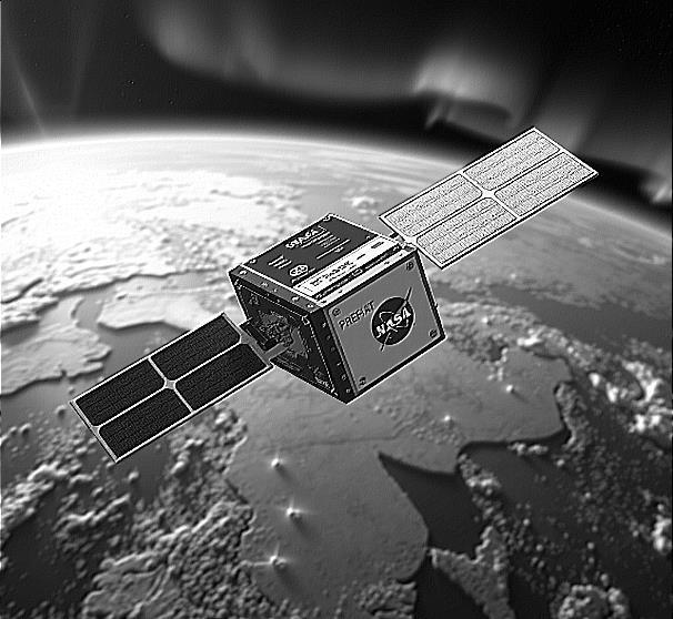
NASA's twin PREFIRE CubeSats, deployed into polar orbit from New Zealand in mid-2024, represent a revolutionary advancement in Earth observation capabilities within remarkably compact platforms.
Each spacecraft measuring merely shoebox dimensions carries sophisticated thermal infrared spectrometers specifically emissions from Earth's polar regions with
unprecedented precision. Calibrated to detect far-infrared radiation
The technical significance cannot be overstated: these miniaturized orbital platforms address a critical blind spot in our climate observation network.
Despite decades of satellite monitoring, systematic measurement of far-infrared emissions at high latitudes has remained elusive—a troubling gap considering these regions function as Earth's primary thermal regulation system, radiating excess tropical heat into space.
What distinguishes PREFIRE's instrumentation is its extraordinary sensitivity to far-infrared wavelengths. The specialized spectrometers can detect previously invisible cloudformations anddifferentiate betweenwaterdroplets and ice particles based on their microscopic signatures.
This capability enables scientists to resolve contradictions in current climate models that yield wildly divergent warming projections ranging from 3°C to 6°C adifference with profound ecological implications.
From an orbital mechanics perspective, the mission architecture employs dual spacecraft to maximize temporal and spatial coverage of both Arctic and Antarctic regions.
This tandem deployment yields comprehensive polar radiation budget measurements impossible with singleplatform missions.
The environmental implications are profound. As Principal Investigator Tristan L'Ecuyer notes, clouds function like "windows" in polar atmospheres either permitting heat escape (cooling) or trapping radiation (warming).
Complex microphysical properties at varying altitudes determine whether specific cloud formations accelerate or mitigate warming. PREFIRE's data will finally allow scientists to properly parameterize these dynamics in climate projections.

Perhaps most significantly, these diminutive spacecrafts highlight the democratization of space-based environmental monitoring. The mission exemplifies how CubeSat architectures—leveraging commercial launch providers like Rocket Lab—enable sophisticated science at a fraction of traditional mission costs.
Its measurements will help humanity better understand the fate of Earth's cryosphere, potentially informing adaptation strategies as climate change reshapes global systems.
By resolving fundamental uncertainties in polar radiation dynamics, these modest spacecrafts may ultimately provide outsized contributions to our understanding of Earth's changing climate—proof that in space observation, size isn't everything.
RecentsatelliteobservationsfromcomplementaryESA and NASA missions have quantified unprecedented changes in the Greenland Ice Sheet, providing critical insights into cryosphere response to anthropogenic forcing. The dual-platform approach utilizing CryoSat-2 and ICESat-2 satellites has documented spatially heterogeneous ice mass losses with remarkable precision.
Observations indicate the Greenland Ice Sheet thinned by approximately 1.2 meters on average between 2010 and 2023, with dramatically amplified thinning of 6.4 meters across the ablation zone. Localized maximum thinning rates have reached exceptional magnitudes measurements revealing vertical ice loss exceeding 67 meters. These valuesrepresentsubstantialaccelerationcomparedtopre2010 baseline observations.
The integrated approach using radar and laser technologies represents a significant methodological advancement in glaciological monitoring. CryoSat-2's radar penetrates cloud cover but requires correction for subsurface penetration effects, while ICESat-2's laser provides precise surface readings but cannot operate through cloud cover.
Remarkably, measurements from both platforms agree within 3% margin, validating the combined methodology.
Volumetric analyses quantify Greenland's contribution to global sea level rise at approximately 0.75mm annually during recent years - approximately double the rate observed during prior decades.
Recent research from the UK Centre for Polar Observation and Modelling (CPOM) indicates a total volume loss of approximately 196±37 km³/yr between 2010 and 2022, with significant interannual variability (129 km³/yr).
This accelerated mass wastage has profound implications beyond direct eustatic sea level rise. The freshwater flux modifies North Atlantic thermohaline circulation patterns, potentially disrupting meridional heat transport and regional weather systems.
The spatial heterogeneity in ice loss rates reflects complex interactions between surface mass balance perturbations and dynamic thinning associated with ice stream acceleration.
these findings underscore the critical importance of sustained satellite observation infrastructure for quantifying cryosphere response to ongoing climate forcing andinforming adaptation strategiesforcoastal communities worldwide.

From 300 miles (482 KM) above Earth, NASA's ICESat-2 has just achieved a remarkable milestone—its ATLAS laser instrument fired its 2 trillionth pulse, transforminghowweunderstandourplanet'sdynamic surface.
Forsatelliteexpertsandgeoscientistsalike,thisisn't merely a numerical achievement; it represents unprecedented global surveillance of Earth's cryosphere and beyond.
As both a satellite engineering marvel and geoscientifictool,ICESat-2operateswithextraordinary precision. The Advanced Topographic Laser Altimeter System (ATLAS) fires 10,000 green laser pulses per second,creatinghigh-resolutionelevation mapsacross ice sheets, glaciers, forests, water bodies, and even ocean floor topography.
Thisrapid-firecapabilitygeneratesapproximately16billion measurements annually a data treasure trove for understanding Earth's surface dynamics.
The historic 2 trillionth shot occurred March 9 over East Antarctica's coast, coincidentally capturing clouds while demonstrating the satellite's versatility beyond ice measurement.
The timing symbolizes ICESat-2's evolution from specialized ice-monitoring instrument to comprehensive Earth observation platform.
Operating continuously since 2018, the laser remains in excellent condition, with projections indicating operational capability well into the 2030s.
From a geoscientist's perspective, ICESat-2's data has revolutionized glaciological research. Vanderford Glacier, East Antarctica's fastest-retreating glacier, exemplifies this transformation.
Continuous monitoring reveals dramatic surface elevation changes: a six-foot (1.8 meters) drop from 2019-2022, a brief rise in 2023, followed by renewed decline in 2024.
These measurements, captured with centimeter-level precision, confirm theoretical models of subsurface ocean warming driving glacial retreat.
Satellite technology has matureddramatically since ICESat1(2003-2009). ICESat-2's six-beam configuration and enhanced ranging capabilities provide sub-annual temporal resolution previously impossible.
The system's 10,000 Hz firing rate enables cross-track profiles spaced 30 meters apart, creating detailed three-dimensionalmapsofice dynamicsatscalesfrom individual glaciers to continental ice sheets.

For geoscientists studying climate change impacts, ICESat2 offers consistent global coverage essential for understanding regional variations and globaltrends.
The satellite's precise elevation measurements distinguish mass balance changes, surface melt patterns, and glacier flow velocities. Combined with thermal imaging and gravitational data from other missions, this creates comprehensive understanding of ice sheet behavior under warming conditions.
The backup laser system provides redundancy ensuring data continuity critical for long-term climate studies requiring consistent measurement protocols.
ICESat-2's impact extends beyond polar regions. Forest canopy height measurements inform biomass estimates and carbon storage calculations.
Coastal bathymetry mapping aids navigation and marine habitat studies. Water level monitoring in lakes and reservoirs supports water resource management.
Looking forward, this 2 trillion pulse milestone represents just the beginning. As the primary laser continues exceeding design specifications, scientists anticipate at least another decade of high-quality data collection.
For both satellite engineers and geoscientists, ICESat-2 exemplifies how advanced space technology enables groundbreaking Earth system science, providing critical observations for understanding and responding to our planet's changing climate.
Deep beneath Greenland's ice streams, Earth's cryosphere conceals a seismic secret—continuous mini-earthquakes rippling through frozen terrain at depths approaching 2,700 meters.
ThisgroundbreakingdiscoverybyETHZurich'sAndreas Fichtner fundamentally challenges our understanding of ice dynamics and sea level projections.
Traditional glaciological models assumed ice streams flow smoothly like viscous honey, but reality reveals a dramatically different mechanism. These ice masses exhibit constant stick-slipmotion, punctuatedby countless micro-quakes that propagate hundreds of meters through crystalline structures. T
his discovery explains persistent discrepancies between satellite observations and computer simulations used to predict sea level rise.
The investigation employed innovative fiber-optic seismic monitoring, inserting cables 1,500 meters into a borehole within Greenland's Northeast Ice Stream (NEGIS). During 14 hours of continuous recording, researchers detected extensive seismic activity previously invisible from the surface—hidden by a volcanic particle layer embedded 900 meters deep.
This volcanic layer reveals an extraordinary connection: particles from Mount Mazama's eruption 7,700 years ago now dampen seismic wave propagation
More intriguingly, volcanic sulfate impurities in the ice act as nucleation sites for microfractures, initiating the very tremors they later absorb. This represents an unprecedented link between explosive volcanism in ancient Oregon and contemporary Greenland ice dynamics.
The implications extend beyond seismic curiosity. These tremors explain mysterious fault planes observed in ice cores for decades—tectonic evidence of constant internal deformation within ice streams.
Understandingthisstick-slipbehavioriscrucialforrefining climate models, as current simulations significantly underestimate dynamic ice discharge rates.
Fichtner's team documented ice streams advancing at 50 meters annually while simultaneously experiencing continuous internal restructuring. This dual motion— persistent flow combined with intermittent faulting suggests ice loss calculations require fundamental recalibration.
The NEGIS alone contributes substantially to rising sea levels, making accurate modeling critical for coastal planning.

The research demonstrates how deep-field seismology revolutionizes glaciology. By revealing ice streams as dynamically active systems rather than passive flows, scientists can better predict mass balance changes and their cascading effects on global sea levels.
The implications extend beyond seismic curiosity. These tremors explain mysterious fault planes observed in ice cores for decades tectonic evidence of constant internal deformation within ice streams.
Understanding this stick-slipbehavior is crucial for refining climate models, as current simulations significantly underestimate dynamic ice discharge rates.
Fichtner's team documented ice streams advancing at 50 meters annually while simultaneously experiencing continuous internal restructuring.
This dual motion persistent flow combined with intermittent faulting suggests ice loss calculations require fundamental recalibration. The NEGIS alone contributes substantially to rising sealevels, making accurate modeling critical for coastal planning.
The research demonstrates how deep-field seismology revolutionizes glaciology. By revealing ice streams as dynamically active systems rather than passive flows, scientists can better predict mass balance changes and their cascading effects on global sea levels.
Future investigations will extend fiber-optic monitoring to other ice streams worldwide, potentially revealing whether these tremors represent universal cryosphere behavior.
This technological approach—combining traditional glaciology with seismic geophysics—opens new frontiers for understanding polar environments under accelerating climate change.
These hidden ice quakes remind us that Earth's cryosphere operates as a complex geophysical system, where ancient volcanic events still influence contemporary ice dynamics thousands of miles away.
Recent high-resolution numerical modeling has revealed that glacial cycles fundamentally alter lithospheric motion and mid-ocean ridge spreading rates, challenging conventionalunderstanding ofplate tectonics as a solely long-term process.
Research by Tao Yuan and Shijie Zhong demonstrates that deglaciation events trigger significant horizontal plate movement, not merely vertical isostatic rebound.
During the Last Glacial Maximum, the Laurentide Ice Sheet covered North America extending southward to Pennsylvania. As this 3-kilometer-thick ice mass retreated 10,000 years ago, releasing approximately 1 cm/year into globaloceans, it induced profound lithospheric reorganization.
The North American plate exhibited rotational motion components reaching 25% of its baseline tectonic velocity over decadaltimescales amagnitude previously unrecognized in plate motion dynamics.
The Mid-Atlantic Ocean Ridge, spanning thousands of kilometers through Iceland, experienced dramatic spreading rate variations directly linked to ice sheet redistribution.
Between 12,000-6,000 years BP, ridge spreading rates fluctuated by 40% from the conventional 2 cm/year
baseline, contradicting textbook models of steady-state seafloor production. This acceleration correlates with intense Holocene volcanism documented in Iceland's geological record.
Glacial forcing creates a memory foam effect: as continental ice masses redistribute from land to ocean, continents undergo both vertical rebound and horizontal displacement.
Current observations show Hudson Bay rising 1 cm/year, providing contemporary validation of these processes. The mechanism operates through stress field modifications as lithospheric thickness variations and weak plate margins respond to changing surface loads.
Implications for seismic activity emerge through enhanced seafloor spreading facilitating increased magma flux. The Iceland case study demonstrates clear linkages between deglaciation timing and volcanic peak periods.
Modern Greenland ice loss, while currently insufficient to replicate Last Glacial Maximum dynamics, could trigger similar seafloor spreading acceleration over centennial timescales. Global sea-floor production exhibits cyclic patterns: in creasedrates during deglaciationperiods drive enhanced mantle degassing, while glaciation phases correlate with reduced spreading rate

Modern Greenland ice loss, while currently insufficient to replicate Last Glacial Maximum dynamics, could trigger similar seafloor spreading acceleration over centennial timescales.
Global sea-floor production exhibits cyclic patterns: increased rates during deglaciation periods drive enhanced mantle degassing, while glaciation phases correlate with reduced spreading rates.
This coupling between glacial cycles and plate tectonics suggests an underappreciated climate-lithosphere feedback mechanism operating at 10,000-year intervals rather than million-year geological timescales.
Contemporary rapid ice loss in Greenland and West Antarctica may initiate similar processes within the next millennium. Enhanced mid-ocean ridge activity could manifest through increased volcanic eruptions along plate boundaries, particularly affecting regions proximal to melting ice masses.
This research fundamentally revises our understanding of the temporal scales governing Earth's tectonic system, revealing short-term glacial forcing as a significant driver of lithospheric dynamics with direct implications for earthquake and volcanic hazard assessment.

Thermal Gradient Disruption: The diminishing sea ice extent observed in both polar regions is altering the fundamental thermal gradients that drive atmospheric circulation patterns. With Arctic warming occurring at nearly four times the global average rate, the temperature difference between polar and midlatitude regions is decreasing significantly.
This reduction in the meridional temperature gradient directly impacts the polar jet stream, which derives its energy andstructurefromthesetemperaturedifferentials.
Satellite observations and reanalysis data indicate that decreased sea ice coverage has contributed to a 25-35% increase in jet stream meandering since 1979.
Satellite observations and reanalysis data indicate that decreased sea ice coverage has contributed to a 25-35% increase in jet stream meandering since 1979.
This enhanced waviness introduces persistent weather patterns characterized by blocking high-pressure systems, allowing both warm and cold air masses to remain stationary for extendedperiods. The direct consequence is a measurable increase in extreme weather events at midlatitudes, particularly heat waves and prolonged precipitation anomalies.
Ocean Stress Amplification Climate models consistently project intensified ocean surface stress (+5.1% per decade in winter) due to both increased wind speeds and sea ice decline.
While wind speeds increase most during fall (+2.2% per decade), surface stress rises most inwinter due to reduced internal ice stress. As sea ice concentration decreases, less energy is dissipatedby the weakening ice pack, resulting in more direct momentum transfer to the ocean.
This phenomenon is quantified by the "dampening effect" the energy loss betweentotalatmospheric windstress and total ocean surface stress. Models show this dampening effect decreasing by 2-18% by century's end as the sea ice mediating role diminishes.
The altered momentum transfer accelerates Arctic Ocean surface velocity by 31-47% by 2100, elevating ocean kinetic energy and enhancing vertical mixing.
The timing of peak stress is shifting from December to February, amplifying seasonal disparities by 46%. These changes have particularly pronounced effects in the Chukchi Sea and Beaufort Gyre regions, where surface stress is already elevated.
Thermohaline Circulation Modification: Sea ice formation andmelting arecriticalcomponentsintheglobal thermohaline circulation system. During sea ice formation, salt is expelled, creating dense water masses that sink and drive deep ocean circulation.
The observed 14.33 million km² Arctic maximum in March 2025 significantly below historical averages indicates diminished dense water formation.
Freshwater input from accelerated melting has increased stratification in key formation zones, with salinity decreasing by approximately 0.2 psu in the Greenland and Labrador Seas over the past three decades.
Recent measurements from the OSNAP (Overturning inthe SubpolarNorth AtlanticProgram) array showa48% weakening in overturning circulation strength since monitoring began in 2014.

Coastal System Implications The absence of protective sea ice leaves coastalareas exposedto intensifiedwave action.
Wave height measurements from remote sensing platforms indicate a 0.3-0.5-meter increase in average wave height across newly ice-free regions during autumn months.
These heightened mechanical forces accelerate coastal erosion rates, with some Arctic shorelines retreating at 3-5 meters annually.
Altered wind patterns over ice-free ocean surfaces create more frequent and intense mesoscale eddies, enhancing vertical mixing in previously stratified shelf seas.
This mixing affects nutrient cycling and primary productivity throughout the food web, evidenced by a 12-18% increase in chlorophyll-a variability in affected regions since 2000.
Atmospheric Feedback Mechanisms The substitution of highly reflective ice(albedo ~0.5-0.7) withdarkoceanwater (albedo ~0.06) creates a powerful positive feedback loop. Each additional square kilometer of open water absorbs approximately 175 W/m² more solar radiation during peak summer months.
This enhanced energy absorption modifies regional pressure gradients, intensifying cyclogenesis in polar regions. Barometric measurements show an average 2-4 hPadecreaseincentralpressureofArcticcyclonesoverthe past decade, corresponding with increased storm intensity and moisture transport. These systems propagate altered circulation patterns into mid-latitudes through complex teleconnection pathways.
The data present unambiguous evidence that sea ice loss is triggering cascading effects throughout the coupled ocean-atmosphere system at rates exceeding most model projections from the early 21st century.
Deep within Greenland's pristine ice sheet, an unexpected alliance has emerged. Laura Perini's team from Aarhus University has discovered giant viruses microscopic guardians potentially holding the key to slowing Arctic ice melt.
These remarkable organisms, measuring up to 2.5 micrometers with genomes 125 times larger than typical viruses, represent a groundbreaking discovery in polar microbiology.
During Arctic Spring, pigmented microalgae bloom across the ice surface, creating dark patches that absorb sunlight and accelerate melting a dangerous feedback loop intensifying climate change.
However, these giant viruses appear to naturally regulate algal populations, maintaining the ice's crucial reflectivity that bounces solar radiation back into space.
Unlike conventionalviruses, these nucleocytoplasmic large DNA viruses (NCLDV) possess complex genomes of 2.5 million DNA base pairs, suggesting sophisticatedecological roles.
Their presence in red snow, dark ice, and cryoconite holes indicates a widespread distribution across various ice

microenvironments—the first time suchviruses have been documented in polar surface conditions.
The implications extend beyond microbiology. If these viruses effectively control algal blooms, they could representnature'sownclimateregulationmechanism, offering hope amid accelerating Arctic warming.
This discovery reveals an intricate ecosystem where bacteria, fungi, yeasts, protists, and now giant viruses interact in complex ways that influence ice stability.
However, scientific prudence demands further investigation. Researchers must determine which specific algae these viruses target and quantify their regulatory efficiency.
Laboratory studies using cultivated microalgae will help clarify these relationships and assess the viruses' broader ecological impact.
This exemplifies how Earth's natural systems continuously surprise us with their complexity and resilience.
While notasilverbulletforclimate change, thesegiant viruses may represent an important piece in understanding—and potentially supporting—polar ice preservation strategies.
Nature, it seems, has been working on climate solutions for far longer than us !.
Against the pristine white backdrop of Taylor Glacier in Antarctica's McMurdo Dry Valleys, a striking rust-colored outflow creates one of Earth's most visually arresting geological features.
BloodFalls, asitwasnamedduring the 1910-1913Terra Nova Expedition, has captivated scientists for over a century with its periodic discharge of crimson brine from beneath the glacier.
The source of Blood Falls is not actually blood, nor is it caused by algae as once theorized. Recent comprehensive analysis has revealed that the distinctive coloration comes from iron chemistry rather than biological processes.
When subglacial brine containing dissolved ferrous iron (Fe²⁺) emerges from beneath the glacier and contacts atmospheric oxygen, the iron oxidizes and transforms into nanoscale structures.
"What makes Blood Falls particularly fascinating from a mineralogical perspective is that we don't see crystalline iron oxides or hydroxides as one might expect," explains Dr. Elizabeth Sklute of the Planetary Science Institute, lead
author of the most detailed mineralogical study of Blood Falls to date.
"Instead, we find compositionally diverse amorphous ironand chlorine-rich nanospheres that give the discharge its characteristic color."
These nanospheres form wheniron inthe brine, whichhas remained in its reduced state in the oxygen-poor environment beneath the glacier, suddenly encounters air at the surface.
Rather thanforming well-definedminerals like hematite or goethite, the rapid oxidation creates amorphous structures essentially disordered arrangements of iron, oxygen, and other elements present in the brine.

A Window Into Ancient SeawaterThe brine itself tells a remarkable geological story. Scientific analysis indicates it originates from ancient seawater that was trapped when Taylor Glacier advanced over the valley.
This hypersaline fluid has been concentrated by freezeexclusion processes and modified by interactions with underlying bedrock and microbial activity over thousands of years.
The episodic discharge occurs through a complex hydrological system. Pressure differences between the brine and surrounding glacier, combined with the latent heat of freezing and normal glacial flow, drive the fluid through a network of channels, eventually forcing it to the surface at the glacier's terminus.
Blood Falls serves as a unique analogue for potential subsurface environments elsewhere in our solar system. The extreme conditions a subglacial brine pocket supportingmicrobiallife, isolatedpotentiallyforthousands of years ina polar desert climate—bear striking similarities toenvironmentsscientistshypothesizemightexistonMars or within the ice shells of ocean moons like Europa and Enceladus.
"This system represents one of our best Earth analogues for studying how life might persist in isolated subsurface pockets on other worlds," notes Dr. Jill Mikucki of the
University of Tennessee, who has extensively studied the microbial communities at Blood Falls.
While photographs of Blood Falls often appear dramatically red (sometimes enhanced for visual impact), the actual appearance varies considerably depending on flow conditions, oxidation time, and viewing angle. Fresh outflows typically display a more orange-rust color that darkens over time.
The comprehensive mineralogical analysis conducted by Sklute and colleagues employed multiple complementary techniques including spectroscopy, x-ray diffraction, and electron microscopy to fully characterize the surface materials.
Their findings reveal a mineralogy dominated by calcite and aragonite (carbonate minerals), accompanied by quartz, feldspar, halide, and clay minerals with the distinctive color coming from the amorphous iron-rich nanospheres rather than crystalline iron oxides.
As scientists continue to explore extreme environments on Earth, each discovery at places like Blood Falls enhances our understanding of potential habitable niches throughout the solar system, where similar chemistry might support life in seemingly inhospitable conditions.
New research from Peking University challenges established theories of hailstone genesis through innovative isotope fingerprinting techniques. Qinghong Zhang'steamanalyzed27specimensfromnine Chinese storms, using stable isotope markers to reconstruct vertical paths through atmospheric layers.

The findings fundamentally contradict prevailing models. Only one of 27 hailstones exhibited evidence of the hypothesized recycling mechanism vertical oscillation withinstorm clouds. Instead, 10 stones descendedsteadily earthward, 13 experienced single updraft events, and 3 displayedhorizontaltrajectories. This distribution suggests hail formation involves far less recycling than traditional models predict.
Isotope analysis revealed embryonic ice formation occurring across a broader temperature range (-33.4°C to8.7°C) than the previously accepted "sweet spot" (-30°C to -10°C).
This expanded thermodynamic window indicates hail nucleation processes are more varied than atmospheric models currently incorporate.
The research demonstrates that storm cloud updrafts primarily determine hailstone size through duration of supercooled water exposure, rather than through repeated vertical cycling.
Stronger updrafts sustain particles within optimal accretion zones longer, producing larger stones.
This mechanism explains the correlation between storm intensity and hail diameter observed in meteorological records.
Isotopic fingerprinting offers unprecedented resolutions for tracking atmospheric water vapor sources and condensation altitudes.
Eachatmosphericlevelimpartsdistinctisotopicsignatures, creating a vertical profile of storm dynamics frozen within individual stones.

This technique effectively transforms hailstones into atmospheric samplers, preserving chemical evidence of their formation history.
The study's implications extend beyond academic meteorology. Understanding actual formation pathways
273 ~
could enhance hailstorm damage prediction and improve forecasting accuracy. With annual hail-related losses exceeding billions in damages, improved storm structure comprehension could significantly impact agricultural and infrastructure risk assessment.
However, implementation faces institutional challenges. Current atmospheric modeling frameworks rely heavily on recycling-based assumptions. Integrating these findings requires substantial revisions to numerical weather prediction models and operational forecasting protocols.
The research underscores how chemical analysis can reveal atmospheric processes invisible to traditional observational methods, suggesting isotope techniques may illuminate other poorly understood precipitation phenomena.
Earth's cryosphere is in rapid retreat, from melting Arctic Sea ice to dwindling Himalayan snowpacks, triggering an alarming transformation in our oceans.
As these frozen reservoirs disappear, our planet's waters are shifting from their traditional deep blues toward an expanding palette of greens—a chromatic change representing a fundamental disruption in marine ecosystems with severe implications for global food security.
Climate change drives oceanic greening through multiple, interconnected pathways. In Arctic regions, melting sea ice releases massive quantities of freshwater containing minerals, particularly iron, that had been locked away for millennia. These nutrients function as fertilizer for phytoplankton, spurring blooms visible from space. Simultaneously, thousands of miles away, the loss of Himalayan-Tibetan snow cover weakens winter monsoon winds across the Arabian Sea, reducing convective mixing that traditionally brought nutrient-rich deep water to the surface.
Both processes though geographically distant create similar ecological disruptions.
Satellite observations confirm accelerating greening trends across both Arctic waters and tropical seas, with ocean colorservingas acriticalindicatorof fundamentallyaltered water composition.
While deeper blues represent clearer water with less biological activity, the expanding green hues indicate increasing concentrations of phytoplankton and suspended particles.
The Arabian Sea offers a particularly stark warning of what may become commonplace globally. There, a uniquely resilient organism called Noctiluca scintillans virtually unknown in the region twenty years ago now forms massive blooms visible from space.
Columbia University researcher Joaquim Goes has documented how this organism has capitalized on changing conditions:
"This is probably one of the most dramatic changes that we haveseenthat's relatedto climatechange,"notes Goes, who has studied the phenomenon for over 18 years.
Unlike traditional diatoms that have historically supported the region's food web, Noctiluca possesses a devastating competitive advantage—it can both photosynthesize through internal symbionts and consume other microorganisms. This dual feeding strategy allows it to thrive precisely when traditional phytoplankton struggle.
These ecologicalshiftscarryprofoundhuman consequences.
In Oman, massive algal blooms force desalination plants and oil refineries to scale down operations. More critically, these blooms threaten fisheries sustaining 150 million people in the Arabian Sea region alone, with some researchers suggesting that pressure on marine food supplies may contribute to increased piracy in countries like Yemen and Somalia.
Similar concerns emerge in Arctic waters, where commercial fisheries in the North Atlantic and Barents Sea face uncertain futures astheir foundationalplankton communities undergo rapid compositional shifts.
The emerging algal species often produce toxins that accumulate in seafood, threatening human consumers, while others alter the nutritional composition of marine food webs.
Indigenous communities across both Arctic and tropical coastal regions report unprecedented changes in water appearance and behavior.
Their observations frequently precede detection by scientific instruments, highlighting the value of integrating traditional ecological knowledge with technological monitoring.
The connection betweenmountains, poles, andseas grows increasingly apparent as researchers track these changes. As coastal glaciers and distant snowpacks recede, their
meltwater affects ocean chemistry both locally and thousands of miles away through atmospheric connections. This global interconnection represents a critical dimension of climate impacts that often accelerates beyond earlier model predictions.
While these oceanic color shifts may appear subtle from a satellite perspective, they represent a profound ecological reorganization with cascading effects throughout marine food webs.
As Goes observes, "tropical oceans are being disproportionately impacted, losing their biodiversity, and changing faster than conventional model predictions."
Greening oceans serve as a visible manifestation of climate change's impact on biological systems that humans depend upon for survival—a transformation that will continue accelerating unless greenhouse gas emissions are dramatically reduced.

Inthe crystalline wilderness of Cambridge Bay, where wind chill plunges temperatures to a bone-shattering -45°C, a small team of scientists stands as modern Cassandras –prophesying disaster while actively fighting against it. Their weapons? Holes drilled through sea ice and pumps churning seawater across frozen surfaces.
This is climate repair in action – desperate, controversial, and perhaps revolutionary. As our planetary fever intensifies, Arctic Sea ice retreats like a defeated army, exposing dark waters that absorb rather than reflect solar radiation. It's a vicious
feedback loopthatacceleratesourclimate emergency.
Scientists from Cambridge University's Centre for Climate Repair and British company Real Ice are challenging this retreat with direct intervention.
"The idea is that the thicker the ice at winter's end, the longer it will survive during the melt season," explains Andrea Ceccolini from the wind-whipped confines of a research tent.
Their pilot project has already thickened ice by precious centimeters through a deceptively simple technique: flooding the surface with seawater that freezes upon contact with frigid air.
The urgency cannot be overstated. Current projections show an Arctic Ocean essentially ice-free during summer by 2050 – possibly sooner. This would devastate not just polar ecosystems but planetary climate stability itself.
Yetthescientificcommunityremainsdeeplydivided.Critics callthe approach"quite insane," pointing to daunting scale requirements – potentially 10 million wind-powered pumps to meaningfully impact just 10% of Arctic ice coverage.
Others warnof unintendedconsequences: saltier ice might melt faster during summer, and large-scale implementation could alter ocean chemistry and disrupt marine life.
Beyond technical challenges lies a philosophical battle between emissions reduction purists and intervention pragmatists. Martin Siegert from Exeter University voices the mainstream position: "The real danger is it provides a distraction... The way to solve this crisis is to decarbonize: it's our best and only way forward."
Project leader Dr. Shaun Fitzgerald acknowledges these concerns while defending the research: "We're not promoting this as the solution to climate change in the Arctic. We're saying it could be part of it, but we need to learn much more before society decides whether it's sensible."
This experimental approach joins other geoengineering concepts – from cloud brightening to artificial volcanic cooling – in a growing toolbox of planetary interventions that both fascinate and terrify climate scientists.
But as ice continues its relentless retreat despite decades of climate negotiations, we face an uncomfortable question:
Whatservesourplanetbetter:watching with scholarly desperation as critical systems collapse, or attempting interventions that initially appear impractical? Perhaps true wisdom lies in pursuing both emission cuts and carefully tested backup plans for a world already transformed by our carbon legacy.

In the frigid depths beneath Antarctica's ice shelves, a silent crisis unfolds as warm circumpolar deep water infiltrates submarine troughs, undercutting critical glacial buttresses.
This thermal erosion accelerates the retreat of Thwaites and Pine Island glaciers colossal ice masses whose
destabilization threatens coastlines globally with multimeter sea levelrise.
Enter an audacious geophysical intervention: seabed curtains massive yet elegant structures engineered to disruptmarinethermodynamicsatthecryosphere-hydrosphere interface.
Thesethin,flexible,buoyantpanelswouldascendfrom seafloor anchorages to approximately 200-500 meters below surface level, creating bathymetrically targeted barriers precisely positioned to intercept densitystratified warm water currents before they penetrate critical subglacial cavities.
The glaciological premise is compelling: by modifying oceanographic circulation patterns in strategic submarine troughs, these curtains could substantially reduce basal melting rates at vulnerable grounding lines where ice meets bedrock.
The modular design featuring football field-width panels arranged in overlapping sequences—incorporates deliberate flexibility allowing passive deformation when submerged icebergs pass overhead.
From a glaciological perspective, Thwaites Glacier represents the keystone vulnerability in West Antarctica's ice sheet architecture.
Its accelerating retreat has earned it the sobering moniker "Doomsday Glacier" among researchers who recognize its potential to trigger cascading destabilization throughout the region.

Implementation would require unprecedented engineering prowess. Alternative approaches under consideration include air bubble curtains seafloor pipe networks generating bubble streams that disrupt stratified water layers.
Initial proof-of-concept testing has begun in controlled environments,withfjord-scaleprototypesrepresentingthe next developmental phase.
The proposed barrier system would span approximately 100 kilometers potentially becoming Earth's largest deliberately constructed oceanographic structure.
Material selection must withstand extreme pressures, near-freezing temperatures, and biofouling while maintaining environmental compatibility.
Reality check: While theoretically promising, significant uncertainties remain unresolved. The curtains' influence on local marine ecosystems, nutrient transport, and broader ocean circulation patterns requires thorough assessment Engineering challenges in polar environments including seafloor anchoring in complex bathymetry and operational deployment in storm-prone waters remain formidable. Crucially, this intervention addresses symptoms rather than causes of glacial retreat.
This approach deserves rigorous investigation alongside emissions reduction efforts. Rather than viewing seabed curtains as either salvation or distraction, perhapswe shouldconsiderthempotential components in a diversified climate response portfolio recognizing both their limitations and their possible necessity in buying crucial time for vulnerable ice systems
Antarctic ice shelf research has unexpectedly revealed crucial insights for assessing Europa's potential habitability. Cornell University researchers have discovered thatmeasurementsfromAntarctic underwaterrobotscan provide predictive models for temperature variations beneath Europa's15-25kilometerthick ice crustcrucial for evaluating whether this ocean world could harbor extraterrestrial life.

Europa Orbit Arrival in 2030 – Arist rendering
The breakthrough centers on "ice pumping," a mechanism where ice thickness variations create differential pressure gradients affecting water's freezing point.
Thicker ice generates higher pressure, lowering freezing temperatures and sometimes inducing basal melting. This meltwater, being warmer than surrounding fluid, rises and refreezes closer to the surface.
This vertical circulation creates unique ice compositions and textures while redistributing thermal energy throughout Europa's suspected 60-150-kilometer-deep ocean.
Lead researcher Britney Schmidt emphasizes this represents "a new way to get more insight from ice shell measurements" that NASA's Europa Clipper mission will utilize. NASA's Europa Clipper successfully launched on October 14, 2024, and will arrive at Jupiter in April 2030.
Thespacecraftwillconduct49closeflybysofEuropa,some as low as 25 kilometers above its surface, specifically to investigate the ice shell, subsurface ocean, and habitability potential.
Unlike Enceladus's relatively thin ice shell, Europa's massive frozen crust presents formidable barriers to detection, making the Clipper's sophisticated remote sensing capabilities essential.
The Antarctic analog provides quantifiable relationships between ice shell geometry and underlying ocean temperature. Schmidt notes,
"If we can measure the thickness variation across these ice shells, then we're able to get temperature constraints on the oceans, which there's no other way yet to do without drilling into them." Europa Clipper's instruments will test this methodology across 49 close encounters, mapping ice thickness variations to determine circulation patterns essential for evaluating Europa's habitability potential. Europa exhibits stronger ice pumping effects than smaller moons like Enceladus due to itssubstantialsize andthicker ice shell, creating more complexheat distribution patterns. The 2030-2034 mission timeline will allow systematic mappingofthesevariations acrossEuropa'sentiresurface.
This convergence demonstrates how terrestrial extreme environmental research directly informs specific mission planning. Antarctic ice shelves now serve as accessible laboratories for calibrating Europa Clipper's instruments, ensuring data interpretation accuracy when the spacecraft begins its intensive observation campaign in six years. Antarctic glaciology has evolved into an essential component of interplanetary exploration strategy.

Deep within a mountain on Norway's Svalbard archipelago, 1,300 kilometers beyond the Arctic Circle, humanity'sagricultural heritage slumbersata carefully maintained -18°C.
The Svalbard Global Seed Vault—often called our "doomsday" food insurance—has transformed a former coal mine into Earth's most vital botanical treasury, now safeguarding over 1.3 million samples representing 6,297 crop species from extinction.
This frozen garden of tomorrow has never been more crucial. While 75% of global domestic vegetable varieties have vanished since 1900 casualties of industrialmonoculture farming Svalbard's frigid chambers preserve the genetic
diversity essential for breeding climate-resilient crops that can withstand our increasingly unstable weather patterns.
2024 marked a watershed year for the vault's mission, with61seedgenebanksdepositing64,331samples.the highest number in the facility's history.
Most significantly, 21 institutes made their first-ever contributions, reflecting growing global recognition of seed preservation as climate adaptation strategy rather than doomsday preparation.

"Plant diversity is probably the most crucial resource for securing future food supplies in a changing climate," explains Åsmund Asdal, the vault's coordinator. "No country or continent is self-sufficient in plant genetic diversity."
This international collaboration transcends geopolitics. Even amid global tensions, cooperation on seed conservation remains untouched by sanctions or political conflicts a rare example of nations prioritizing collective survival over short-term disputes.

Thevault'sownbattlewithclimatechange underscoresthe urgency of its mission. As Arctic temperatures soar to unprecedented levels summer readings have exceeded +21°C.
Svalbard's once-reliable permafrost has begun thawing. In 2016, meltwater breached the entrance tunnel, prompting significant reinforcements including waterproof barriers and enhanced cooling systems.
These seeds—many representing ancient varieties developed over centuries by traditional farmers—may remain viable for up to 1,000 years under optimal conditions.
Their genetic codes contain solutions to challenges we haven't yet encountered: drought resistance, pest tolerance, and nutritional profiles adapted to environments we're only beginning to understand.
While technological solutions often dominate climate discussions, Svalbard represents a profoundly hopeful alternative approach: preserving nature's own ingenious adaptations. Each tiny seed contains evolutionary wisdom developed over millennia wisdom we cannot recreate once lost.
The vault reminds us that amid existential threats, humanity can still unite around preserving life's fundamentalresources. Asclimate instability accelerates, thesefrozenseedsrepresentnotjustfoodsecurity,but a commitment to future generations that we will not surrender Earth's botanical heritage to extinction.

In a groundbreaking discovery that bridges prehistory and modern science, Korean researchers extracted blood samples from a 39,000-year-old woolly mammoth calf dubbed "Yuka" in 2010. The one-ton specimen, perfectly preserved in Siberian ice, emerged with intact fur and muscle tissue following an unusual thaw in the region.
Scientists determined Yuka perished by crossing a swamp before freezing temperatures and surrounding ice created nature's perfect preservation chamber.
This extraordinary find represented humanity's first extraction of prehistoric blood samples, opening unprecedented research opportunities.
Building on this success, Korean researchers have proposed an ambitious project: using Yuka's DNA to potentially clone the extinct species, potentially resurrecting one of history's most iconic mammals. While an excavator discovery yielded another mammoth remains, poorpreservation limitedresearch possibilities. The discovery underscoreshow climate-inducedthawing is unveiling remarkable specimens previously locked in permafrost. Similar to current Arctic developments and deep ice drilling projects like Beyond EPICA reaching 1.2million-year-old ice cores, these frozen time capsules continue revealing Earth's ancient secrets.
However, not everyone shares the enthusiasm for mammoth resurrection.Criticsquipthatwe're already struggling with rush-hour traffic.
Do we really need to add ten-ton creatures to the commute? Some suggest we master caring for existing endangered species before playing “Ice Age” theme park.
- Perhaps some extinctions should stay, well, extinct -


The water temperature registers a punishing -1.7°C (29°F)—cold enough to kill an unprotected human in minutes. Most would consider entering these waters suicidal, but for Lewis Pugh, they're his most powerful podium.
Armed with nothing but a traditional Speedo, swim cap, and goggles, Pugh transforms his body into an instrument of environmental activism through what he calls "protest swims."The former maritime lawyer abandoned his lucrative career to become perhaps the world's most extreme environmental advocate one who literally
immerses himself in the very ecosystems he's fighting to protect.
His methodology is as strategic as it is dramatic. By swimming in places where humans simply shouldn't survive the North Pole, Antarctic waters, and most recently, Greenland's Ilulissat Icefjord in 2024 Pugh creates visceral, unforgettable imagery that cuts through climate change fatigue and political inertia.
"I don't tell people what they must do," Pugh explains. "I show what can be done." This philosophy drives him to extremes few can comprehend.
During his historic 2007 North Pole swim—undertaken on the anniversary of his father's death—Pugh faced the very real possibility that he might not survive the one-kilometer journey through waters that could induce fatal hypothermia within minutes.
The human body isn't designed for such conditions. When entering water below 0°C, the immediate cold shock response triggers involuntary gasping, hyperventilation, and potential cardiac arrest.
Even surviving these initial moments, cold incapacitation rapidly sets in as muscles seize and coordination fails. Hypothermia follows, methodically shutting down bodily functions as core temperature plummets.
YetPughhastrainedhisbodyandmindtofunctioninthese hostile environments. His preparation involves both physical conditioning and mental fortitude, including visualizationtechniques andbreathtraining to manage the extreme cold shock.
His aquatic protests have evolved into sophisticated advocacy campaigns targeting specific policy objectives— primarily protecting 30% of the world's oceans by 2030.
His Greenland swim in 2024, considered the coldest swim ever attempted by a human, directed global attention to Arctic ice melt just as critical climate negotiations approached.
For Pugh, these frigid waters represent both warning and opportunity.
Each stroke through the planet's most hostile environments amplifies his message: what happens at the polesaffectsusall, and ordinaryindividualstaking extraordinary action can create meaningful change— even in the face of the most chilling odds
Step into a misty chamber at -220°F for three minutes, and you might just transform your body from the inside out. Whole-body cryotherapy (WBC) has evolved from an athletes' secret weapon to a mainstream wellness essential and science is finally catching up with what devotees have felt all along.
The big breakthrough? Cryotherapy doesn't just mask pain—itfundamentallychangesyourbody's inflammatory response. Recent research confirms WBC significantly reduces systemic inflammation markers, potentially preventing everything from joint problems to chronic disease progression.
For those undergoing cancer treatment, cryotherapy offers a ray of hope, reducing chemotherapy-induced nerve pain by an impressive 55%.
Meanwhile, corporate warriorsarediscovering that regular sessions combat the mental fog of chronic stress, with wellness programs reporting decreased burnout and enhanced productivity.
What makes today's cryotherapy different is personalization. Advanced centers now integrate AI diagnostics and wearable data to create customized protocols based on
your unique inflammatory profile, stress levels, and recovery needs. No more one-size-freezes-all approaches.

The wellness world is embracing cryotherapy not just as a recovery tool but as a longevity strategy. The intense cold creates beneficial hormetic stress—essentially training your cells to become more resilient over time.
Think of it as a workout for your stress-response system, potentially contributing to cellular health and longevity.
This frigid frontier is heating up financially too, with the market projected to triple from $6 billion in 2025 to $16.5 billion by 2035.
Applications now extend beyond sports recovery into dermatology, pain management, and preventive wellness.
While some research shows variable results depending onprotocols,the overallevidencepointsto cryotherapy becoming a cornerstone of integrated wellness routines, especially when combined with proper nutrition, movement, and recovery practices.
“The cold, it seems, might be your hottest ticket to whole-body wellness” .

Thatbracingplungeintoicywatersisn'tjust invigorating your morning it's literally reprogramming your cells to function like their younger selves, according to groundbreaking research from the University of Ottawa's Human and Environmental Physiology Research Lab.
"We were amazed to see how quickly the body adapted," notes Kelli King, lead researcher on the study. "Cold exposure might helpprevent diseases andpotentially even slow down aging at a cellular level. It's like a tune-up for your body's microscopic machinery."
The revolutionary findings, part of comprehensive research involving over 3,000 participants across 11 studies, revealthatjustseven consecutive days ofcold immersion creates profound changes at the cellular level—particularly in autophagy, your body's sophisticated internal recycling system.
In the Ottawa study, ten healthy young men immersed themselves in14°C (57.2°F) water for one hour daily across a week. Initially, their cells struggled with the stress of cold exposure, but by day seven, researchers observed significantly improved autophagic functions, the cells had become dramatically more efficient at removing damaged components and regenerating healthier structures.
"This enhancement allows cells to better manage stress and could have important implications for health and longevity," explains Professor Glen Kenny, who directed the research.
This cellular resilience represents the holy grail of antiaging science—cells that efficiently clear out damaged protein’s function more like youthful cells, potentially extending not just lifespan but quality of life. The cellular
benefits appear to compound with consistent practice, suggesting that regular cold exposure could be a powerful tool for those seeking to optimize their biological age.
Thetherapeutictemperaturerangeappearsspecific:715°C (45-59°F) produces optimal cellular responses without excessive stress. While immediate effects include a temporary inflammatory spike (a sign of beneficial “hermetic” stress), the long-term adaptations create lasting resilience.
Beyond cellular rejuvenation, cold therapy delivers timesensitivebenefits:stressreductionpeaksapproximately12 hours post-plunge, sleep quality improvements persist with regular practice, and perhaps most impressive— regular cold exposure leads to 29% fewer sick days, suggesting substantial immune enhancement.
Unlike many wellness trends with minimal scientific backing, cold water immersion has grown increasingly validated by rigorous research. The key appears to be consistency rather than duration—regular brief exposures (even just 30 seconds to 3 minutes to start) create more sustainable benefits than occasional marathon sessions. For optimal results, the research points to temperature being more important than duration. Most participants in studies experience significant benefits inthe 7-15°C range, although evencold
showers (typically around 15-20°C) show measurable effects when practiced regularly.
message from the Author:
As a long-time practitioner of winter deep sea swims and cold plunges over fifteen years, I've experienced countless benefits firsthand. My current regimen involves 5 days weekly, immersing for 3 minutes at 12°C with a 60kg ice cube to maintain consistent temperature. While I already feel in great form from this practice, these recent cellular studies suggest extending to 10 minutes might unlock even greater rejuvenation effects at the cellular level.
Despite my years of experience, reaching that 10-minute threshold remains challenging—the body's resistance to cold never completely disappears, even for veterans like me.
Nevertheless, I'm determined to push toward this optimal window where longevity benefits presumably peak. The temporary discomfort seems a small price for potentially adding healthy, vibrant years to life.
I'll keep you, my readers, updated on my progress as I continue this cellular rejuvenation journey—stay tuned to find out if those extra minutes truly deliver on their antiaging promise!.


Picture a massive freezer in an Iowa State laboratory, housing a 9-foot-tall machine that looks like something between a giant vice and a scientific torture device.
This is the world's largest ice-deformation apparatus, and it just rewrote the fundamental equation governing how glaciers flow—potentially changing everything we think we know about sea level rise.

For the past decade, Neal Iverson and his team built and perfected this $530,000 machine to answer a deceptively simple question: How does ice really behave when it's under pressure? Their answer challenges 70 years of glaciology.
The BagelTwistExperiment: Inside the machine, aring of ice about three feet across gets squeezed by 100 tons of force equivalent to being under an 800-foot-thick glacier. But here's where it gets interesting: the team simultaneously twists the ice like "grabbing a bagel at the top andbottom, thentwisting to smear the cream cheese," as Iverson describes it.
They specifically studied "temperate ice"the wet, slushy ice found at the bottom of glaciers where pressure and geothermal heat create a thin film of water between ice grains.
This is the ice that matters most for sea level predictions, yet it's beenlargely ignoredbecause it's impossibly difficult to study in nature.
TheMathematicalRevolution:Since1955,scientistshave used Glen's flow law a mathematical relationship showing how ice deforms under stress.
The standard equation looks like this: εᐧ = Aτⁿ, where n (the stress exponent) was thought to be 3 or 4. This meant ice was expected to accelerate dramatically as stress increased.
But six grueling experiments, each lasting six weeks, revealed something stunning: for temperate ice, n equals 1.0. The ice flows linearly with stress, double the pressure, double the flow rate. No dramatic acceleration.

This isn't just academic hairsplitting. The fastest-flowing parts of Antarctic and Greenland ice sheets the ones dumping ice into oceans contain significant amounts of temperate ice.
Current climate models use the old numbers, potentially overestimating how rapidly glaciers will accelerate as they warm and shrink.
The mechanism appears elegantly simple: as stress increases, ice melts and refreezes at grain boundaries at a rate directly proportional to that stress, maintaining steady, predictable flow rather than chaotic acceleration.
Here's the sobering reality check: while polar ice is undeniably melting and sea levels are rising, the process might unfold more steadily and predictably than apocalyptic headlines suggest.
Glaciers won't spiral into a runaway collapse; they'll flow according to precise physical laws we can now model more accurately.
This research took ten years, countless failures, and required building custom equipment found nowhere else on Earth.
It's the kind of painstaking, unglamorous work that forms the backbone of real climate science— measuring, testing, and correcting our assumptions with hard data.
The modifiedequation suggestsice sheetswillrespond more gradually to climate change than previously modeled, potentially buying us more time for adaptation.
But make no mistake: the ice is still melting, seas are still rising, and physics now more precisely understood—confirms these trends will continue.
The onlyquestion isthe pace, andthanks to some very cold experiments in Iowa, we have a better answer: Steady, measurable, and predictable.
The comprehensive satellite study led by University of Colorado Boulder and NASA reveals substantial and quantifiable ice loss across Earth's cryosphere. Using data from the Gravity Recovery and Climate Experiment (GRACE) satellites from 2003-2010, researchers documented that glaciers and ice caps outside of GreenlandandAntarcticaarelosingapproximately150 billion tons of ice annually, contributing roughly 0.4 millimeters per year to global sea level rise.
Key Facts:
• Study period: 2003-2010
• Total ice loss: ~1,000 cubic miles (4,000 cubic km)
• EquivalenttocoveringentireUnitedStatesin1.5feet of water
• Measured using GRACE satellite gravity detection (accuracy to 1 micron)
• Sea level rise from ice melt plus thermal expansion: ~3.0 mm/year
• Approximately 200,000 glaciers worldwide exist; only a few hundred monitored traditionally
• First comprehensive satellite study of global ice loss
• Reveals unexpected stability in High Asian mountains
• Provides crucial baseline for future sea level projections
• Demonstrates value of gravitational measurement versus traditional ground sampling
• Confirms substantial and ongoing mass transfer from land ice to oceans
This research represents the first complete satellite assessment of mass loss from all global glaciers and ice caps using gravitational measurements.
The study, published in Nature, determined that the total ice loss to Earth's oceans during the 2003-2010 period was approximately 1,000 cubic miles (4,000 cubic kilometers)— a volume sufficient to cover the entire United States in approximately 1.5 feet of water.
The GRACE methodology offers distinct advantages over traditional ground-based approaches. While conventional estimates relied on measurements from relatively few of Earth's approximately 200,000 glaciers,

GRACE satellites detect gravitational variations caused by regionalmasschanges,providingcomprehensivecoverage of ice-covered regions. The twin satellites, orbiting at approximately 300 miles altitude and separated by 135 miles, can detect minute changes in separation distance downto1micronwhenpassingoverareasofvaryingmass.
For this analysis, researchers divided Earth's icecovered regions into 175 "mascons" (mass concentration regions)across20geographicalareas, calculating mass balance for each.
Combined ice loss from Greenland and Antarctica, including their peripheral ice caps and glaciers, was measured at approximately385billiontonsannually.Thetotal contribution to sea level rise from all land-based ice, including thermal expansion, was approximately 1.5 millimeters annually during the study period.
One surprising finding was the relatively low ice loss rate in High Mountain Asia (including the Himalaya, Pamir, and Tien Shan ranges) at only about 4 billion tons annually— significantly lower than previous ground-based estimates of up to 50 billion tons.
Researchers suggest this discrepancy may result from previous extrapolations based on more accessible, lower-elevation glaciers, whereas many high-elevation glaciers remain sufficiently cold to resist significant mass loss despite atmospheric warming.
In November 2024, nearly 500 polar scientists gathered in Hobart, Australia, for what they called an "emergency summit." Their message was unequivocal: "Runaway ice loss causing rapid and catastrophic sea level rise is possible within our lifetimes."
These aren't distant predictions for the next century. This is about our lifetime, yours andmine. Antarctica isn't dying slowly; it's hemorrhaging. Every hour, this vast continent bleeds17milliontonsoficeintotheoceans agianticecube measuring 260 meters on each side melting away, hour after hour, day after day.

"Nowhere on Earth is there a greater cause of uncertaintyinsea-levelrise projectionsthan fromEast Antarctica, in Australia's backyard."
This chilling assessment from the assembled scientists’ underscores both the scale of the threat and our shocking lack of preparation.
The EastAntarcticIce Sheetalone holdsenough water todrown our worldin50 meters ofsealevelrise.Think about that. Visualize 50 meters.
That's not just coastalflooding; that's the completeerasure of coastal civilization as we know it. Miami, New York, Vancouver, Sydney, Mumbai gone. Not in some abstract future, but potentially within our lifetime.
Australia's scientists are shouting from the frontlines. The SouthernOcean,Earth'splanetaryairconditioner,isfailing. Record-low Sea ice. Heatwaves soaring 40°C above normal temperatures.
Ice shelves showing "increased instability» as a clinical termforimpendingcollapse.Thesearen'tgradualchanges; they're symptoms of a system in freefall. The mechanism is terrifyingly simple: warm water is eating Antarcticafrombelow.Asclimatechangeheatstheoceans, this underwater assault accelerates.
It's a feedback loop—a runaway train where each bit of melting speeds up the next. Current sea level projections? They're "significant underestimates," according to the experts who've dedicated their careers to understanding ice.
In the past 30 years alone, global sea levels have risen 10.5centimeters.Ifwecontinue ourcurrenttrajectory, Australiancitiesface80centimetersofsealevelriseby 2100.
But here's the brutal truth: we might already be past critical tipping points. "Whether such irreversible tipping points have already passed is unknown."

While scientists sound alarms, corporations abandon climate commitments. JPMorgan, State Street, BlackRock, Amazon, BP, Shell major players backing away from emissions reductions just as Antarctica signals red alert. Far-right parties worldwide actively oppose climate action. We're sleepwalking toward a catastrophe while those with power look the other way.
This isn't about polar bears or distant ice sheets anymore. This is about survival human survival within our lifetime. Antarcticais Earth'srefrigerator,andit's failing catastrophically. Every day we delay, every ton of carbon we emit, brings us closer to an irreversible tipping point.
The window is closing. Not gradually, but with the sudden violence of an ice shelf calving into the ocean. Australia's polar scientists have issued their warning: catastrophic sea level rise is possible within our lifetime. This isn't a maybe.
This isn't a distant threat. This is a clear and present danger, and we are living through the critical window where our actions—or inactions—will determine whether coastal civilization survives the coming decades.
Wearestandingattheedgeofanabyss,andAntarctica is pushing us toward the precipice faster than we ever imagined possible.

Recent CMIP6 modeling studies have revealed a sobering possibility: the Arctic Ocean could experience itsfirstice-free dayasearlyasthree yearsafterseaice area (SIA) reaches 2023 equivalent conditions— potentially before 2030.
This projection emerges from comprehensive analysis of 366 ensemble members across 11 climate models,
fundamentally altering our understanding of Arctic sea ice vulnerabilities.
The research, published in Nature Communications, transcends traditional monthly mean projections to examine daily sea ice dynamics, revealing unprecedented granularity in Arctic transition timelines. When daily SIA drops below 1 million km², the Arctic meets the technical definition of "ice-free." The earliest projections show this threshold crossing within 3 years of 2023-equivalent conditions,withhigh-probabilityscenariosoccurringwithin 7-20 years.
Critically, these rapid transitions depend more on internal climate variability thanemissionscenarios. Under SSP1-2.6 (second-lowest emissions), the fastest ice-free projections occur within 3-4 years, demonstrating that even moderate warming scenarios cannot prevent near-term ice-free episodes. Only SSP1-1.9, which maintains global warming below 1.5°C, delays the earliest ice-free day to 18 years, while potentially avoiding monthly ice-free conditions entirely.
The mechanism driving rapid ice loss involves Rapid Ice Loss Events (RILEs) periods where 5-year running mean seaice extentdecreasesby at least0.3 million km²/year. All rapidtransitionscenariosoccurduringRILEs,characterized by cascading atmospheric-oceanic interactions. Winter warm air intrusions, spring blocking patterns, andsummer
storm systems converge to accelerate ice mass reduction year-round, not merely at seasonal minima.
Nine simulations demonstrating 3–6-years transitions share common characteristics: anomalously warm winters with temperatures exceeding -20°C throughout the Arctic, spring heatwaves blocked over polar regions, and intensified summer storm activity.

The EC-Earth3 model's fastest case shows ice-free conditions following a single extensive storm system traversing from the Kara Sea to the Canadian Basin.
The first ice-free day typically occurs in late August, lasting 11-53 days before refreezing. Significantly, all rapid transitions show SIA reaching 2023 levels by July 31st inthe ice-free year—over 40 days earlier than 2023's observed September 11th minimum.
This provides a potential early warning indicator: if future July SIA values match 2023's annual minimum, ice-free conditions may follow within months.
These findings necessitate a fundamental recalibration of Arctic system understanding. While the transition from white to blue Arctic
Oceancarries profoundsymbolic significance; the practical implications extend far beyond optics. Ice-free conditions trigger enhanced ocean warming, accelerated year-round ice loss, and potential mid-latitude extreme weather amplification through disrupted atmospheric circulation patterns.
The reality check is stark yet qualified. Unlike catastrophic collapse scenarios, models indicate Arctic ice will continue reforming during winter months until atmospheric CO₂ exceeds 1900 ppm far above current levels. The first icefree day, while unprecedented, represents an episodic event rather than permanent transformation.
Uncertainty spans multiple dimensions. Scenario uncertainty differentiates between emission pathways, model uncertainty acknowledges varied climate system representations, and internal variability uncertainty spans 26-58 years within individual models. This uncertainty framework suggests that the first ice-free days could occur anywhere from 2027 to 2080, dependent on emission trajectories and natural climate oscillations.
The scientific consensus points toward unavoidable near-term ice-free episodes under all but the most aggressive mitigation scenarios.
However, maintaining warmingbelow 1.5°C astargeted by the Paris Agreement—could prevent regular ice-free occurrences and delay their onset significantly.
The Arctic's fate increasingly depends on global emission trajectories implemented within the next decade, transforming an environmental inevitability into a policy-influenced timeline.
The Arctic's economic valuation presents a paradox of measurement: attempting to quantify the value of what may soon disappear.
Current preliminary assessments suggest the region generates approximately $281 billion annually through ecosystem services, mineral extraction, oil production, tourism, and climate regulation functions. However, these figures represent snapshots of a rapidly transforming system rather than stable economic baselines.
The methodology behind Arctic economic valuations faces inherent limitations. Ecosystem service pricing relies on benefit transfer methods, extrapolating values from temperate regions to Arctic conditions where market data remains sparse.
Climate regulation services potentially the largest component depend on social cost of carbon calculations thatvarydramaticallybasedondiscountratesanddamage assumptions. The $281 billion figure should be interpreted as an order-of-magnitude estimate rather than precise accounting.
Ice-free summer projections by 2037 introduce speculative elements into any economic framework.

NewshippingroutesthroughtheNorthwestandNortheast passages could generate substantial transportation savings, potentially worth tens of billions annually in reduced fuel costs and shorter transit times.
Simultaneously, expanded access to offshore oil reserves and mineral deposits in Greenland and northern Canada might unlock resources valued in the hundreds of billions.
Yet these potential gains operate against massive ecological service losses. Arctic ice reflects solar radiation worth an estimated global cooling service of $10-50 billion annually.Permafrostcarbonreleasecouldtriggerdamages exceeding any extractive industry benefits. Indigenous hunting and fishing economies face disruption that defies conventional economic measurement.
The speculative nature of melting Arctic economics reflects deeper uncertainties about tipping points, adaptation costs, andsystem transitions. Maritime insurance markets, for instance, lack actuarial data for ice-free Arctic conditions. Tourism projections depend on whether visitors seek pristine wilderness or accessible adventure destinations.
These preliminary valuations serve primarily as conversation starters rather than policy prescriptions.
The Arctic's economic future remains fundamentally uncertain, contingent on climate trajectories, technological developments, and geopolitical arrangements that extend well beyond current analytical frameworks. Reality check: we're essentially pricing a system in transition toward an unknown state.

Mountain glaciers operate on geological timescales that extend far beyond human planning horizons. Recent research published in Nature Climate Change demonstrates that glacier recovery from temperature overshoot scenarios will require centuries, fundamentally altering our understanding of climate systemreversibility.
The study examined over 200,000 mountain glaciers globally under various temperature scenarios, including overshoot pathways where warming temporarily exceeds 1.5°C before returning to target levels.
Using the Open Global Glacier Model, researchers simulated glacier responses through 2500, revealing distinct patterns between fast-responding and slowresponding ice masses.
Under a 3°C overshoot scenario where temperatures peak around 2150 before declining to 1.5°C by 2300 glaciers will lose 11% more mass by 2500 compared to scenarios that never exceed 1.5°C. This additional loss compounds the 35% mass reduction already committed under 1.5°C warming.
For context, glacier melting since 2000 has contributed nearly 2 centimeters to global sea level rise, ranking as the second-largest contributor after thermal expansion of warming oceans.

The research identifies a phenomenon called "trough water” a temporary reduction in glacier runoff that occurs when glaciers begin regrowing after peak temperatures.
This affects approximately half of all the glaciated basins studied, creating water availability challenges that persist for decades to centuries beyond the peak temperature.
The implications extend well beyond hydrology, as roughly two billionpeople dependon glacier-fedwater systems for their water supply.
Regional variations in recovery timelines reflect fundamental differences in glacier characteristics. Alpine glaciers, including those in the European Alps, Himalayas, and Tropical Andes, show potential for recovery by 2500 under favorable conditions.
These smaller, more dynamic ice masses respond more rapidlytotemperature changesthantheir larger counterparts. Conversely, large polar glaciers require millennia for complete recovery from 3°C overshoot scenarios, operating on timescales that span multiple human civilizations.
The study excludes the GreenlandandAntarctic ice sheets, focusing specifically on mountain glacier systems that directly influence regional water resources and contribute to sea level rise.
These mountain glaciers serve as critical water towers, storing precipitation during cold periods and releasing it gradually during warmer months or drought conditions.
Temperatureovershootmagnitudeprovesmore significant than duration for long-term glacier mass balance. Each
degree of additional warming locks in proportionally greater mass loss, creating path-dependent outcomes where the route to a temperature target matters as much as the target itself.
This finding challenges assumptions about flexibility in climate policy and emphasizes the importance of avoiding temperature peaks rather than simply achieving end-state targets.
The research provides quantitative evidence for irreversible climate system changes, demonstrating that glacier systems cannot simply return to previous states once temperatures decline. Recovery timelines extending to 2500 place glacier restoration beyond the planning horizons of current institutions and governments, effectively making overshoot impacts permanent from a human perspective.
These findings underscore the physical constraints governing ice system responses to temperature change. Glacier regrowth requires sustained accumulation over multiple decades, while ice loss can occur rapidly during warming periods.
This asymmetry creates hysteresis effects where glacier systemsfollow different pathwaysduringwarming and cooling phases, preventing simple reversibility even under identical temperature conditions.
Like hurricanes and typhoons that have long been given human names, we propose that catastrophic ice melt events should henceforth be named after the oil corporations most responsible for our climate crisis.
For now, we refer to them collectively as "Oil Baron Melts," but we encourage readers to nominate specific fossil fuel companies to lend their names to future disasters. After all, shouldn't those reaping the profits also claim infamy?
The numbers speak for themselves: 610 gigatonnes of ice lost in a single summer. That's equivalent to 244 million Olympic swimming pools of freshwater simply vanishing from Greenland's ice sheet.The summer of2024 continues the alarming trend established in 2012 and 2019, when we witnessed similar catastrophic melting events.
As a geoscientist monitoring these changes, what strikes me most is not just the volume, but the acceleration. The University of Barcelona's research definitively shows extreme melting episodes have nearly doubled in frequency compared to the baseline period of 1950-1990. Even more concerning, about 40% of all melting events in recent decades qualify as "extreme" - rising to 50% in Greenland's historically colder northern regions.
The mechanicsbehindthis meltareclear and unambiguous.
The Arctic is warming at four times the global average rate due to increased greenhouse gas concentrations.
This warming creates more frequent, warmer, and wetter anticyclonic air masses that stagnate over Greenland during summer months.
The resulting increase in solar radiation, combined with reduced albedo (reflectivity) of the snow and ice surfaces, creates a dangerous feedback loop that accelerates both warming and melting.
What's particularly alarming from a glaciological perspective is that we're now observing melting in the higher elevations of the ice cap - areas that showed no melting whatsoever between 1950 and 1990.
This high-elevation melt is creating structural changes throughout the ice sheet, including cracks and fractures that increase the risk of calving events where massive ice blocks break off into the ocean.
The 300 gigatonnes of annual meltwater loss (averaged between 1980-2010) doesn't eventell the complete story. These surface melt figures must be combined with other dynamic processes like iceberg calving and accelerated glacier flow into the ocean - both of which are themselves exacerbated by increased surface melting.

While some might dismiss Greenland as a remote, uninhabited "no man's land," the consequences of this melting extend far beyond its icy shores. Meltwater contributes significantly to global sea level rise, but perhaps more immediately concerning are the effects on atmospheric circulation patterns. These altered patterns are already influencing weather systems across North America and Europe, disrupting temperature and precipitation norms, impacting ecosystems, and contributing to increased climate extremes throughout the North Atlantic region.
The observation is always the same...less fossil fuels...more renewables...but it takes too long, and the acceleration is catching up with us. We can only observe and yell to the sky, unheardby the oilbarons hiddenintheir boardrooms.
What a cosmic joke, we’re watching one of Earth's largest ice masses dissolves in real-time while continuing to debate whether the fire is hot enough to warrant turning off the gas. The climate models weren't wrong; they were just too conservative.
While politicians congratulate themselves for incremental policy shifts, Greenland votes with its meltwater - 610 gigatonnes worth of liquid dissent.
Perhaps we shouldstart naming these melting events after oil companies or the private jets of climate conference
attendees. Maybe then we'd connect the comfortable lies of "sustainability initiatives" with the inconvenient truth flowing from Greenland's wounded ice sheet.
Science is clear. The consequences are quantifiable. And yet, here we are - documenting our own slowmotion catastrophe with meticulous precision while doing precious little to change its course.
The ice doesn't care about your quarterly profits or election cycles.Itjustmelts,indifferenttoourcollective delusion that someone else will solve the problem tomorrow.
"Thosewhoreaptheprofitsmustclaimtheinfamy.The
companies that fund climate denial while their own research predicted this decades ago."

In a world where we meticulously document our own climate catastrophe, we're about to add another hightech witness to the crime scene.
Earth observation satellites, namely -Cryosat- CubesatIceSat- have become our planetary health monitors, diligentlyrecordingeveryfeverspikeand environmental convulsion.
But the upcoming NISAR (NASA-ISRO Synthetic Aperture Radar) mission represents something different—a true game changer in both size and capability.
This groundbreaking collaboration between NASA and India's ISRO is set to launch in June 2025, creating the first satellite to carry both L-band and S-band radar systems.
This dual-frequency approach will allow NISAR to scan nearly all of Earth's land and ice surfaces twice every 12 days.
Observing everything from earthquake deformation to forest loss with unprecedented precision—down to areas half the size of a tennis court.
NISAR's technological capabilities are genuinely impressive. By using two different radar wavelengths (L-band at 10 inches and S-band at 4 inches), the satellite can simultaneously observe different aspects of Earth's surface.
The shorter S-band wavelengths interact with smaller objects like leaves and rough surfaces, while the longer Lband wavelengths react with larger structures like tree trunks and boulders.This combination will provide scientists with comprehensive data on:
• Landdeformationfromearthquakes,landslides,and volcanic activity
• Changes in ice sheets and glaciers, tracking their advancement or retreat
• Forest growth and wetland dynamics for carbon cycle insights
• Agricultural monitoring, from planting to harvest
The mission representsa$1.5billion investment, likely making NISAR the world's most expensive Earthimaging satellite.
Butitstechnicalcapabilitiesjustifytheexpense—itwill collect approximately 80 terabytes of data daily, offeringweeklyupdatesonourplanet'svitalsignswith centimeter-level accuracy.

But here's the interrogative that haunts this technological achievement: Why do we need another satellite telling us what we alreadyknowandrefuse to address?
We’ve faithfully documented Earth's climate crisis for decades. Ice Sat and countless other missions have providedexquisitely detailedrecords of melting ice sheets, rising seas, forest loss, and ecosystem collapse. The data is comprehensive, the trends are clear, and the scientific consensus is overwhelming.
And what has been our collective response? Largely inaction.
So now we'll add NISAR another $1.5 billion eye in the sky to watch glaciers retreat and forests burn in even higher definition. We'll measure the precise centimeter-bycentimeter advance of desertification.
We'lltrackexactlyhowquicklyagriculturalregionsbecome unproductive. We'll document with exquisite precision the collapseofwetlandsandthereleaseoftheirstoredcarbon.
All while policy makers shrug, fossil fuel companies producesplashynet-zeropledgeswith2050 deadlines,and meaningful action remains perpetually "too expensive" or "too disruptive" to implement.
Are we simply building the world's most sophisticated climate disaster scrapbook? Creating the perfect historical record so future generations can see exactly how and when we failed to act, despite knowing everything we needed to know?
NISAR will undoubtedly produce breathtaking data and genuinely advance Earth science. Its contributions to disaster response alone couldsave countless lives. But one can't help but wonder if we need another technological triumph of observation more than we need the courage to act on what we've already observed.
Perhaps the true game changer wouldn't be another satellite, but politicians who treated climate data with the same urgency they bring to quarterly economic reports.Or media that covered climate disasters with the same relentless attention they give to political horse races. Or economicsystemsthatvaluedecosystemservicesashighly as they do quarterly profits.
So here we are in 2025, celebrating another marvel of human ingenuitya$1.5billion satellite thatwillgive us front-row seats to our own demise. We'll watch in 4K resolution as the last glaciers melt and coastal cities flood.
We'llgenerate exquisite time-lapse visualizations of forests burning anddeserts expanding. We'll produce terabytes of peer-reviewed evidence that we're thoroughly screwed.
Meanwhile, oil executives will continue flying private jets to climate conferences. Politicians will express "deep concern" before approving more pipelines. And consumers will doom-scroll through catastrophic headlines on smartphones that'll be obsolete in 18 months.
NISAR will join our growing fleet of high-tech witnesses, meticulouslyrecordinghumanity'smostspectacularfailure topredictourownextinctionwhiledoing almostnothingto prevent it. Perhaps we should launch one more satellite after this, equipped with a giant mirror, so we can finally see for ourselves what we are: a species that valued quarterly profits over its own children's future.
"We've become expertsat measuring ourdemise using billion-dollartechnologytodocumentinhigh-resolution detail exactly how fast we're approaching disaster. Perhaps we should invest similarly in how to avoid it."
"Humans have been making decisions based on the past for thousands of years. It's like driving down the road looking in the rear-view mirror."
For millennia, human societies have relied on historical patterns topredict thefuture.This approachserveduswell when changes occurred gradually and cyclically - when tomorrow largely resembled yesterday.
The rhythms of seasons, weather patterns, and even the slow dance of ice ages provided a relatively stable backdrop against which human civilization developed.
But the cryosphere's accelerating collapse introduces a fundamental problem: we are entering territory for which we have no historical roadmap.
The ice that has been a permanent feature of Earth's landscape for countless human generations is vanishing at rates unprecedented in human history.
When we make climate decisions based primarily on past experiences, we are essentially driving forward while looking only in the rearview mirror.
The road behind us appears clear and familiar, giving a false sense of security.

Yet the path ahead - where massive ice shelves collapse, sea levels rise dramatically, and weather patterns transform - bears little resemblance to anything in our historical experience.
The past is no longer prologue when it comes to the cryosphere.Traditionalknowledge,historicalpatterns, and even recent climate records provide insufficient guidance for the scale and speed of changes now unfolding.
We must shift our gaze forward, using predictive science and climate modeling rather than historical precedent alone, to navigate this unprecedented terrain.
The reality check offered by modern cryosphere science is stark but necessary:
We must look through the windshield at what lies ahead, not continue driving by what we see in the mirror behind us.


Science Alert
Terra Daily
SciTech daily
Scientific American
Science Direct
Science Adviser
Popular Mechanics
Futura sciences
Nature
Phys.org
Ecoticias
Interesting engineering
Earth.com
The Conversation
Daily galaxy
Sustainability times
Trust my science
Quartz
Visual capitalist
2023
Earth Polycrisis – Reality check
Climate Change issues & solutions
A.I. 2.0 – Reality check
Artificial Intelligence new paradigm deep down research
2024
Hydrogen 3.0 – Reality check
H2 complete tour of the ecosystem
Net Zero – Reality check
Climate Change update from “Earth Polycrisis”
Astropolitics 3.0 – Reality check
Space geopolitics, new actors & new challenges
2025
Fusion Energy 3.0- Reality check-
Technology state of the art and prospective
Subterra 5.0- Reality check
Tectonic& Seismology & Volcanology & Geothermy
Cryosphere 4.0 – Reality Check
Arctic & Antarctic & Glaciers climate challenges
Next publications informations feel free to mail to:
frank@frank.blue and visit www.frank.blue

