
PORTFOLIO SELECTED WORKS 2016-2022 ESTHER
JUNG
LinkedIn : www.linkedin.com/in/esther-iny-jung
University of Pennsylvania, Weitzman School of Design
Master of Landscape Architecture
Urban Resilience Certificate Candidate
Mobile: 1.469.328.0168
Email: estherjung08@gmail.com
TABLE OF CONTENTS
PROFESSIONAL WORKS :
Southern Gateway Deck Park
35IH, Dallas, Texas
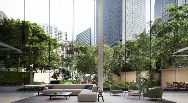
Energy Plaza
Downtown Dallas, Texas
222 East Quarter Residential Tower
Dallas, Texas
Belmont Hotel
Oak Cliff, Dallas
Connectiy: ULI Hines Urban Design Competition
East Village Development, Kansas City
Urban Forest Pods: Urban Regeneration of Jamsil Sports Complex in Seoul
Gansam Architects & Partners, Seoul, Korea
Texas Harris Methodist Fort Worth Surgery Tower HKS Inc. Projects, Dallas, Texas
Other Works 2015-2019
Grasshopper Project + Design Build Projects
ACADEMIC STUDIO PROJECTS :
The Great Climate Migration: Growing with the Jamaica Bay
Matthijs Bouw
Eel’s Journey: LA+ Creature Competition
2020 Winning Design
Re-Discovering Forest
Nate Wooten/ Ellen Neises
Green Loops: Reimagining Park & Boulevard System in Chicago
Yadiel Rivera
ACADEMIC SHORT PROJECTS :
Oxford Wetland Mitigation Project
Bill Young
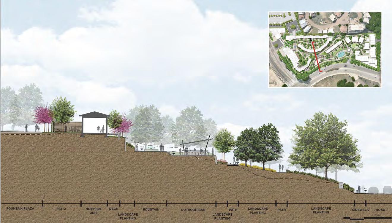
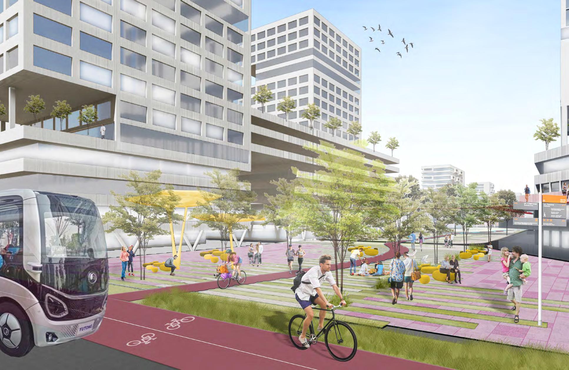
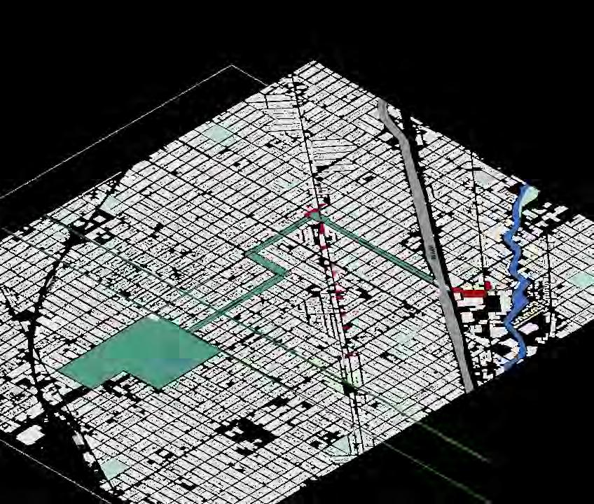
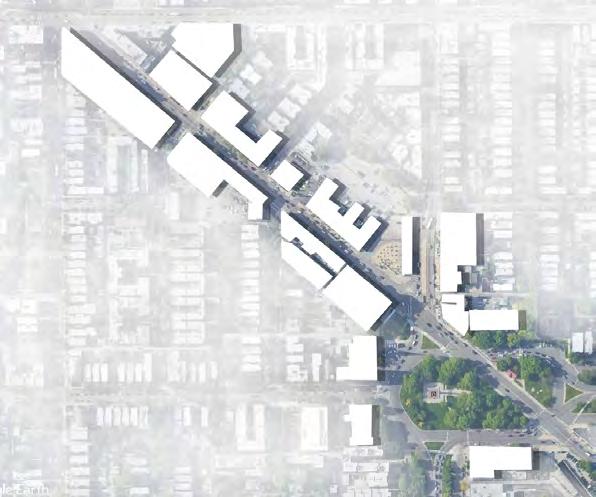
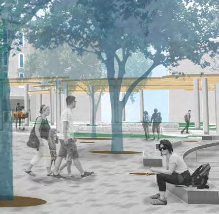
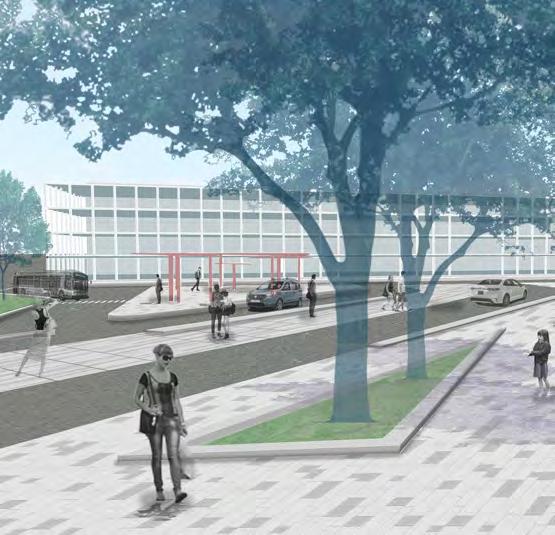
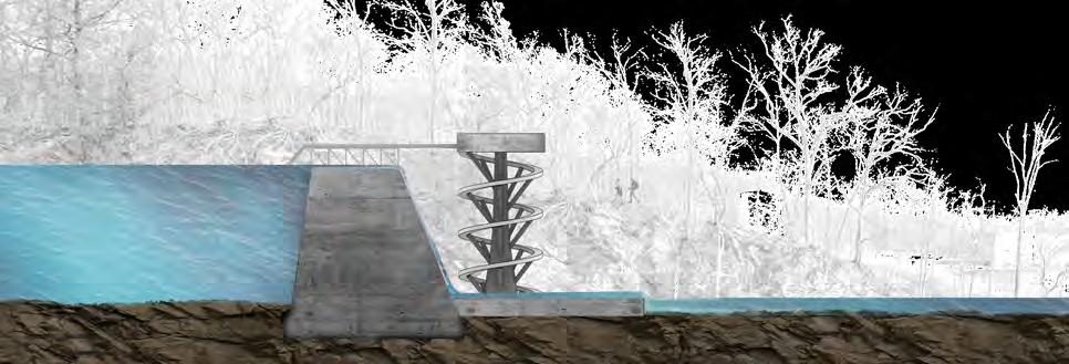
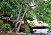
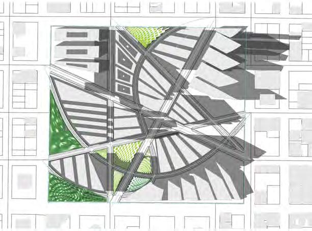
SOUTHERN GATEWAY DECK PARK
RE-IMAGINING THE FUTURE COASTLINE OF JAMAICAY BAY, NY
PROJECT TEAM
SWA GROUP: Chuck McDaniels, Todd Strawn
PROJECT RESPONSIBILITY
Designed and managed project from CD phase of the project. Worked as a main designer to create presentations, renderings and construction documents.
Worked as a co- BIM Manager for the Revit Model.
PROJECT OBJECTIVE
It’s our park — by the community, in the community, for the community. It will be a central gathering place where everyone is welcome. Spanning I-35E between Ewing and Marsalis Avenues, the future five-acre bridge park will reconnect historic Oak Cliff and ignite environmental, economic, and community revitalization.

[ 1 ]
Southern Gateway Deck Park
Phase 1

DESIGN ASPIRATIONS
Reconnect the divided communities of Oak Cliff
Deliver a safe “Common Ground” for the neighborhoods
Reflect the ethnic diversities of the neighborhoods
Deliver an attractive and easily accessible park for all ages
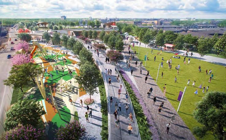
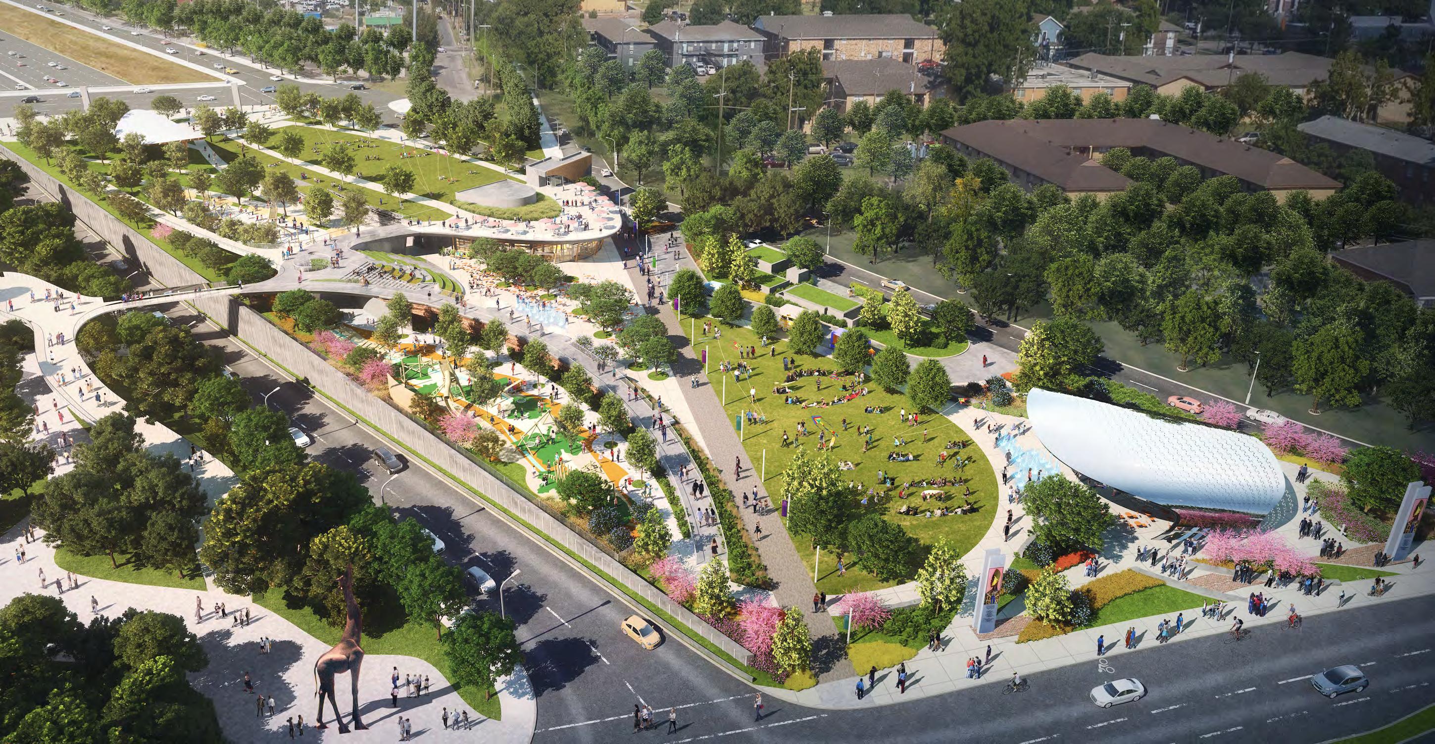
Be sustainable for generations
Improve the lives of all of those who call Oakcliff home


10 11
Southern Gateway Deck Park Amphitheater
ENERGY PLAZA RENOVATION

PROJECT TEAM
SWA GROUP: Chuck McDaniels, Hank Thomas
PROJECT RESPONSIBILITY
Designed and managed project from SD phase of the project. Worked as a main designer to create presentations, renderings and construction documents.
Worked as a co- BIM Manager for the Revit Model.
12 13 [ 2 ]
Energy Plaza Restaurant seatings and cabanas view


14 15
Left: Main Gate Entry view: Showing Drive way and pedestrian sidewalk with custom metal gated design.
Bottom Left: Interior Plaza showing pedertrian path to the building and infinity fountain
Right: Energy Site Plan showing the ground floor plaza plan and 14th floor private deck plan with pools and cabanas design.


16 17
Energy Plaza infinity pool fountain
222 EAST QUARTER RESIDENTIAL TOWER
PROJECT TEAM
SWA GROUP: Chuck McDaniels, Hank Thomas
PROJECT RESPONSIBILITY
Designed and organized meetings with consultants/clients from concept phase to finalized construction details of the plaza level and amenity deck level of the building. Coordinated design meetings with architects, consultants and etc.

PROJECT OBJECTIVE
It’s our park — by the community, in the community, for the community. It will be a central gathering place where everyone is welcome. Spanning I-35E between Ewing and Marsalis Avenues, the future five-acre bridge park will reconnect historic Oak Cliff and ignite environmental, economic, and community revitalization.
18 19 [ 3 ]
222 East Quarter Plaza entrance


20 21
222 East Quarter Amenity Plan
Left: Main Entrance to the residence
Bottom Left: Amenity deck outdoor seatings and kitchen area
Amenity Illustrative Plan
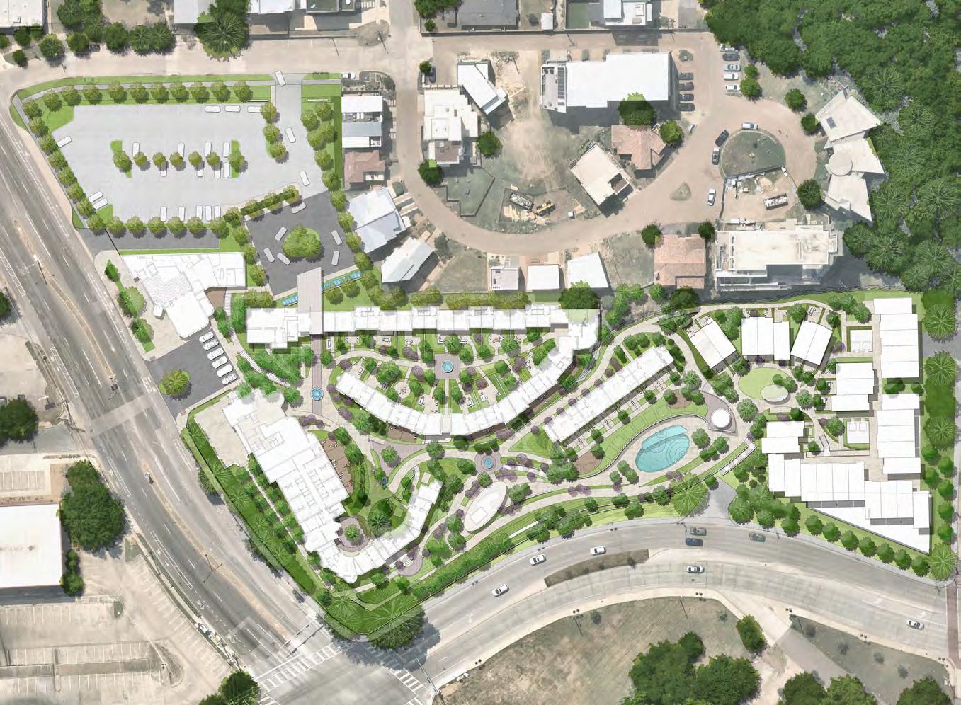
BELMONT HOTEL
PROJECT TEAM
SWA GROUP: Chuck McDaniels, Ron Lim
PROJECT RESPONSIBILITY
Worked on concept phase of the projects to SD submission. Produced rendering and technical drawings for the submission.
PROJECT OBJECTIVE
It’s our park — by the community, in the community, for the community. It will be a central gathering place where everyone is welcome. Spanning I-35E between Ewing and Marsalis Avenues, the future five-acre bridge park will reconnect historic Oak Cliff and ignite environmental, economic, and community revitalization.

22 23 [ 4 ]
Concept Grading Plan

24 25
Site Plan
Site Sections

26 27
COURSE
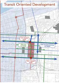
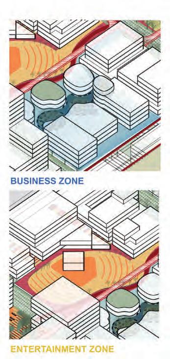
ULI HINES URBAN DESIGN COMPETITION


TEAMMATES
PROJECT LOCATION
Kansas City, Missouri
PROJECT OBJECTIVE
Connecity is designed around four main goals: Connecting Transportation Systems, Integrating Open Spaces, Inclusiveness in Community and Place-making for Businesses.
The project being in the heart of CBD, the masterplan will implement a TOD System on each North and South end to create a connection to existing transportation system. Gradually transitioning from automobile-oriented system to a public transitoriented system, it encourages all commuters to use various transit options to navigate through the city. Also, it seeks to bridge surrounding green networks through East-West street connections, providing an easy and diverse experience of open spaces. The project intends to create inclusive community with a diverse housing options and programs for people in all ages and ethnicities. Also, by providing affordable housing for low-income residents and various housing options, it can prevent the issues of gentrification and social divides through spaces. Our goal is to create a green destination for living, working, entertainment without biased.
[ 5 ]
Yihan Zhang , Minyang Sun, Zihye Wang


27 Site - Proposed Strategy Kansas City - Analysis Site - Current Situation + KANSAS CITY SITE-WIDE ANALYSIS OPEN
SPACE SYSTEM STRATEGY: NODES AND CONNECTIONS
2030 KANSAS CITY VISION
Connecity is about shaping an adaptive and sustainable structure for the future of the Kansas City. To create a new sequence od public places can reposition Connecity into the fabric of the city, with the impact developement which is the basis of vitality of urban area. By naturalizing the lands, the efficiency of active mobility for walk-cycleride mode will be emphasized. Most importantly, we propose to build a close neighborhood, more than its functions. This can also be expressed in mixed-use programs that provide a framework for possible future transformation.

28 29
Top Left: An inclusive community hub that provides amenities for all ages and ethnicity
Bottom Left: Event Green plaza to whole any cultural activies in East Kansas city Right: A new transit node where all transportation as well as bike highways intersect.
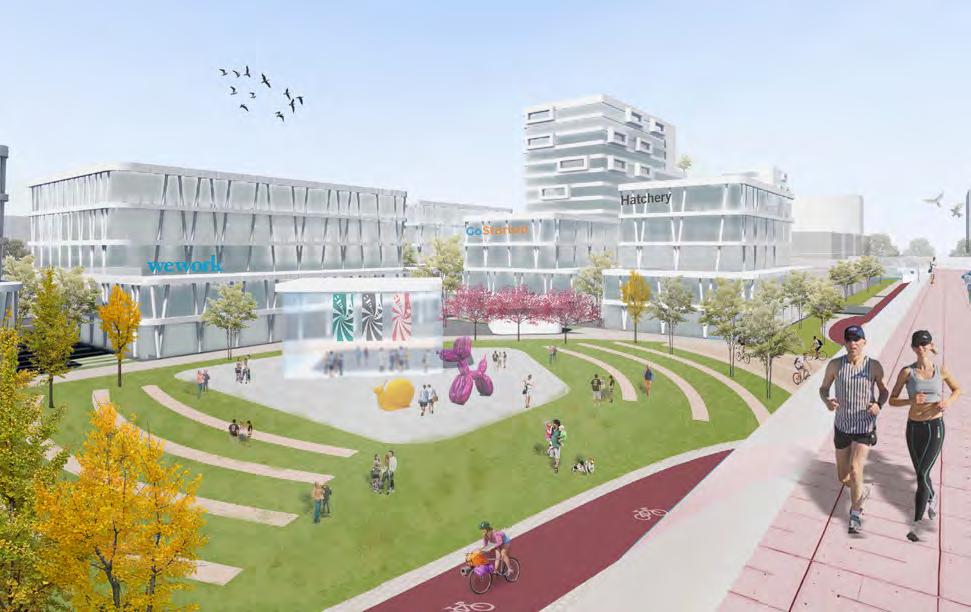
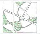
GREEN LOOPS:
RE-ENVISIONING CHICAGO PARK & BOULEVARD INTO A GREEN CORRIDOR

COURSE
602 Urban Design Studio
INSTRUCTOR
Yadiel Rivera
PROJECT TEAM
Levena Tan
PROJECT OBJECTIVE
Logan Square is small open space with history and a great public value. This public center is surrounded by interections of major road networks and commercial activities. Logan square neighborhood is currently experiencing a increase in population, public transportation ridership, and more demand for space for recreation and open spaces. With current developments (TIF and North Branch Industrical Corridor Development) and at this point in time, How could this area be transformed to meet the demand for the new growing community and sustain new environmental and civic goals for the future of Chicago?
Our manifesto is to transform the boulevard into car-free green corridor that links two major node developments : Logan Square and Chicago Riverfront. The boulevard will transform into a new spine for pedestrian and bike trails with green infrastructure that brings back the native plant ecology as well as provides space for community engagement and recreation. Both nodes are connected with a inner corridor as well as the outer loop. Each node will have a public center intersecting with a commercial corridor and public transit hubs on each ends of superblocks. Major plaza will have spaces for large public events and programs as well as respite areas to enjoy a bit of nature and water garden. Public facilities as well as new residential blocks will be developed around the public center activating each nodes into a new way of living and work zone.
30 31
[ 6 ]
Logan Square and Waterfront develoopment connected by outer green connections.
CITY-WIDE MOBILITY STRATEGY


PUBLIC REALMS
Milwaukee avenue becomes the
GREEN INFRASTRUCTURES
Milwaukee avenue becomes the main artery for public space connections
PUBLIC TRANSPORTATION
Milwaukee avenue becomes the main artery for public space connections


33
City-Wide
Cooperate with and improve other city-wide transportation systems Define nodes for public investment along our active transportation system HUMBOLDTPARK PARK&BLVD NODAL DEVELOPMENT NODAL DEVELOPMENT
FRAMEWORKBRANCH PLAN PARK & BLVD + VACANT LOTS MOBILITY PLAN CURRENT + FUTURE DEVELOPMENTS
active transportation system with city-wide bike “highway”
TIFFCHICAGO NORTH
main artery for public space connections
LOGAN SQUARE MOBILITY PLAN


TRANSIT HUB PLAZA BUS STATION UBER LYFT STATION PLAY ZONE CARPOOLING STATION PARKING BUILDING LOGAN SQUARE TRANSIT NODE WATER GARDEN CTA LOGAN SQUARE STATION PLAYSCAPE ELEVATED PLAZA COMMERCIAL CORRIDOR Flower Garden Logan Square MTA Station Main Public Plaza Plantation Water Garden Bike Sharing Station Water Fountain Children’s Playcourt Park & Blvd System Bike Highway Green Corridor


36 37 ACTUAL AREA PUBLIC REALM FUNCTIONS
C. LOGAN SQUARE PLAZA
B. LOGAN SQUARE MTA STATION
PROJECT SITE TRANSIT NODE A B C
A. TRANSIT HUB
LOGAN SQUARE PLAZA
LOGAN SQUARE MAIN PLAZA
WATER INFRASTRUCTURE
BIKE SHARING STATION BIKE HIGHWAY MAIN PUBLIC PLAZA
LOGAN SQUARE MONUMENT
PLAY FOUNTAIN
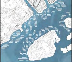
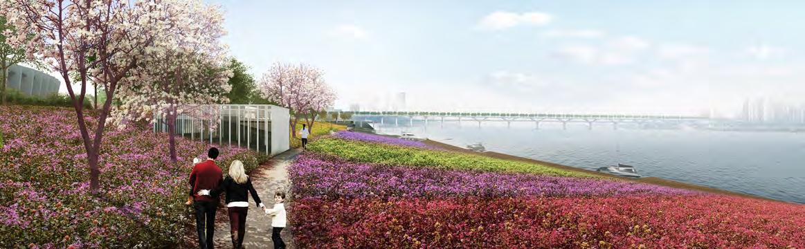
THE GREAT CLIMATE MIGRATION
RE-IMAGINING THE FUTURE COASTLINE OF JAMAICAY BAY, NY

PROJECT TEAM
TIANXIAO WANG
INSTRUCTOR MATTHIJS BOUW
PROJECT OBJECTIVE
Irreversible climate change will result in areas of New York City becoming uninhabitable, in spite of earlier pronouncements –by politicians to double down on the waterfront. In this urban resilience studio, we will explore the complex issue of ‘retreat’. In an initial research phase, the studio will investigate strategies for relocation from, and conversion of, coastal areas, as well as strategies for the preparation of areas at higher elevations for resettlement. Can we re-imagine the coastline, clean up our waste, and re-direct our resources? Can we envision new, integrated and inclusive communities resilient to other climate impacts, such as urban heat and stormwater flooding, but also to other shocks such as pandemics, with strong social infrastructures and a limited carbon footprint? And how do we get from here to there in an equitable way? How does one decide where to retreat from, and when, and where to?
38 39 [ 7 ]
Jamaica Bay as a new resilient and productive landscape


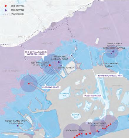


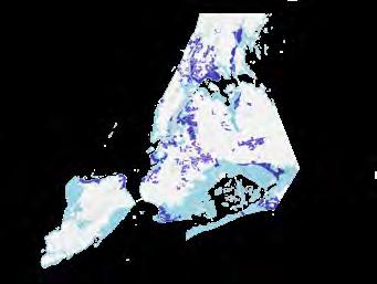

40 41 RETREAT ZONE RESILIENT ZONE Increase Residential Capacity + Transit Oriented Development + Existing Community Update Flood Control System + Update Infrastructure + Improve Evacuation System + Increase Resilient Landscape UPLAND ZONE CLIMATE MIGRATION MAPPING COASTAL COMMUNITIES AT RISK : PHYSICAL & SOCIAL CHALLENGES CANARSIE STARRETT CITY EAST NEW YORK LINDENWOOD HOWARD BEACH WHERE TO? SUITABILITY ANALYSIS Government Certified Opportunity zones Low Population Density Areass Government Upzoning vs. Downzoning 2050 Future Vulnerabl Districts
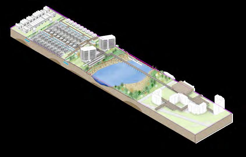
We propose a new coastal community that accommodate a new way of living in the and transform the coastline into the new urban frontier. Both architecture and landscape programs work together to transform the waterfront. Flood protection and mitigation strategy is to expand the creeks into the inland, using this as a way to absorb water through chanels and green infrastructure on main road since most of these areas are super flat.


PHASING DIAGRAM
REVENUE-SHARING MODEL

42 43 2100
OPTION 1: LOCAL MIGRATION OPTION 2: HIGH DENSITY NEIGHBORHOOD OPTION 3: LOW DENSITY NEIGHBORHOOD PHASE 1: Work with Gov. to re-zone and start primliminary analysis to select buildings for expansion -Resilient zone planning PHASE 2: - Expansion construction finished - Building extra capacity in the Resilient zone -People begin local retreat PHASE 3: -Evacuation bridges and routes construction -Buildings finished PHASE 1: Work with Gov. to change zoning/housing polocy - Analysis of existing vacant lots - Advertising revenue-sharing model PHASE 2: - Start increasing capacity to existing public amenities - Housing expansions - New construction for extra housing capacity - Adding public space/ elevated bike highways PHASE 3: - First group of immigrants begin moving to move-in - Finish pairing up for revenue sharing model - Further developments of public amenities 2090 2080 2050 2040 2030 2020 PHASE 1: Work with Gov. to find opportunity zones and vacant lots for future masterplanning - work with communities to find out their needs and start forming ideas for new community - Large retreat program PHASE 2: - New community construction begin - start development plan to bring investments - People start moving in phases - Public transportation addition to the community PHASE 3: - Community construction finished -Development plans continue to bring revenues - Retreat process finished - Plan for Transportation Oriented community PHASE 4: - Community construction finished - Development plans continue to bring revenues - Retreat process finish Retreat zone: A. Have to move out B. Lost home value Resilient zone: A.Options: stay move to safer areas B. Home value also goes down Safe zone: A. Have to receive retreat refugees B. Their neighborhood becomes denser C. Might sacrifice private space for extra housing
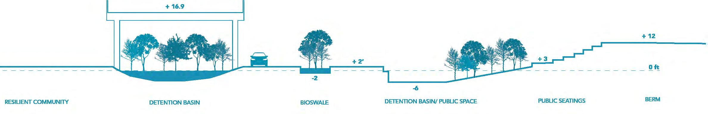
NEW
NEW RESILIENT COMMUNITY STORMWATER MANAGEMENT TERRACED PUBLIC GARDEN TRAIL SYSTEM FLAT GREEN GREEN & GREY INFRASTRUCTURE WATERFRONT RECREATION
ECOLOGY URBAN AGRICULTURE
CREATING RESILIENCY
Climate migration in different areas requires different strategies. Spatially, in retreat zone we have coastal leisure house on berm, in resilient zone we have various ways for people to migrate vertically, and in upland area government funding will be invested to develop affordable housing on vacant lots.

FRESH CREEK WATERFRONT INCREMENTAL CHANGES OVERTIME

45 RESILIENT COMMUNTY PUBLIC SYSTEMS
Current State 2020 Public Investment 2030 Green Infrastructure Road Scaffolding Framework Soft berm at 10 ft Ecology Park Trail Tidal marsh Tidal flat Young Forest Elevate Public Square Elevate Walkway Bike Highway Flooding Road Canarsie Neighborhood Starlett City Low-lying waterfront Roof top Expansion Resiliency 2050
JAMAICA BAY SHORELINE ENHANCEMENT


OYSTER REEF DESIGN
Constructed Oyster Reef Process Recycled aged oyster shell Gabion module on oyster shell Gabion chain creating oyster reef Channel current and filter excessive nitrogen
Coastal Morphology Changes


Catch sediment and generate geomorphology
Develop sea grass community and increase biodiversity

CANARSIE SHORELINE ENHANCEMENT NEW OYSTER REEF SLAND
Gabion chain structure Introduce oyster reef Generate tidal flats New tidal flow
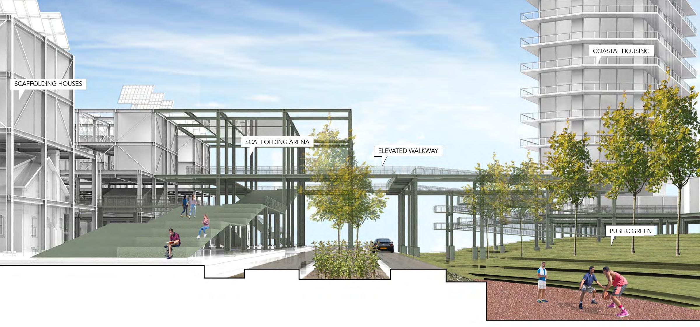
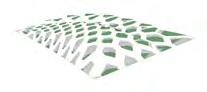
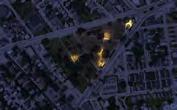
URBAN FOREST PODS
URBAN REGENERATION OF JAMSIL SPORT

COMPLEX IN SEOUL
PROJECT LOCATION
SEOUL, SOUTH KOREA
PROJECT TYPE
URBAN DESIGN COMPETITION
PROJECT TEAM
GYU-TAE KIM, JOONGSANG LEE
PROJECT OBJECTIVE
Jamsil Sports Complex currently is only activated during the game seasons. Missing the conents for people to gather in the complex, the Jamsil Sports Complex has been emptied out during the nongame seasons. The main causes that create a distance between the people and the sport complex is only seasonal use of the mega-structures, vast areas of concrete grounds for parking, and roads hindering access. To create an easily approachable place for people a rest, we suggest a “Forest as an Activating Hub”. In addition to the exisiting trees, we created a forest where people can easily access all the time and place where people can hava a peace of mind from the busy city life. The complex is no longer a building that holds temporary events, but a place where people can access at all times. Like those European stadiums that blend into downtown of a city, we can imagine the Jamsil Sports Complex transforming into a forest within a the city of Seoul.
[ 9 ]


JAMSIL AS A NEW NATURE COMPLEX
Current Site a) Transformation into a forest b) Preserving existing stadiums and trees c) Forest band connecting Gangnam a)+b)+c) = Activation of Jamsil
RIVER + FOREST: At the Bank of Han River, colorful flowers will be planted in rippling pattern to visually connect the forest and the river. Used Rhinoceros and Photoshop.
DECK
RETAIL + FOREST: A retail band that connects Gangnam and Songpa was designed to create an open green space.
+ FOREST: Open green space above the deck and openings below the deck allow
planted
tree to grow freely

URBAN FOREST PODS
EEL OASIS
PROJECT TYPE
2020 LA+ CREATURE COMPETITION
PROJECT TEAM
HEEJUNG SHIN, BINGJIAN LIU
PROJECT LOCATION
NEWBURGH, NY
PROJECT OBJECTIVE
American eels(Anguilla rostrata) are known to be a mysterious nocturnal creature. American, Japanese and European eel, have become scarce, with populations dropping by more than 90% in the past four decades. Restoration of eel population is difficult unless we tackle the list of contributors to their decline: loss of habitat, dams blockage, fishing, pollutants and changes in ocean currents. These factors including our lack of understanding of their life stages make eels population management problematic.
The project takes place along the Hudson River where industrialization and human activities have caused many hindrances in eel migration as well as loss in their habitats. The project consists of two parts. One is creating habitat modules for eels on different parts of the Hudson river and tributaries where the ecosystem became non-functional. These modules are called “Eel Oasis”. “Eel Oasis” module with buoyant plastic reef and limbs are made up of recycled plastics that offer eels a place to hide and rest as habitats and stops for their migration. Secondly, constructing eel ladders on dams where glass eel(early stage eels) have trouble climbing up or using existing fish ladders. The eel oasis and ladder altogether facilitate their long migration journey towards deeper creeks and smaller streams. Not only that, these modules also serve as a walkable trail for people to have awareness of eel’s presence through the new aquatic ecosystem and their habitat underneath the modules.
Project Site: Newburgh, NY & Freshkill Creek

Eggs
Newburgh, NY
Silver Eel (Migratory Adult)
Hudson River
Yellow Eel (Non-mature Adult)
Dams
Eel Migratory Route

Disconnected Route
Environmentally Critical Zones
Elver (Juvenile)
American Eel’s Life Cycle
Leptocephalus (Larva)
Glass Eel (Post-Larva)
60 [ 10 ]
ON MIGRATORY ROUTE
The eel oasis, composed of connected floating modules along the shores of the Hudson River, improves the migration route with more rest stops for the eels. These modules create a shaded, hospitable underwater environment, which conforms to the favorable environment of eels. The oasis could also provide public space for humans in the adjacent urban area.


EEL LADDER: EXTENDING EELS’ JOURNEY
Designed for All Sizes

Different types of dams have built over time along the tributaries of the Hudson River. These dams obstruct eels along with other migratory fish to travel upward towards smaller streams and creeks where they stay most of their life. Eel ladder is designed to facilitate even small glass eel to pass through different sizes of dams.
LADDER DSIGN FOR YOUNG EELS

Concrete Support

The vaccum pump provides continuous flow within the eel ladder, allowing both upstream and downstream migration. The 3D matting inside the ramp helps young eels to easily crawl upstream even when they have littel strength.


EEL OASIS: NEW HABITATS
50ft 15 ft
HIgh Head Dam Low Head Dam Medium Head Dam
The Groveville Mill Dam, Beacon, NY
Vacuum Pump Unit Waterflow
Pipe 3D Matting
Ladder Ramp Showering
Eel Migrating
Wetland Module
Habitat Module
Wood planks
Embeded Lighting
Wetland Plants


Soil
Waterproof protection
Wood chips
Coconut fiber mat
Recycled plastic bottles
Wood sticks
Nutrient Uptake Roots

Buoyant Plastic Reef
Anchoring Column
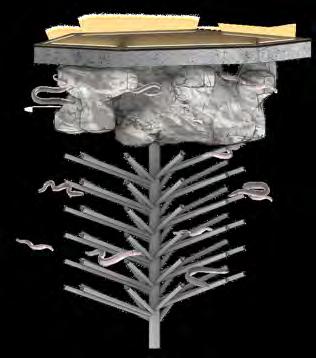
Eel habitable limbs
Bio-film & algae
Native + Contaminants Uptake Plants
Recycled plastic bottles

Juncus effusus
Helianthus angustifolius
Native Wetland Plants

Hibiscus laevis
Wetland plants bring herbivores to the habitat which are foods for eels
Asclepias incarnata
Anchoring to the riverbed holds the wetland and eel modules in place


Achor to riverbed
Plastic reef and limbs create dark and hospitable conditions for eels
EEL OASIS MODULE
OTHER WORKS
1. PROFESSIONAL WORK FROM HKS INC. :
2. TANDY HILL DESIGN: IMPRINT
PROJECT LOCATION FORT WORTH, TEXAS
PROJECT TYPE MASTERPLANNING, ARCHITECTURE DESIGN, PATIENT ROOM DESIGN
PROJECT TEAM BRENT SPARKS, GREG TEAL, KARLA PEREZ
PROJECT OBJECTIVE
The $300 million expansion project will add 144 patient beds, 15 surgical suites and new pre-operative and post-operative units to the Texas Health Fort Worth campus.


The expansion will help Texas Health Fort Worth, which has grown from a small community hospital when it opened in 1930 to one of the busiest medical centers in the state, meet the health care needs of Tarrant County residents and other fast-growing communities it serves, the health system said in a news release. The surgical patient tower will include space for support services and two floors of shell space to accommodate future expansions. Additional parking will be added to the

48 49 [ 8 ]
456 NURSE STATION SHWR TLT SHWR SECT. BREAK 447 NOURSH. TRAINING CENTRAL BATH SHOWER TRAINING S.U. 438 457 431 456A 455 MEDS PREP OFFICE ON-CALL OFFICE ALCOVE AREA OF WORK AREA OF WORK AREA OF WORK AREA OF WORK LDR LDR LDR Room PATIENT RM. 404 PATIENT 405 PATIENT RM. 406 PATIENT RM. 408 PATIENT RM. 409 PATIENT RM. 410 PATIENT RM. 411 PATIENT RM. 412 PATIENT RM. 413 PATIENT RM. 414 PATIENT RM. 415 ISOLATION 416 WAITING/LOBBY 401 A2.03 A2.03 A2.03 01 1/8" 1'-0" 1 LEVEL 4 OVERALL PLAN HKS, INC. FORT WORTH, 76102 ARCHITECT 1000 MACON ST. SUITE 2017 HKS, XXXXXXXXXXXXXXXX XXXXXXXXXXXXXXXX INTERIORS XXXXXXXXXXXXXXXX XXXXXXXXXXXXXXXX XXXXXXXXXXXXXXXX MPE ENGINEERS XXXXXXXXXXXXXXXX XXXXXXXXXXXXXXXX XXXXXXXXXXXXXXXX CONSULTANT XXXXXXXXXXXXXXXX XXXXXXXXXXXXXXXX CONSULTANT A2.01 Patient room renovation plan, used Revit Patient room headboard Design, used Revit View of the new THR surgery tower, Lumion
Planting Design with native prairie plants and perenials creating a outdoor trail for Shawnee
Top:
View of the new THR surgical Twer from the highway. From Masterplanning of the THR hosptial district leading to a designing of the new surgical Tower. THR becomes a significant healthcare infrastructure in the downtown of Fort Worth. Increasing the healthcare capacity for the future needs across the North Texas.
patients.
IMPRINT

The Pavilion is an iconic structure that enhances the visitor’s experience of the Tandy Hills Natural Area. Nature enthusiasts and surrounding communities converge at the Pavilion for different types of activities and events that inform and raise awareness about preserving and respecting nature. The Pavilion impresses upon its visitors the importance of this place by providing various types of areas to view and experience its natural beauty.


51
Used Rhinoceros, Photoshop Used Lumion, Photoshop
Media IV : Grasshopper Analysis & Modeling


Faculty: Michael Luegering
Project Location: Buffalo, New York

Landscape Architecture continues to see concepts focused on iterating between large scale form studies and analysis appearing in the eco-regional urbanization and landscape infrastructure conversations. Yet, we still need workflows and methods that reflect on such needs and are at the same time critical of such discourse. If we agree that the calibration of our tools (software, machine assisted model production, etc) directly impacts the way we perceive, interpret and develop both data and concepts, than the workflows that key these aspirations should ideally embody them, but at a minimum reflect them.
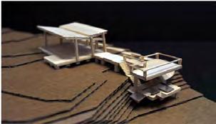
Light and Space Community Project

Studio: Light & Space: SouthLight Event


Proposal: Community Renewal Istallation Project


Faculty: Laura Briggs
Location: Grace Church Cemetery, Pawtucket, Rhode Island


The studio explored full-scale interventions into the city. Students worked closely with the Providence Office of Planning and Development to design using a full-scale lightweight structure and light to transform a underserved areaas in Pawtucket community. The goal is to activate nodes to make a “pop up” city, where events and space bring life to urban streets. The event is created by an in-depth exercise about relation between light, space and materiality and how light can transform and influence both interior and exterior space.
Cherry Blossom Design Build Project
Studio Title: Architectural Design


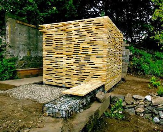


Proposal: Design and build Community Project

Faculty: Thomas Gardener
This six-week design and build project was conducted through an agreement and collaboration of RISD architecture design studio class and the Chinese Christian Church located in Pawtucket, Rhode Island. An adjacent YMCA and daycare plan on using this site as well. This goal of the construction was to improve and develop a communal, public space that brings awareness to the
52 53
SOLAR PANELS PAVILLION STRUCTURE PAVILLION DESIGN SITE LOT Building Typologies & FAR Grasshopper Design Process Primary Circulation Secondary Circulation Attraction Location diagram Circulation Pattern Site plan with uses Urban Development Buffalo City Analysis Vacancy Analysis Road Analysis Population Analysis Geometric Typology & Uses COURTYARD HOUSES FAR 2.5 ROW HOUSES FAR 1.2 MIXED USE RESIDENTIAL FAR RESIDENTIAL TYPOLOGIES COURTYARD DORMITORIES FAR 2.5 BAR BUILDINGS FAR 3.2 HIGH-RISE BUILDINGS FAR CAMPUS BUILDING TYPOLOGIES MIXED USE RESIDENTIAL FAR COMMERCIAL TYPOLOGIES Site Design with Shadow Study No modeling, Grasshopper design
THANK YOU


