
SAGTIKOS PARKWAY
PARKWAY HISTORY
The Sagtikos Parkway is a major north–south route in Su olk County, originally constructed in the 1950s as part of Robert Moses’ vision for improved parkway connectivity across the region.
It was designed to link the Northern State Parkway and the Southern State Parkway, e ectively serving as a central spine connecting eastern and western Long Island.
The parkway was named after the nearby Sagtikos Manor, a historic estate dating back to the 17th century.
Over the decades, the Sagtikos has evolved into a heavily tra cked commuter route due to Long Island’s population growth and suburban expansion.
Despite its scenic, limited-access design, it now faces congestion and aging infrastructure issues. Various improvement projects have been proposed, including capacity expansions and interchange upgrades, to address increasing tra c demands.
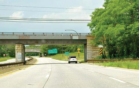

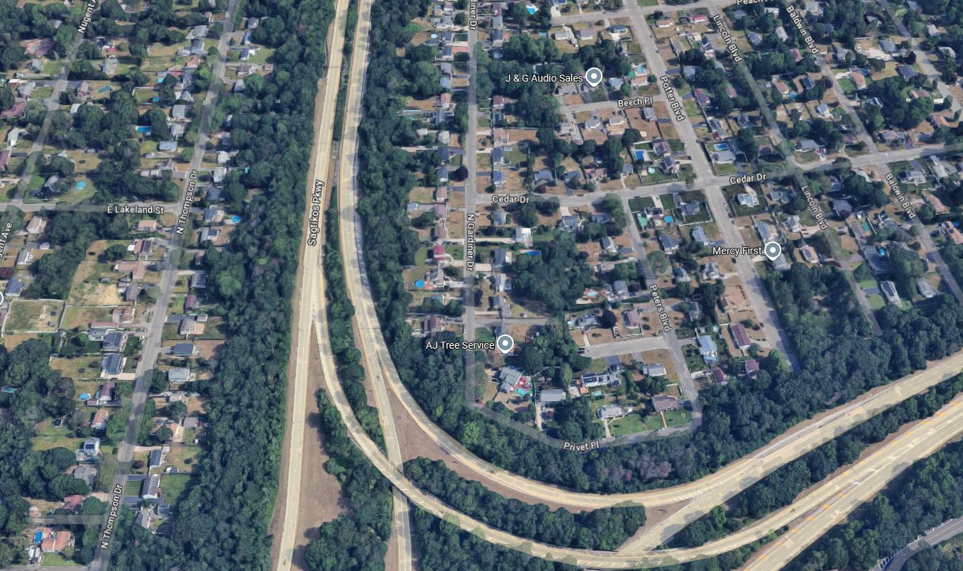
3D GOOGLE
SHOWING THE EXIT 41A ON-RAMP TO SAGITKOS NORTHBOUND. MAGENTA CIRCLE SHOWS DRONE LOCATION.

CIV 412 HIGHWAY DESIGN
RESTREPO / MARTILOTTA / WASIUTA / GARCIA
CONCRETE REPAIRS TO EXISTING ROADWAY TO BE COMPLETED OFF HOURS, SUNDAY THROUGH THURSDAY, FOR THE DURATION OF ONE MONTH OR AS WEATHER PERMITS.
ROADWAY SPECS
NUMBER OF LANES
2 LANES LANE AND SHOULDER WIDTH 11’-0” // 6”
ROADWAY MATERIAL ASPHALT/CONCRETE CURB TYPE ROLL/MOUNT. CURB OFF SHOULDER ACCESS LARGE/GRASS
INTERCHANGE DENSITY PERCENTAGE TRUCK/RV
LOCATION
SUBURBAN/URBAN


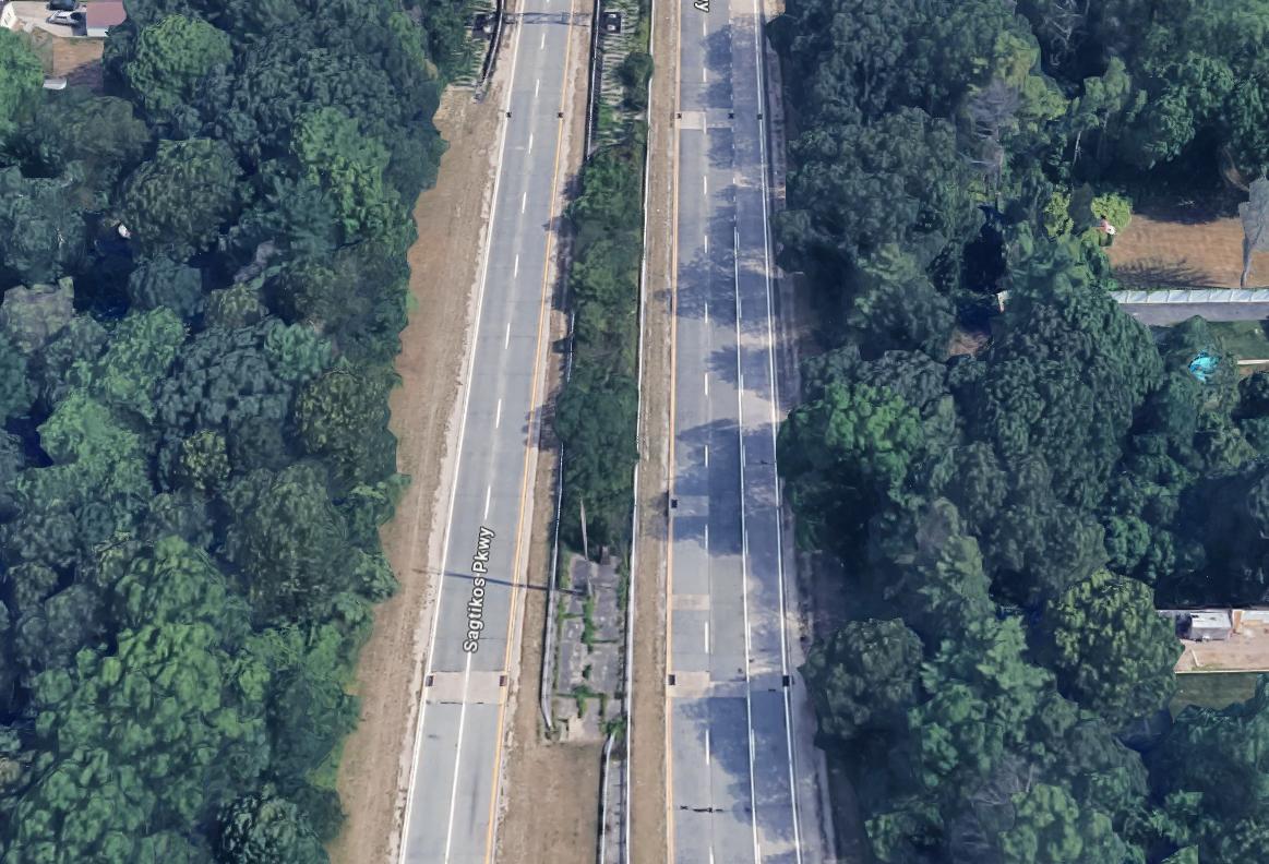
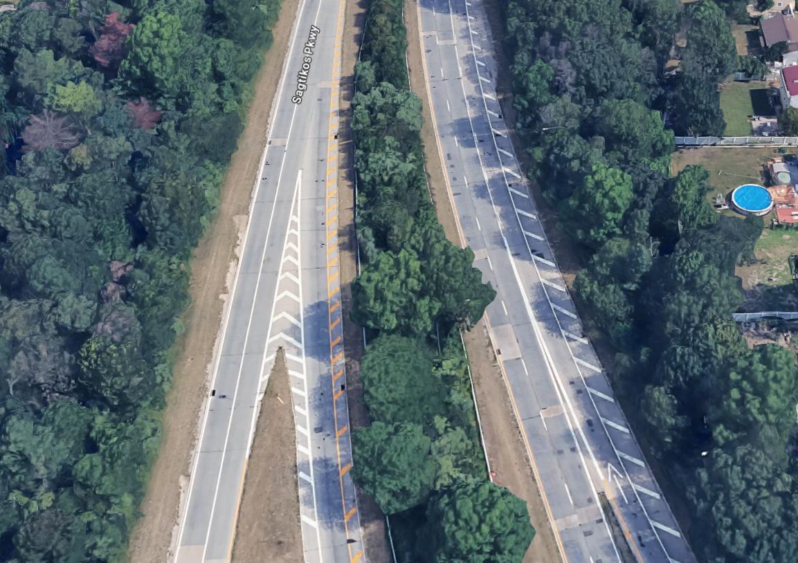
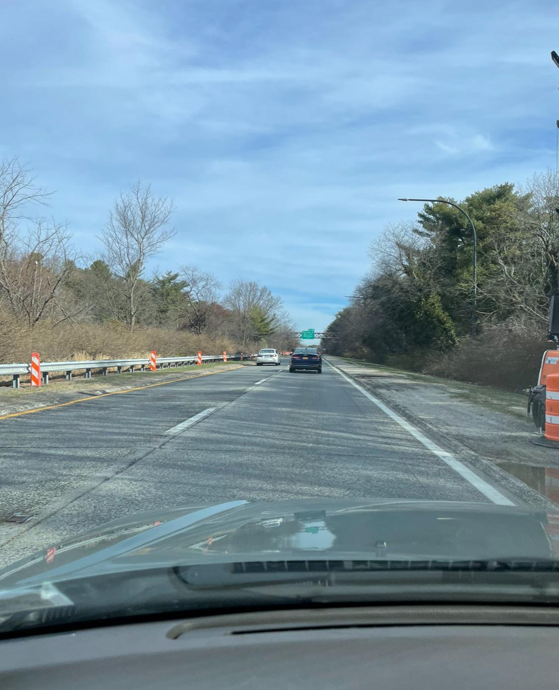
DRONE IMAGES
SHOWING THE EXIT 41A ON-RAMP TO SAGITKOS NORTHBOUND.
CONSTRUCTION VEHICLES STAGED ALONG THE LEFT SIDE OF EXIT RAMP, WITH CONES AND LIGHTING TO THE RIGHT OF THE SHOULDER.
TRUCKS NOT PERMITTED
LOCATION
MOSTLY SURBURBAN ENVIRONMENT SURROUNDING THE PASSENGER-VEHILCE-ONLY PARKWAY. ROADWAY RUNS BETWEEN TWO DISTINCT NEIGHBORHOODS AND SERVES AS AN IMPORTANT POINT OF CONNECTION BETWEEN THE LONG ISLAND EXPRESSWAY (NORTH) AND SOUTHERN STATE PARKWAY (SOUTH).
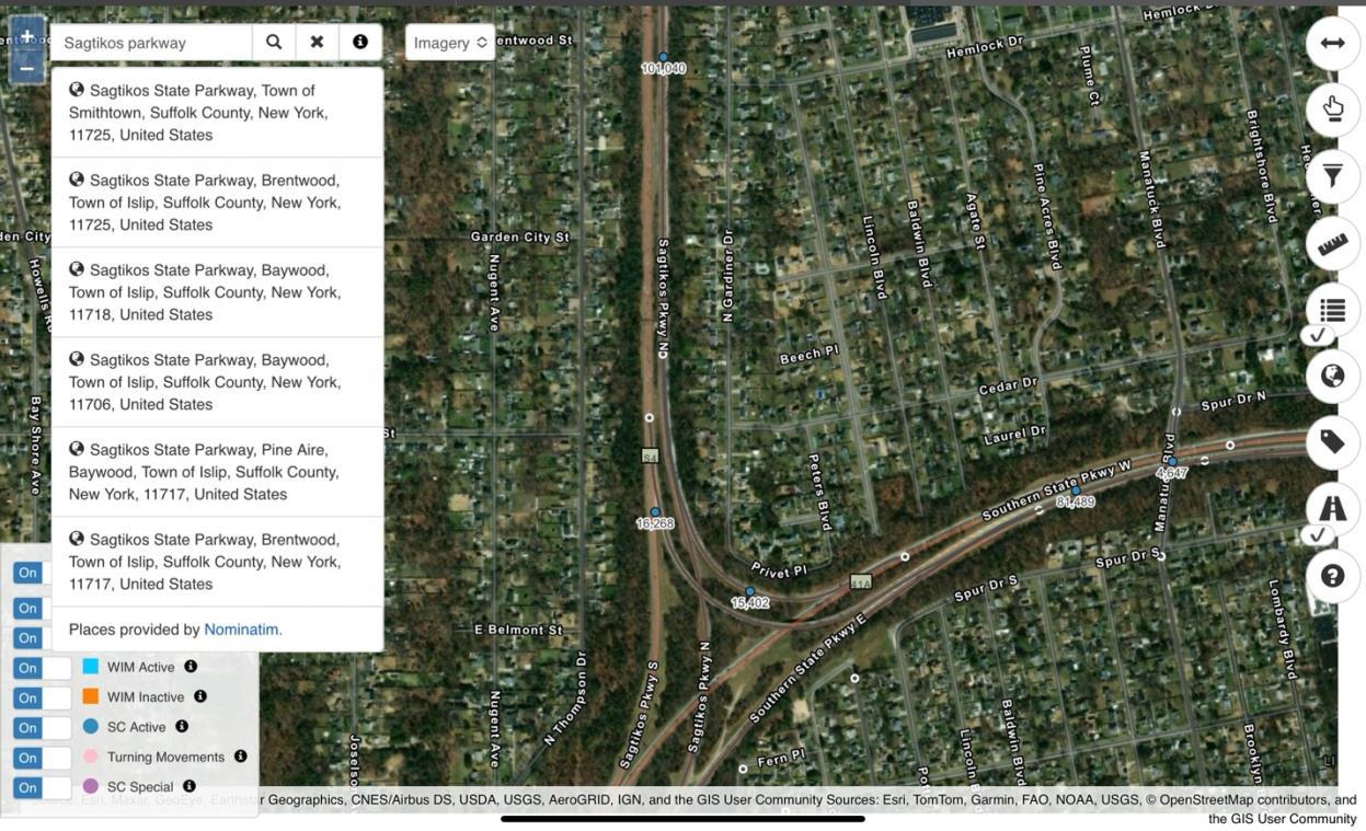
According to recent data from NYSDOT’s GIS traffic map, the Annual Average Daily Traffic (AADT) at a specific segment of the Sagtikos State Parkway just north of the Southern State Parkway interchange is approximately 101,040 vehicles per day. This high volume highlights the importance of the Sagtikos Parkway as a key north -south transportation corridor in western Suffolk County. The data reflects significant usage in this area, likely due to its connections with major east-west highways such as the Souther n State Parkway and the Long Island Expressway.
The AADT figure emphasizes the parkway’s role in supporting heavy daily commuter and regional traffic across Long Island.
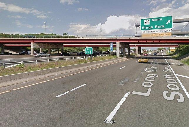
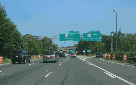
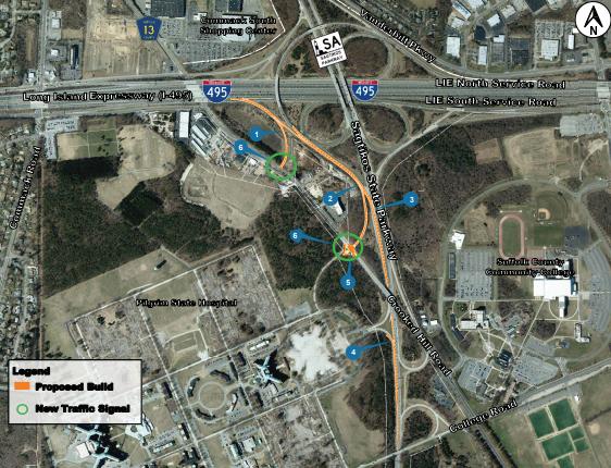
Above shows I495 Eastbound Exit toward Sagtikos Parkway North. Below shows plan view of Sagtikos Parkway.
Sagtikos Parkway Calculations
Number of lanes: 2 lanes
Lanes width: 11 ft
Shoulder width: 6 inches
Location: Suburban / Urban Interchange
CALCULATION
The calculations presented for the Sagtikos Parkway provide a clear application of the Highway Capacity Manual (HCM) methodology for basic freeway segments in a suburban/urban context.
Using a base free- ow speed (BFFS) of 70 mph, appropriate adjustments were applied for lane width (−1.9 mph), lateral clearance (−3.0 mph), number of lanes (−4.5 mph), and interchange density (−1.3 mph), resulting in an adjusted free- ow speed (FFS) of 59.3 mph. The computed passenger car ow rate per lane—2,450 pc/hr/ln—accounts for the peak hour factor (PHF = 0.92), number of lanes (2), and the heavy vehicle adjustment factor (which is 1.0 due to 0% truck percentage).
Dividing ow rate by FFS yields a density of 41.3 pc/mi/ln. According to HCM thresholds, this corresponds to Level of Service (LOS) E, which is consistent with high tra c volumes and limited maneuverability. The methodology is correct, and all relevant factors appear to be reasonably considered.
CONCLUSION
This project analyzed a 5.14-mile segment of the Sagtikos Parkway, a major north-south corridor in Su olk County, Long Island, New York. The parkway serves as a critical connector between key highways, including the Long Island Expressway (I-495), the Southern State Parkway, and the Northern State Parkway, making it an essential route for both commuters and regional tra c.
Within this segment, four interchanges were identi ed, resulting in an interchange density of 0.78 per mile—consistent with the design of a limited-access parkway that balances accessibility with uninterrupted ow. The Average Annual Daily Tra c (AADT) of 51,343 vehicles underscores the parkway's signi cance in the regional transportation network.
Tra c analysis revealed a free- ow speed of 59.3 mph, suggesting e cient travel under ideal conditions. The estimated passenger car ow rate of 2,450 vehicles per hour per lane re ects the high demand placed on this corridor.
KEY TAKEAWAY
Project Scope: Analyzed a 5.14-mile segment of the Sagtikos Parkway in Su olk County, Long Island, NY.
Connectivity: Connects major highways—LIE (I-495), Southern State Parkway, and Northern State Parkway.
Interchange Density: 4 interchanges, resulting in 0.78 interchanges per mile.
Tra c Volume: AADT of 51,343 vehicles, indicating signi cant usage.
Speed and Flow: Free- ow speed measured at 59.3 mph under ideal conditions.
Lane Capacity: Passenger car ow rate of 2,450 vehicles per hour per lane.
Conclusion: The parkway is a vital infrastructure component, currently performing well, but requires continued monitoring and planning to maintain e ciency.
REFERENCES
Wikipedia contributors. (n.d.). Sagtikos State Parkway. Wikipedia. Retrieved May 4, 2025, from https://en.wikipedia.org/wiki/Sagtikos_State_Parkway
New York City Roads. (n.d.). Sagtikos State Parkway. Retrieved May 4, 2025, from http://www.nycroads.com/roads/sagtikos/
New York State Roads. (n.d.). Southern State & Sagtikos Parkway. Retrieved May 4, 2025, from https://nysroads.com/list-smsp.php
New York State Department of Transportation. (2024, July 8). Traveler advisory: Sagtikos Parkway construction update. Retrieved May 4, 2025, from https://www.dot.ny.gov/news/traveler-advisories/2024/2024-07-082