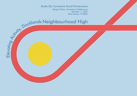
Studio 03, Connective Social Infrastructure
Design Thesis, University of Melbourne Semester 1, 2023
Elias Hanna, 915203
Docklands
Elevating Activity, Neighbourhood High
E l e v
a t ing Activity,
Acknowledgment of Country
I acknowledge the Traditional Owners of the land on which I live and work, the Wurundjeri and Bunurong people, and pay my respects to their Elders, past, present and emerging.
Aboriginal and Torres Strait Islander people should be aware that this document contains names and images of deceased persons in text, photographs or printed material.
0434893375
Elias Hanna Melbourne, Australia elhanna1993@gmail.com
Introduction
Elevating Activity, Docklands Neighbourhood High
The narrative of neoliberal, monofunctional, large grain profit driven development that continues to pervade the roughly 200 hectare Docklands site will be challenged through a networked, publicly accessible Secondary School project on a vacant waterfront block of land, that attempts to promote physical activity in adolescent students while tying together existing and future infrastructure beyond the projects main sites boundaries.
The Docklands is an historically contentious urban area directly west of Melbourne’s CBD with a growing population serviced by disparate clusters of small, over constrained social infrastructure (Qunqar, F, personal communication, March 7, 2023). This existing infrastructure is separated by distance, water, car dominated streets, mostly mono-functional residential and commercial buildings, and minimal (privately owned and zoned) open and green space. Profit driven development and a lack of public engagement has dominated the area since its founding (Dovey, 2005, 11). The recent addition of public social infrastructure has had a markedly positive social impact on the growing local community. However, it remains insufficient and disconnected, and when the areas future growth and the City of Melbourne’s recommended open space requirements are considered, it is clear that change is urgently required if a sense of community engagement, ownership and civic pride is ever to be fostered, and the lasting negative sentiment toward the area is ever to be overcome.
This thesis aims to intervene in the social infrastructure of the Docklands in two ways. Firstly, by providing a networked high school with locations throughout the suburb, enabling existing residents with young families enrolled in the new primary school to reside in the area for longer. Secondly, by attempting to address and alleviate the decline of physical activity in adolescent students through the promotion of physical activity, in a newly formed, networked sports precinct.
This programmatic focus adds to and integrates with the increasing popularity of sport in the area, and the success of busy new sports facilities nearby. Like many similar contemporary projects it utilises formal and informal sporting and physical activities as a tool for urban regeneration (Cognigni & Vettori, 2020) as well as the promotion of social inclusion. The project aaims to act as a social anchor and link between other programs and sites in the area (Cleveland, B., 2016, 4). It hopes to inspire other new projects to reconsider their impact on the long term social needs of the growing number of people who call the Docklands home.
Can architecture in combination with access to open and green space, strategic siting (as well as highlighting), and overlapping of activities encourage increased physical activity amongst Secondary School students in an increasingly privatised urban environment? Given people develop lifelong habits in schools around their friends, and spend around half of their waking hours there during the week, the school setting and context is seen as a critical place to begin to mitigate these troubling trends and promote better lifelong relationships to physical activity (Naylor, P. J., & McKay, A. H., 2009). Can linking this new infrastructure with existing, outdated or underutilised infrastructure, (Greater London Authority 2021, 10) in a pedestrian focused manner, foster increased urban engagement across the suburb? Can increasing green and open space, while responding to the growing social needs of current and future residents create a more livable environment and encourage people to reside in the area for longer? Could a spatially and socially linked Secondary School, that also provides connected shared social amenity for both students and the community foster a greater sense of connection and ownership in a growing suburb that has a reputation for lacking such crucial infrastructure?
09 08
Thesis Statement
Brief History of the Docklands
Directly West of Melbourne's CBD and Hoddle grid, the approximately 200 hectare patch of land with its 7km of waterfront now known as the Docklands once straddled the boundary between the lands of the Woiwurrung and Boonwurrung peoples.
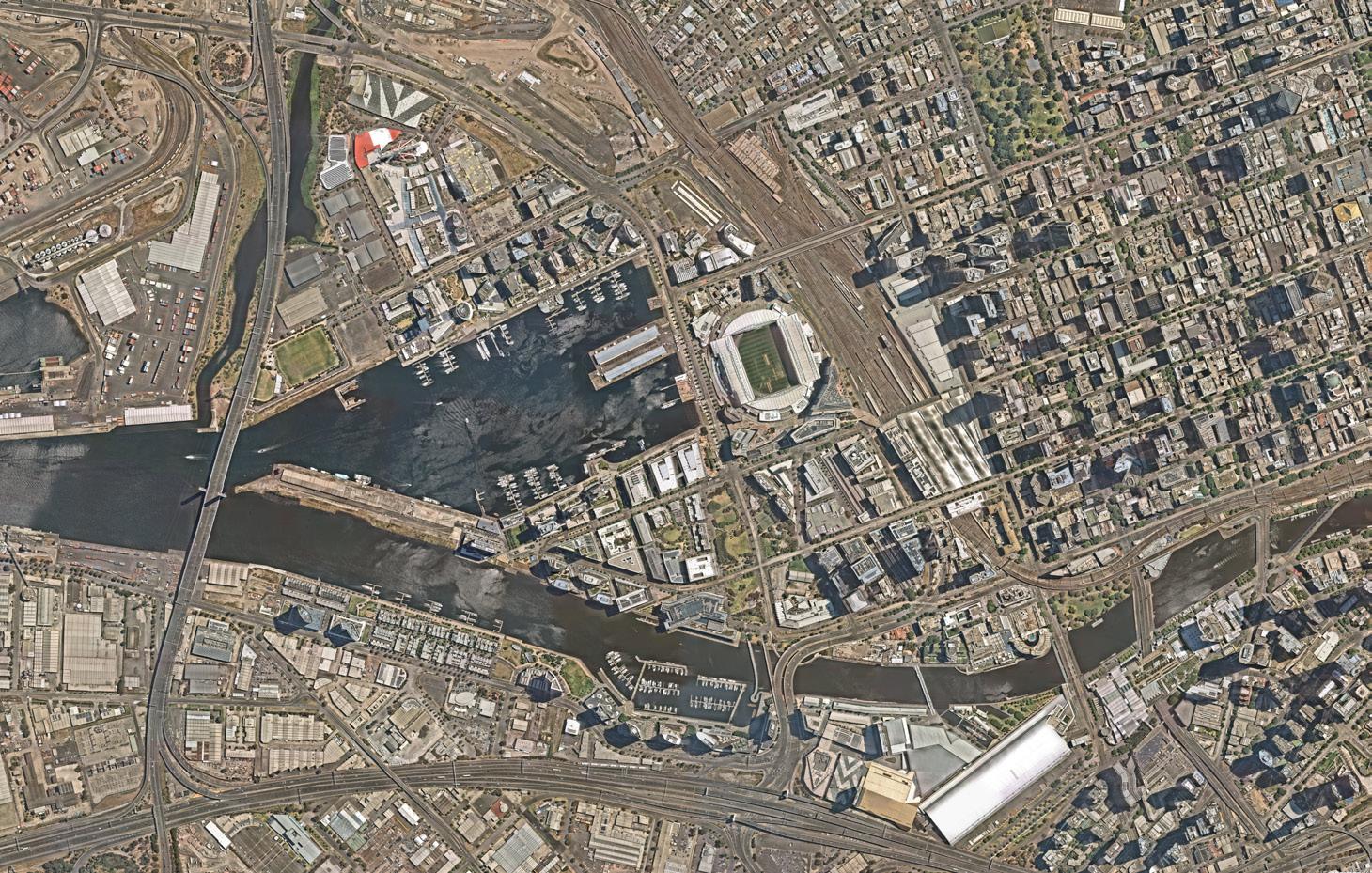
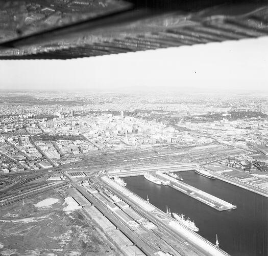
The area became industrialised around the period of mass migration to the area in the 1850's, spurred on by the gold rush period. This lead to the destruction of the previous marshland and swampy landscape along the Yarra (Birrarung) river for industry and port use, and the alteration of the land to suit. By the turn of the 20th century the Docklands area, the largest dock in Australia at the time, received almost all of Melbourne's imports. This prolific use would last until the introduction of container ships in the 1960s, which, in addition to lower land values, forced these facilities downstream and away from the increasingly valuable CBD area to the more easily accessible mouth of the Yarra river (Shaw, 2013, p.2162).
In the late 1980s, following the global stock market crash, the Labor state government looked at ways of developing the area through a more 'democratic' public-private framework.
However, after the recession of 1991, and the election of the Kennett Liberal government, this moved to a free-market and developer driven model that focused on rapid development over public consultation or spending. The Docklands would soon become the largest single urban development project in Melbourne's history (Planning Melbourne, 141), as once publicly owned land was put out to tender and progressively sold off in seven separate precincts (refer to the following pages). This consortium of various developers were expected to foot the bill for the required infrastructure without knowing what infrastructure or amenity neighbouring parcels would be providing.
There was little democratic public scrutiny or exposure in this process (Planning Melbourne, 139), save for strategically leaked marketing images. Land was sold very cheaply, sometimes at 100th of its actual value (Docklands Dreaming, 2164) with the hope that developers would provide the needed public infrastructure, avoiding government spending on the project. In reality this was not the case, and governments were persuaded into injecting billions of dollars worth of funding over time into the public infrastructure required for the area to operate.
Most of the planning processes and public scrutiny that projects in the CBD are typically exposed to was naively overlooked in favour of rapid development and economic stimulus instead of a "community driven vision" (Planning Melbourne, 139). By 2000 only what is now known as Marvel Stadium had been completed. Since then the '85% developed' area is categorised by tall corporate office buildings and expensive apartment buildings separated by car dominated streets and an underutilised waterfront promenade.
Today, the Docklands remains plagued by issues inbuilt in its history, with many Melburnians who might otherwise have been attracted to the area unable to move there due to the higher cost of housing, or lack of community or public infrastructure such as schools, or community facilities, although this is slowly beginning to be remedied.
In 2010, planning powers for the developed areas in the Docklands were handed back to the City of Melbourne from the Docklands Authority who presided over the initial phase of its construction and planning. The tides of change have slowly begun to turn as a stable number of residents have advocated for a change in the areas future vision to one that is people and community focused.
https://apps.nearmap.com/maps/#/@-37.8192600,144.9455500,15.00z,0d/V/20230101
11 10
Payens, J. (1960). Aerial View of Melbourne [Image]. Museums Victoria Collection. https://collections.museumsvictoria.com.au/ items/2008641
Nearmaps. (January, 2023).
Waterfront City
Docklands Precincts
Waterfront City
Stadium Precinct City Harbour Victoria Harbour
Waterfront City (2002 to Present)
Waterfront City
Developer: ING Real Estate
Stadium Precinct City Harbour Victoria Harbour
• Mixture of large grain entertainment and shopping centres (Icehouse, now closed observation wheel) and The District/Cosco as well as apartments, townhouses and a hotel.
Stadium Precinct City Harbour
City Harbour (2000 to Present)
Developer: Digital Harbour Holdings
NewQuay (1999 to Present)
Developer: MAB Corporation
Yarra's Edge
Waterfront City
Waterfront City
Stadium Precinct (2000 to Present)
Batman's Hill
Developer: Mix of Developers
Stadium Precinct City Harbour
Stadium Precinct City Harbour
• Primarily home to Marvel stadium (previously Colonial stadium) the first new building in the Docklands development, as well as a mixture of commercial, residential (apartments/ hotel) and retail offerings.
Victoria Harbour
Yarra's Edge
Batman's Hill
Precinct Map
Batman's Hill
Batman's Hill (2001-Present)
Developer: Mix of Developers
• Mix of tertiary education buildings, large scale commercial (handful of media organisations headquarters), and some residential/retail.
Victoria Harbour NewQuay Yarra's Edge
Waterfront City
• Formerly Digital Harbour (name changed in 2020), a "mixed-use neighbourhood" primarily consisting of outdoor carparking with a handful of commercial offices, with some retail and serviced apartments, all sitting on large podiums.
Batman's Hill
Victoria Harbour (2001 to Present)
Stadium Precinct City Harbour Victoria Harbour
Developer: Lendlease
• Touted as a "green" precinct with a number of public and private marina berths, with mostly residential towers, some commercial, community and nightclub (the contentious ATET floating club) spaces.
Batman's Hill
Precinct Map
200500
Precinct Map
Yarra's Edge
Waterfront City
Batman's Hill
• Residential (hotel, serviced apartments, private residential and a small amount of affordable housing), retail (mostly restaurants) and public marina precinct.
Yarra's Edge (1997 to Present)
Edge
Developer: Mirvac Group
Batman's Hill
Precinct Map 200500
200500
1000m
• Predominantly lower scale residential precinct with a few larger scale residential towers, and some public parks, marina facilities and retail spaces
200500
12 13
200500
1000m
NewQuay Yarra's Edge Batman's Hill
Precinct Map 200500
NewQuay
1000m
Victoria Harbour NewQuay Yarra's Edge
NewQuay
1000m
Stadium Precinct
City Harbour
Victoria Harbour NewQuay
NewQuay Yarra's Edge
1000m
Stadium Precinct City Harbour Victoria Harbour NewQuay Yarra's
12 11
1000m Precinct Map
Design Thesis
The following few pages are an expansion of earlier investigations into open and green space in Melbourne localities and their ownership patterns. The Docklands area and it’s adjacent suburbs have minimal open space, and very little publicly accessible open space in comparison to other inner Melbourne localities. This issue which can lead to poorer health outcomes in residents will only worsen with increasingly privatised development and population growth. This project aims to promote the benefits of linked and integrated open space in otherwise dense urban settings.
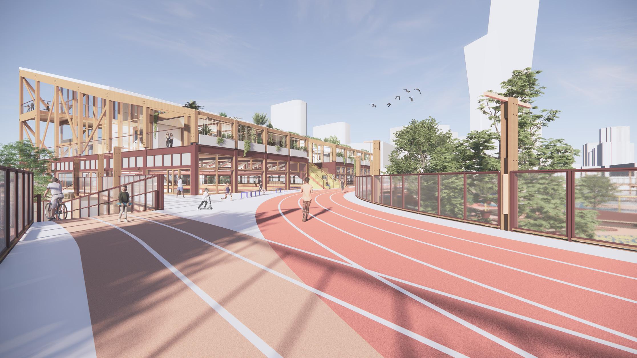
 View from Docklands Drive toward Northern Elevation of Sports Complex, Headspace Facility, and through to Ron Barassi Snr. Park.
Test Elaboration of Thesis Statement and Mapping
Existing
Restricted
Existing
Existing
Existing
.1.2.5 1 2km 2 3 4 5 6 7 8 9 10 11 Melbourne Open Space Zoning .1.2.5 1 2km Existing Open Space Public Park and Recreation Zone (PPRZ) Existing Open Space Restricted Public Park and Recreation Zone (PPRZ) Existing Open Space Not Zoned for Public Use (Tentative/At Risk) 1 Parkville Carlton North Carlton North Melbourne Kensington West Melbourne 2 3 4 5 6 Localities 1 2 3 4 5 6 7 8 9 10 11 Port Melbourne Docklands Southbank Melbourne East Melbourne 7 8 9 10 11 Melbourne Open Space Zoning
Open Space
Park and Recreation Zone (PPRZ)
Open Space
Public Park and Recreation Zone (PPRZ)
Open Space Not Zoned for Public Use (Tentative/At Risk) 1 Parkville Carlton North Carlton North Melbourne Kensington West Melbourne 2 3 4 5 6 Localities 1 2 3 4 5 6 8 9 10 11 Port Melbourne Docklands Southbank Melbourne East Melbourne 7 8 9 10 11
Public
Existing
Restricted
Existing
Open Space
Park and Recreation Zone (PPRZ)
Public
Open Space
Public Park and Recreation Zone (PPRZ)
Open Space
Zoned for Public Use (Tentative/At Risk) 1 Parkville Carlton North Carlton North Melbourne Kensington West Melbourne 2 3 4 5 6 Localities 1 2 3 4 5 6 8 9 10 11 Port Melbourne Docklands Southbank Melbourne East Melbourne 7 8 9 10 11
Open Space
Park and Recreation Zone (PPRZ)
Restricted
Existing
Not
Existing
Public
Open Space
Public Park and Recreation Zone (PPRZ)
Open Space Not Zoned for Public Use (Tentative/At Risk) 1 Parkville Carlton North Carlton North Melbourne Kensington West Melbourne 2 3 4 5 6 Localities 1 2 3 4 5 6 8 10 11 Port Melbourne Docklands Southbank Melbourne East Melbourne 7 8 9 10 11 Carlton Carlton North Percentage of Publicly Accessible Open Space within Localtiy Docklands Kensington Melbourne 3000 Melbourne 3004 North Melbourne Parkville Percentage of City of Melbourne Open Space by Locality East Melbourne Port Melbourne Southbank South Yarra West Melbourne Parkville EastMelbourne CarltonNorth Carlton Docklands Kensington Melbourne3004 West Melbourne Southbank PortMelbourneMelbourne3000SouthYarra North Melbourne Percentage of City of Melbourne Open Space by Locality Parkville EastMelbourne CarltonNorth Carlton Docklands Kensington Melbourne3004 West Melbourne Southbank PortMelbourneMelbourne3000SouthYarra North Melbourne City of Melbourne, Thomas Berrill Landscape Design PTY LTD & Environment & Land Management PTY LTD. (2012). City of Melbourne Open Space Strategy: Technical Report. Melbourne - Open Space Zoning
Existing
Expanded and Networked
Campus
Expanded and Networked School Campus 50 100 200 500m
Snapshots Expanded Connective Urban Strategy Across the School Precinct
Isolated Private Buildings create Networked Public Buildings and lead to Isolated Sites which lead to Networked Sites Isolated Suburbs Networked, Shared, Social and Active Suburbs
Isolated Private Buildings create Isolated Sites which lead to Isolated Suburbs Networked Public Buildings and Networked Sites lead to Networked, Shared, Social and Active Suburbs
Test Concept Diagrams - Broad Urban Strategy
Snapshots of Expanded Connective Urban Furniture Strategy Across the School Precinct 50
Isolated Private Buildings create Isolated Sites which lead to Isolated Suburbs Networked Buildings Sites to Shared, Active Suburbs
Elaboration of Thesis Statement and Mapping
Albert Park College is a local example of a networked secondary school campus. Students move between five separate campuses across the suburb, embedding the school and its students in the community both literally and symbolically as resources are shared between the community and the school. Prior to this new networked campus model, residents and their children were abandoning the college in droves, with only 6% of students opting to attend, with the majority being sent to private schools (Harper, 2023).
Over time, Steven Cook, the founding principle of the public school, turned this school with a damaged reputation into the 2021 Australian school of the year (Victoria State Government: Department of Education, 2021), signaling a cultural shift in school design and delivery in urbanised areas.
The distances between the buildings, which extend beyond Albert Park into Port Melbourne and South Melbourne, are between 1 and 1.5km, with some visited more frequently than others. This level of proximity enables access through walking, cycling or on increasingly popular e-scooters, avoiding the need for parents using individual car transport. Greater distances in the future could potentially be managed through provision of small shuttle buses, trams, or automated transport.
Campuses for the 1600 Secondary School Students at Albert College, located across Port Melbourne, South Melbourne and Albert Park.
Campuses for the 1600 Secondary School Students at Albert College, located across Port Melbourne, South Melbourne and Albert Park.
1 Pier Street, Port Melbourne
Significant heritage building Specialist classrooms, also used for arts programs and exhibitions
Links with Bay Street Campus' focus on marine environments
62 Pickle Street, South Melbourne
62 Pickle Street, South Melbourne Tailored to VCE and IB (International Baccalaureate) students Specialist Library Intimate classrooms Indoor/Outdoor pavilions
3
5
1km 1km
2
1km 1km 1.4km Port Phillip Bay 1
Tailored to VCE and IB (International Baccalaureate) students
Specialist Library Intimate classrooms Indoor/Outdoor pavilions
4 • • • • • 5
4
Port Phillip Bay
• •
Bay Street Campus (Environmental Arts Hub Campus) 40 Bay Street, Port Melbourne Tailored to year students (Middle Year) Performing and Learning Spaces within heritage listed buildings Student Run Cafe Marine Laboratory Used by local community as an Arts Studio, Gallery, Function centre/gathering space and for Yoga and Meditation sessions.
Tailored to year 9 students (Middle Year)
Performing and Learning Spaces within heritage listed buildings
Student Run Cafe Marine Laboratory
Used by local community as an Arts Studio, Gallery, Function centre/gathering space and for Yoga and Meditation sessions.
5
•
Performing Arts Centre
•
Visual Arts Studio Specialist Science Rooms
•
•
Studio 120 Campus 120 Bay Street, Port Melbourne Large existing office space used to accomadate increasing enrolments Used for Creative and Fine arts projects Open Spaces Cafe
Food technology Precinct (two fully equipped teaching kitchens)
Library (teaching research methodology)
120 Bay Street, Port Melbourne
Large existing office space used to accomadate increasing enrolments
Used for Creative and Fine arts projects ”
Open Spaces
Cafe
50 100 200 500m Albert Park College Distributed Campus 1 1 • • • •
focus
environments 2
• • • •
Gatehouse Campus 1 Pier Street, Port Melbourne Significant heritage building Specialist classrooms, also used for arts programs and exhibitions Links with Bay Street Campus'
on marine
2
Pickle St Campus
3 • 4
• •
Danks Street Campus 83 Danks Street, Albert Park Performing Arts Centre Visual Arts Studio Specialist Science Rooms Food technology Precinct (two fully equipped teaching kitchens) Library (teaching research methodology)
1 Gatehouse Campus
2 Pickle St Campus
3 Bay Street Campus (Environmental Arts Hub Campus) 40 Bay Street, Port Melbourne
4 Danks Street Campus 83 Danks Street, Albert Park
5 Studio 120 Campus
1.4km
Albert Park College - Distributed Campus Example
Elaboration of Thesis Statement and Broad Strategy
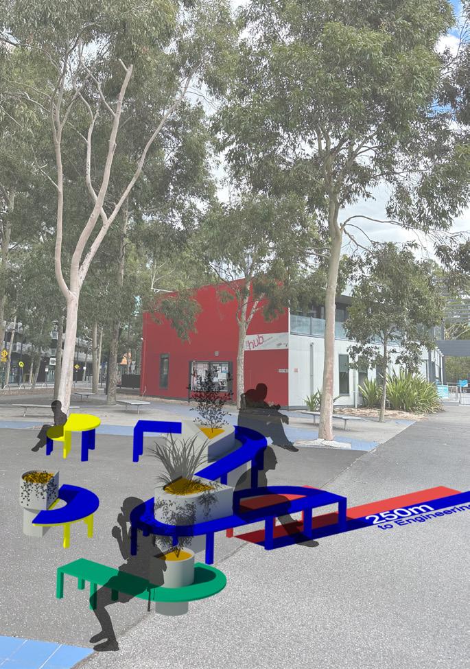
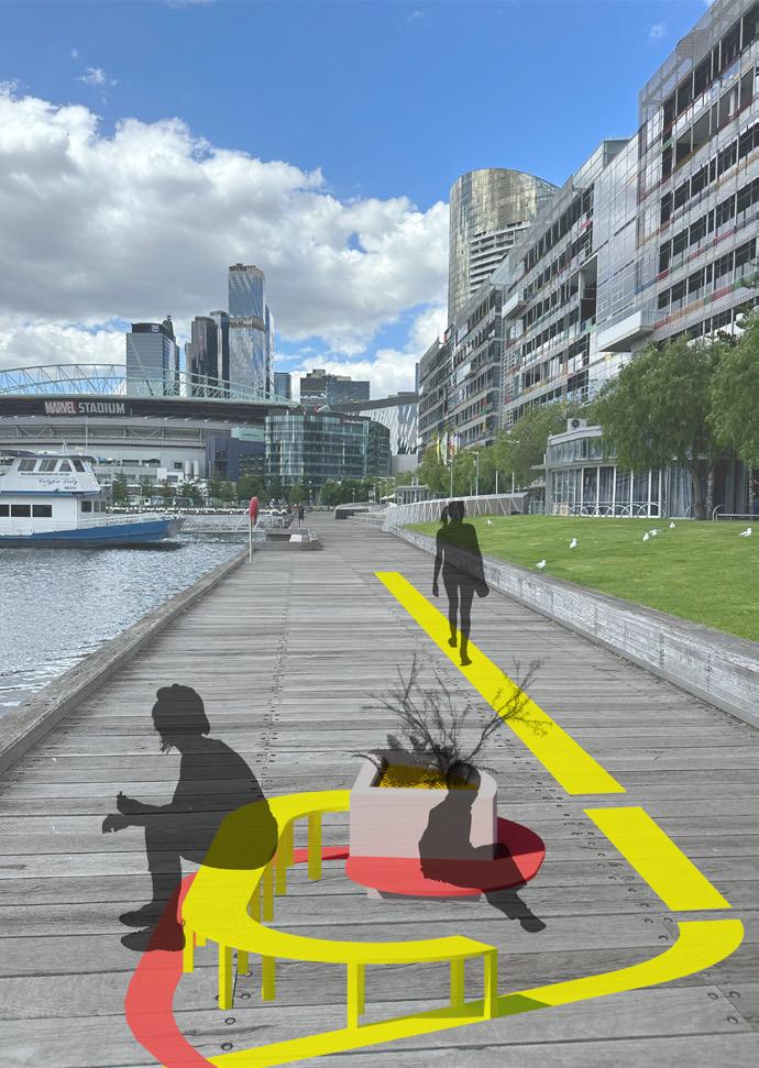
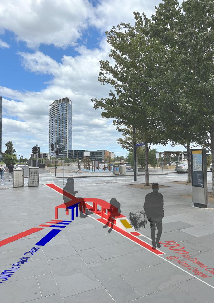
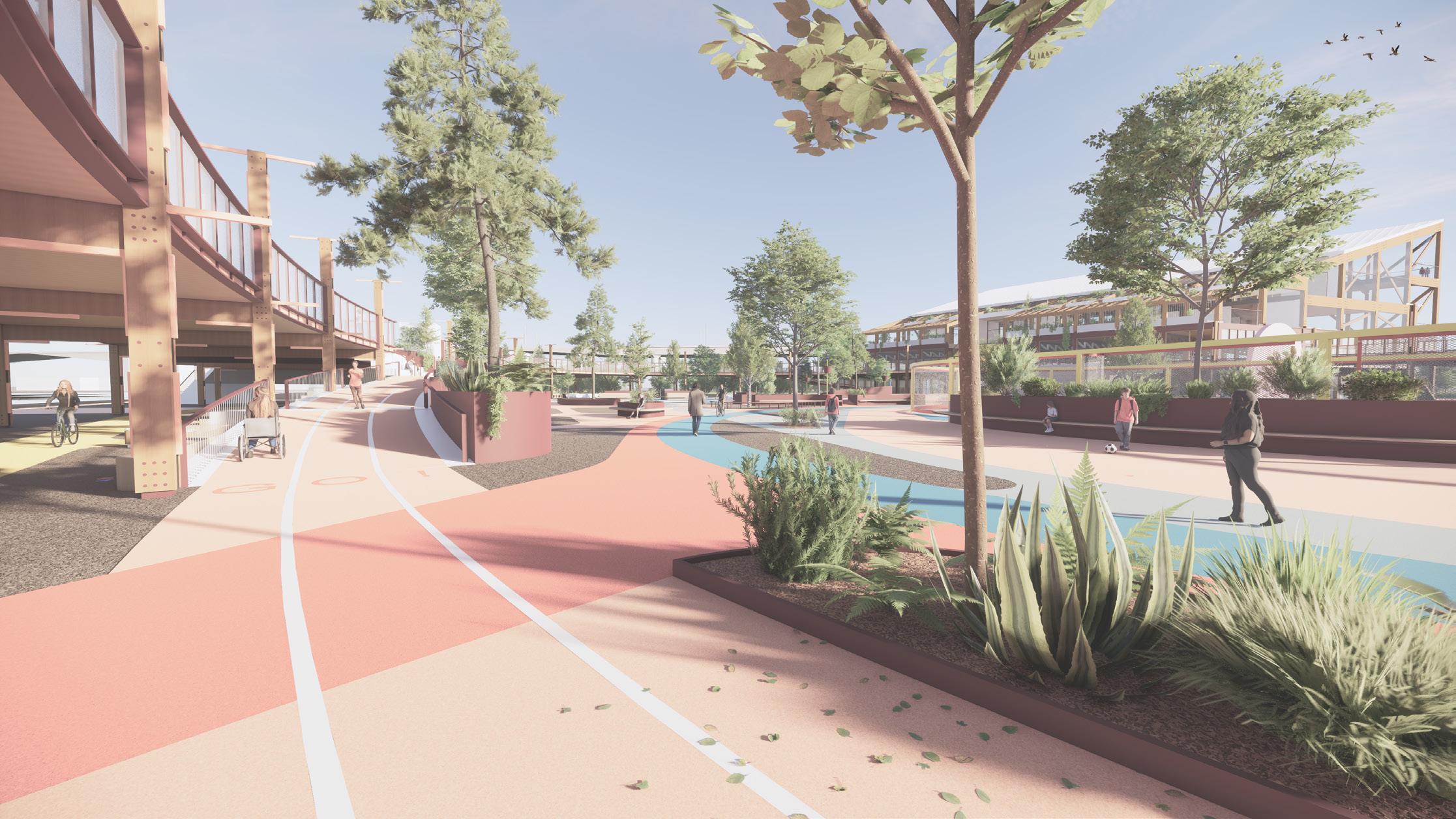
Walking and running tracks, and urban furniture that reflect the architecture of the elevated running track/connective bridge connect and line the paths between these various precincts across the suburb, while fostering a sense of pride and ownership for students and the community. They are designed as social offerings to residents and visitors alike.
Rather than being sequestered in isolation with fences this school project elevates and promotes engagement with the broader community beyond its various site boundaries (Fisher, K., 1998, 11), challenging the nature of isolated and unconnected private development that has dominated the area since its inception.
2 1000?
Urban Furniture Strategy
Elaboration of Thesis Statement
In conjunction with, and not unrelated to, these increasing levels of adolescent physical inactivity is a growing trend of mental ill health. Poor perceptions of one's own health, mental or physical, has been shown to have a negative effect on the adoption of Physical Activity (Donnelly et al., 2022, 166). The relationship between self-esteem and engagement in physical activity is reciprocal, where a lack of physical activity can lead to lower self-esteem, and a lack of self-esteem can lead to lower levels of physical activity. Therefore, this thesis aims to integrate facilities relating to both mental health care and physical activity, to attempt to address both issues in the one site.
Research also suggests that lifelong habits, associations and relationships with Physical Activity are developed from a young age and carry through from adolescence to adulthood (Azevedo et al., 2007, p 72; Aira et al., 2021, p. 5).
The amount of physical activity amongst youth, unlike adults, has been shown to be decreasing over time (Knuth & Hallal, 2009, p.556) and Australian adolescents aged 11-17 were found to be some of the least active in the world (Guthold et al., 2020, p. 32). Those who were highly active from a young age continued to maintain, or increase their physical activity as they grew older in school settings and in outside of school "leisure time" (Aira et al, 2021, p. 7; Telama et al., 2005, 270271).
Therefore, in line with other contemporary research into urban regeneration and its effects on physical activity and health in general (City of New York, 2010), the approach to increasing activity taken here is environmental. Providing sporting facilities for the community, and the students families aims to foster a multicomponent approach to increasing Physical Activity, which has been shown to increase uptake (Naylor, P. J., & McKay, A. H., 2009, p12).
Australian Government Department of Health and Aged Care. (2021). Physical Activity and Excercise Guidelines for All Australians: For children and young people (5 to 17 years).
https://www.health.gov.au/topics/physical-activity-and-exercise/physical-activity-and-exercise-guidelines-for-all-australians Beyond Blue. (2023). Statistics: Children/Youth. https://www.beyondblue.org.au/media/statistics
World Health Organisation (WHO). (2022, October 5). Physical Activity. https://www.who.int/news-room/fact-sheets/detail/physical-activity
31% of Young Women
13% of Young Men with Mental Health Problems sought any professional help
1 in 5 youth aged between 11-17 will experience high or very high levels of psychological distress.
<1 in 10 of people aged 15-18 met the Australian 2014 physical activity guidelines.
<1 in 5 of people aged 11-17 years old met the 2016 WHO physical activity guidelines.
Physical Activity and Mental Health
13%31%ofYoungAustrealianWomen ofYoungAustralian MenwithMental HealthProblemssoughtanyprofessionalhelp.
undertook~1in4peopleaged15-18yearsold atleast60minutesofphysical activityperday.
1in5Youth(Aged11-17)willexperience highorveryhighlevelsofpsychological distress.
1in5peopleaged15-18yearsolddid3or moredaysofstrength/toningactivitiesinthe lastweek.
Test
Concept Diagrams - Building and Main Site
Existing Use of Site
• Asphalt Carpark Disconnects Public Promenade and Isolates Pedestrians from Public Spaces (Water, Promenade and Parks)
Future Use of Site
• Monofunctional large scale residential towers overshadowing water and "public" promenade.
• Reinforces the site as a single use island and reduces public interaction with the area.
• Visually disconnects, the otherwise already spatially distant Ron Barassi Senior Park from its surroundings.
Proposed Site Use
• Tie in with new Green Line project pedestrian bridge linking Victoria Harbour and NewQuay Precincts
• Connect nearby green spaces to create a green spine in an area with overconstrained and inadequate green/ open space
Proposed Site Use
• Openings through the site respond to existing and future paths of travel between Social Networks and Infrastructure
• Roof form reduces overshadowing to interior of site and water.
• Open space to water, expands public space deep into the site and suggests a new public future for the Docklands
• Physical Activity is promoted throughout the site as a tool to promote health and social cohesion, while connecting the site with the suburb and the city.
• Running Track is elevated to highlight sport and the public/social focused future of the suburb as well as acting as a literal and figurative tool for networking buildings and people. A piece of connective social infrastructure in itself.
• Strategic location of stairs/ramps embracing views, and capturing main flows of pedestrians from existing and future approaches.
28
Existing Site Use Future Site Use Proposed Site Use - Connection Proposed Site Use Planning Existing Site Use Future Site Use Proposed Site Use Connection Proposed Site Use Planning Existing Site Use Future Site Use Proposed Site Use - Connection Proposed Site Use Planning
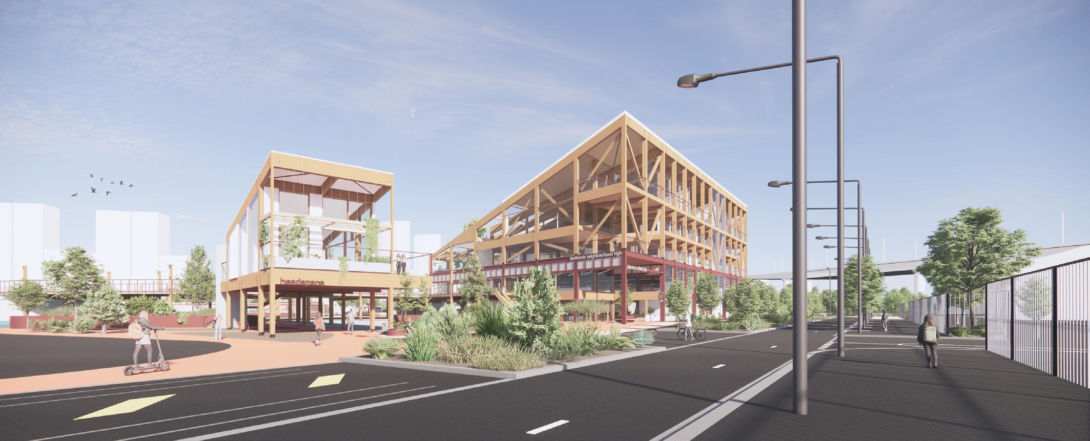
1. School Gymnasium and Main Administration Facility
2. Headspace Facility
3. Neighbourhood House Below
4. Quay Park
5. Ron Barassi Senior Park and Docklands Sports Club
6. New Pedestrian Bridge
7. Bolte Bridge Over
8. Elevated Running Track/Bridge 300m Running Track
9. Docklands Film Studios
10. Alma Doepel Shed
11. Tram Line
12. West Melbourne Container Port
13. Newquay Promenade
14. Moonee Ponds Creek Trail
15. Victoria
16.
17.
18. Steel Wires and Rods over Climbing Plants on Green Roof (over Level 2)
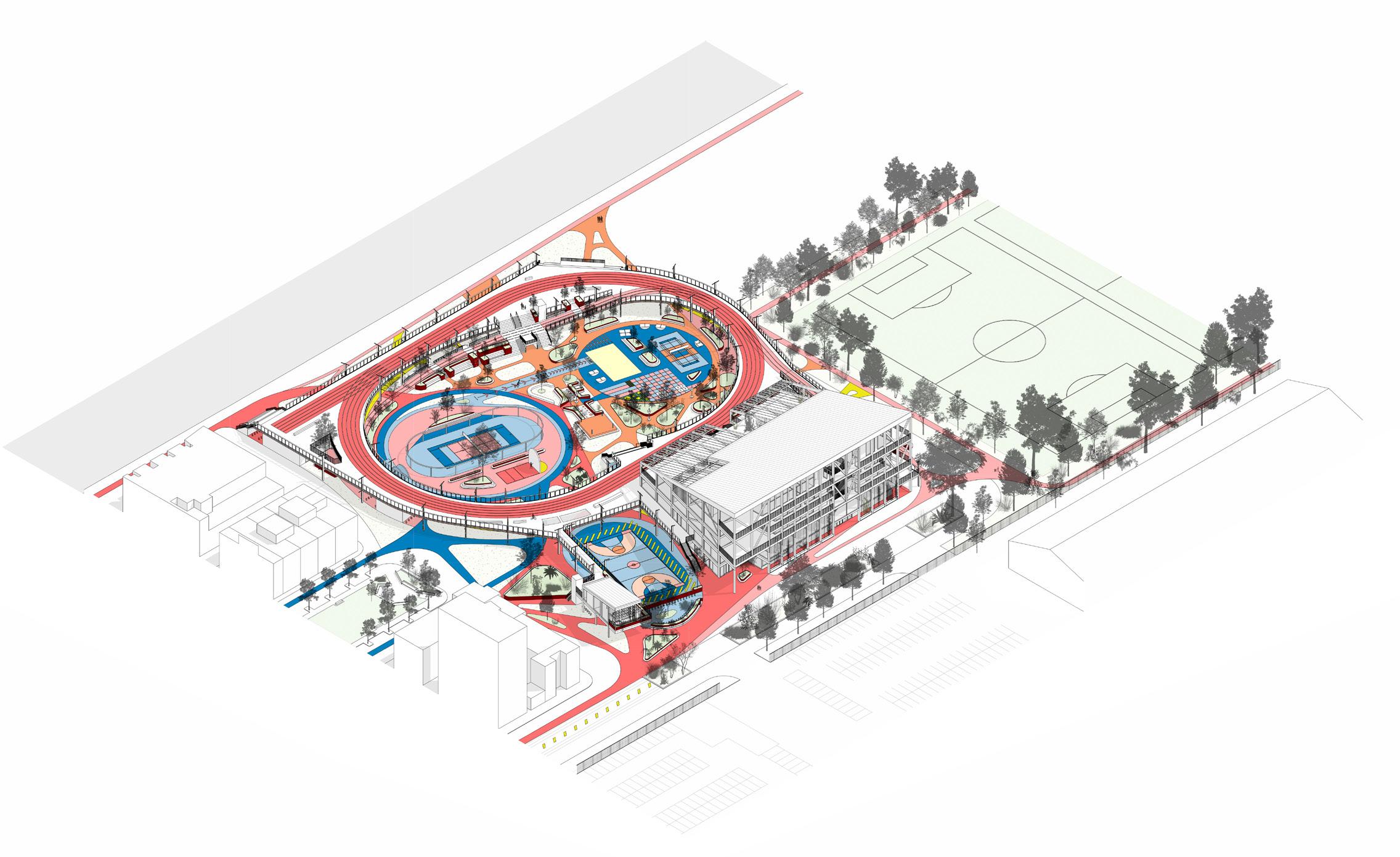
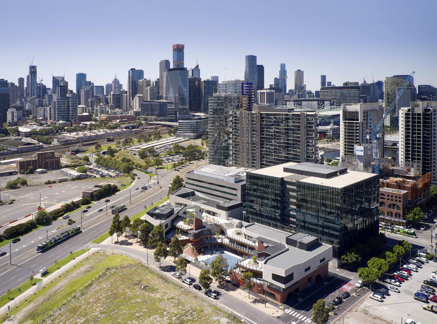
The focus of the thesis, is on a large vacant site at 473-505 Docklands Drive, which was chosen due to its proximity to existing parks, both public and private, the Moonee Ponds Creek trail, its nestling between the primary school and the Ron Barassi Senior park, and the waterfront promenade which is currently inaccessible. The site is also visually anchored across the water to other new public infrastructure projects; the Library at the Dock, and the Hub at the Dock, forming a visual and physical spine of social infrastructure across the water in an area which has long lacked it. This social spine will be further enhanced as a new pedestrian bridge links NorthQuay and Victoria Harbour through the greenline project.
The project is envisaged as a mixed use social hub with a focus on promoting physical activity and communality, (Delanty, G., 2018, 2) while fostering a sense of belonging in an area that continues to wrestle with its urban identity and civic reputation. These conversations often ignore the many residents who call the Docklands home, and see the area as a failure, rather than recognising opportunities for catalysing positive change through design.
Elevating Activity, Docklands Neighbourhood High, is a networked Secondary School with a new sports campus. This targeted social infrastructure attempts to address gaps in public need, based on research and complimentary overlaps of program, in an area that has been the subject of rapid urbanisation and ad-hoc or ignored planning processes. The project aims to create a sense of belonging in a rapidly developed area for its existing and future residents. It ties together disparate sets of social infrastructure through siting and formal gestures, as well as considered open space, and linkage strategies across the suburb, while providing it with new amenity.
The project is seen as an attempt to catalyse change in the area. Moving from showcasing private projects and insular developments on the waterfront to a public and inviting precinct connected by an elevated pedestrian link / running track. It adds to and links with recent developments with a social and public focus such as the successful Library and Community Hub at the Dock and the Docklands Sports Club.
Design Thesis
Harbour Promenade
Yarra River
Moonee Ponds Creek
Proposed Site Plan 1. School Gymnasium and Main Administration Facility 2. Headspace Facility 3. Neighbourhood House Below 4. Quay Park 5. Ron Barassi Senior Park and Docklands Sports Club 6. New Pedestrian Bridge 7. Bolte Bridge Over 8. Elevated Running Track/Bridge 300m Running Track 9. Docklands Film Studios 10. Alma Doepel Shed 11. Tram Line 12. West Melbourne Container Port 13. Newquay Promenade 14. Moonee Ponds Creek Trail 15. Victoria Harbour Promenade 16. Yarra River 17. Moonee Ponds Creek 18. Steel Wires and Rods over Climbing Plants on Green Roof (over Level 2) Proposed Site Plan 10 20 50m 1. School Gymnasium and Main Administration Facility 2. Headspace Facility 3. Neighbourhood House Below 4. Quay Park 5. Ron Barassi Senior Park and Docklands Sports Club 6. New Pedestrian Bridge 7. Bolte Bridge Over 8. Elevated Running Track/Bridge 300m Running Track 9. Docklands Film Studios 10. Alma Doepel Shed 11. Tram Line 12. West Melbourne Container Port 13. Newquay Promenade 14. Moonee Ponds Creek Trail 15. Victoria Harbour Promenade 16. Yarra River 17. Moonee Ponds Creek 18. Steel Wires and Rods over Climbing Plants on Green Roof (over Level 2) Proposed Site Plan 10 20 50m 10 20 50 100m 17 12 7 6 15 10 16 13 8 3 5 5 9 11 4 1 18 2 14
The colourful supergraphics define the small and large zones of outdoor play spaces and soft landscaping/seating, while acting as a wayfinding tool and link between the site and its neighbouring social infrastructure. They also define informal running or walking loops in and around the site.
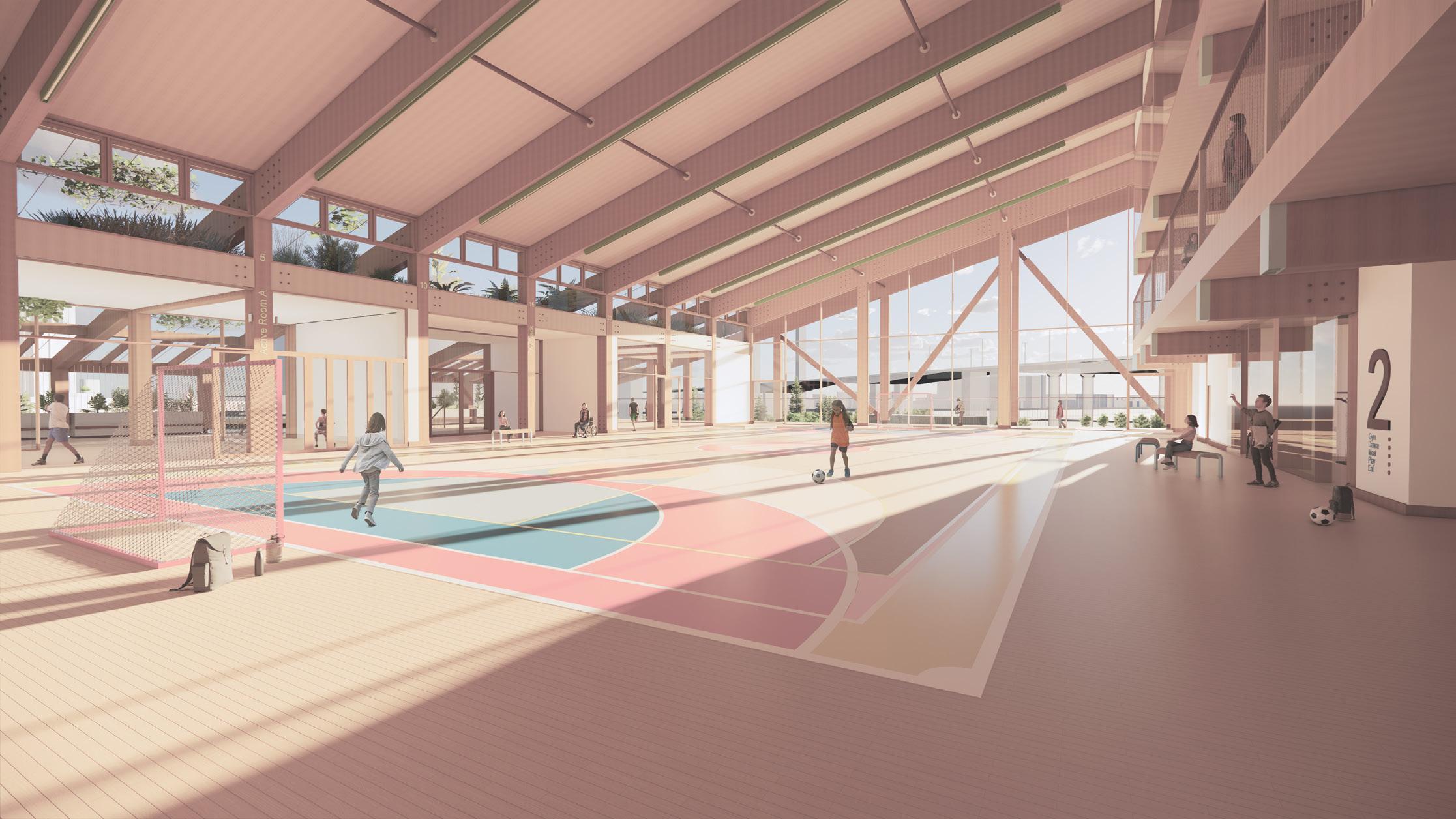
Although the sports facility will be shared by the community, the North, North West and South East ends of the site are bookended by smaller buildings with a community focus. The neighbourhood house, public toilets, bike parking and outdoor sports equipment storage, headspace (at Level 1) and cafe functions provide a human scale setting within smaller buildings that reside at the ends of the site which are aligned with pedestrian movement.
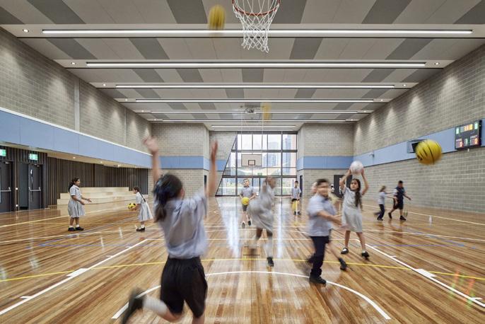
All four full size sports courts are designed in accordance with Victorian School Building Authority Building Quality Standards Handbook, May 2022.
Ground Floor Plan 10 20 50m Indoor Sports Courts Amenities, Lockers and Change Rooms Storage First Aid Principals Office Meeting Room Reception and Staff Workdesks Stairs to L1 and Integrated Lockers/Seating External Full Size Sports Court 10. BBQ and Picnic Facilities 11. Stage Boxing Ring 12. Bike Parking, Seating and Fire Services 13. Main Entry 14. Student Community Breakout Space 15. Neighbourhood House Co-Working Space 16. Community Cafe Kitchen and Servery Window (Interior and Exterior) 17. Cleaners Storage 1. Indoor Sports Courts 2. Amenities, Lockers and Change Rooms 3. Storage 4. First Aid 5. Principals Office 6. Meeting Room 7. Reception and Staff Workdesks 8. Stairs to L1 and Integrated Lockers/Seating 9. External Full Size Sports Court 10. BBQ and Picnic Facilities 11. Stage / Boxing Ring 12. Bike Parking, Seating and Fire Services 13. Main Entry 14. Student / Community Breakout Space 15. Neighbourhood House / Co-Working Space 16. Community Cafe Kitchen and Servery Window (Interior and Exterior) 17. Cleaners Storage Ground Floor Plan 1. School Gymnasium and Main Administration Facility 2. Headspace Facility 3. Neighbourhood House Below 4. Quay Park 5. Ron Barassi Senior Park and Docklands Sports Club 6. New Pedestrian Bridge 7. Bolte Bridge Over 8. Elevated Running Track/Bridge 300m Running Track 9. Docklands Film Studios 10. Alma
Shed 11. Tram Line 12. West Melbourne Container Port 13. Newquay Promenade 14. Moonee Ponds Creek Trail 15. Victoria Harbour Promenade 16. Yarra
17.
18. Steel Wires
over Climbing Plants on Green Roof (over Level 2) Proposed Site Plan 10 20 50m 5 10 20 50m 1 2 2 14 13 12 12 12 12 12 14 12 10 12 11 15 16 17 3 7 5 6 9 4 3 3 17
Doepel
River
Moonee Ponds Creek
and Rods
1. Elevated 300m Running Track
2. Suspended Trampoline Netting
3. Mezzanine Sports Viewing Platform
4. Breakout/Loud Study Area
5. Student Kitchen/Community Breakout Space
6. Headspace Facility Consulting Rooms and Chill Space Banquettes
7. Entry to Mezzanine Platform, Bleacher Seating / Access to Level 2
8. Bleacher Seating / Access to Ron Barassi Snr Park
9. Lobby and Void / Stair and Lift to Level 4
10. Accessible Ramp / Extension of Running Track to / from Ron Barassi Snr. Park
11. Accessible Ramp / Extension of Running Track to / from Newquay Promenade andOutdoor Sports Areas
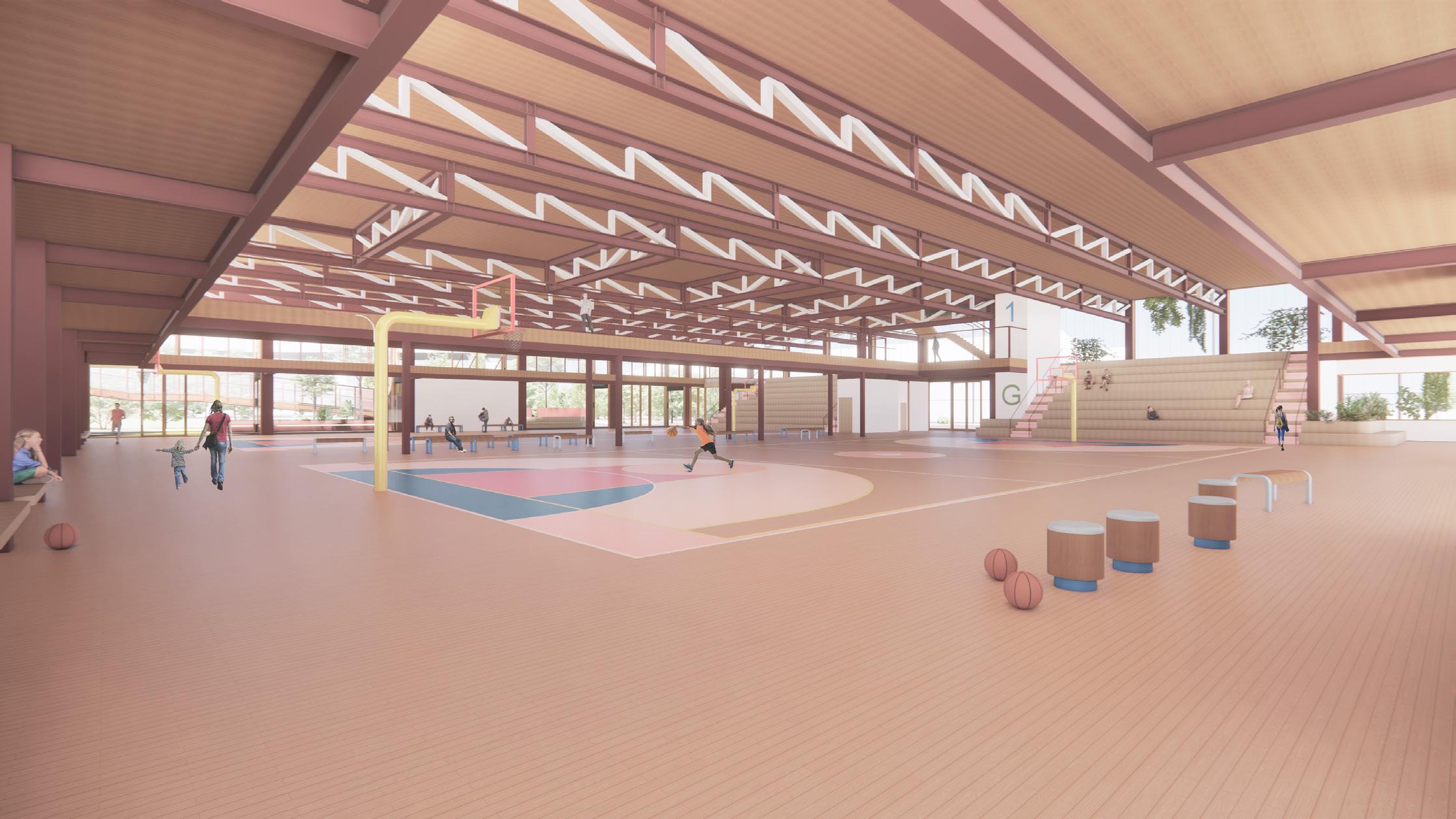
A mezzanine level sits at half the height of the ~8m tall gymnasium space, aligning with the upper level of the bleacher seating, and the elevated running track. This level acts as a bridge between the track, Ron Barassi Snr park, the gymnasium and the headspace facility. Various stairs surround this level and enable access from different parts of the site, encouraging incidental exercise, and potentially enabling this half level to be used without interfering with the sports or schooling activities occurring below. It also acts as the main student, or community, breakout space.
34 Level 1 Plan 10 20 50m 1. 2. 3. 4. 5. 6. Elevated 300m Running Track Suspended Trampoline Netting Mezzanine Sports Viewing Platform Breakout/Loud Study Area Student Kitchen/Community Breakout Space Headspace Facility Consulting Rooms and Chill Space Banquettes 7. Entry to Mezzanine Platform, Bleacher Seating Access to Level 8. Bleacher Seating Access to Ron Barassi Snr Park 9. Lobby and Void Stair and Lift to Level 10. Accessible Ramp Extension Running Track from Ron Barassi Snr. Park 11. Accessible Ramp Extension of Running Track to from Newquay Promenade and Outdoor Sports Areas
Level 1 Plan 1. School Gymnasium and Main Administration Facility 2. Headspace Facility 3. Neighbourhood House Below 4. Quay Park 5. Ron Barassi Senior Park and Docklands Sports Club 6. New Pedestrian Bridge 7. Bolte Bridge Over 8. Elevated Running Track/Bridge 300m Running Track 9. Docklands Film Studios 10. Alma Doepel Shed 11. Tram Line 12. West Melbourne Container Port 13. Newquay Promenade 14. Moonee Ponds Creek Trail 15. Victoria Harbour Promenade 16. Yarra River 17. Moonee Ponds Creek 18. Steel Wires and Rods over Climbing Plants on Green Roof (over Level 2) Proposed Site Plan 10 20 50m 5 10 20 50m 3 1 10 10 11 11 11 Void 6 7 8 5 9 4
36 Level Plan 10 5 20m Level Plan 1. 2. 3. 4. 5. 6. 7. 8. 9. 10. 11. 12. Student/Community Breakout and Kitchen Student Amenities and Change Airlock Lobby and Void Storage Classroom Student Balcony Student/Community Gym Larger Learning/Dance/Yoga Space Entry from Elevated Running Track Sports Court (Basketball/Netball/Futsal) Outdoor Space Roof of Headspace Facility Below Level Plan 10 20m Level Plan Level Plan Staff Conference/Meeting Room Staff Open Workspace Staff Balcony Sports Courts Below Classrooms Airlock Lobby and Void Student Admin/Printing Student Balcony Sports Courts Below Shaded Student Terrace Roof Planting Void to Balcony Below 1. 2. 3. 4. 5. 6. 7. 8. 9. 10. 11. 12. Student/Community Breakout and Kitchen Student Amenities and Change Airlock Lobby and Void Storage Classroom Student Balcony Student/Community Gym Larger Learning/Dance/Yoga Space Entry from Elevated Running Track Sports Court (Basketball/Netball/Futsal) Outdoor Space Roof of Headspace Facility Below Level Plan 10 20m Level Plan Level Plan 1. 2. 3. 4. 5. 6. 7. Staff Kitchen and Breakout Staff Amenities and Change Airlock Lobby and Void Staff Conference/Meeting Room Staff Open Workspace Staff Balcony Sports Courts Below 1. 2. 3. 4. 5. 6. 7. 8. Classrooms Airlock Lobby and Void Student Admin/Printing Student Balcony Sports Courts Below Shaded Student Terrace Roof Planting Void to Balcony Below 10. 11. 12. Student/Community Breakout and Kitchen Student Amenities and Change Airlock Lobby and Void Storage Classroom Student Balcony Student/Community Gym Larger Learning/Dance/Yoga Space Entry from Elevated Running Track Sports Court (Basketball/Netball/Futsal) Outdoor Space Roof Headspace Facility Below 1. Student/Community Breakout and Kitchen 2. Student Amenities and Change 3. Airlock Lobby and Void 4. Storage
Classroom
Student Balcony
Student/Community Gym
Larger Learning/Dance/Yoga Space
Entry from Elevated Running Track 10. Sports Court
Outdoor Space
Roof of Headspace Facility Below
5.
6.
7.
8.
9.
(Basketball/Netball/Futsal) 11.
12.
1. Classrooms 2. Airlock Lobby and Void 3. Student Admin/Printing 4. Student Balcony 5. Sports Courts Below 6. Shaded Student Terrace 7. Roof Planting 8. Void to Balcony Below
1. Staff Kitchen and Breakout
Change
Airlock Lobby and Void
Conference/Meeting Room
Staff Open Workspace
Staff Balcony
Sports Courts Below Level 2 Plan Level 3 Plan Level 4 Plan 5 10 20 50m 5 10 20 50m 1. School Gymnasium and Main Administration Facility 2. Headspace Facility 3. Neighbourhood House Below 4. Quay Park 5. Ron Barassi Senior Park and Docklands Sports Club 6. New Pedestrian Bridge 7. Bolte Bridge Over
Elevated Running Track/Bridge 300m Running Track 9. Docklands Film Studios 10. Alma Doepel Shed 11. Tram Line 12. West Melbourne Container Port 13. Newquay Promenade 14. Moonee Ponds Creek Trail 15. Victoria Harbour Promenade 16. Yarra River 17. Moonee Ponds Creek 18. Steel Wires and Rods over Climbing Plants on Green Roof (over Level 2) Proposed Site Plan 10 20 50m
Administration Facility
Headspace Facility
Neighbourhood House Below
Quay Park
Ron Barassi Senior Park and Docklands Sports Club
New Pedestrian Bridge
Bolte Bridge Over
300m
Track
Docklands Film Studios 10. Alma Doepel Shed 11. Tram Line
West Melbourne Container Port 13. Newquay Promenade
Moonee Ponds Creek Trail 15. Victoria Harbour Promenade
Yarra River 17. Moonee Ponds Creek 18. Steel Wires and Rods over Climbing Plants on Green Roof (over Level 2) Proposed Site Plan 10 20 50m 10 6 8 8 9 12 11 7 6 3 1 4 5 2 4 1 8 3 1 1 6 7 7 6 6 1 2 3 4 5
2. Staff Amenities and
3.
4. Staff
5.
6.
7.
8.
1. School Gymnasium and Main
2.
3.
4.
5.
6.
7.
8. Elevated Running Track/Bridge
Running
9.
12.
14.
16.
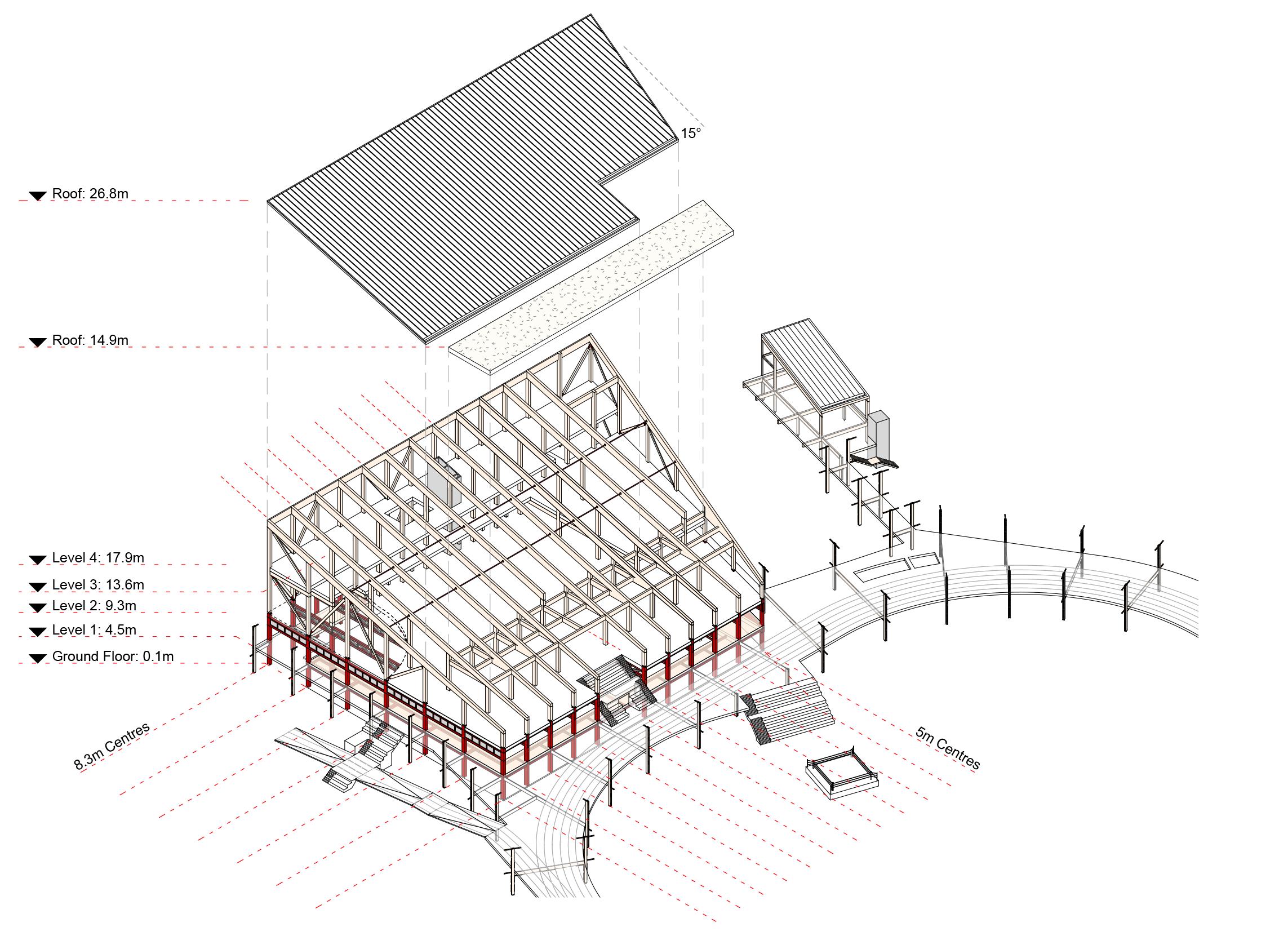
The north facing main building reduces in height to minimise overshadowing of the open spaces it adjoins. An additional sports court at Level 2 is rotated to reduce the depth of the building, and is enclosed by two levels of classrooms, administrative facilities, and other multi-purpose spaces, that look out to, and are connected to the sports court, and the outside areas that enclose these levels.
Connective stairs, bleacher seating, ramps and a raised running track encircle the sites open space, while allowing the site to remain permeable from each corner.
Physical activity occurs vertically and horizontally across the site, from the second floor sports court to the outdoor sand pit/ four square zones.
A mezzanine level surrounding the sports courts on the ground floor, and the raised sports court on Level 2 enable school classes, the community and other administrative activities to take place while looking out toward sporting activity. Highlight windows at both sports courts enable the penetration of northern light, and the purging of warm air in the evening. A composite structure of Steel, and CLT/Glulam timber supports the large span structure and divides the building into 5m modules.
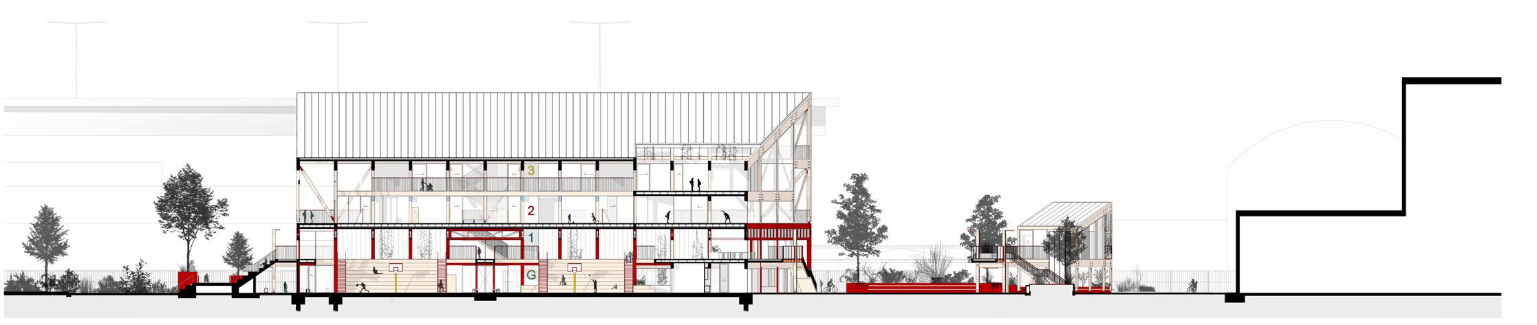
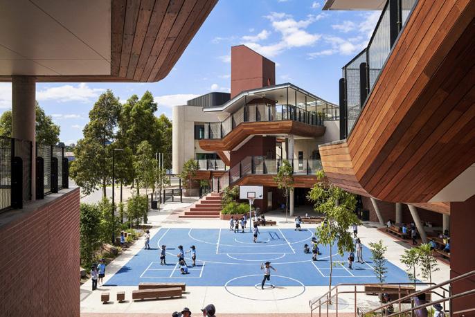
Soft landscaping and seating define thre curving paths that permeate the site, anchoring the otherwise loose connective forms. They are also used promoted as wayfinding tools, and windbreaks. Integrated seating responds to the three main sports courts zones across the site. Large stairs and bleachers lead into, and out of the site, promoting incidental exercise for able bodied people while highlighting the open nature of the site. Ramps are integrated into the elevated track and connect into the landing of bleacher seating/ streps, promoting equity in physical activity for those with walking aids, wheelchairs or prams. All are welcome to come up and have a run, walk or seat. Open space to the water is kept rather than hidden behind buildings. A public place and front to the main campus of the new school for the community to share, bookended by the neighbourhood house and sports facility, signaling a new public future and face of the docklands.
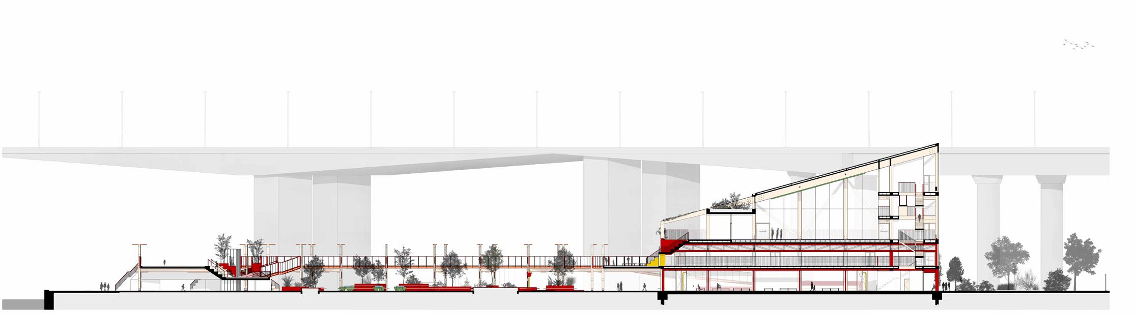
Long Section Short Section
2 5 10 20 50m
Composite Structure comprising Concrete (Ground Floor Slab and Footings), Steel (Ground Floor to Level 2) and Engineered Timber (CLT floors and Glulam beams and columns, from Level 2 to Roof).
1. Elevated Running Track / Bridge at Level 1 (Refer to Construction Detail - Elevated Running Track / Bridge).
2. Headspace Facility, Construction Methodology and materiality similar to main Sports Complex building, although primarily comprised of Glulam and CLT structure.
3. Level 1 Mezzanine 200mm CLT Floor on 200UB secondary Steel Beams fixed to primary 310UC Steel Columns. Finished timber floor raised above this level on pedestals.
4. Concrete Footings and Slab on Ground at Ground Floor Level with timber sports court flooring and shock absorbing sports matting and linework applied over.
5. Primary Steel structure (in Red) from Ground Floor to Level 2 (Supporting L2 Sports Court). Steel 310UC Columns and Beams supporting Steel Floor Truss comprised of 300UC Beams with White Painted 150 SHS Bracing Elements. Bracing / Openings in Truss concealed at Exterior Sides of Building, Floor cut away in Isometric revealing internal floor trusses supporting L2.
6. 400 x 600 Glulam Columns with 700 x 450mm Glulam Beams beneath Floors and 1200 x 450mm Glulam Beams supporting Roof / spanning Sports Court at L2. Steel Bracing Rods Between Roof Beams. Diagonal Glulam Cros Bracing at Centre and End Bays.
7. 200mm thick CLT typical structural floor. Raised flooring pedestals fixed to CLT floor concealing services and supporting timber sports court flooring and acoustic treatment / rubber shock absorption layers.
8. 150mm Concrete Walls to Lift Core and Services Risers.
9. "Green" roof over Glulam/CLT structure above L2 Dance / Activity Rooms and Main Entry.
10. Standing Seam Steel Roofing
South West Isometric Construction Diagram 01 05 04 03 06 07 08 08 09 10 02
1. Sports Courts and Classrooms
2. Headspace Facility
3. Neighbourhood House and Co-Working Space
4. Elevated 300m Running Track and Connection to Level 2 Indoor Sports Courts
5. Ron Barassi Snr. Park (2 Full Sized Soccer Pitches)
6. Quay Park (Alternative Access from Primary School)
7. Paths from/to Primary School
8. Path from/to Victoria Harbour and Pedestrian Bridge
9. Path from/to NewQuay Promenade
10. Primary Entry into Sports Complex/Main Reception
11. Full Size Basketball/Netball Court
12. Tennis/Volleyball/Badminton and 4 Square with Rectractable Netting concealed in Frame
13. Long Jump/Sand Volleyball/ Sand Pit
14. Kids Play Area (Low Basketball Rings, Wallball, Handball and Climbing Loop
15. Badminton, Volleyball and Table Tennis
16. Chess Board, 4 Square Courts and Kids Play Area
17. Boxing Ring/Entertainment or Presentation Platform Facing Bleacher Seating/Access to Level 2
18. Accessible Ramp up to Running Track/Level 2 from NewQuay Promenade
19. Accessible Ramp up to Running Track/Level 2 from Ron Barassi Snr Park (Refer Level 1 Plan)
20. Neighbouring Residential Building
21. Docklands Film Studios
The running track itself and the open space it presents to the public promenade is envisaged as a large inviting social front door (Connective Social Infrastructure, 138) suggesting invitation and enabling public occupation of a building in a largely privatised urban area.
Through the combined provision of formal Sports Education through Physical Education classes in the classroom/ sports court setting, to the distribution of less formalised activities/sporting facilities throughout the site, both aim to encourage Physical Activity and socialisation between friends, community members and strangers of various ages.
In addition to the urgently needed Secondary School, providing formal and informal avenues for locals to contribute to their communities and get to know one another, is an attempt to develop long term connections between people who would otherwise not have met (Connective Social Infrastructure, 2021, 58) while increasing the suburbs livability and number of long term residents.
01 21 02 11 03 04 04 05 06 07 07 09 20 07 08 10 12 13 14 14 15 16 17 18 19 19
North East Isometric
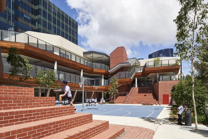
View from Docklands Drive toward Northern Elevation of Sports Complex, Headspace Facility, and through to Ron Barassi Snr. Park.
View Towards Level 2 Sports Court and Connecting Stairs to Level 3 from Elevated Running Track
View Towards Ramp to Elevated Running Track and Through to Sports Complex, and Outdoor Sports/Play Areas through Garden Beds
 View Towards Bolte Bridge and Ron Barassi Snr. Park from Level 2 Sports Court, Gym and Classrooms.
View towards Connecting Lobby / Void, Bleachers and Ron Barassi Snr. Park through the accessible ramp to the elevated running track from Ground Floor Sports Courts
View Towards Bolte Bridge and Ron Barassi Snr. Park from Level 2 Sports Court, Gym and Classrooms.
View towards Connecting Lobby / Void, Bleachers and Ron Barassi Snr. Park through the accessible ramp to the elevated running track from Ground Floor Sports Courts
1. Perforated PVC Drainage Pipe and Overflow.
2. Mulch Over Compacted Soil, Gravel Base and Drainage Cell.
3. Planter Box Framed with 50x50 SHS Steel Sections and lined with Waterproofing Membrane.
4. Hardwood Timber Seating fixed to 50mm Steel EAs welded to SHS Outriggers.
5. Various Colour Fine Pea Gravel over Geotextile Membrane and Crushed Rock.
6. Concrete Pad Footing. Steel Structure from Planter Box fixed to top of Footing with Steel Base Plate (Similar to Bridge Detail).
7. Steel Endcap to protect exposed ends of Glulam.
8. Perspex Balustrade between Aluminium Framing. Base of Balustrade 100mm AFFL to enable Overflow.
9. Powdercoated Aluminim Spandrel Panel below balustrade with Coloured Powdercoated Aluminium Plate in opening.
10. 2 x 100 x 400mm Sealed and Treated Glulam Columns.
11. Glulam Blocking Between Columns (Dashed) Stained Black.
12. Dash denotes Steel Downpipe from Linear Drain above at every second Column Bay (Fixed off of Column Blocking).
13. Counterbore Openings in Glulam Columns, enabling face of Steel Bolts to be flush with Columns.
14. Vertical Steel Plate Bolted through Both Columns.
15. Steel Base Plate over Non-Shrink Grout. Steel Bolts and Anchor Rods installed through to Anchor Plate.
16. Concrete Pad Footing with Geotextile Fabric and Agi. Drain in Crushed Rock Bed. Blinding as Required.
17. EPDM Running Track Surface Layer with Linemarkings and Colour applied.
18. Recycled Rubber Basemat over Bonding Layer, Adhesive, Waterproofing Membrane and Marine Ply.
19. 200mm CLT Floor Between Glulam Beams. Exposed Underside Stained, Sealed and Treated for Exterior and Marine environments.
20. 100 x 600mm Sealed and Treated Glulam Beam between Glulam Columns
21. Powdercoated Aluminium Linear LED Lighting aligned with, and fixed to, Columns and Beams.
22. EPDM (Synthetic Rubber) running track on ground with applied Linemarking and Colours.
23. Rubber Basemat over Bonding Layer and Adhesive.
24. Asphalt Base over Geotextile Fabric and Compacted Soil.
25. Stainless Steel Linear Strip Drain at both sides of Bridge. (Max. 15mm Openings).
Construction Detail Bridge
Construction Detail - Elevated Running Track / Bridge .25 .5 1 2m 3 2 4 5 6 6 3 16 15 14 13 12 11 10 11 11 7 21 20 22 23 24 19 18 17 25 8 9 1 1
Design Thesis Research
In chapters 8 through to 10 of Fluid City, Dovey and his co-authors dissect the planning machinations and often secret negotiations that took place between developers and City of Melbourne representatives in securing the parcels of land which would come to continually shape and reshape the contentiously "fluid" Docklands precinct.
Public debate and scrutiny was sequestered to few key projects and often occurred strategically too late to have any meaningful resonance in the future of the place. There was no public living in the area to have any input let alone determine what was good or bad for it. This is now changing as new developments, such as the central pier redevelopment are seemingly keen to engage, or even let locals drive the discussion relating to their futures. Whether these discussions manifest into changes in the built outcome is yet to be seen. In a real project, rather than a thesis, where it is impossible to engage the public in interviews due to time constraints, this engagement and community consultation would be key to enabling the project to sustainable and appropriate for the suburbs residents. The tides seem to be slowly turning in the Docklands from a past of privatised priorities to one of publicly driven development, but is it too late?
It's seems as if the Melbourne public is used to a lack of long term vision, or is impatient to put up with the time and slow change that gave Melbourne's CBD and many of the world's best urban places their strong identities and rich cultures. These bustling, mixed, fine grain and functionally /socially dense and intricate places took time to become what that they are today. You can't forcibly create a sense of place. True "placemaking" appears to be fostered over time rather than invented, but we as designers can plant better seeds for sociable and community focused places to flourish.
It seems much harder to retrofit urban "intensity" and richness into a place like the Docklands which has been rapidly developed. An area marred by short-sighted economic and 'market' (which market?) driven visions which naively, or perhaps greedily, sidelined future public good for the sake of short term profit. Placing the developer above the city planner, or any strategic vision for the place, in order to recoup or avoid the use of public funds can now be seen as a regrettable decision that residents of the Docklands in particular are paying a hefty social, and economic, price for. The book reveals that much of the privatised Docklands infrastructure was in fact publicly funded.
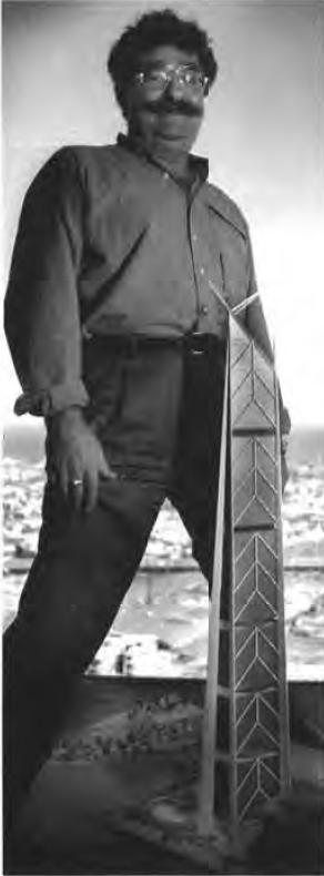
In Chapter 9 - Grollo Tower, Dovey critiques ego and image driven international mega-projects in general, while focusing on the unbuilt Grollo Tower, proposed to be the tallest in the world at the time. He outlines the detriment they can cause to surrounding urban life, as the potential for street life and intensity to flourish is diminished as the half a kilometer tall skyscraper sucks life up and into itself, disconnecting users from their surroundings, rather than encouraging interaction with the city it is supplanted into. If built, Dovey argues, the project "would have dominated and belittled the public city with a private symbol".
Can most of the Docklands itself be seen as dominated by private symbols? Does a constellation of private, self centred symbolism amount to little more than a blank and repetitive urban environment, and can this be slowly remedied with human focused interventions? How might a public building in an enclave of privatised development stand out amidst urban indifference and encourage students, residents, workers or visitors in?
55 54 Kim Dovey, Fluid City 14 13
Raynor, M. (1995). Bruno Grollo with an early design for the Grollo Tower.
CONNECTIVE SOCIAL INFRASTRUCTURE

Much like the mapping of assemblages and underlying patterns of place suggested by Kim Dovey, this report explores the undercurrent of social connections and networks that go toward making parts of London a sociable and integrated place for its diverse user groups, ultimately enabling them to 'live well together'.
Studying the existing social networks of the Docklands it is clear the Neighbourhood House, and the Hub organise and drive activity and social connection in the area, regularly utilising public spaces such as the Library at the Dock, Buluk Park and the new Ron Barassi Senior Park for events as the organisations themselves are located in small, over utilised spaces.
Notes from the reading:
• Co-locate with caution, and enable accessibility in spaces.
• Indirect relationships and the combination of unlikely activities can encourage social mixing.
HOW
Social infrastructure is described as formal and informal, large or small, ecosystems of local organisations, networks and services, that are often supported by physical spaces. The positive benefit of creatively adding social value to an investment was described, yet in the Docklands, this has often been done carelessly by developers simply wishing to get their projects approved. In reality, once built, the social public spaces in these private developments are sequestered into uninviting or inaccessible places.
The successful social infrastructure within private settings in the Docklands has been a result of poor commercial value, and a change of use over time. For example, the Neighbourhood House tentatively occupies the District shopping centre as it grapples with its future moving from a poorly used shopping area to an entertainment complex.
"Community spaces rely on resident's energy, effort and networks to succeed".
It was noted that social infrastructure only truly exists when 'activated or occupied', how can our designs enable activation and welcome occupation?
"Individual buildings and services do not exist on their own but are connective...".
Acknowledging and tying into the existing framework of infrastructure while addressing its gaps will assist in creating a sustainable and meaningful place for the growing and changing community to occupy and feel a sense of ownership over.
• Create passive surveillance and enable visibility from the street to a mix of spaces.
• Enabling the mixing of primary and secondary functions throughout a building or space.
• Cluster civic uses in popular areas, or in the case of the Docklands perhaps aim to connect these clusters?
• Pedestrian focused neighbourhoods encourage interactions, car focused areas limit them.
• Soft and informal infrastructure is as important as hard and formal infrastructure.
• The design of entrances, the social front door, and circulation spaces is as important as the functions they lead to and connect.
56 57 Connective Social Infrastructure
LONDON'S SOCIAL SPACES AND NETWORKS HELP US LIVE WELL TOGETHER GOOD GROWTH BY DESIGN
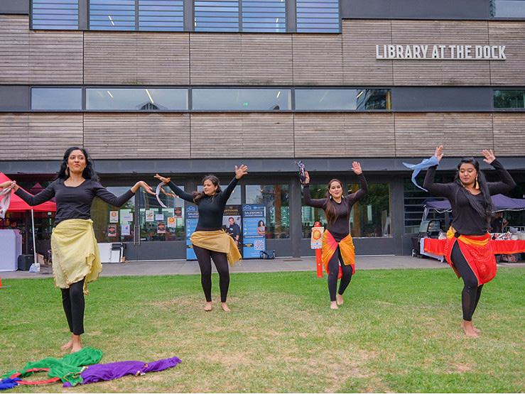
Baker, K. (2023). Vasant Festival celebrations organised by the Neighbourhood House, occuring at Buluk Park and Library at the Dock
Car, S. (2022). Diwali celebrations at Ron Barassi Senior Park organised by local not-for-profit Sans Care with the Docklands Neighbourhood House.
Docklands Tour - Fadi Qunqar
Fadi Qunqar from the City of Melbourne, employed as a Neighbourhood partner for the Docklands and Fishermans Bend precincts, took our class on a tour of the existing Infrastructure in the Docklands.
Fadi stressed that the lack of community facilities in the area were becoming an increasing problem as the community continued to grow.
It was noted that although planning guidelines stipulate that 5% of new buildings should be designated for community use, in reality market demands and profit motives drive these spaces into undesired and sometimes inaccessible areas of a project which are not conducive to community activity, let alone regular use, of any kind.
The district shopping centre is in the process of re-imagining itself as an entertainment complex as the after effects of Covid-19 lockdowns take their effect on retail trading. It was, strangely, working as a quasi social-hub, becoming home to the Docklands pop up Neighbourhood House, a second hand bookstore and some smaller art galleries. It has also been designated as a location for temporary classrooms for Docklands Primary School, as the new school is already at capacity and longer term solutions are considered.
Docklands Neighbourhood House managed a closed but once much loved pop up community garden, on land in the NewQuay precinct owned by MAB Corp. Strong winds, common in the area, blew over a garden shed and the developer fenced off and closed the popular space, citing future development of the site as another reason. Most land in the area, even that of parks, is prioritised for development, putting all existing social infrastructure within privately owned spaces, in a tentative zone, ultimately at risk of closure. The Neighbourhood house, as well as other enterprises, are at the mercy of commercial interests and short term leases, often requiring public support and donations for them to continue in their operation.
The term mixed use was said a number of times, yet it seemed to refer to mostly a mix of hotel and residential apartments, or 40+ storey residential towers with a handful of often closed eateries on the ground floor. Functional "Mixes" that are unlikely to create much urban intensity or difference. How might a more layered mix of uses change, or inspire change in the future landscape of the Docklands for the public good?
As most of the site was sold off to developers, different layers of ownership and management structure, and little to no remaining publicly owned land, makes the creation of any socially focused infrastructure projects incredibly difficult. How might a new community project instill faith in developers and residents that these projects have the capacity to add to both the economic and civic 'success' of a developing city?
The dated but well used Hub building is located in an ex-apartment display centre, with another seemingly tentative future. It is managed by the YMCA, who aren't engaged to deliver programs, or encourage community use. The outdoor basketball courts associated with the space are one of the most utilised spaces in the Docklands.
A nearby community garden was well used and loved by residents and many of the nearby local workers, run by dedicated and rostered volunteers. It is self funded but sponsored by commercial/corporate offices, due to a poor relationship with council.
59 58
Hanna, E. (2023). Infrastructure at the Docklands Community Garden.
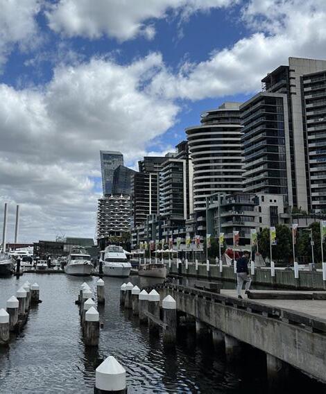
Hanna, E. (2023). View across the NewQuay / Waterfront City precinct from the public promenade.
Hanna, E. (2023). Problematic interface between Footscray Road, a shared footpath, and the new Docklands primary school.
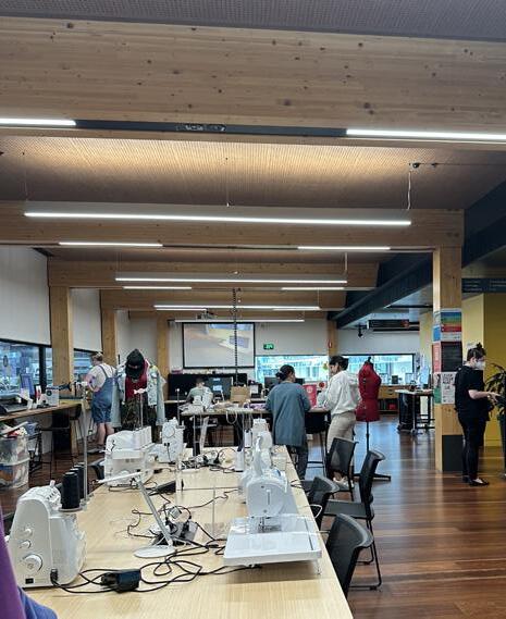
Hanna, E. (2023). Interior of the Makerspace in the Library at The Dock
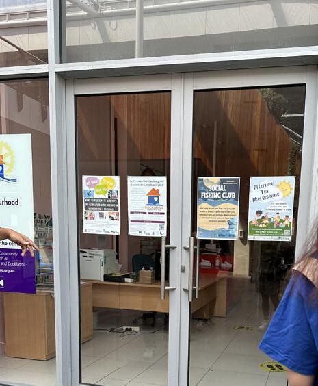
Hanna, E. (2023). Docklands pop up Neighbourhood House in The District shopping centre.
Hanna, E. (2023).View through Ron Barassi Senior Park to the Bolt bridge and Moonee Creek beyond.
Notes and reflections from an in Studio Lecture (March 9, 2023) by Elek Pafka; lecturer in Urban Planning and Design, and Docklands resident, entitled Enquiry by Mapping.
A lecturer in Urban Planning and Design but also a Docklands resident, with an interest in mapping and multi-scalar analysis of place.
Pafka stressed the importance of using mapping as a research method to better understand cities rather than as a simple wayfinding tool.
Pafka noted that the Marvel Stadium produces large peaks of pedestrian traffic that flood the area for prescribed periods, then soon leave. This has created a 'splintered urbanism', leading nearby retailers and restaurants to cater their opening hours to this seasonal timetable rather than residents or workers (as many haven't returned to the area due to the pandemic).
Perhaps due to the open and vast scale of the promenade and the area around the stadium, it was noted that people visiting the Docklands behave in ways that they wouldn't elsewhere, causing an escalating tension between temporary visitors and permanent residents.
It's clear that this difficult friction is increasing as the population grows and stabilises over time. Many families in the area feel their children are unsafe during these busy periods, as people don't adhere to common social norms when visiting the area in the same way they would in a more obviously domestic and residential setting. The area is seen as a place where people occasionally visit, or work in, rather than live.
Surprisingly, the introduction of the free tram zone into the Docklands reduced foot traffic for local retailers and restaurants as many opted to travel into the CBD during their breaks. This, in addition to Covid-19 restrictions and the advent of working from home has reduced the number of retailers in the area.
It was noted that developers often proposed public spaces in their projects to create bargaining power for an increase in tower height, or other changes to planning guidelines. In reality, as discussed with Fadi on site, this has lead to the provision of ill considered and quasi-public spaces within private buildings. For example, the green space on the roof of a commercial building was negotiated into a project as it was intended for use by kids from the newly built and green space constrained Docklands primary school.
This 'sky garden' was closed during work hours, and on weekends, so it was mostly used by the office workers who occupied the building. This was a developer tactically negotiating a taller building (arguably reducing nearby amenity by casting further shadows), by proposing a public park on its rooftop which is inaccessible to the public it was designed for and promised to.
Elek described the Ron Barassi Senior park as being heavily used and popular with the school. Residents also love the Docklands park, utilising it for picnics or simply for its tranquil native gardens. A tram stop is being considered for the North East corner of the school.
Elek described the "big body of water" separating NewQuay from Victoria Harbour as a disconnecting barrier, suggesting that linking the two could be a way of harnessing synergies between them. Apart from the Ron Barassi Senior park and the Moonee Ponds creek trail it adjoins, most of the western side of the Docklands terminates in a dead end, bookended by the Bolte Bridge, vacant land, or privatised land uses.
This text can be interpreted as a way of embracing and analysing the complexity of cities through mapping, mostly at the level of the human walking in the street, in order to uncover certain patterns, not limited to but including use, behaviour, design and social interfaces under the broader categories of Density (including Intensity), Mix (Functional) and Access.
A number of these maps, when read together, form a distinct view of a place through its relationship to the street, and thus, to people. Using this method to create maps of specific parts of the Docklands (NewQuay) uncovered spatial and social patterns that would otherwise not have been obvious. The process revealed latent conditions, such as the frequency of interfaces into public/private/semi-private spaces and how that might have lent associated footpaths their perceived positive, or negative urban qualities. Although this too is culturally and temporally subjective.
The challenge with mapping in such a way, where maps are formed through a 'multiplicity of tracings', is knowing when (and where) to stop recording and presenting information, and knowing which information is most important to convey. There are an infinite number of Assemblages at play in city streets which are constantly changing by the hour, day or season. Another pragmatic challenge was mapping certain characteristics using symbols without confusing the overall diagram and sense that the map was trying to convey.
These maps, and observations can provide clues as to how a place, and possibly a city at large, is functioning beyond binary terms. They can uncover differences, subtle or obvious, in a place which may have been overlooked. As a result, they can help to hint at possible ways of modifying or providing design responses that tie into, add, or suggest changes to these existing socio-spatial qualities in am abstracted way that is, when successful, easy to interpret and discuss.
60 61
Kim Dovey - Mapping Urbanities
Class Lecture by Elek Pafka
Docklands Primary School
The newly opened 3 storey Docklands Primary school at 17 Little Docklands Drive straddles the busy arterial Footscray Road. "Terracing" of the school was used as a strategy to maximise outdoor space for students. The form terraces and wraps around an outdoor basketball court and play area. Having walked past the school and after our discussion with the school principal Adam Bright, it's clear that the initial aspiration for "community engagement", shared spaces and access is desirable in theory but much more difficult in practice.
The school, like many private developments in the Docklands (although perhaps here by necessity given the age of students, increasing safety concerns, and its busy urban location) feels inwardly focused and uninviting from the street interface. Shared community use takes place primarily outside of school hours, mininising the chance of overlapping demographics and hindering the sense of community building. Perhaps this could change over time as the strained capacity (discussed on the following pages) is dealt with.
Clarke, P. (2021). Half Size outdoor basketball court facing Little Docklands Drive (North). Furniture is in built, and hard wearing. Soft landscaping appears scattered around the courts, while lining the edges of the street interface and acting as a softer, buffer.
Although the selected site for this Thesis is also located at the edge of the Docklands (west rather than east), in contrast to the Primary School, it benefits from its adjacency to the waterfront, a large public park and minimal vehicular traffic. Coupled with the projects promotion of the independence that occurs as students enter secondary school, as well as its aspiration to be a social anchor and link, it embraces porosity and invitation, while attempting to maintain security and safety for residents and students through its siting and planning.
Clarke, P. (2021). Full Size Indoor Basketball/ Netball court with a "tilt-up" door connecting to the exterior. Safe use of the space appears to be reliant on artificial light. The scale and planning of the space, and the amount of seating would limit the ability to hold indoor gatherings or assemblies with the entire school cohort. Are there any public indoor event spaces/halls large enough to cater for these important occasions?
Clarke, P. (2021). Brick bleacher seats and connective stairs to the Level 1 and 2 "learning communities".
Clarke, P. (2021). View of Learning Community with two classes taking place simultaneously. Note the potentially problematic lack of acoustic or visual separation between spaces.
Clarke, P. (2021). Aerial view of school from adjacent vacant land looking east to the CBD.
62 63
Notes and considerations from an in Studio Zoom Lecture (May 9, 2023 in MSD building, room 240) with Adam Bright; founding Principal at Docklands Primary School since its establishment in 2020.
The school was designed with a capacity for 525 students, which most soon realised was inadequate as 544 students are currently enrolled. The demand continues to grow, constraining the already inadequate facilities. The projected capacity of the school is 700-840 students. This projection doesn't factor in future residential developments, with up to 4000 apartments are expected to be built in the coming years.
Spaces in the nearby District Docklands shopping centre have been secured as temporary classrooms for 5 years to deal with growing enrollments. This move has been considered a compromise with potentially negative impacts on students learning experiences, as some of the spaces have been described as unsuitable for learning, and potentially posing a safety risk as there is no dedicated entrance proposed for the classrooms in the shopping centre (Schout, 2023).
Unlike suburban schools or larger inner city schools on vacant blocks of land, Docklands Primary is located in a constrained urban setting meaning there is no possibility for temporary (or demountable) classrooms to be built on site as would often be the case elsewhere. This has lead to a need for a second school campus.
The VSBA (Victorian School Building Authority) advises in their capacity and area allocations that classrooms should allow for 25 students. Yet, this differs from the teachers agreement which states that from grade Prep to Year 2 the class size should be 21. The school can't accommodate this number, so other spaces, not intended for use as classrooms have been repurposed. For example, the Art Room, and shared Wet Area Zones have become quasi-classrooms, removing this much needed amenity and use from the school, and potentially hindering students learning experiences at a crucial age, in an area with little other similar infrastructure.
The conversation alluded to a criticism that this thesis aims to respond to, which is the disconnect between social infrastructure in the area, such as the Primary School and Ron Barassi Park, and the school and the Library at the Dock.
Bright suggested that other, perhaps more suitable, parcels of land were available in the Docklands when the school was being envisaged but were avoided for economic reasons. He also noted, and lamented the fact that new principals are typically engaged around six months prior to the opening of new schools. This is obviously too late to have a meaningful impact on the design of a new campuses and its facilities, let alone its location. Money and land 'value' continue to plague the Docklands and its planning, hindering the creation of successful and sustainable social infrastructure networks. This criticism ties into issues that this thesis aims to respond to, which is the disconnect between social infrastructure in the area, such as the Primary School and Ron Barassi Park, and the school and the Library at the Dock.
Importantly, Adam described that a significant issue with the school was a lack of adequate spaces for students to be physcially active, either indoors or outdoors, during recess or lunch. The basketball stadium in the school quickly reaches its safe capacity, noting that all 538 students would use the stadium at once if they were allowed to.
An initial design idea by Cox Architecture was for a taller vertical school with an oval beside it but this was unfortunately abandoned for unknown reasons. The campus was described as "stunning", with its nooks/crannies, and beautiful places for students to sit, relax and be passive on their own or with friends. However, for most kids between 5-12, they have a strong desire to be active, sitting and playing passively isn't a high priority most of the time, especially after being in classrooms for most of the day.
Regrettably, this lack of adequate facilities for free play would undeniably have a negative impact on students relationship to physical activity, no fault of their own, at a time when life-long relationships and habits are being formed. Spatial and urban restrictions can have lasting negative social, physical and mental impacts on residents of various ages living in urban areas. Simple operable walls between the schools larger open plan learning areas was also rated highly on the Principals wishlist. Used at teachers discretion, these would provide spatial and acoustic separation, combating issues with the current open plan, where competing noises between classes often hinder student learning outcomes.
Visual openness was also seen as problematic as students get distracted during classes, often peering into activity in neighbouring spaces.
Adam also discussed the community change that has occurred in the Docklands post covid. A main issue was an increase in residential rents causing a demographic shift, and putting pressure on families to move away from the area, to more affordable suburbs, limiting the potential for a sense of community to be created in the area, and for young students and their parents to build sustainable and healthy connections in the suburb.
It's important to consider that while these observations, critiques and reflections provided by Principal Adam Bright relate to the provision and running of a Primary School, they remain equally applicable to a Secondary School.
While shared use can be beneficial for schools and suburbs, it was noted that security posed the greatest challenge. Alleviating conerns through isolation of spacs and separate entry points.
For examples, the popular Basketball Court on Level 5 is shared with the community, and non school student users have no choice but to pass through the entire school to reach it. An active security system (which was retrofitted into the design recently) enables the school and various classrooms to be locked down, provided access exclusively to the sports courts. This is clearly a compromised solution, independent access and spatial separation between spaces and shared facilities should have been considered in the design, and has formed part of this thesis.
64 65
Class Lecture by Adam Bright (Principal at Docklands Primary School)
Mapping Social Infrastructure Networks Interview
Transcript of Interview with PHD candidate and design thesis tutor Natalie Miles conducted as research forming part of her PHD entitled "School and Community Infrastructure: A Network Analysis."
Questiosns from Natalie Miles in red colour, responses from Elias Hanna in black colour.
So, thinking back to these maps that you were producing on the social infrastructure networks, can you talk me through the decisions that you made with the methods that you chose to use in your maps?
think the decision to use a muted background with bright, bold colours to differentiate the different kinds of things I was showing was informed by the work of Elek Pafka and Kim Dovey, but also Bjarke Ingels, from BIG. Bold graphic colours to make the maps, which would have been pretty complicated otherwise, a bit more accessible to the desired audience. They start to get a bit complicated as there's more and more colours and more and more elements introduced.
Did you utilise any of the readings that were given in class about different mapping techniques?
Kim Dovey's "Mapping Urbanities" was probably the main reading. James Corners work to a lesser extent. The assemblage of the city and the different social infrastructure networks, how to map those graphically was a challenge. And, as the amount of information increased, the difficulty in reading the maps increased as well.
And so and then it looks like you've also used some of the social network analysis stuff as well coming into this one (Referring to Existing and Potential Social Network Analysis Map and Existing Social Network Clusters and Amenities Diagram)?
Yes. Which is just showing the variation of things that different social network hubs do. You know, the library wasn't just for books, it was for, community meetings, It was a place for people to study and whatnot. So the bigger circle sort of signifies the building, and a little small circle signifies the different activities that take place within the building. Yeah. Which was really difficult to map on a traditional orthographic map, but in a simplified social network diagram it was much simpler because you weren't worried about scale or spatial relationships so much. You're just concerned about activities and how they connected to other activities in the building, but also the broader site of the Docklands. It was much easier abstracting those things.
Reflecting on that process and, using those different techniques to show different things, what were the challenges that arose with the methods that you chose? And then, what parts of those maps do you think was successful?
think a big challenge was, especially with assemblage theory is when does an assemblage end? The complexity can be never ending. Where do you draw the boundary of the Docklands? People in the Docklands, might go to the city of Melbourne? And when does the map end? You know, someone living in the Docklands could use social network facilities in St. Kilda for instance. Using colour as a method to differentiate between things becomes less successful as there are more things because it's harder to discern between 20 colours than it is to discern between five.
And I guess the bigger the map gets, the harder it is to digest information on typical mediums like a piece of paper, for instance, printed out is less successful. think a social network map on a website, for instance, where you could change parameters and zoom in and out would be much more user friendly, as opposed to a scaled drawing because you could just have way more information that would be much easier to show using stuff like GIS mapping software. But I think that was the technique Elek Pafka and Kim Dovey used to generate their maps. A lot of the information that I sourced for the mapping was from Docklands News website. But interviewing people and interviewing Elek in class added another layer of networks that we hadn't considered because we weren't aware of them. I didn't know that there was a hub of 'hip hop' around the basketball courts near the hub until Elek pointed that out, and I wouldn't have noticed that as a pedestrian because don't live there. I don't have that lived experience. Interviewing people of different ages and getting their thoughts on social networks that they have personally in the area, or even beyond the Docklands would've added another layer of complexity.
So, guess, would you say some of the challenges were kind of drawing the edges around things, whether that's the whole map or, for particular groups of particular facilities?
Yes, and knowing when to stop with mapping and knowing when one map has too much information and when to create another map, I found initially that I may have had too many maps of different scales that could have just been one big map displaying the same information.
For instance, in combining like have here, statistics with the mapping works in some instances, but there's some statistics that census data doesn't have. So you sort of just trying to find the right or the best kind of statistics to suit, and sometimes it's just too much information that might be irrelevant to the maps and vice versa. That was a challenge.
So, combining the different types of information, spatial information versus relationships and connections?
Exactly, and statistical data like user groups, ages and gender etc. One of the most important bits of information got in the subject was that the number of people residing in the area increased after the primary school was built, the number of two to five year olds increased. That's something that would take a long time for census data to show. However,having Fadi from the City of Melbourne telling us that in conversation was a major driver early on for my project. So that's not something I could have researched as quickly online, it's more of a social conversation.
What advice would you give other people trying to map social infrastructure networks?
You can't map it all. And it's easy to map things you're interested in, I find, but using a variety of mediums for research was really helpful for me, even just searching "Docklands" on YouTube, or researching Docklands events and then going to the Docklands news website and just scouring from 2006 to now, as well as walking around and just taking photographs of posters in the district, for instance.
Unlikely places hold invaluable information, and noticing patterns was important to my project as it is now, and that wouldn't have happened if didn't go to the site visit and didn't notice that sports facilities or sports in the Docklands was such an important thing, like that pattern of use throughout the site and noticing which social infrastructure was constrained and why, and which age group felt excluded. It takes a little bit of time, but that was really important.
Are there any other sources that you used, any kind of literature on mapping or social infrastructure that you found that was useful?
If I was to do this again, I would look and want to do graphic design and how they distil presentations and using... forgot the name of those presentations... Petcha Kutcha just using that as a way of simplifying complexity in a way that's accessible. Yeah, knowing what information you're trying to convey. Also, researching the history of the Docklands at the same time as researching mapping techniques was helpful because it helped show why the city was the way it was. It's almost done in reverse to a “traditional” city. The social infrastructure came way later than it should have. But it's ending up in pockets of land that are left over. And how can you know, how do you deal with that Architecturally?
66 67
Precedent - Meadowbank School NSW, by Woods Bagot
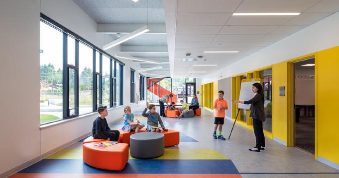
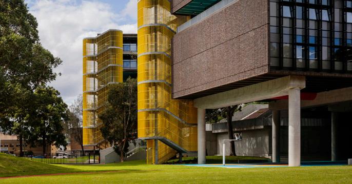
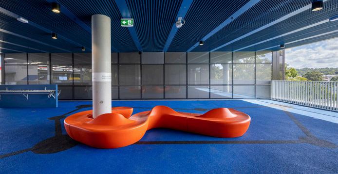
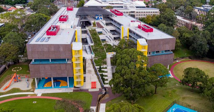
Two linear five storey wings of relatively standard program (classrooms and long open corridors) appear to be bisected by a triangular terraced garden and stairs. This green rupture through the buildings houses a library, auditorium, computer room and other study spaces. The terraced landscape provides students and faculty a direct connection to greenery from the various levels that adjoin them. Corridors, landings and other arrival points are stra tegically located to enable distant views out as students progress up the steps, or leave their classes, perhaps hinting at an independent future beyond school.
Often concealed spaces, like undercrofts, or fire escape stairs, are proudly celebrat ed through colour, siting and detailing. Strangely, the least interesting aspect of the project is the building masses them selves. Perhaps this is appropriate, given students touch, and engage with the other elements of the program more frequently.
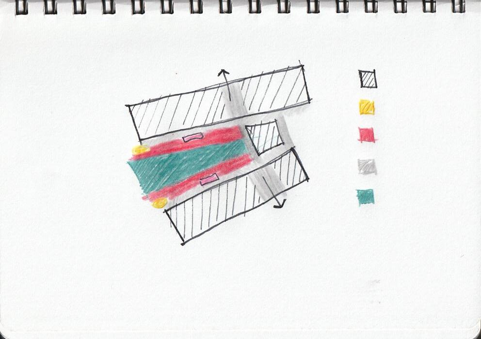
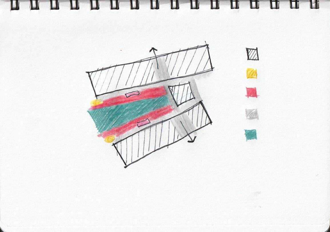
It appears the strategic siting, integration and detailing of these stairs celebrates and softens their otherwise monumental scale. This also encourages their regular use, promoting incidental exercise, as well as a natural connection across and through the site.
Gymnasium Space Designated Rooms
"Corridors" and Connections Stairs Lifts
Green/Open Space
Precedent - Browns Point Elementary School, USA by TCF Archi.
A relatively transparent, yet dark, U shaped two storey primary school. Horizontal continuity and connection is achieved through deep corridors where classrooms visually and physically spill out onto through strategic window placement and doors. Vertical connection is achieved through voids, stairs and mezzanine levels. Although "flexible areas" (deep corridors) occupy both levels, loud and busy activities take place on the ground floor.
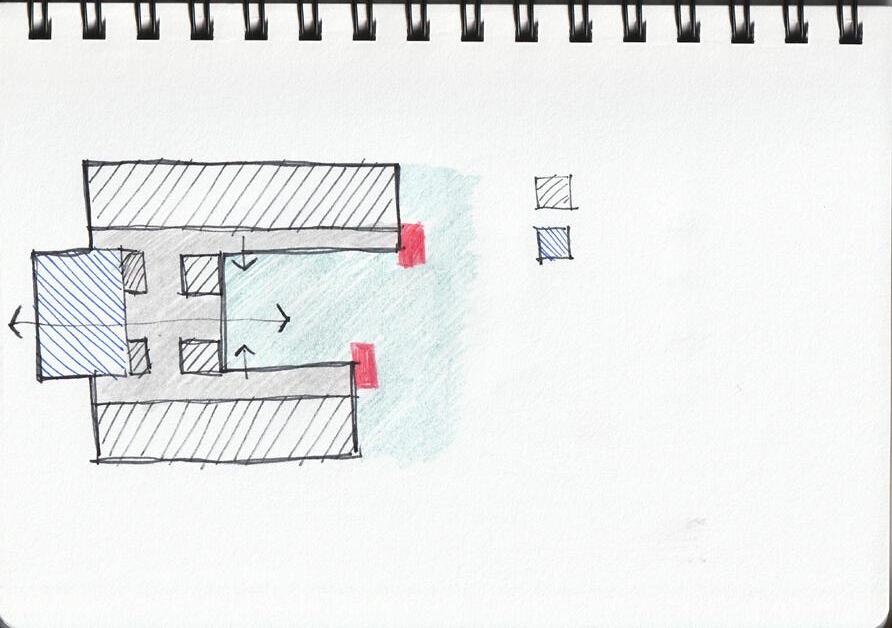
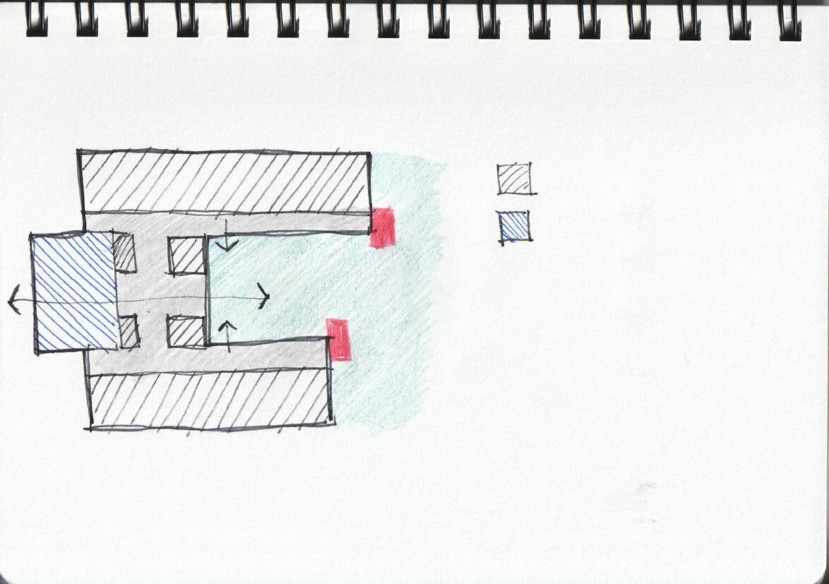
Deep canopies project out, protecting bold red stairs that straddle the projects main facade, and border the deep green courtyard which bisects the form, and seems to push out to the other end visually through the gymnasium.
The gym is celebrated through its siting and transparency, anchoring the end of the form to its sides, and connecting the central courtyard garden to the other end of the site. Beyond the graphic stairs, sporting is put on show to the faculty and the community, as activity and movement is celebrated.
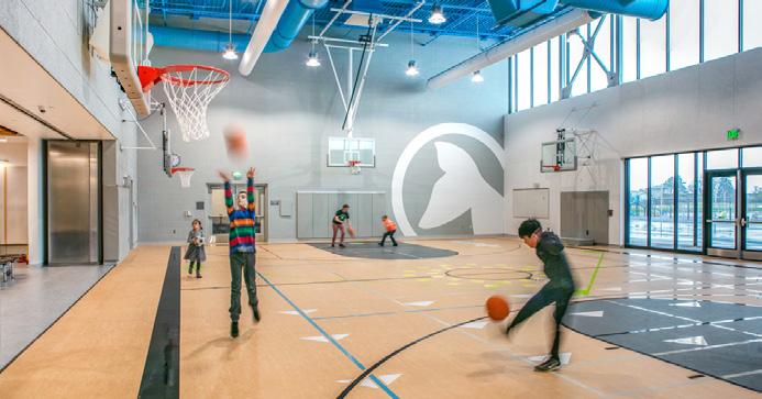
68 69
Mein, T. (2023). Aerial and overall view of Meadowbank Schools
Eckert and Eckert. (2018). View of garden courtyard and external circulation under deep awnings
Mein, T. (2023). Covered and activated outdoor areas between interior spaces
Eckert and Eckert. (2018). Small but multi-functional gym opening to common areas/exterior.
Mein, T. (2023). View of the south wing of the school
Lightcatcher Imagery. (2018). Deep multipurpose "flex areas" bookended by openings to outside.
Precedent - State Library of Queensland
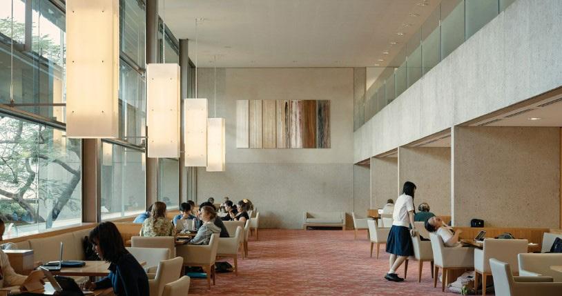 by Robin Gibson & Partners, redeveloped by D. Hill and P. Thorp
Precedent - Walyalup Civic Centre, WA by Kerry Hill Architects
by Robin Gibson & Partners, redeveloped by D. Hill and P. Thorp
Precedent - Walyalup Civic Centre, WA by Kerry Hill Architects
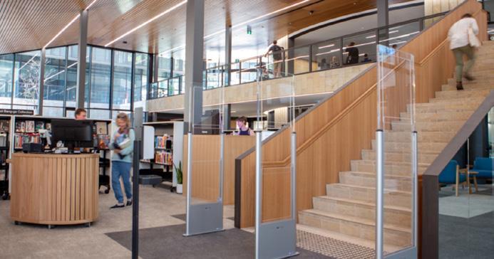
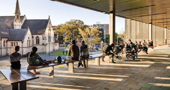
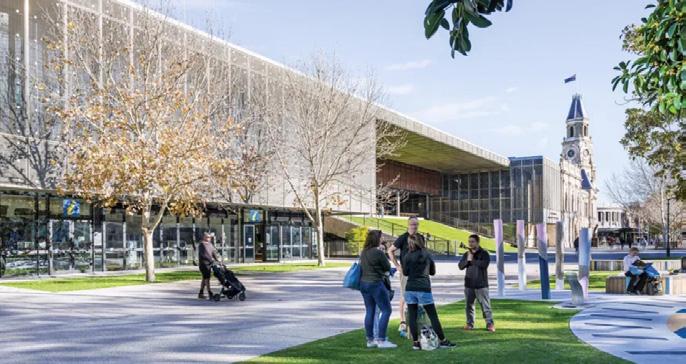
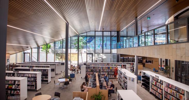
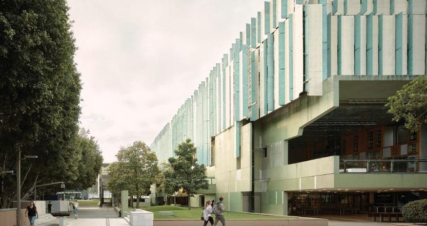
Within an architectural typology that strives to become a "public living room", this is an exemplar. Considering the direction of my thesis, I was drawn in particular to this projects looseness, as well as its spatial qualities. Although human scale is considered, the project remains spatially confident, complex and varied. Interior and exterior elements are treated with equal care, and outdoor spaces feel like rooms, or more fittingly for the Queensland context, (urban) verandahs.
Canopies and the building form seem to simultaneously gesture out and in,
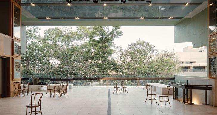
providing a social front door, and identity to the building. Few places in Melbourne, let alone the Docklands, seem to gesture in such a way, yet it seems to disarm peoples hesitance and encourage approach.
Entries, openings and stairs will elicit this invitational quality in my project.
An example of a subtle yet proud and considered civic presence that fostered regeneration and urban activity in and around itself, much like the aim of my project. Although this civic centre adjoins and sensitively responds to nearby urban heritage, these cues and responses to context are also relevant for my project in the Docklands, as civic and natural axes need to be considered and acknowledged in order to tie in successfully.
A sloping grass embankment is seemingly hung between two blocks of built program, while the roof continues over, uninterrupted, enabling use during rain and providing shade in summer, while allowing for sunlight penetration in winter. It provides a no cost gesture and offering to those who pass by, allowing for rest, people to each lunch, or individual or group gatherings.
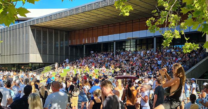
Although upper levels are enclosed in a metal mesh that unifies the various sides of the large facade, the ground floor appears to be mostly transparent and open, encouraging passerby in, or simply promoting curiosity, eyes on the street (passive surveillance) and civic engagement.

70 71
Starick, S. (2006).View of entry canopy and large threshold space (social front door).
Chatfield, D. (2023). View of civic presence, outdoor rooms and facade articulation.
Chatfield, D. (2023).View of the "Red Box" interior space and its curated views out/in
Chatfield, D. (2023).View from outdoor room to landscape beyond.
Chatfield, D. (2023). Interior study spaces and variation in scales.
Kerry Hill Architects. (2023). Internal transparency and interconnectedness between spaces.
Putrasia, N. (2023). Ground floor transparency, and civic presence/generosity.
Kerry Hill Architects. (2023). Consideration of human scale in the details within larger volumes.
Putrasia, N. (2023). External "rooms" engaging with adjoining heritage context and civic spaces.
Groen, J. (2022). Public ownership and use of green embankment hung between building form.
Precedent - A'Beckett Urban Square, Melbourne by
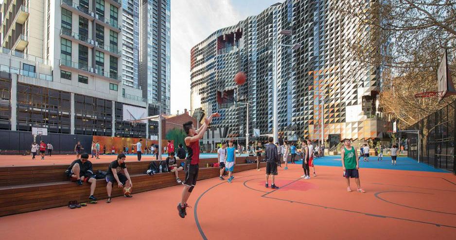
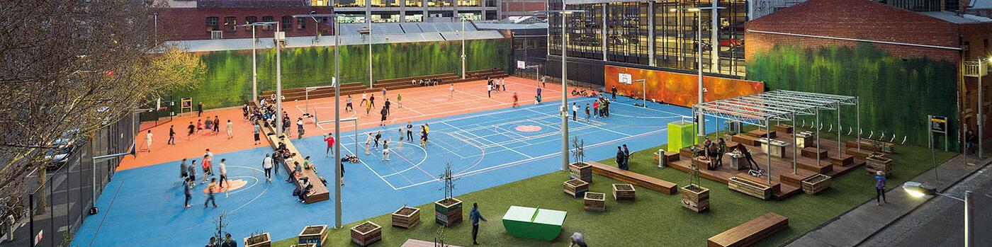 Peter Elliott Architecture + Urban
Design
Precedent - Box Hill Gardens Multipurpose Area by Aspect Studios and NMBW
The temporary transformation of an unused, barren asphalt, future development site (much like the site chosen for my thesis proposal), in Melbourne's CBD. It carefully balances a casual atmosphere with intense, energetic and activity inducing colours and graphics. Nothing is too precious, and all seem to be welcome.
Basketball rings when swung around become netball rings, and various linemarkings on the colourful floor enable different sports to take place over the same area. Deep and low seating allows for views to both sides, although a lack of backrests may be problematic for certain users over longer periods of time. It seems users are encouraged to feel a sense of ownership over the loose yet defined space.
The brightly coloured flooring and generally busy nature of the urban intervention signals energy, activity and openness to those who come across it. A challenge in my project is creating a similarly porous and generous atmosphere while integrating relatively large building(s) into the scheme. There is a risk that these buildings could isolate the sporting and open areas within and around the scheme into a (seemingly) private domain. However, the siting, and design of these spaces portray a sense of publicness, hopefully alleviating this concern.
Integrated within the historic Box Hill gardens, this project portrays the power of ordinarily insignificant linemarkings and colour to enable sporting activities across a shared surface. A 4 track running loop around various different sport fields encircles the public space. Although modest in scale, it works incredibly hard with a few elements, that tie together the intervention across the site. Furniture and built elements are kept minimal and are integrated purposefully with the surface designs. A brick plinth springs from concrete steps and carefully becomes a small shaded amenities block. Surface treatments and built
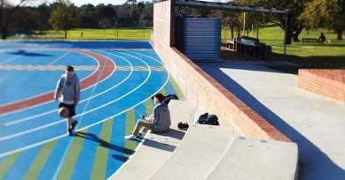
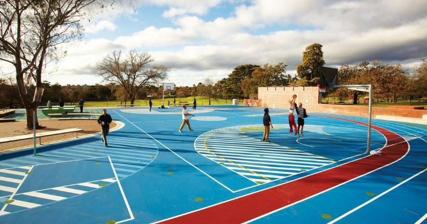
elements are distinct from one another yet have a linked relationship. This could be a way to deal with the various programs, and the large scale of my project.
A graphic pattern of yellow dots, or circles, is overlaid across the site, unifying the broad surface and the varying sports it enables. Although seemingly random and unnecessary this added layer of pattern also enables new kids to invent their own game, interacting with the landscape in new ways. A unifying pattern, or set of colours, could be strategically utilised to drive the distribution of elements across the large site, or link the sporting, open and green landscapes with eachother and with the architecture and built elements that surround it.
It could be useful as a wayfinding strategy as well as a graphic language that ties together distinct elements and uses. Sports aren't treated as sacred, they are defined through graphics and patterns as fun, socially important and inviting activities, that bring people together. The breaking up of regular, or strict linework that defines certain sports offers up more freedom in expression and engagement with its users. It allows users, young and old, to potentially invent new ways of playing and reducing the stigma of needing to be "good" at these often competitive games. It doesn't diminish the fun users have while playing.
This thesis isn't attempting to challenge the importance of high level competitive sports, but rather it hopes to encourage its users, students and others, to feel more comfortable engaging in physical activity and sport inside and outside of organised form and informal sports settings, in an area with an increasing interest and engagement with sports, however
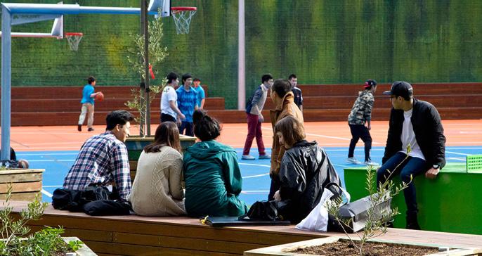
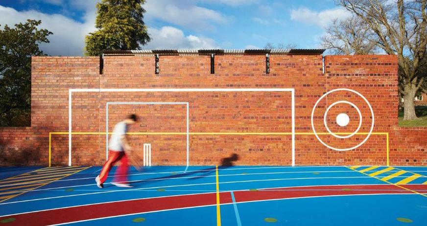
72 73
that might be.
Gollings, J. (2014). Multiple sports and activities overlap in the same outdoor space. Choices in weather protection, social engagement and seating to suit scale of groups are offered in a loosely defined but fun manner.
LLoyd, A. (2014). Overlapping activities continue into a vertical brick wall (concealing amenities behind).
Keating, A. (2014).View of the asphalt car park site owned by RMIT University before construction.
Keating, A. (2014). Human scale is considered and plants are subtly integrated into built elements.
LLoyd, A. (2014). Overlapping of graphics, patterns, colours and activities within defined zones.
Gollings, J. (2014). Deep and low communal timber benches allow multiple sports to be watched at once.
LLoyd, A. (2014). Concrete seats link to brick plinth that becomes amenities block.
Precedent - Rosewood Centre: Barker College, NSW by Neeson Murcutt Neille
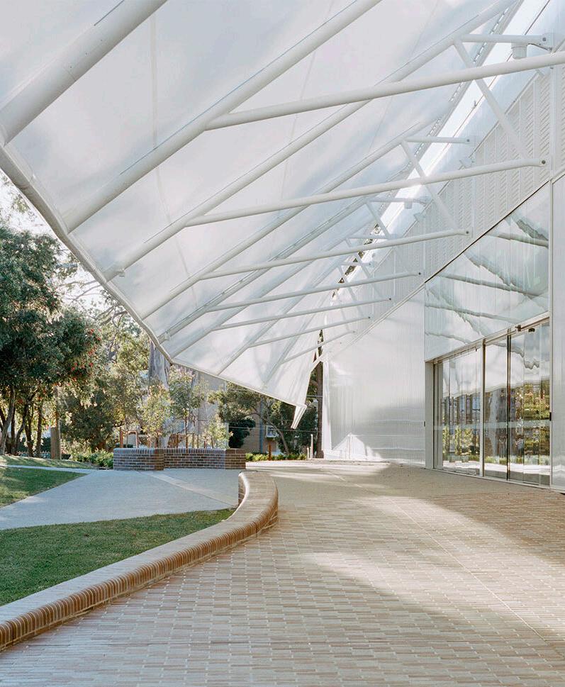
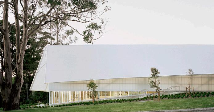
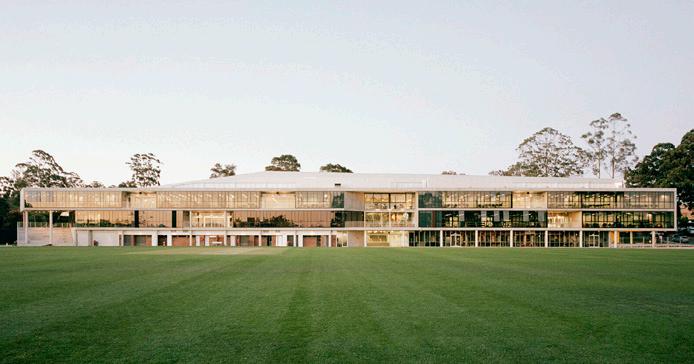
Envisaged as a "celebration of sport for all" (Johnson & Black, 2022, p.166) this large project contains five multi-use sports courts, amenities, 12 classrooms known as the linear "learning bar" on the southern end of the upper levels, multi-use learning spaces and a variety of seating and study options.
The two levels of classrooms and other facilities associated with the centre all overlook the sports fields from the projects southern end. Spaces in this project are connected vertically and horizontally through the strategic siting of large stairs and openings. Subtle moves in detailing such as the red handrails lining the upper balustrades, and the deep aluminum ceiling coffers, providing additional artificial lighting, give the otherwise monumental project a sense of playfulness and human scale.
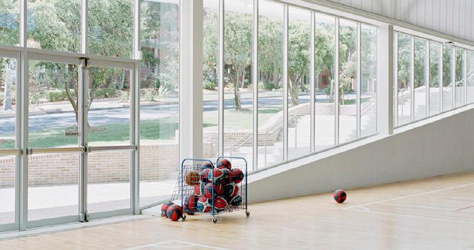
This project too holds an invitational quality, and a soft civic presence not commonly found in this building typology.
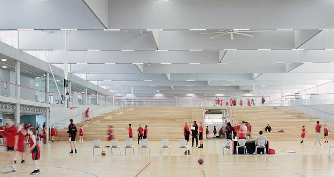
74 75
Gardiner, R. (2021). The mostly glazed carved linear "learning bar" lining the projects southern end.
Gardiner, R. (2021). Canopy awning reducing the scale of the large project and providing protection.
Gardiner, R. (2021). Timber bleacher seating enabling access through and to upper open levels.
Gardiner, R. (2021). View of entry into the sports hall from the northern facade.
Gardiner, R. (2021). The light and simple quality of interior spaces.
Design Development
Mapping Studies
Research through Mapping and Data
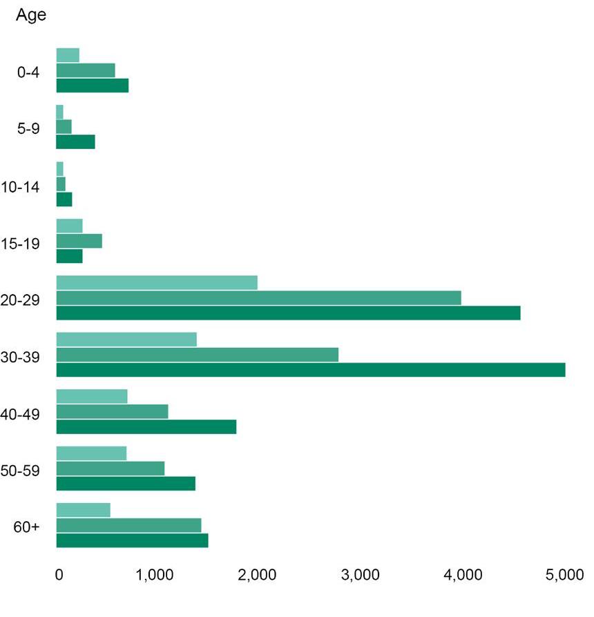

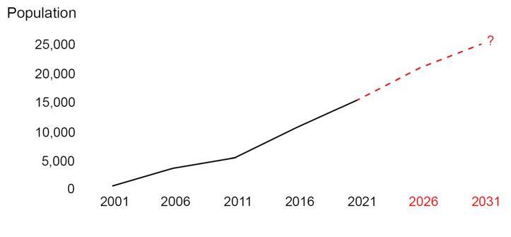
Analysis based on desk based research, consultation with peers and site visits to the area, which combined informed the focus and development of this Thesis project.
Existing
Space Map
VICTORIA HARBOUR YARRA RIVER Existing Green Space Existing Public Promenade/Civic Space 2,800,000 m 2,080,000 m Docklands Overall Area Docklands Land Area 500,000 m 2 1,000,000 m 2 1,500,000 m 2 2,000,000 m 2 2,500,000 m 2 3,000,000 m 2 City of Melbourne Reccomended Green Space Ratio 22m Green Space per person 6m Green Space per person Docklands Current Green Space Ratio with 17,000 residents Existing Green Space 104,000 m2 Existing Open Space 352,000 m2 440,000 m2 Green Space Reccomended for Current Population Green Space Reccomended for Future Population (17,000 residents) (25,000residents) Existing Outdoor Green Space Map 50 100200 500m Median Age 30-32 Water 103,000 m2 MOONEE
PONDS CREEK TRAIL
Green/Civic
VICTORIA HARBOUR YARRA RIVER Existing Green Space Existing Public Promenade/Civic Space 2,800,000 m 2,080,000 m Docklands Overall Area Docklands Land Area 500,000 m 2 1,000,000 m 2 1,500,000 m 2 2,000,000 m 2 2,500,000 m 2 3,000,000 m 2 City of Melbourne Reccomended Green Space Ratio 22m Green Space per person 6m Green Space per person Docklands Current Green Space Ratio with 17,000 residents Existing Green Space 104,000 m Existing Open Space 352,000 m 440,000 m Green Space Reccomended for Current Population Green Space Reccomended for Future Population (17,000 residents) (25,000residents) Existing Outdoor Green Space Map 50 100200 500m Median Age 30-32 Water 103,000 m
VICTORIA HARBOUR
MOONEE
PONDS CREEK TRAIL
Existing Green Space Existing Public Promenade/Civic Space 2,800,000 m2 2,080,000 m2 Docklands Overall Area Docklands Land Area 500,000 m 2 1,000,000 m 2 1,500,000 m 2 2,000,000 m 2 2,500,000 m 2 3,000,000 m 2 22m Green Space per person Existing Green Space 104,000 m2 Existing Open Space 352,000 m2 440,000 m2 Green Space Reccomended for Current Population Green Space Reccomended for Future Population (17,000 residents) (25,000residents) Water 103,000 m2 MOONEE PONDS CREEK TRAIL VICTORIA HARBOUR YARRA RIVER 500,000 m 2 1,000,000 m 2 1,500,000 m 2 2,000,000 m 2 2,500,000 m 2 3,000,000 m 2 440,000 m for Future Population (25,000residents) Median Age 30-32 VICTORIA HARBOUR YARRA
Existing Green Space Existing Public Promenade/Civic Space 2,800,000 m2 2,080,000 m2 Docklands Overall Area Docklands Land Area 500,000 m 2 1,000,000 m 2 1,500,000 m 2 2,000,000 m 2 2,500,000 m 2 3,000,000 m 2 City of Melbourne Reccomended Green Space Ratio 22m Green Space per person 6m Green Space per person Docklands Current Green Space Ratio with 17,000 residents Existing Green Space 104,000 m2 Existing Open Space 352,000 m2 440,000 m2 Green Space Reccomended for Current Population Green Space Reccomended for Future Population (17,000 residents) (25,000residents) Water 103,000 m2 MOONEE PONDS CREEK TRAIL Existing Green Space Existing Public Promenade/Civic Space 2,800,000 m2 2,080,000 m2 Docklands Overall Area Docklands Land Area 500,000 m 2 1,000,000 m 2 1,500,000 m 2 2,000,000 m 2 2,500,000 m 2 3,000,000 m 2 City of Melbourne Reccomended Green Space Ratio 22m Green Space per person 6m Green Space per person Docklands Current Green Space Ratio with 17,000 residents Existing Green Space 104,000 m2 Existing Open Space 352,000 m2 440,000 m2 Green Space Reccomended for Current Population Green Space Reccomended for Future Population (17,000 residents) (25,000residents) Water 103,000 m2 MOONEE PONDS CREEK TRAIL
YARRA RIVER
RIVER
337,000m2
VICTORIA HARBOUR YARRA RIVER MAR T ME PREC NCT SALTWATER WHARF PREC NCT MOONEE PONDS CREEK TRAIL FutureGreenlneProject 2,800,000 m2 2,080,000 m2 Docklands Overall Area Docklands Land Area 103,000 m Existing Green Space 104,000 m Existing Open Space 140,000 m Vacant Open Space 45,000 m Proposed Public Promenade Proposed Greenline Project 50,000 m Water (17,000 residents) (25,000residents) Existing Green Space Vacant/Potential Development Sites Existing Public Promenade Existing Key Social Infrastructure\ Existing Streets Future Public Promenade Proposed Greenline Project Existing and Potential Outdoor Green Space Map 50 100200 500m
(337,000 m 'required') SOCIAL CLUSTER NEW PEDESTRIAN BRIDGE. LINKING SOCIAL CLUSTERS 500,000 m 2 1,000,000 m 2 1,500,000 m 2 2,000,000 m 2 2,500,000 m 2 3,000,000 m 2 352,000 m 440,000 m Green Space Reccomended for Current Population Green Space Reccomended for Future Population Streets for mobility (and as public space?) 300,000 m VICTORIA HARBOUR YARRA RIVER SALTWATER WHARF PRECINCT MOONEE PONDS CREEK TRAIL Existing Green Space Vacant/Potential Development Sites Existing Public Promenade Existing Key Social Infrastructure\ Existing Streets Future Public Promenade Proposed Greenline Project SOCIAL NEW PEDESTRIAN BRIDGE. LINKING SOCIAL CLUSTERS VICTORIA HARBOUR YARRA RIVER SALTWATER WHARF PRECINCT MOONEE PONDS CREEK TRAIL FutureGreenlineProject 2,800,000 m2 2,080,000 m2 Docklands Overall Area Docklands Land Area 103,000 m2 Existing Green Space 104,000 m2 Existing Open Space 140,000 m2 Vacant Open Space 45,000 m2 Proposed Public Promenade Proposed Greenline Project 50,000 m2 Water (17,000 residents) (25,000residents) Existing Green Space Vacant/Potential Development Sites Existing Public Promenade Existing Key Social Infrastructure\ Existing Streets Future Public Promenade Proposed Greenline Project
337,000m2
(337,000 m 'required') SOCIAL NEW PEDESTRIAN BRIDGE. LINKING SOCIAL CLUSTERS 500,000 m 2 1,000,000 m 2 1,500,000 m 2 2,000,000 m 2 2,500,000 m 2 3,000,000 m 2 352,000 m2 440,000 m2 Green Space Reccomended for Current Population Green Space Reccomended for Future Population Streets for mobility (and as public space?) 300,000 m2
Existing and Potential Green Space Map
Future Privately owned Residential/Hotel
Public Park Space (Privately Owned)
Public Park Space (Publicly Owned)
Restricted/Fenced Green Space
Future Development Sites
Crown Land Outline (Publicly Owned)
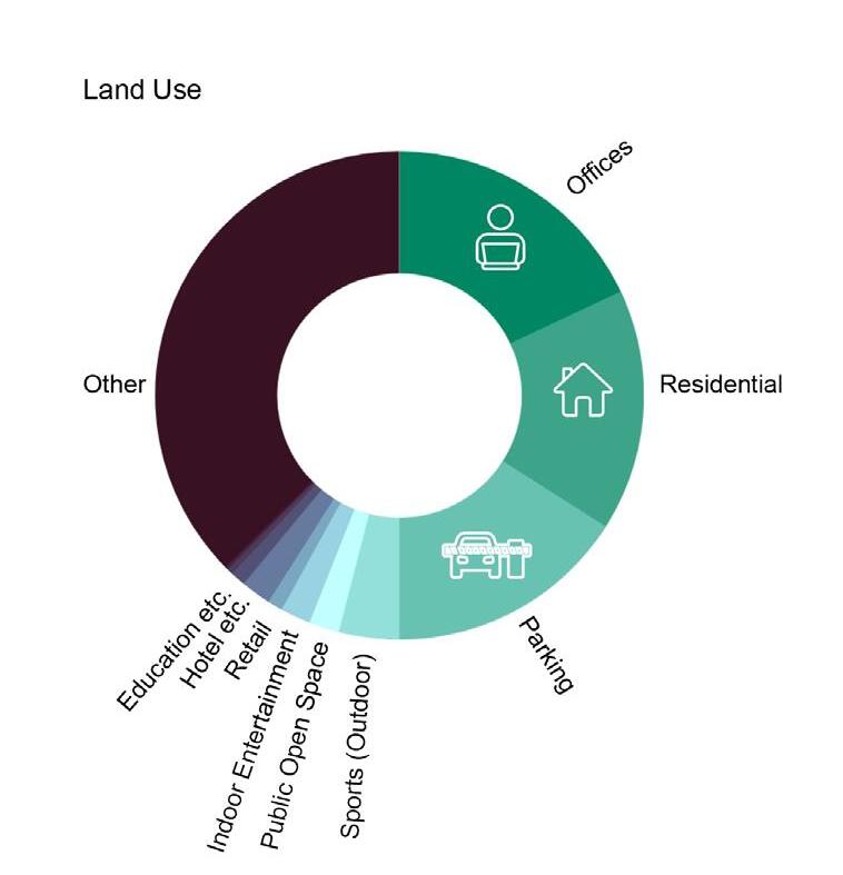

Future Privately owned Residential/Hotel
Public Park Space (Privately Owned)
Public Park Space (Publicly Owned)
Restricted/Fenced Green Space
Culturally Significant Building (Museum, Community Centre, Heritage Site etc.)
Carpark Film Studios
Public Educational Buildings
Nature Reserve
Commercial Buildings on Crown Land Public Promenade (Existing)
Culturally Significant Building (Museum, Community Centre, Heritage Site etc.)
Carpark Film Studios
Public Educational Buildings
Nature Reserve
Commercial Buildings on Crown Land
Public Promenade (Existing)
Restricted/Fenced Green Space Film Studios Public Promenade (Existing)
Docklands Public / Private Site Plan
Docklands Public/Private Site Plan
82 MOONEE PONDS CREEK
YARRA RIVER
VICTORIA HARBOUR
50 100200 500m
STREET
Docklands Public/Private Site Plan RFOOTSCRAY OAD COLLINS STREET LATROBE STREET BOURKE
SOUTHERN CROSSSTATION
RFOOTSCRAY
STREET
MOONEE PONDS CREEK VICTORIA HARBOUR YARRA RIVER
OAD COLLINS STREET LATROBE
BOURKE STREET SOUTHERN CROSSSTATION
STREET
VICTORIA HARBOUR COLLINS STREET LATROBE
BOURKE STREET SOUTHERN CROSSSTATION
MOONEE PONDS CREEK
VICTORIA HARBOUR YARRA RIVER 50 100200 500m
RFOOTSCRAY OAD
STREET
STREET
CROSSSTATION
COLLINS STREET LATROBE
BOURKE
SOUTHERN
Residential (Hotel/Serviced Apartments) Film Studios Residential Carpark (Entry or Spaces) Retail Educational Building (Public) Educational Building (Private Institutions) Commercial Offices Privately Owned Park Public Park/Trail Disused Carpark Fenced Off Development Site Couple Family without Children Couple Family with Children OneParent Family Family Composition Method of Travel to work Other 2011 2016 2021 0 (Studio) 2011 No. of Bedrooms 1 Bedroom 2 Bedrooms 3 Bedrooms 4 Bedrooms 2016 2021 Car Walking Tram Train Other/Worked fromHome 2011 2016 2021 Existing NorthQuay Isometric Residential (Hotel/Serviced Apartments) Film Studios Residential Commercial Offices Privately Owned Park Public Park/Trail Disused Carpark Fenced Off Development Site Couple Family without Children Couple Family with Children OneParent Family Family Composition Method of Travel to work Other 2011 2016 2021 0 (Studio) 2011 No. of Bedrooms 1 Bedroom 2 Bedrooms 3 Bedrooms 4 Bedrooms 0 1,000 2,000 3,000 4,000 2016 2021 Car Walking Tram Train Other/Worked fromHome 2011 2016 2021 Residential (Hotel/Serviced Apartments) Film Studios Residential Commercial Offices Privately Owned Park Public Park/Trail Disused Carpark Fenced Off Development Site Couple Family without Children Couple Family with Children OneParent Family Family Composition Method of Travel to work Other 2011 2016 2021 0 (Studio) 2011 No. of Bedrooms 1 Bedroom 2 Bedrooms 3 Bedrooms 4 Bedrooms 0 1,000 2,000 3,000 4,000 2016 2021 Car Walking Tram Train Other/Worked fromHome 2011 2016 2021 Residential (Hotel/Serviced Apartments) Film Studios Residential Commercial Offices Privately Owned Park Public Park/Trail Disused Carpark Fenced Off Development Site Method of Travel to work Car Walking Tram Train Other/Worked fromHome 2011 2016 2021 Residential (Hotel/Serviced Apartments) Film Studios Residential Carpark (Entry or Spaces) Retail Educational Building (Public) Educational Building (Private Institutions) Commercial Offices Privately Owned Park Public Park/Trail Disused Carpark Fenced Off Development Site Couple Family without Children Couple Family with Children OneParent Family Family Composition Method of Travel to work Other 2011 2016 2021 0 (Studio) 2011 No. of Bedrooms 1 Bedroom 2 Bedrooms 3 Bedrooms 2016 2021 Car Walking Tram Train Other/Worked fromHome 2011 2016 2021
Residential (Hotel/Serviced Apartments) Proposed Residential Towers Film Studios Residential Carpark (Entry or Spaces) Retail Educational Building (Public) Educational Building (Private Institutions) Commercial Offices Privately Owned Park Public Park/Trail Total Unoccupied Occupied Future Development ResidentialBuilding Footprint UnknownFuture LikelyResidentialDevelopment Park Road Dwelling Number 5,430 New Dwellings Dwellings 0 10,000 + 20,000 Summer Solstice 3pm Shadows 21980m2 Site Area 15% 15% 34% 36% Proposed Residential Towers ResidentialBuilding Footprint UnknownFuture LikelyResidentialDevelopment Park Road Dwelling Number Future Development NorthQuay Isometric Summer Solstice 3pm Shadows 21980m2 Site Area 15% 15% 34% 36% Residential (Hotel/Serviced Apartments) Proposed Residential Towers Film Studios Residential Carpark (Entry or Spaces) Retail Educational Building (Public) Educational Building (Private Institutions) Commercial Offices Privately Owned Park Public Park/Trail Total Unoccupied Occupied Future Development ResidentialBuilding Footprint UnknownFuture LikelyResidentialDevelopment Dwelling Number 5,430 New Dwellings Dwellings 0 10,000 + 20,000 21980m2 Site Area 34% 36% Future Development NorthQuay Isometric Residential (Hotel/Serviced Apartments) Proposed Residential Towers Film Studios Residential Carpark (Entry or Spaces) Retail Educational Building (Public) Educational Building (Private Institutions) Commercial Offices Privately Owned Park Public Park/Trail Total Unoccupied Occupied Future Development ResidentialBuilding Footprint UnknownFuture LikelyResidentialDevelopment Park Road Dwelling Number 5,430 New Dwellings Dwellings 0 10,000 + 20,000 Summer Solstice 3pm Shadows 21980m2 Site Area 15% 15% 34% 36%
BOLTEBRIDGE
BOLTEBRIDGE OVER
FOOTSCRAY ROAD
FOOTSCRAY ROAD
FOOTSCRAY ROAD
BOLTE
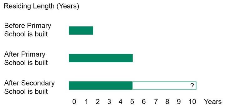
BOLTEBRIDGE OVER
FOOTSCRAY
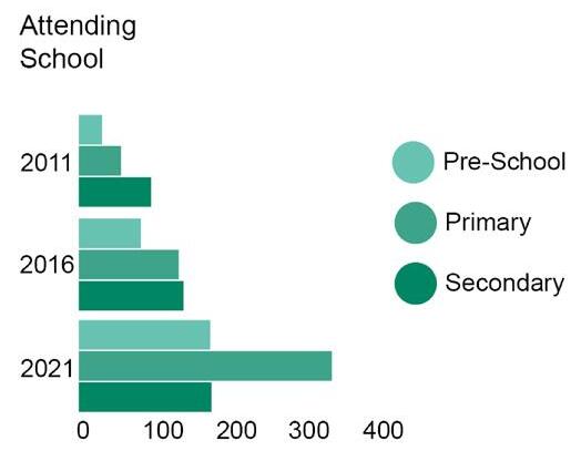
VIEWS TO VIC. HARBOUR & THROUGH TO NORTH WHARF ~15 Minute Walk 0.8km to Ron Barassi Snr Park
HARBOUR
VICTORIA
HA R B OU R E S P L AN A D E
OVER NO ACCESS
LARGER MAP DOCKLANDS DRIVE ~20 Minute Walk 1.1km to Flagstaff Gardens ~25 Minute Walk 1.3km from Batman's Hill Visit Parking Work Live/Visit/ Work Parking Live Live/Visit Work/VisitWork/Visit Work/Visit Live/Visit Work Work/Visit ~10 Minute Walk 0.4km to NewQuay Central Park 50 100 200 Existing -Primary School to Ron Barassi Senior Park 25 4km Simonds Catholic College, West Melb. 25km 4 5km St Aloysius Colege North Me bourne University High School, Parkville Views to Ron Barrasi Senior Park Growth Occured after Primary School Built Transparent Interface Opaque Interface Semi-Opaque Interface View Through View Out (Not In) Vehicle Interface Private Interface Public Interface Semi-Public Interface Open Outdoor Interface 7% 8% 27% 35% 25%
REFER
REFER LARGER MAP DOCKLANDS Visit Parking Work Live/Visit/ Work Parking Live Live/Visit Work/VisitWork/Visit Work/Visit Live/Visit ~10 Minute Walk 0.4km to NewQuay Central Park Simonds Catholic College, West Melb. 25km 4.5km St. A oys us College North Melbourne Views to Ron Barrasi Growth Occured after Primary School Built Transparent Interface Opaque Interface Semi-Opaque Interface Vehicle Interface Private Interface Public Interface Semi-Public Interface Open Outdoor Interface 7% 8% 27% 25%
OVER
MAP Visit Parking Work Live/Visit/ Work Parking Live Live/Visit Work/VisitWork/Visit Live/Visit ~10 Minute Walk 0.4km to NewQuay Central Park Simonds Catholic College, West Melb. 25km 4 5km St Aloysius Co ege North Melbourne Views to Ron Barrasi Senior Park Growth Occured after Primary School Built Transparent Interface Opaque Interface Semi-Opaque Interface Vehicle Interface Private Interface Public Interface Semi-Public Interface Open Outdoor Interface 7% 8% 27% ~15 Minute Walk 0.8km to Ron Barassi Snr Park
ROAD ~20 Minute Walk 1.1km to Flagstaff Gardens Simonds Catholic College, West Melb. 25km 4 5km College, ourne University High School, Parkville Growth Occured after Primary School Built Transparent Interface Opaque Interface Semi-Opaque Interface View Through View Out (Not In) Vehicle Interface Private Interface Public Interface Semi-Public Interface Open Outdoor Interface 7% 8% 27% 35% 25% ~15 Minute Walk 0.8km to Ron Barassi Snr Park
REFER LARGER
FOOTSCRAY
ROAD ~20 Minute Walk 1.1km to Flagstaff Gardens 4km Simonds Catholic College, West Melb. 25km 4 5km St Aloysius Co ege North Me bou ne University High School, Parkville Growth Occured after Primary School Built Transparent Interface Opaque Interface Semi-Opaque Interface View Through View Out (Not In) Vehicle Interface Private Interface Public Interface Semi-Public Interface Open Outdoor Interface 7% 8% 27% 35% 25% VIEWS TO VIC. HARBOUR & THROUGH TO NORTH WHARF ~15 Minute Walk 0.8km to Ron Barassi Snr Park VICTORIA HARBOUR
HA R B OU R E S P L AN A D E
NO ACCESS REFER LARGER MAP DOCKLANDS DRIVE ~20 Minute Walk 1.1km to Flagstaff Gardens ~25 Minute Walk 1.3km from Batman's Hill Visit Parking Work Live/Visit/ Work Parking Live Live/Visit Work/VisitWork/Visit Work/Visit Live/Visit Work Work/Visit ~10 Minute Walk 0.4km to NewQuay Central Park 50 100 200 Existing -Primary School to Ron Barassi Senior Park 25 4km 25km 4 5km S A oys us Co ege No h Me bourne School, Parkville Views to Ron Barrasi Senior Park Growth Occured after Primary School Built Transparent Interface Opaque Interface Semi-Opaque Interface View Through View Out (Not In) Vehicle Interface Private Interface Public Interface Semi-Public Interface Open Outdoor Interface 7% 8% 27% 35% 25% VIEWS TO VIC. HARBOUR & THROUGH TO NORTH WHARF ~15 Minute Walk 0.8km to Ron Barassi Snr Park VICTORIA HARBOUR
HA R B OU R E S P L AN A D E BOLTEBRIDGE OVER NO ACCESS REFER LARGER MAP DOCKLANDS DRIVE ~20 Minute Walk 1.1km to Flagstaff Gardens ~25 Minute Walk 1.3km from Batman's Hill Visit Parking Work Live/Visit/ Work Parking Live Live/Visit Work/VisitWork/Visit Work/Visit Live/Visit Work Work/Visit ~10 Minute Walk 0.4km to NewQuay Central Park 50 100 200 Existing -Primary School to Ron Barassi Senior Park 25 4km Simonds Catholic College, West Melb. 25km 4 5km St A oys us Col ege Nor h Melbou ne University High School, Parkville Views to Ron Barrasi Senior Park Growth Occured after Primary School Built Transparent Interface Opaque Interface Semi-Opaque Interface View Through View Out (Not In) Vehicle Interface Private Interface Public Interface Semi-Public Interface Open Outdoor Interface 7% 8% 27% 35% 25% Existing - Primary School to Ron Barassi Snr Park
Views Transparent Interface
Opaque Interface
Semi-Opaque Interface
Carparking
Bollards (With Rail)
Signage
Pedestrian Threshold (Public)
Pedestrian Access (Open)
Pedestrian Access (Open Informal)
ViewsThroughCreek toDocks/Containers
BOLTEBRIDGEOVER CARPARKBELOW
ThroughtoMoonee PondsCreekTrail
Low Height Threshold
Views
Transparent Interface
Opaque Interface
Semi-Opaque Interface
Carparking
Bollards (Open)
Bollards (With Rail)
Signage
Pedestrian Threshold (Public)
Pedestrian Access (Open)
Pedestrian Access (Open Informal)
Lawn Gravel Asphalt Playground
Dense Vegetation
Open Vegetation
ViewsThroughCreek toDocks/Containers
ViewsThroughParkBOLTEBRIDGEOVER CARPARKBELOW
ThroughtoMoonee PondsCreekTrail
First Views are to Grave Path Views Through to Victoria Harbour View Through Park Views Through to Victoria Harbour DOCKLANDS DRIVE ViewsThroughPark
50 100m Ron Barassi Senior Park Plan 5 1020
Most direct Pedestrian Access from Docklands Gravel Asphalt Playground
Vegetation Open Vegetation First Views Grave Path Views Through Victoria Harbour View Through
Dense
Most direct Access from
Ron Barassi
Snr Park Plan
Existing Social Network Toy Repair Cafe Community Hub at The Dock (Land Area: 1153 m2, Floor Area: ~1900m Hireable Multipurpose Room Terrace Playground Under y.o. Playgroup Family Support and Counselling Parenting Groups/ Parenting Services Family Services Centre Docklands Yacht Club Vic Dragon Boat Association Melbourne Outrigger Canoe Club Community Boating Hub Vasant Hindu Festival The Hub Docklands (operated by YMCA) Accessible Bathrooms Kitchenette Glasshouse (~25 people) Atrium (~70 people) Open co-working space Bookable Rooms Outdoor Basketball Courts Cinema Room (~30 people) Long Room (~15 people) Parkview Room (10 people) Consultation Room (3 people) Playground Gym 2 Bookable Basketball Courts Seating Table Tennis Storage Shed Toy Library Library at The Dock (Land Area: 1181 m2, Floor Area: ~2800m2 Buluk Park (Land Area: 4212m Open Lawn Space Kids Playground Fixed Tables and Seating Cafe Makerspace Community Meeting Space Flexible Performance Space Study Space Gallery Outdoor Seating Analogue and Digital Book Library Editing/Recording Studios Free Wi-Fi Homework Club Ron Barassi Senior Park (23250 m inc. Sports Club) Accessible Public Toilets Kitchen with Servery Window Multipurpose Room Docklands Sports Club (550 m ) Childrens Playground Carpark Adjacent Sports Fields Barbecue/Picnic Facilities Admin. Areas Walking Circuit After School Soccer Athletics Day Junior Cricket After Work Yoga AFL Auskick Equipment/ Cleaners Storage Off-Leash Dog Area Start of the Moonee Ponds Creek Trail The District Docklands Afternoon Tea Kids Play Sessions 2 x Kindergarten Rooms Admin. Areas Docklands Pop Up Neighbourhood House The Reading Room Toilets & Baby Change (Accessible) Magnet Galleries Art Gallery ArtVo ticketed Art Gallery Not for Profit Sanscare Docklands Primary School Outdoor Learning Terrace Kindergarten Rooms Admin. Areas Co-located Gowrie Docklands Kindergarten Music and Arts Rooms Indoor Sports Court (Basketball/ Netball) Classrooms Outdoor Learning Terraces Admin. Areas Library Basketball Program Second Hand Bookshop Carlton and Albert Park Rotary Clubs Artwork Exhibition Diwali Celebrations Docklands Gift Social Fishing Club Yoga & Mat Pilates The Centre Neighbourhood House North Melbourne What's Missing? Connect/Link Existing Key Social Infrastructure? Diwali Festival Dance Performances
and Amenities
Existing Social Network Clusters
References
Test
Bibliography Aira, T., Vasankari, T., Heinonen, O. J., Korpelainen, R., Kotkajurri, J., Parkkari, J., Savonen, K., Uusitalo, A., Valtonen, M., Villberg, J.,Vaha-Ypya, H., & Kokko, S. P. (2021). Physical activity from adolescence to young adulthood: patterns of change, and their associations with activity domains and sedentary time. International Journal of Behavioral Nutrition and Physical Activity, 18. https://doi.org/10.1186/s12966-021-01130-x
Azevedo, M. R., Araujo, C. L., da Silva, M. C., & Hallal P. C. (2007). Tracking of physical activity from adolescence to adulthood: a population based study. Rev Saude Publica, 41(1), 69-75. doi: 10.1590/s0034-89102007000100010. PMID: 17273636.
Australian Bureau of Statistics. (2011). Docklands 2011 Census All persons QuickStats. https://www.abs.gov.au/census/find-census-data/quickstats/2011/SSC20402
Australian Bureau of Statistics. (2016). Docklands 2016 Census All persons QuickStats. https://www.abs.gov.au/census/find-census-data/quickstats/2016/SSC20760
Australian Bureau of Statistics. (2021). Docklands 2021 Census All persons QuickStats. https://abs.gov.au/census/find-census-data/quickstats/2021/SAL20766
Australian Bureau of Statistics. (2022). Physical Activity: Contains key statistics and information about exercise and physical activity within Australia. Reference period: 2020-21 financial year.
https://www.abs.gov.au/statistics/health/health-conditions-and-risks/physical-activity/latest-release
Australian Government Department of Health and Aged Care. (2021). Physical Activity and Excercise Guidelines for All Australians: For children and young people (5 to 17 years).
https://www.health.gov.au/topics/physical-activity-and-exercise/physical-activity-and-exercise-guidelines-for-all-australians
Beyond Blue. (2023). Statistics: Children/Youth. https://www.beyondblue.org.au/media/statistics
Boys, J., & Jeffery, A. (2021). Educating the City: Urban schools as social infrastructure. University College London and the Bartlett Real Estate Institute.
Buxton, M., Goodman, R., & Moloney, S. (2016). Planning Melbourne, Lessons for a Sustainable City. CSIRO Publishing.
City of Melbourne. (2012). Docklands Public Realm Plan Melbourne.
City of Melbourne, Thomas Berrill Landscape Design PTY LTD & Environment & Land Management PTY LTD. (2012). City of Melbourne Open Space Strategy: Technical Report.
City of Melbourne & Places Victoria. (2012). Docklands Community and Place Plan.
City of New York. (2010). Active Design Guidelines,Promoting Physical Activity and Health in Design. Cleveland, B. (2016). A School but not as we know it! Towards Schools for Networked Communities. Australian Association for Research in Education (AARE) Conference 2016. http://hdl.handle.net/11343/191208
Cognigni, M., & Vettori, M. P. (2020). The practice of sport in the design of contemporary public space: La pratica sportiva nel progetto dello spazio pubblico contemporaneo. TECHNE - Journal of Technology for Architecture and Environment, (19), 142–152. https://doi.org/10.13128/techne-7832
Delanty, G. (2018). Introduction. In G. Delanty, Community (pp 1-10). Routledge.
Dovey, K. (2005). Fluid City. Taylor and Francis Group.
Dovey, K., Pafka, E., & Ristic, M. (2017). Mapping Urbanities - Morphologies, Flows, Possibilities. Routledge.
Fisher, K. (1998). Management of Physical Resources for Education. Making Better Use of School Buildings: Schools as Social Capital. OECD/EIB Seminar, Appraisal of Educational Investments; Indicators for Evaluating Educational Facilities and their Utilisation Luxembourg 1617 November, 1998.
Greater London Authority (GLA). (2021). Connective Social Infrastructure: How London's Social Spaces and Networks Help us Live Well Together. https://www.london.gov.uk/sites/default/files/connective_social_infrastructure_0_0.pdf
Guthold, R., Stevens, G. A., Riley, L. M., Bull, F. C. (2020). Global trends in insufficient physical activity among adolescents: a pooled analysis of 298 population based surveys with 1.6 million participants, Lancet Child and Adolescent Health, 4. https://doi.org/10.1016/S2352-4642(19)30323-2
Harper, H. (Host). (2023, March 28th). Life Matters: Menopause support and building a school from the ground up. [Audio Podcast].
https://www.abc.net.au/radionational/programs/lifematters/menopause-support-and-building-a-school-from-the-groundup/102098922
Hertzberger, H. (2013). Space and Learning: Lessons in Architecture 3 (English edition). 010 Publishers.
Johnson, A., & Black, R. (2022). Neeson Murcutt Neille - Setting Architecture. Thames & Hudson Australia.
Knuth, A. G., & Hallal, P. C. (2009). Temporal Trends in Pysical Activity: A Systematic Review. Journal of Physical Activity and Health, 6, 548-559.
Lubans, R. D., Morgan J. P., & McCormack A. (2011). Adolescents and school sport: the relationship between beliefs, social support and physical self-perception. Physical Education and Sport Pedagogy, 16(3), 237-250. https://doi.org/10.1080/17408989.2010.532784
Majoor, S. (2015). Retrofitting Melbourne Docklands, Opportunities and Constraints. Planning News, 41(2), 12-13.
Marks, J., Barnett, M. L., Strugnell, C., & Allender, S. (2015). Changing from primary to secondary school highlights opportunities for school environment interventions aiming to increase physical activity and reduce sedentary behaviour: a longitudinal cohort study. International Journal of Behavioral Nutrition and Physical Activity, 12 (59), 1-10. DOI 10.1186/s12966-015-0218-0.
Schout, D. (2023, March 29). Docklands Primary at capacity, set to use shopping centre for classrooms. Docklands News.
https://www.docklandsnews.com.au/docklands-primary-at-capacity-set-to-use-shopping-centre-for-classrooms/ Shaw, K. (2013). Docklands Dreaming: Illusions of Sustainability in the Melbourne Docks Redevelopment. Urban Studies at 50,50(11), 2158-2177.
Telama, R., Xiaolin, Y., Viikari, J., Valimaki, I., Wanne, O., & Raitakari, O. Physical Activity from Childhood to Adulthood: A 21-Year Tracking Study. American Journal of Preventive Medicine, 28(3), 267-273.
Victorian School Building Authority. (2022). Building Quality Standards Handbook. Victoria State Government.
Victoria State Government: Department of Education. (2021, December 15). Victorian schools win at 2021 Australian Education Awards.
https://www.education.vic.gov.au/about/news/Pages/stories-schools-win-australian-education-awards.aspx