
HIGHWAY 5 CORRIDOR LAND-USE & TRANSPORTATION STUDY



Rochelle Robinson
Terry Miller, Ward 1
Nycole Miller, Ward 2, Post 1
Mark Adams, Ward 2, Post 2
LaShun Burr Danley, Ward 3, Post 1
Sam Davis, Ward 3, Post 2
Chris Watts, Ward 4
Howard Estes, Ward 5
Marcia Hampton
DIRECTOR
Patrice Williams
April McKown
Marcus Thompson
Greg Roberts
April McKown - Douglasville Planning Manager
Chris Pumphrey - Elevate Douglas
David Connolly - SSP Arbor Center LLC
Marcia Hampton - City of Douglasville
Melissa Newborn - Citizen, Arbor Station
Michael Carey - Arbor Place Mall
Miguel Valentin - Douglas County Govt
Patrice Williams - City of Douglasville
Priscille/Curtis - Anderson at Bright Star Logistics
Ryan Anderson - City of Douglasville Zoning
Sawyer Williamson - Williamson Bros BBQ
Virgie Gordy - Citizen, Arbor Station
Mickey O’Brien - AECOM Project Director
Corey Klawunder - AECOM Project Consultant
Weiyi Zhou - AECOM Project Consultant
James Anderson - AECOM Traffic Engineering
Jordan Danzansky - AECOM Economic Analysis
The Highway 5 corridor experienced an onset of growth approximately 20 years ago, causing a high demand on the area’s mobility network. The Highway 5 area already sees heavy traffic congestion, and as the area continues to grow it has the potential to become a mobility chokepoint. The City of Douglasville retained AECOM to study the area to mitigate potential impacts of development on the City’s quality of life and to provide transportation and land-use solutions for the corridor as it continues to grow. The goal of this study is to build a vision for the Highway 5 corridor that synergizes land-use and transportation to ensure smart growth for the corridor into the future.

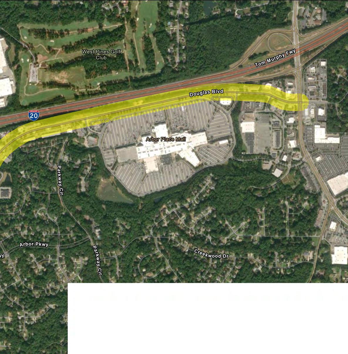
NOTE: Over the course of the study, it became clear that Douglas Blvd and Stewart Pkwy west of Highway 5 are critical to the success of the Highway 5 area, but were not included in the scope of work. This area is included in the maps throughout this document, but it is important to note that data such as traffic counts were only taken for roads highlighted in yellow above.
The study area is defined as follows:
• From the intersection of the Bright Star Connector and Highway 5 to the intersection of Stewart Parkway and Highway 5.
• On/off ramp of I20 at Highway 5
• From the intersection of Douglas Boulevard and Highway 5 to the intersection of Chapel Hill Road and Douglas Boulevard.
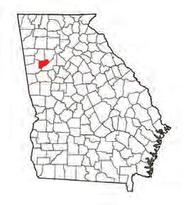
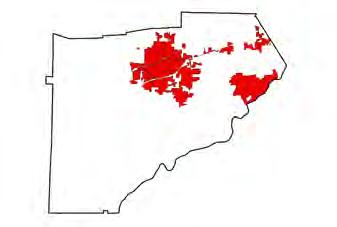
The pages that follow will provide a high level overview of the recommendations. These recommendations fall into four categories:

• ZONING & LAND-USE
• TRAFFIC IMPROVEMENTS
• MULTIMODAL IMPROVEMENTS
• STREETSCAPE & PLACEMAKING
Economic analysis indicates that there is pent-up demand for higher residential housing in the area. It is recommended to build a cohesive mixed-use zoning code that allows for up to 5 storeys and 20 units per acre with retail/commercial space on the bottom floor. This will increase the tax base, and create a more livable and healthy community for citizens.
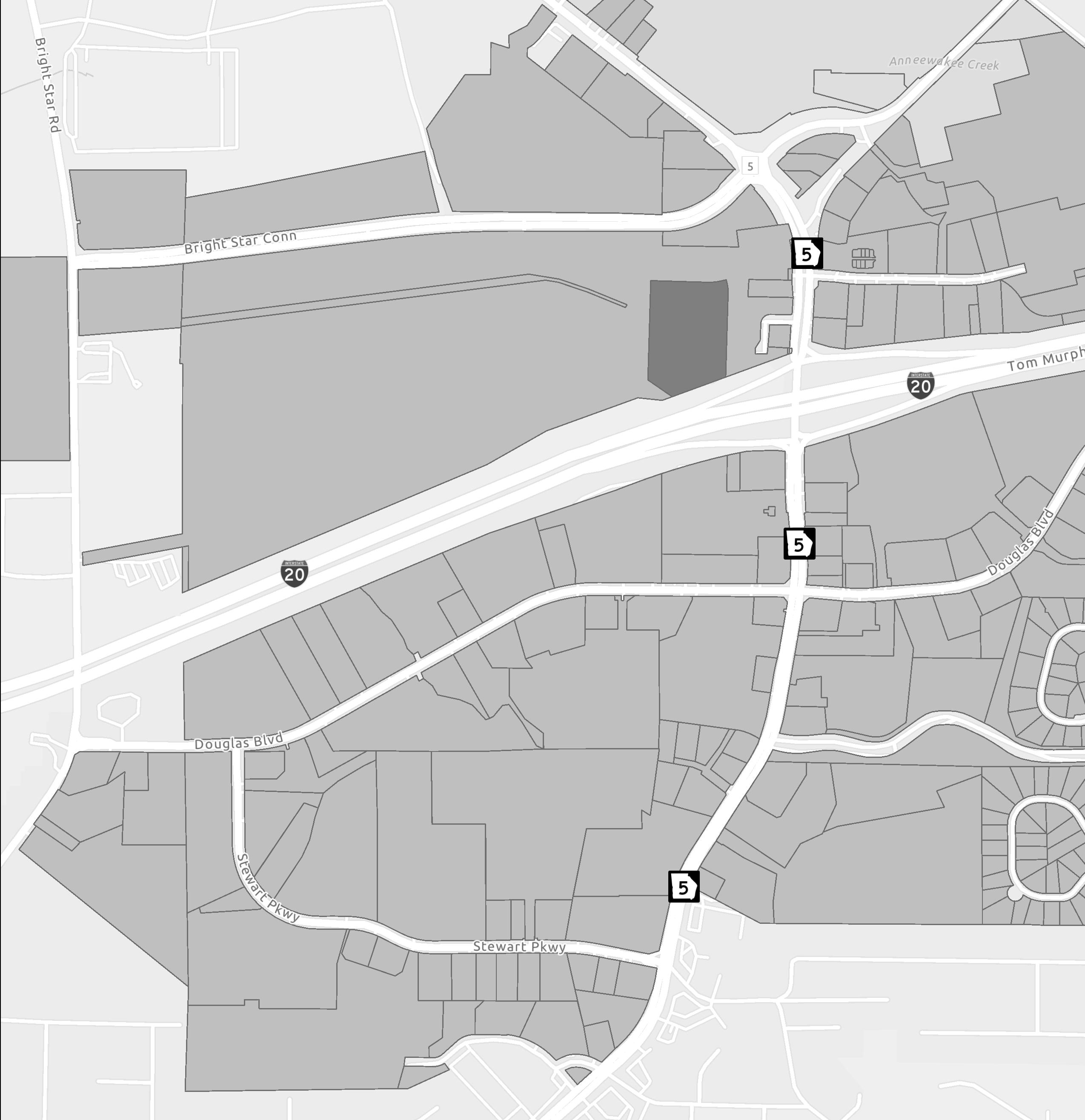

POTENTIAL ZONING OVERLAY AREA
Pilot the new mixed-use zoning code by redeveloping the Douglasville Town Center parcel into a mixed-use destination.
The goal of an overlay for the Arbor Place Mall is to prohibit industrial or warehousing land-use and preserve the mall as a potential live-work-play destination. An overlay will ensure that the City has a seat at the table if the site or another property within the district tries to pivot in this direction, which runs counter to the City’s goals for the study area.

Tweak zoning code to allow more infill development to leverage the many underutilized parking lots in the area. Given that most land in the city limits in the study area is built out, this is the best way to utilize existing land to bolster tax base.
Allow businesses to set their own amount of parking, which also permits them to reallocate their land for infill development. Consider parking maximums instead.
Tweak zoning code to allow more infill development to leverage the many underutilized parking lots in the area. Given that most land in the city limits in the study area is built out, this is the best way to utilize existing land to bolster tax base. Encourage or require developers to bring buildings to the front with parking in the rear to create a more walkable environment.
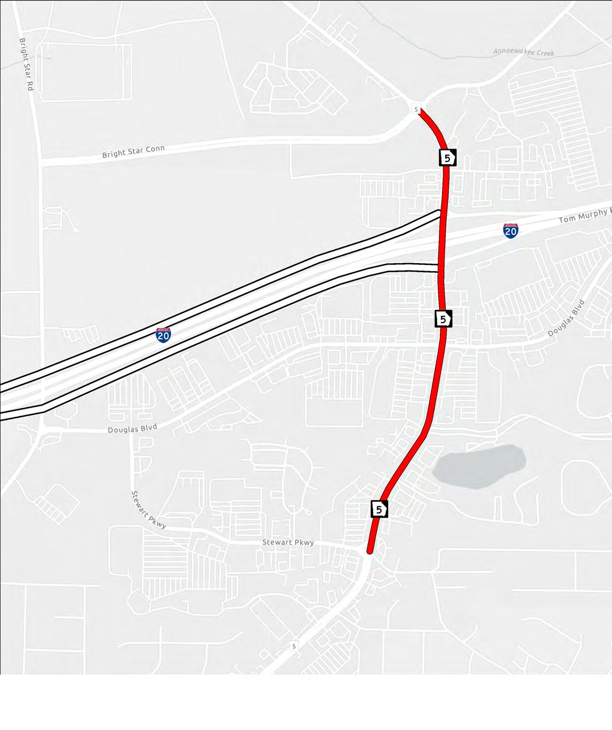
Traffic data indicates that widening SR 5 to six lanes will be necessary by 2050 to achieve an acceptable level of service. It is recommended to first implement other recommendations in this report such as the Bright Star exit ramps and ped/bike improvements to divert traffic to other exits/modes that also serve to make the area more pleasant for street life.
Built in 1964, the SR 5 bridge over I-20 will need to be replaced relatively soon. Widening SR 5 coupled with the Bright Star Rd improvements may bring the volume over the bridge in line with capacity. If those projects do not, or when the bridge naturally comes up for replacement, it is recommended to install a diverging diamond interchange for both capacity and safety.
In the short-term, build eastbound and westbound right turn overlap signals. In the longer term, add an additional northbound left turn lane.
From I-20 onto Bright Star Road allow people to bypass the worst of the congestion on SR 5 between the bridge over I-20 and Douglas Blvd. Dovetails with ARC-D003 that aims to widen Bright Star Road south of I-20. Bypass will remove congestion from the SR 5 bottleneck and activate the entire Stewart Parkway area to the west of the study area. The Park & Ride becomes much more convenient, which boosts utilization more than any other incentive. Stewart Parkway will see more activity, thus setting the stage for the Town Center Catalyst redevelopment.
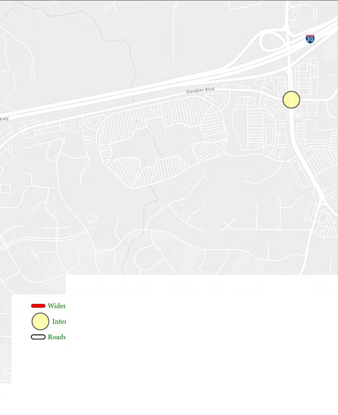
At the end of every trip, everybody becomes a pedestrian. Ensuring that all of the sidewalks in the area are connected is the first step to an effective multimodal system.
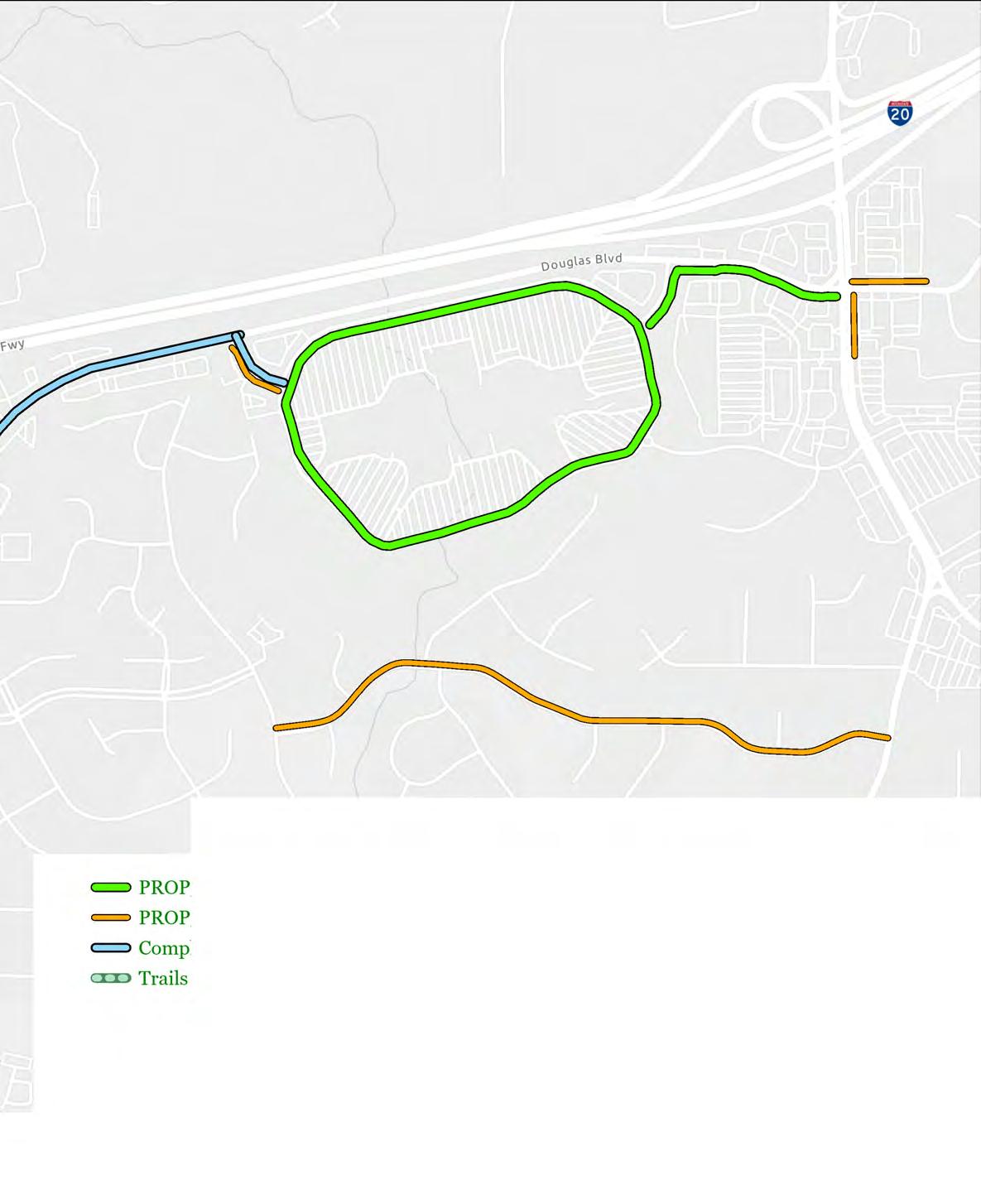
Shared-use paths are a great way to provide complete, comfortable connectivity for both pedestrians and cyclists along high speed high volume thoroughfares such as Highway 5. These facilities are recommended along Highway 5, along the east end of Douglas Blvd, and around the perimeter of the Arbor Place Mall to act as a recreational loop.


Wayfinding allows residents and visitors alike to travel safely and effectively when walking and biking. Good opportunity for branding.


Currently the area is serviced by the Douglas County bus system. The bus routes are not well-suited to circulation in the busy Highway 5 area. The City should work with the County to reevaluate their bus system and consider implementing a dedicated Arbor Place Shuttle as redevelopment and employment opportunities increase in the study area.

Mirror Fairburn Road Complete Street project on Douglas Blvd, Stewart Pkwy, and Concourse Pkwy. Reallocating the outside lanes to tree protected bike lanes will create bicycle connection and enhance walkability of existing sidewalks by making the thoroughfares more comfortable and pleasant for pedestrians. Coupled with zoning changes that encourage developers to build attractive streetscape up to the existing back of sidewalk will create vibrant pedestrian destinations.
Once Complete Streets Projects are built, provide a bikeshare program to encourage residents and commuters to utilize the bicycle network. Locations for the bikeshare stations are:
• Douglas County Park & Ride
• Arbor Place Mall
• Stewart Pkwy Kroger
• Walmart
Without bike infrastructure in the area and the inability to ride on sidewalks, it is effectively impossible to bike safely in the study area. Permit bikes to ride on the sidewalk where practicable. Stipulate that if pedestrians are present, bicyclists must dismount.


Enhance pedestrian safety and comfort - Improve street-level safety at specific locations to create a safer pedestrian environment.
Develop design, aesthetic, and visual enhancements for the corridor - Create and adopt Urban Design Guidelines to build a sense of place in the Highway 5 area. Includes palette of materials, furniture, lights, etc to maintain consistent theme.
Encourage green infrastructure development to decrease impervious cover - Consider zoning and fee incentives for developers who pursue building density, green spaces, pervious surfaces, and off-site water retention.

The Highway 5 Corridor (the “study area”), developed over 20 years ago. It is characterized by Arbor Place Mall, big box retail buildings, and large parking lots that front the corridor. These developments cater solely to the automobile. This type of development was sustainable but over the course of time, the rise of online shopping, the desire for a more walkable environment, and now the Covid-19 pandemic, have made this type of development pattern undesirable. Additionally, development dispersed in superblocks, which are city blocks separated by 800 feet or more, can discourage pedestrian activity and encourage pedestrian dangerous midblock crossings. We will identify inconsistencies with existing zoning and development patterns and provide recommendations that are consistent with the community vision and the needs of the Study Area. We will also provide an overview of existing transportation conditions and provide recommendations to transform this area so it is viable for appropriate redevelopment with complementary transportation facilities.
These large impervious areas can contribute to serious environmental problems. Dispersed
development, characterized by lower densities, few transportation options, and rigid separation of residences, jobs, and shops, can exacerbate air and water pollution, habitat loss, and a decline in ecosystem functions. Arbor Place Mall alone is over 80 acres of impervious surface therefore storm runoff and pressure on the storm drainage infrastructure can limit future growth. These developments can also increase the demands on the transportation system and reduce the efficiency of the system, as the same number of people and same level of economic activity generates more and longer trips. Managing these challenges is particularly demanding when transportation and land use are planned separately, as they are in most localities.
Appropriate transportation improvements make land more accessible and so increase the likelihood that it will be developed or redeveloped in a more efficient and sustainable manor. This project provides the opportunity for AECOM to assist the City of Douglasville to set in place a realistic plan which is implementable over time integrating future Land Use and Transportation solutions which is are sustainable and attractive.


Like many towns in Georgia, Douglasville was originally established as a commerce stop due to the active railroad line running though the City. At this time, the railroad was a sign of prosperity and was also the social hub, where citizens could pick up mail and goods. The train industry provided employment opportunities and access to other jobs in places with tremendous growth such as Atlanta and Birmingham.
Located approximately 20 miles west of Atlanta, Douglasville has experienced a tremendous amount of growth over the last 10 years. With its proximity to downtown Atlanta and Hartsfield Jackson Airport, Douglasville continues to be an appealing option for many.
Over the last 10 years, Douglasville leadership has been dedicated to planning for the future and providing a high level of quality of life to all citizens. As a result of this planning effort, Douglasville has completed and begun implementation on multiple plans including but not limited to: Comprehensive Transportation Plan, Citywide Bicycle and Pedestrian Connectivity Plan, Unified Development Code Rewrite, multiple LCI studies, and a Comprehensive Plan Update.
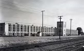

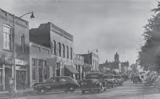
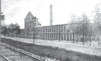
Douglasville’s population has boomed since the turn of the millennium. Today, its population is estimated at approximately 34,000 people for a 70% increase in 20 years. The future success of Douglasville will be aided greatly by retaining these young people who are attracted to places which provide walking and biking opportunities.


34,190 people
14,814 people
Total population in Douglasville Workers 16 years and over
1,518 people / mi2
Commute Modeshare
Like many cities in America, Douglasville’s citizens commute to work almost entirely by car. Almost 90% of people make their typical trip to work by driving. By contrast, only 1.4% of workers in Douglasville walk to work.


The ultimate goal is to provide The City of Douglasville with a Shared Vision for the Highway 5 Study Area that synergizes land-use and transportation to ensure smart growth for the corridor into the future.

Examine how population growth in the City of Douglasville has impacted transportation demand;
Address the mobility needs for users of all means of transportation, included but not limited to pedestrians, bicyclist, and drivers and passengers of motorized vehicles;
Conduct a traffic study of the existing network and analyze recently conducted traffic counts and crash data reports;
Review how changes in travel demand on the study area exert considerable influence on the development of new transportation infrastructure and services;
Conduct new traffic counts at intersections and high volume segments to ensure the feasibility of land use changes and bicycle and pedestrian improvements;
Develop and evaluate a wide range of transportation improvements with options including, but not limited to roadway widening, bike and pedestrian enhancements, safety improvements and improvements based on existing and forecasted traffic volumes.
Collect planning documents, policy statements, capital project information, metropolitan planning organization travel demand model, crash data and transportation study results from relevant projects need provide an analysis with strategies and recommendations;
Determining methodology and providing recommendations consistent with the Douglasville Comprehensive plan, DCTPD, Ped Bike, and UDO.
Analyze the existing zoning and general planned land use designations and examine the interaction between the existing transportation network and current land use.
Develop plans for a well designed network of streets along the study area, which are place based in their scope and design and can promote active transportation.
The goal of integrating land and transportation planning is to create a vision for land use in which transportation plays an integral role, ensuring that transportation projects have the effects that local communities desire and so are supported by the communities they serve.
Phase 1: Establishing the Baseline
The goal of integrating land and transportation planning is to create a vision for land use in which transportation plays an integral role, ensuring that transportation projects have the effects that local communities desire and so are supported by the communities they serve.
There will be a review of existing County and regional plans completed or underway that have direct or indirect association or implications on the Highway 5 Corridor Study Area. Traffic study will include historic traffic counts, previous traffic studies, the Douglasville plans mentioned in Task 2, crash data which will be obtained from the Georgia Electronic Accident Reporting System (GEARS), a review of planned projects in the Transportation Improvement Plan or Regional Transportation Plan, and a review of traffic in the ARC Travel Demand Model (TDM).
Phase 3: Public Involvement
The outreach for the Highway 5 Corridor Study would echo the approach for both broad general input as well as stakeholder outreach. Options may include using community workshops, postcard survey, online survey, project webpage, emails, social media, print media, and booths at public events tailored to the considerations of the global pandemic and social distancing..
Phase 4: Draft Recommendations
During the fourth phase, an draft recommendation report will be developed that blend the best elements of each scenario, based on analysis results and stakeholder input.
Phase 5: Final Documentation
The final phase included the revision, approval, and adoption of the Highway 5 Corridor Landuse and Transportation Study.
The following diagram illustrates the overall project timeline and major project milestones that occurred throughout each of the five project phases.
April 2021
Phase 1 Establishing the Baseline
Project Kick-off
Conduct Initial Site Visits
Draft opportunities and constrains plan
Conduct Traffic Analysis
Submit Initial Findings
Phase 2
Research & Traffic Analysis
Phase 3 Public Involvement
July 2021
Analysis and Recommendations
Stakeholder Meeting #1
Submit Traffic Analysis Report
Phase 4 Draft
Phase 5 Final Documentation
November 2021
Stakeholder Meeting #2
Draft Documented Recommendations
Project Milestones
Project Deliverables Public Engagement
Submit Final Documentation
Present to City Mayor and Council


2.1 Prior Plans
2.2 Zoning and Land Use
2.3 Economic Analysis
2.4 Traffic Analysis
2.5 Multi-modal Analysis

multimodal facilities, and an economic analysis provide multi-faceted background information that gives rise to the recommendations in chapter 4.

A review of previous planning efforts in the study area was conducted to catalogue existing future strategies and projects for the Highway 5 area. These studies included:
• Douglasville Comprehensive Plan
• Douglas County Comprehensive Transportation Plan
The study area is shown above. The limits of the study area are Highway 5 from Rose Avenue to Stewart Parkway and Douglas Boulevard from Highway 5 to Chapel Hill Road. Although these are the scoped limits of the study, the whole surrounding area was considered in the analysis of the study area.
• Douglasville Comprehensive Transportation Plan
• Douglasville Pedestrian & Bicycle Connectivity Study
• Unified Development Ordinance
Douglasville Pedestrian & Bicycle Connectivity Plan
AECOM was hired to by the City of Douglasville to map, inventory, evaluate, and make recommendations for the City’s existing pedestrian and cycling infrastructure and look for new active transportation connectivity opportunities. The connectivity of residential areas (the originator of every trip) and destinations of interest (such as schools, parks, grocery stores, downtown, etc) was studied to ensure that recommended projects would provide the most connectivity for the least effort and cost.
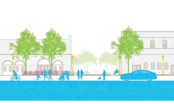

The project resulted in:
• A complete inventory of existing sidewalk conditions and connectivity gaps, and bike facilities
• A list of recommended projects using a ranking score which included destinations, land use and construction costs
• A new vision for the future of the City of Douglasville’s Transportation System
• Establishment of a locally based steering committee or advocates who can assist in further promoting the projects
• Facilitated meetings between the City of Douglasville and the Atlanta Regional Commission (ARC) to discuss funding opportunities
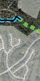
The following pages 28-31 depict the map recommended pedestrian and bicycle network from the results of that study.

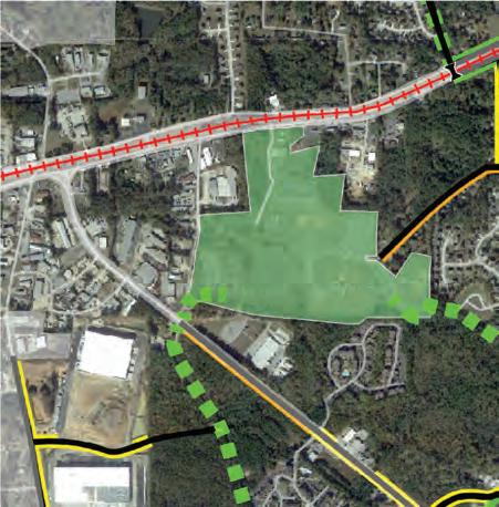
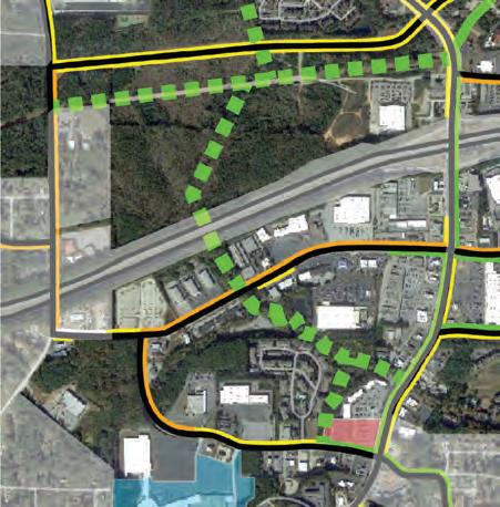


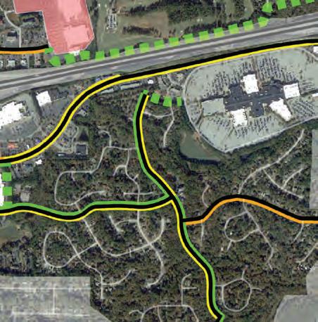


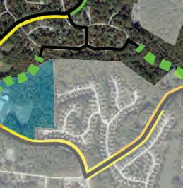
PEDESTRIAN


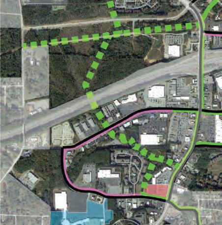


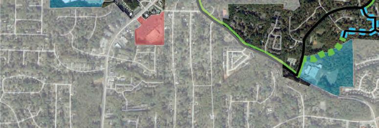





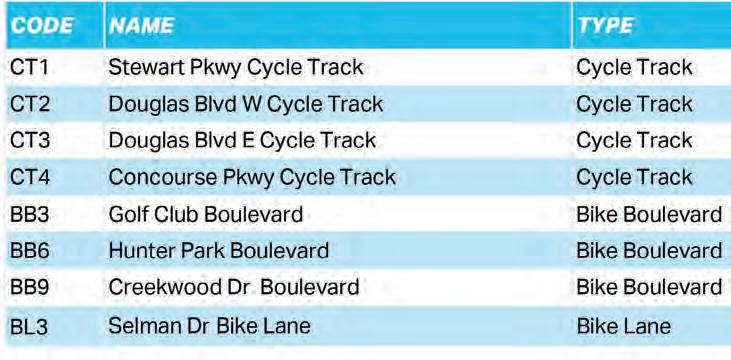

Goals from the plan are as follows:
• Providing effective access to arbor Place mall area - The Arbor Place Mall area is an important employment center and a cornerstone of retail activity in Douglasville and Douglas County. Since the Mall development, additional retail development has occurred along Douglas Boulevard, Bill Arp Road (SR 5), and Chapel Hill Road. This center of activity has brought with its heavy volumes of traffic, particularly during the PM peak hour and on Saturdays. The Mall is served directly by Douglas Boulevard which extents east and west to Chapel Hill Road and Bill Arp Road (SR 5) and beyond. In addition to serving traffic to/from Arbor Place Mall, these roads are important through routes connecting residential communities to the north and south with I-20.
• Providing alternatives to single occupant automobile traffic - Travel via automobile is the most prevalent form of travel in Douglasville and Douglas County. The land use patterns, development density, and proximity of housing and employment contribute to the high proportion of travel made by automobile. Efforts such as the Downtown Douglasville Livable Centers Initiative (LCI) examined the potential for trip reduction through land use modifications and development of alternative travel modes. Implementation of recommendations contained within that study can help reduce the impact and reliance on single occupant automobiles as a primary travel mode. In addition to land use modifications, proactively providing alternative mode travel options can reduce the reliance on single occupant automobile travel.
DTP - 04
Concourse Pkwy Traffic Study
SR 5 @ Concourse Pkwy
DTP - 09 Chapel Hill Road Improvements Hospital Dr
DTP - 10
Douglas Blvd @ SR 5 Intersection Modification Douglas Blvd @ SR 5
Traffic study to assess how well intersection has improved as a result of GDOT project #0012618
Operational and traffic flow improvements, access management features, turn lanes, signal operational upgrades, and ITS connectivity.
Add a second eastbound and westbound left turn lane. Add a dedicated westbound right turn lane. Add a dedicated southbound right turn lane.
Douglas County created a comprehensive transportation plan (CTP) in 2008 and is currently creating an updated plan. The following is an excerpt from the County CTP:
“The Arbor Place Mall is a major economic engine for Douglas County and more specifically for the city of Douglasville. The mall draws patrons from across the metropolitan Atlanta region concentrating primarily on the western suburbs and the eastern parts of Alabama. A large amount of “big-box” retails such as Kohl’s, Target, Wal-Mart, Lowe’s and Home Depot have also opened augmenting the tremendous amount of commercial square feet available to shoppers in the area. The combination of the mall and surrounding retail establishments have put a tremendous burden on the two intersections that serve as the gateways to the Mall – Douglas Boulevard at SR 5/Bill Arp Road and Douglas Boulevard at Chapel Hill Road…. City and county staff have expressed that the intersection and signal timing has been maximized.
Needs identified in the Arbor Place Mall sub-area include:
• Improve the northeast entrance
• I-20 ramps to Chapel Hill Road
• Diversion of local traffic from I-20 (I-20 being used as local connection)
• Alleviation of safety hazards; primarily on Chapel Hill Road and Douglas Boulevard
• Better signage directing travelers to mall entrances "
The following projects were identified first in the Douglas County Comprehensive Transportation Plan in 2008, and then were identified as being in the pipeline in the 2018 Douglas County Comprehensive Plan.
CTP - 15
CTP - 21
Adaptive Traffic Signal Pilot Program
Chapel Hill Road/SR 5/ CBD area
High crash rates have been identified at locations along this corriodr. A safetty audit should be completed to determine operational upgrades along this corridor would imrpvoe safety and mobilitiy and improve travel times on this vital north-south corriodor. Wil relieve delay and congesetion at the Douglas Blvd intersection.
CTP - 44
SR 5/Bill Arp Road - Modify Intersection
CTP - 6A
Chapel Hill Road Operational Improvements
I-20 West @ SR 5 Interchange modification and CD system concept
SR 5 @ Douglas Blvd
CTP - 9A
Relocate SR 5 to Post Road
I-20 @ SR 5
CTP - 52
Chapel Hill Road Widening I-20
Stewarts Mill Road
This project will modify the intersection of SR 5/Bill Arp Road and Douglas Blvd. Interim project in advance of interchange. Dual leftturn lanes from SR 5 north to Douglas Blvd east. Right turn lanes on all approaches.
Short-term operational improvements as recommended in the 2005 Chapel Hill Road and Stewart Mill Road Transportation Corridor Study
This project, partnered with Project 6B and 9A, would modify the SR 5 intercahnge to accept inside/managed lanes
Working with GDOT, this project will reassign the state route 5 marker from Bill Arp Road to a new alignment on Tyree Road and Post Road. The northern terminus will remain US 78/Veterans Memorial Highway. The overall mileage of SR 5 will remain fairly equal (see project 9b)
Widen to eight lanes from I-20 to Douglas Blvd, and widen to six lanes from Douglas Blvd to Stewarts Mill Rd.
Although the parcels under consideration were expanded to provide a better picture of landuse in the area surrounding the study area, most of the zoning by land area consists of general commercial. This is characterized by large lot sizes and large setbacks of at least 50’ from the right of way, which tends to encourage automobile use.
Legend
GC General Commercial
PUD Planned Unit Development
O-I Office Institutional
NC Neighborhood Commercial
O-D Office Distribution
PSP Public - Semi Public
PRD Planned Residential Development
RMP Regional Marketplace


Douglasville’s Future Land Use map depicts two main land uses in the study area – Regional Activity Center and Medium Density Residential.
Legend
Regional Activity Center
Medium-Density Residential
Mixed-Use Design
Community Activity Center




The Unified Development Ordnance (UDO) lays out the standards for development in Douglasville. The preceding zoning maps indicate that there are only four zoning codes present in the study area. These are:
General Commercial (GC)
Central Business District (CBD)
Public & Semi-Public District (PSP); and
Planned Unit Development (PUD)


This section will provide an overview of these zoning codes, the development standards that entail, and will discuss the nuances. (flesh this text out)
The Planned Unit Development (PUD) zoning code covers all of the Arbor Station residential community as well as the Arbor Place Mall and much of the land surrounding it. Generally, the code is meant to provide developers the ability for a unified plan of development for an area. Although this zoning code allows for mixed use, this has resulted in a rather typical medium density residential community in the case of Arbor Station. Furthermore, in the cases of the other apartment complexes built under this zoning code, none of them have included any mixed-use amenities. This could be due to some ambiguity in the Unified Development Ordinance when it comes to mixed-uses. In the Allowed Principal Uses Tables, the PUD code is not even listed, and further does not indicate that mixed-uses are allowed in this zoning. The only zoning code that explicitly permits mixed-use is the Planned Residential Development (PRD) code. However, the descriptions for these zoning codes indicate the opposite. The PUD code has specific stipulations regarding mixed-uses, whereas the PRD code does not even mention mixed-use.
between one story
30’ between one and two or two story buildings
City of Douglasville Unified Development Ordinance Residential Districts | 3-9 dwellings in accordance with the land use plan for the city with a development site of at
Traffic Study Required. A traffic study shall be required by the developer to determine the impact of the proposed development on the existing roadway system if the number of dwelling units exceeds 90 dwelling units. The report shall comply with the provisions of Sec. 10.0 6.H. Traffic Study.
Supplemental use regulations shall be as established in Article 2, Us e Regulations and Restrictions as based on Section 2.02, Allowed Uses.
Regarding density, the PUD zoning has a hard limit at 8 units per acre, with allowances up to 10 if green space is provided. Interestingly, the apartment complexes at Arbor Place, Lakeside at Arbor Place, and Park West all have units per acre values in excess of this limit. Considering the relatively low vacancy rate across housing in Douglasville as discussed in the economic analysis, there is merit to exploring an increase of the number of units per acre permitted in the zoning code. The Planned Residential Development (PRD) zoning code, for example, appears to allow for a much higher density of dwelling units per acre.
Another issue regarding the PUD zoning code is that the minimum required acreage for infill developments is 2 acres. Given the great excess of surface parking in the study area, infill development is a very attractive option to create more housing, bolster the tax base, and greatly increase walkability and livability in the area. Although big parking lots such as the one surrounding Arbor Place Mall with its 55 acres can handle this minimum, this would represent too great a percentage for many of the small to medium sized parking lots in the area, thus precluding the sort of density that would be needed to change the scale of the study area to be more human-oriented.
The General Commercial zoning code covers the big box and strip mall style developments throughout the study area. The stipulation of minimum setbacks of at least 50’ from the main thoroughfare to any structure, including access drives, ends up forcing the creation of large outdoor rooms that are uncomfortable to be a pedestrian in. 90% impervious surface creates issues for stormwater runoff and increases the urban heat island effect.
The GC general commercial district is intended to provide areas for those business and commercial uses that are a higher intensity than neighborhood commercial districts or for the central business district, in accordance with the land use plan for the city.
Front
50’ from the major thoroughfare applies to all structures including service areas and access drives.
15’ if adjacent to non-residential district at external lot line
50’ if adjacent to residential district at external lot line
0’ from internal road network Side
0’ from Internal side yard setbacks
Rear 15’ if adjacent to non-residential district
50’ if adjacent to residential district
Not-Permitted
5’ if less than 144 sf 15’ if greater than 144 sf
Principal
50’ plus one foot of height for each foot of setback distance over 50’ to the closest property line of any residential district not to exceed 150” in height
Supplemental use regulations shall be as established in Article 2, Use Regulations and Restrictions as based on Section 2.02, Allowed Uses.
Lots in the historic district should comply with the setback requirements of the Historic District per Chapter 48 of the City of Douglasville Code of Ordinances.
Properties over five contiguous acres in size may be required to provide additional landscaping and buffering and may also be required to ensure appropriate connectivity to surrounding streets and pedestrian walkway systems.
Sec. 4.06 CBD Central Business
A. Purpose
The CBD, central business district is intended to protect and promote a suitable pedestrian friendly area for office, institutional, entertainment and commercial uses which benefi t from proximity to each other, to encourage the eventual elimination of uses inappropriate to a central business area, and to encourage the intensive development of a central business district for the City of Douglasville, in accordance with the land use plan for the city. Residential uses are appropriate in the central business district when combined with nonresidential uses in mixeduse buildings, as long as the nonresidential uses occupy at least the ground floor area.
Minimum Lot Width
Front
Side
Rear
AccessoryBuilding
From Principal Structure
None, however buildings shall be setback a maximum of 10’ from the sidewalk
None if adjacent to non-residential district
30’ if adjacent to residential district
None’ if adjacent to non-residential district
30’ if adjacent to residential district
Front Not-Permitted Side
Maximum Height
Principal
Maximum Dwelling Unit Bedrooms
“The CBD, central business district is intended to protect and promote a suitable pedestrian friendly area for office, institutional, entertainment and commercial uses which benefit from proximity to each other, to encourage the eventual elimination of uses inappropriate to a central business area, and to encourage the intensive development of a central business district for the City of Douglasville, in accordance with the land use plan for the city. Residential uses are appropriate in the central business district when combined with nonresidential uses in mixed-use buildings, as long as the nonresidential uses occupy at least the ground floor area. “ Recourses: City of Douglasville Unified Development Ordinance CBD Central Business
if
50’ plus one foot of height for each foot of setback distance over 50’ to the closest property line of any residential district not to exceed 150’ in
sf for a multi-tenant building
Mixed use buildings shall not contain more than two bedrooms per dwelling unit
Supplemental use regulations shall be as established in Article 2, Use Regulations and Restrictions as based on Section 2.02, Allowed Uses.
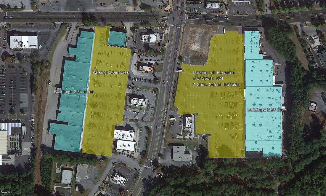
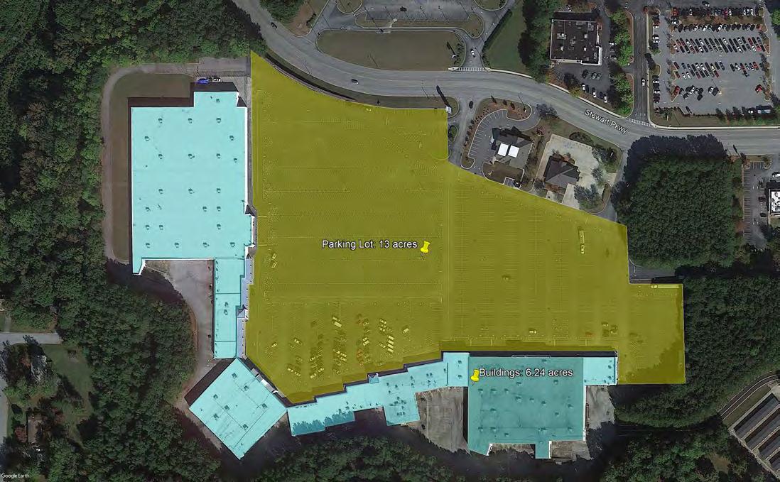
The predominant land-use in the study area is parking. Through an analysis of aerial imagery from Google Earth, it is clear that much of the land in the study area is parking that is underutilized. Although parking is obviously important for an activity center that seeks to attract people from around the region that will get to the study area by car, an excess of parking is a detriment to placemaking and pedestrian activity. Human behavior that has been passed down from our ancestors makes people uncomfortable in big empty spaces. Although this behavior is outdated now that we are without natural predators, it is still hardwired into our DNA, and as such must be considered when trying to create a place that is desirable for people. The characteristics of such places can vary, but generally this can be achieved by reducing the amount of impervious surface, placing buildings on the frontage of sidewalks and other pedestrian areas, and embedding density of places and interesting things.
What follows is an analysis of parking lot area to building area for several big box developments in the study area. In all of these developments, the area of the parking lot is always bigger than the area of the building – in some cases, the area of the parking lot is two or even three times the size of the building. Although parking is of course necessary given the desire for the area to be a regional activity center, parking spots that are not utilized are wasted space that do not add to the tax revenue accrued by the city. In addition to lost revenue, large unbroken swathes of pavement make these areas incredibly hostile to pedestrians, mostly due to an increase in the urban heat island effect and forcing people to travel long distances with nothing along the way to experience.

Market Square and Arbor Square Shopping Centers

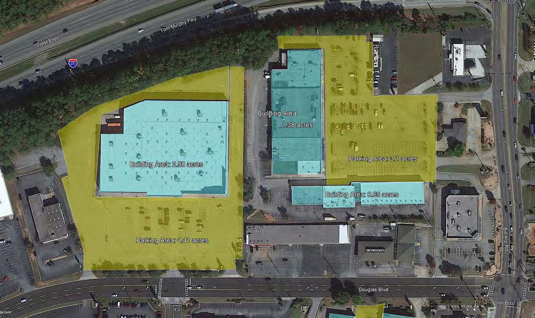
Section 8.01 of the Unified Development Ordinance (UDO) stipulates rules pertaining to Off-Street Parking and Loading. Like many municipalities, Douglasville has stipulated minimum parking requirements for all potential land-uses. With regards to commercial development, the most common stipulation is 1 parking space per 400 square feet of general floor area (GFA). This is the minimum for 66 different commercial uses. The second most common minimum is 1 space per 300 square feet of GFA, occurring 30 times. If a business wishes to deviate from this minimum, they must submit an alternate parking plan for the City’s approval.
Minimum parking requirements can be harmful to the character of an area when the number of parking spots supplied by the minimums exceed the demand for parking spaces. Visual analysis of parking lots in the study area indicates that nearly all parking lots are well under capacity. A scarcity of parking spaces allows spaces to be used for other uses, which enhances the tax revenue per acre in the study area, boosts utilization of the park and ride and alternative modes of transportation and increases walkability.
The UDO also stipulates that parking lots designed to accommodate five cars or more are to have hardwood trees included in the design. At a minimum, landscaping islands are to be provided at the end of each parking bay. As evidenced by the parking lot images on the preceding pages, this minimum is not adhered to by many of these developments. Landscaping in parking lots are incredibly important from a walkability perspective – lack of shade trees is often cited as one of the greatest deterrents to walking.
This analysis is will provide detail on population, household, employment and real estate trends within the City of Douglasville (City) in context with trends observed across the Atlanta -Sandy Springs -Alpharetta Metropolitan Statistical Area (MSA), Douglas County as well as current peer and aspirational peer cities. According to City officials, current peer cities to Douglasville include Carrollton and Fayetteville while aspirational peer cities include Acworth, Marietta and S myrna. Data sources include ESRI/US Census Bureau for population, housing and income data, EMSI/US Census on the map for employment data and CoStar/Parcel shapefile and Zillow for real estate data.
The City of Douglasville, Georgia (City) is located within Douglas County and is approximately 20 miles west of Atlanta, Georgia via Interstate 20. The City added almost 13,000 net new residents between 2020 and 2000, with more significant growth occurring prior to the Great Recession compared to after, a trend also observed across the MSA. Specifically, Douglasville’s population increased by 4% annually prior to the Great Recession (2008 -2011) compared to by 1% after the Great Recession. Notably, Atlanta and Marietta w ere the only peer geographies within the region to add population at a faster rate after the Great Recession compared to before. While discussed in more detail within this report, slowing population growth Douglasville may be attributed to a limited supply of housing due to a moratorium on multifamily development in the city since 2010 among other factors like increasing construction costs and limited greenfield development opportunities.
The City of Douglasville, Georgia (City) is located within Douglas County and is approximately 20 miles west of Atlanta, Georgia via Interstate 20. The City added almost 13,000 net new residents between 2020 and 2000, with more significant growth occurring prior to the Great Recession compared to after, a trend also observed across the MSA. Specifically, Douglasville’s population increased by 4% annually prior to the Great Recession (2008-2011) compared to by 1% after the Great Recession. Notably, Atlanta and Marietta were the only peer geographies within the region to add population at a faster rate after the Great Recession compared to before. While discussed in more detail within this report, slowing population growth Douglasville may be attributed to a limited supply of housing due to a moratorium on multifamily development in the city since 2010 among other factors like increasing construction costs and limited greenfield development opportunities.
Pre- vs. Post-Recession Population Growth

Source: ESRI, US Census Bureau
At time of this report, Douglasville was home to 35,000 persons with almost half being originally from Georgia and 20% being originally from the south. Interestingly, almost 13% of Douglasville’s residents are originally from the midwest. Comparably, only 9% of Douglasville’s residents were originally from the midwest in 2010 and the number of midwesterners currently living in Douglasville has grown by 60% over the period. Migration patterns within Douglasville are consistent with macroeconomic migration patterns within the county as many people are/have been moving to the south from the midwest.
At time of this report, Douglasville was home to 35,000 persons wi th almost half being originally from Georgia and 20% being originally from the south. Interestingly, almost 13% of Douglasville’s residents are originally from the midwest. Comparably, only 9% of Douglasville’s residents were originally from the midwest in 2010 and the number of midwesterners currently living in Douglasville has grown by 60% over the period. Migration patterns within Douglasville are consistent with macroeconomic migration patterns within the county as many people are/have been moving to the south from the midwest.
Share of Total Douglasville Residents based on Place of Birth
Share of Total Douglasville Residents based on Place of Birth
Share 2010 Share 2019

Source: American Community Survey, 5-year 2019, 2010
Source: American Community Survey, 5-year 2019, 2010
Additionally, the number of Douglasville residents living within poverty has decreased to represent only 13% of the population at time of this report, down from 16% in 2010, which is a level consistent with the national bench mark. In addition, median household income for Douglasville residents has grown to almost $54,000 in 2020 from just above $40,000 in 2010. Wage increases may be attributed to additional employment opportunities within the City and region. Notably, the City added more than 780 jobs in the Administration & Support, Waste Management and Remediation sector, 630 jobs in the Wholesale Trade sector and 590 jobs in the Health Care & Social Assistance sector after the Great Recession. However, Retail Trade is far an d away Douglasville’s largest employment sector comprising 28% of total jobs.
Additionally, the number of Douglasville residents living within poverty has decreased to represent only 13% of the population at time of this report, down from 16% in 2010, which is a level consistent with the national bench mark. In addition, median household income for Douglasville residents has grown to almost $54,000 in 2020 from just above $40,000 in 2010. Wage increases may be attributed to additional employment opportunities within the City and region. Notably, the City added more than 780 jobs in the Administration & Support, Waste Management and Remediation sector, 630 jobs in the Wholesale Trade sector and 590 jobs in the Health Care & Social Assistance sector after the Great Recession. However, Retail Trade is far an d away Douglasville’s largest employment sector comprising 28% of total jobs.
Additionally, the number of Douglasville residents living within poverty has decreased to represent only 13% of the population at time of this report, down from 16% in 2010, which is a level consistent with the national benchmark. In addition, median household income for Douglasville residents has grown to almost $54,000 in 2020 from just above $40,000 in 2010. Wage increases may be attributed to additional employment opportunities within the City and region. Notably, the City added more than 780 jobs in the Administration & Support, Waste Management and Remediation sector, 630 jobs in the Wholesale Trade sector and 590 jobs in the Health Care & Social Assistance sector after the Great Recession. However, Retail Trade is far and away Douglasville’s largest employment sector comprising 28% of total jobs.
Total Jobs in Douglasville

Source: US Census on the Map
To support the notion that retail is the main driver behind the local economy, the City brought in $27 million in total tax revenue in 2020 with 63% of that revenue being generated through property taxes and the Local Option Sales Tax (LOST) alone. Notably, the City’s LOST brought in more than $7.5 million in 2019 through a 9% tax on sales at retail and commercial businesses within the City.

Share of Total Tax Revenue in Douglasville by Year and Type since 2015
Source: Douglasville 2019-2020 Adopted Budget
Since sales tax is the second largest tax revenue stream for the City by a substantial margin, the health of city -wide retail and other commercial establishments is important not only for city revenues, but also to support jobs within the regional economy. As of 2018, the largest economic sectors within Douglasville included retail trade and accommodation & food services which together comprised 45% of all jobs – or 7,015 jobs total.
Since sales tax is the second largest tax revenue stream for the City by a substantial margin, the health of city-wide retail and other commercial establishments is important not only for city revenues, but also to support jobs within the regional economy. As of 2018, the largest economic sectors within Douglasville included retail trade and accommodation & food services which together comprised 45% of all jobs – or 7,015 jobs total.
Using the City’s reported sales tax revenues, it is estimated that more than $80 million was spent in t he retail sector in 2020 which was greater than the $75 million spent in 2017 and the $67 million spent in 2015. Notably, the sales tax revenue collected by the City in 2020 was less than 2019 (as a result of COVID -19), but was still greater than 2018 revenues and suggests a resilient retail presence. Normalized, it is estimated that $11,750 in retail sales occurred per one retail job.
Using the City’s reported sales tax revenues, it is estimated that more than $80 million was spent in the retail sector in 2020 which was greater than the $75 million spent in 2017 and the $67 million spent in 2015. Notably, the sales tax revenue collected by the City in 2020 was less than 2019 (as a result of COVID-19) but was still greater than 2018 revenues and suggests a resilient retail presence. Normalized, it is estimated that $11,750 in retail sales occurred per one retail job.
Estimated Retail Sales per Job & Square-Foot of Retail Inventory
Estimtated Sales per Retail Job
Estimated Retail Sales per Job & Square-Foot of Retail Inventory
Estimtated Sales per Retail Job
$12,000

Additional employment opportunities for Douglasville’s residents may be found throughout the region, but specifically at the intersection of Fulton, Douglas and Cobb counties in a cluster of warehouse, distribution and other
Additional employment opportunities for Douglasville’s residents may be found throughout the region, but specifically at the intersection of Fulton, Douglas and Cobb counties in a cluster of warehouse, distribution, and other industrial-related uses along the Chattahoochee River. As of 2018, this cluster of industrial activity held more than 42,000 jobs which was an increase of 35% over the total number of jobs found within the cluster at the end of the Great Recession in 2011. Notably, the largest employment sectors, and those to see the most substantial post-recession growth include Construction (+101%), Transportation & Warehousing (+57%), Manufacturing (+19%) and Wholesale Trade (+12%). This cluster of well-paying industrial jobs is continuing to grow and therefore presents further opportunity for proximate residential development to support a growing workforce. The visual below shows which census tracts Douglasville’s residents were employed in in 2018. Notably, the most significant locations for employment among Douglasville residents include the industrial cluster along the Chattahoochee River, Hartsfield-Jackson Atlanta International Airport and other Atlanta suburbs like Carrollton, Marietta, Dallas and Cumberland. in 2020 which was greater than the $75 million spent in 2017 and the $67 million spent in 2015. Notably, the sales tax revenue collected by the City in 2020 was less than 2019 (as a result of COVID -19), but was still greater than 2018 revenues and suggests a resilient retail presence. Normalized, it is estimated that $11,750 in retail sales occurred per one retail job.
Wholesale Trade (+12%). This cluster of well -paying industrial jobs is continuing to grow and therefore presents further opportunity for proximate residential development to support a growing workforce. The visual below shows which census tracts Douglasville’s residents were employed in in 2018. Notably, the most significant locations for employment among Douglasville residents include the industrial cluster along the Chattahoochee River, HartsfieldJackson Atlanta International Airport and other Atlanta suburbs like Carrollton, Marietta, Dallas and Cumberland.

However, much of Douglasville’s economy relies on retail. To this point, Interstate 20 offers three points of entry to the City via Exits 34, 36 and 37. Notably, Exit 34 provides interstate access and connectivity to Highway 5 which houses the most significant node of retail in the “West Mall” area with 2.6 million square -feet of space. The West Mall retail node is anchored by big -box retailers like Walmart, Sam’s Club, Home Depot, Lowe’s, at Home and Academy Sports & Outdoors, with a handful of community, neighborhood- and strip-shopping centers throughout the area. The West Mall node of retail is also located within proximity of the Arbor Place Mall which itself houses 1.2
However, much of Douglasville’s economy relies on retail. To this point, Interstate 20 offers three points of entry to the City via Exits 34, 36 and 37. Notably, Exit 34 provides interstate access and connectivity to Highway 5 which houses the most significant node of retail in the “West Mall” area with 2.6 million square-feet of space. The West Mall retail node is anchored by big-box retailers like Walmart, Sam’s Club, Home Depot, Lowe’s, at Home and Academy Sports & Outdoors, with a handful of community-, neighborhood- and strip-shopping centers throughout the area. The West Mall node of retail is also located within proximity of the Arbor Place Mall which itself houses 1.2
million square-feet of retail space across 38 acres. The primary nodes of retail activity within the City can be visualized below; however, this analysis will acutely focus on the conditions along, or in proximity of Highway 5 (West Mall area).
million square-feet of retail space across 38 acres. The primary nodes of retail ac tivity within the City can be visualized below; however, this analysis will acutely focus on the conditions along, or in proximity of Highway 5 (West Mall area).


While the macroeconomic conditions within Douglasville are contextually important, the focus of this study is in the area south of I-20, but specifically the area in proximity to Highway 5 and its interaction wit h Interstate-20. The City’s Comprehensive Plan notes the importance of Highway 5 …"The Arbor Place Mall area is an important employment
center and a cornerstone of retail activity in Douglasville and Douglas County. Since the Mall development, additional retail development has occurred along Douglas Boulevard, Bill Arp Road (Highway 5), and Chapel Hill Road. This center of activity has brought with it heavy volumes of traffic, particularly during the PM peak hour
West Mall & Highway 5
While the macroeconomic conditions within Douglasville are contextually important, the focus of this study is in the area south of I-20, but specifically the area in proximity to Highway 5 and its interaction with Interstate-20. The City’s Comprehensive Plan notes the importance of Highway 5…"The Arbor Place Mall area is an important employment center and a cornerstone of retail activity in Douglasville and Douglas County. Since the Mall development, additional retail development has occurred along Douglas Boulevard, Bill Arp Road (Highway 5), and Chapel Hill Road. This center of activity has brought with its heavy volumes of traffic, particularly during the PM peak hour and on Saturdays. The Mall is served directly by Douglas Boulevard which extents east and west to Chapel Hill Road and Bill Arp Road (Highway 5) and beyond. In addition to serving traffic to/from Arbor Place Mall, these roads are important through routes connecting residential communities to the north and south with I-20."
The visuals below highlight the general area of focus as well as 2010 & 2019 traffic volume in key locations available from GDOT. Notably, almost 20% of Westbound I-20 traffic from Atlanta in 2019 utilized Exit 34 and is a higher share of traffic compared to 2010 when 15% of the westbound traffic utilized Exit 34. However, the number of vehicles traveling westbound is 12% lower overall in 2019 than it was in 2010. Regardless, the significant volume of traffic utilizing I-20 highlights the area’s significance as a retail and residential center. In addition, significant traffic counts along Highway 5 at Douglas Boulevard and in front of Walmart also suggest that local traffic is utilizing Highway 5 into, and out of Downtown as well as onto and off Interstate 20.
Today, the West Mall node of activity collectively includes 2.6 million square-feet of retail space in addition to the adjacent 1.2 million square-foot Arbor Place Mall, 1,500 multifamily units and approximately 800 single-family homes.


2019


Single-family homes were the first structures to develop, specifically in the Winwood Village, Knollwood Village and Springwood Village subdivisions throughout the 1970s and 1980s. The development of early single -family homes in these neighborhoods occurred on lots that were between 0.3 and 0.5 acres with an average of 8% to 10% of the lot covered by a home. The development of Creekwood Village, Oakwood Village, Arbor Crossing and then Lakewood Village followed earlier single-family development and occurred throughout the 1980s, 1990s and early 2000s. The median lot size of newer single-family housing was consistent with earlier housing trends; however, the Lakewood Village subdivision offers single-family homes as well as attached single -family townhome products, so the median lot size is substantially smaller at 0.1 acres.
Single-family homes were the first structures to develop, specifically in the Winwood Village, Knollwood Village and Springwood Village subdivisions throughout the 1970s and 1980s. The development of early single-family homes in these neighborhoods occurred on lots that were between 0.3 and 0.5 acres with an average of 8% to 10% of the lot covered by a home. The development of Creekwood Village, Oakwood Village, Arbor Crossing and then Lakewood Village followed earlier single-family development and occurred throughout the 1980s, 1990s and early 2000s. The median lot size of newer single-family housing was consistent with earlier housing trends; however, the Lakewood Village subdivision offers single-family homes as well as attached single-family townhome products, so the median lot size is substantially smaller at 0.1 acres.


The single-family housing within the West Mall area consists of 7 residential subdivisions. Arbor Crossing and Creekwood Village hold the most expensive homes with the median transaction price of $230,000 and $220,000, respectively. Winwood Village houses some of the largest single-family lots with the median lot size just under 0.5 acres with a median transaction price of $190,000. Lakewood Village holds some of the most affordable single-family housing with a median price of $85,000, but the median lots size is just .1 acre.
The single-family housing within the West Mall area consists of 7 residential subdivisions. Arbor Crossing and Creekwood Village hold the most expensive homes with the median transaction price of $230,000 and $220,000, respectively. Winwood Village houses some of the largest single -family lots with the median lot size just under 0.5 acres with a median transaction price of $190,000. Lakewood Village holds some of the most affordable single -family housing with a median price of $85,000, b ut the median lots size is just .1 acre.
While the West Mall area holds single-family homes constructed throughout the 1970s, 80s and 90s, newer single family homes have been delivered to the east of this area and within many of the Chapel Hill subdivisio
New

While the West Mall area holds single-family homes constructed throughout the 1970s, 80s and 90s, newer single-family homes have been delivered to the east of this area and within many of the Chapel Hill subdivisions. New construction of single-family homes occurred within the Chapel Cove subdivision in 2019 with homes priced around $400,000 and spanning 3,900 square-feet, on average. New construction has similar lot coverage, around 8% to 10%, as the aging housing stock.

Value
Median Appraised Value Median Lot Size (AC)
$200,000
$150,000
$100,000
$50,000
$0

Multifamily development followed the single-family boom with the first property delivered in 1986 and consistently every 4 to 6 years thereafter until 2007 with the delivery of One Rocky Place. A majority of the multifamily properties in the area have sold since 2015 suggesting strong historical performance and positive outlook from private sector investors. A multifamily housing moratorium, which was put in place in 2010, suggests why no new product has been delivered since 2007. However, a less than 4% reported vacancy across the 1,500 units in the node suggests that there is pent up demand for additional rental housing.


Multifamily development followed the single-family boom with the first property delivered in 1986 and consistently every 4 to 6 years thereafter until 2007 with the delivery of One Rocky Place. A majority of the multifamily pr operties in the area have sold since 2015 suggesting strong historical performance and positive outlook from private sector investors. A multifamily housing moratorium, which was put in place in 2010, suggests why no new product has been delivered since 2007. However, a less than 4% reported vacancy across the 1,500 units in the node suggests that there is pent up demand for additional rental housing.
Multifamily development followed the single-family boom with the first property delivered in 1986 and consistently every 4 to 6 years thereafter until 2007 with the delivery of One Rocky Place. A majority of the multifamily properties in the area have sold since 2015 suggesting strong historical performance and positive outlook from private sector investors. A multifamily housing moratorium, which was put in place in 2010, suggests why no new product has been delivered since 2007. However, a less than 4% reported vacancy across the 1,500 units in the node suggests that there is pent up demand for additional rental housing.
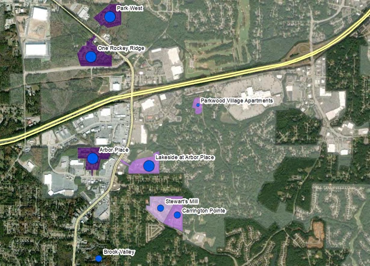


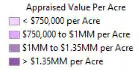
Current vacancy within the West Mall’s multifamily properties (3.6%) should signal further demand for rental housing within the area. Notably, the multifamily properties located north of I-20 (One Rocky Ridge & Park West) have the highest reported vacancy at time of this report at 6% and 8%, respectively. Overall, multifamily in this area has been built at a density between 10 and 14 units per acre and it is understood that City officials prefer to see future multifamily developed at a similar density going forward.
The mix of rental housing units within the West Mall area is consistent with suburban multifamily properties as 51% of the units are two-bedroom and 39% of units are one -bedroom. A unit mix consisting of studio and one -bedroom units is more common in urban, transit -oriented areas while a majority t wo-bedroom units is more common in suburban markets. In addition, the average rental price per unit is between $1,100 and $1,300 per month depending on the size of the unit. However, it is understood by the project team that the City’s desire is to see mor e multifamily housing within the market at a marginally higher price point ($1,400 per unit).
The following visual shows the multifamily properties within the area.
Share of Multifamily Units by Size &
The mix of rental housing units within the West Mall area is consistent with suburban multifamily properties as 51% of the units are two-bedroom and 39% of units are one-bedroom. A unit mix consisting of studio and one-bedroom units is more common in urban, transit-oriented areas while a majority two-bedroom units is more common in suburban markets. In addition, the average rental price per unit is between $1,100 and $1,300 per month depending on the size of the unit. However, it is understood by the project team that the City’s desire is to see more multifamily housing within the market at a marginally higher price point ($1,400 per unit).
The mix of rental housing units within the West Mall area is consistent with suburban multifamily properties as 51% the units are two-bedroom and 39% of units are one -bedroom. A unit mix consisting of studio and one -bedroom units is more common in urban, transit -oriented areas while a majority t wo-bedroom units is more common in suburban markets. In addition, the average rental price per unit is between $1,100 and $1,300 per month depending the size of the unit. However, it is understood by the project team that the City’s desire is to see mor e multifamily housing within the market at a marginally higher price point ($1,400 per unit).
The following visual shows the multifamily properties within the area.
The following visual shows the multifamily properties within the area. Current vacancy within the West Mall’s multifamily properties (3.6%) should signal further demand for rental housing within the area. Notably, the multifamily properties located north of I -20 (One Rocky Ridge & Park West) have the highest reported vacancy at time of this report at 6% and 8%, respectively. Overall, mu ltifamily in this area has been built at a density between 10 and 14 units per acre and it is understood that City officials prefer to see future multifamily developed at a similar density going forward.

Share of Multifamily Units by Size & Average Rental Price per Unit
Following the housing boom, a significant portion of the retail in the area was bu ilt throughout the 1990s –specifically in 1998 and 1999 – including the Arbor Place Mall, Walmart, Sam’s Club, Douglasville Crossroads, Home
CBL & Associates Properties owns the core mall while each of the 4 occupied anchors own their own real estate. CBL’s portion of the property includes 542,000 square feet of in -line retailers in addition to the 618,000 square feet of anchors.
Arbor Place Mall
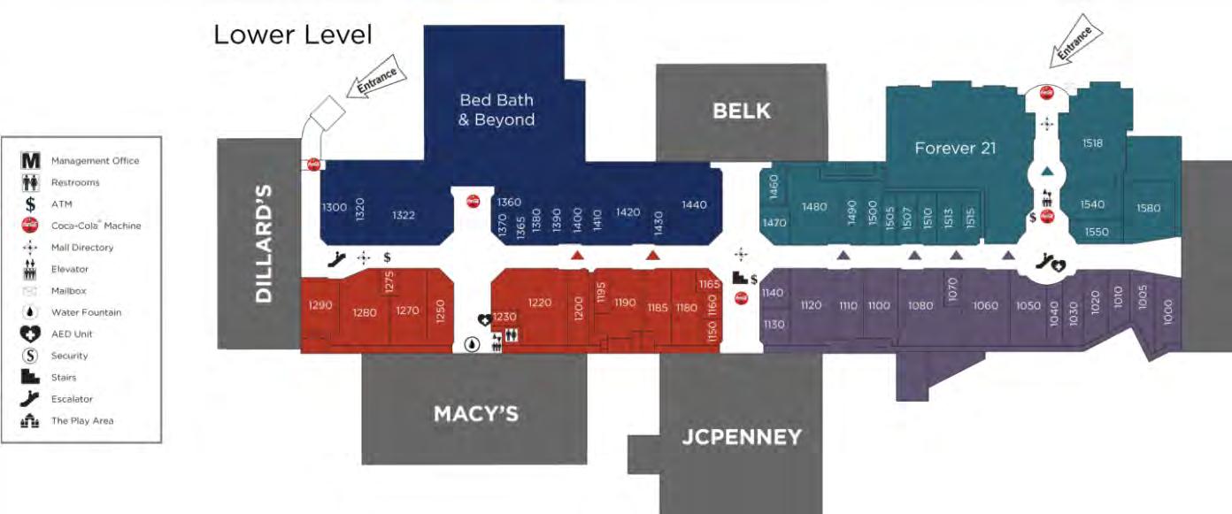
The Arbor Place Mall a significant regional anchor and is located on 38 acres on the south side of Interstate-20 in Douglasville, Georgia. Arbor Place is a regional mall serving a trade area of 800,000 people according to its website. The mall includes five traditional anchor stores, of which four are occupied by Dillard’s, Macy’s, JCPenney and Belk. The fifth anchor was Sears which went bankrupt in October 2018 and includes a now vacated auto center. Importantly, the vacated Sear’s was purchased by TF Douglasville GA, LLC for $3.3 million in February 2019. Notably, CBL & Associates Properties owns the core mall while each of the 4 occupied anchors own their own real estate.
CBL’s portion of the property includes 542,000 square feet of in-line retailers in addition to the 618,000 square feet of anchors.
Arbor Place Mall
The Arbor Place Mall a significant regional anchor and is located on 38 acres on the south side of Interstate 20 in Douglasville, Georgia. Arbor Place is a regional mall serving a trade area of 800,000 people according to its website. The mall includes five traditional anchor stores, of which four are occupied by Dillard’s, Macy’s, JCPenney and Belk.
The fifth anchor was Sears which went bankrupt in October 2018 and includes a now vacated auto center. Importantly, the vacated Sear’s was purchased by TF Douglasville GA, LLC for $3.3 million in February, 2019. Notably, CBL & Associates Properties owns the core mall while each of the 4 occupied anchors own their own real estate.
CBL’s portion of the property includes 542,000 square feet of in in addition to the 618,000 square feet of anchors.

In a shaky position prior to the pandemic due to the growth omni -channel retail, CBL suffered from national COVID19 induced lockdowns and “stay -at-home” orders. Published reports suggest that CBL was able to collect only 27% of national rent payments in April 2020 with total collections not returning to pre -recession levels until fall 2020.
CBL & Associates Properties filed for Chapter 11 bankruptcy protection in mid -2020. The bankruptcy allowed CBL to reach a deal with their lenders, resulting in the mall ’s ability to stay open. In the bankruptcy, CBL “gave back” a significant number of malls and Arbor Place was not included. The fact that CBL still owns the Arbor Place Mall


Like most players in the retail sector, CBL suffered from national COVID-19 induced lockdowns and “stay-at-home” orders. Published reports suggest that CBL was able to collect only 27% of national rent payments in April 2020 with total collections not returning to pre-recession levels until fall 2020. CBL & Associates Properties filed for Chapter 11 bankruptcy protection in mid2020. The bankruptcy allowed CBL to reach a deal with their lenders, resulting in the mall’s ability to stay open. In the bankruptcy, CBL “gave back” a significant number of malls and Arbor Place was not included. The fact that CBL still owns the Arbor Place Mall indicates that they did make a business decision to maintain ownership of the mall and may speak to its ability to be resilient within a challenging retail environment.

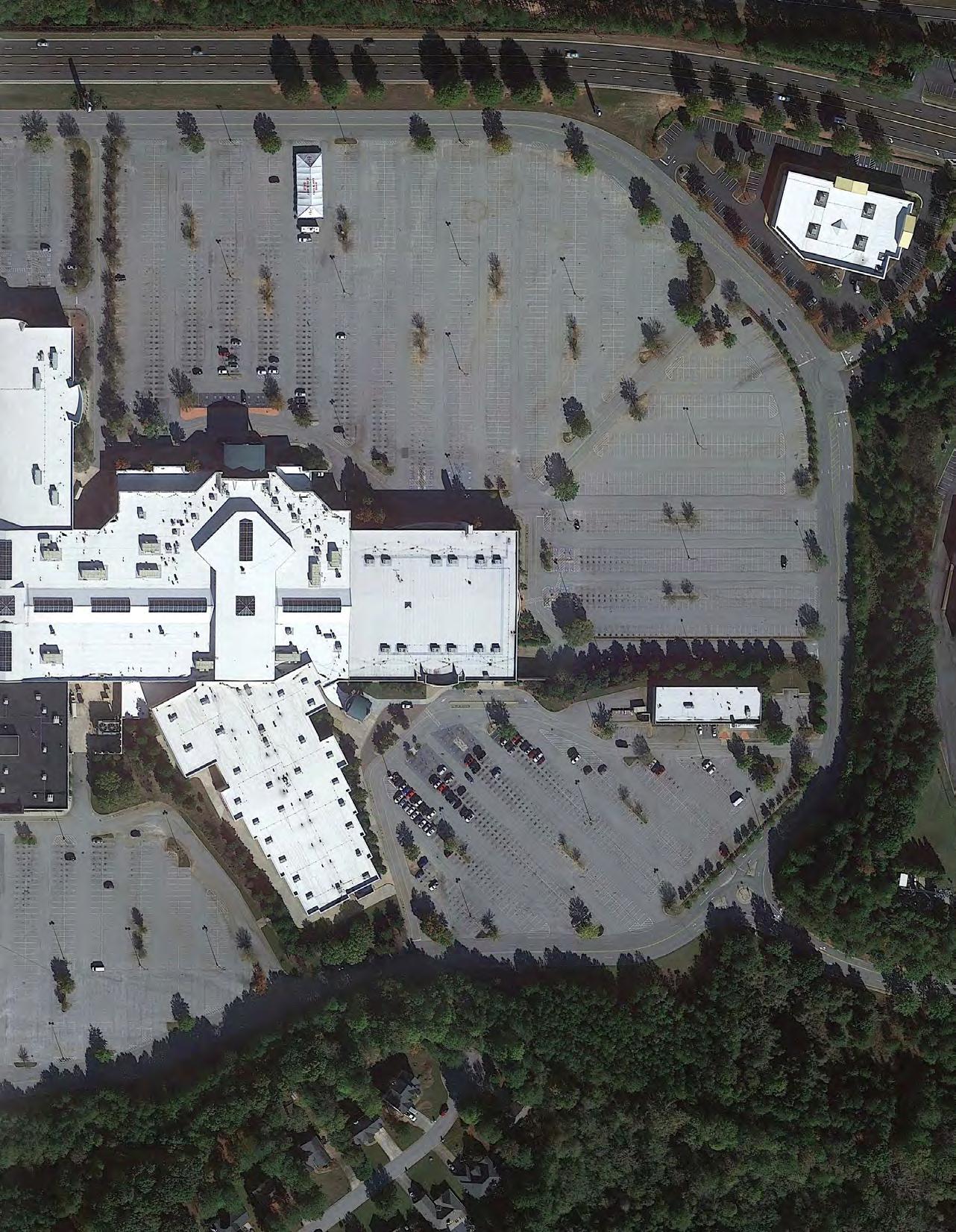
The Arbor Place Mall was built at the turn of the century. On the left is aerial imagery in 1993 before the mall was built, and on the right is the mall as it was in November of 2019. Building 17 acres of building and 55 acres of parking over the watershed for Anneewakee Creek, the major creek in the Highway 5 area has caused stormwater runoff issues. Residents of Arbor Station neighborhood to the south have experienced flooding during particularly heavy rain events. With so much more impervious surface than when this area was a forest, the water cannot infiltrate through the ground and instead all of it runs off.
This is a common theme throughout the entire study area. Large parking lots mostly unbroken by vegetation create much greater surface runoff than would be experienced if the area remained vegetated.
indicates that they did make a business decision to maintain ownership of the mall and may speak to its ability to be resilient within a challenging retail environment.
In addition to the Arbor Place Mall, there is a critical mass of shopping at Exit 34 which together with Arbor Place helped to establish Douglasville as a regional shopping destination. Current data suggests that this node of activity is relatively healthy; however, a handful of centers are, or have started to sputter including Douglasville Town Center and Park Place Shopping Center. The decline of certain retail at Exit 34 is likely a result of limited frontage along Highway 5 and competition among big box retailer like Walmart, Sam’s Club, Home Depot and Lowe’s which arrived after their development, among others. The sputtering commercial properties may be more suitable for a diverse range of housing options due to their proximity to the West Douglas Park n’ Ride, shopping amenities and multifamily housing that has 1% reported vacancy. Improved walkability and the ability for pedestrians to move more easily throughout the area would likely also support residential uses.
In addition to the Arbor Place Mall, there is a critical mass of shopping at Exit 34 which together with Arbor Place helped to establish Douglasville as a regional shopping destination. Current data suggests that this node of activity is relatively healthy; however, a handful of centers are, or have started to sputter including Douglasville Town Center and Park Place Shopping Center. The decl ine of certain retail at Exit 34 is likely a result of limited frontage along Highway 5 and competition among big box retailer like Walmart, Sam’s Club, Home Depot and Lowe’s which arrived after their development, among others. The sputtering commercial pr operties may be more suitable for a diverse range of housing options due to their proximity to the West Douglas Park n’ Ride, shopping amenities and multifamily housing that has 1% reported vacancy. Improved walkability and the ability for pedestrians to m ove more easily throughout the area would likely also support residential uses.
The following visual highlights the properties currently operating as ‘major commercial’ developments within the West Mall area (excluding the Arbor Place Mall) and includes big box retailers, power shopping centers, neighborhood shopping centers, community shopping centers and strip shopping centers.
The following visual highlights the properties currently operating as ‘major commercial’ developments within the West Mall area (excluding the Arbor Place Mall) and includes bi g box retailers, power shopping centers, neighborhood shopping centers, community shopping centers and strip shopping centers.



and still operates as a church today. Market realities would indi cate that while the retail marketplace is strong in this location, there is too much inventory. As such, the southwest portion of the West Mall node of retail may be a redevelopment opportunity. In addition to suppressed property value, this area is also l ocated proximate to the West Douglas Park n’ Ride lot and other multifamily housing that is only 1% vacant at time of this report which may provide market support for housing density in this area. However, the area may also benefit from improved pedestrian connections to the plethora of retail.
While most of the shopping centers in the West Mall area are valued at above $500,000 per acre, Douglasville Town Center is currently valued at almost 50% less than similar properties, or at $260,000 per acre while Park Place Shopping Center is valued at $490,000 per acre. Depressed property values are a result of a substandard location which has forced owners to backfill the space with low-quality, non-retail tenants. At the time of this report, Douglasville Town Center was 33% vacant with the balance of the space leased to non-traditional retail anchors such as Douglas County Community Services and Georgia Highlands College. In addition, the former Park Place Shopping Center which is located across the street from Douglasville Town Center was sold to the Crossroads Church in 2007 and still operates as a church today. Market realities would indicate that while the retail marketplace is strong in this location, there is too much inventory. As such, the southwest portion of the West Mall node of retail may be a redevelopment opportunity. In addition to suppressed property value, this area is also located proximate to the West Douglas Park n’ Ride lot and other multifamily housing that is only 1% vacant at time of this report which may provide market support for housing density in this area. However, the area may also benefit from improved pedestrian connections to the plethora of retail.
The following visual assumes that the Douglasville Town Center site is redeveloped to multifamily, single -family or recapitalized to stay as retail. All estimates utilize current conditions within the area.

Estimated Value per Acre if Douglasville Town Center is Redeveloped Into a Mixed-Use Development
Redevelopment to Multifamily
Recapitalized Commercial
Redevelopment to Single-Family
Center Stays as Is
In the hypothetical event that the Douglasville Town Center is redeveloped to multifamily, it may house more than 400 multifamily units if developed at 12 units per acre, 535 units if developed at 16 units per acre and 670 units if developed at 20 units per acre.
In the hypothetical event that the Douglasville Town Center is redeveloped to multifamily, it may house more than 400 multifamily units if developed at 12 units per acre, 535 units if developed at 16 units per acre and 670 units if developed at 20 units per acre.
* Supporting info can be found in the appendix
Purpose
This section will document existing traffic conditions on SR 5 and Douglas Blvd. First, existing year traffic volumes recorded along the SR 5 and Douglas Blvd corridors will be provided. Next, capacity analysis for the existing conditions of the intersections will be summarized along with a segment capacity analysis in the form of a laneage needs analysis. Finally, a summary of available crash data from GEARS (Georgia Electronic Accident Reporting System) will also be provided.
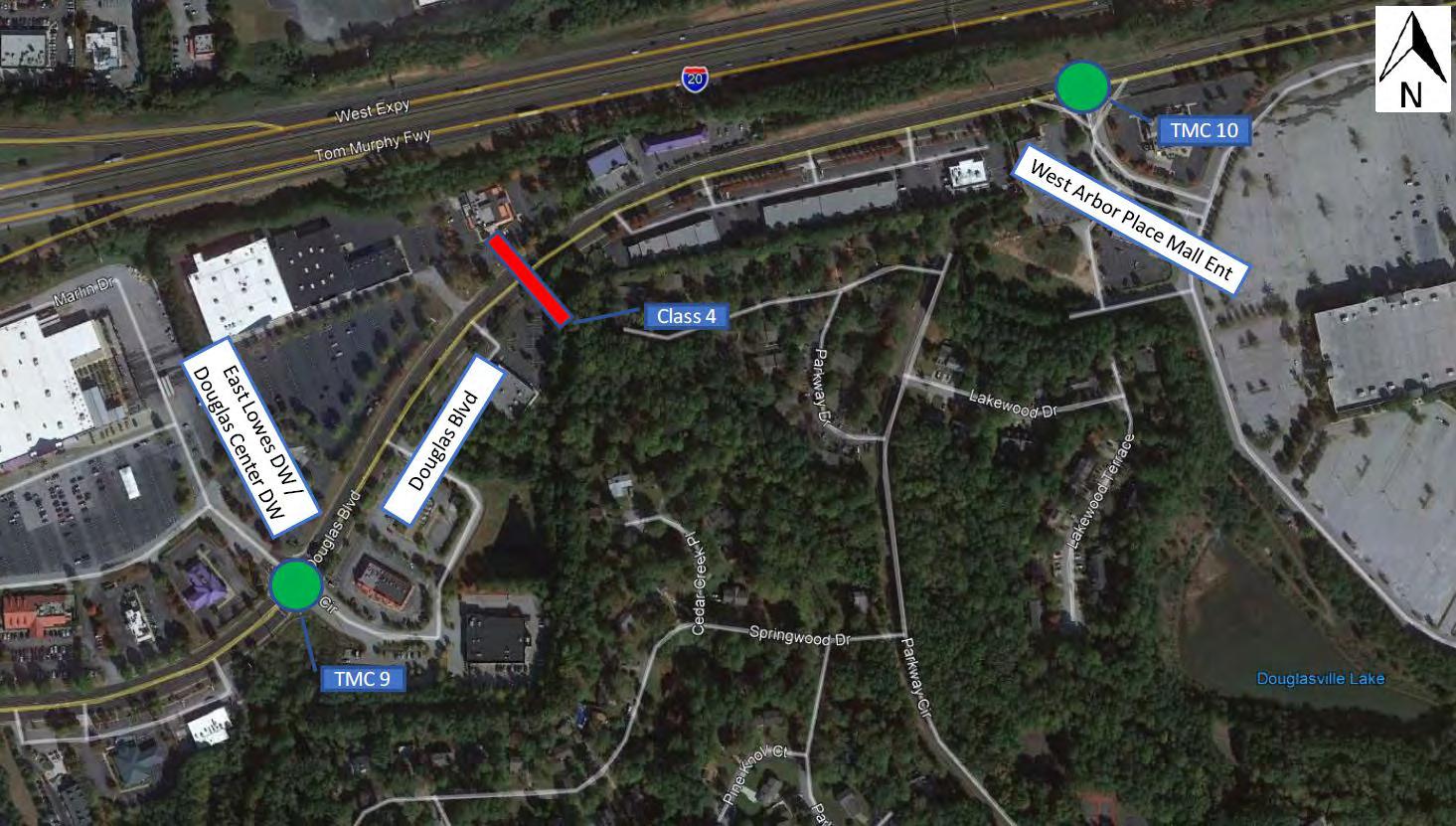
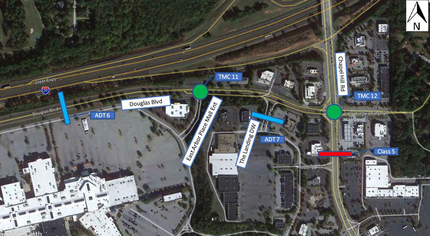
Traffic counts were collected on Wednesday May 5, 2021 and Saturday May 8, 2021. Turning Movement Counts (TMC) were collected at twelve intersections on May 5 and three intersections on May 8. The following sections list the count locations by count type. Maps of the count locations are provided in Appendix A.
3-hour turning movement counts were collected for the following locations on May 5, 20201 from 6:30 AM to 9:30 AM and 3:45 P6M to 6:45 PM. TMC 10, 11, and 12 were also counted on May 8, 2021 from 2:30 PM to 5:30 PM:
Label Name
TMC 1. SR 5 / Bill Arp Rd @ Bright Star Connector
TMC 2. SR 5 / Bill Arp Rd @ Concourse Pkwy
TMC 3. SR 5 / Bill Arp Rd @ I-20 WB Ramp
TMC 4. SR 5 / Bill Arp Rd @ I-20 EB Ramp
TMC 5. SR 5 / Bill Arp Rd @ Douglas Blvd
TMC 6. SR 5 / Bill Arp Rd @ Arbor Pkwy
TMC 7. SR 5 / Bill Arp Rd @ Stewart Mill Rd
TMC 8. Douglas Blvd @ West Lowes DW
TMC 9. Douglas Blvd @ East Lowes DW / Douglas Center DW
TMC 10. Douglas Blvd @ West Arbor Place Mall Entrance
TMC 11. Douglas Blvd @ East Arbor Place Mall Entrance
TMC 12. Douglas Blvd @ Chapel Hill Rd


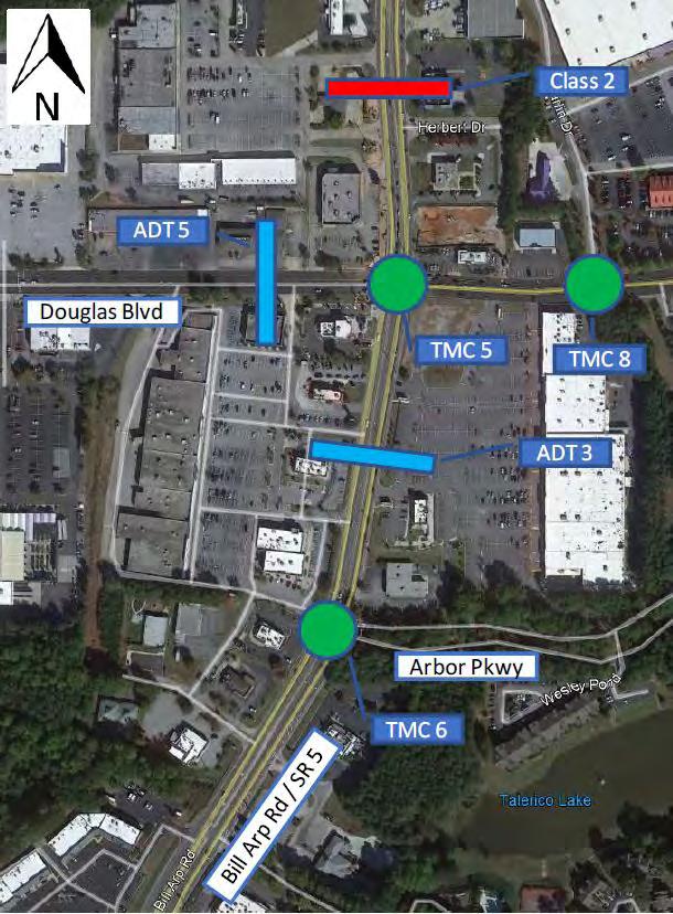
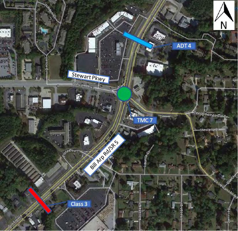
48-Hour Tube Counts
48-hour vehicle volume counts were collected using tube counters for the following locations on Wednesday May 5, 2021 and Thursday May 6, 2021. Additionally, ADT 6 and 7 were collected on Saturday May 8, 2021.
Label Name
ADT 1. SR 5 / Bill Arp Rd, South of Bright Star Connector
ADT 2. SR 5 / Bill Arp Rd, South of Concourse Pkwy
ADT 3. SR 5 / Bill Arp Rd, South of Douglas Blvd
ADT 4. SR 5 / Bill Arp Rd, South of Lakeside at Arbor Place Apts DW
ADT 5. Douglas Blvd, West of SR 5 / Bill Arp Rd
ADT 6. Douglas Blvd, East of West Arbor Place Mall Entrance
ADT 7. The Landing DW, South of Douglas Blvd
48-Hour Classification Counts
48-hour vehicle classification counts were collected using tube counters for the following roadway segments on Wednesday May 5, 2021 and Thursday May 6, 2021. Additionally, Class 4 and 5 were collected on Saturday May 8, 2021.
Label Name
Class 1. SR 5 / Bill Arp Rd, North of Bright Star Connector
Class 2. SR 5 / Bill Arp Rd, South of I-20 EB Ramp
Class 3. SR 5 / Bill Arp Rd, South of Wenona St
Class 4. Douglas Blvd, East of East Lowes DW / Douglas Center DW
Class 5. Chapel Hill Rd, South of Douglas Blvd
Corridor Volumes
Douglas Blvd Land Use Study
Table 1 below shows the Existing Year Average Annual Daily Traffic (AADT) volume at each ADT and Tube count location collected within the study area. These volumes have been adjusted from the original count based on GDOT forecasting traffic factors. The GDOT traffic factors are used to convert Average Daily Traffic (ADT) counts to and AADT. AADT is meant to be an average daily traffic volume inclusive of all days within a one year period (which includes holidays and weekends) while ADT data typically does not have weekend and holiday traffic included in the data. A segment capacity analysis of this data will be provided in Section 3.2 below. The raw count data can be found in Appendix B.
Class 1 SR 5 North of Bright Star Connector 14,122 ADT 1 SR 5 South of Bright Star Connector 19,024
ADT 2 SR 5 South of Concourse 29,496
Class 2 SR 5 South of I20 EB Ramps 41,399
ADT 3 SR 5 South of Douglas Blvd 31,953
ADT 4 SR 5 North of Stewart Pkwy 31,024
Class 3 SR 5 South of Wenona St 25,150 Douglas Blvd
ADT 5 Douglas Blvd West of SR 5 14,298
Class 4 Douglas Blvd East of Lowes DW 19,817
ADT 6 Douglas Blvd East of Arbor Place Mall 14,841
Chapel Hill Rd
Class 5 Chapel Hill Rd South of Douglas Blvd 34,545 Arbor North
ADT 7 The Landing DW South of Douglas Blvd 1,131
Intersection LOS and Delay was calculated using Synchro 11 which uses Highway Capacity Manual Edition (HCM) methodology. As is shown in Table 2, Level of Service (LOS) at the intersections the study area range from LOS A to LOS F. During the AM peak period no intersections d at an LOS E or F and LOS ranged from A to C. During the PM peak period one intersection operated at an LOS E (SR 5 at Stewart Mill Rd) and one intersection operated at an LOS F (SR 5 Blvd). Three intersections operate at LOS D (SR 5 at Concourse Pkwy, SR 5 at I 20 WB and Chapel Hill Rd at Douglas Blvd) and will likely degrade to an LOS F in the future year and/or design years of the study. The HCM Synchro printouts for Existing year results can b Appendix C.
Intersection LOS and Delay was calculated using Synchro 11 which uses Highway Capacity Manual 6th Edition (HCM) methodology. As is shown in Table 2, Level of Service (LOS) at the intersections within the study area range from LOS A to LOS F. During the AM peak period no intersections operated at an LOS E or F and LOS ranged from A to C. During the PM peak period one intersection operated at an LOS E (SR 5 at Stewart Mill Rd) and one intersection operated at an LOS F (SR 5 at Douglas Blvd). Three intersections operate at LOS D (SR 5 at Concourse Pkwy, SR 5 at I 20 WB Ramps, and Chapel Hill Rd at Douglas Blvd) and will likely degrade to an LOS F in the future year open and/or design years of the study. The HCM Synchro printouts for Existing year results can be found in Appendix C.
Traffic conditions observed in the field by project team members and stakeholders indicate worse traffic conditions than shown by the LOS and Delay results. This is due to the methodological limitations of HCM based analyses. HCM based intersection analyses do not consider effects of adjacent intersections on the operations of the subject intersection. Therefore, if in the field one intersection queues into another and degrades operations of adjacent intersections the effects of the queueing will not register within an HCM based analysis. Furthermore, if signalized intersections are closely spaced, as is the case with most tight diamond interchanges, field measured individual intersection capacity is reduced below that assumed within an HCM based analysis. This is due to Conditions Traffic Memo 2021-07-21-Clean.docx
the complex nature of coordinating closely spaced intersections and limited queue storage between the intersections. This causes LOS and delay results from HCM based analyses at closely spaced intersections to be lower than experienced LOS and delay.

CONCOURSE PKWY
~550’ 1320’ PREF.
I-20 RAMPS
I-20 RAMPS
~930’ 1320’ PREF.
A required laneage analysis has been conducted at each count location. This analysis compares existing and projected volumes to the upper capacity volume limit for LOS D operations on a signalized corridor for four lane and six lane roadways. This identifies which roadway segments are currently overcapacity and which roadway segments may be overcapacity in the future and what year those segments are likely to exceed capacity. The LOS D volume limits are from the FDOT Generalized Service Volume Tables which are contained in the FDOT Quality/Level of Service handbook.
The required laneage analysis table is shown on the next page in Table 3. This table shows existing volumes and projected volumes for each segment where counts were taken and for each year between the Existing year (2021) and the study design year (2050). Cells highlighted in green indicate that no widening would be needed. Cells highlighted in orange indicate a need for six (6) lanes and cells highlighted in red indicate a need for eight (8) lanes.
This analysis indicates an immediate need to widen the segment of SR 5 from I-20 EB to Douglas Blvd to six (6) lanes in the Existing year. More importantly, by 2032 SR 5 from Concourse Pkwy to Stewart Mill Rd would need to be widened to six (6) lanes in order to continue to provide LOS D operations on the corridor. There is an indicated need of eight (8) lanes on SR 5 from I-20 EB to Douglas Blvd starting in 2036, however, this is the only segment demonstrating this need and can therefore likely meet LOS D criteria with auxiliary lanes at the intersections.
Chapel Hill Rd indicated a need for widening to six (6) lanes starting in 2036, however, it is not known the extent of Chapel Hill Rd which may need to be widened due to limited data collected on this corridor. Finally, Douglas Blvd and Arbor North do not indicate any need to be widened through the study Design year of 2050.
142981448514675148671506215259154591566215867160751628516499167151693417156173801760817839180721830918549187921903819288195401979620056203182058420854 4 Douglas Blvd East of Lowest DW 198172007720340206062087621149214272170721992222802257222867231672347023778240892440524724250482537725709260462638726733270832743827797281612853028904
4 The Landing DW South of Douglas Blvd 1131114611611176119112071223123912551272128813051322
4 SR 5 North
4 SR 5 South of Bright Star Connector 190241927319526197812004120303205692083921112213882166821952222402253122826231252342823735240462436124680250032533125663259992634026685270342738827747
4 SR 5 South of Concourse 294962988230274306703107231479318923230932733331613359634036344823493435391358553632536800372823777138266387673927539789403114083941374419164246543021
4 SR 5 South of I20 EB Ramps 413994194142491430474361144183447614534845942465444715347771483974903149673503245098351651523285301353708544115512455846565785731958070588305960160382
4 SR 5 South of Douglas Blvd 319533237232796332253366134101345483500135459359243639436871373543784438339388423935039866403884091741453419964254643104436684424044820454074600246605
4 SR 5 North of Stewart Pkwy 310243143031842322593268233110335443398334428348793533635799362683674337225377123820638707392143972840248407754130941851423994295443517440874466545250
4 SR 5 South of Wenona St 251502547925813261512649426841271932754927910282752864629021294012978630177305723097231378317893220632628330553348833927343713482135278357403620836682
4 Douglas Blvd West of SR 5 142981448514675148671506215259154591566215867160751628516499167151693417156173801760817839180721830918549187921903819288195401979620056203182058420854
4 Douglas Blvd East of Lowest DW 198172007720340206062087621149214272170721992222802257222867231672347023778240892440524724250482537725709260462638726733270832743827797281612853028904
4 Douglas Blvd East of Arbor Place Mall 148411503515232154321563415839160461625716470166851690417125173501757717807180401827718516187591900519253195061976120020202822054820817210902136621646
202120222023202420252026202720282029203020312032203320342035203620372038203920402041204220432044204520462047204820492050
141221430714494146841487715072152691546915672158771608516296165091672516944171661739117619178501808418321185611880419050193001955319809200682033120597 190241927319526197812004120303205692083921112213882166821952222402253122826231252342823735240462436124680250032533125663259992634026685270342738827747
294962988230274306703107231479318923230932733331613359634036344823493435391358553632536800372823777138266387673927539789403114083941374419164246543021 413994194142491430474361144183447614534845942465444715347771483974903149673503245098351651523285301353708544115512455846565785731958070588305960160382 319533237232796332253366134101345483500135459359243639436871373543784438339388423935039866403884091741453419964254643104436684424044820454074600246605 310243143031842322593268233110335443398334428348793533635799362683674337225377123820638707392143972840248407754130941851423994295443517440874466545250 251502547925813261512649426841271932754927910282752864629021294012978630177305723097231378317893220632628330553348833927343713482135278357403620836682
142981448514675148671506215259154591566215867160751628516499167151693417156173801760817839180721830918549187921903819288195401979620056203182058420854 198172007720340206062087621149214272170721992222802257222867231672347023778240892440524724250482537725709260462638726733270832743827797281612853028904 148411503515232154321563415839160461625716470166851690417125173501757717807180401827718516187591900519253195061976120020202822054820817210902136621646
Crash data from the Georgia Electronic Accident Reporting System (GEARS) was analyzed using multiple methods to identify crash trends within the study limits. Corridor crash rates for the SR 5 and Douglas Blvd corridors were developed and compared to the statewide average crash rates for each corridors respective roadway classification. Intersection crashes were summarized by crash type in order to identify crash trends by crash type for further investigation. Finally, crash diagrams were developed for six intersections which exhibited high crash trends along the corridor to be used for further study in determining any potential safety specific mitigations.
Corridor Crash Rate
Crash data from the Georgia Electronic Accident Reporting System (GEARS) was analyzed using multiple methods to identify crash trends within the study limits. Corridor crash rates for the SR 5 and Douglas Blvd corridors were developed and compared to the s tatewide average crash rates for each corridors respective roadway classification. Intersection crashes were summarized by crash type in order to identify crash trends by crash type for further investigation. Finally, crash diagrams were developed for six intersections which exhibited high crash trends along the corridor to be used for further study in determining any potential safety specific mitigations.
Crash data from the Georgia Electronic Accident Reporting System (GEARS) was analyzed using multiple methods to identify crash trends within the study limits. Corridor crash rates for the SR 5 and Douglas Blvd corridors were developed and compared to the s tatewide average crash rates for each corridors respective roadway classification. Intersection crashes were summarized by crash type in order to identify crash trends by crash type for further investigation. Finally, crash diagrams were developed for six intersections which exhibited high crash trends along the corridor to be used for further study in determining any potential safety specific mitigations.
Table 4 below shows the crash rate calculations and comparison to statewide average crash rates for the SR 5 corridor. Cells highlighted in orange indicate the crash rate is exceeding the statewide average. The SR 5 corridor exceeds the statewide average crash rate for all 5 years studied (20152019) for All Crashes and Injury Crashes. SR 5 exceed the statewide average crash rate in 2019 for Fatal crashes, however, only one fatal crash was reported.
Table 4 below shows the crash rate calculations and comparison to statewide average crash rates for the SR 5 corridor. Cells highlighted in orange indicate the crash rate is exceeding the statewide average. The SR 5 corridor exceeds the statewide average crash rate for all 5 years studied (20152019) for All Crashes and Injury Crashes. SR 5 exceed the statewide average crash rate in 2019 for Fatal crashes, however, only one fatal crash was reported.
Table 4: SR 5 Corridor Crash Rate Calculations and Comparison to Statewide Average
Table 4 below shows the crash rate calculations and comparison to statewide average crash rates for the SR 5 corridor. Cells highlighted in orange indicate the crash rate is exceeding the statewide average. The SR 5 corridor exceeds the statewide average crash rate for all 5 years studied (20152019) for All Crashes and Injury Crashes. SR 5 exceed the statewide average crash rate in 2019 for Fatal crashes, however, only one fatal crash was reported.
Table 4: SR 5 Corridor Crash Rate Calculations and Comparison
Table 5 below shows the crash rate calculations and comparison to statewide average crash rates for the Douglas Blvd corridor. Cells highlighted in orange indicate the crash rate is exceeding the statewide average. The Douglas Blvd corridor exceeds the statewide average crash rate for all 5 years studied (2015-2019) for All Crashes and Injury Crashes. Douglas Blvd exceed the statewide average crash rate in 2015 and 2016 for Fatal crashes with two fatal crashes reported in 2015 and one fatal crash reported in 2016.
Table 5 below shows the crash rate calculations and comparison to statewide average crash rates for the Douglas Blvd corridor. Cells highlighted in orange indicate the crash rate is exceeding the statewide average. The Douglas Blvd corridor exceeds the statewide average crash rate for all 5 years studied (2015-2019) for All Crashes and Injury Crashes. Douglas Blvd exceed the statewide average crash rate in 2015 and 2016 for Fatal crashes with two fatal crashes reported in 2015 and one fatal crash reported in 2016.
Table 5: Douglas Blvd Corridor Crash Rate Calculations and Comparison to Statewide Average
Table 5 below shows the crash rate calculations and comparison to statewide average crash rates for the Douglas Blvd corridor. Cells highlighted in orange indicate the crash rate is exceeding the statewide average. The Douglas Blvd corridor exceeds the statewide average crash rate for all 5 years studied (2015-2019) for All Crashes and Injury Crashes. Douglas Blvd exceed the statewide average crash rate in 2015 and 2016 for Fatal crashes with two fatal crashes reported in 2015 and one fatal crash reported in 2016
Table 5: Douglas Blvd Corridor Crash Rate Calculations and Comparison to Statewide Average
Table 5: Douglas Blvd Corridor Crash Rate Calculations and Comparison to Statewide Average
Intersection Crash Rate
Memo
SR 5 / Douglas Blvd Land Use Study
Table 6 below shows the crashes at each of the intersections within the study area broken down by manner of collision. If there are more than 5 crashes of a given manner of collision at a given intersection it would warrant further inspection of that crash type at the intersection. Further inspection is carried about by developing crash diagrams which can be used to determine if the crashes are happening on a specific approach or movement. Crash diagrams will also be used to determine safety countermeasures specific to observed crash trends at the intersection.
Table 6 below shows the crashes at each of the intersections within the study area broken down by manner of collision. If there are more than 5 crashes of a given manner of collision at a given intersection it would warrant further inspection of that crash type at the intersection. Further inspection is carried about by developing crash diagrams which can be used to determine if the crashes are happening on a specific approach or movement Crash diagrams will also be used to determine safety countermeasures specific to observed crash trends at the intersection
The project scope provided for crash diagrams to be developed for up to six (6) intersections. Based on the data in Table 6 there are seven (7) intersections with potential crash trends; intersections 2 through 7 and intersection 12 in the table below. Crash diagrams were developed for these seven (7) intersections
The project scope provided for crash diagrams to be developed for up to six (6) intersections. Based on the data in Table 6 there are seven (7) intersections with potential crash trends; intersections 2 through 7 and intersection 12 in the table below. Crash diagrams were developed for these seven (7) intersections.
Intersection Crash Rate
Crash diagrams were developed for seven (7) intersections. These intersections are as follows:
Crash diagrams were developed for seven (7) intersections. These intersections can be found in the appendix and are as follows:
1. SR 5 at Concourse Pkwy
1. SR 5 at Concourse Pkwy
2. SR 5 at I-20 WB Ramps
2. SR 5 at I-20 WB Ramps
3. SR 5 at I-20 EB Ramps
3. SR 5 at I-20 EB Ramps
4. SR 5 at Douglas Blvd
5. SR 5 at Arbor Pkwy
4. SR 5 at Douglas Blvd 5. SR 5 at Arbor Pkwy 6. SR 5 at Stewart Mill Rd 7. Douglas Blvd at Chapel Hill Rd
6. SR 5 at Stewart Mill Rd
7. Douglas Blvd at Chapel Hill Rd
Bridge ID 097-0031-0 was built in 1964 and was widened in 1974. As of the last inspection in 2019, the bridge was in good condition. The bridge deck is approximately 80’ wide from edge to edge, carrying 6 total lanes of vehicular traffic. This width is insufficient for a diverging diamond interchange, which has been discussed in the past as a possibility for improving traffic congestion. Given that
the structure carries Georgia State Route 5, the bridge must be up to the standards of the Georgia Department of Transportation; however, if the state route designation changes as mentioned in the Douglas County Comprehensive Transportation Plan, that may allow for greater flexibility in terms of retrofitting the bridge. A 2’ wide curb exists on either side of the road, but this is insufficient for the minimum required width to be considered a sidewalk, which is 4’.

Location Map
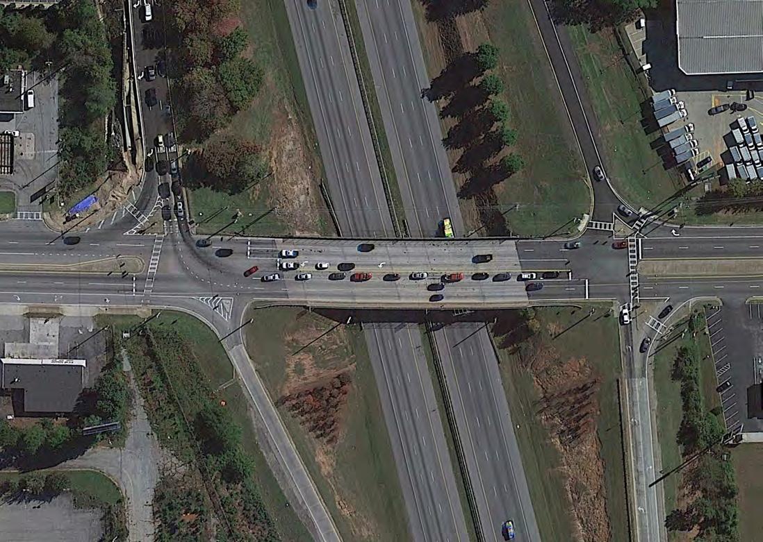
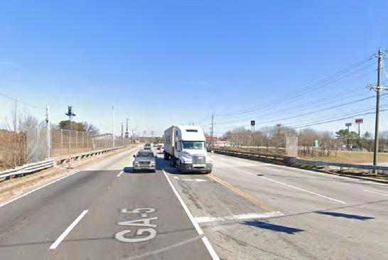
Existing Condition
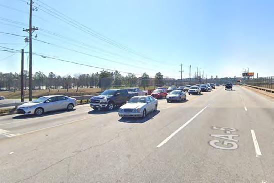
Existing Condition
There are sidewalks throughout most of the study area, however several gaps in the sidewalk preclude complete access for pedestrians. Furthermore, given the large setbacks that are endemic to strip mall developments, the sidewalks that do exist are not comfortable to walk upon. Complete connectivity is only one part of walkability – there must also be interesting things to see, other people to encounter, less road noise than exists along a Georgia state route, and buildings need to be closer to the back of the sidewalk.


There is no bicycle infrastructure in the study area. Furthermore, all roads in the study area are hostile to potential bicycle traffic. The Douglasville Municode stipulates that bicycles are not permitted to ride on the sidewalk, which renders the study area entirely unbikeable.
Douglas County administers four bus routes that travel throughout the county. Three of these (Route 10, 20, and 40) travel through the study area. These are depicted on the map below.
Legend
Route 10
Route 20
Route 40
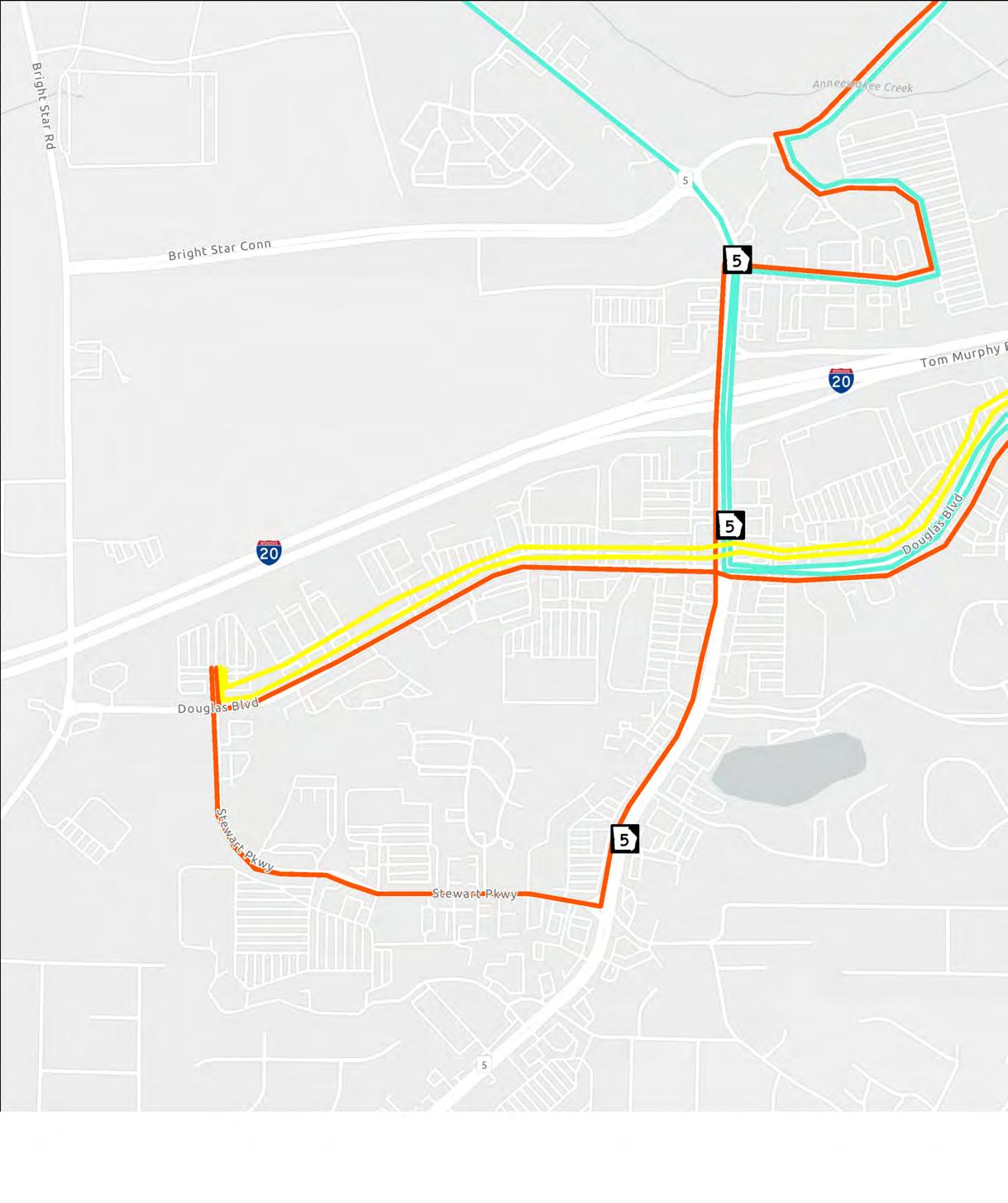
Although these routes do go through the study area, they are not well suited for circulation throughout the Highway 5 area. These routes extend out into Douglas County, and are better for getting people from unincorporated Douglas County into Douglasville proper.


Stakeholder Committee
Douglas County Government
Miguel Valentin


Public input from stakeholders in area is one of the most important aspects of any planning process. The project team recognized this and ensured that the public was involved at key milestones in the lifetime of the project. Two stakeholder meetings were held, one virtual and one hybrid, to inform the members of the committee of the project team’s finding’s and solicit input on the vision for the Highway 5 area.
Below are the stakeholders on the committee whose input was critical to the success of this study. Those efforts are summarized on the following pages.
The first stakeholder meeting consisted of a survey to solicit initial feedback and then a virtual meeting to discuss the what the project team heard from stakeholders. What follows is a summary of themes that the project team heard from the stakeholders with regards to five questions.
Question 1: What do you see as some opportunities?
• Good mixture of service, residential, and commercial
• Highway 5 is a main thoroughfare for west Douglasville
• Strong regional position
• Close proximity to I-20
• Potential for Mixed-Use developments
• Arbor Place Mall
• Arbor Station, largest residential community in Douglasville

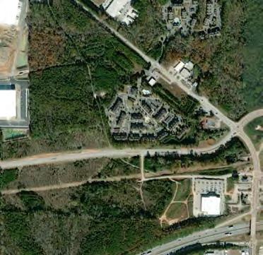


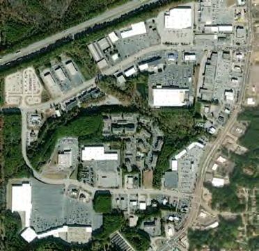


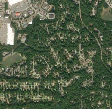


• Congestion, traffic flow, etc. is the most commonly cited challenge
• Signal timing/length is another common issue
• Lack of sidewalks and bike paths, generally too car dependent
• Safety – intersection accidents, blind drives
• Development in the area is unplanned
• Highway 5 bridge over I-20, low capacity, often congested
• Cost of land, lack of available land
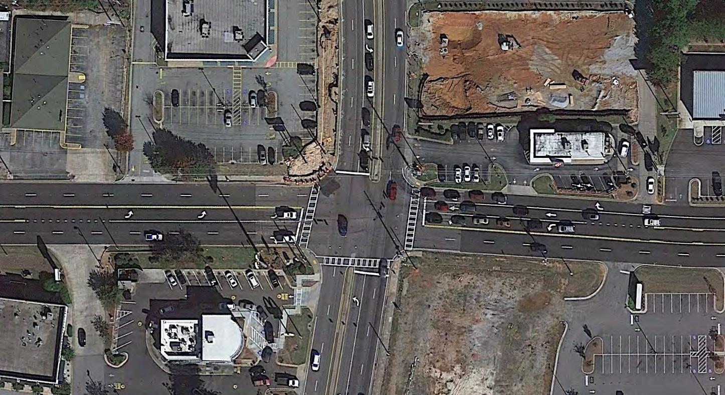


QUESTION 3: any examples of places to emulate?
• Peachtree City, GA intersection of 74 and Highway 54
• Smyrna, GA
• Marietta, GA
• Windy Hill and I-75, Cobb County, GA
• Paulding County, GA
• Bentonville, AR
• Sandy Springs, GA
• Roswell, GA
• North Fulton CID, GA
• Suwanee Buford Dam Road (Suwanee Town Center), Gwinnett County, GA
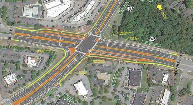
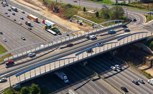
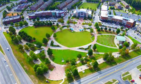
Question 4: What do you want to see in terms of development or infrastructure projects?
• TRAFFIC – improve traffic flow, reduce congestion, enhance signal timing, add capacity.
• MULTIMODAL – sidewalks (especially along Concourse Pkwy), pedestrian friendly elements, bike paths/lanes, generally increase walkability especially between commercial and residential areas
• DENSITY – higher density housing and commercial developments, mixed-use
• BRIDGE – Widen to increase capacity, diverging diamond interchange, add an exit from I-20 onto Bright Star Road
• ROADWAY – dedicated turn lanes, remove white bumps and striped buffer areas, add roads at key locations
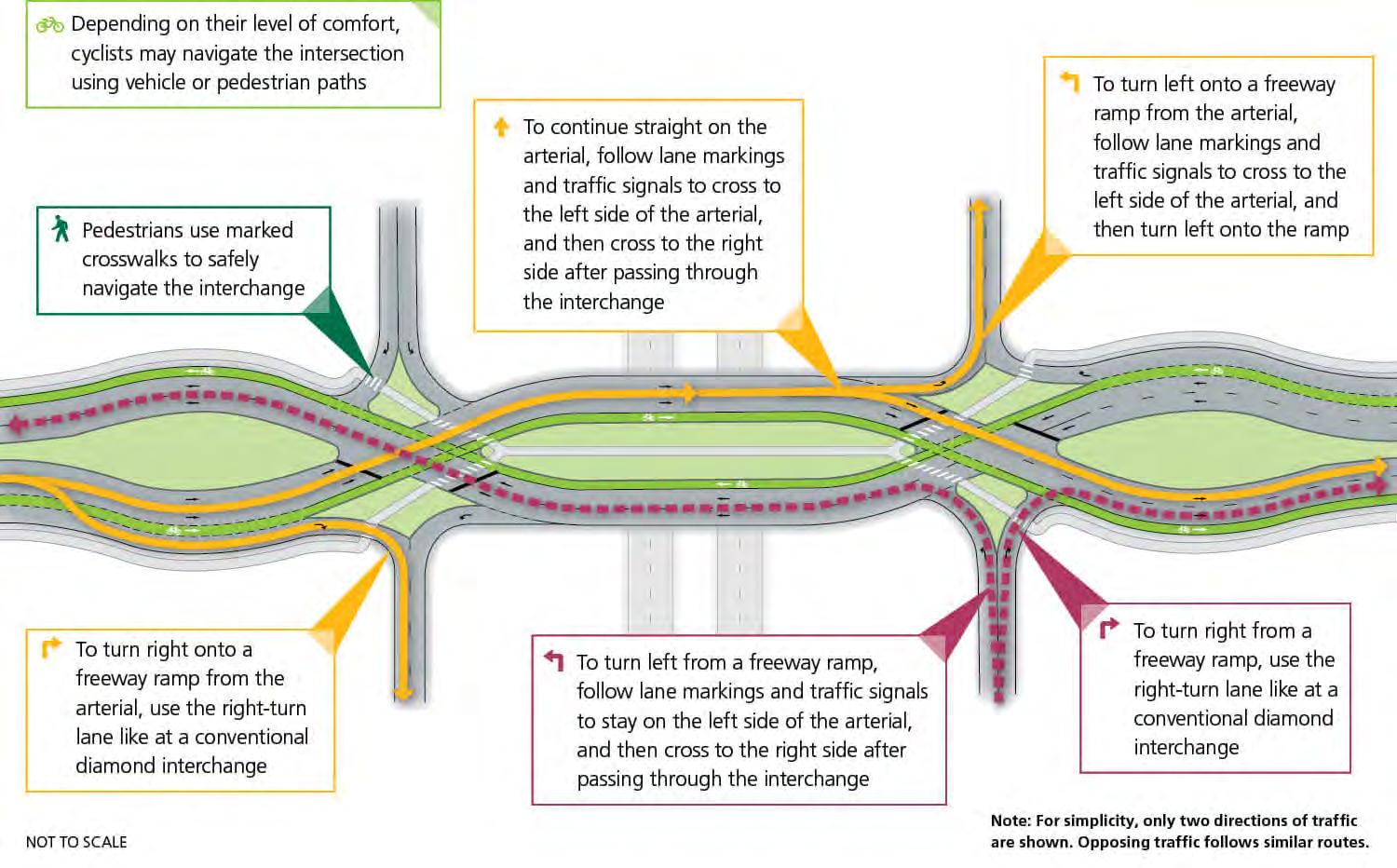
Question 5: Do you have any ideas for a catalyst project?
• Mixed-Use development with emphasis on live, work, play
• Mix of uses at Arbor Place Mall, anchor for the area
• Higher density housing development
• Walkability redesign and addition of pedestrian friendly elements
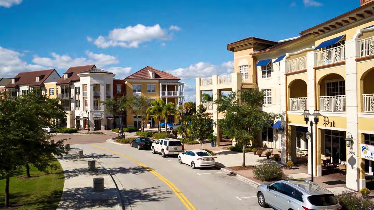


Douglasville City Hall Annex
6701 Church Street. Douglasville, GA 30134.
(Conference Room C)
& &Microsoft TEAMS Conference Call
September 16, 2021
9:00 am - 10:00 am
As a follow-up to the kick-off meeting, the project team reviewed draft project recommendations, incorporating initial feedback from the stakeholder committee and existing conditions analysis. Feedback from today's meeting will be incorporated and considered before final recommendations are presented to the Douglasville Board of Commissioners in late October 2021.
What follows is a summary of what the project team heard in response to the initial recommendations presented in the accompanying PowerPoint.
• Safety is a big concern for residents in the Arbor Station area. Concerns include people experiencing homelessness and gunfire in the area.
• New road access from Arbor Place Mall to the Arbor Station community via Parkway Circle and is undesirable due to existence of crime in the parking lot of the mall.
• Communit y Improvement District (CID) was suggested to fund additional area specific law enforcement to the area. Resident was concerned about taxes, advised that commercial entities would pay extra tax, not residents.
• Potential squatters in abandoned Nomoya restaurant at the entrance to neighborhood. Good potential for reuse, possible land-banking.
• Multimodal options such as expanding sidewalks and bike infrastructure would help get eyes and ears on the street, which lowers the incidence of crime.
• Concerns were raised regarding the existence of two signal heads for one turn lane at some intersections along the corridor. James advised that this was to prevent the entire intersection defaulting to flashing red. Suggested replacing double signal head to single signal head with split red arrow.
• Complaints regarding white bumps in the NB right turn lane from Hwy 5 into the Arbor Station neighborhood. Removes capacity for queueing in turn lane, residents often have to wait through several cycles.
• Drive-thru line for Chic-Fil-A establishment at SE corner of Stewart Parkway and Highway 5 tends to completely block traffic on east leg of intersection. New Starbucks at the intersection of Douglas Blvd and Highway 5 is example of how internalize traffic to site correctly.
• Permissive left turn arrow exists in the wrong direction at intersection of Highway 5 and Arbor Parkway. Given high SB left turn volume and better sight distance, permissive left turn arrow should be provided for that movement instead of the NB left turn into the shopping center to the west.
• Interchange/Collector Distributor lanes for Bright Star Road are supported. In addition to removing congestion from Highway 5, interchange would allow truck traffic from the Bright Star industrial area to the north to bypass traffic and avoid conflicts with pedestrians.
• Additional turn lane from SB Bright Star Road to EB Douglas Blvd is desired to mitigate traffic buildup in the thru-lane caused by any one left turning vehicle.
• Highway 5 needs to retain function as an arterial. Need to ensure zoning tweaks regarding reducing setbacks need to consider future conditions of the road, such as the proposed widening. Need to avoid constraining future capacity improvements to the road.
• Water runoff in the Arbor Station neighborhood is an increasing problem for residents.
• There are no parks in the Arbor Place area. Parks are desired by residents and would help with surface runoff flooding Arbor Station neighborhood.
• Higher densit y residential is generally supported by participants.
• Mixed-use amenities to go with higher density residential such as cafes and outdoor seating areas are highly desirable.
• Fresh food options are desirable, suggested to program farmers market at the Arbor Place Mall parking lot to activate the space and provide fresh produce.
• One Life Fitness in the Landing at Arbor Place is always full, indicating potential need for active living and recreation options.
• Parkway Circle north of intersection with Arbor Parkway is uncomfortable to walk down because there is nothing out there. Suggested to limb up trees and activate roadway to prevent crime.
Selective clearing and pruning of existing vegetation is desired throughout the neighborhood to ensure visibility, decrease crime, and maintain well kempt look for neighborhood.

4.1 Tool Kit of Recommendations
4.2 Land Use and Zoning Recommendations
4.3 Traffic Infrastructure Improvements
4.4 Multimodal Infrastructure Improvements
4.5 Placemaking & Streetscapes
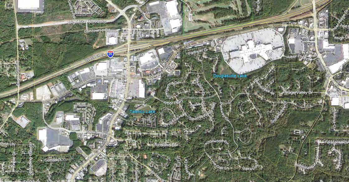


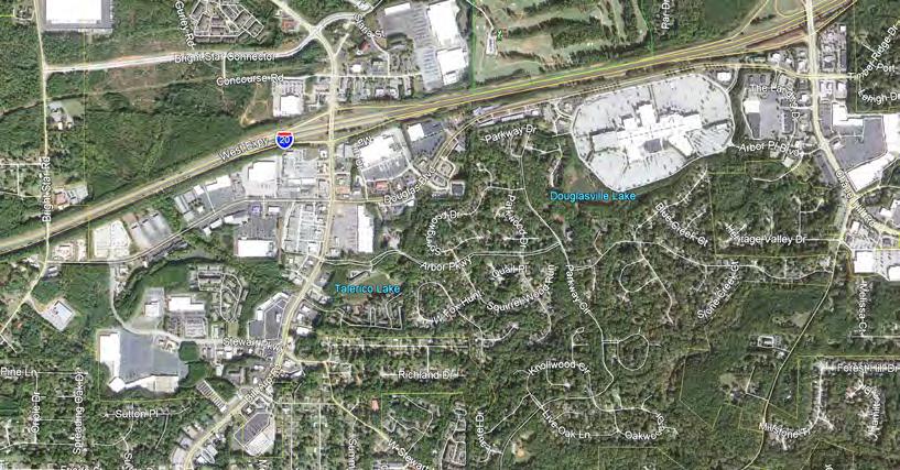


The recommendations for the Highway 5 area are best described as a toolkit that the City can employ to create a unique destination. The five areas in the toolkit are as follows:
• Land-Use and Zoning
• Traffic Infrastructure
• Multimodal Infrastructure
• Placemaking/Streetscapes
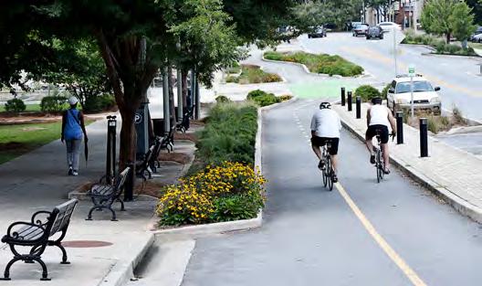


On the following page is a list of the high level recommendations along with a map depicting the location of the recommendations. The recommendations are numbered in the order that they appear in the rest of this chapter.
Highway 5 is uniquely positioned to become an attractive destination. By taking advantage of its unique blend of suburban and urban, Arbor Place has the potential to become a regional destination.


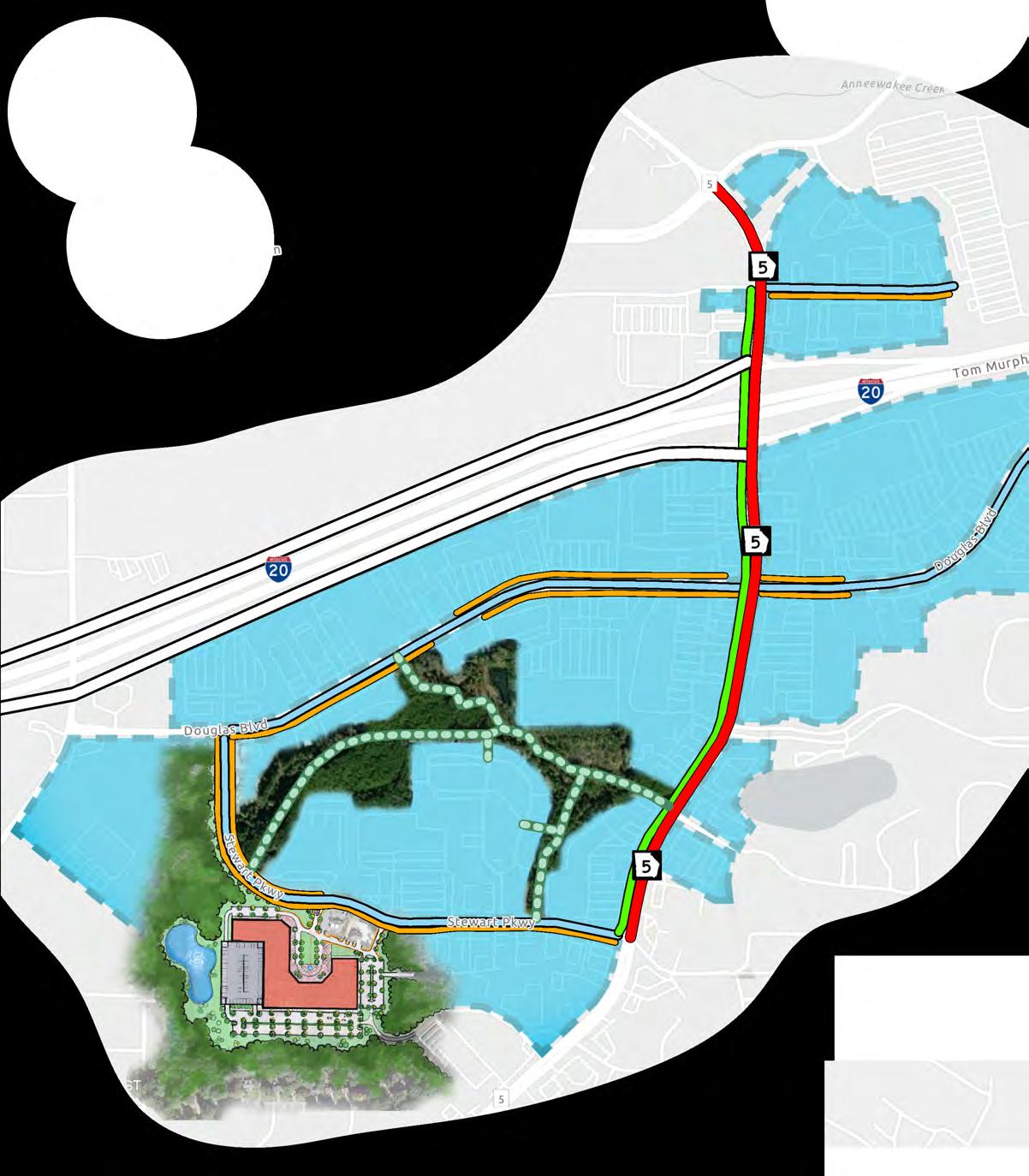


910111213 -
WIDEN HIGHWAY 5
BRIGHT STAR RD INTERCHANGE + FRONTAGE ROADS
REPLACE SR 5 BRIDGE OVER I-20 WITH DIVERGING DIAMOND INTERCHANGE
DOUGLAS BLVD @ CHAPEL HILL RD LANE REALLOCATION
CONSOLIDATE CURB CUTS


14151617181920 -
COMPLETE SIDEWALK NETWORK
COMPLETE STREETS PROJECTS
SHARED USE PATHS / CYCLE TRACKS
TRAILS THROUGH PROPOSED PARK
BIKE SHARE PROGRAM
PERMIT BIKES TO RIDE ON THE SIDEWALK
INSTALL WAYFINDING SIGNAGE

ENHANCE PEDESTRIAN SAFETY AND COMFORT
DEVELOP DESIGN, AESTHETIC, AND VISUAL ENHANCEMENTS FOR THE CORRIDOR
ENCOURAGE GREEN INFRASTRUCTURE DEVELOPMENT TO DECREASE IMPERVIOUS COVER


POTENTIAL ZONING OVERLAY AREA
Pilot the new mixed-use zoning code by redeveloping the Douglasville Town Center parcel into a mixed-use destination.

The goal of an overlay for the Arbor Place Mall is to prohibit industrial or warehousing land-use and preserve the mall as a potential live-work-play destination. An overlay will ensure that their land for infill development. Consider parking maximums instead.
Higher density residential - Create a cohesive mixed-use zoning code that allows up to 5 stories and up to 20 units per acre.
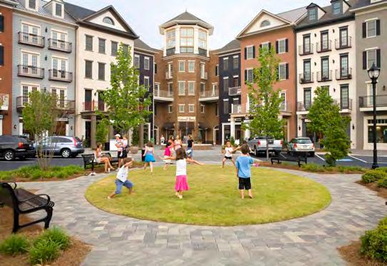

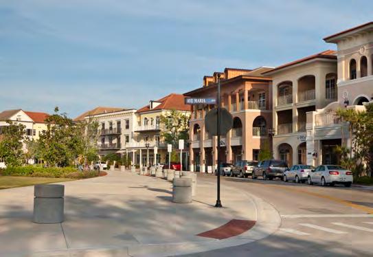
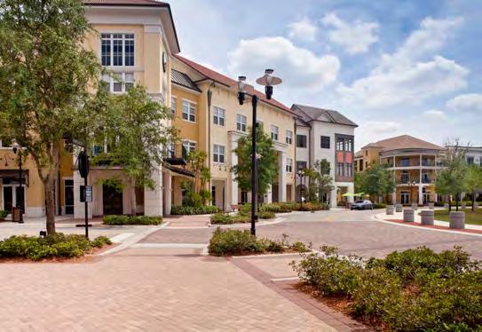
Zoning should encourage active street edges - Bring retail and residential to the front with parking in the rear to encourage a more pedestrian friendly / walkable environment.
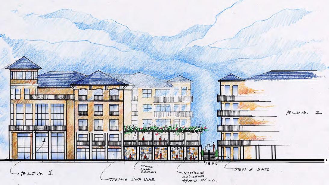
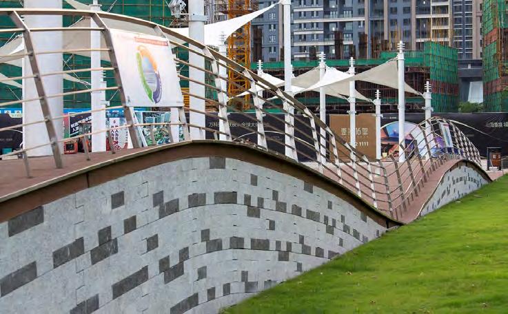
City of Shenzhen, China - AECOM


Encourage Infill Development - Amend the current zoning code to allow more infill development to leverage the many underutilized parking lots in the area.
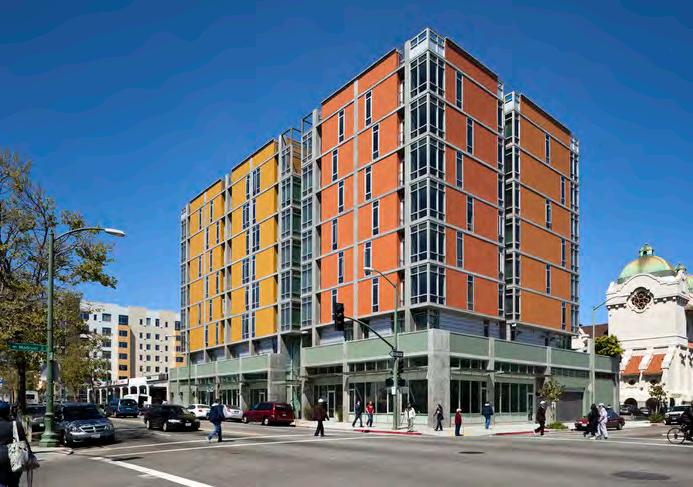
Madison at 14th Apartment, Oakland, CA
Built on a former surface parking lot
Sources: STOTT Architects
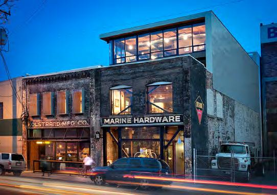
Kolstrand Building, Seattle, WA
Reuse of the historically significant building
Sources: Graham Baba Architects

Agnes Lofts, Seattle, WA
A catalyst for the Pike/Pine neighborhood
Sources: Weinstein AU Architects + Urban Designers LLC
PS House, San Francisco, CA
A single family residence
Sources: IwamotoScott Architecture
Allow business to set their own amount of parking, permits them to sell portions of their land for infill redevelopment. Consider parking maximums instead. A number of cities have eliminated parking minimums focus on downtowns and transit corridors.
Portland, OR
Eugene, OR
Eliminated minimum parking requirements within 500 feet of a transit line with a certain service frequency.
Eliminated minimum parking requirements in downtown.
Ashland, OR No parking minimums in downtown zone.
Tacoma, WA
Eliminated minimum parking requirements throughout the downtown core.
Seattle, WA
Milwaukee, WI
Nashville, TN
Eliminated minimum parking requirements in downtown and for affordable housing units (up to 80% AMI). Reduced standards in certain areas with frequent transit service and for certain types of developments, such as for seniors. Allows for shared parking arrangements in certain circumstances. Requires the unbundling of parking in leases for new development, so renters only pay for spaces they use.
No off-street parking required in downtown zoning districts and some redevelopment districts. No off-street spaces required for single- and two-family residences; maximum of 4 spaces.
Eliminated minimum parking requirements within the 600-acre downtown core.
Cincinnati, OH Reduced and eliminated parking minimum requirements in the central business district.
New York, NY
Washington, DC
Edmonton, AB
Eliminated minimum parking requirements for affordable units in downtown Manhattan and Brooklyn.
Eliminated minimum parking requirements in high-density downtown areas and reduced parking requirements in transit-rich areas outside of downtown.
Eliminated minimum parking requirements. Set maximums for downtown, transit-oriented projects, and main street areas. Allowed for shared parking. Increased bicycle parking requirements. Accessible parking required at existing rates.
Benefits of Zoning Overlay District
• Promote walkability
• Create a sense of consistency
• Encourage mixed use development projects and innovative urban design standards
• Preserve historic and natural resources
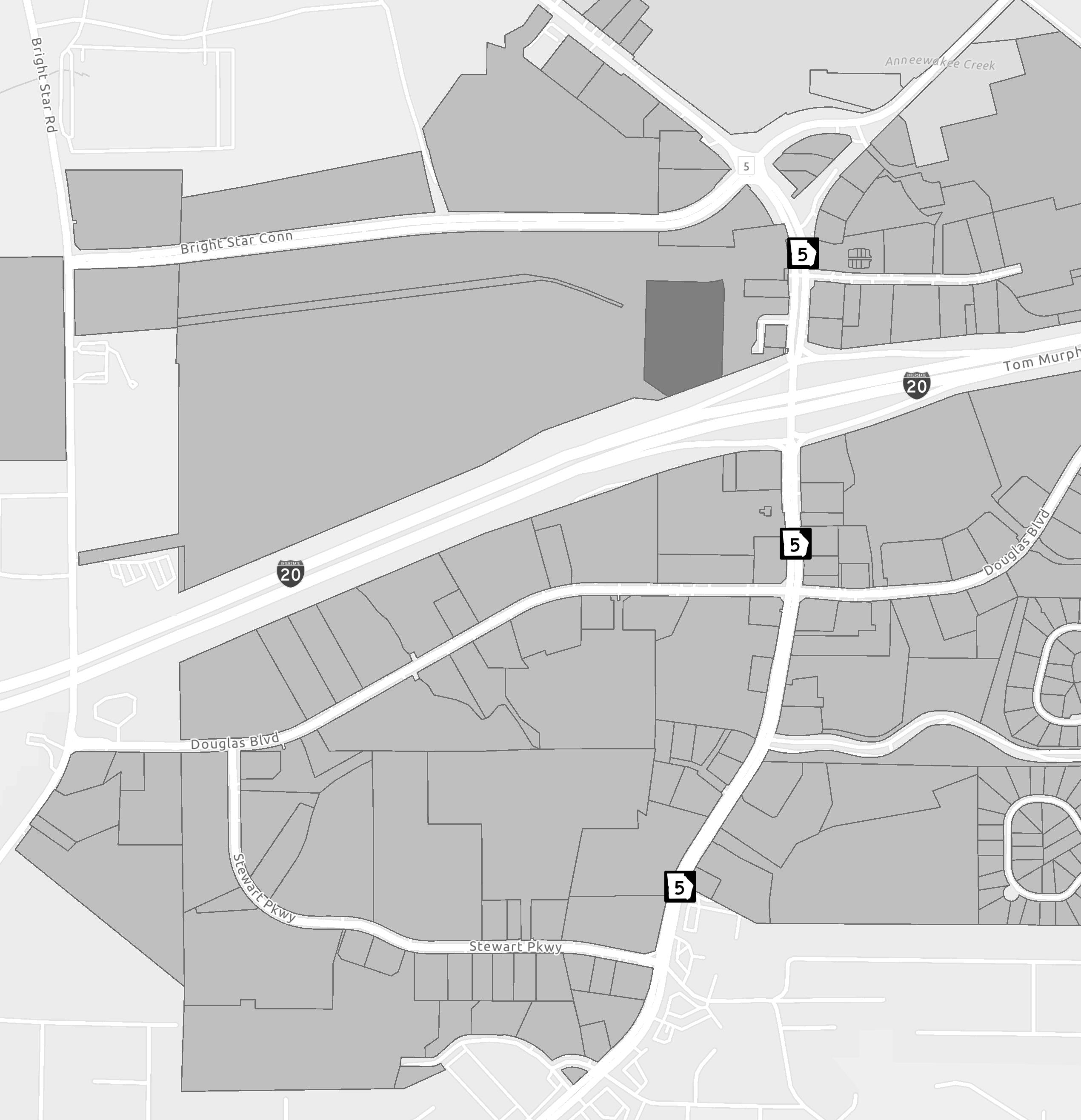
Consider a zoning overlay at the Arbor Place Mall to prohibit long term transition from commercial shopping destination into an undesirable use like industrial / distribution / e-commerce. An overlay will allow the city some future when the property does eventually redevelop – whether it is the current owner or a future owner. Locally, the mall is doing okay, but nationally, malls are going through a period of change – especially Class B and C malls. The goal of this overlay should be to allow retail,
residential and hospitality uses while prohibiting industrial, warehouse and e-commerce uses as they are not compatible with the surrounding residential uses. In addition, the associated truck traffic would only worsen the overarching congestion issues. Certain language within the overlay could require minimal curb cuts. Too many points of ingress/egress slows down traffic and the area already has an abundance.

Furthermore, a zoning overlay would allow for the private sector to know exactly what they might built, by right. Planned Development, Planned Unit Development or project-specific rezoning requires extensive negotiations and comes with associated costs and this added risk is an added barrier to entry. The City should keep a constant pulse on the node of retail anchored by the Park’s Mall –this includes property owners and business owners. This can be accomplished through the
City’s economic development arm or through the establishment of a non-profit community development corporation (CDC) should be in continued contact with local property and business owners to understand 1) if certain owners are considering selling property, this allows the city to have a chance to land bank property or work with the eventual seller. 2) if any major, or junior-anchors are deciding to leave so that the city may proactively work to retain them
The areas along Highway 5 provides the opportunity to connect new uses such as businesses, startups, non-profits, data centers, academic research activities, and medical facilities in an amenity-rich environment. As existing automotive uses shift over time with mainstream adoption of electric vehicles, a long-term strategy of co-locating the area’s innovators presents an opportunity to harness local talent and create new jobs and economic growth in the region. By designating key stakeholders, such as locally-based health systems, or local businesses as visionary leaders and site anchors, the City and its partners may begin the process of transforming the area through coordinated development that attracts additional partners and investors.
• Consider creating a coalition of key stakeholders to develop a shared vision for the area. After doing so, pursue further studies for designing a compact, mixed-use district and analysis of industry potential and economic impact.
• Consider taking a proactive role in redeveloping some of the areas between Highway 5, Douglas Blvd, and Stewart Pkwy through actions such as land assembly and developer partnerships. Working in conjunction with private developers, invest in the area with a focus on developing long-term innovation and tech uses as tenants.
• Improve code compliance by informing property owners when they are not in compliance and connecting them with existing community resources to address compliance issues. Maintained properties enhance overall public perception and safety of the area.
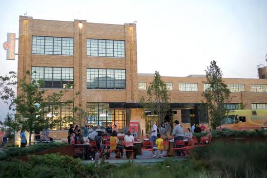
Originally envisioned as a research park, Cortex Innovation Community has quickly developed into a hub for start-up biotech companies, urban residences, and streetside shopping within the heart of St. Louis, MO.
It is a 200 acre center for business, innovation, and technology, formed in partnership with area universities and medical centers. It began providing research and office space for institutional partners. It serves as a driver for sustainable development and cultivates incubators and other neighborhood-building amenities for future economic development.


The existing Douglasville Town Center is an underutilized strip mall that is ripe for redevelopment as a catalyst project. Pilot project for the mixed-use zoning code. The current tenants of the center are not the tenants originally planned for, making it ready for a pivot. Additionally, the Town Center mall site is an example of a site where there is excessive parking and where the lot coverage is minimal.
The current value of the land is $260k per acre, but if the site is redeveloped to multifamily housing with mixed uses, the value would skyrocket to $1.42 million per acre.
This increase in the tax base, coupled with the lodging and people and jobs it would bring to the area, make this an incredibly attractive catalyst project.
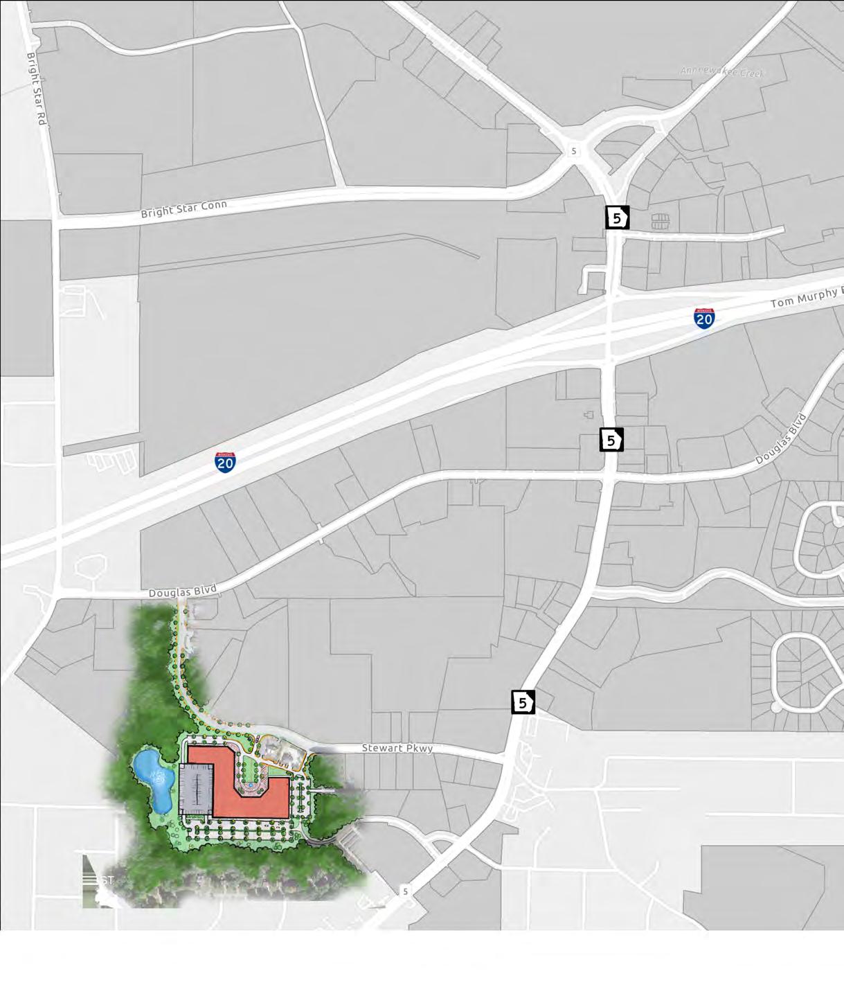
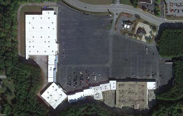

and still operates as a church today. Market realities would indicate that while the retail marketplace is strong in this location, there is too much inventory. As such, the southwest portion of the West Mall node of retail may be a redevelopment opportunity. In addition to suppressed property value, this area is also located proximate to the West Douglas Park n’ Ride lot and other multifamily housing that is only 1% vacant at time of this report which may provide market support for housing density in this area. However, the area may also benefit from improved pedestrianconnections to the plethora of retail.
The following visual assumes that the Douglasville Town Center site is redeveloped to multifamily, single-family or recapitalized to stay as retail. All estimates utilize current conditions within the area.

A community improvement district is a self-taxing district established by property owners for purposes of making infrastructure improvements such as streetscapes, placemaking elements, and public safety projects.
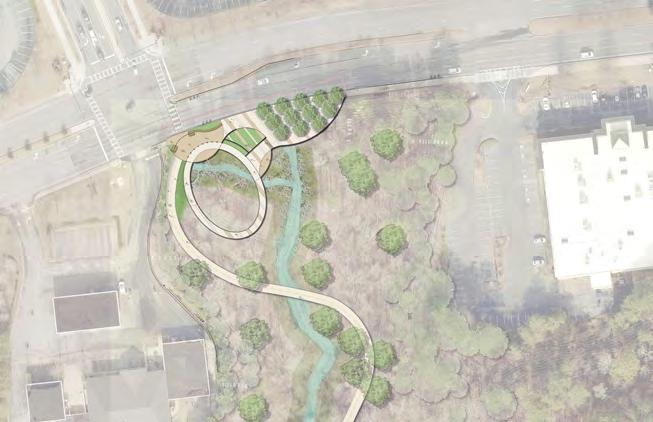
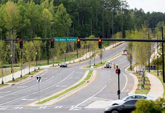
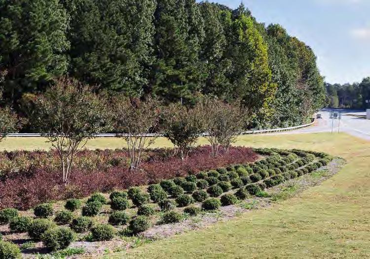
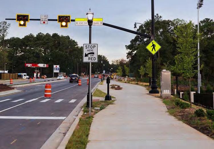
A tax-allocation district (TAD), also known as tax increment financing, is a defined area where real estate property tax monies gathered above a certain threshold for a certain period of time (typically 25 years) is used for a specified improvement. The funds raised from a TAD are placed in a tax-free bond where the money can continue to grow. These improvements are typically for revitalization and to complete redevelopment efforts in a specified area. Douglasville citizens approved a TAD in 2019.
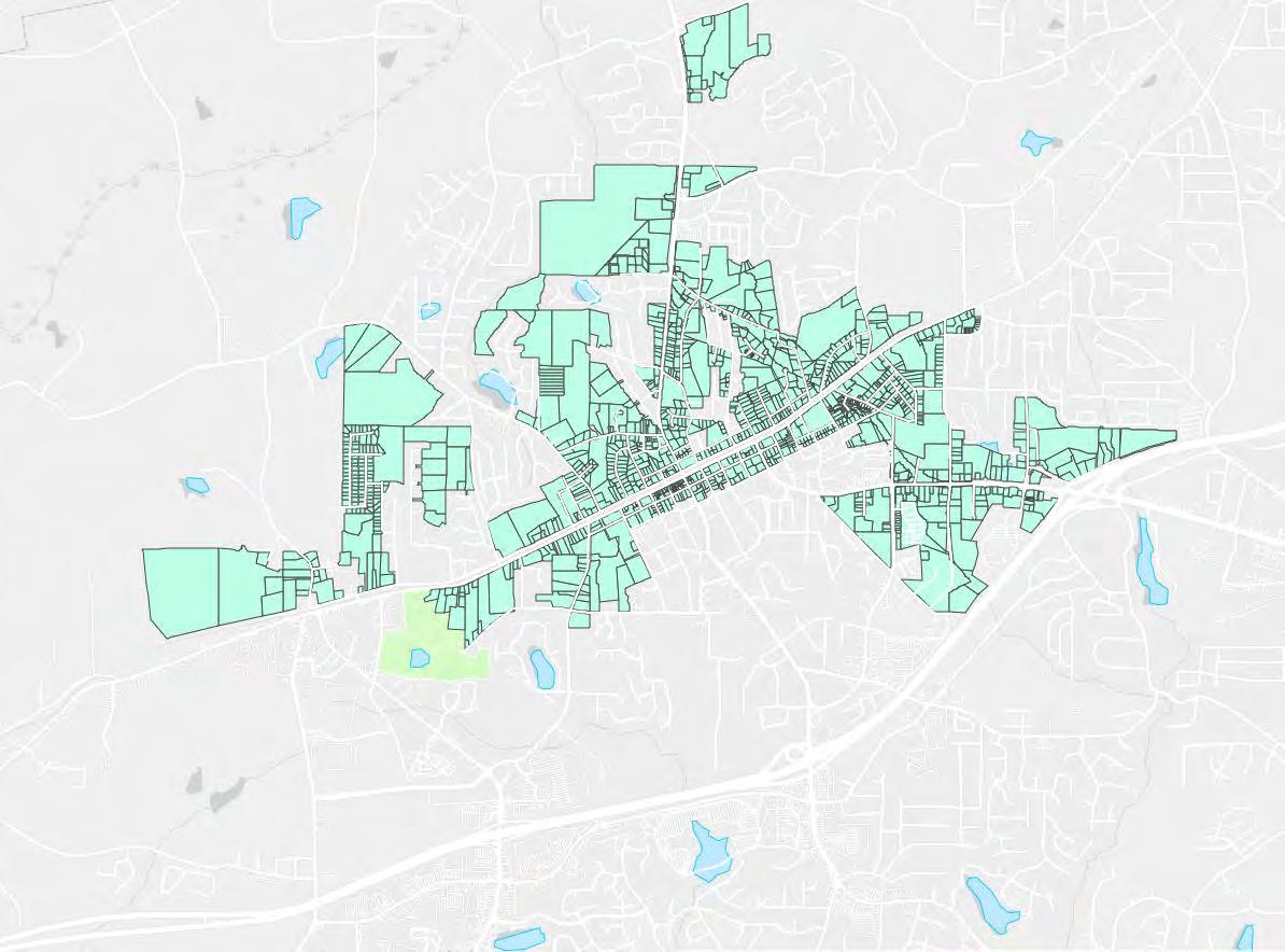
Existing TAD Area
Source: City of Douglasville - Community Development
Traffic volumes were forecasted for this project based on historic and projected data as described in the traffic forecasting memorandum attached in Appendix A. This effort resulted in a 1.31% exponential growth rate for No Build scenario and a 1.00% growth rate for Build scenario. For this analysis the Build scenario is considered to be the traffic volume condition resulting from the City of Douglasville implementing the land use codes discussed prior to this section, which encourage increased mixed-use development within or near the study area.
use sites are typically more friendly to alternative or active modes of transportation allowing for increased mode shift from vehicle trips to transit or bicycle/pedestrian trips. In order to account for this reduced demand from future mixed-use developments a reduced growth rate for future year Build scenario analyses was used (1.00% annual exponential).
As is shown in Table 2, Level of Service (LOS) at the intersections within the study area range from LOS A to LOS F in the existing condition. During the AM peak period no intersections operated at an LOS E or F and LOS ranged from A to D. During the PM peak period two intersections operated at an LOS E (SR 5 at Stewart Mill Rd and Douglas Blvd at Chapel Hill Rd) and one intersection operated at an LOS F (SR 5 at Douglas Blvd). The HCM Synchro printouts for Existing year results can be found in Appendix C.1.
Intersection LOS and Delay was calculated using Synchro 11 which uses H ighway Capacity Manual 6th Edition (HCM) methodology. At some intersections HCM 2000 methodology was used to inability of HCM 6th edition methodology to handle d ouble served phases, intersection with more than 4 legs, or non-NEMA phase sequence intersections. As is shown in Table Level of Service (LOS) at the intersections within the study area range from LOS A to LOS F existing condition. During the AM peak period no intersections operated at an LOS E or F and LOS ranged from A to D. During the PM peak period two intersections operated at an LOS E (SR Stewart Mill Rd and Douglas Blvd at Chapel Hill Rd) and one intersection operated at an LOS (SR 5 at Douglas Blvd). The HCM Synchro printouts for Existing year results can be found Appendix C.1.
Mixed-use sites are assumed to generate less traffic compared to typical single use sites. First, mixed-use sites would have increased internal capture trips. This would occur due to residents or office employees of the site being able to fulfill some of their needs such as grocery shopping on the site rather than having to take a vehicle trip offsite to fulfill this need. Second, denser mixed-
Traffic conditions observed in the field by project team members and stakeholders indicate worse traffic conditions than shown by the LOS and Delay results. This is due to methodological limitations of HCM based analyses. HCM based intersection analyses do not consider effects of adjacent intersections on the operations of the subject intersection. Therefore, if in the field one intersection queues into another and degrades operations of adjacent intersections the effects of this queueing will not register within an HCM based analysis. Furthermore, if signalized intersections are closely spaced, as is the case with most tight diamond interchanges, field measured individual intersection capacity is reduced below that assumed within an HCM based analysis. This is due to the complex nature of coordinating closely spaced intersections and limited queue storage between the intersections.
This causes LOS and delay results from HCM based analyses at closely spaced intersections to be lower than experienced LOS and delay.
Observing the results within the SR 5 and Douglas Blvd corridor in Table 2 it is likely that SR 5 at Douglas Blvd is one of the major culprit intersections on the corridor causing queueing into multiple intersections. Furthermore, because of the close spacing between SR 5 at Concourse Pkwy and SR 5 at I-20 WB (approx 425ft) and the close spacing between SR 5 at I-20 WB and SR 5 at I-20 EB (approx 370ft) actual field LOS and delay is likely higher than calculated in Table 2 at these three intersections. For reference, the desirable traffic signal spacing is 1,320ft and minimum recommended spacing is 1,000ft.
The results of the forecast analysis for 5 different alternatives is presented in the following pages. They are as follows:
• No Build - Forecast wherein neither the zoning and land-use changes are implemented and no infrastructure is built.
• No Build Mitigation - Forecast where zoning and land-use recommendations are implemented that result in increased mixed-use development within or near the study area, but no infrastructure is built.
• SR 5 Widening - This is the preferred alternative. SR 5 is widened from Concourse Pkwy to Stewart Mill Rd.
• SR 5 No Widening 1 - This alternative would avoid widening SR 5 by building a Single-Point Urban Interchange (SPUI) at the SR 5 at I-20 interchange and a signalized Reduced Conflict U-Turn (RCUT) intersection at SR 5 at Douglas Blvd.
• SR 5 No Widening 2 - This alternative would avoid widening SR 5 by building a signalized Reduced Conflict U-Turn (RCUT) intersection, a Diverging Diamond Interchance (DDI) at SR 5 at Concourse Pkwy, and a Median U-Turn (MUT) intersection at SR 5 at Douglas Blvd.
Table 3 below shows the No Build condition LOS and Delay for the Open (2030) and Design (2050) years. It is anticipated that by 2030 in the No Build condition during the AM peak LOS would range from A to D while PM peak would range from A to F. In 2030 only the SR 5 at Douglas Blvd intersection would be an LOS F. By 2050, in the AM Peak No Build condition LOS would range from A to E with Douglas Blvd at Chapel Hill Rd being the only intersection to show an LOS E. During the PM peak of the Design year No Build condition LOS would range from A to F with three intersections showing an LOS F and one intersection showing an LOS E. These intersections are SR 5 at I-20 WB Ramps (LOS F), SR 5 at Douglas Blvd (LOS F), SR 5 at Stewart Mill Pkwy (LOS E), and Douglas Blvd at Chapel Hill Rd (LOS F). In some cases results shown in No-Build condition may show an improvement over Existing Condition, this is due to signal timing optimizations made within Synchro for this analysis resulting in improved LOS and Delay. The HCM Synchro printouts for No Build scenario can be found in Appendix C.2.
Table 3 below shows the No Build condition LOS and Delay for the Open (2030) and Design (2050) years. It is anticipated that by 2030 in the No Build condition during the AM peak LOS would range from A to D while PM peak would range from A to F. In 2030 only the SR 5 at Douglas Blvd intersection would be an LOS F. By 2050, in the AM Peak No Build condition LOS would range from A to E with Douglas Blvd at Chapel Hill Rd being the only intersection to show an LOS E. During the PM peak of the Design year No Build condition L OS would range from A to F with three intersections showing an LOS F and one intersection showing an LOS E . These intersections are SR 5 at I-20 WB Ramps (LOS F), SR 5 at Douglas Blvd (LOS F), SR 5 at Stewart Mill Pkwy (LOS E), and Douglas Blvd at Chapel H ill Rd (LOS F). In some cases results shown in No-Build condition may show an improvement over Existing Condition , this is due to signal timing optimizations made within Synchro for this analysis resulting in improved LOS and Delay. The HCM Synchro printouts for No Build scenario can be found in Appendix C.2.
Table 3: No Build Open and Design Year Intersection LOS and Delay (sec/veh)
Table 4 below shows the Build No Mitigation condition LOS and Delay for the Open (2030) and Design (2050) years. The Build condition for this study is meant to describe the implementation of land use codes by the City of Douglasville which would result in increased future mixed use development within or near the study area as discussed previously in the Traffic Forecasting section of this memorandum Therefore, Build No Mitigation is the scenario in which the City of Douglasville implements mixed-use development codes and does not implement any infrastructure upgrades within the study area.
Due to the reduced anticipated traf fic growth in future years compared to the No -Build scenario, in general, delay in the Build No Mitigation scenario would be lower than No -Build condition As shown below in Table 4 the 2030 AM peak LOS would range from A to C while the PM peak would range from A to F with only one intersection (SR 5 at Douglas Blvd) resulting in an LOS F and no intersections would be an LOS E. During the 2050 AM peak hour, LOS would range from
Table 4 below shows the Build No Mitigation condition LOS and Delay for the Open (2030) and Design (2050) years. The Build condition for this study is meant to describe the implementation of land use codes by the City of Douglasville which would result in increased future mixed use development within or near the study area as discussed previously in the Traffic Forecasting section of this memorandum. Therefore, Build No Mitigation is the scenario in which the City of Douglasville implements mixed-use development codes and does not implement any infrastructure upgrades within the study area.
Due to the reduced anticipated traffic growth in future years compared to the No-Build scenario, in general, delay in the Build No Mitigation scenario would be lower than No-Build condition. As shown below in Table 4 the 2030 AM peak LOS would range from A to C while the PM peak would range from A to F with only one intersection (SR 5 at Douglas Blvd) resulting in an LOS F and no intersections would be an LOS E. During the 2050 AM peak hour, LOS would range from A to D while during the PM peak hour LOS would range from A to F. Two intersection would result in an LOS E (SR 5 at I-20 WB ramps and Chapel Hill Rd at Douglas Blvd) and one intersection would result in an LOS F (SR 5 at Douglas Blvd). The HCM Synchro printouts for the Build No Mitigation scenario can be found in Appendix C.3.

5.4. SR 5 Improvement Alternatives
5.4.1. SR 5 Widening
This alternative would widen SR 5 from its intersection with Concourse Pkwy south to its intersection with Stewart Mill Rd. An additional through lane in the northbound and southbound direction would be added to SR 5 between these intersections . This would improve traffic operations along the corridor to an acceptable LOS D or better Furthermore, at locations where congestion occurs in the field due to closely spaced intersections the additional lane would have the added effect of providing additional queue storage operations and coordination of traffic


Traffic data indicates that widening SR 5 to six lanes will be necessary by 2050 to achieve an acceptable level of service. It is recommended to first implement other recommendations in this report such as the Bright Star exit ramps and ped/bike improvements to divert traffic to other exits/modes that also serve to make the area more pleasant for street life.
Built in 1964, the SR 5 bridge over I-20 will need to be replaced relatively soon. Widening SR 5 coupled with the Bright Star Rd improvements may bring the volume over the bridge in line with capacity. If those projects do not, or when the bridge naturally comes up for replacement, it is recommended to install a diverging diamond interchange for both capacity and safety.


In the short-term, build eastbound and westbound right turn overlap signals. In the longer term, add an additional northbound left turn lane.
City of Douglasville, GA between the bridge over I-20 and Douglas Blvd. Dovetails with ARC-D003 that aims to widen Bright

This alternative would widen SR 5 from its intersection with Concourse Pkwy south to its intersection with Stewart Mill Rd. An additional through lane in the northbound and southbound direction would be added to SR 5 between these intersections. This would improve traffic operations along the corridor to an acceptable LOS D or better. Furthermore, at locations where congestion occurs in the field due to closely spaced intersections the additional lane would have the added effect of providing additional queue storage operations and coordination of traffic signals.
• Terminate new southbound lane at Stewart Pkwy at a right turn only lane.
• Begin new northbound lane at Stewart Pkwy as a receiving lane for the westbound right turn lane.
• Terminate the new northbound lane as a right turn lane into Concourse Parkway

• Begin the new southbound lane as a continuous right turn lane from eastbound Concourse
• Trap one of the northbound thru lanes as a northbound left turn lane onto I-20 WB
• Convert one of the westbound turn lanes from I-20 into a third westbound left turn lane
• Convert the remaining westbound right turn lane into a continuous flow right turn lane with receiving lane on SR 5
• Add northbound and southbound right turn lanes.
• Add additional eastbound and westbound left turn lane to make dual left turn lanes.
• Change to protected only phasing on the new dual left turn lanes.
b. Begin new NB lane at Stewart Pkwy as a receiving lane for the westbound right turn lane.
The intersection LOS and Delay for the Open (2030) and Design (2050) year Build SR 5 Widening condition is shown below in Table 5. As is shown, these improvements would result in an LOS of D or better at each intersection along SR 5 in the Open and Design years and in the AM and PM peak period. The HCM Synchro printouts for the SR 5 Widening scenario can be found in Appendix C.4.
The intersection LOS and Delay for the Open (2030) and Design (2050) year Build SR 5 Widening condition is shown below in Table 5. As is shown, these improvements would result in an LOS of D or better at each intersection along SR 5 in the Open and Design years and in the AM and PM peak period. The HCM Synchro printouts for the SR 5 Widening scenario can be found in Appendix C.4.
Table 5: Build Widen SR 5 Open and Design Year LOS and Delay (sec/veh)
This alternative would not widen SR 5 and instead explored alternatives which may help to
City of Douglasville, GA

This alternative would not widen SR 5 and instead explored alternatives which may help to mitigate traffic congestion with the use of alternative intersections at key locations. In summary, this alternative explores the possibility of building a SPUI (Single Point Urban Interchange) at the SR 5 at I-20 interchange and building a signalized RCUT (Reduced Conflict U-Turn) intersection at the SR 5 at Douglas Blvd intersection.
Specific improvements are listed on the next spread.

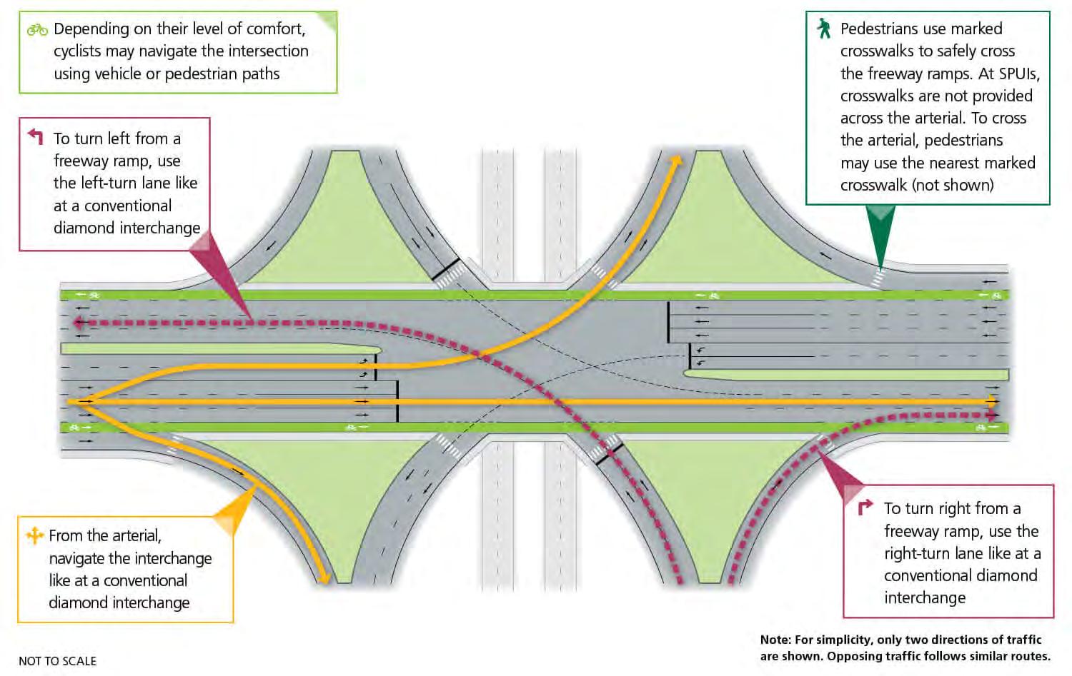
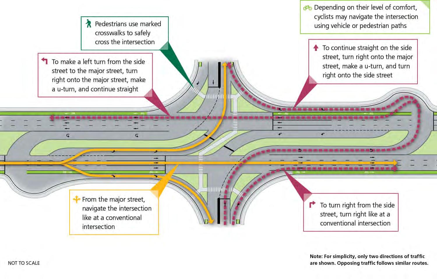

This alternative would not widen SR 5 and instead explored alternatives which may help to mitigate traffic congestion with the use of alternative intersections at key locations. In summary, this alternative explores the possibility of building a SPUI (Single Point Urban Interchange) at the SR 5 at I-20 interchange and building a signalized RCUT (Reduced Conflict U-Turn) intersection at the SR 5 at Douglas Blvd intersection.
• Construct new signs to accommodate U-turns from the restricted through and left turns from westbound Douglas Blvd.
• Construct new signal to accommodate U-turns from the restricted through and left turns from westbound Douglas Blvd.
• Replace existing diamond interchange with a Single Point Urban Interchange.
• Construct RCUT intersection.
• Add additional northbound left turn lane and change to protected only phasing.
• Remove eastbound and westbound left turn and thru lanes and signal phases, re-route traffic to eastbound/westbound right turn then U-turn.
• Add second eastbound and westbound right turn lane and make protected only right turn phase overlapped with northbound and southbound left turn phases.
6. Stewart Pkwy a. No improvements needed
The intersection LOS and Delay for the Open (2030) and Design (2050) year SR 5 Build No Widening Alternative 1 condition is shown below in Table 6. As is shown, the LOS in PM peak hour of the Design year (2050) would be LOS E at two intersections and LOS F at one intersection. Although the SPUI would be improved compared to the No Build condition in terms of overall intersection delay it would still result in an LOS E which is not desirable. Furthermore, SR 5 at Douglas Blvd would result in an LOS E and U-turns from diverted traffic at Douglas Blvd would degrade SR 5 at Arbor Pkwy to an LOS F by the design year. Based on this information a SPUI at the SR 5 at I-20 interchange and an RCUT at the SR 5 at Douglas Blvd intersection would not be ideal candidates for consideration at these locations. The HCM Synchro printouts for No Widening Alternative 1 can be found in Appendix C.5.
*HCM 2000 used due to HCM6th limited methodology to analyze intersections with more than 4 approaches or non-NEMA phasing

The intersection LOS and Delay for the Open (2030) and Design (2050) year SR 5 Build No Widening Alternative 1 condition is shown below in Table 6 As is shown, the LOS in PM peak hour of the Design year (2050) would be LOS E at two intersections and LOS F at one intersection. Although the SPUI would be improved compared to the No Build condition in terms of overall intersection delay it would still result in an LOS E which is not desirable. Furthermore, SR 5 at Douglas Blvd would result in an LOS E and U-turns from diverted traffic at Douglas Blvd would degrade SR 5 at Arbor Pkwy to an LOS F by the design year. Based on this information a SPUI at the SR 5 at I-20 interchange and an RCUT at the SR 5 at Douglas Blvd intersection would not be ideal candidates for consideration at these locations. The HCM Synchro printouts for No Widening Alternative 1 can be found in Appendix C.5.

This alternative would not widen SR 5 and instead explored alternatives which may help to mitigate traffic congestion with the use of alternative intersections at key locations. In summary, this alternative explores the possibility of building a signalized RCUT intersection at the SR 5 at Concourse Pkwy intersection, a DDI (Diverging Diamond Interchange) at the SR 5 at I-20 interchange, and a signalized MUT (Median U-Turn) intersection at the SR 5 at Douglas Blvd intersection.


MEDIAN U-TURN (MUT)

This alternative would not widen SR 5 and instead explored alternatives which may help to mitigate traffic congestion with the use of alternative intersections at key locations. In summary, this alternative explores the possibility of building a signalized RCUT intersection at the SR 5 at Concourse Pkwy intersection, a DDI (Diverging Diamond Interchange) at the SR 5 at I-20 interchange, and a signalized MUT (Median U-Turn) intersection at the SR 5 at Douglas Blvd intersection.
• Remove northbound and southbound left turn lanes and associated left turn signal phase.
• Add northbound and southbound right turn lane.
• Add additional eastbound and westbound left turn lane and convert to protected only signal phasing.
• Add additional westbound right turn lane.
• Construct new signalized intersection between the I-20 interchange and Douglas Blvd to accommodate U-turns for re-routed northbound left turn volume at Douglas Blvd.
• Re-route southbound left turn volume at Dougllas Blvd to a U-turn at the Arbor Pkwy intersection.
• Construct bulbout for southbound U-turning traffic as a high volume of U-turns will be accommodated at Arbor Pkwy due to re-routed southbond left turning volume from Douglas Blvd.
• Reconstruct intersection to a signalized Restricted Crossing U-Turn (RCUT) intersection.
• Remove one westbound left turn lane and convert the remaining westbound approach lanes to right turn only lanes under protexted only phasing overlapped with the southbound left turn lane.
4. Douglas Blvd
• Remove eastbound left turn lane and convert eastbound thru-lane/right-turn lane to a right turn only lane under protected only phasing overlapped with the northbound left turn phase.
a. Reconstruct intersection to a signalized MUT intersection.

terminate as a right turn lane at Concourse Pkwy , third southbound thru lane would begin north of the interchange and terminate as a right turn lane at Douglas Blvd.
i. Remove northbound and southbound left turn lanes and associated left turn signal phase.
• Re-route westbound thru-lane/left-turn vehicls to the northbound U-turn at the SR 5 at Bright Star Connector intersection.
ii. Add northbound and southbound right turn lane
iii. Add additional eastbound and westbound left turn lane and convert to protected only signal phasing
• Re-route eastbound thru/left turn vehicles to the eastbound approach of SR 5 at Bright Star Connector via Concourse Pkwy at Bright Star Conn.
iv. Add additional westbound right turn lane.
v. Construct new signalized intersection between the I -20 interchange and Douglas Blvd to accommodate U-turns for re-routed northbound left turn volume at Douglas Blvd.
• Replace existing diamond interchange with a DDI
vi. Re-route southbound left turn volume at Douglas Blvd to a U -turn at the Arbor Pkwy intersection.
5. Arbor Pkwy
• DDI would require three thru-lanes in each direction athte interchange: third northbound thru-lane would begin south of the intercahnge and terminate as a right turn lane at Concourse Pkwy. Third southbound thru-lane would begin north of the interchange and terminate as a right turn lane at Douglas Blvd.
a. Construct bulbout for southbound U-turning traffic as high a volume of U-turns will be accommodated at Arbor Pkwy due to re-routed southbound left turning volume from Douglas Blvd.
6. Stewart Pkwy
a. No improvements needed
The intersection LOS and Delay for the Open (2030) and Design (2050) year SR 5 Build No Widening Alternative 1 condition is shown below in Table 7. As is shown, the LOS in PM peak hour of the Design year (2050) would be LOS E at the SR 5 at Douglas Blvd intersection. Although an LOS E is not desirable it does mark a substantial improvement over the LOS F from the No Build and Build No Mitigation scenarios which result in excess of 100 seconds per vehicle delay. The HCM Synchro printouts for the No Widening Alternative 2 scenario can be found in Appendix C.6.
The intersection LOS and Delay for the Open (2030) and Design (2050) year SR 5 Build No Widening Alternative 1 condition is shown below in Table 7. As is shown, the LOS in PM peak hour of the Design year (2050) would be LOS E at the SR 5 at Douglas Blvd intersection. Although an LOS E is not desirable it does mark a substantial improveme nt over the LOS F from the No Build and Build No Mitigation scenarios which result in excess of 100 seconds per vehicle delay. The HCM Synchro printouts for the No Widening Alternative 2 scenario can be found in Appendix C.6.
Table 7: Build SR 5 No Widening Alternative 2 Intersection LOS and Delay (sec/veh)
Improving Bright Star Road with an interchange, a wider bridge, and collector distributor lanes connecting to SR 5 will greatly help alleviate traffic congestion on SR 5.
• Construct Collector-Distributor Lanes from SR 5 to Bright Star Rd.


• Construct four lane bridge in place of existing two-lane bridge.
• Construct exit ramps from Bright Star Rd onto I-20.

Adding an interchange and collector distributor lanes to Bright Star Road and widening the bridge to four lanes will go a long way to alleviating the SR 5 bottleneck. Not only will this improve traffic, this will have a myriad of add-on benefits:
• Alleviates congestion at the SR 5 bottleneck - All of the travelers that live in the area or to the south are forced to go through the existing bottleneck of SR 5 @ Douglas Blvd. These travelers can use the bypass to avoid the worst of the traffic.
• Reactivates the Park and Ride by making it more convenient - As it is now, the Park and Ride is underutilized because you are forced to drive through the most congested part to get to it, defeating the purpose. With a Bright Star bypass, it makes sense to get off at Bright Star and park to avoid sitting in traffic. Couple this with a dedicated Arbor Place bus, bike share, and parkways leading from the PnR.
• Revitalizes Stewart Parkway, setting stage for future Town Center development - Will also make the Bright Star Connector area north of I-20 more attractive to prospective developers.
• Opportunity to capture tag-along commercial developments - Businesses tend to spread to whatever the next exits are, so plant fertile ground for them by building the next exit.
• Dovetails with ARC DO-003 – South Douglas Loop Phase 3 project to widen Bright Star Road south of I-20.
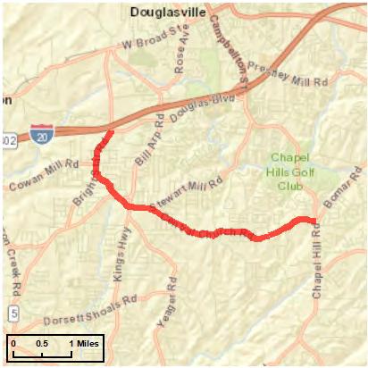
It is recommended to add eastbound and westbound right turn overlap signals to the existing intersection as a short term improvement to the intersection. In the longer term, it is recommended to add an additional northbound left turn lane to the intersection. Based on the laneage analysis Chapel Hill Rd may need to be widened by 2036, however, the extent of the widening extends beyond the study area of the project and cannot be conclusively determined by this study. It is recommended to collect additional segment counts along Chapel Hill Rd to determine the length of the widening required. The Douglas Blvd at Chapel Hill Rd intersection would degrade an LOS F in the No Build Design year (Table 3) and an LOS E in the Build No Mitigation Design year (Table 4). This would also occur during the weekend peak hour as shown in Table 9 and Table 10. Table 11 reflects the LOS and delay for Douglas Blvd at Chapel Hill Rd with the recommended improvements listed above. Short term improvements only are reflected in the 2030 year results while the short and long term improvements are reflected in the 2050 year results. The HCM Synchro printouts for Chapel Hill Rd Build scenario can be found in Appendix C.10.
Existing Intersection Configuration

Table 11: Douglas Blvd Build with Mitigation AM, PM, and Weekday LOS and Delay (sec/veh)
Intersection
• Add eastbound and westbound right turn overlap signals to the existing intersection.
• Longer term, add an additional northbound left turn lane to the intersection.


Given that the bridge was built n 1964 and there is evidence that the bridge is over capacity, there is a good case to make to GDOT for the bridge’s replacement. When the bridge is replaced, an diverging diamond is recommended. Not only will a diverging diamond provide more capacity with the same number of lanes, but these structures are actually safer for pedestrians and cyclists as well. The image to the right depicts how a pedestrian or cyclist would navigate these intersections.


Table 16: Available CMF’s for Potential Improvements
Table 16: Available CMF’s for Potential Improvements
*From VDOT Preferred CMF List
Observing the CRF’s in Table 16 it appears the DDI and SPUI alternatives would have the greatest impact on reducing crashes at the SR 5 at I-20 interchange. The DDI would have a greater effect on injury crashes as this type of interchange requires drivers to navigate the interchange at a slower speed than the SPUI and widening only alternatives.
VDOT Preferred CMF List
Observing the CRF’s in Table 16 it appears the DDI and SPUI alternatives would have the greatest impact on reducing crashes at the SR 5 at I-20 interchange. The DDI would have a greater effect on injury crashes as this type of interchange requires drivers to navigate the interchange at a slower speed than the SPUI and widening only alternatives.
Observing the CRF’s in Table 16 it appears the DDI and SPUI alternatives would have the greatest impact on reducing crashes at the SR 5 at I-20 interchange. The DDI would have a greater effect on injury crashes as this type of interchange requires drivers to navigate the interchange at a slower speed than the SPUI and widening only alternatives.
At SR 5 at Douglas Blvd the MUT intersection would have the greatest effect on reduc ing overall crashes and a comparable effect to reducing injury crashes compared to the RCUT or Widening alternatives. Furthermore, the widening project alone would reduce crashes by up to 15% while also adding dual eastbound and westbound left turn lanes and converting these left turn lanes to protected only phasing which would have the effect of reducing left turn angle crashes at the intersection.
At SR 5 at Douglas Blvd the MUT intersection would have the greatest effect on reduc ing overall crashes and a comparable effect to reducing injury crashes compared to the RCUT or Widening alternatives. Furthermore, the widening project alone would reduce crashes by up to 15% while
Unfortunately, CMF data is not available for the potential countermeasures at Douglas Blvd at Chapel Hill Rd. However, it should be noted that nearly half of the
at Douglas Blvd at
At SR 5 at Douglas Blvd the MUT intersection would have the greatest effect on reduc ing overall crashes and a comparable effect to reducing injury crashes compared to the RCUT or Widening
There is an excess of curb cuts along the study area. Not only does an excess of curb cuts slow down vehicular traffic, but it also makes the corridor that much more hostile for pedestrians. Cutting down on the number of excess curb cuts and identifying interparcel access opportunities is recommended


Consider consolidating with an adjacent driveway
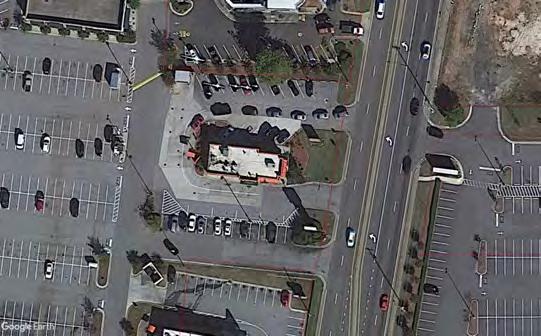
Consider consolidating with an adjacent driveway

Consider consolidating with an adjacent driveway
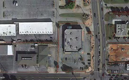
Consider consolidating with an adjacent driveway
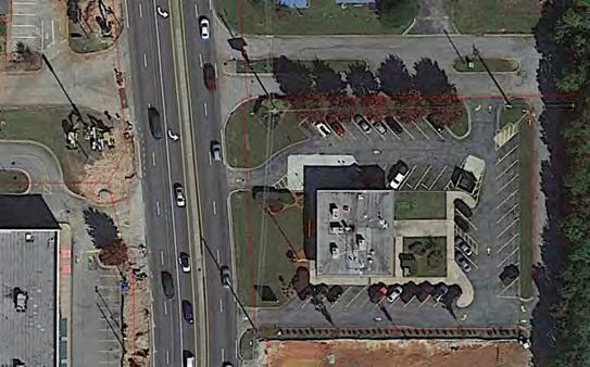
Consider consolidating with an adjacent driveway
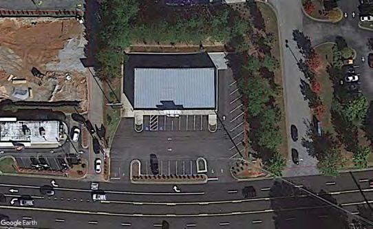
Consider consolidating with an adjacent driveway

At the end of every trip, everybody becomes a pedestrian. Ensuring that all of the sidewalks in the area are connected is the first step to an effective multimodal system.

Shared-use paths are a great way to provide complete, comfortable connectivity for both pedestrians and cyclists along high speed high volume thoroughfares such as Highway 5. These facilities are recommended along Highway 5, along the east end of Douglas Blvd, and around the perimeter of the Arbor Place Mall to act as a recreational loop.


Wayfinding allows residents and visitors alike to travel safely and effectively when walking and biking. Good opportunity for branding.


Currently the area is serviced by the Douglas County bus system. The bus routes are not well-suited to circulation in the busy Highway 5 area. The City should work with the County to reevaluate their bus system and consider implementing a dedicated Arbor Place Shuttle as redevelopment and employment opportunities increase in the study area.


Mirror Fairburn Road Complete Street project on Douglas Blvd, Stewart Pkwy, and Concourse Pkwy. Reallocating the outside lanes to tree protected bike lanes will create bicycle connection and enhance walkability of existing sidewalks by making the thoroughfares more comfortable and pleasant for pedestrians. Coupled with zoning changes that encourage developers to build attractive streetscape up to the existing back of sidewalk will create vibrant pedestrian destinations.
Once Complete Streets Projects are built, provide a bikeshare program to encourage residents and commuters to utilize the bicycle network. Locations for the bikeshare stations are:
• Douglas County Park & Ride
• Arbor Place Mall
• Stewart Pkwy Kroger
• Walmart
Without bike infrastructure in the area and the inability to ride on sidewalks, it is effectively impossible to bike safely in the study area. Permit bikes to ride on the sidewalk where practicable. Stipulate that if pedestrians are present, bicyclists must dismount.


Tree protected bike lanes on the existing outside lanes of the roads in blue below provides connectivity and activates the pedestrian space by making it more pleasant to walk. Existing sidewalks are uncomfortable to walk on - they are close to fast-moving car traffic, they are narrow, and there are no shade trees. The addition of the tree buffer and bike lane will add the shade and separation from vehicles necessary to encourage people to utilize the existing and future sidewalks.

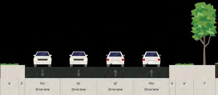

NOTE: Current two-lane in each direction will need to be change to 3 eastbound lanes to accommodate section. Switch will also improve operations at SR 5 @ Concourse Pkwy. Vehicles must route around to Rose Ave.

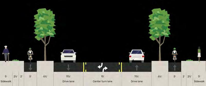

Shared-use paths allow for comfortable movement along heavily trafficked thoroughfares using whatever mode of travel that people wish. They are a great way to ensure connectivity for all modes while not taking away from vehicular travel space, which is necessary due to the heavy vehicular traffic along Highway 5. This is also the only way to provide bicycle connectivity across the SR 5 bridge over I-20, which cannot afford to lose a lane of traffic.
• Existing 2’ of concrete can be expanded to accommodate a constrained shared use path. Will require a lane diet but will not require taking a vehicular travel lane.
• Provides great connectivity and comfortableness along busy thoroughfare. Residents of Arbor Parkway are connected to Kroger to the south and Walmart to the north. Future connection along Rose Avenue all the way to downtown.
• Avoids taking space from vehicular traffic where it is sorely needed. Furthermore, does not preclude widening SR 5 to the east in the future.
• By reallocating parking stalls next to the landscape bays that form the perimeter of the Arbor Place Mall parking lot to active transportation use, residents of the area can have a complete loop for relatively little cost. In the image above, a woman is walking around the ring road, clearly indicating a need.


Stations at Arbor Place Mall, Park & Ride, and other places throughout the intersection provide citizens a way to use the complete street cycle track facilities and encourage a variety of uses other than the car.
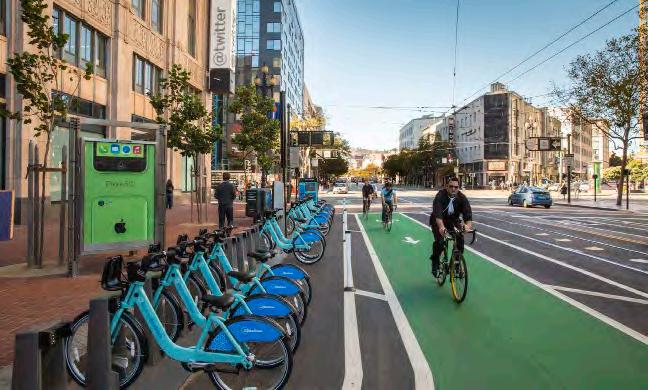
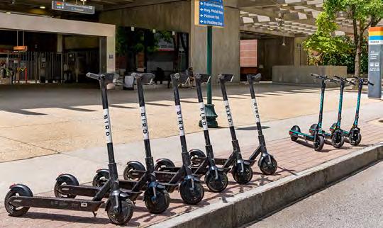
Stipulate that if there are pedestrians, bikes must dismount. Biking in mixed traffic anywhere in the study area is dangerous – by disallowing people to ride on the sidewalk, there is effectively nowhere that people can ride a bike.
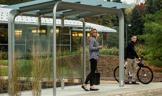
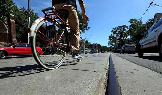
Wayfinding encourages pedestrian and bicycle activity by identifying safe and comfortable routes to travel. Provides an opportunity for branding in the study area as well.
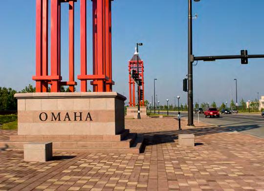

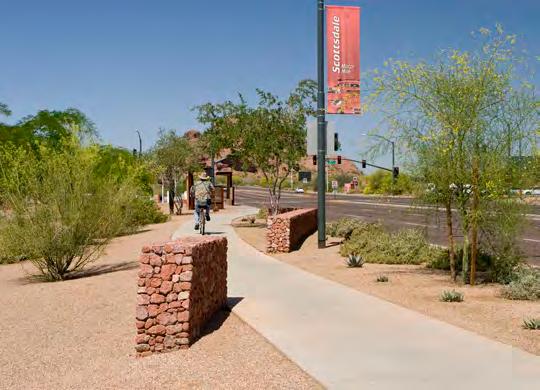

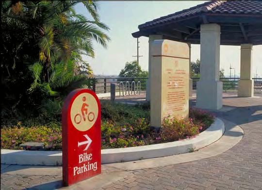

At the end of every trip, everybody becomes a pedestrian. A complete sidewalk network is critical to the success of a multimodal transportation system. Although the Highway 5 area sidewalk network is nearly complete, any one gap is enough to render useless the rest of the system. Therefore, it is recommended that the city complete the remaining gaps in the sidewalk network depicted below in orange. There is a gap without a recommended sidewalk over SR 5 bridge over I-20 because a shared-use path is recommended instead.
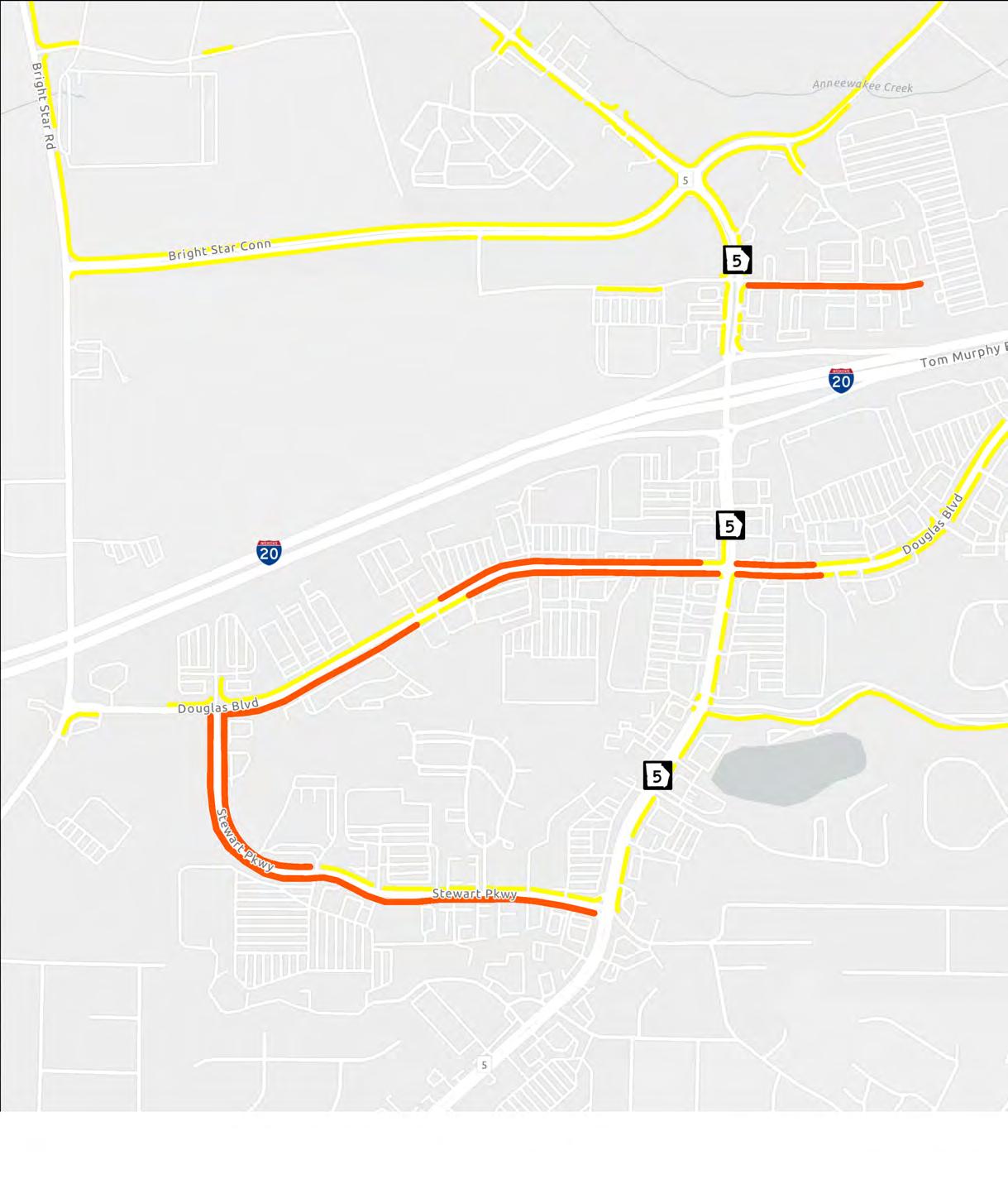



Enhance pedestrian safety and comfort - Improve street-level safety at specific locations to create a safer pedestrian environment.
Develop design, aesthetic, and visual enhancements for the corridor - Create and adopt Urban Design Guidelines to build a sense of place in the Highway 5 area. Includes palette of materials, furniture, lights, etc to maintain consistent theme.
Encourage green infrastructure development to decrease impervious cover - Consider zoning and fee incentives for developers who pursue building density, green spaces, pervious surfaces, and off-site water retention.
The existing conditions - narrow stretches of sidewalk, high-traffic intersections, and overhead electrical utilities - have contributed to a generally unfriendly pedestrian environment. With visions of creating a comfortable and enjoyable pedestrian experience, the City may utilize various solutions to calm traffic and work with future developers to enhance and prioritize sidewalk safety and comfort.
Wider sidewalks - Sidewalks where they exist in the study area are at most 5’ wide. This width in proportion to the width of the roadway makes it obvious that this is a car centric area. Replacing the typical 2’ grass strip that exists between the sidewalk and the curb with brick like along Rose Avenue is recommended to both widen the sidewalk and increase the aesthetics of the area.
Tree minimums - Need to encourage more trees in the area. Trees are an often overlooked but critical component of encouraging pedestrian activity. Trees at the end of parking bays in parking lots are already required in the existing Unified Development Ordinance but should be more strongly enforced.
Bus stops - Bus stops can make or break ridership for a bus system. Bus stops should provide shelter, shade, and a bench at the bare minimum. In order for somebody to ride the bus, it must either be economically necessary for them, or it must be easier and more comfortable than riding in a car.
Road liner buildings - Stipulate in the Unified Development Ordinance that large pedestrian frontage zones shall be built along the street side of the of the development. The pedestrian activity will help to attract more customers to businesses. Additionally, seeing more pedestrians will encourage more pedestrian activity
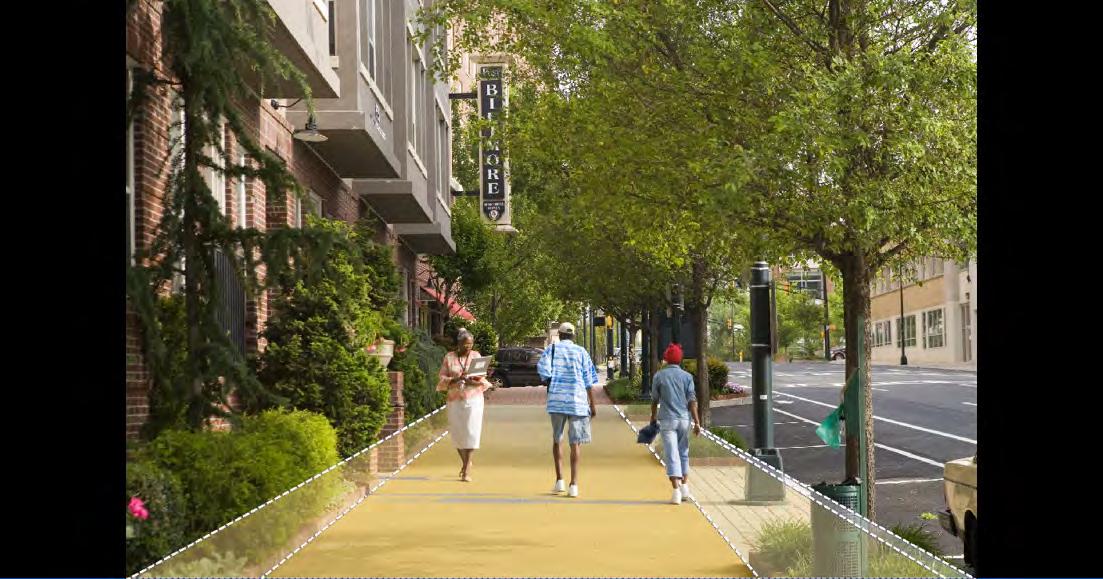

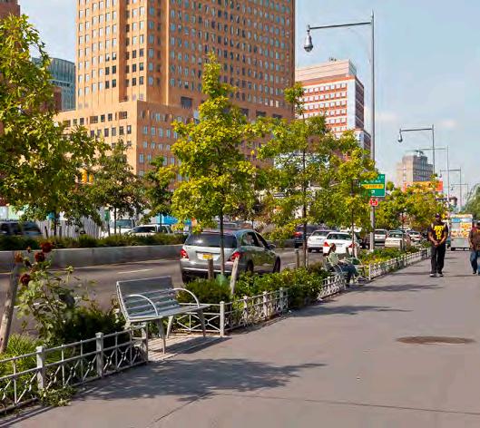
Develop, Adopt and Enforce District ‘Urban Design Guidelines’, within a Zoning Overlay which creates “Place Making” which is currently lacking in the area.
It is important to create a guiding vision for aesthetics and design to ensure development fits, reflects, and supports the City’s goals for the area moving forward. The urban aesthetics toolkit includes branding strategies in addition to the public- and private- realm recommendations for future development. This toolkit intends to serve as a springboard for future urban design and development guidelines in the corridor.
Develop a branding and identity strategy for the corridor, which could include elements such as: logo ideas, color palette, and example applications. The branding strategy will then inform the public realm aesthetic interventions and private realm guidance in the near- and long-term.
Develop a public realm toolkit that will identify scalable beautification treatments and interventions based on environmental constraints through the corridor. This will include recommended precedents for landscaping treatments, lighting, sidewalk standards, etc.
Develop a private realm toolkit that will provide guidance for developers on aesthetic and beautification strategies specific to each area. These standards should focus on new development and large-scale redevelopment projects.


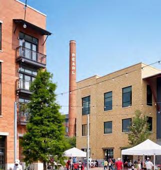

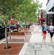

Many locations along the Highway 5 Corridor are susceptible to flooding and have reached either high or maximum levels of impervious cover (roadways, driveways, parking lots, etc.). The benefits of green infrastructure for Highway 5 include reduced urban heat, lower building energy demand, and improved stormwater management. Through planning processes, the City may establish further urban greening strategies that provide social, environmental, and economical benefits to Highway 5.
Consider offering a range of development incentives (such as expedited permitting, decreased fees, and zoning adjustments) to developers who plan to use green infrastructure like pervious pavers, bioswales, green roofs, and on-site or non-potable reuse of stormwater runoff for major development projects.
As redevelopment occurs and additional design standards are developed, encourage the reduction of impervious cover and materials


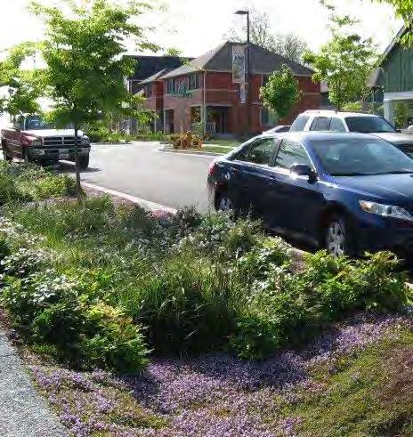
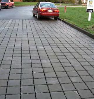


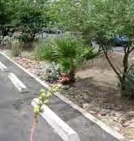


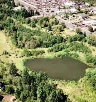
AECOM is the world’s trusted infrastructure consulting firm, delivering professional services throughout the project lifecycle — from planning, design and engineering to program and construction management. On projects spanning transportation, buildings, water, new energy and the environment, our public- and private-sector clients trust us to solve their most complex challenges.
Our teams are driven by a common purpose to deliver a better world through our unrivaled technical expertise and innovation, a culture of equity, diversity and inclusion, and a commitment to environmental, social and governance priorities. AECOM is a Fortune 500 firm and its Professional Services business had revenue of $13.2 billion in fiscal year 2020. See how we are delivering sustainable legacies for generations to come at aecom. com and @AECOM.