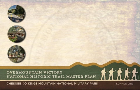
Overmountain Victory National Historic Trail Master Plan - Chesnee to Kings Mountain
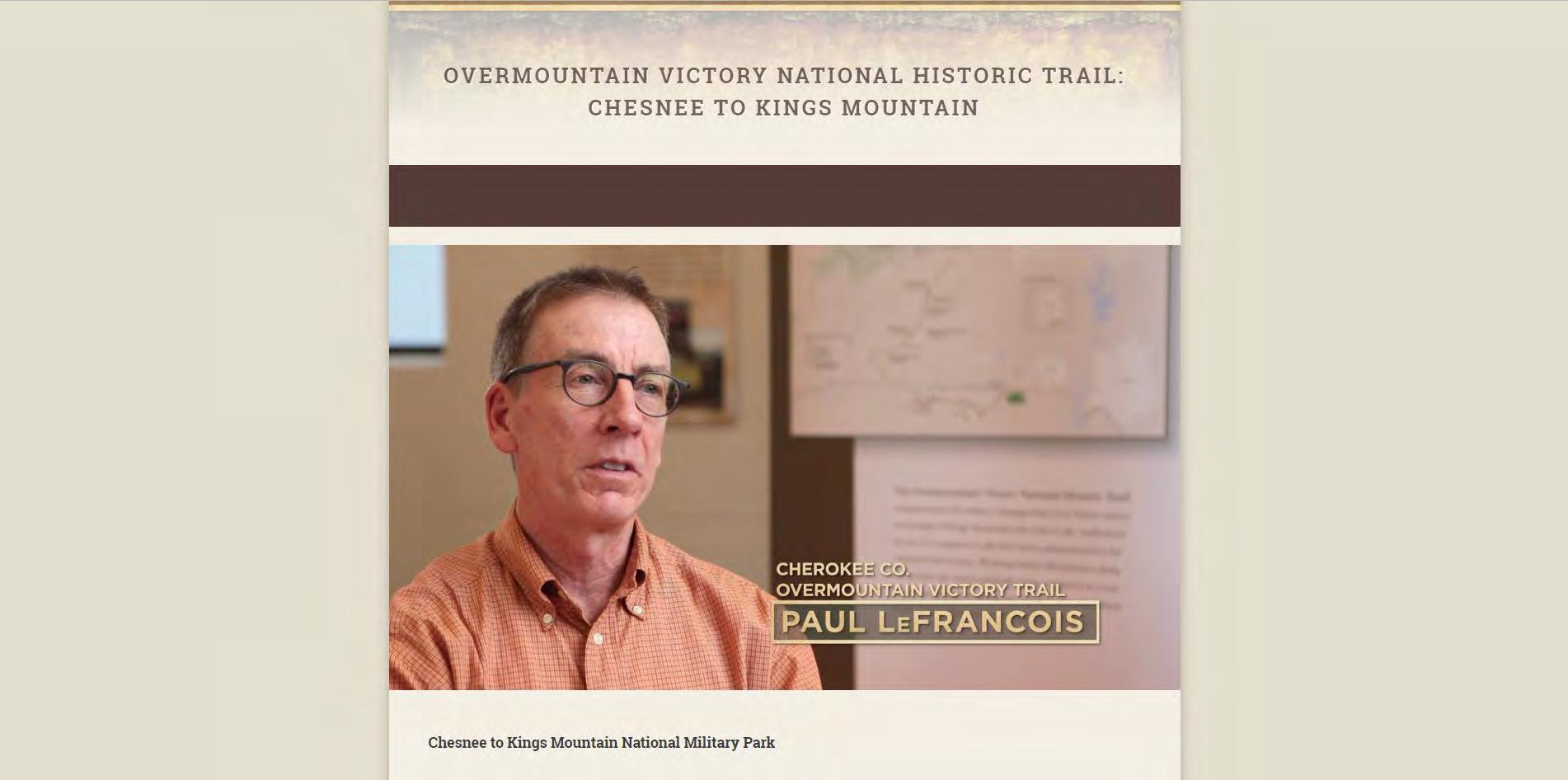
“IF THIS PROJECT IS GOING TO HAPPEN - THAT WE HAVE A TRAIL CONNECTING COWPENS AND KINGS MOUNTAIN - IT'S GOING TO HAPPEN BECAUSE THE CITIZENS OF THE COUNTY WANT TO SEE IT AND THEY WANT TO PARTICIPATE IN THE PROCESS.”
~
PAUL LeFRANCOIS, CHEROKEE CO. OVERMOUNTAIN
VICTORY TRAIL COMMITTEE
NATIONAL PARK SERVICE
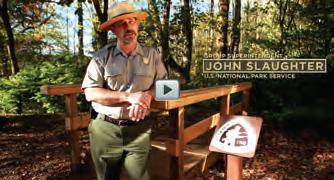
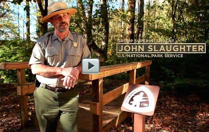
John Slaughter, Group Superintendent, Southern Campaign of the American Revolution Parks Group
ACKNOWLEDGMENTS
Ben Richardson, Chief of Planning and Partnerships, Southern Campaign of the American Revolution Parks Group
CHEROKEE COUNTY OVERMOUNTAIN VICTORY TRAIL COMMITTEE
Paul LeFrancois, Chairman
Mike Bolin, Cherokee County Parks and Recreation Board Chairman
TOWN OF BLACKSBURG
David Hogue, Mayor
Mike Patterson, Mayor Pro Tem
Darren Janesky, Councilman
CITY OF CHESNEE
Max Cash, Mayor
Bruce Mahaffey, Mayor Pro Tem
Doug Pye, Councilman
CITY OF GAFFNEY
Henry L. Jolly, Mayor
Harold D. Littlejohn Sr., Councilman
Charles Montgomery, Councilman
S. Bernard Smith, Councilman
Glen Fuller, Councilman
CHEROKEE COUNTY
Timothy F. Spencer, Chairman
Quay Little, Vice Chairman,
Michael Alan Fowlkes, Councilman
Charles T. Mathis, Councilman
Gary Garber, Committee Member
Lisa Jenkins, Committee Member
Doris F. Pearson, Committee Member
SPARTANBURG COUNTY
Jeffrey Horton, Chairman
Michael Brown, Councilman
Justin Bradley, Councilman
David Britt, Councilman
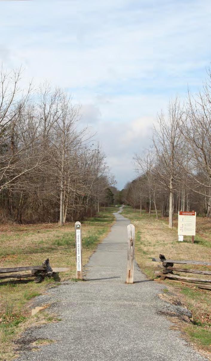
CAROLINA THREAD TRAIL
Andy Kane, Senior Director
SPARTANBURG AREA CONSERVANCY
Andrew Waters, Executive Director
Dennis Stroupe, Councilman
Sherwin Lee Ford, Councilman
Charlene Carter, Town Manager
Verhonda Crawford, Councilwoman
Robert Johnson, Councilman
Becki Hood, City Administrator
Boone S. Peeler, Councilman
Billy Love, Councilman
James Taylor, City Administrator
Leigh Ann Snuggs, Director of Marketing and Tourism
Whitney Farr, Councilman
Bob Walker, Councilman
Roger Nutt, Councilman
Katherine O’Neill, County Administrator
COMMUNITY STAKEHOLDERS
Billy Pennington, Director, Cherokee County History & Arts Museum
Dexter Blanton, Crossroads of the Carolinas
Jayne Scarbarough, Olde English District Tourism Commission
Tom Okel, Executive Director
Jonna Turner, Executive Director, Cherokee County Chamber of Commerce
SPARTANBURG AREA TRANSPORTATION STUDY
Caroline Parris, Planner
Sherry Dull, Senior Transportation Planner
YORK COUNTY
Britt Blackwell, Chairman
Michael Johnson, Vice Chairman
Allison Love, Councilwoman
Christi Cox, Councilwoman
GAFFNEY BOARD OF PUBLIC WORKS
Roger D. Harris, Chairman
Meredith A. McKey, Secretary
James H. Kelly, Treasurer
J. Grady Randolph, Board Member
David Smith, Councilman
Tracy A. McDaniel, Councilman
Holland Belue, County Manager
Doris F. Pearson, Clerk to Council
Rui Pires, Senior Planner & GIS Specialist
Chad Williams, Councilman
William Roddey, Councilman
Robert Winkler, Councilman,
William Shanahan, Jr., County Manager
E. Dewitt McGraw, Board Member
Donnie L. Hardin, General Manager
Kim Fortner, Assistant Manager
LANDOWNER OUTREACH VIDEO INTERVIEWEES
Senator Jim Broyhill
Superintendent John Slaughter, National Park Service
Paul LeFrancois, Chairman, Overmountain Victory Trail Association, Cherokee County
Kelsey Allen, Community Coordinator, Eat Smart, Move More SC
Natalie Britt, Palmetto Conservation Foundation
Tim Todd, Upcountry South Carolina
Sheila Hampton Smoke, Landowner
Andy Kane, Senior Director, Carolina Thread Trail
INTRODUCTION
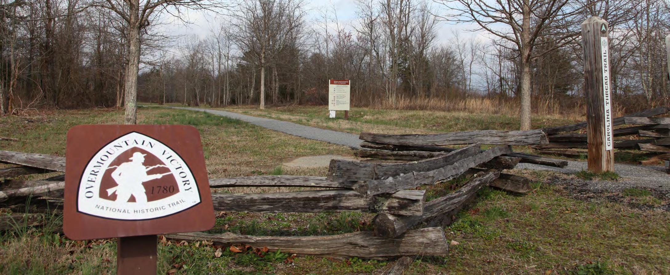
The Overmountain Victory National Historic Trail is APPROXIMATELY 270 miles in length and includes portions of Virginia, Tennessee, North Carolina, and South Carolina. The Trail commemorates the significance of the patriot militia that marched from the Appalachian Mountains and their foothills to defeat the British-led loyalist army at the Battle of Kings Mountain on October 7, 1780.
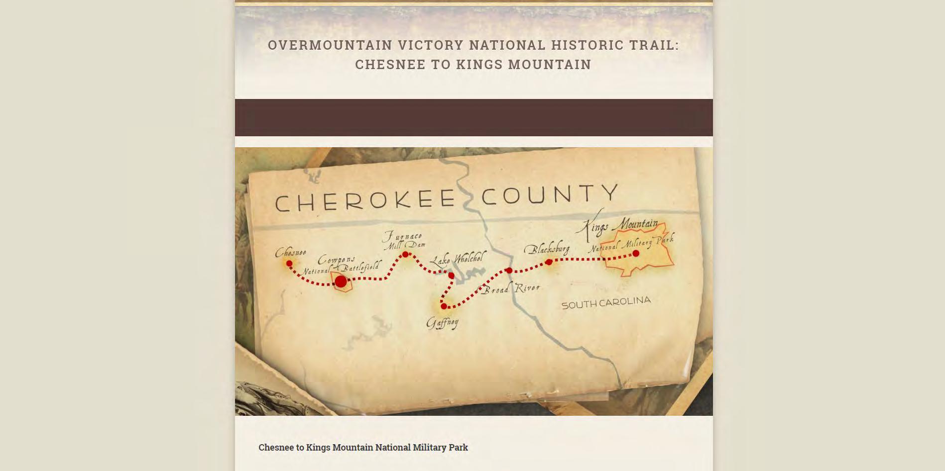
This Trail Master Plan serves as a road map for establishing a section of the Overmountain Victory National Historic Trail (OVNHT) in SOUTH Carolina from the Town of CHESNEE to KINGS MOUNTAIN NATIONAL MILITARY PARK, the SOUTHERN terminus of the OVNHT.
BACKGROUND
CHEROKEE COUNTY OVNHT COMMITTEE:
TIRELESS TRAIL ADVOCATES
The Cherokee County Overmountain Victory National Historic Trail (OVNHT) Steering Committee was created by the County Council in 1994 to lead planning and construction efforts for the trail. In the early 2000s the OVNHT Committee published a trail plan connecting Cowpens National Battlefield to Kings Mountain National Military Park (NMP). Recommendations included the establishment of a trailhead and parking area outside of Cowpens. The committee completed the trailhead in 2005 in collaboration with the Carolina Thread Trail (CTT). Additionally, the committee continues to work with the Gaffney Board of Public Works and the National Park Service to maintain a segment of the OVNHT on the south shore of Lake Whelchel. The OVNHT Committee has also successfully secured several trail easements and an 11 acre tract of donated land within the historic trail corridor.
THE ULTIMATE PARTNERSHIP
In 2012, both the OVNHT committee and the National Park Service (NPS) participated in the Carolina Thread Trail Master Plan for Cherokee County. The CTT Master Plan identified several alternative routes through Cherokee County including a route within the OVNHT historic corridor that utilizes existing segments of the OVNHT and connects Cowpens to Kings Mountain NMP.
In 2017, the OVNHT committee partnered again with the CTT to unite local jurisdictions including Spartanburg County, Cherokee County, City of Chesnee, City of Gaffney, and the Town of Blacksburg to secure grant funds from the NPS to develop a comprehensive trail master plan for the OVNHT corridor from Chesnee to Kings Mountain NMP. This project is part of the NPS’ ongoing efforts to develop regional master plans in order to strengthen multi-jurisdictional partnerships and engage landowners to expand and connect wthe growing network of certified OVNHT segments throughout South Carolina, North Carolina, Virginia, and Tennessee. It is expected that trails developed along recommended routes within the plan study area will be eligible for certification by the NPS as part of the Overmountain Victory National Historic Trail.
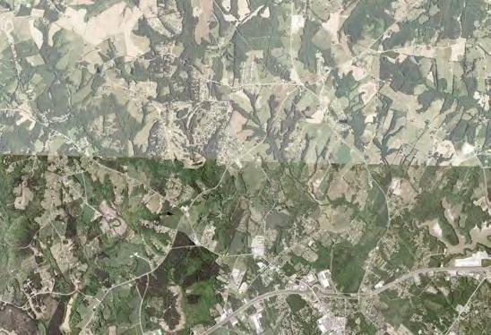
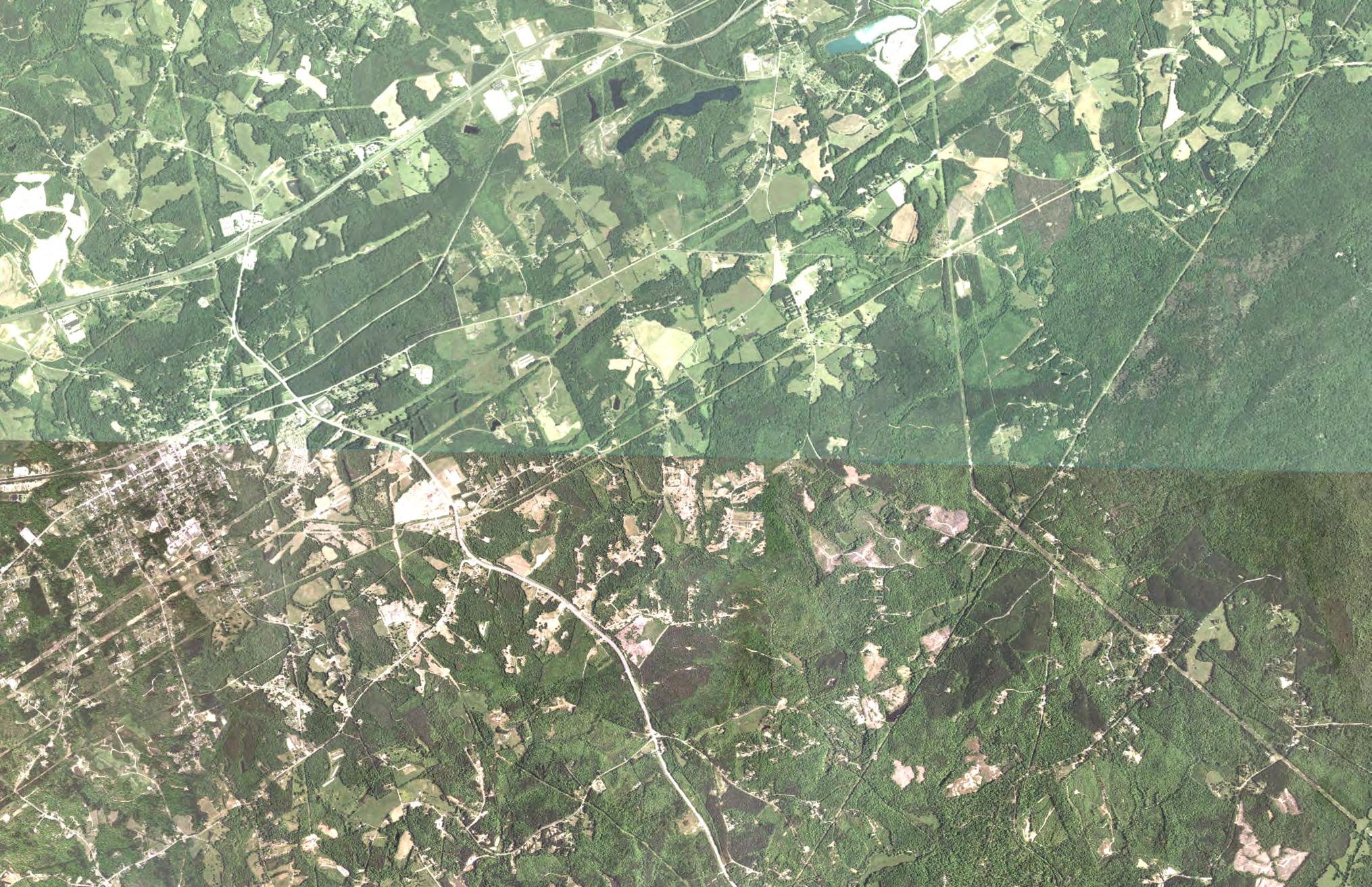
MAP 1: OVNHT PLANNING AREAS
COMPLETED MASTER PLANS
This trail plan was developed in the same spirit as three other OVNHT Master Plans completed in 2015 - 2016: Lenoir to Morganton; Morganton to Lake James; and Elkin to the W. Kerr Scott Reservoir.
The NPS is working to develop similar plans for all areas included within the congressionally-designated OVNHT corridor.
THIS PLAN'S STUDY AREA
This trail section spans from Chesnee to Kings Mountain National Military Park.
PLAN GOALS
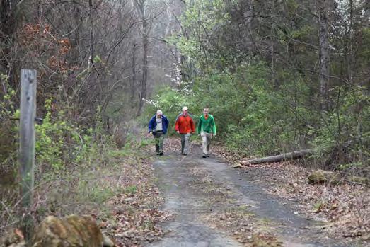
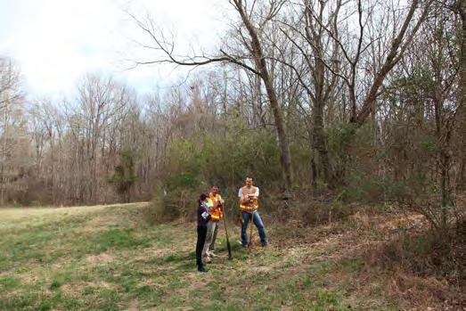
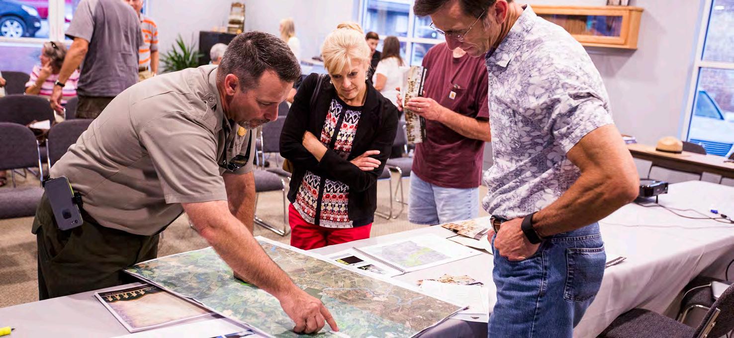
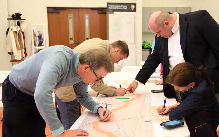
LANDOWNER OUTREACH WAS A CRITICAL COMPONENT OF THIS PLAN.
1
Specific Trail Routes. Identify a specific and feasible trail route within or near the known historic corridor of the Overmountain Victory Trail as determined by NPS.
4
5 2
3
Landowner Outreach. Make a direct appeal to landowners identified during the analysis phase and record their sentiments for providing a trail easement.
Visual Plan. Create a visual plan that provides renderings and schematics to demonstrate trail character.
Support Other Community Goals. To the extent possible, identify opportunities to leverage the trail to further other community goals, including economic development, historic preservation, public health, and environmental stewardship.
Social Media. Incorporate modern social media marketing tools within the trail and signage infrastructure to promote the development of “user generated” marketing content.
PLANNING PROCESS
1. 2. 3. 4. 5.
Direction Setting and Project Launch | February 2017
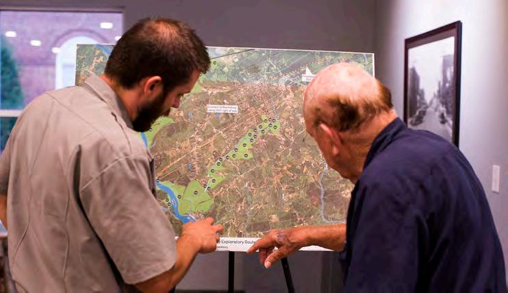
The consultant team met with local trail and government leaders to generally discuss environmental constraints and opportunities for trail connectivity.
Research | March-July 2017
The consultant team conducted a thorough site analysis of the study area and determined feasible trail route options.
With the trail routes identified, a landowner contact list was developed.
Landowner Outreach | August 2017
Landowners with property along an identified feasible trail route were invited to a special meeting to learn more about
the trail project. After receiving comments from landowners, the preferred trail route was revised accordingly.
Plan Development | August-November 2017
The consultant team worked in tandem with local leaders to develop a preferred trail alignment. Renderings and schematics were provided to visually support the trail recommendations.
Final Plan Preparation | December 2017-July 2018
The final plan is published for review by stakeholders, elected officials, and the public.
project timeline
PLAN ORGANIZATION
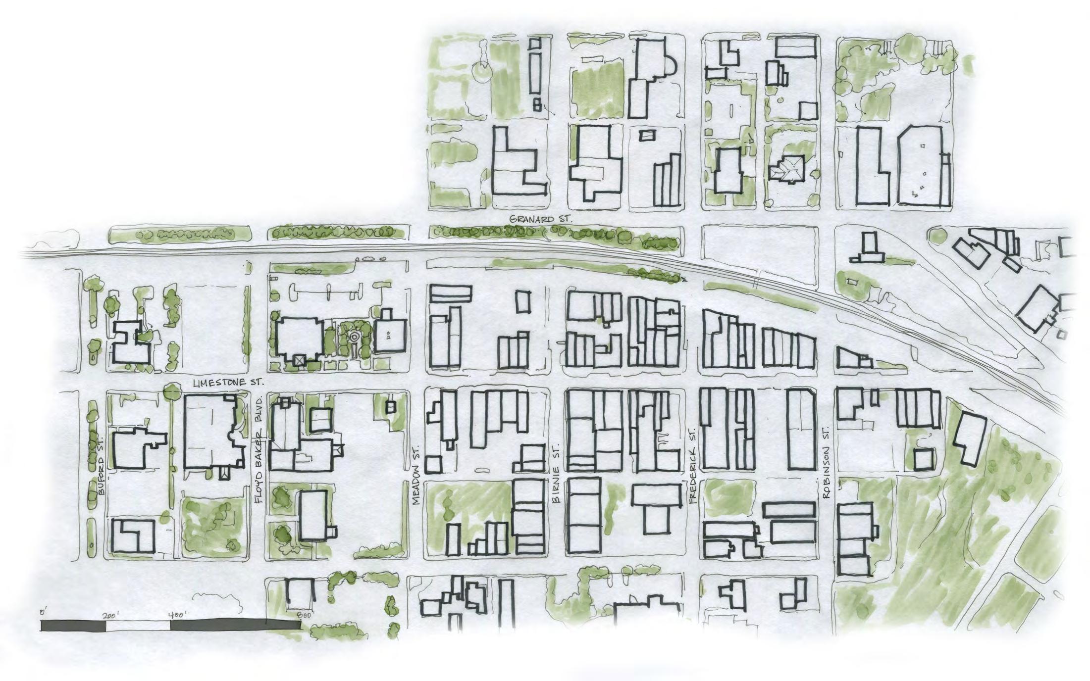
This chapter provides a comprehensive overview and analysis of the opportunities and constraints found throughout the study area. The analysis begins with a brief description of the study area followed by a comprehensive discussion of the natural and built environments and their implications for trail suitability, trail design features, permitting, and costs. This chapter concludes with a map and photographic series that highlights a host of preliminary trail route alternatives.
Significant efforts were made to reach out to landowners where the preliminary analysis (results from chapter I) indicate that the trail is most suitable. This chapter outlines the process and results of landowner outreach, including a map series illustrating landowner sentiment.
This chapter is dedicated to visually defining the various trail types to be used throughout the corridor. Also, design concepts are provided for all types of trail user orientation signage, mile markers, historic markers, and other trail support facilities.
The fourth chapter breaks the study area into five (5) planning sections. Each planning section includes a map that displays a preferred alignment. Each planning section further incorporates the analysis and design elements from the previous chapters along with a host of supporting renderings and design schematics.
CHAPTER 1
EXISTING CONDITIONS, ANALYSIS, AND PRELIMINARY ALIGNMENTS
An OVERVIEW AND ANALYSIS OF THE OPPORTUNITIES AND CONSTRAINTS FOUND IN
THE STUDY AREA
The analysis begins with a brief description of the study area followed by a comprehensive discussion of the natural and built environments and their implication for trail suitability, trail design features, permitting, and costs. This chapter concludes with a map and photographic series that highlights a host of preliminary trail route alternatives.
IN THIS CHAPTER
A. Study Area Description
B. Natural Environment Analysis
C. Human/Built Environment Analysis
D. Map and Photo Series: Preliminary Trail Route Alternatives
STUDY AREA
MOUNTAIN NATIONAL MILITARY PARK
southern terminus of the ovnht
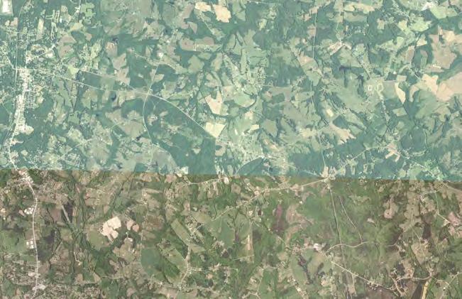
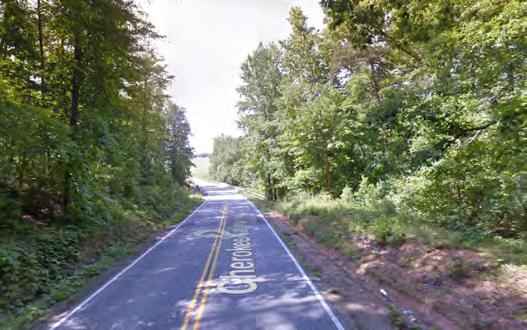
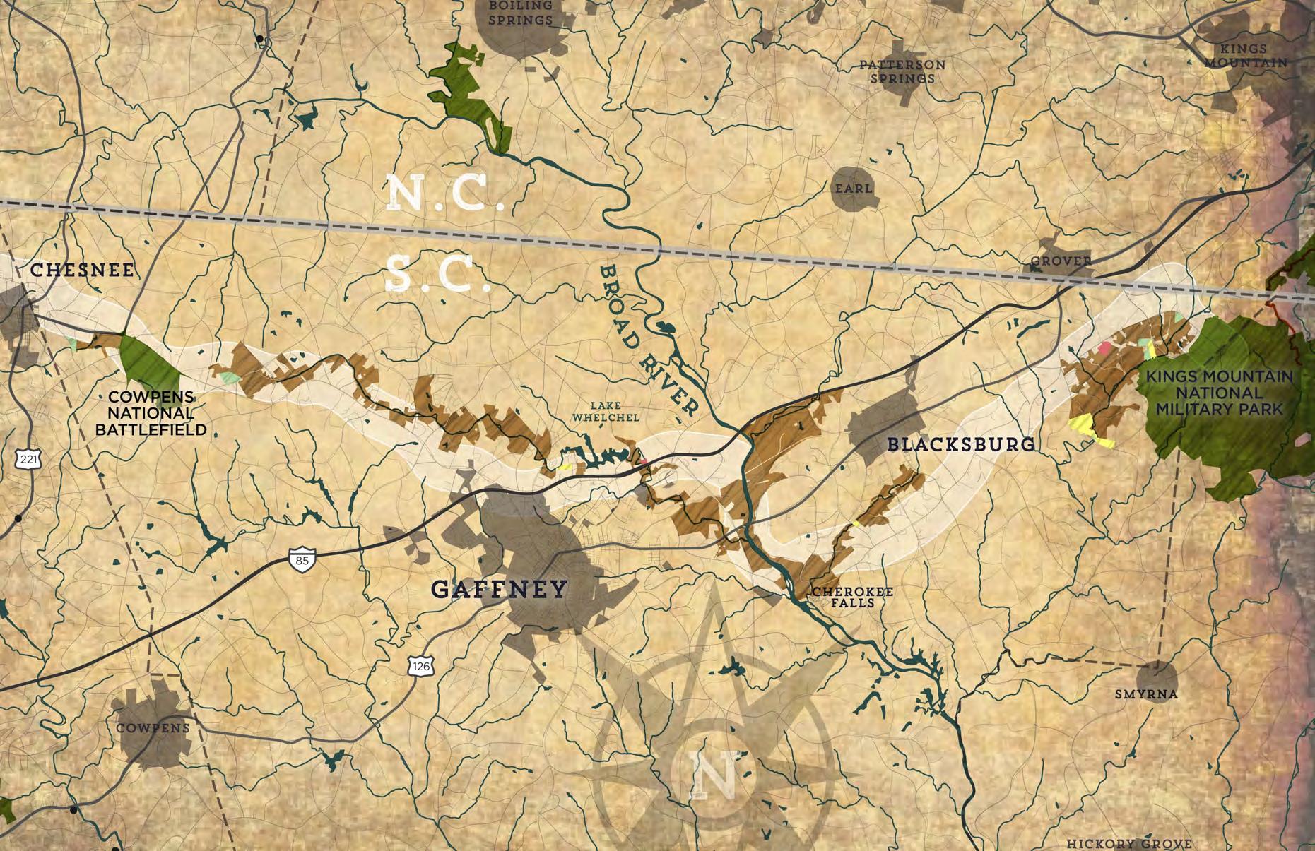
GENERAL STUDY AREA DESCRIPTION: in accordance with the ovnht comprehensive management plan , the chesnee to kings mountain national military park study area is anchored by the one - mile wide historic corridor . the corridor spans a half mile on either side of what is known to be the historic route of the overmountain men . this planning corridor was determined to allow for changes in the historic route based on prevailing research , as well as to allow for a continuous adjusted route n response to constraints of the modern built environment . the study area extends approximately 35 miles from the town of chesnee ’ s cada park to kings mountain national military park , the culminating battle site of the overmountain march and southern terminus of the ovnht . the trail route primarily follows creek corridors to connect cowpens national battlefield , lake whelchel , gaffney , the broad river , blacksburg , and kings mountain . land uses throughout the study area include undevelopable floodplains , national and local parks , and urbanized downtowns . the study area includes seven miles of existing ovnht located at cowpens and lake whelchel . the terminus of the study area and entire ovnht at kings mountain features two miles of certified ovnht within the park boundaries .
The 35 mile study area begins in the Town of CHESNEE AT CADA PARK and ends at KINGS MOUNTAIN NATIONAL MILITARY PARK, THE SOUTHERN TERMINUS OF THE OVNHT.
Spartanburg
Boiling Springs
Cowpens
Blacksburg
Grover
Chesnee
Hickory Grove Shelby
ANALYSIS WORKFLOW
ALTERNATE TRAIL ROUTES WERE DETERMINED BASED ON AN ANALYSIS OF THE NATURAL AND BUILT ENVIRONMENTS.
THE NATURAL ENVIRONMENT
The opportunities and constraints found within the natural environment are critical for determining suitable trail locations and feasibility, ideal user experiences, construction costs, and necessary permits.
This section explores the implications of the study area’s natural environment for establishing the Overmountain Victory National Historic Trail from Chesnee to the Kings Mountain NMP and includes five (5) parts: 1) Floodplains; 2) Wetlands and Hydric Soils; 3) Rivers, Streams, and Lakes; 4) Steep Slopes; and 5) Rare Flora and Fauna.
FLOODPLAINS
Floodplain areas provide both an opportunity and constraint for trail development. Since traditional development is often not suitable within floodplain areas, private landowners are often more willing to provide access for public trails within these locations. Also, these scenic areas often attract wildlife, which creates an engaging trail experience. Within the study area, much of the floodplain areas along the Cherokee Creek, Peoples Creek, and Broad River corridors are ideal for greenway development.
Although development is regulated within the floodplain, greenways and trails are allowed and can be permitted. Sound trail engineering techniques are necessary to ensure trails can sustain flooding. To the extent possible, greenway alignments should be avoided within the floodway1
Avoid disturbance in the floodway. Avoid placement of structures or disturbance within the floodway. Floodways are regulated locally and by the Federal Emergency Management Agency (FEMA). Fill, structures (walls, kiosks, etc), and impervious services are discouraged. Any structures located within the floodway require a no-impact/no-rise certification through FEMA. These studies can vary on cost but can range from $2,500$15,000 depending on complexity.
“Much of the floodplain areas along CHEROKEE CREEK, PEOPLES CREEK, AND THE BROAD RIVER are ideal for TRAIL development.”
WETLANDS AND HYDRIC SOILS
The study area includes several wetland areas as identified on the National Wetland Inventory (NWI). According to NWI, there are likely smaller wetland areas within the study corridor that are not indicated within their inventory that could impact final trail alignments2. Hydric soils in combination with wetland plant species and wetland hydrology are considered indicators of a wetland, which require costly permitting if impacted.
2 If wetlands are unavoidable, utilize elevated boardwalk systems. Boardwalks allow for travel over flat, poorly draining soils, standing water, and wetland features and have significantly less impact than other options. A section 404 (Clean Water Act) Permit may be required if the wetland is considered jurisdictional by the USACE. This means that the wetland is not isolated and part of a broader lake or water system. A small boardwalk for a non-isolated wetland with limited fill or dredging may qualify for a programmatic Nationwide Permit. Nationwide Permits are designed to streamline the permitting process for actions with limited disturbances. In addition to permitting, disturbances exceeding a tenth ( 0.1) of an acre would require mitigation which can increase project costs. Impacts under a tenth (0.1) of an acre do not trigger mitigation fees.
STREAMS, LAKES, AND PONDS
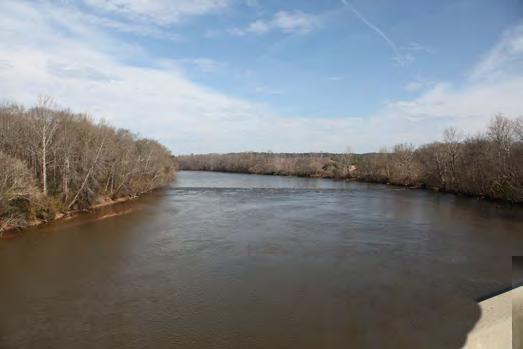
The County, State3, and Federal4 governments regulate the many water bodies found throughout the study area. Lake Whelchel, the Broad River and its tributaries including Cherokee Creek, Peoples Creek, Buffalo Creek, Doolittle Creek, and Canoe Creek are some of the most important waterways found within the study area; there are permitting implications for crossing and bridging these water bodies.
3Maintain a 30-45 foot buffer from all waterways, especially those regulated as impaired waterways under the SC Department of Health and Environmental Control’s Buffer Zone Guidance. Streams within the study area are identified by the State of South Carolina as having poor water quality and maintaining or improving an adequate vegetated buffer is crucial to improving the quality. A 45 foot natural buffer must be maintained along the banks of impaired streams, including Peoples Creek and Cherokee Creek. This buffer zone allows for managed vegetation and trails and greenways. Trails are an allowable use out outside of the buffer zone, the SC Department of Health and Environmental Control may require a permit in which the applicant must show that disturbance has been minimized.
Plan for permits related to waterway Impacts. Federal 401/404 Certifications will likely be required in cases where any stream or waterway alterations occur. These alterations would be most likely in conjunction with bridge improvements or addition of structures near waterways. Triggers for the permit include disturbance to the stream bed, banks, damming of the waterway, or placement of material within the waterway (i.e. culverts/pipes).
STEEP SLOPES
Much of the study area includes gently rolling topography and thus avoids impacting steep slopes. The most challenging slopes occur along the banks of Lake Whelchel, Cherokee Creek, Doolittle Creek, and Kings Creek. Steep areas are often found opposite of large floodplains. To the extent possible, the trail should provide for grades under 5 percent. Natural surface trails can vary up to a 10 percent slope. Proposed trail alignments may require a wider trail corridor to ensure a more gradual trail grade.
RARE FLORA AND FAUNA
The South Carolina Department of Natural Resources (SC DNR) provides data identifying the state’s most sensitive environmental areas. Rare flora and fauna species can also exist outside of these designated areas, which can alter final trail alignments prior to construction. Species identified by the South Carolina Heritage Trust Program within this study area as of December 2017 include:
A. Southeastern Bat
B. Nodding Onion
C. Rough Sedge
D. Smooth Sunflower
E. Dwarf-flowered Heartleaf
F. Canada Moonseed
G. Adder’s Tongue
H. Georgia Aster
I. Eastern Turkeybeard
Coordination with SC DNR and the U.S. Fish and Wildlife Service (USFWS) is an important aspect of the design process. Involving USFWS early on in the process can help avoid potential planning obstacles related to federally protected species. Additionally, permits like Section 401 and 404 (described previously in the Wetland and Streams sections) will initiate the review of the State Natural Heritage Program database. If species are found within the project area, State or Federal requirements may dictate avoidance or mitigation.
PHOTO BY SC DNR
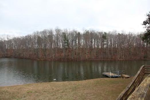
LAKE WHELCHEL
QUICK FACTS:
Established: 1971
Lake Area: 150 acres
Miles of Certified OVNHT: 3
Recreation: Boating, Fishing, Hiking
Lake Whelchel is a 150 acre reservoir located 2.5 miles north of Gaffney. The Gaffney Board of Public Works manages the lake both as the primary source of drinking water for the City and as a recreation amenitity. Boating and fishing are permitted from the public boat launch and picnic area located on Boat Landing Drive. Lake Whelchel features three miles of certified Overmountain Victory National Historic Trail also accessed from the boat landing parking area. The trail is maintained by the Cherokee County OVNHT Committee and volunteer groups organized by the NPS. The vast majority of shoreline and land surrounding the lake is controlled by the Board of Public Works and presents a significant opportunity for multi-use trail development.
THE BUILT ENVIRONMENT
The opportunities and constraints found within the built and human environment are critical for determining suitable and feasible trail locations, ideal user experiences, construction costs, and necessary permits.
This section highlights five (5) built environmental features and their implications for developing the OVNHT from Chesnee to Kings Mountain NMP, including: 1) Land Use; 2) Existing Trails and Parks; 3) Utilities; 4) Transportation; and 5) Historic Resources.
LAND USE SNAPSHOT
“The historic downtowns of Chesnee, gaffney, and blacksburg provide natural anchor points for infill trail development to connect these communities, expand recreation offerings, and create new certified sections of the OVNHT.”
City of Gaffney
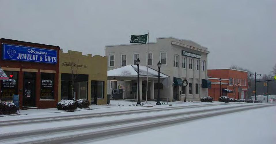
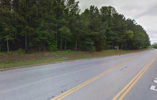
The eastern terminus of the study area begins at CADA park in Chesnee. Chesnee is a rural town situated just south of the state line at the crossroads of US Highway 221 and the Cherokee Foothills Scenic Byway. The walkable downtown is comprised of three blocks of historic one and two-story commercial buildings. The town center is located only 2.5 miles from Cowpens National Battlefield, presenting an opportunity to connect these two major assets. Single family neighborhoods abut downtown to the north, east, and west. South of downtown, the Highway 221 commercial corridor is characterized by national chain stores and fast food restaurants. Areas beyond the town limits are comprised of large, agricultural tracts.
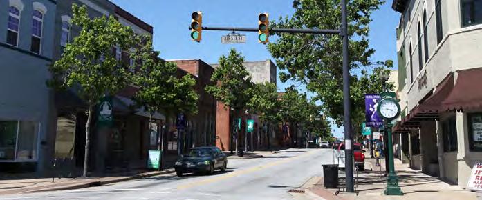
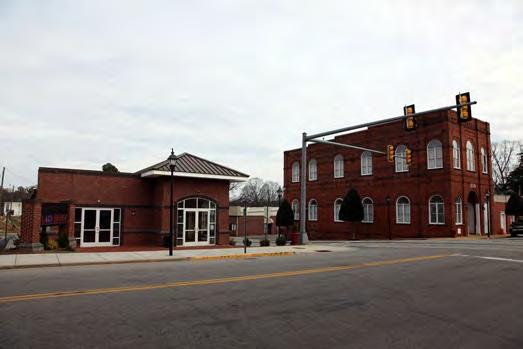
The City of Gaffney is located in the heart of the study area: 14 miles east of Cowpens National Battlefield and 20 miles west of Kings Mountain NMP. Its central location positions Gaffney to serve as an important node for trail connectivity. The City has wholly embraced its Revolutionary War heritage and role in the Overmountain march. Plans are currently in development to honor the Southern Campaign of the American Revolution with the creation of a “discovery center” in the historic Carnegie Library located downtown. The discovery center will be a valuable addition to Gaffney’s mix of downtown commercial and civic uses, and will provide a meaningful destination for trail users.
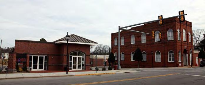
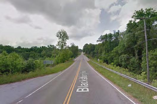
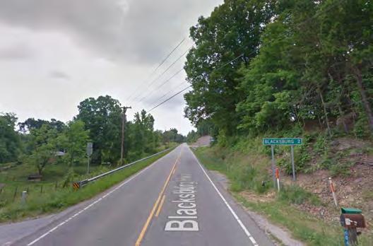
The Town of Blacksburg is strategically located between two major recreation assets. The Broad River is three miles to the west, and the terminus of the OVNHT at Kings Mountain NMP is less than ten miles east. Close proximity to these destinations and convenient access from Interstate-85 has positioned Blacksburg’s historic downtown to become a central hub for outdoor recreation enthusiasts. In recognizing the opportunity to capitalize on these nearby assets, the Town has recently developed a streetscape revitalization plan and recreation master plan for a future 20 acre park on the edge of the downtown.
City of Chesnee
Town of Blacksburg
EXISTING PARKS AND GREENWAYS
Cherokee county boasts a collection of national parks and recreation destinations that are ideal for trail connections.
SOME
OF THESE MAJOR ASSETS INCLUDE:
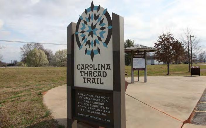
The Carolina Thread Trail is a regional greenway and trail project weaving through 15 North and South Carolina counties. There are over 260 miles of CTT in existence today. A CTT Master Plan for Cherokee County was completed in 2012. The OVNHT was identified as a major trail corridor for implementation.
Cowpens National Battlefield
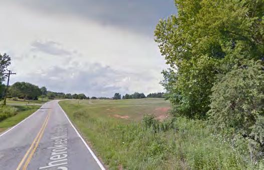
Cowpens is the site of the last encampment of the Overmountain Men prior to the Battle of Kings Mountain in 1780. The park features two miles of certified OVNHT on the historic Green River Road that extends through the center of the park.
Historic
The Historic Furnace Mill and Dam is located on Cherokee Creek between Chesnee and Lake Whelchel. It is the site of a historic iron furnace dating back to 1807. The site was donated by private landowners to Cherokee County and dedicated as a trailhead for the future OVNHT in 1999.
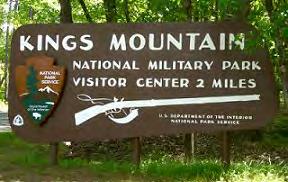
Kings Mountain National Military Park
Kings Mountain NMP is the culminating battle site of the Overmountain March and southern terminus of the OVNHT. The park features two miles of certified OVNHT on the Battleground Trail.
Cherokee Ford Recreation Area is located on the west bank of the Broad River near the location of the historic river crossing by the Overmountain Men. The recreation area is managed the by the Cherokee County Recreation District. It includes baseball fields and public river access at the end of Wolf Den Lane.
Carolina Thread Trail
Furnace Mill and Dam
Cherokee Ford Recreation Area
UTILITIES
The incorporated towns located within the study area maintain a complex matrix of water and sewer infrastructure which, in many instances, are held in fee simple ownership by a public agency or have easements that can be modified to provide for trail development.
The analysis of the study area includes a review of public infrastructure and associated easements; these areas are shown on the Study Area Analysis Maps with corresponding opportunities and constraints notes.
TRANSPORTATION
The analysis of the study area includes a review of the South Carolina Department of Transportation (SCDOT) right-of-way (ROW), SCDOT plans for widening Interstate 85, local bicycle and pedestrian infrastructure and plans, and railways.
SCDOT’s right-of-way was analyzed to determine where there could be opportunities for developing OVNHT side paths. These areas are shown on the Site Analysis Maps with corresponding opportunities and constraints notes.
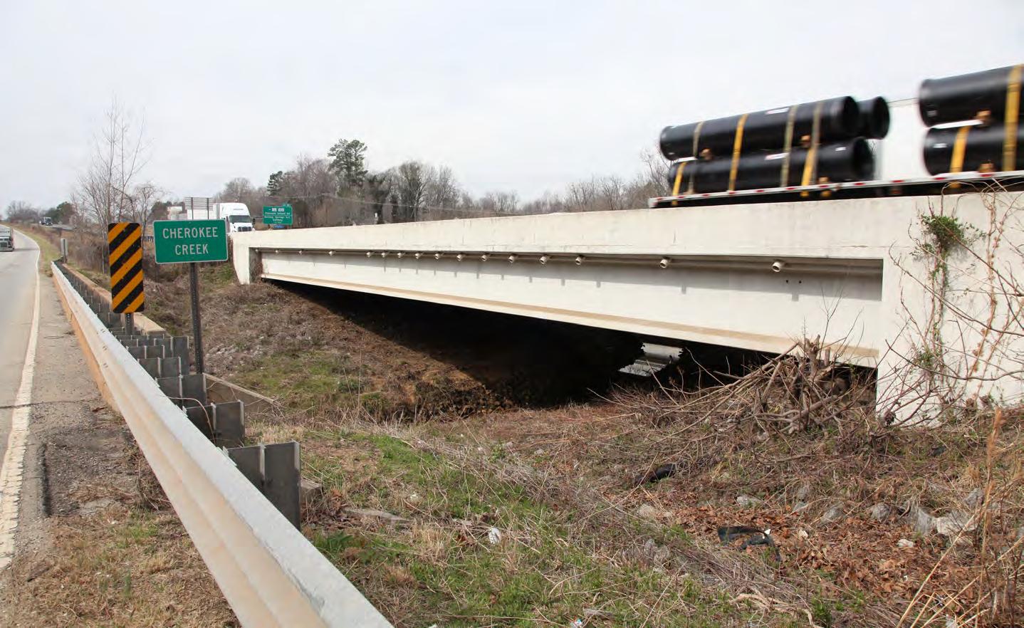
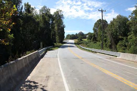
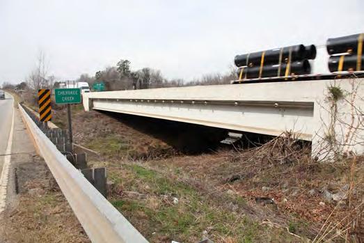
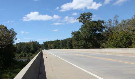
INTERSTATE 85 OVER CHEROKEE CREEK.
UTILITY INFRASTRUCTURE MAINTAINED BY THE GAFFNEY BOARD OF PUBLIC WORKS ADJACENT TO I-85 AND CHEROKEE CREEK.
HISTORIC RESOURCES
“THE OVNHT SHOULD LINK, PRESERVE, AND INTERPRET HISTORIC AND CULTURAL SITES ALONG ITS ROUTE.”
The Overmountain Victory National Historic Trail Route and Corridor
The Overmountain Victory National Historic Trail route was identified by a National Park Service research team. The team relied on the 1881 account of the march, which has been amended by local historians, descendants of battle participants, and other sources. As part of this congressionally-designated trail, officially designated portions of the OVNHT must lie within or very near the one-mile corridor (half-mile on either side) of the historic route.
Historic Sites and Landscape
The South Carolina State Historic Preservation Office (SHPO) oversees a large database of historic sites and resources. Many
resources, including those related to the OVNHT, are included within the subsequent analysis map series. These resources include information from SHPO as well as sites related to the National Register of Historic Places (which the National Park Service oversees, but is managed by individual States). The most critical sites include those listed on the National Register (NR) or determined eligible (DOE) as they have further protection under Section 106 of the National Historic Preservation Act5, 6. The National Park Service has emphasized that historic/ cultural resources should be linked, preserved, and interpreted as part of this study and subsequent trail development. Specific resources that directly relate to the history of the OVNHT are noted on the subsequent maps and include:
A. Cowpens National Battlefield
B. Historic Furnace Mill and Dam
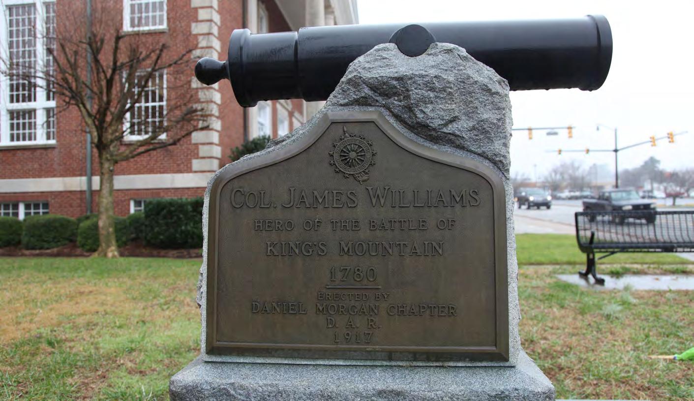
C. Col. James Williams Gravesite at the future S.C.A.R. Discovery Center
D. Cherokee Ford
E. Kings Mountain National Battlefield and Military Park
5Sensitive Cultural Resources and Permitting: Any construction funded or permitted by the federal government will trigger a project review by SHPO of any resources covered under Section 106 (National Historic Preservation Act). These resources could include human remains, burial sites, archeology sites, and historic sites. If it is found that the action of trail construction could potentially adversely affect cultural resources, the SHPO will work with the related Federal Agency to eliminate or minimize the effect.
6Historic Sites and Permitting: In general, a greenway would have no effect or a complimentary relationship to preservation of these sites, but may require SHPO coordination in circumstances like alterations to historic bridges or whole properties. If federal funds or permitting is required, the SHPO will review this database and analyze for any adverse impacts.
EXISTING CONDITIONS, ANALYSIS, AND PRELIMINARY
MAP AND PHOTO SERIES: PRELIMINARY
TRAIL ROUTE ALTERNATIVES
The map and photographic series, which spatially incorporates the natural and built environment analysis, highlights a host of preliminary trail route alternatives. These routes were further refined by local leaders to identify and engage landowners. This information will serve as an ongoing reference guide as alternative routes may need to be developed due to unforeseen barriers.
STUDY AREA 1 OPPORTUNITIES & CONSTRAINTS
OPPORTUNITIES
Land for potential trailhead terminus.
Connect to points of interest in downtown Chesnee.
Utilize existing sidewalks along Cherokee Foothills Scenic Byway in Chesnee.
Flat shoulders along SC 11-146 provide opportunity for DOT sidepath.
Large, undeveloped tract could accommodate sidepath.
Flat shoulders along SC 11 provide opportunity for SCDOT sidepath.
Low impact to sparsely developed residential parcels.
Large agricultural tracts could accommodate sidepath with low impact to existing use.
Utilize existing trail system and trailhead in Cowpens National Battlefield.
Utilize existing Cowpens trailhead.
Wide ROW on SC-11 presents opportunity for sidepath.
Potential for sidepath along Scruggs Trail.
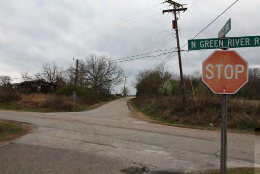
Potential sidepath along N. Green River Road.
Potentially sympathetic landowner.
Potentially sympathetic landowner.
Opportunity to utilize low-traffic, gravel Woods Cross Rd.
Opportunity to utilize floodplain of Cherokee Creek.
Utilize secured trail easements.
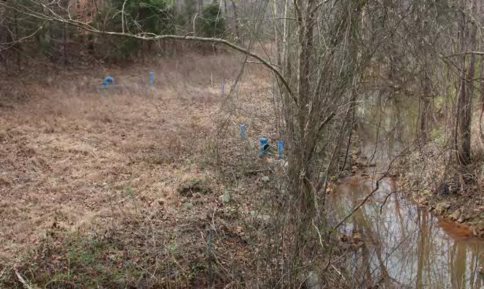
Permit secured for trail underpass of Buck Shoals Rd. at Cherokee Creek bridge.
Utilize secured trail easement.
Potential trailhead at historic Furnace Mill Dam.
Utilize secured trail easements.
CONSTRAINTS
Close proximity of homes to road on southwest side of SC 11-146.
Major intersection at Hwy. 221 and SC 11-146.
Chesnee sidewalk system ends.
Multiple residences and driveways constrain trail on north side of Dillon St.
Single Family resdential driveways limit trail development between Dillion St. and SC 11.
Intersection of Dillon St. and SC 11.
Major intersection at SC 11 and SC 110.
Homes near road constrain sidepath.
Homes located near road on east side of Green River Rd.
Highway SC 11 crossing.
Road crossing on Bonner Road.
Cherokee Creek crossing will require culvert or minor bridge.
Utilize existing trail system and trailhead in Cowpens National Battlefield.
Utilize existing Cowpens trailhead.
Opportunity to utilize low-traffic, gravel Woods Cross Rd.
Permit secured for trail underpass of Buck Shoals Rd. at Cherokee Creek bridge.
STUDY AREA 2 OPPORTUNITIES & CONSTRAINTS
OPPORTUNITIES
Opportunity
Opportunity
Opportunity
CONSTRAINTS
Connect to Lake Whelchel and Gaffney Board
STUDY AREA 3 OPPORTUNITIES & CONSTRAINTS
OPPORTUNITIES
Potential sidepath along Boiling Springs Highway.
Opportunity to utilize width of Providence Rd. bridge over I-85.
Opportunity to connect to future Veterans Nursing Home.
Utilize existing sidewalk network to connect to downtown Gaffney.
Connect to future SCAR Discovery Center.
Opportunity to restore existing OVNHT on south side of Lake Whelchel.
SC 11-82 bridge provides possible route over I-85.
Utilize double-loaded sidewalk system on Limestone Street to connect to downtown Gaffney.
Opportunity for trailhead and trail network around Lake Whelchel.
Potential to utilize perimeter of former landfill site.
Opportunity to utilize floodplain of Cherokee Creek.
Potential for underpass of I-85 at Cherokee Creek.
Opportunity for workplace wellness loop at Meadowcreek Industrial Park.
Utlize large, undeveloped tracts of land in Cherokee Creek Floodplain.
Potential trailhead at Cherokee Water Treatment Plant.
Adequate vertical clearance for trail under railroad bridge.
Large, undeveloped parcels present ideal location for trail along Cherokee Creek.
Sidepaths along SC 11-300 and 11-233/Teague Rd. provide possible connection to Tech. Center.
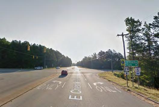
Opportunity to use Colonial natural gas pipeline ROW along Hwy 29.
Connect to neighborhood ball field.
Opportunity to utilize Peoples Creek floodplain.
Opportunity for spur trail to Gaffney Middle School.
Opportunity to utilize County-owned land at Cogeneration Partners LLC.
Opportunity to utilize Board of PW land at wastewater treatment plant.
Connect to Cherokee Technology Center.
Opportunity to utilize Board of PW properties along Peoples Creek corridor.
Utilize Board of PW pump-station property.
Potential river crossing at Goat Island.
Potential river crossing at 99 Islands.
Trailhead at Cherokee Ford Recreation Area.
Utilize floodplain of Broad River.
Adequate vertical clearance under Cherokee Ave Bridge to accomodate trail.
Utilize wide shoulder of Cherokee Avenue Bridge to facilitate Broad River crossing.
CONSTRAINTS
Road crossing at Wilcox Avenue.
Providence Road bridge over I-85 would require upgrades to safely accommodate trail users.
Dangerous 6 point intersection does not provide pedestrian facilities.
SC 11-82 bridge over I-85 is narrow and would require significant improvements to accommodate trail.
Major Highway crossing at Interstate 85.
Minor road crossing at Oak St.
Residential development on both sides of Peoples Creek contrains trail corridor.
Road crossing at Chandler Drive.
Road crossing at Colonial Ave.
Road crossing at SC 11-41 near intersections with Goldmine Springs Rd. and 13th Street.
Minor road crossing at Peoples Creek Road.
Railroad Crossing over steep terrain.
Road crossing at Cherokee Avenue.
Road crossing at Victory Trail Road.
Road crossing at Victory Trail Road.
Road crossing at Ford Road.
Impact to homes with river access.
River crossing will require two major bridges.
River crossing will require 3 major bridges.
Colonial Pipeline ROW requires approval of underlying property owners and features challenging terrain.
Opportunity to connect to future Veterans Nursing Home.
Potential for underpass of I-85 at Cherokee Creek.
Opportunity to utilize low-traffic, gravel Woods Cross Rd.
STUDY AREA 4 OPPORTUNITIES & CONSTRAINTS
OPPORTUNITIES
Potential to utilize unpaved ROW of Little Hope Road.
Oppportunity to utilize existing road bed along river.
Utilize wide floodplain along Broad River.
Adequate vertical cleareance under railroad bridge to accommodate trail.
Opportunity to utilize existing vehicular surface crossing of railroad.
Opportunity to use floodplain of Buffalo Creek.
Opportunity to utilize undeveloped land adjacent to industrial facility.
Opportunity to use existing bridge to cross Buffalo Creek.
Opportunity to use Blacksburg Highway bridge over Buffalo Creek.
Utilize large, undeveloped tracts.
Wide, flat shoulder along Bear Den Road provides opportunity for SCDOT sidepath.
Utilize Town of Blacksburg property.
Utilize existing sidewalks to connect to downtown Blacksburg.
Opportunity to utilize existing vehicular surface crossing of railroad.
Utilize wide ROW on Church Street for sidepath.
Connect to points of interest in downtown Blacksburg.
Future Town of Blacksburg Park.
Utilize Existing Sidewalks in downtown Blacksburg.
Potential to utilize large forestry land along Doolittle Creek.
Opportunity to use floodplain of Doolittle Creek.
Opportunity to use large undeveloped parcels.
Opportunity to use flat SCDOT ROW.
Utilize railroad overpass with sidewalks.
CONSTRAINTS
Bridge or culvert needed over drainage trench.
Surface crossing of railroad will require upgrades for pedestrian crossing.
Steep slope pinch point.
Buffalo Creek crossing will require bridge.
Avoid existing heavy industrial facilities.
Bridge over Buffalo Creek will require retrofit to accommodate trail.
Steep topography creates pinch point along Blacksburg Hwy.
Impact to homes near road.
Pinch point caused by steep slope on both sides of N. Shelby St.
Railroad crossing will require upgrades to accommodate trail.
Downtown Blacksburg sidewalk ends.
Steep pinch point.
Steep topography extends along Cherokee Falls Road and Doolittle Creek.
Steep banks on both sides of Doolittle Creek.
Pinch point; steep banks along Doolittle Creek.
Road crossing at Cherokee Ford Road.
Pinch point created by commercial and residential developments close to creek.
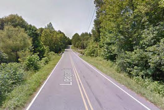
Road crossing at Leagan Road.
Road crossing at Wren Wray Road.
Residential development near south side of creek.
Pinch point due to steep slope.
Utilize wide floodplain along Broad River.
Connect to points of interest in downtown Blacksburg.
Future Town of Blacksburg Park.
Bridge over Buffalo Creek will require retrofit to accommodate trail.
Steep topography creates pinch point along Blacksburg Hwy.
sidepath along Green River Road.
AREA 5 SITE ANALYSIS STUDY
STUDY AREA 5 OPPORTUNITIES & CONSTRAINTS
OPPORTUNITIES
Opportunity to utilize undeveloped tracts.
Opportunity to utilize large, undeveloped tracts.
Opportunity to use utlity easement.
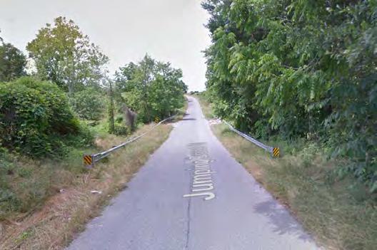
Opportunity to use floodplain of Jumping Branch Creek.
Opportunity to utilize floodplain of tributary of Jumping Branch Creek.
Utilize floodplain of Kings Creek.
Opportunity to use large undeveloped tracts.
Use floodplain of Mill Branch Creek.
Flat shoulder on Possum Trot Rd. provides opportunity for SCDOT sidepath.
Wide floodplain and large undeveloped parcels.
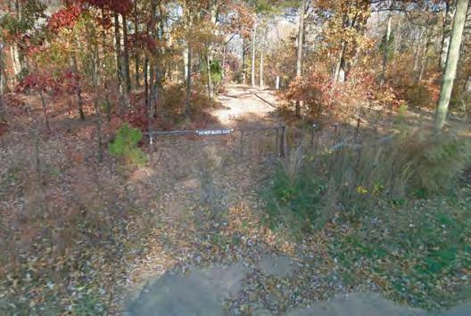
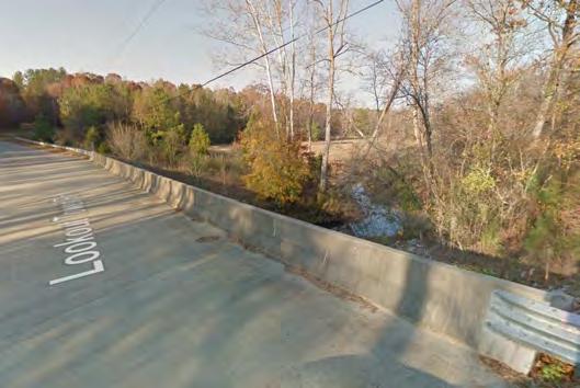
Connect to Kings Mountain National Military Park from Lookout Tower Rd.
CONSTRAINTS
crossing at
Opportunity to utilize floodplain of tributary of Jumping Branch Creek.
Connect to Kings Mountain National Military Park from Lookout Tower Rd
CHAPTER 2 LANDOWNER
ENGAGEMENT
LANDOWNER OUTREACH AND
ENGAGEMENT
Were KEY COMPONENTs OF THE PLANNING PROCESS.
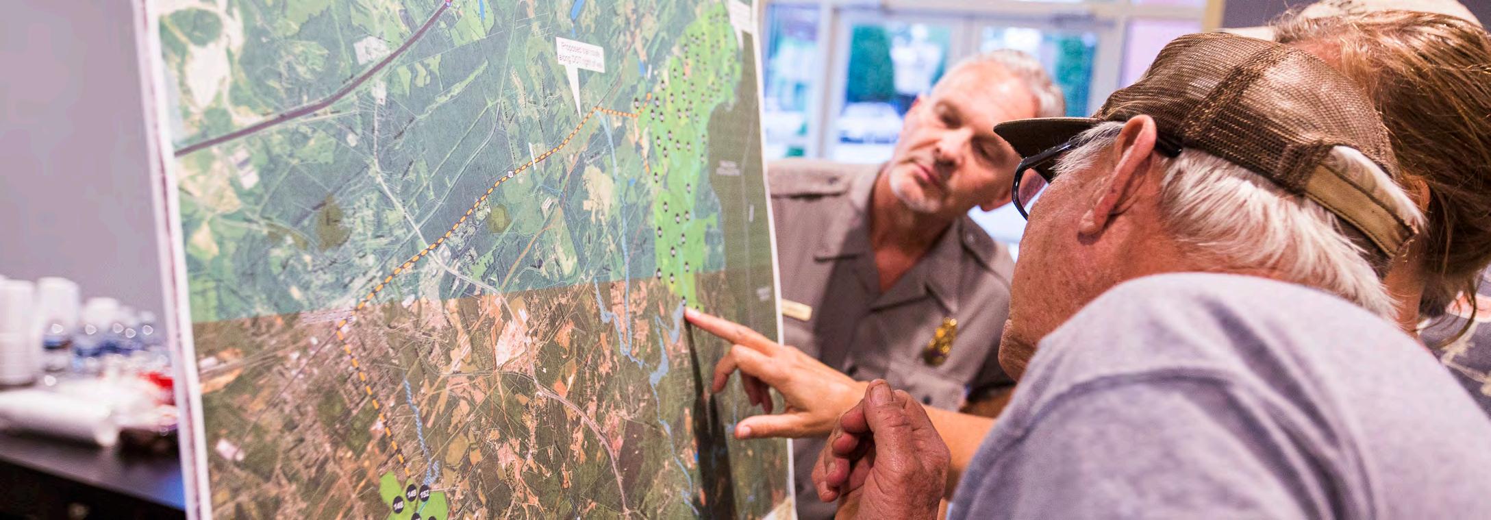
The environmental analysis (Chapter 1) was critical for determining physically feasible areas for trail development. However, significant portions of these routes impact private property and require landowner outreach to fully assess trail feasibility. This chapter highlights the good-faith effort to engage landowners throughout the planning process.
THE ENGAGEMENT PROCESS
Identifying the Landowners
Landowner Communications
Landowner Workshop
Trail Route Re-evaluationnd constraints found within the natural environment
IDENTIFY THE
Feasibility Analysis. Trail alternatives were developed based upon an
Landowner Database. A mailing database was created that included all
ment(s).
VIDEO PRODUCTION
WEB PORTAL
LANDOWNER INVITATION
LANDOWNER COMMUNICATIONS
Video Production. A custom video, specifically produced for landowners, highlighted the story of the Overmountain Victory National Historic Trail and made an appeal for landowner participation.
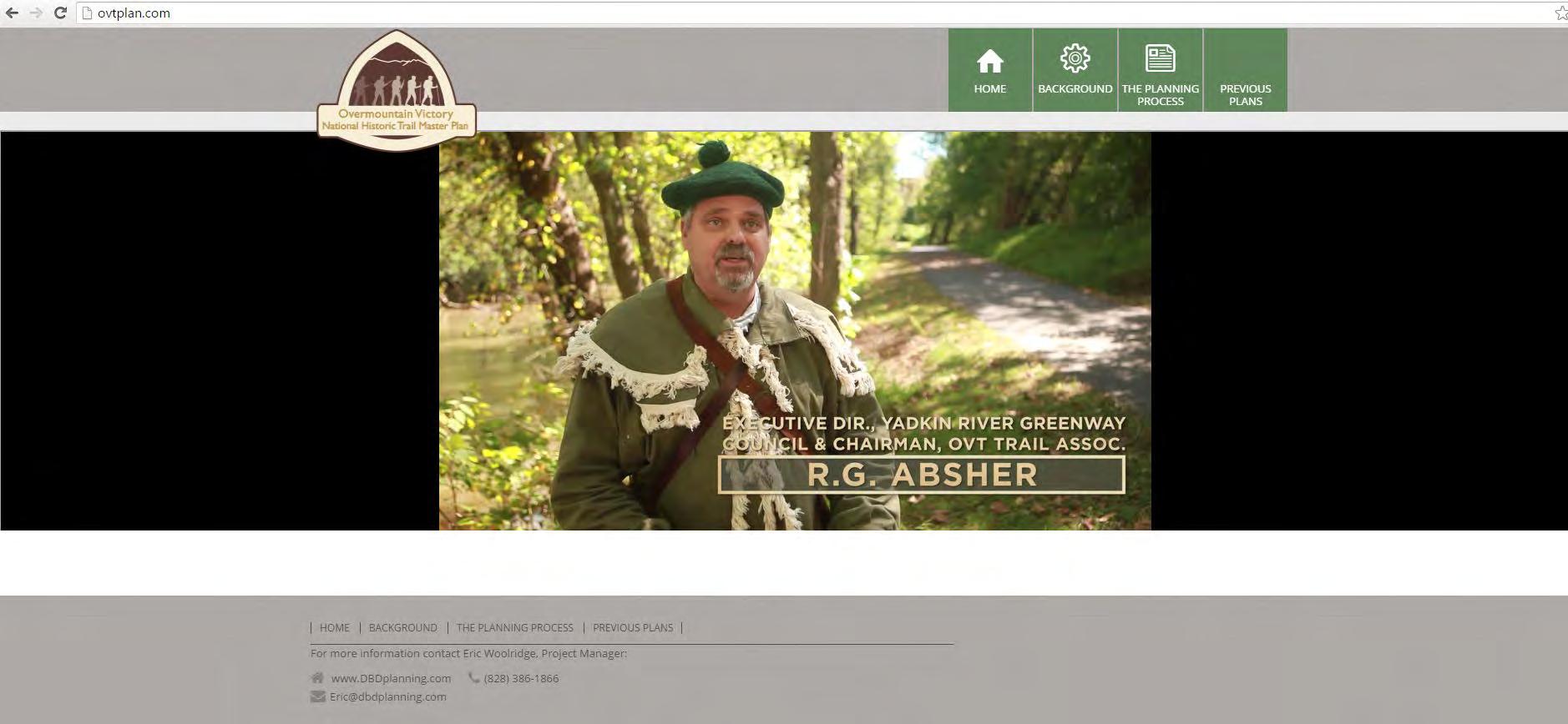
Web Portal. The project website, www.OVTplan.com, provides information about the planning process and features the landowner outreach video.
Landowner Invitation. Formal invitations were sent to all landowners directing them to the website and requesting their attendance at a special meeting.
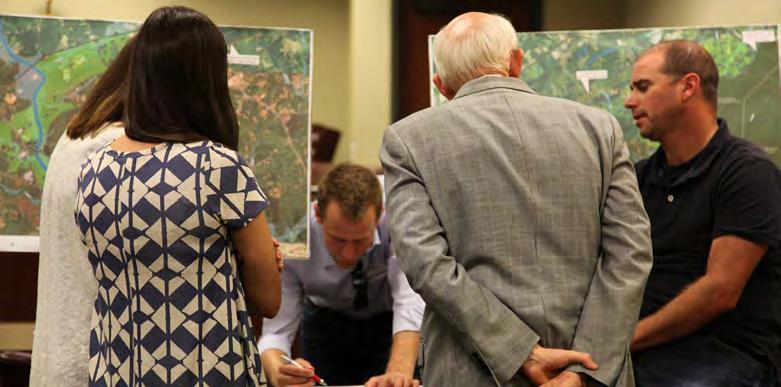
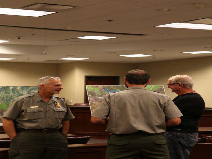
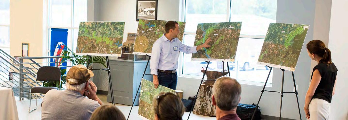
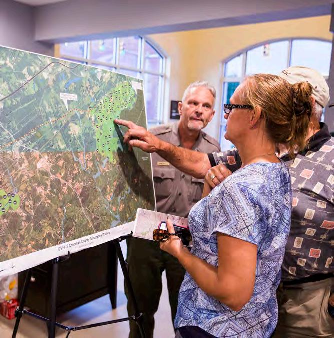
LANDOWNER WORKSHOP
Video Screening. After signing in, the landowner workshop began with a viewing of the custom video.
Focus Groups. Various focus groups were set up around the room in which landowners could ask questions about their specific property and the associated trail alignment.
Sentiment Card. Before landowners left, they were encouraged to fill out a landowner sentiment card describing their level of interest for providing for the trail.
Follow up Contact. DbD staff continued to follow-up with landowners throughout development of the plan document, and met with additional landowners as needed.
The planning consultant team engaged more than 15 landowners via phone, email, or during the August 7TH AND 10TH LANDOWNER WORKSHOPS HELD AT Blacksburg musuem of history and gaffney city hall.
TRAIL ROUTE RE-EVALUATION
Revise Trail Alignments. “Landowner Sentiment” was helpful in determining the preferred alignment and is included as a component of the final map series (Chapter 4).
A COMBINATION OF FACTORS INCLUDING THE NATURAL ENVIRONMENT, THE BUILT ENVIRONMENT, AND LANDOWNER SENTIMENT WERE USED TO DETERMINE THE PREFERRED TRAIL ALIGNMENT (CHAPTER 4).
CHAPTER 3
TRAIL CHARACTER &
DESIGN
GUIDELINES
THIS CHAPTER PROVIDES DESIGN DETAILS FOR VARIOUS TRAIL TYPES and SIGNAGE, AND ALSO OFFERS INSIGHTS FOR INCORPORATING SOCIAL MEDIA.
Between Chesnee and Kings Mountain National Military Park exist a diverse natural and built environment. Specific trail types must be applied throughout the corridor to ensure minimal maintenance and the best user experience.
This Chapter defines five trail types and describes their tread features and general specifications for construction.
A specific theme is presented for signage, wayfinding, and trail support facilities. Previous OVNHT Master Plans recommend identical trail branding to provide uniformity and recognition throughout the trail corridor.
IN THIS CHAPTER
A. Trail Types
B. Signage and Wayfinding
C. Social Media Marketing
TRAIL TYPES
Five trail types are proposed along the preferred alignment. A specific trail type is proposed according to its surrounding environment, location in a rural or urban area, and the opportunity to create a meaningful user experience.
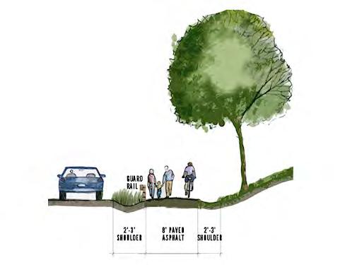
SCDOT SIDE PATH
8’ PAVED ASPHALT
User Group: Multi-use
Material: Paved Asphalt
Preferred Width: 8’
Average Construction Cost: $120/ln. ft.
Preferred Easement Width: 25’
Minimum Easement Width: 25’
*Note: Trail to be approved in accordance with SCDOT encroachment agreement.
URBAN SIDEPATH
8'–10' CONCRETE
User Group: Multi-use
Material: Concrete
Preferred Width: 8' - 10'
Average Construction Cost: $90/ln. ft.
Preferred Easement Width: 25' or within public right-of-way
Minimum Easement Width: 20' or within public right-of-way
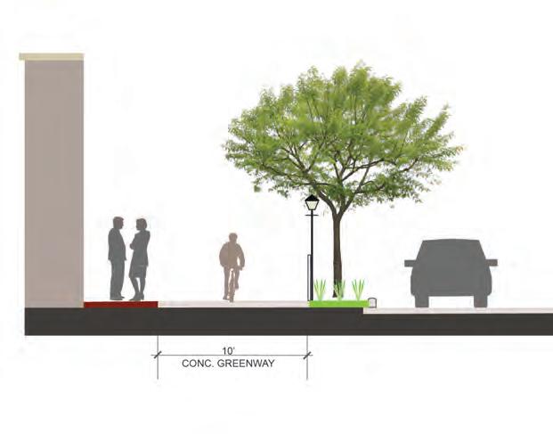
TYPICAL GREENWAY
10’ PAVED ASPHALT
User Group: Multi-use
Material: Paved Asphalt
Preferred Width: 10’
Average Construction Cost: $90/ln. ft.
Preferred Easement Width: 50’
Minimum Easement Width: 20’
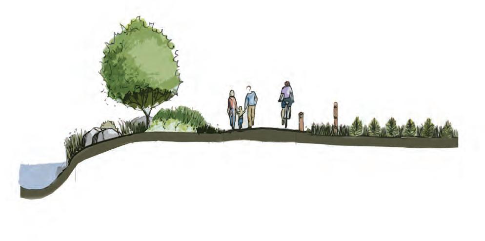
DUAL-USE PATH
6'-8’ CRUSHED GRAVEL FINES
User Group: Hikers and Bicyclists
Material: Crushed Gravel Fines
Preferred Width: 6' - 8'’
Average Construction Cost: $60/ln. ft.
Preferred Easement Width: 50’
Minimum Easement Width: 10’
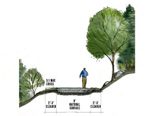
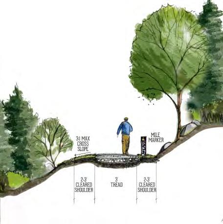
NATURAL SURFACE
3’ NATURAL TREAD
User Group: Hikers and Mountain Bikers
Material: Native Soil
Preferred Width: 3’
Average Construction Cost: $6/ln. ft.
Preferred Easement Width: 25’
Minimum Easement Width: 10’
SIGNAGE AND WAYFINDING
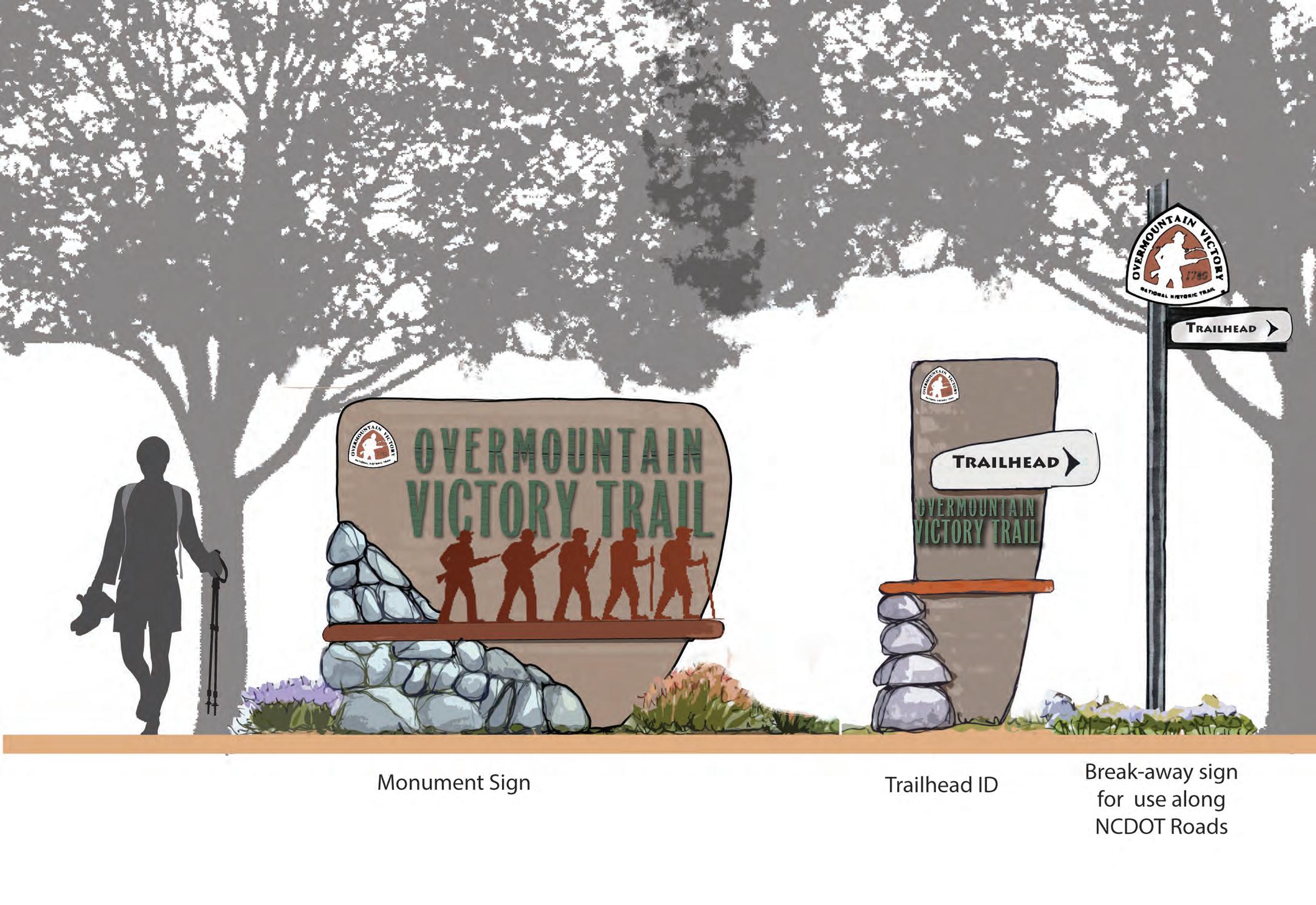
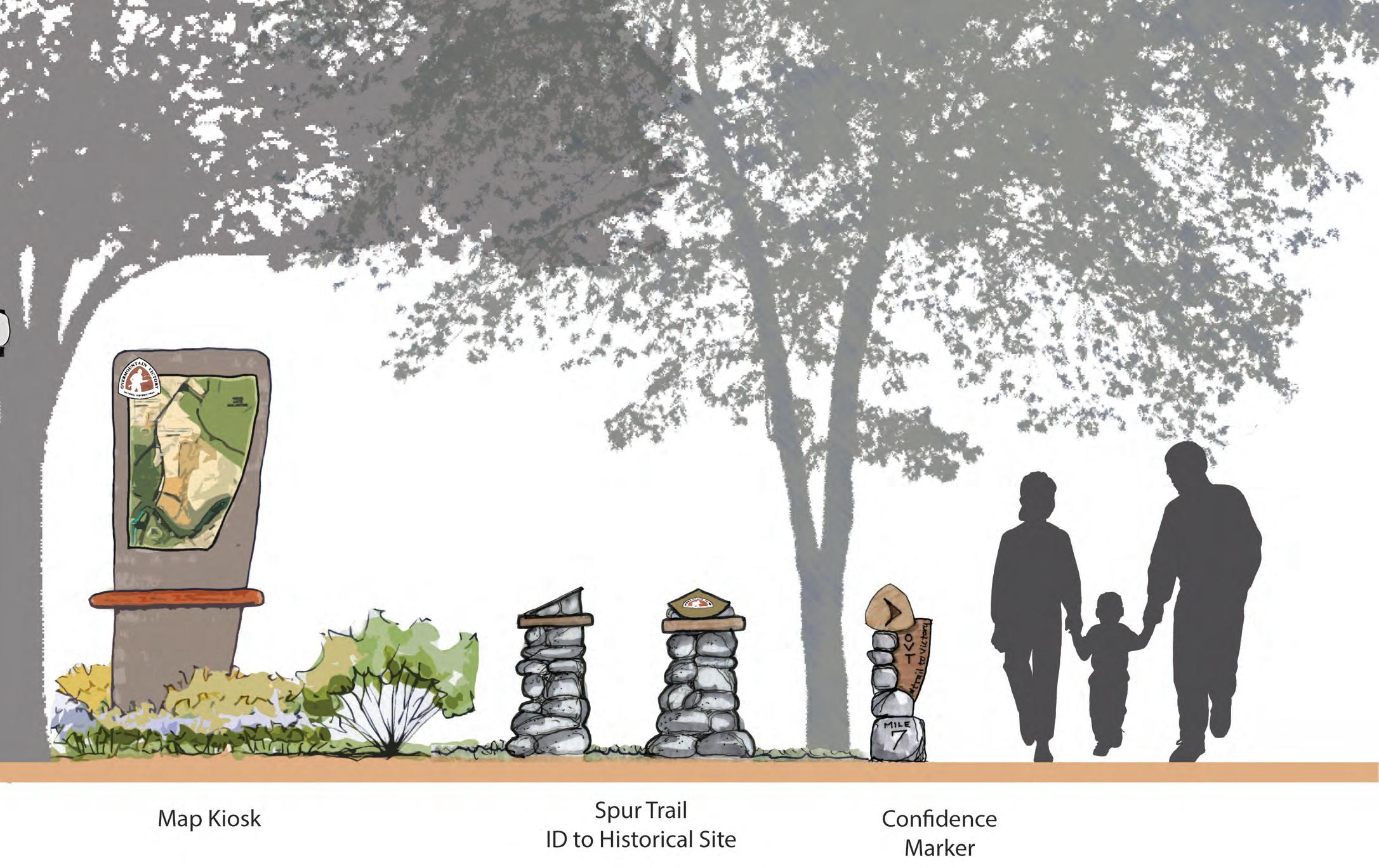
The OVNHT signage family provides for a modern-rustic theme and incorporates materials consisting of metal, rock, and concrete. The signage family serves as a template and can be altered and refined depending on local preferences and specific site needs.
Signage marking the physical trail is required to include the official OVNHT logo of the NPS.
Monument Sign
Trailhead IDBreak-away sign for use along SCDOT roads
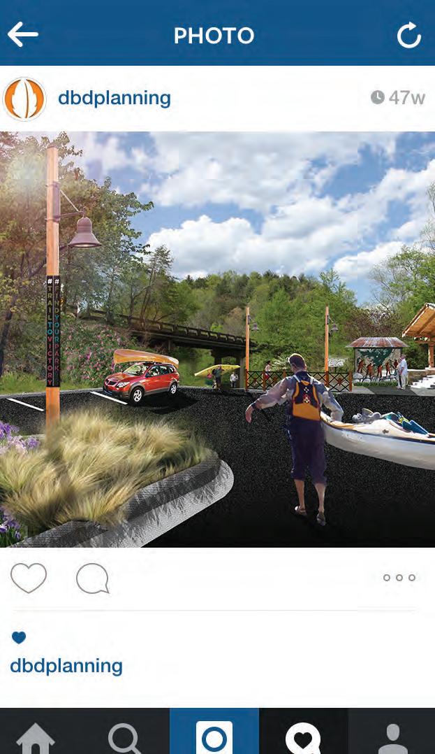
SOCIAL MEDIA: THE NEW WORD OF MOUTH
Trail users should be encouraged to utilize social media to share their experiences with their friends and “followers”. Special signage along the trail will signal users to consider posting pictures of themselves or their friend groups as they walk or ride bikes along the trail. In addition, special photo opportunities and features should be developed during the final design phase. After all, who better to market this destination-quality trail than the users themselves? Take advantage of social media – the new word of mouth.
“FIND YOUR PARK” IS THE OFFICIAL CENTENNIAL CAMPAIGN OF THE NATIONAL PARK SERVICE. THE NPS IS ENCOURAGING NATIONAL PARK ENTHUSIASTS TO USE THE HASHTAG #FINDYOURPARK WHEN POSTING TO SOCIAL MEDIA.
#TRAIL2VICTORY
The proposed official hashtag for the OVNHT is #trail2victory. The use of this hashtag will allow local tourism leaders to curate local photography and content that can be shared on websites and re-posted through other social media platforms.
#FINDYOURPARK
“Find your park” is the official centennial campaign of the National Park Service. The NPS is encouraging national park enthusiasts to use the hashtag #findyourpark when posting to social media. The OVNHT can help continue this campaign for years to come by encouraging the use of this hashtag at unique locations along the trail.
TRAIL USERS SHOULD BE ENCOURAGED TO UTILIZE SOCIAL MEDIA TO SHARE THEIR EXPERIENCES WITH THEIR FRIENDS AND “FOLLOWERS”.
cherokee county, sc
CHAPTER 4
RECOMMENDATIONS
THIS CHAPTER SERVES AS THE HEART OF THE CHESNEE TO KINGS MOUNTAIN OVNHT MASTER PLAN.
IN THIS CHAPTER
A. Overview of Planning Section Maps
B. Planning Section Descriptions
STUDY AREA SECTIONS
The study area from CHESNEE to KINGS MOUNTAIN is divided into five (5) planning sections; this chapter is organized
ABOUT THE PLANNING SECTION MAPS
Each planning section is anchored by a map that highlights proposed trail routes, trail features, and landowner sentiment. The proposed routes are identified as either preferred, preferred-historic, alternate, or spur. These trail alignments are the result of extensive analysis, including environmental feasibility, landowner willingness, and insights provided by the National Park Service, local government and local trail development leaders.
The National Trails System Act states that “a designated trail should generally accurately follow the historic route, but may deviate somewhat on occasion of necessity to avoid difficult routing through subsequent development, or to provide route variations offering a more pleasurable recreational experience.”5 In accordance with this directive, the trail is planned as close as possible and practicable within the one-mile Historic Corridor. Where trail construction is not feasible within the Historic Corridor, the NPS may recognize routes outside the corridor as preferred alignments. Such routes are planned for the greatest public benefit and enjoyment, as well as to promote tourism, economic development and rural prosperity.
The NPS refers to routes outside the Historic Corridor as alternate routes to the historic route. Many of the preferred routes identified in this chapter are located outside of the Historic Corridor. Such routes can be marked and signed the same as routes within the Historic Corridor, but must provide on-site interpretation that indicates the known historic trail location and explains why the trail could not be constructed within the Historic Corridor.
EACH PLANNING SECTION IS ANCHORED BY A MAP THAT HIGHLIGHTS PROPOSED TRAIL ROUTES,
Noted trail features include the physical infrastructure and facilities that support the proposed trail. These features are highlighted along the preferred routes and provide critical information for developing an estimate of probable cost for each section. These features include trailheads and crossings associated with either a road or water feature. Trailheads will provide for parking and trail user orientation. Road crossings indicate the need to provide for traffic calming measures and appropriate signage for both trail users and motorists. Major bridges indicate a significant stream or river crossing that requires a bridge greater than 20 feet in length. A minor bridge/culvert demonstrates the need to cross a relatively small stream; at this broad level of planning, it remains uncertain whether a small bridge or culvert is necessary.
QUICK FACTS
Each planning section begins with a “quick facts” exhibit. This information includes the trail distance, trail type, and key features and assets associated with each section. Also, an estimate of probable cost is noted; see the appendix for further details. Reported numbers for length and cost include all preferred routes in the planning section.
SECTION
1
PROPOSED TRAILS
TRAIL FEATURES
This planning section includes three (3) trailheads, three (3) minor bridges, and five (5) road crossings.
TRAILHEADS
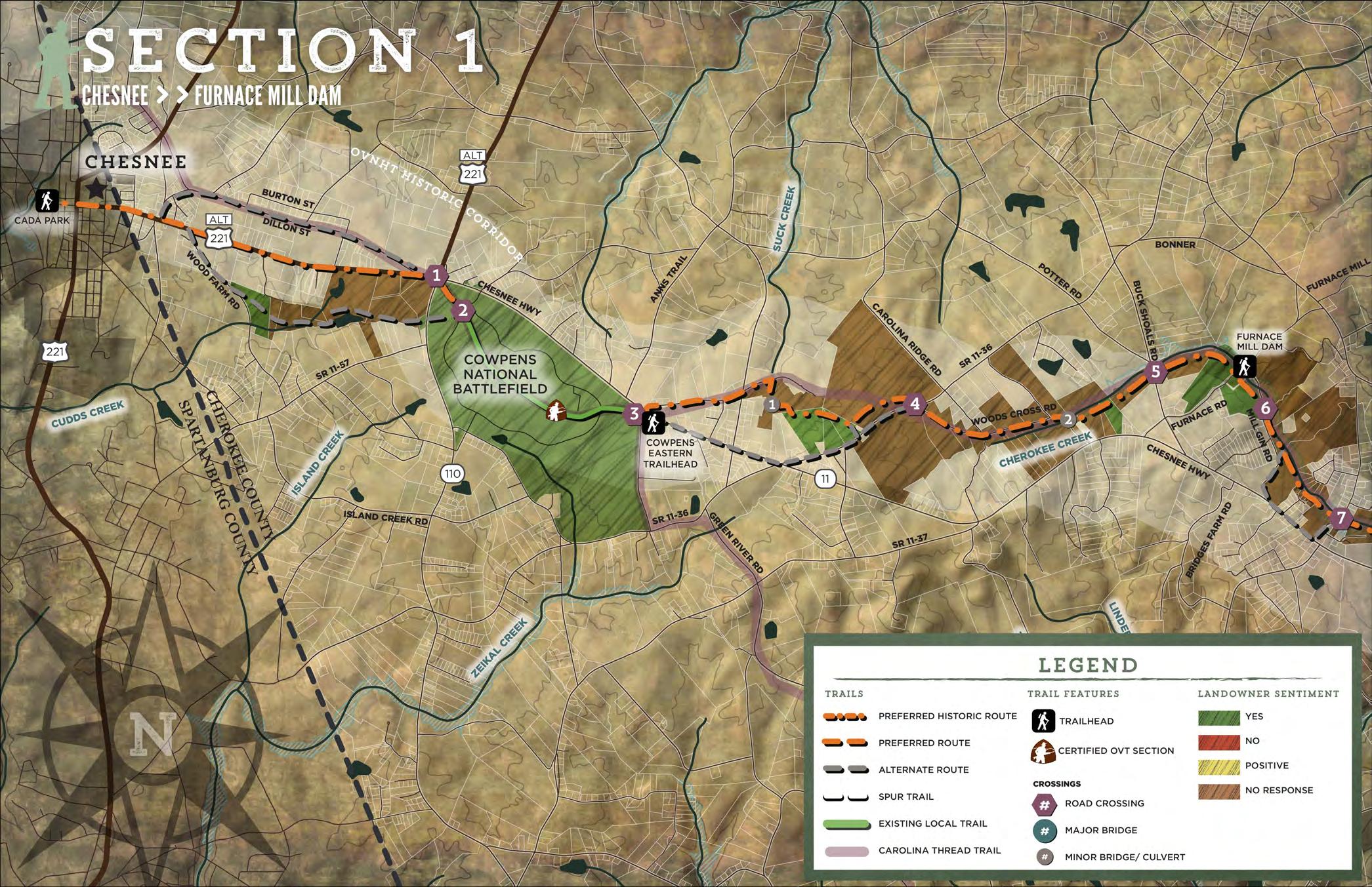
The preferred-historic route extends approximately 8.0 miles, beginning at CADA Park near downtown Chesnee and ending at the historic Furnace Mill Dam on Cherokee Creek. The proposed trail through Chesnee would utilize existing public right-of-way to expand the City’s sidewalk to an urban multiuse sidepath. As the trail exits the downtown core, it transitions to an SCDOT sidepath along SC Highway 11 to connect to Cowpens National Battlefield. The route extends through Cowpens on the historic Green River Road, a certified two-mile section of the OVNHT. From Cowpens, the trail transitions to a sidepath on Scruggs Trail for nearly one mile. The trail exits Scruggs Trail to the south and transitions to a dual-use path through rolling farmland before crossing Highway 11. The route utilizes the existing gravel right-of-way of Woods Cross Road for one mile before exiting the road to follow the south side of Cherokee Creek to the Furnace Mill Dam Trailhead.
Alternate routes extending east from Chesnee utilize the public right-of-way as sidepaths on Dillon Street and Woods Farm Road. An alternate SCDOT sidepath route extends east from Cowpens along Highway 11 and turns northeast on Bonner Road. Sidepaths adjacent to the road provide a less desirable user experience, but are feasible options if trail easements cannot be secured.
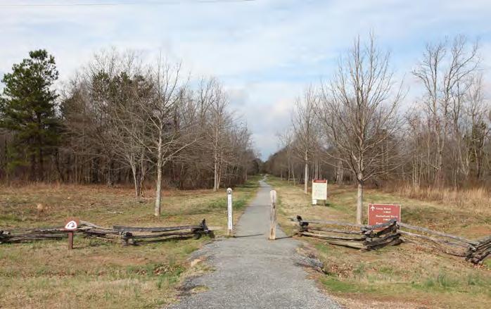
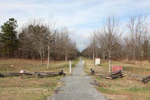
The western terminus is CADA Park near downtown Chesnee. The park features a walking loop and picnic shelter.
Cowpens National Battlefield provides access to the historic Green River Road at three locations within the park. Cowpens Eastern Trailhead is located outside the battlefield’s boundaries and provides access to the Green River Road via the Battlefield Trail when the park is closed to vehicles. This trailhead was constructed in 2006 as a joint effort between the Carolina Thread Trail and the Cherokee County Overmountain Victory Trail Committee. The trailhead features interpretive kiosks with informational panels on Cowpens, the Overmountain Men, and the Carolina Thread Trail.
The historic Furnace Mill Dam Trailhead serves as the eastern terminus of this planning section. It is located adjacent to multiple secured trail easements.
Trailheads at CADA Park and the Furnace Mill Dam are located just outside the historic OVNHT corridor, but provide critical points of connectivity for trail development and are managed by local governments.
CROSSINGS
This planning section features two (2) minor creek or drainage crossings. The first minor crossing is located south of Scruggs Trail over a small natural drainage area. The second crossing spans Cherokee Creek from the north side to the south side near Woods Cross Road.
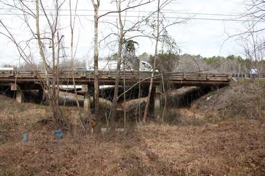
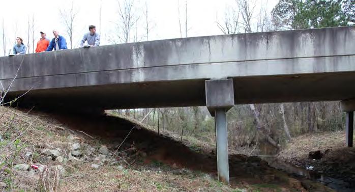
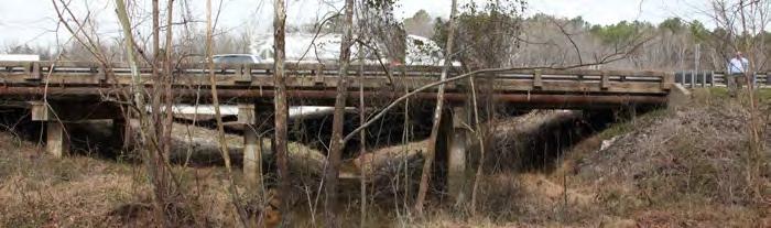
The preferred route crosses a combination of major roads and local roads in this planning section. There are five (5) road crossings including an underpass of Buck Shoals Road. The Cherokee County OVT Committee has already secured a permit for this underpass.
PHOTO: (1) The trail will cross under Buck Shoals Road at the Cherokee Creek Bridge
COWPENS NATIONAL BATTLEFIELD
QUICK FACTS :
Established: 1929
Acres: 842
Miles of Trail: 5.5
Miles of Certified OVNHT: 2
Annual Visitors: 235,000
Cowpens is the site of the last encampment of the Overmountain Men prior to the Battle of Kings Mountain in 1780. The following year, in 1781, Cowpens was the location of another significant battle that also resulted in a patriot victory, eventually leading to American independence. Today, the park features 2
miles of certified OVNHT on the historic Green River Road that extends through the center of the park. Additionally, a trailhead completed in 2006 provides access to the Green River Road from outside the eastern boundary of the park.
HISTORIC FURNACE MILL DAM
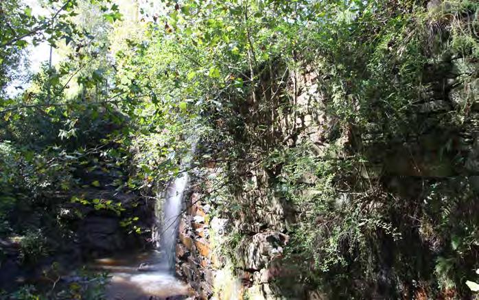
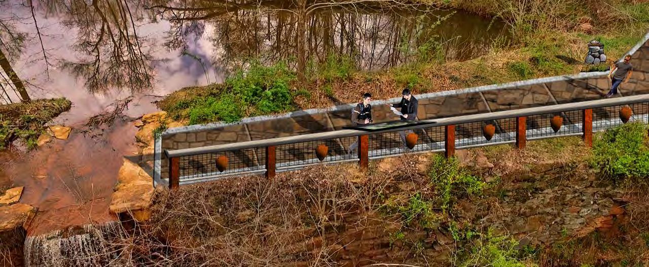
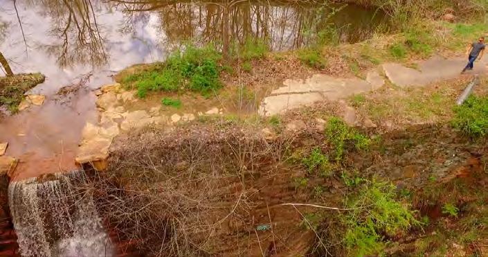
The eastern terminus of this planning section is the historic Furnace Mill Dam adjacent to Cherokee Creek. The site was donated by private landowners to Cherokee County and was dedicated as a trailhead for the OVNHT in 1999. This property is a tremendous asset to the County's history, but requires further study to identify strategies for safely incorporating trailhead features and the OVNHT while preserving the remaining stone structures and water wheel.
PROPOSED TRAILS
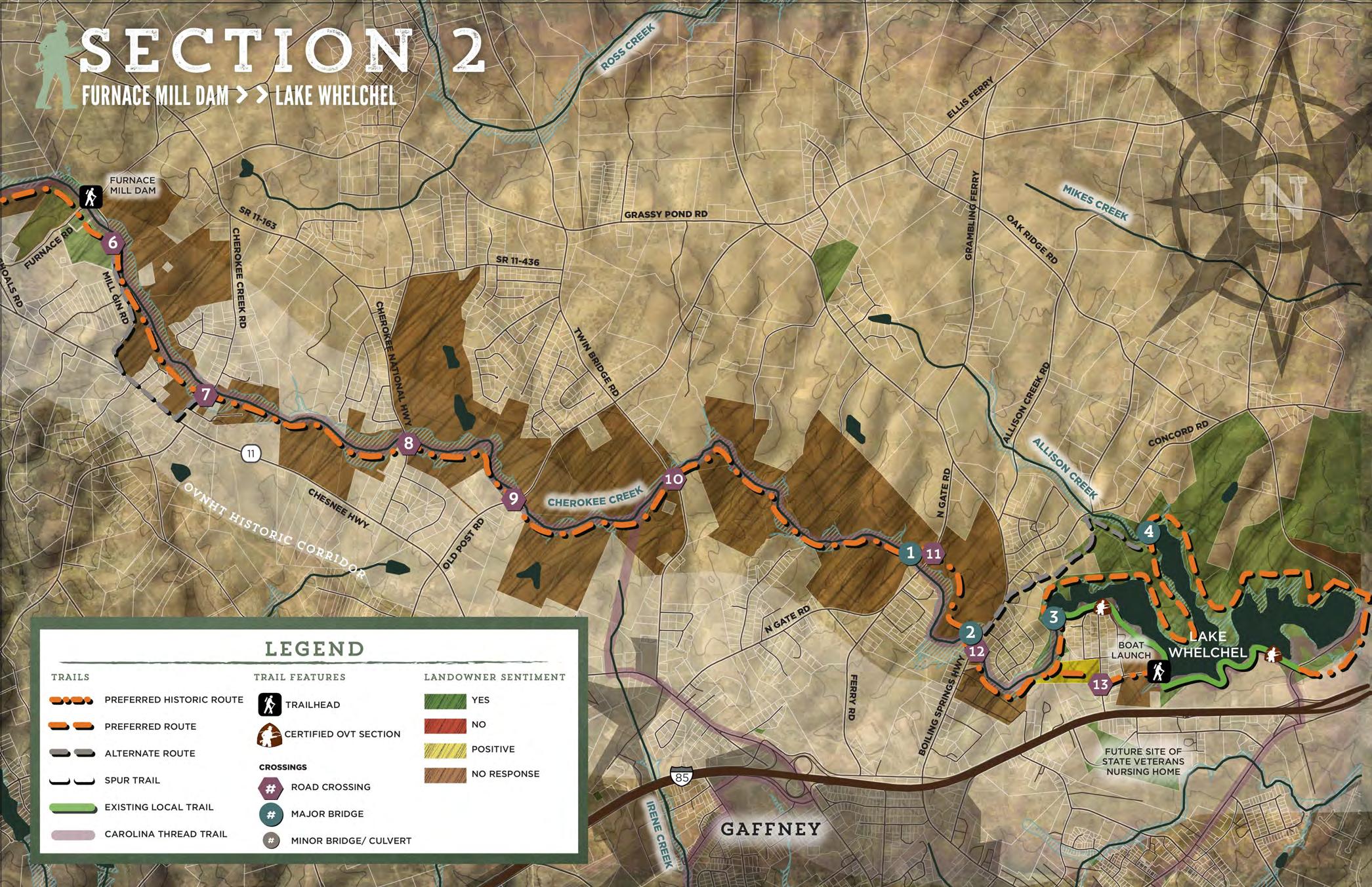
TRAIL FEATURES
In Planning Section #2, the preferred-historic route extends for approximately six miles from the Furnace Mill Dam east to Lake Whelchel. The trail utilizes the floodplain on the south side of Cherokee Creek. This route deviates from the historic corridor after crossing Post Road in order to continue within the floodplain of Cherokee Creek and to avoid Interstate 85 and adjacent highway development.
This planning section includes two (2) trailheads, four (4) major bridges, and eight (8) road crossings.
TRAILHEADS
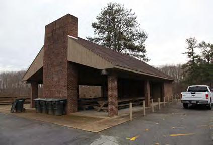
The Furnace Mill Dam serves as the western terminus and trailhead in this planning section. The public lake access and parking area at Lake Whelchel is a natural location for a trailhead at the eastern terminus of the planning section. The boat launch and parking area is managed by the Gaffney Board of Public Works and provides access to the existing segment of the OVNHT on the south shore of the lake. Amenities at this trailhead include a large picnic shelter, restrooms, and fishing dock.
CROSSINGS
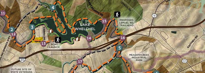
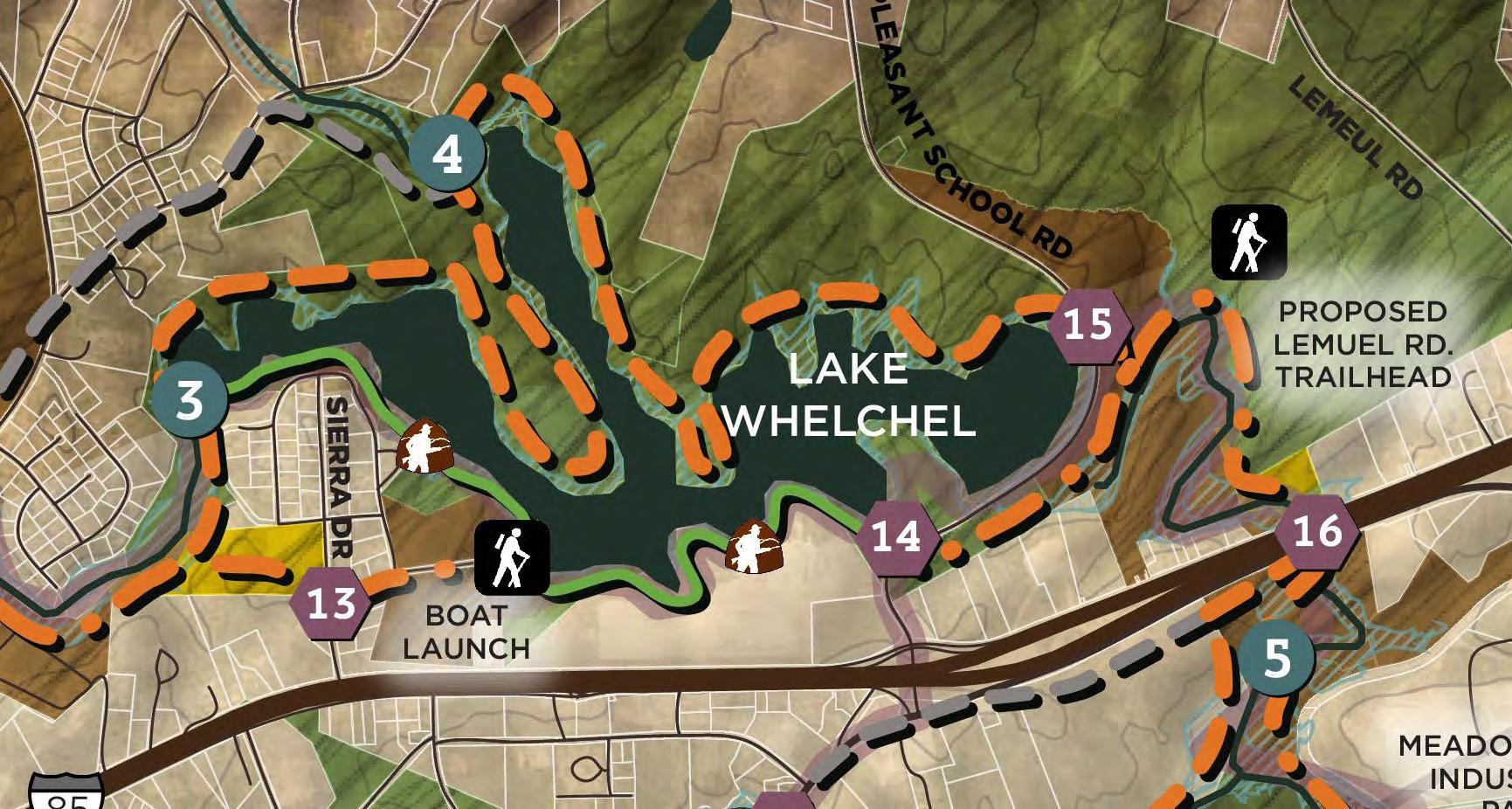
At Lake Whelchel, the route splits to form a loop around the lake, utilizing Gaffney Board of Public Works property. The preferred-historic route follows the south side of the lake and transitions from a typical paved greenway into a sidepath along Boat Landing Drive to connect to the existing three mile natural surface segment of OVNHT. The preferred route on the north side of the lake completes the loop as a dual-use natural surface trail. At the east end of Lake Whelchel, the trail crosses over Pleasant School Road to utilize a wide, flat area along the tree line below the dam. The lake loop accounts for approximately eight miles of trail in this planning section. (see exhibit 5: Lake Whelchel Loop)
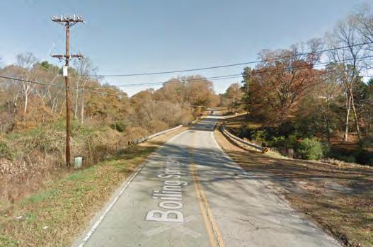
An alternate route, a half mile east of the Furnace Mill, follows Mill Gin Road and Highway 11 as a sidepath before returning to the Cherokee Creek corridor. This route provides an option to bypass residential subdivisions that abut Cherokee Creek. A second alternate route near Lake Whelchel follows Boiling Springs Highway for approximately one-quarter mile then bears east toward Allison Creek to connect to the Lake Whelchel Loop.
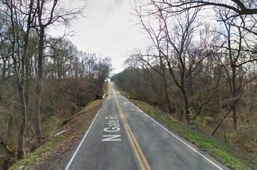
Major Bridge #1 crosses Cherokee Creek from south to north near North Gate Road to avoid a pinch point at a residential subdivision adjacent to the creek. After a half-mile, the trail returns to the south side of the creek at Major Bridge #2.
Major Bridge #3 is located on the west end of Lake Whelchel where Cherokee Creek flows into the lake. Bridge #4 crosses Allison Creek near its confluence with Lake Whelchel.
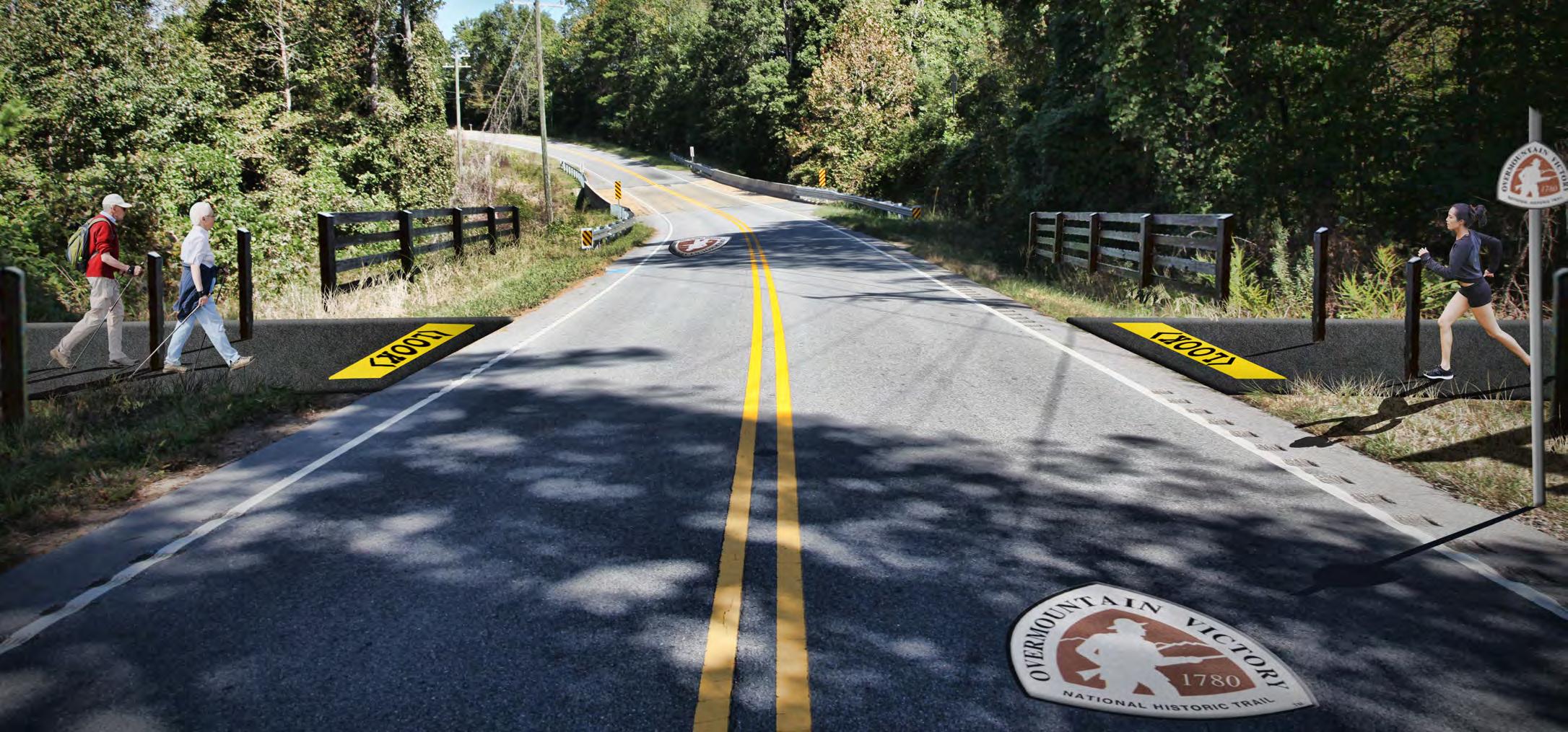
There are eight (8) road crossings identified within this section. Crossings #8 and #10 show potential for a trail underpass along Cherokee Creek where an initial visual inspection of the crossings indicate adequate bridge width and vertical clearance.
Narrow bridges and culverts at crossings #6, #7, #9, #11, #12, and #13 will require road surface crossings.
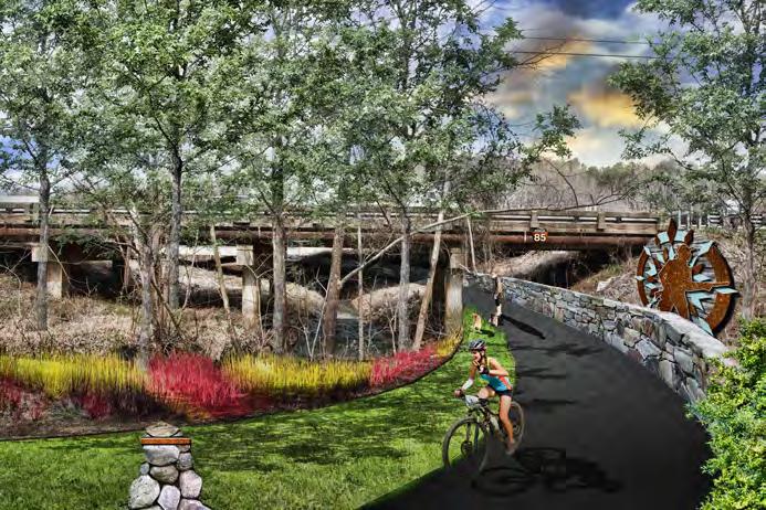
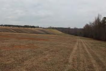
PHOTOS: (2) The route utlizes 3 miles of existing OVNHT at Lake Whelchel. (3) The trail will utlize the wide, flat area east of the lake dam. (4) The Lake Whelchel trailhead provides a picnic shelter and restrooms.
LAKE WHELCHEL LOOP
Lake Whelchel presents an opportunity to expand upon the existing segment of certified OVNHT to develop a destination-quality hiking and mountain biking trail around the lake. The shoreline and land surrounding the lake is controlled by the Gaffney Board of Public Works, providing an opportunity to establish approximately eight (8) miles of new trail.
OLD POST ROAD CROSSING
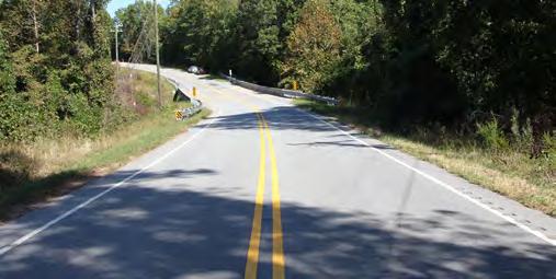
Final design for all road surface crossings, including the crossing at Old Post Road, must ensure adequate sight-distance for motorists and trail users as they approach the OVNHT and road intersection..
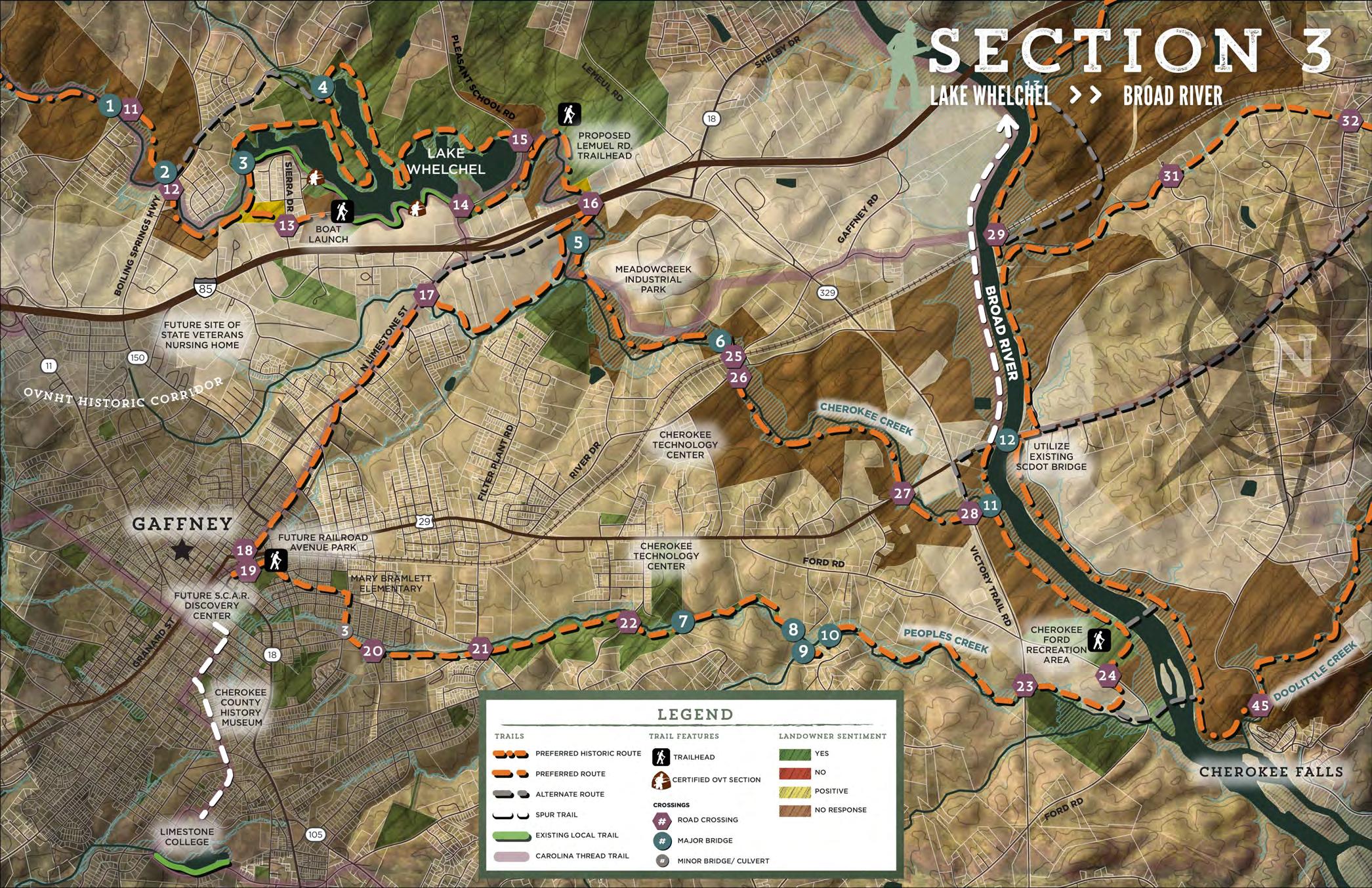
SECTION 3
PROPOSED TRAILS
TRAIL FEATURES
BROAD RIVER LAKE WHELCHEL
The preferred historic route in Section 3 extends from the east side of the Lake Whelchel dam and crosses under Interstate 85 along Cherokee Creek; the trail type is typical greenway. South of I-85, the route splits. The preferred-historic route extends southeast along Cherokee Creek for 4.25 miles, then turns north at Victory Trail Rd. to the James D. Batchler Bridge.
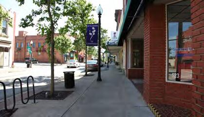
The western preferred route follows the north side of Providence Branch Creek to Limestone Street. The sidewalk along Limestone St. can be expanded to an urban multiuse path within the public right-of-way that extends for 1.75 miles. The trail turns east at Railroad Avenue Park to utilize a former rail corridor owned by the City of Gaffney. The route connects to Mary Bramlett Elementary before reaching Peoples Creek. The preferred route extends east along Peoples Creek as a typical greenway and utilizes land owned by the Gaffney Board of Public Works to connect to Cherokee Ford Recreation Area. From Cherokee Ford, the preferred route extends north to the bridge on Highway 29. This alignment provides a connection to multiple Revolutionary War destinations in downtown Gaffney and takes advantage of public lands and rights-of-way. The city has expressed a keen interest in incorporating the trail into the downtown.
Both alignments deviate from the historic corridor to avoid I-85 in the interest of user safety. The routes provide for an optimal user experience by utilizing the scenic, wooded floodplains of Cherokee and Providence Branch Creeks. The preferred route through Gaffney connects to multiple downtown destinations and is a significant opportunity for Cherokee County and Gaffney to capitalize on existing public infrastructure and assets to construct a significant portion of the trail without easements from property owners.
Two spur trails are identified in this section. A spur route in Downtown Gaffney utilizes City-owned land adjacent to the rail corridor to connect to the future S.C.A.R Discovery Center, Cherokee County History Museum, and Limestone College. A spur along the Broad River suggests a northern extension of the greenway that takes advantage of the river’s floodplain.
This planning section includes three (3) trailheads, one (1) minor bridge or culvert, seven (7) major bridges, and thirteen (13) road crossings.
TRAILHEADS
The northernmost trailhead in this section is the Lemeul Road Trailhead located on the east side of the Lake Whelchel dam. The proposed trailhead utilizes County-owned property.
Railroad Avenue Park in Gaffney serves as a centrally-located trailhead. The City is currently in the process of transforming the open space west of the Probate Court building into a park that will feature an amphitheater.
Cherokee Ford Recreation Area, located on the banks of the Broad River, is the easternmost trailhead. It is owned by Cherokee County and provides public river access at Wolf Den Lane.
CROSSINGS
The preferred routes in this section will require seven (7) major bridges. Three crossings of Cherokee Creek and four crossings of Peoples Creek are necessary to avoid pinch points and impact to private property.
There are 13 road crossings in this planning section. Crossing #16 is an underpass of I-85 at Cherokee Creek. An initial visual inspection reveals adequate width and vertical clearance for a greenway to cross under the interstate. Approval for this underpass will require close coordination with SCDOT. Crossings #23, #27, and #28, also show potential as underpasses.
As the trail enters Gaffney, it crosses Highway 29 (#18) and an active Norfolk-Southern rail line (#19). This rail crossing will require special engineering and design consideration to achieve a safe route for trail users. Ideally, the trail should cross perpendicular to the rail line to ensure clear lines of sight. Crossing #25 also intersects the rail line along Cherokee Creek. This crossing shows potential for the trail to underpass the railroad at the existing bridge, however steep topography is a significant constraint.
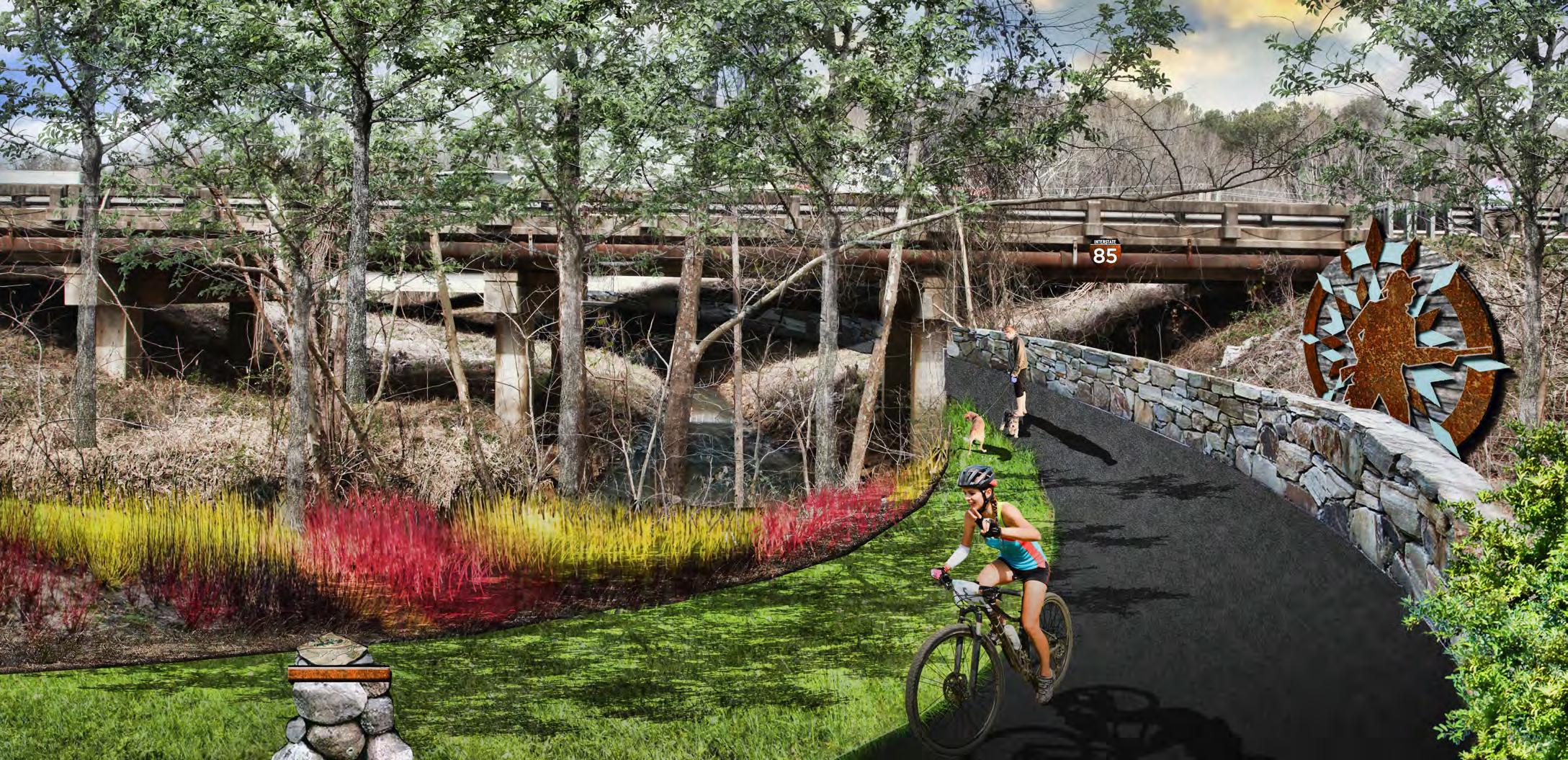
UNDER AND ONWARD AT I-85
Cherokee Creek crosses under Interstate 85 south of Lake Whelchel, providing an opportunity for a trail underpass beneath the highway. The OVNHT route in this location coincides with the Carolina Thread Trail.
Historic Tour
Streetscape Improvements and Pedestrian Connection
City Hall and Carnegie Library / Log Home
HISTORIC GAFFNEY DISCOVERY TRAIL
TRACKING DOWN HISTORY
Thematic in-ground mosaics at each pocket park along the Historic Gaffney Discovery Trail tell the story of the Overmountain Men. Replica artifacts from the American Revolution are embedded in the mosaic to create a scavenger hunt along the path.
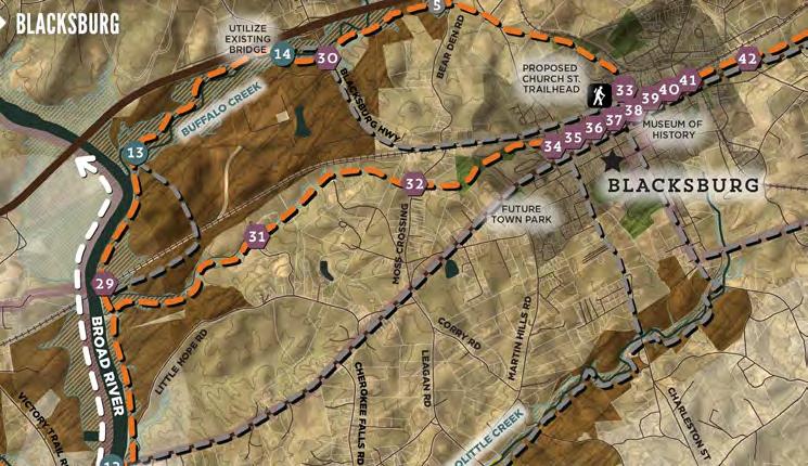
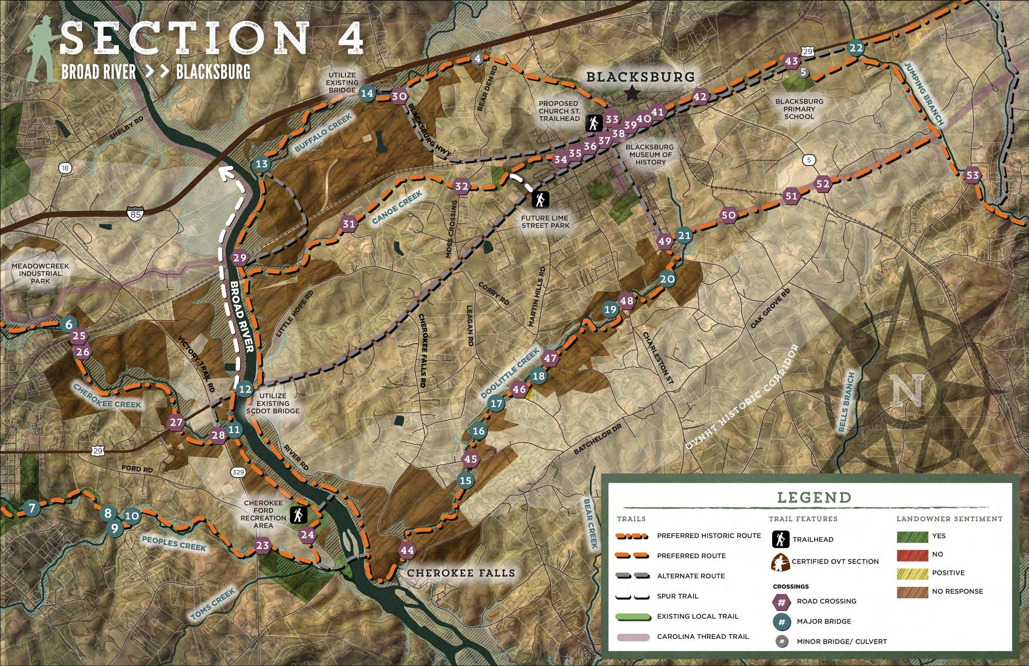
SECTION 4
PROPOSED TRAILS
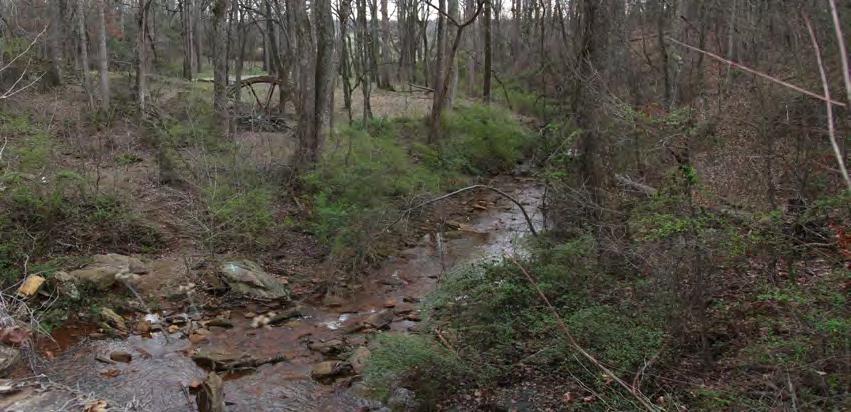
The preferred route in Section 4 extends from the Broad River to Blacksburg. The trail extends north from Cherokee Ford to the Hwy. 29 James D. Batchler bridge. After crossing the Broad River, the route splits to the north and south along the east bank of the river. The southern route is the preferred-historic alignment along Doolittle Creek. South of Blacksburg, this route follows the Carolina Thread Trail toward Jumping Branch Creek. This preferred historic alignment will require approximately twice as many easements from private landowners as the other preferred routes identified in this section, and will require seven creek crossings to avoid steep slopes and houses.
BLACKSBURG BROAD RIVER
SCDO
ESTIMATED COST: $11,587,370
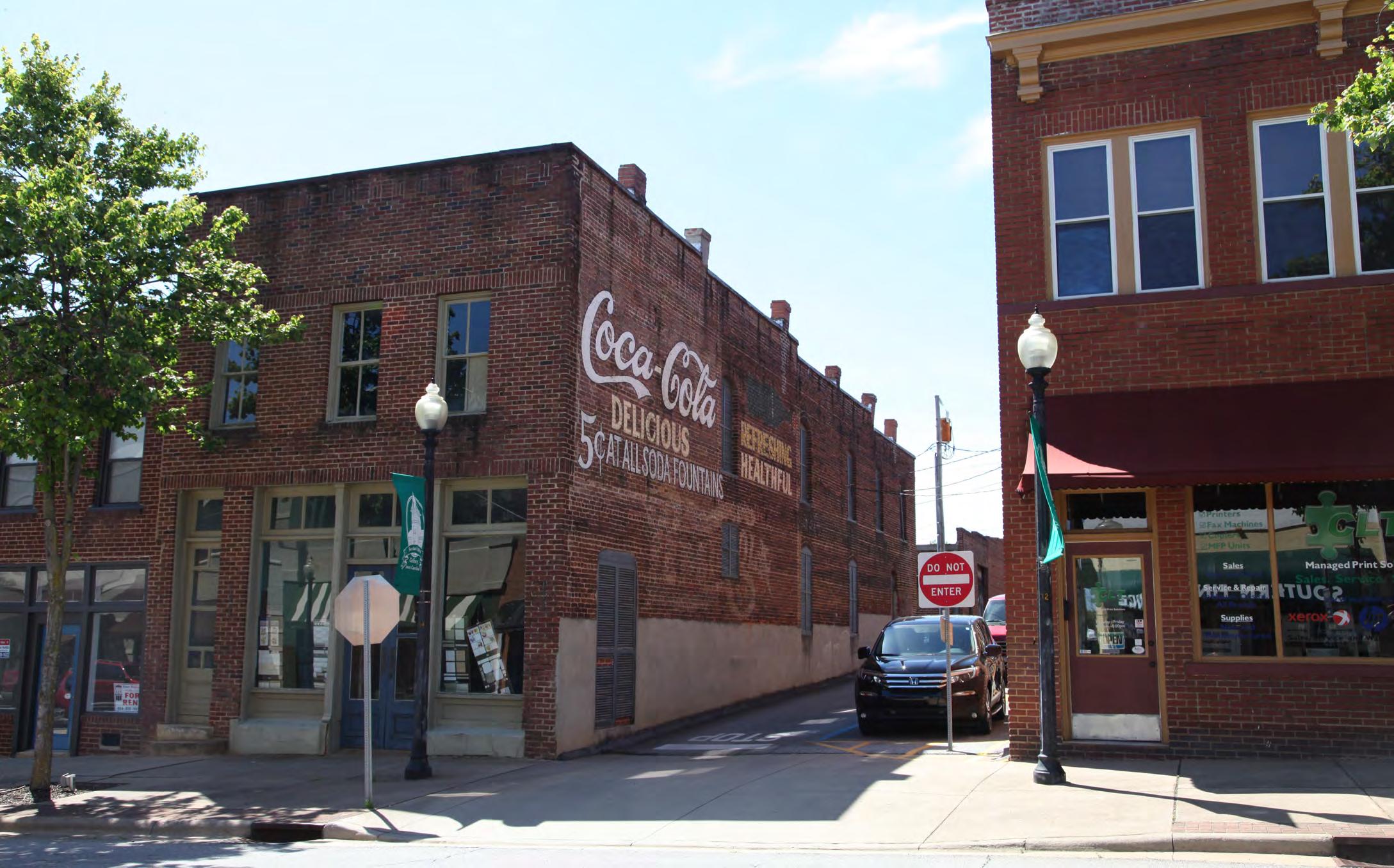
The northern preferred alignments deviate from the historic corridor in order to utilize large corporate landholdings and floodplain areas to connect to downtown Blacksburg. The preferred route along the south side of Canoe Creek extends east as a typical greenway for 3.5 miles. A spur trail connects users to the Lime Street Park trailhead. This route enters Blacksburg along Railroad Avenue. The trail then utilizes a portion of the Church Street right-of-way that can be converted to a multiuse urban path extending through downtown Blacksburg to Mountain Street.
The northernmost preferred route passes under the railroad bridge that crosses the Broad River. The route extends north for one mile to Buffalo Creek. The trail then crosses to the north side of Buffalo Creek and extends east within the floodplain for 1.3 miles. The trail utilizes an existing bridge to cross to the south side of the creek and continue toward Blacksburg Highway. The route crosses under Blacksburg Highway and extends to Bear Den Road where it transitions to an SCDOT sidepath. The trail continues along N. Shelby Street into downtown, utilizing the existing sidewalk right-of-way.
The Town of Blacksburg has expressed enthusiasm for incorporating the route into the downtown. Blacksburg presents an opportunity as a destination and trail access point for the town's citizens and visitors. A comparable opportunity for connectivity does not exist within the Historic Corridor in this section.
A sidepath along Hwy. 29 provides an alternate route to Blacksburg. This route could take advantage of a sidewalk on the north side of the road beginning at Lime Street Park.
TRAIL FEATURES
This planning section includes two (2) trailheads, one (1) minor bridge or culvert, ten (10) major bridges, and twenty-two (22) road crossings.
TRAILHEADS
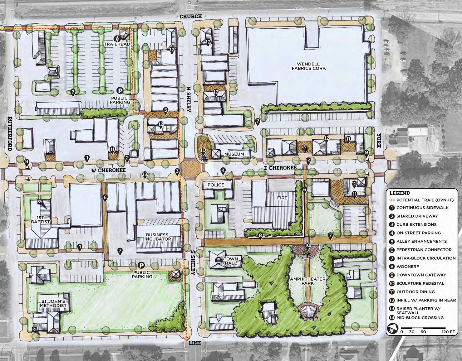
Blacksburg's future Lime Street park will serve as a trailhead with additional walking trails. A trailhead at the corner of Church Street and Shelby Street is proposed in accordance with the Downtown Blacksburg Streetscape Master Plan. See Exhibit 13 for details.
CROSSINGS
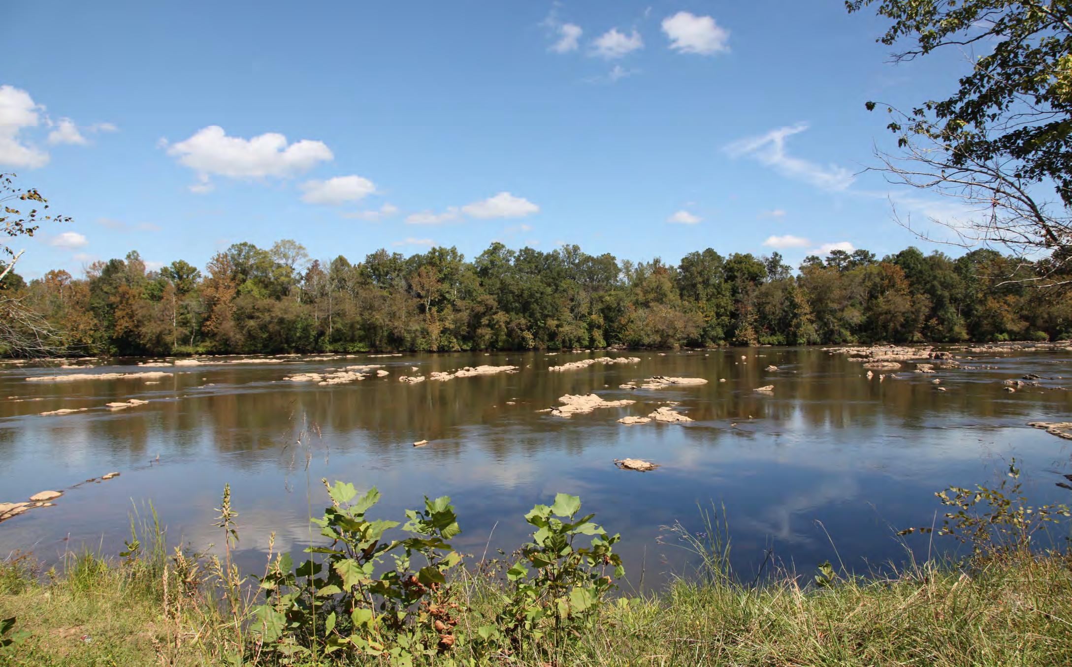
Bridge #12 is the Highway 29 bridge over the Broad River. The bridge features wide shoulder lanes that could be upgraded to accommodate the trail. Two alternate crossings are identified for the Broad River. The southernmost alternate crossing is located at Goat Island. The second alternate crossing is located at Cherokee Ford, the historic crossing of the Overmountain Men. Both crossings would require substantial bridges.
Major bridges #13 and #14 cross Buffalo Creek. Major bridge #14 is an existing private vehicular bridge connecting Frontage Road to an undeveloped cul-de-sac. This bridge is preferred, but will require coordination with the property owner. The historically-preferred route will require seven major bridges (#15 through #21).
This planning section includes 20 road crossings and two rail road crossings. Crossing #29 is an underpass of the existing rail trestle over the Broad River. The trail crosses Blacksburg Highway twice (#30 and #33). Crossing #30 is proposed as an underpass along Buffalo Creek. The preferred route crosses seven downtown intersections (#34 through #40) on Church Street. The historic-preferred route has eight road crossings and one rail crossing. Crossings #46 and #48 are underpasses at Leagan Rd. and Charleston St.
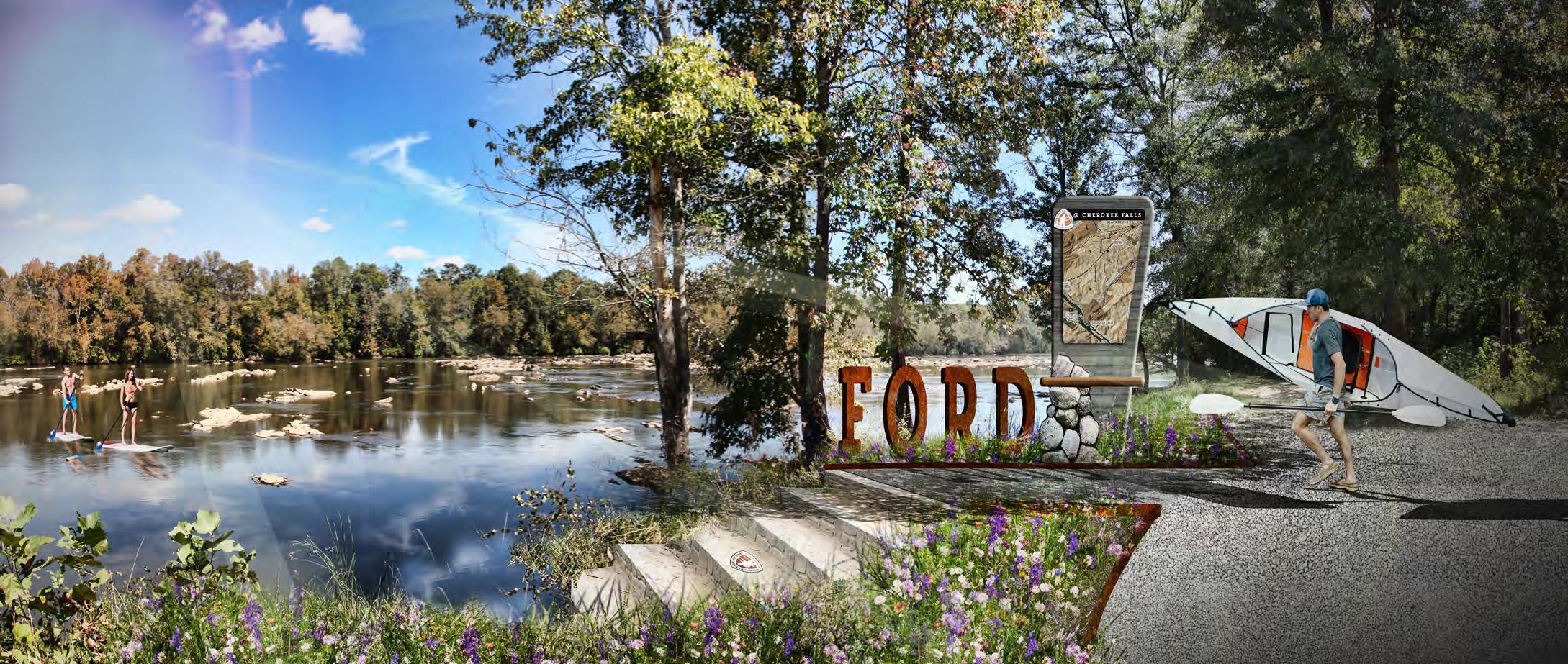
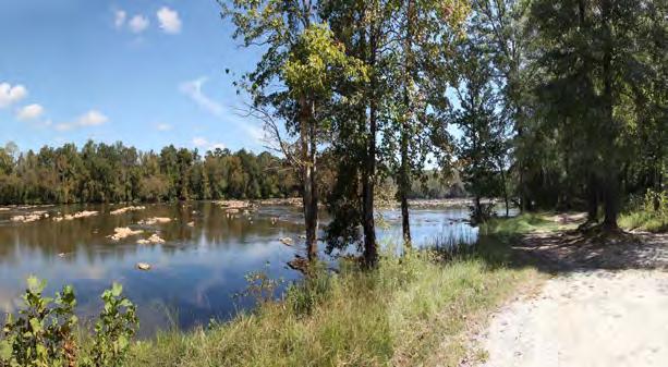
CHEROKEE FORD RECREATION DESTINATION
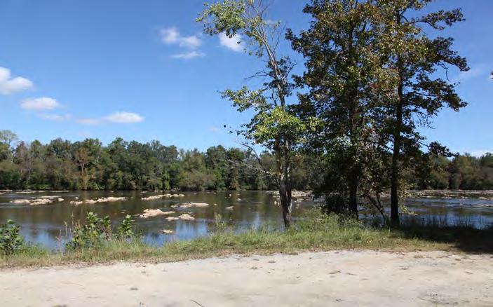
Cherokee Ford Recreation Area is located on the west bank of the Broad River near the location of the historic river crossing by the Overmountain Men. The 77 acre recreation area is managed by the Cherokee County Recreation District. Recreation amenities include baseball fields and facilities as well as public river access at the end of Wolf Den Lane. This area presents a significant opportunity to capitalize on the Broad River as a recreation asset and provide a unique trail destination.
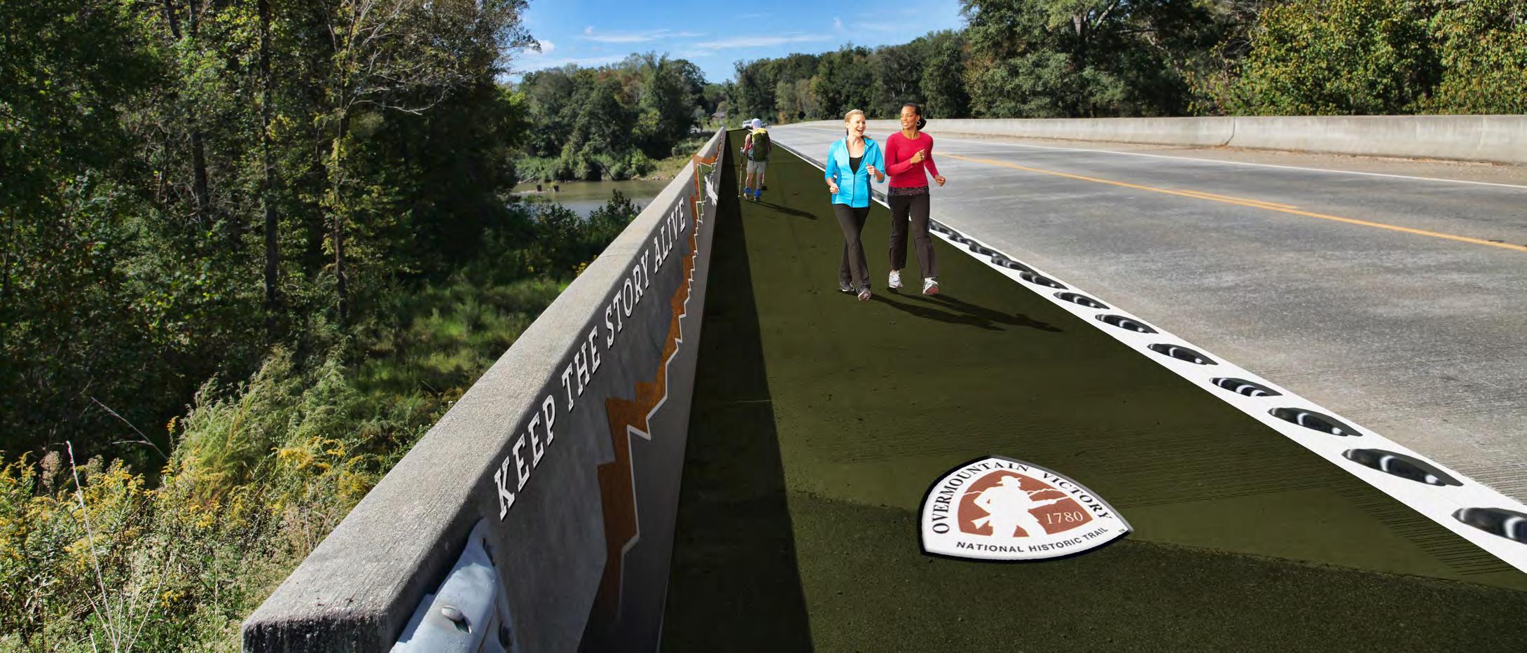
BRIDGING THE BROAD ON HIGHWAY 29
The James D. Batchler Bridge on Highway 29 is the preferred crossing of the Broad RIver. This bridge exhibits ample deck width with wide shoulder lanes that can be modified to accommodate the trail as a sidepath.
SECTION 5
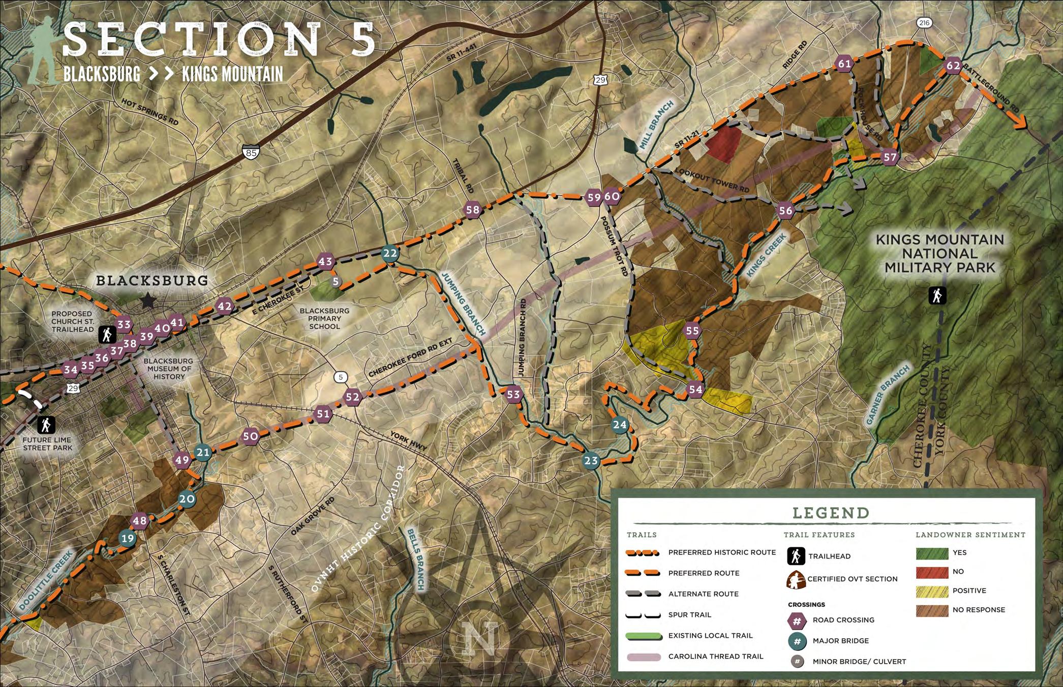
PROPOSED TRAILS
Preferred routes in this section extend east from Blacksburg to Kings Mountain National Military Park on Battleground Road.
After crossing Mountain Street in Blacksburg, the preferred route continues east as a sidepath along Highway 29 and utilizes the existing vehicular bridge over the rail line. Double-loaded sidewalks on the bridge could be retrofitted to provide a wider multi-use sidepath for cyclists and pedestrians along the north side of the bridge. After exiting the bridge, the trail transitions into a typical greenway and extends for 1.3 miles through sparsely developed land between the railroad and Highway 29.
The preferred route turns south across Highway 29 to connect to Blacksburg Primary school and then turns east toward Jumping Branch Creek. The trail follows the west side of Jumping Branch Creek south for three miles to its confluence with Kings Creek. The route crosses Kings Creek south of the confluence and extends east for a short distance before crossing to the north side of the creek to avoid steep topography. After the second crossing of Kings Creek, the trail follows the floodplain on the north side of the Creek for 5.5 miles to Battleground Road. Areas of steeper terrain within the Kings Creek corridor may require a wide trail corridor to allow the greenway to achieve a more gentle slope. The route crosses under Battleground Road along the creek and turns southeast to enter Kings Mountain National Military Park.
The preferred Kings Creek alignment is located south of the historic corridor, but provides an optimal user experience in a high quality natural setting that resembles the historic environment experienced by the Overmountain Men.
The preferred-historic route in this section departs from the proposed Carolina Thread Trail alignment and turns north at Jumping Branch Creek to Hwy 29. The route continues east as an SCDOT sidepath along Hwy. 29, SR 11-21, and Battleground Road. Although the sidepath does not provide an ideal user experience, it is a feasible option if easements along Jumping Branch and King's Creek cannot be achieved.
Several alternate routes extend south from SR 11-21 to the preferred route along Kings Creek. These alternate routes follow other creek corridors or local roads and provide options for connecting to Kings Mountain.
TRAIL FEATURES
This planning section includes one (1) trailhead; one (1) minor bridge or culvert; three (3) major bridges; and thirteen (13) road crossings.
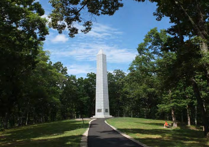
PHOTO: (05) The route utilizes Church St. from downtown Blacksburg. (06) The trail crosses York Rd. near the Hwy. 29 intersection. (07) Commemorative monument located along the Battlefield Trail at Kings Mountain National Military Park, the culminating battle site of the Overmountain March.
TRAILHEADS
Kings Mountain National Military Park is the eastern terminus and trailhead for this study area. The park features two miles of certified OVNHT on the Battleground Trail. The Battleground trail can be accessed from the Visitor Center facility and parking area located on Battleground Road. Kings Mountain features several interpretive exhibits within the Visitor Center and along the Battlefield Trail that highlight the history and significance of the Overmountain Victory.
CROSSINGS
The preferred route in this section will require two major bridges across Kings Creek (#23 and #24). Steep terrain on the south side of Kings Creek forces the trail to cross to the north side at major bridge #24. The preferred historic route only requires one bridge (#22) over Jumping Branch Creek near Highway 29. A minor culvert or bridge (#5) will be necessary to cross a low-lying drainage area to connect to Blacksburg Primary School.
The first of thirteen (13) road crossings in this planning section is a surface crossing at Mountain Street (#41). Crossing #42 is a major crossing of Highway 5 (York Road) at the Highway 29 (Cherokee Street) intersection. This crossing will require an upgrade to a signalized crosswalk to ensure safety for trail users. Crossing #43 is a major crossing of Highway 29 to connect to the Blacksburg Primary School. Multiple surface crossings (#53, #54, #55, #56, #57) of rural roads will be necessary as the trail follows Jumping Branch Creek and Kings Creek. The preferred historic route will also cross several rural roads as it extends toward Kings Mountain (#58, #59, #60, #61). Crossing #62 is a trail underpass of Battleground Road. Initial visual inspection revealed adequate vertical and horizontal clearance for the preferred route along Kings Creek to pass beneath the vehicular bridge before turning east along Battleground Road.
DOWNTOWN BLACKSBURG MASTER PLAN
Blacksburg's recently-completed streetscape master plan provides recommendations for incorporating the OVNHT into the downtown and improving the pedestrian realm to draw hikers and cyclists from the trail into the town..
BLACKSBURG: IRON CITY & TRAIL TOWN
EXISTING
The OVNHT is at the heart of Blacksburg's Town Center revitalization. Blacksburg is the last trail town that hikers and cyclists encounter before reaching their destination at Kings Mountain. With construction of the trail, the town is positioned to capitalize on its close proximity to major recreation assets.
CHAPTER 5 IMPLEMENTATION
CONSTRUCTION OF THE OVNHT FROM Chesnee TO KINGS MOUNTAIN WILL BE NO SMALL TASK. BUT WITH TIME, PERSEVERANCE, AND A LITTLE LUCK, THERE IS NO DOUBT THAT A DESTINATION-QUALITY TRAIL IS WITHIN GRASP.
This chapter aims to summarize details regarding each Planning Section and establish responsibilities and priorities for trail implementation.
IN THIS CHAPTER
A. Implementation by Section and Responsibilities
B. Priority Implementation Areas and Responsibilities
C. Trail Responsibility Nodes Map
D. Trail Support Spectrum
IMPLEMENTATION
IMPLEMENTATION PRIORITIES BY PLANNING
SECTION
The table below provides fundamental implementation information associated with each planning section. Key Challenges include a summary of the most difficult barriers for realizing each trail section. Many of these barriers include costly features or note the need to acquire trail easements from private landowners. Most importantly, this table identifies Implementing Agencies for each planning section.
The Cherokee County OVNHT Committee, Carolina Thread Trail, and each local government entity must work in tandem to successfully realize the complete OVNHT. Trail implementation does not have to occur in a specific, linear order according to each planning section. In fact, the priority areas for implementation are merely suggestions and are in no way intended to limit creativity or work in "lower" priority areas. Trail implementation is an art and requires the acumen to recognize and seize opportunities, whether related to funding, landowner willingness, or politics.
The table below supports an implementation strategy that prioritizes trail development in locations that are already controlled and managed by a public agency or local government. The priorities listed in the table represent locations where trail development and improvements to public space are most feasible and can stand alone until connectivity is achieved over time. Furthermore, the Implementation Focus Areas Map (next page) illustrates recommended trail development focus areas within the broader context of the study corridor.
Implementing Agency
Town of C hesnee
Cherokee C ounty
Carolina Thread T rail & Ga ffney Board of P ublic Works
City of Gaffney
Town of B lacksburg
Priority One
Section 1 : Expand existing sidewalk to multi-use path on N. side of Cherokee St.
3 : Improvements to Cherokee Ford Recreation Area
Section 2 : Lake Whelchel Loop
Section 3 : Connect Railroad Ave. Park to Mary Bramlett Elem. via former rail corridor
Section 5 : Incorporate OVNHT into the streetscape by implementing Downtown Blacksburg Master Plan
Priority Two
Section 1 : OVNHT signage and branding in CADA Park
2 : Furnace Mill Dam restoration and park improvements
Section 3 : Peoples Creek Trail
Section 3 : Enhance N. Limestone St. pedestrian realm and connection between City Hall, Gaffney Cabin, and future SCAR Discovery Center
Section 4 : Convert portion of Church Street ROW into OVNHT
Section
Section
EXHIBIT 16: AGENCY IMPLEMENTATION MATRIX
IMPLEMENTATION FOCUS AREAS
The implementation strategy promotes concentrating trail development efforts within four Focus Areas: 1) Chesnee to Cowpens; 2) Lake Whelchel; 3) Gaffney to Cherokee Ford and; 4) Downtown Blacksburg.
Within these Focus Areas, trail development is prioritized in locations that are already controlled and managed by a public agency or local government.
Hickory
TRAIL SUPPORT SPECTRUM
funds, but instead must leverage their funds to obtain support from grant agencies sympathetic to the creation of trails and the OVNHT. This particular section of the OVNHT enjoys support from many partners. Working together, local trail organizations and governments can have a far greater influence in convincing funding agencies of the merits of the trail, than when acting alone.
The “Trail Support Spectrum” illustrates the steps local governments can take to support trail development in their jurisdictions.
Creating a destination-quality trail system requires a significant commitment from local governments, including staff 1 2 3
A trail master planning effort is underway to help create a section of the Overmountain Victory National Historic Trail (OVNHT) to connect from Chesnee to Kings Mountain National Military Park!
Thanks to support from the National Park Service, regional community organizations, and local governments, this plan will help establish a walking and leisure biking trail that connects the region and celebrates the trail marched by the Overmountain Men who won a major Revolutionary War battle at Kings Mountain in 1780.
The trail planning process requires an analysis of the historic trail corridor between Chesnee and Kings Mountain. The trail is best suited in floodplain areas along creeks and rivers where development generally cannot occur and where there are meaningful connections to existing parks, civic buildings, and neighborhoods.
After identifying feasible trail route options, there will be a major landowner outreach effort. Without the voluntary commitment from landowners, the trail will either be relocated or not constructed.
An educational video has been developed to help communicate the historical significance of the OVNHT, which is available online.
1 Direction Setting and Project Launch | February 2017
The consultant team met with local trail and government leaders to generally discuss environmental constraints and opportunities for trail connectivity.
2 Research | March – June 2017
The consultant team conducted a thorough environmental assessment of the study area and determine feasible trail route options. With the trail routes identified, a landowner contact list was developed.
3 Landowner Outreach | July – August 2017
Landowners with property along an identified feasible trail route are invited to a special meeting to learn more about the trail project. After receiving comments from landowners, the preliminary trail routes will be updated.
4 Plan Development | August – October 2017
The consultant team will document the trail analysis and landowner comments. Recommendations will highlight alternative routes and the project’s overall feasibility for completion. A draft plan will be made available for public comment.
5 Final Plan Preparation | November 2017 – March 2018
The consultant team will publish a final plan that incorporates all public comments.
You’re invited to a landowner workshop for the Overmountain Victory National Historic Trail
The Cherokee County Chapter of the Overmountain Victory Trail Association has partnered with the National Park Service and local government leaders to explore the opportunity to create a public walking and biking trail that will connect Chesnee, Cowpens National Battlefield, Gaffney, Blacksburg, and Kings Mountain National Military Park.
The trail will celebrate the march of the Overmountain Men who won a major Revolutionary War battle in 1780 at Kings Mountain. This patriot victory is considered a turning point in the war that resulted in American independence. The trail would help preserve this history.
The project planning team has been working to identify areas where the trail would be feasible. A broad corridor, as shown on the enclosed map, was evaluated for potential routes. After months of analysis, your property has been identified as being located within or near a wide corridor where the trail could potentially be constructed. Without the voluntary willingness of landowners, the planned trail route will either be relocated or not constructed.
Please visit the project website, www.OVTplan.com, to learn more and view the project video.
You are invited to discuss this project with representatives from the National Park Service and trail planners during one of two special landowner-only meetings:
August 7th at 6pm Blacksburg Museum of History
100 N Shelby Street in Blacksburg
August 10th at 6pm
Gaffney Council Chambers at City Hall
201 N Limestone Street, in Gaffney. Council Chambers are on the first floor.
If you plan to attend the meeting, please RSVP online at www.OVTplan.com or via email or phone using the contact information below. If you cannot attend and would like to discuss the project, please contact the Consultant Project Manager listed below.
CONSULTANT CONTACT: Eric Woolridge, AICP, Destination by Design | eric@dbdplanning.com | 828.386.1866 | www.DbDplanning.com
(A4) LANDOWNER INTEREST SURVEY
Note: The completed Landowner Interest Surveys were provided to local government leaders.