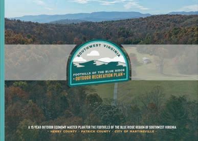
A 15-Year Outdoor Economy Master Plan for the Foothills of the Blue
Ridge Region of Southwest Virginia • Henry County • Patrick County • City of Martinsville •

A 15-Year Outdoor Economy Master Plan for the Foothills of the Blue
Roger Adams - ParksandRecreation,HenryCounty
Kim Davis - ExecutiveDirector,FriendsofSouthwestVirginia
Kristie Eberly - ExecutiveDirector,WestPiedmontPlanningDistrictCommission
Amanda Gray - TourismandMarketingSpecialist,WestPiedmontPlanning District Commission
Tiffany Haworth - Executive Director, Dan River Basin Association
Sarah Hodges - DirectorofTourismandTalentDevelopment,VisitMartinsville
James Houchins - DirectorofEconomicDevelopment,PatrickCounty
Jen Otey - OutdoorRecreationDevelopmentManager,FriendsofSouthwest Virginia
Hannah Powell - ArchitecturalReviewBoard,CityofMartinsville
Kelly Rowland - Assistant Director of Tourism, Visit Martinsville
Catherine Van Noy - Owner, Mill Creek Creative
Brian Williams - VirginiaProgramManager,DanRiverBasinAssociation
Roger Adams - DirectorofParksandRecreation,HenryCounty
Amanda Gray - TourismandMarketingSpecialist,WestPiedmontPlanning District
Natalie Hodge - Author/Producer
James Houchins - DirectorofEconomicDevelopment,PatrickCounty
Jen Otey - OutdoorRecreationDevelopmentManager,FriendsofSouthwest Virginia

The Foothills of the Blue Ridge Outdoor Recreation Plan provides strategic direction for expanding outdoor recreation initiatives within the West Piedmont Planning District Commission Region. It focuses on investing in regional outdoor recreation infrastructure and downtown revitalization to enhance connectivity and economic growth across Henry and Patrick Counties and the independent City of Martinsville. This chapter outlines the plan’s purpose, goals, planning process, and overall organization.
IN THIS CHAPTER:
1.1 Project Background
1.2 Project Goals
1.3 Planning Process
1.4 Plan Organization
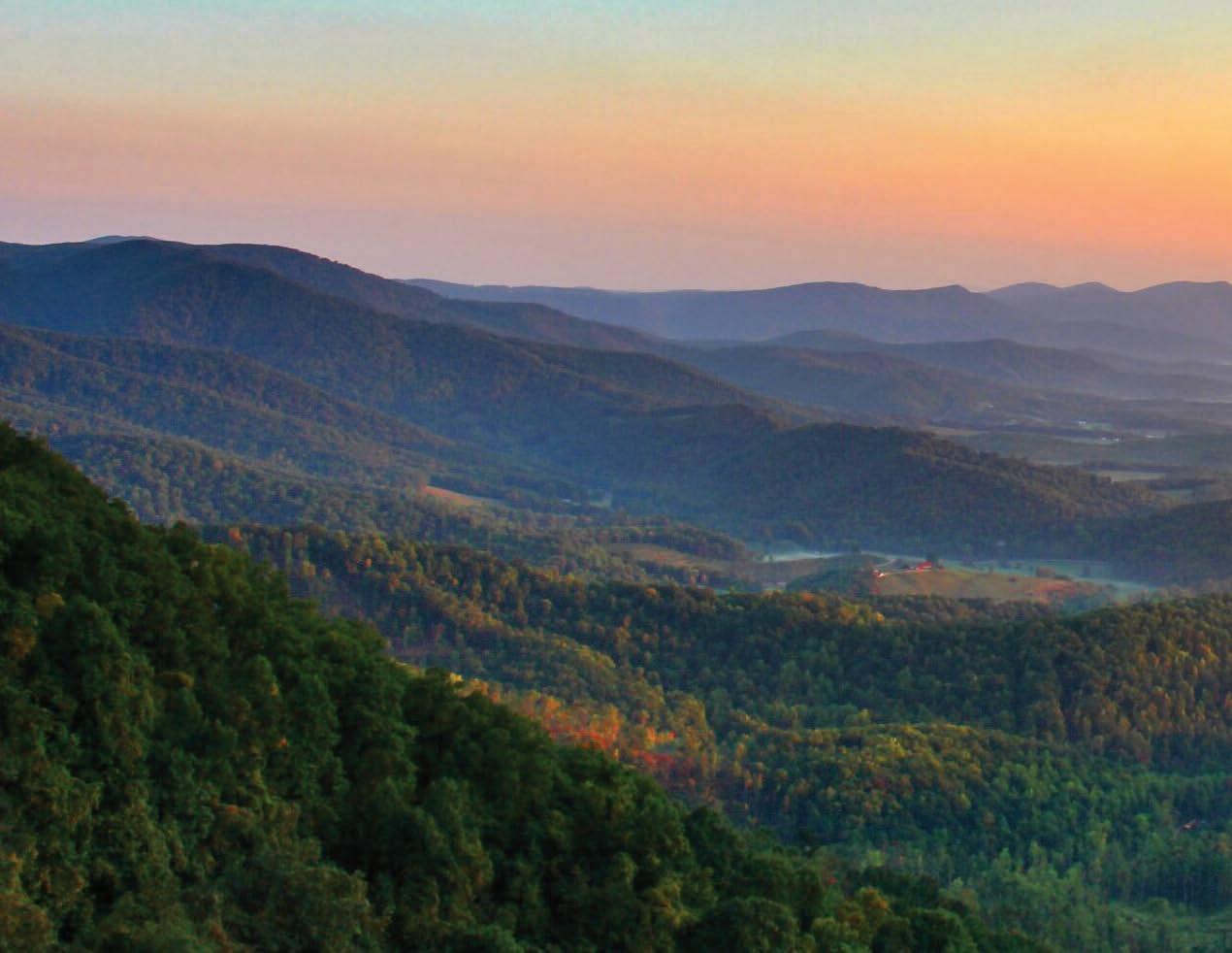
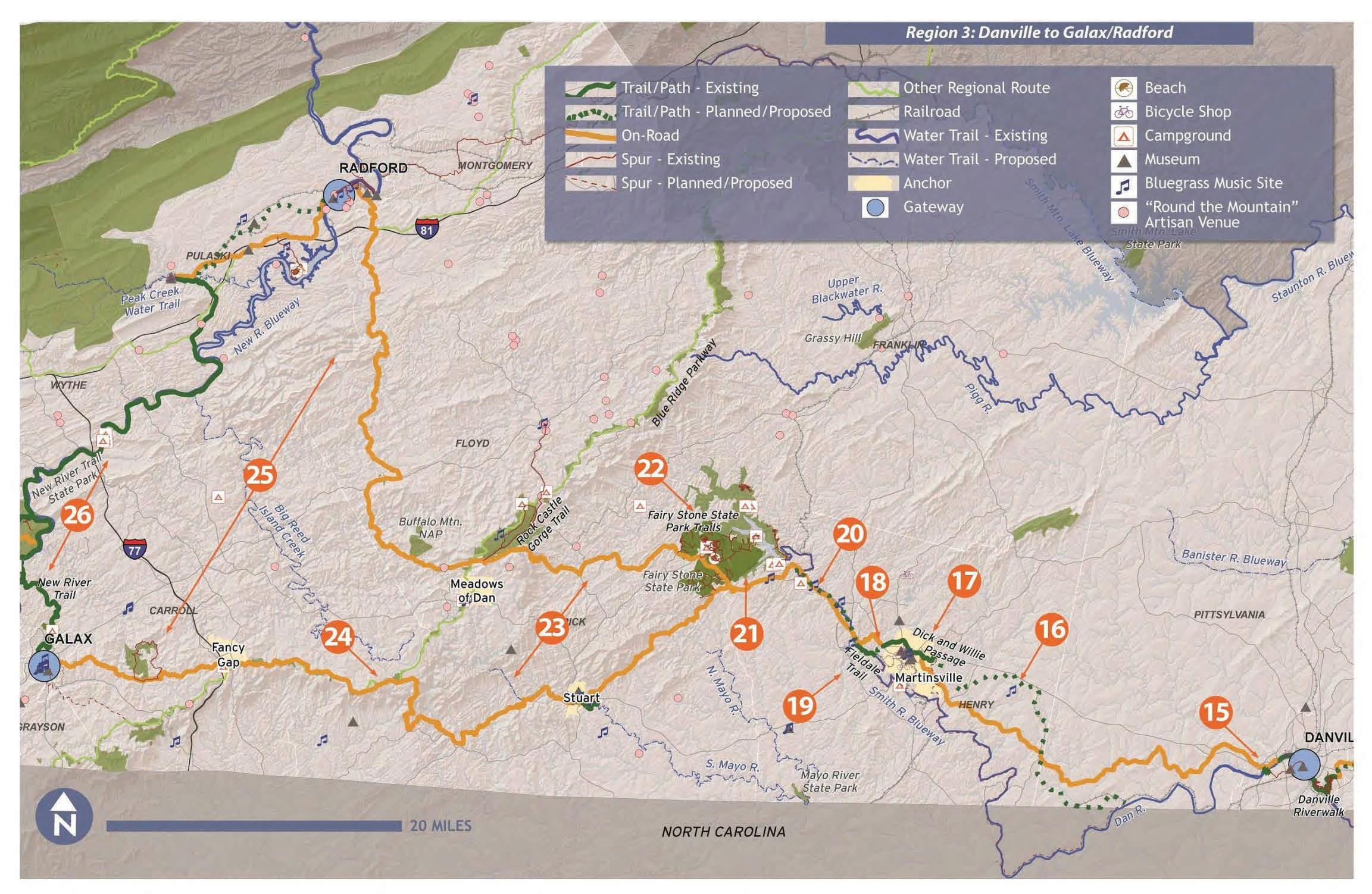
Located in Southwest Virginia at the base of the Blue Ridge Mountains and along the North Carolina border, the Foothills of the Blue Ridge Region serves as a southern gateway into Virginia. The region encompasses Henry and Patrick Counties and the City of Martinsville, and is part of the West Piedmont Planning District Commission (WPPDC).
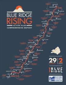
The Blue Ridge Parkway forms the region's western boundary, traveling 40 miles along Patrick County's border, and provides access to National Park Service recreation areas, overlooks, historic assets, and trails (See Exhibit 01: Blue Ridge Rising, page right). With access to the Dan, Mayo, and Smith Rivers; Fairy Stone State Park; Philpott Lake and Marina; the Mayo River Rail Trail; and the Smith River Trail System—including the Dick & Willie Passage Trail—the area is rich in natural resources and offers abundant opportunities for outdoor recreation.
Led by Friends of Southwest Virginia and funded by grants from the Appalachian Regional Commission and the Virginia Tobacco Region Revitalization Commission,
the Foothills of the Blue Ridge Outdoor Recreation Plan is the result of dedication and collaboration that builds upon previous planning efforts.
As a partner of Friends of Southwest Virginia, the Dan River Basin Association (DRBA) has facilitated numerous planning efforts that seek to identify opportunities and build capacity for outdoor recreation and economic development projects. These plans, like the Martinsville-Henry County Rivers and Trails Recreational Use Plan (2008), laid the foundation for greenways, blueways, and land conservation within the WPPDC region.
Building on the success of these initiatives, the region is well-positioned to advance its outdoor recreation economy and drive continued economic development.
In addition to expanding outdoor recreation, community leaders are dedicated to revitalizing the historic downtowns in the region while preserving their unique charm, cultural heritage, and character. Within the Foothills of the Blue Ridge Region, the City of Martinsville is an active participant in
Virginia Main Street (VMS) and holds the designation of an Advancing Virginia Main Street (AVMS) community. The Towns of Stuart and Bassett, along with the Village of Fieldale, also show strong potential to serve as outdoor recreation hubs, due to their existing downtown infrastructure and close proximity to key outdoor assets.
Developed over ten months through intensive collaboration, the Foothills of the Blue Ridge Outdoor Recreation Plan reflects a shared vision among local leaders and community stakeholders. This 15-year roadmap is designed to further grow the outdoor economy by leveraging existing infrastructure, public lands, and funding opportunities to advance projects that position the region as a premier local and regional outdoor recreation and tourism destination.

Blue Ridge Rising is an initiative of the Blue Ridge Parkway Foundation, the nonprofit fundraising partner for the Blue Ridge Parkway (Parkway), to strengthen cross-jurisdictional relationships, foster economic development within the region’s gateway communities, and establish a unified regional voice.
The Blue Ridge Rising Action Plan presents a comprehensive regional strategic plan to advance travel, tourism, outdoor recreation, and related economic development in the 29 counties and gateway communities along the Parkway. The plan identifies specific realistic and effective strategies for action organized by six key themes. Each theme provides detailed lists of strategies, goals, and key steps for each initiative.
Patrick County is an active partner in the Blue Ridge Rising initiative that will help establish a collective regional vision that celebrates the shared culture, protects the unique natural resources, and strengthens the regional economy.

Inventory and assess the existing outdoor recreation assets in the study area, evaluating their current condition and capacity to offer a high-quality outdoor experience for all users.
Identify projects that also help achieve broader community goals, such as young adult and workforce retention, small business growth, environmental quality, and active living.
Collaborate with government entities, community leaders, and the public to identify ongoing and planned projects aimed at enhancing the quality of life for both residents and visitors.
Develop a 15-year action plan that captures community interest and inspires a shared vision by incorporating compelling renderings, site master plans, 3D illustrations, and other visual elements to clearly convey recommendations and ideas.

Identify new, compelling tourism infrastructure projects to promote the outdoor economy, enhance the quality of life, and drive private investment.

Provide the steering committee and their partners with clear strategies and a prioritization schedule for implementing the plan recommendations.
The Foothills of the Blue Ridge Outdoor Recreation Plan represents the culmination of ten months of analysis, planning, graphic development, and numerous meetings and site visits. The planning process involved five (5) major phases, including:
1. Direction Setting & Project Launch
2. Research & Analysis
3. Community Engagement
4. Vision & Plan Framework
5. Final Plan Development
September - November 2024
Created a unique plan identity and promotional video for the Foothills of the Blue Ridge Outdoor Recreation Plan that built excitement with government leaders, community partners, and the public. Hosted a project website that informed about project goals, opportunities for engagement, and progress. Facilitated a Direction Setting meeting with the Project Committee.
September - November 2024
Conducted site visits, field analysis, and demographic research to develop an inventory of existing assets and understand key opportunities and constraints. Reviewed previous planning efforts that may have implications for the Foothills of the Blue Ridge Outdoor Recreation Plan.
October 2024 - January 2025
Conducted a series of interviews and focus groups with government officials, business leaders, and community members to discuss the following themes: arts and culture, economic development, outdoor recreation, and opportunities for children and families. Collected input from citizens about desired priorities via an online survey.
December 2024 - May 2025
Created the plan framework that featured preliminary recommendations for improving and expanding outdoor recreation assets. Hosted a public meeting to share recommendations with community members for feedback.
April - June 2025
Developed an outdoor recreation plan that included the recommendations determined during the planning process, prioritization, and an outline for grant funding sources.
The Foothills of the Blue Ridge Outdoor Recreation Plan is organized into five (5) chapters as outlined below.
1. Background & Purpose
2. Discovery & Analysis
3. Public Engagement & Emerging Themes
4. Plan Recommendations
5. Plan Implementation
The current chapter, which outlines the plan’s purpose, goals, process, and organization.
A snapshot of the regional setting and outdoor recreation economy, demographic trends, previous planning efforts, and an analysis of tourism market potential are presented here. The chapter also includes an inventory and analysis of the current assets within the Foothills of the Blue Ridge Region.
This chapter discusses tools used for public engagement, highlights stakeholders and organizations involved in the planning process, and presents key results from an online community survey. The chapter culminates with the emerging themes that guide plan recommendations.
This chapter is organized according to five (5) Focus Areas as identified during the planning process: 1) Blueways and Lakes, 2) Trail Systems and Greenways, 3) Public Lands, 4) City of Martinsville, and 5) Community Hubs. Each Focus Area contains specific project areas. This chapter is supported by extensive custom illustrations and design schematics.
This chapter provides a comprehensive matrix of all infrastructure recommendations, prioritization, implementation strategies, and an outline of grant funding sources.
This chapter explores the regional context, outdoor recreation economy trends, key demographics, and relevant past planning efforts within the Foothills of the Blue Ridge Region. It also includes an analysis of tourism market potential and provides a high-level overview of the region’s recreational, natural, cultural, and outdoor economic assets.
This chapter is organized into the following sections.
IN THIS CHAPTER:
2.1 Regional Context
2.2 Outdoor Recreation Economy
2.3 Regional Demographics
2.4 Previous Planning Efforts
2.5 Key Assets
2.6 Tourism Market Potential
This section examines the Foothills of the Blue Ridge Region in relation to its local geography, primary transportation corridors, natural resources, and managed lands.
The Foothills of the Blue Ridge Region, located in Southwest Virginia, includes Henry and Patrick Counties and the independent City of Martinsville, covering a combined area of 870 square miles. Elevations range from approximately 600 feet near the Smith River in Henry County to 3,211 feet on Bull Mountain in Patrick County. The region includes two of Virginia’s five physical geographies: the Blue Ridge Mountains and the Piedmont. The Piedmont, Virginia’s largest region, is characterized by rolling hills and gently transitions into the rugged topography of the Blue Ridge Mountains, which extends from southern Pennsylvania to the northern tip of Georgia.
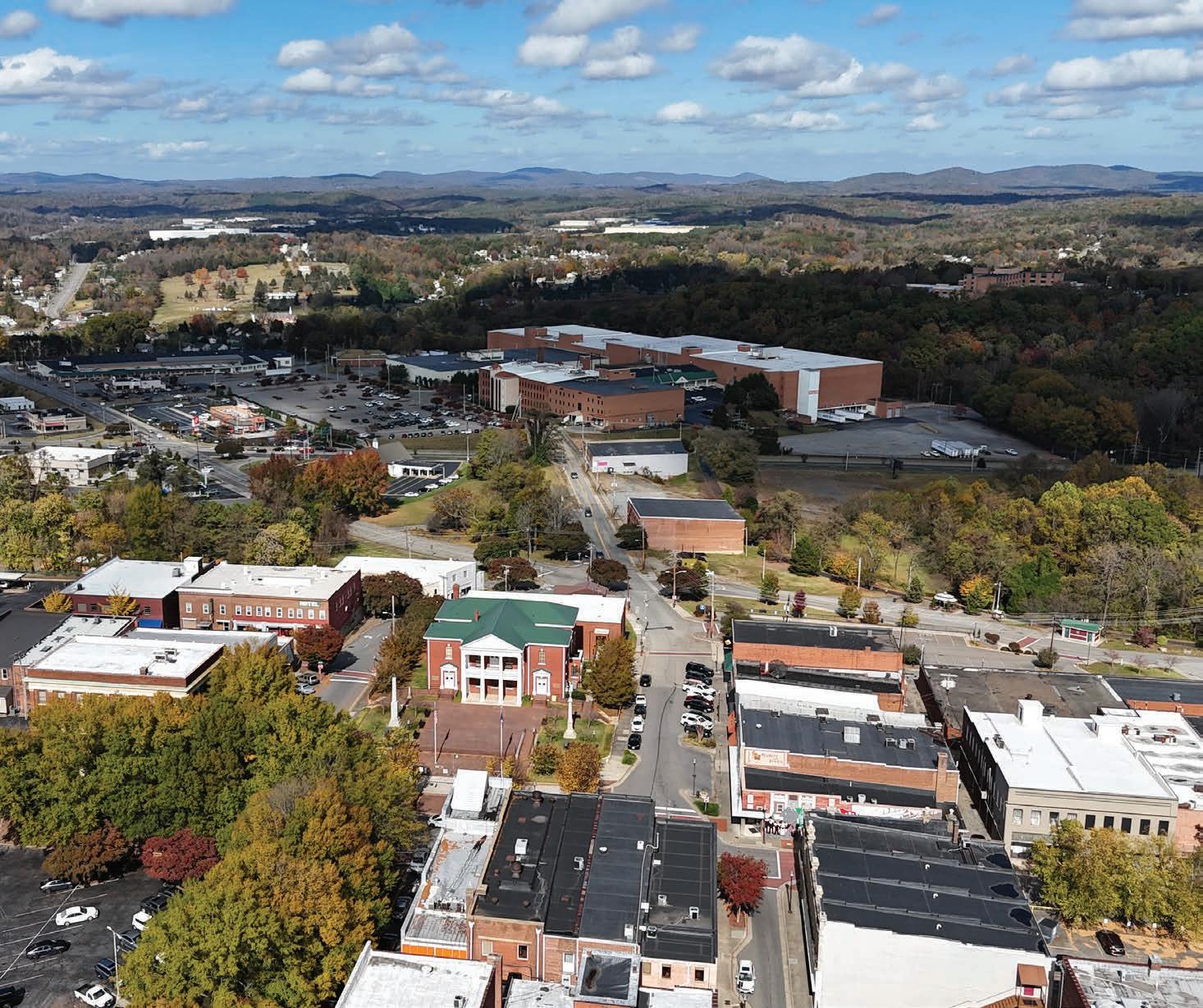
The region is bordered by Franklin and Floyd Counties to the north, Carroll County to the west, Pittsylvania County to the east, and the North Carolina counties of Rockingham, Stokes, and Surry to the south. It is within close proximity to major population centers, including the Piedmont Triad (Greensboro, Winston-Salem, and High Point) and the Research Triangle (Raleigh, Durham, and Chapel Hill) in North Carolina. Virginia cities such as Roanoke, Blacksburg, and Richmond are also within a three-hour drive, enhancing the region’s accessibility (See Map 01: Regional Context, pages 16-17).
Highway 58 cuts through the region, running southwest to east, serving as a major eastwest transportation corridor. It intersects with Highway 220, creating a vital northsouth connection. These routes extend north towards I-81 near Roanoke and south to I-40, connecting the Piedmont Triad cities and thus linking the region to broader transportation networks and facilitating regional accessibility. The Blue Ridge Parkway is also an anchoring transportation corridor for the region, as it travels throughout the western extent of the regional footprint along parkway mile markers 150 through 190.
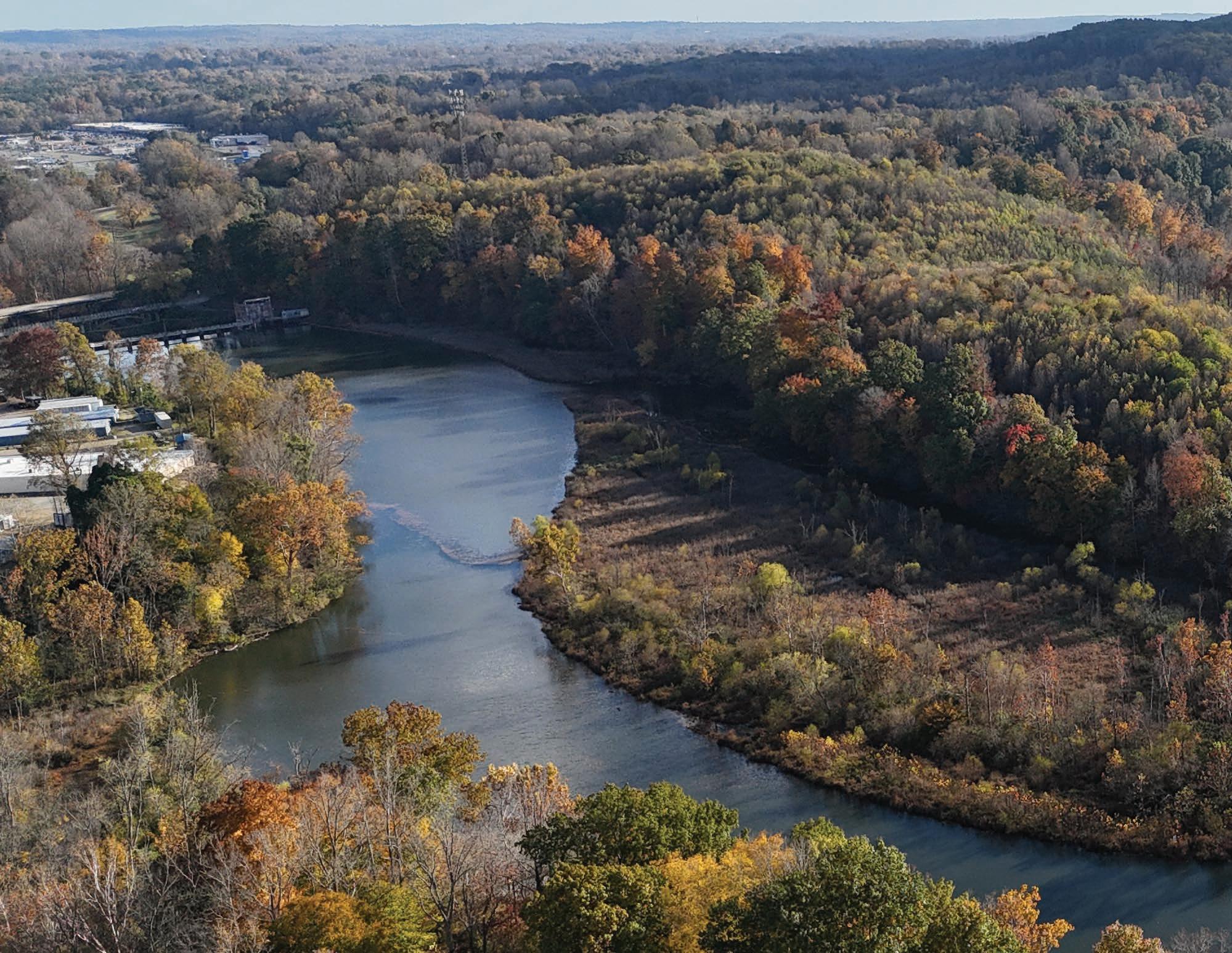
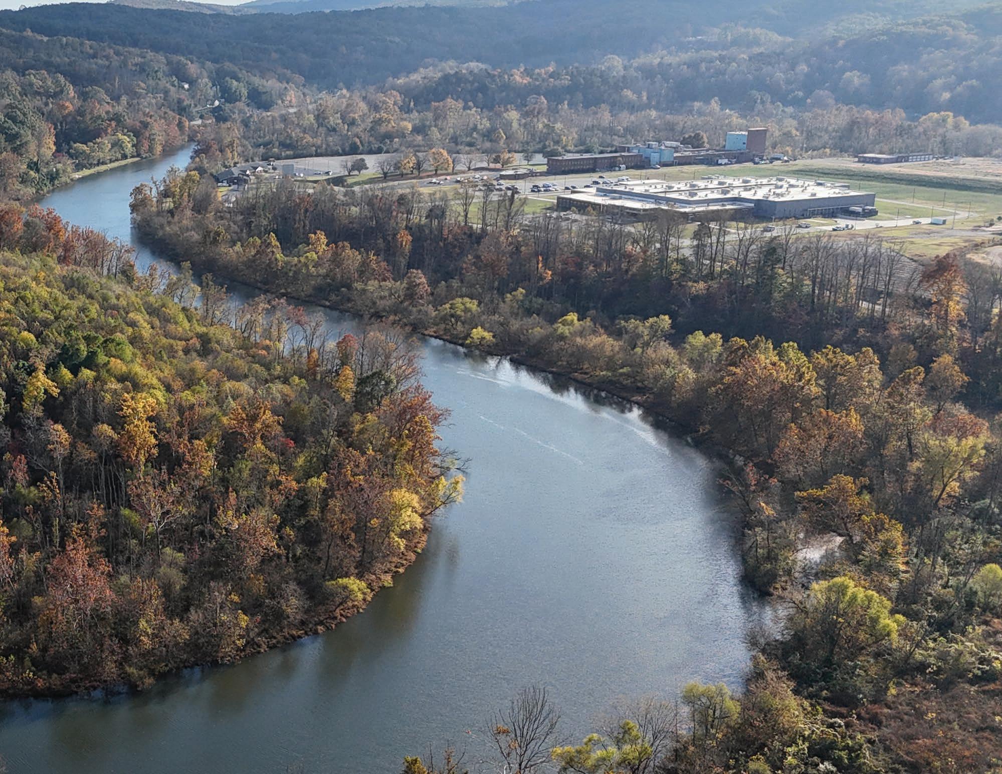
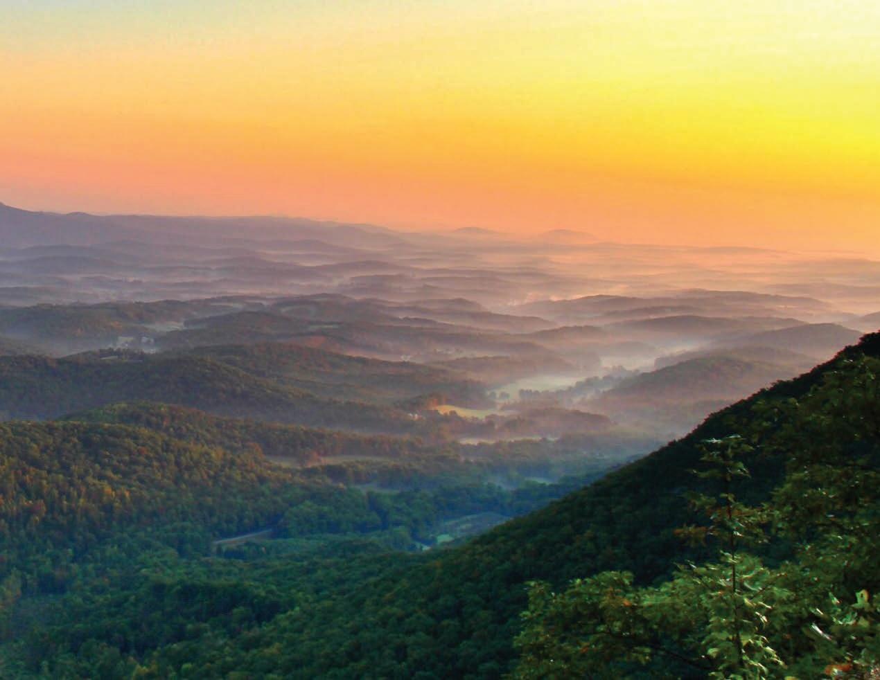
The Foothills of the Blue Ridge Region is characterized by abundant natural resources and an extensive network of rivers and creeks. The Smith, Mayo, and Dan Rivers— three key natural assets in the region— originate in Patrick County, Virginia, and converge downstream in North Carolina as part of the Dan River watershed. The region consists of small towns, forested landscapes, and agricultural areas, contributing to the area’s rural character and natural appeal. Development is concentrated primarily in the City of Martinsville and the community of Collinsville.
The Foothills of the Blue Ridge Region contains a significant amount of publicly conserved land managed by federal, state, and local agencies. The Blue Ridge Parkway forms the region’s western boundary. In the northern and eastern portions of the region, Philpott Lake, Fairy Stone State Park, and the Fairystone Farms and Turkeycock Wildlife Management Areas provide outdoor recreation opportunities and support regional conservation efforts. Additionally, local governments manage a network of parks, trails, and green spaces that support outdoor access across the region.


As the Foothills of the Blue Ridge Region transitions away from traditional industries like agriculture, textiles, and furniture manufacturing, community leaders are pursuing new avenues for economic growth. The Foothills of the Blue Ridge Outdoor Recreation Plan builds on national and state trends in the expanding outdoor economy, aiming to enhance the region’s natural assets and strengthen its recreation infrastructure. By positioning the region as a premier outdoor destination, the plan seeks to boost economic development by attracting more visitors, encouraging longer stays, and increasing spending at local businesses.
As reported by the Bureau of Economic Analysis, the outdoor recreation economy accounted for 2.2 percent ($563.7 billion) of current dollar gross domestic product (GDP) for the nation in 2022.
According to the Outdoor Foundation’s 2022 Outdoor Participation Trend Report, 164.2 million, or 54%, of Americans ages 6 and over participated in outdoor recreation at least once. Since March 2020, the number of new and returning outdoor participants has increased by 26%. The most popular outdoor activities are running, hiking, fishing, biking, and camping.
As reported by the Bureau of Economic Analysis, the outdoor recreation economy accounted for 1.9 percent ($13.4 billion) of current dollar gross domestic product
(GDP) for Virginia in 2023. Per the Outdoor Foundation’s 2022 Outdoor Participation Trend Report, Virginia is located in the South Atlantic region of the United States, which has the highest percentage of outdoor recreation participants in the nation.
Located in southwest Virginia along the North Carolina border, the Foothills of the Blue Ridge Region serves as a key gateway into the Commonwealth. Its strategic location— paired with convenient access to the Blue Ridge Parkway—positions the region to attract travelers exploring the area by car, both from within the state and beyond.
With 18,889 acres of managed land across the region, the towns in the Foothills of the Blue Ridge Region are well-positioned to serve as gateway communities to vast public lands
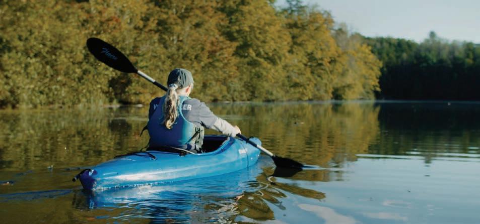
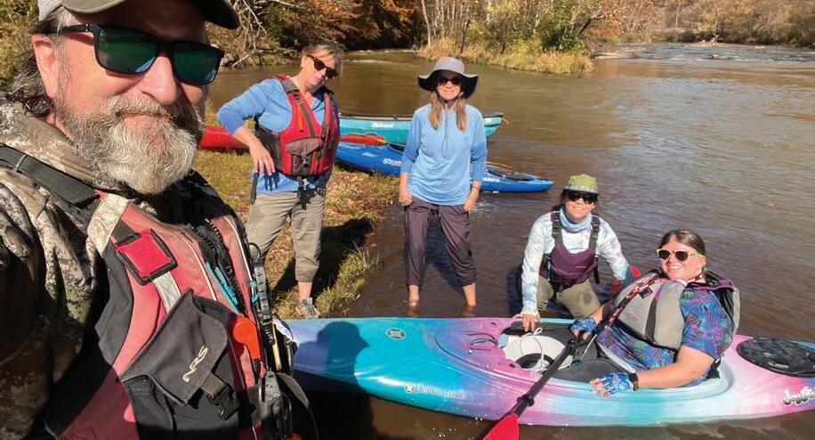
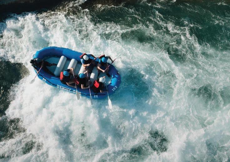
and diverse outdoor recreation opportunities. Visitors can enjoy activities such as hiking, mountain biking, fishing, bird-watching, and camping. Additionally, the region’s three scenic rivers offer prime opportunities for kayaking, canoeing, tubing, and fishing.
To estimate the potential economic impact of the outdoor economy in the Foothills of the Blue Ridge Region, an economic impact analysis was conducted using data from the 2020 Decennial Census, the American Community Survey, trail use studies, and a conservative projected market capture rate. The analysis assessed visitor impact within a 60-, 120-, and 180-minute driving radius and calculated potential visitor spending (See pages 20 and 21).
Visitors within a 60-minute drive of the Foothills of the Blue Ridge Region include those from Danville, Virginia as well as Mt. Airy and Reidsville, North Carolina. The 120-minute driving radius extends to Galax; Blacksburg; Roanoke; and Lynchburg, Virginia and Wilksboro; Winston-Salem; High Point; and Statesville, North Carolina. Within 180 minutes, the region attracts visitors from Abingdon and Charlottesville, Virginia; Beckley, West Virginia; as well as Raleigh and Charlotte, North Carolina.
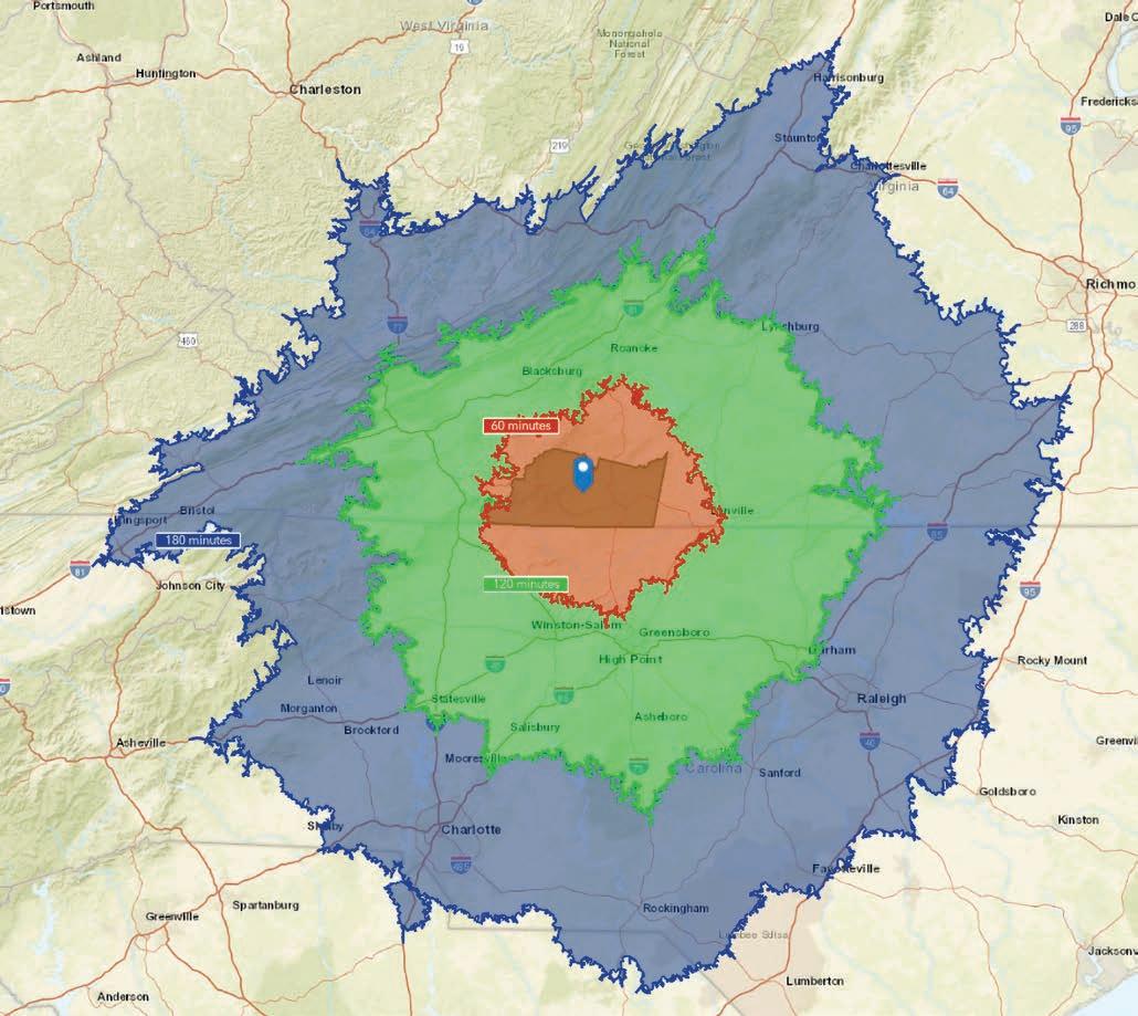
There is an approximate POPULATION of…
344,509 within a 60-minute driving radius
2,993,596 within a 120-minute driving radius
6,488,199 within a 180-minute driving radius
…of the Foothills of the Blue Ridge Region.
25% of that population could be considered potential visitors to the region* 86,127 - 1,622,049
*According to various trail use surveys and studies, 25% of adults used a trail in the past 12 months.
PROJECTED MARKET CAPTURE:
As a conservative estimate, the Foothills of the Blue Ridge Region could expect to capture 3-5% of this market and assume each visitor will spend $70* during their visit.
*According to Blue Ridge National Heritage Area Study (2013) and multiplied by 1.35 to adjust for inflation.
As a conservative estimate, we assume each visitor will spend $70.
CONSERVATIVE < ANNUAL ECONOMIC > IMPACT
This section explores population, income, and employment data for Henry and Patrick Counties and City of Martinsville residents as reported by the U.S. Census Bureau of Labor Statistics.
According to the 2021 American Community Survey (ACS) data from the U.S. Census Bureau, Virginia is home to 8,823,498 residents, with 80,271 residents from the Foothills of the Blue Ridge Region. The total number of households in the region is 35,383 and the average household size is 2.23 people per household. Of those households, approximately 16.5% have one or more household members with a disability. Within the region, 19% of households are below the poverty line, nearly double the state percentage of 10%.
The median age for the Foothills of the Blue Ridge Region is 48.2, compared to the median age of Virginia of 39.2 and the United States of 39. Within the region, 18.5% of the total population are under 18, 55.9% are between the ages of 18-64, and 25.7% are over 65.
Of the total population in the region, 69.1% are White, 22.1% are Black, 4.9% are two or more races, 3% are other/non-specified race, and less than 1% are American Indian or Asian. Within the region, 5.96% of the population is Hispanic or Latino.
The per capita income for the Foothills of the Blue Ridge Region is $29,330 – 41.6% percent lower than the state average of $50,240 and 27.3% lower than the national average of $40,363. The median annual household income is $44,377 – 50.6% lower than the state average of $89,834 and 35.7% lower than the national average of $69,021.
Within the region, 71.7% of households own their own home, while 28.3% rent. The median home value within the region is $128,340.
Fifty-six percent of the Foothills of the Blue Ridge Region population is considered working age, or between the ages of 18-
64. There are 2,672 total businesses in the region and 31,727 total employees.
Within the Foothills of the Blue Ridge Region, 16.9% hold a bachelor’s, graduate, or professional degree, 30.4% have some college or an associate’s degree, 37.5% hold a high school diploma, and 15.3% do not have a high school diploma.
Based on various economic criteria, the Appalachian Regional Commission (ARC) currently classifies Patrick County as a ‘transitional county’ and Henry County, which includes the City of Martinsville, as an ‘at-risk’ county. The ARC assigns the ‘transitional’ designation to counties transitioning between strong and weak economies, ranking between the worst 25 percent and the best 25 percent of the nation’s counties, and ‘at-risk’ designation to census tracts at risk of becoming economically distressed, ranking between the worst 10 percent and 25 percent of the nation’s counties.
This section provides a summary of previous plans produced for the Foothills of the Blue Ridge Region including regional plans, recreational master plans, trail and greenway plans, and economic development plans.
Blue Ridge Rising Action Plan (2024)
This regional strategic plan, led by the Blue Ridge Parkway Foundation, aims to advance travel, tourism, outdoor recreation, and related economic development in the 29 counties and gateway communities along the Blue Ridge Parkway in Virginia and North Carolina. In Patrick County, the plan identified opportunities to develop educational programming and resources that promote local artisans and musicians and encourage longer stays among visitors.

West Piedmont Planning District Commission
Comprehensive Economic Development Strategy 2022-2026 Plan (2022)
This Comprehensive Economic Development Strategy (CEDS) is a unified, regionally focused action plan that provides a framework for the area’s economic growth and community development. Focus areas for projects both regionally and by county include economy and innovation, workforce and education, housing, livability, and equity, and infrastructure.
Patrick County Comprehensive Plan (2021)
This updated plan serves as a guide to the decisions of the county government for managing resources and development in Patrick County, Virginia. This plan aims to capitalize on Patrick County’s abundant natural resources in an environmentally, socially, and economically sustainable way. In regard to outdoor recreation, the comprehensive plan recommends establishment of a recreation center, development of Mayo River State Park and Rotary Field, and extension of the Mayo River Rail Trail.
Dan River Basin Master Plan (2020)
This master plan aims to create economic development via tourism while preserving corridors for nature and nature exploration. The overall goal of this plan is to recommend a corridor that connects two state trails, Beaches to Bluegrass in Virginia and Mountains to Sea in North Carolina, through the Dan River Basin’s Region of Rockingham County, NC. The optimal route would connect the NC and VA sections of the Mayo River State Parks.
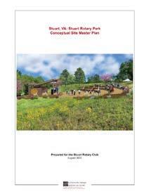
Stuart, VA: Stuart Rotary Park Conceptual Site Master Plan (2020)
This plan, led by The Community Design Assistance Center (CDAC) at Virginia Tech, serves as a long range development strategy for the 75 acre property owned and run by the Stuart Rotary Club. Currently, the property is used for recreation, fairs, meetings, music events, demolition derbies, and fundraising events. Major design elements of the site master plan include an amphitheater, concession stand near the existing demolition derby and recreational fields, tent camping, wooded walking trails, an extension of the Mayo River Rail Trail, dog park, and vehicle entrance improvements from Woodland Drive.
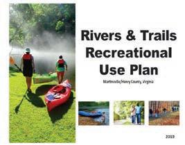
Rivers & Trails Recreational Use Plan, Martinsville/ Henry County, VA (2019)
Prepared by the Dan River Basin Association (DRBA), this master plan aims to provide physical, educational, and social facilities in the form of trails and river access points as places for communities to recreate as well as create economic development via tourism while preserving corridors for nature and exploration. The plan proposes several new trails, river access points, and additional outdoor recreational enhancements in Martinsville and Henry County.
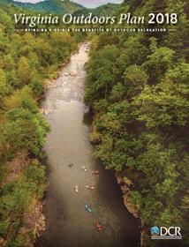
Virginia Outdoors Plan (2018)
This plan serves as Virginia’s plan for outdoor recreation and land conservation with a vision to connect people with outdoor recreation opportunities and natural and scenic resources. Analysis and recommendations are categorized by 23 Regions. For the West Piedmont region, which encompasses Franklin, Patrick, and Pittsylvania counties, the cities of Danville and Martinsville, and the Town of Rocky Mount, projects focus on expansion and connection of trails.
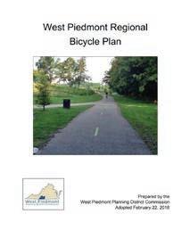
West Piedmont Regional Bicycle Plan (2018)
This plan, an update of the original bicycle plan (2005), promotes safe bicycle infrastructure in the West Piedmont Planning District (WPPD) of Virginia. Bicycle routes were developed to enhance connectivity throughout the region, contribute to local and regional economic development and tourism initiatives, and ultimately create a better quality of life for residents and visitors. Specific proposed routes for the City of Martinsville, Patrick County, and Henry County are included in this plan.
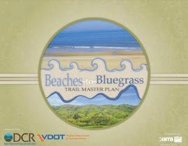
Beaches to Bluegrass Trail Master Plan (2014)
This plan, prepared by Alta, shares the vision of a statewide shareduse path and multi-use trail that connects communities between the Virginia Beach Oceanfront and Cumberland Gap, providing residents and visitors in southern Virginia with increased opportunities for walking, bicycling, and horseback riding. The plan recommends an ideal off-road alignment, considered a long-term goal, as well as an interim on-road route that is intended for both transportation and recreation by non-motorized users.
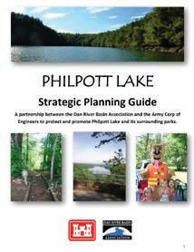
Philpott Lake Strategic Planning Guide (2013)
The Philpott Lake Strategic Planning Guide is a partnership between Dan River Basin Association (DRBA) and the US Army Corp of Engineers to enhance, protect, and promote Philpott Lake and its surrounding parks. The guide provides opportunities for outdoor recreation at Philpott Lake as well as proposed projects that improve infrastructure for trails, marina, accessibility, and signage.
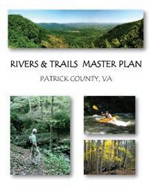
& Trails Master Plan, Patrick County, VA (2013)
This plan, prepared by the Dan River Basin Association (DRBA), intends to inspire action that furthers the smart use and preservation of Patrick County’s natural and cultural resources and encourages a communitywide movement toward healthier lifestyles. Proposed initiatives concentrate on the Patrick County Trail System, river access developments, accessibility improvements, and signage and branding. Additionally, this plan prioritizes land conservation, riparian buffer protection, water quality monitoring, historical preservation, and heritage tourism.
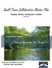
Towns Collaborative Master Plan (2013)
Prepared by the Dan River Basin Association (DRBA), this plan serves as a partnership effort between community organizations in Henry County, Virginia to advance the communities of Philpott, Bassett, Stanleytown, and Fieldale and promote amenities and visions of each community and work toward the common goal of creating a destination for visitors and an inviting environment for residents, families, and small business owners. Proposed projects include the creation of the Smith River Trail, enhancement of amenities and accessibility, and establishment of an outdoor adventure center.
Martinsville-Henry County Rivers & Trails Recreational Use Plan (2008)
This plan, prepared by the Dan River Basin Association (DRBA), addresses the need to provide better access to the natural resources of Martinsville and Henry County and therefore suggests a system of trails, river access points, and riverside parks. The Martinsville-Henry County trail systems include plans for countywide rivers and trails, including bike lanes and connection with the existing Uptown Spur Trail, the Smith River trail system, and the Smith River Blueway. Additionally, there is special attention for recreational development to the Smith, North Mayo, and South Mayo Rivers to increase access and promote connections to existing and future recreational facilities.
This section provides an overview of tourism and outdoor recreation assets found throughout the Foothills of the Blue Ridge Region and organizes them into three (3) major asset types, including: 1) Outdoor Recreation and Managed Areas; 2) Natural Resources; and 3) Historic and Cultural Resources.
Each asset is located on an inventory map, and a description and summary list of specific assets is provided for each major asset type. Exhibits highlight key signature tourism and outdoor recreation assets within the region.
Total Land Area: 563,998 Acres
Conserved Land: 18,889 Acres
Elevation Range: 600 to 3,211 Feet
Dan River: 51 Miles
Mayo River: 70 Miles
Smith River: 87 Miles
Blue Ridge Parkway: 12 Miles
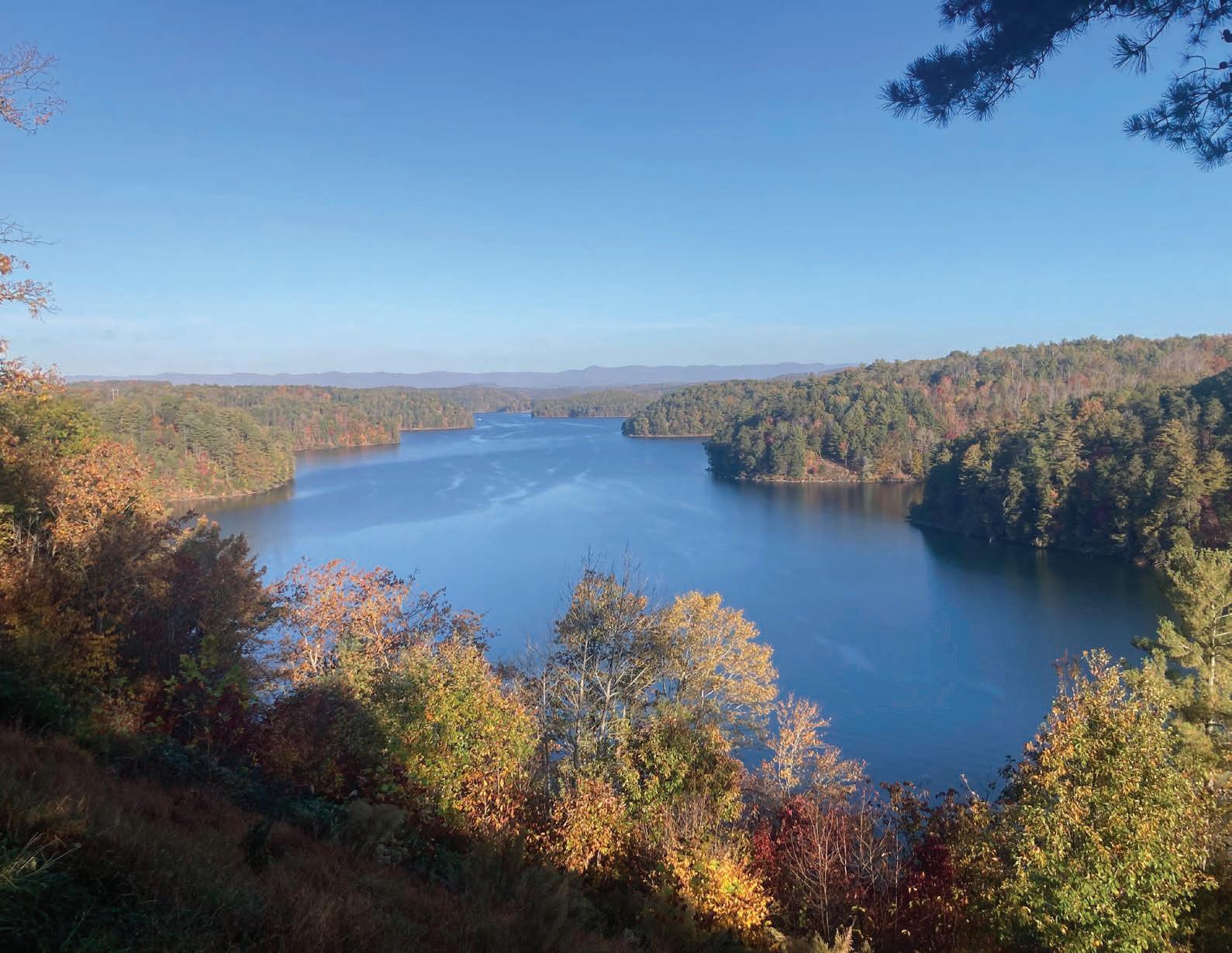
Philpott Lake, created by a dam on the Smith River, covers 2,880 acres and includes 100 miles of shoreline. It is located in the foothills of Patrick, Franklin, and Henry counties and managed by the U.S. Army Corps of Engineers for flood control and hydroelectric power generation. The lake offers a variety of recreational opportunities including camping, water sports, picnicking, hiking, and fishing.
Conserved lands offer managed areas that provide parks, trails, greenways, and river access points. These outdoor recreation facilities provide direct access to the natural resources found throughout the region.
Outdoor Recreation and Managed Areas Assets:
• Alice T. DeHart Park
• Blue Ridge Parkway
• Dick & Willie Trail
• Doe Run Park
• Fairystone Farms Wildlife Management Area
• Fairy Stone State Park
• Fieldale Park and Walking Trail
• Fisher Farm Park
• Fred Clifton Park
• Goose Point Recreation Area
• I.C. DeHart Memorial Park
• J. Frank Wilson Park
• Jack Dalton Park
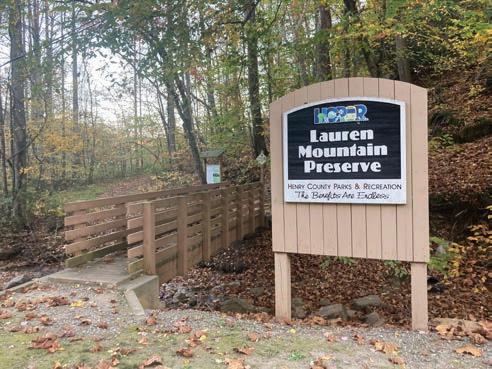
• Lauren Mountain Preserve
• Martinsville Reservoir
• Mayo River Rail Trail
• Mayo River State Park
• Monogram Foods Smith River Sports Complex
• Philpott Lake & Marina
• Rocky Knob Recreation Area
• Round Meadow Overlook
• Smith River Blueway Trail
• Spruce Street Trailhead
• Stuart Rotary Club & Park
• Turkeycock Wildlife Management Area
• Uptown Connection Trail

The Foothills of the Blue Ridge Region is home to an abundant number of natural resources. Through sustainable planning, infrastructure development, and public access management, these resources provide an opportunity to expand outdoor recreation for both locals and visitors. Natural
Nestled in the Blue Ridge Mountains, the Foothills of the Blue Ridge Region played a role in early frontier life, the Revolutionary War, and African-American heritage. Its landscape supported farming and milling, and later became a center for furniture and textile production—contributing greatly to Virginia’s industrial growth. Today, the region’s rich agricultural legacy and enduring Appalachian traditions continue to shape its cultural identity.
• DeHart Botanical Gardens
• FAHI African American Museum and Cultural Center
• Martinsville Main Street
• Piedmont Arts
• Reynolds Homestead
• Textile Heritage Trail
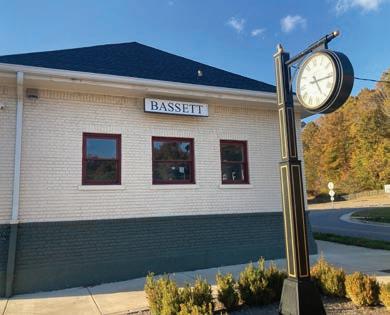
• Town of Bassett
• Town of Stuart
• Village of Fieldale
Virginia Museum of Natural History
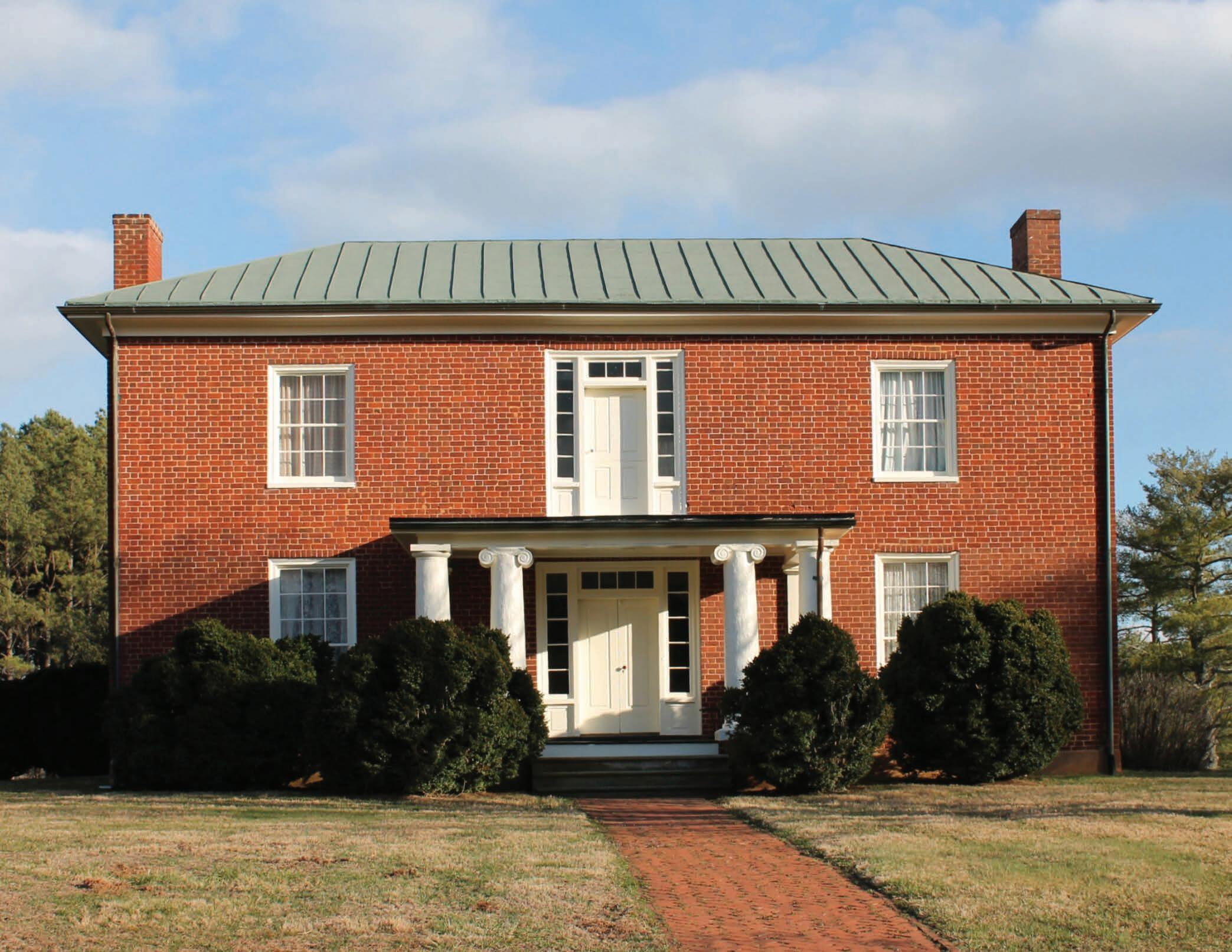
Located just north of the community of Critz in Patrick County, Reynolds Homestead, once known as Rock Spring Plantation, serves as a museum, community gathering place, and educational and cultural center. It is the birthplace and boyhood home of R. J. Reynolds, businessman and founder of the R. J. Reynolds Tobacco Company. Designated as a National Historic Landmark, the property serves as an outreach facility of Virginia Tech dedicated to lifelong learning and community engagement. (Photo by others)
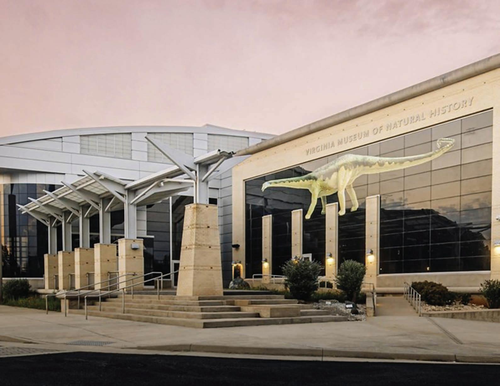
The Virginia Museum of Natural History (VMNH) is located in Martinsville and offers award-winning exhibits, ground-breaking scientific research and collections, and educational programs for all ages. VMNH aims to interpret Virginia’s natural heritage within a global context that is relevant and accessible to all citizens, utilizing exhibits to help translate the museum’s scientific research into easily understood language and concepts. (Photo by others)
A tourism market potential analysis for outdoor recreation was performed to analyze demographic, psychographic, and visitor data as part of the Business Activation Plan. Data were collected within the Foothills of the Blue Ridge Region, within 60-minutes driving radius of the Region, within 120-minutes driving radius of the Region, and within 180-minutes driving radius of the Region. Recorded results were measured through a Market Potential Index (MPI) metric, which compares the demand for a specific product or service in a defined geography with the national demand for that same product or service. The MPI value at the national level is 100. The following outdoor recreation activities received an MPI value greater than 100.
Within the Foothills of the Blue Ridge Region, residents are more likely than the average American to participate in the following outdoor recreation activities:
1. Freshwater Fishing
2. Canoeing or Kayaking
3. Birdwatching
4. Motorcycling
5. Power Boating
6. Overnight Camping
7. Saltwater Fishing
Within a 60-minute radius of the Foothills of the Blue Ridge Region, residents are more likely than the average American to participate in the following outdoor recreation activities:
1. Freshwater Fishing
2. Motorcycling
3. Canoeing or Kayaking
4. Birdwatching
5. Power Boating
6. Overnight Camping
7. Horseback Riding
8. Football
9. Frisbee
10. Softball
Within a 120-minute driving radius of the Foothills of the Blue Ridge Region, residents are more likely than the average American to participate in the following outdoor recreation activities:
1. Freshwater Fishing
2. Motorcycling
3. Canoeing or Kayaking
4. Birdwatching
5. Power Boating
6. Overnight Camping
7. Horseback Riding
8. Football
9. Frisbee
10. Softball
11. Volleyball
Within a 180-minute radius of the Foothills of the Blue Ridge Region, residents are more likely than the average American to participate in the following outdoor recreation activities:
1. Freshwater Fishing
2. Canoeing or Kayaking
3. Football
4. Volleyball
5. Overnight Camping
6. Power Boating
7. Basketball
8. Frisbee
9. Swimming
10. Saltwater Fishing
11. Horseback Riding
12. Motorcycling
13. Golf
14. Birdwatching
15. Rock Climbing
16. Roller Skating
Residents and visitors can enhance their outdoor recreation experience through canoe, kayak, and bike rental services. Some public land managers offer canoe and kayak rentals, and Henry County YMCA's Bike Barn offers a free bike rental program for the Dick and Willie Trail. A variety of outdoor recreation related businesses currently serve the Foothills of the Blue Ridge Region.
The tourism market potential analysis offers important insights into the region’s outdoor recreation economy. By examining recreation activity participation among residents within a three-hour drive, the analysis can help inform business development—highlighting opportunities for destination-quality outfitters, guide services, and other visitor-oriented amenities. The Foothills of the Blue Ridge Region can use the tourism market potential index to identify service gaps, attract new businesses, and enhance its appeal as a regional outdoor recreation destination.
This chapter explores the tools used for public engagement, highlights the stakeholders and organizations involved in the planning process, and presents key findings from an online survey that gathered community input on the outdoor recreation economy and future development priorities for the Foothills of the Blue Ridge Region. It concludes with emerging themes that serve as the foundation for the plan's recommendations. The chapter is organized into the following sections:
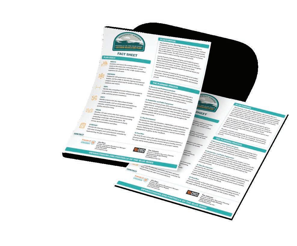
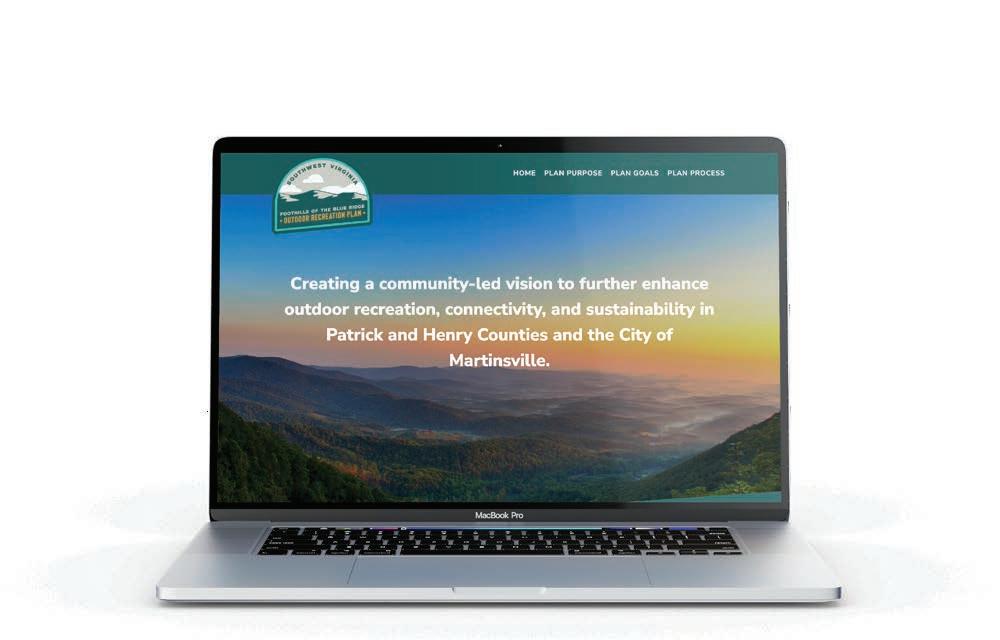
The Foothills of the Blue Ridge Outdoor Recreation Plan was launched and introduced to the public using the fact sheet and website, which included a promotional video featuring key community leaders. These resources highlighted the planning process and goals and encouraged citizens to take the online community survey.
The Foothills of the Blue Ridge planning process engaged a diverse range of stakeholders, including local government, quasi-governmental organizations, nonprofits, and private businesses.
The consultant team conducted interviews, focus group meetings, and site visits with stakeholders identified at the kick-off meeting. Key insights and takeaways from these discussions are reflected in the plan's recommendations.
City of Martinsville
City of Martinsville Economic Development and Tourism
Fairy Stone State Park
Henry County
Henry County Arts and Culture
Henry County Parks and Recreation
Patrick County
Patrick County Chamber of Commerce
Patrick County Planning Commission
Patrick County Sheriff's Office
Town of Stuart
U.S. Army Corps of Engineers
West Piedmont Planning District Commission
Blue Ridge Aqua Culture Chain of Fools Bicycles
Dan River Basin Association
FAHI Museum
Henry County Historical Society
Landmark Center
Martinsville-Henry County YMCA
Patrick County Cooperative - 4H
Piedmont Arts
Reynolds Homestead
Smith River Outfitters
The Harvest Foundation
Trout Unlimited
University of North Carolina Coastal Studies Institute
Virginia Polytechnic Institute and State University
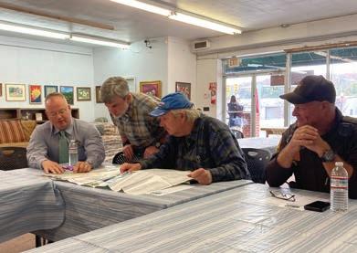
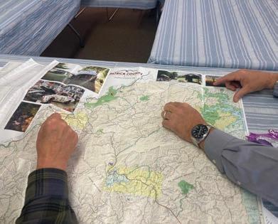
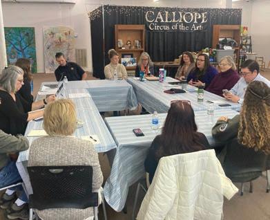
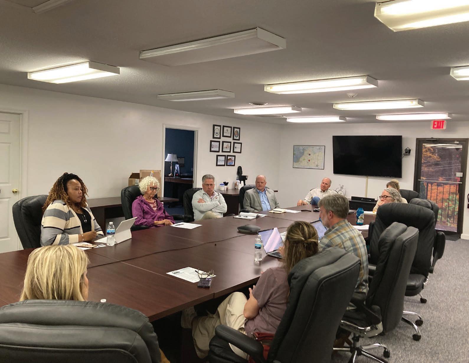
Focus group meetings were conducted with community leaders to discuss priorities, uncover underutilized assets, and identify improvements to support the outdoor economy in the Foothills of the Blue Ridge Region.
PatrickCountyFocusGroupsNovember 20, 2024
Three separate focus group meetings were conducted with key stakeholders of Patrick County, including representatives from outdoor recreation, public safety, arts and culture, tourism, and economic development.
Henry County
Roger Adams - ParksandRecreation,HenryCounty
Nancy Bell - VirginiaRuralHealthAssociation
Darrin Doss - CommunityMember
Dewitt House - Harvest Foundation
Kristie Eberly - Executive Director, West Piedmont PlanningDistrictCommission
Keith Elliot - Dan River Basin Association and CommunityMember
Jim Frith - Construction
Martin Gardner - BlueridgeAquaCulture
Amanda Gray - WestPiedmontPiedmontPlanning District Commission
Matt Huckfeldt - ChainofFoolsBicycles
Brad Kinkema - YMCA
Holly Kozelsky - HistoricalSociety
Kathleen McEvoy - CommunityMember
HenryCountyFocusGroupsNovember 20, 2024
Three separate focus group meetings were conducted with stakeholders of Henry County, including community leaders from outdoor recreation, arts and culture, environmental groups, business owners, youth services, tourism, and economic development.
Ashley Mundy - ParksandRecreation,HenryCounty
Heidi Pinkston - Piedmont Arts
Chris Powell - Operations,PhilpottLake
Edward Stern - Smith River Outfitters
Eric Tichay - Trout Unlimited
Dale Wagoner - HenryCounty
Nancy White - UniversityofNorthCarolinaCoastal Studies Institute
Brian Williams - Dan River Basin Association
Patrick County
Rebecca Adcock - Chamber of Commerce, Patrick County
Kurt Bozenmayer - PlanningCommission,Patrick County
Melanie Gilbert - ReynoldsHomestead
Leigh Ann Hazelwood - 4H,PatrickCounty Cooperative
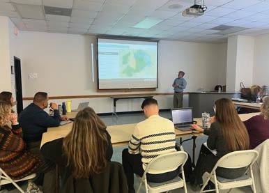
PublicMeeting-May14,2025
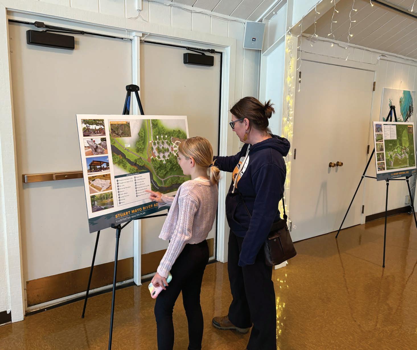
Held at the Reynolds Homestead in Critz, Virginia, the public meeting provided an opportunity for members of the community to see the plan recommendations and designs, ask questions, and provide feedback. Over 30 community members attended the public meeting.
James Houchins - PatrickCounty
Adam Layman - FairyStoneStatePark
Lora Mahaffey - CommunityMember
Lisa Martin - Landmark Center
Eric O’Connell - SheriffDepartment,PatrickCounty
Doug Perry - PlanningCommission,PatrickCounty
Ethan Seaver - FairyStoneStatePark
Bryce Simmons - Town of Stuart
Dan Smith - SheriffDepartment,PatrickCounty
Julie Walters-Steele - ReynoldsHomestead
Sarah Wray - ReynoldsHomestead
City of Martinsville
Greg Maggard - CityofMartinsville
Kelly Rowland - EconomicDevelopmentandTourism, CityofMartinsville
Charrisse Hairston - Executive Director of the FAHI Museum
Via an online community survey, the consultant team gathered input from community members to learn about challenges and identify opportunities for the Foothills of the Blue Ridge Region. These answers provided insights and helped inform the plan recommendations.
More activity around rivers and bodies of water. In other cities, like Richmond and Greenville, SC, the city revolves around river activity - from events to what people do during their time off.
We need to create more opportunities for people to enjoy our rivers.
Better access to hidden gems like local waterfalls, improved/ lengthened biking and walking trails in Patrick County.
Accessibility is not the issue with our rivers or trails, knowledge of them is the issue that those traveling in are looking for.
The many recreational areas along the perimeter of Philpott Lake can be difficult to reach, as they are split among three counties.
We need more areas for outdoor concerts, etc. It's important to incorporate social events into recreational opportunities. Henry County needs more enticing activities for young people and young families.
Rt 58 is an important conduit of commerce, but by passes keep tourists from stopping. It needs better signage.
Outfitters would be helpful for people participating in fishing, kayaking, or tubing the Smith River and/or Mayo River.
The Foothills of the Blue Ridge Outdoor Recreation Plan Community Survey was conducted to gather input on which outdoor recreation and tourism assets residents feel are most important and how future regional projects should be prioritized.
The survey received a total of 255 responses between November 2024 and January 2025. The online survey was promoted by community leaders in the Foothills of the Blue Ridge Region and Friends of Southwest Virginia via the project website, email, and social media platforms. This section presents key survey findings.
Please specify your ethnicity.
1st 2nd 3rd 4th
Building on extensive research, community engagement, and listening, the Foothills of the Blue Ridge Emerging Themes establish the region's aspirations and vision for the outdoor economy.
The emerging themes are foundational to the recommendations highlighted in Chapter 4, and collectively, this strategic roadmap will serve local leaders and decision-makers as they plan and execute thoughtful investments in the community.
The five (5) emerging themes include:
1. Connectivity
2. Sustainable Outdoor Recreation
3. Arts, Culture and Education
4. Partnerships
5. Economic Development.
Invest in outdoor recreation infrastructure that increases access and connectivity between residential neighborhoods, community assets, and downtowns, in an effort to strengthen overall connections within the Foothills of the Blue Ridge Region.
Conserve and maintain natural resources, rural landscapes, greenways, and blueways, through well-conceived trail corridors, public river accesses, and conservation lands that support sustainable outdoor recreation.
Promote the educational and creative economy by supporting and encouraging the expansion of visual, public, and performing art assets. Create settings favorable to the spaces and events needed to support education and expansion of these important cultural and historic sectors.
Establish and maintain partnerships between federal, state, and local government agencies, nonprofit organizations, and community groups to plan, implement, and manage outdoor recreation, historical, and cultural infrastructure projects.
Identify and pursue opportunities for community revitalization within the Foothills of the Blue Ridge Region based on site-specific, outdoor recreation themed, economic development strategies that capitalize on these unique sites and settings and introduce new activities where appropriate.
This chapter serves as the heart of the Foothills of the Blue Ridge Outdoor Recreation Plan and is organized according to five (5) primary Focus Areas as identified through the planning process: 1) Blueways and Lakes, 2) Trail Systems and Greenways, 3) Public Lands, 4) City of Martinsville, and 5) Community Hubs. Each focus area includes specific projects and action steps.
Focus Area 1: Blueways & Lakes
Focus Area 2: Trail Systems & Greenways
Focus Area 3: Public Lands
Focus Area 4: City of Martinsville
Focus Area 5: Community Hubs
The Foothills of the Blue Ridge Region, located in the Dan River Basin, includes three major rivers and one lake that are ideal for recreational access: the Smith, Mayo, and Dan Rivers, and Philpott Lake. Safe, legal, and public access areas are critical for development of these natural assets. Paddle trails, or blueways, should be designed and developed according to the desired user experience, which considers setting, stream character, level of difficulty, and access area amenities.
By supporting government and nonprofit partners with the protection, development, management, and promotion of blueways, these major waterways will be seen as significant regional outdoor recreation assets for both paddling and fishing (See Map 05: Blueways and Lakes, page 57).
The Dan River Basin Association (DRBA) promotes and protects the natural and cultural resources of the Dan River basin through education, recreation and stewardship. DRBA works to protect and increase awareness of the region’s natural and cultural assets within the basin’s 3,300 square miles by planning and building parks, river accesses and trails, educating others about preservation and conservation, and monitoring water quality. These efforts support and promote economic development, tourism, and healthy lifestyles while improving the region's quality of life—making it a better place to live, visit, and do business.
The Smith River flows southeastward approximately 45 miles from Philpott Lake to the Virginia/ North Carolina state line. Well known by anglers for its northern 31-mile section of special regulation brown trout waters, the river also offers several put-and-take rainbow trout waters to the south and a variety of warm water fish species as the river bends towards North Carolina. Additional access areas are located in North Carolina near Eden before the river’s confluence with the Dan River.
Eleven access points currently exist on the Smith River. Prioritizing the maintenance and enhancement of existing access points, the creation of new access points in key locations, and a vehicular wayfinding sign system will allow for improved accessibility (See Map 06: Smith River Blueway Access Areas, page right).
Specific Foothills of the Blue Ridge action items in support of the Smith River are as follows:
1.1.1
Support government and nonprofit partners with maintenance and enhancement of existing access areas to support local and commercial use.
1.1.2
Work in cooperation with willing property owners and explore additional access area opportunities north of Philpott Lake and south of Mitchell Bridge Access.
Design and implement a vehicular wayfinding system that incorporates current branding.
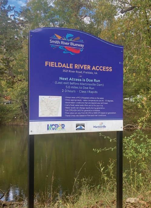
EachSmithRiverBluewayAccessAreahasasign that provides location information for paddlers.
The Mayo River has two distinct sections, or forks, that flow through both Patrick and Henry Counties. The North Fork flows south for 18 miles from its headwaters below Bull Mountain in north central Patrick County before it joins the South Fork of the Mayo River near the Virginia/ North Carolina state line. The South Fork of the Mayo River flows southeast for 46 miles from west of the Town of Stuart until it joins the North Fork of the Mayo River. The clean and clear waters of the Mayo River attract paddlers and anglers looking for a less developed experience.
Currently, only one access point currently exists on the North Fork of the Mayo River. Supporting maintenance and enhancement of the existing access, development of a master plan for development, management, and promotion of the blueway, and landowner engagement for access area development will improve accessibility to this natural asset.
Specific Foothills of the Blue Ridge action items in support of the Mayo River are as follows:
1.2.1
Support government and nonprofit partners with maintenance and enhancement of existing access areas to support local and commercial use.
Develop a comprehensive Mayo River Blueway Master Plan to develop branding, assess existing accesses, explore additional access opportunities, and create a long-term blueway management strategy.
1.2.3
Identify potential sites and engage landowners to determine interest in partnering with a local government or nonprofit conservation organization for land preservation and access area development.
1.2.4
Work in cooperation with willing property owners and explore additional access area opportunities on the North and South Forks of the Mayo RIver.
The Dan River begins at Talbott Dam and has three distinct sections that flow 21 miles south towards North Carolina. The upper section, a sixmile stretch referred to as the “Grand Canyon of Virginia”, flows from Talbott Dam to the Townes Reservoir. The middle section, from Townes Dam to Pinnacles Powerhouse, passes through steep and rugged terrain with limited access and regular low flow rates. The lower section, known as the Kibler Valley, runs for 11 miles from the Pinnacles Powerhouse to the Claudville community and is a well established beginner to intermediate whitewater paddling destination. All three sections are managed by the Virginia Department of Wildlife Resources as brown, rainbow, and brook trout fisheries, with an abundance of warm water species, such as smallmouth and rock bass, found in the lower section.
Focused efforts on maintenance and enhancement of existing informal access, development of a comprehensive master plan for the proposed blueway, landowner engagement for access area development, and support and promotion of festivals and outdoor recreation event opportunities on the Dan River will improve accessibility and promote economic development.
Specific Foothills of the Blue Ridge action items in support of the Dan River Headwaters are as follows:
1.3.1
Support government and nonprofit partners with maintenance and enhancement of existing access areas to support local and commercial use.
1.3.2
Develop a comprehensive Dan River Blueway Master Plan to develop branding, assess existing accesses, explore additional access opportunities, and create a long-term blueway management strategy.
Identify potential sites and engage landowners to determine interest in partnering with a local government or nonprofit conservation organization for land preservation and access area development.
1.3.4
Work in cooperation with willing property owners and explore additional access area opportunities from Talbott Dam to Pinnacles Powerhouse and Kibler Valley.
1.3.5
Support partner organizations with the organization and promotion of festivals and outdoor recreation event opportunities on the Dan River, like the Kibler Valley River Run.
Managed by the U.S. Army Corps of Engineers (USACE) primarily for flood control and hydroelectric power generation, Philpott Lake is a 3,000 acre impoundment highlighted by 7,000 acres of forested land and 100 miles of shoreline within Henry, Patrick, and Franklin Counties. The USACE operates eleven current park and access areas with a variety of amenities, including beaches, picnic areas, hiking trails, and boat landings.
Support for current and proposed USACE projects and plans for lake facilities and amenities will provide additional outdoor recreation experiences for community members and visitors.
Specific Foothills of the Blue Ridge action items in support of the Dan River Headwaters are as follows:
Support USACE plans for lake facilities and amenities, including outdoor recreation opportunities and proposed projects for trails, marina, accessibility, and signage improvements.
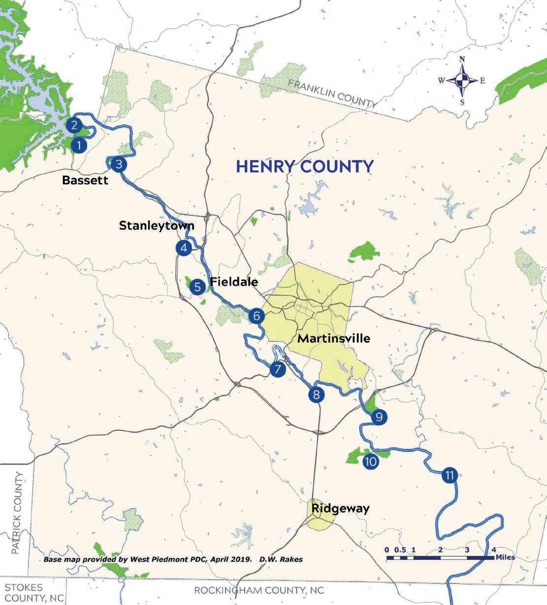
Goose Point at Philpott Lake offers a swim beach, picnic shelter, campground, and lake access.
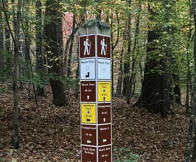
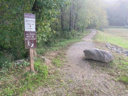
The planning process identified several existing and planned trail and greenway systems throughout the Foothills of the Blue Ridge Region, including segments of the Dick and Willie Trail, Smith River Trail System, Mayo River Rail Trail, and the statewide Beaches to Bluegrass Trail (See Map 07: Trail Systems and Greenways, page 65). These local and regional trail systems provide not only outdoor recreation opportunities, but also connectivity between natural assets and community destinations.
Supporting local initiatives to develop, manage, and promote existing and planned trails and greenways and developing plans for purpose-built trail systems will expand access to diverse outdoor recreation opportunities for people of all ages, abilities, and interests.
Originally introduced in the 1979 Virginia Outdoors Plan, the developing Beaches to Bluegrass Trail is a proposed multi-use trail intended to connect communities across southern Virginia. It currently incorporates existing segments of both the Dick and Willie Trail and Smith River Trail System. Two significant gaps remain in the Beaches to Bluegrass Trail within Henry and Patrick Counties.
Coordinated trail planning through the development of detailed corridor plans in several sections in addition to branding efforts to enhance and promote existing trail segments of the Beaches to Bluegrass Trail are key opportunities to enhance visibility and increase awareness of the trail in the region.
Specific Foothills of the Blue Ridge action items in support of the Beaches to Bluegrass Trail are as follows:
Develop a detailed corridor study for a portion of Segment 16 (Henry/Pittsylvania County Line - Martinsville) and Segment 23 (Fairy Stone State Park to the Blue Ridge Mountains) as outlined in the Beaches to Bluegrass Trail Master Plan (2014) (See Map 08: Beaches to Bluegrass Trail, page 67).
Identify, brand, and promote existing trail segments as the Beaches to Bluegrass Trail.
Source:BeachestoBluegrassTrailMasterPlan(2014)
The Smith River Trail System is a collection of river access points and short, primarily natural surface trail segments totaling approximately 18 miles. Located on public lands throughout Henry County, these trails are typically beginner-friendly and designed to serve local community members.
Continued support to develop, improve, manage, and promote the Smith River Trail System will expand opportunities for residents to engage in outdoor recreation— supporting improved physical, mental, and social well-being.
Specific Foothills of the Blue Ridge action items in support of the Smith River Trail System are as follows:
2.2.1 Trail Planning and Development
Support local plans and efforts to develop, manage, and promote a local trail system in Henry County.
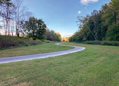
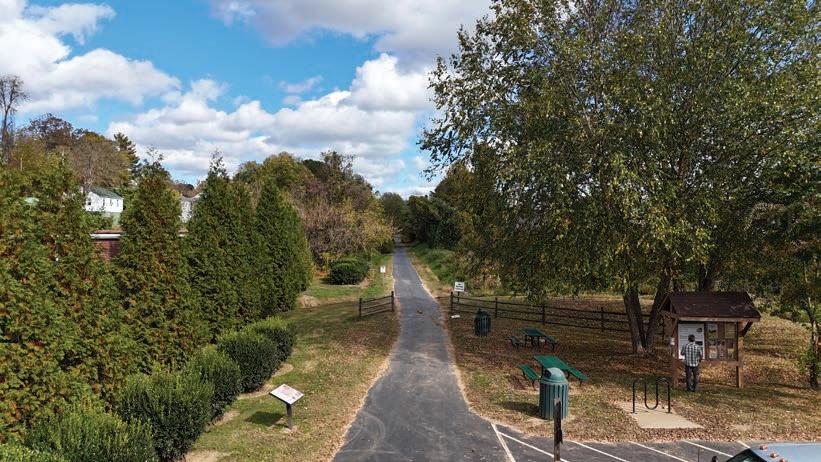
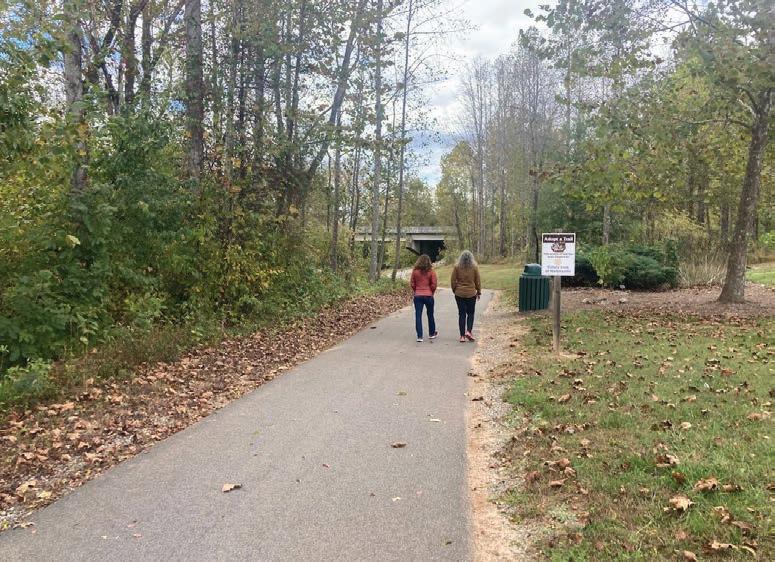
The Dick and Willie Trail is planned to extend from the Smith River Sports Complex to Philpott Lake, connecting the City of Martinsville with the towns of Fieldale and Bassett. Currently, approximately 10.7 miles of trail are complete, primarily within Martinsville. Future phases will expand the trail into a continuous, regional greenway corridor along the Smith River that enhances connectivity and accessibility within Henry County.
Supporting the development, management, and promotion of the Dick & Willie Trail will create an outdoor recreation and tourism asset that serves both community members and visitors.
Specific Foothills of the Blue Ridge action items in support of the Dick & Willie Trail are as follows:
Support local plans and efforts to develop, manage, and promote this regional linear trail that connects Philpott Lake, Bassett, Fieldale, Stanleytown, and Martinsville, and can be identified, branded, and promoted as a segment of the Beaches to Bluegrass Trail.
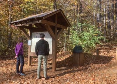
Located in the Town of Stuart, approximately 1.8 miles of the Mayo River Rail Trail is completed. This multi-use trail is envisioned to eventually connect to Mayo River State Park. A regional greenway corridor along the Mayo River would offer a distinct recreational experience in a remote, rural setting that would differentiate it from other greenways and trails in the region.
Ongoing support for planning and development of the Mayo River Rail Trail will expand trail and greenway mileage in Patrick County, helping to fill a significant gap in existing outdoor recreation opportunities in the area.
Specific Foothills of the Blue Ridge action items in support of the Mayo River Rail Trail are as follows:
Support local plans and efforts to develop, manage, and promote a linear trail in the Mayo River corridor that will connect the Beaches to Bluegrass Trail in Stuart to Mayo River State Park in Virginia and North Carolina.
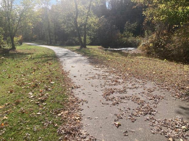
TheMayoRiverRailTrailprovidesamulti-usegreenwaytrail experiencenearStuart,Virginia.
Approximately 17,500 acres of public land managed by Virginia State Parks, the Virginia Department of Wildlife Resources, and the U.S. Army Corps of Engineers are located adjacent to the southwest side of Philpott Lake (See Map 09: Fairy Stone Trail Complex Conceptual Plan). Existing facilities at Fairy Stone State Park include the following: hiking, mountain biking, and equestrian trails, RV, tent, and equestrian campgrounds, cabins, lake, and swim beach. The USACE manages Goose Point Park, which offers lake access and amenities such as a campground, beach, boat ramp, dock, fishing pier, picnic shelter, playground and amphitheater. This area also includes a portion of one of two gaps in the Beaches to Bluegrass Trail (segment 21) in the Foothills of the Blue Ridge Region.
Developing a trail master plan for a purpose-built mountain biking and equestrian trail system across these public lands would take advantage of existing outdoor infrastructure and establish a framework to create a tourism destination for mountain bikers, equestrians, hikers, and trail runners.
Specific Foothills of the Blue Ridge action items in support of the Fairy Stone Trail Complex are as follows:
Develop a comprehensive master plan that addresses opportunities and strategies to create approximately 30 miles of purpose built equestrian trails and 50 miles of mountain bike trails.


One large undeveloped parcel, or combination of several smaller parcels totaling 750 acres or more, centrally located in the region will provide the space needed to develop a motorized trail system for off-highway vehicles (OHVs). Trail system and park development could be compatible with adjacent industrial and commercial land uses. Currently, this type of outdoor recreation activity doesn’t exist in the Foothills of the Blue Ridge Region, making this a unique opportunity that would likely require collaboration through a public-private partnership involving willing landowners, local governments, and private entrepreneurs.
Key steps to advancing this concept include identifying appropriate sites, engaging landowners, developing a comprehensive plan, and exploring public-private partnerships for development.
Specific Foothills of the Blue Ridge action items in support of the Patrick/Henry County Motorized Trail System & Park are as follows:
Identify and engage landowners that own large undeveloped parcels centrally located within Patrick and Henry Counties to determine interest in partnering with a local government for outdoor recreation development.
Develop a comprehensive park and trail master plan that addresses opportunities and strategies to create a purpose-built motorized trail system with supporting commercial business opportunities to include lodging, outfitter, and equipment rental services (See Exhibit 06: Motorized Trail System and Park, page right).
2.6.3
Seek investors and entrepreneurs to develop and manage the trail system and park in cooperation with a willing landowner and local government partner.
A motorized trail system, centrally located in the region on a 750+ acre parcel, would provide an outdoor recreation activity that doesn’t currently exist. An extensive trail system (25+ miles) that offers a variety of experiences and an ATV village that provides lodging, outfitter, and equipment rental services would allow the optimal experience for visitors.


OVH Trail System (231 Acres) with 25 - 30 miles of O -Road Fun


Within the Foothills of the Blue Ridge Region, public lands managed by Federal, State, and local agencies are vital to the development and promotion of outdoor recreation. Utilizing these areas to introduce beginnerfriendly outdoor experiences and increase awareness of the region’s natural and recreational assets will benefit both residents and visitors while also supporting growth in the outdoor recreation economy.
Key public land sites across the region include the Smith River Sports Complex, I.C. DeHart Memorial Park, Rocky Knob Recreation Area, Critz Community Center and Park, the proposed Blue Ridge Parkway Gateway Recreation Area, and Mayo River State Park
(See Map 10: Public Lands, page right)
Riverview Park, located just south of Martinsville, encompasses 117 acres adjacent to the 90-acre Smith River Sports Complex. Both facilities are managed by Henry County Parks and Recreation. While Riverview Park is in the planning and development stage, the Sports Complex features six synthetic turf and natural grass athletic fields, pavilion with meeting space and restrooms, concessions, picnic pavilions, dog park, access to the Dick & Willie Trail, and a fitness-themed playground.
Both recreation areas are easily accessed from US Highway 58, which connects to transportation corridors stretching from the Piedmont Triad region in North Carolina, Danville, and Roanoke, Virginia. The location is also well-positioned to serve as the southeastern gateway to the Foothills of the Blue Ridge Region.
Support to implement the Riverview Park Master Plan and manage and promote the Smith River Sports Complex will strengthen this emerging regional destination. Developing an outdoor adventure center within Riverview Park or at the Sports Complex would build on an existing visitor base while expanding awareness of the area’s natural assets and recreation opportunities.
Specific Foothills of the Blue Ridge action items in support of the Smith River Sports Complex are as follows:
Support Henry County plans for park and facility development (See Exhibit 07: Riverview Park Master Plan, page 77).
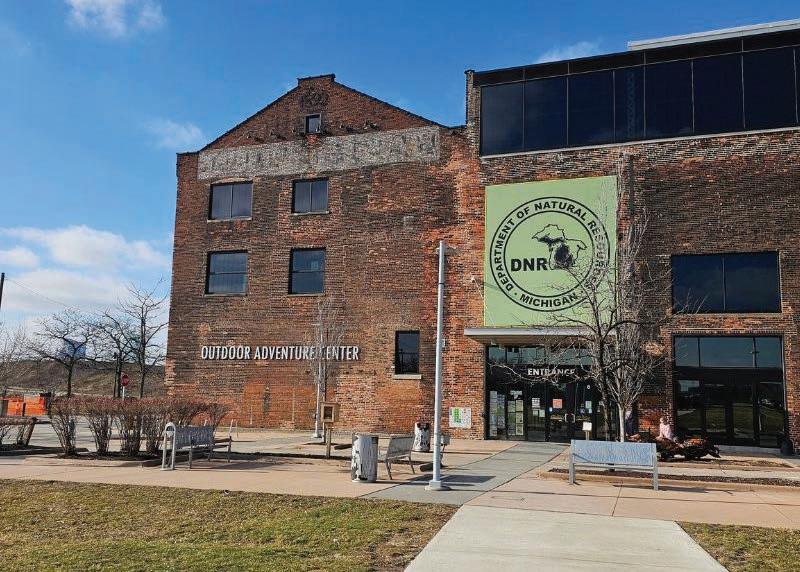
Develop a multi-purpose facility that provides space for visitor center, classrooms, natural history exhibits, retail, outfitters, and indoor adventure pursuits (climbing wall, event space, etc.) (See Exhibit 08: Outdoor Adventure Centers Case Study, pages 7879).
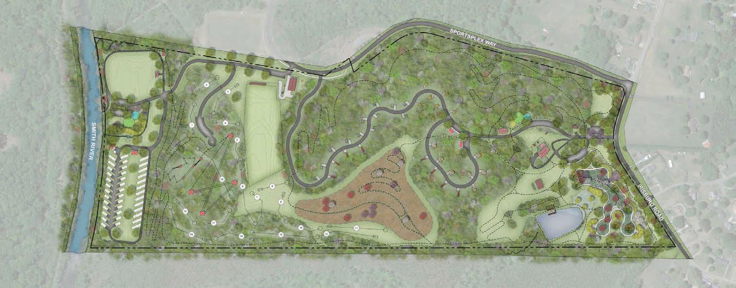
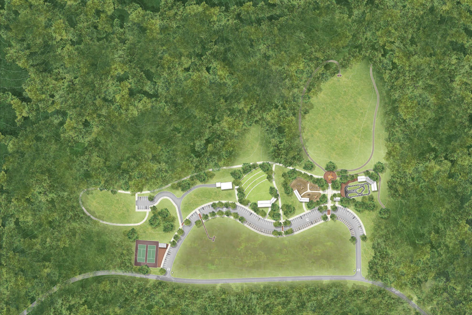
Riverview Park, located adjacent to the Smith River Sports Complex, is currently in the planning and development phase. Proposed features include a campground and RV park, ropes challenge course with zipline, 18-hole disc golf course, outdoor classrooms and amphitheaters, and a network of trails.
(5)
(4)
(5)
(10)
*Note: Refer to the images on the following pages for a visual description of


An outdoor adventure center serves as a hub for recreation, education, and tourism. These multi-purpose facilities often include visitor centers, classrooms, natural history exhibits, retail spaces, outfitters, and infrastructure for outdoor activities such as climbing walls, bouldering areas, and trails. By offering resources, equipment, and educational opportunities, adventure centers enable individuals and families to explore local and regional outdoor assets, try new activities, and deepen their understanding of the natural environment. These centers play a vital role in enhancing quality of life, promoting sustainable tourism, and strengthening the outdoor recreation economy.
LOCATION: Denver, CO
FACILITIES & SERVICES: Retail, indoor climbing pinnacle, boot and bike
test trails, water filter and stove testing stations, climbing rock, bike shop, ski shop, rentals, trade-in, repair services, used gear.
LOCATION: Charlotte, NC
ANNUAL VISITATION: 700,000+ annual user-days (2019)
FACILITIES & SERVICES: Whitewater rafting, ziplines, ropes courses, mountain biking, whitewater kayaking, SUP, ice skating (seasonal), yoga, trail running, hiking, climbing, deep water solo rock wall, adventure playground, dining, races, festivals, event space, summer camp, outfitters store.
LOCATION: Detroit, MI
ANNUAL VISITATION: 100,000+
FACILITIES & SERVICES: Interactive exhibits, wildfire airplane education, archery programs, events, school, and summer field trips ,event and meeting space.
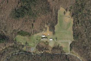
I.C. DeHart Memorial Park is located just north of the community of Woolwine in northern Patrick County. This 530-acre park features 13 miles of mountain bike trails, natural wetland wildlife area, walking trails, playground, and sports fields.
Enhancing existing infrastructure and developing family-friendly mountain biking facilities will elevate the park as both a valuable community resource and tourism destination. Enhancement of existing park infrastructure and specific development of family-friendly mountain bike amenities will create a valuable community asset and tourism destination that will complement other recreational assets in northern Patrick County.
Specific Foothills of the Blue Ridge action items in support of the I.C. DeHart Memorial Park are as follows:
3.2.1 Park Improvements and Expansion.
Improve and expand the existing park by developing additional recreational amenities to include an amphitheater with concrete seat walls and stage, playground, asphalt pump track, two large shelters, restroom, and plaza with shelter at the existing tennis courts. Develop an extensive sidewalk system that complements the existing natural surface trail system and expand the existing parking area (See Exhibit 09: I.C. DeHart Memorial Park Illustrative Master Plan, page 81).
The expansion of I.C. DeHart Memorial Park provides additional recreational facilities that will serve community members and visitors to the park. Key features include an amphitheater with concrete seat walls and stage, playground, asphalt pump track, two large shelters, restroom, extensive sidewalk/ trail system, and expanded parking area.
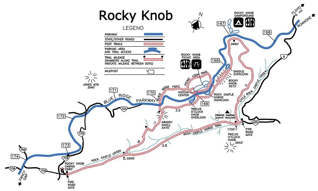
The Rocky Knob Recreation Area, managed by the National Park Service, encompasses approximately 4,500 acres and includes 15 miles of hiking trails that range from beginner options near the Blue Ridge Parkway to more advanced opportunities on the Rock Castle Gorge National Recreation Trail. Additional amenities include a visitor center, campground, picnic areas, and vehicular overlooks to serve visitors that choose to focus their activities along the Blue RIdge Parkway (See Map 11: Rocky Knob Recreation Area).
Conducting a trail system assessment to evaluate potential improvements and expansion, combined with trailhead enhancements focused on signage, would help provide users with clearer information and improve overall accessibility.
Specific Foothills of the Blue Ridge action items in support of the Rocky Knob Recreation Area are as follows:
3.3.1 Trail System Assessment
Assess existing trailheads and hiking trail system for improvements and expansion.
3.3.2 Trailhead Improvements/Enhancement
Develop wayfinding signage and expand the existing lower trailheads located on the western and eastern boundaries of the recreation area. Enhance signage and visitor information provided at all trailheads.
The Critz Community Center and Reynolds Homestead make up a 717-acre historic property in southeastern Patrick County, managed by Envision Critz and Virginia Tech. The sites support several historic and recreational amenities, including historic buildings, community engagement center, trails, managed forest, and low ropes course used for Virginia Tech’s outdoor experiential education program.
Implementing the Critz Community Center Conceptual Design and Master Plan and evaluating opportunities for additional recreational facility development at the Reynolds Homestead aligned with community needs and Virginia Tech curriculum will complement the broader outdoor recreation opportunities offered in Patrick County.
Specific Foothills of the Blue Ridge action items in support of the Critz are as follows:
Support plans for the implementation of the Critz Community Center Conceptual Design and Master Plan completed by the Community Design Assistance Center (CDAC) at Virginia Tech.
3.4.2 Reynolds Homestead Recreational Facility Development
Explore development of additional recreational facilities to include a high ropes course and expansion of the trail system to provide a variety of experiences for multiple user groups.
The proposed Blue Ridge Parkway Gateway Recreation Area is a collection of outdoor recreation sites located along the Blue Ridge Parkway and U.S. Highway 58, serving as a western gateway into the Foothills of the Blue Ridge Region. The area includes Round Meadow Overlook and Mabry Mill, managed by the National Park Service, as well as Fred Clifton Park and Lovers Leap Overlook, managed by Patrick County. These four locations are easily accessible and offer a combination of historic structures, picnic areas, trails, and scenic overlooks for Parkway travelers and visitors to the region.
Supporting branding and marketing efforts for the Blue Ridge Parkway Gateway Recreation Area, developing a regional destination center to serve visitors and prioritizing the maintenance and enhancement of existing parks and overlooks will contribute to the creation of a significant regional asset that serves visitors looking for an accessible, family-friendly outdoor experience.
Specific Foothills of the Blue Ridge action items in support of the Blue Ridge Parkway Gateway Recreation Area are as follows:
Identify opportunities to develop a regional destination center on US Highway 58 that will serve as a gateway from the Blue Ridge Parkway to Patrick County and the foothills of southern Virginia.
Support local government partners in branding and marketing the gateway recreation area and associated parks and overlooks as a tourist destination for families.
3.5.3 Fred Clifton Park
Support local government partners with maintenance and enhancement of park facilities.
3.5.4
After completion of the US Highway 58 widening project, support local government partners with maintenance and assess the area for parking and safety improvements.
3.5.5 Trail Connections
Explore potential trail connections between Meadows of Dan and the Blue Ridge Parkway corridor.
In 2008, segments of the North and South Forks of the Mayo River near the Virginia-North Carolina border were both designated as Virginia Scenic Rivers. That same year, the creation of Mayo River State Park was recommended as part of the Martinsville-Henry County Rivers and Trails Recreational Use Plan. Between 2009 and 2021, approximately 630 acres were acquired to establish Mayo River State Park in Virginia, which adjoins North Carolina’s 2,775-acre Mayo River State Park (See Map 12: Mayo River State Park). The Virginia Department of Conservation and Recreation is currently developing a master plan to guide future management and development of the park.
Ongoing support for the creation and implementation of the Mayo River State Park Master Plan by Virginia State Parks, the Dan River Basin Association, and other stakeholders will strengthen the attraction of this regional outdoor recreation resource that spans the Virginia-North Carolina border.
Specific Foothills of the Blue Ridge action items in support of Mayo River State Park are as follows:
Support Virginia State Parks, DRBA, and partners in developing and implementing a comprehensive master plan for the park.

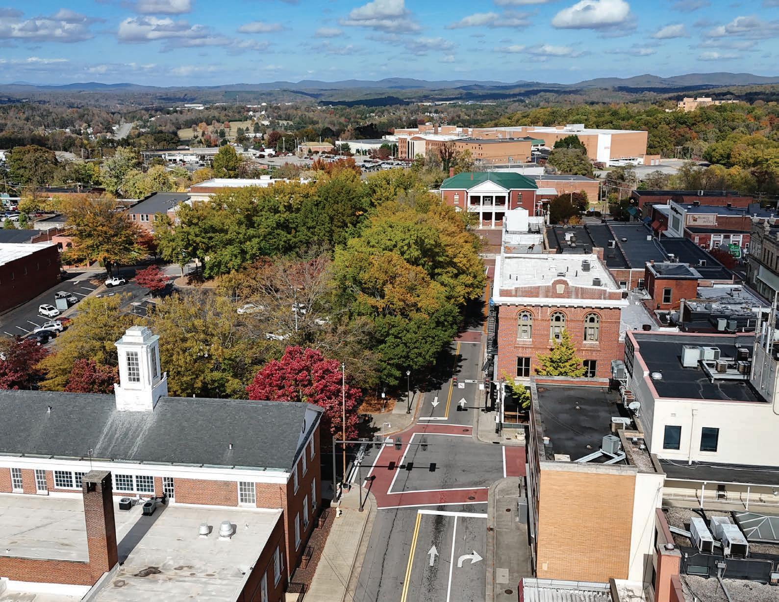
The City of Martinsville, the only independent city in the study area and the county seat of Henry County, offers a variety of recreational, cultural, and historic assets. The longest completed segment of the Dick & Willie Trail is located in the heart of the city and serves as both a recreational and alternative transportation facility. Martinsville is also home to the Virginia Museum of Natural History, Piedmont Arts Museum, Fayette Area Historical Initiative (FAHI) Museum, and Martinsville-Henry County Heritage Center and Museum. Additionally, the city offers a network of mini-parks and neighborhood, community, and destination parks accessible to both residents and visitors.
Enhancing connectivity between these assets, supporting the development of arts and education hubs, and investing in park infrastructure improvements will contribute to improved quality of life for residents and increase the city’s appeal as a visitor destination.
A connected city provides health, accessibility, and economic benefits by incorporating active transportation infrastructure into the broader transportation network. Sidewalks, bike lanes, greenways, and trails complement existing roadways and public transit. A comprehensive and community-driven planning process that includes identifying key destinations, evaluating existing infrastructure, and assessing transportation needs supports the development of a safe, efficient, and accessible system that links residential areas with commercial centers, civic institutions, schools, and recreational assets.
Developing a comprehensive bicycle and pedestrian plan that utilizes existing and planned trails and connects key assets will benefit community members and visitors to the area.
Specific Foothills of the Blue Ridge action items in support of Asset Connectivity are as follows:
Develop a comprehensive bike and pedestrian plan that outlines a strategic vision for creating a safe, accessible, and enjoyable experience for pedestrians and cyclists, utilizing sidewalks, bike lanes, greenways, and trails to connect key assets and locations.
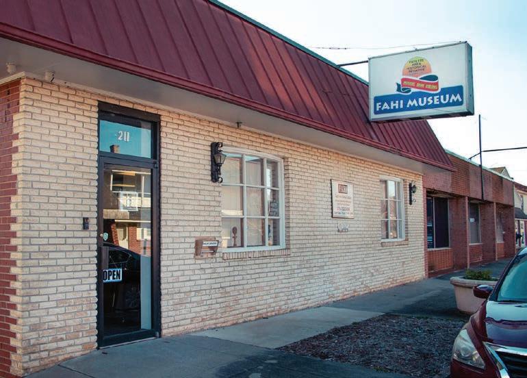
The Fayette Area Historical Initiative (FAHI), in partnership with the Virginia Foundation for the Humanities (VFH), exhibits local history through literature, art, music, and culture, to foster community development and redevelopment within Martinsville's African American community. The FAHI exhibit gallery collects, preserves, and interprets the local African American experience in history through recorded oral history, public forums and workshops, lectures, and other special programs. Image by others.
During the planning process, arts, culture, and education emerged as consistent themes identified by both community stakeholders and residents through focus groups and a community survey. Martinsville supports a strong arts community, as evidenced by its designated Arts and Cultural District and the Arts and Cultural Committee established by City Council in 2013. The proximity of key assets presents the opportunity to formalize an arts, culture, and education hub.
Establishing a hub centered on the Virginia Museum of Natural History, Piedmont Arts, Frank Wilson Park, and Patrick Henry Elementary School would enhance visibility and increase awareness of Martinsville’s cultural and educational resources. Connecting this area to the existing Dick & Willie Trail and other public spaces through sidewalks and trails would improve access, support community engagement, and strengthen Martinsville’s identity as a cultural destination. Complementing these efforts, support for planning and constructing a downtown amphitheater and advancing an Arts Master Plan—led by the Martinsville Arts and Cultural Committee—would further elevate the city’s vibrant arts and cultural scene.
Specific Foothills of the Blue Ridge action items in support of the Martinsville Arts and Education Hubs are as follows:
Support local government and nonprofit partners with the development of sidewalks, greenways, and trails to connect the Virginia Museum of Natural History Canopy Trail, Piedmont Arts Pollinator Path, Frank Wilson Park, Patrick Henry Elementary School, Silverbell Trail, and Dick & Willie Trail.
4.2.2
Support local government and community efforts to plan and build a downtown amphitheater.
4.2.3
Support the Martinsville Arts and Cultural Committee in developing and implementing an Arts Master Plan.
Dr. Dana O. Baldwin Park, located on Swanson Street, is a 15.5acre community park managed by the City of Martinsville. The park features a large event lawn, concrete spectator seating, a picnic shelter, tennis and basketball courts, and playground. It is adjacent to Albert Harris Elementary School and serves as a recreational asset and gathering space for the community.
Park enhancements include the addition of new facilities and improved accessibility to further recreational opportunities and better accommodate community festivals.
Specific Foothills of the Blue Ridge action items in support of Baldwin Park are as follows:
Implement park improvements that include adding new recreational amenities for the community, improving vehicular and pedestrian accessibility, adding entrance signage, and providing a signed connection to the FAHI Museum. Key features located in the primary use area next to Swanson Street include exercise stations, basketball court, play area, and restroom. A paved driveway will lead to an additional parking area next to the event field, which will be enhanced with a stage bordered on each side by public art and a ¼ mile natural surface loop trail. Railings will be added to the concrete seating and lighting added to locations throughout the park to improve safety (See Exhibit 11: Dr. Dana O. Baldwin Illustrative Master Plan, page 91).
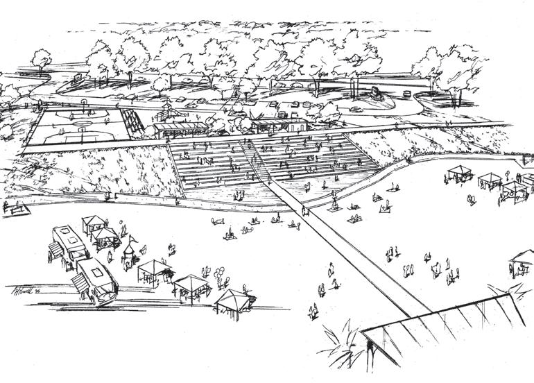
A perspective sketch shows one design concept that was created during ideation, a creative process for developing new ideas for recreational opportunities at the park.
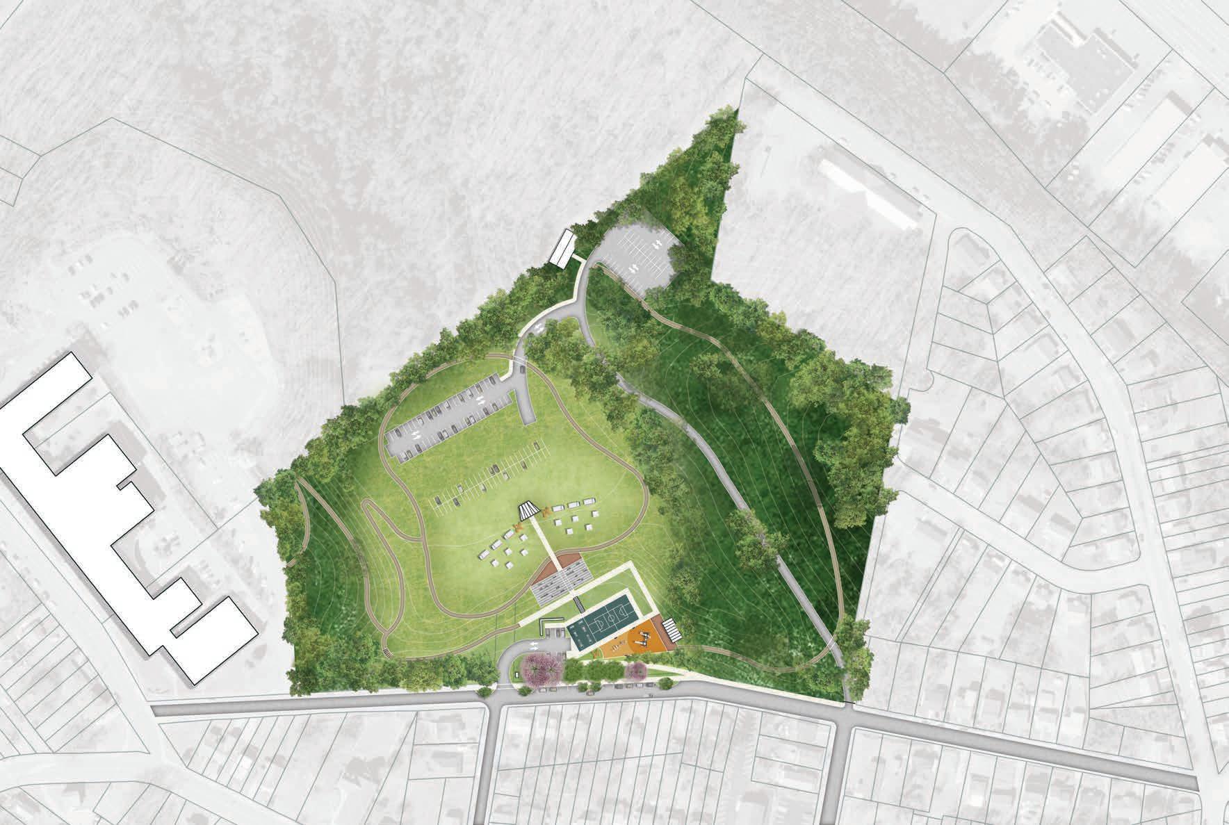
Baldwin Park serves the community by offering recreational facilities for daily activity and a large event space. Park enhancements will include improved and additional parking areas to serve amenities located next to Swanson Street and the event lawn. Sidewalks and natural surface trails will offer connectivity between park features and include a connection to the elementary school. New and refurbished recreational facilities will offer additional recreational opportunities.


The Foothills of the Blue Ridge Region is home to several communities whose growth was historically tied to industry in the early to mid-20th century. While manufacturing activity has declined, current development efforts can leverage the region’s natural assets to support outdoor recreation and enhance quality of life for residents, attract business investment, and stimulate economic growth through tourism.
Three communities—Stuart, Bassett, and the Village of Fieldale—are positioned as key community hubs, or "trail towns," within the region’s developing outdoor recreation economy (See Map 13: Foothills of the Blue Ridge Community Hubs, page right; and Exhibit 12: Trail Town Development Case Studies, pages 94-95). Their prominent locations along regional trail corridors position them to accommodate business development that serves outdoor recreation users. These hubs can function as central activity nodes, helping to distribute visitor use across the region while providing accessible outdoor experiences for individuals of all ages and abilities.
Community hubs within the Foothills of the Blue Ridge Region can also serve as Trail Towns, communities that embrace and celebrate trails and outdoor recreation by providing services to trail users and fostering a trail-friendly culture to stimulate local economies. Trail Towns develop by leveraging their proximity to natural assets, addressing outdoor recreation infrastructure needs, and gradually building a strong outdoor economy supported by local businesses and tourism-driven revenue.
Two specific trail towns were examined as case studies for successful outdoor recreation-based economic development, selected for their comparable geography, existing outdoor recreation assets, and potential for outdoor-oriented businesses. Considering the larger market population and similar recreational resources in the Foothills of the Blue Ridge Region, the community hubs in Patrick and Henry Counties have the potential to replicate and adapt similar development strategies to encourage profitable, locally rooted outdoor economy businesses.
Damascus is a small town located in southwest Virginia, nestled in the Appalachian Mountains with close proximity to both the Tennessee and North Carolina borders. Known as “Trail Town USA,” Damascus is uniquely situated at the crossroads of several major hiking and biking trails, including the Virginia Creeper Trail and Appalachian Trail. In addition, the area offers horseback riding as well as fishing, swimming, and paddling within the numerous creeks and streams. Damascus has become a popular outdoor recreation destination for people of all ages and abilities in the region, ranging from families to thru-hikers.
Surrounded by the Rocky Mountains and situated along the Beaverhead River, Dillon, Montana, is in the southwestern part of the state with close proximity to Interstate 15, making it accessible while still retaining a small-town, rural charm. Located near key outdoor recreation areas, including the Beaverhead-Deerlodge National Forest and Clark Canyon Reservoir, Dillon offers opportunities for fishing, hiking, bow-and-rifle hunting, and camping. In particular, the town is especially renowned for its abundance of fishing recreation, with the Beaverhead River known for its large brown trout and clear, cold waters, Big Hole River, providing a more remote fishing experience for wild rainbow, brown, brook, and native grayling, and Clark Canyon Reservoir with still-water trout fishing. Capitalizing on these natural assets, Dillon attracts anglers and recreationists from around the country.
Town Population
Market Population (2 hr driving radius)
3,979 766
Outdoor Recreation Assets
410,277 1,852,142
Virginia Creeper Trail, Appalachian Trail, Mount Rogers National Recreation Area, Grayson Highlands State Park, Iron Mountain Trail
Beaver Head-Deer Lodge National Forest, Beaver Head River, Big Hole River, Clark Canyon Reservoir, Clark’s Lookout State Park
Outdoor Economy Businesses
Retail, outfitters, rentals, and shuttles for hiking and biking
Guides, outfitters, fishing expeditions, hunting expeditions
The Town of Stuart, located in the center of Patrick County, has an estimated population of 1,400 people. With its close proximity to the US Highway 58 corridor and existing outdoor assets, such as the Blue Ridge Parkway and Mayo River, Stuart holds great potential to be an integral community hub.
The Town has established an uptown business district adjacent to Alice T. DeHart Park and downtown business district near the Mayo River. These two economic centers are connected by a sidewalk along North and South Main Street, and a proposed trail route along Campbell Creek will provide another connection.
Downtown Stuart’s proximity to the Mayo River, along with adjacent public properties and underutilized private industrial properties, presents an opportunity to pursue strategic public-private partnerships that could drive investment and redevelopment for commercial, residential, recreational, and mixed-use purposes. This circumstance creates a unique opportunity for the town to establish two interconnected central business districts, each bordered by public parks and green space, and linked through a network of sidewalks and paths.
Specific Foothills of the Blue Ridge action items in support of the Town of Stuart are as follows:
Conduct outreach to private landowners and gauge interest in potential property redevelopment. Explore potential development/redevelopment opportunities on public properties located in the proposed district (See Exhibit 13: Stuart River District, page right). Implement proposed parks and green space recommendations. Develop a custom visual identity and brand for the Stuart River District.
Work in cooperation with willing property owners and VDOT in the planning, development, and construction of the
proposed Mayo River Rail Trail trailhead and associated recreational features to include a well-defined greenway path, river access, multi-sport courts, and a large picnic shelter (See Exhibit 14: Stuart River District Trailhead, page 98).
Improve and enhance the existing Mayo River Rail Trail trailhead located behind the Patrick County Sheriff's Office by developing an expanded parking area and additional recreational amenities to include a river access, picnic facilities, playgrounds, and skate park (See Exhibit 15: Mayo River Adventure Park, page 99).
5.1.4
Support plans for the implementation of the Stuart Rotary Park Conceptual Master Plan completed by the Community Design Assistance Center (CDAC) at Virginia Tech (See Exhibit 16: Stuart Rotary Park Conceptual Master Plan, page 101)
Seek and encourage entrepreneurs to consider general outdoor recreation retail opportunities and target potential gear manufacturers for property redevelopment in the proposed Stuart River District.


The Stuart River District creates a strategic opportunity for land use planning that includes park development, greenway and trail connectivity, and targeted property redevelopment. Situated between downtown Stuart and the proposed Mayo River Adventure Park, and anchored on the Mayo River, the district has the potential to support residential, commercial, and mixed-use redevelopment expanding downtown activity along the corridor. Private investment by creative entrepreneurs and collaboration with willing property owners will be required to make this vision a reality. Greenway and trail corridors connect key assets within and outside the district including downtown Stuart, the proposed Mayo River Adventure Park, Rotary Park, uptown Stuart, and Alice T. DeHart Park via Campbell Creek.

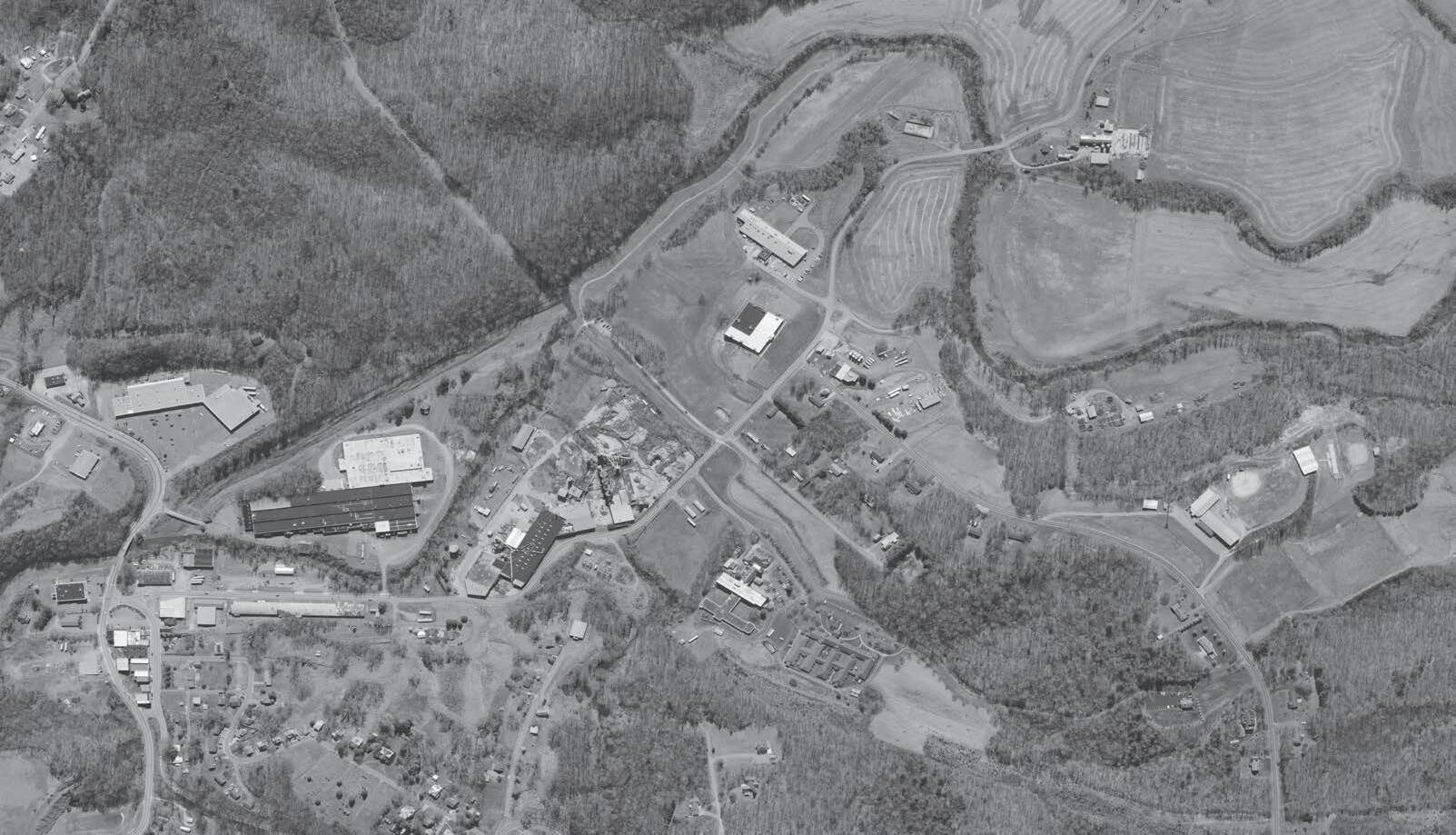


Existing Greenwa y


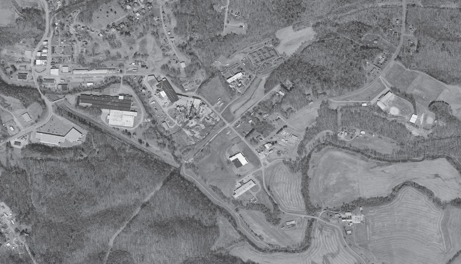
The Stuart River District Trailhead offers downtown access to the Mayo River Rail Trail and a number of recreational amenities. The trail is defined by a wide concrete sidewalk or asphalt multi-use path. The trailhead also includes expanded parking, river access, multi-sport courts, public art, and a large picnic shelter.
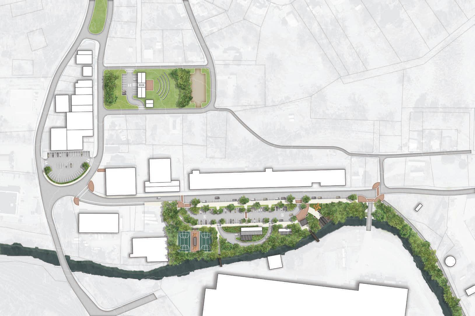


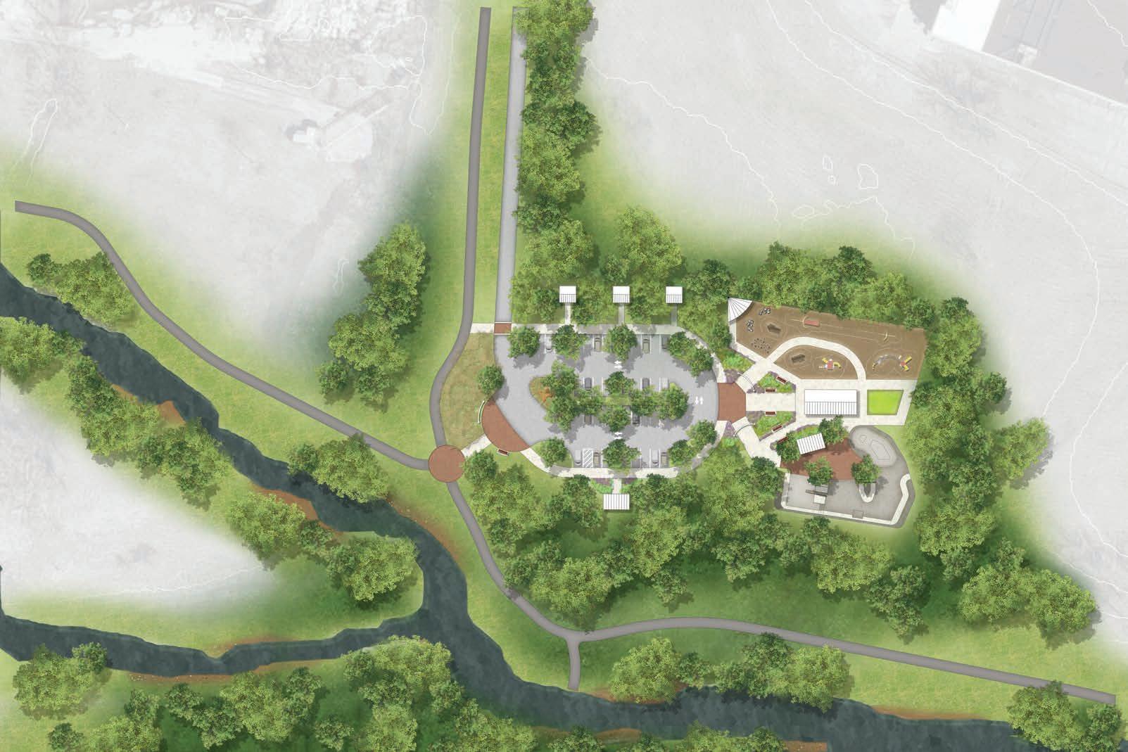
The Mayo River Adventure Park serves as the eastern boundary of the river district and provides direct access to the Mayo River Rail Trail. Key features include an expanded parking area, paddle access, children’s play area with zipline, boulder garden, two
and skate park with a spectator plaza.
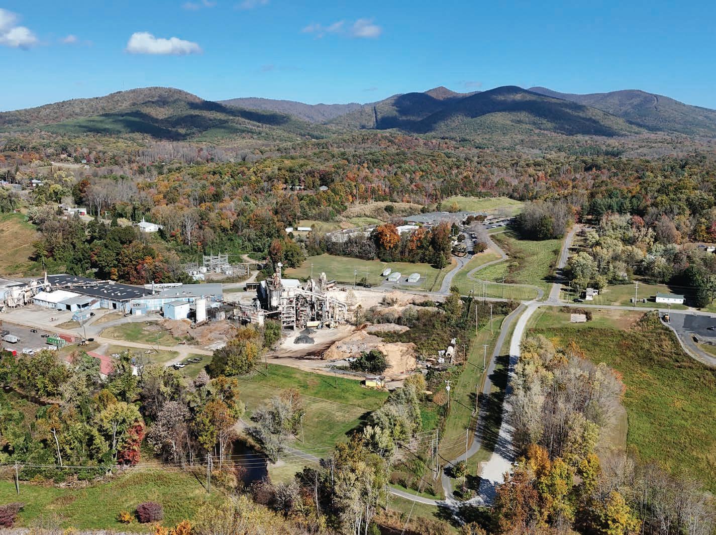
The Stuart Rotary Park conceptual master plan focuses on community gathering, outdoor recreation, and enhancing existing uses and infrastructure. Key features include an amphitheater, tent camping, walking and mountain biking trails, an extension of the Mayo River Rail Trail, entrance improvements from Woodland Drive, and additional site furnishings.

Source:CommunityDesign AssistanceCenteratVirginiaTech
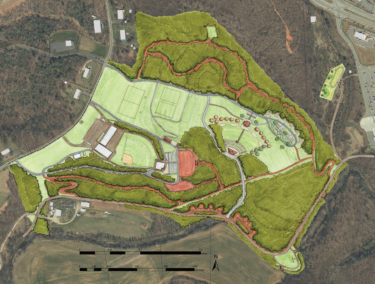
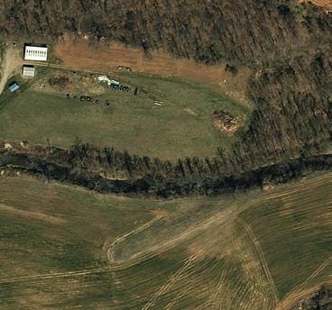
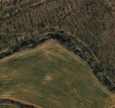
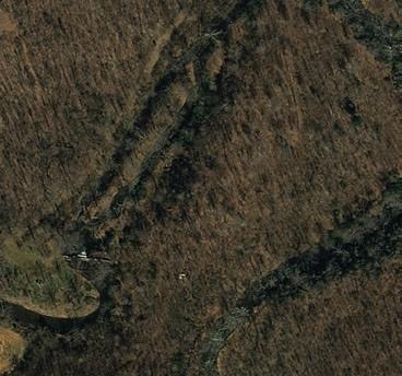
The Town of Bassett, located just south of Philpott Lake along the Smith River, has a strong historical identity tied to the furniture manufacturing industry. Its proximity to public lands—including Philpott Lake, Fairy Stone State Park, and Fairystone Farms Wildlife Management Area—as well as outdoor recreation assets such as Lauren Mountain Preserve, the Smith River, and the proposed Dick & Willie Trail extension, places the town to be uniquely situated to support a diverse range of outdoor recreation activities.
By supporting government and nonprofit partners in development, enhancement, and management of trails and river accesses in the area, along with the promotion of property redevelopment and outdoor-focused business opportunities, these efforts position Bassett to play a leading role in the region’s emerging outdoor recreation economy.
Specific Foothills of the Blue Ridge action items in support of the Town of Bassett are as follows:
Work in cooperation with VDOT, Henry County, Town of Bassett, and Dan River Basin Association in the planning, development, and construction of the proposed Dick and Willie Trail extension (See Exhibit 17: Bassett Dick and Willie Trail Extension, page 103).
Identify potential properties and vacant buildings, conduct landowner outreach, and gauge interest in redevelopment for commercial, residential, and mixed uses.
Seek and encourage entrepreneurs to consider general outdoor recreation retail and gear manufacturing opportunities centered on paddling, fishing, hiking, and mountain biking.
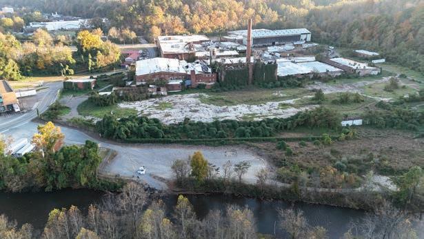
VacantmanufacturingbuildingsinBassettcouldbe redeveloped for commercial, residential, and mixed uses to supporttheoutdoorrecreationeconomy.
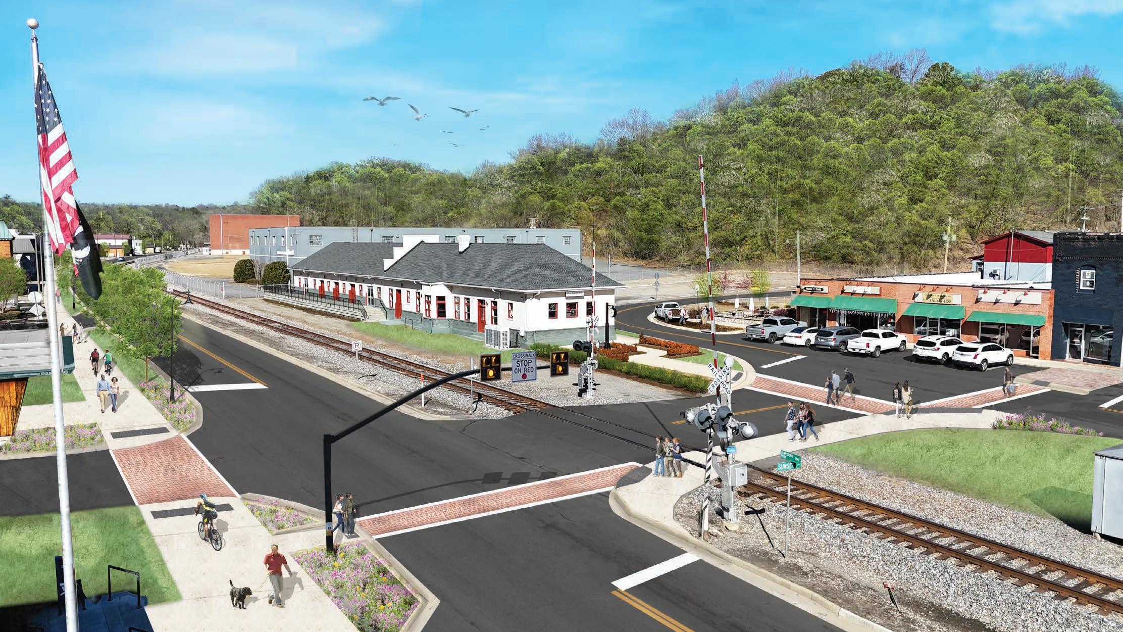
The Dick and Willie Trail Extension, part of the Smith River Trails System, will pass through Bassett as it stretches from Martinsville to Philpott Lake. The Smith River corridor and Fairystone Park Highway provide potential routes for the trail. The width of the southbound lane between the southern railroad crossing and the Lenoir Street intersection would accommodate a multi-use path separated from the road with a four-foot wide landscape buffer including trees and street lights. By constructing trails and greenways in visible and easily accessed areas, it will increase public awareness of outdoor recreation amenities and a developing outdoor culture in the town.
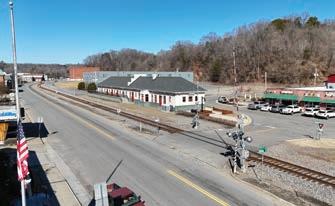
The Village of Fieldale, located on the Smith River between Bassett and Martinsville, currently serves as a trail access hub for the Smith River Trail System. It connects the Fieldale Trail to the Textile Heritage Loop Trail at Fieldale Park and offers a designated access point along the Smith River Blueway. A small downtown area, located adjacent to the recreation complex, presents opportunities to expand community gathering spaces and provide services that support outdoor recreation visitors.
Supporting current efforts to expand the Smith River Blueway and Fieldale Trail System would enhance regional connectivity and accessibility and also encourage economic development by supporting trail and river related outdoor recreation business opportunities in the area.
Specific Foothills of the Blue Ridge action items in support of the Village of Fieldale are as follows:
5.3.1
In cooperation with VDOT and town officials, develop and implement a conceptual master plan for a Village Square between the Fieldale Recreation Center and downtown area that features community gathering and event space.
5.3.2
Work in cooperation with VDOT and Town officials in the planning, development, and construction of a multi-use trail along Field Avenue that would provide a safe bicycle and pedestrian connection between the proposed village square and Smith River Trails system.
5.3.3
Work in cooperation with Henry County Parks and Recreation, DRBA, and local partners to improve the existing Fieldale River Access to the Smith River by reconstructing the river entry steps.
5.3.4
Seek and encourage entrepreneurs
to consider outdoor recreation retail opportunities focused on hiking and mountain biking.
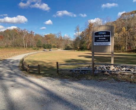
The Fieldale River Access provides access to theSmithRiverBlueway.
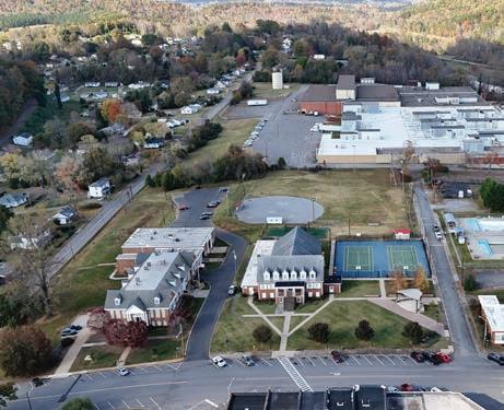
AVillageSquarelocatedbetweendowntown and the recreation center would provide apedestrianfriendlypublicspacefor communitygatherings.
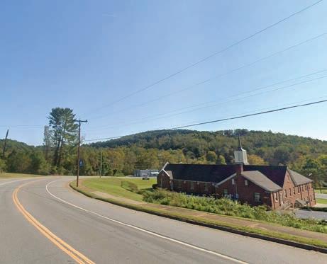
Amulti-usetrailalongFieldAvenuewould connect the Fieldale Town Center to the existingSmithRiverTrailssystem.
DowntownFieldaleoffersalocationforbusinessesthatsupporttheoutdoorrecreationeconomy, suchasrestaurants,outfitters,andserviceproviderscateringtotrailusersandvisitors.
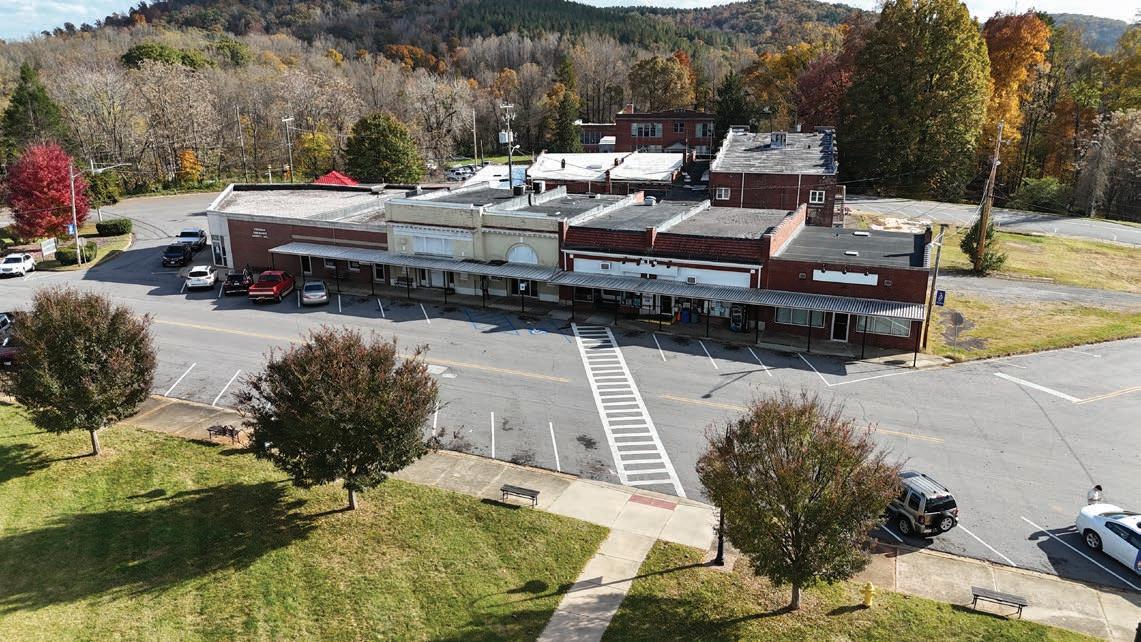
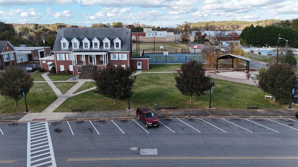
The Fieldale Recreation Center, located across from Downtown, provides recreationalfacilitiesandhostsavarietyofcommunityevents.
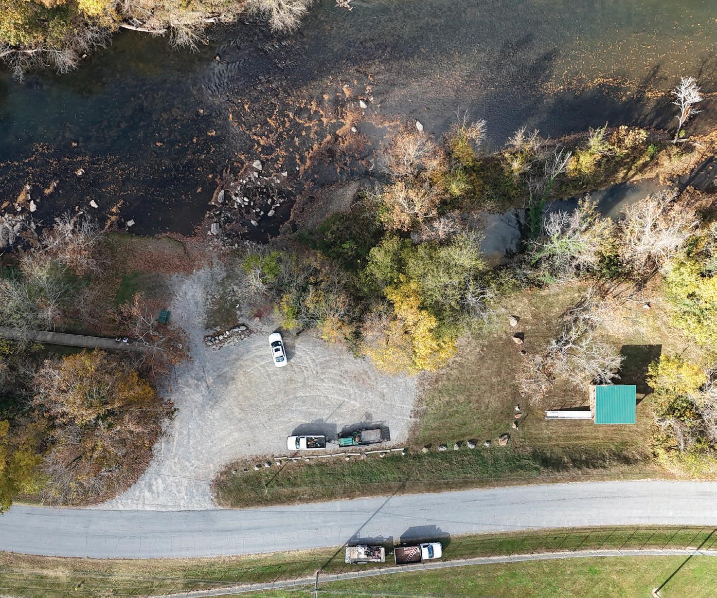
This chapter presents additional general recommendations for implementing the Foothills of the Blue Ridge Outdoor Recreation Plan, highlights a summary matrix of all action items presented throughout the plan, and provides key grant funding sources. This chapter is organized into the following sections:
IN THIS CHAPTER:
5.1 General Recommendations
5.2 Implementation Matrix
5.3 Key Grant Funding Opportunities
The Foothills of the Blue Ridge Outdoor Recreation Plan provides a community-led vision and 15-year roadmap to create and enhance outdoor infrastructure development that benefits both residents and visitors and extends regional recreation opportunities while promoting responsible growth. The pursuit of any action or project must be underpinned by one or more of the five emerging themes discovered during the planning process, including: 1) Connectivity; 2) Sustainable Outdoor Recreation; 3) Arts, Culture, & Education; 4) Partnerships; and 5) Economic Development.
Friends of Southwest Virginia and its partners should consider four (4) general recommendations as they work to implement the Foothills of the Blue Ridge Outdoor Recreation Plan, which include the following:
Establish a dedicated Outdoor Recreation Infrastructure Development and Stewardship Committee consisting of approximately 6-10 members and composed of representatives from local governments, nonprofit organizations, public land agencies, and other key stakeholders. The committee will guide a coordinated public and nonprofit organization framework for the planning, development, and long-term maintenance of outdoor recreation facilities and infrastructure. Existing partnerships, such as those with the Dan River Basin Association (DRBA) and between local governments and public land managers, will be leveraged to support project funding, execution, and promotion.
Collaborate with local and regional tourism authorities, such as West Piedmont Planning District Commission, City of Martinsville, Patrick County, and Friends of Southwest Virginia, to promote tourism products that strategically market outdoor recreation opportunities, destinations, and services for the region. Tourism product promotion will include marketing, partnerships, and compelling content that increases awareness, enhances visibility, and highlights unique experiences.
Coordinate with VDOT to ensure that proposed street enhancements, including wayfinding signage, road diets, and alternative transportation infrastructure, align with state policies, design standards, and safety guidelines. Emphasis will be placed on enhancing multimodal safety and accessibility for pedestrians, cyclists, and motorists while supporting overall transportation efficiency and community connectivity.
Engage private landowners to determine interest in collaborating with local governments or nonprofit conservation organizations on land conservation and outdoor recreation initiatives outlined in the plan recommendations. Local government staff should explore redevelopment opportunities with property owners of previously developed sites within the identified community hubs to support commercial, residential, and mixed-use projects. Pursue innovative public-private partnerships and consider incentives that support entrepreneurship, job creation, and economic growth.
PROJECT NAME
PROJECT RECOMMENDATION
1.1
• 1.1.1 Access Area Maintenance and Enhancement. Support government and nonprofit partners with maintenance and enhancement of existing access areas.
• 1.1.2 Access Area Development. Explore additional access area opportunities north of Philpott Lake and south of Mitchell Bridge Access.
• 1.1.3 Vehicular Wayfinding Sign System. Design and implement a vehicular wayfinding system that incorporates current branding.
Patrick County, Henry County, City of Martinsville
• 1.2.1 Access Area Maintenance and Enhancement. Support government and nonprofit partners with maintenance and enhancement of existing access areas.
• 1.2.2 Blueway Master Plan. Develop a comprehensive master plan to assess, develop, and manage the Mayo River Blueway.
• 1.2.3 Landowner Engagement. Identify potential sites and engage landowners to determine interest in access area development.
• 1.2.4 Access Area Development. Explore additional access area opportunities on the North and South Forks of the Mayo River.
Patrick County, Henry County
• 1.3.1 Access Area Maintenance and Enhancement. Support government and nonprofit partners with maintenance and enhancement of existing access areas.
• 1.3.2 Blueway Master Plan. Develop a comprehensive master plan to assess, develop, and manage the Dan River Blueway.
• 1.3.3 Landowner Engagement. Identify potential sites and engage landowners to determine interest in access area development.
• 1.3.4 Access Area Development. Explore additional access area opportunities from Talbott Dam to Pinnacles Powerhouse and Kibler Valley.
• 1.3.5 Community Events. Support partner organizations with the organization and promotion of outdoor recreation event opportunities on the Dan River.
County
• 1.4.1 Philpott Lake Master Plan. Support USACE plans for lake facilities and amenities, including outdoor recreation opportunities and proposed projects for trails, marina, accessibility, and signage improvements.
• 2.1.1 Trail Planning. Develop a detailed corridor study for a portion of segment 16 (Henry/Pittsylvania County LineMartinsville) and segment 23 (Fairy Stone State Park to the Blue Ridge Mountains).
• 2.1.2 Trail Designation. Identify, brand, and promote existing trail segments as the Beaches to Bluegrass Trail.
Patrick County, Henry County
Patrick County, Henry County, City of Martinsville
• 2.2.1 Trail Planning and Development. Support local plans and efforts to develop, manage, and promote the local trail system in Henry County.
• 2.3.1 Trail Planning and Development. Support local plans and efforts to develop, manage, and promote this regional linear trail that connects Philpott Lake, Bassett, Fieldale, Stanleytown, and Martinsville.
• 2.4.1 Trail Planning and Development. Support local plans and efforts to develop, manage, and promote this linear trail in the Mayo River corridor.
2.5 Fairy Stone Trail Complex (Fairy Stone State Park/ Fairystone Farms WMA/ Philpott Lake)
• 2.5.1 Trail System Master Plan. Develop a comprehensive master plan that addresses opportunities and strategies to create purpose-built equestrian and mountain bike trails.
Henry County, City of Martinsville
• 2.6.1 Landowner Engagement. Identify and engage landowners that own large undeveloped parcels to determine interest in partnering with a local government for outdoor recreation development.
• 2.6.2 Trail System and Park Master Plan. Develop a comprehensive park and trail master plan that addresses opportunities and strategies to create a purpose-built motorized trail system with supporting commercial business opportunities.
• 2.6.3 Public Private Partnership. Seek investors and entrepreneurs to develop and manage the trail system and park in cooperation with a willing landowner and local government partner.
Henry County, City of Martinsville
Patrick County, Henry County Patrick County
Patrick County, Henry County
Focus Area 3: PUBLIC LANDS
• 3.1.1 Riverview Park Master Plan. Support Henry County plans for park and facility development.
• 3.1.2 Outdoor Adventure Center. Develop a multi-purpose facility that provides space for a visitor center, classrooms, natural history exhibits, retail, outfitters, and indoor adventure pursuits (climbing wall, event space, etc.).
• 3.2.1 Park Improvements and Expansion. Improve and expand the existing park by developing additional recreational amenities, an extensive sidewalk system that complements the existing natural surface trail system, and expanding the existing parking area.
• 3.3.1 Trail System Assessment. Assess existing trailheads and hiking trail system for improvements and expansion.
• 3.3.2 Trailhead Improvements/ Enhancement. Develop wayfinding signage and expand the existing lower trailheads. Enhance signage and visitor information provided at all trailheads.
• 3.4.1 Critz Community Center. Support plans for the implementation of the Critz Community Center Conceptual Design and Master Plan completed by the CDAC at VT.
• 3.4.2 Reynolds Homestead Recreational Facility Development. Explore development of additional recreational facilities and expansion of the existing trail system.
3.5 Blue Ridge Parkway Gateway Recreation Area
• 3.5.1 Regional Destination Center. Identify opportunities to develop a regional destination center on US Highway 58 that will serve as a gateway from the Blue Ridge Parkway to Patrick County and the foothills of southern Virginia.
• 3.5.2 Branding and Marketing. Support local government partners in branding and marketing the gateway recreation area and associated parks and overlooks as a tourist destination for families.
• 3.5.3 Fred Clifton Park. Support local government partners with maintenance and enhancement of park facilities.
• 3.5.4 Lovers Leap Overlook. After completion of the US Highway 58 widening project, support local government partners with maintenance and assess the area for parking and safety improvements.
• 3.5.5 Trail Connections. Explore potential trail connections between Meadows of Dan and the Blue Ridge Parkway corridor.
• 3.6.1 Planning and Development. Support Virginia State Parks, DRBA, and partners in developing and implementing a comprehensive master plan for the park.
• 4.1.1 Comprehensive Bicycle and Pedestrian Plan. Develop a comprehensive bike and pedestrian plan that outlines a strategic vision for creating a safe, accessible, and enjoyable experience for pedestrians and cyclists.
• 4.2.1 Connectivity. Support local government and nonprofit partners with the development of sidewalks, greenways, and trails to connect key arts and education facilities and trails.
• 4.2.2 Downtown Amphitheater. Support local government and community efforts to plan and build a downtown amphitheater.
• 4.2.3 Arts Master Plan. Support the Martinsville Arts and Cultural Committee in developing and implementing an Arts Master Plan.
• 4.3.1 Park Improvements. Implement park improvements that includes adding new recreational amenities for the community, improving vehicular and pedestrian accessibility, and enhancing the event field.
• 5.1.1 Stuart River District Development. Conduct outreach to private landowners and explore potential development/ redevelopment opportunities on private and public properties. Develop a custom visual identity and brand.
• 5.1.2 Stuart River District Trailhead. Implement the proposed Mayo River Rail Trail trailhead and associated recreational features.
Focus Area 5: COMMUNITY HUBS (cont’d)
• 5.1.3 Mayo River Adventure Park. Improve and enhance the existing Mayo River Rail Trail trailhead to expand parking and implement the proposed park amenities.
• 5.1.4 Rotary Park. Support plans for the implementation of the Stuart Rotary Park Conceptual Master Plan created by the CDAC at Virginia Tech.
• 5.1.5 Business Development. Seek entrepreneurs to explore general outdoor recreation retail and gear manufacturing opportunities.
• 5.2.1 Trail Development. Work in cooperation with partners to plan, develop, and construct the Dick and Willie Trail extension.
• 5.2.2 Property Redevelopment. Identify potential properties and explore landowner interest in redevelopment to support commercial, residential, and mixed uses.
• 5.2.3 Business Development. Seek entrepreneurs to explore general outdoor recreation retail and gear manufacturing opportunities centered on paddling, fishing, hiking, and mountain biking.
• 5.3.1 Village Square. Develop and implement a master plan for a Village Square on Marshall Way in front of the recreation center.
• 5.3.2 Multi-use Trail Connection. Create a multi-use trail along Field Ave that connects the village square and Smith River Trails system.
• 5.3.3 Fieldale River Access Area. Improve the existing Fieldale River Access entry steps to the Smith River.
• 5.3.4 Business Development. Seek entrepreneurs to explore outdoor recreation retail opportunities centered on hiking and mountain biking.
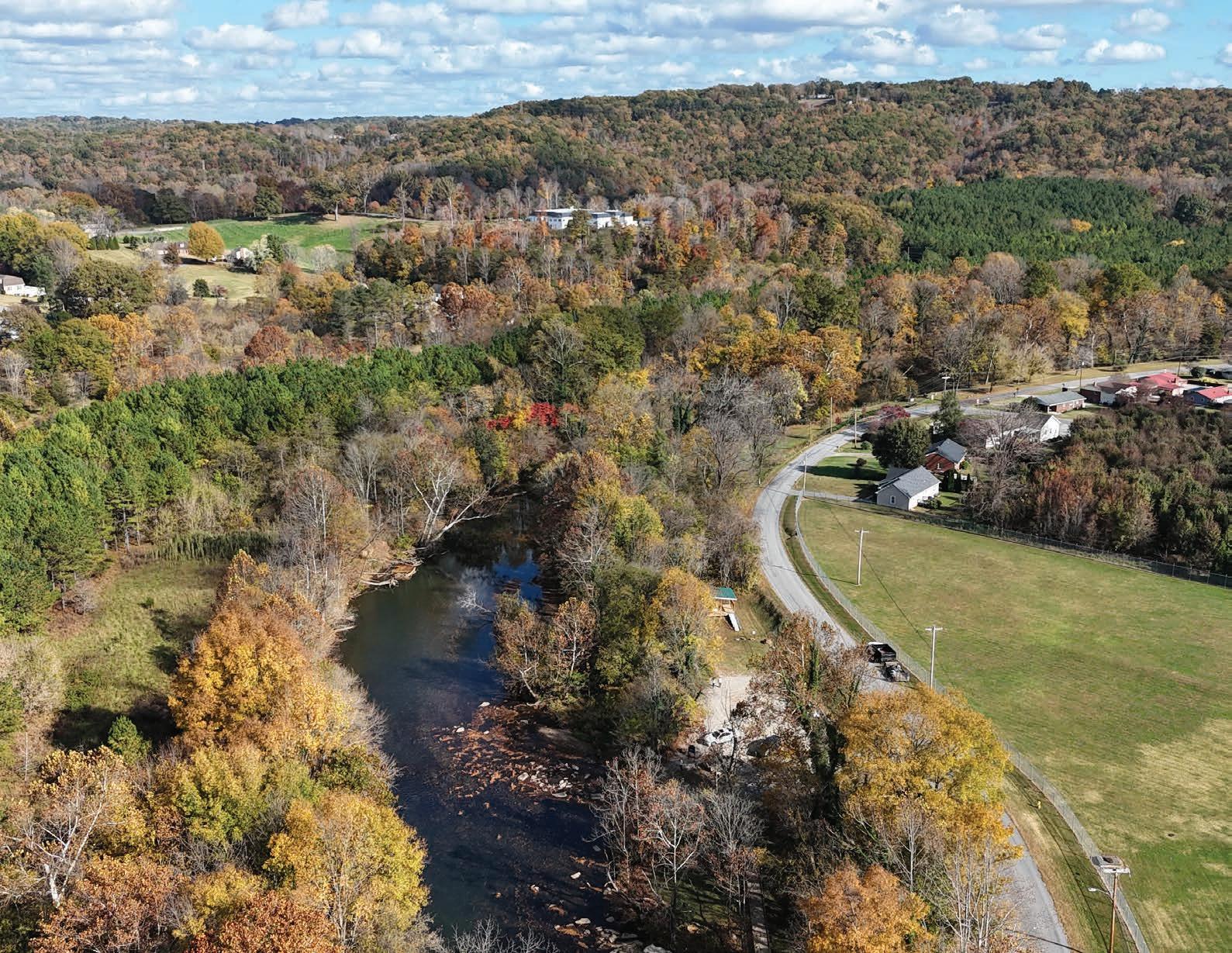
Appalachian Regional Commission (ARC) - Area Development Program
Appalachian Regional Commission (ARC) –Appalachian Regional Initiative For Stronger Economies (ARISE)
Appalachian Regional Commission (ARC)Partnerships for Opportunity and Workforce Economic Revitalization (POWER) Initiative
Virginia Department of Community Housing and Development - Community Development Block Grants (CDBG)
Virginia Department of Community Housing and Development - Industrial Revitalization Fund (IRF)
Virginia Main Street - Downtown Investment Grants (DIG)
Virginia Main Street - Community Vitality Grants (CVG)
Virginia Main Street - Financial Feasibility Grants (FFG)
Appalachian economic development, focusing on infrastructure, tourism, and business growth $300,000 - Nonconstruction
Multi-state collaborative projects that address ARC’s five focus areas
Coal industry losses, including tourism investments
Community improvement projects, including economic development, housing, and infrastructure
Revitalizes historic districts with one-time creative, sustainable development projects for AVMS communities
Enhances historic districts through design, planning, economic vitality, and nonprofit development for EMS and MMS communities
Revitalization of non-productive upper floor space for vacant and/or deteriorated properties
Virginia Tourism Corporation - Virginia Special Events and Festivals Program Event
after participating in DRIVE Tourism programs
million Based on Local Criteria Varies
PARTNERSHIP FUNDING AGENCY
Virginia Department of Conservation and Recreation - Land and Water Conservation Fund (LWCF)
Virginia Department of Conservation and Recreation - Recreational Trails Program (RTP)
Virginia Department of Conservation and Recreation - Trail Access Grant Program
Tobacco Region Revitalization Commission
Public outdoor recreation area acquisition, development, and connectivity projects
Construction, rehabilitation, and acquisition of trails and related facilities, improving accessibility and use
Shovel-ready projects that enhance trail access for people with disabilities
Revitalization projects in Virginia’s tobacco region, focusing on agribusiness, economic development, and tourism
Virginia Office of Intermodal Planning and Investment - Multimodal Planning Technical Assistance Program
APPALACHIAN REGIONAL COMMISSION (ARC) – AREA DEVELOPMENT PROGRAM
The ARC Area Development Program makes investments in two general areas: critical infrastructure and business and workforce development, which includes natural and cultural heritage and downtown revitalization projects. The revitalization projects can include a broad range of projects, including planning, streetscapes, signage, or the renovation of historic buildings. The projects should support the businesses, residents, and visitors in the target downtown area and should emphasize economic development in its benefits, rationale, and performance measures.
APPALACHIAN REGIONAL COMMISSION (ARC) – APPALACHIAN REGIONAL INITIATIVE FOR STRONGER ECONOMIES (ARISE)
The ARC ARISE Initiative encourages multistate collaborative projects that strengthen business and industry, and grow and support the development of new opportunities across multiple economic sectors. Project proposals must address at least one of ARC’s five focus areas: 1.) businesses, 2.) workforce ecosystems, 3.) infrastructure, 4.) regional culture and tourism, or 5.) eaders and community capacity.
APPALACHIAN REGIONAL COMMISSION (ARC) – PARTNERSHIPS FOR OPPORTUNITY AND WORKFORCE ECONOMIC REVITALIZATION (POWER) INITIATIVE
The ARC POWER Initiative helps communities and regions that have been affected by job losses in coal mining, coal power plant operations, and coal-related supply chain industries. Funding can be leveraged for tourism-related capital investments, including construction and acquisition.
AND DEVELOPMENT –COMMUNITY DEVELOPMENT BLOCK GRANTS (CDBG)
CDBGs provide funds for community improvement and planning grants to implement projects that will most directly impact the greatest needs of the community and clearly articulate strategies for addressing these community development needs. Funds can be used for economic development, comprehensive community development, community service facilities, targeted neighborhood housing rehabilitation, and public infrastructure.
The IRF Program funds the redevelopment of vacant and deteriorated industrial and commercial properties for any marketdriven purpose, including mixed-use. Eligible former property uses include manufacturing, warehousing, mining, transportation, power production, department stores, theaters, hotels, shopping centers, and school buildings.
The Virginia Main Street Program is a preservation-based economic and community development program that offers a range of services and assistance to communities interested in revitalizing their historic commercial districts. DIGs allow Main Street organizations to take on unique, onetime projects that measurably, creatively, and sustainably advance the organization's goals and strategies. Grants are available only to designated Advancing Virginia Main Street (AVMS) organizations.
The Virginia Main Street Program is a preservation-based economic and community development program that offers a range of services and assistance to communities interested in revitalizing their historic commercial districts.CVG projects create lasting positive impact on the historic downtown or neighborhood commercial districts, including, but not limited to, design projects, wayfinding system development, strategic planning, website development, economic vitality projects, and nonprofit organizational development. CVG grants are available to all of Virginia’s active Exploring Main Street (EMS) and Mobilizing Main Street (MMS) communities and organizations.
The Virginia Main Street Program is a preservation-based economic and community development program that offers a range of services and assistance to communities interested in revitalizing their historic commercial districts. FFGs can be used for buildings or structures with nonproductive upper floor space that may be vacant and/or deteriorated and whose poor condition creates a notion of physical and economic blight in the surrounding area. The grant also allows for small-scale development to new or beginning developers within the district. Grant funds are available to all VMS communities on a first-come, first-serve basis.
This program provides funding for special events and/or festivals that show positive and significant impact on tourism and requires a marketing plan designed to drive visitation to Virginia. Requests used for expanding festival capacity, adding a stage, enhancing visitor experience, adding artisan markets, concessions, food trucks, or other revenue generating activities are desired.
Grants are available to Virginia DMOs who have been established for at least 6-months and have participated in DRIVE Tourism, DRIVE 2.0, and/or DRIVE Outdoor. Funding can be utilized for event infrastructure such as non-permanent staging and tables, chairs, umbrellas, lighting, and portable generators.
DEPARTMENT OF CONSERVATION AND RECREATION –LAND AND WATER CONSERVATION FUND (LWCF)
The LWCF supports the acquisition and/or development of public outdoor recreation areas. Funds may be used for acquisition (lands, wetlands, and waters) for public outdoor recreation as well as physical connections among them (trails, waterways, wildlife habitat corridors), development, or a combination of acquisition and development projects that serve a wide variety of public outdoor recreation activities.
The RTP funds the building and rehabilitating of trails and trail facilities as well as land acquisition for trail projects. Funds may be used for construction, maintenance, restoration, and development of trails, trail linkages, and trailhead facilities/ amenities, increasing accessibility and use for persons with disabilities, acquisition of easements, and assessments of trail conditions.
This grant funds shovel-ready projects that increase access to trail opportunities for people with disabilities. Funds may be used for tactile or interpretive signage, waysides with audio description, accessible watercraft launches, accessibility improvements to restrooms, parking, and picnic areas, or removing tread obstacles and creating firm and stable tread surfaces.
The Commission operates several programs that provide grant or loan funds to accomplish specific revitalization objectives in the tobacco region of Virginia. Projects may include efforts that expand the local and regional economy in agribusiness, economic development, business development, industrial sites and infrastructure, or tourism.
The Lowe’s Hometown Grants Program supports community projects that involve making physical improvements or enhancements. Projects must be sponsored by a nonprofit or government entity and must fall into at least one of the following categories: community resources/space; safe affordable housing; cultural preservation; area revitalization; and/or skilled trades education initiatives.
State-funded program to assist with construction, reconstruction, maintenance, and improvements of bikeways or roads that serve publicly developed recreational or historic sites operated by state or local government entities.
Community grant that supports bicycle infrastructure projects and targeted initiatives that make it easier and safer for people of all ages and abilities to bike.
Small grant to fund quick-action projects that can help communities become more livable for people of all ages.
T-Mobile has partnered with Smart Growth America and Main Street America, to help build stronger and more prosperous small towns and rural communities. The T-Mobile Hometown Grants program will help fund projects that build or renovate public spaces.
The VDOT Transportation Alternatives Program is intended to help fund community-based projects that expand non-motorized travel choices and enhance the transportation experience, focusing on providing pedestrian and bicycle facilities and community improvements. Community improvements may include enhancing the cultural, historical, and environmental aspects of the transportation infrastructure.
This program provides funding to develop implementable plans that advance community visions aligned with the vision, goals, and objectives established by the Commonwealth Transportation Board (CTB), which promotes healthy communities and business advancement. Intergovernmental cooperation, regional planning, public-private partnerships, and coalitions are encouraged.
The purpose of the RBDG program is to promote economic development and job creation projects that benefit rural areas or towns outside the urbanized periphery of any city with a population of 50,000 or more. Grants are organized in two separate categories: business opportunity grants and business enterprise grants. Funds may be used for training, land acquisition or development, pollution control, rural transportation, community economic development, feasibility studies, and longterm business strategic planning.
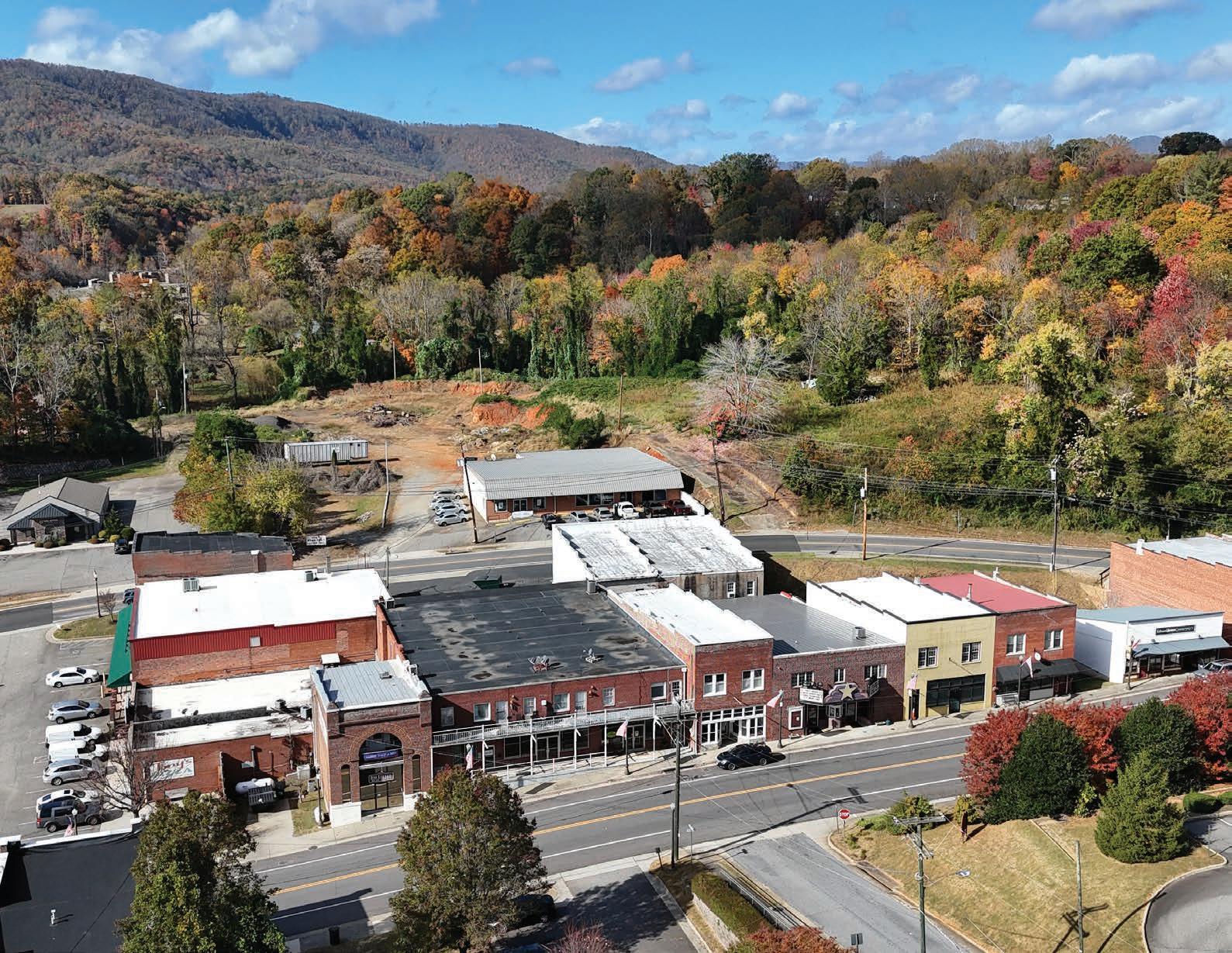
AIN THIS CHAPTER:
A.1 Foothills of the Blue Ridge Outdoor Recreation Plan Fact Sheet
Inventory and assess the existing outdoor recreation assets in the study area, evaluating their current condition and capacity to offer a high-quality outdoor experience for all users.
Collaborate with government entities, community leaders, and the public to identify ongoing and planned projects aimed at enhancing the quality of life for both residents and visitors.
Identify new, compelling tourism infrastructure projects to promote the outdoor economy, enhance the quality of life, and drive private investment.
Identify projects that also help achieve broader community goals, such as young adult and workforce retention, small business growth, environmental quality, and active living.
Develop a 15-year action plan that captures community interest and inspires a shared vision by incorporating compelling renderings, site master plans, 3D illustrations, and other visual elements to clearly convey recommendations and ideas.
Provide the steering committee and their partners with clear strategies and a prioritization schedule for implementing the plan recommendations.
TheFoothillsoftheBlueRidgeOutdoorRecreationPlanisa community-driveninitiativedesignedtocreatea15-yearroadmap forenhancingoutdoorrecreation,connectivity,andsustainability acrosstheregion.CoveringPatrickCounty,HenryCounty,andthe CityofMartinsville,thisplanaimstoextendregionalrecreation opportunitieswhilepromotingresponsiblegrowth.
LedbyFriendsofSouthwestVirginiaandfundedbygrants fromtheAppalachianRegionalCommissionandtheTobacco RegionRevitalizationCommission,theplanseekstostrengthen ecotourismandoutdooractivities.Thegoalistofoster partnershipsandstrategicallyexpandrecreationalassetsand regionalconnectivity.
Theplanenvisionsincreasingtheeconomicimpactofoutdoor recreation,improvingqualityoflifeforresidents,andelevating currentassetstoensurelong-termsustainabilityandeconomic growth.
1) Research and Preliminary Analysis
The consultant team will hold a direction-setting meeting with a steering committee to discuss key opportunities and challenges, compile a comprehensive database of existing outdoor recreation assets, and assess current resources and infrastructure.
2) Stakeholder and Public Engagement
Interviews and focus groups with community leaders, partner organizations, and government officials will provide insights into the region and its assets. A promotional video leveraged by social media will encourage public participation in an online survey. A dedicated project website will serve as an information hub throughout the planning process.
3) Plan Development
Guided by the steering committee, stakeholders, and community input, the consultant team will develop a framework outlining preliminary recommendations for enhancing and expanding outdoor recreation assets. Following this, the team will initiate a second round of public engagement to gather further feedback.
4) Final Plan
The final 15-year action plan will encompass all recommendations, a phasing schedule, and an outline of potential grant funding sources. The plan will be made publicly accessible on the project website.

Jen Otey Outdoor Recreation Development Manager
Friends of Southwest Virginia (276) 492-2400
jotey@myswva.org
tim@DbDplanning.com