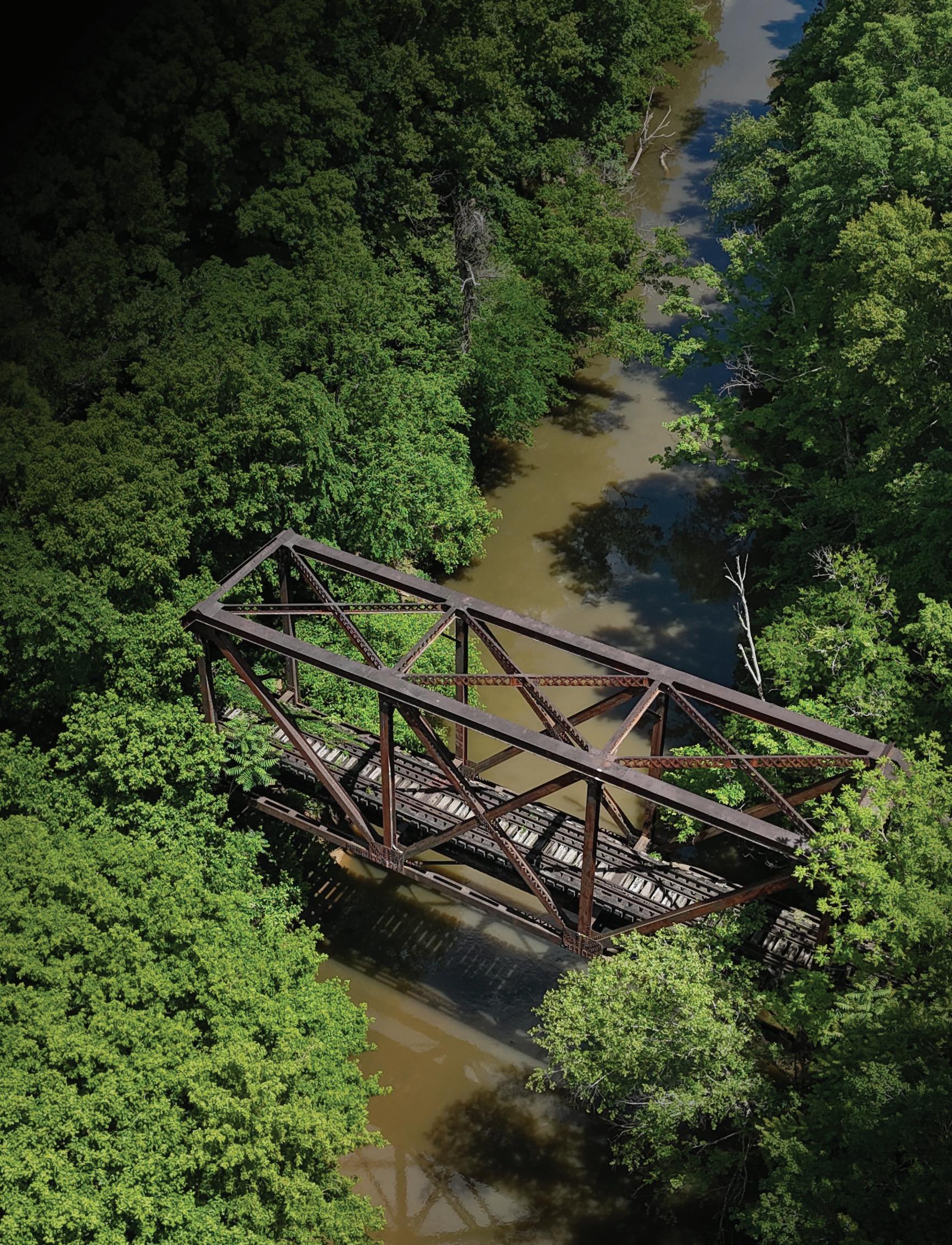
Durham County, North Carolina Fall 2025
PRODUCED BY:


Durham County, North Carolina Fall 2025
PRODUCED BY:


City of Durham Parks and Recreation
Durham County Transportation
East Coast Greenway Alliance
North Carolina Department of Transportation, Integrated Mobility Division
Bahama Ruritan Club
Bike Durham
Bragtown Community Association
City of Durham
Bahama Ruritan Club
Bragtown Community Association
Discover Durham
Durham County Transportation
Durham County
Durham Open Space & Trails Commission (DOST)
Durham Public Schools
Oxford-Hamlin Community Association
Triangle West Transportation Planning Organization
Person County
Rougemont Ruritan Club
Stagville Descendants Council
The Conservation Fund
Durham Open Space & Trails Commission (DOST)
Durham Public Schools
East Coast Greenway Alliance
Person County
Nida Allam, Chair
Dr. Mike Lee, Vice Chair
Mayor Leonardo Williams
Mayor Pro-Tem MarkAnthony Middleton, Ward 2
Michelle Burton
Wendy Jacobs
Person County Tourism Development Authority
Stagville Descendants Council
Triangle West Transportation Planning Organization
Stephen Valentine
Nate Baker, At-Large
Javiera Caballero, At-Large
Chelsea Cook, Ward 3
DeDreana Freeman, Ward 1
Carl Rist, At-Large
TheprojectmanagementteamrespectfullyacknowledgesthatthelandtheDurham-to-RoxboroRail Corridor,withinDurhamCounty,isontodayiswithinthetraditionalandancestralhomelandsoftheEno, Shakori,Sissipahaw,Occaneechi,otherpeopleofSiouandescent,andtheirdescendants,theOccaneechi BandoftheSaponiNation.Source:NativeLandDigital
Map
Exh
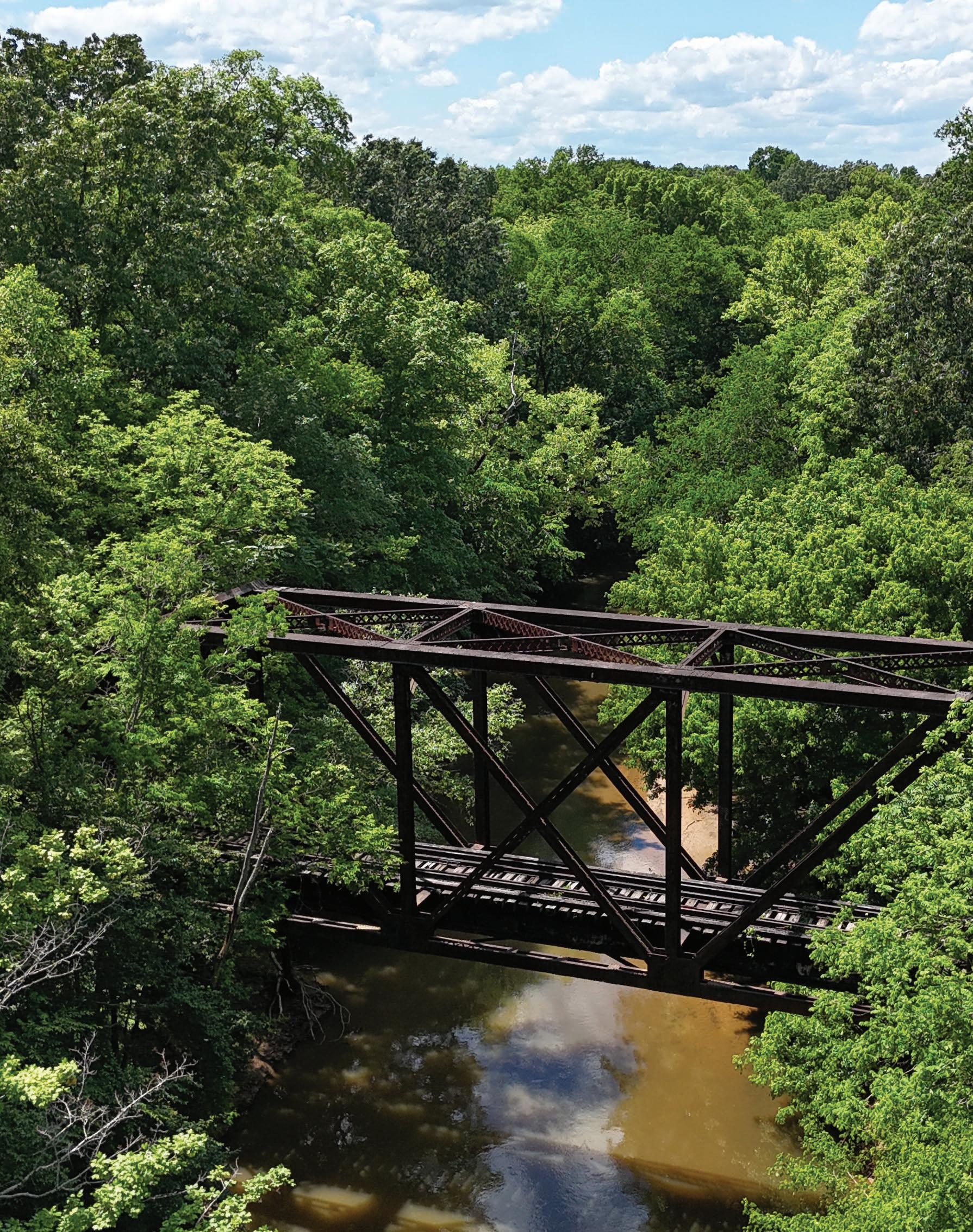

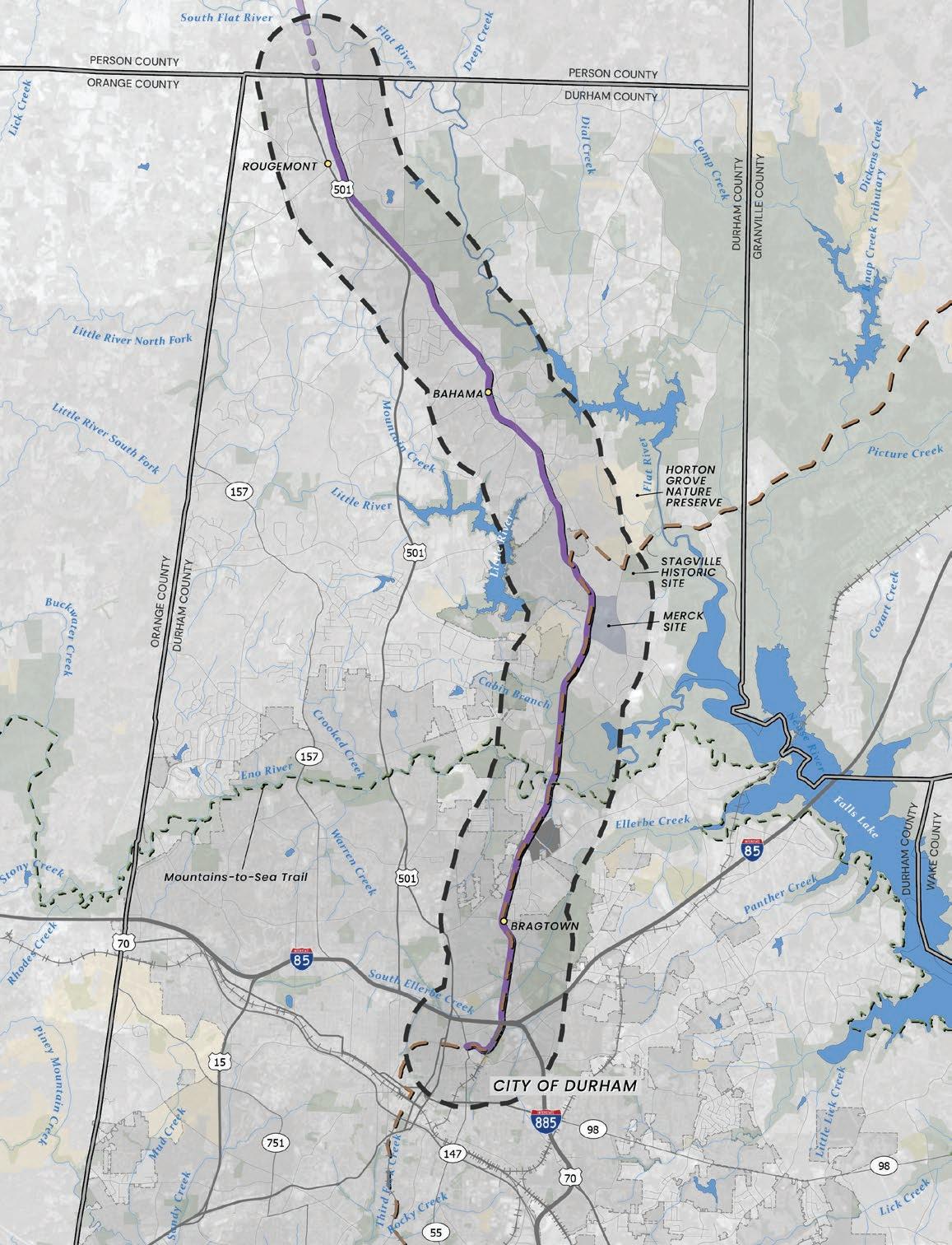
The Durham-to-Roxboro Rail Trail Plan outlines a vision for transforming an 18.2mile inactive rail corridor in Durham County into a safe, accessible, and connected trail. The inactive rail corridor runs 26.2 miles from downtown Durham to the City of Roxboro, with 18.2 miles in Durham County and eight miles in Person County. Person County completed a study of its inactive rail corridor segment in 2024 and adopted the plan in March 2025. Building on decades of local planning, this plan focuses on the 18.2-mile portion within Durham County.
The corridor has the potential to link people to historic neighborhoods, rural communities, public schools, natural areas, and regional destinations, creating a unified network that strengthens north-central Durham County while extending access into Person County.
Over the course of 12 months, the planning process engaged residents, stakeholders, and partner organizations to shape a shared vision for a distinctive trail experience—one that honors the area’s heritage, celebrates its natural environment, and provides safe, accessible opportunities for recreation and transportation.
The Durham-to-Roxboro Rail Trail Plan is a planning-level document that advances the project to approximately 10% design, providing a preliminary conceptual alignment, trailheads, and cost estimates while reserving detailed engineering and construction design for future phases.
AASHTO - American Association of State Highway and Transportation Officials
ADA - Americans with Disabilities Act
ATT - American Tobacco Trail
CEI - Construction, Engineering and Inspection
CPTED - Crime Prevention Through Environmental Design
ECG - East Coast Greenway
IMD - Integrated Mobility Division
MOU - Memorandum of Understanding
MPO - Metropolitan Planning Organization
MST - Mountains-to-Sea Trail
NCDEQ - North Carolina Department of Environmental Quality
NCDOT - North Carolina Department of Transportation
PHB - Pedestrian Hybrid Beacon
ROW - Right-of-way
RRFB - Rectangular Rapid-Flashing Beacon
SUP - Shared-use path
TPO - Transportation Planning Organization
UDO - Unified Development Ordinance
UGB - Urban Growth Boundary
UCAN - Urban Community AgriNomics
USACE - U.S. Army Corp of Engineers


The planning effort was led by the Project Management Team with representatives from Durham County Transportation, City of Durham Parks and Recreation, East Coast Greenway Alliance, Triangle West Transportation Planning Organization (Triangle West), and North Carolina Department of Transportation Integrated Mobility Division (NCDOT IMD).


A Project Advisory Committee, with representatives from 12 community organizations and government entities provided guidance on the corridor’s historical, cultural, and environmental context.
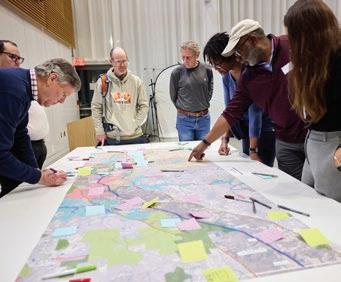
Community engagement was central to this planning effort and took place in two distinct phases. Activities included two community surveys, six public workshops, seven focus group meetings, 24 pop-up events, twelve interviews and property visits, seven general information sessions, and three project coordination meetings. A detailed Public Involvement Plan (PIP) guided these efforts, ensuring meaningful participation from residents, stakeholders, and partners throughout the process.


2024 –March 2025)
This portion of the project focused on identifying key opportunities and challenges, assessment and evaluation of existing conditions, compiling a comprehensive database of existing corridor assets, and field work to assess the current resources and infrastructure.
(January – April 2025)
Public engagement was integrated throughout the planning process to involve community members, stakeholders, and government partners. A dedicated project website was created to serve as a central information hub throughout the planning process. Three public workshops and an online survey featuring map-based feedback were conducted and promoted through printed materials and social media to maximize participation. In addition, focus group meetings were held with small groups of stakeholders and community pop-up events were held to engage residents and stakeholders in informal, accessible settings.
(April – September 2025)
Guided by the Project Management Team, Advisory Committee, Trail Identity Committee, key stakeholders, research on design standards, and community input, the consultant team developed a framework of preliminary recommendations for the trail concept plan. The team then held focus groups, project-coordination meetings, general information sessions, community pop-ups, three public workshops, and an online survey to share the preliminary recommendations with key stakeholders and the community members to gather additional feedback.
(August – October 2025)
Based on feedback on the draft concepts, the project team developed the final plan, which includes preliminary recommendations, a phasing schedule, planning-level cost estimates, and guidance on trail operations, management, and maintenance.
The Conservation Fund is facilitating NCDOT’s acquisition of the 26.2-mile, 100-foot-wide rail corridor from downtown Durham to the City of Roxboro. The corridor is currently owned, fee simple by Norfolk Southern and purchase is anticipated by late 2025. Because the full 18.2-mile corridor within Durham County is suitable for rail trail conversion, recommendations in this plan focus exclusively on the existing rail corridor and do not evaluate alternative routes.
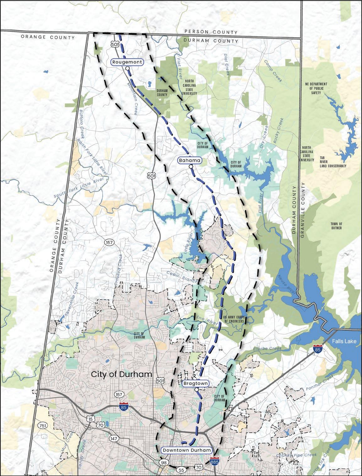
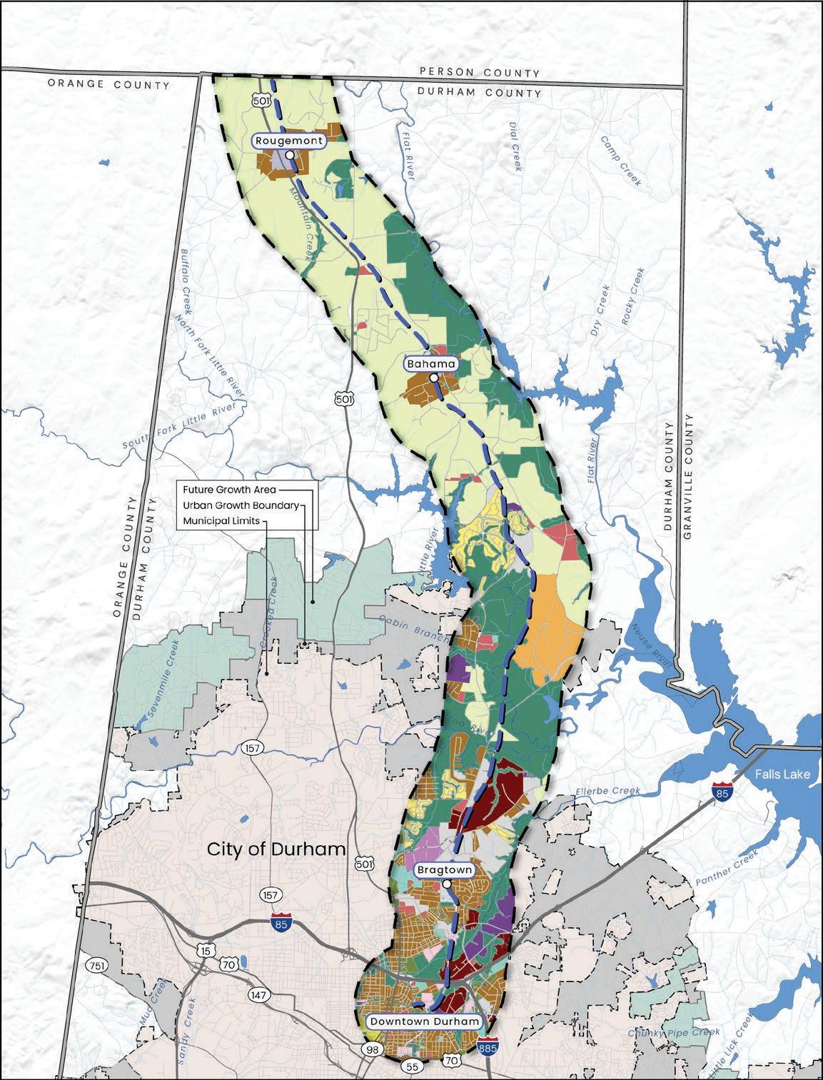
For planning purposes, the 18.2-mile rail corridor in Durham County was divided into five Focus Areas. Moving from south to north, the Focus Areas are: 1) Downtown Durham, 2) Bragtown, 3) Two Rivers, 4) Bahama, and 5) Rougemont.
Recommendations for each planning section include:
• Trailhead Recommendations
• Trail Connector Recommendations
• Trail Crossings
• Stream Crossings
In addition, corridor-wide recommendations are presented for recommended trail layout (or cross-sections), how the trail will interact with surrounding neighborhoods, and features along the trail (waysides).



The City and County will need to identify the lead agency for future action steps and continue to meet regularly to guide the trail’s design and implementation, identify and pursue funding opportunities, and plan for ongoing operations and maintenance. Quarterly collaboration meetings with key organizations such as East Coast Greenway Alliance, Triangle West, NCDOT, and Person County should also occur.
A series of key steps have been identified to guide the phased advancement of the rail trail. Although presented in a general sequence, these steps are not necessarily listed chronologically and should be approached with flexibility to accommodate funding availability, coordination among project partners, evolving conditions, and emerging opportunities that may enhance the project.
The Durham-to-Roxboro Rail Trail Plan identifies six segments of implementation, providing a roadmap to move the 18.2mile corridor from vision to reality through staged investments guided by community priorities, constructability, funding, and partnerships.
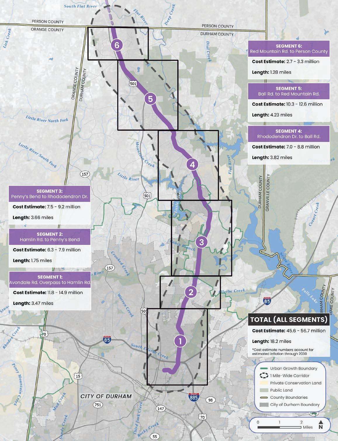
Map 03: Trail Implementation Overview


The Durham-to-Roxboro Rail Trail Plan presents a long-range vision to convert 18.2 miles of inactive rail corridor within Durham County into a multi-use trail. This Plan presents both the feasibility of the trail given a comprehensive analysis of existing conditions, conceptual trailhead designs, potential trail amenities, and connections to key places for residents. Combined with the preferred route through Person County, the initiative would create a continuous 28.8-mile network connecting downtown Durham with the City of Roxboro. This chapter provides the project’s background and goals while summarizing the planning process and overall organization of the plan.
IN THIS CHAPTER:
1.1 Project Background
1.2 Project Goals
1.3 Trail Benefits
1.4 Planning Process
1.5 Plan Organization
1.1
The Durham-to-Roxboro Rail Trail Plan builds upon a corridor of significant historic, cultural, and environmental value with many overlapping histories and cultural narratives. The rail line between Durham and Roxboro was first established in 1890 as the Lynchburg & Durham Railroad, serving as a critical link for regional transportation, commerce, and industry. For nearly a century, the line carried agricultural goods, particularly tobacco and textiles, as well as passengers, before ceasing operations in 1983.
The inactive rail corridor runs 26.2 miles from downtown Durham to the City of Roxboro, with 18.2 miles in Durham County and eight miles in Person County. In 2024, Person County completed a study that identified a preferred route for the Rail Trail from the Durham County line to the southern side of Roxboro that uses the inactive rail corridor plus a few streetadjacent segments for a total of 10.6 miles. Person County also identified another 6.1 miles of trail off of the rail corridor, called the Uptown Roxboro Trail, that would provide greater access throughout downtown Roxboro. The Durhamto-Roxboro Rail Trail Plan focuses on the portion within Durham County.
Although no longer in service, the entire corridor in Durham County remains under Norfolk Southern’s fee simple ownership, meaning the railroad holds full and unrestricted rights to the land. Unlike rail lines constructed on easements, this corridor is owned outright by the railroad, so there is no anticipated need to acquire land or easements from adjacent property owners.
It has long been identified in multiple planning documents since 1988 as a potential rail trail and is now the subject of a planned acquisition
for public use by NCDOT, anticipated by late 2025. The purpose of this study is to explore the potential of activating the rail corridor as a multi-use trail. Accordingly, this study focuses exclusively on Durham County’s 18.2-mile segment and does not consider alternative routes.
The southern terminus connects directly to the Downtown Durham Rail Trail, currently in construction document development, and will provide access to downtown Durham and regional transit hubs, including Amtrak and bus stations. The northern terminus of the Durham County portion extends toward Person County and the City of Roxboro, positioning the trail corridor as a key future regional connector. Along its route, the trail corridor passes through the historic Bragtown neighborhood, the unincorporated communities of Bahama and Rougemont, and traverses diverse settings, including neighborhoods, schools, public parks, state game lands, and nature preserves. While much of the adjacent land is privately owned, the trail corridor also links to significant city, state, and federally protected lands, creating additional opportunities for connectivity outside the primary rail corridor.

Map 04: Durham-toRoxboro Rail Trail Corridor

Community interest in converting the corridor into a trail began shortly after rail service ended in 1983, with community support for a rail to trail conversion documented as early as 1988. Efforts to acquire the corridor for public trail use by the City of Durham and NCDOT are documented to have started no later than the early 2000’s.
Over the past decades, multiple planning initiatives have identified the corridor as a high-priority opportunity for active transportation and recreation. In 1988, the Durham Urban Trails and Greenways Master Plan was the first plan to identify the rail corridor as an ideal opportunity for a multi-use trail for pedestrians and bicyclists. Later, the 2011 Durham Trails & Greenways Master Plan outlined a vision for an interconnected trail and greenway system, identifying this corridor as a potential alignment. The 2023 Durham Comprehensive Plan reinforced the importance of trails for expanding transportation options, connecting key destinations, and supporting sustainability.
Additional efforts have continued to highlight the corridor’s potential as a community asset that promotes health, safety, transportation equity, recreation, access to nature, and economic vitality. These include the following plans:
• Person County Trail Feasibility Study, 2024
• Durham Trails Implementation Plan, 2021
• Durham-Chapel Hill-Carrboro
MPO Comprehensive Transportation Plan, 2017 (now known as Triangle West Transportation Planning Organization)
• Litter River Corridor Open Space Plan, 2001
At the time of this planning study, the Durham Bike+Walk Plan update is also being developed by the City of Durham and Durham County. The Durham-to-Roxboro Rail Trail will be identified as a priority project for Durham County in that plan.
The Durham-to-Roxboro Rail Trail Plan was funded through the Triangle West Transportation Planning Organization’s (Triangle West) FY2025 work plan (also referred to as the Unified Planning Work Program). The total cost of the planning study is $500,000. The Triangle West Policy Board approved $400,000 for this plan using Surface Transportation Block Grant - Direct Allocation (STBG-DA) federal funds that are available to Triangle West for planning studies. A local match of $100,000 was required for use of these federal funds, which was split evenly between Durham County, City of Durham, and the East Coast Greenway Alliance.
The planning effort was led by the Project Management Team comprised of representatives from Durham County Transportation, City of Durham Parks and Recreation, East Coast Greenway Alliance, Triangle West, and North Carolina Department of Transportation Integrated Mobility Division (NCDOT IMD). Additionally, a Project Advisory Committee, with representatives from 12 community organizations and government entities provided guidance on the corridor’s historical, cultural, and environmental context. Community members have played an essential role throughout the process, ensuring the plan reflects local needs, priorities, and aspirations.
The Durham-to-Roxboro Rail Trail Plan is a planning-level document that advances the project to approximately 10% design, providing a preliminary conceptual alignment, trailheads, and cost estimates while reserving detailed engineering and construction design for future phases.


Conduct an assessment of the 18.2-mile inactive rail corridor and adjacent parcels to identify trail linkages, leverage right-of-way and publicly-owned properties for trailheads and amenities, and minimize impacts to environmentally sensitive areas.

Collaborate with government agencies, community leaders, the public, and adjacent property owners to showcase the corridor’s historical, cultural, environmental, and community assets while advancing longrange planning goals and fostering trailoriented development.

Develop a welcoming rail trail that supports users of all ages and abilities, links parks, schools, neighborhoods, historic resources, regional destinations, and provides a new transportation choice that fosters stronger connections between communities.

Seek extensive community input to create a trail that honors local history, ensures accessibility, thoughtfully integrates into surrounding communities, and incorporates designs that minimize conflicts between users while enhancing quality of life for residents and visitors.

Produce a trail concept plan based on community input that conveys recommendations through compelling visuals, highlights local culture and history through design elements, and explores a distinctive trail identity for Durham and Person Counties.

Provide the project team and partners with management and maintenance recommendations, a phased implementation schedule, planning-level cost estimates, and funding opportunities to guide successful plan execution.
The Durham-to-Roxboro Rail Trail has the potential to offer many community benefits, including improved physical and mental health through safe, accessible paths, increased access to nature, and sustainable transportation options. It may also support local businesses, highlight the area's history, and foster community connection.
Well-connected pedestrian and cycling routes, such as rail trails, promote fair access to transportation by reducing travel burdens for residents who may rely on walking or biking, such as zero vehicle households, low income households, transit dependent households, and others. Rail trails provide a safe, environmentally friendly alternative to driving which helps reduce car dependency and lowers carbon emissions.
Open green spaces and conserved corridors provide recreational and transportation options while also serving as community gathering places that foster pride, connection, and a shared sense of identity for residents and visitors.
By highlighting local stories and landmarks, trails help preserve history, educate and engage trail users, and share the unique identity of the region.
Rail trails enhance community wellness and quality of life by offering free, safe opportunities for people of all ages and abilities to incorporate exercise into daily routines—supporting physical, mental, and social health while helping to reduce rates of obesity, diabetes, and premature death.
A 2018 study of 4 greenway trails in NC found that every $1 spent on greenway construction generated $1.72 in local business revenue, sales tax, and health and transportation benefits.1
Rail trails contribute significantly to local economies and tourism, particularly in rural areas, by creating desirable places for people to visit, live, and work. Trails bolster local economies through enhanced marketability, foster small business opportunities, and increase tax revenues.
Rail trails help conserve important habitat, protect and improve air and water quality, and provide corridors for wildlife. Reducing automobile reliance leads to improved air quality. They also serve as outdoor classrooms for people of all ages.
Every $1 invested in building trails there is a direct correlation to $3 of saved medical costs.2
The Durham-to-Roxboro Rail Trail Plan represents the culmination of 12 months of planning, public engagement, design, numerous stakeholder meetings, and site visits. The planning process involved four major phases, including:
1. Research & Preliminary Assessment
2. Trail Visioning & Public Engagement
3. Concept Plan & Public Engagement
4. Final Plan Development
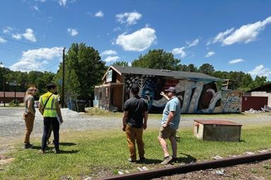
Research & Preliminary Assessment | October 2024March 2025
This portion of the project focused on identifying key opportunities and challenges, assessment and evaluation of existing conditions, compiling a comprehensive database of existing corridor assets, and field work to assess the current resources and infrastructure.
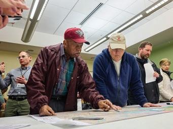
| JanuaryApril 2025
Public engagement was integrated throughout the planning process to involve community members, stakeholders, and government partners. A dedicated project website was created to serve as a central information hub throughout the planning process. Three public workshops and an online survey featuring mapbased feedback were conducted and promoted through printed materials and social media to maximize participation. In addition, focus group meetings were held with small groups of stakeholders and community pop-up events were held to engage residents and stakeholders in informal, accessible settings.

| AprilSeptember 2025
Guided by the Project Management Team, Advisory Committee, Trail Identity Committee, key stakeholders, research on design standards, and community input, the consultant team developed a framework of preliminary recommendations for the trail concept plan. The team then held focus groups, projectcoordination meetings, general information sessions, community pop-ups, three public workshops, and an online survey to share the preliminary recommendations with key stakeholders and the community members to gather additional feedback.
| August - October 2025
Based on feedback on the draft concepts, the project team developed the final plan, which includes preliminary recommendations, a detailed phasing schedule, planning-level cost estimates, and guidance on trail operations, management, and maintenance.
The Durham-to-Roxboro Rail Trail Plan is organized into five major chapters as outlined below.


The current chapter, which outlines the project background and goals, trail benefits, the planning process, and plan organization.
A comprehensive overview of the project study area that examines the natural and built environments, relevant plans, studies, and policies, and assesses demand and potential uses for the trail. It also identifies key opportunities and constraints that inform trail design and implementation.
This chapter describes the tools used during the two phases of public engagement and highlights the stakeholders and organizations involved in the planning process. It also presents the results of the two community surveys and identifies design considerations that inform subsequent recommendations.

This chapter is organized around six Focus Areas identified during the planning process: 1) CorridorWide Recommendations, 2) Downtown Durham, 3) Bragtown, 4) Two Rivers, 5) Bahama, and 6) Rougemont. Aside from the Corridor-Wide Recommendations, the Focus Areas include specific recommendations for individual geographic areas that are supported by extensive custom illustrations and design schematics.


This section outlines the suggested steps for implementing the plan, including trail segments, estimated costs, project cutsheets, trail identity, and an implementation matrix. It also identifies potential funding sources, and management and maintenance considerations.
Provides essential supporting context for the plan, including the Public Involvement Plan, an anti-displacement overview and best practices case studies, design guidance, invasive plant list, survey results, trail identity guidelines, and planning-level cost estimates.
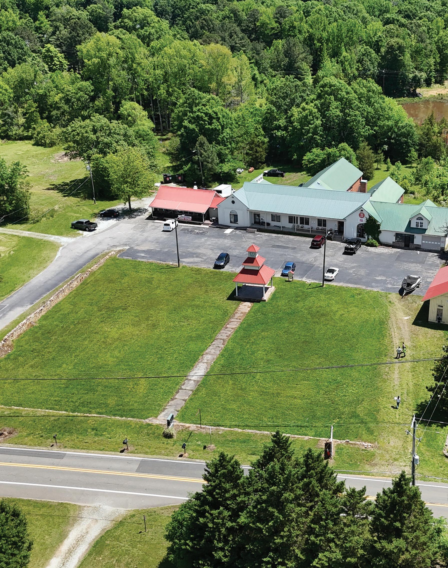

This chapter examines the project study area, including the natural and built environments, as well as relevant plans, studies, and policies. It also presents a benchmark comparison, potential trail uses, and the opportunities and constraints of the trail corridor. The planning-level analysis of existing conditions finds the Durham to Roxboro rail corridor suitable for rail-to-trail conversion. No prohibitive constraints were identified, and anticipated issues can be mitigated in later engineering and construction phases.
IN THIS CHAPTER:
2.1 Study Area
2.2 Natural Environment
2.3 Built Environment
2.4 Relevant Plans, Studies, and Policies
2.5 Demographics
2.6 Benchmark Comparison and Potential Trail Uses
2.7 Opportunities & Constraints
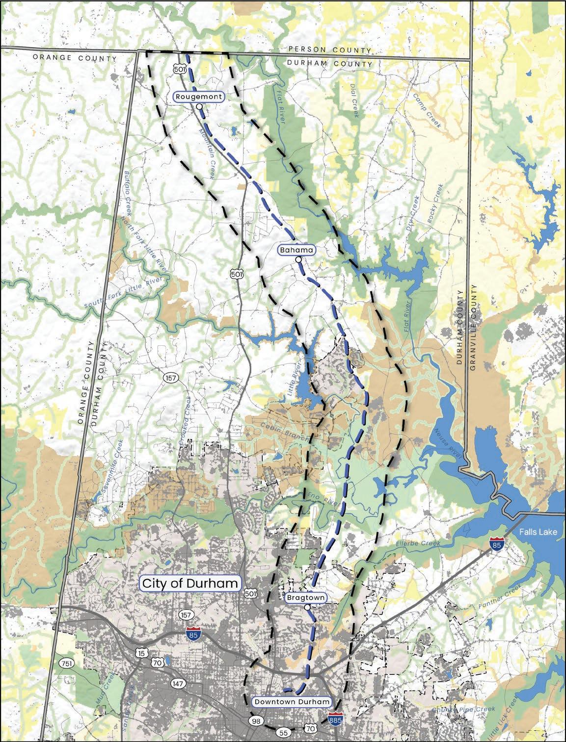
The Durham-to-Roxboro Rail Trail Plan study area is an 18.2-mile long, 1-mile wide area in north-central Durham County, North Carolina, centered on an inactive, approximately 100-feet wide Norfolk Southern rail line. Once a vital connection for transporting people and goods, such as tobacco and textiles, this historic rail corridor would link the City of Durham, including the historic Bragtown community, with the unincorporated communities of Bahama and Rougemont in Durham County before reaching the Person County line.
The corridor passes through a diverse landscape of neighborhoods, parks, nature preserves, and protected lands. Its location offers abundant opportunities for connectivity— linking historic communities, schools, greenways, state game lands, recreation areas, regional destinations and employment opportunities. At its southern end, the corridor connects directly into the Downtown Durham Rail Trail and regional transit hubs, while its northern end provides a gateway into Person County and the City of Roxboro.
Past planning efforts have long recognized the 18.2-mile inactive Norfolk Southern rail corridor in Durham County, and the 8-mile inactive rail corridor section in Person County, as a potential rail trail. Therefore, the focus of this planning effort was to study the inactive rail corridor only, and not alternative routes.
As part of the acquisition of the rail corridor, the Conservation Fund on behalf of NCDOT, has conducted a Phase I Environmental Site Assessment (ESA), a Phase II Environmental Site Assessment (ESA), and a National Environmental Policy Act (NEPA) assessment.
The GIS data for the maps in Chapter 2 are from the following sources: Durham County/City, NC Natural Heritage Program, NC Onemap, NC Orthoimagery Program, NCDEQ, NCOneMap & USGS 3DEP, NCDOT, National Wetlands Inventory & NCDEQ, Natural Heritage Program & USGS, North Carolina Flood Risk Information System, North Carolina State Historic Preservation Office, Pedestrian & Bicycle Infrastructure Network & Durham County, USDANRCS, USGS & National Hydrology Dataset.

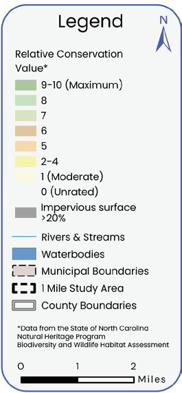
Map 05: Durhamto-Roxboro Rail Trail Study Area

The study area’s natural environment is defined by the rolling topography of the North Carolina Piedmont, diverse soils, and sensitive features such as wetlands, rivers, and lakes. The trail corridor travels over Ellerbe Creek, the Eno River, and the Little River - three significant waterways in the area that support recreation and diverse local ecologies. The study area also contains a variety of plant communities and provides important habitat for wildlife, including species listed as rare, threatened, or endangered.
Careful planning, design and collaboration will be necessary to balance trail development with the protection of these resources, ensuring the trail both enhances ecological value and provides a safe, enjoyable experience for users. This ecological richness creates opportunities to collaborate with conservation and environmental education partners on interpretive signage, exhibits, public art, and educational materials that showcase the habitats, wetlands, rivers, lakes, wildlife, and plant communities that are within the corridor.
The natural environment of the study area was assessed using desktop analysis of GIS data and imagery (aerials and Google Street View), review of previous studies, consultation with land managers, and field observations.
Durham County lies centrally within the Piedmont Region, and therefore its topography generally slopes from west to east towards the eastern coastal regions, varying to include rolling agricultural fields interspersed with wetlands and river systems. Elevations in the study area range from approximately 700 feet near Rougemont and the northern terminus of the rail corridor down to approximately 250 feet in wetland areas near the Eno River adjacent to Penny’s Bend Nature Preserve. Topography is an important factor to consider in the planning process for a multi-use trail due to accessibility concerns, determining and managing drainage patterns, and erosion control. (See Map 06: Topography, page 33.)
Durham’s Unified Development Ordinance (as of 2025) defines steep slopes for natural grades as areas that have a grade of 25% or more, have an area of 5,000 square feet or greater, and are located within 200 feet of any floodway fringe or perennial stream, or are within 100 feet of an intermittent stream. Along this rail corridor, natural steep slopes most often occur when the route crosses waterways (including perennial or intermittent streams), and constructed steep slopes are often present when the corridor travels along industrial areas.
Specifically, steeper slopes are present within the study area along Ellerbe Creek, in the industrial areas along Camden Ave., the Eno River, around the Merck property, along tributaries that feed the Little River Reservoir and Lake Michie, and along the Flat River.
Rail lines are generally constructed to maintain a gentle slope, and this corridor is frequently elevated in floodprone areas, when approaching a river, and/or when traveling through wetlands. As this project moves into the design and construction process, a survey and inspection of the route will be required to determine whether the existing grades along the rail corridor will need to be altered for access, ADA requirements, drainage, and erosion control needs of the trail. Steep slopes or embankments along the corridor may require stabilization, and additional engineered features (such as bridges, ramps, and culverts) will depend heavily on the surrounding topography.


Map 06: Topography
According to the Natural Resources Conservation Services (NRCS), there are four different soil types found within the study area. The soils identified include: Alfisols, Entisols, Inceptisols, and Ultisols. (See Map 07: Soils, page 35.)
Of the soils present, Entisols and Inceptisols are classified as having potentially hydric characteristics, which tend to be poorly drained and frequently saturated. These types of soils are primarily located within the study area along waterways (especially the Eno River, Little River, and Ellerbe Creek) and can present challenges for construction due to their unstable nature and high shrinkswell potential, which means that the soil will change in volume due to fluctuations in moisture content. When exposed to high moisture conditions, they expand substantially, and shrink or even crack during times of drought. These soil types are often indicators of wetlands, which are generally only suitable for very low-impact development (such as a boardwalk).
Alfisols, present mainly in the southern half of the study area, are moderately fertile soils with more favorable structure for mutil-use trail construction. Ulitsols have high clay content that contributes to their susceptibility to shrink-swell and poor drainage.1
In general, the soils within the project corridor share a tendency toward clayrich subsoils, which can be challenging for construction. Best practices for multi-use trail development in these conditions include thorough erosion control, proper subgrade compaction, use of crushed stone in subgrade preparation, adequate grading and cross-drainage, and regular trail maintenance. The Durham-toRoxboro Rail Trail may utilize the existing constructed railroad bed, minimizing erosion potential and providing a stable foundation for trail development. Following the existing topography of the rail bed during the trail design and construction process will minimize cut and fill needs, and avoid some of the sensitive soils present in the surrounding areas.
Within the study area is Penny’s Bend Nature Preserve, a protected natural area where the underlying geology contributes to the unique characteristics of the park. The foundational geology - diabase - is a type of very erosion-resistant, intrusive igneous rock, and its presence in this area has diverted the course of the Eno River, creating the prominent horseshoe-shaped bend that forms the preserve’s boundaries.2
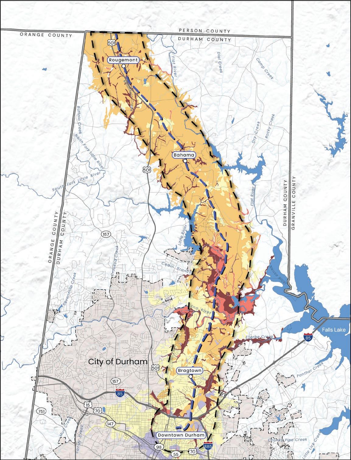

The study area is shaped by water - with three lakes and five rivers flowing through four major watersheds or areas of land where all the rain and streams drain into a common river or lake. The four watersheds within the study area are Ellerbe Creek, Eno River, Little River, and Flat River. Each of these watersheds are part of the Neuse River Basin which includes over 200 watersheds across the region, all of which drain into the Neuse River that carries water to the Atlantic Ocean at the Albemarle-Pamlico Sound. (See Map 08: Hydrology, page 37.)
Watersheds are fed by rain, groundwater, and small streams that collect and carry water into rivers and lakes. With an average annual rainfall of approximately 48 inches, Durham County experiences precipitation levels that are consistent with much of the eastern United States. Ellerbe Creek and the Eno River are the two primary watersheds in the southern study area, whereas the Little River and Flat River Watersheds make up the primary waterway systems to the north. Through the design and engineering process, impact to surrounding waterways can be minimized through use of the existing rail bed footprint and infrastructure as much as possible, protecting adjacent vegetation, implementing low-impact stormwater control measures, and installing erosion and sediment control devices.
Specific guidelines for this are detailed within the NCDEQ Stormwater Design Manual, as well as various sources describing low-impact development (LID) strategies (such as the EPA’s Low Impact Development Resources Library). Any portion of the trail that travels through riparian buffer areas should be constructed and maintained in accordance with local and state buffer protection rules.
Ellerbe Creek Watershed runs along Main St. in downtown Durham, extends through the community of Bragtown, and connects to Falls Lake. Given its location within the City of Durham, the Ellerbe Creek Watershed has the highest population density of the watersheds represented within the study area. As of 2025, this stream is considered an impaired water body (per NC’s 303(d) list*), due to multiple pollutants detected. Dense population areas surrounding the creek have contributed to its impairment through sanitary sewer discharges, petroleum spills, nutrient runoff, improper waste disposal, erosion, and sediment runoff. Ellerbe Creek flows east and empties into Falls Lake on its path towards the Neuse River, eventually reaching the Atlantic Ocean at the AlbemarlePamlico Sound.1
The Eno River Watershed cuts through the middle of the study area at the Penny’s Bend Nature Preserve as it travels east from Eno River State Park, located within Orange and Durham counties. The Eno River is a popular attraction for paddlers and fishing enthusiasts, as it encompasses the Eno River Trail and the Mountains-to-Sea Trail within and along its banks. Much of the land surrounding the river in Durham County is protected in parks and preserves. Despite these protections, some pollutants have still been detected in the Eno (as of 2024), primarily due to sewer discharges, petroleum spills, and improper waste disposal. The water quality of the Eno River was rated 86 out of 100. Similar to Ellerbe Creek, the Eno River also flows east into Falls Lake on its way to the Albemarle-Pamlico Sound. 2
1. City of Durham. Ellerbe Creek Watershed. 2. City of Durham. Eno River Watershed


The Little River Reservoir, a drinking water supply source for Durham, is fed by the Little River, and is the central component of the Little River Watershed. This watershed is a popular recreation destination for the communities of Treyburn and Snow Hill, where residents enjoy paddling and fishing in and along its banks. In 2024, the water quality of the Little River in Durham County was rated a 90 out of 100. After passing through a dam at the southern terminus of Little River Reservoir, this watershed also flows southeast towards Falls Lake before continuing on to the Albemarle-Pamlico Sound.1
The Flat River and Lake Michie
Lake Michie, formed in 1926 upon completion of the Lake Michie Dam, impounds the south-flowing Flat River to supply the City of Durham’s drinking water and sits within the Flat River Watershed in northern Durham County. Recreational activities such as paddling and fishing are popular on Lake Michie. A comprehensive testing of the water quality in the Flat River has not occurred since 2010, when it received a score of 92 of 100. The Flat River also flows into Falls Lake before continuing on to the Albemarle-Pamlico Sound.2

Several wetlands, or areas where water naturally collects and supports water-loving plants and wildlife, occur within each of these watersheds. The wetlands located within the Beaver Marsh Nature Preserve, Little River Waterfowl Impoundment, and the Flat River Waterfowl Impoundment are the primary wetland features represented within the study area. These wetland areas provide important habitat for birds, amphibians, fish, and other wildlife, while also playing a key role in keeping the region’s water clean, healthy, and protected against flooding.
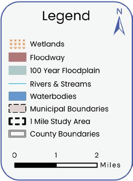
Several sections of the rail corridor travel through flood zones, primarily in the areas surrounding rivers and streams. The longest span of corridor encompassed by a flood zone occurs around the Little River, which is an area of bottomland managed for waterfowl impoundment and prone to flooding during seasonal or extreme weather events. The rail corridor is elevated in this area to FEMA flood zone x (1% future conditions), which has a 1% chance of flooding each year, based on future land use projections. This is a lower risk for flooding than the surrounding area, and utilizing the existing elevated rail bed in this area will minimize flooding risk.
The Unified Development Ordinance (UDO) is the guiding framework for development in the City of Durham and Durham County, establishing impervious surface limits within watershed overlay districts. At the time this plan was prepared, Section 8.7 of the current UDO specified these limits. (See Exhibit 01: Durham Unified Development Ordinance, Impervious Surface Limits.)
Source:
The rail corridor passes through the following Watershed Protection Overlay Districts:

Source: Durham Unified Development Ordinance
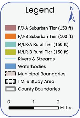

The rail corridor passes through four Watershed Protection Overlay Districts. Corridor mileage within each district is as follows:
• Falls of the Neuse Protected Area (F/J-B) - 8.11 miles
• Falls of the Neuse / Jordan Lake Critical Area (F/J-A) - 2.12 miles
• Lake Michie / Little River Critical Area (M/LR-A) - 5.03 miles
• Lake Michie / Little River Protected Area (M/LR-B) - 3.28 miles
Trail development will comply with watershed overlay district requirements and environmental standards outlined in Durham’s UDO, ensuring the project aligns with local environmental protections. The current UDO permits exceeding the maximum impervious surface allowance through the following means:
• An impervious surface credit transfer. Credit for the impervious surface allowed on one or more parcels can be transferred to non-contiguous parcels, such that the amount of impervious surface available for a development project would be the total of what is normally allowed on the receiving parcel plus what is transferred from the donor parcel(s).
• Engineered stormwater control measures shall be used to control stormwater runoff from the first inch of rainfall in order to meet water quality concerns.
Trail and trailhead development will also need to comply with riparian buffer protection standards. Protection standards for riparian areas are managed by NCDEQ and the UDO, with the UDO requiring more stringent protection standards. Multi-use trails and greenways are currently an allowed use within riparian buffers. The trail passes through numerous riparian buffer areas but stream determinations were not completed as part of this plan.
Stream determinations will need to be conducted during the design and engineering phase to determine if surface waters present throughout the corridor qualify as a stream and whether that classification is a perennial, intermittent, or ephemeral stream. Stream classification and watershed protection overlay will determine the prescribed riparian buffer width. (See Map 09: Stream Buffers, page 41.)
The plan recommendations meet current protection standards. The design and permitting of the trail will be required to meet all regulatory protection standards as governed by the reviewing agencies. Further analysis will be completed during the design and permitting phase to ensure compliance.

Source: Durham Unified Development Ordinance
The study area travels through a variety of forest types, as well as developed areas that are predominant in the southern part of the corridor, and agricultural lands that are most common in the northern part of the corridor.
Piedmont forest types present within the study area include:
• Dry coniferous woodlands along ridgelines and steep slopes (where a variety of pine and oak species are prevalent)
• Floodplain forests (containing many bottomland and moisture tolerant species like maple, sycamore, river birch, box elder, tulip poplar, green ash, hornbeam, and sweet gum)
• Mesic mixed hardwood forests (including oak species, American beech, and tulip poplar)
Many areas along the trail include early succession plants, mainly found in recently disturbed areas that align the trail, and typically due to agriculture, development, or forestry activities. Perennial grasses, wildflowers, shrubs (like sumac and blackberry), vines (like poison ivy and virginia creeper), eastern red cedars, sweet gums, and pines are prevalent in these types of plant communities.1
Several Piedmont Prairie sites exist within the study area. These unique landscapes occur in patches throughout central North Carolina, and are some of the most biologically significant natural areas in the state, characterized by open or absent tree
canopies, fire-tolerant or fire-dependent species, and prevalence of warm-season grasses and aster species.
The Penny’s Bend area—a nature preserve along the Eno River and near to the trail corridor—is one of these sites where many rare and endangered plant communities have been recorded. These plant communities include many unique prairie species like the Prairie Blue Wild Indigo (Baptisia aberrans), Smooth Purple Coneflower (Echinacea laevigata), and the Hoary Puccoon (Lithospermum canescens). Many of these species are only found in a handful of locations around the state, so federal, state, and local organizations work together to monitor and maintain a hospitable environment for these plants.2
Other Piedmont Prairie sites within the study corridor include the Catsburg Natural Area (located across Old Oxford Road from Penny’s Bend, along the Eno River), the Eno River Diabase Sill (north of Penny’s Bend between Snow Hill Road and Old Oxford Road), and the Hebron Road Remnant Glade (between Hebron Road and Carver St.). The Hebron Road Remnant Glade is a small but ecologically rich prairie remnant within developed surroundings.3
A wide variety of non-native, invasive plants also occur throughout the corridor, presenting a threat to local ecology by suppressing native vegetation. See Appendix A4: Invasive Plants Found in North Carolina Piedmont, page 318 for a list of many of the most prevalent non-native, invasive plant species found in the North Carolina Piedmont. The construction of a multi-use trail within the rail corridor provides an opportunity to control and limit invasive species spread through physical removal and long-term stewardship of the trail. Continued trail maintenance could include attracting volunteer groups to assist with invasive species control, planting competitive native plants, and creating demonstration sites for native habitat restoration along the trail. Management strategies for invasive species are outlined in the USDA publication AManagementGuidefor Invasive Plants in Southern Forests.4
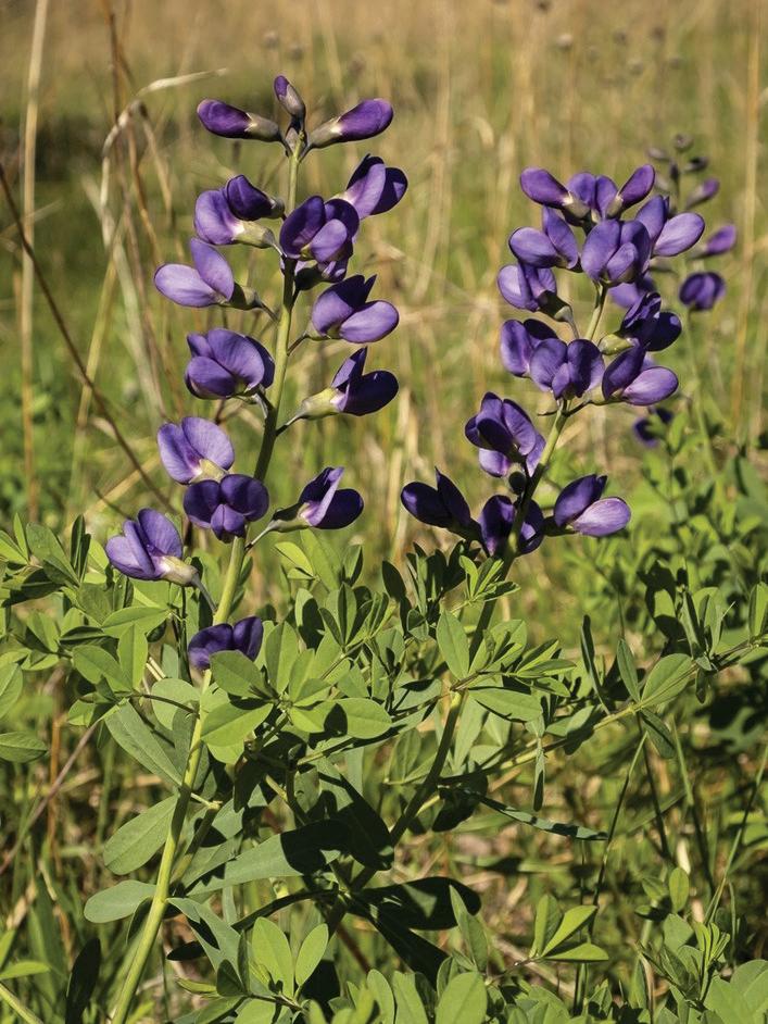

The planning study area encompasses several ecotones—zones where one ecosystem gradually shifts into another—and therefore contains habitats for a wide range of plant and animal species. (See Map 10: Species and Habitat, page 47.)
The Butner-Falls of Neuse Game Lands supports a wide variety of wildlife species, including deer, turkey, waterfowl (ducks, diving birds, and geese), coyotes, muskrats, and beavers. The Beaver Marsh Nature Preserve, located just off of the trail corridor and north of downtown Durham, supports over 75 species of migratory and resident birds, 10 species of dragon and damsel flies, and five species of frogs.
In addition, the Eno River and Ellerbe Creek are both home to several fish species, such as migratory White Perch and White Bass. In Little River Reservoir and Lake Michie, warm water fish like large mouth bass, white bass, and white crappie make up the dominant aquatic species.

The Carolina Madtom (Noturus furiosus) is a small freshwater fish endemic to the Tar and Neuse river basins. In accordance with the U.S. Endangered Species Act of 1973 (USESA), the Carolina Madtom has
In North Carolina, the Natural Heritage Program keeps records of occurrences of rare, threatened, and endangered species. Within the study corridor, two species are classified as endangered or threatened: the Carolina Madtom and the Neuse River Waterdog. The scope of this planning study does not include detailed research regarding these endangered species but as design and construction of the trail proceeds, the protection of these species should be evaluated and considered.
a federal status of ‘Endangered’, which signifies the species of being in danger of extinction throughout all or a significant portion of its range.
Also endemic to the Tar and Neuse river basins, the Neuse River Waterdog (Necturus lewisi) holds a federal status of ‘Threatened’, identifying the species as likely to become endangered within the foreseeable future throughout all or a significant portion of its range (USESA). According to the U.S.
The Neuse River Waterdog is the inspiration for one of the proposed names of the trail.
(See Section 5.5 Trail Identity, page 274.)
In 2024, Triangle West Transportation Planning Organization (formerly Durham-Chapel HillCarrboro Metropolitan Planning Organization) developed and adopted a Wildlife Crossing Planning Study that aims to improve roadway safety for both humans and wildlife within its planning area.
Fish and Wildlife Service, the Neuse River Waterdog is one of the rarest salamanders in the Southeastern United States, and primary threats to this species include habitat degradation and freshwater pollution.
Neuse River Waterdog
Source: US Fish and Wildlife Service

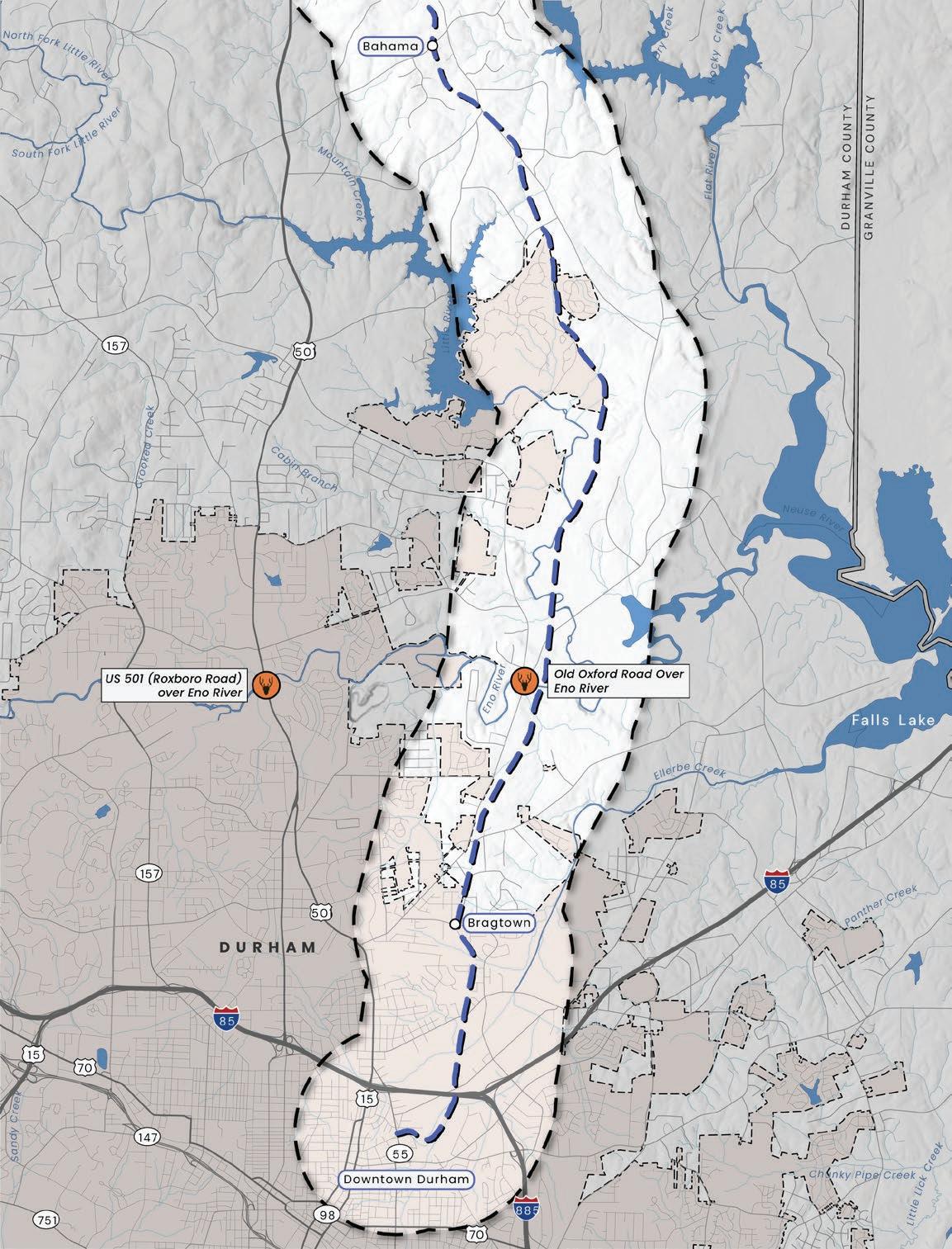
The plan identified two critical wildlife crossings in or near the Durham-to-Roxboro Rail Trail Plan study area that have high rates of reported wildlife-vehicle crashes (WVCs) and are within or near wildlife cores and corridors identified by the Wildlands Network.
1. Old Oxford Road over the Eno River is within the 1-mile study area for the rail corridor
2. US 501 (Roxboro Road) over the Eno River is adjacent to the study area
Both wildlife crossing sites are part of Triangle West’s Eno River Corridor of wildlife crossing project recommendations, which aligns and groups WVC hotspots with documented wildlife movement. (See Exhibit 03: Triangle West Priority Wildlife Crossing Recommendations, below and Map 11: Wildlife Crossing Recommendations, page 49.)
Project Recommendation Name Lat/Long County Proximity to trail Reported WVCs within 1-mile buffer (20182022)
Old Oxford Road over Eno River 36.07258, -78.86277
Durham Within corridor 5 US 501 (Roxboro Road) over Eno River 36.07204, -78.90863
Durham Adjacent to corridor 19
Source: Triangle West Wildlife Crossing Planning Study

The study area includes seven designated nature preserves including the Butner-Falls of Neuse Game Land, Lake Michie Recreation Area, Penny’s Bend Nature Preserve, Horton Grove Nature Preserve, Eno River Diabase Sill Plant Preserve, Hebron Road Plant Conservation Preserve, and the Beaver Marsh Nature Preserve. Approximately 2,782 acres of the study area falls within these seven designated nature preserves. (See Map 12: Managed Lands, page 51.)
The Lake Michie Recreation Area, which makes up 480 acres of paddling and fishing opportunities, is directly adjacent to hiking trails and camping located near the lake at Spruce Pine Lodge.
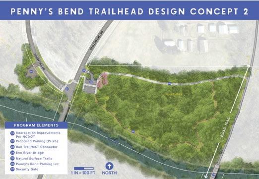
Penny’s Bend, located centrally within the project area, provides a number of public recreation opportunities, including access to fishing, hiking, and paddling along the Eno River Trail and Mountains-to-Sea Trail.
NC Wildlife Resources Commission manages land near Penny’s Bend for hunting with some existing restrictions such as archery-only near schools.
Horton Grove Nature Preserve, managed by Triangle Land Conservancy, currently offers eight miles of hiking trails named in honor of families whose ancestors were enslaved on the former plantation. Future plans will add mileage and create a trail link to Stagville Historic Site.
The Beaver Marsh, Pearl Mill, and Rocks Nature Preserve, currently supported and conserved by the Ellerbe Creek
Watershed Association, represent important public land opportunities adjacent to the proposed trail corridor. Creating trail connections and adding interpretative signage about these nearby preserves will further the proposed trail’s mission to highlight local ecologies, provide educational opportunities, and connect recreation areas.
Hebron Road Plant Conservation Preserve is a protected area along Hebron Road managed by the NC Plant Conservation Program. It is considered a Piedmont Prairie/ Savanna site and hosts a variety of rare and endangered plant species. Many of these species are also present within other nearby protected areas, including the Eno River Diabase Sill Plant Preserve, Penny’s Bend, and Catsburg Natural Areas.1
G.W. Hill Forest is owned and operated by N.C. State University as a recreational forest, learning laboratory, and demonstration forest. Public use is allowed by permit only and includes hiking, biking, horseback riding, fishing, and certain types of hunting.

The assessment of the built environment examines communities, land use and development, schools, historic and cultural resources, parks and greenways, existing bridge structures, environmental hazards, and trail crossings within the study area. These elements were assessed to define the corridor’s context and inform factors to be considered in future trail planning and design efforts.
The built environment of the study area was assessed through desktop analysis of GIS data and imagery (aerials and Google Street View), review of previous studies, consultation with land managers, and field observations.
The rail corridor links a diverse set of communities—from the City of Durham to smaller places such as Bragtown, Treyburn, Bahama, and Rougemont—each with its own history, identity, and cultural legacy. The snapshots below provide context on their past and present.
Continued collaboration with local leaders and organizations including Preservation Durham, the Bragtown Community Association, Stagville Descendants Council, Bahama Ruritan Club, Rougemont Ruritan Club, Ellerbe Creek Watershed Association, Eno River Association, and Triangle Land Conservancy will help shape interpretive exhibits, signage, public art, and educational materials that represent each community’s history and identity. 2.3

2020 Population: 303,4671
The City of Durham, originally home to the Eno and Occaneechi tribes, boasts a rich history of tobacco, textiles, technology, and medicine. With the establishment of the Durham railway station in the 1840s, the city saw rapid growth fueled by the tobacco industry, earning it the nickname “Bull City”. In the early 20th century, the establishment of Duke University and North Carolina Central University solidified Durham’s reputation as an academic center, and the 1950s saw the creation of the Research Triangle Park. The city played a significant role in the Civil Rights Movement, and Durham’s Hayti district, once known as Black Wall St., was a thriving Black business and cultural center that later faced significant disruption from Urban Renewal’s redlining and freeway development practices. Today, Durham is known as a vibrant city with a diverse economy and a commitment to its residents, community, history and future.
2020 Population: 12,5941
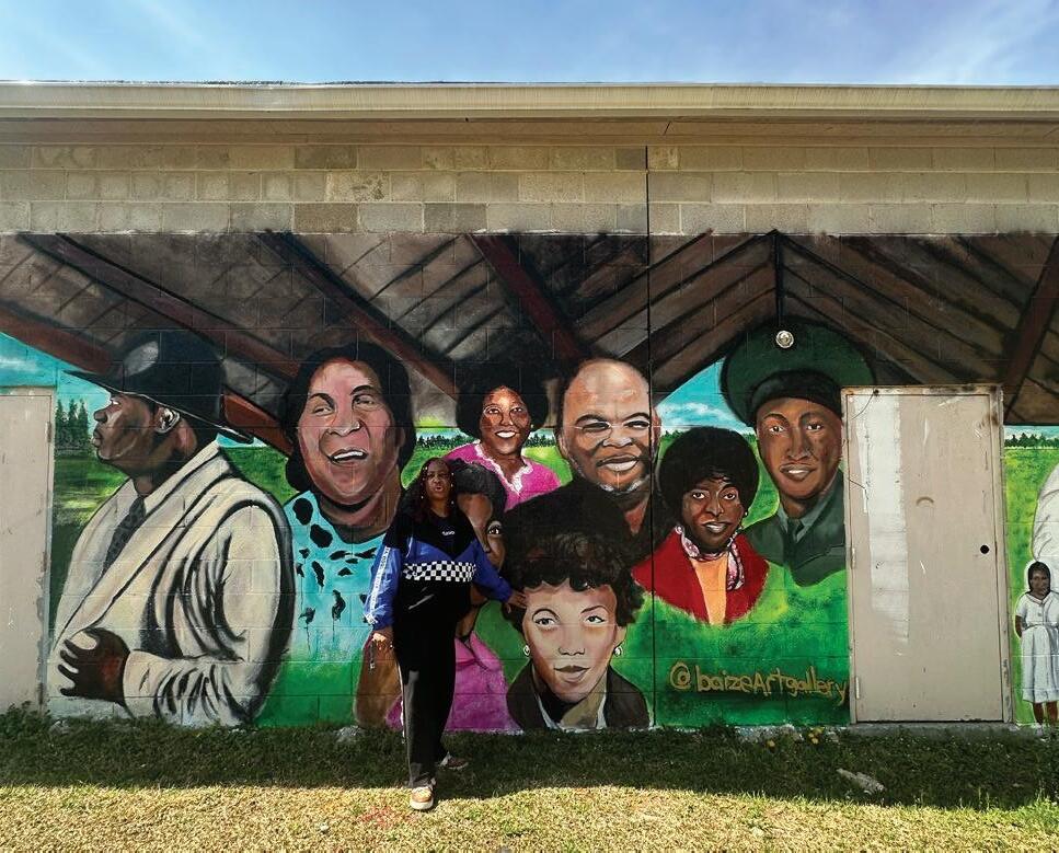
Settled by formerly enslaved people from the nearby Stagville Plantation, the community of Bragtown was an unincorporated community until 1957, when it became part of the City of Durham. Bragtown is known for its strong community bonds and historical significance. Bragtown is separated from central Durham by Ellerbe Creek, a natural barrier, and I-85, a man-made barrier. Previously, these barriers created a distinct urban-greenbelt-urban transition, however increased development continues to blur this line. Primarily developed along Roxboro Road, many structures from the 1920’s remain today.
2020 Population: 1,4422
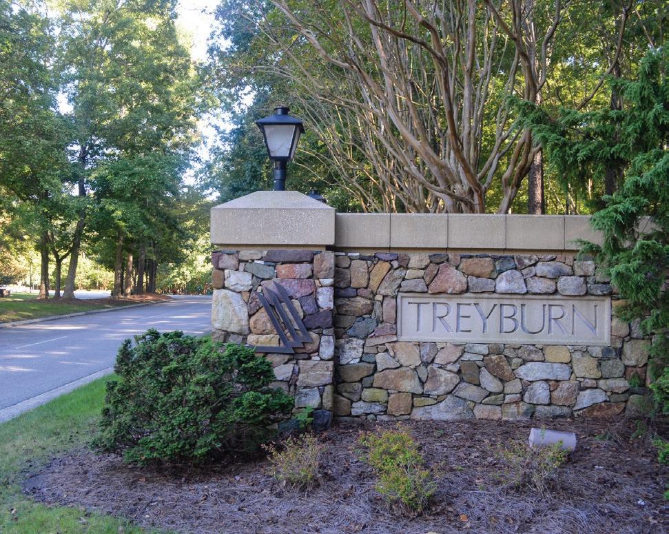
Previously part of the Stagville-Fairntosh Plantation, the mid-19th century area near Little River included a successful cotton-cloth factory, called Orange Factory, along with employee housing, a school, churches, a general store, and a post office. In 1938, with the factory’s closure, the village began to decline, and with the construction of the Little River Reservoir in the 1980s, the former factory site submerged underwater. Treyburn was developed as a community in the late 1980s, which incorporated the existing Treyburn Country Club, the adjacent corporate park, and over 1,600 acres of natural preserves including Horton Grove Nature Preserve and portions of the Stagville Historic Site.

2020 Population: 6,1171
The Lynchburg & Durham Railroad established small depots along several communities in Durham County in the early 1900’s. At Balltown, the new station became a focal point for additional growth, and the community eventually became known as Bahama, a portmanteau from the surnames of three prominent families in the area: Ball, Harris, and Mangum.
Community development soon led to the establishment of businesses, schools, and a post office. Present day Bahama has maintained its small-town character while benefiting from close proximity to the City of Durham and outdoor recreation assets, such as Lake Michie.
2020 Population: 7301
Rougemont, in northern Durham and southern Person counties, is a small rural community with roots dating back to Native American settlement and 19th-century farming. The arrival of the railroad in the late 1800s established Rougemont as a local hub, supporting mills, stores, and agriculture. Today it remains largely agricultural and low-density. While past efforts at incorporation were unsuccessful, the community continues to value its rural heritage, closeknit identity, and balance between farmland, woodlands, and residential life.
The creation of the Durham-to-Roxboro Rail Trail will represent a meaningful investment in recreation and transportation infrastructure that complements and aligns with existing and proposed land use patterns, reinforcing the vision already established in local plans and policies. By leveraging this corridor, Durham can strengthen mobility, recreation access, and community connectivity without introducing disruptive or incompatible changes to the urban fabric.
This infrastructure provides a catalytic opportunity to build on Durham’s ongoing efforts to improve quality of life and equitable access. The trail will link neighborhoods to parks, schools, and job centers, addressing longstanding gaps in recreation and active transportation infrastructure. In doing so, it reinforces compact, sustainable development patterns by reducing car dependency, expanding mobility choices, and creating safer, healthier routes for residents of all ages.
When integrated with Durham’s Comprehensive Plan, Place Type Map, and other guiding frameworks, the trail will amplify existing community strengths. It can support thoughtful infill development and reinvestment in underutilized properties while creating new opportunities for housing diversity and equitable access to recreation. By aligning with established land use policies, the Durham-to-Roxboro Rail Trail Plan ensures that growth is managed, inclusive, and place-based—enhancing both daily life and long-term resilience for the corridor’s communities (See Appendix A2: AntiDisplacement Overview and Best Practice Case Studies, page 311).
Collaboration among area residents, Durham County, the City of Durham, NCDOT, private landowners, land conservation organizations, and other local, state, and regional partners will be essential to ensure that the trail not only connects seamlessly with adjacent neighborhoods and community centers, but is also designed and integrated in ways that respect surrounding land uses and community context. Achieving this will require an inclusive, transparent process that elevates community voices, aligns with existing plans and policies, and produces a trail that enhances connectivity while reinforcing the character and needs of the immediate neighborhoods it serves.
One tool to ensure community voices are included in the trail design process is the 2023 Durham Comprehensive Plan which includes a long-term, resident-centered vision of how Durham should look and feel in the future. The 2023 Durham Comprehensive Plan’s Place Type Map will serve as a valuable starting place, helping to guide where and how development should occur along the corridor so that it aligns with the community’s longterm vision and supports equitable, connected, and sustainable outcomes (See Exhibit 04: Understanding the Place Type Map and Its Implications for Rail Trail Development, page 59).
The Place Type Map (page 61), as outlined in Durham’s Comprehensive Plan (2023), is a forward-looking planning tool that expresses the community’s long-term vision for how different areas of the city and county should evolve over time. Unlike the legally binding Zoning Map, which regulates what can be built on a property today, the Place Type Map is not regulatory. Instead, it serves as a policy guide for evaluating development proposals, infrastructure investments, and public facility planning.
Each Place Type represents a distinct category of place—such as urban neighborhoods, commercial corridors, or employment centers—characterized by its intended mix of uses, building scale, transportation options, and public realm features. The map and its associated Place Type descriptions are used by planning staff, elected officials, and community members to assess whether new zoning map changes or annexation proposals align with the broader community vision.
In the context of future rail trail development, the Place Type Map and associated Place Type descriptions have several important implications:
• It helps identify where trail-adjacent development should occur, and what types of uses—such as TrailOriented Development, mixed-use hubs, or residential infill—are encouraged in different segments of the corridor.
• It guides infrastructure planning decisions such as extending utilities, enhancing transit access, and building pedestrian and bike facilities that connect neighborhoods to the trail.
• It provides a framework for equitable development, ensuring that growth along the corridor supports both economic opportunity and community livability without displacing long-term residents.
The rail corridor passes through a range of Place Types. Near downtown Durham, the corridor is primarily General Industrial and Recreation & Open Space, creating opportunities for future connections to nearby parks and greenways.
In and around Bragtown, Place Types include Mixed Employment, Established Residential, Mixed Residential Neighborhood, and General Industrial. This mix supports potential trail connections to surrounding neighborhoods and community assets.
Around Penny’s Bend, the predominant Place Types are Rural & Agriculture Reserve and Recreation & Open Space, creating opportunities to link the trail to existing trails and natural areas.
North of Penny’s Bend, a large Employment Center introduces an opportunity to connect the trail directly to jobs as both an alternative transportation option and a wellness resource for workers.
Farther north, the corridor alternates between Rural & Agriculture, Planned Suburban Neighborhood, and Established Residential. These areas offer opportunities to create community hubs and connect to neighborhoods.
As development interest increases along the future Durham-to-Roxboro Rail Trail, the Place Type Map will serve as a critical reference for shaping the character and function of adjacent areas—supporting thoughtful, connected, and community-aligned growth.
As of August 2025, there are seven active development cases located adjacent to the rail corridor, according to the Durham Development Infrastructure, Planning & Development Department (see table below). An analysis of these pending cases reveals several opportunities to align future growth with the trail’s development, helping to ensure the corridor evolves in a way that supports access, safety, and community vitality. Key opportunities include:
• Strategically extending utilities—such as water for hydration stations or electricity for emergency call towers (e.g., blue light towers)—to key locations along the trail corridor.
• Encouraging Trail-Oriented Development (for more information, see Section 4.1) by orienting new housing and building frontages to actively engage with and overlook the trail.
• Integrating housing into compatible commercial sites, such as co-locating residential units within properties that include self-storage or light commercial uses, where setbacks or buffers allow.
• Proactively coordinating with adjacent property owners, particularly those with active or upcoming development proposals, to address design and access considerations early and reduce potential conflicts or opposition.
Z2400030
D2400102
D2500079
D2500043

There are twelve K-12 schools within the study area including: Eastway Elementary, MerrickMoore Elementary, Club Boulevard Elementary, Sandy Ridge Elementary, Little River Montessori, Mangum Elementary, Brogden Middle, Lakeview Secondary, Lucas Middle, Northern High School, Durham School of the Arts, and the School for Creative Studies.
While not all schools are directly adjacent to the proposed trail corridor, several nearby campuses offer strong opportunities for connectivity and programming.
Within one-half mile are the following schools:
• Lakeview Secondary School (0.17 miles)
• Sandy Ridge Elementary (0.23 miles)
• Little River Montessori (0.22 miles)
• Magnum Elementary (0.22 miles)
Their proximity could enable safer, active travel options for students and staff, and support curriculum which utilizes educational features along the trail. (See Chapter 4: Recommendations, page 163 for connectivity recommendations and maps.)
The Project Management Team has been in discussions with Durham Public Schools about creating connections between the Durham-to-Roxboro Rail Trail and nearby schools. School administrators have expressed both interest and concerns, including:
• School–trail connections provide a safe alternative to cars or buses which may encourage walking and biking and reduce congestion near campuses.
• Having the trail near a school can serve as an outdoor classroom for environmental education, history, and health programs.
• Connecting the trail to schools can increase access for students who may not have reliable transportation.
• Trail crossings at busy roads near schools require careful design to avoid creating new hazards.
• Ongoing upkeep of trail segments adjacent to schools can raise cost and responsibility questions.
• Increased foot and bike traffic may be viewed as disruptive by school staff or nearby residents.
• Parents and school administrators may have concerns about unsupervised access or strangers near school grounds.
A Durham Public Schools (DPS) representative served on the Project Advisory Committee. As trail design and development progress, continued coordination with DPS will be needed to pursue school-connection opportunities and address related concerns.
In addition to the K-12 schools, the Northern Durham Center of Durham Technical Community College is located 2.25 miles from the rail corridor on Snow Hill Road.

The study area contains historic and cultural resources that present opportunities to collaborate with local communities and organizations in developing interpretive exhibits, signage, public art, and educational materials that highlight the region’s heritage.
Key sites include Stagville State Historic Site, Catawba Trail Farm, the location of the former Catsburg Country Store, and the Rougemont Train Depot, while portions of the trail also align with the historic Great Trading Path. (See exhibits below for the historical and cultural importance of these sites.)
According to the Stagville Memorial Project1, the railroad itself is a significant historical feature, constructed in part by formerly enslaved individuals from Stagville Plantation,
whose descendants later walked the rail line to establish Bragtown. The Stagville Memorial Project is a 501(c)(3) that honors people formerly enslaved at Stagville through public art and community engagement to build a more inclusive understanding of Durham’s past. Understanding and integrating these resources is critical to guiding trail planning, preservation, and interpretation. (See Map 14, Historic Features, page 67 and the Exhibits on the following pages.)
Catawba Trail Farm showcases the region’s agricultural heritage. Operated in partnership with UCAN (Urban Community Agriculture Network), the farm supports local food production, community engagement, and educational programs. A gravel path at the Catawba Trail Farm is a remnant of the historic Great Trading Path.

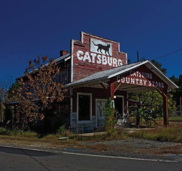
The Historic Catsburg Store was built in the 1920s and named for Sheriff Eugene “Cat” Belvin. Once a community gathering spot and general store, it served as a hub for rural residents in northern Durham. Although the original building no longer stands, the site serves as a reminder of the area’s cultural heritage.
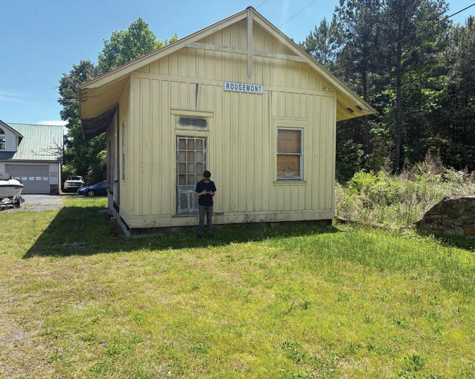
The Rougemont Train Depot once served as a vital hub for transporting goods and passengers through northern Durham County. Although relocated from its original site, the preserved structure now sits on private property adjacent to the rail corridor, where it remains a local point of interest.

Stagville State Historic Site preserves one of North Carolina’s largest plantations, once spanning over 30,000 acres and home to hundreds of enslaved people. Today, visitors can experience preserved 18th- and 19thcentury structures, including the Bennehan House and Horton Grove slave dwellings, which stand as powerful reminders of the region’s complex history. The site offers guided tours, educational programs, and opportunities for reflection on the legacy of slavery and resilience of the African American community.

The Great Trading Path was a historic network of trails used for trade and travel by Indigenous peoples and early European settlers across the Piedmont region. Portions of the trail corridor cross this historic route, with sites such as the Catawba Trail Farm specifically honoring and highlighting this feature on their property.
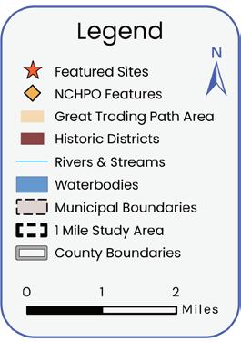

Map 14: Historic Features
The study area includes 26 existing city and county parks, offering traditional recreation such as tennis courts, soccer fields, basketball courts, and playgrounds, in addition to walking trails and opportunities for educational and exploratory activities. (See Map 15: Existing Parks & Trail Systems, page 69.)
City of Durham Parks and Recreation also maintains outdoor recreation areas near the proposed trail corridor, including the Lake Michie Recreation Area and Little River Park and Marina, which offer boat rentals and public spaces for fishing and other activities. Supported campground facilities adjacent to Lake Michie include Spruce Pine Lodge and Holly Grove. Two neighborhood parks in Bragtown—Red Maple Park and Lakeview Park—are located near the trail corridor and could be connected via sidewalks or future spur trail to improve access for local residents.
The study area includes 26 existing city and county parks, offering traditional recreation such as tennis courts, soccer fields, basketball courts, and playgrounds, in addition to walking trails and opportunities for educational and exploratory activities.
Existing greenway systems in and near downtown Durham, such as the North/South Greenway (Ellerbe Creek Trail, Stadium Dr. Trail, and West Ellerbe Creek Trail) and the American Tobacco Trail, provide connections through city parks (like Northgate Park) to major population centers in downtown Durham.
Natural surface trails at Horton Grove, Penny’s Bend, and Beaver Marsh Nature Preserve are also located near the rail corridor and could be linked to the proposed rail trail. In addition, regional trails, including the East Coast Greenway and the Mountains-to-Sea Trail, intersect the corridor, expanding connectivity to destinations beyond the city. (See Exhibit 11: East Coast Greenway, page 70; and Exhibit 12: Mountain-to-Sea Trail, page 71.)
The Durham-to-Roxboro corridor is alignment 5A in NCDOT’s Great Trails State Plan and would serve as a segment of the larger, developing statewide network.
Beyond existing greenways and trails, proposed trails, including the Downtown Durham Rail Trail, R. Kelly Bryant Bridge Trail, and North Ellerbe Creek Trail, will further enhance connectivity within downtown Durham.
Currently, north Durham County, including the communities of Bahama and Rougemont, lacks a greenway or paved trail system that is accessible to people of all ages and abilities.


Map 15: Existing Parks & Trail Systems
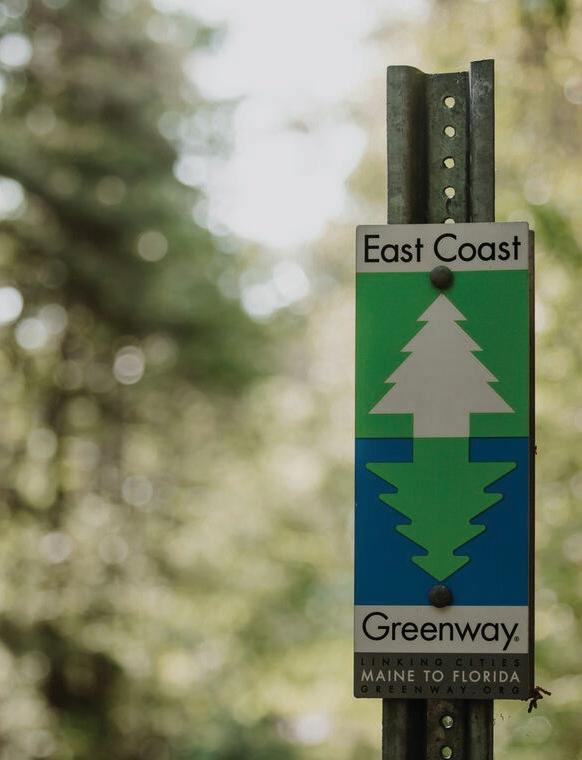
The East Coast Greenway (ECG) is a nearly 3,000-mile proposed trail network that will ultimately connect communities from Maine to Florida, providing a continuous route on protected paths for walking, biking, and other non-motorized transportation. In North Carolina, the proposed spine route passes through the Research Triangle cities of Durham and Raleigh on extensive greenway trails, then continues through the Sandhills to Fayetteville, and runs across the coastal plain along the Cape Fear River to Wilmington.
In addition to this main route, the proposed Historic Coastal Route follows the North Carolina coast more closely, linking Greenville and Jacksonville before joining the proposed spine route in Wilmington.
The East Coast Greenway Alliance stewards the trail, supporting its development, maintenance, and promotion. In Durham, the ECG will follow the proposed Durhamto-Roxboro Rail Trail for approximately nine miles from downtown Durham to the area in or near Stagville State Historic Site.
In 2021, the East Coast Greenway was designated as an official North Carolina State Trail, making it a unit of the North Carolina State Parks system.
The Mountains-to-Sea State Trail (MST) is North Carolina’s longest state trail, stretching over 1,175 miles from the Great Smoky Mountains to the Outer Banks. In Durham County, the MST follows the Eno River and Penny’s Bend Nature Preserve, providing scenic access to natural areas and recreational opportunities. Within the Durham-to-Roxboro Rail Trail corridor, the MST intersects the trail at Penny’s Bend, offering connections to regional destinations and enhancing access to the state’s premier long-distance trail network.

In the study area, the existing bicycle and pedestrian infrastructure is varied. Within downtown Durham, near the southern terminus of the rail corridor, there is a mix of on-street bike lanes and buffered shoulders on key corridors, sidewalks along most arterials, and greenway segments that parallel creeks, and connect parks, and neighborhoods.
In Bragtown and most of unincorporated Durham County, conditions shift to a more rural roadway network including two-lane roads with open ditches, higher operating speeds, limited lighting, and spotty or absent sidewalks and bike lanes. Shoulders are often narrow or unpaved, marked crossings are rare, and destinations are more spread out.
The Durham-to-Roxboro Rail Trail is the first greenway project proposed in rural Durham County and it presents a significant opportunity to expand bicycle and pedestrian infrastructure into areas of Durham County with little existing infrastructure for people who walk and bike. There are two existing sidewalk connections to the trail corridor - one on Dearborn Dr. in Bragtown and the other on Rhododendron Dr. in the Treyburn neighborhood. (See Map 16: Existing Bicycle and Pedestrian Infrastructure, page 73)
While there are no existing bike lanes that connect to the trail alignment, there are striped bike lanes on both sides of Hamlin Rd. that end at the Old Oxford Rd. intersection just west of the trail. The Mountains-to-Sea Trail intersects the trail alignment at Penny’s Bend for unpaved hiking. Further from the alignment, but still nearby, is the paved trail system along Old Oxford Rd. in the Treyburn Corporate Park.
As outlined in the Great Trails State NC Final Report, the Durham-to-Roxboro Rail Trail would link to the Durham Rail Trail, which connects to the American Tobacco Trail, creating a continuous 48-plus-mile network from Roxboro to Apex, with Durham at its center. (See Exhibit 13: Great Trails State Network, Division Five)

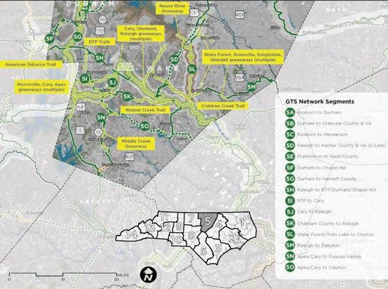
Source: Great Trails State NC Final Report 2022
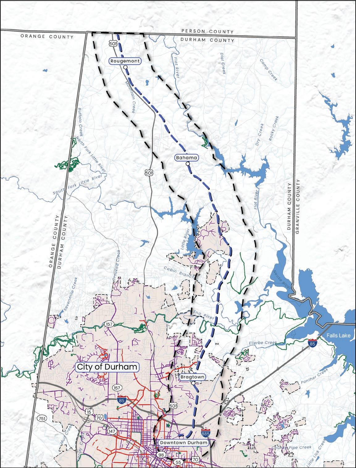
Map 16: Existing Bicycle and Pedestrian Infrastructure
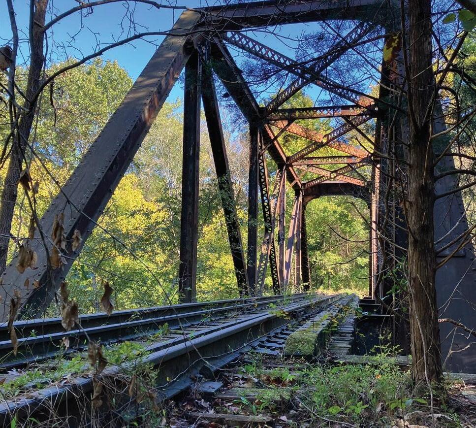
The rail corridor is defined in part by three historic steel bridges and trestles that cross the Eno River, Little River, and Ellerbe Creek. (See Map 17: Bridge Locations, page 75).
As part of this planning study, the consultant team conducted visual assessments to provide preliminary evaluations of each bridge. An expert structural analysis will be required during the preliminary design and engineering phase to assess existing conditions and evaluate use. Beyond their functional role, the bridges will be evaluated in future efforts to consider scenic and historic character.

Overview: The visual assessment was conducted in May 2025. The abandoned rail line crosses Ellerbe Creek as a steel beam bridge, approximately 2,020’ (0.40 mi.) north of Camden Ave. The bridge is approximately 60’ in length and 15’ in width.
General Observations: Overall, this steel beam structure appears to be mostly intact, with a few components that appear to need attention and with the exception of the northern approach to the bridge, which is severely washed out.
The wood decking along the structure’s surface appears to be past its useful life due to significant decay and vegetation growing in and around the wooden members.
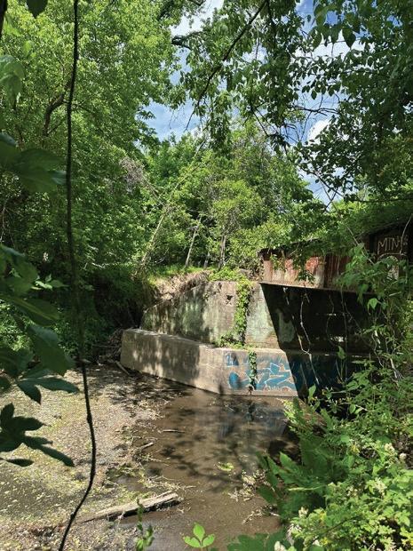
Concrete abutments support the bridge structure on each side of the river, and appear to be mostly intact. However, the area behind the northern abutment exhibits significant erosion from stream waters and the structure may be unstable in this location.
Altogether, the primary structural components of the Ellerbe Creek bridge appear to be in working condition, but replacement/repair of some of the wooden components, and stabilization of the creek bank on the northern side may be necessary for restoration.
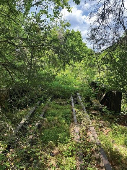
The Ellerbe Creek bridge, looking north across the creek. The bridge is covered by dense vegetation, and the wooden decking is significantly deteriorated.
The northern abutment of the Ellerbe Creek bridge. The approach to this end of the bridge is severely washed out. The bridge may be structurally compromised in this area.
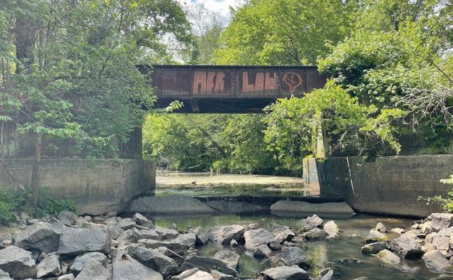
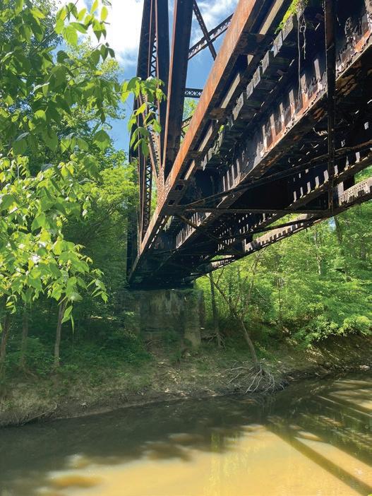
Overview: Visual assessments were conducted in October 2024 and May 2025. The abandoned rail line crosses the Eno River as an elevated steel truss bridge, approximately 830’ (0.16 mi.) east of Old Oxford Rd. near Penny’s Bend nature preserve. The bridge is approximately 140’ in length.
General Observations: Unofficial foot paths exist in this location, indicating that the general public utilizes the area around the bridge for fishing and river access. Overall, this steel truss structure appears to be mostly intact, with a few components that appear to need attention.
The wood decking along the structure’s surface appears to be past its useful life due to significant decay and vegetation growing in and around the wooden members.
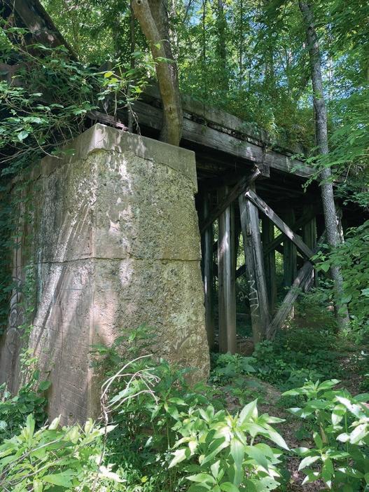
Concrete abutments support the bridge structure on each side of the river, and appear to be in working order. Minor deterioration is present, including weathering of the concrete surface and erosion of the ground surface at the base of each abutment.
An elevated approach leads to and from the abutments. The approaches range in elevation to accommodate the surrounding grade, and are constructed of a wooden beam/girder atop a wooden trestle-style support structure. Visual inspection indicates that this wooden structure may be reaching the end of its useful life cycle due to decay and may require repair or replacement.
The Eno River bridge, looking south across the river. The southern concrete abutment is intact, as well as the steel truss structure.

The Eno River bridge steel truss structure. This structure is intact, but the wooden decking is in various stages of decay.
The Eno River bridge northern concrete abutment and approach. The abutment is intact, but exhibits signs of weathering.

The northern approach to the Eno River bridge. The wooden supports for the approach show signs of decay, but are still standing and appear to be in fair working order.
Overview: The visual assessment was conducted in May 2025. The abandoned rail line crosses the Little River as an elevated steel truss bridge, approximately 2,130’ (0.40 mi.) north of Old Oxford Rd. The bridge is approximately 130’ in length.
General Observations: Overall, this steel truss structure appears to be mostly intact, with a few components that appear to need attention.
The wood decking along the structure’s surface appears to be past its useful life due to significant decay and vegetation growing in and around the wooden members. These components were observed to be in worse condition than the Eno River bridge. The steel truss structure above the bridge is also encircled by trees and vining plants.
Concrete abutments support the bridge structure on each side of the river, and appear to be in working order. Both abutments are nearly enveloped in vegetation, making them difficult to inspect. It is likely that the concrete surface is damaged from the presence of this dense vegetation. A concrete culvert intersects the approach to the steel bridge and is still functioning as designed, allowing a tributary to drain into the Little River.
An elevated approach leads to and from the abutments. The approaches range in elevation to accommodate the surrounding grade, and are constructed of a wooden beam/girder atop a wooden trestle-style support structure. Visual inspection indicates that this wooden structure may be reaching the end of its useful life cycle due to decay and may require repair or replacement.
According to GIS analysis, much of the rail corridor in this area is elevated to FEMA flood zone x (1% future conditions), which has a 1% chance of flooding each year, based on future land use projections. This is a lower risk for flooding than the surrounding area. Trail design and construction should prioritize maintaining the current elevated approached to the Little River crossing in this area, wherever possible, to minimize flood risk.
The Little River bridge, looking north across the river. While it appears to be intact, the bridge is encircled by dense vegetation.
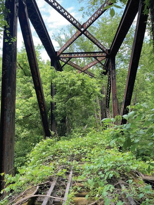


A concrete culvert is present along the southern approach to the Little River Bridge, and appears to be functioning properly.
The southern approach to the Little River bridge. The wooden supports show signs of decay and general deterioration.

The wooden decking is significantly decayed in many points along the surface of the Little River bridge.
Through GIS analysis and guidance from the Project Management Team, environmental hazards within the study area including brownfields, hazardous waste sites, pre-regulatory landfill sites, and industrial areas of concern were identified. The environmental hazards listed below will need to be considered as design and development of the rail trail moves forward. (See Map 18: Environmental Hazards, page 83.)
Within the study area, there is one brownfield site (a property whose reuse or redevelopment is hindered by the presence or potential presence of hazardous substances, pollutants, or contaminants) located at Welcome Venture Park.
There are ten hazardous waste sites (listed below) with the distance from the rail corridor included in parentheses:
1. Merck Sharpe & Dohme Corp (1700 ft)
2. Southern Research Institute (800 ft)
3. Corning Life Sciences (1600 ft)
4. KBI Biopharma Inc (600 ft)
5. Mitsubishi Electric & Electronics USA (400 ft)
6. DUHS Clinical Lab (5100 ft)
7. John’s Inc (900 ft)
8. Model Laundry & Cleaners (5000 ft)
9. Scott & Roberts Dry Cleaners (4800 ft)
10. Model Laundry (4900 ft)
There are two pre-regulatory landfill sites (listed below) with the distance from the rail corridor included in parentheses:
1. Durham Land Disposal Area (2500 ft)
2. East End Park Landfill (3600 ft)
Additionally, there is one industrial area on Camden Ave. and two industrial areas located near Old Oxford Rd. that were identified as potential hazards.
As part of the acquisition of the rail corridor for public ownership and use, the Conservation Fund on behalf of NCDOT, has conducted a Phase I Environmental Site Assessment (ESA), a Phase II Environmental Site Assessment (ESA), and a National Environmental Policy Act (NEPA) assessment.

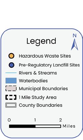
The rail corridor has 19 roadway crossings and two private driveway crossings. Crossings were inventoried documenting existing conditions observed through a desktop review of GIS data and imagery (aerials as well as Google StreetView), as well as fieldwork to observe and photograph each crossing. Fieldwork took place in November 2024 and May 2025. This data was supplemented with information about the high injury network from the Triangle West regional Vision Zero Action Plan. This assessment informed the recommendations for crossing treatments. (See Chapter 4.1, Evaluation and Recommendations, page 164.) Evaluation factors included:
• Lanes: Number of travel lanes
• Speed Limit: Posted speed
• Curb: Presence of a curb or not
• AADT (Annual Average Daily Traffic): Measure of traffic volume at location on a given road. It is often not measured for local roads. Data was sourced from NCDOT’s 2023 web map.
• Crossing Angle: The angle at which the trail meets road. Similar to vehicle intersections, a 90-degree crossing is ideal for visibility; between 70 and 90 degrees is preferred. A sharper angle will require realignment prior to the crossing or additional safety measures.
• Pedestrian Activity: A qualitative measure of the context surrounding the crossing in terms of land use, nearby active transportation facilities, and how likely drivers are to expect bicycle or pedestrian activity in the vicinity of the crossing.
• Slope: Generalization of steepness of slope of the trail at the crossing based on topographic GIS information and visual assessment.
• Sight Distance: Measure of how far ahead of a crossing drivers can see it. Detailed design of crossings involves quantitative calculations, but for this stage of design general description is sufficient for informing potential countermeasures.
• Lighting: Qualitative measure of degree of roadway lighting at crossing.
• High Injury Network: Streets that are overrepresented with severe injury and fatal crashes (of any mode). Data was sourced from the Triangle West regional Vision Zero Action Plan.
Exhibit 14: Existing Conditions at Trail Crossings
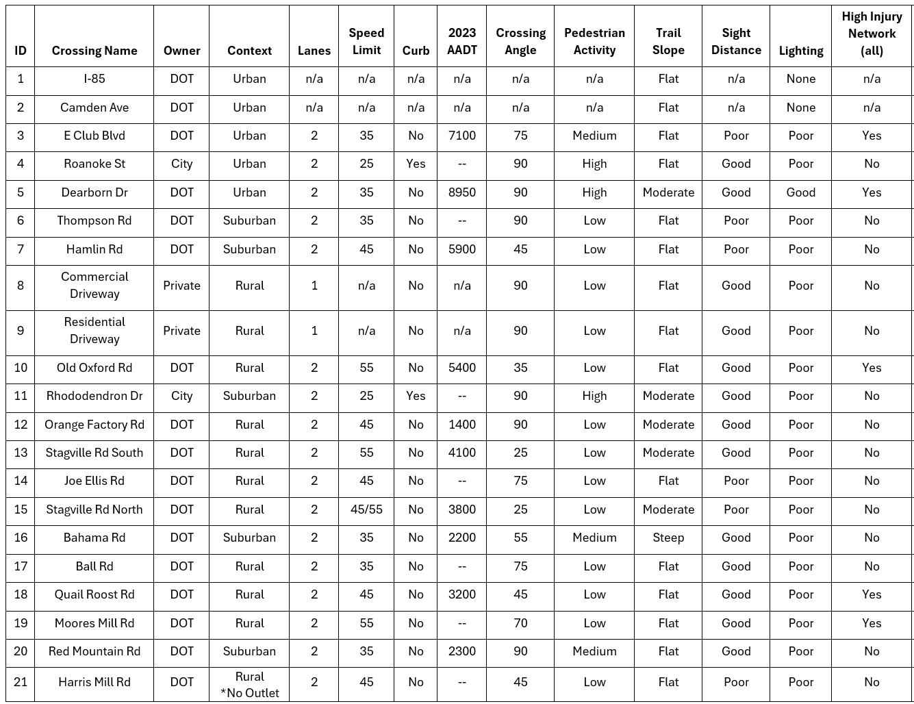
A planning-level investigation on accessibility of existing conditions at all proposed crossings was also conducted to understand potential challenges related to creating crossings that are ADA compliant. This analysis considered grades, crossing angle, presence of curbs, nearby pedestrian and transit infrastructure, and nearby destinations. Lighting is noted for underpasses. Findings are shown in the table below. It is important to note construction of the trail can help mitigate some issues (e.g., being able to “square up” skewed crossing angles so users can cross at a 90 degree angle, or as close to a 90 degree angle as possible) to improve visibility and shorten the length of the crossing.
Further assessment by a licensed engineer is required to determine existing deficiencies related to accessibility.
• Underpass – no access point is needed. Additional lighting is required due length of crossing and lack of natural daylighting.
• Generally flat grades under underpass.
• Generally flat grades under underpass, but steep grades to access Camden Ave. and a long ramp is required. Lighting recommended although natural daylighting is more prevalent.
• No existing sidewalks along Camden Ave.
• Slightly sloping grades, but generally flat. Limited sight distance due to curve and crest at existing crossing location.
• No sidewalks existing, planned sidewalk on north side of E. Club Blvd. will leave gap between sidewalk and trail.
• Striped median could be converted into median island for crossing.
• Generally flat grades.
• Crossing will require curb ramps.
• No sidewalks in this immediate area.
• GoDurham Route 9 stops 800’ west, but no sidewalks at any point.
• Slightly sloping grades.
• Bus stops within 400' in both directions, but stop to the west has no sidewalk connection and stop to the east requires traversing a ditch to board the bus.
• Existing sidewalk connections to Lakeview Park and Braggtown Library but missing protected pedestrian crossings.
• Generally flat grades.
• Curve and limited sight distance.
• No existing sidewalks in the immediate area.
Ball Rd.
• Generally flat grades overall, but grading required to accommodate ditch crossings.
• Skewed crossing and limited sight distance, will likely be shifted to perpendicular. Direct connection to First Assembly of God.
• Sidewalk several hundred feet east along Hamlin Rd. Connects to NC Technical Park, but little else.
Harris Mill Rd.
• Generally flat grades.
• Wide curve but generally good sight distance.
• Crossing occurs at an existing driveway access.
• No sidewalks on Old Oxford Rd.
• Slightly sloping grades.
• Crossing will require curb ramps.
• Sidewalk connections to Treyburn and Stagville communities.
• Slightly sloping grades.
• No existing sidewalks along Orange Factory Rd. Narrow space along the side of the roadway.
• Slightly sloping grades.
• Skewed crossing will require realignment.
• Realignment will require grading work to resolve conflict with ditch. No sidewalks along Stagville Rd.
Generally flat grades, minor grading required to cross ditch.
• Limited sight distance primarily for vehicles turning right from Stagville Rd. onto Joe Ellis Rd.
• No sidewalks along Joe Ellis Rd.
• Slightly sloping grades.
• Skewed crossing with limited sight distance will require realignment.
• No sidewalks along Stagville Rd.
• Direct connection to Mount Calvary Baptist Church.
• Fairly steep grades, will require careful grading on the north side to remain accessible.
• No existing sidewalks to connect to downtown Bahama.
• Generally flat grades.
• No sidewalks on Ball Rd.
• ¼ mile connection to Mangum Elementary (no sidewalk). Steep slope along that potential connection.
• Generally flat grades.
• Slightly skewed crossing, but good sight distance.
• No sidewalks along Quail Roost Rd.
• Slightly sloping grades.
• No sidewalks on Moores Mill Rd. Roadway connection to Quail Roost Trail (no sidewalk, no pedestrian signal at crossing of 501).
Generally flat grades.
• Grading likely necessary for direct access to the historic depot and small shopping center.
• No sidewalks to get to Rougemont crossroads.
• Generally flat grades.
• Limited sight distance.
• No sidewalks on Harris Mill Rd.


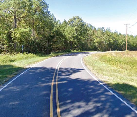
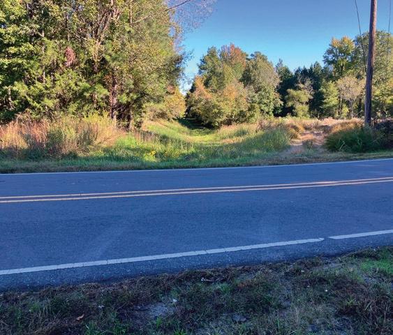
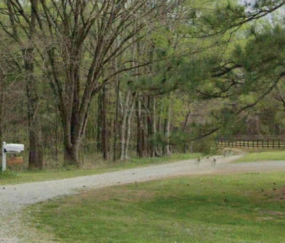

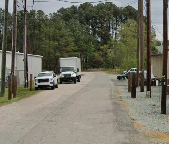

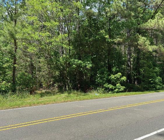

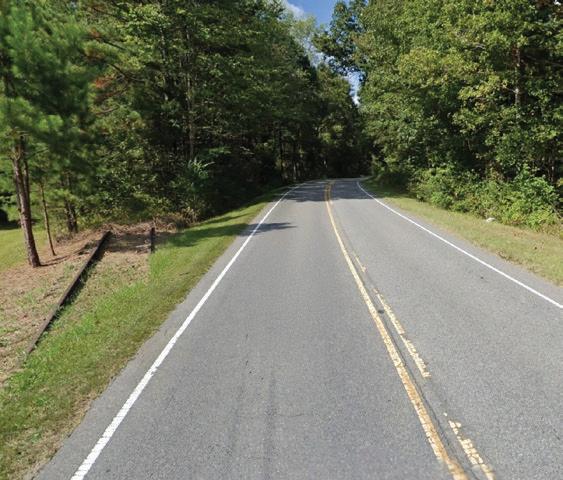


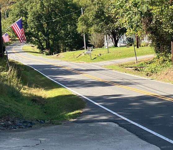


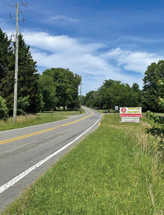
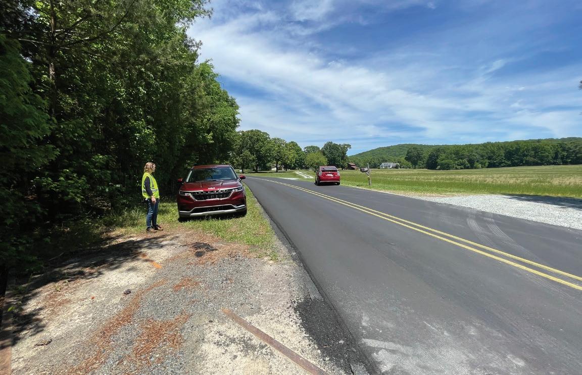
Many related efforts have been made in the region prior to the Durham-to-Roxboro Rail Trail Plan. The 1988 Durham Urban Trails and Greenways Master Plan was the first plan to identify the rail corridor as an ideal opportunity for a multi-use trail for hikers, bikers, and equestrians. Many other plans since then have called out the rail corridor as an asset for recreation and active transportation. This section provides a brief summary of more recent planning efforts, studies, and policies that have implications on this plan.
Durham Parks and Recreation Comprehensive System Plan (2025)
The 2025 City of Durham Parks and Recreation Comprehensive System Plan is a 10-year roadmap to guide DPR in enhancing existing parks, trails, and recreation facilities, expanding greenway connections such as the Durham Rail Trail, and supporting active transportation. It prioritizes equitable access, environmental stewardship, and community-driven improvements to ensure all users, neighbors, and communities benefit from safe, inclusive, and well-maintained public spaces. The plan positions parks and recreation as vital infrastructure for health, resilience, and quality of life in a rapidly growing Durham.

Person County, with funding from North Carolina Department of Transportation's Integrated Mobility Division (NCDOT IMD), conducted a feasibility study to explore opportunities for approximately 15-miles of continuous paved trails and/or sidewalks from Uptown Roxboro to the PersonDurham County line. The study included assessing the feasibility of developing a trail on the 8.7-mile inactive Norfolk Southern rail corridor or the parallel US 501 roadway corridor which could connect to the Durham-to-Roxboro Rail Trail.
Triangle West Transportation Planning Organization (formerly DurhamChapel Hill-Carrboro Metropolitan Planning Organization) developed a Wildlife Crossing Plan in 2024, aiming to improve roadway safety for both humans and wildlife. Key wildlife crossings in the area were identified, and recommendations for projects include retrofits at existing bridge and culvert infrastructure, bridge and culvert replacement projects, and construction of new infrastructure. The plan identified two critical wildlife crossings in or near the study area: Old Oxford Rd. over the Eno River and US 501 (Roxboro Rd.) over the Eno River.

The Durham Comprehensive Plan serves as a broad policy guide for the future of Durham city and county. Recreation goals include providing opportunities that are affordable, physically accessible, and equitably distributed, with specific recommendations for parks and green spaces (relevant policies include 104, 105, and 106).
Transportation goals include creating a system that is safe, affordable, dignified, sustainable, connected, and physically accessible, with specific recommendations for equitable investment in bike lanes, crosswalks, and regional transportation connections (relevant policies include 67 and 72). Environmental goals include protecting natural areas, watersheds, and the tree canopy, while ensuring equitable access to green space (relevant policies include 108 and 112). The Place Types of the Comprehensive Plan are categories that help organize similar types of places found throughout Durham County and show where different types of land use should be in the future.
The Great State Trails Plan aims to connect communities to the outdoors while creating opportunities for active transportation, conservation, recreation, health, tourism, and economic prosperity through proposed a statewide trail network. Fostering connections between urban and rural areas in all 100 North Carolina counties is a primary goal of the plan. Plan recommendations include a proposed shared use path segment from Roxboro to Durham.
This planning effort, an update to the 2011 Master Plan, was developed in partnership between the City/ County Planning Department and the Durham Open Space and Trails Commission (DOST) and recommends building 186 miles of paved and natural surface greenways and trails. An opportunities and constraints analysis identified 123 miles of trail implementation sectioned into four major categories: priority trails, key connector trails, network expansion trails, and longterm vision trails. The study area extends from the Southwest Creek Trail to the Crooked Run Creek Trail with numerous trail connections, including Eno River Trail, Ellerbe Creek Trail, Cub Creek Trail, Roxboro Rail Trail, American Tobacco Trail, and Bryant Bridge Trail.

NCDOT Complete Streets safely accommodate access and travel for all users through interdependent, multi-modal transportation networks. Under current policy, planners and designers are required to consider and incorporate multimodal facilities in the design and improvement of appropriate North Carolina transportation projects, beginning at the inception of the planning process. Benefits of this approach include easier transportation for travelers, encouraging alternative forms of transportation, fostering sustainable communities, increasing connectivity, and improving safety.

The overarching purpose of the Durham Parks and Recreation Strategic Plan is to connect the whole community to wellness, the outdoors, and lifelong learning. The plan identified parks, trails, and facilities as a core product/ service to the community. Plan recreation neighborhood goals include increasing opportunities through quality, diverse program offerings, physical spaces, natural areas, and lifelong learning.

This plan developed by the Triangle West Transportation Planning Organization (formerly known as the Durham-Chapel Hill-Carrboro Metropolitan Planning Organization) serves as a long-range multimodal transportation plan that covers transportation needs, including highway, public transportation and rail, bicycle, and pedestrian, through 2040 for the towns of Carrboro, Chapel Hill, Hillsborough, the City of Durham, and Chatham, Durham, and Orange Counties. Current conditions and needs were assessed, and recommendations are categorized by each mode of transportation. For Durham County, significant population growth is projected, and recommendations center around watershed and stream protection and increased demand for multimodal transportation, including improvements for numerous bicycle-pedestrian multi-use paths across the county.

This report analyzes the estimated benefits of the East Coast Greenway (ECG) in the Research Triangle region through estimations of bicycle and pedestrian trips that take place near the trail alignment. The study was framed through the health and environmental, economic, and transportation and access benefits of the trail for the community. Result estimates indicated increased physical activity, fewer points of CO2 annual emissions, increase in jobs spending, and property value, and a decrease in vehicle operation cost, mileage, and collisions.
The City of Durham Trail Condition Assessment aimed to provide an updated inventory and assessment of the existing trail network within the Durham Parks and Recreation System, which consisted of approximately 30 miles of greenway trails, street trails, and rail trails at the time of study. The trails were assessed based on general conditions of various amenities as well as ADA compliance. Recommendations prioritize extensive ADA improvements as well as additions to lighting, better disbursement of benches, strategic placement of waste receptacles, increased wayfinding, and evaluation of access points.
The Durham Bike+Walk Implementation Plan updates and consolidates the City’s 2006 bicycle and pedestrian plans, focusing on nearterm, implementable improvements to make walking and biking safer, more connected, and more accessible. Built on extensive public engagement and a data-driven prioritization (safety, connectivity, demand, equity), the plan identifies 75 priority projects and 11 action topics to accelerate delivery of facilities and programs citywide. An update to the Durham Bike+Walk Plan is currently underway and will be published in early 2026.

With the Mountainsto-Sea (MST) Master Plan initiative, the NC Division of Parks and Recreation (DPR) aims to promote completion of the MST across the state. Goals of the master plan include engaging stakeholders, confirming the vision, defining segments, prioritizing future work, providing web-based content about planning efforts, and developing an initial set of tools to assist trail planning partners. To promote ongoing development of the trail, this plan defines eight Designated Segments as well as 18 Planning Segments, which are prioritized based on readiness for further planning and implementation.

This master plan serves as a guide to direct the operations of the Department of Parks and Recreation in facility development and recreation programming. In accordance with previous City planning efforts, this plan provides guidance in facilities, recreation programming, best practices in maintenance and operations, sustainability, and implementation. Trails and greenways scored highest in both importance and participation on the PARCS community survey. The master plan recommends continuing with trail corridor acquisition and supports project recommendations in the Durham Trails and Greenways Master Plan (2011).

This plan serves as a guide to the development of a comprehensive trail system in Durham, including policies on trail development, connections to community destinations, implementation priorities and management, and trail interaction around stream corridors. Goals and recommendations for this plan include connectivity, accessibility, right-of-way preservation, water quality protection, open space preservation, community education, and community involvement.
Adopted in 2006, the City of Durham and Durham County Unified Development Ordinance (UDO) lays out the rules for the physical development of property. The UDO designates zoning of properties in Durham, and is crafted to result in a built environment that meets the goals of the Comprehensive Plan.
This plan aims to protect the Little River area by evaluating the area’s most important ecological and cultural features, land ownership patterns and opportunities, and future challenges. Implementation actions to promote open space and protection include recreation amenities, wildlife and habitat areas, and regulatory provisions and programs. In support of open space along the Little River Corridor, this plan recommends the Durhamto-Roxboro rail corridor as a future multi-use trail route for hiking, biking, and equestrian use.
2.5
This section presents population, income, and employment data, along with future projections for residents of Durham County and the City of Durham, as reported by the U.S. Census Bureau and the Bureau of Labor Statistics.
According to 2018–2022 American Community Survey (ACS) data from the U.S. Census Bureau, Durham County is home to 346,568 residents, of whom 303,467 live in the City of Durham. The county has 144,546 households with an average household size of 2.28 people. Approximately 7.3% of households include one or more members with a disability. Within the county, 10% of households fall below the poverty line, slightly lower than the state average of 12.8%.
The median age in Durham County is 35.8, compared to 39.1 in North Carolina and 39.0 in the United States. In Durham County, 19.3% of the population is under 18, 66.0% is between 18 and 64, and 14.7% is over 65.
By race and ethnicity, 42.6% of Durham County residents are White, 34.0% are Black, 13.3% are Hispanic (White, multiracial, or other), 5.2% are Asian, and less than 1% are American Indian or another race (non-Hispanic).
The per capita income in Durham County is $48,220—21.7% higher than the state average of $39,616 and 19.5% higher than the national average of $40,363. The median annual household income is $82,910—25.3% higher than the state average of $66,186 and 20.1% higher than the national average of $69,021.
In Durham County, 54.0% of households are owner-occupied, while 46.0% are renter-occupied. The median home value in the region is $394,364.
Sixty-six percent of the county’s population is considered working age (18–64). The county is home to 13,032 businesses employing 171,484 people. The unemployment rate is 3.6%, slightly below the state rate of 3.7%.
In terms of educational attainment, 55.5% of Durham County residents hold a bachelor’s, graduate, or professional degree; 19.8% have some college or an associate’s degree; 14.4% hold a high school diploma; and 7.4% do not have a high school diploma.
According to 2018-2022 American Community Survey (ACS) data from the U.S. Census Bureau, Durham County has seen a 1.54% growth rate from the last decennial census. Applying this rate forward, the county’s population is projected to reach 351,911 by 2030, 357,327 by 2040, and 362,834 by 2050.


A clear understanding of who will use the Durham-to-Roxboro Rail Trail and how they are likely to use it is critical to creating a successful and sustainable rail trail. Evaluating potential demand not only helps project future usage but also ensures the needs of diverse user groups are met through thoughtful design, amenities, and programming.
This section draws on benchmark trail comparisons, existing and projected trail use patterns, community survey results, economic impact research, and potential trail users to provide a comprehensive picture of anticipated future needs.
This section considers two comparable rail-trails, the 22.6-mile American Tobacco Trail (Research Triangle, NC) and the 22-mile Prisma Health Swamp Rabbit Trail (Greenville, SC). These trails were selected for their comparable length to the proposed Durham-to-Roxboro Rail Trail and their similar setting in the southeastern United States. While comprehensive data on usage and activities is limited for both trails, several studies and project summaries provide relevant benchmarks.

The 22.6-mile American Tobacco Trail travels through Durham, Wake and Chatham counties. Similar to the Durham-to-Roxboro rail corridor, the trail begins in downtown Durham in an urban setting and gradually becomes more rural as it extends south. The ATT is a 10-foot wide, paved, offroad trail which follows the former CSX rail corridor.
• Estimated 500,000 – 600,000 users.1
• Primary activities on the trail included walking, jogging, cycling, roller blading, and pushing strollers.2
• Data from bicycle and pedestrian counters on the ATT shows a roughly 50/50 split of pedestrian and bicycle trail users.3
• Pedestrian Volume
• Highest volume: October and Saturdays
• Lowest volume: December and Fridays
• Bicyclists Volume
• Highest volume: July and Sundays
• Lowest volume: January and Tuesday/ Thursday
The 22-mile Prisma Health Swamp Rabbit Trail in South Carolina is a paved, muti-use greenway that follows a former rail corridor and links Travelers Rest to Greenville. The trail is flat to gently rolling and passes through Furman University’s campus and Falls Park in downtown Greenville.
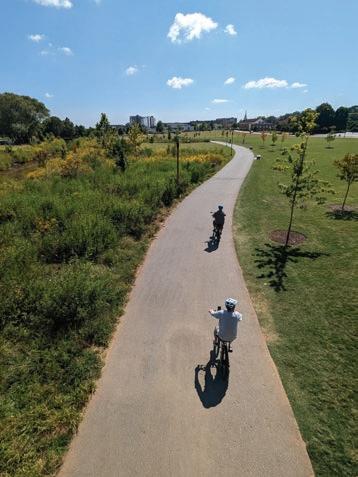
Source: Toole Design
• Estimated 750,000 annual users.4
• Primary activities on the trail included biking, walking, and running.4
• Seasonal Analysis.5
• Most popular season
• Year 1: Summer (June - August) as most popular season (2,238 users)
• Year 2: Spring (March - May) as most popular season (2,217 users)
• Day/Month Analysis
• Busiest day - Memorial Day (5,550 users)
• Slowest day - December 26 (150 users)
• Busiest month - September (79,500 users)
1. Institute for Transportation Research and Education at North Carolina State University. (2014). BridgingtheGap: ImpactsonHealth,Transportation,andtheEconomyfromcompletingacriticallinkina22-milerailtrail 2. Durham Parks and Recreation. (2022). American Tobacco Trail. 3. Institute for Transportation Research and Education (2017). NorthCarolinaNon-MotorizedVolumeDataProgram 4. Furman University. (2012). GreenvilleHealthSystemSwampRabbitTrail:Year2findings. 5. City of Greenville. SwampRabbitTrail,TrailTracking
The Durham-to-Roxboro Rail Trail Plan Community Survey (2025) was conducted to gather input from the public on the general usage, improvements and priorities, and community support of the proposed trail. (See Section 3.4, Page 132, Phase 1 – Community Engagement for full survey results.)
Of the 2,994 survey respondents:
• Nearly one-half reported daily to weekly current trail use
• People who reported daily to weekly current trail use were primarily White, ages 25-44, hold a Bachelor’s or Master’s degree, and earn a household income of more than $100,000
• Both male and females reported using existing trails equally
• Most popular trail-use activities were walking, running/ jogging, bicycling, E-biking, and rollerblading/ scootering
• Respondents currently use trails predominantly for exercise or recreation and mental health and well-being

The Durham-to-Roxboro Rail Trail Plan Community Survey (2025) also included questions to gauge the projected use of the Durham-to-Roxboro Rail Trail if it is constructed.
Of the 2,994 survey respondents:
• Nearly 40% of survey respondents anticipated they would use the trail daily to weekly if it were to be constructed
• People who reported daily to weekly projected trail use were primarily White, ages 25-44, hold a Bachelor’s or Master’s degree, earn a household income of more than $100,000
• Projected trail use was equally distributed between males and females
• Roughly 20% of respondents plan to use the trail for transportation
• Of the survey respondents, 82% are in support of the Durham-to-Roxboro Rail Trail
The East Coast Greenway Alliance study prepared by Alta Planning + Design, The Impact of Greenways in the Triangle (2017), found that the East Coast Greenway generates $90 million in annual benefits for the Triangle region, including improvements to health, the environment, transportation, access, the economy, and property values.1 Because the southern portion of the Durhamto-Roxboro Rail Trail will share a route with the East Coast Greenway, and given the corridor’s similar geography and community context, comparable benefits can reasonably be anticipated if the trail is constructed.
Additionally, in its 2018 study, “Evaluating the Economic Contribution of SharedUse Paths in North Carolina,” the Institute for Transportation Research and Education (ITRE) found that every $1 invested in greenways yields $1.72 in annual economic benefits.2
The Durham-to-Roxboro Rail Trail should welcome everyone who wants open space access, recreation, and active transportation opportunities. Understanding the needs of trail user types will create a comfortable, safe, and high-quality experience for all. Below are different user types potentially expected at the Durham-to-Roxboro Rail Trail. People with disabilities (e.g. physical, visual, auditory, and cognitive) may fall within any of the user types listed below and their needs must be considered in all situations.
• Shared use paths that support pedestrians must be accessible for people with disabilities.
• Runners and joggers prefer softer surfaces. Grass or soft-surface shoulders on either side of a hard-surface trail can be provided to meet this need.
• Pedestrians typically travel at 3.4 mph and signal timing of crossings should be based on pedestrian use as they are slower than bicycles.
• Ideally, pedestrians should be separated from bicyclists where there is sufficient space to do so. When separated from bicycles, the pedestrianonly path should be 5’ wide at minimum.3

• Bicycles come in all shapes and sizes, and e-cargo bikes are growing in popularity.
• A minimum width of 11’ is recommended for shared use paths to minimize conflicts between users while also supporting the social use of shared use paths (two people traveling side-by-side). A width of 11’ provides a 3-lane facility.
• Bicyclists, other than mountain bikers, benefit from paved surfaces.
• Typical speed of adult bicyclists is 12.8 mph and child bicyclists is 7.9 mph.1
• While e-bike use on trails within the City of Durham is not currently allowed, this may change in the future and the current rule is not typically enforced.2
• E-bikes have a higher design speed than standard bicycles ranging from 1218 mph with nearly all e-bikes being capable of providing electric assistance up to 20 mph.
• For shared use paths, a minimum width of 12’ is recommended to support e-bike use.1
• Mountain bikers typically seek out a trail experience that centers on their interaction with the trail itself. This is typically achieved by adding features like rock gardens, jumps, berms, and rollers. The nature of the rail trail as a long linear corridor can limit what types of features can be incorporated into a mountain bike trail. Mountain bike features could be explored where there is naturally rolling topography within the railroad right-of-way such as the area just north of Hamlin Rd. The greatest utility of a single track alongside the primary trail might be to connect mountain bike trail networks.
• Trail width, surface, and slope all contribute to difficulty and interest level of a single-track trail. If a single-track mountain bike trail is provided as part of a parallel path trail, International Mountain Bike Association (IMBA) rating of “Easy” is recommended. This requires the trail to be a minimum of 3’ wide.3
• People using skateboards, rollerblades, scooters, wheelchairs, strollers, and other devices with small wheels benefit from paved surfaces.
• Electric-assist devices such as ebikes, e-scooters, and e-skateboards typically increase the difference in speed among trail users. Providing wider trail widths where these users are expected can help ensure safer passing.1
Equestrian use along bicycle and pedestrian trails with either all users sharing an unpaved path or with an unpaved equestrian path running parallel to a paved bicycle and pedestrian path is common across the country, often in more rural areas. The southern portion of the American Tobacco Trail (ATT) is a local precedent of this condition.4
• A 6’ wide vegetated buffer or barrier is recommended to separate shared use paths from bridle paths.
• Equestrians require a minimum of 10’ vertical clearance; 12’ preferred.
• A 6’ minimum of tread width is recommended for a single-track horse trail, which increases to 8’ minimum for a double-track horse trail.
• Equestrians must also be considered in the design of trailheads as horse trailers require larger stalls.
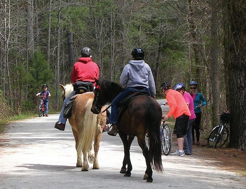
For planning purposes, the 18.2-mile rail corridor in Durham County has been divided into five Focus Areas. Moving from south to north, the Focus Areas are: 1) Downtown Durham, 2) Bragtown, 3) Two Rivers, 4) Bahama, and 5) Rougemont. (See Map 19: Planning Sections Overview, page 109.) 2.7
This section identifies opportunities and constraints as identified through GIS analysis, field observations, policy and plan review, demographic analysis, and stakeholder input. The opportunities and constraints presented here were preliminary observations, primarily focused on potential trailheads, trail connections, and other trail amenities, that helped inform the recommendations outlined in Chapter 4. Final designs of the preliminary conceptual designs that relate to these opportunities and constraints are subject to change in future phases based on engineering, survey data, and regulatory review.


The Downtown Durham Focus Area spans 1.7 miles from the Avondale Rd. underpass to East Club Blvd., serving as the southern terminus of the Durhamto-Roxboro Rail Trail. This segment connects key destinations including downtown Durham, multiple parks, the East Coast Greenway, the American Tobacco Trail (via the planned Downtown Durham Rail Trail), and GoDurham Route 9, providing important recreational and transportation linkages. (See Map 20: Downtown Durham Opportunities and Constraints, page 111.)
1. A city-owned parcel near the nexus of multiple proposed trails could be developed as a trail access point.
2. The NCDOT-owned parcel could be developed as a trailhead.
3. Future North Ellerbe Creek Trail provides connections to nearby residential areas and surrounding services.
4. A boardwalk provided at a city-owned wetland parcel would offer opportunities for nature education.
5. Access to the rail trail from the east is limited due to existing land use and environmental conditions.
6. The I-85 underpass creates a potentially unsafe space under the bridge due to limited visibility.
7. The existing Ellerbe Creek bridge requires repair or replacement.
hazard areas may complicate permitting and construction.

The Bragtown Focus Area extends 2.5 miles from East Club Blvd. to Sandy Ridge Elementary School along Hebron Rd. This segment serves the Bragtown community and provides access to parks, schools, the Bragtown Branch Library, the Welcome Venture Industrial Park, conservation areas, and connections to the GoDurham bus route. (See Map 21: Bragtown Opportunities and Constraints, page 113.)
1. Connect to bus stops along E. Club Blvd. to provide access via public transit.
2. Develop a city-owned lot as a trailhead.
3. Create a linear park along Roanoke St.
4. Leverage proximity to Red Maple Park, including a connection point via a city-owned lot directly south of the park along Pecan Place.
5. Connect to bus stops and Bragtown community amenities such as Lakeview Park, Bragtown Library, and Lakeview Secondary School along Dearborn Dr.
6. Provide access to the North Durham Farmer’s Market, which is directly adjacent to the rail corridor.
7. Support Trail-Oriented Development opportunities at Welcome Venture Park.
8. Connect to Sandy Ridge Elementary School (future N. Durham Parkway) and the planned Cub Creek Trail.
9. Trail alignment passes adjacent to a known brownfield site (Welcome Venture Park).

The Two Rivers Focus Area spans 4 miles from Sandy Ridge Elementary School along Hebron Rd. to just south of the Treyburn community. This segment connects important recreational, educational, and historical sites, including the Mountains-to-Sea Trail, Penny’s Bend, the Eno and Little Rivers, local schools, the southern portion of Treyburn Corporate Park, the historical Great Trading Path, and Durham Technical College North Campus. (See Map 22: Two Rivers Opportunities and Constraints, page 115.)
1. The Mountains-to-Sea Trail crosses the rail trail corridor, offering potential mutual benefits for both trail systems.
2. Support shared trailhead and parking opportunities at Penny’s Bend Nature Preserve.
3. Connect to existing trails.
4. Provide access to schools and Durham Technical College for nature education opportunities.
5. Connect to Catawba Trail Farm.
6. Flood hazard areas along the Eno River may complicate permitting and construction.
7. The existing Little River bridge may require repair or replacement and currently lacks pedestrian and bicycle infrastructure.
8. While the railroad alignment is elevated above the flood level, flood hazard areas along the Little River are unsuitable for adjacent trail development.
9. Trail alignment is adjacent to hazardous sites.
10. Portions of the trail traverse game lands.
11. Additional hazardous sites are located along the corridor.
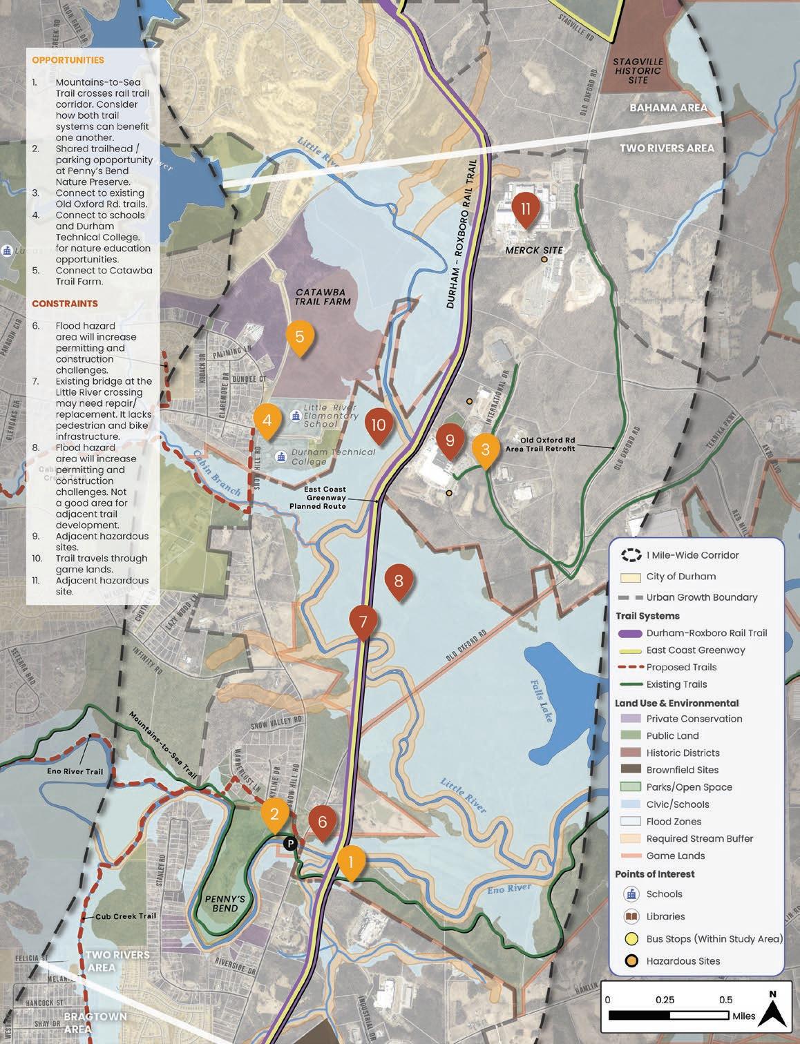
The Bahama Focus Area covers 4.5 miles from the just south of the Treyburn community to Ball Rd. This segment travels through the community of Bahama and provides access to key destinations, including Stagville State Historic Site, Horton Grove Nature Preserve, Lake Michie, and Mangum Elementary School. (See Map 23: Bahama Opportunities and Constraints, page 117.)
1. Utilize the planned East Coast Greenway route to connect to Stagville State Historic Site.
2. Connect to the Little River Fishing Facility.
3. Connect to Horton Grove Nature Preserve, which offers parking and trails.
4. Link to businesses at the center of the Bahama community.
5. Connect to Mangum Elementary School and extend access to the Lake Michie trail system.
6. No publicly-owned parcel is available for a trailhead.

The Rougemont Focus Area extends 5.5 miles from Ball Rd. to the Durham/ Person County line. This segment travels through the Rougemont community and provides access to key features such as NCSU Hill Forest, the County Convenience Center property, Rougemont Depot, and local community areas. (See Map 24: Rougemont Opportunities and Constraints, page 119.)
1. Connect to neighborhood streets to increase trail use and access in this area.
2. A widened area of the right-of-way could be developed as a major trailhead within the core of the Rougemont community.
3. Connect to a community hub along Red Mountain Rd. and the historic Rougemont Depot.
4. A widened area of the right-of-way could be developed as a minor trailhead.
5. Nearby Hill Forest is a hazardous area due to active forest management, including insecticide use and prescribed burns.
6. The required stream buffer along Mountain Creek overlays a Countyowned parcel, limiting development potential.
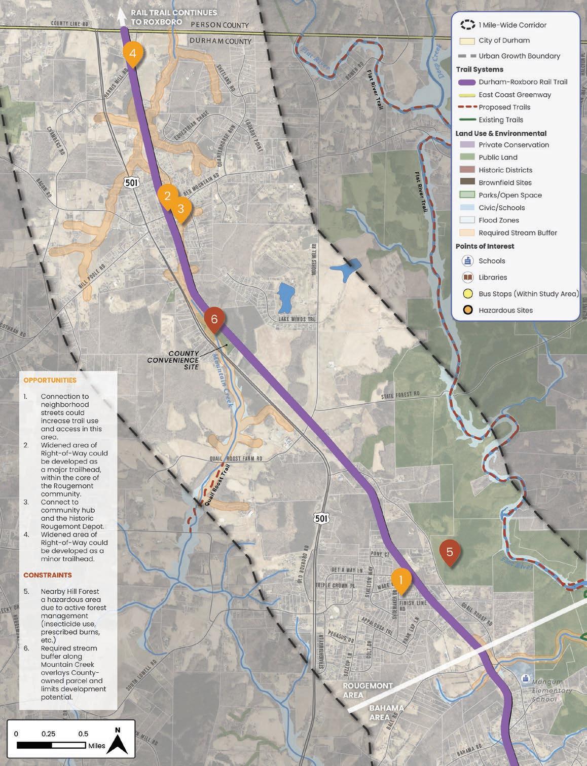
Map 24: Rougemont Opportunities and Constraints


This chapter showcases the collaborative and communitydriven foundation of the planning process. The chapter begins with the leadership and committees that guided the project, followed by the community partners who brought valuable perspectives and expertise. Next, the tools of engagement used to reach residents and stakeholders are highlighted, along with a detailed summary of the two phases of community engagement. The chapter concludes with key design considerations shaped by the input gathered, which informed the plan’s recommendations.
IN THIS CHAPTER:
3.1 Project Leadership & Committees
3.2 Tools of Engagement
3.3 Community Stakeholders
3.4 Phase 1 – Community Engagement
3.5 Phase 2 - Community Engagement
3.6 Community Sentiment
3.7 Design Considerations
This project was guided by three committees that brought leadership, expertise, and community perspectives to the planning process.
1. Project Management Team: Served as the steering committee, representing the five lead organizations overseeing the effort; Durham County Transportation, City of Durham Parks and Recreation, East Coast Greenway Alliance, Triangle West Transportation Planning Organization, and North Carolina Department of Transportation.
2. Project Advisory Committee: Made up of 12 organizations with diverse interests and expertise. Provided guidance on community priorities and technical considerations.
3. Trail Identity Committee: Brought together members from Durham and Person Counties to shape a unique identity for the 28.8-mile trail from Downtown Durham-to-Roxboro. Each member of the committee also served on either the Project Management Team or the Project Advisory Committee.
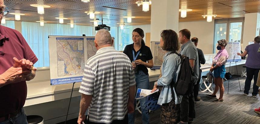
• Bi-weekly Project Management Team meetings from October 2024 - October 2025 (24 meetings total)
• Provided direct oversight and guidance on all decisions related to the planning process and plan recommendations.
• Identified other committees and stakeholders, managed project-related scheduling, and coordinated project marketing.
• Scheduled and facilitated community pop-ups, project coordination meetings, and general information sessions.
Members of the Project Management Team included:
• Ellen Beckman – Transportation Director, Durham County Transportation
• Thomas Dawson – former Principal Planner, City of Durham Parks and Recreation
• Hart Evans – Statewide Planning and Programming Manager, NCDOT Integrated Mobility Division
• Andrew Meeker – North Carolina Manager, East Coast Greenway Alliance
• David Miller – Transportation Planner, Triangle West Transportation Planning Organization
• Brooke Roper – Transportation Planner, Durham County Transportation
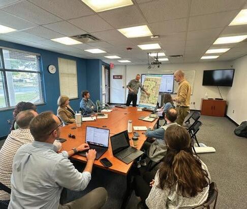
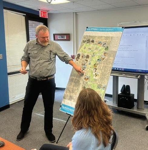
Attended four Project Advisory Committee meetings to review findings and provide guidance.
• December 11, 2024: Project KickOff
• March 26, 2025: Preliminary Findings and Plan Framework
• July 7, 2025: Conceptual Design Concepts and Recommendations
• October 2, 2025: Final Recommendations and Plan
Members of the Project Advisory Committee included:
• Michelle Burton – Commissioner, Durham County
• Dave Connelly – Former Chair, DOST (Durham Open Space & Trails Commission)
• Helena Cragg – Oxford-Hamlin Community Association
• Donna Fredrick – Bragtown Community Association
• Heidi Grable – Bahama Ruritan Club
• Ricky Hart – Stagville Descendants Council
• Angela Hollowell – Bike Durham
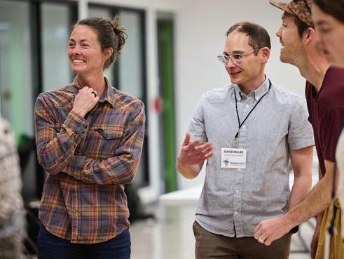
• Deborah Luecken – DOST (Durham Open Space & Trails Commission)
• Vannessa Mason-Evans – Bragtown Community Association
• Michelle Pendergrass – Durham Public Schools
• David Proper – The Conservation Fund
• Carl Rist – Councilmember. City of Durham
• Steve Smith – Rougemont Ruritan Club
• Sallie Vaughn – Person County Planning

Attended Trail Identity Committee meetings to review findings and provide guidance.
• January 28, 2025: Kick-off Meeting to establish naming guidelines
• March 18, 2025: Reviewed naming guidelines and selected top name choices
• May 23, 2025: Trail Identity naming workshop
• June 6, 2025: Review draft brand concepts
• June 30, 2025: Trail Identity Committee update
Members of the Trail Identity Committee included:
• Dave Connelly – DOST (Durham Open Space & Trails Commission)
• Heidi Grable – Bahama Ruritan Club
• Ricky Hart – Stagville Descendants Council
• Vannessa Mason-Evans – Bragtown Community Association
• Andrew Meeker – East Coast Greenway Alliance
• David Miller – Triangle West Transportation Planning Organization
• Michelle Pendergrass – Durham Public Schools
• Brooke Roper – Durham County Transportation
• Sallie Vaughn – Person County Planning
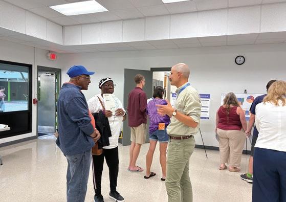

In addition to the community partners engaged in the planning process, Durham County residents played a central role in shaping the Durham-to-Roxboro Rail Trail Plan. Their input was collected through two rounds of public engagement, with all surveys and materials available in both English and Spanish to ensure inclusive participation and a truly community-driven plan.
At the start of the project, a Public Involvement Plan (PIP) was developed to guide the community and stakeholder involvement processes for the Durhamto-Roxboro Rail Trail Plan. The PIP was developed in partnership with the project management team and acted as a “living document” undergoing several updates throughout the planning process.
The PIP’s primary contents included the six goals of public engagement, an explanation of the phases of engagement, and an overview of the engagement strategies. These items are summarized briefly below and a full copy of the PIP is available in Appendix A1. (See A1: Durham-to-Roxboro Rail Trail Plan Public Involvement Plan, page 302.)
1. Implement a process that is equitable and accessible, with emphasis on uplifting the voices of priority audiences in the City and County of Durham.
2. Create awareness of the Durham-to-Roxboro Rail Trail Plan, the public input needed, and the overall process.
3. Provide a variety of methods for public participation that are accessible in terms of language, technology, literacy, location, and time so that priority groups may easily participate in the process.
4. Gain substantive insights from the public to inform the goals, branding, planning, design, and implementation of the Durham-to-Roxboro Rail Trail.
5. Present information in a manner that respects native languages and is culturally appropriate.
6. Communicate how the Durham-to-Roxboro Rail Trail is an equity-centered effort to reconnect communities harmed by previous transportation decisions and is in line with the larger transportation, public health, and sustainability goals of the City and County of Durham.
Public outreach took place in two major phases, described below. Each phase included a similar combination of engagement strategies centered around a series of public workshops.
Phase 1, Existing Conditions & Discovery: focused on collecting information that is relevant to identifying and prioritizing trail planning and development recommendations through:
• Collecting existing conditions information including but not limited to environmentally-sensitive areas, multimodal transportation barriers, intersecting trails and open spaces, and anticipated future development
• Gathering qualitative input about local, cultural, and historical aspects of the study area
• Building awareness about the Durhamto-Roxboro Rail Trail Plan and future trail implementation
Phase 2, Recommendations Review: provided the public and stakeholders with opportunities to review and provide feedback on the draft recommendations (informed by engagement conducted in Phase 1). Community members were invited to discuss:
• The primary findings of Phase 1
• Draft recommendations and priorities for major elements of trail development such as crossing treatments, major and minor trailhead locations, and types of trail amenities
• Draft recommendations for connections from the trail to nearby community destinations
• Additional details of design that will contribute to the character of the trail
• How well the Project Team listened and responded to their input and how satisfied they were with the recommendations
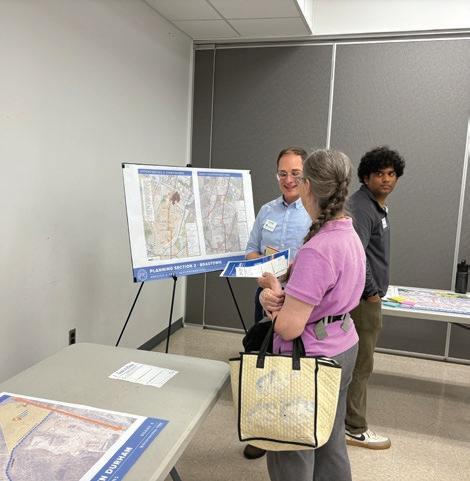

The PIP identified the following engagement strategies to achieve the goals of public engagement.
• Project Website: The primary source of information for the planning process, hosting a variety of information and engagement activities including project background information, blog posts with project updates and public event announcements, the online surveys, and the draft and final plan.
• Project Advisory Committee (PAC): Group representing a broad spectrum of stakeholders, identified by the Project Management Team, to engage over the course of the project to discuss analysis findings, draft and final recommendations.
• Project Coordination Meetings: Meetings to facilitate strategic coordination with stakeholders, focused on raising awareness of the Durham-to-Roxboro Rail Trail, identifying opportunities for synergy and/or potential conflicts with current or future projects, and discussing specific topics related to the stakeholder(s) area of expertise.
• Newsletters, Press Releases, and Social Media: Online communications to relay major project milestones and public engagement opportunities across a variety of platforms.
• Public Workshops: Highly interactive events to provide members of the public with opportunities to give insight and/or provide feedback on multiple aspects of the planning study process. A variety of mediums, such as illustrative graphics, interactive mapping, and question-based poster boards) were used to educate the public, convey information, and solicit input.
• Survey / Map: Online and print surveys that reflect the focus of each engagement phase and include multiple choice questions, free response questions, and an interactive map to display location-specific information and collect location-specific comments.
• Pop-Ups: Informal tabling sessions to meet people where they naturally gather and provide opportunities to quickly engage with and shape the planning study process.
• Focus Groups: Small group meetings with specific community members to facilitate more nuanced conversation and inform the content of the plan.
• General Information Sessions: Additional public meetings with the general public or a subset of the public, used to provide general information about the project and answer questions.
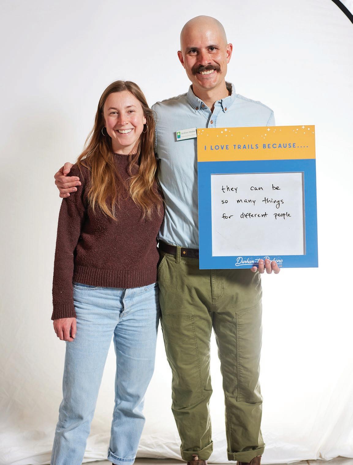
The Durham-to-Roxboro Rail Trail planning process brought together a wide range of stakeholders—including local and state government, quasigovernmental agencies, nonprofits, private businesses, and property owners. Engagement efforts included public workshops, focus groups, interviews, and site visits led by the consultant team, alongside pop-up events, project coordination meetings, and general information sessions facilitated by the Project Management Team.
The process was intentionally designed to engage a wide range of stakeholders, prioritizing equitable and diverse participation. Insights from these conversations directly shaped the plan’s recommendations. The organizations below participated through committee meetings, focus groups, coordination meetings, interviews, and site visits.
• Bicycle Pedestrian Advisory Commission
• City of Durham – City Council
• City of Durham – Parks and Recreation
• City of Durham – Transportation
• Discover Durham
• Durham County – Board of Commissioners
• Durham County – Sheriff
• Durham County – Transportation
• Durham Open Space and Trails Commission
• Durham Public Schools
• NC Botanical Garden
• North Carolina Department of Transportation
• NCSU Hill Forest
• North Carolina Wildlife Resources Commission (NCWRC)
• Person County
• Person County Tourism Development Authority
• Triangle West Transportation Planning Organization
• US Army Corps of Engineers
• Bahama Ruritan Club
• Bike Durham
• Bragtown Community Association
• Corning
• East Coast Greenway Alliance
• Ellerbe Creek Watershed Association
• Eno River Association
• Friends of the Mountains-to-Sea Trail
• Oxford/Hamlin Community Association
• Red Leaf Bar and Games
• Rougemont Ruritan Club
• Soul Sanctuary
• Stagville Descendants Council
• The Conservation Fund
• Triangle Land Conservancy
• Catawba Trail Farm
• Welcome Venture Park
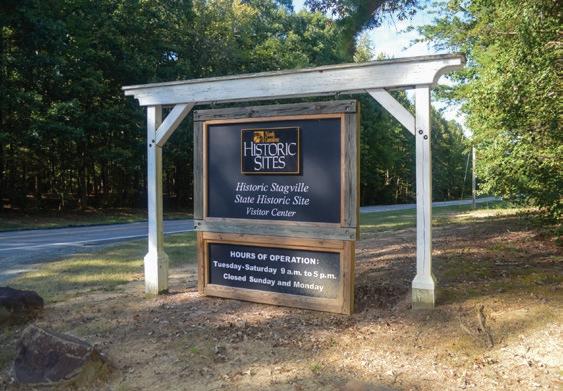

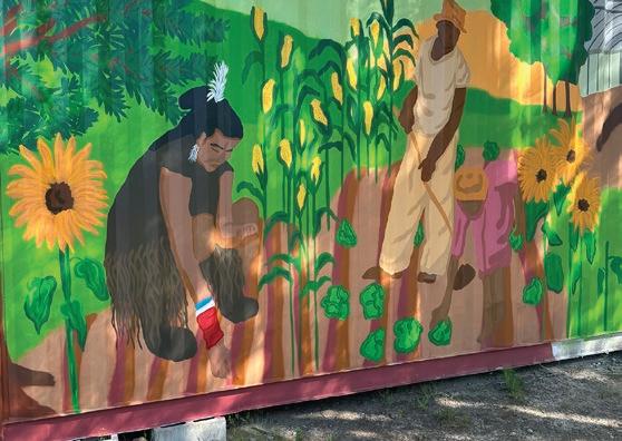
This phase focused on raising awareness of the project and collecting insight on existing conditions including cultural heritage, multimodal transportation, community destinations, anticipated development, and environmentallysensitive areas to inform draft recommendations. To publicly launch the project, a bilingual (English and Spanish) website was created to share the planning process, outline project goals, and invite residents to take part in the online community survey. The survey and all print materials—including a fact sheet, project flyer, and rave card—were also bilingual, ensuring broad accessibility and participation.
1. Project Fact Sheet
2. Project Flyer
3. Project Website
4. Online Community Survey
5. Rave Card
6. Public Workshop Flyer
Phase 1 community engagement, conducted from January 15 to March 25, 2025, used a wide range of methods to gather input. Outreach was promoted through social media, press releases, and the project website, while activities included an online community survey with map-based feedback, paper surveys, three public workshops, three focus groups, and 14 pop-up events led by the Project Management Team. One-on-one interviews and property visits were also conducted.
Results of the community engagement findings were presented to four leadership groups:
• Project Management Team on March 24, 2025
• Project Advisory Committee on March 26, 2025
• Durham County Board of County Commissioners on April 7, 2025
• Durham Open Space and Trails Commission (DOST) on April 16, 2025
a lo largo del proceso de planificación. Se anunciarán todos los talleres públicos. Se crearán materiales promocionales y se utilizarán las redes sociales para alentar la participación pública en una encuesta en línea basada en mapas. Se desarrollará un sitio web dedicado al proyecto que sirva como centro de información durante todo el proceso de planificación.
3) Plan Conceptual y Participación Pública: Guiado por el equipo de gestión del proyecto, el comité asesor, la gente interesada y los aportes de la comunidad, el equipo de consultores




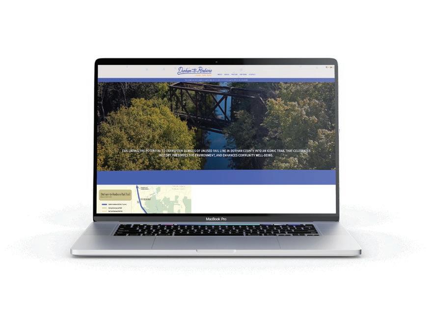

The Durham-to-Roxboro Rail Trail Plan Community Survey (Phase 1) was conducted to gather input from the public on the general usage, improvements and priorities, and community support of the proposed trail. In addition, a map-based section of the survey allowed respondents to express opportunities and concerns about specific geographic locations along the trail corridor.
The survey was available in English and Spanish, online and on paper, and was promoted by local stakeholders via the project website, press releases, email, and social media platforms.
The Phase 1 community survey received 2,994 responses between January 15 and March 25. Of these, 2,932 were submitted online and 62 were submitted on paper. This section summarizes the key findings.
Additional analysis was completed for the question measuring overall support for the proposed rail trail. In particular, results were evaluated for respondents who reported a Durham County zip code (see pie chart on page 136) as well as for the five zip codes the rail corridor passes directly through. (See Appendix A6. Phase 1 Community Survey Summary, page 333.) The full survey results are available at the project website.
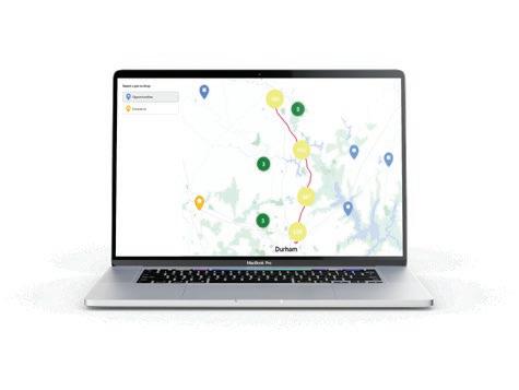


Reasons for Current Trail Use
What are the main reasons you and/or someone in your household currently use trails?
Visiting Parks (968) Mental Health and Well-being (1,612) Exercise or Recreation (2,300)
I Don’t Currently Use Trails (505)
Transportation (498)
(2,583 responses)
If the Durham-to-Roxboro Rail Trail were constructed, how often do you think you and/or someone in your household would use it?
Future Trail Use Frequency
(2,878 responses)
Select the top 4 types of destinations you believe are the most important to connect to the Durham-to-Roxboro Rail Trail. 1st 2nd 3rd 4th
What activities would you and/or someone in your household like to do along the
Current Trail Use Activities
(2,583 responses) Bicycling (1,904)
Reasons for Future Trail Use
For what purposes would you and/or someone in your household likely use the Durham-to-Roxboro Rail Trail?
Exercise or Recreation (2,364)
Mental Health and Well-being (1,727)
Visiting Parks (1,187)
Transportation (514)
Visiting Friends or Relatives (473)
(2,630 responses)
Important Connections
(2,563 responses)
CONNECTIVITY TO WALKING AND HIKING TRAILS, ALONG WITH PROTECTED BIKE LANE NETWORKS, WOULD MAKE THE TRAIL ORDERS OF MAGNITUDE MORE USEFUL. EITHER WAY, I’M VERY EXCITED FOR THIS PROJECT AND TO EXPLORE MORE OF THE AREA NOT IN A CAR.
MY PRIMARY CONCERN IS SAFETY ON THE TRAILS. IT’S NOT A COMMUNITY RESOURCE IF HALF THE COMMUNITY DOES NOT FEEL SAFE.
IT SEEMS LIKE THERE ARE A LOT OF PROJECTS OF THIS TYPE THAT ARE PLANNED, STUDIED, AND FOCUS GROUPED FOREVER AND ARE NEVER ACTUALLY BUILT. HOW LONG WILL THIS TAKE?
WE NEED A SAFE WAY FOR FOLKS TO BIKE TO THIS GREENWAY. WE DON’T WANT TO ENCOURAGE FOLKS TO DRIVE THERE JUST TO BIKE THERE.
MY KIDS ARE JUST LOOKING FOR A SAFE PLACE TO RIDE THEIR BIKES. THIS COULD BE A REALLY COOL CHANCE TO BUILD A BIGGER COMMUNITY.
I TRULY HOPE THIS IDEA BECOMES A REALITY. NORTH DURHAM IS GREATLY DEPRIVED OF PARKS, SIDEWALKS, AND GREENWAYS.
PLEASE RECONSIDER THIS PLAN. STRONGLY BELIEVE THIS IS A WASTE OF MONEY.
THE TRAIL SOUNDS NICE, BUT ANY FUNDS USED FOR THIS TRAIL COULD BE BETTER SPENT FIGHTING CRIME AND IMPROVING EDUCATION IN DURHAM.
THIS IS A FANTASTIC PROJECT. I HOPE EVERYONE CAN PULL IT OFF. I WOULD GET IT GOING ASAP, EVEN IF EVERYTHING ISN’T DONE. THE SOONER PEOPLE CAN GET ON THE TRAIL, THE MORE MOMENTUM.
THE REGION NEEDS A MORE CONNECTED NETWORK OF BICYCLE INFRASTRUCTURE. THIS TRAIL WOULD DO A GREAT JOB OF CONNECTING DURHAM TO POINTS NORTH, AND GO THROUGH CORE NEIGHBORHOODS.
Public workshops provided interactive opportunities for community members to engage in hands-on activities and discussions, learn about the plan, and share feedback with the Project Management. The first round of workshops, held in February and March 2025, engaged 174 participants through a variety of interactive exercises.
Attendees participated in a map-based activity, offered input on the trail’s identity, surface, and amenities, evaluated potential trail crossings, and shared their trail experiences in a photo booth. The final workshop included all materials in Spanish and provided Spanish translators to ensure accessibility for Spanishspeaking participants. (See Exhibit 16: Phase 1 – Public Workshops, page 141.)

Location Date
Durham County Main Library
February 4, 2025 69
Northern Regional Library
February 5, 2025 65
Edison Johnson Recreation Center
(Spanish translation provided)
March 19, 2025 41
• Overall excitement for the trail
• Eager for design and construction to begin
• Large presence of cyclists and people who use trails for alt. transportation
• Desire for the trail to connect to parks and other greenways/trails
• Request for restrooms, benches, and other trail amenities
• Apprehension from residents with property along the corridor
• Fears about loss of privacy and crime/safety
• Concerns that eminent domain will be used to gain property for the trail or trailheads
• Questions about impervious surface and environmental regulations
• Questions about cost and spending taxpayers dollars for this versus other priorities
• Support from some residents who want a trail in north Durham County
• Overall support for the trail
• Concerns about gentrification and increased property values
• Desire accessibility for all ages and abilities.
• Requests for restrooms, benches, and interpretive exhibits along the trail
• Prioritize safe road crossings, especially in Bragtown
Focus group meetings allowed the project team to gather in-depth insights and opinions from small, diverse groups of community representatives. Community organizations to engage with through focus groups were identified by the Project Management Team. The first round of focus group meetings, held in February and March 2025, engaged over 35 participants and represented community members from the Stagville Descendants Council, Bragtown Community Association, Bahama Ruritan Club, and Rougemont Ruritan Club. (See Exhibit 17: Phase 1 – Focus Groups, page 143.)
One-on-one interviews and property visits with property owners, businesses, and key stakeholders along the rail corridor were conducted to gather insights on site conditions, current uses, and community priorities. Recommendations for interviewees and visit locations were provided by the Project Management Team and Project Advisory Committee, as well as through incoming inquiries via the project website. These discussions and observations informed trail alignment, access points, and design recommendations, helping ensure the plan reflects local perspectives and addresses potential challenges.
Six meetings were held between March 1 and April 21, 2025. Some were virtual, while others were in person and included site visits to specific properties. Members of the Project Management Team attended select sessions.

The meetings included:
1. Site visits to privately-owned properties in the Bragtown and Rougemont areas to discuss trail-oriented development and public-private partnerships.
2. Discussions with organizations that manage land with recreational resources near the rail corridor.
3. Met with Durham County Sheriff Clarence Birkhead to discuss community safety concerns and the Sheriff’s Office’s role in maintaining a safe environment along the future trail.
Stagville Descendants Council
February 25, 2025 (virtual) 3
Bragtown Community Association
March 8, 2025 (in-person at Braggtown Baptist Church) 15+
North Durham Residents (Bahama and Rougemont Ruritan Clubs)
March 13, 2025 (in-person at the Bahama Ruritan Club) 20+
• Excitement about interpretive elements recognizing enslaved people and their descendants, their culture and traditions, and all the communities who had a hand in the development of Durham and the railroad.
• Desire for the trail to be accessible to everyone, with the expectation that some people would visit for the cultural experience rather than the recreational experience.
• Desire for history to be truthfully told through interpretive elements throughout the trail.
• Concern about ongoing gentrification and displacement.
• Long-standing issues affecting the community, such as sidewalk connectivity and roadway safety, especially in separating vehicle traffic from the pedestrian realm using curbs, should be addressed first.
• Confusion about the planning process and general desire to avoid the trail being constructed.
• Concern about privacy and private property.
• Concern about public safety around game lands.
• Concern about cost and maintenance in the long term, and stress on local law enforcement.
• Concern about adding impervious pavement and stream crossings.
Community pop-up events were held to engage residents and stakeholders in informal, accessible settings, allowing them to learn about the project, ask questions, and share feedback through a printed survey. The Project Management Team scheduled and facilitated these events, which were held throughout Durham County to capture input from a broad range of community members.
The pop-up events took place throughout February and March, engaging approximately 465 participants. All materials were bilingual (English and Spanish) to ensure accessibility and inclusive participation. (See Exhibit 18: Phase 1 – Pop-Up Events, page 145.)
General Information Sessions were developed in response to community demand and the need to correct misinformation. These meetings with the general public or a subset of the public were used to provide general information about the project and answer questions. General information sessions were held with the Stagville Descendants Council and at the Bahama Ruritan Club. In the future as this project moves forward, general information sessions will be a good way to continue to raise awareness of the project and spread accurate information.
This phase provided the public and stakeholders with opportunities to review and provide feedback on the draft recommendations. The second phase of community engagement ran from May 1 to September 24, 2025, and included a community survey open from August 18 to September 24, 2025. As with the first phase of engagement, outreach was promoted through social media, press releases, and the project website, while activities included three public workshops, three project coordination meetings, five general information sessions, an online community survey, four focus groups, and ten pop-up events led by the Project Management Team. One-on-one interviews and property visits were also conducted and postcards about the project were mailed to all nearby property owners.
To promote inclusive participation, underrepresented groups from the first phase—such as young adults aged 18–24—were intentionally engaged, and all surveys, promotional materials, and the project website were made available in both English and Spanish.
Updates to the preliminary conceptual designs and plan recommendations were made throughout the Phase 2 Community Engagement time period based on feedback received and at the direction of the Project Management Team.
Results of the community engagement findings were presented to six leadership groups:
• Project Management Team on September 22, 2025
• Project Advisory Committee on October 2, 2025
• Durham County Board of County Commissioners on October 6, 2025
• Durham City Council on October 9, 2025
• Triangle West Technical Committee on October 14, 2025
• Triangle West Board on October 28, 2025
Postcards were mailed on July 31, 2025 to property owners within 1,000 feet of the rail corridor to expand engagement and ensure nearby residents were informed about the planning process. The postcards included the project website, a link to the online survey, and the dates and times of the public workshops. A total of 1,261 postcards were distributed.

The Durham-to-Roxboro Rail Trail Plan – Draft Recommendation Public Survey (Phase 2) was conducted to gather community input on the conceptual designs for the rail trail, including proposed trailheads, connections, and overall trail layout. The online survey was structured to provide an interactive experience comparable to attending an in-person public workshop.
The survey was available in English and Spanish, and was promoted by local stakeholders via the project website, press releases, email, and social media platforms.
The Phase 2 community survey received a total of 453 responses between August 18 and September 24. The survey included eight open-ended questions seeking feedback on plan recommendations and conceptual designs, along with demographic questions. This section presents respondent demographics. The full survey results are available at the project website and in Appendix A6. (See Appendix A7: Phase 2 Community Survey – Questions, Analysis, and Quotes, page 334.)
IN THEIR WORDS
STRONGLY SUPPORT THE CONNECTORS. IT ALLOWS FOLKS TO USE THEIR FEET AND BIKES INSTEAD OF CARS TO TAKE CARE OF DAILY TASKS.
MAXIMIZE PARKING AT TRAIL HEADS.
“RRFBS
ARE NOT SUFFICIENT AT HIGH-SPEED ROADS LIKE DEARBORN AND E CLUB. THESE NEED TO BE SIGNALIZED.”
WE MOVED FROM DURHAM CITY TO BAHAMA FOR PRIVACY, WE DO NOT WANT ANY OF THIS RUNNING BEHIND OUR PROPERTY.
I FEEL THIS TRAIL IS A BRILLIANT AND NEEDED ADDITION TO OUR COMMUNITY.
AS A BAHAMA RESIDENT… I VERY STRONGLY WELCOME THIS RAIL TO TRAIL PROJECT!
I AM CONCERNED ABOUT CRIME ALONG THE TRAIL, PARTICULARLY AS YOU GET CLOSER TO DOWNTOWN.
I LOVE THE IDEA OF THE CONNECTORS AT THE SCHOOLS. WE HAVE NO BIKE LANES OUT HERE AT ALL.
AS A RESIDENT OF ROUGEMONT, THIS IS AWESOME. HIGHLY SUPPORT, PERFECT LOCATION!
I’M VERY EXCITED ABOUT THIS FUTURE TRAIL. I STRONGLY SUPPORT THIS PLAN!
THIS IS A WASTE OF MONEY, SPACE, AND OF VALUABLE RESOURCES THAT ARE NEEDED ON PROJECTS THAT THE COMMUNITY WILL ACTUALLY BENEFIT FROM.
TRAIL USERS SHOULD HAVE PRIORITY AT EVERY CROSSING. IF THAT REQUIRES SIGNALS AT EACH INTERSECTION, THEN THAT SHOULD BE PROVIDED.
WATER FOUNTAINS AND BATHROOMS PLEASE!
DEARBORN NEEDS THIS. DEARBORN HAS LITTLE TO NO SIDEWALKS ALONG THIS LONG ROAD AND IS NOT SAFE FOR PEDESTRIANS, ESPECIALLY STUDENTS.
RIGHT IN THE MIDDLE OF A LOW INCOME NEIGHBORHOOD. NOT A GOOD IDEA. NO SAFETY ISSUES ARE ADDRESSED.
The second round of public workshops, held in August 2025, provided community members the opportunity to review findings from the first phase of engagement and offer input on conceptual designs for the rail trail, including proposed trailheads, connections, and overall alignment. Project management and consultant team members were available to answer questions and gather feedback from participants. Over 90 community members attended the three workshops held at locations across Durham County. (See Exhibit 19: Phase 2 –Pop-Up Events, page 153.)

Durham County Main Library
August 18, 2025 36
• Concerns about safe crossings, traffic calming and lighting
• Desire for links to schools, businesses, and nearby trails.
• Preference for building some trail segments sooner and prioritizing high-use or downtown areas.
• Interest in trail amenities like shade, restrooms, water, and gathering spaces.
• Confusion about this trail versus the Downtown Durham Rail Trail
Edison Johnson Recreation Center
August 27, 2025 31
• Concerns about law enforcement capacity, safe underpasses and crossings, speeding, fencing, and lighting.
Requests for wheelchair-friendly paving, frequent benches and rest areas.
• Strong desire to link the trail to parks, neighborhoods, other greenways, and schools.
• Want restrooms, water fountains, seating, greenery, historical markers, and creative or cultural features
Spruce Pine Lodge
August 28, 2025 25
• Concerns about dangerous crossings, user conflict, trailhead safety.
• Requests for restrooms, water, parking, sidewalks, safe walking space, and potential bike lanes
• Interest in linking the trail to downtown Durham, neighborhoods, natural areas, and regional trails like the MST
• Some are opposed due to cost, underutilization of existing trails, environmental disturbance, and rural lifestyle impacts.
The second round of focus group meetings, held from June to August 2025, engaged 30 participants and represented community members from the Changed by Youth Ambassador Program, Land and Water Conservation Groups (including Eno River Association, Friends of the Mountains-to-Sea Trail, NC Botanical Garden (Penny’s Bend), NCSU Hill Forest, UCAN - Urban Community Agrinomics (Catawba Trail Farm), and the Conservation Fund), North Durham County Residents (including the Bahama and Rougemont Ruritan Clubs), and Stagville Descendants Council.
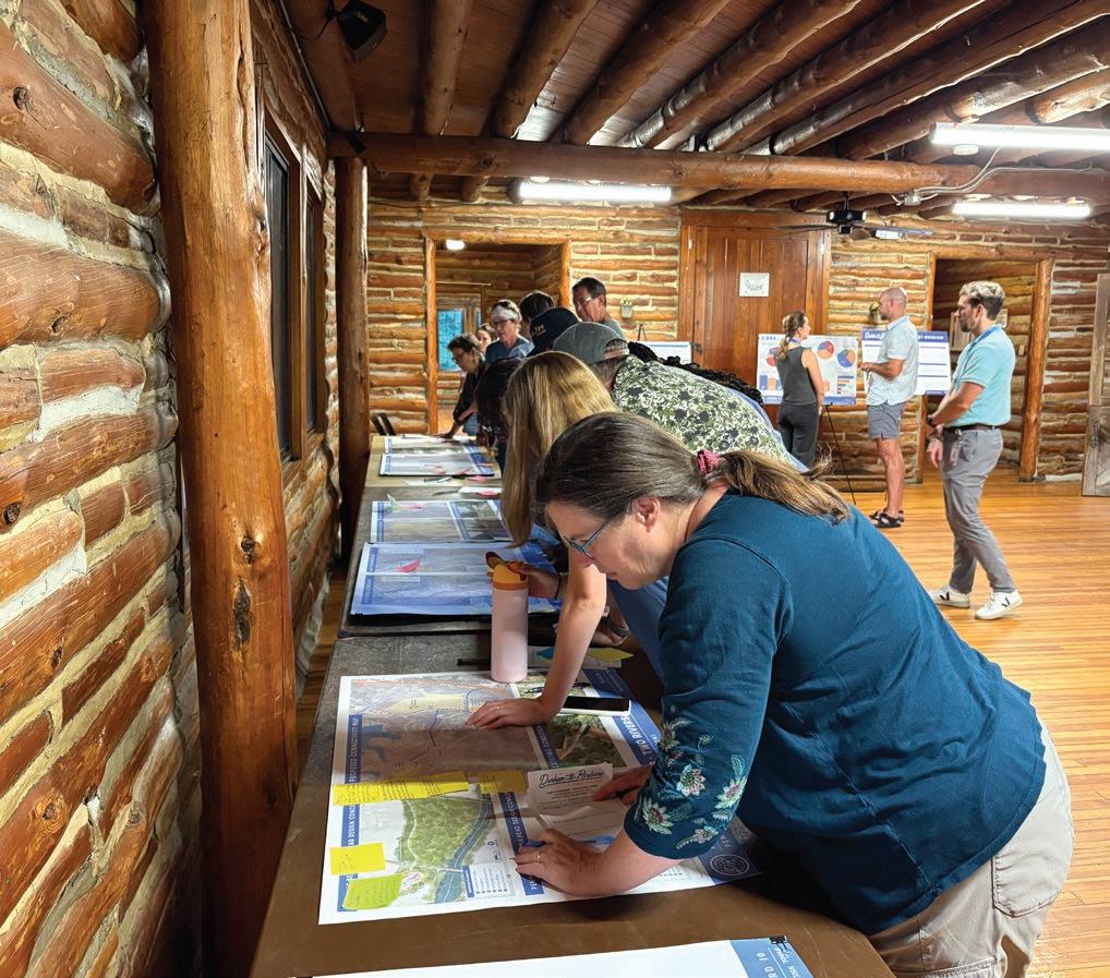
Changed by Youth Ambassador Program June 4, 2025 (in person at WG Pearson Center)
10
• Desire for gathering spaces, programming, and public art at trailheads, to be creative and welcoming spaces
• Excitement about connections to other parks and green spaces, farmers markets, local businesses, neighborhoods and colleges
Land and Water Conservation Groups July 11, 2025 (virtual) 11
• Excitement about providing greater access to the outdoors
• Excitement about educational opportunities
• Support for making the trail accessible
• Excitement about connections to other parks and green spaces as well as neighborhoods, and potential for the trail to be used for transportation
North Durham (Bahama and Rougemont Ruritan Clubs)
August 4, 2025 (in-person at Red Mountain Rd. Clubhouse) 9
Stagville Descendants Council
September 19, 2025 (virtual) 6
• Desire to avoid the trail being constructed
• Concern about public safety, privacy and private property
• Concern about safety at crossings, vehicles speeding and reckless driving
• Concern about maintenance in the long term
• If the trail was guaranteed to happen, interest in equestrian use on the trail in North Durham County
• Concern about lack of clarity throughout the engagement process
• Excitement around using the trail as a walking path and waysides as gathering spaces, especially in rural areas
• Interest in a trail-wide cultural interpretation plan. Interest in waysides as opportunities for education and honoring histories
• Concern about public spending on the trail when there are more urgent basic infrastructure gaps, including sidewalks
• Desire for measures that impede vehicle access on the trail
Project Coordination Meetings were held with small groups of stakeholders in response to the need for strategic coordination with groups that are not representative of the general public. The main focus was on making the stakeholder(s) aware of the Durham-to-Roxboro Rail Trail, identifying opportunities for synergy and/or potential conflicts with current or future projects managed by the stakeholders, and specific topics related to the stakeholder’s area of expertise.
Three project coordination meetings were held including:
1. Staff from North Carolina Wildlife Resources Commission and U.S. Army Corp of Engineers
2. Transportation stakeholders within City of Durham Transportation, Triangle West Transportation Planning Organization, NCDOT Division 5, and NCDOT IMD.
3. Housing stakeholders including Durham City and County staff within the Planning Development Department and Transportation Review Team.
(See Exhibit 21: Phase 2 – Project Coordination Meetings, page 157.)

NCWRC/USACE
July 2, 2025 8
• Questions about rail corridor ownership in this area
• Concerns about sensitive areas such as floodplains and critical habitat areas
• Potential conflicts with hunting on NCWRC land in this area
Transportation
July 25, 2025 8
• Preference for a toolkit of treatments for crossings. Depending on the context, a combination of treatments may be needed
• Support for formalizing parking at Penny’s Bend
• As this project advances, it will be important to coordinate with other projects in the area, such as the future Northern Durham Parkway
Housing
July 28, 2025 3
• The City of Durham is poised to implement policies and actions related to stabilizing neighborhoods undergoing infrastructure investments through actions and policies in the Comprehensive Plan, but they have yet to be enacted at this time
• Existing policies focus on incentivizing affordable housing
• Density bonus for affordable housing
• A lot of development pressure in Bragtown Need to work closely with the community as the project progresses
• UDO rewriting in progress
• Durham County has a low-income housing tax relief mechanism facilitated by Social Services, which could be a tool used in neighborhood stabilization
In response to community demand, five General Information Sessions were conducted. These meetings with the general public or a subset of the public were used to provide general information about the project, answer questions, and correct misinformation. During Phase 2 engagement, five general information sessions were held. (See Exhibit 22: Phase 2 - General Information Sessions).
During the second phase of engagement, oneon-one interviews and site visits with property owners and key stakeholders along the rail corridor were conducted to continue to gather insights on site conditions and community priorities. These discussions and observations helped to refine the proposed conceptual designs for trail access points and trail connections.
Five meetings were held between May 2 and May 27, 2025. Some were virtual, while others were in person and included site visits to specific
Stagville Descendants Council
Farmland Protection Board
Braggtown Baptist Church
Durham Farm Bureau Building
June 28, 2025 2
July 17, 2025 15
Exchange Club of Greater Durham University Club August 14, 2025 20
Durham Bicycle & Pedestrian Advisory Commission
Durham City Hall August 19, 2025 15
Durham Open Space & Trails Commission Virtual August 20, 2025 15
properties. Members of the Project Management Team attended select sessions.
The meetings included:
• Site visits to privately-owned properties to discuss trail-oriented development, publicprivate partnerships, and potential routes to support connections to other trails and community assets.
• Review of proposed conceptual designs to gather feedback from key stakeholders.
Community pop-up events were held to engage residents and stakeholders in informal, accessible settings, allowing them to learn about the project, and ask questions. The Project Management Team scheduled and facilitated these events, which were held throughout Durham County to capture input from a broad range of community members.
The pop-up events took place from May to September, engaging approximately 160 participants. All materials were bilingual (English and Spanish) to ensure accessibility and inclusive participation. (See Exhibit 23 for details on Phase 2 – Pop-Up Events.)
3.6
The planning process detailed in this chapter engaged a diverse audience and generated a broad range of responses to the idea of the Rail Trail. Generally, there was strong support for the Rail Trail. While the Durhamto-Roxboro Rail Trail has been long identified in City of Durham and Durham County planning documents for almost 40 years, this planning process was the first time many community members heard about the plan. As long-range visionary projects such as the Durham-to-Roxboro Rail Trail take shape, they typically transition from a single potential project within a more comprehensive plan of many potential projects to the single topic of a specific plan like this Plan.
Nearby property owners were some of the most outspoken participants during community engagement and often expressed confusion and concern about the planning process. Among property owners directly abutting the rail corridor, many believed they may be able to buy the property from Norfolk-Southern or that the property would “revert” back to them if Norfolk-Southern ever abandoned the inactive rail line.
This confusion was further complicated by the fact several law firms seeking to potentially represent property owners in a claim against the federal government mailed letters to adjacent property owners notifying them of the project. Nearby property owners were also, generally, the most outspoken against the Rail Trail due to concerns related to lack of privacy and perceptions of crime.
Wide-ranging support for the Rail Trail was found throughout public engagement participants from areas in the City of Durham and Durham County. Overall, people were most supportive of the Rail Trail for its potential positive impact on recreation, active transportation, and its ability to weave together both physical destinations and cultural heritage narratives.
The findings from both phases of community engagement shaped the design considerations, ensuring that the Durham-to-Roxboro Rail Trail Plan reflects local priorities, needs, and values while promoting equity, connectivity, and long-term community benefits. These trail design considerations form the foundation for the recommendations in Chapter 4 and inform the implementation strategies in Chapter 5.
Locate trailheads, rest areas, and key amenities (like water fountains, bike repair stations, and restrooms) on publicly-owned land and within the existing right-ofway to maximize accessibility and cost efficiency.
Use low-impact design techniques and limit the footprint of the trail and trail amenities to avoid or minimize disturbance to wetlands, streams, and wildlife corridors— such as boardwalks, permeable materials, and native landscaping.
Align trail design with existing and future land use plans, greenway plans, and transportation frameworks from Durham County, City of Durham, Triangle West, East Coast Greenway, and NCDOT to ensure compatibility and strengthen funding eligibility.
Incorporate access points or nodes near commercial areas to encourage trail-oriented development, promote adjacent business partnerships, and provide economic benefit to local communities.
Connect the trail to transit routes, schools, job centers, parks, and existing greenways to make it a viable everyday transportation option—not just a recreational path.
Ensure the trail is welcoming and usable for people of all ages and abilities through features like gentle grades, ADA-compliant surfaces, lighting, and safe crossings.
Design transitions between the trail and adjacent neighborhoods carefully—using landscaping, signage, and buffers—to reinforce local character and community acceptance.
Use design tools like traffic calming, clear signage, signalization, and separation by mode to reduce conflicts with roads and driveways.
Integrate public art, interpretive signage, and materials that reflect the local history, culture, and natural features to build a unique sense of place.
Plan for phased development by identifying priority segments, potential funding sources, and cost-effective design strategies that allow the trail to grow with demand and available resources.
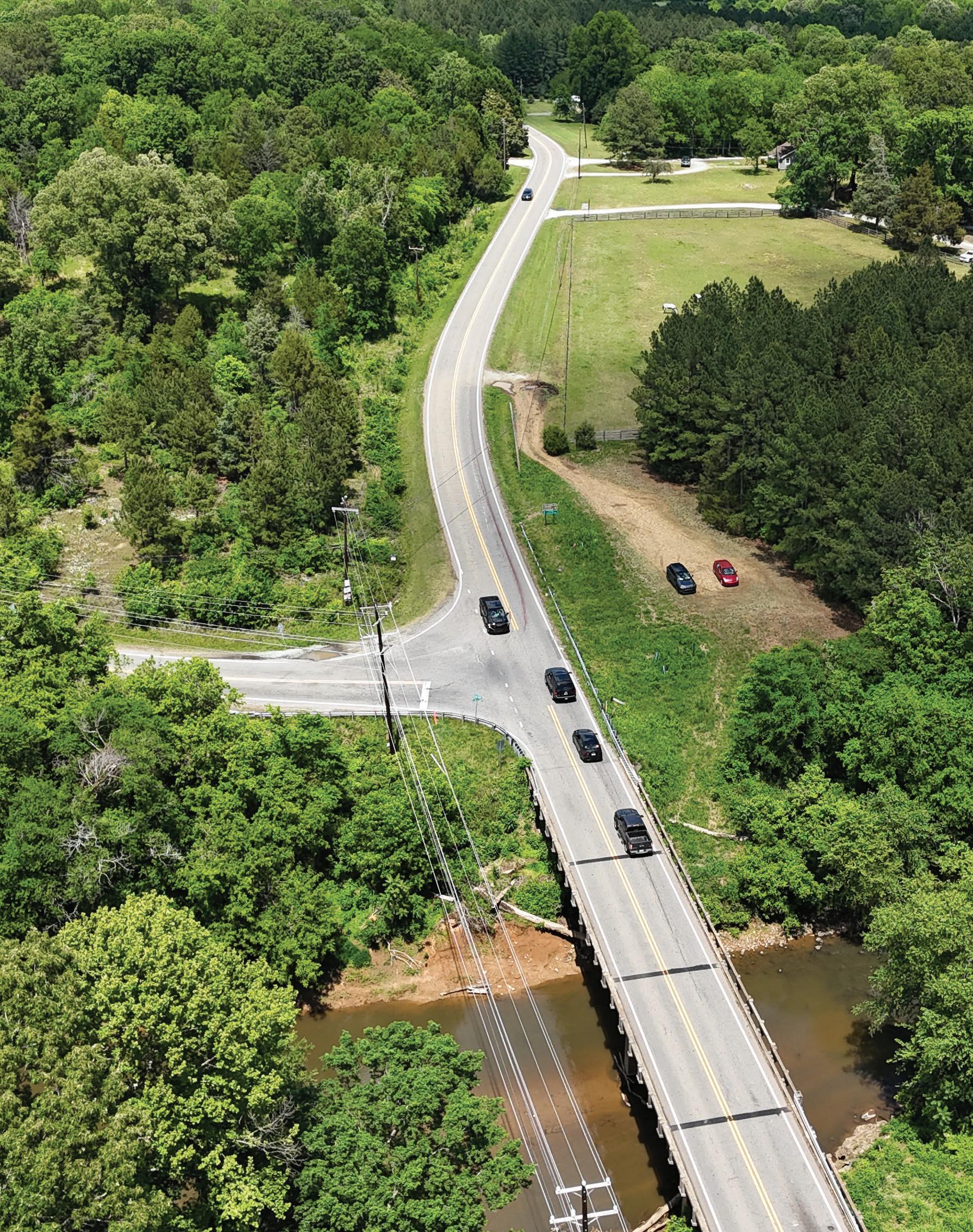

This chapter represents the core of the Durham-to-Roxboro Rail Trail Plan and is organized around six (6) primary Focus Areas identified through the planning process: 1) Corridor-Wide Recommendations, 2) Downtown Durham, 3) Bragtown, 4) Two Rivers, 5) Bahama, and 6) Rougemont. Each focus area outlines specific projects and action steps.
IN THIS CHAPTER:
4.1 Corridor-Wide Recommendations
4.2 Focus Area 1: Downtown Durham
4.3 Focus Area 2: Bragtown
4.4 Focus Area 3: Two Rivers
4.5 Focus Area 4: Bahama
4.6 Focus Area 5: Rougemont
As noted in Chapter 1, The Conservation Fund is acquiring the 26.2-mile*, 100-foot-wide rail corridor from downtown Durham to the City of Roxboro on behalf of NCDOT. The corridor is currently owned, fee simple by Norfolk Southern and purchase is anticipated by late 2025. Because the full 18.2mile corridor within Durham County is suitable for rail trail conversion, recommendations in this chapter focus exclusively on the existing rail corridor and do not evaluate alternative routes.
The Durham-to-Roxboro Rail Trail Plan is a planning-level document that advances the project to approximately 10% design, providing a preliminary conceptual alignment, trailheads, and cost estimates.
All preliminary conceptual designs presented in this plan will require review and future design by licensed engineers and landscape architects. Final designs of the preliminary conceptual designs are subject to change in future phases based on engineering, survey data, and regulatory review.
*Note:TheRailTrailwillbeatotalof28.8milesincludingsomestreet-adjacentsegmentsin PersonCounty,buttherailcorridorbeingacquiredbytheConservationFundisonly26.2miles. SeeChapter1,ProjectBackgroundforadditionaldetails.
Corridor-wide recommendations include the recommended trail layout (or cross-sections), how the trail will interact with surrounding neighborhoods, and features along the trail (waysides). As stated on the previous page, all preliminary conceptual designs presented for corridor-wide recommendations require review and future design by licensed engineers and landscape architects. Final designs of the preliminary conceptual designs are subject to change in future phases based on engineering, survey data, and regulatory review.
The trail was designed to meet the needs of different users, based on how they use the trail, how they might interact with each other, and input from the community. This included:
• User abilities and needs: Trail users may include older adults, children, people with dogs, people using wheelchairs, people with physical, visual, auditory or cognitive disabilities, micromobility users, and bicyclists of different abilities and speeds. The trail should be easy to navigate, ADA-accessible, and adaptable to meet everyone’s needs.
• Speed differences: Conflicts often happen when users move at different speeds, especially at intersections and access points.
• User volumes: Some parts of the trail will be busier than others and may attract groups of people walking or socializing together.
The recommended typical trail design is made up of separate elements that work together to support all users and fit naturally into the surrounding environment.
• Trail: This is the main area where people walk, bike, or use mobility devices. It is designed for two-way travel and supports both recreation and transportation.
• Trail Shoulders: These are narrow strips on the sides of the trail, typically made of crushed stone or gravel. They provide structural support on the edge of the paved trail and offer extra space for users to move aside, rest, or travel on a softer surface-something walkers, joggers, or runners may prefer.
Together, the trail and trail shoulders make up the typical trail cross section- or the composition that would typically exist along the trail. Adjustments to the typical section may occur to respond to site-specific conditions such as a bridge or a wetland. Another element that contributes to the overall experience of the trail is Trail Waysides or pull off areas. These are areas that occur occasionally along the trail and may include a range of amenities.
The recommended typical section of the trail is shown to the right as a 12 to 14 foot wide asphalt trail with 2 to 5 foot wide crushed stone shoulders on both sides. This design provides both a fully accessible path, wide enough for safe and comfortable passing and walking/riding side by side, as well as softer surfacing shoulders which can function as additional paths. Notably, this width allows two bicyclists riding side by side to be passed by another bicyclist.1
In terms of compatibility with local trail standards, this typical section is in line with the City of Durham’s 10-foot minimum width for asphalt shared use paths and with the current edition of the NCDOT Roadway Design Manual.2, 3 Additionally, Durham County does not have standard details for greenways or shared use paths.
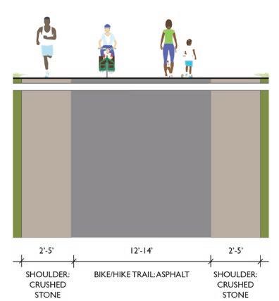
There is the potential that future phases of design could ensure portions of the trail in N. Durham County support equestrian use. The Phase 1 survey indicated some support for equestrian use (6% of respondents) and conversations with the public in Phase 2 continued to show interest in this option in N. Durham County where there is a strong equestrian culture. Partnership with local equestrian groups would be needed before moving this potential alternative section forward. The American Tobacco Trail in Chatham and Wake counties allows equestrian use and could be used as a model for how to accommodate this. Some trailheads are designed for horse trailer parking, and equestrian groups organize manure cleanup days along the trail.
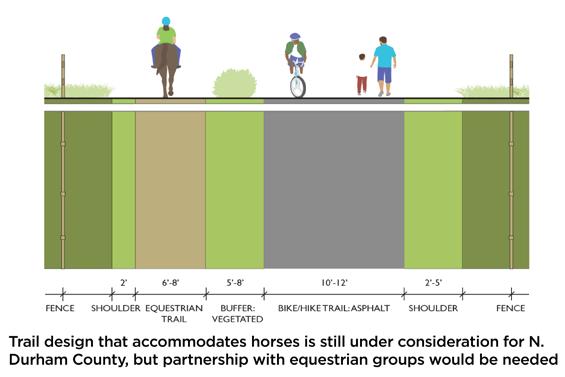
If pursued in the future, the recommended configuration includes a 10 to 12 foot wide asphalt trail and a 6 to 8 foot wide natural surface equestrian trail parallel to each other. A 5 to 8 foot wide vegetated buffer is recommended to separate equestrians from other uses. Constrained areas where the vegetated buffer is not possible should be limited to as short of distances as possible. Both the asphalt path and the equestrian trail are recommended to have 2 to 5 foot wide grass shoulders on the outside with fencing.1, 4
Existing conditions may accommodate equestrian needs without extensive improvements. Areas where this can occur may be explored as part of a future phase.
In addition to the typical cross sections, other design elements also influence the user experience. The following design elements would respond to site specific conditions and their use and design will be determined to a greater level of detail in a future phase.
On creek crossings, wetlands, and other environmentally-sensitive areas, bridges and boardwalks may be necessary to limit environmental impact and ensure the trail is resilient to flooding. The potential need for boardwalks are identified within individual focus areas later in this chapter and additional design guidance is provided in Appendix 3. (See A3: Design Guidance, page 315)

In some situations, the trail may need to include fences to restrict access to specific locations, and railings around wetlands, steep drop-offs, and other areas where needed to prevent falls. Fencing will be considered for portions of the trail with permitted equestrian use, should this be pursued in the future. Fencing will also be considered when properties along the trail have active livestock uses, potential public health hazards, or game lands for hunting. Community input showed support for consideration of fencing in these locations. Fencing options, as shown to the left, include split rail, post and rail, chain link, and fencing with integrated public art. Community feedback showed strong preference for post and rail or split rail over chain link fencing.
Shade along the trail consistently came up as a desired feature during Phase 2 public engagement. In addition to the benefits to user comfort that shade provides, vegetation also offers habitat for wildlife, creates a natural privacy screen for adjacent properties, and helps stabilize soils. Vegetation can provide similar benefits as fencing in terms of privacy and perception of safety, but it is important to keep eye-level views unobstructed.1, 2
Trail lighting is recommended at trailheads, roadway crossings (not private, residential driveways), and underpasses. Lighting along the entirety of the trail will also need to be determined at a future date. City of Durham Parks and Recreation currently has a dawn to dusk lighting policy for trails. Providing lighting along trails helps support active transportation uses in addition to recreational uses. Bridges are other critical points, where lighting should be considered in future phases. Community input showed a strong concern for adequate lighting at roadway crossings for safety. (See A3: Design Guidance, page 315 for more information.)
Trail waysides are pull off areas that can be located along the trail in between trailheads and access points. This Plan identifies three types of waysides that will help develop the user experience along the trail. Specific locations for waysides will be identified in the design phase following the plan. Trail waysides should be located in areas that are accessible for maintenance and regular trash removal. In addition, waysides should be away from residential properties to minimize any noise or privacy concerns. The graphics below show three types of waysides recommended for the Durham-to-Roxboro Rail Trail. (See Exhibit 24: Trail Waysides, below.)
• Rest includes seating and bike parking.
• Rest + Interpret includes the same features as Rest as well as hydration, trash receptacles, bike fixing stations, and interpretive elements.
• Rest + Interpret + Gather includes the same features as Rest + Interpret as well as a gathering space with picnic tables and natural play features.

The railroad corridor passes through many areas of historical, cultural, and environmental significance within Durham County that lend well to interpretation. The Durham-to-Roxboro Rail Trail should lead with educational and storytelling features and use art to help tell those stories. While interpretative elements along the trail may be location specific, placement of public art is generally more flexible. Both elements should be designed and sited in a way that they can be properly maintained.
Based on focus group conversations with community groups, there is interest in designing these elements to replicate an art gallery so that a structure or frame can allow interpretive media and public art to change over time.
Interpretation and public art should be coordinated with trail identity and branding elements (e.g., directional wayfinding signs, mile markers, kiosk, trailhead street signs, etc.).
Historic
• Railroad history
• Establishment and development of communities along the rail corridor over time (e.g., Bragtown, Rougemont, Bahama)
• History of Stagville Plantation
• Military history
• Native American history (e.g., Great Trading Path) Cultural
• Familial stories (e.g., impact of Stagville descendants on the City of Durham’s development)
• Agricultural heritage and local food
• Arts and crafts of the area
• Music of the area
• Plant species significance for medicine, crafts, and ceremony
Environmental
• Geological formations
• Watersheds, river basins, and wetlands
• Flora and fauna, especially species unique to the corridor (e.g., water dog salamander)
• Stewardship and human-impact (e.g., how trail users can limit their impact on the environment around the trail)
• Citizen science or monitoring stations (e.g., USGS water monitoring locations)
Community Forum of the Stagville Descendants Council Library Series: “The Other Side of the Story”. Held at Durham County libraries, these forums discussed contributions of Stagville descendants to Durham, highlighting their family stories and legacy. Telling the stories of the people who lived in this area should be an important part of interpretation along the Durham-to-Roxboro Rail Trail.
See Exhibit 24: Trail Waysides on page 167 for an example of how interpretive elements can be designed and placed to create an interpretive walk - a sequence of panels guiding visitors through the stories of this area.
Public art is increasingly common along trails. Notably, the City of Durham recently completed the Durham Rail Trail Public Art Vision Plan for the Durham Rail Trail in downtown. For the Durham-to-Roxboro Rail Trail, public art opportunities are possible at trailheads, trail waysides, and trail crossings. Structures such as the I-85 and Camden Rd. underpasses or signal cabinet boxes for proposed Pedestrian Hybrid Beacons provide excellent opportunities for public art.
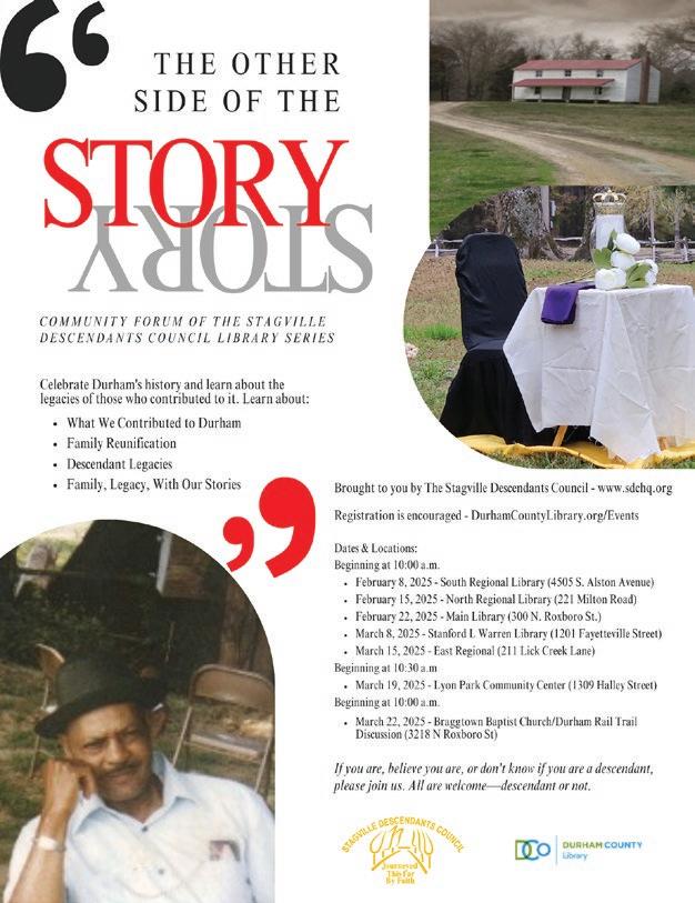
The rail corridor has a total of 21 crossings. Two are private driveway crossings and the remaining 19 are roadway crossings, including two underpasses and 17 at-grade crossings. The recommended treatments for the crossings aim to increase visibility of trail users, minimize trail users’ exposure to traffic, and slow down vehicles as they approach the crossing. The recommendations include two baseline recommendations for the crossings- Type A (unsignalized crossing) or Type B (signalized crossing)- as well as a toolkit of add-on treatments that can be applied to the roadway approaches leading up to the crossings.
Final selection of crossing treatments should be based on complete engineering assessment during a future design phase and will require agreements with NCDOT to be determined based on proposed design and the NCDOT Trail Encroachment Guidelines. Notably, NCDOT requires a sponsoring agency (i.e., municipality, county, or advocacy group) to provide and maintain the signalized treatments identified in this Plan. Durham County does not currently sponsor any signals and does not have internal staff resources to maintain signals. The City of Durham does maintain traffic signals but may not maintain signals that are outside of the municipal boundaries and/or their signal network.
Development of recommendations for crossing treatments includes consideration of design guidance from multiple documents as well as input from City of Durham Transportation Department and NCDOT Division 5 Engineer.
• The NCDOT Trail Crossing Guidance provides insight based on posted speed, a qualitative determination of context (rural, suburban, local), and a qualitative estimate of vehicle volumes (e.g., low volume). Notably, this guidance lacks insight on local or suburban roads with posted speeds greater than or equal to 35 mph of which there are four along the Rail Trail (E. Club Blvd., Dearborn Dr., Thompson Rd., and Hamlin Rd.).1
• The FHWA Guide for Pedestrian Safety at Uncontrolled Crossing Locations provides recommendations based on three categories of volumes of vehicles, three categories of posted speed limit, and five categories of travel lane configurations.2
• The AASHTO Guide for the Development of Bicycle Facilities provides guidance based on the same categories of speed limit and lanes as the FHWA Guide, but with one additional category for volumes of vehicles. For both the FHWA Guide and the AASHTO Guide, the lowest threshold for volumes of vehicles is <9,000 with no additional nuanced guidance for streets with very low volumes or no documented volume data. Along the Rail Trail, there are seven streets with no data for vehicle volumes (Roanoke St., Thompson Rd., Rhododendron Dr., Joe Ellis Rd., Ball Rd., Moores Mill Rd., and Harris Mill Rd.). Three more crossings have vehicle volumes under 2,500 per day (Orange Factory Rd., Bahama Rd., and Red Mountain Rd.).3
• Staff in the City of Durham Department of Transportation and the NCDOT Division 5 Engineer expressed concern for treating crossings with very low volumes of vehicles per day (under 2,500) with a signalized treatment.
Based on the guidance listed above, the analysis of trail crossings and draft recommendations of treatment types took into account several factors with the most important factors being context, posted speed limit, volume of vehicles, and crashes - specifically, whether or not the crossing occurred on a portion of the road designated within the Triangle West Vision Zero Action Plan as part of the High-Injury Network. Below is a table showing how existing conditions at each crossing corresponded with design guidance from the resource documents listed above and the recommended treatment types, which are explained in the following section.
FHWA
8 Commercial Driveway Private Rural 1 n/a No n/a 90 Low Flat Good Poor No
Residential Driveway Private Rural 1 n/a No n/a 90
FHWA
FHWA Guide for Ped Safety at Uncontrolled Crossings (RRFB/PHB should be considered)
NCDOT Trail Crossing Guidance (RRFB)
AASHTO Bike Guide (no signalization)
FHWA Guide for Ped Safety at Uncontrolled Crossings (RRFB/PHB can be considered)
NCDOT Trail Crossing Guidance (unclear guidance) AASHTO Bike Guide (no signalization)
FHWA Guide for Ped Safety at Uncontrolled Crossings (RRFB/PHB can be considered)
NCDOT Trail Crossing Guidance (unclear guidance) AASHTO Bike Guide (no signalization)
FHWA Guide for Ped Safety at Uncontrolled Crossings (RRFB/PHB should be considered)
NCDOT Trail Crossing Guidance (unclear guidance) AASHTO Bike Guide (RRFB or PHB)
FHWA Guide for Ped Safety at Uncontrolled Crossing (n/a) NCDOT Trail Crossing Guidance (n/a) AASHTO Bike Guide (n/a)
Good Poor No FHWA Guide for Ped Safety at Uncontrolled Crossings (n/a)
Trail Crossing Guidance (n/a)
Bike Guide (n/a)
Trail Crossing Guidance (traffic signal with walk phase)
Bike Guide (RRFB or PHB)
FHWA Guide for
Safety at Uncontrolled Crossings (RRFB/PHB should be considered)
NCDOT Trail Crossing Guidance (traffic signal with walk phase) • AASHTO Bike Guide (RRFB or PHB)
• FHWA Guide for Ped Safety at Uncontrolled Crossings (RRFB/PHB should be considered)
NCDOT Trail Crossing Guidance (traffic signal with walk phase)
AASHTO Bike Guide (RRFB or PHB)
FHWA Guide for Ped Safety at Uncontrolled Crossings (RRFB/PHB should be considered)
NCDOT Trail Crossing Guidance (traffic signal with walk phase)
• AASHTO Bike Guide (RRFB or PHB)
FHWA Guide for Ped Safety at Uncontrolled Crossings (RRFB/PHB can be considered)
NCDOT Trail Crossing Guidance (RRFB or traffic signal with walk phase) AASHTO Bike Guide (no signalization)
FHWA Guide for
considered)
NCDOT Trail Crossing Guidance (traffic signal with walk phase)
Bike Guide (no signalization)
FHWA
NCDOT Trail Crossing Guidance (traffic signal with walk phase)
FHWA Guide for
NCDOT Trail Crossing Guidance (traffic signal with walk phase)
Bike Guide (RRFB or PHB)
All trail crossings have recommended baseline treatments whether unsignalized (Type A) or signalized (Type B). A large degree of flexibility is intentionally provided within the recommended treatments and will require additional analysis in future phases of design. In particular, strong coordination with NCDOT and City of Durham Transportation is needed to ensure crossings treatments are coordinated with future roadway changes.
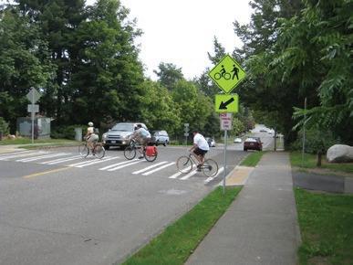


Pavement markings and signs including:
• High-visibility crosswalk and trail crossing sign
• Advance warning sign of trail crossing
User-activated flashing sign, known as a Rectangular Rapid Flashing Beacon (RRFB) or user-activated stop light known as a Pedestrian Hybrid Beacon (PHB) including:
• High-visibility crosswalk and trail crossing sign
• Illuminated, advance warning sign of trail crossing that is wired to the trail crossing signal (RRFB or PHB) so that it illuminates when the RRFB or PHB is activated
In future phases of design, consider increasing from Type A to Type B for urban or suburban locations where the crossing:
Is part of the High Injury Network (all crash types)
• Has trail-oriented development
• Has adjacent transit stops
• Has high observed speeds
• Has a lack of compliance in yielding
• Undergoes roadway widening (3+ lanes)
All crossings should be designed in accordance with the following (see more information on design guidance in Appendix 3, page 315.)
• Sight triangles: calculated depending on the design speeds of the trail and the roadway. If sufficient stopping sight distance cannot be achieved, additional traffic control such as stop signs or signals should be provided.
• Crossing angles: The trail should cross roadways as close to 90 degrees as possible, to minimize crossing distance and potential conflicts and maximize sight distances.
The Trail Crossings and Renderings map on this page shows the recommended treatment type for each crossing. The blue dots represent grade separated crossings, the green dots represent Type A (unsignalized) crossings, the yellow dots represent Type B (signalized) crossings, and the pink dots represent crossings that could receive either Type A or Type B treatments and final selection of crossing treatments should be based on a complete engineering assessment as part of a future phase. The renderings show what potential treatments could look like at four locations along the trail. Notably, the renderings for E. Club Blvd. and Bahama Rd. only depict one of the possible recommended treatment types.

A toolkit of additional interventions that should be considered for each individual crossing is shown below. These treatments help slow down vehicles in advance of the crossing and increase driver attention and visibility for people crossing on foot or on a bicycle. Specific treatments for each crossing will be determined on a case by case basis in later phases of the design. (See Exhibit 26: Toolkit of Add-On Crossing Treatments)
The following table shows the crash reduction factors of the proposed and potential crossing treatments.

Transverse rumble strips
Restrictions: none
Dynamic speed feedback sign
Restrictions: none
Curb extension or curb if roadway edge is ditch
Restrictions:wherespace allows

Raised median island
Restrictions:wherespace allows
Speed cushions
Restrictions:<35mph road in urban or suburban contexts
Additional treatments that could be explored in the future include:
Raised crossings
Restrictions:<35mph road in urban or suburban contexts
Upgrading RRFBs to include technology that detects the presence of a trail user approaching the crossing and automatically activates the RRFB.1, 2
Intersection conflict warning system technology that include flashing signs that are illuminated when cars are approaching an intersection or crossing. Intersection conflict warning systems could be beneficial at crossings with visibility challenges.3
These treatments are less common, but are being implemented in certain areas of the country.
Common Crossing Treatments
Bollards are common types of infrastructure used to restrict access to trails. Concern for motor vehicle use along the trail was primarily voiced by North Durham County residents in regard to motorbikes or ATV four-wheelers. According to the American Association of State Highway and Transportation Officials (AASHTO), gates and bollards are not recommended to restrict access by motor vehicles at trail entrances unless there is a documented history of issues as gates and bollards create permanent obstacles for trail users. Bollards, in particular, can pose serious injury to bicyclists. Recommended approaches to prevent unauthorized vehicle entry to the trail include1:
• Wayfinding identifying the entry as the Durham-to-Roxboro Rail Trail.
• Regulatory signs that prohibit motor vehicle entry.
• Designing the entry to clearly indicate that it is not intended for vehicle access, with a center island that splits the path into two sections, while allowing access for emergency and maintenance vehicles. This center island should include plantings, approximately 18-24” tall, that help visually reinforce that the trail is not for motor vehicles.
• If bollards are used, they should be spaced 5- to 6-feet apart. Additional design considerations regarding bollard design, placement, and pavement markings surrounding bollards are provided in the Appendix. (See A3: Design Guidance, page 315.)
• Any future designs involving bollards at crossings will also require additional coordination with the NCDOT Rail Division.

In public engagement, the community expressed a desire for the trail to provide access to nearby destinations and other trail networks. Community connections proposed throughout, include connections to parks and other green spaces, schools, libraries, and nearby commercial nodes. The five focus areas in this plan include specific recommended connections.
Constructing the proposed connections would will require coordination with existing property owners and voluntary agreements. Eminent domain is not being pursued with the study, but key places and potential connections have been identified for future collaboration.
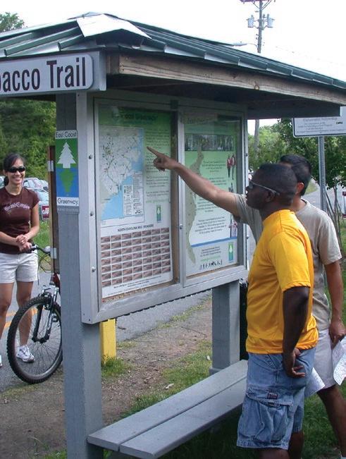
Trailheads are trail access points that may include parking and amenities such as seating, water fountains, trash and recycling receptacles, restrooms, kiosks, and more. They can also include programmatic elements such as gathering spaces, play features, and interactive interpretive elements. Conceptual trailhead ideas can be found later in this chapter. Specific trailhead designs will need to be developed in future phases of the project, particularly in terms of space dedicated to parking versus other amenities. This will be important especially at locations closer to downtown with direct access to transit.

As the development of the Durham-to-Roxboro Rail Trail progresses, it will be essential to evaluate the risk of gentrification and displacement at all points along the trail, and implement best practices to prevent and mitigate these processes.

Single-family residential development with direct access to the American Tobacco Trail. Apex, NC.
The City of Durham has passed plans with policy recommendations, for example the Comprehensive Plan. However, most of the actions related to anti-displacement have yet to be implemented. There are also many actions that could have bearing on the Durham-to Roxboro Rail Trail in terms of neighborhood stabilization that are related to housing density and housing diversity. For example, Durham’s Unified Development Ordinance (UDO) does allow for considerable increases in density with expectations that the developer meets certain requirements. The UDO also allows increased flexibility of approved housing types within “high demand neighborhoods”. The City’s investment in affordable housing could also have an impact with reinvestments in affordable housing near the Downtown Trail as a relevant precedent. Finally, Durham has committed to more opportunity for community input during the rezoning process and budgeting.
Specific actions that should be considered include:
1. Use the Durham County Displacement Index to identify at-risk neighborhoods along the trail.
2. Track and respond to rent and demographic changes before and after trail investments.
3. Support small businesses along the trail to prevent commercial displacement.
4. Extend protection and benefits to public housing residents near the trail corridor.
5. Add policies regarding trail-oriented development to the UDO that is currently being re-written. These policies should incentivize affordable housing within trailoriented development projects.
6. Consider Community Benefits Agreements (CBAs).
See A2. Anti-Displacement Overview, page 311 for more information on an overview of gentrification and displacement, gentrification and displacement indicators, conditions in Durham County and best practice case studies.
The preservation and creation of affordable housing near trail infrastructure investments, like the Durham-to-Roxboro Rail Trail, is one way to stabilize neighborhoods and work to limit displacement. Case studies show that these efforts are more effective when completed before the infrastructure is even built. In the past five years, several affordable housing developments have been approved in the Bragtown neighborhood. While not directly associated with the rail trail, these projects are good examples of how the City of Durham can incentivize and work with developers to build affordable housing near the trail.
Sandy Ridge Station (approved 2024)1
• 130+ residential units with multi-family and single-family options
• All units will be affordable housing
• Supported through the Forever Home, Durham program
Fairhaven Walk (approved in 2023)2
• 190+ apartment units and on-site daycare
• All units will be affordable
• Supported through the Forever Home, Durham program
Cub Creek Apartments (approved in 2022)3
• 820+ residential units total with multifamily and single-family options
• 190+ multi-family units will be affordable housing
• Developer has interest in creating walking trails within the site

Trail-oriented development is a planning and design approach that integrates trails into urban and suburban development. Trail-oriented development aims to create a network of local business and housing choices alongside safe and enticing trails, and leverage transportation infrastructure to support active ways of getting around.
Benefits of trail-oriented development include:
• Community-building: strengthens social connections by offering recreational amenities and gathering spaces that foster a sense of community.
• Economic development: promotes public and private investment and boosts the local economy by increasing foot traffic to businesses along the trail, as well as jobs that can be accessed through active modes.
• Sense of security: helps activate the trail and increases the “eyes on the trail”, which can make trail users more comfortable.
• Public health: promotes active lifestyles by providing safe and accessible spaces for exercise, improving physical and mental health
• Active transportation: encourages walking, bicycling, and riding transit as viable transportation options, reducing car dependency and greenhouse gas emissions.
• Environmental Preservation: preserves and creates green spaces, enhances water management, and supports biodiversity by integrating natural landscapes into urban development
The City of Durham and Durham County do not currently have policies specific to trail-oriented development, but there is clear potential for commercial trail-oriented development along the rail corridor with existing commercial nodes at Red Mountain Rd. and Dearborn Rd. Public input during the plan process showed an interest in both commercial and residential trail-oriented development along the Durham-to-Roxboro Rail Trail.
Trail-oriented development should be specific to the urban or rural nature of the surrounding area. While denser residential and commercial development may be appropriate for the southern segments of the trail, the northern segments of the trail should be small-scale and in keeping with the rural nature of the corridor.

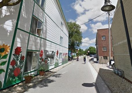
After the opening of the B-Line Trail, an existing business (left) added a walk-up window oriented toward the trail. On the right, new mixed-use development oriented to the trail. Bloomington, IN.
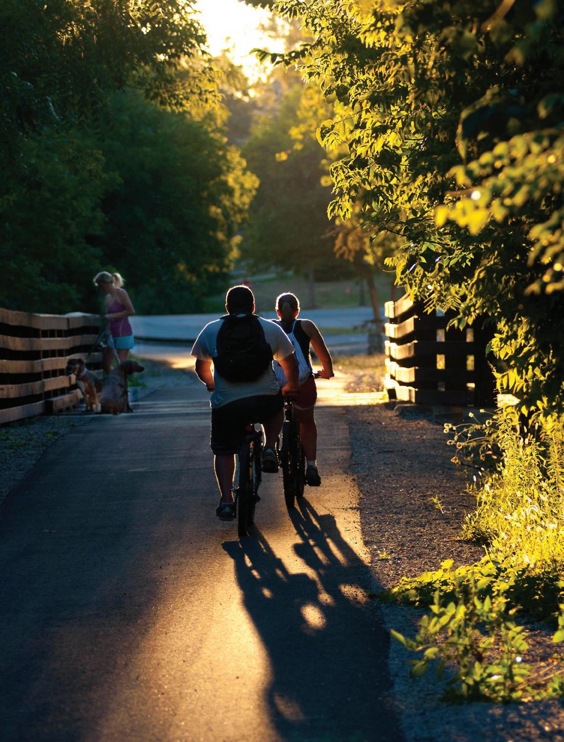
As the southern gateway of the Durham-to-Roxboro Rail Trail, the Downtown Durham Focus Area extends 1.7 miles between the Avondale Rd. underpass and East Club Blvd. It establishes critical recreational and transportation linkages by tying into Downtown Durham, the American Tobacco Trail (via the planned 1.8 mile Downtown Durham Rail Trail), the East Coast Greenway, multiple community parks, and GoDurham Route 9. (See Map 26: Downtown Durham Focus Area Map, page 183.)
Community feedback from downtown Durham shows strong enthusiasm for the trail and eagerness to begin design and construction, especially among cyclists and other active transportation users.
Section Extent: Avondale Rd Underpass to East Club Blvd.
Segment Length: 1.7 Miles
Key Features: Downtown Durham, East Coast Greenway, American Tobacco Trail, Durham Rail Trail, East End Park, Duke Park, Northgate Park, Sherwood Park, Southern Terminus, Go Durham bus stops
Proposed Trailheads
• Camden Ave. Trailhead
Proposed Trail Connectors
• R. Kelly Bryant Trail Connector/ East End Park
• Sherwood Park Connector (proposed Goose Creek Trail East)
• Northgate Park Connector (proposed North Ellerbe Creek Trail)
• Downtown Durham Rail Trail (proposed)
Trail Crossings
• I-85 (Underpass)
• Camden Ave. (Underpass)
• E. Club Blvd.(At-grade)
Stream Crossings
• Ellerbe Creek
Map 26: Downtown Durham Focus Area Map

In the Downtown Durham Focus Area, a trailhead is proposed at Camden Ave. The site, owned by the North Carolina Department of Transportation, sits directly adjacent to the rail corridor. While the parcel has challenging slopes, the two conceptual designs incorporate an access ramp to connect the parking area with the trail, which sits roughly 20’ below the parking area grade. At the direction of the Project Management Team, two conceptual designs were developed for the trailhead.
Conceptual Design 1 for Camden Ave. trailhead prioritizes parking, with space for 40–50 vehicles, and includes an information kiosk, seating, and a ramp connection to the trail. (See Exhibit 28: Camden Ave. Trailhead – Concept 1.)
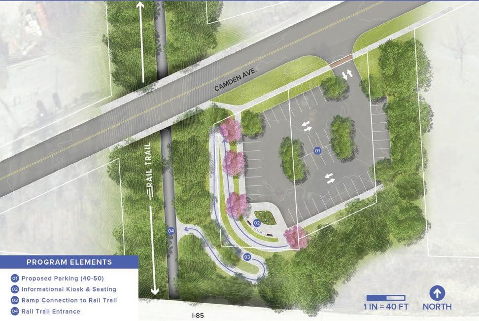
Conceptual Design 2 emphasizes user comfort and site activation, with more seating and amenity spaces to enhance safety and create a welcoming atmosphere. This option provides 25–35 parking spaces along with an information kiosk, a small picnic pavilion, dedicated amenity space, and a ramp connection to the trail. (See Exhibit 29: Camden Ave. Trailhead – Conceptual Design 2)
An opportunity for a major trailhead was identified at the southern terminus of the rail corridor adjacent to the northern stub of Miami Blvd., at an area near where multiple proposed City trails are expected to converge and would provide access from the east side of the corridor.
A conceptual design was created that included 60–70 parking spaces, a welcome plaza, two-stall restroom, picnic area, and boardwalk connection to the trail. This concept was presented to the Project Management Team and Advisory Committee. However, the trailhead was removed from the plan due to the City of Durham’s preference to minimize parking while encouraging access to the rail trail from downtown via access from nearby public transit and adjacent neighborhoods.
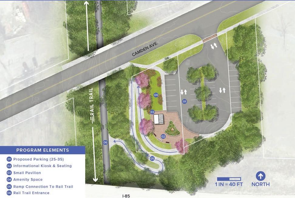
The Downtown Durham Focus Area provides multiple opportunities to connect with existing and planned trails. At the southern terminus of the Durham-to-Roxboro Rail Trail, the R. Kelly Bryant Trail Connector will link to East End Park and Long Meadow Park via the proposed R. Kelly Bryant trail along Avondale Dr. and East Geer St.
Also at the southern terminus, the programmed 1.8 mile Downtown Durham Rail Trail has the potential to tie directly into the corridor and connect to the 22-mile American Tobacco Trail that extends south through Durham, Chatham, and Wake counties. In the project coordination meeting with City of Durham Transportation staff on July 25, 2025 it was confirmed that the construction drawings for the Downtown Durham Rail Trail are anticipating and planning for the future connection of the Durham-to-Roxboro Rail Trail.
From this point at the southern terminus, the East Coast Greenway will also begin its shared route along the Durham-to-Roxboro Rail Trail.
Additional connections include the proposed Goose Creek Trail East, which will extend access to Sherwood Park, and the proposed North Ellerbe Creek Trail, which will provide a connection to Beaver Marsh Nature Preserve. An extension of the North Ellerbe Creek Trail is proposed to provide access to Northgate Park and connection to the existing Ellerbe Creek trail that travels northto-south in this area of Durham. This proposed connection passes through sensitive areas like floodplains and wetlands, so a boardwalk for some or all portions will likely be needed to reduce environmental impacts. (See Exhibit 30: Ellerbe Creek Connectivity Map, page 187.)
For all Downtown Durham Trail Connector Recommendations, see Map 26: Downtown Durham Focus Area Map, page 183.


This is an underpass crossing. See Exhibit 31: I-85 Underpass - Existing Conditions & Trail Underpass for a rendering of the proposed crossing. Specific considerations include:
• Lighting will be required
• Potential for public art and trail identity elements
• Trailhead at Camden Ave. would help activate this underpass with “eyes on the trail”

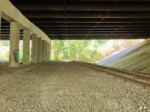
This is an underpass crossing. Specific considerations include:
• Lighting will be required
• Potential for public art
• To access the Camden Ave. trailhead and Camden Ave. itself, a significant ramp structure would be required due to steep grades
East Club Blvd.
The recommended treatment is a signalized crossing (Type B) with either a useractivated flashing sign (Rectangular Rapid Flashing Beacon) or a user-activated stop light (Pedestrian Hybrid Beacon), including a high-visibility crosswalk and trail crossing sign, as well as advance warning sign of trail crossing. (See Exhibit 32: East Club Blvd. Trail Crossing, page 190 for a rendering of the proposed crossing that shows an RRFB option.)
Specific considerations include:
• A median with a pedestrian refuge is recommended at the crossing, which helps slow down traffic, increases visibility of the crossing, and allows pedestrians and bicyclists to cross one lane at a time.
• We heard through community engagement that East Club Blvd. feels unsafe. Additional traffic calming is recommended to slow down vehicles ahead of the crossing. (See Exhibit 26: Toolkit of Add-On Crossing Treatments, page 174 for a range of treatments that can be considered, which will need to be determined at a later phase of the design.)
See Section 2.3 Trail Crossings, page 52 for the crossings analysis that, along with community input, helped guide these recommendations, and Map 25: Trail Crossings and Renderings, page 173 to see all of the crossings and more information on types of recommended treatments.
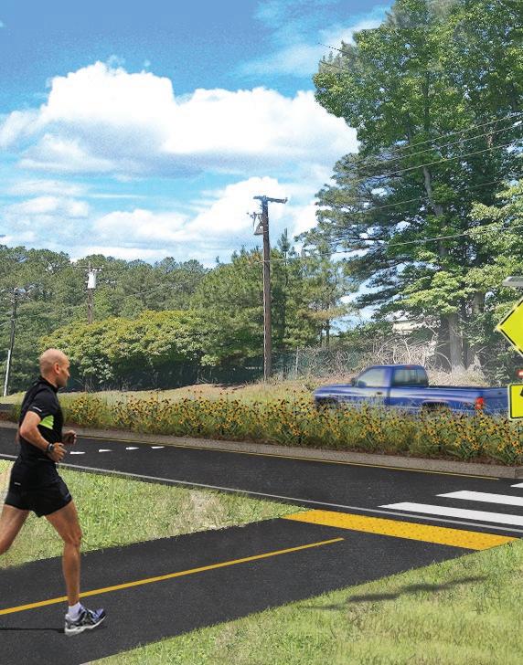


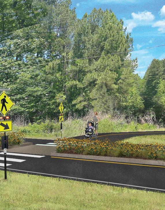
Preliminary conceptual design. Final design subject to change based on engineering, survey data, and regulatory review.
The rail corridor crosses Ellerbe Creek via the existing steel beam Ellerbe Creek Bridge. A planning-level review, including field work and visual inspections, indicates the structure is partially collapsed and will likely require some level of reconstruction/replacement; however, a licensed structural engineer must evaluate its capacity to support trail use. This crossing will also provide a critical connection to the future North Ellerbe Creek Trail. (See the Bridges section on page 74 of Section 2.3, Built Environment, for the preliminary assessment and additional photographs of the Ellerbe Creek Bridge.)
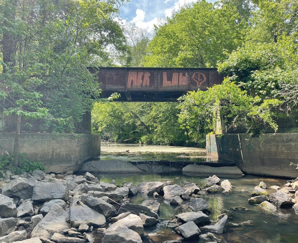
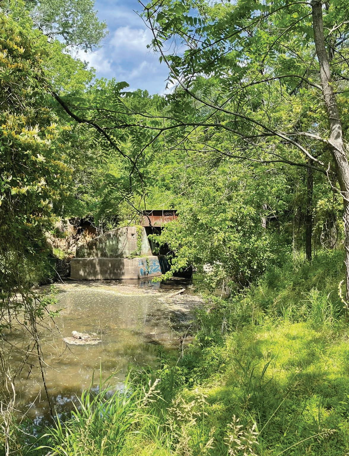
4.3
The Bragtown Focus Area extends 2.5 miles from East Club Blvd. to Sandy Ridge Elementary School along Hebron Rd.. This segment serves the Bragtown community and provides access to community parks including Lakeview and Red Maple, schools including Lakeview Secondary and Sandy Ridge Elementary, the Bragtown Branch Library, Soul Sanctuary Farmers Market, Welcome Venture Industrial Park, and connections to the GoDurham bus route. (See Map 27: Bragtown Focus Area Map, page 195.)
The community of Bragtown is known for its historical significance and strong community bonds, having been settled by formerly enslaved people from the nearby Stagville Plantation. It operated as an independent community until it was annexed by the City of Durham in 1957. That history is an important part of the community’s identity for many of its current residents, especially those who are direct descendants of those enslaved. The focus area presents opportunities for interpretive signage and public art that celebrate Bragtown’s rich history and community identity, as well as community-focused trail-oriented development.
Community organizations, including the Bragtown Community Association, were actively engaged during the planning process to provide input. A significant concern of the community is that gentrification and displacement are already occurring in the area while many of the long-standing issues facing residents – roadway safety and sidewalk connectivity – have gone unaddressed. Key priorities for the Bragtown community include safe roads and crossings, sidewalk connections, a trail that is accessible to all ages and abilities, and preserving the identity of Bragtown along the rail corridor. Ongoing engagement with community members will be essential to ensure a successful, communitysupported implementation of the Bragtown segment of the Durham-to-Roxboro Rail Trail.
Bragtown Focus Area Key Facts
Section Extent: East Club Blvd to Sandy Ridge Elementary School (Hebron Rd.)
Segment Length: 2.5 Miles
Key Features: Bragtown Community, Lakeview Park, Lakeview Secondary School, Bragtown Branch Library, Red Maple Park, Welcome Venture Industrial Park, Sandy Ridge Elementary School, Hebron Road Plant Conservation Preserve, East Coast Greenway
Proposed Trailheads
• East Club Blvd.
Proposed Trail Connectors
• Red Maple Park Connector
• Lakeview Park & Lakeview
Secondary School Connector
• Bragtown Branch Library
Connector
• Sandy Ridge Elementary & proposed Club Creek Trail (via Hebron Rd. Connector)
Trail Crossings
• Roanoke St.
• Dearborn Dr.
• Thompson Rd.
• Hamlin Rd.
• Commercial Driveway near Old Oxford Rd.
Stream Crossings
• None
Map 27: Bragtown Focus Area Map
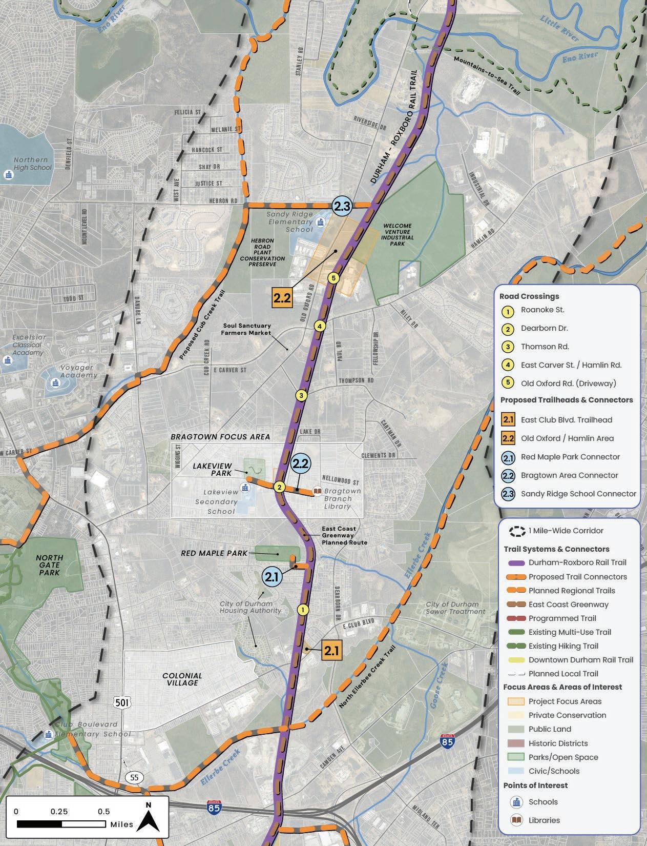
In the Bragtown Focus Area, a trailhead is proposed at East Club Blvd. on a City of Durham-owned parcel. The conceptual design features an entrance sign, informational kiosk, restroom building, picnic area, and proposed parking for 60–70 vehicles. Sidewalk connections to multiple GoDurham bus stops and residential neighborhoods east and west of the site further enhance access and connectivity for nearby residents. Future engineering assessments will verify feasibility of this concept. A stream buffer may be required along the eastern boundary of the site, but a stream determination was not completed as part of this plan. (See Exhibit 33: East Club Blvd. Trailhead Conceptual Design, below)
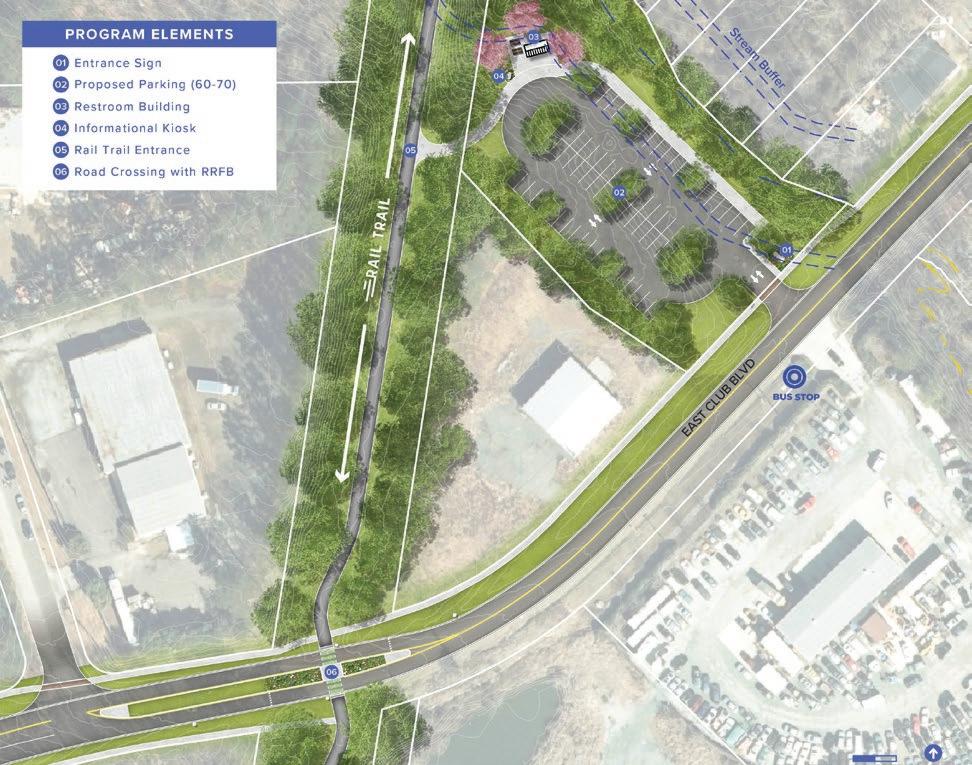
An opportunity for a public-private partnership to create a community hub in the Bragtown area along Dearborn Drive was also explored. Preliminary conceptual designs were developed and shared with the property owner. As the development of the rail trail progresses, this and/or other opportunities for trail-oriented development in the historic Bragtown community should continue to be explored to support community-focused amenities.
A second potential public–private partnership for a trailhead in the Old Oxford–Hamlin area was evaluated. Preliminary conceptual designs were developed and are under consideration by the property owner and Durham County. As the development of the trail progresses, this and/or other opportunities for trailoriented development in the Old Oxford/Hamlin area should continue to be explored.
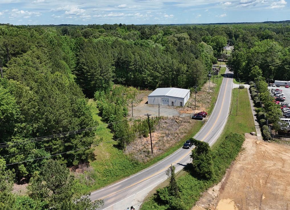
Red Maple Park with ball fields, picnic shelters, and a playground is located just to the west of the rail corridor. A cityowned parcel that is directly south of the park along Pecan Place could be utilized to provide a direct connection between the community park and the rail trail.
In the Bragtown area, Dearborn Drive serves as an important connector to key community assets. West of the rail corridor, the trail is in close proximity to Lakeview Park, Lakeview Secondary School, and two GoDurham bus stops, with an existing sidewalk along the south side of Dearborn Drive. An additional sidewalk on the north side of Dearborn Drive is proposed to provide direct connection to Lakeview Park. East of the corridor, a proposed sidewalk will create future connections to the Bragtown Branch Library and two additional GoDurham bus stops. (See Exhibit 34: Dearborn Dr. – Connectivity Map, page 199.)

34: Dearborn Dr. – Connectivity Map
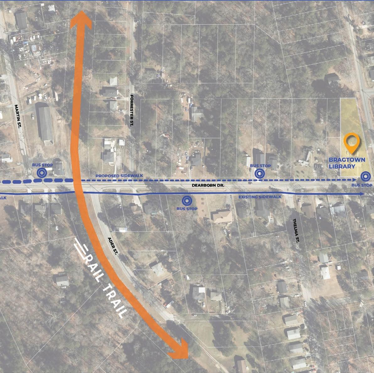
The recommended treatment is an unsignalized crossing (Type A), with pavement markings and signs including a high-visibility crosswalk and trail crossing sign, as well as an advance warning sign of trail crossing.
Specific considerations include:
• Curb ramps will be required for crossing
Thompson Rd.
This crossing could receive either unsignalized (Type A) or signalized (Type B) treatments and should receive further investigation at a future phase of design.
Specific considerations include:
• Additional treatments recommended to increase visibility and driver attention, due to sharp curve and poor sight distance at crossing. (See Exhibit 26: Toolkit of Add-On Crossing Treatments, page 174 for a range of treatments that can be considered, which will need to be determined at a later phase of the design.)
This crossing could receive either unsignalized (Type A) or signalized (Type B) treatments and should receive further investigation at a future phase of design.
Specific considerations include:
• Trail alignment crosses Hamlin Rd. at a skewed angle with limited sight distance. The crossing will need to be “squared up” to cross at more of a 90 degree angle.
• Slight grading required to accommodate ditch crossings.
This is a commercial private driveway crossing. The recommended treatment is an unsignalized crossing with a high-visibility crosswalk.
Specific considerations include:
• Coordination with the property owner will be required.
• The design will need to consider the types of vehicles that will be accessing the site.
See Section 2.3 Trail Crossings, page 52 for the crossings analysis that, along with community input, helped guide these recommendations, and Map 25: Trail Crossings and Renderings, page 173 to see all of the crossings and more information on types of recommended treatments.
The recommended treatment is a signalized crossing (Type B) with either a useractivated flashing sign (Rectangular Rapid Flashing Beacon) or a user-activated stop light (Pedestrian Hybrid Beacon), including a high-visibility crosswalk and trail crossing sign and advance warning sign of trail crossing. (See Exhibit 35: Dearborn Dr. – Conceptual Trail Design & Trail Crossing, below for a plan view rendering of the proposed crossing and access point, showing an option with a PHB.)
Specific considerations include:
• Community members voiced concern that Dearborn Dr. is unsafe, and it is part of the High Injury Network from Triangle West’s regional Vision Zero Action Plan. Additional traffic calming is recommended to slow down vehicles ahead of the crossing. (See Exhibit 26: Toolkit of Add-On Crossing Treatments, page 174 for a range of treatments that can be considered, which will need to be determined at a later phase of the design.)
• Community members are concerned that the lack of curbs creates unsafe conditions for people walking on the sidewalks. Adding curbs to Dearborn Dr. at the crossing would help partly address this concern.

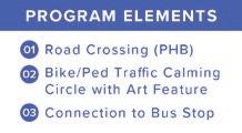
In addition to the existing road crossings listed above, the Northern Durham Parkway is being planned by NCDOT and the City of Durham. A segment of the Parkway is currently under construction by Welcome Venture Park.
The Parkway would cross the trail just north of Hamlin Rd., creating a four-lane road crossing and making it the longest crossing other than the I-85 underpass. It has not yet been determined whether the rail trail or the Parkway will be constructed first. Existing grades suggest the Parkway would be more suitable to cross over the trail. NCDOT and the City of Durham should coordinate to design the trail and the Parkway to achieve a grade-separated trail crossing.
There are no stream crossings in the Bragtown Focus Area.


4.4
The Two Rivers Focus Area spans four miles, from Sandy Ridge Elementary School on Hebron Rd. to just south of the Treyburn community. It encompasses key recreational and ecological destinations such as the Mountains-to-Sea Trail, Penny’s Bend, and the Eno and Little Rivers. This stretch also features the Eno River and Little River trestle bridges, which provide essential crossings and could provide scenic views, iconic rail trail experiences, and opportunities for interpretive signage.
This segment includes potential trail connections to nearby schools along Snow Hill Rd., including Little River Elementary, Lucas Middle School, and Durham Technical College, as well as to the southern portion of Treyburn Corporate Park. Historically, the Stagville Plantation encompassed the entire segment north of the Eno River and the Great Trading Path (See Historic and Cultural Resources, page 64) is believed to have passed through this area, providing opportunities for interpretation and public art along the rail trail. (See Map 28: Two Rivers Focus Area Map, page 205.)
Community opinion for the trail in the Two Rivers focus area included some concern related to private property conflicts (e.g., privacy, hunting, and agriculture), but was largely supportive with strong support for the trail’s potential to connect the nearby nature-based recreation and education assets.
Section Extent: Sandy Ridge Elementary School (Hebron Rd.) to just south of the Treyburn Community.
Segment Length: 4 Miles
Key Features: Mountains-to-Sea Trail, Penny’s Bend, East Coast Greenway, Eno River, Little River, Little River Elementary School, Durham Technical College, Lucas Middle School, Treyburn Corporate Park
Proposed Trailheads
• Penny’s Bend Trailhead
Proposed Trail Connectors
• Mountains-to-Sea Connector
Realignment
• Snow Hill Rd. Schools Connector
Trail Crossings
• Residential Driveway near Old Oxford Rd.
• Old Oxford Rd.
Stream Crossings
• Eno River tributary (3 crossings)
• Eno River (via Trestle Bridge)
• Little River (via Trestle Bridge)

Map 28: Two Rivers
At Penny’s Bend, a trailhead is proposed to serve the Durham-to-Roxboro Rail Trail, the Mountains-to-Sea Trail, Eno River access points, and Penny’s Bend Nature Preserve. The area is already a popular recreation hub, and the proposed trailhead site is situated on property adjacent to the rail corridor and owned by the U.S. Army Corps of Engineers, and largely managed by the North Carolina Wildlife Resources Commission and North Carolina Botanical Garden.
The area currently lacks sufficient parking and presents safety challenges for pedestrians, particularly where the Mountains-to-Sea Trail crosses the vehicular bridge on Old Oxford Rd.. In project coordination meetings, NCDOT shared concerns about vehicles parking along the right-of-way, the Eno River Association shared concerns about insufficient parking for organized group hikes, and the Friends of the Mountains-to-Sea Trail shared concerns about the current trail routing over the Old Oxford bridge that lacks pedestrian accommodations. The proposed trailhead would address these issues by realigning the Mountains-toSea Trail corridor to utilize the Rail Trail corridor and connect to a formal parking area, improving pedestrian safety, and expanding parking to better support both trails and the surrounding recreation area.
At the direction of the Project Management Team, the consultant team developed two conceptual designs for the trailhead. A project coordination meeting with representatives from North Carolina Wildlife Resources Commission and U.S. Army Corps of Engineers was conducted on July 2, 2025 to review these conceptual designs. Discussions were had surrounding rare and endangered species in the area as well as right-ofway ownership, so further research and analysis will be required before moving forward with the design process for a trailhead at Penny’s Bend. In the Penny’s Bend area, the rail corridor passes through sensitive areas such as floodplains and critical habitat areas, so additional infrastructure, including culverts, new bridges, or boardwalks, may be required. Final trail
design and construction in this area will require regulatory review, engineering, and survey data.
Conceptual Design 1 for the Penny’s Bend trailhead proposes a traffic circle at the intersection of Old Oxford Rd. and a realigned Snow Hill Rd. to slow traffic and improve vehicular and pedestrian circulation. The trailhead, with proposed parking for 30 to 40 vehicles
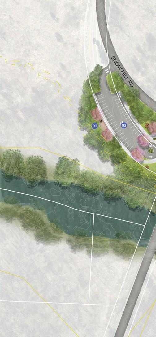

utilizing the current alignment of Snow Hill Rd., would be located west of Old Oxford Rd. A connector trail that goes under the Old Oxford Rd. bridge or crosses over Old Oxford Rd. would link to the Mountains-to-Sea Trail and the Durham-toRoxboro Rail Trail.
This concept would require significant investment and coordination with the NCDOT and is considered a long-range vision. (See Exhibit 36: Penny’s Bend Trailhead – Conceptual Design 1, below.)
Preliminary conceptual design. Final design subject to change based on engineering, survey data, and regulatory review.
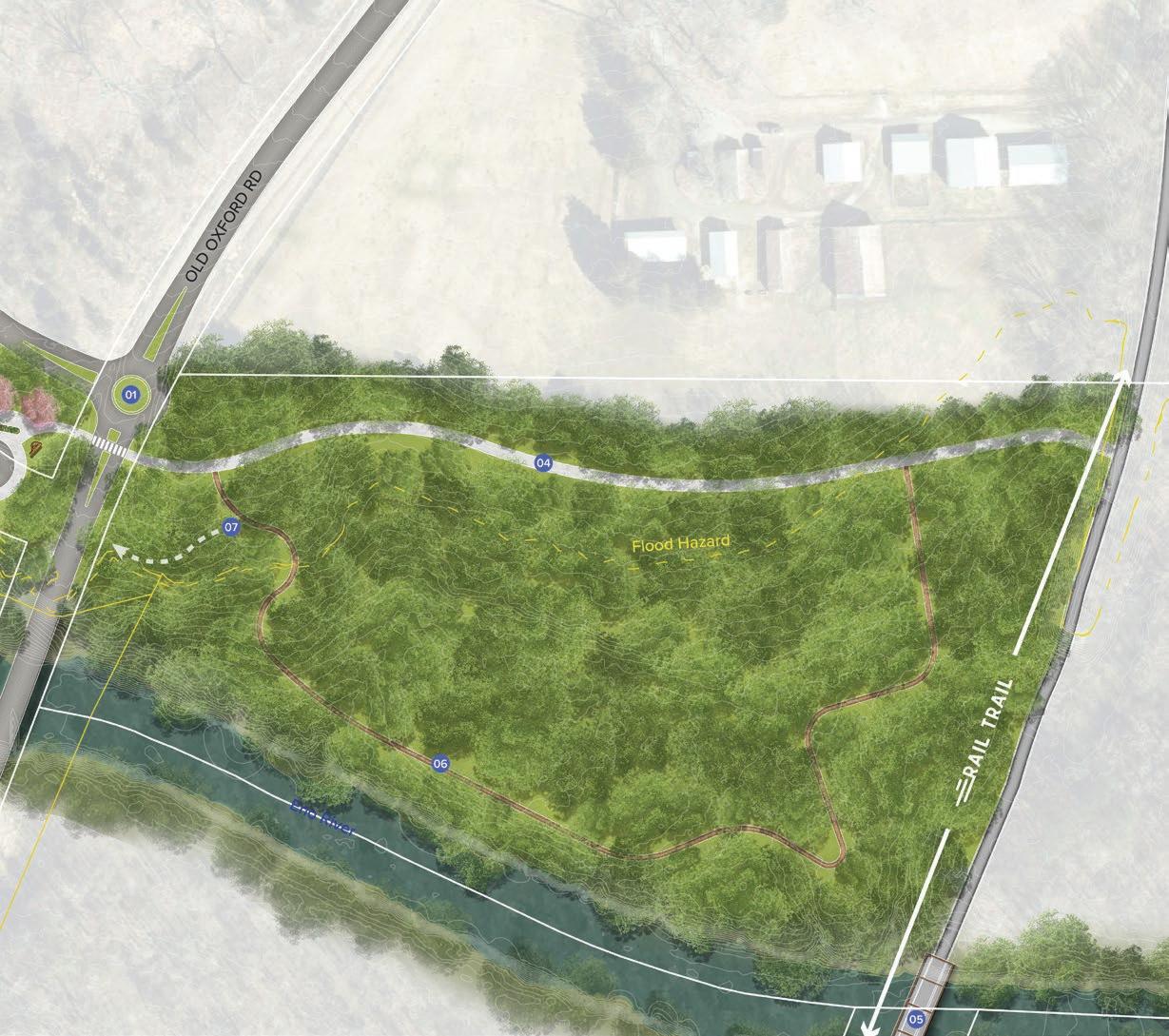
In July 2025, Tropical Storm Chantal resulted in flooding in this area that temporarily closed Old Oxford Rd. NCDOT has noted that the Old Oxford bridge is the lowest elevation bridge over the Eno River, and NCDOT is assessing any damage to the structure. Furthermore, the Triangle West TPO completed a Wildlife Crossing Study and this bridge crossing was prioritized for improvements to allow for better wildlife movement under the bridge. (See Exhibit 03: Triangle West Priority Wildlife Crossing Recommendations, page 48 and Map 11: Wildlife Crossing Recommendations, page 49.)
The replacement of the Old Oxford bridge over the Eno River would present an opportunity to lengthen and raise the roadway to reduce the potential for flooding and enhance wildlife movement. If this is done, the intersection with Snow Hill Rd. would likely need to be relocated to the north presenting an opportunity to reconstruct the intersection with a roundabout.
Conceptual Design 2 for the Penny’s Bend trailhead builds on NCDOT’s current plans to signalize and add a turn lane at the intersection of Snow Hill Rd. and Old Oxford Rd. This concept looks to add crosswalks to the signalized intersection and formalize an existing informal parking area east of Old Oxford Rd. This concept requires less engineering and permitting than Conceptual Design 1 and is considered a short-range vision. The proposed parking lot would be on land owned by the US Army Corps of Engineers and managed by the NC Wildlife Resources Commission, and it would be subject to their review and approval. (See Exhibit 37: Penny’s Bend Trailhead – Conceptual Design 2 page 209.)
This area includes the intersection of the Mountains-to-Sea State Trail and the East Coast Greenway State Trail, the two longest trails in the NC State Parks System. Penny’s Bend and the scenic trestle bridge over the Eno River has the potential to be a major state recreational hub, and a landmark feature of Durham.
Due to the sensitive environmental features of this area and the complexity of current public land ownership and management, opportunities for voluntary additional acquisition of property should be explored which may present other options for trailhead parking and facilities.
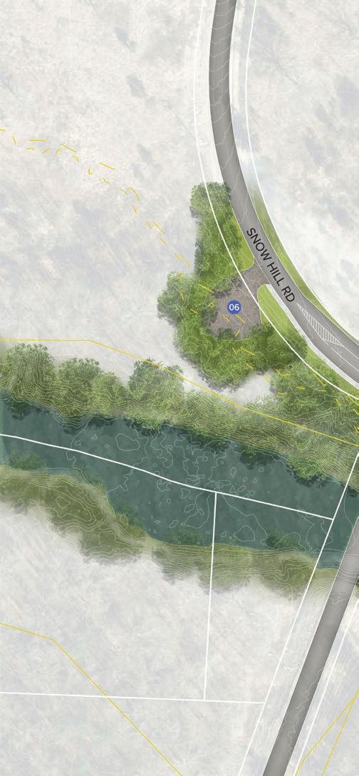

Preliminary conceptual design. Final design subject to change based on engineering, survey data, and regulatory review.

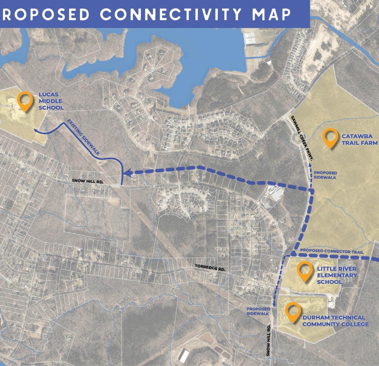
Preliminary conceptual design. Final design subject to change based on engineering, survey data, and regulatory review.
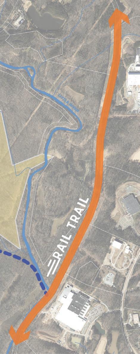
To the west of the rail trail, three schools along Snow Hill Rd. (Durham Technical Community College, Little River Elementary School, and Lucas Middle School) are located close to the corridor. Connections to these schools could be established via the Catawba Trail Farm/Urban Community AgriNomics (UCAN) property, proposed sidewalk traveling north and south along Snow Hill Rd., a connector trail utilizing privately-owned conservation lands, and existing sidewalks. The founders of UCAN support a connector trail along the edge of their property, as it aligns with their mission to engage the Northern Durham community.
The proposed connection crosses sensitive floodplains and wetlands, so boardwalk segments will likely be needed to minimize environmental impacts. A bridge over the Little River will also be required, creating a scenic crossing and an opportunity for interpretive signage about the river and adjacent wetlands. The route passes through game lands managed by the North Carolina Wildlife Resources Commission, where hunting currently occurs with some areas limited to archery due to nearby schools. Advancing this connection will require coordination with the NC Wildlife Resources Commission and the U.S. Army Corps of Engineers. (See Exhibit 38: Snow Hill Rd. Schools Connectivity Map, page 210.) Alternatively, a connector to the three schools could occur along Snow Hill Rd.

This is a private residential driveway crossing. The recommended treatment is an unsignalized crossing with a high-visibility crosswalk.
Specific considerations include:
• Coordination with the property owner will be required.
• The design will need to consider strategies for ensuring safety of both trail users and farm animals, including fencing.
• A culvert for livestock crossing may be considered.
This crossing could receive either unsignalized (Type A) or signalized (Type B) treatments and should receive further investigation at a future phase of design.
Specific considerations include:
• Community members expressed that Old Oxford Rd. feels unsafe, and the road curve and poor sight distance create visibility issues. This segment of road is also on the Triangle West High-Injury Network.
• Old Oxford Rd. at Snow Hill Rd.: Both conceptual designs for the trailhead at Penny’s Bend propose rerouting the MST to the north side of the Eno River and a crossing at the Old Oxford Rd. and Snow Hill Rd. intersection.
• Conceptual Design 1 shows a roundabout, which would require a single high visibility crosswalk and signage across Old Oxford Rd. (See Exhibit 36: Penny’s Bend Trailhead – Conceptual Design 1, page 207.)
• Conceptual Design 2 shows a fully signalized option, which would need to be accompanied by a pedestrian signal/pedestrian signal phase. (See Exhibit 37: Penny’s Bend Trailhead – Conceptual Design 2, page 209.)
• Additional traffic calming treatments are recommended for either option, especially due to visibility issues for drivers moving downhill towards the crossing. (See Exhibit 26: Toolkit of Add-On Crossing Treatments, page 174 for a range of treatments that can be considered, which will need to be determined at a later phase of the design.)
See Section 2.3 Trail Crossings, page 84 for the crossings analysis that, along with community input, helped guide these recommendations, and Map 25: Trail Crossings and Renderings, page 173 to see all of the crossings and more information on types of recommended treatments.

The Eno River, its tributaries, and the Little River are significant features along this portion of the rail corridor. Southeast of Penny’s Bend, the corridor crosses Eno River tributaries in three locations. The conditions at these crossings are not currently accessible for observation, but additional infrastructure such as culverts, new bridges, or boardwalks may be required. Final trail design and constructions at these stream crossings will require regulatory review, engineering, and survey data.
Further north along the rail corridor, the abandoned rail line crosses the Eno River on an elevated steel truss bridge just east of Old Oxford Rd., near Penny’s Bend. Restoring this historic bridge would create a visually striking and iconic section of the rail trail, offering views of the river and surrounding natural areas. Based on visual inspection, the Eno River Bridge structure appears mostly intact, though replacement, repair, or additional supports may be required for restoration. All components require further assessment by a licensed structural engineer to determine whether the structure can support the activities of the proposed rail trail. (See the Bridges section on page 74 of Section 2.3, Built Environment, for the preliminary assessment and photographs of the Eno River Bridge.)
Just north of Old Oxford Rd., the abandoned rail line crosses the Little River on the Little River Bridge, an elevated steel truss structure. The primary structural components appear intact, though repairs, replacements, or added supports may be required. Dense vegetation surrounds the bridge, and all elements must be evaluated by a licensed structural engineer to confirm suitability for trail use. One option is to shore up the aging wooden approaches with new steel components, preserving the bridge’s historic character while ensuring safety and stability. (See the Bridges section on page 74 of Section 2.3, Built Environment, for the preliminary assessment and photographs of the Ellerbe Creek Bridge.)
During this planning study, Tropical Storm Chantal impacted the area in July 2025, causing historic flooding of the river systems and inundated parts of Penny’s Bend Nature Preserve and the Old Oxford Rd. vehicular bridge. Potential flooding and its impacts will be an important factor in the design and engineering of this portion of the trail corridor.

4.5
The Bahama Focus Area spans 4.5 miles, beginning just south of the Treyburn community and extending north to Ball Rd. This segment travels through the community of Bahama and connects a wide range of cultural, historic, and natural destinations.
The area is rich in history, with significant sites such as Stagville State Historic Site and the Great Trading Path. These resources create opportunities to integrate historical markers, interpretive signage, and public art that celebrate the region’s heritage.
In addition to its cultural assets, the Bahama Focus Area offers access to a variety of natural areas. Horton Grove Nature Preserve, Lake Michie Park and Marina, and their associated natural surface trails, lake, and campground provide opportunities for outdoor recreation and environmental education. In this section, the proposed route of the East Coast Greenway diverges from the Durham-to-Roxboro Rail Trail and travels east passing by the Stagville Historic Site towards Oxford, NC. (See Map 29: Bahama Focus Area Map, page 217)
Community feedback in the Bahama Focus Area reflects a mix of support and concern. While some residents expressed enthusiasm for bringing a trail to northern Durham County, others voiced apprehension about potential loss of privacy, crime and safety issues, and impacts to private property. Additional concerns included public safety near game lands, the long-term costs of maintenance and enforcement, and the environmental effects of impervious pavement and stream crossings. This sentiment was particularly strong among property owners adjacent to the corridor. Community organizations, including the Bahama Ruritan Club, were actively engaged throughout the planning process to provide input and feedback. (Exhibit 16: Phase 1 – Public Workshops, page 141 and Exhibit 17: Phase 1 – Focus Groups, page 143.)
Bahama Focus Area Key Facts
Section Extent: Just south of the Treyburn Community to Ball Rd.
Segment Length: 4.5 Miles
Key Features: Bahama, Stagville State Historic Site, Great Trading Path, Horton Grove Nature Preserve, Lake Michie Recreation Area, Mangum Elementary School, East Coast Greenway Junction
Proposed Trailheads
• None
Proposed Trail Connectors
• East Coast Greenway Junction
• Horton Grove Nature Preserve Connector
• Lake Michie Trail Connector
Trail Crossings
• Rhododendron Dr.
• Orange Factory Rd.
• Stagville Rd. (south)
• Joe Ellis Rd.
• Stagville Rd. (north)
• Bahama Rd.
• Ball Rd.
Stream Crossings
• Buffalo Creek
• Flat River
• Lake Michie tributary

Map 29: Bahama Focus Area Map
Multiple locations were explored as potential trailheads in the Bahama Focus Area, including the county convenience site on Roxboro Rd. and the area near Mangum Elementary School off Ball Rd.. All options were eliminated during the planning process due to stream buffer limitations and lack of publicly owned property. As the design and construction of the rail trail proceeds, identifying a location for a trailhead or community hub in the Bahama area that includes parking and restrooms may be needed.
In the Bahama Focus Area, future trailheads and segments should integrate history, culture, and community identity through interpretive signage, educational stations, and community-created art. The Great Trading Path once crossed this region, and much of the rail line was built on former Stagville Plantation land, where descendants of enslaved people still live today. The trail offers an opportunity to honor this history by sharing the stories of the communities along the corridor.
Partnerships with Stagville State Historic Site, Stagville Descendants Council, and local artisans can help create authentic interpretive elements. Ensuring safety and accessibility will allow the trail to serve as both a welcoming public space and a place of learning and reflection.
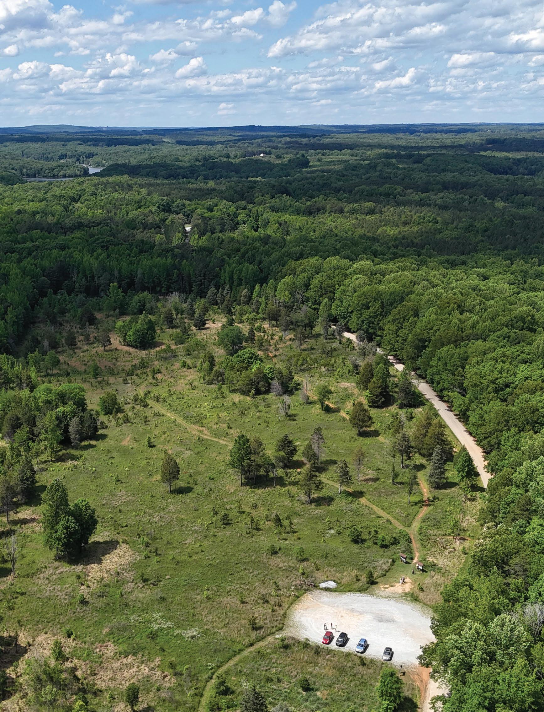
A key trail junction is planned within this focus area. After following the Durhamto-Roxboro Rail Trail from downtown Durham, the proposed East Coast Greenway is expected to diverge at Rhododendron Rd. to pass by Stagville Historic Site before continuing eastward towards Oxford. The exact alignment has not been determined at the time of this planning document. Construction of this connector will provide an important link between the Durham-to-Roxboro Rail Trail, Stagville Historic Site, and destinations along the East Coast Greenway.
A proposed connector trail at Orange Factory Rd., either as part of the East Coast Greenway or as a separate route, would provide access to Horton Grove Nature Preserve, Triangle Land Conservancy’s largest public preserve at 708 acres. Once complete, Horton Grove will offer over ten miles of trails for hiking, running, and walking. The trails at Horton Grove are named in honor of Black families (Holman, Peaks, Hart, Justice, Latta, Walker, Jordan, and Sowell) whose ancestors were enslaved on the land. The trails wind through mature forests and share stories of resilience and freedom through interpretive kiosks developed in collaboration with Historic Stagville. (See Exhibit 39: Horton Grove Connectivity Map, below).

Further north on the rail corridor, a proposed connector at Ball Rd. could provide a link from the trail to Lake Michie Recreation Area, which offers lake access, a campground, and recreational opportunities including fishing, boating, camping, picnicking, and natural surface trails.
This proposed connection passes through sensitive areas like floodplains and wetlands, so a boardwalk for some or all portions would likely be needed to reduce environmental impacts.
The proposed connector would also create a safe pathway for Mangum Elementary School students and staff to reach the rail trail via a proposed sidewalk along Quail Roost Rd. (See Exhibit 40: Lake Michie Connectivity Map, below.)
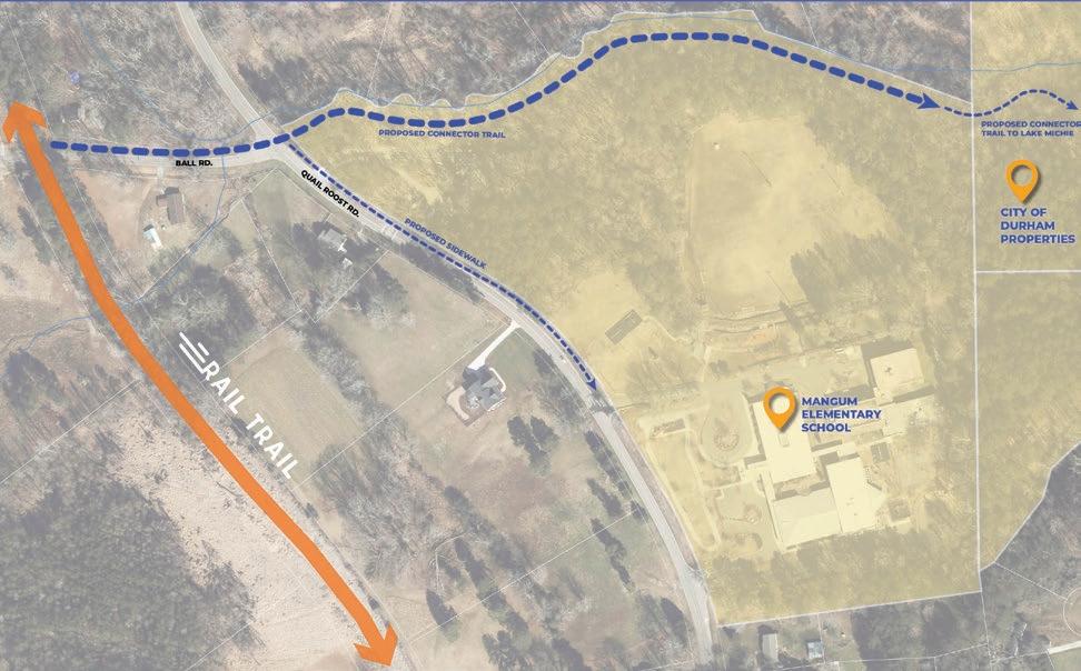
This section includes six crossings. Rhododendron Dr. and Ball Rd. are both recommended as unsignalized crossings (Type A) with pavement markings and signs including a high-visibility crosswalk and trail crossing sign, as well as an advance warning sign of trail crossing. The remaining crossings (Orange Factory Rd., Stagville Rd. north and south, Joe Ellis Rd., and Bahama Rd.) are all recommended as unsignalized (Type A) or signalized (Type B) treatments.
As such, they should receive further investigation at a future phase of design. As this is a rural context, the appropriate signalized treatment would be a user-activated flashing sign (Rectangular Rapid Flashing Beacon) with a high-visibility crosswalk and trail crossing sign, as well as advance warning sign of trail crossing.
Specific considerations for each crossing are listed below.
• Rhododendron Dr.: Will require curb ramps for crossing.
• Orange Factory Rd.: Moderate slope at crossing, with good visibility.
• Stagville Rd. (south): Skewed crossing will require realignment. Realignment will require grading work to resolve conflict with ditch.
• Joe Ellis Rd.: Minor grading required to cross ditch.
• Stagville Rd. (north): Skewed crossing will require realignment and may involve aligning the trail along Stagville Rd. to bring the crossing further south near the John Jones Rd. intersection.
• Bahama Rd.:
• Will require careful grading on the north side to remain accessible.
• A wider range of traffic calming treatments from the Add-On Treatments can be considered on Bahama Rd. due to its relatively low speed limit.
• Ball Rd.: None
See Section 2.3 Trail Crossings, page 84 for the crossings analysis that, along with community input, helped guide these recommendations, and Map 25: Trail Crossings and Renderings, page 173 to see all of the crossings and more information on types of recommended treatments.


Preliminary conceptual design. Final design subject to change based on engineering, survey data, and regulatory review.
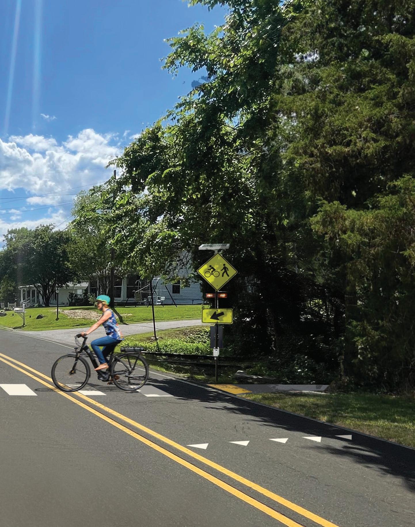
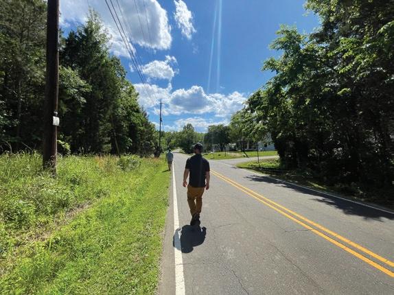
This portion of the rail corridor includes three stream crossings: Buffalo Creek just north of Orange Factory Rd., the Flat River just south of Bahama Rd., and a tributary of Lake Michie just south of Ball Rd. The conditions at these crossings are not currently accessible for observation, but additional infrastructure such as culverts, new bridges, or boardwalks may be required. Final trail design and construction will depend on regulatory review, permitting, engineering, and coordination with environmental resource agencies. (See Map 29: Bahama Focus Area Map, page 217.)
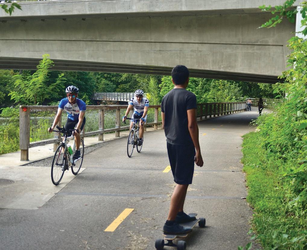
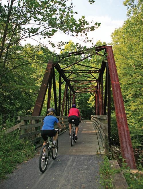
4.6
FOCUS AREA: ROUGEMONT
The Rougemont Focus Area travels 5.5 miles from Ball Rd. to the Durham/Person County line, traveling through the Rougemont community and adjacent to NC State Hill Forest. This segment includes the historic Rougemont Depot and will eventually connect to the Person County portion of the Durham-to-Roxboro Rail Trail that begins at the Person County line and travels to the City of Roxboro. (See Map 30: Rougemont Focus Area Map, page 229.)
Community feedback in the Rougemont Focus Area was mixed: many welcomed a trail in northern Durham County, while others raised concerns about loss of privacy, crime and safety, and impacts on private property. These concerns were most pronounced among owners whose properties abut the corridor. Community groups, including the Rougemont Ruritan Club, participated throughout the planning process to provide input.
Rougemont Focus Area Key Facts
Section Extent: Ball Rd. to Durham/Person County Line
Segment Length: 5.5 Miles
Key Features: Rougemont, Historic Rougemont Depot, NCSU Hill Forest
Proposed Trailheads
• Rougemont Trailhead
Proposed Trail Connectors
• None
Trail Crossings
• Quail Roost Rd.
• Moores Mill Rd.
• Red Mountain Rd.
• Harris Mill Rd.
Stream Crossings
• None

At the intersection of Red Mountain Rd. and the rail corridor, the wider rail right-of-way provides an ideal location for a Rougemont Trailhead to serve the northern section of the Durham-to-Roxboro Rail Trail and the Rougemont community. The conceptual design includes parking for 40–50 vehicles, an informational kiosk and plaza, and a restroom building. A security gate would limit parking use to daylight hours.
South of the Red Mountain Rd. crossing, a bike and pedestrian traffic-calming circle featuring public art and interpretive signage celebrating local history is proposed to enhance safety and the overall user experience. (See Exhibit 43: Rougemont Trailhead Conceptual Design, page 231.)
Meetings were held with a private property owner in Rougemont to explore how their commercially zoned parcel could interface with the trail, including a concept for a Rougemont Market adjacent to the corridor. Preliminary conceptual designs were developed and are under consideration by the property owner. As the development of the rail trail progresses, this and other opportunities for trailoriented development in the Rougemont area should continue to be explored to support community-focused amenities.
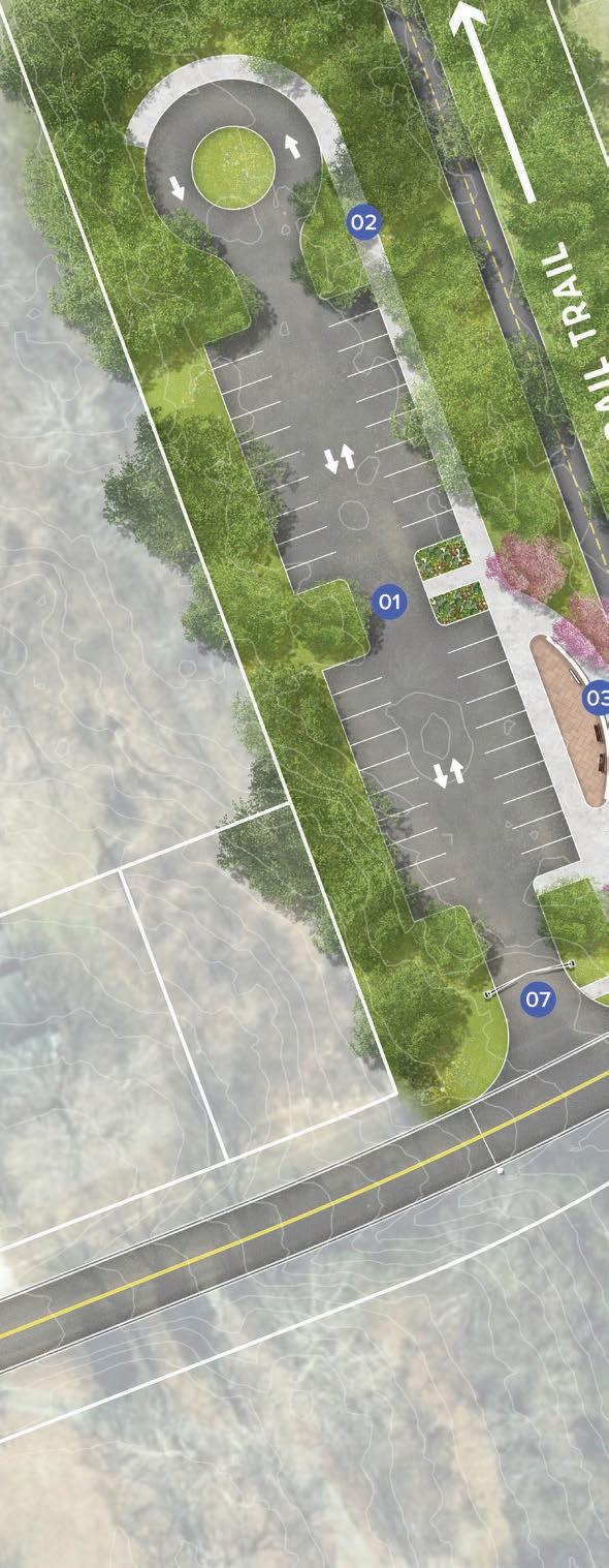


There are no proposed trail connectors within the Rougemont Focus Area. Although North Carolina State’s Hill Forest is adjacent to the rail corridor, the forest management team did not support a connection to the rail trail at the time of the planning study due to concerns about forest management and visitor experience. However, opportunities for informational and safety signage, as well as interpretive elements, should be explored in partnership with NC State if the trail is constructed.
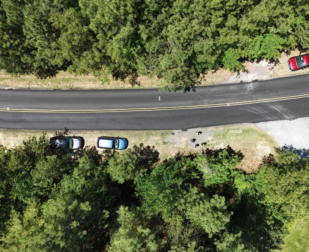
This section includes four crossings. Harris Mill Rd. is recommended as unsignalized crossings (Type A) with pavement markings and signs including a high-visibility crosswalk and trail crossing sign, as well as an advance warning sign of trail crossing.
The remaining crossings (Quail Roost Rd., Moores Mill Rd., and Red Mountain Rd.) are all recommended as unsignalized (Type A) or signalized (Type B) treatments. As such, they should receive further investigation at a future phase of design.
As this is a rural context, the appropriate signalized treatment would be a user-activated flashing sign (Rectangular Rapid Flashing Beacon) with a highvisibility crosswalk and trail crossing sign, as well as advance warning sign of trail crossing.
Specific considerations for each crossing are listed below.
• Quail Roost Rd.: Crossing is located on a curve. Visibility will need to be considered in the design and additional treatments may be needed.
• Moores Mill Rd.: Even though this is a high speed road, the crossing is located near the intersection with NC 501, which provides traffic calming as vehicles need to stop at the intersection.
• Red Mountain Rd.: This crossing is located in a commercial hub, and there could be more development in the future.
• Harris Mill Rd.:
• Harris Mill Rd. is a no outlet road, with very low traffic volumes.
• Shifting the crossing southwest will require less grading.
See Section 2.3 Trail Crossings, page 84 for the crossings analysis that, along with community input, helped guide these recommendations, and Map 25: Trail Crossings and Renderings, page 173 to see all of the crossings and more information on types of recommended treatments.
There are no stream crossings in the Rougemont Focus Area.

This section describes the steps for advancing the Durham-to-Roxboro Rail Trail from planning through design, construction, and long-term operation. It covers trail phasing and segment recommendations, potential funding sources, strategies for implementation, operations and maintenance, and safety considerations.
Successful implementation depends on acquiring the rail corridor from Norfolk Southern through The Conservation Fund and on formal adoption of the plan by the Durham County Board of Commissioners and Durham City Council. Following adoption, the project will move into design and engineering, which may refine or adjust the plan’s recommendations.
IN THIS CHAPTER:
5.1 Trail Implementation and Project Cutsheets
5.2 Trail Implementation Considerations
5.3 Implementation Strategy and Process
5.4 Role of Durham County and City of Durham
5.5 Trail Identity
5.6 Operations & Maintenance
5.7 Safety Considerations and Recommendations
5.8 Potential Funding Sources
5.9 Conclusion & Next Steps
The trail Implementation plan provides a roadmap for how the Durham-to-Roxboro Rail Trail Plan can move from vision to reality. Because the full 18.2-mile corridor represents a major investment, implementation will occur in stages based on factors such as community priorities, ease of construction, funding availability, and opportunities to leverage partnerships. A flexible and opportunistic approach that capitalizes on available funding and partnerships will be essential to deliver a project of this scale.
Based on the plan findings, the Project Management Team identified six distinct segments for trail development. These segments differ from the five planning sections previously outlined in the study, reflecting a shift from conceptual planning to implementation-focused sequencing for eventual full trail development. (See Map 31: Trail Implementation Overview Map, page 237.)
The following cutsheets detail the six recommended trail segments. Each cutsheet includes maps, planninglevel cost estimates, anticipated permitting needs, potential funding sources, and conceptual graphics that illustrate design intent and opportunities. With phased implementation in mind, the cutsheets are designed as stand-alone summaries for each trail segment and some information is intentionally repeated across all cutsheets.
Estimated costs for trail construction, including bridge repair or replacement if needed and trail crossings, are provided. The low and high estimate columns reflect variability in crossing treatments (see Exhibit 25: Recommended Crossing Treatments, page 171). Soft costs and inflation adjustments are listed separately.
Estimated costs are provided for trail enhancements, including ancillary improvements (underpasses), proposed trailheads, and trail connections. Soft costs and inflation adjustments are listed separately.
Total estimated costs for the trail, trail crossings, and enhancements, including inflation adjustments.
Note: The cutsheets include a summary of planning-level cost estimates. These estimates are for planning purposes only and are not based on engineering design. They include erosion and sediment control. They exclude costs for temporary construction easements, permanent easements, right-of-way acquisition, and utility coordination and relocation. Soft costs including contingency, design and permitting and construction, engineering and inspection (CEI) are listed separately.
The estimates assume no LAP funding. If pursuing LAP funding with federal grants, add a 10% NCDOT administration fee to the project cost. Because trail construction will likely span multiple years, inflation adjustments are provided for 5-, 10-, and 15-year scenarios. For the more detailed planning-level cost estimates, see Appendix A5: Planning-level cost estimates for trail segments, page 320.

Map 31: Trail Implementation Overview Map
Location and Trail Length
Avondale Rd. underpass to Hamlin Rd. (3.47miles)
• 100% in Urban Growth Boundary (as of Sept. 2025)
• 86% percent in City of Durham (as of Sept. 2025)
Trail Type
12-14 foot wide asphalt shared-use path
Structure Required
Partial or full rebuild of bridge at Ellerbe Creek
• E. Club Blvd. – Signalized (either RRFB or PHB)
• Roanoke St. – Unsignalized (Yield sign)
• Dearborn Dr. – Signalized (either RRFB or PHB)
• Thompson Rd. – Unsignalized or Signalized (either Yield sign, RRFB, or PHB)
Underpass Improvements
• 1-85 underpass
• Camden Ave. underpass Trailheads
• Camden Ave.
• E. Club Blvd.
Trail Connections
• N. Ellerbe Creek Trail (greenway, 1.4mi.)
• Red Maple Trail (sidewalk, 0.2mi.)
• Bragtown Trail (sidewalk, 0.3mi.)
Downtown Durham, American Tobacco Trail, Durham Rail Trail, proposed R. Kelly Bryant Trail, Northgate Park, proposed Goose Creek Trail, proposed North Ellerbe Creek Trail, Red Maple Park, Bragtown, Lakeview Park, Lakeview Secondary School, Bragtown Branch Library, Go Durham bus stops, East Coast Greenway (shared route)
• Rail corridor ROW (currently being acquired)
• Temporary Construction Easement, Permanent Easement, and Supplemental ROW (Necessity/extents determined during Design and Construction phase)
Permitting Requirements
• Floodplain Development Permit
• NCDOT Encroachment Agreement
• Duke Transmission Encroachment Agreement
• Erosion and Sediment Control Permit
• USACE 404 Permit
• NCDEQ 401 Water Quality Permit
• Durham Stormwater Development Review
• Durham Site Plan Review
• Durham Construction Drawing Review
The segment is primarily within the current City of Durham municipal boundaries and fully within the Urban Growth Boundary where future annexation is likely to occur. Partners include City of Durham, Durham County, NCDOT, The Conservation Fund, East Coast Greenway Alliance, Bragtown Community Association, and Ellerbe Creek Watershed Association (if active).
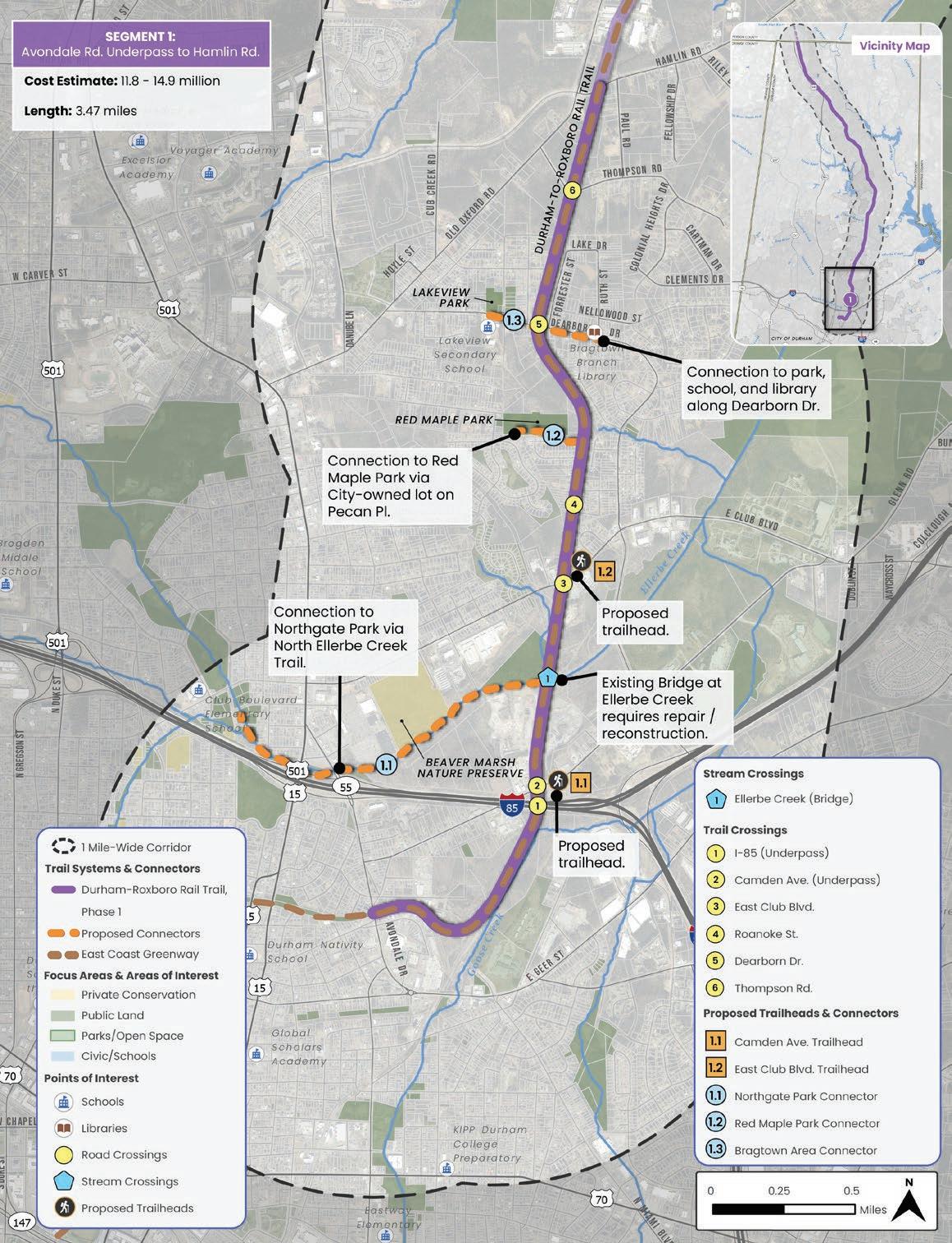
1: Avondale Rd. underpass to Hamlin Rd.
• Federal grants, such as BUILD, ATIIP, RCP, CMAQ, CRP
• Recreational Trails Program (RTP)
• Transportation Alternatives Set-Aside Program (TA)
• NC Parks and Recreation Trust Fund (PARTF)
• NC Great Trails State Program (GTSP)
• Private grants, such as Golden Leaf
• The Conservation Fund will acquire the rail line and convey it to NCDOT.
• NCDOT will develop an MOU with Durham County and/or the City of Durham to manage the corridor and future trail.
• Apply for funding for design and/ or construction which may include consideration through TIP/STIP process.
• Advance into next phases of design to provide a more accurate cost estimate and better position the project for grant opportunities.
• Estimated cost for design and permitting for this segment is $550,684 to $1,151,477. See Appendix A5 for details.
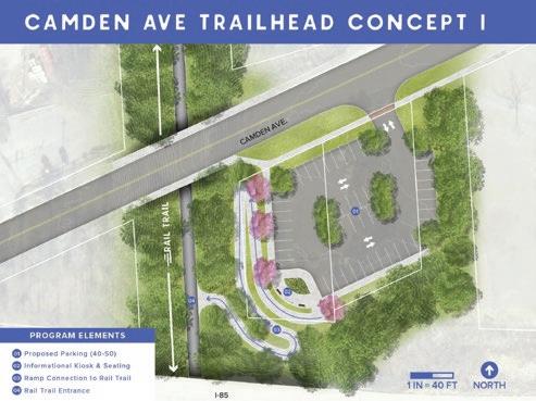
Preliminary conceptual design. Final design subject to change based on engineering, survey data, and regulatory review.

Preliminary conceptual design. Final design subject to change based on engineering, survey data, and regulatory review.
Hamlin Rd. to Penny’s Bend (1.75 miles)
• 91% in Urban Growth Boundary (as of Sept. 2025)
• 0% percent in City of Durham (as of Sept. 2025)
• Trail corridor abuts land within the City boundary.
Trail Type
12-14 foot wide asphalt shared-use path
Structure Required
One existing railroad bridge at Eno River
At-Grade Crossings
• Hamlin Rd. – Unsignalized or Signalized (either Yield sign, RRFB, or PHB)
• Commercial Driveway – Unsignalized (Yield sign)
Trailheads
• Penny’s Bend
Trail Connections
• Sandy Ridge School (sidewalk, 0.7 mi.)
• MST connector (greenway, 0.2 mi.)
Key Connections and Destinations
Penny’s Bend, Mountain-to-Sea Trail, proposed Cub Creek Trail, Sandy Ridge Elementary, East Coast Greenway (shared route)
• Rail corridor ROW (currently being acquired)
• Temporary Construction Easement, Permanent Easement, and Supplemental ROW (Necessity/extents determined during Design and Construction phase)
Permitting Requirements
• Floodplain Development Permit
• NCDOT Encroachment Agreement
• Duke Transmission Encroachment Agreement
• Erosion and Sediment Control Permit
• USACE 404 Permit
• NCDEQ 401 Water Quality Permit
• Durham Stormwater Development Review
• Durham Site Plan Review
• Durham Construction Drawing Review
While the trail corridor is currently outside of the municipal boundary, a significant portion of this trail segment (91%) is within the Urban Growth Boundary where future annexation is likely to occur. Key implementation partners include City of Durham, Durham County, NCDOT, The Conservation Fund, East Coast Greenway Alliance, Friends of the Mountain-to-Sea Trail, US Army Corp of Engineers (USACE), and NC Wildlife Resources Commission.
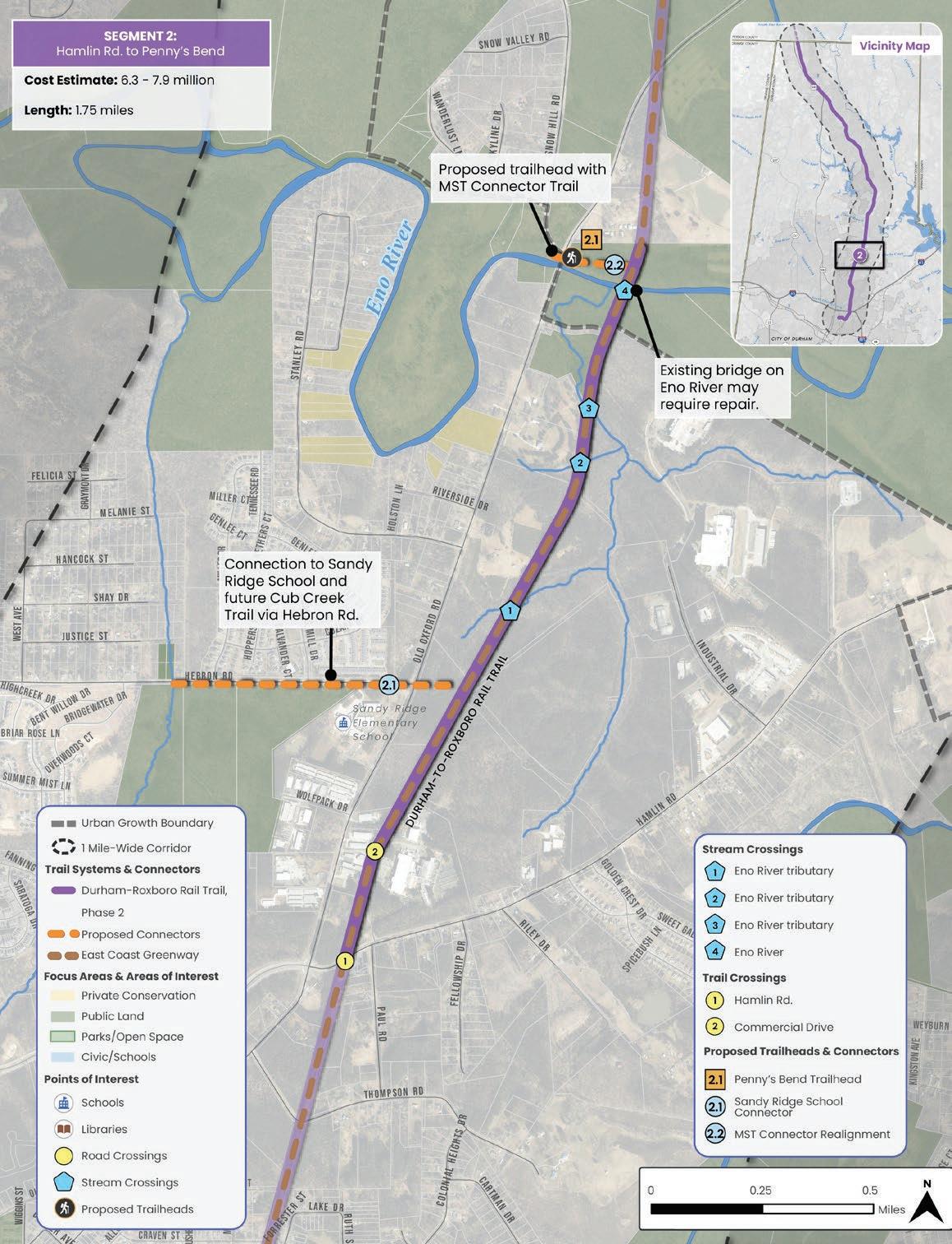
Map 33: Segment 2: Hamlin Rd. to Penny’s Bend
• Federal grants, such as BUILD, ATIIP, RCP, CMAQ, CRP
• Recreational Trails Program (RTP)
• Transportation Alternatives Set-Aside Program (TA)
• NC Parks and Recreation Trust Fund (PARTF)
• NC Great Trails State Program (GTSP)
• Private grants, such as Golden Leaf
• The Conservation Fund will acquire the rail line and convey it to NCDOT.
• NCDOT will develop an MOU with Durham County and/or the City of Durham to manage the corridor and future trail.
• Apply for funding for design and/ or construction which may include consideration through TIP/STIP process.
• Advance into next phases of design to provide a more accurate cost estimate and better position the project for grant opportunities.
• Continue coordination with the US Army Corps of Engineers and NC Wildlife Resources
• Estimated cost for design and permitting for this segment is $345,685 to $607,262. See Appendix A5 for details.
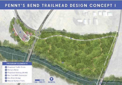

Penny’s Bend to Rhododendron Dr. (3.66 miles)
• 60% in Urban Growth Boundary (as of Sept. 2025)
• 0% percent in City of Durham (as of Sept. 2025)
• Trail corridor abuts land within the City boundary
Trail Type
12-14 foot wide asphalt shared-use path
Structure Required
One existing railroad bridge at Little River
• Residential Driveway – Unsignalized (Yield sign; livestock may warrant future consideration)
• Old Oxford Rd. – Unsignalized or Signalized (either Yield sign or RRFB)
• Rhododendron Dr. – Unsignalized (Yield sign)
Trail Connections
• Schools and Catawba Trail Farm (sidewalk & greenway, 1.9 mi.)
Key
Little River Elementary, Lucas Middle School, Durham Technical College, Catawba Trail Farm, the historic location of the Great Trading Path, East Coast Greenway (shared route)
• Rail corridor ROW (currently being acquired)
• Temporary Construction Easement, Permanent Easement, and Supplemental ROW (Necessity/extents determined during Design and Construction phase)
• Floodplain Development Permit
• NCDOT Encroachment Agreement
• Duke Transmission Encroachment Agreement
• Erosion and Sediment Control Permit
• USACE 404 Permit
• NCDEQ 401 Water Quality Permit
• Durham Stormwater Development Review
• Durham Site Plan Review
• Durham Construction Drawing Review
While the trail corridor is currently outside of the municipal boundary, a significant portion of this trail segment (60%) is within the Urban Growth Boundary where future annexation is likely to occur. Key implementation partners include City of Durham, Durham County, NCDOT, The Conservation Fund, East Coast Greenway Alliance, US Army Corp of Engineers (USACE), NC Wildlife Resources Commission, and Urban Community AgriNomics (UCAN).

• Federal grants, such as BUILD, ATIIP, RCP, CMAQ, CRP
• Recreational Trails Program (RTP)
• Transportation Alternatives Set-Aside Program (TA)
• NC Parks and Recreation Trust Fund (PARTF)
• NC Great Trails State Program (GTSP)
• Private grants, such as Golden Leaf
• The Conservation Fund will acquire the rail line and convey it to NCDOT.
• NCDOT will develop an MOU with Durham County and/or the City of Durham to manage the corridor and future trail.
• Apply for funding for design and/ or construction which may include consideration through TIP/STIP process.
• Advance into next phases of design to provide a more accurate cost estimate and better position the project for grant opportunities.
• Continue coordination with the US Army Corps of Engineers and NC Wildlife Resources
• Estimated cost for design and permitting for this segment is $657,048 to $709,128. See Appendix A5 for details.
Rhododendron Dr. to Ball Rd. (3.82 miles)
• 29% in Urban Growth Boundary (as of Sept. 2025)
• 0% percent in City of Durham (as of Sept. 2025)
• Trail corridor abuts land within the City boundary
Trail Type
12-14 foot wide asphalt shared-use path
• Orange Factory Rd. – Unsignalized or Signalized (either Yield sign or RRFB)
• Stagville Rd. (south) – Unsignalized or Signalized (either Yield sign or RRFB)
• Joe Ellis Rd. – Unsignalized or Signalized (either Yield sign or RRFB)
• Stagville Rd. (north) – Unsignalized or Signalized (either Yield sign or RRFB)
• Bahama Rd. – Unsignalized or Signalized (either Yield sign or RRFB)
• Ball Rd. – Unsignalized (Yield sign)
Trail Connections
• Horton Grove (sidewalk, 0.2 mi.)
• Lake Michie (sidewalk & trail, 0.9 mi.)
Key Connections and Destinations
Stagville Historic Site, Horton Grove Nature Preserve, Lake Michie, Mangum Elementary, East Coast Greenway (trail divergence)
• Rail corridor ROW (currently being acquired)
• Temporary Construction Easement, Permanent Easement, and Supplemental ROW (Necessity/extents determined during Design and Construction phase)
• Floodplain Development Permit
• NCDOT Encroachment Agreement
• Duke Transmission Encroachment Agreement
• Erosion and Sediment Control Permit
• USACE 404 Permit
• NCDEQ 401 Water Quality Permit
• Durham Stormwater Development Review
• Durham Site Plan Review
• Durham Construction Drawing Review
Jurisdiction and Key Partners
The segment is primarily within unincorporated Durham County and outside of the Urban Growth Boundary. Partners include Durham County, City of Durham, NCDOT, The Conservation Fund, East Coast Greenway Alliance, Triangle Land Conservancy, and Stagville Descendants Council.

• Federal grants, such as BUILD, ATIIP, RCP, CMAQ, CRP
• Recreational Trails Program (RTP)
• Transportation Alternatives Set-Aside Program (TA)
• NC Parks and Recreation Trust Fund (PARTF)
• NC Great Trails State Program (GTSP)
• Private grants, such as Golden Leaf
• The Conservation Fund will acquire the rail line and convey it to NCDOT.
• NCDOT will develop an MOU with Durham County and/or the City of Durham to manage the corridor and future trail.
• Apply for funding for design and/ or construction which may include consideration through TIP/STIP process.
• Advance into next phases of design to provide a more accurate cost estimate and better position the project for grant opportunities.
• Estimated cost for design and permitting for this segment is $632,607 to $675,008. See Appendix A5 for details.
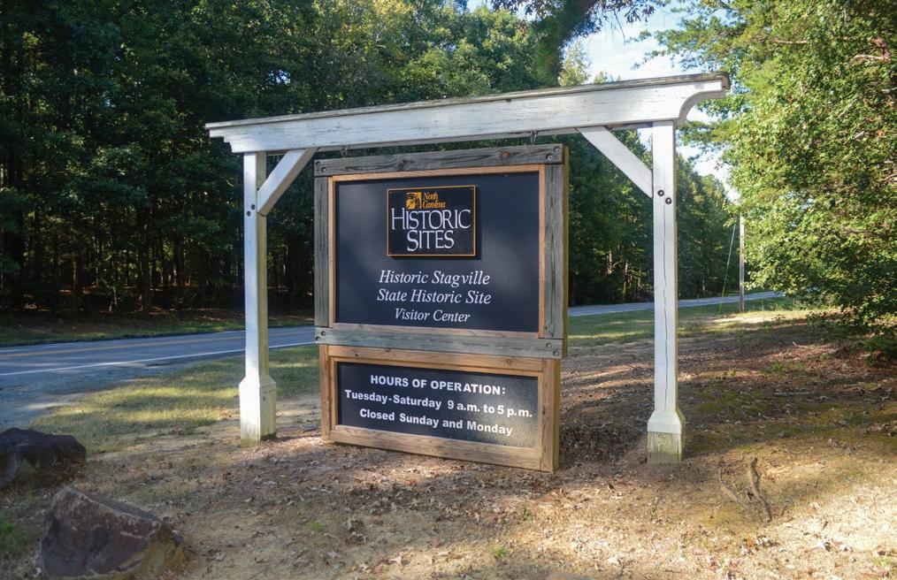
Location and Trail Length
Ball Rd. to Red Mountain Rd. (4.23 miles)
• 0% in Urban Growth Boundary (as of Sept. 2025)
• 0% percent in City of Durham (as of Sept. 2025)
Trail Type
12-14 foot wide asphalt shared-use path
At-Grade Crossings
• Quail Roost Rd. – Unsignalized or Signalized (either Yield sign or RRFB)
• Moores Mill Rd. – Unsignalized or Signalized (either Yield sign or RRFB)
• Red Mountain Rd. – Unsignalized or Signalized (either Yield sign or RRFB)
Trailheads
• Rougemont
Key Connections and Destinations
Rougemont, Rougemont Train Depot
• Rail corridor ROW (currently being acquired)
• Temporary Construction Easement, Permanent Easement, and Supplemental ROW (Necessity/extents determined during Design and Construction phase)
Permitting Requirements
• Floodplain Development Permit
• NCDOT Encroachment Agreement
• Duke Transmission Encroachment Agreement
• Erosion and Sediment Control Permit
• USACE 404 Permit
• NCDEQ 401 Water Quality Permit
• Durham Stormwater Development Review
• Durham Site Plan Review
• Durham Construction Drawing Review
Jurisdiction and Key Partners
The segment is within unincorporated Durham County. Partners include Durham County, NCDOT, and The Conservation Fund.

Map 36: Segment 5: Ball Rd. to Red Mountain Rd.
• Federal grants, such as BUILD, ATIIP, RCP, CMAQ, CRP
• Recreational Trails Program (RTP)
• Transportation Alternatives Set-Aside Program (TA)
• NC Parks and Recreation Trust Fund (PARTF)
• NC Great Trails State Program (GTSP)
• Private grants, such as Golden Leaf
• The Conservation Fund will acquire the rail line and convey it to NCDOT.
• NCDOT will develop an MOU with Durham County to manage the corridor and future trail.
• Apply for funding for design and/ or construction which may include consideration through TIP/STIP process.
• Advance into next phases of design to provide a more accurate cost estimate and better position the project for grant opportunities.
• Estimated cost for design and permitting for this segment is $734,080 to $972,355. See Appendix A5 for details.
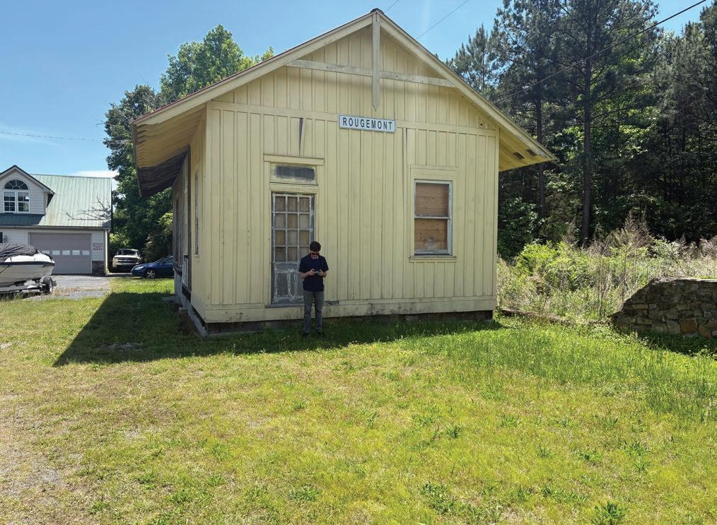
Red Mountain Rd. to Person County Line (1.28 miles)
• 0% in Urban Growth Boundary (as of Sept. 2025)
• 0% percent in City of Durham (as of Sept. 2025)
Trail Type
12-14 foot wide asphalt shared-use path
At-Grade Crossings
• Harris Mill Rd. – Unsignalized (Yield sign)
Key Connections and Destinations
Person County portion of the Durham-toRoxboro Rail Trail, Roxboro Rotary Centennial Park (in Person County).
• Rail corridor ROW (currently being acquired)
• Temporary Construction Easement, Permanent Easement, and Supplemental ROW (Necessity/extents determined during Design and Construction phase)
• Floodplain Development Permit
• NCDOT Encroachment Agreement
• Duke Transmission Encroachment Agreement
• Erosion and Sediment Control Permit
• USACE 404 Permit
• NCDEQ 401 Water Quality Permit
• Durham Stormwater Development Review
• Durham Site Plan Review
• Durham Construction Drawing Review
The segment is within unincorporated Durham County. Partners include Durham County, NCDOT, The Conservation Fund, and Person County.

Map 37: Segment 6: Red Mountain Rd. to Person County
• Federal grants, such as BUILD, ATIIP, RCP, CMAQ, CRP
• Recreational Trails Program (RTP)
• Transportation Alternatives Set-Aside Program (TA)
• NC Parks and Recreation Trust Fund (PARTF)
• NC Great Trails State Program (GTSP)
• Private grants, such as Golden Leaf
• The Conservation Fund will acquire the rail line and convey it to NCDOT.
• NCDOT will develop an MOU with Durham County to manage the corridor and future trail.
• Apply for funding for design and/ or construction which may include consideration through TIP/STIP process.
• Advance into next phases of design to provide a more accurate cost estimate and better position the project for grant opportunities.
• Continue coordination with Person County.
• Estimated cost for design and permitting for this segment is $256,789 to $257,891. See Appendix A5 for details.
5.2
At the direction of the Project Management Team, a high-level trail segment evaluation matrix was developed based on broad categories influencing implementation-transportation funding competitiveness, recreation funding competitiveness, environmental impact, and community support. Each implementation segment was qualitatively evaluated based on the entirety of work completed for this Plan. A maximum of four points were awarded for each category and the total score reflects the segment’s relative ripeness for implementation. Segments were scored relative to each other and not against other projects that may compete for similar funding sources (e.g., a trail or linear park elsewhere in Durham County).
While every segment may not have received a high score, each segment is a critical part of advancing the regional vision for the Durham-to-Roxboro Rail Trail. As noted earlier, a flexible and opportunistic approach that leverages available funding and partnerships will be essential to deliver a project of this scale.
The criteria is defined as follows:
• Criteria is based on NCDOT’s scoring of bicycle and pedestrian projects through the State Transportation Improvement Program. Scoring is based on four categories: Connectivity (potential destinations near the trail), Density (population near the trail), Safety (crashes near the trail and safety benefit of the trail), and Cost Effectiveness (combined consideration of the other three factors in relationship to overall cost incurred by NCDOT). See Chapter 2.
• Per NCDOT scoring, one check-mark indicates the likeliness of a less competitive project and four checkmarks indicate the likeliness of a more competitive project based on NCDOT’s scoring.
• Note:ThereareotheropportunitiesforfederaltransportationfundinginadditiontotheNCDOTSTIP process.TheTriangleWestTPOisalsoresponsibleforprogrammingfederalfundingthatisdirectly suballocatedtotheMPO.Inrecentyears,theUSDOThashadfederaldiscretionarygrantsfortrail development,butthismaybeaffectedbycurrentfederalgovernmentpriorities.
• Criteria is based on scoring of multiple statewide recreation-related grants including the Recreational Trails Program, Great Trails State Program, Parks and Recreation Trust Fund, and Water Resources Water Development Grant Program. Many factors assessed in these funding programs would likely be consistent across all segments (e.g., economic need determined at the County-level). Factors with variation across segments that were considered include connectivity to other trails or parks, public support, if the trail will provide a new type of recreation for the area, potential for water-based recreation, potential for contribution to water quality, and partnerships. See Chapter 2 and 3.
• One check-mark indicates the likeliness of a less competitive project based on the factors listed above and four checkmarks indicate the likeliness of a more competitive project based on the factors listed above.
• Criteria is based on the level of environmental impact as determined through GIS analysis and visual assessment. Multiple factors were considered including stream crossings, wetlands, watershed protection overlays, plant communities, and wildlife/habitat. (See Section 2.2. Natural Environment)
• One checkmark indicates a high environmental impact. Four checkmarks indicate a low environmental impact.
• As noted earlier, the Conservation Fund (on behalf of NCDOT) has conducted Phase 1 and Phase II Environmental Site Assessment (ESA) and a NEPA Assessment that was completed at the end of this study.
• Based on the feedback received during Phase 1 and Phase 2 community engagement (See Section 3.4 Phase 1- Community Engagement, page 132 and Section 3.5 Phase 2- Community Engagement, page 146.)
• While enthusiasm differed along the corridor, most respondents supported the trail. Concerns were more common in unincorporated Durham County. (See Phase 1 Community Survey Results in Chapter 3.4.)
Segment Transportation (Funding Competitiveness)
Ripeness of Implementation (Low = 4-8; Medium = 9-12; High = 13-16) Segment 1: Avodale Rd. Underpass to Hamlin Rd.
Segment 2: Hamlin Rd. to Penny’s Bend
Segment 3: Penny’s Bend to
Rd. to Ball Rd.
Segment 5: Ball Rd. to Red Mountain Rd.
Segment 6: Red Mountain Rd. to Person County line
(Funding Competitiveness)
tal (Low Impact)
This section outlines the next steps for Durham County, the City of Durham, and project partners to advance the trail’s development through a phased approach. The County and City should continue working collaboratively with partners, including NCDOT, Triangle West, East Coast Greenway Alliance, and Person County, to implement the plan. A flexible and opportunistic approach will be essential to successfully undertake a project of this scale.
Key elements of implementation encompass phased trail development, establishing a clear trail identity, ongoing operations and maintenance, and incorporating safety considerations. All aspects of implementation should be informed by the goals set forth by the of Project Management Team and Project Advisory Committee at the starting of the planning study including:
• Design a welcoming rail trail for users of all ages and abilities
• Highlight the corridor’s historical, cultural, environmental, and community assets
• Connect parks, schools, neighborhoods, and historic resources
• Spur economic growth through trail-oriented development
• Strengthen ties between communities along the corridor
• Enhance quality of life for residents and visitors
Community engagement carried out before and during the planning study should continue throughout implementation, with focused outreach to key stakeholder organizations such as the Bahama Ruritan Club, Bike Durham, Bragtown Community Association, Durham Open Space & Trails Commission, Durham Public Schools, Oxford-Hamlin Community Association, Rougemont Ruritan Club, and the Stagville Descendants Council.
At the close of this planning process, several key implementation steps have already been initiated or achieved:
• A corridor-wide partnership between Durham County, Person County, and other organizations was formed to enable resource-sharing and coordinated implementation across the 28.2-mile corridor.
• A feasibility study for the Person County segment of the rail corridor was completed in August 2024 and adopted by the Person County Board of Commissioners on March 17, 2025.
• The Conservation Fund is facilitating NCDOT’s acquisition of the rail ROW from Norfolk Southern, extending from downtown Durham to south Roxboro, with closing expected by late 2025.
• The Conservation Fund on behalf of NCDOT, completed a Phase I Environmental Site Assessment (ESA), a Phase II Environmental Site Assessment (ESA), and a National Environmental Policy Act (NEPA) assessment in October 2025.
• NCDOT is preparing to take ownership of the corridor in 2026.
• In July 2025, Durham County was awarded a $500,000 Great Trails State Program Grant for corridor acquisition.
A series of key steps has been identified to guide the phased advancement of the Durham-toRoxboro Rail Trail. Although presented in general sequence, these steps are not necessarily listed chronologically and should be approached with flexibility to accommodate funding availability, coordination among project partners, evolving conditions, and emerging opportunities that may enhance the project.
The first critical step is for Durham County and the City of Durham to formally adopt the Durham-to-Roxboro Rail Trail Plan. Adoption demonstrates local government support, which is typically required to secure grant funding. It also signals official endorsement of the project’s development, operations, and management. While adoption does not commit funding, it reflects a commitment to provide resources in the future, particularly as matching funds to leverage grants and other implementation opportunities.
The City Council and Board of County Commissioners should identify the lead agency for future action steps. Coordination efforts are most successful when staff roles are clearly identified. Maintaining collaboration, setting meeting dates and agendas, conducting community engagement, pursuing grants, and assembling funding etc., will require staff resources, and this will be more successful if clear responsibilities are identified. (See Section 5.4 Role of Durham County and City of Durham, page 270)
Staff should create a Cultural and Natural History Working Group that includes members of the Project Advisory Committee, Trail Identity Committee, local historians, and naturalists. Consider a partner such as Durham History Museum to provide leadership and expertise for this effort. This group will help continue community engagement, guide how the trail’s history and culture are interpreted, and inform the trail identity process. (See Section 5.5 Trail Identity, page 274.)
During the planning study, a Trail Identity Committee developed potential names and visual concepts for the 28.8-mile Durhamto-Roxboro Rail Trail but did not select a final name and identity. Members of the newly formed Cultural and Natural History Working Group should meet and finalize the trail’s identity to guide branding, signage, and promotional efforts. (See Section 5.5 Trail Identity, page 274.)
The City and County should continue to meet regularly to guide the trail’s design and implementation, identify and pursue funding opportunities, and plan for ongoing operations and maintenance. Quarterly collaboration meetings with key organizations such as East Coast Greenway Alliance, Triangle West, NCDOT, and Person County should also occur.
The planning process dedicated extensive time to community engagement, generating strong public interest and momentum that should be sustained as the project moves into implementation. Continued engagement with nongovernment partners such as local boards, committees, cycling clubs, land conservancies, and other community organizations will be essential to building and maintaining support. Pop-up events and tabling throughout Durham County should also continue to keep community members informed and involved in the rail trail’s progress and provide opportunities for additional comments on preliminary conceptual designs.
Work with the Conservation Fund to review the Phase I Environmental Site Assessment (ESA), a Phase II Environmental Site Assessment (ESA), and a National Environmental Policy Act (NEPA) assessment that were conducted by the Conservation Fund on behalf of NCDOT as part of the acquisition process to determine if there are
Ongoing marketing and public relations will be essential to keep the Durham-toRoxboro Rail Trail Plan visible and supported throughout implementation. Once a trail identity is established, consistent messaging, branding, and storytelling can help build excitement, attract funding, and engage new partners. Coordinated outreach through local media, social media, and community events will showcase progress, highlight benefits, and strengthen regional pride in the project.
Durham County and the City of Durham should establish a dedicated operations fund to support ongoing trail development, maintenance, and programming. Sustained funding should also include a full-time staff position to coordinate project implementation, oversee daily operations, and ensure the rail trail remains a wellmanaged community asset.
any concerns identified in the final report that need to be considered for trail phasing. These studies were not completed until the end of October 2025 and therefore were not considered as part of this planning study. Refine and complete conceptual designs based on NEPA, P1, and P2 results.
Once the Conservation Fund completes the acquisition of the rail corridor, assess which trail segments are most ready for design and construction. Segments closer to downtown Durham may be more competitive for funding and attract stronger community support, while segments in northern Durham County may better address local needs for health, wellness, and recreational opportunities. Durham County, the City of Durham, and their partners should remain responsive to emerging funding opportunities and consider advancing multiple phases concurrently when feasible. (See Section 5.1 Trail Phasing & Project Cutsheets, page 236.)
Durham County, the City of Durham, and project partners should actively pursue diverse funding sources to support trail development, design, and construction. This includes leveraging federal and state grant programs, seeking support from regional and local funding initiatives, and engaging private foundations, nonprofits, and corporate sponsors. Matching funds from local governments will be critical to strengthen applications and improve competitiveness. Establishing a coordinated funding strategy will ensure long-term financial support for both construction and ongoing operations of the rail trail. (See Section 5.8 Potential Funding Sources, page 286.)
Each phase will require survey, detailed design work, permitting processes, and the preparation of engineered construction documents. Permitting will include environmental approvals, City/County code compliance and review, NCDOT approvals, and accessibility compliance. Consultants may need to be engaged if the phase includes architectural, structural, environmental, or transportation challenges. Further acquisition needs (such as Temporary Construction Easements, Permanent Easements, or Supplemental ROW) may arise during the Design and Engineering process due to circumstances that were not identified during the planning phases. Durham County and/ or the City of Durham can contract directly with a design consultant to prepare design and construction documents that meet the requirements of the anticipated construction funding source. Each project phase should follow a defined workflow for completing construction documents and securing the necessary reviews and approvals from local, state, and federal authorities. Once design is finalized, the County or City will also be able to provide an updated, more accurate cost estimate.
Once design and permitting are complete for a project phase, bid packages should be prepared for trail construction. The contracting agency will oversee the bidding process, contract award, and compliance with applicable local, state, and federal requirements. After the construction contract is awarded, construction should begin according to the approved schedule, with coordination among agencies to ensure timely delivery, quality, and safety.
Once the trail identity is finalized, develop a cohesive wayfinding and signage system that includes trailheads, decision and confirmation signs, and regulatory and interpretive elements. Deliverables for this step will include design standards, location plans, messaging, and a phased implementation with cost estimates and maintenance guidance. (See Section 5.5 Trail Identity, page 274.)
At the start of each trail segment development phase, organize a groundbreaking ceremony to
Establish an Operations and Management Plan
Operations, maintenance, and management are essential for all trail segments, ensuring the Durham-to-Roxboro Rail Trail functions as intended and remains a valued public asset. Durham County and the City of Durham should begin planning these elements early, including securing funding for ongoing maintenance. Since NCDOT will hold title to the corridor, a maintenance memorandum of understanding (MOU) with Durham County and/or the City of Durham will be required and can be adjusted over time as needs evolve. If either the City or the County is responsible for maintenance, an interlocal agreement may be necessary to provide shared funding. (See Section 5.4 Role of Durham County and City of Durham, page 270 and Section 5.6 Operations and Maintenance Framework, page 278)
The trail offers opportunities for community events that can generate revenue to support operations and maintenance. It can also serve
recognize progress and celebrate the project. Events should highlight the contributions of partner organizations, invite local media, and include elected officials to strengthen awareness and support for future phases. Upon completion of each trail segment development phase, organize a ribbon-cutting ceremony to officially open the segment. These events provide an opportunity to showcase the trail to the public, celebrate accomplishments, and reinforce the project’s broader economic, recreational, and community benefits.
as an outdoor classroom, allowing visitors to learn about local history, ecology, and cultural landscapes. Durham County and City of Durham should partner with schools, historical societies, and environmental organizations to provide educational programming, ensuring activities are compatible with general trail use. As an example, the American Tobacco Trail is utilized annually for a popular 10-mile running race, and a half and full marathon running race.
Once a trail segment opens, project partners should assess its use and effectiveness. Evaluations can measure factors such as transportation alternatives, recreational use, and educational impact. Methods may include trail user counts, surveys, and other data collection.
Both organizations have expressed interest in assisting with future enhancements to the trail such as signage, support facilities, interpretive exhibits, and public art.
The Durham-to-Roxboro Rail Trail is the first greenway project proposed in rural Durham County, and segments from Hamlin Rd. to the north all have significant length outside of the City of Durham. The City and County have not yet determined what role each will play in the development of the trail moving forward. There are several options that should be explored and evaluated.
All existing paved greenway trails in Durham County have been developed and are maintained by the City of Durham or by the Research Triangle Foundation. As a result, all of the City’s greenways are fully within the City of Durham or within the Urban Growth Boundary, and all of the Research Triangle Foundation’s greenways are within Research Triangle Park. There are no greenways in rural Durham County as there is not a responsible agency.
• Pros: The City has an established greenway development and maintenance program. Staff have experience developing and maintaining greenway trails. It would be more resource efficient to have one entity responsible for all trails.
• Cons: The City has many other greenways that are currently planned or in design, and this project may be a lower priority than other projects. As a result, implementation may be delayed as the City is limited by its available financial and staff resources. The City would be unlikely to prioritize developing the segments north of the Urban Growth Boundary. If the rural segment were developed by the City, County residents would not have representation in the decision-making and governance of the corridor. There could be coordination challenges with impacts to County facilities and assets if the County did not have a financial stake in the project.
Unlike most counties in North Carolina, Durham County does not have a Parks and Recreation Department. This study has been led by the Transportation Department which focuses on transportation planning and policy and does not have construction project managers, operations, or maintenance staff. However, as Durham County continues to grow and develop, the County could establish a new initiative to develop and maintain regional greenways and identify the necessary department, staffing, and resource needs.
An example of this approach is the segment of the corridor in Person County. The Person County Parks and Recreation Department is the lead agency, is providing all of the local match for acquisition, and is expected to lead the trail development phases.
• Pros: All residents have representation in the decision-making and governance of the corridor. Establishing a new initiative at the County may also set a structure for how other regional greenways could be developed. This may also align with other emerging initiatives at the County to develop and maintain County parks.
• Cons: The County would need to identify the appropriate staff and resources to start this new initiative. This will take time and additional resources leading to a delay in implementation. There could be duplication of effort with the existing City greenway program. Development of a trail within the City will require a lot of coordination with City departments due to the inclusion of traffic signals and markings, stormwater controls, sidewalk connectors, connections to DPR facilities, and impacts to utilities. These coordination issues could be challenging if the City did not have a financial stake in the project.
There are several examples of how municipalities and counties have collaborated on the development and maintenance of regional greenways in order to coordinate efforts, provide more funding, and be more efficient with staffing and resources. In these partnerships, counties most often are funding partners for the design and development phases, and municipalities are most often responsible for ongoing maintenance.
For example, Wake County has a regional greenways plan that identifies projects that it will help fund and develop. The County has passed county-wide greenway bonds that have raised funding for these projects. Generally, the County provides a 50% match for the development of projects in coordination with its municipalities. The municipalities then design, construct, and maintain these regional greenways both inside and outside of their municipal boundaries. The Neuse River Greenway has been developed by the County and the City of Raleigh following this model. The County does still have a Parks, Recreation, and Open Space Department and does maintain some facilities on its own such as the trailheads on the American Tobacco Trail.
Another example is the American Tobacco Trail in Chatham County. The County and the Town of Cary funded and built the trail. Now the Town of Cary maintains it, and Chatham County contributes an annual payment to the Town for a portion of the maintenance costs.
• Pros: A partnership would allow for one entity to maintain the trail to maximize efficiency and eliminate the duplication of resources and efforts. Both City and County funding resources could be used towards the trail development. The partnership could be structured to take advantage of available staff resources to lead development or maintenance to minimize delays. Both entities having a financial stake in the project would incentivize more cooperation on impacts to City and County facilities.
• Cons: Shared decision-making and governance can be challenging with partnerships. However, this could be ameliorated if there are shared values, good communication, and clear roles and responsibilities.

During the planning study, the corridor was referred to as the Durham-toRoxboro Rail Trail, a working name that reflected its geographical span from Downtown Durham to the City of Roxboro. A key component of the planning process was to establish a distinctive identity for the full 28.8-mile corridor, including a name, visual look, and overall message. This identity development process aimed to not only ensure that the trail would resonate and be a source of pride within the community, but also meet the practical needs of marketing, funding, and future promotion. Several steps were taken to gather input, build consensus, and generate potential names and visual identities for the trail:
Community input was gathered through two questions in the Phase 1 survey requesting ideas for the trail name and visual identity.
A “Trail Identity Station” at the Phase 1 public workshops invited participants to provide input on the trail’s purpose, themes and values, and potential names.
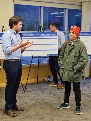


An initial Trail Identity Committee, composed of three Project Management Team members (representing Durham County Transportation, East Coast Greenway Alliance, and Triangle West) and five Project Advisory Committee members (representing Bahama Ruritan Club, Bragtown Community Association, Durham Open Space & Trails Commission, Durham Public Schools, Person County, and Stagville Descendants Council) was formed. This group reviewed the Phase 1 community input, created a rulebook for sorting through potential proposed names, and worked to generate and cull down an initial list of possible names. The committee’s goal was to ensure the selected identity reflected the desires and values of the surrounding communities. (See Appendix A7. Committee Guidelines for Trail Identity, page 371.).
The Trail Identity Committee met on:
• January 28, 2025: Kick-off Meeting to establish naming guidelines
• March 18, 2025: Reviewed naming guidelines and selected top name choices
• May 23, 2025: Trail Identity naming workshop
• June 6, 2025: Review draft brand concepts
• June 30, 2025: Trail Identity Committee update|
After the Trail Identity Committee narrowed the list to two top names, the Project Management Team explored whether more creative or culturally rooted options could be developed. To support this, the team had informal conversations with local marketing experts from Discover Durham (Jada Harkins Andrews, Sam Kraushaar, and Margaret Pentrack), Person County (Kim Strickland and Sallie Vaughn), and Person County Tourism Development Authority (Katie Ann Brann). These conversations were intended to generate fresh ideas and marketing insights to support the trail identity process.
Based on committee input and discussions with the local marketing experts, the Project Management Team compiled five potential names for further exploration:
• Waterdog Trail
• Iron Line Trail
• Red Loam Trail
• Durham-to-Roxboro Rail Trail (DRRT)
• Durham-to-Roxboro (DTR) Connector
From this list, the Project Management Team selected Waterdog Trail, Iron Line Trail, and Red Loam Trail to be developed into visual identity concepts by the consultant team. These concepts included color palettes, typography, and illustrative styles intended for use in signage and promotional materials. The goal was to provide tangible visual options to support the trail naming process and facilitate meaningful feedback from the Trail Identity Committee. (See Exhibit 45: Visual Identity – Concepts.)

When the draft trail identity visuals were shared with the Trail Identity Committee, several members shared concern about how this part of the process was managed and communicated. While the Project Management Team’s intention was to spark new, generative and creative discussions for the Trail Identity Committee to review, committee members shared that:
• They had not been adequately involved in the decision to consult with marketing experts.
• Visual concepts had been created before the full committee had agreed on name options.
• The process didn’t fully reflect the collaborative, transparent, and community-driven goals of the group.
In response, the Project Management Team paused the naming process, reflected on a new path forward, and made changes to respond to committee member concerns:
• The selectionof a final trail name was removed from the scope of the plan to ensure that future decisions about the trail’s identity will be made intentionally, with everyone in the room.
• The next steps were adjusted to allow for more time, open discussion, and community member review after the plan is adopted.
These changes reflect a commitment to collaboration, transparency, and ensuring that the trail’s identity truly reflects the people and places it will serve.
While a final name and visual identity for the trail were not selected during this planning study, the foundational work completed will support future efforts. Input from community members and the Trail Identity Committee helped shape a thoughtful and values-driven approach to naming and branding.
With adoption of this plan, the Trail Identity Committee will conclude its role. Ongoing identity work will continue through the formation of a new Cultural and Natural History Working Group and will follow the naming policies of Durham County, Person County, and the City of Durham.
To support the continued development of the trail’s identity, and to ensure that history, culture, and the environment are meaningfully integrated into future planning, a Cultural and Natural History Working Group will be established following the plan’s adoption. This group will be led by Durham County, City of Durham, and East Coast Greenway Alliance and will carry forward the spirit of collaboration established during the planning process and ensure that future decisions reflect both community input and the region’s cultural and natural history.
This group will:
• Meet on an ongoing basis to guide interpretive content, design decisions, trail naming, signage, and storytelling.
• Be open to all members of the former Trail Identity Committee, while also expanding to include:
• Local historians and cultural representatives
• Natural resource and environmental experts
• Representatives from organizations such as the Durham History Museum, tribal nations, and other cultural institutions
• Marketing and branding professionals familiar with the region
By bringing together a wide range of perspectives and expertise, this group will help ensure that the trail’s identity evolves in ways that are authentic, inclusive, and deeply rooted in place.
The trail identity process so far has demonstrated how local history, shared values, and regional pride can shape the meaning and experience of a public space. While the final trail name and brand will be determined in the next phase, the planning work completed here offers a strong and inclusive starting point. With continued collaboration and guidance from the Cultural and Natural History Working Group, the trail’s identity will grow to reflect the stories and communities that define this 28.2-mile corridor from Durham-to-Roxboro.
The Operations and Maintenance Framework outlines how the Durham-toRoxboro Rail Trail will be sustained over time, ensuring it remains safe, functional, and welcoming for all users. It will be informed by the decisions made in the future regarding the role of Durham County and the City of Durham (See Section 5.4 Role of Durham County and City of Durham, page 270.)
This section provides a high-level framework regarding formal agreements, day-to-day strategies and actions, the expected lifespan of major trail elements, and potential funding sources to support long-term operations and upkeep.
Durham County and/or the City of Durham will be responsible for maintaining the trail. This will require a maintenance MOU with NCDOT, which will retain ownership of the rail corridor; the agreement can be updated over time as needs evolve and opportunities arise. (See Section 5.4 Role of Durham County and City of Durham, page 270.)

Paved shared-use trails with trailheads, trail crossings, and signage require ongoing operations and maintenance to remain safe, accessible, and enjoyable for all users. Effective maintenance starts with sound design and durable construction.
The outline below offers a framework for routine and long-term tasks needed to operate, manage, and maintain the trail and related amenities. It is not exhaustive; requirements for the Durham-to-Roxboro Rail Trail will evolve as segments are built and the community begins using the trail.
As noted earlier, specific roles and responsibilities should be finalized once Durham County and the City of Durham define their respective roles. At that point, a detailed Operations and Maintenance Plan should be developed. Community groups, residents, businesses, and other stakeholders may also play a role in the long-term stewardship of the trail and its resources.
The following are typical routine, remedial, and seasonal maintenance tasks that should be considered when developing the detailed Operations and Maintenance Plan:
• Routine Maintenance
Covers regular activities to keep the trail safe and usable, including inspections, sweeping, trash removal, opening/closing trailhead gates, tree and shrub trimming, weed control, sign upkeep and minor repairs, such as filling cracks and potholes, and maintaining lighting.
• Remedial Maintenance
Addresses larger, less frequent repairs and improvements, such as resurfacing and striping, repairing boardwalks or bridges, removing invasive plant species, replacing major trail structures at trailheads or along the trail, repairing or replacing signage and wayfinding, and correcting drainage or erosion issues.
• Seasonal Maintenance
Focuses on tasks tied to specific times of year, including leaf removal, storm debris cleanup, seasonal planting, mowing, and inspections following heavy rain, wind, or other extreme weather events.
According to the Rails to Trails Conservancy, agencies budget between $2,000 to $7,000 per mile per year for maintenance of a paved shared-use greenway. This estimate includes routine maintenance such as sweeping, spot repairs, vegetation control, and maintaining signs/marking. Cost estimates for remedial and seasonal maintenance will vary depending on required repairs or improvements and if extreme weather events occur.
Trail infrastructure is composed of a variety of elements, each with a finite useful life that depends on material, design, usage, and maintenance. Understanding the expected lifespan of trail components helps with budgeting for operations, maintenance, and replacement, ensuring safety, accessibility, and a positive user experience over time.
Asphalt Trail Surface 15–25 years Resurfacing may be needed periodically; depends on traffic and climate
Concrete Trail Surface 25–40 years Requires crack repair and joint maintenance
Wood Boardwalk / Bridges 15-25 years Periodic sealing, inspection, and replacement of damaged planks
Steel or Concrete Bridges >75 years Routine inspection and minor repairs; structural maintenance as needed
Parking Lots / Paved Areas 20–30 years Sealcoating and crack repair recommended every 3 to 5 years
Crosswalks / Traffic Signals 15–20 years Replace worn markings and maintain signal equipment
Trailhead Kiosks / Signage 10–15 years Replace faded or damaged signage; maintain readability
Benches / Picnic Tables 10–20 years Inspect for wear; replace or repair as needed
Lighting / Electrical Systems 15–25 years Routine bulb replacement and fixture maintenance
Fencing / Railings 15–25 years Inspect for corrosion, rot, or damage; repair or replace as needed
Lifespan estimates listed below assume regular preventive maintenance and timely repairs, though environmental factors such as flooding, sun exposure, and ice can reduce the useful life of trail elements. Replacement cycles should be incorporated into longterm operations and capital planning. 1. American Association of State Highway and Transportation Officials (AASHTO). 2024. GuidefortheDevelopmentofBicycleFacilities(5thed.)
Durham County and the City of Durham should engage community members and local organizations to help support trail operations and maintenance through programs such as Adopt-a-Trail or volunteer-led work crews.
By fostering community involvement, an Adopt-a-Trail program not only helps reduce maintenance costs but also builds a sense of ownership, pride, and ongoing stewardship among local residents and user groups. Participants commit to routine care and monitoring of a designated trail segment, which may include:
• Picking up litter and debris
• Reporting hazards, damaged infrastructure, or environmental concerns
• Performing light landscaping tasks and planting flowers
• Supporting removal of invasive plant species
• Assisting with seasonal cleanup efforts
The City of Durham Parks and Recreation currently has an Adopt-A-Park/Trail/ Garden Program (AP/T/G) that could be expanded to include some or all of the Durham-to-Roxboro Rail Trail.
Volunteer organizations play a crucial role in maintaining and enhancing trails by providing hands-on support for cleanup, repairs, and habitat protection. Engage groups such as the Friends of the Mountains-to-Sea Trail and Keep Durham Beautiful to help keep trail corridors clear, safe, and free of litter, while also supporting stewardship and community engagement along the route.
Sustaining the Durham-to-Roxboro Rail Trail over the long term requires a reliable and diversified funding strategy for operations, maintenance, and management. A combination of approaches should be pursued to establish a sustainable funding framework that ensures high-quality operations and maintenance.
Local government budgets should include dedicated funding for routine maintenance, repairs, and staffing necessary to manage the trail effectively. Regular allocations help ensure consistent upkeep and responsiveness to emerging needs.
Collaborative agreements with nonprofit organizations, user groups, and community partners, such as Discover Durham, the East Coast Greenway Alliance, and local “Friends” groups within Durham County, can provide additional resources and expertise to support trail maintenance. These partnerships can help leverage volunteer programs, advocacy, and shared operational responsibilities.
Creating an endowment or reserve fund for the trail can provide long-term financial stability, supporting major repairs, replacements, or upgrades without reliance on annual budget cycles.
Federal and state grants, foundation funding, and other external sources can supplement local contributions for maintenance and operational needs, particularly for larger capital projects or specialized improvements.
Contributions of labor, materials, or professional services from community organizations, volunteers, and corporate partners can offset costs and provide critical support for ongoing trail upkeep. Programs such as Adopt-a-Trail or Trail Ambassadors can mobilize volunteers to help maintain the corridor, enhancing both stewardship and community engagement.

During community engagement through the surveys, focus groups, and public workshops, citizens expressed concerns about safety, including pedestrian and cyclist safety, crime, and property rights.
In Rails-to-Trails Conservancy’s multi-state study that included 7,000 trail miles with 45M annual users, only 3% of 372 trails reported any major crime in a given year.1
Ensuring a safe and welcoming environment along the Durham-to-Roxboro Rail Trail requires a coordinated approach that should combine local public safety and law enforcement, Crime Prevention through Environmental Design (CPTED) strategies, and the engagement of Trail Ambassadors.
The Durham County Sheriff’s Office and City of Durham Police Department will play a central role in ensuring safety along the Durham-to-Roxboro Rail Trail through regular patrols, prompt incident response, and collaboration with community partners to prevent and address crime. During the planning process, Sheriff Clarence F. Birkhead was consulted, and the Project Management Team should continue engaging Sheriff Birkhead (or the serving Sheriff) as well as the City of Durham Police Chief to develop and implement a coordinated safety plan for the trail.
A Trail Ambassador program allows government agencies to enlist community volunteers to monitor trail conditions, provide safety and etiquette guidance to users, report maintenance needs, and foster a culture of stewardship along the rail trail. Examples of successful Trail Ambassador programs include, Roanoke Valley Greenways Ambassador Program (Roanoke, Virginia) and City of Knoxville Greenways Ambassador Program (Knoxville, Tennessee).
Ensuring the safety and security of trail users is a critical component of trail planning, design, and operations. Applying the principles of Crime Prevention through Environmental Design (CPTED) can reduce opportunities for crime and enhance the sense of safety along the Durham-to-Roxboro Rail Trail. CPTED strategies emphasize the thoughtful design and management of the physical environment to promote natural surveillance, territoriality, and responsible use. Key recommendations for implementing CPTED along the trail include:
Design trail alignments, intersections, and trailheads to maximize visibility from surrounding areas. Incorporate lighting at key locations such as trailheads, bridges, and parking areas to improve safety during early morning or evening use.
Define entry and exit points, and where appropriate, use fencing or landscaping to guide users along the trail and restrict access to adjacent private or sensitive properties. Trailheads, parking areas, and other key facilities should be clearly delineated to reduce unauthorized access.
Maintain vegetation, signage, and trail infrastructure to prevent hidden areas or blind spots. Regular upkeep signals active management, which can deter vandalism and misuse.
Encourage positive, consistent use of the trail through programming, events, and recreational opportunities. Higher levels of legitimate activity increase informal surveillance and community ownership.
Clear, consistent signage supports safe navigation, informs users of rules and expectations, and reduces opportunities for conflicts or unsafe behavior.
Involve adjacent property owners, local residents, and volunteer groups in stewardship programs such as Adopt-a-Trail or Trail Ambassadors. Engaged communities increase informal monitoring and support for trail safety.
In 2011 and 2012, police recorded 13 ontrail incidents per year on the American Tobacco Trail, concentrated near access points around Fayetteville Street and reflecting neighborhood crime patterns rather than trail-induced activity.2
The Durham-to-Roxboro Rail Trail Plan recommendations advance a transformational project with significant recreation, health, and economic benefits for Durham County and the City of Durham. Given these benefits, the project is well-positioned to compete for a wide range of federal, state, and foundation grants that prioritize active transportation, public health, and outdoor recreation.
To maximize funding potential, a coordinated grant strategy that layers multiple sources, reducing reliance on local contributions should be developed. Local match requirements may be supported through Durham County and/or City of Durham budget appropriations and potential allocations from regional partners such Triangle West and East Coast Greenway Alliance. Strategic use of philanthropic and foundation resources could further supplement state and federal programs, strengthening the project’s competitiveness and ensuring phased development remains on track.
See Exhibit 47: Grant Funding Opportunities for a detailed list of funding options. The chart includes the program name, funding agency, minimum and maximum award, split, funding type, and infrastructure notes.
Note: Federal government discretionary spending is funding that Congress and the President must approve annually through the appropriations process. It is subject to the current federal administration’s priorities.
Congestion Mitigation and Air Quality Improvement Program (CMAQ)
Formula-based. Funds are managed and distributed by state DOTs and MPOs. Statewide CMAQ funds are administrated by NCDOT (35% of NC CMAQ). Regional CMAQ funds are distributed by air quality regions: Catawba, Great Smoky Mountains National Park, Metrolina, Rocky Mount, Triad and Triangle (5% of NC CMAQ). Subregional CMAQ funds are locally-administrated and awared at the MPO/RPO level (60% of NC CMAQ).
Eligible projects include those that reduce emissions, improve traffic flow, and enhance transit, bicycle, and pedestrian facilities like Geenways/ Multi-Use Paths. Climate Pollution Reduction Grants (CPRG)
A combination of formula and discretionary grants. Funded by the Inflation Reduction Act. Planning grants (Phase 1) are non-competative and formulabased. Implementation grants (Phase 2) are competative and discretionary.
Infrastructure projects to facilitate public transit, micro-mobility, car sharing, bicycle, and pedestrian modes; bikeshare and bike storage/parking facilities Projects must be ID'd in Climate Priority Action Plan. CPAP developed by the Central Pines Regional Council for the RaleighCary and Durham-Chapel Hill Metropolitan Statistical Areas.
Project must address an “eligible facility,” defined as a highway or other transportation facility that creates a barrier to community connectivity.
Trail planning - motorized and non motorized trails NEW NOTE: The main priority in allocating funding is for the construction of new trails and for major maintenance of existing trails.
Surface Transportation Block Grant Program (STBG)
FTA, Triangle West TPO $125,000 (design) $1,250,000 (construction)
No more than 50% of total allocation (~ $12M) to a single project sponsor 80 / 20
Formula-based. Flexible federal funding for a wide range of transportation projects, while TA funds projects focused on improving transportation assets.
Multimodal improvement projects incl. surface replacement, curb and gutter replacement, sidewalk and ADA improvements, bicycle facilities including bike lanes and shared bike/ pedestrian paths, traffic signal upgrades, and drainage improvements.
Transportation Alternatives SetAside Program, (TA, formally known as TAP)
No more than 50%
/
Formula-based for funding allocation to states, with a portion suballocated based on population. A set-aside from the Surface Transportation Block Grant (STBG) program. The program is run through a state-level Local Programs Management Office. The state uses a mix of competitive and non-competitive selection processes, and funds are distributed directly by the NC Board of Transportation in accordance with departmental funding allocation procedures.
On- and off-road trail and non-motorized transportation infrastructure, including Rail-to-Trail projects. Construction only.
Reduction Program (CRP)
The Carbon Reduction Program (CRP), established by the Bipartisan Infrastructure Law, provides a formula-based funding for states to reduce transportation emissions, with a discretionary component allowing for flexibility in project selection and funding.
Transportation alternatives project(s) as described in 23 U.S.C. 101(a)(29) as in effect prior to the enactment of the FAST Act, 3 including the construction, planning, and design of on-road and off road trail facilities for pedestrians, bicyclists, and other nonmotorized forms of transportation;
Planning and design that integrates arts, culture, and design activties into efforts that strengthen communities over the long term.
Construction of active transportation infrastructure for an
or spine ($15M
Better Utilizing Investments to Leverage Development (BUILD) Grant Program (formally RAISE/ TIGER)
USDOT - Office of the Secretary $5,000,000
Safe Streets and Roads for All (SS4A)
USDOT - Office of the Secretary ~ $100,000 (planning/ demo) ~ $2.5M (implement.) ~ $2.5M (planning/ demo) ~ $25M (implement.)
/ 20
Shared use trail networks, transit, and multimodal infrastructure are eligible; Projects should have a significant local or regional impact and increase mobility and community connectivity.
Implementation of safety projects that address fatal and serious injury crashes and systemic needs identified in an adopted Comprehensive Safety Action Plan
Transit Oriented Development Planning (TOD)
Multimodal connectivity and accessibility, improved transit access for pedestrian and bicycle traffic, enable mixed-use development near transit stations.
Advanced Transportation Technology and Innovation (ATTAIN)
Integrated corridor management systems; signal improvements; advanced mobility access and on-demand transportation service technologies; dynamic ridesharing; shared-use mobility applications
Rural Surface Transportation Grant RSTG (RST)
A project to develop, establish, or maintain an integrated mobility management system, a transportation demand management system, or on-demand mobility services National Infrastructure Project Assistance (MEGA) Grant
/ 50 for capital construction (80 / 20 for planning)
This $5 billion competitive grant program supports multi-modal, multijurisdictional projects of regional or national significance. Communities are eligible to apply for funding to complete critical large projects that would otherwise be unachievable without assistance.
Land Water & Conservation Fund (LWCF)
A combination of formula and discretionary grants. Formula grants are allocated to states based on a formula, while competitive grants are awarded through a separate national competition, targeting specific objectives like urban areas and underserved communities.
Created to preserve outdoor recreation and ensure future generations have the opportunity to enjoy their public lands. Construction, Maintenance, Planning/ Support. The Transportation Infrastructure Finance and Innovation Act (TIFIA-credit assistance)
Rehabilitation & Improvement Financing (RRIF)
Eligible projects for low-interest financing include: Transit Vehicles and Facilities, Pedestrian Bicycle Infrastructure Networks, Transit-Oriented Development
Can be used to finance transit-oriented development (TOD) projects Building Resilient Infrastructure and Communities (BRIC)
Supports states, local and territorial governments and Tribal Nations as they work to reduce their hazard risk.
The SMART program was established to provide grants to eligible public sector agencies to conduct demonstration projects focused on advanced smart community technologies and systems in order to improve transportation efficiency and safety.
A core Federal-aid program with the purpose to achieve a significant reduction in traffic fatalities and serious injuries on all public roads, including non-State-owned roads and roads on tribal land.
Safety and Education Grant (SEG)
Complete the Trail Program (CTP)
Connecting Communities to State Trails (CCST)
Safety and Education grants may be awarded for trail-related safety and education instructor fees, speaker fees, displays, signage and other uses
Provides funding for the planning, construction, promotion, and maintenance of state trails in North Carolina
CCST grant requests can be for the planning or development of connecting trails to the state trails system. All constructed land trails must be natural surface.
The Great Trails State Program provides funding for new trail development and extension of existing trails anywhere in the state of North Carolina. This includes paved trails or greenways, natural surface trails, biking trails, equestrian trails, and any other type of trail recognized by the Department of Natural and Cultural Resources.
Strategic Transportation Investments law equips the N.C. Department of Transportation to use funding efficiently and effectively to enhance infrastructure while supporting economic growth, job creation and a higher quality of life
The Spot Safety Program is used to develop smaller improvement projects to address safety, potential safety, and operational issues. The program is funded with state funds and currently receives approximately $9 million per state fiscal year
These sustainable, "shovelready" projects leverage local funds to meet recreational trail and trailneeds, to provide low infrastructure economic development opportunities through natural resource tourism
Local governments can apply to acquire land for parks and build recreational facilities for use by the public. A PARTF grant can also be used to protect the natural and scenic resources or renovate older park facilities
The EEG Program offers reimbursement grants for projects that improve North Carolina’s air, water, and land quality by addressing the goals of the Smithfield Agreement.
Eligible uses include bridge and low-water crossing replacement, critical infrastructure retrofits to reduce natural hazard risk, and bank
The Matching Grants Program is designed to assist non-profit organizations in Durham County, both inside and outside the city limits, in preserving open space lands and promoting new or improved recreational opportunities for citizens of Durham County.
This annual awards program honors up to 10 local nonprofit organizations in recognition of their exceptional achievements, overall excellence, and best practices in contributing to a healthier Triangle Region
Funding will support general operations of organizations that are doing work related to two key program goals: Increase culturally representative arts programming
Increase the arts in public and community space
Increase awareness of and education around conservation and/or climate issues
Increase climate resiliency, particularly of low-income communities
Survey, environmental assessment, and legal description expenses
Legal expenses
Legal defense fund
Baseline documentation report
Stewardship endowment Conservation staff expense
Support established Triangle nonprofits to maintain their capacity through a period of organizational change so they can continue providing core services and strategize how to best remain agile, innovative, and responsive to community needs moving forward.
Focuses on shifting power and providing financial resources to organizations led by and serving people of color.
Understand and promote promising practices to increase access to safe, affordable, stable housing
North Carolina Community Foundation (NCCF)
The North Carolina Community Foundation Grant amounts vary by market and organization size.
Our community grantmaking funds a broad range of purposes to meet local needs that include human services, education, youth development, health, food/nutrition, arts, and more.
Creating New Economies Fund (CNEF)
Provides direct investment in community-based efforts supporting a range of projects: ecotourism and heritage tourism, youth conservation programs, farmers markets, alternative energy production and more.
Blue Cross Blue Shield of North Carolina Foundation Blue Cross Blue Shield of North Carolina Foundation Grant amounts
BCBSNC grantmaking supports: -Access to Care -Health Through Food -Youth Mental Health, Connectedness, and Resilience:
Suuports projects focued on strengthening and uplifting communities in three focus areas: Vibrant Economies Cimate Resiliency Opportunity and Inclusion
Support the development of new crops, expand markets for agriculture products, or provide training for farmers. Construction of infrastructure for public use needed for development of workforce housing (developer must be a 501(c) (3) or local government entity)
Bank of America Charitable Foundation Bank of America Grant amounts vary by market and organization size.
Z. Smith Reynolds Community Progress Fund Z. Smith Reynolds Foundatin $ 20,000 $ 30,000
Discretionary
Must be aligned with our funding priorities: basic needs, income creation, stable housing, and empowering communities
Discretionary
Rails to Trails Conservancy (RTC) grants Rails to Trails Conservancy $ 5,000 $ 25,000 No match or cost-sharing required Discretionary
The project must serve or plan to serve multiple user types (e.g., bicycling, walking/hiking or horseback riding) and be considered a rail-trail, greenway, multi-use trail or shared-use path.
Equitable Communities Fund Trust for Public Land
American Trails grants American Trails $ 2,000 $ 10,000
No in-kind or cash match required, but some match preferred.
Pay Dirt Pay Dirt No match or cost-sharing required
Discretionary
The Trails Capacity Program supports trails that serve ALL types of trail users, motorized and nonmotorized. This includes hiking, cycling, mountain biking, trail running, access routes, horseback riding, water trails, ATVs, snowmobiling, and more.
Trail Accelerator Grant International Mountain Bicycling Association $ 10,000 $ 30,000 1 to 1 Discretionary
PayDirt funds groups, projects, programs, and events that aim to improve access to riding bicycles.
Trail Accelerator grants provide a jump-start to communities that have the interest and political support to develop trail systems, but need assistance to get projects up and running.
PeopleForBikes’ Bike Industry Community Grant Program
PeopleForBikes $ 5,000 $ 10,000
John William Pope Foundation (JWPF)
Joy William Pope Memorial Grant Funds
John William Pope Foundation
John William Pope Foundation
Funding infrastructure projects that improve a community’s City Ratings score by building connections in a lowstress bikeway network or improving access to recreational amenities.
Grants funds in four core areas: public policy, education, human services, and the arts.
The Foundation seeks to foster innovation and model solutions across North Carolina.
The development of the Durham-to-Roxboro Rail Trail will require time, persistence, and hard work, grounded in strong collaboration among project partners and community members. Sustaining the momentum established during the planning study is essential—through regular meetings of the project management team, continued pursuit of funding for design and construction, and intentional community engagement and promotion to ensure broad awareness and support.
To make this vision a reality, project partners should pursue multiple funding sources and cultivate publicprivate partnerships that can spark trail-oriented development along the corridor.
Ongoing partnership with Person County will be especially important to advance the shared vision of a 28.8-mile regional trail connecting downtown Durham-to-Roxboro.
Equally important is ensuring that the trail reflects and celebrates the communities it serves. Through efforts such as the Cultural and Natural History Working Group, or other collaborative initiatives, the integration of culture, history, and art can create a unique trail experience that honors local identity while drawing new users and visitors.
Together, these strategies will guide the transition from planning to implementation and bring the trail closer to realization.


IN THIS CHAPTER:
A.1 Durham-to-Roxboro Rail Trail Plan Public Involvement Plan
A.2 Anti-Displacement Overview and Best Practice Case Studies
A.3 Design Guidance
A.4 Invasive Plants Found in the North Carolina Piedmont
A.5 Planning-Level Cost Estimates for Trail Segments
A.6: Phase 1 Community Survey Summary
A.7. Phase 2 Community Survey – Questions, Analysis, and Quotes
A.8: Committee Guidelines for Trail Identity
This Public Involvement Plan (PIP) was designed to guide the community and stakeholder involvement processes for the Durham-to-Roxboro Rail Trail Plan. This PIP is intended to guide all project outreach and allow flexibility in its implementation as the project evolves. The PIP includes several aspects of the outreach effort, including:
• Goals for public outreach
• Public outreach phases
• Descriptions of outreach strategies that will be used for this effort
• Approach for evaluating the inclusivity and effectiveness of outreach efforts
• Roles and responsibilities for the Project Team comprised of the Consultant Team and Client Team
The fundamental purpose of this effort is to obtain input from community members and stakeholders to inform development of the Durham-to-Roxboro Rail Trail Plan and guide decision-making related to this process. Community members and stakeholders will be invited to articulate how trail development and implementation will impact their quality of life, pay homage to local history and culture, spur econotdevelopment in select areas where appropriate, address mobility barriers, and create a more equitable transportation network.
In line with the goals of the City of Durham Equitable Community Engagement Blueprint, the intention is to engage the public transparently and equitably, with a focus on reaching historically underrepresented communities.
The principal goals of public outreach are to:
1. Implement a process that is equitable and accessible, with emphasis on uplifting the voices of priority audiences in the City and County of Durham. Priority Audiences are described on page 2 of this memo.
2. Create awareness of the Durham-to-Roxboro Rail Trail Plan, the public input needed, and the overall process.
3. Provide a variety of methods for public participation that are accessible in terms of language, technology, literacy, location, and time so that priority groups may easily participate in the process.
4. Gain substantive insights from the public to inform the goals, branding, planning, design, and implementation of the Durham-to-Roxboro Rail Trail.
5. Present information in a manner that respects native languages and is culturally appropriate.
6. Communicate how the Durham-to-Roxboro Rail Trail is an equity-centered effort to reconnect communities harmed by previous transportation decisions and is in line with the larger transportation, public health, and sustainability goals of the City and County of Durham.
To ensure the efforts and outcomes are aligned with the outreach goals above, the Consultant Team will continually measure outreach and provide periodic updates on public participation throughout the planning study process.
There are two priority audiences for the Durham-to-Roxboro Rail Trail Plan community and stakeholder outreach efforts:
• Residents of the Regional Focus Areas identified in the Triangle West regional Vision Zero Safety Action Plan where there are high concentrations of populations vulnerable to transportation disadvantage, and
• Residents within 1-mile of the Durham-to-Roxboro Rail Trail corridor.
The first priority audience is residents within the Regional Focus Areas identified in the Triangle West regional Vision Zero Safety Action Plan, shown in Figure 1. Based on the Indicators of Potential Disadvantage Methodology, the areas with a high score, shown in orange and red, have been identified as areas with high concentrations of key populations that are vulnerable to transportation disadvantage based on socioeconomic factors and historically underrepresented in transportation decision-making. This includes:
• Black, Indigenous, and other People of Color, specifically the ACS race and ethnicity categories:
• Black or African American
• American Indian and Alaska Native
• Asian
• Two or More Races
• Hispanic or Latinx/Latine
• Households in poverty
• Carless households
• Youth under 18 years old
• Older adults over 64 years old
• People with disabilities
• People with limited English proficiency
• People with limited educational attainment
Additionally, community and stakeholder outreach efforts should prioritize outreach to community residents within 1-mile of the proposed Durham-to-Roxboro Rail Trail corridor, also shown in Figure 1. This will ensure that the input of those who will be most impacted by the facility guides the project planning process.

Figure Triangle West Vision Zero Action Plan Equity Analysis: Indicators of Potential Disadvantage
The Project Team will establish clear expectations with the public about how feedback given will be integrated into the planning process. Figure 2 below depicts the Spectrum of Public Participation developed by the International Association for Public Participation (IAP2). The IAP2 Spectrum helps clarify expectations, tailor engagement activities, ensure transparency, and foster trust by defining the level of public influence and outlining meaningful ways for stakeholders to participate in the decision-making process. Full disclosure of the level of engagement is especially important when engaging with historically marginalized communities. This Plan primarily pursued engagement with activities ranging from Inform to Collaborate..
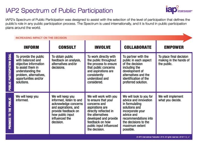
Figure 2. Spectrum of Public Participation. Source: International Association for Public Participation
Public outreach will take place in two major phases, described below. Each phase will include a similar combination of engagement strategies centered around a series of public workshops.
2.1 Phase 1: Existing Conditions & Discovery (anticipated December 2024March 2025)
In Phase 1, community engagement will focus on collecting information that is relevant to identifying and prioritizing trail planning and development recommendations through:
• Collecting existing conditions information relevant to trail design and trail access including but not limited to environmentally-sensitive areas, multimodal transportation barriers, intersecting trails and open spaces, and anticipated future development;
• Gathering qualitative input about local, cultural, and historical aspects of the study area to inform a trail name and character development; and
• Building awareness about the Durham-to-Roxboro Rail Trail Plan and future trail implementation.
Phase 2 will provide the public and stakeholders with opportunities to review and provide feedback on the draft recommendations developed by the Project Team (informed by engagement conducted in Phase 1). Community members will be invited to discuss:
• The primary findings of Phase 1;
• Draft recommendations and priorities for major elements of trail development such as crossing treatments, major and minor trailhead locations, and types of trail amenities;
• Draft recommendations for connections from the trail to nearby community destinations;
• Additional details of design that will contribute to the character of the trail; and
• How well the Project Team listened and responded to their input and how satisfied they are with the recommendations.
The Project Management Team will create a PAC that the Consultant Team will engage four times over the course of the project. The general timeline and focus of each meeting is provided below:
• End of Task 2. Content: Overview of the project, role of the PAC, summary of the corridor analysis, and overview of preliminary strategies for implementation.
• End of Task 3. Content: Summary of feedback from Phase 1 of public engagement, discussion of how public involvement has/will influence design.
• Midpoint of Task 4. Content: Discussion of framework plan and preliminary recommendations.
• Near end of Task 5. Content: Present the final plan recommendations.
A project website will serve as the primary source of information for the planning process. The website (www.durham2roxborotrailplan.com) will host a variety of information and engagement activities including project background information, blog posts with project updates and public event announcements, the online survey, and the draft and final plan. The Consultant Team will manage the website during the contract period, after which it will be handed over to the Client Team.
Content from newsletters, press releases, and social media postings will be created by the Client Team based on blog posts from the project website.The Consultant Team will not create new newsletters or social media accounts, but will rather rely on the Client Team to use their existing accounts. Anticipated social media posting will correspond to the following project milestones
• Project kickoff announcement (once plan brand is finalized)
• Prior to online surveys, public workshops, and pop-up events
• Full trail brand identity is finalized
• Draft Durham-to-Roxboro Rail Trail Plan is complete
• Final Durham-to-Roxboro Rail Trail Plan is complete
Final social media presence will be created upon completion of the final trail brand.
The Project Team will host a total of six, 2-hour workshops with three occurring during each engagement phase. These meetings will be highly interactive and provide members of the public with opportunities to give insight and/or provide feedback on multiple aspects of the planning study process as outlined in Section 2. Each workshop will use a format that minimizes slideshow presentations and emphasizes interactive stations and dialogue. A variety of mediums (e.g., illustrative graphics, interactive mapping, question-based poster boards, etc.) will be used to educate the public, convey information, and solicit input.
All workshops will be in-person. General areas for the workshops include:
• Northern Durham/Bragtown (potential locations: Bragtown Branch of Durham Public Library, Lakeview Secondary School, Braggtown Baptist Church)
• Northern Durham County (potential locations: Bahama Ruritan Club, Rougemont Ruritan Club)
• Downtown Durham (potential locations: GoDurham bus station, Durham County Main Library)
Each phase of engagement will include a public survey that is concise and easy-to-understand with a target completion time of 5-8 minutes. The content of each survey will reflect the focus of each engagement phase and will include multiple choice questions, free response questions, and an interactive map to display location-specific information and collect location-specific comments.
The surveys will be translated into Spanish and will ask respondents to provide demographic data to ensure we are reaching people from a variety of backgrounds. Participants will have the option to provide their name and email to receive project newsletters and communications. Survey promotions will include the project website, newsletters, press releases, and social media. The survey will also be administered in-person at pop-ups and public workshops.
Recommended: Depending on availability of project and/or additional funds, a survey incentive giveaway will be provided (e.g., bicycle helmet giveaway via NCDOT donation).
The Client Team will attend various community meetings to relay information about the project. The Consultant Team will provide a kit of materials in English and Spanish for the Client Team to use including:
• Slide deck
• Project one-pager
• FAQ & instructional guide
• Comment cards
• Banner and tablecloth
• Large-scale map of the trail corridor
• Engagement and feedback materials in-line with materials used for the public workshops
The Client Team will facilitate community pop-ups to meet people where they naturally are and provide opportunities to quickly engage with and shape the planning study process. The Client Team will utilize materials from the public engagement kits to communicate project updates and gather feedback related to each phase of engagement.
The Client Team will use two types of pop-up events to engage community members at a wide array of locations:
1. Intercepts: The Client Team will attend and disseminate information at previously scheduled events such as local neighborhood events/festivals (e.g., Bragtown Juneteenth Celebration) or existing community rides (e.g., Ride Around Durham). The events selected will be heavily informed by and likely reach priority audiences.
2. Community Conversations: Local staff will host longer form pop-ups sessions where refreshments are provided (e.g., Cookies & Conversation) and participants can have an in-depth discussion about the topic which will be determined based on the engagement phase. These longer form sessions are an opportunity to engage the general public in discussions about important topics such as concerns about gentrification, equitable access to recreation for Black and Brown communities, or how government agencies can utilize funding streams to rebuild trust with marginalized communities. These types of pop-ups will be coordinated, facilitated, and evaluated by local staff. To appropriately reach priority audiences through these efforts, locations such as public parks, civic plazas, open amphitheaters, playgrounds, or community centers are recommended. These types of pop-ups may also be promoted through print media near the pop-up locations.
The Client Team will recruit community leaders and agency representatives to participate in Focus Groups that will help influence the design of the trail and inform the content of the plan. It is anticipated the Client Team will engage some Focus Groups twice over the course of the project and others only once during the project, as shown below:
• Groups to meet with twice:
• Stagville Descendants Council
• Bragtown Community Association
• Northern Durham County Residents
• Groups to meet with once during the second round of engagement:
• Environmental Groups (Eno River Association, NCSU Hill Forest, Triangle Land Conservancy, Ellerbe Creek Watershed Association)
• Durham Youth Ambassador Program
Format
The Project Team will listen and connect with these stakeholders as they provide critical insights into concerns, perceptions, and opportunities related to trail development and implementation. This includes in-depth discussions about how to best reach their community/constituents, what issues or challenges their communities face regarding trail access and transportation options generally, and how the Durham-to-Roxboro Rail Trail Plan can best serve their communities’ needs.
The first round of Focus Groups will be held in Winter 2024 and focus on building an understanding of the planning process, learning more about the local history of the trail corridor, listening to the needs and concerns of historically underrepresented communities that are most impacted by transportation decision-making, identifying opportunities for trail character to truly reflect the community and their priorities, and collecting information about potential design or implementation challenges that this planning study will need to address.
The second round of Focus Groups will occur in Summer 2025, after planning study recommendations have been drafted. In these discussions, the Project Team will ask participants to react to draft recommendations and identify potential concerns with their respective communities or agencies. This information will be used to either validate or refine the plan’s recommendations and priorities to ensure an equitable and inclusive final product.
Focus Groups will not be publicly advertised, rather the Client Team will invite participants personally or through their organization. Where appropriate, community leaders and agency representatives may be asked to invite an additional participant (e.g., constituent served by local affordable housing organization) to ensure we are hearing the perspectives of not only grass top leaders, but grassroots citizens.
The Consultant Team will identify appropriate dates and locations for Focus Groups, and will assist with follow up communication after initial invitations are made by the Client Team. Locations may include libraries, community centers, or local businesses.
Recommended: Depending on availability of project and/or additional funds, all Focus Groups will include a meal and refreshments for participants.
This meeting type was developed in early summer 2025, prior to Round 2 of Engagement, in response to the need for strategic coordination with groups that are not representative of the general public.
These meetings may be held with one individual stakeholder or a small group of stakeholders. Project Coordination Meetings will focus on making the stakeholder(s) aware of the Durham-to-Roxboro Rail Trail, identifying opportunities for synergy and/or potential conflicts with current or future projects by the stakeholder(s), and specific topics related to the stakeholder’s area of expertise (e.g., roadway crossing discussion with Department of Transportation staff). The client team is instrumental in scheduling these meetings and will generally be the lead facilitator unless specifically noted. The consultant team will attend to provide specific information on draft recommendations.
Project coordination meetings have been identified for Durham City and County staff within Community Development Department and Development Review for Transportation Department, for Transportation (City of Durham Transportation, DCHC MPO, NCDOT Division 5, and NCDOT IMD), and the Treyburn Corporate Park.
This meeting type was developed in early summer 2025, prior to Round 2 of Engagement, in response to community demand and prevalence of misinformation.
These are larger events with the general public or a subset of the public (e.g., Northern Durham County) used to provide general information about the project and answer FAQs. These events are especially important opportunities for providing accurate information and addressing misinformation. The client team will schedule and facilitate these meetings with preparation assistance from the consultant team. Generally, the consultant team will not attend these sessions.
General information sessions have been identified for Northern Durham County residents and the Stagville Descendants Council.
The Project Team will document who participates in the process. In line with the City of Durham Equitable Engagement Blueprint, the intent is to center race in our equitable engagement efforts, specifically by prioritizing participation of Black, Hispanic/Latino, Indigenous, Asian, and other People of Color. Additionally, we will prioritize participation of people in low-income households and people with disabilities. During each engagement activity, the Project Team will ask for personal data from participants to ensure the process is engaging with a diverse set of residents. The data will help the Project Team identify any gaps or potential areas for improvement and serve as general metrics to measure the plan’s effectiveness and overall performance. The key data considerations include:
• Race
• Ethnicity
• Age
• Gender
• Disability status
• Residential ZIP code
• Contact information
• Income
For some engagement activities (e.g., pop-ups) it may not be feasible to collect all of these data points. At a minimum, the Project Team will seek to document the participant’s residential ZIP code, race, and age.
The Project Team will also track the number and impact of engagement activities throughout the project using the following metrics:
• Survey participation
• Event attendees
• Demographics of people engaged
• Number of individuals submitting feedback
• Participation in neighborhood events
Following the engagement phases and strategy implementation for this planning study, the project team will conduct a review of engagement activities and metrics. This includes assessment of both quantity and quality of input received from priority populations. This will include a comparison of demographics of those engaged to the project area, discussion about what worked well and did not work well, and reflections about lessons learned.
Gentrification and displacement, while often seen in conjunction with each other, are distinct phenomena. Gentrification refers to an influx of higher income residents, who are often of a different demographic, into a lower income neighborhood. Displacement describes the process in which long-term residents of a neighborhood are pressured or forced to relocate. Displacement is often seen as a byproduct of gentrification.
Gentrification and displacement resulting from infrastructure improvements is a common and justified concern on public infrastructure projects, including trails and greenways. The gentrification of communities surrounding high-profile trail projects, such as the Atlanta Beltline and the 606 in Chicago, is well-studied, showing increases in home values and changes in the housing market close to the trail (Immergluck and Balan 2018; Smith et al. 2016).
More recently, the Rails to Trails Conservancy conducted a case study investigation of three smaller-scale trails projects in Washington D.C., Memphis, and New Orleans. Using home value and median household income as metrics, they found evidence of gentrification along each of the trails. However, their results also suggest that the effects are highly context-dependent, responding both to characteristics of the improvement and those of the community itself (Lindsey et al 2021). While these processes are context-dependent and difficult to measure, there are several indicators of gentrification and displacement that are commonly referenced across academic research and project-specific case studies. Viewing these indicators at a specific point in time, along with historical context, can provide a general picture of the risk of gentrification and displacement for a certain area. When measured over time, these indicators can provide an idea of whether these processes are taking place.
As the development of the Durham-to-Roxboro Rail Trail progresses, it will be essential to evaluate the risk of gentrification and displacement at all points along the trail. Measuring and mitigating these effects will ensure that the rail trail provides a unique trail experience while protecting the heritage and character of all communities surrounding the corridor.
Gentrification Indicators:
Economic
• Home Value (Lindsey et al 2021; Pudlin 2016)
• Associated: property values, gross rent, home sales
• Household Income (Lindsey et al 2021; Seattle Office of Planning and Development 2016)
Demographic Changes
• Percentage Black Population (Pudlin 2016)
• College Education Attainment (Preis et al. 2021)
• Changes to the Built Environment
• Redevelopment and Zoning Changes (Pudlin 2016)
Displacement Indicators:
• Percentage of Renters (Seattle Office of Planning and Development 2016)
• Percentage Spending > 50% Income on Housing (Pudlin 2016)
Historical
It is essential to integrate the historical context of communities when evaluating the gentrification and displacement impacts of current or planned trails projects. Transportation and housing policies and practices across the United States have long failed to serve BIPOC communities. Durham County is no different, as policies with racist origins enabled the perpetration of disinvestment in certain communities. These communities often have little trust for current public projects. To rebuild this trust, any efforts to mitigate displacement associated with trail development projects must first acknowledge the history that led to these current conditions.
In Durham County, racial segregation and discrimination were historically woven into the government policies surrounding housing and transportation. In the 1920s through the 1960s, restrictive covenants – clauses included in property transactions to shape uses of the land after the sale – were a common practice to keep Black and other People of Color confined to certain neighborhoods, which invariably received lower investments and had more limited infrastructure. Starting in the 1930s, redlining codified racial segregation by favoring whiteonly neighborhoods for bank loans and made it extraordinarily difficult for residents of majority Black or mixed-race neighborhoods to secure loans for homes or businesses. In 1958, during the height of urban renewal and the highway construction boom, the Durham Redevelopment Commission oversaw seven projects with the goal of combating what they saw as urban decay. These seven projects disproportionately affected Black communities – including the Hayti and Northeast Central Durham neighborhoods – and disrupted those neighborhoods and the lives of those residents.
Immediately adjacent to the proposed trail, the Bragtown community has close historical ties to the families enslaved at the nearby Stagville plantation. After emancipation, many of the freed people settled in Bragtown and its proximity to Stagville reinforced the connection in the years following (Stagville Memorial Project, n.d.). It operated as an independent community until was annexed by the City of Durham in 1957. Its residents were predominantly Black and lower income, and the community received relatively low levels of investment in public amenities from the city. That history is an important part of the community’s identity for many of its current residents, especially those who are direct descendants of those enslaved. (Bragtown Community Association, n.d.).
As Durham continues to develop and grow outside the core of its urban area, the communities in those areas are going to continue to experience increased interest and development pressure. Broadly speaking, the communities around the Durham-to-Roxboro Rail trail – especially those that are closer to downtown, that are lower income, and whose residents are predominantly BIPOC – are at risk of gentrification and displacement.
A 2020 article in the IndyWeek describes the frustration community members feel dealing with the ongoing pressures of development and gentrification. The article describes residents who are facing rising property taxes and a lack of affordable housing, issues exacerbated by outside developers with proposals to construct subdivisions with an insignificant number of affordable units (McDonald, 2023). Many of these same sentiments were echoed in the Bragtown Focus Group conversations, with participants commenting that gentrification is already occurring in the community while many of the long-standing issues facing residents – sidewalk connectivity and roadway safety – have gone unaddressed. Bragtown residents say that gentrification is a major concern and that anything that accelerates the process, dramatically changes the demographic makeup of the community, or displaces long-time residents would be a failure.
As this project progresses, those involved should employ best practices to prevent and mitigate these processes.
While the number of public trail projects that incorporate strategies to mitigate gentrification and displacement is limited, there are examples that showcase the kinds of practices that communities are incorporating into their projects. The projects below are still in development or have been recently completed, and so their overall impact on displacement remains to be seen, but they provide a solid foundation of the measures available.
Joe Louis Greenway, Detroit MI: 27.5-mile bike and pedestrian trail that creates a loop from the Detroit Riverfront to 23 neighborhoods across the city. Displacement mitigation and protecting housing and small businesses is a core part of the plan. Some of their key strategies were around public involvement, preventing high property taxes, and encouraging affordable housing.
• Leveraging the City of Detroit’s Homeowner Property Tax Relief Fund. To prevent displacement as taxes increase, this fund provides for a full or half exemption of property taxes for income qualified homeowners.
• Connecting existing residents to Detroit’s Side Lot Sales program. This program makes vacant lots exclusively available for adjacent homeowners to purchase for low prices. It prioritizes ownership of existing residents as land in the area develops.
• Aligning existing homeownership assistance programs with resident income and needs. Multiple programs in the area that provide subsidies, loans, and education can be adjusted to prioritize existing residents.
• Encourage broad public participation of existing residents.
The 11th St. Bridge Park, Washington DC: proposed park along the old 11th St. Bridge connecting Washington D.C.’s Navy Yard and Anacostia neighborhoods across the Anacostia River. While not a greenway, this project is often referenced as the gold standard of equitable open space development for their commitment to anti-displacement strategies. Early on, the project developed an Equitable Development Plan to address concerns around potential gentrification and displacement. The main pursued strategies for each of their focus areas are shown below. A key finding from this project was the importance of partnerships with other organizations for the implementation of these strategies.
• Educate and inform current residents about existing programs and opportunities for support with maintaining their housing, such as tenants’ rights, the Tenant Opportunity for Purchase Act, and community development financial institutions.
• Preserve and expand affordable housing through the creation and growth of the Douglass Community Land Trust, which has been securing housing units in the area.
• Ensure that current residents are prioritized in the hiring process for construction and post-construction jobs of the park. The project partnered with an organization to provide construction training for existing residents with some of them receiving full-time construction jobs.
• The project team formed partnerships with businesses and organizations to provide lending and technical assistance to existing and emerging small businesses.
• Many of the project’s efforts revolve around performing arts, culturally relevant food, and entrepreneurs who are artists. The project sponsored large recurring events that promote the goals of the plan. The Anacostia River Festival and Taste of the Harvest Festival are both opportunities for the identity of the existing communities to be displayed and celebrated. Local artists also benefited from the financial and networking opportunities provided by the festivals.
This section contains additional, detailed guidance regarding trail design.
Railings can be used for wetlands, steep drop-offs, and other areas where needed to prevent falls. Considerations for railings include:
• Including wide “rub rails” in some settings to reduce the likelihood that a bicyclist’s handlebar might be caught by the railing
• Avoid designing a wide top rail that would obstruct views for people in wheelchairs or seated on benches.
• In sensitive habitat areas railing tops need to be designed to prevent predators from perching, resting, or standing there, which could increase predation of critical species.
Trail lighting can increase the safety and comfort of the trail at night by increasing the visibility of obstructions (fallen trees, debris, etc.) and illuminating trail users at roadway crossings to enhance their visibility to motor vehicles. Lighting is also an important consideration to support commuting trips when it is dark. Trail lighting can either be connected to an existing electrical grid or each fixture can be powered by on-fixture solar panels. Solar powered lighting can also include a charging station, which can do double duty as a backup power source for small devices in an emergency.
Trail lighting best practices include:
• Use only dark-sky compliant lighting.
• Avoid any lighting near sensitive habitat or areas where migrating birds are expected.
• Use pedestrian scale fixtures (typically lower and closer together than roadway lighting).
• Focus on critical points, such as trail access points, roadway crossings, tunnels, and bridges, if lighting larger sections of the trail is not feasible.
• Avoid creating very bright and very dark areas which make it more difficult for trail users’ eyes to adjust quickly enough to see.
The design guidance in this section is based on the AASHTO Guide for the Development of Bicycle Facilities, 5th Edition (2024) which includes guidance on shared use path and trail design. All crossings should be designed in accordance with the following:
• Sight triangles: should be calculated according to the AASHTO Policy on Geometric Design of Highways and Streets (“Green Book”), depending on the design speeds of the trail and the roadway. If sufficient stopping sight distance cannot be achieved, additional traffic control such as stop signs or signals should be provided.
• Crossing angles: The trail should cross roadways as close to 90 degrees as possible, to minimize crossing distance and potential conflicts and maximize sight distances.
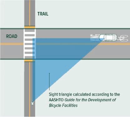

According to the American Association of State Highway and Transportation Officials (AASHTO), gates and bollards are not recommended to restrict access by motor vehicles at trail entrances unless there is a documented history of issues as gates and bollards create permanent obstacles for trail users.
The following graphics show options for design with and without bollards at crossings.
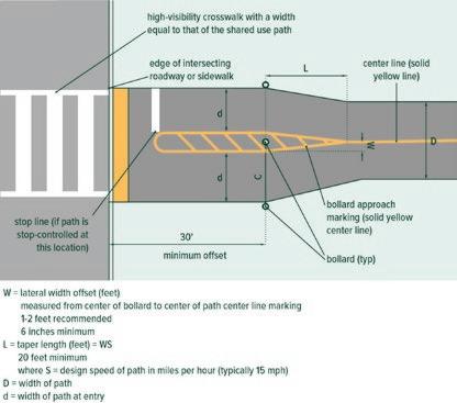

Where bollards or other barriers are determined to be necessary, consider the following to make the bollards as compatible as possible for all trail users:
• Spacing bollards 5- to 6-feet apart for clearance.
• Flexible or spring-mounted delineators should be used before rigid bollards to see whether they effectively dissuade unauthorized vehicle access.
• If rigid bollards are determined to be necessary, fold-down bollards should never be used on the trail, as they create an obstruction hazard for users. Instead, fully removable bollards should be used. Any hardware that is used to install the bollard shall be flush to the surface, so there is no obstruction when removed. A permanently affixed cover with non-slip surfacing that sits flush to the pavement should be used to close the opening when the bollard is removed.
• All effort should be made to increase the visibility of bollards, including but not limited to using alternating reflective banding of contrasting colors on the bollard (typically white or yellow), using internally lit bollards, and installing pedestrian-scale lighting.
• Rigid bollards should be a minimum of 40 inches high with a minimum diameter of 4 inches and a shy distance of 12 to-24 inches for user safety and comfort.
On creek crossings, wetlands, and under or underpass locations, bridges, viaducts, and boardwalks may be needed and require specific considerations:
• The clear, unobstructed width of the trail between railings should be a preferred minimum of 12 feet.
• Structures may be designed to carry service and emergency vehicles based on the needs of the local agency.
• The clearing height from overhead obstructions, including fencing, should be 10 feet.
• The design style of these trail features should be compatible with surrounding land uses, habitats, and adjacent developments.

• Bicycle railings shall be set no lower than 42 inches, or 48 inches from in-plane railings from the top of the riding surface.
Below is an overview list from the North Carolina Native Plant Society. A more detailed list can be found at their website.
Ailanthus altissima (Tree-of-Heaven)
Albizia julibrissin (Mimosa)
Melia azedarach (Chinaberry)
Berberis (Mahonia) bealei (Leatherleaf Mahonia)
Berberis thunbergii (Japanese Barberry)
Buddleja davidii (Butterfly bush)
Elaeagnus angustifolia (Russian Olive)
Elaeagnus pungens (Thorny Olive)
Elaeagnus umbellata (Autumn Olive)
Euonymus alata (Burning Bush)
Ligustrum japonicum (Japanese Privet)
Paulownia tomentosa (Princess Tree)
Pyrus calleryana (Bradford Pear)
Triadica sebifera (Chinese Tallow Tree)
Ligustrum sinense (Chinese Privet)
Lonicera fragrantissima (Fragrant Honeysuckle)
Lonicera maackii (Bush Honeysuckle)
Nandina domestica (Heavenly Bamboo)
Poncirus trifoliata (Trifoliate Orange)
Rosa multiflora (Multiflora Rose)
Tamarix ramosissima (Salt Cedar)
Alliaria petiolata (Garlic Mustard)
Arthraxon hispidus (Small Carpetgrass)
Arundo donax (Giant Reed)
Cyperus entrerianus (Deep-rooted Sedge)
Ficaria verna (Fig Buttercup)
Glechoma hederacea (Ground Ivy)
Heracleum mantegazzianum (Giant Hogweed)
Imperata cylindrica (Cogongrass)
Iris pseudacorus (Yellowflag Iris)
Lespedeza bicolor (Bicolor/Shrub Lespedeza)
Lespedeza cuneata (Chinese Lespedeza)
Lygodium microphyllum (Old World Climbing Fern)
Lythrum salicaria (Purple Loosestrife)
Akebia quinata (Chocolate Vine)
Ampelopsis brevipedunculata (Porcelain Berry)
Cayratia japonica (Bushkiller)
Celastrus orbiculatus (Oriental Bittersweet)
Clematis terniflora (Sweet Autumn Virgin's Bower)
Euonymus fortunei var. radicans (Winter Creeper)
Alternanthera philoxeroides (Alligatorweed)
Egeria densa (Brazilian Waterweed)
Hydrilla verticillata (Hydrilla)
Ludwigia hexapetala (Creeping Water Primrose)
Microstegium vimineum (Japanese Stilt Grass)
Miscanthus sinensis (Chinese Silvergrass)
Oplismenus hirtellus ssp. undulatifolius (Wavyleaf Basketgrass)
Perilla frutescens (Beefsteak Plant)
Phalaris arundinacea (Reed Canarygrass)
Phragmites australis (Common Reed)
Phyllostachys aurea (Golden Bamboo)
Reynoutria japonica (Japanese Knotweed)
Solanum viarum (Tropical Soda Apple)
Sorghum halepense (Johnson Grass)
Stellaria media (Common Chickweed)
Youngia japonica (Asiatic Hawsbeard)
Hedera helix (English Ivy)
Lonicera japonica (Japanese Honeysuckle)
Persicaria perfoliata (Mile-A-Minute Vine)
Pueraria montana (Kudzu)
Tribulus terrestris (Puncturevine)
Wisteria floribunda (Japanese Wisteria)
Wisteria sinensis (Chinese Wisteria)
Myriophyllum aquaticum (Parrot feather)
Nymphoides cristata (Crested Floating Heart)
Salvinia molesta (Giant Salvinia)

LOCATION: Planning Sections 1&2 - Avondale Rd. underpass to Hamlin Rd.
DESCRIPTION: Implementation Segment 1 - 12'-14' asphalt
Segment Length: 3.47 miles
Town/City: Durham County: Durham
NOTE:
ESTIMATE IS NOT BASED ON AN ENGINEERING DESIGN, AND IS FOR PLANNING PURPOSES ONLY.
EXCLUDES COSTS ASSOCIATED WITH TEMPORARY CONSTRUCTION EASEMENTS, PERMANENT EASEMENTS, AND RIGHT-OF-WAY ACQUISITION
INFLATION ASSUMES CONSTRUCTION BID YEAR (2029).
UTILITY COORDINATION/RELOCATION COSTS UNKNOWN AND NOT INCLUDED.
ASSUMES NO LAP FUNDING. IF PURSUING LAP FUNDING WITH FEDERAL GRANTS, ADD NCDOT ADMINISTRATIVE FEE (10%) TO PROJECT COST.


NOTE: ESTIMATE IS NOT BASED ON AN ENGINEERING DESIGN, AND IS FOR PLANNING PURPOSES ONLY. EXCLUDES COSTS ASSOCIATED WITH TEMPORARY CONSTRUCTION EASEMENTS, PERMANENT EASEMENTS, AND RIGHT-OF-WAY ACQUISITION INFLATION ASSUMES CONSTRUCTION BID YEAR (2029). UTILITY COORDINATION/RELOCATION COSTS UNKNOWN AND NOT INCLUDED. ASSUMES NO LAP FUNDING. IF PURSUING LAP FUNDING WITH FEDERAL GRANTS, ADD NCDOT ADMINISTRATIVE

NOTE: ESTIMATE IS NOT BASED ON AN ENGINEERING DESIGN, AND IS FOR PLANNING PURPOSES ONLY. EXCLUDES COSTS ASSOCIATED WITH TEMPORARY CONSTRUCTION EASEMENTS, PERMANENT EASEMENTS, AND RIGHT-OF-WAY ACQUISITION INFLATION ASSUMES CONSTRUCTION BID YEAR (2029). UTILITY COORDINATION/RELOCATION COSTS UNKNOWN AND NOT INCLUDED. ASSUMES NO LAP FUNDING. IF PURSUING LAP FUNDING WITH FEDERAL GRANTS, ADD NCDOT ADMINISTRATIVE FEE (10%) TO PROJECT COST.
During the first phase of engagement, the online community survey asked respondents to share their overall level of support for the proposed rail trail. A total of 2,713 people answered this question. For the full survey results, see Phase 1 – Community Survey Results, page 134.
To better understand the perspectives of the residents most directly impacted by the proposed rail trail, responses were analyzed for the five zip codes the corridor passes through which include 27701, 27704, 27712, 27503, and 27572.
The chart below shows the breakdown of support by zip code.
The Phase 2 community survey ran from August 18 to September 24 and received 453 responses. It included eight open-ended questions seeking feedback on plan recommendations and conceptual designs, along with demographic questions. Each question is listed below with a summary of responses and selected quotes. Summaries were generated using AI to synthesize all responses and identify common themes and overall sentiment.


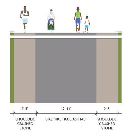
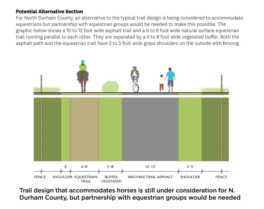
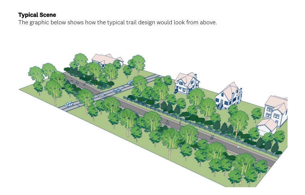
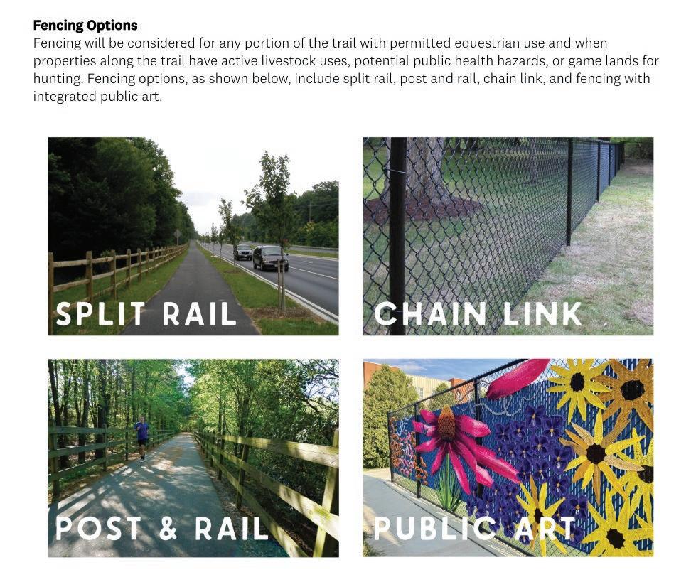
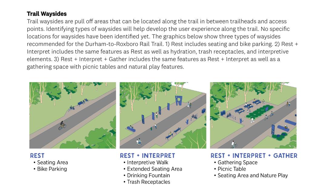
Overall Sentiment
• Strong excitement and support for getting the trail built; many cite ATT/Swamp Rabbit as positive models.
• Significant pushback from some residents who oppose the project, citing cost, privacy, safety, and location.
• Preference to start simple and phase amenities over time so the trail opens sooner.
• Cross-Section & Users
• Broad support for a paved main path with adjacent soft surface (gravel/dirt) for runners and walkers.
• Requests for clear separation/markings for faster bikes vs. pedestrians in urban/busier segments
• Trail width opinions split: some say 12–14’ (plus shoulders) is needed for heavy bike traffic; others argue 8–10’ would reduce cost and impacts.
Equestrian and Accessibility
• Equestrian accommodation is debated: some support in the northern/rural sections; many question cost, conflicts, and low demand—if included, provide strong separation and manure management.
• Accessibility matters: support for strollers, wheelchairs, and allowing e-bikes; keep surfaces smooth and well-maintained.
Fencing Preferences
• Clear preference: avoid chain link where possible (aesthetics, wildlife movement, maintenance).
• Post & rail / split rail preferred in rural areas; public-art treatments acceptable in urban areas.
• Use fencing only where safety or adjacent land uses require it; minimize the ‘caged-in’ feel.
Waysides & Amenities
• Mix of wayside types favored; prioritize ‘Rest + Interpret’ most often, with limited ‘Gather’ (focus at trailheads/centers).
• High-priority amenities: water fountains/refill (and dog access), restrooms at intervals, trash/ recycling, shade trees.
• Other desired features: wayfinding maps, bike repair stations/pumps, lighting, emergency call buttons; occasional small-scale commercials (food truck/coffee kiosk) near crossings or parks.
Maintenance & Operations
• Recurring concerns: who handles mowing, trash pickup, sweeping, leaf/limb clearing, root heave repairs, resurfacing.
• Design for maintainability: access for maintenance vehicles, durable materials, minimize vine growth on fences.
• Horse sections (if any) flagged as higher maintenance; clear roles and funding needed.
Safety & Enforcement
• Desire for lighting in key areas, emergency call boxes, and visible design to deter crime.
• Requests to prevent/ enforce against ATVs, dirt bikes, and motorized misuse; concerns about high-speed cyclists around families.
• Some nearby homeowners worry about privacy and access; buffers/landscaping and context-sensitive fencing suggested.
Environment & Stormwater
• Minimize habitat fragmentation; provide wildlife permeability (avoid continuous chain link).
• Use native, pollinator-friendly plantings; maximize use of existing ballast/ROW to limit new impervious area.
• Consider permeable/stone-dust options where feasible; address runoff and mitigation explicitly.
Cost, Phasing & Priorities
• Many favor lowest-cost, simpler treatments to build more miles sooner; add features later as funding allows.
• If tradeoffs are needed: prioritize safe, durable surface; hydration/restrooms at strategic intervals; shade; trash/recycling; wayfinding.
• Target equestrian segments (if included) to areas with demonstrated demand and trailhead capacity.
• “Greatdesign.Justwishweputasmuchmoneyandthoughtintoimprovementonourpublic schoolbuildingsthatarerundownandfullofmold.Thatwouldbeabetteruseoftaxdollars.”
• “Anywaytoseparatepedsandbikes;ratherthantheoccasionalhorse,I’dratherseeabikeway pavedandagravelwalkingtrail.”
• “Pleasedwithmulti-useplanning.Infavorofincludinganaturalsurfacesectionforpeoplewith or without horses.”
• “Intheurbanpartofthetrail,considerseparatingcyclistsandpedestriansfurther.”
• “DonotdestroyBahamaandRougemontwiththis...Rougemontisorganizingtoo”
• “Pleaseseethatcontractorswhobuildthetraildigdeepenough…topreventtreerootsfrom livingthesurfacematerialafteronlyayearortwo.”
• “Iwouldlovetoseebikerepairstationsaswell…astandandapumpforcycliststouseifneeded.”
• “Wonderinghowmuch‘ridership’therewouldbeforhorses—doesn’tseemworthittodedicate somuchspacetothemwhilesquishingallotherpathuserstogether.”
• “Toaccommodatehorses,definitelyneedmajorseparation.Translatestohighercostthatwillbe usedbyasmallminority.”
• “Ilikethetypicaltraildesignthatcanaccommodatebicycles,strollersandwheelchairs.”
• “Thistrailisaterriblewasteofmoney”
• “Itseemswiderthanitneedstobe—couldprobablybenarrowedto7or8feettoreducethe cost.”
• “Please include a crushed stone surface for runners!!”
• “AsaBahamaresident…Iverystronglywelcomethisrailtotrailproject!”
• “Whyarefencesnecessaryinsomeplaces?Wouldn’tfencingdisruptanimalmigrationand contributetohabitatfragmentation?”

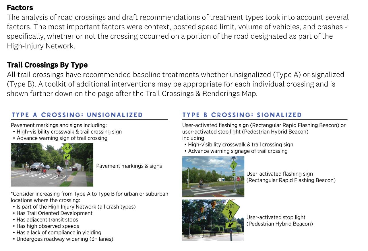


Overall Sentiment
• Strong emphasis on safety across all contexts; design should force drivers to slow/stop.
• Clear preference for Type B (signalized) at busier or faster roads; Type A only on low-volume, low-speed streets.
• Grade separation preferred where feasible, but not at the expense of delaying the project.
• Desire for physical traffic calming (raised crossings/ tables, speed cushions) over visuals-only treatments.
• Mixed experiences with flashing beacons/PHBs; many prefer standard traffic signals.
General Comments
• Match treatment to context: speed, volume, sight distance, hills/curves, land use.
• Prioritize visibility: clear sight triangles, lighting, high-contrast markings; consider color-blind–friendly maps/graphics.
• Favor physical calming: raised crossings/tables, curb extensions, lane narrowing, median refuges.
• Augment with tech: dynamic speed feedback signs; consider automatic activation sensors over push-buttons.
• Plan for maintenance: durable signs/lights, vegetation management, faded sign replacement.
• Common ask for Type B on high-speed and rural corridors where drivers do not expect pedestrians.
• Specific mentions: East Club Blvd, Old Oxford Rd, Stagville Rd, Orange Factory Rd, Bahama & Rougemont town areas, Penny’s Bend.
• User-activated full signals preferred over RRFB/PHB; consider detection/sensors for cyclists.
• Over/under crossings are strongly preferred at highest-risk locations but many note the project should not be delayed waiting on structures.
• Suggested approach: build now with safest feasible at-grade treatment; upgrade to grade separation later as funding allows.
• Raised crossings/speed tables and speed cushions ahead of crossings.
• Median refuges and curb extensions to narrow lanes and shorten crossing distance.
• Rumble strips: split views—attention-getting but can be uncomfortable; ensure bike bypass and spacing.
• Dynamic speed feedback signs and advance warning; avoid blind approaches.
• Accessibility aids: reachable activation, clear curb cuts, consider audible/vibration feedback, lighting.
• Consider emergency call boxes/CCTV at trailheads or key nodes (mixed views).
• Enforcement/education: pre-launch driver education; consistent signage; align with Vision Zero.
• Maintenance: responsibility clarity on state roads; vegetation management for sight distance.
• Safety fears on fast rural roads; skepticism about drivers yielding.
• Some opposition to trail and cost concerns; requests to prioritize other infrastructure.
• Requests to minimize the number of road conflicts; keep rural character.
• PHB skepticism: preference for standard traffic signals where control is required.
• Club Blvd (incl. near Ellerbee Creek): needs strong treatment; consider grade separation or full signal.
• Bahama Rd, Old Oxford Rd, Stagville Rd: high speeds, hills/blind crests; many ask for Type B + calming.
• Penny’s Bend, Orange Factory Rd, Rougemont & Bahama centers: requests for signals and visibility.
• Property access note: private cart way between crossings 20–21 should be considered.
• “Erronthesideoftoomuch.Trafficcalmingonthecrossingroadisgood.IntegrateintoVision Zero.”
• “Definitelyafanoftheflashinglightscrossingsignpost.Somekindofsurfacechangeonthe road as well.”
• “Thegradeseparatedcrossingsseemlikethebestoptionforme,wherespaceallows.”
• “Trailusersshouldhavepriorityateverycrossing.Ifthatrequiressignalsateachintersection, thenthatshouldbeprovided.”
• “TypeB(signalized)shouldbethedefaultTrailCrossing…aspeedhump/tabletoserveasthe TrailCrossing.”
• “SomeofthoseroadsupinnorthDurhamcountyareveryeasytodrivefaston…havinglotsof speed-limitingfeatures…wouldmakemefeelsafer.”
• “Driversdonotrespectcrosswalks…Needtoensurethatrequiringtrailuserstopressabutton… isnotparticularlyinconvenient,orevendangerous!”
• “Pleaseerronthesideofmakingcrossingssafer…Ihighlysupportsignalizedcrossingswithred lightsaswellasraisedcrossings.”
• “Obviously,gradeseparatedcrossingsarepreferred,butitshouldnotpreventorsignificantly delaythetrailgettingbuilt…thenupgradelater.”
• “Highvisibilityisfine,butactivatedlightsarebestifpossible,especiallyforcyclistsinbusyareas.”
• “Pleasedonotusepedestrianhybridbeacons…Driversrecognizetrafficlights.Theyare standardized.”
• “Nospeedcushions.Theiredgesdeteriorateandbecomemoredangeroustocyclists.”
• “Forcrossings…thereshouldbeaidandsupportfordisabledusers…alsobuttonstoaskforhelpif it is needed.”
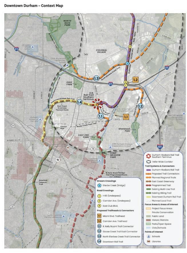

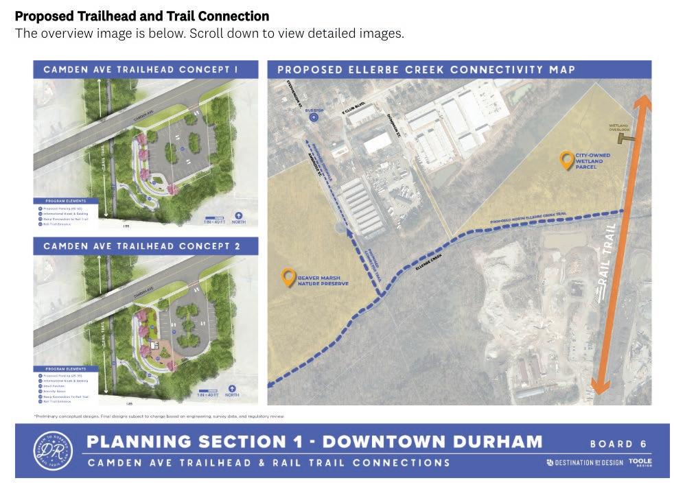
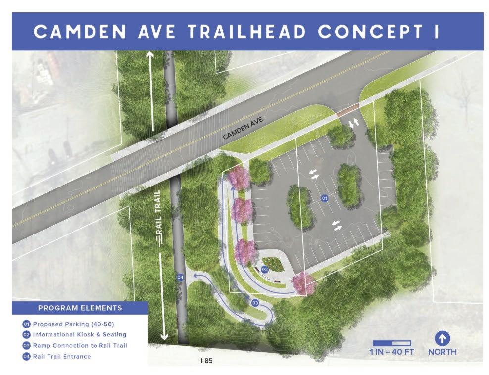

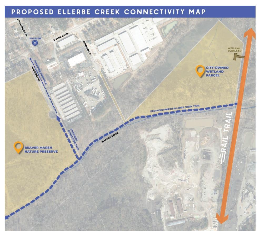
Overall Sentiment
• Strong support for downtown connectivity; enthusiasm to ‘get it built’.
• Clear split: Concept 1 (more parking) vs. Concept 2 (amenities/pavilion).
• High demand for restrooms/water and robust safety features (lighting, cameras, call boxes).
• Broad desire to connect to Ellerbe Creek Trail (and ATT/ECG) to maximize network value.
• Some cost opposition and concerns about crime and maintenance.
Trailhead Concept Preferences
• Concept 1: prioritized by users who expect high demand and want more parking capacity.
• Concept 2: preferred for pavilion/seating/amenity space; some argue downtown needs less parking.
• Several suggest hybridizing: modest parking + small pavilion/restroom if funding allows.
• Operational note: pavilions can increase congregating; watch parking utilization and turnover.
Most Requested Amenities
• Restrooms and water fountains at trailheads (and potentially a mid-route location).
• Shade trees, seating/benches, small pavilion/kiosk (esp. for families with gear).
• Lighting (including underpasses) and clear wayfinding/signage.
• Trash service/maintenance plan; wetland overlook applauded.
Safety & Security Needs
• Lighting, cameras, emergency call boxes; visibility from street; design to deter loitering.
• Vehicle security: concerns about break-ins at trailheads; surveillance requested.
• Perception of crime near downtown/Bragtown; coordinated patrols and CPTED recommended.
Connectivity Priorities
• Ellerbe Creek Trail connection: frequent, emphatic support (Northgate Park, Beaver Marsh).
• Links to ATT / East Coast Greenway and Downtown Rail Trail are seen as high-value.
• Local access: consider Bon Air Ave/Red Maple/Colonial Village path; additional northside access points.
• Wayfinding to on-street parking and secondary access points.
• Requests for sidewalks/bike lanes and bus access near Merrick Moore / E Geer / Midland Terrace.
• Balance driving access with non-auto access; some prefer amenities over large parking lots.
• Consider horse trailer accommodation if equestrian use is allowed (long spaces).
• Minimize impervious surface (gravel options; green stormwater infrastructure for lots).
• Native planting and wetland protections; support for wetland overlook.
• Ramp geometry: explore wrapping ramps around lots; add stairs for direct routes where feasible.
• Cost sensitivity and ‘waste of money’ comments; preference to fund other infrastructure.
• Safety skepticism if security isn’t resourced; worry about vandalism and misuse.
• Some concerns about neighborhood impacts and parking demand.
• “Ilikeconcept1–moreparkingisbetter.Unlessyouareputtinginbathrooms.”
• “IlikeConcept2sinceitincludesasmallpavilionandfeelsappropriatelysizedamountofparking.”
• “LovetheproposedEllerbeeconnection!IliveinNorthgateParkandthatwouldbetherouteI’d use.”
• “YouneedtodesignSAFETYsystems…Parkinglotsalongatrailinthiscontextisarecipefor loitering,druguse,theft(BREAKINS),andviolentcrime.”
• “Whataboutusingfinegravel(1/4to1/2inch)insteadofpavedparkinglotssoasnottoadd impermeablesurfacearea?”
• “WiththisproposeddesignitwillbenearlyimpossibleforpeoplelivingnearMerrickMoore elementaryschooltobeabletosafelyaccessthetrailwithoutdriving.”
• “Pleasestopthiswastefulproject.Thisisawasteofmoney,awasteofspace,andawasteof valuableresourcesthatareneededonprojectsthatthecommunitywillactuallybenefitfrom.”
• “Maximizeparkingattrailheads”
• “Arestroomfacilityandwaterfountainsareincrediblyhelpful”
• “Iamnottypicallygoingtobedrivingtoatrailhead;Iwillberidingmybikefromwork/hometothe trail.Iwouldprefertrailheadswithamenitiesoverparking.”
• “UsingNewHopeandHerndonParkasaguide,thetrailheadswithpavilionsaretheonesthat strugglethemostwithparkingbecausegroupscongregatethere.”
• “PreferleastexpensiveoptionandfocusonconnectiontoAmericanTobaccotrail/EastCoast GreenwayasthisbringsmosteconomicimpacttodowntownDurhamandlongesttrailusage”
• “Noopinionsaboutthetrailhead.ThereisnotgoodconnectivityheretoeastDurham,istherea waytoincreasebusservicedirectlytothisarea?”


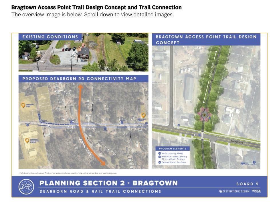
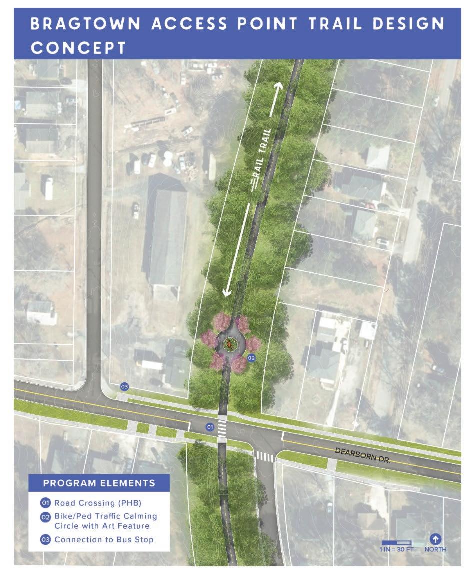

Crossings & Traffic Calming
• Favor signalized crossings at high-speed roads (E. Club, Dearborn).
• Medians/islands help staged crossings; some want raised crosswalks & speed cushions.
• Design for sightlines: trim vegetation; consider stop-arms where geometry allows.
• Some critique planters in medians for blocking visibility—use low plantings.
Safety & Security
• Install lighting, cameras in higher-risk segments; coordinate with enforcement.
• Design to reduce conflicts: slow bikes before intersections (rumble/dog-legs).
• Address neighborhood safety perceptions to build confidence in use.
Connectivity & Access
• Pursue connectors (Bon Air–Red Maple; Colonial Village; MST/Lakeview; school/library).
• Complete sidewalks along Dearborn and to trailheads/bus stops.
• Wayfinding to reduce wrong turns and distribute use.
Amenities & Operations
• Bathrooms and water near trailheads and at intervals.
• Right-size parking at Club; some suggest smaller lot and more seating/trash near art.
• Maintenance plan: vegetation management at crossings; trash and facility upkeep.
Environmental & Context-Sensitive Design
• Protect sensitive and listed plant species north of Hebron Rd—coordinate with agencies.
• Vegetated buffers to screen industrial edges; maintain clear sightlines at crossings.
• Consider long-term solutions (e.g., grade-separated crossing) where warranted.
Concerns & Opposition Themes
• Cost and ‘waste of money’ objections; preference for investing in schools/sidewalks.
• Crime/gentrification worries; fear of proximity to homes and privacy impacts.
• Skepticism about safety at crossings and adequacy of enforcement/staffing.
• “RRFBsarenotsufficientathigh-speedroadslikeDearbornandEClub.Theseneedtobe signalizedanddesignspeedsneedtobeeducedsignificantly.”
• “Ilikethatthere’samidwayislandfortheclubblvdcrossing.Peoplereallyflydownthatroad.”
• “Dearbornneedsthis.Dearbornhaslittletonosidewalksalongthislongroadandisnotsafefor pedestrians,especiallystudents.”
• “Thecrimeinthisareaisn’tsafeenoughtousewithoutprotection.”
• “PartofthissectionfromHebronRdgoingnorthhasseveralsensitive,stateandfederallylisted plantspecies…Specialplanningisneededtoprotecttheseresources.”
• “Proposedroadcrossingisfittingforthislocation…makesurethetreesandshrubsarecut back…sovehicletrafficcanseeoncomingbikes.”
• “Rightinthemiddleofalowincomeneighborhood.NOTAGOODIDEA.Nosafetyissuesare addressed.”
• “GoodconnectiontoBragtownlibrary.LovetheE.Clubtrailhead.Thisalllooksamazing.”
• “Twoissues.CrossingClubBoulevard…thereisnoenforcement…Iwouldinstallcamerasinthat sectionunlesstheCitymanagestoreducecrimesignificantly.”
• “The sidewalk on Dearborn is a must… there should also be clear sidewalks from club Dearborn intersection to the trailhead on club.”
• “Needtoaddspeedcushionstoslowdowntraffic.”
• “Ilovetheideaofhavingplantsintheroadcenteratthecrossing.”
• “Plantsinthemedianstripareavisibilityproblemtotraffic…Planttheflowerselsewhere.”
• “Lookslikethattrailcrossingneedstobesignalized,moresafelyprotected!”
• “Thankyouforhavingbathroomfacilitiesatsomeofthesetrailheads!!”
• “TheparkinglotatE.Clubmaynotbeneededoratleastittoobig—youcertainlydon’tneed70 carspots.”
• “Stronglysupporttheconnectors.Itallowsfolkstousetheirfeetandbikestotakecareofdaily tasksthatsomanyarecurrentlyonlyabletosafelyusetheircars.”
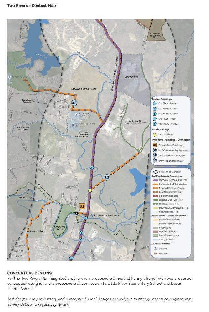


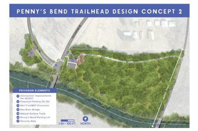

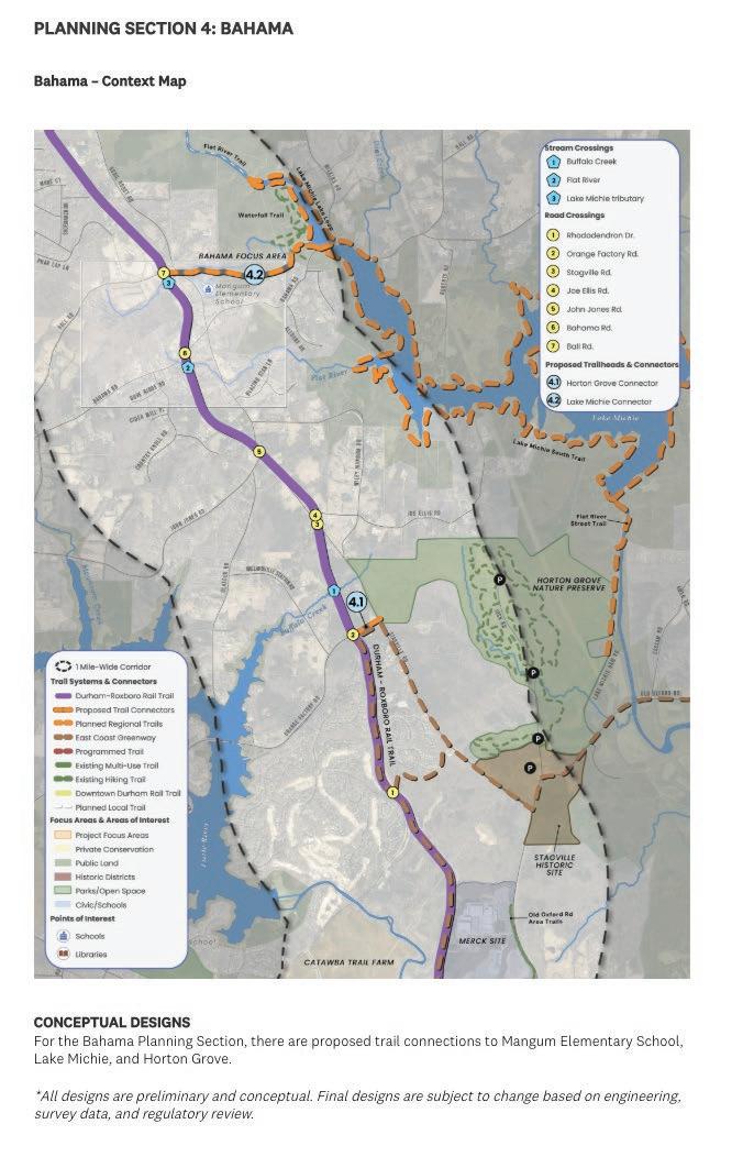

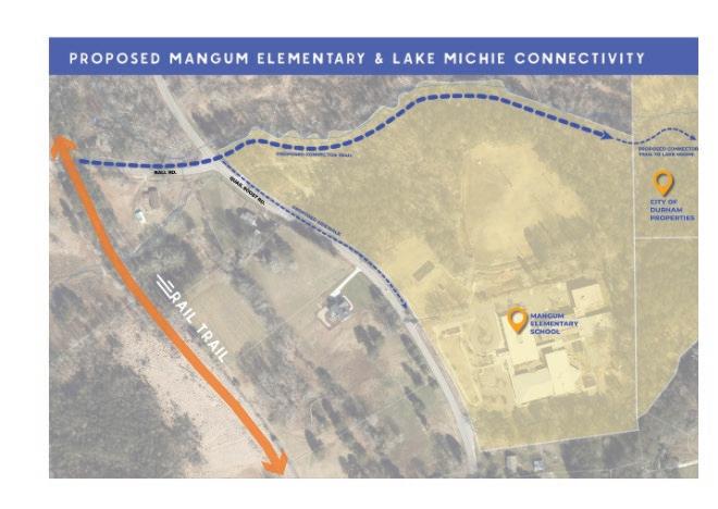
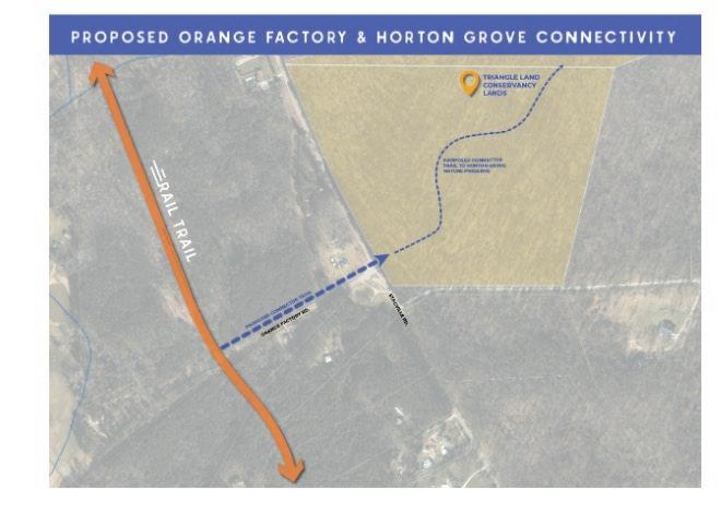
Crossings & Traffic Control at Old Oxford / Snow Hill
• Debate: roundabout slows traffic vs. concerns about hill/sight distance and driver behavior.
• Requests for signals/stoplights; refuge islands; speed cushions; curb extensions; clear vegetation for sightlines.
• Some prefer under-bridge routing for MST to avoid at-grade crossing (acknowledge occasional flooding).
Parking & Access at Penny’s Bend
• Concept 1: consolidated, larger lot; more capacity and simpler circulation.
• Concept 2: split lots on both sides of Old Oxford—reduces need to cross the road; concern about safe crossing if needed.
• Several ask for permeable/gravel surfaces near river; avoid expanding impervious area.
• Right-size capacity to serve hikers, anglers, and trail users during peak seasons.
Environmental Constraints & Stewardship
• State Plant Conservation Preserve prohibits public access and construction without multiagency approvals.
• Early coordination with NC Plant Conservation Program & Natural Heritage Program recommended.
• Protect sensitive/unique plant communities; consider flood risk; prefer permeable surfaces and canopy retention.
Connectivity & Destinations
• Strong support for connectors to Lucas/Little River schools, Durham Tech, MST, Merck/ International Dr., and community sites.
• Emphasis on safe school access; some suggest sidewalks may better serve school trips.
• Wayfinding and interpretive opportunities (e.g., Fairntosh/Stagville history; MST crossing signage).
Safety & Security
• Address speeds, sightlines, and conflict points; consider lighting and patrol presence at key nodes.
• Some stakeholders raise privacy and private-property concerns; request fencing at river crossings.
• Design crossings to minimize roadway exposure, especially for youth and families.
• Opposition citing cost, scope beyond urban core, privacy, and perceived safety risks.
• Requests to prioritize sidewalks over trails in some segments; questions about maintenance responsibilities.
• “Ilikethedesignconcept1formoreparking.”
• “Concept2farsuperior.Notkeenontrafficcircle.”
• “Trafficcircleisagreatideatoallowflowoftrafficandpedestrian.”
• “Puttingaroundabouthereisaterribleideaasthiswouldbeonahill.”
• “Connectingtoschoolsandothertrailsiscritical.”
• “I love the idea of the connectors at the schools… We have no bike lanes out here at all.”
• “TrytonotpaveoverPenny’sBendtomakeaparkinglot…itisauniqueareaandanature preserve.”
• “AtPenny’sBend…routingtheMSTundertheOldOxfordRoadbridgeismuchpreferabletoan atgradecrossing.”
• “IwouldratherhavetheparkingontheeastsideofOldOxfordandNOThavetocrossthatvery busyroad!”
• “Again,moreneedstobedonetoslowtrafficdownatthatcrossing,preferablybyaddinga speedcushion.”
• “EitherconceptwillbeaBIGimprovement.Islightlyprefer2sinceitputsmoreparkingonOld Oxford Rd side.”
• “Thislooksawesome,I’msostokedforasafebikeroutefromdowntownDurhamtotheEno!”
• “Trailhead2isfarbetter.Motoristsdriveveryquickly,sominimizingthedependencyoncrossings on this stretch is critical.”
• “AlessexpensivesolutionwouldbetoputasidewalkinalongSnowHillRoadsothatkidscan walk to Lucas and Little River schools.”

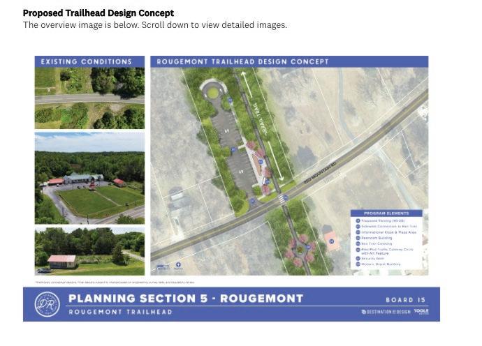

Opportunities & Enthusiasm
• Strong enthusiasm for connectors: Horton Grove, Lake Michie, Historic Stagville, schools, and parks
• Many see the trail as a safe, non-automotive access to nature; big quality-of-life upside
• Perceived economic upside for rural nodes if access improves
Concerns & Opposition
• Crossing safety: high speeds, hills/curves, limited sight distance → desire for signals, raised crossings, and traffic calming
• Property and privacy: fears about proximity to homes and potential encroachment/ easements
• Security: worries about crime, lighting, fencing, ATV enforcement, school adjacency
• Environmental impacts: wildlife, forests, waterways/impervious surface in sensitive areas
Design & Operations Suggestions
• Prefer protected sidepaths/guardrails where trail parallels roads
• Raised crosswalks, speed cushions, and visual narrowing at key crossings
• Consider loops, separated access to Horton Grove, and future MTB trails near Lake Michie
• Some suggest sidewalks or alternate routing to reduce crossings
Amenities & Trailhead Needs
• Trailheads: restrooms and water fountains requested for rural middle section
• Parking: maximize at key access points; bike racks at Horton Grove; picnic areas desired
• Wayfinding & interpretation: interest in Occaneechi/Saponi and Great Trading Path history
Road Crossings
• High-risk corridors noted: Stagville Rd, Quail Roost Rd, Orange Factory Rd, Bahama Rd (near Mangum Elementary)
• Desired treatments: user-activated signals, raised crossings, speed cushions, center islands, visual narrowing
• Sightline management: address hills/curves and emerging-from-forest visibility
• Concerns about proximity to backyards; desire for buffers/fencing where near homes & schools
• Requests for lighting, cameras, and enforcement; ATV/motorcycle deterrence
• Transparent easement process and owner engagement requested
Environmental & Maintenance Considerations
• Protect wildlife corridors; minimize tree loss and habitat fragmentation
• Manage impervious surface near waterways; consider permeable materials and drainage
• Plan waste management and maintenance in rural segments
• “Lovetheconnectors,especiallytoHortonGroveandalltheproposedtrailsatLakeMichie.”
• “CrossingbackandforthacrossStagvilleRdandQuailRoostisnotagoodidea…Trafficwillnot beabletoslowdownquicklyenough…”
• “AsaBahamaresident…Iverystronglywelcomethisrailtotrailproject!”
• “Thiswillinfringeonmyproperty.Oppose.”
• “Hopefullytheseschoolconnectionswork…kidscouldbesafegettingtoschoolonfoot.”
• “Blinkinglightsatcrosswalkstonotifydrivers.Wouldbeinterestedinbikecampingpotentials.”
• “Theseruralroadsaregoingtobedangerous…Iwouldstronglyconsiderlitsignalsfor pedestriansandaraisedcrossing.”
• “Massive disturbance to livestock and wild animals in the area.”
• “IlovetheconnectionstoHortonGrove,Staggville,andtheschool.Can’twaittousethesetrails!”
• “Thissectionisthebestcandidateforalargeinterpretationelementthatrespectsthe OcconeechiBandoftheSaponiNationandtheGreatTradingPath.”
• “NoneoftheresidentsofBahamawantthistrailcuttingthroughourfamilyproperties.”
• “WemovedfromDurhamcitytoBahamafortheprivacy,wedoNOTwantanyofthisrunning behindourproperty.”
• “IliveinTreyburnForest.ThisconnectionatOrangeFactoryisagamechangerforcyclistsinmy area.”
• “Pleaseincludeguardrailsalongplaceswherethetrailparallelsroads,forsafety.”
• “LovethelinkupwithTriangleLandConservancy(TLC)property.Thisisveryexciting!”
• “Thisseemslikeahugewasteoftaxmoney.”
• “ThisissuchavaluableassetforBahama!Wedon’thavesidewalksoranyplacesafetowalkup here.”
• “Theplanshouldstopbeforereachingthisarea…thenegativeimpactontheenvironmentisnot worth it.”
Vision for Rougemont Trailhead
• Destination for long rides/walks; ‘great midpoint’ feel with restrooms and water.
• Local pit stop (Red Leaf/nearby businesses) and community events if activated.
• Potential equestrian staging (if horse access is included).
• Commuter support is limited without early/late access and transit connections.
Amenities & Partnerships
Core amenities:
• Restrooms, water fountains/refill, shade, picnic tables
• Bike repair stand/pump; wayfinding; seating
• Parking:
• “Maximize parking” vs. “right-size to rural context”
• EV charging request (a few)
Public-private ideas:
• Kiosks for food/drink; partner with nearby depot/venues
• Consider events to activate the area
• Safety at Crossings & Trail Calming
Crossings:
• Frequent calls for user-activated beacons, signals, and medians
• Visual narrowing, speed humps/tables, curb extensions
Roundabouts on trail:
• Proponents: slow e-bikes, cue upcoming road crossing
• Skeptics: unclear purpose if set back from road; prefer budget elsewhere
Security, Maintenance & Operations
Security gates:
• Why needed? What hours? Who opens/closes?
• Some prefer open early/late for commuters
• Concerns about maintenance (trash, restrooms, landscaping
• General safety requests including lighting, patrols, cameras near trailhead and along path
Equestrian Considerations (If Included)
• Parking request for for pull-through truck+trailer stalls (2+ spots)
• Some support equestrian focus in northern ‘horse country’
• Some question need/cost and potential conflicts
Community Concerns & Opposition
• Privacy and property rights; fears of eminent domain.
• Perceived crime increase; ‘not wanted in backyards.’
• Cost/benefit in rural context; skepticism of usage levels.
• Preference to invest in existing parks/sidewalks instead.
Connectivity & Extent
• Desired connection to Roxboro and Hill Forest
• Sidewalk connectivity on Red Mountain Road
• Requests for trailhead signage, access hours, business access
• “Great location for a trailhead!”
• “Public-privatepartnershipatthattrailheadtobringlifetothearea.”
• “Iliketheroundaboutsonthetrail,they’resomethingalittledifferent.”
• “Let’sgetthisbuilt!”
• “Ifeelthistrailisabrilliantandneededadditiontoourcommunity.”
• “Maximizeparking.”
• “Looksnice!It’dbeagoodpitstopfortheRedLeafBarwhichwouldbenefitfromtheextra trafficcomingby.”
• “Pleaseincludehorsetrailerparking.”
• “ImovedtoRougemont…Iamveryopposedtothistrailgoingin.It’sinvadingalotofprivacy.”
• “AsaresidentofRougemont,THISISAWESOME.Highlysupport,perfectlocation!”
• “Trailsafety&securityfornotonlyusersbutalsopropertyownernearthetrail.”
• “HaveadedicatedleftturnlaneintotheparkinglotonRedMountainRd.”
• “Waterfountainswouldbeverywelcome.”
• “Thisisacontinuationofawastedmoneyventure…tooruralforthisunnecessaryexpenditure and construction.”
Question 8: General Comments & Questions – Summary of Responses
Overall Tone and Common Requests
• High enthusiasm for a long, connected greenway (+ access to nature, active mobility, family use)
• Consistent safety concerns (road crossings, lighting, emergency call boxes, crime)
• Frequent asks for amenities (bathrooms, water fountains, benches, shade)
• Strong opinions on cost, priorities, and maintenance; some opposition citing privacy & policing
• Calls to start quickly with a basic build, then iterate (‘minimal viable trail’)
Top Themes — Support
• “Long overdue” investment; strong excitement from residents across Durham and Bahama/ Treyburn
• Quality-of-life benefits: safe places to bike, walk, roll; healthier/active communities
• Regional draw & tourism potential; economic opportunities near trailheads
• Desire for quick wins: open usable segments ASAP; keep designs simple and build in phases
Top Themes — Concerns
• Safety at road crossings (vehicle speeds, heavy trucks); preference for engineered calming
• Personal safety and property privacy near neighborhoods & schools
• Operations: long-term maintenance, trash, vegetation control, lighting, patrols
• Cost & funding priorities (schools, EMS, homelessness vs. trail investment)
Safety & Crossing Design Requests
• Raised crosswalks, visual narrowing, speed cushions/humps, rumble strips, refuge islands
• Lower posted/operating speeds at crossings; clear sight lines
• Signalization where volumes/speeds are high; minimize number of at-grade crossings
• Emergency call stations (‘blue lights’) and better lighting in select segments
Amenities & Comfort
• Restrooms and water fountains/bottle fillers at regular intervals
• Benches, shade trees, pollinator habitat; avoid unnecessary clear cutting
• Wayfinding, mile markers, bike repair stations, occasional vending
• Public art interest (balanced with nature aesthetics)
Equity, Access & Connectivity
• Safe access without a car; connections to schools, parks, libraries, transit & shopping
• Interest in trail-oriented small businesses (coffee, rentals, kiosks)
• Desire to extend/link with ATT, MST; interest in Person County coordination
Maintenance & Management
• Clear plan for trash removal, restroom upkeep, vegetation & pavement repair
• Security/patrol strategy; ATV enforcement; hours of operation & gating policy
• Transparent communications and timelines; notify adjacent residents early/often
Routing & Design Trade-offs
• Fewer road crossings & more grade separation where feasible
• Balance paved vs. natural tread; consider MVP now + upgrades later
• Privacy buffers by homes/schools; alignments that reduce conflicts
Question 8: General Comments & Questions – Quotes
• “Thanksfortheplanningwork;thisisexcitingandlongoverdue.”
• “Wasteofmoney”
• “I’mveryexcitedaboutthisfuturetrail…Istronglysupportthisplan!”
• “MyconcernissafetywiththetrailsoclosetobothLittleRiverandLucasMiddleschool.”
• “Biggerparkinglotsmakesthemostsensetometomitigatetrafficissues”
• “Moretreecoveragethebetter.Pleasedon’tclearcuttrees.”
• “Waterfountainsandbathroomsplease!”
• “Bathroomswouldbenice.Iknowitisexpensive,butgradeseparatedroadcrossingswould makecyclingmuchmoreenjoyable.”
• “Considermorenaturaltreadtrialsurfacesandlowertheamountofpavementtomakethetrail.”
• “Pleaseproceed!”
• “Ipersonallybelievewehaveenoughgreenspaceswithoutaddingthistrail.”
• “StartwithlowhangingfruitandgetsomethingopenASAP!Thankyou.”
• “Iopposethistrail.It’sinvadingprivacyandstealingland”
• “Keepitsimple.Startbuildinginthemorepopulatedplacesandexpand.Hopetoseeitbuilt!”
• “Thekeyfactorisintersectionswithroads.Theyneedtobesafe.”
• “Iwouldtraveltobikeonthistrailwithmyfriends.”
• “Pleasekeeptrailsasshadedaspossible.”
• “Theminimalviableproductisthetrail-…don’tletthegoldplatingblowthebudget.”
• “WereallyneedrecreationaloutdooropportunitiesinBahama!”
• “Ivehementlyopposethisentiretrail.It’ssuchawasteoffunds.”
The Trail Identity Committee created the following rulebook for evaluating potential proposed names. These rules were utilized to generate and cull down an initial list of possible names with the goal of selecting a trail identity that reflected the desires and values of the surrounding communities.
DO:
• Emphasize Connection and Community Pride: Choose names that show how the trail links communities, celebrates local culture, and makes everyone feel welcome.
• Be Inclusive and Reflect History: Highlight the diverse stories, historical significance, and cultural heritage of the region.
• Showcase Nature and Promote Wellness: Pick names that reflect the trail’s natural beauty and inspire movement, relaxation, and enjoying the outdoors.
• Tell a Story and Celebrate Legacy: Select a name that connects past, present, and future and honors local history and culture.
• Stay Welcoming and Accessible: Ensure the name feels open, inviting, and easy to understand for everyone.
DO NOT:
• Exclude or Limit Anyone: Avoid names that might make some people feel left out or suggest the trail is only for certain activities or groups.
• Choose Generic or Difficult Names: Avoid names that are hard to say, spell, or remember, and ensure the name is unique to this area.
• Ignore Community Input: Make sure the name reflects what the local community wants and avoids negative or controversial associations.
• Follow Trends or Focus Narrowly: Avoid trendy names or names that only highlight one aspect of the trail, like just history or just nature.
• Memorable and easy to pronounce.
• Representative of the entire trail corridor, not just a single area.
• Aligned with the trail’s branding goals, such as promoting recreation, history, and community connection.
• Flexible for branding and marketing, including logo design and signage.
• Unique enough to avoid confusion with other trails or regional landmarks.
• Reflective of the trail’s vision and intended identity, whether that’s focused on adventure, history, nature, or community.
