

01 POINT OF INTEREST
11,17 & 19 INDUSTRIAL ROAD, SHEPPARTON
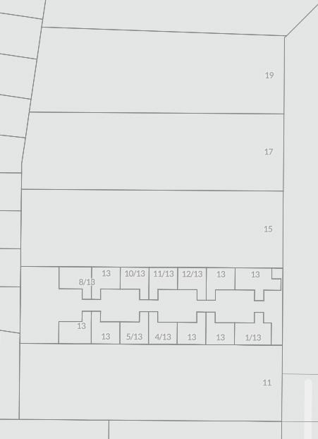
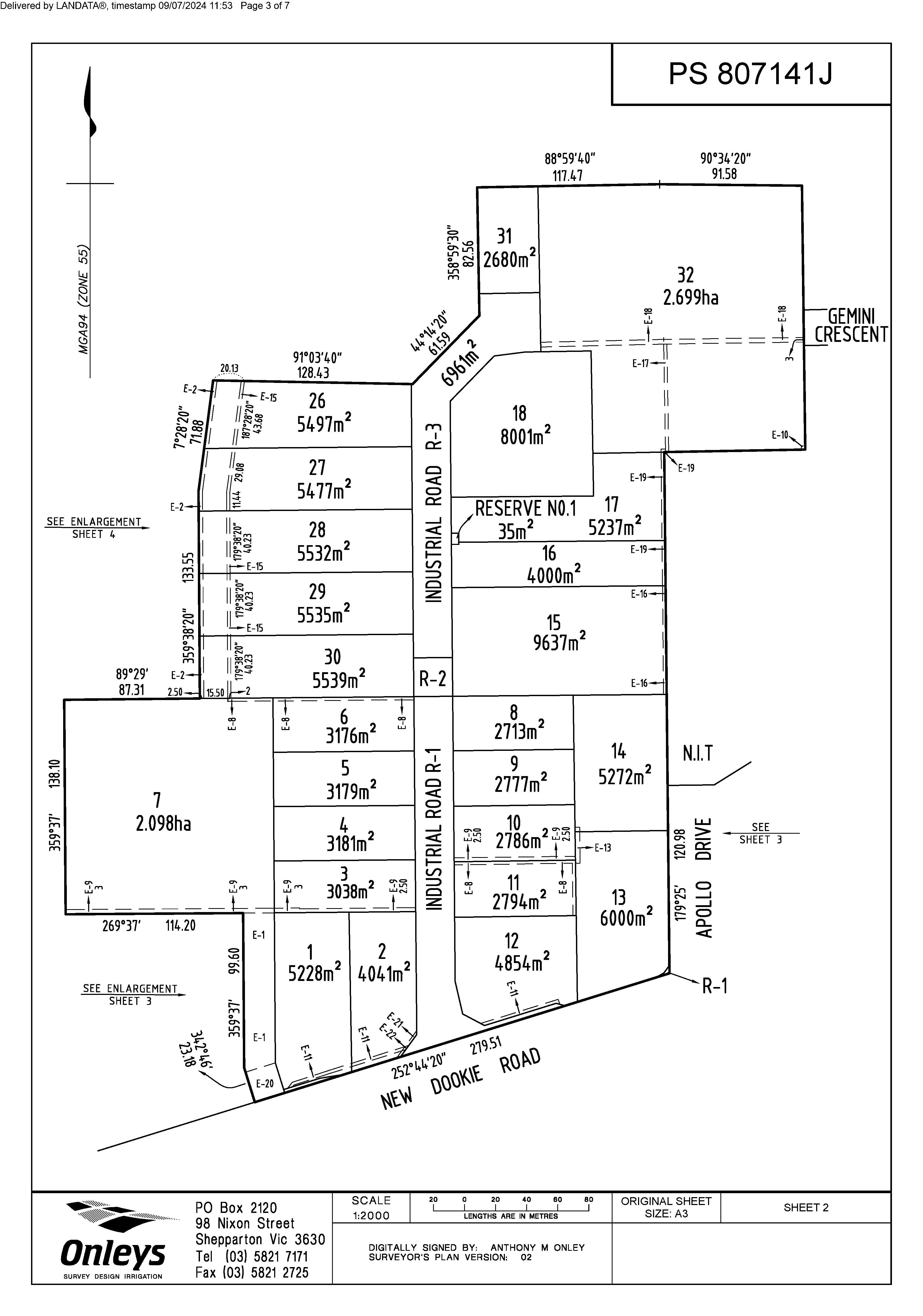
Lot 11: 5,539 sqm*
LAND AREA
SITE DETAILS
Lot 17: 5,477 sqm*
Lot 19: 5,497 sqm*
Lot 11: Approved planning permit for an 18 unit industrial complex with a GLA of 2,487 sqm*
Lot 17: Serviced and benched ready for development. Ideal for and owner occupier or strata unit development
Lot 19: Regular and flat site conditions
ZONING Industrial 1 Zone (IN1Z)
METHOD OF SALE Private sale
SALE TERMS
10% deposit, balance negotiable

02 POINT OF VIEW
Located in the established industrial precinct of Shepparton, these three individually titled industrial blocks are just what the market has been waiting for.
Whether you’re seeking to acquire an industrial lot to design and construct a facility for your business needs or capitalize on existing permits for a 18 unit development, these lots cater for the entire market.


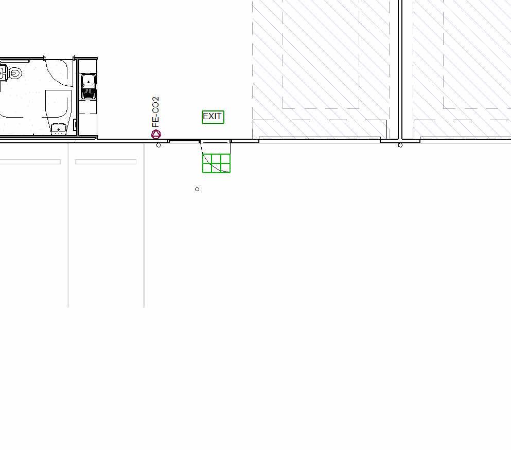
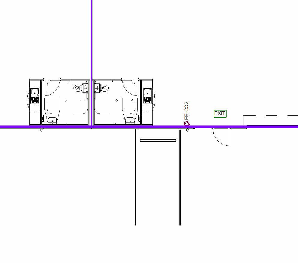
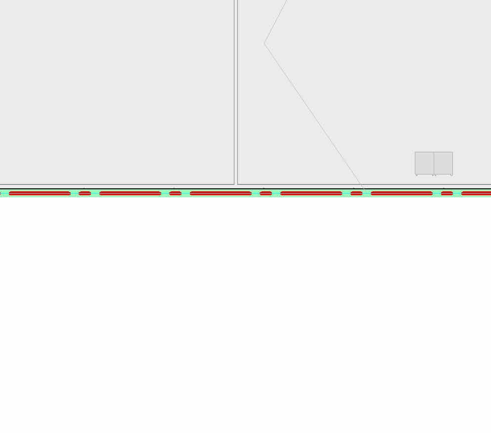
Individual frontages to Industrial Road

3 lots available with the option to purchase lot 17 & 19 together
Lot 11 has an endorsed permit for 18 warehouses
Industrial 1 Zone

03 PROPERTY FEATURES
With Shepparton demonstrating strong sales and leasing performance and robust growth projections, Lots 11, 17 & 19 offer the versatility to accommodate your plans.
Lots 17 & 19 are available individually or can be combined to provide over a hectare of land and boasting an impressive 80 metre * frontage.


Total land area of 5,539 sqm*. Approved planning permit for an 18 unit industrial complex with a GLA of 2,487 sqm*
Total land area of 5,477 sqm*. Serviced and benched ready for development, ideal for and owner occupier or strata unit development.
Total land area of 5,497 sqm*. Regular and flat site conditions.
Lot 11
Lot 17
Lot 19
04 LOCATION
ALL SIGNS POINT TO: INDUSTRIAL ROAD.
Industrial Road in Shepparton, Victoria, Australia, offers a strategically advantageous location for businesses. Situated approximately 5 km from the CBD of Shepparton, it intersects with New Dookie Road, facilitating convenient access to and from the industrial area.
The road is well-connected to the Goulburn Valley Highway (B370), enhancing logistical efficiency for businesses operating there. Industrial Road supports a range of industrial activities with essential utilities like electricity and water readily available.
It benefits from proximity to commercial services in Shepparton and nearby residential areas, offering convenience for both businesses and employees. With potential for further development and industrial zoning, Industrial Road presents opportunities for expansion and new ventures, making it a desirable location for businesses seeking growth and operational efficiency in Shepparton’s industrial landscape.
AND THE POINT?
Centrally located within Shepparton’s industrial precinct.

05 SUBURB PROFILE
ON THE MAP: SHEPPARTON.
Shepparton, located approximately 181 kms* north of Melbourne, is a strategic regional city known for its robust economy and strong transport connectivity. As a major economic hub in the Goulburn Valley region, often dubbed Australia’s “food bowl,” Shepparton excels in agriculture, food processing, manufacturing, and logistics. The city benefits from modern infrastructure, including efficient road and rail networks, which are set to improve further with projects like the Shepparton Bypass. This connectivity, along with a skilled and diverse workforce supported by local educational institutions, makes Shepparton an ideal location for industrial activities.
The city offers a high quality of life with ample recreational facilities, healthcare, education, and shopping amenities. Its ongoing urban development and population growth reflect a dynamic and forward-looking community. Shepparton also emphasises sustainability, ensuring environmentally friendly practices in agriculture and industry. These attributes collectively make Shepparton an attractive destination for industrial property investment, promising strategic advantages for businesses looking to establish or expand their operations.

Population Growth: Shepparton has experienced steady population growth over the years. As of recent data, the population was estimated to be around 50,198 in 2021. This represents a moderate increase from previous years, driven by factors such as regional development and employment opportunities.

Industrial Growth: Shepparton is a key hub for agricultural production, particularly in fruit processing (notably for fruit canning and other food processing industries), dairy farming, and horticulture. The region is known for its orchards and vineyards. The manufacturing sector in Shepparton includes food processing (as mentioned), packaging, and some light industrial activities. The city’s strategic location in the Goulburn Valley makes it a favorable site for food production and distribution.

Employment: Industrial growth in Shepparton has been supported by various government initiatives and private investments aimed at fostering employment opportunities in manufacturing and agriculture-related industries.
Recent Developments: Shepparton has seen investments in infrastructure, including improvements to transportation networks (roads and rail) to facilitate easier movement of goods and people.
Commercial Opportunities: The availability of land, combined with Shepparton’s role as a regional service center, presents opportunities for commercial and residential developments.
06 PROPERTY PARTICULARS
PRINCIPLE OUTGOINGS
Council rates: TBC
Water rates: TBC
Land
SITE DETAILS
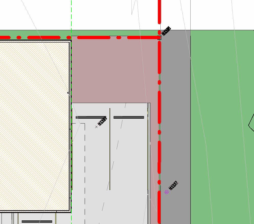
Frontage to Industrial Road:
Lot 11
North
West
Lot 17
North
South
Lot 19
North
Total site area (3 sites)
LOT 19 LOT 17 LOT 11
square metres*
INDUSTRIAL ROAD
06 PROPERTY PARTICULARS
TITLE PARTICULARS
Lot 11
Certificate of Title — Volume 12426 Folio 598
Lot 30 on Proposed Plan of Subdivision 807141J
Lot 17
Certificate of Title — Volume 12426 Folio 595
Lot 27 on Proposed Plan of Subdivision 807141J
Lot 19
Certificate of Title — Volume 12426 Folio 594
Lot 26 on Proposed Plan of Subdivision 807141J
ZONING
PLANNING OVERLAYS
Industrial 1 Zone (IN1Z)
Land Subject To Inundation Overlay (LSIO) Specific Controls Overlay (SC03)
07 CONTACT DETAILS
DANIEL PHILIP
DIRECTOR
-
SALES
- CVA 0439 977 121

An agent that turns first impressions into lasting commitments. Since the early days of his career, Daniel has established a level of service that is defined by in-depth market knowledge, expert advice and responsive communication. Committed to creating value in the commercial real estate opportunities he matches with his clients’ objectives, and the ability to think outside the square. Especially if that extends well beyond Melbourne’s inner-city grid.
ROCKY GAGLIARDI
PRINCIPAL | DIRECTOR - GAGLIARDI SCOTT 0407 826 542

With 20 years’ experience in property investment, development, acquisitions and disposals; Rocky has extensive knowledge of the many facets of the commercial real estate industry including sales, leasing, consultancy, feasibility analysis and forecasting. Rocky’s expertise, attention to detail and high success rates see him regularly working alongside the nation’s leading commercial real estate agencies.
TITLE PLAN

Imaged Document Cover Sheet
The document following this cover sheet is an imaged document supplied by LANDATA®, Secure Electronic Registries Victoria.
Document Type
Document Identification
Number of Pages
(excluding this cover sheet)
Document Assembled
09/07/2024 11:53
Copyright and disclaimer notice: © State of Victoria. This publication is copyright. No part may be reproduced by any process except in accordance with the provisions of the Copyright Act 1968 (Cth) and for the purposes of Section 32 of the Sale of Land Act 1962 or pursuant to a written agreement. The information is only valid at the time and in the form obtained from the LANDATA® System. None of the State of Victoria, LANDATA®, Secure Electronic Registries Victoria Pty Ltd (ABN 86 627 986 396) as trustee for the Secure Electronic Registries Victoria Trust (ABN 83 206 746 897) accept responsibility for any subsequent release, publication or reproduction of the information.
The document is invalid if this cover sheet is removed or altered.


ZONING & PLANNING OVERLAYS
33.01
31/07/2018
VC148
INDUSTRIAL 1 ZONE
Shown on the planning scheme map as IN1Z
Purpose
To implement the Municipal Planning Strategy and the Planning Policy Framework.
To provide for manufacturing industry, the storage and distribution of goods and associated uses in a manner which does not affect the safety and amenity of local communities.
33.01-1
01/12/2023
VC217
Table of uses
Section 1 - Permit not required
Use Condition
Automated collection point
Convenience shop
Crop raising
Grazing animal production
Home based business
Must meet the requirements of Clause 52.13-3 and 52.13-5.
The gross floor area of all buildings must not exceed 50 square metres.
■ Industry (other than Materials recycling and Transfer station)
Must not be a purpose listed in the table to Clause 53.10 with no threshold distance specified.
The land must be at least the following distances from land (not a road) which is in an Activity Centre Zone, Capital City Zone, Commercial 1 Zone, Docklands Zone, residential zone or Rural Living Zone, land used for a hospital, an education centre or a corrective institution or land in a Public Acquisition Overlay to be acquired for a hospital, an education centre or a corrective institution:
■ 30 metres, for a purpose not listed in the table to Clause 53.10.
The threshold distance, for a purpose listed in the table to Clause 53.10.
■ Must not:
■ Require a notification under the Occupational Health and Safety Regulations 2017.
Exceed a fire protection quantity under the Dangerous Goods (Storage and Handling) Regulations 2012.
■ Require a licence under the Dangerous Goods (Explosives) Regulations 2011.
■ Require a licence under the Dangerous Goods (HCDG) Regulations 2016.
■ Must not adversely affect the amenity of the neighbourhood, including through the:
■ Appearance of any stored goods or materials.
Transport of materials, goods or commodities to or from the land.
Use Condition
■ Informal outdoor recreation
Mail centre
Railway
Service station
Emission of noise, artificial light, vibration, odour, fumes, smoke, vapour, steam, soot, ash, dust, waste water, waste products, grit or oil.
Shipping container storage
The land must be at least 30 metres from land (not a road) which is in an Activity Centre Zone, Capital City Zone, Commercial 1 Zone, Docklands Zone, residential zone or Rural Living Zone, land used for a hospital, an education centre or a corrective institution or land in a Public Acquisition Overlay to be acquired for a hospital, an education centre or a corrective institution.
Must not adversely affect the amenity of the neighbourhood, including through the:
■ Appearance of any stored goods or materials.
Transport of materials, goods or commodities to or from the land.
■ Emission of noise, artificial light, vibration, odour, fumes, smoke, vapour, steam, soot, ash, dust, waste water, waste products, grit or oil.
Must not be a purpose listed in the table to Clause 53.10 with no threshold distance specified.
The land must be at least the following distances from land (not a road) which is in an Activity Centre Zone, Capital City Zone, Commercial 1 Zone, Docklands Zone, residential zone or Rural Living Zone, land used for a hospital, an education centre or a corrective institution or land in a Public Acquisition Overlay to be acquired for a hospital, an education centre or a corrective institution:
■ 100 metres, for a purpose not listed in the table to Clause 53.10.
The threshold distance, for a purpose listed in the table to Clause 53.10.
■ Must not:
■ Require a notification under the Occupational Health and Safety Regulations 2017.
Exceed a fire protection quantity under the Dangerous Goods (Storage and Handling) Regulations 2012.
■ Require a licence under the Dangerous Goods (Explosives) Regulations 2011.
■ Require a licence under the Dangerous Goods (HCDG) Regulations 2016.
■ The site must adjoin, or have access to, a road in a Transport Zone 2 or a Transport Zone 3.
Shipping containers must be setback at least 9 metres from a road in a Transport Zone 2 or a Transport Zone 3.
The height of shipping container stacks must not exceed 6 containers or 16
Use Condition
metres, whichever is the lesser.
Must not adversely affect the amenity of the neighbourhood, including through the:
■ Appearance of any stored goods or materials.
■
Transport of materials, goods or commodities to or from the land.
■ Emission of noise, artificial light, vibration, odour, fumes, smoke, vapour, steam, soot, ash, dust, waste water, waste products, grit or oil.
Take away food premises
Tramway
Warehouse (other than Mail centre and Shipping container storage)
Must not be a purpose listed in the table to Clause 53.10 with no threshold distance specified.
The land must be at least the following distances from land (not a road) which is in an Activity Centre Zone, Capital City Zone, Commercial 1 Zone, Docklands Zone, residential zone or Rural Living Zone, land used for a hospital, an education centre or a corrective institution or land in a Public Acquisition Overlay to be acquired for a hospital, an education centre or a corrective institution:
■ 30 metres, for a purpose not listed in the table to Clause 53.10.
The threshold distance, for a purpose listed in the table to Clause 53.10.
■ Must not:
■ Require a notification under the Occupational Health and Safety Regulations 2017.
Exceed a fire protection quantity under the Dangerous Goods (Storage and Handling) Regulations 2012.
■ Require a licence under the Dangerous Goods (Explosives) Regulations 2011.
■ Require a licence under Dangerous Goods (HCDG) Regulations 2016.
■ Must not adversely affect the amenity of the neighbourhood, including through the:
■ Appearance of any stored goods or materials.
Transport of materials, goods or commodities to or from the land.
■ Emission of noise, artificial light, vibration, odour, fumes, smoke, vapour, steam, soot, ash, dust, waste water, waste products, grit or oil.
■ Any use listed in Clause 62.01 Must meet the requirements of Clause 62.01.
Section 2 - Permit required
Use Condition
Adult sex product shop
Must be at least 200 metres (measured by the shortest route reasonably accessible on foot) from a residential zone or land used for a hospital, primary school or secondary school or land in a Public Acquisition Overlay to be acquired for a hospital, primary school or secondary school.
Agriculture (other than Apiculture, Crop raising, Grazing animal production, Intensive animal production, Pig farm and Poultry farm)
Caretaker's house
Container deposit scheme centre
Education centre
Leisure and recreation (other than Informal outdoor recreation)
Materials recycling
Must not be a primary or secondary school.
Office
Place of assembly (other than Carnival, Cinema based entertainment facility and Circus)
Restricted retail premises
Retail premises (other than Shop and Take away food premises)
Sex services premises
Transfer station (other than Automated collection point and Container deposit scheme centre )
The land must be at least 30 metres from land (not a road) which is in an Activity Centre Zone, Capital City Zone, Commercial 1 Zone, Docklands Zone, residential zone or Rural Living Zone or land used for a hospital, an education centre or a corrective institution or land in a Public Acquisition Overlay to be acquired for a hospital, an education centre or a corrective institution.
The leasable floor area must not exceed the amount specified in the schedule to this zone.
The land must be at least 30 metres from land (not a road) which is in an Activity Centre Zone, Capital City Zone, Commercial 1 Zone, Docklands Zone, residential zone or Rural Living Zone or land used for a hospital, an education centre a corrective institution or land in a Public Acquisition Overlay to be acquired for a hospital, an education centre or a corrective institution.
Use Condition
Utility installation (other than Minor utility installation and Telecommunications facility).
Any gas holder, or sewerage or refuse treatment or disposal works, must be at least 30 metres from land (not a road) which is in an Activity Centre Zone, Capital City Zone, Commercial 1 Zone, Docklands Zone, residential zone or Rural Living Zone, land used for a hospital, an education centre or a corrective institution or land in a Public Acquisition Overlay to be acquired for a hospital, an education centre or a corrective institution.
Any other use not in Section 1 or 3
Section 3 - Prohibited
Use
Accommodation (other than Caretaker's house)
Cinema based entertainment facility
Hospital
Intensive animal production
Pig farm
Poultry farm
Shop (other than Adult sex product shop, Convenience shop, Restricted retail premises and Sex services premises)
Use of land
Application requirements
An application to use land for an industry or warehouse must be accompanied by the following information, as appropriate:
The purpose of the use and the types of processes to be utilised.
■ The type and quantity of goods to be stored, processed or produced.
■ How land not required for immediate use is to be maintained.
■ Whether a Development Licence, Operating Licence, Permit or Registration is required from the Environment Protection Authority.
■ Whether a notification under the Occupational Health and Safety Regulations 2017 is required, a licence under the Dangerous Goods Act 1985 is required, or a fire protection quantity under the Dangerous Goods (Storage and Handling) Regulations 2012 is exceeded.
■
■ The likely effects, if any, on the neighbourhood, including: Noise levels.
■ Air-borne emissions.
■ Emissions to land or water.
■ Traffic, including the hours of delivery and despatch.
■
■ Light spill or glare.
Decision guidelines
Before deciding on an application, in addition to the decision guidelines in Clause 65, the responsible authority must consider, as appropriate:
The Municipal Planning Strategy and the Planning Policy Framework.
■ The effect that the use may have on nearby existing or proposed residential areas or other uses which are sensitive to industrial off-site effects, having regard to any comments or directions of the referral authorities.
■ The effect that nearby industries may have on the proposed use.
■ The drainage of the land.
■ The availability of and connection to services.
■ The effect of traffic to be generated on roads.
■
■ The interim use of those parts of the land not required for the proposed use.
Subdivision
Permit requirement
A permit is required to subdivide land.
VicSmart applications
Subject to Clause 71.06, an application under this clause for a development specified in Column 1 is a class of VicSmart application and must be assessed against the provision specified in Column 2.
Class of application Information requirements
Subdivide land to realign the common boundary between 2 lots where:
The area of either lot is reduced by less than 15 percent.
■
■ The general direction of the common boundary does not change.
Subdivide land into lots each containing an existing building or car parking space where:
■ Clause 59.02
The buildings or car parking spaces have been constructed in accordance with the provisions of this scheme or a permit issued under this scheme.
■ An occupancy permit or a certificate of final inspection has been issued under the Building Regulations in relation to the buildings within 5 years prior to the application for a permit for subdivision.
Subdivide land into 2 lots if:
■ Clause 59.02
The construction of a building or the construction or carrying out of works on the land:
■
Has been approved under this scheme or by a permit issued under this
Class of application
scheme and the permit has not expired. Has started lawfully.
■ The subdivision does not create a vacant lot.
■ Exemption from notice and review
Information requirements and decision guidelines
An application is exempt from the notice requirements of section 52(1)(a), (b) and (d), the decision requirements of section 64(1), (2) and (3) and the review rights of section 82(1) of the Act. This exemption does not apply to land within 30 metres of land (not a road) which is in a residential zone or land used for a hospital or an education centre or land in a Public Acquisition Overlay to be acquired for a hospital or an education centre.
Decision guidelines
Before deciding on an application, in addition to the decision guidelines in Clause 65, the responsible authority must consider, as appropriate:
■ Any natural or cultural values on or near the land.
The Municipal Planning Strategy and the Planning Policy Framework.
■ Streetscape character.
■ Landscape treatment.
■ Interface with non-industrial areas.
■
Buildings and works
Permit requirement
A permit is required to construct a building or construct or carry out works.
This does not apply to: A building or works which rearrange, alter or renew plant if the area or height of the plant is not increased.
■ A building or works which are used for crop raising or informal outdoor recreation.
■ A rainwater tank with a capacity of more than 10,000 litres if the following requirements are met: The rainwater tank is not located within the building’s setback from a street (other than a lane).
■ A building or works which are used for grazing animal production, except for permanent or fixed feeding infrastructure for seasonal or supplementary feeding constructed within 100 metres of:
■
■ The rainwater tank is no higher than the existing building on the site.
■ The rainwater tank is not located in an area that is provided for car parking, loading, unloading or accessway.
■ VicSmart applications
■
■ A dwelling not in the same ownership.
A waterway, wetland or designated flood plain.
■ A residential or urban growth zone.
Subject to Clause 71.06, an application under this clause for a development specified in Column 1 is a class of VicSmart application and must be assessed against the provision specified in Column 2.
Class of application
Construct a building or construct or carry out works with an estimated cost of up to $1,000,000 where the land is not:
■ Used for a purpose listed in the table to Clause 53.10.
Within 30 metres of land (not a road) which is in a residential zone.
Information requirements and decision guidelines
■
■ Used for an Adult sex product shop.
Application requirements
An application to construct a building or construct or carry out works must be accompanied by the following information, as appropriate:
A plan drawn to scale which shows: The boundaries and dimensions of the site.
■ Elevation drawings to scale which show the colour and materials of all buildings and works.
■
■ Adjoining roads.
■ Relevant ground levels.
■ The layout of existing and proposed buildings and works.
■ Driveways and vehicle parking and loading areas.
■ Proposed landscape areas.
■ External storage and waste treatment areas.
■ Construction details of all drainage works, driveways and vehicle parking and loading areas.
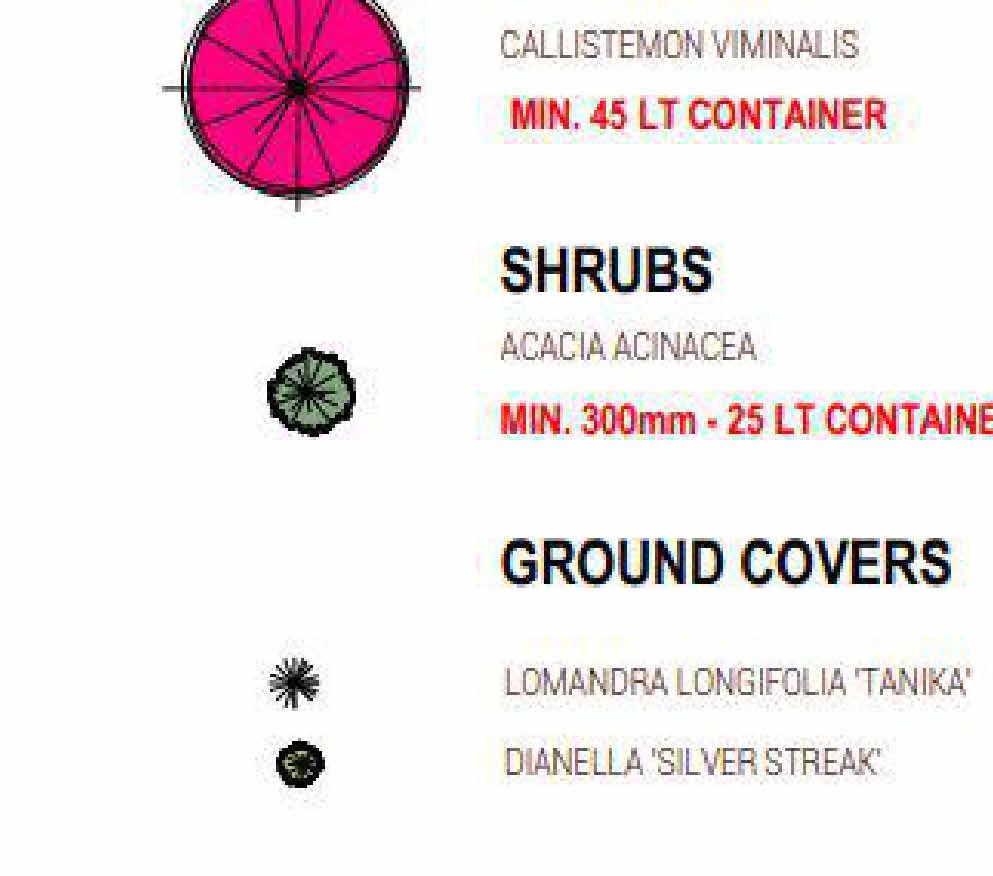
■ A landscape layout which includes the description of vegetation to be planted, the surfaces to be constructed, a site works specification and the method of preparing, draining, watering and maintaining the landscape area.
■ Exemption from notice
and review
An application is exempt from the notice requirements of section 52(1)(a), (b) and (d), the decision requirements of section 64(1), (2) and (3) and the review rights of section 82(1) of the Act. This exemption does not apply to an application for a building or works within 30 metres of land (not a road) which is in a residential zone or land used for a hospital or an education centre or land in a Public Acquisition Overlay to be acquired for a hospital or an education centre.
Decision guidelines
Before deciding on an application, in addition to the decision guidelines in Clause 65, the responsible authority must consider, as appropriate:
■ Any natural or cultural values on or near the land.
■
The Municipal Planning Strategy and the Planning Policy Framework.
■ Streetscape character.
33.01-5
31/07/2018
Built form.
■ Landscape treatment.
■ Interface with non-industrial areas.
■ Parking and site access.
■ Loading and service areas.
■ Outdoor storage.
■ Lighting.
■ Stormwater discharge.
■ Maintenance
All buildings and works must be maintained in good order and appearance to the satisfaction of the responsible authority.
VC148 Signs
Sign requirements are at Clause 52.05. This zone is in Category 2.
08/07/2021 C218gshe
Maximum leasable floor area requirements
Land
None specified
Maximum leasable floor area for office (square metres)
None specified
44.04
06/09/2021
VC171
LAND SUBJECT TO INUNDATION OVERLAY
Shown on the planning scheme map as LSIO with a number (if shown).
Purpose
To implement the Municipal Planning Strategy and the Planning Policy Framework.
To identify flood prone land in a riverine or coastal area affected by the 1 in 100 (1 per cent Annual Exceedance Probability) year flood or any other area determined by the floodplain management authority.
To ensure that development maintains the free passage and temporary storage of floodwaters, minimises flood damage, responds to the flood hazard and local drainage conditions and will not cause any significant rise in flood level or flow velocity.
To minimise the potential flood risk to life, health and safety associated with development.
To reflect a declaration under Division 4 of Part 10 of the Water Act, 1989
To protect water quality and waterways as natural resources by managing urban stormwater, protecting water supply catchment areas, and managing saline discharges to minimise the risks to the environmental quality of water and groundwater.
To ensure that development maintains or improves river, marine, coastal and wetland health, waterway protection and floodplain health.
44.04-1
24/01/2020
VC160
Land subject to inundation objectives and statement of risk
A schedule to this overlay may contain:
■ A statement of risk.
■
44.04-2
14/12/2023
VC253
Land subject to inundation management objectives to be achieved.
Buildings and works
A permit is required to construct a building or to construct or carry out works, including: A fence.
■ Roadworks, if the water flow path is redirected or obstructed.
■ Bicycle pathways and trails.
■ Public toilets.
■ A domestic swimming pool or spa and associated mechanical and safety equipment if associated with one dwelling on a lot.
■ Rainwater tank with a capacity of not more than 10,000 litres.
■ A pergola or verandah, including an open-sided pergola or verandah to a dwelling or a small second dwelling with a finished floor level not more than 800mm above ground level and a maximum building height of 3 metres above ground level.
■ A deck, including a deck to a dwelling or a small second dwelling with a finished floor level not more than 800mm above ground level.
■ A disabled access ramp.
■ This does not apply:
If a schedule to this overlay specifically states that a permit is not required.
■
■ To roadworks or bicycle paths and trails constructed or carried out by or on behalf of the Head, Transport for Victoria, to the satisfaction of the relevant floodplain management authority.
■
44.04-3
31/07/2018
VC148
44.04-4
31/07/2018
VC148
44.04-5
31/07/2018
VC148
44.04-6
31/07/2018
VC148
44.04-7
31/07/2018
VC148
44.04-8
06/09/2021
VC171
To flood mitigation works carried out by the responsible authority or floodplain management authority.
■ To the following works in accordance with plans prepared to the satisfaction of the responsible authority: The laying of underground sewerage, water and gas mains, oil pipelines, underground telephone lines and underground power lines provided they do not alter the topography of the land.
■ To post and wire and post and rail fencing.
■
■ The erection of telephone or power lines provided they do not involve the construction of towers or poles.
Subdivision
A permit is required to subdivide land.
Application requirements
An application must be accompanied by any information specified in a schedule to this overlay.
Local floodplain development plan
If a local floodplain development plan has been developed for the area and has been incorporated into this scheme, an application must be consistent with the plan.
Exemption from notice and review
An application under this overlay is exempt from the notice requirements of section 52(1)(a), (b) and (d), the decision requirements of section 64(1), (2) and (3) and the review rights of section 82(1) of the Act.
Referral of applications
An application must be referred to the relevant floodplain management authority under Section 55 of the Act unless in the opinion of the responsible authority, the proposal satisfies requirements or conditions previously agreed in writing between the responsible authority and the floodplain management authority.
Decision guidelines
Before deciding on an application, in addition to the decision guidelines in Clause 65, the responsible authority must consider, as appropriate: The Municipal Planning Strategy and the Planning Policy Framework.
■ Any local floodplain development plan.
■ Any comments from the relevant floodplain management authority.
■ The existing use and development of the land.
■ Whether the proposed use or development could be located on flood-free land or land with a lesser flood hazard outside this overlay.
■ Alternative design or flood proofing responses.
■ The susceptibility of the development to flooding and flood damage.
■
■ The potential flood risk to life, health and safety associated with the development. Flood risk factors to consider include:
■
■ The flood warning time available.
The frequency, duration, extent, depth and velocity of flooding of the site and accessway.
Tidal patterns.
■ Coastal inundation and erosion.
■ The danger to the occupants of the development, other floodplain residents and emergency personnel if the site or accessway is flooded.
■ The effect of the development on redirecting or obstructing floodwater, stormwater or drainage water and the effect of the development on reducing flood storage and increasing flood levels and flow velocities.
■ The effect of the development on river, marine and coastal health values including wetlands, natural habitat, stream stability, erosion, environmental flows, water quality, estuaries and sites of scientific significance.
■
■ Any other matters specified in a schedule to this overlay.
08/07/2021
C218gshe
1.0
08/07/2021
C218gshe
2.0
08/07/2021
SCHEDULE TO CLAUSE 44.04 LAND SUBJECT TO INUNDATION OVERLAY
Shown on the planning scheme map as LSIO
Land subject to inundation objectives to be achieved
None specified.
C218gshe Statement of risk
None specified.
3.0
17/08/2023 GC173
Permit requirement
A permit is not required to construct a building or construct or carry out works for the following:
■
■ A replacement dwelling where the floor level is at least 300 millimetres above the 100-year ARI flood level, or a higher level set by the responsible authority.
A single dwelling on an allotment within General Residential Zones, Neighbourhood Residential Zones, Residential Growth Zones where the floor level is at least 300 millimetres above the 100-year ARI flood level, or a higher level set by the responsible authority.
■ A single or multiple dwelling extension where: The combined ground floor area of the extension since 29th July 1999 is not greater than 20 square metres.
■ An upper storey extension to an existing building within the existing building footprint.
■
■ The owner can demonstrate to the satisfaction of the responsible authority that the floor height of the proposed dwelling extension/s is at least 300 millimetres above the 100-year ARI flood at the date of enquiry.
■ A pergola, verandah, decking, garage, carport, domestic shed, spa or swimming pool adjacent to an existing dwelling; including the extension to any of the aforementioned.
■ An agricultural shed (other than one used for industrial, retail or office purposes) for the storage of farm machinery, farm vehicles and workshop associated with a rural use in a farming zone with a floor area not more than 130 square metres.
■ A new industrial, retail, or office building within an industrial, commercial or activity centre zone of Mooroopna, Shepparton and Tatura where the floor level is at least 300 millimetres above the 100-year ARI flood level, or a higher level set by the responsible authority.
■ An extension to an existing industrial, retail or office building provided that the total ground floor area of the building is less than 130 square metres.
■ A fence in a residential, commercial, industrial or activity centre zone.
■ Open type fencing (not including solid fences such as wooden or metal paling fences, cyclone mesh fences or brick, stone or concrete wall).
■ An outdoor sign/structure.
■ A pump shed.
■ A hay shed with open sides.
■ A sportsground, racecourse or recreation area (with no permanent grandstand or raised viewing area), pathways and trails constructed at general natural surface elevation, playground, open picnic shelter, picnic table, drinking tap, rubbish bin, barbecue, works associated with an apiary or underground infrastructure.
■ A mast, antenna, lighting or telecommunications tower.
■ An accessway constructed at general natural surface elevations.
■ Roadworks carried out by a public authority.
■ 4.0
08/07/2021
C218gshe
5.0
17/08/2023
GC173
Earthworks/dam in accordance with the ' Earthworks Controls in the Shire of Campaspe, City of Greater Shepparton and the Shire of Moira Incorporated Document , December 2022 ' in the Schedule to Clause 72.04 Documents Incorporated in this Planning Scheme and approved by the responsible authority and the floodplain management authority.
■ Earthworks/flood mitigation works in association with the Goulburn Valley Freight Logistics Centre provided such works are in accordance with a Flood Management Plan approved by the responsible authority and the floodplain management authority.
Application requirements
An application is not required to be referred to the relevant floodplain management authority pursuant to Section 55 of the Act if the application is in accordance with a local floodplain development plan which has been incorporated at the Schedule to Clause 72.04 of this scheme.
Decision guidelines
In addition to the decision guidelines in Clause 44.03-8, before deciding on an application, the responsible authority must consider the following relevant local floodplain development plans, which have been incorporated at Clause 72.04 of this scheme, as indicated on the attached map: Precinct of Lower Goulburn (2006).
■ Precinct of Goulburn River (2006).
■ Precinct of Broken River (2006).
■ Precinct of Broken Creek (2006).
■ Precinct of Honeysuckle Creek and Seven Creeks (2006).
■ Precinct of Mosquito Creek (2006).
■ The responsible authority must also consider the ‘ Earthworks Controls in the Shire of Campaspe, City of Greater Shepparton and the Shire of Moira Incorporated Document , August 2020’ in the Schedule to Clause 72.04 Documents Incorporated in this Planning Scheme.
An application is not required to be referred to the relevant floodplain management authority pursuant to Section 55 of the Planning and Environment Act 1987 if the application is in accordance with a local floodplain development plan which has been incorporated at the Schedule to Clause 72.04 of this scheme.
Map 1 to the Schedule to Clause 44.04

45.12
04/05/2022
VC210
SPECIFIC CONTROLS OVERLAY
Shown on the planning scheme map as SCO with a number.
Purpose
To apply specific controls designed to achieve a particular land use and development outcome in extraordinary circumstances.
45.12-1
31/07/2018
VC148
Use or development
Land affected by this overlay may be used or developed in accordance with a specific control contained in the incorporated document corresponding to the notation on the planning scheme map (as specified in the schedule to this overlay). The specific control may:
45.12-2
31/07/2018
VC148
■
■ Prohibit or restrict the use or development of the land beyond the controls that may otherwise apply.
Allow the land to be used or developed in a manner that would otherwise be prohibited or restricted.
■ Exclude any other control in this scheme.
Expiry of a specific control
If a specific control contained in an incorporated document identified in the schedule to this clause allows a particular use or development, that control will expire if any of the following circumstances applies:
The use and development is not started within two years of the approval date of the incorporated document or another date specified in the incorporated document.
■ The development is not completed within one year of the date of commencement of works or another date specified in the incorporated document.
■ The responsible authority may extend the periods referred to if a request is made in writing before the expiry date or within three months afterwards.
Upon expiry of the specific control, the land may be used and developed only in accordance with the provisions of this scheme.
24/12/2019 C211gshe
1.0
24/12/2021
GC196
SCHEDULE TO CLAUSE 45.12 SPECIFIC CONTROLS OVERLAY
Specific controls
PS Map Ref Name of incorporated document
SCO1 Munarra Centre for Regional Excellence and Shepparton Sports and Events Centre Incorporated Document, September 2019
SCO2 Unilever Tatura Master Plan, 2014
SCO3 Goulburn-Murray Water: Connections Project and Water Efficiency Project Incorporated Document, November 2021
SCO14 Shepparton Line Upgrade Incorporated Document, October 2020
SCO4 Lot 6, 104-120 Graham Street, Shepparton, September 2021