Page 62 • January 19, 2022 • www.constructionequipmentguide.com • Technology Section • Construction Equipment Guide
Eye in the Sky Manhattan Construction Company Deploys Drones to Build $1B Globe Life Field
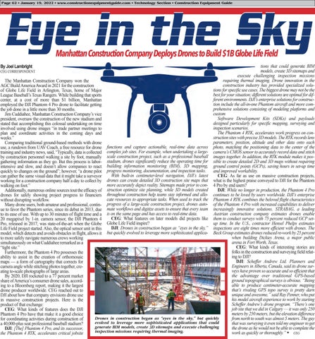
tions that could generate BIM models, create 3D sitemaps and execute challenging inspection missions requiring thermal imaging. Drone innovation in the The Manhattan Construction Company won the construction industry has provided specialized soluAGC Build America Award in 2021 for the construction tions for specific use cases. The biggest drone may not be the of Globe Life Field in Arlington, Texas, home of Major best for your situation; different solutions are optimal for difLeague Baseball’s Texas Rangers. While building that sports ferent environments. DJI’s enterprise solutions for construccenter, at a cost of more than $1 billion, Manhattan tion include the all-in-one Phantom aircraft and more comemployed the DJI Phantom 4 Pro drone to facilitate getting prehensive solutions consisting of modeling platforms and the job done in a little more than 30 months. custom Jim Cuddiahee, Manhattan Construction Company’s vice Software Development Kits (SDKs) and payloads president, oversaw the construction of the new stadium and designed particularly for specific mapping, surveying and stated that accomplishing this colossal undertaking on time inspection scenarios. involved using drone images “in trade partner meetings to The Phantom 4 RTK, accelerates work progress on conplan and coordinate activities in the coming days and struction sites with precise 3D models. The RTK records lens weeks.” parameters, position, altitude and other data onto each Comparing traditional ground-based methods with drone use, a rundown from UAV Coach, a free resource for drone functions and capture actionable, real-time data across photo, matching the positioning data to the center of the training and industry news, said, “Typically, data is collected complex job sites. For example, when undertaking a large- camera’s CMOS sensor to accurately record data and stitch by construction personnel walking a site by foot, manually scale construction project, such as a professional baseball images together. In addition, the RTK module makes it posgathering information as they go. But this process is labor- stadium, drones significantly reduce the operating time for sible to create detailed 2D and 3D maps without requiring intensive and slow, and doesn’t allow companies to react building information monitoring (BIM), 3D mapping, ground control points (GCPs), saving hours in set-up time and improved workability. quickly to changes on the ground”; however, “a drone pilot progress monitoring, documentation, and inspection tasks. With built-in centimeter-level navigation, DJI’s latest CEG: As far as use on massive construction projects, can gather the same visual data that it might take a surveyor working for a construction company half a day to collect by drones can create detailed 3D construction site maps that what is the highest praise conveyed to DJI for the Phantom more accurately depict reality. Sitemaps made prior to con- 4 Pro by end users? walking on foot.” DJI: While no longer in production, the Phantom 4 Pro Additionally, numerous online sources tout the efficacy of struction optimize site planning, while 3D models created drones for safely showing project progress to financiers throughout construction help teams stay informed and allo- continues to be loved by users worldwide. DJI’s enterprise cate resources to appropriate tasks. When used to track the Phantom 4 RTK combines the beloved flight characteristics without disrupting workflow. Many drone users, both amateur and professional, contin- progress of a large-scale construction project, drones auto- of the Phantom 4 Pro with increased capabilities to deliver ue to favor the Phantom series, since its debut in 2013, due mate workflows and digitize assets to ensure that every team increasingly innovative solutions. STRABAG, a leading Austrian construction company estimates drones enable to its ease of use. With up to 30 minutes of flight time and a is on the same page and has access to real-time data. CEG: What features on later models did projects like them to conduct surveys with 75 percent reduced GCP set20 megapixel by 1-in. camera sensor, the DJI Phantom 4 up time. In the U.S., contractor Hensel Phelps estimates Pro, released in 2017, was state-of-the-art when the Globe Globe Life Field inspire? DJI: Drones in construction began as “eyes in the sky,” inspections are eight times more efficient with drones. The Life Field project started. Also, the optical sensor unit in this model, which detects and avoids obstacles in flight, allows it but quickly evolved to leverage more sophisticated applica- Beck Group estimates drones reduced re-work by 25 percent when building Dickies Arena, a major public to more safely navigate numerous crews working arena in Fort Worth, Texas. simultaneously on what Cuddiahee remarked as a CEG: What kinds of interesting stories are “tight site.” folks in the construction and surveying field relatFurthermore, the Phantom 4 Pro possesses the ing to DJI? ability to assist in the creation of orthomosaic DJI: Scheffer Andrew Ltd. Planners and maps — a form of cartography that corrects for Engineers in Alberta, Canada, said its drone surcamera angle while stitching photos together, creveys have proven so accurate and so efficient that ating to-scale photographs of large areas. the advantage over traditional GPS-based By 2020, DJI rocketed to a 77 percent market ground topographical surveys is obvious. “Being share of America’s consumer drone sales, accordable to produce centimeter-accurate mapping ing to a Bloomberg report, making it the largest that’s rivaling GPS topo survey is pretty darn drone producer worldwide. CEG reached out to unique and awesome,” said Ray Penner, who put DJI about how that company envisions drone use his model aircraft experience to work by starting in massive construction projects. Here is the Scheffer Andrew’s drone program. “There’s one product of that exchange: job site that we did in Calgary — it was only 250 CEG: What kinds of features does the DJI meters by 250 meters, but the elevation difference Phantom 4 Pro have that make it a good choice Drones in construction began as “eyes in the sky,” but quickly from north to south was almost 5 meters. The guy for coordinating activities during construction of evolved to leverage more sophisticated applications that could that was surveying it even told my engineer to get a 40,000-plus seat professional baseball stadium? generate BIM models, create 3D sitemaps and execute challenging the drone as he would not be able to complete the DJI: [The] Phantom 4 Pro, and its successor, inspection missions requiring thermal imaging. work as quickly or thoroughly.” CEG the Phantom 4 RTK, accelerates critical jobsite
By Joel Lambright
CEG CORRESPONDENT


