

Areas of Change
Town Centre Neighbourhoods High Streets
Village Inner Suburban Suburban

Find out more background information about the borough in Appendix A ‘Understanding Spelthorne Today’.
Area Types
Within the Area of Change, more detailed requirements are set out by finer-grain Area Types. Each Area Type in the town centre is considered by whether it will largely retain its existing character and contribution to overall place identity, or whether it is likely to change substantially in character and has the opportunity to newly contribute to the town’s identity.
Incremental Change
Retaining existing character and place identity Design requirements strongly reflect context.
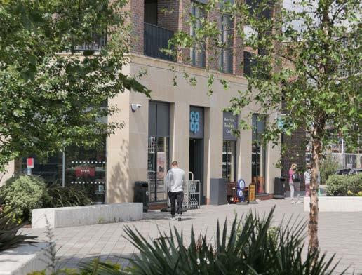
HISTORIC CORE
General requirements for the High Street Area Type (Chapter 4) apply.
General requirements for the Town Centre Neighbourhoods Area Type (Chapter 4) apply.
Transformative Change
Defining a new character and place identity. Design requirements set key parameters only.
A SPATIAL APPROACH FOR STAINES-UPONTHAMES TOWN CENTRE
It is anticipated that the town centre of Staines-upon-Thames will see substantial new development in the coming years. The spatial approach sets out an overview of how this might be accomplished in line with the vision set out in Chapter 3. Although it is illustrative, it guides the detailed design requirements set out later in the Design Code.
The spatial approach’s key aims are:
• To reflect the ambition of the community to preserve what makes the town special and familiar to them by identifying key streets and areas for incremental, small-scale change
• To define connected new town centre neighbourhoods that can accommodate new open spaces, new high-quality homes and new mixed-use facilities
• To enhance the character and future sustainability of the town centre
The spatial approach is a composite of a number of layers and design thinking that work together to guide development in the future in a coherent way. These are explored further on the following page.

TOWN CENTRE


River Thames
Staines Bridge
Staines Village
Two Rivers High St
London Road
Rail Station
Bus Station
Protecting the historic core
New green and blue spaces
Better spaces and connections
New homes and streets for people
IDENTITY - WHAT’S VALUED?
PLACE IDENTITY

The places that are valued by the community and define the identity of Staines-upon-Thames form the core of the spatial approach.
STREET CONNECTIONS GREEN LINKS

New neighbourhoods are linked and integrated to the High Street and surroundings through new walking and cycling street connections.

Staines Village (existing Business Park)
Areas of anticipated growth form new neighbourhoods, linked to their surrounding green open spaces and rivers through new green links.
BUILT FORM AND USES

New built form is related to surrounding neighbourhoods by ensuring transitions in height. The existing retail core is strengthened and extended.
Staines Moor
PLACE
NEW NEIGHBOURHOODS - LINKED, GREEN AND CONNECTED TO THE RIVERS
Elmsleigh
NEW NEIGHBOURHOODS - CONNECTED AND PART OF THE TOWN
NEW NEIGHBOURHOODS - BUILT FORM AND USES IN CONTEXT
/ Denser
OVERALL TOWN CENTRE CODING STRATEGIES
Informed by the spatial approach, a range of strategies guide the detailed coding requirements across the town centre. The minimum requirements for individual schemes to implement these strategies are set out in the detailed Area Type Coding.

Green & Blue Networks

Movement

Uses & Facilities
The town centre is surrounded by green and blue assets but is poorly connected to them. New development will join up and enhance the existing networks of green and blue infrastructure, for both people and nature to use.
This strategy will be implemented by creating and enhancing open spaces, new green streets, street transformations to include more planting, and enhancements to ecological networks.
The town centre is broken up by railway lines, major dual carriageway roads and large buildings that prevent movement. New development will enhance the existing street grid so that people can find their way and move around easily, and by more sustainable modes.
This strategy will be implemented by creating new street connections, enhancing the quality of existing streets and joining up the dots of existing active travel provision.
The town centre has a strong existing High Street and retail offer, and new neighbourhoods will connect to and enhance them. New neighbourhoods will connect to and enhance the existing core of the town centre.
This strategy will be implemented by ensuring new streets and places have active commercial ground floors in the right places.

Townscape
The new town centre neighbourhoods strongly correspond to areas with poor existing townscape, where new development could significantly enhance how the town centre is experienced overall.
This strategy will be implemented by the requirements for the arrangement of new open spaces, streets, heights, marker and landmark buildings, and the implementation of town centre neighbourhood townscape principles (Chapter 4).
Building Heights and Transitional Edges

A town centre strategy for building heights and transitional edges is set out on this plan. These are further explained and illustrated with sections and principles in the relevant Area Type requirements.


Heights typically up to:
3-4 storeys
5-6 storeys
8 storeys
Marker building where an additional 2 storeys may be accepted if supported by independent design review and set back from the street and sensitive edges


Transitional Edge, where heights step down to blend with prevailing built form and preserve street scale. Principles set out in individual Area Types.
THAMES ST
CLARENCE ST
STAINESBRIDGE
RIVERTHAMES
HISTORIC CORE
RETAINING THE CHARACTER OF THE TOWN’S HEART
DESIGN REQUIREMENTS
General requirements for the High Street Area Type (Chapter 4) apply. Development in this area type must comply with the following additional design requirements.
Where design requirements have a spatial requirement (e.g. location of key frontages) these are set out on the Area Type coding plan on the following page.
Building Heights
• Heights of between 3-6 storeys, to comply with the heights plan on the following page
DESIGN AIMS
New development will strongly reflect the context, respecting its surroundings and retaining, not changing, the existing character.
Existing Context & Place Identity
The heart of Staines-upon-Thames is a vibrant and successful High Street. This grew up on the historic Roman road crossing Staines bridge leading towards London. It is primarily a retailing street, with high activity levels, on-street uses such as the market and local events and is at the heart of the identity of the town. The Conservation Area covers the western half of this Area Type.
The built form throughout this area is primarily 3-4 storeys, with a fine urban grain and attractive townscape. There are some on-street trees and only one major open space in the Market Square.
The public realm is bisected by a major road, and the overall built form historically turns its back on the river.
• Where marker buildings are indicated, an additional 2 storeys may be added if proposals are subject to an independent design review. Top 2 storeys must be set back from the street and sensitive edges.
• Protect the scale of and characteristic aspect ratios of existing streets and spaces with development not dominating the street scene or materially altering its street section (shown in Sections 1, 2, 3).
Building Line
• Building line is continuous, with buildings set at the front of the plot
Building Grain
• Building widths of between 6-15m
• Building frontage grain of between 6-10m, with wider buildings visually subdivided Vertical Mix of Uses
• Ground floor retail and flexible commercial uses included in designs where this frontage type is specified
Public Realm
• Create a river front open space as part of development adjacent to Staines Bridge, requirements set out under ‘Key Open Space Requirements’ on following page..
• Enhanced planting and trees along river frontage to provide shade and ‘soft edge’ to town centre
Facades, Detail & Richness
• Retention of existing facades, where they are of historic or local importance, or are of distinctive and attractive architecture, and where this is technically feasible
• Roofs to be pitched, with a variety of forms acceptable (see Chapter 4) and informed by contextual study
• Windows on frontage to match surrounding rhythm and characteristics
• Materials and architectural detailing to respond to prevailing form
• Views along Clarence Street terminated with marker buildings
This plan sets out where design requirements apply within this Area Type.

Marker building where an additional 2 storeys may be accepted if supported by independent design review and set back from the street and sensitive edges


Gable end roof forms
Double-height window articulation
Decorative ironwork
Corner brickwork detailing and brick variation
Cream and yellow brick
White render
Shades of red brick
Market Square - colonnades
KEY OPEN SPACE REQUIREMENTS
Proposals for a new open space must include:
1. Thames Path running through space
2. Additional tree planting along frontage
3. Accessible connection between Clarence St and River Thames frontage
4. Opportunity for commercial reuse of bridge arches, with associated spill-out public realm
5. Active frontages at lower level facing river, with associated spill-out public realm
6. Active frontage at street level facing Bridge Street, with associated spill-out public realm
7. Open space with a mix of planted, treed and hard landscape

Illustrative approach to applying the key design requirements
EXAMPLES AND PRECEDENTS
Development in this area could implement the following design features, character and opportunities.

Providing spill-out space in the public realm through materials, planting, surface finishes and retractable canopies.


Creative use of existing heritage assets, frontages and spaces to bring back life and activity.
Creating new incidental spaces such as courtyards within development off main streets.
MEMORIAL GARDENS
IMPROVING AND RESPECTING THE RIVER THAMES FRONTAGE
DESIGN REQUIREMENTS
KINGSTONROAD
General requirements for the Town Centre Neighbourhoods Area Type (Chapter 4) apply. Development in this area type must comply with the following additional design requirements. Where design requirements have a spatial requirement (e.g. location of key frontages) these are set out on the Area Type coding plan on the following page.
The Street & Ground Floor
• Building line to be continuous along Thames Street. Setback from plot edge of at least 2m to provide additional public realm for use as spill-out space or planting
DESIGN AIMS
New development in this area of the Thames frontage will face the river, relate to and help to animate the green open space, and create new connections to the rest of the town centre. Any development will be of exceptional architectural quality and enhance the existing townscape.
Existing Context & Place Identity
The River Thames, and the bridge across it, is the primary reason for the existence of Stainesupon-Thames, and is a much valued asset.
Historically, the town ‘turned its back’ on the river, primarily seeing it as a location for industry and other marginal uses, and it has only been in the latter stages of the 20th century that its value as a leisure and recreation asset has been recognised, with the creation of Memorial Gardens and the Thames Path national longdistance footpath running through the town.
• Extend the Thames Path along the full extents of river frontage from Memorial Gardens to the railway bridge
• Planting and trees accommodated along Thames St in areas of extended public realm.
• Ground floor retail and flexible commercial useswhere this frontage type is specified.
• Frontages to activate Memorial Gardens
Scale & Massing
• Heights to comply with the maximum heights plan and key principles in Sections 1 and 2 on the following pages
• Building widths of 10-25m
• Appropriate development typologies include Villas and linear blocks
Open Spaces
• Buildings to face Memorial Gardens
• Extend Memorial Gardens onto the existing car park, design requirements set out under ‘Key Open Space Requirements’ on following page.
• Extend the green open space network from Memorial Gardens towards the northwest
Detail & Richness
• Roofs to contribute to townscape with pitched form, and with variation when viewed from a distance.
• Building frontage grain of 10-15m, with wider buildings visually subdivided
• Marker buildings at key locations to provide legibility and townscape interest. See coding plan.
• 3-4 storey landmark mixed-use building opportunity adjacent to Memorial Gardens, anchoring the extended space
AREA TYPE CODING PLAN
This plan sets out where design requirements apply within this Area Type.
SOUTH ST HIGHST
THAMES ST
2
Section location
Allocated site in Local Plan
THE STREET & GROUND
FLOOR
Building Line
New Active Frontage
Retail / Flexible
Commercial Ground Floor
Key Overlooking Location
Existing path or active travel street to connect to
New active travel street connection
New green open space
Extension to public realm
Street Planting & Greening
DETAIL & RICHNESS
Marker Building
Landmark Building
BUILDING HEIGHTS PLAN
Heights typically up to:
See Sections 1 and 2 on following page for explanation and key principles on heights.
HEIGHTS AND SCALE PRINCIPLES
This diagram illustrates overall principles and rationale for the scale and massing in the river frontage area. These are set out to protect the scale and character of the riverside frontage.
For locations of sections see Coding Plan on previous page.
Key principles for massing are that development must:
• Have a frontage along Thames Street should at a maximum of 8 storeys to retain an appropriate scale to Memorial Gardens, and to reduce the impact of taller buildings set back behind Thames Street
• Have maximum heights on the river side of Thames Street should be similar to those already in existence (up to 6 storeys immediately adjacent to Thames Street)
• Have maximum heights on the river side of Thames Street should step down towards the river frontage, at a maximum of 3 storeys if immediately adjacent to the river
• Have building mass that is broken up with variety in heights, roofscape and articulation of facades
Taller buildings visible behind frontage but do not define scale of space
Thames Path River Thames
Space bounded by Thames St frontage (8 storeys)
8 storeys (approx 25m)
Town’ Elmsleigh
Thames Street
Extended Public Realm Memorial Gardens
Existing building further NW on Thames St (6 storeys)
‘River Town’ towers behind Thames St frontage
Maximum height of Thames St frontage 8 storeys (approx 25m)
Overall envelope for new built form, stepping down to 3st closer to river edge
Extension to Memorial Gardens
‘River
KEY OPEN SPACE REQUIREMENTS
Proposals for a new open space must include:
1. Thames Path running through space, extended along river front with overlooking from built form
2. Accessible connections and improved crossing across Thames St
3. West or Southwest facing active frontage facing river and green open space with associated spill-out public realm
4. Active frontage on Thames St
5. Extension of existing green open space
6. Additional tree planting

EXAMPLES AND PRECEDENTS
Development in this area could implement the following design features, character and opportunities.

Use of hard landscape public realm to support active ground floor uses on the edge of Memorial Gardens, with trees for shade and to provide a transition to greener open space in Memorial Gardens.

Fine-grained, varied frontages that address the river, open up views and connections, and provide overlooking to Memorial Gardens without overwhelming the scale of the space.
Illustrative approach to applying the key design requirements


Use of gable-end and set back roofs to provide interest and variety to building tops, and usable private outdoor space facing the river.
Activating open space with play and landscape features to encourage the use of Memorial Gardens as a destination, with play, seating and other activities available.
STATION PATH
IMPROVING CONNECTIONS AND INTEGRATING DEVELOPMENT SENSITIVELY
DESIGN REQUIREMENTS
General requirements for the Town Centre Neighbourhoods Area Type (Chapter 4) apply. Development in this area type must comply with the following additional design requirements. Where design requirements have a spatial requirement (e.g. location of key frontages) these are set out on the Area Type coding plan on the following page.
The Street & Ground Floor
• Match and repair existing building lines.
• Provide a setback along Station Path for seating and planting.
DESIGN AIMS
New development in this area will realise the potential of the sustainable location close to the railway station. It will benefit the surroundings by enhancing the Station Path, providing safe and attractive links between the path and Kingston Road, and reducing areas of severance and discontinuity. It will relate respectfully in scale and massing to the residential area to the north.
Existing Context & Place Identity
The Station Path is an important gateway to the town and has an attractive green character, but is bordered by car parks and underused spaces that can make it feel unsafe.
Community and commercial uses, along with apartments, are located on Kingston Road. A mix of Victorian and Edwardian homes are interspersed with more modern, less wellintegrated development and surface parking.
• Provide passive surveillance of Station Path, particularly the railway underpass and surrounding area
• Pedestrian and cycle links between Kingston Road and the Station Path
• Street network to respect and connect to existing street grid and characteristic blocks of 55-75m width
Scale & Massing
• Heights to transition to surrounding built form as set out on the transitional edges plan and key principles in Section 1 on following pages
• Building widths or frontage grain of between 7-15m to reflect existing built form
• Appropriate development typologies include terraces, mews, linear blocks, villas and occasional towers on podiums.
Open Spaces
• Create a square in front of the Oast House which provides an appropriately-scaled space for this building. Requirements are set out under ‘Key Open Space Requirements’ on following page.
Detail & Richness
• Roofs up to 5 storeys to be pitched with gable ends and dormers acceptable.
• Roofs of taller buildings to provide visual interest with distinctive form, and with variation when viewed from a distance.
• Marker buildings at key locations to provide legibility and townscape interest. See coding plan.
CODING PLAN
This plan sets out where design requirements apply within this Area Type.
SOUTH ST
LONDON ROAD
Commercial
KINGSTONROAD
Existing path or active travel street to connect to
Transitional Edge, where heights step down to blend with prevailing built form and preserve street scale.
See Section 1 on following page for explanation and key principles on transitional edges.
HEIGHTS AND SCALE PRINCIPLES
This diagram illustrates overall principles for the scale and massing in the Station Path area.
For section location see Coding Plan.
Oast House for context (Heights to step down approaching building to maintain quality of public space)
Existing London Road built form for context
Stepped height to maintain Kingston Road scale
Key principles for massing are that development must:
• Step down to 3-4 storeys to meet Kingston Road towards the east, preserving its scale and views from the street and buildings to the north
• Step down to 5-6 storeys to meet Kingston Road towards the west, closer to London Road
• Step down to 5-6 storeys create a human scale adjacent to Station path
• Step down to meet the public space in front of the Oast House as set out in the Key Open Space Requirements on the following page
down to 5-6 storeys at
Overall envelope for built form
Existing building further NW on Kingston Road (4 storeys)
Stepped height to maintain Kingston Road scale
Proposed building line to match prevailing line on Kingston Road
Elmsleigh
KEY OPEN SPACE REQUIREMENTS
Proposals for a new open space must include:
1. Improved overlooking of Station Path
2. Walking and cycling connection between Kingston Road and Station Path
3. Public space created in front of Oast House with new surrounding built form scaled and set back at taller heights, as shown in section inset.
4. ‘Spill-out’ public realm immediately in front of Oast House
5. Tree planting within public realm to provide shade and character to space
6. Overlooking and active frontages to all spaces from new built form

Illustrative approach to applying the key design requirements
EXAMPLES AND PRECEDENTS
Development in this area could implement the following design features, character and opportunities.

Streets that prioritise people and limit vehicle speeds, and reflect the existing structure and key dimensions of blocks and streets in the surrounding context.


Use of artwork in the public realm to provide legibility and a distinctive character to this area, particularly on new pedestrian links past the Oast House.
Use of mews streets to ensure high densities within blocks whilst maintaining a mix of house types in developments.
LONDON ROAD
A NEW GATEWAY NEIGHBOURHOOD FOR THE TOWN CENTRE
DESIGN REQUIREMENTS
General requirements for the Town Centre Neighbourhoods Area Type (Chapter 4) apply. Development in this area type must comply with the following additional design requirements. Where design requirements have a spatial requirement (e.g. location of key frontages) these are set out on the Area Type coding plan on the following page.
The Street & Ground Floor
• Building line to be set back from plot edge along London Road to provide additional public realm, planting and spill-out space.
DESIGN AIMS
New development in this area will create new high-quality green spaces and public realm for residents and the public that provide a setting for higher-density buildings, and maximise connectivity through to the suburbs and green spaces to the north.
Existing Context & Place Identity
On the north-eastern side of the railway tracks, under the Iron Bridge, the London Road area is an extension of the High Street. It has some secondary and local retail and service uses, as well as being a focus for a number of larger highdensity residential schemes, with associated ground floor retail uses.
London Road is an important gateway location for the town and is a major new neighbourhood for Staines-upon-Thames.
• Retail and commercial ground floor uses to be located along London Road frontage Scale & Massing
• Heights to transition to surrounding built form as set out on the transitional edges plan and key principles in Section 1 on following pages
• General presumption of high residential densities and Floor Area Ratio of 3.0 or above.
• Appropriate development typologies include occasional podiums and towers, villas and linear blocks.
Open Spaces
• Create a linear green open space from London Road/Kingston Road towards the north. Requirements are set out under ‘Key Open Space Requirements’ on following page.
Detail & Richness
• Roofs of taller buildings should provide visual interest with distinctive form, and with variation when viewed from a distance.
• Marker buildings at key locations to provide legibility from London Road towards other developments further north. See coding plan.
This plan sets out where design requirements apply within this Area Type.
Transitional Edge, where heights step down to blend with prevailing built form and preserve street scale.
See Section 1 on following page for explanation and key principles on transitional edges.
& GROUND FLOOR
HEIGHTS AND SCALE PRINCIPLES
This diagram illustrates overall principles for the scale and massing in the London Road area.
For section location see Coding Plan.
Former Telephone Exchange Building
London Square Key views from surrounding suburbs
Sensitive Edge Kingston Road / Station Path Area
Key principles for massing are that development must:
• Step down towards the northern edge bordering Waters Drive to approximately match the heights of the existing tree belt (5/6 storeys)
• Heights to peak in the centre of the neighbourhood at 12 storeys
• Heights on London Road to be no higher than the currently prevailing heights of recent developments (approx 10 storeys / 32m)
• Be generally lower in height on the southwestern side of London Road to transition to this lower-rise existing residential area
Overall envelope for built form
Proposals for a new open space must include:
1. Connections to wider open spaces and neighbourhoods to the north
2. Retention of existing trees
3. Overlooked public realm at key node
4. Connection from London Road to former Telephone Exchange site and public realm
5. Overlooked linear green open space
6. Improved pedestrian and cycling connections at London Road / Kingston Road junction
7. Retail frontage and associated ‘spill-out’ public realm on London Road
8. Marker building to terminate views along linear green open space

Illustrative approach to applying the key design requirements
EXAMPLES AND PRECEDENTS
Development in this area could implement the following design features, character and opportunities.

Well-overlooked green open spaces with trees, seating and a choice of walking routes.

Active commercial ground floors that have a strong relationship with a pedestrian-friendly public realm.
Urban character of public realm with trees, cycle parking and hard landscape at key nodes, such as along London Road or at the public realm square opportunity set out on the coding plan.
TWO RIVERS
A NEW NEIGHBOURHOOD WITH ACCESS TO NATURE
DESIGN REQUIREMENTS
General requirements for the Town Centre Neighbourhoods Area Type (Chapter 4) apply. Development in this area type must comply with the following additional design requirements. Where design requirements have a spatial requirement (e.g. location of key frontages) these are set out on the Area Type coding plan on the following page.
The Street & Ground Floor
• New street layouts designed on ‘superblock’ principles to prioritise active travel, with vehicle movement limited to parking and service access to buildings
DESIGN AIMS
New development in the Two Rivers area will create a new, integrated primarily residential neighbourhood strongly related to the watercourses running through it. Opportunities to reflect the grain or character of the historic industrial uses of the site are supported.
Existing Context & Place Identity
To the north-west of the core of the historic town centre sits the Two Rivers Retail Park, which occupies land previously used for the linoleum industry. The area is dominated by a large surface car park and associated highway infrastructure and edged by modern retail and leisure units. The retail park integrates well with the core High Street and strengthens the overall town centre offer.
• New streets to connect to and extend the street grid of the town centre from the southeast
• Enhance the safety of the existing pedestrian bridge towards the west by locating of built form with active frontages facing it
• Connect new streets to existing footpaths along River Wraysbury corridor
• Retention and extension of retail, leisure and other commercial uses along key NW-SE axis. See Coding Plan.
Scale & Massing
• Heights to transition to surrounding built form as set out on the transitional edges plan and key principles in Section 1 on following pages
• Massing led by creating a comfortable street scale with the tightest width:height ratio of around 1:1. Heights that would break this street aspect ratio are permitted through the use of a ‘shoulder’ where heights step back from the street edge.
• General presumption of high residential densities and Floor Area Ratio of 3.0 or above.
• Terraces and linear blocks to be used close to sensitive edges.
• All development typologies may be appropriate in other locations
Open Spaces
• Create a new linear park and public spaces along a restored River Colne. Requirements are set out under ‘Key Open Space Requirements’ on following page.
• Enhancement of the habitats and watercourses of the Rivers Wraysbury and Colne, including potential for river restoration approaches along the Colne.
Detail & Richness
• Roofs of taller buildings should provide visual interest with distinctive form, and with variation when viewed from a distance.
AREA TYPE CODING PLAN
This plan sets out where design requirements apply within this Area Type.
Section location
Allocated site in Local Plan
New Active Frontage
Retail / Flexible
Commercial Ground Floor
Key Overlooking Location
Existing path or active travel street to connect to
New active travel street connection
MASSING
Sensitive Edge
TRANSITIONAL EDGES PLAN
Transitional Edge, where heights step down to blend with prevailing built form and preserve street scale.
See Section 1 on following page for explanation and key principles on transitional edges.
STREET
GROUND FLOOR
HEIGHTS AND SCALE PRINCIPLES
This diagram illustrates overall principles for the scale and massing in the Two Rivers area. For section location see Coding Plan.
Overall envelope for built form Sensitive Edge Existing Two Rivers Units
Road Developments for Context Existing Two Rivers Units
Key principles for massing are that development must:
• Step down towards the neighbouring residential area to the northwest, with heights at the edge approximately as high as the existing tree belt on the River Wraysbury (~1518m, 5-6 storeys)
• Have heights of up to 8 storeys immediately adjacent to the new linear park, with taller heights set back with a ‘shoulder’
Wraysbury Gardens
KEY OPEN SPACE REQUIREMENTS
Proposals for a new open space must include:
1. Connections across existing bridges to town centre streets into open space and towards the north and west
2. Crossing point to provide walking and cycling access to open space
3. Overlooked, activated public realm at node
4. Marker building to terminate view from town centre
5. Retail active frontage around key node and overlooking of open space from built form
6. Strengthening of existing trees and planting to create varying landscape character
Accessible green open space around river
7. Walking and cycling links through open space

Illustrative approach to applying the key design requirements
EXAMPLES AND PRECEDENTS
Development in this area could implement the following design features, character and opportunities.

Views maintained through development to provide a visual connection to surrounding areas and natural spaces.


Using the design and materiality of bridges as important connection points and features.
Use varied and attractive landscape and public realm features to make use of the River Colne as the heart of a new open space, reactivating this area for both nature and people.
ELMSLEIGH
A BUSTLING TOWN CENTRE NEIGHBOURHOOD FOR ALL
DESIGN REQUIREMENTS
General requirements for the Town Centre Neighbourhoods Area Type (Chapter 4) apply. Development in this area type must comply with the following additional design requirements.
Where design requirements have a spatial requirement (e.g. location of key frontages) these are set out on the Area Type coding plan on the following page.
The Street & Ground Floor
• New street layouts designed on ‘superblock’ principles to prioritise active travel, with vehicle movement limited to parking and service access to buildings. South Street to become a multi-modal street (chapter 4).
DESIGN AIMS
New development in the Elmsleigh area will create a new, integrated mixed-use town centre neighbourhood, progressively changing the existing monolithic, inwardfacing built form to one of streets, open spaces and individual buildings, with much better connections to the river frontage and surrounding neighbourhoods and facilities.
Existing Context & Place Identity
The area to the south-east of the High Street is a covered 1970s shopping centre with a large multi-storey car park and service entrances on main streets. It is a part of the town’s retail offer.
This part of the town centre is also an important gateway for public transport users, arriving by rail or bus, and for those walking or cycling, as the majority of homes in Staines-upon-Thames located within walking or cycling distance of the town centre are located to the south-east.
• Retain existing NW-SE High St to bus station connection as a pedestrian priority street
• Retention and extension of existing retail, leisure and other commercial uses along key NW-SE axis, connecting to High Street and bus station. See Coding Plan.
• Mix of retail and commercial unit sizes to provide opportunities for smaller and independent businesses
• Create new NE-SW pedestrian priority connection towards river frontage
• Active frontage onto South Street and bus station
Scale & Massing
• Heights to transition to surrounding built form as set out on the transitional edges plan and key principles in Section 1 on following pages
• Massing led by creating a comfortable street scale with the tightest width:height ratio of around 1:1. Heights that would break this street aspect ratio are permitted through the use of a ‘shoulder’ where heights step back from the street edge.
• General presumption of high residential densities and high Floor Area Ratio of 3.0 and above.
• Appropriate development typologies include podiums and towers, villas and linear blocks closer to edges.
Open Spaces
• New green open space at heart of new neighbourhood, where streets cross. Requirements are set out under ‘Key Open Space Requirements’ on following page.
Homes & Practicalities
• Retain existing public car parking provision within consolidated deck structures, with attractive facades or sleeved by other development
Detail & Richness
• Roofs of taller buildings should provide visual interest with distinctive form, and with variation when viewed from a distance.
AREA TYPE CODING PLAN
This plan sets out where design requirements apply within this Area Type.
HIGHST LONDON ROAD
Section location
Allocated site in Local Plan
STREET & GROUND FLOOR
Building Line
New Active Frontage
Retail / Flexible
SOUTH ST
THAMES ST
TRANSITIONAL EDGES PLAN
Commercial Ground Floor
Key Overlooking Location
Street Planting & Greening THE
Existing path or active travel street to connect to
New active travel street connection
New open space/ public realm
DETAIL & RICHNESS
Marker Building
KINGSTONROAD
Transitional Edge, where heights step down to blend with prevailing built form and preserve street scale.
See Section 1 on following page for explanation and key principles on transitional edges.
SPACES
HEIGHTS AND SCALE PRINCIPLES
This diagram illustrates overall principles for the scale and massing in the Elmsleigh area.
For section location see Coding Plan.
Key principles for massing are that development must:
• Step down towards the permitted heights in the High Street (5-6 storeys)
• Ensure that views from street level in the High Street are not interrupted by new built form in the Elmsleigh Area
Overall envelope for built form
Existing ‘River Town’ development
Shoulder step-down for open space
• Have a podium or base facade of up to 8 storeys surrounding any new public open spaces, with taller buildings set back above a ‘shoulder’
Existing heights of Elmsleigh Centre High
Progressive rise in heights to aid transition between High St and new neighbourhood
KEY OPEN SPACE REQUIREMENTS
Proposals for a new open space must include:
1. Key connections to High Street, Bus Station and Memorial Gardens
2. Potential secondary connection to the northeast
3. Green open space or new public realm with trees and planting
4. Retail active frontages facing space with associated ‘spill-out’ public realm
5. Built form to create active edge along southwestern frontage
6. Tree-lined, overlooked connection towards the river and Memorial Gardens

Illustrative approach to applying the key design requirements
EXAMPLES AND PRECEDENTS
Development in this area could implement the following design features, character and opportunities.

Variety in materials, architecture and roof types to provide variation while maintaining fine grain, human-scale streets.


Creation of an open space with a distinct urban character, variety of spaces and uses within.
Use of patterns, materials and detailing in the public realm to create attractive pedestrianpriority streets that lead people through the neighbourhood.
RAILWAY EDGES
IMPROVING THE QUALITY OF STREETS AND SPACES
DESIGN REQUIREMENTS
General requirements for the Town Centre Neighbourhoods Area Type (Chapter 4) apply. Development in this area type must comply with the following additional design requirements.
Where design requirements have a spatial requirement (e.g. location of key frontages) these are set out on the Area Type coding plan on the following page.
The Street & Ground Floor
• Create a strong street edge with a podium or continuous base building to limit impact of railway on wider town centre neighbourhoods. See following pages for principles.
DESIGN AIMS
New development in these locations will ensure that noise levels and quality of spaces next to the railway line are acceptable for residents. They should create good quality street environments and ensure that any existing or new connection points across the railways are safe, overlooked and become part of the wider street network.
Existing Context & Place Identity
Two busy railway lines divide Staines-uponThames town centre from its surrounding suburbs. On the river/town centre side of these lines are a series of car parks and other areas where new development is proposed. There is little existing built form but on the other side of the railway lines are primarily existing suburbs.
• Safeguard potential new link across Egham railway tracks towards railway station. See Coding Plan.
• Incorporate new street trees and planting along main roads, particular South St to aid transformation to multi-modal street.
Scale & Massing
• Heights to transition to surrounding built form as set out on the transitional edges plan
• Massing led by creating a comfortable street scale with the tightest width:height ratio of around 1:1. Heights that would break this street aspect ratio are permitted through the use of a ‘shoulder’ where heights step back from the street edge.
• General presumption of high residential densities and high Floor Area Ratio of 3.0 and above, particular close to major roads such as South St.
Open Spaces
• Create a gateway space at edge of Elmsleigh neighbourhood. Requirements are set out under ‘Key Open Space Requirements’ on following page.
Homes & Practicalities
• Retain existing public car parking provision within consolidated deck structures, with attractive facades or sleeved by other development
Detail & Richness
• Roofs of taller buildings should provide visual interest with distinctive form, and with variation when viewed from a distance.
AREA TYPE CODING PLAN
Allocated site in Local Plan
This plan sets out where design requirements apply within this Area Type.
STREET & GROUND FLOOR
New Active Frontage
Key View to Retain
Key Overlooking Location
Existing path or active travel street to connect to
New active travel street connection
SCALE & MASSING
New Active Frontage
Key View to Retain
Key Overlooking Location
Existing path or active travel street to connect to
New active travel street connection
DETAIL & RICHNESS SCALE & MASSING
Sensitive Edge
Railway Edge
Public realm enhancements
Street Planting & Greening
TRANSITIONAL EDGES PLAN
Marker Building
LONDON ROAD
Sensitive Edge
Railway Edge
SPACES
Public realm enhancements
Street Planting & Greening
DETAIL & RICHNESS
Marker Building
Transitional Edge, where heights step down to blend with prevailing built form and preserve street scale.
Allocated site in Local Plan
New Active Frontage THE STREET & GROUND FLOOR
RESPONDING TO A RAILWAY LINE
This diagram sets out overall principles and an illustrative example for arranging built form along a railway edge.
Key principles for massing are that development must:
• Have a continuous podium, plinth or base building along the street edge that provides good enclosure and active frontage to the street
• Arrange taller massing above this in a way that provides residents with a variety of views to both town centre and across surrounding areas and the railway lines
Retail Ground Floor
Office / Commercial Residential Apartments Podium Car Parking

Railway Edge
• Service access
• Back of podium
CREATING A STREET EDGE
This diagram sets out overall principles for how the use of a base podium with active frontage can create an attractive street environment, vertical integration of different uses, and how massing should relate to the street and the railway lines.

Retail Ground Floor Office / Commercial
Residential Apartments
Each use with separate street entrances
Podium Car Parking
Street Edge
Podium
e.g. South St Railway tracks
Defined edge to street
Use of ‘shoulder’ set back at height
Terrace edge to top floors
Shared garden on top of podium
Rear servicing Access
Street frontage
KEY OPEN SPACE REQUIREMENTS
Proposals for a new open space must include:
1. Connection to Station Path through underpass, with improved overlooking and attractive green space environment
2. Improved crossing point and public realm for walking and cycling
3. Built form to overlook streets and public realm
4. Retail and activated frontage facing towards bus station and railway station connection, with associated ‘spill out’ public realm
5. Street tree planting and progressive change of South Street to a ‘boulevard’
6. Consideration of potential future connection across railway tracks to the southeast

Illustrative approach to applying the key design requirements
EXAMPLES AND PRECEDENTS
Development in this area could implement the following design features, character and opportunities.

Rear/railway side to provide quality amenity space for residents through changes in levels.


Multi-storey car parks with facade treatments, ideally located above active commercial ground floors.
Activated street edge with balconies and more distinctive built form to mark corners.
High Streets
Town Centre Neighbourhoods
Suburban
Business Park
Light Industrial
Retail Park
DESIGN AIMS
New development in Sunbury Cross town centre will:
Create connections between areas of new development and the core of Sunbury Cross
Improve the road safety and personal security of the public realm and streets
Reduce severance created by infrastructure
Link the railway station to the main shopping area
Find out more background information about the borough in Appendix A ‘Understanding Spelthorne Today’.

The varied existing context of low and high-rise development in Sunbury Cross
Create a more human-scale place and street environment
Create much-needed green open spaces for residents and the community
Area Types
Within the Area of Change, more detailed requirements are set out by finer-grain Area Types. Each Area Type in the town centre is considered by whether it will largely retain its existing character and contribution to overall place identity, or whether it is likely to change substantially in character.
Incremental Change
Retaining existing character and place identity Design requirements strongly reflect context.
THE PARADE
General requirements for the High Street Area Type (Chapter 4) apply.
STAINES ROAD WEST
General requirements for Suburban Area Type (Chapter 4) apply.
STATION AREA
HANWORTH ROAD
CENTRAL AREA
Transformative Change

THE CROSS
General requirements for the Town Centre Neighbourhoods Area Type (Chapter 4) apply.
Defining a new character and place identity Design requirements set key parameters only. The Cross itself, now the M3 junction, lies mostly outside of the scope of the Design Code. It requires substantial transformative change in line with the spatial vision set out.
A FUTURE VISION FOR SUNBURY CROSS
Sunbury Cross is a place negatively impacted by a complex mix of major roads, railways and water supply infrastructure. It was transformed in the late 1960s and early 1970s by the M3 flyover and junction, which continues to detract from its quality as a place, and causes noise, safety and air quality issues.
Sunbury Cross can be more than a motorway junction with hard edges, railway and road severance, aqueduct edges, wedges of land, a retail mall and section of frontage shops and disconnected residential neighbourhoods. The spatial vision sets out the possibilities that could be pursued through wider work as well as individual schemes.
The Design Code sets out how new development can help to make this happen through incremental change. Major change at Sunbury Cross requires further work and co-ordination amongst all parties to move towards a transformative masterplan.
The vision’s key aims are:
• Connect existing and new neigbourhoods with each other
Concept

• Connect the centre with the railway station
• Create new green spaces and links
Many of the key changes at Sunbury Cross will be beyond the scope of individual applications, requiring wider co-ordination on changes to infrastructure. Designs should respond to the potential for change in the future and make appropriate provision.
Key Themes and Projects
Short Term
Linking the centre and the station
Medium Term
Transforming Staines Road West
New links between neighbourhoods
Human-scale built form
New green spaces and networks
Long Term
M3 junction reconfiguration

Re-imagining how people could move through Sunbury Cross, with lighting, artwork, planting and surface street crossings

Short
Term
• Linking the centre and the station


Medium Term
• Transforming Staines Road West


Exchange St ‘Grey-to-Green’
Providing an attractive, safe and clear surface route through existing space under the M3 would improve the ease of walking and cycling movement for all between Sunbury Common / the centre and Lower Sunbury / the station.
Staines Road West is currently a major dual carriageway and a barrier for moving between shops and neighbourhoods. New green infrastructure, public realm changes and a transformation to a ‘boulevard’-style environment would create a healthier, more attractive street environment.
Medium Term • New green spaces and networks Long Term
M3 junction reconfiguration


The Staines Aqueduct is a major piece of infrastructure severing links between neighbourhoods. Although access to the aqueduct may need to remain restricted, it could form the basis of a future green network linking neighbourhoods together and contributing to a greener, healthier Sunbury Cross.
The M3 junction and flyover dominate Sunbury Cross today. Long-term, this may change, following precedent from other cities across the world who have successfully reconsidered the need for urban motorways
Top: Phoenix Flowers, M8, Glasgow (7N Architects)
Bottom: Toronto Gardiner Freeway Park
transformation, Sheffield
Mayfield Park, Manchester
Masshouse Circus transformation to Masshouse Plaza, Birmingham
THE PARADE
THE HISTORIC LINK TO THE PAST IN SUNBURY CROSS
DESIGN REQUIREMENTS
General requirements for the High Streets Area Type (Chapter 4) apply. Development in this area type must comply with the following additional design requirements.
Building Heights
• Heights of up to 4 storeys, plus 1 dormer/ mansard storey integrated in roof, in compliance with maximum heights plan
Building Line
• Match existing building line along Staines Road West
DESIGN AIMS
New development in this area will respond to the strong existing building line and low-rise built form, with some intensification along Staines Road West.
Existing Context & Place Identity
The Parade, a row of shops and commercial buildings, is one of the few areas of Sunbury Cross that retains its more traditional built form. To the north it borders a largely post-war suburban area, and it thus forms an important transitional area from the Centre to the south.
Building Grain
• Typical building frontage grain of 6-10m
Vertical Mix of Uses
• Ground floor commercial space
• Apartments located aove ground floor uses
Public Realm
• Incorporate new street trees and planting along Staines Road West
• Future-proof designs for potential removal of frontage service access road
• Rear parking courts overlooked by built form

• Minimise access points to rear parking courts through main frontage
• Entrances to dwellings from the street
Facades, Detail & Richness
• Pitched roofs facing the street or gable-end, to reflect adjacent buildings
• Windows on frontage to match surrounding rhythm and characteristics
• Materials and architectural detailing to respond to prevailing form
BUILDING HEIGHTS PLAN
Heights typically up to:


5 storeys
STAINES ROAD WEST
CONNECTING NEW DEVELOPMENT TO THE SURROUNDINGS
DESIGN REQUIREMENTS
General requirements for the Suburban Area Type (Chapter 4) apply. Development in this area type must comply with the following additional design requirements.
Edges
• Active frontage facing onto Staines Road West following ‘Dual Carriageways, Urban Road’ edge type (Chapter 4)
• Active frontage overlooking sports field to the west following ‘Open Spaces’ edge type (Chapter 4)
DESIGN AIMS
New development in this area will front onto Staines Road West and address the Sports Club fields to the west. Intensification of densities and built form over the prevailing area is supported, provided there is a transition in built form to existing areas within and adjacent to the area.
Existing Context & Place Identity
This area type runs between Staines Road West and the Staines Aqueduct. It contains two lowrise cul-de-sac style developments divided by Windmill Road, and the eastern boundary is an inactive frontage onto Escot Road.
• Active frontage facing aqueduct to south, following ‘Watercourses’ edge type (Chapter 4)
• Built form on allocated site backing onto existing residential gardens to the west following ‘Residential, Backing Onto’ edge type (Chapter 4)
Streets
• New streets to comply with street types set out under ‘New Residential Neighbourhoods’ (Chapter 4)
• Continuous grid of new streets within allocated site, no use of cul-de-sacs
• Connections from new development to existing streets and cul-de-sacs
Open Spaces
• At least one new open space within allocated site, within homes
• Potential for new open space adjacent to aqueduct at southern edge of allocated site
Built Form
• Heights to comply with the maximum heights plan
• Observe building line on Staines Road West
• Pitched roofs on all buildings
BUILDING HEIGHTS PLAN
Heights typically up to:
3-4 storeys
6 storeys
STATION AREA
IMPROVED LINKS TO PUBLIC TRANSPORT
DESIGN AIMS
New development in this area will enable better accessibility of the station for pedestrians and cyclists, provide frontage to surrounding roads, and create a more consistent built form. Significant intensification is possible here in the context of the railway station as an important public transport link.
Existing Context & Place Identity
The area around Sunbury Station is a small pocket of development cut off from its surroundings by the M3, railway line and the feeder roads to Sunbury Cross roundabout. Land uses are largely commercial with no consistent architectural style, building line or grain.
DESIGN REQUIREMENTS
General requirements for the Town Centre Neighbourhoods Area Type (Chapter 4) apply. Development in this area type must comply with the following additional design requirements.
The Street & Ground Floor
• Provide walking and cycling access to the station from Green Street and Staines Road East.
• No on-street and frontage parking on Station Road to make it a safer, more welcoming space for walking and cycling.
• Limit the number of vehicle accesses across footways from Station Road.
• Provide more pedestrian public realm along Station Road
• A consistent building line on Station Road with no ‘leftover’ spaces
• Incorporate new street trees and planting along Station Road
• Active frontages and passive surveillance facing Green Street and Staines Road East
Scale & Massing
• Heights to transition to surrounding built form as set out on the transitional edges plan
• Grain of Station Road frontage 6-10m wide
Detail & Richness
• Roofs of taller buildings should provide visual interest with distinctive form, and with variation when viewed from a distance.
TRANSITIONAL EDGES PLAN
Transitional Edge, where heights step down to blend with prevailing built form and preserve street scale.

Gateway Edge, where heights step up to meet The Cross or provide an edge to the M3
HANWORTH ROAD CHANGING USES AND THE QUALITY OF SPACES AROUND
DESIGN REQUIREMENTS
General requirements for the Town Centre Neighbourhoods Area Type (Chapter 4) apply. Development in this area type must comply with the following additional design requirements.
The Street & Ground Floor
• Active frontage to face Staines Road East
• Active frontage to face Hanworth Road
• Planting and street trees on Staines Road East and Hanworth Road
DESIGN AIMS
New development in this area will improve connections to the rest of Sunbury, and create more attractive and inspiring places for people to live. High-density development fronting onto the roundabout will make efficient use of land in a well-connected location.
Existing Context & Place Identity
The area to the north of Staines Road East is bounded by the railway line and the M3. Early 2000s apartment buildings and other coarsegrain development is changing the use of a former commercial and industrial area, but the area is severed from the surroundings by major infrastructure, and is dominated by surface car parking.
TRANSITIONAL EDGES PLAN
• Direct pedestrian access from new development to Sunbury Cross roundabout
Scale & Massing
• Heights to transition to surrounding built form as set out on the transitional edges plan, with heights greatest near the roundabout
• Building typologies of linear block, villas and podiums with towers
Open Spaces
• Open space to be screened from the M3 and Sunbury Cross roundabout by interposed built form
Homes & Practicalities
• Podium or shared rear courtyard car parking, accessed from Hanworth Road
Detail & Richness
• Roofs of taller buildings should provide visual interest with distinctive form, and with variation when viewed from a distance.
Transitional Edge, where heights step down to blend with prevailing built form and preserve street scale.
Gateway Edge, where heights step up to meet The Cross or provide an edge to the M3
CENTRAL AREA NEW AND RENEWED CONNECTED NEIGHBOURHOODS
DESIGN REQUIREMENTS
General requirements for the Town Centre Neighbourhoods Area Type (Chapter 4) apply. Development in this area type must comply with the following additional design requirements. Where design requirements have a spatial requirement (e.g. location of key frontages) these are set out on the Area Type coding plan on the following page.
The Street & Ground Floor
• Street trees on Staines Road West
• New development to provide active frontages and passive surveillance along all streets, particularly at locations highlighted on plan
DESIGN AIMS
New development in this area will create new connections, improve the quality surveillance and road safety of the public realm. It will create a more human-scale place with fewer opportunities for crime or unused leftover space. New homes will have access to safe green open spaces on their doorsteps.
Existing Context & Place Identity
The Central Area of Sunbury Cross contains a wide mix of uses and built form, with a number of taller towers and a poor, car-dominated and broken-up street environment. To the northeast, the shopping centre is designed for access by car and turns its back on surrounding streets. To the south, a large supermarket sits within surface parking and with poor, pedestrian accessibility that feels unsafe. In the northwest, a number of residential developments are bounded by infrastructure and lack connectivity sand quality open space.
• Repair building line along Staines Road West (see diagram below)
Scale & Massing
• Heights to transition to surrounding built form as set out on the transitional edges plan, with heights greatest near the roundabout and M3
• Building typologies of linear block, villas and podiums with towers
Open Spaces
• Relocate existing open space in Spelthorne Grove to be surrounded and overlooked by built form, providing public pedestrian link through to supermarket
• Small overlooked green open space to provide connection from supermarket to shopping centre
Detail & Richness
• Use marker buildings to terminate views as noted on plan and provide legibility
• Roofs of taller buildings should provide visual interest with distinctive form, and with variation when viewed from a distance.
The Parade Opportunities for repair of building line
Comparison of existing building lines on Staines Road West. Broken up building line with tall buildings to the south overlooking creates spaces that lack passive surveillance or are unused ‘leftover’ spaces, creating opportunities for anti-social behaviour and a poor public realm. Continuous building line to the north creates a ‘High Street’ type environment. Shopping Centre
Spelthorne Grove Planned Community Hub
AREA TYPE CODING PLAN
This plan sets out where design requirements apply within this Area Type.
MASTER
Allocated site in Local Plan
THE STREET & GROUND FLOOR
New Active Frontage
Repaired Building Line
Key Overlooking Location
Existing path or active travel street to connect to
New active travel street connection
OPEN SPACES
New green open space
Public realm enhancements
Street Planting & Greening
DETAIL & RICHNESS
Marker Building
TRANSITIONAL EDGES PLAN
Transitional Edge, where heights step down to blend with prevailing built form and preserve street scale.
Gateway Edge, where heights step up to meet The Cross or provide an edge to the M3