Our Outstanding Biodiversity and Geodiversity


13.1. East Devon boasts a rich abundance of biodiversity and geodiversity, from Internationally Designated Sites to extensive networks of priority habitats and protected species. These resources are invaluable for nature conservation, scientific research, health and wellbeing, education, climate change mitigation, flood risk management, air and water purification, and the economy.
13.2. However, these natural assets are threatened by factors such as climate change, agriculture, pollution, land use change, urbanisation, and population growth. These impacts can be complex, arising through both direct and indirect mechanisms.
13.3. The importance of wildlife and the natural world is increasingly recognised by the Government, as evidenced by the Environment Act 202190 and the Government's 25 Year Environment Plan91
13.4. The new local plan policies aim to protect, enhance, and expand existing biodiversity features while creating new habitats. The plan seeks to improve the quality and accuracy of ecological information and enhance avoidance, mitigation, and compensation outcomes from granted permissions.
13.5. All proposals should follow the Mitigation Hierarchy: first, avoid biodiversity impacts; if unavoidable, mitigate them; and as a last resort, compensate for residual impacts. Compensation should only be considered when avoidance and mitigation are unachievable. For developments requiring a Habitats Regulations Assessment,
90 ENV-013 – Environment Act 2021, https://www.legislation.gov.uk/ukpga/2021/30/contents [accessed 9th Jan 2025]
91 ENV-014 – A Green Future: Our 25 Year Plan to Improve the Environment, https://eastdevon.gov.uk/media/0kjlidka/env-016-25-year-environment-plan.pdf
East Devon Local Plan 2020 to 2042 –Regulation 19 Plan – February 2025
compensation is only permissible under exceptional circumstances of overriding public interest.
13.6. Many sites in East Devon are protected due to their intrinsic importance and the wildlife they support. These sites receive considerable legal protection, which is further articulated through planning policy. This policy clarifies existing legislation and government guidance, detailing when impacts may be permitted, expectations for biodiversity enhancement, and the designations included within the policy scope.
Stategic Policy PB01: Protection of internationally and nationally important wildlife sites
International followed by nationally designated wildlife sites are of greatest importance and must be given upper most protection.
Development proposals that would cause a direct or indirect adverse effect upon internationally and nationally designated sites will not be permitted unless all of the following criteria are met:
A. They cannot be located on alternative sites that would cause less or no harm;
B. The public benefits of the proposal clearly outweigh the impacts on the features of the site and the wider network of natural habitats and designated sites;
C. Suitable avoidance and mitigation (and exceptionally where legally compliant compensation) measures are secured, in accordance with the mitigation hierarchy
D. Where permanent or long-term temporary habitat loss or direct reduction of habitat condition is identified, bespoke compensation measures will need to be agreed. This must be undertaken as early as possible and include utilisation of the Discretionary Advice Service from Natural England; and
E. In respect of internationally designated sites, the overall coherence of the national site network must be maintained.
Internationally designated sites falling under this aspect of policy include:
Special Areas of Conservation (SAC);
Special Protection Areas (SPA);
Proposed SACs;
Potential SPAs;
Ramsar sites;
Proposed Ramsar sites.
Areas secured as compensation for damage to an internationally or nationally designated site
Nationally designated sites falling under this aspect of policy include:
Sites of Special Scientific Interest (SSSI);
Marine Conservation Zones (MCZ);
National Nature Reserves (NNR).
In HRA terms where mitigation enables a conclusion of no adverse effect on integrity (point C) there is no need to go down the derogation route (points A and B). This policy applies across the whole plan area including the Cranbrook Plan area.
13.7 Statutory designated wildlife sites benefit from substantial protection under national legislation. This policy does not duplicate these protections but provides additional detail on permissible impacts and biodiversity enhancement expectations.
Development proposals that would cause a direct or indirect adverse effect upon Regionally and Locally important wildlife sites and features will not be permitted, unless all the following criteria are met:
A. They cannot be located on alternative sites that would cause less or no harm. When destruction of these habitats is proposed, proof of there being no satisfactory alternative will need to be provided;
B. The public benefits of the proposal clearly outweigh the impacts on the features of the site and the wider network of natural habitats and designated sites;
C. The sites have been surveyed in the optimal botanical period by a suitably experience botanist (FISC92 level 4 (or equivalent) or above) in accordance with published (or updated) designation criteria93 and suitability assessment; and
D. Suitable avoidance, mitigation and compensation measures are proposed, in accordance with the mitigation hierarchy, commensurate with the ecological value of the site affected, secure for the duration of the development, and providing likefor-like habitat restoration and/or creation and ensuring that there is no degradation to the wider ecological networks and priority habitats.
Such sites include:
Local Nature Reserves (LNR);
County Wildlife Sites (CWS);
Unconfirmed Wildlife Sites (UWS);
Special Verges designated for biodiversity.
This policy applies across the whole plan area including the Cranbrook Plan area.
92 ENV-019 - Field Identification Skills Certificate, https://bsbi.org/field-skills [accessed 7th Jan 2025]
93 ENV-004 - The Devon Local Sites Manual Policies and Procedures for the Identification and Designation of Wildlife Sites, https://www.dbrc.org.uk/wp-content/uploads/2022/03/CWS-Guidelines-and-appendices-V1.4March-2022.pdf [accessed 15th Jan 2025]
13.8. Non-statutory sites of regional and local importance have limited protection under national legislation, relying on local planning policy and the NPPF. The council recognises the biodiversity value and strategic importance of these sites and priority habitats. These ecologically important and often irreplaceable features play a major role in ecosystem resilience and nature recovery. This policy provides clarity on when impacts may be permitted, expectations for biodiversity enhancement, and the designations included within the policy scope. County Wildlife Sites are determined by the Devon Wildlife Trust following rigorous assessment criteria. Unconfirmed County Wildlife Sites have been subject to initial review but not fully assessed to justify designation.
13.9. This policy aims to protect irreplaceable habitats and important features such as ancient woodlands, veteran trees, and species-rich hedgerows from destruction or degradation.
Development proposals which would result in the destruction or degradation of irreplaceable habitats will be refused unless there are wholly exceptional reasons and a suitable compensation strategy exists;this includes impacts through direct, adjacent, or indirect pathways, including lighting and pollution.
Habitats include:
Ancient woodland, ancient and veteran trees (within and outside of ancient woodland).
Mature trees
Mature trees showing early signs of veteranisation or trees classified as ‘notable’ will require a high evidence burden for any proposed impacts, with mitigation and compensation measures consummate with their value.
Hedgerows
Important hedgerows as defined by the Hedgerow Regulations 199794, and species-rich Devon hedges have a very high intrinsic biodiversity value. Proposals resulting in the loss and/or degradation of these hedgerows, will only be permitted where the mitigation hierarchy has been applied and evidenced in earnest.
Impacts should first be avoided, and where this is not possible, justification for impacts should be provided in full. Following this, suitable avoidance and mitigation measures should be proposed, followed by compensation measures as a last resort. Any compensatory hedges should be species-rich, include a bank, standard trees, and be mindful of temporal time scales to become a functional habitat in their replacement ratios.
Hedgerow translocation should always be considered first, as a preferential option to hedgerow destruction followed by compensation.
Hedgerow management should be in accordance with, Hedgelink guidance and the Tree, Hedge, and Woodland Strategy for East Devon. Any new hedges must be distinctive to the local area.
Priority Habitats95 and habitats supporting protected and notable species
Impacts on Priority Habitats and habitats which support the functionality of Priority Species, such as bat foraging and commuting habitats, cirl bunting nesting and foraging habitat will require adequate mitigation and compensation for any potential direct or indirect adverse impacts from development.
Mitigation and compensatory requirements, including details regarding long-term maintenance of functional habitats, must be explicitly quantified within submitted Ecological Impact Assessments (EcIAs) to ensure these can be appropriately secured. EcIAs should be informed by recent survey information undertaken at suitable time of year following best practice guidelines and BS 42020:201396 (or superseding standard)
94 ENV-020 – The Hedgerows Regulations 1997, https://eastdevon.gov.uk/media/zolnismd/env-020-thehedgerows-regulations-1997.pdf
95 Habitats of Principle Importance, as listed under Section 41 of: ENV-007 - Natural Environment and Rural Communities (NERC) Act 2006, https://www.legislation.gov.uk/ukpga/2006/16/contents (identified through site survey work or as identified through existing mapped resources)
96 ENV-029 - BS 42020:2013 Biodiversity. Code of practice for planning and development, https://knowledge.bsigroup.com/products/biodiversity-code-of-practice-for-planning-anddevelopment?version=standard [accessed 15th Jan 2025]
This policy applies across the whole plan area including the Cranbrook Plan area.
13.10. Some habitats, including ancient woodlands and veteran trees, are irreplaceable due to their age, uniqueness, and biodiversity. Planning permission will not be granted for proposals that could harm these habitats unless there are exceptional reasons and a robust mitigation/compensation strategy, as per the NPPF.
13.11. Hedgerows, particularly in East Devon, are valuable biodiversity resources often threatened by development. Protecting and enhancing these features is crucial. The policy promotes the translocation of hedgerows over destruction, ensuring better quality and retention of ecological niches. All development proposals should include adequate mitigation and compensation measures, informed by recent ecological surveys and best practice guidelines.
13.12. The most significant wildlife sites in East Devon benefit from an international designation and for these sites and where adverse impacts may be possible from development there is a need for assessment under the Habitat Regulations to determine the acceptability of proposals. Plan policy set out details of the approach to be taken.
HRA avoidance and mitigation strategies and guidance
Subject to exceptional circumstances referred to in policy PB01, proposed plans or projects must not adversely affect the integrity of sites protected under the Conservation of Habitats and Species Regulations 201797. These sites consist of:
Special Areas of Conservation (SAC);
Special Protection Areas (SPA);
97 ENV-021 – The Conservation of Habitats Species Regulations 2017, https://www.legislation.gov.uk/uksi/2017/1012/contents [accessed 14th Jan 2025]
Proposed SACs;
Potential SPAs;
Ramsar sites;
Areas secured as sites compensating for damage to a European site. The proponent of the plan or proposal must provide all necessary information to allow the planning authority to carry out Habitats Regulations Assessment (HRA) of the proposal.
Where there are likely significant effects to a European site, alone or in-combination, from an application, mitigation measures will need to be secured. Appropriate assessment will be necessary and will need to ensure mitigation measures are adequate and secured for as long as the impact might occur. Legislation and government guidance requires the planning authority to be confident beyond reasonable scientific doubt that the proposals will not result in an adverse effect on the integrity of the site. Consequently, we will require evidence of a high quality and accuracy to inform HRA and we will seek the advice of the statutory conservation body (Natural England).
Where it is not possible to rule out adverse effects on integrity, alone or incombination with other plans or projects, permission will only be granted in exceptional circumstances. In such cases it will be necessary to demonstrate that there are no alternatives, there is over-riding public interest and compensation can be secured).
Plans and proposals should take into consideration and be in accordance with the latest versions of all council and wider HRA guidance documents and strategies. These documents and strategies are intended to facilitate HRA assessment by providing a coherent strategic approach to the delivery of mitigation requirements whilst avoiding unnecessary duplication of assessment effort. These documents include (existing and pending production):
South-East Devon European Sites Mitigation Strategy (existing – and undergoing review);
Beer Quarry Caves SAC Guidance Document (existing);
Exmouth Imperial Recreation Ground Events Protocol (existing);
River Axe SAC Mitigation Strategy (proposed);
Pebblebed Heaths - Vehicle emission impacting on designated site (proposed).
Specific HRA policy requirements in relation to avoiding, mitigating and compensating for HRA impacts
The South-East Devon European Sites Mitigation Strategy (SEDESMS) 98
In respect of the Exe Estuary SPA and the East Devon Pebblebed Heaths SPA/SAC (and Dawlish Warren SAC in Teignbridge District) an over-arching strategic approach to HRA mitigation has been established and a new strategy is nearing completion at early 2025. All residential development schemes within a straight line 10 kilometers distance of any part of the European sites will be required to provide mitigation to offset increased recreational pressure associated with new development.
Developers must clearly demonstrate that mitigation can and will be provided to ensure no adverse effect on the integrity of the European sites and identify and secure mechanisms through which delivery will be achieved, secured in perpetuity, and delivered within agreed timescales. All mitigation is to be delivered in accordance with the most recently adopted/approved version of the strategy and supporting guidance.
Development within 400m of the East Devon Pebblebed Heaths – SPA and SAC
Predation of birds by domestic cats, direct recreational disturbance, dog related impacts and urban effect impacts are identified as a particular concern on the East Devon Pebblebed Heaths. To help preserve the integrity of the East Devon Pebblebed Heaths, specifically on account of these potential impacts, new dwellings and tourist accommodation or other developments that may result in unacceptable impacts will not be permitted on or within 400 meters of the Pebblebed Heaths.
East Devon District Council requires development proposals within the River Axe SAC catchment to demonstrate how nutrient neutrality will be achieved in accordance with the latest guidance and nutrient budget calculator provided by Natural England or local calculator (if subsequently approved). Non-standard proposed mitigation techniques will require evidence of their effective use elsewhere and/or utilisation of Natural England Discretionary Advice Service.
98 ENV-009 - South-east Devon European Site Mitigation Strategy 2014https://eastdevon.gov.uk/media/369997/exe-overarching-report-9th-june-2014.pdf
Protection of Beer Quarry Cave SAC bat pinch points between Seaton and Colyford, and between Colyford and Colyton99
In order to protect the pinch points and secure their long-term suitability for the SAC bat species, the council will not support any applications which reduce the quality or functionality of the bat foraging and commuting habitats within these pinch points, such as through hedgerow\tree loss and adverse impacts from lighting. The objective is for these pinch points to be retained in perpetuity and enhanced where possible in order to guard against potential future development pressure.
Vehicle emission impacting on designated sites
Development will not be permitted where there is potential for increased vehicle numbers, applying a precautionary approach, resulting in increases of emissions of nitrogen oxides (NOx) and/or ammonia (NH3), from internal combustion engine vehicles exceeding threshold levels of harm to designated sites (specifically the Pebblebed Heaths).
This policy applies across the whole plan area including the Cranbrook Plan area.
13.13. As a Competent Authority, the planning authority must carry out Habitats Regulations Assessments (HRA) under the Conservation of Habitats and Species Regulations 2017. East Devon contains seven habitats sites of international importance, including the Exe Estuary SPA and East Devon Pebblebed Heaths SAC.
13.14. All plans and projects not directly connected with the conservation management of a habitats site require an HRA Screening to assess potential significant effects. If significant effects cannot be excluded, an Appropriate Assessment must be conducted. Planning permission will only be granted if adverse effects on the site's integrity are ruled out or if there are imperative reasons of overriding public interest with adequate compensation.
13.15. The South-East Devon European Sites Mitigation Strategy (SEDESMS) ensures that residential and non-residential developments within 10 km of the Exe Estuary or
99 ENV-005 - Beer Quarry and Caves (SAC) Habitats Regulations Assessment (HRA) Guidancehttps://eastdevon.gov.uk/planning/beer-quarry-and-caves-sac-guidance/
Pebblebed Heaths provide necessary mitigation. This includes on-site and off-site measures such as wardening, education, access changes, habitat improvements, and Suitable Alternative Natural Green Space (SANGS). SANGS must provide 8 hectares of open space per 1,000 new residents and be appealing to dog walkers.
13.16. To preserve the East Devon Pebblebeds Heath, new residential uses within 400 metres of the SPA are prohibited. Mitigation must be provided in perpetuity, with developerled SANGS implemented before development occupancy. The council may use Compulsory Purchase Order powers to ensure land availability for SANGS. Monitoring will ensure mitigation keeps pace with development to protect the integrity of European sites.
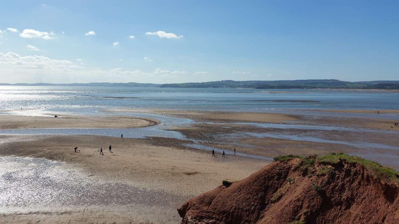
FIGURE 16 Low tide on the Exe Estuary/the sea
13.17. River Axe SAC: The River Axe SAC is impacted by poor water quality due to increased phosphate levels. Proposals increasing phosphate levels require HRA, with mitigation secured in perpetuity. This includes new residential units and overnight accommodation. The River Axe HRA Mitigation Strategy will address these issues, following the mitigation hierarchy and a precautionary approach.
13.18. Beer Quarry Caves SAC Pinch Points: Semi-natural habitats between Seaton, Colyford, and Colyton are crucial for bat species from the Beer Quarry and Caves SAC. Development in these pinch points could severely impact bat movement and
East Devon Local Plan 2020 to 2042 –Regulation 19 Plan – February 2025
foraging. The Beer Quarry and Caves HRA guidance100provides specific requirements for developments in these zones.
13.19. Vehicle Emissions Impacting Designated Sites: Atmospheric nitrogen deposition affects the East Devon Pebblebed Heaths, leading to vegetation changes and adverse impacts on fauna. Development increasing traffic and emissions will not be permitted without mitigation100. Monitoring will ensure other designated sites, including the River Axe, are protected from similar impacts.
13.20. Biodiversity net gain is the principle that the net result (the end position) after development has occurred is that the biodiversity or wildlife value is greater than before the site was developed. The Government support biodiversity net gain and in East Devon we recognise the importance and are seeking to exceed minimum national levels.
Major development101 proposals will need to deliver biodiversity net gain (BNG) of at least 20% to be calculated using the most up-to-date statutory metric. Where there is a demonstrable viability problem to achieve this target, it will be expected that all measures to exceed the national minimum requirements are made, and evidence for not achieving the 20% target is provided in full. Non-major developments will be required to secure at least 10% BNG.
All applications subject to biodiversity net gain will need to be supported by a Biodiversity Gain Statement which clearly demonstrates how the biodiversity gain hierarchy has been followed. The statement will need to be supported by a completed biodiversity metric (including condition assessment sheets) and demonstrate how
100 ENV-006 - Site Improvement Plan: East Devon Heaths (SIP070): https://eastdevon.gov.uk/media/u1snlw3l/env-008-site-improvement-plan-east-devon-heaths-sip070.pdf
101 KSD-008 - NPPF (Dec 2023): https://assets.publishing.service.gov.uk/media/675abd214cbda57cacd3476e/NPPFDecember-2024.pdf (definition in Annex 2 – for housing 10 or more homes/0.5 hectares or more for other uses -additional floorspace of 1,000 SqM or more).
BNG will be delivered in accordance with good practice principles for development102 , BS 8683:2021103, and local guidance (or subsequently updated guidance). Any development proposal including significant onsite gains will need to include a Habitat Management and Monitoring Plan (HMMP) and be clear in terms of how habitats will be maintained, appropriately monitored, and reported for 30 years. The statement should provide the expected balance of any off-site gains and whether the use of statutory biodiversity credits is expected.
Where offsite habitats are created or enhanced to deliver BNG, in full or in part, the delivery should be provided within the locality of the impact and contribute to ecological networks and published strategies in accordance with BNG principles. Offsite habitat delivery should prioritise the recovery of ecological networks, priority habitats, and contribute to the aims and objectives of the Local Nature Recovery Strategy (LNRS), and other locally published plans, policies, and strategies including the Clyst Valley Regional Park, Tree, Hedge, and Woodland Strategy for East Devon, and the East Devon Nature Recovery Plan.
Where there is evidence of deliberate habitat degradation on development sites prior to the submission of planning applications, a precautionary view in terms of the habitat distinctiveness and condition will be assumed unless there is evidence to support a lower categorisation.
Developments exempt from mandatory BNG are required to deliver ecological enhancements consummate with the scale of development. Self-build developments will be required to provide a completed statutory biodiversity metric to evidence their baseline ecological value and the predicted ecological outcome of the development. This policy does not apply in the Cranbrook Plan area.
102 ENV-022 - Biodiversity Net Gain: Good practice principles for development, 2016: https://cieem.net/wpcontent/uploads/2019/02/Biodiversity-Net-Gain-Principles.pdf Or as may be superseded.
103 ENV-023 - BS BS8683:2021 Process for designing and implementing biodiversity net gain, https://knowledge.bsigroup.com/products/process-for-designing-and-implementing-biodiversity-net-gainspecification?version=standard [accessed 14th Jan 2025]
13.21. The Environment Act 2021104 requires development proposals to achieve a minimum 10% BNG. This is crucial in addressing the ecological emergency, with wildlife populations declining globally and many species facing extinction. In the UK, habitat degradation and fragmentation are significant threats.
13.22. The Lawton Report (2010)105 emphasised the need for large-scale habitat restoration to create a resilient ecological network. BNG contributes to sustainable development, climate impact mitigation, and improved mental health and well-being.
13.23. East Devon has diverse but fragmented habitats. The council aims to enhance biodiversity by increasing habitat areas, improving quality, and connecting isolated habitats. The Nature Recovery Declaration (2023)106 commits to exceeding the 10% BNG target, recognising the link between biodiversity and climate crises.
13.24. Recent evidence suggests that a 10% BNG target without species management provides negligible gains. Therefore, the council applies the precautionary principle to ensure effective biodiversity gains. Increasing BNG to 20% is feasible and necessary for significant ecological benefits.
13.25. Habitat bank proposals in East Devon indicate the potential to deliver substantial biodiversity units. Significant growth in the district, including a new community, requires large open-space habitats to offset development impacts. BNG can be integrated with Suitable Alternative Natural Greenspace (SANG) and other mitigation measures.
13.26. BNG delivery opportunities also exist through nutrient neutrality and Landscape Recovery schemes. The 20% BNG policy will apply to major development proposals, ensuring meaningful biodiversity enhancements.
104 ENV-013 – Environment Act 2021, https://www.legislation.gov.uk/ukpga/2021/30/contents [accessed 14th Jan 2025]
105 ENV-024 – Making Space for Nature: A Review of England’s Wildlife Sites and Ecological Network, https://eastdevon.gov.uk/media/hn4f1u4f/env-024-making-space-for-nature-a-review-of-england-s-wildlifesites-and-ecological-network.pdf
106 ENV-025 – Nature Recovery Declaration for East Devon, https://eastdevon.gov.uk/media/hn4f1u4f/env024-making-space-for-nature-a-review-of-england-s-wildlife-sites-and-ecological-network.pdf
13.27. Local nature recovery is the concept that environmental quality and biodiversity can be enhanced by improving areas for wildlife and creating green links between habitats. This policy supports proposals that enhance existing Nature Recovery Networks (NRNs) and features within them, expands NRN areas, and improvements in landscapescale connectivity of ecological features.
Proposals which result in enhancement of existing and any subsequentially defined NRNs and features that contribute to their importance, through habitat creation appropriate to network type, will be supported. Along with this, support will also be given for proposals leading to increased landscape scale connectivity of NNRs and ecological features within them.
Development proposals within NRN defined areas will be required to provide mitigation in the form of biodiversity improvements that are compatible with and lead to net improvements within or that are directly relevant to the NRN in which they fall.
Anywhere in East Devon, where or when there is off-site biodiversity net gain, or other off-site biodiversity contributions tied to planning permission for development, the expectation will be for these to be located inside, adjacent to or otherwise contribute to the overall NRN and its biodiversity importance, or to a specific NRN areas and its biodiversity importance.
Biodiversity net gain (BNG) relevant to NRN areas and their expansion and connectivity, is are formally identified as being of strategic significance within the Statutory Biodiversity Metric Calculation Tool107 .
This policy applies across the whole plan area including the Cranbrook Plan area.
107 ENV-026 - How is Biodiversity Net Gain Measured? https://eastdevon.gov.uk/planning/biodiversity-netgain/how-is-biodiversity-net-gain-measured/
13.28. The Environment Act 2021 mandates a Local Nature Recovery Strategy (LNRS) for each area in England. Devon County Council is responsible for delivering the LNRS, with input from local authorities like East Devon District Council (EDDC). The LNRS includes biodiversity priorities and a local habitat map, forming the Nature Recovery Network (NRN)108. The intent, in the summer of 2025, is that the statutory LNRS mapping will be published. East Devon District Council will produce additional mapping and guidance to complement and add additional detail to the Devon County Council mapping. Any subsequent guidance and mapping should be taken into account in delivery of biodiversity enhancement.
13.29. The LNRS and NRN aim to implement the Lawton Report's principles of creating "bigger, better, and more joined-up"109 ecological networks. This involves improving, expanding, and connecting habitats to enhance ecological resilience and focus nature recovery efforts.
13.30. The LNRS outlines:
Biodiversity descriptions of the strategy area.
Opportunities for biodiversity recovery and enhancement.
Priority habitats and species for recovery.
Measures to achieve these goals.
13.31. The NRN map (and any subsequent mapping) combines existing wildlife sites and extends habitats based on geology and soil conditions to identify focused areas for nature recovery. Key sites features in mapped NRN areas include SACs, SPAs, Ramsar sites, SSSIs, MCZs, NNRs, LNRs, County Wildlife Sites, special verges, ancient woodlands, and habitats of principal importance under the NERC Act 2006.
108 The Devon County Council Nature Recovery Network can be viewed via: ENV-031 - Devon Nature Recovery Network Map, https://www.devonlnp.org.uk/our-work/nature-recovery-network/naturerecovery-network-map [accessed 15th Jan 2025]
109 ENV-024 – Making Space for Nature: A Review of England’s Wildlife Sites and Ecological Network, https://eastdevon.gov.uk/media/hn4f1u4f/env-024-making-space-for-nature-a-review-of-england-s-wildlifesites-and-ecological-network.pdf
13.32. This policy promotes wildlife enhancement in new developments by requiring features that support biodiversity, such as bird and bat boxes, hedgehog-friendly fencing, and suitable nesting sites.
Policy PB07: Ecological enhancement and biodiversity in the built environment
In addition to features required as part of biodiversity net gain, mitigation or compensation, all proposals are required to incorporate features of biodiversity value tailored to the specific proposals, relevant local receptors and in accordance with best practice to maximise potential benefits.
As a minimum, the following features are required within new proposals:
A. Integrated bird boxes (e.g. swift bricks) in suitable locations at a ratio of one per dwelling, or a relevant number to be agreed for flats or non-dwelling applications, to be provided in accordance with BS42021:2022110;
B. Provision of integrated bat boxes in locations suitable for use by bats (i.e., adjacent to suitable habitats and not significantly impacted on by artificial lighting);
C. An integrated bat loft within all major planning applications, if ecologically relevant (i.e., if the site is a suitable location for a bat loft to be constructed - not too isolated or within unsuitable habitat such as heavily urbanised well-lit areas);
D. Gaps (13 cm x 13 cm) in the bases of garden fences, between gardens, and within fences between gardens and wider ecological networks, to facilitate movement of hedgehogs and other protected and notable species; and
E. Provision of overhanging eaves suitable for nesting house martins in all major development
The location and specification of biodiversity features should be designed with input from a qualified ecologist and informed by the most up to date research and guidance at the time of application. Bat and bird boxes should be integrated within the fabric of
110 ENV-027 - BS 42021:2022 Integral nest boxes. Selection and installation for new developments. Specification, https://knowledge.bsigroup.com/products/integral-nest-boxes-selection-and-installation-fornew-developments-specification-1?version=standard [accessed 15th Jan 2025]
the building to ensure longevity and retention when ownership changes (to avoid removal by new owners).
This policy applies across the whole plan area including the Cranbrook Plan area.
13.33. Significant development growth in East Devon will increase pressure on the natural environment but also offers opportunities for nature recovery. This policy supports the biodiversity objective of the Environment Act 2021 and is crucial for the recovery of species like swifts, which are currently in decline.
13.34. Paragraph 185b of the NPPF emphasizes enhancing ecological networks and recovering priority species. This policy aligns with these goals by requiring features that benefit priority species, such as birds, bats, reptiles, and hedgehogs, which can thrive in urban environments if provided with suitable habitats.
13.35. The BS42021:2021 guidance highlights the high occupancy rates of integrated bird boxes, endorsed by the RSPB and major housing developers. EDDC supports this guidance and promotes its use district-wide.
13.36. Ongoing research and guidance from organisations like the National House Building Council and the UK Green Building Council provide cost-effective measures for integrating biodiversity into the built environment. These measures require minimal maintenance and contribute significantly to nature recovery.
13.37. Additional features for wildlife enhancement:
Reptile/amphibian hibernacula;
Brash and log piles;
Invertebrate bricks and bee hotels;
Water butts;
Wildlife ponds;
Sustainable urban drainage systems (e.g., swales and pools with native vegetation);
Native hedge planting;
Swift/wildlife towers and green roofs;
Barn owl lofts;
Bat, bird, and dormouse boxes in trees and hedges.
13.38. These features should be designed with input from qualified ecologists and integrated into the building fabric to ensure longevity and retention.
13.39. Trees, woodlands, and hedges are vital for enhancing landscapes, providing wildlife habitats, supporting sustainable drainage, sequestering carbon, and improving public health.
Where trees are present on a development site proposals will need to be designed, and schemes implemented, in a manner that retain good quality and healthy woodland, trees and hedgerows. This is to specifically include protection of : ancient woodland; ancient and veteran trees; those with visual amenity value; those that support wildlife (such as some appropriate U category trees as part current BS 5837111) or provide habitat connectivity; those which positively contribute to local landscape character, the historic environment or the significance of a heritage asset and its setting; and rare or unusual species of trees. These protected assets will need to be incorporated into the overall design and landscape scheme, within public spaces where possible. Where justifiable and unavoidable tree and hedge losses occur, there will need to be adequate compensation for on the development site or on publicly accessible land in accordance with the minimum compensation requirements for trees listed in the Table below. This replacement policy also applies to trees with Ash dieback (or any other future serious tree pest or disease) on development sites.
All development proposals where trees over 75mm diameter at 1.5m and native hedges are present, or where trees outside of the boundary are within the root protection area or the crowns of which overhang the development boundarywill need
111 ENV-028 - BS 5837:2012 Trees in relation to design, demolition and construction. Recommendations, https://knowledge.bsigroup.com/products/trees-in-relation-to-design-demolition-and-constructionrecommendations?version=standard&tab=history [accessed 14th Jan 2025]
to be informed by British Standard BS 5837 Trees in relation to design, demolition and construction (or the most up to date version), the recommendations of which will be taken fully into account in the scheme design.
The planning application will be accompanied by a detailed appraisal of their condition, location, and ecological and landscape significance both at the time of the application and with an assessment of their potential future value. Applications should include an arboricultural method statement and tree protection plan to be followed during construction, reflecting the latest arboricultural standards for any tree works or development near to trees and demonstrating appropriate root protection areas. Where woodland, trees and hedges are to be removed they should be accurately identified, with a clear justification set out for their loss, together with details of any mitigation or replacement planting as part of an overall approach to achieving biodiversity net gain. Development proposals that have not properly considered or prioritised development options enabling the retention of woodlands, trees and hedgerows will be refused.
No building, hard surfacing, drainage or underground works will be permitted that does not accord with the principles of BS 5837 or Volume 4 National Joint Utilities Group (NJUG) Guidelines for the Planning, Installation and Maintenance of Utility Apparatus in Proximity to Trees – Issue 2 (or the current revision or any replacement) unless, exceptionally, the Council is satisfied that such works can be accommodated without harm to the trees concerned or there are overriding reasons for development to proceed.
To avoid issues with subsidence all developments, including permitted development, will require appropriate depth of foundations considering local soil geology and water demand of nearby trees (and those proposed as part of an approved landscape planting scheme) at full maturity in accordance with current industry guidance.
Trunk diameter of tree lost to development (cm measured at 1.5 m above ground) Number of replacement trees1127 – 19.9120 – 29.9230 – 39.9340 –
112 Based on the Bristol Tree Replacement Standard (BTRS) See: Supplementary planning documents and other planning guidance - Bristol Tree Replacement Standard: https://www.bristol.gov.uk/residents/planning-and-buildingregulations/planning-policy-and-guidance/supplementary-planning-documents-practice-notes-and-other-planningguidance
49.9450 – 59.9560 – 69.9670+7Provision of new trees and hedgerows on development sites
The provision of new trees and hedges shall be based on the principles outlined in the Devon Tree Strategy, the Tree, Hedge, and Woodland Strategy for East Devon, Devon County Right Tree Right Place Guidance, and New Devon Hedges and relevant guidance provided by Trees and Design Action Group (TDAG).
Tree planting design and maintenance should:
A. Take into account climate change and local landscape characteristics. Planting material should be sourced in accordance with the national strategy for biosecurity;
B. Allow sufficient space for existing and newly planted trees to grow to maturity, both above and below ground;
C. Ensure that any new streets are, where possible and it is commercially viable and it would not compromise other compelling design or operational highway considerations, tree-lined and residential areas and development sites as a whole will contribute towards 30% tree cover target for urban areas within the District.
D. Use large canopy tree species within new development as these provide the greatest benefits for increasing canopy cover, providing shade, intercepting rainfall and increasing biodiversity.
Within or adjacent to areas of paving where available soil volumes are likely to be restricted, technical solutions should be used to ensure that adequate soil volume and suitable growing conditions are provided, such as water infiltration, drainage and aeration, to enable new trees to establish and reach maturity as per industry best practice. These solutions must also prevent soil compaction and provide a load bearing capacity sufficient for the task for which the surface is designed for.
This policy applies across the whole plan area including the Cranbrook Plan area.
Appropriate measures to ensure that new planting schemes are implemented in accordance with the approved details and to secure their long-term management and maintenance will be required including arrangements for monitoring. For major developments this will also require the placement of a financial bond by the developer prior to the commencement of construction, equal to 25% of the calculated planting
cost for the scheme, or agreed phase, to be released on fulfilment of the following to the satisfaction of the planning authority:
A. Within 1 month of the completion of planting works, the issue of a signed certificate by the developer’s landscape architect or other appropriately qualified/ experienced professional consultant confirming that the planting works have been overseen by them and completed in accordance with the approved details.
B. For years 1-5 thereafter, the issue of an annual inspection report by the developer’s landscape architect confirming that maintenance of the scheme has been caried out in accordance with the approved details and identifying any plant failures or other defects that require rectification together with a program for their implementation at the earliest opportunity. The annual certificate shall also confirm the satisfactory rectification of any defects identified during the previous year’s inspection.
This policy applies across the whole plan area including the Cranbrook Plan area.
13.40. Trees, woodlands, and hedges are crucial green infrastructure assets that enhance landscapes, provide wildlife habitats, support sustainable drainage, sequester carbon, and improve public health. New developments must incorporate existing natural features early in the design process and include new plantings to create pleasant spaces and future mature trees. Protection and management during development are essential for their long-term health.
13.41. Planning applications must demonstrate how they meet policy requirements regarding trees, woodlands, and hedges. In cases of exceptional loss of ancient woodlands or veteran trees, compensation strategies such as planting new native woodlands or improving nearby habitats are required.
13.42. This policy supports the Tree, Hedge, and Woodland Strategy for East Devon113 , promoting the creation of new green spaces that benefit wildlife and public health.
113 ENV-008 - EDDC Tree, Hedge and Woodland Strategy v1.4, https://eastdevon.gov.uk/media/b4dnabwy/env-008-tree-hedge-and-woodland-stratgy-v-1-4.pdf
13.43. Most of the East Devon coastline is part of the Jurassic Coast World Heritage Site, recognised for its exceptional geological importance.
Policy PB10: Protection and enhancement of the Jurassic Coast World Heritage
Development within the Jurassic Coast World Heritage Site, or that could adversely impact on its setting, will only be permitted if it can be demonstrated that the Outstanding Universal Value of the coastline and specifically its geological importance, will not be adversely affected.
Development proposals that could give rise to adverse impacts, will be assessed in respect of:
A. The setting and importance of the world heritage site;
B. The inherent attributes and geological qualities of the site, specifically relating to its ‘Outstanding Universal Value’;
C. The grounds and reasons for its inscription; and
D. Its overall integrity (including possible incremental loss) and local impacts of development.
The international importance of the site and its setting is such that development proposals will be rigorously reviewed in determination of planning applications and this policy will sit alongside other affording coastal and countryside protection and enhancement.
This policy does not apply in the Cranbrook Plan area.
13.44. The Jurassic Coast, inscribed as a World Heritage Site by UNESCO in 2001, is globally significant for its geology, fossils, and landforms. It is England’s only natural World Heritage Site, extending from Orcombe Point at Exmouth to Old Harry Rocks near Swanage, Dorset.
13.45. The Jurassic Coast Partnership Plan (2020-2025)114 identifies the site's Outstanding Universal Value (OUV), including its stratigraphy, palaeontological record, geomorphological features, and ongoing scientific importance. The high rate of erosion is a key characteristic, maintaining dynamic rock exposures.
13.46. Development proposals within or impacting the site must demonstrate no adverse effects on its OUV. The policy ensures rigorous assessment of such proposals to protect the site's integrity and significance. The majority of the site falls within the East Devon National Landscape area, emphasizing its importance.
13.47. This policy aligns with the Jurassic Coast Partnership Plan, promoting geodiversity and public enjoyment of the site while safeguarding its geological heritage.
13.48. This policy protects nationally designated geological sites, such as Sites of Special Scientific Interest (SSSIs), from adverse impacts of development.
Proposals and plans that would cause a direct or indirect adverse effect upon nationally designated geological sites will not be permitted unless all of the following criteria are met:
A. They cannot be located on alternative sites that would cause less or no harm.
B. The public benefits of the proposal clearly outweigh the impacts on the features of the site and the wider network of natural habitats and designated sites.
C. Suitable avoidance, mitigation and compensation measures are proposed, in accordance with the mitigation hierarchy.
D. the integrity of the site is maintained.
This policy does not apply in the Cranbrook Plan area.
114 ENV-030 – Jurassic Coast Partnership Plan 2020-2025, https://eastdevon.gov.uk/media/qtnjkerd/env-029jurassic-coast-partnership-plan-2020-2025.pdf
13.49. Geological sites are designated for their scientific and educational value, often supporting wildlife interests. The underlying geology can determine the presence and value of wildlife species. Some sites are designated as SSSIs for both geological and wildlife value. This policy complements existing legislation and government guidance, detailing when adverse impacts may be permitted.
13.50. This policy protects Regionally Important Geological and Geomorphological Sites (RIGS) from adverse impacts of development, ensuring their scientific and educational value is maintained.
The granting of planning permission for development or land-use changes that may have an adverse effect, either directly or indirectly, on Regionally Important Geological and Geomorphological Sites will only be permitted if the justification for the proposed development clearly outweighs any harm to the intrinsic scientific or educational value of the site.
Where development is permitted mitigation will be required to minimise the negative impacts and where this is not possible adequate compensatory enhancement or new site creation schemes will be required.
This policy applies across the whole plan area including the Cranbrook Plan area.
13.51. RIGS are important for their geological significance in Devon. Established by the Devon Regionally Important Geological and Geomorphological Sites Group, these sites are valuable educational, historical, and recreational resources. The selection criteria include educational use, scientific study, historical importance, and aesthetic value.
13.52. RIGS often result from development processes, exposing geological features. Recognising these sites as County Geological Sites helps avoid activities that might
East Devon Local Plan 2020 to 2042 –Regulation 19 Plan – February 2025
damage their geological value. Development proposals should consider how to showcase geological features in an informative way.