
2 minute read
4.2.3 Community Services


❑ Ensure access to core spatial datasets and web mapping applications. ❑ Work with other departments to locate or develop datasets for desired features (e.g. overlay districts, easements, right-of-way trees, streetlights, building footprints, impervious cover). ❑ Review the Esri ArcGIS for Local Government (AG4LG) solutions and information model for variety of planning/community development related offerings: https://solutions.arcgis.com/local-government/planning-and-development/ ❑ Work with other departments to generate a single authoritative addressing database.
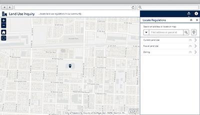
Perform validation for other business systems (especially Munis). ❑ Review the Esri AG4LG addressing solutions (Address Data Management, Data Reviewer for Addresses, Community Addresses). ❑ Work with IT GIS to publish and maintain an authoritative address geolocator including street aliases. ❑ Implement the AG4LG My Neighborhood Services application template. ❑ Implement the AG4LG Land Use Inquiry application template. Extend data model to include links for zoning/standards information. ❑ Work with County to automate the retrieval and update of parcel data. ❑ Create database and web application for tracking and monitoring short-term rentals. ❑ Leverage Esri Maps for Office to create and publish maps directly from Microsoft Excel. ❑ Work with IT and GIS to promote technical support and training for other users.
Community Development Solutions
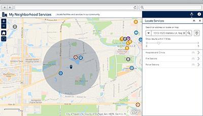
My NeighborhoodServices
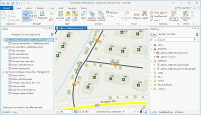
Address Data Management Land Use Inquiry
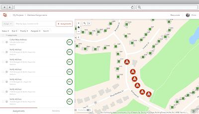
Address Field Operations
4.2.3 Community Services 4.2.3.1 Top Priorities • Automate comparison and maintenance of Vulnerable Population Registry • Outreach and Education
• Public input for needs assessment
4.2.3.2 General Comments The department provides direct services to special populations and is expected to be the primary responder to these groups during emergency events. Staff spend a considerable amount of time each week maintaining the 800-person vulnerable populations registry (VPR) by manually comparing to a County list and a mortality database in order to keep current. The VPR drives pre- and post-disaster response efforts but is not leveraged in any automated fashion. Improving maintenance of the VPR would greatly reduce the efforts of the department’s five staff. Providing the public outreach information on provided services and requesting public input is desired.
4.2.3.3 Recommendations ❑ Ensure access to core spatial datasets and web mapping applications. ❑ Work with other departments and agencies to locate or develop datasets for desired features (e.g. assisted living, bus stops, transportation routes). ❑ Leverage Esri Maps for Office to create and publish maps directly from Microsoft Excel.
Consider moving data into GIS feature classes. ❑ Create location-based Vulnerable Populations Registry (VPR). Automate process to compare against County list and mortality database. ❑ Leverage new VPR list as part of pre- and post-incident activities to prioritize and track check-ins. Consider leveraging Everbridge notification and response to automate portion of process. ❑ Consider the AG4LG Special Needs Registry template solution. ❑ Implement the AG4LG Transit Outreach template solution. ❑ Consider the AG4LG My Health Services template solution. ❑ Consider the AG4LG Blight Status Dashboard template solution in conjunction with
Citizen Problem Reporter, Code Violation, and Photo Survey solutions. ❑ Consider the AG4LG Drug Drop-off Locator template solution.


