



TheCityof Irvingwouldliketothank themanyindividuals whocontributedtothecreationofthe Imagine Irving Comprehensive Plan. Dozensofresidentsandcommunity leadersparticipatedinthisprojectandcontributedtoour understandingofthechallengesandopportunitiesfacing Irving. Weareespeciallygratefultotheleadershipandstaff of FregoneseAssociatesandtheirspecialistpartners who helpedviewthecitythroughanewperspective. Inparticular, wewishtoacknowledge:

CityofIrvingMayorandCityCouncil
Richard H. Stopfer Mayor (atlarge)
John C. Danish Place1
Oscar Ward Place5
FormerCityCouncil
Gerald Farris Place7
Beth Van Duyne Mayor (atlarge)
PlanningandZoningCommission
Sushil Patel
Brad M. LaMorgese Mayor ProTern, Place 6
Dennis Webb Place3
Kyle Taylor Place 7
Allan E. Meagher Deputy Mayor ProTern, Place2 (at large)
Wm. David Palmer Place 8 (atlarge)
Phil Riddle Place4
Joe Putnam Place4
Tom Spink Place 8 (atlarge)
Annette French Chairman, Place3 Vice-Chairwoman, Place 8
J. Chris Allen
Dan Niemeier Place1 Place2
MarkZeske
Lorraine Taylor Place6 Place 7
FormerPlanningandZoningCommission
Tom Tannehill Place6
Robert LaRose Place4
Ernest Richards Secretary, Place5
Lewis Patrick Place4
Charlie (Charles) Hoedebeck Place 9
DanNiemeier
PlanningandZoning Commission
LorraineTaylor
PlanningandZoningCommission
JackyKnox DCURD
PatrickDaly Universityof Dallas
StephanieGarcia InternationalRoofingExpo
MohamoudEgal IslamicCenterof Irving
Rev.PedroPortillo TransfigurationLutheran Church
Dr.MohammedSirajUddin ValleyRanch IslamicCenter
BrentMcKinney
IrvingBibleChurch CityStaff
ChrisHillman CityManager
MichaelMorrison DeputyCityManager
MaxDuplant AssistantCityManager
RamiroLopez
AssistantCityManager
LarryBoyd FormerPoliceChief
JeffSpivey PoliceChief
VictorConley FireChief
KuruvillaOommen CityAttorney
BrendaHaney DirectorofSolidWasteServices
ShanaeJenning CitySecretary
ScottLayne
IrvingISD
AndreshiaKelly North LakeCollege
AndrewGoldsmith Realtor
VeronicaHernandez FormerYouth ActionCouncil
J.C.Gonzalez
WellsFargo
SteveAdams ValleyRanchAssociation
PaigeBickham Missionat LaVillita Apartments
WillDeBerry
U.S.CensusBureau-Retired
KathrinePennington
LasColinasAssociation
RichardStewart
IrvingArts Board

CaseyTate Directorof CapitalImprovement Program
ChrisHooper
Directorof BuildingandEquipment Services
ChristineDobson Directorof LibraryServices
DanielVedral Directorof TrafficandTransportation
GaryMiller Directorof Inspections
JeffLitchfield
ChiefFinancialOfficer
LeishaMeine-Bailey Chief TechnologyOfficer
MauraGast
ExecutiveDirectorof Irving ConventionandVisitors Bureau
JosephKobos
IrvingArts Board
KirnLimberg GreenAdvisoryBoard
MaryAnnKellam
IrvingHispanicChamberof Commerce
AmarPatel CountrywideHospitality
DonMoulton NCHCorporation
BethBowman
Greater IrvingLasColinasChamber of Commerce
JoeyGrisham
Greater IrvingLasColinas Chamber of Commerce
LarsRosene Flowserve
BobBlankenship
DFW Airport
RayCerda Directorof Parksand Recreation
RodneyAdams
Judge
ScottConnell Directorof EconomicDevelopment
TeresaAdrian Directorof Code Enforcement
ToddHawkins
ExecutiveDirectorof IrvingArts Board
ToddReck DirectorofWaterUtilities
WayneLambert Directorof MunicipalCourt
StevenReed
DirectorofPlanningandCommunity Development
KevinKass
ManagerofComp. Planningand Redevelopment
CommunicationsDepartment
SusanRose DirectorofCommunications
AngieKilbourne WebContentSpecialist
ElizabethKnighten CommunicationsAnalyst
HeatherTaylor PrintingandDesignSupervisor

InternalSteeringCommittee
AimeeKaslik
Chief InnovationandPerformance Officer
BradDuff Treasury Manager
BradleyKearney
SeniorBudgetandFinancialAnalyst
BrittanyPulley ManagementAnalyst
ChrisSanchez InnovationsProgramCoordinator
ChrisCollier TrafficEngineeringManager
DaveSpringob EngineeringManager
DougJaneway Chief DevelopmentOfficer
KennethBloom,AICP ManagerofUrbanDevelopment
ShebaWard SeniorPlanner
TroyWynne,AICP SeniorPlanner
StacyDay Planner
LindsayJackson Planner
MarcyMiranda CommunicationsAnalyst
MeribethSloan CommunicationsManager
MinhChung SeniorPrinter
ScottSnyder InterimExecutiveProducer
StoneyStephens Printer
TammyHanson
CommunityOutreachCoordinator
FranWitte
EnvironmentalProgramsCoordinator
GeneMoulden SeniorLandscapeArchitect
JonWeist LegislativeOfficer
JosephMoses AssistantDirectorof Parksand Recreation
KathrynUsrey HumanResources Management Consultant
MichaelEdwards CodeEnforcementManager
MikeGriffith ParksSuperintendent/Arborist
NathanBenditz TrafficEngineeringManager
RichardHose
KeepIrving BeautifulCoordinator
RobertLawhorn LandscapeArchitect
RyanK.Adams AssistanttotheCity Manager
ScottCrossnoe ParkServicesManager
ShaneBurton AssistantDirectorof Information Technology
StevePettit Assistant DirectorofWaterUtilities
VickiEbner AssistantDirectorof Planningand Community Development
John Fregonese

Jacob Nigro
ProjectLead GISAnalysis
Robin Joseph Williams
OutreachCoordinator
FregoneseAssociates FregoneseAssociates ]WilliamsGroup
Scott Fregonese
HeatherBissell
Aimee Vance
ProjectOversight Coordinator OutreachCoordinator
FregoneseAssociates FregoneseAssociates K-Strategies
Nadine Appenbrink
Kurt Schulte
AnaBak
Project Manager Transportation Lead OutreachCoordinator
FregoneseAssociates Kimley-Horn andAssociates K-Strategies
Janet Tharp
Robert Rae
Project Manager Planner
Ed Gamez
OutreachCoordinator
TharpPlanning Kimley-Horn andAssociates K-Strategies
Irene Kim
Jonelle Hanson
UrbanDesigner TransportationAnalysis
FregoneseAssociates Kimley-Horn andAssociates
Julia Reisemann
Brian Keith
GIS Analysis Urban Designer
Fregonese Associates JHPArchitects







TheVisionforIrvingestablishestheframeworkoftheImagine IrvingComprehensivePlan. Itdescribesthecommunity'svision forthefutureandlaysouttheconceptsforhowIrvingwillgrow andcapitalizeonitsmanyassets,howitwilladapttochanges, whichareasshouldbepreserved,andhowthecity willlookand feelinthenextthirtyyears. Imagine Irvinghascapturedtheideas ofthousandsof Irving'sresidentswhohavebigdreamsforthe community. Theirinputhasbeengatheredinpublicworkshops, in stakeholderinterviews, andthroughpublicsurveys.
Irving'slocationinthecenterofthefourthlargestmetroeconomy inthenationandthe12thlargestmetroareaintheworldplacesthe city inapositiontoenjoy economicprosperity andahighquality of life. Thecity'sproximitytoDallas-FortWorth (DFW) International Airportties Irvingtotheworld'smajorcommercialcenters, and makesitveryattractivetointernationalbusinessesandinvestors. While IrvingresidentsandstakeholdersagreethatIrving'slocation isthecity'sgreatestasset, they alsounderstand theimportance ofthecity'sneighborhoods, itscommunity spirit, andthecultural richnessthediversepopulationbringstothecity.
Thisdocument representsthevoicesof Irving'sdiversepopulation ofresidentsandguidesthecreationofacomprehensiveplanand implementationstrategythatwillpositionIrvingasaninternational businesshubwithhigh-quality neighborhoods andservices.
» Where are we headed?
» Where do we want to go?
» How do we want the city to look and feel?
» What are the key actions to get there?

» Heritage District, named the "Best Value" in the metro by Dallas Morning News2
» Las Colinas Urban Center
» DFW Airport
» University of Dallas and North Lake College
» Irving Mall
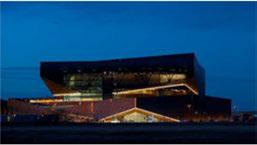
» The Irving Convention Center at Las Colinas
» Campion Trail, a riverside greenbelt trail with plans for regional expansion
» Irving Arts Center
» Texas Musicians Museum
» Mercury Studios at Las Colinas

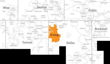
Irving'slocationatthecenterofthe Dallas-FortWorthMetroplexand adjacenttothe DFWAirportisone ofthecity'sgreatestassets. Irving issurroundedby adjacentjurisdictions,withlittle ornoarealeftto expanditsphysicalboundary. Thecitybordersthe DFWAirport, andthecities of Dallas,Grand Prairie,FortWorth,FarmersBranch, Carrollton,andCoppell.
DFWAirportcovers27squaremilesandistheworld'sninth busiestairportin passengertraffic,servingapproximately 175,000 daily passengersin2014.With27 airlines,sevenrunwaysand60,000 employees ontheground, DFWAirportserves 204domesticand internationaldestinations. Fromthere,every majorcity intheUnited Statescanbereachedwithinfourhours.1
Figure 1 : Regional Context Map
TheCityofIrvingishometo 232,413residents3 andover 8,500 localandmultinational companiesoperatinginthe city,includingsix Fortune500 firmswithworldheadquarters locatedinIrving.4 Thecity's workforceisincrediblydiverse, andemployersprovidemany entrylevelandprofessional opportunities,leading Business InsidertorankIrvingfirstamong the "20bestcitiestoliveinyour 20's" inthecountry.5
Irving'sdiversityreflectsthe city'sglobalcharacter,andin 2013oneofIrving'sZIP codes wasidentifiedasthemost
Figure 2: Change in Diversity, 19802013

diverseinthecountry. 6 Since 1980,Irvinghasseenasteady andsubstantialdemographic shiftwithincreasingracial andethnicdiversity. The Hispanicpopulationhasgrown dramaticallyfrom7percent in1980to41percentin2013, making Hispanicsthelargest ethnic/racialgroupinthe city. Thecityalsohasgrowing Asianand AfricanAmerican populations.
Irvingresidentsareremarkably youngcomparedtorestof thestateandthenation,with amedianageof32years. Generationally,Millennials
Figure 3: Irving's Median Age Compared with Texas and the U.S. 1980-2013

arethepredominantgroup, comprising33percentofthe city'spopulation,followedclosely by GenerationX (29percent),and GenerationZ (23percent). Baby boomers accountforjust10percentofthe city'spopulation.7
Incomesinthecityareonpar withtheregionasawhole, slightlylowerthanthenational average,andsubstantiallyhigher thantheCityof Dallas.
Figure 4: Median Household Income, 2013

Source: Census Bureau, ACS 1980-2013
Source: Census Bureau, ACS 1980-2013

Dallas Texas U.S.
Source: Census Bureau, ACS 2013
Figure 5: Change in Irving's Generations, 2000-2013

GIGeneration
The Greotest Generation
Source: Census Bureau, ACS 2005·


Source: Census Bureau, ACS 2011
Irvingisaneconomicenginewithinthe Dallas-FortWorth Metroplex, andhasbeenoneofthefastestgrowingcitiesfollowingthe2008-09 recession.8 Thankstoitsroleasoneofthemostimportantbusiness centersintheregion,thereisalargeinflowofpeoplecommutingto Irvingdaily.Commutersto Irvingmakeup89% ofthe Irving'stotal workforce. (Theremaining11percentlivein Irving.)Theindustries drawingthehighestnumbersoftheseinboundcommutersarefinance andinsurance (18,233netinboundcommuters); administrative/ supportservices (14,919); andprofessional,scientificandtechnical services (11,802).For Irvingresidents,24percentofworkersfind employmentwithincitylimits.Theremaining76percentcommute toothercitiesintheregionandbeyond. Perhapsasaresultofthe city'sstrongtechandprofessionalservicessector,aportionofthese commuterstravelinandoutof Irvingonaweeklybasisinsteadof daily-eitherlivingin Irvingandcommutingelsewherefortheweek, orlivingelsewhereandresidingin Irvingduringtheworkweek.
Irvingisexpectedtogrowsubstantiallybetweennowand2040, addingaround28,000newhouseholdsand72,500newresidents.
Sources: U S Census Bureau ACS 20l 3 estimate; NCTCOG 2040 forecast.

Thecurrentmixofhousing stockisnearlyevenlysplit betweenmultifamilybuildings (52percent)andsingle-family homes,townhomes,mobile homesandothertypes(48 percent).Rentalhousingdemand isstrongandwillcontinueto remainhigh.Whencompared toneighboringcities,Irving hasamuchhigherrentalrate. Sixty-onepercentofhouseholds arerentaland39percentof householdsarehomeowners. Thisrental-versus-ownerratiois higherthanthemetroareaand thenationalaverage. Asthecity continuestogrowandattract growthinmixed-useandtransitorientedareasalongDallas AreaRapidTransit(DART)and TrinityRailwayExpress(TRE), thecity'srentalpopulationwill remainhigh. High-qualityrental housingisamajorassettoattract youngtalentdrawntoIrvingfor employment.
Asthecitycontinuesto growandnewresidentsare attractedbythecity'slocation, itsqualityneighborhoodsand greatjobopportunities,the housingstockinIrvingwill adapttomeetchangingneeds andpreferences.Thecitywill increasethehousingsupplywith abalancedmixofnewsinglefamilyhomes,townhomes, andnewstylesofmixed-use buildings.Redevelopmentand infillwillregenerateexisting neighborhoodsasolder homesaregraduallyreplaced orupgraded. Inareaswhere newsingle-familysitesarestill available,additionalhouseswill bebuilt.
TheCityshouldembracethis opportunitytosatisfythemarket forsingle-familyhousingwhile consuminglesslandthrough anexpandedvarietyofhousing typessuchascottagehomes, clusteredcourtyardhomes,liveworkunits,andhousinginmultistorymixed-usebuildings. Abouthalfofnewhousing unitswillbeinmixed-use buildingsthatprovideliving unitsonupperfloorsandinclude non-residentialusesonthe groundfloor,suchasretail,small office,personalservices,day care,grocerystores,andfitness centers.
A diverse group of community representatives serving on the Advisory Committee captured the hopes, dreams and aspirations for Irving's future in a set of guiding principles. Guiding principles provide a framework to use while developing the goals, strategies and actions in each chapter of the Imagine Irving Comprehensive Plan. Using guiding principles in this way ensures that the planning and implementation process remain consistent with the shared vision of Irving's residents.

Irvinghaslittlevacantlandremaining, limitingopportunities forlarge-scale, newdevelopmentbutconducivetoreinvestment andrenovation. Whilecompetingcitiesmay feelconstrained withoutasteady supply ofgreenspacetosprawlinto, Irving residents, businessleadersandstakeholdersarticulatedawiderangeofcreativeideasonhow Irvingshouldlook inthefuture. Inputgatheredfromworkshopparticipants, stakeholdermeetings andfocusgroupscenteredontheimportanceofreinvestingin olderareasofthecity, includingroadwaysandinfrastructure; capitalizingonthecity'slocationaladvantages; andexpanding healthandeducationalopportunities.
Whilethereweremany otherthemesandideasexpressed, almost everyoneagreedthat Irvingisatapivotalpointinthecity's history. Forward-thinking decisionswillplay acrucialroleinthe city'sfuturesuccessanddeterminewhether Irvingbecomesjust anothersuburbinalargemetroplex, orfulfillsitspotentialasthe mostdynamichubofagrowingregion.
Throughthefollowingnarrativeandthe Imagine IrvingVision Map, thischapterpresentsthethemesthatsurfacedthroughout thesecommunity discussions. Itdescribeshowresidentswantto seetheircity inthefuture.

» Irving is recongized nationally for its international accessibility, diversity of residents, and business- and developer-friendly environment.
» Irving is a destination city.
» Irving has opportunities to shop for basic needs in all parts of the city, including previously underserved areas of the city.
» Irving supports beautification across all parts of the city.
» Irving provides all residents with compelling reasons to remain in the city.
» Irving provides access to highquality health opportunities and resources across the community.
» Irving's high density urban areas support a variety of lifestyles with round-the-clock activity.
» Irving has an excellent K-12 school system that attracts families to the city.
» Irving has robust cultural centers that serve the city's diverse residents and visitors.
» The city maintains facilities, services, and infrastructure throughout the city.
» Irving's neighborhoods give residents access to quality housing, jobs, education and health care.
» The city focuses on community engagement in government and other civic activities ensuring all segments of the population are heard and represented.
» Irving's seamless transportation system includes multiple modes of transportation across the city, including buses, transit, pedestrian facilities and a robust bicycle system that includes onroad and off-road facilities.
» Aging infrastructure is updated, including drainage, water and sewer lines, roads, sidewalks, intersections, and neighborhood lighting - ensuring quality service to existing users and capacity for future growth.
» The city coordinates land use and transportation to minimize travel time and distances between daily destinations - allowing people to choose to live closer to work and services, live or work close to transit, and live in walkand bike-friendly areas.
» Irving has walkable neighborhoods and commercial centers across the city.
» Irving maintains its existing parks, pools and trails, and provides new recreational facilities. Parks and open spaces are easily accessible to residents in every neighborhood.
» The city implements sustainable policies and promotes development that reduces vehicle miles traveled, and water and energy consumption - contributing to cleaner air and water, and the preservation of natural resources.
» Irving has safe neighborhoods with quality housing and schools and a variety of housing options for people working in the city
»Irving provides housing of different types and styles for people of all ages and incomes, including homes in singlefamily neighborhoods and neighborhoods with increased density for sustainability, livability, walkability, and cost-efficiency.
» Redevelopment occurs in aging neighborhoods across the city, especially in areas with declining multifamily housing.
» The city is growth-oriented, committed to the support and continuous improvement of existing businesses, infrastructure, amenities, and the workforce.
» Irving is at the forefront of innovation and business development, supporting its industry-leading private sector employers and its forwardthinking community leaders.
» Irving offers exceptional access to the regional, national, and world economies through its globally connected businesses and robust transportation network centered on DFW Airport.
» Irving's educational system prepares its workforce to succeed in all segments of the economy and includes training for a wide range of job skills.

Irvingisknownforitsstrongemploymentandresidentialcenters includingthe LasColinasUrbanCenter, Valley Ranch, andthe formerstadiumarea. Thecityhasinvestedheavilytoensure rail accesstothecity'sregionalcenters, and Irving willcontinue toexpanditsregionalcenters, corridorsandconnectionsby encouragingdevelopmentsthatpromoteconnectivity, walkability, and services. Keyregionalcenters willincludetheredeveloped formerstadiumareaknownas PUD#6. This 1000-acre development willprovideaquarterofthenewhousingandemploymentprojected for Irvingoverthenext30yearsinanexciting, walkable, sustainable environment. The LasColinasUrbanCenter will continuetomature, attractingnewnationalandinternational business. Otherareassuch astheregionalmall, Valley Ranch, andthe Irving HeritageDistrict willreinventthemselvesasregionalassets with walking, bicycling andtransitamenities.


Irving'sglobally connected locationinthecenterofan economicallyrobustregion, itsdiversepopulation,and welcomingenvironmentwill continuetoattractawide rangeofinternationalbusiness intereststothecity.Irving residentswilltakeadvantage oftravelingoverseasinjust hours, whilethoselivingin othernationswillrecognize Irvingasanidealplacetobase theirU.S.enterprises.National andinternationalworkerswill continuetotravelinandoutof DFW Airportona weekly basis. Thecity'sglobalaccessibility andgrowingculturalofferings willestablish Irving'sreputation forinternationaltalentinthe Metroplexandbeyond.
Alargenumberof Irving's residentsaremulti-lingual, speaking English,Spanish, Korean, Vietnamese, Chinese, Gujarati, Urdu, Hindi, Arabic andmany otherlanguages. This talentpoolwillcontinueto attractinternationalinvestment, andserveasadiverseworkforce for employers.As Irving enhancesitsinternational businessclimate, thecity willsee growthintargetedindustries, andincreasingopportunitiesfor Irving-basedfirmsto expandinternationally.
Toaccommodatethe internationalbusiness expansion, Irvingwill createamenitieswelcoming internationaltravelers: directionalsignage, wayfinding, andculturalcenterstomake iteasy totravel, acclimate, andintegrateoneselfinto Irving'sbusinesscommunity regardlessofone'snational origin.Irvingwillbecome knownasaglobalcity, rivaling theinternationaldistrictsof NewYork, Chicago, LosAngeles, London, Tokyo, Hong Kongand Dubai.

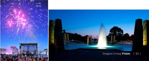

Irvingwillemphasizecreating neighborhoods, employment centersandretailcorridors thatprovidehigh-quality infrastructureandamenities. Thecitywillboastcomplete, walkableneighborhoods witheasyaccesstoservices, transit, educationaland medicalfacilities, shopping, and recreationandoutdoorfacilities. Allneighborhoodswillfeelsafe andwelcomingtonewandlongtermresidents.
Existingsingle-family neighborhoodsareacritical assetthatwillbepreserved andrevitalizedwhereneeded, retainingdesiredneighborhood characteristics. Parks, schools, andplacesof worshipwill continuetobeimportant communityassets, andwillbe integratedintoneighborhoods. Investmentinbikingand pedestrianroutes, andimproved neighborhoodandschool
design, willenableschool-aged childrentotravelsafelyto school. Redevelopmentof aging multifamily siteswillallow thecreationof multi-use areas thatcombinehousing, office, retailandservicesinamore pedestrian-friendly setting. New infilldevelopmentwillprovide arangeofhousingoptionssuch ascottageandcourtyardhomes, andwillbedesignedtofitthe characterofnearbydevelopment whileprovidingawiderrangeof housing choices.
Asthisgrowthand redevelopmentoccurs, thecity willfocusonimprovingallstreet connectionsandencouraging alternativetransportation optionsbyimprovingorbuilding sidewalksandbikefacilities. Transitcenterswillbelocated throughoutthecity, providing easyaccesstotheentireregion. Newandexistingmixed-use communitieswillsupport
walking, biking, andtransit toaccommodateresidentsin allstagesoflife. Areassuchas the Heritage Districtwilloffer housing opportunitiesforpeople whoaremoreinterestedinan urban, mixed-useandwalkable environment. Majorstreetswill beenhancedwithsidewalks,bike lanesandbettertransitservice tosupportagrowingnumber ofshops, restaurantsandother amenitieswithinwalking distanceofhomes.
Newandexistingneighborhoods willbenefitfrominnovations inlocalanddistrict-wide energysystemsthatuse geothermal, biomass, orother naturalsources. Growth anddevelopmentstrategies thatembracesustainable practiceswillyieldlong-term financialbenefitsbylowering maintenancecostsandreducing wasteanddisposalcostsoverthe longterm.


Residentsexpressedastrongdesireforaninterconnectedgreen systemthroughout Irving. Green infrastructure, parksand trailswillmakethecitymorebeautifulandenjoyablewhilealso supportingahealthyoutdoorlifestylethatIrvingresidentsvalue. Preservingandenhancing Irving'sgreenspacesandparkswill protectthecity'swater qualityandwatersheds, promoteenergy efficiency, increasetheurbantreecanopy,andimproveair quality.
Thecity'ssignatureCampionTrail willconnecttoaregional networkprovidingresidentsand visitors withtheability touse bicyclesforlong-distancetravel andrecreation. TheTrinity River willcontinuetoenhanceadjacentdevelopmentwithviewsof beautifulriverbanksandnaturalareasandincreaserecreational opportunitiesfor Irvingresidents.


Educationandgoodhealtharethefoundationofcommunity prosperityandeconomicsuccess. Irvingwillencourage healthylifestylesforfamiliesandanenvironmentthatis conducivetolearningwithessentialelementsincluding cleanairandwater,saferoutestoschools, openspacesfor recreation, accesstohealthy foodchoices, high-qualitypublic libraries, culturalresources, andmuseums. Irvingresidents willcontinuetosupportthrivingcareer-buildingeducational opportunitiesprovidedby theUniversity of Dallas, NorthLake College, andvocationalandtechnicaltrainingcenters.
Tobuild Irving'sgloballycompetitivefutureworkforce, educationalfacilitieswillrequireahighlevelof support, coordinationandinvestmentfrompublicandprivate partners. TheCityof Irvingwillcollaboratewitheducational institutionsatalllevels, including Irving'sindependent publicschooldistricts, toplananddevelopneighborhood improvementssuchassidewalks, streetsandcrossings, and publictransportation. Justasschoolsareengagedinplanning residentialandbusinessdevelopment, planningforparks, librariesandrecreationalfacilitiesisequally important.
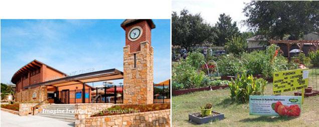

Irvingresidentstakepridein theircitybeingaplacewhere youngpeoplecangrow, get anexcellenteducation, train, buildacareer, ownorrent ahome, raiseafamily, and enjoyplentyofentertainment options. Residentsexpresseda strongdesiretocontinuethis trend, andtoprovidefuture generationswiththesame opportunitiesforsuccessin education, work andlifethat theyenjoyed.
Irving'sincrediblepoolof talentedyoungpeopleneedtobe engagedinthedecision-making andleadershipprocessesofcivic andbusinesslife. Providing leadershipandeducational programswillhelpnurtureand preparethesefutureleadersto guide Irvingthroughthenext century.
Whilecollegesandentryleveljoboffersattractyoung people, investmentsinquality oflifeenhancements, such
aswalkablecommunitiesand new entertainment venues, willbothprovidecareer growth opportunities, andhelp retainthenextgeneration. Irving'semphasisoncreating aninternationalcity where youngpeoplecanstarttheir careers, takechances, investin theirfuture, andmeaningfully contributetothecommunity willencourageyoungpeopleto make Irvingtheirhome.
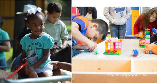


Irving, Texas offers the comforts of home and provides a world of opportunity for entrepreneurial ventures, corporate success and cultural interaction. Our government and community leadership are committed to those qualities of life that make a home a home.
As Irvinggrowsintoaglobal, economichubitwillbe importanttosupportlocal entrepreneurial businesses that fosterinnovation, creativityandcommunity vitality. Inadditionto capitalizing onthecity's
manylocationaladvantages (bothwithintheU.S.and itsconnectivitytoglobal businessdestinationsvia DFW Airport), supportingsustained economicgrowthand competitionalsowillrequire greaterpartnershipbetween
thebusinesscommunityand educationalinstitutions.Such collaborationwillensurethat localworkersaretrainedin theskillsnecessarytosupport businessattraction, expansion, andreinvention.

Asaglobalcrossroads, the Cityof Irvingishometothe mostdiversepopulationinthe Metroplex, with34 percentof residentsforeignborn, andthe populationcomprisedofpeople ofmanydifferentracesand cultures. Workforcediversityis becomingincreasinglyimportant tobusinessesandespeciallyto largecorporations, andIrving iswellpositionedtocapitalize onthistrend becauseofthe
populationmix. Corporate leadersin Irvingareaheadof thistrend, andhavelongseen thewisdomofemployingdiverse populations, benefitinggreatly fromthevarietyofperspectives thatdifferentexperiencescan bringtothetable.
Inadditiontotheeconomicand intellectualassetcreatedby varied backgrounds, thecity's diversity alsoprovides abreadth
ofrichculturalexperiences thatwillattractnewinnovative entrepreneursandyoung workerstoliveandinvestin Irving. Fascinatingculturesand traditionscanofferexciting entertainment, uniqueshopping opportunities andintriguing diningexperiencesthatcan addtremendouscharactertoa walkableenvironment.


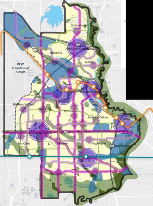
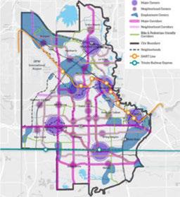
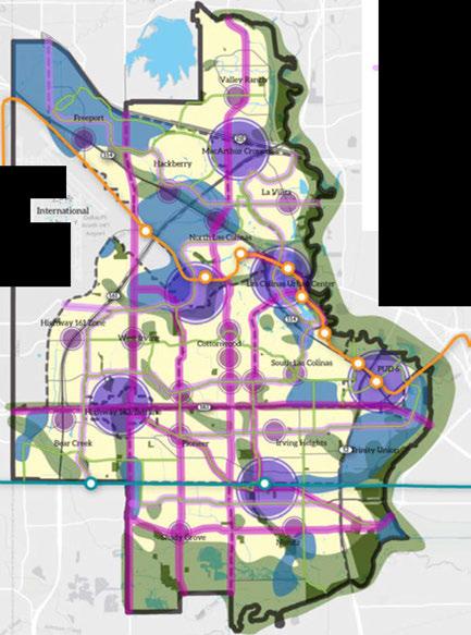
The Imagine IrvingVision Mapisastartingpointfor developingthe Imagine Irving Comprehensive Plan, and aguideforfuturedecisionmakingandplanning. Itisa conceptualdocumentonly, with noforceoflaworregulatory function. Insteaditprovides ideas, directionandfocusfor craftingthecity'slanduse, transportation, andopenspace plans. Ultimately, itguidesthe zoningordinanceandother programsrequiredtoimplement them. Thevisionmapshows themajorbuildingblocksthat structurethecity'scontinued growthandreinvestment.
Majorcentersareiconic Irving landmarks, districtsand destinationsthatservethe entireregion. The Heritage District, the LasColinasUrban Center, PUD#6, the Irving Mallarea, theDFW/Belt Line businessdistricteastofBeltline atthelocationof Abbott Labs and North LakeCollege, and MacArthur Crossingareall majorcentersofcommerce, employmentandactivity.
Neighborhoodcentersare local-servingcommercialareas thatmayincludegrocery stores, medicalandprofessional offices, personalservices, restaurantsandcafes, entertainmentandshopping.
Distributedacrossthecity, employmentcentersare areasofconcentratedoffice andindustrialuses. Some employment areasmay have mixed-use housing aswell. Irvingisamajoremployment destinationintheregionand these employmentcentersdrive thecity'sdiverseeconomy.
Majorcorridors, suchas MacArthur, O'Connor,Belt Lineand Story, serveas bothdestinationsandtravel routes. Unlikethecity'smany highways, thesestreetsconnect travelerstothelandusesalong them, andalthoughnotall corridorshavehigh-quality sidewalksandpedestrian crossings, thesefeaturescould beenhancedinthefuture. The mix oflandusesandpedestrian environmentsalongthese corridorswillvary basedonthe context.
Neighborhoodcorridorsare linear,commercialandmixedusedistrictsthatwillserve localneeds. Safety and accessibility arehighpriorities withinthecorridorstoensure thatneighboringresidentsand visitorsaresafeandsecure.
Activecorridorswillprovide transportationroutesforpeople onbikeandonfoot. Withlower speedsandlessautotraffic, they will encourage morepeople to bikefromoneplacetoanother, especially peopleconcerned aboutpersonalsafety onhightrafficstreets. Low-speed, low-trafficthroughstreets (no cul-de-sacsordeadends) will bedesignatedassharedstreets toprovidesafeconnectionsfor peopleacross Irving. Active corridorsalsowillseesidewalk improvements, crossing improvements, andgreen infrastructuresuchasstreet treesandplantedlandscape elementstoprovideshade, storm-waterfiltration, andother environmentalservices.

D AreasofStability
• MajorCenters
• NeighborhoodCenters
◄ EmploymentCenters
- MajorCorridors
Neighborhood Corridors
= Bike-and PedestrianFriendly Corridors
◄ OpenSpace
◄ Water Bodies
- Parks
- City Boundary
•-• Neighborhoods
.0,. DART Line
-0- TrinityRailway Express


Areasofstabilityprimarilyconsistofsingle-family neighborhoodsandmajoremploymentcenterswhosecharacter thecitywishestopreserve, thoughindividualelementsmay needtobeupdatedorenhanced. Areasofopportunity,generally locatedinmajorcentersandemploymentareasandalongmajor corridors, representlandthatisunderutilizedandcouldbe developedorredevelopedtoprovidehigh-qualityhousingand employmentareas. Examplesofopportunityareasincludethe landaroundtheformerstadiumsite, theLasColinasUrban Center, andIrving'sHeritageDistrictarea. Reinvestmentwill focusonredesigningagingmultifamilydevelopments,enhancing single-familyneighborhoodsandreimaginingstripretailareas.

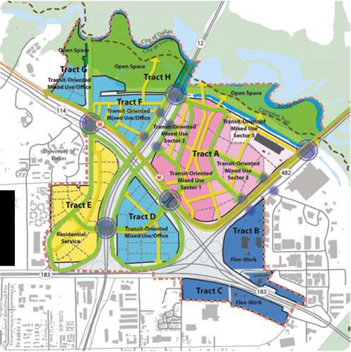


Scenarioplansaremap-basedillustrationsthattellpotential storiesaboutthefuture. Threealternativegrowthscenarioswere designedfor Imagine Irvingandtestedtodemonstratevarious waysthecity couldgrow,change,andreinvestinthenext25 years. Theresultinginformationgatheredfromthesescenariosdeepens theunderstandingofthelikely outcomesofchoosingcertain strategiesversusothers. Thelessonslearnedprovidedvaluable insightduringtherefinementoftheVision Map.
Withlittlevacantlandoropportunity toannexnewdevelopable land,outwardgrowthislimited. However,thecreativereuseof landisahallmark ofurbanplaces. Forthecity toaccommodateits expectedshareofthenewhouseholdsandjobsprojectedforthis regionin2040,the City of Irvingwillrely ondevelopingvacant land,aswellasonadaptivereuseofexistingbuildingsandthe redevelopmentofobsoletestructures.
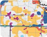

Inthenext25 years,thecity isexpectedtogrowby over28,000 householdsand89,000newjobs. Eachofthethreescenarioswere craftedaccordingtoauniqueoverarchingtheme (BaselineTrend, Transit Focus,and Corridorand Reinvestment),demonstrating differentwaystoaccommodatethecity'santicipatedgrowth. One importantlessonlearnedfromthescenariosisthatredevelopment ofmajorsitesandsmallerscaleinfillwillbecriticaltothecity's future. Vacantlandalonewillnotsupportthecity'santicipated newpopulationandjobgrowth.
1. Scenarios are driven by data and forecasts that reflect several different possibilities for how current trends could play out in the future.
2. The development patterns result in the unique placement of land uses - such as residential or urban neighborhood, and employment or commercial centers.
3. Each scenario's performance can be calculated and compared, such as resources used, proximity to jobs, time spent driving, housing match, tax cost, and revenues.


Eachchapterofthe Imagine IrvingComprehensive Planwill coverbroadfunctionalaspectsofthecity. Whileseparatedfor organizationalpurposes, eachchapterislinkedto support the goals, strategiesandactionsof others. Forexample, goalsand strategiesinthetransportationchapterarecoordinatedwithland use, soparcelsaroundalightrailstationaredevelopedforhousing, jobs, andamenities.
Thefollowingpagessummarizeeachchapteroftheplan:
• LandUseandUrban Design
• Housingand Neighborhoods
• Transportation
• Infrastructure
• Parks, TrailsandOpen Space
• Economic Development
• Conservation, Sustainability andGreen Initiatives
• Waste Managementand Materials Recycling
• CommunicationsandTechnology
• Public Safety
• Community Amenities
• Fiscal Security
• Poverty, Healthand Education
• IntergovernmentalRelationships
• SmallArea Planning
Irving'sfuturelandusesareorganizedundersix buildingblocks thatcomposethevisionmap (describedonpage17).
How we get there - Irving's strategy will be to:
» Ensure land use decisions are consistent with the adopted Imagine Irving Comprehensive Plan.
» Focus development and redevelopment efforts on creating well designed centers, corridors and connections that link housing, jobs and services.
» Widen the range of housing and employment choices by encouraging creation of dense mixed-use developments that include housing, retail and commercial uses.
» Remove barriers to infill construction and encourage reinvestment in aging neighborhoods and non-residential areas to help improve the quality of life.
» Follow a neighborhood-based approach to planning where all residents have access to nearby jobs, healthcare, education, services, shopping, parks and open space.
» Preserve and develop appropriate real estate options to meet the needs of current and prospective businesses and ensure that adequate land exists for a variety of uses.
» Work with the Dallas Fort Worth International Airport to protect the interests and enhance the growth and economic success of both the airport and the city.

The centers designated on the vision map are not all at the same level of development or walkability. Currently, some areas designated as neighborhood centers may lack quality infrastructure, have connectivity issues, or experience high retail vacancy. However, the vision proposes that over time all neighborhoods will develop well-integrated, local-serving hubs that are easily accessible by walking, biking and driving.

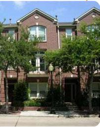

Future Irvingresidents willhaveavariety ofhousingoptionsto choosefromacrossthecity thatserveavariety ofincomeranges, ages, andculturalbackgrounds. Therewillbeincreaseddemandfor mixed-useresidentialoptionslocateddowntown, inneighborhood centers, andalongkey corridorsasincreaseddensity promotes sustainability, livability, andiscost-effectivefor Irving'sfuture. Youngfamilieswillbeabletoaffordattractivehomesin walkable andsafeneighborhoods, withaccesstojobs, schools, andparks. Thoselookingtodownsizetomoremanageablehomes willbe abletochoosefromaffordablehousingstylesinanumberof communitiesthatoffer proximity to restaurants, shopping, health care, andparks. The redevelopmentofaging apartment complexes andinvestmentsincommunity andinfrastructurewillimprove thequality oflifein Irving. Variety, flexibility andaffordability of housingchoicesfornewcomersandlong-timeresidentsalikewill makeastrongcaseforlivingandworkingin Irving.
How we get there - Irving's strategy will be to:
» Create "complete neighborhoods" with housing near transit, services, education, healthcare, shopping and employment.
» Provide a variety of housing types to accommodate the diversity of Irving's residents and neighborhoods.
» Invest in neighborhoods to protect and enhance neighborhood character.
» Enable access to housing for vulnerable populations.
Irvingresidentswillhaveawidevarietyoftransportation choicesforgettingaroundtown. Allresidentswillbeableto accessmajorcorridors, neighborhoodcorridors, activecorridors andtransitroutes. Peoplelivingandworkinginthecitywill beabletodrive, bike, catchabusorhopatraintojustabout anywhereintheregion. Thenetworkoftransitoptions, large arterials, pedestrian-friendlyneighborhoodsandemployment centerswillresultinoneofthesafestandmostefficient transportationsystemsinthecountry. Commuterswillspendless timedelayedintraffic, andgettingaroundwillbesaferandmore convenientby any mode.
How we get there - Irving's strategy will be to:
» Integrate land use and transportation.
» Improve multimodal transportation connections.
» Increase overall system capacity.
» Improve safety on transportation corridors.
» Support economic development efforts.
» Coordinate regional transportation decisions.

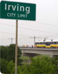

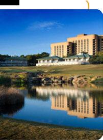

City infrastructureisacritical, butofteninvisibleingredientfor urban livability and quality oflife. Theunderlyinginfrastructure thatservicesthecity includeswastewater, drainageandwater, utilities, andpublicrights-of-way. Thevisibleelementsinclude thestreetsandsidewalkswhosemaintenanceneedsaremore readily apparent. Irving willcontinuetodevelopandmaintainthe highestquality public infrastructure forthecity'sresidentsand businesscommunity.
How we get there - Irving's strategy will be to:
» Ensure land use decisions are consistent with the adopted Imagine Irving Comprehensive Plan.
» Collect wastewater in an efficient, reliable, sustainable and environmentally sound manner.
» Reduce the risk of flooding to existing and future structures.
Irvingresidentswillhaveaccesstooneofthefinestparksandopen spacesystemsinthe Metroplex. Thecityof Irvingownsandoperates 43 parksandmorethan2,000acresofparkland. Thissystem includesthreepools,twoaquaticcenters,twosplashparksandtwo indooraquaticsfacilities. Thecity provideshikingandbikingtrails, picnicareas,playgrounds,discgolf,andfishing.
Opportunitiestoexpandwithinthissysteminclude:
» Enhancingpedestrianandbikeconnectionsbetweenparks andneighborhoods
» Updatingandmaintainingexistingparks
» Buildingacity parksystemofnationalquality
Thecity'strailsystemoffersmanyopportunitiesforenhancement, includingestablishingnewlinksbetweencenters,corridorsand neighborhoodsusingthecity'snetworkoftrails,greenwaysandopen spaces. Thecity willalsocompleteplannedsectionsoftheCampion Trailtoprovideacontinuousroutewhichconnectsallof Irvingand theregion.
How wegetthere-Irving1sstrategywillbeto:
» Conduct a comprehensive Parks, Open Space, and Trail Master Plan.
» Plan for the highest level of maintenance of existing parks and open space.
» Creatively work toward a goal of 10 acres of parks and open space per 1,000 residents.
» Expand funding options to meet resident demands.
» Increase the allocation of landscaping for infrastructure improvements.
» Implement additional sustainable practices.
» Coordinate park and open space with floodplain management needs.
» Continue to pursue plans to build a state-of-the-art recreation center.
» Improve connectivity between parks and open spaces.
» Complete the remaining land acquisition and construction for Campion Trails within the next five years.
» Reprogram inefficient facilities to meet changing demands.


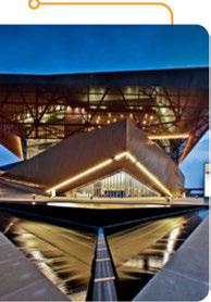

Irvinghasachievedsignificant successingrowingthecity's employmentandtaxbase, thanks inlargeparttothecommunity's partnershipapproachto economicdevelopment. The Irving EconomicDevelopment Partnership (the Partnership) consistsoftheCityofIrving, theGreaterIrving-LasColinas ChamberofCommerce, andthe IrvingConvention & Visitors Bureau (IICVB). Thisplanprovides aroadmapforIrving'seconomic developmentprogramoverthe nextfiveyears. Itisorganized undertheframeworkshownto theright.
Theultimatesuccessofthe recommendationswillreston thecommitmentoftheCity ofIrvingandthebusiness community. Theplanalsocalls forarevitalizationoftheexisting Partnership, withmorespecific rolesandresponsibilitiesassigned totheCityofIrving, theGreater Irving-LasColinasChamber ofCommerce, andtheIrving Convention& VisitorsBureau. Inaddition, asetofperformance metricsisincludedtotrack progressandensureproper accountabilitythroughoutthe implementationofstrategies.
How we get there - Irving1s strategy will be to:
» Strengthen Irving's position as a premier center for entrepreneurship and innovation within the Metroplex.
» Use Irving's unique assets to create a quality of place that attracts and retains talented workers and visitors, and capitalize on private sector investment.
» Preserve and develop appropriate real estate options and infrastructure to meet the needs of current and prospective businesses.
» Attract investment from foreign businesses, help local firms gain entry into foreign markets, and create a welcoming environment for the international community.
» Promote a stable, high level of employment that uses the region's human resources and talent.
» Cultivate an inclusive and accessible environment where Irving residents and businesses can thrive and prosper.
Irvinghasmany scenicnaturalfeaturesthataregreathabitats forplantsandwildlife. Theseareasincludethe Elm Fork ofthe Trinity River,lakes, forests, wetlands, canals, theCampionTrail, andothercity parks. Thecity shouldprotectandconservethese environmentalassets, fosteragreen, active, ecologically diverse andeconomically soundcommunity, andcontinue "greening" the city'sownoperationsandleadthroughaction.
How we get there - Irving's strategy will be to develop partnerships to:
» Use city procurement to provide leadership in sustainability.
» Maintain, upgrade and improve the city's infrastructure sustainably.
» Manage stormwater sustainably.
» Expand the use of renewable energy sources.
» Build the city's resource security and disaster resilience.
» Restore and regenerate the urban environment.
» Expand alternative transportation options to address air quality issues to help mitigate regional non-attainment.
» Provide resources and education for staff, residents and business.
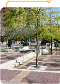


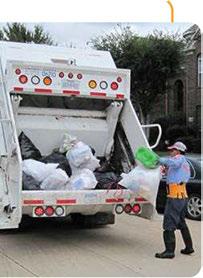

ThemissionoftheSolidWasteServicesDepartmentistoprovide exceptionalservicethatiscosteffective, environmentally responsible, andmeetstheneedsofresidentswhileexceeding allregulatorystandards. Irvingwillcontinuetoprovidetop qualitywasteandrecyclingservicesandwillserveallresidences, regardlessofhousingtype, whileexpandingbusinessrecycling collectioninthecity.
How we get there - Irving's strategy will be to:
» Ensure capacity to serve the city as the population grows.
» Examine funding to ensure continued level of service.
» Improve waste practices and service for Irving residents and businesses.
» Improve city building recycling infrastructure and participation.
Theworldofcommunicationsandtechnology isconstantly changing,whichrequiresthesemunicipalserviceprovidersto nimbly adjustandupdate tools,programsandprocedures.
Theprimarymissionofthecommunicationsdepartmentisto maximizecommunity engagement, reachingasmanyresidents andsubpopulationsaspossible. Inaculturethatwelcomesshort messagesof 140charactersratherthanin-depthreporting,itis oftenachallengetocommunicateclearlyorwithprecision. Irving's communicationdepartmentalready engagesthepublicinmultiple ways,includingthe "City Spectrum," amonthly reportmailedto morethan95,000 residents. The communication department overseesadditionaloutreachtoolssuchasemailalerts,press releases,a Facebookpage,twitteraccount,aweekly newsletter, andapublictelevisionstation. Toincreaseengagement with thecity'syouth,thecommunicationdepartmentcontinuously identifiesnewandemergingtrendsusedby thepublictoobtain informationandrapidly adoptsthesenewmethodstomaintain andgrowthenumberofpeopleinvolvedincity government.
How we get there - Irving's strategy will be to:
» Use data and technology to connect and integrate initiatives to continually improve city operations.
» Continually improve outreach methods as new technologies are developed and as residents demand different types of engagement.
» Advance "smart projects" to improve quality of life and increase economic competitive advantages.
» Maximize resource efficiency.

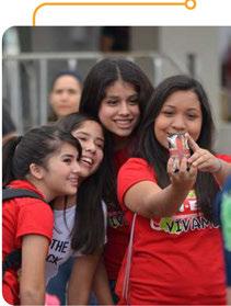


Irving'spublicsafety providers arededicatedtoprovidinghighquality servicetoresidentsand business. Buildinginspections, police, emergency services, andfire workclosely with regional, stateandnational entitiestocoordinateservices, prepareoperationalplans, and incorporateinnovationsinto theirpracticeswiththegoalof providing high-quality services to allresidents. As technology and developmentpatternsevolve, the roleofpublicsafety departments willchangeinthefutureaswell.
Thefiredepartmentprovides fireanddiseaseprevention, education, firecoverage, EMS, hazmat, swift waterrescueteams, crashrescue, andurbansearch andrescueoperations. With12 firestationsandnineambulances thefiredepartmentplansto addadditionalstationstoserve anticipatedgrowth.
Thecity seekstoprovide consistentserviceacrossthe jurisdiction withafour-minute responsetimefor firstresponders andaneight-minuteresponse timeforafullresponse. Asthe city grows, thechallenge will betoincreasecoverageto fillin serviceareagaps.
Irving'spolicedepartmenthas
acrimepreventionteam, public safety trainingcampus, and coordinateswithothercities andtheregionfortraining. The policedepartmentcurrently has twooperationalcampusesand anticipatesexpandingtocover futuregrowth.
Thepolice departmentfocuseson buildingcommunityrelationships andsupportingneighborhood watchgroups, crimeprevention, housingsurveys, andacitizen academy. Thedepartment emphasizescommunity outreach tomaintainsafety, cultivate dialogueandunderstandthe community'sissues.
Thebuildinginspectionsand codeenforcementdepartments administerthebuildingcode, coordinatewithregional requirements, reviewplans, andprovidecodeenforcement. Aginghousingstockchallenges ordinanceenforcement. Thecode enforcementteamemphasizes voluntary complianceprograms withthegoalofteaching residentsaboutthecharacter oftheirneighborhoodsand instillingprideofownership.
How we get there - Irving1s strategy will be to:
» Become a regional leader in innovative technology.
» Plan for future public safety capital improvement needs.
» Evaluate and address the needs of new growth centers.
» Continue to focus inspection programs on problematic and declining areas.
» Focus the culture in Public Safety departments on building community relationships.
Thecivic, culturalandintellectualassets-performingartscenters, libraries, conventioncenters, museums, universities, community colleges, municipalservices, hospitals, parks, andsportsarenascontributetotheculture, economyandvitalityofacity. Irvingoffers avarietyoftheseassetswhichcanbeputtoworkonbehalfofthe city. Theyprovidethefoundationforattractingandretainingthe creativeandinnovativeworkerswhowillhelpbuild Irving'sfuture. Culturalandartsamenitiesalsoenrichthecommunitybyproviding anenvironmentthatbenefitsallresidents-youngandold.
How we get there - Irving•s strategy will be to:
» Ensure library facilities are properly located and upgraded to provide quality citywide library services. Plan for new facilities to meet future growth.
» Expand library programming to include creative programming that responds to community needs.
» Use arts and cultural resources to bring Irving together as one cohesive city made up of vibrant, diverse neighborhoods.
» Promote Irving's cultural assets to create vibrant neighborhoods and activity centers.
» Leverage key developments in Irving to attract and enhance economic development target markets.
» Plan for maintenance and ongoing programming of the Irving Arts Center as a key cultural asset.
» Plan for maintenance and ongoing programming for the Irving Convention Center as a key cultural asset.
» Address revenue opportunities and options.

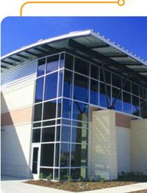

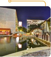

TheCityof IrvingisamongaselectfewTexascitiesthatenjoya AAAbondrating, which Irvinghasheldsince1996. Whenthe citysellsbondsforcapitalimprovementprojectssuchascitystreet repair, libraryconstruction, orparksenhancements, thetoprating allowsthecitytosavemoneybyreceivingthelowestinterestrate possible, whichinturn, allowsthecitytomaintainitslowproperty taxratewhichbenefitsthecity'spropertyowners.
Soundfiscaldecisionsandinvestmentsallowthecitytoleverage itsfavorablebondrating, butrequirethecitytocarefullyprioritize needsformajorcapitalimprovementsandmaintenanceoncritical streetimprovements, stormdrainageupgrades, andsolidwaste infrastructure. Theseelementsarevitaltomaintainingthehigh
qualityofpublicinfrastructureandservicethatresidentsand businessesexpect, andcontributestronglytothehighqualityof lifein Irving.
How we get there - Irving's strategy will be to:
» Invest in the capital improvements program to ensure high-quality infrastructure and services for residents and visitors.
» Invest in street improvements, storm drainage improvements, parks services, city buildings, solid waste infrastructure, fire services, police services, citywide communication, gateway initiatives, and recreation center facilities.
Irvinghasarobusthealthandeducationsystemwiththree independentschooldistricts, the North LakeCommunity College, theUniversity of Dallasandnumeroustechnicaltrainingcenters, businessschoolsandcomputerandmanagementtraining. Evenso, throughouttheplanningprocess, residentsexpressconcernabout thereputationoftheeducationalsystemandtheneedtoenhance the K-12 schoolsasameansofattractinghighquality employers to Irvingandmaintainingresidentialvalues.
While Irvinghashigh-quality healthproviders, accesstohealth carecanbeimpededby alack oftransportationoptions. The mostvulnerablepopulationsarethedisabledorpoorwhomay notbeabletodrive. Barriersthatlimitaccesstohealthcare andcontributetoinequitiesincareareprimarily financial, organizational, andsocio-cultural.
Lack oftransportation, unfamiliarity withcurrenttechnology, and linguisticorliteracy barriersimpedesomeresidentsfromfinding andusinginformationthatmay bevitaltotheirhealth, safety andwelfare. Whenconsideringquality oflife, botheducationand accesstohealthservicesarehighpriorities.
How we get there - Irving's strategy will be to:
» Create complete neighborhoods with access to educational and health facilities in all neighborhoods.
» Coordinate the planning and construction activities of new schools with the development planning process to ensure schools and new housing are well balanced.
» Improve transit services to connect the larger population with education facilities and health services.
» Support an educational system which consists of academically and financially strong and stable schools.
» Build coalitions with numerous agencies that provide health care and educational services to eliminate redundancy and facilitate access to services.
» Coordinate health and human services in the community with state and federal agencies so that resources are not duplicated, and that the needs of residents are met.



Manyfactorsthatshapetheoverallqualityoflifeof Irving residentsoriginatefarbeyondthebordersofthecity. Stateand regionaltransportationdecisions, globalandnationaleconomic trendsandmigrationpatternsallimpactthefutureofthelocal economyandpopulation. Stateandnationalpoliciesaffect everythingfromthehealthoflocalindustrytoresourcesavailable tolocalgovernments.
Thetransportationnetwork, utilities, policeprotection, school systems, andotherlocalservicesinextricablylinkthecity'sefforts tothoseofitsneighboringjurisdictions, andimprovinglocal qualityoflifewilloftenrequirecollaborationwithlocalpartners.
How we get there - Irving's strategy will be to:
» Continue to strengthen coordination efforts with local, state and federal agencies.
» Eliminate duplication of services and efforts by coordinating policies, procedures, and information.
» Establish a process for coordinating, monitoring, and promoting local, regional, state and federal public services, health, and safety measures.
Smallareaplanningisatooltoaddressspecificcommunityor developmentissues. Asmallareaplanisadetailedcomprehensive planforahuman-scalegeographicareaorneighborhood. These plansprovidepolicyguidanceandrecommendationsforissues suchaslanduse, zoning, housing, transportation, parksandopen space,economicdevelopment, andurbandesign. Creatingsuch plansallowsthecommunitytounderstand, articulateandaddress theirspecificissues, needsanddesires. Theresidentsandproperty ownershelpbuildanimplementationplantoshapethefutureof thearea. Aspartofthe Imagine Irving process, severalareasare identifiedforthissortofeffort: theformerstadiumsite, the North LakeCollegeCampus, andtheneighborhoodtothesoutheastof DFWairport. A varietyofissueswillbeexploredandsmallplans producedforthoseareas.
How we get there - Irving's strategy will be to establish a small planning process incorporating these components:
» Define a boundary.
» Activate community participation throughout the process.
» Assess, inventory and analyze existing conditions.
» Prepare a vision statement.
» Analyze civic responsibilities and the citywide context.
» Make policy and plan recommendations.


AVisionforIrvingisapreviewofthe comprehensiveplanandaguidetousing theplantobuildthefutureweimagine. This documentillustratesashareddreamfor thefuture. Asacommunity, weimagine afuturewithmorehousingchoices, safer neighborhoods, top-notchinternationalcenters, arobustHeritage District, andwishtosee everydayserviceswithinconvenientdistance ofeachneighborhood. Werecognizethat achievingthisvisionrequiresdeliberateaction andachangetoexistinggrowthpatterns. We alsorecognizethatourcommunity'sdream, anditscommongoalsandvalues, maychange overtimeandthatthisvisionstatement mayoccasionallyneedrevisiontoensureit continuestoaccuratelyreflecttheheartsand mindsof Irving'sresidents.
Whilethevisiondescribesourimagined future, thegoalsandpoliciessetforthinthe comprehensiveplanserveasaguidelineto achievethisvision. Theplandirectsthecity asitmakesdecisionsandinvestsitsresources towardssustaining Irvingasavibrant community,guidingpolicyabouthousing, economicdevelopment, transportation, landuse, publicinvolvement, thearts, naturalresources, andurbandesign. The comprehensiveplanwillprovideguidancefor thenext25 years, potentially requiringupdates everyfiveto10 yearstoreflectchanging conditions.
Toimplementthepoliciessetforthinthe comprehensiveplan, wefollowastrategic implementationplan. Theimplementationplan focusesonspecificactionstakingplacewithina veryshorttermtomeetthegoalsestablishedin thevision.
Together,thesethreeelements - thevision, the comprehensiveplan, andtheimplementation plan - providethecitywiththetoolsneededto make Irvingthecity wedreamitcanbe. These elementsincorporatethebestfeaturesofearlier plansandthecreativeideasoftheforwardthinkingresidentsandcommunityleaderswho daredtoimaginethefuture.
Itisnowuptoeveryresidentinthecommunity toworktogethertomakethisvisionhappen. Stayinformed, getinvolvedandjointhecity andyourneighborsinenvisioning Irving's futuretogether. Imaginewhatwecan accomplishtogether!

l. DFW Fast Facts. https://www.dfwairport.com/visitor/Pl_009559.php August 2015.
2. http://www.dallasnews.com/news/community-news/irving/headlines/20l30614-best-neighborhoods-irving-historicdistricts-heritage-large-lot-sizes-offer-unique-deal-for-downtown-living.ece (20l3)
3. US Census Bureau 2013 Population Estimate. http://www.factfinder.census.gov
4. Irving-Las Colinas Chamber of Commerce. http://www.irvingchamber.com/
5. Business Insider June 27, 2015. http://www.businessinsider.com/best-cities-to-live-in-your-20s-20l5-6
6. http://www.nbcdfw.com/news/local/lrving-Neighborhood-Ranked-Americas-Most-Diverse-l85375252.html (2013)
7. US Census Bureau. ACS 2013, 5 year estimate. http://www.fac�inder.census.gov
8. http://www.forbes.com/sites/joelkotkin/20l3/06/l8/americas-fastest-growing-cities-since-the-recession/ (20l3)
9. NCTCOG May 2015 Forecast, which was modified based on City of Irving observed household sizes




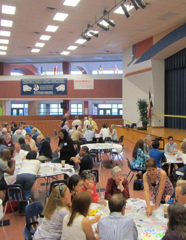

InJanuary 2015, theCity of Irvingchallengedresidentsto Imagine Irving, anddevelopacomprehensiveplanthatreflectstheneedsandaspirationsof thecommunity. This planning process engageda diverse rangeofcommunity stakeholdersandresidents. Sincethattime, thepeopleof Irvingexplorednew ideas, expressedopinionsandidentifiedpotentialstrategiesforshapingthe city'sfuture. Theplanningteamconsideredawide-rangeofcreativeideasfrom hundredsof Irvingresidentsonhow Irvingshouldlookinthefutureand what areasshouldbeprioritizedwhenimplementingtheComprehensive Plan.
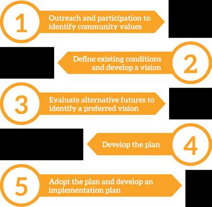

Thefirstphaseinvolvedcreatingapublic participationprocessforthecommunityto voiceconcernsandprovideinputtoidentify Irving'soverarchingvalues. Theseprinciple valuesguidedthedevelopmentofthevision andplan.
2. Define existing conditions and develop a •• v1s1on
Inthesecondphase, theCityof Irvingand theconsultingteamanalyzedexistingplans relatedtolanduse, zoning, transportation, economicdevelopment, andparks, aswellas demographic, development, employment, and housingdata, toprojectpossiblefuturetrends through2040.
Thethirdphaseinvolvedgeneratingand testingthreealternativegrowthscenarios -abaselinetrendscenario, atransitfocus scenario, andacorridorandreinvestment scenario. Thesescenariosincorporatedawide
varietyofdatacoveringpopulation, jobs, housing, transportation, andgreenspace. Thesescenarioswereusedtocreateapreferred visionmapthatwassharedwiththepublicfor feedback.
Duringthefourthphase, theteambegan assimilatingalloftheindividualcomponents intoacomprehensiveplancoveringeverything fromgrowthandredevelopment,howpeople travel, park andrecreationneeds, housing, infrastructure, communityhealthandmore. Duringplandevelopment, residentsand stakeholderswereofferedmanyopportunities toprovideinputandselectwhichstrategies shouldbeprioritizedintheshort-term. This inputguidedcreationoftheimplementation plan.
Thefifthandfinalphaseconsistedofthepublic reviewofthe Imagine IrvingComprehensive Planandthecreationofanimplementation planfromthepoliciesandgoalsoutlinedin thecomprehensiveplan. Adoptionofthe comprehensiveplananditsshort-andlongtermactionplaniscriticaltoensuringthe visionandgoalsof Irving'sresidentsand stakeholdersareachieved.
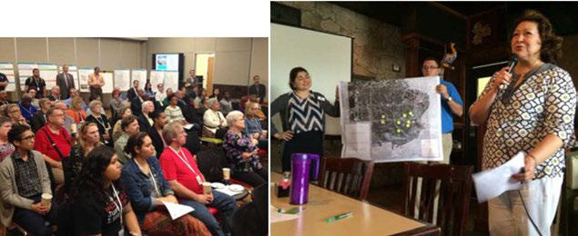
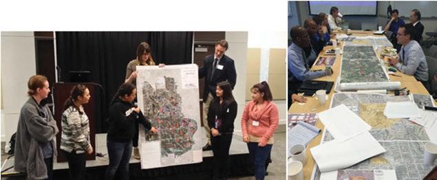
Aplansucceedsbasedonthecommitmentof theparticipantstopursuetheirstatedvision, andtoimplementthegoalstheysetforthin theirplan. TheImagineIrvingteamembarked onanextensivepublicengagementcampaign, initiatingnumerousdialogueswiththegeneral publicandbusinessowners. Stakeholders representingadiversecrosssectionofthe communityincluding DFW International Airport, North LakeCollege, DART, Irving Independent School District, nonprofitsand otherswereencouragedtoprovidetheirideas
andfeedback. Specialattentionwaspaidto engagingmembersofthe Hispaniccommunity toensurethatthisgrowingsegmentofthe populationwasheard. Inaddition, a 28-member steeringcommitteemetregularlythroughout theprocesstoreviewfindings, provideinput, andassistinengagingthepublic. Thiseffort culminatedinthecreationofacommunitydrivencomprehensiveplanandhelpedbuild supportforimplementationoftheplaninthe yearstocome.
» Steering Committee
» Stakeholder interviews
» Council interviews
» Bilingual promotion materials in English and Spanish !fliers, posters, door hangers)
» Citywide workshops
» Neighborhood workshops
» Workshop with Hispanic community
» Irving TV shows and videos on !CTN
» Vision roll-out Open House
» Imagine Irving Survey
» Vision Survey

» Implementation Survey
» Draft Plan roll-out Open House
» Information booths at festivals and community events in Irving
» Display materials at recreation centers and Irving library
» Presentation to neighborhood and nivic groups and Chamber of Commerce
» Presentations to Park Board, Health Board, Planning and Zoning Commission and City Council
» Meetings with business leaders, educational leaders, and DFW International Airport Representatives
Short ICTN Videos andTelevision
Appearances on ICTN's "Open Line"
» 526 combined views
»2,694 subscribers
Press Releases, NewsCoverage& "City Spectrum" Articles
» 16 press releases {English & Spanish)
»9 Spectrum Articles
"All About Irving" Newsletter
» 15,600 subscribers
"City Spectrum" Articles
» 95,600 copies distributed
Social Media Postson Cityof Irving and North Lake College Facebook andTwitterAccounts
» 6,084+ Likes: City Facebook Audience
» 4,616+ Followers: City Twitter Audience
Media Outreach
» 14 Spanish outlets
» 23 English outlets
Homeowner's Association meetings
» 5+ meetings
Stakeholder Meetings
» 30+ meetings
Imagine Irving Survey
» 300+ responses
Vision Open House & Survey
» 75 attendees
» Approx. 350 responses
Festival and Community Events
» Irving Mall
» Irving Bazaar
» Dia de la Familia @ North Lake College
» Irving Outdoor Concert Series
» Cinco de Mayo Events
» First-Time Homebuyer Fair
Attendees at Citywide Workshops, Neighborhood workshops, and Hispanic CommunityWorkshop
» 300+ combined workshop attendees
Imagine Irving Comprehensive Plan Rollout Event
» 36 attendees


Individuals from the following groups served on the Steering Committee:
» Dallas County Utility and Reclamation District
» DFW International Airport Planning
» Greater Irving-Las Colinas Chamber
» Green Advisory Board
» Hispanic Chamber
» Irving Hispanic Chamber of Commerce
» Irving Arts Board
» Irving Bible Church
» Irving ISD
» Islamic Center of Irving
» Las Colinas Association
» Leadership Irving
» Mission at La Villita Apartments
» NCH Corporation
» Northlake College
» Northwest Irving
» Planning & Zoning Commission
» Transfiguration Lutheran Church
» University of Dallas
» Valley Ranch Association
» Valley Ranch Islamic Center
» Wells Fargo
» Youth Action Council

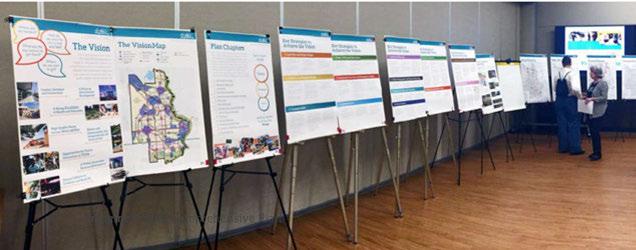
Thepublicengagementeffortproducedanumberofcommonthemesthatprovidedinspiration and guidanceforthe Imagine IrvingVisionandComprehensive Plan:
» Strong support for single-family housing, mixeduse development, and more affordable housing options.
» Strong desire for livable communities that contain better entertainment options, walkable and bike-able travel routes, better transit service, and career growth opportunities.
» Aging infrastructure, road improvements, and neighborhood stability were common concerns expressed by residents during workshops and surveys.
» Focusing revitalization efforts in south Irving to support existing businesses, attract more restaurants and retail, create walking and bike trails, rehabilitate old buildings, and improve infrastructure was a major priority strongly supported by Irving residents.
» Irving has excellent school systems, but poor connectivity creates barriers to partnerships between institutions and access to high-quality education. Connect local businesses and corporations with educational opportunities and professional development at University of Dallas and North Lake College
» Irving is becoming increasingly diverse in age, race, and ethnicity. Providing a platform for marginalized populations to have a voice and providing more inclusive opportunities for civic engagement was an important goal of Irving residents.
» Strong desire for interconnected green system and better utilization of the Campion Trail and Trinity River.







Good plans shape good decisions.
~ Lester Robert Bittel
» Imagine Irving will guide the city to achieve the community's vision for the next 25 years.
» At the start of each chapter, the guiding principles that are especially relevant to the topic are highlighted.
Asaninnersuburbofamajormetropolitanarea, Irvinghaslimitedopportunitiesforcertaintypesof large-scaledevelopmentsduetoadecliningsupply ofvacantland. Whilethereislimitedgreenspacefor expansion, Irving'sfutureandcontinuedsuccesswill relyonthereinvestmentandrenovationofexisting areas withinthecity. Irvingresidents, businessleaders andstakeholdershaveprovidedavarietyofcreative ideasonhow Irvingcouldlook inthefuturethrough participationinworkshops, stakeholdermeetings, andfocusgroups. Theinputgatheredcenteredonthe importanceofreinvestinginolderareasofthecity, improving roadways andinfrastructure, capitalizing onthecity'slocationwithinthe Metroplex, and expandinghealthandeducationalopportunities.
Whilemanythemesandideashavebeenexpressed, almosteveryoneagreedthat Irvingisatapivotal pointinthecity'shistory. Forward-thinkingdecisions willplayacrucialroleinthecity'sfuturesuccess anddeterminewhether Irvingbecomesjustanother suburbinalargemetropolitanarea, orfulfillsits potentialasadynamichubofagrowingregion.

» Irving is recognized nationally for its international accessibility, diversity of residents, environmental sustainability, and business- and developer-friendly environment.
» Irving is a destination city.
» Irving has opportunities to shop for basic needs in all parts of the city, including previously under-served areas.
» Irving supports beautification across all parts of the city.
» Irving provides all residents with compelling reasons to remain in the city.
» Irving provides access to high-quality health and education opportunities and resources across the community.
» Irving's high density urban areas support a variety of lifestyles with round-the-clock activity.

Irvingistheenvyofanycity,possessinga youngdiversepopulationandworkforce, quality neighborhoods, worldclasscorporatetenants, and strongprospectsforgrowthandreinvention.
Irvinghasseensteadygrowthduringthepast 60 years, andthistrendisexpectedtointensify inthe next 20 to30 years, addingnewresidentsandjobsto thecityatanimpressive rate. Thecity'spastgrowth hasconsumedmuchofitsavailablevacantland, and thisdevelopmenthascreatedneighborhoods, retail centers, andemploymentdistrictsthataredesigned aroundtheautomobile. Decadesofgrowthhave createdavarietyofdiverseareas, whichinclude ahistoric "mainstreet" district, apremieremixedusebusinessdistrict, andoneofthenation'sbusiest airports.
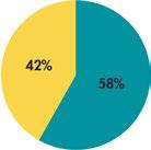
Irvinghaspositioneditselftocreatenewtypesof developmentsuchasmixed-useandtransit-oriented development.Thesedevelopmentsprovideamixof housing, retailandservices, andarebuiltaroundrail stations. Inthefuture, theCityof Irvingwillneedto ensurethatcityplans, codes, anddevelopment review processes accommodate theserelatively newtypesof development.Additionally,theCityof Irvingshould encourageredevelopmentandinfill (theadditionof neworrehabilitatedbuildingsintoexistingurban areas) tosuitchangingmarketdemands, whichplace higheconomicvalueoncentrallylocated, easily accessible, pedestrianandbikefriendlyqualityplaces. OverhalfofnewhousingstockinIrving willbein "walkable urban" areassuchasUrban Districts, mixedusedistricts andmajor corridors. Irving's locationat thecenterofa connectedregionthatisincreasingly wellservedbytransitwillkeepdemandfor redevelopmentandmixed-use neighborhoods strong.


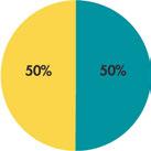
■ Walkable Urban Other
Source U.S. Censusu Bureau, 5-yeor ACS 2012, 201l NCTCOG
Likethecity'sdiverseinventory ofbuildings, Irvinghasavarietyofurbanenvironmentsthat vary by districtandneighborhood. Irving's built environmentrunsthegamutfromahistoricmain streetdistricttomajorcorporatecampuses, from lowerdensityresidentialneighborhoodstoaspectrum ofmultifamilyandmixed-useapartmentbuildings andcondos, andfromseveralburgeoningmixed-use districtstosuburban-stylestripcommercialcorridors.
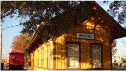
HeritageCrossing, anareathatisreadyfor reinvestment, isaclassicexampleof "mainstreet" style walkabledesignthatutilizesthesmallstreetblocksand pedestrianscaleofthearea. Bycontrast, LasColinas UrbanCenter, althoughrevolutionaryinitstime, isnoteasily walkableduetowidestreetsandlarge blocksizes, aswellasthepresenceof LakeCarolynas abarrier.Recentplanningandfuturedevelopment plannedfortheareawillleadtogreaterwalkability andbicycle-friendly transit-oriented developmentthat takesadvantageofthe DARTOrange Linelightrail service, andaddstothe street-level activity.

in the city is not enough to meet anticipated residential demand.
Redevelopment of major sites and smaller scale infill is critical to meet expected population and job growth.
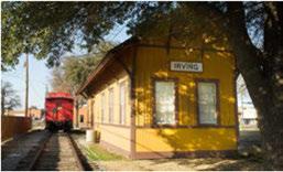
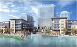
Land Use + Urban Design
Irving'sfuturelandusesare categorizedbysix buildingblocks thatcreatetheVision Map. These VisionCategoriesdescribethetypes ofplacesthatshouldbecreatedin thecity. Theydonotspecifyusesor heightlimits, butcommunicatethe scaleandintensityofdevelopment thatisexpectedinthefuture.
Justas Irvingisacityof many diversecultures, italsocontainsa varietyoflandusesthatdifferin age, scale, affordabilityanddensity. TheVision Categories identify thecommonelementsofthecity's uniqueareas.
Majorcentersareiconic Irving landmarks, districtsand destinationsthatservethe entireregionas concentrations of commerce, employmentand activity. Thefivemajorcentersare:
• Heritage Crossing
• Las ColinasUrban Center
• PlannedUnitDevelopment #6 (PUD #6 -former stadiumsite)
• Irving Mall
• MacArthur Crossing
• DFW/Belt LineBusiness District

Neighborhood centersarelocalservingcommercialareasthatmay includefarmersmarkets, grocery stores, medicalandprofessional offices, personalservices, restaurants, cafes, entertainment andshopping.
Distributedacrossthecity, employmentcenters, suchas Freeport, areareasofconcentrated officeandindustrialuses. Some employmentareasmayhave mixed-usehousingaswell. Irving isamajorregionalemployment destination, andtheseemployment centersdrivethecity'sdiverse economy.
Majorcorridorssuchas MacArthur, O'Connor, Belt Lineand Storyserve asbothdestinationsandtravel routes. Unlikethecity'smany highways, thesestreets connect travelerstothelandusesalong them. Whilethesecorridorsmay notallhavehigh-quality sidewalks andcrossings, suchfeaturescould beenhancedinthefuture. The mix oflandusesandpedestrianfriendlyareasalongthesecorridors willvarybasedonthecontext.
Neighborhood corridorsarelinear, commercial and mixed-use districts thatservelocalneeds. Visibility andaccessibilityarehighpriorities withinthesecorridorstoensure neighboringresidentsandvisitors aresafeandsecure.
Bikeand pedestrian-friendly corridorswillprovideanetwork ofsafetransportationroutesfor peopleonbikeandfoot. Lower speedstreetswithlessautomobile trafficencouragemorepeopleto bikeasawayofgettingaround -especiallythoseconcernedwith safetyonhigh-trafficstreets. These corridorsalso willseesidewalk and crossingimprovements, aswellas landscapeenhancementssuchas treesandotherplantstoprovide shade, storm-waterfiltration, and otherenvironmentalservices. Lowspeed, low-trafficthroughstreets (nocul-de-sacsordeadends) will bedesignatedassharedstreetsto providesafeconnectionsfor people across Irving.
Land Use + Urban Design
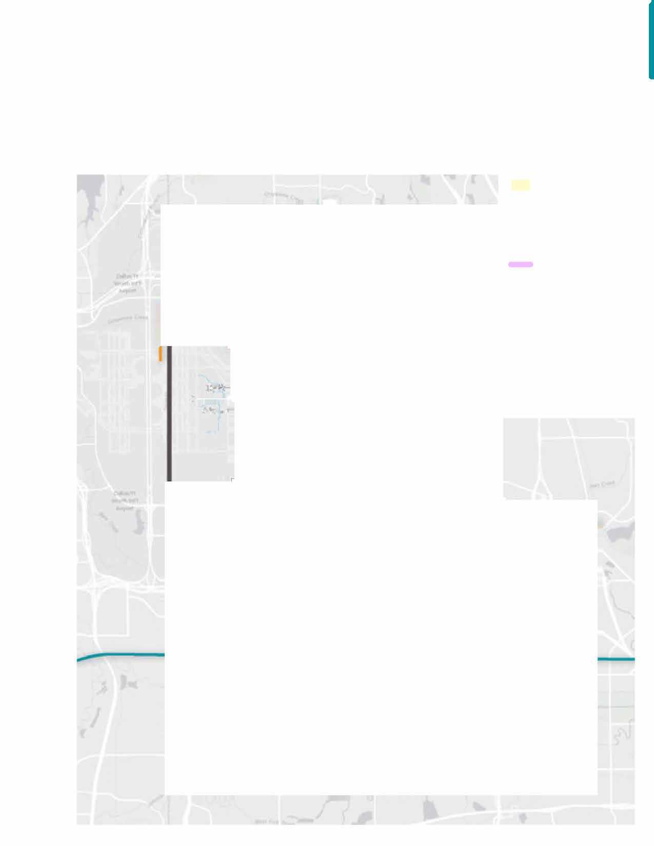
D AreasofStability
• MajorCenters
• NeighborhoodCenters
◄ EmploymentCenters
- MajorCorridors Neighborhood Corridors
= Bike-and PedestrianFriendlyCorridors
◄ OpenSpace
◄ Water Bodies
- Parks
- City Boundary
•-• Neighborhoods
.0,. DART Line .0,. TrinityRailway Express

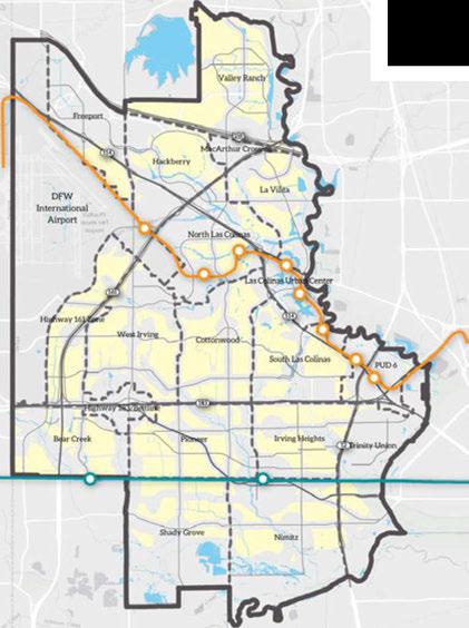
Areasofstabilityprimarilyconsistofsingle-family neighborhoodsandmajoremploymentcentersthat haveageneral character thecitywishestopreserve. Individualelementsmayneedtobeupdatedor enhancedwithintheseareas, butinvestmentwill focusonpreservationofcharacterratherthan transformation.
Opportunitiesexistonunderutilizedlandthatcouldbe developedorredevelopedtoprovideadditionalhighqualityhousingandemploymentareas. Examplesof suchareasincludethelandaroundtheformer stadium site, Las Colinas UrbanCenter, and Heritage District. Reinvestmentintheseareaswillfocusonissuessuch asredevelopingagingmultifamilydevelopments, enhancingsingle-familyneighborhoods, and reimaginingstripretailareas.
Areasofstabilitycanapplytoimportantnonresidentialareasofthecityaswell. Commercial, office andindustrialareasarevaluablecomponentsofthe cityasawhole, andhavedistinctneeds. Industrialand commercial areasthatrelyonfreight andcommercial goodsmovementneedaccesstonearbyroadsand highways. Bufferingtheseusesfromresidential neighborhoodscanreducepotentialconflictsand providebenefitstobothtypesofplaces.


15: Areasof Stability
Land Use + Urban Design D Areas ofStability ◄ Water Bodies - City Boundary •-• Neighborhoods .0,. DART Line -0- TrinityRailway Express


Scenarioplansaremap-basedillustrationsthattellpotentialstoriesabout thefuture. Threealternativegrowthscenarios weredesignedfor Imagine Irvingandtestedtodemonstratevariouswaysthecity couldgrow, change,andreinvestinthenext 25 years. Theresultinginformation gatheredfromthesescenariosdeepenstheunderstandingof thelikely outcomesof choosingcertainstrategiesversusothers. Thelessonslearned providedvaluableinsightduringtherefinementoftheVision Map.
Withlittlevacantlandoropportunity toannexnewdevelopableland, theopportunitiesfor Irvinggrowingoutwardarelimited. However, thecreativereuseoflandisa hallmark of urbanplaces. Forthecity to accommodate its expected shareofthenew householdsandjobsprojected forthisregionin 2040,the City of Irving willneedtorely onvacantland, aswellasonadaptivereuseofexistingbuildingsandtheredevelopment ofobsoletestructures.
Irvingisexpectedtogrowthsubstantially betweennow and 2040,adding around 28,000new householdsand89,000new jobs. Eachofthethree scenarios werecraftedaccordingtoauniqueoverarchingtheme (Baseline Trend,Transit Focus,andCorridorand Reinvestment),demonstrating different waystoaccommodatethecity'santicipatedgrowth. One important lessonlearnedfromthescenariosisthatredevelopmentof majorsitesandsmallerscaleinfill willbecriticaltothecity'sfuture. Vacantlandalone willnotsupportthecity'santicipatednewpopulation andjobgrowth.
1. Scenarios are driven by data and forecasts that reflect several different possibilities for how current trends could play out in the future.
2. The development patterns result in the unique placement of land uses such as residential or urban neighborhood, and employment or commercial centers.
3. Each scenario's performance can be calculated to compare resources used, proximity to jobs, time spent driving, housing match, tax cost, and revenues.

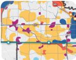
IntheBaselineTrendScenario, the cityfollowsexistingplans, landuse, andzoningregulationstoguide buildout. Vacantlandacrossthe citywillbedevelopedperexisting plans, and20percentofnew housinggrowthwilltakeplaceon previouslydevelopedland.
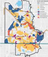
IntheTransitFocusScenario, developmentandreinvestment followexistingrailtransitlines, addingmanynewhousing unitsandjobsalongtheDART OrangeLineandneartheTrinity Railway Expressstationareas. Approximately 27percentofnew housinggrowthisonpreviously developedland.
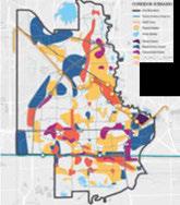
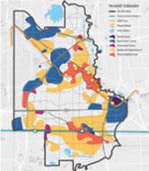
TheCorridorandReinvestment Scenariofocusesonredevelopment andreinvestment, with36percent ofallnewhousinggrowthlocated onpreviouslydevelopedland. Majorarterialsandneighborhood corridorsseemoremixed-use developmentscombininghousing withshopping,servicesandoffices.

+Transportation, EconomicDevelopment
+Housing
Integratingthelanduseand transportationplanstoexpand Irving'snetworkof multimodal streets (streetsthataccommodate buses, automobiles, bikesand pedestrians) willenhance transportationopportunitiesfor residentsandbusinessalike. The VisionCategory buildingblocks (the centersandcorridors mentioned onpage57) aredesignedtowork hand-in-handwithlanduseand transportationpolicy tocreate meaningfulpublicandprivate placesthatareattractive, vibrant andlively, andprovidepeoplewith avariety ofwaystotravel.
Thestrategy ofcombiningland usesandtransportationfacilities iscalled "completestreets:'This interdisciplinary approachfosters communicationamongexperts (includingtrafficengineers, planners, urbandesigners, architects, emergencyresponse officials) andcommunity members toidentify theimportantrolesa streetplaysintheneighborhood, andletthoseneedsinfluence design. Thishelpscreatecentersof activity wherethepublicspaces -
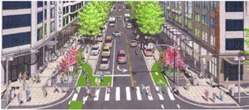
CompletestreetsdesigninDallasmakingstreetssafer, moreaccessibleandconveniencefor allusersincludingmotorists, transitriders, pedestrians, peopleofallabilitiesandbicyclists. (Source: DallasCompleteStreetsDesignManual)
streets, sidewalks, andopenareaspromoteamixofdevelopmentsand fostergreatereconomicactivity.
Althoughitisnottypically consideredaneconomictool, planningwillplay amajorrole in Irving'scontinuedfinancial success. Inadditiontothebenefit toresidentsofcombinedstreet andlanduseplanning, carefully designedplansandzoningcan increasedevelopmentpotential by reducingriskstodevelopment investors. (Uncertainty aboutplan approvals, potentialdelays, andthe associatedlengthynegotiations allincreasethefinancialrisk ofaprojectandreducepeople's willingnesstoinvest.) Development riskscanbeloweredwhena community's goalsandobjectives areclearly expressedby aplanand allowedby right.
Thevisionfor Irvingsuggests muchofthenewgrowthwilloccur intheformofinfilldevelopment, whichistheadditionofnewor rehabilitatedbuildingsintoexisting urbanareas. Infillconstruction andtheredevelopmentofaging structureswilltakeplacealongside developmentofkey catalystsites (suchastheformerstadiumsite) andnewdevelopmentonthecity's remainingvacantland. Basedon findingsfromthealternativefuture scenarios, anywherefrom20to 40 percentofnewgrowthinthe city couldcomefrominfillprojects or redevelopment ofexistingsites. Thisiscomparabletomany major Americancities. Infilldevelopment willrevitalizeneighborhoods, centersandcorridorsby locating newemploymentandhousingin existingareasandfilling "gaps" ina streetscape.
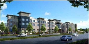
Infilltransit-orienteddevelopmentinRichardson, Texascompletedin2015 (Source: Business Wire)
Creatingastrongmarketforinfill developmentrequiressubstantial planningandcoordinationbetween theCity of Irvingandpotential developers. Irvingisataturning pointwheredevelopmentmust transitiontoagreaterfocuson infilland reconstruction. Itwilltake innovativepartnerships withthe developmentcommunity toeducate thosefamiliar withsuburban-style developmentaboutthisdifferent approach. Althoughgrowingin popularity, infillprojectsarestilla relatively newconceptformany, andlendersandotherinvestors tendtofavormoretraditional projectsbecausethey havea betterunderstandingofhowsuch investments work. Thismeans, like every city thatpromotesinfillasa growthanddevelopmentstrategy, Irvingwillneedtoshowcase successfulearly projectstobuild
communitywideconfidenceinhow goodinfillpracticescancreategreat financialreturns.
Thereareplentifulopportunities forbothlargeandsmallinfill projectsin Irving. Reinvesting inneighborhoods, oneofthetop prioritiestocomeoutofthe Imagine Irving visioningprocess, requires many small-scale redevelopment projectsthroughoutthecity. Thecity'sdevelopmentprocess, already knownforitsspeedand efficiency, mustprepareforan increaseinthesetypes ofprojects. Neighborhoodplans, clearpolicies, predictable zoningregulations, and therighttoolsandincentivesmust becreatedtomakethisprocess simpleandencouragereinvestment.
What makes a good location for a neighborhood center?

» Is vacant or underutilized land available? A site that is already well used and fully occupied is an asset to the community; therefore, it is best to focus redevelopment efforts on areas that are not currently serving the community to their capacity.
» Are surrounding lands compatible? Compatible lands for mixed-use centers are generally residential.
» Is there good connectivity to surrounding neighborhoods? Barriers such as highways present challenges to connecting residents with nearby centers.
» Is a city facility, a religious institution or park located there?
» Does it have good visibility, and is it located on a street that is suitable for some additional commercial development?
» Is there a current lack of neighborhood services nearby?
D AreasofStability
• MajorCenters
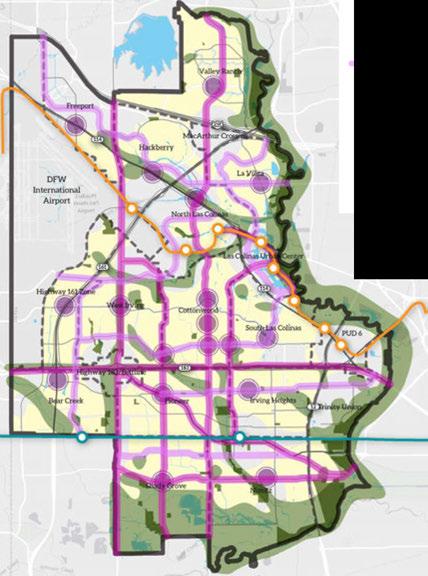
• NeighborhoodCenters
◄ EmploymentCenters
- MajorCorridors
Neighborhood Corridors
= Bike-and PedestrianFriendly Corridors
◄ Open Space
◄ Water Bodies
- Parks
- City Boundary
•-• Neighborhoods
.0,. DART Line .0,. TrinityRailway Express

Land Use + Urban Design
Throughsurveysand workshops, Irvingresidents statedthey wantmoregatheringplaceswherethey can walkaround, shop, andgrabcoffeeoradrink with theirfriendsandneighbors. Theseneedscanbemetin a "neighborhoodcenter:' Asthecity grows, redevelops, andencourages pedestrian-oriented design, there will bemany opportunitiestocreatenewneighborhood centers withamix ofhousing, retailandservices. The rehabilitationofolder commercial areasprovidesa greatopportunity tocreatenewcenters.
Neighborhoodcentersarelocatedinareasnear housingandhavegoodstreetorsidewalkaccessto the surrounding neighborhoods. They hostarangeof servicessuchasgrocery stores, dining, convenience stores, retail, dentaloffices, salonsandlaundromats. Dependingonitslocation, mix oftenants, andthe needsof thecommunity, acentercaneitherservea single neighborhood orseveralneighborhoods.
Classifiedasmixed-useareas, neighborhoodcenters oftenconsistofone-tothree-story buildings, many of whichwillbeentirely non-residential (amix of officeandretail). Somemulti-story structureshavea residentialcomponent.
Inneighborhoodcentersandallmajorcommercialnodes, newbuildingsfacethestreetwithsidewalkstoentrances anddisplay windowsorientedtowardpedestrians. Automobileparkingismostly onthestreet, andoffstreetparkingisoftensharedbetweenbusinessesand locatedonthesideortotherearofbuildings. Parking areasprovidecomfortableroutesandsafety buffersfor pedestrianswalkingtoandfromtheirvehicles.
The size, look and feel of these centers will vary throughoutthecity. Theprimary differencebetween centersisthescaleofbuildingsandusesthatmake
upthecenter. Forexample, small neighborhood mixed-usecenterscouldfeatureconveniencestores andpharmaciesthatprovidesomegroceries, whereas largercentersmay includetraditionalgrocery storesas wellasavariety of othertenants.
Oneof Irving'sgoalsistoimprovethe walkable pedestrian environment acrossthecity, especially in neighborhood centersandalongcorridorstobetter connectthoseareaswithsurroundingneighborhoods. Buildingbetterstreetsisimportantfor walkability. Providing widesidewalks, shortcrossingdistancesat intersections, andmultipleroutes makes it easier for peopleto walk safely ina city. These elementsmust becombined withasettingthatprovidesinteresting placestogo, thingstodo, andotherpeople withwhom tointeracttoencouragemorepedestrianactivity. Creatingopportunitiesanddestinationssuchasthis givespeopleareasontochoose walkingandbiking overdrivingfordaily conveniencetrips.
Oneimportantelementofawalkableplaceisa welldefinedstreet wall-acontinuousseriesofbuildings withdoors, windows, fac;:adesandactivitiesfor pedestrianstofollow. Agoodstreet walldoesnot requiretallbuildings; many historicmainstreetareas suchas Irving's HeritageCrossingaremadeupof single-story structures. Italsodoesnotneedornate structuresorfancy designelements. A simple, wellproportionedbuildingfacethatincludesdisplay windows, sidewalk lighting, andadeepawningto shieldpeoplefromtheelementscancreateapleasant walkingdistrict.
D AreasofStability
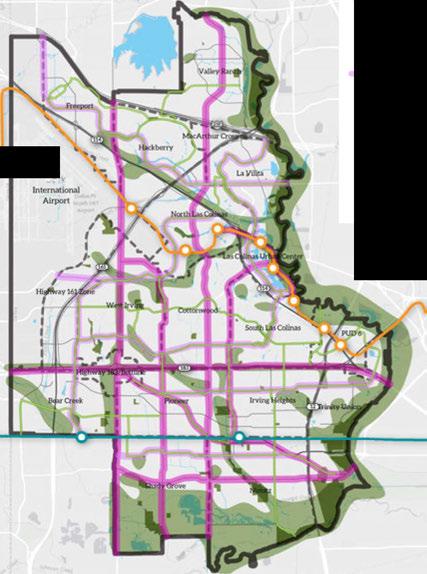
• MajorCenters
• NeighborhoodCenters
◄ EmploymentCenters
- MajorCorridors
Neighborhood Corridors
= Bike-and PedestrianFriendlyCorridors
◄ Open Space
◄ Water Bodies
- Parks
- City Boundary
•-• Neighborhoods
-0,. DART Line
-0,. TrinityRailway Express
Land Use + Urban Design

Thecity'sbuildinganddevelopment codeisusedtoregulateshape, height, orientation, andother aspectsofabuilding'sdesign. Transit-orienteddevelopmentsand mixed-usecentersandcorridors shouldincludesomeorallofthe elementsofpedestrian-focused design: widesidewalks, on-street parking, streettreesandfurniture, andactivebuildingfrontages.
Currently, itcantakelongertoget fromtheLasColinasUrban Center toDowntown Irving'sHeritage Crossingthanfromeitherlocation todowntownDallas. Thecityhas multiplenorth-southcorridors, but heavyuseandfew alternate routes oftencreate congestion andslow travel. Designingwalkableinfill andtransit-orienteddevelopments caneasesomeofthepressureon roadwaysby encouragingshorter trips, walking, biking, andtheuseof publictransportation; however, in 20-30years, drivingwillstillbethe primary waypeoplegetaround.
Increasingthenumberofdifferent routesfromonepointtotheother isessentialtoensuringthecity remainseasytonavigateinthelong term. Thistypeofconnectivity also
isimportant attheneighborhood scaletoencouragewalkingand biking. Ascorridorsandcenters redevelop, siteaccessibilityforall peopleshouldbeconsidered, and infrastructureenhancementsto increase accessshouldbeaddedin tandemwithotherconstruction. Suchenhancementsmayinclude addingsaferintersections, crossings, andwidersidewalks alongmajorcorridors, andmight alsoincludeaddingawnings infrontofnewbuildings. Enhancementsshouldalsoinclude well-markedbicycleroutesand facilitiestosupportpeopletraveling alongactiveneighborhood corridorstotheirdestinationsalong majorcorridorsorcenters.
Transit-orienteddevelopment, or buildingcompleteneighborhoods aroundrailstations, isoneofthe strategiesIrvingwillusetosetitself apartfromother Metroplex cities. Atransit-orienteddevelopment concentrateshighquality multistory housingandofficespace alongsidegroundfloorretailina pedestrian-friendlyenvironment thatencouragespeopletowalk tonearbyrailstationsservedby
frequenttrainstopsandbuses. Thisstyleofdevelopmentiskey totransforming Irving froman auto-dependentsuburbtoarival ofeverymajorcityintheUnited Statesandacrosstheworld.
TheCityof Irvingispositionedto enjoytremendousgrowthinnew transit-orienteddevelopment, withthreemajorcenterslocated alonghighcapacityrailroutes. HeritageCrossingcontainsa stationalongtheTrinityRailway Express, theregionalcommuter railthatconnectsdowntownDallas todowntownFortWorth. Irving alsosecuredtheDARTOrange Line, whichconnectsIrving'sLas ColinasUrbanCenterandthe futuredevelopmentattheformer stadiumsite (PUD#6) todowntown Dallas, andeverymajorcityacross theglobeviaDFWInternational Airport.
Thecitycanturnthisrailway accessintodevelopment momentum. Allthreeofthese majorcentersareconsidered readyforredevelopment. Heritage Crossinghasbeenthesiteofland bankingeffortsforyears, and constructiononthefirstmajor newhousingprojecthasbegun. TheLasColinasUrban Center
Land Use + Urban Design

MasterPlan (2013) outlinesstrategiesthatcapitalize onthenewtransitstationsinthatarea. PlannedUnit Development#6 (PUD#6) regulationsfortheformer stadiumsiteenabletheCity of Irvingtoworkdirectly withlandownersanddeveloperstocreateadense, quality urban neighborhood aroundtherailstations inoneofthemostprominentandwellconnected locationsintheregion. Accesstorailwillenable residentsandworkersatallthreelocationstotravel toandfromthoseareaswithoutrequiringcomplete dependenceontheautomobile. Properdesignofthe areaswillallowvisitorsandresidentstowalkaround thesitesaswell.
Inadditiontotheraillines, Irvinghasmany DART busroutesthatserveresidents. Corridorsandcenters servedby highfrequency busroutesarealsopotential sitesfortransit-orientedredevelopment.
Whileitmay notseemintuitive, parkingregulations areoneofthebesttoolsforinfluencingurbandesign andcharacter. Theamountofsurfaceparkingrequired foraretailstoremay seemlikeaminorissue, but acrosstheentirecity, theamountoflandconsumedby surfaceparkinglotscanbeenormous.
Likemostcities, Irving'szoningcodeincludes minimumrequirementsforoff-streetparking basedonthetypeofdevelopmentandlanduse. The amountofspacerequiredforparkingdeterminesthe sizeofparkinglotsandimpactsthedensity ofnew development. Thebiggertherequiredparkinglot
atasite, thelesslikely peoplearetowalkacrossit. Areasthatareintendedtobemorewalkableshould haveloweron-siteparkingrequirements. Lower requirementsdonotnecessarily meanfewerparking spaces, butthey allowthemarkettodeterminewhere thespacesareplaced, andallowthecreationof walkable, mixed-use districtsthatbalancepedestrian needswiththoseofdrivers.
Thecurrentauto-orienteddevelopmentpattern attractsshopperswiththepromiseofconvenient parkingandavailablespacesevenonthebusiest shoppingdays. Thismeansparkinglotsdesignedto accommodate thepeakdaysoftheholiday shopping seasonhavemany parkingspacessittingempty most oftheyear. Withlargeparkinglotssurroundingeach building, peopleareunlikelytowalkfromonebuilding tothenext, andinstead, choosetodrive. By reducing parkingrequirementsorallowingalternativesto on-siteparking, buildingscanbeconstructedcloser together,increasingopportunitiesforpeopletowalk fromonesitetothenext. Ininstanceswherelarge parkinglotsareallowedbetweenastreetandthe building, shadedwalkwaysandinteriorlandscaping willbreakupthemonotony oftheparkingareaand provideanimprovedpedestrianexperience.
Toencouragedevelopersandlendersconsideringinvestingin redevelopmentprojects, itmay be necessary fortheCity of Irving topartnerwithsuchprojectsthrougha combinationofpublicand privateinvestments. Withthatinmind, severalcatalystsiteshave beenidentifiedaspropertieswithcharacteristicsthatfavorhighquality redevelopment. Thesecontainlargeparcelsundersingle ownershipwithwillingandcapableproperty ownersatlocationsthat lendthemselvestosuccessfulurbandesign, andallow easy accessto railstops.
Many oftheseareprojectsthatcouldbeunderway withintwoto fiveyears, andwouldhelpprovethe viability oftheredevelopment market, whichcouldtriggeraseriesofnewdevelopmentonnearby sites. TheCity of Irvingcansupporttheseeffortsby assistingwith neededinfrastructurethatencouragesredevelopmentintargeted areas. EnsuringconstructionoftheDARTOrangeLinethatnow connectstheformerstadiumsite, LasColinasUrbanCenter,and DFW InternationalAirport, isoneinvestmenttheCity of Irvinghas already madetohelppreparesomecatalystsitesforfuturegrowth.
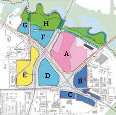
1. Planned Unit Development #6 (PUD #6 - former stadium site)
2. North Lake College transit integration
3. Greenwood Hills and Highlands
4. Irving Mall area redevelopment
5. Heritage Crossing 0--------------
Transit-OrientedMixed-UseSector1
Transit-OrientedMixed-UseSector2
Transit-OrientedMixed-UseSector3
Flex-Work
Transit-OrientedMixed-UseOffice
Mixed-UseVillage OpenSpace
- SiteBoundary
•■■ TractBoundary
---DARTLine
---DARTStation @ Water - FloodPlain


InadditiontoPUD #6, thecity hasseveralother opportunities thatappeartobewellsuitedto redevelopmentinthenearterm, including NorthLake CollegeandGreenwoodHills/Highlands.The Small AreaPlanningchapterprovidesgreaterdetailabout current conditions and recommendations foreachof thesesites.
Additionally, thereareotheropportunity sites identifiedfortheirlongertermpotential, including theIrving Mall, PlymouthPark, andLoop12 at Irving Boulevard. Thesesecondary sitesaregenerally smaller,lesscentrally located, orhavebarriersto redevelopment thatwouldtakemoretimeorresources toovercomethanwhatisrequiredtobeginaction atthecatalystsites. Whilethey containsignificant redevelopmentpotential, thesesitesarelesslikely to spur redevelopment onadjacentsitesinthenextfive years.
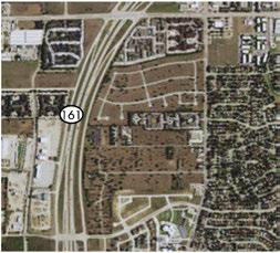
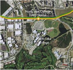

TheFuture LandUse Mapisatoolthattakestheideas fromtheVision Mapandillustrateshowtheywork ona parcel-by-parcel basis. The Future LandUse Map isnota zoningmap, anddoesnotestablishregulatory requirementsfornewdevelopment. Itdoes, however, serveasan underpinning forthe ZoningOrdinance toguidehowrequestedmodificationstothe zoning maparereceived, makingitanimportanttoolforland usedecisionsasthecitycontinuestogrow, reinvest andredevelop. The ZoningOrdinanceisthetoolthat regulatesbuildingheight, setbacks, parking anddensity requirements.
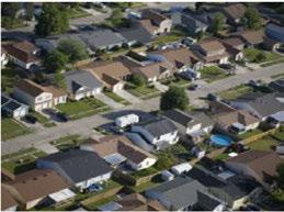
TRADITIONALNeighborhood.Predominantlyresidential areawiththeappearanceoftraditionalsingle-family detachedhomesorduplexeswithsomemixofnonresidentialusesatintersectionsofcollectororarterial streets.Includeshome-basedbusinesses. Multi-unit structurescompatiblewiththeresidencesoftheareaare permitted.Netunitsperacre:4-7
LikelyCompatibleZoning:R-40,R-15,R-10, R-7.5,R-6, R-3.5,R-ZL,R-MH (atselectedintersections:P-O,C-N)
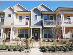
COMPACTNEIGHBORHOOD.Predominantlysinglefamilyhomeswithadiversemixofbuildingtypes includingsmalllotcottagehomes,clusteredcourtyard homes,townhouses,rowhouses,andlow-densitymultidwelling units.Somemixofneighborhood-servingnonresidentialusesatintersectionsandcollectororarterial corners.Netunitsperacre:8-20
LikelyCompatibleZoning:R-ZLa,R-PH, R-ZL,R-SFA, R-3.5,R-2.5,R-TH(atselectedintersectionsP-O,C-N)
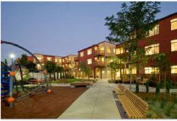
MID-DENSITYRESIDENTIAL. Mediumdensity residentialareastypicallyfivestoriesorless. New structuresshouldbehighqualityconstructionsited nearpublictransportationnodes, arterialstreetsor inproximitytomixeduseareas Pedestrian-oriented buildingsandstreetsarepreferred. Netunitsperacre:
Land Use + Urban Design

18-50
LikelyCompatible Zoning: R-MF-1,R-MF-2,R-MF-O, R-XF
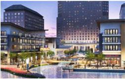
URBANCENTER. Highestintensityareasof Irving containingavarietyofusesinhigh-risebuildings. Pedestrian-orientedstreetsandbuildings,high-quality designandmaterials. Primarilyofficeandresidential useswithregionaldestinationretail,restaurant,hotel andentertainmentuses. Buildingheightsexceeding sevenstorieswithsharedandstructuredparking preferred. Sitesshouldbelocatedwithinaone-half mileofnearbyrailstations.Netunitsperacre: 60 or more
LikelyCompatible Zoning: R-MF-2,P-O,C-O,C-N, FWY,TOD
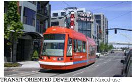
developmentservedbyrailstationsorhighfrequency busstationswithinone-halfmileorlessofthesite. Includespedestrian-orientedstreetsandbuildings, highqualitydesign,publicopenspace,andreduced and/orsharedparking. Structuresareideallymixedusemid-riseorhigh-risebuildings,aminimumof sevenstoriesinheightcontainingbothresidential unitsandcommercialuseswithineachstructure. Suchdevelopmentswillserveasresidentialcenters, majoremploymentnodes,orcorporatecampuses andofferlocaldestinationretail,restaurantand entertainmentuses. Residentialdevelopmentsshould serveamix ofincomelevelsandhelpexpandoptions forlowandmoderateincomehouseholds. Netunits peracre: 60 ormore
LikelyCompatibleZoning: HCD-TMU,TOD, PUD6.
COMMUNITYVILLAGE: Pedestrian-orientedmixedusevillagewithfreestandingstructuresrangingfrom twotofourstories. Areasshouldcontainamix oflive andwork opportunitieswithretail,entertainmentand
housingwithinone-halfmileofanyresidentialunit. Ideallylocatednearavarietyoftransportationoptions. Netunitsperacre: 8-30
LikelyCompatible Zoning: R-MF-1, R-MF-2, P-O,C-O, C-N, R-2.5, R-3.5, R-ZLa, R-TH
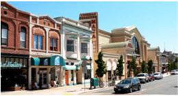
MAINSTREET/DOWNTOWN.Mixed-usewalkablearea withcontinuousbuildingfrontages, on-streetandrear parking, orientedtowardsoutdoorpublicspacesand activities.Usesshouldincluderetail, office, restaurant, entertainment withafocusondrawingvisitors fromotherpartsoftheregionandcommunitytothe site. Upperfloorresidentialand/orofficeusesare encouraged. Netunitsperacre: 20-40
LikelyCompatible Zoning: HCD

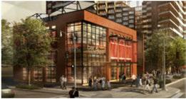
LOCALCOMMERCIAL. Neighborhoodserving commercialareasalongcollectororminorarterial roadsincloseproximityandsafely walkablefrom nearbyresidences.
LikelyCompatibleZoning: P-O,C-O,C-N
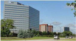
BUSINESS/OFFICEFlexibleuseareaforretail, office andcommercialuses. Multi-story structures with amixofsurfaceandstructuredparking. Uses are primarily office oriented with some supportive services.
Likely Compatible Zoning: P-O, C-O, C-N, C-C, FWY

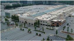
REGIONALCOMMERCIAL. Auto-orienteddistrictfor larger scaleretail, officeandcommercialuses. This area provides destination services to multiple neighborhoods and the region and is dependent on automobile or transit rather than pedestrian access. It is generally appropriate for placement along major arterial roads and freeways.
Likely Compatible Zoning: P-O, C-O, C-N, C-C, C-OU-1, C-OU-2, C-OU-3
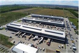
MANUFACTURING/WAREHOUSE. Primarily 1ight manufacturing, warehousing and storage inside a building, but with some supportive commercial uses present Exterior design presenting an office park aesthetic rather than a purely functional appearance is preferred.
Likely Compatible Zoning: FWY, CW, ML-20, ML-20a, CP
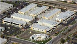
INDUSTRIAL. Industrialandmanufacturingincluding accessory outsidestorage. Supportivecommercialuses maybepresent.
LikelyCompatible Zoning: FWY,C-OU-1,C-OU-2,C-OU3,CW, ML-20, ML-20a, ML-40, ML-120,CP
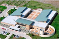
PUBLIC/SEMI-PUBLIC. Schools, librariesrecreational facilities,andcity, stateandfederalbuildings.
Likely Compatible Zoning: ALL

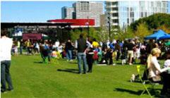
OPENSPACE. Publicandsemi-publicparks, open spaces, recreationcentersandgolfcourses.
Likely Compatible Zoning: ALL
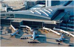
DFWInternationalAirport.The Dallas-FortWorth InternationalAirport exercisesitsownlanduse regulationsandauthority.

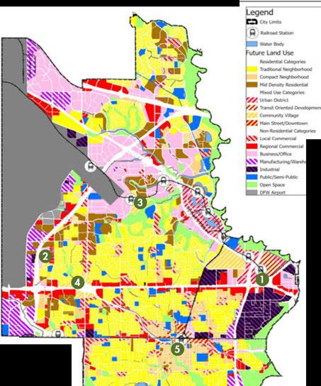

TheFuture LandUse Mapistheresultofmultiplemappingprocessesandanalysis. Themapincorporatesinputreceivedfromthe Irvingcommunity andstakeholders duringadvisory committeemeetingsandcommunity workshops.
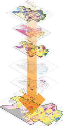
» Vision » Current Zoning Land Use + Urban Design

» Existing Future Land Use
» Constraints
» Imagine Irving Scenario
»Future Land Use Map
Land Use+ UrbanDesign

Goal 1: Ensure land use decisions are consistent with the adopted Imagine Irving Comprehensive Plan.
Strategy 1.1
Make development decisions consistent with the Vision Map, Future Land Use Map, and stability/ change map, and the adopted Imagine Irving Comprehensive Plan goals, strategies and actions.
Strategy 1.2
Evaluate and update the Future Land Use Map and stability/change map at a minimum of every five years to ensure consistency with city goals, development trends and growth demands.
Strategy 1.3
Evaluate and strategically update development regulations to ensure consistency with the adopted Imagine Irving Comprehensive Plan.
Strategy 1.4
Designate special planning areas to identify potential non-profitable retail and multifamily sites, and encourage renovation or a change in use for these areas.
Strategy 1.5
Promote land uses consistent with the vision that enhance Irving's built and natural environment.
1.5.1
Encourageeconomicallysustainable, unique andaccessibleretaildevelopment.
Limitnewmultifamilyconstructiontomixedusedevelopmentsthatincludecommercial elements, exceptwhenlocatedneartransit stationsor whenagingmultifamilyunitsare beingredeveloped.
Encourageconstructionofmultifamilyunits inaverticaldesignstackedoveroffice, retailor othercommercialgroundfloorunits.
Multifamilyunitsshouldbepermittedin mixed-usedevelopmentsatarecommended minimumratioofapproximatelythreesquare feetofresidentialareaforeachsquarefootof office/retail.
Enforcerequirementsforaminimum UnitPer Acrecountformixed-useor residentialprojectswithinatransit-oriented development.

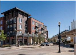
Mixed-usemultifamilybuildinginCarrollton, TX, near DARTline (Credit: SteveHinds)
1.5.6 Encouragemixed-usedevelopment.
1.5.7 Provideforavariety ofsingle-family residentialtypesanddensities.
1.5.8 Approvenewdevelopmentthatisconsistent withandenhancesexistingdevelopment.
1.5.9 Examinenationalbestpracticesforaccessory housinginresidentialareas.Consider developinganordinancetoallowaccessory dwellingunitsundercertainconditions, basedonsize, parking, buildingdesign, and neighborhoodcontext.
1.5.10 Protectlanddesignatedforcommercial andindustrialusesalongmajorcorridors, highways, oradjacenttotheairportfrom residentialencroachment.
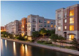
The following policies are intended to be used when making decisions regarding zoning and rezoning.
If an area that is designated and/or developed as residential desires to transition to nonresidential use, the Cityof Irving should require the following:
» The area is physically appropriate (i.e., size, shape, etc.) for non-residential use.
» The area is adjacent to nonresidential zoning and not separated from other nonresidential zoning by a major thoroughfare (or larger) or the nonresidential use is part of a mixed-use development.
» The rezoning does not allow non-residential traffic to negatively impact established and proposed future neighborhoods, schools, and/or parks.
» The rezoning does not leave any residual tracts of residentially zoned property or an area designated
for residential uses on the generalized Future Land Use Map that cannot be developed in residential uses.
» The rezoning provides for an appropriate transition between non-residential and residential uses through separation by distance, screening, or land use, if positive integration of residential and non-residential land uses cannot be accomplished.
» The non-residential use is the same intensity or is compatible in density and intensity with the existing or adjacent/surrounding land uses.
If an area that is designated and/ or developed as non-residential desires to transition to a residential use, the Cityof Irving should require the following:
» The area is physically appropriate (i.e., size, shape, etc.) for residential use.
» The area is adjacent to a residential neighborhood

shown on the generalized Future Land Use Map and is not separated from the neighborhood by a major thoroughfare (or larger), or the residential use is a part of a mixed-use development.
» The rezoning will not result in a shortage of land designated for non-residential development.
» The rezoning does not leave a residual tract of nonresidentially zoned property that does not conform to the generalized Future Land Use Map, or that negatively affects the proposed residential use.
» The rezoning provides for an appropriate transition between residential and non-residential uses through separation by distance, screening, or land use (i.e., creek, four-lane roadway, etc.), if integration of residential and non-residential land uses into a mixeduse environment is not achievable.
Acomprehensiveplanshallnot constitutezoningregulationsor establishzoningdistrictbou]j\dgries.
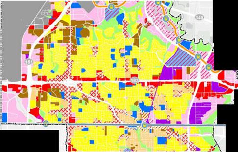
Seepage75forthefullviewofthe FutureLandUseMap.
If an area that is designated and/ or developed as non-residential desires to transition to a different non-residential use, the City of Irving should require the following:
» If new construction, the development conforms to new use standards and concepts.
» The area meets all compatibility standards for adjacent uses.
» The rezoning does not cause any negative impacts on adjacent uses.
If an area that is designated and/or developed as residential desires to transition to a different residential use {such as low density to medium density), the Cityof Irving should require the following:
» The area is physically appropriate (i.e., size, shape, etc.) for the proposed residential use.
» The area provides adequate access and parking capacity required for the proposed residential development.
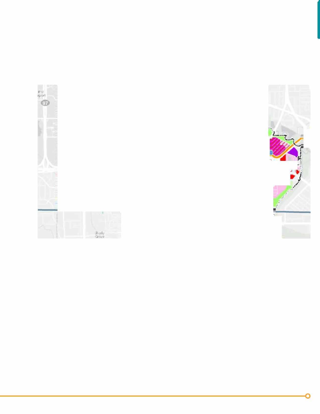
» The rezoning does not create any foreseeable negative impacts on the adjacent uses.
Land Use + Urban Design

Goal 2: Focus development and redevelopment efforts on creating well designed centers, corridors and connections that link housing, jobs and services.
Strategy 2.1
Plan for centers with a cohesive and well connected mix of uses with a combination of streets, trails, and sidewalks for vehicular, pedestrian, and bicycle circulation.
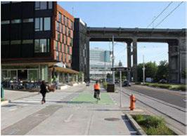
Exampleofstreetdesignformultiple transportationmodesina mixed-usecenter.
Strategy 2.2
Continue to enhance Irving's existing signature centers including:
LasColinasUrbanCenter
• Createawalkable, pedestrian-friendly place.
• Makethecenteradestination.
• Develophigh quality anddiversifiedlanduse.
Heritage Crossing
• Evaluatedowntownsitesandotherhistoricareasfor redevelopment, enhancementandpreservation.
• Makedowntownmorevisibletovisitorsand residentsthroughentranceways, wayfindingsignage andpublic art.
• CapitalizeonthelocationoftheTREstation.
• Improve Irving Boulevardasanexpressrouteto HeritageCrossing.
• Createpedestrianconnectionsthroughout Heritage Crossing.

• Ensuredevelopmentthroughout Heritage Crossing iscompatiblewithexistingdesignandsupportsthe neighborhood asawhole.
• Designretailspaceasafocalpointofactivity, offeringinterestingshops, quality restaurants, and essentialservicesinattractivebuildingsandsettings.
• Ensurenewofficedevelopmentsfitintothestyleand characteralready establishedby thecommunity and neighborhood.
• Developwell-designedmultifamily projectsand outdoorspacesthat contributetoavisually pleasing environmentthat supports Irving'slocalcharacter, andpromotessocial interaction andprideamongits residents.
PlannedUnitDevelopment#6(PUD#6 FormerStadiumSite)
• Workwith property ownerstoimplement PUD#6as planned.
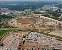
Theformerstadium siteisatremendous redevelopment opportunity intheheartofthecity, withaccessibility tomajor highways,stateroutesandtheDARTOrangeLine. Aspartofthe ImagineIrvingComprehensivePlan, theCityof Irvinghascreated aPlannedUnitDevelopment(PUD) forthearea, PUD#6, whichwill ensureredevelopmentistransit-orientedandmixed-use.
LandUse +UrbanDesign
Establish connections to DART and TRE rail stations and encourage high quality, dense mixed-use development at each station.
Promoteconnectivity forapotentialfuture regionalrailstation.
Promoteandmaintainpublicaccessibility to Orange Lineand TREstations.
Providespecialconsiderationsforconnectivity ofintermodalelements:
• Specialsafety andaestheticconsiderations shouldbepromotedforthelinkageto/fromthe North Las ColinasStationtopropertiesnorth ofSpur 348.
• Provideconnectivity betweentheSouth Las ColinasStationandthe AreaPersonal Transit. Enhancestreetscapecharacterforpedestrian connectionstolightrailtransitstations throughcontinuoussidewalks, enhanced amenities, lightingandlandscaping.
• AsdevelopmentoftheSouth LasColinas Stationoccurs, orapedestrian/bikelineageis implementedalongthe BNSF Railroad, extend theexistingtrailthatcurrently terminatesat Las ColinasBoulevardtothe BNSF.
• Providepedestrian/bicycleaccesstoroadways intersectingRiversideDrive. Connections shouldbeconsideredatE. LasColinas Boulevard, CaliforniaCrossing, O'Connor Boulevard,andthewestboundfrontageroad ofSpur348.
• ConductDARTstationreviewofcurrentlayoutto determinethebestlocationsforbusconnections. CoordinatewithDARTtoincorporateany necessarychangestositelayouts.
Land Use + Urban Design

• Examinecosteffectivenessofoperating theLasColinas AreaPersonalTransit, and determineifafixedscheduleorcall-ondemandsystemwouldbethebestchoicefor long-termoperation.
Create a Transit-Oriented Development (TOD) Plan for station areas:
2.4.1 Withinexisting TODregulations, theCity of Irvingshoulddevelopguidelinesandstandards for:
• Unifying elementsandamenitiesthatbuildon Irving'sidentity.
• Link TODareasalongtheDARTOrangeLine throughLasColinasUrbanCenter.
• Integrateandconnect TODareaswithother districtsandcommunity assets.
• Provideconnectivity withsidewalks, bike lanes, trails, andotherlinkages.
2.4.2
2.4.3
2.4.4
Design TODdistrictstoenhance Irving's identity.
Createapedestrianandtraillink between downtownandtheUrbanCenter.
RequirealldevelopmentadjacenttoDART Orange Linestationstoprovideconnectivity totrailsandpedestriancenters.
Prepare a sample center plan to establish guidelines for developing and enhancing new centers.
Protect commercial and industrial areas from incompatible encroachment.
2.6.1
2.6.2
Designatetruckaccesstomajorhighways.
Reviewcommercialguidelinesasthey apply toindustrialareastopromotequality design onstreetfrontagesandpotentialforflexibility internaltodevelopment.
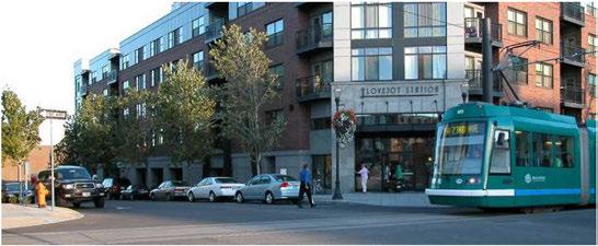
Goal 3: Widen the range of housing and employment choices by encouraging creation of dense mixed-use developments that include housing, retail and commercial uses.

Strategy 3.1
Create and adopt new zoning districts that permit cottage housing, townhomes, and other small lot (compact) housing types by right.
Strategy 3.2
Develop rules for mixed-use projects that ensure the character of surrounding neighborhoods is protected and that mixed-use developments are of a quality consistent with Irving's goals.
Strategy 3.3
Identify incentives to encourage the transformation of aging multifamily sites into mixed-use community centers or single family developments.
Land Use + Urban Design

Goal 4: Remove barriers to infill construction and encourage reinvestment in aging neighborhoods and non-residential areas to help improve the quality of life.
Strategy 4.1
Revise parking standards to allow more flexibility when dealing with infill or redevelopment projects. Allow developers to request different standards based on site analysis of their location using the techniques set forth by the Urban Land lnstitute's (ULI) parking guides.
Strategy 4.2
Prepare a neighborhood improvement program that identifies common needs in aging neighborhoods, partners with property owners to address those needs, and offers incentives to make improvements to the appearance of private property. The improvement program also should address public facilities, street lighting, signage and other quality of life elements.
Strategy 4.3
Prioritize infrastructure improvements that support walking, biking and better connectivity to transit such as repairing sidewalks, improving streetscapes, and installing bike facilities.
Strategy 4.4
Develop public-private partnerships to explore alternative funding sources for low interest home improvement loans or grants to existing low- to moderate-income homeowners, particularly seniors, to help them maintain or upgrade their homes.
Strategy 4.5
Work closely with a developer on a sample singlefamily infill development project in a target area to address infrastructure needs and show how infill construction can enhance existing neighborhoods.
Strategy 4.6
Retain and expand city's fa�ade enhancement programs to revitalize commercial areas and retail strips.
Goal 5: Follow a neighborhood-based approach to planning where all residents have access to nearby jobs, healthcare, education, services, shopping, parks and open space.

Strategy 5.1
When reviewing proposals for new and redeveloping areas, ensure that adequate facilities for support services, shopping, and parks already exist to support new development or are included in the plan. Encourage creation of multimodal connections to jobs, parks and open space. Consider proximity and access from the site to needed services, jobs, and housing when making decisions about a development proposal.
Strategy 5.2
Promote a citywide neighborhood association umbrella structure that encourages neighborhoods to organize, identify their internal resources, and work together to have a more effective voice in identifying and advocating for their needs. Continue to engage existing neighborhood associations to encourage establishment of this type of grassroots neighborhood structure.
Strategy 5.3
Continue to engage residents in an ongoing process of establishing, building, and promoting their neighborhood identity.
Strategy 5.4
Develop partnerships between employers, transportation providers, apartment managers, developers, and childcare providers to increase access to services in lower income neighborhoods.
Land Use + Urban Design

Goal 6: Preserve and develop appropriate real estate options to meet the needs of current and prospective businesses and ensure that adequate land exists for a variety of uses.
Strategy 6.1
Ensure appropriate infrastructure is maintained to allows people, goods and information to move efficiently through Irving, and meets the needs of current and prospective businesses and residents.
6.1.1 Makestrategicinvestmentsininfrastructure tosupportmajor employmentcentersand specificdevelopments.
6.1.2 Supporttransitsystemimprovementsanda variety oftransportationoptionstoenhance community livability andstrengthenlocal economiccompetitiveness.
• Work withDARTtoimprove internal transportationconnections, especially along north-south corridors suchas MacArthur Boulevard, O'Connerand Belt Line roads.
• Supportthedevelopmentof bikefacility improvementsprioritizedinaccordancewith recommendationsinthe Transportation Chapter.
• Create enhanced walkingopportunitiesaround thesignaturebridgeatPUD #6.
Supportroadnetwork enhancements, street surfaceimprovementsandimprovedtraffic controlsystemsto increase access, capacity, andmarketability of existing majorcorridors.
Investininfrastructureupgradestoenhance thephysicalenvironmentinandaround employment, neighborhood, andmajor centers, andalongmajor corridorstoenhance theirappealasattractiveplacesforpeopleto live, work, andplay.
• Advanceplanstoimprovetheattractiveness andwalkability ofthe Heritage Districtarea by reducingtrafficlanes, addingbikelanes,
improvinglandscaping, supportingthe midtownTrinityRailway Expressandadding otheramenities.
• Investinnecessaryinfrastructurefor PUD #6, theCarpenterRancharea, andotherstrategic centersandcorridorstopositionthese areasforhigh-density private-sector driven development.
• Allocatenecessaryfundingresourcesto supportinfrastructureimprovements.
6.1.5 EstablishIrvingasthetoplocationintheUS forSGmobiletechnologyinnovation.
• Workwiththemajortelecomcompanies inIrving (AT&T, Nokia, Verizon) and inthesurroundingregion (Samsung TelecommunicationsAmerica, Alcatel-Lucent. Ericsson) toconveneanannual "Global SGInnovationConference" atthe Irving ConventionCenter.
6.2.2

6.1.6
• Brand Irving asauniquetheSGInnovation Zonedistinctfromother Metroplex cities.Thiseffortshouldincludemajor telecommunicationscompaniesinthe Metroplex. Engagelocalbusinessesregularlytobetter understandtheirinfrastructureneedsand challenges.
Strategy 6.2
Work with property owners, economic development recruiters, and the real estate community to ensure that there is an adequate supply of available buildings and sites to attract and accommodate desired commercial growth in Irving.
6.2.1 Conductanannualevaluationofland inventoryandinfrastructurewithrespectto theneedsoftargetindustries.
Land Use + Urban Design
Protectpotentialnon-residentialdevelopment sitesfromresidentialsubdivisionor intrusionandpromotethemforcommercial development.Evaluatelandinventoryand commercialviabilityusingcriteriasuchas:
• Size
• Infrastructure
• LandUses
• Zoning
• HighwayAccess
• ArterialRoadAccess
• TransitAccess
• Visibility
• EmploymentPotential
• MunicipalRevenue Potential
Strategy 6.3
Clarify development codes and processes to further streamline pathways for economic growth and support the business environment.
6.3.1
6.3.2
6.3.3
Ensurelanduseregulationsareclear, easily implemented, andenforceable.
Simplifythezoningcodeandcontinue torefineandstreamlinepermittingand developmentreviewservicestoremain business-friendlyandeasytonavigate.
Usehigherdensityresidentialusestobuffer lower-densityresidential neighborhoods from commercialzones, stimulateeconomicactivity andreduceconflictsbetweentraditional neighborhoods andnon-residentialuses.
Goal 7: Work with the Dallas Fort Worth International Airport to protect the interests and enhance the growth and economic success of both the airport and the city.
Strategy 7.1
Promote appropriate land uses adjacent to the airport to reduce conflicts with airport operations.
7.1.1
7.1.2

7.1.3
Restrictresidentialdevelopmentintheflight pathandhighnoisezones.
CollaboratewithDFWAirportmanagementto promoteappropriatedevelopmentonairport ownedpropertywithintheCityofIrving.
Conductaregulardialoguewiththeairport regardingplansanddevelopmentproposals withintheCityandonDFWAirportproperty toevaluatepotentialimpactsofmajor developmentsandbestpracticesforensuring complementarygrowth.
7.1.4 Coordinatewiththeairportondevelopment ofoutlyingairportpropertytoensure compatibility.
Strategy 7.2
Work with DFW to minimize impacts of airport development on nearby neighborhoods.
7.2.1
7.2.2
PartnerwithDFWAirporttoreviewpotential stormwaterandotherenvironmentalimpacts ofairportdevelopmentonadjacentproperties andexploregreeninfrastructureoptionsto mitigatepotentialnegativeimpacts.
Meetsemi-annuallytodiscussdevelopment plansandpotentialimpacts,andwaysto minimizedetrimentalenvironmentalimpacts ontheairportorIrvingresidentsandproperty owners.

This pageleftintentionallyblank.

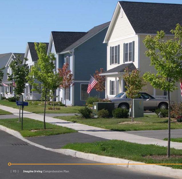


The ache for home lives in all of us, the safe place where we can go as we are and not be questioned.
~ Maya Angelou
FutureIrvingresidentswillhaveavariety ofhousing choicesacrossthecity thatservearangeofincomes, agesandcultural backgrounds. Researchshowsthere willbeanincreaseddemandformixed-useresidential optionslocateddowntown, in neighborhood centers, andalongkey corridors. Thisincreaseddensity promotessustainability andlivability, andisacosteffectiveoptionfor Irving'sfuture. Youngfamilieswill beabletoaffordattractivehomesinwalkableandsafe neighborhoodswitheasy accesstojobs, schoolsand parks. Thoselookingtodownsizetomoremanageable homeswillhavearangeofaffordablehousingstyles fromwhichtochooseinanumberofcommunities, eachwithproximity torestaurants, shopping, healthcareandopenspace. Quality oflifeinIrvingwill improveasagingapartmentsitesarereconstructedor repurposed, and continuous improvements aremade tocommunity infrastructure. Variety, flexibility and affordability inthelocalhousingmarketwillattract many peopletoliveandworkin Irving, andwill encouragelong-termresidentstostay.
» Irving provides housing of different types and styles for people of all ages and incomes. This includes homes in traditional singlefamily neighborhoods, as well as walkable neighborhoods with higher densities. All neighborhoods will be oriented toward livability, walkability and cost-efficiency.
» Irving has safe neighborhoods with quality housing and schools, and a variety of housing options attractive to people working in the city.
» Rehabilitation and reconstruction occurs in neighborhoods across the city to maintain or selectively replace existing homes. In areas where multifamily inventory is nearing the end of its useful life, site repurposing or reconstruction will take place.
Irvinghasenjoyeddecadesofpopulationgrowth andincreasingdiversity. Bothtrendsareexpectedto continueandhousing strategies needtopreparethecity forcontinuedgrowth. Irving'spopulationisprojected togrowsubstantiallytoapproximately 302,000people by 2040,addingsubstantiallytothenumberofnew housingunitsneeded. Irving'sracial,ethnic,cultural andgenerationaldiversityisanassetthatshouldbe consideredinplanningforfuturegrowth.
Irving'scurrentmix ofhousingisnearlyevenlysplit betweenmultifamily buildings (52percent)andsinglefamilyhousingtypesincludingdetachedhomes, townhomes,mobilehomesandduplexes (48 percent). Thedemandforrentalunitsisstrongandwillcontinue toremainhigh. Whencomparedtomostneighboring cities, Irvinghasahigherrentalrate: 61percentof householdsliveinrentalunits,and 39 percentof householdsarehomeowners. As Irvingcontinuesto developtransit-oriented,mixed-useneighborhoods servedby Dallas AreaRapid Transit (DART)and Trinity RailwayExpress (TRE)railstations,thecity'srental populationwillremainhigh.
High-qualityrentalhousingthatiswellmaintained, attractive, andaffordableatavariety ofincomelevelsis amajorassettoattracttalentedyoungpeopletolivein Irvingastheypursuetheircareers.
Asthecity continuestoattractnewresidentswithits primelocation, quality neighborhoodsandgreatjob opportunities, thehousingmarketin Irvingshould adapttomeetthechangingneedsofthecommunity. Thecity willencouragenewdevelopmentthatincreases itshousingsupply withabalancedmix ofnewsinglefamilyhomes, townhomes, andvariedstylesofmixedusebuildings.
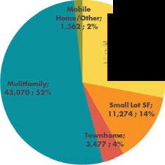
ancl Lo,;. Lot Sf; 23,053; 28%
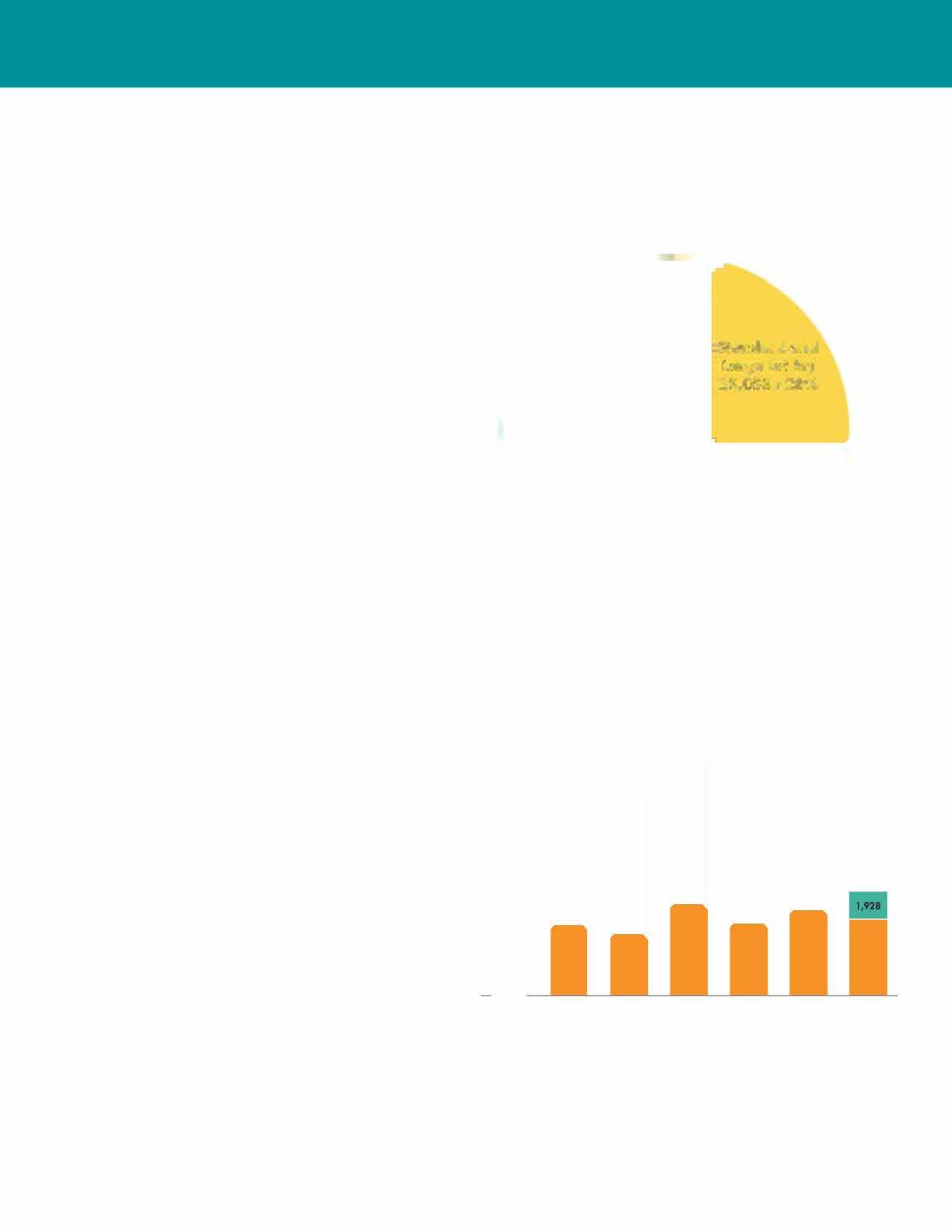


■ Owner occupied
Renter occupied


Source: Census Bureau, ACS 2009-2013, 5-Year Estimate
Therehabilitationandupgradeofqualityhomes, reconstructionofobsoletehomes, andtheconstruction ofnewinfillhousing (theadditionofnewhomes inestablished neighborhoods) willregenerateand preservethecharacterofexisting neighborhoods. In areaswherevacantsingle-familysitesareavailable, additionalhouseswillbebuilt. Asredevelopmentand infilloccur,theCitywillensurethe availability ofa varietyofquality, affordablehousingwithintheCity fordisplacedandincomingresidents.
TheCityof Irvingshouldstrivetosatisfythemarket forsingle-familyhomesbyencouragingdesignsthat consumelesslandwhilestillprovidinganownershipfriendlyproduct. Encouragingconstructionofsmall lotcottagehomes, clusteredcourtyardhomes, and townhomeswillhelpservetheowner-occupant market.
Manyoftheanticipatednewhousingwillbeinmixedusebuildingsthatprovidelivingunitsonupperfloors andincludenon-residentialusesonthegroundfloor suchasretail, smalloffices,personalservices,daycare, grocerystoresandfitnesscenters. Whilemostofthe unitswillbegearedtowardtherentalmarket, there isanopportunitytoservehomeownerswiththese designsbyincludingcondominiums.
Populationcharacteristicsinfluencethehousing marketandshouldbeakeypartofsettinghousing policy. "Psychographicanalysis" looks beyondbasic populationdatabydividingpeopleintomarket segmentsandstudyingtheirconsumerpreferences toallowresearcherstobetterunderstandthelifestyle choicesofagivenpopulation. This analytical tool allowsplanners (ormarketingfirms) toexaminehow groupsofpeoplewithsimilarspendingpatternsmake decisionsonpurchases. Theinformationgathered includesvaluablecluesrelatedto neighborhood and housingpreferences. Fromtheseclues, wecanpredict manyofthefactorsthatwillinfluencefuturehousing decisions.


Sources: Envision Tomorrow Scenario analysis; U.S. Census Bureau ACS 2009-2013 5-year estimates.

Figure 25: Irving's Psychographics Household Segments
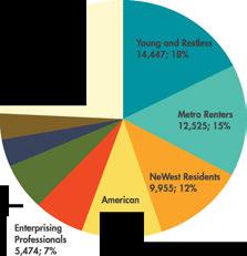
Source: Esri Tapestry (2014)
» Thirty-eight percent of people surveyed stated that small lot or cottage homes are the form of new housing most needed. This is the largest response; new multifamily was at 17 percent overall.
» Sixty-four percent of the 100 respondents agree that cottage homes are a good fit for new housing. Sixteen percent are neutral on cottage homes and 20 percent disagree. The breakdown is similar for courtyard housing.
TheEnvironmentalSystemsResearch Institute's (Esri) Tapestrysegmentation, apsychographicanalysistool, dividesU.S.householdsinto67distinctsegmentsthat varyfromeachotherintermsofage, occupation, householdstructure, ethnicityandspendingpatterns. BygroupingeveryU.S.householdintooneofthese segments, researcherscanbetterunderstandand summarizecomplexconsumerbehavior.
Accordingtothistypeof psychographic analysis, eight segmentsrepresent76percentof Irving's households. Understandingthesehouseholdsegmentsandtheir housingchoiceshelpstheCityof Irving identify future housingneeds.
Mostof Irving'stoppopulationsegmentsarerenters. Forty-fivepercentof Irvinghouseholdsarein segmentsdominatedbysinglesandyoungcouples whorent.Thesegroups (YoungandRestless, Metro Renters, EnterprisingProfessionals, BrightYoung Professionals)tendtopreferlargebuildingsin walkablemixed-useneighborhoods,andhouseholds inthesepopulationsegmentsmovefrequently.They tendtobewelleducatedandmanyarestillenrolledin schoolandhavelowratesofunemployment.
The "EnterprisingProfessionals" segmentisequally splitbetweenrentalandhomeownership, andthis segmentmakesupaboutsevenpercentof Irving households.
Hard-working, youngHispanicfamiliesmakeuptwo moremajorsegments (NeWest ResidentsandBarrios Urbanos).Onegroupisjuststartingoutinrental housing, whiletheotherenjoyshigherincomesand leanstowardhomeownershipinasuburbancontext. Whiletherankingsandexactmixofsegmentsis expectedtoshiftby2040, themajorgroupsthat currentlymakeupthetopsegmentsare expectedto remaininfluential.
-Housing+ Neighborhoods
UsingfundsprovidedbytheU.S. Departmentof HousingandUrbanDevelopment (HUD) Entitlement grants, theCityof Irvingsupportsanumberof housingprogramsandsocialservicenonprofit organizations.Thegrantprogramsthroughwhichthe Cityof Irvingreceivesfederalfundsare:
» Community Development Block Grant (CDBG)
» Home Investment Partnerships Grant (HOME)
» Emergency Solutions Grant (ESG)
» Continuum of Care Grant (CoC)
Thecity'shousingprogramshavebeendesignedto coordinateefforts, bothlocallyandregionally, and withprivateandnonprofitorganizationstoaddress theneedsof Irving'slow-andmoderate-income residents.Thesehousing-relatedneedsrangefrom theprovisionofhousingtothehomelesstoaiding first-timehomebuyersinhomepurchases.The Cityof IrvingplanstouseSection108fundingfor transitionalhousingandisexploringuseoftheloans

forarecreationalcentertoservicelowtomoderate neighborhoods.
TheCDBGgrant funds avariety of activities including theHomeRestorationProgram, supportofnonprofit socialservicesagencyprograms, sitedevelopment and/orlandacquisition, throughsection108 services, andthedebtservicepaymentassociatedwithlarger communitydevelopmentprojects.
HOMEgrantfundsareusedtocreateopportunities foraccesstoaffordablehousing, includingsenior housing, andareoftenusedinpartnershipwith nonprofitdeveloperssuchasBearCreek Development CorporationandIrvingCommunity Development Corporation. Thiscantaketheformof constructionof newsingle-familyhousing, ortheprovisionofdown paymentassistancetofirst-timehomebuyers.
TheESG grantprovidesfortherapidre-housingof homelesspersonsandforsupportofdomesticviolence shelteroperationsandmaintenance. TheCoCgrant isusedtoprovidepermanentsupportivehousingto chronicallyhomelesspersons.
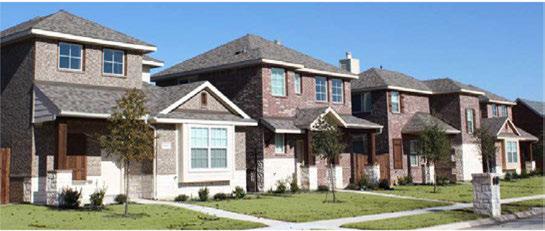
As Irving'spopulationcontinuestogrowand diversify, capitalizingonthisgrowth willrequire thedevelopmentof abalancedhousingsupplyin thefuturethatbuildsonlocalstrengths. Irvingis alreadyaheadof thecurveascurrentmarkettrends showanincreasingdemandforrentalhousing. The interestnowshownforlivinginmixed-use, walkable neighborhoodsmeansthatareaslike Heritage Crossing, the LasColinasUrbanCenter, andthe proposeddevelopmentsaroundtheformerstadium sitecouldbeverypopular. Thetypesofenvironments theseareascreatearepopular withthepopulation segmentsthataredrawnto Irvingforemployment reasons, andtheirnumbersare expected togrow. Suchneighborhoodsarepopularacrossgenerational dividesandareeconomicallysustainableandefficient tomaintain.
MostofthehousesthatIrvingresidentswilloccupy by2040arealreadyonthegroundtoday. Muchofthe city'shousingstock wasconstructedinaperiodofa fewdecades,from1950sto1970s, andthecity'sexisting housingstock willcontinuetoprovidemuchofthecity's single-familyinventoryforthenext20to30years.
Rehabilitating and upgrading existing housesis important formaintainingthe character ofsinglefamilyneighborhoods. Housingupgradesshould beencouraged withincentiveprogramssuchas rehabilitationloans whereasiteisfallinginto disrepair. Prime areasthatcouldbe considered for arehabilitationpilot project include neighborhoods near Plymouth Park and Irving Mall, andother neighborhoodcentersinsouth Irving.
TheCityof Irving's Home Restoration Program, fundedthroughthefederalCommunityDevelopment Block Grant (CDBG) funds, assistslow-andmoderateincomehomeownerswithhomerepairsrangingfrom emergencyrepairstomajorhomerehabilitation. Theprogramisprimarilytargetedtoseniorcitizens andisdesignedtoencouragelong-termstabilityin neighborhoods. Collaborativeefforts betweenseveral faith-based organizationsandcorporate partners aid propertyowners withminorrepairstobringhomes back intocompliancewithbuildingcode. Suchefforts onlyscratchthesurface, andmayneedtobeexpanded intootherprogramareas. Althoughrehabilitating housesisimportant, theCityof Irvingalsocan improvestreetscapesandparks, whichbenefitsentire neighborhoods intandem withhouse-specificprojects.


Housing+ Neighborhoods
Reapingthe benefitsofcontinuedgrowthrequires planningforfuturehousingneeds,andpossibly providingincentivestoensuretherightmix of housingisbuiltintherightlocations,andattheright pricepointstoserve Irving'spopulation. The City of Irving shouldfocusonincreasingthequalityofrental housingthrough betterdesignandcodeordinances, andstrivetoensureaffordable,high-qualityhousing optionsexistthroughoutthecity withfuturemarket trendsinmind. Newhousing willinclude: multifamily unitsontopofretailsitesinamixed-usesetting,urban townhomesthatareattractivetosmallerhouseholds, andsmalllotsingle-familyresidencessuchascottage andcourtyardhomes. Energyefficiency will bea sellingpointforthesenewdesigns,andnew buildings will be constructed toreflectthatdemand.
The Imagine Irvingscenarionanticipatesover 27,000 newhousingunits betweentoday and 2040. An estimated11,000newsingle-familyunits will be needed by 2040, which includes free-standinghomes, cottages, zero-lot linehomesand townhomes. Dueto thelimitedavailabilityofvacantland,themajority offuturesingle-familyhomes will beconstructedon smalllots. Atcommunity planning workshopsand throughsurveys,imagesofcottage-andcourtyardstylehousing were wellreceived. Thishousingtype alsoisperforming wellinthenationalrealestate market.
Irving'shousingdemandalsoincludesanestimated 16,500multifamily units,nearly allofwhich will be inamixed-use residential context withground floor officeorretail,locatedin walkable neighborhoods.

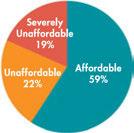
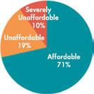
» While varying by household, affordable housing is generally defined as costing less than 30 percent of household income. Households paying more than 30 percent are considered cost burdened (unaffordable, Figure 27) and those paying more than 50 percent are severely cost burdened (severely unaffordable).
» Higher income households tend to pay less than 30 percent of their household incomes toward housing costs, while lower income households may have to pay more than 30 percent of their household incomes toward housing costs to secure quality housing in a safe and accessible neighborhood.

Housingandtransportation workhand-in-handin creating complete neighborhoodsthatoffer arange ofservicesandeasy accesstotransit, education and healthcare. Encouragingtransit-orienteddevelopment willbeakey strategyinprovidinghigh-density, mixed-usedevelopmentnearrailstations, whilealso providinganurbanlifestylealternativeforpeople whopreferthe "bigcity downtown" styleoverthe "urbanvillage:' Theserail-andpedestrian-oriented communitiesaremorecompactthantraditional single-familyneighborhoods. They offerurban townhomes, high-risemixed-useresidentialbuildings withnearby retail, restaurantandofficesitesthat areclosetotherailstations. Thecommunitiesare designedtotransitionsmoothlyintoadjacentexisting neighborhoods, whileprovidingresidents, andthoseof nearby neighborhoods, with plenty of local shopping, andaccesstoservicesandother amenitieswithin asafeandattractive walkingenvironment. Most successfultransit-orienteddevelopments (TOD) offer amixtureof pricepointsto accommodate arange ofaffordability.TOD alsopromotesconnectivity throughout Irvingmakingitattractiveandaccessible tobothvisitorsandresidents.
Heritage Crossingprovidesoneofthebest opportunitiestocreatea walkableurban villagefor peopleseeking city-style livingin Irving. Many young professionalsprefertoliveinpedestrian-friendly downtownenvironmentscloseto work, transit, shops andnightlife. Thistypeof environmentcansupport reinvestmentindowntown Irvingandcreateavibrant centerattractingresidents,workersandvisitorsatall hoursoftheday.
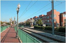
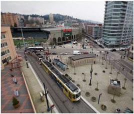
Housing+ Neighborhoods
AsIrvingresidentsage, mostwilllikelycontinueto liveinthesamehome, or "ageinplace:' Most homes andneighborhoods, however, werenotdesigned toaccommodatepeople withmobilityconcerns. Accessiblehomesandcommunitieswithadequate transportationoptions, andeasyaccesstogrocery stores, doctorsandcommunityactivitiesarecritically importantforpeoplelivingindependentlyintheir goldenyears.
Universaldesigninhousingisagrowingandbeneficial concept. Itexceedstheminimumspecificationsfor accessibledesignandresultsinhomesthatareusable byandmarketabletoalmosteveryone. Amajorissue inthisdesiretoageinplaceinvolvesdesign. Universal designhomeshavefeaturesthataccommodatepeople ofallagesandphysicalabilities: anentry withnosteps, hallsanddoorwayswideenoughto accommodate wheelchairs, afirst-levelmastersuite, andbathroom grabbars. Asthepopulationages, communitiesare supportingtheincorporationofuniversaldesign featuresintoaffordablehousingcommunities.
Aholisticapproachtoaginginplacealsoincludes nearbygroceries, pharmaciesandotherservices. Aginginplacegoesbeyondservicestothedesignof the wholecommunity. Retailproximityiskey, asare easilynavigablesidewalksandeasy-to-readstreet signs.
The City ofIrvingviewshomelessnessasahigh priorityconcernandstrivestodevelopcommunitybasedsolutionsforthisissue. Theneedsofdifferent typesofhomelesspersonsaredifferent, andtheneeds of thesuburbanhomelessaredifferentfromthose of theinner-cityhomeless. The City ofIrving works throughthe DallasArea/IrvingContinuumof Care and withtheIrvingnonprofit/faith-basedcommunity tofindthemostsocially responsibleandfinancially efficientmeansof providingservicestomatchthese varying needs.

By 2030, one in every five Americans will be over age 65.
The U.S. will face a severe shortage in appropriate housing to meet their needs. As people age, they need housing that is structurally and mechanically safe, and that accommodates people with disabilities. Those 50 and older also need safe communities, adequate transportation options, and access to grocery stores, doctors and community activities.
Housing+ Neighborhoods

Goals,
Goal 1: Create "complete neighborhoods" with housing near transit, services, education, healthcare, shopping and employment.
Strategy 1.1
Neighborhoods in Irving have centers that provide access to services and transit.
1.1.1 Alignplanning, fundingandcommunity investmentstosupport transit-oriented developmentalonglightrailtransitandbus lines.
1.1.2 Planforandenabledevelopmentof neighborhoodcentersinallneighborhoods thatcentralizeresidents' accesstoservicesand amenities.
Strategy 1.2
Partner with public, private and nonprofit entities to create complete neighborhoods with easy access to health and educational facilities, services and shopping.
1.2.1 Partner withserviceproviderstopromote neighborhood-levelservices, especiallyin areaswithlowerincomesandlessaccessto transportationandtransit.
1.2.2 Partner withnonprofitsandotheragenciesto assist theminachievinghousingupgradesand repair programs, social services, andnewinfill housingconstruction.
Goal 2: Provide variety of housing types to accommodate the diversity of Irving's residents and neighborhoods.
Strategy 2.1
Promote affordable housing with a balance of housing types.
2.1.1

2.1.2
2.1.3
Designatesufficientlandforresidentialusesto meettheneedsofthecommunity's projected population.
Increasethenumberof well-designedand affordablehousingtypesthatrespondto residents'preferencesandincomes.This shouldincludesmallerlotsingle-familyhomes suchascottageandcourtyardhomes.The Cityof Irvingalsoshouldconsideradoptingan ordinance for Accessory Dwelling Units.
AmendtheCityof Irving'sdevelopment regulationstoallowforincreased flexibility andinnovationinresidentialprojectdesignto promotetheefficientuseoflandandprotect naturalareas.
Strategy 2.2
Expand incentives for affordable housing development.
2.2.1
2.1.4
Modifythe zoningordinancetoincludenew zoningdistrictsthatallowthetypesofhousing anddensitiesbeingrecommendedinthe Future LandUse Plan.
2.2.2
AspartoftheCityof Irving'stoolbox for promotingqualitydevelopment,structure developmentincentivestoencouragethe inclusionofapercentageofhousingunitsin TOD'sforhouseholdsearninglessthan80 percentof Area MedianIncome.
Workwithdeveloperstoensureservicesand amenitiesforresidentsareco-locatedwith affordablehousing.
Strategy 2.3
Create opportunities for urban living in Heritage Crossing.
2.3.1
Increasethenumberofhousingunitsin
2.3.2 theHeritageCrossingdistrict.TRE station parkingareasareapotentiallocationforinfill developmentthatincorporateshousing, retail andparking.
Use HeritageCrossingDesignGuidelinesto ensurehousing development inthe district is walkableandsatisfiesthedesignprinciplesfor mixed-usemultifamilydevelopment.
Housing+ Neighborhoods

Strategy 3.1
Protect existing single-family neighborhoods.
3.1.1
Reviewdevelopmentapplicationswithin neighborhoodsforcompatibility withthe characterofexistingneighborhoodsinterms ofgeneralhousingtype, appearanceand density.
3.1.2
3.1.3
Promotehousingcompatibility between adjacentresidentialareasby encouraging designtechniquesandmultifamily developmentstandardsthatminimizenegative impactsbetweentheseareas.
Usedevelopmenttransitionstocreate compatibility betweendifferinguses.
Strategy 3.2
Provide for reinvestment in declining areas.
3.2.1 Identify andprioritizeneighborhood
redevelopmentandreinvestmentneedsand opportunities usingareasidentifiedinthe Vision Map, aswellastheCity of Irving's neighborhoodinspectionsdatabases.
3.2.2
Identify optionsforaddressingneighborhoods inneedofreinvestment, includinghome
improvementandmaintenanceprogramsfor homeownersandrentalproperty owners.
Identify andinventory existingsubstandard housingunits, andsupporttherepair,upgrade orreplacementofsuchstructures. Encourage collaborationofnonprofitmaintenanceand rehabilitationprograms, andcontinueto coordinate such services with city-funded and/ or county-fundedprogramstomaximizethe efficiency andvisibleimpactofsuchefforts.
Continuetousetheriskratingprocessfor multifamily complexestoidentifythoseneeding widespreadrehabilitation.
Designate landonthe Future LandUse Mapforresidentialuseinareaswherethe necessary utility infrastructureconnections andcommunity servicesareavailabletomeet theneedsoftheadditionalpopulation.
Engage Irvingresidentsinanongoingprocess ofbuildingandpromotingneighborhood identity. Supportneighborhoodefforts topartnerwithnonprofitsandbecome involvedinpublicandprivateneighborhood improvementprograms.
Strategy 4.1
Continue to enforce the federal fair housing law.
4.1.1 Continuetoenforcethefederalfairhousing lawtoensurepeopleinterestedinlivingin Irvingcandosowithoutfacingdiscrimination. The Fair HousingActprotectspeoplefrom discriminationwhentheyarerenting, buying orsecuringfinancingforanyhousing.The prohibitions specifically cover discrimination byrace, color, nationalorigin, religion, sex, disabilityandthepresenceofchildren.
Strategy 4.2
Continue working with Metro Dallas Homeless Alliance to provide a continuum of care for people experiencing homelessness.
4.2.1 Continuetoenhancepartnership between theCityof Irvingandsocialserviceagencies forcomprehensiveproblemsolvingandthe provisionoftechnicalassistance. Increase organizational capacityintheformoftraining andone-on-oneassistancetolocalhousingand nonprofitorganizations.
4.2.3 Facilitatecommunity-basedresponses toshelteringneedsfortargethomeless populations.

Strategy 4.3
Expand housing for seniors.
4.3.1
4.3.2
Reviewregulationsforseniorhousingfacilities andmodifyordinancestoaccommodate housingfortheelderly.
Useseniorhousingtotransition between residentialdensitieswhenevaluating developmentproposals.
4.3.4
4.3.5
4.3.6
Ensurethatseniorhousingisdevelopedin walkableareaswitheasy access toservices, shoppingandclinics.
Wherepossible, use HOMEfundsfor developmentofseniorhousing.
Reviewhousingstandardsandincorporate universaldesignstandardsintoaffordable housing.
Goal 6 of Chapter 15: Poverty, Health and Education also includes strategies to prevent homelessness.

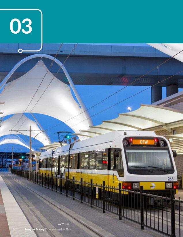

The reality about transportation is that it's futureoriented. If we're planning for what we have, we're behind the curve.
~ Anthony Foxx, United States Secretary of Transportation
Irving, likemostcitiesinthe Dallas-FortWorth area, hasatransportationnetworkthatemphasizes efficientlongdistancetravelacrosstheregion. Thisfocusonlongtripsandmaximizingroadway capacity encouragesdevelopmentscenteredaround theuseofautomobiles. Thefocusonauto-oriented developmentincreasescongestiononroadways. When lanesareaddedtoaccommodateincreasedtravel demand, systemimprovementsareshortlivedas commutersadapttheirpatternstothesenew routes, andadditionalgrowth increases demanduntilthe roadsbecomecongestedoncemore. Thisunbalanced transportationstrategy hascomeataprice-the declineofthesafe, convenientandenjoyabletripthat canbemadeby foot, bicycle, busorrail. By shifting thefocusaway fromlongdistancetripstobetter connectionsbetweennearby destinations, overall transportationaccessibility canbeimproved. By adjustinglandusepatternstobringhomes, jobs, shops, services, andeducationalfacilitiesclosertogetherina moreconvenientandwalkableenvironment, people canliveneartheplacesthey regularly visit, andnot becompelledtodrivehalf-an-hourormoretoreach

» Improve transportation connections within Irving that includes all modes such as roadway, transit and bicycles.
» Prioritize alternative transportation modes as a means to increase overall system capacity.
» Improve safety for all transportation users by focusing on high frequency crash locations.
» Integrate land use and transportation facilities to reduce dependency on a single mode of travel, and to minimize travel time and distance between home and work/school/shopping.
» Support economic development efforts by encouraging placemaking {creating quality public spaces) through street design in strategic locations within Irving.
» Continue supporting regional transportation solutions by coordinating decisions with surrounding communities and other agencies including NCTCOG, DART and TxDOT.

Transportation theirdaily destinations. Recognizingthis, many cities andtransportationprofessionalsarechangingtheir approachtoroadway planning, realizingthatgrowing urbanareascannotbuildtheirway outofcongestion by addingnewroads.
Effectivetransportationsystemsareabalancing act. Whenstreetsaredesignedtoproperly serve surroundinglandusesandallowmultiplemodesof travel, automobiletravelisstillaccommodated, butnot attheexpenseofothertraveloptions. These "complete streets," builttoallowbicycle, pedestrianandbus travel, provideanalternativetoendlesscyclesoftraffic congestion, especially whenintegratedwitharail andbusnetwork, whichcanhelpincreasetheoverall capacity ofthetransportation networkby reducingthe demandforlong-distancetrips.
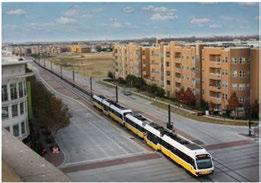
Asthepopulationandeconomyofthegreater Dallas-Fort Worthregioncontinuestogrow, Irving remainsstrategically locatedinacentral, wellconnectedpositionthatiseasily linkedtonumerous major activity areas. Thecity isservedby fourmajor freewaysandonetollway thatprovideconnectionsto theeconomiccentersof LasColinas, downtownDallas, andDallas-FortWorthInternational Airport. Tworail lines, Dallas AreaRapidTransit (DART)busservice, pedestrianconnections, andagrowingbikeway and trailnetworkprovidemultimodaloptionsforresidents whopreferanalternativetoautomobiletravel.
Irving'scurrentMaster ThoroughfarePlan (MTP)was adoptedin1997, withthelatestrevisionmadein2014. ThisplanservesasthetooltoenabletheCity of Irving topreservefuturecorridorsandthenecessary rightof-way toimprovethelocaltransportationsystemas theneedarises. TheMTPincludes information related toroadway classification, right-of-way requirements, basicdesigncriteria (includinglanewidthsand medians), andthenumberofthroughtravellanesfor eachthoroughfare inthecity.


Irving'sroadway systemisinterlacedby anumber offreeways, aswellasanetworkofarterials (highcapacity urbanroads)andcollectors (movingtraffic fromlocalstreetstoarterials)providingmovement throughoutthecity. MajorfreewayswithinIrving includeInterstate635 (LyndonB. Johnson Freeway), StateHighway 114, State Highway 183 (Airport Freeway)andLoop12. Sincethepreviousadopted comprehensiveplanin1997andthe2008update, StateHighway 161 (PresidentGeorgeBushTurnpike) hasbeencompleted, providinganadditionalregional north-southtraveloption. Irving'sdirectproximityto DFW InternationalAirportdrasticallyincreasesthe importanceof State Highway 114and StateHighway 183asregionalconnections.
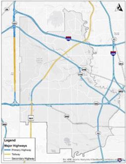
Thesecorridors, primarily functioningasregional travelcorridors, alsoserveasessentialroadwaysfor tripsbetweenmajoractivity areaswithinthecity. Cross-townmobility alsoreliesheavily onanumberof majorarterials. BeltLine Road, Irving Boulevardand MacArthur Boulevard carry someofthehighesttraffic volumes, distributingtripsto HeritageCrossing, Las Colinas,andintoneighboringurbanareas.
, Current Level ofService I l - FreeFlow/Minimal Delay 1---�I----' -AcceptableDelay - ExcessiveDelay
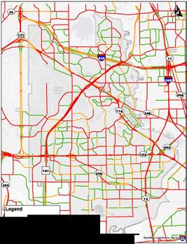
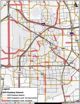
Many oftheroadwaysthroughoutthecity are operatingatornearcapacity, whichisindicated by significant delaysatpeaktravel periods. During thenext25 years, itisexpectedthatevenwith theplannedimprovementstothehighwaysand roadwaysthroughout Irving, congestionwillcontinue toincreaseonmajorhighwaysandarterials. This expectedincreaseincongestionisbasedonanticipated populationand employment growthwithinthecity andacrosstheregion, andacontinuedrelianceon personalvehicles. Dueto Irving's locationwithin
the Metroplex, muchofthisregionalgrowthwilluse highwaysthattransect Irving, furtherincreasingthe trafficvolumesandcongestionlevels. Figure31shows thecomparisonbetweenexistingcongestionand projectedfuturecongestiononarearoadways.

DART is the agency that provides bus and light rail service in Irving. As of 2015, there are 18 bus routes that serve the city. The routes follow many of the arterials and collectors in Irving, and there are a variety of routes including local, express, suburban, crosstown, rail feeder and transit feeder. Rail service is provided along the DART Orange Line and TRE commuter rail, connecting Irving directly to Dallas, Fort Worth and DFW International Airport.
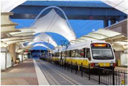
The DART Orange Line serves the city with five light rail stations including:
• Belt Line Station
• North Lake College Station
• Irving Convention Center Station
• Las Colinas Urban Center Station
• University of Dallas Station
The Orange Line was recently extended to DFW International Airport, Terminal A, and also connects to Dallas Love Field with frequent shuttle services to both airports. This vital connection provides increased mobility to the airport and a great opportunity to capitalize on potential economic development around
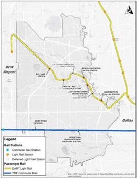
the current and future light rail stations. Depending on Orange Line ridership, three additional stationareas could be developed adding new stops at Las Colinas Carpenter Ranch, South Las Colinas, and a new Loop 12 Station.
In addition to DART, the TRE provides commuter rail connections between downtown Dallas and Fort Worth T&P Station with two stops in Irving: West Irving Station and Downtown Irving/Heritage Crossing Station. Green Line stations in Farmers Branch also provide easy access to residents in north Irving.
Throughout muchofthecity, the primary facilities fornon-motorizedtravelandactivetransportation aresidewalks. Mostsidewalksareconstructedatthe timedevelopment occurs, andthecurrent owners areresponsiblefortheupkeepandmaintenance of adjacent sidewalks. The conditionofthesesidewalks varies.Older neighborhoods are typically ingreater needofsidewalkrepairs.
TheCityofIrvinghasbegunintegratingon-street bicyclefacilitiesinkeyareas.Currently,there aremarkedsharedlanesonW.6thStreetfrom S.MacArthurBoulevardtoS. BritainRoad,and designatedbicyclelanesonNorthgateDrivefrom RochelleBoulevardtoTomBraniffDrive,adjacentto theUniversity of Dallascampus. Therearenumerous opportunitiestofurtherdevelopthisnetworkto increasetheconnectionsbetweenexistingactivity centers,trailsandtransit.
Theoff-streetbiketrail system ismoredeveloped thantheon-streetsystem,however,therearestill many connectivity opportunities inthecentralareas ofthecity. Theseoff-streettrailsaremulti-purpose trailsdesignedforpedestriansandbicyclists, that parallelroadwaysorfollowenvironmentalfeatures suchastheTrinity River. Approximately 10.5 miles of CampionTrailshasbeenbuiltalongtheeastern edgeofthecity, takingadvantageoftheTrinity River greenbelt.Additionalsegmentsofthissystem, along withtheplannedRock IslandTrailandDelaware CreekTrail, willcreatenewconnectionstocentral partsofthecity, theTRE, andtheregionalbicycle network.


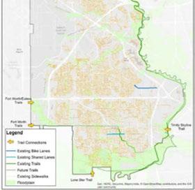
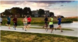

Irvingresidentswillhaveavariety oftransportationchoicesforgetting aroundtown. Allresidentswill haveaccesstomajorcorridors, neighborhoodcorridors, bikeand pedestrianfriendlystreets, and transitroutes. Peoplelivingand workinginthecitywillbeable todrive, bike, catchabus, orhop onatraintonearlyanywherein theregion. Thenetwork of transit options, large arterials, pedestrianfriendly neighborhoods, and employmentcenterswillresultin oneofthesafestandmostefficient transportationsystemsinthe country. Commuterswillspend lesstimedelayedintraffic, and gettingaroundwillbesaferand moreconvenientbyanymodeof transportation.
Appropriatenetworkconnectivity isessentialtomaximizing accessibilityandincreasingthe numberofrouteoptions. Wellnetworkedstreetsprovideshorter, moredirectroutesbetween destinations. Thisincreasesthe efficiencyandreliabilityofthe roadnetwork. Aclassicexample ofa well-connected streetsystem isthetraditionalgridpattern. Grid streetpatternsresultindispersion

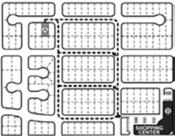

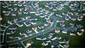
oftrafficthroughoutthesystem. Whilemajorarterialsexistwithin thegridpattern, localtravelersare abletouseinterconnectedlocal streets, freeingthearterialsfor themovementoflongerdistance travelers.
Whilesomeof Irving'solder developedareasmaintain thisgridpattern, manyofthe neighborhoodsthroughoutthecity
haveusedaconventionalsuburban developmentpatternwithculde-sacsandfeweraccesspoints. Theseareashavebeendesigned tocollecttrafficfromresidential areasandchannelmosttripsonto majorthoroughfares. Thispattern tendstorequirelargeintersections, createsgreatercongestionon arterials, andoftendiscourages pedestrianandbicycletravel.

Thereisnosingledesignfor acompletestreet. Eachoneis uniqueandshouldrelatetoits surroundingcommunity. Thisis incontrasttoincompletestreets, whicharedesignedwithonly carsinmindandmakealternative transportationchoicesdifficult, inconvenient, andoftendangerous. Contextsensitivedesigntakesthe goalofcompletestreetsandapplies ittotheprocessofdetermining themostappropriateroadway cross-sectionsduringconstruction, reconstruction, orrehabilitation projects. Thisprocessconsiders thefunctionalclassoftheroad, as wellasthecontextandcharacter ofdevelopmentinanarea, future goalsforacorridor, andtheexisting andfutureneedfordifferentmodes oftransportation.
Completestreetsisarelativelynew termforanideafromdecadespast. Longbeforeextensiveregulations andrequirementsthatfavorrapid automobilemovementbegan dictatingstreetdesign, streets werebuiltanddevelopedtoserve thedestinationssurrounding them. Someofthegreateststreets inAmericastillmaintainthis centuries-oldcharacter. Complete streetsarestreetsdesignedfor everyone-with safeaccessfor

pedestrians, bicyclists, motorists, andtransitridersofallagesand abilities.
Completestreetsoffermany ofthe benefitsthataresoughtthrough traditionalroadway design: increasedroadcapacity, decreased traveltimes, andenhancedsafety. Itoftencreatesthesebenefits ininnovativeways. Mostroadbuilderstargetedincreased roadway performancethroughthe additionofvehicletravellanes. But withcompletestreets, roadway
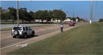
Transportation designmightconsiderenhancing sidewalksorpedestriancrossings, orrepurposingunnecessarytravel lanesforanothermodeoftravel, suchasbikelanes. Everyperson whochoosesthesealternative modesoftravelisonelessdriver oncitystreets, whichreduces congestionandextendstheservice lifeoftheroadway.
Currently, thedevelopment ofthoroughfaresin Irvingis guidedby typical roadway crosssections designated by functional classification,asidentifiedon Irving's MasterThoroughfare Plan. Thisplan,however, does notprovideguidanceforthe developmentofmultimodalstreet typesthatcouldmoreappropriately servevariouslandusecontexts andactivitycenters. Byintegrating futurelanduseandtransportation prioritieswiththe Master ThoroughfarePlan, thecomplete streetsprocesscanbebetterapplied todetermineifandtowhatdegree thedesignmayneedtobechanged toachievethemostappropriate cross-sectionforacorridor.
Thosewholive, workortravelin Irvingunderstandtheeveryday challengesthatoccurwhentrying togetfromoneplacetoanother. Highwaysandarterialsquickly becomecongested,andasidefrom theexistingrailconnections, therearefewfastandfrequent transitoptions. Upcomingmobility improvementsareprimarily focusedonregionaltravelthrough thecity withmajorhighway expansionprojects, butfuture traveldemandprojectionsindicate thattheseimprovementswill struggletokeepupwithgrowth, andconnectionswithinthecity will remainanissue.

Many mobilityissueshavebeen createdduetothedevelopment patternofthecityandregion. Theexistingmajorhighway connections (SH114, SH183, and I-635) contributesignificantlyto the movementof vehicles eastwestthrough Irving, buthave dividedthecityintodistinct growthareas. Thesehighway divisionslargely actasbarriers tooverallconnectivity, limiting localnorth-southconnectionsand creatingtrafficchokepoints. In addition, thesurroundingregion continuestogrowinpopulationand employment. AsIrvingmaintains itsstatusasanimportanteconomic destination, thisgrowthcreates additionalstrainontheexisting transportationnetwork.
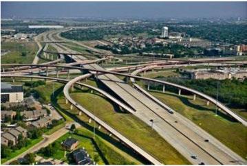
Expansionofthemajorhighways andtheintroductionofmanaged lanesmay temporarily ease congestionissues, butintime, commutingpatternsareexpected toadaptandcreatenewdemand ontheseroutes. Nocity hastruly solvedcongestionissuesby building moreroadway infrastructure. Congestionshouldberecognizedas asignofasuccessfulanddesirable place. Astheregiongrows, the city shouldfocusonstrategiesto accommodatetheadditionalpeople whowillliveandworkin Irving.
Inaddition, trendsintransportation choicesareshiftingamong differentdemographics. Young peoplearechoosingtoliveinurban locationswithmultiplechoicesof transportationmodes.Thisisin contrasttoprevious generations' desirestolocateinautomobileorientedsuburbancommunities. Thishasresultedinlowervehicle ownershipsandagreatertendency tousetransit, bicyclesorrideshare servicessuchas CAR2GO, UBER andLYFT.Thesechanging transportationcharacteristicsare causingreductionsinVehicle Miles Traveledincertainregionsaswell asacrossthecountry.Thestrategies forimprovingtransportation shouldcenteronshiftingtripsto moreefficienttravelmodes, and helpingpeopleavoidmakinglong commutesby continuingtobring destinationsclosertogether.
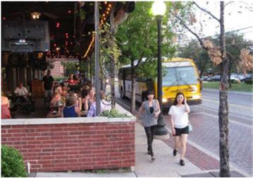
Anothermajorconcernisthe declineinavailablefunding fromstateandfederalsources fortransportationprojects.The regionisexpectedtoreceiveless realfundingfortransportation in2030thantoday. Increasing populationandvehicleturnoverto increasingly fuel-efficient modes impacttransportationfunding. In addition, theagingtransportation system, combinedwithrising constructioncosts, hasincreased thedemandforavailablefunds
Spendingonhighway andtransit programshasoutpacedrevenues, largely duetoinsufficientrevenue fromtraditionalsources. Motorists contributetotransportation

fundingatthefuelpump. A20cent stategasolinetaxand18.4cent federalgasolinetaxiscollected, butnotallofthisrevenuebecomes availablefortransportation infrastructure.Whiledemand andcostsincrease, traditional transportationfundinghas remainedunchanged.Therefore, city andtransportation officials havehadtoturntonewrevenue sourcesandlocal financingtofund muchoftheimmediateandfuture transportationneedsforthearea. AccordingtotheNorth Central Texas CouncilofGovernments (NCTCOG), approximately onethirdofthefundingfortheregion's networkcomesfromlocalsources, sohowthe City ofIrvingprioritizes itsownfundsisasimportantas ever. Numerousotherfunding
Transportation sourcesareavailablethatmake uptheremainingportionofthe region's infrastructure, primarily managedby theTexasDepartment ofTransportation(TxDOT)and NCTCOG.
Irvingisasteadily growingfirsttiersuburbwithinthecoreofthe Metroplex, andhasbeenaregional economiccenterfordecades, soitis nosurprisethatthemajorityofthe city'sroadway networkisalready builtout. Withnewresidentsand economicdevelopmentcontinuing tosurgeintotheregion, Irvingwill facecriticaldecisionsonhowto accommodatetheincreaseintrips throughoutanalreadystrained localtransportationsystem. Most majorarterialshavebeenbuiltto theirmaximumcapacity, andmany olderexistingdevelopedareas willlikelyattractinfillhousing (neworrehabilitatedhousingin existingneighborhoods)andnew jobcenters. Inthesecases, future vehiculartrafficissueswillnotbe solvedby expandingroadways. Strategicimprovementstoexisting corridorsmusttakeplacetoshift tripstoothermodes, whilealso maximizingthefunctionality ofthe vehicularsystemwithinthecurrent right-of-way andnumberoftravel lanes. Oneofthemostefficient
waysofaddingcapacity toexisting corridorsisthroughinnovative trafficoperations (improvedsignal timing).
Thecurrentthoroughfareplanuses atraditional, hierarchicalstreet classificationsystembasedona roadway's ability tomovevehicles andwiththeprimary goalof reducing vehicle travel time. Aside fromsomenewermasterplanned areas, thisapproachtostreet designhasbeenapplieduniformly throughoutthecity, andignores howastreetmightneedtoadaptto individualneighborhoodidentity anduniquecentersofdevelopment. Asacorridormovesthroughplaces thatvary incommunity character, thetransportationneedsalso change.

The City of Irvinghasbeen proactiveindeterminingnetwork solutionsthroughinnovative trafficoperations. Workingwith the NCTCOG, Irvinghasimproved many ofthecriticalcorridors inthecity, andisworkingon additionalcorridortimingasaway toimproveconnections.The City of IrvingmaintainsaStrategic TransportationPlantoprioritize roadway andtrafficoperations improvements, identifying corridorsthatarecurrently being re-timedandthatneedtobe improvedinthefuture.
Thepriority corridorsthatneed tobeimprovedwithrespectto trafficoperationsareShadyGrove Road, MacArthur Boulevard (southof NorthgateDrive), and O'Connor Drive. Inadditionto trafficoperations, thisplancouldbe
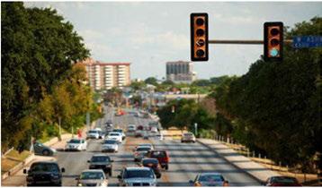
usedtoprioritizeconnectivity over increasing capacity and improving multimodal streetdesign. As additionalrail-supportivelanduses developinthefuture, particularly inareasdesignatedasmajor centers, theCity of Irvingshould prioritizeimprovedtransit, bicycle, andpedestrianconnectivity to rail stationstoreducereliance onsingle-occupancy vehicles. Inaddition, themoreintense employmentandactivity areas shouldbecomplementedwith streetdesignelementsthatpromote theuseoftheCity of Irving's multimodalinvestments. These designelementsmay include enhancedtransitstops, bicycle parkingandpedestrianlighting. By recognizingthecritical link betweenlanduseandthe transportationsystemthatservesit, citiescanbettercreatemultimodal solutionstolocaltravelproblems. It alsoprovidestheCity of Irving an opportunitytoenhanceeconomic developmentby usingflexible streetdesignasaplacemaking tool. Streetsareoneofthemost fundamentalsharedpublicspaces, butareoftenoverlookedasareas forinvestmentwhencreating livableenvironmentsforpeople andeconomicactivity. Streetsare oftenseenassimply spacesfor cars, parkingandmovementof goods. Butwhenthethoroughfare planningprocessfully recognizes
theuniquequalitiesofexisting andplannedlanduses, the transportationrealmcanbe transformedintoattractivepublic andprivateplacesthatarevibrant andlively, andwherepeoplehavea choiceinhowtogetaround.
Formany, thecarwillremainthe only viableformoftransportation, butresourcesmustbeallocatedfor transitservicetoservethecurrent transportationneedsoftheregion's diversepopulation, aswellasto respondtoshiftingdemographics andgenerationalpriorities. There aremany peoplewhocannot, or whodonotwanttouseacarevery day. Theyoungersegmentofthe population (oftenidentifiedas Millennials) isincreasingly seeking safeandefficientalternativesto driving, whilethe growing retired

Transportation andelderly populationmay also needtransportationalternatives.
Effectivetransitservicecanhave a significant impacttoindividuals financially. Whenconsidering thecostoffuel, maintenance, andinsurance, thecostofcar ownershipcanbeexpensive. Becauseofshiftingfinancial priorities, trendsindicatethat Millennialsarelesslikely toget driver's licenses, tendtotake shorter andfewertripsby vehicle, andarelesslikely to purchaseacar atall. Inaddition, many households cannotaffordtoownavehicle, orinsomecases, mustcutback onotherbasicnecessitiessuchas housingandhealthcare, simply becausetheirdailytravelpatterns requirethemtoownacar.
A robust public transitsystem providesaproductiveandequitable alternativetoacar-dependent transportationnetwork. Compared
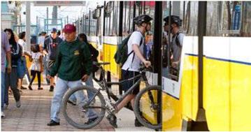


becomeanattractiveinvestment choiceduetothelowerupfront implementationcostcomparedto otherhighcapacity transitmodes. However,greatservicealonedoes notcreatesustainableridership. Successofthesetransitinvestments islargely dependentonthe relationshiptothesurrounding landuse. Highcapacity transit shouldbeconsideredinareaswith higheremploymentorresidential activity, diverseuses, and pedestrian-orienteddesign.
For Irvingtoaccommodate newgrowthandsuccessfully transitiontripsontoalternative modes, futuretransitservice shouldfocusoncreatinghighcapacity crosstownroutesand improvedinternalconnectionsto existingandplannedrailstations. Currently, Irving's highesttransit ridershipoccursonsomeofthe crosstownandrailfeederroutes, particularly theroutesthatconnect tothedowntownIrving/Heritage Crossing Stationandthe Irving ConventionCenter Station. These routesusewelldevelopedprincipal andmajorarterialssuchasBelt LineRoad, MacArthur Boulevard, IrvingBoulevard, and Northwest Highway. Additionalenhancements totheseexistingrouteswould havethepotentialtoincrease ridership, stimulatenewtransit-
Figure 36: Average Daily Ridership
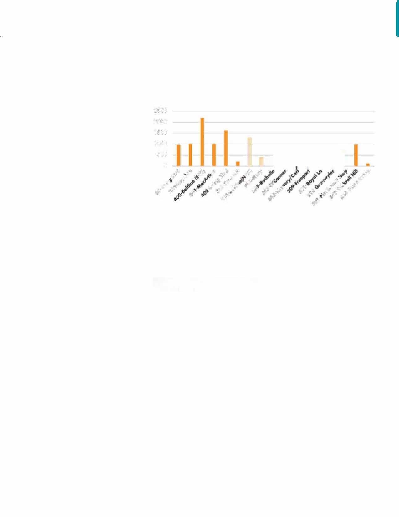

Source: Automatic Passenger Count (APC) data collected Morch - October 2014 and manual survey counts on SmortBuses. orienteddevelopment. andreduce overalltrafficcongestiononthese corridors.
Busrapidtransitisarelatively new typeoftransitservice, withthe goaloftakingthe flexibility and cost-effectiveness oftraditionalbus service, andcombiningthequality ofservicefoundonadedicatedrail transitline. Avariety oftechniques havebeenidentifiedtomakethis type ofbusservicefaster, more reliable, andattractivetoavariety ofpotentialriders. Strategies includetheuseof bus-only lanes,
transitsignalpriority systems, highercapacity busvehicles, stops spacedatleastone-halfmileapart. andfrequentservice (headwaysof 15minutesorless). Stationareas alsocanbedesignedsimilartorail transitplatformswithconvenient farecollection, moreshelter, bus waittime technology, andlevel boarding withbusdoors.
Enhancedbusrouteservicethat focusesonfrequency butdoesnot operateindedicatedbuslanesor incorporatethetypicalpassenger amenitiesof BRTiscalledrapid bus. Thisservicecanbeafirststage ofdevelopmentwhenfundingis
Transportation limited, orasanalternativewhen BRTisintroducedinphases. In thesecases, routefrequencyis commonlyachievedthroughsignal preemptionatintersections.
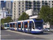
Whilelightrailhasbeenthe preferredrailmodeofchoicein manycities,streetcarshavebecome anattractiveoptionforusein urbanized areasduetoitslower implementationcostandabilityto operateinmixedtraffic. Streetcars areslowerandlower-capacitythan othertypesofrail, andtherefore arebestsuitedasshort-tripurban circulators, andareidealinplaces whereall-daystreetlifeandactive publicspacesareapriority. One ofthesignificantadvantagesis itsabilitytostimulateeconomic developmentandattractriders. Streetcarlinesarehighlyvisible andhaveeasilyunderstoodroutes, makingthemawelcometravel choiceinwalkableareas.
Acity'sactivetransportation networkisintendedtoprovide transportationalternativesand recreationalopportunitiesforall agesandabilities. Theinstallation ofbicycleandpedestrianfacilities canbethemostvisibleelementof acity'smultimodaltransportation program. Itshowsthecommunity isawelcomingplacefornonmotorizedtripchoicesandsupports thesafeuseofstreetsbyallroad users.
Theuseof bicycles, sidewalksand trailsisatransportationchoicethat benefitspersonalhealth, reduces trafficcongestion, andenhances qualityoflife. Interestinbicycling forcommutingorrecreationis increasing, butmanynoviceriders donotfeel comfortable riding

on-streetwithtraffic. Concerns aboutsafety, barriers, andlackof infrastructureoftenleadtotheuse ofcarsformanyshort trips. The implementationofincreasedbicycle andpedestrianfacilitychoices addressessafety, andalsoenhances long-termcommunitylivability, createswelcomingstreetsand neighborhoods, andstrengthens localeconomiccompetitiveness.
Bicyclingcanimprovequalityof lifebyincreasingopportunities forsocialinteractionwithinthe community.Anactivebicycling populationisoftenconsidereda measureoflivabilityforacity. Providingenhancedbicyclefacility designallowsresidentstostay connectedtotheircommunity,and integratingbicyclefacilitiesinto existingstreetscanhaveapositive effectonattractingbusinessand
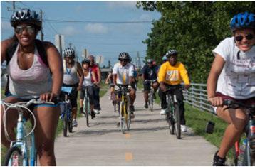

maintainingpropertyvalues. Addingbikeracksonpublictransit providesmultimodalopportunities aswell.
Irving'sactivetransportation systemhasmadesignificant progressincreatinganextensive off-streettrailnetwork with CampionTrailsandotherexisting andplannedfacilities. Moving forward, theCityof Irvingshould focusmoreresourcesondeveloping itson-streetbikewaysystemto betterconnectneighborhoodsto recreational facilities, economic activitycentersandtransitstations. Irvingshouldrecognizethatits communityincludesbicycleriders ofallskilllevels, andmorepeople willbeencouragedtorideifstreets aredesignedtoprotectridersand makecyclingenjoyable. Avariety ofinnovativefacilitiesmaybe considered, andgiventheunique characteristicsofeachroadway, the mostappropriatefacilityshouldbe selectedbasedonadjacentlanduse context,roadwaycharacteristics, andexistingorexpectedtypesof bicycleuse.
Withthemajorityofthebicycle infrastructurelocatedontheeast sideofthecityalongtheTrinity River, accesstothetrailsislimited toasmallportionofthepopulation. Other neighborhoods withinIrving needtouseanautomobileortransit toaccessthetrailsystemonthe
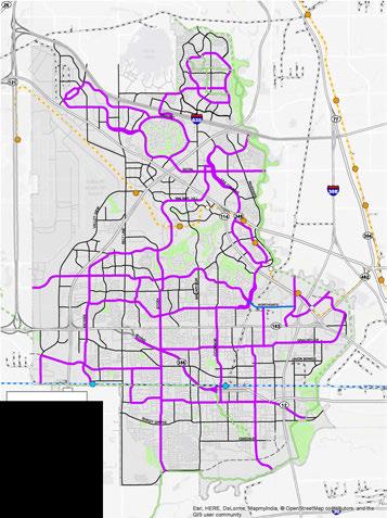
Thismapshowspotentialbikeroutes. AfutureBikeFacilityPlanisneededtodeterminethe typesoffacilitiesthatwillbe appropriate on designated streets.
eastside. Additionaleast-westand north-southbicycleconnections needtobeconsideredinthefuture toprovidemoreaccessforthose whochoosetowalk orbiketogetto theirdestinationsortoenjoyleisure activity.

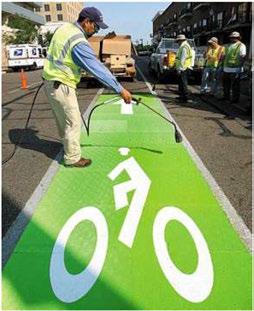
Bikelanesarededicatedtravellanesthatcarry bicycle trafficinthesamedirectionasadjacentmotor vehicle traffic. Bikelanesareprovidedfortheexclusiveor preferentialuseof bicyclistsonaroadway andare identifiedthroughsignage, striping, orother pavement markings. Theselanesallowbicycliststorideat comfortablespeeds and encourageapositionwithin theroadwaywheretheyaremorelikelytobeseen bymotorists. Bikelanesshouldbedesignedtobe5 to 6feetwide, typically ontherightsideofthestreet, between theoutsidetravellaneandcurb, parking lane, orroadedge. Asecond bufferstripemaybeinstalledto provide additional space between bicyclists andtravel or parking lanes.
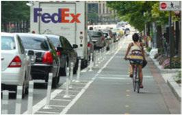
Protectedbikelanes, commonlyknownascycletracks, are bicyclefacilitiesthatarephysicallyseparatedfrom adjacentmotor vehicletravel. Typicalon-streetcycle tracksaredesignedsimilartobikelaneswithone-way travel, andmay bedesignedwithavarietyofmaterials forphysicalprotection. Theseon-street, one-waycycle tracksprovidegreatercomfortthan buffered bikelanes duetotheadditionofaphysicalseparationinthebuffer area.
Raisedcycletracksareone-wayfacilitiesthatare vertically separatedfromtheroadway, locatedator nearsidewalk-level. Cycle tracks mayalsobedesigned astwo-wayfacilitiestoallowbicyclemovementin both directionsalongonesideofaroadway. Protected bike lanesarerecommendedonmajorarterialswithhigh travelspeeds, hightraffic volumes, andmultiplelanes. Conventionalbikelaneswithoutprotectiononthese typesofroadwayscanbestressfulforlessconfident riders.

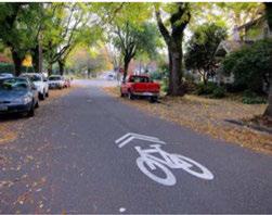
Certainroadsmay bemoredesirableforusedueto lowtrafficspeedsandvolumes,anddonotnecessitate aseparatedbikefacility. Theseroadwayscanbe designatedassharedlanebikerouteswithroute signageandpavementmarkingstodesignateshared useofthetravellanes. Sharedlanesarepreferable onstreetswithlowtrafficvolumes (lessthan3,000 averagedaily vehicletrips)andlowtravelspeeds (less than30mph). Occasionally,sharedlanesarenecessary tofillagapinthenetwork ortransitionbetweenbike facilities.
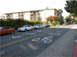
Streetsthathavelowtrafficvolumesandspeeds, particularlyinresidentialareas,may bedesignatedas bicycle boulevards. Thesestreetscanbeenhancedwith certain designelementstoencourage bicycleuseand discourageexcessivethroughtripsbymotorvehicles. Measurestoreducespeedsandmanagetrafficvolumes, commonly knownastrafficcalming,includesuch featuresmedianislands,minitrafficcircles,andcurb bulb-outs. Thesemethodscausedriverstomaintain lowertravelspeedsinresponsetovisuallynarrower roadwaysoraneedtonavigatearoundcurvingtravel lanes.
Transportation Transportation Goals, Strategies+Actions
Goal 1: Integrate land use and transportation.

Strategy 1.1
Develop a context-sensitive approach to street design and transportation infrastructure.
1.1.1 Updateandimplementacontext-sensitive Thoroughfare PlancompatiblewiththeCity of Irving'sComprehensivePlanandFuture Land Use Plan.
1.1.2 Develop flexiblestreetdesignrequirements thatarecompatiblewithsurrounding developmentcharacter.
Strategy 1.2
Support the connectivity of the City of Irving's land use mix to reduce trip length and minimize the need for motor vehicle trips.
1.2.1 Increasedproximity ofdifferentlandusesand creationofcompactdevelopmentpatterns allowformorecost-effectivewaystoreduce tripdistancesandtheneedtouseamotor vehicle. Transportationdecisionsshould supportredevelopingareasby providing betterstreetconnectivity, convenientsidewalk connections, andimprovedmultimodal options.
1.2.2 Work withDARTtoimproveconnections betweenschoolsandcollegesalongMacArthur Boulevardtoprovideeasieracesstoeducation andjobopportunities.
Goal 2: Improve multimodal transportation connections.

Strategy 2.1
Support the enhancement of safe, reliable, frequent, and efficient transit service.
2.1.1
2.1.2
2.1.3
Encouragetheimplementationofhigh capacity orhigherfrequency transitservice alongpriority transitcorridors.
Improvetransitlinksbetweenrailstationsand nearby activity centers.
Improvetransitquality ofservice, convenience, andcomforttoincreaseridership fortransit-dependentridersandchoiceriders.
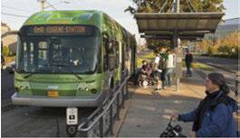
Strategy 2.2
Improve pedestrian connectivity and access to jobs, shopping, recreation and transit.
2.2.1
2.2.2
2.2.3
Encouragedevelopmentofmixed-useactivity centersthatsupportpedestrianactivity.
Inwalkableactivity centers, promotebuilding designsorientedtowardsidewalksratherthan parkinglots. Minimizetheamountof parking betweenbuildingfrontsandstreets.
Makestreetsattractiveandcomfortablefor pedestrians.Adoptlighting, streettrees, and parkingstandardsappropriateforwalkable areas.
2.2.4
Developstreetdesigncross-sectionsthat considerpedestrianneedsindifferentlanduse contexts.

Transportation Strategy 2.3
Develop a citywide active transportation network of on-street and off-street bicycle facilities.
2.3.1 Developandimplementa citywide Bicycle Master Plan.
2.3.2 Promotebicyclefacilitiesthat connect neighborhoods toexistingandplannedparks, schools, trails, recreationareas, transitstations, andmajoractivitycenters.
2.3.3 Encouragesafeand comfortable bicyclefacility designthat attracts avarietyofridersand minimizesconflictswithmotorvehicles.
• Prioritizetheretrofitof bicyclelanesand shared-usepathsonexistingcorridorswith excesscapacityorright-of-way.
• Developandpromotea bicyclesafety educationprogram.
• Identifyappropriatelocationsfor bicycle facilitiesinthe Bicycle Master Plan.
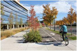
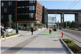

Strategy 3.1
Prioritize strategic investments to increase the capacity of the existing roadway system.
3.1.1
3.1.2
Useaccessmanagementbestpracticesto maximizeroadwaycapacityandsafety includingcross-accessbetweendevelopment sites, drivewayconsolidation,and appropriatelyspacedmedianopenings.
Useadvancedsignaltimingandintelligent transportationsystemsstrategiestoimprove theefficiencyofexistingcorridors.
Strategy 3.2
Better integrate multimodal transportation options to shift travel demand from automobiles to other travel modes, and reduce vehicle trip demand on existing streets.
3.2.1
3.1.3
Usetraveldemandmanagementstrategies toreducecommutingbyvehicleandshift dailycommutestoothermodes. Encourage majoremployerstoimplementprogramsthat promotecarpoolingandtelecommuting, and provideincentivessuchasreducedparking requirements.
3.1.4 Exploreuseof alternativeroutestorelieve trafficonoverburdenedcorridors.
3.2.2
Emphasizetheinterconnectivityofeachtravel modenetworktoimprovetheefficiencyof multimodaltrips.
Promote adevelopment pattern with complementary streetdesignthatmakes transit, bicycling, andwalking convenient transportation choices.

Transportation Strategy 3.3
Support the transport of goods through Irving, maintain connectivity to industrial areas, and prioritize a system of direct routes for truck traffic.
3.3.1 Continuetodesignateatruck priority route network usingstatehighwaystoaccommodate truckswithinandthrough Irving, and topreserveandimprovecommercial transportationmobility andaccess.
3.3.2 Providemultimodaltransportationoptionson thepriority freightnetwork andinindustrial areastoconnectworkersto manufacturing/ industrial employment centers.
3.3.3 Supportefficientandsafemovementofgoods by railwhereappropriate. Maintainthesafety andoperationalconditionsforfreightrail transportatrailcrossingswithincity streets.
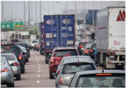

Strategy 4.1
Enhance street design on priority corridors to address safety issues for all transportation modes.
4.1.1 Examinethefeasibilityofincreasingthe comfortlevelof bicyclefacilities, particularly onstreetswithhigherspeedsandvolumesto improvesafetyandincreaseridership.
4.1.2 Inresidentialandwalkableareas, integrate traffic-calmingpracticesintostreetdesignto increase pedestrian safetyandcomfort.
4.1.3 Maintainandenforcestatehighwaytruck routedesignationstoprovidesafeanddirect accesstoindustrialandheavycommercial employmentareas.
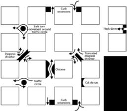
Examplesoftraffic-calmingmethods(Source:U.S.FederalHighway Administration)
Goal

Strategy 5.1
Use multimodal street design as a placemaking tool that supports economic vitality and promotes livable communities.
5.1.1 Usewalkablestreetdesign, enhancedtransit service, trafficcalming, andstreetscapingas toolstodevelopdesirable placesandstimulate economicactivity.
5.1.2 Promoteattractivepublicspacesand pedestrianamenitieswithinthestreetrightof-way.
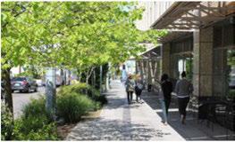
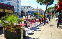

Strategy 6.1
Work in partnership with surrounding communities and regional government agencies to support the region's mobility goals, transportation system sustainability, and quality of life.
6.1.1 Coordinate local projects with regional initiatives to support a well-connected and efficientregional transportation network.

North CentralTexasCouncilofGovernmentsis developingthenextlong-termtransportation planfortheDallas-FortWortharea. Mobility 2040isexpectedtoapprovethenew
MetropolitanTransportation Planby Spring 2016

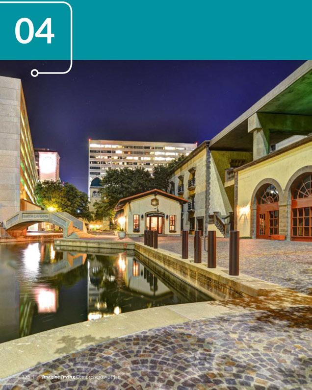

Strategic investment in infrastructure produces a foundation for long-term growth.
~ Roger McNamee
Utilitiesandinfrastructureareacriticalfoundation forthefunctionofacity, andcanincludewater, wastewater, andstormdrainagesystems. Thelocation, condition, andaccessibility ofthesefeaturescan greatly affectdaily operations, constructiontimelines, andfunding capabilities. Understandingthesystem's existingconditionsisessentialtoplanningforfuture development. Ingeneral, newdevelopmentrequires expansion, rehabilitation, andongoingmaintenance ofacity'sinfrastructure. Thissectionprovidesan overviewoftheCity of Irving'sexistinginfrastructure andrecommendationstosupportthe Imagine Irving Plan.

» Aging infrastructure is updated, including drainage, water and sewer lines, roads, sidewalks, intersections, and neighborhood lighting, ensuring quality service to existing users and capacity for future growth.
» Irving implements sustainable policies and promotes development that reduces vehicle miles traveled, and water and energy consumption-contributing to cleaner air and water, and the preservation of natural resources.

MuchoftheCity of Irving'swatersupply originatesin JimChapmanLake, where Irvingownswaterrightsto approximately 37percentofthetotalvolume.Water isconveyedfromJimChapman LaketoLewisville Lakethroughasharedtransmissionlineandpump stationwiththe NorthTexasMunicipalWaterDistrict. TheCity ofDallasprovideswatertreatmentforthe City ofIrvingJimChapman Lakewatersupply.Asa supplementtotheJimChapmanLakewatersupply, theCity ofIrvingalsopurchaseswaterdirectly fromtheCity ofDallas, whichpullssurfacewater fromLake Ray Roberts, Lewisville Lake, Grapevine Lake, LakeRay Hubbard, LakeTawakoniandLake Fork.JimChapmanLakesuppliesapproximately 85 percentoftheCity ofIrving'swaterusage, whilethe remaining15percentisboughtwholesalefromthe City ofDallas. TheCity ofIrving'stotalavailablewater supply, consideringcurrentagreementswiththeCity ofDallas, is46milliongallonsperday (MGD) onan averagedaybasis,and69.7MGDonamaximumday basis.
Oncethewaterhasbeentreatedby theCity ofDallas, itentersadistributionsystemcomprisedofthe following:
• Morethan700milesofwatermains (4"upto66")
• Threepressure zones
• Fourpumpstationsforthedistributionsystem
• Distributiontotalpumpingcapacity = 220 MGD
• Eightelevatedstoragetanks (15.5milliongallons)
• RoyalRidgeElevatedTankiscurrently under constructionandwilladdonemilliongallons ofadditionalstorage.
• 10groundstoragetanks (52milliongallons)
• Constructionofanadditional5milliongallon groundstoragetankatthe NorthgatePump Stationisplannedtobeginin FY2018.
• Averagedaily waterusage -36MGD
WithperiodicseveredroughtsthroughoutTexas, many municipalitieshavebegunexploringmethods ofalternativewatersupply.Amongthese, waterreuse hasbeenapopulartopic. Waterreuseistheprocessof usingtreatedwastewaterforabeneficialpurpose, such asirrigationorevendrinkingwater.WhiletheCity of Irvingcouldpurchaseadditionalwatersupply from theCity ofDallastosupportfuturegrowth, theCity of Irvinghasbegunplanningtousereusewaterforlongrangesupply needs.TheCity ofIrvingalsoisfocusing onwaterconservationeducationtoreducefuture

watersupply needs.Similartomany municipalities inthe Metroplex, theCity of Irvingisdealing with aging waterinfrastructure. Castironandfibercement pipelinesinstalledduringthe City of Irving'soriginal expansionarereachingtheendoftheirdesignlife andareinneedofreplacement.TheCity of Irvinghas areplacementsprogramthatidentifiesthepipesin thesysteminneedofreplacementfirst. Adequately fundingreplacementprojectsisacontinualchallenge tomeettheneedsof thesystem.

TheCity of Irvingisexpandingitswatersystem capacity by constructinganewelevatedwaterstorage tankinthenorthwestcornerofthecity. Experiencing recentsuccessin waterconservationefforts, the City of Irvingisconfidentthatplannedsystem improvementsandfocusingadditionalfundingfor thereplacementprogramwillallow Irving'sdrinking watersystemtomeetthe City'santicipatedfuture needs.
convey all wastewatertoTrinity RiverAuthority's (TRA) CentralRegionalWastewaterSystemtreatment plantlocatedinGrand Prairie.Wastewaterin Irving generally flowseasttosoutheasttowardthe Elm Fork of theTrinityRiver, orsouthtosoutheasttowardthe West ForkoftheTrinityRiver.Thewastewaterthen flowsintoTRA'slines, whichtransports flowtothe treatmentplant.
The City of Irving'swastewatersystemcontainsthe following:
• Nearly 700milesof pipeline (6"to54")
• 12drainagebasins
• Nineliftstations; UrbanCenterliftstationis currently underdesign
• Producesanaverageflowof 24 MGD
Thiswastewaterproductionisconsideredtobe comparablewithotherareamunicipalities.
Thisplanhasidentifiedpotentialareasof growth around Irving. Whiletheseareasarecurrently being served by theexisting wastewatersystem, further studiesarenecessary todetermineiftherewill be sufficientcapacity toservefuturedevelopments. The City of Irvingisworkingonacomprehensive masterplanupdateforitswastewatersystem. This willexamineexistingsystemcondition, andidentify capacity andreplacementneedsforthefuture.
Approximately 45percentoftheCity of Irving's wastewatermainsaremorethan45yearsoldorolder, indicating aneedforrehabilitation projects inthe nearfuture. Withthepotentialupsizingof City of Irving pipelines alsocomesthe potential needtoupsize TRA facilities downstream. Itis important for both entitiesto monitor theirsystem's performance and
TheCity of Irving'swastewatersystemis builtto Infrastructure

Infrastructure communicatepotentialproblems.
InMarch 2007, theCity ofIrvingbeganitsSanitary SewerOverflow (SSO)Initiative. TheSSOInitiative isaprogramthataimstoreducedischargesfromthe collectionsystemtolimitimpactstothepopulationand environment. TheSSOInitiativeincludesafocuson routinemaintenance,reducinginflowandinfiltration, increasingpipelinecapacity, andreplacingpipesin poorcondition.
TheCity ofIrving'sdrainagesystemgenerally flowsto tributaries, creeksandbranchesthateventuallyempty toeithertheWestForkortheElmForkoftheTrinity River.Therearefour floodcontroldistrictsoperating intheCity of Irvingincluding:
• Irving Flood ControlDistrictSectionIII (IFCDIII) forValley Ranch
• DallasCounty Utility andReclamationDistrict (DCURD)forthe LasColinasUrbanCenter
• Irving Flood ControlDistrictSectionI (IFCDI)for theCentury Center
• DallasCounty FloodControlDistrict#1 (DCFCD #1)along BearCreek
• Thesefloodcontroldistrictscontainleveesalong GrapevineCreek, theElmForkoftheTrinityRiver, BearCreekandHackberry Creektohelpprotect portionsofnorth, eastandsouthwestIrvingfrom a100-year floodevent.
TheMunicipalDrainageUtility (MDU)isfundedby a drainage fee assessed toall developedproperties
intheCity ofIrving. Thisfeeprovidesfundingfor activitiesassociated withstormdrainageandIrving's StormWaterPermitrequiredtotheEPAandTexas CommissionforEnvironmentalQuality (TCEQ).These activitiesinclude:
• Analyzingdrainageproblemareas.
• Recommendingandmanagingdrainage improvementprojects.
• Partnering withthevariousfloodcontroldistricts fordredging.
• Waterpollutionprevention.
• Wetweathermonitoringandtesting.
• Erosioncontrolandenforcementonconstruction activities.
• Collectionandremovalofdebrisandfloatables throughcomprehensivestreetsweeping operationstoprevententry intothedrainage system withstormwater.
• RepresentingtheCity ofIrvinginregional stormwatermanagementeffortsinconjunction withthe NorthCentralTexasCouncilof Governments, stateandfederalstormwater communitiesandtaskforces.
IrvingcontributesMDUfundingannually tothefour floodcontroldistrictsforerosioncontrolprojects, maintenanceoftheirfacilities, dredging, and water quality enhancements. Thefourfloodcontrol districtsareinstrumentalinhelpingIrvingmeetthe annualBestManagementPracticesandreporting requirementsoftheTCEQStormWaterPermit.
Inaddition, theMDUprovidesfundingforsmall neighborhooddrainageprojects. MDUfundshave paidfor20smalllocalizeddrainage projectstotaling
$2.9 millionduringthepastfiveyears.These improvementsincludeinstallationofadditionalcurb inletsalongstreets, areadrainsforlowareas, and upsizingsmallerdrainagepipestoprovideadditional drainagecapacity.
Irving hasbeen working alongtheWestIrvingCreek DrainageWatershedtoinstalltrashinterceptorsto helpcaptureandremovedebrisandfloatabletrash beforeitreachestheTrinityRiverBasin.Thesetrash interceptorsincludecurbinletscreensandbaskets, smallinlinetrashcollectorbaskets, floatingtrash booms, andlargerinlinetrashinterceptors.Theinitial resultshaveproventobesuccessfulincontrollinga portionofthedebrisandfloatingtrash.Thesetrash interceptordeviceswerefundedthroughthe MDU Fund.
Forthepurposeofexplainingthecurrentstateof thedrainagesystem, Irvingcanbedividedintotwo
generalareas: northof NorthgateDriveandsouthof NorthgateDrive.
North of Northgate Drive:
• Moststreetsaredesignedfora25-yearstorm event.

• Allchannelsnorthof NorthgateDrivedraininto theElmFork oftheTrinityRiver.
• IFCDIII, DCURDandIFCDIassistwiththestorm waterqualityfortributariesthatdrainintothe ElmFork.
• Newerandrebuiltstreets(20percentoftotal) are designedfora25-yearstormevent. Streetsolder than40yearsaredesignedfora5-to10-year stormevent.
• Only15percentofFEMAstudiedchannelsare designedfora100-yearstormevent.Therestof thechannelsaredesignedfora5-to10-yearstorm event.
• Mostchannelssouthof NorthgateDrivedraininto theWestFork oftheTrinityRiver.
• DCFCD#1providesassistancefor BearCreek WaterQuality, whichdrainsintheWestFork of theTrinityRiver.
ThenorthernhalfoftheCityofIrvingcontainsnewer development.Assuch, thedrainageinfrastructureis betterpreparedtohandlemajorstormevents. Recent record-settingeventsin May 2015emphasizedthe needforimprovementstoallportionsofthecity. Theseimprovementsincludebringingthestreets uptoa25-yeardesignandthechannelsupto50-to 100-yeardesign, which willrequireaconsiderable amountof funding. Irving hasaportion ofthe fundingrequiredforallvariousdrainageimprovement needs.Completingacitywidedrainageassessment andadoptingadrainagemasterplanwouldhelp
• Mostdrainagechannelsaredesignedfora50-to Infrastructure 100-yearstormevent.

pinpointexistingproblemswithin thesystem, andprioritize aplan forfuturegrowthidentifiedinthis comprehensiveplan.
Irvinghasbegunworkonthefirst significantdrainage improvements inthe Delaware Creek Drainage Basin. Thisworkisrequiredto handletheincreasedstormwater runoffcreatedthroughthe MidtownExpressProjectworking on State Highway183. Thefirst phaseofworkisalongthe Embassy Channel, andwillincreasecapacity ofthechanneltoenableitto containthe100-yearfloodevent entirelywithinthechannel.Phase twoworkwillbegininlate 2016 alongtheBrockbankChannel. Phasesthreeandfourwillprovide improvementsalongupperand lowerDelaware Creek. Allphases oftheprojectare beginning construction orareunderdesign andwillbecompletedby2018. Theseimprovementsarebeing implementedonthesouthside of State Highway183, butthese deeperchannelssouthof State Highway183willallowforfuture drainageimprovementstothe DelawareCreekDrainage Basinon thenorthsideof State Highway 183. Theultimategoalof the drainagechannelprojectswillbe toremove residentialstructures alongthesecreeksfromthe 100year floodplainandprotectthe residentsfromfuture flooding.
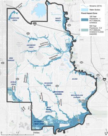
DelawareCreekDrainage Basin workwillultimatelyremovemore than500homesfromthe100-year floodplain.

Strategy 1.l
Improve the condition of the existing water system.
1.1.1
1.1.2 Identify locationswithaging infrastructure, leaks, lowpressureandpoor circulation.
Implementa Capital Improvements Planto addressaginginfrastructurereplacement.
Strategy 1.2
Investigate additional water supply options.
1.2.1 Pursuerecommendedoptionsinthecurrent "Long-RangeWater Supply Plan:'
1.2.2 Implementreusewaterprojecttosupplement futurewatersupplies.
Strategy 1.3
Investigate sources of additional funding.
1.3.1 Investigateandproposemethodsof securing adequate fundingforwater system improvements.
Strategy 1.4
Continue to educate the public on water conservation.
1.4.1 Continuetousecity resourcestoencourage conservation ofwaterresources.
Infrastructure
Goals, Strategies + Actions
Goal 2: Collect wastewater in an efficient, reliable, sustainable and environmentally sound manner.
Strategy 2.1
Improve the condition of the existing wastewater system.
2.1.1
2.1.2 Continueto implementandsearchfor waysto reducedischargesfromthecollectionsystem. Identify locations withaginginfrastructure, leaks, andcapacity issues, andimplementa Capital Improvements Plantoaddressthese issues.
Strategy 2.2
Update the comprehensive wastewater master plan.
2.2.1 Updatetheexisting 2009 Wastewater StudyandMasterPlan to identify areasof improvementnecessary tosupportthe City of Irving's vision.

Strategy 2.3
Investigate sources of additional funding.
2.3.1 Investigateandproposemethodsofsecuring adequatefundingfor wastewatersystem improvements.
Strategy 2.4
Continue coordinating with TRA on projected increases in the City of Irving's wastewater production and capacity needs in TRA's collection system.
2.4.1 Scheduleas-neededmeetingswithTRA to discuss recentand projected flowdata, andto worktogethertosolvecapacity issues.
Goal 3: Reduce the risk of flooding to existing and future structures.

Strategy3.1
Improve the condition and capacity of the existing system.
3.1.1
3.1.2
Completedrainagesystemassessmentsfor eachindividualdrainagebasinto identify problemareas.
DevelopacomprehensiveDrainageMaster Plantoaddresstheproblemareasidentified in thedrainagesystemassessments.
Strategy3.2
Investigate sources of additional funding.
3.2.1
3.2.2
Investigateandproposemethodsof securing adequatefundingfordrainagesystem improvements.
Asgrowthoccurs, evaluatetheMDUdrainage feeratetodetermineif anincreaseisneeded.
Strategy3.3
Continue interdepartmental coordination within the City of Irving.
3.3.1
Schedulemeetingswiththe CIP, Water Utilities, and Transportation departments to planroadway improvements basedonthe necessity of replacementforallutilitieswithin theright-of-way.
Strategy3.4
Focus on minimizing the impact of new developments on the City of Irving's existing infrastructure.
3.4.1
3.4.2
3.4.3
Reviewandupdatethe City of Irving'scurrent developmentregulations.
Managestormwaterrunofffromfutureairport development.
Referenceandimplementintegrated Stormwater Management (iSWM) policiesin improvingthe City of Irving'sstormwater managementprogram.

"Everybody needs beauty as well as bread-places to play in and pray in-where nature may heal and give strength to body and soul alike.
~ John Muir
Movingforward, Irving'sfuturegrowthand redevelopmentopportunitiespresentavariety of challengesinmakingprovisionsformoreparksand openspaceinthecity. Survey resultsfromparticipants atImagineIrvingpublicmeetingsareconsistent withthefindingsof Irving's2014ResidentSurvey whereinfrastructure, economicdevelopment,and corridorenhancementprioritiesarerankedslightly higherthanparksandrecreationalfacility priorities. However,residentsappeartodesiremoreaccessto parksandopenspaceintheircommunitiesduringthe next 25 years. Throughthe Imagine Irvingprocess, community membersexpressedaninterestinquality oflifeconsiderations,aswellaseasy accesstoIrving's amenitiesthroughoutthecity. Participantsexpresseda desireto:

» Irving maintains its existing parks, pools and trails, and provides new recreational facilities.
» Parks and open spaces are easily accessible to Irving residents in every neighborhood.
Parks, Trails + Open Space

• Createaparks,openspace, pedestrianand bike-friendly environmentthatworksforall neighborhoodsinIrving. Thisincludesproviding moreparks, bikeinfrastructure, widersidewalks, improvedstreetscapes, betterpedestrianand bikeconnectivity,andaccesstoamenitiesand destinationsinIrving. Developurbangardensto servethepublicandpromotehealthylifestyles.
• Preserveexistingnaturalareasandencouragemore parksandopenspaces. Providebetteraccessand connectivitytoCampionTrailsandothernatural areasalongtheTrinity River.
• Maintainthe quality of current parksandrecreation servicesthatarecurrentlyavailable.
• Makeparkfacilitiesflexibletorespondtochanging demographictrendswithoutadverselyaffecting existingfacilities, andstriveforthesamelevelof quality across Irving.
Thischapter willhighlighttheexistingparkinventory andcondition, andprovideanassessmentoffuture parkneedsbasedonIrving'sprojectedgrowth. The informationwillhelpprovideabaselinethatmaybe usedtoupdatethe2000ParksandOpenSpaceMaster Planthrougharobustpublicinputprocess.
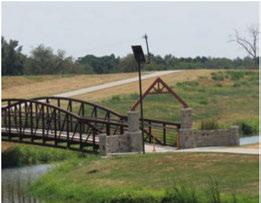
Irvingresidentsvalueparklandasakey quality oflife componentforrecreation, leisureandbeautification. Opportunitiestoexpandthissysteminclude:
• Createanew Parks, Open Space, andTrail Master Plan.
• Ensurethehighestlevelofmaintenanceofexisting parksandopenspacefacilities.
• Creativelyworktowardagoalof 10acresofparks andopenspaceper1,000residents.
• Expandfundingoptionstomeetresidentdemands.
• Increasetheallocationoflandscapingfor infrastructureimprovements.
• Implementadditionalsustainablepractices.
• Coordinateparkandopenspacewithfloodplain managementneeds.
• Pursueplanstobuildastate-of-theartrecreation center.
• Improveconnectivitybetweenparksandopen spaces.
• Completeremaininglandacquisitionand constructionforCampionTrailswithinthenextfive years.
• Reprograminefficientfacilitiestomeetchanging demands.
Irving'strailsystemalsooffersmanyopportunities forenhancementincludingestablishingnewlinks betweencenters, corridors,and neighborhoods by usingthecity'snetworkoftrails,greenwaysandopen spaces.TheCityof Irvingalsohasplanstocomplete additionalsectionsofCampionTrailstoprovidea continuousroutethatconnectsallof Irvingandthe region.
The2000ParksandOpen Space Master Plan Updaterecommended25parkcapitalimprovement projectsacrosssevengeographicplanningdistricts tobecompletedwithina five-yearplanninghorizon (2005).Table2belowshowswhichparksandcapital improvementprojectsrecommendedinthe2000Parks andOpen Space MasterPlanUpdatewerecompleted
Table 2: 2000-2005 Completed Parks Capital Improvement Projects
Northwest Park Development
Senior Center Design and Development
Harrington Soccer Complex Development
Campion Troils (Keenan's Crossing Troil to IH 635 Extension
Campion Trails (Twin Wells to Trinity View Development
Lively Park Youth Activity Center Design and Development
Rose Meadow Park Neighborhood Park Development
Tim Markwood Park
Cimarron Park Aquatic Center Design and Development
Delaware Creek Park Site Development
Campion Trails Land Acquisition
Sam Houston Trails Development
West Park Aquatic Center and Design
Fritz/Victoria Park Community Park Development
Campion Trails Trinity View to River Hills
Tolal

by2005 ($23.4millionofthe$27.3millionwasspent onparkfacilitiesby2005)Theseprojectsincluded newparkdevelopment, designandconstruction ofaseniorcenter,anewsoccercomplex, multiple landacquisitionsforsegmentsofCampionTrails, designandconstructionofayouthactivitycenter, developmentimprovementstoneighborhoodand communityparks, andthedesignandconstructionof twoaquaticcenters.Approximately80percentofthe recommendedprojectswerecompletedby2008, while theother20percentwereeitherreprioritized, orare stillpending.


Since2006, theParksand RecreationDepartment andbeautificationprojects, parkequipmentupgrades, completedanadditional46capitalimprovementprojects andnewconstruction.Theseimprovements,shownin across Irvingincludingofa varietyoflargelandscaping Table3-4, totaled$37.7milliondollars.
Table 3: City of Irving's Completed Park Projects 2006-2014
Table 4: City of Irving's Completed Park Projects 2006-2014, cont'd.
Hospital District
cont'd

2015-2016

Nichols Park
SUB TOTAL
Town Lake Spillway Project
Lake Carolyn Promenade Phase II
Northgate Drive Median
West Library Grounds
SUB TOTAL Hunter Ferrell Landscape
Dorris Park
Mustang Tennis Courts
Northgate Drive Median
SUB TOTAL
Northwest Park Tennis Courts
Victoria Park Playground
Northgate Drive Corridor Monuments
Northgate Park Phase II
Lone Star Trail
O'Connor Greenspace
South Irving Library Grounds
SUB TOTAL
Trail SUB TOTAL
Sincethe2000ParksandOpenSpace Master Plan Update, thedevelopmentofnewparkprojectshasnot significantly addedacreagetotheCity ofIrving'stotal parkland. Challengesfacingtheestablishmentand programmingofnewparksincludechangingpublic interests, resultingintheneedtoevaluatetheuseof existingparks. WhiletheCity ofIrving maintains pocket parksthroughoutthecity, staffisevaluating whether moreactive recreation couldbeplacedintheseparks. The City ofIrvingalsoisfacedwiththeneedtoprovide
$150,000
$1,764,000 $195,000
$130,000 Northwest $111,000 North $50,000 Central
$486,000 $200,000 Northwest $500,000 Central $600,000 Northeast
$300,000 Northeast
$2,500,000 Southeast
$319,000 Central $90,000 Southeast
$4,509,000
$2,400,000 West
$6,909,000
$37,n3,ooo

adequateparkingateachsite, aswellasidentifying parksthatarelackingequipmentandotheramenities. Inaddition, partsofIrvingarelackinginthenumber andtypeofparkfacilities, andthereislittleornoland availabletoaddtotheparksystem. Toaddtothisissue, theCity ofIrving'sjoint-useagreementwithIrving IndependentSchoolDistrict (IrvingISO) forfacilities atLamar MiddleSchoolandSchulze Elementary has ended, reducingpublicaccesstothosesites.
Parks, Trails + Open Space

Determininghowtoacquireand programparklandinthefuture willrequiresubstantialpublicinput fromparkstaff,the IrvingParks Board,andthegeneralpublic. Boththe1996and2000Parks andOpenSpaceMaster Plansfor Irvingconductedin-depthpublic involvement,includingsurveys andacase-by-caseexamination ofallofthecity'sparkand recreationalfacilities.Theseplans alsodevelopedrecommendations andafive-yearbudget-constrained priorityactionplan,followedbya publicmeetingandpublichearings.
TheCity of Irvingownsand operatesmorethan75parksand beautificationareas, including 74 playgroundswithnearly 2,000 acresofdevelopedandundeveloped parkland, openspace,and associatedfacilities.The Parksand RecreationDepartment'sinventory includessixrecreationcenters, threeoutdoorneighborhoodpools, twoindooraquaticcenters,two seasonalfamilyaquaticcenters, andtwosplashparks. Inaddition, Irvingoperatesoneseniorcenter andoneyouthcenteronpark property,amunicipalgolfcourse, andapproximately33milesof existingandplannedhikeand biketrails. TheCity of Irvingalso providesnumerousballfields, picnicareas, cricketfields,discgolf,
askatepark,and fishing ponds. TheCity of Irvingcurrentlyhassix undevelopedparksinitsinventory.
TheCity of Irvingmaintains special-usefacilitiesaswell, includinganEnvironmental LearningCenter,HeritageCenter, andtheJayceeArtsCenter,and isresponsiblefortheupkeepof grounds at 23 municipal facilities, city-owned streetscapes,and beautificationareasacross Irving. Additionally,theCity of Irving offersbuildingsforrentatSenter East,theGardenArtsCenter, Jaycee Park,and Heritage Park.
Formany years, theCity of Irving hasengagedinlease,joint-useand inter-localagreementstoexpand theparksandrecreationinventory inacost-efficientmanner,and reducemaintenancecostswhere possible.TheCity of Irvingleases approximately 60acresofparkland atthreeparks (MountainCreek Preserve, Woodhaven Park, and Woodbridge Park),andnowhas joint-usefacilityagreements withthreeIrvingISDschoolsfor facilityandequipmentuse,and hasanotheragreementwith North LakeCollegetorenovateand managetheiraquaticcenterfor publicuse.
Cooperationwithvarious homeownerassociations (HOAs) haveaddedtotheparkland inventory,wheredevelopersor
HOAsagreetodedicateparkland totheCity of Irvingforpublic useofthelandandmaintainthe landscaping (turfgrass,trees, shrubs,irrigationsystem,etc.).The Parksand RecreationDepartment maintainsthehardscapesand amenities(sidewalks,lights, playgrounds,picnicpavilions, basketballcourts,parkbenches, picnictables,etc.)TheCity of Irvingcurrently hasinter-local agreementswithHOAsfor18 parks rangingfromone-halfacretofive acresinsize.
Approximately fivepercent of Irving'stotallandarea consistsofdevelopedparks, undevelopedparks, andassociated facilities (landscapedmedians, municipalbuildinggrounds, etc.)Atpresent, the Parksand RecreationDepartmentestimates approximately 90percentofits totalparksinventoryisdeveloped, meaningtheparkisopenforpublic use.
Areasconsidered "openspace"make upapproximately threepercent of Irving'slanduseandinclude undevelopablefloodplain,private easements,andotheropenspace asdeterminedbyappraisalrecords. Ofthethreepercentoftotalland usecurrently definedasopenspace, nearlyall (90percent)isownedand operatedby privateentitiesandis notaccessibletothepublic.
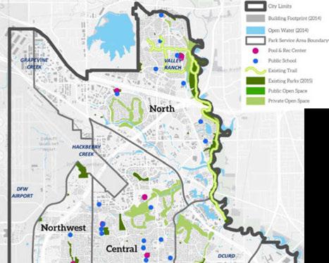
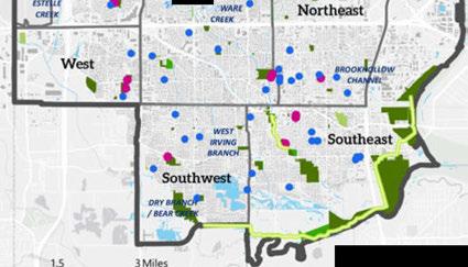

the community gave high marks with regard to the quality of Irving's existing parks and recreation facilities. Approximately 73 percent of residents are satisfied with parks (ranking them Excellent or Good). Irving scores high on the available miles of walking trails, but areas for improvement include maintenance, landscaping, and quality of parks and park facilities. Less than half of the survey respondents would be willing to pay additional taxes or fees for service priorities, therefore cooperation and innovation will be key to integrating parks and green space into Irving's future development.
The Parksand Recreation Departmenthasbeenoperating efficiently witha modest budget. Since2006, maintenancefunding increaseshavenotkeptpace withthecapitalimprovement investmentsandexistingparks andfacilitiesinventory (Figure 40). Additionally, themaintenance responsibilitieshave surpassed the capacity fortheexistingnumberof
fulltimeemployeesto manage. The Parks and RecreationDepartment recommendsadjustmentsto increaseannualmaintenancefunds relative totheexistingallocations. Figure41showsaclose-upofthe recommendedannual budget increases, whichproposethatan amountequalto1.5 percent of totalcapitalimprovements project valuebe added tothe Parksand Recreationmaintenance budget.


Figure 42: Deferred Maintenance Needs
Wood & Stone Repairs, $141 000
Fountains, $202,450

Total Needs: $8,785,828
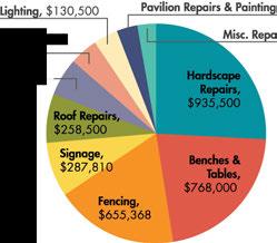
Theseadditionalfundswould coveradditionaloperationaland maintenance expensesgenerated byaddedresponsibilities.Thered lineshowninFigure41represents acumulative1.5percentincreasein theannualmaintenance budget.
ThenextParksandOpen Space MasterPlanshouldincludedetails thataddressthecurrentdeferred maintenanceneedsoffacilities, buildings, andequipment; facilitates preventativemaintenance schedulesforfacilities, buildings, andequipment; andincorporates futurestaffingneeds.Figure42 showsthe department's current deferredmaintenance needs. Thisestimateiscomprisedof costsassociatedwithparks infrastructurethatincludes playground, hardscape, lighting,
pavilionandroofrepairs, aswell aspedestrian/bicyclebridge, bench, waterfountainandsignage replacements.The$8.8million totalneeds figureincludesthe deferredmaintenance, playground replacementsrecommended inthenextfiveyears, andthe installationofcentralizedirrigation andlightingcontrolsystemsfor
Parks, Trail+ Open Space , $108,200 irs, $98,500
Source: City of Irving Parks and Recreation Department
operationalefficienciesandenergy conservation.
Since2006, thenumberofmanhoursrequiredtomaintainParks andRecreation Department facilitieshasincreased.
Parks, Trails + Open Space

The City of Irving's 2014-15 Strategic Plan includes a goal to "Enhance the quality of life for residents, visitors, and businesses through excellence in Irving's cultural, recreational, and educational environments."
The Parks and Recreation Department has made considerable progress toward this goal. A list of highlighted accomplishments includes:
» Increased programming for the aging and disabled.
» Established a Playground and Infrastructure Team to improve the assessment and repair of equipment.
» Developed a long-term aquatic facility plan.
» Developed a plan for the Twin Wells Municipal Golf Course and improving the golf course irrigation system.
» Completed the Lone Star Trail Connection.
» Current work on the Trinity Rail Express trail is under way.
The ParksandRecreationDepartmentrecommends amulti-facetedsolutiontoaddressstaffingneeds, increaseefficiency, andcomprehensively provide exceptionalservices. Someoftheseoperational improvementswouldassistwithsustainingthequality for Irving'sparksandotherfacilitiesmaintainedby the IrvingParksandRecreationDepartment.
• Increasethenumberofacreswheremowing andmaintenancecanbeoutsourced:including neighborhoodparks, remotelocationsandcity properties; allowingforthere-allocationofsome existingemployees.
• Explorestaffing opportunities forspecialized services: sectionchief-irrigation, crewleaderirrigation, urbanforester, aquaticsmechanic, groundskeeper-horticulture, andadministrative assistant.
• Developspecialtyteamsusingnewandre-allocated employeestostrengthenthedepartment'sforestry division, irrigationteam, aquaticsmaintenanceand administrativeservices.
Implementingthissolutionanddevelopingspecialty teamswouldallowthe department touseexisting talentmoreefficiently, createmobility andsuccession opportunities, andprovidecostsavingsbyemploying in-houseexpertisetomanageformerlyoutsourced projects. Thisapproachwasprovensuccessfulin FiscalYear2013-14, whenadditionalacresofmowing wereaddedtothemowingcontracts. Asaresult, managementwasabletore-allocateafewpositions; acoupletothenewlyformed Playgroundand Infrastructure Safety Divisionandoneto Irrigation Apprentice. Re-allocatingtheseresourcesresulted inimmediateimprovementsinsafety, aesthetics, responsivenessandservicesprovided.
TheParksandRecreation Department'sannual operatingbudgetofapproximately $33dollarsper resident,isamoderateamountforcitiesinthisregion withasimilarparkinventory,butitdoesnotprovide anadequatemaintenancebudgettoaddressthe currentinfrastructureneeds.Table5 describessomeof thedeferredmaintenancechallengescurrently facing theParksandRecreation Department.
Anadditionalchallengethe ParksandRecreation Departmentfacesisthelackof availablebond fundsfornewparksandopenspacedevelopment. Whileapproximately $44.1millioninbondfunds havebeenapprovedby Irvingvoters,useof Parks bondswaslimitedduetothelimiteddebtcapacity oftheCity. Thesearevaluabledollarsthatcouldbe usedforparksandopenspaceacquisitionandnew construction,includingreplacementandupgrades atexistingfacilities.TheCity of Irvinghasbeen successfulinobtainingsomegrantfundingfortrail development,butdollarsfornewparkdevelopment continuetobeaprimary concern. TheCity of Irving allocatedlessthan$400,000inbondfundsper year tospendonnewparkdevelopment,whichhasnot accommodatedincreasingneeds. Someparksinthe City of Irving'sinventory arewaitingformorefunding tocompletetheparkinfrastructure,whileplanned newrecreationalfacilitiesareonhold.

Source: City of Irving Porks and Recreation Deportment
TheCity of Irvingisborderedby twoforksofthe Trinity River,andhasthreemajorcreeks,which provideatremendousopportunity forexistingand futureparksandrecreationaldevelopment.These scenicenvironmentsalsoareanassetforhabitat protectionandenvironmentaleducation.Thepotential foracomprehensivegreenway systemalongthe Trinity Riverhasbeenlongestablishedinprevious plansendorsedby theCity of Irving,DallasCounty, andtheCity of Dallas.Asheardthroughoutthepublic involvementprocess,thepubliciseagertodevelop connectionsbetweenmultipleparksandtrailsystems, linkingrecreationalfacilitiesandactivity centersin Irvingwithneighborhoodsandactivitycenters.
The Elm ForkbranchoftheTrinity Riverrunsalong theeastboundary of Irving,andendswhereitmeets withtheWestForkoftheTrinity Rivereastof Loop 12 andnorthof State Highway 183.The ElmFork waterway near Irvingischaracterizedby scenic viewsandmostly undevelopedfloodplain withnative vegetationandtreessuchaselm,willow,andoakalong theriverbank. Irving'sCampionTrails (consideredpart oftheTrinity Trailsystem) runsalongtheElm Fork, andincorporatesaseriesoflinearparksandgreenbelts alongtheElm ForkRiver.Secondary naturetrailsfor otherrecreationalusesexistalongtheriver'sedge.
TheWestForkwatershedwindsdowntothesouthern borderoftheCityofIrving,andischaracterized by geologicfeaturessimilartotheElmFork.Itruns adjacenttourbansettingsinGrandPrairieandIrving. Recently,theCityofIrvingopenedaportionofthe LoneStarTrail,incooperationwiththeCity of Grand Prairie,toprovidetraillinkagesalongtheWestFork. Thisscenicenvironmentisanotherrecreationalasset for Irving.
Parks, Trails + Open Space

the
"I think over the next five years, you're going to see the people understand what an asset something like this really is to the quality of life."
~ Gerald Farris, Irving City Council Member (keranews.org, Stephanie Kuo, 9/10/15)
"When you're talking about connectivity, when you're talking about economic development, when you're talking about how to bring people together-trails are the way to do it."
~ Dr. Elba Garcia, Dallas County Commissioner (keranews.org, Stephanie Kuo, 9/10/15)
Hackberry Creek, DelawareCreekandBearCreek aremajorcreeks flowingthroughIrvingthatprovide additionalopportunities forparksandrecreational use. Currently, Hackberry Creek, incentraland northeast Irving, issurroundedbyseveralprivate residentialandcommercialusesthatincludeprivate countryclubsandgolfcourseswithlimitedaccessto thepublic. Delaware Creek, locatedneardowntown Irving, providesnumerousrecreationalopportunities withplansforfuturelinearconnectionstoadjacent parkland. Portionsof BearCreek, locatedwestand southof Irving, havesomeadjacentpublicaccess, andduetolowtopographyandfloodcontrolissues arebettersuitedtonon-pavedtrails. Expansionand feasibilityofnon-pavedtrailsshouldbeexploredin
afuturebicycleandtrailmasterplan. Additionally, Cottonwood Creekrunsfromthewesttothenortheast incentralIrvingnorthof State Highway183. Fromthe west, thecreekisheavilyforesteduntilitapproaches canalslocatednexttoresidentialdevelopments, and thenflowsthroughprivategolfcourseproperties.
LakeCarolynisapubliclakeofferingpassiveand activerecreationaluses. Activitiesincludepaddle boards, kayaking, andlimitedswimmingprivilegesfor triathlonclubs. Thepublicamenitywillbeavaluable assetfor Irvingfortheforeseeablefuture.
CampionTrailsisamasterplanned, 22-milegreenbelt trailalongtheElm ForkandWest ForkoftheTrinity River (from Hunter FerrellRoadattheTrinity River bank, tonorthof Interstate Highway635alongthe Elm Fork). Approximately11milesof CampionTrails areopenatthistime.Thismaster-plannedtrailsystem providesnorth/southaccessfromGrandPrairie, northtothecitiesof FarmersBranchandCoppell, and providesaccesspointsontheeastsideof Irvingacross theTrinity RiverintoWest Dallas.Themasterplan wasapprovedin1995, andbeganconstructionin1996. ImprovedpartsofCampionTrailsprovidea12-footwidetrailforpedestrianandbicycleaccess.
Thetrailisadjacentto15parksandgreenbelts, which togethercompriseanorth-southlinearparksystemof approximately 726acres.CampionTrailsalsoisinthe vicinityofthe160-acreTrinityView AthleticComplex. Amenitiesincludepicnicshelters, benches, trash receptacles, kiosks, parkinglots, trailheads, exercise equipment, riveroverlooks, andcanoelaunches.Two recentlycompletedinter-cityconnectionsalongthe trailinclude0.5milesof RoyalLaneBridgeTrailinto Farmers BranchConnector (2014), and2.6milesof the Lone Star Connector intoGrand Prairie Connector (2015).

CampionTrailscurrentlyconsistsof14projects totaling$11million.
6.65 miles of trail built as part of the South Irving Segment:
• MountainCreek Preserve 1.10mile
• TwinWellsPark 1.55miles
• TrinityView Park 1.10miles
• River HillsPark 0.25miles
• Lone StarTrailConnection 2.65miles
6.5 miles of trail built as part of the North Irving Segment:
• CaliforniaCrossingPark
• Bird's FortTrailPark
• SpringTrailPark
• Keenans' CrossingPark
• TW RichardsonGrove
• Sam HoustonTrailPark
Currently, theCityof Irvinghasreceivedmorethan $8.5milliondollarsinDallasCountygrants, andmore than$500,000inTexas ParksandWildlifegrantsfor thetrail.Ongoingeffortsaretakingplacewithinthe ParksandRecreation Department tocompletethe remainingsegmentsofthetrailasquicklyaspossible. Thereareseveralpointsofaccesswherevehiclesmay parkalongthetrail.Opportunitiesexisttoprovide moretrailaccessfromneighborhoods.Residentsin Valley Ranchhavedirectaccesstothetrail, while opportunitiesexisttoprovideimprovedbicycle andpedestrianaccessfromotherneighborhoods immediatelyadjacenttoCampionTrails (see TransportationChapter).
Approximately13.3milesoflinearandcirculartrails arelocatedwithinexistingparksoutsideofthepark systemassociatedwithCampionTrails.Thesetrails areimportantforrecreationandoverallbicycle andpedestrianconnectivitytoneighborhoods. Parktrailsconnectwithon-streetbikefacilitiesand neighborhoodsidewalks.Asthebicyclenetworkis expandedinIrving,theupkeepandaccessibilityto these internalparktrailsshouldbe maintained to ensuresafe transition to on-street bikeroutesand surroundingsidewalkfacilities.
Anew2.2-miletrailisproposed,startingat Senter Park,continuingsouththroughFritz Parkand travelingalongOakdaleRoadto Nursery Roadto access Mountain Creek Preserve and Campion Trails.
Ashighlightedby boththe AmericanPlanning AssociationandtheNationalRecreationandParks Association,parksandopenspaceprovideavariety of benefits tothepublicincluding:
• Healthopportunities (walking,playing,biking,social interaction,air quality)
• Qualityoflifeincludingartsandculture (education i.e.,naturecenters,history)
• Beautification (trees,landscaping,outdoor architecture,views)
• Economicvalue (accesstogreenspaceincreases property valueandencourageseconomic developmentandentrepreneurship)
• Environmental/ecologicalresiliency (climate management - presenceoftreesandgroundcoverreducesheatislandeffectandassists with stormwatermanagement;somenaturalareascan beleftundisturbedtoretainecologicalvaluesuchas wetlands)
• Separationoflandusetypes (urbandesignbenefits aslandusescanbeseparatedby naturaltopography)
• Educationforallageswithparksandrecreational programmingeducatingresidentsonphysical fitnessandtheenvironment,whilealsoproviding othervaluableskillsandenhancements
• Community cohesionwithresidentsfromall walksoflifecomingtogetherinparkareas with opportunitiesforcross-culturalinteractions
Parksandopenspaceanalysishascenteredona conceptoflevelofserviceprovidedasaproportion ofthepopulation.Thisensuresthatefficiencies

Parks serve a number of important roles for quality of life in a community. They are economic generators because they attract communities with an affinity toward indoor and outdoor recreation, and provide a social benefit where demographically diverse members of the community can gather and interact. Irving is trending toward a younger, more demographically diverse population in 2040 that will be in search of quality of life considerations such as entertainment, educational opportunities, parks and trail systems, retail opportunities, and multimodal travel options to circulate around the city.
areconsideredwithrespecttoparksizeand apportionment ofparksacrossageographicarea.
TheCity of Irving's2000ParksandOpen Space MasterPlanUpdatedividedIrvingintosevenplanning districtsforpurposesofanalysis.
Imagine Irvingtakesasimilarapproachtothe 2000ParksandOpen Space MasterPlanUpdateto determinehowlanduseneedshavechangedduring thepast15yearsasawhole,andwithineachplanning district. The 2000ParksandOpen Space Master PlanUpdateusedtheNationalRecreationandPark Associationstandards (NRPA),whichestablishagoal of 10acresoftotalparklandavailableforevery 1,000 persons. Thisnationalstandardprovidesabenchmark representingagooddistributionofparklandacrossa population. Afteranalyzingpopulationandparkland
inventory,the2000PlanUpdatedeterminedthat theparksper1,000personratiowas9.1,falling below the NRPAstandardof10parksper1,000 persons, norwasitfeasiblegivencurrentlanduses andbudgetary concerns. Comparing thecurrent populationtoexistingacresof parkland,itisrevealed thatthe10acresper1,000residentsisstillnot achieved. Accordingto Irving'scurrentpopulation andparklandacreageestimates,theparksper1,000 personsdecreasedtoapproximately8.28acresover year2000calculations. Whenfuture2040population projectionsarefactoredinwithcurrentandprojected parklandacreages (318,364populationestimate)the ratioofparklandtopopulationcontinuestodecreaseto approximately6.1acresper1,000personsintheCity of Irving.
Inanalyzingthesevenplanningdistrictsestablishedin the2000ParksPlan,itappearsthatloweracreagesof parklandcurrentlyexistinthenortheast,northwest, west,andcentralandnorthplanningareas,anda disproportionatelyhighlevelofavailableacreage existsinthesoutheast.Thehigherlevelsofparkland inthesoutheastareeasilyexplainedbythepresence ofthe MountainCreekPreserve (91acres)and associatedlinearparksalongCampionTrailsinthe southeastdistrict. Thesameproportionaldistribution
-Parks, Trail+ Open Space
ofparklandamongtheplanningareasisobserved asfutureparklandestimatesarefactoredin.Table 6showsthistotal parklanddistributionacrossthe sevenplanningdistricts.Whenfuturepopulation concentrationsareanalyzedatawalkingdistanceof ¼mile (five-minutewalk)and½ mile (10-minutewalk) fromanexistingorfuturepark,theCityof Irvingcan further pinpointareasdeficitinparklandandwhere thefutureneedsareby planningdistric (Figure44).
Populationconcentrationsfor2040 (Figure45)show whichplanningdistrictswouldexperiencethegreatest overuse/crowdingofparksandrecreationalfacilitiesif Irvingstaysatitscurrentparkstopopulationratio.
Ultimately,parkandrecreationalneedsshouldbe basedoneachcommunity'sneedsandpreferences. Simply definingaparkbyitsclassificationsystem doesnotadequatelyrelateaparktootheropen spacerequirementsinamunicipality'sparksystem. Responsibleplanningforparksandopenspace requiresanunderstandingofcommunity priorities, demographictrends,culturaldifferences,resident opinions,andtheresident'swillingnesstosupport thedevelopmentandmaintenanceofparks-allwith aneyetoward wellnessandaconcernforthenatural environment.

Note: The numbers in Tables6, 9-16 may change as a result of the recommended Parks Master Plan.

Parks, Trails + Open Space
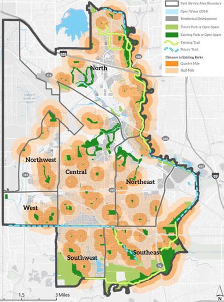

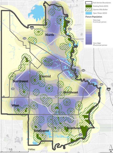
Irving's2000ParksandOpen Space MasterPlan Updateincludesthestandardsestablishedby the NRPARecreation,ParkandOpen Space Standardsand Guidelines (1990). Accordingto NRPA,theguidelines areusedas:
1. Abasisforrelatingrecreationneedstospatial analysiswithinacommunitywidesystemofparks andopenspaces.
2. Oneofthemajor structuring elementsthatcanbe usedtoguideandassistregionaldevelopment.
3.Ameanstojustify theneedforparksandopen spacewithintheoveralllandusepatternofaregion orcommunity.
Theadequacy ofexistingparks,recreationfacilities andopenspacescanbedeterminedby applyingthe needsofthepresentandforecastedpopulations of Irvingtothesenationalstandardsofparktype, optimalsizecriteria,servicearearadius,andsuggested minimumacres.


Table 7providesdetailsonminimumstandard assumptionsandexplanationsofthe NRPApark types described below. Accordingtosuggested NRPA minimumstandards,theCity of Irvingwouldneed approximately6.25-10.5acresofacombinationof pocketparks, neighborhoodparks,andcommunity parks,per1,000residents.Today,Irvingcontains approximately 5.6acresoftheseparksper1,000 residents
Itisimportanttonotethatthe NRPAstandards provideaplacetostartwithasystem-basedapproach toparksplanning.Theseestimatesdonotreflect acommunity'schangingpreferencesforhowfar individualswouldtraveltoarecreationcenteror park,nordothey reflectthechoicesandtrade-offs thatacommunity haswhendecidingonlocationsof parksandparticularparkamenities. Detailedpublic involvementineachplanningdistrictwouldhelp establishorconfirmreasonablestandardsfor Irving.
PARK TYPOLOGIES
POCKETPARKS
• Addresslimited, isolatedoruniquerecreational needsofconcentratedpopulations.
• May beactiveorpassive, butspeaktoaspecific recreationalneedratherthanaparticular populationdensity.
NEIGHBORHOODPARKS
• Serveavariety ofagegroupswithinalimitedarea orneighborhood.
• Provideactiverecreationsuchasfieldgames, court games, playgrounds, picnicking, etc.
• Havelimitedparkingandlighting,ifany, on-site.
COMMUNITYPARKS
• Serveseveralneighborhoods.
• Mayincludeareasforintenserecreationactivity suchascompetitivesports, swimming, tennis, playgrounds, volleyball, etc.
• Mayincludepassiverecreationopportunitiessuch aswalking, viewing, sittingandpicnicking.
METROPOLITAN PARKS
• Largeparkfacilitiesthatserveseveralcommunities andtheentirecity.
Table 8: NRPA Standards vs. Existing Irving Porks

Special
Source: City of Irving Parks and Recreation Department
Parks, Trail+ Open Space
• Naturalareasordevelopedareasforavariety of outdoorrecreationsuchasballfields, playgrounds, boating, fishing, swimming, camping, picnicking, andtrailsystems.
• Largemultiuseparksthatserveseveral communitieswithintheregion.
• Serveareaswithinaone-hourdrivingdistance.
• Provideactiveandpassiverecreationwithavariety offacilitiesforallagegroups.
• Mayincludeareasofnaturepreservationfor activitiessuchassight-seeing, naturestudy area, wildlifehabitat, andconservationareas.
• TheCity of Irvingdoesnothaveaparkmeasuring 500acresormore, however, thelinear system ofparksalongCampionTrails, whenanalyzed together,includesonelinearregionalpark comprisedof15parks(leasedandowned)totaling 726.58acres.
• Mayincludespecializedorsingle-purposerecreation activitiessuchashistoricalareas, naturecenters, marinas, zoos, conservatories, arboretums, arenas, amphitheaters, plazasorcommunity squares.
Accordingto NRPAnationalstandards,ideally Irvingwouldneedaminimumof2,287 acresof additionalparklandtoservea2040populationof 318,364 persons. This amount ofadditional parks acreage, shown inthe table below, will bedifficult, if notimpossible,toattaingiventhediminishing availablelandforparksandopenspaceusein Irving (anestimated2,990acresofvacantlandin Irving currentlyavailableforfutureuse). Creativemethods thatprovidemorespaceforparksandrecreation
9: Future Parkland Needs

A. Includes School Sites, Neighborhood Parks, and Lineor Neighborhood Porks.
must beexploredandimplementedtoaddressthis importantfuturecommunityneed. Anupdatetothe parksmasterplanisneededtodetermineadesirable andattainableratioof parksperpopulationtailoredto thecurrentand projected landuseconstraintsinthe citytoassurea balanceofparklandinventorygrows withpopulationandothertypesofdevelopment.
Futureparksshouldgenerally bedistributedacross thevariousparktypes,factoringinanadjusted distribution,whichincludesparksandactivespaces
Source: City of Irving Porks ond Recreation Deportment Note: The numbers may change as a result of the recommended Parks Master Plan.

B. Irving does not technically have a pork meeting the Regional Park threshold, however, in Irving's 2000 Master Plan Update, Lineor Porks were included in the Regional Pork estimate, because when combined, the sum total acres exceeded the 500+ acre Regional Pork threshold. See note D.
C. Special Use Areas include specific use porks and facilities managed by the Irving Porks and Recreation Deportment. Includes sports complexes, golf courses, senior centers, youth centers, environmental education centers, historical facilities, memorial parks, natatoriums, etc.
D. No NRPA Standard. This number is for display purposes only and is not included in the total existing parks acreage calculation. It represents all parks included as part of Campion Trails Lineor park system and green corridor !includes the sum of Pocket, Neighborhood, Community, and Metropolitan Porks). This sum would meet the threshold for a Regional Pork, but for purposes of the Imagine Irving Comprehensive Plan, it is important to indicate that there are no individual parks that meet the Regional Park size criteria.
E. Acreages provided by the City of Irving's Porks and Recreation Department Database.
developedandmaintainedbyprivateentities. Working directlywiththecommunityandotherstakeholders tomakedecisionsaboutthetypeofprogramming neededforfutureparkswillensureIrving'sparksmeet thechangingneedsofthepopulation (Table9). For example, thetrendstowardlargeroutdoorfacilities mayresultinapreferenceforlargervenuesas opposedtopocket parks, orametropolitanparkinstead ofacommunitypark.
Tables10-16showeachplanningdistrict'stotalpark andopenspaceneeds, andabreakdownoftheratioof parktypesaccordingto NRPAstandards.Thegreatest needsarein:
1. Central (805acres), 2. Northeast (481acres), 3. North (322acres), 4. Northwest (284acres), 5. Southwest district (176acres), followedby6. Westdistrict (158 acres), and7. Southeast (42). Prioritiesforpark developmentshouldbedirectedatthosedistrictswith thefastestpopulationgrowthandthelargestdeficits.


Table11:ParkNeedsbyTypologyinNorthDistrict


Source: City of Irving Parks and Recreation Department Note: The numbers may change as a result of the recommended Parks Master Plan.
Table 12: Park Needs by Typology in Southwest District


Source: City of Irving Parks and Recreation Department Note: The numbers may change as a
the recommended Parks Master Plan.
Table13: ParkNeedsbyTypologyinSoutheastDistrict

Source: City of Irving Parks and Recreation Department
Note: The numbers may change as a result of the recommended
Table 14: ParkNeedsbyTypologyinNortheastDistrict

Source: City of Irving Parks and Recreation Department
Note: The numbers may change as a result of the recommended Parks Master Plan. Parks Master Plan.


Source: City of Irving Parks and Recreation Department
Note: The numbers may change as a result of the recommended Parks Master Plan.
Source: City of Irving Parks and Recreation Department

-Parks, Trail+ Open Space
TheCityof Irvingisexperiencinga demandonitsexistingrecreational facilitiesthatexceedssupply. Thepublicoftenrequestsmore playgroundequipment,practice andleague-sizedsoccerfields, baseballfields,softballfields, outdoorvolleyballareas,tennis courts,outdoorswimmingpools, gymspace,exerciseequipment andpavilionspace. TheCityof Irvingdocumentedtheserecreation deficitsinthe2000 Parksand OpenSpace MasterPlan. TheCity of Irvingoperatesthe160-acre Trinity View AthleticComplex,and thereareseveralprivatelyowned andoperatedsportscomplexesin thecommunityaswell. Previous surveysindicatethepublicwould liketoseelargerrecreationcenters withadditionalservices. The ParksandRecreationDepartment workswithIrving ISD,NorthLake College,andotherentitiestooffer avarietyofpopularsportsand generaleducationprogramstohelp meetresidents' changingdemands. IrvingParksandRecreationalso sponsorspopularannualfestivals andcommunityeventssuchas Canal Fest,Irving MainStreet Events,Tasteof Irving,anda concertseries.
Atpresent, theCity of Irving operatessixrecreationcenters. Thesefacilitiesaredistributed acrossthemajorparksplanning districtstoenhanceaccessibility bylocalneighborhoodresidents. Currentrecreationalcenters include:
• Senter Park RecreationCenter andpool (southeastplanning district)
• GeorgiaFarrowRecreation Center (westplanningdistrict)
• NorthwestParkRecreation Center (northwestplanning district)
• LeePark RecreationCenter (centralplanningdistrict)
• Mustang ParkRecreationCenter (northplanningdistrict)
• CimarronParkRecreationCenter (northeastplanningdistrict)
Otherspecializedusesincludethe HeritageSeniorCenterandAquatic Center (southeastplanningarea), andLively PointeYouthCenter andpool (centralplanningarea). Additionalaquaticfacilitiesexistin thesouth,westandnorthplanning areas.
Yearsago,theCityof Irving hadagoalofconstructingone recreationcenterper25,000 residentstoaddressdemand,but givendevelopmentpatternsand budgetaryconstraints,itwas difficulttomaintainthisgoal. Accordingto2040projections, theCity of Irvingwouldrequire sixadditionalrecreationcenters; anumberdifficulttoattainin
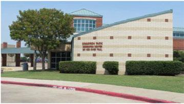
Parks, Trails + Open Space

acommunitynearlybuilt-out. Developmentofpublicrecreational spaceforactiveorpassiveuse shouldbeaconsiderationforany newredevelopmentproposal. Growingappreciationforgreat parksandrecreationsystemsispart ofwhatwillkeepresidentsinIrving fortheirleisureactivities.
Similartoparklandneeds,based oncurrentandfuturepopulation projections,prioritiesforplacement ofnewrecreationcentersshould firstfocusonthecentral. northeast, northwest,andnorthernpark planningdistricts,followedbythe southeast,westandsouthwest districts.
City Parksstaffhaveexpressed adesiretobeonthecuttingedgeofrecreationcenterdesign andofferings,withthegoalof constructingregional,state-of-theartrecreationalcenterstoservea 60,000-pluspopulation.
Cityof Irvingindoorpoolsare heavilyused. NorthLakeishome tosevenareaswimteams: Irving ISD HighSchool PE swimclasses, SwimSafetraininginitiative(will include11elementaryschoolsin 2015-16withplannedexpansion toall20 Irving ISDelementary schoolsfollowingtherenovation in 2017-18), LearnToSwim
Existing Indoor Aquatic Centers
» Heritage Aquatic built in 2002
» North Lake Aquatic bulit in 1984
Existing Seasonal Aquatic Centers
» West Irving Aquatic Center built in 2010
» Cimarron Aquatic Center built in 2008
Existing Seasonal Neighborhood Pools
» Lee Pool
» Lively Pool
» Senter Pool
» Each of the neighborhood pools built more than 50 years ago
Existing Spray Parks
» Northwest Spray Park built in 2010
» Southwest Spray Park built in 2010
Classes,allCityof IrvingRedCross trainingclasses,anddailyopen periodsforresidentlapswimand waterexercise. HeritageAquatic Centerisathrivingpoolthat improvesthequalityoflifeforthe predominantlyseniorpopulation thatparticipatesinorganized andinformalwaterexerciseat thefacility. Additionalprograms includeinstructionalswimming, exceptionalneedsprogramming, middleschooloutreachprogramin
partnership withIrvingISD,entrylevelswimteamandswimclinics, andopenswimtimesforresidents. The14-year-oldHeritageAquatic Centerisdueforseverallifecycle replacementsandfacilityupgrades inthecomingtwoyears.
Irving'sseasonalaquaticfacilities areablendofnewandold. Two popularfacilitieswithwaterpark featurescomplementthethree traditionalneighborhoodfacilities
-Parks, Trail+ Open Space

thatwereincludedinIrvingneighborhoodsahalf century ago. LearntoSwim (LTS), summerswimteam, juniorlifeguard, andopenswimprogrammingare partoftheoperationalspectrumfortheLeePark, Lively Park, andSenterPark Pools (LLS), andCimarron Water Park. TheWest IrvingAquaticCenterreceives heavy daily useandisapopularrentalfacility, leaving littletimeorspaceforprogramming. Cimarron AquaticCenteristhetruesthybridofwaterparkand neighborhoodpoolusefunction, includingbothpool rentalsandprogrammingelements.
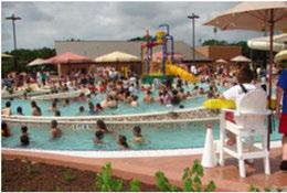
TheNorthwestandSouthwestSpray Parkssee exceptional residentuse during summer months. Thesespray andplay areas includeinteractivewater features that attract toddler through pre-teen users. Parents andgrandparentsfeelcomfortablesupervising childrenonthesewaterplay groundsthatallowfree, creativeplay.
SouthofStateHighway 183, theCity of Irvinghas twoagingseasonalfacilities, oneheavily usedmodern seasonalfacility, andonevery small, heavily used indoorfacility enteringtheoperational years offirst majorrenovationcycle. TheCity of Irvingalsohasone popularspray park.
BetweenStateHighways183and114, theCity of Irvinghasonevintage60sseasonalfacility and anindoor, heavily usedpartnershipfacility (thatis scheduledforitsfirstmajorrenovation). Thepopular NorthwestSpray ParkalsoislocatedincentralIrving.
FromStateHighway 114tonorthof Interstate Highway 635wherethecity boundary interfaceswith CoppellandCarrollton, theCity of Irvinghasasingle seasonalwaterparkfacility, andnoindoorfacilitiesor spray parks.
Basedoncurrentusagepatterns, thefollowingare needstomeetinthefuture:
1. Asecondmultiuserseasonalwaterparksouthof StateHighway 183.
2. Asecondindoormultiuser IrvingISO partnership facility southofStateHighway 183.
3. Anindoormultiuserfacility northof RoyalLane; possiblycombinedwithanoutdoorseasonalfacility.
4. Athirdspray parknorthof RoyalLane.
Theseconditem, anindoormultiuserIrving ISOpartnership, isaparticularly strongneed. Thedevelopmentofavertically integrated, communitywidewatersafety programwiththeschool districtwouldreachevery householdwithschool-age childrenin Irving ISO. Togrowthisinitiative, more indoorspacethatisproximateto Irving ISOiskey to thesuccessandthehealthoftheIrvingcommunity.
TheCity of Irvingconsistently receivesfeedbackabout thequality oflifebenefitsthattheaquaticfacilities provide. Withenhancedemphasisonwatersafety outreach, theexpandingpartnershipwithIrving ISO, thegrowingdemographicofresidentsages50 andolder, andIrving'sincreasinggeneralpopulation base, modernaquaticfacilitiesthatmeetcurrent recreationalandwellnessexpectationsareimportant. Industry trendssteerpeopletowardfacilitiesthathave

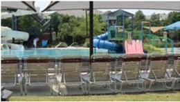
Cimarron Aquatic Center
afunfactorforfamilies, areasthatmeetexerciseand wellnessneeds, andthatcanserveinstructionaland training purposes-true multiuserfacilities, whether indoororoutdoor. Ancillary optionswillneedto be available suchasclassrooms/trainingareas, party and meetingrooms, andstorageforavariety ofsupport equipment.
For Irvingto beperceivedasamoderncommunity thatdeliversvalueandopportunitiestoresidents, an assessmentof allaquaticsfacilitiesmay berequired. Assessmentresultsmay guidetheCity of Irving indeterminingbestoptionsforinfrastructure.
Theassurancethat Irvingpooldesignsandfacility conditionsoffer industry-leading, attractive, safe, and funvenuesforresidentsisimportant. Health, safety, anddesigncodesareconstantly beingupdatedon thestateandnationallevels. Embarkingonaformal evaluationprocesswillhelptheCity of Irvingdevelop planstomeetallcurrent bestpracticesandindustry standards, aswellasdetermine whetherupdatingand renovatingwill bringthe bestvaluetoresidents, orif newfacilitiesofferthe bestvaluefortaxpayerdollars spent.
Movingforward, alifeexpectancy analysisand evaluationofallaquaticsvenues, including the efficacy of continuingoperationasis, renovating, or constructingnew, willneedto becompleted.
Accordingtoareport by the National Recreationand ParksAssociation, attractive environmental featuresin andaroundtrailsandparksisapowerfulmotivatorfor physicalactivity. Enjoyablesceneryencouragespeople touseaparkandengageinphysicalactivity. Parkor trailsize, layoutdesign, landscaping, balanceofsun andshade, andadjoiningpondsallhavethepotential toinfluenceparkuseandphysicalactivity. Parkusers aremorelikely touseatrailorvisitaparkthatis consistently well maintained andsafetouse.
TheCity of Irvingislandscapingheavily used arterial transportationcorridors, installingmedianupgrades withstreetscapeimprovementsalong Limetree Lane andGrauwyler Road, andonsegmentsof Belt Line Roadand MacArthur Boulevard. Additionally, theCity of Irvinghashadapositivepublicresponsetoplacing overheadutilitiesundergroundalongafewstreet segmentson MacArthur Boulevard. This beautification measure wasachievedatrelatively lowcost, and shouldcontinueonsegmentslike Belt Line Roadand otherheavily travelledcorridors, whereaesthetic treatmentscanprovideacatalysttofuturecorridor improvementsanddevelopmentupgrades.
Irving Boulevardprovidesagoodexampleforfuture greencorridorredevelopmentin Irving. Currentplans for Irving Boulevardcallforcreatingamultimodal "completestreet" withnewlineargreenspaces, and landscapedmediansusingnativeplantsandstreet trees. Proposedlong-termimprovementspresentedin the Irving Boulevard Enhancement Study discussed connectingexistingparks (Centennial, Millennium, and Lively) togetherthroughpedestrianand bicycle improvementsalong DelawareCreek.

Parks, Trail+ Open Space
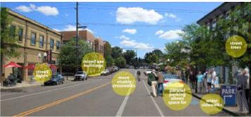
elements(credit: FregoneseAssociates)
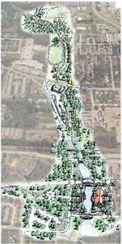
Illustrationofproposedimprovementsalong DelawareCreekasdescribedintheIrving Boulevard Enhancement Studyin2009.
Thistransformationtoagreen corridorwilladdvisualappeal andprovideenvironmental benefitsthatincludeprotection fromtheelementsandimproved stormwaterretention. Thedesign presentsotheropportunitiesalong thecorridortoprovidenewopen spaces, neighborhoodlinkages, and makesuseofunderutilizedspaces atDelawareCreeknorthof Irving Boulevard. Locatedindowntown Irving, the Irving Boulevard improvementsareviewedas acatalystforinvestmentand developmentwithindowntown, andbuildinginlinkagesbeyondthe immediateroadway willincrease thepotentialreturnoninvestment.
Residentsexpressedakeen interestinhavingmorecontinuous recreationalpathwaysalongthe canaledgesandconversionof theconcretecanalstonaturallyvegetatedchannelstoprovide aestheticimprovements.
Currently, theCity of Irving containsseveralmilesofconcrete drainagecanalsthatconvey the flowof DelawareCreekthrough neighborhoodsandparksin
centralIrving. Inaddition, the Valley Ranchneighborhood containsapproximately fivemiles of windingcanalsthatstoreand convey stormwaterrunofftothe Elm Fork River. Mostdrainage canalshavelandscapingalongthe edgeswithlimitedpavedpedestrian accessintheadjacentright-of-way. ThecanalsalongDelawareCreek extendfrom Senter Parknorthward inthedirectionof Millennium Park, VeteransMemorialPark, andJaycee Park,endingatWest RochelleRoad. Pedestrianaccess alongthecanalsisdiscontinuous, andsomeareasadjacenttothe canalsarefencedintoensure publicsafety. Cottonwood Creek hasalimitedsystemofcanalswith pedestrianpaths; itopensupintoa widercatchmentsystemasitflows ontoprivategolf-courseproperty in LasColinas, andthenflows eastwardtowardasmallreservoir at NorthLakeCollege.

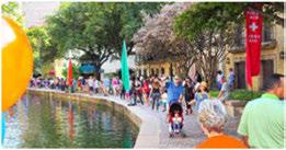
GreenspacesnexttocanalsintheValley Ranch neighborhood are "cautiously" promotedtoresidents asanamenity withadjacentuninterruptedaccess toconcretepathwaysandfootbridges. Valley Ranch maintainsthelandscapingandpathsadjacenttosome ofthecanals, whiletheIrvingFloodControl DistrictIII maintainsthewaterways.
BothfloodcontroldistrictsandCity ofIrving flood controlengineersdiscourageheavy recreationaluseof areasinsidethecanalsforsafetyreasons. Thecanals arenotdesignedtoencouragewading, swimming, boating, fishing, andaccessbypetsduetoanumber ofsafetyhazardsinthewater,aswellassteep slopesleadinguptothecanals. Inaddition, thereare concernsaboutlargevolumesofsilt, trash, anddebris beingdumpedinthecanalsbyconstructionactivities andpedestrians, whichadversely affectthedrainage functionofthecanal, increasemaintenanceexpense, anddecreasethecanal'sscenicvalue.
Constructingmorepathwaysadjacenttoexisting canalspresentsadditionalchallenges.Becausethese adjacentareasarepartofdrainageeasements, the City ofIrvingwouldneedtoacquirepublicaccess easementsfromadjacentlandownerstoallow additionalpedestrianpathstobeinstalled.Recently, increased flooding duringraineventshascausedthe City ofIrvingtorequiremoreoftheeasementfor floodcontrolpurposes.
Segmentsofcurrentconcrete-linedcanalsarebeing redevelopedtomakethemdeepertohandlemore stormwatercapacityandprotectadjacentresidents. Aspartofthisredevelopment, naturalvegetation channelsareencouraged, wherefeasible, tomeet U.S.Army Corpsof Engineersrequirementsnear waterways.Thistechniquereducespavement, and returnscanalsandculvertstoamorenaturalstate toenablemorestormwaterabsorption, whichis eventuallyreleasedby soilandplants. Stormwater surgeisreduced, andpollutantsareremovedfrom thewater, whichimprovesdownstreamwaterquality. Bringing creeksbacktoitsnaturalstatecanalso providewildlifehabitatandincreasetheaesthetic benefitofaddingmoregreenery.
Ifthepublicdesiresexpansionofthepedestrianpaths adjacenttotheexistingcanalsystembeyondwhat isavailablepresently, discussionswithindividual propertyownersaboutpurchasingpubliceasements shouldtakeplace, whilecontinuingtoeducatethe publicthattheprimaryfunctionofthecanalsand adjacentlandscapedareasisfor floodprotection.

Parks, Trail+ Open Space
Futuredevelopmentsareunderway thatwill influenceparklandandgreenspacein Irvingfor theforeseeable future. Mostofthesedevelopments haveamixed-useorstreetscapeelement,whichwill allowforapercentageofgreenspaceaccessibleto thepublicaspartofalargerretail,business,oroffice development,oraspartofahigherdensity residential design. Inevery developmentscenario,activeor passiverecreationaluse,orataminimum,bicycleand pedestrianaccessibility,areakey component. Some ofthedevelopmentsareplacingaspecialemphasison beautificationwiththeincorporationofmonuments, waterfeatures,orpublicart.
IrvingPUD#6(formerTexasStadium) - 1,001-acre mixed-usedevelopmentonthevacatedformerTexas Stadiumsiteandadjacentpropertiesboundedby State Highway 183,StateHighway 114,Loop12,Spur482 andtheDART railline. PUD#6requiresaminimum of10percentlandallocationtoparks,urbanparksand plazasoropenspace.
LasColinasUrbanCenter - Mixed-usedevelopment ona352-acresitewithboundaries atState Highway 114andLoop12. Approximately 176acresareavailable fordevelopmentandwillincludetwoproposedpublic parksandarecreationcenter.
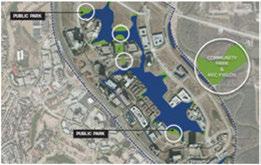
VerizonCorporateCampusExpansion-Mixed-use developmenton157acresboundedby HiddenRidge DriveandDART RailLine.
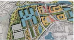
Proposedcorporatemixed-useexpansionofVerizonCampus(credit: GenslerArchitects)
NorthLakeCampusMasterPlan - Campus improvementson276-acresiteboundby North MacArthurBoulevard,WestWalnutHill Lane, andtheDART Rail Linearetoincludeincreased neighborhoodaccessontheperimeterwithmixed-use elementstoaccommodatestudentpopulationsand increaseeconomicactivity aroundthecampus.
IrvingBoulevardRedevelopmentPlan - Firstphase ofproposedcompletestreetsprojectfromStrickland PlazatoSowersRoad. Theultimateprojectwould consistofthreemixed-usedistrictsalongthecorridor.
DFWAirport Property Development - Proposed developmenttoaccommodateactiveparksfacilities, office-warehouse,internationalmarkets,andmixeduseboundedby Highway 161frontageroad,and Northgate,Esters,andRochelleroads.
HeritageCrossingDevelopment- Proposed48-acre redevelopmentboundedby WestPioneerDrive, BritainRoad,SixthStreet,and MacArthur Boulevard. FirstphaseistoincludesitedevelopmentatIrving Boulevard/SecondStreetcorridorandalongDelaware Creek.

CypressWatersMixed-UseDevelopment - (Locatedin Dallas, borderingIrving)1,000-acredevelopmentonthe northeastcornerof Interstate Highway635 andBelt Line Road. Includeshighdensitydevelopmentarounda 364-acrelake (NorthLake).
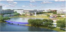
CypressWaterscomplexwithwaterfrontretailandmultifamily housing (credit: CypressWaters)
Otherdevelopmentprojectsproposedalongsegments of StateHighway161atMacArthur Boulevard, State Highway114, andLasColinas Boulevard-involving a towncenterandmixed-useapproach-includethree developmentsthatwillbringmorehousing, retail, and entertainment to Irving, andcouldprovidemorepublic accesstootheropenspaceopportunities (greenspace, plazas, waterfront).
Developerspredictthatmostofthefutureresidents andworkersinthesenewdevelopmentswillbewithin a10-minutedrive, willbeamixofyoung "Metro Renters," "YoungandRestless," andyoung "Enterprising Professionals" (ages29-32). Thesegroupsaretypically on-the-go, sociallyactive, careermindedwithan affinity for outdoor activities. Parksandopenspace will beimportanttothisgroup, whichwillpopulatethese newdevelopments.
BecausetheCityof Irvinghasbeenproactivein pursuingtransit-orienteddevelopmentandmixeduseprojects, connectionstourbancentersandgreen spaceswithinthesenewdevelopmentshavebeen largelyaccountedforindevelopmentproposalssuch asPUD#6. Safeconnections betweenneighborhoods toandfromthesenewdevelopmentswillbethenext areaoffocus. Physicallyactiveresidentshaveindicated they wouldlikeexpandedopportunitiestotransition fromparktotrailto neighborhood withinareasonable distanceonwell-maintainedtrailroutes.
Newtrailsareproposedtotieintothe Cypress Waters project, andcooperationbetweenparksplanners, flood controldistricts, andhomeownerassociationshas begun. TheCityof Irvingreceiveda$2.5 milliongrant fromDallasCountytoextendthenorthern section ofCampionTrails2.25 milestotheCypressWaters DevelopmentandtheCityofCoppell.
Opportunitiesforconnectionstothesenew developmentswillarisequickly, whichwouldrequire trailfundingtobereadilyavailable. Plansareunder wayforatrailfromOakdale Roadto Second Streetto connectwiththe Downtown IrvingHeritageCrossing Station.
!Source: Irving Running Club)
-Parks, Trail+ Open Space

Grantfundswereobtainedtocompletethetwo-mile TrinityRailway Expressbicycle-pedestriantrailfrom Irby Road, westtothe DARTWest Irving Transit Center, using DARTright-of-way. Thisproposedtrail willprovideaccesstotransitandconnectionstoparks inthewesternplanningdistrict.
Connectionstoandfromtheseurbancentersalsowill spurinterestfromneighboringcitiestocompletetrail connectionswiththeCity of Irving. Forexample, with therapidsuccessofCampion Trails, theCity of Irving isconsideringprovidingadditionaltrailmilestothe Trinity StrandTrailandTrinity Levee Trailsmanaged by theCity of Dallas.
Parks andopen spaces serve theimportantfunctionof reducingimperviouscover (surfacesinthelandscape thatcannoteffectively absorborinfiltraterainfall)and assistingwithstormwatermanagement. Naturally vegetatedareasreduceoverlandflowandhelpreduce pollutantsfromthewaterbeforetheoverflowreaches creeksandrivers. TheCity of Irvingislocatedwithin the ElmForkandWestForkwatersheds, andis monitoredby fourseparatefloodcontroldistricts(Bear Creek, ValleyRanch, LasColinas, andCentury Center), whichareeachindependently governedtoprovide floodcontrolfacilitiesandoperationsforcommunities across Irving (Figure46). LasColinashasagreements withthe DallasUtility andReclamationDistrictto provideadditionalmaintenanceandoperational supporttotheleveesystemandpumpingstations. Together,theseentitieshavenumerousfunctions includingaddressingfloodingatparksandoutdoor recreationalfacilities.
Thereareapproximately 13 parksin Irvingthat experienceahigherrateof floodingissuesduringand afteramajorrainevent. Theseparksarevulnerable tofloodingduetotheirtopography oraneedfor improveddrainageinfrastructure. Additionally, sectionsof bicycle andpedestriantrailsarevulnerable to flood-relateddamageandareoftenclosedtothe publictoensuresafety. Ingeneral, saturationdueto floodingcancausedamagetointernal sidewalksand trails, damagetrees, weardownplaygrounds, damage landscaping, andleavestandingwater, whichisa potentialhazardforresidents.
TheCity of Irvingisaddressingdrainageinsome oftheseparks, butdevelopmentofalonger-term maintenanceplantoensuretheresilienceofthese parksandequipmentafteramajorfloodeventis encouraged. Theresultwillbeashorterclosuretime betweenamajorrainorfloodevent, andquicker turnaround forrepairof flood-damaged equipment, whichwouldresultinexpeditingthereopening parks andtrailforpublicuse.
InaccordancewithTexasCommissionon EnvironmentalQuality regulationsprotecting watersheds, theCity of Irvingiscommendedon havingclearpoliciesfortheprotectionofwaters oftheUnitedStates (wetlands)fromsediment, silt, earth, soil, andothermaterialassociatedwiththe clearing, grading, andexcavationofnewconstruction (Sec. 41-64). Bestmanagementpractices (BMPs) arerequiredtoensurevegetationispreservedand construction sitesarestabilizedthroughtemporary and permanentseeding, mulching, useofgeotextiles, sod stabilization,vegetativebufferstrips, andprotection oftreesandmaturevegetationwherepracticable. Divertingharmfulrunoffanddischargeisencouraged
Parks, Trails + Open Space
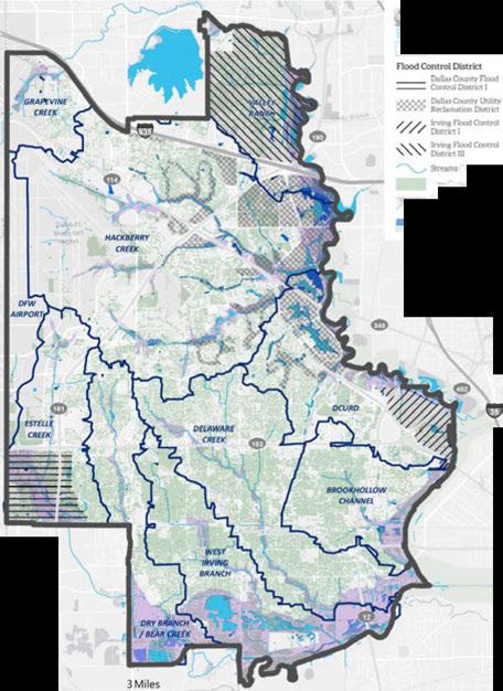

-Parks, Trail+ Open Space

tothehighestextentpossible. Sinceoverlandflowis alwaysanissue, theordinancesuggeststhatBMPs includestructuralmeasuressuchasstormwater detentionstructures, flowattenuation, openvegetative swalesandnaturaldepressions, andothervelocity controldevices, infiltrationofrunoffonsite, orthe combinationofseveralstrategies.
IrvingisintheprocessofjoiningtheregionalIntegrated StormwaterManagement(iSWM™)programsponsored bytheNorthCentralTexasCouncilofGovernments.The iSWMprogramassistscitiesinachievingfloodmitigation, streambankprotection,andwaterqualityprograms.Cities alsoarehelpedwithmeetingpre-andpost-construction obligationsunderstate-approvedstormwaterpermits. JoiningiSWMwillenabletheCityofIrvingtobepartof aregionalapproachthatwillprotectIrving'swatershed interestsbothinsideandoutsideofthecity.
Irvingestablishedatreeordinanceandatree boardin 2009topromotetheprotectionofhealthy treesand provideguidelinesforpreservationoftreesduring construction, development, andredevelopmentof parks, andpublicproperty orrights-of-way. Ordinance 2009-9140outlinesspecificdutiesofthe IrvingParks
Boardandestablishesan IrvingTreeBoardtopromote protectionandpreservationofnativeorestablished treeswithin Irving. Treesprovideaestheticvalueto neighborhoods, parksandtrails, aswellasenergysavingbenefitssuchasreductionofheat-islandeffect, provide oxygen tothe environment by absorbing carbondioxide, andprovidehabitatforwildlife. Trees inparksandopenspacescanslowerosionandassist withstormwatermanagementby absorbingwaterinto therootsystem.
The2000ParksandOpenSpaceMasterPlanUpdate recommendeddevelopersparticipateinamitigation programwheretreesthatcannotbepreservedduring constructionarereplacedby developerson-site, offsite, orthroughpaymentintoa "treefund" basedon treesizeandnumberoftreesremoved. Thoughnever implemented, dollarsfromsuchafundwouldbe allocatedtotheCity of Irvingfornewplantingswithin thedistrictwherethetreeremovaloccurred. Currently, Irving'slandscapestandardsrequire newdevelopment toplanttreesalongdesignatedthoroughfaresand highways, andincludesatreepreservationcredit programallowingdevelopersofresidentialandnonresidentialsitestoreducetheirlandscapingobligations by preservingexistingtrees.
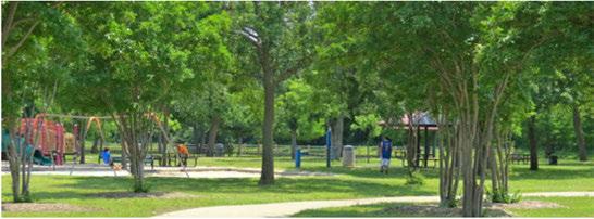

TheCity of IrvinghasbeenamemberofTreesUSA since2009. Tomaintainmembershipinthisprogram, theCity of Irvingestablishedatreeboardandtreecare ordinance,holdsanannualArborDay observance torecognizethevalueoftrees,andmeetstheannual budgetrequirementsofspendingaminimumoftwo dollarspercapitaonforestry programs. The Parksand Recreation Department isresponsibleforoperating andmaintainingthisprogram,andoftenpartners with KeepIrvingBeautiful,andIrvingISDforplantingand clean-upprojects.
Irvinghasa10-acretreefarmat MountainCreek Preserve. Thetreefarmgrowsandsuppliestrees toparks,openspaces,andlandscapingmedians within Irving. Thesitealsoisusedforenvironmental educationforallages. Thetreefarmcurrently has400 treesplantedforfuturedistributionaroundIrving. ThissustainablepracticewillensurethatIrving'stree inventory ismetforyearstocome.
In2014,theCity of Irvingspentapproximately $721,000onplanting,removalof dyingtrees, trimming,mulching,watering,andequipment. Additionalfundingisneededforatreeinventory, whichincludesidentifyingandtaggingtrees. The Parks andRecreation Department alsoneeds fundingto complete acomprehensivetreemanagementprogram, fundhomeinspectionsandconductcodeenforcement. TheParksandRecreationDepartmenthasidentified theneedforafulltimeurbanforesterpositiontolead keyaspectsoftheCity of Irving'streeprogramsaswell ascodeenforcement.
TheParksandRecreationDepartmentisseeking methodstoreducestafftime,vehiclemilestraveled, andconserveenergy andwater. Currently,allwatering ofparks,recreationalspaces,andstreetscapesis providedmanuallybyon-siteirrigationcontrollers.
Thesameistrueformanuallightingatparksand recreational facilities by on-sitelighttimers. Providing efficienciesinthesetwoareashasthepotentialto reduce costs. Currently, during major rainevents, ballfield lights mustbeshutdownateachfacility manually whengamesand/orpracticesarecancelled duetoinclementweather.Theemployeelaborcosts, wearandtearontheCity of Irving'svehiclefleet, andthedelay ingettingtoasitecontributestohigher overallcostsfortheCity of Irving. Thesameistrue forirrigationsystemsthatexperienceamalfunction duringoperations.Centralizedandautomatedcontrol ofallwateringmechanismswouldsavewater,increase efficiencyof Parksstaff,reducecosts,andenablethe ParksandRecreation Department tobettermonitorits practices. Theseformsoftechnology areaconsiderable investmentfortheCity of Irving,butwouldyield positiveresultsinthenearterm.
TheParksandRecreationDepartmentsfollows wateringrestrictionsplacedonresidents,and implementsamowingscheduleacrosstheparks, recreationalfacilities,andmunicipalinventory that provides flexibility andenergy savingstotheCity of Irving.
Currently,theCityof Irvingusessomesolartechnology topowerirrigationcontrollersinalimitednumberof street medians,andforlightinginsomeparkareas. Thistechnology shouldbeassessedtodeterminethe benefitofexpandingsolarpowertomoreparkareas acrossIrving.
ParksandRecreationfleetvehiclesuse environmentally friendly fuelsandhaveidling softwareinstalledtomonitorandcontrolcarbon emissionsintotheenvironment. Asautomobile technology improves,Irvingcouldexpand environmentally friendly initiativesintoday-to-day functions.

Parks, Trail+ Open Space
InadditiontoIrving'sBondProgram, numerousgrants areavailableforparksandrecreationprogrammingin smalldollaramounts,however, largerinfrastructurerelatedstrategiesrequireacoordinatedeffortto prioritize parksandopenspacefundingusingnewand innovativemethods.ThesupportfromDallasCounty hasbeenkeytothesuccessfulcompletionofCampion Trailstodate. Manyoftherecommendationsrelated tofundinginthe2000ParksandOpenSpace Master Planstillapply forthefutureofparksandrecreational spacein Irving. Keyfundingoptionstrategiesfromthe 2000Planinclude:
TherearefivegrantprogramsadministeredbyTPWD availabletolocalparksandrecreationdepartments for acquisitionofparkand/orthe development ofpublic recreational facilities. Fundsareavailableona50 percentcostsharebasis, andthededicatedsitesmust remainasparklandinperpetuity.
TheCDBGprogram, administeredby theU.S. Departmentof Housingand Urban Development, isthemostimportantsingleresourceforprojects benefitinglow-andmoderate-incomepopulations. Parksandrecreationagenciesareeligiblerecipients ofgrantfunding, butprojectsandprogramsmustbe identifiedandprioritizedinacommunity'sfive-year consolidatedplan. Afterschoolprogramsthatserve low-tomoderate-incomefamiliesaregoodCDBG publicserviceprojects, whichcancompriseupto 15percentoftheCDBGblockgrant. CDBGandthe NationalParkService'sUrbanParkandRecreation Recovery aretwofederalgrantprogramsthatdirectly benefiteconomicallychallengedcitiesandurban countiesparkandrecreationneeds.
OnDec.1, 2015, Congresspassedamultiyearsurface transportationbill.TheFASTACTwasreleased toreauthorizefundingforhighway andpublic transportationprogramsandprojectsfromFiscalYear 2016to2020.Upto$850millionisavailableannually throughtheTransportationAlternativesProgram tobedistributedtostates, localgovernments, and nonprofitsforamultitudeofon-roadandoff-road bicycleandpedestrianfacilities, sceniceasements andbeautification, rails-to-trailsconversions, and environmentalactivities.The NorthCentralTexas Council ofGovernmentsadministersthesefunds locally fortheDallas-FortWorthU.S.Census Urbanized Area.
The NPSsponsorstheOutdoorRecreationalGrant programthroughthe Land&WaterConservation Fund. Grantsareusedtoacquireland, andplanand developrecreationalareassuchasplaygrounds, tennis courts, outdoorswimmingpools, hikingtrails, picnic areas, campgrounds, andboat-launchingramps. Funds alsoareusedtobuildrestrooms, watersystems, and othersupportfacilitiesforthegeneralpublic. States, cities, counties, andparkdistrictsareeligibletoapply forthesegrants, andduringthecourseof NPS's history, morethan$5billionhasbeenawardedfor preservation andrecreation grants.

Asstatedinthe2000ParksandOpen Space Master Plan, othermethodstoacquireorfundparkland, trails, andopenspacerequireacombinationofpublic/private partnershipsandintergovernmentalcooperation (i.e. Dallas County, TxDOT,DFW Airport, NCTCOG, and adjacentcities), andregulatory actionstoencourage newdevelopmentofparksas property isdeveloped. A recommendationfromthe2000ParksandOpen Space Master PlanUpdatewouldassist Irvinginmeeting 2040demand:
Aparkdedicationordinancemay requireland dedicationormoney inlieuoflandfromdevelopers whowishtodevelopin Irving.Themoney inlieu oflandhastobeusedwithintheneighborhoodor community parkserviceplanning district. Othercities intheregionhavedevelopedformulastodetermine howmuchlandormoney shouldbededicatedatthe timeofplatting.
Parksdedicationordinancescanincludeaclausethat regulatesthe types ofparksinaneighborhood, or requires mixed-use developments tohaveaminimum ratioofgreenspaceandtrails.
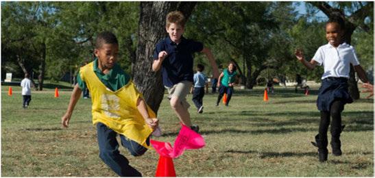

Parks, Trail+ Open Space
Irvinghasseveralkeyissuestoconsidertoachieve thedesiredlevelsofpublicparklandandopenspaceto meettheneedsofthepopulationin2040.
Prioritizationofparksrelativetootherinfrastructure needswillaffecttheconditionandamountofpark inventoryovertime. Parkserviceamenitiesareranked highby residents, buttheCityof Irvingmustprioritize andprotectgreenspaceforfuturegenerations. When lookingattheparkinventory fortheCity of Irving, considerationwillneedtobegivenregardingthe proportionofprivaterecreationalspace, andwhether toincludeprivateaccessparksandfacilitiesinitsparks andrecreationalinventory.
Itemstoconsiderwhenincludingprivateaccessparks in Irving'sinventorymayincludethequalityofthe facility, thenumberofopencitywideeventshosted atthefacility, thetypesofusesandfrequency ofuse by Irvingresidents. Manymunicipalitiesaroundthe countryshortonparklandareinvestigatingwhether thisisadesirablemethodofaccessingparkinventory.
TheamountofdonatedlandthattheCityofIrving hasreceivedfromindividuallandowners, developers, andnonprofitsforparksandrecreationusehasbeen modest. Asaresult, Irvingpurchasesthemajorityof parklandforrecreationaluse. Tomaximizebudgetary setasidesforupdatesandnewamenitiestoexisting parks, andconstructionofnewfacilities, newmodels foracquisition,andpreservationofparksandgreen spaceareneededtoaccommodateagrowing, more activepopulation.
Inrecentyears, asapprovedbondfundshavebeen slowtobecomeavailable,shiftsinparksandrecreation prioritieshavechanged. Oftenfundswereshiftedto purchasenewplaygroundequipmentor construct new facilitiesonexistingparks, whilesomelandstheCity hopedtopurchaseforparksweresoldforanotheruse, ormayhavebeenmovedoffofthepriorityprojectlist intheirentirety. Irvingisexperiencingtrendssimilar tomanyparksdepartmentsacrossthecountry with reducedbudgetsasthedemandforservicesincreases.
Minimumstandardsforfacilitieswillrequire adjustmentasIrvingreachesabuild-outpoint andtransitionstoredevelopmentofexisting neighborhoodsandactivitycenters. Becauseparkland sitesdedicatedbydevelopersandindividualstothe Cityof Irving'sinventoryareusuallysmallerthan fiveacres, andincentivestoencouragepublicuseon privatepropertytendtobeineffectiveorproblematic overthelongterm, clearstrategiesareneededto assureacquisitionofadequateparklandforfutureuse.
The ParksandRecreation Departmentseeksto actively understand resident'sfacilityuseandtheCity of Irving'sinventory tomakeinformed decisions and planforfuturedemand. Parksstaffhaveidentified thelackofadequatefundingforrepairstoaging infrastructure andnewparkdevelopmentasamajor concern. Accordingtodepartmentreports, Irvinglacks outdoorrecreationalfieldsandrecreationalcenters proportionatetothedemandfromresidents, sporting organizations,andvisitors. Highdemandusageon currentfacilitiesisincreasingthewearandtearon currentassets.

Fundingandstaffingforparks, openspace, and streetlandscapemaintenanceisdecreasing, while maintenanceandoperationsneedsareincreasing. Agingequipmentandtheneedforparkrenovations aredailyconcernsforstaff. AstheCityof Irvingenters intomoreparkleaseandcost-sharingagreementswith developers, schools, andhomeownersassociations, staffingandmaintenancefundingmustbeinplace torespondtochangingconditionsandincreasing demands. Limitedfundingforparksmaintenance alsowillhindertheabilitytocontractoutforsupport services.
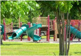
Newbicycleandpedestrianconnectionsareneededto facilitateconnectionsbetweenneighborhoods, parks, andotheractivitycenters. TheIrvingcommunity expressedapreferenceformoreconnectivitywiththe provisionofgreencorridors. TheCityof Irvinghas prioritizeddevelopmentofpedestrianandbiketrailsto supporttheinvestmentindevelopmentareasaround transitfacilitiesandintheCampionTrailsnetwork. TheCityof Irvingalsoshouldlookforopportunities tocreatesafe, greencorridorswestof CampionTrails thatprovideconnections, environmentalbenefits, and aestheticimprovements.
Budget approximately $350,000 for a Parks, Open Space, and Trail Master Plan to address recreational priorities, programming, funding mechanisms, and preservation. This effort could be combined with the formal Bike Master Plan and Trail Plan recommendation discussed in the Transportation Chapter. Given new demographics and development trends in Irving, a robust public involvement program should guide the development of the Parks, Open Space and Trail Master Plan Update. Community input will identify preferences, test proposed concepts, and identify needs and suggested solutions at the neighborhood and community level. An updated plan will:
• Addressmaintenanceof existingpark facilities.
• Includeathoroughupdatetothepublicand privateparklandinventoryin Irving.
• Addresscommunityinvolvementfrom residents, theCityof Irving, private developersandschools.
• Involveadjacentcommunitiesandother stakeholders.

• Redefinegeographicalparkneedsbasedon demandandusage.
• Proposeafinancingplantoachieveparks, openspaceandtrailgoals.
Improve the quality of the park system by prioritizing maintenance, rehabilitation, and completion of existing facilities prior to new park acquisition and development. Revisit the sale of bonds for parks, infrastructure, and other improvements planned for Irving with the goal of increasing approved bond sales.
Evaluate projects on the priority list, as well as funding requirements for the properties. Revisit and update previous parkland priorities that have not been acquired for suitability given new development proposals that are currently under way.
Parks, Trails + Open Space

Goal 2: Plan forthe highest level of maintenance of existing parks and open space.
Strategy 2.1
Adopt a maintenance and operations plan for parks and recreational facilities to ensure efficiencies in staff time and consistent equipment upgrade and replacement at parks to keeps parks and open space facilities in top condition.
Strategy 2.2
Establish a Parks Management Team to oversee updates to the operations and maintenance plan. Management team staff may include parks planning, facilities and operations, urban forestry, park assets, park services, landscape supervisor, athletic fields maintenance supervision, and volunteer coordinator.
Strategy 2.3
Implement efficiencies to reduce maintenance costs over the long term including centralized lighting, centralized watering, and energy-efficient practices !increase the usage of solar power cells for watering medians). Use idling detectors in parks vehicles to reduce carbon emissions.
Strategy 2.4
Increase maintenance agreements of local homeowners associations for pocket parks and right-of-way landscaping and beautification improvements.
Goal 3: Creatively work toward a goal of 10 acres of parks and open space per 1,000 residents.
Strategy3.1
Strategically acquire new parkland and green space in Irving's inventory that attracts widespread usage, is accessible from major centers and activity corridors, and has the potential to generate revenue.
Strategy3.2
Add acreage to existing parks where possible to increase service areas.
Strategy3.3
Explore and adopt methods to ensure new development provides public park land and resources to develop needed park and open space facilities.

Strategy3.4
Encourage and attract infill housing developments such as compact cottage-style homes that provide opportunities for creative placement of parks and leisure space. Courtyard-style backyards for smaller lot homes add unique character to a community, and contribute to interactions between neighbors.
Strategy3.5
Increase the number of negotiated agreements with school districts, private athletic associations, etc., to offset park maintenance costs where feasible.
Parks, Trails + Open Space

Goal 4: Expand funding options to meet resident demands.
Strategy 4.1
Integrate recommendations from the 1996 Parks and Open Space Master Plan, and 2000 Parks and Open Space Master Plan Update that are still relevant for the future such as: an impact fee ordinance for developers to include public parks, use of sales tax funding to acquire park land to compensate for unsold bonds, develop Parks District Action Committees to act independently to support and protect parks, etc.
Strategy 4.2
Establish a coordinated program between the Parks and Recreation, Planning, and Capital Improvement departments to plan for purchasing land slated for parks while still economically viable.
Strategy 4.3
Complete an analysis of parks and recreation study of user fees, and examine other parks and recreation expenditures to determine how to maximize services and user fees in an equitable manner.
Strategy 5.1
Update the landscaping budget for infrastructure improvements to reflect increased costs as well as increased landscape programming.
Strategy 5.2
Build in projected costs for materials, operations, and maintenance for infrastructure improvements.
Parks, Trail+ Open Space
Goal 6: Implement additional sustainable practices.

Strategy 6.1
As technology evolves and Irving develops, incorporate strategies to reduce vehicle miles traveled, reduce overall energy consumption, and protect water bodies.
Strategy 6.2
Invest in resilience infrastructure and sustainable materials for parks and trails.
Strategy 6.3
Expand the City of Irving's Tree Farm at Mountain Creek Preserve.
Strategy 6.4
Develop a tree maintenance plan for the City of Irving's parks, streetscape and trails to enhance the stormwater management program, and to reduce impervious cover. Hire a full time urban forester to assist with the tree maintenance program.
Strategy 6.5
Encourage additional interdepartmental and regional coordination on watershed management and status of park conditions. Develop a
maintenance response plan to attend to facilities needing repair after a flood event.
Strategy 6.6
Encourage more "daylighting" of concrete canals and culverts to improve flood control, and provide a green aesthetic to the community.
Strategy 6.7
Seek LEED certification on future parks and recreational centers where feasible.
Strategy 6.8
Evaluate and incorporate the following sustainable practices where possible:
» LED lighting
» Greywater watering system
» Native plants
» Organic compost for fertilizer
» Pervious parking areas
» Electric vehicles
» Idling detectors in the vehicles
Parks, Trails + Open Space

Goals, Strategies + Actions
Goal 7: Coordinate park and open space with floodplain management needs.
Strategy 7.1
Protect and conserve open space, particularly along floodplain.
Strategy 7.2
Develop a consensus on the balance between floodplain management and any open space that should remain "protected" from future development. Develop clear consistent policies and mapping for those sites considered "undevelopable" during the next 25 years.
Goal 8: Continue to pursue plans to build a state-of-the-art recreation center.
Strategy 8.1
Explore public park and recreation options in partnership with developers or private operators where possible.
Strategy 8.2
Identify locations for potential land purchase or partnering to accommodate a recreation center in excess of 60,000 square feet to address future demand, and allow for future flexibility in programming. Prioritize placement of a large center north of Highway 161 to meet future demand in the northern sections of Irving.
Goal 9: Improve connectivity between parks and open spaces.

Strategy 9.1
Review new residential, commercial, and mixed-use development for public parks, open space, or trails component.
Strategy 9.2
Preserve public access to all waterfront green spaces within new private commercial developments.
Strategy 9.3
Explore additional Neighborhood Improvement District models to pay for parks at the local level.
Strategy 9.4
Protect and maintain green spaces around schools.
7.3.1 Protection andpropermaintenanceofthe spaces aroundpublic (andprivate) schoolsor similar institutions will help withmaintaining consistency with Irving'sparksinventory.
7.3.2
Joint-useagreementsshould bereviewed regularly, and ongoingdialog with educationalinstitutionsshould bein placeto encourage further cooperation andensure reasonablecost-effectivefacilityrentalrates.
Parks, Trails + Open Space

Trails + OpenSpace Goals, Strategies + Actions
Goal 10: Complete the remaining land acquisition and construction for Campion Trails within the next five years.
Strategy l0.l
Continue to pursue Dallas County funding to complete additional linkages along Campion Trails.
Strategy l0.2
Provide matching funds to construct a segment of the trail at a crossing into Dallas.
Goal 11: Reprogram inefficient facilities to meet changing demands.
Strategy 11.l
Identify recreational facilities that are underutilized or not cost effective, and reprogram or repurpose to other program areas needed within the community such as athletic fields, additional recreation and leisure classes, organizational meeting space, or community education use.
Strategy 11.2
Explore programming and use additions and enhancements for the City of Irving's golf course in south Irving.
Parks, Trail+ Open Space

This pageleftintentionallyblank.

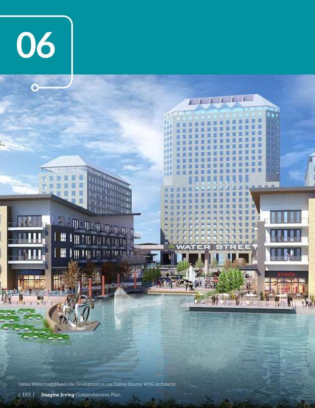

Economic growth should translate into the happiness and progress of all...There should be development of art and culture, literature and education, science and technology.
~ Pratibha Patil
TheEconomic Development Departmentleads Irving'sefforts tocreateahealthyandsustainablecitythroughthepromotion, recruitment, andcoordinationofnewcommercial, industrial, retail, andresidentialdevelopment, andtheretentionandrevitalizationof existing businesses andneighborhoods. Thedepartmentisfocused onexpandingthetaxbaseandcreatingjobsandopportunitiesfor Irvingresidentsthroughacomprehensiveeconomicdevelopment program. TheCityof Irving'seffortsareinactivepartnership withtheGreater Irving-LasColinasChamberofCommercewhich providesrecruitment, retention, smallbusinessandinternational economicdevelopmentservices.
Economic Developmentstaffcoordinatescityresourcesincluding realestate, economicincentivesanddevelopmentassistance forbusinesses. TheoverallgoalistobecomeAmerica'sleading internationalbusinesscenterbysolidifyingIrving'sstatusasa premierlocationforbusinessrelocationandexpansion.
Irving's Economic Development Strategyestablishesthefollowing visionfor Irving:
Irvingisaleadinginternationalbusiness center inAmerica -a destinationfor investmentandhigh-wage jobs, andavibrant urbancommunity.

Peoplewi11 say...
» The city is growth-oriented, committed to the support and continuous improvement of existing businesses, infrastructure, amenities, and the workforce.
» Irving is at the forefront of innovation and business development, supporting its industry-leading private sector employers and its forward-thinking community leaders.
» Irving offers exceptional access to the regional, national, and world economies through its globally connected businesses and robust transportation network centered on the Dallas-Fort Worth International Airport.
» Irving's educational system prepares its workforce to succeed in all segments of the economy and includes training for a wide range of job skills.
Irvinghasthesecondhighest concentrationofFortune500 headquarters (2.58per100,000 population)intheUS (amongthe17 US cities withatleastfiveFortune 500HQs),secondonlytoAtlanta. WithsixFortune500headquarters, Irvingistheonlysuburbonthis list. ThisrankingconfirmstheCity's roleasamajoreconomicengine withinthe DFW Metroplex.
Irvingishometomorethan 201,000jobs;however,nearly88 percentof the Irvingworkforce commutesto workin Irvingfrom anotherlocation. Only12percent of theworkforcelivesand worksin Irving. Inaddition,77,000people wholivein Irvingcommutetowork outside Irving,withthelargest percentagecommutinginto Dallas.
Irving's workforceconsistsof 73 percentinoffice/professional services,23 percentinretail.
and5percentinindustrialand manufacturing. Thisdivisionof labor isexpectedto remain similar inthefuture.
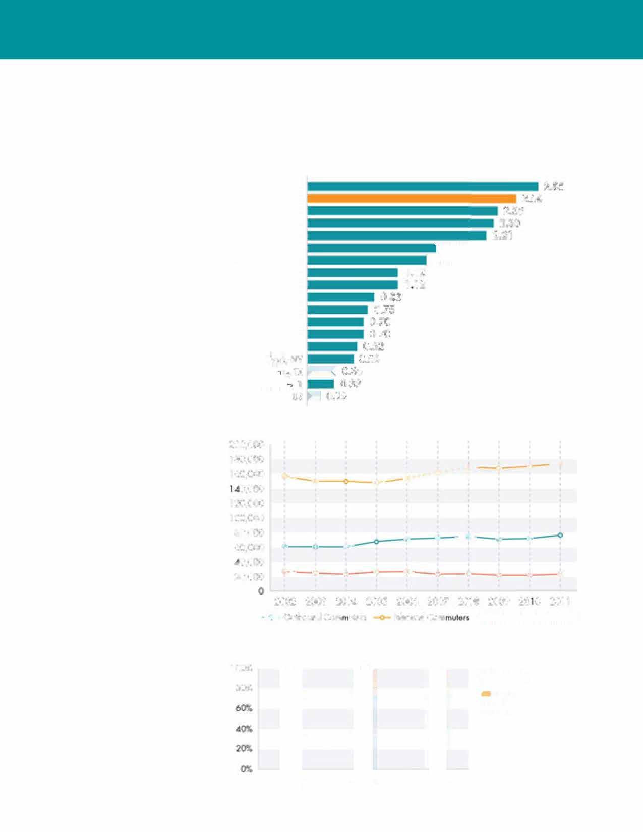
47: US Cities with Fortune 500 Headquarters per 100,000 residents

Figure 48: Residence of Workforce, 2002-2011

Figure 49: Future Growth by Employment Type


Sources:Fortune,CensusBureau
Sources:CensusBureau

Sources:CensusBureau,

Employmentisconcentratedmostheavilyinnorth Irving, includingthe LasColinasUrbanCenterandthe Freeportarea, withadditionalconcentrationsalong StateHighway183andIrvingBoulevard(Figure50).
Whilethisdistributionofemploymentwillcontinue, futuregrowthalsowillbenotableinthePlannedUnit Development (PUD#6, formerstadiumsite)urban corebeingcreatedaroundtheintersectionof State Highway114and State Highway183. Additional growthwilloccurin HeritageCrossing, aroundDART OrangeLinestationareas, andalongHighway161.
NewemploymentadditionsinIrvingshowamore evendistributionfromnorthtosouth (Figure51). The locationofallprimaryemploymentareasinthefuture isillustratedinFigure52. Theseareasareserved by StateHighway114, whichalsoconnectsDFW International AirporttodowntownDallas.
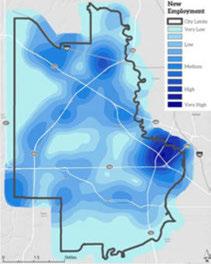
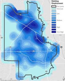
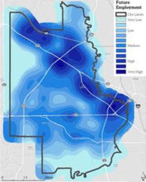
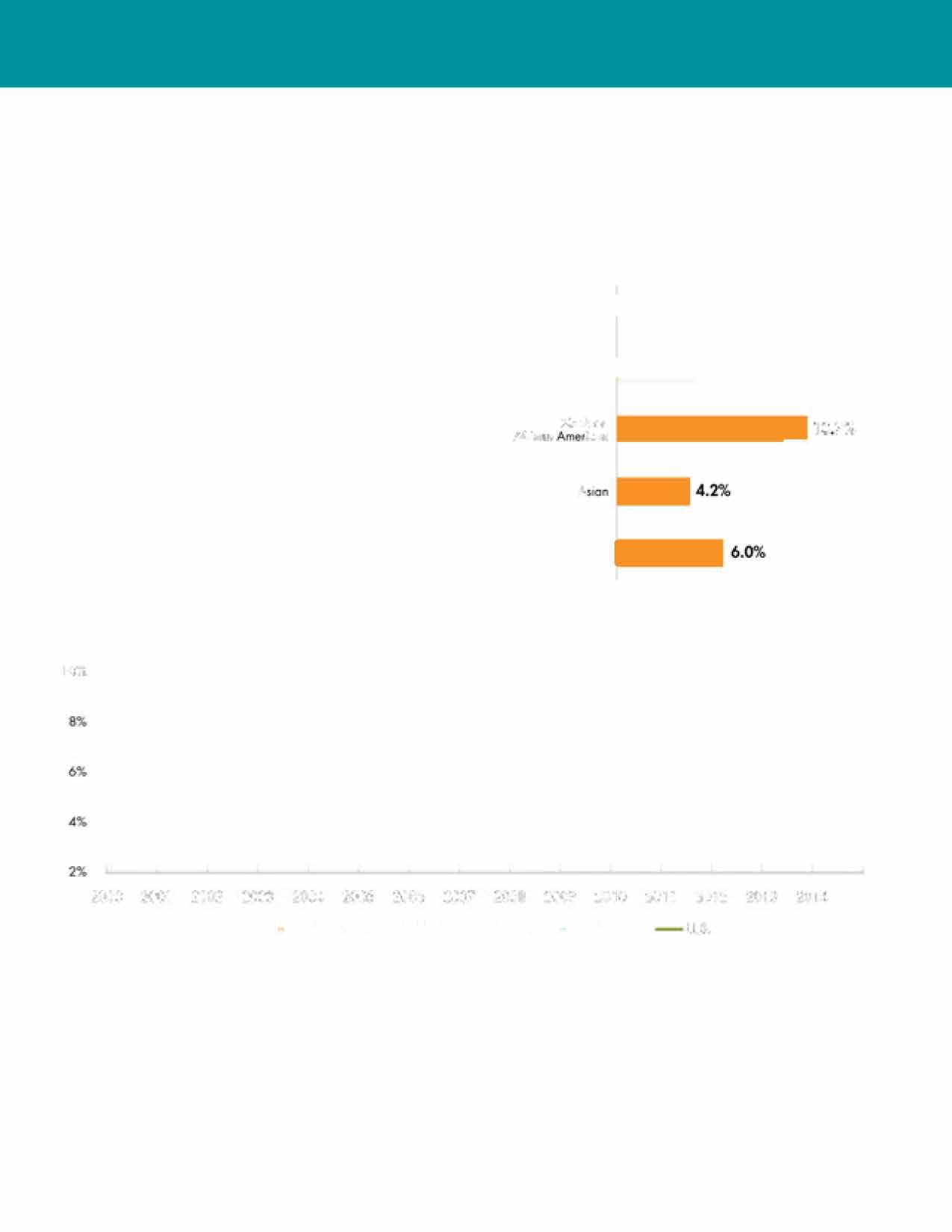
Irving'sunemploymentratehasremainedconsistently belowUS, Texas, andregionalratesformostofthelast 15 years.TheunemploymentrateinIrvingwas3.6% bytheendof2014, lowerthantheregion, Texas, and theUSduringthesametimeperiod.
Whileunemploymentbyraceandethnicityisnot availablefortheCityof Irving, theunemployment dataforthe Dallas-Plano-Irvingmetropolitanarea showsthattherearedisparitiesinunemployment ratesamongracesandethnicitiesintheregion. The unemploymentratesforwhiteandAsianworkers arelowestat4.3%and4.2%,respectively, whileblack workersareexperiencingover10%unemployment, andthe Hispanicor Latinopopulationisunemployed at6.0%.
lc:ri!,


Irvingisamaturecity,andmuchofitsgrowthwill occurthroughexpansionindevelopedareas, or throughtheredevelopmentof sitessuchas PUD #6, the former stadium site. Asmuchas35percentof employmentgrowthwillbethroughredevelopmentor expansionofexistingemploymentareas.
Figure55showsthe fivelandusedistrictsofthe FutureLandUse Map(seepage75) thataremixeduse, wherethemixingofresidentialand
non-residential usesareencouraged. TheseincludeUrbanDistrict, TransitOrientedDevelopment, CollegeDistrict, NeighborhoodCommercial, and Main
Street. Seepages72-76formoreinformation aboutthe FutureLandUse Map.
Muchof Irving'sfuturedevelopment will beinmixed-usedistricts, andthe Imagine Irvingscenariosuggestsdevelopment duringthenext25yearscouldconsistof116 millionsquarefeetofnewbuildingswitha valueof$14billion.
Therearemanyavailablesitesfor developmentandredevelopmentwithin Irving. WhileIrvingmayhavelimited developmentoptions, therearehundreds ofacresadjacenttorailtransitstations alongtheDARTOrange Line (the Irving ConventionCenter Station, theLasColinas UrbanCenter Station, andtheUniversity ofDallas Station) andtheTrinityRailway Expresscommuterrailline.
PUD#6anditssurroundingsrepresent oneofthe Metroplex'spremierregional redevelopmentopportunities. Itcontains morethan450 developableacresofhighly visiblelandwithsuperbhighwayandlight

railaccess. Thereareundevelopedpropertieswithin CarpenterRanchandLasColinasthataresuitable forurbanmixed-usedevelopment, andmanyvacant andunderutilizedpropertiesavailablefordenser developmentin HeritageCrossingandsurrounding neighborhoods. Therealsoareseverallargeproperties throughoutthecommunitythatarecurrentlynot "onthemarket;'butarepotentialsitesfor future development. The Small AreaPlanning Chapter providesdetailsonseveralofthesesites.
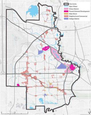
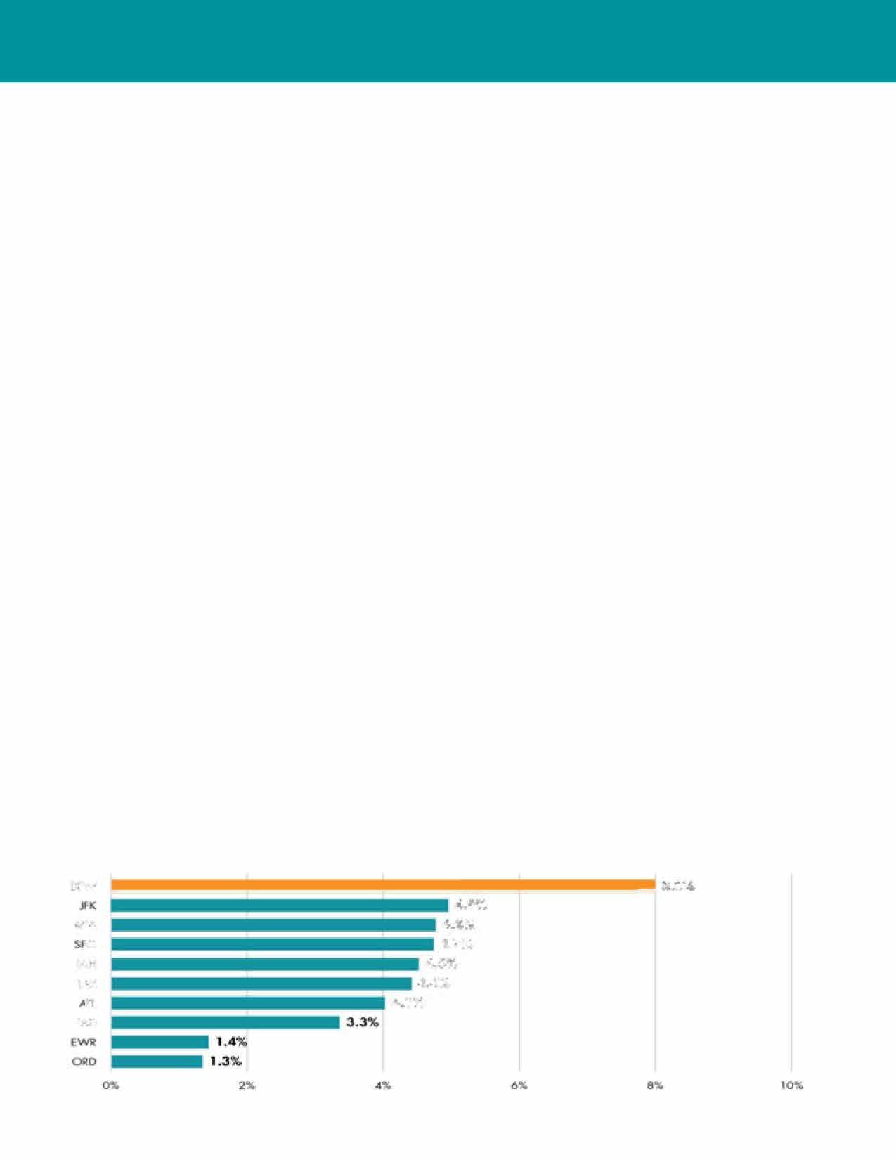
Itisimportanttoidentify economicdevelopment opportunitiesandchallengesaspartofthe comprehensiveplan,asmanyoftheseissuescan beinfluencedbylanduse,infrastructure, and transportationpoliciesandinvestments.
Irving'sstrongestcompetitiveadvantageisitscentral locationinthe DFWMetroplex. Comprehensiveplan pollingresultsfrom Irvingresidentsagreethatlocation is Irving'sgreatestasset.TheMetroplexisoneofthe mostdesirablejobmarketsinthecountry.From2010 to2014,theregion hasgainedmorethan 528,000 new residents.Thishighlevelofgrowthwassecondonly toHouston,andsurpassedthemuchlargerNewYork andLosAngelesregions. Dallas-FortWorthhasa highlydiversifiedregionaleconomythatisseeingrapid jobgrowthandinvestmentacrossmanysectors.
Thecityhasa unique combinationof economic advantagesthatmakeitan idealplaceforbusiness expansion andrelocation with DFWAirporttothe westandDallastotheeast. Irvingcontinuestoserve asamajorregionalemploymentcenter,secondonly todowntown Dallasinthenumberofnetinbound commuters.
Irvingoffersunparalleledaccessandconnectivityto thesurrounding Dallas-FortWorthregion,theentire U.S.,andinternationaldestinationsforbusinesses, workers,residents,andvisitors. Irving'slocation, whichisadjacentto DFW InternationalAirport (the fourthbusiestairportintheU.S.behindAtlanta
Hartsfield-Jackson, Chicago-O'Hare, andLAX), placesthecitylessthan fourhoursfromeverymajor businesscenterinthecountry.Itsproximityto Dallas LoveFieldAirportfurtherincreasesitsaccessibilityto domesticdestinations.
Irvingishometomanyoftheworld'smostsuccessful corporationsincludingFortune500headquarters (ExxonMobil,Fluor, Kimberly-Clark, Commercial Metals, and Celanese),Fortune1000headquarters (Flowserve,MichaelsStores, and PioneerNatural Resources),NorthAmericanheadquartersofforeignbasedfirms (NEC,Nokia,Aegis Communications Group, 7-11,amongothers),andothermajorcorporate operationsoffirmsbasedelsewhereintheU.S. Irving's largestprivatesectoremployeris Citibank, whichis headquartered inNewYork,buthasa major presence
Source: US Bureau of Transportation Statistics
in Irvingwith6,000jobsandtwocybercommand centers. OthermajorcorporationsnotbasedinIrving butwithasubstantiallocalpresenceincludeVerizon, AT&T, Sprint-Nextel, Microsoft,Allstate Insurance, AbbottLabs,andOracle.
The LasColinasbrandremainshighlyregardedasone oftheleadingbusinesscenterswithinthe Metroplex andthestateofTexas. Withdozensofmajorcorporate offices,morethan25millionsquarefeetofofficespace, andapremierconventioncenter, LasColinasissecond onlytothedowntownDallasCentralBusinessDistrict asaregionalcenterofbusinessandemployment.
Irving benefits fromestablishedhigher education institutions, thankstothepresenceoftheUniversity of DallasandNorthLakeCollege. TheUniversity of Dallasisatop-tierprivate, Catholic,liberalarts university,witha50/50splitofundergraduate andgraduatestudentsandahighlyregarded MBA programinthe University's Satish&Yasmin Gupta CollegeofBusiness.NorthLakeCollegeisanimportant
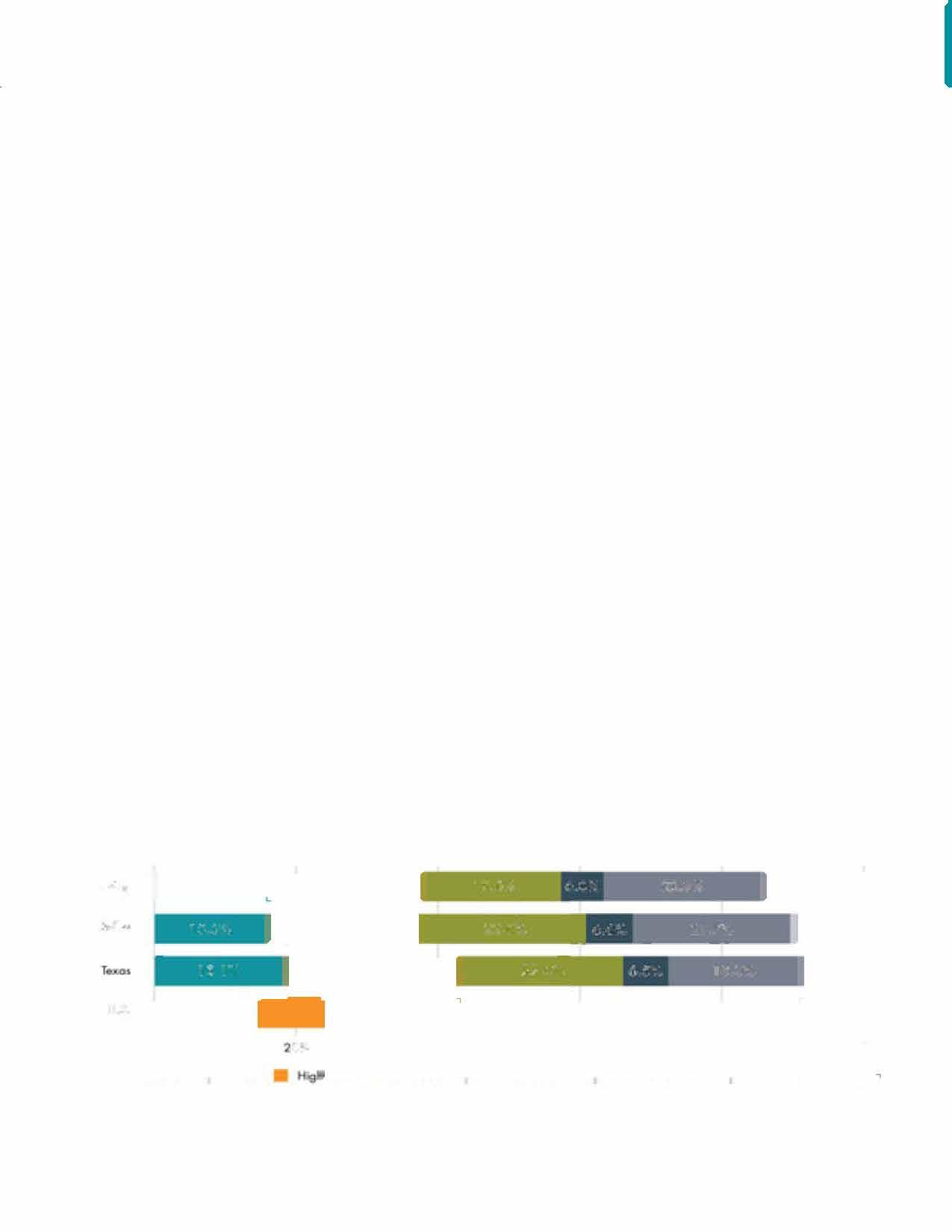
componentoftheDallasCountyCommunityCollege District,providingarangeofhigh-qualityacademic andtechnicaltrainingprograms. Thereisthepotential tobetterconnectthesetwoinstitutionswithIrving's majoremployerstosupportthecommunity'sbusiness retentionandexpansionefforts. Inaddition, Irving hastechnicaltrainingschoolssuchasDeVryand UniversalTechnicalInstitute. Irving'slocationalso provideseasyaccesstotheregion'shighereducation assetsincludingUniversityofTexasatDallas, UniversityofTexasatArlington,UniversityofNorth Texas, Southern MethodistUniversity,andTexas ChristianUniversity.
Irvinghasamyriadofsmallbusinessesservingthe local population, andwasrankedfirstinthebestcities for startingacareerin 2015byWalletHub. In 2014, IrvingledthenationinthenumberofBlueRibbon SmallBusinessoftheYearawardwinners,which recognizesstandoutsmallbusinessesacrossAmerica. Irvingcurrentlyhasmorethan25smallbusinesses thathaveachievedthishonor.


Many of Irving'ssmallbusinessesreflectthecity's diverseinternationalpopulation. Inrestaurantsalone, Irvinghasaselectionof Mexican, Asian, Indian, Nepalese, MiddleEastern, Honduran, Ecuadorian, and Brazilian. Many of Irving'sretaillocationshavecatered totheinternationalmarket, bringingamulticultural edgethatservesIrving'sdiversepopulation, includingmany specialty servicesinthemedicaland professionalfields.
Thefactthat Irvingissuchfertilegroundfornew smallbusinessformationinretail,restaurantand serviceisaplus, asitaddsvitality totheretailareas, anddiversity andinteresttothe city's livability. Along withattractinglargeinternational employers, Irving hastheopportunity totakepositivestepstoencourage andeasetheformationofsmallbusinesses. Thisis especially trueintheurbanareas, corridors, and locationssuchas HeritageCrossing, whichwillthrive onalively businessclimate.
Irving'sHispanicChamberofCommerceadvocates foreducationandeconomic development inthe Hispanicmarket. The HispanicChamber supports entrepreneurialbusinessesby developing, promoting andsupportingIrvingbusinessesandthoseserving the Hispaniccommunity. TheGreater Irving-Las ColinasChamberof Commercepromotessmall businessdevelopmentandenhancementthrough aSmallBusiness ServicesCommitteethatprovides networking, resourcesandcommunicationservices. Thecommitteefocusesondevelopingprogramsand eventstomeettheneedsofsmallbusinesses.

Astrategicapproachtoeconomicdevelopmentcomes hand-in-hand withinnovationsinlanduse, housing, transportation, andeducationtoimprovethequality oflifeforresidentsandfosteravibrantcommunity, whichinturn supports new and expanding businesses. Thisapproachisdesignedtopromote Irvingasan attractive placetolive, work, playanddobusiness.
Lookingat Irving'scensusdemographics, thesize ofthe Millennialpopulationandeducationlevelis notable. Irvingisyoungerandbettereducatedthan therestof theDallas-FortWortharea, andtheEsri TapestrySegmentationpsychographicsshow alarge concentrationofayoung,talentedworkforce.
However,somecompetingcommunitieshavehita tippingpointinthisgrowthandarefacingsignificant andcomplexproblemsregardingtrafficcongestion withlimitedpublictransitandconnectivity, and lackof affordablehousing. Theseissuescontribute toahighercostofliving, rentandlandprices, and areforcingemployerstolookelsewhereforgrowth opportunities. Thisdynamicclearly shows why thoughtfullong-rangeplanningfortransportationand landuseremainscriticalforacommunity'svitality, andservesasacompetitiveadvantage. Irvinghas thebuildingblocksandthetransportationassetsfor enhancedurbandistrictsthatcanaccommodatethe lifestylepreferencesof currentandfuturegenerations, andprovideamajorboostto Irving'surbanvitality.
Irvingis fortunate tohaveanimpressiverosterof existingbusinesses, largeandsmall, representing many differentindustries. Becauseofthecity'sstrong baseof existingemployers, thegreatest opportunities fornewjobgrowthandcapitalinvestment willcome
fromarobustbusinessretentionandexpansion (BRE) program. Withoutastrongfoundationthatproperly engagesandsupports Irving'scurrentbusinesses, otherapproachesaimedatbringinginnewcompanies, investment, andtalentcannotsucceed.
Amajoropportunityfor Irving willcomefroman aggressiverecruitment program thatbrings new jobsandinvestmentintothecity. Localandregional economiescannotthrive withoutbringingin newcompanies, investmentandtalent. Afocused approachtorecruitcompanies withrequirements thatarecompatible with Irving'sinfrastructureand resourcescanyieldimmediatepositiveresultsforthe community. Thisisespeciallyimportantgiventhehigh levelofbusinessexpansionandrelocationactivity takingplaceacrossthe Metroplex.
Irvingis wellpositionedtomakeinternationalbusiness developmentacorecomponentofitseconomic developmentprogram. Giventhecity'suniqueassets (DFW InternationalAirport, thecity'slargenumber of U.S.-andforeign-basedcorporateoffices, andaccess toalargepoolof talent), Irvingcaneasilypromote itselfasalogicalchoiceforbusinessexpansionand relocationsformultinationalcorporations. Thecity's highlevelofracial/ethnicdiversity, includingahigh percentageof foreign-bornresidents, supportsits positionasacommunitythat welcomesinternational residentsandvisitors.

» The national economy is becoming increasingly more talent-based than resource-based. Talent is a broad term that aligns with the shift to a knowledge-based economy. Desired talent is generally defined as 20- to 35-year-olds that are college educated-especially those with a science, technology, engineering, math {STEM) degree. In addition, high-tech skills through associate degrees or training are in demand for skilled manufacturing positions. The desired 20- to 35-year demographic is comprised of the Millennial generation, which is approximately 77 million people-the largest demographic the country has seen.
» Job Base. Talent moving to a new community want to know there are other opportunities if the job that brought them there does not work out.
» Simple Commute. Millennials are not defined by the automobile, and the majority avoid driving when possible. As reported in Urban Land Institute Emerging Trends 2016, miles traveled by car for those 34 years of age and younger is down 23 percent
» Urban Lifestyle. They prefer density with alternative transportation and retail nearby.
» Entertainment. Ample amenities, especially restaurants and access to outdoor recreation.
» Open and Supportive Culture. They embrace social or ethical causes and communities that are more accepting and open to all cultures and lifestyles.
Publicsectorinvolvementandpromotionof innovationholdsahighlevelofpotential. Irvingis alreadyacenterforinnovationduetoitsindustryleadingbusinesses.Additionalefforts, suchas collaborating with existing public-privatepartnerships andeducationalinstitutions, canincreaseandconnect innovationamongIrving'sexistingcompaniesand industries. Irvinghasthepotentialtobecomealeading centerofinnovationwithinthe Metroplex, andeven nationally, forspecificindustriesortechnologies.
Asuccessfuleconomicdevelopmentprogramin today'senvironmentcannotrelysolelyonthebusiness climate.Affordablehousing, amenities, educational opportunities, andaccesstomultipletransportation optionsarenecessitiesfortoday'sworkforce. Today's generationofyoungadultsfavorsurbanlivingand everythingthatcomeswithit (e.g. walking, biking, patronizinglocallyownedshopsandrestaurants). Providinganattractiveenvironmentthatappealsto young professionals, and maintaining andinvesting inresilient infrastructure, is critical foreconomic development. Thisis especially importantsinceamajor issueformostcompaniesisaccessto qualified workers. Withinthe Metroplex, agrowingnumberofcities offer walkableneighborhoodsanddynamicurban centersthat attractyoungpeopleandmajorbusiness expansionandrelocationprojects.

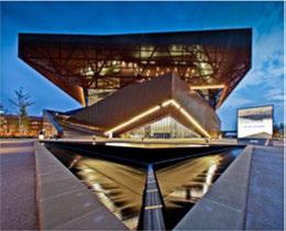
Duringworkshops, residentsnoteddifferencesin infrastructureandquality ofplace between northand southIrving, andthatitisdifficulttotraversethecity. Youngresidentswithoutavehicleexpressedahigh levelof discomfort anddifficulty whenattempting totravelfromsouthIrvingto NorthLakeCollege's northcampus. WhileMacArthur Boulevardhasan abundanceofhigher education andK-12 schools such as North Lake College's northandsouthcampuses andMacArthur, Irving, and Nimitz High School, itcan bedifficulttoaccesstheseschoolsby transit, biking orwalking. Thelackof connectivity, walkability, and amenities betweentheseinstitutions createsa barrier forpeopletoaccesstheeducational opportunities they needtothrivein Irving'sgrowingworkforce, andfor businessestoaccessqualifiedworkers.
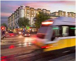
WithIrving'scombinedassetsindiversity, culture, location, andregionalandinternationalaccess, thereis untappedpotentialtobetter connect Irvingby linking residentsto employment andeducationopportunities throughoutthecity, andpromote citywide expansion of businessandculture. For Irving'seconomy tothrive, itiscriticaltoengagedisadvantagedpopulations includingracialandethnicminorities, women, individualswithdisabilities, veterans, low-income populations, andotherunderservedpopulations, ina comprehensiveeconomicdevelopmentstrategy.
Identifyingtheneedsanddesireofthecommunity, andbuildinga "knowledge-based" economy, will bedifficultwithoutthetoolstocreatealineof communicationbetweentheIrvingcommunity and existingandemergingbusinesses. Providingthe community withaccesstoresourcesandinformation willcreateavenuestoengageandempowerresidents tosupporteconomicdevelopmentinitiativesin Irving.

Attract investment from foreign businesses, help local firms gain entry into foreign markets, and create a welcoming environment for the international community.
Strategy 1.l
FUNDING FOR INTERNATIONAL DEVELOPMENT. Expand the resources available to international business development for additional staffing and activities targeting Asia, Europe, Mexico, and other strategic geographies.
1.1.1 ExpandtheChamber'sstaff capacity to better supportexisting foreigncompaniesin Irving andtoestablishandmaintainlong-term businessrelationshipsinkey foreignmarkets throughthe InternationalTrade Development and AssistanceCenter.
1.1.2. Cultivateandexpandrelationshipswith Irving corporationsthathaveanexistingglobal presence, includingforeign-based firmsand domestic firmsseekinglargerinternational marketopportunities.
1.1.3. Dedicate financialresourcestoparticipatein moreinternationaltrademissions (inbound andoutgoing)todevelopmoreopportunities for tradeandinvestment.
DFW INTERNATIONAL AIRPORT. Work closely with DFW International Airport to pursue international business development opportunities.
1.2.1 Leverage DFW InternationalAirport'snew nonstopdestinationsin foreigncountries tocultivatebusinessrelationshipsinother markets, includingpartnershipswiththe Chamberand DFW's "Connecting the World" marketinginitiative.
1.2.2. Continue to work andinvestinrelationships with DFW InternationalAirport, regionaland stateeconomicdevelopmentefforts, and Irving businessexecutivestosetuptrademissions tonewnonstop destinations, beginning with visitstothemostrecentadditions (Beijing, Abu Dhabi, Qatar).
Strategy 1.3
DIVERSITY. Leverage Irving's diverse citizenry and its global business leadership to establish the community as the premier international city in the Metroplex.
1.3.1

1.3.2.
Work withtheIrvingInternationalTrade Developmentand AssistanceCentertotestthe conceptofaninternationalsoftlandingcenter forforeign-basedstartups.
Promotethecurrentinternationalmixof companiesalready inIrvingtobuildon existingsuccessesandmakeconnectionsthat couldleadto further foreigndirect investment.
EXISTING BUSINESSES. Work with existing major corporations to identify specific countries to target for foreign direct investment (FDI).
1.4.1
1.4.2.
Buildandleveragelocalrelationshipswith foreign-basedfirms (NEC, Nokia, Siemens, Hilti, andothers) topromoteIrvingasa destinationfornewinvestmentandjobsby makingconnectionstobusinessleadersin foreignmarkets.
Strategically participate ininternational conferencesandevents, bothin partnership withthe Dallas RegionalChamberand TexasOneeffortsandasastand-aloneIrving effort.Usethesetripstomakevisitstospecific companiesbasedinthehostingcity.
1.4.3. Continueandexpandontheinternational tradework beingledby Irving'sInternational Trade Developmentand AssistanceCenter.
1.4.4. Expandthecapacity oftheInternational Trade Developmentand AssistanceCenter
Economic Development
toincreaseinternationalbusinessforIrvingbasedfirms.
• Many ofIrving'sexistingcorporationsoperate primarily intheUSbutarepursuinggrowth strategiescenteredonenteringspecific internationalmarkets. MichaelsStoresoffersa goodexampleofthiswiththeircurrentglobal expansionplans.
• TheCity andChambercanhelpby leading trademissionsthatincludeIrving-based firmstoopenupbusinessconversationsin designatedforeignmarkets.
EXPERTISE. Develop international expertise around specific industries.
1.5.1 UtilizeresourcessuchasTheEconomist magazine'sEconomistIntelligenceUnit (EIU) anditsCountry Reports, whichprovide analysisofpoliticalandeconomictrendsfor nearly 200countries, includingatwo-year forecast.
1.5.2. BeginwithIrving'sstrongestsectors (telecom, finance &insurance, professionalservices, oil &gas, healthcare) andmakeconnectionswith foreign-basedfirmswithinthesesectors.
INTERNATIONAL TALENT. Establish Irving as the premier city in the Dallas-Fort Worth metro area for international talent.
1.6.1 Createanongoingdialoguetoenhance themulticulturalenvironmentinIrving throughconversationsbetweenlocaland regionalorganizationsrepresentingdiverse communities.

1.6.2. Continuetobuildstrongerlinkagesbetween the Partnershipandotherorganizations (e.g., IrvingHispanicChamberof Commerce, the US-IndiaChamberof Commerce, theUSMexico Chamberof Commerce, theGreater DallasAsianAmericanChamberof Commerce, andothers) tomakeconnectionsforglobal businessactivitiesintradeandforeigndirect investment.
1.6.3. Cultivaterelationshipswithnational/ internationalorganizationswithheadquarters inIrving (e.g., YoungPresidentsOrganization, National Society of Hispanic MBAs, Electronic Security Association, AmericanCollege of Emergency Physicians) toassistwith internationalbusinessconnections.
1.6.4. Utilizethe EB-5 visaprogramasaway to attractforeigntalentandinvestmentinto Irving.

Create a dynamic local environment for entrepreneurship, innovation, and research & development activities.
HERITAGE CROSSING INNOVATION DISTRICT. Create an "Innovation District" in Irving's Heritage Crossing District.
2.1.1. Prioritizepublicpolicies (e.g., zoningand landuseregulations)andinfrastructure investmentsthatmakethe HeritageCrossing Innovation Districtmore attractive to entrepreneursandstartups.
2.1.2. Designatethe HeritageCrossingInnovation Districtasthefirst "fiberhood" inthe Metroplex, withaccesstoultra-high-speed internetasawaytoattracttechnology startupsandentrepreneurs.
2.1.3. Createmarketingeffortsthattargetspecific typesofbusinessestoexpandandrelocateinto thisdistrict.
2.1.4. Work withthelocalrealestatecommunityto providecoworkingspaceforentrepreneurs, startups, andfreelancersinthisdistrict.
5G MOBILE TECHNOLOGY. Establish Irving as the top location in the US for 5G innovation.
2.4.1 TheCity,Chamber, and ICVBshouldwork withthemajortelecomcompaniesinIrving (AT&T,Nokia, Sprint-Nextel. Verizon, Frontier Communications)andinthesurrounding region (SamsungTelecommunications America, Alcatel-Lucent, Ericsson)topursue a "GlobalSG InnovationConference" in Irving, heldatthe IrvingConventionCenteratLas Colinas.
2.4.2. Position IrvingastheSG Innovation Zoneor Corridor.
• Thisshouldbea standalone Irvingeffort (notin partnership withother Metroplex cities). butshouldincludeothermajor telecommunications companiesinthe Metroplex.
• AttractinvestmentindeployedSGtechnology asanationaltestlocation.

2.4.3. InpartnershipwithVerizon'sHiddenRidge developmentadjacenttotheDARTOrange Line, launchthenation'sfirstSGTOD (transitorienteddevelopment).
PUBLIC POLICIES. Encourage the growth of entrepreneurship and innovation through public policies and programs.
2.5.1 Sponsoreventsrelevanttostartupsandhighgrowthsectors.
2.5.2. Supportaccesstohigh-speedinternet throughoutthecommunity.
2.5.3. Promoteentrepreneurshipbyservingasa "connector" betweenlocalentrepreneursand thenecessaryresourcestheyseek (e.g., talent, capital, networks).
2.5.4. EncourageIrvingISD andotherlocalK-12 educationalinstitutionstoincorporate entrepreneurshipintotheiracademic curricula.
HIGH-GROWTH FIRMS. Target high-growth firms (with expansion plans) from the Dallas-Fort Worth Metroplex, other large Texas metro areas (Austin, Houston, San Antonio), and other major US markets (New York, Chicago, Los Angeles).
2.6.1. Utilizethefollowingresourcestoidentify innovativehigh-growthfirmswithin industriesthatareanaturalfitforIrving:
• Inc.5000(Fastest-GrowingPrivateUS Companies)
• FastCompany Magazine (World's Most InnovativeCompanies)
• Forbes (World's MostInnovativeCompanies)
• PWCMoneytreereport (foridentifyingrecent recipientsofventurefunding)
•MIT TechnologyReview (SmartestCompanies)
• ThomsonReuters (Top100GlobalInnovators)
SMALL BUSINESS SUPPORT. Link small business growth to the city's existing large corporations.
2.7.1. CreateacentraldatabaseforRFPsfromlarge Irvingcorporationsseekingsubcontractingor vendorservices.
2.7.2. Makethedatabaseavailabletoallcompaniesin Irving, providing opportunitiesforyoungand emerging companies.
• Expandthe Chamber's "BusinessConnection" programforthispurpose.
2.7.3. Irvingsmallbusinessescouldbecome "prequalified" toserveasavendortolarge corporations.
Establish centers of excellence in Irving through higher education and industry partnerships. Link these to entrepreneurship and actively pursue new research & development opportunities.

Strategy 3.1
CENTERS OF EXCELLENCE. Establish a task force of local and regional academic and business leaders to explore the potential to create centers of excellence.
3.1.1 Centersshouldbeledbyaconsortiumof collegesand universitiesinvolvingthe Universityof Dallas, North Lake College, other Metroplex highereducationinstitutions, and potentially otherstateornationalinstitutions.
3.1.2. Centersshouldinvolvemultiple Irving businessesandother Metroplex businesses, focusedonindustryclustersinwhich Irving hasacompetitiveadvantageandinwhich innovationisakeyfactorforbusinesssuccess.
3.1.3. Thetask forceshouldconsiderthefollowing potentialfocusareasforcenters:
• 5G mobiletechnology
• Privatesectorcybersecurity
• Corporatetrainingmethods &software
• Smart Citiesinfrastructure
-I(
» Centers of Excellence are defined by three key ingredients:
» A consortium among multiple higher education institutions and/or research organizations
» Partnerships between higher education and industry
» A focus on a specific industry, a single research topic, or a particular training program
» Examples of successful centers of excellence include: The UT Center for Identity in Austin, TX; The Research Triangle Materials Research Science and Engineering Center in Durham, NC; The Cyber Center of Excellence in San Diego, CA

Reinforce and invest in Irving's business retention & expansion (BRE) program as a cornerstone of the community's economic development efforts.
Strategy 4.1
INDUSTRY CLUSTERWORKING GROUPS. Work through the Chamber's HR Advisory Council to establish formal industry cluster working groups for these target sectors: technology (telecommunications, software, industrial technology/advanced manufacturing) corporate operations & related services (corporate HQs, corporate training, professional services), and health care.
4.1.1 Holdregularmeetingstoprovideforumsfor communication, relationship building, and informationgathering.
4.1.2. Identify cross-cuttingissuesthataffectthe sector.
4.1.3. Craftsolutions, monitortheissues, andtrack progresstowardsaddressingthese issues.
Strategy 4.2
EXISTING BUSINESS DATABASE. Maintain and grow Irving's database of existing businesses.
4.2.1 Thedatabaseshould beevaluatedand expandedonaregularbasiswithafocuson companiesthatserveexternalmarketsorare suppliersto Irving'sprimary employers.
BUSINESS VISITATION PROGRAM. Strengthen Irving's business visitation program by expanding outreach efforts with C-level executives.
4.3.1 Ensurethatstaffresourcesareavailableto meetregularly withIrving'slargeemployers, andifneeded, increasetheleveloffunding andstaffresourcestoaccomplishthisgoal
4.3.2. Prioritizebusinessvisits byemployersize, employergrowthrates, targetindustries, and leaseterminations.
4.3.3. Structurethevisitstogaugetheabilitiesand needsof local businessesinordertooperate successfullyandtoexpandin Irving.

4.3.4 StructureBREvisitstoserveseveralpurposes:
• Educatethecompany aboutthe Partnership anditsservices;
• Collectanswerstoastandardseriesof questionsinordertoquantify challengesthe company isfacing;
• Identify opportunitiestoaidlocalbusinesses thatarefacingchallenges, thereby retaining thosecompaniesinthecommunity;
• Identify companiesthatareexpanding operationswithinandoutsideof Irving;
• Probe supplierattractionopportunitiesthat wouldbenefitexistingcompanies; and
• Identify companiesconsideringrelocating outsideofthecommunity.
• Capturetestimoniesfromlocalcompanies aboutwhy they havechosen Irvingastheir businesslocation.
4.3.5. Developaquestionnairetocapturecritical informationfrombusinessexecutivesduring visits.Theinformationcapturedduringthe visitshouldbe routinely enteredintothe employerdatabaseforfuturereporting.
4.3.6. Continuetoengagelocalstakeholders (e.g., utility companies, chambersofcommerce, city staff) asactivepartnersintheBREprogram, includinginbusinessvisitations, tostretchthe programtoachievegreaterresults.
4.3.7. Pursueaggressivemonthly, quarterly, and annualgoalsforbusinessvisitsinthe BRE program.
BRE TOOLS. Utilize a variety of tools and methods to enhance the community's BRE program.
4.4.1. Employ theuseofCustomerRelations Management (CRM) softwareto better monitorbusinessissuesandconcernsand toshareinformationbetween Partnership organizations.
4.4.2. ContinuetousetheCity'sannualonline businesssurvey asameansforkeepingin touchwithlocal businessesanddocumenting specificchallenges, opportunities, and/or expansionplans.
4.4.3. IncludequestionsontheCity survey for employersregardingtheirattitudetoward thebusinessclimate, talentavailability, and workforcequality inIrving.
4.4.4. Utilizelocalexpertstoassistbusinessesin areassuchasfunding, international trade, lean manufacturing, successionplanning, andsales andmarketing.
CEO ENGAGEMENT. Restructure the Chamber's existing business executive engagement {including "CEO Breakfast" events) and the Mayor's CEO Advisory Council to address the initiatives of this plan.
4.5.1. Encouragebusinessleaderstointeractwith localpartnersoneconomicdevelopment strategy, smallbusinessassistance, talent management, andeducation.Informal roundtablesstimulatetopicsofdiscussionthata survey orquestionnairecannot.
4.5.2. CultivaterelationshipswithCEOsoflocalfirms thatarebasedoutsideof Irvingtocreatean openchannelofcommunication, including annualvisitsto out-of-marketcorporate headquarters.

Strengthen Irving's business recruitment program through partnerships with existing businesses and by strengthening ties with business allies for regional and state recruitment activities.
Strategy 5.1 RELATIONSHIP DEVELOPMENT. Cultivate relationships and networks with business decision makers for the recruitment of new jobs and investment into Irving, focusing on target industries.
5.1.1. Respondtoallbusinessrecruitment/ expansionprospectleadswithin24hours, usingaco-signed (by the Chamberandthe City) letterofinteresttoleads.
5.1.2. Expand Irving'sdatabaseofrealestate developers, commercialandindustrial brokers, andsiteconsultants.
5.1.3 Conductatleastfourrecruitingtrips/ marketingmissionsper year (onceeach quarter) tomeet withcompany executives inout-of-statemarketswithahigh concentrationof firmsintargetindustry clusters.
• These tripsshouldfocusonregions where HQ officesofmajorcorporationswithasignificant Irvingpresencearelocated.
• Expandpartnershipsforthesetripswith TexasOne, theDallas RegionalChamber,and DFWInternationalAirport.
5.1.4. Hostafamiliarization ("fam") tourin Irving thatbringsincorporaterealestateexecutives, sitelocationconsultants, andcommercial
5.1.5. andindustrialbrokerstoshowcase Irving asaviableoptionfornewinvestmentand business expansion.
• Focusthefamtouronaspecificbusiness opportunity, suchasredevelopmentof theformerTexas Stadiumsiteor another potentialTODproperty.
• Aspartofthefamtour,includeamixof Metroplexandout-of-staterealestate professionals/executives.
Continuetoconductregional"roadshows" to commercialrealestateanddevelopmentfirms inthe Metroplex
Strategy 5.2
EXISTING BUSINESSES. Regularly engage Irving's existing employers to identify opportunities for the recruitment of new companies into the community.
5.2.1. Strengthenthe Chamber'seffortstoengage businessexecutives(e.g., Technology Leadership Council) by bringingtogethera smallgroupof 8 to12executivestodiscuss emergingtrendsthatcouldleadtonew opportunitiesforbusinessattractionwithin the city's targetindustries.
5.2.2. Work closely with Irving'sexisting employers toidentify opportunitiesfortherecruitment of suppliersorserviceproviders whocould benefitexistingemployersifthey werealso locatedinIrving.
Strategy 5.3
PARTNERS. Continue to build strong relationships and leverage partnerships with regional and state business recruitment efforts.
5.3.1. Maintainanactivepresenceatregional businessrecruitmentefforts withthe Dallas RegionalChamberof Commerceandits DFW Marketing Team.
5.3.2. Continuethe Chamber'sparticipationin state-widebusinessattractioninitiatives throughTeamTexas, TexasOneandthe Governor'sOffice.

Strategy 5.4
MARKETING MATERIALS. Create new marketing materials for the Partnership specific to Irving's strongest assets for the growth and expansion of firms in target industries.
5.4.1. Createhigh-quality, flexible (onlineandprint) marketingpackagesthattellthestory of why Irvingistherightlocationforbusinesses withineachtargetindustry.
5.4.2. Eachmarketingpackageshouldbesimple, yet powerful, andbeuniquetoeachtarget industry. The package shouldcontainthe following:
•Amapanddetailedlistingof existing firms locatedin Irvingwithintheindustry.
•Asimilarmapandlistingof Irving firmsin relatedsupportindustries.
•Asnapshotoflocal/regional workforce strengths withinthesector,highlightingkey occupations.
• Uniqueprograms, infrastructure, innovation assets, andapplicablelocalorstateincentives.
• Testimonialsfromlocalexecutivesand firms thathaverelocatedtoIrving.

Employ more aggressive incentives to encourage job creation and investment.
Strategy 6.1
IRVING ECONOMIC DEVELOPMENT PARTNERSHIP. Clarify and formalize the roles and responsibilities of economic development partners.
6.1.1. Work witheachof Irving'seconomic development partners (Cityof Irving, Greater Irving-Las ColinasChamberof Commerce, IrvingConvention &VisitorsBureau) to ensurethatprocessesarestreamlined, transparent, welldocumented, and well understood.
6.1.2. Createaunifiedbrandforuseinalleconomic developmentmarketingmaterialsthatis representativeofthePartnershipandits partner organizations.
6.1.3. Encouragefirmsreceivingpublicincentivesto becomeinvestorsinthePartnership.
Strategy 6.2
FUNDING FOR
OPERATIONS. Re-energize the Irving Economic DevelopmentPartnership with expanded funding, in concert with theChamber's forthcoming capital campaign.
6.2.1. Annually benchmark thelevelof funding andresourcesforthe Partnership against communitiesinthe Metroplexthatregularly compete with Irvingfornewjobsandcapital investment.
6.2.2. Explorethepotentialforgeneratinga higherlevelof privatesectorsupportfor the Partnership throughacapital campaign. Coordinatethefundingstreamsforeconomic development, withpublicandprivate dollars, toensure Irving's long-term competitiveness.
6.2.3. Useadditionalfundingresourcestobuildstaff tosupportthecurrenthighlevelsofeconomic developmentprospects, andtheanticipated futurehigh workloadresultingfroman expanded program.
Economic
Development
FOR BUSINESS
& EXPANSION. Establish a set of public incentive policies and programs directly aimed at growing and recruiting firms in Irving's target industries, and attracting quality jobs for Irving residents.
6.3.1. Createaneconomicdevelopmentincentive fundthroughareallocationofthe City'spropertytax (similarto Planoand Richardson).
6.3.2. ReviewtheCity'sincentivesrelativetothe targetindustriesandtheCity'sperformance metrics.
6.3.3. Establishminimumthresholdsfor both wagesandcapitalinvestment.Only provide incentivesforprojectsthatcreatejobs with wagesthatpay adeterminedpercentage (such as25percent)abovetheindustry median wageand/oraboveIrving'soverallmedian wages.
6.3.4. Createananchoremployerprogramthat incentivizesIrving'sexistingbusinessesif they play a significant rolein helping recruit akey supplier, service provider, orcustomer business intothecity (similar tothe Stateof RhodeIslandprogram).
6.3.5. Specifytargetindustries (using NAICScodes) thatareeligibletoreceivecertainincentives (similartoArlington).
6.3.6. Specifythelevelsofcapitalinvestment necessaryforfirmstoreceiveincentives.
6.3.7. Maintainmandatory annual "certificatesof compliance" forany businessesreceiving incentivestoensurethattheymeetorexceed

thejobcreation andcapitalinvestment requirements.Theseshould beineffectfor thedurationoftheincentivesterm (i.e., each yearof a5-yearor10-yeartaxabatement).
6.3.8. Continueusingsoftwareprogramsto measuretheeconomicandfiscalimpactsof providingincentives.Thesetoolsareusedto gain acomprehensiveunderstandingofthe costsand benefitsof abusinessexpansionor investment.
6.3.9. • • Encourage businessestohirelocally aspartof Irving'sincentive package.
Whilenotaformal requirement, preferenceshould begiventocompanies who makeademonstrableefforttoemployIrving residents.
Work withlocalorganizations (e.g., the Chamber, IrvingISD, North LakeCollege)to expandthepoolofcandidatesforjobsatnew orexpandedIrvingfacilities.
Enhance the community's incentives aimed at revitalizing neighborhoods and commercial corridors in strategic development areas.
6.4.1. Expandthegeographicreachof theCorridor EnhancementIncentive Programtocoverall prioritizedsites.
6.4.2. Revisethe Small Business Expansion Incentive Programtoencouragethe recruitmentofsmall businessesfromoutside of Irving, especiallyinprioritizedsiteslikethe HeritageCrossingDistrict.

6.4.3. ExplorethefeasibilityofestablishingTIRZ districtsforeachofthecity'sprioritizedsites, wherevertheyarenotalreadyinplace.
6.4.4. Createanewretailsalestaxrebatefor materials purchasedlocallyforusein approvedrevitalization projects.
Strategy 6.5
RESEARCH CAPACITY. Enhance data collection and analysis for the community's economic development activities. The intersection of real estate, demographics, industry trends, and international development requires a deeper understanding of how these relate to opportunities in Irving.
6.5.1. Createafull-timesenior-levelresearch staffpositiontodevelopadeepknowledge ofvariousbusinessaspectsof Irving.This positionshouldresidewithintheCityof Irving.
6.5.2. UsethisnewCityofIrvingresearchdirector positiontouseadata-drivenapproachto supporttheChamber'sbusinessretention, expansion, andrecruitmentefforts.
6.5.3. Maintainlocaldatanottrackedbypaid subscriptionservices.
6.5.4. Createandregularlymaintainan
6.5.5. onlinedashboardwithlocalrealestate, demographic, andeconomicdata.TheRegion 2000 Local EconomyDashboardforthe Lynchburg, Virginiametroareaisagood exampleofanonlinedashboard (www. region2000dashboard.org).
EstablishthePartnershipasthe "goto" place foranydataonIrving.
6.5.6. Publishrelevantreportson Partnership organizationwebsites.
CENTERS AND CORRIDORS. Promote centers and corridors designated on the Vision Map as premier development and redevelopment opportunities in the Metroplex.
6.6.1
6.6.2 PUD #6 (Former Stadium Site):
• Positiontheformerstadiumsiteandits surroundingsasapremierredevelopment opportunityintheentire Metroplex.
• Continueworkingwithmajorlandowners andotherstakeholders (i.e.transportation planners, utilitycompanies)toimplement PUD#6andmakethismajorurbancenter readyforhigh-valuedevelopment.
• Promote PUD#6asaprimelocationfor one-of-a-kinddevelopmentopportunities, includinglandusesthatdonotcurrentlyexist inmanyotherplacesinthe Metroplex.
Irving Boulevard Corridor:
• Continuetomaintainapro-businessattitude towardsredevelopment.
• ImplementtheIrving Boulevard Enhancement Study'svision.
» Employcreativereinvestmenttools andincentives.
» Secureamarketingofficealongthe corridor.
» Fundan investment programthrough voluntary membership dues, and short-term funding throughtheCity of Irving.
» Expandthefundtodisperselowinterestloansforthepurposeof updating storefront facades along Irving Boulevard.
• Focusonacomprehensivegood-willapproach tocleanupthecorridorthateducates businessesandresidentsonservicesavailable tohelpcomplywithCityof Irvingcodes.
• Createpublic-privatepartnerships that leverage resourcestoreinvestaroundcatalyst sites.
• Initiatetwodemonstrationprojectsto showcaseinvestmentpotentialalongthe corridor (CulturalArtsDistrictandTech CenterUrbanVillage).
• Cultivateastrongworkingrelationship andongoingconversationwithIrving Mall ownerstoensuretheeconomicvitalityofthis corridorovertheshort-termandlong-term.
6.6.3 Las Colinas Urban Center:
• Supporttheongoingdevelopmentofthe Las ColinasUrbanCenterentertainmentdistrict asanamenity-richcenterpiecethatattracts peopleandbusinessestoIrving.
• PartnerwiththeIrvingConventionand Visitors Bureautopromotetheconvention centerandemergingentertainmentdistrict.
• Attracthighdensitymixedusesintheurban center.
Strategy 6.7
lncentivize transit-oriented development (TOD) areas and encourage high-quality, dense development around DART Orange Line and TRE Line stations by establishing appropriate zoning and land use regulations for these areas
6.7.1 Identifytypesofnonresidentialor commercialusesthataredesirableandviable fortheseareas.
6.7.2

6.7.3
Ensurethatlandremainsavailablefor corporateHQsandmajorofficedevelopments, withinamixed-usesetting, ateachofthe TODsites.
Continuetocommunicatewithmajorland ownersholdingpropertiesadjacenttotransit stationstoidentifyandaddressbarriers/ opportunitiesfordense, walkablemixed-use developmentsatTODsites.
6.7.4
6.7.5
Establishanaggressiveincentiveprogram toencouragedensemixed-usedevelopment withindefinedTODzonesadjacentand proximateto Irving'srailtransitstations.
Ensurethatamix ofresidentialandnonresidentialusesexistwithinstationareas.

Goals,
Support and leverage Irving's hospitality assets and strategically enhance linkages between the City's business recruitment program and its conference/event solicitation and promotion efforts.
IRVING CONVENTION CENTER. Work with the ICVB to expand on the economic development potential of the Irving Convention Center.
7.1.1. Continue to work withthe ICVBtoattracta new conventioncenterhoteladjacenttothe IrvingConventionCenter.
7.1.2. Supportimprovementstothephysical connectivity andpedestrianinfrastructure betweenthe IrvingConventionCenter, thenearby DART Orange Linestation, and surroundingdevelopmentsin Las Colinas.
FESTIVALS IN IRVING. Leverage the city's funding for promotion of its Heritage Crossing District and festivals and events in the area to introduce a higher level of interest and vibrancy in the city's historical core.
7.2.1. Forthisstrategy tobe successful, thecity
wouldneedtoallowtemporary beerand wine salesincity parksandstreetsduringfestivals.
7.2.2. Work withthe Texas Musicians Museumand otherkey stakeholderstoidentify andpursue opportunitiesfor distinctive newfestivalsand eventsinthe HeritageCrossing District.
TARGETED CONFERENCES & EVENTS. Create new linkages between the Chamber's business recruitment efforts and the ICVB's conference/event promotion activities.
7.3.1. Supportthe ICVBanditsBoardof Directors inits work toregularly conveneagroup ofleadersfrom Irving's hospitality sector toreveal opportunities toleveragethe community's visitorservices industry (hotels, restaurants, andotherbusinesses) to support theCity and Chamber's economic developmentprograms.
7.3.2. Identifyindustry associationswithineach targetindustry andencouragethemtoconsider Irvingasadestinationforannualeventsand meetings.
7.3.3. Targetnewevents/conferencesattheIrving ConventionCenterandIrving'shotelsthat bringinkey businessdecisionmakersfrom targetindustries.
7.3.4. Work closely withtheICVBtoidentifytrade showsandconferencesheldatthe Irving ConventionCenterandatIrving'shotelsto determinewhichonesrepresentthebest opportunity forbusinessrecruitmentand
7.3.5. showsandhaveaboothtodistributemarketing materialtoattendees.
7.4.2. Work withthe ICVBtoputinplaceadatadrivensystemthatevaluatesthebusiness recruitmentpotentialofeachmajorconference andtradeshow.
Strategy 7.5
INCENTIVES Structure local incentive policies to support the community's hospitality sector.
7.5.1. Addguidelinesforbusinessesreceiving incentivestouse "commerciallyreasonable efforts" toplaceallcompany-managedhotel roomnightsrelatedtothecompany'sbusiness activitiesathotelslocatedintheCity of Irving. marketingactivities. Attendrelevanttrade 7.5.2. ExpandthecurrentICVBBusiness Development Incentive Plantoinclude
specificincentivesfortargetindustry events/ conferences.

SupporttheICVBandtheChamberintheir effortstogrow Irving'scorporatetraining sectorby attractingmeetingsandother engagementsofexistingbusinesses.
7.3.6. UsehighprofileeventsinIrvingandthe regionasawaytocultivaterelationshipswith businessdecisionmakersinthe Metroplexand outsidemarkets.
Strategy 7.4
RESEARCH. Utilize the new City of Irving research director position to support the ICVB's visitor attraction efforts
7.4.1. SupporttheICVBinitsongoingeffortsto determinetheeconomicimpactsof Irving's hospitalitysectorandshowcasetheindustry's valuetothelocaleconomy.

Enhance Irving's image as a place that combines business growth with richer residential and entertainment opportunities.
Strategy 8.1
ENGAGE YOUNG PROFESSIONALS. Regularly engage the many young professionals and other young adults living in Irving to gain a better understanding of the desires and needs of this key segment of the workforce.
8.1.1. Work withthe Chamberandyoung professionalsgroupsexistinginmanyof Irving'slargecompaniestodesignasurvey to gaugethequalityoflifeamenitiesin Irving.
8.1.2. Thiscanhelpthecity understand which amenitiesaremostcriticalforthe attraction andretentionof young, talentedworkers.
Strategy 8.2
ONLINE & SOCIAL MEDIA. Use social media and technology solutions to manage and positively influence Irving's online and social media image.
8.2.1. Activelymanage Irving'spageon Wikipedia toensureitsaccuracy andtomaintainits emphasisonthecity'spositiveelements.
8.2.2. Ensurethattheinformation being communicatedabout Irvingthroughonline andsocialmediachannelsispositive, consistent, andaccurate. Thisincludesany informationsharedthroughregionalmedia outlets.

AMBASSADORS & CONNECTORS. Work with the Chamber and ICVB to create an Irving Digital Ambassadors Program that utilizes a network of "connectors" who share positive stories about Irving online and through social media.
8.3.1. Identify whotheconnectorsandthought leadersin Irvingare, andencouragethemtobe digitalambassadorsforthecity.Identifyleading individualswithinkey stakeholdergroups (e.g., youngprofessionals, empty nesters) toservein anambassador/connectorcapacity.
8.3.2. Developcontentthatportraysapositiveimage ofthelocalbusinessclimateandhighlights opportunitiesforbusinessandtalenttobe successfulinthecommunity.
8.3.3. Createanincentivesystemthatrewardsdigital ambassadorsforactively participating.
8.3.4. PromotetheprogramacrosstheCity, Chamber, and ICVB'slocalexistingcommunications channels, includingtraditionalandsocial media.


The
greatest threat to our planet is the belief that someone else will save it.
~ Robert Swan
Citieshaveamajorroletoplay inpromotingandpracticing environmentalsustainability. Wemustprotectournatural resourcesforfuturegenerationstouseandenjoy. Irvinghas many scenicnaturalfeaturesthataregreathabitatsforplants and wildlife. Theseareasincludethe ElmFork oftheTrinity River, lakes, forests, wetlands, canals, andthecity'smany parks andtrails,includingtheCampionTrail.
Thecity shouldprotectandconservetheseenvironmental assets, fosteranactive, resilient, ecologically diverseand economically soundcommunity, andcontinue "greening" the city'sownoperationstoleadthroughaction.
Theeverchangingconditionscreatesgreateruncertainty inweather, food, water, andenergy. Thecity shouldlook tostrategiesandsolutionsthatsupportthecity'sresidents andbusinesscommunity andimproveresourcesecurity and resilience.
» Irving implements sustainable policies and promotes development that reduces vehicle miles traveled, and water and energy consumption - contributing to cleaner air and water, and the preservation of natural resources.
» Irving supports beautification across all parts of the city.
» Irving provides all residents with compelling reasons to remain in the city.
» Irving is a destination city.
» Irving is at the forefront of innovation and business development, supporting its industry-leading private sector employers and its forward-thinking community leaders.
» Irving is growth-oriented, committed to the support and continuous improvement of existing businesses, infrastructure, amenities, and the workforce.

Irvinghasasupportiveandwell-developededucational programforresidentswhowanttoreducetheir environmentalfootprint. TheThinkGreenBeGreen programsupportsconsumersinmakingresponsible purchasesandtakingactionatthe individual and communitylevels. Interestedresidentscanbecome involvedintheGreen Advisory Boardtofurther contributetotheseefforts. Thecitypromotesthe following actions:
• Purchaseof alternativefueledvehicles
• Properly maintainvehicles
• Savegasbyreducingroadspeed
• Reduceidlingtime
• Payattentionto OzoneAlertsandOzone Action days
• Encourageuseofpublictransportationby working withDARTtoimproveaccess, serviceand amenities
• Encouragebicyclingandwalkingbycreatinga bicycleandpedestrianfriendlyenvironment
• Avoidunnecessarytripsbyconsolidatingerrands intoonetrip
• Encouragecarpooling andridesharing
• Harvestrainwaterandencouragerainwater harvestingthrougheducation
• Conservewaterathomeby fixingleaks, installing low-flowwater fixturesinsinksandshowers
• Plantnativelandscapingandencouragenative landscapingthrougheducation
• Washingonlyfullloadsoflaundryanddishes
• Utilizecommunitygardensandsupporteffortsto establishcommunitygardens
• Learntogrowyouownfood
• Supportlocalfarmermarkets
• Selectnativeoradaptedplantsthatwillattract pollinatorsinthegarden
• Participate inregionalpollinatingprotection efforts.
• Reducehowmuchtrashyoucreateindailylife
• Recycle
• Practicereusebyusingreusabledishware, reusable shoppingbags, andrechargeablebatteries
• Reduceenergyconsumptionwithcompact fluorescentand LEDlightbulbs
• Airdryclothesinsteadofusingthedryer
• UpdateapplianceswithEnergy Starrated appliances
• Insulateyourhomeandwaterheater
• Purchasegreenpowerfromthepowerutility
• Installsolarpanels
• Weatherizewindowsanddoors
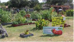
Environmentalconcernstoday spanfromthelocal -suchasairandwaterquality - toglobalissues. Regardlessofthescale, wecanalldoourpartto transitionfrom"businessasusual" topracticesthatnot only sustainbutregeneratenature'ssystemstoimprove health andbuildresilienceherein Irving.
Thecity providesrobustsupporttoresidentsinterested in "greening" theirlifestyletodolessenvironmental harm. Thecity shouldcontinueitsenvironmental programs, andalsopushtoidentify newwaysto transitionfrom "green" practicestopracticesthat sustain, restore andregenerate Irving'senvironmental quality.
Ouractionsasindividuals, businesses, andasa community canbe understoodonaspectrum, rangingfromconventionalpracticesthatoftenlead toenvironmentalharm,tosustainablepracticesthat maintainnonetimpact, alltheway toregenerative practicesthatactually buildenvironmentalhealth. Shiftingourwaysofoperationanddoingbusinessto moresustainableorregenerativepracticesrepresentsa paradigmshiftinhowthecity andthecity'sbusinesses andresidentscanacttoprotectandrestorethe local naturalenvironmentandthesharedecosystems.
CONVENTIONAL - maintainbusinessasusualwith potentialfornegativeimpacts
GREEN - dolessharm
SUSTAINABLE - achieve anetneutralimpact
RESTORATIVE - improveenvironmentalconditions
REGENERATIVE - participateincreatingahealthy ecosystem
Conservation, Sustainability + GreenInitiatives

Weatherconditionslocally aswellasaroundtheglobe arechanging, andinthenext20to30 years, there may begreatervariability andmoreextremeweather events- whetherdeeperdrought, moreviolentstorms, ordestructive flooding. Thecity shouldconsideractions thatsustainandexpandlocalresourcesandthecity's capacity toweathergreaterextremesandunpredictable circumstances.
Theurbanheatislandeffectisawell-documented phenomenonwherethetemperaturewithincities stayssubstantially higherthannearby ruralareas. Thishappensbecausebuildings,roads, parkinglots andotherstructuresabsorbandre-releasetheheatof thesunlongintothe eveninghours, sothatovernight temperaturesdonotfallasmuchaslessurbanized areas. Treesprovidecoolingbothwithshade and evapotranspirationandhelptomitigatethislocalized heatingeffect. AsIrvingcontinuestogrowandin certainareassuch asPUD #6become more dense, itwill be importanttofactorinsustainable design toreduce theheatislandeffects.
Protectingagainstmoreerraticweathercanbedifficult - thepriority shouldbeonsafety, minimizingproperty damage andlossoflife, andresilience; community safety andpreparednessarekey factors.
Clean airandwaterare easy totakeforgranted, until they arethreatenedandposearisktohumanand environmentalhealth. Althoughpoor airquality and waterquality arebothdispersedproblemsthatcan occur beyondmunicipalboundaries, therearestepsthe city cantaketoreducelocally-generatedpollutionand improveenvironmentalquality withinthecity.

Stepstoreducemotorvehiculartraffic, encourage transituse, walkingandbikingcanallreduceair pollution.Sustainablestormwaterpracticesthat "slow, spread, andsink" therunoffcanreducetheburdenon stormwaterpipes, reduce flashflooding, andimprove waterquality throughsoilfiltration.
Thecity hastheopportunity toleadby example withadoptionofrenewableenergy technology, and considerlong-termsavingsthatcouldberealizedby installingsolarphotovoltaicpanelsfornewandexisting municipalstructures.Inprocurement, thecity should explorewaystopartnerwithneighboring jurisdictions, businessesandresidentstoexpandavailability and reducecosts.
TheStateofTexasprovidestheProperty Assessed CleanEnergy (PACE)program, adoptedin2013, to enable commercial property ownerstoobtainlongterm, low-costfinancingforwaterconservationand energy efficiency upgradestoexistingproperties.The city hastheopportunity tousethePACEprogramto open availability for financingfor efficiency upgrades forthe commercial andindustrial sectors.Property ownerswhoelecttoparticipateinPACEfinancingwill selectcontractorstoperformtheworkandlendersto provideloansthatmay fundupto100%oftheproject costs.PACEloansaresecuredby assessment liens voluntarily imposedbytheownerontheproperty andarerepaidthroughannualassessmentscollected by localgovernmentsorotheragreeduponcollection methodandremittedtothePACElenders.The nonprofit KeepingPACEinTexasprovidesassistanceto municipalities interestedinbringingPACEtocitiesand countiesacrossthestate.
Buildingsconsumenearly halftheenergy produced intheU.S.andproducenearly halftheCO2emissions, soefficiency improvementsinbuildingtechnology over "businessasusual" willhavesignificantimpacton bothoperationscostsandgreenhousegasemissions. Adoptinggreenbuildingpracticesforallnewbuildings andrenovationswillprovideleadershipinaddressing thisconcern. Althoughupfrontcostsaretypically marginally higher (duetomaterialsas wellastimeand learningassociatedwithlesscommonconstruction practices), thecostsofoperationcanbefarless thanconventionalconstruction, whichisespecially importantforgovernment.
Exploringandincorporatingnewadvancementsinto thecity'sinfrastructurecanhaveamajorimpactonthe city'sdrainagesysteminfuturedecades.Therearea rangeofsustainablewatermanagementanddrainage bestpracticesthatincludepermeablepavement, bioswalesandraingardens, amongothers.
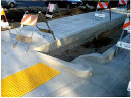
Conservation, Sustainability + Green Initiatives
Treesareamongthemostvaluablenaturalelements oftheurbanenvironment. Notonly dothey beautify andshadethecity, they providehabitat, cooling, water quality improvements, floodcontrol, soilstabilization, andtemperatureregulation. Nativeplants, especially nativetrees, canhaveastrongpositiveinfluence onincreasingbiodiversity inurbanenvironments by providingshelter,food, andpromotingbeneficial ecologicalrelationships.
Todiversify andincrease Irving'streepopulation, the city candevelopanurbanforestry programtoidentify, mapanddiversify thecity'streecanopy onpublicand privateproperty acrossthecity andalongtheTrinity River.Thiseffortcouldincludepartneringwiththe City of Dallastoexpandreforestationandrecreational opportunities withintheTrinity RiverCorridorand alongtheCampionTrail.
TodeveloptreecanopiesalongIrving'sstreets, treemanagementguidelinesfortreesinrights-ofwaysshouldbedeveloped. Theseguidelinesshould becoordinatedwithutility companiestoensure appropriateplantingandmaintenanceoccurs. Thesize, placementandspeciesoftreesbeingplantedshouldbe consideredtoaddressspeciesdiversity, lessenpotential forstormdamage, andmitigateeventualconflictswith utilitiesasthetreesgrowandmature.
Advancements in water management and drainage technology are being developed. Recently a concrete that is capable of absorbing up to 1,000 gallons of water in the first minute was introduced. Generally, one square foot this new road surface, can drain around 150 gallons in a minute. This new high-tech concrete works by having a permeable layer on top, which allows water to drain through a matrix of large pebbles and then down into a loose base of rubble beneath. The water is then fed into a drainage system that is connected to groundwater reservoirs. The water quickly disappears from the surface and can be fed right back into the city's irrigation system.


Conservation, Sustainability + Green Initiatives
Conservation, Sustainability + GreenInitiatives
Goals,Strategies+Actions
Goal 1: Use city procurement to provide leadership in sustainability.
Strategy 1.l
Work with institutional buyers (such as schools, commercial food service companies, and prisons) to promote local food purchasing. Local restaurants and the Irving Convention Center could adopt this practice as well.
Strategy 1.2
Examine establishing a program to help reduce food waste that is still viable by connecting grocery stores and restaurants to local food banks, faith-based groups and organization who serve low income families.
Strategy 1.3
Explore opportunities to develop partnerships or buying collectives to expand residents' access to products and services such as solar panels, rain barrels, and renewable energy from public utilities.
Strategy 1.4
Continue to pursue city vehicle fleet investments that reduce energy consumption, improve air quality, reduce or eliminate greenhouse gas emissions, and lower transportation costs for maintenance and operations. Consider life-cycle expenses (including operations and maintenance) when comparing costs. Electric vehicles, natural gas vehicles, gas/ electric hybrid vehicles, renewable energy powered vehicles, and other new technology should all be considered.
Strategy 1.5
Explore opportunities to expand green building technology for new municipal buildings and renovations. Explore options for building and neighborhood certification, such as LEED, Energy Star, and others.
Strategy 1.6
Formally prioritize locally produced, recycled and recyclable products and materials in city procurement.
Strategy1.7
Update city ordinances to support local North Texas agriculture. Explore partnership opportunities to create a vibrant farmers market, whether city or privately operated.
Strategy1.8
Purchase and install hydration water fountain stations at all city facilities. Hydration stations are designed to reduce the use of disposable, single-use water bottles and encourage drinking container reuse.

Strategy1.9
Purchase and install energy efficient automated hand driers in all city facilities to reduce the need for paper hand towels.
Strategy1.10
Upgrade all city-operated restroom, kitchen and breakroom facilities with low flow water features.
Strategy1.11
Study opportunities to incentivize net zero energy development through amendments to the building codes, development standards and other mechanisms.

Conservation, Sustainability + Green Initiatives
Conservation, Sustainability + GreenInitiatives
Goal 2: Maintain, upgrade and improve the city's infrastructure sustainably.
Strategy 2.1
Coordinate roadway, transit and utility improvements with green infrastructure upgrades such as bioswales, rain gardens, green and reflective roofs, street trees, and other vegetation, which will help to beautify the city, reduce the urban heat island effect and wastewater costs, and increase property values.
Strategy 2.2
Increase number of electric vehicle charging stations throughout the city, including adding the most current technology for fast charging.
Strategy 2.3
Explore the use of new technologies such as "thirsty concrete" in new public facilities.
Goal 3: Manage stormwater sustainably.
Strategy 3.1
Prioritize maintenance and efficiency upgrades to the city's water and stormwater systems.
Strategy 3.2
Develop a guidebook for sustainable stormwater management that builds on the North Central Texas Integrated Stormwater Management (iSWM, also known as "low impact development") to improve water quality and manage flooding risk from stormwater runoff. This should include tree and vegetation planting, bioswales, xeriscaping, rain gardens and other methods and best practices.
Strategy 3.3
Secure necessary funding for drainage improvements.
Strategy 3.4
Consider ordinances or regulations to reduce overall impervious surface in the city; this might include changes to the development code aimed at reducing parking requirements and/or increasing pervious or landscaping requirements.
Goals, Strategies + Actions
Goal 4: Expand the use of renewable energy sources.

Strategy 4.1
Expand use of renewable energy sources such as wind and solar power for city buildings and facilities, including police, fire, community centers, libraries, and recreational facilities.
Strategy 4.2
Establish a PACE (Property Assessed Clean Energy) program in Irving to enable commercial property owners to qualify for long-term, low-cost financing for water conservation and energy efficiency upgrades to existing properties.
Strategy 4.3
Encourage development of a solar panel buying program or cooperative open to residents and businesses to reduce upfront costs and expand adoption of distributed, renewable energy in Irving.
Strategy 4.4
Conduct a greenhouse gas emissions inventory of all city buildings/operations as a baseline measurement.
Goal 5: Build the city's resource security and disaster resilience.
Strategy 5.1
Develop and adopt a citywide resilience and sustainability plan.
Strategy 5.2
Limit new construction within the 100-year floodplain (FEMA base flood elevation) to reduce risk to human safety and property.
Strategy 5.3
Reinstate and expand the community garden program to increase local food production.
Strategy 5.4
Partner with local relief agencies and nonprofits to expand community preparedness education and support for residents and businesses.

Conservation, Sustainability + Green Initiatives
Conservation, Sustainability + GreenInitiatives
Goals,Strategies+Actions
Goal 6: Restore and regenerate the urban environment.
Strategy 6.1
Work with the Texas Tree Foundation to develop an urban forestry program to identify, map and diversify the city's tree canopy on public and private property across the city and along the Trinity River. Partner with the City of Dallas to expand reforestation and recreational opportunities within the Trinity River Corridor and along the Campion Trail.
Strategy 6.2
Explore park management strategies that prioritize ecological restoration and habitat for native plants and animals. These management strategies could apply to a subset of the city's parks, determined by criteria that consider ecological value, recreational value and cost effectiveness, among others.
Strategy 6.3
Establish citywide composting to support community gardens and home gardeners, support local food production and reduce need for chemical fertilizers.
Strategy 6.4
Explore strategies to restore native plants citywide to support pollinators and other native insects and birds beneficial to the urban environment.

Goal 7: Expand alternative transportation options to address air quality issues to help mitigate regional non-attainment.
Strategy 7.1
Develop a bicycle plan with the goal of providing safe, comfortable and convenient accommodations for bicycling in the city.
Strategy 7.2
Consider becoming a League of American Bicyclists Bicycle Friendly Community.
Strategy 7.3
Explore options to establish a bike share program (such as B-Cyclel, focusing on the Las Colinas area, Irving Convention Center area and Campion Trail area.
Strategy 7.4
Encourage car sharing ventures (such as Car2Go) to begin operating in Irving, especially locations such as the Irving Convention Center.
The League of American Bicyclists recognizes communities that are strong leaders in building a Bicycle Friendly America with an annual Bicycle Friendly America Leadership Award. The cities of Richardson and Plano are peer cities with the Bronze Award.

Conservation, Sustainability + Green Initiatives
Conservation, Sustainability + GreenInitiatives
Goals,Strategies+Actions
Goal 8: Provide resources and education for staff, residents and business.
Strategy 8.1
Continue increasing opportunities to educate the public using the city's web, social media and other marketing tools.
Strategy 8.2
Continue public outreach - internal and externaland serve as a valuable resource of information, knowledge and expertise on environmental issues.
Strategy 8.3
Promote environmental education and awareness to all City of Irving businesses and encourage best management practices toward environmental stewardship by implementing Irving's Certified Green Business Program.
Conservation, Sustainability + Green

This pageleftintentionallyblank.

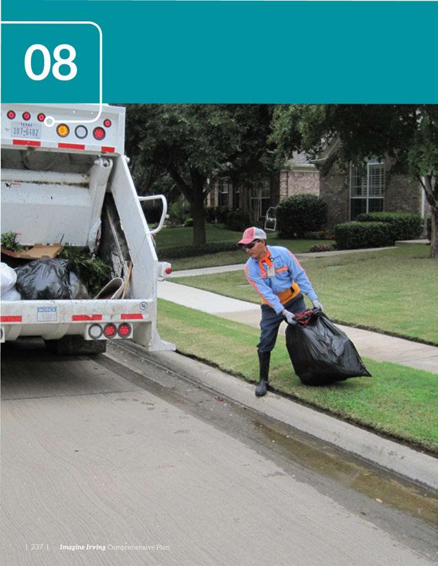

There is no such thing as "away." When we throw anything away it must go somewhere.
~ Annie Leonard
Themissionofthe SolidWaste ServicesDepartment istoprovideexceptionalservicethatiscosteffective, environmentallyresponsible, andmeetstheneedsof residents, whileexceedingallregulatorystandards. TheCityof Irvingwillcontinuetoprovidetop-quality wasteandrecyclingservicesandwillserveallsinglefamilyresidencesinthecity.
People wi11 say...
» Irving maintains facilities, services, and infrastructure throughout the city.
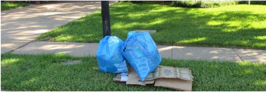

TheCityof Irvingownsandoperatesthe Hunter FerrellLandfill, amunicipalsolid wastelandfillthat openedin1981. Itislocatedinsouth Irving, justnorth oftheWest ForkTrinityRiver, andnorthof theGrand PrairieCity LandfillandtheTrinityRiverAuthority CentralRegionalWastewaterTreatment Plant. The landfillhas beeninoperationmorethan30years andhasanestimated 67yearsofcapacityremaining, butitslifespancould beextended byemploying best practicesforperpetualuse. Thatcapacity,combined withcontinuedadvancementinlandfillmanagement andsustainabilitypractices, meanstheCityof Irving doesnotfacecapacity issuesinthe Imagine Irving planning horizon. The landfill's working face iscovereddailyto protect human health andthe environment, andtomanage odors, litter andother issues.
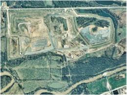
SolidWasteServicesservesallsingle-familyresidences inIrving withcurbsidecollectionforgarbagetwicea week, recyclablesonceaweek, brushand bulkywaste onceaweek, andspecial wastetwiceaweek. TheCity of Irvingdoesnotcollectdirectlyfrommultifamily residencesorcommercialbuildings; thisserviceis performed byprivatehaulers. TheCityof Irving operatesthroughanopen franchise agreementand collectioniscontractedonabusiness-by-business basis. Residentsofmultifamily buildingsthatdonot have recyclables collected regularly havetheoptionof haulingrecyclablestothe recycling drop-off located atthe Hunter Ferrell Landfill, whichisaccessible daily. Multifamilyresidential buildingmanagersare encouragedtoestablishon-siterecyclingprograms fortenants. Periodicallythroughouttheyear,theCity of Irvingholdsspecialeventsforpapershredding, electronicsrecycling, andhouseholdhazardouswaste collection.
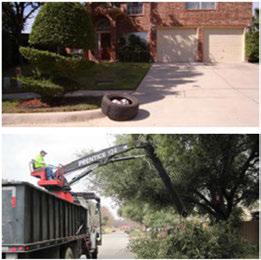

Waste Management + Materials Recycling
Irving's SolidWaste Servicesfacesseveralchallenges tomaintainingitscapacitytoservethecityasitgrows duringthenext20to30years. TheCityof Irving willneedtokeepupwithfuturepopulationgrowth, sustainsufficientstaffing,adequatelyfundequipment replacement,andfundfuturecapitalneeds. Asof 2015,therewere3,400single-familyhomesunder constructionorinthedevelopmentphase; andthe Cityof Irvinganticipatesaonepercentgrowthrate annually.TheCityof Irvingwillneedtoincrease staffingcapacitytosafeguardemployeesafetyand meetfutureservicedemands.
TheCityof Irvingcollectsallgarbageandrecyclables manuallyinbags,whichputsphysicalstrainon collectorsandequipment. Manualcollectionis strenuous work; each collector liftsonaverage,14,000 poundsperday,whichhasledtothehighestnumber ofinjuriesandlosttimeamongallCityof Irving departments.
Industrystandardformanualrefusecollectionis 800stopsper route; routesin Irvingfarexceedthis standardandhavebeensteadilyincreasingforthe pasttwodecades,meaningcrewsarealreadyover capacity. AlthoughtheCityof Irvingaddedtwonew crewsin2014tohelpmeetincreasingdemand,staffing shortages, turnover,andtimelostduetoinjuryhave madecrewpositionsdifficulttokeep filled.
Amajorityofcommunitiesinthe Metroplexhave experiencedsimilarpressuresandexploredinnovative servicedeliveryoptionstoaddressgrowth,reduce injury,andimproveefficiency.
Withoutsignificantoperationalorfinancialchanges, thecurrentlevelofservicecannotbemaintained. Solid Waste Servicesreceivesinsufficientrevenuestomeet equipment,maintenanceandcapitalneeds.
Equipmentisbeingusedbeyonditsrecommended life,andtheincreasingcostsofnewequipment hasalreadyhadimpactsonoperations. Deferred replacementcompoundsequipmentissues; repairson agingequipmenttakeneededvehiclesoutofuseand costmorethanmaintenanceofnewerequipment. Delayingreplacementincreasescostsandcreatesa growingbacklog. Equipmentcostshaveincreased substantiallyinthepast10to15years. Tenpercent ofthesolidwastefleetshouldbereplacedannually; replacementofthefleetisapproximatelythreeyears behindschedule.
Currentprojectionsofrevenuesandexpenditures duringthenext15yearsindicatethatthestatusquo issimplyunsustainable. Changestoserviceand/or fundingwillberequiredtoadequatelymeetfuture demand.
Today, theCity of Irvingprovidesfargreaterservice toitsresidentsthanothercitiesinthe Metroplexthat manually collect baggedwasteandrecyclables. Each single-family residencereceivesuptosixvisitseach week; noothercity inthe Metroplexprovidesthis levelofservice. Continuationofthislevelofservice may presentfuturestaffing, equipment, andfinancial challenges.
Manualcollectionisphysically demandingonstaffand equipmentalikeandcomparedtootherservicedelivery models, isnotthemostefficientsystemavailable. Throughconversiontoanalternativeservicemodelor modificationstothecurrentcollectionsystem, theCity of Irvingcouldreducethesafety hazardstoemployees andincreasethespeedandefficiency oftheprocess of wasteandrecyclables collection. Suchoptions couldenabletheCity of Irvingtoincreaserevenues, expandcollectionservicetoallresidences, including householdsinmultifamily andmixed-usebuildings, andincreaseworkerretention.
Many citiesinTexashavecentralizeddrop-offand pick-upcentersfordisposal, recycling, andreuseof common household items. Irving should consider expandingitscentralizeddrop-offlocation (currently acceptingwaste, recyclables, brush, bulky waste, and specialwaste) toincludeareusecenterformaterials anditemsthatareingood, usablecondition, andhave remainingusablelife.
Prairie Twicea Oncea Oncea By No Residential Week Week Month Request Pickup
Richardson Twicea Oncea By By No
Residential Week Week Request Request Pickup
Mesquite Twicea Oncea By By No Residential Week Week Request Request Pickup
Weatherford Limted Oncea Oncea Oncea No Twicea Week Month Month Residential Week Pickup
Source: Solid Waste Serviced Deportment

Thinking longterm, theCity of Irvingshould examineinnovationsinthefieldof wastereduction andmanagement, especially bestpracticesthathave beenshowntohelpreducewastegeneration, with thegoaloflesseningtheoverallenvironmental impactandreducingmunicipalcosts. Nationally andinternationally, therehavebeenmany recent innovationsinwastemanagementthatprovide environmentalandeconomicbenefits.
Constructionanddemolitionwastediversionisa strategythathasprovenvaluabletoreducingwaste, asmany materialscan berecycledincludingconcrete, porcelain, rigidplastics, tile, lumber, metals, masonry, plastic, rock, carpetandinsulation. Astheregional marketdevelopsforsalvagedmaterials, theCity of Irving should consider establishinga formal program. Inthenearterm, thereusecentercouldprovidea venueforconstructionwastesalvage.

Inadditiontomunicipal-scalecompostingoffood waste, industrially compostableproducts(especially foodserviceproductssuchasplates, cups, tableware andto-gocontainers) aregainingpopularity acrossthe country, butrequirespecializedfacilitiestoproperly processthewaste. By-products includecompost, methane, andwater,eachof whichcanbetreatedasa resourcestreamratherthanawasteproduct.
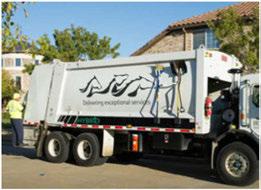

Waste Management + Materials Recycling
Goals,Strategies
Goal 1: Ensure capacity to serve the city as the population grows.
Strategy 1.l
Coordinate future land use planning and development with Solid Waste Services service planning to ensure staffing, equipment, and funding are sufficient to maintain service levels as the city grows.
Strategy 1.2
Prepare a solid waste study to address future strategies to reduce the waste stream and increase recycling participation.
Strategy 1.3
Maximize waste reduction initiatives. Consider a new program to address waste diversion to increase materials recycling.
Strategy 1.4
Expand education and outreach efforts on waste reduction techniques.
2:
funding to ensure continued level of service.
Strategy 2.l
Adequately fund equipment replacement to keep up with service growth and increases in demand.
Strategy 2.2
Continue to fund future capital needs to meet service growth and regulatory requirements.
Strategy 2.3
Consider expanding to commercial service including multifamily residences, to expand the customer revenue base.
Goal 3: Improve waste practices and service for Irving residents.

Strategy3.1
Establish a new materials collection and reuse center for recyclables, household hazardous waste, building materials and paint recycling.
Strategy3.2
Implement best practices for perpetual waste management and consider landfill mining to extend the usable life of the city's landfill.
Strategy3.3
Bolster business recycling participation through cooperative programs with business groups, chambers of commerce, and other business organizations to promote the advantages of participating in recycling programs.

Waste Management + Materials Recycling
Goal 4: Improve city building recycling infrastructure and participation.
Strategy 4.1
Consider recycling of various consumable products in design, redevelopment and refurbishment of all city facilities. Encourage the purchase of consumables that can be recycled by the provider.
Strategy 4.2
Establish a city policy on purchasing and providing only reusable or recyclable materials for citysponsored or city-hosted events
Strategy 4.3
Develop best management practices to coordinate the most efficient and environmentally sound method to handle all organic wastes from Irving's parks and city facilities, including leaves, grass, brush and larger woody debris. This may include mulching and composting as opposed to bagging.
Strategy 4.4
Implement an ordinance in support of special event recycling. Any entity/organization planning/ coordinating an event in Irving should be required to apply for a Special Event Waste Reduction Permit. This permit could be fee based. Applicant would be required to specify provider, type of recycling collection method, as well as recyclables to be collected during event.
Waste Management + Materials Recycling

This pageleftintentionallyblank.


Information technology empowers people to do what they want to do. It lets people learn things they didn't think they could learn before.
~ Steve Ballmer
Theworldofcommunicationsandtechnology is constantly changing, whichrequiresmunicipalservice providerstonimbly adjustandupdatetools, programs andprocedurestomeettheserviceexpectationsof thepublic. Theconceptof building "SmartCities"communitieswhoseinnovativeuseofinformation andcommunicationtechnology improvesquality oflife, enhancesservices, maximizesefficiencies, andimprovescitizenengagement-istransforming howcitiesmanageandsharedata, collaboratewith complementaryagencies,think aboutservicedelivery, andimprovetheircompetitiveeconomicposition. Thisapproachisrevolutionizinghowcitiesapproach challengessuchasreducingtrafficcongestion, fighting crime, andpromotingeconomicgrowth, anddemands thatcitiesstay abreastoffast-movingtrendsof innovation, collaboration, security andprivacy.
» Irving focuses on community engagement in government, and other civic activities, ensuring all segments of the population are heard and represented.
» Irving is growth-oriented, committed to the support and continuous improvement of existing businesses, infrastructure, amenities, and the workforce.
» Irving is at the forefront of innovation and business development, supporting its industry-leading private sector employers and its forward-thinking community leaders.
» Irving offers exceptional access to the regional, national, and world economies through its globally connected businesses and robust transportation network centered on DFW International Airport.

Theeffectiveuseoftechnology allowscitiesand theirpartnerstohaveadeeperunderstandingof theunderlyingdriversbehindissuesfacingthe community,andbroadenstheoptionstoeffectively addresstheseconcerns. Recognizedcommunity benefitsinclude:
• Jobgrowthandincreasedprivatesectorinvestment.
• Mobility improvementsandreducedairpollution.
• Lowercrimeandimprovedresponseandrecovery todisasters.
• Betterairandwaterquality monitoring.
• Improvedpublicparticipationincity decisions.
• Moreeffectiveinfrastructureinvestment.
ProgramsinBarcelona, Spain,areonthecuttingedgeofusingclouddevicesandappstoimprove transparency ofgovernment,whileexpandingthe resourcesavailabletoanalyzedata. Similarly,New YorkCity hasdevelopedanopendataportalwith 1,100datasetsfrom60+ agenciestocutacrosssilos andimproveaccesstoimportantdata. Additionally, linkNYCisfundingWi-Fiinfrastructurethrough advertisingkioskstobridgethedigitaldividewithin thecommunity. TheCity of Indianapolishaspartnered withtheUniversity ofNotreDametoimprove wastewatermanagementthroughtheuseofsensor technology andsmartvalvestoactively monitorand bettercontrolwastewatercollection.
Corporateleadersinthe Metroplex,suchasAT&T's SmartCitiesUnit,areworkingtoaddressthecostof energy, tackling aginginfrastructure,andreducing waterandenergy consumption. Theseeffortsare creatingtoolstohelpmunicipalitiestransitionthe managementoftheirservicestoamoresustainable model. Additionally,theTexasResearchAlliance isparticipatinginanationalprogramcalledthe MetroLabNetwork,whichisgearedtowardseeding partnershipsbetweenuniversitiesandmunicipalities todevelopinnovativesolutionstocommon infrastructurechallenges,withthehopeofcreating solutionsthatcanbescaledtomeettheneedsofcities acrossthecountry. Otheremergingtoolsincludethe useofremotesecurity camerasandbiometricanalytics toenhancepublicsafety.

TheCity of Irvinghasalegacy ofdata-driven government, withafocusedprogramforperformance excellencetoimprovethecustomerexperienceand increaseefficiency. TheCity of Irvinghasmade itapriority tobecomeamodelofefficiency. This deliberatefocusonperformanceguided Irving throughtherecenteconomicdownturnwithoutmajor workforcereductionsorfurloughs, whileachieving improvementsin Irving'soverallquality oflife, quality ofcodeenforcement, andappearance. Asa resultoftheseefforts, theCity of Irvingreceivedthe Malcolm Baldrige NationalQuality Awardin2012. Thisawardencompassesperformanceexcellencein theareasofleadership, strategicplanning, customer service, operations, andworkforcefocus, aswellas measurement, analysis, andknowledgemanagement. Inkeepingwithitshistory ofperformanceexcellence, theCity of Irvingiskeenly focusedonperformance measurementasakey toolindecision-making, seekinginnovativewaystodeliverservicesandmake apositiveimpactonthecommunity, andcontinually engagingcustomers.
TheCity of Irving'scoredepartmentsthatserveas thebackbonefor "Smart City" thinking are Innovation and Performance, InformationTechnology, and Communications. Thereisopportunity tofurther the collaborationbetweentheseresourcestoadvance governmentoperationstoahigherlevelofservice.
Irvinghasmany economicadvantagesonwhichit maycapitalize.Theseadvantages,suchasitslocation andaccessibility,arecriticalinhelpingtheCity of Irvingbuilditstargetindustriesandgrowitseconomic base. TheCity of Irvingmustensureitspoliciesand businesspracticesareopentotechnologicaladvances thatsupportbusinessdevelopmentandcreatean environmentthatinvitesinnovation.
DFW InternationalAirportis Irving'smostcrucial assetforeconomicdevelopment. Theexpanded connectivity toglobalbusinessoffers Irvingastrong avenueforinternationalbusinessdevelopment. Facilitatingdatabasessuchasthenumberof flights, locations, andnumberofinternationalcommuters, can helpinformbusinessdecisions, aswellascommunicate andmarketthisadvantagetocompaniestoensure Irvingcontinuestobenefitfromthislocational advantage.
At
DFW Airport, international passenger traffic grew at an average annual rate of 8% from 2010-2014, much faster than any of the other 10 busiest international airports.

Accesstotalentisthe primary successfactorformost companies. Irving'scentrallocationwithin North Texasprovidesaccesstotalentfromacrosstheregion. Thismakes Irvinganideallocationforgrowinga businessthatrequiresmany highly skilledworkers. Workforcediversity isbecomingmoreimportant tobusinesses, especially largecorporations. Irving iswell-positionedtocapitalizeonthistrendfortwo reasons: severalof Irving'sexistingbusinessresidents areleadersinthisapproach, andIrving'spopulation ismorediversethanany competingcitiesinthe Metroplex.
Irvinghasahighconcentrationofjobsinseveral telecommunications-relatedsectors. Theincreasing connectionsbetweentelecommunicationsand thetechnologyindustry (specifically softwareand informationtechnology) furthersupportthepotential forIrvingtoattractjobsandinvestmentinthiscluster, giventhe city's strengthsinboth areas. TheCity of Irvingcanusethe concentration of technology and communications businessesthatexistinthecity to provideaninnovation laboratory togenerate different approaches tosolvingcivicissues, and partner with firmsinthese industriestodevelopnewappsthat inviteusers (residents) toparticipateindatagathering andanalysis.
Today, 4Gmobiletelecommunicationtechnology is widespread, andthenextgeneration, calledSG. is nowinresearch anddevelopment withanestimated adoptiondatearound2020. Thehighconcentration oftelecomfirmsin Irvingandthe Metroplexspellan opportunity topositionthecity asthepremierlocation forSGinnovation.
TheCity of Irvingshouldcontinuetolook for opportunities to partner withthesetelecomfirmsto exploreinnovativewaystoimproveinfrastructure andservices. Suchpartnershipswillbetterequipthe City of Irvingforfutureadvancesintechnology and exponentialgrowthinmobility.
The IrvingConventionCenteratLasColinasisa uniqueassetthatIrvingcanleverageforeconomic development, especially througheventsthatattract decisionmakerswithinthecity'stargetindustries. The annualInnoTechconferencethattakesplaceatthe conventioncenterisatestamenttotheseadvantages, andisyetanotherassetthatcanbeleveragedtogrow thisindustry by showcasingthecity's location, talent, andconnectivity assets."
TheCommunications Departmentpromoteseffective communicationamongcommunity stakeholders providesresidentswithtimely informationthrough avariety ofplatforms.Thedepartmentmaximizes community engagement,reachingasmanypeopleand specificgroupsaspossible.
TheCityofIrving'sexternalaudienceincludes residents, media, othergovernmentalbodies, businesses,andinterestedopinionleaders. Internal stakeholdersincludeIrvingemployees,boardsand commissions, themayor, andCity Council.
Communicationtoolsusedincludethe "IrvingCity Spectrum;' amonthlynewslettermailedtomorethan 95,000households; thecity website; emailalerts; press releases; Facebook, TwitterandInstagramaccounts; a weekly newsletter; anarray ofexternalandinternal publicationsandmediarelationsproducts; andvideos. TheIrvingCommunityTelevisionNetwork (ICTN) providesaward-winningcoverageofcitynewsand localsports,artsandentertainment includingvideos highlightingcityprograms, activities, andservices. Thedepartmentalsoallowsforthestreamingof councilmeetings,worksessionsandotheradvisory committeesthatmay beviewedonlineorby television.
Additionally, anumberof townhallandneighborhood associationroundtablemeetingsareheldannually whereresidentsmeetface-to-facewithcity leaders. Communicationsalsomanagesa Speakers' Bureau thatprovidesasubject-matterexpertforthoseholding eventsinneedofaspeaker.
TheCommunications Departmenthasthegoal ofkeepingupwithtechnology andchanging communicationspatterns. Quickly changing communicationtechnology requirescontinuous monitoringofcommunicationtrendsandthemost effectivewaystocommunicatewithavariety ofcity


City Spectrum newsletter


stakeholders. Regularanalysesofcommunication plansandoperationsallowsIrvingtocontinueto beatthecutting-edgeof municipalcommunication practices.
Toincreaseengagementwiththedigitallyconnected younger generations, theCommunications Departmentidentifiesnewandemerging communicationsplatformsusedby thepublictoobtain andshareinformation.TheCityofIrvingrapidly adoptsthesenewmethodstomaintainandgrow thenumberofpeopleinformedandinvolvedincity government.

TheInformationTechnology Departmentmanages andmaintainsanimpressive800 MHzP25compatible radiosystemtofacilitatecommunicationbetween1800 users. P25interoperability isatwo-way digitalradio standardthatallowsforradiocommunicationsacross differentsystemsandplatforms. UsingP25systems enablesdisparatefirstresponderagenciestocoordinate servicesandinformationduringaregionalemergency regardlessofthetypeofsystembeingused. TheCity of Irvingworkscollaborativelyandsharesthisadvanced radiosystemwithotherregionalagenciestoensure dependableandstablecommunicationsofthehighest level.
DirectimpacttoresidentsandbusinessesistheCity of Irving's25-toweroutdoorwarningsystemwith facilitiesstrategically locatedthroughoutIrvingtoalert peopleofimpendingemergencyweatherordisaster events. ItiscriticalthattheCity of Irvingcontinues toensureanadequatecommunicationinfrastructure isavailabletobuildoutthese importantsystemsfor operationalstability andgrowth. Receivingcritical informationforresident, employeeandfirstresponder safety isanimportantcomponentofquality oflife.

TheCity of Irvingusesseveralenterprisesystems toimprovebusinessprocesses, increaseaccessto informationtofacilitatedecisionmaking, andto providefor efficient delivery of services. TheCity of Irving employsenterpriseresource planning (ERP), abusinessprocessmanagementsystem, for generalfinanceandaccountingoperations, payroll andpurchasing;documentmanagement,public infrastructuremanagement; utilitiesbilling, business intelligenceandperformancemeasurementtracking. Asthesesystemsarelargeinvestments,theCity of Irvingmustactively planfortheirreplacement throughgoodgovernanceandinvestmentstrategies.
TheCity of Irvinghasinvested, andwillcontinue toinvestheavily insolutionsthatofferresidents serviceenhancementoptions.Residentconvenience andserviceenhancementscanbeinterpretedand configuredinmany waysandeventhoughtheCity of Irvingisincreasingly cateringtoamobilecitizenry thatisdataconnected, notallresidentshaveaccess totheInternetorcreditcards, orevenspeakEnglish. TheCity of Irvingmustconsidertheseneedswhen creatingtechnology andcommunicationstrategy,and carefully weighoptions. SomeoftheCity of Irving's currentserviceenhancementsincludetheability to registeronlineforarecreationactivity, ordertickets onlineforashowattheArtsCenter,pay atraffic ticketonline, pay awater billby telephoneoronline, apply forajobonline, scheduleaninspectiononline or by telephone, andbrowseforapetattheAnimal CareCampus. Throughinnovationandstrategic planning, theCity of Irvingstrivestofindmore waystoimproveresidentinteractions. Inadditionto customerconvenience, thesesystemsalsoprovide atighterdataintegrationinreal-timeby increasing staffproductivity andallowingfasterdecisionmaking andknowledgetransferopportunities. Publicsafety
departmentsalsohaveaccesstoreal-timedataand geographicalinformationsystems (GIS)dataintheir vehiclestoquickly makecriticaldecisionsregarding employeeandresidentsafety.
Thisallowscity employeesandresidentstoobtain informationontheiraccountsandmakesimple modifications. They havedirectaccesstobudget, comprehensiveplanning, andfinancialactivity to seehowtheCity ofIrvingisspendingmoney. Open governmentandtransparency isafocusoftheCity ofIrving, andthesetechnology choicesreinforcethis strategicgoal.
TheCity ofIrvingowns26milesoffiberandtower infrastructurethatprovidesafoundationforkey city systemssuchasradio communications, SCADA, automatedwatermeterandtrafficnetwork systems, as wellasprovidingnetwork connectivity totheCity of Irving's36majorfacilities.
TheCity ofIrvingprovideslibrary patronswith computeraccessandpublicaccessibleWi-Fithatis agreatbenefitforresidentswhodonothaveaccess intheirhomes. TheCity ofIrvingLibrary System continuestoreachfortechnologicalgoalstoimprove servicesavailabletoitspatrons. TheCity ofIrvingis addingmorepublicaccessibleWi-Fiinotherbuildings withtheuseofcommercialproviderservices. City employeesinlargercity buildingshavebeenableto access network services throughWi-Fiforsometime.
Withthese advancements andnetwork capabilities

thattheCity ofIrvinghasalready achieved, including futureexpansiongoalstocovertheentirecity limits, theCity ofIrvingwillneverbedonewithbuildingout infrastructuretocontinuetomeetservicedelivery needs. Onceapotentialprojectiscomplete, itwill betimetorebuildorreplaceolderequipment, or implementanewandinnovativetechnology.
Inadditiontoequippingthemunicipalorganization withappropriatetechnologicalinfrastructure, itis importanttoensurethatinfrastructureisavailable throughoutIrvingtoprovidebusinessandresidential accesstoservicessuchasWi-Fi, fiber (fiberoptic broadbandInternet), mobilephone, cable, andthelike.

Fromtheperspectiveofcity operations, therearea numberofwaystechnology anddatamanagementcan beharnessedtomakethesmartestuseofresources. Forward-thinkingdataanalysiscanidentify potential impactsofpolicy decisionstoinformdecision-making. Oftenusedinemergency managementexercisesto testdisasterscenariosandevaluatetheefficacy of hypotheticalresponses, technology anddataalsocan beusedincommonzoninganddevelopmentdecisions toevaluateoutcomesanddemandsonservices.
Animportantearly stepinmaximizingtheutility ofdataistominedatafromthevariety of "legacy systems" thatexistondifferentplatformswithinan organization, andmakethemusableforotherrelevant areasofanalysis. Combiningthesedatawithnew data, andmanagingtheminaway toimproveaccess across traditional "silos," isan importantsteptoward integrated servicedelivery-ensuringtheCity of Irvingisnotengaginginconflictingandredundant activities. Irvinghasalready madestridesinthearea ofconsolidateddatamanagementandanalysiswith afewsystemsinplacetoday suchasInformation BuildersBusinessIntelligence, Performance ManagementFrameworksoftware, andBAIRCrime Analytics software. Another importantstrategy in theinformationeconomyistoexpandthefootprint ofdataanalysisandgatheringbeyondthewallsof City Halltoincludeopendata, opendatamapping, APIfordevelopers, andhackathons, whichincreases accountability andtransparency oflocalgovernment, whilecultivatinganengagedandinformedcitizenry. Ultimately, developingabroaderbody ofdataand adeeperunderstandingofitsmeaningthrough predictive analyticscanbeusedtoproactively engage in everythingfromcrimefightingtostreetrepair.
Strongtechnology governancethatalignswithoverall city strategicgoalsandbusinessplanningisrequired tosetrealistictechnology goalsinplace.Itwillplay an importantroleindiscoveringneeds, aswellas providingastrategicroadmapformovingtheCity of Irving towards realizingtheimplementationanduse ofthesetechnologies.
Emergingtechnology trendscanprovidegovernance challenges, butalsopotential benefitsthattheCity ofIrvingcannotignore. Onethatisquickly gaining momentumistheconceptofInternetofThings (IoT). It willplay abigroleincity operation'sdecisionmaking andknowledgesharing.Itisareality thatallmanner ofdevicesandsystemsarenowconnectingtothe Internet, sharingandcollectingdata. Anincreasing majority haveacellphone, tabletandawearable device. Homeshavesensorsintheirsecurity systems thatallowforconnectionby atabletorsmartphone. Lightpoleshavesensorstomanagetheiroperation, aswellasmeshbroadbandradiostohelpbuildout Wi-Finetworks, etc. AllofthisdatawillneedInternet trafficcapacity inwhichtotraversequickly, aswellas sufficientsecurity andstorageformanagingmassive amountsofdata.
Thetechnology industry iscurrently lookingatmore efficientmethodstointerconnectthispotentially vast andemergingtechnology.
Anotheremergingtechnology theCity ofIrvingwill needtoconsiderinpolicy makingandgovernance, istheriseofsmartmachinelearning, i.e. virtual personalassistantsandsmartadvisorslikeGoogle Now, Microsoft'sCortanaandApple'sSiri. Robotsand autonomous, driverlessvehiclesarealready being used.Insteadofpushingbuttonsandselectingmenus, userswillspeaktomachinesasanintelligentagent.
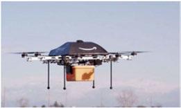
Amazon'sdronedeliveryservice
Lastly, anotheremergingtechnologyisdrones. Amazonisalreadyplanningfordronestobeused inthedeliveryofpackages. Arecent "60 Minutes" interviewofJeff Bezos, CEOofAmazon, revealed thatAmazonships, onaverage, 2.5millionpackages aday.Ontheotherhand, therearesomecompelling usesofdronesincontrolledsituationssuchasserving aseyesandearsforfirstrespondersinemergency situations. Toaddtothis, dronesinterestthegeneral publicasrecreationaldevices, andthus, theywillbe challengingaspotentialinvadersofprivacy, whether inadvertentlyordeliberately.
TheCityof Irvingshouldadoptthestrategythat recognizestheInternetasautilitymuchaswater andelectricity aretoday, andincorporateaprocessto evaluateanynew building projects in Irving against thisnew metric. All buildingsshouldhaveappropriate fiberconduitandplentyofpowercapacity withpower outletscapableofsupportingavarietyofdevices.
Emergingtechnologiesintheareaofcityservice deliveryinclude:
• Lightingsystemsthatallowforremotemanagement toidentifyandlocateinoperablebulbs.
• Technologyinresourcerecoverytoenable transitioningto "onecart" garbageoperations thatenhancewaste-to-energyoptions, increase diversionsfromlandfills, andimprovecollection efficiency.
• Smartmanagementof waterinfrastructureto identifyleaksandimprovetheefficiencyofwater
Communications + Technology

deliverybyreducingwasteofthislimitedand valuableresource.
Animportantquestiontoaskis, "Howcantechnology reducetheburdenoninfrastructureandsubsequently operations, maintenance, andreplacementcosts?" Data managementand analyticscanincreaseefficiency andbenefittheCityof Irvingonissuesasdiverseas limitedresourcesfromavailableland, publicdollars foroperationandmaintenanceofinfrastructure, andconservationof waterresources. Useoflighting technologythatprimarilyfunctions "on-demand" reduceselectricitydemand. Smartbuildingtechnology canreduceconsumptionof waterandenergy. Taking aholisticviewofinfrastructure, building, and equipmentinvestmentsthatusedatatopaintamore detailedpictureofuseanddemand, whileconsidering lifecyclecosts, canresultinasmarterandmore efficientuseofresources.
Howcandataandtechnologybeleveragedtoimprove thequalityoflifeandenhanceIrving'scompetitive positionwhenvyingagainstregionalcompetitorsfor corporateheadquarters, jobrelocations, andcreating choiceneighborhoods? Inadditiontostreamlining cityoperationstodeliverhigherlevelsofservice, andmatchingthemtotheneedsofdesiredtarget industries, thereareanumberofinvestmentsthat addressissuessuchasmobilityandsafety, layingthe groundworkforcontinuedeconomicgrowth.
Commonstrategiestoimprovemobilitythatreduce triptime, congestionandairpollutioninclude managingtrafficsignals, usingcommutersignageto providereal-timetrafficinformation,anddeploying sensingtechnologyforparkingmanagement.

Additionally, companiesareincreasingly seeking walkable, mixed-useenvironmentsthathavegood transitaccessfortheircorporateexpansionsand relocations.WiththeextensionoftheDARTOrange Linetothe DFW International Airport, convenientand walkableaccesstonearby transitstationsisnecessary tofully benefitfromthistransformativeinfrastructure investment. Advancementssuchasintelligentcar sharingcanincreasetheflexibilityoftransitoptions, providingmoreconvenientaccesstothetransit network.
Publicsafety canbeenhancedthroughpreventive crimefightingusingpredictiveanalyticstoidentify patternsofactivity, wherecrimeismostlikely to occur, anddeploy resources accordingly. Additionally, technology suchasgunfiredetectionallowsthepolice togather importantevidenceanddetailsconcerning criminalactivity.
Tomaintainafreshapproachtoeconomic development, theCity of Irvinganditspartners mustcontinuetomonitordata, andtracktrendsand advantagestohighlight Irving'sassets. Datashouldbe usedtoscanforemergingindustriestowhich Irving couldofferastrategicadvantage. Stayingabreastof theseissueswillallowtheCity of Irvingtopreparea growthenvironmenttoattracttargetindustries.
Additionally, Irvinghasseveralmajortechnology companiesamongitslargestemployers: NEC Corporationof America, Microsoft, Oracle, and Computer SciencesCorporation.Thereisagreat opportunity forcross-pollinationbetweenthe ITand healthcaresectorsthatshouldprovideastrategic advantage.
Whilecollaborativedatausecontinuestoexpandas avaluableresourceforcities, digitalsecurity mustbe takenseriously. Caremustbetakentoprotectdata thatisnotappropriateforbroadpublicdistribution, as
wellasensuringtheintegrity ofcriticalcity systems ismaintained; protectingthesafety andsecurity of residents. Security mustconsideredonthefrontend ofany designorsharingprocessrelatedtotechnology. Useofemergingtechnologies, suchasremotesecurity camerasandbiometric analytics, shouldbeexamined.
Cybersecurity concernsremainvery highand affects everyone thatusestechnology. By 2019, costsfromimpactsofsuccessfulcybersecurity breachesworldwidewillcostcitizensandbusinesses anestimatedonebilliondollars. Preventionand mitigationwillbeanimportantandcontinuingconcern fortheCity of Irving. Justhavingthemostsavvy networkpreventiontoolsandsoftwareisn'tenough. Investmentsindedicated,skilledsecurity professionals andawarenesstrainingfortechnology usersisjustas importanttoprovidearobust, soundcybersecurity mitigationandpreventionprogram
Currently, theCity of Irving'stelevisionstation produceshalf-hourlongshowsbuthasidentifiedthat younger populationsaremorelikely towatch2-to 3-minutevideosontopics. Thisdifferenceinviewing patternsencouragesnewapproachesinproduction managementasadditionalprogrammingisdeveloped toaccomodatethedesireof young viewersforshorter, moreconcentratedpiecesofinformationwhilestill servingtheestablishedaudiences'desiresfordetailed engagement.
ICTNwillcontinuetoplay avitalrolein communicatingwithresidentsinthefuture. Advances intechnology willbringmoreavenuesforreaching residents, especially throughtheuseofhighquality videoproduction. Theseadvanceswillenablemore personalinteractionsbetweenthecity andresidents. Thegoalwillbetocreatecontentthatengagesand educatesresidents.
Strategy 1.l
Improve data management and access to increase accountability and improve customer service.
1.1.1

1.1.2
Conveneacity datamanagementgroup comprisedof thecity'sInnovationand PerformanceOfficeandInformation Technology departmentstoreviewexisting dataandbeginensuringthatalldataiseasily availableandconsumable
Createa citywide datamanagement, transparency andsharingpolicy toencourage opendataanalysisandmappingwhile ensuringdatasecurity andprivacy as appropriate
1.1.5
1.1.3
Whenmakingtechnology decisions, choose openalternativesoverproprietary to maximize usefulness ofdataandcoordination of technology acrossservices
1.1.4 Investigatecloudcomputingwhere appropriatetoincreasedataavailability for analytics
Lookforopportunitiestointegrateand consolidatedatatocaptureefficienciesand avoidredundantanddisparateinformation
Strategy 1.2
Create collaborative data partners.
LinktotheTexasResearch Allianceasa potentialresearchcollaborator.
Workclosely withotherpublicagenciessuch asDART, DFW International Airport, TxDOT, andinstitutionssuchashospitals, toshare data.
Developprivatesectorallianceof technologyrelatedfirmsoperatinglocally toprovideideas andinsight.
Chooseademonstrationprojecttohighlight howthe City of Irvingcancapitalizeondata partnerships.

Goal 2: Continually improve new communications methods as new technologies are developed and as residents demand different types of engagement.
Strategy 2.1
Update the city's communication plan to incorporate innovative technology methods.
2.1.1 Prepareacommunicationandengagement plantodeterminehowtorespondtomarket shifts.
2.1.2
2.1.3 Assessprogrammingforthetelevisionstation andexploreweb-basedvideoandsocialmedia outletopportunities.
Look aheadtoemergingtechnology and datasharingtostay abreastofemerging communicationdemands.
2.1.4 Developorinvestigateinnovativesolutions thatallownew functionality to beadded quickly andeasily asrequired.
Strategy 2.2
Keep abreast with current and emerging technology, and provide to Irving businesses and residents.
2.2.1 Supportaccesstohigh-speed Internet by ensuringhighlevelsof broadband speedand fiberavailability throughout Irving.
2.2.2 Look for waystoproactively enhanceand expand Internetcapacity throughcity-owned fiberandinfrastructureorprivatecommercial means.
Strategy 2.3
Provide the public access to free Wi-Fi (and other current technology) citywide to promote new business development and allow entrepreneurs to work on the move.
2.3.1 Look forinnovativepartnershipsto incorporatepublicWi-Fiaccesstostrategic cityareasthatwillpromoteeconomic development.
Strategy 2.4
Develop a plan to communicate data availability to the public to support innovative practices.
2.4.1 Determinethebestmethodtocollect, aggregateandprovideaccesstodatathat encouragesthedevelopmentofinnovative technologysolutionsandapplicationsby entrepreneurs and software developers.
2.4.2 Exploreopendatainitiativesinothercities anddeveloprecommendationsonsimilar opportunities.

New York City's BigApps challenge asked developers, designers and entrepreneurs to create new tools for solving issues around affordable housing, zero waste, connected cities and civic engagement. Grand prize winners received $25,000 to implement their apps and received two months of mentorship and networking support to further advance their apps.
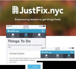


winneroftheBigAppChallenge. Theapphelpstenantsbuildacase toresolvehousingissues.

Goal 3: Advance "smart projects" to improve quality of life and increase economic competitive advantages.
Strategy 3.1
Develop a "smart projects" platform for the City of Irving.
3.1.1
3.1.2
Buildaframeworkofcommunity partners fromtheprivatesectorandotheragenciesledby thecity's Innovation and Performance Office, Communications Department, and InformationTechnology Department-to participateinestablishinga SmartCity action plan.
Conductanassessmentofcurrentactivities, thendevelopanactionplan basedon priorities.
Strategy3.2
Create state-of-the-art infrastructure to support Irving's goals.
Inventory utility andcommunication networksin Irvingtoassessforfuture longevity ofthesystemandability tomeet changingneeds.
Encourageprivatesectorinvestmentin buildingand maintaining citywide networks.
Adoptastrategyforconstantnetwork infrastructureenhancement, expansion, andmaintenancewithaneyetowardfuture potentialcapacity.
3.1.3
Useannual budgetingprocesstodefine fundingneedsrequiredtotransitiontoward increased SmartCity services, andcoordinate effortsacrossdepartments.
3.1.4 Seekandmonitorfederalfunding opportunitiestoinvestin SmartCity programs.

Strategy 4.1
Strive for the City of Irving to lead by example in resource efficiency.
4.1.1 Investigate waystoimproveexisting buildings, andstrivefornewly constructed city facilitiestoemploy approachestoreduce demandonresources, minimizefuture operationsandmaintenance, andreduce resource waste.
4.1.2 Allnew buildingprojects, includingstreetand bridgeinfrastructure, shouldhaveconduitin groundfor potential future fiber placement, andinbuildingsforadditionalnetwork and powerinfrastructurethatcan betterenable data-connectedbusinessesandresidents.
4.1.3 City infrastructureshouldbeevaluatedfor potential futureneedsandthe capacity to incorporateasmany data-connectedelements as possible forefficientuseofresourcesinthe future.

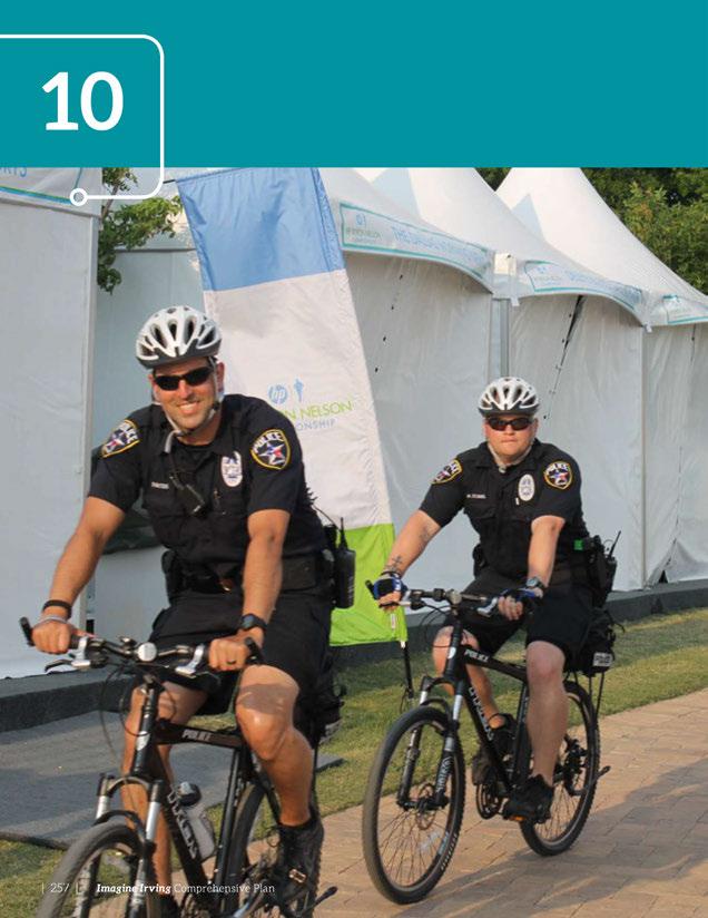

By working to ensure we live in a society that prioritizes public safety, education, and innovation, entrepreneurship can thrive and create a better world for all of us to live in.
~ Ron Conway
Irving'spublicsafetyprovidersarededicatedto providinghigh-qualityservicetoresidentsand businesses. Thecityservicesdiscussedinthischapter includethePolice, Fire, Emergency Managementand Inspectionsdepartments. Thesedepartmentsprovide forthehealth, safetyandwelfareof Irving'sresidents andbusinessowners.
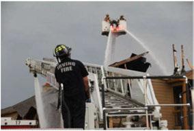

» The city maintains facilities, services, and infrastructure throughout the city.
» The city focuses on community engagement in government and other civic activities ensuring all segments of the population are heard and represented.
» Irving has safe neighborhoods with quality housing and schools. It also offers a variety of housing options for people working in the city.
» Redevelopment occurs in aging neighborhoods across the city, especially in areas with declining multifamily housing.

Thepolice, fireandemergency managementdepartmentsprovide servicestotheresidentsof Irving withthemissionofminimizing dangerstolifeandproperty througheducationandhigh-quality responseservices. Thepolice, fire, andemergency management departmentsworkclosely with regional, stateandnationalentities tocoordinateservices, prepare operationalplans, andincorporate innovationsintotheirpractices withthegoalof providinghighquality servicestoallresidents.
TheIrvingPoliceDepartment isapremierlawenforcement agency committedtointegrity, serviceandprofessionalism whileprovidingtraditionalpolice servicessuchaspatrol, traffic enforcement, investigationsand crimeprevention. Thedepartment sharesatrainingcomplex with theIrving FireDepartment and coordinateswithothercitiesand governmentagenciesintheregion fortraining. Thedepartment emphasizescommunity outreachto maintainsafety, cultivatedialogue andunderstandthecommunity's issues. Thepolicedepartment iscommittedtobuildingand maintainingpositivecommunity relationships. Thisisaccomplished
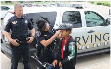
by supporting neighborhood watch groups, providingcrimeprevention presentations, andthrough personnelandresourcesusing programsthatinclude; citizens policeacademies, thepoliceathletic league, Juntas (Hispanicoutreach) andRAD (RapeAggression Defense). The598 employees of theIrvingPolice Department are committedtothephilosophy of community-based policing and providing the best possibleservices totheresidentsof Irving.
TheIrvingPoliceDepartment (IPD)enhancespublicsafety in thecommunity by proactively addressingcrimeanddisorder, enforcing trafficlaws, responding tocallsforpoliceservices, andeducatingandengaging thecommunity. IPD'smission statement, "ProtectingOur
Community,''resonatesthrough the department's threepolice bureaus, the Officeof Emergency ManagementandtheAnimal ServicesDivision.
The FieldOperations Bureauis comprised ofthreedivisions; South Patrol, NorthPatroland Special Operations. Thesedivisionsprovide patrolandtrafficserviceswithboth proactiveandreactiveresponses tocrime, disorderandtraffic issues. Thegoalof thisbureauis toprovidevisiblepolicepresence todetercrime, effectively respond tocallsforservice, andadequately enforcetrafficlaws. Personnel currently workoutoftwolocations. The SouthPatrolDivision, 305 N. O'ConnorRoad, servesIrving southof StateHighway 183, while
Public Safety

theareanorthof StateHighway 183isservedbythe NorthPatrol Division,5992RiversideDrive. The SpecialOperationsDivision,which providesspecializedpoliceservices throughoutthecity,alsoislocated attheRiversideDriveaddress.
TheInvestigative Services Bureauconsistsoftwodivisions, CriminalInvestigationsand Community Services. TheCriminal InvestigationDivisionisresponsible forinvestigatingreportsofcrime andidentifying,apprehending, andchargingsuspectsinan efficientand effectivemanner. Thesepersonnel areassigned tobothofthepolicebuildings describedaboveaswellasthe Family AdvocacyCenterlocated at600W. PioneerDrive. The Community ServicesDivision includespersonnelassignedas School Resource Officers, Crime Prevention Specialists,andthe PublicInformationOfficer. The Community ServicesDivision has theprimaryresponsibilityfor organizingandoverseeingthe vastmajorityofthedepartment's outreachefforts. Theseprograms aredesignedtobuildcommunity relationshipsthatwillresultina safer,morelivableenvironment. Programsinclude: BlueChristmas, theCitizenPoliceAcademy,a CitizensOnPatrolProgram,a
CivilianObservation/Rider Program,aCrime-Free MultiHousingOrdinanceProgram, CriminalJusticeClassesinthe Irvingschools,Family Advocacy Center,Mandatory Apartment CrimeReduction Program,National NightOut, NeighborhoodWatch, Rape AggressionDefense Systems, SafetyEducation Program, SchoolCrossingGuardProgram, andaVolunteer ProgramThe police department alsosponsors specializedyouthprogramsto engageIrving'syouthinhealthy andsafetymindedbehavior. These includeaHigh School Student InternshipProgram,IrvingPolice AthleticLeague,IrvingPAL UrbanOutdoorsProgram,Law EnforcementExplorers,the PRIDE Anti-drugProgram,andTeen Court.
The AdministrativeServicesBureau incorporatestheTechnicalServices Division,PersonnelandTraining DivisionandtheOfficeof Budget andPlanning. TheTechnical Services Divisioniscomprised oftwosections,theJailandthe 911CommunicationsCenter. On averagetheJail Section intakes, houses,andreleasesapproximately 10,000arresteeseachyear. The 911CommunicationsCenteristhe primary answeringpointforall emergencyandnon-emergency
callstothepolicedepartment. The personnelarealsoresponsible fordispatchingpoliceservicesto theuniformedpersonnelinthe field. In2014,thecenteranswered 177,288 "911" emergencycalls andhandledanother353,620 non-emergencycalls. Thecenter alsodispatched122,895callsfor policeservice. The Personneland Training Sectionrecruits,hires,and providestrainingtobothnewand incumbentpoliceemployees.In 2014,thestaffmade54recruiting trips,hired46employees,and provided23,096hoursoftraining. TheBudgetandPlanningSection isresponsibleforpreparingand managingthedepartment's $50,000,000budget,managing grants,andprovidinganalytical datatoassistindevelopingstrategic andbusinessplans.
TheOfficeofEmergency Managementcoordinates emergencyservicesandis responsibleformanagingthefour phasesofemergencymanagement, includingmitigation,response, recovery,andplanning. Thegoal oftheofficeistoprepareresidents, businesses,andcitystaffinwhatto dointhecaseofanemergency. In doingso,theypartakeinoutreach andmanyeducationalevents.

Anewstate-of-the-artpoliceandfiretrainingfacility, locatedatthesoutheastquadrantoftheintersection ofHighway 161andNorthBelt LineRoadiscurrently beingdesignedandconstructed. ThenewPolice andFireOperationsandTrainingCenter,planned on38acres, willfillgapsinboththefireandpolice departmentsandalsowillresultintechnology enhancementsandintergovernmentalcooperative agreements.
Theoperationsandtrainingcenterwillbebuiltin phases, subject tofunding. The firstphaseoftheFire Rescue training program components includesthe fire trainingtower; burnbuildingandthefireapparatus storage; andthetrainingbuilding.
Additional firerescuefacilities willbeaddedin future phases. Inadditionto fire training, thefacility willhousethePolice Department's North District OperationsandEmergency ManagementCenter.
Plansforthetrainingcenteranticipatefuturegrowth, withthefacility having164,000squarefeetof structures andapproximately threeacresofexterior traininginitially andby year 2035 growingto183,000 squarefeetofstructuresand10acresofexterior trainingareas.
Thetrainingandoperationscenterwillbeusedjointly by thefireandpolicedepartmentsaswellhosting coordinatedprogramswithGrandPrairieandother regionalcitiesandagencies. Designingthefacility in thisway willcreateefficienciesincity operationsand alsopositionIrvingtobearegionalleaderintraining andintheprovisionofquality services.
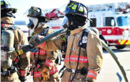
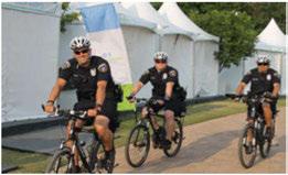
Thefacility alsowillcontainacombined communicationsfacility andaweatherresistant emergency operationscenter.
TheAnimal ServicesDepartmentprotectspeopleand animalsinIrvingby respondingtoanimalissues24 hoursaday,fromtheIrvingAnimalCareCampus. The employees arecommittedtodeliveringthebest possibleserviceto Irvingresidentsandproviding anexceptionallevelofcareforanimalsinneed. The departmentsharesthe IrvingAnimalCareCampus withthe DFW Humane Society andpartnerswith themtoplaceasmany adoptablepetsaspossible.
Inanefforttoprotectpublicsafety,minimizehuman/ animalconflicts,andhelpanimalsinthecity,the Animal Services Department providesthefollowing services; animalcareandsheltering,adoptions, outreachandeducation,community events,rabies/ zoonoticdiseasecontrol,cruelty investigationsand disaster/rescueresponse.
Thedepartmentisoverseenby theAnimal Services Managerandsupportedby a SeniorAdministrative Secretary.TheAnimal ServicesManageralso coordinates withDFWHumane Society andother city departmentsforevents,communications/PR, ordinances,volunteers,community serviceand training.With17staffmembersandageneralfund budgetof$1.7millionin2014,theAnimal Services Departmentreceivesmorethan26,000callsand handlesnearly 8,000animalsannually.
TheFieldOperationsDivisioniscomprisedofsix Animal ServicesOfficersandaField Supervisor.This teamrespondstoanimalissuesidentifiedby thepublic. Servicesarecurrently reactiveandgeneratedbased onincominginformationtodispatch.Thegoalofthis divisionistoeffectively respondtocallsforserviceand toenforcelawsrelatingtoanimals.Thisteamalsois responsibleforassistingresidents,reunitinglostpets withtheirowners,rabiescontrol,bitequarantineand animalinvestigations.
The ShelterOperationsDivisioniscomprisedofsix AnimalCareTechniciansanda Shelter Supervisor. Thisteamisresponsibleforassistingresidents,intake ofanimals,reunitinglostpetswiththeirowners, placinganimalsintonewhomesorrescuegroups andprovidingthe "5 Freedoms" forshelteredanimals (FreedomfromHungerand Thirst,Freedomfrom Discomfort, FreedomfromPain,Injury or Disease,FreedomtoExpress NormalBehavior,andFreedom fromFearandDistress).
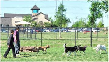

TheVeterinary ServicesDivision iscomprisedofaVeterinarian, SeniorVeterinary Technicianand aVeterinary Technician. Thisteam coordinatesveterinary medical servicesforalloftheanimalsin the shelter. Thisincludesspay/ neuter,wellnessandtreatmentfor sickorinjuredanimals.

TheIrvingFire Departmentprovidesfireanddisease prevention,education, firecoverage,EMS,extraction, hazardousmaterials,swiftwaterrescueteams,crash rescue,andurbansearchandrescueoperations24 hoursaday from11strategically locatedstations. To minimizethedangerstolifeandproperty,thefire departmentalsoprovidesfirepreventioninspections, firesafety education,investigationsandcontinuous traininginthefieldsofEMS,hazardousmaterialsand rescue.Thefiredepartmenthas318firepersonneland ageneralfundbudgetof $36million.
Thefiredepartmentoperates12enginecompanies, fouraerialtruck companiesandeightMobileIntensive CareUnits.
TheCitizensFireAcademy (CFA) establishesa link betweenthedepartmentandthecommunity. Theprograminformstheresidentsaboutthefire departmentandexplainshowthevolunteersserve thecommunity. Oncetheresidentgraduatesfromthe CFAprogramthey are available tovolunteertohelpat emergency scenesandsafety fairs.
TheOfficeof EmergencyManagement (OEM) is responsibleforcreatingplanstohelptheCity ofIrving beprepared,trainingwithallcity departmentsand implementingthoseplans. Italsoincludessetting uptheEmergencyOperationsCenterwhenalarge emergency hasoccurred.
LocatedinthemiddleoftheDallas/FortWorth Metroplex,Irvingissusceptibletoacomplexset ofhazardsandthreats,includingseverestorms, flashflooding,tornadoes,hail,winterweatherand
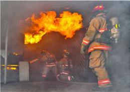
earthquakes -allofwhichaffecttheregion. Irving alsoishometomany multinationalcorporationsand majoreventsthatattractnationalandinternational audiences. ThismakesIrvingawareoftheneedto prepareforalltypesofemergencies.
Humanandmateriallossescausedby naturaldisasters areamajorobstacletosustainabledevelopment. The OfficeofEmergencyManagementraisesawarenessof potentialdisastersandhelpsresidentsandbusinesses becomepreparedaheadoftimesothey areableto respondoncea disaster occurs.
TheInformationTechnology (IT) Department manages andmaintainsanexpansive800MHzP25compatible radiosystemtofacilitatecommunicationbetween 1,800users. P25interoperabilityisatwo-way digital radiostandardthatallowsforradiocommunications acrossdifferentsystemsandplatforms. Using P25 systemsenablesdisparatefirstresponderagenciesto coordinate services andinformationduring aregional emergency regardlessofthetypeofsystembeing used. Thecity workscollaborativelyandsharesthis advancedradiosystemwithotherregionalagenciesto ensure dependable andstablecommunicationsofthe highestlevel.

TheInspections Departmentadministersthebuilding code, coordinates withregionalrequirements, reviews plans, andservesdevelopersby issuingbuildingand relatedpermits. It inspectsbothnew constructionand remodelingprojects.
Residentialandcommercialbuildingpermitsare requiredtoerect, enlarge, alter, move, demolishorrepair
TheCode EnforcementDepartmentemphasizes voluntary complianceprogramswiththegoalof teachingresidentsaboutthecharacteroftheir neighborhoodsandinstillingprideofownership. Ensuringcodecompliancewithanaginghousingstock, providesacontinuouschallengeforthisdepartment.
HealthInspectorsareresponsibleforrestaurant astructureintheCity of Irving. Permitsarenotrequired sanitationinspections, poolsathotelsandapartment forcosmeticworksuchaspainting, carpetingand cabinetry. complexes, nursinghomesandday cares. They also enforcethesmokingordinance.
The Building Standards Division workswithowners toimprovetheconditionofexistingstructures. The division workstocontinuously enhancethequality of lifeofresidentsandtomake neighborhoods safe, vibrant andattractive.

The Irving PoliceDepartment'skey strategiesinclude decreasingcrimeanddisorderthroughproactive approaches; buildingeffectivecommunity partnerships; increasingoperationalefficiency; andimproving motoristsafety.
Inordertoimplementthesekey strategies,the Police Departmentispursuingthefollowingshort-term initiatives:
• Create a Criminal Intelligence and Information Center toeffectively usereal-timedataand intelligencetopromote ahigherlevelof public safety. The Center willcombinethestrengthsof the IntelligenceUnitandtheCrime AnalysisUnit which willprovidecrimedataanalysis,disseminate intelligenceregardingcrimetrends, known offenders,andcrimedata. The unitalsowillbe abletoprovidereal-timesupporttoofficersinthe fieldastheyrespondtocallsforservice. Actionable intelligence willenhancetheirability tomakefaster andmorecompletedispositionsofcalls.
• Deploy Body Worn Camera Program tooffera higherleveloftransparency as body worncameras givepoliceofficerstheability tocapture andrecord activitiesthattakeplaceoutsidetheviewoftheincarvideosystem.
• Enhance CommunityOutreach tofurther strengthenrelationships withconstituents.
• Engage Public through Social Media toeffectively engagethepublicandtoexpandcommunity relationshipsandenhancecommunications.
• Conduct Procedural Justice Training forall employees throughtheuseofthe "BlueCourage" program. Thetrainingnourishesapositivepolice culturetoenhancetheability topositively interact withandrelatetothecommunity.
• Develop and Enhance Domestic Violence Prevention Strategies by providingtoolstohelpvictimsavoid and/orleavedangerous relationships.
• Revise Mandatory Crime Reduction Ordinance asit relates to multifamily developments.
• Implement the President's Task Force on 21st Century Policing Recommendations including implementingthesixpillarsof buildingtrust andlegitimacy,policy andoversight,technology andsocialmedia,community policingandcrime reduction,trainingandeducation,andofficer wellnessandsafety.
In2015,thepolicedepartmenthad598employees and346swornofficers,foracity of approximately 229,000. By 2040, thecity isestimatedtogrowto 318,000 residents, andthepolice department will requiresignificantincreasesinstaffingtokeepup with nearly 40percentpopulationgrowth. Otherstaffing considerationsincludeprogrammingforpolicing areasthathavechangingneeds,suchasthe Heritage Crossing,theentertainmentdistrictandthe PUD#6 redevelopmentarea. Identifyingneedsandappropriate programsforthesespecialdistrictsmay requirechanges inhowserviceisprovided.
Thenewoperationscenterwill havethepotentialtobringin the "SmartCity" concept, using technology toincreaseefficiencies instaffingandoperations. Technology suchasvideocameras andsurveyingpublicareascan bringanaddeddimensionto achievingthepolice department's goals. Recentstridesinintegrating technology includeaccesstorealtimedataalongwithgeographical informationsystemsinofficers' vehicles. Thishelpstoquickly makecriticaldecisionsregarding employeeandresidentsafety.
Thepoliceandfiredepartments understandtheneedto continuously buildcommunity relationships withdiversegroups in Irving. Thedepartments continuously customize officers' approachtoindividual neighborhoods, makingprograms availableatthelocallevel.
With12firestationsandnine ambulances, thefiredepartment planstoaddadditionalstations, equipmentandpersonneltoserve anticipatedgrowth. Thecity seeks toprovideconsistentservice acrossthejurisdictionwithafourminuteresponsetimeforfirst respondersandaneight-minute responsetimeforafullresponse.
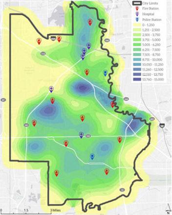
Asthecity grows, thechallenge willbetoincreasecoverageto fillinserviceareagaps. Thereis acurrentneedforanadditional stationinthenorthernmost portionof Irving. Themapabove showstheprojectedlocationof populationgrowthrelativetothe stationlocations.

TheIrvingFireDepartmentwas awardedbestpracticesrecognition statusby theTexasFireChiefs Associationin2014. Tocontinue thishighlevelofservice, thefire departmenthasthefollowing short-termstrategies:

• Target initiatives toprevent fire incidents
» Sustainthecomprehensivefirepreventionand educationprogram.
» Enhancefiresafety educationforchildren, senioradultsandthebusinesscommunity.
» Conductfiresafety exitdrillsforchildren, 12th gradeandunder.
• Enhance the comprehensive fire inspection plan to prevent fires and improve community safety
» Inspecthigh-, moderate-, andlow-hazard facilitiesbaseduponestablishedschedules.
• Deliver effective fire and emergency services
» Sustainemergencyunitsinserviceandin district.
» Comply withNationalFireProtection Association (NFPA) responsetimestandardsfor fireandEMScallsforservice.
• Develop the workforce through targeted training to meet current and future service demands
» Developpersonnelthroughtrainingand certificationprogramstosupportstrategicfire andEMSservices.
» Provideprofessionaldevelopmenttrainingfor fireofficers, instructors, driver-operatorsand chiefofficers.
Futureissuesneedingattentionareincreasing service levelsinthenorthernportionofthecity as populationincreases, updatingsomeoftheolderfire trucksandapparatus, updatingolderfirestations, and relocatingstationsthathaveoutgrowntheirsitesor havebeenconstrainedby adjacentdevelopmentand infrastructure.
Asinotherservicedepartments, themethodologies, tools, andstrategiesofthefiredepartmentwill continuetochangeinthefutureastechnology advancesoccurandthecity becomesmoreurban. Whiletechnology andoperationalefficienciescancut downonsomestaffing requirements, asthecity grows itwillneedtohireadditionalstaffing.
Inadditiontofocusingonfireprevention, highresponselevelsforfireandemergency medicalservice, andhazardousmaterials, theemergency services staffwillalsobetaskedwithpreventingandpossibly respondingtoactsofterrorismandprovidingurban searchandrescueteams. Theseinitiatives willrequire collaborationwithregional, stateandfederalteams. Anotheremergingissueisdevelopingacommunity pandemicprogram, similartothoseinseveral neighboringcommunities. Theseprogramsneedto addressboth prevention and managementofdiseases.
The AnimalServices Department'skey strategies includedecreasinghuman/animalconflicts (involving domesticandwildanimals) througheducationand enforcement, andpromotingoverallanimalwelfare andresponsiblepetownership.
Inordertoimplementthesekey strategies, the Irving

Animal ServicesDepartmentispursuingthefollowing short-terminitiatives:
• IncreaseLostAnimalsReturnedtoOwners
» Microchipallcatsanddogsatthepointofintake.
» Enhanceenforcementthroughupdated processestargetedatrepeatoffenders.
» Developapubliceducationcampaignfocusedon keepingstraysoffthestreets.
» Hostmicrochippingeventsforresidents.
• ImproveOverallAnimalCare
» Implementnewprocessesforintakeandmedical exams.
» Implementnewprocessesforincreasedspay/ neuter services.
» Developstrategiesforkeepingtheanimalshelter atorundercapacity.
Long-termissuesincludeincreasingservicelevelsin thecity aspopulationincreases, expandingtheanimal sheltertoprovideappropriatecapacity forincoming animals, andhiringandtrainingpersonneltodeliver neededservices. Ifadditionalresourcesandpersonnel becomeavailable, the FieldOperationsDivisionwill transitiontoincludemoreproactiveresponsetoanimal issues, moreopportunitiesforoutreachandeducation, andbuildingstrongerrelationshipsinthecommunity. Residents' expectationsofanimalservicescontinuesto riseandthe department willneed resources todevelop additional programs toreduce euthanasia of animals. Examples includeafoster program, anexpanded volunteerprogramandincreasedoutreachandpublic education. Thedepartmentalsowillbechallengedby significantchangesinwhatisconsideredanacceptable
standardofcareforshelteredanimalsincluding largerkennelspaces, addressingbehaviorneedsand maintainingahealthy animalpopulation. Asinother servicedepartments, theroleoftheanimalservices departmentwillcontinuetochangeinthefutureas technology advancesoccur.
Directimpacttoresidentsandbusinessesisthecity's 25 tower outdoor-warningsystem whichhasunits locatedstrategically throughoutthecity toalert residentsofimpendingsevereweatherordisaster events. Itisvery importantthatthecity continues tomakesurethatthereisadequatecommunication infrastructure tobuildouttheseimportantsystemsfor operationalstability andgrowth. Criticalinformation forresident, employeeandfirstrespondersafety isa desiredcomponentofquality oflife.
TheCity of Irvingisknown throughouttheregion forits development-friendly serviceandefficiency in facilitatingdevelopment. Thedesiretomaintainthis reputationisreflectedinthe Inspections Department's performancemeasuresof:
• Completingnewcommercialplanreviewswithinsix days.
• Performinginspectionswithinonebusinessday. While serviceprovisionremainshigh, thereisroom for technology improvementsthatwillfurther enhancetheefficiencyofthepermitsandinspections programs.

Aswithany city, thereareissueswithaging structures, especially rentalpropertiesandmultifamily structures. Thecodeenforcementdivisionis addressingtheseissues proactively by:
• Augmentingthe multifamily programtoimprove quality oflifeforrenters.
• Establishingnewprogramsthatfosterassisted compliance.
• Developingprogramstoinstillprideinlow-risk ratedmultifamily properties.
• Creatingeducationalcodecoursesforapartment personnel.
• Developinginstructiveinspectionnotification programfortenants.
• FormalizingandexpandingCodeEnforcement outreachcampaign.
• FocusingonbuildingpartnersthroughtheKeep IrvingBeautifulprogram.
• Expanding corridorinspectionprograms. Futureissuesincludecontinuingtoimprove technology andintegratewithoverallcity technology.

Goal 1: Become a regional leader in innovative technology.
Strategy 1.1
Continue to support and enhance radio technology and make available to relevant city departments.
Strategy 1.2
Update technology to streamline reporting procedures and integrate data into a common databank.
Strategy 1.3
Work with the Information Technology Department to continue to incorporate new city-wide coordinated technology to streamline and improve efficiencies.
Strategy 1.4
Implement a "smart city" concept in high-density areas by surveying public areas and integrating other types of new approaches.
Strategy 1.5
Expand online permitting to accommodate all types of permit requests.
Goal 2: Plan for future public safety capital improvement needs.
Strategy 2.1
Continue to support the build-out of the Police and Fire Operations and Training Facility
Strategy 2.2
Build new fire stations as needed to expand service to high-growth areas, such as the northern portion of the city and the PUD #6 (former Texas Stadium) area.
Strategy 2.3
Relocate or reconstruct aging facilities.
Strategy 2.4
The city should continue to monitor USGS earthquake risk for the North Texas region, and take appropriate action (which could include building and development code updates) if the threat level increases to an actionable level.
Strategy 2.5
Explore locating public safety services together, such as police and fire dispatch and other similar services.

Goal 3: Evaluate and address the needs of new growth centers.
Strategy 3.1
Address special district police coverage for areas such as the Heritage Crossing, the Las Colinas Urban Center and PUD #6.
Strategy 3.2
As growth continues in the northern part of Irving, evaluate the need for additional police beats to address growth.
Goal 4: Continue to focus inspection programs on problematic and declining areas.
Strategy 4.1
Incorporate focused neighborhood programs into inspections and service provisions to concentrate improvements in specific neighborhoods.
Goal 5: Focus the culture in Public Safety departments on building community relationships.

Strategy 5.1
Continue to build relationships in the community to maximize customer service and increase community services' resident satisfaction ratings. Coordinate with programs such as neighborhood watch, crime and fire prevention programs, resident surveys and citizen's academies.
Strategy 5.2
Incorporate philosophy of community building and community relationships into job descriptions and performance reviews.

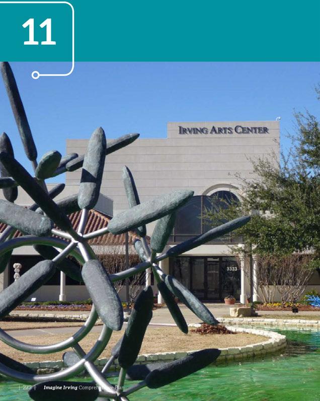

The strength of every democracy is measured by its commitment to the arts.
~ Charles Segars, CEO of Ovation
Thecivic, culturalandintellectualassets-performing artscenters,libraries,museums,universities, community colleges, municipalservices, hospitals, parks, andsportsarenas-contributetotheculture, economy andvitalityofacity. Irvingoffersavariety oftheseassets, whichcanbeputtoworkonbehalfof thecity.They providethefoundationforattracting andretainingthecreativeandinnovativeworkers whowillcompriseIrving'sfuture. Culturalandarts amenitiesalsoenrichthecommunity by providingan environmentthatbenefitsallresidents-youngandold.
Irving'scommunity serviceprovidersarededicated toprovidinghigh-quality amenitiestoresidentsand businesses.Theamenitiesdiscussedinthischapter includethelibrary, andarts, tourismandmuseums. Thereareanumberofcommongoalsandchallenges foreachoftheseserviceareas, namely enhancing serviceprovisioninachangingandcomplex world. As technology anddevelopment patternsevolve, therole ofcommunity amenitiesdepartmentswillchangein thefutureaswell.

People wi11 say...
» Irving provides all residents with compelling reasons to remain in the city.
» Irving has robust cultural centers that serve the city's diverse residents and visitors.
TheIrvingPublicLibrarymissionistoprovideaccess toinformationforlifelonglearningandpromotethe enjoymentofreading. Thelibrary'svisionistobea centerofthecommunity,improvingthequality oflife of Irvingresidentsthroughcommunity engagement, educationaleventsandadvancedtechnology. In2015, thelibrary hadabudgetofapproximately $7million,whichisthreepercentoftheCity of Irving'sgeneralfundbudget.
in 2016,thesystemconsistsofthreemodern communitycenterswithstate-of-the-artofferings thatdrawpeopletothefacilities,andonesmall neighborhood branch. Thelibrary systemissupported by avibrantFriendsofthePublicLibrary group thatsupportsliteracy inthecommunitythrough philanthropicprojects. TheCity of Irvingalsoregularly

workswithnationalorganizations,retailers,private businesses,culturalsocietiesandnearby schoolsto presentcommunity events,award-winningauthor panelsandexhibits.
Today'sIrvinglibrariesareafarcryfromIrving'sfirst library,setupinthecornerofafurniturestorein1941.
TheGoldLeadershipinEnergy andEnvironmental Design (LEED) certifiedWestIrvingLibrary openedin 2011,markinganeweraofcapitalimprovementsfor Irving'slibraries. Valley RanchLibraryunderwenta 5,000-square-footexpansioninearly 2014. The South IrvingLibrary,whichopenedin2015,providesliterary eventsandhigh-techeducationalservicestoIrving's youth. In2016,theEastBranchLibrary celebrated20 yearsofchanginglivesandcommunityrevitalization.
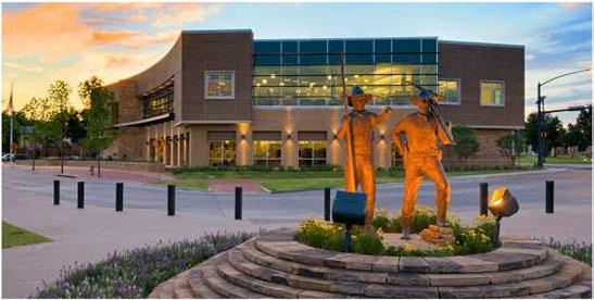
TheCity ofIrvingprovideslibrary patronswith computeraccessandpublic-accessibleWi-Fithatis agreatbenefitforresidentswhodonothaveaccess intheirhomes. TheIrvingPublicLibrary system continuestoreachfortechnologicalgoalstoimprove itsservicestopatrons. TheCity ofIrvingisplanning toaddmorepublicaccessibleWi-Fiinotherbuildings withtheuseofcommercialproviderservices.
Irving'slibrariesalsomaintainagrowingdigital collectionthatincludese-books, audiobooks, magazines, movies, andmusic.
Lookingintothefuture, thelibrary willcontinue topartner withtheFriendsofthe PublicLibrary to broadenitsscopeofservices. Inthespring, theIrving PublicLibrary willagainhostthe NorthTexasTeen BookFestival, andinthefall, theCity ofIrving's11th annualcommunity celebrationofreading.
TheFriendsoftheIrving PublicLibrary isanonprofit organizationofindividualsdedicatedtosupporting andenhancingthelibrary. TheFriendsaccomplishthis mission, inpart, by supplementingthelibrary's annual materialsbudget, providingfundsforthousandsof additionalbooksandAVmaterialseach year.
Irvingishometoarobusttourismandartscommunity. Withprogramofferingsinallperformanceareas, and aquality performanceandvisualartsfacility, aswell asavariety ofmuseumofferings, Irvinghasmuchto offeritsresidents.

In addition to a high volume of materials use, the library hosts nearly 500 adult programs, 168 teen programs and 1,200 children's programs annually, serving more than 69,000 people through these efforts.
Attendance
CHILDREN PROGRAMS
Attendance
TheIrvingConventionandVisitorsBureau (ICVB) actively solicitsmeetings, conventionsandevents forIrvingandproactively generatesmediaattention forthedestination; itoperatestheIrvingConvention Center (ICC) at LasColinas; andprovidesawiderange ofvisitorinformation. TheBureau'smainfunctionis tomarketandpromoteIrvingasapremierdestination foreventsthatcanutilizethecity's conventioncenter, its 70+ hotelsanditsmany othervenues.
Community Amenities

FundingfortheConventionandVisitorsBureauand insupportoftheoperationsoftheConventionCenter comesthroughtheuseofdedicatedfundsavailable fromthehoteloccupancytaxgeneratedinthecity. TheConventionand Visitors Bureau (CVB) also provides forall capital improvementsforthe Irving ConventionCenterthroughCVBoperatingfunds; thereisnoCitygeneralfundsourceofrevenuesfor the maintenance andoperationsoftheICC.
TheIrvingConventionCenterat LasColinasisdivided intothreemainlevels,withthe50,000-squarefootexhibitionhallonthefirstfloor,alongwiththe conciergedesk andseveralgreenrooms. Thehallcan accommodateapproximately4,500attendeeswith theater-styleseatingor275booths. Themezzanine levelincludesacafeandoutdoorcoveredterrace. Theconferencecenterlevelfeaturesmeetingand juniorballrooms,andprovides20,000squarefeetof meetingspaceinupto20differentbreakoutrooms, eachaveragingabout1,000squarefeet. Thespace isdividedinto11dedicatedconferencerooms,one dedicatedboardroom,andajuniorballroomthatcan bedividedintoavarietyof flexibleconfigurations, includinguptoeightindividualmeetingroomsanda businesscenter. A20,000-square-footgrandballroom andpre-functionareaislocatedonthetoplevelofthe conventioncenter. Thegrandballroomcanalsobe dividedintomeetingroomsorsmallereventrooms.
Usingwaterfromnearby Lake Carolyn,morethan 90percentofthebuilding'swaterrequirementsare metwithwaterreusedforlandscapingandothernonpotableapplications,includingthebuilding'scooling systems. Thelandscapingdesignincludesdroughtresistantnativeplantsthatrequireminimal watering. Adensecanopyoftreesontheplazaoffersacooling shadewhilereducingtheambienttemperature.
Thecity-ownedIrving Music Factory willprovide anadditionalanchortothecity'sconvention district,offeringapremier entertainment venue forcommercialartistsandacollectionofdiverse restaurants. Followingitsopening,thecityexpects tocompletethisdistrictwiththeadditionofthefinal anchor,a350-roomheadquarterhotel.
The IrvingArtsCenter,anaffiliateoftheSmithsonian Institution,hasmorethan 91,500squarefeetof performingand visual arts space,includingthe707seatCarpenter PerformanceHallandthe253-seat DupreeTheater.The Main Galleryisa3,800-squarefootartgallerywith200linearfeetof wallspace. In 2014,theartscenterhosted1,375events,including
203performancesand24exhibitions. Duringtheyear, thecenterwelcomed103,719visitors.
AnexecutivedirectoroverseestheIrvingArtsCenter, which is governed bytheIrving Arts Board (agroup of City Council appointees). Theexecutivedirector reportstotheIrvingArtsBoard,andwithhisstaff, developsopportunitiesfor local arts organizations, and other arts andculture-relatedprograming.
TheIrvingArtsCenterincludespermanentsculpture, travellingindoorandoutdoorexhibits,fourpermanent galleries,andperiodicexhibitsofnationaland internationalconsequence. Theartscenter'sfour galleryspacesshowcasenotableexhibitionsfromlocal, regionalandnationalartists. TheIrvingArtsCenter alsofeaturesa SculptureGardenwithcommissioned sculptures. Programmingincludesyear-roundyouth andfamilyprogramsfeaturingstorytimes,live performances, Saturday School,morethan12weeks ofsummercampannually, Family Fundaysandafree holidayfestival.
TheIrvingArtsCenterservesasthehometo11 Irving-basedculturalorganizations.Collectively,these organizationsproduceavarietyofartofferings,andas designatedResidentArtsOrganizations,haveaccessto avarietyof services and benefitsthroughtheCityof Irving.
KeepIrvingBeautiful (KIB)isanonprofit, grassroots, leadershiporganizationdedicatedtoeducatingthe communityaboutlitterabatement, recycling,and beautificationtohelppreservehealthandpromote Irving'ssocialandeconomicprosperity.
Asanaward-winningaffiliateofKeepAmerica BeautifulandKeepTexasBeautiful, KIBreachesout toandpartnerswithallsectorsofIrvingincluding government,business, church, cultural,neighborhood andcivicorganizations.
» Entertainment Series of Irving
» Irving Black Arts Council
» Irving Chorale
» MainStage Irving-Las Colinas
» Irving Art Association
» Irving Symphonic Band
» Irving Symphony Orchestra
» Las Colinas Symphony Orchestra
» Lyric Stage
» Momentum Dance Company
» New Philharmonic Orchestra of Irving


TheCulturalAffairs Department overseesthe Irving ArtsCenter, andthecity'smuseumsandhistorical archives, underthesupervisionoftheExecutive DirectoroftheIrvingArts Center.
Jackie Townsell Bear Creek Heritage Center isoneof thefinestrepositoriesofAfrican-Americancultureand heritageinTexas.Thefacilitywascreatedtohonor thehistoryofthearea settledin1850 byfreedslaves. TheBearCreekcommunityinwest Irvingisoneof theoldestAfrican-Americancommunitiesin Dallas County. The HeritageCenterincludesanativeplant garden, the BearCreek Masonic Lodgeandcommunity center,andtheGreenHouseandJ.O. Davis House.
Mustangs of Las Colinas Museum isadjacenttoone ofthelargestequestriansculpturesintheworld.The museumshowcasesthestoryoftheeightyearsof work Africanwildlifeartist Robert Gleninvestedin creatingthe Mustangs. Themuseumalsopresentsa shortfilmthatbringstolifethetimeandeffortthat wentintodesigning, moldingandmountingthis distinctivepieceofpublicart.
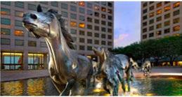
Ruth Paine House Museum isahomerestoredtoits 1963 lookthatprovidesamultimediamuseumthattells thestoryoftheeventsleadinguptotheshootingof PresidentJohnF. Kennedy (JFK). RuthPaine'shouseis where allegedJFK assassin Lee Harvey Oswald spent thenightpriortotheshootingat Dallas' Dealey Plaza.
TheCityofIrvinghasallocatedasmallportionofits hoteltaxfortheconstructionofahistoricalmuseum.A feasibilitystudywascompletedin2015,andtheCityhas begunsolicitingproposalsforplanninganddesignofa 15,000squarefootIrvingMuseumandHeritageCenter tobelocatedinpartofthefirstflooroftheoldcentral librarybuildinglocatedat801 WestIrvingBoulevard.

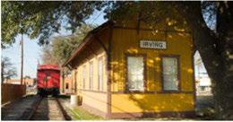
TheIrvingArchives,adepartmentoftheIrving PublicLibrary,collectsdocuments,photographsand smallartifactsthatprovideinsightintothehistoryof Irving.Thearchives'holdingsencompassthepolitical, municipalandsocialhistoryofIrving.Collections includematerialrelatingtothehistoryofthecity,its schools,churches,clubsandbusinesses,aswellas thehistoryofitspredecessorcommunities,founding families,andnotableresidents.
TexasMusiciansMuseum(TMM)openedin2015andis locatedinHeritageCrossingindowntownIrving.The museumbuildingisownedbytheCityofIrvingand housesavarietyofpermanentdisplaysandmemorabilia suchasgoldrecordsfromnumerousTexasmusicians, meeting,eventandclassspaceforrentals,acafeand musicgarden.Themusicgardenhosts600people comfortablyandprovidesavenueforlivemusicshows. Thecity'sinvestmentinbuildingTMMindowntown Irvingcoincideswiththeongoinggoalofmaking downtownIrvingaregionaldestinationandwillhelp catalyzefuturedevelopment.
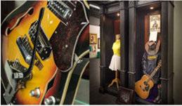
NationalScoutingMuseumistheofficialmuseumof theBoy ScoutsofAmerica. Establishedin1959, the museumiscommittedtopreservingtherich,100+ yearhistoryoftheScoutingmovementbycollecting, organizing,preservinganddisplayingmemorabilia; providingvirtuallearningadventures;andshowcasing aNormanRockwellgallery. In2002,thecollection movedadjacenttothenationalheadquartersofBoy ScoutsofAmericainIrving.

TheIrvingPublic Library's goalistohavealibrary withintwoorthreemilesofevery neighborhood, andspacedfourtofivemilesapart. Mostof Irving's neighborhoodsarewithinthreemilesofalibrary, with thegapincoveragebeingalongtheSH114corridor andtheDARTOrangeRailline. Thelibrary alsohas thegoalofconducting150library programs with5,500 participantseachmonth.
Figure 60: Proximity of Irving Residents to Libraries
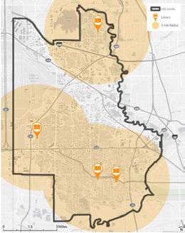
Whilemostof Irving'sneighborhoodsarewithinthree milesofalibrary,twoofthefourexistinglibrariesare unabletoadequately serveresidentsintheir respective serviceareas. TheEast BranchLibrary ishoused withintheHumanServicesbuilding,andisnotan economically viable facility. TheEast BranchLibrary contains4,800squarefeet,andthecostof staffing andrunningthelibrary persquarefootissignificantly higherthanthecostoflargerfacilities. Althoughthe City of Irvingrecently expandedtheValley Ranch Library,staffcannotkeepupwiththegrowingdemand formaterialsandservices,andwithplannedgrowth inthecentralandnorthernareasof Irving,anewor expandedfacility islikely neededinthenearfuture. Thelibrary systemdoesnothaveapprovedbondfunds available,therefore,any new construction willrequire anewbondelection.
TheSouthLibrary hasaDiscovery Zonedesignedto improveearly childhoodliteracy skills. The Irving Library andIrvingISO collaborate toofferEnglishasa SecondLanguage(ESL) classes,ajointbook eventthat takesplaceevery October,andateenbookfestival.
Thelibrary isworkingtoincorporatenewtechnology andtargetedservicesintoitsfacilities. Thelibrary systemprovidesbilingualstaffproficientinSpanish, Hindiandotherlanguages,as wellasmaterialsina variety oflanguagestoservethediverseresidents. Thetwonewerlibraries,theSouthandWestlibraries, werebuilttoaccommodatemoderntechnology. The remodelingoftheValley RanchLibraryincorporated additionaltechnology aswell.

The IrvingArtsCenterhadanoperatingbudgetof $4.5millionin2014-2015,with$600,000in earned income. Thereisnoprivatefundraisingtosupportthe ArtsCenteritself. Elevenresidentartorganizations arethe Center'sprimarytenants. They are all501(c)3 nonprofits,operatingindependently andretaining revenuesearnedthroughticketsalesandfundraising. Theyofferawidevariety ofprogramsatthe Center andelsewhere in Irving. IrvingArtsCenterprovides centralizedticketingservicesandfundingsupport throughtwograntprograms.Residentandcommunity organizationsmeetingeligibilityrequirements can applyforfundingtoproduceartsandcultural activitiesin Irving.
TheCity ofIrvinghasestablishedaculturalandarts programunderthe IrvingArtsCenterand Board throughtheuseofdedicatedfundsavailablefromthe hoteltaxgeneratedinthecity.Thisfundingsource shouldbeprotectedfromuse in othercity initiatives.
TheCity ofIrvingmustbeaware ofthestatusofthe statelawsthatenablethisfunding,andshouldbeable torespondeffectivelyto any proposedmodificationsto theselaws.
Fundingfortheartsisachallenge,withfundingsources limitedtoprimarily earnedincomeandcitysupport. Somehoteloccupancytaxcansupporttheartsaslong astheprogramsmeetthelegislativerequirements, includingpromotingtourismandthearts.
Criteria #1: Every expenditure must directly enhance and promote tourism, and the convention and hotel industry.
Criteria #2: Every expenditure of the hotel occupancy tax must clearly fit into one of the following nine statutorily provided categories for expenditure of local hotel occupancy tax revenues.
1. Funding the establishment, improvement, or maintenance of a convention center or visitor information center.
2. Paying the administrative costs for facilitating convention registration.
3. Paying for advertising, solicitations, and promotions that attract tourists and convention delegates to Irving or its vicinity
4. Expenditures that promote the arts.
5. Funding historical restoration or preservation programs.
6. Funding certain expenses, including promotional expenses, directly related to a sporting event within counties with a population under one million.
7. Funding the enhancement or upgrading of existing sports facilities or sports fields for certain municipalities.
8. Funding transportation systems for tourists.
9. Signage directing tourists to sights and attractions that are visited frequently by hotel guests in the municipality.

Goal 1: Ensure library facilities are properly located and upgraded to provide quality citywide library services. Plan for new facilities to meet future growth.
Strategy 1.1
Plan new library facilities as needed to provide equitable access for specialized populations.
Strategy 1.2
Plan for a new library facility that will serve future growth centers along the SH 114 corridor and the DART Orange Rail line.
Strategy 1.3
Explore relocating the East Branch Library into a mixed-use development as a ground-floor tenant.
Strategy 1.4
Partner with other facilities to provide neighborhood centers. Potential partners include the Irving Arts Center, or community or recreation centers.
Goal 2: Expand library programming to include creative programming that responds to community needs.
Strategy 2.1
Continue to offer ESL classes, and begin offering GED and citizenship classes.
Strategy 2.2
Expand the collection to enhance availability and to provide materials for a diverse community.
Strategy 2.3
Include programming with a focus on children and families such as junior players, and a children's theater or black box theater; a family place library; or a nature, arboretum or gardening focus.

Strategy 2.4
Consider other creative strategies and programming to bring community services to neighborhoods and to attract younger users; an e-book only library; kiosk libraries in dense areas, or other emerging library concepts with efficient downloads and enhanced services.

Goal 3: Use arts and cultural resources to bring Irving together as one cohesive city made up of vibrant, diverse neighborhoods.
Strategy 3.1
Implement the recommendations of the arts and cultural needs assessment.
Strategy 3.2
Identify and acknowledge specific neighborhood needs, and celebrate Irving's unifying culture and many ethnicities.
Strategy 3.3
Promote and support cultural diversity through the arts. Evaluate and develop programming at the Irving Arts Center and at other cultural facilities that responds to community needs and bridges gaps within the community, while also celebrating diversity. Create satellite centers that draw on the culturally diverse areas in which they exist.
Strategy 3.4
Develop a strategy to involve the corporate community to support the arts.
Strategy 3.5
Explore innovative programming that brings the arts to different areas of the city through outdoor festivals, public art, pop ups, or a mobile exhibit cart.
Goal 4: Promote Irving's cultural assets to create vibrant neighborhoods and activity centers.
Strategy 4.1
Promote the Irving Arts Center as a regional venue for diverse cultural offerings.
Strategy 4.2
Identify programming to promote Irving's entertainment district.
Strategy 4.3
Promote the music factory and other emerging entertainment venues.
Strategy 4.4
Promote and create festivals and other events that take advantage of Las Colinas' Urban Center and natural assets including water, density and public gathering areas.
Strategy 4.5
Develop better connections from the DART station to the entertainment district.

Strategy 4.6
Promote visitors to Heritage Crossing to expand brand.
» Promote downtown events.
» Leverage Texas Musicians Museum to attract visitors to downtown.
Strategy 4.7
Create satellite art and culture offerings such as pop-up events that build on assets in Heritage Crossing. Examples include a gallery walk, soda fountain, the Texas Musicians Museum, creating temporary walkable spaces to host major downtown events.
Strategy 4.8
Continue efforts to develop a 501 lc)3 historical museum.
Strategy 4.9:
Review parking availability and event permitting for alcoholic beverage sales and consumption at city facilities to accommodate more festivals and large events.

Goal 5: Leverage key developments in Irving to attract and enhance economic development target markets.
Strategy 5.1
Explore further development and funding of the Cultural Affairs Department to manage festivals, the arts center, museums and other events.
Strategy 5.2
Identify meetings and conventions key to Irving's economic development target markets, and pursue for future dates in Irving.
Strategy 5.3
Coordinate with internal and external stakeholders to identify parking solutions and mass-transit strategies to effectively move people to and through key developments throughout Irving including the entertainment district, convention center hotel, Heritage Crossing, and former stadium area (PUD #6).
Strategy 5.4
Expand the public relations campaign to increase participation in arts center programs.
Strategy 5.5
Increase publicity to grow cultural, ethnic and community-based involvement in the arts center.
Goal 6: Plan for maintenance and ongoing programming of the Irving Arts Center as a key cultural asset.
Strategy 6.1:
Continue to support the Irving Arts Center as a state-of-the-art foeiIity.
Strategy 6.2:
Plan for short- and long-term needs including expansion of programs and facilities, building new infrastructure, purchasing land, and participating in bond programs.
Strategy 6.3:
Review and analyze arts center expansion needs to meet customer demand.
Strategy 6.4:
Develop a parking management plan for the arts center.

Strategy 6.5:
Develop marketing and advertising strategies to promote increased community involvement. Invite residents from all over the city into the arts center.
Strategy 6.6:
Upgrade technology in service provision to improve efficiencies.
Strategy 6.7:
Explore a public arts program for the city. Expand the concept of arts to include walkable places, green spaces and transportation opportunities-all factors that contribute to the beauty and culture of Irving.

Goal 7: Plan for maintenance and ongoing programming for the Irving Convention Center as a key cultural asset.
Strategy 7.1:
Continue to support the Irving Convention Center as a state-of-the-art facility.
Strategy 7.2:
Plan for short- and long-term needs including renovations and re-use of facilities, new infrastructure and participating in bond programs.
Strategy 7.3:
Review and analyze convention center enhancement needs to meet customer demand.
Strategy 7.4:
Upgrade technology in service provision to improve efficiencies.
Strategy 7.5:
Parking management and efficient transportation options are critical to the long-term success of the city's convention district. A parking management plan has been developed and it is expected that the construction of the Music Factory and headquarter hotel garages should provide sufficient additional parking to accommodate the majority of user needs. The district must be prepared, however, to address the occasional "Easter Sunday" when demands will be unusually high, and to provide alternatives for transit users. DART service in and around the area, along with supplemental routes provided by the Area Personal Transit system managed by DCURD, are critical to the efficient movement of guests in and out of the district.
Goals,Strategies+
Goal 8: Address revenue opportunities and options.

Strategy 8.1:
Market the services of the Irving Arts Center to other cities in the Metroplex without facilities, such as Grand Prairie.
Strategy 8.2
Implement a plan to attract new entertainment- or recreation-oriented businesses to Irving, the likes of Grapevine's Great Wolf Lodge, Piano's Angelika Theater, min-golf, etc.



The newness effect of a new thing wears off in nine months to a year, but financial security can last a lifetime.
~ Dan Buettner
TheCity of Irving'sannualbudgetingprocess produces a structurally balancedbudget, andisguidedby the City of Irving'sstrategicplanningand long-range community and financialplans. Thisstrong financial managementapproachallowsthe City of Irvingto endureeconomicupsanddowns withresiliency, while alsorespondingtocommunity desiresandneeds. Irving'slargecorporatetaxbase, formalinvestment andreserve policies, andhealthy reserveshave allowed thecity to maintain itsAAA bond ratingfor generalobligationdebt.
Sound fiscaldecisionsandinvestmentsallowthe City of Irvingtoleverageitsfavorablebondrating, butrequirethecity to carefully prioritizeneedsfor majorcapitalimprovementsvitaltomaintainingthe highquality of publicinfrastructureandservicethat residentsand businesses expect. The City of Irving willcontinuetomaintainitssound fiscalpoliciesand operationstoensurelong-termfinancialhealth.

» Irving maintains facilities, services and infrastructure throughout the city.
» Aging infrastructure is updated, including drainage, water and sewer lines, roads, sidewalks, intersections, and neighborhood lighting, ensuring quality service to existing users and capacity for future growth.
» Irving maintains its existing parks, pools and trails, and provides new recreational facilities. Parks and open spaces are easily accessible to residents in every neighborhood.
» Irving is growth-oriented, committed to the support and continuous improvement of existing businesses, infrastructure, amenities and the workforce.

• Setthestandardforsoundgovernance,fiscal managementandsustainability.
• Makeoperationaldecisionsforlong-termfinancial sustainability.
• Investinsystematicinfrastructureimprovements.
• Investinthecapitalimprovementsprogramand operationstoensure high-quality infrastructure and servicesforresidentsandvisitors.
• Maintainarevenuestreamthatallowsthe ongoingmaintenanceandperiodicreplacement ofinfrastructureinvestmentandprovisionof necessary publicservices.
• Investincommunity development,street improvements (forcars,bikesandpedestrians), stormdrainageimprovements,parksservices,city buildings,solidwasteinfrastructure,fireservices, policeservices,citywide communicationandIT infrastructure,libraries,gateway initiatives,and recreationcenterfacilities.
TheCity of Irving'sbudgetisfundedfromavariety ofrevenuesources. Theseincludeproperty taxes (21percent),chargesforservices (19percent),transfers fromotherfunds (13percent),salestax (11percent), bondproceeds (9percent),contributions (7percent), andanumberofothersmallerfundingsourceslisted belowin Figure61.
Figure 61: Total Source of Citywide Funds FY 2015-16
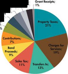
Source FY 20l 5-l 6 Adopted Budget
Thetotaladoptedbudgetforallfundsfor FiscalYear 2015-16was$596,535,971. Excludinginternaltransfers provides$499,586,147inavailablefunds.
• Operatingexpendituresaccountfor$354,377,617, whichis59percentofthetotalbudget.
• Operatingcostshaveincreasedinresponseto increased demandsforservice, including increased staffingfor Fire Station#12and Medic#1.

• Debt Service Fundsare11percentoftotalfundsand includegeneraldebtservice,specialrevenueand otherloans.
• Capitalprojectsandequipmentpurchasestotal $80,184,786,or14percentofthetotalbudget.
62: Uses of Funds by Service Type FY 2015-16
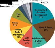
Source: FY 20l 5-16 Adopted Budget
Figure 63: Uses of Funds by Expense Type FY 2015-16
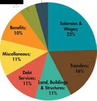
TheGeneralFundistheCity of Irving'smainoperating fund. TheGeneralFundisusedtoaccountforall revenuesandexpendituresnotaccountedforinother designatedfunds. Itreceivesagreatervariety and amountofrevenues,anditfinancesa widerrange ofgovernmentalactivitiesthanany otherfund. The General Fundissupportedby property (advalorem) tax,salestax,franchisefees, zoninganddevelopment fees,permitfees,finesandothercharges,recreation fees,andothermiscellaneousrevenuesources.
General Fundexpendituressupportthefollowing majorfunctions:police,fire,public works,parks andrecreation,library,inspections,community development,codeenforcement,economic development,municipalcourt,andothergeneral governmentalservices.
WhiletheGeneralFundhasthemostdiverserevenue streamsofany city fund,twoprimary sources, property taxesandsalestaxes,accountfor75percent of GeneralFundrevenues.
Sincetheendofthelastrecessionin2011,Irvinghas experiencedasteadyandsustainedincreaseinproperty andsalestaxes.ThishasallowedtheCityofIrvingto restoremany servicesthathadbeencurtailedduringthe recession,andalsofundnewprogramsandexpanded servicesrequestedbyresidentsandCity Council.

Property taxesarelocaltaxesthatprovidethe largestsourceofmoney thatIrvingusestofundthe GeneralFund, whichpaysforstreets, roads, police, fireprotectionandmany otherservices. Texaslaw establishestheprocessfollowedby localofficialsin determiningthevalueforproperty,ensuringthat assessmentsareequalanduniform, settingtaxrates andcollectingtaxes.Localproperty taxesareassessed locally, collectedlocally, andusedlocally. Local governments,includingschooldistricts,cities,counties andvariousspecialdistricts, collectandspendthese taxes.
Irving'sproperty taxrateis0.5941per$100valuation forFiscalYear 2015-16, whichiswellbelowthemedian property taxrateofcitiesinDallasCounty (0.6791).
Morethan70 percent property tax revenueisderived from commercial realestateor business personal property, whichmakes Irvinguniquecomparedto
Table 18: Ad Valorem Tax Rate History
otherlarge, full-service citiesinthe NorthCentral Texasregion. Thiscommercialconcentrationenables Irvingtohaveoneofthelowesttax ratesinthe region.However,demonstratedinthe2001and2007 recessions, Irvingismoresusceptibletorevenue decreasescausedby downturnsintheeconomy.
Alongwith property taxes, salestax isacriticalsource of revenue, enablingtheCity of Irvingtoprovide high-quality servicesforresidentsandbusinesses. The Texasstatesalesandusetax rateis6.25 percent, butlocaltaxingjurisdictions (cities, counties, special purposedistricts, andtransitauthorities)alsomay imposesalesandusetax upto2percentforatotal maximumcombinedrateof 8.25percent.InIrving, thelocaltax rateis1percent.Alongwith12other citiesintheDallasarea, Irvingbusinessesalsocollecta 1percenttax tofundDART transitservice, makingthe effectivesalestax rate 8.25 percent.
Source: FY 2015-16 Adopted Budget

TheCityof IrvingisamongaselectfewTexas citiesthatenjoyaAAAbondrating, whichIrving hasheldsince1996.WhentheCityof Irvingsells bondsforcapitalimprovementprojectssuchascity streetimprovements, libraryconstruction, orparks enhancements, thetopratingallowstheCityof Irvingtosavemoneyby receivingthelowestinterest rate possible.This, intum, allowsthecitytoprovide more improvements atlesscostand maintain itslow propertytaxrate, whichbenefits Irving'sproperty owners.
SoundfiscaldecisionsandinvestmentsallowtheCity of Irvingtoleverageitsfavorablebondrating, but requiretheCityof Irvingtocarefullyprioritizeneeds formajorcapitalimprovementsandmaintenance oncriticalstreetimprovements,stormdrainage upgrades, andsolidwasteinfrastructure. These elementsarevitaltomaintainingthehighqualityof publicinfrastructureandservicethatresidentsand businessesexpect, andcontributestronglytothehigh qualityoflifein Irving.
TheCityof Irvinghasbeenrecognizedatthehighest levelforitsexcellenceinfiscaltransparencybythe TexasComptroller's LeadershipCircle, aprogram thatrecognizeslocalTexasgovernmentsandschool districtsthatmeetthehigheststandardsforfinancial transparencyonline. Platinum-leveldesigneesare modelsforothercitiestofollow, accordingtothe Leadership Circle.
Toberecognizedbytheprogram, Irvingmetthe followingfourcriteria: havinganadoptedbudgetfor FiscalYear2014-15, acurrentannualfinancialreport, acurrent check/expenseregister, andatransparency pageonline. Residentscanaccessfinancialinformation online, atcityofirving.org/budget.The Leadership Circlewaslaunchedin2009asawaytorecognize citiesandschooldistrictsinthestatethatmaketheir financialrecordsavailabletothepublic, provideclear informationabouthowtheyspendtaxdollars, and sharedetailedinformation inaneasy-to-readformat.
Scenarioplanningisamap-basedexercisethat examinestherangeofpossiblefutures. Afterseveral testscenarios, theImagine Irving future scenario wascreated, whichincorporates growthstrategies forgreaterinfill, redevelopmentandcreatingmixeduseneighborhoodcentersanddistricts. Whileitis notaforecastoraprediction, thescenarioprovides awealthofinformationabouthowtheeffectsof policy choicesplayoutcomparedtoabaseline. These indicatorsinclude: newhousingunits, newjobs, acres oflandconsumed, redevelopmentrate (howmuch newdevelopmenttakesplaceonpreviously developed versusundevelopedland), futureinfrastructure neededtoservegrowth (newlanemilesofroadand associatedcosts), projectedproperty andsalestax revenues, basedoncurrentrates, andmany more. Alloftheseindicatorscanbehelpfulinlookingto thefuturewiththegoalofmaintainingasoundfiscal outlook fortheCity of Irving's finances.


Source: Envision Tomorrow prototype analysis
Source: Imagine Irving Scenario indicators
Table19 showsaselectionofthescenarioindicators relevanttotheCity of Irving'sfiscalhealthand security. Figure64demonstrateshowpotentialpublic revenues (includingproperty tax anddevelopment fees)canvary widely betweenlanduses. Strategicuse ofcommericallandwillbeimportantfortheCity of Irving's fiscalpolicy.

TheImagineIrvingscenariosupportsthefinancial caseforincreaseddensityofdevelopmentincluding mixed-useinfill, highervalueredevelopment, and developmentofneighborhood-servingcentersand corridors.
Infillandredevelopmentofagingresidentialand commercialareasisoneofthekeylandusestrategies ofthiscomprehensiveplan, supportedby residents asthetopconcernintheImagineIrvingsurvey (April2015). Inadditiontothecommunitybenefits, redevelopmentisasmartfiscalpolicythatwilladd valuetounderutilizedareasof Irving, addingtothe taxbaseandimprovingtheCityof Irving'scash flow. Comparedtothe "businessasusual" basecase, the ImagineIrvingfuturegrowthscenariodemonstrates thatstronginfillandincreaseddensity wouldincrease taxrevenuesperacre.
TheCityof Irvinghasprioritizedfiscalpolicyat all levels ofits planning initiatives. Fiscal planning extendsfromlong-rangeeffortssuchasthis comprehensiveplan (20-30yearhorizon)andthe financialplan (10-15yearhorizon), tostrategicplans (2-3yearhorizon)thatidentifyandalignmid-range goalswithfocusareas, andtheannualbudgetthat addressesimmediateneeds, departmental spending andcapital projects. TheCityof Irvingshouldcontinue topracticesoundfinancialplanningforthebenefitof all.
TheCityof Irvinghasarobustfiscalplanning structurethatshouldbecelebratedandmaintained. Thecity'sactionshavecreateddemonstrableresults andgaineddistinctionatthestatelevel. TheCityof Irvingshouldcontinuethesebudgetaryactionsthatgo beyondaccountingtoincludegoalandpolicysetting forthenearandlongterm. Thisprocessenables quality decision-makingandhigh-qualityserviceand performance.
TheCityof Irvingprovideshigh-quality services toitsresidentsandbusinesses. Inthefuture, the Cityof Irvingwillneedtousesomeofitsbonded capacitytomakevitalinvestmentsandupgrades toitsinfrastructuretomaintainqualityof service assystemsandequipmentage. Infrastructure (especially roads, sidewalks, water, wastewaterand stormwater)andredevelopmentwerestandoutsas thetopprioritiesexpressedbyparticipantsinthe Vision Survey (November2015). Recreationaloptions includingsidewalks, trails, andrecreationcenters alsowerehighpriorities. Toserve Irving'sresidents, visitorsandbusinesses, andcontinueattractingtoplevelbusinessandtalent, theCityof Irvingshould prioritizetheimprovementsandinvestmentsbased oninfrastructuremasterplansdevelopedbycity departments thatservecommunity needs.

Targetedinfillandredevelopmentarefeaturedland usepoliciesbecausethey achievecommunity desires toimproveandreinvestinallpartsofIrving. Italsois abeneficialfiscalpolicy thatincreasesoverallrevenues andrevenuesperacreby improvinglandvaluein Irving. InfilldevelopmentwillallowtheCity ofIrving tomaintainthelowproperty taxlevels, whilebuilding additionalcapacity toprovidecommunity services. Salesandproperty taxresourcesgeneratedshould beusedtohelpsupportnewservicesandneeds, and upgradeandaddinfrastructure.
Thebudgetofeachfundshouldbepreparedso availablefundsmeetorexceed expectedexpenditures. A balancedbudgetisonethatisadoptedby the legislativebodyandauthorizedby ordinancewhere theproposedexpendituresareequaltoorlessthanthe proposedrevenues. Oneofthe key directivesforevery budgetyearistomaintainastructurally balanced budgettoensureshort-andlong-termfinancial sustainability.
Goal 1: The City of Irving sets the standard for sound governance, fiscal management and sustainability.
Strategy 1.l
Implement leading-edge practices for achieving quality and performance excellence.
1.1.1
1.1.2 Continueaholisticcustomerservice philosophy throughoutthe organization. Recruit, retainandgrowaskilled anddiverse workforce.
1.1.3 Supporttransparentandinclusive government.
Strategy 1.2
Protect the City of Irving's financial integrity and credit worthiness.
1.2.1 Implementprogramstoreduceorganizational risks.
1.2.2 Implementemployeebenefitsandservices thatpromotefinancialsecurity, controlcosts, andretaintalentedstaff.
1.2.3 Manage Bond Ratingperformancemetrics thatpromotestrongcreditratings.

Strategy 1.3
Advance the City of Irving's legislative interests and develop partnerships with other government entities.
Strategy 1.4
Enhance the quality of decision-making with legal representation and support.

Strategy 2.1
Contain costs and increase operational efficiency.
Strategy 2.2
Maintain adequate financial reserves.
Strategy 2.3
Develop and deploy a long-range financial planning process.
Strategy 2.4
Continue to evaluate service rates to comply with regulatory and infrastructure needs.
Strategy 2.5
Establish appropriate equipment replacement funding levels.
Strategy 2.6
Identify ways to increase bonding capacity to support infrastructure needs.
Strategy 2.7
Manage long-term pension liabilities.
Strategy3.1
Secure a reliable future water supply.
Strategy3.2
Develop and fund an aggressive multiyear capital improvement program.
Strategy3.3
Expand, extend and maintain the major thoroughfare network.

Strategy3.4
Maintain and extend water, wastewater and stormwater systems.
Strategy3.5
Support strategic investments in city facilities.


Health is a state of complete, physical, mental and social wellbeing and not merely the absence of disease or infirmity.
~ World Health Organization definition of "Health"
ThroughouttheImagineIrvingplanningprocess, residentsindicatedthateducationandhealthservices areintrinsictotheprocessofplanningforIrving's future. Lackoftransportation, accesstoeducation, unfamiliarity withcurrenttechnology, andlinguistic orliteracy barriersimpedesomeresidentsfrom findingandusingservicesandinformationthatmay bevitaltotheirwell-being. Poverty exacerbatesthese issues. Whenconsideringquality oflife, bothquality of educationandaccesstohealthcarearehighpriorities.
Thefoundationofcommunity prosperity and economicsuccessisbuiltoneducationandgood health.WhiletheCity of Irvingdoesnothavedirect controlovereducationsystemsorhealthproviders, it participatesby supportingtheeffortsof DallasCounty onhealthissues, andtheschooldistrictsandhigher educationfacilitiesoneducationalissues.
Closeto14percentoffamiliesin Irvingexperience

» Irving provides access to high-quality health and education opportunities and resources across the community.
» Irving's neighborhoods allow residents access to quality housing, jobs, education and health care.
» Irving's educational system prepares its workforce to succeed in all segments of the economy, and includes training for a variety of job skills.

» Provide trails and sidewalks to encourage walking as a healthy part of daily life.
» Create complete neighborhoods with easy access to schools, clinics, shopping and services.
» Work with hospitals and health care facilities to expand service areas.
» Coordinate with developers and school districts to ensure schools are not overcrowded.
» Coordinate health and educational services with state and federal agencies to make sure money is not being wasted through duplicated efforts.
» Improve bus and trail service to connect residents with schools and health services.
poverty. Thesehouseholdscontainnearly 15,000, or24percent,of Irving'schildren (youngerthan18 years). InTexas,17percentofallelderlyliveinpoverty, aratethatcontinuestoincrease. Many seniors livinginpoverty areforcedto choose betweenfood andmedicine. Theyouthandelderlyareespecially vulnerabletotheimpactsofpoverty,withadequate food,healthcareandstabilityoftenatrisk. People livinginpovertyoftenhavehigherneedsofhealth andeducationalservices. Assuch,providingservices forpeopleatriskandlivinginpovertyisclosely linked to Irving'shealthandeducationissuesandtheCity of Irving'sabilitytosupportDallas County's andthe schooldistricts' effortstoprovidehealthandeducation facilitiesandprogramsto Irvingresidents.
Healthylifestylesforfamilies,childrenandtheelderly, inanenvironmentthatisconducivetolearning, requiresessentialelementssuchascleanairandwater, safe routestoschools,open spaces forrecreation,and accesstohealthy foodchoices. High-quality public libraries,variedcultural resources, andmuseumsadd toimprovementsinresidentqualityoflife. Thriving career-building educationalopportunitiesprovided by Irving'sschooldistricts,privateschools,charter schools,andothereducationassetssuchasUniversity of Dallas, NorthLakeCollege,andvocationaland technicaltrainingcenters,alsoarecentralto achieving Irving'svision. Thepurposeofthischapteristoensure theCityof Irvingefficientlysupportstheeffortsof agenciesandorganizationsaddressinghealthand educationissues,andthatstrategiesaredevelopedto understandandaddresstheissuesof Irving'sresidents whoarelivinginpoverty.
Chronicpovertyisapersistentsocialissue,anditis evidencedinthelargenumberof Irvingresidents whoareprecariously housed. WhiletheCityof Irving hashadsuccessinhousinghomelessindividuals andfamilies,theneedforhomelessnessprevention serviceshasnotappreciablydroppedinthepast twotothreeyears. Reduced opportunitiesfor fulltimeemploymentfor unskilled workers,highrent costs,payday lending,andclientinabilityto weather financialemergenciesareall contributing factors totheproblem.Complicatingtheissueisadramatic reductionof assistance funding, bothinthepublicand privatesectors.
Accordingto5-yearAmericanCommunitySurvey CensusDatain2014, Irving's MedianHousehold Income was95.3percentofthenationalfigureand96.9 percentoftheStatefigure. Whileslightlyhigherthan theStatePerCapitaIncome (PCI),theCity'sPCIis94.4 percentofthenationalfigure.

Source: American Community Survey (ACS), 5-Yeor Doto (20l 02014), Census Bureau
ByincomedefinitionsestablishedbytheU.S. Departmentof HousingandUrbanDevelopment (HUD),42,268 (51%)of Irvinghouseholds were consideredlowtomoderateincomehouseholdsin
Figure 66: 2006-2014 Median Household Income in Irving (in thousands)
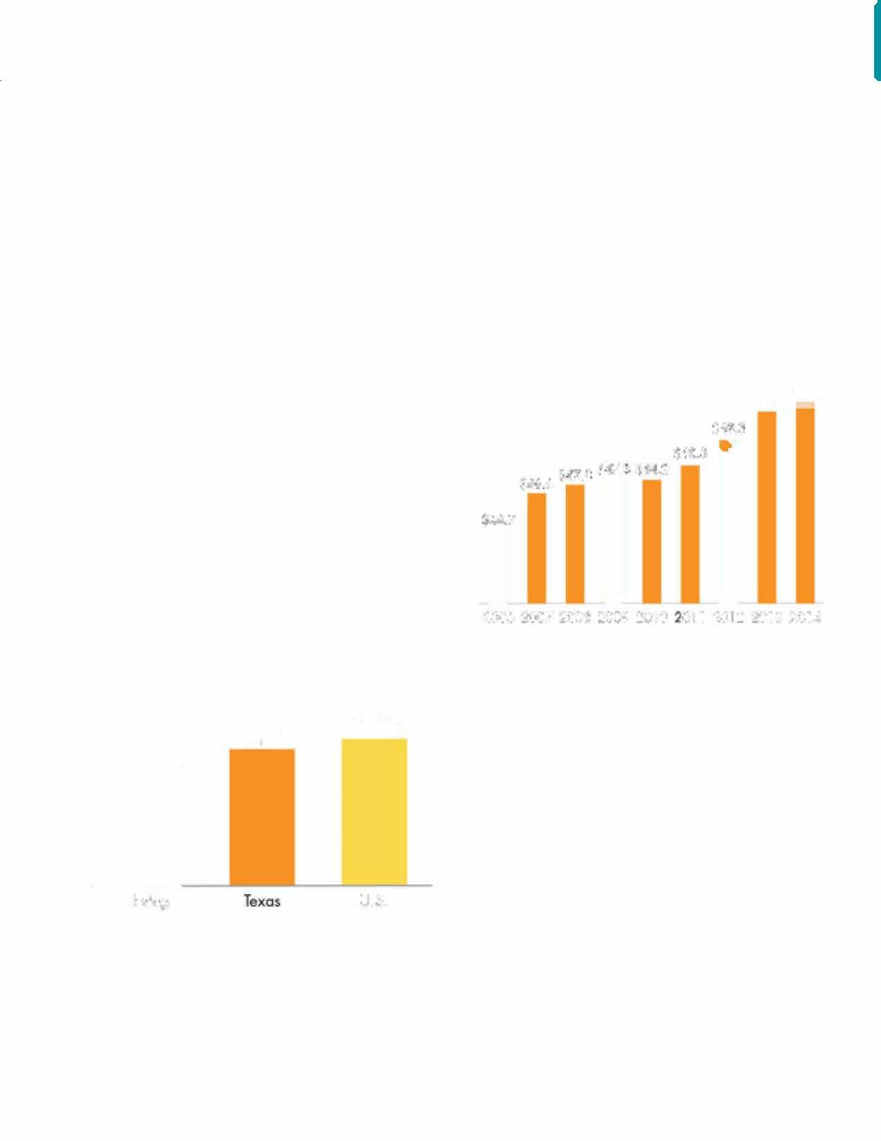
Source: American Community Survey (ACS) 5-Yeor Data (20l 02014), Census Bureau
2014.Itisalsoworthnotingthatthecity'smedian incomeincreasedby approximately $3,600 ornearly 8%between2010and2014.The2014themedian incomefigureforafamilyoffourinDallasCounty, calculated byHUD,is$48,800.
However,thepercentageoffamilieslivingatorbelow thepoverty lineinIrvingremainshigherthanthe Dallas Metroareaatnearly 16%in2014. Additionally, over40%of rentalunitsandnearly30%of owner occupiedunitsareunaffordablegiventheincomeof thehouseholdslivinginthem (SeeHousingChapter page98).
Poverty, Health + Education

67: Families Living in Poverty in 2014 17.7%,
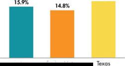
Source: American Community Survey (ACS) 5-Yeor Doto (20l 02014), Census Bureau
Full-timeemployment,affordablechildcare,housing, andtransportationareallnecessary tomaintain housingstability forlowerincomefamilies. Accessto healthcare, lifeskills training, and additional education and/ortraining,includingGEDprograms,andEnglish asaSecondLanguage,arevaluable,ifnotnecessary,in mostsituations.TheCity of Irvingworkstocoordinate theprovisionoftheseservicesthroughpartnership withnon-profit,faith-based,andothercommunity resources.
Personsatriskofhomelessnessaredefinedas individualsor families facing immediate evictionand whocannot relocateto another residence. Statistics onthispopulationcannotbeprovideddirectly,butan examinationofthedataonovercrowdingandupon costburdenedhouseholdsprovidessomeinsight intotheextentoftheprobleminIrving. Particular attentionisaccordedtohouseholdsintheextremely low-incomerangeastheserepresentthemoststressed andvulnerablegroup.2006-2010datafromHUD's ComprehensiveHousingAffordability Strategy (CHAS) indicatethattherewere2,755low-income renterhouseholds (645intheextremely low-income rangeand1,045very low-incomehouseholds)with overcrowding (overcrowdingisdefinedasmorethan
1.01personsperroom),or3.4%ofallhouseholdsat thattime. 20low-income renter households with severe overcrowding (> 1.51 personsperroom). The situationamongownerhouseholds isnotasdifficult - therewere145low-income Owner households with severeovercrowdingand145ownerhouseholdswith overcrowding.
However,asnotedabove,thenumberofextremely low-incomerenterhouseholds withseverecostburden is5,700andanother2,740very low-incomerenter householdsfaceaseverecostburdenaccordingto CHAS.Extremely low-income ownerhouseholds facingaseverecostburdennumber 975andanother 1,470very low-incomeownerhouseholdsfacea severecostburden. Theaveragehouseholdin Irving numbers2.65persons,whichmeans15,105extremely low-incomerentersand2,584peopleinextremely lowincomeowner-occupiedhousingcouldbeontheedge ofhomelessness.
Irvinghasarobusthealthcaresystem withBaylor Scott&White MedicalCenter,LasColinas Medical Center,OurChildren'sHouse LasColinas, Irving HealthCenter,aswellasnumeroussurgicalhospitals, clinics,treatment,andrehabilitationfacilities. Irving alsoishometoanewdevelopment-theTexasCenter for ProtonTherapy,oneof11protontherapy cancer carecentersintheUnitedStates.Thereareonly 37 suchfacilitiesworld-wide.
While Irvinghashigh-quality healthproviders, accesstohealthcarecanbeimpededby alack oftransportationoptions.Themostvulnerable populationsarethedisabled,elderly orpoorwhomay notbeabletodrive.Barriersthatlimitaccesstohealth careandcontributetoinequitiesincareareprimarily financial,organizational,andsociocultural.

Twenty-onepercentof Irving's populationisover50yearsofage. Thisagegroup,whichisprojected toincreaseduringthenextfew decades,canexperiencechanging needsovertime. Many residents wanttoageinplaceandremainin theirhomes,andsome willneed assistanceinmeals,healthcareand daily care.
TheCity of Irving's 40,000squarefootHeritageSeniorCenter (HSC) offersprogrammingandactivities forseniorsage50andolder. Amenities include classrooms, adiningroomand ballroom, commonrooms,alibrary,craft room,billiards,computerroom, andafully-equippedfitness room. Seniorsalsohaveaccess totheHeritage AquaticCenter. Activities for seniors include fitness classes,fieldtrips, workshops andguestspeakers. Assistance withtransportationneeds,social security benefitscounseling,and taxpreparationisprovidedtoHSC members. Lunch,sponsored by theCity of Irving,the Dallas Area Agency onAging,andtheTexas Departmentof Agingand Disability Services,isoffereddaily forasmall fee/donation. Inaddition,theCity of Irvinghasahomerehabilitation programprimarily for seniors.
TheFamily Advocacy Center (FAC) providesfreecounselingservices to Irving'syouthandfamilies. Thisuniquehybridof nonprofit organizationandmunicipal services aidsinprovidingcasemanagement servicesandcounselingfor individuals,families,couplesand groups. Groupcounselingand educationclassesfor parenting skills; angermanagement; and overcomingdomesticviolence, traumafromcrimevictimization, andchildabuseareavailableto Irvingresidentsthoughthisfacility.
TheCity of Irvingprovidesa significantportionoftheFAC operating budgetto maximize outreachto Irvingresidents. The nonprofitcorporation, Irving Family Advocacy Center,alsoraises moneythroughfundraisersand receivesvariousgrantsto fund programsandservices. Thecenter bringstogetherthe Irving Police Department's DomesticViolence Unit,Family CounselingServices,
Poverty, Health+ Education VictimServices,Family Outreach, andtheTexas Departmentof Protectiveand Regulatory Services tofocuson buildingstronger andhealthierfamiliesinasafe environment.
TheCity of Irvingownsa shelterforvictimsofdomestic violence,whichisrun by Brighter Tomorrows,Inc. The 25-year-old facility istheonly suchshelter in Irving. Theshelter'smissionis toreduceviolenceandempower victimsofdomesticandsexual violence by providingemergency safeshelterandsupportservices. Theshelterprovidesemergency safesheltertowomenandtheir children,answerscrisishotline calls,providescounselingfor domesticviolencesurvivorsand their children,andservesmealsto families. Brighter Tomorrows also hasa Counseling and Resource Centerthatprovidesresidential andnon-residentcounselingfor
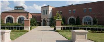
Poverty, Health + Education

domesticviolenceandsexualassaultclients, legal advocacy,supportgroups, referrals, andcommunity education. Inaddition, BrighterTomorrowsprovides transitionalhousingservicestovictimsofdomestic violence.
TheCityofIrvingviewshomelessnessasahigh prioritycommunityconcernandstrivestodevelop community-basedsolutionsforthisissue. TheCity ofIrvingparticipatesintheDallasArea/Irving ContinuumofCare (CoC). TheCoCisaregional coalitionofgovernmental, faith-based, educational, andnonprofitorganizationswhoaimtoregionally addresshomelessnessandincreasefamilyselfsufficiency.
Inconjunctionwithnational, state, andregional efforts, theIrvingcommunityconductsasurveyand countoftheunshelteredhomelessinIrvingeachyear, andfindsthepopulationissteadilybetween25and 30persons (27in2016). Theneedsofeachpersonare different, andtheneedsofthesuburbanhomeless differfromthoseoftheinner-cityhomeless. TheCity ofIrvingalsoworkscloselywiththeIrvingnonprofit andfaith-basedcommunitiestofindthemosteffective meansofprovidingservicestomatchthesedifferent needs.Inessence, homelessnessinIrvingiscomprised ofseveralkeycomponents:
• Chronicallyhomeless - Personswhohavelivedon thestreetsformultipleyearsandhaveeithermental healthorphysicaldisabilities. Thesehomeless personsareusuallyindividualmales, between theagesof35-55. Permanentsupportivehousing programs, whererentalassistanceiscombinedwith intensivecasemanagement, seemstobethemost effectivemethodforaddressingthispopulation's needs.
• Newlyunshelteredhomeless - Thispopulationis themostdifficulttoidentify.Thesearetypically female-headedfamilies, ofwhichtheheadof household is between 25-45yearsold, residing in theirvehicles. Rapidre-housingprograms, where rentalassistanceisprovidedona short-term basis, isaneffectivevehicleinreturningthesefamiliesto self-sufficiency.
• Shelteredhomeless -Irvinghasseveralsheltering opportunitiesforvulnerablesegmentsofthis population. Thisincludesayouthtransitional housingfacility, transitionalhousingandemergency shelteringforvictimsofdomesticviolence, and Family Promise, afaith-basedhomelessfamily shelteringprogram. Sheltersworkwithre-housing programstocoordinatepermanenthousingoptions.
• At-riskofhomelessness - Personswhoare chronicallypoorandarelikelytobecomehomeless inafinancialorhealthcrisis. Thiscategoryincludes peoplelivinginhotels, peoplewhoarebehindin theirrent/mortgages, andpeoplelivingwithfriends andfamily. Severalnonprofitagencies, partially assistedthroughCityofIrvingfunding, provideaid tothesefamilies. Strategiesincludeprovidingsocial servicestoimprovefinancialandhealthstability suchasdentalcare, childcare, educationaltraining, financialcounselingandrentalassistance.
Irving'sCommunity HealthBoardoverseeshealth issuesinIrving, andrecommendspublichealthpolicies totheCityCouncilwiththeintentofmakingIrvinga heathyplacetolive, learnandwork. Theboardworks toimplementthefollowingservices:
• Monitorhealthstatustoidentify andsolve communityhealthproblems.

• Investigatehealthproblemsandhealthhazardsin thecommunity.
• Inform,educate,andempowerpeopleabouthealth issues.
• Mobilizecommunity partnershipstoidentify and solvehealthproblems.
• Developpoliciesandplansthatsupportindividual andcommunity healthefforts.
• Linkpeopletoneededpersonalhealthservicesand assuretheprovisionofhealthcarewhenotherwise unavailable.
• Ensureacompetentpublicandpersonalhealthcare workforce.
• Evaluateeffectiveness,accessibility,andquality of personalandpopulation-basedhealthservices.
• Provideresearchfornewinsightsandinnovative solutionstohealthproblems.
TheIrvingIndependentSchoolDistrict(IISD)educates themajority of Irving'schildren.However,Irvingis alsoservedby theCarrollton-FarmersBranchISDand theCoppellISD.NorthLakeCommunity College,the University ofDallas,andnumeroustechnicaltraining centers,andbusinessschoolsareothereducational assetsofthecommunity.However,withallofthese assets,residentsstillexpressedconcernthroughout theplanningprocessaboutthereputationofthe educationalsystemandtheneedtoenhancethepublic K-12schoolsasameansofattractinghighquality employers toIrvingandmaintainingresidential values.
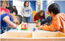
IrvingISDoperatesthreeearly childhoodschools,20 elementary schools,eightmiddleschools,andfivehigh schools,alongwithseveraladditionaleducationaland supportfacilities.
IrvingISD'sfacilitiesencompassmorethan5.25 millionsquarefeetacross 613acres.Attendance boundariesdrawthedistrict'sapproximately 35,000 studentsprimarily fromwithinIrving.Similarto Irving's demographics, thestudent populationis raciallyethnicallydiversewith62.7percentHispanic; 19.5percentWhite,Non-Hispanic (NH); 13.1percent African-American,NH; 4.2percentAsian/Pacific Islander,NH; and0.4percentNativeAmerican,NH. Thedistrictprofilealsoindicated68.7percentofthe studentpopulationiseconomically disadvantaged, 65.3percentareat-risk,and34.5percentareEnglish LanguageLearner (ELL)students.
• IrvingISDwasnamedthe2015NationalAdvanced Placement (AP)DistrictoftheYearformid-sized schooldistricts.
• IrvingISDearnedaspotonthe2015listof "Top DigitalDistricts" foritsuseofinnovativetechnology.
• IrvingISDmorethandoubledthenumberof mentorsin2014-15toapproximately 2,400mentors servingISDstudents.

» Early childhood schools (PreK): Clifton Early Childhood School, Kinkeade Early Childhood School, Pierce Early Childhood School
» Elementary Schools (K-5): Barton Elementary School, Brandenburg Elementary School, Britain Elementary School, Brown Elementary School, Davis Elementary School, Elliott Elementary School, Farine Elementary School, Gilbert Elementary School, Good Elementary School, John Haley Elementary School, Thomas Haley Elementary School, Hanes Elementary School, Johnston Elementary School, Keyes Elementary School, Lee Elementary School, Schulze Elementary School, Stipes Elementary School, Townley Elementary School, Townsell Elementary School
» Middle schools (6-8): Austin Middle School, Bowie Middle School, Crockett Middle School, de Zavala Middle School, Houston Middle School, Johnson Middle School, Lamar Middle School, Travis Middle School
» High schools (9-12): Irving High School, MacArthur High School, Nimitz High School, Singley Academy, Cardwell Career Preparatory Center
» Other Educational Facilities: Secondary Reassignment Center, Wheeler Transitional and Development Center, Ratteree Career Development Center, Newcomer Academy, the Outdoor Learning Center
• Singley Academy earnedtheState'sDistinction Designationsinallsevencategories,rankingit amongthetop1.9 percent ofTexasschools.
• Singley Academy and Nimitz HighSchoolwere twoofonly 17schoolsinternationally chosento participateintheCollegeBoard's APCambridge CapstonePilotProgram.
• IrvingISOwasoneof 23schooldistrictsinthestate selectedtoparticipateintheTexas HighPerforming SchoolsConsortium.
• In2015,IrvingISOearnedthehighestrankingon thestate'saccountability systemandearned37 DistinctionDesignationsfortopperformanceinall areasofSTAAR,theStateofTexasAssessmentsof AcademicReadiness.
Amongthedistrict's38 schools, Carrollton-Farmers BranchISOhas fiveelementary schools (Bernice ChatmanFreeman,Tom Landry,LasColinas, LaVillita andRiverchase),onemiddleschool (BarbaraBush), andonehighschool (Ranchview)thatserve Irving residents. Morethan3,700studentswholivein Irving attendCFBISDschools. OftheIrvingstudentsthat attendCFBISDschools,37% areAsian,31% are African American,17% areHispanic,and10% areWhite.
• CFBISDhasbeennameda "BestCommunity for MusicEducation" fornineconsecutiveyears.
• RanchviewHighSchoolhasbeenoneofAmerica's Top HighSchoolsby Newsweek Magazine.
• CFBISDoffersspecializedprogramsforstudentsat theelementary,middle and high schoollevels. For example,CFBISDoffersaprogramforexceptionally giftedstudentscalledLEAP. TheInternational
BaccalaureateprogramatLasColinasElementary, BarbaraBushMiddleSchoolandRanchview High Schoolisoneoftheonly afew K-12continuumsin Texas.InHighSchool,studentscanchoosetoattend specializedacademiesincluding LawAcademy, BiomedicalAcademy,InternationalBusiness Academy,METSA (STEM)Academy,andAcademy ofMediaArtsandTechnology.
• Ranchview HighSchoolClassof2017graduates earned$10.9millionincollegescholarshipsand were accepted tosomeofthemostprestigious collegesanduniversitiesinTexasandthenation.
• Thedistrict'sFineArtsprogramhasbeenawarded "Best100CommunitiesforMusicEducation" eight times.
• Carrollton-FarmersBranchofferstheInternational Baccalaureateprogramfromelementary through highschool.
• Every fourthgradestudentistaughthowtoswim throughawatersafety program.
CoppellISDhastwoofitsthreesecondary schools (CoppellEastandCoppellWest)andfourofits 10elementary schools (Austin,Lee,Mockingbird andValley Ranch)servingIrvingresidents.The districtwidestudentpopulationofCoppellISDis largely white (40.6percent)orAsian(38.1percent), withapproximately 10percentofstudentsconsidered economicallydisadvantaged,9.6percentEnglish Language Learners,25.5percentat-risk.The graduationratefortheClassof2014stoodat98.8 percentwith827graduates.
• CoppellISDwilllikely exceed13,000studentsby 2019-20academicyear,withaprojected10-year
Poverty, Health+ Education
growthofnearly 2,900students.
• Therewere37 NationalMeritSemi-Finalistnamed inthe2015-16academicyear,witharecord36 namedat Coppell HighSchool.
• CoppellISDisoneof425schooldistrictsintheU.S. andCanadabeinghonoredby theCollegeBoard withplacementonthe6thAnnualAP® District HonorRoll.
Irvingalsoishometomorethan20privateschools withfivehighschools,19schoolsprovidingelementary education,and13preschools.Whileamajority ofthese schoolsprimarily serveIrvingresidents,anumber drawstudentsfromaroundtheregion.Forinstance, CistercianPreparatory Schoolservesstudentsfrom morethan80 ZIPcodes.Approximately 55percentof theschoolsarereligiouslyaffiliated.
Inadditiontopublicandprivateschools,Irving hasanactivehomeschoolcommunity.Aregional homeschoolall-inclusivesupportgroupcomprisedof homeschoolingfamiliesfromallovertheMetroplex isbasedinIrving.Thisgroupsharesresourcesand activitiesthatenhanceandsupportthehomeschooling experience.
Irving ISD (2015)
Carrollton-Formers Branch ISD (2016)
Coppell ISO (2016)

35,085 total students [city website]
3,700 Irving students [district]
12,319 total students [district website]

Twoexcellenthighereducationinstitutionsarelocated in Irving: theUniversity ofDallas,aprivateCatholic, co-educational university; and NorthLakeCollege,a two-year publiccommunity college.Bothinstitutions arehigh-valueassetstotheregion.
TheUniversity ofDallasisrankedamongthetop 10universitiesintheWestby "U.S.News&World Report" andinthetop15 Catholiccollegesnationwide by "Forbes." Theuniversity currently enrollsmore than1,300undergraduatestudentsand1,200graduate studentsfromacrosstheU.S.andtheworld.Academic programofferingsinclude29undergraduatemajors, morethan20graduateprograms,andavariety of graduateandnoncreditcertificateprogramsacross fourprimary divisionsinthearts,humanities, sciences,education,businessandnursing.Noteworthy, istheUniversity ofDallas'DoctorofBusiness
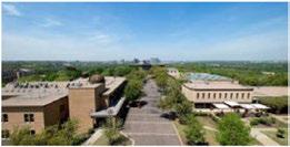
Administration (DBA)program; thefirstandonly AACSB-accreditedDBA PrograminTexas.
NorthLakeCollege,a two-yearpubliccommunity college,openeditsdoorsinthefallof1977,becoming thesixthofsevencollegesintheDallasCounty Community CollegeDistrict (DCCCD).Infall2013, thecollegeenrolled11,365students,22percentfull timeand78 percentpart-time.NorthLakeCollege's signatureacademicprogramofferingsincludelogistics, sciences,constructiontechnology,andaunique pairingofartsandtechnology.Themaincampusis locatedin Irving, along withtwoofthe college's three satellite campuses.
Therealsoareavariety oftechnicalandvocational schoolsintheareathatprovideeducationandskills trainingprogramsdesignedtomeetlocalworkforce needsandfulfillindividualcareer-buildinginterests. DeVry University andtheAviationInstituteof Maintenancearetwosuchschoolsthatofferdegree programsinvariouscareerfieldssuchastechnological developmentandapplications,business,aviation technology andelectronics,andrelatedaviation specialty areas.Inaddition,therearea number ofinstitutionswithincommutingdistanceof IrvingsuchasDallasBaptistUniversity, Southern MethodistUniversity,TexasChristianUniversity, Texas Wesleyan College,TexasWoman'sUniversity, University of NorthTexas,University ofTexasat Arlington, University of Texas at Dallas, University of TexasSouthwestern.
Irving'shighereducationinstitutionsarecommitted tomaintainingstrategicpartnershipswiththe community andprovidingquality educational opportunitiestoresidents.Withsignificantpopulation growthprojectedforIrvingduringthenextseveral decades,accessandequity inhighereducationwill continuetorequirecommunity commitmentand attention.

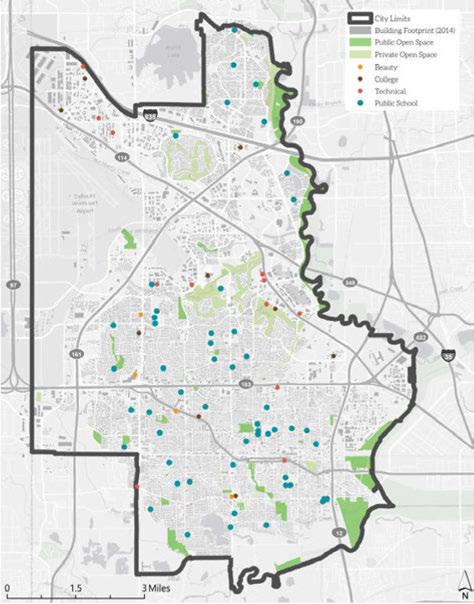

Healthcareaccessandeducational opportunitiesarefundamentalto thesuccessofallpeopleandlead toabetter quality oflife, personal well-being, andanoverallfeeling ofachievement. Individualswho are economically disadvantaged arelikely tobeforeignborn; lack family, community orcultural support; orhaveafamily member withdisabilities. They arelesslikely tohavesufficientmeanstopursue ahighereducationdegreeorto affordquality healthcare. Inmost cases, theseindividualswillseek outexistingservicesandprograms inthecommunitieswherethey live toassisttheminmeetingtheirmost basicneeds. Itiswidely understood thattransportationpolicy, aspart ofacity'scomprehensiveplanning process,iscriticalinensuring residentshavesufficientaccessto educationandaffordablequality healthfacilitiesandservices.
Figure69 showsthat whilesome partsof Irvinghaveaccesstomajor facilitiesandclinics, othersections ofthecity havemuchfurtherto traveltohealthcarefacilities.
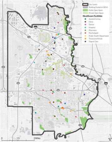
"Fooddeserts" aredefinedasareasofthecommunity withoutaccesstofreshfruit, vegetables, andother healthful wholefoods, andareusually foundin impoverishedareas. Thisislargely duetoa lack of grocerystores, farmers' markets, andhealthyfood providers.
Thishasbecomeasignificantnationalissue, because whilefooddesertsareoftenshorton wholefood providers, especiallyfreshfruitsand vegetables, they are heavy on convenience storesthatprovidea wealth ofprocessed, sugar, andfat-ladenfoodsthatareknown contributorstotheobesityepidemic.
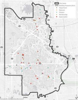
In addition to grocery stores, supermarkets and corner stores, there are many ways to increase access to healthful fresh food, including:
» Community gardens
» Farmers markets
» Cooking classes
» Youth and senior gardening classes to teach skills and foster intergenerational relationships

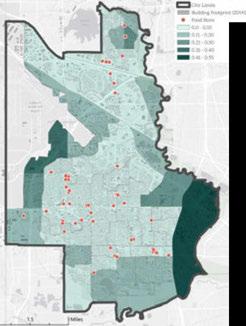

TheUSDAdefinesareasconsidered asafooddesertasbeinga "lowaccesscommunity," withatleast 500peopleand/oratleast33 percentofthecensustract's populationresidingmorethanone milefromasupermarketorlarge grocerystore.Thefollowingmaps showthelocationoffoodstoresand USDAcensusdataset,depictingthe percentages ofpopulationthatisof lowincomeandmorethanonemile awayfromagrocerystore.
For Irvingtobuildaglobally competitivefutureworkforce, educationalfacilitieswillrequirea highlevelofsupport,coordination, andinvestmentfrompublicand private partners. Givenitsstrategic locationwithintheDallas-Fort Worth Metroplex, Irvingispoised tobecomeanimportantglobal center. CommuterstoIrving makeup89percentofthecity's totalworkforce. (Theremaining 11percentlivein Irving.)The industriesdrawingthehighest numbersofinboundcommuters arefinanceandinsurance (18,233netinboundcommuters), administrative/supportservices (14,919),andprofessional,scientific andtechnicalservices (11,802). For Irvingresidents,24percentof workersfindemploymentwithin citylimits, withtheremaining
residentscommutingtoother regionalcitiesandbeyond. WithIrving'sproximitytoDFW International AirportandDallas LoveField Airport,some Irving residentscommutetointernational destinationsforwork. Thedaily flowofcommutersintoIrving, coupledwith76percentofworking residentswhocommuteoutto othercitiesintheregion,makes Irvinganattractivelocationtolive inandfor workforcetraining.To encourageworkersandbusiness ownerstoliveinandinvestin Irving,itisimportanttoshowcase thesatisfactionexpressedby currentresidents.Theannual BusinessSurveyconductedby theCityof Irvingrevealedthat residentsaresatisfiedwith Irving asaplacetoliveandwork. Nearly threeoutoffourresidentsrate livingin Irving as "Excellent" or "Good;' andmorethansevenout of10ratetheir neighborhood asagoodplacetolive. Overall, responsesfromIrvingresidents haveremainedconsistentfrom 2006-12.
Addressingthenatureandscope offutureskilledtrainingneeds willrequirecollaborationwith publicandprivate K-12schools, highereducationinstitutions, technicalandvocationalschools, andstateandlocalagenciesthatare involvedinworkforcetrainingand development.
Organizations,suchasthe Irving SchoolsFoundation,raisefunds tosupportinnovativeeducational andscholarshipprogramsto foster academic success. Thistype ofpartnershipcanhelpdirect additional resourcesintoareas thatthe community feelsare importanttothefutureofthe city. Inaddition,theCityof Irving collaborateswith educational institutionsatalllevels,including Irving'sthreeschooldistricts,to plananddevelopneighborhood improvementssuchassidewalks, streetsandcrossings,andpublic transportation. Justasschoolsare engagedinplanningresidential and businessdevelopment,planning forparks,librariesandrecreational facilitiesisequallyimportant. Lookingforopportunitiesto fullyleveragepublicinvestments throughthecollaborative developmentoffacilitiesand resourcessuchasco-locationof parks, libraries, schools andother relevant public assets, realizes efficienciesincapitalexpenditures andoperations,andalsocreates importantcivichubstobuildand strengthenexistingneighborhoods. Thisapproachtoinvestmentcan betterfacilitatefamilyfriendly, asset-richneighborhoodsasthe
backbonefor Irving'sfuture. Additionally, variousstreetsin Irvinghavebeendesignated as"saferoutes" toprovide improvedaccesstoanumber of elementaryandmiddle schools. Thisdesignationaids increatingsafeenvironments forstudentstowalkorbike toschool,supportshealthier levelsofphysicalactivity, and reducestrafficcongestion aroundnearbyschools. It alsoisimportanttoeducate studentsandteachersonrules andprovidesafetyinformationfor walking andbiking. TheCityof Irvinghasalsobegunasidewalk improvementprograminlower incomeneighborhoodstoimprove accessalongtheseroutestoschool.
Educationisthekeyunderlying elementforpersonaland communityeconomicsuccess. Accordingto2014datafromthe Bureauof Labor Statistics, median weeklyearningsgenerallyrise witheducationattainment, while unemploymentratesfall. While weeklyearningsforaperson whodidnotreceiveahighschool diplomaarelessthanhalfofthat ofapersonholdinga Bachelor's degree, theirunemployment
Currently, Irving ISD is offering Advanced English as a Second Language (ESL) classes at the West Irving Library, and ESL/GED Intro classes at the East Branch Library. Literacy Instruction for Texas is providing ESL classes at the South Irving Library.
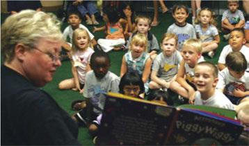
ratewasmorethan2.5 times greater. Maintainingeconomic competitivenessreliesonasound educationalsystemthatcanattract andretainstudents.
Inaddition, havingastrong educationsystemandaneducated workforceiskeytoattracting businessesandcorporateleaders,

andthepeoplewhoworkfor them. Withtheincreaseofjob requirementsandemployer expectations, educationequity andopportunitycanprovidethe necessaryskillsforaproductive workforceandwillimproveoverall qualityoflife.
Asidefromcollaborativelyplanning
Poverty, Health + Education

physicalassets, theCity of Irvingrecognizesthe importanceofcoordinatingwithandsupporting itscompanionschooldistrictstoassurecontinued enhancementsoftheschoolsystem, andIrving asawhole. AspartoftheCity of Irving's 2015-16 Strategic Plan, thecity manageriscommittingto addresseducationalissuesto "growthecity'srolein supportingstudentsuccessandeducationaloutcomes:· ByunderstandingfactorswithintheCity of Irving's sphereofinfluencethatdrivestudentsuccess, theCity of Irvingcananalyzeandadjustpracticesorpolicies toensureitisfullyinsupportofarobustanddesirable educationalsystemforallIrvingresidents.
The IrvingCity CouncilcreatedtheAdvisory Committeeon Disabilitiesin1999, toserveasacontact andvoiceofresidentswithdisabilities, andtoreview anddiscussmattersreferredtothecommitteeby the councilandcity manager. Thecommitteealsoprovides recommendationstothecouncilonmatterspertaining todisabilityissuesinIrving.
Table 21: School enrollment and children living in household on public assistance
Goal 1: Continue to collaborate with Dallas County, the community, and other strategic partners to improve the health of residents.
Strategy 1.l
Work with the health care industry to site health care facilities near underserved residential areas with the goal of increasing access to health facilities for residents across all ages, incomes and ethnicities.
Strategy 1.2
Support partnerships to increase access to health care in areas with high levels of need, particularly for communities facing concentrated poverty and high incidence of chronic medical conditions.
Strategy 1.3
As health issues arise, proactively take the initiative to request Dallas County and other service providers to address issues.

» Parkland Hatcher Station
» Children's Initiatives - Weight Management Program with YMCA
» Go Noodle and Telehealth partnerships with Dallas ISD

Health + Education
Goal 2: Continue to support public health education and programming.
Strategy 2.1
Explore and asses the opportunities for the Fire Department to partner with health agencies in providing wellness education and home visits.
Strategy 2.2
Provide a framework for Irving's Community Health Board to become more proactive in providing health education to residents and organizations.
Strategy 2.3
Expand existing partnerships to provide accessible neighborhood-based job training literacy, ESL, GED classes, and financial literacy classes in areas of need.
Strategy 2.4
Work with the community to expand higher education opportunities for high school students to earn college credits and achieve positive outcomes such as income, employment and health as adults.
Strategy 2.5
Work with Irving's school districts and community groups to sponsor an "Education Summit" to address issues of educating diverse populations.
Strategy 2.6
To address mosquito-borne illnesses, educate property owners on how to eliminate mosquito breeding grounds. Continue to follow CDC recommendations for aerial pesticide use, including monitoring and testing mosquito populations for mosquito-borne diseases.
Goal 3: Create neighborhood centers that contain health and education resources to meet resident needs.

Strategy3.1
Coordinate the development planning process with school district plans to ensure new housing and educational resources are well balanced.
Strategy3.2
Look for opportunities to co-locate community and public facilities with school locations.
Strategy3.3
Build coalitions with agencies that provide health care and educational services to eliminate redundancy and facilitate access to services.
Strategy3.4
Support and assist in coordinating health and social services provided by local, state, and federal organizations and agencies so resources are not duplicated and resident needs are met.
Strategy3.5
Promote co-locating of health care with other types of facilities.
Strategy3.6
Encourage local businesses to develop workplace wellness and enrichment programs that include daycare, physical fitness, healthy lifestyles, preretirement counseling, and leisure education.
Strategy3.7
Collaborate with representatives from the medical profession to develop an Irving Health Care Services Master Plan that identifies strategies to improve health care access and equity in the community.
Strategy3.8
Encourage the location of grocery stores within one mile of all low-income neighborhoods and from surrounding neighborhoods via multiple modes of transportation.
Health + Education

Goal 4: Improve multimodal transportation connectivity to educational facilities and health services.
Strategy 4.1
Improve residents' access to education, health care services, cultural and recreational resources, and career/employment opportunities.
Strategy 4.2
Evaluate current campus accessibility from transit, walking, and biking to prioritize needed transportation infrastructure improvements.
Strategy 4.3
Support and expand safe routes to increase walkable/bikable access to elementary and middle schools.
Strategy 4.4
Work with DART to improve weekend bus service so residents without cars can get to appointments and access various services.
Strategy 4.5
Build on MacArthur Boulevard's "Educational Corridor" to provide enhanced connections and transportation to these facilities. Encourage coordinated programming for educational facilities along the MacArthur corridor. Explore additional benefit of linking health providers along the corridor as well, including Baylor Irving, Las Colinas, Baylor Las Colinas/Coppell and others.
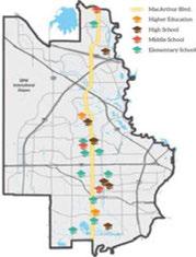
Goal 5: Assist Irving's school districts in their efforts to enhance their academic and financial strengths.

Strategy 5.1
Participate with coalitions that provide educational services to facilitate access to services while avoiding redundancy.
Strategy 5.2
Participate in joint city/educational institutional efforts to create and implement strategies that enhance educational outcomes and drive student success.
Strategy 5.3
Establish Pre-Kindergarten education as a high priority strategy to better prepare children for school and set them up for success in their later academic years.
Strategy 5.4
Collaborate with public-private partners to support new educational institution programs that address the needs of changing local and regional populations.
Strategy 5.5
Establish partnerships between industry, K-12 and post-secondary institutions to prepare residents to succeed as members of the region's workforce, and strengthen the skills of existing workers.
Strategy 5.6
Help facilitate partnerships with North Lake College to provide early college attendance and dual credit programs.
Strategy 5.7
Network with area colleges and universities, school districts, and partners from the business community to expand workforce training and apprenticeship opportunities.

Strategy 5.8
Partner with the University of Dallas and publicprivate community leaders to develop an implementation plan that is focused on building a globally competitive environment in Irving.
Strategy 5.9
Partner with Irving's school districts to create a campaign that improves the reputation of the city's K-1 2 educational system as a means of attracting high quality employers to Irving and maintaining residential value.
The University of Dallas has an MBA with a global business concentration, which could collaborate with city business development efforts.
Goal 6: Work to help end poverty and prevent homelessness in Irving.

Strategy 6.1
Provide a leadership role in regional homelessness planning, facilitating inter-agency coordination through the Dallas Area/Irving Continuum of Care and the Irving Community Action Network.
Strategy 6.2
Enhance partnerships with social service agencies to aid in comprehensive problem solving, technical assistance, and training to increase organizational capacity of local housing and nonprofit organizations.
Strategy 6.3
Facilitate community-based responses to the sheltering needs of homeless populations.
Goal 4 of Chapter 2: Housing and Neighborhoods also includes strategies to prevent homelessness.
Strategy 6.4
Formalize a coordinated access program for homelessness prevention and services that include skills training, education, early intervention, emergency assistance, and transition out of homelessness.
Strategy 6.5
Focus programs on youth, the disabled, the elderly, and other special populations such as veterans.
Strategy 6.6
Evaluation options to improve and expand capacity at the domestic violence shelter and for transitional housing units.
Strategy 6.7
Construct transitional housing units in coordination with local nonprofit organizations.

Goal 7: Promote active living for all residents in an environment conducive to good health and well-being.
Strategy 7.1
Create recreational programs, parks trails, and other services that promote physical activity and encourage sustainable healthy lifestyles.
Strategy 7.2
Emphasize Irving's walkability and bicycle amenities. Sponsor a citywide health education initiative.
Goal 8: Encourage and support a community climate of respect, fairness, cooperation and professionalism.
Strategy 8.1
Promote innovation and leadership by engaging the talents and abilities of all persons regardless of age, race, ethnicity, gender, religion, disabilities and other special needs.
Strategy 8.2
Support programs that enhance and encourage citizen participation that reflects Irving's diverse population

Strategy 8.3
Assess equity and access issues for neighborhoods in the ZIP codes that report lower "Quality of Life" ratings in recent Resident Surveys.
Strategy 8.4
Plan neighborhoods where commercial, medical, social and other services used by the elderly are easily accessible, and where road and sidewalk design, signage, and lighting integrate senior transportation safety needs and considerations.

For the century just past, interdependence may have been one option among many. For the century that is to come, there is no longer an alternative.
~ Kevin Rudd
Irvingisinthecenterofagrowingand dynamicregion. Therearemany examplesof intergovernmental coordination throughout the City of Irving'scurrentoperations. Givenitscentral location, theCity of Irvingtouchesmany services thathaveanimpactacrosscity limitlines. Fromthe Police Department's participationinregionaltask forces, theFire Department's cooperativeagreement withGrandPrairieforthe firetrainingcenter, to theHousing Department'sregionalpartnershipsin providingresourcesforabusedwomen, andtheParks andRecreationDepartmentscoordinationwiththe regionaltrail system-city staffandleadersarefully engagedinleadingregionaldiscussionsforsustainable serviceprovision.
Regional andstate coordinationis especially important whenaddressingtransportationneeds. Anumberof key infrastructurecomponentsthatdirectly impact Irvingarepartofalargerinterconnectednetwork involvingvariousagencies. The TexasDepartment of Highway'ssystem, DART'sregionalrailnetwork, andDFW International Airportareamongthe criticalpiecesof transportationinfrastructurethat
» Irving coordinates land use and transportation to minimize travel time and distances between daily destinations-allowing people to live closer to work and services, live or work close to transit, and live in walk- and bike-friendly areas.
» Irving maintains facilities, services and infrastructure throughout the city.
» Irving implements sustainable policies and promotes development that reduces vehicle miles traveled, and water and energy consumption-contributing to cleaner air and water, and the preservation of natural resources.
» Irving offers exceptional access to the regional, national and world economies through its globally connected businesses and robust transportation network centered on DFW International Airport.

influenceIrving'seconomicposition, aswellasquality oflifeforitsresidents. Thesesystemsalsoimpact nearby municipalities, necessitatingcooperationwith operatingagencies, aswellaswithotherjurisdictions. Additionalissuessuchas floodcontrol, emergency preparedness, variousutility needs, policeprotection, schoolsystems, andotherlocalserviceslinktheCity of Irving'seffortstothoseofneighboringcities. Asa result, improvinglocalquality oflifewilloftenrequire collaborationwithalargenumberoflocalpartners.
Additionally,policy decisionsatthestateandfederal levelcanhavefar-reachinglocalimpacts. Beingaware ofthesepolicy issues, understandingtheirimplications ontheCity of Irving'sbusinesspracticesandquality oflife, andbeingpositionedtocommunicatepriorities andinfluencethedebatearecriticalfunctionsto protect Irving's interests. Consequently, itisimportant tohaveacomprehensivelegislativeagendato maintain Irving'squality oflifeandeconomicstrength.
Thischapterprovidesanexpandedstrategy forsuccessfulplanimplementation. External partnerswillbenecessary tofully realizeIrving's vision. Additionally, itisimportanttobemindful ofany externalforces, initiatives, orpolicy decisionsthatmay runcontradictory totheCity of Irving's comprehensiveplangoals. Successful intergovernmental relationswillprovidea framework toalignthesevariousfunctionstosupport Irving's vision.
» Align state and federal legislative activities with Irving's vision.
» Use strategic relationships with other municipalities and advance Irving's vision.
» Continue to seek opportunities to increase efficiency of city operations and service delivery through intergovernmental coordination.
» Aggressively identify and pursue grant opportunities to leverage existing funding in pursuit of city infrastructure and operational objectives.
Since2014, the City of Irvinghasbeentaking stepstodevelopamoredeliberateapproachto intergovernmentalrelations withafocusoncreating aneffectiveprogramthatcoordinatesalllevelsof governmenttoaddressresidentneeds.Thehiringofa fulltimeintergovernmentalrelationscoordinatorwas animportantsteptoensuresuccessofthisfocusarea.
Thereareanumberofadditionalactivitiesthatoccur atthe department level, as well, thatinvolveother agenciesatvariouslevelsofgovernment.Floodcontrol ismanagedincooperationwiththeDallas County Utility YardReclamationDistrict, FEMA, theU.S. Army Corpsof Engineers, DFW Airport, City of Irving, andNorth CentralTexas CouncilofGovernments' (NCTCOG) iSWMprogramwhichassistscitiesand countiestoachievetheirgoalsofwaterquality protectionandfloodmitigationwhilehelpingmeet theirconstructionandpost-constructionobligations. Waterandwastewaterservicesareprovidedthrough partnerships withthe City of Dallas, Trinity River Authority, NorthTexas MunicipalWater District, and theUpperTrinity RegionalWaterDistrict.Thecounty providesservicesforvarioushealthandhuman serviceneeds.
The City of Irvingmaintainscooperativerelationships withavariety ofjurisdictionsaddressingeverything fromjointtrainingfacilitiestocooperativepurchasing ofitemsnecessary intheprovisionofbasiccity services.
Giventhescopeofthetransportationnetwork, transportationissuesareofparticularinterestrelating tointergovernmentalcoordination. Development ofinfrastructureoftenrequirescoordinationwith theTexas DepartmentofTransportationandcounty

The City of Irving hosts an annual summit focused on transportation and water issues with the purpose of educating policy makers and stakeholders regarding a variety of infrastructure issues faced at the local, regional, state and national levels. The event brings together various stakeholders and leaders such as the U.S. Department of Transportation, Texas Department of Transportation, mayors, congressional delegates, staff from the North Central Texas Council of Governments, and allied professionals. This event provides a platform to discuss and collaborate on key infrastructure challenges, and understand impacts on economic development and quality of life, along with legislative issues surrounding these topics.
The dynamic nature of intergovernmental relations requires a flexible program that swiftly responds to issues as they arise, while maintaining an overall direction that is consistent with the City of Irving's vision and priorities. The City of Irving has an Intergovernmental Relations Strategic Plan, developed by the City Manager's Office, to guide the work program relating to its intergovernmental relations. This work program provides detailed guidance and identifies critical steps necessary to create a more proactive and holistic agenda that coordinates and communicates Irving's priorities with local, state and federal agencies. This strategic plan should be supported and periodically updated, with the comprehensive plan.

» Use of facilities such as Police Firing Range for training North Lake College Police
» Joint Fire Training Center with the City of Grand Prairie
» Cooperative purchasing with HoustonGalveston Area Council of Governments, the City of Frisco, and the City of Allen on things from ladder trucks, to uniforms, to utility bill printing
» Regional Bomb Squad
» DEA-HIDTA, (Drug Enforcement Administration-High Intensity Drug Trafficking Area)
» Homeland Security Investigations Gang Task Force and Human Trafficking Task Force
» Internal Revenue Service-Criminal Investigation Division-OCIDEFT
» Tarrant County 911 provides technological service, support, and maintenance for the 911 phone system.
partnerstoaddressissuessuchasfunding, design, construction, accessandongoingmaintenance. The City ofIrvingmaintainsacloseworkingrelationship withDARTandhasaseatontheDART Board tocoordinateplanningeffortsforstationareas, andassistwithdesignandoperationdescisionsof transitinfrastructure. DFW International Airport isasignificanteconomicdriverforIrvingandthe region, andtofully capitalizeonthisassetand advance Irving'sinterest, closecoordinationisneeded. The NorthCentralTexasCouncilofGovernments alsoplaysanimportantroleinmanagingregional transportationconcerns, aswellasservingasa resourcetoadvancelocalmunicipalprojects. The breadthofthesemobilityissuestoucheverythingfrom infrastructure developmenttoeconomicdevelopment, andenvironmentalconcerns, andmustbecoordinated withtheCity ofIrving'slargervision.
Addallofthistogether, andthereisacomplicated matrixofgovernmentagenciesatworkbehindthe scenessupporting day-to-day activitiesinIrving. As Irvinglooks tothefuture, emergentissuesonthe horizonsuchashighspeedrail, understandingand addressingseismicconcerns, alongwithanynumber ofeconomicdevelopmentpriorities, willrequire focusedattentiontocoordinatewithmultiplepartners atmultiplelevelsofgovernment.

Intergovernmentalrelationscanbedividedintotwo generalareasoffocus:
1. Legislative coordination, which includes identifying and advancing an agenda when dealing with state and federal lawmakers to communicate and protect Irving's priorities.
2. Coordination to cover the City of Irving's operational needs and realize efficiencies including working with regional partners or other jurisdictions to adequately address large issues, such as transportation and flood control, or sharing facilities and services with other agencies where appropriate.
Arobustintergovernmentalaffairsprogramshould addressandcoordinateeachof thesemain functions.
Atabasiclevel, amunicipality'slegislativeprogram mustprotectthe City of Irving'sinterestsandabilities toeffectively provide services. Forexample, legislative changesthatpresentlimitationsonthe Cityof Irving's ability tocollectrevenuecanhavehugeimplications onissuesrangingfromeconomicdevelopmenttostreet repair. Maintaininganawarenessandunderstanding ofthelocalimpactsofhigh-levelpolicy decisions requiresthe Cityof Irving'selectedandappointed officialstocontinuously beengagedthroughoutthe legislativeterm. TheTexas Municipal Leagueprovides resourcestokeepcity governmentsup-to-speedon key municipalissuesinthisregard. Participationin theseconversationsimproves Irving'sunderstanding oftheseissues, andhelpstoidentifypotentialpartners withothermunicipalitiesthatsharethesameinterests tobuildmoreeffectivecoalitions.
High-performinglegislativeprogramsmovebeyond playingdefenseandareforward-lookingtoproactively seek strategicopportunitiesfromstateandfederal partnersforlocalbenefits. Inmany instances, consultingteamsaredeployedtoprovideinsight andreconnaissanceintopolicydiscussions, provide avehiclefortwo-waycommunication between localgovernmentandhigherlevelsofgovernment, andmarshalresourceswhenspecifictestimonyor informationcanhelpshapethedebate. Providing theseteamswithaclearunderstandingofthe City of Irving'spriority issuesisarequisitesteptoward achievingmaximumeffectivenessofthelegislative programandtakingfulladvantageofstrategic opportunities.
Inmanyinstances, theoperationalneedbeing addressedinserviceprovisionfallswellbeyondthe corporatelimitsofany onemunicipality. Highway systemsandfloodcontrolsystemsaretypicalexamples of large-scaleinfrastructurethatareoftenmanaged incooperationwithotherentities. Theroleofthe intergovernmentalprograminthesecircumstancesis focusedoncommunicationandcoordinationregarding thesesystems, howtheyrelatetocity operations, andadvocating Irving's positionindecisionsby these agenciesthatimpactthefutureof thecommunity.
Outsourcingdeliveryofcertainservicestoanother agency orjurisdictionmay bethemosteffective meanstomanageparticularoperations. While negotiatingandmanagingcontractsor inter-local agreementsareasignificantcomponentofthis approach, the Cityof Irving'sresponsibilitydoesnot

stopthere. Thereisacontinuedneedtobenchmark andmonitorperformance, aligntheseservices withanoverallvision, andcoordinateservicesto ensureconsistency and efficiency. Often, these types of arrangements are managed by individual city departments, sointernalcommunicationand coordinationwithinCity Hallmustensurethatall ofthepartsaremovinginthesamedirectionand notcounteractingoneanother.Periodicevaluation andanalysisofcurrentrelationshipsisnecessary to ensurethese arrangements provideoptimumbenefit toIrving.Additionally,City of Irvingfunctionscanbe continually analyzedtoidentify futureopportunities forcollaborationandsharingamongjurisdictions. Aproactivejurisdictionalcooperationprogramwill seekoutopportunitiestoprovideenhancedservices toIrvingresidentsby sharingtheresponsibilitiesand costs, whilepromotingthebenefits.
Additionally,fundingopportunitiesfromvarious foundationsandgovernmentagenciescanbe usedtoadvancelocalobjectivesoneverything fromtransportation,libraries,publicsafety,parks, communitydevelopmentandhousing. Examples include: IrvingPoliceDepartment's SelectiveTraffic EnforcementGranttodeploy additionalofficers onhighwaystoenforcetrafficlaws; andIrving PublicLibrary'sBigReadprogramgranttoaugment collectionsandhostevents. Anactivegrantsprogram canproactively seekgrantfundsandcoordinate localresourcestobetterpositiontheCity of Irving foroutsidefundingopportunities, andassistinthe management ofgrantfunds. Theseeffortsoften includecoordinationandcollaborationamongvarious city departmentsandgovernmentagenciesatvarious levels, therefore, itisimportanttoaligntheCity of Irving'sgrantprogramwithitsintergovernmental relationsstrategy.
» Regional Transportation Committee
» Dallas Regional Mobility Coalition
» DART Board
» Atmos Cities Steering Committee
» Oncor Cities Steering Committee
» North Texas Tollway Authority
» Texas Municipal League
» Region C Water Planning Committee
» North Texas Municipal Water District
» Trinity River Authority
Goal 1: Identify and act upon state and federal legislative initiatives that affect implementation of Irving's vision.
Strategy 1.l
Develop and monitor a proactive legislative agenda for Irving.
1.1.1

1.1.2
Evaluatethecomprehensiveplanforpolicy andcoordinationissuestoidentifyand prioritizelegislativeissuesatthestateand federallevel.
Provideacollaborativeprocessthatengages citystaff andCity Counciltodevelopthe legislativeagenda.
1.1.3
Create briefingmaterialsandprovideongoing communicationtoensure Irving'slegislative consultingteamis knowledgeableonthecity's priorities.
1.1.4 Adopt, monitorandupdatethe Cityof Irving's legislativeagenda.
1.1.5 Identifyanduseservices, suchasthose offeredbytheTexas Municipal League andthe NorthCentralTexasCouncilof Governments, tobuild knowledgeandcreate collaborativepartnershipstoadvance Irving's agenda.
Strategy 1.2
Seek strategic opportunities with higher levels of government to implement city plans.
1.2.1
Maintainrelationshipswithfederaland staterepresentationto keepcongressional delegationsandlegislatorsawareof Irving's issuesandpriorities.
Strategy 1.3
Implement, monitor and update current Intergovernmental Relations Strategic Plan to incorporate comprehensive plan priorities.

Goal 2: Advance Irving's vision through strategic relationships with other municipalities and agencies.
Strategy 2.1
Coordinate intergovernmental relations activities that are currently happening at the department level to maintain consistency of efforts with Irving's vision.
2.1.1
2.1.2
2.1.3 Inventoryallcoordinationactivities.
Analyzeandevaluatecoordinationactivities forconflictsandconsistencywiththe comprehensiveplan.
Maintainrelationshipswithallcoordinating agenciestounderstandtheirpriorityissues andtheimpacttheymayhaveon Irving.
Strategy 2.2
Formalize dialogue with each of Irving's three school districts to coordinate planning activities.
2.2.1 EngageatbothstaffandCouncil/Boardlevel tocommunicateandunderstandplanning priorities.
Strategy 2.3
Continuously identify high priority issues such as high speed rail, transportation funding, and regional water planning that will require interagency coordination.
2.3.1 Developaworkprogramforeachhigh priorityissuetoensuretheyarecoordinated internallyandwiththecomprehensiveplan.
Strategy 2.4
Continue to coordinate with DFW Airport to protect the interests and enhance the growth and economic success of both the airport and the city.
2.4.1 Promotappropriatelandusesadjacentto theairporttoreduceconflictswithairport operations.
2.4.2 Work with DFWAirporttominimize impactsofairportdevelopmentonnearby neighborhoodsincludingdrainage, transportation, publicsafetyandair quality issues.
2.4.3 Explorecostsharingpotentialforcommon servicessuchaswater, transportation, and publicservices.
Goal 3: Research and implement opportunities to increase efficiency of city operation and service delivery through intergovernmentaI coordination.
Strategy3.1:
Monitor and benchmark current shared activities and services for effectiveness to identify needed adjustments or opportunities for expanded cooperation.
3.1.1 Documentandreportsavingsandprogram effectivenessto City Council.
Strategy3.2:
Identify additional opportunities for efficiencies.
3.2.1 Developaprocesstosystematically evaluate all city servicestoidentify any overlap withotheravailableserviceproviders, or opportunitiesformoreefficientdelivery throughcooperationwithagenciesor jurisdictions.
3.2.2 Prioritizeserviceevaluationbasedon comprehensiveplanobjectives.

Strategy3.3:
Track impacts of state and federal legislation on operations and advocate for necessary changes where appropriate.

Goals,Strategies+Actions
Goal 4: Identify and aggressively pursue grant opportunities to leverage existing funding in pursuit of city infrastructure and operational objectives.
Strategy 4.1:
Designate city staff responsible for monitoring, publicizing and coordinating the pursuit of grant and other funding opportunities, and position Irving for successful grant applications in line with the City of Irving's vision.
Strategy 4.2:
Build relationships with local foundations to cultivate opportunities for grant funds.
Strategy 4.3:
Inventory and monitor state and federal grant opportunities.

This pageleftintentionallyblank.

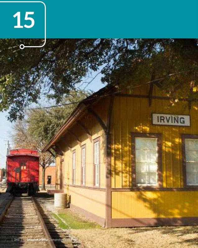

If you have people walk and bicycle more, you have a more lively, more liveable, more attractive, more safe, more sustainable and more healthy city. What are you waiting for?
~ Jan Gehl
Thesmallareaandneighborhoodplanningprocessis aneffectivemethodofimplementingpoliciesinthe Imagine Irving Comprehensive Plan. Thisprocessengages neighborhood stakeholdersandsupportsthearea'svalues andgoals, while applying strategiesidentifiedinthe ImagineIrvingPlan. Smallareaplansmay addressexisting neighborhoodsinneedofrevitalization, majorstreetsor other corridors, andvacantareaswherenewdevelopment isdesired.
Asmallareaplanisany planthataddressesthespecific issuesofaportionofthecity. Smallareaplanscancover anareaassmallas10acresoranareaaslargeasacity's downtown. Theadvantageofsmallareaplanningis itsability toengagewithpeopleonlocalissuesatan intimatescale. Theresultcanbearichly detailed plan that addresses thearea'sunique challenges withtailored solutionsthatcoverlanduse, designandinfrastructure, redevelopment, connectivity, community andbusiness development, andmore.

» The city coordinates land use and transportation to minimize travel time and distances between daily destinations - allowing people to live closer to work and services, live or work close to transit, and live in bike- and pedestrian-friendly areas.
» Irving has robust cultural centers that serve the city's diverse residents and visitors.
» Irving has opportunities to shop for basic needs in all parts of the city, including previously under-served areas of the city.
» Irving offers exceptional access to the regional, national, and world economies through its globally connected businesses and robust transportation network centered on DFW International Airport.
» Irving's educational system prepares its workforce to succeed in all segments of the economy and includes training for a wide range of job skills.

Thesmallareaplanningprocessisdesignedto generatewidespreadstakeholderconsensusthatwill leadtoefficientadoptionandimplementationofthe plan. Theprocessisdesignedtominimizetheneedfor excessivehearingsandreviewofprojects. Ideally, small areaplansaredevelopedby orinclosecoordination withproperty ownersandareastakeholders, then implementedthroughsuchmeasuresaszoning changes, partnershipsandincentivesthatpromotethe typesofdevelopmentdescribedinthe Imagine Irving Vision.
A neighborhoodadvisory committeecanhelpguide theprocess. Itshouldconsistofadiversegroup ofinformedstakeholdersincludinglandowners, residents, businessowners, architects, developers, andbuilderswhohaveaninterestinthearea. This advisory committeeshouldrepresentafullrange ofinterestsandmeetonaregularbasisto critically reviewanalysesandhelpguideeachstepofplan formation.
Thesmallareaand neighborhood planningprocess isanimportant implementationtoolfortheImagine IrvingComprehensivePlan.Toensureconsistency betweenthesefutureplansandthe citywide goals
expressedinImagine Irving, thischapterlays outaprocessforhowtodevelopsmallareaplans andusetheirrecommendationstodirectzoning, infrastructure, andotherimplementationstrategiesto achieve community goals.
Smallareaplansmay bepreparedinareas experiencingsignificantchange, orinareasthat requirestabilizationand reinvestment. Theareas includedinasmallareaplanshouldhaveaunifying featureorcharacteristicsuchasanexistingor futurecorridor,center,ortraditionalneighborhood boundaries.
Smallareaplanscanbeusedinareasofgrowthand transitiontofocusresourcesthatsupportdesired changesinareaswheresignificantchangeisexpected. Whenproposeddevelopmentisatthescaleofa newneighborhood, thereareoftenmany individual landownerswhoseneedsandinterestsmustbe considered. Forexample,ifthereisaproposalto extend utilitiesandinfrastructuretoanundeveloped orunderdevelopedareasoitcouldsupportalarge


numberofnewhouseholdsorjobs, asmallareaplan wouldguidethatdevelopment. Smallareaplanscan alsoguidegrowthnearthecity'stransitinvestments andrequireincreaseddensity. Similarly, areaswith highredevelopmentpotential, wherebuildingvalues arelowbutlandvaluesandmarketdemandarehigh, wouldbenefitfromsmallareaplanningthatguidesthe nature, location, andtimingofredevelopmentinsuch awaythathelpspreserveneighborhoodcharacterand protectstheinterestsandinvestmentsoflong-time residentsandpropertyowners.
Smallareaplansmaybeconductedinstable neighborhoodsaswell, andareoftenusedtostabilize andenrichexisting neighborhoods, anddealwith issuessuchastransitionsbetweenuses, aging infrastructure, andtheneedforenhancedcommunity services.
Smallareaplansarenotnecessaryforroutine planningactions, suchasmodifyingthelistof allowableusesofasinglesmallparcelorsubdividing landownedbyasingleentity. Intheseinstances, a subdivision, zoningchange, PUDorotherprocess underthezoningcodeissufficient.
Neighborhoodplanstypicallycoveradistinct residentialormixed-useneighborhood, suchas Irving's HeritageDistrict, whichisaclassicexample ofahistoricallymixed-use neighborhood. Becauseof theresidentialnatureofmanyneighborhoodplanning areas, issuesofcityservices, housing, designelements, transitionaluses, schools, andparksarehighpriorities.
It is essential to evaluate and prioritize requests for small area plans. Selection criteria for small area planning may include:
Evidence of disinvestment, deteriorating housing, and high vacancy, unemployment and/or poverty rates.
Significant change (occurring or anticipated).
Opportunity for development in conjunction with a transit station.
Public facilities and/or physical improvements that need to be addressed.
Opportunities for substantial infill or redevelopment are present or needed.
Opportunities to influence site selection, development or major expansion of a single, large activity generator.
Expressed interest of community stakeholders committed to discussing the future and helping guide positive change.

Corridorplansfocusonlinearfeaturessuchasa majorstreet, waterway, orarterialroadandthe areaadjacenttosuchfeatures. Corridorplansare typically initiatedby thecity, businessassociations orstakeholdersinanticipationofproposedcapital investmentoraproposeddevelopment project affectingamajor portionofthecorridor. Examples ofcapitalinvestment projectsincludemajorpublic beautificationinvestments, roadway repairor redesign, enhancedtransitservices, oropenspaceand trailsalongawaterway orothercorridor. Corridor plansplaceemphasisonlanduse, siteaccess, multimodaltransportation, infrastructure, urbandesign, andeconomicdevelopmentissues. The MacArthur Boulevardcorridorisoneofthecity'smajornorth/ southconnectors. Itlinksmany ofthecity's neighborhoods, commercialareasandeducational institutions, andcouldbethesubjectofaseriesof smallareaplans.
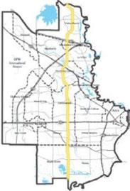
Districtplanscanincludeoneormoreneighborhoods orcorridorsthathavecommonconditionsandissues. Districtplanscanaddressthelanduse, development, urbandesign, andtransportationcharacteristics ofrelatively smallareassuchasneighborhood centers, aswellasthecity'smajorcentersidentified inthe Imagine IrvingVision Map. Planningfornew communitiesshouldalsoencompassopenspaceand parkneeds, publicinvestments, newstreetsand multimodaltransportationservice, aswellaslanduse andcompatibilityissues. Theformerstadiumsiteand itsadjacentvacantparcels, nowknownas PUD#6, isaprimeredevelopmentdistrictwhereplanningis underway.
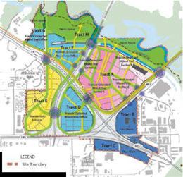

SmallareaplansshouldstartwiththeVisionfor Irving andthe ImagineIrvingComprehensivePlanasguiding documents. Ifasmallareaplanisinconflictwiththe citywideplans, theconflictsmustberesolvedwithin theneighborhoodinawaythatsupportscitywide goalsandvision.
Itiscrucialthatsmallareaplansbedevelopedwithin thecitywidecontext. Additionally, smallareaplans shouldnot "reinventthewheel" bycraftingunique solutionsforcommonproblems. Ifeachneighborhood planincludesitsownzoningdesignations, itsown designstandards, oritsownregulations, overtime Irving'splanningandzoningwouldbecomehopelessly complexandfragmented. Organizingsolutionsina similarformatfromonesmallareatothenext, based onastandardsetoftools, makessmallareaplans easiertoimplementacrossthecity.
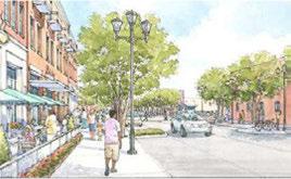
Smallareaplanscanestablishperformance-tracking measuresbasedonscenarioprojectionsandforecasts inthecomprehensiveplan, andcanbeusedtoidentify neededupdatestopoliciesinthecomprehensiveplan orregulationsinthezoningstandards. Asissuescome upthatmustbeaddressed, asmallareacanbeusedas alaboratoryforpolicyandzoningrefinement. Small areaplansthatusedetailedinvestigationofissuesmay generatechangesthatbenefitthecityasawhole.
ItisimportanttorecognizethatImagineIrvingand thecity'sdevelopmentcodeshouldevolveasthecity growsduringthenext25 years - thesetoolscanbe amendedovertimetoreflectchangingneedsand communitygoals. Asconditionschange, thesmallarea processmayrevealnewideasortoolsthatshouldbe incorporatedintothecitywideplananddevelopment codes.

Stakeholder and staff time will be better utilized if a consistent framework and structure is followed for each plan. Time will not be spent "reinventing the wheel" for each project.
A smooth process enables broad participation and timely completion. The content of each plan benefits from properly considered stakeholder input, technical analysis, and clear implementation strategies.
Implementation becomes easier because each plan has a similar format, common elements, and a shared toolkit of recommendations and resources.
Incorporation into the comprehensive plan is easier if the small area plans are organized in a similar format, based on the same level of analysis; utilize a standardized set of tools; and acknowledge and address the citywide context.
Thefollowingmethodisanexampleof howtoprepare smallareaplansthatwillhelpimplementthe Imagine IrvingComprehensive Plan. Plans, goalsandstrategies thatareconsistentwithcitywide guiding documents canbeincorporatedintothe comprehensive plan and implementedthroughthecity'sdevelopmentcodeto theextentpractical. Thesmallareaplansshouldinclude specificactionsandidentifyresonsibilityforeach action.
1. IdentifyCommunityPlanningAreaBoundaries: Identifytheareasthatwillbeimpactedbythesmall areaplan andthegeographicareaorimpacted segmentsofthecommunityfromwhichstakeholder representativesshouldberecruited
2. CommunityParticipation: Selectengagement methodstoformastrategythataimsto: informa varietyofstakeholders, provideampleopportunities forinterestedresidentsandbusinessestogivetheir feedback totheprocess, andgiveactivestakeholders anopportunitytodirectlyinteractintheprocess. Somecommonmethodsforcommunityparticipation are:
» Charrettesordesign workshops
» CommunityAdvisoryCommittee
» Newsletterstooutreachdistributionlist
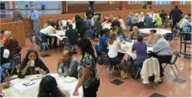
-Small Area Planning

» Surveys (bothonlineandpaper)
» Openhouses
» Onlineresources (suchasprojectwebsite, documentlibrary, onlinefeedback)
» Communicationsandeventsgearedtowardnonresidentstakeholders, suchasbusinessowners, property owners, andthelocaldevelopment community, asapplicable
3. Strengths,Weaknesses,OpportunitiesandThreats: A SWOTanalysisisaneffectiveparticipation methodtoengageandlearnfromparticipantsonan equal basis. Itcanalsohelpfocus planning efforts onthoseissuesthatarehavingthegreatestimpact onthearea.
4. ElementsofAssessmentandAnalysis:Eachsmall areaplanshouldaddressany uniqueorspecific applicationsofthefollowingelementsasthey apply totheplanningarea:
» LandUseandUrbanDesign
» HousingandNeighborhoods
» Transportation
» Infrastructure
» Parks, TrailsandOpen Space
» Economic Development
» Sustainability
» WasteandRecycling
» CommunicationsandTechnology
» Public Safety
» Community Amenities
» FiscalSecurity
» Poverty, HealthandEducation
» IntergovernmentalRelationships
5. CreateaVisionStatementandGuidingPrinciples: Thevisionstatementandguidingprinciplesconsist ofaconcisestatementorlistofstatementsthat
describethevaluesandaspirationsofresidentsfor thefutureofthearea.Thesecanbederivedfrom the SWOTanalysisandinputfromanadvisory committeeandkey stakeholders.
6. Recommendations:Therecommendationsinclude aconcisesetofstatementsabouthowtocapitalize onthearea'sstrengthsandopportunities, and howtoaddressthearea'sweaknessesandthreats. Assessmentrecommendationsareorganizedby goalorissue, whichmay ormay notcorrespondto theplanelements. Oncetherecommendationsare complete, thestandardtoolsareappliedtocreatean implementationprogram. Thetoolsfallintothree general categories -regulatory, publicinvestment orpartnership. Somerecommendationsmay need only toolsfromonecategory;however,more complexrecommendationsmay usetoolsfromall threecategories.
7. ImplementationStrategiesandComprehensive PlanPolicies:Eachsmallareaplanincludesaset ofimplementationstrategiesthatwillimprovethe livabilityofthecity asawhole, andwillguidethe smallareatowardachievingitsplaceintheoverall vision. Anotherkey elementoftheplanningprocess shouldbedevelopingstrongandpracticalpolicies thatcanbeintegratedintothebroaderImagine IrvingComprehensivePlan.
1. PlanReview: Becauseoftheimportanceofsmall areaplans, theirimplementationinvolvesthorough evaluationinadditiontoformalaction. Theplan reviewisinitiatedby thePlanning Departmentand thoroughly vettedthroughopenhousesandpublic engagement.
2. PlanningCommissionReviewandAction:The planisthensenttothePlanningandZoning Commissionforformalreview, whichincludesa worksessiontoreviewtheplanrecommendations

Small Area Planning anditscompatibilitywiththecomprehensiveplan. ThePlanningCommissionwillconductoneormore hearingsontheproposal, andwillforwardtheir recommendationtotheCityCouncil.
3. CityCouncilReviewandAction:Oncethe Planning Commissionhasforwardeditsrecommendation regardingthesmallareaplantoCityCouncil, the Councilisbriefedontheplanandwillholdoneormore publichearingstodiscuss. Followingthispublicinput, theCityCouncilwilltakeactionontheproposedplan. Theymayeitherapprovetheplan, approveitsubjectto specificchanges, ordenytheplan.
4. RecommendedAdoption:OncetheCityCouncilhas approvedaplan, itwillbeincorporatedintotheImagine IrvingComprehensivePlan. TheCityCouncilthen willdeterminethepriorityofthesmallareaplan's recommendationswhenconsideringtheadoptionof futurebudgetsandfunding initiatives.
5. Conformance: Adoptedsmallareaplansmustbein conformance withthecomprehensiveplanandthe Vision Map. Iftheychangethevisionorpoliciesor strategies, the Imagine Irvingplanshouldbeupdated basedontheamendmentsproposedinthesmallarea plan. Communitiesbenefitfromthisprocessbecause thecitycommitstoimplementingthesmallarea recommendationsandincorporatingtheseideasinto thecitywidevision. Thesmallareaplansshouldinclude aperiodicreviewprocesstoensureimplementationof planrecommendations.
Totheextenttheyareeffective, existingregulatory toolsinthecity'sdevelopmentcodeshouldbeused forimplementation. Thedevelopmentcodeshould periodicallybeevaluatedandamendedtoincorporateany newregulatorytoolsthataredevelopedthroughthesmall areaplanningprocesssothatnewtoolscreatedforspecific sitesarethenavailableforuseinotherareaswherethey mayalsobeneeded.


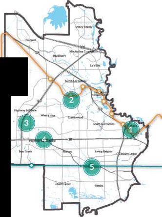
Note: Contents of the Irving PUD #6 Planned Unit Development - Exhibit B takes precedence over material in this chapter, which is provided as a summary.

TheareaaroundthesiteoftheformerTexasStadium isanimmensedevelopment opportunity - not only foritssize,butalsoitsadvantageouslocationatthe centralcrossroadsoftheDallas-FortWorth Metroplex. Containing justover 1,000acres,itisaslargeassome major American downtown businessdistricts.
Thedistrictincludeseightvacanttractsthatare considered primeredevelopmentsites, withthe potentialtotransformintooneofthecity'smost importantandvisibleurbandistricts. Muchof the futuredevelopment willconsistofmid-riseandhighrise buildings, providingasizeable portion of Irving's futurehousingandemploymentgrowth. Severalofthe
largetractsaredesignatedtobecomevibrant, active, mixed-useneighborhoods. Theareawillbedesigned forexcellentwalkability, withsidewalks,aregular block pattern,parkingstructures,andamixofgroundfloorretail. TheDART Orange Linehastwoidentified stopsinthedistrict,anddevelopers willarrangethe buildingsandtheurbanenvironmenttoprovideclear anddirectpedestrianaccesstotransit.
The westernsideofthedistrictincludesanumber of existingbusinesses. Theseuses willbeallowedto continuetooperate,renovate,rebuildandexpand, as long as their useisnotdiscontinuedforaperiod longer than180days.
Tofully capitalizeontheinterestandmarketability of thesite, the City of IrvingcreatedthePlannedUnit Development (PUD) #6 zoning district, whichprovides clarity regardingtheCity of Irving's intentions forthe site,andregulatory certainty toallproperty owners today andinthefuture.
ThePUDzoningregulationsprovideaguiding frameworkforcreatingspecificdevelopmentplans inthefuture, whicharesubmittedtostaffforreview andareadvertisedpublicly forfinalapprovalby the Planning and Zoning Commission. The Irving
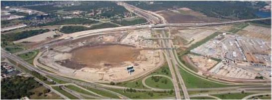
Small Area Planning

MunicipalCodesetsforththespecificrequirements forthesubmissionandapprovalofindividual developmentplans withinanexistingPUDdistrict.
Becauseofitsscaleandlocationaladvantages,thisarea isauniqueassetfor Irving'sfuturegrowth. TheCity of Irvingiscommittedtoensuringitsfuturedevelopment willbedesignedandcompletedinamannerthat makesfulluseofthesiteandcreatesanassetfor futuregenerations. Itis envisioned asanintense blend of corporate headquarters,internationalbusiness district,retail,andservices,withamixofresidential buildingsina walkableurbanenvironment,accessible totheregionandtheglobe. Thecreationofthe PUD zoningdistrictallowstheCity ofIrvingtofacilitate development,provideclarity ofpurpose,andtoensure thatthiscatalystsiteisanassettothecommunity by providingstrongurbandesignstandards,alistof theprincipaluseswithineachlandusedesignation, andtheminimumandmaximumalloweddensity forindividualareasthroughoutthesite. It willalso enhancetheaccessibility andvalueofadjacentuses
throughestablishmentofaconnectedroadsystemand additionallinkagestothetransitnetwork.
Thedistricthasexcellentregionalaccess: itisserved by severalmajorfreeways,including State Highway 183, State Highway 114,Loop12and Spur482. On average,morethan380,000vehiclespassthesite eachday! Additionally,therecentconstructionof theDARTOrangeLine (lightrail)hasmadethisarea oneofthemostaccessiblesitesinthe Metroplex. One lightrailstationisalready completedandanotheris intheplanningstages. Fromthislocation,ashortride ontheOrange Lineallowsriderstoconnecttoeither theDFW International AirportTerminalA (andfrom there,therestoftheworld),ortodowntownDallasin just20minutes.
Inaddition, PUD#6hasaccesstotheTrinity River Greenway,oneofthemostimportantregionalopen spacesinnorthcentralTexas. Multistory buildings tallerthan35feet,andpropertiesonthe western
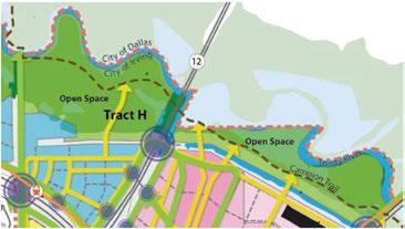
Tract H (155 acres) is entirely within the Trinity River floodplain, and is intended for use as open space. It is not considered buildable, but is a natural amenity that serves the entirecity.
Small Area Planning

sideofthisdevelopmentcanbedesignedtooffer panoramicviewsoftheTrinity Greenway with downtownDallasinthedistance. Inaddition,the CampionTrailandsimilarimprovementswillcontinue toincreasethegreenway'svalueasanamenity tothis siteasfuturecommunity designstakeadvantageof itsproximity andprovidephysicalandvisualaccessto thisimportantnaturalresource.
TheTrinity River Greenway isatremendousasset tothedevelopmentof PUD #6. Additionally, internal openspaceandplazaswillprovidesignificantopen spaceforfuturedevelopments,enhancing accessto light,shadeandairinthebuiltenvironmenttoprovide andimprovegenerallivability aspartofthestandard developmentrequirements. Toachievethisgoal,at least10%ofthe areaoftractsAthroughGshould bereservedforopenspace. TractsA,D,and F,being moreurbaninnature,may provideplazas,boulevards, widesidewalksandotherpedestrianamenities,as wellasmoretraditionalparkstofulfillopenspace requirements.Theparksandopenspacerequiredin TractE areexpectedtoservenearby residentialuses, butcanalsobedesignedasmore traditionalurban features,suchaswideboulevardsandparkblocks.
Basedonapreliminary,planning-levelscenario forlong-termbuild-outconformingtothelanduse standards and regulations contained herein,Tracts AthroughGwouldallowupto9,201newresidential unitstobeconstructed,withthemajority ofthese units (8,897)withinmixed-useresidentialbuildings. Itisanticipatedthatdevelopmentofthesitewould beabletosustain20,500jobsinapproximately 12.7 millionsquarefeetofemploymentspace.
TractAwillbeamixed-useareaofmultistory buildingswithactivegroundflooruses,quality pedestrianstreets,andamix ofresidentialandnonresidentialuses. Developers willbeencouragedto developasharedparkingprogramsothatvisitors, workersandresidentscanparkonceandthenwalk betweendestinations.
TractsD,F andGwillbemixed-useareassimilarto TractAin physical urbanform, although withmore office-oriented usesandlessfocusonresidential uses. Therewillstillbeamix ofresidentialandnonresidentialuses,withactiveground floorcommercial activity. Sharedparkingwillbeencouraged.
TractE willbethemostresidentialofthetracts. Itwill includetraditionalsingle-family homes (typicallot size: 6,000squarefeet),cottagehomes (typicallotsize: 3,000squarefeet),townhousesandmulti-storymixedusebuildingsthatprovideresidentialunitsoveractive groundfloornon-residentialuses.
TractsBandCcontainmany businessescurrently inoperation,andtheseusesmay continueintothe future. Therewillbenoresidentialusesinthisarea. Landscapingandscreeningwillberequired.
Transportation Plan
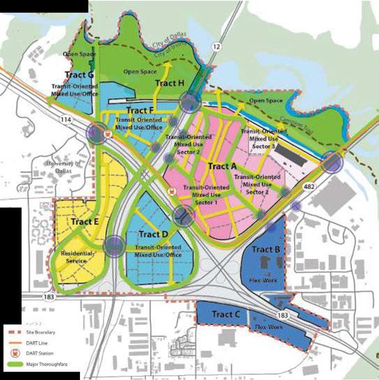


Strategy 1: Continue meeting collaboratively with property owners and prospective developers on evolving development plans for the PUD #6 district.
Strategy 2: Encourage shared parking and lower parking ratios for urban housing and mixed-use areas, allowing the creation of structured parking and denser development.
Strategy 3: Encourage development that is oriented towards DART Orange Line stops, providing clear pedestrian access to station areas and quality design elements that welcome pedestrians and bicyclists at the stations and throughout the site.

Strategy 4: Promote walkable intersections and trafficcalming measures at primary intersections.
Strategy 5: Design streets that are safe for all users, including pedestrians, transit users, bicyclists, and motorists.
Stategy 6: Require at least 10 percent of land area in Tracts A-G to be reserved for public open space, which could include parks, plazas, boulevards, extra-wide sidewalks and other pedestrian amenities that fulfill open space requirements.
SmallAreaPlanning
NorthLakeCollege,atwo-yearpubliccommunity collegeservingIrvingandnorthernDallasCounty, openedinthefallof 1977. Thecollege'scentralcampus sitson276acresintheLasColinasareaofIrving. Signatureprogramsincludelogistics,thesciences, constructiontechnology,anditisknownforitspairing ofartsandtechnology.Thecentralcampusincludes:
• 380seatperformancehall
• 59,000square-footlibrary
• 2,000seatgymnasium
• Olympic-sizecoverednatatorium
• 10,000square-footWorkforceDevelopmentCenter
• Lakeviewwalking/joggingtrail
• On-siteDARTOrangeLinelightrailstation Sincethe 2012openingoftheDARTLightRailOrange LinestopattheNorthLakeCollege Station,NorthLake CollegestudentsandCityofIrvingresidentshavehad anew,convenienttransportationoptionconnecting themtotherestofthe Metroplex. Thisstation createsatremendousopportunityfortheareaand thisplanexploresthemeansofcapitalizingonthose advantages. TheCityofIrvingiscollaboratingwith NorthLakeCollegeandDARTtoplanforfutureland usesandimprovedconnectionsaroundthestation, whichencouragemoretransit-orienteddevelopment withineasy walkingandbikingdistanceofthe stationandcollege. Thecatalystsitealsoincludesthe surroundingareaaroundNorthLakeCollegealong MacArthur BoulevardsandWalnutHill Lane.

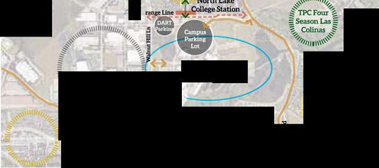


• TheDARTLightRailOrange Linestationwas locatedandconstructedafterthe NorthLake CollegeCampuswasbuilt. Currently, thecollege's mainparkinglotisbetweenthestationandthe maincampus. Pedestrianaccessfromthecampus tothestationrequiresawalk acrossactiveparking areas, andthedesignatedaccessiblepathisdifficult tofollowandnotshaded.
• Thephysicaldesignofthestationintheareais unobtrusive andmakesthestationdifficulttolocate ifnewtothearea.
• BusservicealongWalnut Hill Laneand North MacArthur Boulevardhastwovery large turnaroundsatthe DARTstationthatcreates aphysicalbarrierbetweenthestationandthe campus, andpoorwalkingaccesstobusstopson Walnut HillLane
• Residentialusesnorthofthestationhavelimited vehicularandpedestrianconnectionstothestation.
• Commercialandcivicbuildingsattheintersection ofWalnut Hill Laneand Story Road, though occupied, areaging, stand-alone, cardependent developmentswithlimitedaccesstothestation.
• Nodesignatedbikeinfrastructureexistsinthe overallarea.
• Thepublictransitnetworkin Irvingdoesnoteasily connectinstitutionalandeducationalusestoeach North Lake Main Campus Library Entry

other. Incorporating Liberty Circleasaprimary bus anddrop-offdestinationshouldbeconsidered.
• Highdensity housingmarketedtocollegestudents whodesiretowalk orbiketoschoolandother amenitiesislimitedinavailability.
NorthLakeCollegeiscurrently preparingacampus masterplantoidentify futureon-campusdevelopment opportunities. Collaborationbetweenthe NorthLake CollegeandtheCity of Irvingprovidesanopportunity tocoordinateon-campusandoff-campusdevelopment strategiestocreateaholisticwalkableareathatserves bothIrvingresidentsandtheregion.
The North LakeCollegestationshouldencourage new, densermixed-usedevelopmentpatternsthat create pedestrian, bikeortransitoptions. Younger generationsindicateapreferenceforacompact urban lifestyle andalternative meansof commuting oreven walkingtopublicgatheringplaces. Infilland brownfield redevelopment of underutilized parcels around North LakeCollegeprovideopportunities forgrowthandreinvestment. Thisareaispositioned togrowintoanewwalkablecommunity. Asthe NorthLakeCollegeareaistransformedintoamore walkable neighborhood, similarstrategiescouldalso beimplementedinotherpartsof Irvingtocreate additional pedestrian-oriented centers. Enhancing theexistingtransportationnetworkandreducing singleuse, auto-dependentdevelopmentwillcreatea

Small Area Planning

distinctiveidentityforthe NorthLakeCollegearea. Theseimprovementswillflowfromanewpolicy initiativethatresultsinthetransformationofthe NorthLakeCollege neighborhood intoa flourishing educationalhubalongtheOrangeLine.
Thevisionforthe North LakeCollegeareaisathriving walkablecommunitycenteredon NorthLakeCollege thatiscloselyintegratedwiththecollegeandprovides housingopportunitiesandservicestoitsstudents, facultyandemployees. Theareasupports NorthLake College'smissionasasustainablecampusthatisthe collegeofchoiceforstudents, thecommunityand employees.
Connecting Irving's Institutionalfacilitiesalong MacArthur Boulevard - the "Education Corridor"
NorthLakeCollegeislocatedalongoneofthebusiest transportationcorridorsinIrving. - MacArthur Boulevard. Thecorridorhasmanyeducational facilities - publicandprivate K-12 schools, technical schools, andthecollege'ssouthsatellitecampus, locatedonthecorridoror withina quartermileofit. Duringworkshopsyoungresidentsdiscussedhow difficultitistogetfromthesouthcampusto North Lake'scentralcampususingpublictransportation.
Residentshaveraisedconcernsabout MacArthur Boulevard'strafficcongestion, safetyandphysical condition. Onesolutiontoimproveconnectivityis toprovideadedicatedDARTbuslinetoservethis corridor. Thisdedicated DARTbusservicewould connect NorthLake'smaincampuswiththesouth Irving Satellitecampusaswellasalltheschoolsalong MacArthurBoulevard, characterizedas "Education Corridor". Thislinkagehasthepotentialtomaximize theutilizationoftheinstitutionalfacilitiesbymaking
efficientpublictransitavailableasaviableprimary modeoftransportation. Itwouldgreatlyreduceautodependencyandcongestionalongthecorridor.
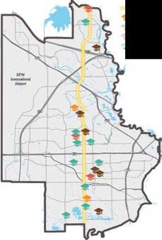
M.i.cArthl!r BLvd., llli:her E<k1ca ioTI "'9: ffi!rh School
El!!mE!lltary School
The NorthLakeCampusareaoffersoneofthecity's bestmulti-modaltransportationopportunities(light rail,driving,bus, biking, walking) forcommuters.The conceptofmobilityoptionsplaysadecisiveroleinthe choiceofone'shome, workandeducation. Improving thepedestrianenvironmentinthecampusarea, andespeciallyattheDARTlightrailstationhasthe potentialofimprovingthetravelexperienceandsafety ofrailcommuters, thusattractingmoreresidents, studentsandcustomerstothearea, andencouraginga higherusageofpublictransit.

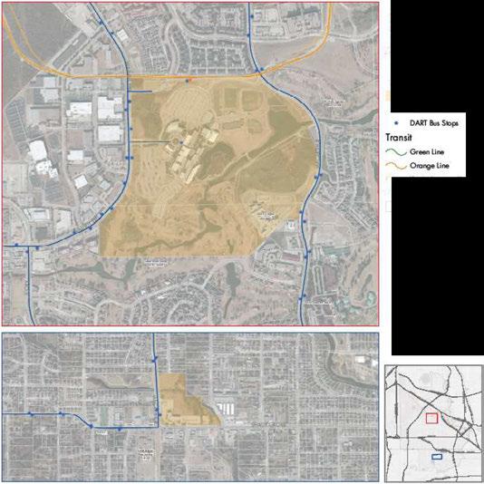
NonhLabClJllege CatalystAreas
OlyLlmll!. NodhLobCo�ge
DARr91;1ion
Small Area Planning

• Re-orientandminimizetheimpactofthelarge busturnaroundsusinggreenspacetoreducethe amountofimperviouspaving.
• Reorganizethebusdrop-offsby shiftingaccess towardtheeasttoallowforbetterpedestrian connectivity tothe NorthLakecampus.
• Situatethededicated "EducationCorridor" busroute stationclosertothecampusandnotimmediately adjacenttoDARTstation.
• EncouragesharedDARTparkingwiththeCampus and/orRedevelopmentofDARTparkinglots.
• EncouragebetterpedestrianlinkagestotheDART stationandtothesurroundingexistingcommunity, andensure ADA designstandardsaremet.
• Supportastudent-operatedbikesharingprogramon campusadjacenttotheDART Station.
North Lake College as a Catalyst for Main Street Redevelopment
Withover11,200creditstudentsandanadditional 4,500continuingeducationstudentsinthe Fallof 2015, North LakeCollegeisanimportantdestination attractingsignificantdaily vehiculartraffic. Moving forward, North LakeCollege'svisionistoexpandthe campustowardamulti-modal, urbanenvironment offeringstudentsavariety oftransportationoptions andamorepedestrian-friendly, walkablecampus linkingtheDARTstationandtheexistingcampus. North LakeCollegeisdesignatedintheVision MapasaCollegeDistrictandhastheadvantageof great flexibility inuseofitsland. Plansincludenew developmentsituatedalongWalnut HillLanewith activegroundflooruses, walkablestreetfrontagesand possibletransit-orientedurbanstudenthousingusing


sharedparkingwith DART. TheintersectionofWalnut HillLaneandBrangusDrivehasthepotentialtobe animportantgatewaytotheDART station,aswell asasecondaryentry toNorthLakeCollegeandthe neighborhood.
• Promoteimprovementsandnewcampus developmenttowardsthe DART station.
• Developasharedbikefacility/businessincubator adjacenttothe DART station.
• Promotea "mixed-use" typedevelopmentand expansion - creatinga Main Street environment of buildingslinedalongWalnutHill Laneandadjacent tothe DART station,presentingastrongurban edgewithactivegroundfloorusesandapedestrian orientation
• Newdevelopmentmay involvestackinguses, with institutionalorresidentialusesoverretail.

• Developstructuredparkinggarageorlimited parkingdecks (takingadvantageofthecampus' topography andincorporatingroof-topsolarand othersustainablefeatures) toreducetheparking lot'sphysicalfootprint.
• Focusthe IT Center/GraphicCenter/Nursing departmentswithintheexpansionopportunities.
• Promoteconstructionoftransit-orientedstudent housingontheexistingDART parkinglotsand alongWalnutHill Lanenorthoftherailtrack.
• Strengthenexistingcommercialuseswestof WalnutHillLanetomaintainanattractiveurban edge.
• Allowforgeneroussidewalkswithcontinuoustree canopiesandlandscapebuffersalongWalnutHill Lanetocreateapleasantpedestrianenvironment.

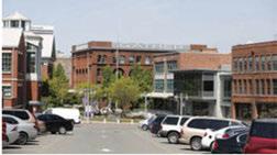

Theintersectionof Story RoadandWalnutHillLane presentsanopportunitytocreatearedevelopment modelfortheCityof Irving. Thetypicalpatternof suburban auto-oriented commercial development at major intersectionscanbereorganizedandredeveloped intomixed-use, denserdevelopments. Higherdensity createsgreateropportunitiesforwalkingandtransit uses. Street-oriented buildingsgeneratemorestreet life, addvisualinterestandimprovesecurity (with moreeyesonthestreet). Thisphysicalandfunctional integrationencouragesmoreintenseanddiverseland uses. Mixed-usesinthisareawouldmutuallysupport theneedsofthegrowingpopulationat NorthLake CollegeaswellastheCityof Irving.
• Promotecreationofmixed-usedevelopments containingcivicusesasactiveground flooractivities
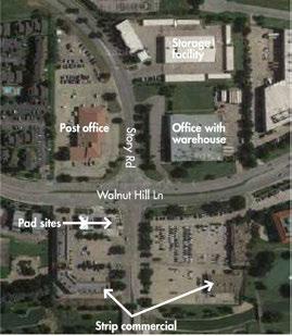
Small Area Planning (forexample, a PostOfficeor Departmentof Motor Vehicles)withofficesorresidentialusesonupper levels.
• Promoteurbanredevelopmentatunder-utilizedbut highprofileintersections.
• Phaseoutagedindustrialusesatmajorintersections, andreplacewithhigherdensitymixed-useand urbanhousingtomeetthedemandsofagrowing communityandaddavarietyofhousingchoicesto themarket.
• Replacesurfaceparkinglotswithgaragesallowing fornewmixed-use (housingandretail/commercial) buildingstobeintegratedwithexistingretailcenters (southeastcornerofWalnutHilland Story Lane).
• Promoteafac;adeimprovementprogramforexisting commercialbuildings.
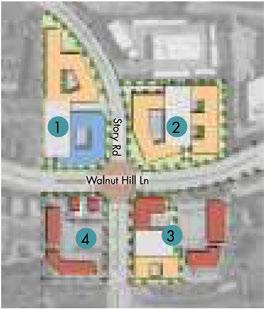
Strategy 1: Continue collaboration between North Lake College and City of Irving leadership to create a walkable educational campus that seamlessly integrates the college campus with adjacent private development.
Strategy 2: City of Irving works with DART to advocate for frequent bus service along MacArthur Boulevard. DART has listed MacArthur as one of seven "Rapid Ride" corridors in the Metroplex with high ridership that are not well served by the current rail network.
Strategy 3: Encourage shared parking and lower parking ratios for urban housing and mixed uses. (Allowing for denser developments and structured parking).
Strategy 4: Promote walkable intersections and trafficcalming measures at primary intersections.
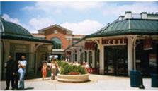
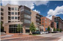

Strategy 5: Adopt and implement a land use plan that allows the type of development described in this vision. Include requirements for maximum front setbacks from primary roadways and intersections to create a strong urban edge.
Strategy 6: Implement complete street designs within the campus context - with walking, biking, on-street parking, shade, as well as vehicular access.
Strategy 7: Continue to build dynamic partnerships between the college, the city, Irving residents, business and industry, public schools, and other government entities to provide equal access and quality learning experiences to a diverse student population in an environment characterized by excellence in service and responsible use of resources.
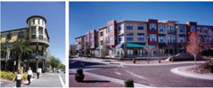
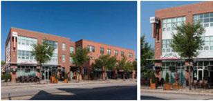
North Lake College Main Campus
Future Campus Master Plan to be provided in Mid-January
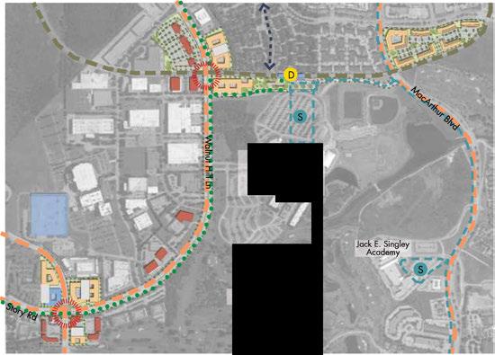
�\I/� Enhanced --- �,.,� Intersection
s DART Bus Stop ---
D DART Light Rail ---Stop

Major Arterials
Light Rail Track
DART "Education
Corridor" Bus Route
Enhanced Streetscape with Bike Lane
Enhanced Pedestrian Connection
Transit-oriented Urban housing (Student targeted)

Strengthen
Commercial
. Relocate industrial use away from maj intersection
Walnut Hill Ln/Story Rd Redevelopment
North Lake College Main Campus
Future Campus Master Plan to be provided in Mid-January
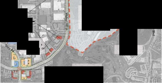

TheGreenwoodHills/Highlandsareaconsistsof approximately 100acreslocatedeastof StateHighway 161 boundedby Northgate Drivetothenorthand RochelleRoadtothesouth.Formerlydeveloped asasingle-familyresidentialsubdivision, thearea waspurchasedby Dallas-FortWorthInternational Airport (DFWAirport) withfundsfromtheFederal AviationAdministration(FAA)fornoisemitigation purposes.OneofthestipulationsoftheFAAfunding thatallowedthepurchaseisthatresidentialuses wouldneverbeallowedinthebuyoutareabecause ofitslocationwithintheflightpathsofDFWAirport. TheCityofIrvinghasworkedcloselywithDFW Airporttopreparealanduseplanthatwillinterface withadjacentresidentialneighborhoodsandproduce desirableandfeasibleusesforthestudyareawhile complyingwithFAAfundingrestrictions.
SeveralparcelswithintheGreenwoodHills/Highlands areaarenotcurrentlyownedbyDFWandarenot forsale. Anyfuturedevelopmentwillneedtowork aroundtheseproperties.
• Existinglotlayoutisinanunusableresidential configuration, completewithsurfaceroadsand undergroundinfrastructuredesignedtosupportthe previoususepattern.
• Airportadjacencyrestrictionslimitlanduseand heightoffuturedevelopment.
• LocatedwithintheDFWAirportflightpath, there arepotentialhighnoiselevelsinthearea.
• Futurelandusemixshouldcreateataxablebasefor theCityofIrving.
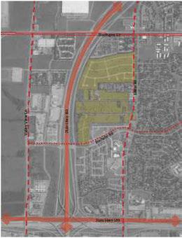
• Highwayandserviceroadaccessiscurrently limitedtothearea.
• Thereisa50' dropinelevationbetweenEstersRoad andthe StateHighway161serviceroad.
• Thestudyareaisapproximately0.5milesdeepand istoolargeforonesingle-usedevelopment.
• The StateHighway161frontagesupportshigh speedvehiculartraffic, whileEstersRoadisan arterialroaddesignedforlowerspeedsandgreater neighborhoodaccess.
• Thisisacar-dependentlocationwithlimitedaccess topublictransitandpedestrianconnectivity.

Small Area Planning
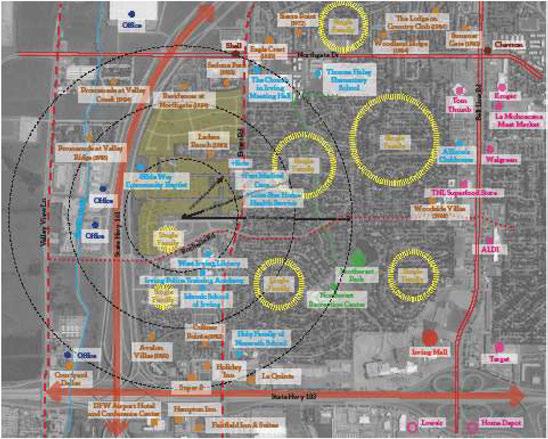
Single-Family - Apartment - Public/Education - Office - Parks
- Commercial - Grocery

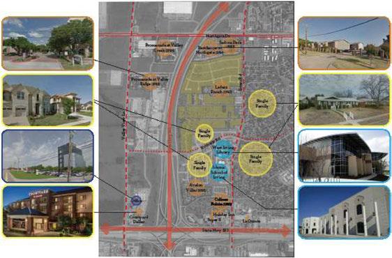
Single-Family - Apartment - Public/Education - Office
• Theareaislargelyunderasingle ownership (DFW) andthelayout ofthesiteallowssomeflexibility inredevelopmentopportunities.
• Thesiteisadjacenttoastable residentialneighborhood immediatelytotheeast.
• Wellestablishedinstitutional facilities (acitylibraryanda religiousinstitution) arelocated nearby, southof RochelleRoad.
• Redevelopmentcreatesan opportunitytoextendthe urbanfabric,redefinethe internalcirculation, and createconnectivitytoadjacent neighborhoods.

• Thereisanopportunityto incorporate appropriate new developmentalong State Highway161frontage.
• Thereareopportunitiestocreate recreationalandopenspace usestoservethesurrounding neighborhoodsandtheCityof Irving.
Thevisionforthisareaisforan internationalmarketplaceinan eco-friendlyenvironmentwith officeandlightindustrial/logistics alongmajorthoroughfaresand StateHighway161. Themarket areaservesthesurrounding neighborhoods andhosts multiculturalrestaurants, shopping
andservices. Itsproximitytothe airportallowstravelerstovisitif theyhaveextendedlayovers. The areaalsocontainsrecreational fields, openspaceandconnectivity withsurroundingresidential neighborhoods.
International Commerce resonateswithavarietyofcultural institutionswithintheimmediate area, aswellasthemultinational populationoftheCityof Irving. It willattractnearbyresidents asdailyusers, butalsotheentire Metroplexasauniqueinternational destinationforfoodandspecialty
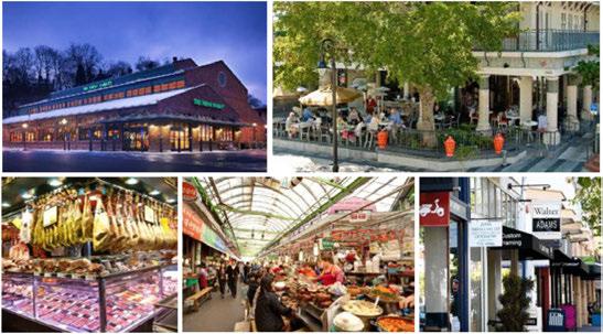
goods. Focusingdevelopmentalong EstersRoad, theInternational Commercezonewouldconnect withnearbyimmigrant neighborhoodsandprovideneeded localretail, dining, andcommercial services. Opportunitiesinclude:
• Ethnicandculturaldiversityof thesurroundingneighborhoodis usedasaunifyingdevelopment theme.
• Community Marketserves asbothaqualityshopping experienceandagatheringplace.
• FoodTruck Park integratedinto thelayoutofpublicplaza.
• Smaller-scaledevelopmentalong EstersRoad.
• Adaptablespace/officeand flex-buildingsallowforchange, growthandflexibilityasthearea develops.
• Parkingisplacedbehind buildingsalongEstersRoadto promoteapedestrian-friendly urbanedge.
• Low-Impact Development Parkinglotsreduceimpervious surfaces.
RegenerativeOpenSpace incorporatescommunitygardens, restorativelandscapeareasand anoutdoorpavilion. Thereisan opportunitytocreateahealthy ecosystemwherefoodharvested inthecommunitygardencanbe

Small AreaPlanning soldintheneighborhoodmarket asfreshproduce. Thelandscape areawillrestoreprairielandor Texasnativeplantsenhancing biodiversityandpromotingnatural waterfiltration. Anoutdoor pavilionwillserveasamultipurposecommunityspaceforsocial gatherings, weekendfestivalsoras a farmer's market.
• Roleofcommunity gardens andpassiveparkstoencourage stewardshipforlocalresidents.
• Sustainabledevelopment andwater qualitymitigation solutionsserveasgreen infrastructuredemonstration areas.
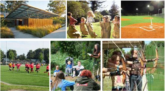

• Additionalopportunitiesto create "restorativelandscapes," restoringprairielandand promotingnaturalwater filtrationtoenhancelandscape biodiversityareexplored.
Active Outdoor Sport Fields satisfy thegrowingrecreationaldemands ofthecommunity. Thislocation takesadvantageof thelargeopen spaceinthemiddleofthissiteto incorporateavarietyofplaying fieldssuchassmallsoccerfields, juniorleaguebaseballfields, cricket fields, tenniscourtsandbasketball courts, alongwithaparkpavilion andanactivity trailwhereoutdoor exerciseequipmentallowsadults
andchildrentorun, walk, play andexercisetogether.Carefully workingwiththetopographic features, theseballfieldswould terracedownthesiteforeffective drainage. Inadditiontotheplaying fields, apossiblecommunityathletic facilityalongEsters Roadcould promotewell-beingandfitness.
• Smallpocketparkon EstersRoad atthemainentrancetothepark.
• SustainableDevelopment andwaterqualitymitigation solutions.
• Imperviouspavingincreased reducingimpactsofstorm water runoff.
General Commercial Flex Development alongthe State Highway161serviceroadfrontage allowsforgreatvisibilityand access. Itcouldbedevelopedas anadvantageoussiteforsmall businessesandcreatesmall neighborhoodserviceretail opportunities.
• GeneralCommercialmayinclude largerscaledflex-officespace (warehousewithofficeinfront) orsmaller neighborhood service retailorsmalloffices.
• Limitedaccessbetweenthe activeoutdoorspaceand commercialareas.
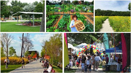
• Increasedaccesstothe State Highway161serviceroad.
• Buildingslocatedalongthe serviceroadfrontagetoprovide abufferfor thesubdivision neighborhoodalong Rochelle Road.
Strategy 1: Consider compatibility with non-residential land uses on this property when reviewing and taking action on nearby zoning change requests. FAA funding requirements prohibit future residential uses in
the buy-out area; future land use designations for this area must remain non-residential.
Strategy 2: Maintain flexibility for future development.
» Explore neighborhood-oriented open space uses, such as community gardens, walking trails, restorative landscaping and native habitat uses.
» Explore citywide open space uses, such as private athletic facilities or publicly owned community center facilities, ball fields, and other uses that promote healthy physical activity.
Strategy 3: Continue coordination

-Small Area Planning
with DFW Airport to prepare land for desired development, including appropriate zoning, infrastructure and connections.
Strategy 4: When market is ready consider partnering with DFW Airport to identify development incentives and solicit developers for the market and recreation area.
Strategy 5: Partner with the Parks and Recreation Department for development of park and open space facilities. Ensure this area is addressed and prioritized in Parks Master Plan.
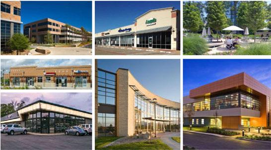
Figure 86: Proposed Development Scenario; Scale: 1 :500 (Credit: JHP Architects) ra mercial nEntryto· elopment

..Enhanced / Streetscape

Outparcelslots
asmain Entryto Development .Potential Market Location Juniorsoccer
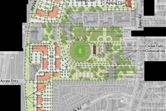
WestIrving Library -Baseballfields .ParkEntry ···WalkingTrail Playground

Figure 87: Proposed Circulation and Access Scenario; Scale:1:500 {Credit: JHP Architects)
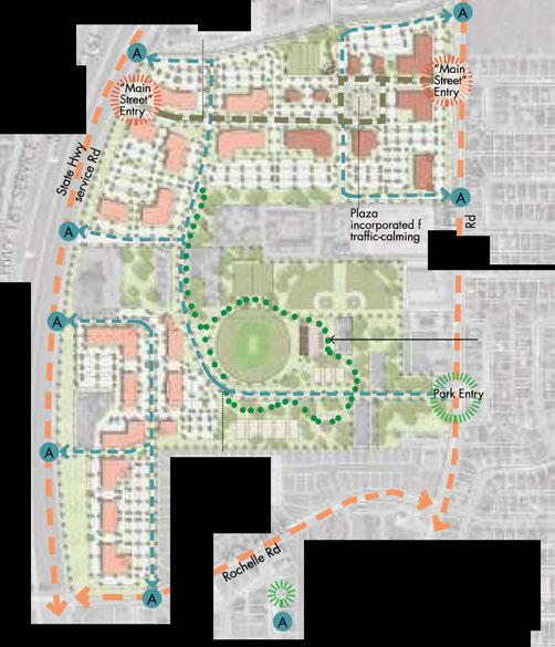


Locatedjusttwomileseastof DFW International Airport,IrvingMallisamongthetopregionalmalls intheMetroplex,whichisthenation'sfourthlargest retailmarket. Atjustoveramillionsquarefeetin size,IrvingMallservestheshoppingneedsofan estimated875,000people. Approximately240,000 peopleliveand278,000peoplework withinfive milesof IrvingMall,anditsprominentpositionalong StateHighway183givesthemallhighvisibilityand accesstoaregionalmarketformorethan6.5 million people. MajorretailersincludeMacy's,Burlington CoatFactory,AMCTheaters,Victoria's Secret, AmericanEagleOutfitters,TheChildren'sPlace,and ExpressMen's,withmorethan100retail,diningand entertainmentoptionsintotal.
Figure 88: Irving Mall Site Context {Credit: JHP Architects)
• Theretailindustryischangingnationwide. There isincreasingcompetitionfromonlineretailers,and consumersareseekingdestinationretailandtown centerexperiencesinpreferencetotraditional malls.
• AsDFWAirportcontinuestoflourish,itdraws morepotentialcustomerspastthemallalong State Highway 183.
• TheretailmarketinIrvingadaptstoservethecity's demographics. TheIrvingmarketisnotableforits greatethnicandculturaldiversityanditsgrowing numberofyoungerresidents.
• AnyredevelopmentofIrvingMallmustbesensitive totheconcernsoftheresidentialneighborhoods tothenorthandwest.Commercialdevelopment intensityshouldnotbeincreasedadjacenttothe
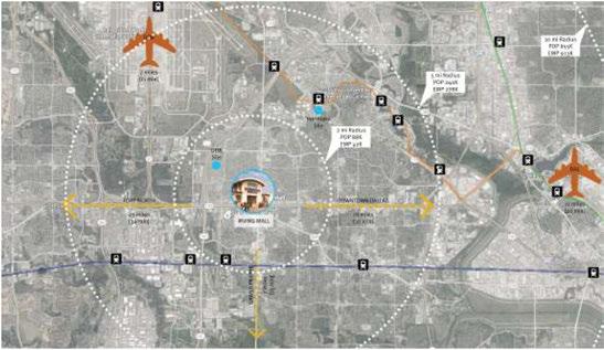

existinghousing, howeversmalllotsingle-family homesandtownhousescouldpotentially be constructedasatransitionalbuffertotheexisting neighborhoods.
• Inthepast, majorretailcenterslikeIrving Mallwere oftenbuiltwithoutfullconnectivity tonearby uses. Withany futureredevelopment, streets, sidewalks andtrailsshouldbeusedtoimproveaccessfromthe existingneighborhoodsinwaysthataresensitive totheresidentialcharacter,andalsotoallowbetter accesstoothernearby uses.
TxDOT planstoreconstructtheintersectionof SH-183 atBelt Line Roadandtransformtheexistingcloverleaf intoasmallerfootprint. This willcreatespacefornew developmentadjacenttoIrving Mall. IftheCity of Irvingchoosestopurchasethisland, anddevelopitas anopenspaceamenity, thisassetcouldhelpincrease thevalueandvisualdrawof Irving Mallandother nearby parcels.
Irving Mall, asoneofthecity'smostnotable desitinations, hastheopportunity totransformitself andleadthecommunity toamoreurbanfuture. One redevelopmentvisioncouldaddinfillcommercial spacestothesite, providingamixofsmallerretail opportunitieswhileincorporatingseveraltypesof housingproductonthesite: loftresidencesover retail, townhousesandsmalllotsingle-family units. By installingstructuredparkingfacilities, the existingsurfacelotscouldprovideampleroomfor newdevelopment. Betweennewparkinggarages, andtheadditionoffront-rowparkingspacesalong storefronts, thequantity andavailabilityofconvenient parkingwillremain. Siteredevelopmentshouldbe orientedalonga"mainstreet"styleroadnetworkwith sidewalks,angledon-streetparkingandintersections atregularintervals.
In 2016, Valley View Mall is scheduled to be demolished and rebuilt as a new town center known as "Dallas Midtown," which will be a mixed-use housing and retail center. After the planned transformation, the cinema and several major anchors from Valley View will continue to operate in the redeveloped site.
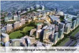

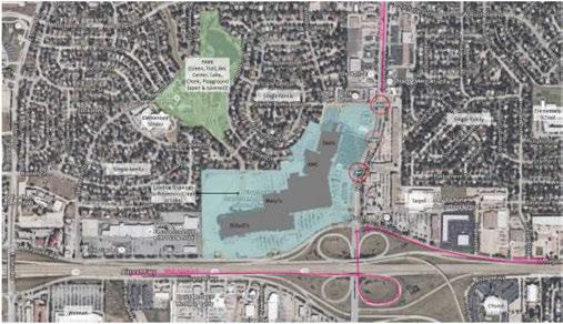
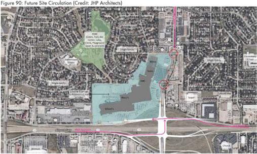

In2016, Irving Mallenjoysstrongretailoccupancy ratesandhasmanyanchortenantsthatarelikely tocontinueoperatingforyearsintothefuture. As successfulasthemallistoday,retailistrendingaway fromtraditionalmallsandtowardsmoreurban, mixedusevenuesthatincorporatehousingintotowncenters. Thelong-termvisionfor Irving Mallisanurbanreconfigurationoftheregionalmallintoamainstreet district. Irving Mallprovidestheopportunity tocreate anurbanplacethatisbotheasilyaccessibleandhighly visible. Sucha "retrofit" willtransformtheareafrom aretailsiteintoamixed-useretail,communityand lifestylehubthatincludes apartments, townhouses andsmalllotsingle-familyhomes.
Twodifferentdevelopmentconceptswerecreated fortheIrving Mallarea. Theseconceptscouldexpand toincorporateothershoppingareasatthesame intersection, orinspiresitetransformationselsewhere in Irving. Siteplansofbothconceptsareshownon pages page380andpage381.
• Commercialredevelopmentmaintainsthefootprint oftheexistingmallandanchortenants. Enhance theexistingbuildingbyopeningupentrancesand windowstothegroundfloorretailfacingthestreet.
• Incorporateseveraltypesofhousing, including multistorymixed-usehousingoverretailorsome otheractivegroundflooruse, townhouses, and smalllotsingle-familyhomes.
• Main Streetdevelopment - Breakuptheexisting surfaceparkinglotbyaddingnewsmallerretail spacesthroughout. Thesecouldbesinglestory retailbuildingsormultistorymixed-usebuildings. Designthecirculationtocreatestreetsand
Small Area Planning developmentblocksthatenhanceaccessibility. The frontside (southandwestfaces) oftheexistingmall buildingwillformthemaintravelroute, witha perpendicularstreetdiagonalfromthecornertothe Irving Mallmainentrance.
• Streetsandcirculation - Buildinteriorstreets thatsimplifytravelwithinthedevelopment, andeasilyconnectthesiteto BeltLineRoad, the AirportFreewayfrontageroad, andtheresidential neighborhoodtothenorth.
• Addstructuredparkinggaragesatseverallocations throughoutthesitetoallowsharedparkingand maintainthesameparkingcapacitythesitehas today. Maintainparkinglotsonthenorthandnorth eastsidesoftheexistingbuilding,andaddangled parkinglongthe various storefronts.
• Cornerlandmark - Inthehighlyvisiblearea createdbythereconfigurationof StateHighway183 relocation, createadistinctive, identifiablelandmark featurethatwillbecomeaniconicimageforthesite.
• Introducepublicandsemi-publicgreenspacesConstructtownhousesaroundasharedresidential courtyard, addtreesandlandscapingtoshadeand beautifythesurfaceparkinglots. Restorethecreek toamorenaturalstateandcreateanaturalamenity thatwillincreasethevalueandbeautyofthis venue.
• Commercialredevelopmentreplacesportionsofthe currentbuilding. Maintainseveraloftheanchor storestructuresateachendoftheexistingmall, and removethecenterportionofthemalltocreatea multi-blockpark.
• Addhousingunitstothesite. Providea variety housingtypes, includingmultistoryresidentialover retailorotheractivegroundflooruse, townhouses, andsmall-lotsingle-familyhomes.

• Main Streetdevelopmentthatextendswestintothe neighboringshoppingcenterproperty - Buildnew smallerretailspacesontheexistingsurfaceparking lots, andextendthe "mainstreet" spinetoinclude afutureredesignoftheadjacent commercial properties. Newbuildingscouldbesinglestory retail ormultistory mixed-use. Designthecirculationto createstreetsanddevelopmentblocksthatenhance accessibility. Utilizeangledon-streetparkingon every block.
• Streetsandcirculation - Introduceanewcirculation patternandurbanstreetnetworkthatencourages walkingandreorientparkingtobeon-streetand accessible. Install structured parkingfacilitiesto allowtheredevelopmentofexistingsurfacelots withoutsacrificingon-siteparkingcapacity.
• Introducepublicandsemi-publicgreenspacesConstructtownhousesaroundasharedresidential courtyard, addtreesandlandscapingtoshadeand beautify surfaceparkinglots. Restorethecreekto amorenaturalstateandcreateanaturalamenity thatcanincreasethevalueanddesirability of development. Therestoredcreekwillserveasapark andasaprominententry featuretoIrving Mall.
Strategy 1: Continue working with the owners and management at Irving Mall to plan for the potential long-term redevelopment of the site that could create a walkable mixed-use center in line with the vision for Irving.
Strategy 2: Encourage future redevelopment efforts to create an internal street network and greatly expand onstreet parking.
Strategy 3: Explore options for a public-private partnership to construct and manage public parking garages at Irving Mall.
Strategy 4: Require future redevelopment efforts to incorporate open space and low impact development stormwater solutions into the site plan to improve environmental quality.
Strategy 5: Provide a buffer to existing residential neighborhoods adjacent to Irving Mall by locating lower density housing on the north western portion of the site and increased density to the southeast portion closer to State Highway 183.

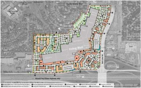
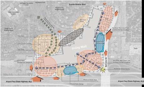
Area Planning

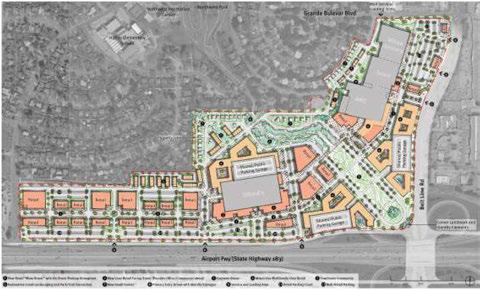
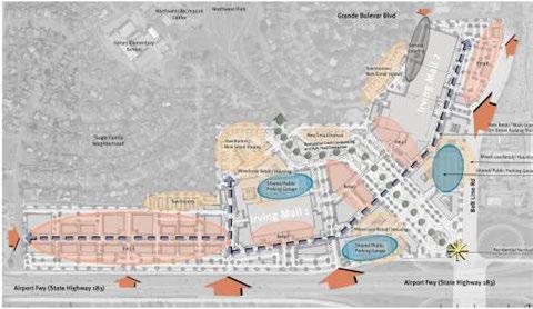

LocatedintheheartofdowntownIrving, Heritage Crossingiscomprisedofapproximately271acres generallystretchingfromPioneerRoadsouthto SixthStreet,andfrom SowersRoadto Strickland Plaza. TheImagineIrvingComprehensivePlanVision identifies HeritageCrossingasoneofthecity'sfive majorcenters. Majorcentersaredefinedasiconic Irvinglandmarks,districtsanddestinationsthatserve theentireregionasconcentrationsofcommerce, employmentandactivity.Other Irvingmajorcenters includetheLasColinasUrbanCenter,PlannedUnit Development#6 (PUD#6-formerstadiumsite),the Irving Mallarea,and MacArthurCrossing.
Withsignificantpublicinput,amultifacetedvision forHeritageCrossingwasdevelopedoverthelastsix years. Stakeholders,residentsandbusinessowners envisiontheareabecomingapremierdestination forresidentialandbusinessuse. Whenthevision isfullyrealized,HeritageCrossingisexpectedto becomearegionalretaildestination,featuringpublic art,aswellasliving,shopping,diningandrecreation opportunities. Thevisionincludesbikelanes,11-foot sidewalkstoincreasefoottraffic,andon-streetparking toimproveaccesstoretailersin Irving'shistoric downtownarea.
Almost48acresinthevicinityof HeritageCrossing havebeenaggregatedforredevelopment. Thirty-eight oftheseacres,splitbetween15redevelopmentsites,are locatedintwoprimaryareas - the Irving Boulevard/ Second StreetcorridorandalongDelawareCreek. The concentrationofredevelopmentopportunitiescreates thepotentialforamajorvisualtransformationofthose twoareas.
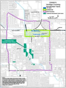
Heritage Crossingasa Business Center
Irving'sdowntowncommunityisaprimelocationin the Metroplex,andcontinuestoattractinterestfrom retailersanddevelopers. BusinessesintheHeritage Crossingcommunityincludethe Big StateFountain/ Grill,andJoe'sCoffee Shop. TheTexasMusicians Museum,with8,500squarefeetofspaceopenedin 2015,andoffersmemorabilia,livemusic,gathering spaceandfood. Theproximitytothe (TrinityRailway Express)TREstation,thegovernmentalcenter,and thenew SouthIrvingLibrary,providethesynergyof usesneededtoattractadditionalofficeandcommercial uses.

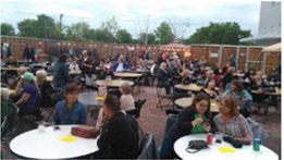
RecognizedasaBest Neighborhoodby theDallas MorningNewsin2013,the Heritage District providesmorethan1,200homesinstable,affordable neighborhoods. Inthedowntownarea,inclose proximity totheTRE station,stakeholdersand residentsenvisionthecreationofamixed-use community withretailshopsalongthedistrict's sidewalksandamixof businessofficesandresidential unitsontheupperlevels. Theredevelopmentof approximately 20acresof vacantlandinthedistrict allowtheadditionofuniquetownhomesandsinglefamily residences.
In2015,theCity ofIrvingsponsoredacallforbidsfor residentialdevelopmentproposals. Asaresultofthis call,theCity ofIrvingenteredintoanagreementwith adevelopertopotentially build100newresidential unitsin HeritageCrossing. Phaseoneofthisproject includesconstructionof40newhomesnorthof Sixth StreetalongDelawareCreek. Withhomespriced around$250,000,they fillamiddleincomedemand thatisgrowingintheregionalhousingmarket.
In2010,theIrvingCity CouncilestablishedTax IncrementReinvestment Zone#2 (theIrving BoulevardTIF) tofundthelong-termredevelopment
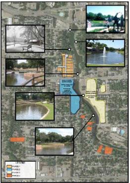
initiativeforIrvingBoulevard. ATIFisnotatax,but ratheracommitmentby thecity toreinvestaportion ofthegrowthintaxrevenuegeneratedby new developmentandinvestmentwithinthedistrictto fundneeded improvementsalongtheboulevard.
Thesewouldincluderoadway,utility,anddrainage improvements,gateway features,landscaping,existing property revitalizationandrelateditemsgeared towardstimulatingadditionalprivateinvestmentand development. Together,theseinitiativesaredesigned tocreateandsustainanimprovedquality oflifefor residents,visitorsandbusinessesalongthiscorridor.

Thenewlyadopted zoningforthe HeritageDistrict nowallowsthetypeofmixed-useandsmalllot residentialuses envisioned forthecoreofthedistrict. Inaddition, thereisdesignguidancetoensurethat developmentprovidesanactivestreetenvironment withpedestrianamenities.Thisguidesbuildingform inordertocreatethedesiredmixed-usevillageand mainstreetdistrict.
Theexistingstreetdesignisauto-orientedand individualsitesaredisconnected.Carsdriveathigh speed "through" thedistrict, ratherthan "to" the district. Sidewalksarenotcontinuous, withmissing segmentsthroughoutthedistrict, andbuilding setbacksareirregular,creatingadisjointedstreetscape thatdiminishestheimpactofthedistrict'shistoric character.
Zoning/Urban Design
The districthasmany vacant development-ready parcelslocatedclosetothehistoricmainstreet area, andtheregionalTREstation. Thiscreates atremendousopportunitytosupportinnovative developmentproposalsandoffersenoughspaceto maketransformativereinvestmenteconomically viable.
Thenewlyadopted zoningdistrictsforthearea providesthenecessaryframeworktocreateamixed usestyleofdevelopmentthatwillsupportanactive streetfront. Italsoenactsthestandardsnecessaryto providespredictabilityintheurbanformandfacilitate highqualitynewdevelopmentinthearea.
Whiletheexistingroaddesignisalmostcompletely auto-orientedwithexcesswidthandminimal pedestrianandbicycleamenities, thecityhasinitiated planstotransform Irving Boulevardand Second Street intowalkablemixed-use streets. Theinitialdesign workhasbeencompletedforthisproject.
Streetscapeplansforthedistrictinclude:
• Improvedwalkability:
» Widesidewalks
» Enhancedcrosswalkswithcorner bulb-outs
• Betterbike-ability:
» Continuousdedicatedbikefacility
» Connectingdowntown, neighborhoods, trails
• On-streetparkingtosupportexistingandnewretail
• Accommodationforcurrentandfuturetraffic (includinglargebusesandtrucks)
Connectivity and Gateway Projects
Toimproveconnectivityofcitytrailsandestablish gatewaysintothedistrict, thecity willinitiatea signatureprojectthatlinks3.25 milesoftrails within HeritageCrossing.Theimplementationofthesetypes ofprojectswillprovideacitywideamenityandattract peoplelivingthroughouttheregion.


Locations:
» Irving Boulevard Britain to O'Connor
» Second Street O'Connor to Britain
Highlights:
» 11' sidewalks on both sides (5' travel zone)
» Curb-separated
» Bike lane (6' bike lane, 5' buffer)
» Two one-way auto lanes w/turn lanes as needed
» Parking on both sides of the street
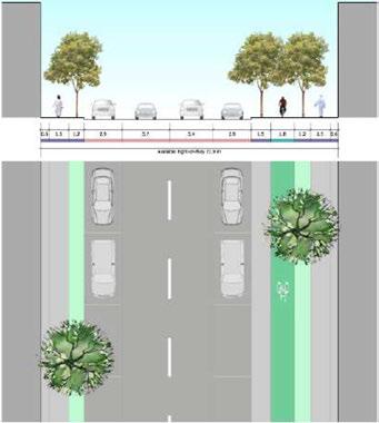
Thevisionforthisareaisthatthe HeritageCrossing Districtwillremaintheheartofthecommunity andbecomearegionaldestinationwithattractive residentialoptions, thrivingbusinesses, avarietyof recreationalopportunities, activeopenspace, unique retailstoresandbeautifulworksofpublicartallwithin awalkableneighborhood. Thepathtoachievingthe visionisto:
• Buildonexistingstrengthsandmomentum
• Maintainauthenticity
• Attractnewinfilldevelopment
• Createbetterstreetsthatworkforall
• Enhancelivabilityforresidents
• Improvethebusinessclimateformerchants

Strategy 1: Create and implement a business plan for Heritage Crossing, including both general and project level goals. Update business plan annually and use to target private sector investments.
Strategy 2: Identify infill opportunities and encourage development of these catalyst sites. Build off residential momentum.
Strategy 3: As roadways are improved and rebuilt, create walkable streets with pedestrian and bicycle amenities, and opportunities for outdoor dining and other features that create a lively, active environment.
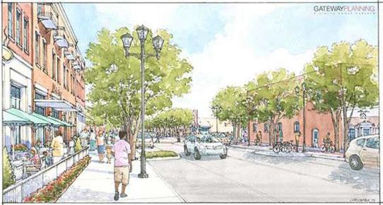
Strategy4: Continue the Fm;:ade Enhancement Program and the Downtown Sign Enhancement Incentive Program to encourage property owners to improve the appearance of properties in the district.
Strategy 5: Continue with the Irving Boulevard/ Second Street re-design, engineering final design and reconstruction.
Strategy6: Actively pursue public/private investment opportunities to create developments such as a business incubator, co-working facility and farmers market that will trigger additional growth and reinvestment.
Strategy 7: Establish a funding mechanism for the Connectivity and Gateway projects.
Strategy 8: Create a branding strategy for the district with wayfinding and signage.
Strategy 9: Identify and implement a parking management strategy for the district.
Strategy10: Redesign and enhance Heritage Park and support community engagement activities such as demonstration projects, festivals and other events.
Strategy11: Identify financing strategies and continue to provide funding assistance for projects consistent with the vision.
99: Available sites, public space and completed projects within the Heritage District
lJ I ;!ti6lS.F.
2) 54,2-67SJ.
300�ofnait.l'!Jl'CJnlnd
D 38,1tiOSL
)OiJ/Jll 2n Stn!!e 335 llll�ra,;ie Sire!t
4J :icp,75.F. 221 EastlrVillJ� 13+5f "1l'nt,,ge lrvn�llt, '
!i.) 1��:r,SF. ;.,ooN�CflM1ff1 �Acres
ii,\ ��15,..F lSJS.f. l"OOGII\J
7J ,Jl)I F. 3t3W,lrYIOOln,'l'.l. 12:i f • rage
a.) 71,l-7�S-F. 40�'W.11Ylfi Bl.d 110!J.illlro"Jlt;,;i� 1 a r I • rage
� 13(,,1775F. ,10�-lllJront.,ge �HS.JilllmJlt;,;i� H35f � • rage
lr\llJIIIEIV-!1. Street r:r nO"" C,hurches
- Avai.a!b e. Sites
P , ,life Space
11).) I ,381)5'F.(tiA'.rn) SQJl'i'.6!11�'ln!el HS, .ol'"lroot..geon• Sire!t
11� .\.115,11!2S.F.12.&0.C ll.179'.1153SLl◄.11MJe'i." T, 29 215:;,ff(l.7ol,o- I 43 W·ot � _;'14S..F:offmnl.og,,or,�511ou:>F.«rtoocig,ionDtloSt
ll.l A. 1'- !9$ 3�l"l?•I ll 11l,(ilIS.F..0.:i&,!,,:=) To is1;11MS.ff.,12J.m, �W &IIS !IOI S,J111lmlitlQeOAtlll1Sfre.g
13) I83�305.F <IP!l"4..-oS!lul"M;,.rAJ"tt, !�osr.orrror,ggoonS&-J M.lc thllr 4l11"1JJ"i:!i
14.l 56, %Sf IIM05oml<I< Lllll>l-��"3kl �
liJ 60,000SJi. 11 :, M&.MtllrBh"d! urrkms
I!\) 50,705.F. $1Hd1Cii nr l,IOOP,cm
17J 18-,�11115.F.. LIM:lllll':.!ll.
- Completed/Redeveloped Sites
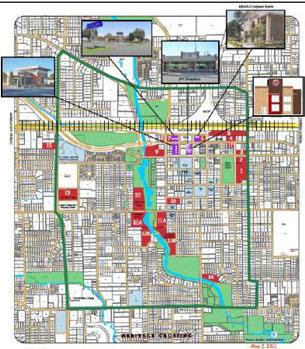

This pageleftintentionallyblank.



The adoption of Imagine Irving is the first step in implementing the plan. This plan reflects the efforts and dreams of the City of Irving - its residents, elected, appointed and civic leaders, and dedicated city staff. Fullimplementationof the plan will take the concerted effort of a range of implementation partners - from across the city, county, and region - requiring participation by nonprofit organizations and outside governmental agencies as well as the business community. Continuous action to implement the plan is required for it to have a lasting impact.
The comprehensive plan will guide private and public development. The City of Irving will use the plan to assess the appropriateness of proposed development. All comprehensive plan chapters have some role to play in assessing development applications, the public development actions, proposed CIP items, the sitingof public facilities, and other activities that affect public and private development and expenditures.
While adopting ImagineIrvingis a critically important step, implementation of this plan will be the true measure of its success. Irvingmustchoose to make this vision a reality. The city mustdecide whichpolicy directives andstrategicinvestmentswill be selectedfor immediate actionto help buildmomentumforfull implementation.


ThisImplementationChapter describeshowthepoliciesand actionsinthecomprehensive planshouldbecarriedout. It providesrecommendationsfor administeringtheplanning processandenhancinglinkages betweenthecomprehensive planandotherplanning processes. Italsorecommends stepstobetakentomonitor, evaluate, andupdatethe Plan onaregularbasis.
TheActionPlandescribesthe firstsevenimplementation effortsthatwerewidely recognizedbyresidentsand stakeholdersashighpriority forimmediateactionduring the Imagine Irvingplanning process. Thesepriorityactions aredetailedintheactionplan.

Animplementationmatrix providesthe Plan'sgoals, strategiesandactionsand identifiesthecoordinating department, recommended timeframe, andwilldisplay thecurrentactionstatus asimplementationefforts proceed. Theimplementation matrix isincludedasaseparate documentandwillbeupdated regularlybythePlanning Department tomonitor implementationprogress.
Oftenexistingrulesandprocessesmakeitdifficult toimplementdesiredchangestodevelopment patternsandurbanform - whilethoseveryrules makeiteasytocontinueconstructingtypesof developmentthatarenolongerconsistentwith thecommunity'svision.Toensurethatthecity continuestomovetowardsimplementationof thepublicvision, itisimportanttocontinuously assessthecity'svariousregulationsandprocesses andverifythattheyaredrivenbyandachieve thegoalsinthecomprehensiveplan.
Manyoftheplan'sactionswillrequiretheinput andcoordinationofotherjurisdictionsandeven privatesectorgroups Forthisreason, itwill beimportantfor Irvingtocontinueengaging instrategicpartnershipswithkeystakeholders includingothergovernmentalagencies, business andneighborhoodorganizations, nonprofits, educationalinstitutions, andmanymore.This cultureofcollaborationwillensurethatIrving

isabletorecruitandpartnerwiththeteam membersnecessarytoefficientlyimplementthe plansstrategiesandtherebyhelpensurethecity's leadershiproleintheregion.
Thecomprehensiveplan, departmentalstrategic plansandspecialplanssuchasthe Master Thoroughfare Plan, WaterandSewer Plans, and otherprogrammaticandinfrastructureplans, shouldbewellcoordinatedandconsistentwith oneanother.Thegrowthprojectionsandvision mapinthecomprehensiveplanshouldinform servicedecisions, andthetimingandstagingof neededimprovements.
Imagine Irvingprovidesthepolicydirection forfuturedevelopmentdecisions.Theplan's goals, strategiesandactionswillbeimplemented throughdevelopmentregulations (zoningand subdivisionordinances) andthroughoperational, capital, facilityandserviceexpenditures. Public serviceandfacilitydecisionsshouldensurethat

adequateresourcesareplannedtomeettheneeds ofnewdevelopmentandtoguaranteethatnew constructionisconsistentwiththedesiredvision.
ComprehensivePlanReviewand Amendment
ComprehensivePlanAmendment:The Imagine Irving ComprehensivePlanisadynamic document - onethatrespondstochangingneeds andconditions. However,planamendments shouldnotbemadelightly,butshouldtake inconsiderationtheextensivepublicand stakeholderinputthatwentintodeveloping theplaninthefirstplace. Commissionand Councilmembersshouldconsidereachproposed amendmentcarefullytodeterminewhethera proposedchangeisconsistentwiththeplan's goals, strategiesandactions, perhapsmerely finetuningsomeparticularaspectoftheplan, or whetheritrepresentsachangeindirectionthat shouldrequirebroaderdiscussion.
ComprehensivePlanReview:Toensurethe ImagineIrving ComprehensivePlanremains aneffectiveguidefordecision-makers, Irving shouldconductperiodicevaluationsoftheplan. Atleastonemeetingofthe PlanningandZoning Commissionannuallyshouldbedevotedtothe reviewoftheplan'simplementationstatusand anyissuesthathavearisen. Theseevaluations shouldconsider:
• Thecity'sprogressinimplementingtheplan
• Changesinconditionsthatformthebasisof theplan
• Communitysupportfortheplan'sgoalsand policies
• Changesinstatelaws
• Frequentlyrequestedtypesofcomprehensive planamendments
Thereviewprocessshouldencourageinputfrom acrosssectionofresidentsandstakeholderswho wereengagedindevelopingtheplan. Any plan amendmentsthatappearappropriateasaresult ofthisreview wouldbeprocessedaccordingto thecomprehensiveplanamendmentprocess adoptedbythecity.
ItisrecommendedthatallstaffreporttotheCity Counciland PlanningandZoningCommission statewhetherthespecificrequestorissueis consistentwiththecomprehensiveplan. Ifthe issueisnot, theCityof Irvingshouldevaluate whetheranamendmenttotheplanisappropriate andtakeactionaccordingly.
Thefullbenefitsof ImagineIrvingcanonly berealizedby maintainingitasanup-to-date documentthatreflectsthewillofthepeopleof Irving. Aschangesoccurandnewfacetsofthe Community'sdevelopmentandvisionbecome apparent, the Planshouldberevised.


Theactionplanidentifiessevenpriority strategies-targetedforcompletionwithinaonetothree-yeartimeframe-that ImagineIrving recommendsforimmediateaction. Theseinitial projectswillbeinitiatedbythecityandarebased onspecificgoalsoutlinedwithinthe Imagine Irving ComprehensivePlanChapters.
Theactionplanlistssuggestedstrategiesto achievetheCityofIrving'sadoptedgoals, strategiesandplanrecommendations. Includinga programorprojectonthelistofimplementation measuresdoesnotautomaticallycreatethat program. TheCityof Irvingwillneedtoadopt budgets, considernewordinances, andallocate staffresourcestoinitiatetheseactions. Each majorimplementationdecisionwillrequireinput andspecificactionbythePlanningandZoning Commissionand/ortheCity Council.
Theactionplanprioritizesprojectsandprograms thatshouldbefundedthroughtheoperating budgetordesignatedascapitalprogramsand helpsinformfuturebondelectionpriorities. In additiontoguidingfuturefundingdecisions, theactionplanprovidesaframeworktoenable andpromotepublic-privatepartnerships that willbenefitthecityanditsresidents. Theaction planshouldbeupdatedeveryonetotwoyearsas progressismade, andshouldbeincorporatedin thecity'sstrategicworkprograms.


Aligningthecity's zoningcodewiththenewconceptsinthe Imagine Irving ComprehensivePlanisacriticallyimportantstep. The zoningcodeistheimplementationtoolbehindmanyoftheplan's recommendationsandguidelines. Foreverynewdevelopment, the zoningcodeaddressesthemost pertinent details, fromrequired parkingtobuildingheightandsetbacks. Mosttraditional zoning codes, aredesignedtoprotectpeopleandtopreventharm. Beyond meetingthiscriticalpurpose, amodern zoningcodealsohelpsa developerunderstandcommunityprioritiesforaparticularlocation andhowtobuildsuccessfully there.
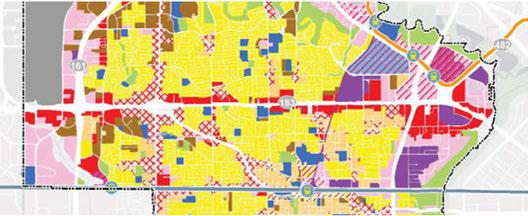

PublicinputreceivedthroughImagineIrving eventsrevealedthepublic'sdesireforawider rangeofbuildingdesignsonpublicspaces, inparticular,thecreationofmixed-use developmentsthataccomodatehomes, shops andbusinesses,aswellastheintroduction ofnewtypesofsingle-familyhomesintothe community.Adjustmentstotheexisting zoning codecouldallowavarietymixed-useoptionsin neighborhoodcenters. Expandingtherangeof possible building typeswillbecrucial tomeeting thecity'seconomic developmentandhousing goalsasdefinedinthevision.
Inordertoaccommodateapproximately 72,500 new Irvingresidentsby2040,thecitywillneed toofferadditionaltypesofhousing,including single-familyhomesonsmallerlots,townhomes, andtransit-orientedandmixed-useapartment andcondodevelopments. The zoningordinance shouldbeamendedtoaccommodatethese desirablehousingtypesandtoremovebarriers thatpreventinnovationinthetypesofhousing allowedin Irving.
Reviewtheexistingparkingstandardstoensure themostup-to-datemethodsarebeingusedto calculate parking requirements, andthatthere isflexibilityinthe regulations toadjustthe standardswhereappropriate.
Creatingwalkableareasrequiresthatattentionbe paidtobuildingsetbacks,windowplacement,and otherdesignfeaturesinordertomaketheopen spacebetweenbuildingsanattractive,livable environment. Settingsimpledesignstandards canmakeabigdifferenceinestablishingthe characterofanarea. Incorporatingurbandesign standardsintothe zoningordinanceshouldbea priority.
Thefirststeptoachievingthisstrategy isto performazoningcodeassessmentandidentify specificissuesthatneedtobeaddressed. Awork plantoresolveeachoftheseissuesshouldthenbe preparedandimplemented.

MajorcentersareiconicIrvinglandmarks, districtsanddestinations thatservetheentireregion. The HeritageDistrict, the LasColinas UrbanCenter, PUD#6 (theformerstadiumsite), Irving Mall, theDFW/ Belt Linebusinessdistricteastof Belt Line Roadatthelocationof Abbott Labsand North Lake College, and MacArthur Crossingareall majorcentersof commerce, employment andactivity.
Irvingisknownforitsstrong employment centers, andwiththecity investingheavilytoensurerailaccesstothecity'sregionalcenters, Irvingwillcontinuetoexpandtheattractivenessandmarketability oftheselocationsbyencouragingdevelopmentsthatpromote connectivity,walkability,andservices. Keyregionalcentersinclude theredevelopedtheformerstadiumarea, whichwillprovidea quarter ofthenewhousingandemploymentprojectedfor Irvingoverthe next25 yearsinanexciting, walkable, sustainableenvironment. The LasColinaswillcontinuetomature, attractingnewnationaland internationalbusiness. Otherareassuchas Irving Mall, Valley Ranch, andthe Irving HeritageDistrictwillreinventthemselvesasregional assetswithwalking, bicyclingandtransitamenities.
Areaplans, policiesandproperzoningregulationsareneededto directgrowthtotheseareas, andtoensurethatnewgrowthenhances Irving'sreputationasaleaderintheregionbycreatingnew, walkable environments, andtakingadvantageoftransitamenitiesandregional access.
Thefirststepinaddressingthisstrategyistoprioritizeregionalcenters todeterminehowandwhentheyshouldbeenhanced. Asmallarea plan, similartothe PUD#6 studyandordinance, shouldbeprepared forthehighestpriorityareaalong withtheordinancesnecessary toimplementtheplan. Thenplansandregulationsforeachofthe remainingareaswouldbedevelopedinorderofpriority. Plansshould addresstheappropriatelandusesanddensities, urbandesignissues, andalsoaccommodatefutureanticipatedgrowthanditsrelationto thesurroundingarea. Policiesprotectingcommerciallyzonedlandfor futuredevelopment, aswellasguidelinesforresidentialandmixed-use developmentshouldbeincludedtoensurethelong-termviabilityof theregionalcenters.


ThroughouttheImagineIrvingprocess, residentsand stakeholdersdiscussedhowdifficultitistotravelfromsouth Irvingtonorth Irving - forjobs, classes, shopping, orevenfor accessto DARTrail. Today, bustransfersarerequiredformost trips,makingtheuseofpublictransitvery timeconsuming.
Currently, Irving'shighesttransit ridership occursonsomeof thecrosstownand rail feederroutes, particularlytheroutes thatconnecttothedowntown Irving/HeritageCrossing Station andthe IrvingConventionCenter Station. Theseroutesuse well-developedprincipalandmajor arterialssuchasBeltLine Road, MacArthurBoulevard, IrvingBoulevard, andNorthwest Highway. Additionalenhancementstotheseexistingroutes wouldhavethepotentialtoincreaseridership, stimulate newtransit-orienteddevelopment, andreduceoveralltraffic congestionsonthesecorridors.
MacArthurBoulevardisaregionally importantcorridorwith many educationalfacilitieslocatedalongitspath. North-south routesalongMacArthur Boulevard andothernorth-south arterials shouldbeimproved, with additional optionsprovided totravelthrough Irving. Theimplementationofhigh capacity or higherfrequency transitservicealongpriority transitcorridors suchas MacArthur Boulevardisapriority.
Thefirststeptoaddressthisissueistoworkwith DARTto improvetransitalong MacArthur Boulevard. Thiswould requireexaminingtheexistingroutes, timingandservicelevels. Considerationshouldbegiventoprovidingahigherfrequency servicealongtherouteandultimately a BusRapid Transit(BRT) route.

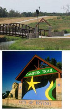

CampionTrailsisamaster-planned,22-milegreenbelttrailalongthe Elm ForkandWest ForkoftheTrinity River (from Hunter Ferrell RoadattheTrinity Riverbank,tonorthof Interstate Highway 635alongthe Elm Fork).Approximately 11milesof CampionTrails isalready operational.Thismaster-plannedtrailsystemprovides north/south accessfromGrand Prairie, northtothecitiesof Farmers BranchandCoppell,andaccesspointsontheeastsideof IrvingacrosstheTrinity RiverintoWest Dallas.Themasterplan wasapprovedin1995,andbeganconstructionin1996. Developed sectionsofthe CampionTrailsprovidea12-foot-widetrailfor pedestrianandbicycleaccess.
Thetrailrunsadjacentto15parksandgreenbelts,whichtogether compriseanorth-southlinearparksystemofapproximately 726 acres.Tworecently completedinter-city connectionsalongthetrail include0.5milesof Royal Lane BridgeTrail,whichlinksintothe Farmers BranchConnector (2014),and2.6milesofthe Lone Star Connector,whichlinksintothe Grand Prairie Connector (2015).
TheCity of Irvinghasreceivedmorethan$8.5milliondollarsin Dallas County grants,andmorethan$500,000inTexas Parksand Wildlife grantsforthetrail.
The Irving Parksand Recreation Departmentis striving tocomplete the remaining segments ofthetrailas quickly aspossible. Residents inValley Ranchhavedirectaccesstothetrail,whileopportunities existtoprovideimprovedbicycleandpedestrianaccessfromother neighborhoods immediately adjacenttoCampionTrails.Thereare alsoseverallocationswherevehiclesmay parktoprovideaccess tothetrail,andopportunitiesexisttoprovidemoretrailaccessto additionalneighborhoods.Whencompleted, the CampionTrailwill offeracontinuousroutealongthecity'seasternedgeandconnectto theregionaltrailnetwork.
Tocontinueimplementationofthistrailsystem,the Parksand Recreation Departmentshouldcontinue identifying publicand privatefundingopportunities thatwillhelpfilltheremaininggaps inthetrailsystem. Identifyingcreativefundingmechanismsforthe trailsystemshouldbeapriority increatingtherecommended Parks Master Plan.
Irvingresidentsvaluetheirparks,trailsandopenspace. Completed in2000,theexistingParksMasterPlanismorethan16yearsold. As Irvinggrowsduringthenext25 years, additionalparksandfacilities willberequiredtoservenewresidents. AParksMasterPlanis necessarytoenablethecityto request parksandopenspacegrants, planfornewparks,andsecurefundingfornecessary improvements. MuchoftheanalysisandsystemdocumentationneededforaParks Master PlanwascompletedaspartoftheImagineIrvingprocess. This groundworkshouldbeincorporatedintoacompletetheParks,Open SpaceandTrailMaster Plan.
Inthe2017budget,theParksDepartmentintendstorequest approximately $350,000foraParks,OpenSpace,andTrailMaster Plantoaddressrecreationalpriorities,programming,funding mechanisms,andpreservation. Thisplanningeffortcouldbecombined withcreatingtheformal BikeandTrailPlanrecommendedinthe TransportationChapter. Givennewdemographicanddevelopment trendsinIrving,arobustpublicinvolvementprogramshouldguidethe developmentoftheParks,OpenSpaceandTrail Master PlanUpdate. Community inputwillidentify preferences,testproposedconcepts, andidentify needsandsuggestedsolutionsattheneighborhoodand communitylevel. Anupdatedplanwill:
• Addressmaintenanceofexistingparkfacilities.
• Includeathoroughupdatetothepublicandprivateparkland inventoryinIrving.
• Addresscommunity involvementfromresidents,theCity of Irving, privatedevelopersandschools.
• Involveadjacentcommunitiesandotherstakeholders.
• Redefinegeographicalparkneedsbasedondemandandusage.
• Proposeafinancingplantoachieveparks, openspaceandtrail goals.
Thefirststepinimplementingthisstrategyistodedicatefundingfor completionoftheplanandhireaconsultanttoworkwithstaffto preparetheplan.
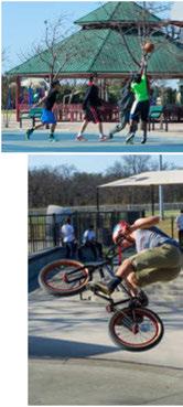


Irvinghasalreadyaddedon-streetbicyclefacilitiesinsomeareasof thecity. There areopportunitiesto expandthisbikenetwork and addnewtypesofbikefacilities, including traditionalpaintedbike lanes, protectedbike lanes, shared lanes, bikeboulevardsandtrails.
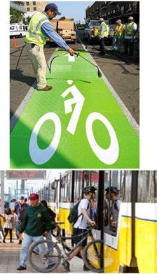

TheCityof Irvingshouldfocusondevelopinganon-streetbikeway systemtobetterconnectresidentialneighborhoodstorecreational facilities, economicactivitycentersandtransitstations. Irving shouldrecognizethatitspopulationincludesbicycleridersofall skilllevels, andmorepeoplewillbeencouragedtorideifstreetsare designedtoprotectridersandmakecyclingenjoyable. Avariety ofinnovativefacilitiesmaybeconsidered,andgiventheunique characteristics ofeachroadway, themostappropriatefacility shouldbeselectedbasedonadjacentlandusecontext, roadway characteristics, andexistingorexpectedtypesofbicycleuse.
Additionaleast-westandnorth-southbicycleconnectionsneedto beconsideredinthefuturetoprovidemoreaccessforthosewho choosetowalkorbiketogettotheirdestinationsortoenjoyleisure activity.
Developa citywide Bike Master Planaspart ofa citywide active transportationnetworkof on-streetandoff-streetbicyclefacilities. Theplanshould:
• Promotebicyclefacilitiesthatconnectneighborhoodstoexisting andplannedparks, trails, recreationareas, transitstations, and majoractivitycenters.
• Encouragesafeandcomfortablebicyclefacilitydesignthat attractsavariety ofridersandminimizesconflictswithmotor vehicles.
• Prioritizetheretrofitofbicyclelanesandshared-usepathson existingcorridorswithexcesscapacity orright-of-way.
• Developandpromoteabicyclesafetyeducationprogram. Thisstrategycouldeitherbecombinedwiththe Parks, Trailand Open Space Plan, orbudgetedandinitiatedseparately.

SmallareaplanningisatooltoimplementtheImagineIrving recommendationsforresidential, mixed-useandbusiness neighborhoods. Topicscanincludelanduse, transportationand connections, urbandesign, community services andfacilities, parks, orothertopicsspecifictoasmallarea. Theseplanswillbe providedfordefinedgeographicareasthatrequiremorefocused study andoutreach, andwillproducedetailedrecommendationsthat implementthegoalsandstrategiesinthecomprehensiveplan. The intentofsuchstudiesandplansistoguidelong-rangedevelopment; stabilizeandimproveneighborhoods, corridors, orotherdefined areastoachieve citywide goals; andtoattaineconomicand community benefits. Thesearea-specificstudieswillbeused, where appropriate, todevelopamendmentstothecomprehensiveplanand/ ortheCapital Improvement Plan. Theplansmay alsorecommend specificzoningchangestoimplementtherecommendations.
Smallareaplanscanbepreparedby citystaff,inpartnership with otherorganizations, orthroughateamofconsultantsworkingwith staffandstakeholders.
Developingtimely, focusedsmallareaplansforpotentialcatalyst sitesshouldbeatoppriority whenevera neighborhood, major property owner, orothergroupofstakeholdersexpressesthe willingnessandcapacity tohelpfurther definehowcomprehensive planrecommendationscanbeimplementedwithintheircommunity. Suchplansmay focusonstabilizingexistingresidentialuses, planningforcompleteneighborhoods, creatingconnections betweenneighborhoods, enhancingtransportationopportunities, reinvigoratingagingcommercialsites, ortransformingexisting multifamily sitestootheruses.


