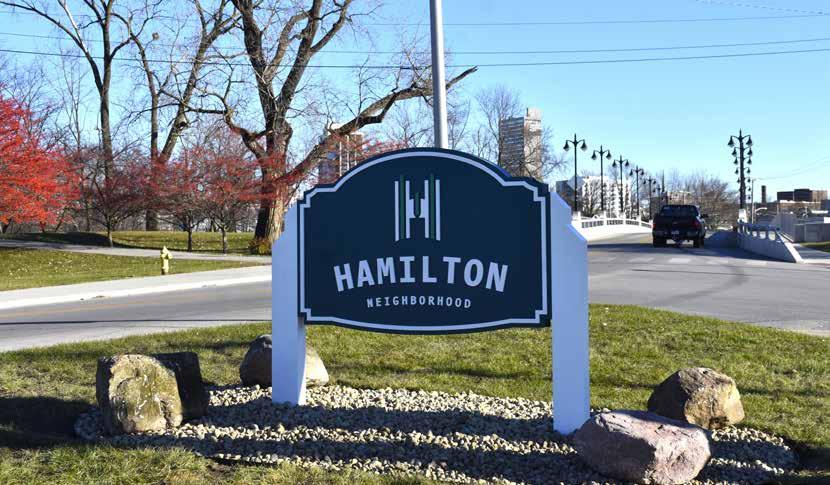
I am excited to unveil the Northwest 2035 Neighborhood Plan, a bold and comprehensive vision that underscores our commitment to enhancing the quality of life for all in Fort Wayne. Investing in our neighborhoods is not just a priority; it is fundamental to forging a safe, fun and family-friendly city. The Northwest 2035 plan combines the unique strengths and future potential of the Bloomingdale, Hamilton, Lincoln Park-Five Points, Nebraska, and North Highlands neighborhoods.
This plan is grounded in safety, connectivity, community, and growth that includes all residents and businesses. Through strategic investments in the neighborhood, Northwest 2035 cultivates a sense of belonging for all residents. By revitalizing commercial corridors, enhancing parks, strengthening local institutions, and improving neighborhood infrastructure, we are creating a vibrant community where people can come together, share resources, and celebrate the distinctive character of Northwest Fort Wayne.
My heartfelt thanks go to the residents, businesses, and community partners whose time and vision have helped shape this plan. Your dedication has created a robust roadmap for a safer, stronger, and more connected Northwest Fort Wayne. Together, we are leading the way for Fort Wayne, where every resident can enjoy an enhanced quality of life and a future filled with opportunity.
The Northwest 2035 Plan is an exciting collaboration between Bloomingdale, Nebraska, Hamilton, Lincoln Park-Five Points, and North Highlands Neighborhoods to evaluate their shared pasts and look to a focused future. This neighborhood and resident-driven plan looks to provide a framework of what the next decade of commitment and investment will look like for this area, while ensuring focused attention to current assets and the potential to take advantage of new opportunities with continued development in this area.
As the Councilpersons for the Northwest area, we applaud the neighborhood leadership who worked diligently with the team from the City of Fort Wayne’s Department of Neighborhoods and all residents who participate and shared their beliefs on what is going to be next for this area. Our neighborhoods are always strongest when they work together.
As implementation begins, we are excited to see the ongoing work and investment that will occur within one of Fort Wayne’s strongest areas.
NATHAN HARTMAN DISTRICT 3 COUNCILMAN
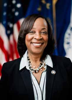
SHARON TUCKER MAYOR OF FORT WAYNE
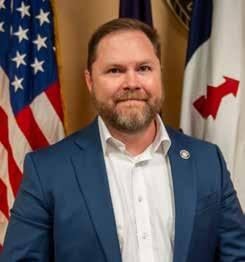
GEOFF PADDOCK DISTRICT 5 COUNCILMAN
NORTHWEST 2035 ACKNOWLEDGEMENTS
Many people, organizations, and businesses throughout the Northwest area and the City of Fort Wayne have given time and expertise to create this multi-phase neighborhood plan.
City of Fort Wayne Elected Officials
Sharon Tucker | Mayor
Paul Ensley | 1st District Councilman
Russ Jehl | 2nd District Councilman
Nathan Hartman | 3rd District Councilman
Dr. Scott Meyers | 4th District Councilman
Geoff Paddock | 5th District Councilman
Rohli Booker | 6th District Councilman
Martin Bender | At Large Councilman
Michelle Chambers | At Large Councilwoman
Tom Freistroffer | At Large Councilman
Northwest Committee Members
Travis Barman | Hamilton
Austin Brenneman | North Highlands
Alex Harkins | Nebraska
Branda Roos Holse | Hamilton
Susan Igney | Hamilton
Linsdey Keller | North Highlands
Amanda Foltz-Roos | North Highlands
Nathan Shall | Bloomingdale
Patricia Shelton | Lincoln Park-Five Points
Danny Wachle | Nebraska
Chris Walker | Bloomingdale
Vanessa Wyss | Bloomingdale
City of Fort Wayne Department of Neighborhoods
Dan Baisden | Director
Réna Bradley | Neghborhood Planner
Kevin Cobb | Neighborhood Engagement Planner
Megan Grable | Neighborhood Planner
Holly Muñoz | Neighborhood Resource and Engagement Planner
Dr. Andrea Robinson | Economic Development Director
Pat Roller | City Controller
Ben Roussel | Department of Planning Services Director
Michelle Rupright | Public Works
Nathan Schall | Department of Planning Services
Chad Shaw | Parks & Recreation
Creager Smith | Historic Preservation
Michelle Wood | Department of Planning Services
Derek Veit | Forestry Operations
Patrick Zaharako | Public Works
Portions of Northwest 2035 made responsible and transparent use of Artificial Intelligence (AI) tools to support specific aspects of the research and writing process. AI was employed to assist with language refinement, summarization of data findings. At no point did AI replace the author’s own critical analysis, original ideas, or ethical reflections; rather, AI outputs were carefully reviewed, verified, and contextualized within the broader research conducted in the planning process. The limitations and potential biases inherit in AI-generated content were acknowledged, and extra measures were taken to crosscheck accuracy against reliable sources.
We greatly appreciate the residents, businesses, community organizations, and other stakeholders who provided their insights, thoughts, and feedback throughout the planning process.
KEY TERMS AND DEFINITIONS GLOSSARY
Absentee Landlord
A property owner who does not reside at or near the rental property and is often perceived as less engaged in its maintenance or neighborhood impact.
Adaptive Reuse
The process of reusing an existing building for a purpose other than what it was originally built or designed for.
Affordable Housing
Housing is considered affordable if a family pays no more than 30% of its household income on housing-related costs.
Age Cohort
A group of individuals of the same age or within a defined age range tracked over time for demographic analysis.
Beautification
The action or process of improving the appearance of a place.
Block Party
A neighborhood gathering, often held outdoors, designed to build community, celebrate local identity, and engage residents in informal ways.
Building Permits
A type of authorization granted by a government or regulatory body before construction or alteration of a building.
Census Tract
Geographic units used by the U.S. Census Bureau for statistical analysis. Census tracts typically contain 1,200 to 8,000 people and are subdivided into smaller block groups. They do not always align with neighborhood boundaries.
City Beautiful
A design movement from the 1890s to the early 1900s that used grand architecture and beautification to inspire civic pride, encourage moral behavior, and elevate the overall quality of urban life.
Code Violation
An infraction of local building or property maintenance codes, which include issues like unsafe structures, overgrown lots, or illegal occupancy.
Community-Based Organization
A nonprofit or grassroots organization rooted in a particular community, often providing services or advocacy on behalf of residents.
Community Engagement
The process of working with community members and stakeholders to inform, consult, involve, and empower them in the decision-making process.
Complete Street
A street designed and operated to enable safe use and support mobility for all users (cars, bikes, and pedestrians).
Cost Burdened
A household that spends 30% or more of its income on housing costs (including utilities).
Crime Prevention Through Environmental Design (CPTED)
A multidisciplinary approach to reducing criminal behavior by using urban design, maintenance, and social dynamics.
Curb Cuts
A small ramp built into the curb of a sidewalk to make it easier for people using strollers or wheelchairs to pass from the sidewalk to the road.
Deed Restriction
A written agreement in a property’s deed that limits how a property can be used. Demographic Shift
Demographic Shift
A significant change in the composition of a population, such as changes in race, ethnicity, age, or household income over time.
Disinvestment
The process by which public or private sector funding and attention is withdrawn from a neighborhood, often resulting in physical, economic, and social decline.
Economic Leakage
Refers to the flow of money out of a local economy due to spending on goods and services that are produced outside of that economy.
Facade Improvements
Renovations to the exterior of buildings—especially storefronts— to enhance appearance, usability, and appeal to customers and residents.
Flag Stops
A type of public transportation system where buses stop only when requested or people are present at bus stops.
Focus Group
A facilitated discussion with a small, diverse group of people to gather in-depth insights on specific topics or issues.
Food Desert
A census tract that meets both low-income and low-access criteria for healthy and affordable foods.
Green Infrastructure
Natural or nature-based systems (e.g., parks, green roofs, permeable pavement) that improve air and water quality, manage stormwater, and provide habitat for local animals and insects.
Greenspace
An area of grass, trees, or vegetation set aside for recreational or aesthetic purposes.
Health Disparity
A difference in health outcomes between groups, often due to social or economic inequality in defined places.
Health Outcomes
Measures used to assess the health of individuals or populations, such as rates of disease, life expectancy, or mental health indicators.
Highway Speculation
A period when proposed highways created uncertainty that discouraged investment in certain neighborhoods, even if the project was never completed.
Historic Preservation
Any activity that identifies, protects, rehabilitates, or enhances historic resources.
Housing Market Potential Study
A report that analyzes local housing trends and demand to guide future development decisions.
Impervious Surface
A surface (e.g., concrete, asphalt) that prevents water from absorbing into the ground.
Implementation Strategy
A detailed plan that outlines how a recommendation will be carried out, including timelines, responsible parties, and resource needs.
Infill
Adding new building(s) to underused or vacant lands in developed urban areas.
Interactive Mapping Tool
A digital platform that allows users to mark locations, provide input, or report concerns on a neighborhood map to help guide planning decisions.
Land Acknowledgement
A formal statement that recognizes and respects Indigenous Peoples as traditional stewards of the land.
Land Use
The current purpose of a property (e.g., residential, commercial, or agricultural).
Leisure Time Physical Activity
Any physical activity performed during free time that contributes to overall health and fitness (e.g., walking, sports, or recreational exercise).
Listening Tour
A structured engagement activity where officials or community leaders gather public input by visiting and speaking with residents directly, often door-to-door or at community events.
Median Household Income
The annual income earned by households that falls in the middle of a ranked list of all household incomes.
Mixed-Use
A lot or building that contains more than one use, for example, residential and commercial.
Mobile Health Clinic
A traveling healthcare service that provides basic medical care, screenings, or education to communities with limited access to permanent facilities.
Neighborhood Asset
Any feature—physical, social, or institutional—that contributes positively to the quality of life in a community (e.g., parks, community centers, schools).
Neighborhood Commercial Zoning
A zoning classification allowing small-scale commercial uses intended to serve local residential neighborhoods.
Neighborhood Planning Commitee
A group of residents and stakeholders organized to guide and inform the neighborhood planning process, helping ensure community-led decision-making.
Owner Occupied Housing
A home that is lived in by the person or household that owns the property.
Persistent Poverty
A U.S. Census designation for areas with poverty rates of 20% or higher for at least 30 consecutive years.
Place Based Health Improvement Plan
A coordinated strategy to improve health outcomes focused on the specific needs and conditions of a particular geographic area.
Planning Recommendation
A proposed strategy or action that addresses a specific challenge or opportunity identified through community input or data analysis
Plat
A plot of land divided to be owned or sold.
Population Density
The number of people living per unit of area (e.g., per square mile), often used to measure how urban or rural a neighborhood is.
Public Open House
An event where community members are invited to review and comment on plans, proposals, or updates in an informal setting.
Redlining
The discriminatory and now illegal practice of denying loans or insurance based on race or ethnicity.
Renter Occupied Housing
A home lived in by someone who pays a rental payment but does not own the property in which they are living.
Sanborn Insurance Maps
Historical maps used to determine risk associated with insuring properties, often used in practices like redlining.
Summit City Entrepreneur and Enterprise District (SEED)
A City of Fort Wayne program that promotes entrepreneurial initiatives focused on community, economic, and neighborhood development.
Snowball Sampling
A recruiting technique where participants refer other potential participants to a study or initiative.
Social Capital
The networks and relationships among people who live and work in a particular society and enable that society to function effectively.
Social Determinants of Health
The conditions in which people live, work, and age that influence health outcomes and quality of life.
Spot Zoning
The process of singling out a small parcel of land for a use classification different from the surrounding area.
Stakeholder
An individual, group, or organization that has an interest or concern in a particular issue, project, or outcome directly or indirectly impacted by neighborhood planning.
Streetcar Suburb
A residential community whose growth was strongly shaped by streetcar lines.
Survey Instrument
A formal tool used to collect data or feedback from community members, typically through structured questions.
Tax Increment Financing
A financial tool that uses additional property tax revenue generated by new development to fund public infrastructure or other community projects.
Traffic Calming
Tools and methods used to slow down traffic and make the street safer for all users.
Traffic Study
A study used to evaluate a transportation system’s functioning and needs.
Tree Canopy
A measurement of how much area is covered by tree leaves, branches, and stems when viewed from above.
Urban Core
The central area of a city, typically more densely populated and often the economic and cultural hub.
Urban Corridor Zoning
A zoning designation that supports mixed-use, pedestrianoriented development along major urban streets.
Urban Heat Island
The overheating of urban spaces due to heat retention in buildings and paved surfaces.
Vacant Lot
A parcel of land with no existing structure, often resulting from previous demolition and awaiting redevelopment or reuse.
Walkability
The ability to walk to services and destinations within a reasonable distance—often considered a 30-minute or shorter walk.
Wayfinding
Informational signage placed in public areas to help people navigate and identify key locations within a neighborhood or city.
Zoning
Laws that regulate how land can be used (e.g., residential, commercial) and the standards associated with each use.
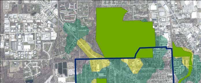
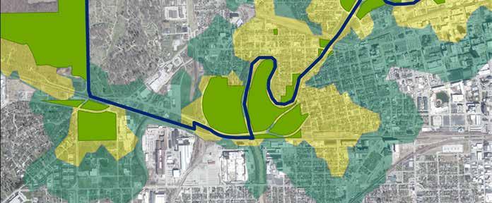
WHAT IS NORTHWEST 2035
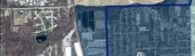
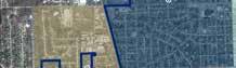
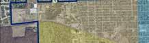
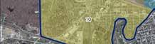
The Northwest 2035 Neighborhood Plan is a comprehensive neighborhood planning initiative that unites Bloomingdale, Hamilton, Lincoln Park Five Points, Nebraska, and North Highlands neighborhoods under a shared vision for growth, investment and revitalization. This plan leverages the unique histories and strengths of each neighborhood while addressing common challenges and opportunities for the next decade. Grounded in community input and shaped by resident priorities, Northwest 2035 provides actionable strategies to support safe, connected, and vibrant neighborhoods where every resident has the ability to thrive.
This plan is designed to:
• Engage residents, stakeholders, and community partners in identifying priorities, challenges, and opportunities for the future of the Northwest Neighborhoods.
• Establish a unified, community-driven vision that promotes neighborhood revitalization, safety, neighborhood institutions, economic development, and high-quality public spaces.
• Highlight and celebrate the cultural and historic assets of each neighborhood, fostering a strong sense of identity and community pride.
• Define clear goals and implementation of strategies that guide development, public investment, design improvements, and program initiatives across all five neighborhoods.
• Provide guidance to the Northwest 2035 Planning Area Neighborhoods, the City of Fort Wayne, decision-makers, public agencies, developers, investors, for-profit corporations, and nonprofit corporations
WHO DOES IT INCLUDE
• The Bloomingdale, Hamilton, Lincoln Park Five Points, Nebraska, and North Highlands neighborhoods
• Residents and community leaders
• City of Fort Wayne Staff and Departments
• Local institutional and educational partners
• Faith-based organizations and non-profits
• Local businesses, investors, and developers
WHAT DOES IT INCLUDE
• Planning Framework (principles, organization, process, and timeline)
The following principles form the foundation of Northwest 2035 and establish a clear and compelling framework to drive the united long-term vision, strategies, and priorities for Bloomingdale, Hamilton, Lincoln Park Five Points, Nebraska, and North Highlands neighborhoods. Grounded in community input, these principles are a call to action, addressing the current challenges while embracing long-term opportunities, shaping a stronger, more connected, and more resilient future for all residents.
Safe & Resilient Neighborhoods
Northwest 2035 emphasizes proactive investment in environmental design and community partnerships to ensure every street, park, and gathering space is a place where residents can walk freely, children can play safely, and families can live with peace of mind.
Improved Connectivity
Northwest 2035 puts people first by prioritizing infrastructure that makes it easy and safe to move throughout the community. By investing in walkable corridors, safer intersections, and accessible transit, the plan doesn’t just link parks, schools, and businesses—it links people to each other and to the heart of Fort Wayne.
Strong Community Anchors & Institutions
Northwest 2035 focuses on revitalizing commercial corridors, parks, and civic spaces to create vibrant hubs of activity. When local businesses flourish, parks come to life, and institutions open their doors, the entire community benefits. These anchors aren’t just physical spaces—they’re the heartbeat of a thriving, connected neighborhood.
Inclusive Growth
Northwest 2035 recognizes that the character and culture of a neighborhood are its greatest assets. That’s why the plan is committed to inclusive growth that respects what makes each area unique while balancing growth by expanding housing options, supporting affordability, and ensuring that long-term residents can benefit from investment, development, preservation, and placemaking.
HOW TO USE THIS PLAN
Who Is This Plan For?
The Northwest 2035 Neighborhood Plan is a guiding document developed to support coordinated action and investment in the neighborhoods just northwest of downtown Fort Wayne. This plan reflects a shared community vision informed by the diverse histories and experiences of the five neighborhoods. For the first time, these neighborhoods are uniting under a single framework to address the common challenges and leverage opportunities for collective growth.
The plan is intended for use by neighborhood associations, City of Fort Wayne departments, Allen County departments, nonprofit and for-profit partners, developers, residents, business owners, and other stakeholders whose decisions impact the future of the Northwest Neighborhoods. It provides direction for projects and initiatives that can be led or supported to move the area forward as a well connected and thriving community.
What Is the Framework?
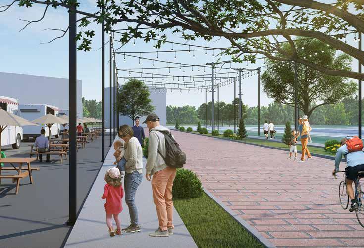
This Plan provides a practical, action-oriented framework to guide neighborhood growth and revitalization across the Northwest area. The neighborhoods are working together to elevate neighborhood identity through public art, signage, and historic preservation. The plan also prioritizes safe, accessible connections and vibrant public spaces. It includes strategies to close sidewalk gaps, improve bike infrastructure, and create safer routes to parks, schools, and businesses. Investments in housing, commercial corridors, and public safety aim to strengthen economic opportunity and foster a sense of security, while expanded recreation options and community programming encourage active, connected neighborhoods. The plan is a living document, designed to evolve alongside the changing needs of the neighborhoods, serving as a foundation for both immediate action and long-term vision.
Why Are There So Many Graphics?
The maps, diagrams, illustrations, and photos included in Northwest 2035 serve as visual tools to communicate key themes and ideas that emerged from the planning process. These visuals help simplify complex information, reflect the voices of the residents who provided input in the planning process, and highlight shared priorities. While they do not guarantee a specific outcome, they provide a visual framework that guides decision-making and inspires future projects. The success of this plan relies on continued collaboration, strategic investment, and the ongoing commitment of neighborhood partners.
Why Do We Need A Plan?
A neighborhood plan is an essential tool that allows neighborhoods come together and shape the future of their community. For the five Northwest Fort Wayne neighborhoods, this plan is the first time that all five neighborhoods are united in a single shared vision. Residents, businesses, and local institutions now have a coordinated platform to identify shared goals and outline strategies for achieving them.
Unlike citywide comprehensive plans, neighborhood plans focus on the specific needs and opportunities of each area, offering detailed recommendations tailored to local priorities. Northwest 2035 is the first time that Hamilton, Lincoln Park Five Points, and North Highlands will have an active plan to address critical issues like safety, connectivity, and housing. While Bloomingdale and Nebraska had existing plans, they were completed nearly two decades ago, and both neighborhoods have seen seen significant changes, making many of the data and recommendations from the previous plans obsolete. By aligning efforts and amplifying each neighborhood’s strengths, Northwest 2035 lays the groundwork for thoughtful and sustainable growth that benefits everyone.
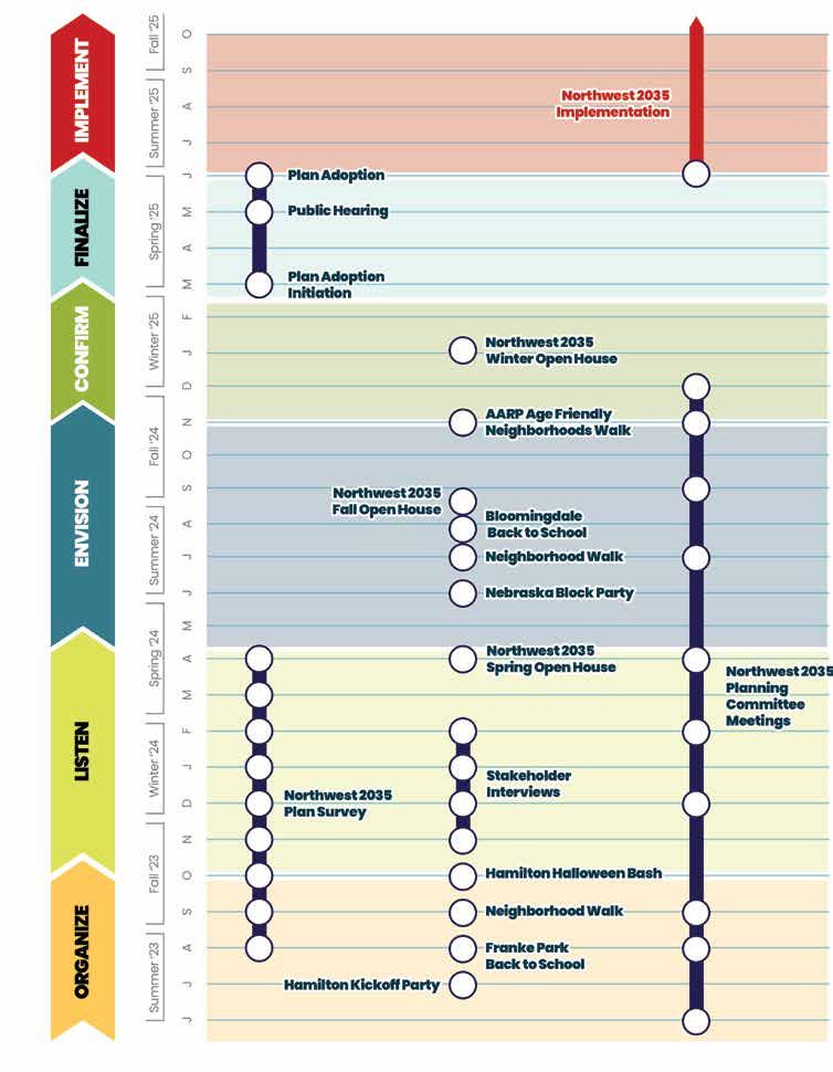
THE PLANNING PROCESS
Effective neighborhood planning is rooted in genuine and widespread community engagement. The Northwest 2035 Neighborhood Plan was developed through a comprehensive outreach strategy that reached over 750 residents through multiple efforts, ensuring that voices from every corner of the community were heard and part of the process in shaping recommendations. Engagement efforts included several hundred completed surveys in-person and online, open house events, one-on-one interviews with neighborhood stakeholders, as well as a variety of creative outreach strategies such as the Bloomingdale’s Trunk or Treat event at Headwaters Church, the Hamilton Halloween Bash, and the Northwest Neighborhoods Chili Cookoff that brought neighbors together to share their vision for the area.
Special attention was given to reconnecting and gathering input from residents in the Hamilton, Nebraska and Lincoln Park Five Points neighborhoods through targeted efforts to support the relaunch of these associations. In addition, outreach was conducted in partnership with local elementary schools to gather important insights from parents. This inclusive approach ensured that the planning process was not only driven by data but also by the lived experiences, aspirations, and concerns of the people who call the Northwest Neighborhoods home.
The following section provides an overview of key engagement activities and a summary of the primary findings that emerged throughout the community engagement process from 2023 to 2025.
Northwest 2035 Survey
To ensure that the Northwest 2035 Neighborhood Plan aligns with the community’s priorities and reflects the diverse perspectives of residents and business owners, an extensive outreach strategy was implemented, combining both traditional and digital engagement methods. Paper and digital surveys, available in both English and Spanish, were distributed widely through neighborhood events, door-to-door canvassing, parent-teacher nights, and back-to-school gatherings. Online submissions were also actively promoted through social media channels and neighborhood association websites, resulting in nearly 500 of the more than 700 total responses received.
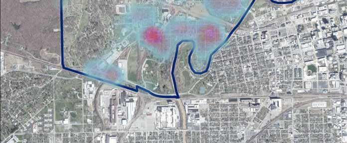
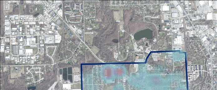
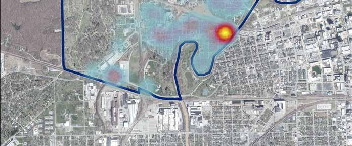
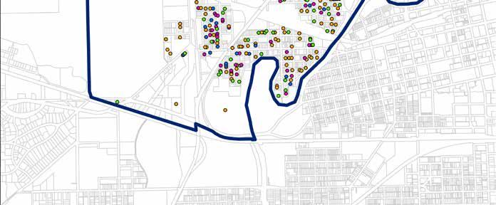
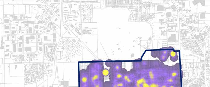
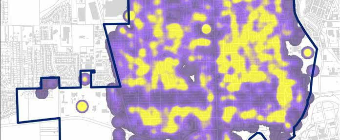
Residents were invited to complete a 25-question survey tailored to address the unique needs and challenges of each neighborhood. Additionally, participants were encouraged to utilize an interactive online mapping tool to pinpoint specific locations where they would like to see improvements, providing valuable spatial data to inform the planning process.
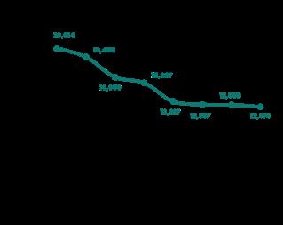
To centralize engagement efforts and maximize accessibility, the City launched TheNorthwestPlan. com, a dedicated project website that served as the
primary hub for project updates, event announcements, and interactive tools. Since its launch in Fall 2023, the website has attracted over 2,300 visits, underscoring the community’s vested interest in shaping the future of the Northwest Neighborhoods.
Input gathered through these extensive outreach efforts revealed clear and consistent themes, establishing a strong foundation for identifying key priorities and strategies that will guide the implementation of the Northwest 2035 Neighborhood Plan.
Key Neighborhood Priorities
Based on survey responses, several key priorities were identified, many of which are similar to results from other engagement efforts:
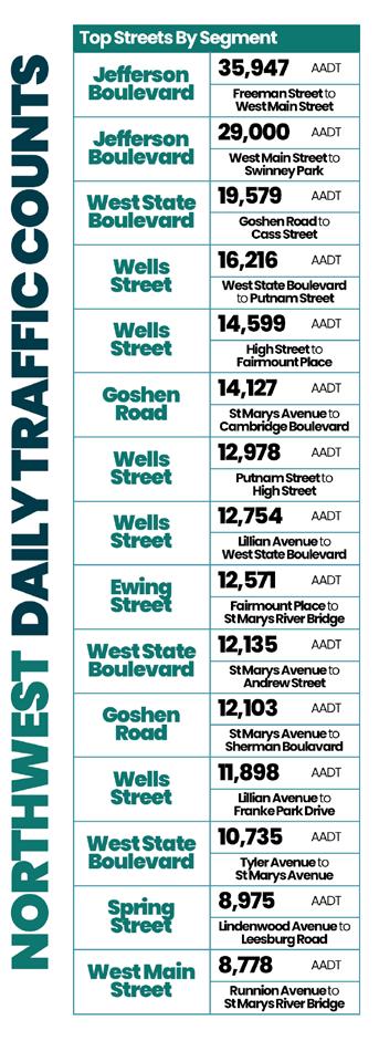
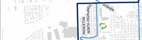
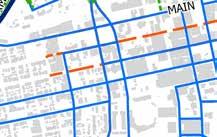
Corridor Improvements:
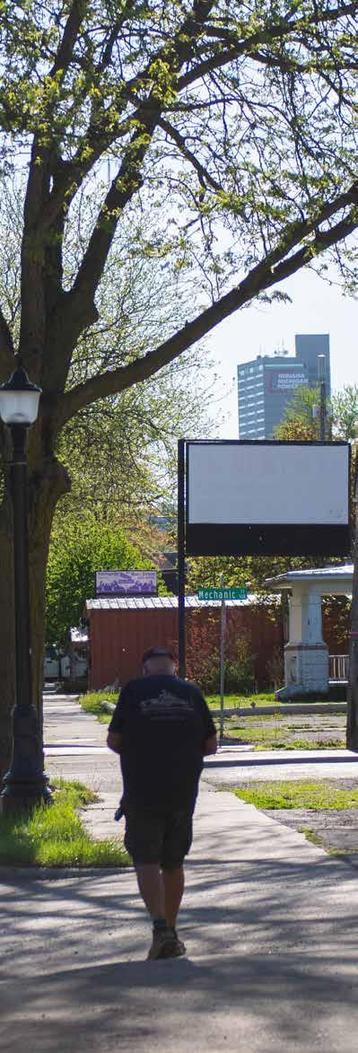
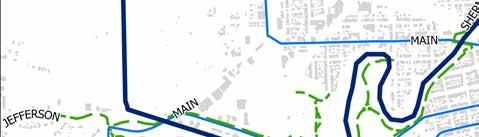
Residents emphasized the importance of enhancing key commercial corridors like Wells Street, Main Street, Goshen Road, and State Boulevard to create more vibrant and walkable districts. Improvements to sidewalks, street lighting, and building facades were identified as essential to attracting new businesses and reinforcing neighborhood identity.
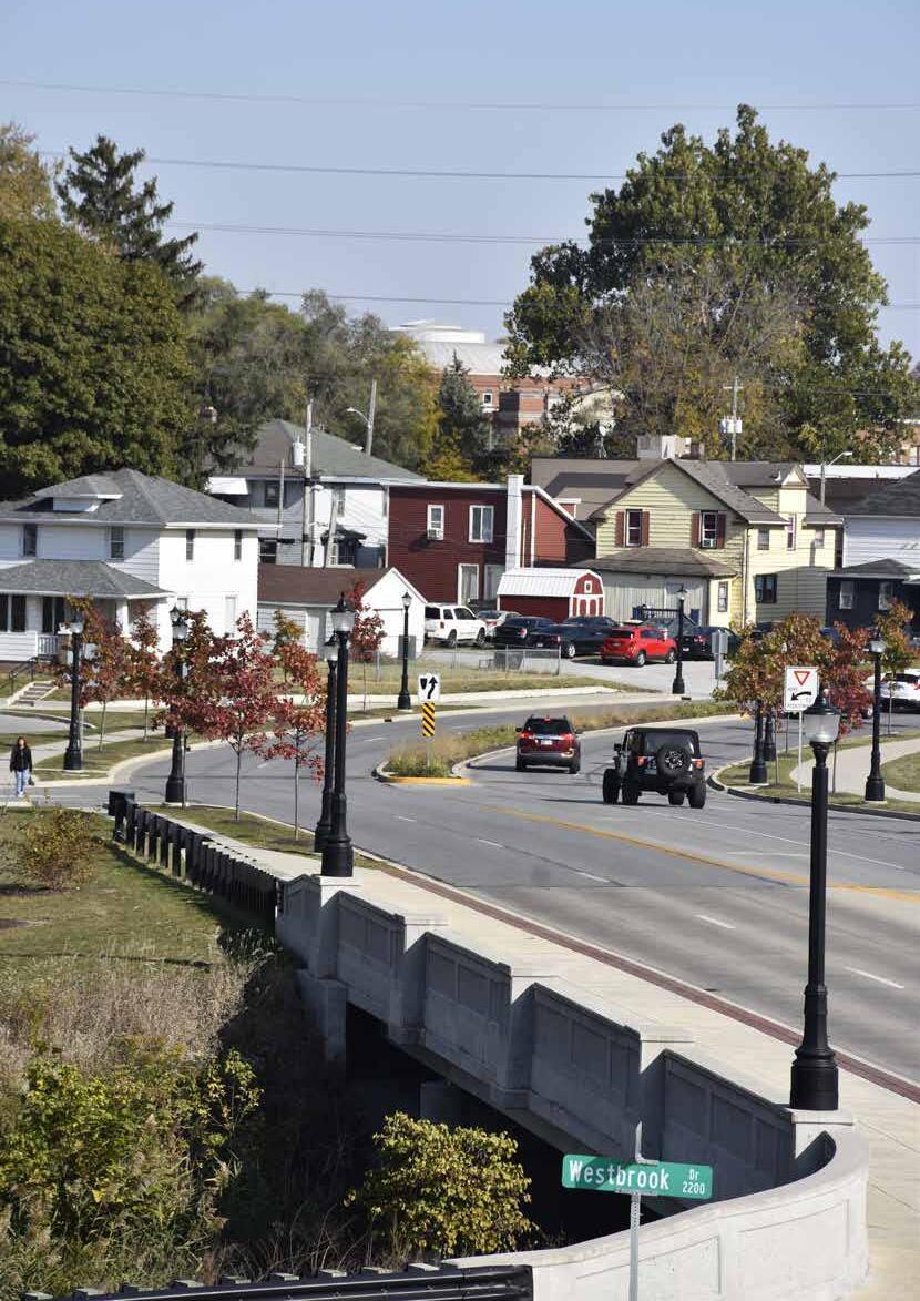
Streets and Infrastructure:
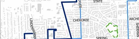
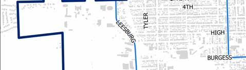
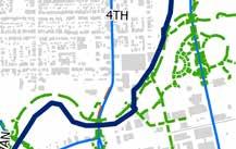
Safer, more accessible sidewalks and pedestrian infrastructure are a top priority for residents, particularly along 4th Street and Harrison Streets in Bloomingdale, Main Street and Runnion Avenue in Nebraska, and Sherman Boulevard. Upgrading sidewalks, improving pedestrian crossings, and implementing traffic-calming measures are critical to connecting people to parks, schools, and commercial areas.
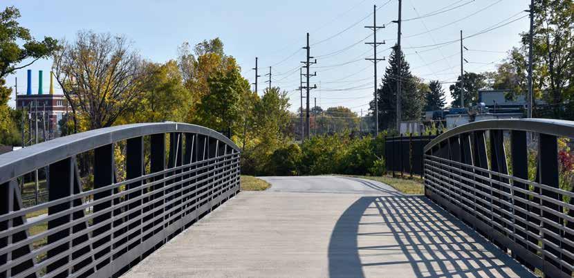
Parks and Public Spaces:
Residents strongly supported improving neighborhood parks and public spaces. Adding more seating areas, creating shaded gathering spots, and connecting parks with well-lit pedestrian paths emerged as key strategies for promoting community interaction and safe outdoor spaces.
Neighborhood Oriented Development:
Residents prioritized infill development that brings affordable housing, small businesses, and mixeduse spaces to underutilized sites. Community-driven projects that align with local needs and maintain neighborhood character are seen as vital to building a resilient and economically vibrant Northwest Fort Wayne.
Stakeholder Interviews
To gather diverse and in-depth insights directly from those most familiar with the Northwest Neighborhoods, the City of Fort Wayne’s Department of Neighborhoods conducted over 100 one-on-one stakeholder interviews in 2023 and 2024. Each hour-long session began with a series of core questions, including (1) what is an important asset or defining feature of your neighborhood, (2) what brought you to the area, (3) what opportunities do you see for neighborhood growth and improvement, and (4) what specific issues should the Northwest 2035 NeighborhoodPlan address. Interviewees were also given ample time to ask additional questions and share input beyond the core questions. To ensure a broad range of perspectives, each participant was asked to recommend additional stakeholders to be included in the interview process, further expanding the network of residents who are shaping the recommendations in the plan.
Similar to the hundreds of survey responses collected, the feedback obtained from these interviews directly informed the key priorities highlighted throughout the Northwest 2035 Neighborhood Plan.
Hamilton Halloween Bash
Dan Baisden, City of Fort Wayne
Key Stakeholder Priorities
Based on stakeholder input, several key priorities, much of them overlapping with previous input, were identified from the stakeholder interviews:
Safety and Crime Prevention:
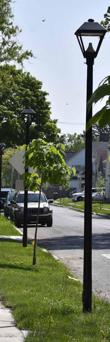
Residents emphasized the need for safety improvements to parks, especially Hamilton Park. In addition, improved street lighting was identified as a critical strategy for enhancing safety in neighborhood residential areas, ensuring that residents feel secure when walking their neighborhood after dark.
Neighborhood Connectivity and Walkability:
Enhancing pedestrian infrastructure emerged as a key priority for residents based on the one-on-one interviews, particularly in Lincoln Park Five Points and Hamilton neighborhoods. Many interviews shared in common the need for improved connections between parks and residential areas, especially Gren Park which needs to be connected to surrounding streets. Also highlighted was the need for safer and more accessible pedestrian crossings to improve connectivity between residents and neighborhood assets.
Community Gathering Spaces and Amenities:
Many residents expressed strong support for creating more walkable, community-oriented gathering spaces. Adding seating, trails, and shaded areas in parks were identified as key opportunities to promote interaction in public spaces. Additionally, there was a desire for small third spaces, like coffee shops, pubs, and diners, as they were seen as an important way to build a connected neighborhood.
Redevelopment and Economic Development:
Residents are concerned about both the existing underutilized commercial properties, as well as the impact of new Riverfront development encroaching into the neighborhood. Gateway Plaza on Goshen Road and the large vacant parcel on West State were mentioned numerous times as areas that should be considered for revitalization, while concerns about balancing economic growth with neighborhood character emerged as a top priority for projects near the Riverfront.
Neighborhood Walks
The City’s Department of Neighborhoods conducted walks in 2023 and 2024, engaging with residents directly in the Bloomingdale, Hamilton, Lincoln Park Five Points,
Northwest Neighborhoods Chili Cookoff Kevin Cobb, City of Fort Wayne
Nebraska, and North Highlands neighborhoods. These walks provided valuable insights into neighborhood conditions and facilitated direct interaction with residents who live in the neighborhood.
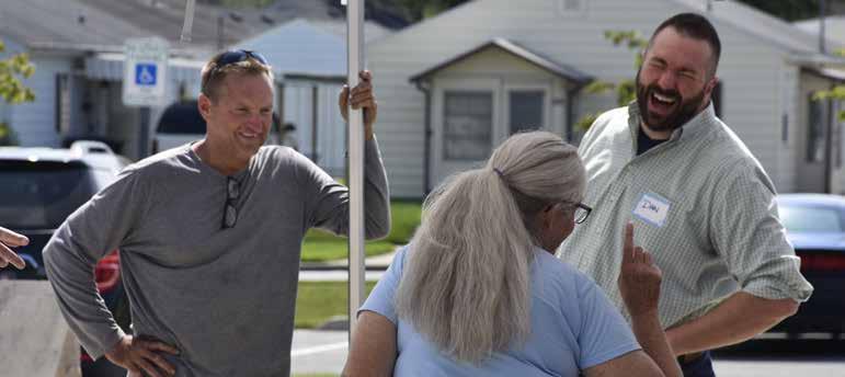
High-profile walks, including one with the late Mayor Tom Henry and Councilman Geoff Paddock in the Hamilton Neighborhood, and another with Mayor Sharon Tucker in the North Highlands Neighborhood further underscored the commitment from the City to engage with the community on the ground. These walks not only highlighted key neighborhood assets but also brought attention to critical areas in need of intervention. An additional walk was conducted with AARP of Indiana and several professional planners to conduct a walking audit of the Bloomingdale Neighborhood in Fall 2024. This walk showcased the changing conditions of the neighborhood, existing walking routes, and considered ways in which the neighborhood could improve quality of life for residents of all ages, especially those looking to age in place.
Key Recommendations from Neighborhood Walks
Street Lighting:
Insufficient lighting was observed in several areas, underscoring the need for targeted lighting improvements to enhance visibility and reduce crime.
Infrastructure and Connectivity:
Sidewalks in critical corridors require repair and expansion to ensure safe pedestrian access to parks, schools, and commercial areas.
Property Maintenance:
Vacant and deteriorating properties detract from neighborhood character. Strategies to incentivize property improvements and activate vacant spaces are essential for revitalization.
Neighborhood Amenities:
Residents expressed gratitude for the number of parks spaces in the neighborhood but expressed frustration that there was little to no regular programming, especially for neighborhood youth.
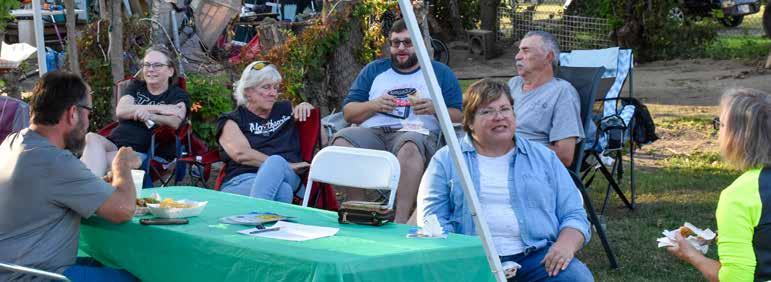
Neighborhood Block Parties
The City’s Department of Neighborhoods hosted and participated in multiple neighborhood block parties over the two-year engagement period, creating informal opportunities to connect with residents and gather input for the Northwest 2035 neighborhood plan. Events were held in the Hamilton Neighborhood starting with a kick-off event on July 18, 2023, at David Hafner Pavilion in Franklin School Park. Additional neighborhood events were held with the Hamilton Halloween Bash on October 7, 2023, and the Nebraska Block Party on June 26, 2024. Additionally, neighborhood leaders hosted their own block parties, gathering input from residents in Bloomingdale and North Highlands throughout 2023 and 2024.
Northwest 2035 Open House Events
Open house events were a central component of the community engagement strategy throughout the
Hamilton Block party
John Felts, City of Fort Wayne
Northwest 2035 planning process, providing residents with opportunities to share their experiences and shape the plan’s direction.
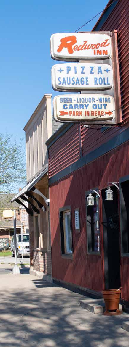
The first open house was held on April 25, 2024, at the David Hefner Pavilion in Franklin School Park, drawing over 75 attendees. Residents were invited to place flags on a neighborhood map identifying their favorite places and to write “love letters” and “breakup letters” to the neighborhood, highlighting what they love about the area and what frustrates them. A second round of open houses in Fall 2024 provided opportunities for residents to review potential recommendations and contribute suggestions directly on interactive maps. Events were hosted at key community locations, including the University of Saint Francis (August 12), Allen County Public Library Little Turtle Branch (August 13), Hop River Brewery (August 16), and Redwood Inn (August 21), ensuring broad access and participation.
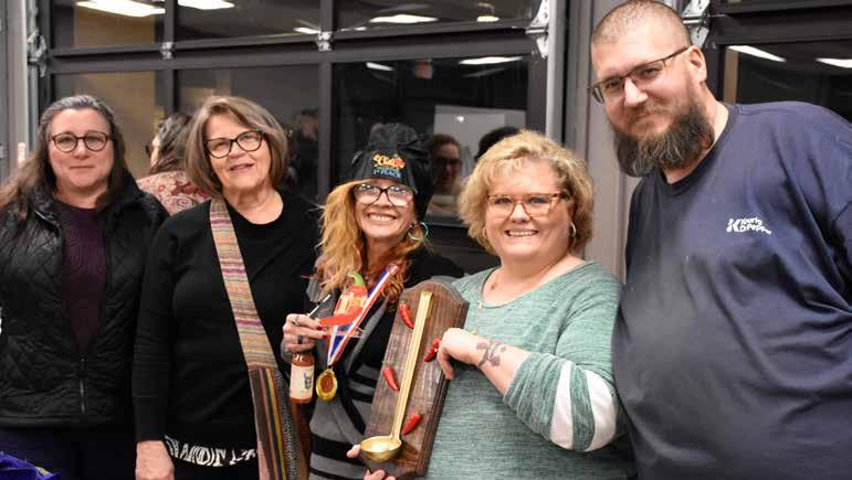
The final open house event, held on January 23, 2025, brought residents together for the first-ever Northwest Neighborhoods Chili Cookoff at the David Hefner Pavilion. Over 100 attendees sampled neighborhood chili recipes while reviewing proposed plan recommendations and providing final input. All five neighborhoods were represented, making the event a successful capstone to the planning process.
Key Recommendations from Open House events
Development:
Residents overwhelmingly prioritized improvements to key commercial corridors like Wells Street, West Main Street, Goshen Road, and State Boulevard to strengthen neighborhood identity and attract investment. Residents suggested promoting business facade improvements, installing benches, installing public art, and encouraging local businesses to accept EBT/SNAP to improve food access.
Parks and Greenspace:
Improving neighborhood parks, especially Gren Park, Hamilton Park, and Swinney Park, was a key focus. Recommendations included adding amenities, increasing accessibility, expanding the tree canopy, and adding dog-friendly amenities. Another important recommendation included enhancing pedestrian and bike connectivity to parks to ensure safe and accessible routes for all residents.
Safety and Infrastructure:
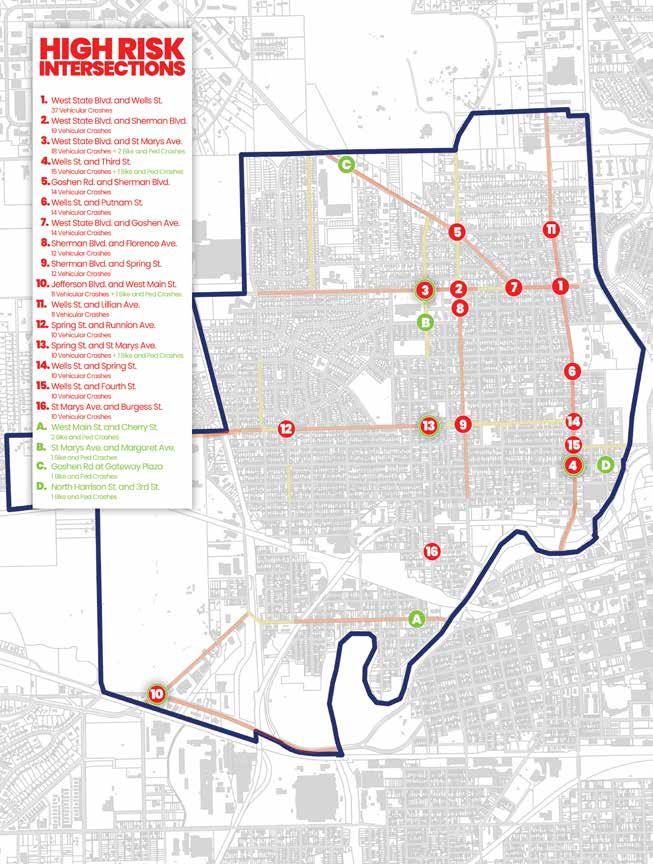
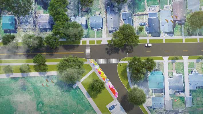
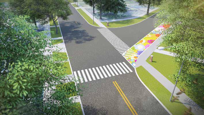
Residents prioritized safety improvements through improved pedestrian connectivity, especially around parks and schools, as well as increasing pedestrianlevel street lighting, and implementing traffic calming. Many of the residents have noticed the recent improvements to High Street with the Crime Prevention through Environmental Design (CPTED) Pilot Project and would like to see this expanded to other areas in the neighborhood. In addition to improving sidewalks, converting select yield signs to stop signs, and addressing alley and road conditions were also highlighted to promote a safer neighborhood.
History and Identity:
Many of the recommendations were to implement strategies that highlight significant local assets and create a stronger sense of place. Install heritage markers at key sites such as Swinney Park, the Lincoln Highway, Camp Allen, and the Feeder Canal to celebrate the area’s rich history and connect residents and visitors to its unique heritage. Additionally, there was a desire to identify and designate historic properties, preserve the architectural design of the neighborhoods, and integrate murals and public art that reflects local stories and cultural themes, especially along the neighborhoods many corridors.
Bloomingdale Taco Bout It Michael Terronez, City of Fort Wayne
HISTORY OF NORTHWEST
HISTORY OF NORTHWEST
Writen By: Connie Haas Zuber, Local Historian, Fort Wayne & Nate Lefever and Creager Smith, Historic Preservation, City of Fort Wayne
Edited By: Logan York, kaakiihstaakia/ Tribal Historic Preservation Officer, Miami Tribe of Oklahoma
The Very Early Years
Roughly 12,000 years ago, many areas of Fort Wayne were covered by Glacial Lake Maumee. The giant lake was created as the last glacier to cover this area retreated, melted, and formed Lake Erie. These areas also include parts of the Fort Wayne Moraine, the ridge of soil and rocks the glacier pushed that formed a wall that held back the lake waters. Around what is now the confluence of our three rivers, the Moraine was overtopped and failed, releasing an unthinkably huge torrent of icy water west toward what is now Huntington.
The resulting outflow channel was wide, and maps show the breach in the Moraine stretching from a southern edge along what is now the East Wayne/ East Berry corridor to its northern edge almost out to North Side High School. The outflow channel was also long, stretching west past the Eagle Marsh area to Huntington and the Wabash River. The glaciers and outflow left a continental divide that canal surveyors measured, giving Fort Wayne its nickname of Summit City. Drainage from the Lake formed today’s St. Mary’s and St. Joseph Rivers and, at the point of their confluence, they formed the Maumee River.
The Northwest Neighborhoods’ close proximity to the drainage rivers made the area an important location in the history of transportation in the Great Lakes and Midwest regions. Animals and people
Myaamia is the correct spelling of the “Miami,” although often referred to this way, including in our local middle school.
Kiihkayonki is often, even in the City seal, misspelled as Kekionga, and that it is often mistakenly attributed to mean “blackberry patch.” This is according to experts and language speakers at the Myaamia Center at Miami University.
Map of Kekionga, 1790
ARCH Inc. Fort Wayne
came here to live as the ice retreated, as they followed the ice toward livable land everywhere on the continent. People camped and settled along the rivers for access to water, transportation, and food for hunting. The archaeological evidence of precontact and European cities in the area is undiscovered, which is not surprising, given that the city of Fort Wayne was built up over any sites before archaeology became a scientific discipline. When Indiana’s founding scientific archaeologist Dr. Glenn A. Black did his Allen County Archaeological Survey in 1936, he identified sites mostly outside the city limits. His work confirmed that prehistoric and historically familiar native American peoples lived in the county.
The Myaamia people had been in residence here since early in their history as a people with what became their largest and best-known settlement called Kiihkayonki. Kiihkayonki, on the north bank of the Maumee River and east of the St. Joseph River from the Neighborhoods, was the heart of a cluster of native settlements at the three rivers and in this area during historical times. The area was the home of native peoples in agrarian permanent villages for 1,000 years before European contact.
La Balmes Raid
In 1780, French officer Augustin de La Balme led a raid on the Myaamia town of Kiihkayonki, seizing British supplies and briefly occupying the settlement under the French flag. La Balme left a small detachment to guard the captured supplies in Kiihkayonki, and marched his main force toward the Eel River. La Balme was ambushed on November 5, 1780, by Myaamia warriors led by Little Turtle. The Myaamia surrounded and overwhelmed the French-led troops, killing most of them—including La Balme—and dismantling the expedition in a swift and decisive defeat.
Clark’s Invasion
George Rogers Clark’s campaigns in the area referred to as the Northwest during the late 1770s and 1780s aimed to weaken British influence and secure American claims to the region, resulting in key victories for the Americans such as the capture of Fort Sackville. Though Clark achieved early victories, in 1786, Clark was ordered to lead an expedition to capture the Myaamia village of Kiihkayonki. As the troops faced severe supply shortages and a mutiny broke out, Clark abandoned the campaign and retreated.
St. Clair’s Defeat / The Battle of the Wabash
In 1791, U.S. Governor Arthur St. Clair led a military campaign to assert control over Kiihkayonki, advancing from Fort Washington to the Wabash River near Myaamia villages. On November 4, Native forces led by Little Turtle, Blue Jacket, and Buckongahelas decisively defeated St. Clair’s army in what became the most devastating loss in U.S. military history to Native American forces.
During the era of contact with Europeans, which began in the late 1600s, French missionaries, soldiers, and fur trappers were the first Europeans to be active in the area. The portage between the Maumee River and the Little River in southwest Allen County (which leads to the Wabash and on to the Mississippi) created by the glacial torrent was a key link for the French between their North American footholds in Quebec and Louisiana. Once the French, who ceded their control of this area to the British after a war, and then the British, who lost the Revolutionary War to the American colonists, ceded their control, the Americans invaded and claimed the lands previously occupied by the Northwest Confederacy. In 1790, when American troops invaded Kiihkayonki, it was a large and cosmopolitan native city with many hundreds if not thousands of residents, well supplied with crops from its fertile fields along the rivers and at the center of a network of communication links.
The portage was owned by the Myaamia people, specifically one person named Tacumwah.
Northwest Confederacy is often incorrectly referred to as the “Miami Confederacy,” because these were Miami homelands, but other tribes were also in the area. The Confederacy was co-led by Little Turtle (Mihšihkinaahkwa), Blue Jacket, and Buckongehelas. It is referred to as “Taawaawa siipiiwi alliance” by the Myaamia today.
In 1790, Kiihkayonki was attacked by U.S. Gen. Josiah Harmar, who sent four companies into battle only to be decisively beaten by the natives led by Little Turtle. The surviving Americans, who lost 183 soldiers that day, retreated as they had attacked, through the forest on the southern banks of the Maumee River.
The outcome four years later was very different. Gen. Anthony Wayne had won the Battle of Fallen Timbers near Maumee, Ohio, and he marched his troops toward Kiihkayonki but chose the higher land south of the Maumee River to build a fort. Kiihkayonki still existed across the rivers. He dedicated
the first Fort Wayne, which was built at what is now the corner of Clay and Berry Streets, purposely on the fourth anniversary of Harmar’s defeat, well aware of the symbolism of the date and its location across the river from Kiihkayonki. The battle of Fallen Timbers was waged, this one with roughly 500 Native troops and 2,000 American troops present. 84 men died, 44 of whom were Americans. The British troops, which had previously supported and promised to support the Native troops, locked the retreating Native troops out of the British fort. When the Northwest Confederacy realized that they no longer had British support against the invading American troops, they concluded that they could not win the war and the confederacy broke. Later, the Myaamia surrendered at the Treaty of Greenville.
The second and third Forts Wayne, built to replace the hastily built and decaying original, in the area of what is now Old Fort Park, directly next to current Fire Station 1. Roughly four square miles were cleared around the 1815 Fort. The clearing provided a striking view of the beautiful and promising place the Americans had won control of after the Native peoples had fought for nearly 200 years to protect their homeland from the invasion and wars following the arrival of the French, the British, and finally the Americans. The final 1815 Fort was decommissioned in 1819.
Becoming Fort Wayne and the Beginnings of the Northwest Neighborhoods
The process of change from a Native village to a military outpost to a city began slowly, given the location’s isolation and distant connections to even the nearest European settlements. The wheels of change began to spin in the 1820s and accelerated in the 1830s. Federal regulations that made land sales possible had been established, and Allen County was created in 1823, the same year land was bought and platted as the Original Plat of Fort Wayne. Plats define streets, alleys, and lots on undeveloped land as a necessary first step to selling and building on it.
Canals
By 1825, after being home to thousands of people as a Native settlement, Fort Wayne had not quite 200 permanent White residents. As Americans moved into the Fort Wayne area, it was inevitable that plans would be made to improve the natural
transportation routes. Their first civic interest was the Wabash-Erie Canal, which would run along the south bank of the Maumee River. After several years of discussion, politicking and arranging of finances, construction began in 1832.
The former land surveyor George Washington, a promoter of canals in his home state of Virginia, was among the first to suggest the exploration of the portage route. In 1784 Washington recommended that Congress begin studying rivers “as far westwardly as the Miamies (Maumee), running into the Ohio and Lake Erie...to see how the waters of these communicate with the river St. Joseph... and with the Wabash.” After Indiana’s statehood in 1816, the period until 1832 saw various studies of the potential for a canal and much political and financial maneuvering among federal, state, and local authorities to make it a reality.
Festivities were held nationally on the centennial of President Washington’s birth, February 22, 1832. This date was fittingly selected for the long-awaited ground-breaking ceremony for the Wabash and Erie Canal. The event was held in the future location of the Nebraska Neighborhood at the location where the feeder canal would bring water diverted from the St. Joseph River to supply (or feed) the main basin of the Wabash and Erie Canal with water. The ground-breaking was held at what would be the highest point of the entire 468 mile length of the canal. When completed the water in the feeder canal would flow slowly in each direction from that high point (or summit) into the main canal channel. Therefore, the Nebraska Neighborhood is the source of Fort Wayne’s “Summit City” nickname.
Canal construction began later in 1832 with the construction of a dam and reservoir on the St. Joseph River, the feeder canal, and the “summit level” of the canal in the area that would become the Northwest Neighborhoods (and also through downtown Fort Wayne). Thousands of men were employed to dig the feeder canal and the main channel, which averaged fifty feet wide and six feet deep. Structures such as culverts and the aqueduct required for the canal to cross the St. Mary’s River (at the eastern edge of the Nebraska Neighborhood) were also built at this time. The work drew many Irish workers from the east, many of whom had prior experience building eastern canals. On July 4, 1835, the first 32 miles of the Wabash and Erie Canal were opened for navigation from Fort Wayne west to Huntington.
The huge investment in canal infrastructure made an immediate impact on the area that would become the Northwest Neighborhoods. The feeder canal was navigable and served as a branch to the main canal; it provided transportation access and waterpower to a large area that extended south from above the current Concordia Lutheran Seminary campus along the St. Joseph River. The feeder canal followed the west side of the St. Joseph River until it turned southwest near today’s State Boulevard. The main channel was dug on the route of what later became the Nickel Plate Railroad from the St. Mary’s River aqueduct west to where it met the feeder canal at a point just south of today’s Rumsey Avenue, in what is now the Nebraska and Hamilton neighborhoods. The main channel then turned southwest and crossed today’s Runnion Avenue and Davis Street, extending to the south side of West Main Street (west of Leesburg Road). West Main Street (from Leesburg Rd. to its intersection with West Jefferson Blvd.) was built on the northern towpath of the canal.
In 1843 the Ohio portion of the Wabash and Erie Canal was completed, connecting Indiana with Lake Erie. Fort Wayne was finally linked by an interstate canal highway to Toledo and Eastern markets through the Northwest Neighborhoods. Travelers moving west on the Wabash and Erie Canal would eventually be able to reach Evansville, Indiana on the Ohio River. During the next fifteen years Fort Wayne grew economically. The city became the major distribution and shipping point
for agricultural products in northeast Indiana. This also led to the creation of mills and packing plants in the city to process agricultural goods prior to shipment on the canal. Artisans and small industry produced items for shipment on the canal or received raw materials on the canal to be sold in Fort Wayne. Fort Wayne merchants were able to more easily obtain finished goods from Eastern manufacturers.
The canal system brought more settlers to the area and the population of Fort Wayne soared; in 1840 the population was estimated at 1,500. By 1853 it had risen to 6,500. As canal boats shipped agricultural and manufactured goods east, they often returned from Lake Erie with loads of European immigrants. The majority of these immigrants were from Germany, but Ireland, England, Scotland, and France were also represented. By 1848 one-third of Fort Wayne’s population was foreign-born. Many new settlers were either skilled craftsmen or merchants. In this climate of industrial development and rapid population growth the first industries and settlers likely settled in the Northwest Neighborhoods.
The canals spurred the development of other transportation modes such as streets and railroads, both which became important to the development of the area’s character. For example, many streets began as towpaths used by teams of horses or mules to pull the canal boats. The most significant remnant of the canal is the stone abutment of the St. Mary’s Aqueduct at the west end of the Nickel Plate Railroad Bridge.
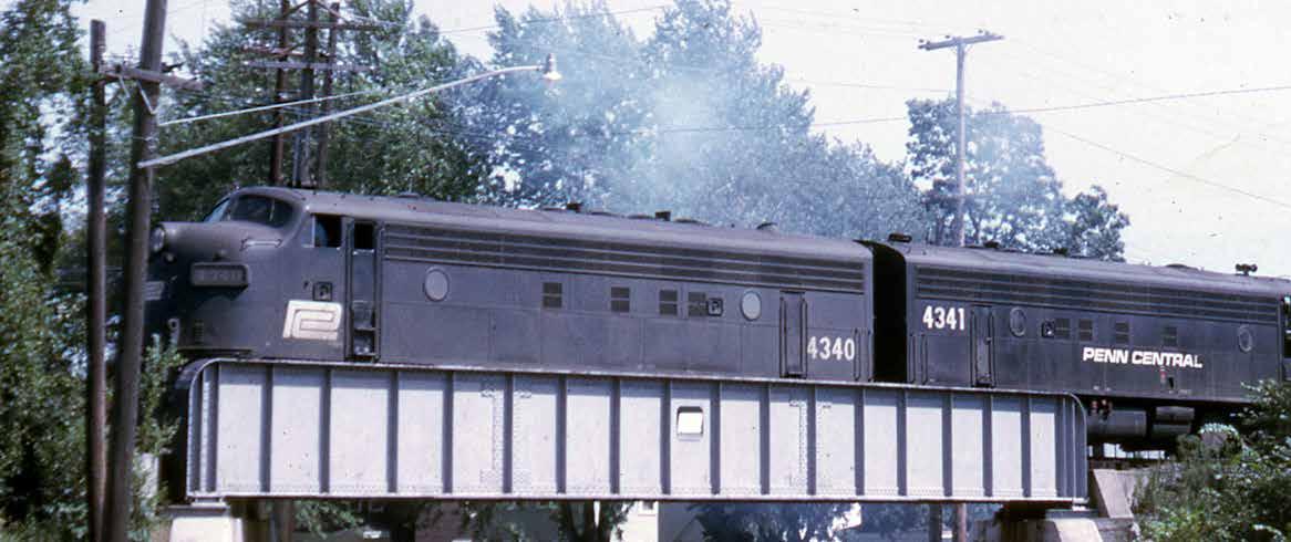
Penn Central Rail Line, 1971 City Historic Preservation Office
Railroads
In 1854, the first rail line was completed, entering the city from the southeast and skirting the southern edge of the city. Within a year the Wabash Railroad also reached Fort Wayne. In just twenty years the fast-growing railroad system made the canal obsolete; in 1882 the Nickel Plate Railroad was extended to Fort Wayne and was built on top of the old Wabash and Erie Canal, drastically changing the character of the neighborhood area from a canal corridor to a rail corridor. The Grand Rapids & Indiana Railroad and the Lake Erie and Western Railroad also built rail lines that passed northsouth through the area.
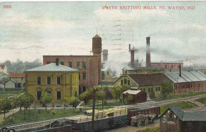
There were railroad maintenance shops in the neighborhood, and many other industrial facilities were located adjacent to the rail lines. Manufacturing businesses such as Horton Manufacturing (they made corn planters and were a pioneer in washing and ironing machines), Indiana (later American) Road Machinery Company (roadbuilding equipment and other machinery), and the sprawling Wayne Knitting Mills plant (the first factory for the production of hosiery in the United States) thrived in the late 1800s and well into the 1900s. Wayne Knitting Mills was established in 1891 and employed approximately 1,100 workers by 1905.
Another large group of industrial facilities also relied on the railroads, but they specialized in processing agricultural products. These industries included the Fred Eckart Meatpacking House (pork and beef), the Wilkens Packing Company (pork and beef), the D.M. Sears Company (vinegar, pickles, catsup,
kraut, etc.), the McMillen Company (grain elevator and seed warehouse), the Kraus & Apfelbaum Feed & Seed Company, and the Volland Mills/Mayflower Mills (a flour mill). Many of the packing facilities were south of West Main Street near Junk Ditch. There was also a smaller group of industries that developed in support of Lindenwood Cemetery; these included florists, vault makers, and the Birkmeier and Sons Monument Company.
Lincoln Highway
Sherman Boulevard, the boundary road between Hamilton and Bloomingdale neighborhoods, was part of the historic Lincoln Highway from 1928-1953.
Agnes Hamilton, right, Alice Hamilton, center Miss Porter’s School
Tourist Camp, Lincoln Highway City Historic Preservation Office
The Lincoln Highway is historic because of its status as one of the first transcontinental highway and one of the first designed specifically for automobiles. The highway spanned from San Francisco to New York City Previously railroads had been the only reliable transportation between states, and only 8.8% of interstate roads in the country were improved surfaces.
The concept of Lincoln Highway was promoted by Carl Fisher, a Hoosier who was also the principal investor in the Indianapolis Motor Speedway. In 1953 Sherman Boulevard was bypassed out of the Lincoln Highway. The Lincoln Highway was gradually replaced by the US Numbered Highway System. Most of the historic Lincoln Highway is now either US Route 30 or Interstate 80.
Streetcars
The Northwest Neighborhoods are formed by the history of streetcars in the area, leading to compact building development, and small neighborhood commercial nodes. Some of these commercial nodes have disappeared, but many persist, particularly Wells Street, West Main Street, and a small node on High Street.
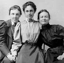
Hamilton Family
The Hamilton Neighborhood, as well as Hamilton Park in the North Highlands Neighborhood, is named after Allen Hamilton. Hamilton was an early founder of Fort Wayne’s European settlement. Originally from Lawrenceburg, Indiana, Hamilton moved to Fort Wayne in 1923. He was appointed Deputy Clerk in the US Land Office and also served as Allen County Sheriff, Fort Wayne Postmaster, and Allen County auditor, clerk, and recorder. Hamilton was also a delegate to the Indiana Contitutional Convention and an Indiana State Senator.
Hamilton founded Hamilton and Taber, an Indian Trading Company, and became friends and business associates with Chief Jean Baptiste de Richadville. Hamilton participated heavily in the eradication of Native communities in Indiana, participating in the US Commission to Negotiate Treaties with the Miami, the Commission to Extinguish Indian Titles in Indiana, and the US Indiana Agent to the Miami.
Though Allen Hamilton boasted many accomplishments, the Hamilton legacy lies with Allen Hamilton’s granddaughters
Edith Hamilton
The granddaughter of Allen Hamilton, Edith Hamilton was an author and one of the most renowned classicists of the modern era. She began her career as the head of the Bryn Mawr College. Edith’s texts on Greek and Roman civilization are critically renowned and still regarded as seminal texts in their fields to this day. She received the National Achievement Award for her writing. King Paul of Greece recognized Edith’s contributions to Greek scholarship with the Gold Cross of the Legion of Benefaction in 1957.
Hamilton was quoted by John F. Kennedy in his famous speech in Indianapolis following the assassination of Martin Luther King, Jr.: ” In our sleep, pain cannot forget falls drop by drop upon the heart until, in our own despair, against our will, comes wisdom through the awful grace of God... to tame the savageness of man and make gentle the life of this world.”
Alice Hamilton
Another granddaughter of Allen, Alice Hamilton was the first woman appointed to the faculty of Harvard University. Alice worked as a physcist, research scientist, and author. She was a pioneer in the fields of occupational health, industrial toxicology, social welfare, and peace activism.
Illustration of Edith Hamilton
Julie Benbassat
Alice is often cited as leading to the founding of the Occupational Safety and Health Administration (OSHA) due to her research in occupational health and advocacy for the wellbeing of workers, particularly African Americans. Alice Hamilton served as the president of the National Consumers League, and was employed by state and federal governments to investigate the factory workplace conditions. Alice traveled deep into wartime Germany, Austria, and Italy in order to advocate for peace during the World War.
Agnes Hamilton
The cousin to Edith and Alice, Agnes was born in Fort Wayne. Agnes left an indelible mark on the City, founding and serving as the first president of the local YWCA, opening the first library in the City, and serving as one of the founders of Bethany Presybyterian Church.
Agnes was trained as a social worker and a leader of the Women’s Club movement and the Students’ Art League. During her time in Philadelphia, she directed the Lighthouse settlement home. Upon her death in 1961, Agnes was buried in Lindenwood Cemetery with her family. Statues in Headwaters Park are dedicated to Edith, Alice, and Agnes Hamilton.
In addition to this shared early history, each neighborhood has specific and unique events that have shaped its development, leading to the places we know today.
Bloomingdale
Bloomingdale’s heritage runs deep, rooted in Native American history and early European settlement. The land was once part of a tract granted to Captain William Wells in 1808. After his death, the land was inherited and developed by his children. In 1858, J.C. Bowser established “Bowserville,” a precursor to Bloomingdale. The name “Bloomingdale” is thought to derive from Jacob Wuersten, a German immigrant known for his lush flower fields.
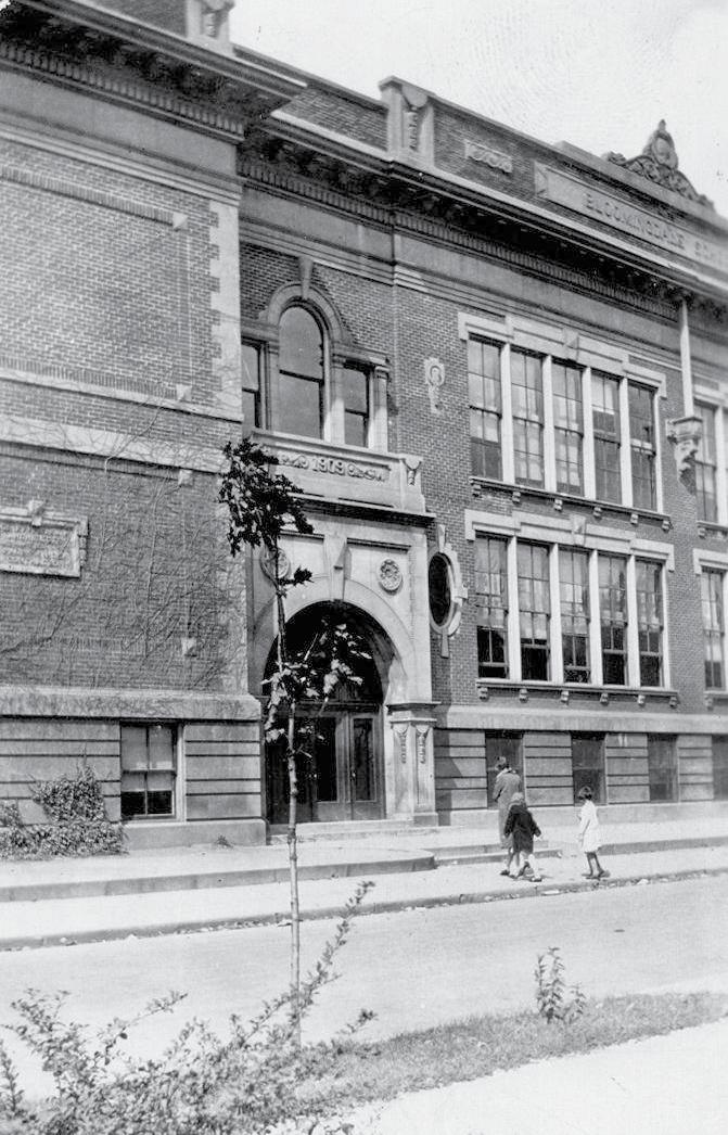
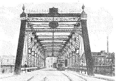
The Wabash and Erie Canal shaped the neighborhood’s early development, followed by railroads like the Nickel Plate in the late 19th century. Bloomingdale was annexed into Fort Wayne in 1871, and by 1872 had its own passenger depot. Wells Street, a vital corridor, saw the city’s first iron bridge (1859), later replaced by the still-standing Whipple Truss bridge (1884). Civic institutions like the Bloomingdale School (1875), Most Precious Blood
Parish (1898), and the St. Vincent’s Orphan Home (1887) anchored the community.
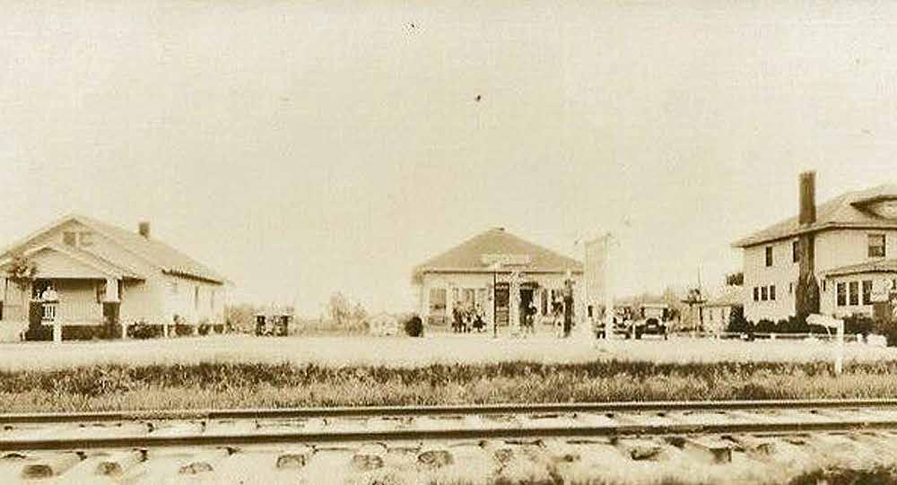
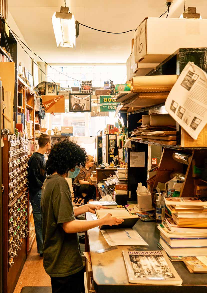
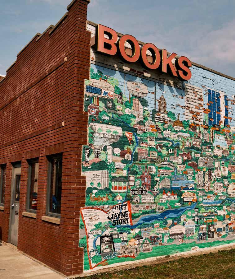
Small-scale development characterized the neighborhood between 1866 and 1895, with larger projects led by builders like Nolan Realty and City & Suburban Builders in the 1920s. Wells Street evolved into a thriving commercial and transportation hub, with theaters, grocers, and service stations lining the corridor. Historic businesses like the 3 Rivers Co-Op, originally an A&P store, and the Spanishinfluenced Wells Theater (c.1917) highlight the area’s commercial past. Today, Bloomingdale continues to celebrate its multi-cultural heritage and community pride, home to iconic local businesses like Hyde Brothers Books, Hop River Brewery, and the Indiana Mexican Bakery.
Hamilton
Hamilton was platted as a neighborhood in the mid-1800s, with land acquisitions tied to the expansion of the Wabash and Erie Canal. Early plats were developed by Samuel Hanna, William Rockhill, and George Ewing. As canal traffic declined and railroads took over in the 1880s, the neighborhood
School Allen County Public Library
Bloomingdale
Wells Street Bridge, 1912
Old Fort News, 1982, vol. 45, no. 2
was reimagined with smaller, affordable lots and housing suitable for workers employed by nearby industries and public works, including meatpacking factories.
From 1901 to 1930, the neighborhood saw the creation of 37 new subdivisions. These included modest single-family homes, duplexes, and shared-wall bungalows. Notable architectural examples from the 1920s can still be seen at Oakland and 4th Streets and on Sherman
Boulevard. Neighborhood life centered around the intersection of Huffman Street and St. Marys Avenue, home to churches like Trinity Evangelical Lutheran (1916), schools like Franklin (1921), and businesses including grocery stores and the Little Turtle Library. Post-WWII, the area grew further with infill housing and developments like State Center. Community activism in the 1970s and 1980s helped secure traffic improvements and organizational independence, preserving the neighborhood’s character and local business scene.
Lincoln Park Five Points
The Lincoln Park and Five Points neighborhoods were slower to develop than other parts of northwest Fort Wayne, remaining agricultural well into the 20th century. The first platted development, Crimmins Subdivision, dates to 1866. Growth accelerated with the arrival of the Lincoln Highway in 1913, which turned Goshen Road and the Five Points intersection into a bustling commercial corridor. Businesses sprang up to serve travelers, including restaurants, service stations, and motels. Notably, the West-Acres Motel appeared in the 1957 Negro Traveler’s Green Book as a safe haven for Black travelers.
Residential development followed, with subdivisions like Lillie Place (1905), Cambridge Hills (1928), and
Postcard of Wayne Knitting Mills
Allen County Public Library
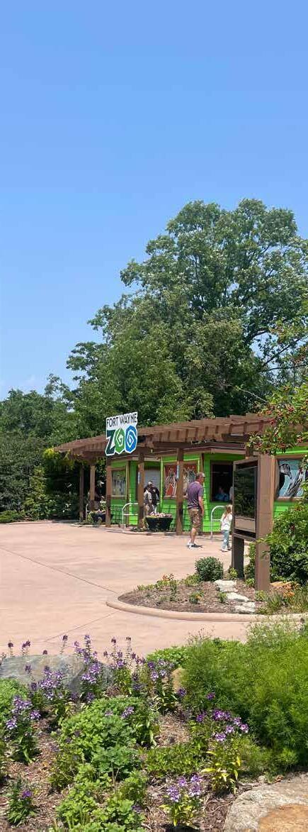
Poinsett Park (1923) offering architecturally diverse and well-planned communities. Builders such as John Worthman and Elwood Gilbert brought quality design to modest homes, some of which, like the Spanish bungalow on Cambridge Blvd., remain local landmarks. The area grew steadily, with the addition of Foellinger Theater and the Fort Wayne Children’s Zoo further enhancing its appeal. In 1960, Gateway Plaza opened as a major shopping destination, solidifying the neighborhood’s commercial importance.
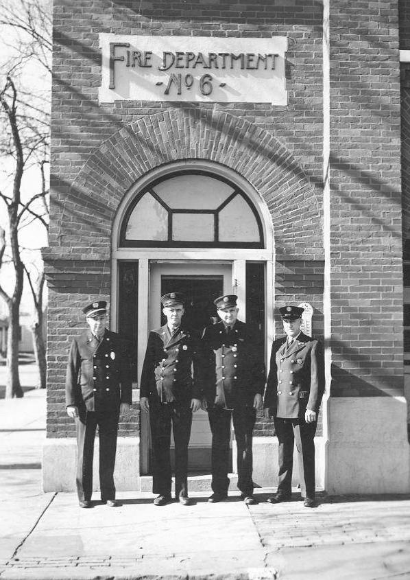
Engine House no. 7
Allen County Public Library
Nebraska
The Nebraska neighborhood stands as a historical gateway to Fort Wayne, shaped over centuries by its strategic position at the confluence of three rivers. Originally part of Native American trade routes and later the summit point of the Wabash and Erie Canal, Nebraska played a central role in making Fort Wayne the “Summit City.” Canal construction in the 1830s brought a surge of development, with a feeder canal running directly through what would become Nebraska. This infrastructure helped
power early industries and connect Fort Wayne to national trade routes.
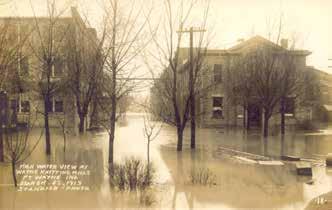
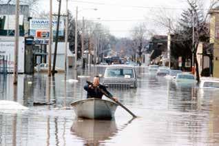
By the late 19th century, the canal gave way to railroads, and Nebraska became an industrial hub. Factories such as Wayne Knitting Mills, Horton Manufacturing, and several meatpacking and seed processing plants anchored the local economy. Immigrants, particularly Germans and Irish, settled here in large numbers, building single-family homes, duplexes, and boarding houses. Commercial corridors like West Main Street flourished with shops, hotels, and public institutions. Flooding, especially in 1913 and 1982, significantly impacted the neighborhood, but the construction of a levee system has since helped stabilize the area. Historic preservation is now a priority, with landmarks like Lindenwood Cemetery and Engine House No. 7 reflecting Nebraska’s legacy.
North Highlands
North Highlands traces its origins to farmland once owned by the prominent Hamilton family. In 1921, the Hamilton sisters formally platted the neighborhood, which rapidly became an attractive residential area thanks to its higher elevation, cleaner air, and access to new city infrastructure. The neighborhood’s first addition, Rosemont, was platted in 1905 and strategically located near schools and major employers such as Wayne Knitting Mills and Horton Manufacturing.
North Highlands quickly expanded through several phases offering a wide range of housing types from architect-designed homes to builder-spec houses, allowing families of varied incomes to settle in the area.
Flooding at Wayne Knitting Mills, 1913
Allen County Public Library
Flooding on West Main St, 1982 City Historic Preservation Office
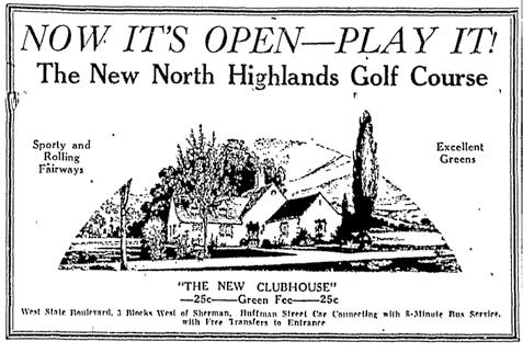
In the 1930s, the community even developed a 9-hole golf course on 65 acres of unused land, a rare amenity during the Great Depression. Though short-lived, the course and its English Tudor-style clubhouse added to the neighborhood’s charm. Post-World War II housing demand brought a new wave of growth, with local developers like John Worthman and General Industries using modern techniques to build quickly and affordably. These homes, many of which still stand, are classic examples of the “American Small House” style. Community institutions followed, including Price Elementary (1953), Bethany Church of Christ (1951), and Grace Presbyterian Church (1956). Commercial development and zoning controversies in the 1950s led to the establishment of the West State Village Shopping Center, shaping the neighborhood’s commercial landscape.
North Highlands Golf Course ad, 1933 Journal Gazette
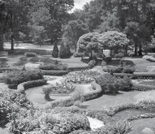
Jaenicke Gardens, Swinney Park City Historic Preservation Office
NORTHWEST PREVIOUS PLANS
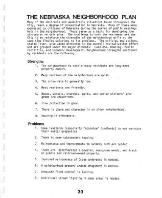
Nebraska Neighborhood Plan - 1974
The 1974 Nebraska Neighborhood Sketch Plan was developed as a comprehensive strategy to address the socioeconomic challenges and physical decline facing the Nebraska Neighborhood. The plan was data-driven, showing that the neighborhood was performing worse than the citywide average in key indicators such as income, educational attainment, housing values, and structural conditions. The neighborhood also had higher levels of environmental complaints and deteriorated housing stock. In response, the plan laid out five core goals: establishing Nebraska as a stable residential community, providing needed amenities, ensuring diverse and affordable housing options, expanding social services, and fostering continuous citizen engagement in planning processes. These goals aimed to balance land use, improve physical infrastructure, and ensure community-driven revitalization.
To guide implementation, the plan proposed treatment strategies based on existing neighborhood conditions, categorizing areas into preservation, rehabilitation, local business, and extra-neighborhood commercial zones. Specific strategies included strict code enforcement, lowto medium-density residential development, creation of mini-parks, and promotion of local businesses along Main Street. The plan also emphasized urban design, beautification, and leveraging vacant lots for community benefit. It recognized that neighborhood improvements would be incremental and stressed the importance of sustained resident involvement, local advocacy, and coordination.
Wells Street Corridor Feasibility Study1974
Developed in 1974, the Wells Street Corridor Feasibility Study outlined a plan to enhance the Wells Street Business District as a pedestrianoriented commercial corridor. The plan emphasized improving the physical environment by improving sidewalks, lighting and landscaping, while also promoting a mix of retail, restaurant, and residential
uses along the corridor. Unique for the plan at the time, this study specifically encouraged adaptive reuse of historic buildings on the corridor and the integration of new mixed-use development. Key recommendations in the plan include improving the streetscape in the commercial district in Bloomingdale, enhancing safety on the corridor through traffic calming measures, and developing gateways and signage to improve neighborhood identity.
For the Bloomingdale Neighborhood, the plan presented a significant opportunity to transform its commercial corridor into a hub that reflected the unique local character of the neighborhood while attracting visitors from other parts of Fort Wayne. Improvements to Wells Street directly would improve the street to make it more walkable, aesthetically pleasing and economically vibrant.
Nebraska Neighborhood Plan - 1980
The 1980 Nebraska Neighborhood Plan, more comprehensive than the sketch plan in 1974, was the first in-depth effort to revitalize and stabilize the Nebraska Neighborhood. Bounded by major railroads, corridors and key community institutions like the University of Saint Francis, the area faced numerous challenges at the time, among them was aging housing stock, deteriorating infrastructure, poor land use and zoning policy, and population decline. Still, the neighborhood
displayed significant strengths, such as a strong sense of community, low crime rates, and longstanding homeownership in 1980. The plan sought to capitalize on these assets through a strategy of targeted rehabilitation, infrastructure reinvestment, preservation of residential character, and a renewed focus on civic participation through the Nebraska Neighborhood Association.
Among the plan’s top priorities were upgrading street lighting, curbs, and sidewalks to improve pedestrian safety and support housing reinvestment; mitigating flood risk given the area’s location in a 100-year floodplain; enhancing neighborhood parks like Swinney Park West; and aligning industrial and commercial land use with residential wellbeing. It also emphasized the importance of preserving single-family homes, maintaining affordability, and supporting lowintensity commercial development. More than a neighborhood planning document, the 1980 Nebraska Neighborhood Plan laid the groundwork to support local advocacy, physical transformation and a renewed vision for the area.
Northwest Bloomingdale Neighborhood Plan - 1980
The 1980 Northwest Bloomingdale Neighborhood Plan established the first comprehensive preservation-based strategy for maintaining and enhancing the neighborhood’s stable, predominantly single-family residential character. Framed by concerns about aging infrastructure, scattered industrial development, and housing deterioration, the plan outlined coordinated actions across land use, housing, public facilities, and economic development. It emphasized downzoning from multi-family to single-family zoning for low-density residential patterns, curb overdevelopment, and address traffic and parking concerns. Extensive housing rehabilitation efforts were proposed, including targeted financial assistance programs, structural inspections, and promotion of historic preservation. The plan also underscored the importance of maintaining adequate public facilities, including parks, sidewalks, and streetlights.
Economically, the plan focused on revitalizing the Wells Street commercial corridor, enhancing small business activity, and supporting neighborhoodscale employment. Strategies included a market study, design improvements, and expansion of city and state economic development and small
business programs. While industrial activity was recognized as a tax and employment asset, the plan called for better management of impacts such as noise, pollution, and truck traffic on residential streets. The plan placed strong value on civic engagement, especially the leadership role of the Northwest Central Neighborhood Association in implementation. The 1980 Northwest Bloomingdale Neighborhood Plan promoted a vision of the neighborhood as a livable, connected, and resilient urban neighborhood at the edge of downtown.
Swinney Park Cultural Landscape Report - 2002
The Swinney Park Cultural Landscape Report presents a comprehensive strategy for preserving and revitalizing one of Fort Wayne’s most historically significant parks. The report identifies the park’s evolution from a community hub in the early 20th century, with amenities like Jaenicke Gardens, to a park that has seen simplification and underutilization. The rehabilitation strategy outlined in the plan emphasizes restoring the historic character of the park and enhancing ecological health, while accommodating the current needs of residents in the nearby neighborhoods. Key recommendations in the report include rehabilitating the Jaenicke Gardens, improving circulation and accessibility for all park users, and increasing maintenance.
For the Nebraska Neighborhood, the recommendations bring into focus the relationship between the park and the neighborhood. Swinney Park is an important green space on the neighborhood’s southern edge, and its restoration would help enhance the area’s identity, recreational access, and environmental quality. Improved park lighting, increased programming, and safer pedestrian linkages between Nebraska and the park would make the space more inviting for residents.
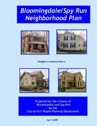
Bloomingdale Spy Run Neighborhood Plan - 2005
The 2005 Bloomingdale/Spy Run Neighborhood Plan focused on a vision for revitalization of the neighborhood by reinforcing its historic identity, strengthening its commercial corridors, and stabilizing residential areas through targeted investments. One of the plan’s central recommendations was the revitalization of the Wells Street Corridor. Recognizing its blend of long-standing family-owned businesses, historic housing, and diverse land uses, the plan called for significant infrastructure upgrades, zoning changes, and the formation of a Wells Street Business Association. Additional efforts included encouraging business involvement in neighborhood planning and reimagining the use of vacant storefronts.
The plan also emphasized the importance of preserving Bloomingdale’s aging but significant housing stock, with strategies like the ‘Model Block’ program to focus resources on small-scale and high-impact improvements. Recommendations in the plan supported housing rehabilitation, expanded homeownership efforts, and the prevention of single-family conversions into multifamily dwellings. Public safety and Crime Prevention Through Environmental Design principles were also woven into the plan’s recommendations, advocating for alley improvements, tree planting, and better street lighting. The plan’s recognition of the neighborhood’s historical assets, like the Wells Street Bridge and St Vincent Villa, underscored the approach of bringing heritage, housing, and economic development together to stabilize Bloomingdale. The overarching theme of the plan was revitalization through reinvestment in place. Most notably, recommendations regarding the Wells Street Corridor were the focus of implementation following the plans adoption.
North River Now - 2007
The 2007 North River Now Conceptual Development Plan laid out a bold and ambitious vision for revitalizing the underutilized land located just north of downtown, often referred to as the Omni Source site. For Bloomingdale, this plan represented a significant opportunity to reconnect with the riverfront, improve connectivity to downtown and benefit from new investment and amenities that would be likely to come to the site. The plan prioritized mixed-use development, active commercial corridors, and new residential housing options. Specific proposals such as a water-themed esplanade, adaptive reuse of historic structures, and improved bike and pedestrian access were designed to physically link Bloomingdale more directly into downtown and any future development along the riverfront.
A recurring theme throughout the plan was the emphasis on improving walkability in the area, in addition to developing active civic gathering spaces, both goals that align with Bloomingdale’s needs, even today. The plan also called for enhancing important corridors, like Harrison Street, which is not only a north-south connector, but an important boundary for the North River site that could be incorporated into bringing the neighborhood and future development together. The preservation of neighborhood scale, the introduction of higherdensity housing along the river, and expanded park access through the extension of Lawton Park and trails would all serve to improve the quality of life for Bloomingdale residents. Overall, the North River Plan viewed Bloomingdale not as an adjacent neighborhood that would be negatively impacted by development, but as a central partner in the area’s long-term revitalization.
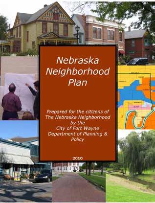
Nebraska Neighborhood Plan - 2010
The 2010 Nebraska Neighborhood Plan outlined a comprehensive strategy to stabilize and revitalize the Nebraska Neighborhood. A central theme to this plan was leveraging the area’s heritage as a foundation for its reinvestment. The plan made several recommendations for housing rehabilitation, economic development along West Main Street, and preservation of neighborhood character. Most notably, the plan sought to reduce the impact of long-standing challenges such as aging infrastructure, vacant properties, and disinvestment by proposing public-private partnerships.
A major emphasis was placed on restoring the neighborhood’s unique and historic identity while preparing the area for future growth. The Nebraska Neighborhood Plan advocated for preserving key historic assets, such as the wellknown Wayne Knitting Mills industrial buildings and the several brick streets and alleys that stretch through the neighborhood. It also championed the development of additional single-family housing to reverse decades of decline, proposing tools like a model-block strategy, tax abatements, and enhanced code enforcement. The plan laid out a realistic yet aspirational path for community-led transformation based in the neighborhood’s deeprooted heritage.
Riverfront Implementation - 2019
The Riverfront Implementation Framework developed by renowned landscape planning firm David Rubin Land Collective outlined a visionary plan to transform Fort Wayne’s riverfront that would catalyze economic development, connect neighborhoods, and celebrate one of the city’s most recognizable natural assets. The plan is grounded in extensive community engagement and structured around three primary principles: development, public space, and infrastructure. Specifically, the plan introduced several “first mover” projects, including an area called The
Wedge, which is now being developed as The Eddy on Bloomingdale’s southern edge. Strategies include adaptive reuse, mixed-use development and increased housing diversity, in addition to improved pedestrian connections to help improve access to the riverfront.
A central theme of the plan is extending the riverfront’s influence into adjacent neighborhoods, particularly the Bloomingdale neighborhood, arguably the neighborhood most impacted by riverfront development. The plan proposes new physical and emotional connections from Bloomingdale to the river, such as improved streetscape, pedestrian access, and public spaces. Bloomingdale Park is identified as an important component of the natural reach zone, with enhancements at the park to include wetlands restoration and an expanded pedestrian boardwalk. These interventions aim to integrate Bloomingdale as one of Fort Wayne’s premier neighborhoods. Overall, much of the plan is focused on improving connections and enhancing access to the riverfront, aiming to ensure that neighborhoods like Bloomingdale are not just adjacent to Fort Wayne’s riverfront revitalization, but a part of the development and beneficiaries of the growth that will occur.
RIVERFRONT
DEVELOPMENT IMPLEMENTATION FRAMEWORK
CITY OF FORT WAYNE
NEIGHBORHOOD DEMOGRAPHICS
The Northwest Neighborhoods of Bloomingdale, Hamilton, Lincoln Park Five Points, Nebraska, and North Highlands each have distinct characteristics yet share common demographic trends that shape the area’s identity. Understanding these existing conditions is crucial to developing a comprehensive neighborhood plan that reflects both current realities and future opportunities.
The following analysis presents data from 2000 to the present, sourced from the U.S. Census Bureau, highlighting key trends in population change, racial and ethnic demographics, poverty, housing, education, and income. While the physical landscape of the Northwest Neighborhoods has remained relatively unchanged, the demographic composition of the area is evolving. These data-driven insights serve as a foundation for the Northwest 2035 Neighborhood Plan, guiding policy recommendations that address emerging needs and enhance quality of life for all residents.
Census tracts are small, relatively permanent statistical subdivisions of a county established by the U.S. Census Bureau to provide a consistent framework for data analysis. They are designed to reflect local demographics and socioeconomic characteristics, making them valuable tools for planning and analysis.
For the Northwest Neighborhood Planning Area, the following Census Tracts provide a comprehensive demographic overview that encompasses all five neighborhoods:
Census Tract 6: Bloomingdale and Hamilton
Census Tract 7.01: Bloomingdale and Lincoln Park Five Points
Census Tract 8: Hamilton, Lincoln Park Five Points, and North Highlands
Census Tract 9: Hamilton and Nebraska
Census Tract 10: Nebraska
While these tracts do not align perfectly with neighborhood boundaries, they effectively capture the collective demographic profile of the Northwest Neighborhoods, providing critical data to inform targeted planning strategies and policy recommendations.
Population Change
The Northwest Neighborhoods Planning Area has experienced notable population shifts over the past two decades.
In 2000, the population of the Northwest Neighborhoods Planning Area stood at 13,327 residents. Over the next two decades, the area experienced a gradual decline, with the population dropping to 12,897 in 2010 and further to 12,858 in 2020. However, by 2023, the estimated population stabilized at 12,578, reflecting a slight but notable increase in some tracts, such as Census Tracts 7.01 and 10, in the Bloomingdale, Lincoln Park Five Points and Nebraska neighborhoods. While the overall population decline mirrors that of most urban neighborhoods in the past two decades, the data also reveals distinct variations between individual tracts. For example, Census Tract 7.01 has remained relatively stable, with a minimal decline of just 0.15% or 95 residents since 2000. In contrast, Census Tract 6 experienced a significant population decrease of approximately 18.9%, or over 400 residents reflecting a broader trend of population shifts within the area.
Although the Northwest Neighborhoods Planning Area has experienced gradual population decline over the past two decades, new developments such as The Wedge and the Treeline District in the Bloomingdale Neighborhood are poised to reverse this trend. These mixed-use projects will introduce hundreds of new apartments, attracting residents to the area and infusing new life into one of the Northwest’s most strategically located neighborhoods.
Racial and Ethnic Composition
Over the last two decades, the Northwest Neighborhoods Planning Area has experienced a shift in its racial and ethnic composition, reflecting broader demographic changes that are occurring across Fort Wayne and the country as a whole. In 2000, the area was overwhelmingly White, with 92.6% of the population identified as such.
NORTHWEST POPULATION
Indiana Mexican Bakery on Wells Street
Chris Walker, Bloomingdale Association
By 2023, the White population had decreased to 73.7%, which indicates a significant increase in the diversity of the neighborhoods over the same time. During this period, the Hispanic population grew from 3.2% in 2000 to 12.6% in 2023, and the Black population increased from 1.5% to 9.3% over the same time period. The more diverse population is shaping the social and cultural fabric of the neighborhoods and should be reflected in future community outreach efforts.
This trend of increasing diversity is evident in nearly every Northwest Neighborhood, although the pace and character of change vary. Census Tract 10, which is the Nebraska Neighborhood, saw one of the most significant transformations, as its Hispanic population surged from just 0.5% in 2000 to over 31.7% in 2023, now making it the most diverse neighborhood in the planning area. Similarly, Census Tract 6, which primarily comprises of the Bloomingdale Neighborhood, saw its Black population rise from 1.2% to 15.4% over the same time period. These shifts reflect the migration patterns not just from other parts of the City, but the state as a whole, as Fort Wayne continues to grow by attracting residents from across the Midwest, the country, and abroad.
While this increasing diversity can bring new economic vitality to the neighborhood, it also places greater responsibility on neighborhoods to ensure that there is ample access to resources, services, and representation. Language access will continue to be important, and a fair distribution of investments, such as infrastructure upgrades and park improvements, will be important to meet the changing population in the neighborhoods. At the same time, the neighborhood’s growing complexity presents a unique opportunity to celebrate and build on its evolving identity through placemaking, community events, and supportive local institutions. A few things to consider are:
Developing and Improving Community Spaces
This can be done by investing in parks, schools, and the Little Turtle Branch of Allen County Public Library to offer unique spaces and programming that reflect the growing diversity of the neighborhoods.
Enhanced Language Access
This can ensure residents have the ability to participate in neighborhood life. Moving forward,
communications should consider translation into other languages, such as Spanish, to help expand engagement with residetns and encourage participation in community activities.
Celebrate Through Placemaking
Investing in public art installations, signage in multiple languages and corridor improvements can reflect the cultural identity of the community. This concept brings people together through a shared built environment that develops a sense of belonging and community pride.
Promote Responsive Planning and Engagement and Build Pathways to Participation
This includes relationship-building with trusted faith-based organizations, community leaders, business owners, and informal networks. Holding meetings in neighborhood venues, offering childcare and involving youth can help make engagement more representative of the changing neighborhood. In addition, neighborhoods should create opportunities for residenta to participate in neighborhood association leadership and committees to cultivate the next generation of leaders.
Housing
Median Housing Value
Over the past two decades, the cost of housing in the Northwest Neighborhoods Planning Area has followed an uneven trajectory, revealing important housing affordability and demand trends. In 2000, the Median Housing Value was $93,118 when adjusted for inflation, significantly lower than the citywide median of $140,392. In 2023, while Fort Wayne’s overall Median Housing Value had surged to $212,262, the Northwest Neighborhoods’ value had risen by only $5,000 to $98,921. The growing gap between neighborhood and citywide housing values, now over $113,000, raises concerns about opportunities in terms of affordability and longterm investment.
At the neighborhood level, there is considerable variation in trends. North Highlands and Lincoln Park Five Points have the highest housing values, reaching $129,651 and $109,582 respectively by 2023. These areas have a semi-suburban feel compared to Bloomingdale, Hamilton, and Nebraska, and are likely attracting moderate income homebuyers who value both the
neighborhood proximity to amenities in addition to larger yards. In contrast, Nebraska experienced both a decline in homeownership and a sharp increase in rental occupancy, while at the same time its Median Housing Value fell from $76,407 in 2000 to just $71,780 in 2023. While it’s not a sharp decrease in housing value, the stagnation likely reflects aging housing conditions and reduced demand in the neighborhood, although that will likely change as investment occurs along the West Main Street corridor.
The uneven growth in Median Housing Value across the Northwest Neighborhoods Planning Area provides insight into neighborhood-level housing stability and long-term affordability. Lower median housing values, particularly in Bloomingdale, Hamilton and Nebraska, may present opportunities for preserving and expanding affordable homeownership, especially for firsttime buyers and moderate-income families. These neighborhoods remain some of the most accessible markets in Fort Wayne, and for buyers priced out of other neighborhoods they offer an important entry point into homeownership. Importantly, these
lower-cost neighborhoods also carry potential for long-term wealth building for young families, especially as citywide housing prices continue to rise. These neighborhoods provide an opportunity for residents to live near employment, parks, and other amenities, and will increasingly become attractive for new investments. Homebuyers who purchase in these neighborhoods could benefit from gradual appreciation in home value, especially as infrastructure improvements, new development along Fort Wayne’s riverfront, and public amenities continue to take shape.
It is important to recognize that this potential does come with some caution. New residential and mixed-use development, if not paired with affordable housing strategies, could contribute to rapid price escalation and outpace the ability of current and future residents to remain in the neighborhood. If demand continues to spike and speculation intensifies, the very affordability that makes these areas attractive to homebuyers could be eroded. In addition, many of the homes in these neighborhoods are part of an aging housing stock, with homes built over a century ago, which often requires substantial investment to ensure long-term livability, safety, and efficiency. Deferred maintenance and outdated systems can place a financial burden on low-and-moderate income homeowners, potentially undermining the affordability advantage. Supporting home repair programs, weatherization efforts, and targeted housing rehabilitation programs will be essential to sustaining housing quality and preventing property decline in these neighborhoods. These investments not only protect the value of individual homes but also contribute to neighborhood-wide stability, in an area seeing significant change.
Housing Affordability
The percentage of how much of a resident’s income goes toward housing costs is an important indicator of economic stability and is sometimes called Selected Monthly Owner Costs as a Percentage of Income (or SMOCAPI). If a resident or family pays more than 30% of their SMOCAPI, they are considered housing burdened. Data across the Northwest Neighborhoods Planning Area reveals important insights into housing affordability in the area. In 2023, the area’s average SMOCAPI was 18.5% which faired slightly better than the citywide average of 21.6%. This suggests that homeownership remains relatively affordable in
Bloomingdale is a neighborhood of contrasts and change. Spanning two census tracts, Census Tracts 6 and 7.01, the neighborhood offers a telling example of how housing stability and affordability can evolve differently even within the same community.
Census Tract 6: Southern Bloomingdale
Homeownership is rising: 43.3% in 2000 to 51.9% in 2023. Affordability remains strong: Median housing value rose from $71,325 to $83,770, while housing cost burden (SMOCAPI) decreased to just 12%. Demographics are shifting: The Black population increased from 1.2% to 15.4%, and the percentage of Hispanic residents grew from 4.4% to 6.6%.
Census Tract 7.01: Northern Bloomingdale, Lincoln Five Points
Homeownership is declining: Dropping from 63.8% in 2000 to 55.9% in 2023. Affordability is slipping: While the median housing value barely increased ($96,732 to $99,813), housing cost burden surged to 32.9%, indicating growing financial strain on homeowners. Cultural identity is shifting: The Hispanic population more than tripled, rising from 4.2% to 14.8%.
the neighborhoods compared to other parts of Fort Wayne. However, affordability is not uniform across the area. In Census Tract 7.01 which is made up of both Bloomingdale and Lincoln Park Five Points neighborhoods, the 2023 SMOCAPI stood out at 32.9%, meaning that nearly one-third of all homeowners in the area were spending. more than 30% of their income on housing costs, indicating a high rate of housing burden and financial vulnerability. In contrast, the portion of Bloomingdale closer to downtown, in addition to the Hamilton and Nebraska neighborhoods had much lower burden, reflecting greater affordability. While the overall area remains an accessible housing market, the data highlights the need for targeted affordability strategies to ease housing burden.
Housing Trends
Housing trends in the Northwest Neighborhoods Planning Area over the past two decades reveal a shift in neighborhood stability, affordability, and community identity. In 2000, nearly two-thirds, or 65.7%, of homes in the area were owner-occupied, which reflects a relatively stable residential base. However, by 2023, this share had fallen to 60.7% and renter-occupied housing increased from 34.4% in 2000 to 39.3% in 2023. While this shift may
seem modest, it represents a growing reliance on rental housing and a potential weakening of longterm residential ties which have long anchored the identity of these neighborhoods and supported strong social relationships which are critical for neighborhood revitalization.
At the census tract level, the changes are even more pronounced, highlighting trajectories that call for tailored policy responses to consider neighborhood needs. For example, Census Tract 10 or the Nebraska Neighborhood, which includes a mix of aging housing stock and important commercial corridors like West Main Street, saw a dramatic
decline in owner-occupied units, dropping from 50.9% in 2000 to just 39.9% in 2023. This shift correlates with rising renter-occupancy, now over 60%, suggesting an increased housing turnover, potential affordability pressures with its proximity to downtown and West Central, and reduced investment by absentee landlords. In contrast, Census Tract 8, or the North Highlands and Lincoln Park Five Points neighborhoods, has consistently maintained higher rates of homeownership compared to the other neighborhoods, rising from 63.5% in 2000 to 70% in 2023.
These dynamics point to an important point in the changing housing landscape for the neighborhoods. The decline in homeownership, particularly in areas like the Hamilton and Nebraska neighborhoods, raises concerns about long-term housing stability, rising rents, and the potential for displacement of lower-income residents. At the same time, the increasing presence of a rental population presents both a challenge and an opportunity for the future. Renters are often more mobile and less connected to long-term neighborhood improvement efforts, yet they are also a vital part of the community which can shape its economic future bringing economic diversity, supporting local businesses, and fueling a new sense of vibrancy that may be needed for longterm revitalization.
To support long-term neighborhood stability, efforts should be made to focus on strengthening the local housing market in the neighborhoods and improving the quality of life and longevity of both owner-and-renter occupied units. Targeted investments in property maintenance housing rehabilitation and owner assistance programs can help attract long-term residents in areas of Northwest that have seen a significant change in neighborhood stability, such as Bloomingdale, Hamilton and Nebraska.
At the same time, the steady rise in rental housing shows the need for strong housing support practices to be applied in the neighborhood.
Policies that promote responsible property ownership, improve code enforcement, and support quality rental and multi-family housing can ensure that increased rental occupancy does not lead to issues in the neighborhood but instead opportunities for renters to be proud members of the community. Investments in public infrastructure such as lighting, sidewalks, and neighborhood amenities, especially in neighborhoods with higher rates of rental properties, will support residential satisfaction, reduce vacancy, and increase neighborhood pride. Proactively addressing housing conditions as well as stabilizing occupancy patterns will strengthen the area’s position as a strong residential community that is within close proximity to downtown and encourage additional investment and development.
Housing Units
The total number of housing units has declined
over the past two decades, but recent and planned development activity signals a positive shift that is expected to increase the overall housing supply in the coming years.
In 2000, the area contained 6,528 total housing units, but by 2023, that number had fallen to 6,258 reflecting a net loss of 270 units or 4%. The most significant loss of units occurred in Census Tract 6 (Bloomingdale) and Census Tract 10 (Nebraska). These shifts in housing stock are closely tied to changes in tenure patterns. Across the Northwest Neighborhoods Planning Area, owner-occupancy declined from 65.7% in 2000 to 60.7% in 2023, while the renter occupancy increased.
As new development continues to take shape along the riverfront, particularly with projects like The Eddy, the emerging Treeline District, and future phases of North River, the percentage of rental units in the Bloomingdale Neighborhood is expected to rise. These developments, while bringing highquality housing and new investment to the area, are largely rental-focused and will add significantly to the area’s renter-occupied housing stock. This trend, if left unbalanced, could further shift the homeownership-to-rental ratio in Bloomingdale, where rental units already make up nearly half of the housing supply.
To support a more balanced and sustainable neighborhood fabric, additional efforts are needed to promote affordable homeownership in adjacent areas such as Nebraska and Lincoln Park Five Points. These neighborhoods contain aging housing stock, modest property values, and infrastructure that is well-positioned for reinvestment.
Median Household Income
Between 2000 and 2023, the Northwest Neighborhoods Planning Area experienced a significant and sustained decline in median household income, even as Fort Wayne’s overall income levels remained relatively stable. When adjusted for inflation to January 2025, the area saw a decline of 16.7% from $57,828 in 2000 to just $48,187 in 2023.
Income declines were experienced across all five neighborhoods, with some areas facing more severe declines than others. Census Tract 7.01 which is the northern portion of the Bloomingdale and Lincoln Park Five Points neighborhoods saw the steepest drop falling from $62,356 in 2000 to
NORTHWEST MEDIAN HOUSEHOLD INCOME
just $48,673 in 2023, or a 21.9% decrease. Even in neighborhoods like North Highlands, median incomes were not able to keep on trend with the citywide numbers, falling 15.5% since 2000.
These declines in household income have serious implications for long-term housing affordability, neighborhood stability, and economic mobility. With income growth not keeping pace with rising housing costs and inflation, many households could become vulnerable to housing cost burden, deferred maintenance, and financial stress. This mismatch is particularly a concern in Census Tract 7.01, where the cost of housing has climbed sharply despite stagnating or declining incomes,
potentially pushing more households into financial hardship.
Going forward, economic development should be considered an important tool to help reverse declining median household incomes. Key strategies should include:
Expanded Access to Workforce and Vocational Training:
Working with local economic development partners, residents should have ample access to training in sectors aligned with local job growth such as advanced manufacturing,
NORTHWEST POVERTY RATE
healthcare, construction and logistics. Strengthening partnerships with local employers and educational and training centers such as Ivy Tech can help connect residents to higherpaying, career-track employment opportunities.
Accessible and Affordable Childcare:
Access to affordable, high-quality childcare is essential for working families, particularly as household incomes struggle to keep up with the city-wide median. Without dependable childcare, many residents, especially single parents,
are unable to pursue full-time employment or participate in job training and education programs. Currently, limited childcare options in close proximity to the neighborhoods create barriers for economic mobility.
Safe Transportation Options:
Reliable, affordable, and well-connected transportation is another critical factor in addressing declining incomes and upward mobility. Existing transit service does not always align with shift-based work or employment hubs.
The neighborhoods also lack consistent safe pedestrian and bicycle infrastructure, which can isolate residents from economic opportunity. Investments in sidewalk repair, street lighting and connections to existing bus routes would make it easier for residents to connect to opportunity.
Housing Stabilization Programs:
As household incomes struggle to keep up with the cost of inflation, many homeowners in the area are increasingly vulnerable to cost burdens which can lead to deferred maintenance of homes, especially those that are nearly a century old. Ensuring homeowners have access to targeted home repair programs, emergency weatherization grants, and energy efficiency upgrades can help ensure safe and stable housing in the neighborhood.
Poverty
Since 2000, poverty rates have demonstrated significant fluctuations, revealing critical concerns that can impact the Northwest Neighborhoods. The overall poverty rate in the Northwest Neighborhoods Planning Area rose from 11.8% in 2000 to 22.4% in 2023, a substantial increase that surpasses the citywide rate of 16.7%
Census Tract 6, which includes parts of Bloomingdale and Hamilton neighborhoods, experienced a marked increase in poverty, rising from 23.5% in 2000 to 31.0% in 2023. This tract now has one of the highest poverty rates in the area, suggesting heightened economic distress. Census Tract 9 also saw a significant increase in poverty, more than tripling from 8.6% in 2000 to 26.4% in 2023. Conversely, Census Tract 7 displayed a more
Three Rivers Music Theatre Chris Walker, Bloomingdale Association
modest increase in poverty, rising from 11.4% to 20.2% over the same period. While still substantial, this increase is relatively lower compared to other tracts, suggesting that some stabilizing economic factors may be at play. Census Tract 10 presents a notable outlier, with poverty rates spiking from 21.7% in 2000 to 38.8% in 2023 – the largest percentage increase across all tracts. This dramatic rise may indicate deepening economic instability. Census Tract 8 has remained relatively stable in comparison, with poverty rates rising moderately from 5.5% to 11.8%. The tract’s relatively low poverty rate and minimal increase in poverty compared to the other tracts in the area suggests potential as a stabilizing influence in the Northwest Neighborhoods as a whole.
The rising poverty rates across most tracts in the Northwest Neighborhoods underscore a growing economic divide that, if left unaddressed, could have profound and lasting impacts on the area’s stability and quality of life. To mitigate these impacts, the Northwest Plan emphasizes leveraging neighborhood institutions and enhancing community infrastructure. Strengthening partnerships with local organizations can provide essential services such as workforce training, financial literacy programs, and employment support, directly addressing some of the root causes of economic distress. Additionally, investing in neighborhood infrastructure, including parks, public spaces, and pedestrian corridors, can foster community cohesion, attract economic investment, and create more vibrant, welcoming environments that encourage local spending and small business development.
Addressing poverty in the Northwest Neighborhoods requires a multifaceted approach that goes beyond economic assistance to include strategic investments in infrastructure and community assets. By focusing on building a stronger, more connected community and enhancing neighborhood amenities, the Northwest Plan aims to create a more resilient, economically vibrant area where all residents can thrive.
Educational Attainment
Since 2000, educational attainment among residents aged 25 and older in the Northwest Neighborhoods has shown both positive trends and areas for continued improvement. Despite a slight decrease in the adult population, from 8,761 in 2000 to 8,736 in 2023, educational outcomes
indicate incremental progress in postsecondary attainment.
The proportion of residents with a high school beyond economic diploma remained relatively stable, increasing marginally from 39.8% in 2000 to 40.0% in 2023. However, the percentage of adults with some college experience rose more significantly, from 21.0% to 25.4%, suggesting that more residents are engaging in postsecondary education, particularly in technical and vocational fields. Those with an associate’s degree saw a slight increase from 7.3% in 2000 to 7.5% in 2023, while bachelor’s degree attainment experienced the most substantial growth, rising from 8.2% to 11.0%.
Educational attainment trends varied across individual Census Tracts:
Census Tract 6 (Bloomingdale and Hamilton):
The percentage of residents with some college experience surged from 20.8% in 2000 to 37.7% in 2023, reflecting a growing presence of young adults pursuing postsecondary education. Additionally, associate’s degree attainment increased from 4.7% to 12.3%, the most significant gain in associate’s degree attainment across all tracts.
Census Tract 8 (Hamilton, Lincoln Park Five Points, Nebraska):
Residents with some college experience increased from 21.0% to 27.4%, and bachelor’s degree attainment rose from 9.4% to 14.2%, indicating steady progress in higher education.
Census Tract 9 (Hamilton and Nebraska):
The share of residents with a high school diploma increased notably from 39.7% in 2000 to 49.8% in 2023. However, bachelor’s degree attainment declined slightly from 11.5% in 2000 to 10.7% in 2023, suggesting potential barriers to advanced education in this tract.
The rise in residents with some college experience in the Northwest Neighborhoods reflects a broader national trend emphasizing the importance of postsecondary education for economic mobility. As community colleges and technical programs gain popularity among young adults seeking jobspecific skills without committing to four-year degrees, the share of adults in the area with some
college experience has increased significantly. Despite a modest rise in bachelor’s degree attainment from 8.2% in 2000 to 11.0% in 2023, the Northwest Neighborhoods still trail citywide and national averages. Graduate degree attainment has remained relatively static, increasing only slightly from 3.0% to 3.2% over the same period, well below the citywide and national rates where advanced degrees are increasingly critical for accessing higher-wage employment. Educational attainment remains closely linked to economic stability and neighborhood revitalization, as areas with higher education levels typically see stronger economic growth, higher homeownership rates, and lower unemployment.
Conclusion
The Northwest 2035 Neighborhood Plan is rooted in an assessment of past and present conditions, acknowledging the challenges that have shaped the area over the past few decades. The Northwest Neighborhoods have experienced a steady loss in population, aging housing stock, declining household incomes, and a rise in poverty. At the same time, the area has emerged as one of Fort Wayne’s most unique areas, with ample access to recreation and nature and significant new investment in development along the Saint Marys River and the North River property. Investments in housing and public infrastructure are beginning to take hold. Educational attainment is trending upward, and long-standing residents continue to demonstrate pride and commitment through property upkeep, community involvement, and neighborhood leadership.
The Northwest 2035 Neighborhood Plan builds on the ongoing momentum in the neighborhoods with a strategic focus on stabilization and reinvestment, revitalized commercial corridors, increased connectivity for pedestrians, enhanced safety for residents, and a focus on affordability for future development. There is an urgency in stabilizing the Northwest Neighborhoods and ensuring that the neighborhoods develop deeper partnerships with residents, developers, and institutions. With a commitment to transparency, Northwest 2035 sets a course toward a stronger, more connected, and vibrant community, one which reflects the strength, legacy, and promise of the people who call the Northwest Neighborhoods home.
The Stacks in Hyde Brothers Books Chris Walker, Bloomingdale Association
HEALTH & WELLBEING
nutrition, which raises their risk of health conditions like heart disease, diabetes, and obesity. Those who live in neighborhoods that encounter frequent crime and violence may experience chronic stress, negatively affecting health across their lifespan. Environmental factors impacting health may have multi-generational effects, compounding inequities over time.
The health of a neighborhood is often a direct reflection of its history, environment, and access to opportunity, and the Northwest Neighborhoods are no exception. Understanding the unique challenges and strengths of the Northwest Neighborhood’s health outcomes will not only aid residents in achieving their vision of success but will also guide community leaders and City officials in developing effective investments to improve health in the neighborhood. The health and wellbeing of the neighborhoods will not only benefit those living within its boundaries, but will contribute to the physical, social, and economic fabric of the city as a whole.
Social Determinants of Health
Social determinants of health describe the circumstances in which people are born, grow up, live, work, and age, and the corresponding systems used to deal with illness. Social determinants of health are important because they have a major impact on people’s health, wellbeing, and quality of life and can be more important than health care or lifestyle choices in influencing health outcomes. Moreover, where someone lives, as measured by zip code, has been found to be a stronger predictor of health than their genetic code.
These circumstances are shaped by a wide set of forces such as economics, social policies, governance, and politics that may affect health outcomes. Social determinants of health are typically measured by income and social protection, education, unemployment, working life conditions, food insecurity, housing, aspects of the built environment like parks, sidewalks, trees, and lighting, air and water quality, early childhood development, social inclusion and nondiscrimination, structural conflict, language and literacy skills, and access to affordable quality health services.
Health Equity
Social determinants of health contribute to disparities in health. For example, people without a vehicle who live in areas far from grocery stores with healthy foods are less likely to have good
According to the Parkview Community Health Needs Assessment, in the United States, racial and ethnic minority groups experience higher mortality rates and increased incidence of a wide range of illnesses compared to their white counterparts. These health outcome disparities are linked to social determinants in the following areas: physical environments and neighborhoods, healthcare access, workplace conditions, social and community context, education, and income gaps. According to the Centers for Disease Control, health equity is the state in which everyone has a fair and just opportunity to attain their highest level of health and is achieved when the policies, systems, and environments that form the social determinants of health are accounted for in an equitable manner.
Evidence shows that discriminatory practices have inscribed inequities into our policies, systems, and the built environment. Redlining, for example, was largely responsible for racial housing segregation nationally and locally, which contributes to health disparities. In the 1930’s, the federal Home Owners’ Loan Corporation created Residential Security Maps of most American cities, including Fort Wayne. These maps classified neighborhoods at various levels of investment risk. Neighborhood sections that were ‘redlined’, or given a grade a ‘D’, were not able to obtain home mortgages or small business loans from banks or the federal government. Grades were based on the age and condition of housing, transportation access, closeness to amenities, economic class and employment status of residents, and, notably, racial and ethnic composition. According to the University of Richmond’s Mapping Inequality Project, “Redlining was legal and practiced for decades. It dramatically affected the relative wealth—as well as the health—of different racial groups in America. Its impact is still with us today.”
In 1937, a large southern section of East Central was redlined with a grade of D “needs significant improvement,” and was therefore ineligible for home mortgages or small business loans in the
area. The rest of the neighborhood was graded C “needs improvement,” and therefore would have had great difficulty in obtaining home mortgages or small business loans. In 1937, the majority of the Northwest Neighborhoods were graded C “need improvement,” and therefore would have had great difficulty in obtaining home mortgages or small business loans. Portions of North Highlands and Bloomingdale received a B “still desirable,” which could receive mortgages, but held at around 65% of appraisal price.
While there is no single solution to reverse the outcomes of redlining, its continual impact on the composition of Fort Wayne’s neighborhoods can be significant. Furthermore, achieving health equity in the Northwest Neighborhoods and in Fort Wayne should be a priority. Underscoring the network of influences, including the legacy of redlining, that contribute to inequities is crucial in this process.
Health Outcomes
Parkview Health is a regional non-profit hospital system that produces a Community Health Needs Assessment of northeast Indiana every three years. In the latest report, released in 2022, Parkview identified the top ten health concerns for its eightcounty service region: mental health, substance use/abuse, obesity, cancer, chronic obstructive pulmonary disease (COPD), cardiovascular disease (stroke, coronary disease), kidney disease, diabetes, asthma, and child abuse. Additionally, the report identifies the ten top health service needs: mental health services, access to recreational spaces, substance use disorder services, childcare, access to healthy food, health insurance, access to primary care providers, gun safety, senior services, and access to birth control.
Health outcome data in these priority areas in the following sections was gathered from CDC PLACES health data 2024 release. The health outcomes of the Northwest Neighborhoods Planning Area are compared to those of Fort Wayne and the Historic Northeast Planning Area, an adjacent area east of the St. Joseph River. The data refer to health outcomes among adults and no data from this source was available for kidney disease or child abuse outcomes.
Mental health
Mental health was measured by the outcomes of depression, feelings of social isolation, lack
Trail Michael Terronez, City of Fort Wayne
Rivergreenway
of social and emotional support, and frequent mental distress. The rate of depression in the Northwest Neighborhoods (27.2%) was higher than that of the city (24.0%) and of Historic Northeast (25.6%). Rates of social isolation (33.9%), lack of social/emotional support (26.7%), and frequent mental distress (21.4%) were higher than the city (32.2%, 26.1%, 18.4%).
Substance Use and Abuse
features such as a lack of access to exercise opportunities and fresh foods. Residents of the Northwest Neighborhoods experience increased rates of adult obesity (41.1%) compared to the city (38.9%). Additionally, 30.3% of Northwest Neighborhoods residents had no leisure-time physical activity, whereas 28.4% of city residents.
Cancer
Northwest Neighborhoods residents have a lower non-skin cancer rate (6.1%) than the city (7.3%)
Substance use and abuse were measured by the outcomes of current cigarette smoking and binge drinking. A higher rate of Northwest Neighborhoods residents smoke (22.1%) than the city (18.4%) and Historic Northeast (17.5%) and a lower rate of Northwest Neighborhoods residents binge drink (17.2%) than the city (15.9%).
Obesity
Obesity is a medical criterion that occurs when body mass index (BMI) exceeds 30.0 and can arise as a result of a mix of factors including genetics, certain health risk behaviors, long-term stress, certain medical conditions, and environmental
HEALTH OUTCOMES
Northwest Fort Wayne
COPD and Asthma
Chronic respiratory diseases like COPD, of which smoking is a leading cause, and asthma lead to breathing difficulty and can be agitated by poor air quality. The Northwest Neighborhoods have a higher rate of COPD (9.1%) than the city (8.4%) and Historic Northeast (7.5%) and also a higher rate of asthma (11.9%) than the city (11.2%)
Cardiovascular Disease
Cardiovascular disease affects the heart and blood vessels and is estimated to be the leading
cause of death worldwide. Cardiovascular disease leads to health problems such as stroke, heart attack, and coronary heart disease. High blood pressure is a risk factor for cardiovascular disease. The Northwest Neighborhoods have lower rates of stroke (3.6%), coronary heart disease (6.6%), and high blood pressure (32.0%) than the city (3.8%, 7.1%, 35.6%)
Diabetes
Diabetes is a chronic disease in which the body either does not produce enough insulin or does not effectively use insulin leading to elevated blood glucose levels. The Northwest Neighborhoods have a lower rate of diabetes (11.9%) than the city (13.0%)
Other Health Outcomes and Factors
Lastly, routine check-ups with a primary care physician and a lack of health insurance were examined in the data. 74.9% of residents in the
Northwest Neighborhoods had a check-up in the past year, which is slightly lower than city-wide residents (77.4%). 12.1% of adults aged 18-64 lack health insurance in the Northwest Neighborhoods, whereas 10.5% are without insurance across the city and 8.0% are without insurance in Historic Northeast. In regard to sleep, 37.5% of adults in the Northwest Neighborhoods had short sleep duration, which is higher than the city (36.2%).
Taken together, these health outcomes indicate that the Northwest Neighborhoods Area generally lags behind the City in terms of health. However, in some instances, such as high blood pressure, coronary heart disease, and cancer, the area has better outcomes than the CityThis could be attributed to neighborhood assets such as parks and open spaces. Regardless, health and wellbeing and the systems and environments that comprise the social determinants of health should be considered in the future success of Northwest.
Harvesting Lettuce in Bloomingdale Gardens
Michael Terronez, City of Fort Wayne
NEIGHBORHOOD TRAFFIC
Transportation Corridors and Connectivity in the Northwest Neighborhoods
The Northwest Neighborhoods are defined by a network of primary transportation corridors that support neighborhood connectivity and serve as vital gateways to and from downtown Fort Wayne, Interstate 69, and Fort Wayne’s western suburbs. These corridors accommodate both local and regional travel, making them critical assts for residents, businesses, and visitors alike.
Goshen Avenue
A major east-west artery, bisects the Lincoln Park Five Points Neighborhood and carries the highest traffic volume in the planning area. Serving as a direct connector between Interstate 69 and downtown Fort Wayne, Goshen Avenue averages 14,127 vehicles per day near its intersection with Poinsette Street. Traffic volume decreases to approximately 7,781 vehicles per day beyond the Five Points roundabout at Sherman Boulevard and Lillian Avenue, where it splits between eastbound Goshen and southbound Sherman. Goshen Avenue has undergone many improvements, which will continue for the next decade. The first phase of improvement was the segment between State Boulevard and Cambridge Avenue, with the construction of the roundabout at Five Points, a dedicated center turn-lane, added sidewalks, ADA ramps on both sides of the street, LED lighting, stormwater pipes, green infrastructure to control runoff, water mains, and enhanced landscaping. Upcoming improvements will include the construction of a new roundabout at Butler and Harris Roads, roadway widening, pedestrian facilities, ADA compliance measures, street lighting, and urban landscaping.
State Boulevard
State Blvd functions as a critical east-west corridor, linking the city’s core neighborhoods north of downtown to Interstate 469 on the east and the growing Hillegas Road corridor to the west. With average daily traffic around 19,579 vehicles near the intersection of Wells Street, and decreasing to
10,735 as it travels west through the neighborhood, State Boulevard supports several regional commercial nodes, including the only full-service grocery store in the area. The presence of industrial facilities such as Dana Light Axle and Press-Seal Corporation contributes to a significant volume of freight traffic, adding complexity to the corridor’s function. Two primary schools along State Boulevard (Price Elementary and Queen of Angels) highlight the importance of future improvements focused on child safety, traffic calming, and pedestrian access.
Wells Street
Wells is the primary north-south connector through the neighborhoods, linking the area directly with downtown Fort Wayne via the Ewing Street bridge.
Intersections In Focus:
West State Boulevard and Wells Street – 37 Accidents
The primary contributions to accidents at the intersection is failure to yield right of way, which led to over 95% resulting in property damage. The intersection has experienced only 2 minor injury crashes in the period which was measured.
West State Boulevard and St Marys Avenue – 18 Accidents
While the intersection has only experienced 18 total crashes, 6 (34%) of the crashes resulted in injuries, which are likely due to aggressive or inattentive driving. Failure to yield right of way and following too closely were the two primary causes of crashes at this intersection.
The northern segment of Wells Street averages 11,898 vehicles per day, while the stretch between High Street and the Saint Marys River carries approximately 14,599 vehicles daily. The section of the corridor that is home to the Historic Wells Street business district, a unique commercial area that underwent infrastructure enhancements in the early 2010s to improve pedestrian safety carries nearly 13,000 vehicles daily. Wells Street also borders Fort Wayne’s growing private riverfront development, including planned projects like The Eddy and the Treeline District, expected to introduce thousands of new residents and additional businesses. The corridor’s relatively narrow crosssection (2-3 lanes) and consistently high usage
make it a priority for coordinated mobility and safety improvements.
Sherman Boulevard
Sherman is a historically significant and heavily utilized north-south route, once part of the original Lincoln Highway (US 30). It provides access to key destinations including Franke Park, the Fort Wayne Zoo, and Electric Works. Average daily traffic ranges from 8,300 to 9,000 vehicles with the busiest segment between State Boulevard and Spring Street, which is also near the Allen County Public Library Little Turtle Branch. Community outreach has identified Sherman Boulevard as a major area of concern for pedestrian safety. Future infrastructure improvements should prioritize safe crossings and traffic-calming measures, particularly in areas with high pedestrian activity.
Recommendations for Sherman Boulevard:
Incorporate street trees, lighting, and buffers to enhance safety and walkability
Prioritize crosswalk improvements near schools, parks, bus shelters, and intersections with high pedestrian traffic
Provide improved bus shelters, benches, and lighting to encourage safe, accessible transit use
Main Street
Main St. is Nebraska Neighborhood’s primary east-west route, providing direct connections to downtown and the University of Saint Francis. With an average daily traffic volume of 8,778 vehicles, Main Street supports a mix of residential access and neighborhood-serving businesses. While increases in traffic from growing western suburbs have been modest, upcoming projects, including a new roundabout at Leesburg Road and Main Street, and a future connection to Jefferson Boulevard,
are expected to impact corridor flow and safety. Strategic planning is essential to preserve the character of Main Street while improving safety and supporting future growth.
Recommendations for Spring Street:
Consider pedestrian safety improvements, such as a raised crosswalk or pedestrian refuge island near Hamilton Park
Consider pedestrian-activated signals at unprotected crossings
Fill gaps in sidewalks between Spring Street and the Rivergreenway
Improve street lighting in lower-visibility areas, particularly near Hamilton Park to promote safety during evening hours
Spring Street
Another key east-west connector, Spring St. supports access from western suburbs to the University of Saint Francis and continues through the Hamilton, North Highlands and Bloomingdale neighborhoods. Traffic volumes begin around 8,975 vehicles per day near the university, drop to 7,000 over the railroad bridge, and rise again near Hamilton Park before decreasing to 6,633 vehicles past Sherman Boulevard. While not a primary thoroughfare, Spring Street plays an important role in local circulation. Safety concerns near Hamilton Park, particularly where children frequently cross the street on a slight incline, should be addressed through targeted pedestrian safety improvements.
Traffic Patterns and Key Corridors in the Northwest Neighborhoods
The Northwest 2035 Neighborhood Planning Area is defined by a mix of major thoroughfares and smaller residential streets. In addition to its numerous arterial highways, there are several
Cambridge Blvd. Megan Grable, City of Fort Wayne
smaller neighborhood connectors that remain vital to serve both residents and visitors.
Cambridge Boulevard
Cambridge serves as a primary neighborhood connector, providing the first significant link between Goshen Avenue and West State Street and bisecting the Lincoln Park Five Points Neighborhood Approximately 2,600 vehicles utilize this route daily, accommodating both local residents and visitors traveling to destinations such as Price Elementary School, Dana Light Axle, and other surrounding locations. While Cambridge Boulevard provides essential connectivity to major arterial roads, it also runs adjacent to key neighborhood assets, including Gren Park and Queen of Angels Catholic Church and School, areas that frequently attract young children and active community use. Ensuring that traffic speeds remain controlled and that pedestrian safety is prioritized along this corridor is therefore crucial for community well-being.
Tyler Avenue
Tyler functions as an important connector street, delineating the boundary between the Hamilton and North Highlands neighborhoods. Daily traffic volumes peak near Price Elementary School at approximately 3,000 vehicles, decreasing to around 2,700 vehicles per day further south towards Spring Street. The street intersects with several key neighborhood connectors, including Cherokee Road, Ellen Avenue, Huffman Boulevard, and Ida Avenue. Traffic analysis reveals peak usage during school arrival and dismissal hours, indicating that primary users are parents and students associated with Price Elementary. Given its straight, relatively flat nature, Tyler Avenue has occasionally experienced higher vehicle speeds, necessitating enhanced safety measures, particularly to protect children frequently crossing into adjacent neighborhoods. Additionally, the segment of Tyler Avenue extending south from Spring Street to Howell Street currently experiences lower traffic volumes but lacks essential pedestrian infrastructure, such as curbs, sidewalks, and adequate street lighting. This deficiency forces children walking to school into the street, increasing safety risks. Consequently, future infrastructure improvements are recommended to ensure Tyler Avenue remains a safe and accessible route for all neighborhood residents.
AVERAGE ANNUAL DAILY TRAFFIC
St Mary’s Avenue
St. Mary’s serves as an important neighborhood collector and transportation corridor within the Hamilton and Lincoln Park Five Points neighborhoods. At its northern intersection with West State Boulevard near Kroger, daily traffic averages approximately 4,466 vehicles, gradually decreasing to around 2,500 vehicles per day as it travels south past Franklin School Park through the Hamilton Neighborhood, where much of this traffic continues to Spring Street. Another notably active segment is between Goshen Avenue and West State Street, bisecting the Lincoln Park Five Points Neighborhood and accommodating roughly 2,000 vehicles daily, frequently used by drivers cutting through to access major thoroughfares. Further south, near Spring Street, daily traffic on St Marys Avenue begins at approximately 1,400 vehicles and steadily decreases heading southward. Beyond the intersection with High Street, volumes drop to around 1,100 vehicles per day, typical for neighborhood collector roads. In this segment, St Marys Avenue primarily serves as a connector for local streets, including Sinclair Street, 3rd Street, and 4th Street. Continued attention to traffic management and pedestrian safety along St Marys Avenue will ensure it balances its roles as both a through-route and neighborhood street.
Harrison Street
Harrison currently functions as a significant connector route, entering the Bloomingdale Neighborhood near Promenade Park just north of downtown with daily counts of approximately 2,700 vehicles. Traffic volumes drop below 2,000 vehicles per day northward past the intersection with 4th Street. Consistent traffic levels north of 4th Street through intersections at Wells Street and Putnam Street indicate that many drivers utilize Harrison Street as an alternative to Wells Street, avoiding heavier traffic conditions. The evolving nature of surrounding developments, such as the Treeline District and North River, suggests that Harrison Street’s usage patterns are likely to shift, resulting in increased traffic volumes in the near future. Planning efforts should ensure that Harrison Street continues to effectively serve these new developments while simultaneously enhancing pedestrian infrastructure. Prioritizing safe, accessible, and attractive pedestrian features will be essential as the neighborhood undergoes continued growth and transformation.
Runnion Avenue
Runnion serves as a primary connector through the Nebraska Neighborhood, running from Spring Street in the north to Main Street in the south. North of the railroad tracks, Runnion Avenue has limited residential frontage, resulting in its predominant use as a pass-through route. Traffic volumes here average approximately 2,658 vehicles per day, with noticeable reductions at intersections with key cross streets such as High Street, 3rd Street, and 4th Street. South of the railroad tracks, Runnion Avenue transitions to a mixed-use character, serving both residential properties and commercial areas, notably near the former Wayne Knitting Mills site and the commercial district adjacent to Main Street. While primarily serving vehicular traffic as a thoroughfare, Runnion Avenue also experiences regular pedestrian use by neighborhood residents. Therefore, enhancing pedestrian infrastructure— including adequate lighting and well-maintained sidewalks—is essential to ensure safety and accessibility along this corridor.
Traffic Collisions
Between January 2021 and December 2024, traffic conditions in the Northwest 2035 Neighborhood Planning Area were analyzed to identify patterns and areas of concern regarding roadway safety. The data collected provides insight into high-risk intersections, cowmmon causes of crashes, and opportunities for improving safety infrastructure.
High Risk Intersections
During the study period, a total of 1,815 crashes were recorded in the neighborhoods. Several intersections consistently experienced higher crash frequencies, highlighting potential problem areas for traffic flow and safety:
Pedestrian and Cyclist Involved Crashes
Pedestrian safety is a critical issue, with 10 crashes involving pedestrians and cyclists during the study period.
The presence of pedestrian crashes, particularly at intersections with high vehicle crash rates, underscores the importance of improved crosswalk visibility, signal timing adjustments, and other pedestrian safety enhancements.
HIGH CRASH AREAS
Primary Factors Contributing to Crashes
Understanding the causes of crashes is key to implementing effective safety measures. The most common contributing factors were:
The manner in which crashes occur provides further insight into road safety concerns:
• Rear-End Collisions - 400 Accidents
• Same Direction Sideswipe - 309 Accidents
• Right-Angle (T-Bone) Collisions - 260 Accidents
• Ran Off Road - 207 Accidents
• Left Turn Collisions - 199 Accidents
• Backing Crash - 145 Accidents
• Right Turn Collisions - 70 Accidents
• Opposite Direction Sideswipe - 58 Accidents
• Head On Collision - 34 Accidents
What is evident is that issues such as Rear-End Collisions and Same Direction Sideswipe, which make up a majority of accidents, indicate issues with distracted driving, inadequate following distance, and improper lane changes.
Crash Severity
While most crashes resulted in no injuries, a significant number led to minor or serious injuries, and one resulted in a fatality:
• No Injury (Severity 0) - 1,532 crashes (84.4%)
• Minor Injuries (Severity 1) - 148 crashes (8.2%)
Most crashes resulted in property damage. The 50 severe injury crashes indicate that there is a need to support interventions that mitigate severe outcomes.
Recommendations for Transportation Safety
Infrastructure Improvements
Invest in safety-focused infrastructure improvements along key corridors and intersections with a history of frequent crashes. This includes enhancing crosswalk visibility, adding pedestrian refuge islands at high-risk intersections, and installing curb extensions and ADA-compliant ramps. Continue implementing improvements such as street lighting, green buffers, and sidewalks, especially along Sherman Boulevard, Cambridge Boulevard, and Tyler Avenue to improve walkability and visibility for both drivers and pedestrians.
High Risk Intersection Focus
Design targeted traffic calming projects for the most dangerous intersections identified in the crash data. Work with the City of Fort Wayne Traffic Engineering department to consider improvements to West State and Wells Street (37 crashes), West State and Saint Marys Avenue (18 crashes with 34% resulting in injuries), and Sherman Boulevard near Florence and Spring Streets.
Pedestrian and Cyclist Safety Enhancements
With multiple pedestrian-involved crashes near parks and schools, it is important to prioritize well-marked and signed crosswalks, pedestrianactivated signals at key crossings near Hamilton Park and on West Main Street, and safe and inviting bus stops with shelters, benches, and adequate lighting.
Vehicle Traffic on Wells Street
John Felts, City of Fort Wayne
PARKS, RECREATION, OPEN SPACE
Fort Wayne’s parks and open spaces are vital public infrastructure that promote health, safety, recreation, and access to nature in neighborhoods. In the Northwest Neighborhoods, these spaces serve as anchors for identity, community gathering, and access to much needed open green space not far from resident’s homes.
Collectively these parks form an essential network of open spaces totaling over 480 acres, enriching Fort Wayne’s Northwest Neighborhoods. Although Franke Park, Lindenwood Nature Preserve, and Promenade Park increase the neighborhood’s total park acreage, they function primarily as regional attractions, drawing visitors from throughout Fort Wayne due to amenities such as the Fort Wayne Zoo and Foellinger Theater at Franke Park, and the nature trails and specific nature programming at Lindenwood, and are not solely tailored to meet local neighborhood needs. However, small parks like Boone Street Playlot, Gren Park and Hamilton Park provide critical access to accessible, communityoriented spaces, underscoring the importance of balanced park investment that addresses both regional and local recreation and wellness needs.
Bloomingdale Park
Spanning 11.6 acres along the southern edge of the Bloomingdale Neighborhood, Bloomingdale Park, established in 1916, offers a blend of natural open space along the St. Marys River and recreational amenities including a small playground for children and a basketball court. Its most notable feature is its key location along Fort Wayne’s Rivergreenway, serving a s a primary access point for the neighborhood residents to connect with the city’s expanding trail network.
Boone Street Playlot
Situated at the intersection of Boone Street and Mechanic Street, the 0.33-acre Boone Street Playlot has been a neighborhood park since 1969, providing a playground for children in the Nebraska Neighborhood. Recent upgrades have transformed the playlot into an inclusive and accessible space with modern playground equipment.
Camp Allen Park
Established in 1912, the oldest park in the Northwest Neighborhoods, and spanning 3.5 acres along the St. Marys River, Camp Allen Park serves as an important asset for the Nebraska Neighborhood, offering a mix of play spaces and a small open greenspace. The park features a playground, teetertotters, swings, and a basketball court. Camp Allen is especially unique because it was also the site of the first professional baseball league game played on May 4, 1871, between the Fort Wayne Kekiongas and the Cleveland Forest Citys.
Franke Park
Located on the northern border of the Lincoln Park Five Points Neighborhood, Franke Park continues to rank as one of Fort Wayne’s most visited destinations. Established in 1921 and encompassing 339.4 acres, Franke Park includes the Fort Wayne Zoo, Foellinger Theatre, multiple pavilions, a pond, playgrounds, picnic areas, and an extensive trail network. Franke is also the site of Fort Wayne’s only BMX track and features Shoaff Lake, which allows residents to fish. Recent improvements to Franke Park include a new grand entrance to the park from Goshen Road, a new bridge over Spy Run Creek, and the new McMillen Family Pavilion, which holds over 400 people for events making it the largest pavilion in the city.
Franklin School Park
Located on the site of the former Franklin School building, this 4.25-acre park was established in 2016 and features a splash pad, open green spaces, and the popular David Hefner Pavilion, which accommodates up to 144 people for events year-round.
Gren Park
Dedicated in 1981, Gren Park covers 5.9 acres and is located in the heart of the Lincoln Park Five Points Neighborhood on Trinity Boulevard. The park features a new playground, a climbing structure, slides, swings, and a quarter-mile paved walking trail that allows neighbors to enjoy all of the park’s acreage.
Hamilton Park
While it is not the largest park in size or attendance, Hamilton Park is considered the center of recreational activity in the Northwest Neighborhoods. Located
on the border of the Hamilton and North Highlands neighborhoods, Hamilton Park spans 16.5 acres and has been a focal point of activity since 1930. Hamilton features three baseball diamonds, a dedicated picnic shelter, playgrounds, tennis and pickleball courts, and a walking trail that is a little longer than half a mile.
Lindenwood Nature Preserve
Unique to the Northwest Neighborhoods is a dedicated 110-acre nature preserve which features four different hiking trails of different lengths, a pond, and an open-air pavilion. Activities at Lindenwood draw visitors from across the region, but its proximity to the urban neighborhoods of Northwest make it a recreational gem. Admission to the nature preserve is free, and activities include hiking, wildlife viewing, photography, picnicking, and several programmed events.
Promenade Park
Located amidst renewed downtown development at the southern edge of the Bloomingdale Neighborhood, Promenade Park serves as a gateway between the Wells Street corridor and downtown Fort Wayne. Featuring several outdoor amenities, including the Historic Wells Street Bridge and the popular Tree Canopy Trail, Promenade Park is one of Fort Wayne’s newest parks, and is programmed with year-round activities that draw families to the park. Additional space will be added in the coming years as it connects from Ewing Street to the west and Clinton Street to the east. Promenade Park has been a catalytic project to spur new mixed-use development in a former industrial area near Fort Wayne’s riverfront.
Roosevelt Park
The property located at the foot of the Main Street Bridge in the Nebraska neighborhood may be obscure but has historic significance. Constructed in 1919, the idea was to name the park after former president Theodore Roosevelt and feature a memorial which was never built. Instead, this 1.5acre park provides access to the Rivergreenway trail, flowering trees, and green space.
Swinney Park
One of Fort Wayne’s earliest parks, Swinney Park is bisected by the St Marys River and Swinney Park West is situated in the Nebraska Neighborhood along Jefferson Boulevard. Swinney Park West,
Pickleball in Hamilton Park John Felts, City of Fort Wayne
constructed in 1918 is the larger of the two at 48 acres and features a large open green space, an open-air pavilion, a playground, a baseball diamond, an 18-hole disc golf course, and a basketball court. While the park is located on the southern edge of the neighborhood across the Junk Ditch and St Marys River, it is accessible to residents using a pathway from Greenwood Avenue, and soon a connection from the Mechanic Street Pedestrian Bridge which is anticipated to be completed in Summer 2025.
Wells Street Park
Once the home of Fort Wayne Fire Station #6, the Bloomingdale Neighborhood successfully lobbied for the building to be razed, and the park to be constructed in its place in 1975. The small 0.11acre park does not offer any recreational activities but does provide important open space along the growing and changing Wells Street corridor, including benches and natural landscape.
While the Northwest Neighborhoods currently lack a dedicated community center, survey responses indicate a strong community interest in establishing one. In the interim, leveraging existing community spaces, such as the David Hafner Pavilion at Franklin School Park, and partnering with the Allen County Public Library Little Turtle Branch to host community center-style programming can effectively meet residents’ needs without an expensive capital project. Programs offered by Fort Wayne Parks and Recreation often include arts and crafts, fitness classes, computer literacy workshops, and intergenerational activities, could be adapted for these venues. Implementing such programs would enhance accessibility to both educational and recreational opportunities, foster relationships and promote overall well-being within the neighborhoods. This approach ensures that, even without a permanent facility, residents can benefit from the diverse programming typically associated with a community center.
Additional recommendations
Expanding Opportunities to Promote Physical Activity
Given the elevated rates of obesity and lack of leisure time physical activity based on the area’s health data, targeted programming that leverages existing parks and open spaces to
promote physical activity should be considered. This could include developing an organized walking club or hosting outdoor fitness classes at Hamilton Park, Gren Park, and Camp Allen Park.
Mental Health Programming
With the area experiencing higher rates of depression, social isolation, and a lack of emotional support when compared to the city average, incorporating mental healthfocused programming like mindfulness walks at Lindenwood or social meetups and workshops at Hamilton Park would help promote stress-relief.
Enhanced Safety and Accessibility
The Northwest 2035 plan places a significant emphasis on improving safety and accessibility at the neighborhood parks, which include improved lighting and pedestrian infrastructure, which would encourage more frequent use.
Communication and Outreach
Each neighborhood park provides a unique experience for area residents, and targeted outreach strategies to raise awareness of park amenities, programs, and events should be considered.
Strategic investment in Northwest Neighborhoods’ parks and community spaces is a direct investment in the health and quality of life of neighborhood residents. From the regional draw of Franke Park to the neighborhood-focused amenities at Hamilton Park, and the small open space for a break provided at Wells Street Park, each space contributes to the neighborhoods’ vitality in unique ways. Prioritizing upgrades and maintenance that reflect community needs and input will help these parks remain vibrant, inclusive, and accessible. As the neighborhoods continue to evolve, these spaces will anchor community identity, promote wellness, and support the area’s long-term growth and stability.
Little Turtle Library
Michael Terronez, City of Fort Wayne
PARK WALKSHEDS
NORTHWEST
PARK WALKSHED LEGEND PARK
REACHABLE IN A 5-MINUTE WALK
REACHABLE IN A 10-MINUTE WALK
LINDENWOOD NATURE PRESERVE
WEST
BOONE STREET
THIEME DRIVE OVERLOOK
ALLEN
SWINNEY EAST
FRANKE PARK
VESEY
GREN
HAMILTON
LAWTON
ROCKHILL
SWINNEY
WELLS STREET ROOSEVELT
WELLS ST. BRIDGE
CRIME
& SAFETY
Crime in the Northwest Neighborhoods has decreased significantly since 2010. The average rate of crime in the area between 2010 and 2018 remained steady, with an average of 674 crimes, ranging from 631-726 crimes yearly. In 2019, crime began to decrease,and between 2020-2023, the average was only 454 crimes annually, a 33% decrease from the previous average. In 2024, the crime rate dropped again to only 377 crimes, a further 17% decrease. Total crimes measured include homicide, aggravated assault, rape, robbery, arson, burglary, larceny, vehicular theft, and human trafficking.
Despite a decrease in crime in the Northwest Neighborhoods, particularly since 2019, community engagement showed that crime and safety are a primary concern of Northwest residents. This discrepancy between a decreasing crime rate but an increasing concern with crime reflects two
issues. The first is that despite an overall decrease in crime, certain violent crimes have remained steady or slightly increased, particularly violent crimes that spiked during the pandemic, which create a real concern for safety. The second issue is that crime and the fear of crime often do not align. This occurs nationwide, not just in the Northwest Neighborhoods, and reflects the disparity between crime rates and many factors such as media coverage and social media activity that can create the perception that crime is increasing, even as the number of crimes go down. This does not invalidate the concern about safety expressed by residents but instead points to an opportunity to address both the literal crime rate and the fear of crime that persists.
The violent crime rate in the Northwest Neighborhoods, despite some fluctuations, has remained fairly steady since 2010. Violent crime counts homicide, aggravated assault, rape, and robbery. The violent crime rate peaked in 2015, 2018, and 2020, and the overall rate was highest between the years of 2014 and 2021, with an average rate of 79 violent crimes per year. Since 2022, the average rate has decreased to a lower average of only 51 crimes annually, a 35% decrease This trend in the Northwest Neighborhoods more or
less follows city-wide trends, which also peaked in 2020 and decreased beginning in 2021. However, city-wide violent crime began to increase slightly in 2024, while the Northwest Neighborhoods did not have an increase in violent crime in 2024.
Aggravated assault in the Northwest Neighborhoods peaked in 2020 to double the average 33 instances annually for the area to 68 instances. This peak mirrors the city-wide and nationwide peak in violent crimes during the first year of the pandemic. The rate of aggravated assaults then decreased back to standard levels in 2021 and has continued to be roughly the standard for the area.
The citywide numbers for aggravated assault appear to rise dramatically in 2024. This is because the FBI Uniform Crime Reporting changed what is classified as aggravated assault. Previously, only assaults on a person that included a weapon were counted. In 2024, aggravated assault also includes when someone points a gun at someone threateningly and any time a bullet is shot into an occupied home; for example, if a bullet enters a home and four people are inside, this is four counts of aggravated assault. Despite this change, the rate of aggravated assault in the Northwest Neighborhoods does not increase in 2024. This is a promising indicator that aggravated assaults are not increasing in the area.
The rate of homicide in the Northwest Neighborhoods has remained basically steady from 2010 to 2024, ranging from zero to three instances annually. The exceptions are a spike in 2018 and 2021 with 5 and 7 homicides respectively. There were zero instances in 2022, and three in both 2023 and 2024.
The rate of rapes reported to the police in the Northwest Neighborhoods has fluctuated between 2010 and 2024, with a very slight increase in that time. However, both 2022 and 2024 saw the lowest number of instances experienced in the area. The National Crime Victimization Survey conducted by the Bureau of Justice Statistics finds that rape is reported to law enforcement less than any other type of crime, with only an estimated 21-46% of rapes reported to law enforcement in 2022 and 2023.
Northwest Neighborhoods have seen a steady decrease in the number of robberies in the area.
Violent Crime Definitions:
Aggravated Assault: An unlawful attack by one person upon another person for the purpose of inflicting severe or aggravated bodily injury. This type of assault usually is accompanied by the use of a weapon or by means likely to produce death or great bodily harm.
Homicide: Murder and non-negligent manslaughter: the willful killing of one human being by another.
Rape: The penetration, no matter how slight, with any body part or object, of another person, without the consent of the victim.
Robbery: The taking or attempting to take anything of value from the care, custody, or control of another person or persons by force or threat of force or violence and/or by putting the victim in fear.
Nonviolent Crime Definitions:
Arson: Any willful or malicious burning or attempt to burn, with or without intent to defraud, a dwelling house, public building, motor vehicle or aircraft, personal property of another, etc.
Burglary: Also known as “breaking or entering,” The unlawful entry of a structure to commit a felony or a theft. Attempted forcible entry is included.
Larceny: Also known as theft, excluding motor vehicle theft, the unlawful taking, carrying, leading, or riding away of property from the possession or constructive possession of another. Examples are thefts of bicycles, motor vehicle parts and accessories, shoplifting, pickpocketing, or the stealing of any property or article that is not taken by force and violence or by fraud.
Vehicular Theft: The theft or attempted theft of a motor vehicle. A motor vehicle is self-propelled and runs on land surface and not on rails. Motorboats, construction equipment, airplanes, and farming equipment are specifically excluded from this category.
Human Trafficking: Includes both commercial sex acts and involuntary servitude. Inducing a person by force, fraud, or coercion to participate in commercial sex acts, or in which the person induced to perform such act(s) has not attained 18 years of age. The obtaining of a person(s) through recruitment, harboring, transportation, or provision, and subjecting such persons by force, fraud, or coercion into involuntary servitude, peonage, debt bondage, or slavery (not to include commercial sex acts).
From 2010 to 2019, there was an average of 28 robberies per year, with a peak in 2015 of 43 robberies. Since 2020, that average decreased to 11 instances, a 61% decrease in robberies.
Nonviolent crime has decreased in the Northwest Neighborhoods from 2010 to 2024. Nonviolent crimes include arson, burglary, larceny, vehicular theft, and human trafficking. Between 2010 to 2019 there was an 596 nonviolent crimes each year, fluctuating between 515 and 668 instances. In 2020 the violent crime rate decreased, and between 2010 and 2024, there was an average of 376 instances each year, a 37% decrease from the previous average. The nonviolent crime rate also decreased citywide at the same time.
Since 2010, the rate of arson in the Northwest Neighborhoods appears to increase, however though the data shows a higher rate, this is not an increase in the number of arsons committed. In 2019 the Fort Wayne Fire Department changed their metrics for reporting arson to include all instances of arson, where previously the data only included arson cases in which an arrest was made. Examples of instances when arson occurs but an arrest is not made include a juvenile fire setter or when someone is placed on a 24-hour mental health hold, and then an arrest warrant is issued later. Therefore, although the rate of arson appears to increase since 2010, those increases occur after 2019 and are likely more due to a change in how often arson is measured than how often it occurs.
Burglaries in the Northwest Neighborhoods have decreased significantly. From 2010 to 2013, there were an average of 163 burglaries each year. Between 2014-2017, the average number of burglaries decreased to 123 per year, a 25% decrease. From 2018-2024, the number of burglaries decreased further to 69 annually, an additional 44% decrease. Overall, between 2010 and 2024, burglaries decreased by 58%, or more than half.
Larcenies, commonly called petty theft, has decreased significantly in the Northwest Neighborhoods. From 2010 to 2019, there were an average 430 larcenies per year. Then between 2020 to 2024, larcenies decreased 38% to an average 265 each year.
Vehicle theft is one of the few crimes that increased in the Northwest Neighborhoods, and it increased at about the same rate as the entire City. From 2010 to
2016, there were an average of 28 vehicular thefts each year. Then, from 2017 to 2024, there was an increase to an average of 41 vehicular thefts (when excluding the peak in 2021), a 46% increase. In 2021, the number of vehicular thefts spiked to 61 instances in a single year, nearly double the previous average before and after. This peak reflects a city and nationwide trend referred to as “Kia Boyz,” in which viral social media challenges among preteens, teens, and young adults,
Measuring Sidewalk Quality on High Street City of Fort Wayne
2019-2021 CRIME MAP
2022-2024 CRIME MAP
urged youths to take advantage of a weakness in Kias and Hyundais that made it easy to steal the cars. After this one year spike, vehicular thefts in the Northwest Neighborhoods returned to the previous average.
There were no instances of human trafficking in the Northwest Neighborhoods from 2010 to 2024.
CPTED
CPTED stands for Crime Prevention through Environmental Design and is a well-studied practice of reducing crime and the fear of crime by making changes to the built environment and increasing community connections. CPTED (pronounced “sep-ted”) was implemented in the CPTED Pilot Area on High Street, previously one of the highest crime streets in the City, in the Northwest Neighborhoods Planning Area. High Street is over one mile long and spans across the Bloomingdale, Hamilton, and Nebraska Neighborhoods. Pedestrian level streetlights were installed in Phase I, and new sidewalks, murals, pedestrian signage, and neighborhood signs were installed in Phase II. The project created a 54% reduction in crime that has been sustained for 3 years, and the FWPD cite that crime is the lowest on the street that it has been for 40 years.
The Department of Neighborhoods partnered with the University of Pennsylvania’s Department of Criminology to conduct data analysis on the effect of the CPTED Pilot Area. Final results showed that when High Street was compared to every other street in the City with a similar crime rate, it had a statistically significant reduction of 24%. The analysis also showed that displacement to nearby blocks did not occur.
Though the CPTED Pilot Area made up only one street, the project contributed to a decrease of crime in the Northwest Neighborhoods Planning Area. The CPTED Pilot Area demonstrates an opportunity to reduce crime in other parts of the City through design, infrastructure investments, and social connection.
Heat Maps
CPTED Intervention
Michael Terronez, City of Fort Wayne
Where crime takes place in the Northwest Neighborhoods has shifted since 2022, when the CPTED Pilot Area on High Street began. While some commercial crime nodes persisted before and after, the shift in residential crime concentration areas is dramatic.
From 2019-2021, commercial crime concentrations were located at: the commercial node at the intersections of West State Boulevard with both Saint Marys Avenue and Sherman Boulevard; Wells Street, from 3rd Street to Spring Street; West Main Street, particularly near Growth Avenue and Runnion Avenue and also near Cherry Street; Goshen Avenue and Linden Avenue; West State Boulevard and Cass Street; and West Jefferson Boulevard between Swinney Park and W Main Street.
Before 2022, from 2019-2021, there were two residential crime concentration locations: North Wells Street near Wallywood Drive and High Street at the intersections of Osage Street and Rumsey Avenue.
After 2022, when the CPTED Pilot Area investments began, crime was concentrated into two peak areas: West Main Street at the intersection of Camp Allen Drive, and the commercial node at the intersections of West State Boulevard with both Saint Marys Avenue and Sherman Boulevard. Some other commercial concentrations persisted, including: Jefferson Boulevard between Swinney Park and Main Street; Wells Street, particularly near Spring Street; West State Boulevard and Cass Street; Goshen Avenue at both Linden Avenue
and Gateway Plaza; and Spring Street at the intersection of Sherman Boulevard. After 2022, the concentrations of crime on High Street vanished.
The only residential concentration from 2022-2024 is on 3rd Street west of Sherman Boulevard.
Conclusion
The crime rate in the Northwest Neighborhoods is decreasing or remaining steady in nearly every measure. However, community engagement demonstrates that crime and safety are one of the primary concerns of Northwest residents. This discrepancy points to the fear-inducing violent crimes that have remained relatively steady in the area, as well as the influence of media and social media to drive fear of an issue that is in fact decreasing or remaining unchanged. Success in the CPTED Pilot Area on High Street has positively contributed to a decrease in crime in the area and demonstrates an opportunity to address both crime rates and the fear of crime through further infrastructure, placemaking, and community building investments. The Northwest Neighborhoods 2035 Plan is an opportunity to improve upon residents’ need to feel safe and secure in their homes and in their community at large.
CPTED Intervention
Michael Terronez, City of Fort Wayne
LAND USE & ZONING
Land Use and Zoning are both fundamental to understanding an area’s development history, and is also a tool to protect current and future developments. Land Use can be simply described as the current purpose (“use”) of a specific property (“land”). Examples of land use are “residential” which could include single-family homes, duplexes, or apartments, and “commercial” which could include anything from a flower or clothing store to a fast-food chain. Some of the most common categories for land use descriptions include: residential, commercial, industrial (such as railroads or factories), institutional (such as schools or religious uses), and recreational (such as trails or parks).
Zoning is related to Land Use, in the sense that it refers to the types of development on a site, but Zoning is a legal tool for regulation. Zoning is overlaid on an area to restrict what types of uses are legally allowed to be there.
The Northwest Neighborhoods contain primarily residential land use (45.8%) with recreational (10.9%), commercial (10.1%), industrial (4.7%), and institutional (28.5%) throughout. With 15 parks in and around the area, Northwest has a substantial portion of recreational land use. The Lindenwood Nature Preserve, although classified as institutional, provides additional recreational open space. Commercial land use occurs primarily along the Goshen, Wells, State, and West Main corridors. There is also a prominent industrial presence in the area, especially near the Nebraska Neighborhood, with railroad and manufacturing. Additional institutional uses include Headwaters Church on Wells Street, Price Elementary on West State Blvd., and Franke Park Elementary on Sherman Blvd.
In regard to zoning, Northwest has a range of zoning designations that accommodate the area’s diverse land uses and future development needs. Downtown Edge (DE) is a unique zone along Northwest’s riverfront that is intended to provide a transition between high density mixed-use downtown development and traditional residential neighborhood development. Similarly, the Urban Core (UC) zone along West Main St and Wells St
is intended to recognize important commercial corridors that allow for mixed-uses that are pedestrian oriented. The Single Family Residential (R1) zone that dominates the North Highlands and Lincoln Park Five Points neighborhoods is the most restrictive zone with permitted uses including single family homes, neighborhood amenity structures such as pools or clubhouses, and small group residential facilities. Two Family Residential (R2) and Multiple Family Residential (R3) are less restrictive than R1 and allow for both single family homes as well as increased residential density, typically in the form of duplexes, townhomes, or apartment buildings.
Some quick, non-legal Zoning descriptions are as follows:
R1 Single Family Residential R2 Two Family Residential
Primarily single-family homes with some housing variety. Allows home businesses and child care with approval near busier roads.
Medium density for single and two-family homes, including attached units. Home businesses and some services allowed with approval, especially near main roads.
Limited Commercial
Moderate-traffic businesses including offices, retail, food, and auto services. Encourages neighborhoodfriendly uses with controlled outdoor storage.
Higher intensity commercial uses on busy roads. Outdoor displays and vehicle sales allowed. Not recommended near homes.
Light industrial uses like assembly, storage, and some retail/offices. Minimizes outdoor impacts and buffers heavier industrial or commercial zones.
Supports walkable commercial corridors with mixed uses, including apartments above shops. Promotes urban-style development with reduced parking and street-friendly design.
NORTHWEST AREA ZONING
NORTHWEST AREA LAND USE
PROPERTY VALUES & PERMITS
Examining building permits in the Northwest neighborhoods provides insight into improvements to structures in the area, which relates to added property value. Between 2013 and 2023 a total of 6,589 permits were pulled. The following maps show the location and type of permits pulled and therefore where those permits added value.
Permits – Repairs
There were 1,957 permits requested for repairs, which equates to 30% of total permits pulled. The four main categories of a repair to a property are reroofing a home, adding or redoing siding, tear offs (removing, but not demolition), and other small construction projects like foundation and crawlspace improvements.
Permits – Added Value Improvements
From 2013-2023 there were a total of 3,639 building permits that added additional value to a property in the Northwest Neighborhoods. These permits include commercial and residential improvements to things like garages, framing, basements, and other alterations that would not be considered a necessary repair. This makes up roughly 55% of the total permits for the neighborhoods.
When compared to the Historic Northeast neighborhoods, an adjacent neighborhood area, Northwest had fewer total permits during the same time (Historic Northeast pulled 9,484 permits from 2013 to 2023, while Northwest had 6,589). However, the proportion of those permits that added value was higher in Northwest (55%) than in Historic Northeast (34%). This means that permits in Northwest were pulled at a higher rate for noncritical improvements that contribute to increased property values in the area. Large pockets of added value can be observed throughout residential areas, along commercial corridors such as Wells St, and at sites like the University of Saint Francis, Kroger, Headwaters Church, and Gateway Shopping Center.
Redwood Inn
John Felts, City of Fort Wayne
REPAIR PERMITS
ADDED VALUE PERMITS
ECONOMIC DEVELOPMENT
The Northwest Neighborhoods have several advantages that many other neighborhoods do not share, including walkable proximity to downtown Fort Wayne, and well traveled gateways and corridors to the rest of the city.
Most of the existing business community in the Northwest Neighborhoods serve a much larger regional population and visitors commuting through the area, rather than directly catering to local residents, although some longtime neighborhood establishments still do exist in pockets and should remain valued.
Retail Needs and Consumer Spending
A key component of the Northwest 2035 Neighborhood Plan is to analyze market conditions and identify opportunities for economic growth. Data from Synergos Technologies Inc. (STI), leveraging spending patterns from the Bureau of Labor Statistics (BLS), provides insights into how neighborhood residents allocate their income and where gaps exist in local retail offerings.
Spending Patterns in Northwest Neighborhoods
Understanding how Northwest Neighborhoods residents allocate their weekly income is critical for shaping responsive strategies. This spending profile tells a powerful story – not just about what people buy, but about their financial constraints, priorities, and the everyday challenges they face.
On average, residents spend a significant portion of their weekly income on housing ($101.48) and transportation ($95.64) - expenses that are largely inflexible. Together, these two categories account for nearly half of a typical resident’s weekly budget, leaving far less room for discretionary spending on health, food, education, and personal well-being. The breakdown of average weekly expenditures is as follows:
This data reinforces the urgency for neighborhoodlevel investment that supports affordability, improves access to essential services, and enhances quality of life. Whether it’s by expanding public transit options to reduce the cost burden
of personal vehicles, supporting additional affordable housing units, increasing local access to healthcare, or promoting community-based businesses that provide essential goods – every initiative should be rooted in the reality of how people live and spend in their neighborhood. These spending patterns are not just numbers – they are a reflection of everyday choices and trade-offs made by residents. Recognizing and responding to them is vital to building a neighborhood that is not only livable but truly resilient.
Retail Demand and Market Gaps
The STI Market Outlook provides an analysis of the supply-demand balance for goods and services within a 20-minute walk of the average Northwest Neighborhood resident. Despite the presence of businesses along major corridors, significant unmet demand exists in several retail categories:
WEEKLY EXPENSES
• Meals & Nonalcoholic Beverage for Immediate Consumption: $1.89M
• Lumber & Building Materials: $1.68M
• Automotive Lubricants (Oil & Grease): $1.25M
• Lawn, Garden & Farm Supplies: $1.07M
• Hardware, Tools, Plumbing & Electric Supplies: $810K
• Furniture and Bedding: $807K
• Footwear & Shoes: $772K
• Pets, Pet Foods & Supplies: $562K
• Cigars, Cigarettes & Tobacco: $543K
• Women’s, Juniors’ & Misses Wear: $512K
• Alcoholic Beverages Served at Establishment: $397K
• Paint & Wallpaper: $309K
• Flooring & Floor Covering: $253K
• Major Household Appliances: $251K
• Baked Goods: $201K
• Curtains, Draperies & Blinds: $200K
Business Growth Opportunities
As the Northwest Neighborhoods area seeks to strengthen its local economy and improve quality of life, attracting the right mix of businesses is essential. Data from the STI Market Outlook analysis reveals several gaps between resident demand and available goods within the neighborhood. These represent opportunities to bring in new businesses that meet the day-to-day needs of residents while keeping more spending within the neighborhood.
Targeting Retail and Service Gaps
While the neighborhood has several unique storefronts, the top unmet demand categories highlight specific sectors where residents are spending their dollars outside the neighborhood, suggesting there is an opportunity to re-capture this economic activity. Attracting small-format retailers, hardware or garden centers, a casual restaurant, and wellness-focused service providers could meet immediate neighborhood
needs while creating jobs and fostering walkability.
Micro-Retail and Pop-Up Activation Opportunity
To lower the barriers for new businesses entering the market, the neighborhood should consider promoting flexible commercial models such as shared storefronts and pop-up retail spaces. These smaller-scale formats are especially attractive to local entrepreneurs and culturally specific vendors who may not be ready for a traditional lease. Activating vacant storefronts or public spaces for seasonal markets and weekend events also create a testing ground to attract future permanent businesses, a tactic that could greatly benefit the Wells Street Corridor.
Incentivizing Local Start-ups
Working with the City of Fort Wayne’s SEED (Summit Enterprise District) encourages the creation of businesses in the neighborhood using local support mechanisms. This should include startup grants, facade improvements, and technical assistance for entrepreneurs who are seeking to fill market gaps.
Encouraging Mixed-Use Development
To ensure long-term economic vibrancy in the neighborhood, this plan supports policies that require or incentivize ground-floor commercial space in new housing developments. With new developments near Wells Street and Harrison Street, including new mixed-use structures such as The Eddy, The Treeline District, and North River, these mixed-use models create built-in foot traffic for small businesses and contribute to a more complete neighborhood ecosystem. Emphasis should be placed on attracting neighborhood-serving businesses that provide essential goods and services within walking distance of homes.
Market Oversaturation
Conversely, certain retail sectors are well represented in the Northwest Neighborhood area and have an oversupply, indicating a lower likelihood of success for new businesses in these categories:
• Groceries: $12.64M oversupply
• Health and Beauty Products: $4.93M oversupply
• Automotive Sales: $3.82M oversupply
• Packaged Liquor: $2.89M oversupply
• Fresh Meat & Poultry: $1.50M oversupply
• Fresh Fruit and Vegetables: $1.37M oversupply
The Northwest Neighborhoods feature one large regional grocery in addition to a food cooperative, both of which bring several residents from within the neighborhood as well as visitors from outside the neighborhood.
One suggestion that should be considered in the development of economic strategies for the neighborhood is a buy local campaign. This would consist of a marketing campaign that highlights unique local businesses – especially in the saturated sectors like food and health/beauty, giving residents added incentive to stay and shop in the Northwest Neighborhoods versus traveling outside the neighborhood redirecting retail spending elsewhere.
Key Destinations Outside the Neighborhood
Understanding where residents travel for retail, services, and other needs provides critical insight into the economic leakage occurring at the neighborhood level, which is when spending by local residents benefit businesses located outside their immediate community. This analysis helps provide the top destinations where Northwest Neighborhoods residents most frequently visit, offering a data-driven lens into consumer behavior and opportunity areas for neighborhood reinvestment.
As with most neighborhoods, the data highlights that major national retailers and shopping centers dominate the list of destinations. Walmart leads this significantly, with over 426,000 visits alone from Northwest Neighborhoods residents, followed by Apple Glen Crossing with 291,000 visits and McDonald’s, between all Fort Wayne locations, with 245,000 visits. These high-traffic locations reflect demand for general merchandise, dining, and accessible goods and services that residents are currently fulfilling outside of the neighborhood.
This leakage represents not only a potential loss in local economic activity but also missed opportunities for community-centered development. Residents’ willingness to travel beyond Northwest Neighborhoods suggests that
there is significant purchasing power within the neighborhood that could be better captured through strategic investments in local retail, services, and amenities. This information can be used to support targeted business attraction strategies and infrastructure improvements that encourage local entrepreneurship and reduce
economic outflow from the neighborhood. Focusing on building up neighborhood-serving businesses could help retail spending within Northwest Neighborhoods, improve walkability and access, and ultimately support a more selfsustaining and vibrant local economy.
Hyde Brothers Books
Chris Walker, Bloomingdale Association
STRENGTHS & OPPORTUNITIES
Throughout the Northwest 2035 planning process, conducted between 2023 and 2025, several strengths and opportunities were identified through extensive community engagement, comprehensive data analysis, and a thorough examination of the Northwest Neighborhoods’ assets. Highlighting strengths such as the area’s access to green spaces and parks, a strong sense of community, and proximity to long standing Fort Wayne institutions like the University of Saint Francis underscores the assets upon which future revitalization efforts can be built. At the same time, clearly defined challenges including concerns about public safety, aging housing stock, disconnected infrastructure across neighborhoods, and a lack of programming for neighborhood youth provide insight into the barriers that must be addressed. Documenting these strengths and challenges is an important step in crafting targeted strategies, leveraging community assets, and establishing partnerships that will drive the development of Northwest 2035 and shape a strong future for the Bloomingdale, Hamilton, Lincoln Park Five Points, Nebraska and North Highlands neighborhoods.
Northwest Neighborhoods Stengths
Rich Historical Assets
The Northwest Neighborhoods are rich in cultural and historical assets that are pivotal in Fort Wayne’s identity. From historic homes that line the streets in Nebraska and Bloomingdale and the significant sites like the former Wayne Knitting Mills and the Historic Wells Street Bridge, to longstanding community institutions like Most Previous Blood, Headwaters Church, and University of Saint Francis, these landmarks tell the story of the community’s past while shaping its future. Preserving and celebrating these assets not only reinforces the neighborhoods’ unique character but also provides a solid foundation for revitalization efforts as the area sees new development projects stemming from the Saint Marys riverfront. By leveraging the area’s historic identity, the Northwest Neighborhoods can attract investment and foster a sense of pride among residents that connects generations.
Access to Parks and Recreational Spaces
The numerous parks and green spaces dotting the Northwest Neighborhoods providing essential recreational and outdoor amenities serve as vital community anchors that should be celebrated. The Pufferbelly Trail and Rivergreenway offer active transportation options, while the Fort Wayne
Zoo and Promenade Park create family-friendly destinations. Nebraska and Lincoln Park Five Points also provide ample outdoor recreation space with the Lindenwood Nature Preserve and Franke Park. Enhancing access to these favored community spaces and expanding recreational programming can build on these existing assets, creating ample opportunities for community gatherings, promoting health and wellness, and encouraging outdoor activity. Thoughtful investment in connecting these green spaces will not only improve quality of life but will also elevate the area’s appeal as a vibrant and connected neighborhood.
Proximity to Downtown Fort Wayne
The Northwest Neighborhoods are strategically positioned within just a few minutes from the fastgrowing downtown area, creating a valuable link between the city’s residents and one of Northeast Indiana’s major employment centers. This proximity to downtown not only offers convenient access to many of the city’s jobs and services but also presents opportunities for economic and population growth. With the University of Saint Francis located in the Nebraska Neighborhood, the area has the potential to attract students, young professionals, and businesses who are looking to capitalize on the proximity to the campus, downtown, and nearby Interstate 69. Emphasizing the neighborhood’s central location in planning efforts can help drive targeted investment and
redevelopment that benefits both residents and the broader Fort Wayne community.
Generational Community
Affordable and Diverse Housing Stock
In the Northwest Neighborhoods, generations of families have planted deep roots, passing down homes, traditions, support for institutions, and a strong sense of community. These multigenerational connections create a foundation of trust, stability, and collective identity that is rare compared to most neighborhoods in Fort Wayne. These long-term residents serve as anchors, preserving the area’s history and fostering connections that bring together old and new residents to the neighborhood. This legacy is a powerful asset that can be leveraged to promote community-led initiatives, cultivate a sense of pride in the community, and build a resilient future for all who call the Northwest Neighborhoods home.
Local Business Culture
Dozens of local businesses line the Wells Street, Main Street, and Goshen Road corridors and serve as the economic backbone of the Northwest Neighborhoods. Supporting small businesses and fostering additional entrepreneurship in the area can stimulate economic development while maintaining the area’s distinct local character. Encouraging adaptive reuse of vacant properties, promoting mixed-use development, and investing in facade improvements can revitalize commercial corridors that not only serve as gateways into Fort Wayne, but attract other new businesses that align with the neighborhoods’ unique identity.
Walkability and Public Transportation
The Northwest Neighborhoods have a walkable layout with several pedestrian-friendly commercial corridors and ample access to Citilink bus routes. These assets create a strong foundation for a more connected community. While many of the neighborhood streets have sidewalks, addressing gaps in connectivity, improving public transit infrastructure, and placing an emphasis on improving pedestrian safety will not only support residents’ mobility but also attract future investment in the area. As Fort Wayne continues to grow, and more residents move into new housing downtown, emphasizing walkability in the Northwest Neighborhoods will position the area as a model neighborhood for accessible urban development.
While the cost of housing continues to rise across Fort Wayne, affordable housing remains a unique and defining feature of the Northwest Neighborhoods, attracting a diverse population from older adults, many who have lived in the neighborhood for decades, to younger adults who are looking to purchase their first home. This diversity is a significant asset, bringing multiple generations and income groups together. However, aging housing stock and property maintenance challenges require targeted strategies to stabilize existing homes while encouraging new development in the area. By incentivizing home repairs, supporting mixed-use projects, and addressing barriers to accessory dwelling units, the neighborhood can preserve its unique position as an affordable area, while attracting new residents and working toward preventing displacement.
Northwest Neighborhoods Challenges
Public Safety Concerns
Concerns about public safety continue to be a significant barrier to full neighborhood engagement, especially in the use of public spaces. While many residents describe their neighbors as friendly, close-knit, and supportive, concerns about persistent gunfire, a perceived increase in property crimes, and safety concerns about parks and open spaces have created a general sense of unease. Poor lighting and limited recreational programming further contribute to the underuse of these public parks. Creating a more secure and welcoming environment will require a multilayered approach that includes environmental design improvements, expanded pedestrian level and security lighting, community relationships with public safety departments, and investment in year-round programming that draws families and residents into public spaces.
Full Neighborhood Connectivity
Although most of the Northwest Neighborhoods benefit from a generally walkable layout, there are critical gaps in the pedestrian infrastructure that limit connections to neighborhood assets. Sidewalk connectivity is inconsistent, especially in the Lincoln Park Five Points and Hamilton neighborhoods, making everyday walking routines fragmented and at times unsafe. In addition, the
presence of multiple trains that cross through the neighborhoods each day creates issues with noise and can create barriers for both pedestrians and emergency vehicles. Addressing these challenges will require targeted investments in sidewalk expansion, continued alley replacement and repair, and a focused effort to improve connectivity that better links residents to parks, schools, commercial corridors and downtown Fort Wayne.
Environmental Neglect
While the area has proximity to some of Fort Wayne’s greatest natural assets, the overall appearance in some of the Northwest Neighborhood’s area reflects a growing pattern of neglect, with litter, debris, and illegal dumping becoming increasingly common among sidewalks, alleys, and major corridors like State Street and Goshen Avenue. One concern expressed several times was that trash piles in vacant lots and areas owned by the railroad signal a lack of regular maintenance and diminished neighborhood pride. Compounding these issues, the area suffers from a sparse tree canopy, leaving streets and sidewalks exposed and existing greenspaces in the neighborhood uninviting. Community cleanup events do occur, but are often sporadic, and efforts to mobilize residents around beautification and environmental education have not been sustained. Addressing these concerns requires a concerted strategy that promotes resident-led cleanups, encourages neighbors to not dump excess waste in open lots, and invests in streetscape improvements, tree plantings, and routine maintenance to restore a sense of care and commitment to the neighborhood’s physical environment.
Housing Quality and Property Maintenace
While the Northwest Neighborhoods offer a diverse and affordable housing stock, much of it is aging and is in need of regular upkeep by property owners. Deferred maintenance, especially among rental properties owned by absentee landlords, undermines housing quality and neighborhood stability. Effects of past environmental events, including the 1982 flood in the Nebraska Neighborhood, are still visible in some damaged foundations and outdated infrastructure. In addition, with the development occurring on the edge of the neighborhood near downtown, speculative flipping has sometimes prioritized cosmetic upgrades over much needed structural improvements that are beneficial to the life and
health of the home. A coordinated housing strategy should include support for homeowners, strong enforcement of maintenance and building codes, and tools to encourage responsible property ownership, home maintenance, and reinvestment in the existing housing stock.
Zoning Adjustments
Current zoning regulations in the Northwest Neighborhoods are not adequately aligned with the community’s vision for increased housing density, walkable urban corridors, and improved residential buffering from industrial areas. The existing zoning framework restricts opportunities for diverse housing types and smallscale multifamily developments that address housing demand and promote a more walkable, connected neighborhood. Additionally, key commercial corridors are underutilized, lacking the zoning flexibility to support vibrant, mixed-use developments that can anchor economic activity and provide needed services to the neighborhoods’ residents. Strategic zoning adjustments are necessary not only to increase housing options but also to incorporate landscape buffering and transitional zones that better separate uses, enhance livability, and mitigate potential environmental quality conflicts. By aligning zoning regulations with community goals, the Northwest Neighborhoods can attract new investment and strengthen the overall character and cohesion of the area.
Youth Engagement and Programming
A lack of accessible recreational programming and safe, welcoming spaces for youth presents a significant challenge for the Northwest Neighborhoods. Without structured activities and designated gathering spaces, many young residents are left without positive outlets for their energy and creativity, which has led to issues of increased loitering and some unsafe and disruptive activities. The absence of targeted programming not only affects the youth themselves but can have a broader impact on the community by contributing to perceptions of crime and disconnection. Addressing this gap requires a comprehensive strategy that leverages schools, parks and recitation, and local non-profits to develop inclusive, youth-focused initiatives. Potential strategies could include expanding after school programs, establishing mentorship networks, creating accessible sports leagues, and
developing arts and culture workshops. Additionally, reimagining underutilized public spaces as youth hubs, complete with safe, well-lit recreational areas and Wi-Fi access can foster a sense of ownership and belonging while reducing negative behavior. By investing in youth programming, the Northwest Neighborhoods can cultivate a stronger sense of community, promote positive social interaction, and support the development of the next generation of neighborhood residents.
Possible Displacement from Development
should be built. In the Northwest Neighborhoods, these assets not only contribute to the area’s character and identity but also serve as anchors for connectivity, economic growth, and public health. Recognizing and leveraging these assets in the planning process fosters a sense of pride, mobilizes community support, and guides strategic investments that align with the resident’s vision for the future of their neighborhood.
Hamilton Park
As new development takes place in areas adjacent to the Northwest neighborhoods, long-term residents are raising concerns about displacement and rising costs. Proximity to downtown FortWayne, and the recent announcement of several mixeduse projects near Wells Street and High Street in Bloomingdale and the proposed North River project has raised concern that new investment could lead to increased rentsThis apprehension is particularly a concern for low-income families, seniors on fixed incomes, and renters who may be struggling with rising living costs. While development will bring much-needed amenities and economic opportunities, it may unintentionally cause displacement if not managed carefully. Addressing these concerns will require proactive strategies that prioritize housing stability such as implementing affordable housing options and promoting mixed income development. Additionally, fostering open communication between developers, city officials and residents can help ensure that new investment supports the neighborhood’s vision for inclusive growth.
Moving Forward
The Northwest 2035 Neighborhood Plan recognizes these strengths and challenges are part of the neighborhoods’ past and present. Addressing these challenges through strategic investments will leverage the neighborhoods’ assets, build resilience, and build a stronger and more vibrant community for all residents.
Neighborhood Assets
Identifying and elevating neighborhood assets is a key component of the Northwest 2035 Neighborhood Plan. Assets, whether they are parks, faith-based institutions, historic structures, or social networks, represent the foundational strengths upon which future growth and development
Located at the heart of the Northwest Neighborhoods area, Hamilton Park was considered one of the neighborhoods assets by more than half of survey respondents. The park provides essential recreational amenities, ample green space, and opportunities for community connection. Its central proximity to Hamilton, North Highlands, and Bloomingdale neighborhoods makes it an important anchor for outdoor and recreational activity.
Lindenwood Nature Preserve
A significant natural and recreational asset, offering 110 acres of protected woodland, wildlife habitat, and scenic walking trails just minutes from the neighborhoods, Lindenwood is one of Fort Wayne’s largest nature preserves. It offers residents direct access to nature, environmental education programs, and opportunities for reflection and recreation. Its presence enhances the ecological value of the area and supports wellness, while serving as a unique point of pride that sets these neighborhoods apart from others across the city and should be celebrated as such.
Wells Street Corridor
A vital economic and cultural asset for the Bloomingdale Neighborhood, the Wells Street Corridor is a significant north-south connector that links the area directly to downtown Fort Wayne. The corridor features a unique mix of locally owned businesses, restaurants, and other venues that contribute to the area’s identity and walkability. With its proximity to emerging developments like The Eddy and the Treeline District, Wells Street will be the vibrant commercial and social hub of the Northwest Neighborhoods Planning Area. It not only supports local entrepreneurship and economic activity but is also a welcoming gateway that reflects the character of the surrounding neighborhoods.
University of Saint Francis
A cornerstone institution located on the edge of the Nebraska Neighborhood the University of Saint Francis contributes to both the educational landscape and local economy. Attracting students, faculty, and visitors from across the region and bringing energy and vitality to the surrounding neighborhoods, the university serves as a key partner in neighborhood revitalization, and can offer opportunities for collaboration in the arts, workforce development, and community engagement.
Franke Park
Fort Wayne’s largest park, Franke, along with the Fort Wayne Zoo and the Foellinger Outdoor Theater, form one of the most significant sitespecific assets in the area on the northern edge of the Lincoln Park Five Points Neighborhood. Together these amenities create a major cultural and recreational destination that draws tens of thousands of visitors annually from across the state. Franke Park offers expansive green space, wooded trails, and the largest rentable pavilion in the city. The Fort Wayne Zoo is a nationally recognized attraction that supports significant tourism-related activity, while Foellinger Theater provides several seasonal live performances that add to the local cultural scene. This group of amenities at Franke Park holds tremendous potential to support neighborhood revitalization by serving as a catalyst for reinvestment in surrounding areas, especially the Goshen Avenue and Sherman Boulevard corridors.
Documenting the assets is not just about acknowledging what already exists, it is about using those strengths to build momentum for long-term change. When residents, partners, and stakeholders see the value of what is already present, it becomes easier to mobilize support, attract resources, and shape a future for the neighborhoods that can be shared and enjoyed by all.
Fort Wayne Zoo
Lauren Shank, City of Fort Wayne
NORTHWEST RECOMMENDATIONS
Recommendations from this plan are organized into four topic areas: Neighborhood Identity, Neighborhood Development, Neighborhood Infrastructure and Facilities, and Neighborhood Safety. Within each category is a vision statement that reflects the input received during the planning process and is used to guide the plan recommendations. While the plan includes some major projects that could have a transformative impact on all five neighborhoods simultaneously, several smallscale projects are encouraged to help support major projects and enhance the quality of life for all residents.
NEIGHBORHOOD IDENTITY
Vision Statement: Northwest Neighborhoods are proud and creative, where culture is visible, history is honored, and every street feels like home. Through bold public art, preserved landmarks, and vibrant connected spaces, Northwest 2035 celebrates what makes the neighborhoods unique, while building a safer and more resilient future for all.
Neighborhood Identity Summary: Celebrating the long history and character of the neighborhoods that make up the Northwest Neighborhoods Planning Area is essential to building pride, attracting investment, and strengthening community connection. During the planning process, residents voiced a clear desire to see the neighborhoods’ story reflected creatively in accessible everyday spaces. These priorities surfaced repeatedly in public meetings and surveys,
where residents emphasized the importance of beautification, storytelling, and neighborhood branding. In response, Northwest 2035 proposes a bold placemaking strategy centered on two key ideas: showcasing local identity through public art and signage and preserving history through heritage recognition and interpretation.
These strategies are already in motion. Utility boxes will be transformed into neighborhood-themed art installations, roundabouts will become public art landmarks, and murals will highlight stories of community and resilience. Coordinated signage and light pole banners will reinforce a sense of place, while decorative trash receptacles will improve the pedestrian experience. Together, these efforts create a more beautiful, cohesive, and memorable Northwest, where culture is visible, history is celebrated, and public space brings people together.
GOAL ONE:
The Northwest Neighborhoods celebrate their unique culture and character through distinctive and engaging public spaces for residents and visitors
Strategy 1.1:
Implement a public art and signage program that celebrates the neighborhoods’ culture, fosters community engagement, and attracts visitors
Action Steps
1.1.1 Partner with Public Works, and the Fort Wayne Public Art Commission to encourage local artists to transform traffic signal cabinets and utility boxes into neighborhood-themed public art installations.
1.1.2 Work with business owners, property owners, and the Fort Wayne Public Art Commission to install large-scale murals on highly visible walls that reflect the neighborhoods’ unique identity, including historical narratives, cultural heritage and local stories.
1.1.3 Integrate branded neighborhood banners and custom-designed light pole signage along key commercial corridors, such as Wells Street, West Main Street, and West State Boulevard, to enhance place identity and improve wayfinding for pedestrians and drivers.
1.1.4 Collaborate with Public Works and Solid Waste to install artistically designed trash and recycling receptacles in neighborhood commercial districts and near park entrances to support cleaner streets and improve neighborhood aesthetics.
1.1.5
Design and install quality public art within neighborhood roundabouts and intersections to create focal points that inspire a stronger sense of place and celebrate neighborhood gateways:
• New roundabout at Leesburg and Main Street in the Nebraska Neighborhood
• New roundabout at Goshen and Harris in the Lincoln Park Five Points Neighborhood
1.1.6 Partner with Public Works and the Fort Wayne Public Art Commission to install entry signage and sculptural gateway features at major entrances including, but not limited to:
• Pufferbelly Bridge over West State Boulevard
• Ewing Street Bridge over the Saint Marys River
• Sherman Boulevard near Franke Park
1.1.7 Support youth-led public art initiatives by partnering with schools, libraries, and afterschool programs to create temporary artwork in neighborhood parks, and along the Rivergreenway to strengthen intergenerational connectionsand build civic pride.
Strategy 1.2:
Support the Northwest Neighborhoods in identifying, preserving, and celebrating its history and historic resources
Action Steps
1.2.1 Encourage the Historic Preservation Commission to complete a historic resources inventory of the Northwest Neighborhoods to identify structures and areas eligible for the National Register of Historic Places and Local Historic designation.
1.2.2 Work with the Historic Preservation Commission to designate structures and sites as National Register of Historic Places and/or Local Historic Districts.
1.2.3 Collaborate with the Historic Preservation Commission to develop and install heritage markers to recognize the history of sites throughout the Northwest Neighborhoods through signage and interactive installations including:
• Japanese Gardens at Swinney Park
• Lincoln Highway
• Feeder Canal / Wabash and Erie Canal
• Camp Allen, First Baseball Game
• Wells Proclamation
• Hunger Hill
Growth Avenue Render Yudi Priyatno - fiverr
Wells Corridor Signage
John Felts, City of Fort Wayne
NEIGHBORHOOD DEVELOPMENT
Vision Statement: Northwest Neighborhoods is a connected and growing community where residents can have a great quality of life and have ample access to opportunity. Through strategic housing options, revitalized corridors, and strong links to the Riverfront and downtown Fort Wayne, Northwest 2035 strengthens neighborhood stability while ensuring that all residents can share in its progress.
Neighborhood Development Summary: Creating connected and vibrant corridors is essential to the long-term vitality of the Bloomingdale, Hamilton, Lincoln Park Five Points, Nebraska, and North Highlands neighborhoods. During the planning process, residents consistently highlighted the need for more affordable housing, stronger local businesses, and better connections to the city’s expanding riverfront and downtown. These priorities were reinforced through public meetings, surveys, and neighborhood conversations that emphasized a desire for inclusive growth, reinvestment, and access to shared public spaces. In response, the Northwest 2035 Neighborhood Plan puts forward a cohesive strategy focused on three key areas:
expanding equitable housing options, revitalizing commercial corridors, and ensuring that new development, especially near the riverfront, benefits and connects the surrounding neighborhoods.
To support long-term housing stability, the plan encourages targeted affordability incentives and increased access to homeownership and stabilization resources, especially in areas facing development pressure. Commercially, the plan prioritizes physical upgrades and streetscape enhancements along West Main and Wells Streets to support vibrant, walkable business districts that reflect neighborhood character. Riverfront development, while a citywide asset, is treated here as a neighborhood-scale opportunity. The plan recommends design strategies that protect public access, promote seamless connections to Wells Street, and ensure resident input in the development process. Together, these initiatives aim to preserve the unique identity of Northwest neighborhoods while guiding thoughtful, inclusive growth that strengthens the community from within.
GOAL TWO:
Northwest Neighborhoods enjoy active corridors, stable housing options, and cohesive connections to Fort Wayne’s riverfront and downtown development
Strategy 2.1:
Expand equitable housing options to accommodate population growth while ensuring the stability and well-being of existing residents
Action Steps
2.1.1 Support the creation and implementation of incentives for the development of affordable and workforce housing near the riverfront and in key reinvestment areas.
2.1.2 Encourage the development of a broader range of housing types, including townhomes, accessory dwelling units (ADU’s), senior housing, and small-scale multi-family buildings, to meet the needs of a changing population while maintaining the neighborhood character.
Strategy 2.2:
Revitalize commercial corridors to stimulate economic development and enhance neighborhood vibrancy
Action Steps
2.2.1 Encourage the expansion of the downtown dining district along West Main Street to create a destination for residents and visitors.
2.2.2 Encourage the adaptive reuse of buildings on West Main Street and Wells Street for commercial and mixed-use purposes by promoting available preservation incentives, zoning flexibility, and small business support programs.
2.1.3 Actively promote and connect residents with existing housing stabilization and ownership programs (e.g. home repair grants, energy efficiency upgrades, and homebuyer counseling) through neighborhood newsletters, social media, public meetings, and direct outreach.
2.1.5 Work with the Office of Housing and Neighborhood Services and local nonprofits to expand permanent supportive housing and housing-first strategies for individuals facing housing insecurity.
2.2.3 Identify and prioritize activation of vacant or underutilized storefronts on West Main Street and Wells Street through temporary pop-ups, creative leasing models, or short-term uses that test business viability and build momentum on the corridors.
2.2.4 Target business recruitment efforts to attract additional restaurants, cafes, and casual food service providers that align with unmet local spending demand and reflect the cultural preferences of the neighborhood.
2.2.5 Continue targeted infrastructure investments along both West Main Street and Wells Street, including pedestrian-scale lighting, sidewalk enhancements, street trees, and street furniture, to reinforce the corridors identity as a walkable, neighborhood-serving commercial district.
2.2.7 Partner with businesses and local artists to install blade signs, murals, window displays and storefront branding to create a cohesive visual identity for each neighborhood corridor, improving the visibility of neighborhood businesses.
2.2.8 In partnership with the City’s SEED program, create a targeted incentive package for local start-ups that fill retail gaps. Offer micro-grants, shared retail space, or flexible licensing for new ventures, with a priority on neighborhood residents and businesses that directly meet daily needs.
2.2.6 Expand awareness and access to small business facade grants and technical assistance programsn for business owners throughout the neighborhood.
2.2.8 Encourage zoning changes at areas and corridors where previous zoning no longer fits current uses and prevents more neighborhood oriented future development.
Action Steps
2.3.1 Collaborate with developers, City staff, and neighborhood stakeholders to ensure site plans for new development along the riverfront provide strong pedestrian connections to Wells Street and adjacent neighborhoods.
2.3.2 Foster ongoing dialogue between developers and neighborhood residents through regular meetings, design charettes, and surveys, ensuring transparency and alignment with community priorities.
2.3.3 Advocate for public easements and design features such as shared paths and overlooks that preserve and enhance public access to the St Marys River through any future development on High Street or adjacent parcels.
West State Blvd.
Michael Terronez, City of Fort Wayne
St. Mary’s & Burgess Rezone Proposal
EXISTING ZONING
C3 - General Commercial
C2 - Limited Commercial
I2 - General Industrial
PROPOSED ZONING
R3 - Multiple Family Residential
Breck St.
Burgess St. St. Marys
Breck St.
Burgess St. St. Marys
Sherman & Spring Rezone Proposal
EXISTING ZONING
PROPOSED ZONING
C2 - Limited Commercial
General Commercial
Huffman St.
Spring St.
Huffman St.
Clark & High St. Rezone Proposal
EXISTING ZONING
Howell & Runnion Rezone Proposal
EXISTING ZONING
PROPOSED ZONING
I2 - General Industrial
R2 - Two Family Residential
Goshen Avenue Rezone Proposal
EXISTING ZONING
SC - Shopping Center
PROPOSED ZONING
I1 - Limited Industrial
I2 - General Industrial
C4 - Intensive Commercial
SC - Shopping Center
C2 - Limited Commercial C3 - General Commercial
I1 - Limited Industrial
- Mobile Home Park C2 - Limited Commercial
C2 - Limited Commercial
RP - Planned Residential
C3 - General Commercial
5th & Harrison Rezone Proposal
EXISTING ZONING
I2 - General Industrial
PROPOSED ZONING
R3 - Multiple Family Residential
INFRASTRUCTURE & FACILITIES
Vision Statement: Northwest Neighborhoods is a safe, walkable, and active community where residents can easily connect to parks, schools, public transportation, and opportunity to improve their quality of life. Through upgraded infrastructure, enhanced public spaces, and expanded options for mobility, Northwest 2035 supports daily life while ensuring residents can enjoy a healthy, connected, and vibrant neighborhood.
Neighborhood Infrastructure and Facilities
Summary: Creating safe, accessible, and active public infrastructure is essential to the long-term livability of the Bloomingdale, Hamilton, Lincoln Park Five Points, Nebraska, and North Highlands neighborhoods. Throughout the Northwest 2035 planning process, residents repeatedly emphasized the need for better sidewalk and trail connectivity, improved pedestrian safety, and enhanced public spaces that support everyday activity. These priorities were echoed in community meetings, surveys, and during neighborhood walks, particularly around schools, parks, public transportation stops, and along important commercial corridors. In response, Northwest 2035 offers a comprehensive strategy grounded in two goals: upgrading transportation infrastructure
for safer, more connected neighborhoods and enhancing parks and open spaces to reflect the recreational needs of all residents.
To address transportation needs, Northwest 2035 calls for expanded bike and pedestrian networks, especially in areas with known infrastructure gaps like Lincoln Park Five Points and near the University of Saint Francis. Prioritized improvements include new bus shelters at high use stops, sidewalk infill projects, traffic calming at high-risk intersections, and better signage and crosswalk visibility. On the parks and trails side, the plan supports implementing enhancements identified in the Fort Wayne Parks and Recreation Master Plan and introduces ideas for new amenities, including sensory-friendly playground equipment and improved wayfinding along the Rivergreenway. Specific recommendations include enhancing the walking tracks at Hamilton and Gren Parks, developing programming at Swinney Park and Hefner Pavilion, and improving trail access. Together, these investments aim to ensure that residents of all ages and abilities can move freely, recreate safely, and enjoy the full range of what Northwest Neighborhoods have to offer.
GOAL THREE:
Northwest Neighborhoods have safe, connected, and reliable infrastructure
Strategy 3.1:
Improve neighborhood connectivity by enhancing pedestrian, bicycle, and public transportation infrastructure
Action Steps
3.1.1 Collaborate with Public Works to expand a safe, connected bicycle network across the Northwest neighborhoods. Prioritize connections between residential areas and key destinations such as Hamilton Park, the University of Saint Francis, the Pufferbelly Trail and downtown. Identify opportunities to install new bike lanes, shared lane markings, and secure bicycle parking at neighborhood parks and on both the West Main Street and Wells Street corridors.
3.1.2 Coordinate with Public Works and Citilink to install new or upgraded bus shelters at high-use stops, focusing on locations near grocery stores and key transfer points. Ensure shelters include seating, lighting, and accessibility features to enhance safety and comfort for all riders.
3.1.3 Work with Public Works to identify and close critical sidewalk gaps in the Lincoln Park Five Points and Hamilton neighborhoods and areas surrounding the University of Saint Francis.
3.1.4 Conduct a walkability audit in partnership with the neighborhood associations and schools to identify priority improvements for pedestrians. Use the audit findings to inform and advocate for infrastructure improvements.
3.1.5 Promote the installation of pedestrianscale lighting along high-traffic walking corridors, especially those connecting residents to parks, schools and bus stops to improve safety and encourage use during eealry morning and evening hours.
Pufferbelly Trail
Michael Terronez, City of Fort Wayne
Strategy 3.2:
Collaborate with Public Works to Improve pedestrian safety on neighborhood streets
Action Steps
3.2.1 Install and maintain high-visibility crosswalks and updated curb infrastructure at primary intersections throughout the neighborhood, with a focus on areas near schools, parks, and public transportation stops.
3.2.2 Investigate permanent traffic calming solutions at high-risk areas such Cambridge Boulevard, Tyler Avenue, Sherman Boulevard, and the intersection of Irene and Poinsette Streets and evaluate similar interventions at other residential intersections experiencing consistent speeding or unsafe turning movements.
3.2.3 Evaluate existing yield-controlled intersections and convert to stop signs where warranted to improve clarity and reduce conflict points between drivers and pedestrians.
3.2.4 Install curb extensions and bump-outs at key intersections to shorten pedestrian crossing distances, slow turning vehicles, and improve driver visibility.
3.2.5 Invest in pedestrian refuge islands at larger intersections where crossing distances are long, especially near schools, busier corridors, and crash-prone areas.
3.2.6 Install pedestrian-activated signals at key crossings such as Hamilton Park, West State Boulevard, Wells Street and West Main Street to ensure safer crossings where children and pedestrians frequently travel.
Hamilton Halloween Bash
Dan Baisden, City of Fort Wayne
Cherokee Rd. Crossing Render
Yudi Priyatno - fiverr
Cherokee Rd. Crossing Render
Yudi Priyatno - fiverr
TRANSPORTATION ROUTES
GOAL FOUR:
Northwest Neighborhoods residents enjoy high quality, wellmaintained parks, open spaces, and trails that offer diverse recreational opportunities
Strategy 4.1:
Improve and expand park amenities, recreational opportunities, and trail access within Northwest Neighborhoods
Action Steps
4.1.1 Continue to support and advocate for the implementation of priority improvements identified in the Fort Wayne Parks and Recreation Master Plan, particularly those that benefit neighborhood-level parks like Camp Allen Park, Franklin School Park, Gren Park, and Hamilton Park.
4.1.2 Collaborate with Parks and Recreation to evaluate the feasibility of developing a sensoryfriendly playground at a centrally located neighborhood park to expand access for children of all abilities.
4.1.4 Work with Parks and Recreation to activate the walking tracks at both Hamilton Park and Gren Park through wayfinding, health signage, and organized group activities such as walking clubs to promote physical activity.
4.1.5 Install a seasonal portable restroom near the St Marys Pathway trailhead near Bloomingdale Park to enhance trail user experience.
4.1.6 Work with Parks and Recreation to improve outreach and visibility of parks events, features and seasonal programming, such as developing a dedicated neighborhood parks newsletter or social media campaign to increase community participation.
4.1.3 Support community engagement and planning efforts to explore the feasibility of a permanent community center that would be anchored in the Northwest neighborhoods. In the short term, develop a coordinated programming calendar with Parks and Recreation and community partners for both Swinney Park and the David Hefner Pavilion at Franklin School Park, including arts, fitness, and intergenerational events that reflect residents’ interest.
Flowers on High Street Megan Grable, City of Fort Wayne
NEIGHBORHOOD SAFETY
Vision Statement: Northwest Neighborhoods is a safe and connected community where residents feel secure, supported, and empowered. Through strengthened partnerships, thoughtful design, and targeted public safety investments, Northwest 2035 builds neighborhoods where people can live, work, and be active with confidence, ensuring every resident shares in a safe and vibrant future.
Neighborhood Safety Summary: Safety and security are essential to the long-term vitality of the Bloomingdale, Hamilton, Lincoln Park Five Points, Nebraska, and North Highlands neighborhoods.
During the Northwest 2035 planning process, residents consistently emphasized the importance of safer streets, well-maintained public spaces, and stronger ties with law enforcement. These priorities were underscored through community meetings, surveys, and neighborhood engagement sessions that revealed concerns about lighting, crime “hot spots,” and the need for greater visibility and activity in public areas. In response, the Northwest 2035 Neighborhood Plan outlines a comprehensive
strategy grounded in Crime Prevention Through Environmental Design (CPTED) principles and a renewed commitment to collaborative public safety partnerships.
To proactively address safety, the plan prioritizes environmental enhancements like increased safety along the Rivergreenway, safer and connected sidewalks, and targeted infrastructure improvements in neighborhood parks and along commercial corridors. Specific focus areas include improved security around the North Highlands Apartments and retail areas along West State Boulevard and Wells Street. By fostering stronger relationships between the Fort Wayne Police Department and neighborhood associations, the plan encourages ongoing collaboration, transparency, and responsiveness to community concerns. Together, these efforts aim to create a neighborhood environment where residents can live, work, and explore with peace of mind, and where public safety supports overall community resilience and growth.
GOAL FIVE:
Northwest Neighborhoods are a safe and secure place for residents and visitors to live, work, and explore
Strategy 5.1:
Enhance safety and security by implementing Crime Prevention Through Environmental Design (CPTED) Principles and strengthening community partnerships
Action Steps
5.1.1 Work with the Neighborhoods and Police Departments to Identify crime “hot spots” in neighborhoods and prioritize the implementation of CPTED principles, such as improved lighting, fencing, sidewalk enhancements, and other environmental modifications.
5.1.2 Partner with retail business owners on West State Boulevard, and the North Highlands Apartments to assess current safety measures and implement appropriate improvements.
5.1.3 Work with the Police and Parks and Recreation Departments to enhance safety along the Rivergreenway, particularly in the area between Sherman and Wells, through measures such as increased lighting, clear sightlines, and regular patrol.
5.1.4 Work collaboratively with the Fort Wayne Police Department to foster stronger relationships with neighborhood associations by attending meetings and events, facilitating communication, and addressing community safety concerns.
CPTED Intervention
Megan Grable, City of Fort Wayne
NORTHWEST IMPLEMENTATION MATRIX
GOAL ONE:
The Northwest Neighborhoods celebrate their unique culture and character through distinctive and engaging public spaces for residents and visitors
Action Steps
1. Partner with Public Works, and the Fort Wayne Public Art Commission to encourage local artists to transform traffic signal cabinets and utility boxes into neighborhood-themed public art installations.
2. Work with business owners, property owners, and the Fort Wayne Public Art Commission to install large-scale murals on highly visible walls that reflect the neighborhoods’ unique identity, including historical narratives, cultural heritage and local stories.
3. Integrate branded neighborhood banners and custom-designed light pole signage along key commercial corridors, such as Wells Street, West Main Street, and West State Boulevard, to enhance place identity and improve wayfinding for pedestrians and drivers.
4. Collaborate with Public Works and Solid Waste to install artistically designed trash and recycling receptacles in neighborhood commercial districts and near park entrances to support cleaner streets and improve neighborhood aesthetics.
5. Design and install quality public art within neighborhood roundabouts and intersections to create focal points that inspire a stronger sense of place and celebrate neighborhood gateways.
6. Partner with Public Works and the Fort Wayne Public Art Commission to install entry signage and sculptural gateway features at major entrances.
7. Support youth-led public art initiatives by partnering with schools, libraries, and afterschool programs to create temporary artwork in neighborhood parks, and along the Rivergreenway to strengthen intergenerational connections and build civic pride.
8. Encourage the Historic Preservation Commission to complete a historic resources inventory of the Northwest Neighborhoods to identify structures and areas eligible for the National Register of Historic Places and Local Historic designation.
9. Work with the Historic Preservation Commission to designate structures and sites as National Register of Historic Places and/or Local Historic Districts.
10. Collaborate with the Historic Preservation Commission to develop and install heritage markers to recognize the history of sites throughout the Northwest Neighborhoods through signage and interactive installations.
GOAL TWO:
Northwest Neighborhoods enjoy active corridors, stable housing options, and cohesive connections to Fort Wayne’s riverfront and downtown development
Action Steps
1. Support the creation and implementation of incentives for the development of affordable and workforce housing near the riverfront and in key reinvestment areas.
2. Encourage the development of a broader range of housing types, including townhomes, accessory dwelling units (ADU’s), senior housing, and smallscale multi-family buildings, to meet the needs of a changing population while maintaining the neighborhood character.
3. Actively promote and connect residents with existing housing stabilization and ownership programs (e.g. home repair grants, energy efficiency upgrades, and homebuyer counseling) through neighborhood newsletters, social media, public meetings, and direct outreach.
4. Work with the Office of Housing and Neighborhood Services and local nonprofits to expand permanent supportive housing and housing-first strategies for individuals facing housing insecurity.
5. Encourage the expansion of the downtown dining district along West Main Street to create a destination for residents and visitors
6. Encourage the adaptive reuse of buildings on West Main Street and Wells Street for commercial and mixed-use purposes by promoting available preservation incentives, zoning flexibility, and small business support programs.
7. Identify and prioritize activation of vacant or underutilized storefronts on West Main Street and Wells Street through temporary pop-ups, creative leasing models, or short-term uses that test business viability and build momentum on the corridors.
8. Target business recruitment efforts to attract additional restaurants, cafes, and casual food service providers that align with unmet local spending demand and reflect the cultural preferences of the neighborhood.
9. Continue targeted infrastructure investments along both West Main Street and Wells Street, including pedestrian-scale lighting, sidewalk enhancements, street trees, and street furniture, to reinforce the corridors identity as a walkable, neighborhood-serving commercial district.
10. Expand awareness and access to small business facade grants and technical assistance programs for business owners throughout the neighborhood.
11. Partner with businesses and local artists to install blade signs, murals, window displays and storefront branding to create a cohesive visual identity for each neighborhood corridor, improving the visibility of neighborhood businesses.
12. In partnership with the City’s SEED program, create a targeted incentive package for local start-ups that fill retail gaps. Offer micro-grants, shared retail space, or flexible licensing for new ventures, with a priority on neighborhood residents and businesses that directly meet daily needs.
13. Encourage zoning changes at areas and corridors where previous zoning no longer fits current uses and prevents more neighborhood oriented future development.
14. Collaborate with developers, City staff, and neighborhood stakeholders to ensure site plans for new development along the riverfront provide strong pedestrian connections to Wells Street and adjacent neighborhoods.
15. Foster ongoing dialogue between developers and neighborhood residents through regular meetings, design charettes, and surveys, ensuring transparency and alignment with community priorities.
16. Advocate for public easements and design features such as shared paths and overlooks that preserve and enhance public access to the St Marys River through any future development on High Street or adjacent parcels.
GOAL THREE:
Northwest Neighborhoods have safe, connected, and reliable infrastructure
Action Steps
1. Collaborate with Public Works to expand a safe, connected bicycle network across the Northwest neighborhoods. Prioritize connections between residential areas and key destinations such as Hamilton Park, the University of Saint Francis, the Pufferbelly Trail and downtown. Identify opportunities to install new bike lanes, shared lane markings, and secure bicycle parking at neighborhood parks and on both the West Main Street and Wells Street corridors.
2. Coordinate with Public Works and Citilink to install new or upgraded bus shelters at high-use stops, focusing on locations near grocery stores and key transfer points. Ensure shelters include seating, lighting, and accessibility features to enhance safety and comfort for all riders.
3. Work with Public Works to identify and close critical sidewalk gaps in the Lincoln Park Five Points and Hamilton neighborhoods and areas surrounding the University of Saint Francis.
4. Conduct a walkability audit in partnership with the neighborhood associations and schools to identify priority improvements for pedestrians. Use the audit findings to inform and advocate for infrastructure improvements.
5. Promote the installation of pedestrian-scale lighting along high-traffic walking corridors, especially those connecting residents to parks, schools and bus stops to improve safety and encourage use during eealry morning and evening hours.
6. Install and maintain high-visibility crosswalks and updated curb infrastructure at primary intersections throughout the neighborhood, with a focus on areas near schools, parks, and public transportation stops.
7. Investigate permanent traffic calming solutions at high-risk areas such Cambridge Boulevard, Tyler Avenue, Sherman Boulevard, and the intersection of Irene and Poinsette Streets and evaluate similar interventions at other residential intersections experiencing consistent speeding or unsafe turning movements.
8. Evaluate existing yield-controlled intersections and convert to stop signs where warranted to improve clarity and reduce conflict points between drivers and pedestrians.
9. Install curb extensions and bump-outs at key intersections to shorten pedestrian crossing distances, slow turning vehicles, and improve driver visibility.
10. Invest in pedestrian refuge islands at larger intersections where crossing distances are long, especially near schools, busier corridors, and crash-prone areas.
11. Install pedestrian-activated signals at key crossings such as Hamilton Park, West State Boulevard, Wells Street, and West Main Street to ensure safer crossings where children and pedestrians frequently travel.
GOAL FOUR:
Northwest Neighborhoods residents enjoy high quality, well-maintained parks, open spaces, and trails that offer diverse recreational opportunities
Action Steps
1. Continue to support and advocate for the implementation of priority improvements identified in the Fort Wayne Parks and Recreation Master Plan, particularly those that benefit neighborhood-level parks like Camp Allen Park, Franklin School Park, Gren Park, and Hamilton Park.
2. Collaborate with Parks and Recreation to evaluate the feasibility of developing a sensoryfriendly playground at a centrally located neighborhood park to expand access for children of all abilities.
3. Support community engagement and planning efforts to explore the feasibility of a permanent community center that would be anchored in the Northwest neighborhoods. In the short term, develop a coordinated programming calendar with Parks and Recreation and community partners for both Swinney Park and the David
GOAL FIVE:
Hefner Pavilion at Franklin School Park, including arts, fitness, and intergenerational events that reflect residents’ interest.
4. Work with Parks and Recreation to activate the walking tracks at both Hamilton Park and Gren Park through wayfinding, health signage, and organized group activities such as walking clubs to promote physical activity.
5. Install a seasonal portable restroom near the St Marys Pathway trailhead near Bloomingdale Park to enhance trail user experience.
6. Work with Parks and Recreation to improve outreach and visibility of parks events, features and seasonal programming, such as developing a dedicated neighborhood parks newsletter or social media campaign to increase community participation.
Northwest Neighborhoods are a safe and secure place for residents and visitors to live, work, and explore
Action Steps
7. Work with the Neighborhoods and Police Departments to Identify crime “hot spots” in neighborhoods and prioritize the implementation of CPTED principles, such as improved lighting, fencing, sidewalk enhancements, and other environmental modifications.
8. Partner with retail business owners on West State Boulevard, and the North Highlands Apartments to assess current safety measures and implement appropriate improvements.
9. Work with the Police and Parks and Recreation Departments to enhance safety along the Rivergreenway, particularly in the area between Sherman and Wells, through measures such as increased lighting, clear sightlines, and regular patrol.
10. Work collaboratively with the Fort Wayne Police Department to foster stronger relationships with neighborhood associations by attending meetings and events, facilitating communication, and addressing community safety concerns.