19 A 12-Step Program to Reduce Uncertainty in Kerogen-Rich Reservoirs: Part 1 – Getting the Right Porosity 26 Go Take a Hike 30 GeoConvention 2014: Focus $10.00 MARCH 2014 VOLUME 41, ISSUE 03 Canadian Publication Mail Contract – 40070050


As the most dynamic data aggregator in the industry, Petrosys keeps your workflow moving.
Only Petrosys’ powerful suite of software effortlessly navigates the overflow of data from multiple sources and disciplines. Our industry-leading dynamic data aggregation, integration and surface modeling capabilities enable you to identify, refi ne and resolve issues more quickly. Dedicated technical support and service offer expert solutions when needed. And with our clear, logical interface, even getting started is smooth sailing. Start achieving exploration and production targets at a lower cost and in a shorter time frame with Petrosys. To learn more go to www.petrosys.com.au/transcend


CSPG OFFICE
#110, 333 – 5th Avenue SW
Calgary, Alberta, Canada T2P 3B6
Tel: 403-264-5610
Web: www.cspg.org
Office hours: Monday to Friday, 8:30am to 4:00pm
Executive Director: Lis Bjeld
Tel: 403-513-1235, Email: lis.bjeld@cspg.org
Event Coordinator: Kristy Casebeer
Tel: 403-513-1226, Email: kristy.casebeer@cspg.org
Geoscience Coordinator: Kelsey Green
Tel: 403-513-1225, Email: kelsey.green@cspg.org
Member Services:
Tel: 403-264-5610, Email: membership@cspg.org
Publications and Website: Emma MacPherson
Email: emma.macpherson@cspg.org, Tel: 403-513-1230
Co-Manager, GeoConvention 2014: Aileen Lozie
Tel: 403-513-1227, Email: aileen.lozie@cspg.org
Database Administrator and Accounting: Kasandra Amaro
Maternity leave until January 2014
Corporate Sponsorship: Lis Bjeld
Tel: 403-513-1235, Email: lis.bjeld@cspg.org
Controller: Eric Tang
Tel: 403-513-1232, Email: eric.tang@cspg.org
EDITORS/AUTHORS
Please submit RESERVOIR articles to the CSPG office. Submission deadline is the 23rd day of the month, two months prior to issue date. (e.g., January 23 for the March issue).
To publish an article, the CSPG requires digital copies of the document. Text should be in Microsoft Word format and illustrations should be in TIFF format at 300 dpi., at final size. For additional information on manuscript preparation, refer to the Guidelines for Authors published in the CSPG Bulletin or contact the editor.
Technical Editors
Hugh S. Mosher Colin Yeo (Assistant Tech. Editor) Nunaga Resources Ltd. Encana Corporation M.: 403-809-9997 Tel: 403-645-7724
Email: hsmosher@telus.net Email: colin.yeo@encana.com
Coordinating Editor
Emma MacPherson, Publications Coordinator, CSPG Tel: 403-513-1230, emma.macpherson@cspg.org,
ADVERTISING
Advertising inquiries should be directed to Emma MacPherson, Tel: 403-513-1230 email: emma.macpherson@cspg.org. The deadline to reserve advertising space is the 23rd day of the month, two months prior to issue date.
The RESERVOIR is published 11 times per year by the Canadian Society of Petroleum Geologists. This includes a combined issue for the months of July and August. The purpose of the RESERVOIR is to publicize the Society’s many activities and to promote the geosciences. We look for both technical and non-technical material to publish. Additional information on the RESERVOIR’s
are available at the CSPG office. No official endorsement or sponsorship by the CSPG is implied for any advertisement, insert, or article that appears in the Reservoir unless otherwise noted. All submitted materials are reviewed by the editor. We reserve the right to edit all submissions, including letters to the Editor. Submissions must include your name, address, and membership number (if applicable). The material contained in this publication is intended for informational use only.
While reasonable care has been taken, authors and the CSPG make no guarantees that any of the equations, schematics, or devices discussed will perform as expected or that they will give the desired results. Some information contained herein may be inaccurate or may vary from standard measurements. The CSPG expressly disclaims any and all liability for the acts, omissions, or conduct of any third-party user of information contained in this
and
Looking
(You may never return to the office)

Now, get geoLOGIC’s value-added data almost any place, any time, any way you want it. Available through gDCweb on your tablet, smartphone or computer.
With 30 years of data experience behind it, gDC is the source for high quality, value-added well and land data from across Western Canada and the Northern United States. Another plus – our data is accessible through an expanding range of industry software utilizing our own easy-to-use gDC GIS and our geoSCOUT software.
View, search, import and export well, land and production data, documents, logs and more from almost anywhere. For more information visit our website at www.geoLOGIC.com
Leading the way with customer-driven data, integrated software and services for your upstream decision-making needs.
geoSCOUT | gDC | petroCUBE at www.geoLOGIC.com
PAST PRESIDENT
Paul MacKay • Shale Petroleum Ltd. paul.mackay@shalepetroleum.com Tel: 403.457.3930
PRESIDENT
Dale Leckie • Nexen Energy ULC daleleckie@nexencnoocltd.com Tel: 403.613.0458
PRESIDENT ELECT
Tony Cadrin • Journey Energy Inc. tony.cadrin@journeyenergy.ca Tel: 403.303.3493
FINANCE DIRECTOR
Gord Stabb • Durando Resources Corp. gstabb@durando.ca Tel: 403.819.8778
FINANCE DIRECTOR ELECT
Astrid Arts • Cenovus Energy aarts@barrick-energy.com Tel: 403.766.5862
DIRECTOR
Alexis Anastas • Nexen Energy ULC alexis_anastas@nexencnoocltd.com Tel: 403.699.4965
DIRECTOR
Andrew Fox • MEG Energy Corp. andrew.fox@megenergy.com Tel: 403.770.5345
DIRECTOR
Milovan Fustic • Statoil Canada Ltd. MFUS@statoil.com Tel: 403.724.3307
DIRECTOR
Michael Laberge • Channel Energy Inc. mlaberge@surgeenergy.ca Tel: 403.301.3739
DIRECTOR
Robert Mummery • Almandine Resources Inc. mummery1@telus.net Tel: 403.651.4917
DIRECTOR
Weishan Ren • Statoil Canada Ltd. wren@statoil.com Tel: 403.724.0325
DIRECTOR
Darren Roblin • Endurance Energy snowice@telus.net Tel: 587.233.0784
EXECUTIVE DIRECTOR
Lis Bjeld • CSPG lis.bjeld@cspg.org Tel: 403.513.1235
A message from 2014 Director, Mike Laberge

As I write this, it is two weeks before the 2014 Sochi Winter Olympics, athletes are being named to represent their respective sport and become a member of a distinctive club, the Canadian Olympic Team. Years of dedication, training, coaching, competing and performing, implementing new equipment technology, and advancing through Canada’s Olympic development programs, these athletes have proudly earned the privilege to represent Canada. Their success at Sochi is unknown at this writing, but one thing is certain – these athletes will forever be Canadian Olympians. Only a handful of athletes ever reach this achievement. Former Olympians have passed their torch of knowledge and experience to the 2014 athletes, who in turn will pass their 2014 experience to future developing athletes.
Upon reflection, the CSPG possesses similarities to developing and maintaining a strong Olympic team. Maybe a bit of a stretch, but the concept works with me! The CSPG membership consists of highly educated and trained geoscientists. Like the sports comprising the Canadian Olympic team, our specialties vary from exploration, development, clastics, carbonates, off-shore, foreign, research, academic specialists and students. We continuously develop our skills and embrace new technologies to excel in our performance. We share our knowledge through publications, talks and conventions. We work, play and bond as Canadian geoscientists and have the privilege to belong to a distinct club in Canada called the CSPG.
Membership has its privileges and benefits. You are reading this Comment because you are a CSPG member – one of 2700 geoscientists in over 60 countries who are the CSPG members and receive the Reservoir. The benefits of your society include the monthly Reservoir, the
quarterly Bulletin of Canadian Petroleum Geology, special publications and access to Division Lunch and Learns, Technical Luncheons, courses and field trips. CSPG members receive discounted prices for GeoConvention and associated convention courses and field trips. The networking functions and sporting events, Christmas social, under 35 and long-time member gatherings bring us together with fun and participation as the main course and Geology as the side dish. Dale Leckie, President of CSPG 2014, encouraged all members in the February Reservoir to take advantage of what your Society has to offer.
The CSPG is a society of members. The strength of our Society is equal to its membership involvement through participation, developing learning tools and scientific articles, promotion of the geological profession within industry and the public, and have fun in all networking events.
The energy industry has changed substantially since I graduated from Dalhousie and ventured to Calgary in 1977. Opportunities were different, training was different and technology was changing as commodity prices fluctuated. The demographics of corporations, finance streams, and geoscience personnel continually shifts today. Energy interests have expanded across Canada from coast to coast to coast. However, the perennial constant throughout your career will always be your society, the CSPG. As Paul Mackay, past-President, stated in the January Reservoir, “This is our home. Welcome Home”.
So how do we develop and maintain a strong Society in changing times and demographics? It is simple. It begins with you and me – the 2700 members of the CSPG.
(Continued on page 7...)
Hello everyone!
Thanks to Brent Snyder's interest in the latest geo-mechanics article, we have started a "Letters to the Editors" section in the Reservoir. We encourage you, our readership, to share your comments on published articles, Division talks, CSPG events, potential topics for future articles, and the like. Thanks very much for your support of the CSPG and the Reservoir!
Hugh Mosher, Technical EditorIn the January 2014 Reservoir article ‘Geomechanics for Everyone’ by Collins, Bachman and Chou the authors make reference to caprock failure due to tensile fracture. They recount a list of historical incidents including Devon’s Jackfish SAGD operations in 2010. It is important to point
out to our members and the public that this is an error on behalf of the authors. Devon did experience an uncontrolled release of steam and emulsion in 2010 on our B3P well but it was the result of surface equipment failure due to sand erosion. I’m pleased to report that our caprock in Jackfish is fully intact and yes it has integrity.
The reason I’m taking time to write this clarification is that, like all thermal heavy oil operators, we take caprock integrity seriously. One only has to acknowledge the recent ruling by the Alberta Energy Regulator (AER) to put on hold five Thermal Oilsands project applications due to caprock concerns (Calgary Herald, Jan. 29, 2014). Turns out the AER takes it seriously too. To this end Devon conducts extensive mechanical testing on our Wabiskaw and Clearwater caprocks prior to development to quantify and ensure
integrity. We also drill and equip monitoring wells that provide real-time measurement of reservoir temperature and pressure to verify reservoir containment during SAGD operations. Jackfish operates significantly below the minimum closure pressure of the caprock, as determined from mini-frac testing.
As an aside I would like to thank the authors for their article which I found informative. Concerning our 2010 release and our on-going efforts to mitigate equipment failure due to sand erosion, one can find more information on the AER website, just search Devon Jackfish 2010.
Brent Snyder General ManagerThermal Heavy Oil Geosciences
Devon Energy

SAMARIUM
geoLOGIC systems ltd.
DIAMOND
Cenovus Energy Inc.
Shell Canada Limited
TITANIUM
APEGA
Nexen ULC
Imperial Oil Resources
PLATINUM
IHS AGAT Laboratories
GOLD
Schlumberger Canada Limited
ConocoPhillips
Devon Canada Corporation
Enerplus Corporation
MEG Energy Corp.
Tourmaline
Canadian Natural Resources Ltd
Statoil Canada
SILVER
MJ Systems
Baker Hughes Inteq
CGG Services (Canada) Inc.
Suncor Energy
Encana Corporation
Husky Energy Inc.
Athabasca Oil Corporation
ION Geophysical
Petrosys
BRONZE
Olympic Seismic Ltd.
Talisman Energy
Roke Technologies Ltd.
SeisWare International Inc.
Sensor Geophysical Ltd.
Arcis Seismic Solutions
Loring Tarcore
PGS
Saudi Aramco
Tucker Energy Services Canada Inc
Pro Geo Consultants
Belloy Petroleum Consulting
ARC Financial Corporation
Hunt Oil
Tesla
TGS
CL Consultants
Earth Signal Processing Ltd
Casey & Associates
Explor
GLJ Petroleum Consultants Ltd.
Paradigm Geophysical (Canada) Corp.
PLS Inc
As of February 2014
A Special Thanks to Geologic Systems Ltd., CSPG ’s Top Sponsor of the Month. (...Continued from page
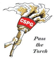
“PASS THE TORCH”
In the spirit of the Sochi Winter Olympics, the theme of the CSPG 2014 membership drive is called “Pass the Torch”. The Society is asking each of us to invite and encourage our colleagues to come home and join the CSPG. Ask your colleagues to join you in your club; managers – encourage your geoscience staff to participate in their profession. Emeritus and Honorary members who know the value of the CSPG best of all, would you be willing to enlighten a young geologist how the CSPG contributed to your career?
Since every challenge should be accompanied by motivation and fun, the CSPG is offering a motivational carrot to existing members for encouraging successful new membership. As the referring existing member, your name will
be entered into a prize draw to take place at GeoConvention in May, 2014.
The prize: On behalf of the CSPG, 4 registrations to participate in the GeoHistory Tour to the Mount Stephen Trilobite Beds in 2014. This hike is conducted by Allen Kimmel, P.Eng, P. Geol., who contributed the 3-part series in the December 2013 and January & February 2014 Reservoir publications “Geology of the Mount Stephen Trilobite Beds and Adjacent Strata near Field B.C, Yoho National Park – New Perspectives on a 127 Year Old Discovery”.
This unique prize can be shared with family, friends, colleagues or staff.
The benefit for all your participation is a greater and stronger Society, more participation in technical and networking events, and broader contribution to our communities across Canada. Imagine the strength of our society if each and every one of us successfully brought a new member home to the CSPG in 2014. Take advantage of it, and Pass the Torch.
SPEAKER
Dr. Stephen A. Sonnenberg Colorado School of Mines
11:30 am
Tuesday, March 11, 2014 Calgary, TELUS Convention Centre Macleod Hall C/D Calgary, Alberta
Please note: The cut-off date for ticket sales is 1:00 pm, three business days before event. [Thursday, March 6, 2014]. CSPG Member Ticket Price: $45.00 + GST. Non-Member Ticket Price: $47.50 + GST.
Each CSPG Technical Luncheon is 1 APEGA PDH credit. Tickets may be purchased online at https://www.cspg.org/eSeries/source/Events/ index.cfm.
ABSTRACT
The Bakken and Three Forks formations are productive across much of the Williston Basin. The first production dates back to 1953 with discoveries at the Antelope Field of North Dakota. The Bakken became an important horizontal target commencing in 2000 with the development of Elm Coulee Field in Montana. The Three Forks became a target from 2007 to the present. The USGS technically recoverable number for the Bakken and Three Forks is 7.5 billion barrels oil and 6,700 billion cubic feet of gas (USGS, 2013).
Six distinct facies are present in the Bakken of the Williston Basin. Overall the succession appears to represent shelf deposits ranging from subtidal to lower intertidal back to subtidal. The amount of limestone, dolomite and sandstone present varies across the area. In general, more dolomite and limestone is present in the southern part of the basin and the siliciclastic content increases towards the north.
The Three Forks consists largely of silty dolostone, clay-rich dolostones, red beds and anhydrites. These units were deposited in subtidal to supratidal environments in a restricted epeiric sea. Four regional units of the Three Forks have been identified and regional thicknesses and correlations established. The upper three cycles of the Three Forks are the current target of exploration. Recent cores of these intervals show significant residual oil saturation. Thus, petroleum potential in these units is high.
The Bakken and Three Forks are regarded as technology reservoirs because they require horizontal drilling and multistage fracture stimulation. Some critical geologic components for the reservoirs include sedimentary facies, mineralogy, mechanical stratigraphy, diagenetic history, overpressure, source rock maturity, natural fractures and traps. Critical technology components include lateral length, number of hydraulic fracture stages, proppant volume and type,
Webcasts sponsored by
proppant loading, fluid volume and type, fluid to proppant ratio, injection rate, treatment pressure, choke size, plug and perf versus sliding sleeve completions, and well spacing.
Dr. Stephen A. Sonnenberg is a Professor and holds the Charles Boettcher Distinguished Chair in Petroleum Geology at the Colorado School of Mines. He specializes in unconventional reservoirs, sequence stratigraphy, tectonic influence on sedimentation, and petroleum geology. A native of Billings, Montana, Sonnenberg received BS and MS degrees in geology from Texas A&M University and a Ph.D. degree in geology from the Colorado School of Mines. He has over twenty-five years experience in the industry.
Steve has served as President of several organizations including the American Association of Petroleum Geologists, Rocky Mountain Association of Geologists, and Colorado Scientific Society. He also served on the Colorado Oil and Gas Conservation Commission from 1997-2003 and was the Chair of the Commission from 19992003.
He is the recipient of the Young Alumnus Award, Outstanding Alumnus Award, and Mines Medal from the Colorado School of Mines, Distinguished Achievement Medal from Texas A&M University, distinguished service awards from AAPG and RMAG, and honorary membership awards from AAPG, RMAG and the Colorado Scientific Society. In 2013, he was awarded the Halbouty Medal from AAPG.
SPEAKER
Julia Gale
AAPG Distinguished Lecturer
11:30 am
Tuesday, March 25, 2014 Calgary, TELUS Convention Centre Macleod Hall C/D, Calgary, Alberta
Please note: The cut-off date for ticket sales is 1:00 pm, three business days before event. [Thursday, March 20, 2014]. CSPG Member Ticket Price: $45.00 + GST. Non-Member Ticket Price: $47.50 + GST.
Each CSPG Technical Luncheon is 1 APEGA PDH credit. Tickets may be purchased online at https:// www.cspg.org/eSeries/source/Events/index.cfm.
By using examples from shale reservoirs
worldwide, the diversity of shale-hosted fracture systems and the how and why various fractures systems form are presented. Core and outcrop observations, strength tests on shale and on fractures in core, and geomechanical models allow prediction of fracture patterns and attributes that can be taken into account for well placement and hydraulic fracture treatment design. Both open and sealed fractures can interact with, and modify, hydraulic fracture size and shape. Open fractures can enhance reservoir permeability but may conduct treatment fluids great distances, possibly aseismically in some instances.
The challenge of incomplete sampling of subsurface fractures has been addressed through comprehensive fracture data collection in cores and image logs and careful selection of outcrops, coupled with an understanding of how fractures and their attributes scale. Well tested mechanistic models of how fractures grow in tight sandstones and carbonates were also used to interpret fractures in shale. In order to predict fracture patterns and their attributes, it is helpful to understand the mechanism of their formation and timing in the context of the burial and tectonic histories of the basin in which they are forming. A key variable is the depth of burial, and thereby the temperature, pore-fluid pressure,


and effective stress at the time of fracture development. For the most part, the origin of fractures cannot be determined from their orientation or commonly-measured attributes such as width, height, and length. The mineral fill in sealed fractures does provide an opportunity however, and fluid-inclusion studies of fracture cements tied to burial history have been used to unravel their origin.
Interaction with hydraulic fracture treatments may serve to increase the effectiveness of the hydraulic fracture network, or could work against it. Factors governing the interaction include natural fracture intensity, orientation with respect to reservoir stress directions, and the strength of the fracture plane relative to intact host rock. The effect of calcite-sealed fractures on the tensile strength of the Barnett Shale was tested using a bending test. Samples containing natural fractures have half the tensile strength of those without and always break along the natural fracture plane. Yet in other examples, the weakness is in the cement itself, partly because of retained fracture porosity.
Natural fractures in shales likely grow by slow, chemically assisted (subcritical) propagation and a subcritical propagation criterion was used to model the growing fractures. The subcritical crack index is a mechanical rock property that controls fracture spacing and an input parameter for the models. The subcritical crack index for several shales was measured. The index is generally high for Barnett Shale – in excess of 100 – although it does show variability with facies. By contrast, subcritical indices in the New Albany Shale are much lower, and also show considerable variability. Barnett Shale subcritical indices suggest high clustering whereas New Albany Shale subcritical indices suggest fractures are likely to be more evenly spaced, with spacing related to mechanical layer thickness. The investigation of the variability in subcritical index in shale and how it might tie to other rock properties is underway.
Julia Gale started her career in geology with undergraduate studies at Imperial College, London. She obtained a Ph.D. in Structural Geology from Exeter University, UK in 1987, working on the Archean of southern West Greenland. She taught structural geology and tectonics for 12 years at the University of Derby, UK, having research interests in the Dalradian of NE Scotland and the Mona Complex of Anglesey, NW Wales. Julia moved to the University of Texas at Austin in 1998, where she is a Research Scientist at the Bureau of Economic Geology in the Jackson School of Geosciences. Her research focus is on natural fracture characterization and prediction in shale and carbonate hydrocarbon reservoirs.


SPEAKER
Howard
Wheater11:30 am
Tuesday, April 8, 2014
Calgary, TELUS Convention Centre
Macleod Hall C/D
Calgary, Alberta
Please note: The cut-off date for ticket sales is 1:00 pm, three business days before event. (Thursday, April 3, 2014). CSPG Member Ticket Price: $45.00 + GST. Non-Member Ticket Price: $47.50 + GST.
Each CSPG Technical Luncheon is 1 APEGA PDH credit. Tickets may be purchased online at https://www.cspg.org/eSeries/source/ Events/index.cfm.
The water environment faces unprecedented challenges world-wide, and water security is increasingly seen as one of the major issues for the 21st century. While floods and droughts remain some of the world’s most damaging and costly natural hazards, water resources
and water quality are under pressure, through population growth and movement, economic development, pollution and environmental change.
Despite the perception that Canada is water-rich, all of these issues are now being experienced, particularly in the Prairie Provinces. These are illustrated for the 336,000 km2 Saskatchewan River Basin, which is drained by one of the world’s larger rivers. Management concerns include: provision of water resources to more than three million inhabitants, including indigenous communities; balancing competing needs for water between different uses, such as urban centres, industry, agriculture, hydropower and environmental flows; issues of water allocation between upstream and downstream users in the three prairie provinces; managing the risks of flood and droughts; and assessing water quality impacts of discharges from major cities, industry and intensive agricultural production. Superimposed on these issues is the need to understand and manage uncertain water futures, including effects of economic growth and environmental change, in the face of highly fragmented water governance.
The talk addresses the science and management challenges for surface water and groundwater resources, including the roles of vulnerability assessment, risk-based analysis and the needs for stakeholder engagement and user-focussed decision support tools..
Webcasts sponsored by
Professor Howard Wheater is Canada Excellence Research Chair in Water Security and Director of the Global Institute for Water Security at the University of Saskatchewan. A leading expert in hydrological science, he has extensive international experience of flood, water resource and surface and groundwater quality management. He is a Fellow of the Royal Academy of Engineering and the American Geophysical Union and winner of the Prince Sultan bin Abdulaziz International Prize for Water. He was vice-chair of the World Climate Research Programme’s Global Energy and Water Cycle Exchange (GEWEX) project, leads UNESCO’s GWADI arid zone water resources program, and was recently the engineer member of an International Court of Arbitration concerning the Indus Waters Treaty. He is advisor to the state of Nevada concerning the proposed Yucca Mountain high level nuclear waste repository and was advisor to the UK government concerning site criteria for deep disposal of intermediate level nuclear waste. He was a member of Alberta’s Provincial Environmental Monitoring Panel, and his role as Chair of the Council of Canadian Academies Expert Panel on Sustainable Management of Water in the Agricultural Landscapes of Canada saw release of a report in February 2013 entitled Water and Agriculture in Canada: Towards Sustainable Management of Water Resources.

SPEAKER
Tim McHargue
11:30 am
Wednesday, April 23, 2014 Calgary, TELUS Convention Centre Macleod Hall C/D, Calgary, Alberta
Please note: The cut-off date for ticket sales is 1:00 pm, three business days before event. (Friday, April 18, 2014.) CSPG Member Ticket Price: $45.00 + GST. Non-Member Ticket Price: $47.50 + GST.
Each CSPG Technical Luncheon is 1 APEGA PDH credit. Tickets may be purchased online at https://www.cspg.org/eSeries/source/ Events/index.cfm.
ABSTRACT
Petroleum exploration in deep water settings is resulting in the discovery of many giant fields in reservoirs that accumulated in large channel systems on the continental slope. The architecture of these reservoirs is exceedingly complex. In the face of multi-billion dollar costs, it is more important than ever before to accurately characterize these reservoirs.
Based on detailed examination of turbidite channel analogs as revealed in 3D seismic data, exposed in outcrops, or preserved on the modern sea floor, two principal models of channel architecture have emerged: a cut-and-fill model, and a lateral accretion model. Both models are appropriate in at least some cases, but debate continues as to which model is most applicable in any specific case. Furthermore, it is not apparent how to reconcile the preserved facies distributions of turbidite channel deposits and prevailing concepts of turbulent flow behavior. For example, when high levees are present, we know that flows are thick. Concentration of sand within sinuous channel elements confirms that turbulent flows are highly stratified. However, these architectures seem to require that the lower and upper portions of a single flow follow paths with markedly different sinuosities and divergent, even opposing, trajectories. How can that happen? Further debate concerns the transition from channel to fan architectures. Some high resolution 3D seismic images suggest the presence of distinct distributary systems on some submarine fans while others do not. Outcrop examples with the best continuous lateral exposures appear to be incompatible with seismic images of distributary systems. The few excellent outcrop examples of lobes arguably are strongly biased. Are our best images from 3D seismic also biased? High resolution images of modern submarine fans calibrated to sediment cores might provide the answer, but such data are lacking. This quandary is not just academic. It has become clear from recent drilling in the Gulf of Mexico
Webcasts sponsored by
that reservoir quality in submarine fans is highly variable, often containing good permeability within channels in contrast to abundant argillaceous sands with low permeability in the lobes.
With continued research, the issues discussed above will be resolved, but the path forward, like the channels themselves, will be long and sinuous.
Tim McHargue went to the University of Missouri for his Bachelor’s and Master’s degrees with a thesis on Ordovician conodonts. A couple of months before graduation in 1974 came the Oil Embargo and a job offer from Phillips Petroleum. Thus began a career in the petroleum industry. A seismic interpretation project on the Indus Fan started Tim’s interest in turbidite architecture. Next, Tim returned to school at the U. of Iowa. After completing a PhD in carbonates in 1981, he accepted a position at Chevron. During the next 28 years, Tim spent about equal time in exploration and research. He returned to research in turbidite reservoirs in 1997 and eventually assembled a team to work on characterization of new discoveries in West Africa until retirement in 2009. Tim’s position as Consulting Professor at Stanford University began in 2002 where he collaborates on research on turbidite depositional systems and teaches courses on turbidite architecture and clastic sequence stratigraphy. Tim also is an Adjunct Professor at the University of Missouri.

SPEAKER
Jim Dick Director & CTO, Simba Energy Inc.
12:00 Noon
Wednesday March 12th, 2014 Nexen Plus 15 Conference Centre
Nexen Annex Building 7th Ave. and 7th Street SW Calgary, Alberta
ABSTRACT
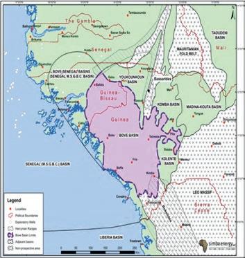
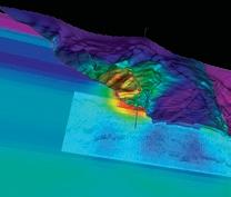
Simba Energy Inc. has a Production Sharing Contract with the Ministry of Mines and Geology of the Republic of Guinea. It holds Blocks 1 and 2 which are located within the Bove Basin. This basin covers most of the western part of the country where it creates a platform slightly deformed on its northern part during the Hercynian Orogeny tectonic movements.
The Bove Basin is a southward continuation of the Taoudeni Basin of northern Africa. Both basins were formed during the Paleozoic within a northeast - southwest trending sag in the continental crust. At the northwest, the Bove Basin extends under the Mesozoic-
I am more than the Donut and Muffin Man…….
SPEAKER
Bob Potter
- President, GeoChemTech Inc.
(SAME TIME AND LOCATION AS INTERNATIONAL DIVISION TALK, MARCH 12TH, 2014)
Tertiary Senegal (M.S.G.B.C.) Basin and the north is bounded by a mega shear zone that marks the southern end of the Mauritanides. Eastward it is cut by a major Caledonian fault that borders the Bassarides and Rockelides. In the west and southwest, it is cut by the coast and disappears as a result of erosion indicated by basement outcrops located near the shoreline.
The potential source rocks are present in the Silurian section. Previous geochemical analyses of surface samples collected in four localities ranging from Ordovician to Devonian, but mostly in the Silurian section. Also, this analysis showed an oil prone kerogen with up to 5.5% of Total Organic Carbon (TOC) values. The organic matter is represented by black amorphous kerogen (Type I).
The potential seal rocks (shale) are common through the Paleozoic sequence. The Silurian and Middle-Upper Devonian including the Upper Devonian Bafata Shales are expected to be the most significant of these, acting as primary seals for Cambrian-Ordovician and Lower-Devonian reservoirs.
The potential reservoir rocks, the CambrianOrdovician, consist of coarse white sandstone that are siliceous, calcareous or sometimes cemented by salt and are over 1,000m thick.
Exploration to date consists of a surface station and an airborne gravity surveys which are in good agreement to each other.
Sponsored by
However, numerous hydrocarbon seeps and blowouts have been reported on and around Blocks 1 and 2 that indicate an active Petroleum System is present. Geochemical survey was conducted to evaluate these shows. Also a reconnaissance trip was made to establish the validity of the reports as well as to record the geological setting.
In conclusion, according to historical Anomaly Maps, and overall results of the Initial Geochemical Reconnaissance Trip, it is suggested that Blocks 1 and 2 are highly prospective with an active petroleum system.
James W. Dick, P Geol., P. Eng., is the Chief Technical Officer and a Director of Simba Energy Inc., a TSX-V listed oil and gas company exploration junior focused on onshore frontier areas of Africa. He is president and prime consultant of J W Dick & Associates Ltd which has for 30 years served a variety of clients including major oil companies, government agencies, and startup companies. Mr. Dick has participated on projects in over 50 different countries varying from detailed reservoir studies to development and exploration programs. He spent 18 years with Imperial Oil Ltd during which time he spent 3 years on an overseas assignment with Esso Europe on the initial start-up of the British North Sea. Later he was Vice President Geology for the D&S International Consulting (10yrs) a large international consulting group, president of Quad Energy Development Corp. (10yrs) a public oil company and Chief Geologist for Mercantile International Petroleum Inc.
There is no charge. Please bring your lunch. The facilities for the talk are provided complimentary of Nexen, coffee by IHS and refreshments by Geochemtech Inc. The speakers are provided with gifts by Drilling Information and Quad Operations. For further information or if you would like to give a talk, please contact Bob Potter at (403) 863-9738 (ropotter@ geochemtech.com), Kevin Morrison at (403) 5363788 (morrison@antrimenergy.com), Jűrgen Kraus at (403) (808) 245 5086 (jkraus@ me.com), Jon Noad (403) 513 7541 (jon.noad@ huskyenergy.com) or visit our Linkedin page (“CSPG International Division”).
SPEAKER
Kirk Osadetz
(Programs Development Manager, Carbon Management Canada Inc.)
12:00 Noon
Friday, March 14th, 2014
ConocoPhillips Auditorium
Gulf Canada Square 401 – 9th Ave. S.W., Calgary, Alberta
Natural Gas Hydrates (GHs) are clathrate compounds composed of a host water molecule “cage” supported by guest molecules, usually gases. Methane and carbon dioxide are common natural guests. GHs occur widely on the global continental margins and in permafrost regions, where they may constitute among the largest global methane reservoirs. GHs have potential as: a mechanism for global and local change, an industrial purification and transportation medium, or as a future fuel resource. GHs are an inferred agent of major global change because the common guest molecules are greenhouse gases with high global warming potential. While the “clathrategun” hypothesis appears attractive, models indicate that GHs respond to, rather than initiating, warming events because of both the dissociation enthalpy and the terrestrial thermal inertial. Efficient guest molecule storage gives methane hydrates an energy potential like that of bituminous sands, which is several times greater than other unconventional gas resources. As a result, a considerable global effort has been made to characterize, test and realize GH fuel potential. The results of these efforts, particular test wells at the Mallik site in the Mackenzie Delta, indicate that GHs could be potential commercial or strategic fuel resources. Production strategies include GH dissociation by any or some combination of pressuredepletion, active heating, “freezing-point” depression, or gas displacement. The next step is a protracted production test, possibly at a Canadian location, where alternative predictions from reservoir simulations can be resolved. Canada has unparalleled opportunities and prospects to advance GH technologies that could result in new globally-leading industrial,
employment and research opportunities despite current commodity price disincentives. In addition, carbon dioxide GHs represent a potential mechanism for secure geological carbon storage that can contribute to future carbon management strategies and emissions reductions, often with a by-product income stream, including enhanced natural gas production. Industrial applications like clathrate-based water purification/desalinization or pelletized GH transportation provide carbon utilization opportunities where secure geological storage is not a local or cost-effective option.
Kirk Osadetz is a Geology graduate from the University of Toronto (B.Sc. 1978; M.Sc. 1983). He manages Programs Development at Carbon Management Canada Research Institutes Inc. where he is working to construction a field facility to develop, demonstrate and evaluate technologies for the improved characterization, monitoring and verification of subsurface containment applied to: secure geological storage, enhanced recovery, induced hydraulic fracturing and steam chamber development. He managed the Geological Survey of Canada’s
Geoscience for Future Energy Resources program, including unconventional petroleum, secure carbon storage, geothermal energy and gas hydrate commercialization. He worked previously at Petro-Canada Exploration Inc. and Gulf Canada Resources. He contributes to scientific publications and meetings to report his work with colleagues in Canada and abroad. He is a past-President of the CSPG, has volunteered for several of its activities and is the recipient of some of its awards. Currently he is a Trustee of the CSPG Education Trust Fund, a key mechanism for CSPG outreach, which all Members can support.
BASS Division talks are free. Please bring your lunch. For further information about the division, joining our mailing list, a list of upcoming talks, or if you wish to present a talk or lead a field trip, please contact either Steve Donaldson at 403-766-5534, email: Steve. Donaldson@cenovus.com or Mark Caplan at 403-975-7701, email: mcaplan@atha.com or visit our web page on the CSPG website at http://www.cspg.org.

SPEAKER
Damien Thenin Associate, Earth Modeling Specialist RPS Energy12:00 Noon
Wednesday, March 26th, 2014 Place: TBA Calgary, Alberta
ABSTRACT
Recent innovations in drilling and completion technology have resulted in a rapid rise of the number of Multiple Hydraulic Fracture Horizontal Wells (MFHW) being used to access oil and gas in tight (low permeability) matrix reservoirs. These so called “Unconventional Oil and Gas Field” reservoir development schemes are now a major focus for many operating companies. What is less apparent is the impact MFHWs will have on future waterfloods, and any form of future enhanced oil recovery interwell displacement process. The compelling questions are:
1. How closely spaced should these wells
be drilled in order to effectively (read economically) drain these reservoirs?
2. How long should they be?
3. How large a fracture should be implemented?
4. What fracture half-lengths should be targeted?
5. What fracture spacing should be used?
6. How should the fractures be spaced relative to the adjacent well’s fractures?
Unfortunately the optimization of each of these design parameters is different depending on whether only primary production is being considered or a combination of primary and secondary recovery is anticipated.
This presentation will address the answers to these questions, from a static geological and dynamic reservoir modeling perspective. The following topics will be addressed:
1. How to achieve adequate geological reservoir characterization using fewer vertical wells and with more horizontal well coverage.
2. How to represent the hydraulic fracture influences in the geological grid and in the dynamic reservoir simulator
Sponsored by
a. Superficial methods
b. Idealistic methods
c. Proxy methods
3. Proposed workflows for finding optimum MFHW designs for both primary and secondary scenarios.
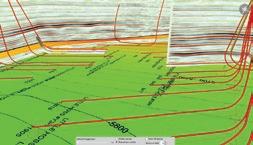
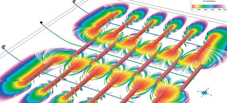
Conceptual example of streamlines simulated between MFHW (two injectors and one producer) in a tight oil reservoir
Damien Thenin graduated from the Nancy School of Geology in France in 2003 with a Master degree of Engineering and Earth Sciences. During his three years in Nancy he specialized in Petroleum Geology and worked on geomodeling projects with the GOCAD Research Group. Damien worked in the Middle East and in Canada with Earth Decision, Paradigm and then RPS, providing geomodeling consulting services in the oil & gas, mining and gas storage industries. He has more than 10 years of geomodeling experience. He worked on a variety of conventional and unconventional resource plays in North America, South America, Middle East, Asia and West Africa.
INFORMATION
There is no charge for the division talk and we welcome non-members of the CSPG. Please bring your lunch. For details or to present a geomodeling talk in the future, please contact Weishan Ren at (403) 724-0325, e-mail: wren@statoil.com.

In some unconventional reservoirs, the presence of kerogen confounds standard log analysis models. Kerogen looks a lot like porosity to most porosity-indicating logs. Thus a single log, or any combination of them, will give highly optimistic porosity and free-gas or oil saturations, unless a kerogen correction is applied. This tutorial explains how such corrections can be applied in an otherwise standard petrophysical model that can be coded into the user-defined equation module of any software package.
Some quick-look methods “fake” the kerogen correction by using the density log with false and fixed matrix and/or fluid properties in an attempt to match core porosity (where it exists). When mineralogy varies, as in many unconventional reservoirs, the individual porosities calculated at each depth level are wrong, even though the average porosity may be correct. Porosity in the more dolomitic intervals will be too low and those in the higher quartz intervals will be too high. This will not help you decide where to position a horizontal well or help to assess net pay intervals because the porosity profile is extremely misleading.
Over-simplified techniques are dangerous, unprofessional, and unnecessary. Drawing an arbitrary straight line on a density log won’t “hack-it” in a world where wells cost multiple millions and a company’s stock price depends on the accuracy of the numbers in quarterly reports.
The 12-Step deterministic solution described here is easy to understand, easy to apply, and reasonably rapid. It is easier to manage than multi-mineral / statistical / probabilistic models. Parameter changes in later steps of the workflow will not change prior results, as happens in the multimin environment. Each step in the model can be calibrated directly to available data before moving on to the next step. The workflow is simple, straight-forward, logical, controllable, and above all, predictable.
The methodology outlined below makes
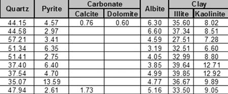
Figure 1: Typical XRD analysis of a silty gas shale showing clay-quartz ratio averages of about 40:60% by weight. This would not be obvious from the gamma ray log due to uranium associated with the kerogen and/or phosphate minerals. Some radioactive reservoirs have nearly zero clay, so the XRD bulk clay volume is the best starting point for a petrophysical analysis
use of well-known algorithms, run in a deterministic model that can be calibrated with available ground truth at every step of the process. Because of the sparse nature of some of the calibration data, it may have to come from offset wells, which forces us to analyze those wells in addition to the wells of primary interest. This extra work can be minimized when the proper data collection and lab work is planned as part of the initial drilling program.
One of the most widely used petrophysical porosity models in conventional reservoirs is the shale-corrected density-neutron complex lithology crossplot. It handles varying mineralogy and light hydrocarbon effects quite well and can use sonic data if the density goes AWOL in bad hole conditions. By extending the model to include a kerogen correction to each of the density, neutron, and sonic curves, we have a universal model that has proven effective over a wide range of unconventional reservoirs around the world. The model reverts to the standard model when kerogen volume is zero.
Other steps in the workflow use existing standard methods chosen because they work well in low porosity environments. There are many alternate models for every step and you may have a personal preference different than ours. Be sure to run a sensitivity test to confirm that the results are reasonable at low porosities with high clay volumes.
The petrophysical model for correcting porosity for kerogen involves calculation of kerogen weight and volume from suitable petrophysical models, and the modification of a few equations in the standard shale corrected density-neutron porosity model.
Shale (or clay) volume is the most important starting point. Since many unconventional reservoirs are radioactive due to uranium associated with kerogen or phosphates, the usual clay volume model that depends on the gamma ray log needs special attention. Calibration to X-ray diffraction data (see example in Figure 1), or thin section point counts, is essential. The basic mineral mix also is developed from the XRD data set.
Shale volume calculations from a uranium corrected gamma ray curve (CGR) is the best bet:
1: VSHcgr = (CGR - CGR0) / (CGR100 - CGR0)
When CGR is not available, we fall back to the thorium (TH) curve from a spectral gamma ray log:
2: VSHth = (TH - TH0) / (TH100 - TH0)
When CGR and TH are missing, the total gamma ray curve (GR) can still be used by
(Continued on page
Figure 2: Geochemical lab report with TOC weight % values. Both Passeyy and Issler methods overestimate TOC by large factors in this particular shale gas, forcing us to use scaling factors to calibrate log derived Wtoc. Both methods can be made to give virtually identical results when calibrated to XRD.
(...Continued from page 19 )
moving the clean (GR0) and shale (GR100) lines further to the right compared to conventional shaly sands:
3: VSHgr = (GR - GR0) / (GR100 - GR0)
This last equation may take a little skill and daring, but that is what the XRD clay volumes are for. You can also test your clean and shale line picks in wells with CGR or TH curves then move that knowledge into other wells.
Unless shale volume is reasonably calibrated, nothing else in this workflow will work properly.
Step 2: Kerogen Weight Fraction
Kerogen weight fraction can be calculated from the resistivity log and a porosity log, using Passey or Issler methods. The Passey model is often called the “DlogR” method, with the “D” standing for “Delta-T” or sonic travel time. He also published density and neutron log versions of the equations. We have changed the abbreviations to reflect the three possible combinations:
4: SlogR = log (RESD / RESDbase) + 0.02 * (DTC – DTCbase)
5: Wtoc = SF1s * (SlogR * 10^(0.297 – 0.1688 * LOM)) + SO1s
OR
6: DlogR = log (RESD / RESDbase) – 2.5 * (DENS – DENSbase)
7: Wtoc = SF1d * (DlogR * 10^(0.297 – 0.1688 * LOM)) + SO1d OR
8: NlogR = log (RESD / RESDbase) -+ 4.0 * (PHIN – PHINbase)
9: Wtoc = SF1n * NDlogR * 10^(0.297 –0.1688 * LOM)) + SO1n
Where:
• XXXXbase = baseline log reading in nonsource rock shale
• SlogR or DlogR or NlogR = Passey’s number from sonic or density or neutron log (fractional)
• LOM = level of organic maturity (unitless)
• Wtoc = total organic carbon from Passey method (weight fraction)
• SF1s,d,n and SO1s,d,n = scale factor and scale offset to calibrate to lab values of TOC
The constants in the Passey equations require DTC values in usec/ft and density in g/cc.
The baseline values are supposed to be picked in non-source rock shales in the same geologic age as the reservoir, but there may be none in the area of interest. This makes the Passey model difficult to calibrate, hence the scale factor SF1 and scale offset SO1. LOM is seldom measured except as vitrinite reflectance (Ro). There is a published chart for converting Ro to LOM. LOM is in the range of 6 to 11 in gas shale and 11 to 18 in oil shale.
Issler’s method, which is based on WCSB Cretaceous data is preferred as no baselines are needed. It still needs a scale factor for deeper rocks. Tristan Euzen’s multiple regressions of the Issler graphs give:
10: TOCs = 0.0714 * (DTC + 195 * log(RESD)) - 31.86
11: Wtoc = SF2d * TOCs / 100 + SO2d OR
12: TOCd = -0.1429 * (DENS – 1014) / (log(RESD) + 4.122) + 45.14
13: Wtoc = SF2s * TOCd / 100 + SO2s
Where:
• Wtoc = total organic carbon from Issler method (weight fraction)
• SF2s,d and SO2s,d = scale factor and scale offset to calibrate to lab values of TOC
The Issler equations expect density in Kg/m3 and sonic data in usec/m.
Mass fraction organic carbon (Wtoc) results from log analysis MUST be calibrated to geochemical lab data (see example lab report in Figure 2) using the scale factor and scale offset. These scale factors will vary from place to place even within the same geological horizon. Using the Passey or Issler models without local calibration is strongly discouraged – results are often 2 to 3 times too high.
Kerogen volume is calculated by converting the TOC weight fraction (Wtoc). The lab TOC value is a measure of only the carbon content in the kerogen, and kerogen also contains oxygen, nitrogen, sulphur, etc, so the conversion of TOC into kerogen has to take this into account. The kerogen conversion factor (KTOC) is the ratio of carbon weight to the total kerogen weight. The factor can range from 0.68 to 0.95, with the most common value near 0.80.
Converting mass fraction to volume fraction is as follows:
14: Wtoc = TOC% / 100 from core, or as found from Passey or Issler methods described above.
15: Wker = Wtoc / KTOC
16: VOLker = Wker / DENSker
17: VOLma = (1 - Wker) / DENSma
18: VOLrock = VOLker + VOLma
19: Vker = VOLker / VOLrock
Where:
• KTOC = kerogen conversion factor Range = 0.68 to 0.95, default = 0.80
• Wker = mass fraction of kerogen (unitless)
• DENSker = density of kerogen (Kg/m3 or g/ cc)
• DENSma = matrix density (Kg/m3 or g/cc)
• VOLxx = component volumes (m3 or cc)
• Vker = volume fraction of kerogen (unitless)
DENSker is in the range of 1200 to 1400 Kg/ m3, similar to good quality coal. Default = 1300 Kg/m3. Lower values are possible in low maturity kerogen.
Step 4: Kerogen and Shale Corrected Porosity
Effective porosity is best calculated with the shale corrected density neutron complex lithology model, modified to correct for kerogen volume:
21: PHIDker = (2650 – DENSker) / 1650 (if PHIN is in Sandstone Units)
22: PHIdc = PHID – (Vsh * PHIDsh) – (Vker * PHIDker)
23: PHInc = PHIN – (Vsh * PHINsh) – (Vker * PHINker)
24: PHIe = (PHInc + PHIdc) / 2
PHINker is in the range of 0.45 to 0.75, similar to poor quality coal. Default = 0.65.
This model compensates for variations in mineralogy AND kerogen.
If the density log is affected by rough borehole, the shale corrected sonic log porosity (PHIsc) can be used instead:
24: PHISker = (DTCker – 182) / 474 (if PHIN is in Sandstone Units)
25: PHIsc = PHIS – (Vsh * PHISsh) – (Vker * PHISker)
26: PHInc = PHIN – (Vsh * PHINsh) – (Vker * PHINker)
27: PHIe = (PHInc + PHIsc) / 2
DTCker is in the range of 345 to 525 usec/m, similar to good quality coal. Default = 425 usec/m.
This model is moderately insensitive to variations in mineralogy AND compensates for kerogen.
Effective porosity from a nuclear magnetic resonance (NMR) log does not include kerogen or clay bound water, so this curve, where available, is a good test of the modified density neutron crossplot method shown above (illustrated in Figure 3).
In all cases, good core control is essential. If porosity is too low compared to core porosity, then shale volume or kerogen volume are too high. Revisit the calibration of these two terms.
Some so-called shale gas zones are really tight gas with little kerogen or adsorbed gas, so the kerogen corrected complex lithology model
(Continued on page 23 ...)
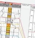
Figure 3: Example of TOC weight fraction (left hand curve in Track 1) calibrated to geochemical lab data in the Montney (2 dots near bottom of log segment – another 20+ data points are not shown to conserve space). Kerogen volume derived from TOC is displayed as dark shading to the left of effective porosity (shaded red) in Track 1. In the Doig above the Montney, there is no geochem data, so the NMR effective porosity (light grey curve) was used to back-calculate the TOC, based on the difference between raw neutron-density porosity and PHIEnmr values. Scale factors for the Doig and Montney are markedly different regardless of the TOC calculation method employed. Depth grid lines are 1 meter apart.


works well because it reverts to our standard methods automatically when Vker = 0.
A full suite of TOC and XRD mineralogy from samples, along with core porosity and saturation data, are needed to calibrate results from any petrophysical analysis of unconventional reservoirs. Bulk clay and TOC are the two critical lab measurements required through the interval of interest. Without valid calibration data, petrophysical analysis will have possible-error bars too large to allow meaningful financial decisions.
Of particular importance is the fact that Passey and Issler methods for determining TOC from logs will probably require a scale factor to match lab measured data. This fact is not well known and ignoring the problem can lead to large errors in porosity, free gas, and adsorbed gas estimations.
Part 2 of this article will describe the balance of the 12 Step Program for evaluating unconventional oil and gas reservoirs.
E. R. (Ross) Crain, P.Eng. is a Consulting Petrophysicist and Professional Engineer, with over
50 years of experience in reservoir description, petrophysical analysis, and management. He is a specialist in the integration of well log analysis and petrophysics with geophysical, geological, engineering, stimulation, and simulation phases of the oil and gas industry, with widespread Canadian and Overseas experience. He has authored more than 60 articles and technical papers. His online shareware textbook, Crain’s Petrophysical Handbook, is widely used as a reference for practical petrophysical analysis methods. Mr. Crain is an Honourary Member and Past President of the Canadian Well Logging Society (CWLS), a Member of SPWLA, and a Registered Professional Engineer with APEGA ross@spec2000.net
Dorian Holgate is the principal consultant of Aptian
Technical Limited, an independent petrophysical consulting practice. He graduated from the University of Calgary with a B.Sc. in Geology in 2000 and completed the Applied Geostatistics Citation program from the University of Alberta in 2007. After graduation, he began working in the field for BJ Services (now Baker Hughes) and completed BJ’s Associate Engineer Program. Later, he joined BJ’s Reservoir Services Group, applying the analysis of well logs to rock mechanics to optimize hydraulic fracturing programs. In 2005, Dorian joined Husky Energy as a Petrophysicist and progressed to an Area Geologist role. He completed a number of petrophysical studies and built 3-D geological models for carbonate and clastic reservoirs. Dorian holds membership in APEGA, CSPG, SPE, SPWLA, and CWLS. dorian@aptianpetrophysics.com
Work on Canadian Discovery and partners’ Duvernay Project is well underway. This study evaluates the Geomechanics, Hydrocarbon Systems and Geological Setting of the Devonian Duvernay Formation in the Kaybob to Willesden Green Area.
Results to date indicate:
» Variable lithology and a well-defined facies/ lithology dependent fracture fabric
» Stratigraphy shows a possible extension to the current play areas
» Geochemistry shows source rock maturity is strongly related to heat flow variations
A geomechanical evaluation, detailed geochemistry, hydrogeology and reservoir mapping will be completed prior to study delivery.
Stanley Slipper Gold Medal for Outstanding Career Contributions to Oil and Gas Exploration in Canada
R. Marc Bustin
R.J.W. Douglas Medal for Outstanding Contributions to the Understanding of Sedimentary Geology in Canada
James Christopher
Honorary Membership for Distinguished Service to the Society
Graeme Bloy
George Eynon
Lisa Griffith
Brad Hayes
John Hogg
Ian Hutcheon
Craig Lamb
Robin Mann
Terry McCoy
Bruce McIntyre
Kirk Osadetz
Jeff Packard
Peter Putnam
Jim Reimer
Kathryn Scales
Ric Sebastian
John Varsek
Colin Yeo
Link Award for Best Presentation – Technical Luncheon Series
Shahin Dashtgard
Medal of Merit for Best Paper Related to Canadian Petroleum Geology
Brett Miles
Ross Kukulski
M. Keegan Raines
John-Paul Zonneveld
Andrew Leier
Stephen Hubbard
“A stratigraphic framework for Late JurassicEarly Cretaceous gas-bearing strata (Monteith Formation) in the subsurface of northwest Alberta”, Bulletin of Canadian Petroleum Geology, March 2012, v.60, p. 3-36
Graduate Student Thesis Award
– Best M.Sc.
Candace Brintnell
“Architecture and Stratigraphy of the Lower Silurian Guelph Formation, Lockport Group, Southern Ontario and Michigan”, supervised by Frank Brunton (Ontario Geological Survey), Drs. Jisuo Jin and Cameron J. Tsujita (Western University, London, Ontario)
President’s Award for Outstanding Service by a CSPG Member
Robin Mann
H.M. Hunter Award for Distinguished Service to the Society
Ben McKenzie
Tracks Award for Members Who Have Set New Standards of Excellence
Riona Freeman
Service Awards for Members who have Served the Society for over Five Years
James Ablett
Norbert Alwast
George Ardies
Peter Aukes
Jim Barclay
Andreas Bayer
Phillip Benham
Tim Bird
Graeme Bloy
Chuck Buckley
Mark Caplan
Jean-Yves Chatellier
Burns Cheadle
Richard Chisholm
Nancy Chow
Andre Chow
David Clyde
Doug Colvin
Andrew Cook
Thomas Cox
Barrie Dargie
Tim de Freitas
Foon Der
Ian DeWolfe
Steve Donaldson
Tina Donkers
Dave Drover
Steve Dryer
Bob Earle
Markus Ebner
Ashton Embry
Richard Evoy
Jocelyn Frankow
Lloyd Freeman
Milovan Fustic
Jean-Francois Gagnon
David Garner
Chad Glemser
Darcie Greggs
Tony Hamblin
Peter Hay
Doug Hayden
Greg Hayden
Peggy Hodgkins
John Hogg
Norm Hopkins
Kristy Howe
Greg Hu
Steve Hubbard
Roger Hume
Michele Innes
Dale Issler
Wim Jalink
Don Keith
Ian Kirkland
Peter Kouremenos
Michael LaBerge
Shawn Lafleur
Larry Lane
Jason Lavigne
Sid Leggett
Greg Lynch
Alex MacNeil
Bill Marshall
Darin McBeath
Margot McMechan
David Middleton
Keith Millis
Stephen Minions
Ryan Mohr
David Morrow
Hugh Mosher
Jon Noad
Brett Norris
Taylor Olson
Kirk Osadetz
Brenda Pearson
John Peirce
Guy Plint
Frank Pogubila
Bob Potter
Brian Pratt
Mark Rabin
Mark Radomski
Indy Raychaudhuri
Trent Rehill
Claude Ribordy
Mike Rogers
Jen Russel-Houston
Terry Sami
Armin Schafer
Chris Seibel
Heather Slavinski
Randy Smith
Tom Sneddon
Meghan Speers
Lavern Stasiuk
Glen Stockmal
Naomi Storey
Mike Swain
Martin Teitz
Scott Thain
Clint Tippett
Tim Truax
Tony Wain
John Waldron
Michael Webb
Gerald Wendland
Jay Williams
Nick Wilson
Colin Yeo
Volunteer Awards for Members who have served the Society for up to Five Years
Johanna Alvarez
Heather Archibald
Ryan Axani
Olena Babak
Andreas Bayer
Ian Bell
Barry Bennett
Khaled Benzaoui
Kyla Bishop
Jeff Boisonneault
Mary Borrero
Ryan Brenner
Gary Bugden
Tony Cadrin
Guoxiang Chi
Andrew Couch
Noel Devere-Bennett
Ruben Dominguez
Hailey Doney
Rory Dunphy
Paul Durkin
Kyle Durocher
Marc Enter
Mark Ferry
Jeff Fisher
Francis Fortin-Morin
Daniel Gee
Raymond Geuder
Tony Habib
Fatima Halari
Anne Hargreaves
Gareth Hatto
Brian Hester
Andrea Hood
Amir Hosseini
Kristy Howe
Dante Huff
Biyi Ishola
Megan Jamer
Thomas Jerome
Kevin Keogh
Larraine Kish
Melanie Klucker
Nate Kreiger
Lawrence Kwak
Stan Lavender
Jaime Lo
Leena Markatchev
Jonathan Marshall
Ryan Martin
Jane Marzetti
Darin McCollum
Les McMillan
Megan Miller
Peter Miskell
Andrew Nicol
Eric Niven
Jennifer Noade
Rob North
Olateju (Ted) Ogungbe
Erik Parker
Kyla Poelzer
Garrett Quinn
Diana Ramirez
Andrew Riben
Cindy Robinson
Kevin Root
Priyanka RoyChowdhury
Jesse Schoengut
Jacey Seebach
Megan Simons
Brant Skibsted
Catherine Skilliter
Geoffrey Speers
Stan Stancliffe
Ryan Szol
Marc Taylor
Damien Thenin
Elizabeth Turner
Stephen Uzozie
Andrew Vogan
Cole Webster
Marissa Whittaker
Andrew Willis
Dan Wright
Keith Yaxley
Stefan Zanon Yi Zhao

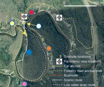
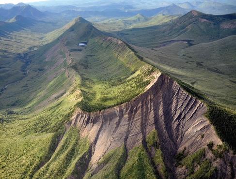
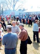
Trailhead: Proceed 55km north of Fort McMurray on Hwy 63, turn left on access road to Fort MacKay. Drive 4km and turn left on the new CNRL / Total access road. Drive 7km and turn left on a gravel road (about 0.5km past the new MacKay River bridge) and continue another 0.4 km south. Park your car here as the rest of the road is impassable.
Distance: ~1.7 km along the forestry road, then a 150 m cross-cut through the forest to access the outcrops. The hike is an additional 2.5 km loop. Walk counterclockwise around the river meander. The trail is not marked, but it is easy to follow along the natural ridges and river bank (when river is low). Fall colors are spectacular.
Elevation Gain: ~100 m from the top of the outcrop to river level.
The Reservoir Committee welcomes contributions from our readership to this series. If you wish to offer a submission to Go Take a Hike on your favourite hike of geological interest, email the Reservoir at Emma.MacPherson@cspg.org for more information.

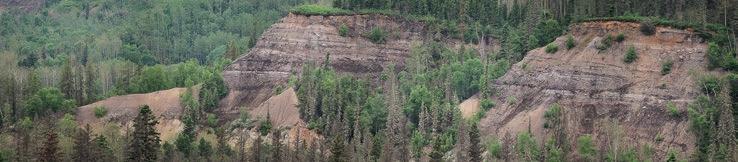
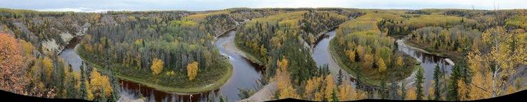
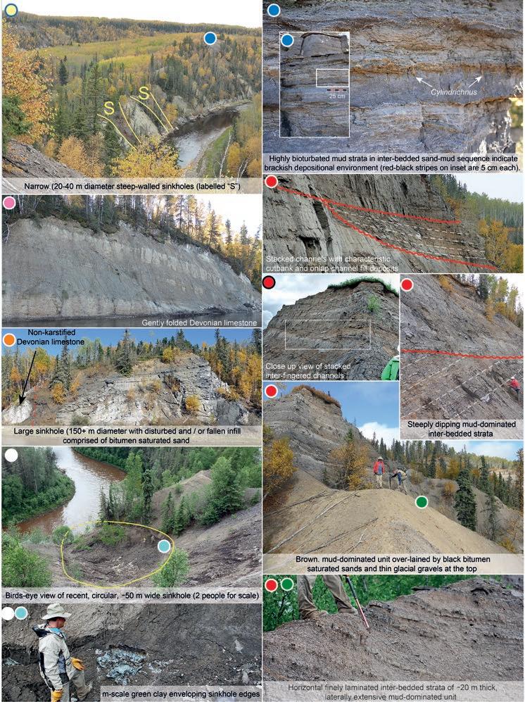
Athabasca Oil Sands are not only a globally important petroleum resource, but also the largest exhumed petroleum reservoir on Earth. This short, easily accessible trail is a world class natural laboratory. One observes many natural phenomena in outcrops (rock record) as well as modern geological processes in action. Spectacular setting created by highly sinuous, deeply incised (>100m), meandering MacKay River provides unparalleled 360o viewpoints and the opportunity for examining many large scale features and their relationships in 3-dimensions. These exposures present textbook examples for geological correlations across space and time.
Spectacular cliff exposures of the Moberly Member of the Beaverhill Lake Group (Devonian marine limestone and shales) contain an abundance of brachiopods and stromatoporoids. Outstanding 2- and 3-D exposures of four closely spaced sinkholes (ranging from 20 to 150m in diameter) provide the unparalleled opportunity to walk within their unique fills and examine contacts with non-karstified limestone sidewalls. Sinkholes are commonly enveloped by an enigmatic m-scale thick green clay. Karst induced sinkholes, faulting and folding will make one think if these processes occurred pre-, syn- or post-depositional relative to the overlying clastic Lower Cretaceous McMurray Formation.
Part of the walk goes along, perhaps the best exposed laterally extensive, mud-dominated unit in any of the McMurray outcrops. Finely laminated strata of this unit displays both horizontal and steeply dipping (up to 10o) strata, suggest that deposition occurred on both floodplain and laterally accreting point bars of low-gradient, slowly migrating river(s), respectively.
The upper part of the exposure is dominated by a series of bitumen saturated, easily recognizable channel cuts and fills ranging in thickness from 2 to 20m. Channel relationships are sometimes straightforward, but more commonly enigmatic. Thus, these features are easy to observe and somewhat harder to interpret in space and particularly in time. Mudstone strata range from bioturbation free to very bioturbated with an abundance of Cylindrichnus (brackish depositional environment indicators).
The McMurray Formation is covered by variably incised glacial deposits which allows for feeling the power of geologically recent (~10.000 years) movement of ice sheets more than a 1km thick that cannibalized surficial geology of the region. Glaciation brought granite, metamorphic and carbonate boulders/gravel which is desperately needed for construction purposes in the area. There is present day geology in action: karsting, erosion, weathering, channel incision, deposition along the river and its brown color caused by high concentration of tanic acids from poorly drained Holocene muskeg (commonly misinterpreted to be due to high-concentration of oil or iron)

Foreland basins host a multitude of resources including hydrocarbons and geothermal heat. In Germany an evolving geothermal industry develops economic geothermal resources from play types that are similar to those found in Alberta. Resource potential is especially high in the foredeep, close to the frontal fault of the orogenic belt where viable amounts of heat exist in high permeability domains. The technology to access and utilize deep geothermal resources in foreland basins exists, and is now ready to be adapted to the Alberta situation
The geothermal industry struggles with similar development challenges as the hydrocarbon industry including: Play type assessment, and the identification
of uncertainty and risk, among other identical topics. Soon a new geothermal play type catalog will be published by the International Geothermal Association. This play type catalog is based on comparable petroleum plays. Certainly the new geothermal play type catalog will be a game changer in geothermal exploration, and will allow analog comparison of exploration/exploitation concepts in a meaningful geologic context.
The CSPG will run a geothermal energy conference with key aims of: (I) to introduce the catalog on geothermal play types before it is released to public, (II) to bring two industries together–geothermal and hydrocarbon – which share the challenge of exploring and enhancing similar reservoir rock in
comparable play types (i.e. foredeeps in foreland basins), and (III) to identify mutual interests but also different lessons learned of the German geothermal industry with the Albertan hydrocarbon industry. The ultimate goal is to discover synergies between experienced industry in geothermal energy production and hydrocarbon industry with expertise in Alberta foreland geology, to spur economic opportunities for renewable energy development in Alberta.

The R.J.W. Douglas Medal is awarded annually by the Canadian Society of Petroleum Geologists for outstanding contributions to the understanding of sedimentary geology in Canada, commending major contributions to regional tectonics, petroleum and structural geology. The award is open to all geologists who follow the example of Bob Douglas in contributing to the development of Canadian sedimentary, petroleum, and structural geology. The 2013 recipient is Dr. James E. Christopher, as chosen by the R.J.W. Douglas Medal award committee.
James (Jim) Christopher was born in Philadelphia, PA, but in his formative years was sent to live with his maternal grandparents in Jamaica. It was there that he received his elementary and secondary schooling, and sat the Cambridge University entrance exams. However, because of family finances, attending university was not an option. He returned to the U.S., and worked as a migrant laborer before joining the U.S. military. He served in the European theatre in time to become a member of the U.S. Army of Occupation. After the war, Jim worked for the U.S. Army Map Service in Washington, and subsequently in his home town of Jersey City in the manufacturing industry. During that time he took university night classes at a community college and then transferred to Columbia University where he graduated with a Bachelor’s degree in geology. Armed with several scholarships, Jim enrolled at Ohio State University, where he obtained an M.Sc. degree, followed by his Ph.D. in 1959. After graduation, due to a lack of job opportunities in his own country, James headed north to Canada, accepting a position as research geologist with the Saskatchewan Department of Mineral Resources. Thus began an immensely productive and illustrious career spanning over 50 years.
the northern U.S. states. In all of his landmark studies, Jim carefully integrated sedimentological observations with regional stratigraphy and structural controls. His classic Saskatchewan Geological Survey works include the 1961 report on DevonianMississippian transition beds in southern Saskatchewan, 1964 and 1966 reports on the Middle Jurassic Shaunavon Formation of southwestern Saskatchewan, and the 1974 monograph dealing with the Upper Jurassic and Lower Cretaceous Mannville Group of Southern Saskatchewan. All of these subsurface reports provided the template for subsequent and ongoing development of prolific oil fields in the Bakken and Torquay formations in southern Saskatchewan and southwest Manitoba, and the Lower Shaunavon, Success, and Lower Mannville formations in southwest and western Saskatchewan.
Jurassic- Lower Cretaceous strata of Saskatchewan, published in 2003.
Dr. Christopher, deservedly so, has earned both national and international recognition and respect for his outstanding career. He was inducted into the Saskatchewan Oil Patch Hall of Fame in 1989. Honorary Membership in the Canadian Society of Petroleum Geologists (CSPG) was bestowed upon him in 1996, and in 2004 he became one of the first inductees to the Honor Roll of the Saskatchewan Geology Society (SGS). Jim is a two-time President of SGS, and served several terms as Saskatchewan District representative to the American Association of Petroleum Geologists (AAPG). In 1990 the geology alumni of Ohio State University honored him with the Orton Award for “honor of distinction among alumni of the department and in measure of esteem for achievement of exceptional order.”
Dr. James Ellis Christopher certainly epitomizes what Bob Douglas stood for, and is a natural to receive this award.
Our Apologies! In the February issue, the conclusions to Part Three of Al Kimmel's article on the Burgess Shale were not complete. The fourth conclusion is now published here in its entirety.
James Christopher’s contributions to the development of Canadian sedimentary geology and related petroleum and structural geology are immeasurable. He is recognized as THE expert in the stratigraphy, sedimentology, petroleum geology, and tectonics of the Saskatchewan part of the Williston Basin, contiguous basin segments in Manitoba, Alberta, and
While undertaking the above-mentioned studies, Jim Christopher also published and edited numerous short papers, symposia, and summaries of investigations. All this as he rose through the ranks from research geologist, to chief geologist, culminating in Director of the Saskatchewan Geological survey in 1982. He remained Director until he officially “retired” in 1987, but continued working on many aspects of Phanerozoic geology and completing perhaps his crowning achievement, Report no. 223 on the Upper
Fourth, the absence of Ogygopsis or equivalent shale within the Yoho Valley Burgess exposures and on Fossil Ridge (the Walcott Quarry) has perplexed researchers for over a century. Given the Basal Cathedral and Ogygopsis strata on the TBS are found within the thrust package, they were deposited at least two kilometres (likely significantly further) to the west southwest of the syndepositional strata exposed below/ adjacent to the Cathedral Escarpment on the northern face of Mount Stephen and the southern face of Mount Field.
Cabra Consulting Ltd.
Cougar Consultants, Inc.
RIGSAT Communications
Total Gas Detection Ltd.
Apache Canada Ltd.
Continental Laboratories (1985) Ltd.
Advanced Flow Technologies
Crescent Point Energy
EV Cam Canada Inc.
Serpa Petroleum Consulting Ltd.
RPS Energy Canada Ltd.
Canada Brokerlink Inc.
Energy Navigator
Exova Canada Inc
GranTierra Energy Inc.
Sigma Explorations Inc.
Pason System Corp.
Pulse Seismic Inc
Serpa Petroleum Consulting Ltd.
Compass Directional Services
Fekete
Core Laboratories
Edge Technologies Inc.
BDO Canada LLP
Birchcliff Energy Ltd.
Datalog Technology Inc.
GeoSpace Technologies
Knowledge Reservoir
Sproule Associates Limited
Geotir
Glacier Exploration Surveys
Matrix Solutions Inc.
McDaniel & Associates Consultants Ltd.
Mcleay Geological Consultants Ltd.
National Oilwell Varco
Statcom Ltd.
Matrix Geoservices Ltd.
Maxam Seismic Explosives
SAExploration
Trident Exploration Corp.
Sourcex
Regent Resources
Nickpoint Environmental Services
AS OF FEBRUARY 10, 2014
CSPG welcomes our 2013 Corporate Supporters! The benefits of being a corporate member include:
• Recognition in the monthly Reservoir and quarterly Bulletin
• One associate membership
• Reserved tables at the technical luncheons with your company logo
• One free pass to the CSPG Core Conference
…and more! Contact Kasandra Klein at kasandra.klein@cspg.org to be a corporate member today!
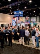
May 12-16, 2014, www.geoconvention.com
GeoConvention is one of the largest geological gatherings in the world. It is an opportunity for students and professionals to meet and share in the knowledge and skills they require to perform exciting research, locate new resources, unlock unconventional resources, and develop new and exciting innovations and technology.
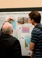
One reason for its continuing success is the tireless efforts of volunteers. Every year, hundreds of student and professional volunteers commit their time and talent to make the convention function.
The question this raises is: Why? Why should one volunteer?
There are many reasons that may motivate one to volunteer. The need to help others or give back to their respective societies could be the main reason. Perhaps the opportunity for personal growth such as confidence and self-esteem, or developing interpersonal career skills including communication, organization, and leadership are the motivations. Networking is an important skill in our industry and maybe volunteers’ goals are to meet others and make lasting friendships and connections. Or perhaps the main reason is the costs savings students receive when they volunteer.
Whatever the goal, volunteers will find that the benefits to themselves and to other recipients are highly rewarding. It has been said, “It is better to give than to receive.” As volunteer coordinator for the last two conventions, I can truly attest to that.
So, what will the convention look like as a volunteer? First, volunteers will be given the option for a pre-event TELUS Convention
Centre orientation to familiarize them with the layout of the facilities. This also serves as a great way to meet other volunteers before the convention officially begins. Once the convention begins, volunteers will “check-in” with me before their shifts begin and then head out to their pre-determined roles to help the other delegates, speakers, judges, poster presenters, and organizers.
Volunteering space is limited and you will have a better chance to land your preferred volunteer position if you apply early. If you are interested in volunteering with us at GeoConvention 2014: Focus please visit the convention webpage, fill out the volunteer questionnaire, and return it to me at: volunteer@geoconvention.com.
Thank you and we look forward to seeing you at this year’s GeoConvention!
Jeff Fisher, P.Geol.

www.apega.ca
The Association of Professional Engineers and Geoscientists of Alberta invites its Members to help shape their Association and their professions.
Online polls open at 9 a.m., Monday, March 3 and close 12 p.m., Sunday, April 6.
Visit apega.ca to learn more.