November 2025 | Draft for Exhibition


November 2025 | Draft for Exhibition
The City of Canterbury Bankstown acknowledges the traditional custodians of the lands, waters and skies of Canterbury Bankstown, the Darug People (Darag, Dharug, Daruk and Dharuk). We recognise and respect Darug cultural heritage, beliefs and relationship with the land. We acknowledge the First People’s continuing importance to our CBCity community.
We acknowledge the Bedigal People, who are the traditional custodians of the lands, waters and skies of Belfield. We would like to pay our respects to Elders past and present. We recognise the ongoing connection of Aboriginal peoples with Belfield and the Cooks River Valley.


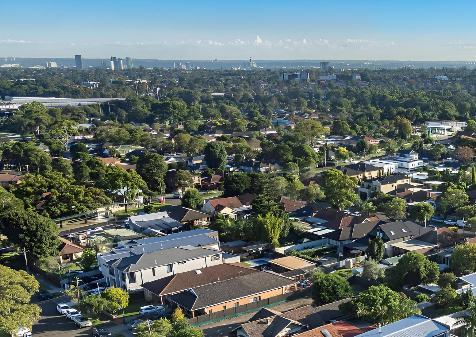

The Belfield Master Plan (The Plan) sets a clear plan for how Belfield will look and feel in the coming decades. It outlines desired changes to building heights, design, land use zones, new open space, public domain improvements and the protection of character and heritage.
The Plan builds on Council’s strategic planning framework and acts as a blueprint for growth outlining:
◦ The future for Belfield
◦ The potential growth in the Centre, and
◦ Infrastructure improvements
The Belfield Small Village Master Plan will guide the process for changes to planning controls that apply to properties in the master plan study area. For other proposed actions, including open space and public domain improvements, the Plan provides a direction and concept, with further detailed scoping and design to be undertaken.
Good planning decisions are underpinned by thorough analysis. Council undertook a comprehensive review of the unique attributes of Belfield. This involved demographic studies, audits of the built and natural environment, opportunities and constraints analysis, and the following technical studies:
◦ Urban Design Study
◦ Public Domain Analysis
◦ Traffic and Transport Study
◦ Economic Study
◦ Flood Study
A core component of the Master Plan was in-depth community and stakeholder engagement. Council utilised various methods to understand the Centre and the local community’s views:
◦ Early engagement in June and July 2022, including a village pop-up, business doorknocking and online activities.
◦ Running a Community Voice Panel of residents and workers
◦ Liaising with local and state government stakeholders
An integrated approach to growth
This Master Plan presents a holistic approach to achieve better place-based outcomes in both the public and private domain.
An integrated approach ensures there is an interconnectedness of land use, transport, economic activity and public space. The outcome is a Plan that ensures future growth is coordinated and supported by infrastructure improvements.
Strong urban design focus
A key aspect of good place-based planning is understanding and celebrating the unique qualities that make a centre great.
Guided by this principle, the Master Plan is based on sophisticated 3D urban design modeling and a deep understanding of Belfield’s existing character and architectural features. This approach allowed Council to consider how new developments will fit in and complement the existing built landscape.
The Belfield Master Plan creates a clear vision for Belfield, outlining necessary actions and potential changes to the planning controls. This should follow a defined process under the NSW Environmental Planning and Assessment Act 1979, including:
◦ A planning proposal to amend the Canterbury Bankstown Local Environmental Plan (LEP).
◦ Amend the Canterbury Bankstown Development Control Plan (DCP) to guide built form and design outcomes.
◦ Update the Canterbury Bankstown Contributions Plan to support the funding and the delivery of infrastructure.
◦ Introduction of Affordable Housing Contribution Rate.
Master Plan actions only relate to areas of Belfield within the Canterbury Bankstown Local Government Area (LGA)
Belfield is part of the traditional lands of the Bidjigal people of the Darug Nation. The area surrounding the Cooks River, including where Belfield stands today, has provided food, water and culturally significant meeting places for First Nation peoples for over 60,000 years.
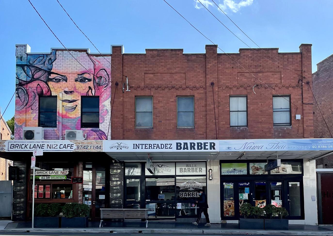
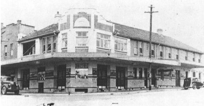
Belfield is a Small Village Centre situated across the Strathfield and Canterbury Bankstown Local Government Areas. It is located 13km from the Sydney Central Business District, 2km from Campsie, 1.7km from Belmore and 6km from Bankstown. The core of Belfield is centred around Burwood Road, a charming, small high street with cafes, restaurants, a pub, an independent

supermarket, and a range of other shops and services. The buildings are a mix of older Interwar brick shopfronts and newer shop-top housing with ground-level retail spaces. New higherdensity apartment buildings have recently been constructed on the corner of Water Street and along Punchbowl Road within the Strathfield Local Government Area.
The residential areas of Belfield consist mostly of medium and low-density housing, characterised by 1-2 storey detached dwellings. However, in recent years dual occupancies and townhouses have become more common in the suburb.


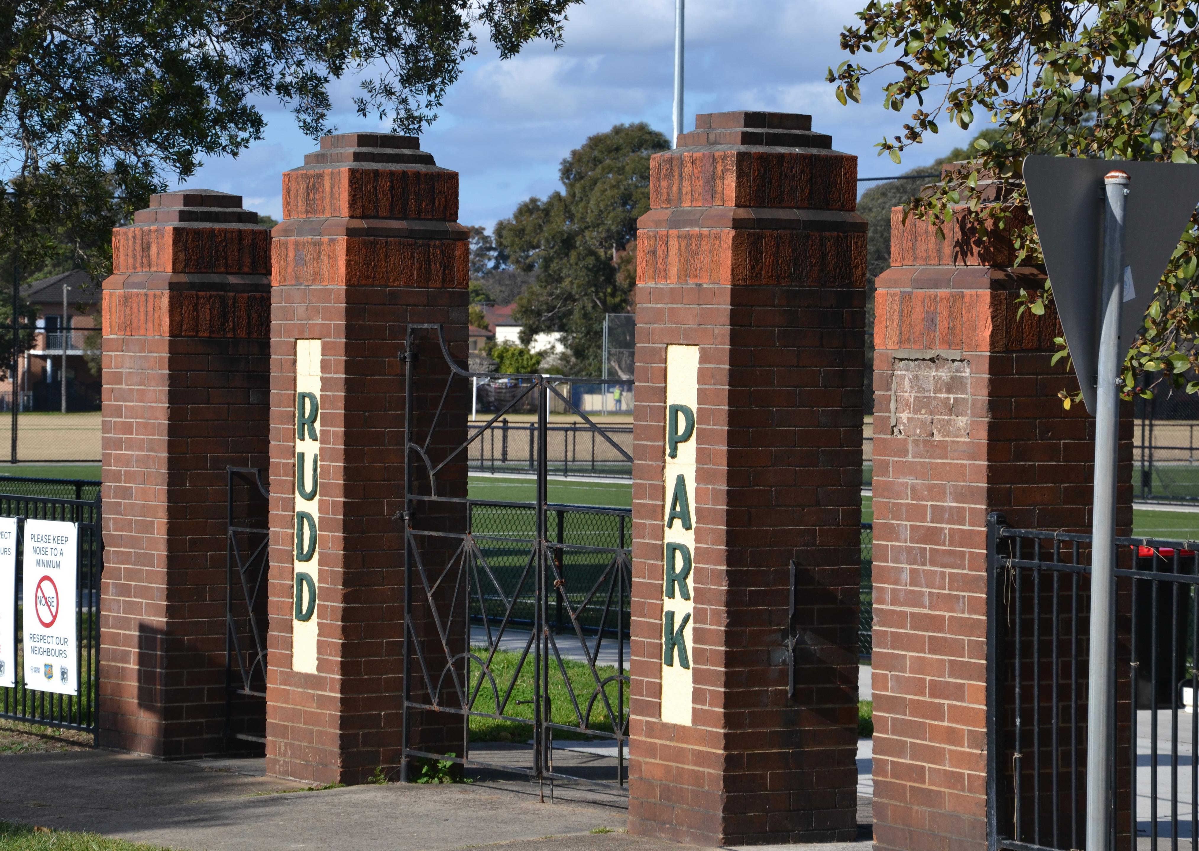
There are several large parks around Belfield, such as Rudd Park, Bark Huts Reserve and Cooke Park, as well as smaller reserves and playgrounds. The Cooks River runs along Belfield’s northern and eastern border, with trails and cycling paths along the riverfront.
Belfield is home to a small and close-knit community and is popular with families, with many residents and households having lived in the area for generations. Belfield has a large Arabic-speaking community, typically of Lebanese background, with over 15% of households speaking Arabic at home. There are also many Greek and Italian households in Belfield, reflecting the historical migration flows in the suburb.

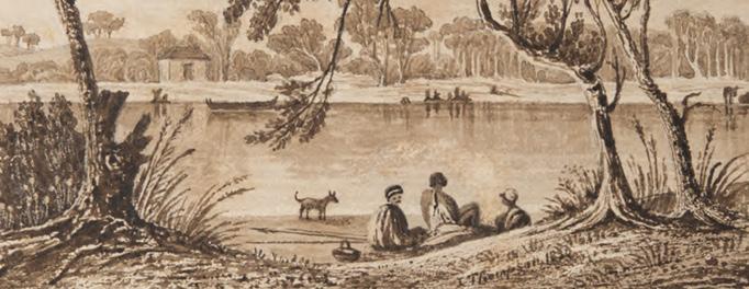

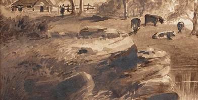
Belfield is part of the traditional lands of the Bidjigal (also known as Bediagal) people of the Darug Nation. There is evidence of the Bidjigal (also known as Bediagal) and other Aboriginal peoples camping, fishing and holding ceremonies along the Cooks River for thousands of years. It is possible that Punchbowl Road follows Aboriginal pathways from the Parramatta River to Georges River. Aboriginal peoples are also said to have crossed the Cooks River at its tidal limits near Belfield.
The first agricultural land grants were made in the area north of Punchbowl Road from 1810, and in 1868 the areas south of Punchbowl Road began to be subdivided into small allotments and sold for farming purposes. Until World War I, Belfield was largely agricultural, with dairies, poultry farms and market gardens. The land use changed after the War, when the War Service Home Commission acquired land bounded by Punchbowl Road, Burwood Road, and the Freight Line to build the War
Service Home Estate to repatriate veterans. The return of service members after the War stimulated the construction of many more homes in the area from the 1920s onwards. The name Belfield itself emerged during the 1930s and is believed to be a portmanteau of the adjoining suburbs of Belmore and Enfield.

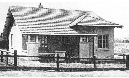
the opening ceremony of new homes at Belfield
Belfield was part of wider waves of migration throughout Greater Sydney in response to conflict and changing demographics of immigration. English and Irish migrants arrived in Belfield after World War I. While in the years following World War II, other European nationalities began to migrate to the area, especially Greeks and Italians, who formed a strong presence in the area. The Enfield marshalling yards nearby the Centre was a key attractor for new migrants to Belfield, with many new migrants

The local crowds at the ceremony houses in Belfield were built after World housing by the Housing Commission Belfield only had a small industrial area small industries and food factories. Many demolished to make way for new roads infrastructure.
finding employment in the railyards. From the 1990s onwards, Chinese, Korean and Lebanese migration to the area became more common. These waves of migration are reflected in the Belfield community today with Lebanese, Chinese, Italian, English, Greek and Korean being the most common ancestry for Belfield residents.
An essential part of the Master Plan is understanding the people who live, work or visit Belfield. Part of this is understanding the community that calls Belfield home today, but as Belfield undergoes growth and change in the future, different types of people may also want to live, work or visit the Centre.
Through demographic analysis and community consultation, Council has developed an understanding of the types of people and households that may be part of Belfield’s future. The Master Plan builds on this understanding by proposing a range of actions to respond to the needs, desires and aspirations within these different parts of the local community.
households
Larger households that have lived in the area for a long time, many with parents or grandparents who grew up Belfield. They typically work outside Belfield in other parts of CBCity or Sydney City. They like Belfield’s proximity to nearby centres and it’s, open spaces, playgrounds and sports facilities. They have strong ties with the area and value the established character of many parts of Belfield and because of this would like any changes in the Village to respect and celebrate this character and history.
Retirees and seniors
Older couples or lone-person households who have typically lived in the area for a very long time. They are a group that is expected to grow significantly in the next 10-15 years. They value the convenience of the Village and the services it offers close to home. They also tend to know their neighbours and appreciate the sense of community that the Village provides. This group would benefit from a more inviting and accessible public realm with spaces to socialise.
Mostly retail and hospitality workers as well as tradespeople and workers employed in nearby industrial areas, but who frequent Belfield’s cafés, shops and services. This group has varied ages and backgrounds, including long-run family businesses, new business owners, and young workers. While some live locally, many live in nearby suburbs like Greenacre and Belmore and tend to rely on cars to get around. They may like to see growth in the village’s trade and activity and more ways to get to and from Belfield conveniently.
Young families and homebuilders:
Younger couples who are starting to have children and are seeking to move somewhere they can put down roots. This group faces challenges entering the housing market, so they highly value housing affordability and tend to prefer newer, more diverse housing types like dual occupancies, terraces or apartments. This group also enjoys having a variety of shops and dining options close to home as well as great play spaces for young children.
This group enjoys Belfield’s parks, playgrounds and green spaces. Those of primary school age typically go to school locally or very close nearby, while those in high school travel to Belmore, Campsie, Strathfield or other larger centres. This group might benefit from safer, more pedestrian and cyclefriendly streets to help them get to and from school and enjoy local parks and playgrounds.
This group tends to come to the Village during the evening or over the weekend for its more specialised and boutique retail or for dining at local restaurants and cafes. They may also visit Belfield for active recreation, using Rudd Park or the Cooks River Cycleway for sport, exercise and recreation. This group values the range and uniqueness of shops and dining options offered in the Village. They also appreciate the amenity of local parks, sports grounds and recreation facilities.
The Future Transport Strategy sets out the vision for transport in Greater Sydney until 2061. The Strategy outlines the State Government’s transport vision, strategic directions and outcomes over the next 40 years. Belfield is not explicitly along key transport corridors as set out in this Strategy but is situated in close proximity to future rapid bus connections between Bankstown, Campsie, Burwood and Hurstville. Belfield is also connected to the Cooks River Active Transport Corridor, which the Master Plan aims to support through additional cycling connections across Belfield.
The Greater Sydney Regional Plan sets a 40-year vision for Greater Sydney. The South District Plan is a 20-year plan to implement the 40-year vision and deliver places that are livable, productive, sustainable and supported by infrastructure. The Master Plan aligns with the objectives of the South District Plan by aiming to create and renew great places, provide housing choices, foster socially connected communities and provide access to jobs, services and transport.
Our Local Strategic Planning Statement, Connective City 2036, sets Council’s vision for CBCity and provides actions to guide future growth.
The Master Plan seeks to implement a wide range of actions in Belfield, including:
◦ Enhancing local economic activity in centres.
◦ Setting development controls that consider context and incorporate high-quality design.
◦ Using the development process as a funding mechanism for infrastructure.

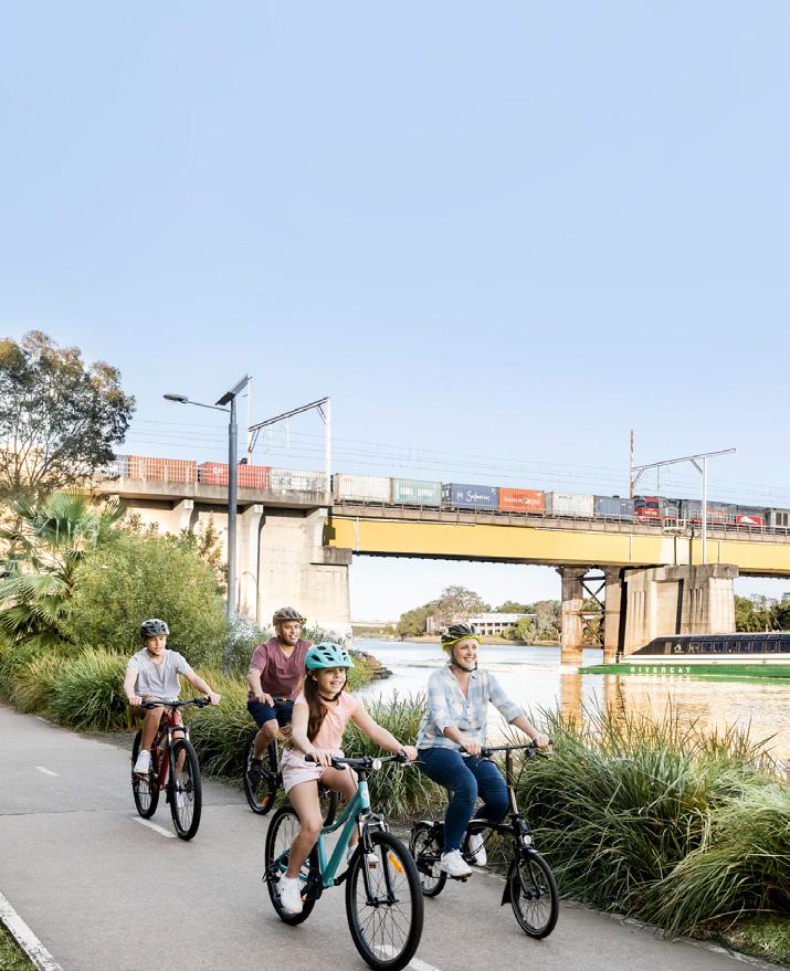
◦ Supporting enhanced green links that connect wildlife habitats and ecological communities along the Cooks River.
◦ Incorporating measures to calm traffic in centres and divert through traffic.
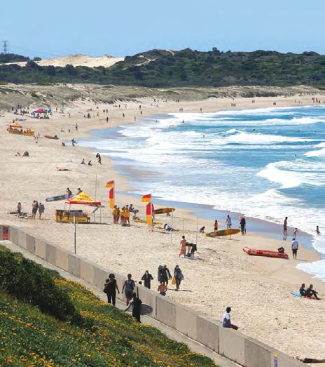
Belfield is identified in this Strategy as a Small Village Centre, among nine Small Village Centres across CBCity. The Local Housing Strategy allocates a collective housing target of 2,600 dwellings for all Small Village Centres by 2036. Indicative housing typologies may include low rise medium density housing, shop top housing and dual occupancies.
The Master Plan delivers on the following recommendations of the Local Housing Strategy:
◦ Locates new housing within walking distance of centres, open spaces and places of highamenity.
◦ Harmonises the Low Density and Medium Density Residential Zones.
◦ Ensures new housing is compatible with existing character and achieves good design outcomes.
◦ Aligns new housing with existing infrastructure and delivers more affordable and diverse housing.

Almost twenty-two thousand households experience housing stress in CBCity. Council’s Affordable Housing Strategy identifies a range of mechanisms to deliver affordable housing depending on proximity to transport, community infrastructure and sales price. Preparation of the Master Plan involved feasibility testing to assess whether affordable housing contributions could be delivered with new development and determined that a 1% rate was appropriate for the size and scale of Belfield.
The Employment Lands Strategy supports the delivery of employment in the LGA. Belfield has approximately 10,200m2 of employment floorspace, which consists of 85% populationserving industries, 9% knowledge-intensive industries and 2% health and education, with a comparatively low vacancy rate of 3.5%. Belfield has no specific employment target, however it has a role in providing localised employment activity.
The economic strategic directions relevant to the Master Plan include:
◦ Deliver amenity improvements to the Centre
◦ Plan for additional housing and commercial development to increase the population living in the retail catchment
◦ Establish appropriate building height and floor space ratio (FSR) controls to deliver the right mix of employment floorspace and housing.

The Urban Bushland and Biodiversity Strategic Plan details Council’s approach to protecting and enhancing biodiversity for the next ten years 2024-2034 and beyond. It includes focus area on biodiversity planning, which is considered one of the most effective means by which local government can protect biodiversity values on public and private land. Biodiversity planning will allow Council to identify locations to conserve and enhance biodiversity to ensure resources are used in the most effective way possible.
The key actions relevant to the Master Plan include:
◦ Local Environment Plan amendments – conservation zonings and environmental overlays;
◦ Development Control Plan amendments to avoid and minimise the impact of development on the ecological value of a site;
◦ Mapping and strengthening ‘conservation corridors’, connecting important habitat areas.
The Campsie Master Plan aims to transform the Campsie Town Centre into a prosperous health and lifestyle precinct. The Plan will enable significant employment and housing growth alongside the delivery of Sydney Metro Southwest, targeting the creation of 6,000 new homes and 2,500 additional jobs in Campsie by 2036. It also provides Campsie with a placed-based framework to guide future development and infrastructure delivery in the centre. Some of the key actions from the Campsie Master Plan relevant to the Belfield Master Plan include:
◦ Establishment of the Cooks River Foreshore Landscape Management Area, including a new foreshore cycling trail, expansion of riparian corridors for biodiversity and naturalisation of the river edge.
◦ A new Civic and Cultural Hub at the heart of Campsie, with new community and cultural facilities.
◦ Advocating to Transport for NSW for the delivery of improved regional northsouth road connections, including the realignment of the ‘West Campsie bypass’
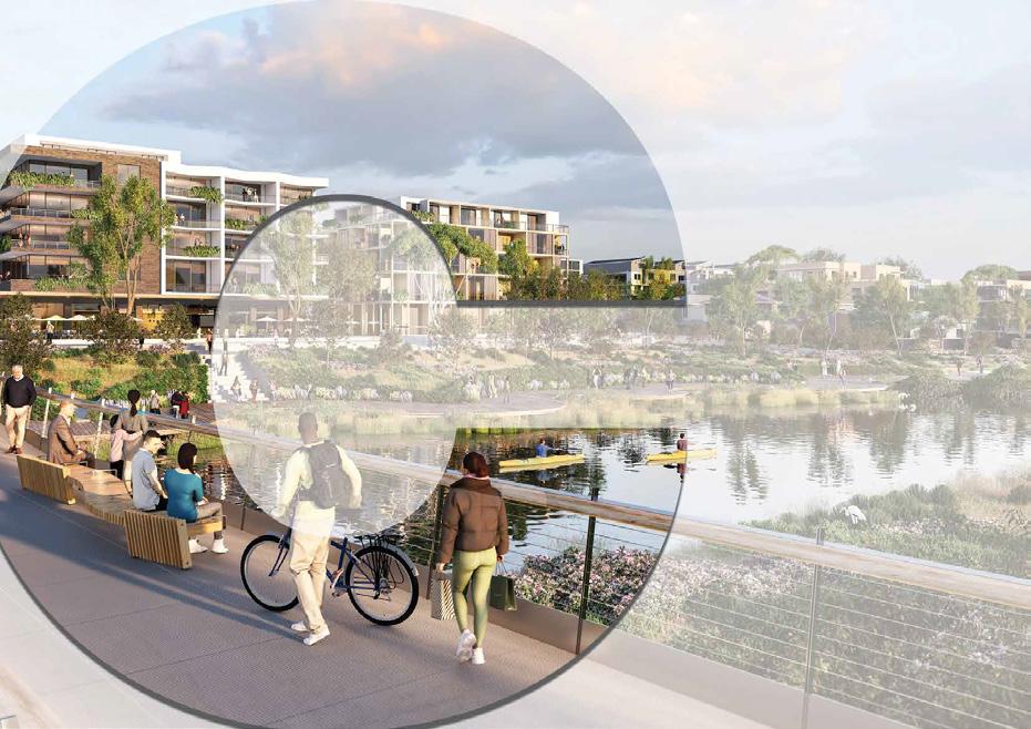
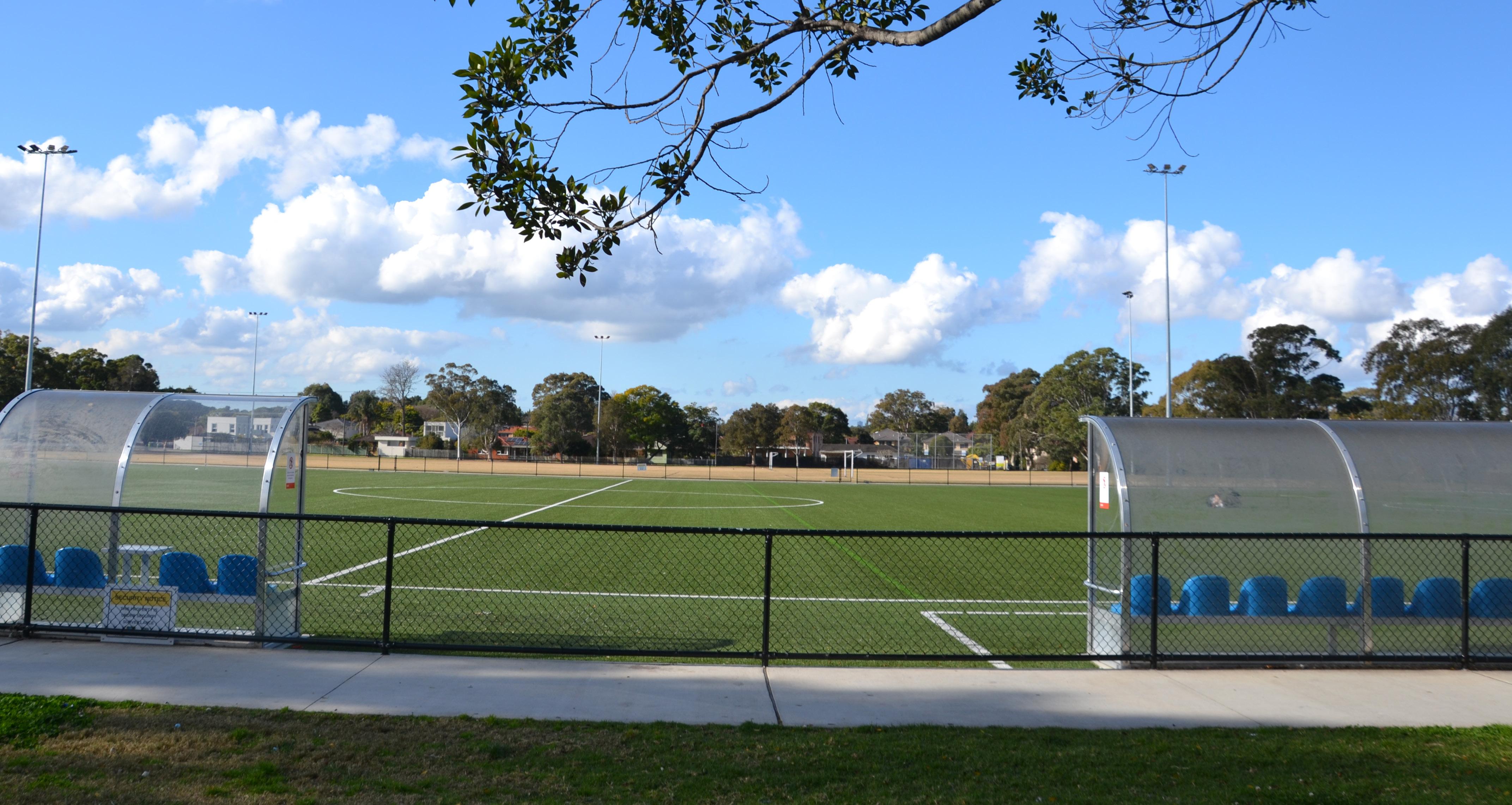
Belfield is a much loved village centre with a small but thriving high street and a strong community feel. However, the public realm in the village is tired and has few opportunities for people to gather and socialise. The key drivers for the Master Plan is to breathe fresh life into the village by creating well-designed buildings and great public spaces which create places for the community to enjoy.
Sustaining the vibrancy of Burwood Road is essential. Belfield Village thrives with its small but vibrant high street. Preserving this local activity is vital. A key strategy for achieving this is enhancing connections to the Centre and providing a modest boost to the local population. This not only facilitates community access to essential services but also ensures local businesses can prosper.
Canterbury Bankstown’s population is increasing, prompting the need for 50,000 new dwellings by 2036. This requires Council to plan for growth across all centres, regardless of their size. Like other small centres, Belfield will accommodate some modest growth focused in and around the main street and amenities.
Communities often desire mediumdensity housing options like dual occupancies, terraces, and multidwelling units. Belfield’s suburban character and strategic location make it an ideal place to offer this housing form, while preserving the village’s unique character.
Connection to nature including fauna, flora or waterway provides multiple benefits to both physical and mental health. Enhancing the natural environment in the streets, parks, and along the Cook’s River will also increase Belfield’s resilience to climate change’s consequences such as heat waves and floods while contributing to a happier and healthier community.
Letters to residents 1300+
Multi-lingual newspaper ads
Social media outreach
Torch and 5 multilingual newspapers
26,000+ people reached, leading to 967 visits to our Have Your Say page
Email notification
Master Plan Stakeholders - 50 Have Your Say subscribers - 1,392
Online survey
Interactive map
Pop-ups in the Belfield Village
Community Voice Panel
Door-knocking local businesses
85 responses
88 contributions
3 in total with 60+ conversations
2 sessions 23 local businesses
You would like to see a public realm that is more inviting and cared for, especially on Burwood Road.
You loved the existing local businesses in the Village and would like to see more variety of shops and services.
There are significant safety issues along Punchbowl Road and at the intersection with Burwood Road which need to be addressed.
On-street parking is important for local business, and availability can be an issue in the Village, especially on weekends.
You liked the leafy character of many streets and loved local parks and green spaces.
You like the convenience of being near bigger centres such as Campsie, Strathfield and Belmore but rely on cars to get around.
You valued the Village feel and sense of community in Belfield and would like more civic space for the community to gather.
You loved Belfield’s heritage and would like historic buildings to be retained and celebrated.
Allows for some expansion of the commercial core of the Village.
Proposes a concept plan for the future public domain in the Village to create welcoming public spaces that allow for more trees and greenery, street furniture, pedestrian movement and community interaction.
Proposes a reconfiguration of on-street car parking in the Village core, while still ensuring good public domain outcomes.
Highlights potential enhancements for Punchbowl and Burwood Road, including advocating for extra signalised intersections, crossing points, medians, right-turn lanes and implementing no-right turns
Identifies improvements to parks green spaces and proposes actions to allow for more vegetation and mature trees in the village.
Advocates for better bus connections and recommends improvements to cycling infrastructure
Introduces planning controls to preserve the historic shopfronts on Burwood Road and other heritage places in Belfield.
Creates a new civic heart and community gathering space for Belfield by closing Downes Street at the intersection with Burwood Road.

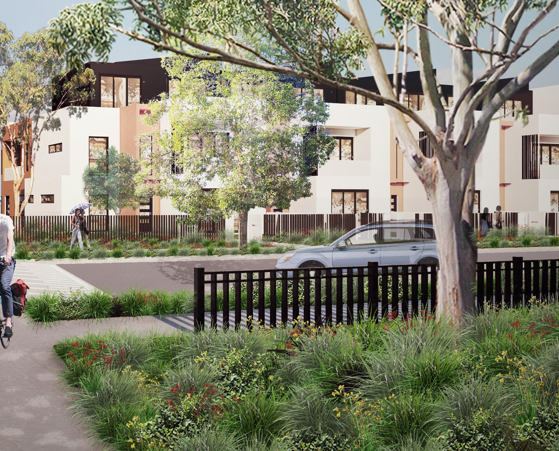
Belfield will be a welcoming 15-minute village with a thriving high street, green and inviting public spaces and an interesting mix of old and new, CBCity’s hidden gem.
Belfield Small Village will continue to be a hidden gem with a proud and welcoming community. Burwood Road will be a thriving local high street, with a variety of local retail and dining options. The village will have inviting and cared for spaces for people to meet and gather. Many historic shop fronts will be retained to respect Belfield’s history and the cherished character of the village. New development will bring more local services and new residents to support local business and will help deliver the infrastructure necessary to support a modern small village.
Belfield’s suburban areas will remain quiet and residential. These streets will be green and leafy, with a mix of old and new housing for various households, big and small, young and old. Enhanced public transport between Belmore and Campsie will make getting to and from the village easier for residents, local workers and visitors. New cycling and pedestrian infrastructure will help locals get around and visit parks, playgrounds, and the Cooks River.
Belfield will grow into a true ‘15-minute village’, where residents can meet their day-to-day needs within a 15-minute walk or cycle trip from home, setting a new standard for living locally and quality of life in CBCity.


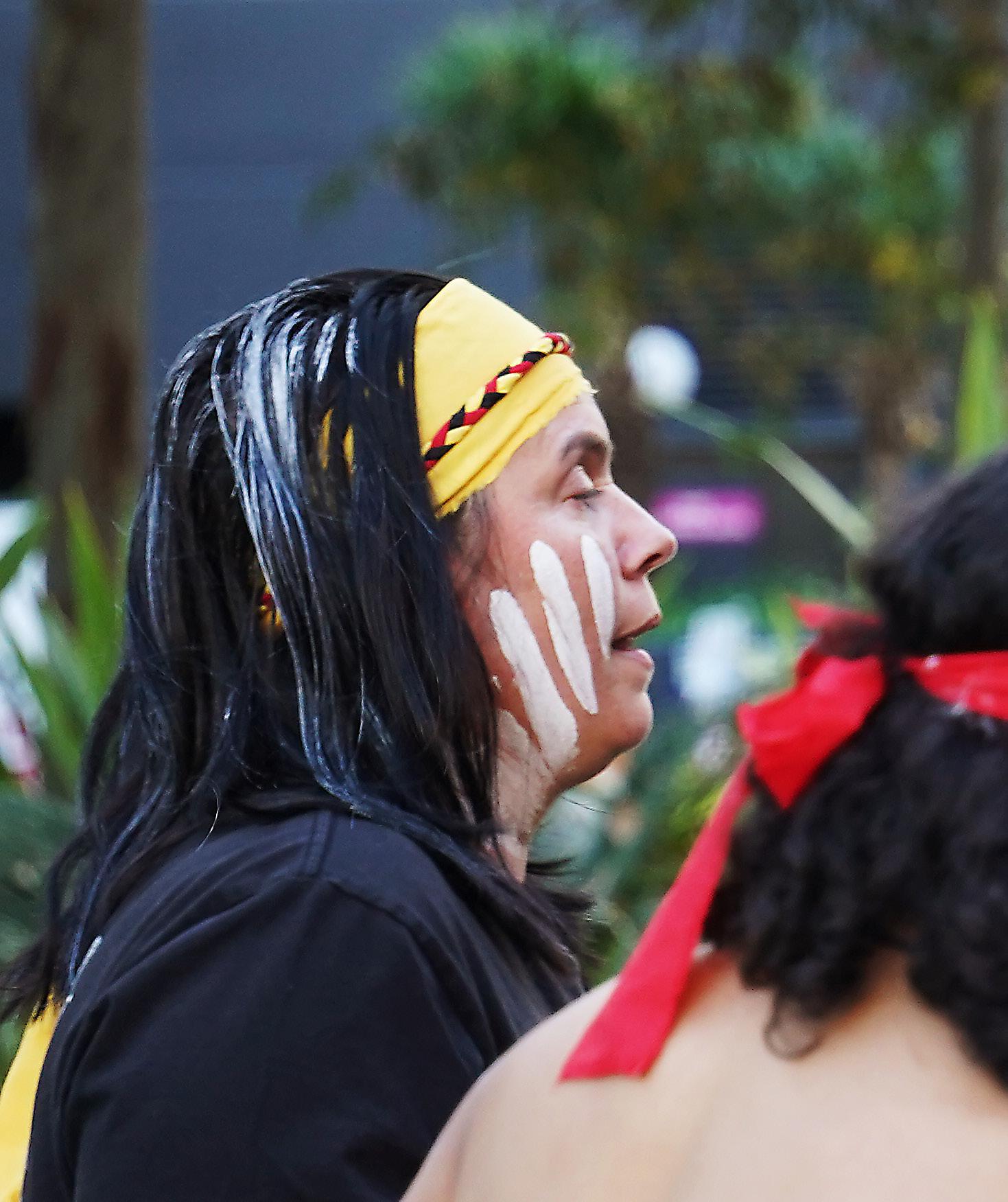
The Connecting with Country Framework offers practical guidance on emerging directions in planning policies that pertain to Aboriginal culture and heritage. This includes basic principles, considerations and opportunities for encompassing country-centered design methodologies to embed Aboriginal culture within the built environment. As part of the Master Plan, we have been considering this framework and what it might mean for Belfield. By recognising, celebrating and connecting to culture and Country, our centres will be richer and more inclusive.
The Belfield Master Plan will take steps towards meaningful recognition of the traditional lands of the Dharug people, aiming to reinforce connection to Country and nurture cultural awareness in the urban landscape. There is an opportunity in Belfield to forge closer connections to Country by creating stronger connections to the Cooks River, and by weaving local landscapes into parks, streets and the public domain. The Master Plan identifies opportunities to work more closely with Aboriginal communities to develop projects and guide the design of new places and public spaces.
We have strived to embed Connecting with Country into the Master Plan by including relevant actions across all planning priorities. Actions related to First Nations communities and connecting with Country have been marked with this symbol.
Recognise and celebrate our existing character by defining ‘character areas’. Enhance the unique features of these areas through thoughtful building design, lush greenery, lively streets, and captivating public art, that are tailored to each distinctive character area. This can be achieved through future development control planning.
Improve the ecological and environmental values of Belfield through improved green links and corridors, native plantings, canopy coverage, better access to the river foreshore, water sensitive design and naturalisation of the river channel.
Create new pedestrian and cycling connections to increase connectivity within Belfield, and to existing and potential future regional recreation corridors. New connections are targeted through larger blocks to improve universal access to the Village Core, green space, schools and other destinations.
Improve the connection and between Belfield village centre and Campsie by re-routing the 942 bus route to travel through Belfield Village Core to enhance public transport access and frequency within the Centre.
Project study area
Proposed through site link
Proposed cycling connection
Proposed greenway
Existing regional cycle link
Potential pedestrian + cycle bridge
Potential regional cycle link
Existing on-street cycle route
Project study area
Existing route 450
Existing route 415
Existing route 942
Recommended route 942
In-lane bus stop treatment
Promote enjoyable and safe routes for all by implementing thoughtful measures such as reduced speed limits, improved pedestrian crossings and enjoyable streetscape throughout the village core.
Unlock the potential of our Village Core by thoughtfully expanding the E1 zone to support predicted population growth and future commercial floorspace demands. The newly zoned E1 areas will extend the village core and create consistent character on both sides of Burwood Road, while ensuring smooth transition to adjacent residential areas.
LGA
LGA
Project study area
Existing 60km/hr (no change)
Reduced speed in high pedestrian activity area
Investigate child safe streetscape (long term)
Key intersection safety upgrade
Key pedestrian crossing upgrade
Project study area
Existing E1 Zone New E1 Zone
Existing E1 Zone rezoned to R4
Address the gaps of public open space by introducing a new village plaza in the Village Core within the Downes Street Road Reserve. A new public open space in this location will ensure all Belfield residents are within a 400m walking catchment, and provide a central gathering space, promoting cultural activities and festivals in the village core.
Create active streetscapes in the village core by improving waste collection and servicing
Minimise the streetscape impacts of service activities by establishing a continuous service lane to the east of Burwood Road. Careful consideration of access for servicing and vehicles in new developments within the village core will help protect primary frontages’ supporting active streetscapes.
Project study area
Existing public space
Areas that are beyond a 400m walk of public open space
Proposed new public open space
400m walking catchment to new public open space
Project study area
New service lane
Desired access points for services/vehicles
Active/primary frontage
Enhance Belfield’s village core as a place for people, where residents and visitors can easily access essential services, enjoy high-quality amenities, and support local businesses.
Facilitate increases in density in key areas that support the vision and adhere to the best practices of infill development. This will be achieved through modest increases to floor space ratios (FSR), building heights and some increases in flexibility of use. In some areas, dual occupancy lot sizes will be reviewed.
Project study area
Streetscape enhancement
New through-site link
New public open space
Project study area
Increase in FSR and/or height
Change in dual occupancy controls
No change
Key infrastructure improvements
The locations for new buildings and increases in density have been identified strategically, based on the a set of best-practice principles.
The areas of growth are:
◦ Sites in the Village Core where demand for employment floor space can be accommodated
◦ Locations near the Village Core where amenity and transport access are highest
◦ Areas close to open space where amenity is also very high
◦ Sites and locations that can delivery key infrastructure and public domain improvements
New planning controls for Belfield have been prepared to ensure that new buildings align with these principles:
◦ Limiting overshadowing on existing and proposed public spaces
◦ Create a respectful transition to special character areas and more suburban areas around the Village Core
◦ Ensure buildings are not taller than the existing mixed-use development around Punchbowl Road and Waters Street
Developing around amenities such as transport services, public space, and the Village Core which will be expanded to accommodate future commercial floorspace demands
Encourage growth to help facilitate key infrastructure and public domain improvements
Support built forms to match existing scale of development and complement existing character, open spaces and residential areas
Maintain existing built form controls for special character buildings and lowdensity residential areas
Unlock ‘missing middle’ housing typologies
Project study area
Project study area
Public domain study area
Public domain study area
Public open space
Public open space
Project study area
Public domain study area
Special character building Heritage items
Special character building Heritage items
Public open space
Existing bus route (unchanged)
Special character building Heritage items
Proposed bus route (route 942)
Proposed bus route (route 942)
Potential regional cycle link
Potential regional cycle link
Existing bus route (unchanged)
Proposed cycling connection
Strathfield LGA
Proposed cycling connection
Proposed bus route (route 942)
Existing Cooks River cycle link
Potential regional cycle link
Proposed Belfield Canal greenway
Proposed Belfield Canal greenway
Proposed cycling connection
Proposed pedestrian + cycle bridge
Proposed pedestrian + cycle bridge
Existing Cooks River cycle link
Proposed signalised intersection
Proposed signalised intersection
Proposed Belfield Canal greenway
Proposed intersection upgrades
Proposed intersection upgrades
Proposed pedestrian + cycle bridge
Proposed mid-block pedestrian link
Proposed mid-block pedestrian link
Proposed signalised intersection
Proposed service laneway
Proposed service laneway
Proposed intersection upgrades
Proposed public open space (civic plaza)
Proposed public open space (civic plaza)
Proposed mid-block pedestrian link
Proposed service laneway
Proposed public open space (civic plaza)
| 6 Storeys | 2.3:1 FSR E1 | 5 Storeys | 2:1 FSR E1 | 7 Storeys | 2.8:1 FSR
E1 | 6 Storeys | 2.8:1 FSR
E1 | 6 Storeys | 2.8:1 FSR
R4 | 6 Storey | 1.7:1 FSR
R3 | 3 Storey | 1:1 FSR
E1 | 6 Storeys | 2.3:1 FSR
R3 | 3 Storey | 0.85:1 FSR
Proposed R3 rezoned to R2
E1 | 5 Storeys | 2:1 FSR E1 | 7 Storeys | 2.8:1 FSR R3 | 3 Storey | 1:1 FSR R3 | 3 Storey | 0.85:1 FSR R4 | 6 Storey | 1.7:1 FSR
Proposed R3 rezoned to R2
Country is respected, valued and embedded into the Master Plan. We have strived to embed Connecting with Country into the Master Plan by including relevant actions across all planning priorities. Actions related to First Nations communities and connecting with Country have been marked with this symbol.
Protect and enhance the ecological values of the Cooks River
Build a more climate resilient small village centre
Deliver green infrastructure and increase tree canopy
Reimagine Belfield’s street and movement network
Deliver pedestrian and cycling infrastructure for an active Belfield Enhance Belfield’s connectivity with nearby centres
Ensure Burwod Road continues to grow as a flourishing high street
Create new civic heart for Belfield Village
Create welcoming streets and great open spaces
Foster a thriving local economy
Increase housing diversity and allow for modest housing growth
Encourage inviting and attractive new buildings
Deliver affordable housing and infrastructure to support a modern village
Protect and celebrate Belfield’s heritage
Build a vibrant and inclusive community life Character and Community Life


The Cooks River is Belfield’s most important natural feature and ecological asset, and a central part of CBCity’s cultural landscape for First Nations peoples. Many parts of the river and its tributaries have been extensively modified through urban development and stormwater infrastructure. Despite this, the Cooks River and Coxs Creek remain regional biodiversity corridors, with areas of remnant Coastal Scrub vegetation and habitat for local wildlife like the Green and Golden Bell Frog. The Master Plan proposes actions to preserve the ecological value of the river, enhance parks and recreational opportunities along the foreshore and better connect the community to the riverfront.
Council is committed to reaching zero carbon emissions by 2050 and encouraging our communities to adapt to a changing climate. The Master Plan will help Council and the community create a more sustainable and climate resilient village. To achieve this the Master Plan proposes actions for new energy and water efficiency requirements, EV-ready infrastructure and green spaces as part of new buildings in the village.
Extreme heat events and the urban heat island effect are already challenging community wellbeing in Belfield. The Master Plan aims to address this by creating a continuous green link through
Belfield between Eccles Reserve and Rudd Park and incorporating additional trees, greenery and watersensitive design elements into private and public spaces.
Indicative time-frame for delivery:
◦ Short term – 1-5 years
◦ Medium term – 6-14 years
◦ Long term – 15+ years

Project Study Area
Existing public open space
Village core
Cooks River Open Space and Conservation Corridor
Cooks River Secondary Green Links: Strathfield to Belmore
Chullora to Canterbury freight rail line conservation corridor
Proposed green street
Proposed greenway
Drainage low points/flood risk areas
Connection to Country actions

Action - 1.1
Work closely with the Cooks River Alliance to involve First Nations stakeholders in Cooks River projects and foster mutually beneficial and sustainable relationships with Aboriginal people.
The Cooks River is a central part of the cultural landscape for First Nations peoples in CBCity. There are a significant number of cultural places and Aboriginal heritage sites along the River, some of which have very little recognition. In response to this, the Cooks River Alliance has sought to build stronger and more meaningful relationships with Traditional Custodians and local Aboriginal people. As a key partner in the Alliance, Council can work towards more inclusive, respectful and culturally rich engagement with Aboriginal people.
For Council this includes the following:
◦ Advocate for the involvement of First Nations stakeholders in the design of Sydney Water naturalisation projects and other landscape projects along the river
◦ Identify opportunities for connecting with Country in projects along the River
◦ Support cultural and community celebrations like the Wurridjal Festival
◦ Support reforms to the Alliance’s governance structure to improve Aboriginal representation
◦ Incorporate First Nations knowledge in river-care and revitalisation activities
◦ Support Aboriginal naming protocols for the river
◦ Promote Indigenous procurement
Council, Cooks River Alliance, Sydney Water and CBCity’s First Peoples Advisory Committee
Time Frame
Action - 1.2
Advocate to Sydney Water for the naturalisation of the Cooks River foreshore at First Avenue Reserve and other locations along the river and its tributaries.
Why?
Sydney Water has identified the potential for naturalisation of the Cooks River foreshore and associated landscaping works at First Avenue Reserve. This project is still in the planning and design phase, yet it presents an opportunity to enhance the ecological and social value of the Cooks River by delivering best practice waterway restoration and foreshore landscaping works.
There may be other opportunities for naturalisation in the future as part of Sydney Water channel renewal at other sites within the study area, such as the ‘Belfield Canal’.
Action - 1.3
Ensure continuous public access along the Cooks River foreshore in Belfield.
Why?
The Cooks River foreshore is a regionally significant green space and recreation corridor, therefore ensuring residents and visitors can access the river’s green spaces and fully utilise its recreational opportunities is essential. Council will continue to engage with landowners along the river foreshore in Belfield to determine appropriate access arrangements to ensure public access is retained in the long term. This may mean pursuing identified land acquisitions or coming up with other means of securing public access in collaboration with local landowners.
Who?
Council, Cooks River Alliance and Sydney Water
Time Frame
Who?
Council, Belfield Bowling Club and St Michael’s Primary School
Time Frame
Action - 2.1
Ensure new development responds to flooding constraints and hazards.
Although Belfield is an established urban area, it is still important for the Master Plan to respond to flooding hazards from the Cooks River or overland flow paths. Council has prepared a Flood Planning Assessment to support the Belfield Small Village Master Plan. This study has reviewed the flood requirements from the NSW government and provided principles and recommendations which have guided the Master Plan. There is no intensification proposed on sites that are part of the floodway or are wholly subject to high hazard flooding, nor is any type of vulnerable development proposed in high hazard areas or identified low flood islands. Flooding will be assessed in more detail during the implementation of the Master Plan to ensure full compliance with all local and NSW Government flood requirements.
Action - 2.2 Who?
Include water-sensitive urban design elements as part of future public domain works in Belfield.
This action is important to protect the Cooks River and its tributaries from pollution from stormwater run-off. Belfield is part of the river catchment and ecosystem but because of its urbanised nature, pollution from stormwater runoff has been a serious ongoing problem for the ecological health of the Cooks River. To address this problem the Master Plan proposes to include water-sensitive elements like bioswales and raingardens, passive irrigation kerbs, and permeable pavements and plantings in future public domain works. This will contribute towards more ecologically sustainable water management practices, help build a healthier river ecosystem in the long term and create more inviting and attractive public spaces.
Action - 2.3
Require all new buildings to be electric vehicle ready.
Changes to the National Construction Code require new buildings to be ready for electric vehicle (EV) charging. This means that car parking for all new homes, apartments and commercial buildings will be designed and constructed in a way that allows EV-charging infrastructure to be easily installed. This includes allowing sufficient physical space for charging units as well as electrical wiring and supply equipment. Council will also consider introducing a minimum requirement for private EV charging facilities in residential development as a set ratio of all car parking spaces provided and mandate fast charging facilities for new commercial and retail development.
Council Council and Cooks River Alliance
Time Frame
Time Frame
Who?
Council, Department of Planning, Housing and Infrastructure (DPHI)
Time Frame
Action - 2.4
Implement enhanced water and energy efficiency controls for new buildings.
In recognition of the significant role that the built environment can play as a generator of greenhouse gas emissions, the Master Plan proposes new initiatives to reduce water consumption and improve energy efficiency for new buildings.
This includes:
◦ Mandatory all-electric buildings;
◦ Minimum requirements for rooftop solar panel coverage;
◦ Requirements for light-coloured roofs and roof materials on new buildings;
◦ Improved natural ventilation standards through winter garden controls and new building certification, and;
◦ Mandatory on-site rainwater harvesting.
These controls will be incorporated into Council’s Development Control Plan and will apply to all new development. This will help put Belfield on a path towards climate resilience and is consistent with Council’s strategic vision for a net-zero city by 2050.
Who?
Council, Department of Planning, Housing and Infrastructure (DPHI)
Time Frame Why?

Action - 3.1
Create a continuous greenway through Belfield between Eccles Reserve and Rudd Park by securing access through land dedication on sites adjacent to the ‘Belfield Canal’.
Why?
There is an existing drainage easement that runs through Belfield providing a connection between Linda and Baltimore Streets. Currently it’s an under utilised asset with limited connectivity, as the section between Baltimore Street and Varidel Avenue is not accessible to the public. The Master Plan proposes the completion of this link by securing public access through land dedication on sites adjoining the stormwater channel. This will be done by setting back new development on these sites, allowing the existing link to be widened to accommodate a shared path for pedestrians and cyclists, landscaping, greenery, and potentially water-sensitive design elements. This connection will require collaboration from multiple stakeholders.
While existing stormwater infrastructure imposes certain constraints on the embellishment of this link due to requirements for maintenance and safety, there is still a unique local opportunity to connect Belfield’s green spaces and contribute towards our ecological and aspirations for the Cooks River corridor.
Action - 3.2
Investigate DCP controls requiring tree planting rates to achieve CB City tree canopy targets.
Why?
Increasing tree canopy is a key goal for the whole LGA. Council’s LSPS outlines ambitious targets for suburban areas, medium and high density areas, as well as commercial centres which cover both the public and private domain.
Council is developing an Urban Forest Strategic Plan. The draft Urban Forest Strategic Plan proposes an overarching canopy cover target of 25%. This target has been determined by mapping ‘plantable opportunities’ on Council land and potential canopy cover on private property for different land use zones.
Achieving this target will require a substantial increase in tree canopy coverage in some areas. To achieve this, Council will investigate planning controls requiring tree planting rates based off site area and development type that could support tree protection and replacement as part of the development process.
Council, Sydney Water and Homes NSW
Time Frame
Time Frame
Action - 3.3
Apply the Connecting with Country framework in the approach to project formation, design and delivery of the future ‘Belfield Canal’ greenway.
Action - 3.4
Update DCP controls and Council’s Landscape Guide with a list of preferred, locally indigenous tree species for Belfield.
The proposed greenway is an opportunity to build stronger connections between green spaces and the Cooks River and its tributaries. It is also an opportunity for Council to start moving towards a more Country-centered approach to the design of green spaces and ensure First Nations culture, history and narratives are incorporated respectfully. To ensure that this project can lead to positive outcomes for Country, the Connecting with Country framework should be applied to the project from its earliest stages. This requires involvement from local First Nations elders and communities over the course of the project, and might include things like vegetation and landscaping, materials, public artworks, signage and heritage interpretation and Darug language naming.
Encouraging the community to choose locally indigenous tree species in their gardens and landscaping works is an important restorative step for local ecology. Consultation with our First Peoples Advisory Committee, as well as previous technical studies undertaken as part of the Campsie and Bankstown Master Plans have helped identify locally indigenous tree species specific to the Clay Plain Scrub and Turpentine Ironbark forest vegetation communities. Council’s DCP and Landscape Guide will be updated to include a list of these locally indigenous tree species for Belfield. When undertaking building and landscaping works, people will be able choose their preferred species from this list, allowing a level of flexibility for the community and providing different options for landscaping.
Who?
Who?
Council and CBCity’s First Peoples Advisory Committee Council
Time Frame
Time Frame
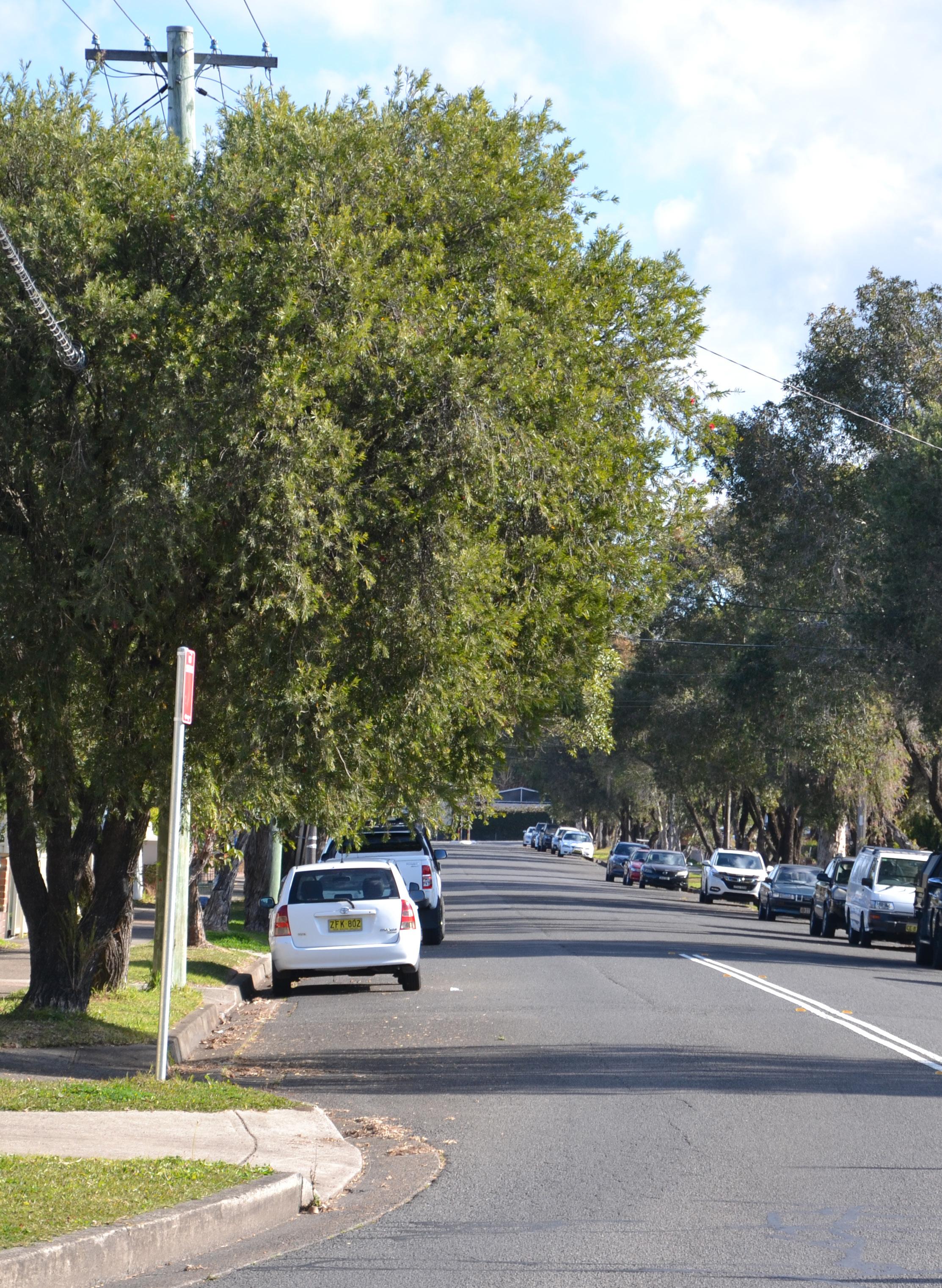
To realise the vision for Belfield as a thriving small village with welcoming public spaces, it is necessary to rethink how people move around the centre and the way local streets are planned and designed. The Master Plan reimagines the movement and place functions of Belfield’s streets to improve amenity, comfort and safety. The proposed street hierarchy is derived from Transport for NSW’s Movement and Place framework and will inform future decision making relating to traffic management, infrastructure and public domain planning. Council will collaborate with Transport for NSW, Strathfield Council and the community when implementing any changes
to the street network, and will also advocate for necessary upgrades and improvements to address traffic and safety issues raised by the community.
Currently, Belfield residents and workers are highly reliant on private vehicles for getting around and travelling to and from work. Council’s LSPS has clear aspirations for lowering reliance on private vehicle trips and improving multi-modal access and quality across CBCity. For Belfield this involves advocating for better and more frequent bus services between the Belfield village and other centres, especially Campsie, which offers access to the Sydney Metro and a variety of shops and services.
The Master Plan will also help deliver the infrastructure necessary to support an active and healthy community in Belfield in the long term. This includes new pedestrian connections to allow for more trips to be made by walking, as well as new and upgraded cycling infrastructure to connect to regional recreational cycling routes and create a more cycle-friendly suburb.
Indicative time-frame for delivery:
◦ Short term – 1-5 years
◦ Medium term – 6-14 years
◦ Long term – 15+ years

Project Study Area
Proposed pedestrian links
Proposed E1 Zone
Proposed public open space
Existing regional cycle route
Potential regional cycle route
Proposed ‘Belfield Canal’ Greenway
Proposed cycling connection
Existing on street cycle route (maintain)
Existing roundabouts (maintain)
Proposed signalised crossing
Proposed intersection upgrade
Proposed pedestrian priority upgrade
Proposed anti-rat running intersection enhancement
Potential pedestrian + cycle bridge (between First and Walsh Avenue)
Action - 4.1
Advocate for the installation of a new signalised intersection and crossing on the eastern section of Punchbowl Road at Margaret Street.
There are only two crossing points along Punchbowl Road in Belfield at Cosgrove Road and at Burwood Road, and there are none along the eastern section of Punchbowl Road. The lack of a crossing point on this section of Punchbowl Road was raised by the community as a safety issue for students walking to and from St Michael’s Catholic School. It also acts as a barrier for residents wishing to visit the open spaces in the Strathfield LGA. Analysis of local traffic conditions in the Belfield Transport Study supports the installation of a signalised crossing on the basis of safety, future traffic demand, and pedestrian permeability. This action will be investigated by Council’s Local Traffic Committee in consultation with Transport for NSW and the wider community.
Council, Transport for NSW, Strathfield Council, St Michael’s Catholic Primary School and the CBCity Local Transport Forum
Action - 4.2
Advocate for improvements to the intersection of Burwood Road and Punchbowl Road and investigate the installation of dedicated right-turn arrow.
Numerous community members raised concerns regarding the safety of this intersection for vehicles and pedestrians. As part of the Belfield Transport Study, Council has started investigating the installation a dedicated right-turn arrow at this intersection to address community concerns for pedestrian and vehicle safety, particularly for vehicles turning right onto Punchbowl Road from Burwood Road or Water Street. Though this change would have potential impacts on the performance of the intersection, it may be necessary in the medium term to address safety issues at the intersection. This change will need to be implemented in association with other identified traffic infrastructure upgrades in Belfield and should be done in consultation with Transport for NSW and the community.
Who?
Transport for NSW and CBCity Local Transport Forum
Action - 4.3
Investigate the installation of new medians along Punchbowl Road at the intersections of residential streets including Linda Street, Persic Street, Seymour Parade and Scott Street.
Many community members expressed concerns about Linda Street, Persic Street, Seymour Parade and Scott Street being used for ‘rat-runs’ for through-traffic. Installing medians at the intersections of these streets with Punchbowl Road limit unsafe vehicle movements and encourage through-traffic to move through signalised intersections. Medians also have the potential to incorporate vegetation and greenery, increasing the amenity of these intersections along Punchbowl Road. These interventions will be investigated by the CBCity Local Transport Forum in consultation with Transport for NSW and Strathfield Council, to assess the functioning of road network holistically.
Transport for NSW, Strathfield Council and CBCity Local Transport Forum
Time Frame Time Frame Time Frame
Action - 4.4
Investigate reducing speed limits in the village core to 30km or 40km per hour as part of a High Pedestrian Activity Area.
Why?
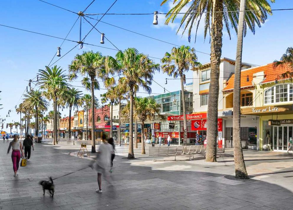
To support Burwood Road as an inviting and attractive high street in the future, it is necessary to slow down traffic in the village. Slower speeds will improve safety for pedestrians and cyclists and make streets in the village pleasant and human focused. By designating the village core as a High Pedestrian Activity Area, Council can collaborate with Transport for NSW and examine the traffic environment holistically, ensuring our streets can fulfill their movement roles while becoming great places for the community. Any changes to speed limits must be supported and reinforced by future street design and appropriate traffic infrastructure to ensure that slower speed limits are selfenforcing and feel intuitive to all road users.
Who?
Council and Transport for NSW
Time Frame
Action - 4.5
Amend the land zoning map to accurately reflect the extent of the ‘Campsie Bypass’ reservation.
Why?
The current extent of the reservation is overly large and reflects outdated assumptions about the nature of the bypass. There are also discrepancies between the land zoning and the land reserved for acquisition under Council’s LEP which adversely impact property owners in this area. Amending Council’s land zoning map to align with the land reservation map is a short term solution to provide property owners and residents with certainty on the types of development that can be undertaken in affected areas and rectify these anomalies in Council’s LEP.
Action - 4.6
Advocate for the removal of the section of the ‘Campsie Bypass’ reservation between Second Avenue and Coronation Parade.
Why?
The Second Avenue to Coronation Parade portion of ‘Campsie Bypass’ or ‘West Campsie Bypass’ is a longstanding road reservation that has not been delivered. This reservation is a product of an outdated era of planning and no longer fits the current community vision, the Cooks River Alliance’s goals, or Council’s aspirations for the Cooks River foreshore. The part of the bypass reservation that runs along the Cooks River between Second Avenue and Coronation Parade is not necessary to achieve the transport outcomes outlined in the Campsie Master Plan. By upgrading the road network at Second Avenue and Lees Parade, we can avoid routing the Bypass along the Cooks River foreshore and preserve local open spaces. Council is of the view that this segment of land should be green space. The removal of this reservation is the responsibility of Transport for NSW and will require further technical studies and support from NSW Treasury and other key stakeholders.
Who?
Council, Transport for NSW and Department of Planning Housing and Infrastructure
Time Frame
Who?
Transport for NSW and NSW Treasury
Time Frame

Action - 5.1
Secure the through-site links identified in key blocks as part of new development.
Action - 5.2
Investigate a pedestrian and cycle bridge between First Avenue Reserve and Walsh Avenue Reserve.
Action - 5.3
Continue the Belfield green link towards the Cooks River to create strong and active connections between green spaces and the Cooks River.
Many of Belfield’s blocks are too long, which limits permeability and discourages people from walking or cycling to and from the village. New development provides an opportunity to address this by securing-mid block access for pedestrians and cyclists in the village core. This will encourage people to make trips to and from the village on foot or by bike, support active lifestyles, facilitate easier access to shops and parks, aligning with the vision for Belfield as a 15-minute village. LEP and DCP controls specifying the location, width and treatment of the identified through-site links will be implemented to secure the links and ensure that they are high-quality and safe.
First Avenue Reserve and Walsh Avenue Reserve have both been identified and investigated by Sydney Water for foreshore naturalisation works, and associated landscape and public space improvements. As part of these works there may be an opportunity to improve access between these two open spaces through a pedestrian and cycling bridge. A bridge would improve access along the river foreshore and to the open spaces, recreation facilities, play spaces in CBCity and Burwood and could contribute to the overall amenity and connectivity of the open space network along the Cooks River corridor. This would be investigated by Council in collaboration with local landowners, Sydney Water and Burwood Council.
The Master Plan proposes an east-west connection along the proposed ‘Belfield canal’ greenway between Eccles Reserve and Rudd Park, to connect to local playgrounds and sporting facilities. Once this link has been delivered this connection could also be continued through the southern end of Rudd Park and along First Avenue towards the Cooks River. This would connect key open spaces in Belfield, improve access for pedestrians and riders to the Cooks River Cycleway and create an active transport connection between two important green grid corridors: the Cooks River and the Freight Line Corridor.
Council
Time Frame Time Frame Time Frame
Action - 5.4
Investigate a north-south cycling connection along Linda Street, Burnham Street and Bruce Avenue.
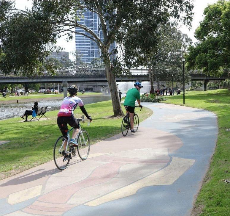
With it’s quiet local streets and proximity to the Cooks River Cycleway, Belfield has great potential to become a more cycle-friendly suburb. To help achieve this the Master Plan identifies a potential north-south cycling link between the Belfield village and Belmore running along Bruce Avenue, Burnham Street and Linda Street. Due to Burwood Road’s important movement role for buses and cars and space constraints, this kind of cycling infrastructure is not suitable along this high street. The cycle link would form part of ‘Route 6’ in Council’s Active Transport Plan, contributing to the creation of a dedicated cycling connection between Kingsgrove, Belmore, Belfield and the Cooks River. Using these identified local streets for cycling infrastructure will minimise conflicts with vehicles and encourage a broader variety of people to cycle. This infrastructure can be first installed as a trial or temporary pop-up cycleway to assess ridership and any the impacts on the street before a decision is made to install permanent cycling infrastructure.
Council and Transport for NSW
Time Frame
Action - 6.1
Advocate for more direct and frequent bus connections between the Belfield village and nearby centres.
Most Belfield residents currently rely on cars to get to and from work, and to make trips to other centres for shopping, services or recreation. To help address this reliance on private vehicles Council will collaborate with Transport for NSW and advocate for more frequent bus services to nearby centres. With the delivery of Sydney Metro in the future, there is an opportunity to provide more frequent connections to Belmore and Campsie, to give residents more convenient access to public transport services towards the Sydney CBD and Bankstown. More frequent bus services may also encourage more residents to use public transport for trips to other centres like Strathfield and Burwood for shopping or recreation.
Action - 6.2
Advocate for a direct bus connection between the Belfield village and Campsie.
As one of Council’s Strategic Centres, the Campsie Town Centre will see significant investment from Council and the NSW Government in transport infrastructure, open space and cultural and community facilities. It is also one of the closest centres to the Belfield village, so a convenient and direct bus connection would enable residents to better access Campsie’s services and facilities and help reduce car-dependency. A direct connection could be achieved through a relatively simple re-routing of the existing 942 bus route between Campsie and Lugarno, which currently runs along First Avenue and Clarence Street, but does not include Burwood Road and the village centre. Council will continue to work with Transport for NSW to implement this action.
Council and Transport for NSW
Time Frame
Council and Transport for NSW
Time Frame
Action - 6.3
Collaborate with Transport for NSW to investigate future on-demand transport services in Belfield.
On-demand transport is a form of public transport with flexible routes and schedules, providing services in response to passenger requests. These types of flexible services can provide efficient and customer friendly services to nearby centres, rail services and other local destinations. On-demand transport services have been trialed and delivered in other parts of Greater Sydney and are currently available in nearby centres such as Burwood, Strathfield and Lidcombe. Through collaboration with Transport for NSW, Council can investigate the potential to make on-demand services available in Belfield and nearby centres like Campsie.
Council and Transport for NSW
Time Frame
Project Study Area
Existing public open space
Proposed civic space
Proposed E1 Zone
Existing 450 bus route
Existing 415 bus route
Existing 942 bus route
Proposed new 942 bus route
Proposed new bus stop
Burwood Road is a much-loved local high street. However, the public realm has little greenery or mature trees and limited space for seating or outdoor trading. Outside of Burwood Road, most streets are currently quiet residential streets with a typical suburban layout and design.
The Master Plan will enhance Burwood Road by creating more inviting and welcoming public spaces. The actions proposed include simple short-term improvements as well as more ambitious long-term actions to transform Burwood Road into a beautiful and thriving high street at the heart of a modern small village. These changes will ensure that the Belfield village continues to support its small business community.
Although Belfield has generous amounts of open space, it lacks a central area where the community can gather and socialise. The development of key sites along Burwood Road presents an opportunity to deliver a new civic space right in the heart of the village. This will provide the community with a sought-after space to meet friends and relax in. This new civic space will breathe fresh life into the Belfield village, forming the cornerstone of a more attractive and welcoming public realm.
The Master Plan includes a public domain concept plan for the streets within the village core, providing Council with a long-term road map to create a greener and more inviting streets for residents and visitors to enjoy. This will be
complemented by existing and proposed upgrades to Belfield’s open spaces, ensuring that they will be able to support the needs of the community into the future.
Indicative time-frame for delivery:
◦ Short term – 1-5 years
◦ Medium term – 6-14 years
◦ Long term – 15+ years

Project Study Area
Proposed service lane
Proposed pedestrian links
Proposed pedestrian and cycle links
Proposed E1 Zone
Proposed civic space
Main road (Punchbowl Road)
Main street
Local street (connector)
Local street (local access)
Note:
Nominated street types and uses are consistent with Transport for NSW’s Movement and Place Modules
Revitalise Burwood Road and the streets in the village core through a welcoming public domain.
Why?
The Public Domain Concept Plan prepared by Meck Studio and ASPECT as part of the Belfield Urban Design Report provides Council with a road-map to creating high quality and inviting streets and public spaces for the Belfield village.
This plan includes a range of actions such as:
◦ Implementing a ‘flex zone’ on Burwood Road a mix of on-street car parking and kerb extensions for widened footpaths, space for seating, street trees, garden beds and planters;
◦ Creating areas for commercial activity such as outdoor trading, dining or temporary activations like parklets;
◦ Intermittent kerb build-outs for new street trees and garden beds;
◦ Installing additional pedestrian crossings and safety treatments at intersections;
◦ Planted medians on certain streets;
◦ Changes to footpath treatments, and;
◦ Reconfigured on-street car parking arrangements.
Some of these actions are relatively small scale and simple, while others require significant investment in the public domain and local traffic infrastructure. These actions will require detailed scoping and design and could be implemented over time as funding opportunities become available and key development milestones in the village are reached.
Who?
Council and CBCity Local Transport Forum
Road - North
Road - South
Action - 7.2
Create DCP controls to protect the fine grain character of Burwood Road.
Why?
Council’s Market Opportunities Analysis identified that an important reason the Belfield village performs strongly as a local business centre is its fine grain retail character. This fine-grain character, where buildings tend to be smaller and orientated towards the street, allows for a range of different businesses within the village and creates a varied and active streetscape along Burwood Road. Planning controls must ensure that new buildings respect this character and contribute positively to the streetscape.
This could be achieved through DCP controls that:
◦ Require new buildings to reflect the village’s historic subdivision pattern or control the maximum frontage length of individual buildings.
◦ Stipulate maximum width of shopfronts or tenancies.
◦ Encourage vertical and horizontal articulation.
◦ Limit the length of blank facades.
Action - 7.3
Investigate kerb extensions to create in-lane bus stops for the two bus stops Burwood Road.
Why?
Creating kerb extensions on Burwood Road will allow Council to create a more attractive and inviting public domain, with wider footpaths, trees and greenery. Installing kerb extensions to create in-lane bus stops is a great way of doing this without impacting existing kerbside car parking in the village. In-lane bus stops can also improve the efficiency of bus services by reducing the bus movements and slowing stop time. The space required for in-lane bus stops can be less than standard kerbside stops, potentially allowing scope for some additional on-street car parking or trees and planting on Burwood Road.
Action - 7.4
Investigate the reconfiguration of car parking on Downes and Blackwood Streets to provide additional on-street car parking close to the village core.
Why?
In Belfield, demand for accessible and efficient on-street car parking is a key priority for both residents and business owners. However, providing additional public car parking can also increase car reliance and greater demand for public car parking, which could lead to negative consequences for local traffic conditions. Reconfiguring car parking in nearby streets can allow for modest additional onstreet car parking near local shops and services, allowing better use of the space and limiting adverse impacts on local traffic. This would be done by changing some of the on-street car parking from parallel to angled or 90-degree car parking on these streets.
Council Council and Transport for NSW
Council and CBCity Local Transport Forum
Time Frame Time Frame
Action - 8.1
Apply the Connecting with Country framework in the approach to project formation, design and delivery for this future civic space.
Why?
Creating a new public space provides an opportunity to respect and enhance First Nations culture, history and narratives. The creation of a new civic space in Belfield is a key opportunity for Council to apply the Connecting with Country framework and start moving towards a more Country-centered approach to the design of public spaces. This requires involvement from local First Nations Elders and communities over the course of the project, and the inclusion of Countrycentered design-practices in project formation and implementation. This could lead to the inclusion of elements such as indigenous vegetation and landscaping, selection of materials, public artworks, signage and heritage interpretation and Darug language naming.
Action - 8.2
Investigate and test the closure of Downes Street by undertaking a temporary trial closure.
The trial closure of Downes Street could effectively gauge interest before any permanent changes are made. Temporary installations could be undertaken to allow residents, workers and visitors to provide feedback on what works and help to build the case for more permanent changes in the future. Council has undertaken a range of different public domain interventions with a variety of elements across its centres as part of the ‘Streets as Shared Spaces’ program, and there may be opportunities in the future to implement something similar in Belfield.
Downes Street Closure Plan (Village Core)
Who?
Council, and CBCity’s First Peoples Advisory Committee
Time Frame
Who?
Council, CBCity Local Transport Forum and Transport for NSW
Time Frame
Project Study Area
Proposed service lane
Proposed pedestrian link
Proposed public open space
Proposed vehicular circulation
Proposed periodic service vehicle circulation
Intersection upgrade
Action - 8.3
Create a new public space by partially closing Downes Street at its intersection with Burwood Road.
Why?
Belfield currently lacks a civic space for the community to gather within the village core. A new plaza will act as a heart for the village, enhancing its appeal for residents and visitors. This plaza has the potential to transform public life and amenity in the village by providing opportunities for activation through outdoor dining or trading, and for community events such as local markets. This will breathe fresh life into the village and help support a thriving and active small business community. Delivery of this public space would be staged over time to align with the redevelopment of key sites in the village, thereby avoiding any potential impacts for existing access arrangements. The local community would be engaged on any future closure of Downes Street.
Similar projects have been successfully implemented within CBCity such as McGuigan Place in Greenacre and Harold Street Reserve in Campsie.
Who?
Council, CB City Local Transport Forum and Transport for NSW
Time Frame
Action - 8.4
Investigate Belfield Lane extension, connecting Punchbowl Road to Downes Street.
Why?
An extended laneway connecting the Downes Street Car Park with the existing Belfield Lane will be investigated to support the closure of Downes Street and allow for new development to be serviced without impacting Burwood Road.
Who?
Council, CBCity, Local Transport Forum and Transport for NSW
Time Frame
Action - 9.1
Incorporate universal design principles into the design of public spaces, including parks and playgrounds.
Why?
To build a truly vibrant and inclusive 15-minute village, Council will need to ensure that our public spaces can be used and fully enjoyed by as many people as possible, including people with a disability, people of all age groups and backgrounds. The best way to do this is to integrate universal design principles into the future detailed design of public spaces, including parks, play spaces, and sports facilities at Rudd Park and Eccles Reserve. This includes ensuring designs are flexible and simple, that spaces and equipment can be used by people with different abilities, and that any risks associated with play equipment or street furniture are minimised where possible. This is also a key action from our Disability Inclusion Action Plan and can contribute to creating a truly welcoming and inclusive public realm in the long term.
Time Frame
Improve local playgrounds and widen the scope of play spaces in Belfield.
Action - 9.2 Why?
One of the key goals of Council’s Playground and Play Spaces Strategic Plan is broadening the scope of playgrounds. This will be done by installing more play equipment, adding associated recreation facilities to play spaces, and including play opportunities for older children, toddlers as well as ‘all abilities’ play spaces to support children with a disability.
For Belfield this will include:
◦ Adding an older child focus to the play space at Eccles Reserve as part of future playground upgrades
◦ A new play space at Rudd Park with a range of diverse activities, and good support structures and settings
◦ A new half court facility at Rudd Park.
Action - 9.3
Deliver upgrades to sports and recreation facilities at Rudd Park.
Why?
Rudd Park has significant district-level sports and recreation facilities including football fields, cricket pitches, tennis courts and new synthetic football and soccer fields. To ensure the park can continue to function at a district level, further works are needed to improve amenities in the park. Council will undertake further upgrades to the park’s sport and recreation infrastructure with new exercise equipment, a half court facility and upgrades to sports grounds. There is also potential for Council to work with Football Canterbury in the future when planning and developing new facilities in the park to ensure Rudd Park continues to be a hub for community football. In the future, Council may also undertake site-specific master planning for the southwest part of Rudd Park.
Who?
Council and Football Canterbury
Time Frame
Action - 9.4
Investigate and implement mechanisms for the undergrounding or bundling powerlines and telecommunications cables.
Why?
A key barrier to increasing tree canopy on our streets is the presence of aboveground powerlines and telecommunications cables. This infrastructure limits the types of street trees able to be planted and continually necessitates significant pruning, limiting tree growth and reducing the extent of canopy cover. Council can address this over time by introducing DCP controls and conditions of consent requiring new development to place electrical and telecommunications infrastructure underground, or bundle this infrastructure together aboveground. Undergrounding requirements will be applied to new mixed use and high-density residential development on Burwood Road and Punchbowl Road, while medium density development will likely be required to bundle power and telecommunications cables above-ground. While there would be some additional costs associated with this. This action will help create greener, more attractive streets and will contribute to increasing tree canopy in the long term.
For some sites within the village core where new development is not envisaged, Council will work with Ausgrid to identify funding opportunities for undergrounding or bundling powerlines and other cabling as part of future public domain works.
Who?
Council and Ausgrid
Time Frame
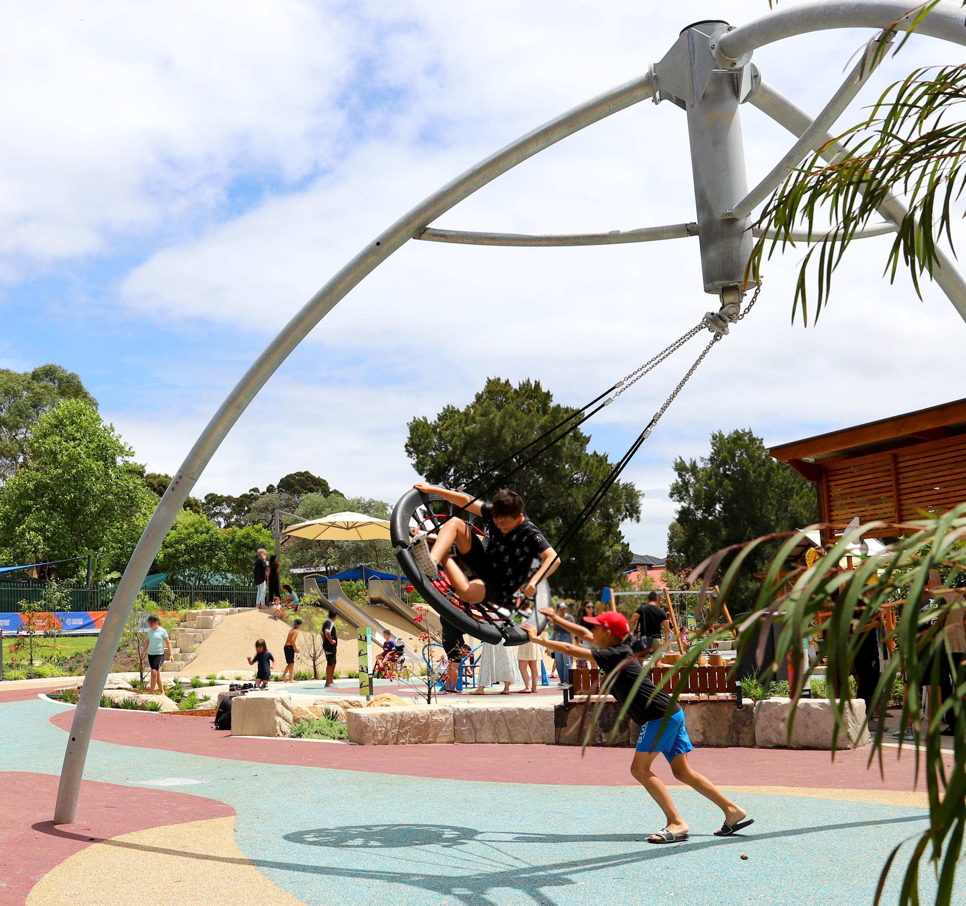
The Belfield village has a mix of small businesses, independent retail and local services. With low vacancy rates and many long-running businesses, the village is a desirable place for commerce. However, there have been limited opportunities for the village to expand and for new businesses to set up. The Master Plan will allow for a modest expansion of the commercial component of the village to foster a stronger local economy and create opportunities for a greater number and variety of businesses.
There is demand for new housing in Belfield, with many older houses having been renovated, and new dual occupancies and shop-top housing constructed in and around the village. This demand is particularly strong among young households
and homebuilders, who have faced challenges finding affordable housing. These individuals are often drawn to areas like Belfield, which offer good amenities and convenience. To respond to this housing demand, the Master Plan proposes modest housing growth and several actions to increase housing diversity, allowing for new shop top housing, apartments and medium density housing in the village core to ensure new residents can enjoy the convenience of shops and services in the village. Outside of the village core, new medium density housing growth will be concentrated around Rudd Park and key pedestrian links to provide much-needed ’missing middle’ housing. This new housing will be low-rise in scale at 2-3 storeys and compatible with the existing character of these areas.
The Master Plan also includes a range of new built form controls to ensure that new buildings are attractive, achieve great design outcomes and help create beautiful places. This includes new LEP controls for height and FSR as well as more detailed provisions for setbacks, street wall height, active frontages and other controls, which will form part of Council’s DCP.
Indicative time-frame for delivery:
◦ Short term – 1-5 years
◦ Medium term – 6-14 years
◦ Long term – 15+ years

Project Study Area
E1 Local Centre (no change)
Land rezoned from R3 to E1
R2 Low Density Residential (change from R3)
R3 Medium Density Residential (no change)
R4 High Density Residential (change from R3 or E1 - Council car park)
RE1 Public Recreation (no change)
RE1 Public Recreation (new public open space - civic plaza)
SP2 Infrastructure
Strathfield LGA planning controls are not subject to change as part of this Master Planning process.
Proposed
This will be subject to further design review by Council.
Proposed Floor Space Ratio
Project Study Area
Proposed service lane
Proposed pedestrian links
Proposed pedestrian and cycle links
Existing public open space
Proposed public open space
Proposed Ground Level Setback
Project Study Area
Proposed service lane
Proposed pedestrian links
Proposed pedestrian and cycle links
Existing public open space
Proposed public open space
Maintain prevailing street setback
0m setback
1.2m setback
2m setback
3m setback
6m setback (Between E1 and R3)
8m setback
Proposed Key Lot Amalgamation (Village
Frontage
Proposed Waste and Servicing (Village Core)


Action - 10.1
Expand the existing E1 Local Centre zoning along the western side of Burwood Road towards the intersection of Burwood Road and Blackwood Street.
As part of preparing the Master Plan, Council has undertaken a Market Opportunities Analysis of Belfield that assessed demand for employment floorspace in the village. This analysis found that there is more demand for retail, knowledge intensive and health and education floorspace in Belfield than can be met in the existing E1 Local Centre zone. Allowing the expansion of the commercial zoning will provide space to accommodate new businesses within the village, attracting services to meet future community needs. Concentrating this zoning expansion to the south along Burwood Road will ensure that the high street remains the central focus for retail and local business in the village, and will help realise the benefits of economic clustering.
Action - 10.2
Establish planning controls to mandate active frontages along the Burwood Road high street, Downes Street plaza and corner shop sites.
Active retail frontages for commercial and mixeduse buildings are a key part of the established character in Belfield, especially along Burwood Road. Active frontages create visual interest along the high street and contribute to the high amenity and appeal of the village.
The Master Plan will implement LEP and DCP controls:
◦ Requiring new buildings to include active street frontages along the ground floor on Burwood Road, and other identified parts of the village core, and existing corner shop sites, and;
◦ Requiring new buildings to minimise the length of the primary façade dedicated to services or access.
◦ Encouraging building articulation and uses which foster street life and interaction with the public realm.
Council Who?
Time Frame
Who?
Council
Time Frame
Review Council’s LEP and DCP controls to reinvigorate local corner shops and allow for appropriate non-residential uses
One of the key characteristics of a ’15-minute village’ is being able to meet a range of day-to-day needs within a convenient walking or cycling distance from home. Belfield already has some corner shops and small-scale commercial uses in suburban areas that may be able to meet the daily’s needs of the local community. To achieve the 15-minute village vision in Belfield, it is important to ensure planning controls are flexible and not overly onerous for these types of small-scale uses.
Council will review its LEP and DCP controls as part of the planning proposal process, potential amendments may include:
◦ Additional permitted uses on current or historic corner shop sites, including takeaway food and drink premises.
◦ Updated DCP controls for small-scale non-residential uses in residential zones such as neighbourhood retail or cafes including car parking and setbacks requirements, to ensure these are not overly restrictive for small-scale uses or local businesses.
◦ Increasing flexibility for outdoor dining and trading.
Review car parking controls and introduce an exemption from off-street car parking requirements for certain types of non-residential development at 4-22 Burwood Road.
The expansion of local businesses is important to the economic vitality of the village. Many small businesses occupy older, historic shopfronts and many of those on the western side of Burwood Road have limited or no vehicular access. Council’s off-street car parking requirements can make it difficult for new businesses to set-up or expand on these sites. To rectify this, Council will introduce an off-street car parking requirement exemption for specific non-residential use for 4-22 Burwood Road. This exemption will only apply to specific land uses such as restaurants, cafes, shops and business premises. For these types of development, additional on-site car parking will not be required for a change of use, or for an expansion of the existing use by up to 50 sqm of gross floor area. This allows for some expansion and flexibility of commercial uses while keeping any impacts on on-street car parking relatively minor.
Who?
Council
Time Frame
Action - 11.1
Allow additional shop top housing along Burwood Road and residential flat buildings along Punchbowl Road.
Why?
Encouraging higher densities within the village core will create more housing close to local shops and transport services. This will be delivered through a mix of shop-top housing along Burwood Road, as well as shop-top housing and residential flat buildings along Punchbowl Road. New apartment buildings along Punchbowl Road will be required to incorporate generous front setbacks for deep soil and landscaping to protect amenity and create a more pleasant pedestrian environment. New shop top housing will continue the prevailing street wall and setbacks within the village, ensuring the village’s lively character and community feel are maintained. Increasing densities and population within the village will also help support local businesses and contribute to a vibrant local economy in the long term.
Action - 11.2
Encourage medium density housing in strategic locations in and around the village core and Rudd Park.
Medium density housing, or ‘missing middle’ housing, includes terraces, row houses and multi-dwelling housing. These typologies are in high demand and have been historically under-delivered throughout Greater Sydney. The Master Plan aims to encourage more of this type of development by implementing new built form controls to allow slightly taller and more dense buildings in certain parts of the R3 Medium Density Residential zone. These areas are either in close proximity to the village core, near Belfield’s open spaces or have been identified for the provision of key infrastructure in the Master Plan. This type of housing may appeal to younger demographics and homebuilders, who in recent years have faced increasing challenges finding housing that is suitable and affordable.
Action - 11.3
Require new development to comply with the Livable Housing Design Guidelines.
The ‘Liveable Housing Design Guidelines’ provide a set of technical requirements that can enable dwellings to better meet the changing needs of occupants across their lifetime. In using these guidelines, Council can deliver a fairer, more equitable approach to housing delivery for new and existing residents in Belfield. Providing more readily adaptable housing is another key way that the Master Plan will increase housing diversity. This will be done through DCP controls for residential flat buildings, shop top housing and multi-dwelling housing that require that a minimum of 20% of new dwellings must achieve the silver standard and a minimum of 20% must achieve the Gold Standard in accordance to the ‘Livable Housing Design Guidelines’.
Who?
Council
Project Study Area
Proposed service lane
Proposed pedestrian links
Proposed pedestrian and cycle links
Existing public open space
Proposed public open space
No change to building types
Terraces
Parkland townhouses
flat buildings
Top mixed use
corner
Action - 11.4
Implement new dwelling mix controls to deliver more family-friendly apartments.
There is a growing need for more family-friendly housing across Sydney and in CBCity. Belfield has historically been an area that has been popular with families and larger households.
The Master Plan proposes the following DCP requirements for the dwelling mix of new shop-top housing and residential flat buildings with more than 20 dwellings:
◦ Studio and 1 bedroom - minimum 15%
◦ 2 bedroom – minimum 40%
◦ 3 or more bedroom – minimum 20%
This means that more than half of new units will have 2 or 3+ bedrooms, which will help create more family-friendly apartments in the Belfield village. This approach has been informed by the ‘Healthy Higher Density Living for Families with Children: an Advocacy, Planning and Design Guide’.


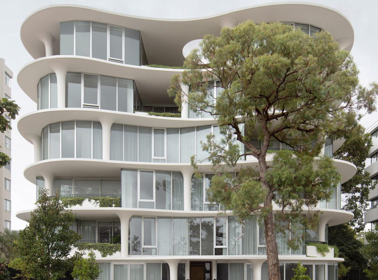
Storeys: 2-3
Character Area: Village Core, Suburban Fabric
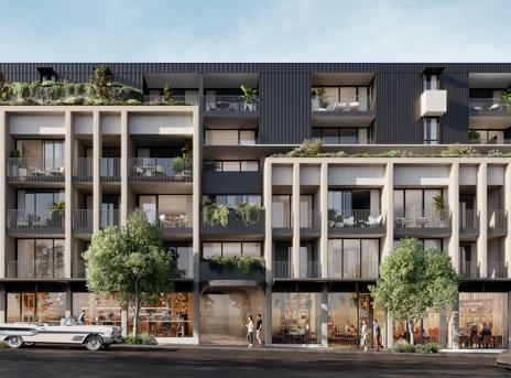
Storeys: Up to 7
Character Area: Village Core
Storeys: 2-3
Character Area: Village Core, Suburban Fabric
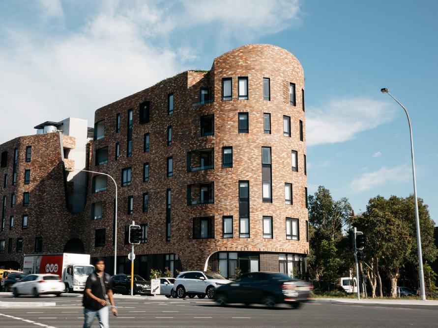
Storeys: 6-7
Character Area: Village Core
Storeys: Up to 6
Character Area: Village Core, Suburban Fabric

Storeys: 2
Character Area: Entire Study Area
Action - 11.5
Implement a low-density residential zone and encourage dual occupancies by amending the LEP minimum lot size requirements.
Action - 11.6
Review LEP and DCP controls to create high quality housing design for a range of different housing types.
Why?
One the actions from our Housing Strategy is to align the R2 Low Density Residential and the R3 Medium Density Residential zones across the former Bankstown and Canterbury LGAs. This is to provide clarity on the role and appropriate densities for each zone. Though the name and zone objectives suggest that medium density housing is appropriate in the R3 zone, the current built form controls associated with this zone in the former Canterbury LGA do not facilitate such outcomes and in effect only allow for low density housing outcomes. The Master Plan will implement this action in a place-specific way by applying an R2 Low Density Residential zone to certain suburban areas of Belfield where medium density type housing cannot be accommodated.
The Master Plan also focuses on enhancing the housing supply in Belfield, and dual occupancies or duplexes have become a popular type of housing, that can be compatible with existing suburban contexts The Master Plan therefore proposes to amend the minimum lot size requirement for dual occupancies, to encourage this type of development and allow for modest increasing in housing capacity within the R2 zone.
Why?
The Master Plan is not just a plan for more housing, but a plan that will ensure that the design of housing is high quality and maximises amenity for future residents.
This will be done by reviewing planning controls to examine the following:
◦ Functional internal layouts for flexibility of use and quality of experience;
◦ Adequate natural light and ventilation through provision of windows, suitable orientation of rooms and generous floor to ceiling heights in habitable rooms.
◦ Generously sized private space and landscaping;
◦ Acoustic and visual privacy through appropriate setbacks, fencing, acoustic attenuation, window orientation and finished floor levels of habitable rooms;
◦ Co-located landscaped areas, deep soil and front setbacks for sites along Punchbowl Road, creating a buffer to protect residential amenity, and;
◦ Generous storage areas.
Council Council Who?
Action - 12.1
Amend the LEP height and FSR controls applying along Burwood Road, Punchbowl Road and the village core to allow for a varied and interesting streetscape in the village.
New development can inject new life into the village, create new housing and help support a thriving business community into the future. This necessitates an increase in both how high and how large new development can be on certain sites. Rather than applying a blanket height and FSR increase across the village core, implementing more specific controls for new development allows for greater variety in new buildings, creating a less monotonous and more visually interesting streetscapes. The proposed height and FSR controls have been informed by comprehensive urban design analysis and 3D modeling to ensure that there is an appropriate and sensitive transition between new development sites, character buildings and lower rise suburban areas.
Action - 12.2
Encourage design excellence by referring new development in the village to Council’s Design Review Panel.
Improving the design quality of the new buildings to achieve design excellence is an important goal for Council. High quality urban design, landscaping and planning controls will be essential to ensure Belfield remains an attractive small village centre. To achieve this, Council has established a Design Review Panel to improve design outcomes in new buildings and help create a culture of design quality in CBCity. The panel will set clear expectations for Council, the community and the development industry on their role in designing and delivering great places and buildings for people. The panel reviews and provides guidance on a range of development types including multi-dwelling housing (over 10 dwellings), commercial premises, and residential flat buildings or shop top housing (over 4 storeys).
Action - 12.3
Incorporate allowance for rooftop gardens into the maximum building height controls in the E1 zone.
Access to green space is especially important for residents living in higher density forms of housing. However, due to site constraints it is not always possible to provide enough green communal space on the ground floor. Rooftop gardens and green spaces can provide a solution and help meet these requirements. To promote rooftop gardens and communal spaces, Council could allow a specific exemption to exceed the maximum building height by up to 2.5 meters for rooftop gardens, communal spaces and associated structures, provided they do not result in additional overshadowing. This provides certainty for Council, developers, builders and the community about how high new buildings can be and allows adequate space for the inclusion of rooftop gardens and communal spaces to serve future residents.
Council
Council and CBCity Design Review Panel Who?
Time Frame
Time Frame
Council Who?
Time Frame
Action - 12.4
Implement DCP requirements for special corner treatments of specific sites.
The Master Plan proposes specific DCP controls for corner buildings on gateway sites along Burwood Road. The intent is to accommodate bold landmark buildings, mark the block corners, discourage homogeneity and create a distinct and varied streetscape along Burwood Road. These sites will be subject to additional DCP controls, specifying 6-7 storey street wall heights and requirements for building design, details, and materials. These provisions will be supported by Council’s Design Review Panel through the development application process to ensure design excellence is achieved.
Action - 12.5
Investigate waste and servicing controls for Burwood Road and the village core.
To prioritise pedestrian activity, create attractive streetscapes and support safe and efficient servicing, waste and servicing arrangements should be closely considered. As part of the implementation of the Master Plan, Council will incorporate waste and servicing controls into the DCP. These controls will support the provisions in Council’s Waste Management Guide and will limit the amount of street frontage in new buildings allocated for waste and servicing, and offer guidance on:
◦ Whether development sites need to be serviced on-site or use collect and return.
◦ Whether new developments need to incorporate turn-tables and other HRV infrastructure.
◦ The specific location of access points for waste and servicing in the village core.

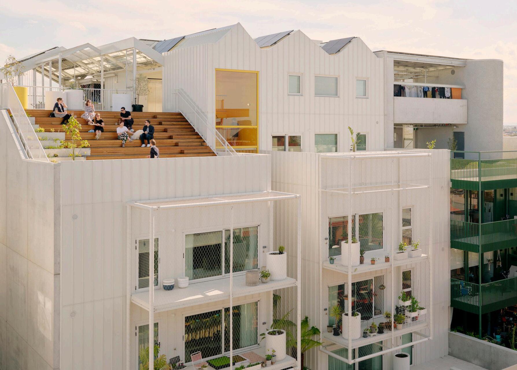
Action - 12.6
Implement minimum frontage and site area controls to achieve high-quality design outcomes in new buildings and encourage amalgamation.
To achieve design excellence and high-quality built form outcomes in new buildings, it is important to ensure that sites are large enough to accommodate taller buildings. This will enable new buildings to more easily meet building separation, access and servicing requirements while creating highquality street frontages. This will be achieved by implementing 30m minimum frontage and 1,500sqm minimum site area controls for new shop-top housing and residential flat buildings. This will also to assist in incentivising desired amalgamation patterns and secure the development outcomes envisaged by the Master Plan. Council will also consider other mechanisms, such as site-specific amalgamation clauses to achieve the built form outcomes envisaged on key sites.
Who?
Council
Time Frame
Action - 12.7
Introduce DCP controls to enhance the character of the Belfield village, and maintain the aesthetic qualities of the high street.
Why?
New development can sometimes feel out of place within a cherished streetscape, but this doesn’t have to be the case. By creating detailed planning controls and guidelines within Council’s DCP, new buildings can sit harmoniously within the established character of the high street.
For the village core in Belfield this will likely include:
◦ Setting appropriate street wall heights to align with the parapets of existing shopfronts and create a positive relationship to surrounding buildings;
◦ Architectural treatment of facades and the use of characteristic building materials such as brick and masonry;
◦ Upper-level setbacks to reduce the visual bulk of new buildings, ensure Burwood Road still receives great sunlight, and protect the amenity of pedestrians, and;
◦ Retention of the fine grain retail character of the high street and controls requiring new buildings to incorporate sympathetic architectural elements at the street level.
Who?
Council
Time Frame
The Master Plan acknowledges the challenge of housing affordability across Greater Sydney and responds with a targeted affordable housing contributions scheme. The propose scheme is modest is nature given the need to balance housing provision, urban design excellence, and preserving Belfield’s village atmosphere. The Master Plan also identifies the infrastructure necessary to support growth, including laneways, new through-site links and public spaces, and outlines clear mechanisms for these to be delivered.
The Master Plan acknowledges the challenge of housing affordability across Greater Sydney and responds with a targeted affordable housing contributions scheme. The proposed scheme is modest is nature given the need to balance housing
provision, urban design excellence, and preserving Belfield’s village atmosphere.
Belfield has significant local heritage, which the Master Plan aims to recognise. This history includes First Nations history and landscapes as well as built environment heritage, character buildings and unique local stories. The Master Plan puts forward a range of actions to recognise and respect the different parts of Belfield’s history including investigating the heritage listing of important buildings and sites, crafting tailored built form controls for character areas and placing greater emphasis on First Nations narratives and culture in the area.
The Master Plan considers the different needs and perspectives of a range of groups within the community. This includes families and children, seniors, people with disabilities, local workers and visitors to the village. The Master Plan proposes a wide range of actions that will help Belfield become a vibrant and inclusive village with a strong community life, offering opportunities for people to live full and active lifestyles close to home.
Indicative time-frame for delivery:
◦ Short term – 1-5 years
◦ Medium term – 6-14 years
◦ Long term – 15+ years

Project Study Area
Proposed service lane
Proposed pedestrian links
Proposed pedestrian and cycle links
Village core
Existing public open space
Proposed public open space
Existing regional cycle route
Potential regional cycle route
Existing on street cycle route (maintain)
Proposed cycling connections
Proposed greenway
Proposed intersection upgrade
Potential pedestrian and cycle bridge (between First and Walsh Avenue)
Proposed bus stop
Action - 13.1
Introduce a modest affordable housing contributions rate for new development in Belfield.
Why?
Housing affordability continues to be a serious challenge all over Sydney and is a significant issue for households in CBCity. Establishing an affordable housing contributions rate in Belfield is part of Council’s wider response to the housing crisis and meeting CBCity’s housing needs in the long term.
The Master Plan proposes a modest 1% affordable housing rate, applied to the gross floor area of the residential component of development. This rate has been proposed to strike a balance between development feasibility and providing more affordable dwellings. This affordable housing contribution rate will only apply to development of a certain size threshold and certain sites where there is an uplift under proposed planning controls.
Action - 13.2
Investigate mechanisms for funding the delivery of community infrastructure to support the growth proposed by the Master Plan.
To support the growth proposed in the Master Plan, Council will investigate and establish appropriate mechanisms to deliver the community infrastructure identified in the Plan.
This includes:
◦ The closure of Downes Street and the creation of a plaza
◦ Village core public domain improvements
◦ Embellishment of the Belfield greenway
◦ Extension of Belfield Lane
◦ Identified through-site links
◦ Identified connections along the Cooks River.
Potential mechanisms include land dedication, acquisition, works-in-kind, development contributions and other funding sources. Funding to assist with the delivery of identified infrastructure could include general revenue or grant funding.
Action - 13.3
Work with Homes NSW to deliver a pedestrian and cycle link alongside social and affordable housing.
To facilitate the greenway between Baltimore Street and Varidel Avenue, the Council will collaborate with Homes NSW. This mutually beneficial partnership aims to integrate the crucial pedestrian and cycle link into upcoming developments on land owned by Homes NSW in Belfield. Efforts will include negotiating access rights, dedicating land, or arranging contributions through works in kind. This focused collaboration is designed to ensure the successful delivery of this key community infrastructure, enhancing connectivity and the livability of the area and contributing to the delivery of social and affordable housing.
Who?
Council and Department of Planning Housing and Infrastructure
Time Frame
Time Frame
Homes NSW and Council
Time Frame


Action - 14.1
Use Darug language for naming new buildings and public spaces.
Including Darug language in future building and public space projects is an important part of building a stronger connection with Country in Belfield. Using Aboriginal language to connect with Country can reveal a different way of thinking about our relationship to the built and natural environment. It will also contribute towards a greater understanding of Darug history and culture in CBCity. To do this Council will work with its First Peoples Advisory Committee to prepare a list of words and names and seek their permission for these to be used in built environment projects. Place names may be based on local plants, animals or places in CBCity.
Action - 14.2
Investigate the application of specific planning controls for the Belfield Hotel and the inter-war shop fronts along Burwood Road.
The inter-war shop fronts and the Belfield Hotel are characteristic and much-loved parts of the streetscape of Burwood Road, their distinctive brick facades represent an important era in the development of the high street. Applying specific planning controls to these sites will help preserve building character whilst allowing flexibility in use to ensure the sites can continue to meet the needs of local business owners. Future DCP provisions should identify the characteristic elements that should be retained, such as the distinct brick facades and masonry, pediments and historic signage.
Who?
Council and CBCity’s First Peoples Advisory Committee
Time Frame
Council Who?
Time Frame
Action - 14.3
Investigate the heritage listing of identified buildings and items.
Belfield has distinct local heritage worth recognising and protecting. The Master Plan identifies the following items for heritage investigation. These items were determined based on a review of previously identified items for investigation and were validated by site visits.
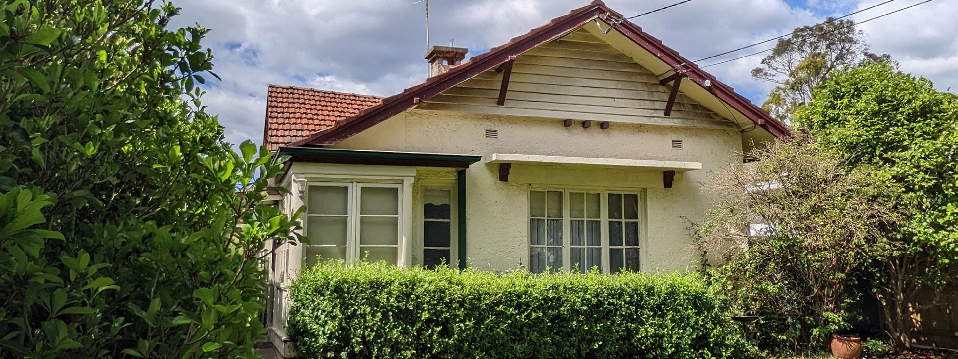

These streets contain existing Inter-War period ‘War Service Home Commission’ dwellings. Some of these dwellings are in good condition and retain characteristic form and elements, others have been modified or replaced. Further investigation needs to be undertaken to determine the properties which may meet the threshold for heritage listing.
Time Frame
These gates are significant as a prominent and intact original feature of Rudd Park, and remains an important local landmark. The gates also hold aesthetic value, being a set of well-maintained Inter-War period gates with Art Deco stylistic detailing.
Significance: Local
Action - 14.4
Prepare DCP controls for Belfield’s four character areas : Village Core, Parkland Living, Punchbowl Road and Suburban Fabric.
Why?
Place-based master planning provides an understanding of the specific characteristics of Belfield and highlights four distinct areas. Each area has distinctive features and attributes that warrant a tailored planning approach to safeguard and enhance its uniqueness. Council will develop DCP controls that provide specific principles and guidance for development within each of the four character areas. Controls may include:
Village Core
◦ Active frontages and upper setbacks
◦ Fine grain lot pattern and building articulation
◦ Retention of historic facades and building elements
◦ Sympathetic materials such as brick and masonry
Who?
Council
Time Frame
◦ Landscaped front setbacks
◦ Dwelling orientation towards Rudd Park and green spaces
◦ Locally indigenous tree and plant species
◦ 3m side setbacks to greenway
◦ 8m front setback
◦ Deep soil and landscaping in front setback
◦ Winter gardens, materiality and acoustic treatment
◦ Orientation of living spaces away from Punchbowl Road
◦ Mix of old and modern materiality
◦ 0m front and side setbacks on corner shop sites
◦ 3m side setbacks to greenway
◦ Locally indigenous tree and plant species
Action - 15.1
Investigate ways to incorporate communityfriendly uses on the Downes Street Car Park site in the long term.
The Downes Street Car Park plays an important role in supporting the functioning of Belfield, however the facility has been designed as monofunctional car parking structure. In the future, there may be opportunities to incorporate other more community-friendly uses on this site, such as play spaces, certain types of recreation facilities or open spaces, if the need arises. This could take the form of reconfiguring car parking arrangements to allow space for other activities or providing flexibility in programming to allow the space to be used for different activities at different times. Any specific proposal will need to be closely considered alongside demand for car parking in the village.
Action - 15.2
Review planning controls to ensure the Belfield community’s history, multicultural identity and creativity is recognised and celebrated through public art.
Why?
Public art is a valuable tool for empowering local communities and enabling different groups and peoples to participate fully in the community’s social and cultural life. It can also allow local businesses to build their own distinct brand and identity, contributing to the vibrancy of the village centre. Council should encourage this type of creative expression and must ensure that its planning controls provide clear guidance for people or businesses seeking to incorporate public art into their projects. This could include working with landowners to identify opportunities for street art or murals on privately owned buildings, identifying suitable spaces for public art in public domain planning, and reviewing DCP to mandate the inclusion of public art in large-scale developments.
Action - 15.3
Expand and improve creative spaces and infrastructure.
Why?
Recent reforms in NSW have been aimed to create more diverse and vibrant commercial centres by including uses like creative industries. To support the growth proposed in the Master Plan, Council will include ‘Creative Industries’ as permitted land uses with consent in the E1 Commercial Centre zone to support the objectives of the zone. These uses can help local economies by attracting investment and activity to the area. Examples of creative industries include a building or place whose principal purpose is to produce or demonstrate arts, crafts, design, or other creative products. This can include artist studios, recording studios, and set design/production facilities.
Time Frame
Time Frame
Time Frame
Action - 15.4
Develop artworks that celebrate First Nations culture, stories, history, people or Country, for use on construction hoardings.
Public art makes an important contribution to making great places, and can also be a highly effective means of marking and sharing First Nations history and stories. The Master Plan aims to prioritise local First Nations art and artists in Belfield by including First Nations art on construction hoardings. This will be done by making changes to Council’s hoarding policy, providing a temporary celebration of local Aboriginal stories, culture and art. Any installations of First Nations artwork need to be developed in cooperation with the local Aboriginal community, and should be led by Aboriginal organisations, businesses or local Aboriginal artists where possible.
Action - 15.5
Investigate joint use of sports and recreation facilities at local schools.
Joint or shared use of school facilities benefits the schools and their local communities. Shared use gives the wider community better access to recreational and sports facilities and provides local kids with opportunities to use and enjoy these spaces outside of school hours. It also fosters a more cooperative and positive relationship between schools and the community. Council will work with St Michael’s Primary School, Belmore North Public School and Belmore Boys High School to investigate ways to explore strategies for developing shared use arrangements, focusing on effective facilities management.
Who?
Council, CBCity’s First Peoples Advisory Committee and Bankstown Arts Centre
Time Frame
Who?
St Michael’s Primary School, Belmore North Public School, Belmore Boys High School
Time Frame
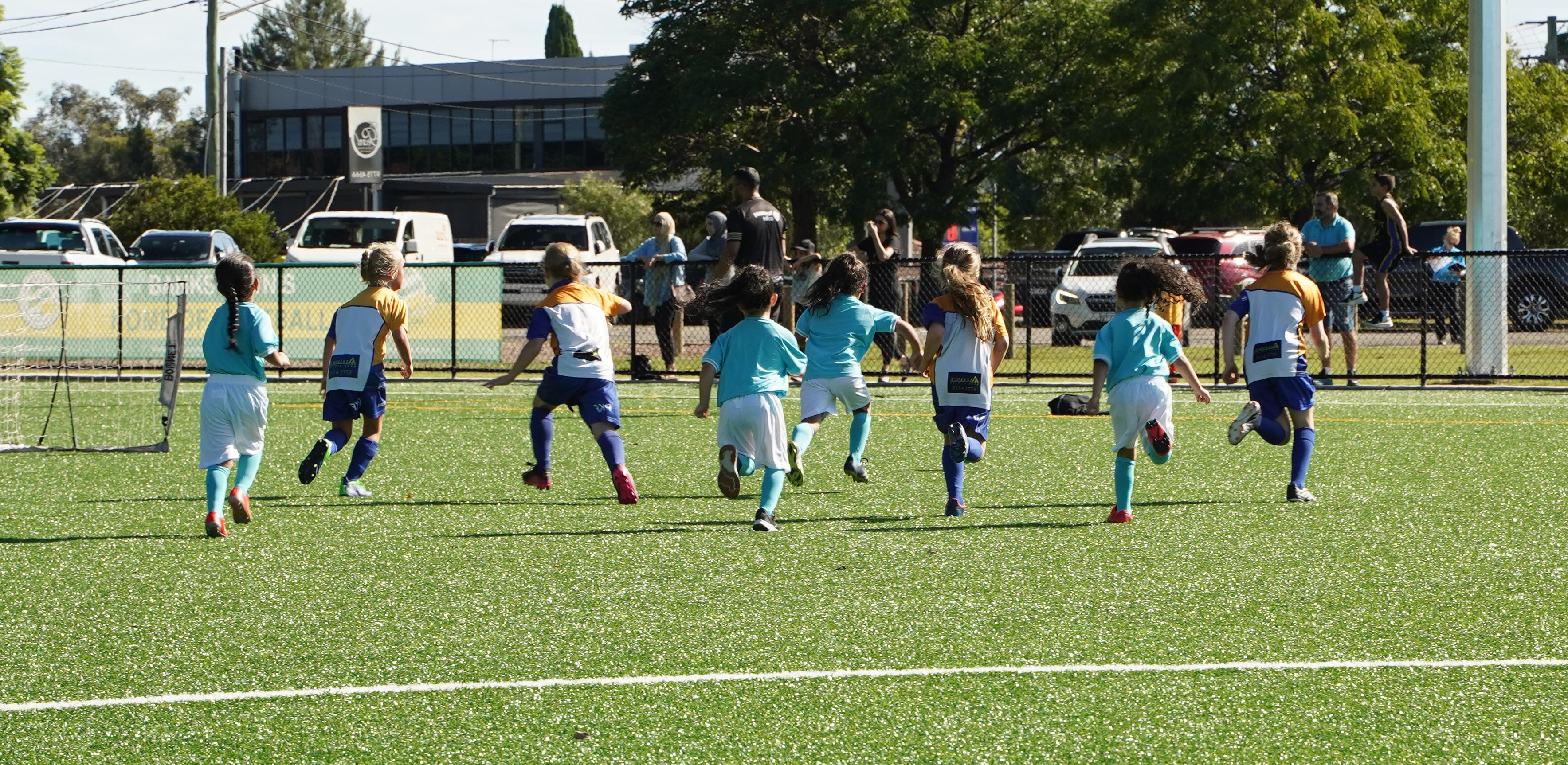

The actions proposed in the Belfield Master Plan will be implemented over time, and each action has been given an indicative time-frame for delivery:
◦ Short term – 1-5 years;
◦ Medium term – 6-14 years;
◦ Long term – 15+ years, and;
◦ Ongoing.
Where relevant, actions have also been assigned a relevant partner or stakeholder for Council to advocate to, collaborate with, or consult.
The actions have also been assigned an indicative cost range of low ($), medium ($$) and high ($$$). These represent indicative costs of proposed actions for Council and serve as an approximation and general guide only. Where actions are related to planning controls or proposed to be delivered by an external partner such as an NSW Government agency or a private developer, a low cost is assumed, and where physical infrastructure is proposed to be delivered by Council a medium or high cost range has been assigned based on the scale and significance of the proposed infrastructure.
A range of funding sources and mechanisms are available to Council to implement and deliver these actions which can include Local Infrastructure Contributions (7.11 or 7.12), use of existing assets, general revenue, grant applications, planning agreements and regional infrastructure contributions such as NSW Government Housing and Productivity Contributions.
Implement enhanced water and energy efficiency controls for new buildings.
Implement DCP controls requiring tree planting rates to achieve tree canopy targets.
Update DCP controls and Council’s Landscape Guide with a list of preffered, locally indigenous tree species for Belfield.
Advocate for improvements to the intersection of Burwood Road and Punchbowl Road and investigate the installation of dedicated right-turn arrow.
Investigate the installation of new medians along Punchbowl Road at the intersections of residential street including Persic Street, Seymor Parade and Scott Street.
Amend the land zoning map to accurately reflect the extent of the ‘Campsie Bypass’ reservation.
Advocate for a direct bus connection between the Belfield village and Campsie.
Create DCP controls to protect the fine grain character of Burwood Road.
Investigate and test the closure of Downes Street by undertaking a temporary trial closure.
Deliver planned upgrades to sports and recreation facilities at Rudd Park. Action
Council
DPHI
Transport for NSW and CBCity Local Transport Forum
Transport for NSW, Strathfield Council, and CBCity Local Transport Forum
Council, Transport for NSW and DPHI
Council and Transport for NSW
Council
Council, CBCity Local Transport Forum and Transport for NSW
Council and Football
Canterbury
Investigate and implement mechanisms for the undergrounding or bundling powerlines and telecommunications cables.
Expand the existing E1 Local Centre zoning along the western side of Burwood Road towards the intersection of Burwood Road and Blackwood Street.
Establish planning controls to mandate active frontages along the Burwood Road high street, Downes Street plaza and corner shop sites.
Review Council’s LEP and DCP controls to reinvigorate local corner shops and allow for appropriate non-residential uses.
Review car parking controls and introduce an exemption from off-street car parking requirements for certain types of non-residential development at 4-22 Burwood Road.
Allow additional shop top housing along Burwood Road and residential flat buildings along Punchbowl Road.
Encourage medium density housing in strategic locations in and around the Village Core and Rudd Park.
Require new development to comply with the Livable Housing Design Guidelines.
Implement new dwelling mix controls to deliver more family-friendly apartments.
Develop LEP and DCP controls to create high quality housing design for a range of different housing types. Implement low-density residential zone and encourage dual occupancies by amending the LEP minimum lot size requirements.
Amend the LEP height and FSR controls applying along Burwood Road, Punchbowl Road and the village core to allow for a varied and interesting streetscape in the village.
Incorporate allowance for rooftop gardens into the maximum building height controls in the E1 zone.
Implement DCP requirements for special corner treatments of specific sites.
Investigate waste and servicing controls for Burwood Road and the village core.
Implement minimum frontage and site area controls to achieve high-quality design outcomes in new buildings and encourage amalgamation.
Introduce DCP controls to enhance the character of the Belfield village, and maintain the aesthetic qualities of the high street.
Introduce a modest affordable housing contributions rate for new development in Belfield.
Investigate mechanisms for funding the delivery of community infrastructure to support the growth proposed by the Master Plan.
Investigate the application of specific planning controls for the Belfield Hotel and the inter-war shop fronts along Burwood Road.
Investigate the heritage listing of identified building and items.
Prepare DCP controls for Belfield’s four character areas: Village Core, Parkland Living, Punchbowl Road and Suburban Fabric.
Review planning controls to ensure the Belfield community history, multicultural identity and creativity is recognised and celebrated through public art.
Expand and improve creative spaces and infrastructure.
Develop artworks that celebrate First Nations culture, stories, history, people or Country, for use on construction hoardings.
Apply the Connecting with Country framework in the approach to project formation, design and delivery of the future ‘Belfield Canal’ greenway. Action
Council
Council, CBCity’s First Peoples Advisory Committee, Bankstown Arts Centre
Create a continuous greenway through Belfield between Eccles Reserve and Rudd Park by securing access through land dedication on sites adjacent to the ‘Belfield Canal’.
Council, Homes NSW, Sydney Water
Council and CBCity’s First Peoples Advisory Committee
Advocate for the installation of a new signalised intersection and crossing on the eastern section of Punchbowl Road at Margaret Street.
Investigate reducing speed limits in the village core to 30km or 40km per hour as part of a High Pedestrian Activity Area.
Advocate for the removal of the section of the ‘Campsie Bypass’ reservation between Second Avenue and Coronation Parade.
Investigate a pedestrian and cycle bridge between First Avenue Reserve and Walsh Avenue Reserve.
Transport for NSW, Strathfield Council, St Michael’s Catholic Primary School and the CBCity Local Transport Forum
Council and Transport for NSW
Transport for NSW and NSW Treasury
Council, Sydney Water and Burwood Council
5.4
Investigate a north-south cycling connection along Linda Street, Burnham Street and Bruce Avenue.
Investigate kerb extensions to create in-lane bus stops for the two bus stops Burwood Road.
Reconfigure car parking on Downes and Blackwood Streets to provide additional on-street car parking close to the village core.
Apply the Connecting with Country framework in the approach to project formation, design and delivery for this future civic space.
Create a new public space by partially closing Downes Street at its intersection with Burwood Road.
Council and Transport for NSW
Council and Transport for NSW
Council and CBCity Local Transport Forum
Council and CBCity’s First Peoples Advisory Committee
Council, CB City Local Transport Forum and Transport for NSW
Improve local playgrounds and widen the scope of play spaces in Belfield.
Work with Homes NSW to deliver a pedestrian and cycle link alongside social and affordable housing.
Investigate joint use of sports and recreation facilities at local schools.
Council
Council and Homes
NSW
Council, St Michael’s Primary School, Belmore North Public School and Belmore Boys High School
Work closely with the Cooks River Alliance to involve First Nations stakeholders in Cooks River projects and foster mutually beneficial and sustainable relationships with Aboriginal people.
Advocate to Sydney Water for the naturalisation of the Cooks River foreshore at First Avenue Reserve and other locations along the river and its tributaries.
Ensure continuous public access along the Cooks River foreshore in Belfield.
Ensure new development responds to flooding constraints and hazards.
Include water-sensitive urban design elements as part of future public domain works in Belfield.
Advocate for improvements to the intersection of Burwood Road and Punchbowl Road and investigate the installation of dedicated right-turn arrow.
Secure the through-site links identified in key blocks as part of new development.
Continue the Belfield green link towards the Cooks River to create strong and active connections between green spaces and the Cooks River.
Council, Cooks River Alliance, Sydney
Water and CBCity’s First Peoples Advisory Committee
Council, Sydney
Water and the Cooks
River Alliance
Council, Belfield
Bowling Club and St
Michael’s Primary School
Council
Council and Cooks
River Alliance
Transport for NSW and CBCity Local Transport Forum
Council
Council
Advocate for more direct and frequent bus connections between the Belfield village and nearby centres. Action
Collaborate with Transport for NSW to investigate future on-demand transport services in Belfield.
Revitalise Burwood Road and the streets in the village core through a welcoming public domain.
Incorporate universal design principles into the design of public spaces, including parks and playgrounds.
Encourage design excellence by referring new development in the village to Council’s Design Review Panel.
Use Darug language for naming new buildings and public spaces.
Investigate ways to incorporate community-friendly uses on the Downes Street Car Park site in the long term.
Council and Transport for NSW
Council and Transport for NSW
Council and CBCity
Local Transport Forum
Council
Council and CBCity Design Review Panel
Council Council and CBCity’s First Peoples Advisory Committee
