

CHESTER SQUARE
GATEWAY DETERMINATION RESPONSE
December 19th 2024


GATEWAY DETERMINATION RESPONSE
December 19th 2024

Date1912.2024
AuthorANM
ProjectNo.19009
ProjectNameCHESTERSQUARE
Please find below a response to Council’s letter from Council 23.08. 2024 and Gateway Determination Report (June 24) The response also takes in account related meetings with Council held 23.09.24 and 12.11.24
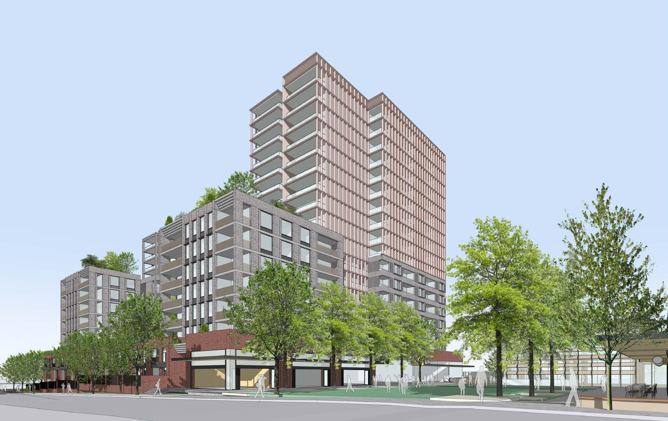
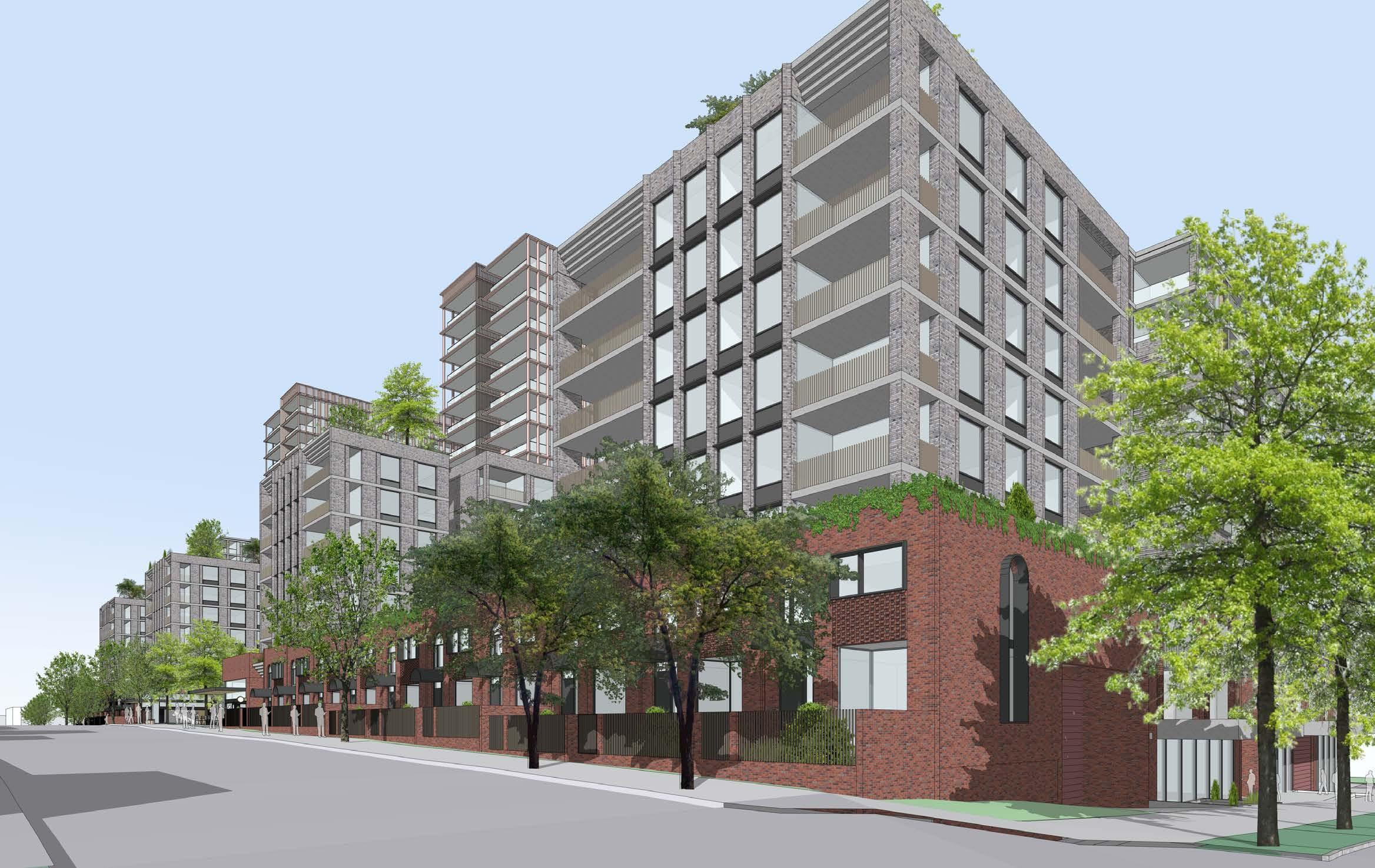
(A) Articulation and fine grain detail. Turner have presented an updated design at Teams meeting 12.11.24 with facade character. Several views were presented showing the considered scaling of the design and the fine grain and activation at street level
(B) Acceptable transition in Building Scale Turner have presented an updated design at Teams meeting 12.11.24 showing the surrounding context with future development at LEP heights and with the potential 30% uplift from the affordable infill housing bonus.
(C) Gateway condition 1(h) (i) and (i)
Condition (h) Turner will provide a clear justification for the transition from low rise to high rise in an updated report
Condition (i) The table below summarises the outstanding matters in the SJB peer review 02.02.2024. The table also notes items that Gateway conditions proposed to be covered by a site specific DCP
Condition (j) The proposal replicates the deep soil areas in the SJB UDF. The ADG 3E -1 design criteria requires 7% of the site as deep soil– 7.5% is provided. The figure of 15% in the Gateway determination report is ADG design guidance not criteria. In any case this proposal is mixed use which normally is not required to have deep soil. It is normal in proposals such as this that deep planting is provided in communal areas to reach the 7% requirement Turner will provided addition detail showing the additional deep planting to the Main square and the residential communal courtyards.
1.3 % of tree canopy
3.3 Mitigate traffic impacts
To be developed at DA stage Site Specific DCP Control
Respond to Site specific DCP control Site Specific DCP Control
8 Access Points Council to determine vehicle access locations Site Specific DCP Control
9.1 Frost Leicester Link 6m
9.2 Bent- Priam link
10.3 Vehicular Access points
10.4 Maximum width of access points
Council to confirm requirement in Site specific DCP control
Turner have updated plans (p86,87) to show these links and illustrated them on p72 view 3.
Site Specific DCP Control
Respond to Site specific DCP control Site Specific DCP Control
Respond to Site specific DCP control Site Specific DCP Control
11.5 Frost Lane traffic direction. It is assumed Frost Lane remains a one -way street running East to West. Respond to Site specific DCP control
11.7 Frost Lane Large vehicles prohibited
No large vehicles are proposed accessing Frost Lane. Respond to Site specific DCP control
14.2 Wind report - Frost lane It is proposed this is provided at DA Stage
14.5 Trees on Frost Lane
15 Connection to Country Not required for initial submission. To be provided at DA Stage
16.3 Solar access to public outdoor space Priam/Bent/Leicester
Site Specific DCP Control
Site Specific DCP Control
Site Specific DCP Control
The Sun-eye diagrams on P106 show Leicester St receives 6hrs winter sun. The requirement for 6 hours solar is impossible to achieve for public areas to Bent and Priam St. Any building over one or two storeys will overshadow this space.
16.6 Wind Conditions on Priam/Bent/Leicester It is proposed this detail is provided at DA Stage
17 Connection to country
This was not required for initial submission. We propose this will be provided at DA Stage Multi-cultural This was not required for initial submission. We propose this will be provided at DA Stage
18.1 Central Public space - Dimensions
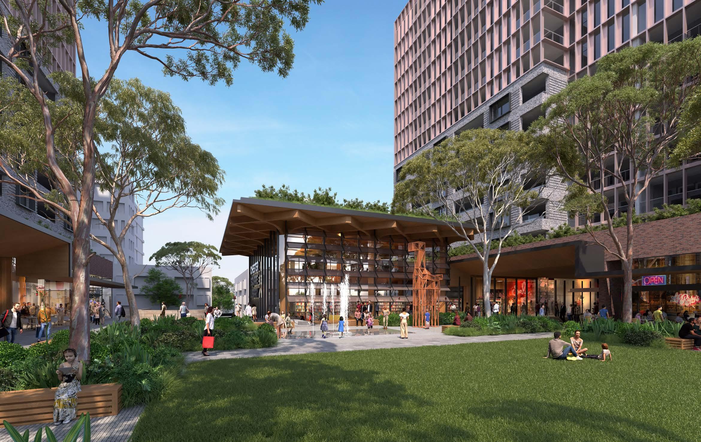
The last submitted design by Turner clearly shows the public Square at 2000sqm. The library and connecting space to Frost Lane are in addition to this space
18.2 Central Public space – Solar 4hrs to 70% Turner provides detail on P112 of their report
18.3 Central Public space - Wind It is proposed this is provided at DA Stage
18.4 Central Public space – Through site link width Respond to Site specific DCP control
18.5 Canopy tree cover It is proposed this detail is provided at DA Stage
1(c) sets public space at 2,000sqm
Site Specific DCP Control
Site Specific DCP Control
Site Specific DCP Control
18.6 Bio diversity
19 Private Communal open space
20.2 Communal open Space %
20.3 Solar access to communal open space
20.4 Trees to communal open space
20.5 Wind conditions
21 Accessible green roofs
26 Wind and downdraft
Protection from adverse weather
33(14) Floor plate of tower currently 761. Suggested control tower 700 or 750
36 Relocate carriageway and access from Bent/Priam
It is proposed this detail is provided at DA Stage
Turner provides detail on P84 of their report showing areas of communal open space and deep planting.
Turner provides detail on P84 of their report showing areas of communal open space (29% private + 17% in Main Square)
The sun eye views provide clear evidence that the north facing communal open spaces will receive more than 2hrs sun 100% of their area.
It is proposed further detail is provided at DA Stage
Wind modelling to be provided at DA stage
Turner provides detail on P84 of their report showing areas of communal open space at various roof levels
Wind modelling at DA stage
Turner have provided awnings as per UDF. Further development will occur at DA stage
To be determined by Site specific DCP. Turner/Holdmark preference for 750sqm
Respond to Site specific DCP control
Site Specific DCP Control
To be agreed with Council - Site Specific DCP Control
Site Specific DCP Control
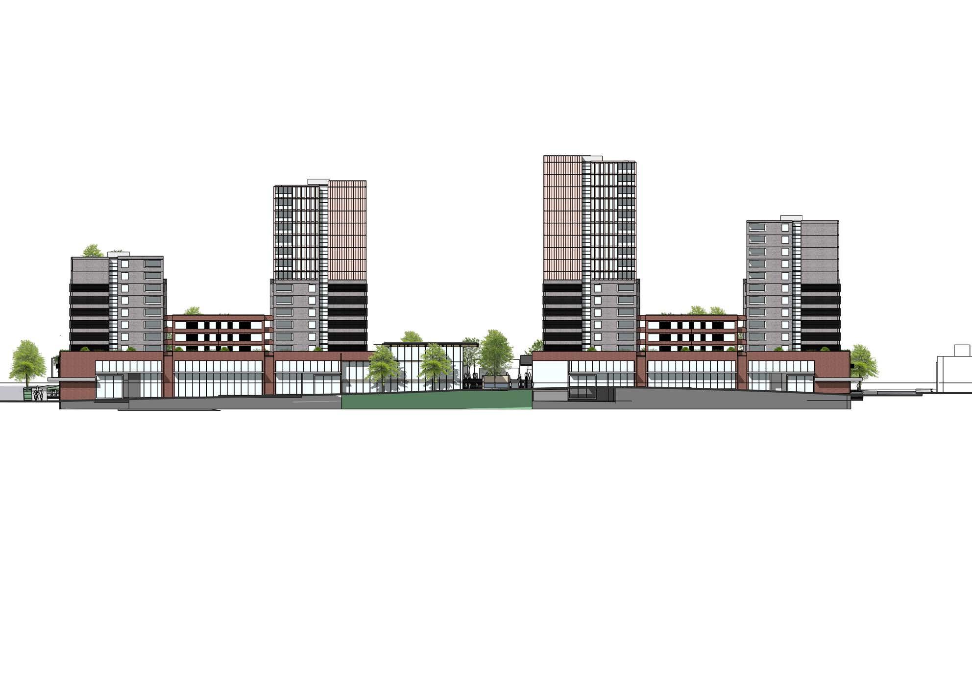
The proposed reference scheme in this document has been updated to accord with the following items:
• Gateway determination Report June 24 with accompanying Canterbury Bankstown cover Letter 23.08.24
• Meeting and meeting notes for meeting held 23.08.24 between Holdmark, Turner and CBC Council
It has been designed to an FSR of 4:1 with a public Square measuring 2,000sqm in area
The Gateway letter references the ‘Urban Design Framework’ report prepared by SJB 29.04.2022. This document proposes a building envelope form (see figure 72,p100) that sets out setbacks,deep soil, building heights and storeys. The updated Turner design in this document achieves all of the metrics in terms of:
• Setbacks
• Storeys
• Deep Soil
• Building Length
• Building Height
The Library/Community Building has been re-aligned to provide a visual link to Charles Place / Waldron Rd
responds sensitively to out of scale when growth of the relationship between new scale development impact of the bulk development such as wind down centre with conditions and create along Priam and Bent dining and active units have acceptable passing public between 6.5m and street boundary by 5m site setback must be frontage to align set back from the between 6.5 and property boundary of set back from the between 6.5 and street boundary by 3m set back by from
The reference design demonstrates that design can achieves all high-level ADG metrics. In many instances such as solar access and build separation the design exceeds the minimum thresholds by a wide margin.
The design incorporates all metrics set out in the UDC for setbacks, heights and building dimensions. Please refer to the following page for demonstration the reference design’s consideration of bulk and scale.
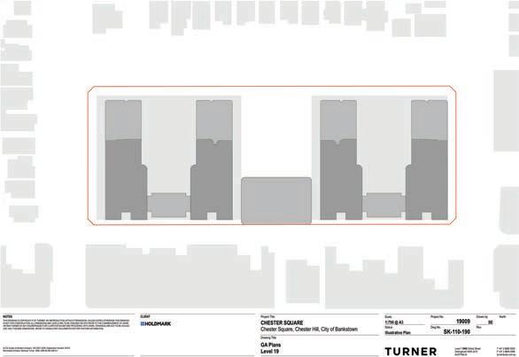
The design consists of four block aligned northsouth. This configuration permits the East,North and West facades to receive in excess of two hours winter sun per day. The reference design achieves 88.3% of units receiving 2hrs winter sun.
Communal open spaces at podium level and at level 7 are open on their north side and will receive well in excess the 2hrs to 50% of the communal space.
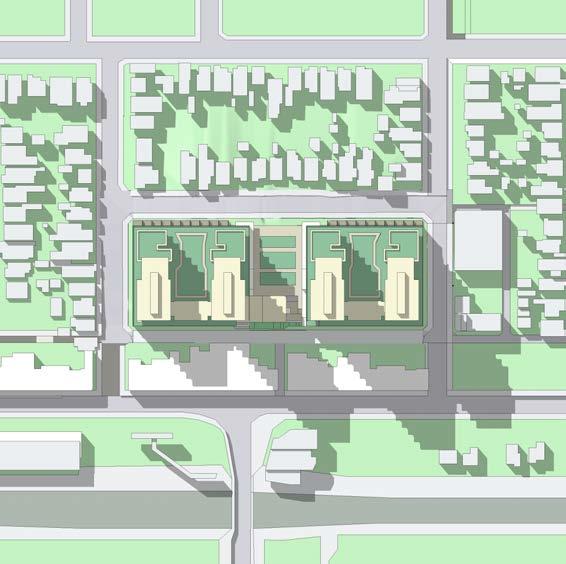
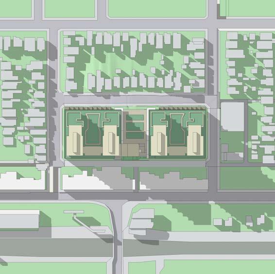
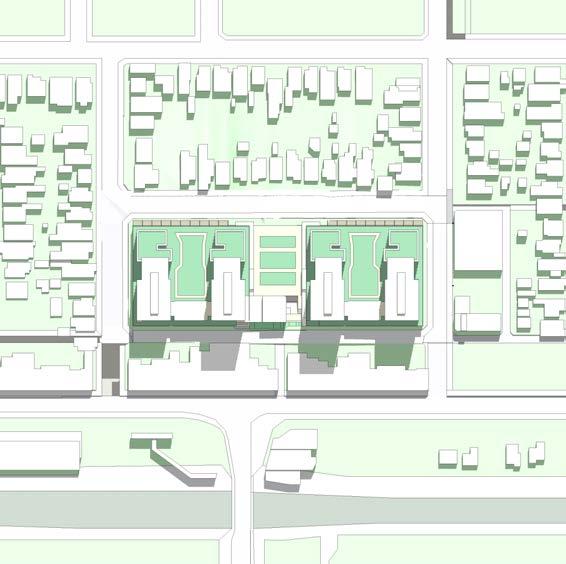
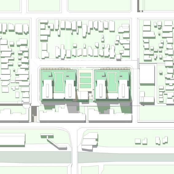
The affect of overshadowing of future development to the South of Frost Lane has been examined and is considerably less than the overshadowing in the submitted Planning Proposal. Shadowing is limited to the Eastern end of Frost Lane and it would appear possible to design these building to achieve ADG solar compliance.
The indicative apartment layout in the reference design demonstrates it exceeds the minimum ADG requirement of 61.7% units being naturally cross ventilated
. The communal open spaces indicates in the reference design amount to approximately 27% of the site area. This is in addition to the proposed public square
The design meets the building dimension metrics set out in the UDF. The four main blocks vary in distance from 26.8 to 46m which exceeds all ADG metrics for building separation
The ADG sets minimum deep soil at 7.2% of the site. This site is mixed-use and is not required to have deep soil. However in line with UDF prescriptions, the proposal provides a 5m deep soil setback to the northern side of the site and a 6m zone to the south. These zones yield 1,261sqm of deep soil which amounts to 7.5% of the site.
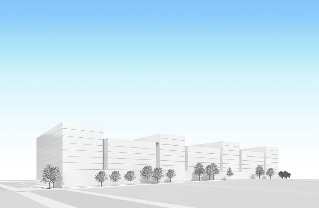
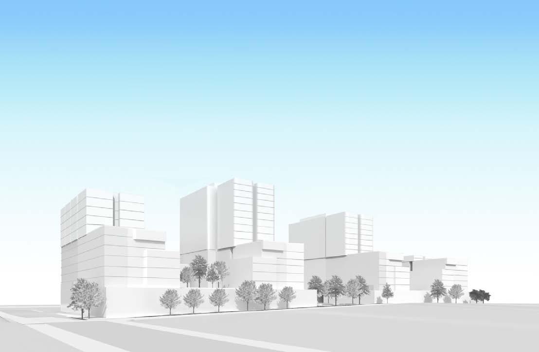
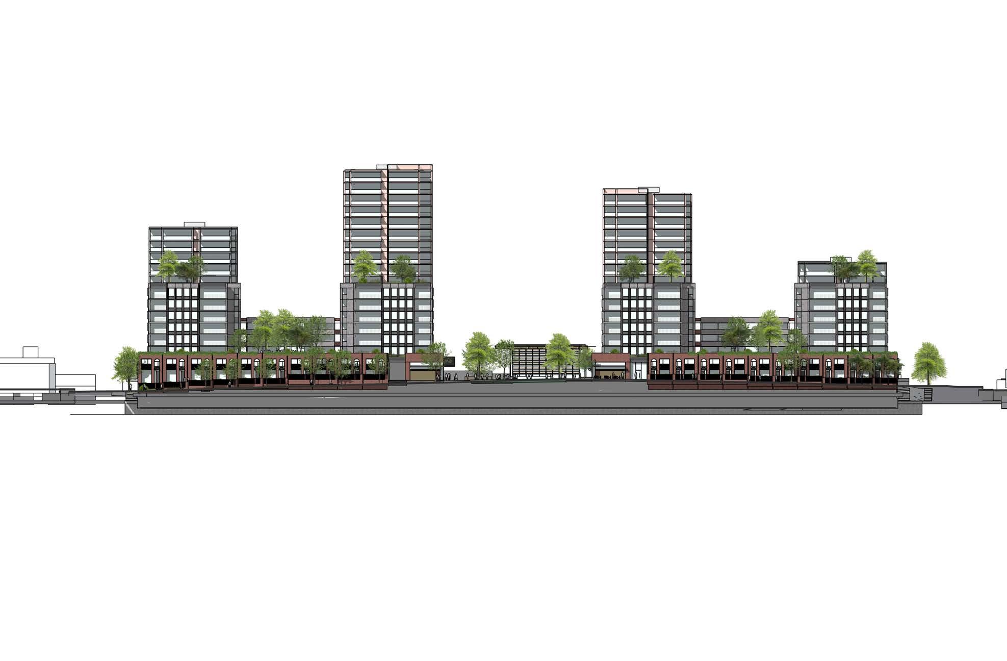
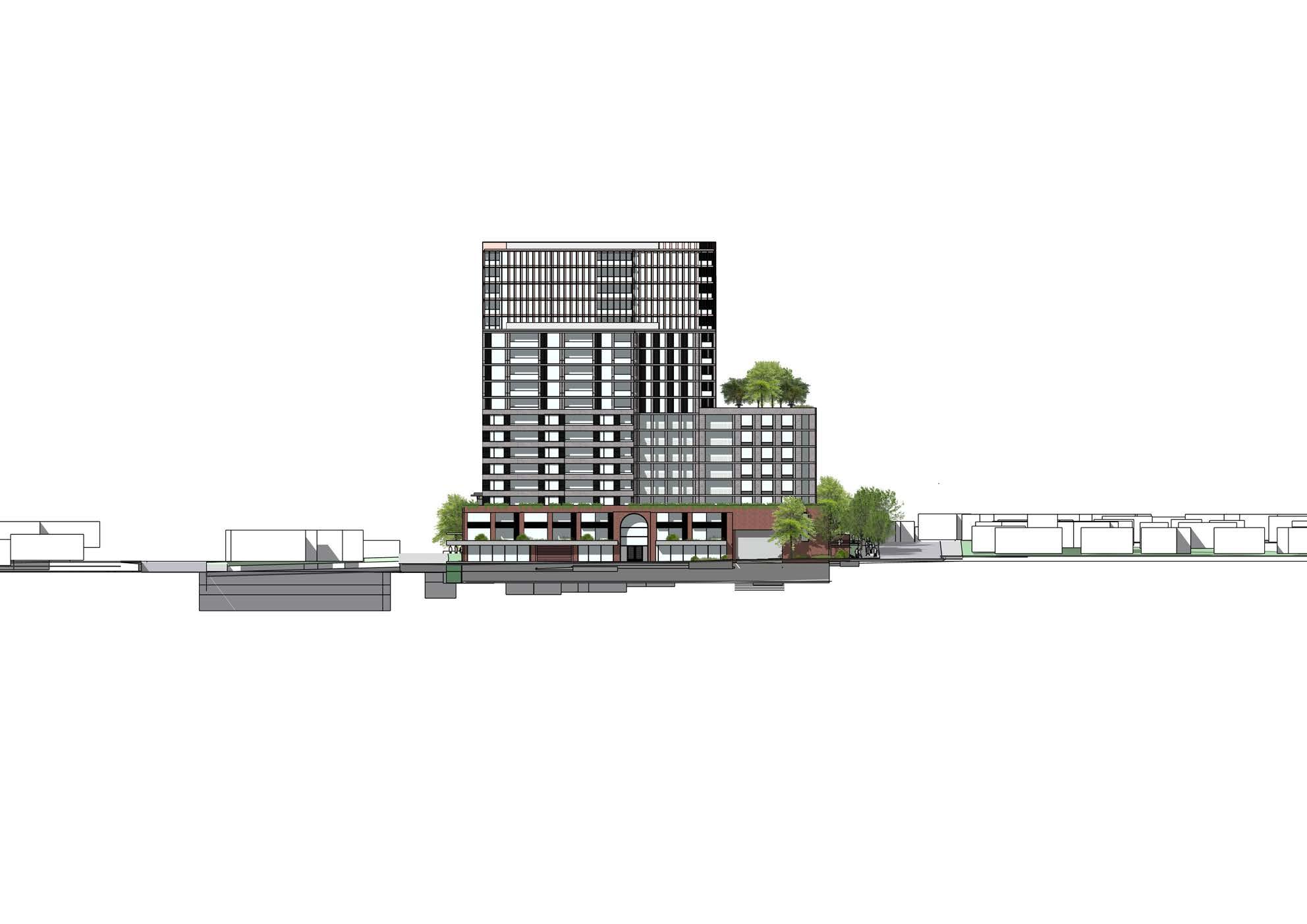
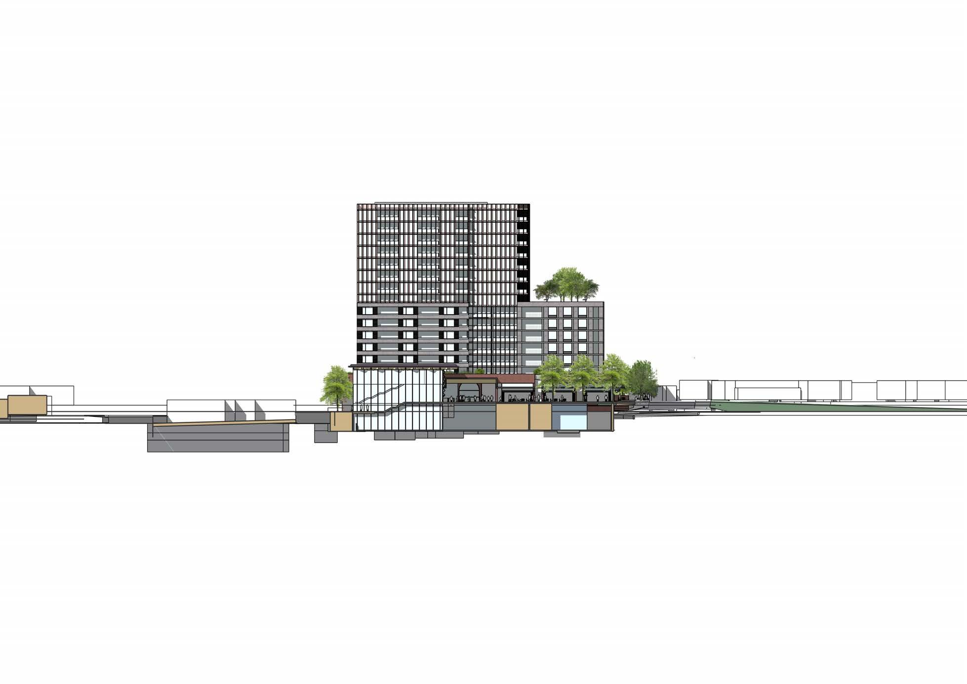
The reference design deploys a number of datums heights and articulation devices such as setbacks and recesses to modulate the bulk and scale of the design. There is a concentration of height in the centre of the design with a scaling down to the edges of the site. The 2-3 storey podium has a human scale and also clearly defines the street edge.


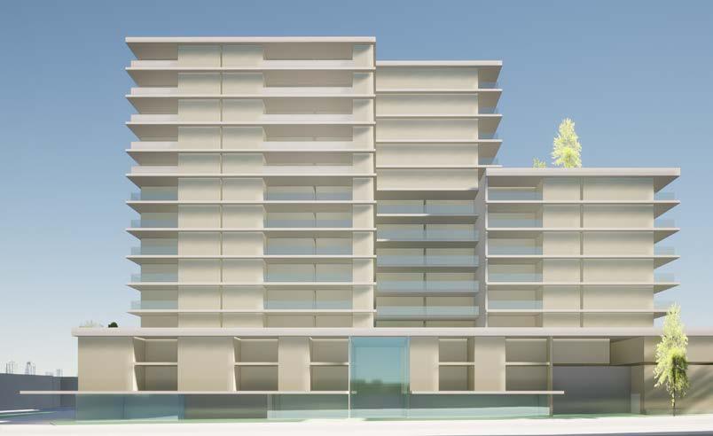

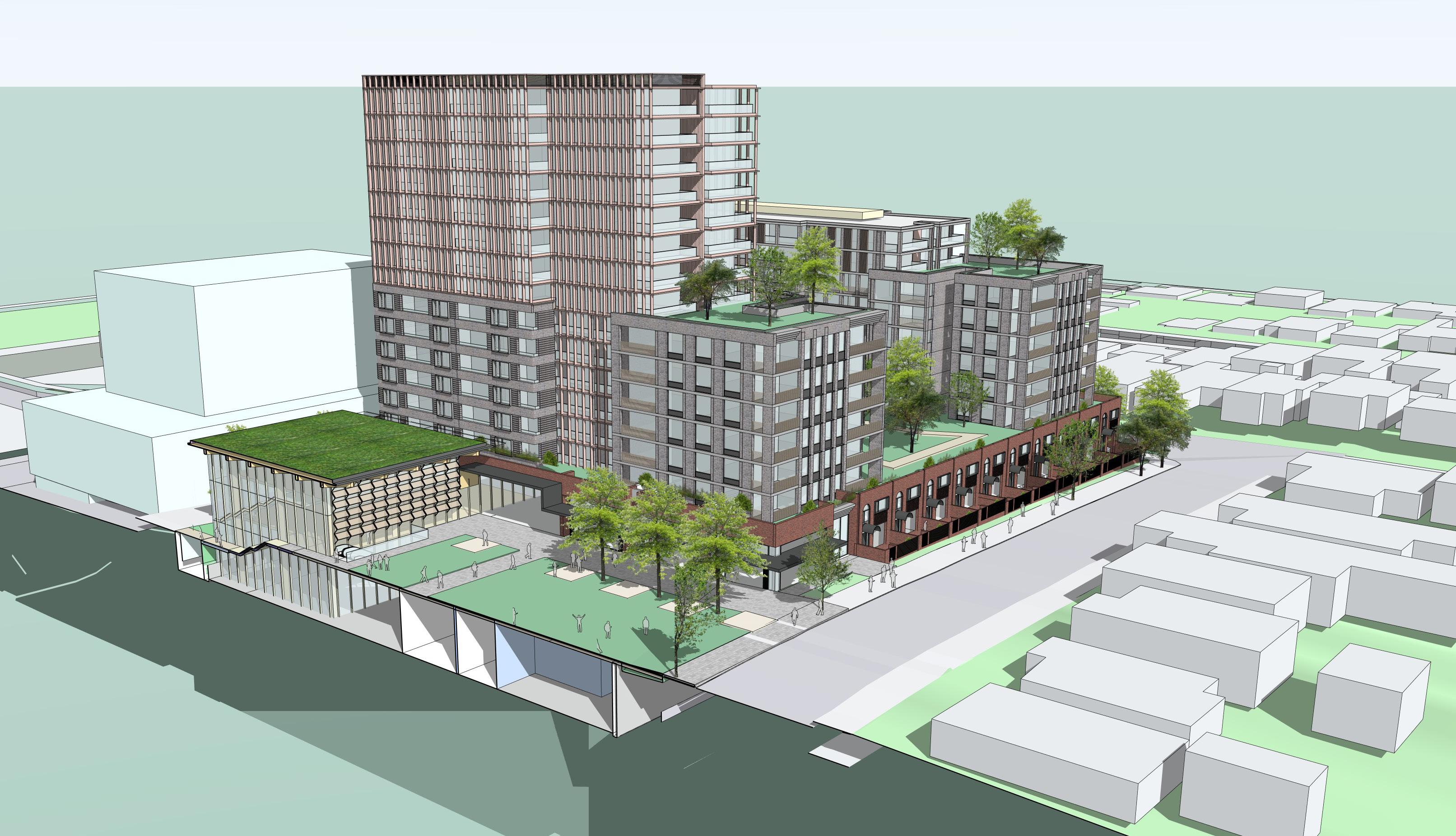
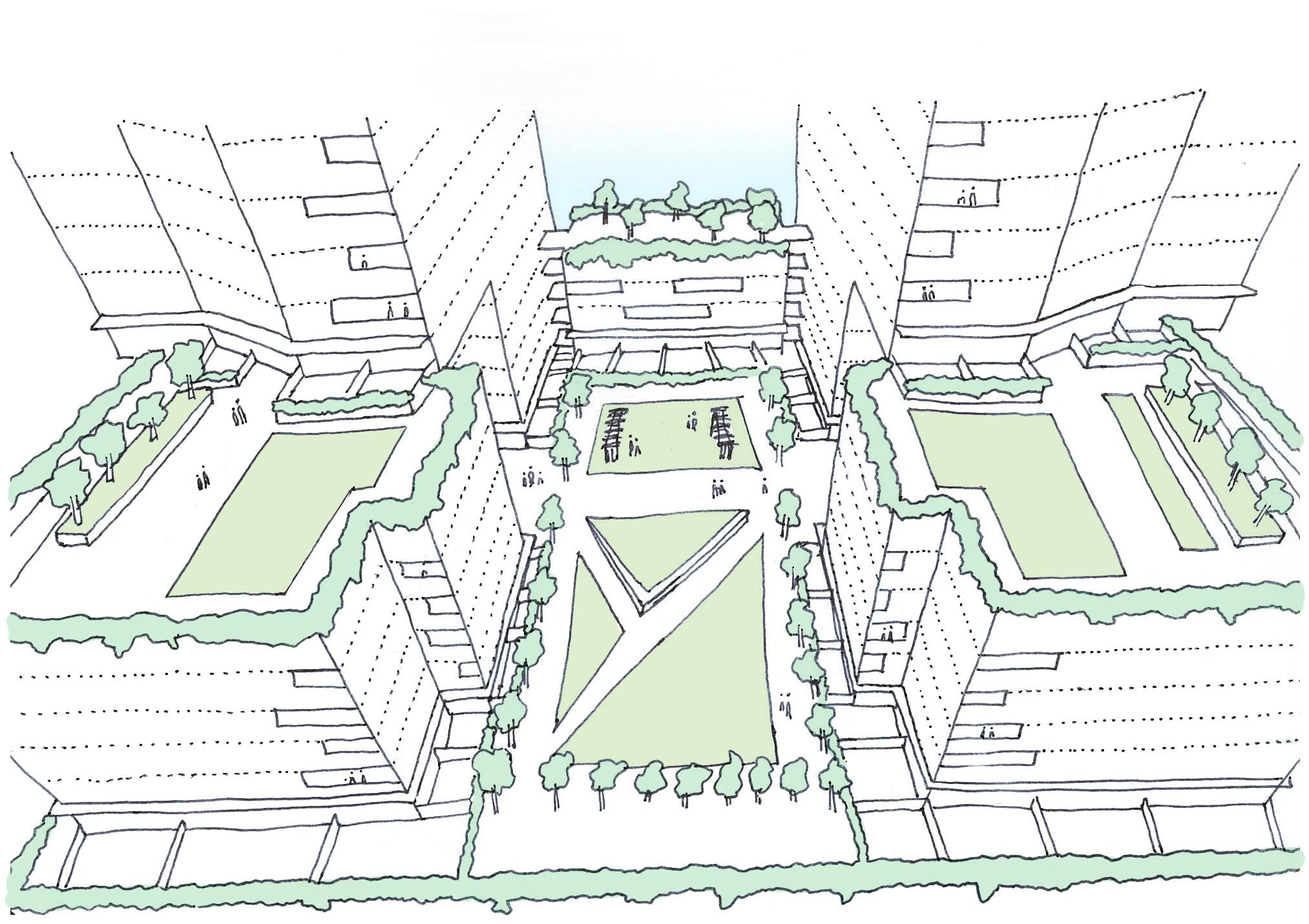
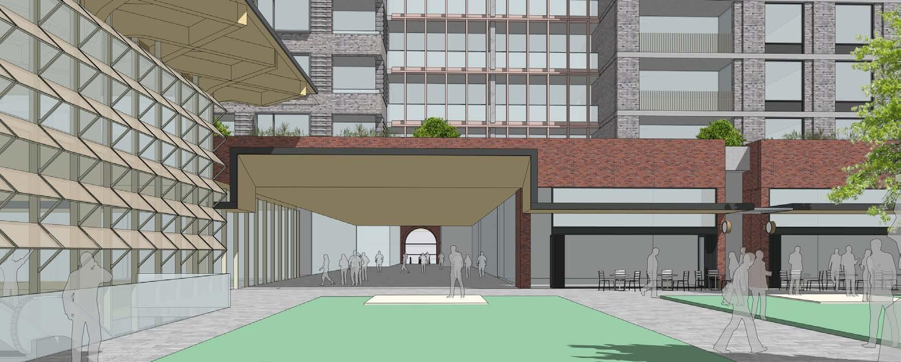
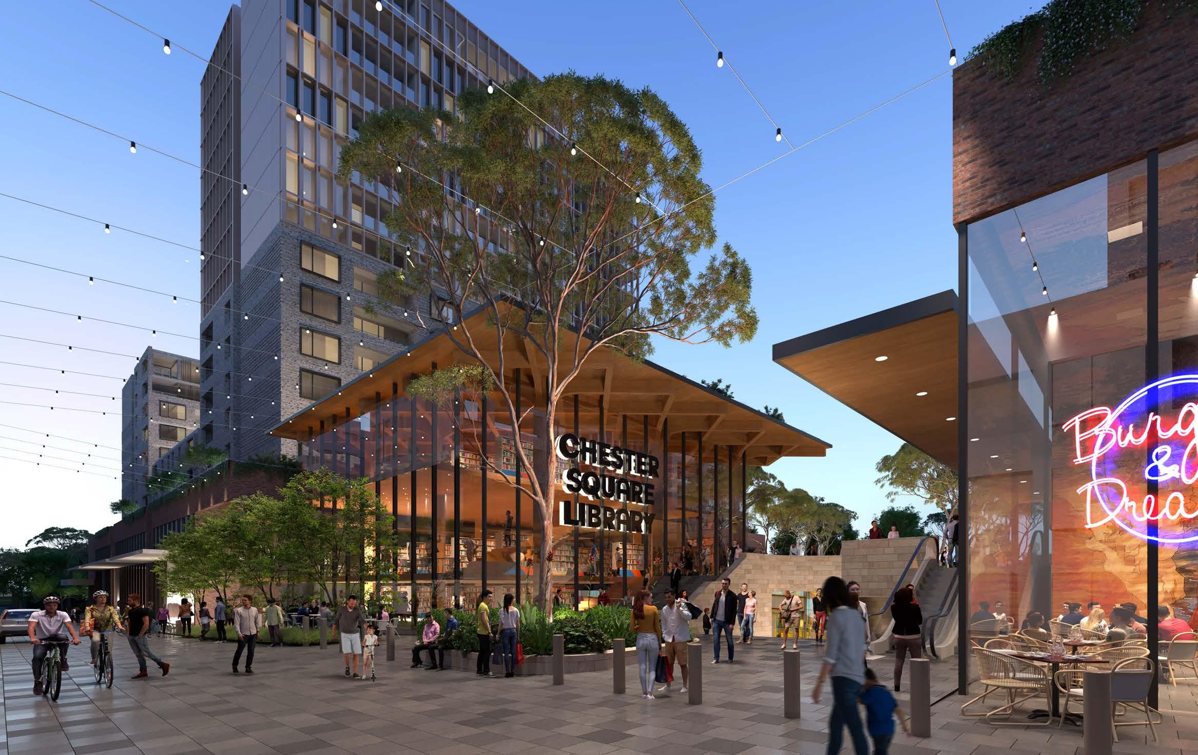
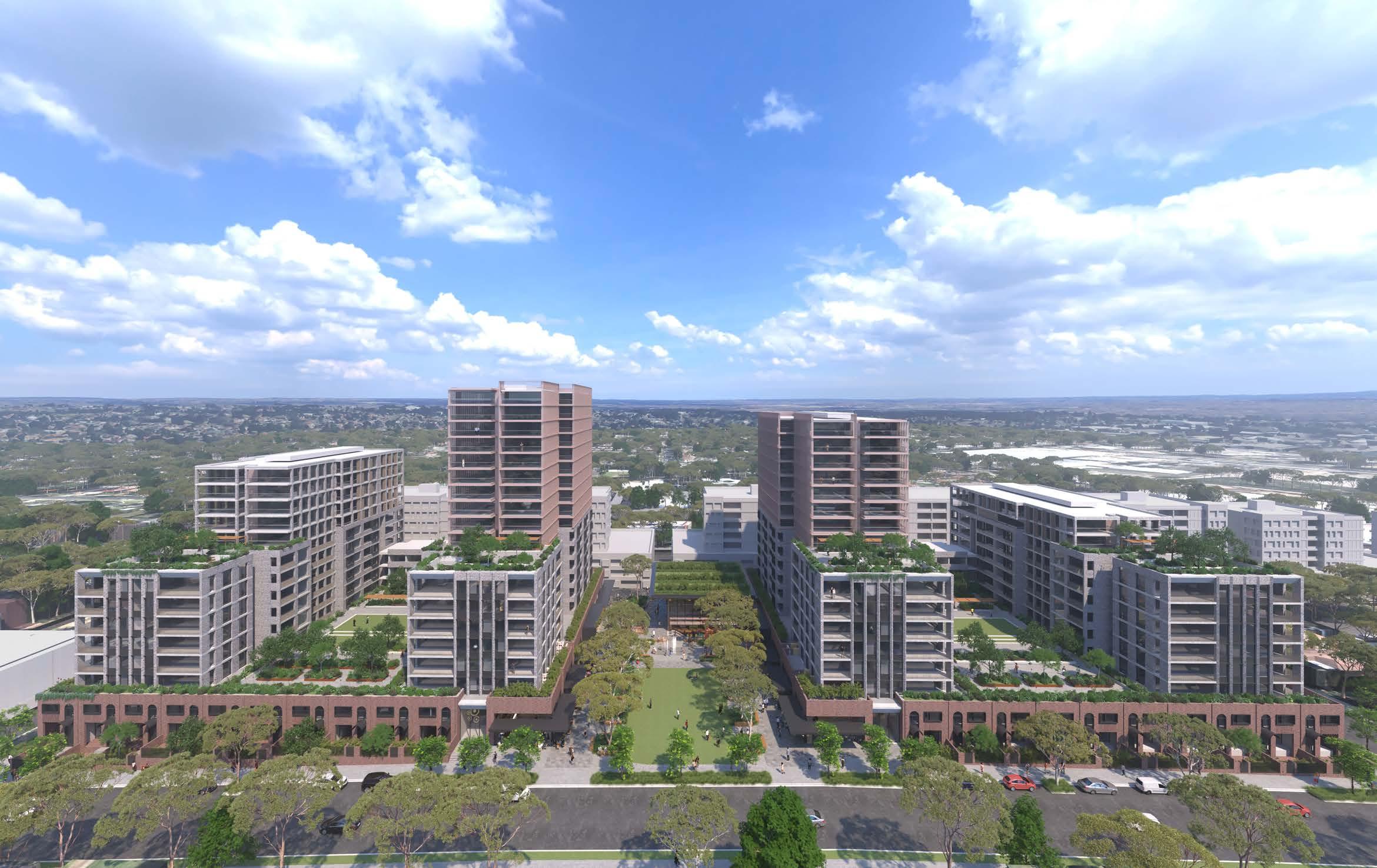
The proposed design will transform the existing Chester Square shopping Centre into a vibrant mixed-use development. At the heart of the development is a new public square of a minimum 2,000 sqm, featuring a library and communal facility.
The design integrates seamlessly into the existing context of Chester Hill, creating meaningful connections to surrounding streets. Most significantly, the proposal establishes a direct link to Waldron Road via Charles Place, with a clear line of sight from the proposed Main Square to Waldron Street. Frost Lane has been re-imagined as an active laneway, mediating between the Main Square and Waldron Street.
Retail entries are located on Priam and Bent Streets, providing an east-west link. Careful attention has been paid to level transitions, with stairs, lifts, and escalators provided to accommodate different mobility needs and offer alternative routes.
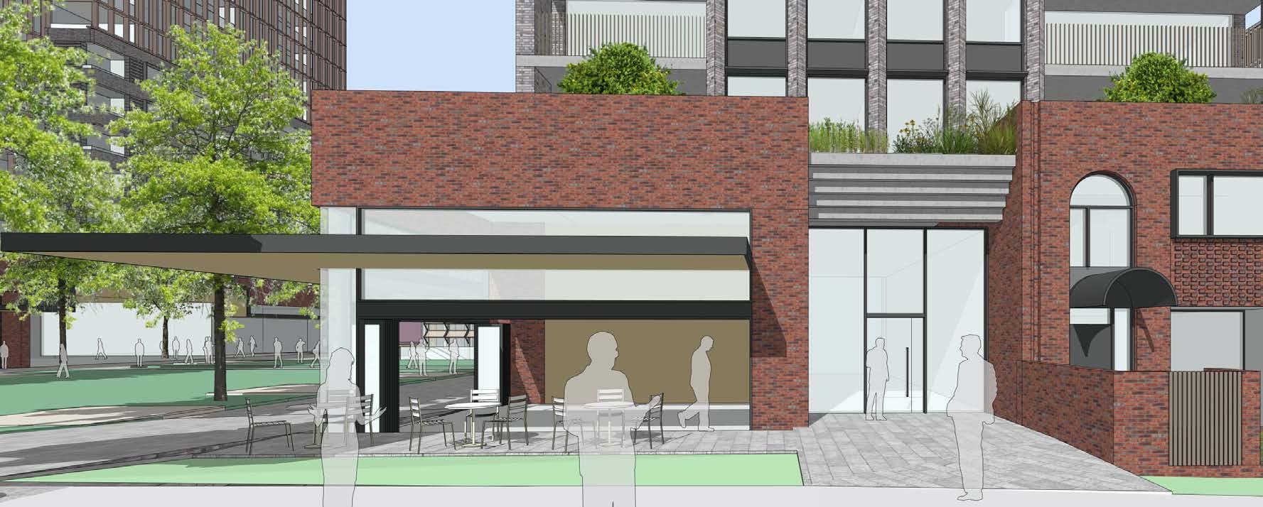
The proposal presents an active ground-level interface with fine-grain retail and commercial units lining the ground level on all sides. Residential lobbies have direct street access to Leicester Street and Frost Lane, ensuring continuous activation throughout the day. The illustrative scheme pays particular attention
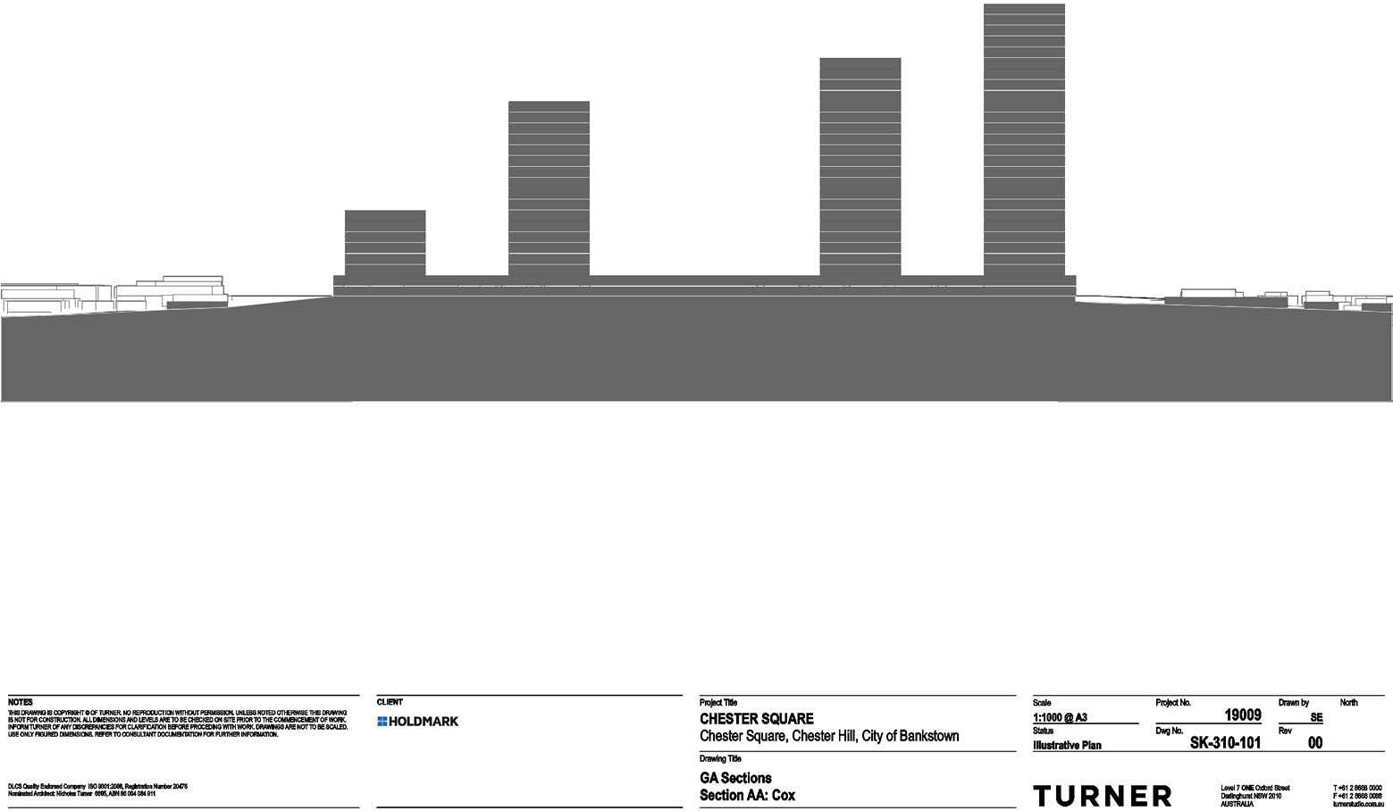
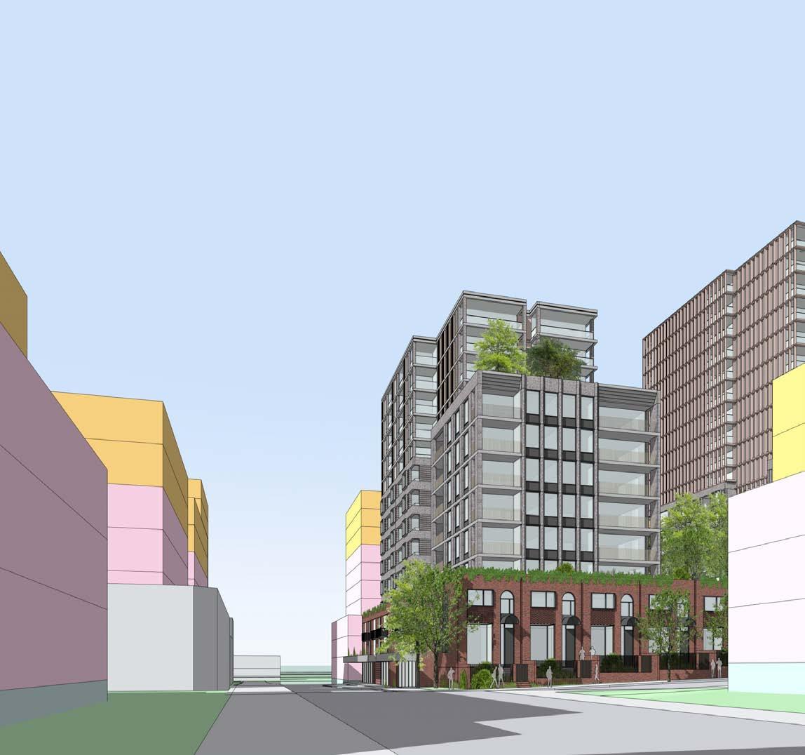
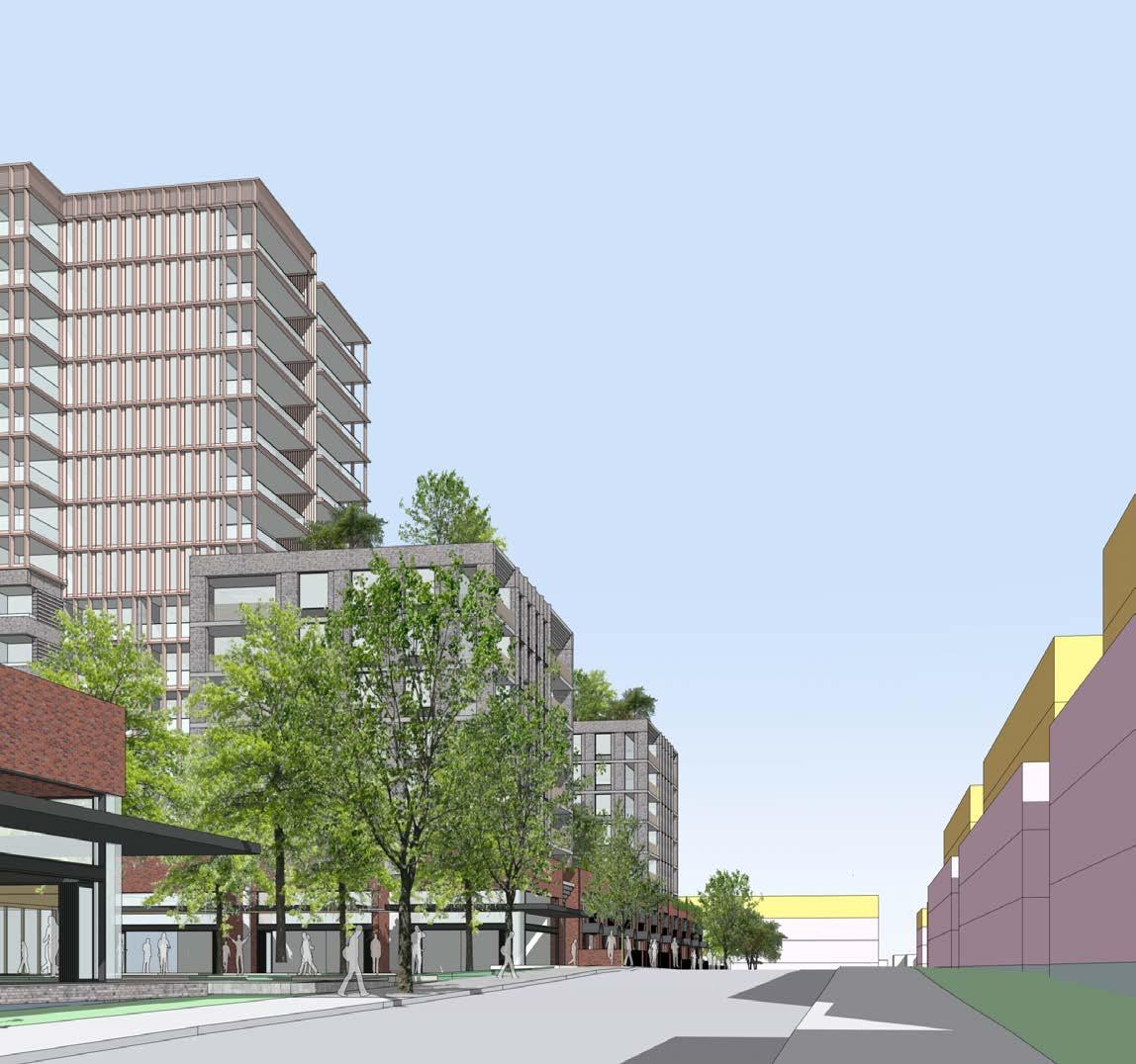
to transitioning the scale of the proposal, harmonizing with existing dwelling houses and future medium-density housing. The design features a carefully composed layered composition of podium, block, and tower elements. The podium, 2-3 storeys in height, forms a consistent street wall. Leicester Street is lined with two-storey townhouses, providing a gentle transition to the surrounding residential streets. Above the podium and set back 3-5m are four six-storey bar forms running northsouth. Atop these bars, tower elements are positioned towards the south of the site, with the two tallest towers located at the center of the site.
Servicing has been carefully considered, with a linear one-way loading route that minimizes the width of driveways.
The proposed design will transform an inwardfacing retail mall into a bustling mixed-use development that builds upon and integrates with the existing context. The proposal has been designed with civic values, and the Main Square and related library/community facility will become an important local public gathering place.
Chester Hill is identified as a ‘Commercial Centre’ and ‘Village Centre’ by the Bankstown-Canterbury LEP, located to the northwest of the LGA. Bankstown itself is the ‘Core Commercial Centre’ for the area and located a short distance to the south-east of the site.
The local area is well connected by various transport modes including road, rail and bus, standing as an established commercial and service centre in the local context.
This presentation consolidates the findings of relevant studies and policy documents, providing a fully integrated basis for the proposal herein.
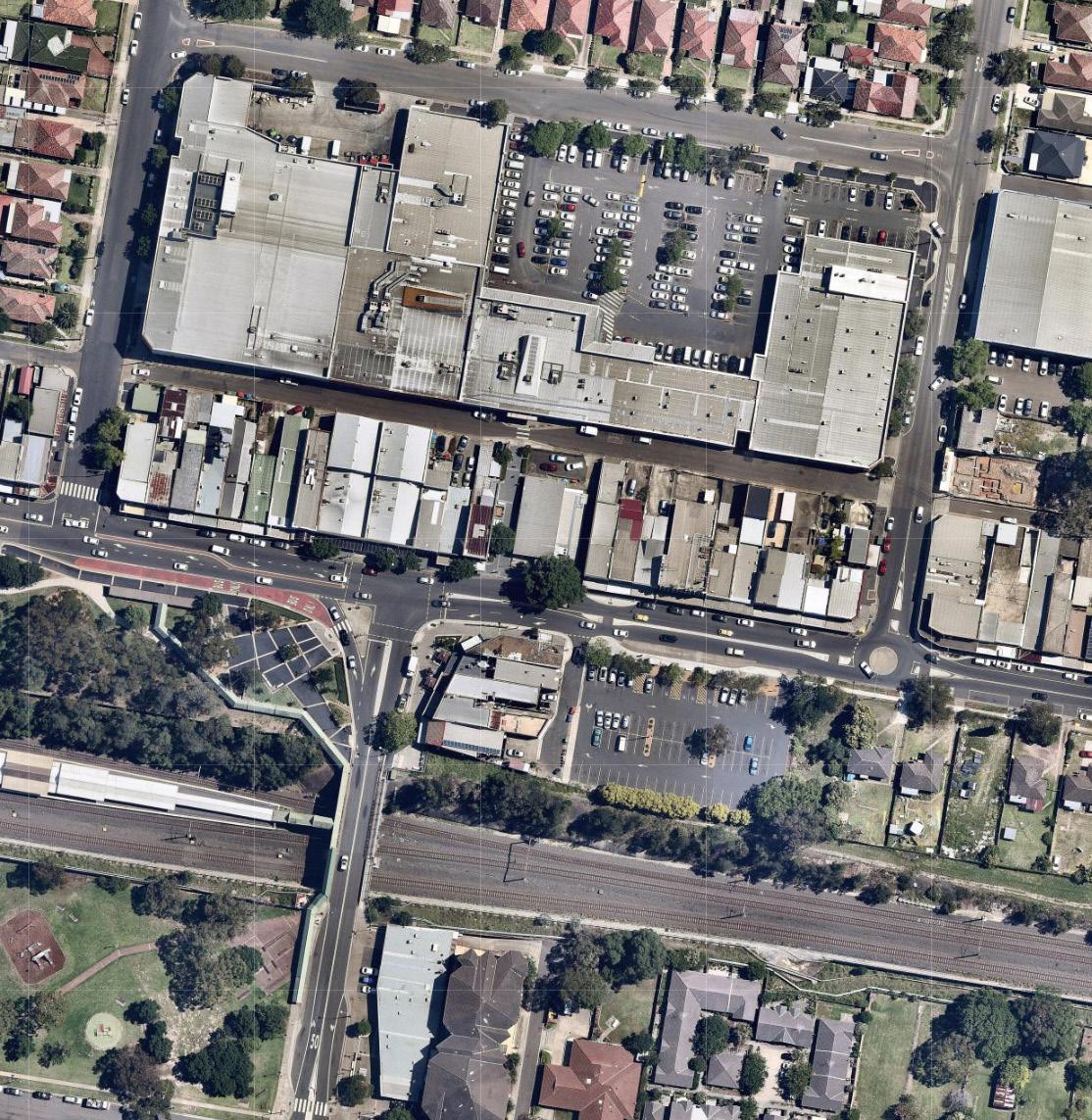
Our proposal aims to provide high-quality residential and commercial units and, enhance the public realm both within and around the site, encouraging new life and activity to support the existing as well as emerging commercial businesses. The project will build on existing successes and assets of the area, such as the local train and bus interchange and, existing retail and commercial offering, to provide much needed additional residential units as well as improving the commercial offering of Chester Hill to the local population.
The overarching vision is to create a vibrant public realm supporting attractive and enjoyable residences amongst a successful and active commercial centre using principles of sustainable urban design.

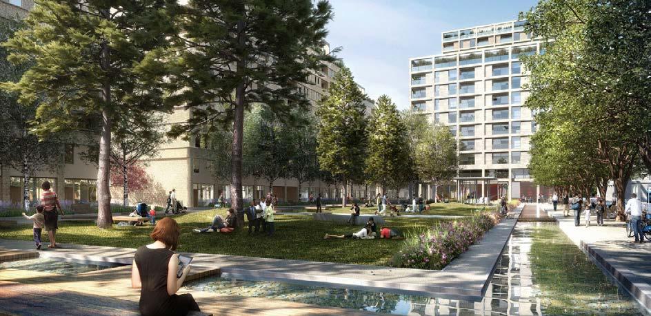
The strategic context reviews the planning context of the site, specifically the relationship between the site and the changing urban context.

TO THE 30 MINUTE CITY
The plan is built on a vision of three cities where most residents live within 30 minutes of their jobs, education, health facilities, services and great places. This is consistent with the 10 Directions in Directions for a Greater Sydney which establish the aspirations for the region over the next 40 years and are a core component of the vision and a measure of the Plan’s performance.
PART OF THE FUTURE OF THE NORTH DISTRICT
The South District forms a large part of the Eastern Harbour City with its economy supporting the Harbour CBD. With the predicted population growth the vision will improve the District’s health and education services and preserve its rich environmental assets.
This will be achieved by aligning growth with infrastructure, sustaining local centres, boosting community services and nurturing quality lifestyles.

CONNECTED TO THE GREEN GRID
The Sydney Green Grid promotes the creation of a network of high quality open spaces that supports recreation, biodiversity and waterway health. It will create a network that connects strategic, district and local centres, public transport hubs, and residential areas.
The Sydney Green Grid will help promote healthy living and community spirit through access to recreation and cultural opportunities whilst promoting biodiversity.
INCORPORATING THE SEVEN DESIGN OBJECTIVES
The policy is about enhancing all aspects of our urban environments, to create better places, spaces and buildings, and thereby better cities, towns and suburbs. To achieve this, good design needs to be at the centre of all development processes from the project definition to concept design and through to construction and maintenance.

SUPPORTING HEALTHIER, LIVEABLE AND SUSTAINABLE ENVIRONMENTS
Greener Places is a draft policy to guide the planning, design and delivery of Green Infrastructure in urban areas across NSW. It aims to create a healthier, more liveable and sustainable urban environment by improving community access to recreation and exercise, supporting walking and cycling connections, and improving the resilience of urban areas.

The Bankstown Local Environmental Plan 2015 aims to support local centres, such as Chester Hill, as important local places of employment and service provision. Diversification of commercial offerings are encouraged with the support of local transport nodes extending a centres sphere of influence. Mixes that are compatible with adjacent residential uses are particularly encouraged.
The Bankstown DCP 2015 provides further direction and detail on the form and operation of development established under the LEP. Its overarching objectives aim to empower development that is sustainable, locally appropriate and compatible, and achieves good urban design.
The local area is a typical residential suburb well supported by local educational facilities, open spaces and commercial centres as well as good transport links. Metropolitan and Local policies provide clear support for new housing in areas offering connections such as these. They are considered suitable for growth in both commercial and residential terms, building toward the ambition of the ‘30-minute city’.
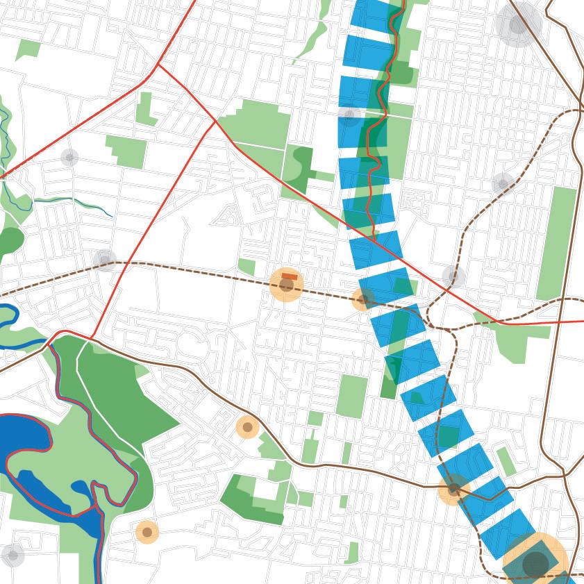
Existing connections include a direct train line to the CBD along with several major road arteries within a short distance. The South District Plan and Toward 2056 provide further proposals for strengthening nearby north-south connections in this area.
Existing and emerging transport routes provide good access to the metropolitan region.

A wide range of open spaces are available to local residents. From playing fields, reserves and parklands to a number of golf courses. The Sydney Green Grid and South District Plan note the importance of these connections, particularly along waterways and where continuous green corridors can be formed.
Access to multiple local green spaces.

The Chester Hill train and bus interchange serves the local population with a good variety of public transport options. In addition this also supports local commercial activity as a point of concentrated activity around a key local transport node.
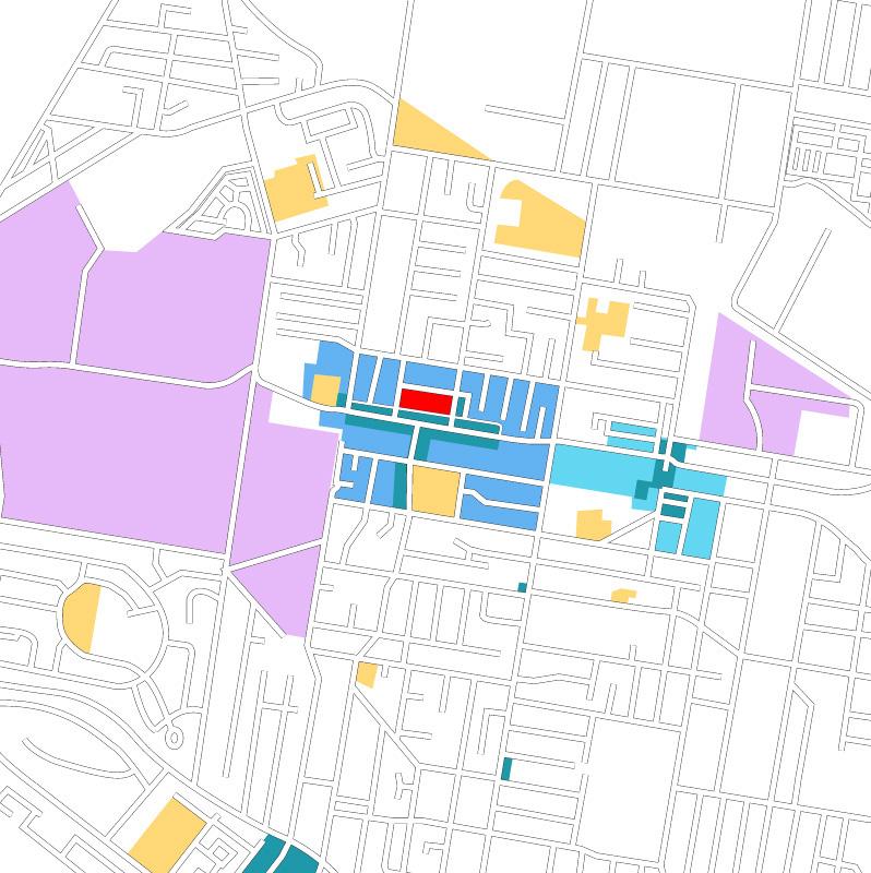
A number of key land use zones provide the area with a variety of employment and education opportunities supporting the local population. Bankstown Airport to the south and the wider aerospace industries are gaining strong central support through the wider Metropolitan Plan.
Connections to neighbouring centres.
Local diversity of use supports further housing opportunities.
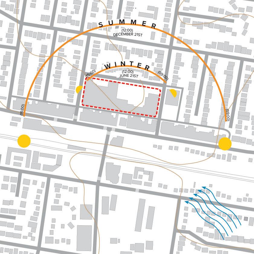
The local topography and site orientation enable good solar exposure to the majority of the site throughout the year. The existing fully developed form of the site also means there is limited impact on existing biodiversity.
A considered design presents an opportunity to make valuable contributions to local green infrastructure.
Local conditions support minimal environmental impact.
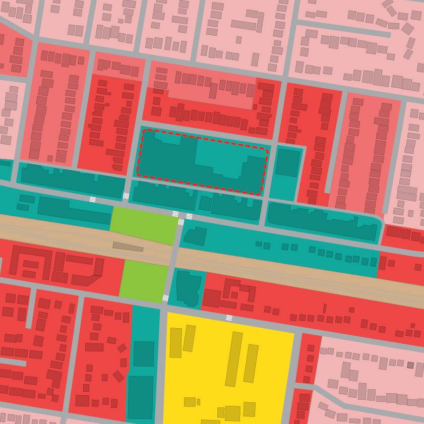
The combination of commercial centre uses, dense residential zonings, public spaces and educational facilities alongside a transport interchange provide for beneficial conditions for positive urban growth.
Regenerating the significance of a local commercial centre.
The site analysis provides an exploration of local contextual issues to inform urban and architectural designs.
The site is well connected with multiple bus routes stopping at the local bus and train interchange. The train line provides connectivity directly to Sydney CBD. Locally, the junction of Waldron Road (east-west) and Chester Hill Road (north-south) provides vehicular and pedestrian access links across the railway.
Local topography is relatively gentle with a slight gradient raising to the north. Within the site this creates a low point toward the south-westerly corner and a level difference of approximately 5m across the site.
As a defined ‘local centre’ traffic is increased in comparison to the wider surrounds. The provision of retail and professional services, as well as education and transport attract a range of local residents to Chester Hill as an important local destination. The site benefits from a buffer provided by the commercial buildings of Waldron Road, reducing the noise impacts immediately to the south.
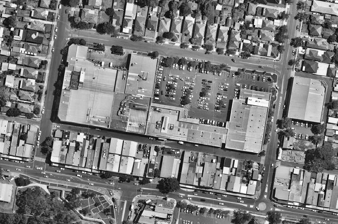
The existing site is occupied solely by commercial uses, extending the linear arrangement of commercial services primarily along Waldron Road. To the north and south the areas is largely residential with intermittent educational facilities.
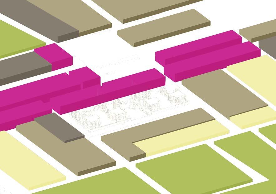
Th Bankstown LEP establishes local height limits which build toward the local centre of Chester Hill indicating its significance in the urban fabric and development potential.


Residential (R4 High Density, R3 Medium Density)
Commercial Retail (B2 Local Centre)
Commercial Professional Services (B2 Local Centre)
Train / Bus Interchange (SP2 Infrastructure)


Solar access is good across the site with relatively low level surroundings. The prevailing wind direction is north-easterly during the winter months and southerly during the summer months.
Strengths: Established commercial centre offering wide range of retail and service facilities.
Weakness: Lack of architectural articulation in massing and facade.


Weakness: Controlled permeability, only available during retail hours.


Strength: Some existing mature trees positively contribute to local character and canopy cover.
Strength: Proximity of local transport options and connection through the urban mass.
Strength: Active frontage, animating use.

Weakness: Inactive, unarticulated double height facade.
Weakness: Large surface car-park creating negative void in urban mass.
Weakness: Multiple vehicle entry / exit points disrupting pedestrian movement and urban form.
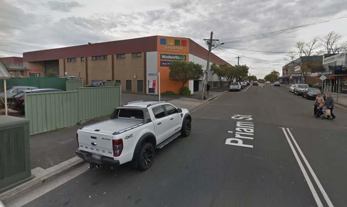
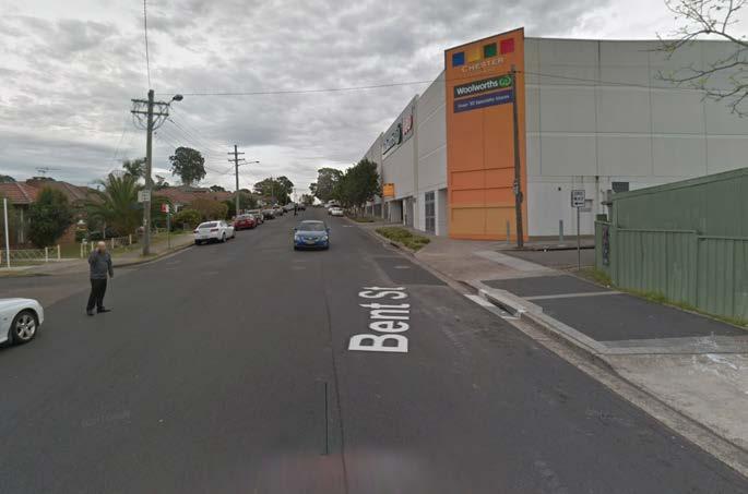
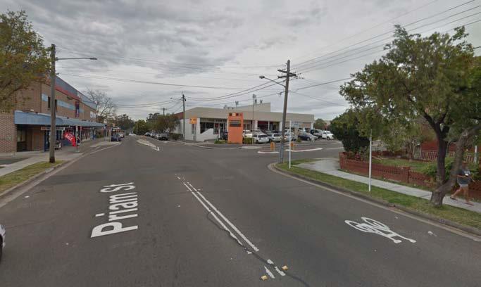
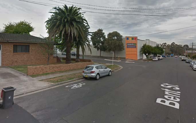
As existing the site presents multiple entry / exit points for both public and private use. Active frontages are presented to the north only, facing on to the surface car park providing an internal outlook.
Inactive frontages are presented to the east, west, south and north-west. These are typically large double height blank facades offering little to the public domain. To the south, Frost Lane has become an uncoordinated and cluttered route providing servicing to both Chester Hill Shopping centre and the rear of Waldron Road.
A pedestrian link to the south provides an important connection to Waldron Road and on to the Bus/Train interchange.


NEIGHBOURHOOD CENTRE
(e.g. Cnr Hector & Jocelyn St)
Provides small scale community focused facilities such as primary schools, places of worship, pubs and cafes.
LOCAL CENTRE
(e.g. Chester Hill, Sefton)
Larger commercial opportunities become viable with retail and professional services provided. Small scale medical facilities, local sports venues and transport interchanges are also present.
Development within Local Centres (South District Plan, GA NSW)
“...residential development within a 5-minute walk [800m] of a centre focused on local transport ... will help create walkable local centres.”
“Provide public realm and open space focus”
“Protect or expand retail and / or commercial floor space”
“Support the night-time economy”
STRATEGIC CENTRE
(e.g. Bankstown, Liverpool)
Important centres of employment, commerce, education and health care. Entertainment facilities are located here including cinemas, major sports venues and specialist activity centres.
METROPOLITAN CENTRE
(e.g. Sydney, Parramatta)
The focus of major transport interchanges, centres of government, higher education and research. Extensive retail, commercial and professional services are available as well as arts, theatre and entertainment facilities.
A considered set of design principles, based on the site analysis, aim to integrate the proposals with the existing context.
“Better Placed establishes the value of good design, and identifies key concepts, good process, and objectives for good design outcomes.”
Contextual, local and of its place
Sustainable, adaptable and durable
Located at a key ‘local centre’ with bus and train interchange, the proposal underlines the importance of Chester Hill in the urban fabric and is a key location for urban growth.
Using the scale of development to its advantage, a new public open space, along with communal open spaces provide opportunities for community interaction, increases in biodiversity and positive urban design.
Functional, efficient and fit for purpose
A balance of unit sizes and uses ensure a mutually beneficial urban environment. Townhouses to the northern facade provide a human scale, reflective of the existing residences opposite and create an active ground plane. To the south along Frost Lane, a series of small commercial units create a vibrant street scene complimented by refined hard and soft landscaping.

Inclusive, connected and diverse
A range of unit sizes in both commercial and residential elements provides for a diverse social mix. Major businesses form commercial anchors within larger units, whilst newer, smaller units co-exist creating a vibrant hub. Above, a variety of private and communal spaces serve new residential units.
Creating and adding value
Enhancing the existing centre through the provision of both residential and commercial units supports Chester Hill as an important local hub. Diversifying the residential offering serves the needs of a growing local population, whilst additional commercial units allow the populations needs to be efficiently met.
Safe, comfortable and liveable
A considered arrangement of outlook, entrances and movement routes facilitates passive security throughout. Residential units overlook both communal and public spaces whilst a range of commercial units at the ground plane encourage activity, reducing opportunities for vagrancy and unsafe environments.
Engaging, inviting and attractive
A stepped form and range of scales aim to integrate the proposal into the context whilst signifying the area as an important local centre. Landscaping throughout the public square, Frost Lane and communal spaces further enhances the proposals contribution.
“Greener Places is an overarching schema for ensuring connection and integration of our green assets, ensuring their contribution to quality of life, and that the environment and the economy are maximised”
Combine Green infrastructure with urban development and grey infrastructure
Landscaping and planting are deeply integrated with massing and design detail enhancing the enjoyment of space, but also contributing to local biodiversity and reducing water run-off.
Create an interconnected network of open space
Located at a key local centre with bus and train interchange, the proposal underlines the importance of Chester Hill in the urban fabric.
Deliver multiple ecosystem services simultaneously
As a large development, the scheme is able to contribute a beneficial mix of uses and spaces. These include a range of unit sizes across both commercial and residential elements, as well as a public open space, increased street edge set back for landscaping and communal open spaces.
Involve stakeholders in development and implementation
The design process has moved through several interactions, incorporating stakeholder input to create a form and function that moves beyond satisfying policy requirements, to providing a beneficial contribution to the local urban fabric.
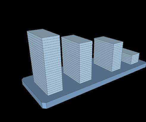

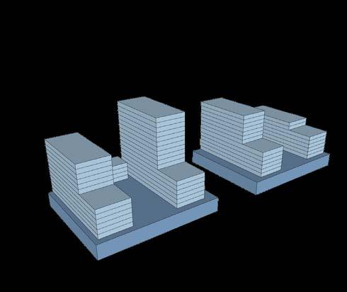
Exploration Perimeter Block Exploration
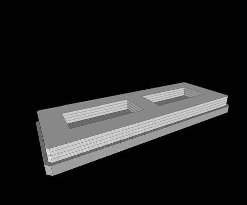
A low-rise, full site podium. Heights are established by LEP zoning limits.
A continuous massing creates a monolithic, imposing form with no visual permeability or relation to the surroundings. However, the low rise nature minimises the abruptness of a change of height and clearly defines the street edge.
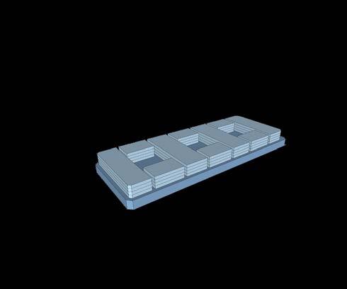
The upper level massing is divided to provide architectural relief and articulation, the massing and floor space are redistributed accordingly.
Cascading Towers Open Spaces
A full site podium with high rise towers. The ground plane remains poor with little contribution to the public realm. Concentrated massing produces an overbearing form and excessive shadowing.
Further articulation and redistribution of mass reduces visual impact and increases opportunities for communal open spaces. Recessing the podium from the site boundary and opening the centre space contributes positively to the public realm.
Mid-rise, part-site podium. Active frontages to the full Perimeter in combination with setbacks aid in integration. Varied upper masses reduce overshadowing whilst maintaining floor space.
Better Fit
Better Performance
Better For Community
Better For People
Better Working
Better Value
Better Look and Feel
Integration
Connectivity
Multifunctionality
Participation
1 Perimeter Block
2 Cascading Towers
3 Open Spaces
Cascading towers

Open
(Preferred)


Defining the edge.
Initial massing is set back from the kerbside to reflect the deep set back of the dwellings opposite, with a further set back above, establishing the podium.


Exploration of Massing.
The primary mass is broken down in to three key datums relating to the local, neighbourhood and city scales.


Articulating the Mass.
Breaking down the bulk further provides opportunities for open space, ventilation, daylight and architectural interest.


Transition of Scale.
Exploration of the form takes note of the sites urban significance relating to local transport and retail hubs with the surrounding residential context by concentrating massing toward the centre of the site.


Connection to Local Character. Additional breaking down of the overall form facilitates integration with existing movement and open space networks, here establishing a new urban square.


Hierarchy of Space. Reflecting the new ground level public space, block separation and arrangement of forms, north facing communal open spaces for the new residences are also provided, further enhancing biodiveristy and residential amenity.


Vehicle entry points have been restrained to a more efficient distribution allowing a more coherent facade. Pedestrian flow is now facilitated around the site, and more importantly through the site connecting with the existing pedestrian link to the south.
The full Perimeter is to be articulated and activated, by both commercial and residential means, creating an integrated element in the urban fabric.


A perimeter set back and central square provides an open public realm whilst defining the street edge.
Commerical unit sizes are varied and distributed throughout with smaller commercial spaces lining Frost Lane and the public square. Larger commercial units are located within the mass at ground and lower-ground levels. To the northern facade fine grain activation is presented in the form of townhouses and residential lobbies.
ACTIVATION & PUBLIC SPACE
At the heart of the proposals is new public square, enhancing the north-south pedestrian link as well as providing a new social and retail space. Residential uses also provide sensitive street frontages to the perimeter with garden spaces providing defensible space and contributing to public greenery. Retention of existing trees where possible and, provision of new planting, adds further to the green feel of the street.
CONTEXTUAL MASSING
The form is stepped towards the neighbouring context, breaking down the massing.
MASSING HIERARCHY
A ground level mass provides public realm definition, activated by fine grain articulation of both commercial and residential uses. Setbacks, materiality and articulation form the mid-levels, providing ample communal space without imposing on the surroundings. The upper-levels are further set back providing additional communal open space and reducing overshadowing.
The primary masses are separated by generous spacing allowing the formation of communal open spaces to the east and west elements as well as a new public space to the central plaza providing a valuable addition to the public realm.
COMMUNAL OPEN SPACE
Set backs and massing breaks provide opportunities for communal open spaces.
Changes in level ensure a high degree of amenity is provided to all.


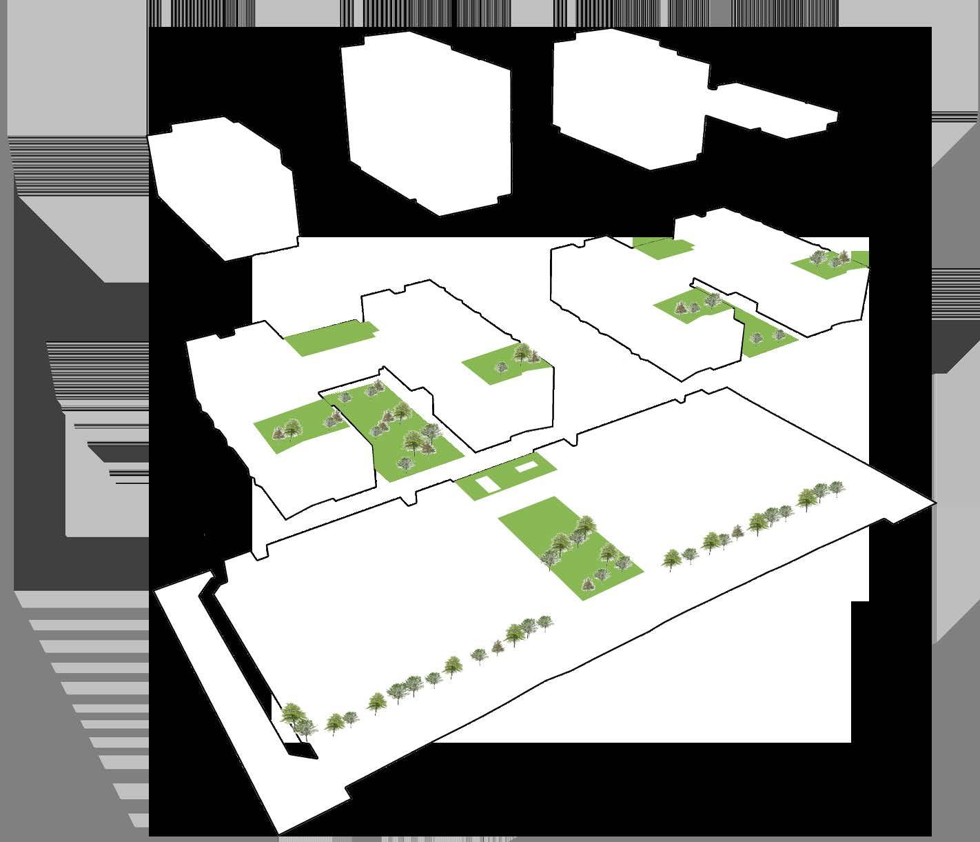
City Block
Defined Street Form
Sheltered Communal Courtyard Outlook Roof Gardens Balconies
Podium
Perimeter Deep Soil Zone Tree Line Public Square Green Green Bridge Active Frontages

Upper Apartments
Massing variety to create interest
Efficient solar orientation
Passive surveillance of surroundings
Courtyard Units
Direct access to communal spaces
Passive surveillance of street & communal spaces
Animate communal spaces
Townhouses
Animated ground level public interface
Duplex units with private defensible space
Provide passive surveillance of street
Provides local scale





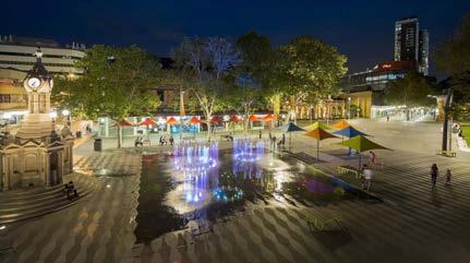
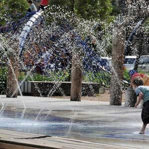

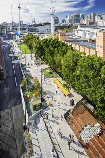
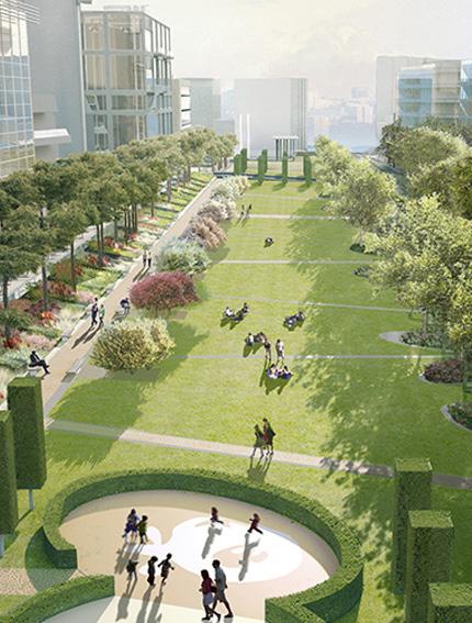
Inclusive, textured and welcoming open places facilitate activity and passive ownership of public spaces. Local identity becomes entwined in this process, facilitating further use and enjoyment.
1. Dandenong Civic Square. Variety in planting and materials articulates space, providing suggestion of use and movement.
2. UTS. Integration of street furniture and lighting facilitate use without dictation.
3. Centenary Square. Animation of space through water and soft planting brings life and encourages exploration.
4. Goods Line. Considered arrangement, variation of space and connection to surroundings enable passive discovery.

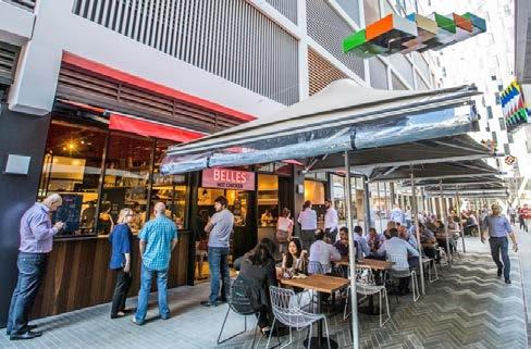
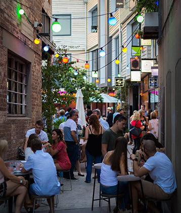
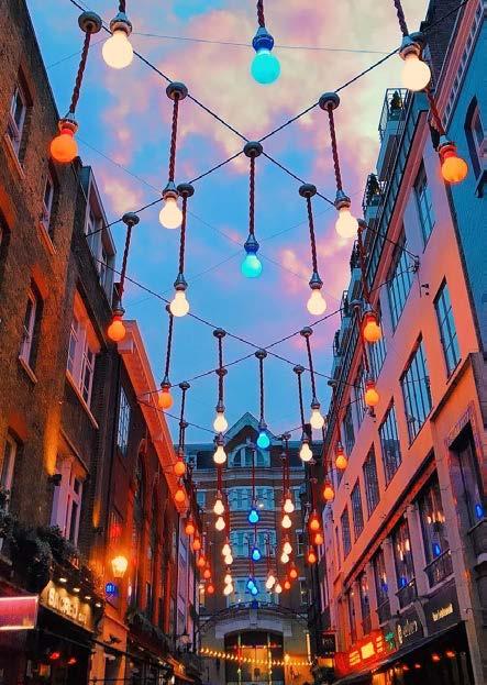
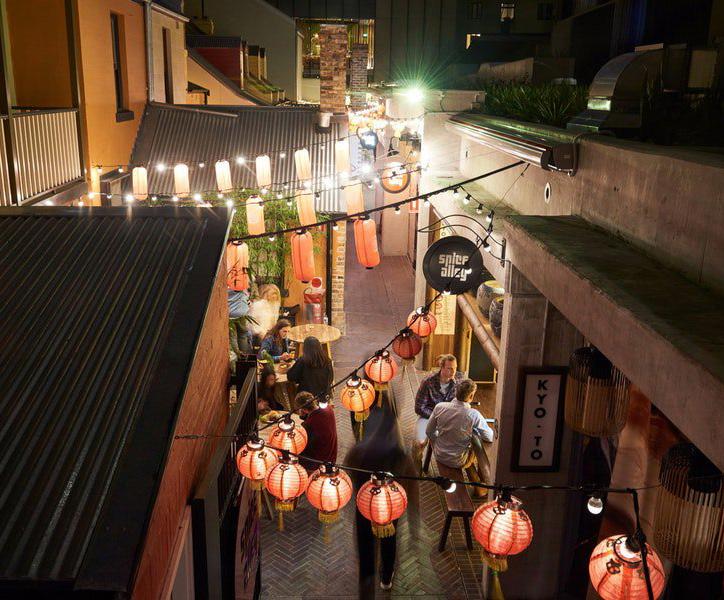
1. Kensington Precinct. Active frontages provided by a range of uses.
2. Steam Mill Lane, Sydney. Narrow streets provide local character, identity and atmosphere.
3. Baker Street, Brisbane. Small spaces become active, lively and attractive to a wider spectrum of visitors.
4. Carnaby Street, London. Events and shared identity create a destination and sense of character.
5. Spice Alley, Sydney. A vibrant, rejuvenated and tight knit street adjacent to Sydney Central Park.
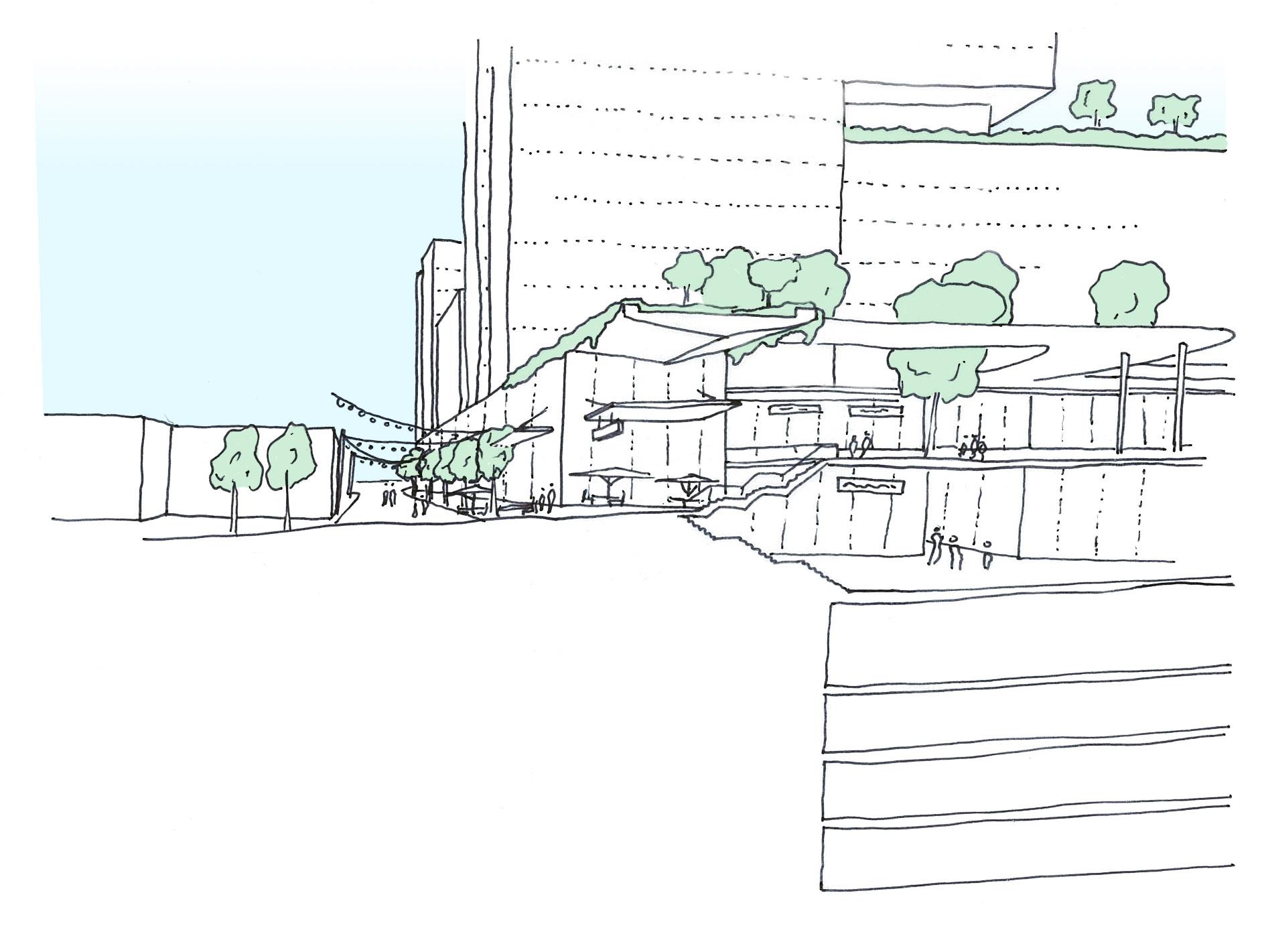
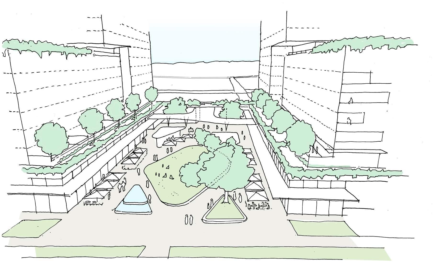
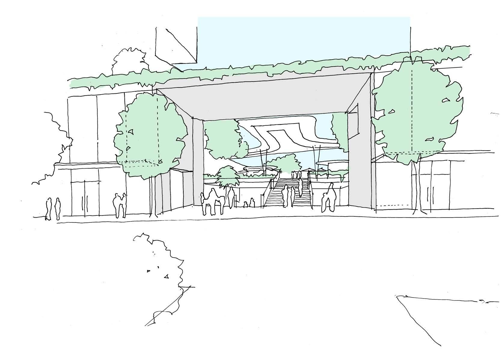
Concept sketch looking as section through the Public Square’s southern entrance (viewing from the east) highlighting the change of levels.
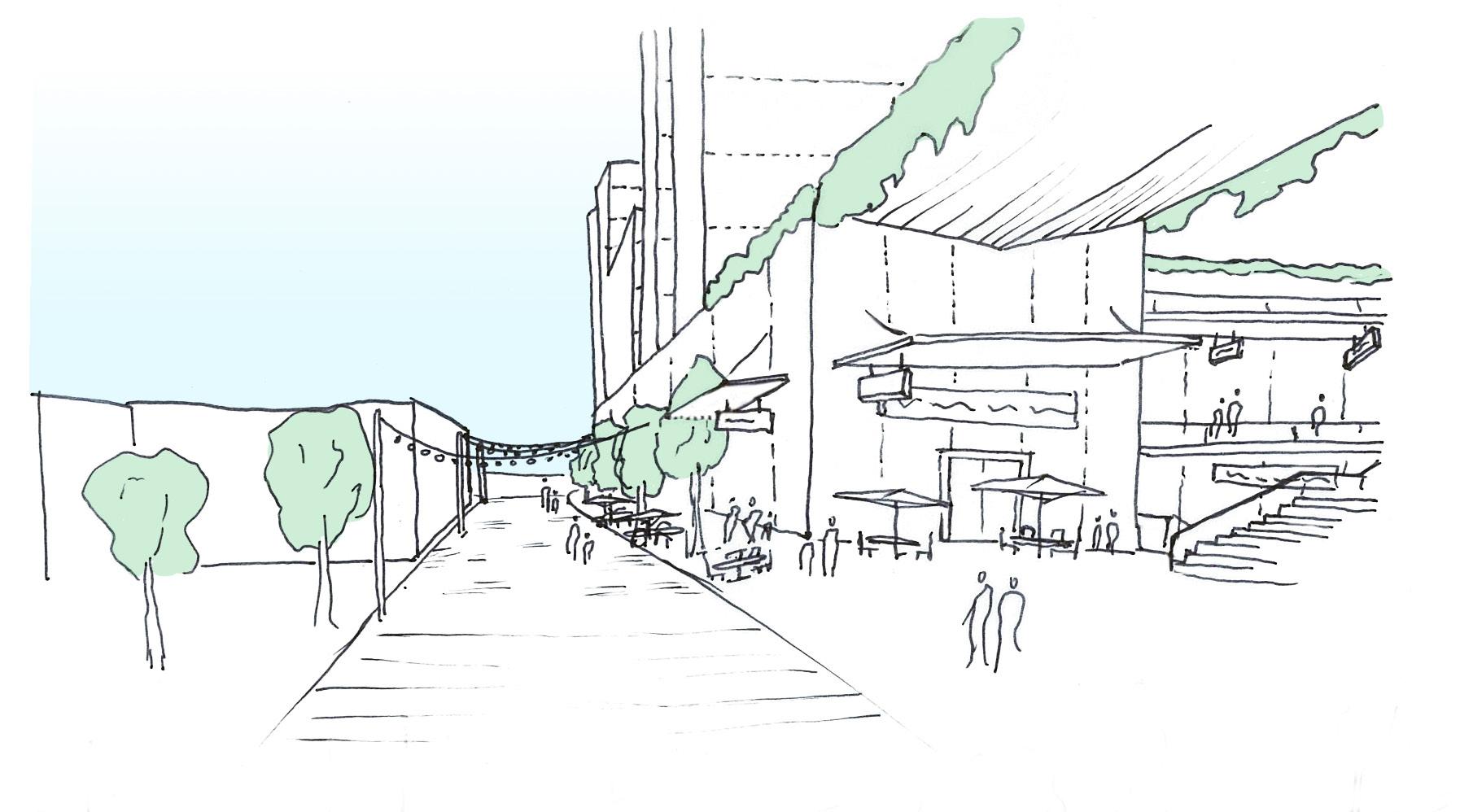


2. BIGyard. Informal shared space facilitates the potential for communal interaction.
3. Eastside City.
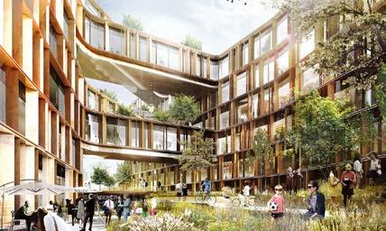
4. (Above) Parkstad Rotterdam. A new urban block interwoven with new parklands brings life and vibrancy to the development.
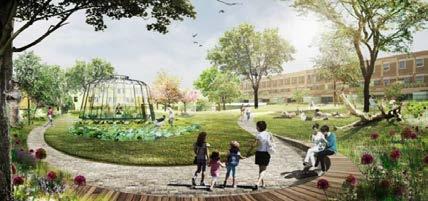
5. (Below) Nordsjaelland Hospital & Danish Building Agency Office. Varied landscaping with informal spaces creates attraction, identity and multiple spaces for a variety of uses.
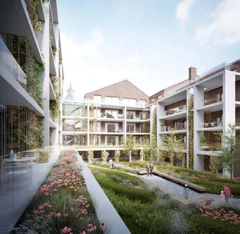
6. Ursulinenhof. Passive surveillance by informal opportunities for overlooking increases safety, connection an ownership of space.

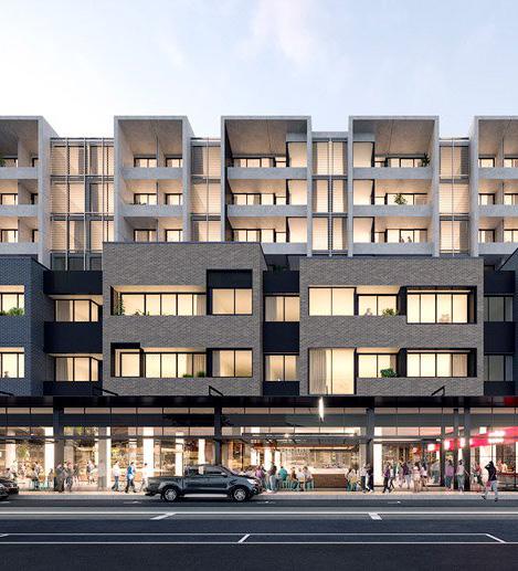

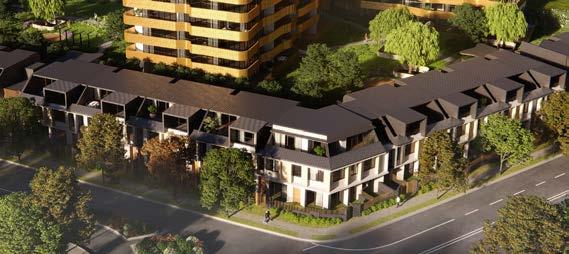
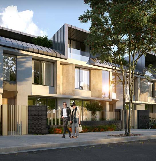
1. Elwood House. Subtle use of materials and detailing provides interest in articulating the mass creating human scale and aiding the relationship of building elements.
2. Richmond Plaza. Scale and massing form hierarchy, creating a clear street edge without overwhelming the space.
3 & 4. Wilton Townhouse & Page Street. Ground level setbacks and massing arrangement provide privacy, defensible space and amenity to the user.

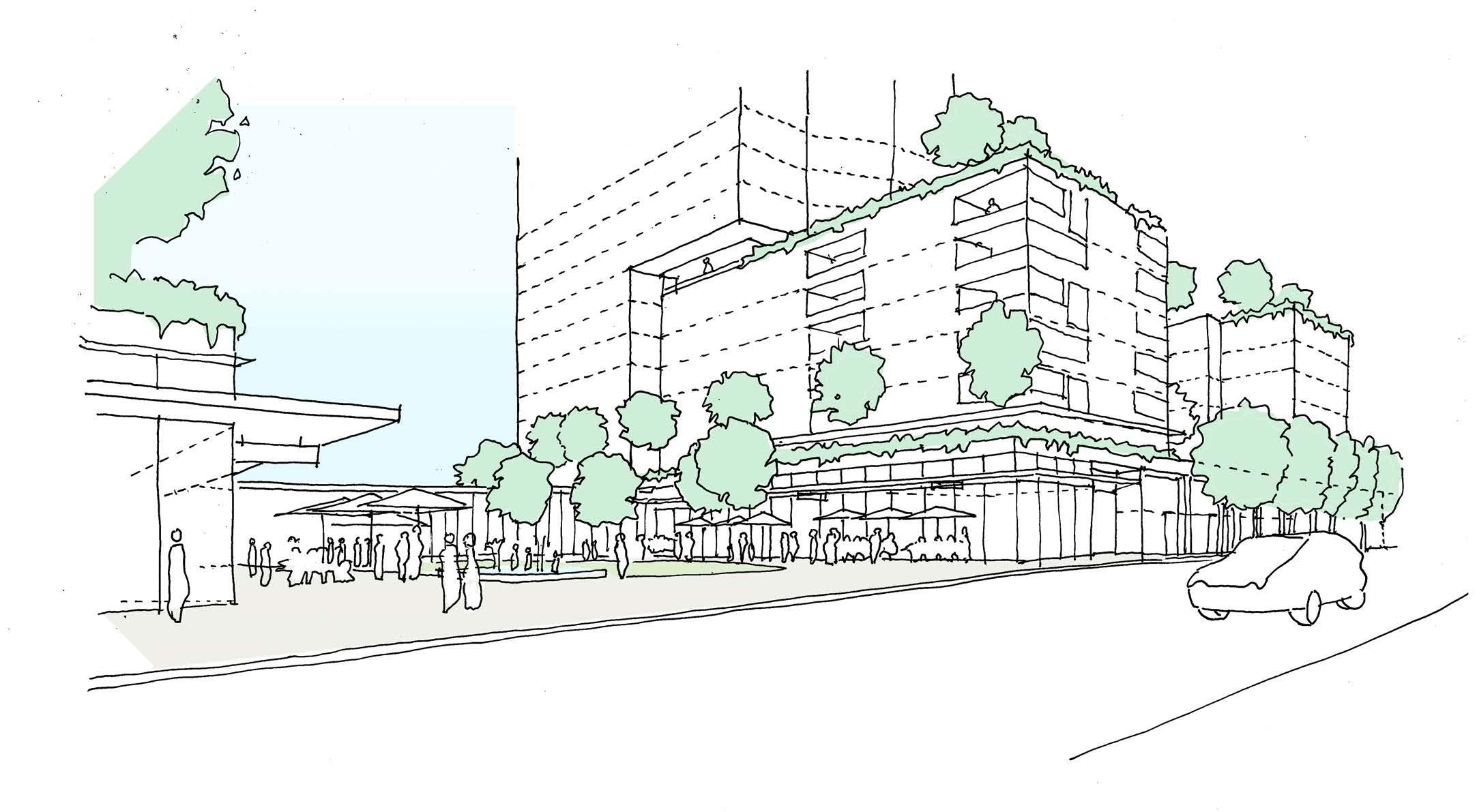
Concept sketch looking looking south east at the junction of Priam Street and Leicester Street.
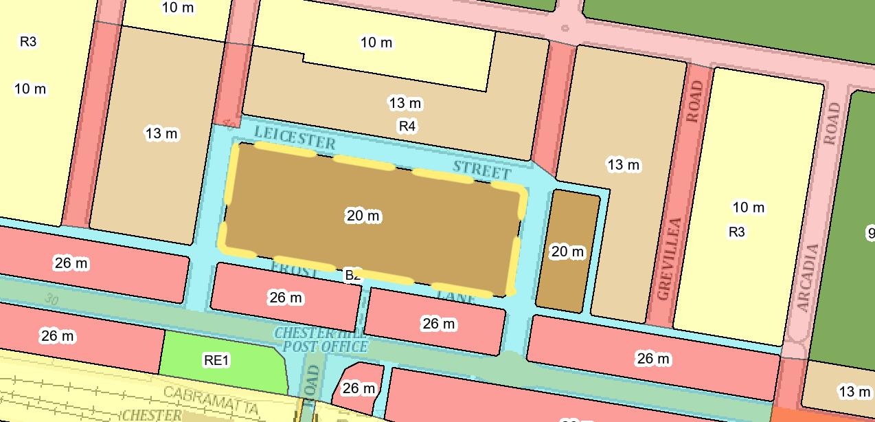
The following pages look at the proposal in relation to the future development of the site. The adjacent street blocks surrounding the site have increased heights set out in the LEP. The blocks opposite on Bent, Leicester and Priam St are zoned R4 High Density Residential. The sites to the rear of the site are zoned B2 local centre.
In addition these sites can avail of the infill Affordable Housing bonus of 30% that applies to height and FSR. This 30% increase will decrease the contrast in scale between the proposal and the future context
The proposed design has a series of transitions in scale that responds to the future scale of surrounding developments with height being concentrated to the south and centre of the site.

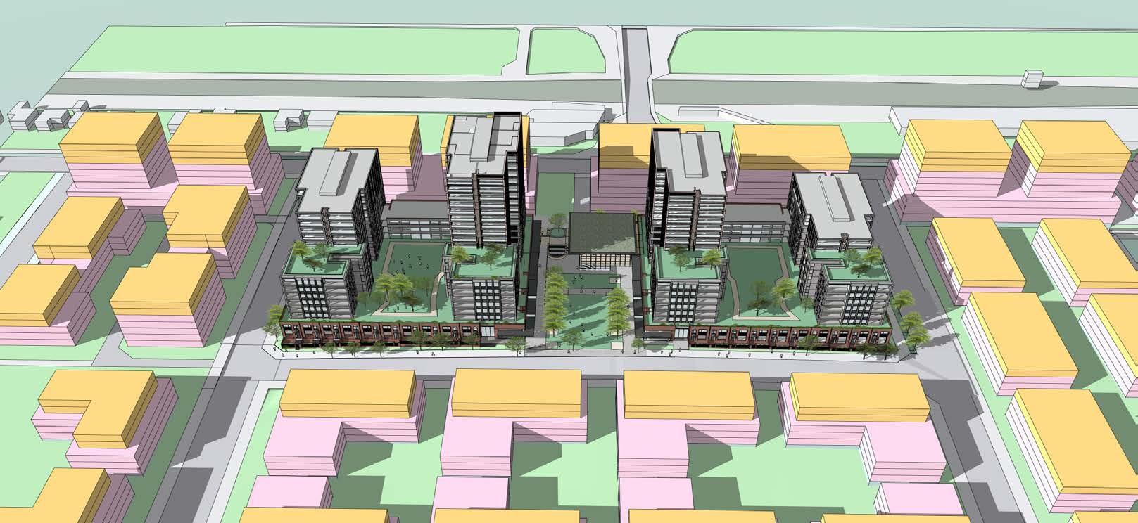
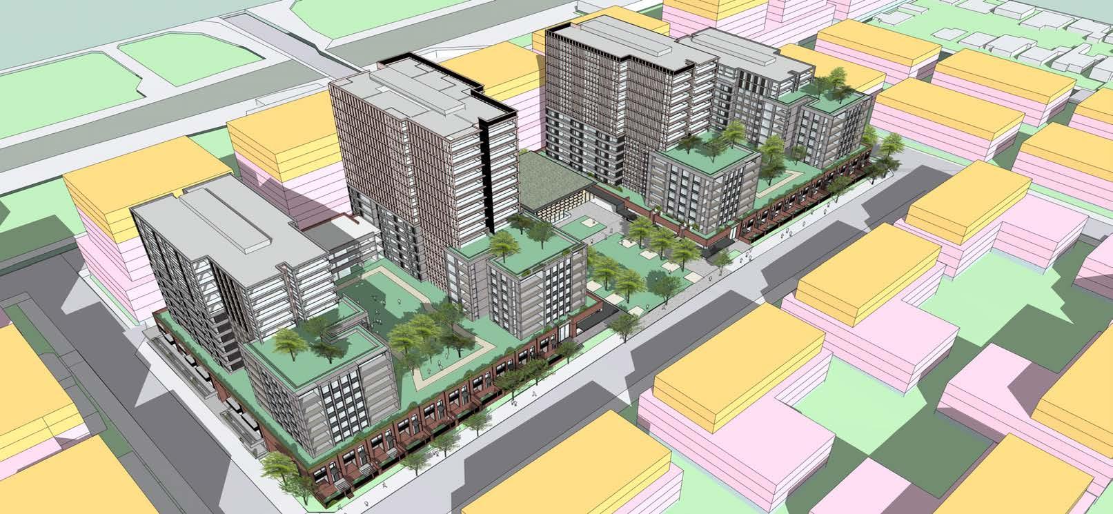


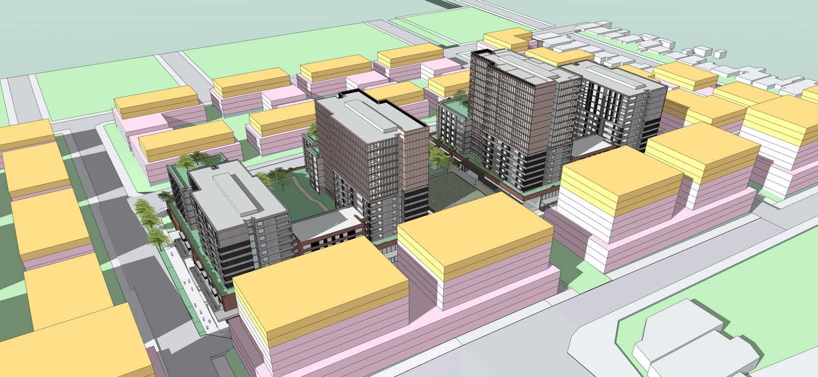













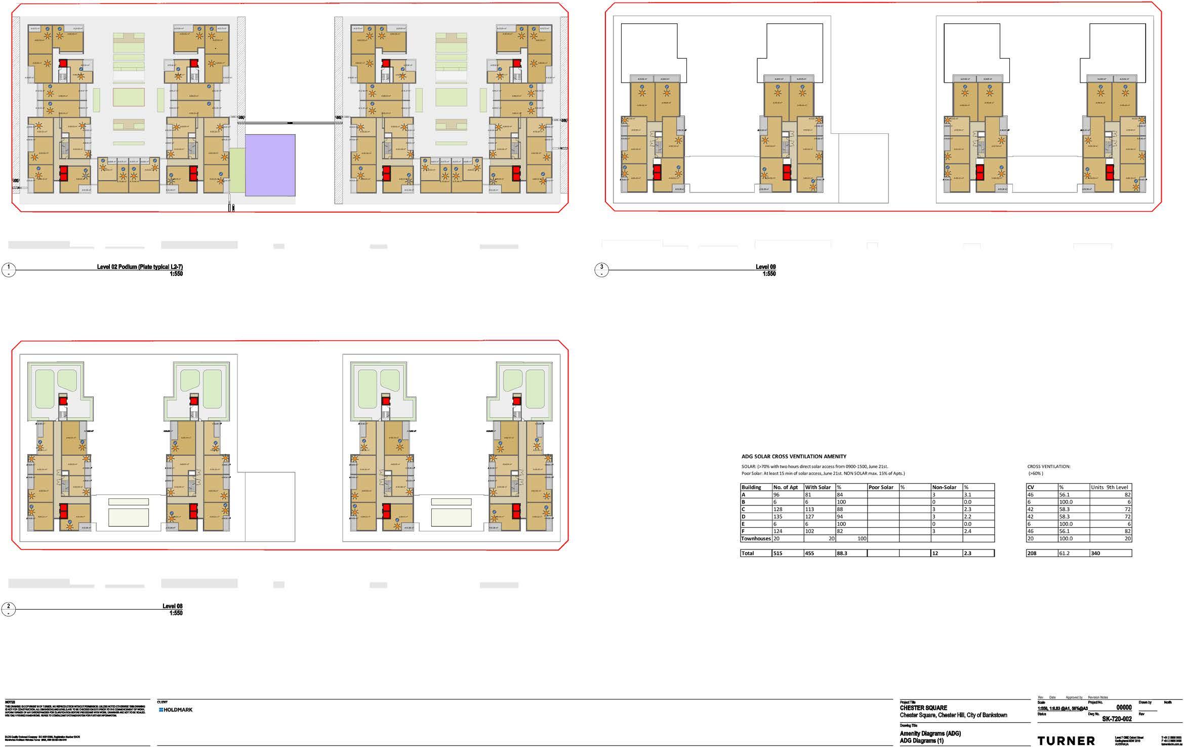
Each image is taken from the viewpoint of the sun demonstrating the degree of solar coverage.
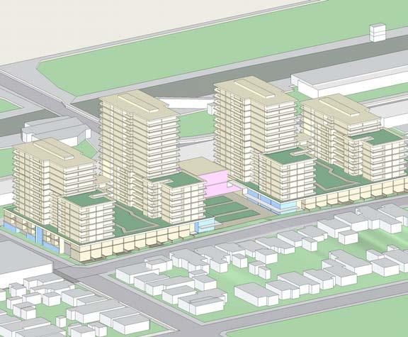
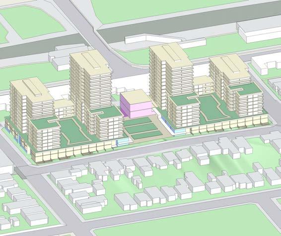

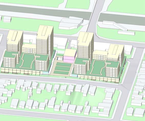

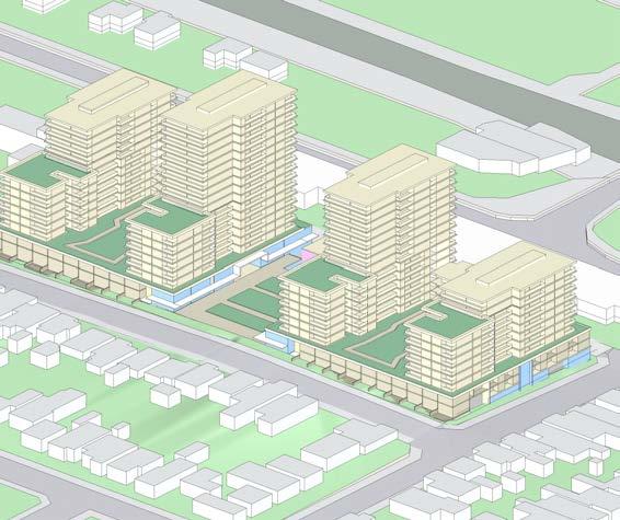
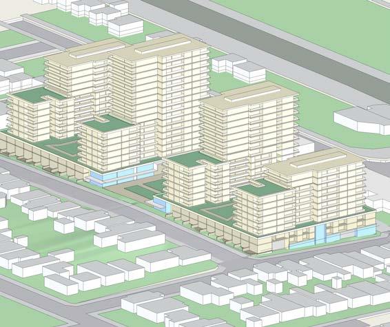
Winter Solstice, June 21st.

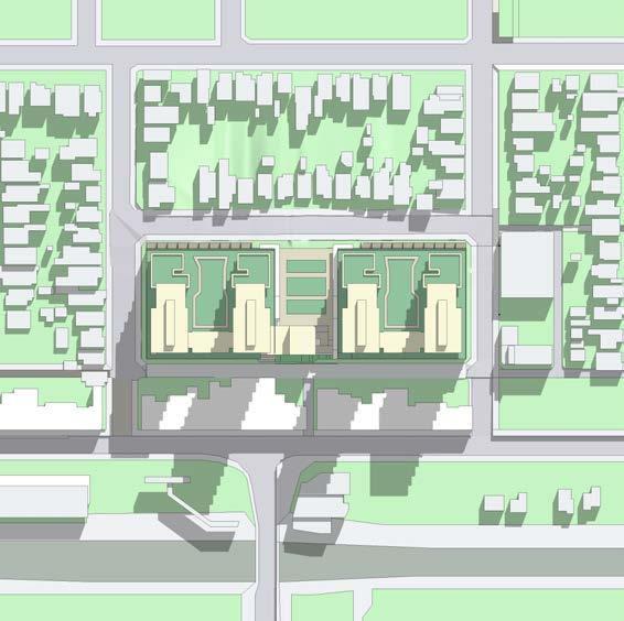
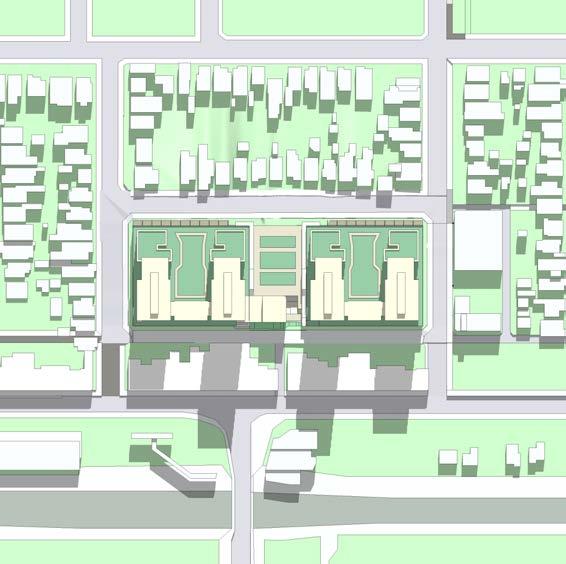


Equinox, September/March 21st.


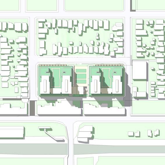
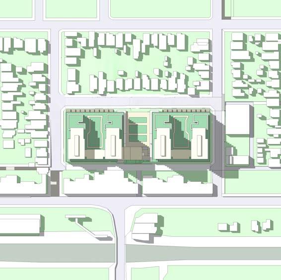

Summer Solstice, December 21st.


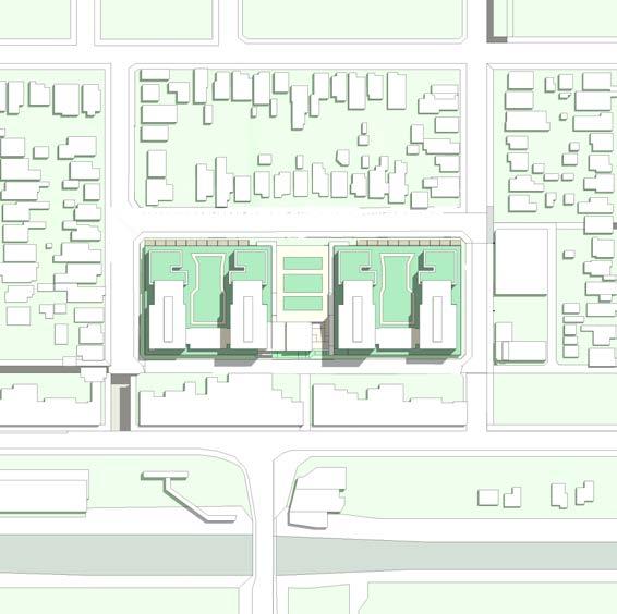

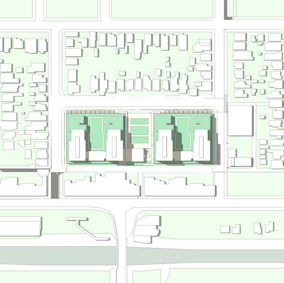
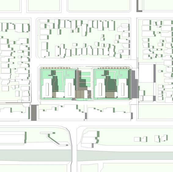

The Diagrams indicates the hours of sun to the facades of potential future on the sites to the south of Frost Lane. This scenario indicates the sites as amalgamated, with a podium tower format of similar height as the proposal
= Areas of north facade of buildings receiving less than 2 Hours winter sun

The Diagrams indicates the hours of sun to the 2,000sqm of the Main Square on December 21st. This analysis demonstrates the Main Square receives more than 4hrs of sun between 9am and 3pm to 81% of its area.

MAIN SQUARE
81% of Square receives 4hrs winter sun during the winter solstice LEICESTER ST
SQUARE PLANNING PROPOSAL


