


Shaftesbury Road, Cambridge CB2 8EA, United Kingdom
One Liberty Plaza, 20th Floor, New York, NY 10006, USA
477 Williamstown Road, Port Melbourne, VIC 3207, Australia
314–321, 3rd Floor, Plot 3, Splendor Forum, Jasola District Centre, New Delhi – 110025, India
103 Penang Road, #05–06/07, Visioncrest Commercial, Singapore 238467
Cambridge University Press & Assessment is a department of the University of Cambridge.
We share the University’s mission to contribute to society through the pursuit of education, learning and research at the highest international levels of excellence.
www.cambridge.org
© Cambridge University Press & Assessment 2025
This publication is in copyright. Subject to statutory exception and to the provisions of relevant collective licensing agreements, no reproduction of any part may take place without the written permission of Cambridge University Press & Assessment.
First published 2025 20 19 18 17 16 15 14 13 12 11 10 9 8 7 6 5 4 3 2 1
Cover designed by Denise Lane (Sardine)
Cover illustration by Adrienne Shelford
Text designed by Loupe Studio
Typeset by QBS Learning
Printed in Singapore by Markono Print Media Pte Ltd
A catalogue record for this book is available from the National Library of Australia at www.nla.gov.au
ISBN 978-1-009-62408-4
Additional resources for this publication at www.cambridge.edu.au/GO
Reproduction and Communication for educational purposes
The Australian Copyright Act 1968 (the Act) allows a maximum of one chapter or 10% of the pages of this publication, whichever is the greater, to be reproduced and/or communicated by any educational institution for its educational purposes provided that the educational institution (or the body that administers it) has given a remuneration notice to Copyright Agency Limited (CAL) under the Act.
For details of the CAL licence for educational institutions contact:
Copyright Agency Limited
Level 12, 66 Goulburn Street
Sydney NSW 2000
Telephone: (02) 9394 7600
Facsimile: (02) 9394 7601
Email: memberservices@copyright.com.au
Reproduction and Communication for other purposes
Except as permitted under the Act (for example a fair dealing for the purposes of study, research, criticism or review) no part of this publication may be reproduced, stored in a retrieval system, communicated or transmitted in any form or by any means without prior written permission. All inquiries should be made to the publisher at the address above.
Cambridge University Press & Assessment has no responsibility for the persistence or accuracy of URLs for external or thirdparty internet websites referred to in this publication and does not guarantee that any content on such websites is, or will remain, accurate or appropriate. Information regarding prices, travel timetables and other factual information given in this work is correct at the time of first printing but Cambridge University Press & Assessment does not guarantee the accuracy of such information thereafter.
Please be aware that this publication may contain images of Aboriginal and Torres Strait Islander people who are now deceased. Several variations of Aboriginal and Torres Strait Islander terms and spellings may also appear; no disrespect is intended. Please note that the terms ‘Indigenous Australians’ and ‘Aboriginal and Torres Strait Islander Peoples’ may be used interchangeably in this publication.
Cambridge University Press & Assessment acknowledges the Aboriginal and Torres Strait Islander Peoples of this nation. We acknowledge the traditional custodians of the lands on which our company is located and where we conduct our business. We pay our respects to ancestors and Elders, past and present. Cambridge University Press & Assessment is committed to honouring Aboriginal and Torres Strait Islander Peoples’ unique cultural and spiritual relationships to the land, waters and seas and their rich contribution to society.
Introduction: What do we need to know about and do when learning about First Nations Peoples?
Chapter 1: Overview: The ancient world – How did civilisation begin?
1.1 Setting the scene: What was ‘the ancient world’?
1.2
1.3
1.4
1.5
INVESTIGATION 1: Aboriginal and Torres Strait Islander Peoples’ knowledge and understandings (Deep Time to the modern era)
Chapter 2: How have First Nations Peoples maintained their significant connections to Country from Deep Time to today?
2.1
2.2
2.3
2.4
2.7
2.8 How have First Nations people responded to environmental changes from Deep Time? Part 2: Animal extinctions
2.9
technological
2.10 What technological achievements have First Nations Peoples developed? Part 2:
2.11 What are the significant cultural protocols for maintaining and preserving ancestral remains?
2.12 What is the significance of the Mithaka Indigenous-led archaeology dig?
2.13 How have Western interpretations of First Nations Peoples as the world’s oldest continuous cultures changed over time?
2.14 End of investigation review: How have First Nations Peoples maintained their significant connections to Country from Deep Time to today?
Chapter 3: How did the people of ancient China create a strong and lasting civilisation?
3.1 Setting the scene: How did an engineer become a king?
3.2 What were the key events of ancient China?
3.3 How and where did ancient Chinese societies first develop?
3.4 What was life like during the early dynasties of ancient China?
3.5 How was the social structure and government of ancient China formed?
3.6 What were the Warring States and how did they establish the empire?
3.7 What did the people of ancient China believe and how did they honour their dead?
3.8 How did the significant beliefs, values and practices of the ancient Chinese change and develop?
3.9 How did contact and conflict with other societies change ancient China?
3.10 Who was Fu Hao and why was she a significant individual in ancient China?
3.11 End of investigation review: How did the people of ancient China create a strong and lasting civilisation?
Chapter 4: How did Egypt develop into a powerful ancient society? 4.1
4.2 What were the key events in ancient Egypt?
4.3 How did the environment influence the development of ancient Egyptian society?
4.4 What do we know about the earliest Egyptians?
4.5 How was ancient Egypt governed?
4.6 Why was Ramesses II one of Egypt’s greatest pharaohs?
4.7 How did ancient Egypt benefit from conflict with other societies?
4.8 How did ancient Egypt benefit from trade with other societies?
4.9 What was life like for workers in ancient Egypt?
4.10 What was life like for women in ancient Egypt?
4.11 What were the religious beliefs of ancient Egyptians?
4.12 What were Egyptian preparations for the afterlife?
4.13 How did Egyptians develop the science of mummification?
4.14 End of investigation review: How did Egypt develop into a powerful ancient society?
Chapter 5: What was the historical significance of ancient Greece?
5.1 Setting the scene: What was the trouble with oracles in ancient Greece?
5.2 What were the key events in ancient Greece?
5.3 How and where did ancient Greek society first develop?
5.4 What was daily life like in ancient Greece?
5.5 What were the significant beliefs, values and practices of the ancient Greeks?
5.6 What were some significant ideas and events in the lives of ancient Greeks?
5.7 What were the consequences of contact and conflict with other societies for ancient Greece?
5.8 Who was Pericles and what significant contribution did he make to ancient Greek society?
5.9 What do historians say about Pericles and his legacy?
5.10 End of investigation review: What was the historical significance of ancient Greece?
Chapter 6: Why was ancient India a significant ancient civilisation?
6.1 Setting the scene: How do we know about ancient India today?
6.2 What were the key events in ancient India?
6.3 How did geography influence the development of ancient India?
6.4 What was the social structure of ancient India?
6.5 What were the significant beliefs, values and practices in ancient India?
6.6 How did contact and conflict with other societies change ancient India?
6.7 Who was Ashoka and how did he influence India?
6.8 What is the legacy of ancient India?
6.9 End of investigation review: Why was ancient India a significant ancient civilisation?
Chapter 7: How did ancient Rome change Europe and the Mediterranean world?
7.1 Setting the scene: What did Mount Vesuvius bury? 164
7.2 What were the key events in ancient Rome? 168
7.3 How and where did ancient Roman civilisation develop? 170
7.4 What social groups were there in ancient Rome? 175
7.5 What was daily life like in ancient Rome? 180
7.6 What were the significant beliefs, values and practices of the ancient Romans? 186
7.7 What were some of the major changes in society and their effects? 192
7.8 How did contact and conflict with other societies change ancient Rome? 196
Go online to access this digital chapter
7.9 What role did a significant individual like Julius Caesar play in ancient Rome? 202
7.10 Why is conserving the past so important? 206
7.11 End of investigation review: How did ancient Rome change Europe and the Mediterranean world? 211
Go online to access this digital chapter
Chapter 8: How important is water as a resource?
8.1
8.2
8.3
8.4
8.5
8.6
8.7
8.9
8.11
Chapter 9: What are the causes and impact of hydrometeorological hazards and how can they be managed?
9.1
Chapter 10: How do the characteristics of places influence our lives?
10.1
10.5
Chapter 11: What are some strategies used to improve the liveability of different places?
11.1 Setting the scene: How does air pollution affect liveability in Mongolia?
11.3 Case study: How is overtourism managed in Spain?
11.4 What strategies can be used to enhance liveability?
11.5
11.6
Chapter 12: What can households do to improve their wellbeing?
12.1 Setting the scene: Why is the ‘national pie’ unfairly shared?
INVESTIGATION: Australia’s political structure, democracy and citizenship
Chapter 13: How does Australia’s political system support democracy and citizenship?
13.1 Setting the scene: Why did Australia become a federation in 1901?
13.2 What is the purpose of the Australian Constitution?
13.3 What is the ‘separation of powers’?
13.4 What is the ‘division of powers’?
13.5 What is the nature of
13.6 What is the role of political parties in Australia’s representative
13.7 Why and how is a law created?
13.8 What does the Whitlam Dismissal in 1975 reveal about Australia’s political system?
13.9 Research task: Should voting be voluntary in Australia?
13.10 End of investigation review: How does Australia’s


Dr Michael Adcock (he/him) (contributing author: History) is a History teacher who has taught junior classes in the government school system, and senior classes in the VCE and the IB in the private school system. He has also presented lectures to adult audiences such as the History Teachers’ Association of Victoria, the National Gallery of Victoria, and the Lyceum Club and the Melbourne Club. He has conducted history and art travel tours for Academy Travel, Sydney, specialising in the history of Paris, and in the Russian Revolution, with visits to Moscow and St Petersburg. Michael has published books on the French Revolution with the HTAV and with Cambridge University Press.
Julie Bover (she/her) (co-author: Aboriginal and Torres Strait Islander Histories and Cultures) is a teacher and the co-founder of Goorlil Consulting with Sharon Davis. Julie has taught in early childhood and primary schools for over 10 years and has two degrees in education from the University of Canberra. She works hard to make schools and workplaces welcoming for everyone, especially First Nations students and LGBTIQA+ people. Julie also helps guide organisations that support gender diversity and fairness in schools. Together, Julie and Sharon use their knowledge and experiences to help make education better for all students.
Alan Cizzio (he/him) (contributing author: Geography skills videos) is a senior Geography and Humanities teacher with 15 years of experience teaching at various high schools in the Hunter Valley. He has been at his current school for a decade. Alan is the co-creator of the Geography Explained Online YouTube channel and has made over 50 instructional videos about geography skills for the stages 4, 5, and 6 syllabuses. He is currently on the council of the Geography Teachers Association of NSW/ACT. Alan has been recognised in NSW State Parliament for his services to public education in NSW.
Sammy Coburn (she/her) (contributing author: Geography skills videos) is a classroom teacher at a public school in the Hunter Valley. She has worked in New South Wales public schools for 10 years, including in remote communities. Sammy is the cocreator of the YouTube channel Geography Explained Online and the Geography Revised Online Workspace. She is a council member of the Geography Teachers Association of NSW/ACT as well as the Brock Rowe recipient for excellence in Geography teaching (2020). Sammy has been recognised in NSW State Parliament for her contributions to public education.


Sharon Davis (they/them) (co-author: Aboriginal and Torres Strait Islander Histories and Cultures) is from the Bardi and Kija Peoples in the Kimberley, Western Australia. Sharon is passionate about making education better for everyone. They are the first leader of the National Aboriginal and Torres Strait Islander Education Corporation (NATSIEC) and co-founded Goorlil Consulting with Julie Bover. Sharon has degrees in Education, including one from Oxford University in the UK, and has worked in important roles like helping schools support Aboriginal students. They also work with national boards and groups to make schools safer and more inclusive for First Nations people. Together, Sharon and Julie use their knowledge and experiences to help make education better for all students.


Adrian De Fanti (he/him) (lead author: Geography) has taught Geography and Mathematics at secondary schools for over 15 years. In addition to his senior teaching lead, Adrian is his school’s Timetabler and Digital Learning Coach. Adrian has a particular interest in integrating technology into the Geography curriculum, including using Geographic Information Systems to analyse spatial data, tracking change over time using satellite imagery and collecting data in the field using geospatial technology. Adrian is also an active member of the Geography Teachers Association of Victoria, where he regularly presents professional development sessions and revision lectures and writes a range of classroom resources.


Brady Driscoll (she/her) (contributing author: History) is the Co-Head of Humanities at her current school. She has worked in Victorian schools for seven years and has experience teaching History, English and English language for Years 7–12. She has worked in curriculum development across multiple domains, and is passionate about history education for Years 7 and 8. Brady won a scholarship for the Gandel Holocaust Studies Program for Australian Educators.
Tisha Eggleston (she/her) (contributing author: History) is Head of History at her current school. She has been teaching for over 20 years in secondary schools in Australia and the United Kingdom. Tisha is an experienced teacher of History, English, Literature, English Language and Philosophy, working with curriculums including the General Certificate of Secondary Education in the UK, the Victorian and Australian Curriculums and the International Baccalaureate. She is dedicated to promoting the value of History for all students to foster critical thinking and empathy in our society.
Dr Kevin Gould (he/him) (lead author: Economics and Business) is an education management consultant, specialising in strategic planning and curriculum design. He is an advocate for a MAPLE Business Program in schools, whereby Business and Society studies are presented as an integrated alternative to STEM. Previously, Kevin was Foundation Principal of a senior secondary business college in Melbourne and Sydney. Prior to that, he was Head of the Business Department at the VCE top-ranked Taylors College at the time. His writings benefit from over 30 years of school teaching and university lecturing in Economics, Management, Business, Politics and Mathematics.
Richard Leo (he/him) (contributing author: History) is a highly experienced educator in History and Geography with over 20 years of experience in both the higher education and secondary school sectors, having taught in schools across both South Australia and Queensland. He has published several articles and peer-reviewed book chapters. Richard has lectured in both Education and History at CHC in Brisbane and also acts as an Education Advisor, specialising in intercultural and interfaith pedagogies, for Together for Humanity, an inclusive educational organisation that works with school communities to foster intercultural understanding.
Arthur Moore (he/him) (contributing author: Civics and Citizenship) is a senior secondary school teacher based in Melbourne. Before entering teaching, he served briefly in the Australian Army and later volunteered with national and international nongovernment organisations, including Save the Children in Beijing. He has contributed to publications focused on Australian and international security. His prior experience also includes teaching undergraduate and postgraduate politics at the University of Melbourne. A lifelong learner, Arthur is passionate about education’s ability to transform lives.
Despina Polatidis (she/her) (contributing author: Geography) is a Geography and Humanities teacher at her current school. She has worked in Victorian schools for seven years and has experience teaching Geography, Legal Studies and English across Years 7–12. Prior to teaching, Despina practised law in Australia and the United States and was the recipient of the Blake Dawson Waldron Prize for International Environmental Law. She has previous experience as a VCAA assessor for Geography and as a committee member of the GTAV. Despina is passionate about the importance of fieldwork in Geography education and was a recipient of the Alex Lyne Fieldwork Award for Years 9 and 10.
Dr Stephen Powell (he/him) (contributing author: History) has taught year 7–12 History/ Humanities under the Australian Curriculum and the International Baccalaureate in Canberra for over a decade. Stephen holds a PhD in Modern History, and before entering teaching had a career in the public service, specialising in international negotiations. He has lived and worked in Victoria, Tasmania, the ACT, Samoa and the United States. Stephen won a scholarship for the Gandel Holocaust Studies Program for Australian Educators. His research and writing interests lie primarily in twentieth-century history.


Lyndon Pratt (he/him) (contributing author: History) is an experienced teacher, specialising in Humanities and Literature. He works to inspire a love of the Humanities in students at his current school. Lyndon has written for the HTAV journal Agora on Australian History, and has experience teaching Humanities from Years 7 to 12. This includes Units 1&2 Modern History and Units 3&4 Australian History.
Alison Quin (she/her) (contributing author: History) is descended from the Tagalak people of the Gulf Country of far north Queensland. Alison has worked in First Nations education through her career, starting as a high school teacher and moving into community-led education initiatives. Her vision is for all students in Australia to learn about and through the two knowledge traditions of this continent – First Nations and Anglo-Australian – to create a future that respects and empowers this country and its many peoples.


Kara Taylor (she/her) (contributing author: History) is a passionate History/Humanities teacher and has been teaching for the past 17 years. Kara teaches in rural Victoria and is an active member of the History Teachers Association of Victoria. Kara has presented for the HTAV over a number of years on many topics including teaching Indigenous History, and has written for the HTAV journal, Agora. Kara has tutored for the LaTrobe University Education department and was awarded the HTAV Award for Excellence in History Teaching by a Secondary Teacher in 2019.


James Sach (he/him) (lead author: History) is currently Head of Pedagogy & Curriculum at his school, having previously been Head of Department. He has taught Humanities for over 10 years, including Geography, Politics and History. Having presented at many history conferences, in 2023 James received the HTAV Award for Excellence in History Teaching by a Secondary Teacher. James is currently a HTAV board member.


Adrienne Shelford (she/her) (cover illustrator) is a Maori-British illustrator and designer who strives to ensure all feel represented in her world of illustration. Graduating from Manchester School of Art, she began her career in textile design, and soon after set up her own small business. Since then, she has worked with clients globally, helping turn their ideas into reality and bringing diversity and inclusivity to their brands.
Each part of the book begins with an overview including curriculum information.
Investigation openers include key information from the Victorian Curriculum v2.0 for the Humanities.
Chapters open with a Setting the scene story to get you thinking about the topic.


History chapters include a second lesson per chapter featuring a timeline charting key events in the topic.
The QR code gives you instant access, via your phone, to videos addressing the overview content in more detail.
Chapter titles are inquiry questions to drive your investigations. Each numbered chapter section is presented as a lesson, intended to cover a period of class time.


Each chapter section ends with a set of review questions, to check your recall of the material. An online auto-marked quiz is also available, as is a downloadable research task which can be used as extension material.
Lessons start with student-friendly Learning intentions to guide you through your inquiry.
Most lessons begin with a lesson starter activity which can be used to break the ice in a new Humanities class.
Concepts and skills builder activities employ key Humanities concepts from the Victorian Curriculum v2.0, and enable you to develop a range of skills while engaging with the topic.


The end of chapter activities contain a variety of concluding tasks to consolidate and extend your learning.
Glossary terms are bolded in the text, defined on the page and collated at the end of the textbook for easy reference.


Amazing but true fact boxes provide additional engaging information to bring each topic to life.
Additional sourcebased analysis questions provide extra opportunities to think more deeply about the information presented in the textbook.
Additional online activities to test your knowledge of the topic are available in the Interactive Textbook.
The Interactive Textbook is an online version of the print text, with many additional features:
Audio and video
Scorcher challenge at the end of each chapter
Research tasks
Quiz at the end of each section/lesson
Review questions can be answered in the Interactive Textbook platform, and tracked using reporting tools.
Sharon Davis and Julie Bover


Student version: This document.
Teacher version: An extensive teacher resource is available in the Online Teaching Suite.


Humanities is about exploring the connections between people, places, cultures and histories. For Australians, it’s a chance to engage with the stories and cultures that shape our nation’s identity. By learning from various perspectives, we expand our understanding of the humanities, think critically, appreciate diverse experiences and work towards a more inclusive future.
Aboriginal and Torres Strait Islander Peoples have cared for and maintained deep relationships with the lands and waters across this continent for over 65 000 years. Wherever we are in Australia, we are on Aboriginal and/or Torres Strait Islander land. Learning about First Nations histories and cultures helps all students understand who we are as a nation, and why truth-telling and respect matter in classrooms and beyond.
cultural safety ensuring people feel secure, respected and supported in their cultural identity. This concept can only be validated by individuals from the culture experiencing it
Cultural safety ensures that people feel respected, valued and supported in their identity, culture and history. It creates environments where individuals can confidently engage without fear of judgement, exclusion or discrimination. This is especially important when engaging with Aboriginal and Torres Strait Islander people, whose cultures are the the longest continuing cultures on Earth.
Cultural safety involves addressing power imbalances, systemic injustices and racism to create inclusive spaces where everyone belongs. It goes beyond recognising diversity by reflecting on and
challenging behaviours, practices and biases that may contribute to inequality. Cultural safety can only be decided by the people experiencing it. It is not something that schools or teachers can label on their own. It comes from listening, showing respect and taking responsibility.
As June Oscar AO, former Aboriginal and Torres Strait Islander Social Justice Commissioner, explains: ‘Cultural safety is about creating environments where Aboriginal and Torres Strait Islander Peoples feel safe and secure in their identity, culture and community.’
Since 1788, the arrival of the British, under the the legal fiction of terra nullius, has led to the violent dispossession of Aboriginal and Torres Strait Islander Peoples. Policies that removed children, restricted access to lands, denied language and culture, and silenced truth have caused long-lasting
harm. Racism, whether interpersonal, institutional or systemic, continues to affect many areas of life today. Cultural safety responds to these ongoing harms and offers a way forward by helping to create inclusive, just and respectful spaces.

Creating cultural safety in the classroom means making it a place where all students, especially those from Aboriginal and Torres Strait Islander communities, feel respected, valued and able to express their identity without fear of judgement or discrimination. Here are some actions you, as students, can take to help foster cultural safety in your learning environment:
1 Be an active listener
• Listen without interrupting: When Aboriginal and Torres Strait Islander people share their stories and perspectives, listen deeply and respectfully.
• Ask questions thoughtfully: If you are curious, ask in a way that respects boundaries. For example, 'Would you feel comfortable sharing more about that?' Some things may not be yours to know or ask.
2 Challenge racism and stereotypes
• Speak up: If you hear a harmful comment about someone’s culture or background, say something. For example, 'That comment might be hurtful. Can we talk about why?'
• Think critically about language: Use respectful and accurate terms when discussing Aboriginal and Torres Strait Islander histories and cultures. Avoid stereotypes or deficit-focused language.
3
Reflect on your actions and privilege
• Practise critical self-reflection: Consider how your beliefs and actions might affect others. For example, ask:
• Do I create space for everyone to contribute?
• Have I ignored or dismissed another view because it was different from mine?
• Understand systems: Racism is not just personal – it can be embedded in policies and institutions. Notice when rules or systems treat people unfairly and think about your role in changing them.
4 Respect and learn about cultures
• Acknowledge Country: Begin your day or class by showing respect for the Traditional Owners of the land you are on. This can be an Acknowledgement of Country or another respectful practice.
• Participate respectfully: Explore the significance of important dates like NAIDOC Week with an open mind and willingness to learn and reflect.
• Uplift First Nations voices: Celebrate the excellence and knowledge of Aboriginal and Torres Strait Islander people in all areas of life including art, science, sport, activism, and education.
1 What does the phrase 'Wherever you are in Australia, you’re on Aboriginal and/or Torres Strait Islander land' mean to you? Think about what this tells us about the history of this place, and how we can show respect to First Nations Peoples today.
2 Why is cultural safety important in schools and communities? How does it help make spaces more respectful, fair, and welcoming for everyone?
3 Can you think of a time when you saw cultural safety being practised? What made it work well? Is there anything that could have made the experience even more respectful or inclusive?
of
by the

located at
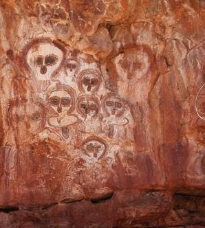
Australia. This site is part of a continuous cultural and spiritual tradition that spans thousands of years, with the painting estimated to be over 4000 years old. The Wandjina are ancestral beings and rainmakers central to the Law and cultural responsibilities of the Worrora, Ngarinyin and Wunambal Peoples. The site is sacred and reflects an ongoing relationship between people, Country and ancestral beings.
Watch the video for an introduction to History in Year 7 and the historical skills and concepts you will be working with.

1.1Setting the scene: What was ‘the ancient world’?
1.2How did early humans evolve, migrate and establish ancient societies?
1.3How did people come to the Australian continent?
1.4What were the key features of ancient societies?
1.5How do historians and archaeologists investigate ancient societies?
1.6End of topic review: How did civilisation begin?


Warning: Aboriginal and Torres Strait Islander people should be aware that this chapter may contain images, names and links to footage of people who have passed away.


In this lesson, you will learn about the story of the earliest humanity and explore some of the common features across these societies.
Scientific evidence suggests that early humans or homo sapiens originated in Africa 200–300 000 years ago. Around 100 000 years ago, some archaeologists believe we began to move out of Africa and cover the globe. This theory of population movement is known at the Out-of-Africa Theory. Early humans gradually spread from Africa across almost all other continents, including Asia

and Europe. This led to the establishment of a range of diverse cultures and societies.
Around 3100 bce, ancient Egypt emerged as a powerful civilisation along the Nile River. The Egyptians developed a system of writing called hieroglyphics and built iconic structures like the pyramids. Similarly, the Indus Valley civilisation in India, around 2500 bce, became known for its advanced urban planning and early forms of handwriting.
civilisation a large, organised society with complex structures, including cities, governments, social classes and cultural developments

Source 1.1.1 Fragment of a wall with hieroglyphs from the tomb of Seti I (reigned c. 1290–1279 bce) from ancient Egypt. How might writing have helped civilisations to develop?


Source 1.1.2 Farming scene from an ancient Egyptian tomb
Across much of the world, the Neolithic period (the later Stone Age) saw the development of more settled societies. As people learned how to domesticate animals and plants, hunter-gatherer tribes became larger communities, which then developed into cities.
Different forms of farming evolved, depending on the types of animals and crops suited to the area. Different agricultural techniques also developed.
100 000 BCE
Homo sapiens have begun to migrate from Africa
40 000 BCE
Construction of the Brewarrina fish traps, Australia
10 000 BCE
Ancient societies developed Stone Age barter systems between different groups into networks of trade across much of the world. From 130 bce, China, India, Persia and Europe established the trade routes known as the Silk Road.
Neolithic period begins (New Stone Age)
6500–4000 BCE
Beginning of agriculture in Europe and Egypt
4000–2500 BCE
Farming and villages in western India
2 000 000 BCE
Palaeolithic period begins (Old Stone Age)
63 000 BCE
Humans living at Madjedbebe, Australia
15 000–10 000 BCE
Painting of the Lascaux caves in France
The wealth created by agriculture and trade led to specialised jobs such as craftspeople, artists, scribes and priests, as well as leaders. Most ancient societies were hierarchical, with their leaders at the top and warriors, priests, scholars and peasants below them.
Written laws, such as the Code of Ur-Nammu (c.2100–2050 bce) and the Code of Hammurabi (c.1700 bce), developed in many ancient societies. In other societies, laws were remembered and taught via song, story and art.
5000 BCE
Farmers in the Andes in South America begin to domesticate potatoes
8000–4000 BCE
Development of agriculture and silk weaving in China
From the Dreaming stories and spiritual beliefs of First Nations people in Australia to the gods and goddesses of ancient Egypt and Greece, spiritually detailed systems of belief developed in all ancient societies. These beliefs determined laws, social organisation, marriage and rituals associated with death, fertility and crop production.
Oral transmission refers to the passing down of knowledge, history and cultural traditions through spoken word. For First Nations Peoples, this includes storytelling, song, dance and ceremony. Oral traditions have been used for thousands of years to share laws, kinship structures, and deep understandings of Country. These living knowledge systems continue today, ensuring that cultural knowledge is preserved and passed to future generations.


Historians rely upon archaeologists and scientists to find and analyse sources for evidence about the development of ancient societies across the world. Because many everyday objects – including clothing, timber and paper – decay over time, the types of artefacts used by historians to learn about ancient societies are usually made of stone pottery or metal.
Artworks, including statues, architecture and paintings on rock, papyrus and paper, can provide evidence of daily life, religious beliefs and the environments and politics of ancient societies.
Iconography refers to the symbols used to represent the beliefs and values of a society. Studying these symbols, such as the scarab beetle in Egyptian artefacts or the yin-yang from ancient China, provides historians with evidence about the values of ancient societies.
Writing was first developed in ancient Sumer (cuneiform script) and Egypt (hieroglyphs), emerging from 3400 to 3200 bce Writing developed in India around 2600 bce and in China between 1500 and 1000 bce. Translating ancient texts and inscriptions can provide important evidence for historians.
2700–2200 BCE
Pyramids built in Egypt
3180–1500 BCE

800–700 BCE
Rise of the Greek poleis (city-states)
Neolithic settlements (e.g. Skara Brae) and megaliths (e.g. Stonehenge) built across Europe
Ancient pottery has been found across Africa, Europe, Central and South America, and Asia. Pottery enabled humans to store or transport food, allowing them to remain in one place rather than following food sources. Ancient pottery gives evidence of the food eaten by people in ancient societies, as well as the goods traded between different settlements.
1 Identify two examples of evidence supporting the idea that humans have lived in Australia for at least 40 000 years.
2 What challenges might historians face when analysing ancient written sources as evidence about the past?
3 Why might the rulers of ancient societies such as Sumer and Babylon have written down their laws and displayed them in public spaces?
58–50 BCE
Roman conquest of Gaul, led by Julius Caesar
166 CE
Roman merchants reach China by sea
79 CE
The Roman cities of Pompeii and Herculaneum destroyed by a volcanic eruption
Tools
The earliest human tools were made from stone or animal bone. Metal tools were used from around 4000 bce, made first from copper, then bronze and finally iron from around 1500 bce. From tools, historians can learn about farming, hunting, housing and clothing, as well as weapons used by ancient peoples across the world.


c. before a date stands for ‘circa’ – meaning an approximation or guess by historians.
bce stands for ‘Before the Common Era’ (sometimes, ‘Before the Current Era’), while ce stands for ‘Common Era’ (sometimes, ‘Current Era’). The calendar commonly used around the world, known as the ‘Gregorian calendar’, traditionally used the term ‘bc’ instead of bce and ‘AD’ instead of ce bc stands for ‘Before Christ’ and AD stands for ‘Anno Domini’, which is Latin for ‘the year of our lord’ (meaning from the time Jesus was born).
The fi rst known Chinese dynasty, the Xia, is believed to have started around 2070 bce . It established early Chinese culture and writing systems. Ancient Greece began to rise around 800 bce City-states like Athens and Sparta were known for their contributions to philosophy, democracy and the arts. Rome’s development started around 753 bce . Initially, it was a small citystate, but later grew into a vast empire by 27 bce . It infl uenced law, engineering and governance in ways that are still felt today.
The oldest known Aboriginal rock art in Australia significantly predates ancient
civilisations like Egypt and China’s Xia dynasty. Some Aboriginal rock art has been dated to at least 28 000 years ago, with estimates suggesting some pieces could be up to 40 000 years old or more.
This means that the oldest Aboriginal rock art is tens of thousands of years older than these ancient civilisations.
By 600 ce , these ancient cultures had experienced signifi cant changes. Empires rose and fell, power shifted and traditions blended. These civilisations laid the foundations for the development of modern societies through their innovations, ideas and cultural practices.
The ancient societies of Egypt, China, India, Rome and Greece were far apart and had distinct cultures.

But, they shared some important similarities that helped them grow and thrive.
Source 1.1.5 For over three thousand years, families have lived on the banks of the Nile River, against the backdrop of ancient Egyptian monuments.


One of the most crucial things they all had in common was access to water. Each of these societies developed around major rivers: Egypt by the Nile River, China by the Yellow and Yangtze Rivers, India by the Indus River, and Rome by the Tiber River. These rivers provided fertile soil for farming, fresh water for drinking and cooking, and routes for trade and travel. This made it possible for large groups of people to live together in cities.
Another common feature among these civilisations was the development of writing. Writing allowed people to keep records, create laws and share knowledge. For example, the Egyptians used hieroglyphics, the Chinese developed characters that would become Chinese script, ancient India used early forms of Brahmi script, the Greeks used the Greek alphabet and the Romans used the Latin alphabet. Writing was essential for communication, keeping track of trade, and passing down stories and traditions. This allowed beliefs and rituals to develop.
Long before those civilisations, Aboriginal and Torres Strait Islander Peoples in Australia were using rock art,
symbols (such as message sticks) and oral narratives to support and communicate their communal beliefs and rituals. These methods allowed them to share important knowledge, laws and traditions across language groups and through generations. Even without a written script, their rock paintings and spoken stories conveyed meaning effectively. This ensured the preservation of their diverse cultures throughout millennia.

Each of these ancient cultures also made contributions to art, architecture and technology. Egypt is famous for its pyramids and China for the Great Wall. India is famous for its well-planned cities and Greece for its beautiful temples, Rome is well-known for its advanced roads and aqueducts.
By sharing these prominent features, these ancient societies left a lasting impact on the world.
1.1 Review questions
1 Explain how rivers would have impacted the development of civilisations.
2 Identify three ancient civilisations that used writing and give an example of how this changed these lives of everyday people.
3 List the societies that are mentioned in this lesson in chronological order (from oldest to most recent), based on when each society began.
4 Why was the development of writing important?
5 Explain how some of the ways in which the discoveries and buildings of this era still influence us today.
fertile producing or capable of producing substantial amounts of crops
In the last lesson, you were introduced to some of the ancient world’s societies and their common features. In this lesson, you will learn how and when early humans migrated around the world.
Lesson starter
Complete the following activity to kick-start this lesson.
See, think, wonder
1 See: How would you describe the scene in Source 1.2.1? How are these people living?
2 Think: What significant changes can we see in how people lived then compared to now?
3 Wonder: How did these changes happen?
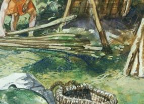
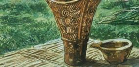
Source 1.2.1 Prehistory, Neolithic Japan. Late Jomon period settlement ➜


The move out of Africa, often referred to as the ‘Out-of-Africa’ migration theory, is a key event in human prehistory. Our understanding of this migration and when it took place is always evolving as new archaeological evidence is uncovered. Note that while this is a widely accepted idea, there are also other theories about human migration.
The most current evidence suggests that waves of migration occurred within
the last 60 000 years. They included journeys eastward across southern Asia and then into western Europe. From there, humans gradually expanded into places now known as the Middle East, Europe, Asia and eventually into Australia and the Americas. It is believed that these early humans were driven by environmental changes and the need for resources.
migration the process of a person or people travelling to a new place or country
As they moved into new regions, humans encountered different climates, landscapes and challenges. This migration led to the development of diverse cultures and adaptations to various environments. This is significant because it set the stage
for the global spreading of humans and the eventual rise of civilisations. This is particularly true after the First Agricultural Revolution (described on the next page), when humans began to settle and develop complex societies all over the world.
Exploring continuity and change through migration and communication
Part 1: Mapping human migration
1 Draw a simple world map: On a blank sheet of paper, sketch a basic outline of the world’s continents.
2 Highlight Africa: Place a prominent dot or circle on Africa – this is considered the starting point for early human migration according to the Out-of-Africa theory.
Neolithic a period around 10 000 years ago when many/most human societies transitioned from a lifestyle of hunting and gathering to one of agriculture and settlement domestication the process of taming wild animals or cultivating plants for human use
3 Map migration paths: Use arrows to draw possible paths from Africa to other continents like Asia, Europe and Australia. This illustrates how early humans may have spread across the world.
4 Write a brief description: In a few sentences, describe the movement of early humans based on the Out-ofAfrica theory. Note that while this is a widely accepted idea, there are also other theories about human migration.
1 Draw a timeline: On a new sheet of paper, draw a horizontal line across the page to represent time, starting from 40 000 years ago to the present day.
2 Mark key events:
a Aboriginal rock art (~40 000 years ago): Place a point on the timeline to represent the creation of some of the oldest known rock art by Aboriginal people.
b Early writing systems (~5000 years ago): Mark the development of early writing systems such as Egyptian hieroglyphs.
c Ancient oral narratives(~40 000 years ago): Note that throughout history, many cultures – including Aboriginal cultures – used oral storytelling to pass down knowledge, laws and traditions.
3 Add notes: For each event, write a brief note explaining its significance in supporting and communicating communal beliefs and rituals.
Write a short paragraph discussing how these different forms of communication show continuity (the ongoing need to share and preserve information) and change (the development of new methods like writing).
Historical concepts and skills: continuity and change, chronology, communication
The First Agricultural Revolution, also known as the Neolithic Revolution, marks one of the most significant turning points in human history. Before this period, people were primarily hunter-gatherers, moving from place to place to find food. They relied on wild plants and animals for their survival. This meant their lives were often unpredictable, depending on the weather and the availability of food.
Around 10 000 years ago, in various parts of the world, including Australia, people began to discover that they could grow their food. Instead of gathering wild grains, they started to plant seeds and grow crops. This process of farming allowed them to produce a steady supply of food. Along with crop farming, people also began to domesticate animals like goats, sheep and cattle, using them for meat, milk and other resources.
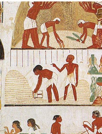
Source 1.2.3 Agricultural scenes of threshing, a grain store, harvesting with sickles, digging, tree-cutting and ploughing from Ancient Egypt. Explain how the development of agriculture impacted the lives of everyday people.
In some regions, Aboriginal communities harvested native grains like millet and spinifex. They used grinding stones – some dated over 30 000 years old – to process the grains into flour for making bread.
The shift from hunting and gathering to farming had huge effects on human societies. For the fi rst time, people could settle in one place instead of constantly moving around in search of food. This led to the development of permanent villages and eventually larger communities and cities. With a more reliable food source, populations grew, and people had more time to focus on other activities, such as
Sahul was a prehistoric landmass that connected present-day mainland Australia, Tasmania and New Guinea during periods of lower sea levels, particularly during the last ice age. (See Source 1.3.2 in the next section.) This mega-continent was formed when the shallow seas between these landmasses pulled back. This exposed land bridges that allowed early humans and animals to migrate across to what are now separate islands.
The inhabitants of Sahul were likely among the earliest people to leave Africa, according to the ‘Out-of-Africa’ migration
building homes, crafting tools and creating art.
The First Agricultural Revolution laid the foundation for the birth of civilisations. It allowed people to form complex societies with unique cultures. Understanding this revolution helps us see how human resourcefulness transformed the way we live, leading to the modern world we know today.
theory, eventually reaching this vast and diverse environment. The unique ecosystems of Sahul supported a variety of megafauna, including giant kangaroos, large marsupial lions and enormous flightless birds. However, many of these species became extinct, due to human hunting or climate changes.
People in Sahul adapted to various environments, from deserts to rainforests. Sahul split into three pieces — the Australian mainland, Tasmania and New Guinea — 10 000 years ago. The people in each area were isolated, which preserved their culture and languages.
mega-continent several large land masses thought to have divided in the past to form the present continents ecosystem a geographic area where plants, animals and other living things work together
1.2 Review questions
1 Describe the ‘Out-of-Africa’ theory.
2 Why did farming allow people to live in one place?
3 What impact did the First Agricultural Revolution have on the growth of human populations and the development of early cities?
4 What animals did early humans first domesticate? Explain why you think they picked these ones.
In the last lesson, you learnt about the early migrations of humans and the Out-of-Africa theory. In this lesson you will learn about how scientists believe the earliest Australians came to the continent.
Complete the following activity to kick-start this lesson.
See, think, wonder
1 See: How would you describe the rock art in Source 1.3.1?
2 Think: Who made this rock art, and why?
3 Wonder: How did these people use the land and tell their stories?
Source1.3.1 Pictographs known as Wandjina created by the Worrora People in the Wunnumurra Gorge, Barnett River, Kimberley, Western Australia


It is important to note that many Aboriginal and Torres Strait Islander Peoples do not agree with the ‘Out-of-Africa’ theory and have deeply spiritual beliefs about the origins of their ancestors. It is important to recognise and respect these perspectives and ways of thinking.
Approximate coastlines
years ago
Source 1.3.2 Map of Sahul with Sunda. [Source: Cambridge University Press & Assessment] ➜
Aboriginal and Torres Strait Islander Peoples are believed to be the fi rst people to arrive on the continent now called Australia, and according to the ‘Out-of-Africa’ theory, their journey started over 60 000 years ago. During this time, the sea levels were much lower than they are today, and a large
landmass called Sahul connected mainland Australia, Tasmania and New Guinea. Early humans travelled out of Africa, spreading across Asia, and eventually reaching Sahul. They used boats or rafts to cross the short sea distances and walked across land bridges that connected the islands.
First Nations Peoples spread across the continent, adapting to many different environments, from deserts to rainforests. They became highly skilled in finding food, using natural resources, and developing unique tools and techniques to survive. Over thousands of years, First Nations Peoples developed diverse cultures with their own languages, stories and traditions.
The Madjedbebe rock shelter, located near Kakadu National Park in the Northern Territory of Australia, is one of the oldest known sites of human habitation. Archaeological findings at Madjedbebe have pushed back evidence of human presence on the Australian continent to about 65 000 years ago. This challenges our previous estimates and reshapes our understanding of early human migration.
Excavations at this ancient site have uncovered thousands of artefacts, including stone tools, grinding stones and ochre pieces. This indicates that the early

According to the ‘Out-of-Africa’ theory, the arrival of First Nations Peoples on this continent marks one of the earliest human migrations and shows their remarkable ability to explore and adapt to new and changing environments. Today, First Nations Peoples in Australia are recognised as the oldest continuous cultures in the world, maintaining a profound connection to the land and a rich heritage that has been passed down through generations.
inhabitants had a complex culture and used a variety of tools. The presence of ground ochre also suggests symbolic or artistic practices. This discovery is significant as it predates similar evidence in other parts of the world. This makes it one of the most critical sites for studying early human history outside of Africa, and it makes some archaeologists question the ‘Out-ofAfrica’ theory. The research at Madjedbebe highlights the deep historical and cultural connections of Aboriginal people to their land, offering insights into their resilience and adaptation over tens of thousands of years.
Source 1.3.3 The Madjedbebe rock shelter is the oldest known site of human occupation in Australia. [Supplied: Gundjeihmi Aboriginal Corporation/Dominic O’Brien]


Aboriginal rock art, such as the Walinynga (Cave Hill) archaeological site (Source 1.3.4), has been dated to around 30 000 years ago, although there are much older sites on the continent.
Walinynga is an important archaeological site located in South Australia. It features ancient rock art created by the Anangu People, including hand stencils, animal figures and symbols. Some of these artworks are estimated to be thousands of years old. Beyond its archaeological significance, Walinynga holds deep cultural and spiritual importance for the local Anangu communities. The site’s enduring art reflects the strong connection between the people and their land, assisting researchers in studying the continuity of cultural practices over millennia.
Ancient rock art comes in two main types: engravings (called petroglyphs) and paintings or drawings (called pictographs). Petroglyphs are made by scraping or carving into the rock, using tools like hammers to leave marks or grooves. Pictographs are created by painting or drawing on the rock using different kinds of colours. Some drawings are made with dry powders like charcoal, clay or ochre (a type of natural colour that can be yellow, red or brown). Paintings, on the other hand, use wet colours made from minerals, which can be applied with fingers or brushes made from sticks or hair. Sometimes, people even make stencils by blowing paint over an outline.
Anangu the term used by several Aboriginal groups in the Western Desert, including the Pitjantjatjara, Yankunytjatjara and Ngaanyatjarra, to describe themselves
Asking historical questions about early migration to Australia
Review the following two sources:
• Source 1.3.2 (Map of Sahul and migration)
• Source 1.3.4 (Walinynga archaeological site).
Write down two simple historical questions based on these sources. Focus on:
• the journey of early humans to Australia
• the cultural and historical significance of First Nations sites like Walinynga.
Examples of questions you might ask:
• ‘How did early humans reach Australia?’
• ‘What does the rock art at Walinynga tell us about how long Anangu have lived on their land?’
Historical concepts and skills: historical questions, historical significance
The migration and settlement of Aboriginal and Torres Strait Islander Peoples occurred over thousands of years. It also happened in several waves.
Initially, early inhabitants followed the coasts and river systems, which provided reliable sources of water and food. From these coastal areas, people gradually moved inland, adapting to different environments such as deserts, forests and mountains. Their ability to adapt was important, as the climate and landscape of Australia varied, with some regions experiencing harsh conditions.
Aboriginal Peoples developed hundreds of distinct languages and cultural practices. This reflects the diversity of the landscapes they lived in. Over time, diverse groups established strong connections with specific areas, known as ‘Country’ in English, which became central to their identities, spirituality and ways of life.
This movement of First Nations Peoples across the continent created a complex tapestry of cultures and societies that have thrived for tens of thousands of years. This demonstrates their deep understanding and sustainable use of the land. The story of these waves of migration is evidence of the resilience and adaptability of Aboriginal people. This is explored in more depth in Chapter 2.
As you read the History chapters in this book, and work through the activities, you will be conducting your own investigations into different topics using a range of sources. A key type of source for the study of history is to read what professional historians have said about a topic or issue. We refer to these opinions as ‘historical interpretations’. Let us see what two historians have said about First Nations Peoples.
Table 1.3.1 Two historical interpretations on agriculture in Australia
Bruce Pascoe, an Aboriginal man of the Bunurong, Kulin nation and Yuin Peoples, and an historian and writer, in his book Dark Emu: Aboriginal Australia and the Birth of Agriculture, states:
Aboriginal Australians managed the land with an understanding of its rhythms, caring for it in ways that ensured its continued productivity and their survival. They adapted to the changing environments, from coasts to deserts, and developed complex societies and agricultural practices long before European settlement.
Source 1.3.5 Bruce Pascoe, Dark Emu: Aboriginal Australia and the Birth of Agriculture, Magabala Press, 2018, p. 19
*Note that the term ‘Aborigines’ is no longer considered to be appropriate.
Bill Gammage, an Australian historian and author of The Biggest Estate on Earth: How Aborigines* Made Australia, writes:
For over 60 000 years, Aboriginal people moved across the Australian continent, shaping the landscape with their sophisticated land management techniques. They understood fire, water, and soil, creating a mosaic of different ecosystems that sustained diverse plant and animal life, as well as their own communities.
Source 1.3.6 Bill Gammage, The Biggest Estate on Earth: How Aborigines Made Australia, Allen and Unwin, 2011, p. 6

Source 1.3.7 Bunurong, Kulin nation and Yuin historian Bruce Pascoe, pictured in 2023
1.3 Review questions
1 According to historian Bruce Pascoe, what were some ways that Aboriginal people ensured the continued productivity of the land?
2 Outline what historian Bill Gammage means by saying Aboriginal people created a ‘mosaic of different ecosystems’. How might this have benefited their communities?
3 Both Pascoe and Gammage discuss Aboriginal Peoples’ adaptation to the environment. Identify some examples of how people adapted to different environments across the Australian continent.


In the last lesson, you were introduced to life in Australia 60 000 years ago. Now, you will learn about some of the common features of ancient societies.

Lesson starter
Complete the following activity to kick-start this lesson.
See, think, wonder
1 See: How would you describe the object in Source 1.4.1?
2 Think: What might be significant about such an early example of writing?
3 Wonder: How did this writing occur?
Source 1.4.1 Code of Hammurabi in The Louvre, Paris ➜


Early societies in Africa, the Americas, Asia, Australia and Europe developed unique characteristics that shaped their civilisations. In Africa, farming emerged in the Nile River Valley, with crops such as wheat and barley. Iron tools improved farming efficiency and helped expand trade networks. In the Americas, the Maya and the Inca societies developed sophisticated farming systems. These systems included terracing, irrigation and the stone grinding tools used by bread makers.
Herding, or pastoralism, began when humans tamed animals for food, clothing and labour. In Africa, the taming of cattle and sheep began around 10 000 years ago, particularly in regions like the Sahel and East Africa. Nomadic, pastoralism emerged in the grasslands and deserts. In Central Asia, the herding of horses, goats and sheep became central to
Crop cultivation first emerged in the Fertile Crescent, with wheat, barley and legumes grown from around 10 000 years ago. In Africa, regions like the Nile Valley became early agricultural centres, with crops like grains. Asia saw the early growing of rice in the Yangtze River Valley and later, in South
This meant people could thrive in diverse environments.
Asia, especially Mesopotamia and the Indus Valley, saw the rise of early cities, with advanced irrigation, and writing systems such as cuneiform and Sanskrit. These developments increased trade and centralised governance. Europe’s early societies, particularly in Greece and Rome, saw advancements in law, with the development of legal codes. Kings, priests and warriors ruled these countries.
irrigation the supply of water to land or crops to help growth, typically by means of channels cuneiform a system of writing used in the ancient Middle East Sanskrit a language that is the root of many Indian languages
Aquaculture has ancient origins as well. The Gunditjmara people of present-day Victoria built intricate aquaculture systems over 6600 years ago at Budj Bim, constructing stone channels and weirs to farm eels. (You will learn more about First Nations aquaculture in Chapter 2.)
China is widely recognised as another early adopter of aquaculture, particularly with the farming of fish around 3500 years ago. In South-East Asia, aquaculture
societies such as the Mongols. In Europe, herding was common in regions like the Mediterranean, where sheep and goats thrived in rugged terrains. Herding also occurred in the Americas, with societies taming animals like llamas and alpacas in the Andes mountains. Consider why humans may have chosen animals like cows and sheep for early pastoralism.
Asia, the domestication of crops in the Indus Valley. In Europe, early farming communities grew grains and cereals as part of the Neolithic Revolution. At the same time in Australia, Aboriginal people grew native plants like yams and managed the land through practices such as fire-stick farming.
expanded with the farming of fish and shellfish. In ancient Egypt, fish farming was conducted in ponds near the Nile. In more recent history, European aquaculture developed in the Middle Ages, focusing on fish such as carp and trout. The Americas also saw traditional methods of aquaculture, particularly among Indigenous communities along the Pacific Northwest, who practised clam farming and salmon harvesting.
nomadic of people or groups who move from place to place without a permanent home crop a plant that is grown for a specific purpose such as food, fibre or fuel Fertile Crescent the modern-day Middle East
Songlines oral maps passed through generations by First Nations Peoples, using song, story and ceremony to navigate Country, record history and maintain deep cultural and spiritual connections to the land
Continuity and change in the everyday lives of ancient peoples
Practice Region
Herding
Crop cultivation
Africa, Central Asia
Mesoamerica, Fertile Crescent
Continuity
Continued use of pastoralism
Traditional crops still grown (maize, wheat)
Fish farmingChina, Egypt, AustraliaCarp farming has persisted
Change
Introduction of new breeds and methods
Use of advanced irrigation, industrial farming
New technologies, expanded fish species
Task: Using the table above, explain how the societies listed changed and how their everyday lives were impacted by these changes.
Historical concepts and skills: continuity and change, communication
Before the development of writing, societies had oral traditions of law. Elders, religious leaders or chiefs passed down rules through storytelling and memory. They relied on shared understandings and customs to maintain social order. First Nations Peoples had highly developed ways of recording and passing on information that holds deep cultural
Early written codes of law, such as the Code of Ur-Nammu and the Edicts of Ashoka, were essential for shaping societies and maintaining order. These codes were similar but also had differences in their content and purpose.
The Code of Ur-Nammu, created around 2100 bce in Mesopotamia, is one of the earliest surviving law codes. It focused on fairness and compensation, with punishments for offences like theft or injury. One important feature was that the punishments were often fines or compensation rather than physical.
significance, which have sustained Aboriginal societies for thousands of years:
• rock art and carvings
• Songlines
• message sticks
• petroglyphs
• weaving and artefacts.
For example, if someone injured another person, they might have to pay a fine rather than suffer an equal injury. The code was hierarchical, applying differently to individuals based on their social class.
The Edicts of Ashoka, written around 250 bce , were commands by Emperor Ashoka of the Mauryan Empire in India. After converting to Buddhism, Ashoka promoted laws based on moral principles and non-violence. His edicts, written on pillars and rocks, emphasised kindness, respect for all living beings and tolerance among different religions.

While Ashoka’s laws were based on Buddhist ethics, they promoted social welfare, including animal rights, and advocated for a just and compassionate society. Unlike the earlier legal codes, Ashoka’s edicts were less about punishment and more on guiding moral behaviour.

Despite their differences, these early codes helped create social order. These rules that governed the behaviour of individuals offered protection to certain groups, and had punishments for wrongdoing. However, each reflected the values and priorities of its society. Mesopotamian laws focused on compensation and class hierarchy, while Ashoka’s edicts were humanitarian, promoting social harmony and welfare.
All these codes aimed to regulate people’s behaviour. These codes laid the foundation for modern legal systems. They show how different societies developed similar rules to maintain justice and order.
humanitarian concerned with or seeking to promote human welfare
1.4 Review questions
1Identify the key benefits of herding animals.
2Explain how the development of farms changed the way early societies organised themselves.
3 Before the development of written laws, how do you think early societies ensured that people followed agreed-upon rules and customs?
In the last lesson you learnt about some of the common features of ancient societies. In this lesson, you will find out how historians and archaeologists uncover the ancient past.
Complete the following activity to kick-start this lesson.
Creative questions
1 Brainstorm at least 12 questions about archaeology. Try some of the creative question starts:
• Why...?
• What if...?
• What is the purpose of...?
• What if we knew...?
• What would change if...?
2 Review your list, identify the most interesting questions, and select one to discuss.


Historians study written records, such as ancient texts and laws, to understand how people lived in the past. These writings give clues about their government, religion and daily life. But for societies that did not leave written records, archaeologists play a key role in finding out how people lived.
Archaeologists study artefacts, like tools, pottery and ruins of buildings, to learn about past cultures. They carefully dig up these items and analyse them to understand how people farmed, built homes and traded. They also use special
techniques like carbon dating to find out how old things are, and satellite imagery to explore large areas.
Conserving these artefacts and ancient sites is important because they help us learn about the past. Once they are damaged or destroyed, we cannot replace them. Protecting them ensures that people in the future can also learn from history. This is why archaeology and conservation are important – they help us keep a connection to our shared past and understand how early societies shaped the world we live in today.
Archaeologists have made many remarkable discoveries that have expanded our understanding of ancient societies.
The Rosetta Stone is one of the most important archaeological discoveries in history. It was found by French soldiers in Egypt in 1799. This stone is special because it has the same text written in three different scripts: Greek, Demotic


and Egyptian hieroglyphs. Before its discovery, no one could fully understand hieroglyphs, the written language of ancient Egypt. By comparing the Greek text, which scholars could already read, with the hieroglyphs, they were able to crack the code of this ancient script. This breakthrough opened the door to understanding the rich history and culture of ancient Egypt.
Another significant find is Tutankhamun’s tomb, unearthed by Howard Carter in 1922. The tomb, found in the Valley of the Kings, contained a wealth of treasures, including the young pharaoh’s gold burial mask. The discovery gave archaeologists insight into Egyptian burial practices and the wealth and artistry of the time.
historians scholars who study and interpret past events using written records and other sources archaeologists experts who study human history through artefacts and physical remains carbon dating a method to determine the age of things that were once alive by measuring the amount of carbon-14 they contain - the less carbon-14 there is, the older the object is Demotic an ancient Egyptian script used in the Nile Delta. The term was first used by the Greek historian Herodotus to distinguish it from hieroglyphics


Source 1.5.3 The northwest corner of Tutankhamun’s tomb’s antechamber, as photographed in 1922 ➜
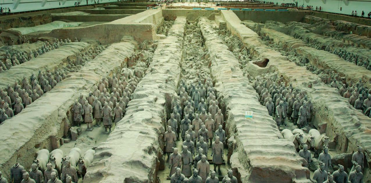
Source 1.5.4 The Terracotta Army in Xi’an, China ➜ to display his immense power. This find provided a glimpse into ancient Chinese military practices and burial traditions.
In China, the Terracotta Army, discovered in 1974, consists of thousands of life-sized clay soldiers buried with Emperor Qin Shi Huang. These figures were placed in the emperor’s massive tomb complex to guard him in the afterlife. The army is remarkable for its scale and detail. Each soldier has distinct facial features, and their uniforms reflect the ranks of real soldiers, from infantry soldiers to archers and generals. Archaeologists believe this burial practice reflects Qin Shi Huang’s desire for protection in the afterlife and his effort
Concepts and skills builder 1.5
One of the greatest archaeological discoveries from Australia is the Mungo Man and Mungo Woman remains found at Lake Mungo in New South Wales. Discovered in 1968 and 1974, these ancient human remains are around 40 000 to 42 000 years old. Mungo Woman is the oldest known cremation in the world, indicating complex burial rituals among early Aboriginal societies.
Historical significance and putting events in chronological order
1 What do you see? How would you describe the great archaeological discoveries discussed above?
2 What does it make you think? What might be significant about these discoveries?
3 What do you wonder? How did these things get created?
4 Draw a timeline in your book, and record when each civilisation existed. For example, ancient Mesopotamia (around 3000 bce) would be earlier than ancient Greece (around 800 bce). Use the classroom or a designated space as the ‘timeline’.
5 Write down one key feature of that societ y (e.g. the pyramids of Egypt or the architecture of ancient Greece).
6 Once the timeline is complete, write an explanation of how archaeologists use artefacts to determine when and where these societies existed and how they built on the developments of earlier civilisations.
Historical concepts and skills: chronology, historical significance
Archaeologists use different methods to investigate the ancient past and uncover details about how people lived long ago. These methods help them learn about things like how old a discovery is, what people ate, what diseases they had, and even who they were. Let us look at a few important methods they use.
Stratigraphy
This process involves studying the layers of soil where artefacts or remains are found. Imagine a cake with many layers – each layer represents a different period. The deeper something is buried, the older it usually is. By looking at the position of an object in these layers, archaeologists can estimate how old it is. This is a simple but effective way to date discoveries without damaging the artefacts.
Carbon dating is also known as radiocarbon dating. This technique determines the age of things that were once alive, like plants, animals or humans. It works by measuring the amount of carbon-14, a radioactive element, left in an object. Over time, carbon-14 slowly disappears, so the less carbon-14 there is, the older the object is. This method has helped archaeologists date ancient bones, tools and even cave paintings.
This is another powerful tool. DNA is the genetic code that makes up all living things, including humans. By extracting DNA from ancient remains, such as Mungo Man and Mungo Woman or Egyptian mummies, scientists can learn more about past individuals. For example, they can find out where someone’s ancestors came from or identify family relationships.

DNA testing has even been used to study the common diseases that ancient people suffered from. For instance, scientists have used DNA from mummies to discover that ancient Egyptians had diseases like tuberculosis and malaria.
Excavation
Excavation is one of the most traditional and essential methods used by archaeologists to explore ancient sites. It involves careful and systematic digging of an area where artefacts, structures or fossils might be buried. During an excavation, archaeologists use tools, such as brushes, shovels, trowels and picks, to remove layers of soil and debris slowly and carefully. This process must avoid damaging any fragile items that might be hidden beneath the surface.
excavation the process of uncovering and studying physical remains from the past by digging at archaeological sites
Archaeologists often dig in small sections or trenches to better control the excavation and to document the precise location of each artefact. As they uncover objects, they map and photograph them in their original position before removing them for further study. The goal is to learn as much as possible about the context in which
these objects were found. This provides valuable clues about how ancient people lived, worked and interacted with their environment. Excavation helps reveal not only individual artefacts but also entire ancient cities, burial sites or temples. This careful process is crucial for preserving history while uncovering the secrets of ancient societies.
Consider the opinions of two senior archaeologists shown in Table 1.5.1.
Table 1.5.1 Two opinions on archaeology
Dr Richard Leakey, in his 1994 book The Origin of Humankind, argues that archeology is the only subject where experts try to understand human behaviour and actions without having direct contact with the people being studied. Excavations by archaeologists reveal how people lived and the societies in which they lived.
Dr Colin Renfrew, in his book Archaeology: Theories, Methods, and Practice, emphasises:
The act of excavation is like unpeeling the layers of history, each stratum revealing a different era, a different society. What we find not only uncovers the material remains of the past but also challenges us to rethink our interpretations of the past and how human societies have evolved over time.
Source 1.5.6 Colin Renfrew and Paul Bahn, Archaeology: Theories, Methods, and Practice, Thames & Hudson, 1991, p. 56
1.5 Review questions
1Explain the significance of stratigraphy in archaeology, and how archaeologists use it to understand the relative ages of artefacts.
2 Explain the process of excavation and why archaeologists must be careful when digging up ancient sites. What tools do they use to ensure artefacts are not damaged?
3 Based on Dr Colin Renfrew’s quote, how does the act of excavation help archaeologists ‘unpeel the layers of history’, and why is this important for understanding ancient societies?
4 Why is it important for archaeologists to conserve artefacts and ancient sites, and how does this help future generations study and learn from the past? Explain.
5 Use Source 1.5.7 to answer the following questions.


Feature 7 Shaft burial with skeleton in crouch position, funeral offerings

Layer 6 No significant finds
Layer 5 Layer of ash, collapsed buildings, human remains


Layer 4 Coins, amphora, stone statue of Zeus, hand mirror, black figure pottery, spearhead, pottery shard with Greek script
Source 1.5.7 Stratigraphy cross-section diagram ➜
a Which layer is the oldest?


Layer 3 Iron sword, iron scythe, foreign pottery, cattle bones
Layer 2 Tablet with Linear B writing, bronze weapons, gold jewellery, local painted pottery, bronze helmet, small clay and bone votive figurines
Layer 1 Flint tools, remnants of a campfire, primitive pottery, midden animal bones
b The burial pit (layer 7) was dug by the people from which layer? Explain your answer.
c Outline the technological developments between layers 1 and 2.
d Identify what kind of catastrophe may have occurred in layer 5.
e Identify the most significant development of layer 2. Explain why you think this.
f Identify the objects that show development in technology at this site.
g Why might the inhabitants of layers 2 and 4 have used different written scripts (Linear B/Greek)?
h Explain what the presence of foreign pottery in layer 3 suggests.
i Explain why the site may have been abandoned.
j Identify what type of person do you think was buried in feature 7. Explain your answer with reference to the goods found with the body
k Write a historical account explaining what you think occurred at this site. When you have finished share your story with a partner.
Access the Interactive Textbook for a range of digital tools to help you review this topic, including:
• Downloadable chapter summary
• Scorcher timed competitive quiz.
What have you learnt about the ancient world? For this activity, copy the diagram and fill out by explaining your understanding. Aim for two points per topic.
Topic
When was the ancient world?
What were some of the earliest societies?
What did some of the earliest societies have in common?
How did humans migrate and develop?
How did people come to the Australian continent?
What were the key features of the earliest societies?
How do historians and archaeologists investigate ancient societies?
What I have learned
1 Identify and explain why the object in the image below was significant for our understanding of the past.

Source 1.6.1 Visitors to the British Museum in London inspect the Rosetta Stone.
2 Analyse the following historical source, using the questions below.

Source 1.6.2 Burial chamber of Menna, the king’s scribe. Scene: threshing of grain, c.1422–1411 bce, ancient Egypt
a Who do you think created this source?
b When was it created?
c Who do you think the intended audience was for this painting?
d How did the domestication of animals (herding) and the cultivation of crops impact early civilisations in regions like Africa or Central Asia?
Write a paragraph in response to the question using all the key terms listed:
• stratigraphy
• excavation
• DNA testing
• domestication.
OVERVIEW
[In this topic you will] … learn about Aboriginal and Torres Strait Islander Peoples’ communities, the world’s oldest continuous cultures, and examine their histories, social organisation and practices that have continued from Deep Time to the present.
Source: VCAA, Victorian Curriculum V2.0, ‘History’, ‘Band description – Levels 7 and 8’
CURRICULUM GOALS
• How do we know about the past?
• Why do societies change?
• What makes a society?
• What factors influence where societies are established?
• How do people understand their world?
• What were the consequences of contact between societies?
• Why are there different interpretations of the past?
Source: VCAA, Victorian Curriculum V2.0, ‘History’, ‘Band description – Levels 7 and 8’

2.1Setting the scene: How do young First Nations Peoples maintain their connections to Country?
2.2What is Deep Time?
2.3What is the importance of Country to First Nations Peoples?
2.4How does Western science understand how First Nations Peoples came to the Australian continent?
2.5How do First Nations Peoples understand how their ancestors came to the Australian continent?
2.6What were the key events in the Australian continent’s Deep Time history?
2.7How have First Nations Peoples responded to environmental changes from Deep Time? Part 1: Land and landscape
2.8How have First Nations Peoples responded to environmental changes from Deep Time? Part 2: Animal extinctions
2.9What technological achievements have First Nations Peoples developed? Part 1: Earth and water
2.10What technological achievements have First Nations Peoples developed? Part 2: Fire and sky
2.11What are the significant cultural protocols for maintaining and preserving ancestral remains?
2.12What is the significance of the Mithaka Indigenous-led archaeology dig?
2.13How have interpretations of First Nations Peoples as the world’s oldest continuous cultures changed over time?

2.14End of investigation review: How have First Nations Peoples maintained their significant connections to Country from Deep Time to today?

Warning: Aboriginal and Torres Strait Islander Peoples should be aware that this chapter may contain images, names and links to footage of people who have passed away.
Country ancestral lands and waters that people are custodians for

In this lesson we will read the stories of two young First Nations writers and learn a bit about their lives growing up in Melbourne.
The following is a personal story from young writer Nayuka Gorrie. As you read it, think about the importance of a connection to Country and culture for young Aboriginal and Torres Strait Islander people living in Melbourne.
My Fitzroy connection
Before colonisation, Aboriginal people were 100 per cent of the population in this country. In the city I live in, Melbourne, we are now 0.5 per cent of the population.
The Traditional Owners owners of the Country I live on are the Wurundjeri (Wur-UND-jeri) people of the Kulin nation. The Wurundjeri did not willingly give up their land and it is still theirs. The Wurundjeri people are still here and still practise their culture. Every single day I am thankful to live on their Country and think about how my presence on their Country came about.
I live in the suburb of Fitzroy in inner Melbourne. A few decades ago, it was mostly black people and poor people who lived there. Fitzroy is the birthplace of many Aboriginal organisations that have improved our quality of life. When I walk around it now, I see the ghosts of those organisations and all those black people in the form of plaques, and hear them in my grandfather’s stories. In the shell of the houses where they used to live, or the buildings from which those organisations were run, are cafes filled with young wealthy families who would have been too afraid to venture there 30 years ago.
My connection with Fitzroy goes back three generations. My great-grandmother was stolen from Lake Tyers Mission in Gippsland, south-east Victoria, at the age of eight, and then lived in Parkville and Abbotsford in inner-city Melbourne. My grandparents lived here back when it was cheap. Mum and I lived here when I was a baby. My brother and sister also live here. I can only imagine what it would be like to live on my Country where my connection goes back a few thousand generations.
Up the road from my house in Fitzroy is where my great-grandmother used to hang out as a teenager in the 1940s. Across the road from my house is where the old Aboriginal childcare centre used to be. A 20-minute walk is where my grandparents, my mum and I lived when I was a baby. I love where I live. I love having a history with the suburb I live in.

Source 2.1.1 The Moreton Bay fig tree in Carlton Gardens. Between the 1920s and 1940s this was an important meeting place for Aboriginal people in Melbourne. ➜
At the Carlton Gardens, a 15-minute walk from my house, is an old fig tree where my mob used to meet and have important political discussions. The conversations they had under that old tree no doubt helped shape the nation.
In many respects, my life in the city is just like the life of many other people my age. I need to work to pay for the roof over my head, food on my plate, and skincare products I can’t afford but still buy. I drink too much coffee and don’t eat at home enough. Yet, my life is also unlike many other people’s. I don’t see myself reflected in many places in the public parts of this nation – the education system, media, film or television, politics and so on – as they do. I have a history with this Country and a culture that is often erased – sometimes on purpose, sometimes by accident.
We are still here
Despite this attempt to erase our culture, black people exist in cities. You might be walking past us. We might be in your classrooms. We are still here. We connect as a community in a number of different ways. Sometimes, it is to celebrate. Sometimes, it is to mourn. Sometimes, it is to protest when something unjust has happened. Many of the blackfullas who live in the city are not traditional owners of that land. That means they are from somewhere else. If they are lucky, they will know where they came from; however, there are many that don’t because of the government policies that existed to destroy that sort of knowledge.
Like many other blackfullas in the city, I have different ways of maintaining my connection to my culture. There are things that are naturally cultural to me: my set of values, the way I relate to people and how I see the world. There are also ways that I remain connected to my Country, such as visiting and learning about the different animals and plants that live on my Country. I also seek to understand more about my family history.
blackfella/blackfulla ‘blackfella’ is an Aboriginal English term used by Aboriginal and Torres Strait Islander Peoples to express their identity and sense of community. Aboriginal English is the name given to the various kinds of English spoken by Aboriginal people throughout Australia
The opposite of erasing black culture is black visibility. This is when our Aboriginality stands out to others. People can have their own ideas about what our Aboriginality means. Sometimes, this is negative. Sometimes, people have racist and stereotyped ideas about Aboriginal people and treat us poorly. This can play out in public spaces, such as being followed around in shops or being treated unfairly by the police. At school, it was mean jokes in the schoolyard, or sometimes, teachers assuming things about me.
Sometimes, I feel hopeful that things will change and sometimes, I don’t. This doesn’t mean I don’t do anything, because at least if I try, there is a chance that things can change, but if I don’t, there’s no chance.
Source 2.1.2 ‘My Fitzroy Connection’, Nayuka Gorrie, Our Land, Our Stories, ‘Our Mob, Our Stories’, Cengage Learning Australia, 2019, pp. 1–3
As you read the next story from young Wurundjeri writer Georgia Mae Capocchi-Hunter, think about the various ways Georgia Mae respects the cultural traditions of her people.
alliance an agreement or partnership between groups language group a community of people who speak a common language, often reflecting cultural, historical and ancestral ties activism working from outside the government to bring about political or social change diverse many different kinds intolerance refusing to accept views, beliefs or behaviour that are different from your own artefacts objects made by people, usually from another time
My name is Georgia Mae CapocchiHunter. I am 18 years old and I am Italian through my dad and Aboriginal through my mum. My family come from Calabria in Italy and the Wurundjeri tribe of the Kulin nation – an alliance made up of five language groups, the Woiwurrung, the Dja Dja Wurrung and the Taungwurrung, who all border each other.
I’ve been writing for a few years now, but mostly for my own enjoyment. It wasn’t until I was about 15 or 16 that I started to use writing as a form of activism and education. Melbourne is a culturally diverse city, but also one where some people hold views of intolerance, and this gave me many opportunities to write.

Most of the time, my writing has been for school projects. I try to use my knowledge and life experience as a young Indigenous person to educate the kids in my class. I have made presentations on blackface (painting your face and body to look like a black person) and why it is racist, and about the real history of Australia regarding its First Peoples. …
I had a very normal childhood by Australian standards. … But there was another side to my childhood that most kids did not often experience. From a young age, my mother made sure I had an appreciation and love for my culture that has continued to grow and shape me throughout my life. On our camping trips, she would teach me about the native plants and how they had been used by my ancestors. If we were on a hike, sometimes she would find artefacts, like an old spear or axe head. She would always make us stop so we could have a proper look, and another lesson in my history would begin. Those lessons never bored me – I saw it as part of who I was. My mother was teaching me culture and that was something I was grateful for.

My culture continues to play a part in my life, even now at 18. I uphold the traditions of the past, changed a bit to fit modern-day life. I was able to go through a traditional coming-of-age ceremony at 15 years old with my cousins – a ceremony that hadn’t been performed for over a hundred years. I, along with members of my family, also make up the Djirri Djirri dance group. Together, we keep alive the dances and stories of my people.
I am lucky enough to have the opportunities to learn about and be connected to my history and culture. However, many Aboriginal and Torres Strait Islander people who live in cities like Melbourne do not have those same opportunities. They may not live on their Country – they may not even know where that is. There are many reasons for this. Government policies and massacres all played a part in trying to erase Indigenous culture, but it lives on.
Source 2.1.5 Adapted from ‘A City Blackfella’, Georgia Mae Capocchi-Hunter, Our Land, Our Stories, ‘Our Mob, Our Stories’, Cengage Learning Australia, 2019, pp. 4–6
2.1 review
2.1 Review questions
1 How important is being connected to Country for Nayuka and Georgie Mae?
2 Identify the places in Victoria that are particularly significant for Nayuka.
3 Consider when each writer discusses First Nations people who have lost their connection to Country. Identify the reasons given. How would you describe the tone of the writing?
4 How important do you think family history is to Nayuka and Georgia Mae? In what ways do they try to maintain their links to their culture?
5 Describe how Georgia Mae demonstrates her pride in her Aboriginal heritage.
We’ve looked at the stories of Nayuka and Georgie Mae. In this lesson, we will look at the concept of Deep Time and consider different ways of looking at the past.
Complete the following activity to kick-start this lesson.
See/hear, think, wonder

Source 2.2.1 A piece of ochre used in Kakadu National Park, dated to 53 000–59 000 years ago, held by the National Museum of Australia collection ➜ ochre a yellowishorange colour, or a substance obtained from earth that is used to give this colour to paints
Look at Source 2.2.1 and listen to the accompanying short audio piece from the National Museum of Australia, available at the following link: https://cambridge.edu.au/redirect/11350.
1 See/hear: What is the object and what was it used for? How old has the object been dated to?
3 Wonder: Describe the historical significance of the object for Margot Neale. What do you wonder about the object and what it means for Australian and world history? historical significance the long-term importance of an event
2 Think: What does Margot Neale say ‘Westerners’ like to hear about? What does this comment suggest about two ways of thinking about Australia’s long history? What did people from New York question?
In this investigation, we will explore the 65 000 years or more of human history on the continent now called Australia. We will learn about the people who lived here through Deep Time, and how those past times connect to the many vibrant Aboriginal and Torres Strait Islander Peoples and cultures of today. We will explore the beliefs, values and practices that help sustain relationships between Aboriginal and Torres Strait Islander people and Country.

Studying Aboriginal and Torres Strait Islander history means studying both an ancient and a contemporary society. This investigation brings together Aboriginal and Torres Strait Islander ways of knowing about the past as well as historians’ ways of knowing about the past. It shares some of the Aboriginal and Torres Strait Islander Peoples’ stories of what has come before now. Through this chapter, you, will develop skills to respectfully engage with Aboriginal and Torres Strait Islander Peoples’ cultural heritage.

Australia is home to over 250 distinct Aboriginal and Torres Strait Islander language groups. These groups are often referred to as First Nations. Each group has its own unique culture, language and traditions. These diverse groups are the original custodians of the land. They have deep connections to specific regions across the continent. In studying these living cultures, we respect the diversity of
Aboriginal and Torres Strait Islander Peoples by identifying the nations, language groups and places from which specific knowledge comes. When events occurred in Deep Time, which this chapter focuses on, the continent was not called Australia. First Nations Peoples focused on their own Countries rather than the entire continent. However, in this text, we will call the continent Australia for easier reading.
Deep Time the events and processes over vast spans of time cultural heritage an expression of the ways of living developed by a community and passed on from generation to generation
Deep Time is a term used by historians, archaeologists and scientists. They use it to describe the continuous cultural practices of Aboriginal and Torres Strait Islander people that have been developing for tens of thousands of years. Unlike ancient civilisations like the Egyptians or Greeks, which have ended, these cultures are still alive today. This is a continuity or unbroken link to the past.
custodians
Aboriginal or Torres Strait Islander people or groups of people who have responsibilities in caring for their Country archaeologist a person who studies human history by digging and uncovering sites, and investigating objects and other remains continuity something continuing for a long period of time without being changed or stopped
occupation a situation in which an army or group of people moves into and takes control of a place
oral history the recording of past events in a spoken form, including through song, story or dance geologist a person who studies rocks and similar substances that make up the Earth’s surface
This is why using terms like ‘ancient history’ or ‘pre-history’ are often mistaken when talking about Aboriginal and Torres Strait Islander cultures – they are not cultures of the past but are ongoing and connected to the present.
Historical significance: Deep Time history
Think: Does this image help you understand how long the Australian continent has been occupied by Aboriginal and Torres Strait Islander Peoples and non-Indigenous Australians?
Pair: Can you think of another way to show this information?
Share: Explain your approach to the class.
Historical concepts and skills: historical significance
Source 2.2.3 Twenty-four-hour clock depicting relative times of First Nations occupation of Australia and non-Aboriginal occupation
Aboriginal and Torres Strait Islander peoples have passed down detailed oral histories of natural events that have been confirmed by Western science, demonstrating the accuracy and longevity of their knowledge. Let’s examine two examples.
The eruption of Budj Bim (Mount Eccles)
Cultural knowledge: The Gunditjmara People have stories describing the creation of Budj Bim, a volcanic mountain in Victoria. Their oral traditions tell of an ancestral creator, Budj Bim, who revealed himself in a volcanic eruption, shaping the landscape and creating waterways.
Scientific evidence: Geologists have dated the volcanic eruption of Budj Bim to about 37 000 years ago, aligning with the timeframes preserved in the oral histories.
Source 2.2.4 Erin L Matchan et al., ‘Early human occupation of southeastern Australia: New insights from 40Ar/39Ar dating of young volcanoes’, Geology, Vol. 48, No. 4, April 2020
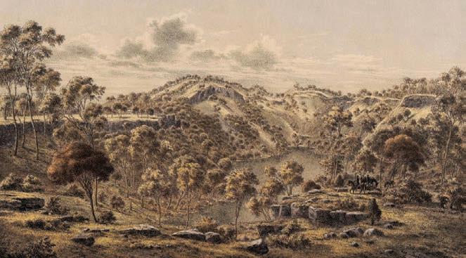
The formation of the Henbury Meteorite Craters
Cultural knowledge: The Luritja People have stories about a fiery devil man who came down from the sun, causing explosions and leaving holes in the ground. This is believed to describe a meteorite impact.
Scientific evidence: The Henbury Meteorite Craters in the Northern Territory were formed approximately 4700 years ago due to a meteorite breaking apart and striking the Earth – events consistent with the oral traditions.

These examples show how Aboriginal and Torres Strait Islander Peoples have maintained accurate records of significant natural events through oral traditions. This connects Deep Time to the present, as their understandings of the natural world have been passed down for thousands of years. Western science has begun to confirm the validity of these accounts.
2.2 Review questions
1 Explain why it is incorrect to use the terms ‘ancient history’ or ‘pre-history’ to describe Aboriginal and Torres Strait Islander histories.
2 In your own words, define what ‘the Deep Time history of Australia’ means.
3 Define ‘oral history’.
4 Explain the significance of Aboriginal and Torres Strait Islander oral history stories being confirmed by science.
We’ve looked at Deep Time and different ways of understanding history. In this lesson, we will look at the concept of Country for Aboriginal and Torres Strait Islander Peoples. We will also examine respectful protocols around Country.
Lesson starter
Complete the following activity to kick-start this lesson.
Brainstorming: knowing place
1 Identify the First Nations Country your school is located on.
2 Is there any evidence of connections to this Country at your school (e.g. language, artworks or Aboriginal and Torres Strait Islander people regularly visiting the school)?
3 Brainstorm and suggest ways your school could increase its recognition of the Country it is on.
Source 2.3.1 Ngarrindjeri People caring for Country. [Photo: © Department for Environment and Water] ➜


As we saw in Lesson 2.1, ‘Country’ is a very important concept for Aboriginal and Torres Strait Islander Peoples. Country is more than a boundary that sets out the land that someone owns. Country is a living thing, created by the ancestors, and interacted with, known and loved as its own entity. It is given a capital letter, just like a person’s name. Country interdependence means that people and Country have found a way to be together that benefits both. Country is also a vibrant web of spiritual relationships. This makes it a cultural landscape: a place that people belong to, not land that belongs to people.
People have an important role in caring for Country. People need to
know all the plants, animals, seasons, weather patterns, waterways, canopy, sky country and sea country and how these fit together, and take actions that make sure all these aspects of Country are healthy and thriving. Part of the important role of people is managing who is on Country and who is using which resources to ensure nothing is exploited or damaged.
Aboriginal and Torres Strait Islander Peoples are connected to Country in kinship. This means Country is like family and you treat Country like it is a person. Connections to Country are so important that they give someone their identity. Country is a living being, much like you, the people reading this book.
Source 2.3.2 What are totems? Use the link to access the video: https://cambridge.edu.au/redirect/11351.
Concepts and skills builder 2.3
Significance: Connections to Country
Read the following diverse range of sources about Country from across Australia, then answer the questions that follow.
The land is the mother, and we are of the land; we do not own the land; rather the land owns us. The land is our food, our culture, our spirit and our identity.
Source 2.3.3 Gai-mariagal and Wiradjuri man Dennis Foley explains his perspective on the relationship to Country. Foley is an academic and university lecturer specialising in business.
cultural landscape an area shaped by the practices, beliefs and cultural traditions of Aboriginal and Torres Strait Islander Peoples, reflecting their spiritual and historical connection kinship a social system that establishes a person’s relationships and responsibilities to other people and entities
People talk about Country in the same way that they would talk about a person: they speak to Country, sing to Country, visit Country, worry about Country, feel sorry for Country, and long for Country. People say that Country knows, hears, smells, takes notice, takes care, is sorry or happy … [C]ountry is a living entity with a yesterday, today and tomorrow, with a consciousness, and a will toward life.
Source 2.3.4 Non-Indigenous anthropologist Deborah Bird Rose describes how Aboriginal and Torres Strait Islander people that she has interacted with describe Country. ➜ anthropologist scientist engaged in the study of humankind from both past and present societies
The first lesson from my friends around the campfire is the way they look at the world around them. They see its riches. They look at the sky and understand its meanings. They look to the land and sea around them and see additional sources of food. They look at the people who make up their family and community and they see the blessings in what they do have … There is also interconnectedness to the natural world … the interconnectedness to Country is a source of a contented life.
Source 2.3.5 Eualeyai and Kamillaroi woman Larissa Behrendt explains her perspective on the Aboriginal and Torres Strait Islander connection to Country and community. Behrendt is an academic specialising in the law, a writer, a filmmaker and an Indigenous rights advocate.
To not know your Country causes a painful disconnection … It is this knowledge [of Country] that enables me to identify who I am, who my family is, who my ancestors were and what my stories are. We are indistinguishable from our Country.
Source 2.3.6 Arrente and Luritja woman Catherine Liddle explains her perspective on the importance of Country and community. Liddle is a journalist and media expert. How does this perspective connect to Nayuka and Georgia Mae’s stories you read in lesson 2.1?
We long for the land and the land longs for us … When there is no one there on the land it grows uncared for. Everything overgrows because you don’t look after it, you don’t burn it, you don’t hunt on it to make a balance. So things get overgrown, they get out of balance. For us, we balance as we care for Country and it cares for us. But we are not separate from it. We are in kinship with it.
Source 2.3.7 Gay’wu Group of Women explain their relationship with their Yolngu Country. ➜
The Nhunggabarra [a First People] … had to maintain and improve the habitats of all the plants that the animals fed from. They learned this by observing animal behaviours from a young age. Knowledge and rules of behaviour were also embedded in stories, dances and ceremonies. It was the people’s responsibility to keep this knowledge alive and in this way the animals were kept alive …
Source 2.3.8 Non-Indigenous author Karl-Erik Sveiby with Nhunggabarra man Tex Skuthorpe explain the connection between knowledge and purpose. How does this perspective show a deep passion for the natural environment?
1 Practise naming sources by following the models in Sources 2.3.3–2.3.8; for example, Arrente and Luritja woman Catherine Liddle. Prac tise your understanding by researching David Unaipon, who is featured on the $50 note. If you were quoting Unaipon as a source, how would you respectfully introduce him?
2 Suggest reasons why some Aboriginal and Torres Strait Islander people have connections to more than one Country.
3 Reflect on your relationship with land or Country
4 Using Sources 2.33–2.3.8, write a 100-word paragraph to explain how Aboriginal and Torres Strait Islander people connect to Country. Justify your explanation by discussing the diversity of Aboriginal and Torres Strait Islander Peoples’ understandings of connection to Country.
Continuity and change: Welcome to Country and Acknowledgement of Country
Welcome to Country ceremonies are ancient practices that continue into present-day Australian society. They are an example of a continuity in Australia’s past and present. They are usually conducted by an Aboriginal or Torres Strait Islander Elder, often performed at sporting and community events, as well as at work and social gatherings. An Acknowledgement of Country, which happens before important events or meetings, can be done by any respectful person. It is not an ancient practice in the traditional sense, but is deeply inspired by the longstanding customs and cultural values of Aboriginal and Torres Strait Islander Peoples.

Watch the video and answer the questions that follow.
1 According to the video at the following link – https://cambridge.edu.au/redirect/11352 – what was the historical purpose of a Welcome to Country?
2 Describe some features of a Welcome to Country ceremony or Acknowledgement of Country that you have seen.
3 Compare the Welcome to Country and Acknowledgement of Country practices. Include a consideration of who can conduct each ceremony.
Historical concepts and skills: using historical sources, historical significance, continuity and change
Aboriginal and Torres Strait Islander peoples consider that they have always been in Place, since their ancestors created living landscapes. Aboriginal and Torres Strait Islander peoples know where their connections to Country are. Source 2.3.10 shows different language groups across the continent.
Welcome to Country where a custodian introduces a person to and grants permission to go onto Country Acknowledgement of Country/ Traditional Owners a formal statement or gesture of respect for the Traditional Owners of the land and their spiritual and cultural connection to it
Country/Place spaces mapped out that individuals or groups of First Nations Peoples of Australia occupy and regard as their own and having varying degrees of spirituality. They include lands, waters and sky


Source 2.3.10 A map of Indigenous Australia. This map attempts to represent the language, social or nation groups of Indigenous Australia. It shows only the general locations of larger groupings of people, which may include clans, dialects or individual languages in a group. It used published resources from the eighteenth century to 1994 and is not intended to be exact, nor the boundaries fixed. It is not suitable for native title or other land claims. David R Horton (creator), © AIATSIS, 1996. No reproduction without permission. To purchase a print version visit: https://shop.aiatsis.gov.au. The sourceline for this map tells you where the person who created the map got their information from. Most information came from sources written by nonIndigenous people. Consider whose perspectives and information are being used to create this map. Whose perspectives and information might be missing?
Australian Rules Football developed from a game played by the Gunditjmara People (Western district of Victoria). At celebrations, they would play with a ball made from possum skin. Over time this developed into the modern game of AFL. (For more, see http://cambridge.edu.au/redirect/11142.)
2.3 Review questions
1 Describe the significance of Country to Aboriginal and Torres Strait Islander people.
2 Explain why Acknowledgment of Country and Welcome to Country ceremonies are described in the text as a ‘continuity’ with Australia’s past.
3 Discuss as a class why many schools, organisations and others consider Welcome to Country and Acknowledgement of Country ceremonies to be an essential part of the way they organise their events, and why these are important in present-day Australian society.
4 How does the AIATSIS Map of Indigenous Australia (Source 2.3.10) differ from a map that shows the states of Australia? Propose why the maps are different.


We’ve looked at the important concept of Country to Aboriginal and Torres Strait Islander Peoples. In this lesson, we will investigate how scientists understand how people first came to the Australian continent.
Complete the following activity to kick-start this lesson.
See, think, wonder
1 See: Examine the image (Source 2.4.1), the information in the caption and the video at the following link: https://cambridge.edu.au/redirect/11353.
2 Think: How were the tracks discovered and dated? How did First Nations knowledge and Western science come together to help us learn more about the past of the Australian continent? With a partner, share your ideas.
3 Wonder: Prepare to share your notes with the class. Discuss with your classmates what this image makes you wonder.

➜
Source 2.4.1 Fossilised human footprints discovered in the Willandra Lakes region, a World Heritage Site in New South Wales. These prints were made 19 000 to 23 000 years ago. This puts these people in the Willandra Lakes region during the last ice age or the Pleistocene era. The linked video provides additional information about the discovery of the Willandra Lakes footprints.
Pleistocene era (or epoch) a long period of geological time that includes the last glacial period, where temperatures were cooler and sea levels lower (1.6 million to 11 000 years bp) bp ‘before present’, a timescale used to define events from the past. Mainly used for events that are thousands of years old, these timelines are found though scientific methods like radiocarbon dating
radiocarbon dating a method to determine the age of organic materials, such as hair, bones or wood, by measuring how much carbon-14 is left luminescence dating a method to determine how long ago mineral grains were last exposed to sunlight or heat
How
In this lesson, we will learn about the Deep Time history of humans and the techniques scientists use to investigate this. This provides a scientific understanding for how Aboriginal and Torres Strait Islander Peoples arrived on the Australian continent. For many Aboriginal and Torres Strait Islander people today, the ancestors created this Place and its people, who have been here ‘since the beginning’. Respectful historians can recognise and work with both these perspectives on the origins of Aboriginal and Torres Strait Islander Peoples.
What is special about Madjedbebe rock shelter?
As we learnt about in Chapter 1, scientists have worked out that people first arrived on Sahul at least 65 000 years ago. By using archaeology, stratigraphy and scientific dating techniques, such as
radiocarbon dating and luminescence dating, scientists have found physical evidence of human activity on mainland Australia that is more than 65 000 years old. This evidence was found in northern Arnhem Land at the Madjedbebe rock shelter in Mirrarr Country, in the Northern Territory. The Madjedbebe site is a sandstone rock shelter – an overhanging rock wall that is painted with art knowledge. Working in partnership with the Traditional Custodians of the Mirrar Country, a team of archaeologists led by Professor Chris Clarkson from the University of Queensland has excavated the location. This site contains the oldest evidence of human occupation in Australia. It shows there were people living in this area of mainland Australia during the Pleistocene era. More than 10 000 artefacts were found, including wall paintings, charcoal from cooking fires, food remains, and artefacts such as stone axe heads, grinding stones and bone fragments.

We found evidence for the mixing of ochre with reflective powders made from ground mica to make a vibrant paint … We also found new forms of stone tools such as edge-ground hatchet heads (and even the grinding stones used to sharpen them). These were useful in cutting bark and wood, shaping wooden tools and extracting difficult-to-obtain foods from trees. The grinding stones from the site indicate a range of fruits, seeds, animals and other plants were ground up for food. These are the oldest known examples of seed-grinding stones found in Australia, if not the world. In ancient fireplaces from the site we also recovered pieces of burnt pandanus nuts, fruit seeds and yams, which give us clues to the earliest plant foods consumed at the site.
Source 2.4.3 Non-Indigenous archaeologist Chris Clarkson writing about the finds at the Madjedbebe site. Extract from Chris Clarkson et al., ‘Buried tools and pigments tell a new history of humans in Australia for 65,000 years’, The Conversation, 20 July 2017. Which objects might be the oldest-known of their kind in the world? What do you think they were used for?
Among the charred plant remains are fruit pips, nutshells, peelings and fibrous parts from tubers, and fragments of palm stem. These are the discarded leftovers of meals cooked and shared at the rock shelter tens of thousands of years ago … Several of these plant foods would have required processing. This included the peeling and cooking of roots, tubers and palm stems; the pounding of palm pith to separate its edible starch from less digestible fibres; and the laborious extraction of pandanus kernels from their hard drupes.
Source 2.4.4 Non-Indigenous archaeobotanist Anna Florin and others explain what can be understood from the archaeological finds. Extract from Anna Florin et al., ‘65,000-year-old plant remains show the earliest Australians spent plenty of time cooking’, The Conversation, 18 February 2020. What do you think an archaeobotanist does? ➜

Source 2.4.5 Axes and grinding stones found in the excavations ➜
Primary sources are objects that were created at the time of the event or person you are studying. Primary sources include artefacts (like an axe head) or documents (like a diary). Secondary sources are things that were created after the event that interpret the event and help us to understand it, such as a textbook or a documentary.
1 Fill in the following graphic organisers to clarify your understanding of primary and secondary sources.
primary source a source of information about the past that was created during the time being studied secondary source a source of information about the past that was created after the time being studied
2 Refer to Sources 2.4.2–2.4.5. Select one of the sources and write 2–3 lines that identify whether it is a primary or secondary source and justify your answer. Here are some questions to help you:
• Was it created at the time being studied (Deep Time history of Australia)? = Primary source
• Was it created after the time being studied (Deep Time history of Australia) to describe, interpret, or explain? = Secondary source
3 Using Sources 2.4.2–2.4.5, suggest what the evidence from this site reveals about the daily life of Aboriginal and Torres Strait Islander people. Justify your claims using evidence from both primary and secondary sources.
Historical concepts and skills: using historical sources, historical significance, continuity and change
Scientists use a range of techniques to work out how Aboriginal and Torres Strait Islander Peoples migrated across Sahul. By dating evidence at a range of sites, a picture emerges of when people were in certain locations. It is likely that people travelled along waterways and places that had more abundant food sources than across areas such as deserts. Scientists can find evidence of past climates and
ecosystems to figure out the pathways humans travelled.
The following is an important quote from scientists explaining human occupation of Australia, plus a map explaining their findings. We have colourcoded parts of the source and these match the coloured arrows on the map that follows to help you unpack these sources.
Following an initial migration 50 000 years ago [1 on the map, Source 2.4.8], populations spread rapidly around the east and west coasts of Australia … [2] The Gulf of Carpentaria was a massive freshwater lake at the time and most likely a very attractive place for the founding population. … [T]he first Aboriginal populations swept around the coasts of Australia in two parallel waves. [3] One went clockwise and the other [4] counterclockwise, before meeting somewhere in South Australia. [5] The occupation of the coasts was rapid, perhaps taking no longer than 2000 to 3000 years. But after that … populations quickly settled down into specific territory or Country, and have moved very little since … [These] people – once settled in a particular landscape – stayed connected within their realms for up to 50 000 years despite huge environmental and climate changes. We should remember that this is about ten times as long as all of the European history we’re commonly taught. This pattern is very unusual elsewhere in the world and underlines why there might be such remarkable Aboriginal cultural and spiritual connection to land and Country.
Source 2.4.6 Non-Indigenous scientists Alan Cooper, Ray Tobler and Wolfgang Haak from the University of Adelaide describe the Aboriginal migration into Australia that took place about 50 000 years ago. ‘DNA reveals Aboriginal people had a long and settled connection to Country’, The Conversation, 9 March 2017. What do the writers say we should remember, and what do they say is ‘remarkable’ about First Nations Peoples and their cultural practices?
Migration super-highways
Secondary routes
Archaeological
Highly
Ice
Source 2.4.7 This image shows the routes scientists think people took to migrate across the land mass of Sahul. List three things you see on the map. Describe the relationship between pathways and mountains.
Mapping migration pathways
The image gallery in the Interactive Textbook provides a range of archaeological evidence discovered across Australia, with dates and locations for human activity across the continent.
2.4 Review questions
1 Identify the location of the oldest dated site of physical evidence of human occupation in Australia.
2 Using Sources 2.4.7 and 2.4.8, discuss what archaeology can tell us about the lives and Deep Time history of Aboriginal and Torres Strait Islander Peoples.
3 Describe the migration patterns of the First Peoples.
4 Justify whether oral histories are primary or secondary sources, or discuss whether a new category is needed for historians of Australian Deep Time.
Source 2.4.8 Mapping migration pathways ➜
We’ve looked at the theories Western scientists have about the history of human occupation of Australia. In this lesson, we will look at how First Nations Peoples understand their origins.
Dreaming/ Knowledge knowledge connected to specific Country, Places or things, with deepening levels, connected to dance, song, art, ceremony and cultural practices, passed on through kinship
Complete the following activity to kick-start this lesson.
Aboriginal and Torres Strait Islander Peoples pass on knowledge through storytelling – spoken stories but also Dreaming stories shared through art, dance and song. Telling stories is a powerful way to remember details as well as to explain complex ideas. Each Aboriginal and Torres Strait Islander group has its own body of traditional knowledge and its own belief system, and this knowledge has been passed on for thousands of years. Each language group has its own word to name this traditional set of knowledge and beliefs. Often these names have been translated into English using the word ‘Dreaming’. A Dreaming about a particular place on Tagalaka Country is very generously shared with the permission of Tagalaka knowledge holders.
Tagalaka a First Nations group from the Gulf Savannah region of north Queensland Ngaarba Dreaming
Near the bottom of these hills is an important waterhole that always has water. All the animals know they can always come for a drink here. There are emus, nuukan and brrook (wallabies), waangu and kaani (goannas), zalk (bustards), possums, yarngarddith (turtles), snakes, birds and ngaarba (brolgas). It’s a big waterhole and there is enough for everyone. The ngaarba are starting to get worried because they know there is a lot of waal (water) – a flood is coming. They warn everyone, watch out, there’s a flood coming! Everyone starts to panic because they realise the ground is flat and there is nowhere to go to escape the water. The ngaarba start building big mounds, like their nests, that rise up out of the ground – the hills you can see. This provides high ground for all the animals to go to when the floods come. This is why this is the Ngaarba Dreaming place; the ngaarba ancestors created this place, and people have travelled here from other Countries in the region to hold the Ngaarba ceremony.
Source 2.5.1 ‘Ngaarba (brolga) Dreaming’ Tagalaka knowledge story, included with the permission of Tagalaka knowledge holders ➜

1 Think: Look up the location of Tagalaka Country on the AIATSIS map (Source 2.3.10 or visit the AIATIS website at http://cambridge.edu.au/redirec t/11143). Why are we lucky to have access to such a Dreaming story?
2 Pair: Discuss: how important is this particular place on Country for Tagalaka People?
3 Share: Prepare to share your ideas with the class.
Many Aboriginal and Torres Strait Islander Peoples understand there was a creation time when the ancestors created Country and all living things, including people. This means people have been here ‘always’. Because the land and all living things are here, we are still living in the time of creation. People continue the world the ancestors created by looking after it physically and spiritually.
We have learnt about how scientists understand how Aboriginal and Torres Strait Islander Peoples arrived on the Australian continent. Some Aboriginal and Torres Strait Islander people do not consider scientific information to be essential in understanding where they came from, while others find it useful. In this lesson, we will investigate a range of views to explore the diversity of perspectives of Aboriginal and Torres Strait Islander Peoples.
diversity a range of different people, ideas or things
everywhen the eternal and interconnected nature of time in First Peoples’ understandings linear idea of time often understood as a narrative or story involving events in which one follows another one directly (past, present, future)
Songline the features and directions of travel that were included in a song that had to be sung and memorised for the traveller to know the route to their destination. Certain songlines were referred to as ‘Dreaming Pathways’ because of the tracks forged by Creator Spirits during the Dreaming. These special Songlines have specific ancestral stories attached to them. Elders knowledge holders respected by Aboriginal and Torres Strait Islander Peoples; often called Aunty or Uncle
How do Aboriginal and Torres Strait Islander Peoples understand time?
Everywhen is a term used by Aboriginal and Torres Strait Islander Peoples to explain their unique concept of time. Unlike the linear idea of time (past, present, future), everywhen includes the past, present and future all at once. It shows that cultural teachings and events are always relevant –now, then and tomorrow. Words like ‘Dreaming’, ‘Dreamtime’ and ‘Songlines’ have been used to describe these cultural understandings but are often misunderstood. These are not just myths or stories; they are cultural truths – real events that explain why things are the way they are, offering lessons that are as important as the land itself. Everywhen demonstrates that time is a continuous loop, connecting Aboriginal and Torres
Strait Islander Peoples to their Country, their ancestors and their future.
How do Aboriginal and Torres Strait Islander people pass on knowledge?
Stories from the ‘Dreaming’ are connected to specific Country, specific places, or specific things in a place. For example, we’ve now read the Tagalaka People’s Ngaarba (brolga) Dreaming that connects to a specific place on their Country. To be a custodian or traditional owner of a place is to also be a custodian of the knowledge of that place and be responsible for passing the traditional knowledge on to the right people. Knowledge custodians are often called Elders
Historians refer to the history-related content of these knowledge stories as ‘oral history’; however, the stories involve much more information.
He points to the sky and explains: ‘Aboriginal people, according to creation stories, that’s where we came from – up there as opposed to walking across the land bridge [from mainland Australia]’.
Source 2.5.3 pakana man Tony Brown explains his understanding of his people’s origins. Investigate why pakana is written with a lowercase first letter. Does this source help you understand Aboriginal and Torres Strait Islander Peoples’ understandings of time and their origins?
It’s an extraordinary thing. We don’t find this in other places around the world … Say I’m a man from central Australia, my father teaches me stories about my Country. My sister’s children, my nephews and nieces, are explicitly tasked with the kin-based responsibility for ensuring I know those stories properly. They take those responsibilities seriously. At any given point in time, my father is telling the stories to me and his grandkids are checking. Three generations are hearing the story at once … that’s a kind of scaffolding that can keep stories true. When you have three generations constantly in the know, and tasked with checking as a cultural responsibility, that creates the kind of mechanism that could explain why [the First Nations Peoples of Australia] seem to have done something that hasn’t been achieved elsewhere in the world: telling stories for 10 000 years.
➜
Source 2.5.4 Non-Indigenous historian Nicholas Reid describes how oral traditions could be accurately passed down in First Nations cultures across 300 generations in a way that does not exist in any other part of the world. How does this source help you to understand Aboriginal and Torres Strait Islander Peoples’ knowledge systems and techniques for sharing knowledge?

Source 2.5.5 This painting is called Yarrkalpa (Hunting Ground) and is by a group of artists called the Martumili Artists. These artists are from the Martu People and they live in central northern Western Australia. This painting tells part of the Dreaming story of the Seven Sisters, a creation and knowledge story that extends across the Western Desert. In this knowledge story, the sisters are pursued across the Country and the land, foods, animals and water are created. The creation and songline can be seen in the landscape and is ever-present. Is this painting another way of sharing knowledge? ➜
Using historical sources: Aboriginal and Torres Strait Islander Peoples’ origins and diverse perspectives
White fellas like theorising we come from somewhere else other than Australia to lessen our connection to Country. We are from here. Our knowledge of our history is embedded in our blood and our Country.
Source 2.5.6 Aunty Val Cooms, a Quandamooka Elder, explains her understanding of her origins. ➜
Aboriginal people have always known that we have been on our land since the start of our time, but it is important to have science show that to the rest of the world.
Source 2.5.7 Kaurna Elder Lewis O’Brien. Kaurna Country is in South Australia. ➜
… according to an Aboriginal sense of time, we have always been here. We came directly out of the Dreamtime of the creative ancestors and lived and cared for Country as it was on the very first day.
Source 2.5.8 Worimi man John Maynard, ‘Across “Koori Time” and Space’, in A McGrath, L Radmaker and Jakelin Troy (eds), Everywhen: Australia and the Language of Deep History (Sydney: New South Publishing: 2023), p. 221
Aboriginal people have, of course, been saying we have always been here.
Source 2.5.9 Bruce Pascoe, Dark Emu, Magabala Books, 2014, p. 41 ➜
1 Explain how these sources show the diversity of Aboriginal and Torres Strait Islander Peoples’ perspectives.
2 Suggest why you think there is not one unified perspective for all Aboriginal and Torres Strait Islander people.
3 Compare the ways the sources explain the origins of the First Peoples.
Historical concepts and skills: using historical sources, historical significance, continuity and change
2.5 Review questions
1 Outline your understanding of what ‘Dreaming’ might mean.
2 Define ‘everywhen’ in your own words.
3 Discuss how the sources in this lesson suggest the diversity of Aboriginal and Torres Strait Islander perspectives.
4 Explain the ways many Aboriginal and Torres Strait Islander Peoples believe they came to this continent.
Source 2.5.10 Tarra-Bulga National Park sits on Brataualung Country, and holds great significance to the Gunaikurnai People and their creation Dreaming. Research the Dreaming of Borun – what can this story tell you about the significance of this place to Gunaikurnai People both past and present?


We’ve looked at the way First Nations Peoples understand their origins on the Australian continent. In this lesson, we will look at the significant events in Australia’s Deep Time history.
Complete the following activity to kick-start this lesson.
Most people know something about ancient Australia. Use ‘think, puzzle, explore’ to sum up what you know so far.
1 Think about the things that you already know about ancient Australia, and list them.
2 What puzzles you about Australia’s Deep Time history, and what things would you like to make clear? List them.
3 What other things would you like to explore to learn more about ancient Australia? List them.
Source 2.6.1 Remains of Lake Mungo ➜


2.6 million to c.11 650 years ago
Pleistocene epoch (or era)
2 million years ago
c.160 000 years ago
c.115 000 – c.11 750 years ago
Last glacial period (ice age)
Hominids migrate out of Africa
First anatomically modern humans appear (in Africa)
c.80 000 years agoAnatomically modern humans migrate out of Africa to Europe and Asia
c.74 000
c.65 000 – c.51 000
c.50 000 (at least, possibly c.65 000)
c.45 000
c.44 000
c.43 000
c.42 000
c.40 000
c.40 000
c.35 000
c.30 000
c.30 000
c.40 000–30 000
c.22 000
c.21 000
c.12 000–9000
Mt Toba volcanic eruption, Indonesia: the planet is sent into a severe ice age that nearly caused the extinction of modern humans
Migrations from Sunda to Sahul (Australian continent): world’s first modern human sea crossing
Madjedbebe, NT: world’s first grinding stones and edge ground axes
Puritjarra, central Australia: settlement of desert regions
Parmerpar Meethenar, TAS: people first occupy glacial Tasmania
Winjana Gorge, WA: world’s oldest hafted (a tool with a handle) stone axe
Lake Mungo, NSW: world’s oldest human remains and oldest cremation
Jansz and Mandu Mandu, Pilbara coast, WA: oldest evidence of marine subsistence in Australia
Murujuga & Carpenter’s Gap, WA: oldest evidence of art (petroglyphs and ochre) and world’s largest rock art gallery
Murujuga, WA: possibly world’s oldest depiction of a human face
Cooler, sea levels drop, ex treme drought in some places: Last Glacial Maximum (peak ice age) begins
Mandu Mandu, WA: among oldest shell beads in the world
Cuddie Springs, NSW: co-existence with megafauna
Willandra Lakes, NSW: footprints of people
Occupation of the emerging coasts
Climate improving, sea levels rise, coasts flooded, climatic variability; mainland Australia separated from New Guinea and Tasmania
era (or epoch) a period of geological time
Holocene the period of time beginning around 11 000 years ago at the end of the last glacial period, when global temperatures began to warm and sea levels rose, and continuing to the present subsistence the state of existing by having just enough resources like food and water to stay alive megafauna large animals over 40 kg, such as the elephant, rhinoceros and extinct diprotodon
c.11 650 years ago to 1945 CE Holocene epoch (or era)
c.10 000
c.9000
c.9000
c.6600
c.5000
c.4000
c.3000
c.2000
Swamp in south-eastern Australia: oldest surviving boomerang
Small blades, spear throwers, composite spears: more diverse and innovative tools appear
Rosemary Island, WA: stone shelters constructed
Budj Bim, VIC: fish traps – some of the world’s oldest aquaculture
New migration of people from South-East Asia: dingo arrives on the Australian continent
‘X-ray’ art of Arnhem Land: drawings of the physical structure of people and animals
Intense use of coastal resources, sea levels peak, climate drier: people become more territorial
Complex social and religious systems develop: increasing settlement and site numbers
c.300 CE Indonesians visit north coast to fish and trade
1500s–1700s CE Portuguese, Dutch, Makassan and British explore the Australian coastline
Source: Adapted from History Teachers’ Association of New South Wales, Ancient Australia: An Introductory Guide for Teachers and Students [© HTANSW, 2024 pp. 9–10]
aquaculture the raising of water animals such as fish for food Makassan people from the region of Sulawesi in Indonesia
2.6 Review questions
1 Outline the main changes to the Australian continent since the Pleistocene. In your response, try to include key terms such as Sahul, ice age and climate.
2 Look at the timeline to work out how old Aboriginal and Torres Strait Islander societies are. Do some quick research online to compare this age to the ancient societies of Egypt, China and Greece.
3 Examine Table 2.6.1. List the ‘world’s first’ and ‘world’s oldest’ items. What impression does this give you of the importance of ancient Australia as a part of global history?
Learning intention
We’ve looked at the broad events in Australia’s Deep Time history. In this lesson, we will look at how Aboriginal and Torres Strait Islander Peoples have responded to changes to the environment since Deep Time.
Lesson starter
Complete the following activity to kick-start this lesson.
Pleistocene to Holocene eras
Source 2.7.1 Pleistocene to Holocene timeline, showing climate changes. Adapted from History Teachers’ Association of New South Wales, Ancient Australia: An Introductory Guide for Teachers and Students [© HTANSW, 2024, p. 7]
1 Consider Source 2.7.1. What were the main differences between the Pleistocene and the Holocene eras?
2 How would these differences have affec ted the experiences and ways of life of Aboriginal and Torres Strait Islander Peoples in Deep Time history?
When people first came to Sahul and migrated around the continent, the world was in an ice age, which was cooler and drier than today. Climate changes over the next 60 000 years changed patterns of occupation and food sources, and at times forced people to move to more sheltered areas; however, Aboriginal and Torres Strait Islander Peoples maintained systems of connection to the entire continent that remain today.
How have Aboriginal and Torres Strait Islander Peoples responded to loss of land during Deep Time?
It is important to acknowledge that since 1788, Aboriginal and Torres Strait Islander Peoples have faced massacres, displacement, dispossession and cultural damage and loss. However, the focus of this lesson is about the Deep Time history of Australia and the loss of land due to changes in climate.
The most dramatic landscape change that Aboriginal and Torres Strait Islander Peoples have lived through was the end of the Ice Age about 11 700 years ago. This marks the beginning of the era scientists call the Holocene era. Sea levels rose and ‘drowned’ one-quarter of the Sahul land mass. Sahul separated into several land masses that today we call the mainland Australian continent, Tasmania, the Torres Strait Islands and Papua New Guinea. Rising sea levels made the gaps between lands larger, and some groups of people were cut off from other groups entirely.
and Torres Strait Islander Peoples living near the sea may have experienced significant loss of land. Some groups had to move further inland when the seas rose. Others found that their ancestral Country located on peaks of higher ground had, over generations, become transformed into islands.
For thousands of years a land bridge, known as the Bassian Plain, connected mainland Australia to Tasmania, and Aboriginal people could travel back and forth between Victoria and Tasmania. Once sea levels rose, the Aboriginal people of Tasmania remained isolated for around 8000 years, from the end of the Ice Age until European colonisation after 1788.
climate the general weather conditions usually found in a specific place displacement the forced removal of people from their ancestral lands, often resulting in loss of culture, connection and livelihood dispossession the taking of lands and resources without consent inundation a flood
The inundation that took place after the Ice Age wasn’t a sudden flood. Sea levels rose only 1–2.5 centimetres each year.
However, in low-lying coastal areas, this small increase was enough to submerge areas of land hundreds of metres wide in just one year. In a single lifetime, Aboriginal
Some ancient Aboriginal Dreamings that still exist today hold knowledge passed down through generations about events from a long time ago. As we saw in lesson 2.2, these events are now also supported by scientific evidence. For example, there are 21 different Dreamings from places along Australia’s coast that talk about a time when the sea levels were much lower than they are now. They describe how the seas started to rise, changing the land and forcing people to find new ways of living.
Unfortunately, racism has led to many Australians not respecting important parts of Aboriginal and Torres Strait Islander cultures. Things like Lore, spirituality, family connections, totems and Dreaming stories are sometimes treated as if they’re make-believe. But these are very important parts of the many different Aboriginal and Torres Strait Islander cultures across Australia. They should be respected as real and meaningful parts of these cultures. They’re not the same as myths, fairy tales or made-up stories. We should talk about them with care and understanding, because they are deeply important truths for the many Aboriginal communities they belong to.
forager a person or animal that goes from place to place in search of things that they can eat or use linguistic related to language or the study of language
Scientists say that sea levels reached their current height about 7000 years ago, so these stories must have been told long before that.
Researchers Patrick Nunn and Nicholas Reid summarised the following knowledge stories that were shared with them in 2016 (Sources 2.7.2 and 2.7.3).
The principal story concerns two Aboriginal peoples, the Noonuccal of North Stradbroke and the Nughies of Moreton. One version states that a bailer shell [a type of sea snail] kept by the Noonuccal contained power over the winds and was coveted by the Nughies. When the keeper of the bailer discovered this, he summoned the winds and commanded them to blow so hard that the connection between the islands would be severed, something that caused the Nughies to become stranded thereafter on Moreton Island.
Source 2.7.2 A knowledge story about the rising sea levels in the area that separated Moreton and North Stradbroke Islands near Brisbane, Queensland
According to Gungganyji informants … the barrier reef was the original coast here at a time when a man called Gunya was living here. [After he] consumed a customarily forbidden fish, the [ancestors] caused the sea to rise in order to drown him and his family. He evaded this fate by fleeing to the hills but the sea … never returned to its original limits.
Source 2.7.3 A knowledge story about the rising sea levels near Cairns in Queensland ➜
In the Whitsunday Islands … the distance became too great, with the mainland over 30 kilometres away … the people were left to cope on their own [and] they did so by becoming specialised marine foragers They developed their own artistic traditions and a distinct social and linguistic identity. They invented new tools to suit their particular subsistence needs: fishhooks from shellfish and turtle shell, spear points from bone and wood, as well as nets and shell-scraping tools.
Source 2.7.4 A non-Indigenous archaeologist, Scott Cane, explains the impact of rising sea levels on the Ngaro Country in Queensland’s Whitsunday Islands. The Ngaro were skilled seafarers who navigated their three-piece canoes over large distances to trade, fish and hunt small whales. What made the Ngaro People change their way of life?
Traditional knowledge passed down by the Boonwurrung Elder Benbow, and by countless generations before him, told of the time when Port Phillip Bay – Nerm – was land rather than water, and formed a vast hunting ground where kangaroos abounded, and when the Yarra River emptied into the ocean at Port Phillip Heads. There are different stories about the flooding of Nerm, and what triggered this dramatic and dangerous phenomena [sic]; some stories suggest it was because the ancestor spirits were angry and sought vengeance, and the flood came as a punishment. In Boonwurrung tradition it was a time of chaos and upheaval.
Source 2.7.5 A Victorian government website explains the impact of rising sea levels in the area now known as Fishermans Bend for the Boonwurrung and Woiwurrung Peoples of the Kulin nation. What made the Boonwurrung and Woiwurrung Peoples change their way of life?
Goulburn Islands
Cape Don (Cobourg Peninsula)
Bathurst and Melville Islands
Shoreline during Last Glacial Maximum
Darwin
Brue Reef
Elcho Island Gulf of Carpentaria and the Wellesley Islands Torres Strait
Arnhem Land
Kimberley
WESTERN AUSTRALIA
Cape Chatham Rottnest, Carnac and Garden Islands
Oyster Harbour
Perth
Eucla Bremer Bay
Spencer Gulf Fowler Bay
NORTHERN AUSTRALIA
SOUTH AUSTRALIA
MacDonnell Bay Kangaroo Island
Key
Australia’s land mass today
Land exposed by lower sea levels during the ice ages
Cairns – Great Barrier Reef
Hinchinbrook and Palm Islands
QUEENSLAND NEW SOUTH WALES
Adelaide
VICTORIA
Melbourne
Bass Strait Cape York
Port Phillip Bay (Melbourne)
Brisbane
Sydney
Canberra
Gippsland
TASMANIA
Moreton and North Stradbroke Islands
Botany Bay and Georges Rivers
0 1000 km
Source 2.7.6 A map – developed by non-Indigenous researchers Patrick Nunn (from the University of the Sunshine Coast) and Nicholas Reid (from the University of New England) – showing 21 locations where recorded Aboriginal and Torres Strait Islander Peoples’ knowledge stories tell of rising sea levels.
Significance and continuity and change: Rising sea levels during Deep Time
Use Sources 2.7.2–2.7.6 to answer the following questions.
1 Explain the features of the map.
2 Interpret the map and write what it conveys in your own words.
3 Empathy is the ability to share someone else’s feelings or experiences by imagining what it would be like to be in that person’s situation. Developing a sense of empathy for people in the past is one of the great skills you will learn in the History subject. Brainstorm the impacts that rising sea levels may have had on Aboriginal and Torres Strait Islander Peoples.
4 Using Source 2.7.4, suggest how Aboriginal and Torres Strait Islander Peoples responded to rising sea levels with innovations.
Historical concepts and skills: using historical sources, historical significance, continuity and change
empathy the ability to be aware of, understand and experience the feelings of another person
How have Aboriginal and Torres Strait Islander Peoples responded to changes to vegetation?
People arrived on Sahul more than 65 000 years ago; however, the Ice Age reached its coldest point about 20 000 years ago. As the climate changed, across Sahul many forests disappeared, waterways dried and some areas transformed into
deserts. Researchers have discovered that when the climate significantly cooled, the populations of Aboriginal and Torres Strait Islander Peoples sought sanctuary in well-watered areas and population numbers decreased.
darker shading shows the well-watered areas where Aboriginal and Torres Strait Islander Peoples congregated during the last ice age. Adapted from work by archaeologist Peter Veth
These climate changes occurred over many thousands of years. Archaeologists have discovered numerous sites across Australia that show evidence of changes in how Aboriginal and Torres Strait Islander Peoples lived in response to these changes, from changes in food collection to expressions of cultural thought. Allen’s Cave, located in the Nullabor in the west of South Australia, was first occupied about 40 000 bp, but was abandoned between 17 500 and 15 000 years ago. This appears to coincide with a period of lower rainfall and when sea levels fell. The new coastline was about 160 kilometres further to the south. The people who lived in the area probably moved to live on the new plain closer to the coastline. At the beginning of the Holocene, sea levels rose again, and we can see that the cave was used more regularly again.
2.7 Review questions
1 Discuss some of the ways that changes to the climate affected the lives of Aboriginal and Torres Strait Islander Peoples in Deep Time.
2 Explain the significance of Dreaming stories about sea level rises.
3 Describe the significance of Allen’s Cave in South Australia.
4 Examine Source 2.7.7.
a Compare the refuges with where most people live on the continent today. Identify similarities and differences.
b Propose environmental reasons for any differences or similarities.
In this lesson we will continue to look at how Aboriginal and Torres Strait Islander people have responded to changes to the environment since Deep Time.
Complete the following activity to kick-start this lesson.
See, think, wonder
1 See: What can you spot in the images in Source 2.8.1? Which animals look familiar to you?
2 Think: What happened to these animals?
3 Wonder: How did Aboriginal and Torres Strait Islander people interact with megafauna?


Source 2.8.1 Illustration of some of Australia’s megafauna. For at least 20 000 years, Aboriginal and Torres Strait Islander people lived alongside these now-extinct large animals.
fossil evidence information gathered from the shape of a bone, a shell, or a plant or animal that has been preserved in rock for a very long period
Many Aboriginal and Torres Strait Islander Peoples’ stories tell of a time of giant animals. The well-known story of the Rainbow Serpent is just one of these stories, and the story of the creation of Gariwerd (the Grampians) is another. Physical evidence of megafauna and representations of these creatures in Aboriginal and Torres Strait Islander Peoples’ art have been found in many archaeological sites, including at Madjedbebe.
Amazing but true…
Fossil evidence has placed the Thylacine (Tasmanian Tiger) on the Australian mainland, proving Tasmania was once connected to the mainland during the Pleistocene era, when sea levels were lower. Thylacine bones have been found in Victoria and even in Lake Mungo, NSW, alongside other megafauna.
Australia’s extinct megafauna included animals such as:
• Macropus – the world’s biggest kangaroo (seen in Source 2.8.1)
• Protemnodon – a giant forest wallaby (seen in Source 2.8.1)
• Thylacine – sometimes called the ‘Tasmanian Tiger’, a carnivorous wolflike animal
• Zygomaturus – a giant marsupial believed to be like a modern hippopotamus
• Diprotodon – a marsupial that is a distant relative of wombats and koalas
• Megalania – a giant goanna that may have fed on the Diprotodon (seen in Source 2.8.1)
• Quinkana – a land-dwelling crocodile (seen in Source 2.8.1)
• Phascolonus – a giant wombat weighing 100–250 kg.

phascolonus. These giant wombats lived all around Australia 4 million – 40 000 years ago.


The following story from First Nations woman Jacinta Koolmatrie could be considered evidence of megafauna being mentioned in oral histories for tens of thousands of years.
Since the beginning of time my ancestors have been telling stories … as a young Adnyamathanha kid I was told the story about the Yamuti. The Yamuti was a very large and scary animal that specifically looked to steal little kids. This story was not told in a way that placed it in the past; Yamuti existed in real time. We were always told that if we ever saw the Yamuti we had to run to the nearest tree and climb high, because the Yamuti had one flaw, the Yamuti could not look up … one of the striking descriptions of the Yamuti was that he is very big. Bigger than us kids especially.
Thousands of years ago megafauna were abundant on this land. One animal in particular was the Diprotodon, the largest marsupial to have existed. The Diprotodon was incredibly large and thought to have been a browser, eating plants like shrubs. However, it’s mostly believed to have been a harmless animal.
Thinking more about the Diprotodon’s physical description, it is oddly similar to that of the Yamuti. Interestingly, I was even told that our understanding that a Yamuti could not look up, did show some potential of being present on a Diprotodon’s skeleton … If the Yamuti and the Diprotodon are the same animal, this shows an incredible depth of knowledge that has flowed through thousands of Adnyamathanha generations [more than 40 000 bp].
Whether or not you believe the Diprotodon is the Yamuti, our stories are derived from the truth. Something happened over 40 000 years ago that made my ancestors tell a stor y to protect their children.
Source 2.8.4 Jacinta Koolmatrie, an Adnyamathanha and Ngarrindjeri person, shares a story of a Yamuti. What do you think Koolmatrie’s knowledge could tell historians about Deep Time history?
How have Western scientists understood what happened to Australia’s megafauna?
Significance and continuity and change: Megafauna
The extinction of Australia’s megafauna remains, to this day, the subject of scientific debate. The following sources provide a selection of some hypotheses that have been presented to explain the extinction of megafauna in Australia.
hypothesis a theory based on facts
➜
We record high levels of the dung fungus Sporormiella, a proxy for herbivore biomass, from 150 000 to 45 000 years ago, then a marked decline indicating megafaunal population collapse, from 45 000 to 43 100 years ago, placing the extinctions within 4000 years of human dispersal across Australia... [our results] rule out extreme aridity and habitat change as causal mechanisms, leaving human agency, specifically imperceptible overkill as the most probable extinction cause.
Source 2.8.5 Extract from van der Kaars, S, Miller, G, Turney, C et al., ‘Humans rather than climate the primary cause of Pleistocene megafaunal extinction in Australia’. Nat Commun 8, 14142 (2017). https://doi.org/10.1038/ncomms14142
Climate change, not early humans, was likely responsible for the extinction of Australia’s megafauna, according to groundbreaking research that has rewritten the ancient history of our continent.
Source 2.8.6 Extract from Stuart Layt, ‘Groundbreaking research rewrites Australia’s ancient history’, Brisbane Times, 18 May 2020
chain of dunes bordering a lake bed or valley in arid or semi-arid locations
It is generally thought from the archaeological record that people first arrived in Australia about 50 000 years ago, perhaps as long as 60 000 years back. Many of the megafauna were slow-moving and perhaps easily hunted, but they would also have been vulnerable to changes in their environment. However, there is little evidence to show that early Australian people hunted the big animals.
The earliest signs of people at Willandra Lakes are more than 50 000 years old, and preserved in their campsites are the remains of what they ate. None of the Willandra megafauna have been found in campsites. In the ancient Willandra menu, meat meant mainly shellfish, yabbies, fish and a vast array of small mammals, including hare wallabies, bettongs, bandicoots, bilbies and native rats. These species could be caught in either the lake or in lunette burrows. Larger kangaroos are less common in the remains, but perhaps these were caught and eaten away from the lakes. Maybe megafauna too were hunted and eaten on the plains?
Source 2.8.7 Extract from the Visit Mungo website, visitmungo.com.au
1 Using Sources 2.8.5–2.8.7, identify the hypotheses presented by each author regarding the extinction of Australia’s megafauna. Copy and complete the table below to do this. We’ve filled in the first source for you. How did megafauna die out according to the sources?
Human actions (over hunting)Climate changes Unknown
Source 2.8.5
2 With a partner, discuss which hypothesis you think is most convincing regarding Australia’s megafauna extinction. Justify your choice with evidence.
3 Explain whose voices are missing from these hypotheses.
4 Discuss what kind of new evidence would contribute to this exploration. How could scientists and historians find new evidence?
Historical concepts and skills: using historical sources, historical significance, continuity and change
2.8 Review questions
1 Define ‘megafauna’ in your own words.
2 Refer back to Source 2.8.1.
a Pick one megafauna animal and describe how they differ from the equivalent animal today.
b Identify what kinds of scientific evidence would have been used to make the artwork of this megafauna.
3 Compare Jacinta Koolmatrie’s description of the Yamuti with Diprotodon (Source 2.8.4).
4 Categorise each source in this lesson as a primary or secondary source and justify each choice.
We’ve looked at how Aboriginal and Torres Strait Islander Peoples responded to changes to the environment since Deep Time. In this lesson, we will look at some of the practices that First Nations Peoples have developed to manage the environment since Deep Time.
Lesson starter
Complete the following activity to kick-start this lesson.
See, think, wonder
1 See: What does the map in Source 2.9.1 show us?
2 Think: What does this show about how much of the continent Aboriginal and Torres Strait Islander people were able to use for grain cultivation?
3 Wonder: Why has modern agriculture not been possible in central Australia? Can you think of reasons why this is the case? What might this suggest about Aboriginal and Torres Strait Islander knowledge of Country?


Ancient First Peoples’ grain belt
Contemporary grain belt


Where the ancient First Peoples and contemporary grain belts overlap Region along the Darling River where European explorer Hamilton Hume noted, in the 1820s, that First Nations Peoples gathered grain from wild oats and made an edible paste by grinding it


Source 2.9.1 This diagram shows the traditional Aboriginal grain belt compared to the modern Australian grain belt.
cultivation the act of preparing land and growing crops on it
yam a type of root vegetable grains small, hard, dry seeds from grasslike plants; used as a staple food source, often ground into flour for making bread regenerative food cultivation a method of farming that creates biodiverse, sustainable and resilient food systems exploitation the use of something to get an advantage from it
What are Aboriginal and Torres Strait Islander Peoples’ regenerative food techniques?
Aboriginal and Torres Strait Islander people on Country today continue to actively manage the land in sophisticated ways. They use unique food cultivation systems developed by their ancestors shared through the generations, as well as incorporating new techniques. These systematic ways of using the Australian landscape have also been recorded by non-Indigenous people since the earliest times of European contact.
Historian Bruce Pascoe used the original journals of the first European settlers in Australia to examine how different Aboriginal and Torres Strait Islander people farmed. The historic journals that Pascoe quotes from reveal glimpses of what Australia might have been like before the Europeans came, and perhaps what ancient Aboriginal and Torres Strait Islander Peoples’ societies
were like. For example, yam cultivation was widespread in areas with more rainfall, and different varieties were grown with differing techniques according to location. A European colonist commented there were ‘millions of murnong’ (yams) being grown and harvested by Aboriginal people in south-east Australia. Other Europeans commented on the growing of grain crops such as millet in the more arid areas. Source 2.9.1 shows us how widespread the growth of grain crops were. Grain seeds were then ground using grindstones into flour for making bread.
Aboriginal and Torres Strait Islander Peoples’ food cultivation works with plants and animals to develop regenerative practices that avoid exploitation. The Victorian government’s Old Treasury Building website summarises the use of the land by Aboriginal and Torres Strait Islander people compared with British and European people who brought their farming practices to Australia after 1788.

Compared to those who came later, First Nations people trod lightly on the land. While changing and shaping their environment, survival depended on preserving plants and animals in the long-term, safeguarding the food supply for the future. Low population densities and sustainable food practices enabled them to live within the resources of the land.
This balance was upset soon after European pastoralists arrived. They laid claim to the rivers immediately, then spread inland at an astonishing rate. By the late 1840s there were more than 15 000 European settlers and six million sheep, already dispersed over millions of acres of grassland. By 1861 there were 123 000 people, and pastoralists held over 41 million acres in pastoral leases. Another 70,000 acres were planted with wheat. It was a devastating invasion of a fragile landscape.
Source 2.9.3 ‘On the Land: Australia Felix’, Old Treasury Building website, accessed 2 December 2024. How does this source explain how Aboriginal and Torres Strait Islander people managed the land before British colonisation? How does this source explain how Aboriginal and Torres Strait Islander people managed the land after British colonisation?
Stone was another technique for managing natural resources. It was used to cut animal flesh, direct water, chop wood, skins and fibres, grind seeds, and make ritual items. Hard rock like greenstone or basalt was used for chopping; softer sandstone was used for grinding, and clays and ochres were used for pigments. Victoria had about a dozen large Aboriginal quarries.
living and travelling there were making stone hatchets and axes made from greenstone volcanic rock, under the leadership of Wurundjeri William Elders such as Billibellari. Pits and waste rock were left behind, giving solid evidence that it was a place where tools could be made ready to trade to other groups or used for themselves. Historian Isabel McBryde has mapped discoveries of these axe heads showing that they were traded by the Wurundjeri with other First Nations groups up to 300 kilometres from the quarry site. Clearly, Mt William was known in Aboriginal society for producing the best stone for axe-heads. McBryde called it ‘one of the world’s great archaeological quarry sites.’

Source 2.9.4 An example of a stone axe from the Mount William area. Lithograph (print) by T Prattent, 1789, State Library of Victoria
At Mount William, or called Wilim-ee Moor-ring by the local Wurundjeri people (which means ‘axe place’), near Lancefield in Victoria, there is evidence of a large ancient quarry site. The people
In Victoria there is a place called Tower Hill, just outside Warrnambool, sitting on Gunditjmara Country. Before 1788, this area, as you can see from Eugene von Guérard’s painting (Source 2.9.5 on the following page), was naturally diverse with trees, shrubs, water, animals and bird life. But this all changed when Europeans moved into the area. They pulled out the trees and shrubs and tilled the land. The newest settlers to the area were using rich volcanic earth for farming. The area was settled by Scottish and Irish people, some of whom were escaping the Irish Potato Famine
sustainable able to be restored and recycled, ensuring resources do not run out pastoralists farmers who specialise in sheep and cattle
till to prepare and use land for growing crops Irish Potato Famine a period of mass starvation and disease in Ireland lasting from 1845 to 1852
On Gunditjmara Country the soil was rich and moist, and perfect for growing crops. The area was also close to safe harbours, so it also became a bustling port ready to trade. It quickly became unrecognisable from the painting below, with land cleared for farming, logging and mining.
Tower Hill was later returned to the people though the Victorian parks service and it became a wildlife reserve in 1961. The Traditional Owners of the area worked
alongside the parks service, and they used Source 2.9.5 to help understand what the area would have looked like and to reestablish the natural environment. Around 1981, they planted over 25 000 trees, local herbs and grasses as part of this program. Over the years, they also took the time to remove any pest plants from the area so Tower Hill wildlife reserve will remain as close to natural as possible for years to come. Thus, they regenerated the area to remain a native space for all to enjoy.
Concepts and skills builder 2.9
Using historical sources: Tower Hill, near Warrnambool, Victoria Examine the following sources and then answer the questions that follow.


Source 2.9.5 Painting of Tower Hill by Eugene von Guérard 1855. This painting was used to revegetate Tower Hill after it had been destroyed due to agriculture, grazing herds and quarrying. ➜
Source 2.9.6 The restored natural beauty of Tower Hill today. ➜
1 Examine Source 2.9.5. What do you notice the painting? What can you see? What can you not see?
2 Examine Source 2.9.6. What do you notice in the photo? What can you see? What can you not see?
3 Using the link http://cambridge.edu.au/redirect/11144, investigate how Traditional Owners returned the land to reflect the painting. Why was it important to return the land to its natural likeness?
Historical concepts and skills: using historical sources, historical questions, historical significance, continuity and change
What techniques have Aboriginal and Torres Strait Islander Peoples developed to catch fish?
How do Aboriginal and Torres Strait Islander Peoples catch fish in rivers and creeks?
Fish traps and fish weirs are quite common throughout northern Australia. Fish traps and fish weirs were used to catch fish and to farm fish. The Burarra People of Arnhem Land, for example, farmed barramundi in fish traps and fish weirs. Fish traps were built in locations along sandy beaches, near mangrove forests, and near rivers and creeks. Each trap is traditionally cared for by the people with custodial connection to it.


fish traps methods for capturing fish in seas, rivers, creeks and streams, such as pools of shallow water against artificially built walls or fences or woven nets or baskets placed in weir and pond systems
fish weir a way of channelling fish into fish traps by using a fence or wall built into the water of a river, creek or stream; the fence allows the water to freely flow through it
Afencemadeofwoodenbranchesandothervegetation. The gaps between the branches are wide enough to allow water and small sh to move through the fence.


Wovennets,shapedliketubes,areplacedintogapsinthe fencetocapturelargershastheytrytoswimthroughthe barrier. Often nets had woven funnels inserted into their entrance and wider bellies to make it hard for larger sh to swim out of the net.

across creeks and narrow rivers. Water can continuously
were built from materials readily available in the landscape, including wood, logs, branches,

Source 2.9.8 This illustration shows an example of a fish weir and a fish trap typical of those used in northern Australia, in this case a barramundi fish trap used by the Burarra People of Arnhem Land. A fish trap is positioned behind a fish weir. A woven funnel is inserted into the mouth of a net. Aboriginal and Torres Strait Islander Peoples also used these traps to farm fish.
How have Aboriginal and Torres Strait Islander Peoples caught fish on the coast?
Coastal fi sh traps rely on making use of the changing tides to trap fi sh. Aboriginal and Torres Strait Islander Peoples have detailed and complex knowledge of tidal patterns and the seasons. This knowledge often relied on studying moon cycles and, in some areas, astronomy astronomy the scientific study of the universe and of objects that exist naturally in space, such as the moon, sun, planets and stars


Source 2.9.9 This diagram shows fish traps along a coastline. ➜


Water systems vary across the Australian continent, and Aboriginal and Torres Strait Islander Peoples managed their water supplies and resources in different ways depending on where they lived. Aboriginal and Torres Strait Islander communities across many regions of Australia built


systems of rock wells. Some wells collected rainwater. Other wells collected water from underground sources. Since animals also seek fresh water, these precious water reserves often needed to be carefully protected from animal pollution and contamination.
Source 2.9.10 [Left] An illustration of a rock well cover being opened to access fresh water. What would be the purpose of such a rock cover? [Right] A cross-section illustration showing the profile of Bull Gully Aboriginal Rock Wells, just outside Maryborough, Victoria. These wells were strategically dug into sandstone to form a natural rainwater catchment. The narrow mouths serve to reduce evaporation and pollution by animals or wind-borne debris (such as dirt). It is possible that the wells were, in the past, covered to further conserve water. The maximum depth of the wells is about 130 centimetres, for a capacity of approximately 160 litres, which represents a valuable water resource, particularly in dry seasons. Local residents indicated that they don’t have any knowledge of the wells ever drying up. How would these wells have helped to sustain life for thousands of years?

Source 2.9.11 Water tanks, known as ‘gnamma’ holes, are natural cavities varying in shape and depth commonly found in hard rock and used by First Nations Peoples. They are replenished from underground stores and rainwater run-off. These gnamma holes are on top of Pildappa Rock, a granite outcrop in Eyre Peninsula, South Australia.
2.9 Review questions
1 Identify some of the food cultivation practices Bruce Pascoe mentioned in Dark Emu.
2 Explain the purpose of a grindstone.
3 Compare a fish trap and a fish weir. Explain the difference and how they can work together.
4 Explain how rock wells were used by Aboriginal and Torres Strait Islander people to collect and manage water supplies.
5 Explain how these sources provide an insight into the way Aboriginal and Torres Strait Islander Peoples managed their environment in a sustainable manner.
gnamma holes naturally forming rock holes used by First Nations people to access fresh water
In this lesson we will continue to look at some of the practices that Aboriginal and Torres Strait Islander Peoples have developed to manage the environment since Deep Time.
Lesson starter
Complete the following activity to kick-start this lesson.
See, think, wonder
1 See: Describe what you see in Source 2.10.1. Look at the kind of vegetation, how green it is, the direction of the wind and the strength of the fire.
2 Think: Before starting a fire, the ground is felt for water.
• Suggest why you would do this, and what it would tell you.
• How would animals respond to this fire?
• Who could you ask to find out more information?
3 Wonder: What does this type of burning make you curious about?
Source 2.10.1 George Milpurrurru starts a fire to clean the bush in Arnhem Land, Northern Territory. Milpurrurru was raised on Ganalbingu (Yolngu) land, and was an acclaimed artist known for his bark paintings.


Fire has practical and spiritual applications for many Aboriginal and Torres Strait Islander Peoples today. The ancestors gave fire to people and showed them how to use it to keep Country clean and strong. The right fire does many things, such as keeping waterways clear where they need to be, encouraging the growth of the right seeds for an area, providing new grass for animals that depend on it, keeping competing undergrowth away from trees that need resources, protecting sacred parts of the landscape, allowing areas to grow without fire, and clearing selected areas. In this way, people are part of Country; Country cannot be strong without Aboriginal and Torres Strait Islander people.
Aboriginal and Torres Strait Islander Peoples pass on the knowledge stories and ceremonies about fire, and when they burn Country they are continuing the ancestors’ creation. Fire is used for cooking and warmth, and smoke has important spiritual, ceremonial and communication purposes. Fire has been used to crack rocks and to shape tools. Aboriginal and Torres Strait Islander people use fire in ceremonies such as a smoking ceremony. This involves smouldering particular plants on embers to produce a steamy smoke that is considered to have spiritually cleansing and healing properties. Many First Nations people have this knowledge passed on from previous generations, and researchers have found evidence of these practices through Deep Time. This knowledge and these practices continue today.
tens of thousands of years. It is still used today, although it is difficult in many areas for Aboriginal and Torres Strait Islander Peoples to access Country to do cultural burning. Doing the right fire involves knowing Country in detail. The right fire is generally small and contained. Not all Country is burnt with cultural burning. Deep gullies and rainforests, for example, are usually avoided, as are areas that contain bush foods and bush medicines. The tops of trees are also spared. This allows safe havens for birds, animals, insects, seeds and fruits. The best time to light a fire is carefully selected so it only burns what needs to be burnt. ‘Cool fires’ burn slowly, ‘trickling’ through the landscape, and can be easily put out. David Claudie, a custodian of the north Kaanju homelands of Cape York, describes the use of fire as ‘Indigenous science’. Non-Indigenous historian Bill Gammage has argued that fire-stick farming made resources ‘abundant, convenient and predictable’ for Aboriginal and Torres Strait Islander Peoples.
Cultural burning, sometimes called firestick farming, has been used by Aboriginal and Torres Strait Islander Peoples for
Fire is really important. It has its own dreaming. There are people and families who are responsible for the fire dreaming. They know the songs and the ceremony …
My grandfather used to talk with the other men about the best time and place to burn. They would wait for the right wind and pick the right grass.
They were careful not to burn Country belonging to other people.
smoking ceremony smoking by burning leaves; an important part of Aboriginal and Torres Strait Islander ceremonies that can also be performed as its own ceremony cultural burning (also known as cool burning) a traditional Aboriginal land management practice that has been used for over 60 000 years to reduce fire hazards, encourage new growth of culturally significant species, and protect native wildlife already living on Country


Cultural fire means everything. It means healing Country and when you heal Country, you heal people.
Source 2.10.3 Wurundjeri Elder Dave Wandin, ‘Cool burns: Key to Aboriginal fire management’, Creative Spirits website, accessed 8 December 2024 ➜ Canopy up to 17 m


The canopy is not burned during cultural burning. This gives shelter to animals while also preserving seeds and fruits. Caring for the canopy also provides shade and helps the landscape to recover.


In ‘hot fires’, the flames often reach high into the canopy of the trees and destroy the entire landscape. The soil is often baked, and all wildlife, fruits and seeds are often destroyed.


Non-Indigenous fire management practices often burn large areas of land at a higher height than cultural burning. These fires are also considered ‘hot fires’.


up to 5 m
Cultural burning, or ‘cool fires’, involves burning grasses, leaf litter and the lower bark of trees. The fire spreads slowly and is closely watched. Animals have time to flee. They are sometimes channelled and hunted as they flee.


Source 2.10.4 This diagram shows an example of Aboriginal and Torres Strait Islander Peoples’ cultural burning practices.

Source 2.10.5 This watercolour was painted by Joseph Lycett (c. 1817). It is titled, Aborigines using fire to hunt kangaroos. This painting was created about 30 years after the arrival of the First Fleet. Note: ‘Aboriginies’ is no longer considered to be an acceptable term but is used here in historical context.
Fire, grass, kangaroos, and human inhabitants, seem all dependent on each other for existence in Australia. For any one of these being wanting, the others could no longer continue. Fire is necessary to burn the grass, and form those open forests, in which we find large forest-kangaroo; the native [sic] applies that fire to the grass at certain seasons, in order that young green crop may subsequently spring up, and so attract and enable him to kill or take the kangaroo with nets. In summer, the burning of the long grass also discloses vermin, birds’ nests etc., on which the females and the children, who chiefly burn the grass, feed.
Source 2.10.6 This is an account, in 1848, by the Scottish explorer Thomas Mitchell, describing the fire management practices he observed being used by the First Nations people he encountered. Extract from T. Mitchell, Three Expeditions into the Interior of Eastern Australia; with Descriptions of Recently Explored Region of Australia Felix, and of the Present Colony of New South Wales, 1848, pp. 412–13
Concepts and skills builder 2.10
Using historical sources and analysing perspectives: Fire
Refer to Sources 2.10.2–2.10.6. Each of the sources was produced at a different time and contains different perspectives.
1 Categorise the painting in Source 2.10.5 as either a primar y source or a secondary source if you are investigating the practices of:
a Europeans recording the hunting prac tices of Aboriginal and Torres Strait Islander Peoples
b the hunting practices of Aboriginal and Torres Strait Islander Peoples in the early 1800s
c the hunting practices of Aboriginal and Torres Strait Islander Peoples in the Deep Time history of Australia.
Justify your answers.
2 Describe what each source tells you about the relationship between fire and Aboriginal and Torres Strait Islander Peoples.
3 Compare how each source understands the purpose of the burning prac tices and what this tells you about their perspective.
Historical concepts and skills: using historical sources, historical significance, continuity and change
seasonal indicators events, such as a tree flowering, that indicate other known events will happen constellation a group of stars that appears to form a recognisable pattern in the night sky
celestial a natural astronomical object existing outside Earth’s atmosphere
How do Aboriginal and Torres Strait Islander Peoples use seasons and patterns in the landscape and sky?
How do Aboriginal and Torres Strait Islander Peoples read seasonal indicators?
Careful custodianship of Country means being able to read the seasonal indicators; that is, identify, understand and respond to the expected changes in the environment. This knowledge was refined over tens of thousands of years and forms the living culture of Aboriginal and Torres Strait Islander people.
What happens in Sky Country?
Just as we are standing on Country, the world above is ‘Sky Country’ and it has its own seasonal relationships and indicators. For many Aboriginal and Torres Strait Islander people, Sky Country is where people came from or will go to; it is the home of many ancestors. Aboriginal and Torres Strait Islander people see constellations in the night sky, know the phases of the moon and movement of planets, and can use this information as indicators to monitor passing seasons,
to navigate, and to be connected to other people and knowledge. For some Torres Strait Islander people, a shark constellation, Baidam, was used to help navigate boats on long voyages, to predict the seasons for growing fruits and vegetables, and to indicate shark mating season – a dangerous time to be in the water! Europeans know this constellation as the ‘Pleiades cluster’.
In many parts of mainland Australia, the stars of the Pleiades were thought to be ancestor women travelling across the landscape. On the east coast of Australia, this constellation was used as an indicator of whale migrations. The Milky Way galaxy is known by most Aboriginal and Torres Strait Islander people and often represents a celestial river or stream.
Several Aboriginal and Torres Strait Islander communities, including the Kamilaroi and Euahlayi Peoples of New South Wales, watch an emu in the sky as an indicator of seasonal change and action.

This is not a constellation but a dark space in the night sky. When the emu first appears in the sky in mid-autumn, it marks the beginning of the emu breeding season. By mid-winter, the emu has changed direction and indicates the emus are sitting on their eggs. Eggs can be sustainably collected for food. By late winter, the emu appears as two circles in the night sky. This indicates that it’s time for sacred
bora a location where sacred rituals are held; there are different words in different languages ceremonies to begin at the Kamilaroi and Euahlayi circular-shaped bora grounds. Through spring, the emu sits at a waterhole, indicating that waterholes are full in Kamilaroi and Euahlayi Country. In late summer, the emu dips below the horizon, indicating that the waterholes are drying and that it is time to move on to new areas. The emu does not appear in the sky again until the breeding season.

Lesson 2.10 review

2.10 Review questions
1 Describe the purpose of smoking ceremonies.
2 Define ‘cultural burning’ in your own words.
3 Explain what was meant in the text by the following: ‘Careful custodianship of Country means being able to read the seasonal indicators.’
4 Explain the importance of Sky Country to Aboriginal and Torres Strait Islander Peoples.
We’ve looked at how Aboriginal and Torres Strait Islander Peoples managed the environment since Deep Time. In this lesson, we will look at cultural protocols that Aboriginal and Torres Strait Islander Peoples use to respectfully manage human remains.
Note
In Aboriginal and Torres Strait Islander cultures, it is important to show respect for people who have passed away. One way respect is shown is by avoiding mentioning names or displaying images, as this can cause sadness or distress to their family and community. Aboriginal and Torres Strait Islander people should be aware that this lesson contains images and names of people who have passed away.
Complete the following activity to kick-start this lesson.
Read the following quote from Stan Grant and discuss the significance of Jim Bowler’s discovery of Mungo Man for:
• Grant as a Wiradjuri man
• the history of Australia
• the history of Australia in a global context.
turning point the point at which significant change takes place, directly or indirectly caused by a specific event and representing enduring change
On 26 February 1974 a rainstorm lashed the lake. It was just enough to loosen the hard packed soil. Jim Bowler, a young geologist, spotted a skull poking just above the surface. He cleared the loose sand and what he found altered our entire view of the continent. Lying there was an intact skeleton, buried in this ground for 40 000 years. It wasn’t his first discovery. Years earlier Bowler had uncovered the remains of a female. Together they are known as Mungo Man and Woman, named after the lake where they lived. These findings doubled the known length of time my people had lived in this land.
Source 2.11.1 Stan Grant, journalist (Wiradjuri man), Talking to My Country [Sydney: Harper Collins, 2017, p. 11]. Was this discovery a turning point in Australia’s history?
Peoples all over the world have important cultural practices that guide what to do when someone passes away. For many Aboriginal and Torres Strait Islander people, the death of a family member and subsequent period of mourning is known as ‘Sorry Business’ in Aboriginal English. It is a significant time, and various protocols, ceremonies and rituals can be practised in which people are expected to participate. There is cultural diversity in how Sorry Business takes place across the Australian continent, however.
For many Aboriginal and Torres Strait Islander Peoples, if Sorry Business is not completed properly a deceased person’s spirit cannot find its way home to the ancestors and will be restless and unhappy. It is an important cultural obligation to ensure deceased spirits are taken care of and returned to their ancestral home. For example, the Yolngu Peoples of Arnhem Land used log coffins, or hollow logs, in which to hold the bones of those who have died. Today, these log coffins are valued as works of art.
Hollow logs made for a burial ceremony are large. Smaller hollow logs may be made to keep the bones of the deceased at the home of the family for a period of time. The hollow logs can also represent the deceased person – the designs on the log are the same as the designs painted on the body during the burial rites. Many of the hollow logs have a small aperture [opening or hole] either carved or painted towards the top. Yolngu believe that this provides the soul of the deceased with a viewing hole to look through and survey the land.
Source 2.11.2 The NGA’s description of why hollow logs were made. Reflect on your own cultural practices around funerary customs. What would it feel like if these were not completed properly?
In Torres Strait Islander communities, Sorry Business includes ‘tombstone unveiling ceremonies’ or a ‘tombstone opening’. This ceremony refers to the ritual of a decorated headstone being unveiled for the family and community to remember a loved one. This reinforces the connections between the living and those who have gone, and marks the completion of an extensively decorated tombstone and the family’s final goodbye. The entire family is involved with the ceremony, which lasts a whole day and ends with feasting and dancing.
Sorry Business a period of mourning and activities related to mourning a loved one for Aboriginal and Torres Strait Islander Peoples protocol system of rules and acceptable behaviour used at official ceremonies and occasions

2.11.3 The
How can Aboriginal and Torres Strait Islander Peoples, historians and scientists work together respectfully?
Since 1788, some settlers have shown interest in the funerary practices of Aboriginal and Torres Strait Islander Peoples, but generally the approach has been disrespectful. Many funeral grounds or markers have been destroyed and remains of deceased people have been disturbed or destroyed, often deliberately. Scientists have also often disregarded Aboriginal and Torres Strait Islander Peoples’ funerary customs and associated understandings, believing that their interest in the science of human remains is more important than Aboriginal and Torres Strait Islander Peoples’ relatives receiving proper funerary rites. These circumstances have led to mistrust and difficult relationships.
Respecting Aboriginal and Torres Strait Islander Peoples’ funerary traditions: The story of Mungo Man
Lake Mungo, in the Willandra Lakes region in south-west New South Wales, is home to the Paakantyi, Mutthi Mutthi and Ngiyampaa Peoples. Each has their own understanding of their origins. Today, Lake Mungo is a semi-arid desert environment,
but thousands of years ago this was a lush area surrounding a lake filled with water. Scientists have determined that the lake has been dry for about 10 000 years.
As Stan Grant suggested at the start of this lesson, Lake Mungo is one of the most significant archaeological sites in Australia. When researchers – led by Jim Bowler – began to study the area in the late 1960s and early 1970s, they found evidence of the traditions of Aboriginal and Torres Strait Islander people in the area. This included evidence of funeral practices in which bodies were washed with ochre and cremated. Australian archaeologists excavated the remains of ‘Mungo Man’ and removed the bones from the area. Over the years, research teams took many other bones and artefacts that they found in that area ‘out of Country’ for study. This was not an uncommon practice at the time around the world. The researchers made many important scientific discoveries about the length of human occupation of Australia and about ancient customs and practices – especially those regarding funeral practices.

Ochre has ongoing importance to many Aboriginal Peoples: it has religious significance and is used in ceremonies, healing practices and art. It has been used in rituals for at least 42 000 years; when the Aboriginal man known as ‘Mungo Man’ was buried he was covered in ochre as part of a ritual burial.
The excavations, however, came to be widely criticised. Paakantyi, Mutthi Mutthi and Ngiyampaa Peoples actively campaigned to have the remains repatriated or returned.
and skills builder 2.11
Causes and consequences: The Mungo Man debate
In November 2017, ‘Mungo Man’ and the ancestral remains of 104 other people were returned to Elders and reburied according to traditional custom, on Country, at Lake Mungo.
Read the following sources regarding the debate over Mungo Man and other remains found at Lake Mungo.
There has been agreement among traditional owners, pastoralists and scientists for more than two decades that the ancestral remains should be repatriated to the Willandra ... . A National Congress of Australia’s First Peoples said in 2018 a permanent ‘keeping place’, rather than reburial, should be provided with a monument to mark their importance.
The traditional owner groups have been seeking a keeping place since the 1990s, and in 2000 passed a resolution seeking support from government for its establishment.
But following a series of workshops a plan for reburial (rather than a keeping place) was approved in 2018 by a group representing Barkindji/Paakantji, Mutthi Mutthi and Ngiyampaa Peoples. These workshops didn’t include experts in palaeoanthropology or biological anthropology.
Source 2.11.5 From ‘Mungo ancestral remains reburial proposal disrespects the Elders’ original vision’, The Conversation, 4 August 2021. Why do you think the voices of the Barkindji/Paakantji, Mutthi Mutthi and Ngiyampaa Peoples were heard over that of the scientific community in regards to the plans for reburial?
The recovery and management of the remains of ancestors is an issue of great sensitivity to Aboriginal people. This sensitivity comes from both cultural beliefs and the treatment of Aboriginal people by governments, scientists and others in the recent past. Many ancestorial remains and other remains, both ancient and modern, were taken and studied without permission. Some were scattered, sent overseas and kept in collections. This is still a controversial issue today and not all remains have been returned to their Country and their people.
Source 2.11.6 An extract from the Visit Mungo website, written by the Willandra Lakes Traditional Tribal Groups Elders Council and New South Wales National Parks and Wildlife Service, 2021
repatriation the act of bringing someone back to the Country that they came from

A 42 000-year-old man finally goes home
reconciliation
Reconciliation
Australia describes this as ‘strengthening relationships between Aboriginal and Torres
Strait Islander Peoples and non-Indigenous Peoples, for the benefit of all Australians’
Traditional owners say the return of the remains of the historic Mungo Man, who was removed by scientists from his resting place more than 40 years ago, will provide closure and is a step toward reconciliation. More than four decades ago anthropologists removed the ancient skeleton of an Aboriginal man – the discovery of which rewrote Australian history.
Now he has been returned home to his descendants, travelling for days in a hearse from Canberra …
Traditional owners hosted a welcome home ceremony attended by hundreds to celebrate the historic return of the 42 000-year-old remains of Mungo Man to his original resting place. ‘Today is one of those catalytic moments that we need to enhance Australian society, and bring empathy into understanding the Aboriginal culture,’ said Paakantyi man Michael Young, who is also a member of the Aboriginal Advisory Group for Mungo Man’s return …
It was some of the earliest uncovered evidence of ritualistic burial in the world, and proved that early Aboriginal Australians had a robust belief and burial system – around the same time as Neanderthals were roaming Europe. After his remains were uncovered he was moved to Australian National University in Canberra where he was kept for about 40 years. Geologist Jim Bowler found Mungo Man and said the profound scientific discoveries could not have taken place if he was not moved … ‘The Aboriginal people voiced their objection; we were intruding into their history, not our history.’ …
While many are celebrating the historic return of Mungo Man, there are major concerns there is still no final resting place for him … Mr Bowler said state and federal governments should do more to create a respectful final place of rest … ‘He needs a major memorial, a major identification of his iconic status. In the pages of earliest Australian history his name stands out, and we have failed to make a final resting place for a historic remains.’
Source 2.11.8 Extracts from Torres Strait Islander journalist Isabella Higgins, ‘Mungo Man returned to ancestral home where he died 40,000 years ago’, ABC website, 17 November 2017
Refer to Sources 2.11.5–2.11.8, as well as the video at the following link: https://cambridge.edu.au/redirect/11354.
1 Discuss: Why do you think non-Indigenous scientists felt they could take the remains of buried Aboriginal and Torres Strait Islander people in the 1970s?
2 Reflect: If you were a scientist interested in the Deep Time history of Australia, how would you have acted in this situation?
3 Identify: What does respectful Deep Time history research look like?
4 Why was the 2022 reburial of Mungo Man, Mungo Woman and 106 other human remains controversial? How does this compare to Jim Bowler’s 2017 comments (Source 2.11.8) about needing a Mungo Man memorial?
Historical concepts and skills: using historical sources, historical significance, causes and consequences
Mungo Man and Mungo Lady lived at the same time as megafauna!
2.11 Review questions
1 Define ‘Sorry Business’ in your own words.
2 Discuss why the practices involved in Sorry Business vary for different Aboriginal and Torres Strait Islander communities.
3 Describe the Mungo Man controversy and its outcome.
4 Propose ways that historians and scientists could build trust with Aboriginal and Torres Strait Islander Peoples.
We’ve looked at cultural protocols that Aboriginal and Torres Strait Islander Peoples use to respectfully manage human remains. In this lesson, we will look at a collaboration between Traditional Owners and researchers to conserve a significant cultural site.
Note
Please note that this lesson contains an illustration of a deceased Aboriginal person.
Lesson starter
Complete the following activity to kick-start this lesson.
Think, pair, share
Archaeology opens the doors to information and knowledge that people like myself [Indigenous Australians] have unfortunately missed out on. To me, it brightens the light in my head … The archaeological record can be used to address racist assumptions or misconceptions … Today, we have the documented evidence that has been collected by archaeology and anthropology, so when you come across people who say something ignorant, you can say ‘That’s not right’.
➜
Source 2.12.1 Vince Copley Senior (Ngadjuri elder) quoted in K. Pollard, C. Smith, J. Willika, V. Copley Snr, C. Wilson, E. Poelina-Hunter and J. Ah Quee, ‘Indigenous views on the future of public archaeology in Australia’, Archaeologica Publica: Online Journal in Public Archaeology, 10 (2020): 35
1 Think: Read the quote in Source 2.12.1. List some different ways that Ngadjuri Elder Vince Copley Senior values archaeology.
2 Pair: Compare your lists and discuss how Traditional Owners and researchers could work together in respectful partnerships.
3 Share: Discuss your conclusions with the class.
This chapter has been about the Deep Time history of Australia, though we know that since 1788, Aboriginal and Torres Strait Islander Peoples have faced many significant and ongoing challenges due to colonisation, such as the dispossession of land.
Traditionally, Aboriginal Peoples shared oral histories rather than written histories. This meant that the first written histories of First Nations people were by Europeans. In the past, non-Indigenous people have also researched First Nations communities without working respectfully with these communities. This happened a lot with European colonisers, ethnographers and even Australian archaeologists in the eighteenth to twentieth centuries. Local Elders or other Aboriginal and Torres Strait Islander people often provided vital information. But this was not always voluntarily. They were also
Scientific investigations are one way for Aboriginal and Torres Strait Islander Peoples to reclaim their cultural heritage. This means that scientists, historians and Aboriginal and Torres Strait Islander Peoples today must find respectful ways to work together.
almost never acknowledged or paid for this contribution. This lack of recognition is an ongoing issue. It has also created a level of mistrust between Indigenous communities and researchers.
Indigenous communities across the world, however, are now leading projects on their cultural heritage. This research highlights their continuing connections to cultures and places. The following example shows a recent partnership between Traditional Owners and non-Indigenous researchers. It shows how they can work together to best conserve important sites.
Mithaka Country is in west Queensland. The Traditional Custodians were awarded native title on 27 October 2015. In 2017, the Mithaka Aboriginal community joined with a team of archaeologists to learn more about their history. The Mithaka People were able to guide the archaeologists to important sites. Together they discovered quarries, dwellings and burial sites.

Source 2.12.2 Map showing the Mithaka Native Title Area in brown (55 000 square kilometres) and the larger Channel Country region in green (approx. 300 000 square kilometres). Inset photographs also show the Channel Country landscape. [Map: N.J. Wright, 2022]
native title as set out by the Native Title Act 1993 (Cth), the recognition that Aboriginal and Torres Strait Islander Peoples have rights and interests to lands and waters according to traditional cultural practices and customs
quarry a spot on the landscape where a particular raw material is retrieved for cultural use, such as a type of stone for the creation of stone tools
flakes stone chips produced by striking the edge of a stone with another hard material
core the stone from which one or more flakes have been removed
tula a stone tool used for wood working (e.g. scraping) and butchery
grindstone a stone tool used to process (grind and crush)
plant foods and other materials
Quarries were, and still are, important natural resources for Indigenous communities. Several quarries, mostly of sandstone, have been identified on Mithaka Country. This was unexpected, as it wasn’t known that there was mining and use of sandstone during this time. The research team used satellite images to find 179 potential quarry locations in
the area. By mining a lot of sandstone, the Mithaka could make stone tools to use themselves as well as to trade with other Aboriginal groups. Stone tools discovered include knives, flakes, cores, tulas and grindstones. These quarries highlight the technological capabilities of the Mithaka People to create these tools. Evidence of these tools being used in trade also gives insight into Mithaka economic practices.
Using historical sources: discoveries on Mithaka Country


hunter-gatherers people who consistently move across the landscape and rely on the hunting of animals and the foraging and collecting of plants and other resources
gunyah a type of Aboriginal hut or shelter
sedentary living in one place for an extended period of time
nomadic staying on the move and living in multiple places
1 Consider Sources 2.12.3–2.12.4 and check out some three-dimensional stone-tool models from Australia at the Museum of Stone Tools website (http://cambridge.edu.au/redirect/11146).
2 Evaluate the usefulness of these sources in challenging the traditional Western understanding of Aboriginal technological achievements.
Historical concepts and skills: using historical sources, historical significance
Mithaka Country also showed evidence of Indigenous villages. This goes against the stereotype of Aboriginal Peoples being hunter-gatherers. It is difficult to find evidence of these past villages because the homes were often made of wood. Wood breaks down and decays more easily than stone. The archaeological team investigated a location that in 1871 was reported to have had 103 hut structures, but they didn’t find any huts remaining.
But there is evidence for gunyah stone foundations in northern Mithaka Country. The team also excavated a site of previously recorded standing gunyahs and did a special test known as a magnetic gradiometry survey. This is a process that detects when humans have created fire. The survey indicated that there were multiple campfires used over a long period of time. This suggests a sedentary rather than a nomadic lifestyle.
The Mithaka Aboriginal Corporation requested the archaeological team excavate a known burial site. This gave insight into Mithaka funerary customs. Analysis of the remains was also able to tell us something about the individual’s life. It suggested that they had done strenuous labour. This labour could have been from grinding seeds with stones to make flour for bread. This was a documented activity for women in Mithaka Country; however, recent research found proteins that indicated this person was male. Is it possible that in the more ancient past men also undertook seed grinding?
Preservation and conservation

The preservation of Mithaka Country is the proud responsibility of the Mithaka People. The community shares its knowledge across generations so that current and future members learn about their culture and keep it alive. This includes creating a museum exhibition that over 25 000 people have visited.
Often in ancient history, the culture we learn about is no longer practised. However, for several Indigenous communities today, including those in
Source 2.12.5 Illustrated drawing of the burial of a young Aboriginal man at the Eight Mile site [Drawn by R. Stanley and included with permission from Mithaka Aboriginal Corporation] How does this sketch compare to the photos of Mungo Man’s remains we have seen? ➜
North America, Canada, New Zealand and Australia, a thread of continuity connects them with their ancestors. This collaborative research undertaking is important as it represents a strong partnership between an Indigenous community and academic researchers.
The Mithaka research project is a successful example of Indigenous-led research that works with non-Indigenous archaeologists and scholars. The Mithaka People have prioritised the discovery and preservation of cultural knowledge for the benefit of their community. By sharing this knowledge with non-Indigenous communities, everyone can also further understand the richness of Aboriginal cultural heritage. The project is ongoing.
2.12 Review questions
1 Explain the significance of evidence of gunyahs on Mithaka Country.
2 Describe whether the Mithaka research project is a success for the Traditional Owners of Country.
3 Identify the First Nations Peoples in other countries mentioned in the text who share a ‘thread of continuity’ with the past, like Aboriginal and Torres Strait Islander Peoples.
4 Explain how the Mithaka case study is an example of ways that scientific research can help Aboriginal and Torres Strait Islander Peoples reclaim their ‘cultural heritage’.
time?
interpretation in History, an explanation of the past
intention
We’ve looked at a collaboration between Traditional Owners and researchers to conserve a significant cultural site. In this lesson, we will look at the ways that opinions by historians on Aboriginal and Torres Strait Islander Peoples and their significance has changed over time.
Lesson starter
Complete the following activity to kick-start this lesson.
Think, pair, share
Bunurong, Yuin and Tasmanian historian Bruce Pascoe’s 2014 book Dark Emu caused a storm when it was published. Pascoe’s interpretation of historical evidence suggested that Aboriginal and Torres Strait Islander Peoples were the world’s first farmers. Dark Emu was extraordinarily successful as a history book, selling many thousands of copies and winning many awards. It also caused a range of people to be outraged, who argued that Pascoe was rewriting history. However, Gomeroi researcher Heidi Norman had the following opinion:
Through his writing and speaking appearances, Pascoe has made the deep ancient past and the present intelligible and imaginable for a wide audience.
Source 2.13.1 Heidi Norman, ‘How the Dark Emu debate limits representation of Aboriginal People in Australia’, The Conversation, 8 July 2021. ➜
1 Why does Heidi Norman think Dark Emu was an important history book?
2 Why do you think some people can get upset about Australian history?
Until recently, the perspectives of Aboriginal and Torres Strait Islander Peoples were not included in written histories of Australia. The Western study of history came to this continent with the First Fleet in 1788. When settlers wrote about Australia’s history, the term ‘pre-history’ was often used to convey that meaningful human history had not started yet. Settler historians focused on their own activities from their point of view, starting from 1788. They were sometimes biased against Aboriginal and Torres Strait Islander Peoples due to racist ideas promoted by famous British evolutionary biologist Charles Darwin. Australian governments and even school curriculums celebrated the achievements of James Cook and other figures from the British colonisation of Australia, and ignored the history of First Nations Peoples.

the world’s oldest continuing
Australia is undergoing a process of truth-telling and more people than ever before want to learn more about the First Nations Peoples of this continent from Deep Time to the present day. The Victorian government, through the Victorian Curriculum, expects that you will learn about this in Year 7 History through this investigation. For all of these reasons we need to deliberately include the activities and perspectives of Aboriginal and Torres Strait Islander Peoples in Australia’s history.
The human presence here [in Australia] has been revealed to be more ancient than that of Europe … and the Australian landscape, far from being terra nullius is now recognised to be cultural as much as natural, imprinted with stories and law and shaped by the hands and firesticks of thousands of generations of Indigenous men and women.
Source 2.13.3 Non-Indigenous historian Billy Griffiths in his book Deep Time Dreaming: Uncovering Ancient Australia, 2018, p. 2. How does historian Billy Griffiths challenge outdated understandings about Australian history?
interpretations on Aboriginal and Torres Strait Islander history
perspective the way we see something; a point of view or attitude to something settler a person who arrives, especially from another country, in a new place in order to live there and use the land bias supporting or opposing a particular person or thing in an unfair way by allowing personal opinions to influence your judgement evolutionary biologist a scientist who studies how species change over time terra nullius a Latin term that means ‘nobody’s land’. In Australia, terra nullius was the legal principle used by the British government to justify the colonisation of the continent
Today, there is increasing recognition of the extraordinary achievements of Aboriginal and Torres Strait Islander Peoples, demonstrated by the longevity of their cultures and the sustainable nurturing of landscapes.
As we saw in Chapter 1 in Table 1.3.1, recent historical interpretations on the importance of Aboriginal and Torres Strait Islander history have focused on the use of land. The following two tables of information from the History Teachers’ Association of New South Wales give a good summary of the broad types of interpretation historians have regarding Aboriginal and Torres Strait Islander Peoples’ histories.
Analysing historical interpretations
Table 2.13.1 A summary of the broad types of interpretation historians have regarding the ways First Nations Peoples lived before 1788
Type of interpretation
Agriculturalists
Summary of historians’ views about the ways First Nations Peoples lived before 1788
Farmers
Complex hunter-gatherers
Some historians think that First Nations Peoples’ way of getting food was a form of ‘agriculture’. Some lived in temporary villages and changed the land to help gather food, but their way of life wasn’t exactly like farming as we usually think of it, with organised crop fields and large farms.
Some historians say that First Nations Peoples were good at farming. They grew crops, used special ways to water their plants, stored food, raised animals, built permanent homes and even made bread.
Many historians believe the First Nations Peoples were skilled hunters and gatherers. They didn’t live in one place like villagers in other ancient societies but moved around. They carefully gathered food, changed the land to help with hunting and gathering, and sometimes spread seeds on purpose. However, they didn’t farm like European farmers, with animals or watered crops.
Source: Adapted from History Teachers’ Association of New South Wales, Ancient Australia: An Introductory Guide for Teachers and Students [© HTANSW, 2024 p. 55]
Table 2.13.2 A summary of some of the key conclusions by historians about the ways First Nations Peoples lived before 1788
Food and lifestyle activities
Hunting animals and fishing
Collecting plant foods and shellfish
Travelling long distances to food sources
Nomadic/mobile – no fixed settlements
Controlled use of fire
Semi-sedentary – temporary habitations
Permanent habitations and settlements
Trapping fish/eel using natural river formations
Trapping fish/eel with rocks/channels
Yam harvesting and replanting
Seed storage
Scattering/broadcasting seeds
Cultivating crops – irrigation and harvesting
Food storage to build up surplus
Breeding and raising domesticated animals
Large populations sustained by farmed food
Bread making
Source: Adapted from History Teachers’ Association of New South Wales, Ancient Australia: An Introductory Guide for Teachers and Students [© HTANSW, 2024, p. 57]

Source 2.13.4 As we’ve seen, many First Nations groups such as the Gunditjmara Peoples have used ingenious aquaculture practices for thousands of years to source food. Pictured is a woven eel trap.
Examine Table 2.13.1.
1 Identify the type of interpretation many historians use.
2 Discuss which type of interpretation sounds the most convincing based on your investigation in this chapter. Why?
Examine Table 2.13.2.
3 Identify any food and lifestyle activities that surprise you. Why?
4 Identify the food and lifestyle activities the historians agree on.
5 Explain which of the historians has the most ‘interesting’ views, in your opinion, and why their view helps us understand the significance of Aboriginal and Torres Strait Islander Peoples as custodians of the land and members of the oldest continuing cultures in the world.
6 Describe how Source 2.13.4 might be used as evidence by the historians to support their arguments.
2.13 Review questions
1 Define ‘bias’ in your own words.
2 Identify some reasons why Aboriginal and Torres Strait Islander Peoples perspectives were missing from history books for a long time.
3 Describe how important Aboriginal and Torres Strait Islander Peoples were to Australia’s historical record during British colonisation.
4 Explain which of the broad historical interpretations listed in Source 2.13.1 has the most support from historians.
Access the Interactive Textbook for a range of digital tools to help you review this topic, including:
• Downloadable chapter summary
• Scorcher timed competitive quiz.
What have you learnt about Aboriginal and Torres Strait Islander Peoples’ knowledge and understandings, and the use of historical evidence? For this activity, copy the diagram and fill it out by explaining your understanding. Aim for two points per topic.
Terms What I have learned
Country
Deep Time
Sahul
Dreaming
Everywhen
Continuity
Custodianship
Seasonal indicators
Western science
Hypothesis
Turning point
Interpretations
I used to think that ...
Now I understand that ...
This exercise in visible thinking asks you to track the difference between what you knew about Australia before, and what new understandings you have acquired since reading this chapter.
Using the stem sentences here, write a paragraph explaining what you previously knew about the topic. Then write another paragraph explaining what you now understand about the topic.
1
a I used to think that Australia was …
b Now I understand that Australia was …
2 a used to think that archaeologists …
b Now I understand that archaeologists …
3 a A simple explanation for why Aboriginal and Torres Strait Islander knowledge still is significant is …
b A better explanation for why Aboriginal and Torres Strait Islander knowledge still is significant is …
1 Identify the difference between the way Aboriginal and Torres Strait Islander Peoples understand the concept of time compared to the way Western science does.
2 Consider the differences in perspectives in Sources 2.4.7 (Western scientists) and 2.5.8 (Worimi man John Maynard) and explain why there are ‘contested knowledges’ about the origins of people on the continent.
3 Explain the cause and consequences of key events in Australian history by matching the cause on the left with its correct consequence on the right in the following diagram.
Hypothesis
Australia’s interior dries up
Aboriginal people trade
Highly developed aquaculture
Evidence of permanent living
Oral history was passed down and traded
Aboriginal Peoples had developed spiritual rituals
First Nations cultures are still ongoing
Consequences
Greenstone tools use in areas without natural deposits of stone
Creation tales cover large areas of Australia that cross nations
Differing burial types with ceremony use of ochre and fire
The last ice age starts
Written and oral evidence of continued land ownership
Freshwater and coastal fish traps
Gunyahs were built to house people
4 Apply your understanding of causes and consequences by explaining why it was that the landscape changed in Australia due to the last ice age and what impact this had on the animals and people living in Australia at the time.
5 Examine the painting in Source 2.14.1 as a historical source, then answer the questions below.
a When was the painting created?
b List the items you can see that the people at Lake Mungo are using in day-to-day life.
c What food types can be found in this image?
d Describe the archaeological evidence that has been found that helped create this image.

Source 2.14.1 Painting by Italian Giovanni Caselli, Lake Mungo and Aboriginal people, created in 1974. Caselli used archaeological evidence found at Lake Mungo to create this painting. All the items found in this painting have been found at Lake Mungo, including the people.
6 In 1992 the High Court of Australia overturned the legal rule of terra nullius. A group of men from Mer in the Torres Strait Islands lear nt that under Australian law they did not legally own their land due to the policy of terra nullius. They took the Queensland Government to the High Court in Canberra in a bid to regain legal custodianship and ownership of their land, and won their case. This enabled the Native Title Act 1993 (Cth) to come into law, which recognised that Aboriginal and Torres Strait Islander Peoples have rights and interests to lands and waters according to traditional cultural practices and customs.
Eddie Koiki Mabo was part of this case and was joined by other men from Mer in their fight for the right to their land.
Inspect the following image, then answer the questions below.
a What type of source is Source 2.14.2?
b How does the map show how the families of Mer Island shared the land?
c Identify the important concept that the map demonstrates.
d Using what you have learnt, justify the reasons the men used a source like this to show ownership over generations.

Source 2.14.2 The hand-drawn map of Mer (Murray Island) by Eddie Koiki Mabo, showing the parts of the island that each family group owned and cared for, including the shoreline.
7 Evaluate the impact of skeletal remains (human or animal) on understanding Deep Time. Did finding these fossils change the way we view Australia? (Hint: look at Source 2.11.1 for evidence.)
8
Imagine you have been asked to give a speech to the Australian Senate in Canberra. You must explain to the elected men and women the significance of Aboriginal and Torres Strait Islander knowledge and understandings. You could think about:
• how culture continues through Deep Time to the modern era.
• the use of land through agriculture and aquaculture (earth, water, fire and sky)
• the trade of items and knowledge
• modern representations of culture.
Create a plan for your speech, and be sure to include the evidence you would use, based on the sources included in this chapter.
9 There are a number of annual events around Victoria and Australia to celebrate or commemorate Aboriginal and Torres Strait Islander history and culture since colonisation.
13 February – Anniversary of the National Apology
21 March – National Close the Gap day
5 April – Bringing them home report Anniversary
26 May – 3 June – National Reconciliation Week
26 May – National Sorry Day
27 May – 1967 Referendum Anniversary
3 June – Mabo Day
10 June – Myall Creek Massacre Anniversary
1 July – Coming of the Light Festival – Torres Strait
4 July – 11 July – NAIDOC Week
23 August – Wave Hill walk-off Anniversary
26 October – Uluru hand-back Anniversary
Do some research into one event of your choice and explain:
a the purpose of the day
b the reasons for the event
c whether this event is celebratory or commemorative. Why?
Response to chapter inquiry question: How have First Nations People maintained their significant connections to Country from Deep Time to today?
Write a paragraph in response to the question using all the key terms listed:
• Country
• Deep Time
• culture
• custodianship
• archaeology.
[In this topic you will] … explore the rise and fall of ancient societies of Europe, Asia and Africa, their social and political organisation, significant individuals and groups, political and cultural ideas and their legacies.
Source: VCAA, Victorian Curriculum V2.0, ‘History’, ‘Band description –Levels 7 and 8’
For this Investigation you must choose at least one of:
Chapter 3 – China
Chapter 4 – Egypt
Chapter 5 – Greece
Chapter 6 – India
Chapter 7 – Rome
• How do we know about the past?
• Why do societies change?
• What makes a society?
• What factors influence where societies are established?
• How do people understand their world?
• What were the consequences of contact between societies?
• Why are there different interpretations of the past?
Source: VCAA, Victorian Curriculum V2.0, ‘History’, ‘Band description – Levels 7 and 8’
3.1Setting the scene: How did an engineer become a king?
3.2What were the key events of ancient China?
3.3How and where did ancient Chinese societies first develop?
3.4What was life like during the early dynasties of ancient China?
3.5How was the social structure and government of ancient China formed?
3.6What were the Warring States and how did they establish the empire?
3.7What did the people of ancient China believe and how did they honour their dead?
3.8How did the significant beliefs, values and practices of the ancient Chinese change and develop?
3.9How did contact and conflict with other societies change ancient China?

3.10Who was Fu Hao and why was she a significant individual in ancient China?
3.11 End of investigation review: How did the people of ancient China create a strong and lasting civilisation?


This digital chapter can be accessed via Cambridge GO


LESSON TITLE
4.1Setting the scene: Meet Tjeby, your guide to ancient Egypt
4.2What were the key events in ancient Egypt?
4.3How did the environment influence the development of ancient Egyptian society?
4.4What do we know about the earliest Egyptians?
4.5How was ancient Egypt governed?
4.6Why was Ramesses II one of Egypt’s greatest pharaohs?
4.7How did ancient Egypt benefit from conflict with other societies?
4.8How did ancient Egypt benefit from trade with other societies?
4.9What was life like for workers in ancient Egypt?
4.10What was life like for women in ancient Egypt?
4.11What were the religious beliefs of ancient Egyptians?
4.12What were Egyptian preparations for the afterlife?
4.13How did Egyptians develop the science of mummification?
4.14 End of investigation review: How did Egypt develop into a powerful ancient society?


tomb a space for burying the remains of the dead, often underground mummified preserved with chemicals and wrapped in cloth bandages
In this lesson, we will learn how clues can be pieced together to help us learn about one of the greatest civilisations of the world: ancient Egypt.
Did you know that the remains of a man who lived 4000 years ago are kept in the collection of the Melbourne Museum? His body was discovered 100 years ago in a tomb in northern Egypt and shipped to Australia. You might already know that the Egyptians’ most famous and magnificent tombs were massive
stone pyramids built for kings. This man’s burial place was much humbler, but because his body was mummified , it lasted. In fact, his human remains are like a ‘time capsule’ of clues – about how ancient Egyptians lived, what they ate, and what illnesses they may have suffered.
Source4.1.1 Australian scientists examine an Egyptian mummy, using the same CT scan technology that medical doctors use to assess the health of their living patients’ bones and internal organs today. What do you think the scientists are trying to find out?


While museum staff have known for many years from the writing on the coffin that the mummy in Melbourne was called ‘Tjeby’, in recent years they have developed new methods to study his human remains for more clues
Face covering: Layer of linen covered by medelled clay

about Egypt’s highly advanced society. We know, for example, that he was taller than the average Egyptian (over 175 centimetres), lived until he was 35–40 years old, and suffered from tooth disease.
Chest covering:
Cartonnage; that is, a linen that was with steeped with white pigment and glue


Wig: Modelled clay
When examining mummified human remains, scientists and historians use great care and precise methods to ask questions about how the person lived. Imagine if we could go back in time and talk directly to the living person instead! What would it be like to have a mummy as our guide to ancient Egypt?


Wrappings: Long strips of linen
Source 4.1.2 A diagram by the Museum of Victoria shows the many different techniques used on Tjeby’s body. How is the body like a time capsule?


Source 4.1.3 An artist’s impression of what Tjeby probably looked like, based on an analysis of his skull. What does it feel like to look into the face of an ancient Egyptian?


Imagine Tjeby welcoming us to ancient Egypt …
Welcome to the wonderful land of the Nile River Valley! My name is Tjeby. I live on the east bank of the great Nile, in the place you would know in your time as Egypt. Follow me, and I will show you the miracles we have achieved across the country that we call ‘Kemet’ (the black land, for its rich soil) or Ta-mery (the loved land).
We are surrounded by the burning sands of the desert, but it is green and rich here, along the shores of our mighty Nile River. The Nile is everything to us: it brings the richness of water and good soil, which allows us to grow food and to live comfortably. You must try a voyage on a ‘felucca’, and see how we use the river as a highway and to transport materials to build our awesome cities and monuments.
I am proud to work for the government, and I work hard, although I am not nearly as well paid as some others! I can barely begin to describe how rich and powerful the king and his high officials are. You will be interested to learn about our complex religion too, how we have achieved the world’s biggest building projects, and our sophisticated art. Did you know that we have also developed the all-important skills of reading and writing? You might find our ‘hieroglyphics’ hard to understand, so I’ll help you translate them.
If you visit my home in the Shemau, or Upper Land, of Egypt, you will see that ordinary men and women can live a good life here. Our food is tasty too – our flatbread is delicious, and you must try the dates! Sadly for me, my teeth have been worn right down, making it difficult to eat properly. It hurts! I have been trying to heal myself by rubbing powdered stone and ochre onto my damaged teeth. No luck so far.
We Egyptians think a lot about death, and the ‘afterlife’. I have saved enough of my wages to plan a dignified burial at Naga ed-Deir, which is close to where I live. After my death, we believe that I will appear before the gods, who will judge whether I have been a good person by weighing my heart on scales against a feather representing Truth. If I have lived well, I will enter the afterlife; if not, my soul will be eaten by a monster called The Devourer.
Here comes our felucca now – let’s explore ancient Egypt!
Source 4.1.4 An imagined introduction to ancient Egypt by Tjeby (c.1956–1870 bce) ➜


The history of ancient Egypt covers a very lengthy time span. As you learn about it, you will see references to the Old Kingdom, the Middle Kingdom and the New Kingdom. Between these three stages, when Egypt was unified and ruled by one king, are three so-called ‘intermediate periods’ of transition from one kingdom to another.
• Old Kingdom = about 2686 to 2181 BCE
• Middle Kingdom = about 2055 to 1650 bce
• New Kingdom = about 1550 to 1069 bce
4.1 Review questions
1 Define ‘mummified’.
2 Museum staff know that the mummy in the coffin was called ‘Tjeby’. Recall what else they have learned about him.
3 Recall the names of the three stages, or Kingdoms, in Ancient Egypt’s history.
4 Explain why the Nile was important to Ancient Egypt.


bce Before the Common Era. Previously, historians used bc, meaning Before Christ, but they realised this was not appropriate for many people who are not Christians


In the previous lesson, you met Tjeby, and in this lesson we will look at the significant events that took place in what we now call ancient Egypt.
Lesson starter
Complete the following activity to kick-start this lesson.
Based on what you have read so far, brainstorm a list of questions about ancient Egypt. You can use some of these question stems to help you.
a Who …?
b Why …?
c When …?
d How many …?
e What if …?
Come back to these questions as you finish each section of the chapter. Which questions can you answer now? Would you update questions based on your new knowledge?

Source 4.2.1 Hieroglyphic script from a wall in the Teti pyramid in Giza ➜
Early dynastic period
c. 3000 bce
Hieroglyphic script is developed
c. 3100 bce
King Narmer becomes the first pharaoh when he unites
Upper Egypt and Lower Egypt
Unification period
Old Kingdom period
c. 2613–2181 bce
The great pyramids at Giza are built

Source 4.2.2 Are these people bathing in the River Nile like the ancient Egyptians did? ➜
New Kingdom period
c. 1336 bce
Tutankhamun becomes pharaoh of Egypt
c. 2040–1640 bce
c. 2670 bce
The first stone pyramid is built at Saqqara
Early dynastic period
The high point of ancient Egyptian art and architecture
Middle Kingdom period

Source 4.2.3 The step pyramid of Djoser is the oldest Egyptian pyramid and the world’s oldest stone building.
1279 bce
Ramesses II (The Great) becomes pharaoh of Egypt

747–332 bce
The Nubian, Assyrian and Persian armies conquer Egypt
332 bce
Alexander the Great conquers Egypt
305 bce
Ptolemy I becomes pharaoh of Egypt

Source 4.2.5 Ramesses II, who reigned until 1212 bce ➜
30 bce
Cleopatra VII, the last pharaoh, commits suicide after failing to prevent a Roman invasion of Egypt
196 bce
The Rosetta Stone is carved

4.2 Review questions
1 Use the timeline to list some of the well-known individuals who lived in ancient Egypt. What did these people do?
2 Research and write about one of the significant events shown on the timeline. Describe the causes of this event (why it took place) as well as its consequences (what changed because of this event).
In this lesson, we will learn about the geography and climate of Egypt, and how they helped support the development of one of the world’s greatest early civilisations.
Complete the following activity to kick-start this lesson.
See, think, wonder
1 See: Consider Source 4.3.1. How does the river valley change shape as it flows to the Mediterranean Sea?
2 Think: What does this image make you think about the landscape and geography Egypt?
3 Wonder: How might this river valley have influenced where cities were built?
Source 4.3.1 A satellite photograph of the region around Egypt today, with the Nile Valley in green ➜

Around 5000 bce, climate change dried out much of the land around what is now Egypt, turning it into a hot desert. The people became what we would call today ‘climate refugees’ and had to move to the fertile green land on the banks of the Nile River. The Nile is the longest river in Africa, flowing for over 6800 kilometres. Close to the river there was good soil and enough water to allow farming to grow food. Farmers planted fruit trees (figs, dates and grapes) and vegetable patches, and grew rich crops of wheat and barley. They also kept herds of cattle and goats and caught fish – being careful of the crocodiles and hippopotamuses in the river!
As the Nile approaches the flatter land near the Mediterranean Sea, the river slows down and spreads out into a triangular area covering about 15 000 square kilometres and known as the Delta, or Lower Egypt. The very rich land of
the delta supported large areas of crops and herds of cattle. The river was like a highway, with small boats known as feluccas transporting people and heavy items across the country. Houses and larger buildings could be built from Nile mud bricks, and so villages sprang up, then cities developed, and one of the world’s greatest civilisations could flourish.
The Egyptians referred to the dry deserts around them as ‘The Red Land’. Although few people could live there, the deserts were not useless: they too provided many resources the Egyptians needed. They mined important metals like copper and gold. Equally important were precious stones, such as amethyst, used for Egyptian luxury jewellery. The deserts also offered a variety of salts, the most important being natron, which was important to dry a dead body in the process of mummification.


Source 4.3.2 A map of ancient sites in the Nile Valley. What do you notice about the locations of cities, town and temples in relation to the river?
Using historical sources


inundation flooding, when a river overflows its usual banks


1 Identify where the greatest area of cultivation (farming of crops) was. Why is it there?
2 Identify where you think most of the land for pasture (grazing of animals) was.
3 Gold was used in Egypt’s trade and fine arts. Examine the importance of the locations of where gold could be found.
4 Rocks, including granite, limestone and basalt, were used to develop great buildings in the north of Egypt, such as the pyramids. Based on the map, suggest how the rocks were transported to the building sites.
Source 4.3.3 A map of the resources of ancient Egypt ➜
Historical concepts and skills: using historical sources, historical perspectives and interpretations

Source 4.3.4 A tomb painting from around 1400 bce showing Egyptians fishing and growing food along the Nile. How many different types of food can you find in the painting? What does this tell us about Ancient Egypt and the Nile?
The Egyptians themselves were in no doubt that they owed everything to the mighty River Nile. Their country, they said, was ‘the gift of the Nile’.
In most places, including Australia, a flood is usually considered a natural disaster. In Egypt, flooding was welcomed: the annual Nile flooding or ‘inundation’ was completely predictable, bringing water and nutrients safely to the river valley every August and September, except in rare years when the flood was too strong or too weak. The flooding was so important that the Egyptian calendar was set by it. Egyptians recognised three seasons: the Time of Flood, the Rising of the Seed and the Time of Heat and Harvest. They also measured how much water was brought by each year’s flood, using measuring devices known as a ‘Nilometer’.
Ancient Egyptians worshipped Hapi, the god of the Nile inundation. They sang hymns to the god for nourishing their lands, and if the floods failed, they said that Hapi was too slow that year, and people would become sick and perish. Statues showed Hapi as a fat man to represent the river’s power, with large breasts like a nursing mother to represent how the river gave life. The ancient Egyptians also worshipped several other river gods.
As Egypt’s population grew, its people developed their own ways of making the gift of the Nile waters go further, through irrigation. They developed the technique of basin irrigation, using networks of canals to pour water across the valley. Farmers built thousands of shadufs (bucket cranes), to lift water from the river or canal and tip it into an irrigation ditch to water their plants.
In 1850 bce, king Amenemhet II changed the course of a branch of the Nile into a canal 15 kilometres long.
Lesson 4.3 review

Source 4.3.5 A shaduf, or hand-operated bucket crane. This scene is from an ancient tomb in Thebes. Can you tell how the machine saved the farmer energy?
He even built a whole artificial lake in the Fayum region, transforming it into a green paradise and a major source of Egypt’s grain for making bread.
irrigation the human-controlled supply of water to help grow crops
4.3 Review questions
1 Describe the environment in which ancient Egypt was developed.
2 Identify three key resources that made the development of ancient Egypt possible, and what they were used for.
3 Explain how the annual Nile inundation affected Egyptian life by completing the following sentences.
a People welcomed the annual flooding of the Nile, because …
b People welcomed the annual flooding of the Nile, but
c People welcomed the annual flooding of the Nile, so …
4 Explain the techniques that the Egyptians used to direct water to where they needed it.
Having learned how the Nile and its environment made a civilisation possible in Egypt, we will now study the earliest history of the people of Egypt, including the beginnings of civilised society.
Complete the following activity to kick-start this lesson. See, think, wonder
1 See: Consider Source 4.4.1. Have you ever seen a statue like this before?
2 Think: What questions do you have about this statue?
3 Wonder: What does this statue make you wonder about the first peoples of Egypt?
Source 4.4.1 This small statue (less than 10 centimetres tall) is one of the earliest images of the first peoples of Egypt. It was carved out of crocodile bone and placed in a grave around 4400 bce. Now it can be seen in the Louvre Museum, Paris.
The first people to live in the Nile valley, from about 100 000 years ago, were a Stone Age people, using simple weapons made from wood, stone and bone to hunt animals. This gave them their food supply, as well as furs for clothing. They had not yet learned the farming skills of keeping animals or growing crops. They were also nomadic, so they tended not to build houses or villages.
When the climate of Egypt became hotter and drier, people migrated to live close to the Nile River. They were a series of tribes, who began to build villages. While they still hunted animals, they also discovered how to grow crops, such as wheat (to make bread) and barley (to make beer). They had become farmers,
and understood how to plant seeds in the thick, rich soil brought down by the flooding of the Nile River.
The various tribes competed for the best land, and often fought bloody wars with each other. They did not have an overall ruler or king, and therefore their period is known as pre-dynastic Egypt.
Warfare is usually destructive, but in Egypt it had one effect that would change the world: the Egyptians realised that they could avoid conflicts by creating a set of rules that everybody respected and accepted. They had, in fact, invented the very idea of law: a set of rules for people to live by. Later, the art of writing would be developed, partly to put these laws into written form.
Stone Age the early period in human history when people made tools and weapons primarily out of stone nomadic moving from one place to another rather than living in one place all the time pre-dynastic the period before the recognised dynasties started in ancient Egypt

A primary source is any document or object created by people during the period of history we are studying. It can be a written document, an artwork such as a painting, or a building such as a pyramid. These sources are valuable because they are direct links with the people we are studying. We can ask who created the source, and why.
pharaoh the ancient Egyptian word for king, first used during the New Kingdom, but now used to refer to all Egyptian kings
Examine the following primary source and then answer the questions that follow.

1 Identify the types of weapons you can see the warriors and hunters carrying.
2 This work of art is a palette, which would usually be used to mix cosmetics. Describe how you think the object could have been used to do this.
3 There are two lions and other wild animals. Explain what this shows about life near the Nile.
4 Warriors are carrying symbols representing different tribes. Explain what this shows about warfare at the time.
5 Discuss what this primary source shows us about life in pre-dynastic Egypt.
Historical concepts and skills: contestability, perspectives, using historical sources
In time, the early Egyptians accepted the idea of having one king who would unite and rule their country. Their name for king was pharaoh. These rulers could be either male or female, and you will learn about powerful female pharaohs in lesson 4.10.
For some time, the only information historians had about the early kings was in stories. There were no pictures of what they looked like or how they presented themselves to their people.
However, in 1897 archaeologists made a breathtaking discovery: a carved piece of stone made about 3000 years bce , showing what the first king of united Egypt looked like. He was called King Narmer, or Menes. He was pictured wearing two crowns: on one side, Narmer wears the white crown of Upper Egypt (in the south), and on the other side he wears the red crown of Lower Egypt (in the north).
This work of art is one of the oldest historical documents in the world and is a ‘snapshot’ of the moment of birth of a single, powerful country. Like the Hunters’ Palette, it was designed like a palette, but it is far too big and heavy for one person to hold and to mix cosmetics – it is over 60 centimetres high – so it seems likely that Narmer ordered this item as
propaganda to show off his royal power; he then donated the palette to a temple at Nekhen.
Ever since the Narmer palette, it has been common for kings and mighty leaders to be pictured in strong poses like Narmer, wearing crowns to symbolise their authority, and defeating enemies.

On this side, we see Narmer killing an enemy using a hammer called a mace, in a ‘smiting pose’. He is wearing the white crown of Upper Egypt. The god Horus, represented by a falcon, blesses the king.
4.4.4
On this side, King Narmer (top left) wears the red crown of Lower Egypt as he conquers more land. Beheaded enemies are lined up (right). Narmer is also represented as a bull breaking through city walls.
propaganda information, including images, designed to impress people, promote a person or idea, or frighten enemies
4.4 Review questions
1 Explain how the pre-dynastic period led to the idea of kingship in ancient Egypt.
2 Describe how the early pharaohs used art to impress their people with their power and wealth.
3 Identify the key symbols that were used in propaganda to represent royal authority.
4 Explain who King Narmer was, and his main achievement.
Having learned how the first pharaohs emerged to unite Upper and Lower Egypt, we will now study how power and authority was organised to govern ancient Egypt.
Complete the following activity to kick-start this lesson. See, think, wonder
1 See: Describe what you see in this image (Source 4.5.1).
2 Think: Why would a drawing like this be in a temple?
3 Wonder: Would this be an accurate depiction of the battle?

Source 4.5.1 In this nineteenth-century drawing based on a painting in an ancient temple, the mighty pharaoh Ramesses II is shown riding a chariot and personally killing his enemies. Some historians question whether the pharaoh would actually have taken the risk of going into battle in person.
Egypt became a great civilisation after its powerful kings developed a very wellorganised government. Pharaohs were all-powerful, with titles such as the Lord of the Two Lands and the King of Upper and Lower Egypt. Later, during the New Kingdom, they had the title of pharaoh, from the word per aa, which meant The Great House (or Palace).
The Egyptians believed that their king was the son of the god Horus, and that he was a god himself. This meant that he could talk to the gods and ask them to protect Egypt. The Egyptians held the king responsible for everything, even the seasons.
In the temples, paintings and statues showed the king making offerings to the gods to ensure the safety and prosperity of his country. In special festivals known as heb-sed, the pharaoh was said to have used magic to renew his mighty powers so he could remain a strong ruler. A pharaoh had several wives. When he died, the pharaoh became Osiris in the afterlife and his title passed directly to the son of his main wife, or to the son of a lesser wife if that was the oldest boy. Although most rulers were usually men, it is worth remembering that powerful queens such as Hatshepsut also successfully ruled ancient Egypt.
Sometimes, a pharaoh was married to his sister, half-sister, or even daughter!
offering a gift or sacrifice presented to a very important person or a god afterlife life after death; Egyptians believed that a person’s soul continues after their body dies
Egyptian ideas about their leaders were shaped by the many paintings and statues made of pharaohs, showing symbols of power and authority. He was often pictured holding a shepherd’s crook in one hand, symbolising the pharaoh’s duty to guide his people along the right path, and a flail, or whip, in the other hand, to punish his people if they did wrong. Sometimes the pharaoh was shown with a mace as a weapon, and a cobra snake on his head, both of which could kill enemies.

oust to throw out a person marshal gather up or organise perpetuation making permanent; lasting forever
Historians were excited when they discovered a text in which we could hear a pharaoh describing his duties to his son. He wrote this advice just after the Old Kingdom, in the first Intermediate period. His name is still not known, but it is advice given to his son Merikare, who would succeed him when he died. Examine Source 4.5.3 and then answer the questions that follow.
vizier the most powerful official supporting the pharaoh in ancient Egypt nomes the name for a region or province in ancient Egypt nomarch the name for the ruler of a region or province in ancient Egypt
Do justice that you may live long on earth. Calm the weeper, do not oppress the widow; do not oust a man from his father’s property.
… Beware of punishing wrongfully; do not kill, for it will not profit you, but punish with beatings and imprisonment, for thus this land will be set in order.
… Guard your frontier and marshal your fortresses, for troops are profitable to their master.
Construct fine monuments to god, for it means the perpetuation of the name of whoever does it.
Source 4.5.3 A pharaoh’s advice to his son, from Dianne Hennessy, Studies in Ancient Egypt (Melbourne: Thomas Nelson, 1993), pp. 35–36 ➜
1 List the main duties of a pharaoh as this king understood them.
2 Explain which duties would show the pharaoh’s power and which duties would show responsibility to his people.
3 Describe one of the reasons the father gives to his son for doing these duties.
4 Discuss what impression you form about the charac ter of this pharaoh from this source.
Historical concepts and skills: empathy, historical perspectives and interpretations, using historical sources
Each pharaoh relied on his highest official, called the vizier, to organise the practical work of government, like a modern prime minister. He (or occasionally she) was called ‘Superintendent of all works of the King’. The vizier was powerful – second only to the pharaoh himself – and very rich, with a grand office in the pharaoh’s palace. Their tasks included supervising lower officials, making sure that there was enough food produced for the people, and managing big projects, such as building the tomb of the king.
Importantly, the vizier supervised taxes across Egypt. The king needed
people to pay taxes so that he could equip and pay his soldiers and officials, build great temples and make offerings to the gods. In the First Dynasty, Egypt was divided into 42 nomes, or provinces, to organise this huge effort. Each nome had its own governor, called a nomarch, who was responsible for local law and order, their section of the network of irrigation canals, and the collection of taxes.
Different people paid tax in different ways: farmers paid with some of their crops and livestock, labourers did unpaid work, and craftsmen handed over some of the goods they produced.

Source 4.5.4 This Nilometer still exists on Roda Island, near Cairo. If the flood failed to raise the water as high as the levels of previous years, what would happen to Egypt’s levels of tax?

Source 4.5.5 This painting shows a vizier named Rekhmire receiving offerings. How could this be used as evidence that Egyptians paid their taxes in food?
4.5 Review questions
A problem was that the people could not always afford to pay the same amounts of tax: in good years, with good fl ooding, the people could afford to pay more, but in bad years, it would be less. How could the government make taxes fair? The solution was the invention of the Nilometer, a vertical stone column like a ruler to measure how much water arose in any given year. They then used mathematical calculations to predict how much people could pay that year: high water meant better crops and more wealth, so taxes could be increased.
1 Identify the symbols that showed a pharaoh’s power and authority, and what they represented.
2 Explain what tasks the vizier did to help his pharaoh.
3 Explain how the form of taxes that people paid related to the work they did.
4 Discuss how the level of taxes to be paid were calculated, and how fair you think the system sounds.
We have learned how pharaohs showed their power and authority and organised their government. Now we will study one of the most powerful pharaohs, who had a very strong influence on the development of ancient Egypt: Ramesses II.
Complete the following activity to kick-start this lesson. See, think, wonder
1 See: What can you see in the temple (Source 4.6.1)?
2 Think: Why might the pharaoh choose to be depicted as Osiris? What does this say about the pharaoh’s place in Egyptian society?
3 Wonder: What other monuments did Ramesses II have built?
Source 4.6.1 The Great Temple of Ramesses II, Abu Simbel, which the pharaoh ordered to be built. Each of the eight enormous statues shows the pharaoh as Osiris, the god of the underworld, death and the Nile floods that brought Egypt fertility.


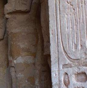


Ramesses II impressed his people by organising ambitious building projects across Egypt, beyond the scale of other pharaohs. As well as great temples for the worship of Egyptian gods, he built massive monuments to himself so that the people would revere him, and even a whole new capital city. Was he obsessed with his own power, or helping all Egyptians to have pride in their nation?
At Abu Simbel in southern Egypt, Ramesses built a colossal temple to be a memorial to himself after he died. It is so big that it took some 20 years to complete. The temple was carved into the rock face of the mountainside, with four colossi (huge statues) on the stone front all showing Ramesses. Smaller figures represent some of his wives (he had over 100 wives), and daughters (he fathered over 100 children, more than any other pharaoh). Twice a year, at the exact time of the equinox, a brilliant ray of sunlight shines through the entry and travels 55 metres through the pitch-black sections of the temple to light up the special sanctuary holding sacred statues.
Ramesses also built a separate temple nearby for his queen, Nefertari. Queens in ancient Egypt commonly had tombs and even pyramids of their own, but few had their own temple.
The Great Temple of Ramesses II was buried by desert sand for over 2000 years, until an Italian explorer found it in the nineteenth century. Then, in the 1960s, to save it from the rising waters of a new dam, the whole temple was cut into blocks and reassembled on higher ground.

Source 4.6.2 The Great Temple of Ramesses II, Abu Simbel. What impression might ordinary Egyptians have developed of their pharaoh when they looked up at the 20-metre-tall statues?
Nefertari’s official title was the First of the Great Royal Wives. She was unusual because she could read and write hieroglyphs. With this skill, she assisted Ramesses by writing letters to foreign rulers, becoming Ramesses’ main expert in diplomacy.
Ramesses had many wives. Nefertari was his first, and after she died he had several others, including Isetnofret and then three of his own daughters. He also had many children, and actually fathered around 50 sons and 50 daughters in his lifetime!
Concepts and skills builder 4.6
Responding to a secondary source
Examine Source 4.6.3 and then answer the questions that follow.
What was it about Ramesses II that made him different, special, and noteworthy in the long line of pharaohs?
… several factors come to the fore. First was the age in which he lived. The period known to Egyptologists as the New Kingdom (1539–1069 bc) marked the peak of ancient Egypt’s power and prosperity. … Under Ramesses, Egypt was richer and more powerful than it had ever been before, or would ever be again. As a consequence, Ramesses had access to greater resources than any of his predecessors or successors.
… In addition, Ramesses acted on a scale that few other pharaohs, before or after, could match. His monuments were more impressive.
… Finally, in every aspect of his reign, Ramesses seems to have been obsessed with his legitimacy and his legacy.
Source 4.6.3 Toby Wilkinson, Ramesses the Great: Egypt’s King of Kings, Yale University Press, 2023, pp. 2–3
1 Identify in your own words three reasons that the historian gives for Ramesses being a great pharaoh.
2 Explain why, according to the historian, the age in which Ramesses lived helped his greatness.
3 Explain what Ramesses did more than other pharaohs.
4 Ramesses’ family was not originally royal – his grandfather was a commoner. Consider this, and define the word ‘legitimacy’, to answer the question: What does Ramesses seem to have been obsessed about?
Historical concepts and skills: historical perspectives and interpretations, continuity and change
Ramesses led an army of over 100 000 soldiers in 15 military campaigns, with many victories for Egypt, and no setbacks. Some battles, however, including his most famous battle against the Hittites at Kadesh (which we will learn more about in the next lesson),
resulted in a stalemate: neither side won. Still, the wall carvings in his temple depict him as a heroic leader who smashed enemies. Like other pharaohs, his propaganda shows him personally killing enemies with a mace, and firing arrows from a chariot.
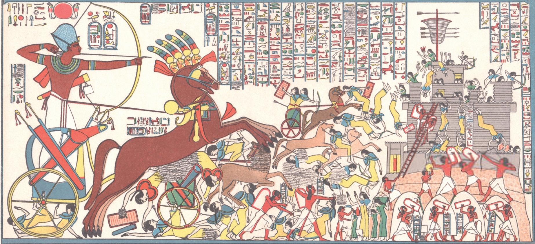
Source 4.6.4 A modern copy of one of Ramesses’ great propaganda paintings, showing him personally leading his army to capture the Hittites’ fortress at Dapur.

Source 4.6.5 A carving showing Ramesses holding prisoners of war at Abu Simbel. Do you recognise his smiting pose (remember how the first king Narmer was depicted)?
Ramesses also produced the world’s first known written peace treaty. Other kings had made peace agreements before, but Ramesses was the first to put a peace deal between two great empires into writing, between Egypt and the Hittites.
Another way that Ramesses changed the face of Egypt was to build a new capital city, in the far north of the country, where the Nile Delta is. The location was closer to the Hittite Empire, and the city may have been 6 kilometres long and 3 kilometres wide! He called it Pi-Ramesses, meaning ‘House of Ramesses’.
4.6 Review questions
1 Explain what impression Ramesses’ buildings were designed to have on ordinary Egyptian people.
2 Discuss how propaganda depicted Ramesses during wars.
3 Justify why Ramesses’ peace treaty with the Hittites was significant.
4 Scientists have used evidence from the mummified remains of Ramesses II to reconstruct his actual appearance. Discuss whether he looks like you imagined.
assign tasks and track results

Source 4.6.6 Special software was used to determine what pharaoh Ramesses II would have looked like in his prime, at about the age of about 45. [Image credit: John Moores, University Face Lab, Liverpool]
We have learned about one of the most powerful pharaohs, Ramesses II. This lesson explores how ancient Egypt grew through contact and conflict with other societies.
Lesson starter
Complete the following activity to kick-start this lesson.
Think, pair, share
1 Think: Compare ancient Egypt’s territory in the Old Kingdom with the territory it controlled in the New Kingdom (Source 4.7.1). Describe what differences you notice.
2 Pair: Discuss with a par tner which foreign kingdoms Egypt may have encountered and successfully overtaken.
3 Share: Suggest to the class what you believe this expansion indicates about ancient Egypt’s military strength in comparison with that of its neighbours.
In what ways did warfare and military expansion play a role in the success of ancient Egyptian civilisation?
From the Old Kingdom to the New Kingdom, ancient Egypt greatly increased its territorial extent. Pharaohs took pride in Egypt's military prowess and celebrated their victories by displaying them prominently on temple walls. They also enhanced trade connections and fortified Egypt’s borders through peace treaties. As you explore the following information, think about how land conquests, trade expansion and peace agreements contributed to the prosperity and growth of ancient Egypt.
Egypt’s military might and its relationship with its neighbours
According to historian Donald P. Ryan (in a book where he imagines he is a time-travelling tour guide, giving a fellow time-traveller a tour of ancient Egypt):
Egypt’s power and wealth are physically sustained by an advanced military that protects the homeland from foreign incursions and extends the long arm of Kemet’s might wherever the pharaoh desires. Egypt maintains a series of frontier forts in the south, west and east to protect against intrusions by the ‘vile’ and ‘wretched’ Nubians, Libyans and various Asiatic peoples.
Source 4.7.2 Historian Donald P. Ryan on the military might of ancient Egypt under pharaoh Ramesses II [Ancient Egypt on Five Deben a Day, London: Thames & Hudson, 2024, p. 67] What do the number of forts and the different directions around Egypt’s borders suggest about how often Egypt was at war with its neighbours?
As Ryan explains, the army of ancient Egypt during the reign of pharaoh Ramesses II consisted of around 20 000 troops plus many support staff. The military would have been ready to go into battle at short notice for their pharaoh. Soldiers marched long distances or were transported up and down the Nile by naval vessels. Ryan explains that soldiers were highly skilled in the use of a variety of weapons such as the bow and arrow or javelin to attack enemies from a distance, and bronze axes, spears, swords and daggers for fighting up close. Soldiers did not wear body armour but were able to defend themselves with shields made from stretched cowhides. The elite military unit in ancient Egypt was the chariot, which consisted of a driver, a bowman and a shield-bearer to protect the driver.

Source 4.7.3 Model soldiers from the tomb of an 18th dynasty pharaoh, ancient Egyptian, 16th–13th century bce. How are these soldiers armed, and armoured? Why would this model have been placed in a pharaoh’s tomb?
Pharaohs like Ramesses II wanted to know that their soldiers were successful in battle against Egypt’s enemies. Pharaohs wanted an accurate assessment of the number of dead enemies, and had their soldiers lop off body parts such as hands – one body part was counted as one dead enemy. Big piles of these were created to show off the fearsome power of Egypt’s pharaoh and their military.
diplomacy the work or skill of managing relations between countries or empires
The Battle of Kadesh occurred in 1274 bce, during the rule of Pharaoh Ramesses II. Egypt and the Hittite Empire had been enemies for a long time. The crisis started when King Mursili III of the Hittites was overthrown by his uncle. Mursili fled to Egypt to save his life. The new Hittite king demanded that Mursili be returned to his country, but Ramesses claimed – perhaps truthfully – that he did not know where he was. The situation turned into a crisis, and another war was threatening. Ramesses II marched to Kadesh with more than 20 000 soldiers, including 2000 chariots. While he successfully defeated the Hittite army in battle, he was unable to take the city of Kadesh. Subsequently, Ramesses turned to diplomacy to negotiate peace with the Hittites. Interestingly, both factions claimed a decisive victory! Although the Egyptians managed to endure a

Source 4.7.4 A khepesh sword from the time of Ramesses II. This fierce weapon was used by Egyptian foot soldiers in the heat of battle. This example is currently housed in the Department of Egyptian Antiquities of the Louvre, Paris, France. Why do you think these swords were shaped this way?
challenging situation at Kadesh, it wasn’t the glorious triumph Ramesses aimed to depict; rather, it was a stalemate, with heavy losses on both sides.
Historians have found that the two languages used for the Treaty of Kadesh do not quite present identical text: the Egyptian version blames the Hittites, while the Hittite version blames the Egyptians.
After forcing the enemy to retreat, Ramesses II returned to Egypt to proclaim his victory in battle. This reinforced his power, as the people viewed him as a strong leader. He had numerous depictions of his ‘victory’ carved into temple walls, ensuring that every Egyptian was aware of how he had ‘defeated’ the Hittites.
Another noteworthy outcome of the Battle of Kadesh was the eventual peace treaty
between Ramesses II and the Hittites. This treaty established 90 years of peace between the two civilisations, facilitating increased trade and the exchange of technological innovations. It is regarded as the world’s first peace treaty. Nine years after the treaty was signed, the alliance was further strengthened by a diplomatic marriage between Ramesses II and Maathorneferure, the eldest daughter of Hattusili III, the Hittite king. This ended a long conflict between the Hittite Empire and the Egyptians, who had battled for over two centuries for dominance over the eastern Mediterranean territories.
The treaty, known as the Treaty of Kadesh, was inscribed on a clay tablet in 1258 bce in both the ancient Egyptian and Hittite languages. Both powers pledged not to invade each other’s territories. A second clause strengthened the alliance by promising assistance, likely in the form of military support, if either side was attacked by a third party or faced internal rebellion. Should the treaty be violated, the oath-breaker would be cursed by the gods, who would ‘destroy his house, his land and his servants’. Conversely, if he upheld his promises, he would be rewarded by the gods, who would ‘grant him health and long life’.
Source 4.7.5 Replica of the clay tablet treaty, dated 1269 bce, signed by Hattusili III, King of the Hittites, and Ramesses, Pharaoh of Egypt. This Kadesh Peace Treaty is a copper replica of the original, housed at a museum in Istanbul, Türkiye. A similar replica is held in the United Nations building in New York, United States. Why would the United Nations value this artefact enough to put it on display?

Examine the following sources and then answer the questions that follow. The following is an account of the Battle of Kadesh, attributed to pharaoh Ramesses II himself.
The King says:
Not one of my princes, not one of my captains of the chariot, not one of my chief men, not one of my knights was there. My warriors and my chariots had abandoned me. Not one of them was there to take part in the battle.
I had met two thousand five hundred pairs of horses. I was in the midst of the charioteers, but they were dashed in pieces before my horses . Not one of them raised his hand to fight. Their courage was sunken in their breasts, their limbs gave out, they could not hurl the dart, nor had they the courage to thrust with the spear. I made them fall into the water just as the crocodiles fall in. They tumbled down on their face one after another. I killed them at my pleasure, so that not one looked back behind him, nor did another turn around. I killed them; no one escaped me.
Source 4.7.6 An extract from the Poem of Pentaur describing Ramesses II’s charge against the Hittite chariotry.

Source 4.7.7 This coloured engraving of a bas-relief comes from the walls of the Abu Simbel temple. It portrays Ramesses II at the Battle of Kadesh, shooting a bow and arrow from a chariot. The image was created in the late nineteenth century, based on copies of drawings of the inscriptions on the temple walls (19th dynasty, c.1275 bce).
1 Summarise the outcomes of the Battle of Kadesh.
2 Describe how Ramesses II is depicted in Source 4.7.6.
3 Compare the depictions of Ramesses II in Sources 4.7.6 and 4.7.7. What similarities and/or differences are there between how he is represented in the two sources?
4 Sources 4.7.6 and 4.7.7 were located on the exterior walls of Ramesses II’s temple at Abu Simbel. Suggest who the audience might have been and why Ramesses II wanted these carved onto his temple walls.
5 How realistic do you think the depictions of Ramesses II are in these sources? Describe how these sources might be useful to historians.
6Analyse the significance of the battle in a paragraph that answers the question, ‘Should the Battle of Kadesh be seen as a great moment in ancient Egyptian history?’
4.7 Review questions
1 Explain how Egypt’s borders changed between the Old and New Kingdoms.
2 Describe Egypt’s military strength under Ramesses II.
3 Explain how Ramesses’ peace treaty with the Hittites worked.
4 Describe how the Treaty of Kadesh helped trade between Egypt and the Hittites.
We have learned about how ancient Egypt grew through conflict with other societies. This lesson will look at one of the key benefits of signing peace treaties with former enemies; trade.
Complete the following activity to kick-start this lesson.
See, wonder, connect

1 See: What do you see these traders doing?
2 Wonder: Consider Source 4.8.1 What questions do you have?
3 Connect: How could this historical objec t connect to other subjects you study in school?
Explaining Source 4.8.1
The Egyptians particularly valued gold – for use in luxury jewellery – which is being carried by the first trader. They also made extensive use of elephant ivory, which is being carried on the shoulder of the middle figure. The last figure brings some exotic fruit on a gold platter, and a luxurious leopard fur. They also traded live, exotic animals, such as the baboon shown in the right-hand corner. Does any of this surprise you? Why? Why not?
Source 4.8.1 This wall-painting shows the people of Kush carrying goods.
Ancient Egypt was rich in many natural resources, but it still had to get others by means of trade with neighbouring countries. It was well placed to conduct trade, with access to the whole African continent and to the rich civilisations of the Mediterranean area. It began to build its trade networks very early, during the pre-dynastic period, and continued to be active throughout its long history. As early as 3500 bce, trade
began, initially just between upper and lower Egypt, then, during the First Dynasty, with surrounding countries. Much of Egypt’s rich culture depended on a steady supply of luxury materials from foreign countries. Trade was so important that it became one of the main responsibilities of a pharaoh’s government. Egypt relied heavily on goods from countries such as Libya, Nubia, Syria and Lebanon.
Analysing maps to determine causes and consequences and historical significance
Examine Source 4.8.2 and then answer the questions that follow.
New Kingdom trading routes, 1570–1070 BCE
New Kingdom (1570s–1070 BCE)
Land trade route
Sea trade route Copper Grain Gold Minerals Silver Spices Timber
Source 4.8.2 This map shows the New Kingdom’s trade routes, trading partners and some of the goods that were traded during 1570–1070 bce What types of goods came by land, and which came by sea?
1 Identify the main goods that Egypt exported.
2 Identify the main goods that Egypt imported. Why might ancient Egypt have needed to import these goods?
3 In the period between the Old Kingdom and the New Kingdom, ancient Egypt conquered the region of Kush (Nubia). Identify what Egypt’s motivation might have been to gain control over this region.
4 In the previous lesson, you read about how Ramesses II wanted to gain control of the region around Kadesh, which is south of the Hittite empire. Summarise what might have been his objective in gaining control over this region.
Historical concepts and skills: cause and consequences, historical significance
Men and women across all levels of society wore jewellery in ancient Egypt. Jewellery was often linked to religious beliefs, but the natural world also inspired many designs, such as this example.

Source 4.8.3 New Kingdom, 18th dynasty. A 9 centimetre necklace pendant made of gold in shape of a fly found in the tomb of Queen Ahhotep in Thebes. From where do you think Egyptian craftsmen would have sourced the gold required to make this necklace? ➜
All trade was barter, which means swapping one kind of goods for another. Wood from Lebanon was paid for in corn and wine, for instance.
Boats of all kinds crowded the Nile. People crossed the river by ferry, while barges carried heavy cargoes. Stones for the pyramids were transported on giant rafts, which could carry 500 tons. Boats going north were helped by the current. Going south, they usually had the wind behind them. The Egyptians could make small boats for local use out of the reeds that grew beside the Nile River, but large trading ships were built out of wood, which had to be imported. These vessels had to be strong enough to carry large, heavy loads and to survive the dangerous conditions on the Red Sea. The ships only had a small amount of decking, front and back; the cargo was simply loaded into the hull of the vessel.
As we know, Egypt’s population was heavily reliant on the Nile River in various ways, and Egypt is also located near the Mediterranean, Red and Arabian Seas. Therefore, one of the most important materials the Egyptians needed was good-quality wood for shipbuilding: for a river valley civilisation, boats were of critical importance. The Egyptians therefore imported high-quality cedar from Lebanon to build their fleets.
The Egyptians did not use money. They paid taxes in the form of goods.

To become efficient in international trade, the Egyptians eventually invented their own form of currency called a deben, a form of token or weight that allowed them to state the value of a particular good. For example, a pair of sandals cost one deben.
One of the mysteries of Egyptian trade was the land they referred to as Punt. Egyptian trade documents often mention the land of Pwenet, or Punt, as an important source of valuable materials. It was crucial for a number of goods they needed, especially gold for jewellery, as well as precious materials
such as ebony, ivory and exotic animals. Queen Hatshepsut, in particular, saw the value of this rich land, and sent an expedition to Punt. Historians are still debating where exactly this land might have been. One suggestion is that it might have been just south-east of Egypt; others suggest that it might have been in modern-day Ethiopia or Somalia. The debate continues.

4.8 Review questions
1 Describe how peace treaties could have opened up opportunities for trade for ancient Egypt.
2 List some of the things Egypt traded with other ancient civilisations.
3 Describe the importance of trade with other ancient civilisations for Egypt.
4 Explain the importance of the land of Punt to ancient Egypt.
We know how rich and powerful pharaohs shaped ancient Egypt, because they created things that lasted, and recorded information about their lives. However, rich and powerful men were not typical. Most people had to work hard to survive. In this lesson, we explore what is known about the lives of common Egyptians.
Complete the following activity to kick-start this lesson. See, think, wonder
1 See: What did a servant wear? What work did she do?
2 Think: Why might a figure like the one on the left be buried with the body of a rich master?
3 Wonder: What other workers do you expect to be a part of Egyptian society?


hierarchy a way of showing the structure of a society, with people ranked above, below or at the same level as each other
Egyptian society is often shown as layers of people in a hierarchy, fittingly arranged in a pyramid: rich and powerful people are shown at the top of the social order, with many more people in the lower layers.
Power and authority were in the hands of the pharaohs and their viziers; the nobles were people born into wealthy and important families; while other people’s level was determined by what they did for work.
Priests were respected like nobles, because they served the gods.
Scribes wrote down information about the work of governments and temples, and money issues, and wrote letters people wanted to send.
A hierarchy can be misleading. Even though farmers were looked down on for working with the soil, they were valued for feeding Egypt by growing wheat, barley, and fruit and vegetables, tending animals, and harvesting useful materials such as flax and papyrus. Egyptian craftsmen ranged from highly skilled sculptors, goldsmiths and rock cutters, whose work was admired and well paid, to unskilled workers who had a much harder life, doing heavy and low-paid work. As for slaves, some were locked up in chains, but others
lived quite freely among the community like farmers and craftsmen.
Usually, it is very difficult to find out how workers lived. There are few records: most Egyptians could not read or write. However, sometimes clues remain. Graves containing the bodies of pyramid builders have been found, which show that many workers had injuries and broken bones, and were underfed. A typical worker was already an old man by age 20. The majesty of the pharaohs was at the cost of their workers’ suffering.
Examine the following source and then answer the questions that follow.

1 Describe the purpose of the ostracon.
2 Identify a work-related reason for a worker’s absence, and a non-work-related reason.
3 Egyptian craftsmen were often still paid when they were too sick to work. What does this show?
4 Develop further questions to ask about how workers lived.
Source 4.9.3 An ostracon tablet, recording the attendance of craftsmen during a year at Deir el-Medina, 1250 bce. Reasons for workers’ absences include ‘with his boss’ on a different job, ‘fetching stone for the scribe’, ‘drinking’, ‘offering to the god’, ‘brewing beer’, ‘building his house’ and ‘wrapping the corpse of his mother’.
Historical concepts and skills: historical perspectives and interpretations, questioning and researching
Writing was invented in Egypt about 3000 bce. It developed from a ‘picture language’ into a complex alphabet of hieroglyphs. Ambitious people could learn to read and write by entering a school from the age of 12, and the workers whose job was to write things down were called scribes.
Scribes wrote in ink on paper made from the papyrus plant, usually in long documents called scrolls, or carved onto tablets of wood or stone. Without scribes, we would have limited information about the lives of Egyptians.
Source 4.9.4 The hieroglyphic alphabet. Can you spell your name in Egyptian hieroglyphs?
One hundred years ago, on the western side of the Nile, archaeologists discovered the remains of a workers’ village from the New Kingdom (about 1550 to 1069 bce), buried under desert sand. Deir el-Medina was like a ‘housing estate’ in the desert: inside a high wall, a main street was flanked by two-storey houses for 70 skilled workers and their families, close to the Valleys of the Kings and Queens, where they were building grand tombs.
At Deir el-Medina, officials kept records of workers’ attendance and any reasons for their absence – such as illness, injury or family duties. If the builders were unhappy with their conditions, they went on strike to protest. This is the earliest known example in history of workers refusing to work until they received more pay, in this case, in the form of grain.
We are exceedingly impoverished. All supplies for us that are [from] the treasury, that are from the granary, and that are [from] the storehouse have been allowed to be exhausted.
Not light is a load of dn-stone. Six oipe [an Egyptian unit of measurement, roughly 76kg] of grain have been taken away from us besides to be given to us as six oipe of dirt.
Let our lord make for us a means for keeping alive. Indeed we are dying besides. We do not live at all. It [i.e. the means of keeping alive] is not given to us in [the form of] anything whatsoever.
Source 4.9.5 Protest letter from the workers building a temple in the Valley of Kings to the vizier of Pharaoh Ramesses III, written by the scribe Neferhotep in c.1165 bce. Ezzamel, Mahmoud (2012), Accounting and Order, Routledge, 300–302 ➜

Source 4.9.6 A painting in a tomb at Deir El-Medina shows a man named Sennedjem and his wife Iineferti in the afterlife. Why would workers think of heaven as a field, where a couple could happily farm their land? ➜
4.9 Review questions
1 Identify the levels/classes of ancient Egyptian society, by drawing a diagram of the social hierarchy.
2 Explain which workers were considered higher or more respected than others.
3 Outline why workers at Deir el-Medina went on strike.
For centuries, historians seemed to ignore the fact that half the people in Egypt were women. In this lesson, we explore what is known about the lives of female Egyptians.
Lesson starter
Complete the following activity to kick-start this lesson.
Think, pair, share
Since Cleopatra was pharaoh (51 to 30 bcE), there has been a fascination with her. How is her power and her beauty shown in this image from a famous 1963 film (Source 4.10.1)?
1 Think: In the image, how is Cleopatra shown to have both beauty and power?
2 Pair:Compare notes with a partner. Do they have any suggestions?
3 Share: Each partner should be ready to explain something the other person noticed to the class.


misogyny contempt for or prejudice against women or girls (sexism)
progeny a descendant or descendants
Like workers, the lives of women in ancient Egypt mostly went unrecorded. Egypt was typically dominated by men, and there are records of discriminatory attitudes towards women. However, some women could, and did, achieve independence. Historians have found ways to explore aspects of women’s experiences, such as marriage and divorce, childbirth and their authority within the home.
A key restriction on the lives of women was that they were expected to marry, have children and stay home as ‘lady of the house’. Girls could become wives from the age of 12. The marriage was often arranged between her future husband’s family and her parents. In the early centuries of ancient Egypt, the husband paid the girl’s family as part of the deal – about the same amount as it cost to buy a slave. In later times, a girl’s family may have paid the future husband, to cover her living expenses. It is difficult to tell how many partnerships were loving, although paintings and statues show happy couples.
Ancient Egyptians do not seem to have had a word for ‘divorce’, but documents do talk of women ‘departing’ or being ‘expelled’ from a home. A man could divorce a woman for three reasons: if she could not produce children, if she had a love affair with another man, or if he had become rich and wanted a new partner from a higher social class. The first record of a woman divorcing her husband dates to 500 bce , probably because the man had a love affair.
Women were allowed to own property, made important family decisions, and were treated as equals with men if they went to court. One reason workers gave for being absent was to stay home if their wife was sick, so women’s household jobs must have been valued. However, historians have found evidence of misogyny towards women in the advice that was given to boys. Young men were warned to beware that a beautiful woman might trap them into a relationship.
Concepts and skills builder 4.10
Examine Source 4.10.2 and then answer the questions that follow.
Take a wife while you’re young, that she make a son for you; she should bear for you while you’re youthful; it is proper to make people. Happy the man whose people are many, he is saluted on account of his progeny
… Beware of a woman who is a stranger, one not known in her town; don’t stare at her when she goes by, do not know her [physically]. A deep water whose course is unknown, such is a woman away from her husband. ‘I am pretty,’ she tells you daily when she has no witnesses; she is ready to ensnare you, a great deadly crime when it is heard.
Source 4.10.2 A wealthy father’s advice to his son, known as The Instruction of Ani, c.1500 bce ➜
1 Describe when a man should take a wife, according to this father.
2 Identify the sort of woman the father warned his son to beware of.
3 Look at the definition of misogyny and explain how this advice is an example of misogyny.
4 Considering the origin of this source – by a man, to a man – develop questions for further research into the position of women in Egypt.
Historical concepts and skills: historical perspectives and interpretations, contestability, questioning and researching
Images of ancient Egyptian women show that they used cosmetics to beautify their appearance. On their lips and cheeks, they used rouge (red powder from clay), they coloured their nails with henna (brown paste from dried leaves), and applied kohl (black powder from rock) as eyeliner. However, many men wore makeup too, and cosmetics had the extra benefit of protecting people’s skin from the sun and insects. Egyptians also used scented oils to clean their skin and as a deodorant.
Some women held senior positions in government, and of the 170 pharaohs who ruled during the 3000 years of ancient Egypt, at least seven were women. For example, around 1479 bce, the pharaoh died, leaving only a three-yearold son. The boy’s stepmother Hatshepsut became pharaoh. Hatshepsut showed that a pharaoh could achieve peace through trade with neighbouring countries rather than war, and made Egypt stronger and safer during her 21-year reign.
Source 4.10.3 A painting in the tomb of Queen Nefertari, showing her making offerings to Hathor, the goddess of love, fertility and childbirth, c.1298–1235 bce


Cleopatra, who ruled from 51 to 30 bce , was the last pharaoh of ancient Egypt, famous for her intelligence, beauty and strong leadership. She ruled during a time when Egypt was facing challenges from powerful enemies, like Rome. Cleopatra is well-known for her relationships with important Roman leaders, including Julius Caesar and Mark Antony, which helped her try to protect her kingdom. She is often remembered in stories and movies as a
powerful woman who played a key role in the history of ancient Egypt.
Historians took a long time to realise that there were women pharaohs, because their statues showed them wearing false beards!
1 Explain what Egyptian girls were expected to do in life.
2 Describe how cosmetics showed beauty standards of the time.
3 Discuss how misogyny may have affected women in ancient Egypt.
Having learned how pharaohs built temples for worship and depicted themselves as close to their gods, in this lesson we will explore the religious beliefs of ancient Egyptians.
Complete the following activity to kick-start this lesson.
See, think, wonder
1 See: What aspects of Egypt were drawn on to create the images of the gods?
2 Think: Have you heard of any of these gods or goddesses before? 3 Wonder: What could each of these gods represent?
Egyptians believed that their land was ruled by gods for 10 000 years before humans arrived. They spent much of their time worshipping their gods and preparing for their afterlife. They regarded their king as belonging both to the human world and the world of gods. The king’s task was to keep the gods happy enough to allow humans to live in peace and order.
Egyptians did not have one god but worshipped a whole pantheon (group) of gods – perhaps over 2000 separate gods – and each one had a special function. Some gods’ functions changed over the centuries. While many gods were linked with creation stories, some were responsible for particular towns, and some for the environment, including the allimportant floods and crops, while others were linked to the afterlife.
Table 4.11.1 Some of the best-known ancient Egyptian gods
AnubisA man with the head of a jackal
Amun-RaA blue-skinned man with two feathers as a headdress
OsirisA mummified man with green skin
Isis A woman with a throne for a crown
Mummification and burials
Protector of the royal family (Amun), combined with the sun god (Ra)
The afterlife and fertility (new life)
Protection, motherhood and magic
ThothA man with the head of either a baboon or ibisIntelligence and learning
SethA man with a head combining a jackal, donkey and aardvark
A villain: chaos, the desert, storms, violence and foreign people
HapiA man with a large belly, carrying food and drinkControlling the Nile River’s flood
HathorA woman with the head or horns of a cowFertility and love
HorusA man with the head of a falcon
Egyptians believed a range of different creation stories. One popular belief was that a sun god created a goddess of the sky and a god of earth, who in turn had children, two of whom were put in charge of Egypt: Osiris to look after the Black Land of the Nile valley, and Seth to look after the outer areas, which became the Red Land, or desert.
Sky, war and hunting
Osiris was seen as the first king of Egypt, who brought civilisation to the land in pre-dynastic times, before the first pharaohs. However, he was later killed by his jealous brother Seth, who cut up his body and threw the parts away. The parts were collected and bandaged together by Osiris’ wife Isis, who therefore created the first mummy.
Osiris began a new life as the ruler of the underworld, where souls went after death.
Examine the following source and then answer the questions that follow.
Whenever you hear the traditional tales which the Egyptians tell about the gods … you must not think that any of these tales actually happened in the manner in which they are related. … [But you should] listen to the stories about the gods in this way, accepting them from those who interpret the story [respectfully].
… One of the first acts related of Osiris in his reign was to deliver the Egyptians from their destitute [poor] and brutish [wild] way of living.
This he did by showing them the fruits of cultivation [farming], by giving them laws, and by teaching them to honour the gods.
Source 4.11.2 ‘Isis and Osiris’, written by the Greek historian Plutarch in the first-century ce. Plutarch visited Egypt once and read many histories. [Vol. V of the Loeb Classical Library edition, 1936]
1 Explain the advice that this Greek source gives about how to regard the tales of Egyptian gods.
2 Identify what the Egyptians said they were given and taught by Osiris.
3 Discuss whether this should be regarded as a primary source of what ancient Egyptians believed.
Historical concepts and skills: contestability, historical perspectives and interpretations
The ancient Egyptians believed that their gods would only protect them and their land if they were respectfully worshipped. They built impressive temples, which they called ‘God’s House’. Each temple contained a shrine with a statue of one of the gods, and the Egyptians believed that the god actually lived inside the statue. The first temples were small and simple, built with mud bricks. Later, temples were built on a massive scale, from stone, with towers and entry halls with enormous, decorated columns. Some of them are still standing today.
The inside of the temple was considered so holy that only the pharaoh and priests could enter it. The high priest of a temple often wore a robe made of leopard skin, and they cared for the god
by leaving gifts and draping the statue in beautiful cloths.
If you were a member of the general public, you were not allowed to enter this sacred space. You could, however, donate luxury fabrics, perfumes and meals for the priests to carry inside, to win the favour of the god or goddess. You could stand in the courtyard in front of the temple and say prayers, and on holy days you could see the god’s statue when it was carried out for a procession through the streets.
If you were a priest, you were very important to Egyptian society. You would be trained to read and write, so that you could make copies of holy texts. Your main responsibility was to sing hymns to the god in a temple.
shrine an object or building that is considered to be holy because it is connected with a sacred person or thing


Source 4.11.3 The temple dedicated to Isis at Philae, today. Was the temple designed to make people feel proud of their beliefs, or humble in front of the great goddess?


Source 4.11.4 The temple dedicated to Horus at Edfu, today. On the outside, do you recognise the king’s pose and remember what that shows? Inside, can you see where the god’s statue would be placed for worship?
Around your temple would be many administrative buildings, often the size of a small town. Priests also collected taxes on behalf of the government and paid the salaries of government officials. In return, the king would give you some land on which you could grow and sell food. He also allowed priests to keep some
of the offerings that people donated for the gods.
Many historians had assumed that all priests were male, but evidence has been found on ancient scrolls of female priests conducting ceremonies in temples. Sometimes assumptions are wrong!
1 Identify three Egyptian gods that people might have asked to help them in their daily lives, and why.
2 Explain why the worship of the gods was so important to the ancient Egyptians by completing the following sentences.
a People worshipped the gods, because …
b People worshipped the gods, but
c People worshipped the gods, so …
3 Identify who was, and was not, able to enter the temple.
4 Discuss how the gods related to the pharaohs.
Having learned about Egyptian religious beliefs, in this lesson we will explore tombs that were not only burials for the human body but also ‘warehouses’ to contain all the objects that a person might need in the afterlife.
Lesson starter
Complete the following activity to kick-start this lesson. See, think, wonder
1 See: Consider Source 4.12.1. What do you observe about the scale of the pyramids?
2 Think: What are questions you have about how, why and when the pyramids were built? Share them with a friend.
3 Wonder: How might pyramids as huge as these have been built?
Source 4.12.1 The Great Pyramid of Giza was built from over 2.3 million stone blocks. At 146 metres, it remained the tallest structure in the world for over 3600 years. The pharaoh Cheops (Khufu) ordered Egyptians to build these pyramids to bury his body and his wives to prepare them for the afterlife.


Like most civilisations, the Egyptians believed in an afterlife, or the continued life of the soul after death. In the same way that they saw the sun go down every evening and rise the next morning, they believed that human life followed a cycle: birth, death and rebirth. After a person’s body was mummified, their soul began a journey known as duat, during which they would meet gods who judged their character, pass through 12 gates guarded by monsters, and face a final test in which their heart was weighed. If successful, their soul would rest forever in Aaru, the endless fields. For these reasons, they devoted enormous care to preparing a tomb that would transport them to the afterlife.
The most famous tombs, indeed the best-known achievement of ancient Egypt, are the pyramids. These colossal structures, with four triangular sides built on a straight-sided base, required massive labour and cost, and were reserved for kings. In all, there are some 80 pyramids in Egypt, most of them built during the Old Kingdom and the Middle Kingdom.
The first pyramid was actually six flat limestone tombs of decreasing size, layered on top of each other. It was designed by the pharaoh Djoser’s main official, called Imhotep, some

2650 years bce. He invented what became known as a ‘step’ pyramid. Egypt had never seen such an impressive monument.
Later pyramid builders developed straight-sided structures, with their ‘steps’ filled in and encased in limestone. The biggest and most impressive of these buildings is the Great Pyramid at Giza, built to be the tomb of Pharaoh Khufu (Cheops) in about 2570 bce. The four sides of the Great Pyramid face exactly north, south, east and west, and are almost perfectly balanced with a variation of no more than a few centimetres. It many have taken 100 000 builders to move over two million blocks of stone weighing more than two tons each to the site, and so high above ground. How they achieved this, to create a perfect architectural structure without any modern technology, remains a mystery.
The Great Pyramid did not stand alone. The complex of buildings included a temple near the edge of the River Nile, where the king’s body could be handed over to the priests to prepare the body, and a temple near the pyramid, where people could donate gifts to help the king in his journey to the afterlife. Two other pyramids were built later for other kings, and both are over 100 metres tall. The best-known statue on the site is a sphinx.

The pyramid was originally covered in gleaming white limestone. In the fierce sunlight of the desert, it shone brightly. The white covering was later stripped away by thieves, who also cut their own entrance into the pyramid and stole all its treasures, leaving the pyramid empty by the time of the Middle Kingdom. Visitors in ancient times enjoyed guided tours around the site, just as tourists do today. In the fifth century bce, the Greek historian Herodotus included the pyramid on his list of the ‘Seven Wonders of the World’. It is the only wonder from that list that still exists.
Source 4.12.4 Scribes had the job of writing letters and records for the living, as well as scrolls to be placed with the dead to help them on their journey. This scroll, known as The Book of the Dead was made in about 1250 bce. ➜
Using historical sources
Examine Source 4.12.5 and then answer the questions that follow.
1 Explain what the dotted line around the outside of the pyramid represents.
2 The original entrance was 17 metres above ground level. Explain how someone using that entrance could reach the king’s chamber.
3 The king’s chamber contains the royal sarcophagus, but like the rest of the pyramid, it is empty. How did tomb robbers get into the pyramid?

Source 4.12.5 A cross-section of the Great Pyramid. [Source: Cambridge University Press & Assessment] ➜
4 The air shafts are around 20 centimetres wide, and while some say they were designed to provide air to the interior, others say that they were designed to allow the king’s soul to rise to the heavens. Discuss these theories and explain which sounds more likely to you.
Historical concepts and skills: questioning, perspectives, contestability
sarcophagus a stone outer
usually decorated with writings and pictures
Today, the most famous royal burial in Egypt is the tomb of Tutankhamun. He is called ‘the boy king’, because he became pharaoh at age nine, and died when he was just 19 in about 1350 bce Tutankhamun did not grow old enough to have the sort of impact on Egypt that other pharaohs did, like building cities or pyramids, or preparing a large tomb for the journey to the afterlife. But he did make one important decision: the previous pharaoh had told the people that they had to stop worshipping multiple gods, and only worship the sun god. Under Tutankhamun, Egyptians were once again allowed to worship many gods.
History could have forgotten Tutankhamun, but in 1922 archaeologists made the incredible discovery of his tomb, which had not been opened for over 3200 years! Most rich royal burials had been robbed by tomb raiders, but the entrance to the relatively small tomb of Tutankhamun in the Valley of the Kings had been hidden for centuries by mud, caused by avalanches. Therefore, when archaeologists opened his tomb, they found that it was still packed full of treasure.
Tutankhamun’s tomb included his mummified body, laid in a coffin that was placed inside two larger coffins, which were then sealed inside a sarcophagus The inner coffin alone was made of over 110 kg of solid gold!


Source 4.12.7 Tutankhamun’s death mask, placed over his head, was made of 10 kg of gold. Since Egyptians believed that gods had gold skin and blue hair, why do you think the mask was made like this?
When he became the first person in over 3000 years to look at the death mask, Howard Carter said that Tutankhamun’s face bore the ‘sad but calm expression’ of a young man who died before his time. Around the coffin were over 5000 items for the pharaoh to use in the afterlife, ranging from wooden chariots to musical instruments.
It took 10 years to document the objects, number them, and move them to a museum.
Less than a year after opening the tomb, the man who funded the expedition, Lord Carnarvon, mysteriously died of blood poisoning in Cairo after being bitten by a mosquito. In the following year, the man who had conducted the first x-ray of Tutankhamun’s mummy, Sir Archibald Douglas Reid, also died. A rumour started of a ‘mummy’s curse’. It was only a rumour, but it persisted.

Source 4.12.8 This 1922 photograph shows some of the 5000 items found in Tutankhamun’s tomb, which included furniture, chariots, a golden throne, bows and arrows, daggers, statues of gods, cosmetics, jewellery, food, wine, sandals, writing materials and board games. Which of those items surprise you? ➜
I cannot but think some risks are run by breaking into the last rest of a king in Egypt whose tomb is specially and solemnly guarded, and robbing him of his possessions.
According to a rare book I possess … entitled The Egyptian History of the Pyramids … the most dire punishment follows any rash intruder into a sealed tomb. The book names ‘secret poisons enclosed in boxes in such wise that those who touch them shall not know how they come to suffer’.
That is why I ask, Was it a mosquito bite that has so seriously infected Lord Carnarvon?
4.12 Review questions
1 Identify the first pyramid design, and how later builders changed the design.
2 Describe why the Great Pyramid of Giza is significant.
3 Outline why Tutankhamun’s tomb was different from other royal burials.
4 Explain what the items in Tutankhamun’s treasure show about Egyptians’ beliefs about life after death.
You have learned how tombs and pyramids were designed to help a person in the afterlife. This lesson explores how ancient Egyptians prepared the body of the dead person for this same purpose.
Complete the following activity to kick-start this lesson.
See, think, wonder
1 See: How are the gods depicted in Source 4.13.1?
2 Think: Why might gods look like animals you might find in Egypt?
3 Wonder: Why might the ancient Egyptians have done this as part of their burial rituals? Do you think every ancient Egyptian would be able to have their internal organs stored like this, or would it be for specific people?

The Egyptians believed that when a person died, the soul (which they called the ka) could live on in the afterlife only if they preserved the person’s body or made a statue for the soul to return to live. We call the preserved body a ‘mummy’, but this word was never used in ancient times. It became popular a couple of hundred years ago, and was probably based on the Arabic word mumiya, meaning tar or bitumen (road surfaces), which is the colour and texture of a mummified body.
Have you seen stories that show a mummy wrapped in bandages that comes back to life and scares living people? It is a popular theme in modern horror films and animations. The ancient Egyptians would be outraged if they knew this. They saw mummification as a sacred and careful preparation for their journey after death to another life. They would never have expected that, centuries later, anyone would want to unwrap their body to study it or make fun of it.
In the pre-dynastic early centuries of Egypt, people buried their loved ones in a simple pit. If the pit was in the right place, the dry climate and hot sands prevented the body from rotting, and dried out and preserved the body, so that the skin remained intact for many years. This practice might have given the Egyptians the idea of creating their own mummification procedures to preserve a body.

Source 4.13.2 The Hollywood horror-comedy film The Mummy shows a 3000-year-old curse bringing a mummy back to life. What does this show about how people view mummies?
mummification to include the removal of the major organs before wrapping took place. Only the heart, which was believed to be the source of all wisdom, was left in place.
Mummification was advanced surgery, done by priests. It was first used only for kings and queens, but later was taken up by wealthy nobles. In time, a form of mummification was also available for working people.
A four-stage scientific process was developed. To make a mummy, you had to do the following:
• Make a cut in the side of the body to remove the organs, remove the brain using a long sharp instrument inserted through the nose, then store the organs in canopic jars.
• Dry the body for 40 days in natron, a kind of salt.
At first, they simply wrapped the dead body in bandages. By the 4th dynasty, the Egyptians understood that it was the internal organs that caused bodies to rot, so they developed the science of
• Coat the body in oil and wrap it tightly in linen bandages, with amulets (good luck charms) for protection.
• Bury the mummy inside coffins decorated with prayers, in dry sands.
Examine Source 4.13.3 and then answer the questions that follow.

Source 4.13.3 Egypt’s national director of antiquities, Dr Zahi Hawwas, with one of 250 mummies that were discovered in one valley in 1999.
➜ Historical concepts and skills: contestability, perspectives
1 Identify why the Egyptians’ dead are called mummies, using information from this image.
2 Explain which part of the mummification process is visible in this image.
3 Explain which part of the mummification process is not visible in this image.
4 Discuss whether to help people appreciat e the history, Dr Hawwas’ museum should: a unwrap the mummy to show people what the body looked like b display the wrapped body in a museum c scan the body to show inside the bandages d do something else.
Careful study of objects and writing in Egyptian tombs has enabled researchers to piece together what ancient Egyptians believed, and how they prepared bodies for the afterlife. However, mummies have not always been treated respectfully.
In the nineteenth-century, fascination with ancient Egypt known as Egyptomania spread across Europe. It was the height of fashion for wealthy people in places
like Britain to buy ancient objects for their personal collections, including mummies. You could also buy tickets to special events, where a presenter unwrapped a mummy on a table. As each layer was removed, often a precious gem or amulet tucked into the bandage would fall out. The nearest ticket holder could keep it. Eventually, the mummified body would be revealed.
The mummy unwrapping event in nineteenth-century England may have been the origin of the ‘pass the parcel’ children’s birthday game!
Many of the mummies and precious objects that arrived in Europe were bought from black market art dealers and tomb raiders who had broken into tombs in Egypt’s Valley of the Kings. This valley, near Luxor, was used for burials for nearly 500 years during the New Kingdom.
In museums, it was common for unwrapped mummies and mummified body parts to be put on public display. This practice is changing. In 2024, for example, the University of Sydney’s Chau Chak Wing Museum, which has Australia’s largest collection of ancient Egyptian artefacts, decided to remove body parts from its exhibition. However, wrapped mummies and CT scans of their bodies, showing how they lived and what they may have died from, remain on display.
For hundreds of years body parts in museum collections have been treated as objects. We have become so accustomed to seeing them on show that we often forget they once belonged to living people.
… we’d like to focus more on the transformation of the body into an eternal being, which is the whole point of mummification, rather than the body itself.
4.13 Review questions
1 Identify the four steps of mummification.
2 Describe why ancient Egyptians mummified bodies.

4.13.4 The Valley of the Kings. Since tombs are still being discovered here, do you think we might we find information that changes our understanding of ancient Egypt?

4.13.6 A CT scan of a museum mummy that has never been unwrapped, on a screen next to the person’s coffin. If you visited a museum that showed this view, what could you learn?
3 Explain how some people treated mummies disrespectfully.
4 Discuss how museums are changing their approaches to mummified human remains.
Access the Interactive Textbook for a range of digital tools to help you review this topic, including:
• Downloadable chapter summary
• Scorcher timed competitive quiz.
What have you learnt about ancient Egypt? For this activity, copy the diagram and fill out by explaining your understanding. Aim for two points per topic.
Topic
The origin of Egyptian civilisation
The Nile River
Daily life
Egyptian power and authority
Ramesses II
Warfare with other ancient societies
Trade with other ancient societies
Workers
Women
The Egyptian afterlife
What I have learned
I used to think that ...
Now I understand that ...
This exercise in visible thinking asks you to track the difference between what you knew about Egypt before, and what new understandings you have acquired since reading this chapter.
Using the stem sentences here, write a paragraph explaining what you previously knew about the topic. Then write another paragraph explaining what you now understand about the topic.
1 a I used to think that Egypt was …
b Now I understand that Egypt was …
2 a I used to think that mummies …
b Now I understand that mummies …
3 a A simple explanation for why pyramids were significant is … b A better explanation for why pyramids were significant is …
1 Identify how the Nile River made the development of civilisation in Egypt possible.
2 Explain the cause and consequences of key events in Egyptian history by matching the cause on the left with its correct consequence on the right.
The Nile River flooded annually The first ever peace treaty was signed Nilometers were used to measure the height of each year’s flood
The first recorded strike was organised Pharaohs became kings of upper and lower EgyptThe government calculated a fair amount of tax to charge Ramesses II took a different approach to warsEgyptians worshipped many gods again Workers at Deir el-Medina were angry about their conditions Rich soils in the Nile delta made farming possible
Tutankhamun changed the laws about religionDebates emerged about how to handle human remains Thousands of mummies were discovered in tombsEgypt became a powerful and united kingdom
3 Apply your understanding of causes and consequences by selecting two pairs of causes and consequences from the table in question 2 that you have found the most interesting to learn about and explain why you chose them.
4 Analyse Source 4.14.1, using the questions below.
a Which period in Egyptian history was the artefact from?
b What was the purpose of the item?
c What does the artefact show us about people’s values at the time?

Source 4.14.1 A Book of the Dead scroll made about 1275 bce, buried with a wealthy scribe. The gods are weighing his heart is on a set of scales: Thoth (far right) stands with his record book, ready to record the result; Ammit, the monstrous devourer, looks on eagerly, no doubt hoping for a meal.
5 Evaluate the impact of Ramesses II, or another significant individual from ancient Egypt. How did they affect the way that Egypt was organised, and why are they remembered by historians?
6 Imagine you could communicate with Tjeby, the mummified Egyptian who introduced this chapter. Write a one-page letter to Tjeby to introduce yourself and ask questions that you are curious about. You should:
• explain what you have learned about Egyptians like him
• describe what you have found interesting about Egyptian lives
• explain how people can look at Egyptian treasures and remains today
• ask at least three questions about Egypt that you would like Tjeby to answer.

Response


to chapter inquiry question: How did ancient Egypt develop into a powerful ancient society?
Write a paragraph in response to the question using all the key terms listed:
• pharaoh
• bce
• mummified
• shrine
• tomb
• offering
• afterlife.

LESSON TITLE
5.1 Setting the scene: What was the trouble with oracles in ancient Greece?
5.2 What were the key events in ancient Greece?
5.3 How and where did ancient Greek society first develop?
5.4 What was daily life like in ancient Greece?
5.5 What were the significant beliefs, values and practices of the ancient Greeks?
5.6 What were some significant ideas and events in the lives of ancient Greeks?
5.7 What were the consequences of contact and conflict with other societies for ancient Greece?
5.8 Who was Pericles and what significant contribution did he make to ancient Greek society?
5.9 What do historians say about Pericles and his legacy?
5.10 End of investigation review: What was the historical significance of ancient Greece?


This digital chapter can be accessed via Cambridge GO


6.1Setting the scene: How do we know about ancient India today?
6.2What were the key events in ancient India?
6.3How did geography influence the development of ancient India?
6.4What was the social structure of ancient India?
6.5What were the significant beliefs, values and practices in ancient India?
6.6How did contact and conflict with other societies change ancient India?
6.7Who was Ashoka and how did he influence India?
6.8What is the legacy of ancient India?
6.9 End of investigation review: Why was ancient India a significant ancient civilisation?


This digital chapter can be accessed via Cambridge GO


7.1Setting the scene: What did Mount Vesuvius bury?
7.2What were the key events in ancient Rome?
7.3How and where did ancient Roman civilisation develop?
7.4What social groups were there in ancient Rome?
7.5What was daily life like in ancient Rome?
7.6What were the signi cant beliefs, values and practices of the ancient Romans?
7.7What were some of the major changes in society and their effects?
7.8How did contact and con ict with other societies change ancient Rome?
7.9What role did a signi cant individual like Julius Caesar play in ancient Rome?
7.10Why is conserving the past so important?
7.11End of topic assessment: How did ancient Rome change Europe and the Mediterranean world?


In this lesson, we will learn about a major natural disaster that made it possible for people centuries later to learn about ancient Romans.
Source 7.1.1 An illustration from 1866 ce that imagines Mount Vesuvius erupting. ➜


On a late summer or autumn day in the year 79 ce, probably around 24 August, the volcano known as Mount Vesuvius suddenly began to erupt. The force of the explosion was more powerful than any bomb that has ever been used in human history. Instantly, the skies of what is now southern Italy were thick with poisonous gas and ashes. As the volcano smoked and rumbled, terracotta tiles on the roofs of nearby houses fell to the ground, and chunks of rock fell from the sky. Fires started and buildings collapsed.
Some of the terrified 20 000 people who lived beneath the volcano, in the city of Pompeii and the port town of Herculaneum, managed to flee to safety. But many were trapped. Over two days, the volcano kept erupting and people choked to death on the smoke. Incredibly hot lava and debris flowed down the steep sides of Vesuvius and buried the victims’ bodies, houses and streets in up to six metres of pebbles and ash. They would remain buried for over 1700 years.
Just one day earlier, the people of Pompeii had celebrated the festival of Vulcanalia to worship the Roman god of fire and volcanoes, whom they called Vulcan. There was a party atmosphere, as there often was in the city, because in the first century ce, Pompeii was a busy
tourist town of the Roman Empire, where wealthy Romans would come to holiday.
Pompeii was well-planned, with paved streets and separate footpaths, dozens of commercial bakeries, shops and takeaway food stalls, and several theatres for entertainment. Neighbourhoods were decorated with beautiful murals, and walls sometimes were graffitied with phrases like ‘Aufidius was here’, ‘Marcus loves Spendusa’ and ‘Romula hung out here with Staphylus’. People moved through the streets to visit the temples of the city to worship their gods, such as at the Temple of Apollo, and they socialised and made business deals in the public baths. Businesspeople traded wheat, grapes and olives for valuable items from other parts of the Roman Empire.
People lived in villas, where they had private shrines for their household gods. If they could afford it, they had an enclosed garden to relax in. They usually showed off their most expensive items on tables in their entrance halls. Slaves attended to their masters and carried out a wide variety of jobs, including cooking, farming, building and even removing human waste from toilets.
How do we know so much about the city of Pompeii and its destruction? Some information we can read, and other information can be dug up.
empire a large area of land under the control of a powerful emperor, king or queen
Ashes were already falling, not as yet very thickly. I looked round: a dense black cloud was coming up behind us, spreading over the earth like a flood. ‘Let us leave the road while we can still see,’ I said, ‘or we shall be knocked down and trampled underfoot in the dark by the crowd behind.’ We had scarcely sat down to rest when darkness fell, not the dark of a moonless or cloudy night, but as if the lamp had been put out in a closed room. You could hear the shrieks of women, the wailing of infants and the shouting of men; some were calling their parents, others their children or their wives, trying to recognise them by their voices.
Source 7.1.2 A letter from Pliny the Younger to the historian Tacitus about the destruction of Pompeii in 79 ce Since Pliny was an eyewitness who was aged 18 when the volcano erupted, and wrote this description several decades later, is it a primary source?
➜ archaeologists people who dig up human and other physical remains to understand more about a society carbonise to turn something into charcoal by heat or fire so that it becomes a fossil and is preserved monuments statues or buildings created to commemorate an important event Colosseum an open-air stadium with seating around the edges to watch sports or theatre in the centre
Our best source of information about Pompeii is what has been dug up by archaeologists. Over the past 300 years, archaeologists from all over the world have visited Pompeii to scrape away the volcanic ash and pebbles and discover what was buried there. The tragedy, which killed people where they stood, also preserved the city like a snapshot in time. So far, around two-thirds of the city has been uncovered.
Thanks to archaeologists, we can see what life was like for the people of Pompeii on the day that it was destroyed. They have found uncooked bread loaves waiting to be put into the oven, but carbonised by the heat of the volcano. Over 1500 skeletons have been found, including children in the arms of their
parents. The frescos painted on the walls of villas, shops and bath houses can be seen clearly, showing what the Romans valued and worshipped.
Can you imagine being the first person to see an ancient object when it is dug up? How would you know what it is? In the case of the Roman Empire, the remains can be found from places like Pompeii and Rome in Italy, to thousands of kilometres away in Africa, the Middle East, northern Europe and Great Britain. Everywhere the Romans went, they left behind impressive buildings, monuments and roads. Some are still standing, like the Colosseum in Rome, while others remain buried, either beneath layers of soil and rock, or beneath layers of roads and buildings from the centuries since.
Source 7.1.3 The remains of the Roman city of Pompeii, with Mount Vesuvius in the background. What might people have thought when every day they looked up and saw the smoking volcano?


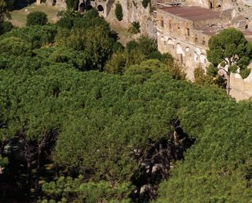


Source 7.1.4 A carbonised wooden cradle found in Pompeii. How could you use this primary source as evidence of what parents in ancient Pompeii had in common with parents today?
When building finished in 80 ce under Emperor Titus, the Colosseum was the largest amphitheatre ever.
Over 50 000 spectators watched gladiator fights, mock sea battles, animal hunts, executions and dramas.
How would you feel if you were living in ancient Rome and entered the Colosseum for the first time?
7.1 Review questions
1Recall when Mount Vesuvius erupted.
2Summarise how the text describes the explosion of Mount Vesuvius. How powerful was the force of the eruption?
3Describe how we know about the events of the eruption of Mount Vesivius today. What kinds of experts work to uncover what happened?
4Explain whether the letter from Pliny the Younger is a primary or a secondary source.
5Analyse how useful the letter from Pliny the Younger could be for historians trying to understand what it would have been like for people to experience this event.
In the last lesson, we looked at a story about the destruction of Pompeii by the eruption of Mount Vesuvius. In this lesson, we will learn about significant events during the rise, establishment and fall of ancient Rome.
Lesson starter
Complete the following activity to kick-start this lesson.
KWL: Know, want to know, learned
1 What do you already know about Rome and how it began? Make a list of three things.
2 What would you like to find out about how civilisation in Rome began? Identify two things you want to know
3 After working through this investigation, come back and identify one new thing that you have learned about the origins of ancient Rome.
59 bce

49 bce
Julius Caesar becomes unpopular in Rome and his opponents start a civil war; Caesar wins and becomes the dictator of Rome
509 bce
Rome becomes a republic, with senators to give advice to governments Rome expands by conquering more of the Italian peninsula
753 bce
Rome is founded by King Romulus, according to legend

Gaius Julius Caesar is made Consul of Rome
264–146 bce
Rome eventually defeats its greatest rival, after three wars against the African city-state of Carthage Invasions result in Roman control over most of Greece and the Middle East
44 bce
A group of Roman senators murder Julius Caesar
58–51 bce
Julius Caesar, a powerful consul and general, conquers Gaul (modern-day France) and tries to invade Britain but is forced to withdraw
republic a government where power is held by people’s representatives, not a king or queen
senators politicians who have been elected to a senate founded when something new is created by a people, generally a city or place
consul the leader of Rome; during the Roman Republic, two consuls were elected into office every year
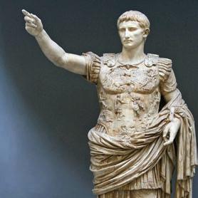
27 bce
The Republic of Rome becomes the Roman Empire, now including Egypt. The first Emperor, Augustus, is the greatnephew of Julius Caesar
Source 7.2.3 A statue of Augustus ➜
64 ce
The ‘great fire’ of Rome. Emperor Nero blames the Christians, who are a new religious community
c.200 ce
The borders of the Roman Empire come under increased attacks by barbarian tribes. Civil wars weaken the empire
395 ce
The Roman Empire is split into the eastern and western empires
476 ce German chief Odoacer defeats Romulus, and the western Roman Empire ends
43 ce Emperor Claudius begins the Roman conquest of Britain
79 ce Pompeii and Herculaneum are buried by the eruption of Mount Vesuvius
Soon after, the Colosseum in Rome is opened
313 ce
Emperor Constantine accepts Christianity as a religion. He brings centuries of Christians being persecuted to an end, and starts the process of Christianity becoming the official religion of the empire
410 ce Alaric the Goth sacks the city of Rome

Source 7.2.4 A gold solidus of Constantine, from roughly 313 ce ➜
sack to invade and destroy a city barbarian someone from another place who spoke a different language; for ancient Romans, a barbarian was any person who was not part of the Roman Empire
7.2 Review questions
1 Use the timeline to identify three challenges faced by ancient Romans. These could be natural disasters, major changes or attacks.
2 Explain the difference between a ‘republic’ and an ‘empire’ (clue: who is in charge?). Then use the timeline to identify how long Rome was a republic, and how long Rome was an empire.
In this lesson, we will learn about why the ancient Roman civilisation developed in a particular place at a particular time.
Lesson starter
Complete the following activity to kick-start this lesson.
See, think, wonder
1 See: Consider Source 7.3.1. How is the wolf caring for the twins?
2 Think: What questions do you have about this artefact?
3 Wonder: Why might the ancient Romans have developed stories or myths around the creation of their city?

According to ancient Romans, their city was created on 21 April 753 bce. However, there are different accounts of how their city came to be. The stories that Romans told about the origin of their civilisation were part history and part mythology
One story is that Rome was founded by a prince of Troy, a legendary city that had lost a war against the ancient Greeks. Prince Aeneas, the son of the goddess of love, Venus, had fled Troy as it burned to the ground, sailed all the way to Italy, and created a new city there.
A more prominent story is that Rome was founded by twin brothers called Romulus and Remus. Their mother was said to be a princess named Rhea Silva and their father the god of war, Mars.
We may never know exactly how Rome was founded, but by studying the geography of Rome it is possible to understand why Rome was so successful. Rome began as just one city, but the rulers of Rome conquered all of Italy, and then expanded across Europe, northern Africa and the Middle East. How ancient Rome maintained control over its vast empire for hundreds of years when others failed is due in part to geography.
The city of Rome is located on the banks of the Tiber River, near the western coastline of Italy. This position was ideal
According to this myth, a king who felt threatened by the baby boys had Romulus and Remus placed in a basket and left by the River Tiber to die. But the boys were saved – first, by a female wolf, and then by a shepherd, who raised them as his own children.
Romulus and Remus grew up and were natural leaders. They killed the king, and decided to create a new city together on the banks of the Tiber River, but they argued. In anger, Romulus fought Remus and killed him. Romulus then went on to name the city Rome, after himself. He made himself king of the city, and established a group of 100 noble men to be his advisers. These men would become the patricians of Rome.
mythology a collection of fictional stories that describe heroic deeds or the origin of things patricians wealthy upper-class people in ancient Rome who often had political power
for trade: goods were shipped down the Tiber River and into the city of Rome, and from there, out to the Mediterranean Sea. Ships helped Rome grow rich from trade and also to conquer lands on the Mediterranean coast, across Europe and in north Africa. The ancient Romans used the sea so much that they named it mare nostrum, which translates as ‘our sea’.
At its greatest size in the second century ce, the Roman Empire covered 5 million square kilometres, controlling over 50 million people, or 20 per cent of the world’s population.
North
Atlantic
Key
Massilia
Corsica
Gades Rome
Sardinia Balearic Is.
Black
Byzantium
Antioch
Mediterranean
Roman Republic, 265 BCE Areas added to the Empire by 117 CE 0
Source 7.3.2 A map showing the growth of the Roman Empire. How much of the growth of the empire between 275 and 133 bce was into lands on the Mediterranean coast?
Using historical sources
The people of ancient Rome knew that their city was well located. Here are what two writers said: the historian Livy (59 bce – 17 ce), and the engineer Vitruvius (c.80–15 bce).
With good reason did the gods and men choose this site for the founding of the city. Rome’s hills provide a healthy environment, the Tiber is favourable for navigation upstream to inland crops and downstream to the sea, and the sea itself is close enough for trade and yet far enough that we are not in danger of invasion by foreign fleets. Consider too Rome’s location at the centre of Italy. This site is uniquely suited by nature for the expansion of a city.
➜
Source 7.3.3 Livy, History 5.54.4, from Peter J. Aicher, Rome Alive: A Source Guide to the Ancient City, vol. 1, 2004
It is a fact that southern nations, although extremely clever, give way when it comes to a contest of courage. This is because their spirit has been [weakened] by the hot sun. Conversely, people born in the [cold] regions of the north, though better suited for the violence of warfare on account of their fearless courage, are slow of mind, and [have] … no thought of strategy.
… the peoples of Italy are temperamentally balanced in each direction, having both physical strength and a mental vigour suited to their courage … Thus did divine intelligence situate the city of the Roman people in an extraordinary and temperate region, so that it might extend its empire across the world.
➜
Source 7.3.4 Vitruvius, Architecture 6.1.10–11, from Peter J. Aicher, Rome Alive: A Source Guide to the Ancient City, vol. 1, 2004
1 Identify three things that the Source 7.3.3 and Source 7.3.4 claim about the advantages of the location of Rome.
2 Explain the sources’ perspectives:
a Which source emphasises how strategic Rome’s location was? Explain what it claims.
b Which source emphasises how beneficial the climate was? Explain what it claims.
Historical concepts and skills: perspectives, using historical sources, communicating
If you wanted to be safe from attack, would you build your city on the top of a hill or at the bottom? The city of Rome is famously built on the top of seven hills. According to myth, Romulus and Remus fought over which hill they should use to build the city.
Beyond the city, the Italian peninsula is divided from the rest of Europe by the
large mountain range known as the Alps, which are very steep mountains. The Alps protected the ancient Romans from enemies, particularly in winter. However, on one occasion the mountains were not a perfect defence. In 218 bce , Hannibal, the ruler of Carthage in north Africa, invaded Italy by crossing the Alps with an enormous army.
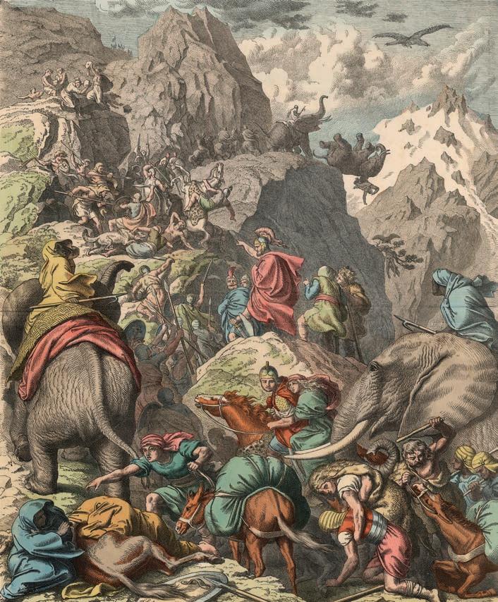
Source 7.3.5 An artist’s impression of Hannibal’s journey. What does the painting show about what made crossing the Alps so difficult, and the unusual animals that Hannibal used?
Source 7.3.6 A map showing the types of crops around ancient Rome. What were the main sorts of foods grown there?
Rome and its surrounding areas were also good places to grow food. There were volcanoes in the area, which over centuries created soils that were rich with nutrients, and the climate was well suited to growing a wide range of crops. The Tiber River was used to transport the crops into the city.
7.3 Review questions
1 Identify the advantages of the location of Rome as a place to grow a large city.
2 Describe why the location of Rome was ideal as a place to expand an empire.
3 Explain the myth of Romulus and Remus in your own words, in three sentences.
4 Refer to thecause-and-consequence diagram below to analyse why Rome succeeded and grew. Copy and complete this diagram, or, in two short answers, write out how you would fill in the spaces for ‘cause’ and ‘consequence’. The arrows should lead from the causes and point to the consequences.
Consequences
It was possible to grow plenty of food
population grew
Having learned where and when ancient Roman civilisation developed, in this lesson we will learn about the groups that made up Roman society, and daily life.
Lesson starter
Complete the following activity to kick-start this lesson.
See, think, wonder
1See: Consider Source 7.4.1. How do clothes of the different people indicate their social status?
2Think: What clothing style would the Emperor wear?
3Wonder: Would each social class use the same fabrics and materials, or would they be different?


Source 7.4.1 An illustration of a Roman patrician couple, a soldier and slave, and a plebeian couple.

citizen a person who is loyal to a government and entitled to its protection plebeian an ordinary Roman citizen who was not part of the privileged patrician class
Imagine you lived in ancient Rome. What would your life be like? That would depend on many factors, including whether you lived during
The main difference between people in Rome was between citizens, who had some rights and influence over the laws of Rome, and non-citizens, who did not. However, there were differences within these groups too.
Citizens could be high or low status. Remember the myth of Romulus, in which he became the first king of Rome and chose 100 noble men to be ‘patricians’? This privileged social group continued to hold high status and power when the Roman Republic was created in 509 bce. However, if like most people you were not born into the patrician upper class, then you were a plebeian. Plebeians were citizens too, but they had fewer rights and less say over decisions.
the republic or the empire, what sort of family you were born into, whether you owned property, and what your gender was.

While all patrician families were privileged, only some of them were very wealthy. If you were born into a patrician family, you could relax while plebeians and slaves worked on your land. Pliny the Younger, for example, who wrote about the destruction of Pompeii, had a villa in the countryside near Rome as well as a domus or town house in the city. His country villa featured different dining rooms for different seasons, running water and central heating, a gym, swimming pool, courtyards and multiple gardens. Like other patricians, his villa had glass windows to make the most of the views, and slaves to serve his family.
Most Romans were ordinary people who worked hard to survive. In the countryside, most people were peasants, feeding themselves from the land. In the city, plebeians often lived in the same neighbourhood as patricians, but they rented small apartments and had to share facilities.
If you were a plebeian, you were known by what work you did – as a laundry worker, a cloth dyer, a butcher, baker, shopkeeper, toilet attendant and so on. Their homes, called insulae, or islands, were apartment buildings above noisy shops, and they shared kitchens with several other families. The higher you went in the building, the smaller was the apartment. Toilets were shared with the whole neighbourhood, and they were little more than holes in the ground.
Patricians could afford to eat bread with every meal, and feasts included seasonal vegetables and fruits, wine, cheese, olives, and roasted birds, fish and meat from other animals. Poor plebeians, on the other hand, might not be able to afford to buy bread and instead usually ate a kind of porridge, with some vegetables or fruit. Some modern Italian foods were not yet invented: pasta would not be available until contact with China, and familiar pizza toppings had to wait until tomatoes were introduced from the Americas.
for being beautiful, honest, and dutiful wives and mothers. A married woman was expected to bear children and look after the household. Women from lower social classes often helped their husbands in shops and workshops. Spinning, weaving and the sewing of cloth was considered part of a woman’s role.
If you were a woman, then your daily life would be much more comfortable as a wealthy patrician than as a poor plebeian, but you did not have the same rights as men. Women in ancient Rome were valued
After the death of her father, a woman could inherit property and do business, but she needed a man, such as a husband or a brother, to approve her decisions. However, widows and divorced women were able to remarry, and from the first century ce, a woman could operate a business without a man to help, if she had three children. For these reasons, many historians argue that women in ancient Rome had more independence than women in other parts of the ancient world, such as in Greece.

Analysing perspectives
Some ancient Romans’ opinions about women were recorded. Read the extracts (Sources 7.4.5 and 7.4.6), then answer the questions that follow.
Woman is a violent and uncontrolled animal … If you allow them to achieve complete equality with men, do you think they will be easier to live with? Not at all. Once they have achieved equality, they will be your masters.
Source 7.4.5 Cato the Elder, in a speech in the Roman Senate in 195 bce ➜
Why should we pay taxes when we do not share in the offices, honours, military commands, nor, in short, the government, for which you men fight between yourselves, with such harmful results?
Source 7.4.6 A speech made by Hortensia, a Roman woman who spoke when a large group of women held a public meeting in Rome in 42 bce
1 Identify what Cato claimed would happen if women were given equality.
2 Explain why Hortensia questions why women should pay taxes.
3 Outline what these sources tell us about the challenges women faced living in ancient Rome.
Historical concepts and skills: perspectives, using historical sources, communicating
The lowest social group was slaves, who had no rights. They were treated as property: they could be bought, sold, given as gifts and rented out to others. Many slaves had been captured in war, but others had been convicted of crimes and forced into slavery as punishment, or had been sold into slavery as children by their families who could not afford to look after them. If your mother was a slave, you automatically became a slave too.
Source 7.4.7 A mosaic from 2 ce shows a slave pouring out something to drink. How does the slave’s clothing compare with that of the people he is serving?


Source 7.4.8 A slave’s collar with the inscription: ‘I ran away. Hold me; when you bring me back to my master Zoninus, you will get a gold coin.’
Dated from 4–6 ce. What does the source tell us about how owners viewed their slaves?
Slaves could be builders, cleaners, farmers, messengers, cooks or servants, and forced to join the army, but they could also be educated and carry out professional jobs such as being an accountant or a doctor.
It was possible for owners to free their slaves, making them freemen and freewomen, with some of the rights of citizens if they were male. This law ensured that the Roman citizen population was constantly expanding, and was open to people from many backgrounds and cultures. Freed slaves took on the names of the families that had freed them and had obligations to their ex-owners.
7.4 Review questions
1 Identify the two main groups of citizens in ancient Rome, and the main difference between them.
2 Compare the living conditions of rich and poor people in Rome.
a How was a villa different from an insulae?
b What did the rich eat that the poor did not?
3 Explain why women and slaves might have been considered to be part of the same social group.
4 Analyse how fair Roman society was. Was it more or less fair than modern Australia?
Having seen how the lives of ancient Romans were shaped by their birth, in this lesson we will learn about facilities and events that affected their daily lives.
Complete the following activity to kick-start this lesson. See, think, wonder
1 See: With a partner, discuss some of the things you can see in Source 7.5.1.
2 Think: What might be the purpose of the underfloor tunnels and cells you can see at the base of the structure?
3 Wonder: The Colosseum is now in ruins, but what would it have looked like fully built?
Source7.5.1 The Colosseum, Rome, is now visited by 12 million tourists annually, who can stand on the arena floor and visit the 14 underground corridors where events and performances were once prepared.


Baths
Ancient Romans liked to keep clean. Where possible, they bathed in a public bath house. Instead of using soap, they covered their skin with olive oil and scraped it off. Building bath houses throughout Rome and its territories and supplying water to them was only possible because of expert engineers. Bath houses were like modern gyms and health spas.

A major feat of Roman engineering was the aqueduct. Aqueducts were large structures made out of stone, and their main purpose was to transport water. Aqueducts were many metres taller than local buildings, and usually constructed from several arches to make them as strong as possible. Across the top of the aqueduct was a channel that carried the water to where it was needed.

Gladiators
Gladiator battles were very popular sporting events in which armed men fought for other people’s entertainment. Colossal stadiums were built to host the games, and some slave gladiators could win enough fame and prize money to buy their freedom. Some free-born men also chose to become gladiators. There are even some references to female
gladiators in primary sources. It was highly dangerous, and usually meant an early death.
In the arena, different kinds of gladiators used different kinds of weapons. The retarius, for example, attempted to capture his opponent with a net and stab them with a trident. A secutor carried a long, rectangular shield and wore a helmet that covered the face.
The Colosseum is an enormous stadium in central Rome, built by the Emperor Vespasian and completed by his son Titus in 80 ce. It seated an audience of approximately 50 000 people for gladiatorial games and spectacles. Titus opened the Colosseum with 100 days of celebratory gladiatorial games. You would know where to sit because that was determined by your social status – the higher your status, the more comfortable was your seat and the closer you sat to the action.
Events at the Colosseum were hugely popular, but some critics at the time said that they were designed to distract the common people from their problems: the leaders made sure that all the plebeians cared about was ‘bread and circuses’. Gladiatorial games remained popular within the Roman world until they were officially banned in 404 ce
A Central arena, covered with sand. It could be set up with boulders or trees for some events.
B The hypogeum beneath the surface of the arena, with tunnels and animal pens. Pulleys, counterweights and ropes brought scenery into the arena, and caged animals for combat.
C Sails protecting spectators from sun and rain.
D Gilded bronze shields supporting the sails.
E Archways containing statues.
F Facade made of a type of limestone called travertine
G Special box for the emperor.

H Several levels of seating. Seats closer to the arena were more expensive. Behind wealthy citizens sat middle-class citizens. Next came slaves and foreigners, and finally, in the standing areas only, were the poor. Women were also in this top tier, separated from the poor by a row of columns. They sat on wooden bleachers.
Source 7.5.4 A cross-section of the Colosseum in Rome ➜

I Public entrances where tickets were sold. These entrances had staircases giving access to the upper levels.
J Exits.
Using historical sources
Roman sports captured the imaginations of artists at the time and have continued to ever since. Examine Sources 7.5.5–7.5.7, then answer the questions that follow.

Source 7.5.5 A detail of a mosaic showing gladiators fighting, c.320 ce ➜


Source 7.5.6 Pollice Verso (‘With a turned thumb’) by Jean-Leon Gerome, 1872 ce
Source 7.5.7 A mosaic from a villa in Sicily, from the fourth century ce, showing women playing sport with weights and a discus ➜
1 In Source 7.5.5, which kind of gladiator is about to lose? Explain his fighting method.
2 Explain how the crowd showed the emperor whether they wanted the defeated gladiator to live, or to be condemned to death, based on Source 7.5.6.
3 How does Source 7.5.7 challenge the idea that ancient Roman spor t was only for men?
Historical concepts and skills: perspectives, using historical sources, communicating
The Forum was considered the heart of Rome. It was a large square where people gathered for a range of public activities. Events held at the Forum included elections, public meetings and speeches, criminal trials, gladiator matches (before the Colosseum was built), social gatherings, business dealings, religious ceremonies and markets.
The senate house located at the Forum hosted political events. There was also a temple dedicated to Saturn, the god of agriculture. The Forum was also used as a treasury, which meant that Rome’s money was managed and kept there.
Source 7.5.8 A reconstruction of what the Forum in ancient Rome might have looked like. Which part do you think Roman leaders would have used as their platform for public speeches?

7.5 Review questions
1 Identify two types of Roman construction related to water.
2 Evaluate the evidence that remains today of water management in different territories of the empire, referring to sources in this chapter.
3 Explain the place of gladiators in Roman society.
a Why did people enjoy watching gladiators?
b Why did some people want to become gladiators?
4 Analyse how awesome building projects could have encouraged people to feel proud to be Roman, using examples.
Having seen how the ancient Roman society changed, in this lesson we will learn about Roman beliefs and practices.
Lesson starter
Complete the following activity to kick-start this lesson. See, think, wonder
1 See: Consider Source 7.6.1 What kind of building is it, and where is it?
2 Think: This temple is very far from Rome. What might that say about the size and strength of the Roman empire?
3 Wonder: What kind of ceremonies or rituals would be held in a place like this? Would you worship each god using the same practices?


Source 7.6.1 The remains of the second-century temple of Bacchus, Roman god of wine and fertility. It is 31 metres tall, and stands in modern-day Lebanon, over 2000 kilometres south-east of Rome.


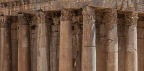


Religion in ancient Rome had a very important place in the daily lives of the people. The ancient Romans were polytheistic, meaning that they believed there were many gods who had different roles to play in determining events in the world. They depicted their gods in statues, mosaics and paintings. When the Roman Republic claimed land in Greece, they adopted some of the Greek gods and goddesses and renamed them.
The ancient Romans generally believed that the actions of the gods could control the fate of the people. At home, families set up shrines for their household and favourite gods. In public, on special occasions at the Colosseum and the Forum, there were sacrifices to try to keep the gods happy and supportive of everything the Romans did. Over time, the role of the emperor became partly a religious one, and Romans believed that their emperors would become gods when they died.
The Vestal Virgins were priestesses of the goddess Vesta, goddess of the hearth and protector of the family. The Vestal Virgins were selected as young girls to become priestesses and to dedicate their lives to their duty, which was to ensure that the eternal flame of Rome, housed in the Temple of Vesta on the Palatine Hill, continued to burn.
If the flame went out, it was believed to be a sign that Rome would be destroyed. If one of the priestesses was discovered to have let the flame go out, she was seen to have failed in her duty. The punishment for this was to be buried alive. Why buried alive? Because the Vestal Virgins were still considered to be sacred women – to kill one was a crime. Therefore, the Romans buried the failed priestesses alive so that it was the Earth that killed them, not an individual person.
A fragment of a relief
of
Since they had to focus on their task, what do you think they are all looking at? ➜ temples places for worship; in ancient Rome a temple would have an altar, where animals were sacrificed hearth the central fireplace in a home
Many temples were built to worship the gods across the Roman Empire. People would leave offerings to particular gods and ask for help in their lives. For example, a person might leave an offering to the god Apollo, god of healing, if they were unwell. But if they were preparing for battle, they might pray to Mars, god of war.

patron someone who supports others with money, gifts or favours; a patron god of a place was seen to support that place with divine favour
Analysing perspectives
Jupiter
• King of the gods
• god of sky and thunder
• patron god of Rome
• like the Greek Zeus

Apollo
• twin brother of Diana
• god of music, healing, light and truth
• like the Greek Apollo
Neptune
• god of freshwater and the sea, earthquakes, hurricanes and horses
• often depicted with his trident
• like the Greek Poseidon

Mars
• god of war, guardian of agriculture
• like the Greek Ares
• father of Romulus
Vulcan
• god of fire, volcanoes, metal work and the forge
• like the Greek Hephaestus


Mercury
• god of translators and interpreters, trade and travel
• messenger of the gods
• like the Greek Hermes

Source 7.6.3 Important gods of ancient Rome ➜
• Queen of the gods
• wife and sister of Jupiter
• protector of Rome’s women
• like the Greek Hera

Ceres
• goddess of agriculture and harvests
• protector of farmers, pastoralists and plebeians
• like the Greek Demeter

Minerva
• goddess of wisdom, arts, trade and strategy
• like the Greek Athena
• born from the head of Jupiter – she leapt out of his head, fully grown and wearing armour!

• mother of the Roman people
• goddess of love, beauty, fertility, sex and desire
• like the Greek Aphrodite
Diana
• twin sister of Apollo
• goddess of the hunt, the moon and birth
• like the Greek Artemis

• the sacred fire of the Vestal Virgins
• goddess of hearth, home and family
• like the Greek Hestia


Look at the information about Roman gods and goddesses in Sources 7.6.3 and 7.6.4 to answer the following questions.
1 Identify which gods or goddesses you would pray to or make a sacrifice to:
a if you were a soldier about to go to war
b if your mother were sick
c if you wanted your crops to grow well
d if you wanted to have a baby.
2 Explain, using examples, how Roman religion was polytheistic and inspired by other cultures.
3 Which god or goddess has the strangest combination of roles or characteristics? Explain your choice.
Historical concepts and skills: perspectives, using historical sources, communicating
Ancient Romans had various beliefs about what happened when a person died. One thing that was universally believed was that good people would be rewarded in the afterlife, either in the Elysium fields or on the Plains of Asphodel, and that the wicked would be punished in a dark and scary place, but they could earn their way out for good behaviour.
The core set of values that Romans tried to follow in order to live well are known by their Latin names, which are as follows.
• Fides – loyalty and trustworthiness, which were considered to be an important part of business relationships and the law.
• Pietas – piety and religious devotion. People had to conduct all the proper rituals and sacrifices to the gods. They also had to always act morally and with good intent.
• Gravitas – self-discipline and composure. People were expected to control their emotions and behaviours, and face problems in a calm manner. Gravitas also referred to someone who was respected for being wise.
• Virtus – the quality of manliness (‘vir’ means ‘man’). This virtue changed in meaning, depending on what was thought of as manly. For most ancient Romans, virtus meant someone who could act rationally and who was a good fighter and a good leader of his family
The body of a loved one would generally be laid out for about seven days so that their friends and family could come and visit. Initially, it was common to dispose of dead bodies by cremation. But, over time, more people were buried in the earth or in large tombs. Because it was illegal to bury a person’s body or ashes inside the city, Roman tombs and cemeteries were always outside the city walls.
• Dignitas – the ultimate quality to achieve – if someone is able to uphold all the other values at once, they achieved dignitas or honour. It was about others viewing you as someone who is worthy and important.
Within the Roman Empire lived some people who believed in one god, which is known as monotheism. Jewish communities could be found in many cities across the empire, and when Rome captured Jerusalem in 63 bce, it created the province of Judaea, where the world’s main Jewish civilisation lived. Jewish people were allowed to continue to practise their religion, in local synagogues and a central temple, so long as they paid special taxes to Rome.
However, over time the Jewish people became angry at the way that Roman governors were exploiting the province, and they rebelled in a series of wars from 66 ce. The rebellion ended with a crushing Roman victory. In 70 ce, Romans destroyed all but the western wall of the great Jewish temple in Jerusalem, which has never been rebuilt. Many were forced to leave Jerusalem and live elsewhere, and since then, Jewish people have only worshipped in synagogues.
Christianity developed as a sect within the Jewish faith during the life of Jesus of Nazareth, who lived in the province of Judaea. Jesus challenged both Jewish leaders and Roman rulers, because he taught people to value humility, avoid fighting and embrace poverty.
Jesus was crucified around 33 ce, for the crimes of blasphemy against Judaism and treason against Rome. His followers spread the new religion across the Roman Empire, first through Jewish communities, and then by converting other people to Christianity. At first, the new religion was treated with suspicion, but tolerated.
In 64 ce, when a great fire burned the city of Rome for over a week, the situation changed for Christians. To distract attention from his own failure to control the crisis, Emperor Nero blamed the small number of Christians in the city for starting the fire, and had them executed by crucifi xion, by burning alive, or by wild animals. Still the religion survived, and continued to gain followers, until in 313 ce, Emperor Constantine accepted Christianity as a religion. He brought the persecution of Christians to an end, and started the process of
Christianity becoming the offi cial religion of the empire.
The irony is that the only religion that the Romans ever attempted to eradicate [destroy] was the one whose success their empire made possible and which grew up entirely within the Roman world.
7.6 Review questions
1 Define ‘polytheism’.
2 Explain how the Vestal Virgins protected Rome.
3 Summarise the kind of person a good Roman was supposed to be, based on their values.
4 Analyse how monotheism challenged the empire, by explaining the following.
a What happened to Jewish people in the first century ce?
b What was the significance of the decision to make the empire officially Christian?
Roman roads in Jerusalem, including ones that were built to allow Jewish people to walk to their temple, and on which Jesus of Nazareth may have walked to his crucifixion, are still there – but now they are buried 5 metres below the modern surface of the city!

Having seen what the Romans built, what they believed and how they spent their days, in this lesson we will learn about how changes in power structures affected the people of Rome.
Lesson starter
Complete the following activity to kick-start this lesson.
See, think, wonder
1 See: Look closely at the Roman coin (Source 7.7.1).
2 Think: How does this compare with voting today?
3 Wonder: What is something that could go wrong with this style of voting?

Source 7.7.1 A Roman coin from 63 bce showing a citizen voting. Citizens carved the initials of their preferred candidate into a wax tablet and then dropped the tablet into a box.
Over the centuries, Rome was ruled first as a kingdom, then as a republic and later as an empire. There were major
In 509 bce, the last king of Rome was overthrown and a republic was created. For Romans, res publica (‘the public thing’) meant a type of government where the male citizens elected representatives to rule on their behalf. Two consuls ruled the republic together so that no one person would have sole rule over Rome
changes in the way Rome was ruled and how much say ordinary people had in those decisions.
at any time. The consuls ruled with the assistance of a senate
Over time, the plebeians became angry at the power of the patricians. The plebeians protested, went on strike and refused to join the army, until gradually they gained more rights.

First, they won the right to elect their own representatives, called tribunes, to represent their views. Around 450 bce, they won ‘the Law of the Twelve Tables’, which was a list of basic rights of all citizens. From the next century, one of the two consuls would have to be plebeian. By 287 bce, the plebeians had equality under Roman law. Their assemblies and their laws were part of the politics and government of Rome.
Decisions about laws and military matters were shared in the republic:
• The two consuls were the main decision makers. Both consuls had the right to veto the other’s decisions, and they were only elected to head the gover nment for one year.
• Two censors were chosen to conduct a regular census of the population (a head-count), and to investigate the private lives of citizens to make sure they were upholding Roman values.
• Senators were wealthy patricians who were appointed for life. They voted on what advice to give the consuls.
• Tribunes were elected by the plebeians’ assembly. They had the power to veto the Senate’s laws.
• There were multiple assemblies: for plebeians, the army and religious groups. These could be attended by all citizens of the group, and then decisions were taken by votes of representatives of the groups.
Source 7.7.2 A representation of the Roman senate, with senators wearing togas, painted in 1899 ce In what ways does it look similar to a modern parliament? ➜
The white toga was a semi-circular, woollen cloth that was draped over the left shoulder and around the body. The wearer had to hold the toga in place with his left hand, which meant that he could only really use his right hand. Women in ancient Rome wore an equivalent garment known as a stola.
senate the group of politicians who had the most power to make laws in a government tribunes elected officials whose job was to protect the people’s rights veto a legal power to stop or cancel an official action or decision
Analysing significance
Spartacus (c.111-71 bce)
Spartacus was a gladiator who led a rebellion for freedom. In 73 bce he escaped along with 70 other gladiators. They travelled north, and won two battles against the highly organised army of the Roman republic that was sent to recapture them. Other rebels and runaway slaves joined them, until there were over 90 000 fighting for Spartacus. It took two years before the Roman army defeated the rebels. As punishment, Roman general Crassus crucified 6000 of them.
dictator someone who rules with total power over a country or territory assassination murder of an important or powerful person by a surprise attack
Just by fighting them, we won something. When just one man says, ‘No, I won’t,’ Rome begins to fear. We were tens of thousands who said no. That was the wonder of it. To have seen slaves lift their heads from the dust, to see them rise from their knees, stand tall with a song on their lips …
Source 7.7.4 Spartacus, as quoted in a famous 1960 Hollywood film, Spartacus
There is no sign that he was motivated by ideological concerns to overturn the social structure. The sources make clear that Spartacus endeavored to bring his forces out of Italy toward freedom rather than to reform or reverse Roman society.
Source 7.7.5 Erich Gruen, The Last Generation of the Roman Republic, University of California Press, 1974, pp. 20–21
Spartacus’ famous slave ‘war’ … remains one of the most glamorised conflicts in the whole of Roman history. Brave as they were, this handful of breakaway slave-gladiators must have been reinforced by many of the disaffected [unhappy] Roman citizens in Italy … This was a combination of slave rebellion and civil war.
Source 7.7.6 Mary Beard, SPQR: A History of Ancient Rome, London: Profile Books, 2015, p. 217
Did Spartacus want a revolution to overturn the political structure of Rome, or was he just seeking his own freedom?
1 How useful is Source 7.7.4 to help us understand the significance of Spar tacus?
2 Explain in your own words what Source 7.7.5 says was Spartacus’ goal.
3 A civil war is a war between groups within a society. Explain why Source 7.7.6 says that Spartacus’ actions were so significant that they were like a civil war.
Historical concepts and skills: perspectives, using historical sources, communicating
The Roman Republic lasted until Julius Caesar (100–44 bce), who gradually concentrated power until he ruled Rome as a single consul or dictator. Caesar was assassinated during a Senate meeting, when some men of Rome thought he had become too powerful.
The killing of Julius Caesar did not end the concentration of power in Rome, because he was replaced by a series of leaders who competed with each other for power, and eventually his great-nephew, Augustus, became the first emperor of Rome.
From 27 bce, Augustus ruled by himself and with total authority. This began the period known as the Roman Empire. There were 70 emperors between then and the fall of the empire in 476 ce.
Augustus began major building projects in the city of Rome, and to expand the borders of the empire. Later emperors continued these activities, until in the first century ce, Rome reached its greatest expansion, encompassing 5 million square kilometres of provinces across Europe, Africa and Asia. Romans built roads to connect their territories, with stone markers along the way that told people how far it was to the next town. This led to the saying, ‘all roads lead to Rome’.
In the city of Rome, the emperor was all-powerful, but across his empire he had to rely on loyal governors, whom he appointed to manage the provinces. Governors were appointed for one to five years at a time and controlled the lives of the people that came under Roman rule. The governor applied Roman laws, commanded a powerful army, charged

people taxes, served as the highest judge and had the power to sentence a person to death. Pontius Pilate, for example, governor of the Roman province of Judaea from 26 to 37 ce, sentenced Jesus of Nazareth to death by crucifixion.
It was challenging for a single emperor to keep watch on the activities of more than two dozen provincial governors, some of whom were several weeks’ journey away from the capital. Some governors abused their positions and treated local people badly while they lived luxurious lives. However, they were required to report regularly back to Rome, and emperors sent their officials around the empire to inspect the provinces.
7.7 Review questions
1 Construct a list, in chronological order, that shows the three types of government that were in place in ancient Rome, and for how long each type ruled.
2 Explain at least two steps that plebeians took towards gaining more equality.
3 Suggest how the hierarchy of the Roman Republic stopped one person from taking control.
4 Analyse how the Roman Empire changed life for Romans, by explaining the following.
a How did the Empire change the way Rome was ruled?
b How did the expansion of the empire create challenges for the rulers?
So far, we have seen how Romans developed and what they believed. In this lesson, we will learn about Roman contacts with other societies, through trade networks and the imperial army.
Lesson starter
Complete the following activity to kick-start this lesson.
See, think, wonder
1See: Consider Source 7.8.1. What are some of the small details you can see in this carving?
2Think: Why might ancient Rome need warships?
3Wonder: Who are the other ancient societies that Rome had conflict with?
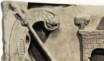


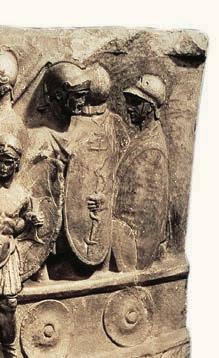

The myths about the early kingdom of Rome are stories that cannot be proven, because there is no archaeological evidence. Despite this, the myths show us that Rome was seen as a city that welcomed people who had been forced to flee from other parts of the world. It was a haven for asylum seekers. Stories about Romulus, for example, say that he wanted the city of Rome to have a larger population, and so he decided to offer any person a chance to be a citizen of Rome. This included criminals, exiled people and anyone looking for a fresh start. As the writer Livy describes:
to help fill his big new town he threw open in the ground – now enclosed – between the two copses as you go up the Capitoline hill, a place of asylum for fugitives. Hither fled for refuge all the rag-tag-and-bobtail from the neighbouring peoples: some free, some slaves, and all of them wanting nothing but a fresh start. That mob was the first real addition to the City’s strength, the first step to her future greatness.
Between 264 and 146 bce, the north African kingdom of Carthage was Rome’s greatest rival. Rome needed a navy to be able to defeat Carthage and conquer more of the Mediterranean. The writer Polybius describes the first steps towards creating this Roman navy.
Romans did not have a concept for an illegal immigrant. Instead, as the single city grew into an enormous empire, it incorporated people from other cultures. As you have seen, however, this did not mean that everyone had equal rights. One clear example was that many people whose homelands were included in the empire became slaves.
To achieve this expansion, Rome developed a highly efficient military, trained to invade, conquer and control other lands.
Observing how the war was dragging on, the Romans then, for the first time, undertook the building of ships … As the shipwrights were entirely inexperienced … the enterprise caused them much difficulty. From this, anyone might see the spirited and reckless nature of the Romans’ determination … once they first had the idea they undertook it so boldly that, before they had any experience in the matter, they at once undertook a naval battle against the Carthaginians.
Eventually, Rome defeated Carthage and turned many of their people into slaves.
The ancient Romans copied the design for their new warships from a ship they captured from Carthage. They borrowed what worked from their enemies and neighbours.
The ancient Roman army was enormous –up to 350 000 men in total – and highly organised. The army was divided into legions, which were groups of 4000 to 6000 men, usually organised in 10 ‘cohorts’, each of which had six ‘centuries’.
in another country navy a fleet of ships used to wage war; part of a country’s armed forces
legions groups of 4000 to 6000 soldiers in the ancient Roman army
centurion an experienced and respected soldier, who commanded 100 men equestrians soldiers who owned and rode horses
There were different ranks. Members of the patrician class led the army, but an ordinary soldier could rise to the rank of centurion, and command 100 men. Equestrians were soldiers on horseback and usually members of noble families.
Conquests were celebrated back in Rome with parades through the streets, special awards and honours for the victorious commanders, and sometimes new buildings and columns, paid for by what was taken from the conquered territories.

Under the reign of Emperor Trajan, Rome invaded Dacia (modern-day Romania) in 101–106 ce. The emperor had a giant column created to celebrate the victory, decorated with carvings which tell the story of the invasion, like a giant comic strip.


7.8.6 In
Source 7.8.7 In this scene, the ancient Romans (those wearing helmets) are battling the Dacians. In the middle at the top of the scene, the god Jupiter helps the ancient Romans by throwing thunderbolts at the Dacians.
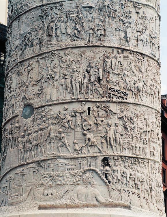
1 In Source 7.8.6, find three examples of Roman soldiers working together, and explain what they are doing.
2 According to the depictions in Source 7.8.7, what advantages did the Romans have to help them defeat the Dacians?
3 Given that this was a monument made by ancient Romans to celebrate Rome’s victory, how reliable do you think it is as a source of information about this war?
Historical concepts and skills: perspectives, using historical sources, communicating
As Trajan’s Column shows, when Rome conquered territory, the empire became richer, with access to valuable goods. By controlling Dacia, Rome controlled the supply of gold, silver and salt. After Britain was conquered, the province supplied lead, tin and woollen products to Rome.
The empire also grew wealthy through peaceful trade. Within the empire, wine, olive oil and pottery were produced and swapped with neighbours in Africa and the Middle East, often for luxury items that the Roman Empire could not produce, such as silks, spices and dyes. Ships were used to transport goods and roads were built to move them across the land. People were also traded as slaves across the Mediterranean.
frontier a border between countries, or the limit of a country or empire
Trade also meant that people shared their cultures and beliefs, which is why so many Roman gods and goddesses have their equivalents in Greek and other religions. There is even evidence suggesting that the Roman Empire traded with China and India.
The Roman Empire came to an end during the fifth century ce. Historians argue over when and how it ended, as well as what caused the empire to weaken. One reason was undoubtedly invasions by barbarian tribes from a number of the frontiers of Rome, which occurred from early in the third century.
With its military stretched across the empire, Rome struggled to defend itself. Germanic tribes known as Goths invaded from the east, Angles and Saxons challenged Roman occupation of Britain, and Vandals came from Africa to the south. In 395 ce, the empire was split into a western half, managed and defended from Rome, and an eastern half, managed from Constantinople (modern-day Istanbul).
When Goths from the north, led by Alaric, successfully invaded and sacked Rome in 410 ce, the western Roman empire began to crumble. Ultimately, the western half of the empire was broken up into smaller kingdoms, ruled by the people who had managed to defeat the onceinvincible Roman army.
Source 7.8.8 Roman amphorae (jars or jugs) found in Pompeii. What sorts of goods could be traded across great distances within these containers?


Angles, Saxons
Franks
Goths
Visigoths
Ostrogoths
Huns
Vandals
Capital of the Western Roman Empire
Capital of the Eastern Roman Empire
Western Empire
Eastern Empire
Source 7.8.9 Invasions of the Roman Empire, c.100–500 ce How many different attacks can you identify by people known as ‘goths’?
7.8 Review questions
1 Identify three different types of Roman soldiers.
2 Explain how the Roman military was organised, using the historical names for soldiers and groups.
3 Examine the goods that moved around the Mediterranean region through Roman trade routes.
4Discuss why people on the frontiers of the empire would want to invade Rome. What had Rome taken from them, or achieved, that they might want to have for themselves?
So far, we have seen how Rome developed and expanded. In this lesson we will learn about the lives of the bestknown Roman rulers.
Lesson starter
Complete the following activity to kick-start this lesson.
See, think, wonder
1 See: Consider Source 7.9.1 How many men are trying to kill Julius Caesar?
2 Think: What have you heard about Julius Caesar before? Discuss with a partner.
3 Wonder: Why might a Roman ruler be under the threat of death?

Significance means the relative importance of something. How do we decide which individuals in the past were significant enough to record information about? Is it because they introduced new ideas or systems? Is it because they were talented or unusual? Was the world in some way different because of the changes they brought? Do we need to measure how many people’s lives they affected, or how long-lasting the effects were?
Remember some of the key leadership roles in Rome:
• consul: The political leader of the Roman Republic; usually shared between two men
• dictator: A sole leader who ruled with total power
• emperor: The political and military leader of the Roman Empire
• general: The senior commander of the army.
Before Julius Caesar, Rome was a republic, led by two consuls, advised by patricians who formed a senate, and plebeians, who contributed advice through their tribunes and made laws through their assembly.
Gaius Marius (c.157–86 bce)
Gaius Marius was a general who became consul during the Roman Republic. Marius was born 100 kilometres south-east of Rome and came from a plebeian family. He was incredibly popular. He was elected as consul seven times, more often than anyone before.
Julius Caesar is the best-known ancient Roman. He was born into the patrician class and became a famous politician, general and writer. He was celebrated for the way he led troops in the area of Gaul, modern-day France. He was also remembered for how he extended the empire. The writer Livy at the time said that Caesar was so driven to succeed that ‘he was competing with himself, as though he were someone else’. After a victory in Asia Minor (modern-day Türkiye), Caesar reportedly said simply and confidently: ‘Veni, vidi, vici’, which is a Latin phrase for, ‘I came, I saw, I conquered’.
Marius revolutionised the army, making it stronger and more efficient than before. Before Marius, a man had to be a citizen with considerable wealth before he was able to serve in a legion. Marius changed this, allowing any free man to serve. This increased the size of the army and meant that men were able to raise themselves up in the world by succeeding in the army and becoming wealthy.
he was declared to be the dictator for life.
One way that Caesar made himself famous was by writing accounts of his own military campaigns and victories. He also became the lover of the most powerful woman in Egypt: Queen Cleopatra. The senate made Caesar a dictator of Rome, first for one year, then for 10 years, and eventually


Many Romans became concerned that he was behaving like the kings that Rome had abolished five centuries before. Caesar wore a laurel wreath as a crown, which before had only been worn at the end of a military victory, statues of him were placed in all Rome’s temples, his house was modified to look like a temple, and he refused to listen to his political opponents. Caesar introduced a new calendar, the ‘Julian’ calendar, the structure of which we still use today. He had one of the months renamed for him (Julius, or July). Within two months of being appointed dictator for life, many high-ranking wealthy Romans decided to put an end to his leadership. On 15 March 44 bce, they killed Caesar, who reportedly suffered 23 stab wounds.
Explaining perspectives in secondary sources
Caesar is one of the most widely discussed Romans. Historians have a range of perspectives about him.
Caesar … made friends among the populares, the group who sought to defend and increase the powers of the people’s assembly in Rome against the senate, and who courted support by arguing for land reform, extended citizenship and various protections for the plebeians of Rome, the ordinary traders and workers.
Julius Caesar … was the first living person whose head featured on a coin minted in Rome. Up to that point, Roman small change had paraded only images of long-dead heroes, and the innovation was a blatant sign of Caesar’s personal power, followed by all later Roman rulers.
[Statues of Caesar show qualities of] majesty, pride, disdain, reflection, prudence, boldness, tension, spirituality, delicacy, fortune, culture, humour, love, cruelty, grief, cheer, clemency, temperance, and wildness.
Source 7.9.4 Rowan Williams, in New Statesman magazine, London, 2022 ➜
Source 7.9.5 Mary Beard, SPQR: A History of Ancient Rome, London: Profile Books, 2015, ch. 7 ➜
Source 7.9.6 R Herbig, quoted in Z Yavetz, ‘Caesar, Caesarism, and the Historians’, 1971
1 Explain the perspective in Source 7.9.4 about how Julius Caesar appealed to plebeians.
2 According to Source 7.9.5, outline how the face of Caesar became known around the empire.
3 Consider the qualities that Source 7.9.6 says are shown in different statues of Caesar. List the positive and negative. Then, in a sentence, reflect on what this shows about Caesar.
Historical concepts and skills: perspectives, using historical sources, communicating

Source 7.9.7 Statue of Augustus. What characteristics does it represent?
After Julius Caesar, Rome was an empire, led by single emperors, some of whom worked cooperatively with the senate and assembly, while others made decisions without much advice.
Augustus (63 bce to 14 ce)
Augustus was the adopted son and great-nephew of Julius Caesar. After Caesar’s death, he defeated others who tried to seize control of Rome, including Cleopatra and her husband Marc Anthony. The senate made Augustus consul, and later emperor for life.
This meant the end of the Roman Republic and its belief in elected leaders. Augustus had anyone who posed a serious threat to him killed, by a process called ‘proscription’. This was like a ‘wanted’ list: the names of enemies were written on a list and then anyone could kill them and receive a reward.
Generally, Augustus was seen as a good ruler. He helped the poor and had many grand buildings created. He is reported to have said, ‘I found Rome a city of bricks and left it a city of marble.’ He brought peace to the empire after years of discord. This period was known in Latin as the pax romana or the Roman peace, and lasted around 200 years. After Augustus died, he was declared to be a god by the next emperor, Tiberius. From this time on, all emperors were considered to become gods after they died.
Livia Drusilla (58 bce to 29 ce)
Livia Drusilla became the third wife of Augustus, and gained influence because of her marriage. At a time when women were not even allowed to appear in public without a male relative, she was the most visible and powerful woman in Rome. Livia presented herself as a beautiful woman and a loyal wife, but in private she put pressure on Augustus and shaped many of his decisions. She also found a way to make her own decisions about

7.9.8 Statue of Livia Drusilla. Like the goddess Juno, she is shown holding a cornucopia (a horn overflowing with food and good things). Why would she be shown to be like a goddess?
➜ major building projects in the city. Livia also fought fiercely to make sure that the son she had with her previous husband became the heir to the throne, including by having his rivals killed. She succeeded –her son Tiberius (42 bce to 37 ce) became the next emperor.
Following Tiberius, Emperor Caligula (12–41 ce) was known as the mad emperor, and could be vicious towards people around him. He reportedly said, ‘Remember that I have the right to do anything to anybody.’ He once ordered hundreds of Roman ships to be tied together to make a 3-kilometre-long floating bridge across a bay, so that he could spend two days galloping back and forth across it on his favourite horse!
7.9 Review questions
1 Identify one way in which Rome was changed by Gaius Marius.
2 Describe one way in which Rome was changed by Julius Caesar.
3 Explain a negative and a positive aspect of Augustus’ leadership.
4 Analyse what qualities of a successful leader were shown by the influential Romans described in this lesson.
Having seen how Rome was shaped and strengthened by significant individuals, in this lesson we investigate how historians and archaeologists try to conserve the past of ancient Rome.
Complete the following activity to kick-start this lesson.
See, think, wonder
1 See: Consider Source 7.10.1 What tools does the archaeologist use?
2 Think: Why might archaeologists want to preserve a site like Pompeii?
3 Wonder: What other ancient wonders have yet to be discovered?
Source 7.10.1 An archaeologist works on a fresco at the excavations of Pompeii, while tourists walk above. ➜


Remember Pompeii, buried under the volcanic ash of Mt Vesuvius in 79 ce?
Today, you can visit the site of Pompeii and wander around the remains of the city. In fact, around 4 million tourists visit the site every year. However, this was not always the case. For many years, the city was lost and entirely hidden under the ground, beneath layers of ash, rock and soil. Then one day, the lost city was found by accident! While builders were digging into the earth to lay foundations for a new building, they came across ancient roofs and walls. In 1748 ce, an organised effort to uncover the remains began, and soon proof was found that the site was the lost city of Pompeii.
Before the remains were uncovered, the story of Pompeii was only known through written primary sources, and the accounts of historians. Historians mainly use written records as their evidence, and these can survive even when the people or places they describe are long gone. Archaeologists, who work in teams to dig up human and other physical remains, gather artefacts that confirm, add to or change the findings of historians. For nearly 300 years, archaeologists have been adding to our knowledge of Roman history by excavating sections of Pompeii and finding buildings and objects. New discoveries are still being made today.

Another way that archaeologists learn more about ancient Romans is when construction work happens in a modern city that was built over a Roman site. London, for example, was established as a city by the
Romans in 43–50 ce and called Londinium. In 2013, in a part of London called Walbrook, builders were digging deep foundations for a new skyscraper, and when they started to uncover ancient-looking articles, they called in archaeologists.
What they had found were the remains of a Roman temple and shopping street.
Archaeologists have limited time to gather evidence when they are working at a construction site. This is sometimes called ‘rescue archaeology’, because they have to work quickly to rescue historic items before construction continues and buries the site. In the case of the skyscraper, archaeologists excavated more than 10 000 artefacts and moved them into a museum for further study about how people lived during the Roman Empire. Across the city, during the digging of a new train tunnel, a similar effort discovered Roman jewellery, personal items and some burials of human remains.

Identifying methods used to study sites of historical significance
Vindolanda was a Roman fort in the north of the United Kingdom, where soldiers were sent to protect the border of the empire. It is over 2000 kilometres from Rome, near ‘Hadrian’s Wall’, which the Roman army built to defend the edge of their empire. The wall stopped Roman-occupied lands in Britain from invasions from the north (modern-day Scotland). Archaeologists have spent years digging and brushing to uncover many artefacts that were buried at the fort under layers of soil. They work slowly to avoid damaging any objects. These artefacts tell a range of stories about what life was like as an ordinary soldier in the Roman military.


1 Identify three tools shown in Sources 7.10.4 and 7.10.5 that archaeologists use to uncover artefacts.
2 Explain what the artefact in Source 7.10.6 shows us about the life of Roman soldiers at the edge of the empire.
3 Explain what makes this site significant.
Historical concepts and skills: historical significance, using historical sources, communicating
Many written primary sources survive from ancient Rome, and they were mostly written in Latin, which historians can read and translate. During the Roman Empire, histories of Rome were written by authors like Livy and Plutarch, and they have been published in books over the centuries since. These histories record details about what happened, when, where and who was involved; and the written texts can be used to make sense of the artefacts that archaeologists discover.
Also, the imperial government kept detailed records through censuses and military communications, some of which have been preserved. Some letters that Romans wrote to each other to keep in touch also survive, and these sources give us eyewitness accounts of some of the biggest moments in ancient Roman history. Romans also created poems and

Source 7.10.6 A waxed writing tablet from Vindolanda, dated c.80 ce, which translates as, ‘Give this to Junius the cooper, opposite the house of Catullus’. Messages like this were written on thin pieces of timber, which survived because they were preserved in the mud. Some of the messages talk about how cold life was on the border and how the soldiers needed to be sent certain clothes to try to keep warm.
plays to keep themselves entertained, which can also teach us about Roman beliefs and values.
Cicero (106–43 bce)
Marcus Tullius Cicero lived during the end of the Roman Republic, as Julius Caesar fought against other powerful commanders for the right to rule on his own. He was known for his brilliant public speaking and debating skills. Cicero supported the idea of Rome remaining a republic and was voted as consul for one year in 63 bce. But Cicero is best known for his writings. He wrote many letters in his lifetime and over 900 of these letters survived. This means that they were copied down and kept, instead of lost over time as many other written works were. However, Cicero was unable to prevent the dictatorship of Julius Caesar, and he was captured and killed after he insulted Augustus.
His head and hands were cut off and Augustus put them on display in the forum.

Source 7.10.7 A statue of Cicero wearing a toga. What does his clothing show about his social status?
Cicero wrote discussions on all sorts of topics that interested him, from the nature of government to the best way to speak publicly. Cicero’s writings, like archaeological evidence, provide historians with important information about the values and lives of people in ancient Rome. Lesson 7.10
Licence [free choice] is wont to prevail when there is too little to fear, as in a calm voyage, or a trifling disease. But as we observe the voyager and invalid implore the aid of some competent director, as soon as the sea grows stormy and the disease alarming, so our nation in peace and security … insults its leaders, but in war obeys them as strictly as kings … And in the most serious wars, our countrymen have even chosen the entire command to be deposited in the hands of some single chief, without a colleague.
7.10 Review questions
Source 7.10.8 Cicero, ‘On the Republic’, c.54–51 bce, from Oliver J Thatcher, ed., The Library of Original Sources, Vol. III: The Roman World, p. 241
[To govern a province,] all that a governor has to do is to show consistency and firmness enough, not only to resist favouritism, but even the suspicion of it. To this also must be added courtesy in listening to pleaders, consideration in pronouncing a decision, and painstaking efforts to convince [people who complain] of its justice, and to answer their arguments.
Source 7.10.9 Cicero, Letter about his experience as governor of Asia, 61–59 bce, from E Shuckburgh, The Letters of Cicero; the whole extant correspondence in chronological order, George Bell: London, 1908–1909
1 Identify how long archaeological research has been happening at Pompeii.
2 Explain how ‘rescue archaeology’ is different from the work at Pompeii.
3 If you were an archaeologist, explain which tools you would use, and in what order, to uncover artefacts.
4 Analyse how archaeologists need written sources to complete their research.
Access the Interactive Textbook for a range of digital tools to help you review this topic, including:
• Downloadable chapter summary
• Scorcher timed competitive quiz.
What have you learnt about ancient Rome? For this activity, copy the diagram and fill out by explaining your understanding. Aim for two points per topic.
Topic
The origin of Roman civilisation
Roman social groups
Daily life
Social changes
Beliefs and values
Contacts and conflicts
Julius Caesar
I used to think that ...
Now I understand that ...
This exercise in visible thinking asks you to track the difference between what you knew about Rome before, and what new understandings you have acquired since reading this chapter.
Using the stem sentences here, write a paragraph explaining what you previously knew about the topic. Then write another paragraph explaining what you now understand about the topic.
What I have learned
1 a I used to think that Rome was …
b Now I understand that Rome was …
2 a I used to think that archaeologists …
b Now I understand that archaeologists …
3 a A simple explanation for why Rome was significant is …
b A better explanation for why Rome was significant is …
1Identify the difference between the way Rome was ruled during the Roman Republic and the Roman Empire.
2Explain the causes and consequences of key events in Roman history by matching the cause on the left with its correct consequence on the right.
Causes
Rome became a republic
More people were linked by roads and accessed water through aqueducts
Rome conquered rich territoriesRoman gods and goddesses were based on Greek ones
Rome became an empire
Rome was ruled by two consuls who shared power
Roman engineering spreadRome was ruled by a single emperor
Romans were interested in Greek culture
The Roman Empire was split and then collapsed
The Roman military was highly organised Slaves and riches were brought back to Rome
Goths and other enemies invaded Rome Rome conquered and governed many lands
3 Apply your understanding of causes and consequences by selecting two pairs of causes and consequences from the table above that you have found the most interesting to learn about, and explain why you chose them.


4 Analyse Source 7.11.1 as a historical source, using the questions below.
a When was the artefact from?
b Who would have bought the item?
c What does the artefact show us about people’s values at the time?
Source 7.11.1 A terracotta oil lamp in the shape of a gladiator’s helmet, bought by a spectator at the Colosseum, first–second century ce
5 Evaluate the impact of Julius Ceasar or another significant individual from ancient Rome. How did they affect the way that Rome was organised, and why are they remembered by historians?
6 Create a speech about the significance of Rome: imagine you have been asked to give a speech to the Australian Senate in Canberra to explain to the senators how ancient Rome influenced modern societies like ours. You should do the following.
• Explain which key values of ancient Rome are valued in our society.
• Describe Roman engineering ideas that continue to be used today.
• Explain where the idea of a ‘senate’ came from and what it was like in Rome.
• Evaluate whether ancient Rome or modern Australia is a fairer society.
Write a paragraph in response to the question using all the key terms listed:
• empire
• frontier
• navy
• centurion
• citizens
• artefacts
• archaeologists.


Image: A woman stands next to a cart loaded with jerry cans after collecting water from a water point as residents queue in the Galabadja district of Bangui, on March 14, 2025. Water problems are common each dry season in Bangui, the capital of the Central African Republic, a situation recently exacerbated by a major electricity outage. Development has been hindered not only by years of civil war but also by governance failures. From February to May, wells dry up, prompting a rush to private water points with manual or mechanised pumps until the rains return.


Watch the video for an introduction to Geography in Year 7 and the geographical skills and concepts you will be working with.
Water in the world illustrates the ways in which the environment supports, influences and enriches human life. Students examine water as a renewable environmental resource, its spatial distribution in Australia, how it is used and valued, and how societies attempt to manage its scarcity. The sub-strand concludes with a study of an atmospheric or hydrological hazard.
Source: VCAA, Victorian Curriculum V2.0, ‘Geography’, ‘Band description –Levels 7 and 8’
CURRICULUM GOALS
• Is the use of water in Australia sustainable?
Source: VCAA, Victorian Curriculum V2.0, ‘Geography’, ‘Band description – Levels 7 and 8’

8.1Setting the scene: A city that ran out of water
8.2How is water classified as a resource?
8.3In what forms does water exist?
8.4How does water connect and change places?
8.5How is water used around the world?
8.6What is water scarcity?
8.7Case study: How is water scarcity managed in the United Arab Emirates?
8.8What is the distribution of water resources in Australia?
8.9Case study: Is water managed sustainably in the Murray–Darling Basin?

8.10What is the value of water for different people?


8.11Case study: How does water sustain life and culture for First Nations Peoples?
8.12Fieldwork: Exploring the significance of a local water resource


This lesson introduces the importance of water as a resource and the causes and consequences of water scarcity.
Chennai is gaining notoriety as the disaster capital of the world – floods one year, cyclone the next and drought the year after.
Nityanand Jayaraman, BBC
With a population of over 12 million people, Chennai is the fifth-largest city in India. Between 1980 and 2010, the city experienced rapid growth. Almost 400 square kilometres of buildings were constructed in areas that were once wetlands. This completely changed the flow of water through the landscape as less water was able to infiltrate into the groundwater supplies. As the city continued to expand, pollution from various industries and coal power stations led to the degradation of many of the remaining wetlands and rivers. Meanwhile, Chennai’s population grew considerably, increasing the demand for water resources.
In June 2019, after extended periods of low rainfall, soaring temperatures
May 2018
and poor water management, Chennai reached ‘day zero’ and ran out of water. As reservoirs emptied, the Indian government began trucking water tankers into the city. Millions of residents waited in line for hours each day to fill buckets to take home to their families. As the crisis worsened, businesses and schools were forced to close and hospitals had to turn patients away. Residents struggled to maintain basic levels of hygiene as they were unable to wash their clothes, dishes or even themselves. While the wealthy were able to pay extraordinary prices for water from private tankers, the poor living in slums were less fortunate. Many left, seeking refuge in nearby cities.

wetlands an environment featuring land that is either permanently or seasonally covered with water infiltration the process of water moving from the surface and soaking into the soil and rock layers below groundwater water that is located below the Earth’s surface that has soaked into soil and rocks degradation the reduction in the quality and health of a natural environment due to natural processes or human activities


Relief finally arrived in late 2019 when heavy rain filled Chennai’s reservoirs and ended the water crisis. However, Chennai is still extremely vulnerable to future water shortages. To ensure Chennai’s water management is sustainable, and to prevent future disasters, experts have recommended that Chennai future-proofs its water supply by:
• increasing the amount of rainwater that is harvested from the roofs of buildings
• constructing a pipeline that allows water to be transported from nearby regions
• restoring and conserving its rivers, lakes and wetlands
• building multiple desalination and wastewater treatment plants.
On a national scale, India needs to ensure it manages its water resources sustainably throughout the entire country. Twenty-one cities, including Bangalore, Hyderabad and Delhi, are all facing similar risks of running out of groundwater, which could affect as many as 600 million people!
This chapter begins with an exploration of the importance of water as a resource, the ways in which it can be classified and the role it plays within environments. It covers issues such as water scarcity, the most sustainable way to manage water, and the economic and cultural value of water within societies.
8.1 Review questions
1 Describe how the construction and expansion of Chennai reduced the availability of water resources.
2 Recall the reasons that Chennai ran out of water in June 2019.
3 Recall the expert recommendations for how Chennai could future-proof its water supply.
In this lesson you will be introduced the concept of an environmental resource and learn about the ways in which water can be classified as a resource.
Complete the following activity to kick-start this lesson.
Brainstorm answers to the following questions with a partner.
1 Identify the primary use for coal as a resource.
2 Would you describe coal as a renewable or non-renewable resource? What makes you say that?
3 Outline the positives and negatives of harvesting and using a resource like coal. Suggest alternatives resources.
Figure 8.2.1 Coal is an example of a fossil fuel that is harvested in Australia to be used as a resource.


Resources are used by people to satisfy a need. Satisfying needs includes producing food, constructing a building, generating electricity and earning money. Environmental resources are those that are found naturally in the Earth’s environment. They include light, wind, heat, trees, rocks, minerals and water.
A common way to classify environmental resources is based on whether they are renewable. Renewable resources are those that can naturally replenish themselves at a rate that is faster than
Scientists predict that the Sun will last for another 6.5 billion years. Although this is not technically infinite, it is longer than the Ear th has existed!
people use them. Table 8.2.1 describes three examples of renewable resources. Solar and wind energy are resources that will never run out, and also known as infinite resources. environmental resources resources that are from the natural environment, such as water and wood environment the living and nonliving components within and surrounding a place renewable resources resources that can be produced as quickly as they are used infinite resources resources that will never run out
Table 8.2.1 Examples of renewable resources
SourceExplanation
Solar energy Solar energy is used to generate electricity using solar panels such as large-scale solar panel projects. Solar energy is also essential in the growth of plants. Solar energy is renewable since it is infinite and the supply does not reduce when it is used.
Collection

Wind energy
Wind can be used to generate electricity using wind turbines. The wind spins each turbine like a fan. This then turns a generator, which creates electricity. An average onshore wind turbine can generate enough power to supply 1500 households with electricity. Although it does not always flow rapidly, the supply of wind does not reduce as it is used, meaning its supply is renewable.
Trees Wood from trees is used for a variety of purposes, such as construction and paper production. Wood can be considered a renewable resource if the rate at which it is harvested is slower than the rate at which new trees are growing. Allowing forests to regenerate so that they can be logged again in the future is an example of sustainable resource management. harvest to pick and collect a resource such as crops, or to collect plants, animals or fish to eat regenerate to manage a forest so that it grows back following a disturbance such as logging sustainability the use of natural resources in a way that does not reduce the supply for future generations


Non-renewable resources are those that cannot be replaced once they are used. A fossil fuel such as coal is a common example. Fossil fuels are produced from buried deposits, which are formed from layers of decayed plants and animals (fossils). Over millions of years, the layers of organic remains are exposed to intense heat and high pressures, turning them into fossil fuels. Since non-renewable resources are not replaced, their supply is limited and they could eventually run out. These types of resources are known as finite resources
It will take 300 million years for new coal to form from current dead plant material!
Water is considered an environmental resource because it is part of the natural environment. It has a wide variety of uses. These include:
• domestic – used in the home for flushing toilets, showers, drinking, cooking and cleaning
• agriculture – used to grow crops and raise animals and farm fish
• industry – used to manufacture and transport products
• environment – used to maintain the health of natural and human environments such as river systems
• recreation – used in community swimming pools, and to maintain parks, ovals and golf courses.
Water is constantly moving through landscapes by the processes that make up the water cycle (see Figure 8.2.2).
Solar energy heats the water in rivers and lakes and turns it into water vapour, in a process known as evaporation
Similarly, water in plants undergoes transpiration as water is lost from the leaves. As water cools in the atmosphere, clouds form and the water condenses. From this condensation , water droplets and ice crystals form. When clouds grow large enough, the water falls as precipitation , such as rain and snowfall. When this falls on the land, some of the water absorbs into the soil and is added to the groundwater supply.


non-renewable resources resources existing in limited quantities that cannot be replaced after they have all been used fossil fuels resources that were formed underground from plant and animal remains millions of years ago; examples include gas, coal and oil finite resources resources that have a limited supply evaporation the process of a liquid changing to a gas, especially by heating transpiration the process of losing water through the surface or skin of a body or a plant condensation the process by which water vapour in the atmosphere cools and changes into liquid water precipitation water that falls from the clouds towards the ground, especially as rain or snow


Water that infiltrates into the soil eventually flows underground into rivers and lakes, or to the coast. Water that does not infiltrate into the soil flows over the land and into rivers. This is known as runoff. This water eventually makes its way into river systems and flows back out into the ocean where the cycle repeats itself.
Despite constantly changing between a solid, liquid and gas through the water
cycle, the total amount of water on Earth never changes. This means that the overall supply of water is finite. However, in areas that receive high and regular amounts of rainfall, the resource can certainly seem infinite since the supply is constantly renewed. In other places, supplies are constantly monitored and the use might need to be restricted if the finite supplies run low.
Geographers classify different components of the world around them in order to better understand different environments. Classifying involves grouping things based on their characteristics. Based on what you have learned about the different classifications of environment resources, classify the following based on whether they are renewable and whether their supply is finite or infinite. In each case, write a sentence justifying your choice.
• Native animals hunted as a food source
• Saltwater from the ocean that is converted into freshwater
• A forest that is used to harvest individual trees and then left to grow back
• A forest where all the trees are harvested so that the land can be turned into a farm
You may wish to use the table template shown here to help set out your classifications.
1 Describe the difference between a renewable and non-renewable resource. Provide examples in your explanation.
2 Explain why an environmental resource such as timber might run out even though it is a renewable resource.
3 Summarise, in a series of dot points, the changes water goes through as it moves through the water cycle.
4 Justify why water can be classified as both finite and infinite depending on different circumstances.
In the previous lesson, we learnt about how water can be classified as a resource. In this lesson, we will take a closer look at some of the forms in which water exists in our environment.
Complete the following activity to kick-start this lesson.
Figure 8.3.1 shows a wastewater treatment plant in which wastewater, such as sewage, is filtered and purified to specific levels of quality. This recycled water can be used to water crops, flush toilets and even as drinking water if it is treated to the highest quality. Many places in Australia, such as Perth, are currently investigating the possibility of adding recycled water to their water supply, while some parts of Australia are already using water that contains recycled water.
1 Would you be comfortable drinking water that contains recycled water? Justify your opinion.
2 Investigate the benefits and risks of using recycled water as part of water supplies. Based on this research, has your opinion changed?


freshwater water with less than 0.5 per cent of dissolved salts
glaciers large masses of ice that move slowly; they are frozen rivers of ice that form when snow accumulates and is compacted
ice cap a thick layer of ice that permanently covers an area of land surface water water available on the surface of the Earth in rivers and lakes
perennial something that happens repeatedly or all the time
Water is one of the most abundant resources on Earth. In fact, it is estimated that the Earth contains 1260 quintillion litres. That’s 1 260 000 000 000 000 000 000 litres! Approximately 97.5 per cent of this water is saltwater found in oceans, which cover 71 per cent of the Earth’s surface. This leaves 2.5 per cent as freshwater. Although freshwater is a small percentage of the total water on Earth, if this 2.5 per cent was readily available then it would be a plentiful supply. However, of this 2.5 per cent, 79 per cent is frozen in glaciers and ice sheets, such as those covering Greenland and Antarctica. A further 20 per cent is located underground in the groundwater supply. In fact, just over 0.5 per cent of all the freshwater on Earth is available as surface water in lakes and rivers.
Figure 8.3.2 Although the Earth contains a very large amount of water, only a very small percentage is available as freshwater and an even smaller amount is available as surface water.
As the name suggests, surface water is water located on the surface of the Earth. This includes rivers, lakes, and wetlands such as swamps. Most major cities are built near a reliable supply of surface water because it is easy and cheap to

access. In some cases, surface water resources are perennial, which means that they are permanent.

Perennial resources are lakes that always contain water and rivers that flow all year round, such as the Glenelg River in Victoria (Figure 8.3.3). Although the Glenelg River is permanently flowing, the amount of flow varies each year (see Figure 8.3.5). In drier areas, surface-water
Interpreting bar graphs
resources are often ephemeral, which means they are semi-permanent. Ephemeral resources dry up during seasons with low rainfall. This is a common occurrence in many arid places in Australia, such as the Flinders Ranges in South Australia (Figure 8.3.4).
ephemeral something that happens only for a short time arid very dry, often without rainfall to support plants
Figure 8.3.5 The variation in the flow of the Glenelg River each water year compared to the long-term average between 1980 and 2021. A water year is a defined 12-month period chosen to reflect the natural rainfall season in a location.
Bar graphs use bars of different lengths to represent quantities. In Figure 8.3.5, each bar represents a different year, allowing us to analyse how the data is changing over time. In this example, blue bars represent years in which the Glenelg River has more gigalitres of flow than the long-term average of 8.21GL/year. Red bars are years when the flow is below average. The amount that the flow is above or below the average is determined by the length of the bar.
Refer to Figure 8.3.5.
1 Name the years in which the flow of the Glenelg River was the highest and lowest compared to the average.
2 Use the values on the y-axis (vertical axis) to determine the streamflow difference from the average.
3 Use the annual average of 8.21 GL/year and your answer to question 2 to calculate the actual streamflow in these years.
4 Describe the trend in streamflow from 1980 to 2021.
5 Suggest a reason for the trend described in question 4.
Geographical concepts and skills: change
porous something that has many small holes so liquid or air can pass through, especially slowly megalitre a metric unit of capacity equal to a million litres; symbol ML bores holes drilled into the ground to access underground water resources
Water that is located below the Earth’s surface is known as groundwater. It comes from rainfall that has infiltrated into the ground and has been absorbed by soil and porous rocks. The boundary between groundwater supplies and the drier soil above it is called the water table. Australia has a large system of groundwater basins, which stretch under about 60 per cent of
the continent. The Great Artesian Basin is the largest of these; it is estimated to hold around 65,000 megalitres of water. Many people living in dry areas are reliant on groundwater supplies, especially when rainfall is erratic or during extended periods of drought. During these periods, water is pumped to the surface using bores. Although groundwater supplies are finite, they are replenished during periods of high rainfall.


sewage waste matter such as human urine and solid waste
filtration the process of removing solids and impurities from water
purification the process of removing dirty or harmful substances from water


Desalination of saltwater


Potential water resources are those that are not as easy to obtain. They include saltwater, ice, water vapour and wastewater. Accessing these resources require complex and expensive extracting and filtering technologies. Table 8.3.1 lists the positives and negatives of two potential water sources: desalination of saltwater and wastewater. As populations grow, many places are forced to use these types of resources to ensure their water supply is renewable.
Desalination is the process of removing salt and other minerals from the water (see Figure 8.3.7). This can make water from the ocean safe for human consumption.
WastewaterWater recycling involves reusing treated wastewater, such as sewage. Wastewater is transported to a treatment plant where it is filtered and purified (see Figure 8.3.1).
It’s a very reliable and effectively limitless source of water for places near the coast.
Desalination plants are very expensive to build and maintain, and require large amounts of energy to run.
Recycled water can be used to water crops, flush toilets and replenish groundwater, and even for drinking if treated correctly.
Many people are resistant to using wastewater because they assume it is unsafe. However, there have not yet been any cases of ill health due to the consumption of recycled water.
Seawater intake
1. Seawater is drawn from the ocean through specially designed intake structures. Seawater is drawn at very low speeds – even small fish will be able to swim against the intake current – and a protective grille ensures that larger marine life can’t swim into the structure. Long tunnels protect the marine environment, including the beaches and dunes.
Filtration
2. Pre-treatment filters remove solids such as sand and sediment.
Reverse osmosis
3. Filtered seawater passes through two stages of reverse osmosis, where it is pushed through ultra-fine membranes under high pressure. Fresh water passes through, leaving seawater concentrate behind.
Remineralisation
4. Desalinated water is remineralised to meet Australian Drinking Water Guidelines and state health requirements.


Storage


8.3 Review questions


5. Drinking water is stored before it is distributed into Melbourne and regional water networks, where it may be blended with water from existing catchments.

Water outlet


6. Seawater concentrate is safely returned to the ocean through diffuser structures. Ocean currents dilute the concentrate within seconds.

1 State how much of the water on the Earth is freshwater.
2 Explain why most of the freshwater on Earth cannot be easily used as a water resource.
3 Describe the difference between surface water, groundwater, seawater and wastewater as water resources.
4 Suggest a benefit and challenge in using the four types of water resources described in question 3.


In this lesson you will learn more about how water flows through different environments, the ways it connects them and the impacts this can have.
Lesson starter
Complete the following activity to kick-start this lesson.
Discussing the use of rivers for transport
Refer to Figure 8.4.1.
1List some of the positive and negative impacts of the form of river transport shown. Consider impacts on people, the environment and the economy.
2Suggest an alternative method of transport. What are the benefits and drawbacks of this alternative method?
3 Does Australia have rivers of a similar scale to the Mississippi River? Suggest a reason why or why not.
Figure 8.4.1 Ocean-going tankers and bulk carriers transfer cargoes to river barges for transport along the Mississippi River, United States.


When rain falls, it collects and drains into streams that flow downhill into larger streams, which eventually become large river channels. The area of land that collects rainfall is known as a drainage basin. The largest river drainage basins are the Amazon, Congo, Nile, Rio de la Plata and Mississippi. The Amazon Basin alone covers over 7 million square kilometres! Many major cities are built near rivers as they provide a reliable water source. In the past, rivers were heavily relied on for transport and for food supply (see Figure 8.4.1). Today, most large rivers are dammed, which limits their flow and enables water to be stored so that it can be used for agricultural, domestic and industrial purposes (see lesson 8.5).
As rivers flow downstream through environments, they provide important links between places. For example, Dandenong Creek in Melbourne’s east begins as a small stream in the Dandenong Ranges in Olinda and flows south and southwest for 53 kilometres until meeting the Eumemmerring Creek, which flows into the Patterson River. As it flows through the landscape, its surroundings change from

a forested environment through a series of wetlands towards Dandenong, which is a highly developed suburb with several industrial land uses. These locations are interconnected, as anything entering the stream such as stormwater or pollutants continue to travel through downstream environments, affecting the quantity and quality of the water supply.

drainage basin an area of land where precipitation collects and drains into a central point such as a river channel
interconnection the relationship between places and people, and the ways in which they influence each other pollutants harmful substances, such as industrial waste from factories or fertilisers and pesticides from farm use, that get washed into waterways when it rains

tributaries rivers or streams that flow into a larger river or a lake hydropower a form of renewable energy that uses the flow of moving water to generate electricity nutrient any substance that plants or animals need in order to live and grow
One a much larger scale, the Mekong River is one of the largest rivers in the world and flows for 4350 kilometres through China, Myanmar, Thailand, Laos, Cambodia and Vietnam. Since the 1990s, the Mekong and its tributaries have been dammed throughout SouthEast Asia, largely for the generation of hydropower, and large volumes of water have been extracted for agriculture. These dams have blocked the movement of fish, reduced the amount of nutrients in the water, and have made water levels downstream irregular and unnatural. This is a challenge for Cambodia considering the fishing industry makes up 12 per cent of its economy. Furthermore, the water from the Mekong provides Cambodia with 85 per cent of its agricultural water supply. The damming of water in upstream countries also creates a hazard for Cambodia. During extreme weather events, dams can collapse, flooding downstream communities.


We learnt in the previous lesson that most of the freshwater available on Earth is frozen in glaciers and ice sheets. Glaciers are frozen rivers of ice that form when snow accumulates and is compacted, usually in high-altitude mountainous regions such as northern Bhutan. In Bhutan, meltwater from these glaciers flows downstream into river
the river’s diverse ecosystems.


8.4.7 Northern Bhutan is dominated by tall mountains and glaciers that make up part of the Himalayas.
systems, contributing 10–15 per cent of the total water in the country’s river systems, with the rest coming from precipitation. Villages downstream use the water for domestic and agricultural purposes. Agriculture is the main industry in Bhutan.


The development of urban places changes natural environments into artificial environments. This typically involves the removal of trees and other vegetation, as well as the construction of houses, buildings, roads and footpaths. Although this development is necessary to house a growing population, it can completely transform the way water moves through an environment. In these human environments, rather than following the natural water cycle (see Figure 8.2.2), water follows the urban water cycle (see Figure 8.4.10).
In the natural water cycle, water infiltrates the soil and maintains groundwater supplies. In urban areas, there is far less exposed soil. The landscape in an urban environment is dominated by hard surfaces such as concrete through which water cannot penetrate. Therefore, much less water infiltrates into the soil and groundwater in an urban environment and far more flows as runoff. The runoff can lead to increases in flooding and in the amount of pollutants entering local rivers. This becomes serious when rubbish collects in stormwater drains and runoff channels, to be washed away by heavy rainfall.
urban relating to towns and cities hard surfaces human-made surfaces, such as concrete, that cover the natural ground and limit the amount of water that can infiltrate the soil to become groundwater


Figures 8.2.2 and 8.4.10 represent two very different cycles involving the movement of water through a landscape. Compare these figures by answering the following questions.
1 State the major differences between the movement of water in the natural and urban water cycles.
2List the impacts the differences in the urban water cycle will have on an urban environment.
3 One way to reduce the impact of urban development on local waterways is to construct raingardens. Visit Melbourne Water’s website and learn about the benefits of using raingardens to treat stormwater. Investigate whether a raingarden would be suitable to construct outside your home or school.
Geographical concepts and skills: environment, change
8.4 Review questions
1 Using Figure 8.4.3, describe the differences in the Dandenong Creek as it flows from Olinda through Dandenong.
2 Explain how the livelihoods of people who rely on the Mekong in Cambodia are being affected by the actions of people hundreds of kilometres away.
3 Explain the interconnection between villages in Bhutan and glaciers located high up in the mountains.
4 Summarise three ways in which water creates an interconnection between people, places and environments. Use examples from within this lesson or research your own.


In this lesson, we consider the three main uses for water and how this varies in different regions. We also look at how water resources are managed to ensure there is enough supply for these needs.
Complete the following activity to kick-start this lesson.
Discussing the use of irrigation to grow crops
In areas without regular and reliable rainfall, crops are grown using water that is pumped from surface water supplies, such as rivers or from groundwater. This is known as irrigation.
1 What do you think is the cause of the green vegetation found within Jordan’s desert shown in Figure 8.5.1?
2Suggest one positive and one negative impact of using irrigation to grow crops in dry regions.
3 Undertake brief research to determine whether Australia uses irrigation to grow crops in dry regions. Based on what you have learnt, justify whether you think this sort of agriculture is appropriate in Australia.


cubic kilometre
the volume of
1000 × 1000 × 1000
cubic metres; a cubic kilometre is also equal to a teralitre, which is exactly one trillion litres
flora the plants of a particular region
fauna the animals of a particular region
water withdrawal the total amount of water withdrawn from a surface water or groundwater source
Approximately 110 000 cubic kilometres (km3) of rain falls on land each year and a further 398 000 km3 falls over the ocean. To get a sense of scale, the amount falling on land is the equivalent of 44 billion Olympic-sized swimming pools!
Around 61 per cent of rainfall evaporates or transpires. This leaves 39 per cent, or 43 000 km3, to fill rivers, lakes and groundwater. Some of this water is left in the environment to support local flora and fauna , and some is taken out by people to use as a resource, a process known as water withdrawal
Once water is withdrawn from the environment, most of it used for domestic, agricultural and industrial uses. Across the world, agriculture uses more water than both industrial and domestic uses combined (see Figure 8.5.2). While agriculture dominates the global use of water resources, Figure 8.5.3 shows that these proportions vary significantly in different continents.
8.5.1 The three main types of water use
Domestic Water used in and around our homes, including drinking, cooking, flushing toilets, showering and watering the garden
Agricultural Water used to grow our food, including fruits, vegetables and grains. It also includes drinking water for farm animals such as cattle and sheep and a much larger amount of water used to grow their food
Industrial Water used by different industries for processes such as fabricating, washing, diluting, cooling, or transporting products
8.5.3 The proportion of different water uses by continent compared to world usage
Concepts and skills builder 8.5
Interpreting percentage segmented bar graphs
In Concepts and skills builder 8.3 we interpreted bar graphs and compared the lengths of bars to analyse change over time. Figure 8.5.3 is a different type of bar graph called a percentage segmented bar graph. Each bar is split into segments and each segment represents a percentage. Together, these segments add up to 100 per cent.
In Figure 8.5.3, each bar represents a continent and each segment represents the percentage of water used for agricultural, industrial and domestic uses. Remember this type of graph shows percentages not absolute values.
Figure 8.5.3 tells you that in Europe 57 per cent of water is used by industry, compared to only 10 per cent in Asia. However the quantity of water used by industry in Asia is higher, since Asia uses nearly 10 times as much water as Europe in total.
1 State which continent uses the highest percentage of water for agricultural, industrial and domestic uses.
2 Discuss whether there is a small or large variation between the water uses in the different continents. Consider which continents are similar and which are different. Refer to continents and percentages in your discussion.
3 Suggest a reason to account for your answer to question 2.
Geographical concepts and skills: represent and describe information and data
The amount of water used for domestic purposes is listed in Table 8.5.2. Factors that might affect the amount of water used in different households include the efficiency of appliances such as dishwashers and showerheads, and the size of a garden and whether alternative sources of water are available, such as
rainwater tanks. In comparison, Table 8.5.3 lists the amount of water needed to grow 1 kg of a variety of foods. You might find it surprising that so much water is used to grow 1 kg of beef; however, you need to remember to take into account the water used to grow the grain and pasture needed for the cow over its lifetime.
pasture grass or similar plants suitable for animals, such as cows and sheep, to eat
Source: Riverina Water County Council website
irrigation the practice of supplying land with water so that crops and plants will grow rural an area in the countryside that is not part of a large town or city riverine ecosystems environments within and surrounding river channels
habitat the natural environment where an animal or plant usually lives reservoirs large lakes used to store large quantities of water dams barriers that prevent the flow of water downstream artificial made by people, often as a copy of something natural hydroelectricity electricity produced by the force of fast-moving water below dams and in rivers


Some of the foods listed in Table 8.5.3 are grown in regions with high rainfall in which water supplies are plentiful. In drier regions, irrigation is needed (see Figure 8.5.1). Irrigation is the artificial application of water to land for the purpose of agricultural production. In other words, the watering of crops on a farm using infrastructure such as sprinklers (see Figure 8.5.4). The water used for irrigation is taken from surface water resources, such as rivers, lakes and reservoirs, and groundwater supplies.
Although irrigation allows a wide range of high-quality crops to be grown, it comes at a cost. For example, irrigated farmland covers less than 1 per cent of Australia and provides 30 per cent of all our agricultural products, but accounts for 90 per cent of Australia’s agricultural water usage. Irrigation can also reduce
➜


the amount that is available in rural towns for their domestic or industrial needs. Extracting water from river systems can also damage riverine ecosystems and wetland habitats


Reservoirs and dams are used to ensure there are enough water resources to meet agricultural, domestic and industrial needs. Reservoirs are large natural or artificial lakes that are used to store a large quantity of water. In order to store water, the flow of rivers is stopped using a dam (see Figure 8.5.5). Dams are barriers that prevent the flow of water downstream through the use of a wall. Dams may have gates that can be opened to allow excess water to be released. By controlling the flow of rivers, dams can also be used to reduce flood and drought cycles downstream. Dams also create a water level height difference required to generate hydroelectricity


Despite their usefulness, the construction of dams is not without consequences. Dams alter the natural flow of rivers and streams, which damages riverine ecosystems. For example, fish that need to migrate up and downstream
to feed and breed are unable to cross barriers. Altering a river’s natural flow can also affect water temperature and water quality. This impacts on food networks, and the growth and reproduction of a variety of plants and animals.
8.5 Review questions
1 Explain the difference between agricultural and domestic water use and provide examples of each.
2 State whether most of the world’s water withdrawals are used for agricultural, industrial or domestic uses.
3 Using the information from Table 8.5.2, calculate how many litres of water you would use for domestic purposes in one day.
4 Using the information provided, and your own research, list the positive and negative impacts of irrigation or dams. Consider environmental, social and economic impacts.


So far we have learnt about why water is an important resource and how it is used. We will now learn about what happens when there is not enough water to meet the demands of people or the environment.
Complete the following activity to kick-start this lesson.
See, think, wonder Refer to Figure 8.6.1.
1See: Consider the actions of the farmer and the surrounding landscape.
2Think: Write down what you think might be the impacts of this situation. Consider short- and long-term impacts on people, the environment and the local economy.
3Wonder: What do you wonder about this situation?


Figure 8.6.1 Droughts create challenges for farmers, who need to purchase feed from other regions to keep their animals alive.


Water scarcity is when there are insufficient water resources within a region to meet demands. In other words, the amount of water needed for agriculture, industries and domestic uses is greater than the amount of water available. This can be caused by:
• below-average rainfall, which means water supplies are not replenished
• population growth, which increases demand for water resources (see Figures 8.6.2 and 8.6.3)
• the growth of cities into surrounding landscapes that used to contain wetlands and river systems
• a lack of financial resources available to purchase water or construct water-management infrastructure
such as desalination or waterrecycling plants
• the unsustainable withdrawal of water resources for purposes such as irrigation.
If water scarcity continues for an extended period, it can eventually lead to a water crisis in which supplies can eventually run out. In 2017 and 2018, Cape Town, South Africa, was facing a severe water crisis in which dam levels fell to just 10 per cent capacity. Strict water restrictions were put in place limiting residents to just 50 litres per day, while water normally used for farming was diverted to cities. This enabled Cape Town to narrowly avoid ‘day zero’, which would have been a disaster for its five million residents.
water scarcity a lack of freshwater resources to meet the demands of water usage within a region infrastructure the physical structures and facilities needed within a community, such as roads, buildings and pipelines


Figure 8.6.3 The change in the population in a selection of countries from 1970 to 2021 [Source: Our World in Data] ➜
Concepts and skills builder 8.6
Analysing line graphs
Line graphs use lines to connect individual data points to show the change in quantities over time. In Figures 8.6.2 and 8.6.3, each data point represents a year. In Figure 8.6.2, the data point relates to the total annual freshwater withdrawals in a year, while in Figure 8.6.3 the data point relates to the total population in that year. Use the data from these two graphs to answer the following questions.
1 Describe the overall trend of water withdrawals for the six countries. State whether each country’s water withdrawals have increased, decreased or remained stable.
2 Describe the overall trend of population for the six countries. State whether their populations have increased, decreased or remained stable.
3 Using your answers to questions 1 and 2, discuss whether population growth is likely to be a cause of increased demand for water withdrawals and therefore water scarcity. In your discussion, refer to specific countries and data from the graphs provided.
Geographical concepts and skills: change
Water scarcity affects people on every continent. The World Health Organization estimates that water scarcity affects over 40 per cent of the global population. Furthermore, they project that 700 million people may be forced to leave their homes as a result of severe water scarcity. As shown in Figure 8.6.4, countries in the Middle East and North Africa are facing the highest levels of
water scarcity. However, climate change is increasing the severity of dry periods while also raising temperatures, which increases evaporation and increases stress on surface water supplies. For example, during 2022, England, Portugal and France recorded record-breaking hot and dry conditions, which are expected to become more common by 2050.
Droughts are periods of below-average rainfall during which there is not enough water to meet the needs of people and the environment. These periods can last more than a decade, such as Australia’s Millennium Drought from 1997 to 2009. In cities, droughts lead to water restrictions and can reduce domestic supplies, as occurred in Cape Town in 2018. In rural areas, droughts reduce agricultural water supplies. This can cause crops to fail and force farmers to sell or cull livestock if they are not able to purchase enough feed to
keep them alive. The economic hardship often leaves farmers feeling helpless, leading to depression and other mentalhealth issues. On a larger scale, countries in the Horn of Africa such as Ethiopia and Somalia have recently experienced their worst drought in over 40 years, causing severe hunger for over 18 million people.
Droughts can also damage natural environments. Low rainfall means less water is refilling rivers, lakes, wetlands and underground aquifers. Problems intensify when more water is withdrawn from these systems to support nearby thirsty cities.
drought a long period of water shortage, usually as a result of low rainfall cull the selective slaughter of animals to reduce their population
As the volume of water flowing into these natural environments decreases, natural processes needed to maintain the health of these ecosystems, such as floods, are unable to occur.
The Macquarie Marshes in the western region of New South Wales is one of the largest remaining wetlands in Australia and is a habitat for mammals, birds,

amphibians, fish and invertebrates (Figure 8.6.5). During 2019, the Macquarie River, which transports water to the wetland, ran dry for the first time in over 50 years, turning the wetland’s lush environment into a dry and dusty wasteland (Figure 8.6.6). Heavy rainfall in autumn 2020 helped the adaptable environment to recover and species such as frogs had returned the region by 2020.

1 Rank the factors leading to water scarcity from the most significant to the least significant. Write a sentence justifying your ranking.
2 Using Figure 8.6.4, list three individual countries and one world region facing water scarcity.
3 Outline one example of environmental, economic and social impacts of drought.
4 Using Figures 8.6.5 and 8.6.6, describe the changes that occurred in the Macquarie Marshes wetland during the 2019 drought.
This lesson is a case study. A case study is when a specific concept is studied in detail in one relevant location. This case study focuses on the way the United Arab Emirates manages water to ensure its scarce supply is sustainable.
Lesson starter
Complete the following activity to kick-start this lesson.
Analysing water scarcity in different places
8.7.1 A climate graph for the United Arab Emirates showing the monthly precipitation and mean monthly temperature
Figure 8.7.1 is a climate graph for the United Arab Emirates. The blue bars show the mean amount of precipitation each month, measured in millimetres using the y-axis on the left side of the graph. The red dots and lines show the trend in mean temperature each month, measured in degrees Celsius using the y-axis on the right of the graph.
1 Describe the climate of the United Arab Emirates based on mean monthly rainfall and mean monthly temperature.
2 Based on this information, suggest the degree to which you think this place is likely to face water scarcity.
3 Find a climate graph for your local region or city. How does its climate compare to the United Arab Emirates?
8.7.2 Geographical skills: Working with climate graphs


The United Arab Emirates is a country located in the Middle East region along the eastern coast of the Arabian Peninsula. It borders Oman to the east and Saudi Arabia to the south and west, and stretches 650 kilometres along the Persian Gulf (see Figure 8.7.3). It is made up of seven territories, known as emirates, which are home to nearly 10 million people.

The United Arab Emirates’ climate is classified as a hot desert. It receives less than 100 mm of rainfall each year and experiences extremely high average temperatures (see Figures 8.7.1 and 8.7.5). Over the past few decades, the United Arab Emirates has grown considerably. Its wealth


has attracted an influx of migrant workers seeking new jobs and opportunities, causing rapid population growth (see Figure 8.7.6) and urban expansion. Combined, these factors contribute to extreme water scarcity, a growing challenge that requires unique solutions. 0


Figure 8.7.5 The climate of the United Arab Emirates is extremely dry, receiving an average of less than 100 mm of rainfall each year.

Figure 8.7.6 The population of the United Arab Emirates has grown significantly, particularly due to the immigration of workers.
[Source: Our World in Data]
potable water that is safe for drinking brine water that contains a high concentration of salt biodiversity the range of plant and animal life found in a particular environment
To meet the rising demand for potable water, the United Arab Emirates has constructed some of the largest desalination plants in the world. Around 140 desalination plants produce 42 per cent of the country’s water. The largest desalination plant, Jebel Ali Desalination Plant, can produce over 2.2 billion litres of clean water each day! However, this process requires an enormous amount of energy, accounting for around 20 per cent of the country’s total energy supply. The facility has its own power plant, which runs on natural gas that must be imported via pipelines from neighbouring countries such as Iran and Qatar.
Desalination is often criticised due to the impact of the process on local marine environments. After water is desalinated, brine is discharged back into the ocean, increasing the salinity of the seawater in the Persian Gulf. As a result, the water in the Persian Gulf is around 25 per cent saltier than typical seawater, which can reduce the water’s oxygen content,

impact the growth of aquatic plants and animals, and decrease biodiversity. If the salinity of the Gulf continues to increase, it will become increasingly inefficient and expensive to desalinate.
The United Arab Emirates produces around 14 per cent of the world’s desalinated water.
Water recycling is becoming a popular strategy in regions facing water scarcity. Dubai, the most populous city in the United Arab Emirates, recycles 90 per cent of the water used in households and by businesses. Wastewater, such as sewage, is collected and treated in specialised facilities. Water is treated as it is passed through a series of filters and tanks, and microorganisms such as bacteria are used to consume the organic material. Reclaimed water is then able to be used to irrigate farmland, gardens and golf courses, fill artificial lakes and supplement firefighting operations. Dubai uses around 265 million cubic metres of recycled water for these purposes each year. The emirate aims to recycle 100 per cent of its water by 2030. This will reduce the need to desalinate water by 30 per cent, saving both energy and money.
Dubai produced more than 4.5 billion cubic metres of recycled water between 1980 and 2022.
The United Arab Emirates is investing money in the research and development of cloud seeding. Cloud seeding is a process used to try to increase the amount of rainfall from existing clouds. Small planes fly through the clouds loaded with flares containing chemicals such sodium chloride. Flares are fired to release chemical particles into the base of clouds. These particles travel into the cloud where they attract water vapour, which condenses into liquid and falls from
the clouds as raindrops (see Figure 8.7.8). Early results have claimed that these operations can increase rainfall by 15 per cent and on one occasion managed to increase it by 35 per cent. However, it is difficult to determine what proportion of rain is natural and how much is due to cloud seeding, leading scientists to question the reliability and effectiveness of this technology. The likely success of cloud seeding is also debatable since it relies on the presence of clouds containing moisture that suit the seeding process, which are a rarity in the region.
Concepts and skills builder 8.7
The United Arab Emirates is using various strategies to manage its water scarcity and ensure its future supply can cope with increased demands. Each of these strategies has strengths based on what they can currently achieve or aim to be able to achieve in the future. However, each strategy also has weaknesses based on cost, time, additional impacts and other challenges that hinder their success.
1 Using a series of tables, list the strengths and weaknesses of desalination, water recycling and cloud seeding. You may wish to undertake additional research to find more detail to add to your tables.
2 Based on your summaries, write a paragraph justifying which of these three strategies you think will be the most successful. Base your decision on the extent to which the strengths outweigh the weaknesses.
3 List any additional questions you have about the three strategies presented. What additional information would be useful in evaluating these strategies?
Geographical concepts and skills: draw evidence-based conclusions, develop questions for a geographical inquiry


Climate change is bringing a whole new set of challenges to the United Arab Emirates and the Middle East region. Days of extreme heat of above 50°C are becoming more common, and daily temperature highs are regularly above the region’s historical average. At these temperatures, there is a strong risk of dehydration and heatstroke. In addition to warmer temperatures, climate change is expected to increase the frequency of long-term droughts due to decreased rainfall, further threatening water
security. A drier landscape coupled with stronger winds will also increase the magnitude of sandstorms. In contrast, a warmer atmosphere means more surface water evaporates and the air can hold more water vapour, increasing the likelihood of dangerous thunderstorms during rare rainfall events. Scientists believe climate change was responsible for the heavy storm that caused fl ooding in April 2024, when some areas in the north-east of the country received nearly 250 mm of rain.
8.7 Review questions
1 Using Figure 8.7.4 or Google Maps, describe the location of the United Arab Emirates.
2 Using Figure 8.7.5, describe how average rainfall varies across the United Arab Emirates.
3 Explain why population growth is a factor contributing to water scarcity in the United Arab Emirates. Refer to data from Figure 8.7.6 in your answer.
4 In a table, summarise the ways in which desalination, water recycling and cloud seeding help to manage water resources in the United Arab Emirates.
5 Explain why climate change is likely to increase the water scarcity challenge in the future.


The previous lesson focused on water scarcity in the United Arab Emirates. This lesson considers the distribution and abundance of Australia’s water resources.
Complete the following activity to kick-start this lesson. Researching different places in Australia
I love a sunburnt country, a land of sweeping plains, of ragged mountain ranges, of droughts and flooding rains.
‘My Country’ – Dorothea Mackellar
The quote above is an excerpt from Dorothea Mackellar’s poem, ‘My Country’. Mackellar’s poem depicts Australia as a land of contrasting climate.
1 Undertake research to find examples of places or events for each of the following: sweeping plains, ragged mountain ranges, drought and flooding rains.
2 Gather photos depicting each of these examples and write an appropriate caption.
Australia is the second-driest continent on Earth after Antarctica and the driest inhabited continent. Around 70 per cent of Australia has a climate that is classified as arid or semi-arid. Places classified as arid, also known as deserts, receive less than 250 mm of rainfall on average each year, while semi-arid regions receive
less than 700 mm. Although the average annual rainfall in Australia is 417 mm, Figure 8.8.1 shows that rainfall varies significantly across Australia. Coastal areas generally receive the most rainfall, whereas rainfall decreases towards the centre, especially in the region of the Simpson Desert.
inhabited permanently occupied by people climate the average weather conditions in an area over a long period of time
In Victoria, Melbourne receives an average of 531 mm of rainfall annually, while the Mallee region in western Victoria receives between 250 and 400 mm. Rainfall
recharges rivers, lakes, reservoirs and groundwater supplies, and although it alone does not determine the availability of water resources, it is a major contributing factor.
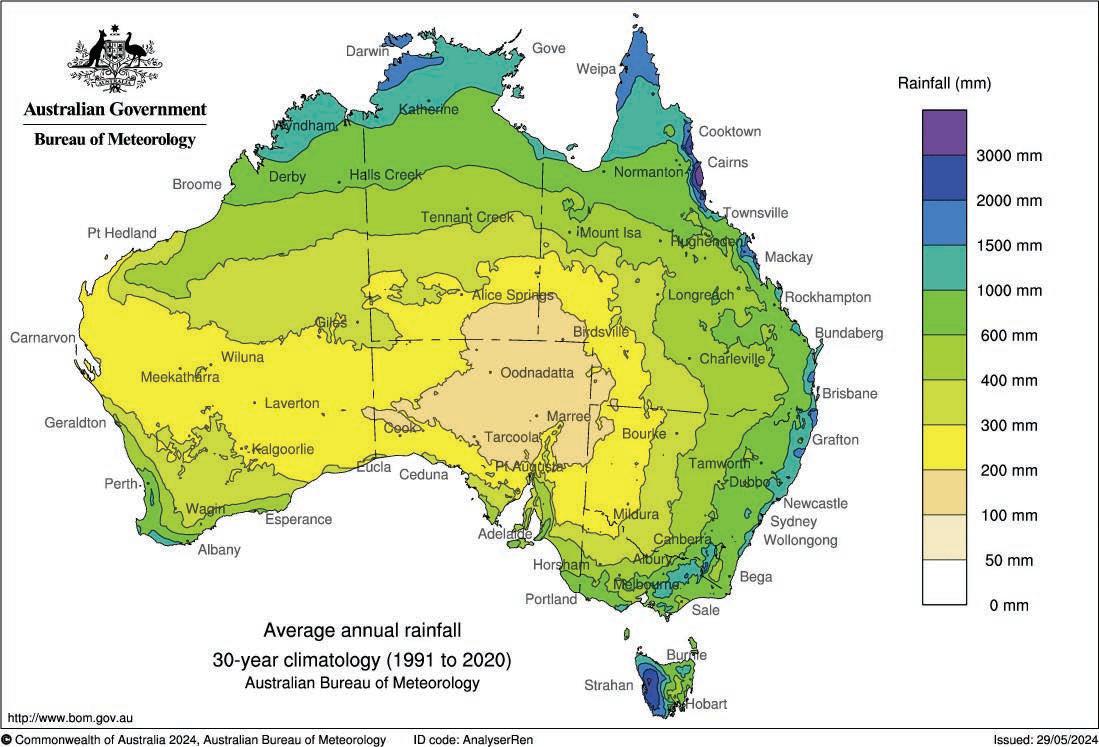
The driest place on Earth is the McMurdo Dry Valleys in Antarctica. This region has had virtually no precipitation for nearly two million years and any snow evaporates in the strong winds before it can reach the ground and melt.
Australia has a large system of groundwater basins stretching under about 60 per cent of the continent
(see Figure 8.8.2). Australia’s Great Artesian Basin is the largest and deepest groundwater basin in the world. It covers 1.8 million square kilometres across Queensland and into the surrounding states and territories. The Great Artesian Basin is estimated to hold around 8700 million megalitres of water. In Figure 8.8.2 the dark blue portion covering much of Queensland is this basin. Australians are reliant on groundwater extracted from basins in arid areas where rainfall is erratic and drought conditions are more common. Bores are used to pump water out of the ground for irrigation and domestic uses.


Principal hydrogeology
Fractured or fissured; extensive aquifers of low to moderate productivity
Fractured or fissured; extensive, highly productive aquifers

Local aquifers: generally of low productivity
Porous; extensive aquifers of low to moderate productivity
Porous; extensive, highly productive aquifers

The spatial distribution of Australia’s groundwater supplies. The aquifers in dark blue and dark green are the largest and highestquality supplies. [Source: Bureau of Meteorology Groundwater Insight] ➜
The spatial distribution of Australia’s population density ➜
Spatial association refers to the degree to which two or more phenomena share a similar spatial distribution on the Earth’s surface. In other words, whether they are arranged in a similar way. This information can then be used to answer questions. For example, do Australians mainly live in areas with high rainfall and plentiful groundwater supplies?
1 Refer to Figure 8.8.1. List five places or regions in Australia that have a rainfall above 1000 mm per year.
2 Refer to Figure 8.8.3. List five places or regions in Australia that have a high population density
3 Based on your answers to questions 1 and 2, discuss whether there is a strong, moderate or weak spatial association between rainfall and population density in Australia. In other words, do more Australians live in regions with high rainfall? Refer to examples in your discussion.
4 Check if the opposite spatial association exists. Do areas with low levels of rainfall have low population densities?
5 Follow the same process as questions 1 to 3 to discuss the degree of spatial association between groundwater supplies and population density in Australia.
Geographical concepts and skills: place, space
Lesson 8.5 highlighted the importance of reservoirs to ensure enough water is stored for its varying uses. Most of Melbourne’s drinking water comes from catchments in the Yarra Ranges such as Tarago, Yan Yean and Sugarloaf. These areas are called catchments because they are areas of land that act like giant buckets, collecting water when it rains. Some of this water flows into rivers as runoff, some is absorbed by plants and some infiltrates into the soil. Runoff eventually flows or is piped into reservoirs that store it so that it can be used by people who live in Melbourne. Melbourne’s largest reservoir is the Thomson Reservoir, which has a capacity of 1068 gigalitres .
Although this sounds like a lot of water, Melbourne is not immune to water shortages. At the peak of the Millennium Drought in 2009, Melbourne’s water storages were dangerously low at just 25 per cent capacity, and residents were forced to restrict their water use and were not allowed to wash their cars or water their lawns.
Melbourne’s catchments are unique because they contain mostly protected eucalypt forest to which public access is restricted. As a result, Melbourne has some of the highestquality drinking water in the world.
8.8.4 The changes in Melbourne’s water supply by month during 2000, 2009, 2020 and 2023
8.8 Review questions
1 Summarise statistics from the opening paragraph that demonstrate that Australia is a dry country.
2 Explain why groundwater is such a significant water resource for Australians.
3 Refer to Figure 8.8.1.
a Describe the pattern of distribution of rainfall. How does rainfall vary across Australia? Consider how it varies from north to south, east to west and coastal to central.
b Suggest a reason for the patterns identified in part a.
4 Explain why Melbourne’s water supply is of such high quality
5 a Use Figure 8.8.4 to describe the changes in Melbourne’s water supply in 2000, 2009, 2020 and 2023.
b Look up Melbourne’s dam storage levels today on Melbourne Water’s website. Compare this value with the data in Figure 8.8.4 and justify whether Melbourne is currently above or below average storage levels.
This lesson is a case study looking at the way water is managed in the Murray–Darling Basin and the conflict that arises from competing uses of this scarce resource.
Lesson starter
Complete the following activity to kick-start this lesson.
See, think, wonder
1 See: Describe what you can see in Figure 8.9.1.
2Think: What do you think has caused this situation?
3Wonder: Brainstorm the impacts of this situation both in the local region and beyond.


The Murray–Darling Basin in southeastern Australia is Australia’s largest river system and one of its most significant natural and cultural landscapes. It has a total catchment area of 1 060 000 square kilometres, making it 20th-largest river system
in the world. It covers 14 per cent of Australia’s total surface area, including three-quarters of New South Wales, half of Victoria, and parts of Queensland and South Australia. The basin contains three major rivers: the Murray River, Darling River and the Murrumbidgee River.
catchment area the area of a drainage basin that collects and drains water
The
spans four states and one territory, and contains several large rivers.
floodplain the area of flat, low-lying land beside a river that is prone to flooding migratory birds birds that travel seasonally for breeding and feeding
The Murray–Darling Basin is often described as ‘Australia’s food bowl’ as it is where nearly 40 per cent of Australia’s food is produced. The region contains around 50 000 farms and 9000 agricultural businesses. Furthermore, much of the food grown here is exported, contributing an annual total of $22 billion to the Australian economy. The use of irrigation on farms is significant in the Basin. It contains two-thirds of Australia’s total irrigated land, which is responsible for 70 per cent of all of Australia’s agricultural water use. Around half of this water is used to grow cotton and pasture, while other common crops include rice and grapes. The Basin also provides 30 per cent of Australia’s total dairy production. The money generated from irrigation contributes significantly to the region. For every $1000 that is earned from irrigation, an additional $3500 is generated in local towns and related industries.
More than 2.6 million Australians live within the Murray–Darling Basin, and over 3 million people rely on its water resources. For First Nations Peoples, the Basin holds profound cultural, spiritual and environmental importance. Many places within the region are sacred, representing connections to Country that span tens of thousands of years (see lesson 8.10). The Basin is also central to the lives of non-Indigenous Australians. Each year, its picturesque rivers, lakes and wetlands draw visitors from across the globe, contributing $11 billion to the economy through tourism. This highlights the Basin's role not only as a source of water and food but also as a place of cultural exchange, biodiversity and natural beauty.
The Murray–Darling Basin’s rivers, wetlands and floodplains provide a habitat for 120 species of waterbird and 46 native fish species. In total, there are 30 000 wetlands within the Murray–Darling Basin and 16 of these are internationally significant. This is because they are rare and unique environments that provide habitat for migratory birds from places like China and Japan.
Competing demands for a limited water supply means that water scarcity within the Basin is a significant issue, especially during times of drought. Farmers are allocated a certain amount of water that limits how much they are allowed to withdraw each year from rivers and groundwater supplies. When water levels are low, allocations are reduced.


In times of extreme drought, some farmers are not allocated any water, leading to crop failure. Many farmers have to sell or cull livestock as they do not have enough feed to keep their animals alive. Not only does this lead to a loss of revenue for farmers, but it also has a flow-on effect to the economy of the local towns and communities, and can have severe negative impacts on the mental health of people within the community.
Water scarcity also has severe environmental impacts within the Murray–Darling Basin. The plants and animals within the Basin’s wetlands, forests and waterways have adapted to seasonal wet and dry periods. While the regulation of rivers using dams and weirs is essential in providing a water source for irrigation, these structures significantly alter the flow regime of rivers and stop them from flowing naturally. This means that during
drier times, rivers do not have adequate water. On the other hand, during wetter times when flooding normally occurs to recharge wetlands and floodplains, water is held back and stored in dams. These changes significantly damage the environment, which relies upon these natural conditions. These changes are also harmful to First Nations communities, who have a strong connection to their Country and its natural characteristics.
In early 2019, a heat wave combined with low river flows from an ongoing drought led to a algal bloom of blue-green algae in the Darling River near Menindee. Blue-green algae is toxic to humans and animals if it is consumed. When blue-green algae dies and decomposes, it sucks oxygen out of the water, reducing the water’s quality. The bloom in 2019 led to the death of up to a million Murray cod and perch, which was an ecological disaster.
crop failure the complete loss of a crop on a farm flow regime the seasonal changes to the flow of rivers algal bloom the rapid increase or growth in the amount of algae within water

Sustainable management of the Murray–Darling Basin’s water resource requires a balance between agricultural, domestic and environmental needs. Established in 2012, the Murray–Darling Basin Plan seeks to achieve this balance by coordinating the management of water between the four states and one territory together with the Australian government.
The three main aims of the plan are to ensure that the Murray–Darling Basin has:
• vibrant communities that have a stable water supply to meet their domestic uses
• productive industries such as agriculture that can provide jobs and help local communities to thrive
• healthy and diverse environments that support a range of plants and animals.
To meet these demands, the Plan sets limits on the amount of surface water and groundwater that can be withdrawn from the river system. These limits are adjusted based on rainfall conditions. The limit allows more water to be allocated for environmental flows. Environmental flows refer to water that is allowed to flow
through the system naturally to support the environment. One way to increase environmental flows is through water buybacks. Buybacks occur when farmers choose to sell their water entitlement to the federal government to be used for the environment instead of irrigation. Although this means less water is allocated for irrigation, upgrades to irrigation infrastructure means water withdrawn for agriculture can be used more efficiently so that farmers still have enough water to grow crops.
More than a decade from its establishment, the success of the Murray–Darling Basin Plan is being questioned. Scientists are concerned that the allocated environmental flows are still not sufficient, meaning natural systems are still degrading and many species are struggling to survive. Conversely, the agricultural industry is arguing that an increase in water allocated to environmental flows instead of irrigation would have a disastrous impact on local businesses, making farming unviable in the region. Maintaining the balance of allocating limited water resources throughout the Basin remains a complex challenge.
An important skill in Geography is to evaluate management strategies. This means deciding whether a management strategy has been successful. The most common way to do this is to determine whether the strategy has achieved its goals. However, it’s not always so simple. For example, sometimes a management strategy has successfully achieved its goals but has:
• cost far more than was budgeted
• taken longer than was planned
• caused additional problems elsewhere or for other people.
In reality, it is unlikely that any strategy has been completely successful. Therefore, it is important to consider both positive and negative outcomes to determine overall whether the strategy can be rated a success. Follow these steps to evaluate the success of the Murray–Darling Basin Plan.
1 Undertake more detailed research about the Murray–Darling Basin Plan. A good starting point is articles on the ABC website.
2 Create a table summarising the positive and negative outcomes of the Plan.
3 Based on your findings, determine whether the Plan has been largely successful, moderately successful or unsuccessful in managing the Murray–Darling Basin’s water resources.
4 Write a paragraph summarising your findings. Refer to examples and evidence to strengthen your arguments.
Geographical concepts and skills: draw evidence-based conclusions
1 Define the following terms:
a catchment area b flow regime
c environmental flows d buybacks.
2 Write a series of dot points summarising the geographic characteristics of the Murray–Darling Basin.
3 Explain why the Murray–Darling Basin is often referred to as Australia’s ‘food bowl’.
4 Explain why altering the flow regime of river systems for the sake of irrigation can have consequences for the environment.
5 Outline two ways in which water scarcity can impact the Murray–Darling Basin.
6 Summarise the reason why managing water within the Murray–Darling Basin is a complex challenge.
This lesson looks at the significance of water for different people, including First Nations Peoples in Australia and people of the Hindu faith in South Asia.
Lesson starter
Complete the following activity to kick-start this lesson. Discussing the value of water for First Nations Peoples
Aboriginal people on this dry continent have a strong connection to water, but on our own Country we should be seen as the original owners, the original custodians and have a say in how water is managed on our country, but at the moment, we don’t.
Professor Bradley Moggridge, University of Technology Sydney
1 List the ways you imagine First Nations Peoples might have a connection to water.
2 What do you think First Nations Peoples might prioritise in the way water is managed in Australia?
3 Why do you think First Nations Peoples lack a say in how water is managed in Australia?
For tens of thousands of years, First Nations Peoples have cared for the Murray–Darling Basin, managing its waterways to sustain life, culture and Country. Rivers are not just water sources: they are central to Aboriginal and Torres Strait Islander identities and survival. However, since colonisation, First Nations Peoples have been excluded from decisions about water management.
As learnt in the previous lesson, the Murray–Darling Basin Plan was established with the goal of restoring
health to the river system while meeting the demands of farmers and the people living in the region. One major criticism of the Plan is that it does not recognise or support the cultural needs and interest of Indigenous Peoples who make up the 40 First Nations groups within the region. Despite being the original custodians of these waterways, Indigenous groups have been locked out of water management decisions and water ownership. They currently control less than 1 per cent of the water within the Basin.
First Nations Peoples wish to have a proportion of the Murray–Darling Basin’s water allocated for cultural flows
Cultural flows are water set aside to sustain First Nations cultural practices, care for Country and pass on knowledge. These flows allow for fishing, hunting, ceremonies and the preservation of traditional medicines, all of which are vital to community wellbeing.
Agreements such as the Kungun Ngarrindjeri Yunnan Agreement, meaning ‘Listen to Ngarrindjeri Speak’, offer a way forward. This agreement prioritises collaboration, recognising Ngarrindjeri rights to land, water and sky, knowledge and cultural practices. It shows that when First Nations people lead the care of their Country, both Country and communities benefit. At Margooya Lagoon in Victoria, cultural flows enabled by First Nations leadership have already begun to restore degraded ecosystems, proving the effectiveness of this approach.
Despite the Australian government’s 2018 promise of 40 million dollars to support First Nations water allocations, this funding remains undelivered. Genuine partnerships, like those outlined in the Kungun Ngarrindjeri Yunnan Agreement,
require governments to honour their commitments, respect First Nations rights and share decision-making power.
The health of the Murray Darling Basin depends on Aboriginal and Torres Strait Islander knowledge and leadership. Cultural flows are not optional. They are a right and a necessity. By listening to First Nations voices and supporting culturally informed water management, it is hoped that the Basin’s future can be sustainable for both the environment and the people who depend on it.
cultural flows water within river systems that is reserved to be used to preserve environments and allow First Nations groups to undertake cultural practices

Hindus believe that large rivers are sacred and provide a connection with the gods. The Ganges River is one of the most significant rivers in Asia, flowing 2500 kilometres through some of the most populated places in India and Bangladesh. Four hundred million people rely on it for drinking, bathing and irrigation. The Ganges River is sacred for Hindus as it is considered a form of the goddess, Ganga. Millions of Hindus make pilgrimages to bathe in the Ganges River, believing they will be cleaned of their impurities, while others scatter the ashes of deceased loved ones on the water.
Despite being believed to be sacred and spiritually pure, rapid population growth and urban development in India has led to the widespread pollution of the Ganges River (see Figure 8.10.3 on the following page). Each day, three million litres of raw sewage is dumped into the river along with waste from factories and agricultural runoff, making it one of the most polluted waterways in the world. One stretch of the river over 600 kilometres long has been classified as ecologically dead. Several governments have promised to allocate money to restore the health of the river, but little progress has been made.
pilgrimage the journey of a person to a sacred site for religious reasons urban development the growth of urban areas as they expand to cater for population growth


Concepts and skills builder 8.10
Annotating photographs of water
Photographs are an excellent way of capturing the memory of a place. However, photographs do not always highlight which aspects or characteristics of a place are the most significant. Annotating a photograph can help the viewer to understand features that might be important to a geographer. These features might include descriptions of the vegetation, soil type, water quality or connection to the land, none of which are easily visible from just a photograph. Annotations are more than just labels and should include brief descriptions and observations. Follow these steps to annotate a photograph of a significant water-based environment.
1 Source a photograph of an environment containing water that is significant to you. This might be somewhere you have been or would like to go on a holiday, somewhere you visit regularly, or a place that fascinates you.
2 Highlight the place’s geographic characteristics by writing brief descriptions of its features. Include both natural and human characteristics and living and non-living features.
3 Draw lines from your descriptions onto the relevant part of the photograph. This can be done by hand or using computer software.
4 Write a title at the top highlighting the location and importance of your annotated photograph.
Geographical concepts and skills: place, environment
8.10 Review questions
1 Examine why are some First Nations Peoples unhappy with the Murray–Darling Basin Plan.
2 Define cultural flows and explain why some people think they should be an essential part of water management within the Murray–Darling Basin Plan.
3 Explain why Hindus make pilgrimages to the Ganges River.
4 List the reasons why the Ganges River has such poor water quality.
We have previously looked at the significance of water for different groups. This lesson is a case study investigating the importance of Budj Bim to Gunditjmara People.
Lesson starter
Complete the following activity to kick-start this lesson.
See, think, wonder
1 See: Examine Figure 8.11.1 and describe what you notice about the image.
2 Think: What is it used for?
3 Wonder: What questions do you have about this image?

aquaculture system the farming or growing of aquatic animals and plants in a controlled environment
For First Nations Peoples, water is more than just a resource: it is a sacred part of life. Water is part of Country and is closely tied to the land, spirituality and the wellbeing of communities. Waterways such as rivers, lakes and springs are seen as living beings with their own meaningful stories or songlines, which have been passed down through generations. These places are often connected to important cultural practices, ceremonies and the health of Country as a whole.
In contrast, many other Australians might see water mainly as something to use in daily life, like for drinking, farming or making electricity. Non-Indigenous people often understand that water is important for survival and fun, but may not fully appreciate the deep spiritual and cultural connections that First Nations people have with water as Country.
Lake Condah on Gunditjmara Country in Victoria is home to one of the most remarkable examples of ancient aquaculture systems in the world. The stone fish traps found at Lake Condah, and similar sites, demonstrate the advanced knowledge and ingenuity of Aboriginal Peoples in sustainably managing resources.
these aquaculture systems, which allowed communities to harvest fish and eels efficiently and sustainably.
Accounts from settler diaries often dismissed these complex engineering feats, undermining the intelligence and sophistication of Aboriginal people and cultures. These writings reflect the racist ideas of the time, failing to recognise the advanced and sustainable practices that were already in place long before European colonisation.
The Budj Bim landscape in south-western Victoria was formed around 30 000 years ago through volcanic activity from the Budj Bim (Mount Eccles) volcano. Basaltic lava flows altered the terrain by filling valleys and blocking watercourses, leading to the creation of Lake Condah and extensive wetlands.
Bruce Pascoe, in Young Dark Emu, highlights the genius of
Aquaculture systems have been used by Aboriginal and Torres Strait Islander Peoples for thousands of years to catch and breed fish in a way that protects the environment and ensures there is always enough food for the community.

Since colonisation, Aboriginal people have been denied the right to control their own lives, land and water. This right is called self-determination. Colonial policies on water management have often ignored Aboriginal voices. The removal of Aboriginal people from their lands and waters during the Stolen Generations
caused significant harm. Aboriginal people were not allowed to speak their own languages, which impacted the ways that stories about water were passed on. To ensure a sustainable future for water in Australia, it’s important to listen to and act on First Nations People’s knowledge in decisions about water management.
self-determination having the freedom and power to make decisions about one’s own lives and futures, including the management of lands, waters and resources, and the ability to maintain and develop cultures, languages and identities
The fish traps at Lake Condah are part of the Budj Bim Cultural Landscape, which was added to the UNESCO World Heritage List in 2019. This acknowledges the site’s global significance and Gunditjmara People’s incredible cultural heritage.
Figure 8.11.3
The location of Lake Condah and Budj Bim Cultural Landscape in western Victoria on Gunditjmara land. Budj Bim is a Gunditjmara name meaning ‘High Head’, referring to the roughly conical peak rising 178 metres. ➜
cultural landscape according to UNESCO these are ‘combined works of nature and humankind … [that] … express a long and intimate relationship between peoples and their natural environment’
Concepts and skills builder 8.11
Interpreting and analysing information and data to identify similarities and differences and explain patterns, relationships and trends
‘In the Dreaming, the ancestral creators gave the Gunditjmara the resources to live a settled lifestyle. They diverted the waterways, and gave us the stones and rocks to help us build the aquaculture systems. They gave us the wetlands where the reeds grow so that we could make the eel baskets, and they gave us the food-enriched landscape for us to survive.’

A timeline helps you see events in the order they happened, making it easier to understand how long something has been around. In Geography, it can show the relationship between people and the land over time. For example, Gunditjmara People have lived at Budj Bim for over 30 000 years, with their aquaculture systems developed at least 6600 years ago.
When you look at a timeline, you can compare that long history with more recent events, like the beginning of colonisation in 1788. This helps you see how much longer Gunditjmara People have been connected to the land and how important their knowledge is for understanding and managing the environment. Examine the timeline in Figure 8.11.5 and answer the following questions.
1. How much longer have Gunditjmara People been connec ted to Budj Bim than non-Indigenous Victorians?
2. Did Gunditjmara People manage water and water resources sustainably before colonisation?
3. How did colonisation impact the management of Budj Bim Country?
4. Why is it important that Gunditjmara People have a say about how water can be managed sustainably in Budj Bim today?
Self-determination at Budj Bim
Today, people manage Budj Bim in ways that support self-determination. After years of advocacy, Gunditjmara regained control of this important cultural landscape from the Australian government, enabling them to care for it using traditional knowledge and practices. Gunditjmara People now work in partnership with government bodies, conservation groups and other organisations to ensure the preservation of the ancient aquaculture systems and the protection of the environment. These partnerships help to share the cultural significance of Budj Bim with the world while allowing Gunditjmara People to lead and make decisions about their land, ensuring their history, culture and sustainable practices are honoured and passed on.

‘Water is life for Gunditjmara Country and its people.’
Denis Rose
Write a short paragraph or create a visual representation (e.g. a drawing or diagram) that explains your understanding of the quote. Include the following points:
• how Gunditjmara People use water in their daily lives (e.g. for farming eels)
• the spiritual and cultural importance of water to Gunditjmara People
• why water is so central to the health of the land and the community.
Geographical concepts and skills: environment, sustainability
8.11 Review questions
1 Define the term ‘aquaculture’.
2 Define the term ‘self-determination’.
3 Review your responses to the ‘see, think, wonder’ box at the beginning of this lesson. Read the artist’s description below and consider your learning in this chapter, then respond to the question.
‘The breeze going through the eel trap gives a feeling of water flowing through the vessel with the feathers softly waving as the water flows. My grandfather Nicholas Couzens and my uncles made eel traps to fish the Hopkins River – this is how my mother learnt the techniques which she passed on to me.’
Outline how creating art based on traditional water practices related to self-determination for Gunditjmara People today.
In this lesson you will have the opportunity to design a fieldwork investigation in which you will collect data relating to a local water resource.
Fieldwork is an essential part of studying geography. It enables you to investigate many of the concepts studied in the classroom while in the real world. It also provides you with the opportunity to apply your knowledge to answer a research question based on issues in your local


area. In this investigation, your aim is to explore a water resource close to your school or home and to determine the ways it is used, investigate its significance for the surrounding region, and evaluate its health and management. The following structure will help to form the basis of your study.


Title and introduction
Choose a suitable topic and title for your investigation. It should include the scope and location of your investigation. Identify the Country on which your local water resource is located. Write a brief introduction outlining the main aspects of your study including an outline of the type of urban management you will be investigating.
Background information Research some background information about your chosen topic and region. This will provide some context for your study.
Research question
Write a research question that you intend to answer using the data that you collect. You may prefer to write one overall research question and multiple sub-questions.
Hypothesis A hypothesis is a clear and concise statement that can be tested. It should be written prior to collecting your primary data.
Primary data collection
Primary data is data you collect yourself in the field specifically for your investigation. Consider the types of primary data that you will need to collect in order to answer your research question. Consider the equipment and preparation required.
• An investigation of the health and management of the Yarra River
• A comparison of the health of urban waterways in south-eastern Melbourne
• An evaluation of sustainable urban water management in Docklands, Melbourne
Secondary data collection
Presenting and analysing your data
Discussion, conclusion and evaluation
Secondary data is data that other people have collected that you can use as part of your investigation. Undertake research to find suitable sources of information that you can apply to your topic.
Summarise your findings in visual formats that are easy to read and understand.
Use your primary and secondary data to answer your research question. Provide a concise summary of your major findings. Evaluate the success of your data collection and your overall investigation.
• An evaluation of the success of the Cardinia Reservoir as both a water and recreational resource
• An evaluation of the management of the Yea wetlands in maintaining both a diverse ecosystem and a tourist attraction
• Geographic characteristics of your chosen location and a map showing your study area
• A brief history of your chosen water resource and surrounding land uses
• Do the different land uses along the Yarra River affect its water quality?
• Is the Yea wetlands a successful example of sustainable environmental management?
• Do local residents consider the Dandenong Creek to be an important local resource?
• The water quality of the Yarra River decreases from its source to its mouth.
• The Yea wetland is a thriving ecosystem with a high level of biodiversity.
• Interviews with councillors and local environment groups
• Surveys of residents living close to the water resource
• Water quality samples and measurements
• Habitat assessments including vegetation identification and soil tests
• Photos and field sketches
• Satellite imagery and elevation data from Google Earth Pro
• Water-quality studies conducted by groups such as Melbourne Water
• Information about works undertaken by local volunteer groups
• Different types of graphs (pie, line, bar) and maps (topographic, thematic, GIS)
• Annotated photos and field sketches
• Summary tables
• The extent to which your hypothesis has been supported or disproven
• An answer to your research question
• The positive and negatives of your data collection and how they can be improved
ReferencesInclude a bibliography of any sources used. Melbourne Water 2022, Dandenong Creek, Victorian government, accessed 16 September 2023, https://www.melbournewater.com.au/water-andenvironment/water-management/rivers-and-creeks/dandenong-creek
9.1Setting the scene: How did Storm Daniel cause a dam failure in Derna, Libya?
9.2What are hydrometeorological hazards?
9.3Floods: A natural process or a natural disaster?
9.4How are flood risks managed?
9.5Case study: What were the impacts of the 2022 Lismore Floods?
9.6End of investigation review: Water in the world


low-pressure systems areas of low pressure that suck air towards them, leading to high winds and rainfall
This lesson recounts the disaster that unfolded when Storm Daniel hit Derna, Libya, as an introduction to the causes and consequences of hydrometeorological hazards.
9.1.1 Geography skills video: Working with synoptic charts
On 4 September 2023, a low-pressure system developed over the Ionian Sea. This soon formed into Storm Daniel, the deadliest and most costly Mediterranean tropical cyclone in recorded history. The storm caused torrential rainfall and extensive flooding across Greece, Bulgaria and Türkiye as it passed across the Mediterranean. It then headed towards the coast of Libya on 10 September where it caused catastrophic flooding of an unprecedented scale.

In the city of Derna, in northern Libya, rainfall for the 24-hour period totalled 240 mm, just below its total yearly average. The Wadi Derna River, running from Libya’s inland Akhdar Mountains to the northern coast, could not contain the fl oodwaters. The two dams that were built to protect the city of Derna were not able to handle the additional volume of water, causing them to fail, and 30 million cubic metres of water burst from the dams and fl owed downstream forming waves up to 7 metres high.


The impacts were disastrous. The city was inundated by floodwater and homes, buildings and even entire neighbourhoods were swept away.
Over 4000 of Derna’s 100 000 residents were confirmed to have died in the flood or its aftermath, and an additional 10 000 people were unaccounted for.
More than half the city’s population were displaced , unable to return to their homes due to the extensive damage.
Dozens of Derna’s flood victims were washed into the sea while in their cars. One survivor was rescued from their car around 20 kilometres from the coastline.


displaced forced to leave one’s home


medicane a Mediterranean tropical cyclone frequency how often something occurs infrastructure the physical and organisation structure of a country, such as buildings, roads and energy supplies corruption dishonest behaviour by people in power, often involving bribery
A combination of factors contributed to the severity of the Storm Daniel disaster. The storm was classified as a medicane, a tropical cyclone that forms in the Mediterranean Sea. Some scientists believe that climate change is leading to an increase in heatwaves that raise sea surface temperatures and increase the frequency and intensity of these storms. Storm Daniel was particularly disastrous in Libya due to a lack of flood management infrastructure. Libya lacks the facilities needed to forecast storms accurately and has only a limited ability to warn and evacuate its residents when flood waters approach. However, the largest contributing factor to the disaster
9.1 Review questions
1 Define the following terms: a low-pressure system b medicane.
2 Recall why Derna flooded in September 2023.
3Describe the scale of the destruction.
in Libya was a lack of maintenance and structural repairs on the two dams that failed. In 2022, researchers found that the dams were in urgent need of repairs after years of neglect following Libya’s civil war. Government corruption meant money allocated to repair the dams was never spent, leaving the dams in a vulnerable condition. Following the disaster, several government officials responsible for the lack of maintenance were arrested while an inquiry took place. Scientists have warned that they expect heavy rainfall events to become more common as the world warms and that communities need to plan how they will adapt to these extreme hydrometeorological events.
In this lesson, we will explore hydrometeorological hazards with a particular focus on different types of floods and the factors that cause them.
Complete the following activity to kick-start this lesson.
1 Think back to the last time there was a heavy storm in your home town or city. Describe what you heard or saw.
2 Was there any damage to your property or the properties in your street or suburb?
3 Suggest a reason why you think some places are more prone to storm damage and flooding than others. Consider their location, design and management.


submerge to cause something to be under water inundate to cover with water
Hydrometeorological hazards are extreme weather events involving water. These events cause severe environmental, economic and social impacts, and in some cases lead to large-scale disasters in which lives are lost and cities are destroyed.
Hydrometeorological hazardDescription
Flood
Tsunami
Tropical cyclone
Storm surge
Drought
The main types of hydrometeorological hazards are summarised in Table 9.2.1. Most of these hazards are caused due to the presence of too much water, while drought occurs when there is not enough.
When water submerges land that is normally dry. They can last anywhere from a few hours to several months and can affect individual places, entire towns or vast regions. They commonly occur near rivers and dams, in the valleys between mountains and in coastal regions.
A series of very high waves that form out at sea due to a disturbance underground such as an earthquake or volcanic eruption. In deep water, they can travel at speeds of up to 800 km/h. They slow as they approach the coast but increase in height, reaching as high as 30 metres.
A rapidly rotating storm system that forms over warm tropical oceans. They cause strong winds and heavy rain. In extreme cases, winds can reach 240 km/h.
A rise in sea level due to large storms, such as tropical cyclones, which can inundate coastal regions (see Figure 9.2.3). High winds push water up against the coast, causing water to rise above the normal high-tide level.
A prolonged period of low rainfall in which there is insufficient water for crops, ecosystems, and industrial and residential uses. While some droughts only last a few months, others last several years. Australia’s Millennium Drought lasted from 1997 to 2009.
Tropical cyclones are known as ‘hurricanes’ in the United States and ‘typhoons’ in Asia.


Floods are the most common hydrometeorological hazard. They vary in size, speed and impact based on the factors that cause them. Some of these factors are outlined below.
High rainfall is the most common cause of fl ooding. Heavy rainfall in urban areas can cause fl ash fl ooding, while sustained periods of rainfall can cause widespread slow-onset fl ooding (see page 281).

from 26 January to 9 February 2019
One of the most devastating floods in Australia’s occurred in Queensland in 2019.
Figure 9.2.4 shows the rainfall during this period while Figure 9.2.5 shows how much
this was compared to the normal February average. In some places, the rainfall was 400 per cent higher than the average, which is five times the usual amount!

low-lying area an area that has a very low elevation close to sea level, usually located near the coast confluence the point at which two or more rivers meet and join to form a single channel
The shape of a landscape can determine the extent of flooding as the physical features of the land control where water flows. Low-lying areas are particularly vulnerable because water flows downhill
to reach these places. Similarly, places located at the confluence of large rivers have a higher likelihood of flooding due to increased water flow. Coastal regions are also vulnerable because of the potential for storm surges, tsunamis and rainfall from tropical cyclones.
A less obvious reason why some places are vulnerable to floods is because of poverty. While many wealthy nations can build structures and infrastructure to prevent flooding, many poorer regions, particularly those with a high population
There are three main types of floods: flash floods, slow-onset floods and quick-onset floods.
Flash floods
Flash flooding is caused by a large amount of rain falling over a short period of time (see Figure 9.2.1). They are the most rapid type of flood, typically occurring within six hours of an intense rainfall event. This means that flash floods pose the greatest threat to life as there is little time to warn people to evacuate. Urban areas are particularly vulnerable. Once drains fill, flood waters rise as rain is not able to infiltrate into the ground through hard city surfaces such as roads and concrete footpaths.

density, do not have this luxury. Libya’s 2023 flood disaster (see lesson 9.1) would not have occurred to the same extent if the country had adequate weather forecasting and flood warning infrastructure, and if their dams and other flood infrastructure were adequately maintained.
Figure 9.2.6 In December 2017, Euroa, north-eastern Victoria, received a record-breaking 146 mm of rainfall in 24 hours, which led to widespread flooding of the town. There were 1500 requests for help from the State Emergency Service.
When rain falls, some of the water infiltrates or seeps into the soil, some of it evaporates, and some of it flows into rivers and creeks (referred to as runoff). During large rainfall events, such as large storms, soil can become saturated, meaning that it can no longer absorb any more water. This causes more water to run into river systems. Eventually, the rivers become so full that the water flows out over the floodplain, submerging the land and causing a slow-onset flood. Slowonset floods build up over several days or weeks. This gives residents plenty of warning, allowing them to prepare and evacuate. However, these floods are often very costly, causing damage to roads, railway lines, bridges and farmland.
Quick-onset floods tend to occur more frequently in steep mountainous areas of high rainfall where rivers flow quickly. They can be caused by high rainfall events or snowmelt. Quick-onset floods also occur in coastal areas where rivers have the largest volume of water flowing in them, or where there is the risk of tropical cyclones. These types of floods only last for a short period of time and the land is typically submerged for a few days. Quick-onset floods are very dangerous as they occur with little warning and the floodwaters often move rapidly, leaving people caught unprepared.
urban areas builtup environments such as cities or large towns infiltrate to seep into the ground so that water is absorbed by the soil evaporation the process of a liquid changing to a gas by heating runoff water that is not absorbed by the land and flows from high areas to low areas saturate to reach a point where soil cannot absorb any more water
Summarising information in a table
Tables are used to summarise a large amount of text into a condensed and organised format. Use a template like the one below to summarise the features of the three main types of floods. Undertake your own research to find one example from Australia and another from a different country.
Description
Cause
Impacts
Example (Australia)
Example (international)
Geographical concepts and skills: collect, organise and process information
9.2 Review questions
1 Define the following terms:
• inundate
• infiltrate
• saturate
• confluence
• evaporation
• runoff.
2 Explain the link between a tropical cyclone and a storm surge.
3 State whether each of the following is an example of a flash flood, a slow-onset flood or a quick-onset flood.
a A tropical cyclone brings very heavy rainfall to a coastal town over a 24-hour period. Local rivers immediately begin to overflow onto the floodplain.
b A thunderstorm causes heavy rainfall from 4.00 pm until 7.00 pm, which leads to rapid flooding in a suburb of Melbourne.
c Consistent rainfall over a three-day period in one of Victoria’s rural areas causes rivers to slowly rise and flood over several kilometres.
4 Explain why poverty is a factor contributing to flood risk.
5 Justify whether flash, slow-onset or quick-onset floods are the most hazardous. Compare your justification with a classmate.
The last lesson focused on the causes and types of floods. This lesson considers the positive and negative impacts of flood events.
Lesson starter
Complete the following activity to kick-start this lesson.
One of the major impacts of floods is damage to agricultural land. The effects of this destruction are not only felt in the affected region but can also but also can extend across a country or even into other countries.
List the impacts that might result from the destruction shown in Figure 9.3.1. Consider direct impacts for the farmer and indirect impacts that may affect other places. For example, how will it affect the economy of the farming region? How will it affect people in the nearest capital city? Will the impacts be short or long term?


floodplain the area of flat, low-lying land beside a river that is prone to flooding
sediment solid material that is moved by rivers and deposited in a new location
heavy metals dense metals such as iron and lead displacement moving something or someone from its original place to somewhere else agricultural sector the sector of the economy to do with farming such as crop and animal production
livestock domesticated animals raised on a farm for production
Floods are a naturally occurring part of the water cycle and are essential in maintaining the health of many environments. This is a positive impact. However, when floods meet civilisation, they can wreak havoc and be very costly, often leading to natural disasters and a range of negative impacts.
In geography, an impact refers to a positive or negative change or consequence. Geographers often classify impacts into three categories:
• environmental impacts: impacts on both natural and human environments
• social impacts: impacts on people including their wellbeing or safety
• economic impacts: impacts involving money including income or costs.
Floods are a process essential in maintaining the health of river environments. They have a very important role as an interconnection or link between river channels and floodplains. By flowing over land, floodwaters recharge groundwater systems and replenish wetlands and forests with water, sediment and nutrients. Floods also lead some species of fish to breed or migrate. In 2010–11, flooding in the Barmah–Millewa Forest ended a drought that had lasted almost a decade. Floodwaters revitalised the wetland and forest, ensuring the survival of thousands of waterbirds (see Figure 9.3.2).
Although floods play an important role in maintaining natural environments, they can also damage places, particularly environments that have been modified by people. During a flood, sediment from floodplains is collected by floodwater. This can contain pollutants, such as harmful chemicals from houses, farms and factories, and heavy metals. The pollutants are washed into rivers and become part of the water system, contaminating water supplies and degrading water quality.
When floodwaters inundate human environments, such as urban areas, they have the potential to threaten the physical safety of people, destroy people’s homes and possessions, and spread waterborne diseases. These impacts are often greater during flash or quick-onset floods, such as those that occur in highly populated and dense cities. Although slow-onset floods often provide enough time for people to evacuate, they still have the potential to cause longer-term impacts. These include the displacement of people for extended periods, disruptions to power and clean water supplies, and damage to buildings and essential infrastructure such as sewerage and electricity.

Floods are the most expensive disasters we experience in Australia. Geoscience Australia has estimated that flooding in Australia has a direct annual cost of $943 million and has totalled $42.6 billion between 1967 and 2017. The total cost of the severe flooding that occurred in 2023 was estimated at $5 billion. The largest proportion of flood expenditure is used for repairing and rebuilding infrastructure such as roads, bridges, buildings and railway lines. Damage to the agricultural sector is also often extensive as floodwaters wash away crops and kill large numbers of livestock.

Classifying impacts
Classify the following flood impacts as environmental, social, or economic. Explain the reasons for your classifications. Note that some impacts can have more than one classification.
1 The 2024 flash floods in Dubai, United Arab Emirates, inundated roads, destroyed houses and closed the airport.
2 The 2023 flood in Derna, Libya, washed contaminated waste from industrial areas and medical facilities out towards the coast.
3 Hundreds died when heavy rains caused a dam to burst in Kenya in April 2024.
4 The 2023 flooding in the Murray–Darling Basin rejuvenated some wetlands for the first time in 60 years, providing a boost to plant and waterbird species in the region.
Geographical concepts and skills: collect, organise and process information
9.3 Review questions
1 Explain why floods can be described as both a natural process and a natural disaster.
2 Describe how flooding can both benefit and damage a natural environment.
3 Suggest a reason why flooding is more economically costly than other forms of natural disasters.
4Investigate a recent flood in Australia or elsewhere in the world. Using a table, summarise the impacts using appropriate classifications. Investigate the cause of the flood and what is being done to ensure the negative impacts are reduced in the future.


In the last lesson, we learnt about the positive and negative impacts of different types of floods. In this lesson, we will consider different ways in which flood risks can be managed to reduce their likelihood and impact.
Complete the following activity to kick-start this lesson.
Researching Tokyo’s solution for floods
The eastern side of Japan is vulnerable to floods. Tokyo is a city built on a floodplain; more than 1.5 million people live below the sea level there. To protect the city, the Tokyo government built the Metropolitan Area Outer Underground Discharge Channel (Figure 9.4.1).
Undertake research and write brief answers to the following questions.
1 Where is the discharge channel built within Tokyo?
2 How long and deep is the discharge channel?
3 How much did the channel cost to construct and how long did it take?
4 Has the discharge channel been successful in protected Tokyo from flooding?


Although floods are an essential process within the natural environment, they have the potential to cause widespread damage to the human environment. Land managers living in flood-prone areas use a variety of management strategies to reduce these hazards. Some of these
Table 9.4.1 Different ways in which flood risks are managed
Management response Description
Alterations to building designs
Dams and levees
strategies are preventative, which means that they aim to reduce the likelihood of a flood. Others are adaptive, which means that they try to reduce the impact of floods when they occur. Four common types of responses are presented in Table 9.4.1.
Computer modelling and forecasting
In areas that flood regularly, houses are often built on stilts so that they are not damaged by floodwaters. The exterior of houses can also be sealed to prevent water from entering. Landscaping around homes can also be designed to drain and absorb water.
Houses in Phnom Krom, Cambodia, are built on stilts to reduce flood damage.
Dams are built in the upper sections of rivers to contain water and control flow downstream. Spillways control the release of water from dams. Levees are artificial walls that block water from flooding cities and agricultural land.
The Bonnet Carré Spillway in Louisiana, United States, diverts floodwater from the Mississippi River so that it flows out to the Gulf of Mexico rather than towards New Orleans.
Meteorologists can track the possible development of rain cells and storms to predict how much rain will fall over an area several days in advance. They also use satellite images and radar to track storms to help predict the likelihood of a flood.
FloodCheck Queensland is a computer modelling and forecasting software providing information about flood risk.
Evacuation As with most hazards, the safest way to avoid danger is to evacuate. This is often done with the help of emergency services. Unfortunately, if the scale of the flood is too large or the flood rises too rapidly then this might not always be possible.
On 23 January 2019, residents in Makassar in Indonesia had to be evacuated to avoid dangers from floods and landslides.
Example


meteorologist a person who studies the atmosphere, especially the weather, and makes predictions for weather forecasts
Figure 9.4.2 Geography skills video: Digital skills: Using a GIS: Brisbane’s Flood Awareness Map
Many of the responses outlined in Table 9.4.1 are interconnected. For example, places that build houses on stilts might also construct dams for added protection. Meteorologists use modelling and forecasting data to determine whether a dam can contain floodwaters. Meteorologists also inform
emergency services of the need to evacuate. Unfortunately, despite these responses, extreme and unexpected events such as flash floods are still largely unpredictable. Also, while evacuation can keep people safe, it does not protect valuable infrastructure from being destroyed.
A geographic information system (GIS) is a form of geospatial technology used to gather, manage and analyse spatial information such as hydrology data. This can include river and flood water heights, elevation data and the location of previous flood events. Geographers use this data to better understand how floods work, to model future flood events and to analyse which areas are most vulnerable. Brisbane’s Flood Awareness map is a GIS that can be used to explore the likelihood of a flood occurring in the suburbs of Brisbane. Visit the following link http://cambridge.edu.au/redirect/11153 to take a look. Select ‘I want to search the Flood Awareness Map’ to access the map. Watch the video tutorial via the QR code or Interactive Textbook, or follow the steps below.
1 Watch the introductory video and use the information to define river, creek, overland flow and storm tide floods.
2 Find ‘The Gabba’ (Brisbane Cricket Ground). Use the ‘Flooding – all types’ layer and the legend to determine the likelihood of this stadium flooding.
3 Determine which area of Brisbane is the most prone to flooding. Suggest a factor that might be responsible for this vulnerability.
4 Open the layers toolbar by selecting the Layers icon on the top right of screen. Compare the extent of flooding in February 2022, January 2011 and January 1974.
• Which flood covered the greatest area?
• Did this vary across different parts of Brisbane?
5 Select the Menu on the top right of screen and access the Flood Information Hub. Explore this website and list three things that residents or community organisations can do to manage flood risks.
Geographical concepts and skills: interpret and analyse information and data
Lesson 9.4 review
9.4 Review questions
1 Describe how houses can be constructed to reduce the risk of flooding.
2 Explain, with the use of an example, how the use of computer modelling software can help to manage flood risks.
3 Think back to the Libya flood disaster at the start of this chapter (lesson 9.1). Explain how dams can both prevent and increase flood risks.
4 Refer to the four responses outlined in Table 9.4.1. Rank these four responses from most effective to the least effective in terms of reducing the negative impacts of floods. Justify your reasoning.
In this lesson, we will learn about the causes, impacts and management of the 2022 floods across eastern Australia, with a focus on the Lismore Flood.
Complete the following activity to kick-start this lesson.
See, think, wonder
1 See: How extensive is the damage?
2 Think: Consider the cause of the destruction.
3 Wonder: How was the flood managed and what is the likelihood of it happening again?

➜
9.5.1
In 2022, a series of catastrophic floods led to disasters across eastern Australia, combining to become the largest natural disaster Australia has experienced since Cyclone Tracy in 1974. From February to May, a series of floods hit southern Queensland and northern New South Wales, with some regions receiving more
than a year’s worth of rainfall in just one week! When combining both shortand long-term impacts, this disaster is estimated to be Australia’s most costly. Although this disaster affected several regions across eastern Australia, this lesson focuses on the impacts in Lismore, NSW.
Lismore is located in the centre of the Northern Rivers region at the northeastern tip of New South Wales. It is located on a floodplain at the confluence of the Wilson River and Leycester Creek and is considered one of Australia’s most flood-prone locations. Since records began in 1870, the Lismore region has experienced over 30 major floods, with the 2022 floods reaching an unprecedented height of 14.4 metres (see Figure 9.5.2 on the previous page).
Although Lismore’s 44 000 residents had experienced disastrous floods as
recently as 2017, they were not prepared for the scale of the 2022 floods. The Bureau of Meteorology was unable to accurately forecast the extent of the rainfall. On 27 February, it was predicted that Dunoon, upstream of Lismore, had a 10 per cent chance of receiving rainfall of above 113 mm. In the 24 hours that followed, Dunoon received a torrential downpour of 775 mm. At 9.30pm on Sunday 28 February, Lismore’s residents were ordered evacuate with only half an hour’s notice. Floodwaters peaked more than two metres above the 1-in-100-year level.

The bar graph in Figure 9.5.2 shows the height of all large flood events since 1870. The height of the bar refers to the recorded height of the flood water. The bars are colour coded based on their height, and floods are grouped into minor, moderate and major events. The horizontal purple line shows which floods will be protected by the levee, while the black dashed horizontal line shows the level of 1-in-100-year floods; that is, a flood which occurs on average every 100 years and has only a 1 per cent chance of occurring each year.
Use the information in Figure 9.5.2 to answer the following questions.
1 How many major floods occurred between 1870 and 2022?
2 How high was the flood in 2022 and how much higher was it than the previous highest?
3 Has the number of major floods changed much since 1870? Suggest a reason for your answer.
4Predict how the graph might look if it were continued to 2050. Justify your prediction.
Geographical concepts and skills: change
The impacts of the 2022 Lismore floods were extensive. Despite the call for evacuation, thousands of people were left stranded on rooftops, while those in remote areas were cut off due to flooded roads. Four people perished in the February flood, while another died in a second flood in March. Tens of thousands of homes were damaged or destroyed, many of which were not insured. Insurance premiums are far more expensive in disaster-prone regions and were unaffordable for many residents.


In addition to personal losses, the damage to council assets was estimated at $350 million. This included damage to roads and bridges, community spaces, and waste and water infrastructure. The total cost of rebuilding the city was estimated to be around $1 billion. Personal financial losses combined with damage to businesses also threaten the economic sustainability of the region. In the 16 months following the disaster, Lismore’s economic productivity was down 15 per cent. Future losses are predicted as future development projects in the region are halted.
Following the 2022 floods, the New South Wales government undertook a flood inquiry. Recommendations have been made to ensure that a disaster of this scale is avoided in the future. These include:
• investing in infrastructure to reduce flooding, such as levees, as well as investing in improving weather forecasting equipment such as river and rain gauges and weather radars
Many of the impacts have remained long after the floodwaters receded. By the end of 2022, around two-thirds of those affected said they were not coping with the stress and challenges of the recovery. While waiting for housing assessments and insurance payouts, more than half of victims were still living in damaged homes, one-quarter in temporary accommodation such as caravans and sheds, 20 per cent in insecure accommodation such as tents, and 4 per cent had left the region.
• development of the ‘Hazards Near Me’ phone app to help residents receive crucial information during emergencies
• increasing funding for the State Emergency Service to assist during disasters
• ensuring reconstructed houses and buildings are resistant to flooding
• ensuring that insurance premiums are as affordable as possible for people living in flood-prone regions
• considering climate change projections in future planning decisions
• constructing permanent relief housing across Australia to provide short- and long-term temporary housing to those affected by natural disasters
• identifying existing buildings across Australia that could be used as evacuation and relief centres, such as schools and halls
• managing retreat by abandoning buildings in high-risk areas and rebuilding in safer locations.
Managed retreat occurs when homes classified as being very vulnerable to disasters are purchased by the government and bulldozed, allowing people to relocate to safer locations. Although this sounds like a sensible approach, it is a very controversial
strategy. While many are grateful to sell their houses and move to safer ground, others dispute the amount of money offered by the government. Despite the payment, some people are reluctant to leave their houses, while others refuse to leave. As people are inevitably forced to move away, local populations decline and businesses suffer from a loss of customers, causing an economic decline. However, if managed retreat does not occur, families will continue to build houses in vulnerable locations where insurance is becoming increasingly costly and sometimes unavailable. Meanwhile, taxpayers across Australia are forced to pay the growing rescue and relief costs. The Northern Rivers Reconstruction Corporation is expected to purchase over 2000 of Lismore’s properties as part of a managed retreat scheme.
1 Use Google Maps to find the location of Lismore. Describe its location within New South Wales.
2 Explain why Lismore is considered to be one of the most flood-prone places in Australia.
3 Refer to Figure 9.5.3.
a How much rainfall did Lismore receive in February 2022?
b Undertake research to find the average rainfall for February in Lismore. How much higher was the rainfall in 2022 compared to the February average?
cName three other places that received more than 300 mm of rainfall during this period.
4 Using a table, summarise the impacts of the Lismore flood disaster. Classify your impacts as short- and long-term.
Access the Interactive Textbook for a range of digital tools to help you review this topic, including:
• Downloadable chapter summary
• Scorcher timed competitive quiz.
I used to think that …
Now I understand that …
This exercise in visible thinking asks you to track the difference between what you knew about water resources, water management and flooding before starting this unit, and what new understandings you have acquired since reading the chapter. Use the following sentence stems to write one or more sentences demonstrating your understanding of these concepts. Refer to examples from the unit wherever possible.
1 a I used to think that the amount of water on the Earth was …
b Now I understand that …
2 a I used to think that drinking recycled water was …
b Now I understand that …
3 a I used to think that most of our water resources were used for …
b Now I understand that …
4 a I used to think that flooding was caused by …
b Now I understand that flooding can be caused by …
5 a I used to think that flooding only had negative impacts because …
b Now I understand that flooding can have positive impacts because …
6 a I used to think that flooding was dangerous because …
b Now I understand that flooding is also dangerous because …
Geographers use key geographic concepts to help frame their thinking and analyse different situations and ideas. Choose one of the following statements and write a paragraph discussing the extent to which you agree or disagree with them. In your answer, refer to one or more examples studied in this unit and make use of at least one geographic concept.

1 The most significant factor determining whether a place is affected by water scarcity is climate.
2 Water allocated for irrigation should be prioritised over environmental and cultural flows within the Murray–Darling Basin.
3 Preventative responses are far more effective than adaptive responses in reducing the impacts of flooding.
4 A country’s wealth is a major factor in determining whether it is able to reduce the risk and impacts of floods.
Reminder of geographic concepts: place, space, change, scale, interconnection, environment and sustainability.
1 Design a type of construction that would help to prevent flooding, or a style of building that would reduce the impact of flooding. Draw a labelled diagram demonstrating how your design works and explain how it could be used in a specific place.
2 Undertake further research about the way water is allocated within the Murray–Darling Basin. Consider the competing needs of this limited resource and outline what you think is the fairest and most effective way to allocate and manage water resources. Consider whether the lessons learnt from the United Arab Emirates could be applied and whether environmental and cultural needs outweigh the agricultural demand and economic potential.
1 Choose one of the following research questions, undertake research to help answer the question and prepare a report, oral presentation or multimedia presentation to demonstrate your findings.
• Is solar, wind, hydro, fossil fuel or nuclear energy the most viable and sustainable option for the future of energy production in Australia?
• What are the impacts of salinity due to irrigation in Australia? Find out how much of Australia is affected, the main causes of the problem and the ways that Australians are trying to reduce the impacts.
• To what extent are dams in Australia, or elsewhere in the world, impacting the environment, people and local economies? Do the benefits outweigh the consequences?
• What are some of the specific impacts of the management of the Mekong River in downstream communities? Is this likely to change in the future? How could the river system be managed more sustainably?
2 Managing water within the Murray–Darling Basin is one of the greatest resource management challenges in Australia. Choose one of the following perspectives:
• a farmer who withdraws water to irrigate crops
• a local resident in a farming town such as Goulburn or Renmark
• an environmentalist concerned with the health of wetlands and river environments
• a First Nations person wanting to support the continuation of connection to Country for the next generation.
Research the challenge of water scarcity from this perspective, including some specific examples of its impacts within the region.
Identify an improvement that could be made to water management to ensure there is an adequate supply.
3 Undertake research to find a list of places around the world, or within a country, that are prone to severe flooding.
• Create a map that shows where this flooding occurs and where it is most severe.
• Identify any patterns in your map. Why does flooding occur in some places and not others?
• Try to find exceptions. Are there any places where flooding does not occur despite being located in a vulnerable region?

4 Research a major flood that has occurred somewhere outside of Australia. Prepare a case-study that includes:
• the location and geographic characteristics of your chosen place
• the cause of flooding
• the economic, social and environmental impacts over short- and long-term periods
• a summary of responses that either aimed to prevent the flooding or reduce the flood’s destruction
• an evaluation of the effectiveness of these responses.
OVERVIEW
Place and liveability explores how the characteristics of the places in which we live influence our lives in different ways and the various influences on people’s perceptions of liveability, including the access to services and facilities, environmental quality, social connectedness and community identity needed to support and enhance our lives. Students consider the ways that the liveability of a place is enhanced and how sustainability is managed. The sub-strand concludes with an investigation of ways to improve the liveability of the local area, which provides opportunities for local fieldwork.
Source: VCAA, Victorian Curriculum V2.0, ‘Geography’, ‘Band description –Levels 7 and 8’
CURRICULUM GOALS
• How can people influence the liveability of the places in which they live?
Source: VCAA, Victorian Curriculum V2.0, ‘Geography’, ‘Band description – Levels 7 and 8’
10.1Setting the scene: How has careful urban planning helped make Melbourne a very liveable place?
10.2What is a place?
10.3Why do people live where they do?
10.4Why do we measure liveability?
10.5How does access to facilities and services vary between places?
10.6How are wealth and liveability interconnected?
10.7How does social connectedness affect liveability?
10.8How does environmental quality affect liveability?


In this lesson, you will be introduced to some of the features and themes that we cover when studying place and liveability.
infrastructure the physical structures and facilities needed within a community, such as roads, buildings and pipelines
central business district (CBD) the centre of business in a town or city
pedestrians people who are walking rather than travelling in a vehicle
urban planning the process of planning the layout and infrastructure of a place
sustainability the wise use of resources so that they are available into the future
accessibility the practice of making resources or services available and affordable for all people to use
Melbourne often ranks as one of the world’s most liveable cities. But what is it about our capital city that makes it so popular for residents and visitors alike? Have you ever wondered how Melbourne was first designed? Or how the city keeps evolving to meet our changing needs?
Melbourne’s consistent liveability ranking is due to its safety, education, healthcare, infrastructure and employment opportunities. The city’s central business district (CBD) plays a major role in its appeal. The CBD is easy to navigate, thanks to its design, where streets are distributed in a grid pattern (see Figure 10.1.1).
Easy travel within the city is also enhanced by Melbourne’s iconic tram network and pedestrian-friendly laneways. All these features are not accidental; they exist because of urban planning.
Urban planners shape the world we live in as they design our cities and plan our infrastructure. Urban planning has significantly influenced Melbourne’s evolution. Historically, cities used grid systems from the seventeenth to nineteenth centuries, adapting later to accommodate cars in the twentieth century. Today, urban designs prioritise sustainability and accessibility, reflecting modern needs and trends.
While the layout of Melbourne’s CBD has not changed, the use of the space and the sense of place has evolved. Transport has continued to improve and serve the population as it grows to more than five million residents, and streets have become

more accessible for pedestrians. The value and meaning of various places in the CBD have also changed, reflecting shifts in values and historical events, such as the renaming of Stephen Street to Exhibition Street after the 1880 International Exhibition.
sense of place the meaning that a person or group attaches to a specific area or space

Some public spaces, like Federation Square, hold heritage status and cultural importance. Initially criticised for being expensive, Federation Square has become an important social place in Melbourne. Similarly, Bourke Street Mall, pedestrianised since 1978, connects many arcades and serves as a hub for retail and cultural activities. heritage status a status given to a building or area to protect it from future development and preserve its past
Imagine if you could plan the City of Melbourne from scratch.
1 Identify ways you could make it effective (work well).
2 Identify ways you could make it efficient (easy to use; fast to use).
3 Propose ways you could make it ethical (good for the community; easy to share; safe; fair for all types of people).
4 Propose ways you could make it beautiful.
In this lesson, you will learn about the important geographic concept ‘place’ and how this concept helps geographers interpret the world around them.
Complete the following activity to kick-start this lesson.
Analysing the meaning of different places
Examine Figures 10.2.1–10.2.3 to answer the following questions.
1 Name the place in each image.
2 Discuss what each of these places might mean to people.
3 Discuss how these places may change over time.


A geographic concept is an idea that helps us understand the world and the places around us. Geographers use these concepts to explore, study and explain different features of Earth. Some key geographic concepts are place, space, environment, scale, change and sustainability.
Each concept helps answer questions about our world. For example:
• Place helps geographers understand what makes a location special or unique.
A place can be defined as follows.
1 Places are physical locations on Earth’s surface.
2 Each place has a unique set of characteristics that distinguish it from other places, although these can change over time.
3 Places have special meaning to the people who live there.
In Geography, we use absolute location to describe the exact position of a place on Earth using latitude and longitude. Latitude lines run east to west and measure the degrees of a place from the Equator, while longitude lines run north to south and measure the degrees from the Prime Meridian. Latitude is written first, followed by longitude. For example, the location of Melbourne is 37°S, 144°E.
• Space is about where things are located and how they relate to each other.
• Environment looks at how humans and nature interact with each other.
Geographers use these concepts to ask questions, make observations and organise information. This helps them understand how different parts of the world work together and how they change over time. In this lesson we will focus on the place concept.
A place can also be described by its characteristics – the things that make them unique. Natural characteristics include features like landforms, climate and plants. Human characteristics refer to things created or influenced by people, such as buildings, roads and language. Together, these help us understand what a place is like and how it is different
places with accuracy.
from other places. These characteristics can change over time due to natural processes, such as a volcanic eruption, or human activities, such as migration.
Places hold deep significance for the people who belong to them. For First Nations Peoples, connection to place is central to identity, knowledge and cultural practices.
For Torres Strait Islander Peoples, place encompasses land, sea and sky, woven together through ancestral and spiritual connections. For Aboriginal Peoples, Country is belonged to and cared for, with special places for ceremony, learning and healing, as well as landmarks linked to ancestor spirits and stories that connect places and people.
characteristics the unique natural and human features of a place absolute location the latitude and longitude of a location, also known as coordinates
These places are culturally significant and hold ongoing responsibilities for care, protection and respect
Meru Latji Latji
Ngargad
Wergaia
Bindjali
Buandig Jardwadjali
Gunditjmara
Tati Tati
Wadi Wadi
Wemba
Wemba
Baraba
Baraba
Dja Dja Wurrung
Djab Wurrung
Wathaurong
Djargurd Wurrong
Gulidjan Giraiwurung
Gadubanud
Yorta Yorta
Ngurraiillam
Taungurung
Woi Wurrung
Boon Wurrung
Waywurru
Yaitmathang
relative location
the location of a place in relation to another place or feature
Applying the place concept using relative location
In addition to the ways described above, geographers can also use the relative location to describe the position of a place relative to another place or feature.
To determine the relative location between two places on a map, you will need to refer to the compass to determine direction and the map scale to determine the distance.
To measure distance on a map do the following.
1 Find the map scale. This is shown in Figure 10.2.6 as a line marked with distances.
2 Measure the distance. Use a ruler to measure the distance bet ween two points on the map.
3 Convert using the scale. Multiply the measured distance by the scale to find the actual distance. For example, if 1 centimetre on the map equals 1 kilometre in real life, and you measured 2.5 centimetres between the two places, the actual distance would be 2.5 kilometres.
To determine the directions on a map do the following.
1 Refer to the compass on the map to determine where north is. The north arrow is often, but not always pointing towards the top of the page, so it is important to check this.
2 The compass in Figure 10.2.7 will also help you interpret the direction.
A typical written statement about the relative location would look like this: Princetown is located 230 kilometres south-west of Melbourne
Using Figure 10.2.6 as your reference, write your own relative location statements for the following.
a Lakes Entrance is located … kilometres … of Melbourne.
b Hamilton is located … kilometres … of Shepparton.
c Colac is located … kilometres … of Echuca.
d Kalimna is located … kilometres … of Narrm. Note: this question uses original place names and you may need to do some research to answer this question.
Geographical concepts and skills: place, scale
1 Define the concept place.
2 List the four different ways of describing place mentioned in this topic.
Figure 10.2.7 The 16 points on this compass rose can help you determine direction.
3 Using Figure 10.2.5 as a reference, identify the Traditional Custodians of the place where you live. Conduct research using reliable sources, such as local Aboriginal organisations, Traditional Owner groups and cultural institutions, to learn about the significance of this place for them. Write a short paragraph respectfully acknowledging their deep and ongoing connection to Country, including the cultural, historical and spiritual meanings this place holds.
In the last lesson, we learnt about the concept of place. In this lesson, you will be introduced to the term liveability, and you will learn some of the reasons why people live where they do.
Complete the following activity to kick-start this lesson.
Discussing the liveability of different places
1 Examine Figures 10.3.1–10.3.3. Which place would you rather live in? Justify your choice
2 What do you think would be the benefits and drawbacks of living in each of these places?


As we discussed in Lesson 10.2, the word place refers to both the physical location of an area and what the location means to people who live there. Different people can have different perceptions of the same place. This is because an individual’s sense of place can be shaped by the positive and negative experiences they have there, based on factors such as a person’s background, age and culture.
The term ‘liveability’ refers to how good the quality of life is for the people who live in a particular place. To measure whether a place has a high or low level of liveability, we look at the quality of living conditions in that place. Places
with high levels of liveability cater for people of many ages, backgrounds and physical abilities, as well as care for the environment. They are not just places where people survive, but also places where they can thrive.
People live in different places for a variety of reasons. Some people move for employment and education opportunities, some people move seeking safety and security, and some people stay in an area because of their connection to it.
The choices people make about where they live are often based on push factors and pull factors. A push factor is a reason that causes a person to leave an area, such as war and conflict, unemployment, poverty, harsh climate, lack of access to services and limited opportunities for education. A pull factor is a reason a person moves to or is drawn
Classifying push and pull factors
to an area. These are positive motivations that will benefit the person who is moving to a place, such as better job opportunities, good-quality educational institutions and better living conditions.
Different people value different things in a place and are drawn to those features. For example, young adults might be attracted to the excitement and opportunities of city life, while families might prefer quieter areas with more space and nature. People judge the liveability of a place based on tangible factors like infrastructure and services, as well as intangible factors like safety and culture.
perception the way something is viewed or understood
Classifying is the skill of organising ideas or information into categories. This process helps us to understand similarities and differences among the classified items.
1 Consider the places shown in Figures 10.3.4–10.3.8.
2 Create a table of push and pull factors that you identified for each place.
3 Write a question that you have about living in each place
4 Which of these extreme places would you prefer to live in?
Justify your reasons.
push factors the reasons people move away from an area
access the right or ability to enter, look at or use something pull factors the reasons people move to an area tangible a thing that you can physically see and touch intangible something that exists but cannot be seen or touched
Figure 10.3.4 Coober Pedy, South Australia, is home to approximately 1500 residents. Many people live in underground caves due to the hot climate. The town thrives due to its opal mining industry, where some of the world’s most valuable opals are found. This industry provides well-paying jobs that keep the community alive.


➜
Figure 10.3.5 The residents of Kandovan, Iran, live in 700-year-old house-caves carved into the volcanic rock. The first settlers arrived after fleeing the Mongol conquerors, and despite hot summers and sub-zero winter temperatures, people continue to live here and enjoy modern features such as the internet. The region has a tourist industry and produces honey, walnuts, almonds and warm woollen handmade clothes.

➜
Figure 10.3.7 Around 200 people live in Aogashima, Japan, despite its volcanic environment. Volcanic soil is often very fertile, making it easy to grow lots of nutrient-rich food.

Figure 10.3.6 The indigenous Inuit people who live in Kulusuk, Greenland, face harsh Arctic weather. However, the seals in the surrounding islands and fjords provide a crucial livelihood. Seal hunting provides skins to make warm clothing, blubber to heat homes and cook food, and meat needed to sustain life. The Inuit have lived and hunted in Greenland for 4500 years and have strong family and cultural ties to the place.
Figure 10.3.8 Huacachina, Peru, is a lush oasis located in the Ica desert sands. Originally built as a resort, its popularity stems from tourism. It is also renowned for the sport of sandboarding.
Geographical concepts and skills: place, environment
10.3 Review questions
1 Define the following terms: liveability, push factor and pull factor.
2Explain why people have different perceptions of place.
3 Consider the push and pull factors that draw people to or from your town. List these in a push/pull table.
4Summarise the information from your table above to write a paragraph using a similar structure to this: My hometown is a desirableplaceto live for many people. Some of the pull factors that attract people to thisplaceinclude… However, the town does have its drawbacks, such as …. These drawbacks reduce the liveability of my town because
In the last lesson, we learnt about the concept of liveability. In this lesson, you will learn why and how geographers such as urban planners measure liveability.
Complete the following activity to kick-start this lesson.
See, think, wonder
Examine the images and captions at http://cambridge.edu.au/redirect/11154 and have a look at children and their toys from around the world. What do you see, think and wonder about the liveability of these children’s places, based on these images?
Several organisations research the liveability of cities around the world. Every year, these organisations rank cities from the most liveable to least liveable based on specific criteria. Some criteria include physical (tangible) features like roads and public transportation, while others focus on what people think (intangible features), such as how safe they feel. Geographers and city planners use this information to
decide what makes a place good or bad to live in. They then use this knowledge to make our cities and towns better places to live in.
Organisations like Mercer and the Economic Intelligence Unit (EIU) measure liveability for different reasons, and can therefore get different results, as seen in Table 10.4.1.
Mercer looks at factors that affect how well foreigners can live and work in a new city. They focus on factors like how easy it is to adapt to a new place and the quality-of-life standards that affect how happy employees are and how long they might choose to stay in a foreign country. The Mercer list is intended to help companies decide where to open offices and factories, and how much to pay employees.
The EIU looks at a wide range of factors that affect how good life is for everyone in a city. This includes factors like culture, the environment, how well the economy is doing, and the quality of roads and buildings. Their research helps governments and city planners understand how cities can handle and plan for challenges over time.
Despite some differences, many surveys measure liveability against the criteria outlined in Figures 10.4.1–10.4.5.


Infrastructure: The quality and reliability of transportation networks, utilities (water, electricity and gas), communication systems (internet and mobile networks), and housing ➜
Concepts and skills builder 10.4
Classifying liveability factors
ETNRNSNCSGUESK
CNPTOTEOEWNCCR
RAYEIAENIIIIHA
ITENTBMFTLVLOP
MUTRUITLIDEOOS
ERAELLNILLRPLA
REMTLIECIISGLN
ORINOTMTTFINII
AELIPYYIUETIBT
DACKHVOOELYSRA
RAWNRLLMIUSUAT
LHLATIPSOHPORI
TNIPMRMETIAHYO
RLAMUSEUMRLUON
In this task, you will continue building the skill of classifying. Classifying is the skill of organising ideas or information into categories.
1 Complete the liveability word search. There are 21 words to find. When you have found them all, create five columns titled: stability | healthcare | culture and environment | education | infrastructure, and classify the words from the wordsearch under the right heading.
2 Choose one of the five liveability criteria and create a poster. Write the name and definition of the criteria in the centre (e.g. ‘Healthcare’) and surround it with examples (e.g. doctors, hospitals and nursing homes).
1 Referring to Table 10.4.1, identify how many of Australia’s cities ranked in the world’s top 10 in both the Mercer and EIU rankings.
2Explain why there are differences between the Mercer and EIU rankings.
3Suggest what you think geographers and urban planners learn from looking at the liveability of cities from around the world.
In the last lesson, we learnt about measuring liveability. In this lesson you will learn how access to services and facilities influences how people feel about a place’s liveability.
Lesson starter
Complete the following activity to kick-start this lesson.
See, think, wonder
1 See: Watch the following video http://cambridge.edu.au/redirect/11155.
2 Think: Do you think that people living in different places around Australia can get the same medical care?
3 Wonder: What do you think would be some of the other challenges Jed might face, living where he does? What might be some of the reasons Jed chose to live where he does?

Figure 10.5.1 In some parts of Australia the only emergency medical team available is the Royal Flying Doctor Service, who sometimes have to use roads as airstrips to land.
Facilities and services are both essential for a community’s wellbeing, but what are they?
Table 10.5.1 The differences between facilities and services Definition
Facilities are physical locations or structures.
Services are activities or actions that help people.
Facilities provide the space or equipment for activities.
Services provide direct help or benefits to people.
Facilities include schools, hospitals, libraries, parks and sports centres
Services include healthcare services (doctors and nurses providing medical care), education services (teachers providing lessons), public transportation services (buses and trains running), waste collection services (garbage collection) and emergency services (police, fire and ambulance responses)
Providing good access to facilities and services enhances the liveability of a place. Access needs to be available and affordable, and facilities and services
need to be environmentally, socially and economically sustainable, so that future generations can continue to enjoy living in a place. The availability and affordability of services and facilities are pull factors that attract people to a place.
The concept of space is important to geographers. A key aspect of space is spatial distribution. This refers to how things are spread out or arranged across different areas. For example, the way facilities and services are spatially distributed can greatly affect people’s access to them. Let’s look at a few examples to understand this better.
• Urban areas: Urban settlements have more than 10 000 residents and are often more compact. There is usually better access to services and infrastructure in urban areas. Cities usually have many facilities and services close by. For example, in a city, you might find several schools, hospitals and parks within a short distance. This makes it easy for people to access what they need.
• Rural areas: Rural settlements are found in the countryside and have fewer than 10 000 residents.
They are often large spaces with low populations. This makes it difficult for governments and businesses to provide services and facilities. Therefore, facilities and services can be far apart. There might be only one school or hospital serving a large area, meaning people might have to travel long distances to get there. This makes access more difficult.
• Wealthier areas: Places with more money often have better and more facilities. For example, a wealthy neighbourhood might have many well-maintained parks, libraries and healthcare centres.
• Poorer areas: Areas with less money might not have as many facilities, or the ones they have might not be in good condition. This means people living there might struggle to access good-quality services.
1 Health: If hospitals are far away or overcrowded, it can be hard for people to get medical help quickly, which can be dangerous in emergencies.
3
Daily life: Everyday activities like shopping for groceries or going to the park can be more challenging if facilities are not easily accessible.
affordability the ability to pay for a service or attendance of a facility; for example, going to the doctor
2 Education: If there are not enough schools nearby, children might have to travel a long way to learn, or the schools might be too crowded, making it harder for them to get a good education.
4 Inequality: If services and facilities are only accessible to a few people, such as those who can drive, it can create inequality. Opportunities are less available to those without access.
Figure 10.5.2
Geography skills
video: Working with area and grid references
In this activity, you will practise the geographic skill of reading a topographic map, as well as looking closely at the interconnections between human-made and natural environments.
Topographic maps have grid lines that can help us locate and explain where different features of the map are found.
We can find larger features, such as the township of Anglesea, by finding its area reference (AR). An AR is made up of four numbers. The first two numbers are called eastings. Eastings are the vertical lines running from the top to bottom and divide the map from west to east. The numbers increase in an easterly direction along the map. The following two numbers are called northings. Northings are the horizontal lines running from the left to the right and divide the map from north to south. These numbers increase in a northerly direction along the map.
Let’s test this out: Look at the map and find the Anglesea Surf Lifesaving Club (SLSC) on the coast. To find the AR of the SLSC, we first look to the easting number to the left of the club. In this case the number is 54. We then find the northing number directly below the club. This makes up our second two-digit number, 44. The AR for Anglesea SLSC is therefore 5444.
Reading symbols on a map
Symbols are often used on maps to represent the features of a map. These symbols are found in the legend. They often try to look like the feature that they are trying to represent. For example, can you find the symbol for a lake in the legend? Can you find a lake on the topographic map? What is the AR of this lake?
1 Identify one natural characteristic located at AR 4741 and 5250.
2 Identify the type of community facility located at AR 5344.
3 Identify the recreational facility found at 5245.
4 What is the AR of Anglesea’s Police Station?
5 Using the map scale, estimate the distance between Anglesea’s two fire stations.
6 Choose one of the natural and one of the human characteristics that you identified above and explain how each of these might improve or reduce the liveability of Anglesea.
7 What assumptions could you make about the liveability of this town, based on the services and facilities this place has to offer? What may be some of the benefits and drawbacks of living here?
Built-up area........................................................
Freeway, route marker, highway, bridge..
Secondary road: sealed, unsealed..............
Vehicular track: 2WD, 4WD............................
Walking track or bicycle track......................
Private access, proposed road.....................
Great DividingTrack........................................
Road Restrictions..............................................
(MVO) (SSC) (SHWL)
MVOManagementVehicles Only
SSCSubject to Seasonal Closure
SHWLSubject to Height orWeight Limits
RPCRoads Permanently Closed
RURoad Unmaintained
DWODryWeather Only
Gate or Cattlegrid, levee bank..........................
Embankment, cutting..........................................
Railway, tramway...................................................
Railway station, railway siding..........................
Raiwlway/tramway: disused, dismantled.....
Railway bridge, railway tunnel.......................


Sand dunes.....................................................................


River, creek, crossing, adit........................................................
Aqueduct, channel, drain........................................................
Lake: perennial, intermittent..................................................
Dam or weir, dam carrying road............................................
Falls, rapids....................................................................................
Rapids in large river.................................................................... Lock..................................................................................................
Waterholes, swimming pool....................................................
Water well or water point, spring..........................................
Land subject to inundation.....................................................
Swamp or marsh.........................................................................
Rock: bare or awash, rocky ledge or reef..........................
Exposed wreck, lighthouse...................................................
Breakwater, pier or jetty, boat ramp..................................
Navigation beacon, wharf.....................................................
Parks under National Parks Act...........................................
Crown land, restricted area..................................................
Local Government Area boundary....................................
State boundary.........................................................................


1:50000 double format index.............................................


1 Explain the difference between facilities and services, and support this with one example.
2 Describe the difference between rural and urban settlements.
3 Explain, in a paragraph, why the distribution of facilities and services matters to the liveability of a place.


The concept of interconnections in geography refers to the relationships and links between people, places and environments, showing how they affect and influence each other locally and globally. In this lesson, you will learn that wealth and liveability are deeply connected, each influencing the other in various ways. Understanding this relationship helps us work towards creating more equitable and thriving communities for all.
Complete the following activity to kick-start this lesson.
See, think, wonder
1See: Examine Figure 10.6.1.
2 Think: What differences in living conditions do you see between the communities to the left-and righthand side of this image? Identify as many as you can.
3 Wonder: In what ways do you imagine these differences would affect the lifestyles of the people living in each community?


resource anything that people need or use (e.g. water, metals, oil and gas and trees)
asset property (e.g. a house or car) that can be exchanged for cash
Wealth and liveability are closely linked, each influencing the other in significant ways. As we know, liveability refers to the overall quality of life in a particular place, considering factors such as safety, healthcare, education
and the environment. Wealth, on the other hand, relates to having a lot of valuable resources, assets or income within a community. Understanding how these two concepts are interconnected is important.

Conversely, high liveability can attract wealth to a region. When an area is known for offering a high quality of life, it tends to draw businesses and skilled workers. Companies often choose to operate in locations where their employees will enjoy living. This influx
Wealth can greatly influence liveability. In wealthier communities, residents typically have better access to high-quality healthcare, education and public services. For instance, affluent areas often feature well-maintained parks, clean streets and efficient public transportation, all of which enhance the quality of life. Additionally, wealthier communities tend to offer better job opportunities, leading to higher incomes and improved living standards for their residents.
However, it’s important to recognise that this connection between wealth and liveability can also lead to inequalities. Not all communities have the same level of wealth, which can result in differences in liveability. Poorer areas may face challenges such as inadequate
Figure 10.6.2 The parks, public transport and clean streets around the south-eastern edge of the Melbourne CBD can indicate that it is an area of both high liveability and wealth.
of businesses and talent can boost the local economy, increasing the wealth of the area. For example, a city with excellent schools, low crime rates and abundant recreational activities may see a rise in property values and business investments.
healthcare, lower-quality education and limited public services, making it difficult for residents to improve their quality of life. Addressing these inequalities is crucial to ensure that everyone can live in a healthy and prosperous environment.
Concepts and skills builder 10.6
Evaluating data
Evaluating means making a judgement by using information (data) and criteria to consider arguments and evidence for and against different ideas or opinions. In this activity, we will use photographic and video data and criteria to judge the liveability of places around the world.
Welcome to Dollar Street!
Go to the website at http://cambridge.edu.au/redirect/11156. You will see a webpage that shows a row of family photos. Each row of families is scaled from the poorest of the families at the left to the wealthiest of the families at the right. The dollar figure at the bottom of each family tells you how much money the family has to live off every month.
Choose one family to investigate and analyse their liveability. By clicking on the family, then clicking the link to the right that says ‘Visit this family’ you will get to explore the everyday life of this family.
Questions to answer (you can use the template online)
1 How many people live in this family and what is their family name?
2 What continent of the world do they live in?
3 How much money does this family live off each month?
4 Describe this family’s living conditions. Make sure that you mention what you can see in their homes when you are describing their living conditions (this is also called ‘referencing the data’). This table can help you answer this question.
Do they seem safe? Why/why not?
Do they seem healthy? Why/why not?
Do they seem happy? Why/why not?
5 Overall, rate this family’s liveability from 0 (low) to 5 (high) and in one paragraph justify why you rated it this way. Make sure that you refer to your evidence in your paragraph.
Geographical concepts and skills: interconnection, place, environment
10.6 Review questions
1 Define the term ‘wealth’.
2Outline how wealth typically affects liveability in a community.
3Identify ways high liveability can attract wealth to a region.
4Propose a key challenge associated with the interconnection between wealth and liveability.
In this lesson, you will learn how social connections and community identity influence how people feel about places and their liveability. You will also learn about how First Nations Peoples are connected to Country and place.
Complete the following activity to kick-start this lesson.
See, think, wonder
1See: Watch http://cambridge.edu.au/redirect/11157.
2 Think and wonder: What are ways that the Bunurong People are connected to Point Nepean?


Social connectedness and community identity are important factors that influence how people perceive the liveability of places. These contribute to a sense of belonging, security and wellbeing, which are essential for a high quality of life.
Social connectedness refers to the relationships and bonds people have with others in their community. Strong social connections can make a place feel more welcoming and supportive. When people have friends, family and neighbours they can rely on, they are more likely to feel happy and content. Communities with active social networks often have various activities and events that bring people together, fostering a sense of unity and shared purpose. This can enhance the liveability of a place by making it feel more inclusive and vibrant.
Community identity is about the shared values, traditions and characteristics that define a group of people living in a particular area. This identity can be shaped by historical events, cultural practices and common goals. When people feel a strong connection to their community’s identity, they are more likely to take pride in their surroundings and work together to maintain and improve them. This collective effort can lead to cleaner, safer and more attractive neighbourhoods, boosting liveability.
communities. Connections are maintained through practices such as sharing oral histories, ceremonies and caring for Country. The strong cultural connections and respect for Country contribute to a profound sense of identity and belonging.
For First Nations Peoples, cultural connectedness to Country and place is significant. Country refers not just to the physical land but also to spiritual, cultural and historical connections, and the cultural responsibility that First Nations people have in relation to their lands. Colonial practices forcibly removed many First Nations Peoples from their Country, causing immense harm to individuals and


Figure 10.7.3 Making activities accessible improves social connectedness. ➜
This cultural connectedness influences the perception of liveability for Aboriginal and Torres Strait Islander people, as living on or near traditional lands provides a sense of continuity, heritage and spiritual wellbeing. It emphasises the importance of preserving cultural sites and living in sustainable ways with the natural environment.
Disconnection from communities
Some community members feel disconnected because they cannot physically access their local area. This leads to social isolation. Improving physical connections through public transport and ramps for those with disabilities enhances social connections.
Using data to create a strategy to improve
Organisations working with marginalised people also foster social connections, enhancing liveability and wellbeing.
Community groups and activities offer opportunities to connect with likeminded people. Traditionally, these connections formed through organised clubs, like sporting teams, but now a wider variety of ways exist to create connections. Events like pub choirs, ‘No lights, no lycra’ dance classes and ‘Men’s sheds’ provide platforms for socialising, bonding and sharing interests. These groups help increase confidence and foster connections within local communities.
Using data to create a strategy means analysing information to make decisions, set goals and plan actions. In this lesson, you will use statistics to understand the demographics of your local area and plan a strategy to improve connections in the community.
1 Go to the Australian Bureau of Statistics website and look up the QuickStats census data for your suburb/town.
2 Research how many people live alone, how many are young, middle-aged and elderly, and what diversity of countries residents come from. Write these statistics in a table.
3 Imagine that you are an event planner for your local council. Create an initiative (it could be anything from a festival to a weekly activity, or a service or facility) that helps to build connections between different groups of people in your community. Write your strategy proposal by addressing the following.
• Describe your activity.
• Explain why your initiative would be appealing to members of your community (reference your statistics here).
• Explain how your activity would encourage connections between different members of your community.


Figure 10.7.4 Census results for Ballarat. A census counts the amount of people living in an area, as well as other details about people, such as their income and age.
10.7 Review questions
1 In your own words, describe the terms ‘social connectedness’ and ‘community identity’.
2 Explain some reasons why it is important for people to feel a social connection to their community.
3 List some ways that Aboriginal and Torres Strait Islander Peoples are connected to Country.
4Analyse this list of benefits that result from social connection and having a community identity. Categorise each benefit as either economic, social, or environmental.
a Businesses give back to the community (e.g. a business giving free coffees to homeless people or a business supporting the local football team).
b Loneliness is combatted.
c Community gardens are created.
d Mental health is improved.
e Safety in the community is increased because people keep an eye out for each other.
f An economy is shared through online marketplaces and physical markets.
g Resources, such as a local toy library, are shared.
h People work together to improve the local environment.
i Businesses are supported by the people in the community.
The geographic concept of environment looks at how humans and nature interact and affect each other. In this lesson, you will learn how environmental quality can affect people’s health, happiness and liveability.
Lesson starter
Complete the following activity to kick-start this lesson.
See, think, wonder
1 See: Look closely at Figures 10.8.1 and 10.8.2.
2 Think: Why might the young woman in Figure 10.8.2 need to wear a mask during periods of poor air quality?
3 Wonder: Can you think of other ways that environmental quality affects a place’s liveability?


Environmental quality directly affects our liveability. Clean air and water, green spaces and reduced pollution make our surroundings healthier and more enjoyable. By taking care of the environment, we can ensure a better quality of life for ourselves and future generations.
Environmental quality refers to the condition of the natural environment around us, including the air, water and land. It also involves features like green spaces, pollution levels, and how clean and safe our surroundings are.
A good environment makes our lives healthier and happier. Here are some reasons why.
Breathing easily: Clean air is essential for good health. When the air is free from pollutants, we can breathe easily and
are less likely to suffer from respiratory (breathing) problems like asthma.
Better concentration: Fresh air helps us think clearly and concentrate better. On the other hand, exposure to poor air quality can have negative effects on brain development and even increases the risk of psychiatric disorders.
Sydney company ‘Clean and Green’ is cashing in on China’s pollution woes by selling bottled air from iconic Australian locations including the Blue Mountains, Bondi Beach, the Yarra Valley and Tasmania for $18.80 a pop!

sanitation a system for protecting people’s health by removing dirt and waste
Staying healthy: Access to clean water is crucial for drinking, cooking and cleaning. It helps prevent diseases and keeps us hydrated. Contaminated water and poor sanitation are linked to transmission of diseases such as cholera, diarrhoea, dysentery, hepatitis A, typhoid and polio.
Enjoying nature: Clean rivers, lakes and oceans are beautiful and provide places for fun activities like swimming and fishing.

biodiversity the
ecosystem a geographic area where plants, animals and other organisms, as well as weather and landscape, work together to form a community of life
Relaxing and playing: Parks and gardens offer places to relax, play and exercise. They provide a break from busy life and help reduce stress.
Wildlife homes: Green spaces are habitats for many animals and plants. Protecting these areas helps preserve biodiversity.
Temperature control: Trees provide shade, which cools surfaces and reduces the amount of heat absorbed by buildings and roads. Trees also release moisture through a process called transpiration, which cools the air and lowers overall temperatures.

Figure 10.8.5 Singapore has beautiful gardens and parks. Gardens by the Bay has large metal structures covered with greenery that connect a ‘sky’ path. Visitors can walk this path to gain a bird’s-eye view of the surrounding trees.
Healthy living: Some litter, such as batteries and electronic waste, contain toxic chemicals that leach into the air, soil and water, posing long-term health risks. Litter can also end up in waterways, contaminating drinking water sources with harmful chemicals and bacteria.
Protecting natural environments: Litter can harm ecosystems and wildlife, which can become trapped or poisoned by litter and toxic waste.

10.8.6 Chemicals leaching from clothes, plastics and other waste causes pollution.
Interpreting a choropleth map
Choropleth maps represent data by shading or colouring areas, such as countries, based on a data value. In Figure 10.8.7, the colours represent how much of the country’s deaths are attributed to outdoor air pollution. Use Figure 10.8.7 to answer the following questions. The interactive map at http://cambridge.edu.au/redirect/11158 will help you.
a Name three countries that have low and high proportions of outdoor air pollution. Use an atlas, world map or Google Maps to help name the countries.
b Which world regions still have a large propor tion of outdoor air pollution? A world region is a large group of countries. Examples include Latin America, sub-Saharan Africa, South Asia and northern Europe.
c Suggest two reasons why some countries have high levels of outdoor air pollution, and some do not.
d How do you think varying levels of outdoor air pollution might affect the liveability in different countries?

Figure 10.8.7 Choropleth maps use shades of a colour to represent data. [Source: Our World in Data]
Geographical concepts and skills: space, scale, environment


10.8 Review questions
1 Explain the term ‘environmental quality’.
2 Why is clean air important for our health?
3 List three benefits of green spaces.
4 Visit the ‘Our World in Data’ website and click on ‘browse by topic’. Choose a topic and then a map. Read your map and answer the following questions.
a What is the topic/feature of your map?
bName three places (continents, world regions or countries) where there are high levels of your chosen feature.
cName three places (continents, world regions or countries) where there are low levels of your chosen feature.
d What is one piece of information from this map that surprised you?


What are some strategies used to improve the liveability of di erent places?

11.1Setting the scene: How does air pollution affect liveability in Mongolia?
11.2How can we improve liveability?
11.3Case study: How is overtourism managed in Spain?
11.4What strategies can be used to enhance liveability?
11.5Fieldwork: Evaluating the liveability of your neighbourhood
11.6End of investigation review: Place and liveability


This lesson is an introduction into the responses to liveability challenges that are occurring around the world.
Mongolia is well-known for its natural beauty. However, air pollution is one of the biggest threats to Mongolia’s future. While children, pregnant women and the elderly are the most affected, air pollution harms everyone.
Although the air in Mongolia’s rural places is cleaner, only 30 per cent of the population lives there, and this number is decreasing. Many rural residents depend on farming, but short summers and sudden frosts make growing food difficult, leading to harvest losses of 10 to 30 per cent. These challenges push many Mongolians to move to Ulaanbaatar, the capital city, in search of better opportunities.
However, housing in Ulaanbaatar is expensive, so many internal migrants live in gers, which are tent-like structures


not suited for the region’s harsh winters, where temperatures can drop to –45°C. Without electricity, residents burn raw coal to stay warm. The widespread coal-burning releases smoke and ash, worsening air quality and causing severe health problems, especially for children. Poor insulation in many buildings means that even those not living in gers are affected by poor air quality.
Addressing this problem requires tackling various issues, such as improving rural opportunities so that fewer people need to move to the city, and improving urban infrastructure like electricity and shelter. In this chapter, we will explore responses to these interconnected challenges and learn how to improve liveability worldwide.


Figure11.1.2 Inside a Mongolian ger, where the stove sits in the centre of the room, providing warmth in extremely challenging conditions.

Figure11.1.3 On the coldest days of the year, the daily average pollution levels in Ulaanbaatar reach 687 micrograms per cubic metre; 27 times the level WHO recommends as safe. This has prompted the Mongolian government to identify improving air quality as a key development priority.
The interconnection concept helps us understand that nothing on Earth exists in isolation – places, events and people are always connected in some way. Geographers use the interconnection concept to understand these relationships. With a greater understanding, geographers can then provide more effective solutions to challenges.
The following statements are all out of order. Practise finding the interconnection between the climate in rural Mongolia and poor health in urban Mongolia by unjumbling the following statements.
1 However, it is hard to make a living in rural Mongolia as the climate makes growing food challenging.
2 The health problems are not limited to the people living in tents. Some buildings have very little insulation, so poor air quality is felt by many inside their houses too.
3 Because they arrive with little money, they can only afford to live in gers that do not have electricity. This is inadequate because Mongolia has very cold winters.
4 All the raw coal burning creates a lot of pollution in the city.
5 Many people living in rural Mongolia (where the air is quite clean) are farmers.
6 So, some farmers move to the capital city of Ulaanbaatar to find work.
7 To stay warm, they burn raw coal, which is all they can afford.
8 The solution to this problem needs to address a range of issues, including creating more opportunities for rural people and improving infrastructure.
9 This is causing severe health problems, especially for children. Go online to
This lesson provides an introductory overview of some ways that liveability can be improved.
Lesson starter
Complete the following activity to kick-start this lesson.
See, think, wonder
1 See: Look closely at both images (Figure 11.2.1 and 11.2.2).
2 Think: What are the liveabilit y challenges shown in both these images?
3 Wonder: What could be potential solutions to improve liveability in both these circumstances?


Geographers not only play a vital role in measuring liveability but also create solutions to liveability challenges. Here are some examples of the many initiatives taking place around the world to improve liveability.
Investing in good public services like healthcare, education and transportation can make a big difference. When people have access to good hospitals, schools and easy ways to get around, their quality of life improves.
Parks and recreational areas provide places for people to relax and enjoy nature.
Green spaces also improve air quality and provide habitats for wildlife, making the environment healthier for everyone.
Safety affects our sense of place and community connection. We can enhance social connection, community and safety by promoting cultural understanding and celebrating cultural diversity, as well as using passive and direct security measures.
Urban planners use passive measures, like CCTV, street lighting, safety mirrors and encouraging outdoor seating, to improve public space safety. These measures deter threats and make monitoring easier. For example, when lots of people are eating and socialising in the streets at night, they are also helping to monitor activity and prevent illegal behaviour. This is called passive surveillance.
More direct security measures, such as safety bollards, prevent antisocial

passive letting things happen without taking action or being directly involved
behaviour and physical threats. Concrete bollards in Melbourne’s CBD ensure people’s safety by preventing cars from entering pedestrian-only areas and providing refuge during security incidents. Bollards were introduced after someone drove a car through the Bourke Street Mall, killing six people in 2017. Bollards, street furniture and planter boxes in Melbourne improve safety and the city’s visual appeal.


Ensuring that there is enough affordable housing helps everyone have a place to live. This can reduce homelessness and make communities more inclusive.
Encouraging local businesses can boost the economy and provide jobs.
Vibrant shopping areas and markets can also make neighbourhoods more lively and attractive.
Fixing roads, bridges and public buildings makes a community more functional and pleasant. Good infrastructure supports daily activities and keeps people safe.

Oslo, the capital city of Norway, is one of the most sustainable cities in the world.
The town planners of Oslo have improved air quality by using ‘CityTrees’. These are park benches covered in a living wall of
Concepts and skills builder 11.2
moss, which absorb pollution. One CityTree cleans the air more effectively than 275 real trees. Oslo has also added 1000 charging stations to encourage electric vehicle use, and their buses are powered by biogas produced from the city sewerage system.
Smart technology is also playing a part in keeping Oslo sustainable. Rubbish bins send alerts when they are ready to be emptied, and Oslo uses tech to monitor air quality and traffic. This helps them react quickly to environmental issues and make sustainable choices.
Town planners have also redesigned the spaces of Oslo, turning previously busy streets into car-free zones to promote walking and cycling. Moreover, town planners have revitalised the rivers and created parks that not only serve as natural water storage areas, absorbing excess rainwater during heavy rains, but also act as beautiful natural spaces for people to enjoy.
To read a graph, start by looking at the labels on the axes. The bottom (x-axis) usually shows what is being measured, and the side (y-axis) shows how much is being measured. Look at the data points, lines or bars to see patterns and trends. Check the legend or key for extra information. And, finally, take your time. Reading graphs gets easier the more you practise! Examine Figure 11.2.5 and answer the following questions.
1 Referring to Figure 11.2.5 on the following page, what time period is shown in these graphs?
2 What is meant by the title ‘The World as 100 People?’ How is this represented in the graphs?
3 Which graphs show a decline over 200 years? Does this mean that liveability has increased or decreased over time for this liveability factor?
4 Which graphs show an increase over 200 years? Does this mean that liveability has increased or decreased over time for this liveability factor?
5 Based on this information, which year on the graph was the best year to be alive?

Figure11.2.5 These graphs show what percentage of people experienced a range of liveability factors over the last 200 years. In many ways, liveability has improved over time. [Source: Our World in Data]
11.2 Review questions
1 List three ways that Oslo town planners are making their city more sustainable.
2 List three ways that Melbourne town planners are making their city safer.
3 In your own words, define the term ‘passive surveillance’.
4 Choose one of the graphs from Figure 11.2.5 and outline how this liveability measure has changed over time. Include data from three different time periods in the graph and use either the term ‘increase’ or ‘decrease’ to explain the overall trend (direction) of the data.
In this lesson, we will look more closely at the interconnections between tourism and liveability. We will also examine the importance of balancing tourism growth with the wellbeing of local residents.
Complete the following activity to kick-start this lesson.
See, wonder, connect
Watch the videos at the following links:
• https://cambridge.edu.au/redirect/11159
• https://cambridge.edu.au/redirect/11160.
1See: Watch the videos closely: What do you notice? Make many observations.
2Wonder: What questions do you have about what you have seen? What do you wonder about?
3Connect: How do these videos connect to our topic of liveability? How does the overtourism issue connect to you personally? Have you had any experience of this, either as a tourist or as a resident?


Spain is one of the world’s top tourist destinations. It attracts millions of visitors each year with its rich history, vibrant culture and beautiful landscapes. However, this popularity has led to challenges, particularly in maintaining the liveability of places facing overtourism.
Overtourism occurs when the number of tourists overwhelms a place, leading to negative impacts on the environment, infrastructure and local residents’ quality of life. In Spain, cities like Barcelona and Madrid, and regions like the Balearic Islands and Costa del Sol, have experienced significant issues due to the influx of tourists.
To address these challenges and improve liveability, Spanish authorities have implemented several strategies.
Regulating accommodation
Cities like Barcelona have introduced regulations to limit the number of shortterm rental properties. Licences are required to rent out apartments to tourists, and fines are imposed for illegal holiday rentals. This helps ensure more housing remains available for residents.
Community engagement
Authorities have involved local communities in decision-making processes. Town hall meetings and surveys allow residents to voice concerns and suggest solutions. This ensures that tourism development meets the needs of the local population.
Promoting sustainable tourism
Efforts have been made to promote both lesser-known places and
The surge in tourism has resulted in overcrowded streets, strained public services and increased pollution. Local residents often find it hard to access housing due to rising prices driven by short-term rental platforms like Airbnb. Noise pollution and congestion are common complaints, and the character of neighbourhoods can change as local shops and services are replaced by tourist-focused businesses.
off-peak travel to spread tourists more evenly throughout the country and year. Advertising campaigns highlight rural areas, small towns and cultural festivals to offer more diverse tourist places.
Improving infrastructure
Investment in public transportation and infrastructure is very important. Expanding train lines, improving bus services and creating pedestrian-friendly zones help manage the flow of tourists and reduce traffic congestion.
Spain is trying to protect natural resources and reduce pollution by enforcing stricter regulations on waste management, water usage and conservation of natural parks and beaches. Sustainable practices are encouraged among both tourists and businesses. regulations rules or laws off-peak travel travel that occurs during less popular times of the year
A bar graph is a chart that uses rectangular bars to represent data (see Figure 11.3.2 as an example). In Figure 11.3.2, the bars represent the years and the length of the bars represents the number of tourists visiting Spain each year.
How many tourists visit Spain each year?
Table 11.3.1 Top five number of international tourists in Spain in 2023, by country of residence
To create a bar graph using the data in Table 11.3.1, start by labelling the x-axis (the bottom horizontal axis) with the categories you want to compare and the y-axis (the side vertical axis) with the values. In this case, the categories we want to compare are countries, and the values are how many tourists come to Spain from these countries. Then, draw a bar for each category, making sure the height or length of the bar matches the value for that category. Ensure the graph is neat and labels are clear.
1 Draw a bar graph using the data from Table 11.3.1.
2 Which country has the most tourists visiting Spain?
3 Which of the top five countries have similar amounts of tourists visiting Spain?
4 Which continent are all the top five countries from?
5 Why do you think most of Spain’s tourists come from this continent?
Geographical concepts and skills: scale, space, interconnection
11.3 Review questions
1 List some reasons that make Spain a popular tourist destination.
2 Define the term ‘overtourism’.
3 Describe some interconnections between tourists, locals and the environment by outlining three challenges that overtourism is creating for the residents and environment of Spain. To extend yourself, aim to write these as statements that show the links between each step. For example, Overtourism causes … which then leads to …
4 Which management strategy mentioned in this topic do you think would best help local residents stay in their towns? Give reasons for your answer.
5Identify which of the management strategies outlined you think would best reduce the environmental impact of tourism in Spain. Justify your answer.
6 Read the graph in Figure 11.3.2.
• Between the years 2010 and 2019, was tourism in Spain increasing or decreasing?
• How many tourists visited Spain in 2020, and why was this number so low?
7 As mentioned, Spain is trying to reduce the amount of tourists visiting at peak times by spreading the movement of tourists throughout the country and encouraging them to visit at different times of the year. Investigate online to find a calendar of events and festivals in Spain. Then use this research to create a poster advertising a variety of tourist activities in Spain. Ensure that you are advertising events and celebrations that are spread out over the year and occur in different regions of Spain.
Women seen holding a banner during a demonstration in Barcelona against gentrification and short-term holiday rentals like Airbnb. Some locals have had to move to other cities or leave their neighbourhoods due to the increasing prices brought on by overtourism.


In this lesson, you will learn how geographers can improve liveability through urban planning.
Lesson starter
Complete the following activity to kick-start this lesson.
Comparing places and spaces
Examine Figures 11.4.1 and 11.4.2.
1 Compare the place and spaces within Port Melbourne Secondary College with those at your own school. What characteristics are similar and different?
2 What questions or observations do you have about access to facilities at this school?
3 How do you think a school like this could increase the liveability of the Fishermans Bend community?


• Fabrication lab
• Robotics workshop
• Two-hundred-seat lecture theatre
• Gymnasium with competition-grade basketball and netball facilities
• Food technology area with commercial-grade kitchen and canteen
• Performing arts amenities
• Outdoor terraces
• Urban garden with recreational ball sports areas
• Kitchen garden
Many cities are trying to become more sustainable and reduce urban sprawl. One way they’re doing this is through a process called urban consolidation. Urban consolidation means that new houses, apartments and other developments are built within areas that already exist as part of the city. This helps stop cities from spreading out into rural areas or natural spaces. Instead of expanding outward, cities focus on improving and redeveloping areas within their boundaries. These areas are often called brownfield sites. They’re parts of the city that may have been used for something else before, like factories or warehouses. By redeveloping brownfield sites, cities can make these areas more liveable, with better connections to transport, shops and services. A good example of urban consolidation in Victoria is the Fishermans Bend area in Melbourne, where old industrial land is being changed into a new urban neighbourhood.
urban sprawl where a city’s buildings and houses spread into areas outside its main centre, often taking over rural land urban consolidation keeping residential development and population growth restricted to the urban areas that already exist

Geographers use the change concept to understand how places and environments evolve over time. By studying changes, like shifts in climate or population growth, they can see patterns and predict future trends.
Read the information about Fisherman’s Bend in this activity, then explain the change that has occurred using the two following methods.
1 Create a timeline. In your timeline, do the following.
a Provide dates and an annotation of the significant land use at each time.
b Between each of the dates, add an explanation as to why the land use changed.
2 Compare Figures 11.4.5 and 11.4.6 and write a shor t paragraph explaining the changes that you can see between the two images. In your paragraph, include:
a the location of the change
b the dates of each image (the date range of when the change occurred)
c the distribution of the change (e.g. what approximate percentage of land in the image has changed)
d a description of the change (the differences that you can see between the two images).
Fishermans Bend has a rich history, starting with the traditional owners, the Bunurong and Woiwurrung Peoples, who valued the Yarra River’s sand flats and delta for hunting and harvesting food.
From the mid-1800s to the 1940s, a small community lived here, including fisherfolk of British, German and Chinese origin. The land was used for farming vegetables and animal grazing.
Due to industrialisation in the late 1900s, farming declined, and the land use changed to support manufacturing and maritime industries, including loading, unloading and repairing ships. Fishermans Bend became a vital port, connecting Melbourne’s industries to local and international markets. During World War II, industrial use became more intense, housing factories where many women worked in traditionally male roles.
In 2018, the Victorian Government released the final Fishermans Bend Framework, a plan for parks, schools, transport and other services to ensure the precinct’s liveability. Covering 480 hectares, the project is set for completion by 2050. It will house 80 000 residents and create 80 000 jobs. Benefits of the project are outlined in Table 11.4.1 on page 345.
As par t of the land use change, Port Melbourne Secondary School opened in 2022. It is designed like a ship to honour the area’s maritime heritage. With a focus on STEAM subjects, the school offers high-tech facilities to support careers in design, engineering and manufacturing, aligning with Fishermans Bend’s key industries.


Geographical concepts and skills: place, space, change, scale, sustainability, environment
Amazing but true…
‘The Falls’ was the name given by early white settlers to a rocky bar across the Yarra River, opposite Queen Street, where there was a small waterfall. This point in the river marked the separation of the salt water and the fresh water, and determined the location of the settlement at Melbourne. The Falls was dynamited by the Victorian government in the late 1880s to aid shipping.
One way that geographers can evaluate the liveability of a place is to measure its sustainability. Using this geographic concept, geographers look for actions that reduce negative impacts on the environment, help maintain biodiversity, and promote a balanced relationship between human needs and natural
Table11.4.1 Fishermans Bend’s eight sustainability goals
Goal Description
An inclusive and healthy community
ecosystems. Sustainability focuses on making responsible choices to protect resources and keep the natural environment healthy in the long term. The new development at Fishermans Bend has set eight sustainability goals. These are detailed in Table 11.4.1.
Fishermans Bend will have different types of housing to suit a variety of living needs. It will also develop community infrastructure such as schools, health services, public spaces and sports facilities to support liveability.
A prosperous community Education for all levels – primary, secondary and university – will be available, and there will be many job and industry options nearby.
A low-carbon community To keep carbon emissions low, Fishermans Bend will use renewable energy and encourage people to walk, cycle or use public transport instead of cars.
A water-sensitive community Water use will be carefully managed to reduce waste. Recycled and rainwater will be used for things like watering gardens, helping to conserve drinking water.
A climate-adept community The development will be designed to handle climate challenges like flooding, droughts, heatwaves and storms, keeping people safe during extreme weather.
A connected and liveable community
Fishermans Bend aims to be a walkable and connected development. It will include links such as walkways, cycling paths and public transport. Shopping centres and community services will be near public transport. This will provide accessibility and discourage the use of private transport.
A low-waste community Waste will be reduced with recycling systems and composting to reduce landfill. Household and business recycling will be encouraged to cut down on waste.
A biodiverse community Public spaces will encourage biodiversity by providing habitats for native plants and animals. Native vegetation will be planted in public spaces and parks. Wildlife corridors will ensure animals are able to move around safely.
walkable an area that can be accessed by walking biodiversity the variety of plant and animal life that exists in an area wildlife corridors natural paths that allow animals to move safely between areas
1 Define ‘urban sprawl’, and explain how it affects rural or natural areas.
2Distinguish between urban consolidation and urban sprawl.
3 Describe the purpose of the Fishermans Bend Framework released in 2018.
4 Propose how you think the land-use change of Fishermans Bend, including developments like Port Melbourne Secondary School and urban consolidation, will impact the liveability and sustainability of the area for future residents.
Fieldwork in geography consists of practical activities that are completed away from your classroom. In this lesson, you will have the opportunity to apply fieldwork techniques to evaluate the liveability of your neighbourhood.
Fieldwork is an essential part of studying geography. It allows you to investigate many of the concepts studied in the classroom while out in the real world. It also provides you with the opportunity to apply your knowledge to answer a research


question based on issues in your area. In this investigation, your aim is to determine whether your local neighbourhood meets certain liveability criteria. The following structure in Table 11.5.1 will help to form the basis of your study.
Figure11.5.1 Time to do fieldwork in your own neighbourhood! ➜


Section Explanation
Title and introduction Write a brief introduction explaining what liveability is and how it is measured.
Examples and prompts
• Liveability refers to …
• Geographers measure liveability using criteria such as … Research questionWrite a research question that you intend to answer using the data that you collect.
HypothesisA hypothesis is your predicted answer to your fieldwork question. It is something that can be tested using your fieldwork techniques.
Primary data collection
Primary data is data you collect yourself in the field specifically for your investigation.
• What are the best and worst liveability features in my neighbourhood?
• The best liveability features of my neighbourhood are …
• The worst liveability features of my neighbourhood are …
Secondary data collection
Presenting and analysing your data
Secondary data is data that other people have collected that you can use as part of your investigation.
Summarise your findings in visual formats that are easy to read and understand.
• Walk through your neighbourhood and complete the survey provided in Table 11.5.2.
• Where possible, support your observations with photos or field sketches. For example, you may take photos that demonstrate the good or poor quality of green spaces, playgrounds or sporting facilities.
• Search online and use Google Maps to answer some other parts of your survey, such as how many childcare centres are in your neighbourhood.
• Save the URL of each website you use, as you will need this for your bibliography.
• Use your data to create bar or pie graphs for the different liveability criteria in your survey.
• Include photos and field sketches. Annotate these to explain what they show in the context of liveability.
• Provide an annotated map of your neighbourhood.
Discussion, conclusion and evaluation
Use your primary and secondary data to answer your research question. Provide a concise summary of your major findings. Evaluate the success of your data collection and your overall investigation.
ReferencesInclude a bibliography of any sources used.
In this fieldwork task, you will visit your neighbourhood and assess it in terms of some criteria. These questions will form a class survey about the local neighbourhood. Here are the steps to take.
• Identify the extent to which your hypothesis has been supported or disproven.
• Write an answer to your research question.
• Outline the positive and negatives of your data collection techniques and how they can be improved.
• For example: Australian Bureau of Statistics 2021, Community Profiles, Australian government, accessed 5 September 2023, https://www.abs.gov.au/census
1 As a class, discuss the criteria to make sure that you understand what each criterion is asking you to look for. You can write notes on the survey to help you remember what each criterion means.
2 Complete the survey form in Table 11.5.2, based on the suburb or town that you live in.
3 Compare your completed survey with people in your class who live in the same neighbourhood as you.
Access the Interactive Textbook for a range of digital tools to help you review this topic, including:
• Downloadable chapter summary
• Scorcher timed competitive quiz.
Headlines routine
This routine helps you identify the essence – or the core idea – of what’s being discussed and encourages you to pay attention to the key themes. This is a good way to reflect on what you have studied and make deeper connections between all the place and liveability topics.
• Look back over the topic headings that you studied from Chapters 10 and 11.
• Write an article headline that captures the most important core idea for each of these topics.
Geographers use key geographic concepts to help frame their thinking and examine different situations and ideas. The geographic concepts are place, space, change, scale, interconnection, environment and sustainability.
Create a geographic profile of your school by applying geographic concepts.
1 Place:
• Describe the place of your school, using absolute and relative location, and describe the meaning it has for people in your community.
2 Space: Examples of spaces in your school may include the library, Year 7 area and canteen.
• Add a map of your school and colour different spaces in different colours. Add BOLTSS, including a legend that identifies what spaces the different colours refer to. (BOLTSS refers to an approach to ensuring any map you create includes the following; BORDER, ORIENTATION, LEGEND, TITLE, SCALE and SOURCE.)
Then list at least three different spaces in your school, and explain how these are used.
3 Change:
• Create a timeline or a paragraph explaining how your school has changed over time.
• Look up your school on Google Earth and use the historical imagery tool to see if there are satellite images from earlier years. Include these contrasting images from the past and present and describe the changes that you can see between each image.
4 Scale:
• Explain the scale of your school by listing how many students the school has, as well as how large the school is in land size.
5 Interconnection:
• How is your school interconnected with the community? List the ways different people are connected to this place.
6 Environment:
• Describe the natural environment (plants, animals, climate and natural resources) and human environment (infrastructure and the built landscape) that you have at your school.
7 Sustainability:
• Explore your school for evidence of sustainable practices. Explain how these reflect the sustainability concept.
• Brainstorm ways that the school can improve its sustainability.
Imagine you are part of a planning team tasked with designing a new community in an area of your choice. Your goal is to create a place where people can live comfortably, stay healthy and enjoy a good quality of life.
1 Choose your location: Select a location for your community. You can choose between a coastal area, a mountain town, a rural region or an urban city.
2 Key factors: Think about the following factors that make a place liveable. Rank them from most important to least important in your design:
• access to public transport
• availability of green spaces (parks, nature reserves)
• access to education (schools, libraries)
• employment opportunities (factories, businesses)
• healthcare services (hospitals, clinics)
• clean water and air quality
• safety and low crime rates
• social spaces (community centres, sports clubs).
3 Design your community: Using your rankings, create a simple map or diagram of your community. Label the key areas that show where people would live, work, study and relax. Make sure you highlight spaces like parks, public transport routes and essential services.
4
Reflection questions:
• Why did you choose these factors to make the community liveable?
• How would the natural environment affect the way you design the community?
• What challenges might you face in creating this ideal community, and how could you overcome them?
Using Google Earth or Google Earth Pro, search ‘Bendigo’ and ‘Elmhurst’, two places in Victoria. Explore these places to complete the table of facilities. Write down how many of each facility is located in each place. The last three rows are blank. Fill these by choosing your own liveability features to investigate.
Urban or rural
Hospitals
Schools
Universities
Shopping centres
Fire stations
Rivers, lake and/or ocean percentage of town
Green spaces percentage of town


Watch the video for an introduction to Economics and Business in Year 7 and the skills and concepts you will be working with.
[In Year 7 Economics and Business students will] … investigate the nature and purpose of informed and responsible economic decision-making by individuals, with attention to the basic economic problem of scarcity. They also examine the rights and responsibilities of consumers.
Source: Adapted from VCAA, Victorian Curriculum V2.0, ‘Economics and Business’, ‘Band description – Levels 7 and 8’
• What is economic decision-making and why is it required?
• How do markets influence the economic decision-making of consumers?
• What are my rights and responsibilities as a taxpayer?
• What legal rights and ethical responsibilities do individual consumers have?
• What is a financial scam and what types of financial scams are currently being used?
• What is financial planning and why is it important?
Source: Adapted from VCAA, Victorian Curriculum V2.0, ‘Economics and Business’, ‘Band description – Levels 7 and 8’


12.1Setting the scene: Why is the ‘national pie’ unfairly shared?
12.2What is material wellbeing?
12.3What does ‘relative scarcity’ mean?
12.4What makes a decision economic?
12.5What are market prices?
12.6What is the price mechanism?
12.7What is the purpose of taxation?
12.8What is smart spending?
12.9What are the rights and responsibilities of consumers and businesses?
12.10How does budgeting work for a household?
12.11Research task: Is income inequality in Australia fair?
12.12End of investigation review: What can households do to improve their wellbeing?


national pie the total quantity of products available to people in a nation (e.g. Australia)
household people who live together and seek to maximise their material wellbeing communities groupings of households living in a local region and interacting with each other society the population of a nation interacting with one another in many different ways material wellbeing happiness or satisfaction from consuming goods and services consumption the use of final goods and services by households business an organisation formed and operating
make maximum
This introductory lesson looks at household trading of goods and services. It also introduces the investigation task regarding unfair product sharing.
The ‘national pie’
Products are goods and services. These are items such as food, clothing motor vehicles, televisions and medical services. They are being made every day. The total quantity of products made over a year in a nation can be referred to as the ‘national pie’. Pies are for sharing! So, what is a fair share between households in this case?
A household is a house in which people live together. Different numbers of adults and children can live in households. There are more than 10 million households in Australia, with an average number of 2.5 residents in each.

Households near each other in local areas form communities, such as a suburb of Melbourne. Communities across Australia combine to form a national society. Households interact with each other so that their members can enjoy a decent level of wellbeing. A major part of a householder’s wellbeing is the material aspect. Material wellbeing comes from the use of material goods (e.g. bread) and services (e.g. medical services). This is known as consumption
Underlying such consumption is the millions of trade interactions. Trade is the commercial exchange between households and businesses of material goods and services in return for spending.

Trade is the exchange of a good or service for money. Some examples of trade include spending on food, clothing and medical services. These trades take place in product markets. Businesses produce and sell the products. Households buy the products to consume, and thus raise material wellbeing.
A member of a household who spends money on buying a good or service is referred to as a consumer When a consumer acts on behalf of a household, the consumer is its representative or agent
The money for such spending by a consumer may be financed from:
a a household’s income b selling assets
c borrowing from others.
Figure 12.1.2 illustrates trades in goods and services taking place in Australia. These trades occur in product markets between households and businesses. Households have the goal of maximum material wellbeing from consumption of products. Businesses have the goal of maximum profits from production and distribution of products.
trade the exchange of a product for money product markets markets where products are traded consumer a member of a household who uses a good or service for happiness agent a member of a household who acts on behalf of or represents that household income (factor) money paid to the owner of a resource employed by a business as a factor of production market the business or trade in a particular product or service
These trades may occur face-toface, such as in a supermarket, or online, perhaps from overseas, or even over the phone. Rather than buying goods and services in product markets, consumers may obtain some of their preferences
Besides trading in product markets, households can obtain products in other ways. For example, households might make certain products at home, such as growing their own vegetables. Another way is where the government provides a good or service without any direct
from making them at home. Examples of home-made goods and services include householders living in their own house, making meals, washing clothes, painting the fence, growing fruit and vegetables, and sewing clothes.
spending by consumers, such as defence services. The government also charges below cost for other services, such as medical services, the railway network and schooling. These services add to household consumption and, therefore, the material wellbeing of households.
However, when the total quantity of products is shared for consumption, the least-advantaged households receive much less than the most-advantaged households. Their material wellbeing is
much lower than that of others. Is such inequality good for the nation? Is it fair to all individuals? You will have the opportunity to examine this issue closely in the research task at the end of this chapter.
The Victorian Curriculum lists a range of skills that you will need to develop. To help you practise and integrate these skills in Economics and Business, we have developed the Q-CAFÉ method of investigation. There are opportunities to apply this method throughout the lessons, as well as in a final research task (Lesson 12.11).
QQuestions are formed to investigate an issue, problem or system. This leads to a definition of the problem.
CCollect and comp are data and information relevant to the problem.
AAnalyse and interpret data. Describe relationships using graphs and models or in writing. These relationships may be association, cause-and-effect or trend.
FFindings and conclusions from the investigation are identified and summarised. Data sources are checked for authenticity.
EEvaluate your findings against a chosen standard regarding benefits (advantages) and costs (disadvantages).
Express your findings clearly and convincingly in the research task.
Note that the research task is designed to be completed over the duration of the unit, rather than in the final few weeks. Be sure to get started as soon as possible!
1 Recall what ‘householder’ means.
2 Recall what ‘consumer’ means.
3 Describe how consumers trade products.
4 Explain the meaning of ‘material wellbeing’.
5 An agent for a household has $200 per week to spend. Discuss which items you would buy to maximise the material wellbeing of your household.

The previous lesson considered trading of goods and services by households. This lesson looks at the wellbeing of households as a result of consuming the goods and services purchased.
Complete the following activity to kick-start this lesson. Sharing differences: What makes you happy?
1 Write down your happiest times that you can remember.
2 Then share with a partner and compare your happiest times.
3 Discuss what the differences are in your experiences.


non-material wellbeing the happiness experienced from other sources rather than from using goods or services
Almost all the people in a region, such as Australia, live in a house of some kind. These households interact in many ways, such as trading goods or services. Their activities form a community in their local area and a society in a nation.
People wish to live well (be happy) now and improve their wellbeing over time. Individually and nationally, people wish to have a higher living standard.
Wellbeing is simply how well you live in a national society. This is determined by:
a material wellbeing: that is, the use or consumption of goods and services, and b non-material wellbeing: that is, non-consumption activities, such as worker satisfaction, being free and your emotions.
The focus here is on material wellbeing. Material wellbeing or happiness comes from using or consuming goods and services. Examples of goods are food, clothing, housing, furniture and electronic equipment. Examples of services are health services, hospitality services, insurance services and educational services.
Figure 12.2.2 Some examples of things some people may consider to provide a sense of material wellbeing: food, clothing and housing ➜


Capabilities refer to what a person or household could do with their resources (human skills and wealth). In addition, in order to participate in society by working or by spending, people or households need opportunities to do so.
Resources are skills and assets. For example, an electrician has the necessary electrical skills and the relevant tools.
There are two types of opportunity. There is the opportunity to accumulate additional resources with education and investment. There is also the opportunity to be offered work in a business.
Householders earn income from employment of their resources in businesses. Incomes could be wages/ salaries, rents, interests or profits/dividends.
Income is traded for desired goods and services in product markets.
The goods and services purchased by households are then consumed. Food is eaten, clothes are worn, houses are lived in and motorcars are driven.
The use or consumption of goods and services makes people happy. Their material wellbeing is raised.
12.2.3 The relationship between resources and material wellbeing or lifestyle ➜
The flowchart in Figure 12.2.3 indicates the relationship between resources and material wellbeing or lifestyle.
Clearly, having the resources wanted by businesses is the first step to a high income and good material wellbeing.
capability what a person or a household could do if given the opportunity to participate skills competencies learned through study or from life experience opportunities chances or openings for the employment of human skills and/ or assets
Figure 12.2.4 Many Australians place a lot of value on material possessions. ➜

Developing skills for material wellbeing
Consider the following stimulus and apply the Q-CAFÉ method of investigation (outlined at the end of Lesson 12.1) by answering the questions that follow.
Ethan is starting to think about his future career and how the skills he develops now might affect his material wellbeing later in life. He has noticed that households that invest in the right skills and qualifications tend to have better job opportunities and enjoy a higher standard of living. As he chats with family and friends, Ethan wonders how different types of qualifications – such as university degrees, trade certificates, VET certificates or trade licences – lead to different employment outcomes. He is curious to find out what steps households can take to build the skill sets that businesses value, and what role the government should play in guiding people towards the most useful qualifications.
Q What can households do to develop the skills and qualifications that help improve their material wellbeing?
C Search online to collect information about the various types of qualifications available in Australia and the kinds of jobs that correspond with each (e.g. a university degree, a trade certificate, a trade licence or another type of VET certificate).
AAnalyse whether there are any differences in employment status or job opportunities between people with VET qualifications and those with university degrees.
FDescribe your findings about how different qualifications can affect employment opportunities and material wellbeing.
EEvaluate where the government should focus its efforts to help Australians gain the qualifications that lead to the best job prospects and higher material wellbeing.
Economics and Business concepts and skills: communicating, concluding and decision-making, evaluating, interpreting and analysing data and information, investigating
Review questions
1 Define in your own words what a person’s ‘material wellbeing’ means.
2 Outline how additional resources can change a person’s material wellbeing.
3 Explain the connection between a person’s consumption and wellbeing.
4 Discuss how material wellbeing is only one type of wellbeing, and some other aspects of life that are also important.


The previous lesson focused on wellbeing derived from consuming goods and services. This lesson highlights the scarcity of resources for obtaining produced goods and services. It also indicates the need to choose as a result of this scarcity.
Lesson starter
Complete the following activity to kick-start this lesson.
Musical chairs
1 Play a round of musical chairs.
2 This demonstrates the concept of relative scarcity as some students will miss out.
Goods and services are created with resources. Households own these resources, which comprise human skills and assets
Human skills
Labour is the work hours that a person can contribute to a business. Enterprise is the skill of taking risks and creating a successful business.
Figure 12.3.1 Labour is the work done by employees, while enterprise means creating a business. ➜


resources things that can make goods and services human skills competencies and qualifications of people for making goods and services assets things owned by households and used for making goods and services labour a human skill used for a specific time in production enterprise the special skill of taking risks and creating a successful business


natural resources
things provided by nature that can be used to make goods and services produced resources things produced by businesses that can be used to make goods and services financial resources
cash or credit that can finance the production of goods and services
Natural resources are the things given by nature. They include land, water, minerals, forests, fish and animals. Produced resources are the things
created by human processes. They include buildings, machinery, equipment and motor vehicles. Financial resources are assets used for purchasing other assets. They include savings, loans (credit) and investments.


However, a household cannot buy all their desired goods and services. This is because the household has not earned enough income from their resources. The household’s resources are scarce relative to the goods and services desired (relative scarcity).
A household’s resources are scarce relative to their desired goods and services. So, they have household choices to make. Some of the choices or decisions a household has to make involve the following:
• Resources – what qualifications will members seek?
But, while households do not have enough resources, these resources do have alternative uses. For example, you can learn different skills and be a truck driver or a crane operator when you work. You may inhabit your house or rent it out to someone else.


• Employment – how much time will members give to work and leisure?
• Spending – which goods and services will members buy and in what order of preference?
• Finance – will cash or credit be used to pay for the desired goods and services?
• Savings – how much income will members save for emergencies and for developing more resources?
Who makes these decisions in your household?
In making these decisions, households seek the most benefit from their limited resources. This means that they try to maximise the benefits after costs that they get from using their resources. In doing this, they are being economic.


relative scarcity where there are not enough resources to make all the desired goods and services household choices decisions such as how to earn income from resources, how much to spend on desired goods and services, and how much to save employment the use of household resources by businesses in making goods and services spending money spent by a household in buying goods and services savings income not spent on goods and services for consumption maximise to get the most material wellbeing or benefit from the use of resources being economic using resources to maximise material wellbeing
Investigating relative scarcity and its effects
Consider the following stimulus and apply the Q-CAFÉ method of investigation by answering the questions that follow.
Many households face choices because not all the resources they need are available in unlimited amounts. This idea, known as relative scarcity, means that households must decide which goods and services to prioritise. For example, when water is in short supply or land is limited, families may need to change the way they spend their money or save for the future. Think about how these limits might affect the decisions households make every day.
Q What question can you develop about how relative scarcity affects household decision-making in Australia?
C Search online to collect information or examples that explain how the limited availability of natural resources (e.g. water or land) influences household choices in Australia.
AAnalyse the information you found by constructing a simple diagram or line graph that shows how a specific scarce resource (e.g. water) impacts household spending or saving decisions.
FDescribe your findings by summarising the link between the scarcity of the resource you chose and the household choices that are made.
EEvaluate the implications of this relative scarcity for households, and suggest ways that families might adapt their spending or saving strategies when faced with limited resources.
Economics and Business concepts and skills: communicating, concluding and decision-making, evaluating, interpreting and analysing data and information, investigating
12.3 review 12.3 Review questions
1 Describe the idea of relative scarcity.
2 Identify the kinds of choices your household makes about income and spending.
3 Explain the connection between relative scarcity and choices.
The previous lesson drew attention to the need to choose as a result of the scarcity of available resources for producing goods and services. This lesson explains the method of benefit–cost analysis in making economic choices.
Complete the following activity to kick-start this lesson.
1 Suppose that you could go to watch a football match. You would not have to pay for admittance, food or travel. Alternatively, you could go to work at the local supermarket and earn $100 in the same time.
2 Which would you choose?
Households have limited income. So, how are consumer decisions to buy products made? Behaviour economics studies the behaviour of consumers in making buying decisions.
Consumers are agents for, or representatives of, households. They make decisions about purchasing goods and services every day in product markets. There are many factors leading to such decisions. For example, a consumer may buy an item on impulse while waiting at the supermarket checkout. Another consumer may not buy a house, because of high interest payments on a loan.
If a consumer is economic, then the best way to make a purchasing decision is with a benefit–cost analysis. A benefit–cost analysis values the net benefit of each desired spending option. The option
chosen has the highest gap between its benefits and costs.
The opportunity lost when buying another product is the cost of buying this product. A buyer identifies the value (price) of the next-preferred opportunity for each option. This price provides the opportunity cost of the item purchased.

behaviour economics a new branch of Economics that looks at the psychological reasons behind consumer spending benefit–cost analysis the investigation of the benefits and costs of activities, such as buying a product net benefit the difference between the total benefit and total opportunity cost of an activity opportunity cost the cost of an item measured by the value (price) of the next-preferred item
economic decision a decision based on maximising net benefits
Assume that the benefit or value of each option is the same. The buyer, then, chooses the option with the lowest opportunity cost. Example 1 demonstrates this approach.
Now consider the case where there are different benefits for each product. The buyer or consumer adjusts the
In Example 1, both products A and B give the consumer equal satisfaction (x) or benefit. But their opportunity costs are different. The rational consumer will choose the product with the
benefits to be equal. Opportunities costs are then calculated and net benefits compared. The buyer choses the option with the highest net benefit. Example 2 demonstrates this approach.
Note that most such calculations are mental – there’s no need for pencil, paper or a calculator.
In Example 2, product B gives the consumer twice as much satisfaction as product A does (2x compared with x). So, to compare opportunity costs, their benefits have to be made equal – divide B by 2. Product B has the lower opportunity cost and the higher net benefit. The rational consumer will choose product B over A. This is the economic decision.
lowest opportunity cost. This is product A in this case. The benefit of each is the same (x), while product A has the lower opportunity cost. Product A, then, is the economic decision
In both examples, the consumer has limited income to pay for the product chosen. If the consumer’s income is only $8, then product A cannot be chosen. In both cases, product B at $6 is the only possible option.
Thus, the lowest opportunity cost is the basis for economic decisions. Income or finance available to the consumer is also a consideration.
and
Investigating opportunity costs in everyday decisions
Consider the following stimulus and apply the Q-CAFÉ method of investigation by answering the questions that follow.
Arjun is planning his weekend and has a limited amount of money to spend. He realises that every choice has an opportunity cost; for example, if he spends his money on a new video game, he cannot use that money to go out with friends or buy a book. Arjun wants to understand how opportunity cost affects his decisions and whether choosing the option with the highest net benefits is always the best choice.
Q Develop a possible question about how opportunity cost influences economic decisionmaking in everyday life.
C Collect information by searching online for a simple example that compares the opportunity costs of two alternatives (e.g. choosing between buying a snack or saving the money).
AAnalyse the connection between opportunity cost and the net benefits of an option using the example you found.
F Present your findings that explain why consumers, when making economic decisions, tend to choose products with the highest net benefits.
EEvaluate a purchase you made for non-economic reasons and reflect on how its opportunity cost compares to that of a more economic choice.
Economics and Business concepts and skills: communicating, concluding and decision-making, evaluating, interpreting and analysing data and information, investigating
builder 12.4 Lesson 12.4 review 12.4 Review questions
1 Explain how a benefit–cost analysis of two breakfast cereals would be undertaken.
2 Define the term ‘opportunity cost’.
3 Discuss the factors involved when consumers make decisions about the purchase of goods and services for their household.
The previous lesson explained the method of benefit–cost analysis using prices. This lesson considers what determines the price of a product traded in a market.
Complete the following activity to kick-start this lesson.
Cards
1 Twenty cards are created: 10 buyers and 10 sellers. Both sets of cards have values $1 to $10
2 A buyer and seller are chosen at random. They reveal their cards, then decide whether or not to deal. If they do not deal, then others may wish to deal – one only can do this.
Figure 12.5.1 Markets balance demand and supply. ➜


Consumers use market prices to decide whether to buy a product. These prices enable the making of economic decisions. Such decisions will maximise the achievement of material wellbeing.
More consumers may wish to buy avocados. This may be for health reasons. Then, their demand for avocados is higher in total, and this extra demand will pull the market price up.
Suppose consumers now switch to avocados from oranges. This will increase the demand for avocados. The extra demand will increase the market price of avocados. At the same time, the demand for oranges will decrease and so pull

So, how are product prices determined? Market demand for, and market supply of, a product determines a product price. Government regulations also influence product prices in markets that are not free.
down their price. Note the relationship between the prices of different products.
Besides changing preference for a product, there are other reasons for changes in demand for it. The weather, for instance, changes from hot to cold. Different clothing will be wanted in each season. Further, if the price of cars increases, then this will not only reduce the demand for cars but also for petrol and diesel fuel.
market demand where buyers plan to purchase a product in a market market supply where sellers plan to offer a product in a market
Suppose businesses want to produce and sell more avocados. The total supply of avocados in the market is higher, and this will pull down the market price.
Consumer demand and producer supply interact to determine a price. When consumer demand is greater than producer supply, then there is a market shortage at the current price. Such a shortage will raise the market price. For example, a damaged tomato crop will lead to a shortage and a price rise for tomatoes. This higher price will provide an incentive of extra profit to businesses to produce and supply more. The shortage will be removed.
When producer supply is greater than consumer demand, then there is a market surplus at the current price. Such a surplus will reduce the market
If there is a drought and the avocado supply decreases, then businesses may only be able to supply the market with less avocados. This lower supply will pull the market price up and some consumers will not buy.
price; for example, discount retail sales of winter clothing in summer. The surplus will be removed.
Consumers and producers determine a free-market price in a market free of government regulations. This is where demand and supply are equal in quantity, as illustrated in the diagram.
market shortage where the amount buyers plan to buy is greater than the amount sellers offer for sale
market surplus where the amount sellers plan to offer for sale is greater than the amount buyers plan to buy free-market price the price in a market without government interference
transfer payment a gift of money to people who the government does not consider to have enough income
pension a regular transfer of money from the government to certain people due to their circumstances (e.g. old age) unemployment benefit a government transfer of money to those unemployed (e.g. the jobseeker allowance)
Most product markets have government involvement. Governments adjust market prices with the goods and services tax (GST) on products. Most goods and services are 10 per cent higher due to the GST.
Governments also make transfer payments to low-income households. Pensions and unemployment benefits are some examples. These payments lead to increased demand for essential products and thus increase their prices.
Concepts and skills builder 12.5
Investigating market prices in everyday trade
Consider the following stimulus and apply the Q-CAFÉ method of investigation by answering the questions that follow.
Mohammad has noticed that the price of bananas at his local supermarket seems to change often. He is curious about what influences these price changes and how they compare with the prices of other agricultural goods. Mohammad wants to understand how market prices are determined by supply and demand, and what factors might be causing recent trends in the banana market.
Q Develop a possible question about how market prices for bananas are influenced by supply and demand.
C Collect information by searching online for an explanation of, and data about, the market price for bananas.
AAnalyse the connection between the supply of and demand for bananas using the information you found.
F Present your findings by summarising what you conclude about the banana market in Australia in recent years.
EEvaluate how the price of bananas has changed compared with other agricultural goods and discuss possible reasons for these differences.
Economics and Business concepts and skills: communicating, concluding and decision-making, evaluating, interpreting and analysing data and information, investigating


12.5.3 Many markets can be in a shopping centre.
Lesson 12.5 review


12.5 Review questions
1 Explain how a price is determined in a free market.
2 Define the term ‘government regulations’.
3 Outline the connection between supply and demand.
4 Refer to Figure 12.5.2 and explain what happens to the product price when there is an increase in the demand for the product.
5 Refer to Figure 12.5.2 and explain what happens to the product price when there is a decrease in the supply of the product.
6 Propose what happens to the product price if there is a simultaneous increase in demand with a decrease in supply.
In the previous lesson, we learnt that the forces of supply and demand determine the market prices of consumer products. This lesson identifies the effects of the price mechanism on resource employment.
Complete the following activity to kick-start this lesson.
Prices discussion
Figure 12.6.1 illustrates the range of product prices in the economy and the connections between them. All prices can change together, such as increase when there is inflation. Relative prices stay the same and so there would be no change in resource allocation. However, each price changes for different reasons.
If there is only one seller in the market, does the market still determine the price?
Selected students should give practical examples to the class.
Figure 12.6.1 A network of prices. ➜


Prices of products change. Opportunity costs change. So, decisions of consumers and producers also change.
If consumers plan to buy more of a product, then market demand rises and pulls up the price. Businesses respond by making more of the product and employing more resources.
For example, the price of a certain motor car falls. More people wish to buy that car and market demand for it increases. The car producers see their stocks dropping so produce more cars. This requires employment of extra resources.
But in other motor car markets, the demand for those models falls. This is because some buyers have switched to the other model in response to a lower price.
Consumer demand for products drives market prices. If consumers want more of a product or a new product, then their demand will lead businesses to produce it. Businesses respond in this way to make profits.
If consumers demand less of a product, then businesses will produce less of it. Some businesses may shut
So, product price changes cause changes in the production of different cars. This leads to the transfer of resources employed between the various car businesses.
In this simple example, there is no government involvement. It is the workings of the network of car prices that enabled the private decisions. The price mechanism is a network of all prices. When relative prices change, resource employment in businesses change. Resources are allocated differently.
Note that if all prices change by the same percentage, then relative prices stay the same. For example, a 4 per cent rise (inflation) in all product prices will mean that there is no change in relative prices. Thus, no change in resources used to make each product.
down because they are not profitable. Consumers ultimately decide what is produced. They also decide, indirectly, which resources business employ.
So, consumers rule markets (consumer sovereignty). Their buying plans determine what to produce as well as the resources used (resource allocation).
The weather is getting hotter. More consumers are demanding ice-creams. The price of ice-creams rises. Extra icecreams will be needed as well as more workers and materials to make them.
The extra production and resource allocation are due to consumer sovereignty.
At the same time, there is a change in relative prices. The price of ice-creams rise while the price of cold drinks remains the same. So, over time, some consumers will switch to buying the cheaper cold drink. This extra demand for cold drinks will push up their price. This will again change the relative prices of ice-creams and cold drinks, but by a smaller amount. The process repeats until it runs out.
price mechanism the working of relative prices to change the use of resources across various businesses relative prices one price compared to another price inflation where all or most prices keep rising consumer sovereignty where consumer demand for a product pushes businesses to make that product, and businesses then employ resources for that production resource allocation the spread and use of resources across the various businesses of a nation
Investigating the price mechanism and inflation trends
Consider the following stimulus and apply the Q-CAFÉ method of investigation by answering the questions that follow.
Olivia has noticed that the prices of many goods seem to be changing over time, and she wonders how these changes affect the economy. In her search for answers, Olivia learns that the price mechanism – the way prices adjust through supply and demand – plays a key role in resource allocation. She is also curious about how inflation, which is the general rise in prices over time, relates to this process, especially when comparing recent inflation rates with the acceptable standard of 2.5% per annum.
Q Develop a possible question that investigates how the price mechanism influences resource allocation and consumer behaviour.
C Collect information by searching online for an explanation of, and data about, inflation over the last decade.
AAnalyse the connection between consumer sovereignty, the price mechanism and resource allocation using the information you gathered.
F Present your findings by summarising the trends in inflation over the past 10 years and their impact on market prices.
EEvaluate how recent inflation in Australia compares with the acceptable rate of 2.5% per annum.
Economics and Business concepts and skills: communicating, concluding and decision-making, evaluating, interpreting and analysing data and information, investigating
Lesson 12.6 review
12.6 Review questions
1 Define the term ‘inflation’.
2 Describe, in your own words, the meaning of resource allocation.
3 Outline what an ice-cream business would need to do to prepare for a coming summer.
4 Does inflation change the allocation of resources?
5 Explain the meaning of consumer sovereignty.
Learning intention
The previous lesson suggested ways of being a smart buyer in product markets. In this lesson, various taxes that a householder pays are considered.
Lesson starter
Complete the following activity to kick-start this lesson.
Calculation
Calculate the tax paid on a taxable income of $95 000.
Figure 12.7.1 Sometimes there is an end-of-year refund.


income tax a Commonwealth government tax on income less allowable deductions tax brackets groupings of income that individuals receive, which determine the income tax rates they pay Goods and Services Tax (GST) a 10% tax on the sale of most goods and services. Businesses collect this tax and pay it to the Commonwealth government. The Commonwealth government transfers it to the states governments payroll tax a state government tax on the total wages paid by a business council rates a tax paid by homeowners to the local council; calculated as a percentage of the value of the property
Governments in Australia tax people and businesses to get revenue. These taxes include the Commonwealth government taxes on income, state governments’ tax on goods and services, and business payrolls, and local governments’ tax on properties through council rates.
The Commonwealth government receives most of the tax revenue collected in Australia.
The income tax system applies to individuals earning income in Australia. Income tax is set at different rates for different tax brackets. See Table 12.7.1.
Table 12.7.1 Marginal income tax rates for 2024–25
a Goods and Services Tax (GST) on the purchase of nearly all consumer goods and services at 10 per cent of the purchase price. The price sellers are required to advertise is the price that includes GST.
In addition, there is a 2 per cent levy on taxable income for the Medicare health system, for those above the low-income threshold; that is, above $18 200 taxable income. There is also a Medicare surcharge of 1–1.5 per cent on taxable incomes of people who do not have sufficient private patient hospital insurance.
On the other hand, some work-related and other expenses may be deducted from gross income to reduce taxable income and tax paid.
GST
Besides income taxes, there are also taxes on the sale of most products:
While the Commonwealth government collects this tax revenue, it passed back to the state governments.
The Victorian government has a payroll tax in which medium-sized businesses pay a tax of 4.85 per cent on the total wages and salary of their employees. Larger businesses pay higher rates. Council rates
Local councils charge homeowners a percentage of the value of their house –referred to as council rates. Monies received pay for council works and rubbish collection.
The three levels of government –Commonwealth, state/territory and local – all collect taxes. The governments use their revenue from taxes to finance spending on their responsibilities. For example, the Commonwealth government:
• pays for their public servants in the various administration departments
• transfers money to the least advantaged (e.g. unemployment benefits)
• pays interest on the national debt, which has grown larger over the years.
The Commonwealth government also uses its tax revenue for transferring monies to those struggling to survive through no fault of their own; for example, aged pensioners and unemployment people.
Investigating government taxation and its use
Consider the following stimulus and apply the Q-CAFÉ method of investigation by answering the questions that follow.
Charlotte is curious about how the government uses taxes to fund public services. She has learned that both the Commonwealth and Victorian governments levy taxes, but they do so in different ways. Charlotte wants to understand why these governments have different types of taxes and why the Commonwealth transfers some of its tax revenue to the state governments.
Q Write a question for an investigation connected to government taxation and its use.
C Collect information by searching online for the different types of Commonwealth and Victorian government taxes.
AAnalyse why these governments have different types of taxes.
F Present your findings on why the Commonwealth transfers some of its tax revenue to the state governments.
EEvaluate whether, in your opinion, the total amount of tax paid by a household to the government is too much.
Economics and Business concepts and skills: communicating, concluding and decision-making, evaluating, interpreting and analysing data and information, investigating
1 Define the term ‘taxation’ and describe its purpose.
2 Outline what government transfer payments are and what their purpose is.
3 Justify why different tax brackets exist.

In the previous lesson, you learned about the purpose of taxation. This lesson focuses on consumers being smart in their spending on goods and services.
Complete the following activity to kick-start this lesson.
Home-made activities
Hold a class discussion about what goods and services students make at home.
Figure 12.8.1 A consumer comparing prices at a supermarket ➜


Households spend their income (after tax) or save it. Spending involves consumers buying goods and services for consumption by their household. Spending leads to activities such as eating food, wearing clothes and residing in a house.
Households without enough income choose between buying essential and non-essential products. Essential products enable survival; for example, food. Non-essential products aren’t necessary for survival; for example, entertainment or luxury items.
Various reasons are behind household spending decisions. Sometimes the reason may be impulsive. Consider a consumer adding a chocolate bar while waiting in the supermarket queue. Other purchases may be for sentimental reasons. This is the case when buying photo frames to display family photos.
Besides spending for emotional reasons, households buy goods and services for economic reasons.
Being economic means buying those goods and services that give the highest net benefit to a household. Of course, consumer purchases are limited by available finance.
In other words, it is logical to maximise the net material wellbeing of members of a household. This is being smart.
There are a number of smart ways to make economic decisions.
When the prices of fruit and vegetables are rising too much, some households decide to grow their own. Others may decide to make their own clothes. In the case of electricity, many households have installed solar panels. These panels enable households to generate their own electricity.
These are examples of homemade products that replace spending on similar products.
essential products goods and services needed for survival, such as basic food, clothing and shelter non-essential products goods and services not essential for survival, such as luxury items, entertainment and travel homemade products goods and services made at home and not purchased in a market, such as fruit, vegetables, cooking, knitting and cleaning at home
Another smart move is to look or ask for discounts. For example, buy extra packets of an item at a supermarket when it is on sale at a reduced price. Look for specials. Take advantage of rewards and loyalty programs; for example, earn points for total spending over a period and receive cash back or a reward.
Households base their economic decisions to buy products on prices and available income. This is especially important for low-income households. Low-income households spend more or all of their income on goods and services rather than save it. But savings are crucial. Small savings provide a safety net in times of emergency. For example, if next month your car breaks down, how will you pay for repairs? Using savings is better than increasing debt.


Unfortunately, there are scams when purchasing products online. For example, someone sends an email with a list of items for sale, purporting to be a well-known company. Households lose their money if they order with credit card details. To avoid such scams, check the email address of the advertiser. If it is from an unknown person or some company and not the well-known company, then delete the message.
Another way is to go to the wellknown official website. Check if the items are being advertised as ‘on sale’ and then place your order with them.
Another common scam is an email with an invitation to amend incorrect details. These scams pretend to be from a known company such as Telstra. Again, do not click on this site. Use the same strategies as above – check the sender’s email address and go to the official company website.


Consider the following stimulus and apply the Q-CAFÉ method of investigation by answering the questions that follow.
Aisha has noticed that managing disposable income can be challenging. She sometimes encounters scams when buying goods online or in stores, which not only affects her budget but also limits her ability to save money. Aisha is keen to find out how households can avoid scams and reduce non-essential spending to better manage their money.
Q Develop a possible investigation question that examines how households can manage disposable income to avoid scams and reduce non-essential spending.
C Collect information by searching online for examples of scams involving consumer spending and strategies for reducing supermarket spending.
AAnalyse the connection between avoiding scams and reducing non-essential spending, and explain how these strategies can help households improve their disposable income management.
F Present your findings by summarising the effective strategies households can adopt to protect themselves from scams and manage their spending better.
EEvaluate how growing your own fruit and vegetables at home might help a household save money and avoid scams.
Economics and Business concepts and skills: communicating, concluding and decision-making, evaluating, interpreting and analysing data and information, investigating
1 Outline some strategies to avoidscams.
2 Propose why it is better to invest your savings than keep it at home.
3 Distinguish between essential and non-essential products.
The previous lesson looked at smart spending. This lesson lists the rights and responsibilities of consumers and businesses when trading.
Complete the following activity to kick-start this lesson.
Discussion
Discuss as a class what experiences students have had with faulty products purchased and what happened to resolve the situation.
Figure 12.9.1 What kinds of consumer protection do we have in Australia?


We live in a free and fair society – a liberal democracy. People have moral rights to freedoms and fairness when participating in society. But the exercise of these rights cannot affect others adversely.
Elected governments pass laws to protect the rights of all citizens (legal rights).
In trade, consumers are free to buy desired goods and services in product markets. These products must not harm
• The good is of acceptable quality.
• The good will fit the stated purpose and be safe.
• The good matches the demonstration model or sample used in selling.
• Repairs and spare parts for the good will be available for a reasonable time in the future.
• The business uses an acceptable level of care.
• The service is fit for the stated purpose (except for architects or engineers)
• The service is provided within a reasonable time.
There are exceptions to the guarantees given to consumers. For example, the ownership guarantee does not apply to hiring or leasing of goods, goods bought before 2011, and financial products (such as loans) as these are covered by other laws.
them or others (e.g. drugs). Further, such trade must be fair both to buyers and sellers; that is, price discrimination is illegal.
The Australian Consumer and Competition Commission (ACCC) protects the legal rights of consumers. For example, there are guarantees from businesses when consumers buy personal and household goods and services.
• Full ownership is going to the buyer.
• Nobody will try to reclaim the good.
• The previous owner does not owe money if it is a second-hand good.
also warranties ; for example, a fi veyear warranty on a new motor vehicle.
A warranty is a written promise to a consumer from a business to repair or replace a faulty product.
Besides these consumer rights in trade deals and warranties, consumers have responsibilities to the sellers:
1 to understand the deal – read the contract or terms and conditions
moral right a claim to act according to the moral code of a culture (e.g. a right to own property) freedom a moral right to act in a chosen way, as long as it does not harm others fairness a moral right to have access to, or a share of, something so that there is no discrimination legal right a claim to act according to the legal system of a nation guarantee commitment by a business that the product will perform as stated warranty promise by a business that a faulty product will be repaired or replaced for a period of time (e.g. a five-year warranty on car parts)
If a buyer is not happy with their product purchase, then the seller should be approached in the first place. If still not satisfied, then the ACCC may be approached.
Besides legal guarantees from businesses to consumers, there are
2 to examine the product – physically inspect
3 to be informed – research product specifications and buyer reviews
4 to keep records of purchase, information booklets and financial details
5 to seek resolution if there is a problem with the product.
Investigating consumer rights and responsibilities
Consider the following stimulus and apply the Q-CAFÉ method of investigation by answering the questions that follow.
Sometimes when William buys products online or in shops, things go wrong with their purchase. This has made them wonder what rights they have as a consumer and what responsibilities they should follow when buying goods. They want to know how legal protections help them and how businesses are expected to act fairly.
Q Develop a possible question for an investigation connected to consumer rights and responsibilities.
C Collect information by searching the web for the role of the ACCC in protecting consumers.
AAnalyse what might happen if there were no legal protections for consumers and how a dishonest business could cheat customers.
F Present your findings by summarising in 30 words the responsibilities of a consumer when buying a good.
EEvaluate how a business might avoid refunding money paid for a faulty product, building on the ideas of consumer rights and business responsibilities.
Economics and Business concepts and skills: communicating, concluding and decision-making, evaluating, interpreting and analysing data and information, investigating
Lesson 12.9 review
12.9 Review questions
1 Explain what makes Australia a liberal democracy.
2 Outline what a product guarantee is.
3 Discuss some responsibilities that consumers have.
The previous lesson pointed out the various rights and responsibilities of consumers. In this lesson, you will learn about budgeting.
Lesson starter
Complete the following activity to kick-start this lesson.
Budget brainstorm
What receipts and payments go into a household budget?


budget a plan for future income, spending and savings
Budgeting by householders is another way of being economic. It is the planning of:
a the income that is available after tax is paid (disposable income)
b spending on goods and services for consumption
c savings.
A monthly budget is preferred in order to monitor the household’s finances regularly. Sticking to a budget ensures the savings plan is achieved and future material wellbeing will be improved.
The items included in a household budget may be:
• income – wages, rent, interest, business dividends/profit, government transfer payments, asset sales and borrowing
• spending – essential items of food, clothing and shelter as well as nonessential items of insurances, health services, medical services, motor car, etc.
• savings – deposited in banks, shares in businesses, houses or offices for rent, etc.
An example of a household’s monthly budget is provided in Figure 12.10.2. Note that rent is the largest spending item. It is over one-third of disposable income. If the household was owned, then the bank mortgage payment would be about the same.
Note also that the budget is balanced. This is always the case as any overspending is paid by more borrowing.
When budgeting it is advisable to:
• look for spending items that can be reduced, such as insurances
• watch the risk associated with income and the use of savings.
Concepts and skills builder 12.10
Managing household budgeting
Consider the following stimulus and apply the Q-CAFÉ method of investigation by answering the questions that follow.
Siti has been trying to balance her monthly budget, but she finds that her miscellaneous spending is too high. While she plans her essential expenses carefully, extra unplanned purchases make it difficult for her to save money. Siti wants to find ways to reduce these extra costs and create a more balanced, sustainable budget.
Q What are some strategies to reduce miscellaneous spending and stick to a budget?
C Collect information by reviewing the budget example in Figure 12.10.2 and identifying items that could be considered miscellaneous spending.
AAnalyse what factors would enable this household to maintain its budget every month for a year and suggest ways the household could earn more income in future months.
F Present your findings by discussing whether enough is being done with savings in the budget.
EEvaluate if the monthly budget is realistic by considering whether household members could comfortably survive on it.
Economics and Business concepts and skills: communicating, concluding and decision-making, evaluating, interpreting and analysing data and information, investigating
12.10 Review questions
1 Explain what a budget is and what its basic components are.
2 Identify the usual length of time a household budgets for.
3 Define the term ‘disposable income’.
This research task is designed to be completed over multiple weeks, as you complete the chapter. It should not be left until the end. By completing this research task, you will have the opportunity to consolidate the ideas learned through this chapter, and demonstrate your understanding of Economics and Business concepts and skills.
Investigate and evaluate the research question and develop your response using the following questions to guide you. You should follow the Q-CAFÉ method of investigation, as described in the box at the end of Lesson 12.1. You will also prepare a report of your investigation.
1 Q: Think about what you already know about income inequality in Australia. Write down your ideas and questions you have about the fairness of income inequality.
2 C: Collect information from reliable sources (such as government reports, the Australian Bureau of Statistics and reputable news outlets) that provide data on household income and wealth distribution. Record statistics, trends and any relevant diagrams or tables from the chapter or online.
Data from the Australian Bureau of Statistics is provided in the tables below.
Source: ABS Household Income and Wealth, Australia
12.11.2
Source: ABS Household Income and Wealth, Australia
Notes on tables:
1 Income includes wages, rents, interests, dividends/profits and government transfers.
2 Wealth includes assets less debts. Average wealth was $585,900 per standard household in 2019/20.
3 A standard household is the adjustment to each household so that it equals one adult. So, each second, third, etc. adult is calculated as 0.5 and each child as 0.3.
4 Price level is the prices of 2019/20. Prices for 2009/10 have been adjusted by an index of price increases over the 10 years.
5 A quintile is 20 per cent of the total number of households. Quintile 1 is the 20 per cent of households with the lowest level of income or wealth.
3 A: Analyse the information you have collected. Look for patterns and trends in income data.
a Construct graphs of the household income for standard households in the Quintile 1 group and in the Quintile 5 group for 2009/10 and 2019/20.
b Construct graphs showing the household wealth for standard households in the Quintile 1 group and in the Quintile 5 group for 2009/10 and 2019/20.
4 F: Summarise your findings concisely. What conclusions can you draw about the fairness of income inequality in Australia based on your analysis? Are there clear disparities? What might be the causes of these disparities?
5 E: Evaluate the evidence you have gathered and decide on the fairness of income distribution in Australia by comparing your findings with a chosen standard. The fairness standard could be:
a the poverty line
b a suggested minimum income for all households
c an average household income, used for international comparisons.
Your teacher will tell you how you should present your report (written, oral or multimedia). However, your report should include the following.
• Define income inequality and its impact on household material wellbeing.
• Present data on income distribution and wealth disparities.
• Identify factors contributing to income inequality (e.g. education and employment).
• Analyse fairness using accepted standards and international comparisons.
• Evaluate government interventions like taxation and social transfers.
• Suggest policy recommendations to reduce inequality and improve fairness.
Access the Interactive Textbook for a range of digital tools to help you review this topic, including:
• Downloadable chapter summary
• Scorcher timed competitive quiz.
What have you learned about improving material wellbeing? Copy and complete the table to explain your understanding. Aim for two points per topic.
Household trading
Material wellbeing
Relative scarcity
Economic decision-making
Market prices
Household budgeting
Taxation
Consumer rights
Apply the 3-2-1 Routine to summarise your findings from this investigation.
1 Recall three main points or ideas from the topic.
2 Identify two interesting or surprising facts related to the topic.
3 State one question that you still have or something you want to learn more about.


1 Recall how managing household trading contributes to material wellbeing.
2 Identify the role of relative scarcity in shaping household decisions.
3 Describe how benefit–cost analysis can help in making economic decisions.
4 Explain how market prices influence household spending.
5 State the key elements of effective household budgeting.


Response to chapter inquiry question: What can households do to improve their material wellbeing?
Write a paragraph in response to the question using all the key terms listed:
• material wellbeing
• household trading
• relative scarcity
• economic decision-making
• benefit–cost analysis
• price mechanism
• budgeting
• disposable income
• taxation
• consumer rights.


Watch the video for an introduction to Civics and Citizenship in Year 7 and the skills and concepts you will be working with.
[In Year 7 Civics and Citizenship students will] … develop their understanding of the principles and features of Australia’s systems of government and the main participants in Australia’s democratic institutions, including citizens. Students examine the characteristics and types of law in Australia, the democratic nature of institutions and the relationship between individuals, communities and contemporary Australian society.
Source: VCAA, Victorian Curriculum V2.0, ‘Civics and Citizenship’, ‘Band description – Levels 7 and 8’
CURRICULUM GOALS
• How can I participate in Australian democracy?
• What makes Australia’s institutions democratic?
• Who influences decision-making in Australia’s institutions and how do they gain this influence?
• How might we ensure that legal mechanisms create security for all citizens in Australia?
• How does Australian citizenship affect you?
Source: VCAA, Victorian Curriculum V2.0, ‘Civics and Citizenship’, ‘Band description – Levels 7 and 8’
13.1Setting the scene: Why did Australia become a federation in 1901?
13.2What is the purpose of the Australian Constitution?
13.3What is the ‘separation of powers’?
13.4What is the ‘division of powers’?
13.5What is the nature of Australian parliamentary voting?
13.6What is the role of political parties in Australia’s representative democracy?
13.7Why and how is a law created?
13.8What does the Whitlam Dismissal in 1975 reveal about Australia’s political system?
13.9Research task: Should voting be voluntary in Australia?
13.10End of investigation review: How does Australia’s political system support democracy and citizenship?


In this lesson, we will learn to identify and explain the problems of having six separate colonies and evaluate the economic benefits of Australia becoming one country.
colony a settlement in a country occupied by people from a different country, who are fully or partially subject to the parent state
Prior to 1901, the Australian continent consisted of six separate British colonies They were Queensland, New South Wales, South Australia, Tasmania, Victoria and Western Australia. At the turn of the twentieth century, the Northern and
Australian Capital Territories were not yet created. The six separate colonies were like six individual adults living under one roof. But there was no one in charge of the whole house and each adult was instead responsible for only their own room.
Figure 13.1.1 Tom Roberts (1856–1931), Opening of the First Parliament of the Commonwealth of Australia in the Exhibition Building, Melbourne by the H.R.H. The Duke of Cornwall and York on the 9 May 1901, British Royal Collection permanent loan, Parliament House Art Collection


Each separate colony had its own railway system and there was no single national railway system. Over a hundred years ago, if someone travelled from Melbourne to Sydney via train, they had to change trains at Albury and board a different train. Trains could not cross state boundaries because the tracks were different sizes. This was a nuisance for businesses that were trading goods because it was time consuming. And time was money! Businesses transporting goods between states had to pay border taxes. This annoyed them. Imagine if you ordered a product on Amazon from another state. You got a text message in transit: ‘Your item is held up at the state border. Please pay an extra fee of $10.’ It would be perplexing and unheard of! Yet it was the norm over 100 years ago. Without the phones, of course.
For some, there were also issues about immigration from overseas. Unions and some political parties feared immigrants would take jobs from Australians. In addition to these concerns, parts of Australia were experiencing severe droughts and economic catastrophes. The droughts that occurred in the 1890s made a bad situation worse. Farming at the time was a major source of economic productivity and poor crop harvests severely affected people’s livelihoods. Therefore, people felt the Australian continent needed protection.
the six separate British colonies united and Australia became one country. Australia officially became known as the ‘Commonwealth of Australia’.
However, to unite a country, it needed a new set of rules outlining how this would work. These rules eventually become embodied in the Australian Constitution. The separate colonies all agreed and consented, but it was not easy. Western Australia initially disagreed but later changed its mind. New South Wales had a large faction of its population against uniting. It eventually agreed to join if a new capital was built in New South Wales. The new seat of government was to be Canberra. Melbourne was the original capital of Australia until 1927. The current Victorian Parliament House on Spring Street was the original Federal Parliament House. The image in Figure 13.1.2 shows early Canberra, surrounded by farmland. Unlike it, Melbourne and Sydney were urban cities.
tax financial contribution to the government imposed on people, businesses and property
immigration the action of coming to settle as a permanent resident in a different country
The six separate British colonies in Australia had their own laws, defence forces and parliaments. After several conventions in the 1890s, they agreed that a single government would better manage immigration, defence, state relations, trade and foreign policy. At one point, there was talk about New Zealand joining the Commonwealth of Australia during the 1890s. Eventually, on 1 January 1901, Australia become a federated government. This meant that
union an organisation made up of a group of employees that represent the interests of workers
economic productivity a measure of how well a country or business uses its resources to produce goods and services
conventions meetings of colonial politicians who discussed what a federated government would look like foreign policy interactions and decisions made by governments with foreign governments on matters like trade, war, immigration and diplomacy
Australian Constitution the ‘birth certificate’ of the nation, which provides and outlines the rules for the government of Australia

captures the relationship between Australia’s historical dependency and connection with agriculture, such as industries like wool that shaped the country’s economy.
The Victorian Curriculum lists a range of skills that you will need to develop. To help you practise and integrate these skills in Civics and Citizenship, we have developed the QUED method of investigation. There are opportunities to apply this method throughout the lessons, as well as in a final research task (Lesson 13.9).
Q Questions are formed to investigate a political, legal or civic issue.
U Undertake the collection and analysis of a range of information.
E Evaluate the quality and breadth of information relevant to the issue.
Evaluate how the principles of justice are achieved through the legal system.
Evaluate the political power of actors involved with an issue and their connections with institutions.
Evaluate the effectiveness of democratic decision-making.
Evaluate the methods and strategies of civic participation in relation to an issue.
D Decide, recommend and justify changes regarding the issue.
Deliver your response to the issue using the most effective method of communication.
Note that the research task is designed to be completed over the duration of the unit, rather than in the final few weeks. Be sure to get started as soon as possible!
1 Construct a who, what, when, where, why or how question about Australian Federation and answer it in as much detail as you can.
2 Investigate five facts about the 1890s conventions. Use the following website to help: https://cambridge.edu.au/redirect/11213.
3 Do you think the decision to create a federated Australia in 1901 was beneficial for the country? Explain why or why not.
4 Justify why you think it was a good idea to have Canberra as the capital. What would be Australia’s alternative capital? Melbourne, Sydney or Brisbane? Develop reasons why.
In this lesson, we will explore why the Constitution is necessary, and make comparisons to your classroom environment to help understand the function of the Constitution.
Lesson starter
Complete the following activity to kick-start this lesson
Headlines
1 Using what you have learnt in the previous lesson, develop a creative newspaper headline that captures the key idea.
2 Using the image below, outline and explain what you see, think and wonder about citizenship.
Figure 13.2.1 Prime Minister Anthony Albanese poses with citizenship recipients on 26 January 2023 in Canberra, Australia.


To understand Australia’s political structure, its processes and purposes, we need to learn and understand the Australian Constitution. This will take place over the following two sections.
rights legal entitlements conferring the enjoyment of privileges and freedom of choice
citizen a member of a political community that grants certain rights and privileges to its citizens, and in return expects them to act responsibly, such as to obey their country’s laws
The Australian Constitution is like a rule book. This rule book is based on the consent of the people. It is a document that sets out how laws are made and implemented. It separates and divides decision-making abilities.
Let’s use a classroom as an analogy. It will help us understand Australia’s Constitution. In your classroom, there are rules and routines to follow. They help the class to run smoothly. There are written rules and expectations on how to behave towards each other and the teacher, and vice-versa. These might be written on the walls above you right now.
Students must consent to classroom expectations. They can do this by signing a document or poster at the start of the year. It outlines values like ‘respect’, ‘kindness’, ‘courage’ and ‘teamwork’. Consent is demonstrated by upholding and obeying agreed upon rules and routines in your classroom. These are all necessary to help facilitate learning. These are your obligations.
As a student, you also have rights
You have the right to learn and to be taught, the right to be safe, the right to make contributions and the right to be treated fairly. Just like being a student or a member of a classroom, being a citizen of a country has its similarities.
Australian citizens have rights, which are the key principles of a liberal democratic country. Our rights come from a number of different sources. They are from:
• international law
• common law (law by Australian courts)

13.2.2
It is a charter that aims to limit the powers of the king and protect the rights of the Church and certain English nobles. It continues to influence modern legal and democratic systems of government to this day.
• laws made by the Australian Parliament (statute law)
• the Australian Constitution.
To use another example, your school’s teachers must follow the school’s code of conduct and policies. The decisions they make at school need to be consistent with the written policies that have been agreed upon when they begin working at your school. They just can’t suspend or expel students they don’t like.
There are limitations to their authority. They must follow guidelines and rules. Like in school, the Australian political system relies on rules. It must not depend on individual desires. This ensures fair and transparent governance To make sure there is fair and transparent governance, powers are separated.
In your classroom, you probably have a class captain who is responsible for certain duties and tasks that help the classroom to function smoothly and properly. You might have voted on this person at the start of the year or there could be a rotation system in place. Imagine instead that there were three classroom leaders: one called a ‘rule-maker’, another one called a ‘ruleenforcer’ and a final one called a ‘dispute resolver’. This separation of responsibilities helps to ensure decision-making and planning is fairer because no single person holds all the power. Instead, each leader focuses on a specific task, ensuring that rules are created thoughtfully and enforced consistently, and that disagreements are resolved with minimal favouritism.
A lot of what is known about the Australian government is based on conventions, rather than what is written
down. Conventions (in this context) are unwritten rules and processes that help to interpret written Constitutional rules and to fill in voids in the Constitution.
For example, there is no mention of the Prime Minister or the Leader of the Opposition in the Constitution.
Another example of a convention is that the Prime Minister must have the support of the majority of the House of Representatives. If not, then they are expected to resign or call an election.
It is also surprising to know that the appointment of the Prime Minister is drawn from the House of Representatives. However, this is a convention and could technically be from either the Senate or House of Representatives.
Therefore, who does the Constitution actually belong to? It belongs to all citizens of Australia – not just to one person or one group of people based on occupation, ethnicity or wealth. This is why, when Parliament wants to change the Constitution, a referendum is called. It is the duty of all citizens, not just parliamentarians, to vote on the changes.
governance the process and rules by which decisions are made and implemented referendum a vote by the whole of the eligible Australian citizenry population on a proposed change to the Constitution by the Parliament. For a referendum to succeed, it requires a double majority. This is where there is both a majority of votes nationally and a majority of votes in at least four of the six states parliamentarian a Member of Parliament who has been voted into either the Senate or House of Representatives

Consider the following stimulus and apply the QUED method of investigation (outlined at the end of Lesson 13.1) by answering the questions that follow.
Ming is curious about why rules are necessary. In her classroom, clear rules help maintain order and fairness, just as the Australian Constitution sets out the rules for governing the nation. Ming wants to explore how rules work to protect everyone’s rights and ensure that leaders are held to account.
Q Develop and answer a who, what, when, where, why or how question about the necessity of rules in a community or classroom.
U Undertake research to identify your local federal and state members by using the following resources:
• state: https://cambridge.edu.au/redirect/11161
• federal: https://cambridge.edu.au/redirect/11164.
If you want to know what they have previously voted on in Parliament, then use this link: https://cambridge.edu.au/redirect/11214.
EEvaluate the strengths and weaknesses of your classroom’s rules, considering how they promote fairness and order.
D Decide why leaders in democratic countries have limitations on their authority, and justify your answer.
Civics and Citizenship concepts and skills: communicating, evaluating democratic institutions and systems, investigating contemporary civics and citizenship issues, participating in civic processes
1 Recall when Australia became a federation.
2 Describe the purpose of the Australian Constitution.
3 Identify some of your rights as a student.
4 Identify some of the rights of an Australian citizen.
5 Explain why the Australian Constitution belongs to all citizens of Australia.
In this lesson, we will identify and explain the components of the Australian Constitution and compare and differentiate the different branches and roles of the Constitution.
Complete the following activity to kick-start this lesson. See, think, wonder
In order to ensure politicians in positions of authority do not gain too much power, there needs to be a separation of powers so that no single branch of government can control all decision-making.
1 See: Look at Figure 13.3.1 and describe what you notice about the image.
2 Think: Do you think this might be the signing of something important? Why?
3 Wonder: What questions do you have about this image?


separation of powers the division of three different branches that make and manage laws – the Legislative, Executive and Judiciary – to ensure balanced government and avoid the concentration on power in one branch
The Constitution separates powers between the legislature, executive and judicial branches.
Table 13.3.1 The three branches
Legislature
Parliament is the legislative branch. It includes the Senate and House of Representatives.
Function: The Legislature makes laws through drafting, debating and voting on legislation.
Executive
The Prime Minister and Cabinet are the Executive. However, King Charles III of England is technically Australia’s Head of State. His representative is the Governor-General.
Function: The Executive essentially has the power to apply and put the law into action.
The separation of powers prevents the concentration of power in one person or group. The separation of powers serves as a check and a balance. For thousands of years, humans have organised societies where too often power is abused and in the hands of only a few people. Those in power tend to serve their own interests, not the populace. The separation of powers aims to ensure decisions made by leaders are fair and in the interests of those who are governed or ruled.
The separation of powers is between the Legislature, Executive and Judiciary
Judiciary
The court system makes up the Judiciary.
Function: The Judiciary is responsible for adjudicating disputes over the application of the country’s laws.
here in Australia. In the previous chapter, we used your classroom as an example. Now let’s use your home environment. Imagine if one of your parents or guardians were the rule-making parent. This is like the Legislature. They decide rules like bedtime, chores and screentime. The other parent or guardian enforces the rules. They make sure everyone follows them. This is like the Executive. Finally, if there’s a dispute over a broken rule, the parents may meet with another family member to resolve it. This is the job of the Judiciary.
Figure 13.3.2 A full sitting of Parliamentary members in the House of Representatives at Parliament House in 2006, listening to an address by former British Prime Minister Tony Blair. The House of Representatives sometimes invites leaders from other countries to come to speak about important international matters.


The Legislature makes the laws. It does this by drafting, debating and voting on them. Members of Parliament, elected by Australian voters, do this work. Parliament House in Canberra represents the Legislature. It houses the House of Representatives and the Senate. The Senate represents the interests of the states and territories. The House of Representatives represents the local people in each member’s electorate.
Outside of Parliament House in Canberra, each state and territory has its own legislature. All states except Queensland are bicameral (‘cameral’ meaning ‘chamber’ and ‘bi’ meaning two). They have a lower house called the Legislative Assembly, and an upper house called the Legislative Council. The Northern Territory and Australian Capital Territory are unicameral, like Queensland.
In the Australian Constitution, there are four types of legislative power:
• Specific: These are law-making powers given to the Federal Parliament. They are in sections 51 and 52 of the Constitution. They provide for ‘peace, order, and good government of Australia’.
• Exclusive: Only the Commonwealth can exercise these law-making powers, like creating currency, whereas the states and territories cannot.
• Concurrent: These are non-exclusive powers, like taxation, that are shared
between the Commonwealth, states and territories.
• Residual: These are the law-making powers of each state. They were agreed to at Federation when the colonies discussed what powers to keep and what to cede to the new Federal Parliament. This is explained in greater detail in the next lesson.
The Executive wields authority to enforce and implement the law. The GovernorGeneral has ultimate authority over the Commonwealth of Australia.
The Governor-General has constitutional duties – like signing legislation – but only on the advice of ministers. Essentially, they are like an umpire. They approve the decisions made in Parliament House.
The Governor-General has executive powers, such as:
• giving royal assent to a proposed law (bill)
• starting the process for a federal election.
The Governor-General also has reserve powers. Some reserve powers include the:
• ability to dismiss a prime minister
• power to appoint a prime minister if a federal election has not resulted in a clear outcome.
Legislature the branch of government that makes or changes the law
Executive the branch of government that puts the law into action
Governor-General the representative of the Crown in Australia. The Constitution gives power to the King, which is delegated or given to the Governor-General. The GovernorGeneral follows the advice of the Prime Minister and the ministers and signs laws into action
Did you know that the when Governor-General or the visiting Head of State, such as King Charles III, attends Parliament House, they are not allowed to enter the House of Representatives? This is because it’s the people’s house. This convention dates back to 1642 when King Charles I of England, with armed guards, entered the British lower house (the House of Commons) and tried to arrest some members.
The Prime Minister leads the government and holds the title of ‘first among equals’.
Figure 13.3.3 depicts new Cabinet ministers outside the front of Government House, where the Governor-General presides. The photo includes Prime Minister Anthony Albanese (front row, fourth from right) posing with his new ministry after a swearing-in ceremony at Government House on 1 June 2022 in Canberra, following the Labor Party’s victory in the Australian Federal election on 21 May 2022. Prime Minister Albanese is standing next to Governor-General David Hurley. The Cabinet is the focal


point of the decision-making process of government, yet it doesn’t exist in the Constitution. It is another type of convention. Included in the Cabinet are ministers responsible for certain departments such as Health, Education, Employment, Defence, Infrastructure and Energy, just to name a few.
The Judiciary resolves disputes over the application of the country’s laws. This can include disputes between state and federal jurisdictions, not just between people and companies. For example, in 1983 the High Court heard a case between the Commonwealth of Australia and the Tasmanian government. It was about building a dam, called the Franklin Dam. The Tasmanian government wanted to build it, but the Commonwealth opposed it. The Commonwealth had to protect World Heritage Sites under international treaties. They were also concerned about the environment. The Tasmanian government ultimately lost the case and so the construction did not go ahead.
In addition to the High Court, there is the Federal Court and the Federal Circuit and Family Court. They resolve disputes regarding federal laws to do with migration and family, and consumer rights such as buying goods and services. This is because these issues are outlined in the Australian Constitution.
In conclusion, the Australian government has a system set up where there are multiple roles and responsibilities between the Legislature, Executive and Judiciary. This dispersion of authority helps to ensure accountability and to make Australia a robust democratic country.
Investigating the separation of powers in governance
Consider the following stimulus and apply the QUED method of investigation by answering the questions that follow.
Kofi is learning how Australia’s government is divided into three branches – the Legislature, Executive and Judiciary – to prevent any single group from holding too much power. He is curious about how this separation of responsibilities works in practice, and he wants to explore a real-life example that shows how these checks and balances operate. Kofi decides to study the Franklin Dam case as a way to understand how disputes between state and federal powers are resolved and what role the separation of powers plays in that process.
Q Develop and answer a detailed question that explores how the separation of powers helps prevent the concentration of power in one branch of government. (Optional: identify and research any information that challenges your answer.)
U Undertake research on the Franklin Dam case to explain how the High Court’s decision demonstrated the importance of separating powers between state and federal governments.
EEvaluate the effectiveness of the checks and balances in place by considering whether including the Governor-General as part of the Executive strengthens or weakens this system.
D Decide which branch of government you believe plays the most crucial role in maintaining checks and balances, and justify your answer based on your research and analysis of the Franklin Dam case.
Civics and Citizenship concepts and skills: communicating, evaluating democratic institutions and systems, investigating contemporary civics and citizenship issues, participating in civic processes
13.3 Review questions
1 Identify the three branches of power in Australia as listed in the Australian Constitution.
2 Recall what the ‘Judiciary’ means.
3 State the name given to a prime minister’s team of senior politicians.
4 Describe the purpose of the separation of powers in the Australian Constitution.
5 Propose who has the ultimate authority in the Commonwealth of Australia.
Similar to the previous lesson, where we learnt about the necessity for the separation of powers, this lesson focuses on the necessity for the distribution of powers between the different levels of government: the Commonwealth of Australia, the states and territories, and local councils.
starter
Complete the following activity to kick-start this lesson.
See, think, wonder
1 See: Look at Figure 13.4.1 and describe what you notice about the images.
2 Think: What is a service that the federal government would provide versus what your local council might provide?
3 Wonder: What questions do you have about these images?
Figure 13.4.1 The federal government is responsible for providing electricity services, whereas emergency services are provided states and territory governments.


In addition to the separation of powers, there is also the division of powers between the federal, state and territory governments.
When the Australian Constitution was being written in the late 1890s, some Constitutional writers were concerned about a single government in Canberra that had the ability to oversee all political matters and decisions. Each state had its own Constitution at the turn of the twentieth century. Yet, during this time in the late 1890s, the Australian colonies also wanted a national government for a variety of reasons. One of these reasons was for a single national defence force.
They also wanted this single government to have real powers. But they also wanted to limit those powers. They didn’t want it to interfere with their own responsibilities.
This can best be compared with an adult child living with his or her parents. The parents have certain responsibilities, and the adult child is at an age where he or she has certain responsibilities as well that are different from those of the parents.
Table 13.4.1 shows are examples of the different types of services that are divided between the different levels of government. The reason why services are divided is to allow for more efficient management.
Table 13.4.1 The different services of the different levels of government
Federal Federal law-making responsibilities include national defence, immigration, communication and broadcasting, marriages and divorces, pensions, international trade, income taxation, air travel, postal services and commerce.
State or territory
State responsibilities include health (hospitals and ambulances), police, housing, primary and secondary education, land taxation, and transportation such as buses, trains and trams.
Local council There are over 500 local government councils. Councils operate under state law and they make laws, called by-laws, on local issues. Responsibilities include roads and footpath, pet control, sewerage, public libraries, rubbish and recycling, child day care, parks and gardens, and street lighting.
federal having to do with the national Australian Parliament or government in Canberra rather than state or territory parliaments or governments
Overall, without the division of powers, the Australian federal government would be too big and slow to manage all Australians’ needs, wants and concerns. It is important to note that Australia’s large size and spread-out population requires different layers of government that are closer in proximity to where people live. Imagine living in regional Western Australia where there was no local council, nor a state government, and instead the nearest head of government was in Canberra! Regional concerns and interests could not be managed properly by someone thousands of kilometres away.

Figure 13.4.2 The current Australian Commonwealth Coat of Arms depicts the six states’ emblems between a kangaroo on the left and an emu on the right. Six points of the seven-point star on top represent and the seventh represents the territories.
state one of six geographical regions of Australia (New South Wales, Queensland, Tasmania, South Australia, Victoria and Western Australia) that are responsible for governing and administering policies territory one of two geographical regions of Australia (the Australian Capital Territory and Northern Territory) that are responsible for governing and administering policies oversee to keep watch over interfere to enter into something without the right or invitation council a group of elected officials who govern a local government area
Investigating the division of powers between government levels
Consider the following stimulus and apply the QUED method of investigation by answering the questions that follow.
Zahra is keen to understand how responsibilities are divided between different levels of government in her community. She has noticed that the Victorian state government plays a major role in providing essential services, while her local council directly affects everyday life through local services. Zahra wants to explore how these roles compare and whether the division of powers between federal, state/territory and local governments effectively meets community needs.
Q Develop and answer a detailed who, what, when, where, why or how question to do with the services the Victorian state government provides and its impact on everyday life. (Optional: identify and research any information that challenges your answer.)
U Undertake research by visiting your local council’s website to discover its responsibilities. Record which services you or your family have used and reflect on their importance.
EEvaluate how effectively the division of powers between federal, state/territory and local governments meets the needs of your community, using the information you gathered in steps 1 and 2.
D Decide which level of government, if any, could be considered redundant and justify your decision based on your evaluation and research.
Civics and Citizenship concepts and skills: communicating, evaluating democratic institutions and systems, investigating contemporary civics and citizenship issues, participating in civic processes
13.4 Review questions
1 List the threedivisions of power in Australia.
2 Identify three responsibilities of the federal government.
3 Identify three responsibilities of state and territory governments.
4 Identify three responsibilities of local councils.
5 Describe the purpose the writers of the Australian Constitution had in mind when including the division of powers.
This lesson explains the purpose of political parties and differentiates between different types of major parties as well the minor parties and independents. It also explores how politicians are voted into power.
Complete the following activity to kick-start this lesson. See, think, wonder
1 See: Look at Figure 13.5.1 and describe what you notice about the image.
2 Think: What do you already know about how to vote in Australia?
3 Wonder: What questions do you have about this image?


Politicians depend upon the consent of the Australian populace to be in positions of power. This is reflected in elections where Australians vote for who they want to represent them in Parliament and make important decisions on their behalf. However, what are the different voting processes used to select politicians?
Australia is one of the longestrunning parliamentary democracies in the world, but democratic rights have not always been equally granted. Throughout history, many countries have not been democracies, and most people were considered subjects rather than citizens with rights. While some First Nations people in South Australia and other colonies had voting rights in the nineteenth and twentieth centuries, these were inconsistent and often restricted over time. Before the 1967 Referendum, some First Nations people were counted in state and administrative censuses, but the Australian Constitution excluded them from the official federal population count. The right to vote was not fully secured for all First Nations people until 1962 at the
federal level, highlighting the long struggle for equal democratic participation.
In Australia, the history of voting is complex. As discussed in the previous lesson, Australia has a federated structure with states, territories and a Commonwealth. So, the states and territories have their own voting history. Voting also occurs at the council level. Technically, there are three layers of government whereby citizens are asked to vote for their representatives.
Voting in elections is compulsory for all Australian citizens aged 18 years or older. This is quite rare for a democracy. Many democratic countries around the world in fact have optional voting. Australia introduced compulsory voting in 1924. However, some people believe that requiring citizens to vote infringes their personal freedom. Compulsory voting, though, gives the ruling political party greater legitimacy, as it reflects the consent of a true majority. It is also seen as a necessary duty and an important part of being a citizen. When citizens vote on election day, there are different types of methods of voting.

During federal elections, there are different ways votes are counted. It is more complex than simply counting the number of votes and electing the political candidate winning the majority of votes. The House of Representatives and the Senate each has its own method of counting votes.
Under proportional representation, parties, groups and independent candidates are elected to the Senate in proportion to the number of votes they receive. There is a formula used to determine the elected candidate. Figure 13.5.1 is an image from the Australian Electoral Commission of a Senate ballot paper that voters use on election day. As you can see it is incredibly long. That’s because there are multiple candidates vying for a Senate seat as opposed to a House of Representatives seat.
In the preferential voting system, a political candidate needs more than 50 per cent of the votes to win. Voters rank all candidates in order, starting with their preferred favourite, and if no one gets enough votes in the first round, the candidate with the fewest votes is removed, and their votes go to each voter’s next choice. This keeps going until someone has enough votes to win. The preferential voting system is used in the House of Representatives. On election day political parties recommend voters give their preferences to particular parties. So if their political candidate doesn’t win, but still receives some votes, then those votes may be allocated to another party that they prefer.

Figure 13.5.3 A sample House of Representatives ballot paper from the Australian Electoral Commission (AEC)
Summary
In summary, voting is a core part of any democracy because it reflects the
people’s choices. Members of Parliament are dependant upon voters selecting and choosing them to represent their interest, needs, wants and concerns. There are different types of voting methods. This helps to ensure the independence of each of the houses of Federal Parliament.
political candidate a citizen who wants to be nominated and elected for political office ballot paper a document on election day that voters use to cast their votes with their preferences
Consider the following stimulus and apply the QUED method of investigation by answering the questions that follow.
Lucas is interested in how voting has evolved in Australia and what makes our voting system unique. He has learned that voting has a long history, including key milestones for Indigenous Australians, and that voting is compulsory. Lucas wants to explore the historical events that shaped voting rights and to consider whether requiring citizens to vote is fair and democratic.
Q Develop and answer a detailed who, what, when, where, why or how question about the history of voting in Australia.)
U Undertake research by visiting the Australian Electoral Commission website (https://cambridge.edu.au/redirect/11215) to explore historical milestones for First Nations Peoples. Select two significant events – one from the nineteenth century and one from the twentieth century – and identify the causes and consequences of each event.
EEvaluate whether requiring citizens to vote by law is fair and democratic, using the historical evidence and your own reasoning.
D Decide on a fair and effective method for conducting a class vote, and write a brief recommendation explaining your decision.
Civics and Citizenship concepts and skills: communicating, evaluating democratic institutions and systems, investigating contemporary civics and citizenship issues, participating in civic processes
1 Identify who can vote in elections in Australia.
2 State the age at which Australian citizens can vote.
3 Justify whether you think compulsory voting, like we have in Australia, is more or less democtactic than voluntary voting in countries such as the United States. If you were eligible to vote, propose which system would you prefer, and why.
Political parties are essential to the running of the House of Representatives and the Senate in Federal Parliament. Citizens vote for them during elections to represent the different interests and needs of the Australian society.
Lesson starter
Complete the following activity to kick-start this lesson.
Headlines
Develop a one-word creative headline that encapsulates your understanding about the previous lesson. Be prepared to share and elaborate on your response.
The word ‘democracy’ comes from the ancient Greek words ‘demos’, meaning people, and ‘kratos’, meaning to rule or give power to. The very basis of democracy is the notion that power and authority resides in the people, not the leaders ruling the country like it is their own private property.
Each citizen has the right to vote for a candidate to represent them in their respective federal and state or territory parliaments. That candidate is usually part of a political party that stands for particular ideas and ideologies. It is believed that an elected representative, with particular skills and understanding of the law, is better positioned to determine what is in the public interest. But this isn’t always the case as many politicians
who have been elected don’t have a background in law.
Representative democracy can also be best defined by what it is not. Direct democracy is when citizens directly make decisions on laws. Imagine every Australian eligible voter turning up to Parliament House to debate and vote on bills. There wouldn’t be enough room! Nor the time!
The functioning of Parliament House and the passage of laws requires political parties, or more precisely, the government and opposition. It would be undemocratic if there were only one party in the parliament that decided on the passage of laws. An essential component of any democracy is a functioning and stable political party in opposition to hold the party in government to account for its decisions.
ideology a set of ideas or a way of thinking that guides an individual or social movement about how a society should be structured and ordered representative democracy where citizens choose representatives to make decisions on their behalf direct democracy where laws are decided by the people themselves and not their representatives
A political party is an organisation that represents needs and concerns of a particular group in Australian society. It is an organisation that consists of members and it is the objective of the party to have as many members elected to Parliament as possible.

The Australian Labor Party is the oldest political party in Australia and the oldest labour party in the world. It has its origins in ‘the aspirations of the Australian people’ and aims ‘to take forward the struggle of the working class’.

The Liberal Party was created in 1944 and first came to office in 1949. Its objective is to be ‘dedicated to political liberty and the freedom and dignity of man’. ‘Man’ in this case is a homogeneous term referring to humans.
A political party brings together people from the general society with similar political ideas. They help to enable supporters’ demands to be addressed in Parliament. In the Australian political system, there are three major political parties.
One Nation
One Nation is critical of multiculturalism and expects individuals living in Australia who are of different ethnic backgrounds to give Australia their full, undivided loyalty.
The Nationals are committed to ‘the future of regional Australia’, which is ‘critical to the future of the Australian nation’.
It is important to note that until May 2025, the Nationals and the Liberal Party were usually allied or joined together in ‘the Coalition’. Both parties generally voted the same way for around 100 years. The Nationals broke away from the Coalition with the Liberal Party after a resounding 2025 federal election win for Labor.

The Greens foster a vision of the world characterised by ‘peace and nonviolence, social justice, grassroots participatory democracy and ecological sustainability’.
In addition to political parties, there are also political parties or individuals that are independent. They are Members of Parliament that don’t belong to a mainstream political party.
They are individual people who are restricted to a particular geographical area. Just like political party Members of Parliament, they too represent their local area’s interests and needs in Parliament House, whether it be in the Senate or the House of Representatives. They usually sit in the middle of the house to reflect their non-alignment with a major political party.
Senate one of the two houses of the Federal Parliament of Australia, which has 76 Senators, 12 from each of the six states and two each from the Northern Territory and the Australian Capital Territory, elected from each state and territory voting as one electorate
House of Representatives one of the two houses of the Federal Parliament of Australia, whose members are elected on a population basis
The first Labor Prime Minister was Chris Watson, whose real name was Johan Cristian Tanck and who was born in Chile to a German father.
In conclusion, political parties represent certain groups’ interests, needs, wants and concerns. They each have their own history and vision for Australia and Australians. Political parties that are not elected into power still have a responsibility to hold the party in government to account by questioning their decisions and challenging legislation. This helps to reinforce and maintain Australia’s democratic nature.

Concepts and skills builder 13.6
Investigating the origins and roles of political parties
Consider the following stimulus and apply the QUED method of investigation by answering the questions that follow.
Leilani is beginning to think about her future as a voter. Although she is not old enough to vote yet, she wonders which political party she might support when the time comes. She decides to look into the history, principles and values of a party that interests her to see whether it truly represents her needs.
Q Develop and answer a detailed who, what, when, where, why or how question about the origin of one of Australia’s major political parties, explaining its founding principles and historical context.
U Undertake research to gather information on the history and founding ideals of your chosen political party.
EEvaluate whether the founding principles of this party still effectively represent the needs and concerns of Australians today.
D Decide, based on your evaluation, whether there is a need for a new political party to address emerging issues among young people, and justify your decision with clear reasons.
Civics and Citizenship concepts and skills: communicating, evaluating democratic institutions and systems, investigating contemporary civics and citizenship issues, participating in civic processes
more!
1 Identify where the term ‘democracy’ originated.
2 Explain the concept of democracy in your own words.
3 List the two major political parties in Australia.
4 Identify three minor political parties in Australia.
5 Explain why an elected independent could be very powerful in a representative democracy like Australia.


In this lesson, we will learn why laws are created, the distinction between laws and rules, and the process by which laws are created and passed in Australia. We will also be able to develop the ability to describe the legislative process, and explain the roles of the House of Representatives and the Senate in passing laws.
Complete the following activity to kick-start this lesson. See, think, wonder
1 See: Describe what you notice about the image (Figure 13.7.1).
2 Think: Why would we regulate laws about how fast you can drive a car?
3 Wonder: What questions do you have about this image?

Laws apply to everyone living in Australia. This includes politicians who design and create the laws. Nobody is above the law. Laws are created to ensure Australia remains a functioning society, but more importantly it is a rule to ensure the ‘peace, order, and good government of Australia’ according to sections 51 and 52 of the Constitution.
It’s important to explain that laws are different from rules. The law applies to everyone living in a country, whether they’re a citizen or not. Rules, on the other hand, only apply to a particular group – like a sports club or a school. Not everyone living in a country is a member of either of these groups. Rules also have different consequences. If you break the law, you might be fined or put in jail.
law a rule to ensure to ensure the ‘peace, order, and good government of Australia’ rule what you can or can’t do in a certain place or situation fined given a financial penalty
transparency easily seen or understood
electorate a geographically defined area that is represented by a parliamentarian
Laws are created through a lengthy but diligent process to ensure transparency and fairness. Ideas for laws can come from number of places, including:
• an advisor to a member of Parliament
A proposal for a law can begin in either House of Parliament (the Senate or the House of Representatives). The idea needs to be drafted into a bill, which is then debated in both houses.
• someone from the public community advocating for a law
• political parties
• Members of Parliament
• parliamentary committees.
Remember that the Senate represents the six states and two territories, and the House of Representatives represents 150 geographically defined electorates

Figure 13.7.2 For a law to become a law, it is first introduced as a bill to Parliament. It is debated in both the House of Representatives and the Senate. A bill can also be initiated in the Senate and not only the House of Representatives. As part of the process, committees are created to investigate the bill and they are usually Members of Parliament, but not ministers. The investigative process involves receiving submissions from the public that allows Parliament to listen to a wide variety of information and ideas. A bill needs to pass through and be agreed upon by both houses. This twohouse system is called the bicameral system. The Senate, which is referred to as the Upper House and represents the interests of the states and territories, serves as a check and safeguard on the decisions made in the Lower House, the House of Representatives. Graphic sourced from the Parliamentary Education Office (peo.gov.au).


Figure 13.7.3
The two Houses of Parliament have separate responsibilities, but having two houses also means that power isn’t held all in one place – the two houses are able to operate as a type of scrutineer. This is to ensure power and decision-making is dispersed to allow for a diverse range of input and ideas from different politicians. Think about it like this: household decisions need to be negotiated and agreed upon by both heads of a household rather than by a single person. On the previous page is a useful image (Figure 13.7.2) by the Parliamentary Education Office that explains the process of passing a law. As you can see it is quite a lengthy process.
But what happens if a bill is rejected multiple times?
A double dissolution is a provision in the Constitution that happens when there is a deadlock between the Senate and the House of Representatives on a bill. A bill must fail to pass the Senate twice before a double dissolution can come into play. When this occurs, the Prime Minister has the option of calling a double dissolution election. This involves both houses of parliament being ‘dissolved’, or ended, and elections being held for all Members of Parliament. A double dissolution election is called by the Governor-General, who does so on the advice of the Prime Minister. Figure 13.7.3 is an infographic
by the Australian Parliamentary Education Office that outlines the passage of a bill that leads to a ‘double dissolution trigger’.
The steps in more detail are:
1 The House of Representatives passes a bill and sends it to the Senate.
2 The Senate rejects the bill or asks for amendments that the House does not agree with.
3 Three months pass from when the Senate did not pass the bill.
4 The House passes the same bill and sends it to the Senate again.
5 The Senate again once again rejects or fails to pass the bill or passes the same bill with amendments which the House does not agree with.
For an Act of Parliament to become a law, it requires the involvement of both the House of Representatives and the Senate. The Act then finally depends upon receiving royal assent of the Governor-General. This royal assent is on the advice of the elected Prime Minister or Minister who has the support of Parliament. A recent example was the successful passage of the Online Safety Amendment Bill 2024 that was given royal assent in December 2024. This is to ensure greater protections for young Australians and to put responsibility on social media companies to prevent Australians under 16 years old from having accounts (https://cambridge.edu.au/redirect/11255).
The infographic shows the method that leads to the trigger for the GovernorGeneral to call a double dissolution on the advice of the Prime Minister. Graphic sourced from the Parliamentary Education Office (peo.gov.au).
scrutineer a person who examines someone’s conduct dispersed separated into parts double dissolution a procedure that occurs when the Senate twice fails to pass a piece of legislation from the House of Representatives. This allows the prime minister to ‘dissolve’ both Houses of Parliament and call an election for all Members of Parliament amendment a correction or general improvement
Investigating the role of the Senate in lawmaking
Consider the following stimulus and apply the QUED method of investigation by answering the questions that follow.
Amelia’s dad recently remarked that the Senate acts as a ‘check’ on the House of Representatives, ensuring all laws are fair and balanced. Intrigued by his comment, Amelia wants to investigate how the Senate performs this role, and what impact it has on the lawmaking process in Australia.
Q Develop and answer a detailed who, what, when, where, why or how question about the role of the Senate in the lawmaking process.
U Undertake research by examining a current bill being debated in Parliament. Visit: https://cambridge.edu.au/redirect/11317 to gather information about the bill and its discussion in the Senate.
EEvaluate which House of Parliament you think is more influential in shaping legislation, using evidence from your research and class discussions.
D Decide why the involvement of both Houses is necessary for passing legislation, and justify your answer with clear reasons.
Civics and Citizenship concepts and skills: communicating, evaluating democratic institutions and systems, investigating contemporary civics and citizenship issues, participating in civic processes
13.7 Review questions
1 Recall who laws apply to in Australia.
2 Using the text in the chapter, describe what laws are meant to do according to sections 51 and 52 of the Australian Constitution.
3 Explain how a law becomes a law in the Australian parliamentary system.
In this lesson, we will understand the Senate’s role in blocking supply bills and critically analyse the circumstances and decisions surrounding the Whitlam Dismissal.
Lesson starter
Complete the following activity to kick-start this lesson.
Headlines
Before we begin our final lesson, imagine you are a newspaper reporter and writer and create a headline that captures what you have learnt and understood about how a law is made.
Figure 13.8.1 Gough Whitlam speaking to the media after he was dismissed by the Governor-General on 11 November 1975


mandate an official order given to a government to govern and make decisions for the country reserve powers powers given to the Governor-General that are not written in the Constitution dismiss to release or remove with dishonour from employment caretaker government a temporary government
Up until now, you have learnt about the structure and role of the Australian political system. This small lesson is
In 1974, the Labor Party won the House of Representatives, allowing it to govern in its own right. However, the Labor Party struggled to maintain control of the Senate, making it challenging to pass bills.
In late 1975, the Opposition blocked the government’s supply bills in the Senate, which were essential for running government services such as schools, hospitals, defence and infrastructure. The Opposition blocked these bills to pressure Prime Minister Gough Whitlam into calling an early election, as they questioned Labor’s mandate to govern effectively.
Whitlam, however, refused to call an early election. To prevent a potential shutdown of government services, Governor-General Sir John Kerr exercised his reserve powers to dismiss Whitlam

about an event that occurred in 1975 that reveals the different functions of the system.
as Prime Minister. Kerr appointed Malcolm Fraser as Prime Minister of a caretaker government on the condition that Fraser would call an election.
The Governor-General’s dismissal allowed the deadlock to be resolved through a public election, in which the Australian people could decide the government’s future. When the election was held, Whitlam and the Labor Party were defeated, and Fraser’s Coalition won office.
The dismissal of Gough Whitlam by John Kerr was a day in Australia’s political history that demonstrated governments in power depend upon the role of the Senate and the Governor-General.


Investigating the dismissal of Gough Whitlam
Consider the following stimulus and apply the QUED method of investigation by answering the questions that follow.
Amir recently heard a discussion about the dramatic event in 1975 when Governor-General Sir John Kerr dismissed Prime Minister Gough Whitlam. Shocked by the idea that a Governor-General could use reserve powers in such a way, Amir wants to explore what reserve powers are, why they were used in this case, and whether the decision was justified.
Q Develop and answer a detailed who, what, when, where, why or how question about the dismissal of Gough Whitlam by John Kerr.
U Undertake research to investigate the types of reserve powers held by the GovernorGeneral.
EEvaluate whether you think John Kerr’s decision to dismiss Gough Whitlam was reasonable, and explain why or why not.
D Decide what advice or recommendation you would have given to either the Prime Minister, Opposition Leader or the Governor-General, and justify your answer.
Civics and Citizenship concepts and skills: communicating, evaluating democratic institutions and systems, investigating contemporary civics and citizenship issues, participating in civic processes
13.8 Review questions
1 Identify who Australia’s Prime Minister was in 1975, and which political party they belonged to.
2 Identify who Australia’s Opposition Leader was in 1975, and which political party they belonged to.
3 Recall who the most powerful individual is in the Commonwealth of Australia.
4 Explain why the Whitlam Dismissal was an important event in Australian history in your opinion.
This research task is designed to be completed over multiple weeks, as you complete the chapter. It should not be left until the end. By completing this research task, you will have the opportunity to consolidate the ideas learned through this chapter, and demonstrate your understanding of Civics and Citizenship concepts and skills.
Investigate and evaluate the research question and develop your response using the following questions to guide you. You should follow the QUED method of investigation, as described in the box at the end of Lesson 13.1. You will also prepare a report of your investigation.
1 Q: The task is to investigate and evaluate the advantages, disadvantages and potential impacts of making voting voluntary in Australia. Based on what you already know, what do you think are the implications of voluntary voting in Australia? Write down your ideas and any questions you have.
2 U: Undertake research to find information on:
a current voter turnout figures in Australia
b reasons for why voting is compulsory
c how other countries with voluntary voting systems compare.
3 E: Evaluate the information you have collected. Think about the following.
a What are two good reasons for keeping compulsory voting?
b What are two possible benefits of switching to voluntary voting?
4 D: Based on your evaluation, decide whether you believe voting should become voluntary or remain compulsory in Australia.
a Include at least one reason why your chosen system might work better for the community.
b Suggest one idea for improving the voting process, if applicable.
Your teacher will tell you how you should present your report (written, oral or multimedia). However, your report should include:
• a clear explanation of key terms (e.g. ‘compulsory voting’ and ‘voluntary voting’)
• the important facts or data you collected
• your evaluation of the pros and cons
• your final decision, with reasons.
Access the Interactive Textbook for a range of digital tools to help you review this topic, including:
• Downloadable chapter summary
• Scorcher timed competitive quiz.
What have you learned about how Australia’s political system supports democracy and citizenship? Copy and complete the table to explain your understanding. Aim for two points per topic.
Federation and the Constitution
Separation of powers
Division of powers (federal, state/territory and local)
Parliamentary voting
Role of political parties
Lawmaking process
Whitlam dismissal
Apply the 3-2-1 Routine to summarise your findings from this investigation.
1 Recall three main points or ideas from the topic.
2 Identify two interesting or surprising facts related to the topic.
3 State one question that you still have or something you want to learn more about.
1 What are the three branches of government in Australia and what is the role of each?
2 How does the Constitution establish the principles of a representative democracy?
3 Explain the concept of federalism and how it differs from a unitary system.
4 Describe how the separation of powers helps prevent the concentration of power.
5 What is the significance of compulsory voting in maintaining a robust democracy?
Write a paragraph in response to the inquiry question using all the key terms listed:
• Federation
• Constitution
• separation of powers
• federalism
• representative democracy
• constitutional monarchy
• citizen rights.
Choose one of the following research topics. Apply the QUED method of investigation to collect and analyse relevant information, then present your findings and decision in a report.
• Which level of government (council, state/territory or federal) would you remove and why?
• Do you think Australia should have remained as six separate independent states?
• Which political party best represents young people’s interests and needs?

cultural safety ensuring people feel secure, respected and supported in their cultural identity. This concept can only be validated by individuals from the culture experiencing it
Anangu the term used by several Aboriginal groups in the Western Desert, including the Pitjantjatjara, Yankunytjatjara, and Ngaanyatjarra, to describe themselves archaeologists experts who study human history through artefacts and physical remains carbon dating a method to determine the age of things that were once alive by measuring the amount of carbon-14 they contain – the less carbon-14 there is, the older the object is civilisation a large, organised society with complex structures, including cities, governments, social classes, and cultural developments
crop a plant that is grown for a specific purpose such as food, fibre or fuel
cuneiform a system of writing used in the ancient Middle East
Demotic an ancient Egyptian script used in the Nile Delta. The term was first used by the Greek historian Herodotus to distinguish it from hieroglyphics
domestication the process of taming wild animals or cultivating plants for human use
ecosystem a geographic area where plants, animals and other living things work together
humanitarian concerned with or seeking to promote human welfare
excavation the process of uncovering and studying physical remains from the past by digging at archaeological sites
fertile producing or capable of producing substantial amounts of crops
Fertile Crescent the modern-day Middle East historians scholars who study and interpret past events using written records and other sources
irrigation the supply of water to land or crops to help growth, typically by means of channels
mega-continent several large land masses thought to have divided in the past to form the present continents
migration the process of a person or people travelling to a new place or country
Neolithic a period around 10 000 years ago when many/most human societies transitioned from a lifestyle of hunting and gathering to one of agriculture and settlement nomadic of people or groups who move from place to place without a permanent home
Sanskrit a language that is the root of many Indian languages
Songlines oral maps passed through generations by First Nations Peoples, using song, story and ceremony to navigate Country, record history and maintain deep cultural and spiritual connections to the land
Chapter 2 Deep Time
Acknowledgement of Country/Traditional Owners a formal statement or gesture of respect for the Traditional Owners of the land and their spiritual and cultural connection to it
activism working from outside the government to bring about political or social change
alliance an agreement or partnership between groups
anthropologist a scientist engaged in the study of humankind from both past and present societies
aquaculture the raising of water animals such as fish for food
archaeologist a person who studies human history by digging and uncovering sites, and investigating objects and other remains
artefacts objects made by people, usually from another time
astronomy the scientific study of the universe and of objects that exist naturally in space, such as the moon, sun, planets and stars
bias supporting or opposing a particular person or thing in an unfair way by allowing personal opinions to influence your judgement
blackfella/blackfulla ‘blackfella’ is an Aboriginal English term used by Aboriginal and Torres Strait Islander Peoples to express their identity and sense of community.
Aboriginal English is the name given to the various kinds of English spoken by Aboriginal people throughout Australia bora a location where sacred rituals are held; there are different words in different languages
bp ‘before present’, a timescale used to define events from the past. Mainly used for events that are thousands of years old, these timelines are found though scientific methods like radiocarbon dating celestial a natural astronomical object existing outside Earth’s atmosphere
climate the general weather conditions usually found in a specific place
constellation a group of stars that appears to form a recognisable pattern in the night sky
continuity something continuing for a long period of time without being changed or stopped
core the stone from which one or more flakes have been removed
Country ancestral lands and waters that people are custodians for
cultural burning (also known as cool burning) a traditional Aboriginal land management practice that has been used for over 60 000 years to reduce fire hazards, encourage new growth of culturally significant species, and protect native wildlife already living on Country cultural heritage an expression of the ways of living developed by a community and passed on from generation to generation cultural landscape an area shaped by the practices, beliefs and cultural traditions of Aboriginal and Torres Strait Islander Peoples, reflecting their spiritual and historical connection
custodians Aboriginal or Torres Strait Islander people or groups of people who have responsibilities in caring for their Country Deep Time the events and processes over vast spans of time
displacement the forced removal of people from their ancestral lands, often resulting in loss of culture, connection and livelihood dispossession the taking of lands and resources without consent diverse many different kinds diversity a range of different people, ideas or things
Dreaming/Knowledge knowledge connected to specific Country, Places or things, with deepening levels, connected to dance, song, art, ceremony and cultural practices, passed on through kinship
Country/Place spaces mapped out that individuals or groups of First Nations Peoples of Australia occupy and regard as their own and having varying degrees of spirituality. They include lands, waters and sky
cultivation the act of preparing land and growing crops on it
Elders knowledge holders respected by Aboriginal and Torres Strait Islander Peoples; often called Aunty or Uncle empathy the ability to be aware of, understand and experience the feelings of another person era (or epoch) a period of geological time everywhen the eternal and interconnected nature of time in First Peoples’ understandings
evolutionary biologist a scientist who studies how species change over time exploitation the use of something to get an advantage from it
fish traps methods for capturing fish in seas, rivers, creeks and streams, such as pools of shallow water against artificially built walls or fences or woven nets or baskets placed in weir and pond systems
fish weir a way of channelling fish into fish traps by using a fence or wall built into the water of a river, creek or stream; the fence allows the water to freely flow through it
flakes stone chips produced by striking the edge of a stone with another hard material forager a person or animal that goes from place to place in search of things that they can eat or use
fossil evidence information gathered from the shape of a bone, a shell, or a plant or animal that has been preserved in rock for a very long period
geologist a person who studies rocks and similar substances that make up the Earth’s surface
gnamma holes naturally forming rock holes used by First Nations people to access fresh water
grains small, hard, dry seeds from grasslike plants; used as a staple food source, often ground into flour for making bread
grindstone a stone tool used to process (grind and crush) plant foods and other materials
gunyah a type of Aboriginal hut or shelter historical significance the long-term importance of an event
Holocene the period of time beginning around 11 000 years ago at the end of the last glacial period, when global temperatures began to warm and sea levels rose, and continuing to the present hunter-gatherers people who consistently move across the landscape and rely on the hunting of animals and the foraging and collecting of plants and other resources
Irish Potato Famine a period of mass starvation and disease in Ireland lasting from 1845 to 1852
kinship a social system that establishes a person’s relationships and responsibilities to other people and entities
language group a community of people who speak a common language, often reflecting cultural, historical and ancestral ties
hypothesis a theory based on facts interpretation in History, an explanation of the past
intolerance refusing to accept views, beliefs or behaviour that are different from your own inundation a flood
linear idea of time often understood as a narrative or story involving events in which one follows another one directly (past, present, future)
linguistic related to language or the study of language
luminescence dating a method to determine how long ago mineral grains were last exposed to sunlight or heat
lunette a crescent-shaped chain of dunes
bordering a lake bed or valley in arid or semi-arid locations
Makassan people from the region of Sulawesi in Indonesia
massacre the large-scale killings of human beings
megafauna large animals over 40 kg, such as the elephant, rhinoceros and extinct diprotodon
native title as set out by the Native Title Act 1993 (Cth), the recognition that Aboriginal and Torres Strait Islander Peoples have rights and interests to lands and waters according to traditional cultural practices and customs
natives a colonial word for Aboriginal and Torres Strait Islander people that is no longer used as it has derogatory meanings nomadic staying on the move and living in multiple places
occupation a situation in which an army or group of people moves into and takes control of a place
ochre a yellowish-orange colour, or a substance obtained from earth that is used to give this colour to paints
oral history the recording of past events in a spoken form, including through song, story or dance
pastoralists farmers who specialise in sheep and cattle
perspective the way we see something; a point of view or attitude to something
Pleistocene era (or epoch) a long period of geological time that includes the last glacial period, where temperatures were cooler and sea levels lower (1.6 million to 11 000 years bp)
primary source a source of information about the past that was created during the time being studied
protocol system of rules and acceptable behaviour used at official ceremonies and occasions
quarry a spot on the landscape where a particular raw material is retrieved for cultural use, such as a type of stone for the creation of stone tools
radiocarbon dating a method to determine the age of organic materials, such as hair, bones or wood, by measuring how much carbon-14 is left
reconciliation Reconciliation Australia describes this as ‘strengthening relationships between Aboriginal and Torres Strait Islander Peoples and non-Indigenous peoples, for the benefit of all Australians’
regenerative food cultivation a method of farming that creates biodiverse, sustainable and resilient food systems
repatriation the act of bringing someone back to the Country that they came from seasonal indicators events, such as a tree flowering, that indicate other known events will happen
secondary source a source of information about the past that was created after the time being studied
sedentary living in one place for an extended period of time
Songline the features and directions of travel that were included in a song that had to be sung and memorised for the traveller to know the route to their destination. Certain songlines were referred to as ‘Dreaming Pathways’ because of the tracks forged by Creator Spirits during the Dreaming. These special Songlines have specific ancestral stories attached to them.
settler a person who arrives, especially from another country, in a new place in order to live there and use the land
smoking ceremony smoking by burning leaves; an important part of Aboriginal and Torres Strait Islander ceremonies that can also be performed as its own ceremony
Sorry Business a period of mourning and activities related to mourning a loved one for Aboriginal and Torres Strait Islander Peoples subsistence the state of existing by having just enough resources like food and water to stay alive
sustainable able to be restored and recycled, ensuring resources do not run out
Tagalaka a First Nations group from the Gulf Savannah region of north Queensland terra nullius a Latin term that means ‘nobody’s land’. In Australia, terra nullius was the legal principle used by the British government to justify the colonisation of the continent
till to prepare and use land for growing crops tula a stone tool used for wood working (e.g. scraping) and butchery turning point the point at which significant change takes place, directly or indirectly caused by a specific event and representing enduring change
Welcome to Country where a custodian introduces a person to and grants permission to go onto Country yam a type of root vegetable
ancestors people you are descended from, such as a parent, grandparent, greatgrandparent, great-great-grandparent and so on
autonomy the right to rule or live independently bodhisattva a follower of Mahayana Buddhism who is able to reach nirvana (a state without suffering) but delays doing so out of compassion for the suffering of others bolt a large roll of cloth
canals channels dug to carry water consort a wife or companion of a ruler corroborate to support or confirm an idea or claim with evidence
currency any type of item used in trade; often coins or notes, but it also items of high value like gold, gems or silk divination the practice of foretelling the future through supernatural means dynastic succession a process of passing power and authority from one person to a family member, traditionally father to son elixir of immortality a potion or medicine to keep a person alive forever embankments ridges of earth or stone walls used to hold back water
feudal a societal structure based on rank where higher ranks owe protection to lower ranks; lower ranks give a tribute in return, usually agricultural goods fledgling something that is new or young and without much experience kilns ovens for drying or baking mud and clay
levee earth embankments built along riverbanks to prevent flooding magnanimity the quality of being highly moral in forgiveness and overlooking insults from others
military campaign a series of conflicts or battles that are aimed at reaching the same goal
monetised to have a currency, usually in the form of coins
Neolithic period an era of change when people who used stone tools moved away from hunting and gathering to settle in an area to farm animals and crops
virtues qualities of goodness or moral excellence
Chapter 4 Ancient Egypt
afterlife life after death; Egyptians believed that a person’s soul continues after their body dies
sage-king a ruler in ancient China known for being very wise and having good judgement shrine a place used for religious rituals smelting a process of heating rocks and sediment to extract metals
sovereign a ruler who has total and permanent authority
tribute a payment or gift provided to a ruler
vassal a person or state that must pay tribute to a ruler in return for protection
BCE Before the Common Era. Previously, historians used BC, meaning Before Christ, but they realised this was not appropriate for many people who are not Christians deben currency in ancient Egypt
diplomacy the work or skill of managing relations between countries or empires hierarchy a way of showing the structure of a society, with people ranked above, below or at the same level as each other Hittites members of a great ancient empire (1650–1180 BCE) to the north of Egypt centred on the land today known as Türkiye inundation flooding, when a river overflows its usual banks
irrigation the human-controlled supply of water to help grow crops marshal gather up or organise misogyny contempt for or prejudice against women or girls (sexism)
mummified preserved with chemicals and wrapped in cloth bandages
nomadic moving from one place to another rather than living in one place all the time nomarch the name for the ruler of a region or province in ancient Egypt nomes the name for a region or province in ancient Egypt
offering a gift or sacrifice presented to a very important person or a god oust to throw out a person perpetuation making permanent; lasting forever
pharaoh the ancient Egyptian word for king, first used during the New Kingdom, but now used to refer to all Egyptian rulers pre-dynastic the period before the recognised dynasties of kings started in ancient Egypt
progeny a descendant or descendants
propaganda information, including images, designed to impress people, promote a person or idea, or frighten enemies
sarcophagus a stone outer coffin, usually decorated with writings and pictures shrine an object or building that is considered to be holy because it is connected with a sacred person or thing
Stone Age the early period in human history when people made tools and weapons primarily out of stone tomb a space for burying the remains of the dead, often underground vizier the most powerful official supporting the pharaoh in ancient Egypt
Acropolis the complex of temples and other buildings built on the hill in the centre of Athens
agora an open public space used for markets or assemblies
alphabet a set of letters or symbols used to represent the sounds of a language archonships high offices in command of important jobs in the city-state of ancient Athens
aristocracy a class of people holding high social rank, often controlling government before democracy
barracks a building where soldiers live city-state a city that rules itself and the area immediately surrounding it
Greco-Persian Wars a series of conflicts between the ancient Greek city-states and the Persian Empire
Hellas another term for Greece
Hellenes another name for ancient Greeks historical interpretation the opinions of historians about a topic
Council of 500 a governing body in ancient Athens that prepared laws for the Assembly democracy a system of government where the citizens have the power to make decisions, typically through voting draconian excessively harsh or severe, used to describe Draco’s legal code dramatist an individual who writes dramas egalitarianism the belief in or promotion of equal rights and opportunities. Pericles promoted political egalitarianism in Athens, expanding participation in public affairs
garrison a group of troops stationed in a town or city
grain crops plants used to grow grain to use in making food like bread
hoplite ancient Greek citizens who were also soldiers in city-states; they fought with spears and wore bronze armour
imperialism a policy of extending a country’s power and influence using military force or other means
libation a drink poured out as an offering in a ceremony
magistrate an important elected official military state a society that is organised around the military
mythological something that is imaginary; from myths or legends oligarchy a form of government in which a small group of people have control oracle a person who is guided by the gods to answer a question about the future pantheon all the gods in a religion or mythology
Peloponnesian War a series of conflicts between Athens and Sparta, and their allies
phalanx an ancient Greek military tactic that involved densely packed soldiers fighting with long spears and interlocking shields
Phoenicia a seafaring civilisation from the eastern Mediterranean, whose alphabet influenced the Greek alphabet
Plataeans inhabitants of the ancient Greek city of Plataea
sophist a teacher in ancient Greece who specialised in philosophy stadion race a short footrace (about 192 metres) that was the main event in the first Olympic Games
statesman a politician or a leader in an organisation who has had a long and respected career at the national or international level
terrain the landforms of a particular area
tunic a loose garment, typically sleeveless and reaching to the knees
tyrant in ancient Greece, a ruler who seized power without legal right, often with popular support
underworld a place where the ancient Greeks believed the soul went when a person died; it was ruled by the god Hades
Chapter 6 Ancient India
caste a system of dividing Hindu society into classes
cavalry soldiers who ride horses
infantry soldiers who fight on foot moksha freedom from the cycle of reincarnation
monsoon season a period of time between May and September where the wind blows from the south west bringing with it a large number of storms
plain a large area of flat land
plateau a large, flat area that is high above sea level, often surrounded by mountains
Rigveda the oldest of the sacred texts of Hinduism
samsara the belief that actions in this life determine what your future lives will be like
Chapter 7 Ancient Rome
archaeologists people who dig up human and other physical remains to understand more about a society
artefacts objects from the past that were made by human beings
assassination murder of an important or powerful person by a surprise attack
asylum seeker a person who has left their home due to danger and is seeking to live in another country
Colosseum an open-air stadium with seating around the edges to watch sports or theatre in the centre
consul the leader of Rome; during the Roman Republic, two consuls were elected into office every year
cremation the disposal of a dead body by burning it to ashes
barbarian someone from another place who spoke a different language; for ancient Romans, a barbarian was any person who was not part of the Roman Empire carbonise to turn something into charcoal by heat or fire so that it becomes a fossil and is preserved
centurion an experienced and respected soldier, who commanded 100 men
citizen a person who is loyal to a government and entitled to its protection
dictator someone who rules with total power over a country or territory
empire a large area of land under the control of a powerful emperor, king or queen
equestrians soldiers who owned and rode horses
founded when something new is created by a people, generally a city or place frontier a border between countries, or the limit of a country or empire
hearth the central fireplace in a home legions groups of 4000 to 6000 soldiers in the ancient Roman army
monuments statues or buildings created to commemorate an important event mythology a collection of fictional stories that describe heroic deeds or the origin of things
navy a fleet of ships used to wage war; part of a country’s armed forces
patricians wealthy upper-class people in ancient Rome who often had political power patron someone who supports others with money, gifts or favours; a patron god of a place was seen to support that place with divine favour
plebeian an ordinary Roman citizen who was not part of the privileged patrician class republic a government where power is held by people's representatives, not a king or queen
sack to invade and destroy a city senate the group of politicians who had the most power to make laws in a government senators politicians who have been elected to a senate temples places for worship; in ancient Rome a temple would have an altar, where animals were sacrificed
tribunes elected officials whose job was to protect the people’s rights
veto a legal power to stop or cancel an official action or decision
Chapter 8 Water as a resource
algae bloom the rapid increase or growth in the amount of algae within water
aquaculture system the farming or growing of aquatic animals and plants in a controlled environment
arid very dry, often without rainfall to support plants
artificial made by people, often as a copy of something natural
biodiversity the range of plant and animal life found in a particular environment
bores holes drilled into the ground to access underground water resources
brine water that contains a high concentration of salt
catchment area the area of a drainage basin that collects and drains water
climate the average weather conditions in an area over a long period of time
condensation the process by which water vapour in the atmosphere cools and changes into liquid water
crop failure the complete loss of a crop on a farm
cubic kilometre the a volume of 1000 × 1000 × 1000 cubic metres; a cubic kilometre is also equal to a teralitre, which is exactly one trillion litres
cull the selective slaughter of animals to reduce their population
dams barriers that prevent the flow of water downstream
degradation the reduction in the quality and health of a natural environment due to natural processes or human activities
drainage basin an area of land where precipitation collects and drains into a central point such as a river channel
cultural flows water within river systems that is reserved to be used to preserve environments and allow First Nations groups to undertake cultural practices
cultural landscape ‘combined works of nature and humankind … [that] … express a long and intimate relationship between peoples and their natural environment’ (UNESCO)
drought a long period of water shortage, usually as a result of low rainfall
environment the living and non-living components within and surrounding a place
environmental flows water allowed to flow through river systems to help sustain
freshwater environments
environmental resources resources that are from the natural environment, such as water and wood
ephemeral something that happens only for a short time
evaporation the process of a liquid changing to a gas, especially by heating fauna the animals of a particular region
filtration the process of removing solids and impurities from water
finite resources resources that have a limited supply
floodplain the area of flat, low-lying land beside a river that is prone to flooding flora the plants of a particular region
flow regime the seasonal changes to the flow of rivers
fossil fuels resources that were formed
underground from plant and animal remains millions of years ago; examples include gas, coal and oil
freshwater water with less than 0.5 per cent of dissolved salts
gigalitre one billion litres
glaciers large masses of ice that move slowly; they are frozen rivers of ice that form when snow accumulates and is compacted
groundwater water that is located below the Earth’s surface that has soaked into soil and rocks
habitat the natural environment where an animal or plant usually lives hard surfaces human-made surfaces, such as concrete, that cover the natural ground and limit the amount of water that can infiltrate the soil to become groundwater harvest to pick and collect crops, or to collect plants, animals or fish to eat
hydroelectricity electricity produced by the force of fast-moving water below dams and in rivers
hydropower a form of renewable energy that uses the flow of moving water to generate electricity
ice cap a thick layer of ice that permanently covers an area of land
infiltration the process of water moving from the surface and soaking into the soil and rock layers below infinite resources resources that will never run out
infrastructure the physical structures and facilities needed within a community, such as roads, buildings and pipelines inhabited permanently occupied by people interconnection the relationship between places and people, and the ways in which they influence each other
irrigation the practice of supplying land with water so that crops and plants will grow megalitre a metric unit of capacity equal to a million litres; symbol ML migratory birds birds that travel seasonally for breeding and feeding non-renewable resources resources existing in limited quantities that cannot be replaced after they have all been used
nutrient any substance that plants or animals need in order to live and grow
and pesticides from farm use, that get washed into waterways when it rains population density the amount of people per square kilometre
porous something that has many small holes so liquid or air can pass through, especially slowly
pasture grass or similar plants suitable for animals, such as cows and sheep, to eat perennial something that happens repeatedly or all the time
pilgrimage the journey of a person to a sacred site for religious reasons
pollutants harmful substances, such as industrial waste from factories or fertilisers
potable water that is safe for drinking precipitation water that falls from the clouds towards the ground, especially as rain or snow
purification the process of removing dirty or harmful substances from water
regenerate to manage a forest so that it grows back following a disturbance such as logging
renewable resources resources that can be produced as quickly as they are used
reservoirs large lakes used to store large quantities of water
riverine ecosystems environments within and surrounding river channels
runoff water that is not absorbed by the land and flows from high areas to low areas rural an area in the countryside that is not part of a large town or city
self-determination having the freedom and power to make decisions about the life and future of a person or group, including the management of lands, waters and resources, and the ability to maintain and develop cultures, languages and identities
sewage waste matter such as human urine and solid waste
sodium chloride the chemical compound for common table salt
surface water water available on the surface of the Earth in rivers and lakes
sustainability the use of natural resources in a way that does not reduce the supply for future generations
transpiration the process of losing water through the surface or skin of a body or a plant tributaries rivers or streams that flow into a larger river or a lake
urban relating to towns and cities
urban development the growth of urban areas as they expand to cater for population growth
water scarcity a lack of freshwater resources to meet the demands of water usage within a region
water withdrawal the total amount of water withdrawn from a surface water or groundwater source
wetlands an environment featuring land that is either permanently or seasonally covered with water
Chapter 9 Water hazards
agricultural sector the sector of the economy to do with farming such as crop and animal production
confluence the point at which two or more rivers meet and join to form a single channel corruption dishonest behaviour by people in power, often involving bribery displaced forced to leave one’s home displacement moving something or someone from its original place to somewhere else
evaporation the process of a liquid changing to a gas by heating
floodplain the area of flat, low-lying land beside a river that is prone to flooding frequency how often something occurs heavy metals dense metals such as iron and lead
infiltrate to seep into the ground so that water is absorbed by the soil
infrastructure the physical and organisation structure of a country, such as buildings, roads and energy supplies
insurance premium the amount of money an individual pays for their insurance policy
inundate to cover with water
medicane a Mediterranean tropical cyclone meteorologist a person who studies the atmosphere, especially the weather, and makes predictions for weather forecasts runoff water that is not absorbed by the land and flows from high areas to low areas
livestock domesticated animals raised on a farm for production
low-lying area an area that has a very low elevation close to sea level, usually located near the coast
low-pressure systems areas of low pressure that suck air toward them, leading to high winds and rainfall
saturate to reach a point where soil cannot absorb any more water
sediment solid material that is moved by rivers and deposited in a new location submerge to cause something to be under water
urban areas built-up environments such as cities or large towns
absolute location the latitude and longitude of a location, also known as coordinates access the right or ability to enter, look at or use something
accessibility the practice of making resources or services are available and affordable for all people to use affordability the ability to pay for a service or attendance of a facility; for example, going to the doctor
asset property (e.g. a house or car) that can be exchanged for cash biodiversity the number and types of plants and animals that exist in an area
central business district (CBD) the centre of business in a town or city characteristics the unique natural and human features of a place
ecosystem a geographic area where plants, animals, and other organisms, as well as weather and landscape, work together to form a community of life heritage status a status given to a building or area to protect it from future development and preserve its past infrastructure the physical structures and facilities needed within a community, such as roads, buildings and pipelines intangible something that exists but cannot be seen or touched
pedestrians people who are walking rather than travelling in a vehicle
perception the way something is viewed or understood
pull factors the reasons people move to an area
push factors the reasons people move away from an area
relative location the location of a place in relation to another place or feature resource anything that people need or use (for example, water, metals, oil and gas, and trees)
sanitation a system for protecting people’s health by removing dirt and waste sense of place the meaning that a person or group attaches to a specific area or space
sustainability the wise use of resources so that that they are available into the future tangible a thing that you can physically see and touch
urban planning the process of planning the layout and infrastructure of a place
Chapter 11 Place and liveability 2
biodiversity the variety of plant and animal life that exists in an area
internal migrants people who have moved from one part of a country to another off-peak travel travel that occurs during less popular times of the year
passive letting things happen without taking action or being directly involved regulations rules or laws
STEAM science, technology, engineering and mathematics
urban consolidation keeping residential development and population growth restricted to the urban areas that already exist urban sprawl where a city’s buildings and houses spread into areas outside its main centre, often taking over rural land
Chapter 12 Economic considerations in Australia
agent a member of a household who acts on behalf of or represents that household assets things owned by households and used for making goods and services
walkable an area that can be accessed by walking
wildlife corridors natural paths that allow animals to move safely between areas
behaviour economics a new branch of Economics that looks at the psychological reasons behind consumer spending
being economic using resources to maximise
material wellbeing
benefit–cost analysis the investigation of the benefits and costs of activities, such as buying a product
budget a plan for future income, spending and savings
business an organisation formed and operating to make maximum profit capability what a person or a household could do if given the opportunity to participate
communities groupings of households living in a local region and interacting with each other
consumer sovereignty where consumer demand for a product pushes businesses to make that product, and businesses then employ resources for that production
consumer a member of a household who uses a good or service for happiness
consumption the use of final goods and services by households
council rates a tax paid by homeowners to the local council; calculated as a percentage of the value of the property
economic decision a decision based on maximising net benefits
employment the use of household resources by businesses in making goods and services
enterprise the special skill of taking risks and creating a successful business essential products goods and services needed for survival, such as basic food, clothing and shelter
fairness a moral right to have access to, or a share of, something so that there is no discrimination
financial resources cash or credit that can finance the production of goods and services
free-market price the price in a market without government interference
freedom a moral right to act in a chosen way, as long as it does not harm others
Goods and Services Tax (GST) a 10% tax on the sale of most goods and services. Businesses collect this tax and pay it to the Commonwealth government. The Commonwealth government transfers it to the state governments
guarantee a commitment by a business that the product will perform as stated homemade products goods and services made at home and not purchased in a market, such as fruit, vegetables, cooking, knitting and cleaning at home
household people who live together and seek to maximise their material wellbeing
household choices decisions such as how to earn income from resources, how much to spend on desired goods and services, and how much to save
human skills competencies and qualifications of people for making goods and services
income (factor) money paid to the owner of a resource employed by a business as a factor of production
income tax a Commonwealth government tax on income less allowable deductions
inflation where all or most prices keep rising
labour a human skill used for a specific time in production
market shortage where the amount buyers plan to buy is greater than the amount sellers offer for sale
market supply where sellers plan to offer a product in a market
market surplus where the amount sellers plan to offer for sale is greater than the amount buyers plan to buy
legal right a claim to act according to the legal system of a nation
market the business or trade in a particular product or service
market demand where buyers plan to purchase a product in a market
material wellbeing the happiness a person experiences from using goods and services
maximise to get the most material wellbeing or benefit from the use of resources
moral right a claim to act according to the moral code of a culture (e.g. a right to own property)
national pie the total quantity of products available to people in a nation (e.g. Australia)
natural resources things provided by nature that can be used to make goods and services
net benefit the difference between the total benefit and total opportunity cost of an activity
non-essential products goods and services not essential for survival, such as luxury items, entertainment and travel
non-material wellbeing the happiness experienced from other sources rather than from using goods or services
opportunities chances or openings for the employment of human skills and/or assets
opportunity cost the cost of an item measured by the value (price) of the nextpreferred item
payroll tax a state-government tax on the total wages paid by a business
pension a regular transfer of money from the government to certain people due to their circumstances (e.g. old age)
price mechanism the working of relative prices to change the use of resources across various businesses
produced resources things produced by businesses that can be used to make goods and services
product markets markets where products are traded
relative prices one price compared to another price
relative scarcity where there are not enough resources to make all the desired goods and services
resource allocation the spread and use of resources across the various businesses of a nation
resources things that can make goods and services
savings income not spent on goods and services for consumption
scam a scheme or trick that steals your income or assets, such as a fake email from the tax department
skills competencies learned through study or from life experience
society the population of a nation interacting with one another in many different ways
spending money spent by a household in buying goods and services
tax brackets groupings of income that individuals receive, which determine the income tax rates they pay trade the exchange of a product for money transfer payment a gift of money to people who the government does not consider to have enough income
unemployment benefit a government transfer of money to those unemployed (e.g. the jobseeker allowance)
warranty a promise by a business that a faulty product will be repaired or replaced for a period of time (e.g. a five-year warranty on car parts)
ballot paper a document on election day that voters use to cast their votes with their preferences
caretaker government a temporary government citizen a member of a political community that grants certain rights and privileges to its citizens, and in return expects them to act responsibly, such as to obey their country’s laws
Chapter 13 Australia’s political structures amendment a correction or general improvement
Australian Constitution the ‘birth certificate’ of the nation, which provides and outlines the rules for the government of Australia
colony a settlement in a country occupied by people from a different country, who are fully or partially subject to the parent states conventions meetings of colonial politicians who discussed what a federated government would look like
council a group of elected officials who govern a local government area direct democracy where laws are decided by the people themselves and not their representatives dismiss to release or remove with dishonour from employment dispersed separated into parts double dissolution a procedure that occurs when the Senate twice fails to pass a piece of legislation from the House of Representatives. This allows the prime minister to `dissolve’ both Houses of Parliament and call an election for all Members of Parliament
economic productivity a measure of how well a country or business uses its resources to produce goods and services
electorate a geographically defined area that is represented by a parliamentarian Executive the branch of government that puts the law into action federal having to do with the national Australian Parliament or government in Canberra rather than state or territory parliaments or governments fined given a financial penalty foreign policy interactions and decisions made by governments with foreign governments on matters like trade, war, immigration and diplomacy
governance the process and rules by which decisions are made and implemented
Governor-General the representative of the Crown in Australia. The Constitution gives power to the King, which is delegated or given to the Governor-General. The Governor-General follows the advice of the Prime Minister and the ministers and signs laws into action
House of Representatives one of the two houses of the Federal Parliament of Australia, whose members are elected on a population basis
ideology a set of ideas or a way of thinking that guides an individual or social movement about how a society should be structured and ordered
immigration the action of coming to settle as a permanent resident in a different country interfere to enter into something without the right or invitation
Judiciary the branch of government that makes judgments about the law law a rule to ensure to ensure the ‘peace, order, and good government of Australia’
Legislature the branch of government that makes or changes the law
mandate an official order given to a government to govern and make decisions for the country
oversee to keep watch over parliamentarian a Member of Parliament who has been voted into either the Senate or House of Representatives
representative democracy where citizens choose representatives to make decisions on their behalf
reserve powers powers given to the Governor-General that are not written in the Constitution
rights legal entitlements conferring the enjoyment of privileges and freedom of choice
political candidate a citizen who wants to be nominated and elected for political office referendum a vote by the whole of the eligible Australian citizenry population on a proposed change to the Constitution by the Parliament. For a referendum to succeed, it requires a double majority. This is when there is both a majority of votes nationally and a majority of votes in at least four of the six states
rule what you can or can’t do in a certain place or situation
scrutineer a person who examines someone’s conduct
Senate one of the two houses of the Federal Parliament of Australia, which has 76 Senators, 12 from each of the six states and two each from the Northern Territory and the Australian Capital Territory, elected from each state and territory voting as one electorate
separation of powers the division of three different branches that make and manage laws – the Legislature, Executive and Judiciary – to ensure balanced government and avoid the concentration on power in one branch
state one of six geographical regions of Australia (New South Wales, Queensland, Tasmania, South Australia, Victoria and Western Australia) that are responsible for governing and administering policies
tax financial contribution to the government imposed on people, businesses and property territory one of two geographical regions of Australia (the Australian Capital Territory and Northern Territory) that are responsible for governing and administering policies
transparency easily seen or understood
union an organisation made up of a group of employees that represent the interests of workers
AAaru 150
Aboriginal and Torres Strait Islander Peoples 9 migration 52–3 perspectives 15, 55, 95 protocols for ancestral remains 85–7 responses 62–6, 68–9 see also First Nations Peoples
Aboriginal Dreamings 63
Aboriginal rock art 8–9 Aboriginality 36 absolute location 303 access/accessibility 300, 312–13 accountability 417, 419 activism 36 Acts of Parliament 422 see also law adaptive strategies 287 affordable access 312–13 Africa 21
migration out of see Outof-Africa theory
afterlife 26, 121, 146, 155, 190 Egyptian preparations for 150–3 aged pensioners 378 agents 357, 367 agriculture 6, 11, 18–19, 21, 96, 236, 258, 260, 284 as historical turning point 12–13 air, clean 325 air pollution 327, 330 air quality 325, 330, 333–4 algae blooms 259 ‘all roads lead to Rome’ 195
environmental influence 113–15 governance 121–3 key events 110–11 pantheon of gods 146 religious beliefs 146–8 trade benefits 134–6 women’s lives 142–4
ancient Rome 171–9, 207–10
changes arising from contact/conflict 197–200
key events 168–9 key leadership roles 202–3 role of Julius Caesar in 202–5
significant beliefs, values, practices 187–91 ancient societies 39 developmental evidence 7–8
Egyptian contact/conflict with 134–6 environmental influence 113–15
establishment of 5, 10–13 hierarchical nature 6, 138 investigation means 25–8 key features 6, 20–3
Roman contact/conflict with 199–200 similarities 8–9
Angles 200
animals 13, 17, 21, 35, 72, 79, 260 exotic 136 extinction of 68–9 as resources 12 rights 23
armour 198 art 6–9, 16–17, 22, 54 artefacts 7, 16, 22, 25, 27–8, 50, 157, 207–9
Americas 21
ancestry 15, 27, 54–7, 82 ancient Egypt 5
afterlife preparations 150–3 conflict, benefits of 129–31
Antony, Marc 144, 204 aquaculture 21, 61, 266 aqueducts 181
archaeologists 25, 27–8 discoveries 25–6, 207 archaeology 207–8 Indigenous-led 91–3 architecture 9
Asia 21 assassination 194 assemblies 193 assets 318, 364, 390
astronomy 76 asylum seekers 197, 219 Augustus 194–5, 204–5
Australia 21, 39, 65 Deep Time history 60–1 democratic rights within 414 driest inhabited continent 251–2 Federation 398–9 ‘food bowl’ see Murray–Darling Basin map of Indigenous Australia 46–7 occupation 54–7 political system, parties 417–9, 426 purpose of tax 378 truth-telling 95 water distribution 251–4
Australian Constitution 399, 416, 414, 421 purpose 402–3
Australian Consumer and Competition Commission (ACCC) 387
Australian continent migration to 15–16 migration within 18–19
Australian Labor Party 418, 426
authority 121 axe heads 73
Bbacteria 326 Baidam 82 barbarians 200 barley 21, 138
barter 6, 135 Bassian Plain 63 bathing 263 baths 181
Battle of Kadesh 130 behaviour 23 behaviour economics 367 beliefs/systems 6–7, 9, 15, 54, 146–8, 190, 200, 209 belonging, sense of 321 benefit-cost analysis 367 bias 95 bicameral system 422 bills 426 process of passing 422–3 see also law biodiversity 248, 258, 326, 345 black market 157 blasphemy 191 blue-green algae 259 boats 135 bollards 333 bora 82 bores 228, 252 borrowing 390 brine 248 Britain 199 brownfield sites 341 budgets/budgeting 390–1
CCaesar, Julius 144, 194, 202–5, 209
Caligula 205 canope 80 canopic jars 155 capabilities 360 carbon dating 25, 27 carbon emissions 345 caretaker government 426 Carthage 173, 197 carvings 22 catchments 76, 254, 257 censors 193 censuses 209, 414 centurions 198
ceremony 6, 37, 79, 82, 85, 263, 266, 321
channels 21, 75, 181, 284 chariots 126, 129 chemicals 284, 326 Chennai 219–20 childbirth 142 choice 365
clothing 7, 21, 390 cloud seeding 249 coal 330
Coalition 418, 426 coastal areas 63, 278, 280 codes 25 genetic 27 hierarchical 22 of law 6, 21–3 collaboration 263 colonies 398–9 colonisation 34, 63, 91, 95, 262, 266–7, 269 Colosseum 182–3
Commonwealth government 378, 414
Budj Bim 21, 266–9 buildings 125, 182–3, 310 damage to 284 design of 287 for evacuation purposes 294 flood-resistant 287, 293 Roman projects 195 burial practices 25–6, 155–7 burial sites 91, 93 bush food 79 bush medicines 79 businesses 190, 356, 375, 378 agricultural 258 local 334 post-flood losses 294 rights/responsibilities 387 buybacks 260 buyers 381–2, 387 see also consumers
Christianity 190–1 Cicero, Marcus Tullius 209–10 cities 6, 9, 13, 241, 330, 341 ‘liveable’ 309–10 lost 207 secrets beneath modern 207–8 citizens 176–9, 402 rights of see legal rights of Rome 192, 197 versus subjects 414 see also voting rights ‘City Trees’ 334 city-states 8 civilisation 129–31, 190 beginnings 8–13, 15–23, 25–8 common features 21 innovative 8 clays 73 Cleopatra (Queen) 144, 203 climate 11, 18, 52, 245–7, 251, 345 climate change 13, 62–3, 250, 276, 294 climate refugees 113
Commonwealth of Australia 399 communication 9, 79, 209 communities 6, 13, 93, 263, 266, 318, 333, 337, 345, 356 disconnection from 322 community identity 321 compensation 22–3 complaints 387 compulsory voting 414 computer modelling 287 condensation 249 consent 414 conservation 25, 91, 93, 207–10, 337 constellations 82 Constitution 411 consuls 192–3, 202–3 consumer protection 387 consumer sovereignty 375–6 consumers 357, 367 decision changes 375 rights/responsibilities 387 spending wisely 381–2 consumption 356, 361, 390 contamination 76, 284, 326 continents 13, 15–19 continuity 16, 39–40, 56, 91–3, 95, 322 convention 399, 403 cores 92 corn 135 corruption 276 cosmetics 143 cotton 258
councils 378, 411, 414 Country 6, 43, 56, 63, 79, 82 care for 79–81, 263, 303, 321
connections to 16, 18, 34–7, 43–7, 63, 91 forced removal from 321 repatriation to 87 water as 262–3, 266 craftsmen 138 creation stories 55, 79, 146, 269 cremation 190
crop cultivation 6, 21, 73–4, 174, 284, 330 crop failure 259 crucifixion 191, 195 CT scans 157
cultural burning see firestick farming cultural flows 263 cultural heritage 39, 91, 267, 269 cultural landscapes 43, 267 cultural needs 262
cultural practices 8, 17–18, 34, 80, 263, 266 cultural sites 322 cultural truths 56
culture 5, 9, 11, 13, 16, 36, 262–3, 266–9, 310, 333 ancestral remains protocols 85–7
Chinese 8
connections to 34, 91–3, 266, 321 continuous 16, 39, 91–3, 95
dams 232, 238–9, 241, 259, 274–5, 278, 287–8, 408 dance 6, 37, 54 dating 25, 27, 50, 52 ‘day zero’ 241 death 6, 150–1, 190, 275, 327 see also mummification/ mummies death mask 152 death sentence 195 deben 135 debt 378, 381 decision making 337 bicameral dispersal 423 economic 371, 381 exclusions from 262 on laws 417 Senate’s checks/ safeguards on 422 shared 193, 263 Deep Time 39–40, 60–6, 68–9, 95 defence force 411 dehydration 250 demand 371 democracy 8, 387, 414, 417–9
documentation 28, 153 double dissolution 423 see also Whitlam Dismissal drainage basins 231 Dreamings 54, 63 drinking water 252, 254, 263 drought 243–4, 250, 258–9, 278, 284, 399 Drusilla, Livia 205 duat 150
dwellings 92
dynasty 8
Eebony 136
ecological disaster 259 economic decision 368 economic decline 294 economic impacts 259, 278, 284
cultural knowledge 6 damage and loss 63 erasure of 35, 37 preservation of 9, 13, 36–7, 93, 322 shared 200 understanding of 39, 333 cuneiform script 7, 21 custodianship 39, 82, 262 customs 22, 85–7, 93
Ddaily life 7, 28, 96, 177, 181–5, 187, 210, 266, 313, 334 dairy production 258
Derna 274–6 desalination 229, 248 deserts 66, 113, 251 development 263, 325, 341, 345 dictators 194, 202–3 diplomacy 125, 130 Diprotodon 68–9 direct democracy 417 disability 322 disaster 259, 274–6, 278, 284, 289–94 discounts 381 discrimination 142 disease 27 disease prevention 326 displacement 63, 275, 284 disposable income 390 dispossession 63, 91 diversity 5, 9, 11, 16, 21, 36, 55, 85, 333, 337 dividends 390 division of powers 411 divorce 142 DNA testing 27
Economic Intelligence Unit (EIU) 309–10 economics 92, 293, 367, 381, 390 economy 334 boosts 318 ecosystems 13, 326, 337, 345
Edicts of Ashoka 22–3 education 36, 307, 310, 313, 318, 333, 345 eels/traps 269 Egyptians, early 117–19 Egyptomania 156 Elders 22, 56, 64, 73, 91 elections 192, 414, 426 electorates 422 electricity 284 emergency services 287–8, 313 emotions 381 emperors 26, 187, 194, 202, 204 empires 204 employment 365 emus 82–3 energy 222, 248, 284, 345 engagement 337 entertainment 181 environment 7, 28, 113–15, 243–4, 303, 310, 318, 326, 333–4
diverse 21, 258, 260 health of 260, 284 modified 284
environmental adaptation 11, 13, 16, 18
environmental change 11, 62–6, 68–9
environmental flow 260 environmental impacts 259, 278, 284, 337, 345 environmental protection 266, 326, 337
environmental quality 325 environmental resources 222–4 epoch (era) 60 equal rights 197, 414 equestrians 198 essential products 381 ethics 91
Europe 21 evacuation 276, 284, 287, 294
evaluation 345, 347–8 evaporation 223, 243, 250, 281 everywhen 56
evidence 52, 68, 207–8 of ancient societal development 7–8 limited time to gather see rescue archaeology scientific historical confirmation 40–1
excavation 16, 27–8, 50 Executive 406–7
exploitation 72, 190 extinction 13, 68–9
Ffinancial resources 364 finite resources 223 fire 79–81, 92 ‘cool fires’/‘hot fires’ 79–80 purposes 79
fire dreaming 79
fire-stick farming 21, 79–81
First Agricultural Revolution 11–13
First Dynasty 134
First Fleet 95
First Nations Peoples 6, 22 ancestry understandings 54–7
Country/place, connections to 34–7, 43–7, 63, 258, 321
environmental change responses 62–6, 68–9 exclusion (from decisionmaking) 262
as oldest continuous culture 16, 95 pre-1788 life [summary] 96 technological achievements 72–7, 79–82
voting rights 414 water, centrality of 262–3 water – life and culture sustaining 262–3, 266–9
fish 284
fish farming 21, 75, 266 fish traps/weirs 75–6
Fishermans Bend 341–3, 345 fishing 263 flakes 92
flash floods 279, 281, 284, 288
food 7, 16, 21, 52, 79, 258, 330, 381, 388 sources/supply 12–13, 18, 63, 231, 266
food cultivation regenerative 72–3 techniques 72–4 foragers 64
facilities access 312–13 fairness 22, 385 farmers 138 farming 6–7, 9, 12–13, 21, 73, 79–81, 96, 174, 258–60, 262, 330 fauna 236
Federal government 378, 411 Federation (1901) 398–9
Fertile Crescent 21
fertility 6
fieldwork 271–2, 347–8 finances 365, 381, 388
floodplains 258, 284
floods 278–9, 281, 284, 289–94 classifying 281 costs of 284
factors affecting 279–80 impacts 284, 292–3 natural process or natural disaster? 284 risk management of 287–8
flora 236 flow regime 259
forecasting 276, 281, 287, 293 forests 66
Forum 185
fossil evidence 68 fossil fuels 223
Franklin Dam 408 free men/women 179 freedoms 385, 414
free-market prices 371 ‘fresh air’ 325
freshwater 232, 241 frontiers 200 funding 263, 293 funerary customs 85–7, 93
GGanges River 263–4 gardens 326
Gariwerd (Grampians) creation 68 generals 202–3 geographic characteristics 246–7, 257 geographic concept 303 gers 330 gigalitres 254
gladiatorial games 181–3 gladiators 181 global warming 276 gnamma holes 77 gods/goddesses 121, 125, 146, 187–9, 200, 205, 263
gold 133, 136, 152, 199 goods and services 134, 378, 381–2, 387, 388 Goods and Services Tax (GST) 372, 378
Goths 200
governance 8, 21, 403, 426 government 122–3, 260, 276, 378, 411, 417, 421, 426
funding 263 levels/layers 378, 414 regulations 372 Roman 193
Governor-General 407, 422–3, 426 governors 190, 195 grain belt 71 grains 21, 72, 140 grapes 258 grasses 73–4, 79, 81 Great Artesian Basin 252 Great Pyramid at Giza 150 green spaces 325–6, 333 Greens, The 418 grindstones 72, 92–3 gross income 378 groundwater 219, 228, 253, 284 Australia’s reliance on 252 limits 260 groups 36, 39, 175–9, 193, 321–2, 418, 421 guarantees 387 gunyahs 92
Hhistory 40–1, 56, 60–1, 91, 95, 321
material see archaeology preserving see preservation written 207, 209–10 Hittites 126, 130–1 Holocene era 61, 63, 66 homelessness 334 honour 190 House of Representatives 415, 418, 422–3, 426 households 356, 360, 365, 367, 381, 388 low-income 372, 381 spending 381–2 housing 7, 330, 337, 345 affordable 334
income tax 378 independence 177 Independents 418 Indigenous Peoples 91–3, 262 see also Aboriginal and Torres Strait Islander Peoples; First Nations Peoples
habitats 80, 238, 244, 258, 326 handwriting 5 harm 387 Hatshepsut 136, 143 hazards 232, 278–81, 287–8 healing 80 health/healthcare 259, 310, 313, 318, 326, 333, 378, 388 heatstroke 250 heatwaves 276 heavy metals 284 herding 21 heritage 16, 91, 267, 269, 322 heritage status 301, 408 hieroglyphics 5, 25, 139 Hindu people 263–4 historians 25, 125–7, 207 changing opinions 95 settler 95 historical interpretations 18
flood-resistant 293 managed retreat 294 relief 294 on stilts 287 human environments, impacts on 284 human migration 10–13, 16 human remains 106 humanitarianism 23 humans (early) evolution 10–13, 28 hunter-gatherers 6, 12, 92, 96 hunting 7, 13, 81, 263 hydrometeorological hazards 278–81 hypotheses 69
IIce Age 63, 65–6 ice cream case study 376 iconography 7 ideas 417 identity 18, 64, 262, 321 ideology 417 imagery 25, 92, 287 immigrants 197, 246–7, 399 imperial [Roman] army 197–200 impulse buying 381 inclusion 95, 321, 334 income 318, 357, 361, 381, 390–1
Indus Valley civilisation 5, 21 industrial action 140 industry 260 inequality 313, 318, 358 infiltration 219, 281 infinite resources 222 inflation 375 information 22, 63, 138, 293 infrastructure 241, 276, 281, 284, 288, 293, 300, 310, 330, 334, 337, 345 insurance 292–3, 378, 390 interest 378, 390 interpretation 18–19 of First Nations Peoples as oldest culture 95 inundation 63, 114, 278 invasion 131, 200 investigation 52–3, 347–8 of the past 25–8 Irish Potato Famine 73 irrigation 21, 238–9, 248, 252, 257–8, 260, 263 Isis 146 ivory 133, 136
JJesus of Nazareth 190, 195–6 jewellery 135–6 Jewish people 190 jobs 6, 246, 260, 334, 345 Judaism 190–1 Judiciary 406, 408 ‘Julian’ calendar 203 justice 23
Kka (soul) 155 kings/kingdoms 21, 118–19, 192, 200 kinship 6, 43
knowledge sharing 9, 56, 63, 79, 93, 263 knowledge systems (living) 6, 40–1, 56, 63, 69, 72, 263, 267
ways of knowing 39
Kungun Ngarrindjeri Yunnan Agreement 263
Llife, ways of 18, 63, 92, 138–40, 142–4, 150, 266–9, 322 see also quality of life limestone 150–1
Lismore floods 2022 case study 289–94 litter 326
medicines 79, 263 mega-continent 13, 15 megafauna 13, 60, 68–70 megalitres 228
Mekong River 232
Melbourne 300–1, 333 memory 22
labour 21, 93 land 16–17, 62–6 dispossession 91 quality of 325 submerged 63, 278 land bridges 13, 15, 63 land management 21 hazard-reducing strategies 287–8 land masses 13, 15, 63, 65 land rights 91 land use 18, 72, 95, 342 landscapes 11, 18, 43, 62–6, 72, 95, 257, 267, 287 sacred 79 seasons and patterns in 82 shape determining flood extent 280 landslides 287 language 16, 18, 21, 36, 39, 64, 267 preservation of 13, 36 Latin 209 law 6, 8–9, 195, 337, 426 decision making on 417 oral traditions of 22 process 422–3 protective 387 reasons for/methods of creating 421–3 written 6, 22–3 Law of the Twelve Tables 193 lead 199 leadership 202–3, 263, 417 legal rights 193, 387 legions 198 Legislative 406–7 letters 209 levees 287 levy (tax) 378 liberal democracy 387
liveability 300, 307, 330, 333, 337, 347–8 effects on 318, 321–2, 325 measuring and reasons for 309–10 livestock 243, 259, 284 living standards 318 Livy 203, 209 log coffins 85
Lower House see House of Representatives low-lying areas 280 low-pressure systems 274 loyalty 190 luminescence dating 50 luxury items 113, 134, 199
MMadjedbebe 68
Madjedbebe rock shelter 16, 50–1
Magna Carta 402 magnetic gradiometry surveys 92 majority consent 414 mandate 426 manliness 190 maps/mapping 28, 46–7, 53, 172, 174, 314–15 marginalised people 322 Margooya Lagoon 263 Marius, Gaius 203 market demand 371, 375–6 market prices 371–2 market shortage 371 market supply 371 market surplus 371 markets 357 marriage 6, 130, 142–4, 205 massacre 37, 63 material wellbeing 356, 358, 360–1, 371, 381, 390 medicane 276
Medicare health system 378
Mercer list 309–10 message sticks 9, 22 metals 284 meteorologists 288
Middle Kingdom 150 migrants 197, 246 internal 330 migration 10–13, 15–19, 53, 63, 284
waves 18–19
see also Out-of-Africa theory migratory birds 258 military 197, 200, 203 military expansion 129–31 Milky Way galaxy 82 Millenium Drought 243, 278 misogyny 142 Mithaka Indigenous-led archaeology dig, significance 91–3 modelling 287–8 monotheism 190–1 monuments 125, 166 moon cycles 76 moral behaviour 23, 190 moral rights 387 mummification/mummies 107–8, 113, 146, 155–7 ‘mummy’s curse’ 153 Mungo Man/Lady 26, 86–7 murnong (yams) 72
Murray–Darling Basin 257, 262–3 plan 260
significance of 258–9 sustainable water management? 257–60 myth 171
Nnarratives 9
‘national pie’ 356 Nationals, The 418 native plants 21
Native Title 91, 267 natural disaster 284, 289–94
natural environment 40–1, 243–4, 258, 325–6, 334, 345
natural resources 16, 73, 364 needs 11, 262, 337, 345, 415, 418
Nefertari 125
Neolithic Revolution 21 see also First Agricultural Revolution net benefit 367
Ngaarba Dreaming 54 Nile River 113–15 Nilometers 114, 123 nobility 138, 198 nomadic lifestyle 92, 117 nomadic pastoralism 21 nomes/nomarchs 123 non-citizens 176–9 non-essential products 381 non-material wellbeing 360 non-renewable resources 223 non-violence 418 nutrients 284
Oocean salinity 248
ochre 16–17, 73, 86–7 offerings 121, 187 Old Kingdom 150 olive oil 199
One Nation 418 opportunity costs 367–8, 375 Opposition 417, 426 oral histories 40–1, 56, 91, 321 oral tradition/transmission 6, 22, 40–1 order 23
Ppapyrus 138–9 parks 326
Osiris 146 Oslo case study 334 Out-of-Africa theory 5, 11, 15 overtourism 337 ownership 34–5, 74, 91, 142, 262, 387
Parliament/parliaments bills introduction to houses 422 houses’ independence 415 nature of voting 414–5 representatives 414, 417 participatory democracy 418 partnerships 263 passive surveillance 333 past, the 25, 39 importance of conserving 207–10 pastoral leases 73 pastoralism 21 pastoralists 73 pasture 258 patricians 176–7, 192, 198, 203 patrons 188 patterns 63, 76, 82, 300 pax romana 205 payments 390 payroll tax 378 peace 126, 143 peace treaties 127, 129–31, 134–6 pensions 372 people choice [voting] 415 displacement 63, 275, 284 interest, needs, wants, concerns 415 isolated 13 marginalised 322 power and authority residing in 417 at risk 330 why live where they do? 307 working together respectfully 86–7 people with a disability 322 personal income tax 378 petroglyphs 17, 22, 60 pharaohs 118–19, 125–7, 129, 152 female 143–4
majesty at workers’ expense 138 responsibilities 134 pictographs 17 pilgrimage 263 place 45, 50, 91, 301, 303–4, 307, 321, 333 planning 5, 293–4, 300–1, 341, 345, 375 see also budgets/ budgeting plants 12, 21, 35, 72, 260 plays 209 plebians 177, 192–3, 203 Pleiades cluster 82 Pleistocene era 50 Plutarch 209 poetry 209 policy 37, 267, 399 political parties 417–9 politics 7, 426 politicians/candidates 414–5 Roman 193 pollutants 231, 284, 325 pollution 76, 263–4, 325, 327, 330, 334, 337 polytheism 187 Pompeii 165–7, 207 population 242, 247 Australian density 253 exclusions from 414 population growth 13, 197, 219, 241, 263 population movement 5 potable water 248 pottery 7, 199 poverty 281 power 8, 26, 121, 143, 406–8, 411, 426 concentration 194 distribution 263, 423 legislative 407 positions of 414 ‘pyramidal’ (ancient Egypt) 138 residing in people 417 prediction 82, 287 pre-dynastic Egypt 117 preferential voting 415 preservation 93, 263, 322, 326
preventive strategies 287 price/price mechanism 367, 371–2, 375–6, 378 priests/priestesses 21, 138, 147–8, 187
Prime Minister 408, 423 produced resources 364 producers 375 products 357, 375, 381, 387 determining price 371–2 essential 372 homemade 381 online 382 see also goods and services profit 375 progeny 142 propaganda 119, 126–7 property 142, 378 proportional representation voting 415 proscription 205 provinces 195 public interest 417 public services 318, 333, 378, 426 public transport 322 punishment 22–3
Punt 136 push/pull factors 307, 313 pyramids 150–1 ‘step’ 150
QQin Shi Huang 26 quality of life 34, 310, 318, 321, 333, 337 quarries 73, 91–2 quick-onset floods 281, 284
RRamesses II 125–7 ramps 322 rates 378 reading 138–9 rebellion 190 reconciliation 88 records/record-keeping 9, 22 written 207, 209 recycling 241, 248, 345 Referendum 1967 414 regenerative practices 72–3 regulation(s) 23, 259, 337, 372 relationships 27, 190, 321, 337, 345, 361, 371 relative prices 375–6 relative scarcity 364–5 religion 6–7, 22, 187, 190, 193 remains 26–7, 85–7, 106, 208 renewable energy 345 rent 390 representative democracy 417–9 republics 192–3, 203, 205 res publica 192 rescue archaeology 208 research [debates] 91 reserve powers 426 reservoirs 238–9, 254 resource allocation 375–6 resource management 79, 238–9, 260, 266 resource protection 345 resources 11–12, 16, 73, 79, 92, 222–4, 226, 241, 318, 361, 364–5, 375 classifying 222–3 ephemeral/perennial 226–7
River Nile 150
rivers/systems 171, 232, 254, 257, 259, 278, 281 roads 191, 195, 199, 310 rock art 8–9, 17, 22 rock wells 76
Roman army 192, 195, 197–8
racism 36, 63, 95, 266 radar 287 radiocarbon dating 50 see also carbon dating rafts 135 Rainbow Serpent 68 rainfall 72, 76–7, 233, 238, 241, 243–4, 247, 249, 251–2, 260, 274, 278, 280, 287, 289–94
water distribution 251–4 respect 15, 22, 63, 86–7, 91 revenue 378 rice 21, 258 rights 23, 91, 178, 192–3, 197, 267, 387, 402, 414, 417 rights recognition 263 risk 326, 389 risk factors 327 risk management 287–8 ritual 6, 9, 26, 85, 190
Roman Empire 194–5, 200, 204, 207–10
Roman navy 197
Roman Republic 194 representatives 192–3 Rome 8
daily life 181–5 eternal flame of 187 features 171–4
major societal changes and effects 192–5 as a refuge 197 sacking 200 Romulus and Remus 171
Rosetta Stone 25 royal assent 422–3 rule of law 6 rules 23
rule–laws distinction 421 runoff 224, 281 rural areas 238, 313, 330
Ssacrifices 187, 190 safety 284, 307, 318, 325, 345
safety case study 333–4
Sahul 13, 15, 52–3, 63 salinity 248 salt 199
sandstone 50, 73 sandstorms 250 sanitation 326 Sanskrit 21
sarcophagus 152
satellite imagery 25, 92, 287 savings 365, 381, 390–1
Saxons 200 scams 382
scarce resources 241, 260 science 40–1, 52–3, 155
‘Indigenous science’ 79
Western 50–1 scribes 138–9
scripts 25 scrutineers 423
seas 13, 15, 171, 248
sea-level rise 63–5, 278–9
surface temperatures 276 seasonal indicators 82 security 307, 321 security measures 333 sedentary lifestyle 92 sediment 284 self-determination 267–8 sellers 378, 387
Senate/senate 185, 192, 203–4, 415, 418, 422, 426 Senators 193 separation of powers 406–7
services 312–13, 318, 333, 357–8, 378, 387, 390, 411, 426
Seth 146
settlers 73, 95 Seven Sisters 57 Seven Wonders of the World 151
sewage 248, 263, 284 shelter 390 ships/shipping 135, 199 shipwrights 197 shrines 147, 187 Silk Road 6 silver 199 sky 263
Sky Country 82
slaves/slavery 138, 176, 178–9, 197, 199 slow-onset floods 279, 281, 284 smart spending 381–2 smart technology 334 smoking ceremonies 79 social classes 6, 22–3, 138, 177, 418
socialising 322 societies 6, 39 complex 19 diverse 5 free and fair 387 just and compassionate 23 needs of 418
see also ancient societies; civilisation soil 27, 73–4, 254, 326 fertile 9
saturated 281
solar energy 222 soldiers 129, 138 songs 6, 54
‘Sorry Business’ 85 space(s) 36, 303, 313, 325–6, 333
sacred 79, 82, 147, 258, 263–4
Spain case study 337
spatial distribution 243–4, 251–2, 313 spending 361, 365, 381–2, 390 spillways 287
spirituality 15, 18, 79, 266 sport 181
State government 378 States/Territories (Australian) 411, 414, 422
Murray–Darling Basin plan 260 statues 125, 147
stencils 17 stereotyping 36, 92 stilts 287 stola 193
Stolen Generation 35, 267
Stone Age 117 stone/tools 16, 21, 73, 92 stories/storytelling 6, 9, 16, 22, 37, 40–1, 54, 64, 79, 146, 266, 269
surface water 226, 260 survey 92, 347–8 survival 16, 262 sustainability 73, 82, 222, 257–60, 262–3, 266, 293, 300, 313, 322, 334, 337, 341, 345 symbols/symbolism 7, 16–17
social connectedness 321–2 social groups 175–9 social impacts 278, 284
social isolation 322
social networks 321
social order 22–3, 138, 421 social status 182
social welfare 23
Storm Daniel 274–6 storm surges 278–80 stratigraphy 27
stress reduction 326 strike 140 subjects 414 subsistence 60 supply 371
Ttangible/intangible factors 307 tax brackets 378 taxation 122–3, 135, 148, 190, 195, 294, 372, 378, 381, 390, 399 technology 9, 72–7, 79–82 temperature 243, 250, 326 temples 125, 147–8, 187 terra nullius 95 Terracotta Army 26 Territories see States/ Territories texts 25, 209 theory 5, 11, 15 thinking, ways of 15, 266–7, 325 Tiberius 205 tides/tidal patterns 76, 278–9 tilling 73 time 56 tin 199 toga 193 tomb raiders 151–2, 156–7 tombs 25, 106, 125, 140, 150, 156–7, 190 tombstone opening/ unveiling 85 tools 7, 16, 21, 64, 92 topography 314–15 tourism 258, 337 Tower Hill 73–4 toxic waste 326 trade 6–7, 21, 73–4, 92, 134–6, 143, 199–200, 357, 387 trade networks 129, 134, 197–200 trade routes 9, 134 tradition 6, 8–9, 16, 22, 26, 40–1, 321
traditional knowledge 54, 56, 64
traditional medicines 263
Traditional Owners 34–5, 74, 91 transfer payments 372 transparency 422 transpiration 326
transportation 7, 199, 318, 333, 337, 345
treason 191
treasures 152
trees 222, 326 tribunes 193 tropical cyclone 274–6, 278, 280–1
tsunami 278, 280 tulas 92
Tutankhamun 25, 121, 152
Uunderworld 146 unemployment benefits 372, 378
unions 399
United Arab Emirates case study 245–7
Upper House see Senate/ senate
urban areas 281, 313 urban consolidation 341 urban development 263 urban planning 5, 300–1, 333, 341, 345
urban sprawl 341 urban water cycle 233
VValley of the Kings 157
values 7, 23, 35, 190, 209–10, 321
vegetation, changes in 66
Wwages 390
Walinynga (Cave Hill) 17
walkability 345
warfare 117, 126, 129–31 warrantees 387
waste 263, 326
waste management 337, 345
waste water 248
water 18, 284 access to 9 clean 284, 326 connecting/changing places 231–3 extreme events involving see hydrometeorological hazards
forms 226–8 quality of 259, 284, 325
sources/supply of 76–7, 228, 243, 255, 260, 284
spatial distribution 251–2 storage 254, 334
sustaining life/culture 262–3, 266–9 value of 262–3
water cycle 223–4, 233, 284
water flows 231–3, 254, 259–60, 263, 281
water management 76–7, 238–9, 257–60, 262–3, 266–7
water recycling 241, 248
water scarcity/shortages 219–20, 241–4, 248–50, 254, 258–9
water systems 76, 260
water tanks 77
water use 236–9, 252, 254, 260, 337
weapons 7, 129, 181
weather 12, 278–81, 287, 293
weirs 21, 75, 259
welfare 23
wellbeing 263, 266, 312, 321–2, 356, 358, 360–1, 371, 381, 390
Vestel Virgins 187 veto 193 villages 13, 117 viziers 122, 138 volcanic eruption 165–6 voting/rights 414, 417
male [Roman] 192 methods 415
processes 414–19
water vapour 249–50
water withdrawals 236–7
waterholes 82
waterways 66, 79, 259, 262–3
waves 278
wealth 25, 138, 203 wealth–liveability connections 318
wetlands 219, 244, 258, 266, 284
wheat 21, 73, 138 Whitlam Dismissal (1975) 426
wildlife/corridors 326, 333, 345 wind 222, 278
wine 135, 199 wisdom 155, 190 women
ancient Egyptian 142–4 ancient Roman 177 beauty and power of 143–4 sacred 187 unrecorded lives 142 wood 92, 135 woollen products 199 workers’ strike 140 working class 418 work/working life 28, 310, 418
ancient Egyptian 138–40 see also migrants world, ancient 5, 6 see also ancient societies worship 125, 146–8, 152 writing/systems 5, 7–9, 21, 117, 138–9, 209–10 written history 139, 207, 209–10
Xia dynasty 8
yam cultivation 72 Yamuti 69
The publisher would like to thank the author team for their amazing efforts, as well as the following educators for their valued input and time improving the text; Ashley Keith Pratt, Bill Lewis, Alison Quin, Richard Leo, Kara Taylor, David Byrnes, Georgia Williams, and from Mithaka Aboriginal Corporation Shawnee Gorringe, Tracey Hough, Joshua Gorringe and Trudy Gorringe.
Images: © <tk>
Text: <tk>
Every effort has been made to trace and acknowledge copyright. The publisher apologises for any accidental infringement and welcomes information that would redress this situation.