Burwood North
Precinct Masterplan
May 2024
Contents Acknowledgement of Country 3 Terms and Abbreviations 4 Our Vision 5 Executive Summary 6 A Plan for Burwood North 6 Introduction 8 The Burwood North Precinct 8 Parramatta Road Corridor Urban Transformation Strategy 9 Sydney Metro West 11 Drivers for Change 12 Context and Analysis 13 Regional Context 14 Burwood Planning Policy Context 15 Who Are We Planning For? 16 Historical Overview 17 Heritage 18 Existing Character 19 Constraints and Opportunities 20 Developing The Burwood North Precinct Masterplan 22 Developing the Masterplan 23 Stage 1 Community Engagement 24 Stage 2 Community EngagementExhibition of the Draft Masterplan 25 Big Moves 28 Top Priorities 30 The Draft Masterplan 37 Structure Plan 38 Character Areas 39 Proposed Heritage 4 4 Illustrative Masterplan 45 Uses and Activity 47 Defining Density 48 Density 49 Building Height 50 Solar Access 51 Open Space Structure 52 Primary Setbacks 54 Secondary Setbacks 55 Active Edges 56 Active Transport 57 Public Transport 59 Street Typology 61 Street Hierarchy and Movement 62 Yield Estimate 63 Draft Implementation Strategy 67 Appendix 73 Constraints and Opportunities 74 Development Typologies 78
Acknowledgement of Country
Burwood Council acknowledges the Wangal Clan of the Eora Nation, the traditional custodians of the area. We pay our respects to their elders past, present and emerging. We acknowledge and respect their cultural heritage, beliefs and ongoing relationship with the land.
3 Burwood North Precinct Masterplan: Masterplan Report
Terms and Abbreviations
ADG Apartment Design Guide
BRT Bus Rapid Transit
CBD Central Business District
CPTED Crime Prevention Through Environmental Design
DCP Development Control Plan
DPE Department of Planning and Environment
FSR Floor Space Ratio
GCC Greater Cities Commission
GFA Gross Floor Area
LEP Local Environment Plan
LGA Local Government Area
PRCUTS Parramatta Road Corridor Urban Transformation Strategy
PV Photovoltaic
SMW Sydney Metro West
TfNSW Transport for New South Wales
WSUD Water Sensitive Urban Design
Our Vision
The vision for Burwood North has been prepared, distilled and refined in a participatory manner with key outcomes from the visioning charrette, community, landowner and First Nations stakeholders.
The vision aims to set the desired future character, ambitions and objectives for Burwood North in a language that means something to everyone.
Burwood North is a benchmark of sustainable urban renewal and design excellence.
The community of Burwood North is inclusive and liveable, embracing diversity and change.
The economy of Burwood North is vibrant and dynamic; attracting activity through the day and night with its unique offering of cultural, food and employment destinations.
The streets of Burwood North are people-oriented, connected and green; a network of high amenity public places that are underpinned by the unique ecology and history of place and connection with Country.
Burwood North is the gateway to Burwood that is regional in outlook and local in amenity. It is a highly accessible, thriving urban centre offering an authentic experience of urban life and community.
5 Burwood North Precinct Masterplan: Masterplan Report
Executive Summary
A Plan for Burwood North
In November 2016, Urban Growth NSW released the Parramatta Road Corridor Urban Transformation Strategy (PRCUTS) which aimed to renew Parramatta Road and adjacent communities through investment in homes, jobs and transport, open spaces and public amenity. The Burwood Precinct was identified in PRCUTS as a renewal precinct and includes the land within the Burwood and Canada Bay LGAs.
The Burwood LGA portion of the Burwood Precinct, known as the Burwood North Precinct is situated at the northern edge of the Burwood LGA, along the Parramatta Road Corridor.
Sydney Metro West Project
In 2021, the NSW Government approved the construction of the Sydney Metro West, a new rail link operating between Hunter Street, in the Sydney CBD and Westmead. Anticipated to open in 2032, Sydney Metro West will deliver a station at Burwood North with access to the Sydney and Parramatta CBD and The Bays Precinct within 10 minutes. This significant investment in infrastructure will support the future growth of Burwood, as a Strategic Centre, and provides an opportunity for the Burwood North Precinct to be highly connected and accessible, making it a place where people will want to live, work and visit.
The Burwood North Precinct Masterplan builds on the work already undertaken as part of the PRCUTS and seeks to capture the opportunity afforded by the delivery of the Sydney Metro West.
It provides us with the opportunity to deliver a new vision for the Precinct, one that results in the creation of a liveable, vibrant, sustainable and well planned place that delivers community benefit, supports the delivery of investment and jobs and is a vibrant place for our existing and future communities.
Well planned urban renewal will assist in reinforcing Burwood’s existing qualities. Its streets will be pedestrian friendly, lively places in the day and night, contributing to a sense of safety, attractiveness and inclusiveness. Higher density living and jobs growth will be well located around the future Metro Station and Burwood Road.
The Burwood North Precinct Masterplan (Masterplan)
The Masterplan provides a framework that articulates a clear vision to ensure that the Burwood North Precinct becomes a liveable, vibrant place for people. The Masterplan will guide the future urban renewal of the Precinct to deliver a people focused place, offering high amenity, liveability and sustainability.
The masterplan aims to:
• Develop design principles that respond to the Vision and Top Priorities for the precinct, and that underpin the design of the masterplan.
• Define the urban structure for the Burwood North Precinct that creates a defined place, and that is responsive to the established development patterns of the Burwood Town Centre, adjoining transitions and sensitive interfaces.
• Establish planning controls including land use zones, floor space ratios (FSR), building heights, setbacks and heritage.
• Define a high quality and functional open space network that delivers new and connected open spaces
• Define land uses to support housing choice, job creation and a vibrant and liveable precinct
• Support a people-oriented movement network that is permeable and that responds to local road network constraints
• Manage flood impacts through the design of open space and the street network
The proposals contained within this Masterplan report are recommendations for achieving the desired high quality renewal outcomes within the Burwood North Precinct. The Masterplan does not enact the proposed changes – this will be done via a Planning Proposal, which will be prepared following the public exhibition of the Masterplan.
Implementation of the strategy
A draft Implementation Strategy is contained within the Masterplan. This provides an indication of the proposed changes to the:
• Land use zones
• Floor Space Ratios
• Height of Buildings
It also identifies key sites within the precinct and proposed site amalgamation requirements.
6 Burwood North Precinct Masterplan: Masterplan Report
7
Figure 1: Vision for Burwood Road. Source: Scharp
Burwood North Precinct Masterplan: Masterplan
Report
Introduction
The Burwood North Precinct
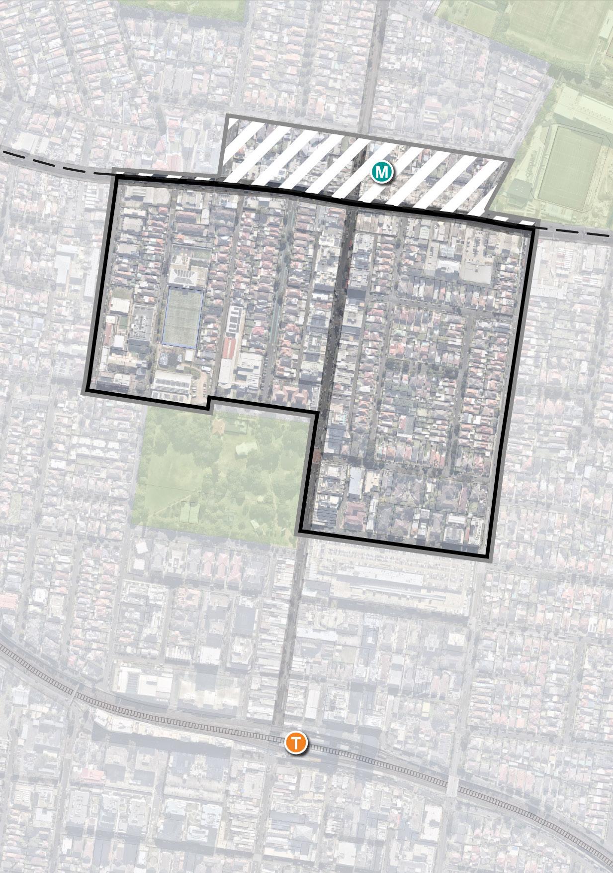
The Burwood North Precinct is on the traditional Country of the Wangal Aboriginal people of the Darug Nations. The Precinct is located to the north of the established Burwood Town Centre and railway station, and is strategically located straddling Parramatta Road at the central point between the Sydney CBD (12km east) and Parramatta CBD (13km west).
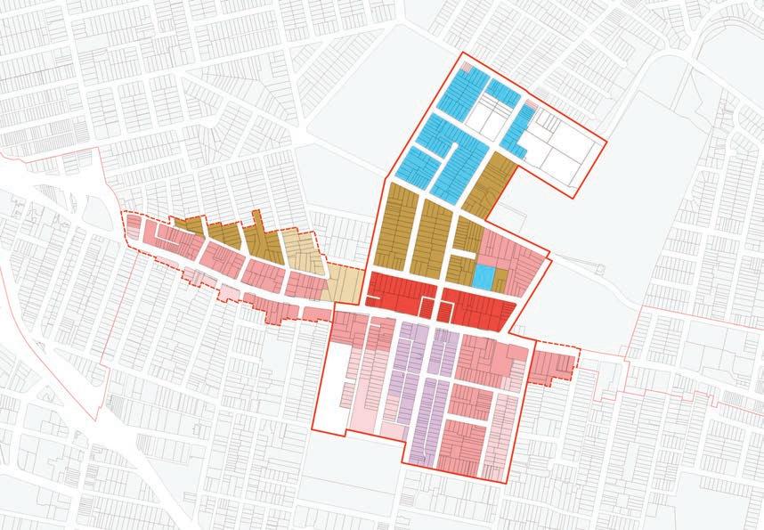
The Burwood North Precinct extends to Parramatta Road to the north, Shaftesbury Road to the east, Wilga Street and Comer Street to the south and Grantham Street to the west as indicated in Figure 2.
The area of investigation extends north across Parramatta Road. This part of the Precinct, bound by Burton Street to the north, Loftus Street to the east and Broughton Street to the west is within Canada Bay LGA and does not form part of the Masterplan, but has been considered in the context of investigations as part of the preparation of the Masterplan.
Burwood North is a highly urban precinct centred around the main north-south spine of Burwood Road.
Burwood North contains both large commercial and mixed use frontages and some fine grain retail on Burwood Road. Land fronting Parramatta Road comprises urban services uses, including car sales yards and car servicing centres, service stations and other vehicular related uses, the Burwood bus depot and retail and commercial uses.
The residential areas within Burwood North are comprised primarily of low and medium density residential development of various age and architectural styles. More recent high density development in the area has resulted in poor interface outcomes between the high and low density development.
Burwood North currently does not have areas of open space, however Burwood Park is a major open space immediately adjoining the Precinct’s southern boundary. Concord Oval, which is within the Canada Bay LGA is to the north-east of the Precinct boundary on the northern side of Parramatta Road and forms part of the broader open space connection.
BURTON STREET LOFTUS STREET BROUGHTON STREET GIPPSSTREET WILGA STREET MERYLA STREET COMER STREET PARK AVENUE BURWOOD ROAD NEICH PARADE PARK ROAD MILTON STREET PARRAMATTA ROAD PARK ROAD BRITANNIA AVENUE GRANTHAM STREET SHAFTESBURY ROAD ESHER STREET ARCHER STREET CONCORD OVAL CANADA BAY LOCAL GOVERNMENT AREA BURWOOD LOCAL GOVERNMENT AREA FUTURE BURWOOD NORTH STATION BURWOOD PARK MLC SCHOOL BURWOOD WESTFIELD BURWOOD STATION
Figure 2: Study Area. Source: COX
Area of Investigation (Burwood
Canada
Canada Bay LGA (excluded from the Masterplan) LGA Boundaries Burwood North Precinct to which the Masterplan applies (Burwood LGA)
Figure 3: Parramatta and Burwood Road. Source: COX
+
Bay LGAs)
Parramatta Road Corridor Urban Transformation Strategy
The Parramatta Road Corridor Urban Transformation Strategy (PRCUTS) is the NSW Government’s 30-year plan setting out how the Parramatta Road Corridor will grow and bring new life to local communities living and working along the Corridor. The Parramatta Road Corridor traverses 20 kilometres from Granville in the west to Camperdown in the east. The corridor includes land adjoining Parramatta Road, which have been identified as Precincts.
The Burwood-Concord Precinct is located immediately north of the existing Burwood Town Centre and Rail Station. The Precinct spans both sides of Parramatta Road to the north and south, with Burwood Road as the central spine. It is bounded to the north by Crane Street, and Meryla Street and Comer Street to the south. Shaftesbury Road, Loftus Street and the Concord Oval/Cintra Park complex bound the Precinct to the east, whilst Park Road and Broughton Street mark the Precinct’s western boundary.
PRCUTS proposed the following Vision for the Burwood-Concord Precinct:
Burwood Precinct will be a commercial gateway to Burwood Town Centre based around the enlivened spine of Burwood Road building upon existing amenity for new residents.
Supporting PRCUTS, the Parramatta Road Corridor Planning and Design Guidelines were developed to inform land use change and promote design quality throughout the Corridor as envisaged by the Strategy.
The purpose of the Guidelines is to:
• Describe the priorities and principles that will ensure future development achieves high design quality and design excellence.
• Guide the rapidly changing character of the Corridor whilst ensuring that future development responds to the distinct character of areas
The Guidelines were prepared to guide the preparation of future Masterplans and Planning Proposals and included recommended land uses, building heights and densities.
PRCUTS proposed that the vision would be realised by:
• Using design features to unify both sides of Parramatta Road
• Ensuring the viability of shops and commercial uses along Parramatta Road
• Celebrating Burwood’s heritage and multiculturalism and preserving heritage buildings
• Integrating new development with existing areas, especially with Burwood Town Centre
• Improving public transport connections for people living north of Parramatta Road
• Protecting Burwood Park from new development, where possible, working with landowners to amalgamate sites in a way that supports better transformation outcomes
• Dealing with narrow, unattractive streets.
PARRAMATTARD PARRAMATTA RD ADA ST DALY AVE MERYLA ST COMER ST WILGA ST SELBORNE ST MONASH PDE PARK RD NEICH PDE BRITANNIA AVE GRANTHAM ST SHAFTESBURY RD ARCHER ST ESHER ST LUKE AVE LUCAS RD CHELTNHAM RD ROYCE RD REGATTA RD WALKER ST CRANE ST FINCHAVE EVELYNAVE BURWOODRD BURWOOD RD BURWOOD RD DAVID ST SALISBURY ST BROUGHTON ST LOFTUS ST WALLACEST TAYLOR ST WENTWORTH RD PHILIP ST MOSELY ST SWAN AVE MASON RD ROBERTS ST COLES ST MELBOURNE ST JOHN ST PARK AVE BURTON ST MILTON ST NEW ST GIPPSST STANLEYST CRANEST ADDISONAVE PATTERSON ST ALEXANDRA ST ROWLEY ST COOPERST Precinct Boundary Frame Boundary Height of Buildings 8.5m 12m 17m 21m 24m 32m 40m 42m M P R S U W1 W2 250 500m 0 250m 173 Parramatta Road Corridor Planning and Design Guidelines Figure 8.13: Burwood-Concord Recommended Building Heights P P P P R M M R U U U U W2 W2 R M S S R R R R S P S S S W1 S P P P P P P PARRAMATTARD PARRAMATTA RD ADA ST DALY AVE MERYLA ST COMER ST WILGA ST SELBORNE ST MONASH PDE PARK RD NEICH PDE BRITANNIA AVE GRANTHAM ST SHAFTESBURY RD ARCHER ST ESHER ST LUKE AVE LUCAS RD CHELTNHAM RD ROYCE RD REGATTA RD WALKER ST CRANE ST FINCHAVE EVELYNAVE BURWOODRD BURWOOD RD BURWOOD RD DAVID ST SALISBURY ST BROUGHTON ST LOFTUS ST WALLACEST TAYLOR ST WENTWORTH RD PHILIP ST MOSELY ST SWAN AVE MASON RD ROBERTS ST COLES ST MELBOURNE ST JOHN ST PARK AVE BURTON ST MILTON ST NEW ST GIPPSST STANLEYST CRANEST ADDISONAVE PATTERSON ST ALEXANDRA ST ROWLEY ST COOPERST Figure 8.14: Burwood-Concord Recommended Densities Precinct Boundary Frame Boundary Floor Space Ratio 0.5:1 1.0:1 1.4:1 1.5:1 1.75:1 2.1:1 2.2:1 2.3:1 2.4:1 3.0:1 4.0:1 D N R S1 S2 T1 T2 V T4 T3 X 250 500m 0 250m 175 Parramatta Road Corridor Planning and Design Guidelines R R R R R R R N N R D D D D D D D X V T4 S1 T3 T3 T4 T4 T4 T4 T3 T3 T2 T1 T1 T1 T2 T4 T1 S2 S1 S1 S1 S1 S1 S1 S2 S1 S1
Figure 4: Parramatta Road Corridor Urban Transformation Planning and Design Guidelines Burwood Precinct Recommended Building Heights. Source: NSW Government
9 9 Burwood North Precinct Masterplan: Masterplan Report
Figure 5: Parramatta Road Corridor Urban Transformation Planning and Design Guidelines Burwood Recommended Densities. Source: NSW Government

• PRCUTS Supporting Evidence Base (2016)
• Geotechnical Assessment Strategy
• Drainage and Flood Management Strategy
• Economic Analysis and Feasibility Report
• ESD Due Diligence Report and Sustainability
• Feasibility Testing
• Infrastructure and Servicing Strategy
• Landscape and Public Domain Analysis Report
• Preliminary Contamination Assessment
• Community Facilities - Updated Needs Assessment
• Aboriginal Design Principles Report
• Visioning Charrettes Outcome Report
• Community Summary Report
STRATHFIELD PARRAMATTARD PARRAMATTA RD BURWOODRD BURWOOD RD BURWOOD RD GIPPSST Concord Public School Concord High School MLC School Burwood Park Concord Oval Saint Lukes Park Queen Elizabeth Park 0 250 500m 0 250m Train line and Station WestConnex Tunnel Accessible Open Space Restricted Open Space Community Infrastructure Waterway Existing Movement New Movement Open Space/Green Grid Residential Mixed Use Indicative Zone for Public Transport Super Stop T 161 Parramatta Road Corridor Planning and Design Guidelines
– Concord Structure Plan
Figure 8.4: Burwood
Parramatta Road Corridor Urban Transformation Strategy (2016)
North Masterplan (2023) Burwood North Planning Proposal Amendment to Burwood Local Environmental Plan Amendment to Burwood Development Control Plan Burwood Affordable Housing Policy and Contributions Scheme Amendment to Burwood Development Contributions Plan Burwood North Planning Pathway
Burwood
Urban Transformation Planning and Design Guidelines Burwood Precinct Structure Plan. Source: NSW Government 10
Figure
6: Parramatta Road Corridor
Burwood
North Precinct Masterplan: Masterplan
Report
Sydney Metro West
The NSW Government is delivering Sydney Metro West – a new underground metro railway which will double rail capacity between Parramatta and the Sydney CBD, link new communities to rail services and support employment growth and housing supply.
Anticipated to open in 2032, Sydney Metro West will deliver a station at Burwood North and will enhance public transport connectivity in Burwood North and provide connections to the Sydney CBD and Parramatta in 10 minutes respectively, making the Burwood North Precinct one of the most connected and accessible precincts in Sydney.
Sydney Metro West presents a significant opportunity that will support the further growth of the existing strategic centre at Burwood, and help to further strengthen connections between the precinct and existing and emerging industry and employment hubs and communities both in the east and west of the city. It also provides an opportunity to increase the residential capacity of the Burwood North Precinct.
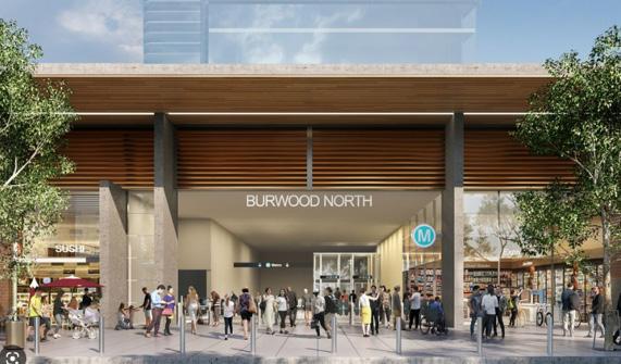
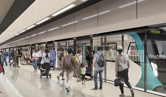
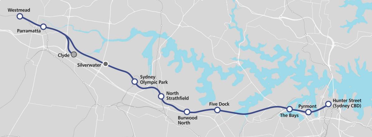 Figure 7: Future Burwood North Station. Source: Sydney Metro
Figure 8: Sydney Metro West. Source: Sydney Metro
Figure 7: Future Burwood North Station. Source: Sydney Metro
Figure 8: Sydney Metro West. Source: Sydney Metro
11 Burwood North Precinct Masterplan: Masterplan Report
Figure 9: Sydney Metro West Network and Station Locations. Source: Sydney Metro
Drivers for Change
Locating housing in the right place to meet the needs of a growing population
To support Burwood LGA’s growing population, we need to ensure future housing will provide a wider variety of housing choices to cater to the evolving needs of our diverse community. These will include high density apartments in vibrant centres, larger apartments, medium density dwellings and the separate houses that give much of Burwood its valued suburban character. Increased housing choice will allow people of all ages to stay in the Burwood LGA as their life circumstances change.
New, well-designed high density housing will be focused where there is the greatest amenity, around Burwood Road and the Burwood North Metro Station. This will assist in preventing the extensive redevelopment in those parts of the LGA which have heritage significance or a significant local character. Mid-rise housing will transition to the edges of the Precinct to ensure that future development responds to existing sensitive uses and low density residential development.
Planning controls for Burwood North will require the delivery of a range of housing types to suit different needs and lifestyles. Diverse housing will include a mix of sizes, universal design, housing for students, seniors, people with disabilities, families and singles.
Improved accessibility and connectivity
The Burwood North Precinct is currently well serviced with rail connections and bus services, connecting the Burwood North Precinct across Greater Sydney.
Sydney Metro West, a new rail link operating between Westmead and the Sydney CBD will deliver a station at Burwood North Precinct, helping to further strengthen connections between the precinct and existing and emerging industry and employment hubs and communities both in the east and west of Greater Sydney.
The research paper by the Committee for Sydney ‘Rethinking Station Precincts’ (May 2022) states that the Burwood Town Centre has one of the highest effective job densities (the number of jobs that can be accessed by public transport from a particular area) in Greater Sydney. With the Burwood North metro station, this accessibility will be further enhanced, making the area an important location for land use intensification and urban renewal.
Source: SCT
Housing Affordability
Housing affordability refers to the relationship between housing costs and household incomes, with housing generally regarded as unaffordable if households must devote a high proportion of their incomes to paying for housing. In recent years housing affordability has worsened in the Burwood LGA, along with many other parts of Greater Sydney as house price and rent growth has significantly outpaced incomes.
Burwood Council’s demographics and housing needs have changed substantially over the past decade and are projected to continue changing over the next decade. This shift in the demographic complexion of the LGA has ushered in an evolving set of needs for greater diversity and affordability in its housing supply.
PRCUTS identified a number of objectives with respect to the delivery of housing in the Burwood North Precinct, including the delivery of a minimum 5% affordable housing, a greater diversity of housing suited to the needs of singlepersons and older people, as well as catering for families.
Future growth in the Burwood North Precinct has implications for housing affordability. While urban renewal has many benefits, this process can impact housing cost through the replacement of older housing with newer, more expensive housing stock. To help mitigate the impacts of rising housing prices on Burwood’s lower income households, Council has committed to delivering affordable housing in the Burwood North Precinct.
As part of the development of the Masterplan, testing has been undertaken to determine the viability of delivering affordable housing in Burwood North and the proposed yields take into account the delivery of a minimum 5% of GFA being delivered as affordable housing across the Precinct.
At this stage Council has not made any decisions with respect to mechanisms for delivery of affordable housing. The detail relating to delivery will be addressed as part of any future Planning Proposal.
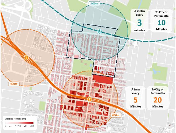
Figure 10: Building Heights in relation to Public Transport accessibility.
12 Burwood North Precinct Masterplan: Masterplan Report
Context and Analysis
Burwood North is strategically located straddling Parramatta Road at the central point between the Sydney CBD (12km east) and Parramatta (13km west).
Four key state and two local level strategic planning documents inform land use planning within the Burwood North Precinct and collectively create the strategic line of sight from a region to local level.
These include:
• A Metropolis of Three Cities, the Greater Sydney Region Plan, Greater Sydney Commission, 2018
• Eastern City District Plan, Greater Sydney Commission, 2018
• Future Transport Strategy 2056, Transport for NSW, 2018
• Parramatta Road Corridor Urban Transformation Strategy, Urban Growth, 2016
• Burwood Local Strategic Planning Statement
• Burwood 2036 - Community Strategic Plan
13
Masterplan: Masterplan Report
Burwood North Precinct
Regional Context
The Greater Sydney Region Plan
The Greater Sydney Regional Plan sets a 40-year vision for Greater Sydney. The plan designated Burwood as a Strategic Centre.
Strategic Centres play a key role in a region’s centre hierarchy and are expected to accommodate high levels of private sector investment and growth.
This designation acts as a transformational opportunity for the Burwood North Precinct.
Eastern City District Plan
Burwood North sits within the Eastern City District as part of the Greater Cities Commission Greater Sydney Region Plan: A Metropolis of Three Cities, 2018.
The Eastern City is nominated to become more innovative and globally competitive carving out a greater portion of knowledge intensive jobs from the Asia Pacific Region. The plan nominates Burwood as a key strategic centre.
As identified in the Eastern City District Plan:
‘Strategic centres are expected to accommodate high levels of private sector investment, enabling them to grow and evolve. They will become increasingly important parts of the region’s structure and will contribute to enabling increased access to a wide range of goods, services and jobs’.
Future Transport 2056
Future Transport 2056 outlines the transport vision for Greater Sydney. The Plan identifies Burwood as forming part of a centre-serving transport corridor that supports buses, walking and cycling. Key actions of Future Transport 2056 that informed the Burwood North Precinct Masterplan include:
• Support car-free, active, sustainable transport options
• Support thriving and healthy 15-minute neighbourhoods
• Manage street space as public space
• Incorporate green, blue and OCHRE infrastructure
• Build well-designed transport infrastructure that makes places more liveable and successful
• Improve the amenity of places along State Roads
• Promote travel behaviour change to manage networks


CBD Rhodes
HARBOUR
Campsie Green Square
Bankstown
Mascot
Park
Leonards Bays Precinct
Macquarie
St
Burwood
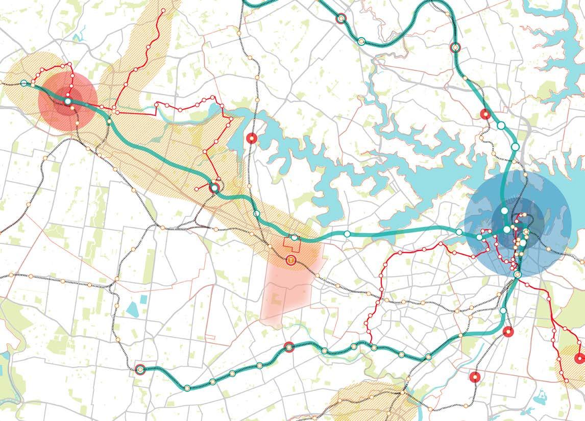
Sydney Olympic Park GREATER PARRAMATTA 10 minutes to CBD 10 minutes to Parramatta
Chatswood
Randwick
Precinct Boundary Harbour CBD Greater Parramatta Strategic Centre Transit Oriented Development Railway line LGA Boundaries Light Rail Line Metro Line Metro Stop Urban Renewal Area Burwood LGA Light Rail Stop Train station 14 Burwood North Precinct Masterplan: Masterplan Report
Figure 11: Strategic Context Diagram. Source: COX, GCC
Burwood Planning Policy Context
An extensive range of documents have been reviewed and analysed to understand the strategic planning process and priorities to date, and to draw on the ideas and knowledge of previous studies undertaken in the Burwood North Precinct. These studies form the basis of the opportunities and constraints that accompany the site analysis for the Precinct.
A comprehensive list of Council, community and consultant plans, strategies, studies, and community engagement summaries formed part of the desktop analysis. The key state and local government plans and masterplanning studies include the following:
• Burwood Precinct Masterplan Report, 2022
• Burwood North Precinct Online Engagement, February 2022
• Burwood Town Centre Urban Design Study and Masterplan, 2021
• Burwood Local Strategic Planning Statement
• Burwood 2036, Community Strategic Plan
• Future Transport Strategy
• Burwood Housing Strategy, 2020
• Parramatta Road Transformation Precincts Vision Report, 2019
• PRCUTS Control Built Form Testing, 2019
• Burwood Community Facilities and Open Space Strategy, 2019
• Burwood, Strathfield and Homebush Planned Precinct, Urban Design Report, 2018
• Greater Sydney Regional Plan, 2018
• Eastern District Plan, 2018
• The Parramatta Road Corridor Urban Transformation Strategy, 2016
Key findings and recommendations which are relevant and used to guide the masterplanning process for the Burwood North Precinct are summarised below.
Council Vision
The Burwood 2036, Community Strategic Plan has recently been updated to include a new vision for Burwood:
‘Burwood is a welcoming and inclusive community that is defined by our diversity of people, liveable places and progressive ideas. We acknowledge and celebrate our history and place, protect our heritage and environment and share a quality of life that is equitable, sustainable and supports each other to thrive and prosper’.
(Burwood 2036 CSP)
Burwood 2036 – Community Strategic Plan
Burwood 2036 is Burwood Council’s Community Strategic Plan, and outlines the Council’s vision and aspirations for the area, providing a blueprint for Council activities and strategic directions for the next 20 years.
The vision for the Burwood LGA is for ‘A well connected, innovative, sustainable and safe community that embraces and celebrates its diversity,’ underpinned by the four social justice principles of equity, access, participation and rights.
The broad strategic directions of Burwood 2036:
• Inclusive community and culture
• Places for people
• Sustainable and protected environment
• Vibrant city and villages
• Open and collaborative leadership.
Implications for housing
The strategic themes under the Plan with relevance to the future of housing include the need for:
• Environmentally sustainable developments which reduce impacts on the environment
• Burwood’s existing heritage to be integrated with high quality urban design, and
• The distinct character of residential areas surrounding town centres to be preserved.
Likely challenges in relation to housing include that as a Strategic Centre, Burwood is expected to meet State Government targets for additional housing. Additionally, strong demand for housing in the wider Inner West will continue to pose challenges for affordability, requiring a diverse mix of dwellings to cater to a range of households.
The Burwood North Precinct is uniquely placed to successfully deliver upon the Vision and create a more liveable, vibrant, and connected neighbourhood. The Precinct offers several distinct advantages in transport connectivity and its local economy.
 Figure 12: Burwood Community Strategic Plan. Source: Burwood Council
15 Burwood North Precinct Masterplan: Masterplan Report
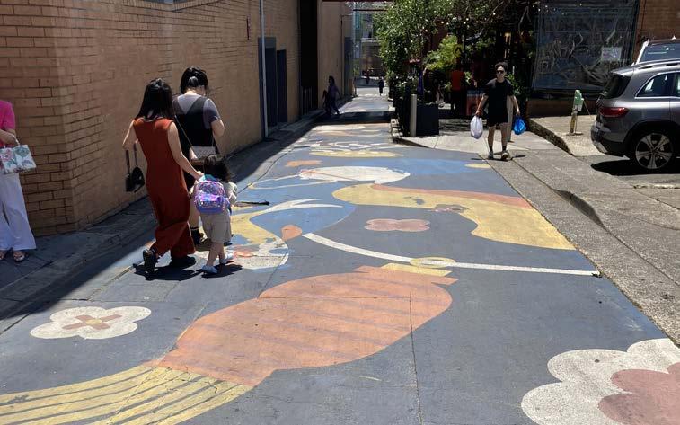
Figure 13: Burwood Chinatown. Source: COX
Who Are We Planning For?
The Burwood LGA is currently home to 40,397 people, with approximately 8,000 of those living within the northern portion of the suburb of Burwood.
2,652 of those residents live within the Burwood North Precinct (the area for this Masterplan)
Born overseas Not stated Born in Australia
28% of Burwood North residents are the young workforce aged 2534 compared with 16% in Greater Sydney
71% of Burwood North residents were born overseas compared with 39% in Greater Sydney
45% of residents have Chinese ancestry
11% Nepalese
13% English & Australian
3% Indian
3% Italian
3% Vietnamese
16% of Burwood North residents live in a separate house compared with 53% in Greater Sydney
66% of Burwood North residents live in a high density apartment compared with 27% in Greater Sydney
20% of Burwood North households are couples with children compared with 34% in Greater Sydney 14% of Burwood North households are group households compared with 4% in Greater Sydney
58% of Burwood North residents rent their home compared with 35% in Greater Sydney
31% of Burwood North residents do not own a car compared with 11% in Greater Sydney
49% of Burwood North residents travel to work by public transport compared with 23% in Greater Sydney (2016 statistic)
31% 4% 8% 45%
2021 statistics (unless noted as 2016) for the suburb of Burwood (north) - Profile.id The geography for these statistics extends outside the Burwood North Precinct boundary and includes the area between the rail corridor to the south, Wentworth Road to the west, Lucas Road to the east and Parramatta Road to the north.
Local Economy
Burwood’s economy is largely focused around the town centre. The Burwood LGA's Gross Regional Product (GRP) was $2.83 billion in the 2021 financial year, growing from $2.7 billion the previous year. This makes the area the hub of the Inner West region with its broad spectrum of businesses and economic input. (Burwood Local Strategic Planning Statement). Parramatta Road largely comprises car sales and servicing centres.
Health and Education
The health care and social assistance industry is the largest employment type in the Burwood North Precinct. (Refer Burwood North Precinct Masterplan: Employment Land Use Survey Summary, by JLL) Whilst there are a number of health and social assistance businesses and services located within the Burwood North Precinct, the primary medical cluster is to the south of the Precinct in the Town Centre. The St. John of God Private Hospital and Medical Centre is located to the west of the Precinct. There is an opportunity to increase overall medical provision in Burwood North Precinct.
There are also a high number of public and private educational facilities located within and in close proximity to the Burwood North Precinct including Burwood Girls High School, Holy Innocents Catholic Primary School, Southern Cross Catholic College, MLC School and Burwood Primary School.
Community
There are a range of community facilities in the Burwood LGA, including one aquatic centre, five community centres, early education centres, a library and community hub within the town centre. Recent demand studies show that there is a need to expand existing and provide additional community facilities to service the growing population.

Retail and Entertainment
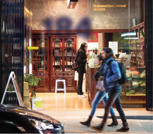
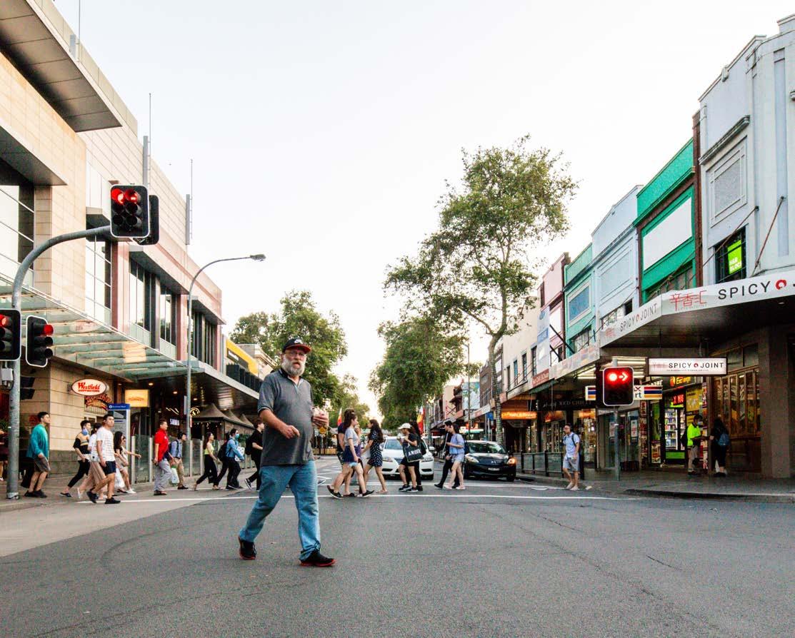
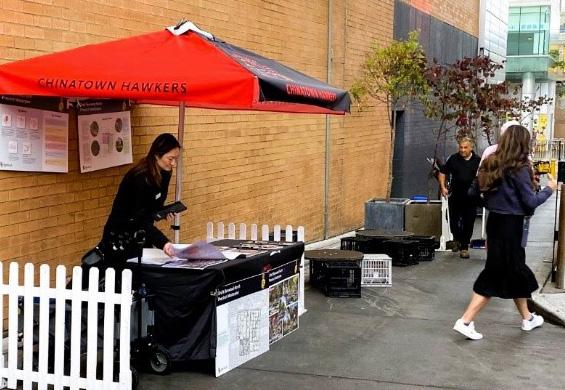
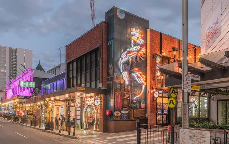
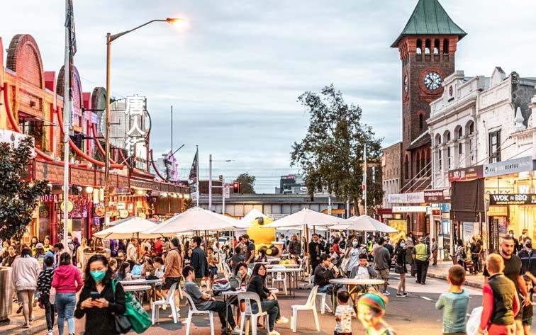
Currently Burwood Road is a popular retail, dining and entertainment strip serving as the spine of the town centre with the Westfield Shopping Centre serving as a major retail destination for both locals and visitors alike. There is a high concentration of dining venues in the town centre, in and around the train station and Burwood Road south, many of which offer genuine and region-specific Asian cuisine. The Burwood Chinatown development has become a popular destination with an activated arcade and a number of laneway eateries in the adjoining streets and lanes.
24% 71% SEPARATE HOUSE HIGH DENSITY
$
16 Burwood North Precinct Masterplan: Masterplan Report
Historical Overview
The lands that have become known as Burwood North formed part of the traditional Country of the Wangal people. Their country extends along the southern shore of the Parramatta River between today’s Pyrmont in the east and the City of Parramatta in the west. The southern boundary in not known but may have been formed in part by the Cooks River.
Elevated and flat landforms with good aspect, proximity to abundant and predictable resources and drinking water and positioned adjacent or overlooking water may have been attractive camp site locations. This includes Burwood North, being located on a prominent ridgeline that separates the Cooks and Parramatta Rivers.
European invasion forced the retreat of the Wangal into alien territory, depriving them both of their source of food and spiritual connection with their country.
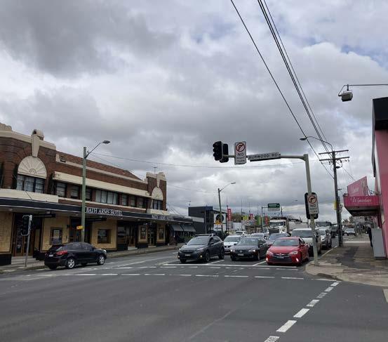
In 1799 Captain Thomas Rowley was granted 100 hectares of land (later increased to 300 hectares) covering most of today’s Burwood and Croydon, named Burwood Estate. During this period there was small scale farming and timber getting, with inns and blacksmiths along Parramatta Road. The Bath Arms Hotel has sat on the site of a coach inn since the 1820’s. In about 1833, the owners of a number of grants commenced to subdivide and sell their lands and thus commenced the growth of the suburb of Burwood.
European settlement
Wangal
people
The Wangal people of the Eora nation are the traditional owners of the land upon which Burwood North Precinct sits today.
60,000+
First land grants gifted to Thomas Rowley, who names his land after Burwood Farm in Cornwall.
Longbottom Government Farm
Convicts provide labour for a significant forestry operation, processing wood on-site for sale in Sydney via the Parramatta River.
The construction of the Sydney to Parramatta railway line led to the subdivisions of Burwood Estate, which slowly changed the character of the area. It became a wealthy enclave, with Sydney’s businessmen attracted by the rural aspect, within easy commute of Sydney CBD and Parramatta.
In the late 19th century, former estates were subdivided and residential suburbs emerged along road and rail transport corridors. The current form of the area became solidified, with much of the area given over to Victorian and Federation style houses with retail centred along Parramatta Road, Railway Parade and Burwood Road.
During the inter-war period Sydney’s urban sprawl resulted in larger homes subdivided into flats and surplus land sold for small houses. Many of the Victorian villas began to be converted into schools and institutions.
From 1970’s onwards, density in Burwood has been increasing, with apartment buildings of increasing size and height, particularly around Burwood Park, and the development of Westfield and Burwood Plaza.
Parramatta Road
Parramatta Road formalised for passage of wheeled vehicles.
Burwood Villa
Alexander Riley constructs the first house in the district, on the western edge of Burwood Park.
Riley is a pioneer in fruit cultivation - introducing the first raspberries, strawberries and lemons to the colony.
Stagecoach inns
Sydney - Parramatta railway
A new rail service opens Burwood to wealthy merchants and industrialists, who build large manor homes.
A series of inns, including the Bath Arms Hotel, serve a new stagecoach service at tenkilometre intervals.
Municipality of Burwood
Trams
Steam trams travel down Burwood Road to Mortlake, Cabarita and Ashfield.
Subdivisions
Mary Street, Comer Street and Neich Parade are subdivided.
The Council is proclaimed with a population of 1,200.
Brick houses
Demographic change
Burwood will see significant growth in migrant communities.
Quarries provide material for the extensive red-brick bungalows found throughout Burwood.
Intersection of Burwood Road and Parramatta Road subdivided, including provisions for commercial use.
1799 1797 1812 1821 1825 1855 1874 1900 1920 80s
17 Burwood North Precinct Masterplan: Masterplan Report
Existing Heritage
The Burwood North Precinct has several heritage listed items within its boundaries. A Heritage Significance Assessment was undertaken to examine their value to the Precinct (Refer to Burwood North Precinct Masterplan – Heritage Significance Assessment, by HAA).
The Methodist Ladies College (MLC), Bath Arms Hotel and Teachers Residence demonstrate local heritage significance. Located on the corner of Burwood Road and Parramatta Road, the Bath Arms Hotel site is a relic of Burwood’s settlement, and now marks the entrance to the Precinct.
Both the Methodist Ladies College (MLC) and the Teacher’s Residence which is within Southern Cross College are architecturally significant, and emblematic of the growing importance of Burwood in the early 20th century.
The Italianate terraces on Archer Street are unique in the context of Sydney and should be retained. Similar Italianate terraces on Burwood Road, are substantially altered from their original form, though still carry retention value.
Elements of the Victorian shopfronts on Burwood Road are deemed to be significant, though much of the facade is compromised. Retention of the heritage listing of these buildings would require careful consideration of the facade elements of these buildings.
The Queen Anne cottage on Neich Parade is notable, though not unique - the building does not differ substantially from other cottages in the same area that are not listed. The cottage's significance has been assessed and it is considered that it does not meet the threshold for heritage listing. Consideration could be given to removing this property from Schedule 5Environmental Heritage of Burwood LEP 2012 as part of any future Planning Proposal.
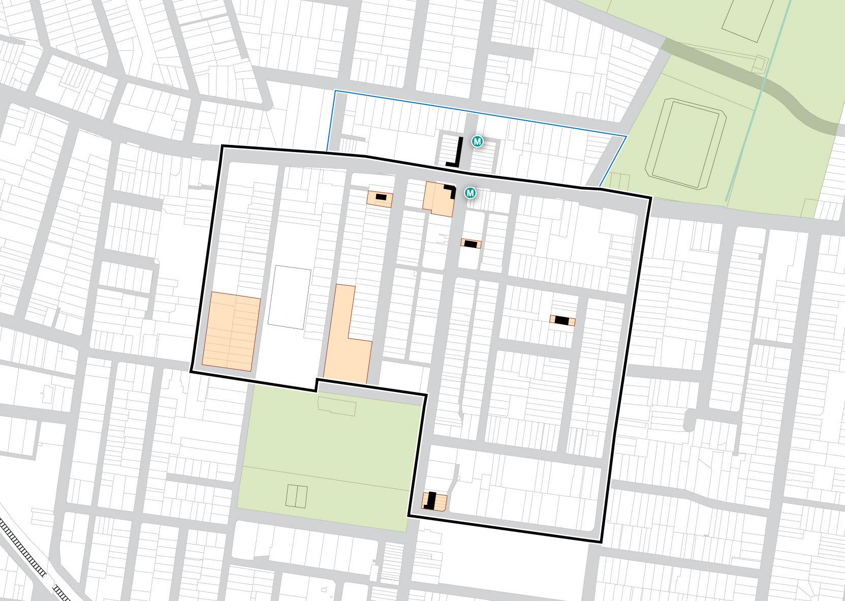
Figure 14: Heritage Item Diagram. Source: COX + HAA
BURTON STREET LOFTUS STREET BROUGHTON STREET GIPPSSTREET
STREET MERYLA STREET COMER STREET PARK AVENUE BURWOOD ROAD NEICH PARADE PARK ROAD MILTON STREET PARK ROAD BRITANNIA AVENUE GRANTHAM STREET SHAFTESBURY ROAD ESHER STREET ARCHER STREET CONCORD OVAL ST LUKES PARK BURWOOD PARK MLC SCHOOL BURWOOD WESTFIELD PARRAMATTA ROAD BATH ARMS HOTEL
SHOPS TERRACES TEACHER'S RESIDENCE MLC SCHOOL BUILDING ITALIANATE TERRACES
HOUSE
VICTORIA
VICTORIAN
QUEEN ANNE
Precinct Boundary Future Metro Entry Heritage Buildings Heritage Item 50 200m 100 0 18 Burwood North Precinct Masterplan: Masterplan Report
Existing Character
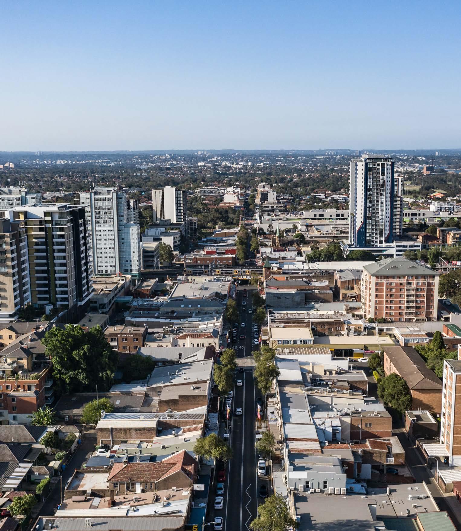
Today, the Burwood North Precinct is an urbanised Precinct centred around Burwood Road, a major thoroughfare that runs from the Parramatta River in the north and connects to the Cooks River and Campsie in the south.
The road is primarily used by vehicles and is flanked by laneways on both sides. South of the Precinct, there is a bustling dining and entertainment hub with numerous small restaurants that offer outdoor dining options. The historic streetscape features narrow footpaths and a mix of road widths and verge conditions, limiting the presence of street trees due to overhead power lines. Burwood Park, located within the Burwood Town Centre, provides a green space with mature fig plantings and wellmaintained open lawns.
The Burwood North Precinct is predominantly residential, with the exception of Parramatta Road, which includes a mix of uses including car sales, retail and commercial development. South of Parramatta Road, the area predominantly consists of commercial and mixed-use properties extending towards the Burwood Town Centre. The rest of the Precinct is predominantly occupied by low and medium density residential developments of different architectural styles and ages.
Older dwellings are often red brick inter-war and postwar houses set back behind fences and front gardens. However, recent higher density developments have created a contrast between taller buildings and the Precinct’s original human-scale character. Some new developments exhibit poor quality and lack a positive interface with the public domain, with service laneways dominated by parking and blank façades.
Throughout the Precinct, there are scattered heritage items, including individual dwellings and the notable Bath Arms Hotel, which has served as a hotel and meeting place since the 1820s.
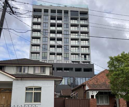
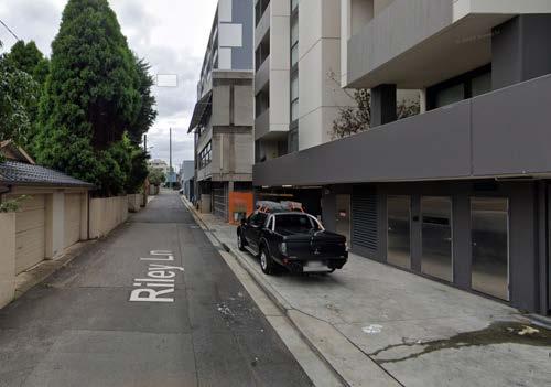
 Figure 15: Upgraded streetscape along north Burwood Road - large commercial frontages contrast the existing fine grain. Source: COX
Figure 16: Wilga Street looking east - Burwood Westfield Car Park - borrowed landscape. Source: COX
Figure 17: Wide street with mature street trees. Source: COX
Figure 18: Development of varying age and architectural style. Source: COX
Figure 19: New development with poor public domain interface along streets and lanes. Source: COX
Figure 15: Upgraded streetscape along north Burwood Road - large commercial frontages contrast the existing fine grain. Source: COX
Figure 16: Wilga Street looking east - Burwood Westfield Car Park - borrowed landscape. Source: COX
Figure 17: Wide street with mature street trees. Source: COX
Figure 18: Development of varying age and architectural style. Source: COX
Figure 19: New development with poor public domain interface along streets and lanes. Source: COX
19 Burwood
Masterplan: Masterplan Report
Figure 20: Parramatta Road looking towards city and proposed metro site and heritage Bath Arms Hotel. Source: COX
North Precinct
Constraints and Opportunities
As part of the analysis for the preparation of the Burwood North Precinct Masterplan, an assessment of the constraints and opportunities has been undertaken related to:
Connectivity
Environmental
Built Form and Character
Development Considerations
See Appendix 1 for more information on Constraints and Opportunities.

20 Burwood North Precinct Masterplan: Masterplan Report
This page has been left intentionally blank.
21
Precinct Masterplan: Masterplan Report
Burwood North
Developing The Burwood North Precinct Masterplan
Since the release of PRCUTS in 2016, the NSW Government approved the construction of the Sydney Metro West, a new rail link operating between Hunter Street, in the Sydney CBD and Westmead. Anticipated to open in 2032, Sydney Metro West will deliver a station at Burwood North with access to the Sydney and Parramatta CBD and The Bays Precinct within 10 minutes. This significant investment in infrastructure will make the Burwood North Precinct one of the most connected and accessible precincts in Greater Sydney and has resulted in an opportunity to review the outcomes proposed to be delivered under PRCUTS.
The Burwood North Masterplan seeks to build upon the vision envisaged by PRCUTS in a way the ensures that the urban renewal of the Precinct leverages the opportunity afforded by the delivery of Sydney Metro West.
This level of connectivity and accessibility, not envisaged by PRCUTS, has the potential to attract significant investment in employment and the delivery of housing and provides opportunities to build on the established health/medical, educational and professional industry in the Precinct, further cementing Burwood’s role in the Eastern City District as a Strategic Centre.
It also provides an opportunity to deliver significant community benefits, including open space and community infrastructure, quality urban design and building excellence, green and connected streets for people, all in a way that is environmentally and financially sustainable.
22 Burwood North Precinct Masterplan: Masterplan Report
What is a Masterplan?
A masterplan is a long-term plan that provides a road map to guide future growth and change in our centres over the coming decades.
Masterplans have an important role in determining the look, feel and function of the urban environment. A masterplan guides building heights, design, density, sustainability, movement, land use zoning, open spaces, community infrastructure and heritage within a particular geographic area.
The Burwood North Precinct Masterplan has been informed by supporting studies and an extensive stakeholder and community participation process. The draft Masterplan was exhibited between October - December 2023 and submissions received have been considered as part of the finalisation of the Masterplan. The Masterplan will guide new planning controls that could apply to properties in the Burwood North Precinct and provides an urban design framework to ensure the delivery of a high quality, liveable and walkable urban environment.
Developing the Masterplan
The Masterplan has been developed through the following process:
• Site Analysis & Visioning - undertaken through the first stage of the project, the outcomes of the site analysis and visioning are used as the basis for developing the masterplan scenarios and preferred masterplan. Refer Burwood North Precinct Masterplan: Engagement Outcomes Report, by COX and Burwood North Precinct Masterplan: Precinct Analysis Summary Report, by COX
• Scenario Workshop - COX along with the project team and Council developed masterplan scenarios for testing and discussion with stakeholders
• Ongoing Consultant & Client Collaboration - the consultant project team and Council have collaborated throughout the process to develop the masterplan scenarios into a cohesive and refined masterplan that reflects the Vision and Top Priorities for the Precinct.
This report has been developed in conjunction with additional supporting studies and should be read with the following:
• Burwood North Precinct Masterplan Landscape and Public Domain Strategy Report, by Oculus
• Burwood North Precinct Masterplan First Nations Design Principles Report, by Dominic Steel Consulting Archaeology
• Burwood North Precinct Masterplan Rapid Transport Appraisal, by SCT Consulting
• Burwood North Precinct Masterplan Sustainability Statement, by Mott MacDonald
• Burwood North Precinct Masterplan Economic Assessment & Feasibility Report, by JLL
• Burwood North Precinct Masterplan Stormwater and Flooding Study, by Mott MacDonald
• Burwood North Precinct Masterplan Geotechnical Study, by Mott MacDonald
• Burwood North Precinct Masterplan Utilities Study, by Mott MacDonald
• Burwood North Precinct Masterplan Preliminary Site Investigation, by Mott MacDonald
• Burwood North Precinct Masterplan – Heritage Significance Assessment, by HAA
• Burwood Community Facilities and Open Space Strategy; 2023 Community Facilities Addendum, by CRED
Following extensive community engagement in late 2023, the Masterplan has been reviewed to ensure that the Vision can be delivered. The review of the Masterplan has also taken into account key planning reform announced by the NSW Government in late 2023.
The Masterplan includes an Implementation Plan which will guide the preparation of the planning controls and associated policies/strategies to guide Burwood North’s growth over the next 1520 years.
These include:
• A Planning Proposal to amend the Burwood Local Environmental Plan 2012.
• Amendments to the Burwood Development Control Plan to inform built form and design outcomes.
• Integration into the Burwood Infrastructure Contributions framework to support the funding, delivery and on-going maintenance of infrastructure.
• The introduction of an Affordable Housing Scheme to ensure the delivery of a minimum 5% affordable housing.
The Masterplan provides clarity and a way forward for the urban renewal of the Burwood North Precinct. It does not however result in changes to the planning controls in Burwood North. Changes to Council’s planning framework are required to go through a defined process under the Environmental Planning and Assessment Act 1979, which will include further community engagement beyond this Masterplan.
The Masterplan aims to present a conceptualised design which considers the future urban structure of a defined area, guided by future growth and development and desired outcomes unique to a cohesive vision for the place.
Creating a liveable, vibrant, sustainable and accessible place that supports attracting jobs and investment is central to the Masterplan. Well planned growth will help reinforce Burwood’s existing qualities. Its streets will be pedestrian friendly, lively places in the day and night, contributing to a sense of safety, attractiveness and inclusiveness. Higher density living and jobs growth will be well located around the future Metro Station and Burwood Road.
23 Burwood North Precinct Masterplan: Masterplan Report
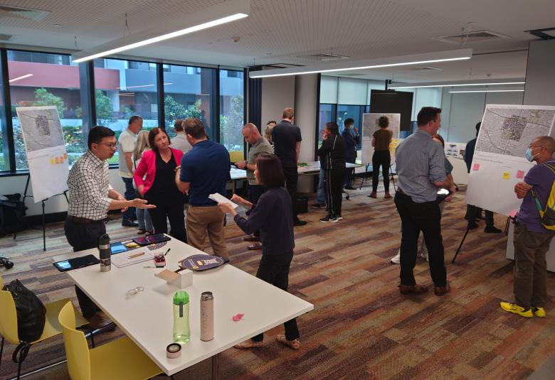
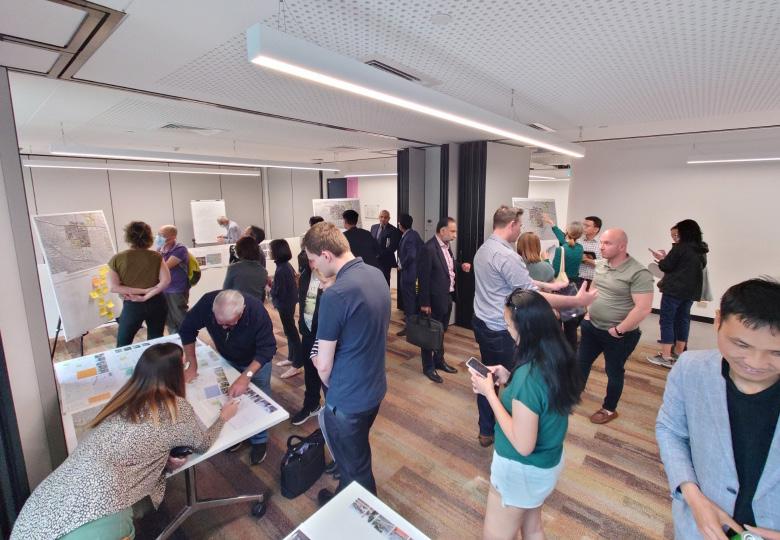
Stage 1 Community Engagement
We engaged over 500 individuals including landowners and residents, First Nations groups, local businesses, community members, government and institutional stakeholders as part of the Stage 1 engagement phase.
The diverse range of stakeholder groups were consulted throughout this period including:
• Government agencies
• Institutional stakeholders
• Landowner and residents within the boundaries of the masterplan area of investigation
• Local businesses within the boundaries of the masterplan area of investigation
• First Nations group
• Community members of the Burwood LGA
Aim of the engagement
The Stage 1 stakeholder engagement aimed to gain a deeper understanding of the opportunities and challenges within Burwood North and to draw out the top priorities, vision, needs and desires for the future of the Precinct.
In listening to our community, we have undertaken a wide range of engagement activities including:
• Community Social Map on the Participate Burwood webpage
• Landowner and resident survey on the Participate Burwood website
• Local business survey conducted through November 2022
• Government and institutional stakeholder Visioning Charrette held at Burwood Council on 16 November 2022
• Landowner and resident drop-in session hosted at Burwood Council on 22 November 2022
• First Nations groups engagement held at Burwood Council on 6 December 2022 and 1 March 2023
Engagement Activities
A summary of the stakeholder engagement activities undertaken as part of the Stage 1 Engagement activities are listed below. Further information is contained within the Burwood North Precinct Masterplan Engagement Outcomes Report and supporting documents.
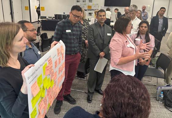
Visioning charrette
The purpose of the charrette was for participant stakeholders to understand the opportunities and constraints within the Precinct, and to collectively share their non-negotiable outcomes, visions and priorities for the future planning of the Precinct.
Landowner one-on-one meetings
Individual meetings with major landowners in the Precinct to understand their perspectives on opportunities and constraints to development including areas of housing, open space, and community infrastructure.
Community drop in session
Attended by over 100 people, primarily residents and landowners from within and surrounding the Precinct, provided an opportunity for the community to speak to the project team.
Landowner and resident survey
Conducted from 22 November - 4 December 2022 and was hosted online on the Participate Burwood page. The aim of the survey was to gain insight into the strengths and challenges of and ideas for the Burwood North Precinct.
Online community engagement
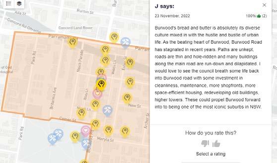
An online ‘social map’ was launched to enable community members to share their perspective and ideas for the Precinct through marking and adding comments to a map within the categories of: love, improve, ideas, and research (areas for further investigation).
First Nations engagement
An advisory panel was established made up of First Nations organisations and individuals who expressed interest in participating in the project to identify, discuss and develop First Nations design principles intended for the masterplan. Two workshops took place for initial engagement and as a follow up and ideas for First Nations design intervention.
Masterplan scenario workshop
This workshop allowed participants to interrogate the options developed by the project team and Council and also provide guidance on opportunities, constraints, and needs that may impact option selection. Workshop outcomes were used to formulate the preferred masterplan.
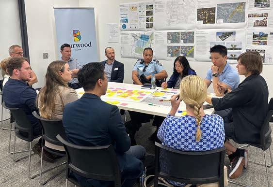 Figure 22: Community drop-in session. Source: COX
Figure 23: Visioning Charrette Session 3 breakout group discussion. Source: COX
Figure 24: Community drop-in session. Source: COX
Figure 22: Community drop-in session. Source: COX
Figure 23: Visioning Charrette Session 3 breakout group discussion. Source: COX
Figure 24: Community drop-in session. Source: COX
24 Burwood North Precinct Masterplan: Masterplan Report
Figure 21: Visioning Charrette Session 3 breakout group discussion. Source: COX
Key Strengths and Opportunities
• Burwood North is a wonderfully connected location - a thriving hub between the Sydney CBD and Parramatta CBD, that will be enhanced further with the Sydney Metro station at Burwood North
• Burwood North has a high level of accessibility to parks, schools and health services
• Burwood North is a vibrant urban destination; a place for food and shopping, with a strong night time economy
• Burwood Road is a well established, vibrant high street
• Many people get around Burwood North on foot, there is an opportunity to enhance the walkability of the Precinct
• Burwood North has an exciting, multi-cultural community feel
• Burwood Park is an important open space asset for the community, heavily used for events and recreation by people of all ages
• The community generally supports a high density urban environment for Burwood North, with the necessary community and transport infrastructure to support growth
• The former creek line that ran through Burwood North could be re-interpreted and incorporated into the public domain to assist with stormwater management and urban greening
• There is a need and opportunity to take a Connecting with Country approach to the design of the Precinct
Key Constraints
• Some roads are dominated by cars and parking, reducing pedestrian amenity and safety
• Footpaths are too narrow in some areas, with many conflicting users along Burwood Road
• Parramatta Road is challenging to cross in places, and presents as a barrier to easy and safe north-south pedestrian and cycle movement
• Burwood Road needs more safe crossing points
• There is a need for better connected active and public transport
• Burwood North could benefit from more greenery on the streets, helping to reduce the urban heat island effect
• Additional open spaces are needed to support the growing population
• Additional housing choice to meet the diverse needs of all age and cultural groups
• Housing affordability is a challenge
• Parramatta River is close by but walking access to it is not intuitive
Stage 2 Community EngagementExhibition of the Draft Masterplan
The draft Masterplan was placed on public exhibition on 23 October 2023, and concluded on 15 December 2023 for a total period of 8 weeks. Submissions were received up to 5 January 2024 to allow the community suitable time to provide feedback.
The table on the following page provides an overview of the engagement methods undertaken and the community response.
What we have heard
Figure 25: Participate Burwood Social Map, showing comment from participant. Source: COX
25 Burwood North Precinct Masterplan: Masterplan Report
Tool/Technique Description Response
Letters to community (LGA wide)
Addressed letter to affected landowners
Colour flyer was letterbox dropped to residents, businesses and landowners in the Burwood LGA advising of vision and engagement activities.
Cover letter to landowners in the study area, including the colour leaflet.
Second and third letters to landowners in study area to provide update on additional engagement activities.
Delivered to 16,100 households. Sent on 18 October prior to the start of exhibition period.
Tool/Technique Description Response
To be held at community events, community facilities and high visitation areas.
Community Pop Up Sessions
Pop-ups to include A1 size display boards with renders of future of Burwood North.
Addressed letter to adjoining landowners
Post cards in English, Chinese, Nepali and Korean
Cover letter and flyer sent to landowners adjoining the study area, including land adjoining the Burwood North Metro Station within Canada Bay LGA.
Postcards distributed to service centre, library and at drop in sessions and pop-up stalls as part of engagement program. Postcard provides a snapshot on seeking feedback with QR code to Participate Burwood website.
Series of factsheets for distribution at engagement sessions and online on the Participate Burwood page.
Factsheets include:
Factsheets
• Introduction to Masterplan
• Top 6 priorities
• Implementation of Masterplan
• Next steps
3D visualisation of the masterplan on the vision and proposed changes under master plan. Video animation produced and put on Participate Burwood Website and Burwood Council’s YouTube channel.
Affected landowners (717 letters) sent on 18 October.
Letters on 6 November and 22 November.
446 adjoining landowners.
242 landowners in Canada Bay LGA.
Sent the week of 18 October.
400 postcards.
70 copies distributed at engagement sessions.
140 copies downloaded from Participate Burwood website.
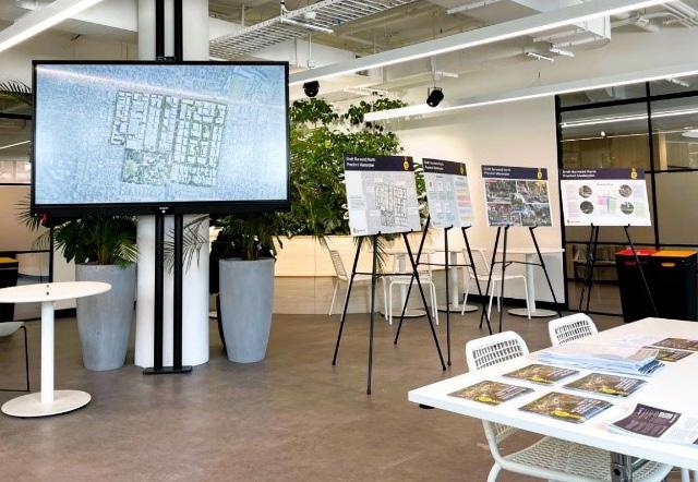
Burwood Hub Display and Speak to a Planner
Printed copies of collateral available for community including factsheets, notification letter and postcards.
Display setup in Burwood Hub with a strategic planner available to talk at specified time slots during the consultation period.
Website for the draft Masterplan provides:
• Digital 24/7 access to information and to provide feedback
• Timelines and information about consultation undertaken
14 sessions planned (refer to previous table for list of pop-up sessions).
90 participants to date.
8 sessions planned (refer to previous table for list of drop-in sessions)
15 participants to date.
3,452 Visits.
Participate Burwood
• Masterplan and technical reports
• 3D visualisation of Masterplan
• Factsheets
• List of consultation activities
• Survey and submission form
• Link to register to be informed of updates on project.
1,960 unique visitors (23 October to 31 January 2024).
358 downloads of the draft Masterplan report.
Online Survey
965 views on YouTube.
Social media
10 questions on the top priorities for Burwood North. 15 responses.
Promotion of Masterplan engagement activities on social media.
9% of visits came via social media with 186 link clicks.
30 phone conversations.
Stakeholder meetings
Briefing on the project with MPs, local schools, Council advisory committees, and internal staff
6 briefings during consultation period.
Speak to a planner
One-on-one conversations with Council strategic planners via phone or in person meetings.
8 meetings by appointment.
3D animation video
26 Burwood North Precinct Masterplan: Masterplan Report
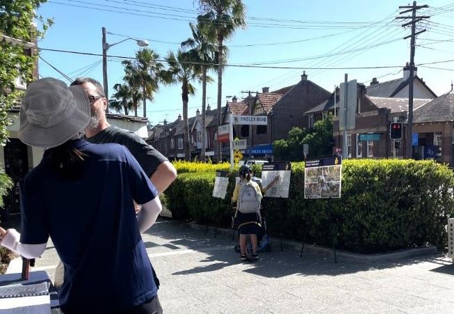
Community pop up and drop in sessions
22 community pop-up sessions were held in various locations within Burwood LGA to share information about the draft Masterplan, answer questions and receive feedback. The pop-ups were held in public and community spaces including parks, community events, community halls and on the street over 8 weeks including weekends. The sessions were attended by Council planning staff. There were 110 conversations and interactions for the pop-ups and drop in sessions.
What we have heard
In response to the public exhibition of the draft Masterplan, fifty-five (55) submissions were received.
Key themes raised in submissions and engagement activities included:
• Site specific feedback
• Process and timing for delivery of the controls
• Transport/Traffic/Parking
• Delivery of infrastructure to support the growth
Theme
Site specific feedback
• The majority of enquiries from landowners and residents related to wanting to understand how the masterplan would impact their property.
• The most common enquiries related to the proposed height and density (FSR) and what this meant for their property and/or the impact of adjoining changes on their property.
• All site-specific submissions requested consideration of greater height and density (FSR) than what had been proposed in the draft Masterplan.
• A number of submissions requested changes to proposed minimum lot sizes, site amalgamation patterns, and location of open space and through site links.
Process and timing
• The majority of queries and feedback on process and timing related to the master planning process and implementation of the masterplan.
• Landowners and residents wanted to understand the next steps and timing of changes to planning controls and when development would occur. Landowners expressed that they have been waiting a significant period of time for changes to occur in the precinct since the announcement of the Parramatta Road Corridor Urban Transformation Strategy prior to 2016.
Transport / Parking / Traffic
• There was some support for the introduction of maximum parking rates and unbundled parking.
• There were comments and feedback on the timing and certainty of the delivery of the Sydney Metro West line following the State Government’s announcement of a review in April 2023. The final recommendations were released in December 2023 with the announcement by the NSW Government committing to the delivery of Sydney Metro West including Burwood North Station and its delivery by 2032.
• Concerns were raised regarding the potential impact of the masterplan on traffic congestion particularly around school zones and ability to find on-street parking in peak periods.
Infrastructure to support growth
• A number of submissions identified concerns with the quantum of open space proposed and the provision of community facilities for the proposed future increase in population.
Figure 26: Pop-up stall at The Strand, Croydon (31 October 2023)
Figure 27: Drop in session at Burwood Community Hub
Figure 28: Pop-up stall at Burwood Chinatown Night Markets (3 November 2023)
27 Burwood North Precinct Masterplan: Masterplan Report
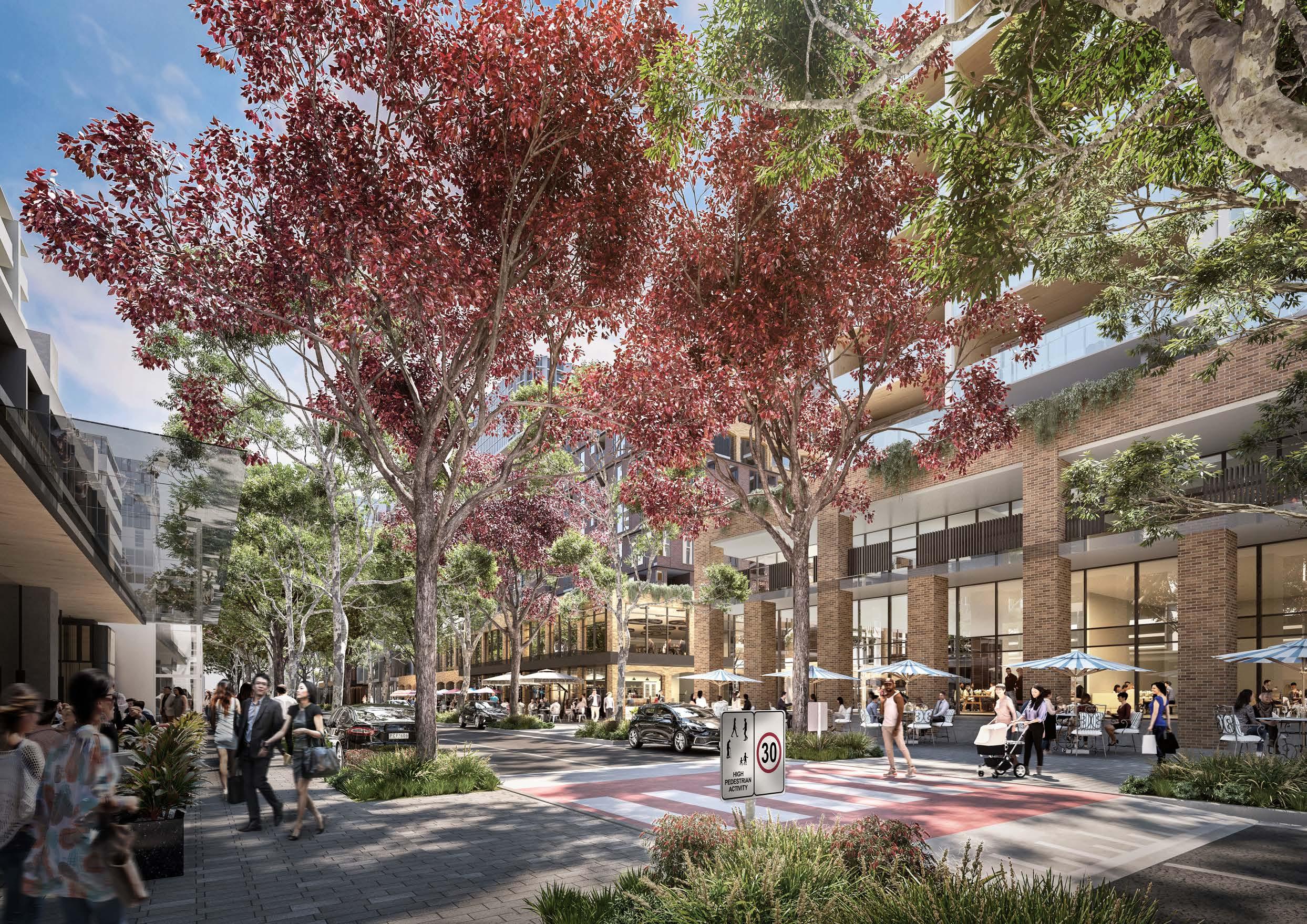
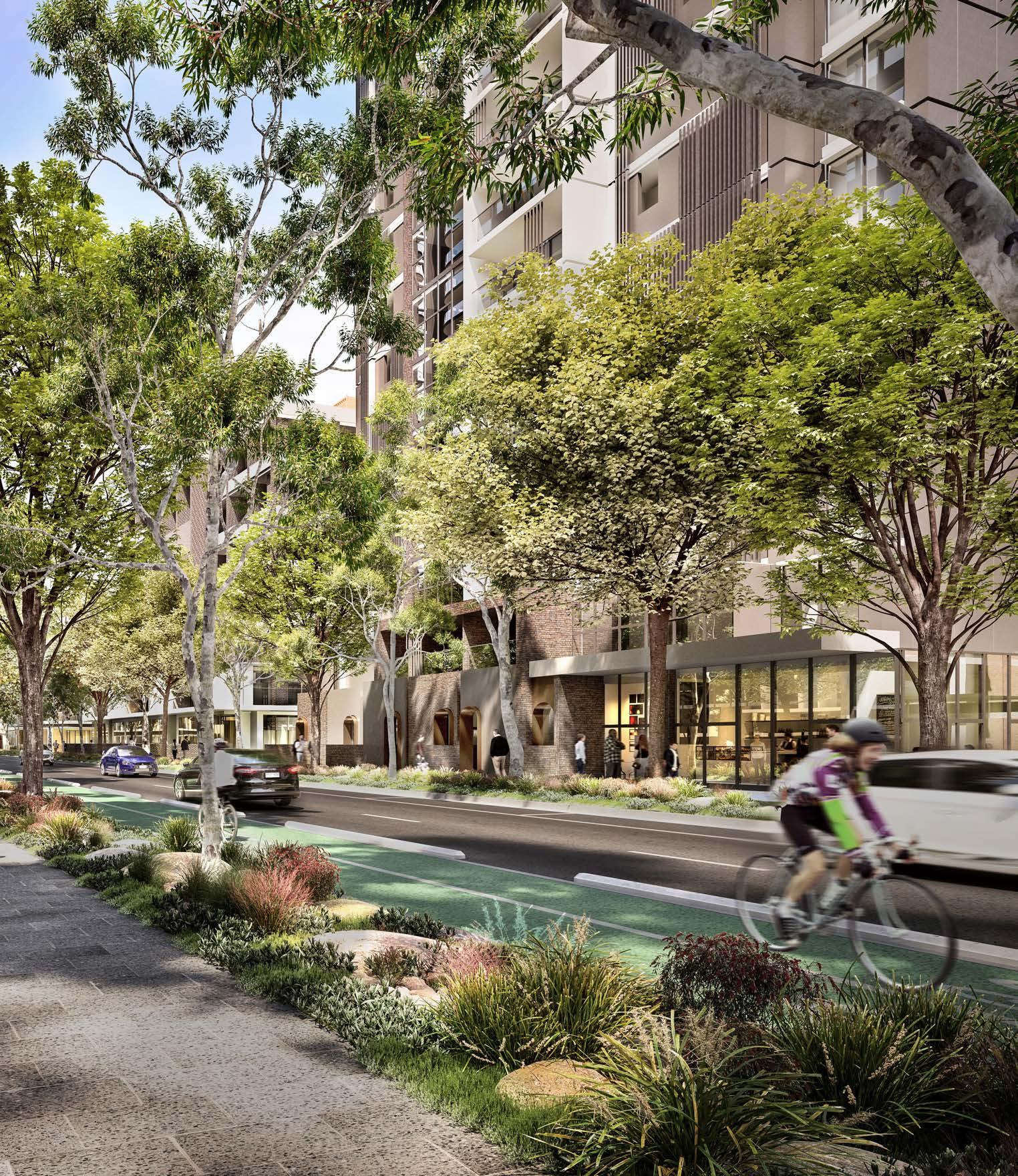
Big Moves
The following masterplan "Big Moves" draw on the Vision established for Burwood North Precinct to guide the built form and planning approach for the Precinct.
Diverse Housing and Employment
Advocate for high-quality built form that provides a wide array of housing choices, including affordable housing options for low income earners, key workers and families. Leverage highamenity living to attract more knowledgeable and high-skilled jobs.
Activation and Celebration
Activate Parramatta Road and Burwood Road and extend activation through perpendicular streets and laneways into the Precinct. Manage growth and development so that the centre is rejuvenated and the diversity and culture of the Precinct remains central.
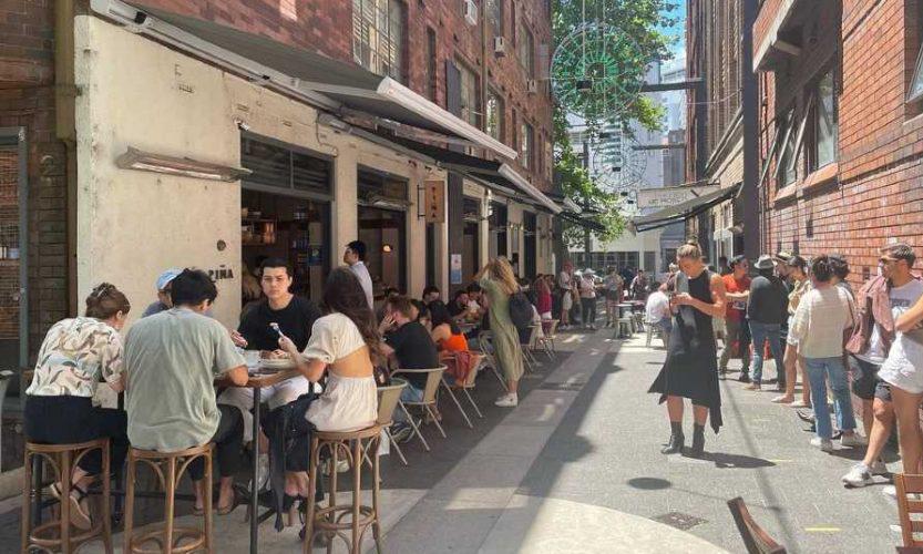 Figure 29: Grand Reve, Castle Hill. Source: DASCO
Figure 30: Llankelly Place, Potts Point. Source: SydneyCityGuide
Figure 29: Grand Reve, Castle Hill. Source: DASCO
Figure 30: Llankelly Place, Potts Point. Source: SydneyCityGuide
28
Masterplan Report
Burwood North Precinct Masterplan:
Pedestrian-First Transport Network
Prioritise pedestrian connectivity and permeability throughout the Precinct and into the wider area, considering the needs of future services access and a developed active transport network.
Blue and Green
Establish a legible green and blue network through the Precinct to provide a high level of amenity, sense of place, and connection with Country. A sustainability strategy supports these networks with directions for water management and sensitive curation of plant species and public domain materials.

Human Scale
Protect the human scale of Burwood Road and Parramatta Road by setting taller buildings behind, and transition height down to existing areas.
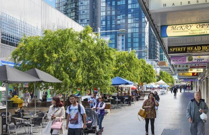 Figure 31: Ithaca Commons pedestrian street. Source: Holt
Figure 32: Harold Park, Forest Lodge. Source: JMD Design
Figure 31: Ithaca Commons pedestrian street. Source: Holt
Figure 32: Harold Park, Forest Lodge. Source: JMD Design
29
Report
Figure 33: Victoria Street, Chatswood. Source: COX
Burwood North Precinct Masterplan: Masterplan
Top Priorities
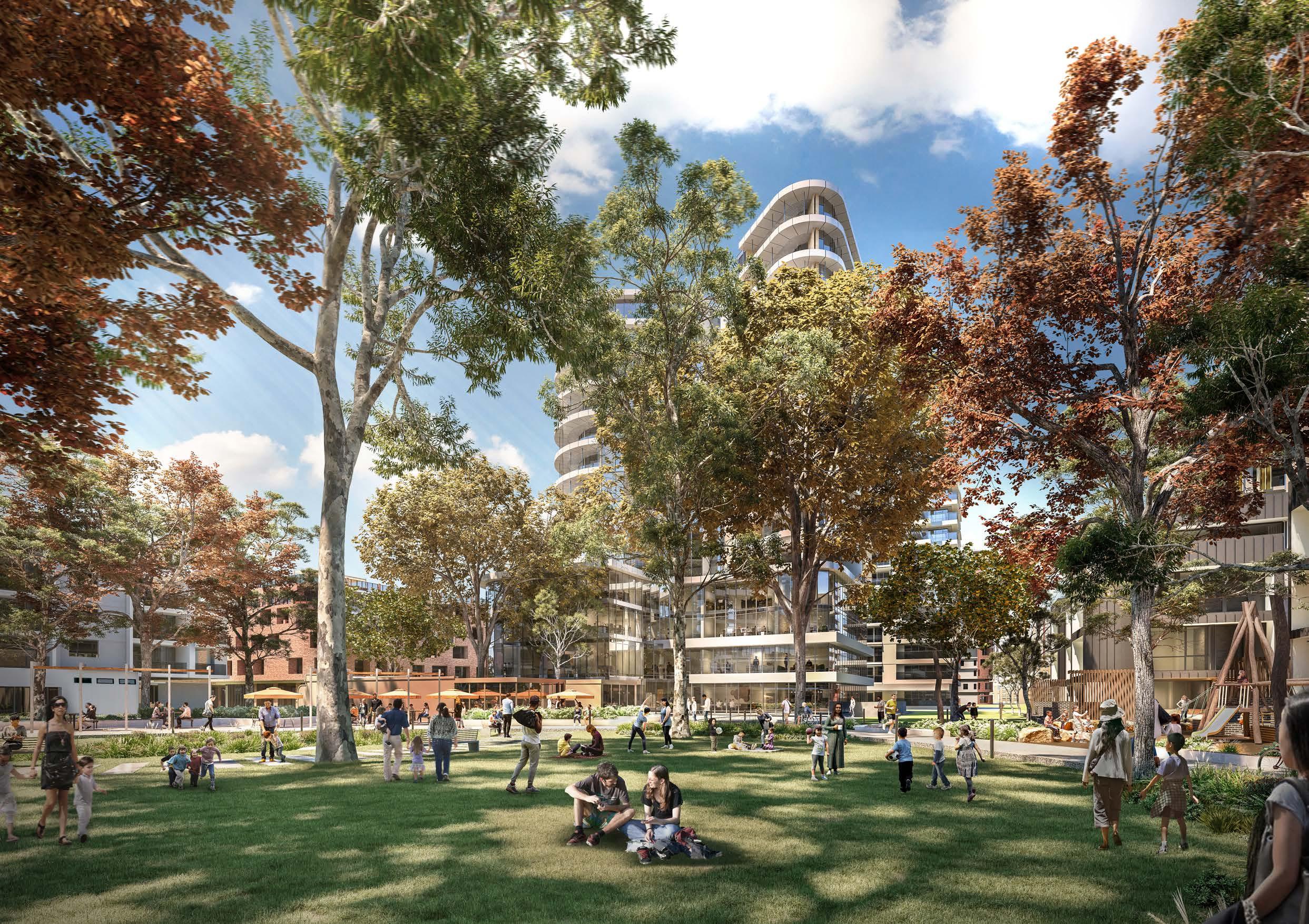
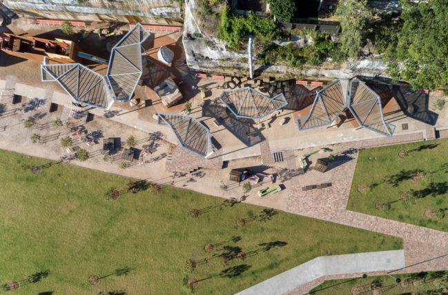
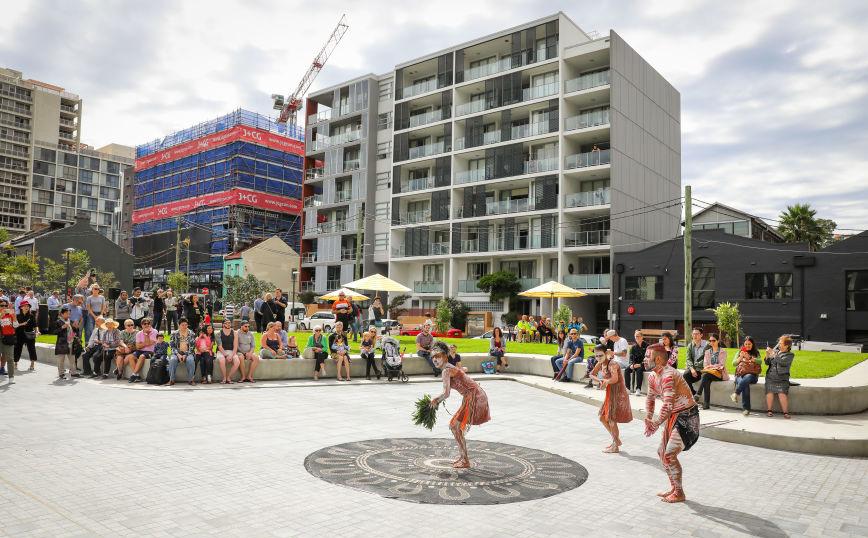
The top priorities for the Burwood North Precinct focus on creating a vibrant and sustainable community. The Masterplan aims to deliver a Precinct that incorporates diverse and flexible green spaces, paying homage to the natural environment and acknowledging connection with Country. Additionally, there is a strong emphasis on establishing a well-connected and easily navigable active transport network supported by new green spaces, promoting walking, cycling, and other non-motorised forms of transportation. Another key aspect is the provision of welldesigned and flexible housing options, catering to different needs and promoting a sense of inclusivity.
The development of a Precinct with a distinct character and a strong sense of place, fostering a unique identity and promoting community engagement. As a Strategic Centre, the Precinct is envisioned to be both regionally significant and locally accessible, offering a range of amenities to meet the needs of residents and visitors.
Under each of the priorities the following is documented;
• Principles - which underpin the priorities
• Masterplan Strategies - what the masterplan is proposing, drawn from the observations, objectives and "what we know" from the extensive site analysis and consultation process
• Future Actions - what is required to deliver on the principles and masterplan strategies.
1
2
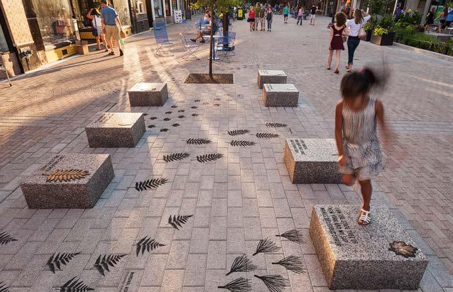
Deliver a Precinct with rich and varied open spaces that acknowledges connection with Country
Create a legible and comprehensive active transport network
3
Deliver a range of well-designed, highly flexible housing
4
5
6
Deliver a precinct with a richly defined identity and sense of place
Create a centre that is regional in outlook and local in amenity
Promote a sustainable, green, and resilient Precinct
30 Burwood North Precinct Masterplan: Masterplan Report
Priority 1
Deliver a Precinct with rich and varied open spaces that acknowledges connection with Country
Principles
• Acknowledge the opportunity for connection to County by celebrating the cultural landscape
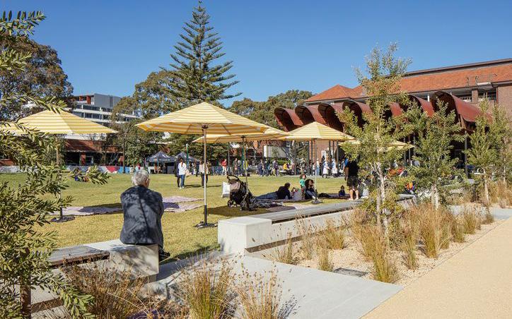
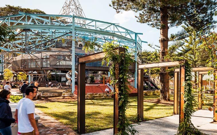
• Provide access to a diverse range of spaces across the Precinct, that complement Burwood Park to ensure that the community can enjoy cultural events, gatherings and activities
• Deliver quality open space within 200m of everyone's front door
• Integrate places and spaces within streetscapes and public domain, enabling the community to come together informally and for chance encounters to occur
• Support the delivery of spaces that contribute and connect to the green and blue grid network
Masterplan Strategies
• Maximise functionality of open space to provide for a range of activities and gathering sizes, as well as environmental and ecological benefits.
• Identify opportunities for connection with Country in the design of public spaces and connections.
• Locate open spaces in areas that have good passive surveillance from surrounding development and from the public domain.
• Distribute open spaces throughout the Precinct to enable most residents to have access to an open space within 200m that has a minimum size of 1500m2.
• Maximise the delivery of open space as part of development sites and within the public domain.
• Minimise property acquisition by Council.
Future Actions
• Council to establish planning mechanisms for the delivery of open space, through site links, plazas and other infrastructure on individual sites, in accordance with the masterplan through amendments to the LEP and DCP.
• Prepare amendments to Council’s contribution planning framework to reflect the forecast growth and infrastructure needs for Burwood North, including alignment with delivery of PRCUTS infrastructure.
• Advocate to the State Government for funding to ensure the delivery, enhancement and maintenance of sufficient open space to cater to the needs of the future population.
• Review LEP and DCP controls for Burwood North based on best practice for establishment of deep soil zones, tree canopy on ground and green roofs where practical.
• Review LEP and DCP controls for Burwood North based on best practice for the establishment of adequate solar access to parks and main streets.
More detailed open space principles are contained within the Burwood North Precinct Masterplan: Landscape and Public Domain Strategy Report, by Oculus. The Future Actions will link to how these strategies will be reflected in proposed LEP and DCP
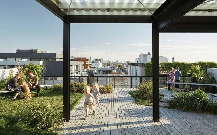
Figure 34: Matron Ruby Grant Park, Zetland. Source: Landscape Australia Figure 35: Newmarket, Randwick. Source: Cbus Property
Figure 36: Dyuralya Square, Green Square. Source: City of Sydney
31 Burwood North Precinct Masterplan: Masterplan Report
Priority 2
Create a legible and comprehensive active transport network
Principles
• Maximise active and public transport connectivity to the Burwood North Metro station
• Support a connected open space network with enhanced local and regional cycle connections
• Enable connections through to the Parramatta River - prioritising northsouth active transport connections
• Support the transition of Burwood Road to enhance active and public transport connections
• Create walkable activated laneways, through-site links and shared zones as part of an integrated walking network
• Reduce the need for private car ownership
Masterplan Strategies
• Slow vehicular speeds through and within the Precinct to support pedestrian priority as well as people riding.
• Allocate road space to prioritise pedestrians as well as people riding within neighbourhood zones, wherever possible.
• Utilise the existing laneway network as shared zones and deliver new shared zones and pedestrian connections, to enable pedestrian priority and permeability through the Precinct.
Future Actions
• Adopt maximum parking rates, consistent with the PRCUTS recommended parking rates for new residential development in the Burwood North Precinct.
• Review the DCP to require that new developments provide access to car share and ride share services sufficient to meet the needs of the development and to discourage private car ownership.
• Review the DCP to introduce provisions in the DCP which enables unbundled parking within new developments.
• Review the DCP to require 100% of parking in new developments for both resident and commercial to have EV ready connections.
• Include provisions to require fast or rapid EV charging for all commercial development.
• Review the DCP to update provisions for bicycle and other parking, loading and servicing requirements in accordance with best practice requirements (e.g. Transport for NSW Cycleway Design Toolbox).
• Review the DCP to include appropriate end of trip facilities and ensure that the controls deliver facilities that are designed to support people who cycle, jog or walk to work.
Figure 37: Slovenska Boulevard shared street for pedestrians, cyclists and buses. Source: Landzine
Figure 38: Hackney Play Street, UK. Source: The Guardian
Figure 39: New Acton Precinct, Canberra. Source: Landzine
32 Burwood North Precinct Masterplan: Masterplan Report
Priority 3
Deliver a range of well-designed, highly flexible housing
Principles
• Encourage a range of housing typologies and options to support a diverse population, including catering for multigenerational living
• Create opportunities across the Burwood North Precinct for both medium and high rise development, to ensure the delivery of community oriented neighbourhoods
• Encourage provisions that deliver a mix of unit sizes and allow for flexibility to suit a range of households
• Allow for a diverse range of tenures, including opportunities for the delivery of affordable housing and build to rent accommodation
Masterplan Strategies
• Provide a range of densities that enable a variety of housing typologies to be delivered within the precinct.
• Position higher densities around open spaces to provide good amenity and a connection to landscape.
• Organise built form and densities within unique neighbourhood zones that each have a distinctive character, providing a sense of place and community.
• Require the delivery of a minimum of 5% of new dwellings as affordable housing, consistent with PRCUTS.
Future Actions
• Amend the LEP to increase residential dwelling capacity consistent with the proposed height and floor space ratios in the Masterplan Implementation Plan.
• Introduce an Affordable Housing Contributions Scheme in the LEP for the Burwood North Precinct to ensure the delivery of affordable housing, consistent with PRCUTS (minimum 5% of total FSR to be dedicated for affordable housing).
• Amend the LEP/DCP to specify the minimum unit mix rate for residential flat buildings and shop top housing with more than 20 dwellings to increase housing diversity.
• Review the DCP to require new dwellings to comply with Liveable Housing Design Guidelines.
• Investigate opportunities to increase the amount, and improve the standard of housing to ensure that it is universally designed. This includes encouraging the delivery of larger apartments on the ground floor with usable external space to ensure a range of households can secure suitable housing to meet their needs.
• Continue to engage with, and advocate for, the enhancement and delivery of State Government infrastructure (schools, medical/hospital, community services etc) sufficient to meet the needs of the current and future population.
Figure 40: Powerhouse Philadelphia - street level activation on a contemporary stoop. Source: Architect Magazine
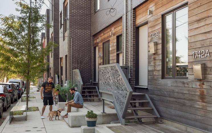
Figure 41: Arkadia, Alexandria. Medium density residential development with landscaped terraces and shared rooftop gardens. Source: Arch Daily
Figure 42: Nightingale Housing, Melbourne. Community oriented housing development with communal amenities such as rooftop gardens and laundries. Source: ArchitectureAU
33 Burwood North Precinct Masterplan: Masterplan Report
Priority 4
Deliver a precinct with a richly defined identity and sense of place
Principles
• Deliver an exemplar urban precinct with a diversity of residential building types that ensure the prioritisation of a high amenity human experience
• Encourage innovative architectural, design and delivery models to ensure design excellence in new development and the public domain
• Respect, build on, and celebrate how culture has influenced the way people live, work, and play in Burwood and ensure that future development acknowledges this culture and diversity
• Build on the existing fine grain character by encouraging laneway activation and small scale, fine grain retail tenancies
Masterplan Strategies
• Position higher density and taller building forms in the blocks behind Burwood Road and Parramatta Road, to retain a human scale frontage to those primary movement corridors.
• Encourage active frontages along Burwood Road and Parramatta Road, as well as on the adjoining laneways to draw activation into the adjoining neighbourhoods and away from higher traffic zones, both day and night.
• Respond to the cultural and environmental heritage in the Precinct by incorporating diversity, including, connection to Country, in the design of public spaces and connections.
• Provide opportunities for the incorporation of public art throughout the Precinct.
Future Actions
• Implement appropriate place based design objectives and standards within the DCP for new development within the Burwood North Precinct.
• Consider the development of a Design Excellence provision and Design Excellence Competition process for key sites within the Burwood North Precinct.
• Incorporate DCP controls to ensure appropriately scaled and designed development can occur within, and adjacent to, heritage items within the Burwood North Precinct.
• Require public artworks in certain locations as part of the development approval process and Council’s Public Art Policy. These artworks should convey the history and unique character of Burwood, and connection to Country, and be tailored to their locations within Burwood North.
Figure 43: ‘The Last Lion’ art installation by Christina Huynh and Sophi Odling. Source: Burwood Council
Figure 44: Public Art on footpath in Burwood. Source: COX
Figure 45: Temporary event and pedestrian use of Burwood Road. Source: Burwood Council
34 Burwood North Precinct Masterplan: Masterplan Report
Priority 5
Create a centre that is regional in outlook and local in amenity
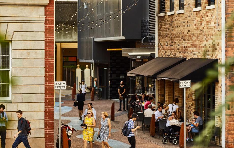
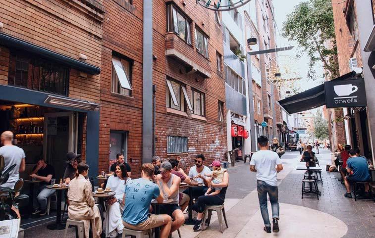
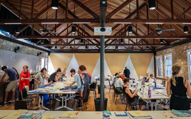
Principles
• Maximise opportunities for job creation within the Burwood North Precinct to support the continued growth of the Burwood Town Centre as a strategic centre within the Eastern City
• Support small business and start-ups of different scales and types that provide a diversity of job opportunities
• Maximise opportunities for activation of streets and public spaces, drawing on existing vibrancy to create a hub around the future Burwood North Metro station.
• Maintain and expand on the richness and complexity of existing land uses with diversified dining and retail experiences
• Provide local service and community facilities within a short ride, or walking distance to where people live
• Enable people to experience the Burwood North Precinct as both a quiet and bustling neighbourhood, with defined areas of genuine mixed use, balanced with quieter streets and spaces
Masterplan Strategies
• Concentrate a higher proportion of non-residential uses around the Burwood North Metro station and along Parramatta Road.
• Continue to support Burwood Road as an active mixed use street with only nonresidential uses at ground floor.
• Enable small scale commercial, dining and retail outlets to activate laneways perpendicular to Burwood Road and Parramatta Road, extending activity into the surrounding precinct to encourage and support both day and night time economies.
• Encourage community facilities in areas of high amenity to support the community.
Future Actions
• Introduce a new land use zone into the Burwood LEP (R4 – High Density Residential) to allow residential flat buildings and enable other complementary land uses, such as cafés and restaurants that contribute to the vibrancy of the neighbourhood while ensuring that business centres remain the focus for business and retail activity.
• Amend the LEP/DCP to identify new through site links to be provided as part of future redevelopment of sites through land dedication in the Precinct.
• Review the zoning and permissible land uses for land along Parramatta Road to allow for a range of uses including commercial and retail uses and residential, where appropriate.
• Continue to advocate to State Government agencies and neighbouring councils to ensure future east-west and north-south mass transit corridors through Burwood are protected and delivered in the long term.
• Incorporate recommendations of the Burwood After Dark Strategy to ensure a thriving night time economy with the Burwood North Precinct.
Figure 46: Fish Lane, Brisbane. Source: Fish Lane
Figure 47: Llankelly Place, Potts Point - service laneway activated with small retail and dining tenancies. Source: Concrete Playground
Figure 48: Judith Neilsen Community Centre in an adaptively reused heritage building. Source: City of Sydney
35 Burwood North Precinct Masterplan: Masterplan Report
Priority 6
Promote a sustainable, green, and resilient Precinct
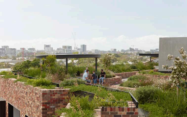
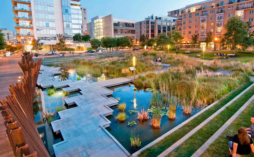
Principles
• Ensure that Burwood North is a sustainable urban renewal precinct, that supports the movement towards zero carbon operations
• Maximise urban greening of Burwood North with increased tree canopy, rain gardens, rooftop gardens, community gardens and enhanced ecosystem biodiversity
• Incorporate water sensitive urban design – stormwater management integrated with public domain and open space
• Support sustainable technologies and initiatives that will reduce carbon emissions
Masterplan Strategies
• Support the transition to net zero emissions in the precinct.
• Allow water to be celebrated as a key part of the linear open space network, following the former creek line that ran through the precinct.
• Manage stormwater and flooding impacts through open space and water sensitive urban design and bio-filtration.
Future Actions
• Review and update the flood study and floodplain risk management study and plan to inform future planning controls.
• Review and amend the DCP to incorporate relevant recommendations from the Burwood North Precinct Masterplan: Sustainability Statement, including:
• Improving overall building energy and water efficiency;
• Requirements for setbacks, solar amenity, deep soil landscaping controls;
• A minimum tree canopy target / site coverage;
• Encouraging the planting of drought resistant species and indigenous species;
• Green roofs and green wall design;
• On-site energy generation via solar power to reduce dependency on the main grid;
• Fully electric to progressively eliminate fossil fuel demand towards net zero emissions;
• Electric Vehicle and Ebike charging, with car parking spaces ready to transition to electric vehicle charging when this technology becomes widespread;
• Diverting of building materials from the demolition process from landfill;
• Best practice water saving measures for all new buildings not subject to BASIX;
• Waste management to ensure the diversion of waste away from landfill, including separated recycling streams, new waste technologies, communal areas for organic waste composting (FOGO).
• Water Sensitive Urban Design controls
Figure 49: Arkadia, Alexandria. Medium density residential development with shared rooftop gardens. Source: Arch Daily
Figure 50: One Central Park has green walls and environmentally sustainable services systems. Source: COX
Figure 51: Tanner Springs, Portland - reintroduction of a wetland park into the city where a now piped former creek line occurred. Source: Green Works
36 Burwood North Precinct Masterplan: Masterplan Report
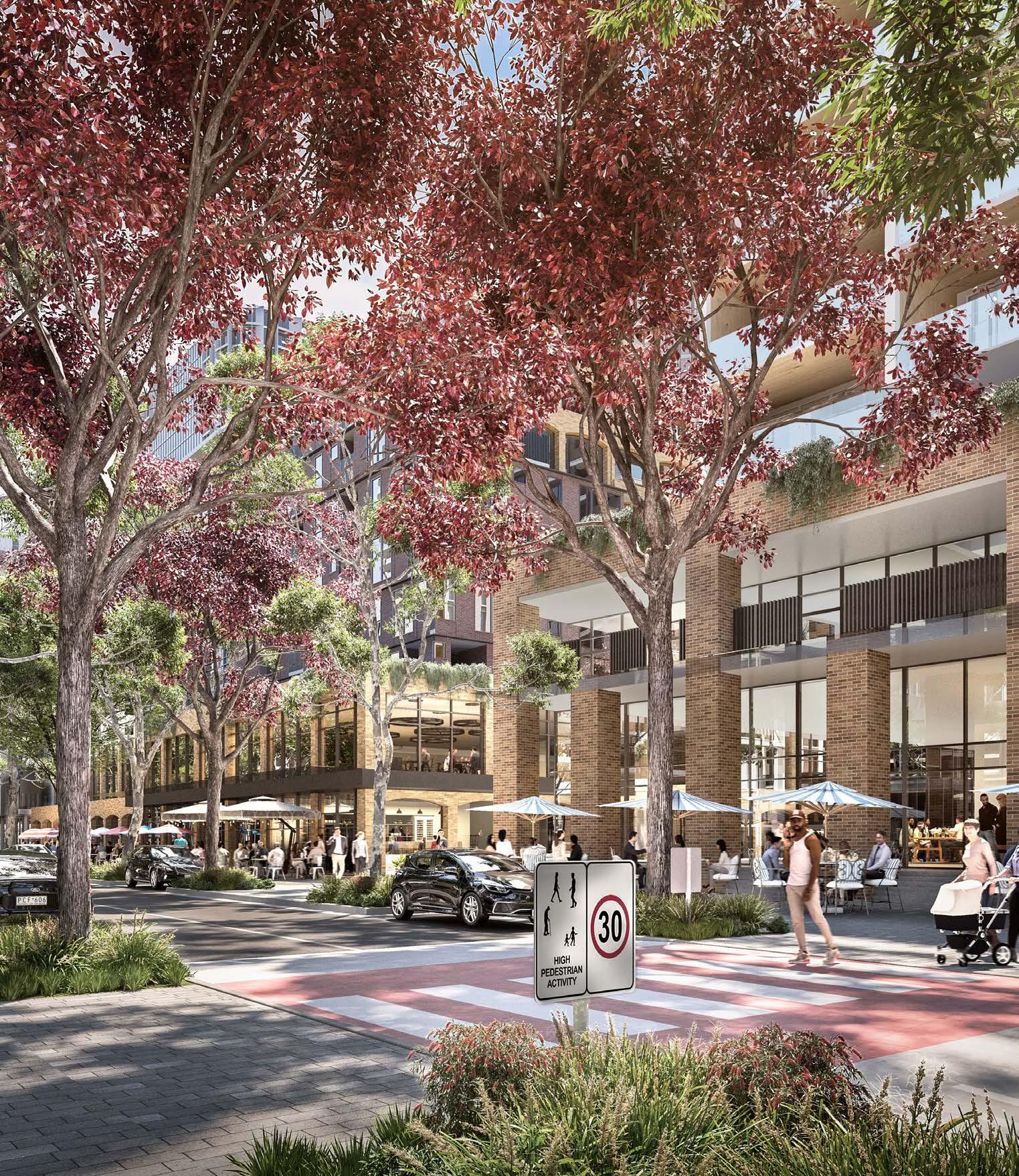
Draft Masterplan 37 Burwood North Precinct Masterplan: Masterplan Report
The
Structure Plan
Burwood North Precinct is defined by its built and natural corridors. Burwood Road serves both pedestrians and vehicles as a key north-south connector, anchored by the proposed Burwood North metro station in the north, and Burwood train station to the south. Burwood’s established character as a dining and retail destination oriented around Burwood Road, is proposed to be extended north in to the Precinct towards Parramatta Road.
Burwood North Precinct leverages the accessibility and activation of the metro station to create a fine-grain, dense, mixed-use community oriented around the transit node.
A chain of existing and proposed open spaces follow a former creek line between Burwood Park and Concord Oval/St Luke's Park in the Canada Bay LGA. This open space network employs First Nations design elements to anchor the Precinct within Country. Water will be ‘resurfaced’ to flow through Burwood North Precinct, and the open spaces surrounding the water elements provide new spaces for residents to gather and play. The wider open space network in the Burwood North Precinct builds upon the connectivity of this creekline, and prioritises linkages with pocket parks and lane-ways to create a transport network that prioritises the pedestrian.
Burwood North Precinct will offer a range of housing typologies that reflect the diversity of its community - forming distinct neighbourhoods that promote walkability and minimise car dependency. Pockets of activation will create a vibrant, attractive urban experience beyond Burwood Road, and enhance green spaces with added surveillance and extended usability.
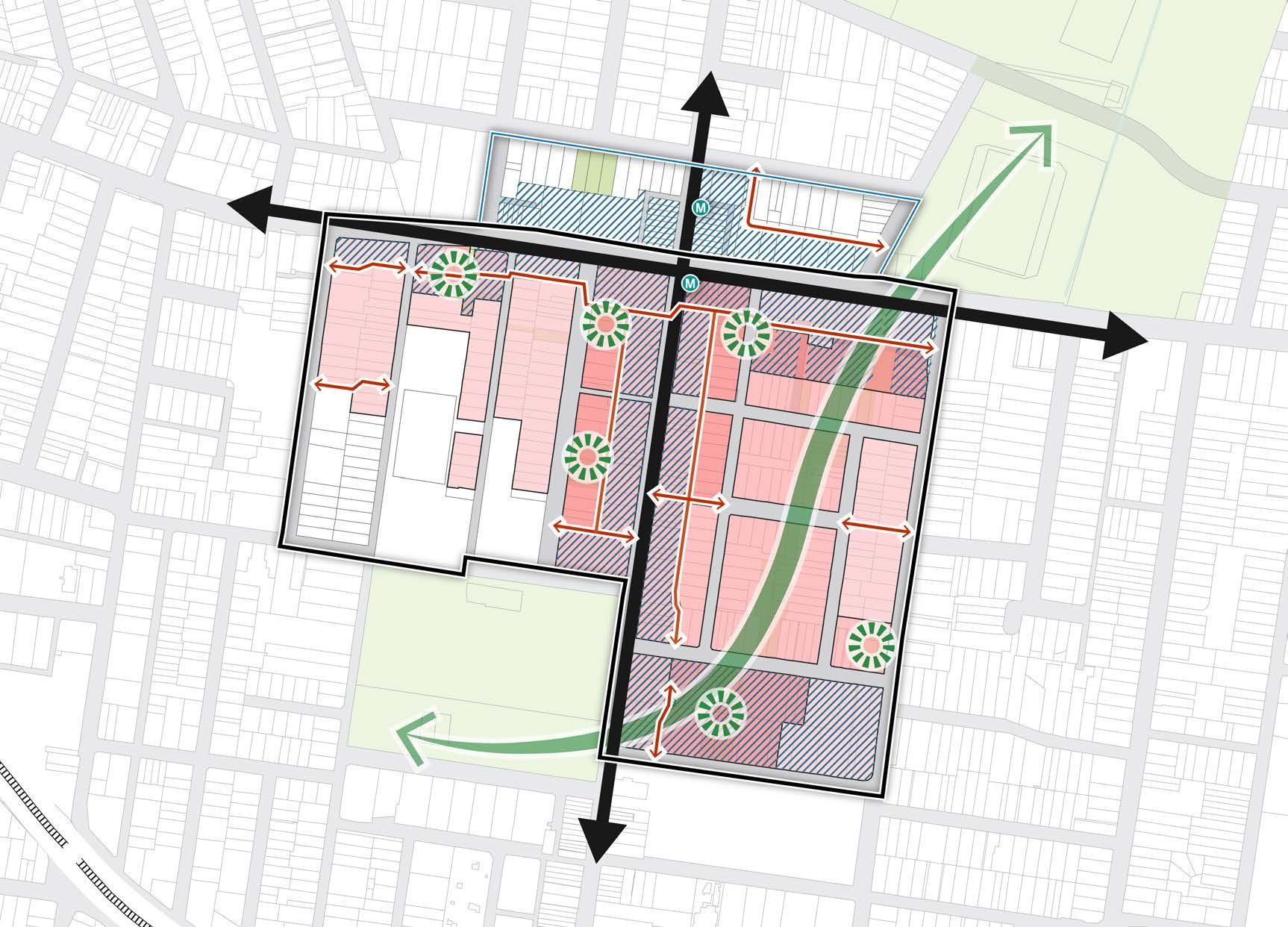
BURTON STREET LOFTUS STREET BROUGHTON STREET GIPPSSTREET
VICTORIA STREET
WILGA STREET
COMER STREET PARK AVENUE BURWOOD ROAD NEICH PARADE PARK ROAD MILTON STREET PARK ROAD BRITANNIA AVENUE GRANTHAM STREET SHAFTESBURY ROAD ESHER STREET ARCHER STREET CONCORD OVAL ST LUKES PARK BURWOOD PARK MLC SCHOOL BURWOOD WESTFIELD PARRAMATTA ROAD 50 200m 100 0
MERYLA STREET
Figure 52: Structure Plan Diagram. Source: COX
Green Node Canada Bay LGA (does not form part of this Masterplan) Existing Movement Residential Proposed Pedestrian Through-Site Link Green Corridor Commercial Lane-way network 38 Burwood North Precinct Masterplan: Masterplan Report
Character Areas
Burwood North Precinct forms a set of distinct but interwoven neighbourhoods, each with a unique character and offering a diverse range of housing and employment typologies.
The proposed built form and open space structure for the Burwood North Precinct has been organised into these distinct character areas, enabling Burwood North Precinct to be a place that offers a diversity of urban experiences, places and housing types.
The four character areas for Burwood North are:
Transit and Business
Bounded by one block either side of Parramatta Road
Active High Street
Defined by one or two blocks either side of Burwood Road
Park Edge Living
Between Esher Street and Shaftesbury Road
Living and Learning
Between Neich Parade and Grantham Street
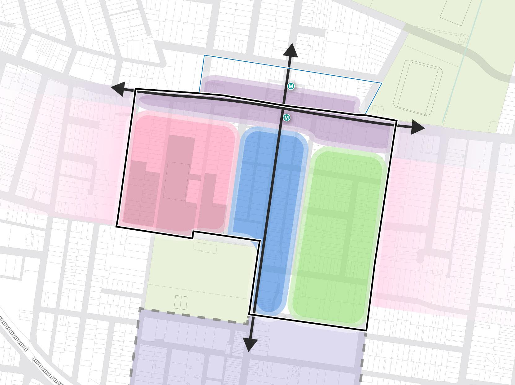
BURTON STREET LOFTUS STREET BROUGHTON STREET GIPPSSTREET
COMER STREET PARK AVENUE BURWOOD ROAD NEICH PARADE PARK ROAD MILTON STREET PARK ROAD BRITANNIA AVENUE GRANTHAM STREET SHAFTESBURY ROAD ESHER STREET ARCHER STREET CONCORD OVAL ST LUKES PARK BURWOOD PARK MLC SCHOOL BURWOOD WESTFIELD PARRAMATTA ROAD
WILGA STREET VICTORIA STREET MERYLA STREET
50 200m 100 0
Figure 53: Character Areas Diagram. Source: COX
Precinct Boundary Canada Bay LGA (does not form part of this Masterplan) Living and Learning Park Edge Living Existing Town Centre Future Metro Entry Transit and Business Active High Street 39 Burwood North Precinct Masterplan: Masterplan Report
Transit and Business
The Transit and Business character area fronting Parramatta Road will host a range of active frontages in mixed-use developments, fronting Parramatta Road and around the Burwood North metro station transit node.
Parramatta Road will remain as a principal east-west vehicle artery, but will have substantially improved pedestrian amenity through the implementation of a 3m landscaped, green setback.
Laneway connections will provide opportunities for activation from Parramatta Road to the south of the Precinct.
Enhanced permeability across Parramatta Road and into Canada Bay to the Parramatta River, will be encouraged, and this will be aided by the proposed underground connection being delivered by Metro West.
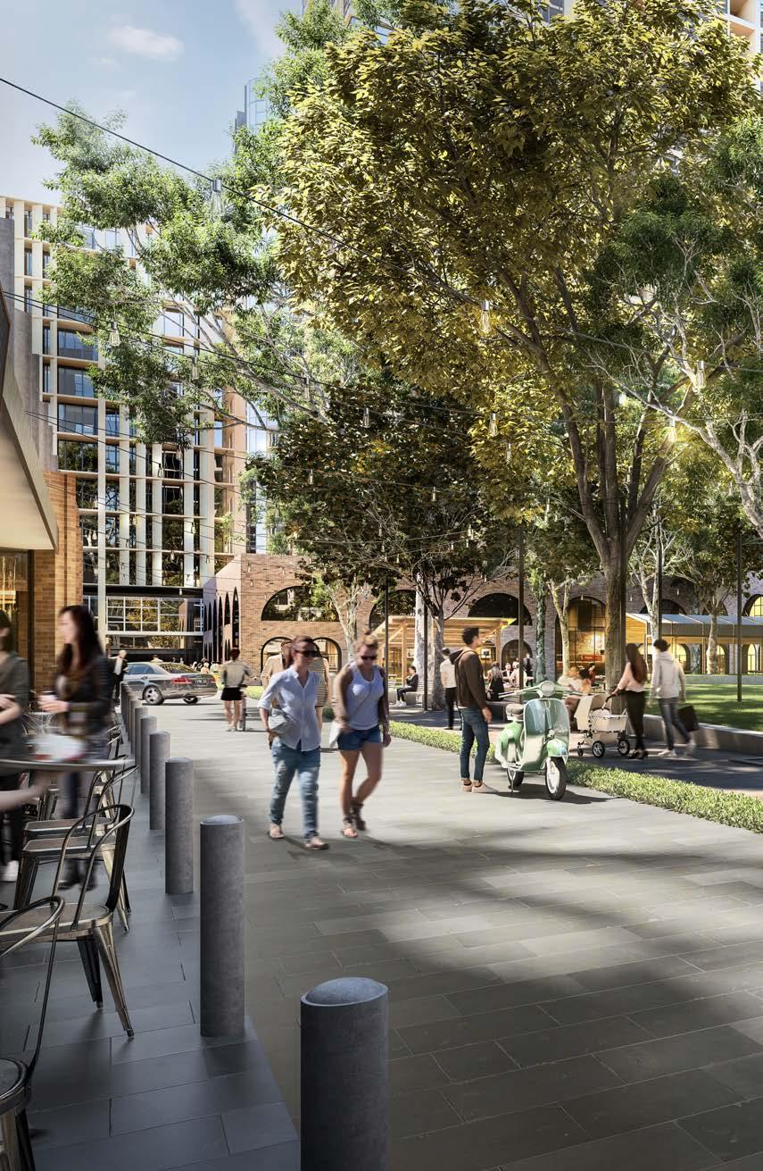
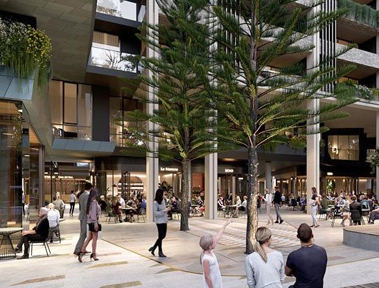
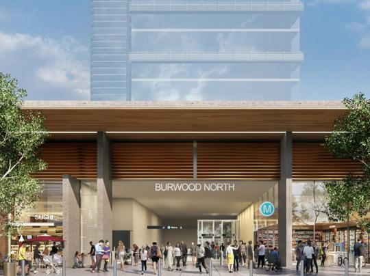 Figure 54: Visualisation of an active urban park adjacent to Burwood North Metro Station. Source: Scharp
Figure 55: Arncliffe Central. Source: Billbergia
Figure 56: Future Burwood North Station. Source: Sydney Metro
Figure 54: Visualisation of an active urban park adjacent to Burwood North Metro Station. Source: Scharp
Figure 55: Arncliffe Central. Source: Billbergia
Figure 56: Future Burwood North Station. Source: Sydney Metro
40 Burwood North Precinct Masterplan: Masterplan Report
Active High Street
The Active High Street character area is centred on Burwood Road as the mixed-use activity spine, drawing upon the activity of the Burwood Town Centre to the south.
Burwood Road will continue to act as the high street, with future development continuing to provide active ground floor uses, including retail and dining. New and existing laneways will be encouraged to ensure that the area is permeable and highly accessible, providing activation day and night.
Building heights along Burwood Road are intended to protect both human scale and solar access, producing a highly amenable pedestrian experience at the ground floor.

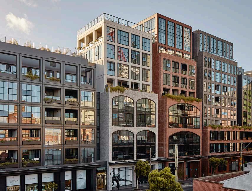
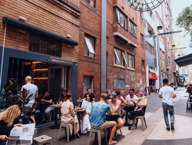 Figure 57: Active Burwood Road visualisation. Source: Scharp
Figure 58: Medium-high density mixed use frontage to a main road. Victoria & Vine, Victoria. Source: COX
Figure 59: Llankelly Place, Potts Point. Source: Destination NSW
Figure 57: Active Burwood Road visualisation. Source: Scharp
Figure 58: Medium-high density mixed use frontage to a main road. Victoria & Vine, Victoria. Source: COX
Figure 59: Llankelly Place, Potts Point. Source: Destination NSW
41 Burwood North Precinct Masterplan: Masterplan Report
Park Edge Living
The Park Edge Living character area is a medium-high density residential neighbourhood within a highly landscaped setting.
This area is anchored by a linear green and blue corridor, designed incorporating the principles of water sensitive urban design, and will provide opportunities for passive recreation.
The built form in the Park Edge Living character area encourages higher densities adjacent to the open space which will be designed to be a highly flexible space to allow for a range of activities and events to reflect the needs of a diverse population.
Development on the edge of the character area will sympathetically transition to the existing low density residential development on Shaftesbury Road.
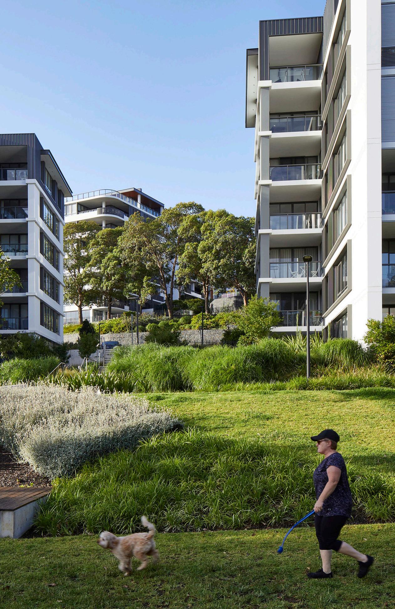
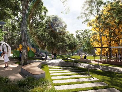
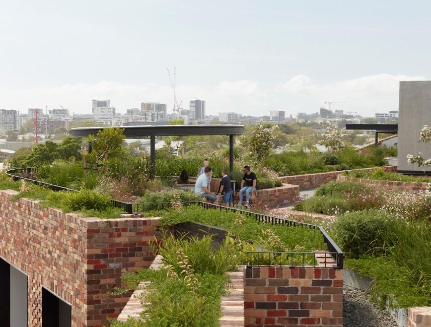 Figure 60: Linear open space with WSUD through medium density residential neighbourhood, Putney. Source: COX
Figure 61: Eden Street, Arncliffe. Source: Group GSA
Figure 62: Arkadia Apartments, Alexandria. Source: DKO + Breathe
Figure 60: Linear open space with WSUD through medium density residential neighbourhood, Putney. Source: COX
Figure 61: Eden Street, Arncliffe. Source: Group GSA
Figure 62: Arkadia Apartments, Alexandria. Source: DKO + Breathe
42 Burwood North Precinct Masterplan: Masterplan Report
Living and Learning
The Living and Learning character area will provide for medium density residential development, set within a leafy streetscape. Future development will consider the existing sensitive educational land uses to ensure that they avoid overlooking and overshadowing.
Park Road will be transformed to encourage the continuation of the shared street to encourage active transport. The laneway network will be expanded to enhance the permeability of the character area to encourage pedestrian movement within and through the Burwood North Precinct.
Neich Parade will form the backbone of the active transport network in the Burwood North Precinct, promoting bicycle movement from Parramatta Road through to the Burwood Town Centre.
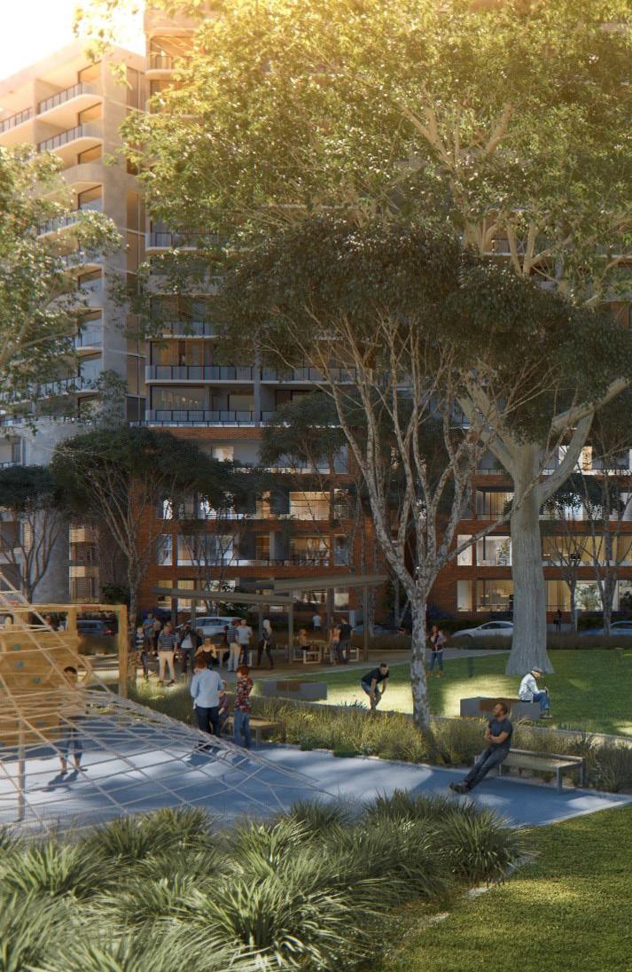
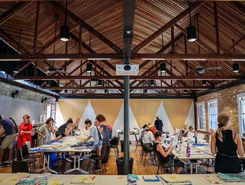
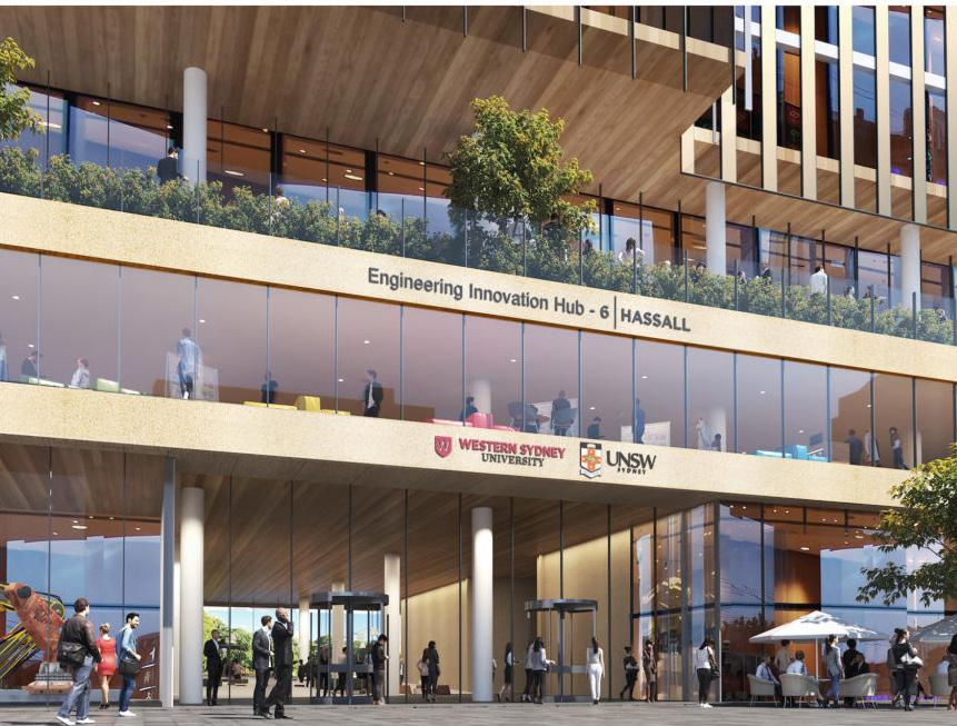 Figure 63: Hills Showground Precinct East: Source: COX
Figure 64: Juanita Nielsen Community Centre. Source: City of Sydney
Figure 65: Parramatta Engineering Innovation Hub Source: Charter Hall
Figure 63: Hills Showground Precinct East: Source: COX
Figure 64: Juanita Nielsen Community Centre. Source: City of Sydney
Figure 65: Parramatta Engineering Innovation Hub Source: Charter Hall
43
Report
Burwood North Precinct Masterplan: Masterplan
Proposed Heritage
The Burwood North Precinct Masterplan – Heritage Significance Assessment, July 2023 by Hector Abrahams Architects focused on the assessment of four places. Based on this research and analysis, an assessment was conducted for each place against the NSW Heritage Criteria. The assessment determined that:
• 9-11 Archer Street, Burwood - currently listed as a heritage item in Burwood LEP 2012. They are a fine example of a pair of single-storey terraces, relatively unusual in Sydney, in the Italianate style. The intactness of the façade, plan form, and the interior details of number 11 contributes to the significance. Retain as heritage items.
• 90-98 Burwood Road, Burwood includes a fine example of a Free Classical parapet but much of the remainder of the terrace group, including much of the rest of the façade, has been greatly compromised. The facade is a good example and if the listing is to be retained it should be amended to ensure that it covers the parapet specifically. Amend listing to include facade and parapet.
• 12-14 Burwood Road, Burwood are examples of Victorian Italianate terraces. 14 Burwood Road has been dramatically altered, retaining only some façade detail. The alterations to 12 Burwood Road are less substantial, and it still retains its plan form and most of its façade, though it has lost interior details. De-listing of these buildings would be appropriate.
• 7 Neich Parade, Burwood is an example of a Queen Anne cottage. There are many examples of this type and style listed in the Burwood LEP, most of which are clearly more architecturally distinctive and refined. De-listing of these buildings would be appropriate.
Refer to The Burwood North Precinct Masterplan –Heritage Significance Assessment, July 2023 by Hector Abrahams Architects for further detail.
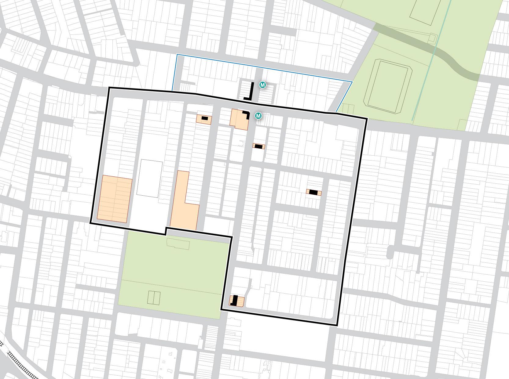
BURTON STREET LOFTUS STREET BROUGHTON STREET GIPPSSTREET
WILGA STREET
COMER STREET PARK AVENUE BURWOOD ROAD NEICH PARADE PARK ROAD MILTON STREET PARRAMATTA ROAD PARK ROAD BRITANNIA AVENUE GRANTHAM STREET SHAFTESBURY ROAD ESHER STREET ARCHER STREET CONCORD OVAL ST LUKES PARK FUTURE BURWOOD NORTH STATION BURWOOD PARK MLC SCHOOL BURWOOD WESTFIELD 9-11 ARCHER
VICTORIA STREET MERYLA STREET
STREET 90-98 BURWOOD ROAD 7 NEICH PARADE
12-14 BURWOOD ROAD
50 200m 100 0 Figure 66: Heritage Diagram. Source: COX Precinct Boundary Canada Bay LGA (does not form part of this Masterplan) Heritage Items 44 Burwood North Precinct Masterplan: Masterplan Report
Illustrative Masterplan
The Burwood North Precinct Masterplan envisions a highly connected Precinct with pedestrian-oriented streets interwoven with high-quality public spaces, building upon the vibrant Burwood Town Centre.
Key features of the proposed Masterplan include:
• An enhanced public space and active transport network with a new green/ blue corridor linking Burwood Park to Parramatta Road
• Greater housing choice and affordability
• Increased densities and greater job opportunities
• Rejuvenation of Burwood Road as an extended high street retail and dining Precinct
• Activation of Parramatta Road to allow for additional employment opportunities
• Legible and efficient connections to the future Burwood North metro station
• Retention of the human scale and solar access on Burwood Road
• Improved pedestrian permeability to the schools to the west of the Precinct
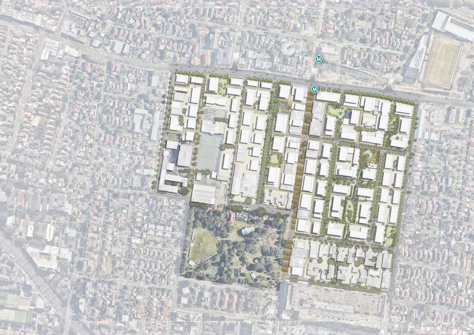
To be updated upon endorsement of the Masterplan
BURTON STREET LOFTUS STREET BROUGHTON STREET WILGA STREET MERYLA STREET COMER STREET PARK AVENUE BURWOOD ROAD NEICH PARADE MILTON STREET PARRAMATTA ROAD PARK ROAD BRITANNIA AVENUE GRANTHAM STREET SHAFTESBURY ROAD ESHER STREET ARCHER STREET CONCORD OVAL BURWOOD PARK MLC SCHOOL BURWOOD WESTFIELD
Figure 67: Illustrative Masterplan. Source: OCULUS
45 Burwood North
Masterplan Report
Precinct Masterplan:
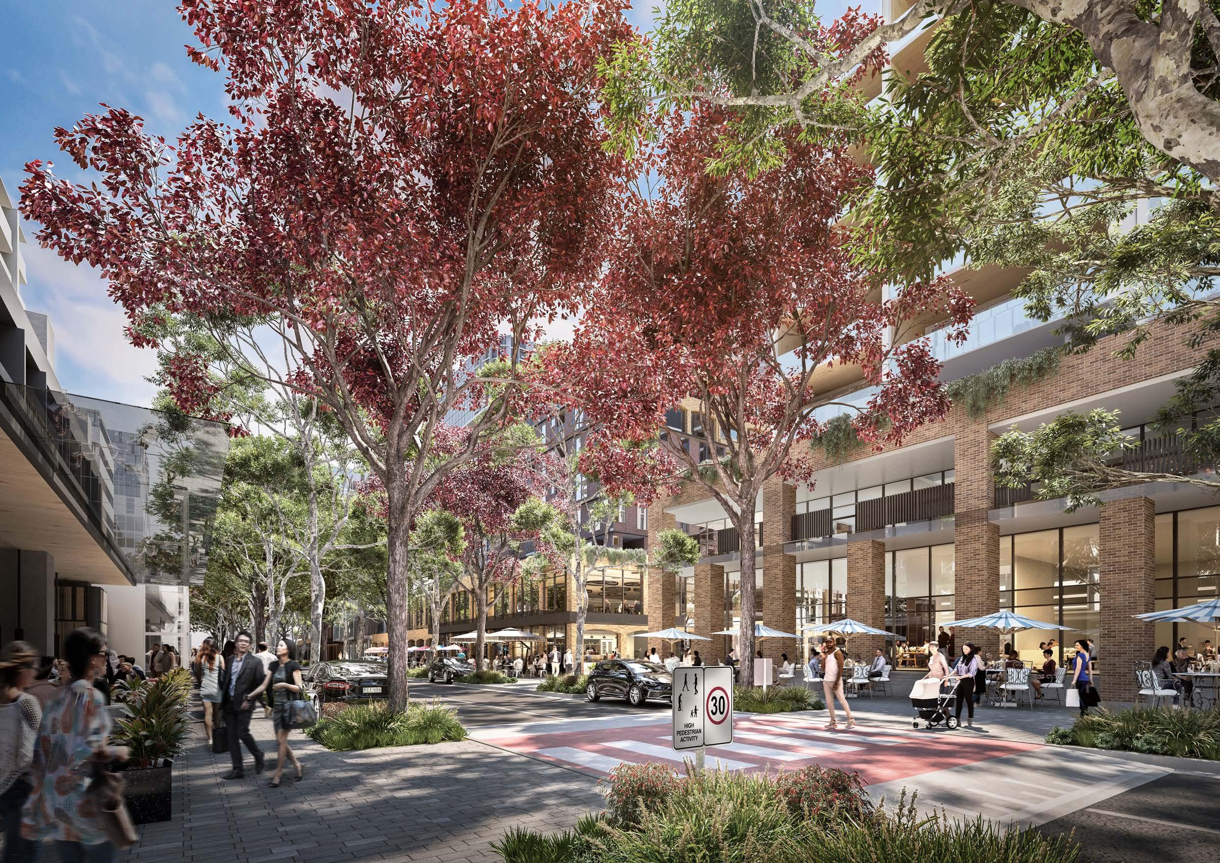
46
Figure 68: View north on Burwood Road Source: Scharp
Uses and Activity
The land use mix in the Burwood North Precinct promotes a vibrant residential and mixed-use Precinct with an active core, extending retail, professional services, and food and beverage uses from the Burwood Town Centre along Burwood Road to Parramatta Road.
The Burwood North metro station offers an opportunity to create a new mixed use precinct with active/commercial uses at the lower levels, connected directly to a high-frequency rail line. Mixed uses on the lower levels extend east-west along Parramatta Road from the metro station, reflecting the proposal by Canada Bay Council for mixed-use development on the Parramatta Road frontage.
Mixed-use developments will also extend southwards along Burwood Road to Westfield Burwood. The majority of the precinct is characterised by residential uses, with ground floor activation permitted beyond Burwood Road, providing for local cafés or shops to be located adjacent to new public space. Open spaces enhance the amenity of the Precinct and provide opportunities for outdoor recreation.
MLC and Southern Cross College provide an educational focus to the west of the Precinct, which will continue to be adjoined by sympathetically designed residential development so as to minimise overlooking and overshadowing.
Refer to the Planning Controls section of the Masterplan for the proposed Land Use Zone (LZN) diagram.
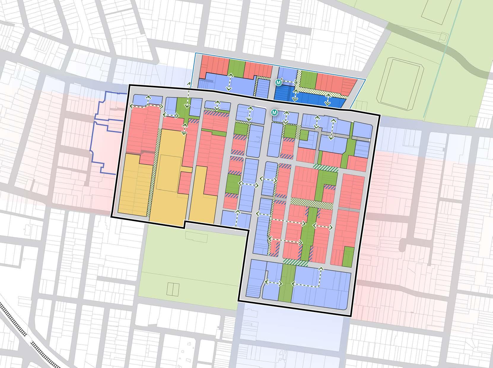

BURTON STREET LOFTUS STREET BROUGHTON STREET GIPPSSTREET WILGA STREET VICTORIA STREET MERYLA STREET COMER STREET PARK AVENUE BURWOOD ROAD NEICH PARADE PARK ROAD MILTON STREET PARK ROAD BRITANNIA AVENUE GRANTHAM STREET SHAFTESBURY ROAD ESHER STREET ARCHER STREET CONCORD OVAL ST LUKES PARK BURWOOD PARK MLC SCHOOL BURWOOD WESTFIELD PARRAMATTA ROAD
50 200m 100 0 Figure 69: Land Use Diagram. Source: COX Future Metro Entry Shared Street Proposed Pedestrian Through-Site Link Schools Canada Bay LGA (does not form part of this Masterplan) Proposed Public Space Mixed Use Hospital Shared Lane Ground Floor Activation Residential Commercial 47 Burwood North Precinct Masterplan: Masterplan Report
Defining Density
Density is a control of population -resident, worker, student and visitor population.
It is an important control in the planning and design of precincts because it governs the density of residents, workers, students and visitors that would likely be in one location at one time and allows Council and Government to plan for infrastructure and services to support those populations.
In planning and designing our cities, there is generally a correlation between the level of:
• Accessibility (transport, capacity, mode frequency, reliability, traffic, active transport, mode share)
• Amenity (proximity to open spaces, water, recreation facilities, destinations such as mixed use centres, green, cool attractive areas)
Why does the Masterplan propose greater densities than PRCUTS?
• Best practice – density is focused within walking distance to public transport (Metro, existing heavy rail, bus) and key infrastructure (open spaces, schools and Burwood Town Centre)
• Protect low density areas - allows Council to meet housing growth targets while maintaining existing built form controls in low density areas.
• Reinforces Burwood as a Strategic Centre and strengthens future role
• Delivery of community infrastructure - Higher densities result in feasible development outcomes which can assist in the delivery of community infrastructure through contributions to Council or by works-in-kind
• Creation of place – appropriate densities and heights allow for more active and attractive streets.
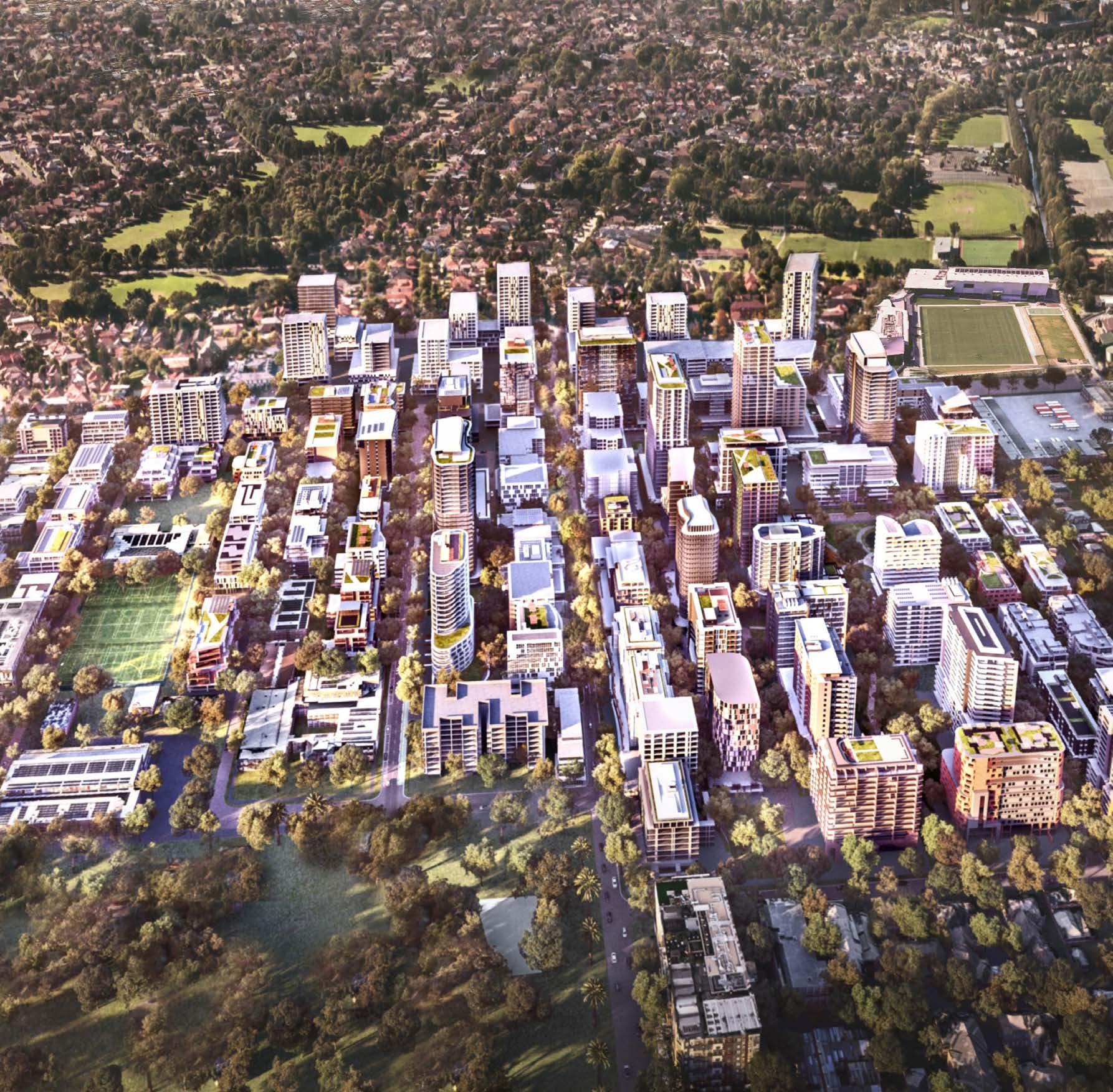 CONCORD OVAL
BURWOOD NORTH METRO STATION
PARRAMATTA ROAD
PARRAMATTA ROAD
BURWOOD PARK
MLC SCHOOL
BURWOOD ROAD
Figure 70: Aerial Artists Impression looking north (exhibited Masterplan). Source: Scharp
CONCORD OVAL
BURWOOD NORTH METRO STATION
PARRAMATTA ROAD
PARRAMATTA ROAD
BURWOOD PARK
MLC SCHOOL
BURWOOD ROAD
Figure 70: Aerial Artists Impression looking north (exhibited Masterplan). Source: Scharp
48
Density
The proposed densities within the Burwood North Precinct are in response to the significant opportunity associated with delivery of the Burwood North metro station, which acts as the catalyst for urban renewal to deliver high liveability and opportunities for the creation of new places for people.
The highest densities are located close to the Burwood North metro station, set back behind Parramatta Road and Burwood Road, to minimise the impacts of overshadowing on the public domain and preserving the human scale along the high activity environment of Burwood Road. Higher densities are also proposed adjoining new open spaces, so that these spaces are dynamic, active, and highly accessible.
Parramatta Road retains a lower scale character, with an increased landscaped setback to create a boulevard character and align with the proposed controls north of Parramatta Road within the Canada Bay Local Government Area.
Opportunities have been provided for higher density, taller building forms at the junction of Parramatta Road and Burwood Road to mark the gateway to the precinct and to maximise the density on sites with excellent access to the metro.
In the eastern part of the Precinct, between Parramatta Road and Wilga Street, high-density development continues to form a relationship with the open space network stepping down to medium rise development to transition to the low density development on Shaftesbury Road.
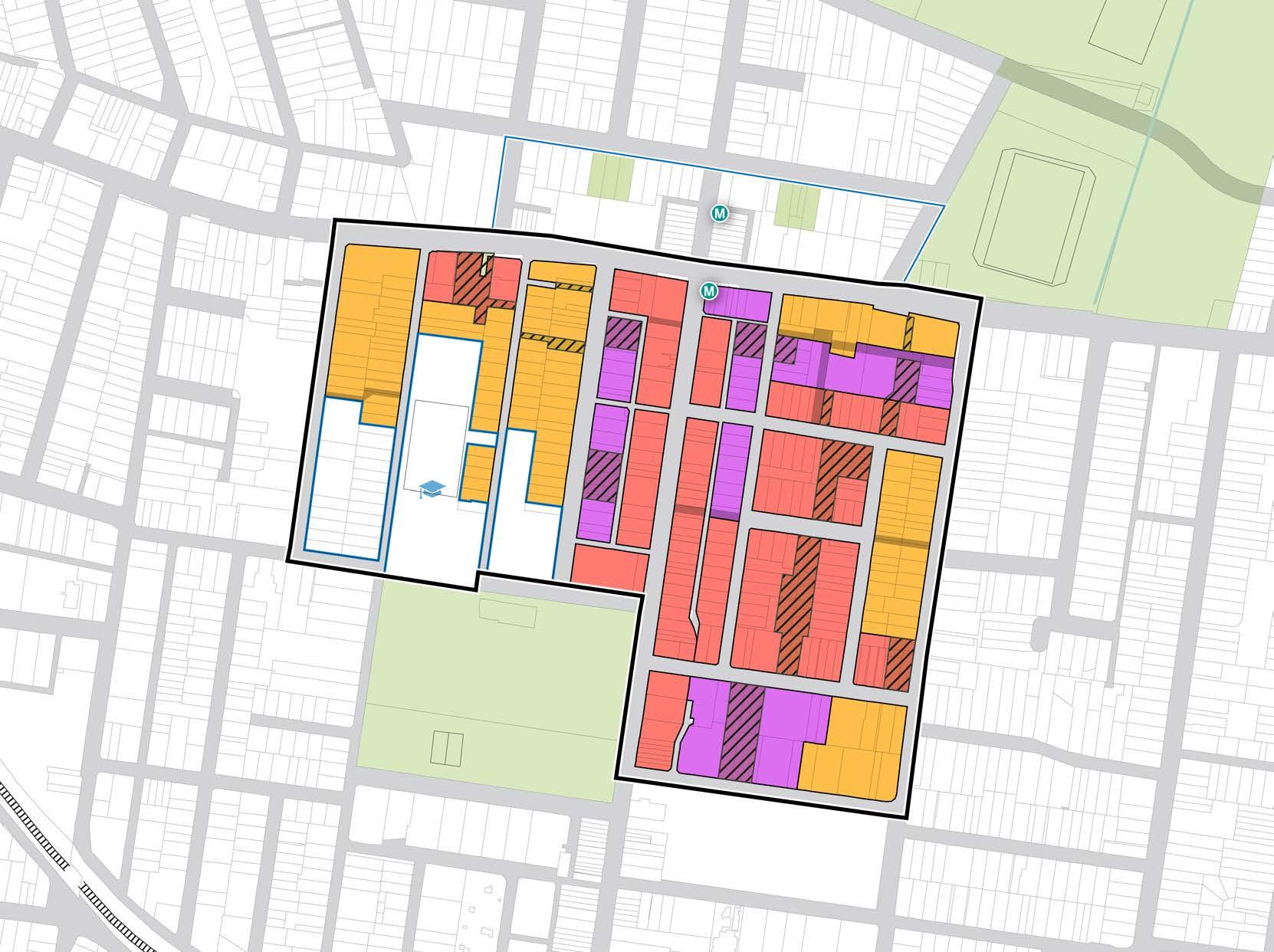

BURTON STREET LOFTUS STREET BROUGHTON STREET GIPPSSTREET WILGA STREET VICTORIA STREET MERYLA STREET COMER STREET PARK AVENUE BURWOOD ROAD NEICH PARADE PARK ROAD MILTON STREET PARK ROAD BRITANNIA AVENUE GRANTHAM STREET SHAFTESBURY ROAD ESHER STREET ARCHER STREET CONCORD OVAL ST LUKES PARK BURWOOD PARK MLC SCHOOL BURWOOD WESTFIELD
ROAD
PARRAMATTA
50 200m 100 0 Figure 71: Density
Built Form Diagram. Source: COX Future Metro Entry School FSR 4:1 Canada Bay LGA (does not form part of this Masterplan) Proposed Public Space FSR 3:1 FSR 6:1 49 Burwood North Precinct Masterplan: Masterplan Report
and
Building Height
Building heights also consider the proposed uses within each development - residential towers are intended to be more slender than commercial/ retail developments in a podium - and therefore require taller building heights to achieve the same density.
The tallest buildings are proposed to be located behind Burwood Road, fronting Neich Parade and Esher Street, to minimise overshadowing on Burwood Road.
Tall building forms are also proposed within the Transit and Business character area, responding to the highly accessible location but enabling a lower scale frontage to Parramatta Road.
On Burwood Road, a series of podiums are proposed to create a street wall of two to four storeys, ensuring the street environment is constructed at the human scale. Towers of up to 10 storeys in height are set back from the street above the podium.
Taller built forms are proposed one block behind Burwood Road towards Neich Parade to the western side of Burwood Road and Esher Street to the eastern side of Burwood Road. The taller scale (greater building height) is proposed to leverage the opportunity to consolidate growth in an area of high accessibility and amenity and to deliver a more public accessible open space at the ground plane, providing significant community benefit and allowing for an increase in canopy cover.
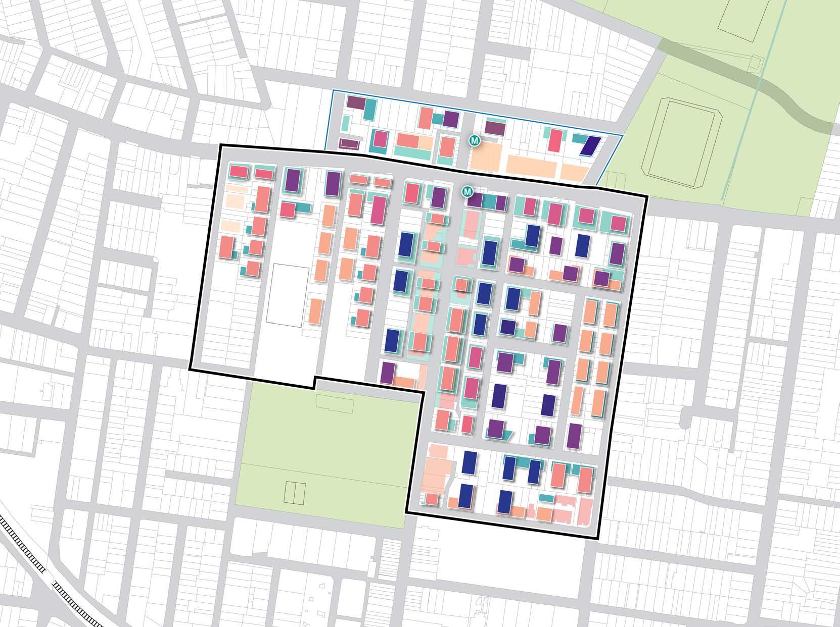
BURTON STREET LOFTUS STREET BROUGHTON STREET GIPPSSTREET WILGA STREET VICTORIA STREET MERYLA STREET COMER STREET PARK AVENUE BURWOOD ROAD NEICH PARADE PARK ROAD MILTON STREET PARK ROAD BRITANNIA AVENUE GRANTHAM STREET SHAFTESBURY ROAD ESHER STREET ARCHER STREET CONCORD OVAL ST LUKES PARK BURWOOD PARK MLC SCHOOL BURWOOD WESTFIELD PARRAMATTA ROAD 25 10 10 30 25 25 15 15 36 30 4 4 4 30 20 20 2 2 4 4 4 4 4 2 2 2 2 4 4 2 25 20 20 20 20 20 20 20 20 20 16 17 13 10 11 24 11 6 6 24 12 16 20 12 12 12 12 20 15 15 15 15 15 20 12 20 20 36 36 10 8 8 8 8 8 8 8 8 8 8 8 8 8 8 8 8 36 30 30 30 30 30 10 10 10 10 10 10 10 10 10 10 10 10 10 10 10 10 10 10 10 10 8 4 4 4 4 4 4 8 8 8 8 8 8 10 10 30 36
Future Metro Entry Proposed Public Space 10.5m 18-20.5m 35m 50m 82m Canada Bay LGA (does not form part of this Masterplan) # Building Height (storeys) 15m 28-30m 41m 65m 98m 50 Burwood North Precinct Masterplan: Masterplan Report
Figure 72: Building Heights Diagram. Source: COX
Solar Access
It is important to ensure solar access to the public spaces achieves a high level of amenity year round for those visiting, working and living in the Burwood North Precinct. Consideration has been given with respect to the height and FSR across the Precinct and its impact on solar access to these proposed spaces.
Key public spaces should receive a minimum of 2 hours of sunlight between 9am and 3pm at the winter solstice (21 June). A detailed urban design analysis has been undertaken, which included an analysis of the impact of the heights on overshadowing to public spaces.
Maintaining good solar access to the eastern side of Burwood Road will contribute to the amenity of pedestrians and allow for the successful activation of Burwood Road year round.
Detailed design controls for solar access will be prepared and included in the site specific DCP to ensure that these outcomes are achieved.
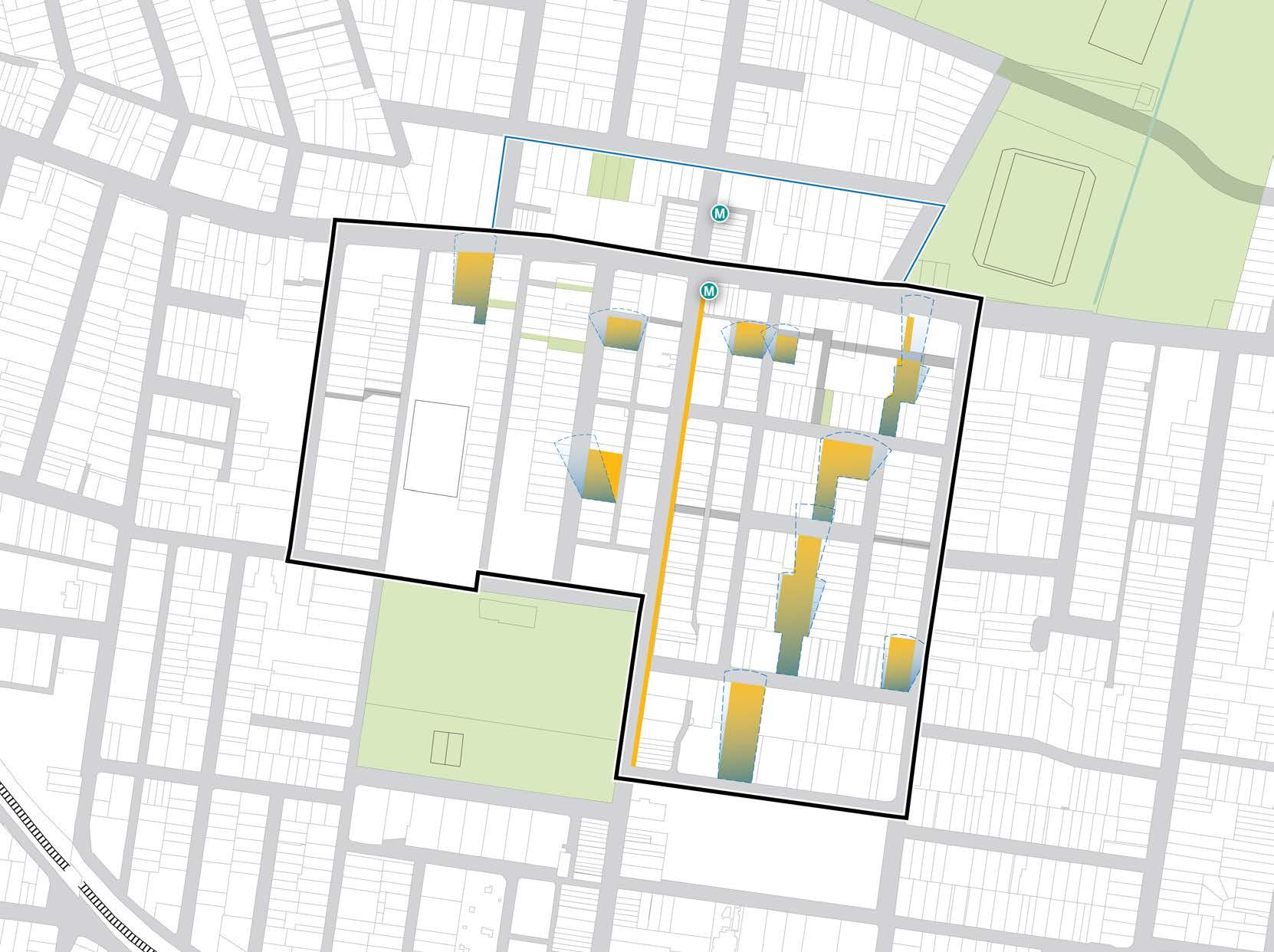
BURTON STREET LOFTUS STREET BROUGHTON STREET GIPPSSTREET
WILGA STREET
VICTORIA STREET
COMER STREET PARK AVENUE BURWOOD ROAD NEICH PARADE PARK ROAD MILTON STREET PARK ROAD BRITANNIA AVENUE GRANTHAM STREET SHAFTESBURY ROAD ESHER STREET ARCHER STREET CONCORD OVAL ST LUKES PARK BURWOOD PARK MLC SCHOOL BURWOOD WESTFIELD PARRAMATTA ROAD
MERYLA STREET
50 200m 100 0 Figure 73: Solar Access Diagram . Source: COX Proposed Solar Access Controls Solar Access Future Metro Entry Canada Bay LGA (does not form part of this Masterplan) 51 Burwood North Precinct Masterplan: Masterplan Report
Open Space Structure
A network of new open spaces, laneways and plazas throughout the Precinct will offer a diversity of high quality public places for recreation, gathering and for active transport permeability.
Feasible delivery of high quality public space is the priority for open space provision within the Precinct. Responding to the fragmented nature of land ownership, open spaces have been positioned to maximise their deliverability through private development.
Large development sites that are known to have been amalgamated have been prioritised for the delivery of new pocket parks and open spaces.
A linear blue-green spine forms the heart of the open space within the Precinct, linking with and complementing the existing open spaces of Burwood Park and St Lukes Park, and responding to the natural features of the site including the former creekline that has been undergrounded through the Precinct.
The transformation of New Street into a proposed pedestrianised street supports both the linear blue-green spine and a new east-west pedestrian connection. Future development will further transform this space as services access shifts to adjacent streets.
Pocket parks and plazas provide accessible public spaces to residents workers and visitors, and are connected by a series of laneways and pedestrian through-links as important features of the public domain.
Refer Burwood North Precinct Masterplan: Landscape and Public Domain Strategy Report by Oculus for further detail.
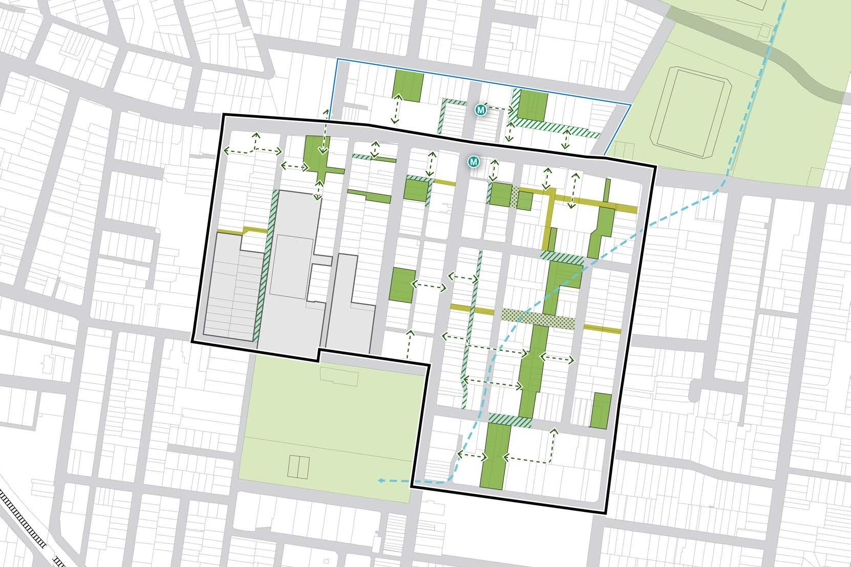


BURTON STREET LOFTUS STREET BROUGHTON STREET WILGA STREET MERYLA STREET ROWLEY STREET COMER STREET PARK AVENUE BURWOOD ROAD NEICH PARADE PARK ROAD MILTON STREET PARK ROAD BRITANNIA AVENUE GRANTHAM STREET SHAFTESBURY ROAD LUKE AVENUE ARTHURSLEIGH STREET ESHER STREET ARCHER STREET CONCORD OVAL BURWOOD PARK MLC SCHOOL BURWOOD WESTFIELD PARRAMATTA ROAD Future Metro Entry Proposed Lane-way (Shared) Existing Schools Canada Bay LGA (does not form part of this Masterplan) Proposed Pedestrian Through-Site Link Proposed Shared Street Proposed Public Space Former Creek Line Future Public Spacepedestrian street 50 200m 100 0
Figure 74: Open Space Structure Plan Source: COX 52 Burwood North Precinct Masterplan: Masterplan Report
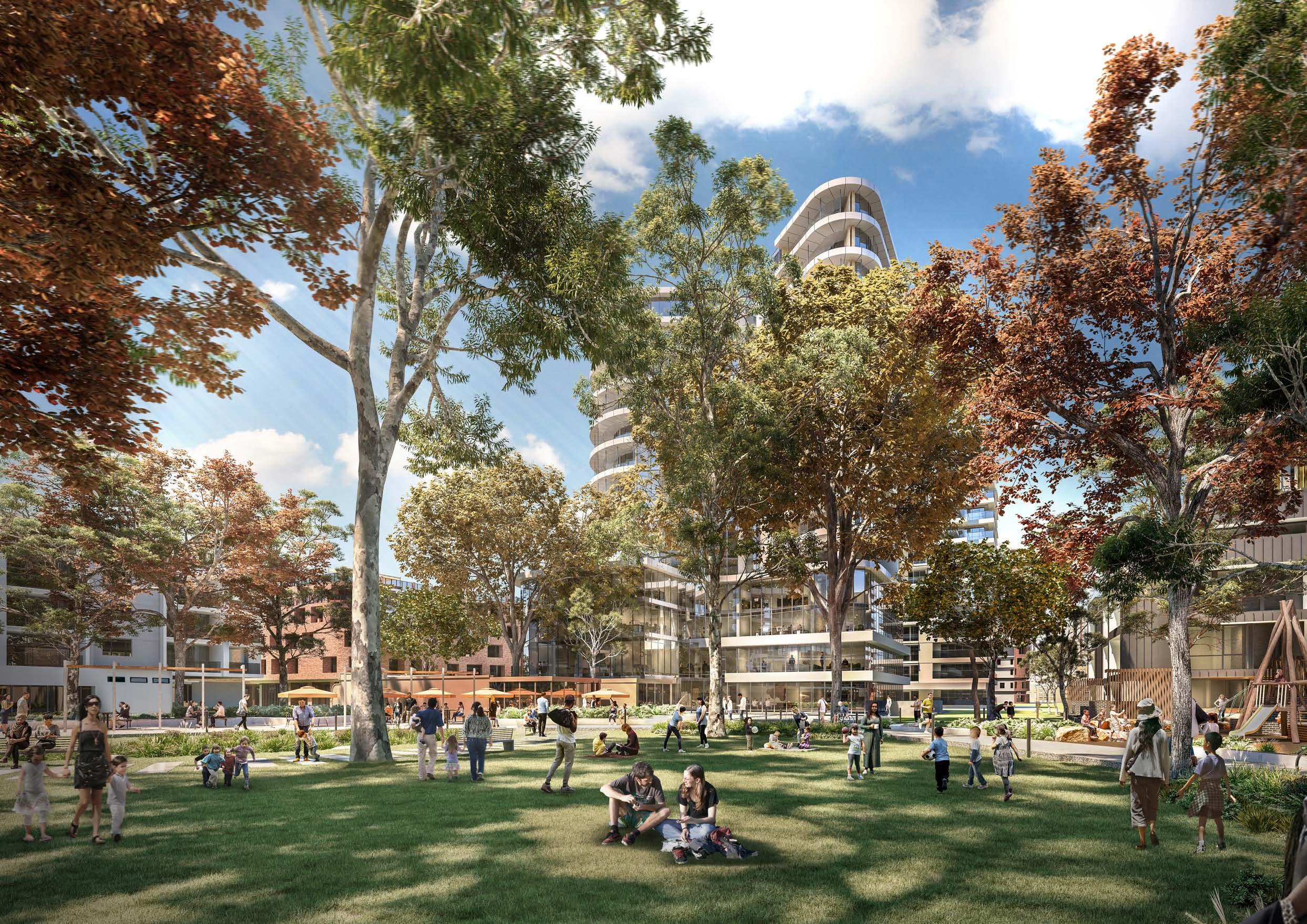 Figure 75: View south within Milton Street park Source: Scharp
Primary Setbacks
Primary setbacks are the setbacks at ground level, and adjoining podium levels above.
A 0m setback requirement for the ground floor on Burwood Road will retain the street wall pattern with a podium fronting the street of 2-4 storeys. Taller building forms will be set back above the podium. The perpendicular laneways will also have a 0m setback for the ground floor and podium to define the edges and activate these laneways and through site links.
Within laneways, developments will build to the boundary along the rear edge of the blocks fronting Burwood Road to maximise feasibility of these narrow blocks. A setback of 2 metres to the ground floor on the opposite sides of the laneway will enable the opportunity for vehicle turning movements into driveways, and enable adequate building separation to comply with SEPP 65 Apartment Design Guide (ADG) requirements.
On Parramatta Road, a 6 metre green setback to the ground floor reinforces the principles of PRCUTS, and will soften the pedestrian environment along this corridor and establish a boulevard character.
Greater ground floor building setbacks are proposed throughout the residential streets to provide adequate space for deep soil landscaping within development lots and allow for Water Sensitive Urban Design (WSUD) treatments along the streetscapes.
Detailed design controls for setbacks will be captured in the proposed DCP amendments, post-exhibition of the draft masterplan.
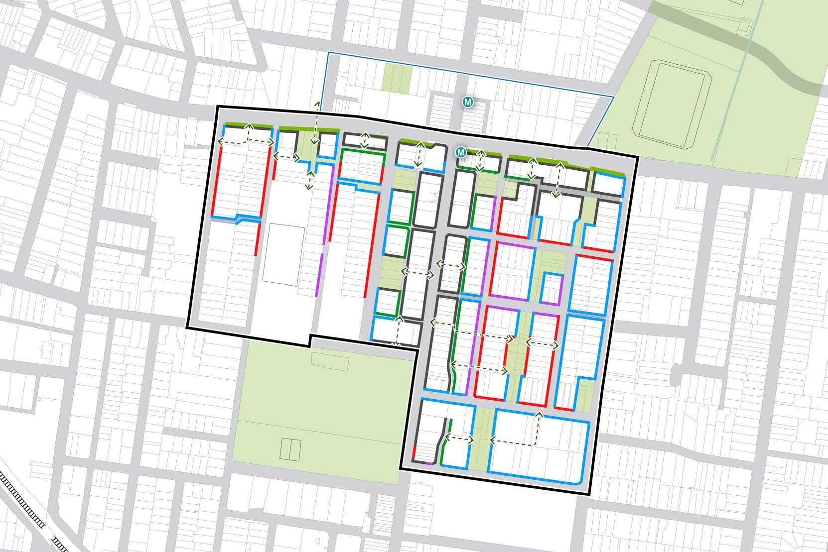
BURTON STREET LOFTUS STREET BROUGHTON STREET WILGA STREET MERYLA STREET COMER STREET PARK AVENUE BURWOOD ROAD NEICH PARADE PARK ROAD MILTON STREET PARK ROAD BRITANNIA AVENUE GRANTHAM STREET SHAFTESBURY ROAD ESHER STREET ARCHER STREET CONCORD OVAL BURWOOD PARK MLC SCHOOL BURWOOD WESTFIELD PARRAMATTA ROAD
Proposed Public Space Future Metro Entry 2m setback 4m setback 3m Parramatta Road green setback Canada Bay LGA (does not form part of this Masterplan) 0m setback 3m setback 6m setback Proposed Pedestrian Through-Site Link 50 200m 100 0
54 Burwood North Precinct Masterplan: Masterplan Report
Figure 76: Ground Floor Setback Diagram. Source: COX
Secondary Setbacks
Secondary setbacks are those for the storeys above the ground level or podium. They are measured from the face of the ground level or podium so are in addition to any primary setback.
The intention of secondary setbacks is to protect the human scale of key pedestrian routes such as Burwood Road, and to achieve appropriate building separation to comply with ADG requirements.
The proposed secondary setbacks of 6m and 8m on the eastern and western sides of Burwood Road respectively, are intended to ensure ADG compliant separation for built form in the adjoining blocks fronting Neich Parade and Esher Street. The blocks on the western side of Burwood Road are deeper than the blocks on the eastern side, so are able to accommodate a deeper secondary setback while achieving a similar tower floor-plate size.
The secondary setback of 3m proposed along Parramatta Road enables building articulation and a pedestrian scale to the streetscape, while enabling feasible tower forms to be developed above.

BURTON STREET LOFTUS STREET BROUGHTON STREET
STREET
WILGA
STREET COMER STREET PARK AVENUE BURWOOD ROAD NEICH PARADE PARK ROAD MILTON STREET PARK ROAD BRITANNIA AVENUE GRANTHAM STREET SHAFTESBURY ROAD ESHER STREET ARCHER STREET CONCORD OVAL BURWOOD PARK MLC SCHOOL BURWOOD WESTFIELD
ROAD
MERYLA
PARRAMATTA
50 200m 100 0
Proposed Open Space Future Metro Entry 3m secondary setback 6m secondary setback 8m setback from heritage facade Canada Bay LGA (does not form part of this Masterplan) 2m setback 4m secondary setback 8m secondary setback Proposed Pedestrian Through-Site Link 55 Burwood North Precinct Masterplan: Masterplan Report
Figure 77: Secondary Setbacks Diagram. Source: COX
Active Edges
Active street frontages help to enliven the public domain and street environments, contributing to a vibrant and safe Precinct with food and beverage outlets, retail shopfronts and small scale commercial frontages with direct visibility onto the street.
Active edges will be concentrated on or near the Burwood Road corridor, drawing pedestrian activity north from the Burwood town centre and Westfield, into the Burwood North Precinct and around the metro station hub. Along Burwood Road, ground floor frontages must be activated.
Alongside a green setback, pedestrian amenity will be significantly improved on Parramatta Road as the interface is activated by groundfloor business and retail. Extending activity in perpendicular streets and laneways creates an environment that is less exposed and more appropriate for outdoor dining.
Pocket parks and plazas set back from Burwood Road provide opportunities for food and beverage outlets to adjoin open space, allowing for activity to spill into the open space and provide activation, expanding the usability of the open space.
There are opportunities for small scale food and beverage outlets within the ground floor of residential buildings to activate adjoining open spaces within the residential areas of the Precinct. These opportunities help to activate open spaces, provide passive surveillance and increase the amenity and convenience within the residential neighbourhoods.
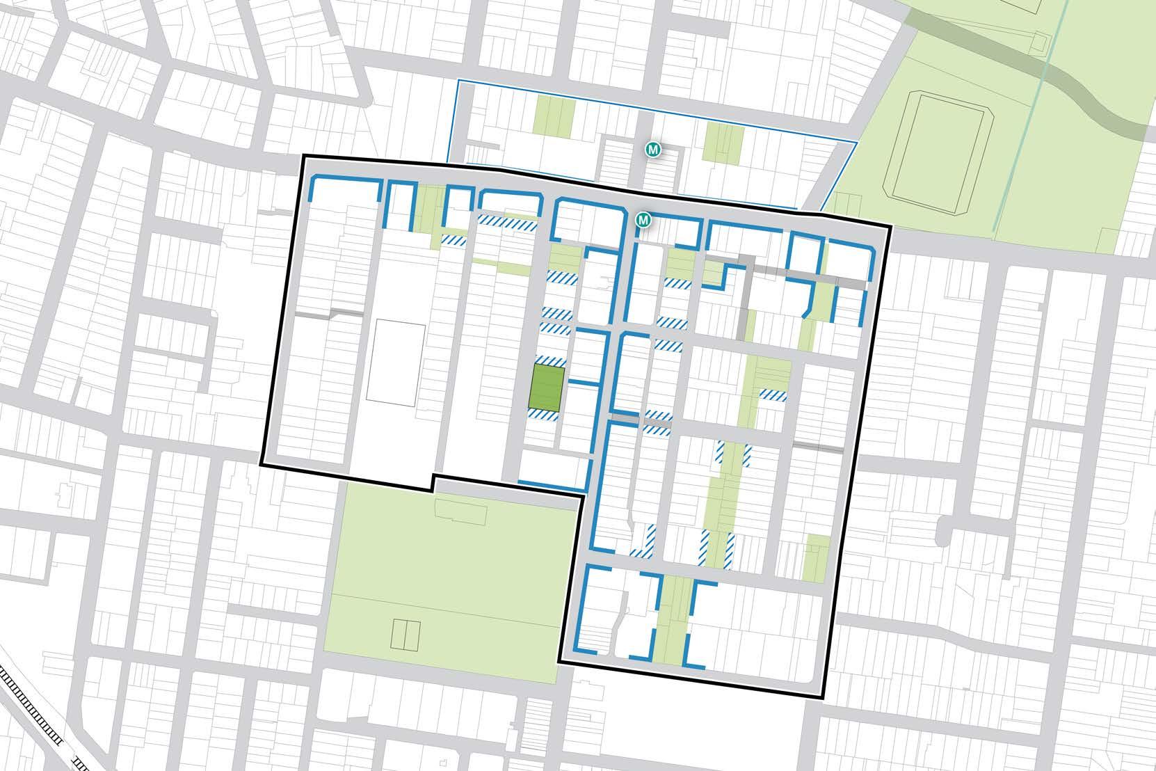
BURTON STREET LOFTUS STREET BROUGHTON STREET WILGA
PARK AVENUE BURWOOD ROAD NEICH PARADE PARK ROAD MILTON STREET PARK ROAD BRITANNIA AVENUE GRANTHAM STREET SHAFTESBURY ROAD ESHER STREET ARCHER STREET CONCORD OVAL BURWOOD PARK MLC SCHOOL BURWOOD WESTFIELD
ROAD
STREET MERYLA STREET
PARRAMATTA
50 200m 100 0
Proposed Public Space Active Edge Canada Bay LGA (does not form part of this Masterplan) Future Metro Entry Ground Floor Activation In Residential Zones 56 Burwood North Precinct Masterplan: Masterplan Report
Figure 78: Active Frontages Diagram. Source: COX
Active Transport
The proposed active transport network will increase opportunities for east-west connections. New routes will utilise the proposed open space network, allowing cyclists to more safely connect to the wider active transport network.
The unidirectional cycle paths on Neich Parade are currently exposed to driveway entries and kerbside parking so are proposed to be replaced by a bidirectional cycle path on the eastern side of the street to minimise vehicle conflicts. Using proposed laneways and open spaces, this route then crosses Burwood Road and connects along the proposed New Street open space to an existing route leading to Luke Avenue and Parramatta Road.
A route is also proposed to connect Rowley Street and Comer Street, facilitating an additional east-west connection across the Precinct. The transformation of Park Road to a low-speed, oneway shared street provides further connectivity.
Pedestrian amenity is aided by a series of pedestrian only through-site links, connecting local streets to open spaces and major commercial strips. These connections align with existing lane-ways and break down large blocks to provide good pedestrian permeability. They are activated by adjoining open spaces and active ground floor frontages.
Refer Burwood North Precinct Masterplan: Rapid Transport Appraisal, by SCT Consulting for further detail
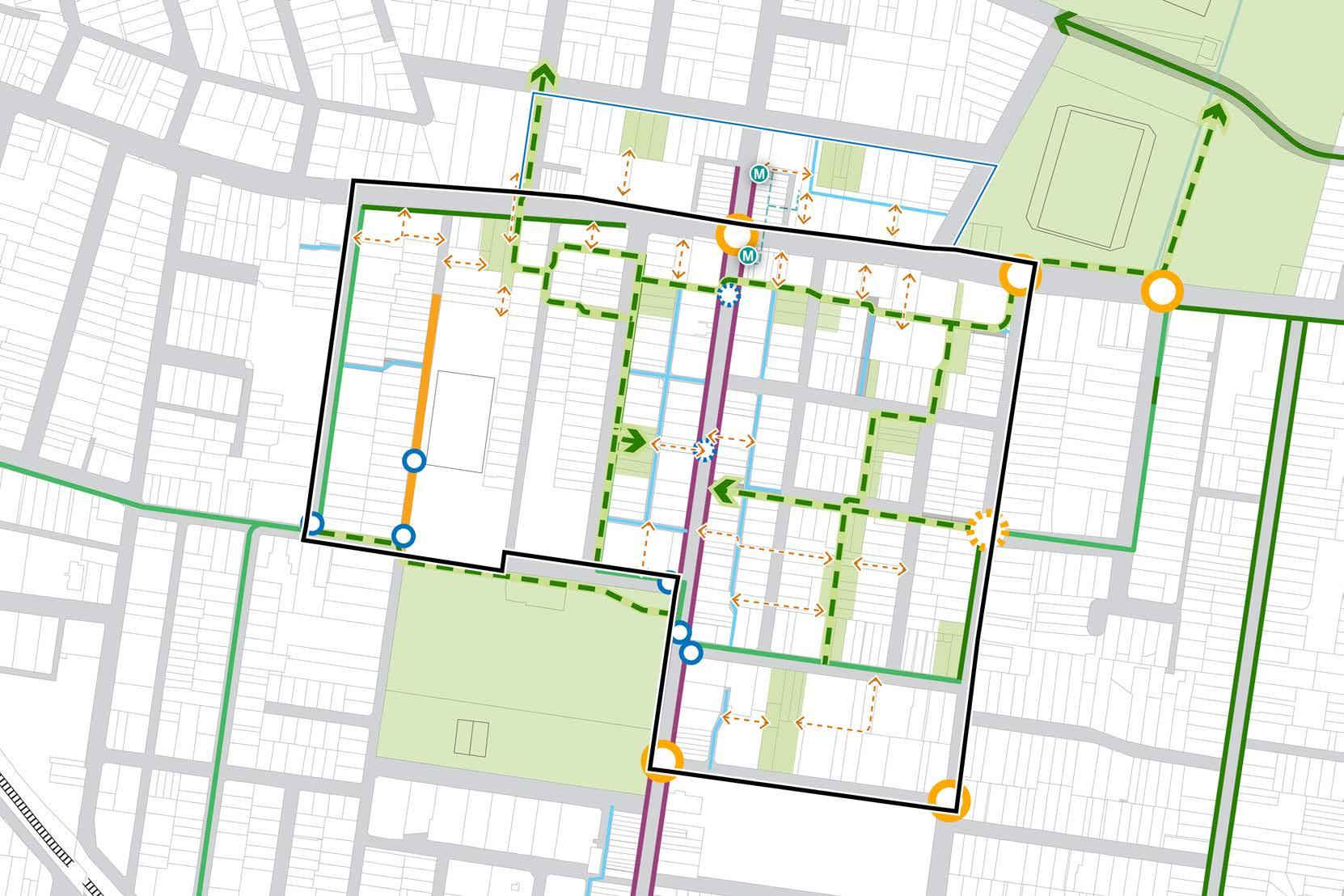
BURTON STREET LOFTUS STREET BROUGHTON STREET WILGA STREET
STREET COMER STREET PARK AVENUE BURWOOD ROAD NEICH PARADE PARK ROAD MILTON STREET PARK ROAD BRITANNIA AVENUE GRANTHAM STREET SHAFTESBURY ROAD ESHER STREET ARCHER STREET CONCORD OVAL BURWOOD PARK MLC SCHOOL BURWOOD WESTFIELD PARRAMATTA ROAD 50 200m 100 0
MERYLA
Figure 79: Active Transport Diagram. Source: COX
Proposed Public Space Existing Signalised Crossing Existing Cycleway Lane-way Canada Bay LGA (does not form part of this Masterplan) Existing Zebra Crossing Proposed Zebra Crossing Existing Cycle Route in Traffic Pedestrian Through-Site Link Future Metro Entry Existing Zebra Crossing Proposed or Upgraded Cycle Route High Pedestrian Activity Area Proposed Signalised Crossing Shared Street Metro Underground Walkways 57 Burwood North Precinct Masterplan: Masterplan Report
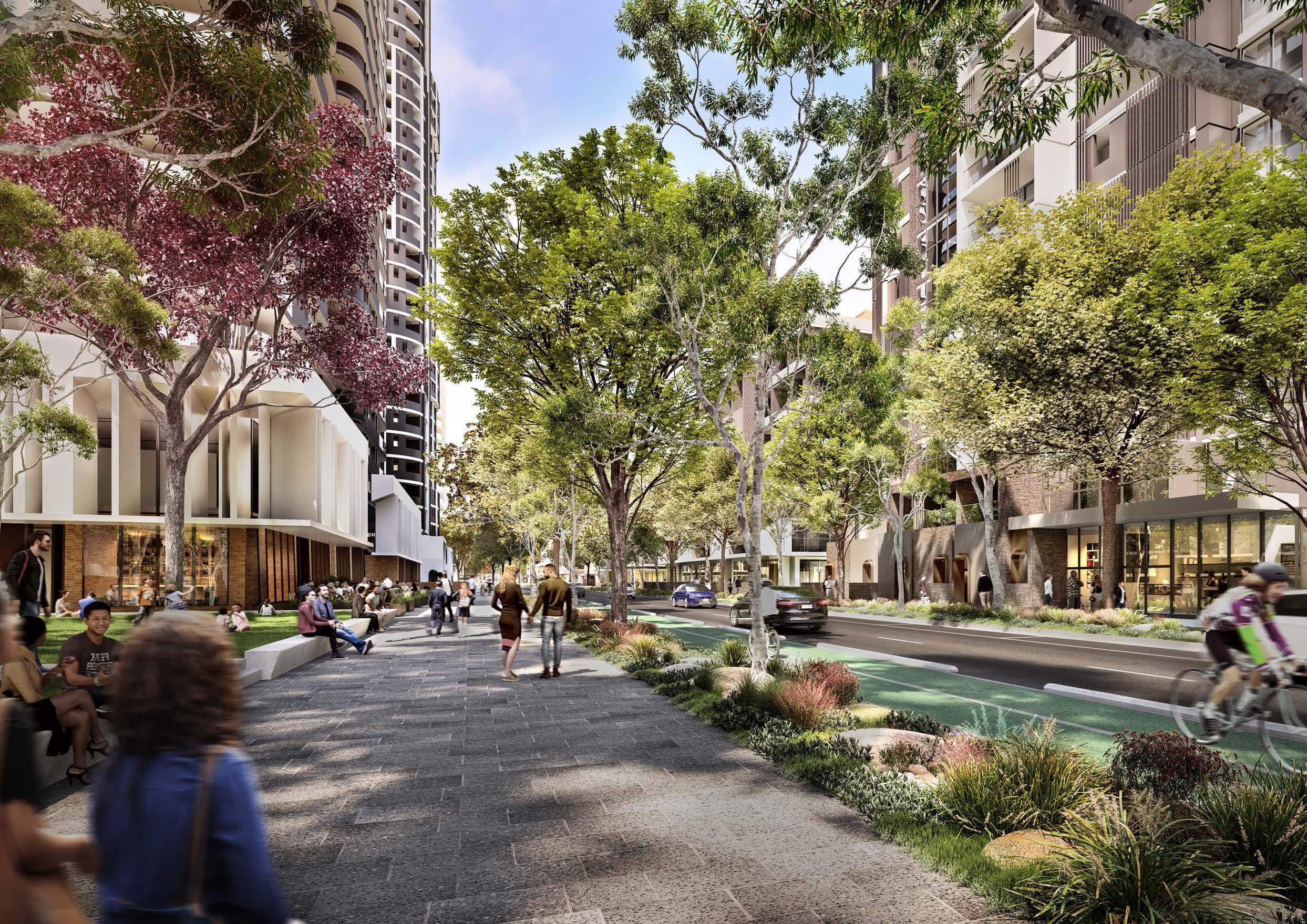 Figure 80: View south on Neich Parade Source: Scharp
Public Transport
The opening of Sydney Metro West in 2030 with a station in the Burwood North Precinct will provide a high frequency, high capacity rail link that connects to Parramatta and the Sydney CBD in 10 minutes each way, transforming public transport accessibility for the Precinct.
The existing train station at Burwood to the south of the Precinct will continue to support public transport trips for the Precinct, as will the existing bus networks that connect the Precinct along Burwood Road and Victoria Street.
Burwood Road is key to north-south connectivity across both Parramatta Road and the railway line. Traffic-calming interventions will reduce the movement of cars and improve the flow of bus traffic, better connecting residents to suburban centres.
Currently, no regular bus routes travel west along Parramatta Road from its intersection with Burwood Road. Potential exists for a bus corridor to supplement the metro and railway line with intermediate service. Additionally, PRCUTS identifies an opportunity for a large bus interchange on Parramatta Road, which will interface with the metro station.
Refer Burwood North Precinct Masterplan: Rapid Transport Appraisal, by SCT Consulting for further detail
BURTON STREET LOFTUS STREET BROUGHTON STREET GIPPSSTREET WILGA STREET VICTORIA STREET MERYLA STREET COMER STREET PARK AVENUE BURWOOD ROAD NEICH PARADE PARK ROAD MILTON STREET PARRAMATTA ROAD PARK ROAD BRITANNIA AVENUE GRANTHAM STREET SHAFTESBURY ROAD ESHER STREET ARCHER STREET CONCORD OVAL ST LUKES PARK FUTURE BURWOOD NORTH STATION BURWOOD PARK MLC SCHOOL BURWOOD WESTFIELD
50 200m 100 0 Figure
Proposed Public Space Metro Station Underground Walkways Metro Line Metro Station Entrance Bus Routes Bus Stops Railway Station Canada Bay LGA (does not form part of this Masterplan) Potential Future Bus Corridor Railway Line Metro Station 59 Burwood North Precinct Masterplan: Masterplan Report
81: Transport Diagram. Source: COX
 Figure 82: View east on Esher Lane, Sydney Metro station entry off camera to the left Source: Scharp
60 Burwood North Precinct Masterplan: Masterplan Report
Figure 82: View east on Esher Lane, Sydney Metro station entry off camera to the left Source: Scharp
60 Burwood North Precinct Masterplan: Masterplan Report
Street Typology
Using the NSW Government’s Movement and Place Framework, the roads and streets of the Burwood North Precinct can be categorised as Main Roads, Main Streets, Local Streets and Civic Spaces.
As a Main Street, Burwood Road balances its roles as a key transport corridor and pedestrian attractor. Parramatta Road is currently a Main Road and vehicle artery, however, future development could introduce more pedestrianoriented uses and encourage a shift toward the ‘main street’ typology.
Much of the rest of the Burwood North Precinct can be categorised as Local Streets, which include the connectors of Wentworth and Shaftesbury Roads, and the neighbourhood streets of Esher and Archer Streets.
The Civic Spaces typology will be bolstered by the transformation of Park Road and New Street into shared spaces.
Refer Burwood North Precinct Masterplan: Rapid Transport Appraisal, by SCT Consulting for further detail.
BURTON STREET LOFTUS STREET BROUGHTON STREET WILGA STREET MERYLA STREET COMER STREET PARK AVENUE BURWOOD ROAD NEICH PARADE PARK ROAD MILTON STREET PARK ROAD BRITANNIA AVENUE GRANTHAM STREET SHAFTESBURY ROAD ESHER STREET ARCHER STREET CONCORD OVAL BURWOOD PARK MLC SCHOOL BURWOOD WESTFIELD PARRAMATTA ROAD
50 200m 100 0 Figure 83: Proposed Street Typology Diagram Source: COX Proposed Public Space Future Metro Entry Roundabout Main Street Civic Space Future Public Spacepedestrian street Canada Bay LGA (does not form part of this Masterplan) Signalised Crossing Main Road Local Street Pedestrian Link 61 Burwood North Precinct Masterplan: Masterplan Report
Street Hierarchy and Movement
Parramatta Road is a major east-west arterial that will continue to draw traffic from the Burwood North Precinct. Parramatta Road is serviced by the connecting Wentworth and Shaftesbury Roads, which are limited to 50km/h.
The high-activity Burwood Road remains a key connector for bus traffic. Car movements will be reduced by implementing traffic calming measures in a staged approach. High pedestrian activity designates Burwood Road a High Pedestrian Activity Area with a speed limit of 30km/h.
Neighbourhood streets provide for internal movement and draw traffic to connector streets, with a speed limit of 30km/h. Milton Street is an important east-west link, providing greater connectivity to dwellings in the west of the Precinct.
Intersecting the MLC School is Park Road, a narrow street that currently carries two-way traffic. Transitioning to a one-way street, much of the road north of its intersection with Rowley Street will become a shared zone with a speed limit of 10km/h, with pavement and traffic calming landscape treatments clearly marking this transition. This change will improve safety and amenity for school children as well as the wider community.
Locating building access on adjacent streets frees New Street to be converted to a pedestrianised street, forming a key east-west pedestrian route.
Speed limits of 10km/h on all laneways and 30km/h on all local streets promotes pedestrian priority and permeability throughout the Precinct. The implementation of new speed limits, shared streets and road closures is subject to further assessment and TfNSW approval.
Refer Burwood North Precinct Masterplan: Rapid Transport Appraisal, by SCT Consulting for further detail.
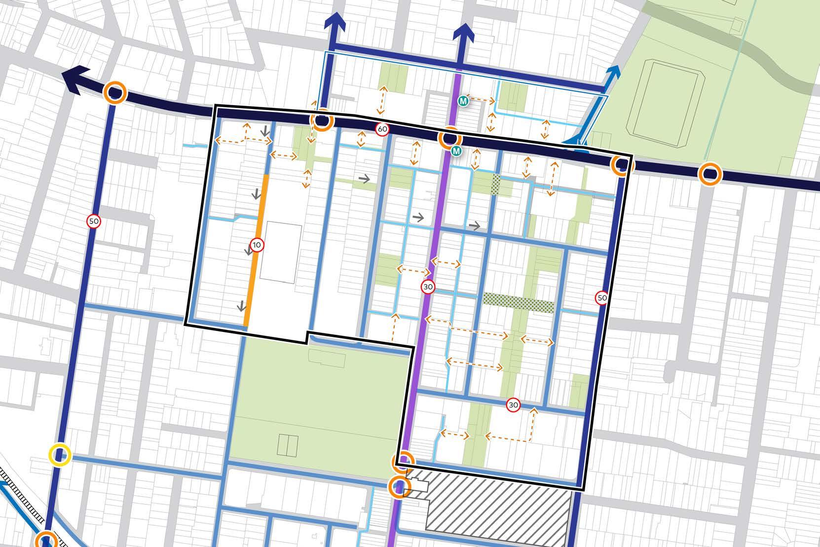
BURTON STREET LOFTUS STREET BROUGHTON STREET WILGA STREET MERYLA STREET COMER STREET PARK AVENUE BURWOOD ROAD NEICH PARADE PARK ROAD MILTON STREET PARK ROAD BRITANNIA AVENUE GRANTHAM STREET SHAFTESBURY ROAD ESHER STREET ARCHER STREET CONCORD OVAL BURWOOD PARK MLC SCHOOL BURWOOD WESTFIELD PARRAMATTA ROAD
50 200m 100 0 Figure 84: Street Hierarchy
Proposed Public Space Connector Streets One Way Shared Streets Canada Bay LGA (does not form part of this Masterplan) Neighbourhood Streets Lane-ways Roundabout Principal Arterial Road Pedestrian Link 30 Proposed Speed Limit Signalised Intersection High Pedestrian Activity Area Future Public Spacepedestrian street 62 Burwood North Precinct Masterplan: Masterplan Report
and Movement Diagram. Source: COX
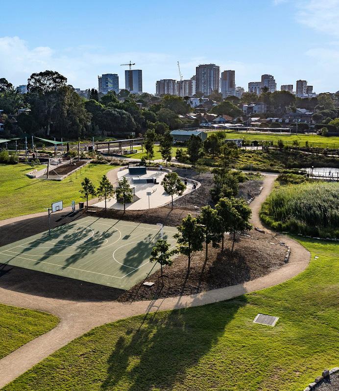
Yield Estimate 63 Burwood North Precinct Masterplan: Masterplan Report
Methodology
The Precinct’s potential development capacity has been quantified to understand its potential future land uses, total dwellings, population and jobs. Land use capacities have been calculated assuming only unconstrained sites are uplifted.
The methodology and outcomes are summarised in subsequent pages.
Constrained Sites
Sites identified with one (or more) of the following characteristics are assumed to be constrained and therefore may not present as redevelopment opportunities within the assumed timeframe of the masterplan:
• Strata titled lots containing >10 unitseither commercial or residential
• Recent development
• Heritage items*
• Schools
• Open space (existing and proposed)
*Some heritage sites are included as opportunity sites because of their ability to be adaptively reused, or according to their assessed heritage value.
Sites where there are known development proposals within the Precinct but that do not have an approved DA are assumed to be unconstrained and are therefore an opportunity site for development uplift under the Masterplan. All other sites are assumed to be opportunity sites.
Proposed open spaces anticipated to be delivered as part of a private development are assumed to adopt that block’s FSR. Development sites that are also delivering open space can utilise the full FSR allocated to that site and redistribute that density to the developable parts of the site. These open space areas are therefore retained within the capacity assessment as having some development potential. In addition to this, the following information has also been identified for each parcel:
• Total site area of constrained sites to be excluded
• Heritage items
• Existing FSR
• PRCUTS proposed FSR
Proposed Controls
A proposed FSR has been identified for each block, responding to the overall vision for the Burwood North Precinct and the levels of accessibility and amenity within and adjoining the blocks now and in the future. The FSR controls recognise the importance of compatibility with existing character and consider the impact of future built form, constrained land uses, relationship to open space, and proximity to transport. It is assumed that the proposed FSR should not be less than the existing FSR under Burwood LEP, and in the majority of cases not less than the FSR identified under PRCUTS for that block.
For each block a proportional split for mixed-uses into non-residential uses and residential uses has been assumed.
Assumptions
The following assumptions have been used in the development of the masterplan.
GFA to dwelling and Job assumptions
Max. Floor-plate over 8 storeys850m2 (floor-plate GBA)
Min. Amalgamated lot size 1,500m2
Max. Building length 60m
Max. Wall length without articulation45m
Min. Floor to floor heights
Table 2: Burwood North Capacity Assessment
Average apartment size 90m2 GFA People per dwelling 2.5 m2 per job 35
Built
Form
Residential 3.1m Residential ground floor 4m Commercial/retail 4m Commercial/retail ground floor4.5m
64 Burwood North Precinct Masterplan: Masterplan Report
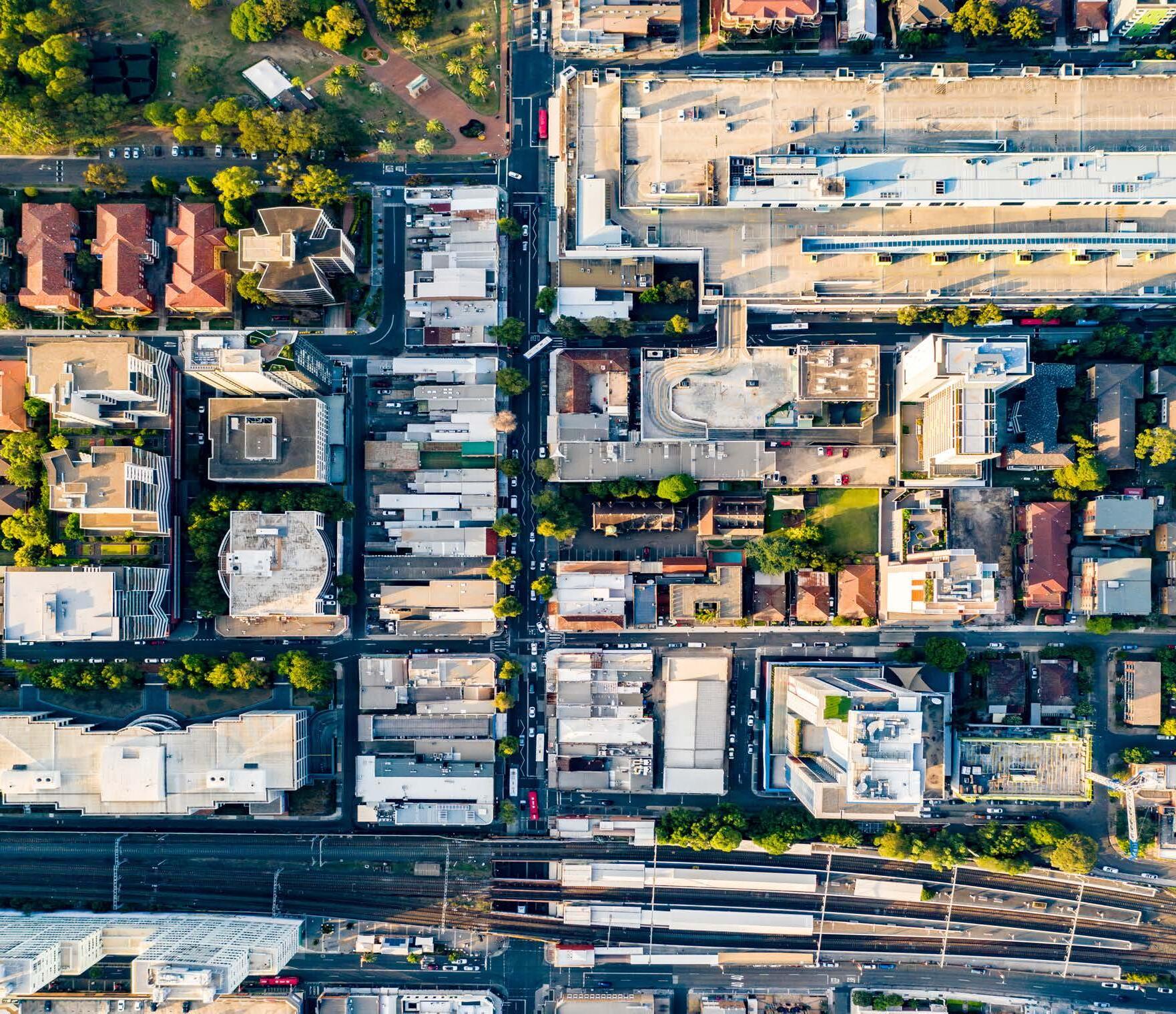
Employment Capacity Employment GFA Capacity 52,223m2 GFA Potential Additional Jobs 1,492 Average GFA m2 per job 35 Residential Capacity Retained Dwellings 669 Residential GFA Capacity 695,620m2 Potential Additional Dwellings 7,729 Potential Total Dwellings 8,398 Potential Total Population (@ 2.5ppd)19,323 Public Space Capacity Potential Public Space 24,900m2 65
North Precinct Masterplan: Masterplan Report
Burwood
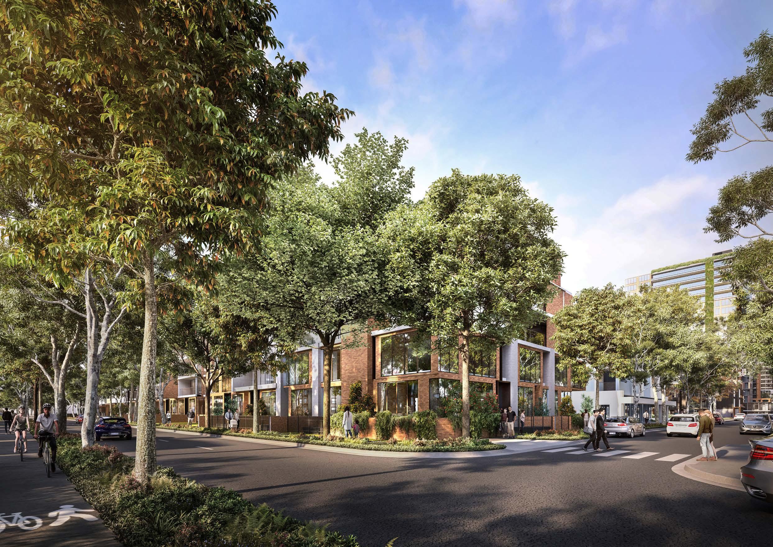 Figure 85: View south on Shaftesbury Road, Milton Street to the right Source: Scharp

Draft Implementation Strategy
The proposals contained within this Masterplan are recommendations for achieving the desired high quality renewal outcomes within the Burwood North Precinct. The Masterplan does not enact the proposed changes – this will be done via a Planning Proposal, which will be prepared following the public exhibition of the Masterplan.
The draft Implementation Strategy provides an indication of the proposed changes to the:
• Land use zones
• Floor Space Ratios
• Height of Buildings
It also identifies key sites within the precinct and proposed site amalgamation requirements.
It should be noted that these may be subject to changes, following the conclusion of the public exhibition of the Masterplan
67 Burwood North Precinct Masterplan: Masterplan Report
Proposed Site Amalgamation
Efficient and successful delivery of the Masterplan will require amalgamation of fragmented lots throughout the Precinct.
Encouraging the amalgamation of properties to achieve a minimum lot size of 1500m2 would enable the delivery of the densities proposed in the Masterplan. A potential pattern of amalgamation has been shown in Figure 83, which aims to create efficient development parcels with a minimum contiguous site area of 1500m2, in an ordered way that avoids the creation of isolated sites that cannot be redeveloped to their full potential. A minimum lot size of 1500m2 also enables developments to achieve ADG requirements and provide adequate amenity for future residents.
The amalgamation of properties into larger development sites (greater than 1500m2) is required to achieve the efficient delivery of developer led open space, which could be offset by an allowance for additional height or development yield.
Figure 83 indicates proposed open spaces that could be delivered by developers as part of a larger amalgamated development site.
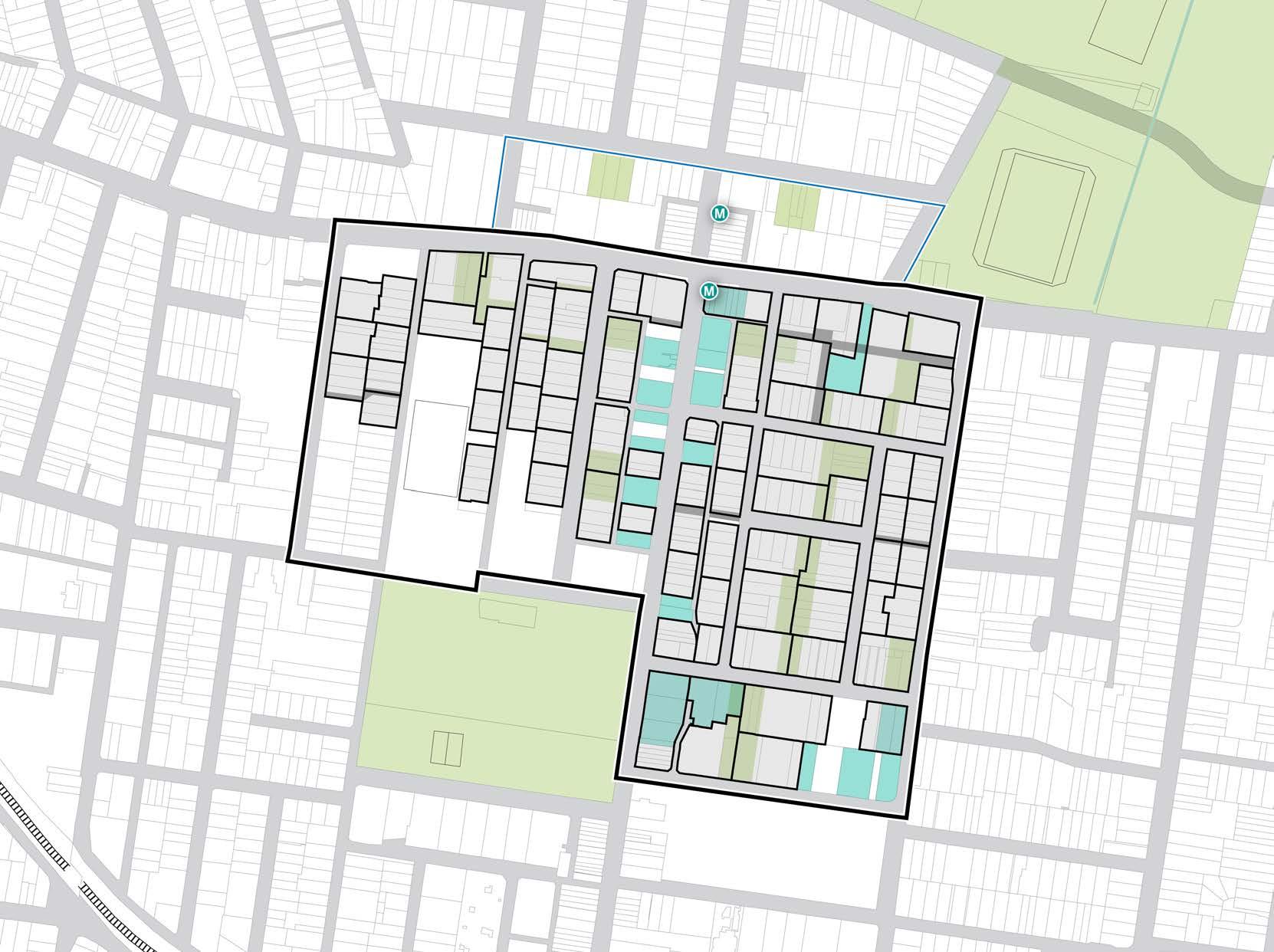
50 200m 100 0 BURTON STREET LOFTUS STREET BROUGHTON STREET GIPPSSTREET
STREET COMER STREET PARK AVENUE BURWOOD ROAD NEICH PARADE PARK ROAD MILTON STREET PARK ROAD BRITANNIA AVENUE GRANTHAM STREET SHAFTESBURY ROAD ESHER STREET ARCHER STREET CONCORD OVAL ST LUKES PARK BURWOOD PARK MLC SCHOOL BURWOOD WESTFIELD PARRAMATTA ROAD
WILGA STREET VICTORIA STREET MERYLA
Figure 86: Proposed Amalgamation Diagram. Source: COX
Proposed Public Space Shared lanes Recent development Canada Bay LGA (does not form part of this Masterplan) Potential Site Amalgamations Future Metro Entry 68 Burwood North Precinct Masterplan: Masterplan Report
Proposed Key Sites
Key Sites are being proposed within the Burwood North Precinct Masterplan to ensure that the delivery of community infrastructure, open space and through site links.
The Key Sites diagram at Figure 84 identifies the following Key Sites:
• Parramatta Road, between Park Road and Britannia Avenue
• Neich Parade between Nicoll Lane and Emmanuel Lane
• Esher Street between Milton Street and Esher Lane
• Parramatta Road between Esher Street and Shaftesbury Road
• Block bounded by Milton, Archer, Meryla and Esher Streets.
• Meryla Street between Archer Street and Shaftesbury Road
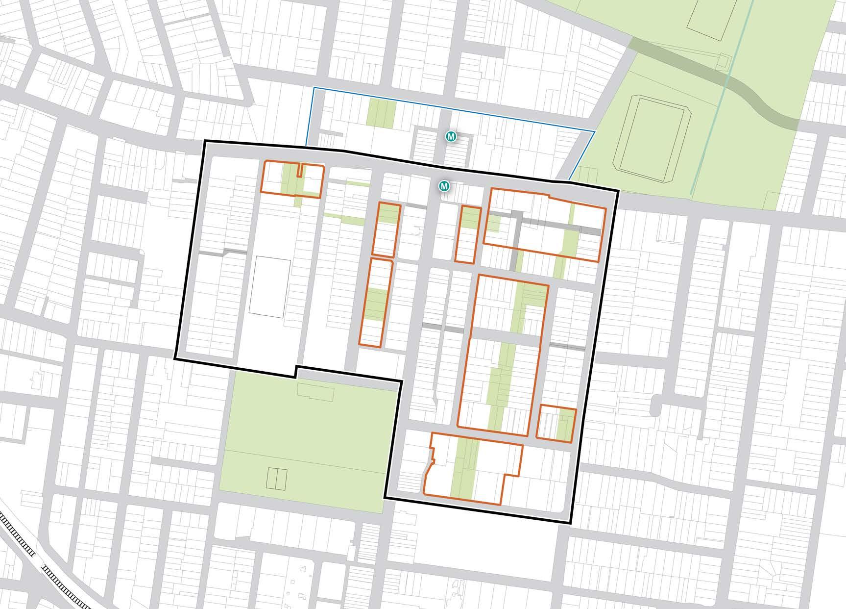
BURTON STREET LOFTUS STREET BROUGHTON STREET GIPPSSTREET
STREET
STREET MERYLA STREET COMER STREET PARK AVENUE BURWOOD ROAD NEICH PARADE PARK ROAD MILTON STREET PARRAMATTA ROAD PARK ROAD BRITANNIA AVENUE GRANTHAM STREET SHAFTESBURY ROAD ESHER STREET ARCHER STREET CONCORD OVAL ST LUKES PARK FUTURE BURWOOD NORTH STATION BURWOOD PARK MLC SCHOOL BURWOOD WESTFIELD
WILGA
VICTORIA
50 200m 100 0 Proposed Public Space Key Site Canada Bay LGA (does not form part of this Masterplan)
69 Burwood North Precinct Masterplan: Masterplan Report
Figure 87: Key Sites Diagram. Source: COX
Land Use Zones
Existing Land Use Zones
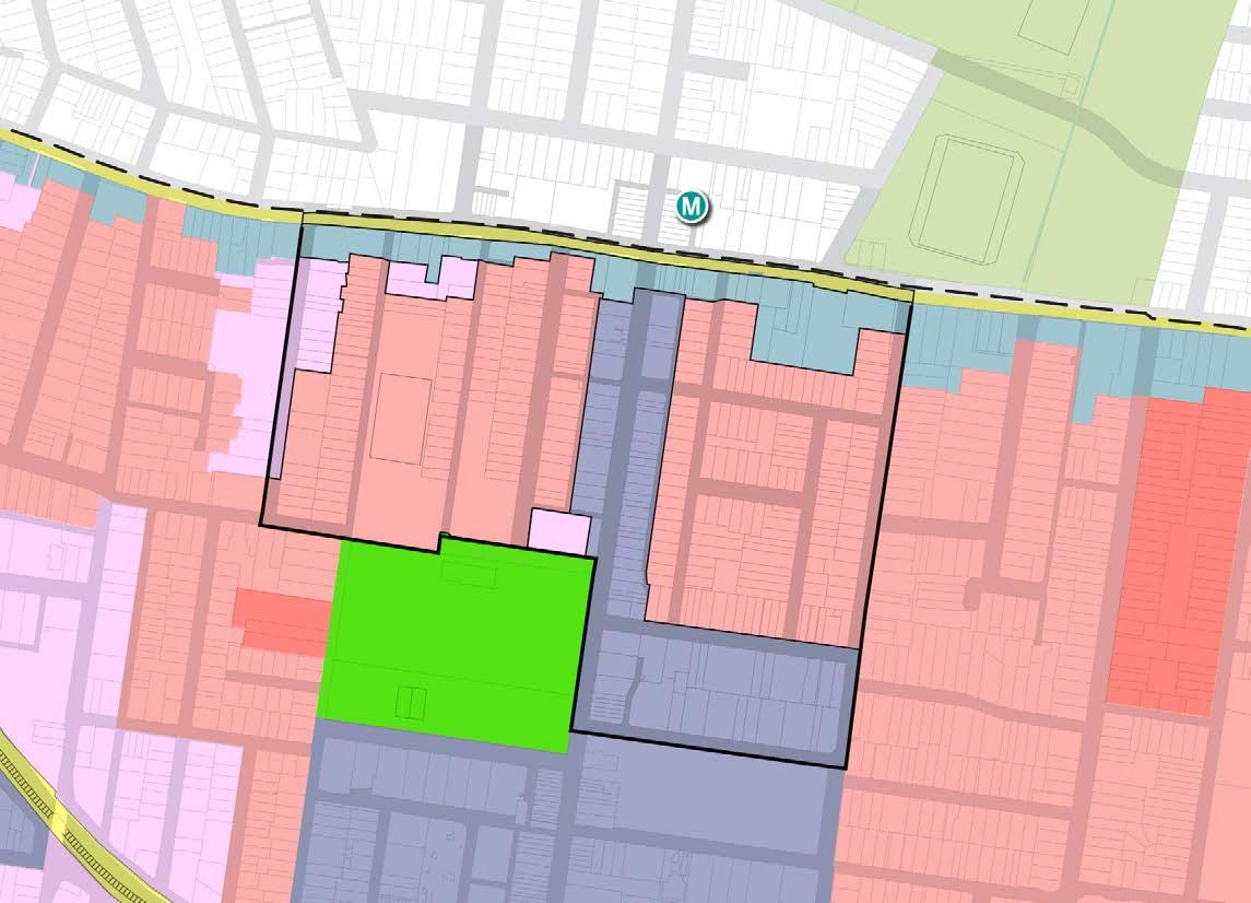
Proposed Land Use Zones
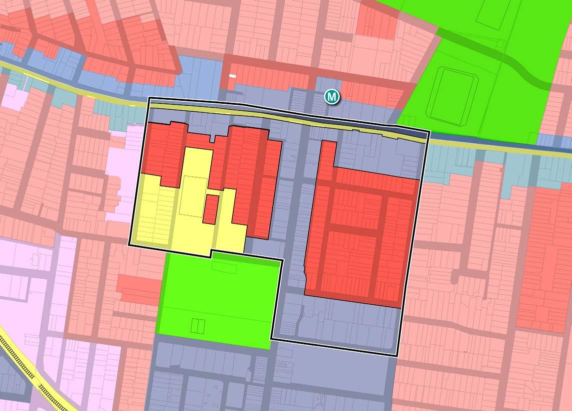
Burwood Road is proposed to be retained as MU1 Mixed Use zoning, consistent with PRCUTS and the Burwood Town Centre. The Parramatta Road frontage is proposed to be MU1 Mixed Use zoning, consistent with PRCUTS, but also extending south towards Milton Street to enhance activation of this area.
A large proportion of the Burwood North Precinct is proposed to be rezoned from R2
Residential to R4 High Density
to reflect the vision for a more dense and active Burwood North Precinct, supported by enhanced transport accessibility.
SP2 Infrastructure R3 Medium Density Residential E3 Productivity R1 General Residential R4 High Density Residential RE1 Public Recreation R2 Low Density Residential MU1 Mixed Use Figure 89: Proposed Land Use Zoning Diagram Source: COX 50 200m 100 0
Low
Density
Residential
50 200m 100 0
88: Existing Land Use Zoning Diagram Source: Burwood LEP
MU1 MU1 E3 MU1 E3 MU1 E3 E3 E3 E3 E3 E3 R1 R1 R1 R1 R1 R2 R2 R2 R2 R3 R3 R3 RE1 RE1 MU1 MU1 MU1 MU1 R4 R2 R4 R2 R4 R2 R2 SP2
Figure
SP2 Infrastructure R3 Medium Density Residential RE1 Public Recreation R1 General Residential MU1 Mixed Use R2 Low Density Residential E3 Productivity Support R3 E3 70 Burwood North Precinct Masterplan: Masterplan Report
Floor Space Ratios (FSR)
Existing Floor Space Ratios
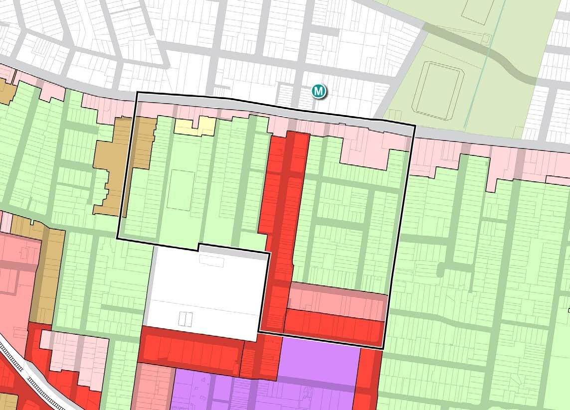
Proposed Burwood North Precinct Masterplan Floor Space Ratios (FSR)
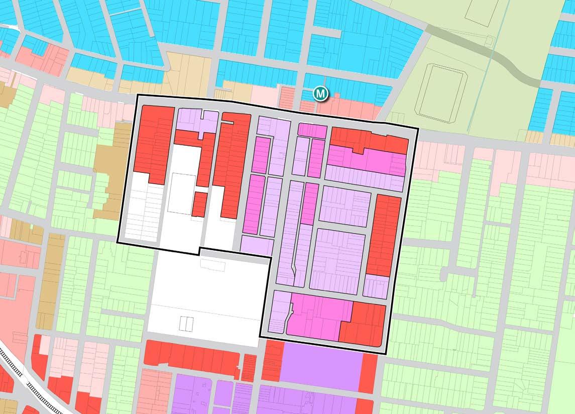
1.75:1 0.55:1 0.55:1 1.2:1 4:1 4:1 4:1 4:1 3:1 3:1 3:1 3:1 3:1 3:1 3:1 3:1 4:1 4:1 4:1 4:1 4:1 4:1 4:1 4:1 6:1 6:1 6:1 6:1 6:1 6:1 3:1 4.5:1 BURTON STREET LOFTUS STREET BROUGHTON STREET GIPPSSTREET WILGA STREET VICTORIA STREET MERYLA STREET COMER STREET PARK AVENUE BURWOOD ROAD NEICH PARADE PARK ROAD MILTON STREET PARRAMATTA ROAD PARK ROAD BRITANNIA AVENUE GRANTHAM STREET SHAFTESBURY ROAD ESHER STREET ARCHER STREET CONCORD OVAL ST LUKES PARK FUTURE BURWOOD NORTH STATION BURWOOD PARK MLC SCHOOL BURWOOD WESTFIELD 6:1 FSR 0.5:1 FSR 1.1:1 FSR 2:1 FSR 4:1 FSR 0.55:1 FSR 1.2:1 FSR 2.5:1 FSR 4.5:1 FSR 0.9:1 FSR 1.75:1 FSR 3:1 FSR 6:1 50 200m 100 0
0.55:1 0.55:1 0.55:1 0.55:1 0.55:1 1.2:1 1.2:1 1.75:1 1.75:1 1.75:1 0.85:1 2.4:1 3:1 3:1 3:1 3:1 3:1 2:1 3:1 BURTON STREET LOFTUS STREET BROUGHTON STREET GIPPSSTREET WILGA STREET VICTORIA STREET MERYLA STREET COMER STREET PARK AVENUE BURWOOD ROAD NEICH PARADE PARK ROAD MILTON STREET PARRAMATTA ROAD PARK ROAD BRITANNIA AVENUE GRANTHAM STREET SHAFTESBURY ROAD ESHER STREET ARCHER STREET CONCORD OVAL ST LUKES PARK FUTURE BURWOOD NORTH STATION BURWOOD PARK MLC SCHOOL BURWOOD WESTFIELD 50 200m 100 0
Figure 90: Existing Floor Space Ratio Diagram. Source: Burwood LEP
Figure 91: Proposed Floor Space Ratio Diagram. Source: COX
FSR 0.5:1 FSR 1.1:1 FSR 1.75:1 FSR 4.5:1 FSR 0.55:1 FSR 1.2:1 FSR 2:1 FSR 0.85:1 FSR 1.6:1 FSR 3:1 71 Burwood North Precinct Masterplan: Masterplan Report
Existing Height of Buildings Height of Buildings (HOB)
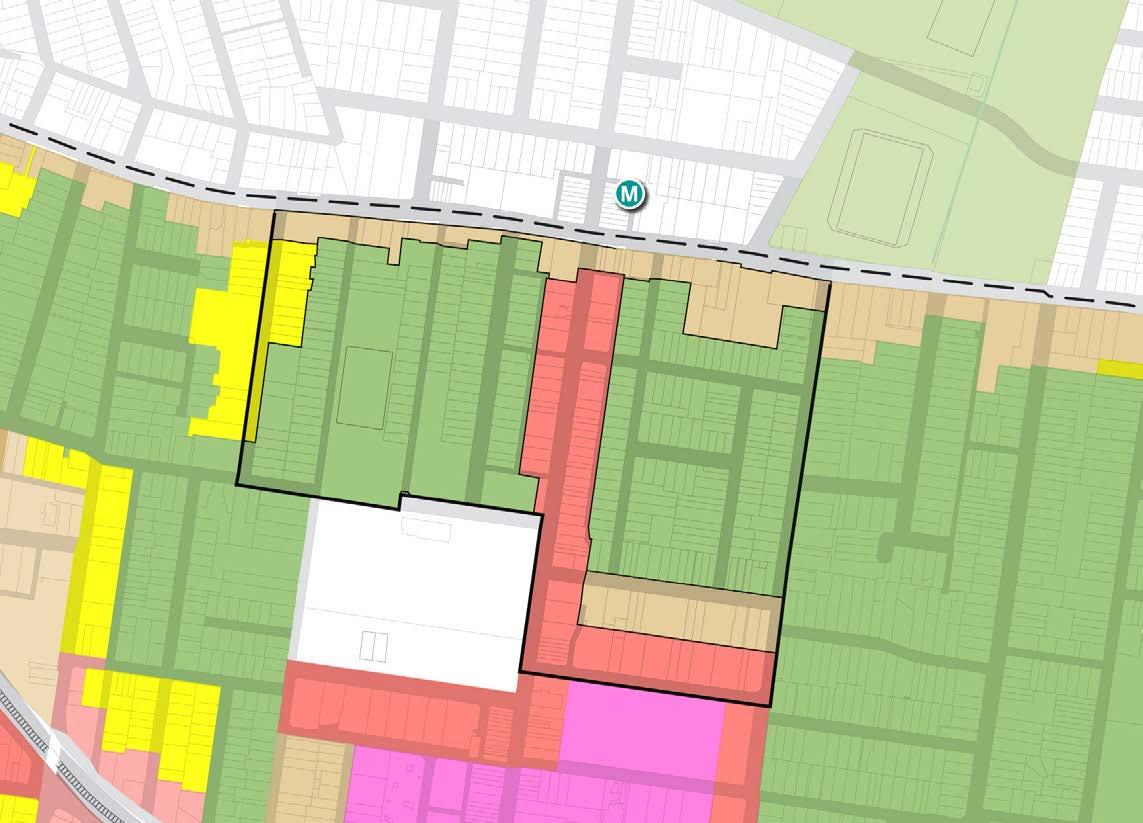
Proposed Height of Buildings
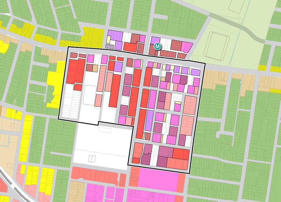
30 30 30 30 15 60 60 60 60 60 8.5 8.5 8.5 8.5 8.5 14 14 14 15 15 11 11 11 11 11 11 26 26 26 8.5 8.5 8.5 8.5 15 15 15 15 15 15 8.5 8.5 8.5 8.5 8.5 8.5 8.5 BURTON STREET LOFTUS STREET BROUGHTON STREET GIPPSSTREET WILGA STREET VICTORIA STREET MERYLA STREET COMER STREET PARK AVENUE BURWOOD ROAD NEICH PARADE PARK ROAD MILTON STREET PARRAMATTA ROAD PARK ROAD BRITANNIA AVENUE GRANTHAM STREET SHAFTESBURY ROAD ESHER STREET ARCHER STREET CONCORD OVAL ST LUKES PARK BURWOOD PARK MLC SCHOOL BURWOOD WESTFIELD 50 200m 100 0
8.5
Figure 92: Existing Height of Building Diagram Source: COX
BURTON STREET LOFTUS STREET BROUGHTON STREET GIPPSSTREET WILGA STREET VICTORIA STREET MERYLA STREET COMER STREET PARK AVENUE BURWOOD ROAD NEICH PARADE PARK ROAD MILTON STREET PARRAMATTA ROAD PARK ROAD BRITANNIA AVENUE SHAFTESBURY ROAD ESHER STREET ARCHER STREET CONCORD OVAL ST LUKES PARK BURWOOD PARK MLC SCHOOL BURWOOD WESTFIELD 8.5 8.5 8.5 14 14 14 15 15 11 11 11 11 11 11 26 30 30 35 35 15 15 15 15 15 15 10.5 10.5 10.5 10.5 10.5 35 50 50 50 50 50 50 35 35 118 118 118 118 118 35 35 35 35 35 35 41 41 41 35 35 28 28 28 28 28 28 28 28 28 28 65 65 65 65 65 65 65 65 65 41 65 65 65 82 82 82 82 65 65 65 65 65 98 98 98 98 98 98 26 8.5 8.5 8.5 8.5 15 15 15 15 8.5 8.5 8.5 8.5 8.5 8.5 GRANTHAM STREET 26
Figure 93: Proposed Height of Building Diagram. Source: COX
# Height of Building (Metres) # Height of Building (Metres) 72 Burwood North Precinct Masterplan: Masterplan Report
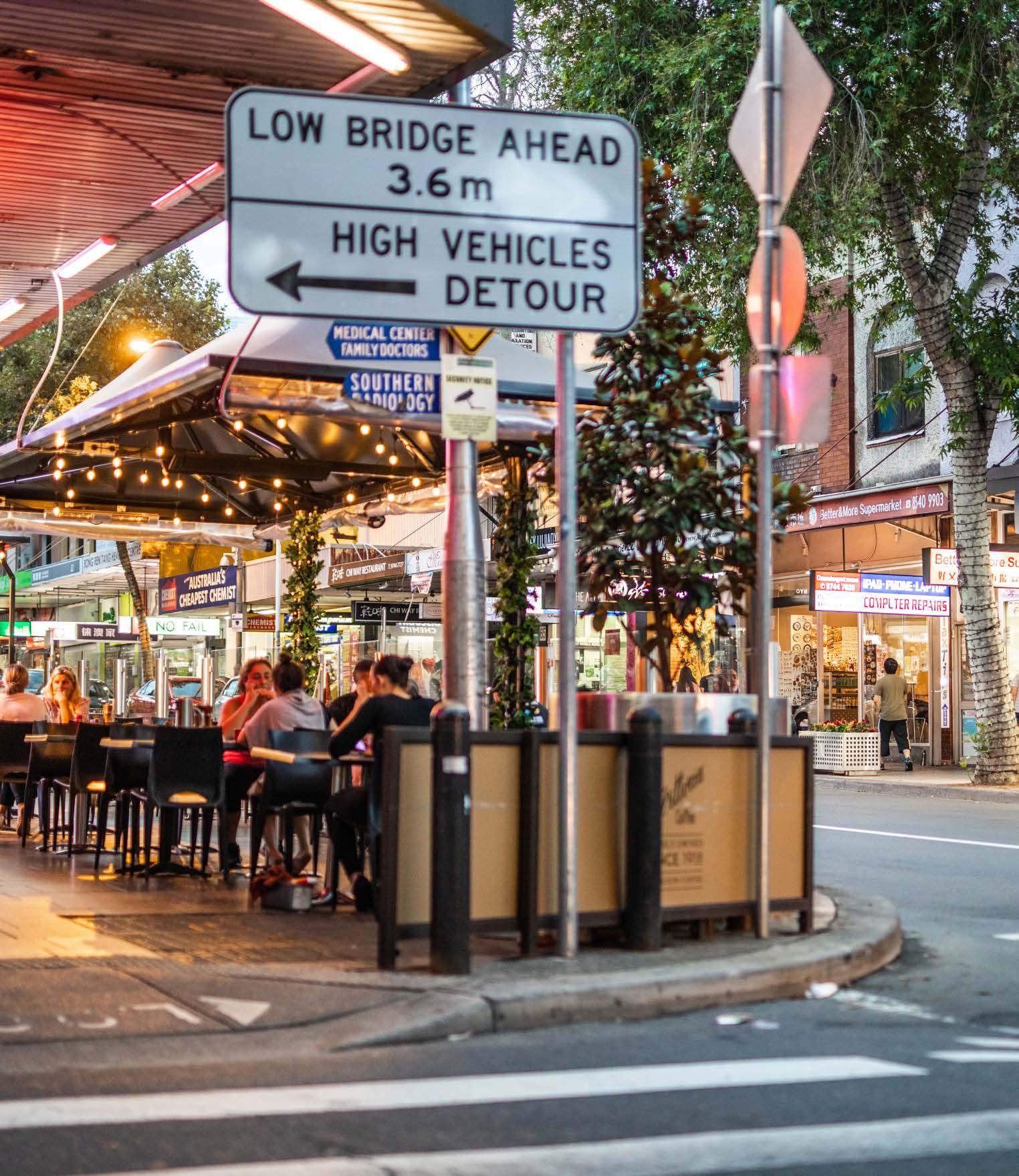
Appendix
73 Burwood North Precinct Masterplan: Masterplan Report
Constraints and Opportunities
Connectivity
Burwood North Precinct is currently well serviced with rail connections at Burwood Station to Sydney CBD and Parramatta CBD. Bus services are based around the Parramatta Road strategic bus corridor. Seven bus routes service Parramatta Road within 400 metres of the Precinct and an additional 12 bus routes are located within 800 metres. Several bus services connect to Burwood Station, located south of the Burwood North Precinct boundary, which provides an attractive public transport option for commuters travelling east towards Sydney CBD or west towards Parramatta.
In 2021, the NSW Government approved a concept plan and major civil construction works for Sydney Metro West, a new rail link operating between Westmead and the Sydney CBD increasing connectivity both east and west. Anticipated to open in 2030, Sydney Metro West will deliver a station at Burwood North, helping to further strengthen connections between the Precinct and existing and emerging industry and employment hubs and communities both in the east and west of the city, increasing both the employment and residential capacity of the area. The Metro presents an opportunity that will support the growth of the strategic centre at Burwood.
The research paper by the Committee for Sydney ‘Rethinking Station Precincts’ (May 2022) indicates that the Burwood Town Centres has one of the highest effective job densities (the number of jobs that can be accessed by public transport from a particular area) in Greater Sydney. With the Burwood North metro station, this accessibility will be further enhanced, making the area an important location for land use intensification and urban renewal.
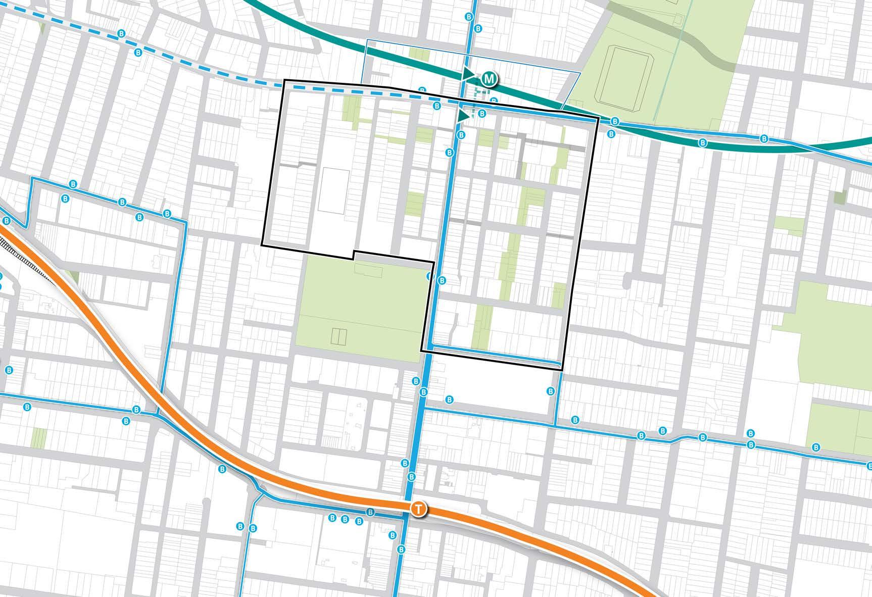
TO DRUMMOYNE TO SYDNEY CBD + CHATSWOOD TO RHODES + RYDE TO STRATHFIELD BURTON STREET LOFTUS STREET
STREET COMER STREET PARK AVENUE BURWOOD ROAD NEICH PARADE PARK ROAD MILTON STREET PARK ROAD BRITANNIA AVENUE GRANTHAM STREET SHAFTESBURY ROAD ESHER STREET ARCHER STREET CONCORD OVAL BURWOOD PARK MLC SCHOOL BURWOOD WESTFIELD PARRAMATTA ROAD
VICTORIA STREET MERYLA
Appendix 1
50 200m 100 0 Proposed Public Space Metro Station Underground Walkways Metro Line Metro Station Entrance Bus Routes Bus Stops Railway Station Canada Bay LGA (does not form part of this Masterplan) Potential Future Bus Corridor Railway Line Metro Station Figure 94: Transport Context Diagram. Source: COX 74 Burwood North Precinct Masterplan: Masterplan Report
Constraints and Opportunities
Environmental Constraints
• Original creek-line (St Luke’s Canal) has been covered over and piped resulting in fragmented overland flow and localised flash flooding
• Canopy cover currently sits at an overall average of only approximately 10%
• Burwood North experiences heat island effect with heightened effects around large lot commercial developments and major roads
• Different street and verge widths limit potential for street tree planting throughout the Precinct
• Historic Burwood Park to be preserved as a scenic and cultural landscape
Opportunities
• "Daylight" overland flow paths to create new blue-green connections and ecological corridors that assist with storm water management and flood mitigation
• Provide a range of scales and types of open spaces which support biodiversity, mitigate climate change and maximise recreational opportunities
• Create new green links to connect the existing and proposed network of parks and open spaces
• Increase tree plantings in parks and streets to extend tree canopy aligning with NSW target of 40% canopy cover by 2036 - to be done alongside power line under grounding to support healthy tree growth
• Prioritise retention of existing mature trees on both public and private land
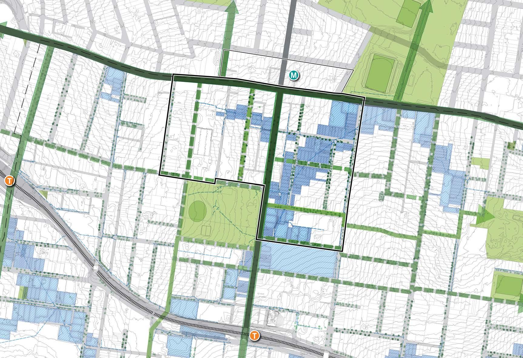
BURTON STREET LOFTUS STREET BROUGHTON STREET GIPPSSTREET WILGA STREET MERYLA STREET COMER STREET PARK AVENUE BURWOOD ROAD NEICH PARADE PARK ROAD MILTON STREET PARRAMATTA ROAD PARK ROAD BRITANNIA AVENUE GRANTHAM STREET WENTWORTH ROAD SHAFTESBURY ROAD ESHER STREET ARCHER STREET LUCAS ROAD CONCORD OVAL FUTURE BURWOOD NORTH STATION BURWOOD PARK MLC SCHOOL BURWOOD WESTFIELD BURWOOD GIRLS HIGH SCHOOL WANGAL PARK BURWOOD STATION STRATHFIELD STATION ST. LUKE’S CANALTO PARRAMATTA RIVER TO COOKS RIVER TO COOKS RIVER TO HENLEY PARK Figure 95: Environmental Opportunities and Constraints Diagram. Source: COX 50 200m 100 0
Precinct Boundary Existing Open Spaces Flood Zones Critical Inundation Points Along Key Connections Potential Green Link Existing Mature Street Trees Recently Planted Street Trees Drainage Infrastructure Proposed Open Space/ Plaza (Urban Design Study and Master plan, 2021 & PRCUTS) Green Grid Priority Connection Council Led Local Green Grid Corridor Existing Channelised Creek 75 Burwood North Precinct Masterplan: Masterplan Report
Constraints and Opportunities
Built Form and Character
Constraints
• Fragmented land ownership creates a juxtaposition of high and low density, old and new and in some instances outcomes that are unsympathetic to local character and heritage
• Heritage item and interface with existing development
• Achieving fine grain, narrow lot human scale character whilst also enabling lot amalgamation/ consolidation
Opportunities
• Deliver the PRCUTS vision for Parramatta Road with a 6m landscaped setback.
• Define distinctive character areas within the Precinct which respond to local context and are reinforced through built controls, bulk, form, materiality, setbacks etc.
• Create different character zones along the length of Burwood Road to respond to local context.
• Develop appropriate planning controls to encourage high quality planning and urban design outcomes.
• Provide appropriate height transitions and curtilage to heritage items with the potential to integrate with new public open spaces and green links to reveal and celebrate the cultural and historic context.
• Adaptively re-use heritage items and integrate sympathetically into new development proposals.
• Locate greatest height around station Precincts with tall landmark buildings at key intersection acting as urban markers.
• Use built form to define street edges and differentiate street hierarchy defined by different degrees of streetscape activation.
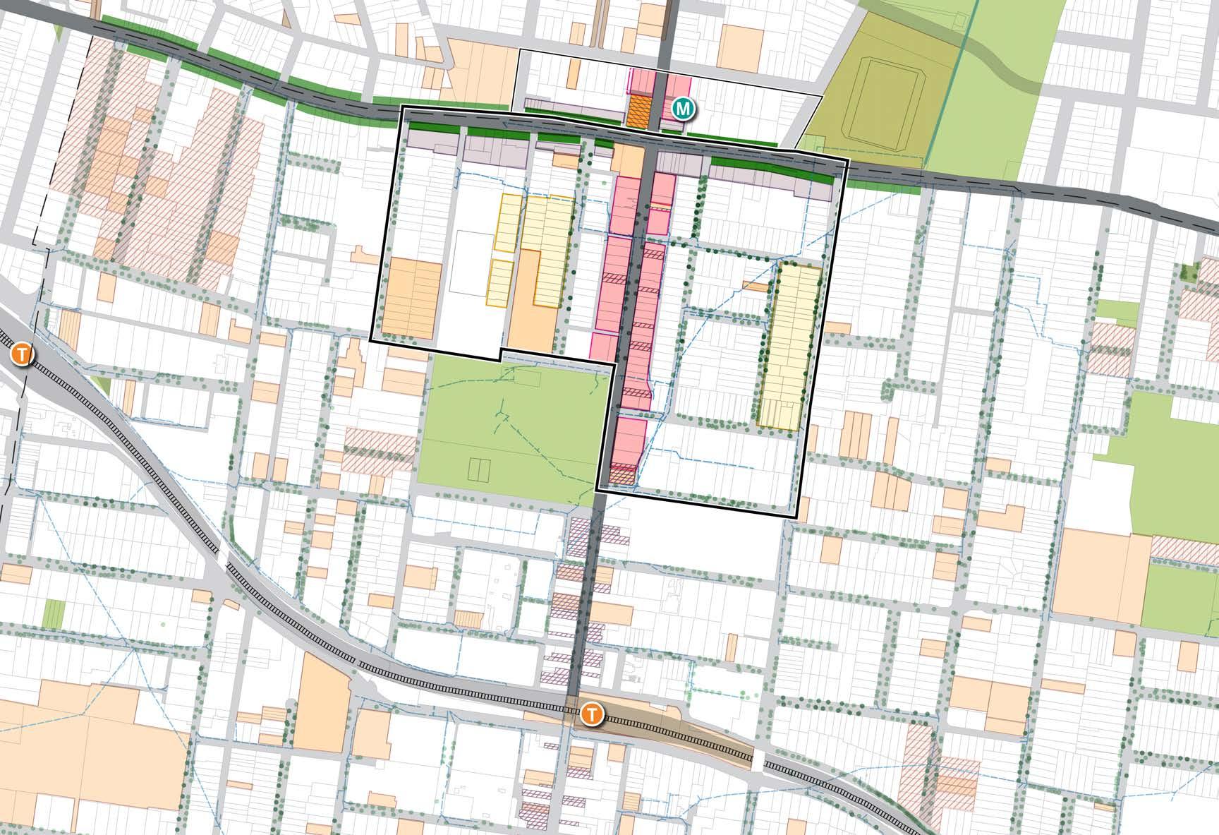
BURTON STREET LOFTUS STREET WILGA STREET VICTORIA STREET RAILWAY PARADE MERYLA STREET COMER STREET COOPER STREET PARK AVENUE BURWOOD ROAD NEICH PARADE PARK ROAD MILTON STREET PARRAMATTA ROAD PARK ROAD BRITANNIA AVENUE GRANTHAM STREET WENTWORTH ROAD SHAFTESBURY ROAD ESHER STREET ARCHER STREET LUCAS ROAD CONCORD OVAL FUTURE BURWOOD NORTH STATION BURWOOD PARK MLC SCHOOL BURWOOD WESTFIELD BURWOOD GIRLS HIGH SCHOOL BURWOOD STATION STRATHFIELD STATION 50 200m 100 0
Precinct Boundary Conservation Area Proposed Transitional Development (PRCUTS Built Form Testing) Existing Fine Grain along Burwood Road Potential Heritage Existing Trees Implement Fine Grain Development (PRCUTS Built Form Testing) 6m Green Edge Setback (PRCUTS) Heritage Item Recent Trees Proposed Non-Residential to Road Edge - Residential on Podium only (PRCUTS Built Form Testing) Figure 96: Built
and Character Opportunities and Constraints
76 Burwood North Precinct Masterplan: Masterplan Report
Form
Diagram. Source: COX
Constraints and Opportunities
Redevelopment Considerations
Constraints
• Strata titled properties in the Precinct are unlikely be redeveloped in the medium term
• Existing juxtaposition of high and low density, old and new buildings with different, materials, bulk, scale and form diminishes local character rather that contributing to a unified future character
• Parking entries and service provision in new developments create blank façades along existing laneways resulting in a poor public interface
• Fragmented lot ownership and strata titled sites limit potential to create integrated development and consolidated parking solutions
Opportunities
• Maximise active façades along Burwood Road within new development
• Maximise friendly façades including lobbies and residential entries throughout Precinct which bring life to the streetscape
• Limited number of recent developments within the Precinct presents a large number of sites for redevelopment
• Consolidate lots to maximise public domain amenity and public open space provision
• Schools can be redeveloped and grow in consideration to heritage constraints
• Revise setback controls to maximise feasibility and efficiency of sites allowing for an overall reduction in height , ensuring more sympathetic built from outcomes and maximised public domain provision and amenity.
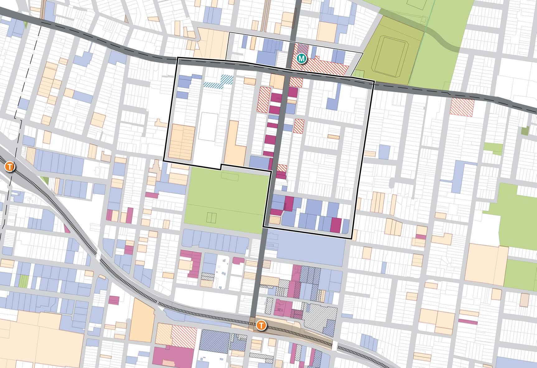
BURTON STREET LOFTUS STREET BROUGHTON STREET WILGA STREET VICTORIA STREET RAILWAY PARADE MERYLA STREET COMER STREET COOPER STREET PARK AVENUE BURWOOD ROAD NEICH PARADE PARK ROAD MILTON STREET PARRAMATTA ROAD PARK ROAD BRITANNIA AVENUE GRANTHAM STREET WENTWORTH ROAD SHAFTESBURY ROAD ESHER STREET ARCHER STREET LUCAS ROAD CONCORD OVAL FUTURE BURWOOD NORTH STATION BURWOOD PARK MLC SCHOOL BURWOOD WESTFIELD BURWOOD GIRLS HIGH SCHOOL BURWOOD STATION STRATHFIELD STATION 50 200m 100 0
Precinct Boundary Proposed Development Strata Titled Properties (>10 units) Land and Housing Corporation Recently Approved Development Recently Completed Development Heritage Item Potential Heritage Figure 97: Development Constraints Diagram. Source: COX 77 Burwood North Precinct Masterplan: Masterplan Report
Development Typologies
Low-Medium Density Residential
Key features:
• 2-8 storeys
• Built to boundary at ground level and up to four storeys
• Floors above four storeys often set back to reduce perception of bulk and scale
• Careful consideration of parking rates and access required
• May include ground floor retail or small commercial suites
• Transitions scale to adjoining low density residential
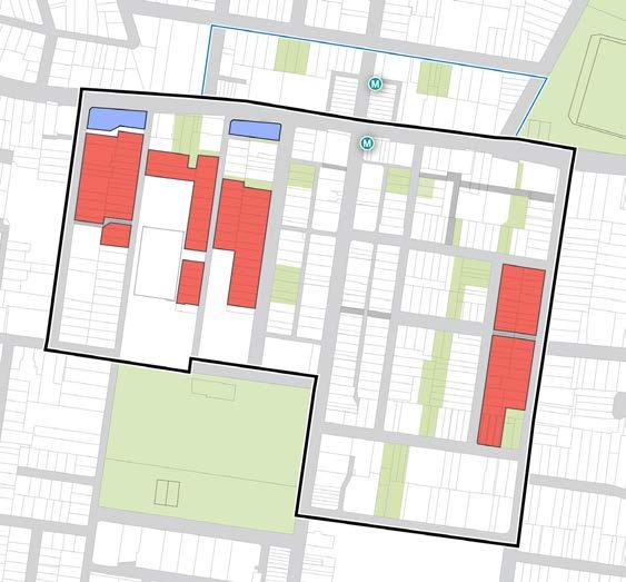
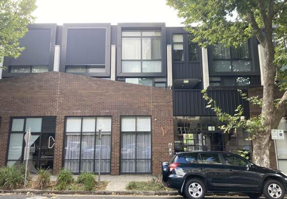
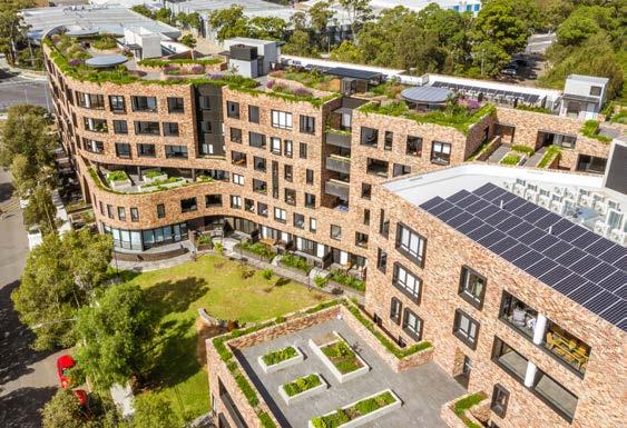
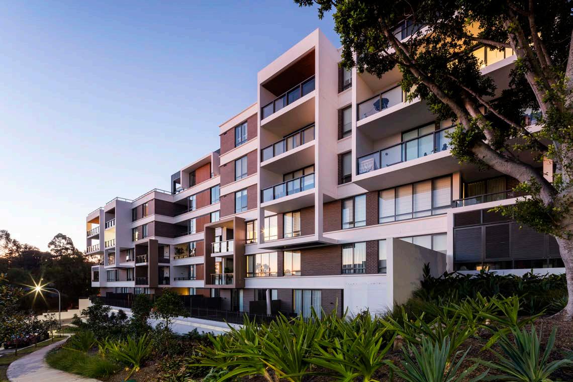 Figure 98: Annandale Place, DKO. Source: COX
Figure 99: Arkadia Alexandria, DKO. Source: ArchDaily
Figure 98: Annandale Place, DKO. Source: COX
Figure 99: Arkadia Alexandria, DKO. Source: ArchDaily
78 Burwood North Precinct Masterplan: Masterplan Report
Figure 100: Putney Hill, COX. Source: COX
Higher Density Mixed Use & Residential
Key features:
• 10+ storeys
• 85-100% residential, 0-15% non-residential
• 85% residential has a mixed-use podium built to boundary with 2 levels of commercial or retail floorspace, with residential tower set back over the podium. The ground level uses activate the streetscape
• 95-100% residential has the opportunity for small scale retail or commercial tenancies at the ground floor level, with residential across the remainder of the building. This typology may or may not have a podium
• Potential for private open space on the podium and tower rooftops
• Larger sites include fine grain building articulation to break down the scale of the building
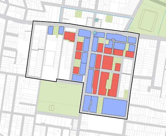
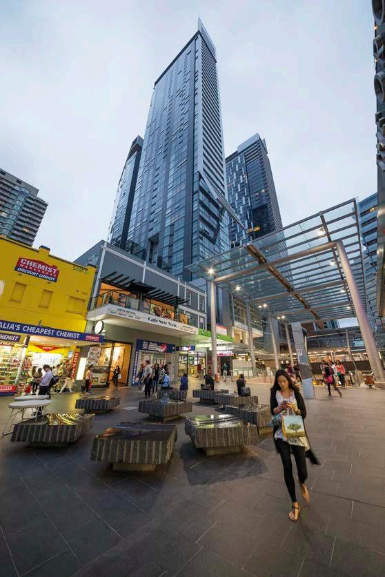
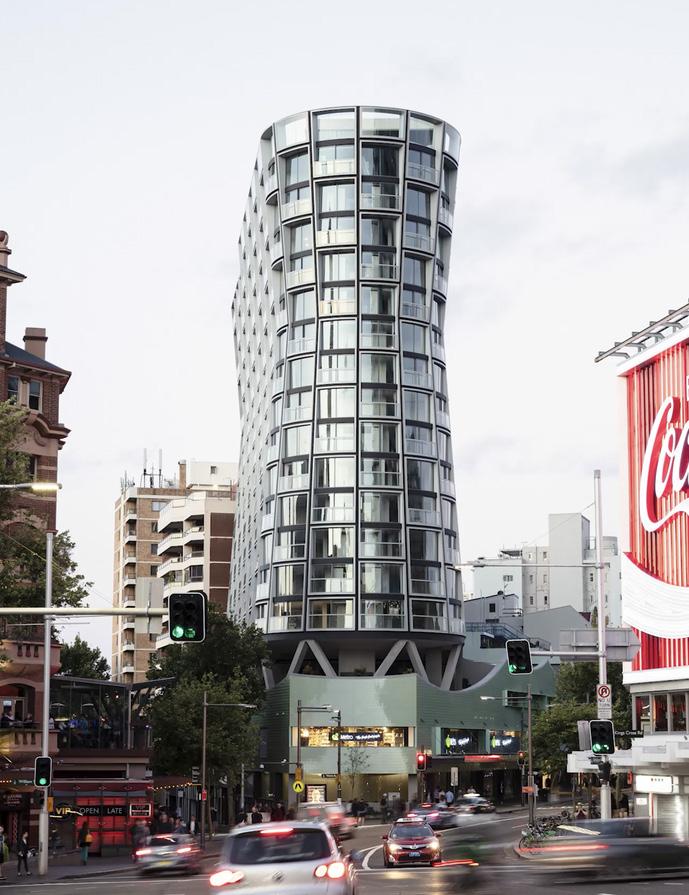
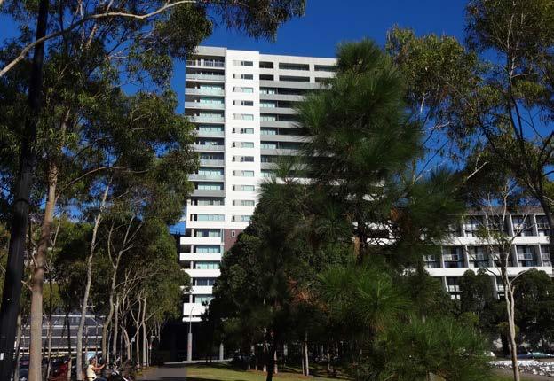
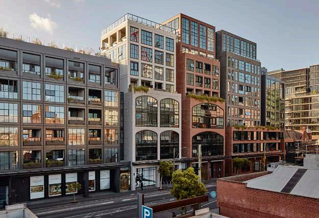 Figure 101: Mixed-use development with both retail and residential uses within the podium and residential tower over. Chatswood Transport Interchange, COX. Source: COX
Figure 102: Mixed-use development with residential tower. Kings Cross, Durbach Block Jaggers. Source:
Figure 103: Residential medium-high density development opposite an open space. Victoria Park, Zetland. Source: COX
Figure 104: Mixed-use development. Victoria & Vine, Melbourne. Source: COX
Figure 101: Mixed-use development with both retail and residential uses within the podium and residential tower over. Chatswood Transport Interchange, COX. Source: COX
Figure 102: Mixed-use development with residential tower. Kings Cross, Durbach Block Jaggers. Source:
Figure 103: Residential medium-high density development opposite an open space. Victoria Park, Zetland. Source: COX
Figure 104: Mixed-use development. Victoria & Vine, Melbourne. Source: COX
79 Burwood North Precinct Masterplan: Masterplan Report

Burwood Council
2 Conder Street Burwood, NSW 2134
In preparation with:
Cox Architecture
70 George Street
The Rocks (Tallawoladah) NSW 2000
Australia
T +61 2 9267 9599
F +61 2 9264 5844
sydney@cox.com.au
coxarchitecture.com.au
coxarchitecture.com.au
