Prepared by Ethos Urban


Prepared by Ethos Urban
We acknowledge the Wangal Clan of the Eora Nation, the traditional custodians of the area. We pay our respects to their elders past, present and emerging. We acknowledge and respect their cultural heritage, beliefs and ongoing relationship with the land.
ADG Apartment Design Guide
CBD Central Business District
DCP Development Control Plan
DPHI Department of Planning, Housing and Infrastructure
FSR Floor Space Ratio
GFA Gross Floor Area
GSRP Greater Sydney Regional Plan
HCA Heritage Conservation Area
HOB Height of Building
LEP Local Environmental Plan
LGA Local Government Area
NSW New South Wales
PLC Presbyterian Ladies’ College
PRCUTS Parramatta Road Corridor Urban Transformation Strategy
RFB Residential Flat Building
SEPP State Environmental Planning Policy
ST Storeys
TfNSW Transport for New South Wales
TOD Transit Oriented Development
WSUD Water Sensitive Urban Design
Sydney is growing and changing. From a current population of around 5 million, Greater Sydney’s population is forecast to grow by an extra 1 million people to reach 6.1 million by 2041. Our population is also forecast to become more diverse and older.
In December 2023, the NSW Government announced its proposal to re-zone Croydon, as part of its transit-oriented development (or TOD) accelerated housing delivery policy. The NSW Government TOD program is part of a new state planning policy that now applies to 38 locations around train stations to support additional housing supply.
Croydon is one of the train stations identified by the NSW Government. The new planning policy would override Council’s Local Environment Plan (LEP) planning controls including zoning, height, floor space ratio, and some heritage conservation, allowing for 6-8 storey residential apartment buildings in all residential zones within the vicinity of Croydon station. This type of urban uplift would likely have significant impacts on The Strand and the Malvern Hill Estate and Cintra Estate Heritage Conservations Areas.
Following a community campaign and concerted advocacy efforts, the NSW Government announced in April 2024 to defer the Croydon rezoning proposal, to allow Council to undertake its own planning process with community involvement to inform future urban renewal in the area.
To pursue a localised planning approach Council at its meeting in June 2024 resolved to endorse an area for planning investigations to accommodate the NSW Government’s required additional housing target, and prepare an alternate master plan.
In response to community feedback, Council has refined the Masterplan, developing two additional alternate masterplan options.
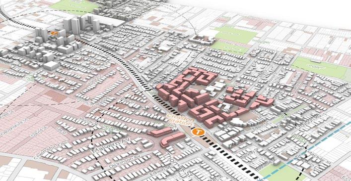
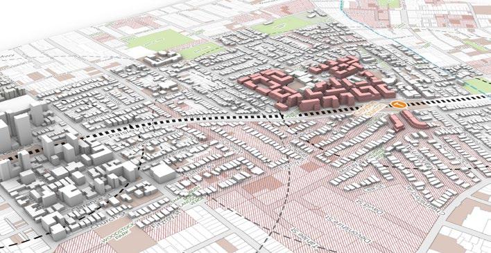
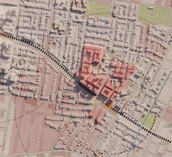
Option 3 (providing a potential net increase of 3,569 dwellings) proposed to redistribute dwelling yields with reduced building heights, focusing density around transport hubs such as Croydon and Burwood stations and gradual height transitions to existing lowdensity areas.
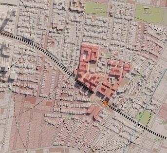
Option 4 (providing a potential combined net increase of 3,777 dwellings) proposed a reduced-density alternative, reallocating dwelling targets to the Burwood North Masterplan precinct, which was developed in 2024 and offers additional opportunities for growth outside the Croydon precinct.
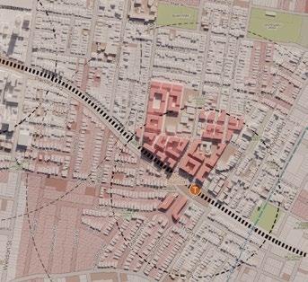
Following the Council Meeting on 29 January 2025, Council resolved to adopt Option 4 as its final alternative response to the NSW Government’s TOD program. This is due to its closer alignment with the original application of the TOD Program while responding to community concerns regarding residential amenity, heritage impacts, and traffic.
A well-considered, place-based master plan is required to unlock Croydon’s potential and deliver the housing outcomes identified by the TOD Program. This Master Plan Report provides a framework that establishes a vision for the Croydon Alternate Master Plan Area to become a liveable place that is well-connected. It will guide the future urban renewal of the Croydon to deliver a high amenity neighbourhood that provides improved active transport links for existing and future residents of Croydon.
The initiatives in this Master Plan Report are recommendations for achieving the desired high-quality renewal outcomes within Croydon (in addition to adjustments to the May 2024 adopted Burwood North Masterplan outlined in the Council meeting report dated 29 January 2025) as an alternative to the TOD provisions put forward by the NSW Government under the TOD Program. It does not enact the proposed changes. The NSW Government will prepare a SEPP to amend the Burwood LEP after the Master Plan has been finalised following public exhibition.
Positioned between the centres of Croydon and Burwood, Croydon Alternate Master Plan Area represents an important opportunity to provide sustainable and responsive urban renewal and design excellence.
Croydon Alternate Master Plan Area will prioritise a more compact approach to development that will facilitate connectivity and ease of movement to enhance its walkability and liveability.
Croydon is an inclusive community open to diversity and change.
In response to Croydon being identified under the TOD Program as capable of supporting additional housing capacity, Burwood Council has sought to define a broader area for under which this capacity could be delivered.
The study area defined by Burwood Council to which this Alternate Master Plan is subject (the Croydon Alternate Master Plan Area ) also includes areas north and west of the catchment previously proposed under the TOD Program (400m radius from Croydon Station).
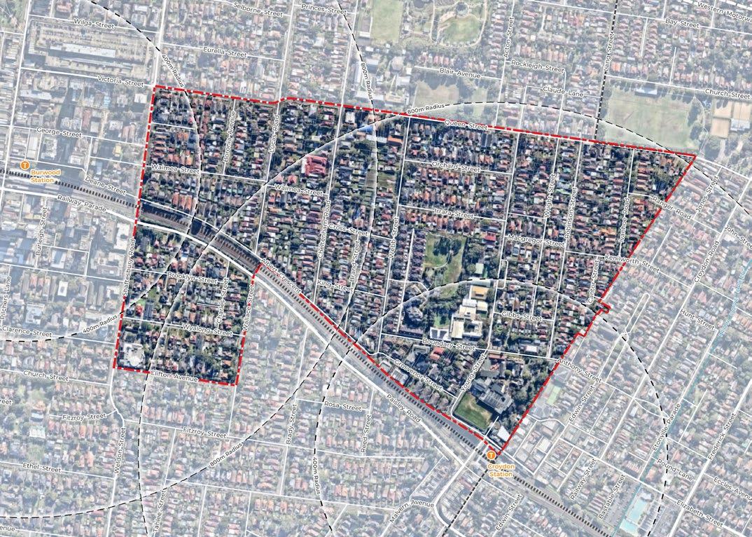
The Croydon Alternate Master Plan Area is located to the east of the Burwood Town Centre and is approximately 65 hectares in size. The Alternate Master Plan is bound by:
Queen and Victoria Streets to the north. Shaftesbury Road to the west.
Clifton Avenue, Wallace Street and the rail corridor to the south.
The LGA boundary with Inner West Council to the east.
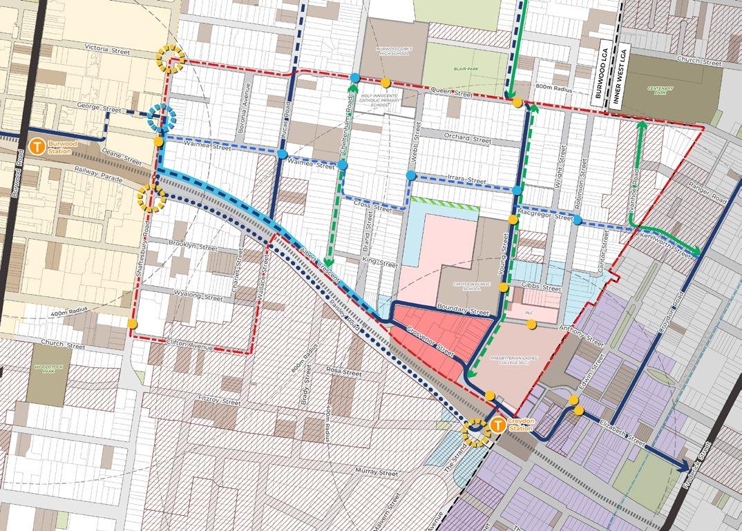
The Croydon Alternate Master Plan Area is divided by the train line into two sections, a larger portion to the north and a relatively smaller section to the south of the train line. It is mostly walkable, with all lots within 800m, or 10 minutes walking distance of either Croydon or Burwood Station.
The Croydon Alternate Master Plan Area is strategically located within walking distance of the Burwood Town Centre, the Croydon Local Centre and approximately 9km away from the Sydney CBD. It is also ideally positioned to leverage off growth in the Burwood Town Centre and investments in transport infrastructure, whilst maintaining its residential, suburban character, and responding to objectives of the TOD Program.
It is noted that at the October 2024 Council Meeting, the Master Plan area located south of the rail corridor adjacent to Shaftesbury Road was removed from future consideration.
In response to ongoing challenges in housing delivery Australia wide, in October 2022 the National Housing Accord (Accord) was introduced. As part of the Accord, in August 2023, National Cabinet established a five-year target of 1.2 million new, well-located homes from mid-2024. Under the Accord, the NSW Government committed to deliver at least 314,000 new homes by mid-2029. A stretch goal of 377,000 dwellings over this period was also established.
The National Housing Accord has resulted in an update of housing targets for 43 LGAs across NSW. For Burwood, the housing target over the next 5 years is 3,300 additional homes. This is to be achieved in a combination of existing planned growth where there are existing approvals or where rezonings have already occurred, as well as projected growth where growth can occur over the next 5 years based on the NSW Government’s planning reforms.
In December 2023, the NSW Government announced three housing reforms to assist with the achieving the Accord that affect the Burwood LGA:
• In-fill affordable housing bonus amendment to State Environmental Planning Policy (Housing SEPP) 2021 (the Housing SEPP) that allows for greater height and floor space ratio (20-30%) where providing affordable housing (10-15%).
• Transport oriented development (TOD) program: amendment to the Housing SEPP to introduce Chapter 5 ‘Transport oriented development’ allowing apartment buildings of up to 6 storeys within walking distance (400m) of 38 railway stations, including land around Croydon Station.
• Low and mid-rise housing (LMR) program: stage 1 which was amendment to the Housing SEPP to allow dual occupancies and semi-detached homes in the R2 Lowdensity residential zone, and proposed stage 2 amendment to allow low and mid-rise housing within 400m and 800m of railway stations, in a gradated approach.
Underpinning this project are the outcomes of the NSW Government’s TOD Program. The program is split into three parts, with Part 2 being applicable to the outcomes of the Croydon Alternate Master Plan Area:
State-led rezonings of eight priority transport hubs to deliver 47,800 new homes within 1,200m radii of key stations.
Amendments to the State Environmental Planning Policy (Housing) 2021 (Housing SEPP) to increase mixed use development and mid-rise housing within 400m radii of 38 train and metro stations to unlock capacity for up to 138,000 new homes.
In 2024, DPHI amended the Housing SEPP, to apply new planning controls to land within a 400m radius of identified stations, enabling greater density outcomes to deliver more housing. This amendment was introduced in response to the growing housing shortage within Sydney. As Sydney’s population grows, there is a need for a more diverse range of dwellings near existing social infrastructure.
Chapter 5 of the Housing SEPP applies new development standards as follows to lots within 400m of the 38 identified train stations:
Permissibility of RFBs and shop top housing within 400m of an identified station
• Residential flat buildings will be permitted in all residential zones and local centres (R1, R2, R3, R4 and E1)
• Residential flat buildings and shop top housing in local and commercial centres (E1 and E2).
New development standards for RFBs within 400m of an identified station
• Max. building height – 22m (approx. 6 storeys)
Max. floor space ratio – 2.5:1
• Min. lot size - No minimum lot size
Min. lot width – Minimum 21m
Min. active street frontage controls – to apply to land in E1 zones
• Affordable housing – a 2% provision for development greater than 2,000m2
The new planning controls under the amendments to the Housing SEPP will apply to lots within heritage conservation areas. Other relevant environmental controls of LEP will continue to apply to the extent they are not inconsistent with the new standards, including controls such as flooding, bushfire and biodiversity impacts.
Additionally, where an inconsistency arises between the provisions of the TOD amendment and another environmental planning instrument or other chapters in the Housing SEPP 2021, the TOD planning controls prevail. However, if building heights and FSR controls in the LEP are greater than the ones prescribed in the Housing SEPP, then the greater of the two prevail.
It is clear from a state-wide perspective that housing is currently a critical issue for NSW. The Croydon Alternate Master Plan Area is well located to deliver on housing requirement, due to its location in the Inner West, high accessibility to mass transit, high accessibility to Burwood strategic centre, and limited environmental constraints.
As such, the increased housing requirements has created opportunities to encourage significant growth and harnessing potential benefits to infrastructure, without losing the things that make the site special. However, when considering the current context with regards to housing, some outcomes – such as a greater amount and choice of homes – may carry greater weight, and as such not all positive outcomes may be achieved in all areas of the Croydon Alternate Master Plan.
The potential Drivers for Change as a result of the required increase in the provision of housing includes:
• Delivering greater housing supply, choice and diversity, including affordable housing where feasible, in the form of higher density residential typologies such as residential flat buildings.
• Delivering greater public open space: To seek to deliver additional, useable and well-located public open space that helps cater for the recreation needs of residents.
• Enhancing built heritage: consider enhancing outcomes to heritage items and conservation areas. This may include a consideration of bulk, scale and massing.
Targeted growth in key areas throughout the site can help deliver this balance. It can deliver more and a better choice of homes in a location well served by infrastructure and services. It can also help facilitate increased open space and amenity, and help connect Burwood to Croydon. As such, a well-considered, place-based master plan is required to unlock this potential and deliver these outcomes.
(Greater Sydney Commission, 2018)
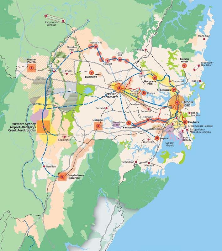
The Metropolis of Three Cities – the Greater Sydney Region Plan sets out the NSW Government’s key directions for Sydney to ‘‘enhance its status as one of the most liveable global cities” through the provision of 40 Planning Objectives, broken down into five themes (Infrastructure and Collaboration; Liveability; Productivity; Sustainability; and Implementation) that collectively form a framework that underpins the growth of Sydney. The following directions are most applicable for the Croydon Alternate Master Plan Area:
A city supported by infrastructure
This Direction outlines the importance of providing new infrastructure to support current and future growth. This includes providing improved connections to existing and future infrastructure, as well as ensuring alignment with forecast growth areas.
This Direction highlights the importance of capitalising on local identity, heritage and cultural values, together with easier access to services to foster a more active, resilient and connected society. Greater Sydney is growing at the same time as major demographic changes are occurring.
This Direction emphasises the importance of providing more housing to meet the needs of a growing population. Additionally, the plan highlights the need of creating greater housing choices, including a range of housing types, tenures and price points together with rental accommodation for lower income households.
This Direction calls out the need to deliver safe, inclusive and walkable areas that exhibit urban design excellence and are connected to open spaces. These spaces will recognise local characteristics and the qualities people value. Great places build on characteristics, such as people, potential, history, culture, arts, climate, built form and natural features to create a sense of place that reflects shared community values and culture.
This Direction identifies the need for future planning to manage the effects of urban development to protect, restore and enhance landscapes, waterways, coastline, natural areas, tree canopy and open spaces.
(Greater Sydney Commission, 2018)
The Eastern City District Plan is a 20-year plan to manage growth in the context of economic, social and environmental matters to achieve the 40-year vision for Greater Sydney, with a focus on the Eastern City LGAs of Bayside, Burwood, City of Canada Bay, City of Sydney, Inner West, Randwick, Strathfield, Waverley and Woollahra. The intent of the District Plan is to support and provide further detail for implementing the vision and objectives of the Region Plan.
As identified in the Structure Plan for the Eastern City District, the Croydon Alternate Master Plan Area is partially located within an urban renewal area, likely to experience significant growth. The Site is also located near the Strategic Centre of Burwood and future Metro corridor. However, the Croydon Alternate Master Plan Area is not specifically called out within the Directions of the Plan.
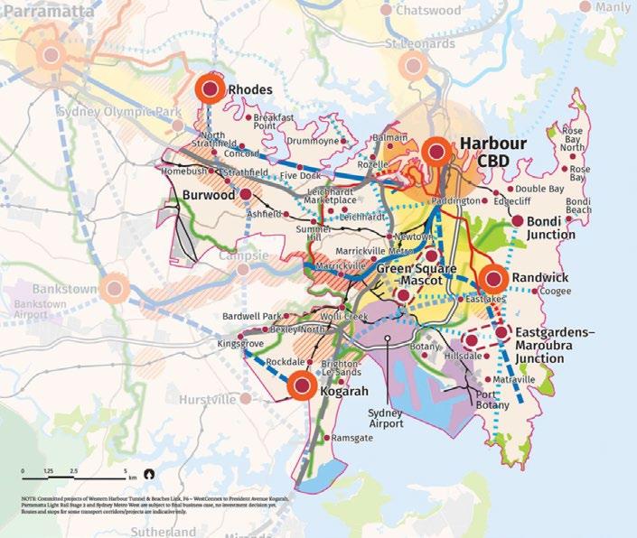
Source: Greater Sydney Commission (2018)
(NSW Government, 2016)
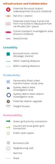
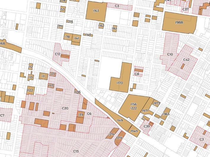
The Parramatta Road Corridor spans 20 kilometres from Granville to Camperdown and is located to the north of the site. The Kings Bay precinct is located directly north of the Croydon Alternate Master Plan Area.
The Parramatta Road Urban Transformation Strategy Report is the NSW Government’s program to transform the Corridor, bringing new life to Parramatta Road and adjacent communities through investments in homes, jobs, transport, open spaces and public amenity.
As identified in Figure 8 below, Lang Street is proposed to be the primary entry point into the site from Parramatta Road.
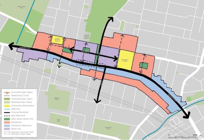
Figure 5. Kings Bay Structure Plan
Source: PRCUTS (2016)
Regional planning policy has identified the following considerations for the master plan of the Croydon Alternate Master Plan Area:
• Croydon is reasonably well served by public transport infrastructure, all lots within the site are within a 10-minute walking distance of a train station. This means that it has high access to transport which provide opportunities for increased growth as part of the Transport Oriented Development Principles.
• A range of housing typologies should be facilitated within the Master Plan to provide future occupants choices in dwelling types and sizes for diverse demographics.
The Croydon Alternate Master Plan should consider valued characteristics of the area and how these could be best reinterpreted when responding to increased density.
• The Master Plan should explore ways to increase open space, this could be achieved by considering ways to mitigate environmental impacts such as flooding, while also providing opportunities for open space and tree canopy in public and private domain.
The Burwood Community Strategic Plan (Burwood 2036) outlines the long term planning for the future of Burwood Local Government Area.
A key consideration facing the Burwood community revolves around the near doubling of population for the LGA, from 41,500 to 73,500. This will require additional housing, transport, schools, healthcare, services, leisure opportunities and green and open spaces, which provides the opportunity for a more diverse, welcoming and inclusive community.
The vision for Burwood, identified within Burwood 2036, is: Burwood is a welcoming and inclusive community that is defined by our diversity of people, liveable places and progressive ideas. We acknowledge and celebrate our history and place, protect our heritage and environment and share a quality of life that is equitable, sustainable and supports each other to thrive and prosper.
This is underpinned by five key strategic directions:
Inclusive community and culture
• Places for people
Sustainable and protected environment
• Vibrant city and villages
Open and collaborative villages
The Burwood Local Strategic Planning Statement (Burwood LSPS) identifies Burwood’s economic, social and environmental land use needs over the next 20 years. By establishing a vision for the local government area, Planning Priorities and actions for delivery, the plan establishes guidance for future growth and change within the LGA.
The LSPS focuses on the long-term vision and priorities for land use in the local area. As part of this, it helps to translate the vision and priorities expressed in the CSP, and other strategies, into specific land use planning actions for the LGA.
The vision for Burwood as identified within the Burwood LSPS is as follows:
Burwood is home to a thriving town centre and cherished heritage conservation areas that are conveniently connected to world class transport, with well-designed buildings and inviting public spaces.
A wide range of jobs attract workers and visitors and enable more locals to work closer to home. The streets are alive day and night with people drawn to its renowned hospitality and entertainment offerings.
Neighbourhoods are safe places filled with distinct character, offering a range of housing options. Clean, green, leafy neighbourhoods provide great amenity with access to nearby open space.
This vision is supported by four themes: Infrastructure and Collaboration, Liveability, Productivity and Sustainability. It is also supported by a Structure Plan as outlined in Figure 9.
Planning Statement
The Burwood Local Housing Strategy identifies the future direction for housing supply and demand within the Burwood LGA.
The Strategy suggests that current planning controls will accommodate likely housing demand (implied by population projections) until at least 2036. However, there is a shortfall of capacity for attached dwellings, and some of the attached dwelling capacity is not likely to be feasible to develop. As such, there is a need to create additional medium density housing capacity to increase diversity and choice. However, it is unlikely that medium density housing will enable the required housing targets within the Master Plan. As such, it is recommended that future growth should consider the provision of higher density dwellings.
The strategy recommends that land should be rezoned to allow additional apartments only if other public benefits are provided. This is due to the already high numbers of apartments being delivered within the LGA.
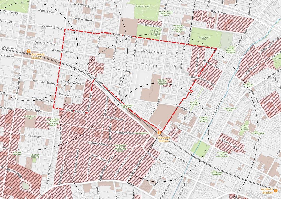
The strategy proposes that additional housing development should be directed to locations with good access to public transport, jobs, services, open space, social infrastructure and shops. The catchments of local centres throughout Burwood meet this definition, including the area between Burwood Town Centre and Croydon, which is the study area. This is identified in the adjacent Figure 10.
Key objectives and actions in the Local Housing Strategy are outlined below:
• Increase housing diversity and choice to meet the community’s changing needs: This considers the current need for higher density attached dwellings to provide the Burwood community with more housing choice. The plan suggests that Croydon, north of the Railway line is to be further investigated for rezoning. Additionally, the plan suggests investigating the selective rezoning of sites with frontages to parks.
Increasing Housing affordability: This considers the need to provide affordable housing opportunities under a range of potential schemes.
• Protect local character: This considers the protection of separate houses, heritage items and precincts to minimise impacts to communities. This could be achieved by reviewing minimum lot size and site frontages within the DCP and protecting areas with heritage significance.
• Plan for long term housing needs: This considers the retention of land for future redevelopment post 2036.
Dwellings in Burwood have been considered in the following categories used by the Australian Bureau of Statistics:
Separate houses,
Attached dwellings, which share walls with
The Burwood North Masterplan provides a framework that articulates a long term vision to ensure that the Burwood North Precinct becomes a liveable, vibrant place for people, supporting investment and job opportunities for both current and future residents.
It provides an opportunity to deliver significant community benefits, including open space and community infrastructure, quality urban design and building excellence, green and connected streets for people, all in a way that is environmentally and financially sustainable.
The Masterplan builds upon the work undertaken as part of the Parramatta Road Corridor Urban Transformation Strategy (PRCUTS) and to capture the opportunity afforded by the delivery of Sydney Metro West, which is anticipated to open in 2030.
The Masterplan builds upon the work undertaken as part of the Parramatta Road Corridor Urban Transformation Strategy (PRCUTS) and to capture the opportunity afforded by the delivery of Sydney Metro West, which is anticipated to open in 2030.
The Masterplan identifies the following key priorities:
• Deliver a precinct with rich and varied open spaces that acknowledge connection with Country.
• Create a legible and comprehensive active transport network.
• Deliver a range of well designed highly flexible housing.
Deliver a precinct with a richly defined identity and sense of place.
Create a centre that is regional in outlook and local in amenity.
• Promote a sustainable, green and resilient Precinct.
In the plan, density is focused within walking distance of public transport including the Metro, existing rail and bus routes, as well as key infrastructure. Medium density areas are located to the north-west of the Croydon Alternate Master Plan Area. Additionally, larger development sites that are known to be amalgamated are prioritised for the delivery of new pocket parks and open spaces. This has provided the opportunity to deliver open space through private development, responding to the fragmented nature of the site and land ownership
(NSW Government, 2024)
The low and mid-rise housing (LMR) program aims to encourage delivery of a range of different housing typologies, such as terraces and dual occupancies, as well as mid rise housing of up to 6 storeys around train stations.
Stage 1 of the LMR program permits dual occupancies and semi-detached homes (also known as duplexes or semis) in the R2 low-density zone across all of NSW. This was achieved through amendment to the Housing SEPP (2021) under Part 12.
Of note, the proposed amendments do not apply to the following land that is applicable to the Croydon Alternate Master Plan Area:
• (c) land in a Transport Oriented Development Area under Chapter 5,
• (d) land that comprises a heritage item or on which a heritage item is located.
Stage 2 of the LMR Program proposes further changes to planning controls to allow low and midrise housing within 400m and 800m of ‘station and town centre precincts’, which are railway stations and commercial and local centres, in a gradated approach.
The proposed changes are expected to be announced at the end of 2024 and currently do not apply to the Croydon Alternate Master Plan Area. The changes will also only apply to ‘station and town centre precincts’ which may not apply to the Croydon Alternate Master Plan Area.
The proposed changes were exhibited in late2023 and early-2024 and considered the controls outlined in Table 1. These development standards are under review from DPHI and are subject to change.
It is noted that the TOD Guide to Strategic Planning states that the proposed reforms will not apply to TOD Precincts.
Based on the review of state and local strategic planning policy: The Master Plan and the supporting documents explores the following strategic land use opportunities for the Croydon Alternate Master Plan Area:
The site is well located in Sydney’s Inner West, being accessible via two higher frequency train stations at Croydon and Burwood. Additionally, it is near the higher density areas of Burwood Town Centre and Burwood North, which provides key services and infrastructure a short distance away. As such, increasing the density within the Croydon Alternate Master Plan Area will align with the Transport Oriented Development Program, which promotes density in highly accessible areas, while seeking to retain suitable low density character areas.
There is significant value in locating future density within high amenity areas with higher access to public transport. This may include locating higher density areas near current and future parks and public spaces, in walkable areas to community facilities and schools, and near places with views.
The Croydon Alternate Master Plan Area is the right location for future density as it is located within an area of high public transport access. There are a number of schools and community facilities within walking distance of the Croydon Alternate Master Plan Area. Additionally, future planning should consider ways to provide additional open space, creating additional amenity for future residents.
The location of housing needs to consider constraints to development, such as flooding and topography, and whether a change in use is the best use for the land relevant to the environmental constraints.
The need to deliver affordable housing at well-located sites is a critical issue for NSW. Opportunities to deliver a similar capacity of affordable housing aligned with the Transport Oriented Development Program, should be provided within the Croydon Alternate Master Plan Area through a change to planning mechanisms.
As housing density increases, the Croydon Alternate Master Plan Area would require an additional provision of open space to cater for the increased influx of people. There is currently very limited open space area provision within the Croydon Alternate Master Plan Area. Many lots are privately owned, and as such Council would need to obtain significant funding to facilitate government-led open space opportunities.
As such, Council will collaborate with a wide range of stakeholders including property owners, government agencies and the State Government to increase the provision of open space to cater for the demand.
This could be achieved through various planning mechanisms such as planning agreements and/or FSR/height bonuses. Additionally, this will provide the increased benefit of collocating density with new public open space.
It is acknowledged that heritage plays an important role in the urban character of Croydon. However, the evolving character of Croydon may place land use pressure on these important heritage areas. The future master planning of the site should consider managing impacts to heritage items and conservation areas. This may include a consideration of bulk, scale and massing transitions to respond to existing heritage items and conservations areas.
However, when considering the current context with regards to housing, some outcomes – such as a greater amount and choice of homes – may carry greater weight, and as such not all positive heritage outcomes may be achieved in all areas of the Croydon Alternate Master Plan Area.
As housing and population density increases, an additional supply of social infrastructure is required to enhance place and community. Social infrastructure can include community facilities, schools, libraries, health care facilities and arts and culture venues.
Council will collaborate with stakeholders including land owners and government agencies to increase the provision of social infrastructure.
This could be achieved through future updates to Council’s local infrastructure contribution plans, while exploring avenues for community infrastructure to be delivered as part of future development in the area.
Increased density will create increased demand for roads and parking. Consideration of this impact is required to ensure that roads do not become unacceptably busy. This is especially critical during peak hours and school pick-up and drop-off.
A master plan that is supported by well connected bicycle paths and footpaths will help mitigate car demand by providing more opportunities for residents to use methods of active transport.
Through the identification of new linkages in public and/or private land, increased permeability can be provided to connect areas that are less accessible.
Torres Strait are the oldest on Earth, with an recorded history of at and likely much
area lies on Wangal the Darug. They are owners and custodians surrounding Croydon and
History of Burwood (1997) Michael Guider Wangal people as a centrally located along the Cooks and that during the the Wangal gathered food, primarily consisting fish, from the estuarine In winter, when they relied more on possums, emus, ducks, and a wide variety of nearby Parramatta the alignment of Aboriginal and Torres people travelling east Parramatta River.
Wangal People
The Croydon Alternate Master Plan Area lies on Wangal Country, a clan of the Eora Nation. They are the traditional owners and custodians of the land surrounding Croydon and Burwood.
In Aboriginal History of Burwood Municipality (1997) Michael Guider describes the Wangal people as a coastal clan, centrally located along the ridge between the Cooks and Parramatta Rivers. Evidence suggests that during the summer months, the Wangal
Burramattagal
gathered most of their food, primarily consisting of shellfish and fish, from the estuarine areas of their land. In winter, when fish were scarce, they relied more on kangaroos, possums, emus, ducks, reptiles, insects, and a wide variety of plant foods.
It is thought that nearby Parramatta Road was built on the alignment of tracks used by First Nations peoples travelling east-west, south of Parramatta River.
Source: CLOUSTON Associates
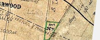
Land Grants, Rural Estates and Roadways
The first land grants in the district commenced in 1794, ushering in the earliest phase of European development in the area. The area now forming the represents a 400ha grant to Thomas Rowley in 1803. Development in this period was largely concentrated upon the main arterial roads, Parramatta Road and Liverpool Road. Rowley’s land began to be subdivided in the 1830s.
The Sydney to Parramatta Railway Line
The opening of the Sydney to Parramatta railway line in 1855 triggered the next major phase of development in the suburb. As one of only four stations on the line, Burwood began to attract wealthy businessmen who built country villas on large estates and commuted into the city.


Source: TKD Architects

Source: TKD Architects
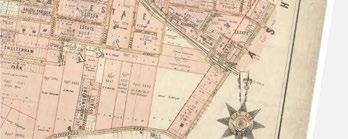
Municipal Government and Suburban Boom
With the establishment of the municipality of Burwood in 1874 came a variety of underground services and utilities. Most of the remaining roads in the were formed during this phase.
Some of the large country estates were resubdivided, and important institutions like schools were built and new stations were added at Croydon and Strathfield. In addition, industrial and commercial land uses emerged in the study area including the Croydon Brickworks and a small number of shops.

The Model Suburb
The early 1900s saw Burwood Council embrace the idea of the model suburb, paying closer attention to the careful planning of new estates and their enhancement through street plantings and landscaping.
A small number of additional dissecting roads were formed in this period to service new subdivisions, including Boronia Avenue, Orchard Street, Irrara Avenue, Ivanhoe Road, Kenilworth Street and Ranger Road.

The aftermath of the depression and the onset of World War II saw the reduction of new development in the area, though largely developed, and the closure of the only major industrial site, the Croydon Brickworks
Post-war immigration stimulated a new wave of growth which took the form of redevelopment of some existing sites into residential flat buildings, as well as alterations to ‘modernise’ some existing dwellings.
High-rise Living and Contemporary Residences
As development and redevelopment of the suburb continued into the late 20th and early 21st centuries alongside surging land prices, attention was increasingly drawn to the conservation of important components of the suburbs environmental heritage.
Following a heritage study in 1986, a number of significant heritage items and areas were identified and protected.
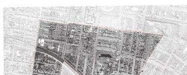
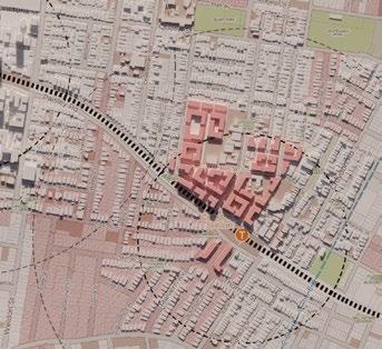
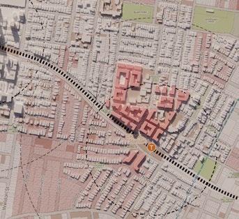
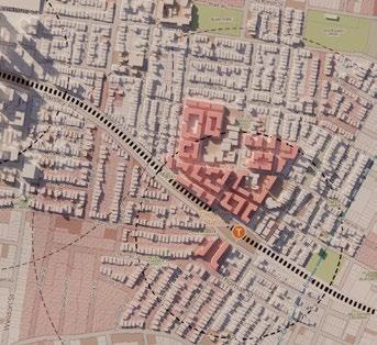
2. Historical Analysis: Phase 6 –1986-2024
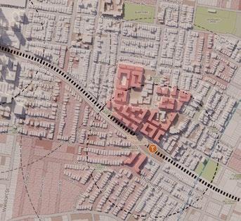
14. 1941-1986
Source: TKD Architects
Figure 15. 1986-2024
Source: TKD Architects
An assessment of the constraints and opportunities in relation to the following themes have been undertaken to inform the preparation of the Croydon Alternate Master Plan Area.
Refer to Appendix A - Croydon Research, Review and Analysis Summary Report for more information on the analysis undertaken as well as the constraints and opportunities identified for the Croydon
Parts of the Croydon Alternate Master Plan Area are flood affected due to its natural topography. Site-specific flood mitigation measures may be integrated to enable future redevelopment of these areas.
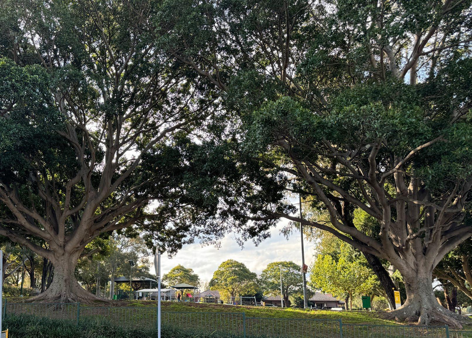
While there is generally good tree canopy cover on privately-owned land, the Croydon Alternate Master Plan Area currently lacks canopy cover on public land. There is an opportunity to provide new street trees to connect fragmented canopy, provide shade and reduce urban heat.
The Croydon Alternate Master Plan Area is well positioned to support increased density as the entire falls within a 20-minute walking catchment of either Burwood or Croydon Station. Pedestrian amenity could be enhanced with widened footpaths to increase walkability, particularly between the two stations.
There are a few informal cycling routes in and around the . There is an opportunity to enhance the active transport network and better connect it with the broader network to encourage residents to use methods of active transport.
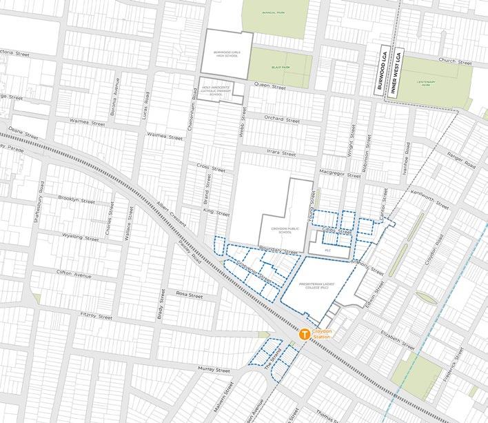
There are three schools within the Croydon : Croydon Public School, PLC Sydney and the Holy Innocents’ Catholic Primary School. Apart from the Burwood RSL, the majority of the rest of the consists of privately-owned residential properties that include several strata-titled lots, largest of which is the Hampton Court development on Webb Street. As majority of lots are privately owned, amalgamation will require negotiations between private landowners.
There is currently a lack of public open space within the Croydon . Given the limited opportunities to deliver new public spaces of scale, there should be a focus on enhancing connection and access to the broader open space network, including Wangal, Blair and Centenary Parks.
Water supply infrastructure is present throughout the Croydon Alternate Master Plan Area and is not considered to be a constraint for redevelopment.
There are major stormwater and trunk sewer assets that run across the Croydon Alternate Master Plan Area. Future redevelopment should seek to design and build around these assets.
Road reserves within the Croydon Alternate Master Plan Area vary in widths. Wider roads provide the opportunity for increased tree planting on existing verges, while narrower roads may be improved with widened footpaths and additional tree planting where feasible.
Majority of lots within the Croydon Alternate Master Plan Area are small, with almost 90% of lots being under 800m2. The amalgamation of fragmented lots will be required to enable development with higher densities within the .
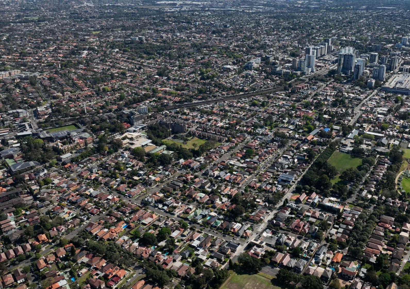
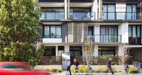
The predominant built form character within the Croydon Alternate Master Plan Area is 1-2 storey detached dwellings, with several 1970s walk-ups and flat buildings as well as more recently built RFBs. Contrasting the lower density of the Croydon Alternate Master Plan Area is the established high density areas of the Burwood Town Centre.
There are several heritage items as well as four HCAs within the Croydon including the Malvern Hill HCA south of the railway corridor. While the TOD Provisions allow for development within HCAs, consideration around the retention of these areas should be given. Redevelopment around heritage items and HCAs should be designed in a sensitive manner.
A master plan is a long-term plan that provides a road map to guide future growth and change in our centres over the coming decades.
Master plans have an important role in determining the look, feel and function of the urban environment. A master plan guides building heights, design, density, sustainability, movement, land use zoning, open spaces, community infrastructure and heritage within a particular geographic area.
The Croydon Alternate Master Plan has been informed by supporting technical studies and will guide new planning controls that could apply to properties in the area. It establishes an urban design framework to ensure the delivery of a high quality, liveable and walkable urban environment.
The Croydon Alternate Master Plan has been developed through the following process:
Site analysis and visioning - The site analysis undertaken at the start of the project identified key opportunities and constraints for the Croydon Alternate Master Plan Area. The outcomes of this analysis and concurrent visioning were used to inform the development of master plan scenarios and subsequently the proposed master plan presented in this report.
• Scenario workshop and testing - Ethos Urban worked with the project team and Burwood Council to test various master plan scenarios that explored increased densities in various locations to meet the objectives of the TOD program while also balancing the need to sensitively manage the transition to existing lower density areas and HCAs in the Croydon Alternate Master Plan Area.
• On-going consultant and client collaboration - The consultant project team and Burwood Council worked closely throughout the course of the project to continuously refine the master plan to ensure that it reflects the Vision and Strategic Drivers for the Croydon Alternate Master Plan Area.
Community consultation and finalisation - Based on feedback received from the community and collaboration with Burwood Council staff, alternate master plan options were developed responding to the key concerns of the community. A preferred master plan was adopted by the Council to progress to finalisation with the NSW Government.
This Master Plan Report has been developed with specialist technical input and should be read in conjunction with the following supporting documents:
• Appendix A - Croydon Research, Review and Analysis Summary Report, by Ethos Urban
• Appendix B - Croydon : Case for Change Report, by Ethos Urban
Appendix C - Croydon Social Infrastructure and Open Space Needs, by Ethos Urban
Appendix D - Croydon Transport Statement by JMT Consulting
Appendix E - Croydon : Heritage Analysis and Recommendations by TKD Architects
Appendix F - Croydon : Flood and Services Utilities Findings and Recommendations, by Northrop
• Appendix G - Croydon : Review of Lucas Road Heritage Conservation Area, by Lisa Trueman Heritage Advisor
Following community engagement, the Alternate Master Plan will be reviewed and finalised before it is submitted to the NSW Government. The NSW Government will then review the Master Plan and prepare a SEPP to amend the Burwood LEP. Burwood Council will be consulted on the drafting of the instrument and mapping.
In addition to amendments to the Burwood LEP via the SEPP, Burwood Council will also seek to:
• Amend the Burwood DCP to inform desired built form and design outcomes.
• Update the Burwood Infrastructure Contributions framework to support the funding, delivery and on-going maintenance of infrastructure.
• Introduce an Affordable Housing Scheme to ensure the delivery of a minimum 2% affordable housing as per the TOD Provisions
Following the amendment of the Burwood LEP, development applications may be lodged to realise the intended outcomes of the Alternate Master Plan. Future development applications are required to go through a defined process under the Environmental Planning and Assessment Act 1979, which will include further opportunity for community engagement beyond this Alternate Master Plan.
Contact with the Metropolitan Aboriginal Land Council has been established by Burwood Council and discussions about the master plan are underway.
The following framework has been established to help realise our vision for the Croydon Alternate Master Plan Area:
Priorities - Five priorities that reflect our vision for the Croydon Alternate Master Plan Area have been identified.
Principles - These principles underpin the intent behind each of the five priorities and help guide the preparation of this Alternate Master Plan.
Our Vision Priorities
Principles
Positioned between the centres of Croydon and Burwood, the Croydon Alternate Master Plan Area represents an important opportunity to provide sustainable and responsive urban renewal and design excellence.
The Croydon Alternate Master Plan Area will prioritise a more compact approach to development that will facilitate connectivity and ease of movement to enhance its walkability and liveability.
Croydon is an inclusive community open to diversity and change.
Principles
1. Strategically locate increased density in areas closest to existing public transport and services amenities.
2. Develop a robust spatial framework that enables a range of housing typologies and options to support a diverse population, including catering for multigenerational living.
3. Create opportunities for a mix of medium and highrise development to deliver community-oriented neighbourhoods.
4. Allow for a diverse range of tenures, including opportunities for the delivery of affordable housing and build to rent accommodation.
5. Promote design excellence through the design of the future built form and public domain.
Principles
1. Create new neighbourhoods that respond to their local context and character.
2. Retain the existing character, identity and sense of place of the remaining low density areas of Croydon.
3. Preserve existing heritage items and HCAs within the Croydon Alternate Master Plan Area.
4. Create opportunities for future development to provide a sensitive interface with existing heritage items and HCAs, while enhancing their heritage values.
5. Ensure that buildings are designed to provide a human scale interface to the public domain.
6. Integrate elements that respond to connection with Country.
Principles
1. Provide a comprehensive active transport network that reflect the changes in density and that is connected with the broader active transport network.
2. Deliver clear and legible east-west active transport connections to improve movement across Burwood and Croydon Stations.
3. Increase permeability, walkability and pedestrian safety within Croydon .
4. Support a connected open space network with enhanced local and regional cycle connections.
5. Reduce Croydon ’s dependence on private car ownership.
Principles
1. Improve access to the existing open space network.
2. Provide streetscapes and public domain outcomes that improve public life and promote opportunities for activation and improved passive surveillance.
3. Create opportunities for incidental ‘play streets’ and green streets that promote activity, community and streets as places for people.
4. Minimise any property acquisition by Council or State Government.
Principles
1. Enhance tree canopy cover to improve pedestrian amenity and provide much needed additional urban cooling.
2. Build climate resilience into the design of future development in the Croydon Alternate Master Plan Area.
3. Create high quality north-south Green Streets to complement east-west connections.
4. Support sustainable technologies and initiatives that will reduce carbon emissions.
Note: As per the Council Resolution on 29 January 2025 updates to the yields and proposed planning controls of the adopted Burwood North Precinct Masterplan (May 2024) were made to work in conjunction with the proposed yields of the Croydon Alternate Master Plan. The Burwood North Masterplan will be adjusted as per the Council Report and implemented separately.
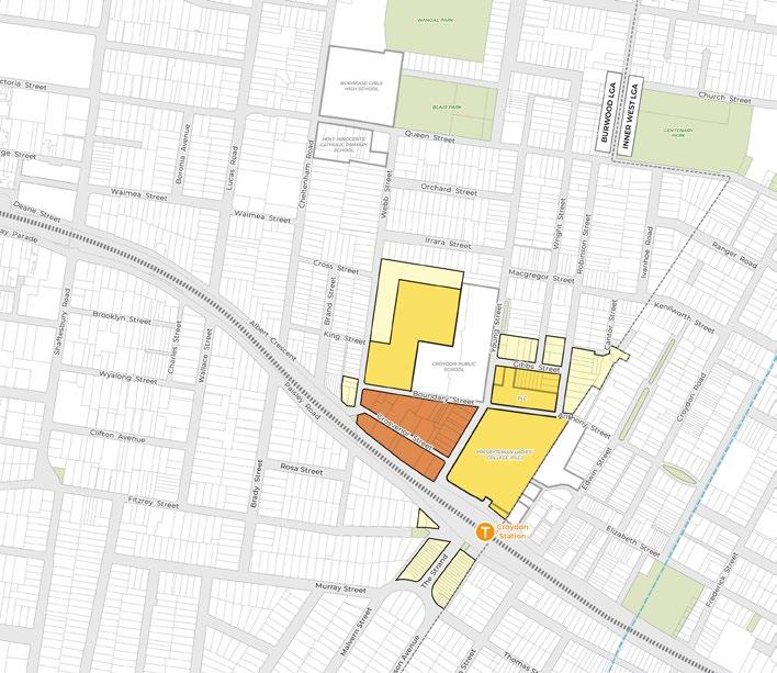

• The potential residential capacity of each option has been calculated based on the following assumptions:
- 90 sqm GFA average apartment size
- 2.5 people per dwelling
Excludes assumed ground level non-residential use on lots currently zoned E1 Local Centre.
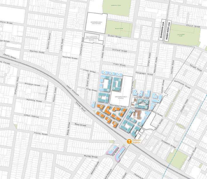
All building envelopes shown are indicative only. They do not represent the final proposed buildings and are subject to change and future detailed design. All potential future buildings will need to be designed to ensure that they meet the objectives of the ADG and future DCP provisions to provide good amenity and design outcomes.
• Proposed building heights and number of storeys have been calculated based on the following assumptions:
- 4.0m minimum floor-to-floor height for ground level residential use.
- 4.5m minimum floor-to-floor height for ground level nonresidential use.
- 3.2m minimum floor-to-floor height for residential use above ground level.
- 4.5m lift overrun, rooftop plant and structures associated with rooftop communal open space.
• Assumes development capacity on the PLC sites with heritage items on PLC sites to be retained. Appropriate built form response that considers the interface with these heritage items to be provided, subject to future studies and detailed design.
Future DCP provision to be drafted to provide a 10m landscaped setback along the northern edge of this site to provide an appropriate transition between the proposed 4 storey built form to the existing 1-2 storey dwellings to the north (lots south of Irrara Street).
Existing 2 storey facades along The Strand proposed to be retained with upper two levels set back from the 2 storey street wall to retain the existing streetscape character.
Sydney (02) 9956 6962
Level 4, 180 George Street, Sydney (Gadigal Land)
NSW 2000
sydney@ethosurban.com
Melbourne (03) 9419 7226
Level 8, 30 Collins Street, Melbourne (Wurundjeri Woi Wurrung Land)
VIC 3000
melbourne@ethosurban.com
Brisbane (07) 3852 1822
Level 4, 215 Adelaide Street, Brisbane (Turrbal, Jagera and Yugara peoples)
QLD 4000
brisbane@ethosurban.com