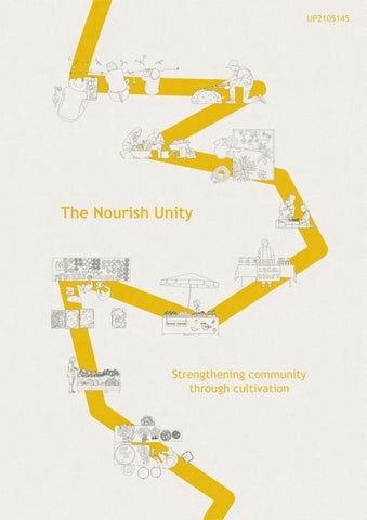
The Nourish Unity
Strengthening community through cultivation
UP2105145
Contents
Introduction
Site location
Site Visit
Sustainable Development goals and Scenario
Urban Precedents
Urban Design Developments
Design strategies
Masterplan
Building Proposal
Concept Models
Building Precedents
Building Design Development
Building Design
Environmental and Sustainable Integrations
Renders
List of Figures
pg 1 pg 2 pg 3 pg 4-5 pg 6 pg 7 pg 8-9 pg 10 pg 11 pg 12 pg 13 pg 14 pg 15-19 pg 20 pg 21-23 pg 24-25
Introduction
Our major project brief was to develop the 18th sustainable development goal. On developing the 18th SDG we created a scenario that harmonises with the chosen goal while engaging with the other SDGs. In response to this we proposed an urban intervention within our site that is specific to our chosen studio.
Studio three aimed at dwelling tactics around Portsmouth is concerned with how urban settings and contemporary housing typologies can provide viable solutions to today’s gobal challenges, political, economic and societal transformations. Looking into alternative ways to evaluate urban qualities and qualities of liveable communities.
1
Site Location
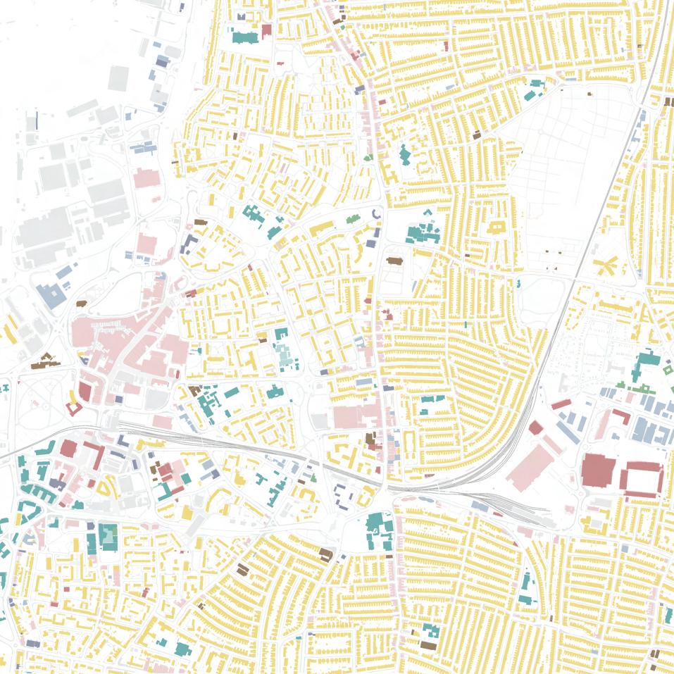
Fratton, Portsmouth is mainly a residential area but it was an industrial area in the past. It had 3,953 crime reports and some were related to anti-social behaviour. The people of Fratton use to be farmers.
2
Retail Religious buildings Commercial buildings Healthcare Recreation and Leisure Residential Educational Office Key:
Figure 1. Map showing the site in red and the building uses around the area (Not to scale)
Site Visit
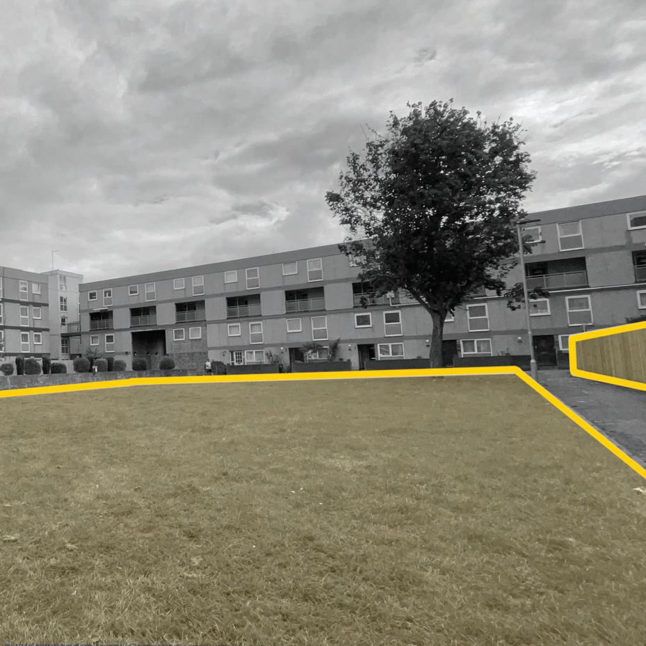
The area is a well populated residential area, it has open green spaces however the courtyard has no seats or anything for the people to interact the space with. It is accessible but due to how the buildings are placed the area feels excluded from the outside.
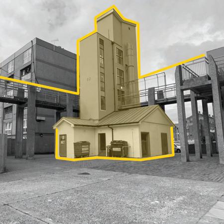
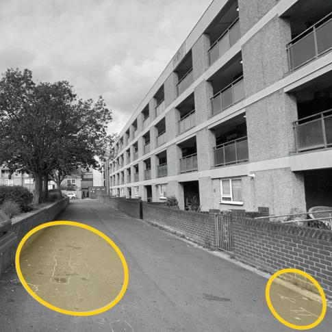
When walking around you can easily get lost as the place has no sense of direction making it feel like a maze. The place where residences throw their trash away is also the only place people can meet one another. Drawings on the ground indicates childern wanting to play within the area but they can’t and/or are limited as there is no playgroud near by.
3
Figure 2. Courtyard area at the site
Figure 3. Main staircase circulation and waste area
Figure 4. Around one of the dwelling area
After knowing that Fratton were farmers and the site having many green courtyard spaces, the question of
“What if Portsmouth became a garden city?”
came to mind. This could help with strengthen the community and make the neighbourhood have an active lifestyle.
18 CITY COMMUNITY
4
The 18th SDG and Scenario
The 18th SDG is City Community, which links to about four other existing SDG. SDG 2 which is Zero Hunger connecting to urban farming which will then promote citizen activites and that is SDG 3 of Good Health and Well-being. Another SDG link is 8 Decent Work and Economic Growth by making some of the buildings mix-use of retail and residential to create more job oppertunities, and creating job experience within the community. Lastly, SDG 4 which is Quality Education, having an interactive park within the housing communities to provide fun learning experience and gain knowledge outside school.
5
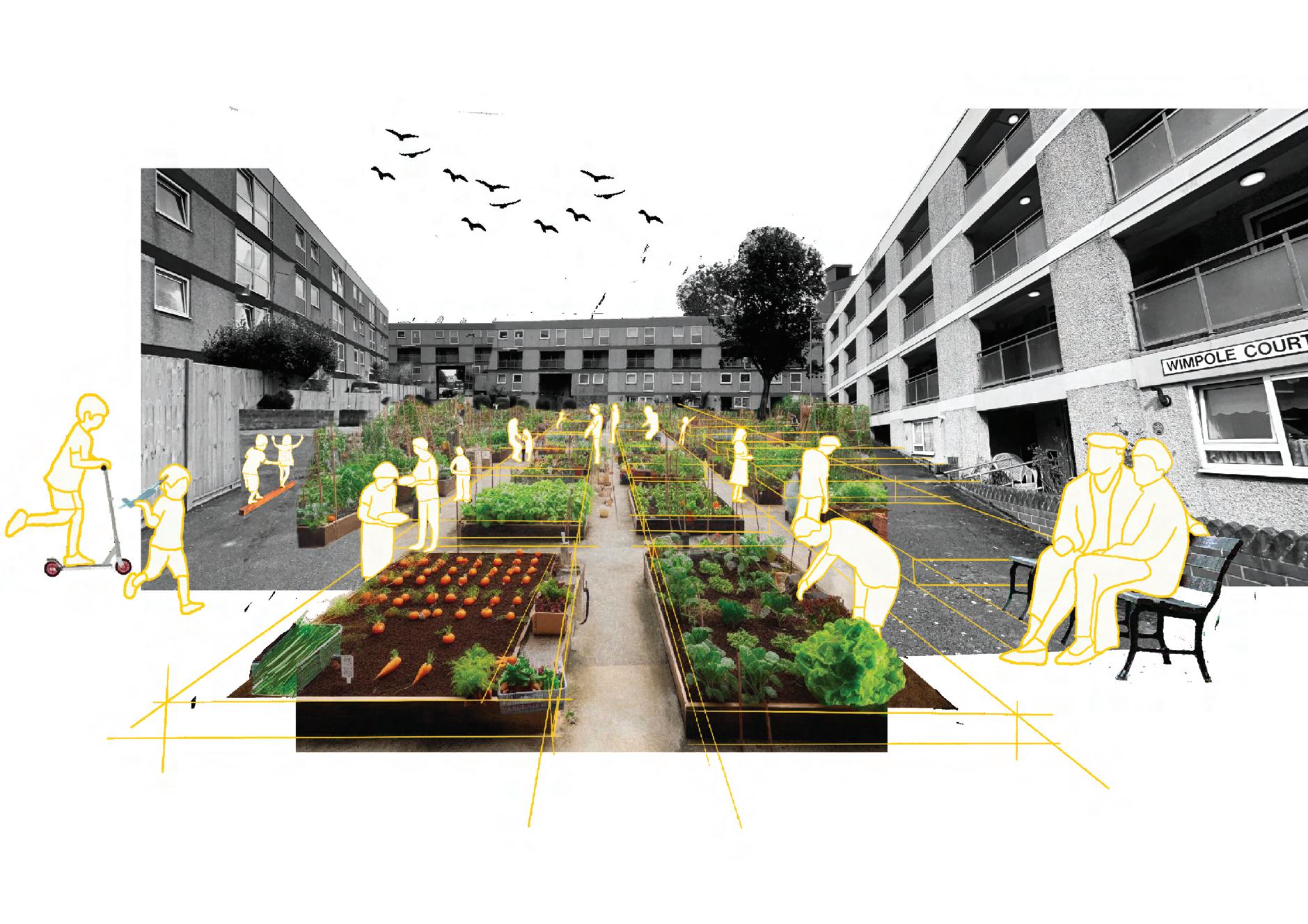
Figure 5. Scenario artefact
Precedents
I decided to research into dwellings that had communal gardens. They became my precedents for the masterplan.
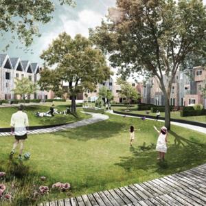
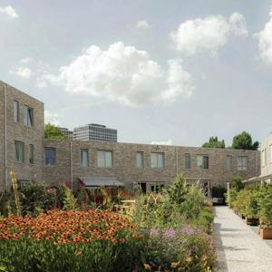
The project was based on the ‘sharing economy’ and facilities and stimulates sharing by the residents encourages stronger community bonds.
3 types of garden spaces lawn,vegetable garden and recreational area for kids and animals. Emphasize green space with the city “Unity in diversity”.
Keeping in mind that many of the communal gardens are located inside a courtyard space which was a key element for my masterplan development. I also made sure that there was a way for easy navigation through the area and also having the courtyard space not just as a communal garden but also a playground for the childern to play.
Communal gardens where small childern can play safely and neighbors get to know each other better The area is car free passage in between the blocks.
DELVA Landscape architects
De Deeltuin Utrecht
6
Hudsons, Orange Architects
Figure 6. Top view of De Deeltuin Utrecht
Figure 7. A render of the Delva lanscape
Figure 8. A view of Hudsons garden area
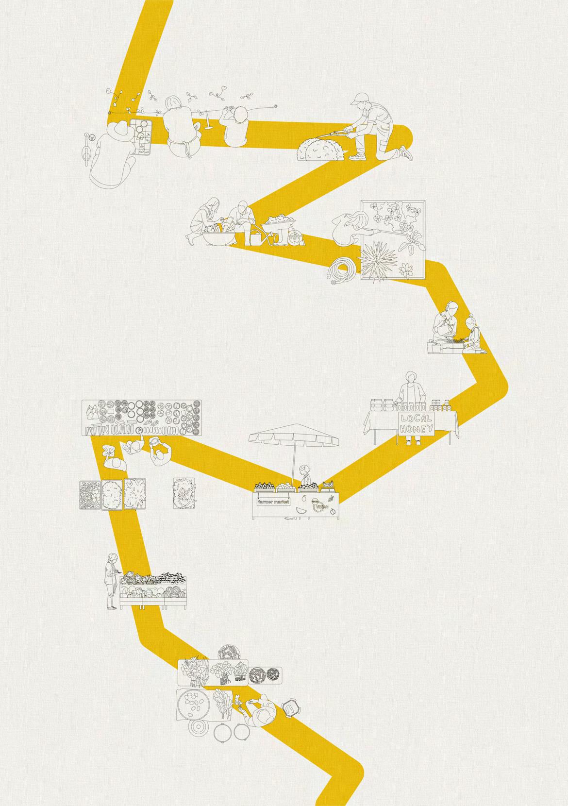
Design Development
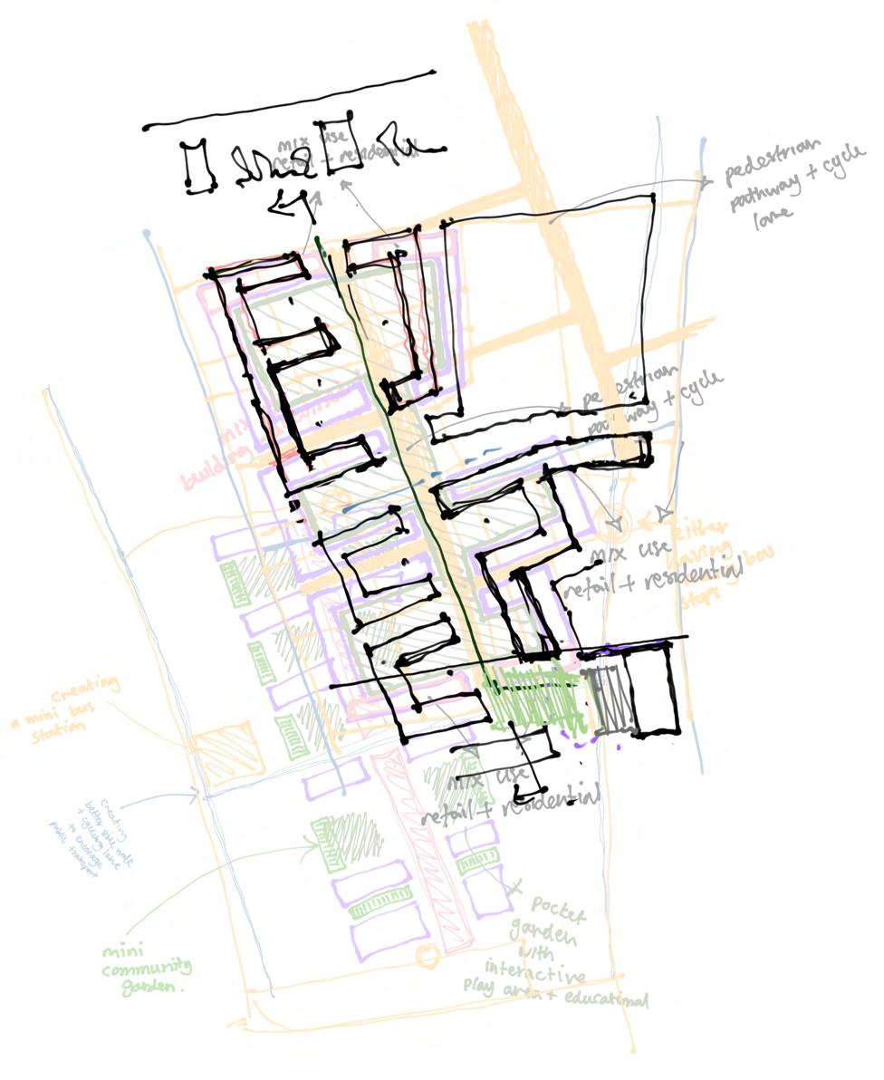
9.
A collage of some drawings of my concept development for the master plan.
7
Figure
Can the communal garden help play a role for boosting local economic growth?
8
Figure 10. Top view drawings of a market
Design Strategies
Community Market
Having a communal garden in each courtyard space and a community market where they can sell will help promote a stronger community and stimulates economic activity.
Road
Creating a road that connects to the main road to give easier access for those who use cars and a breakage between the two areas.
Green Spaces
Connecting and making more greenery to enhance good health into the community and help with co2 emission. While having a playground and communal gardens within each courtyard.
Bicycle and pedestrian
Making a linear pathway for easy navigation and encourages outdoor activity.
9
Masterplan
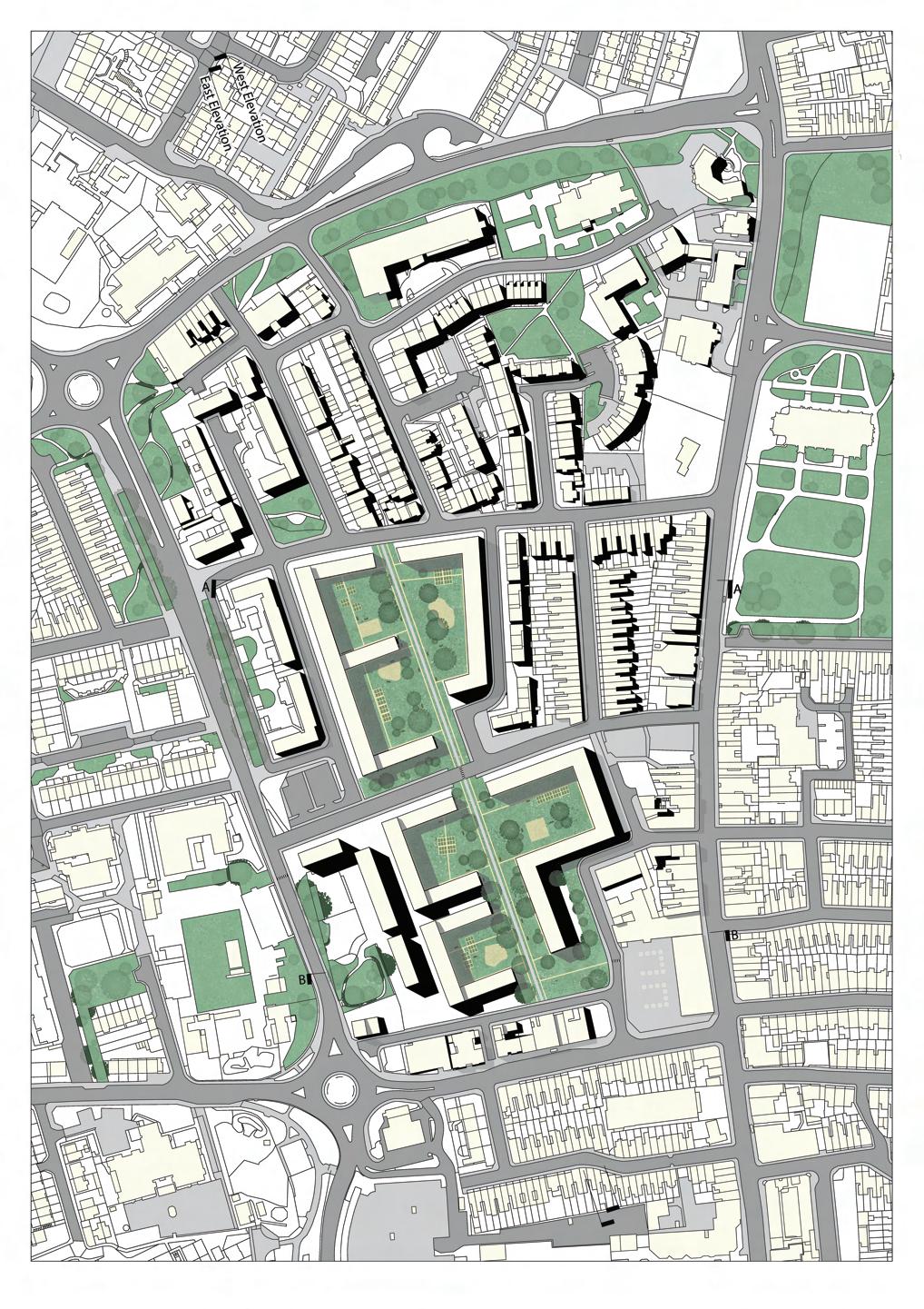
10
Figure 11. The masterplan (Not to scale)
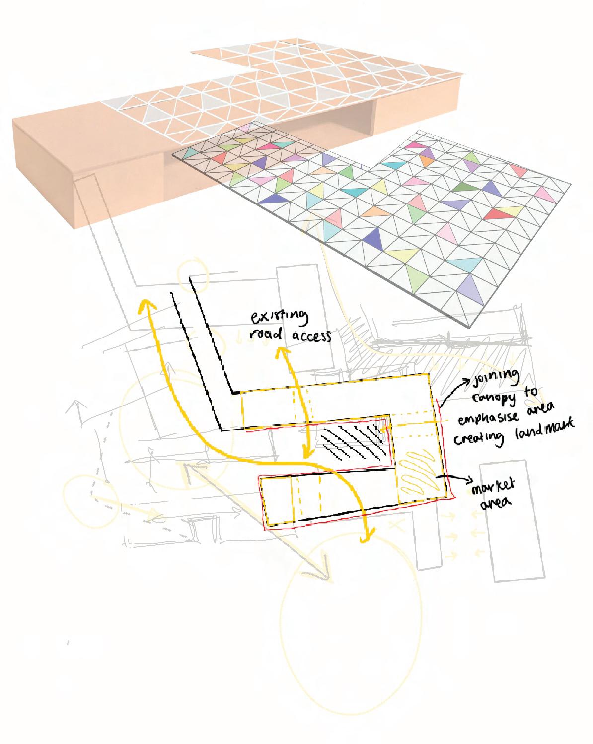
Building Proposal
The proposal is to create a hybrid building both a community sanctuary and a dwelling, seamlessly merging the lines between public and private life.
The aim was to connect the housing area to the market so that the market can be celebrated and not overlooked. By doing this it will also allow easy access to the linear pathway for bicycles and pedestrians.
Following the 18th SDG, City community by using food as a means to promote community connections.The proposed building will serve as a landmark for the area and a vibrant hub where residents and neighbours converge to celebrate food culture and connection. At its core, it operates as a place for food activites like cooking classes, a soup kitchen, a food bank, health seminars and lectures. Additionally, it features a food hall and temporary accomodation for guest speakers and distant community users.This will connect to the market aimed at boosting local economic growth by allowing locals to sell their produce from the communal gardens. Ensuring fresh, locally sourced food and backing urban agriculture sustainability which enhances food security and sitmulates economic activity in neighbourhoods.
11
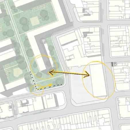
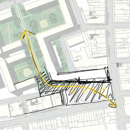
Figure 12. Diagram showing what I wanted to connect
Figure 13. Diagram showing better ow of the pathway
Concept Models
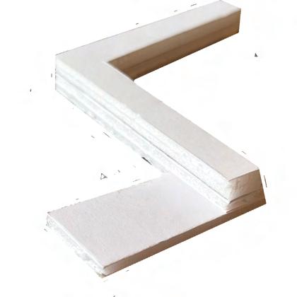
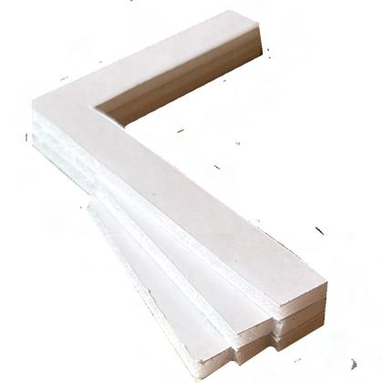

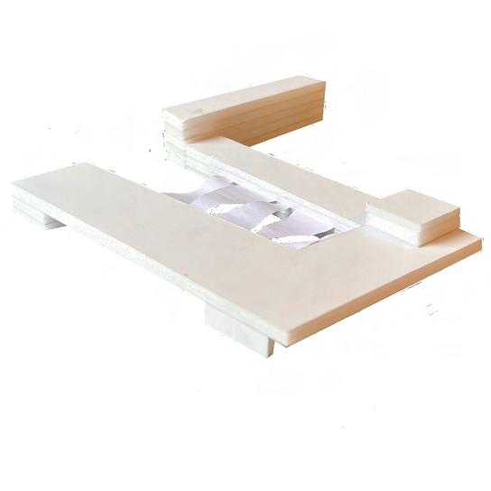
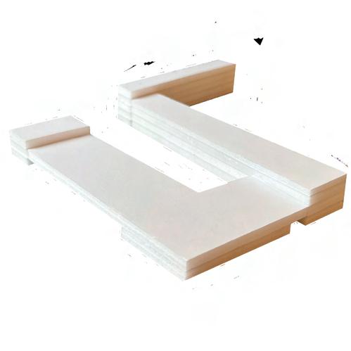
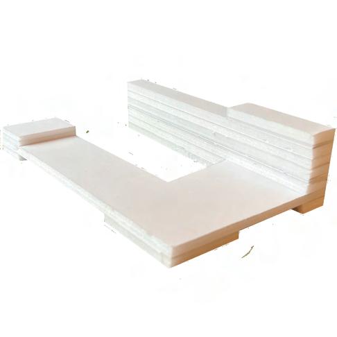
14.
Some concept models to experiment massing and how it would sit on the site.
12
Figure
Precedents
Torghallen
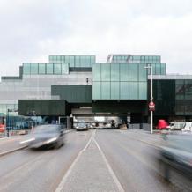
Combines affordable housing and a market hall. It is the focal point in Katrineholm. The scheme acts as a landmark. The building opens itself up to the surroundings allowing activity to spill out and public life to flow in.
Blox
The site was split into two by one of Copenhagen’s main ring roads. Straddling the road, making public connections both above and below. The building is also a mixed use consisting 22 apartments.
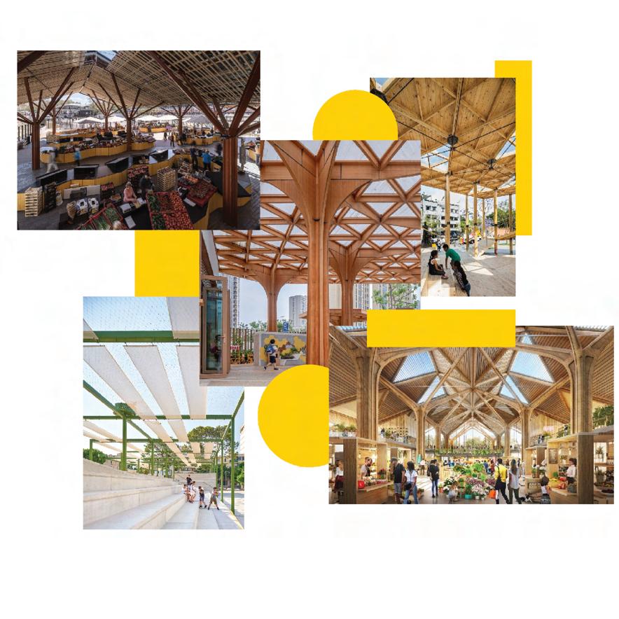
I created a moodboard of how I wanted the market and to be and have, such as skylights and public seatings
13
Figure 15. A render of Torhallen showing the market and housing
Figure 16. A view of the Blox of the road to show cars going under
Figure 19. Baltic Station Market
Figure 17. Mextropoli Pavillion
Figure 18. Hangzhou Pule Kindergarten
Figure 21. Farmers’ Market in Santa Clara designed by Foster + Partners
Figure 20. Plaza Mallorca
Design Development
22.
Collage of sketches and models leading up to the design proposal and market area
14
Figure
Building Design
Exploded axonometric to show my building proposal
23. (Not to scale)
15
Figure
Building Design
There are 5 types of dwellings in the proposed building, ranging from 2 bedrooms to 5 bedrooms flat. Majority of the flat is type B with 15 units as most of the residents there are small families. The community centre is split into 3 sections, the food education area which consists of a soup kitchen on the ground floor. A cooking class room, seminar rooms and a meeting room on the first floor. The food bank section, which also has an office space at the mezzanine floor. Lastly the food hall area which opens up the the market space.
Residential
Temporary stay
Food education
Food bank
Food hall
16
Type B flats
4900 mm 4900 mm 9500 mm 8400 mm
Figure 24. A section of my proposed building to show the functions (Not to scale)
Figure 25. Floorplan of my type B unit, a 2 storey unit which consists of 2 bedrooms and 1 ensuite master bedroom (Not to scale)
Building Design
8
Ground floor plan showing the market layout and public seating area as well as showing the food hall that opens out to the market (Not to scale)
17
Figure 26.
Building Design
18
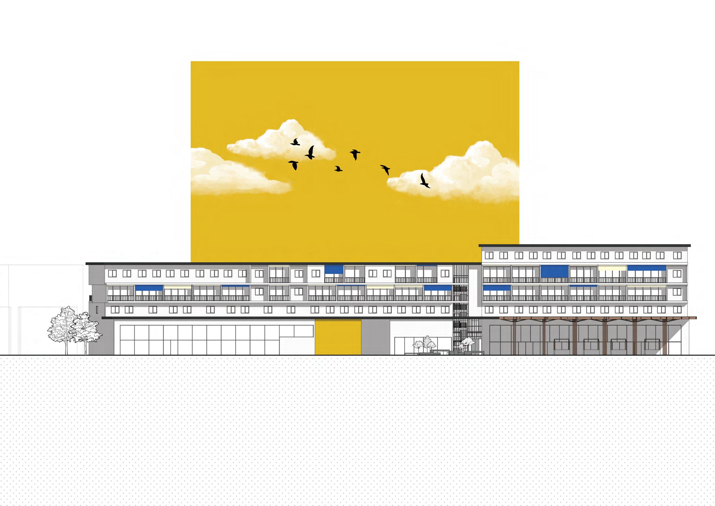
Figure 27. South Elevation (Not to scale)
19
Environmental and Sustainable Integrations
PV solar panels and rainwater harvesting are used to make my building more environmentally friendly this will ensure that it can generate electricity and the water collected from rain can be reused for the communal gardens. As my proposed building is also south facing I wanted to make sure residents gets plenty of natural lighting in their homes however to avoid overheating I placed external blinds to ensure comfort.

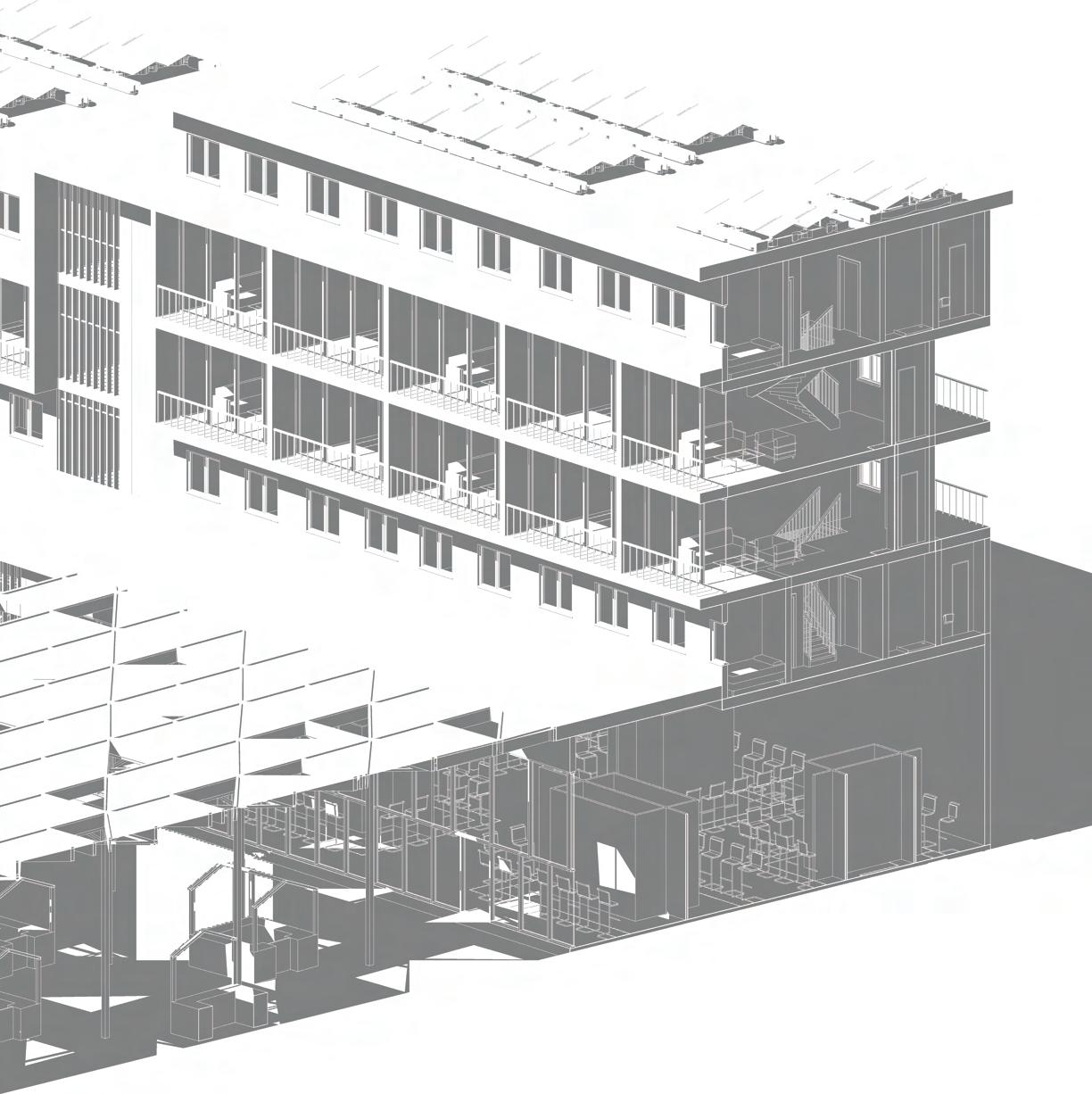

 Figure 28. Section to show the environmental and sustainable strategies (Not to scale)
Renders
Figure 29. A view from the road where Fratton road and Arundel street connects, this also shows the market’s logo
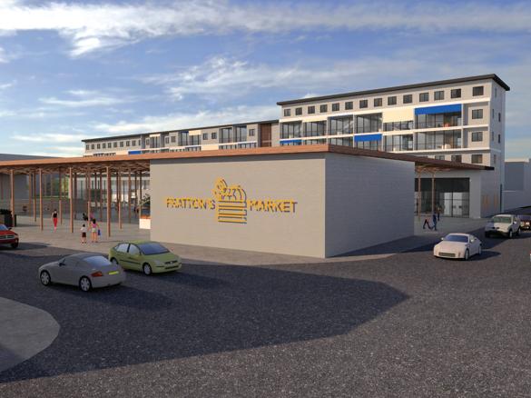
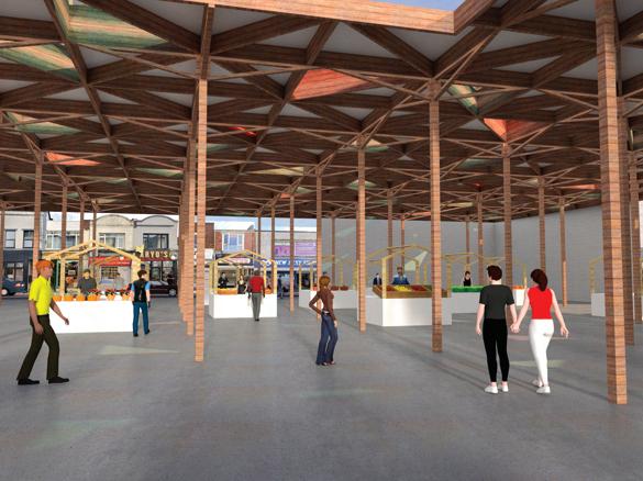
Figure 30. The market area for the people to sell their vegetations and things from their communal gardens, it is also where you can see the canopy with coloured glass roof that colours the space when sun shines to celebrate the market.
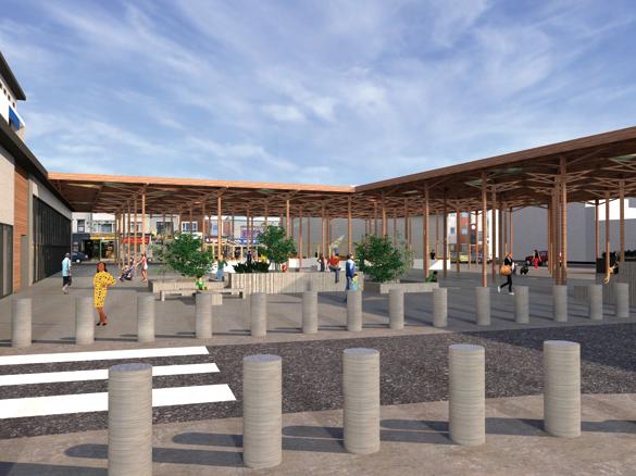
31. A veiw of the courtyard area where people and play and gather, taken from the other side of the area where you enter from the other dwellings.
21
Figure
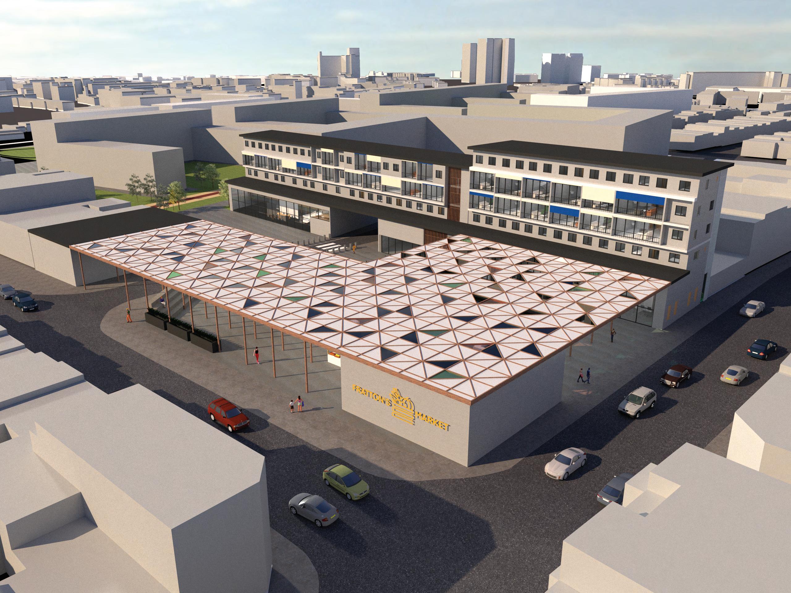
32. Render of my proposed building in context with the the urban scheme
22
Figure
23
List of Figures
Figure 1. Map of location and building uses base map from digimap, coloured and edited by author
Figure 2. Site visit courtyard area
Figure 3. Site visit main stairs and waste area
Figure 4. Site visit dwelling area
Figure 5. Scenario artefact Garden by AI, picture and edited by author
Figure 6. De Deeltuin Utrecht https://www.zoontjens.co.uk/projects/rooftop-paving/de-deeltuin-utrecht/
Figure 7. Delva landscape https://inhabitat.com/delva-landscape-architects-blend-traditional-architec ture-and-green-spaces-to-create-a-shared-oasis-in-the-city-of-utrecht/
Figure 8. Hudsons Garden https://www.archdaily.com/998571/the-hudsons-housing-orange-architects
Figure 9. Concept drawings of urban development
Figure 10.Top view of a market
Figure 11. Masterplan
Figure 12. Diagram building proposal
Figure 13. Diagram building proposal
Figure 14. Concept models
Figure 15. Torghallen https://jaja.archi/project/torvehallen/
Figure 16. Blox https://www.archdaily.com/893920/blox-oma-ellen-van-loon
Figure 17. Mextropoli pavillion https://www.designboom.com/architecture/dellekamp-arquitectos-pavilionhouse-of-switzerland-alameda-central-mexico-city-05-02-2017/
24
Figure 18. Hangzhou Pule Kindergarten https://www.archdaily.com/942564/hangzhou-pule-kindergarten-yangj iadun-branch-goa
Figure 19. Baltic Station Market https://www.archdaily.com/907230/markets-examples-in-plan-and-secti on/5c0818fb08a5e5ceeb0000a6-markets-examples-in-plan-and-section-photo
Figure 20. Plaza Mallorca https://www.archdaily.com/975435/fundamental-transformation-of-plaza-m allorca-son-estudi/61e88634c4b6b5016400a976-fundamental-transformationof-plaza-mallorca-son-estudi-photo
Figure 21. Farmers’ Market Santa Clara https://www.dezeen.com/2019/05/15/santa-clara-development-foster-partn ers-california/amp/
Figure 22. Collage of sketches and models for building proposal
Figure 23. Exploded axonometric
Figure 24. Section for building functions
Figure 25. Floor plan of type B residential unit
Figure 26. Ground Floorplan
Figure 27. South Elevation
Figure 28. Section for environmental and sustainable integration
Figure 29. Render
Figure 30. Render
Figure 31. Render
Figure 32. Render
*All works are from author unless stated or linked with URL*
25