Site Planning Online Project: Redeveloping the Queen Street Bus Terminal Site, Singapore as
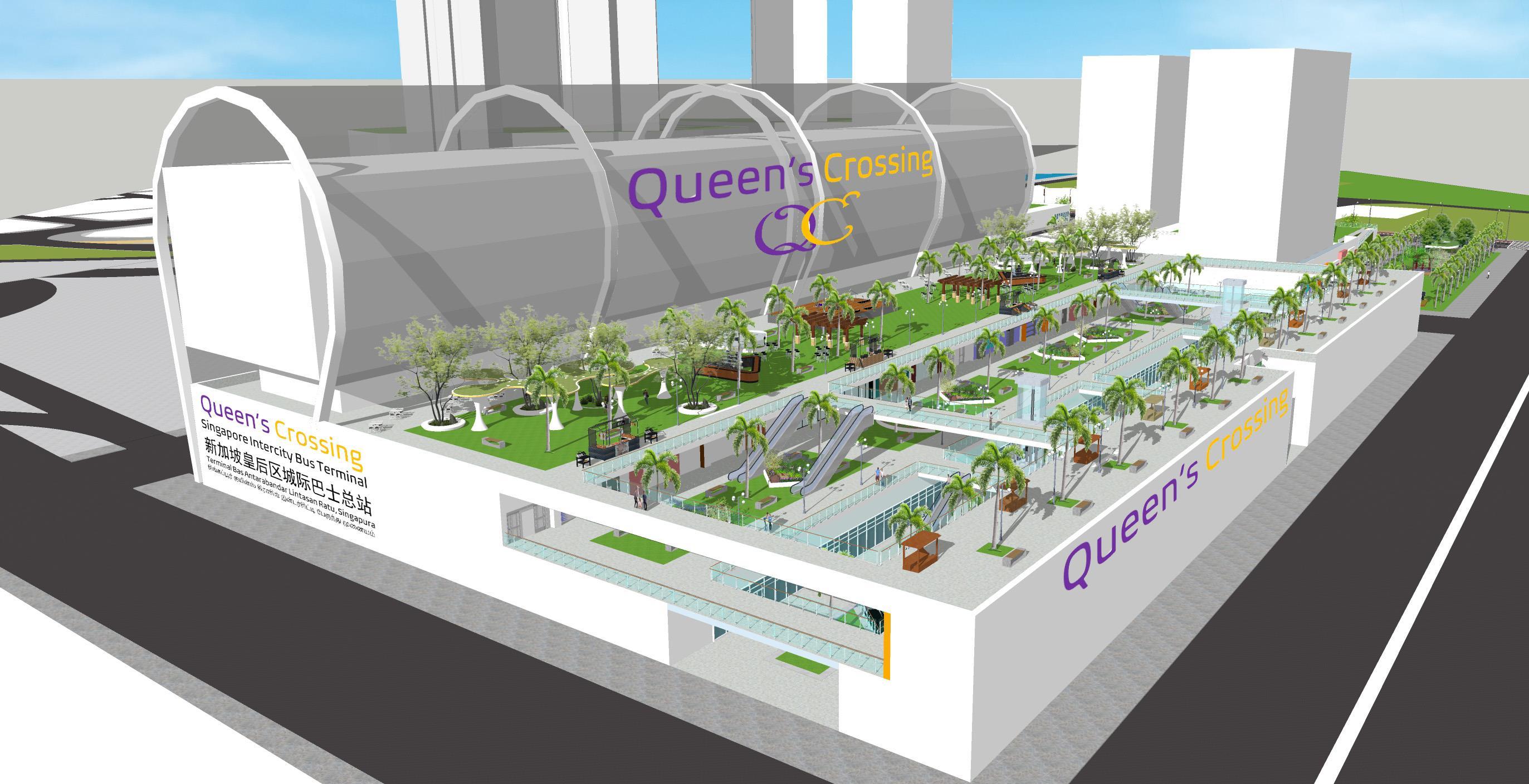
Queen’s Crossing
Contents
Assignment Part 1- Site Analysis
• Site Introduction
• Analysis of Surrounding Streets
Deliverables are presented in PowerPoint slides format
Assignment Part 2- Program and Concept Plan
• Precedent Studies
• Seoul
• Singapore
• About Queen Street Bus Terminal at present
• The Big Picture
• Context within Downtown Singapore
• Impact of the opening of the NSC
• Current land uses & neighborhoods
• Demographic & Neighborhood Character Analysis
• Housing Affordability
• Zoning according to current Masterplan
• 3D analysis of the site
• Proposed River Peaks Public Housing Project at Parcel B
• Overall Site Analysis Map
• Values and Objectives
• Kuala Lumpur
• Bangkok
• Land Use Concept Plan
• Program
• Massing studies to determine program
• Traffic flows
• How intercity buses would circulate
• Pedestrian connections between neighborhoods
• How bus passengers experience the site
• How residents experience the site
• How visitors, tourists, shoppers and hotel guests experience the site
• How office workers experience the site
Assignment Part 3- Site Plan & Renderings
Redeveloping the Queen St Bus Terminal Site, Singapore (Option 2: Site that
I know)
Site Analysis
Site Introduction
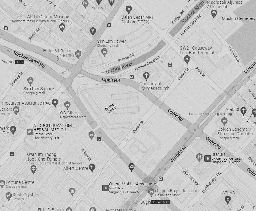
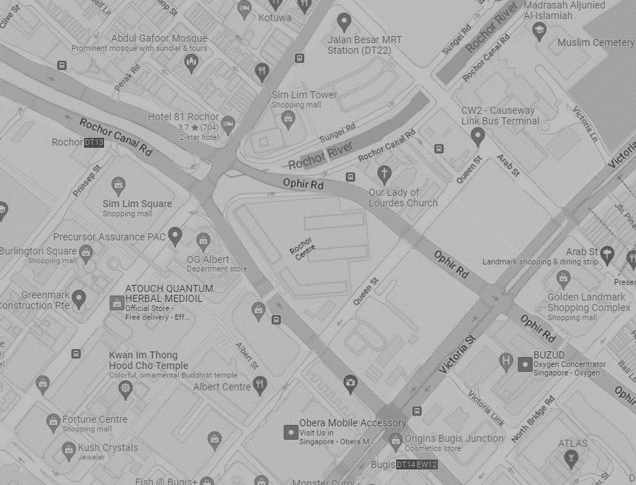
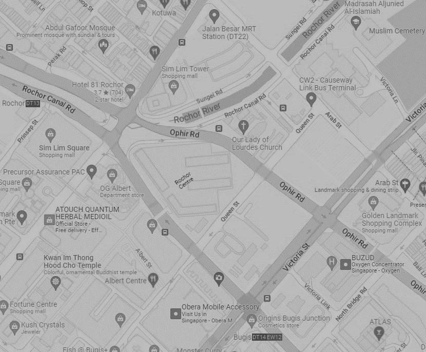
The chosen site is currently 4 separate but adjacent land parcels: the Queen Street Bus Terminal (A), two large parking lots (B & C) and a construction wasteland (D) which will be eventually cleaned up. Public housing is also proposed on B. The Rochor River, now a stormwater canal, runs in between A and B. The land is flat. A
The 4 parcels combined is about 12 acres or 4.9 hectares, located between the Bugis, Little India and Kampong Glam neighborhoods of downtown Singaporewhich is a dense, busy, urban, mostly commercial area.
B C D
The site is adjacent to multiple MRT (subway/metro) lines and stations (especially Bugis and Jalan Besar stations), as well as several public bus lines. It is also next to the future entrance of the underground North South Expressway Corridor (NSC). This entrance used to be the site of public housing, which was demolished for the NS, leaving less affordable housing for the area.
Entrance & Exit to future North South Expressway Corridor
MRT (subway/metro station)


Public bus stops that are most relevant to site
A B C D
Analysis of Surrounding Streets
Important arterials (in orange), collectors (in blue), local streets (in yellow) and one-way streets (in dashes) around the site. Singapore drives on the left, like the UK.
 Entrance & Exit to future North South Expressway Corridor
A B C D
Entrance & Exit into bus terminal
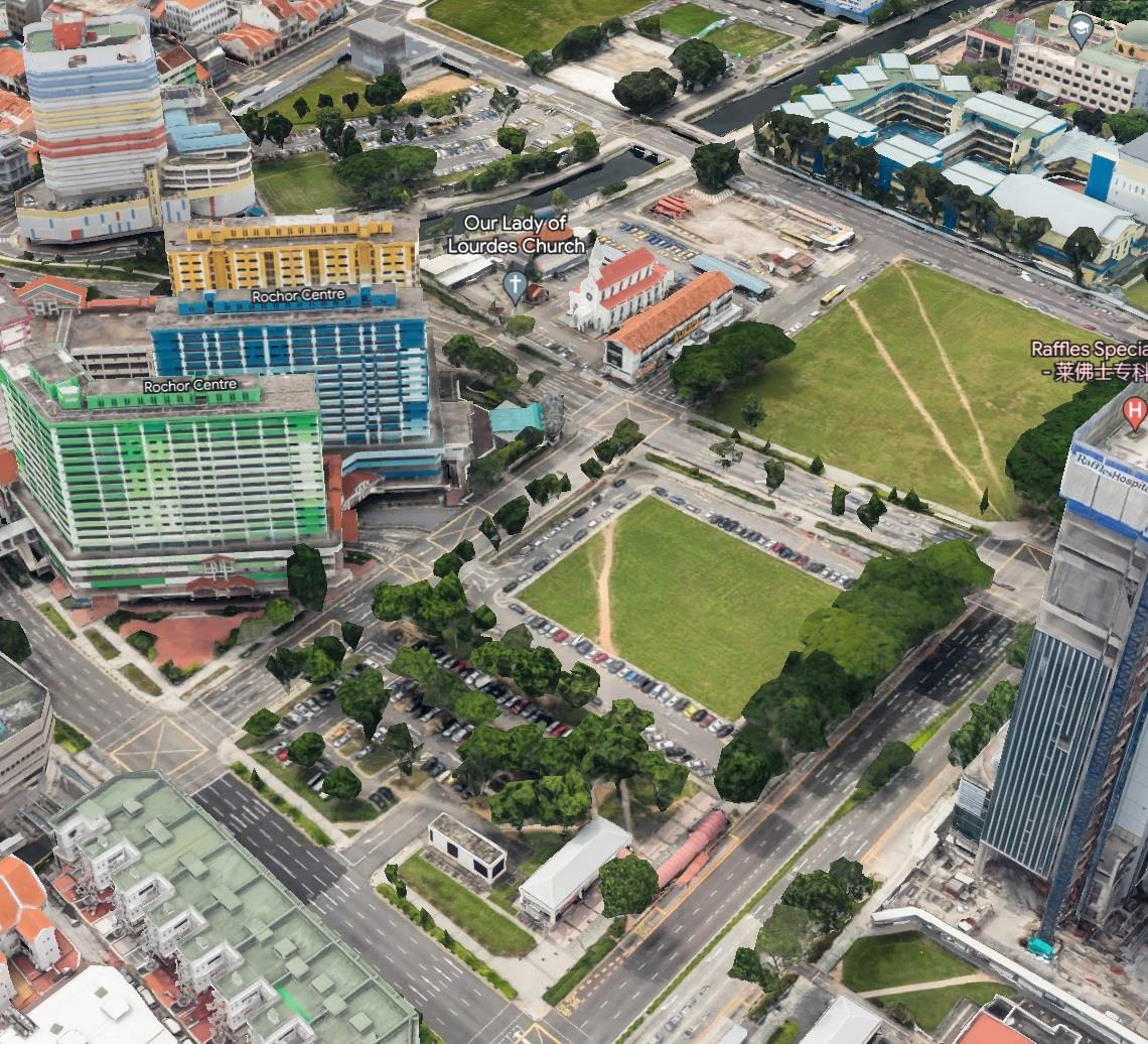
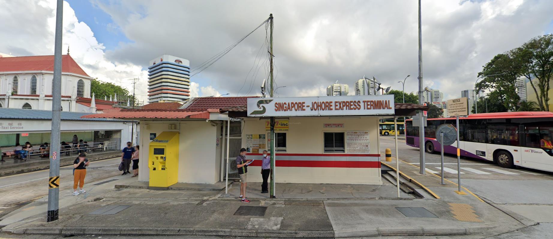
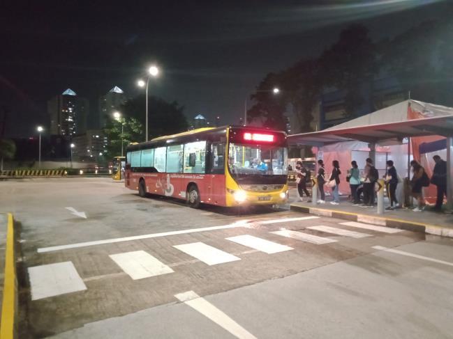
About Queen Street Bus Terminal at present
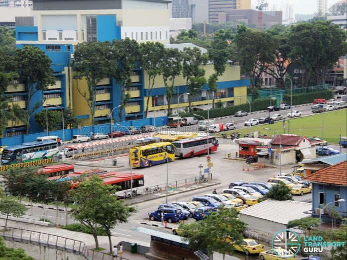
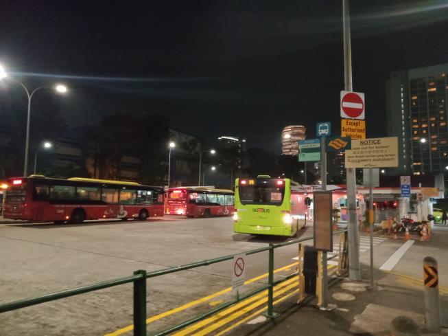
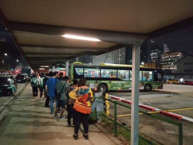
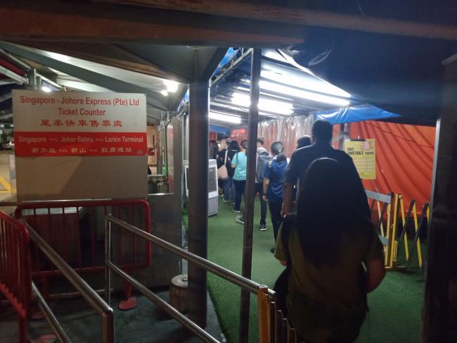
Queen Street Bus Terminal on Parcel A is an international bus terminal for intercity buses heading to and from Malaysia, specifically the border city of Johor Bahru. It also has a taxi stand for taxis that cross the border. However, other than a few derelict, barren structures and a small office for bus operators created out of construction crates, the terminal is really one large open parking lot for buses.
Bus services currently using Queen Street Bus Terminal:
• SBS Transit #170
• Singapore-Johore Express (SJE)
• Causeway Link (CW) #2
All are regular services (every 10-15 mins) towards Johor Bahru. The latter 2 are express services.
Currently intercity bus services to other parts of Malaysia do not have a central terminal in Singapore, and departure/arrival points are dispersed throughout Singapore. Queen Street Bus Terminal could be transformed into a central terminal for all bus services

to Malaysia.
The Big Picture
JOHOR BAHRU
Causeway (1st border crossing)
This part is not the NSC, but a potential route between NSC and the border
Second Link (2nd border crossing)
Current routes for buses that specifically ply between Queen St Bus Terminal and Malaysia (i.e. excluding other intercity buses)

Informal bus stops where Malaysiabound intercity buses currently use.

DOWNTOWN SINGAPORE
North South Expressway Corridor (NSC)potential new bus route from Queen St Bus Terminal when it opens
MALAYSIA SINGAPORE
Tampines
Bugis MRT, Golden Mile Tower, The Plaza Beach Road, Concorde Hotel, Lavender MRT (several locations within short distance of one another)
Buses that currently use the Queen Street Bus Terminal ply specifically the routes in pink. When the North South Expressway Corridor (NSC) opens, some would potentially use it, i.e. the route in purple. Other Malaysia-bound buses that do not use Queen St Bus Terminal ply a variety of routes (not marked on this map), and stop at a variety of informal pick-up and drop-off points throughout the country, and many also use the 2nd border crossing. While this offers choices of stops for travellers, there is also a lack of an organized terminal.
A central terminal, in the middle of downtown Singapore, would offer a consolidation and organization of intercity bus services and a proper infrastructure for them. The downtown location would offer a central, citywide transport node, and therefore transforming Queen Street Bus Terminal would be ideal. This does not mean the buses would be required to abandon their current informal stops, however. The central bus terminal just offers an additional option for the buses to terminate at. For example, a bus that currently terminates at Jurong East could now enter Singapore from the 2nd border crossing, make an intermediary stop at Jurong East, and continue to the central bus terminal. However, having Queen Street Bus Terminal as a central bus terminal would make most downtown informal stops (e.g. Bugis MRT) redundant.
0 2km
QUEEN STREET BUS TERMINAL SITE
Downtown East
Kovan Hub
Katong V
Little India
Novena Square
Yishun
The Star Vista
Boon Lay
Jurong East
Context within Downtown Singapore
North South Expressway Corridor (NSC). This segment is underground.
Current routes for buses that ply between Queen St Bus Terminal and Malaysia (i.e. excluding other intercity buses)
QUEEN STREET BUS TERMINAL SITE
Informal bus stops where Malaysia-bound intercity buses currently use. Within downtown, these are within short distance of one another, and will therefore be redundant once Queen Street Bus Terminal is transformed into a central bus terminal
0 500m
Bugis MRT
Golden Mile Tower
The Plaza Beach Road Concorde Hotel
Lavender MRT
Impact of the opening of the NSC
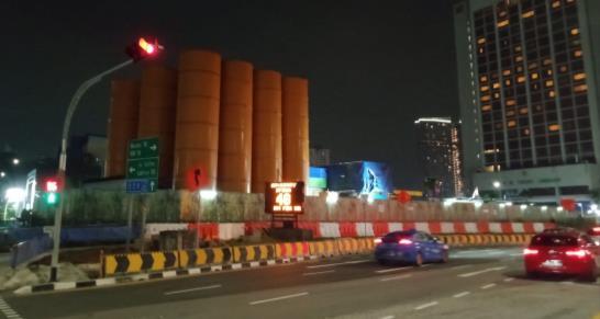
Current construction site of the future North South Expressway Corridor (NSC)

Entrance & Exit to future North South Expressway Corridor (NSC)
Buses using the Queen St Bus Terminal currently ply this pink-colored route. But when the North South Expressway Corridor (NSC) opens, SJE and CW buses could potentially change their routes to use it as it is a quicker, more direct way to the border (blue-colored routes). Assuming that no changes to the bus terminal and streets are made, the blue route could potentially cause congestion problems, as seen in the traffic flow maps next page
IN OUT
An analysis shows the existing traffic flows around the site get congested in both peak and nonpeak times of the day, even on weekends (the redder the line, the more congested). Once the North South Expressway Corridor opens, traffic congestion around the site could worsen, especially at its entry and exit points.
However, if planned well, the North South Expressway Corridor at the very doorstep of the site could be an asset towards the development of the site.
Weekday morning peak hour traffic
Weekday non-peak traffic
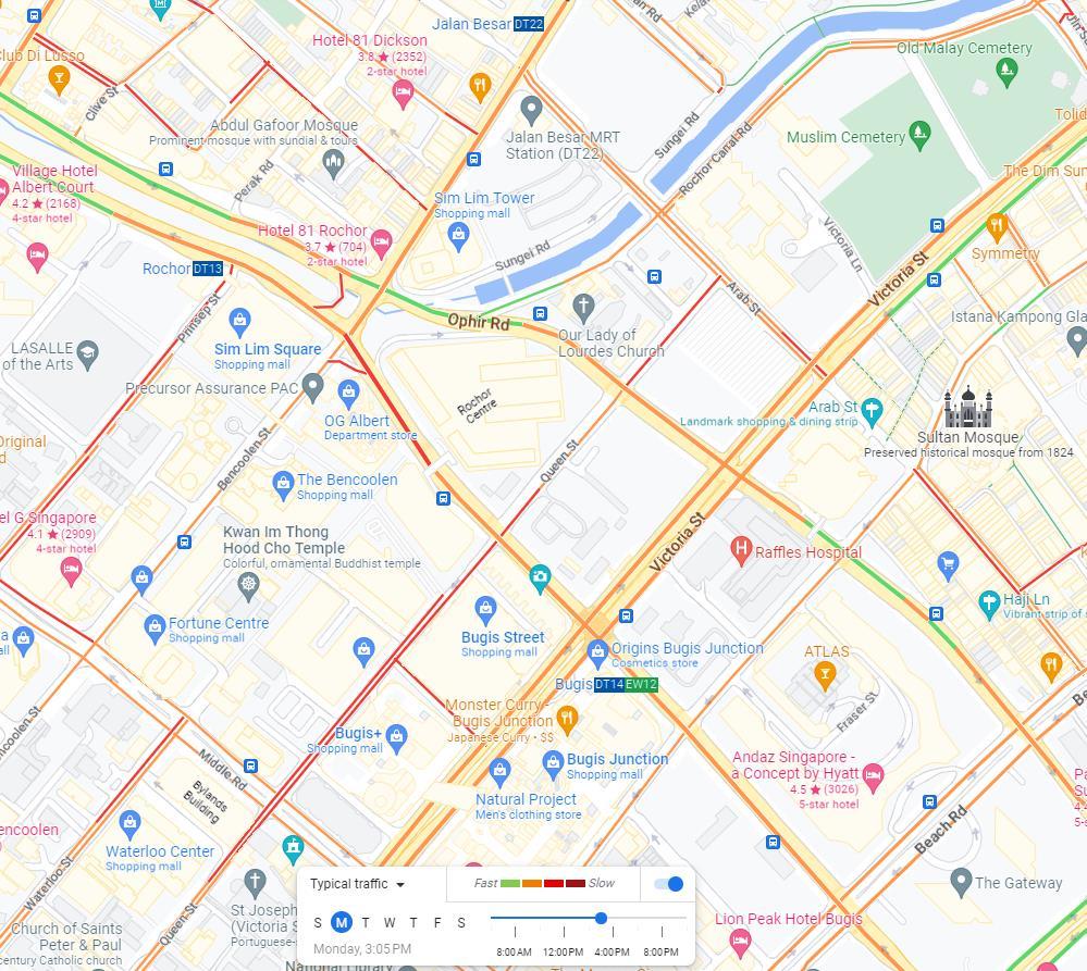
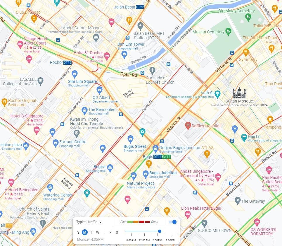
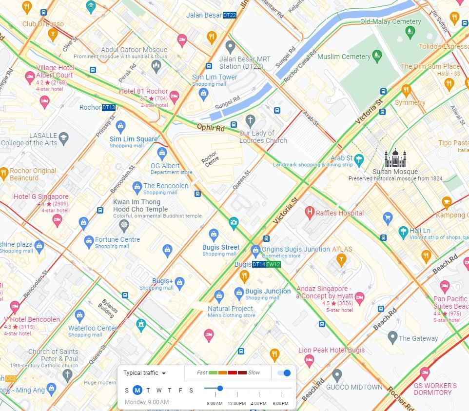
Weekend traffic Weekday evening peak hour traffic
Current Land
Uses & Neighborhoods
As mentioned, because this site is located in a dense, busy, urban part of downtown Singapore, the surrounding neighborhoods are mostly commercial with some mixed uses. Each neighborhood has different character. There is also a lack of parks and green space in this area.
Shopping malls
Pedestrian-only shopping streets
Public school
KAMPONG GLAM
Shophouse (townhouses with retail) area
Famous Temple
Public housing
Raffles Hospital Hotel
Mixed-use offices, hotel, residential and ground-floor & underground retail
Vacant/underdeveloped land
National Design Center
Entrance & Exit to future North South Expressway CorridorLITTLE INDIA
BUGIS
Future condominium
Arts school
Famous Mosque Arts school
Church A B C D
Demographic & Neighborhood Character Analysis
Total resident population in 2020 of the 3 neighborhoods surrounding Queen Street Bus Terminal (includes areas not shown on map):
• Kampong Glam: 120
• Little India (including Sungei Road subzone): 5320
• Bugis: 890
These numbers do not include immigrants, expatriates, etc. (and are not available) because they are very transient- they typically do not stay here long-term, and therefore considered non-residents. The number of residents are very small because Singapore did not originally plan for and zone these neighborhoods to be residential, although historically they were.
While these 3 neighborhoods do not have significant resident populations, they are densely populated with visitors of all demographics (Singaporeans, immigrants, tourists, young, old, from every religion, race/ethnicity, and everything in between) and those who work here, and have huge distinctions in their neighborhood characters, even within themselves, as described in the next 3 pages.
These 3 neighborhoods are historically home to Singapore’s earliest immigrants from South Asia, the Malay Archipelago and the Middle East. They are the predecessors of today’s Singaporeans of ethnic Indian descent (about 9% of Singaporeans) and Malay/Muslim descent (about 15% of Singaporeans). This form the basis of the character of these neighborhoods.
These neighborhoods are rich in public transportation connections, but are increasingly lacking affordable housing, have almost no green space (vacant/undeveloped land does not count), and for a commercial neighborhood, little office space as well (since it’s mostly retail).
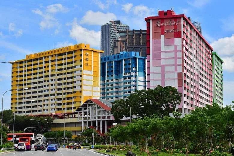
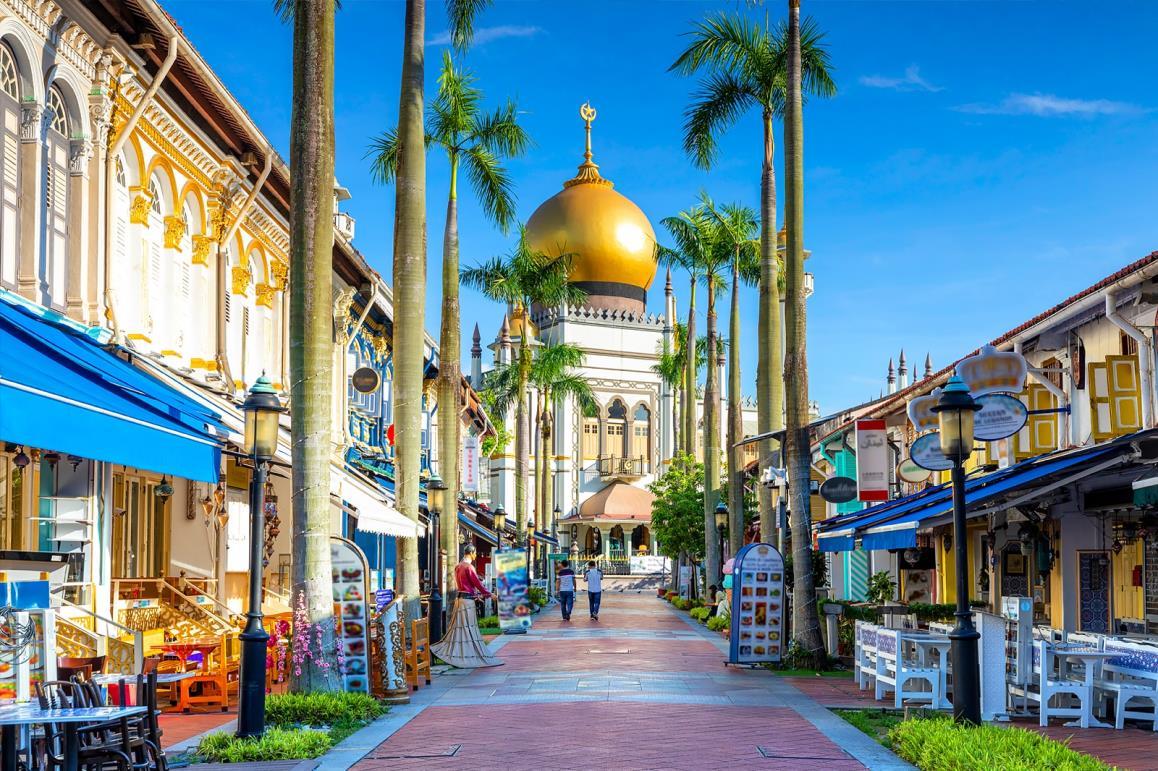
Kampong Glam is Singapore’s historic Muslim, Malay and Arab neighborhood where Singapore’s Muslim immigrants have settled in and congregated since the 1800s. Today most of their descendants (today’s Singaporean-Malays), however, no longer live there (they live all over the country), as even though Kampong Glam is conserved, the use of the historic shophouses (townhouses with retail) are largely commercial. It is a community hub for Singaporean & immigrant Muslims as well as a destination for Islamic cultures, bohemian retail (especially at the pedestrian mall) and tourism. https://www.google.com.sg/url?sa=i&url=https%3A%2F%2Fdiscov erist.changirecommends.com%2Fsee%2Fstaycation-guidekampong-glam-singapore%2F&psig=AOvVaw2ZqYo_Tsy5kX-rQEtqTPK&ust=1679575382015000&source=images&cd=vfe&ved=0
CBAQjRxqFwoTCJCXsILI7_0CFQAAAAAdAAAAABAw
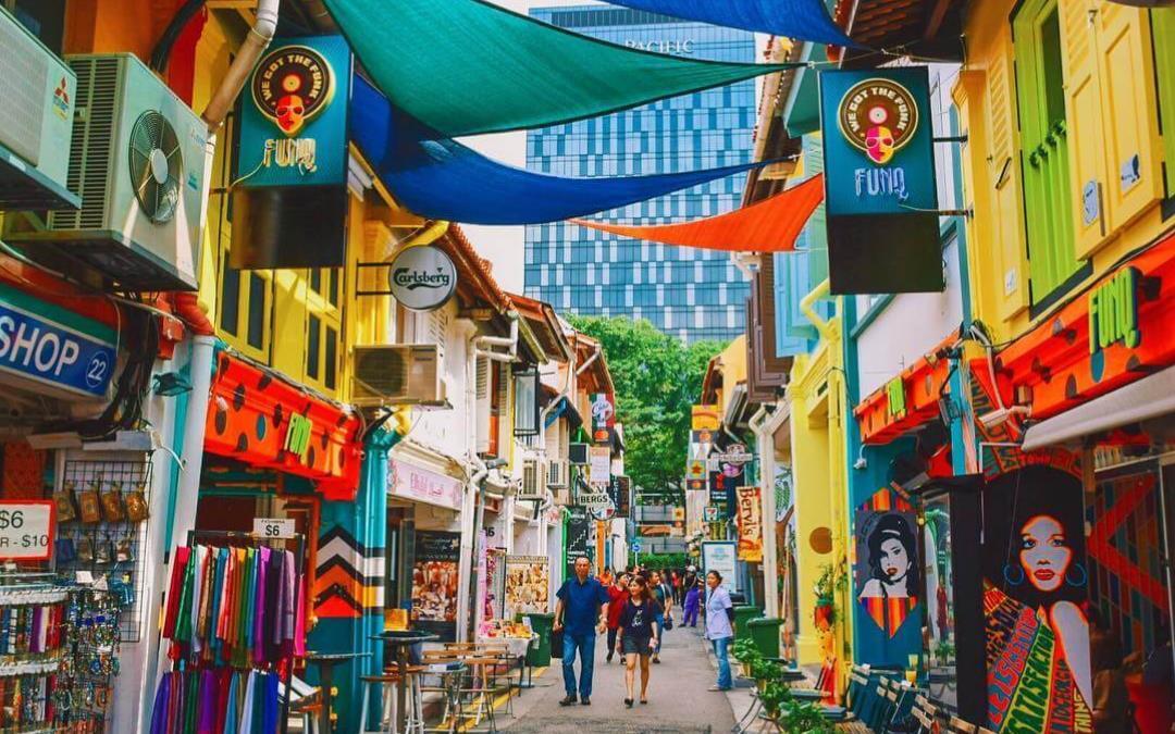
From: https://a.cdn-hotels.com/gdcs/production168/d1440/3528cbec-c0ae-426b-904a-fe0ed2533d7e.jpg From https://discoverist.changirecommends.com/see/staycation-guide-kampong-glam-singapore/
The same story goes for Little India, the historic quarter for Singapore’s immigrants from South Asia and their descendants (today’s SingaporeanIndians), though because a few public housing blocks and condominiums are also built within, the resident population is higher. It is a community hub for Singaporean Indians, South Asian immigrants, as well as a retail & tourist destination.
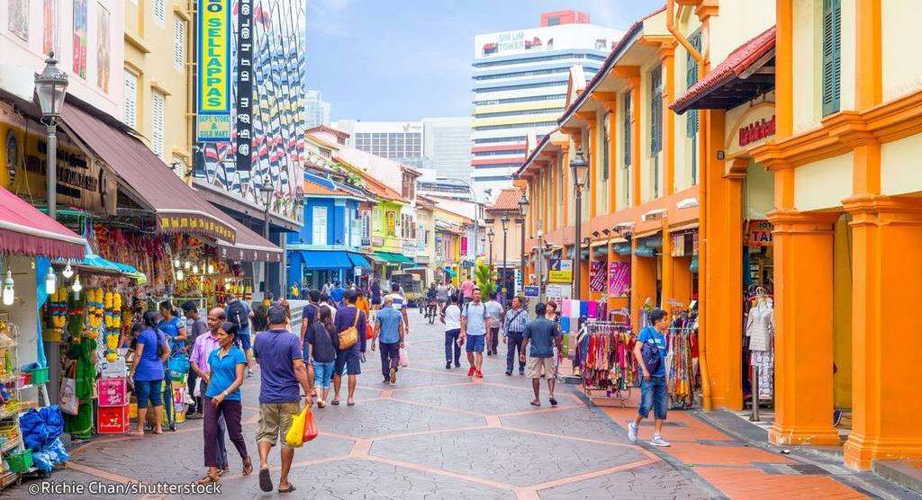
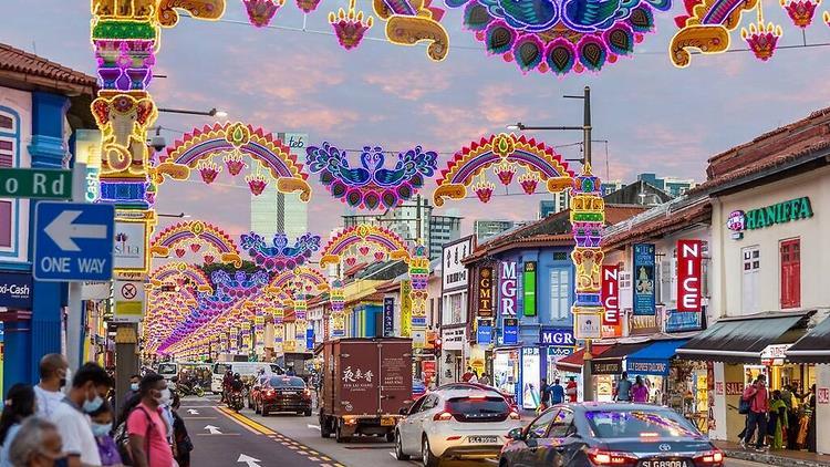
From: https://www.timeout.com/singapore/news/little-india-coolest-neighbourhood-2022-101222
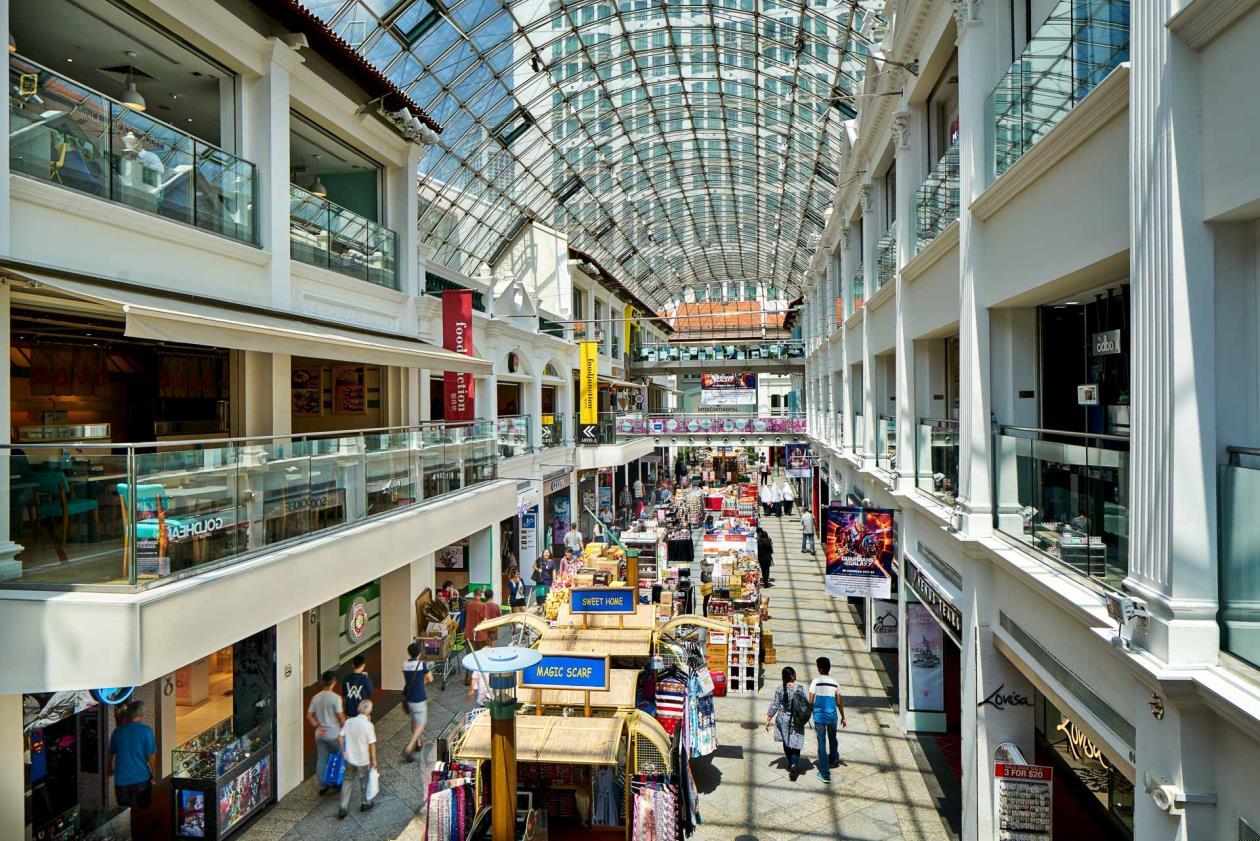
Bugis was a village for Bugis immigrants (an ethnic group from Indonesia), but in the early & mid-20th century, the Bugis people moved out and it became Singapore’s prime red-light district. After Singapore’s independence in 1965, the government did a massive transformation of Bugis into a largely modern retail district (i.e. erased the historic character of the Bugis culture and red-light district), although it built a few public housing blocks and left the character of the pedestrian mall (Waterloo Street) outside the famous Buddhist temple to be largely religious. That area is mostly lowincome and elderly residents. However the area around Bugis MRT (subway/metro) station is one large shopping/commercial area for all demographics, in particular the younger generations. The part of Bugis with the arts schools has become Singapore’s arts district particularly for the younger generations as well.
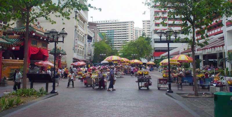
https://chrisogrady.com/architectural-photography-bugis-junction-singapore/
https://youyongfinalyearproject.wordpress.com/waterloo-street/
Housing Affordability
Housing therefore is limited to these few public housing blocks (which are aging), and one is already being demolished to make way for the construction of the North South Expressway Corridor (NSC). New residences are being built, but they are mostly luxury apartments, leaving little affordable housing in the area. Public housing in Singapore is a major discussion topic altogether, but the general trend is that at least for rentals in this area and throughout the country, they have been soaring rapidly and are increasingly unaffordable. So new residents are often from the wealthier demographics.
The public housing blocks demolished for the NSC https://www.homeanddecor.com.sg/design/ news/5-historical-things-to-know-andremember-about-rochor-centre/

Example of new luxury residences in Bugis with increasingly unaffordable rents, this one as part of a mixed-use complex https://www.architonic.com/en/project/buro-olescheeren-duo-twin-towers/5106122

Zoning according to current Masterplan
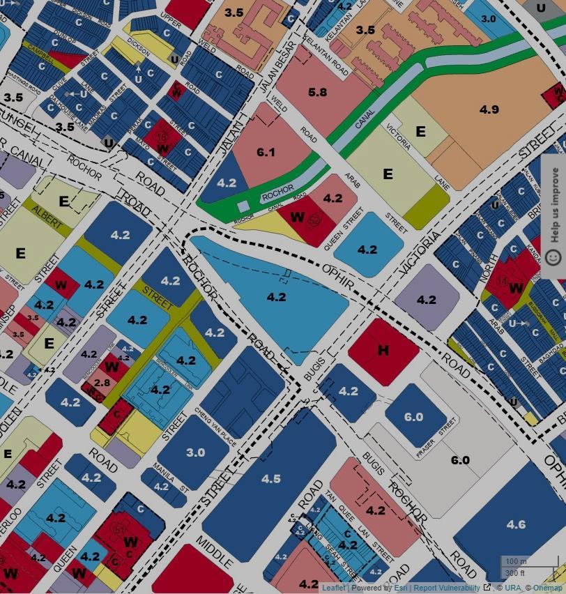
According to the Urban Redevelopment Authority’s (URA) Masterplan (which is Singapore’s Comprehensive Plan for land uses), A and B is zoned to be mostly residential, with commercial only at 1st floor, and C and D is zoned to be a full mixed-use commercial & residential
The numbers are the Gross Plot Ratio (Singapore’s Floor Area Ratio in metric measurements) allowed by URA.
A B C D
3D analysis of the site
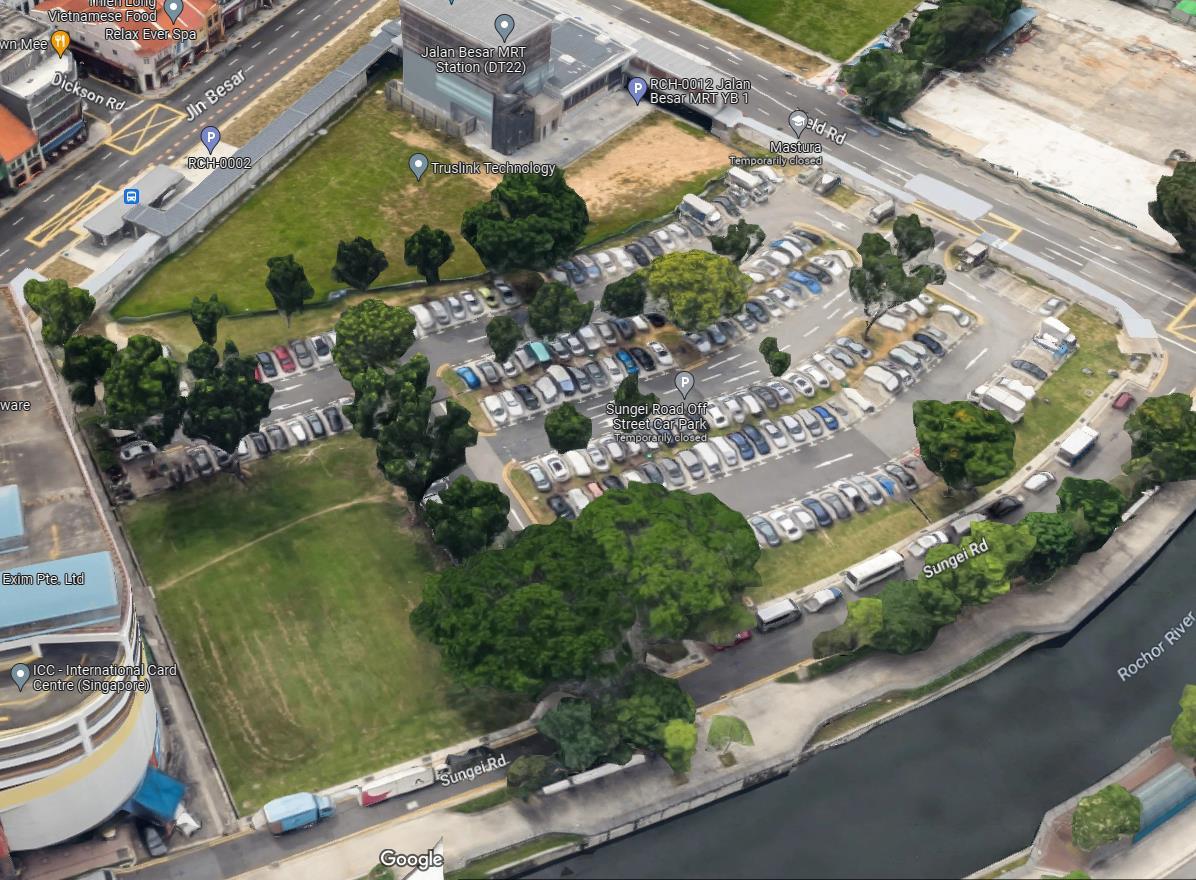
Besides the Queen St Bus Terminal (A) itself, the other sites with large parking lots (B and C) and soon-to-be-cleared construction wasteland (D) leaves much to be desired, considering their prime location in downtown Singapore with a high real estate value. Therefore these 4 land parcels combined would have huge development potential.

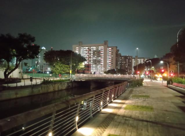
Rochor River (below) cutting in between A and B can be turned into a potential asset as well rather than a divider. It was turned into a concrete canal to drain stormwater runoff (Singapore has a hot and rainy tropical climate), but it was recently revitalized with pedestrian promenades for the public to enjoy the river. Rocher River could provide waterfront development opportunities for the site.
A B C D
Proposed River Peaks Public Housing Project at Parcel B
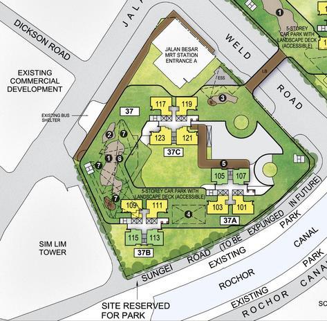
Upon further analysis, it is found that Parcel B (now a parking lot) is the site of a planned public housing project. Therefore the plan is to incorporate these new apartment blocks into the rest of the parcels and the objective for this parcel would be to create connections between the Little India neighborhood and Jalan Besar MRT (subway/metro) station with the rest of the Queen Street Bus Terminal project.
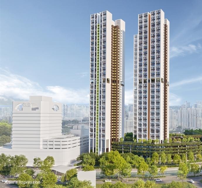
https://dollarsandsense.sg/wp-content/uploads/2021/11/river-peaks-cover.jpg
http://www.hausanalyst.com/uploads/5/5/4/1/55410565/03-siteplan-ct-n5c7-c8_orig.png
Overall Site Analysis Map

Chosen site in red dotted line


A- Existing bus terminal
B & C- Surface parking lots
D- Construction wasteland to be cleared
Little India, Bugis & Kampong Glam are neighborhoods
Important arterials (in orange), collectors (in blue), local streets (in yellow) and one-way streets (in dashes) around the site.
LITTLE INDIA
MRT (subway/metro station)
Public bus stops that are most relevant to site
Shopping malls
Pedestrian-only shopping streets
Shophouse (townhouses with retail) area
Vacant/underdeveloped land
Entrance & Exit to future North South Expressway Corridor
Entrance & Exit to future North South Expressway Corridor
A B C D
Entrance & Exit into bus terminal BUGIS
Mixed-use offices, hotel, residential and ground-floor & underground retail
Famous
Arts school Arts school
Raffles Hospital Hotel Public housing National Design Center Public school Future condominium
Temple Famous Mosque
Church
KAMPONG GLAM
Values and Objectives
• Transform the 4 parcels into a single integrated mixed-use development with uses that complements the neighborhood and meets their needs, i.e. a proper transportation hub for intercity buses, residential (especially affordable housing), offices, commercial, etc. Incorporate the proposed plans for Parcel B into the development and plan it as a connector between Little India and the rest of the new development.
• Integration of the new development with the different characters of the surrounding 3 neighborhoods through urban design and adhering to densities required by zoning.
• Enhance area connectivity as well as beyond
▪ Give the bus terminal proper infrastructure it now lacks. Expand the terminal into a hub for all intercity bus services to Malaysia
▪ Connect this development with the neighborhoods and the existing public transportation network, in fact let this new development be a central node and connector, not just for intercity bus transport, but also for the 3 neighborhoods.
▪ Take advantage of the North South Expressway Corridor (NSC) entrance/exit as a direct highway connection towards northern Singapore and Malaysia.
• Take advantage of the Rochor River to add waterfront development as a complement to the site’s urban design.
• Increase green & outdoor public/park space, which is currently lacking in this area, on the Rochor River and on the roofs of the development
Redeveloping the Queen Street Bus Terminal Site, Singapore as Queen’s Crossing
(Option 2: Site that I know)
Program and Concept Plan
The Rationale Behind Queen’s Crossing
As seen in the site analysis, the area around Queen Street is located in a very central location of Singapore and therefore this site would be ideal as a node, hub and connector for not just the 3 neighborhoods of Little India, Bugis and Kampong Glam, but also downtown Singapore and the rest of the city-state. It can easily be well-connected to existing public transportation systems as well as the future North South Expressway Corridor (NSC).
There is tremendous development opportunity in this area for Singapore’s central bus terminal and an integrated mixed-use development to be here, given its geographical and surrounding environmental advantages. These plots of land also presents an opportunity to address the area’s urbanism issues, as discussed in the following pages.
Precedent Studies- East Seoul Bus Terminal, Seoul
The East Seoul Bus Terminal Project is TOD (Transit Oriented Development) to modernize deteriorated bus terminal facilities to mixed use development including retail mall and serviced apartments. It is envisaging itself as a platform connecting people to people and city to city, as a major transportation hub in northeastern region of Seoul and as an upscale complex facility featuring shopping, leisure, tour and living district.
This South Korean concept is very much like what is envisioned for Queen’s Crossing, especially its role in Singapore.
 By Farrells, https://farrells.com/project/east-seoul-busterminal
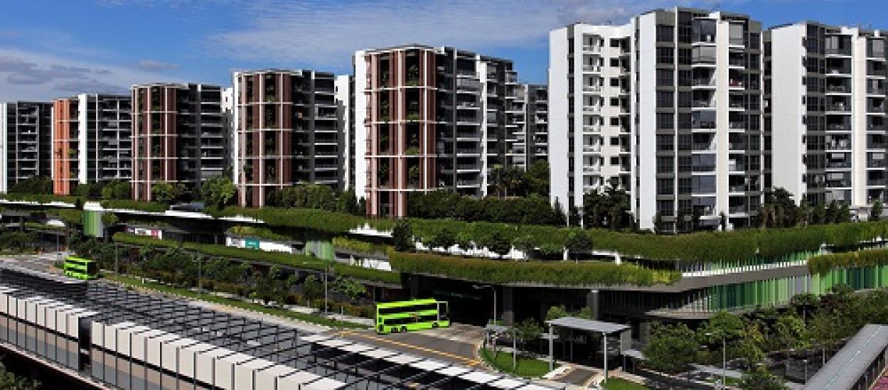
Precedent Studies- Yishun Integrated Transport Hub, Singapore
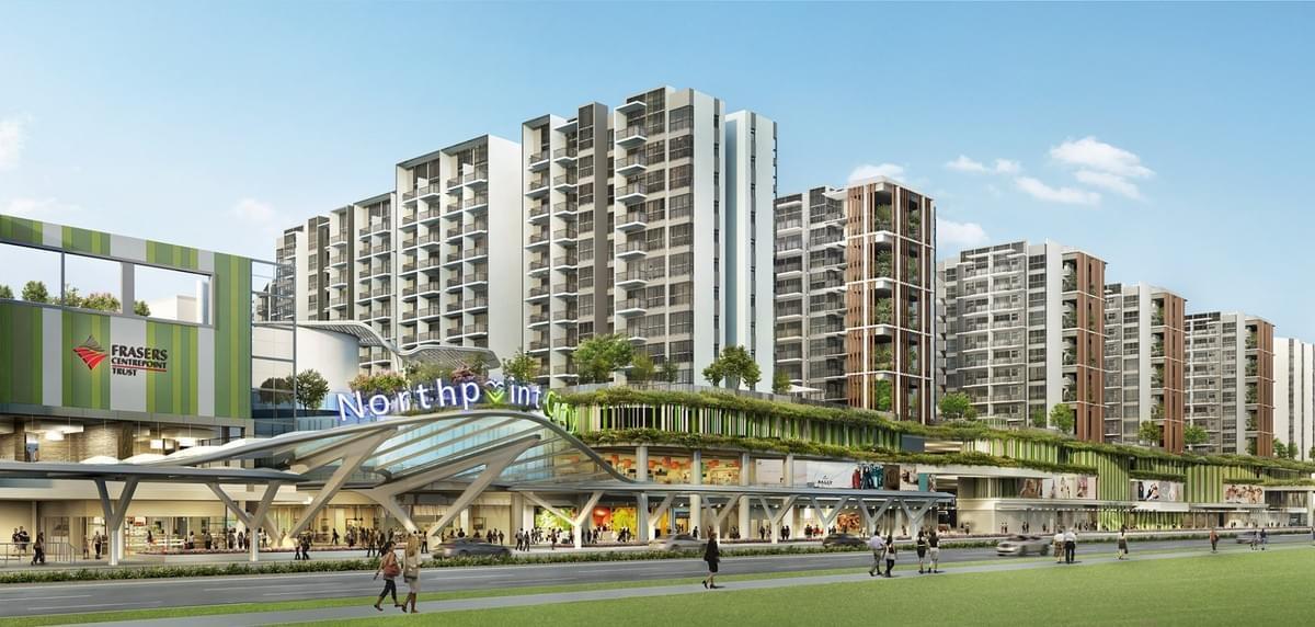
HDB Trends https://hdbtrends.mystrikingly.com/blog/yishunone-of-popular-towns-amongst-hdbneighbourhood
Edgeprop
https://www.edgeprop.sg/propertynews/well-integrated-accessibleholistic-design
This TOD in Singapore, with a bus terminal, underground link to the MRT (subway/metro), a huge shopping mall and public housing on top is an existing Singaporean example that Queen’s Crossing could draw inspiration from.
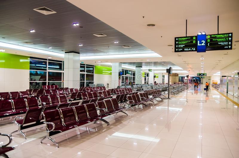
Precedent Studies- Terminal Bersepadu Selatan (Southern Integrated Terminal), Kuala Lumpur
This example in Malaysia will be a reference for how the interior of the new bus terminal would be designed.
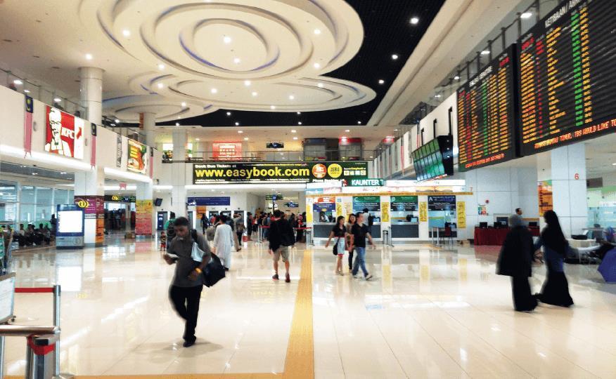
https://www.dreamstime.com/kuala-lumpur-malaysia-october-departure-hall-termi-kualalumpur-malaysia-october-departure-hall-terminal-bersepadu-selatan-image113010986
https://www.theedgemarkets.com/article/maju%E2%80%99s-bus-terminal-put-out-tender
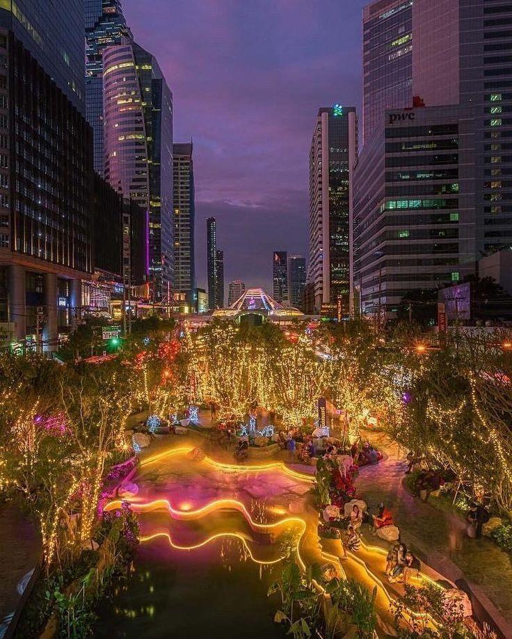
Precedent Studies- Khlong Chong Nonsi, Bangkok
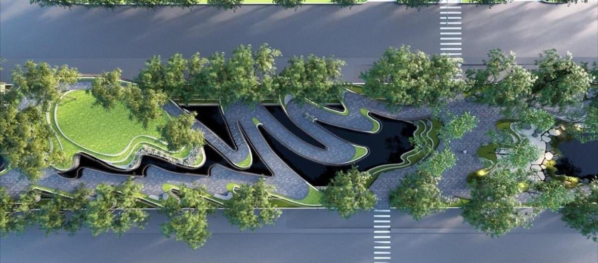
This example in Thailand will be a reference for how the Rochor Riverfront, linking Parcels A and B, could be redesigned.
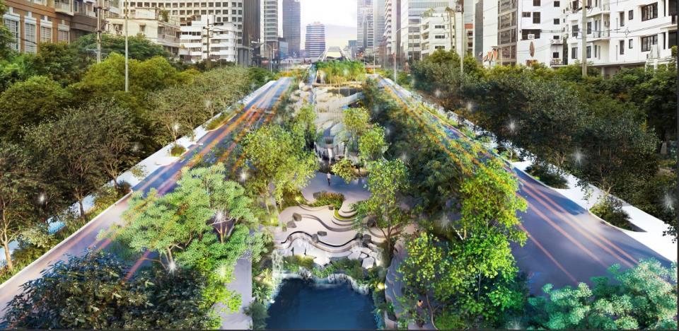
Sources of images: Pinterest, Bangkok Post and Richard Barrow in Thailand https://static.bangkokpost.com/media/content/dcx/2021/11/01/4130603.jpg https://www.richardbarrow.com/wpcontent/uploads/2021/10/FByZLqfVIAQ3Oyf.jpg
Precedent Studies- Siam Premium Outlets, Bangkok
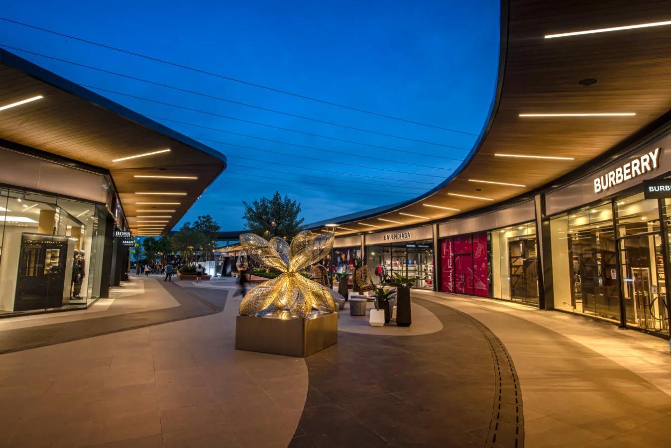
This example in Thailand will be a reference for how the shopping area on Parcel D will look like- with an outdoor public realm in the middle, but with larger green spaces and 2 floors.
All photos from: https://www.lifestyleasia.com/bk/sponsored/siam-premiumoutlets-bangkok/
Land Use Concept Plan
Residential with groundfloor retail (Proposed River Peaks II public housing)
FAR: 6.1
Land area: 10924 sqm
Residential with groundfloor retail
FAR: 4.2
Buildable land area: 4116 sqm
Hotel, ground-floor retail, rooftop park
FAR: 4.2
Buildable land area: 10060 sqm
Integrated complex with shopping mall, offices, rooftop park and new bus terminal
FAR: 4.2
Land area: 14344 sqm
A B C
Entrance & Exit to future North South Expressway Corridor
D
A B C D
A B C D
Program
Queen’s Crossing will be an integrated mixed-use development, but will emphasize uses that are currently lacking in the 3 neighborhoods, such as affordable housing, offices and green spaces (on the roofs), to take the opportunity to resolve the area’s issues of sky-high rents, dearth of housing options, as well as the lack of office space and green public spaces. Retail (which would be concepts that are different from the existing shopping options in the vicinity) and rooftop green spaces will give reasons for bus passengers and the public to linger longer and make the development a destination for all- and it would not have a target demographic because the purpose of this development is to connect and to bring everyone together. The design will be inspired by East Seoul Bus Terminal (see Precedent Studies pages), however because of the limited FAR/Gross Plot Ratio allowed by Urban Redevelopment Authority, the buildings will be much smaller in comparison.
-
Total floor area: 4116 (buildable land area) x 4.2 (FAR)= 17287 sqm
- Ground-floor retail (with large supermarket as an anchor), residential lobby, services: 3639 sqm
- Residential: 10550 sqm (500 per floor; about 20 floors)
- Green space: 1463 sqm
- Outdoor public realm (excluding green space): 1635 sqm
Parking underground
B (Proposed River Peaks II public housing)
- 47 floors, 480 apartment units (floors 7 to 47)
- Retail (mostly food) on first 2 floors, parking garages on floors 3 to 5, and garden on floor 6.
-
Playgrounds and fitness facilities on ground floor
-
*The retail concept on Parcel A will be a revival and replica of the Sungei Road Flea Market, which was located near Rochor River and was closed down in the past decade. Street markets is a concept beloved by Singaporeans, but is not common in Singapore.
-
Total floor area: 10060 x 4.2= 42252 sqm
- Hotel: 14532 sqm (1000 per floor; about 14 floors)
-
Residential: 14532 sqm (1000 per floor; about 14 floors)
Total floor area: 14344 x 4.2= 60245 sqm
- Retail: 14767 sqm (1st, 2nd and 3rd floors)
- Office: 22956 sqm (3681 sqm per floor; about 6 floors)
- Bus terminal: 10000 sqm
- Green space: 4560 sqm (1st, 2nd and 3rd floor)
Ground-floor retail (indoor Sungei Road Market*), residential lobby, services: 7118 sqm
-
-
Green space: 3308 sqm
- Outdoor public realm (excluding green space): 2762 sqm
Parking underground
- Outdoor public realm (excluding green space): 7962 sqm
Parking underground
A
C
D
Massing studies to determine program for A, C and D

A B C D
Original massing Final rendering
Traffic Flows
Relocating the existing bus terminal from Parcel A to D would let buses have direct access between the terminal and the entrance/exit of the NSC, and buses that use the NSC would have one direct route to the north of Singapore and Malaysia. The circulation pattern proposed would avoid heavy congestion on Ophir, Sungei and Rochor Canal Roads as much as possible, especially since the new bus terminal is expecting heavy bus traffic.
MRT (subway/metro station)

Public bus stops that are most relevant to site
Entry/exit into parking lots for cars
Entry/exit into bus terminal for buses

Underground parking lot
Drop-off & pick-up point
Important arterials (in orange) collectors (in blue)
local streets (in yellow)
one-way streets (in dashes)


Singapore drives on the left, like the UK
Entrance & Exit to future underground North South Expressway Corridor (NSC) A B C D U-turn A B C D
P D P P P D D D
P
D
How intercity buses would circulate

A new dedicated lane would be constructed on each side specially for the intercity buses to go to & from the NSC and bus terminal, to avoid congestion on the existing arterials.
Entrance & Exit to future underground North South Expressway Corridor (NSC)
C
Having the bus terminal at Parcel D would also be an opportunity to expand the terminal space to 50 bays/berths and 10 000 sqm, which is similar in size to the intercity bus terminal (Larkin Sentral) in Johor Bahru (the city in Malaysia just bordering Singapore). Larkin Sentral is used as a size reference because many buses that serve Johor Bahru also serve Singapore, so they have similar levels of intercity bus traffic. The interior of the bus terminals would be similar to Terminal Bersepadu Selatan in Kuala Lumpur, Malaysia, or Yishun Integrated Transport Hub (see Precedent Studies), except that it will be just 1 floor.
MRT (subway/metro station)
Entry/exit for cars
Entry/exit into bus terminal for buses
Underground parking lot
Drop-off & pick-up point
D
D P P D
C
Singapore drives on the left, like the UK
P
D
A
D
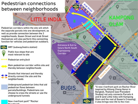
Pedestrian connections between neighborhoods
LITTLE INDIA KAMPONG GLAM
Pedestrian corridors within the site will stitch the separate parcels into one development, as well as provide connection between the 3 neighborhoods. Queen Street and Arab Street themselves will also perform this connecting function for vehicles and pedestrian outdoors.
MRT (subway/metro station)

Public bus stops that are most relevant to site
Pedestrian entry/exit
Main pedestrian corridor within site and thereby between neighborhoods
Streets that intersect and thereby directly connect the site and the neighborhoods
Underground pedestrian links that aid pedestrian flows between parcels/buildings. Pedestrians can choose to cross the streets or use the underground tunnels
New riverfront park* “Rochor Riverfront”
BUGIS
A
B C D
B C D
A
*A new riverfront park on Rochor River inspired by Khlong Chong Nonsi in Bangkok, Thailand (see Precedent Studies) not only connects Parcels A and B (and Little India with Kampong Glam and the rest of Queen’s Crossing), it also brings new life to the river.
Entrance & Exit to future North South Expressway Corridor
How bus passengers experience the site

C
Arriving passengers get off their buses at the bus terminal area of the building and can choose to head straight to Bugis MRT (subway/metro) station through the underground walkway, to the public bus stops, to the pickup point along Queen St, or to other parcels or neighborhoods north and east via the main pedestrian corridor. They can also get food/drinks at the shopping areas of Parcel D.
Departing passengers can arrive from Bugis MRT (subway/metro) station through the underground walkway, the public bus stops, other parcels through the main pedestrian corridor, or the dropoff point, and wait in the bus terminal area for their buses or at a restaurant, café or food court in the shopping areas of Parcel D. Types of retail may be targeted towards travelers as well.
D
Entrance & Exit to future underground North South Expressway Corridor (NSC)
C
Bugis MRT (subway/metro) station
A
Dropoff/ Pickup
D
Parking Underground tunnel
How residents experience the site
D
A
B C
Secluded space shared between residents and hotel guests
Residential blocks on Parcels A and C are located slightly away from the busy roads and commercial areas to maintain a greater sense of privacy and silence wherever possible, increasing liveability for residents. Also the residential block on Parcel A faces the Rochor River to take advantage of the views of the river and a proposed Riverfront Park. A large supermarket will occupy the ground-floor retail area of Parcel A to serve residents, as well as other retail/services that residents will benefit from. Rooftop green space offer residents the options to do community gardening and urban farming.
Residents are connected to the rest of the site via the Main Pedestrian Corridor, so that they can also enjoy convenient transportation options (MRT/subway/metro stations and the intercity bus terminal), more shopping and dining on Parcels C and D, more green spaces and public realms (including the proposed Rochor Riverfront Park) and a convenient commute to work, especially if they work at the offices on Parcel D. The surrounding neighborhoods are just steps away.
If they drive, they will have private underground parking garages underneath their residential blocks.

River Peaks II public housing
Proposed
Rochor Riverfront
How visitors, tourists, shoppers and hotel guests experience the site
D
Proposed River Peaks II public housing A
B C
Secluded green space shared between residents and hotel guests
Visitors, tourists and shoppers have a plethora of lifestyle options to choose from in all parts of the site. They could come in from any neighborhood (Bugis, Little India, Kampong Glam) and pretty much any transportation option (MRT/subway/metro, buses, cars, etc), and walk from one parcel to another via the Main Pedestrian Corridor. They would mainly enjoy a relatively traditional shopping mall experience at Parcel D, flea market-style retail at Parcel C, a supermarket at Parcel A, the green spaces and public realms on all parcels, and food-oriented retail at Parcel B. Or they could just pass through the site to get from one neighborhood to another. Rochor Riverfront will also be an attraction for visitors at its own right, more than connecting Parcels A and B.
Hotel guests will be able to experience these and more. They will have a more relatively secluded green space shared with residents and hotel facilities. Their hotel rooms face both green spaces.
Rochor RiverfrontHow office workers experience the site
Office workers that work in the office tower of Parcel D could come to work from Bugis MRT (subway/metro) station, or Jalan Besar station by walking the Main Pedestrian Corridor, by public bus, or by car, where they would park in an underground parking garage (and it would be coincidentally convenient if they were to use the North South Expressway Corridor/NSC to drive to work).
They could have their lunches at the retail areas of Parcel D, or venture further to other parcels or surrounding neighborhoods.
Their offices would largely have views of the green & retail spaces of Parcel D and further afield, or the NSC.
They would go home the same way as they come to work
D
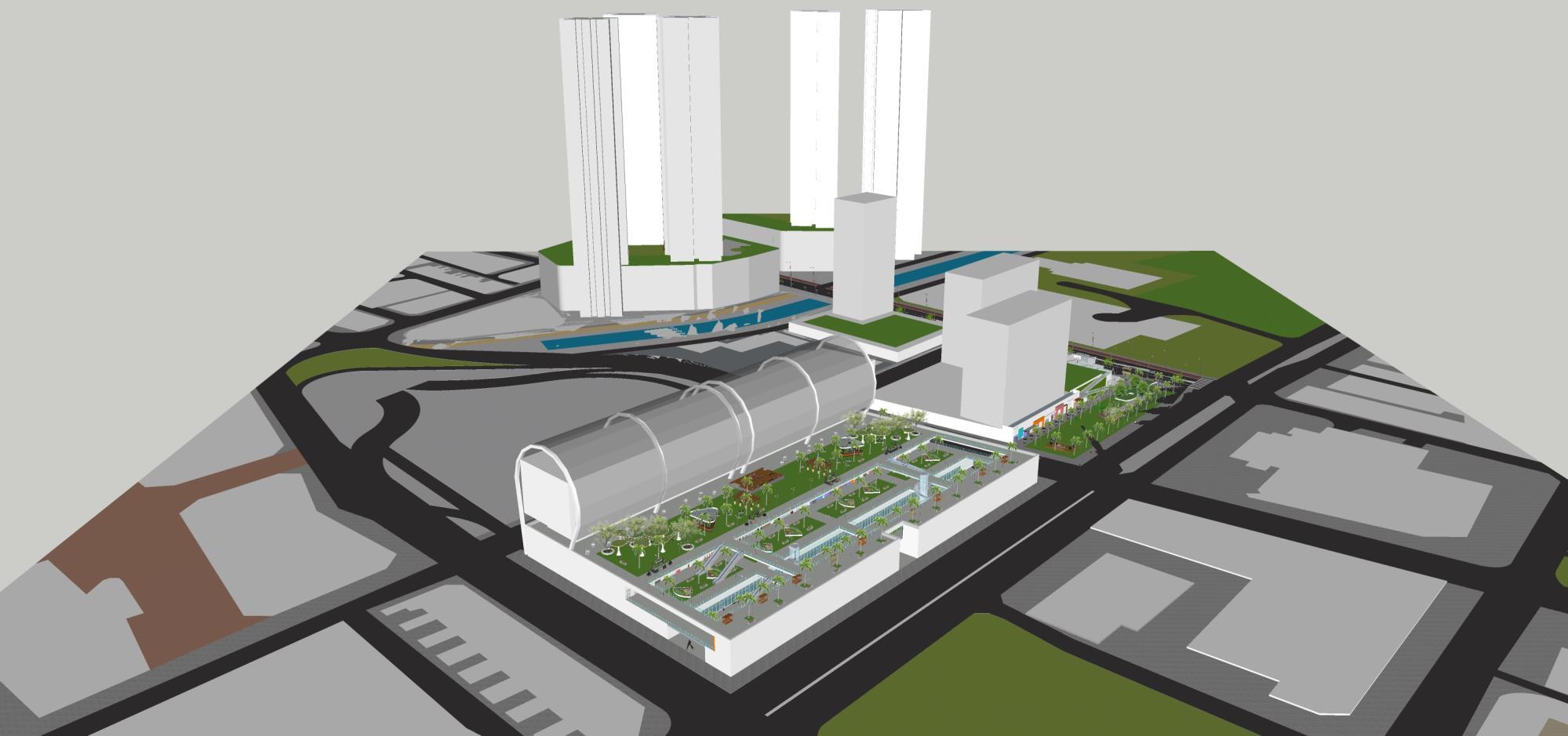
Site Plan & Renderings of Queen’s Crossing
(Option 2: Site that I know)
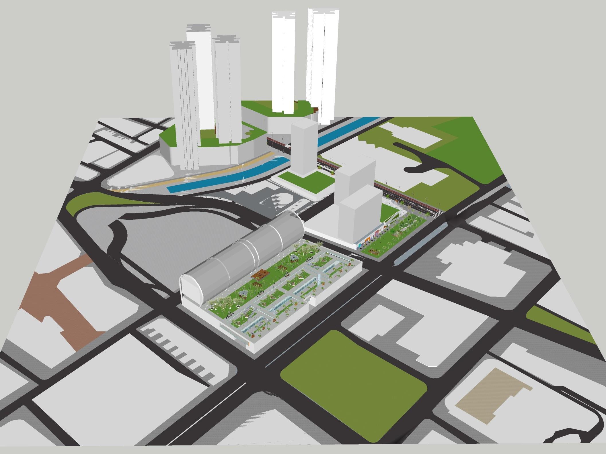
Site Plan
For details of programming of Parcels A to D, see Program and Concept Plan
A
C
B
D
Rochor Riverfront
NSC Entrance & Exit
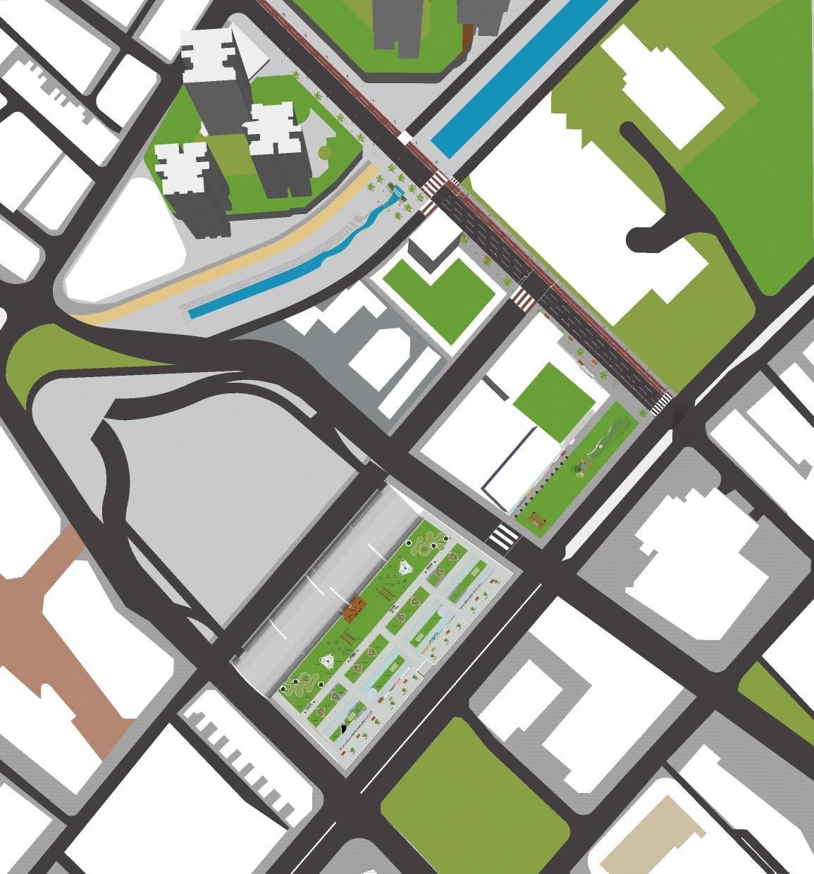
Site Plan with property lines according to current Masterplan
The current Masterplan (Singapore’s Comprehensive Plan) has not updated its property lines for the site, so even though there are currently few built structures there, the property lines (as seen overlaid on the Site Plan) actually correspond to properties that used to be there in the past before they were demolished.

This Site Plan would propose to redraw the property lines according to previously-identified Parcels A, B, C and D as 4 large properties, where Parcel B is owned by the Housing & Development Board (Singapore’s public housing agency), and the rest by real estate developer(s) of Queen’s Crossing and/or Land Transport Authority (Singapore’s public transport agency).
A B C D
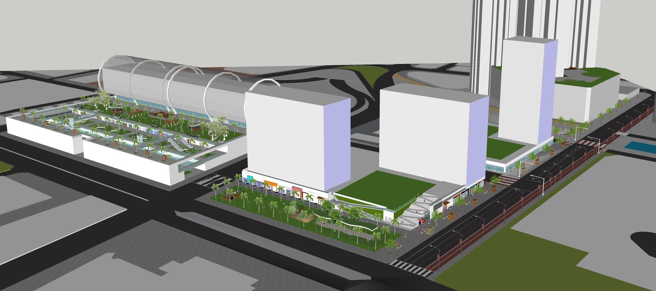
Illustrations/ Renderings
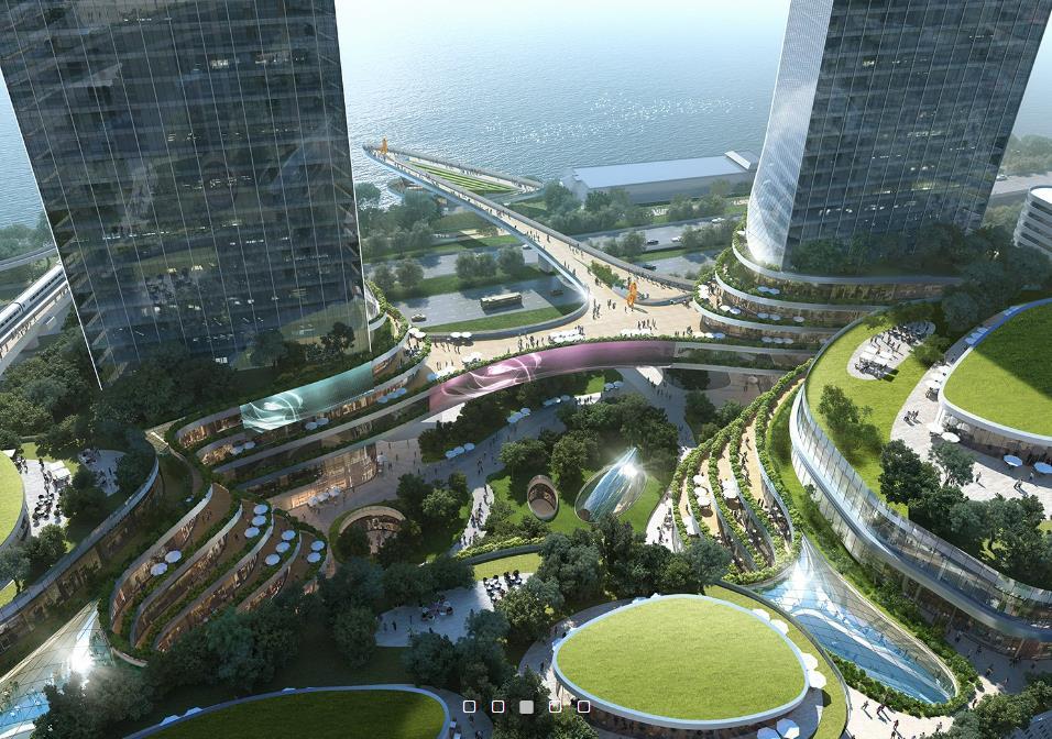
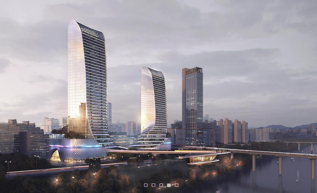
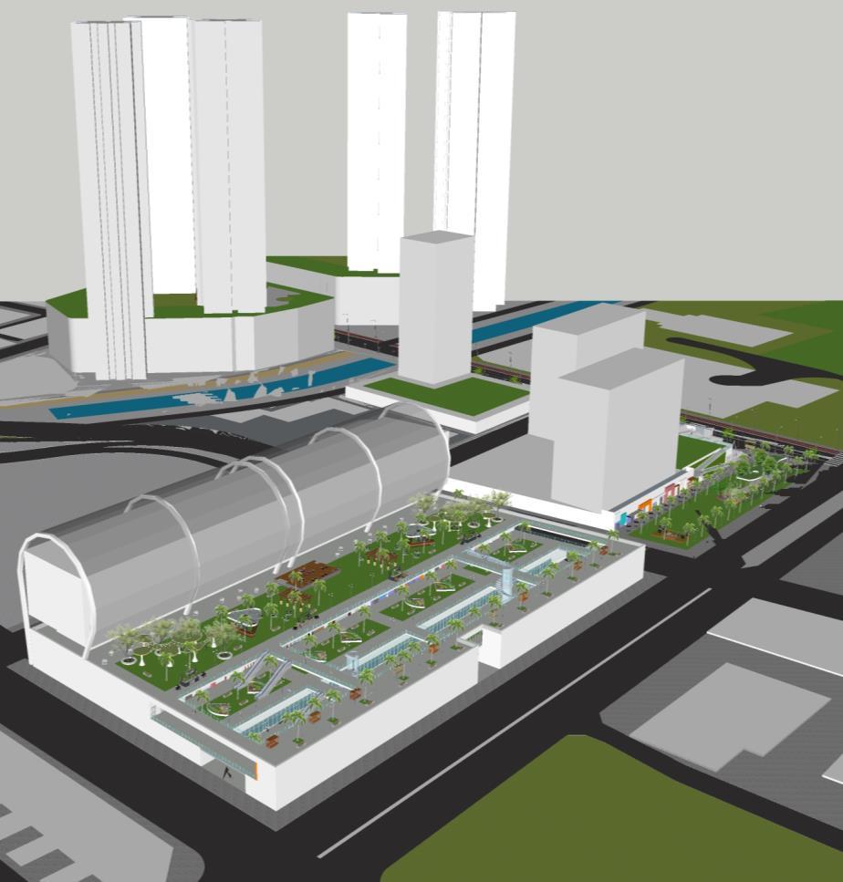
Overall rendering of site
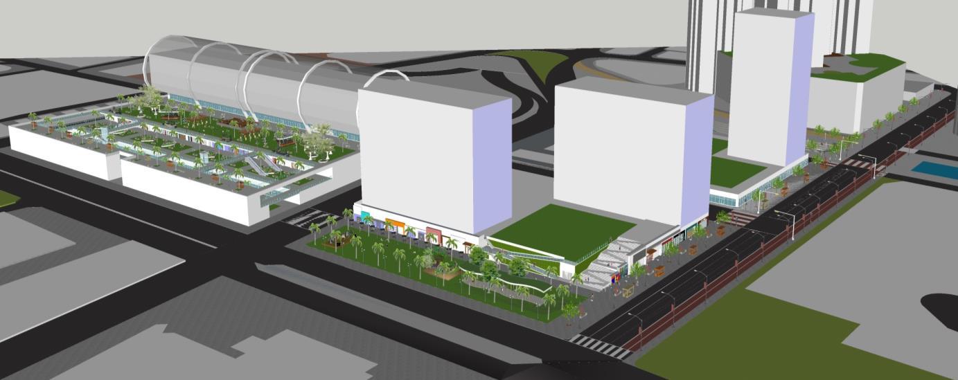
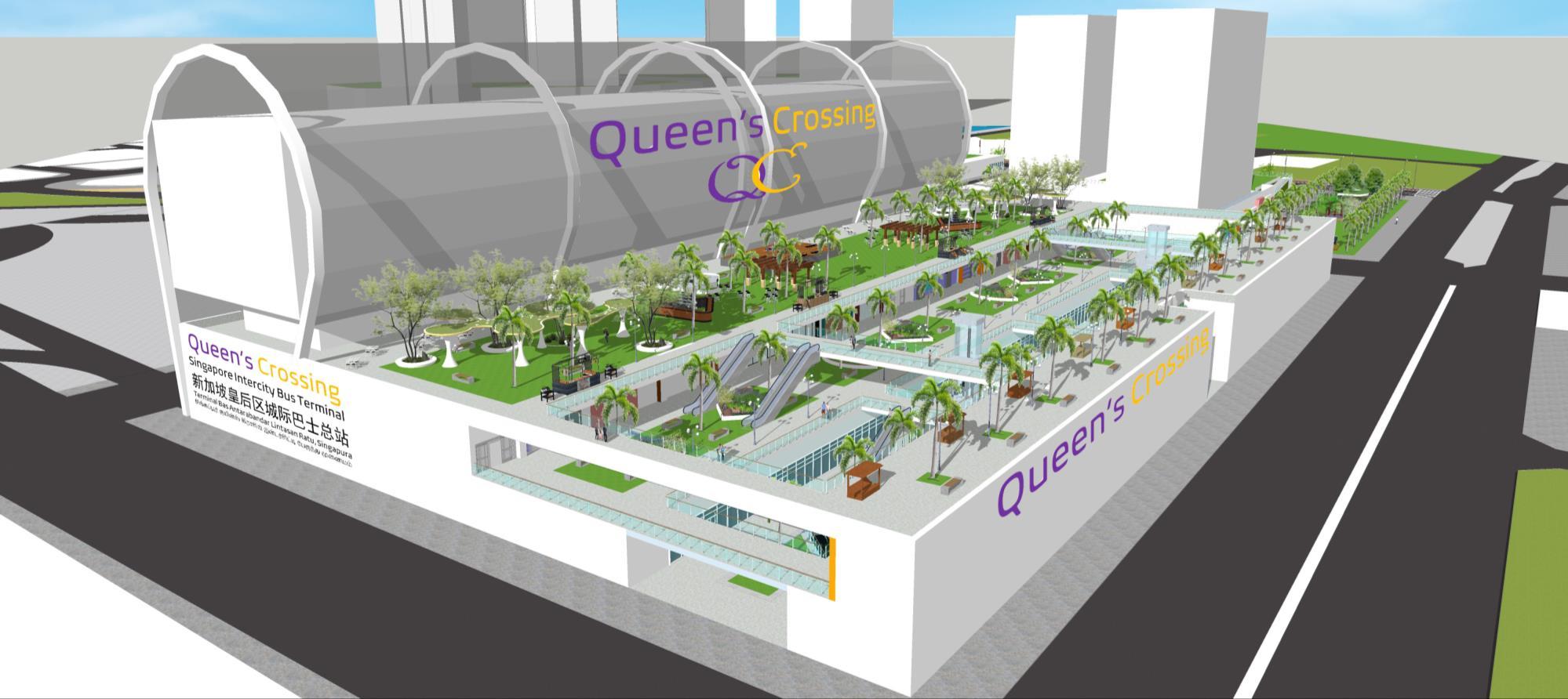
look of Parcel D
Overall
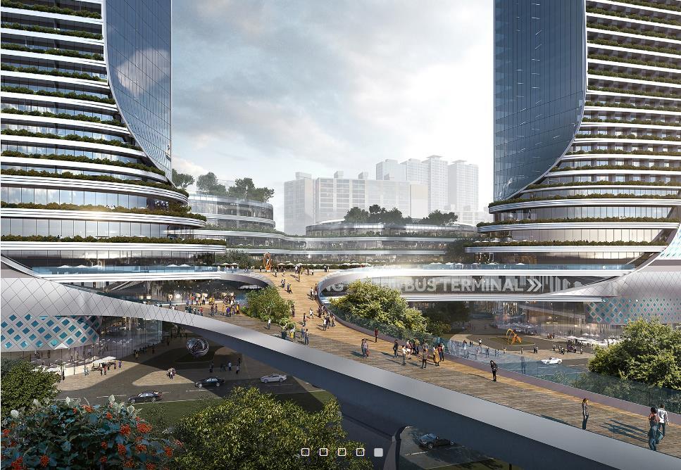
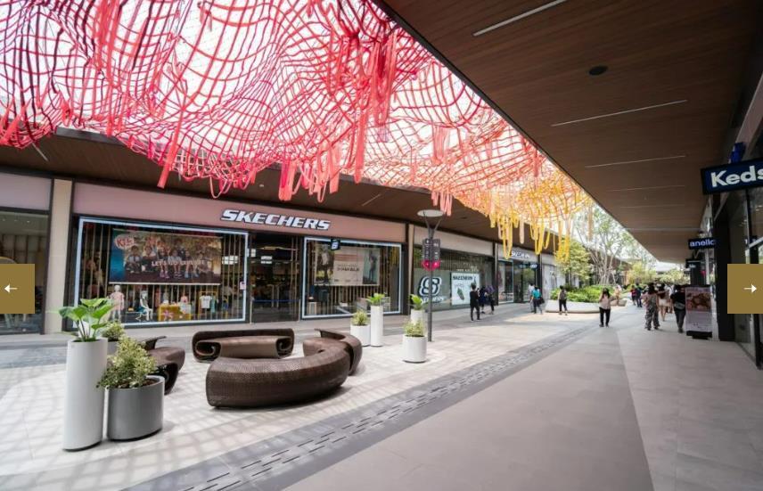
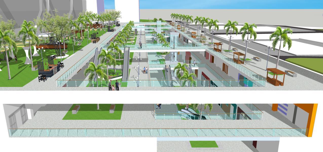
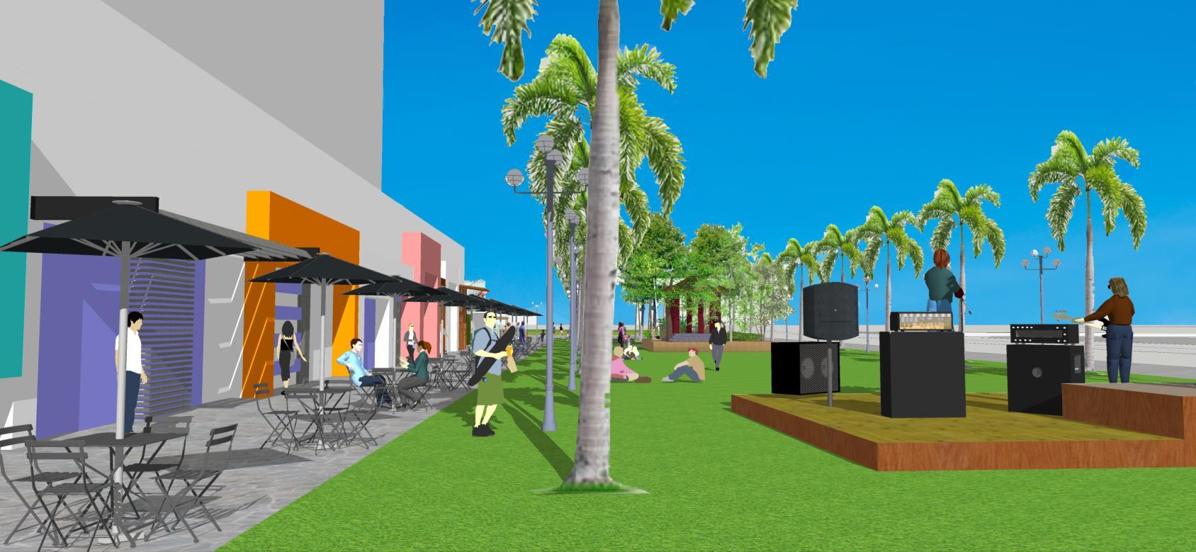
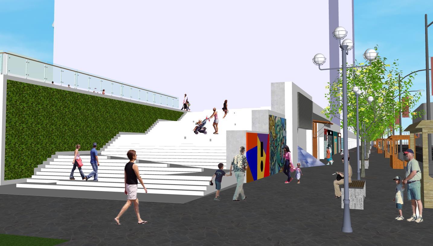
 Retail & open spaces at Parcel D above and next to intercity bus terminal (top & bottom)
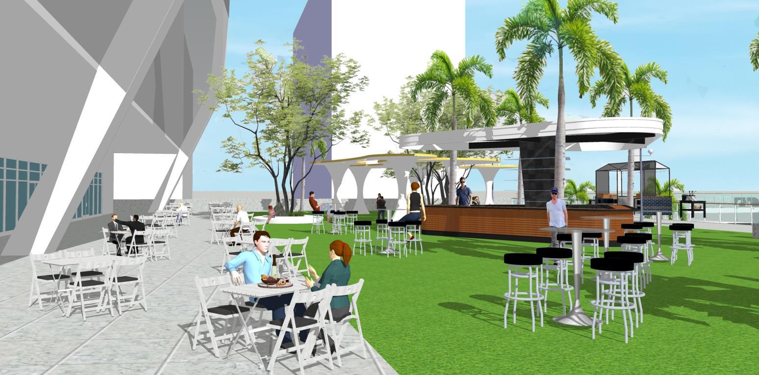
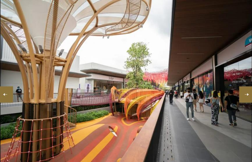
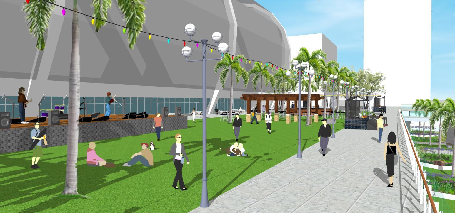 Rooftop green & open spaces above the intercity bus terminal at Parcel D (top & bottom)
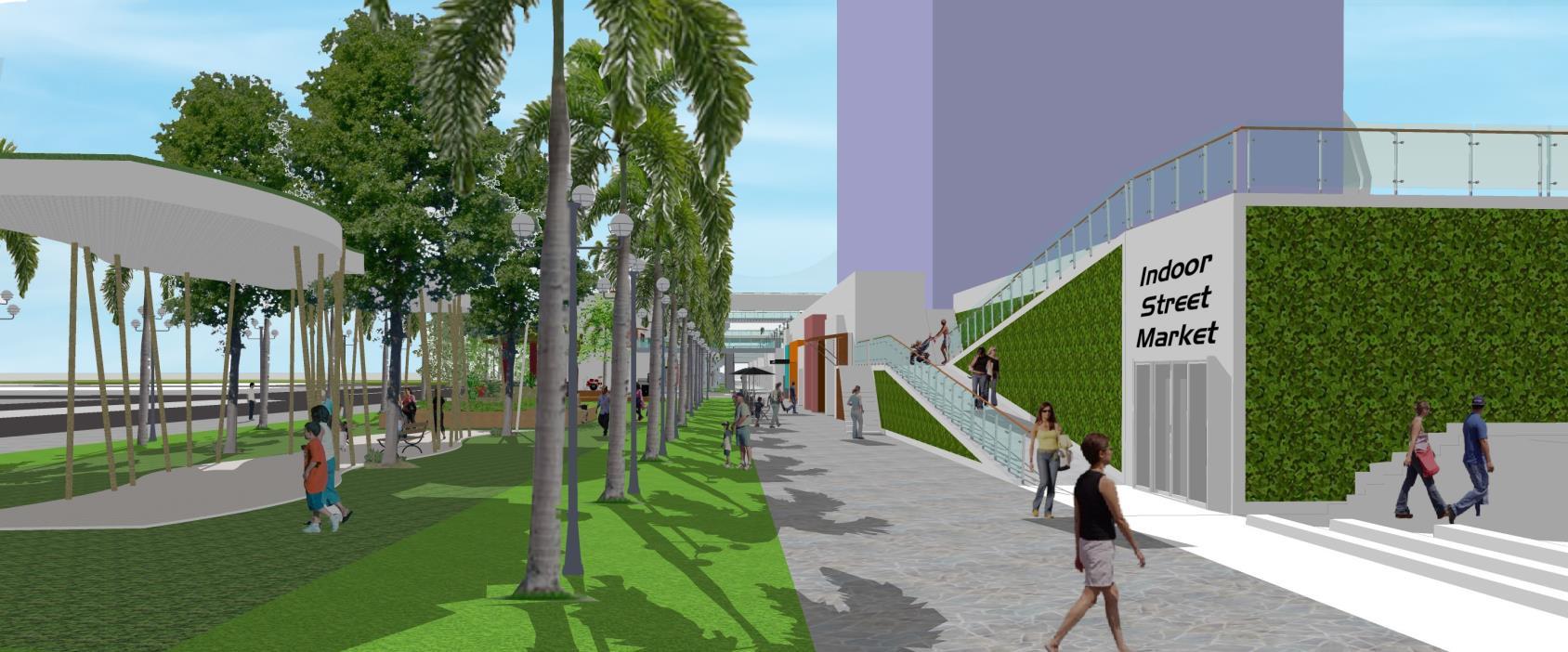
 Main Pedestrian Corridor along Victoria Street at Parcel C with linear park/open space (top & bottom)
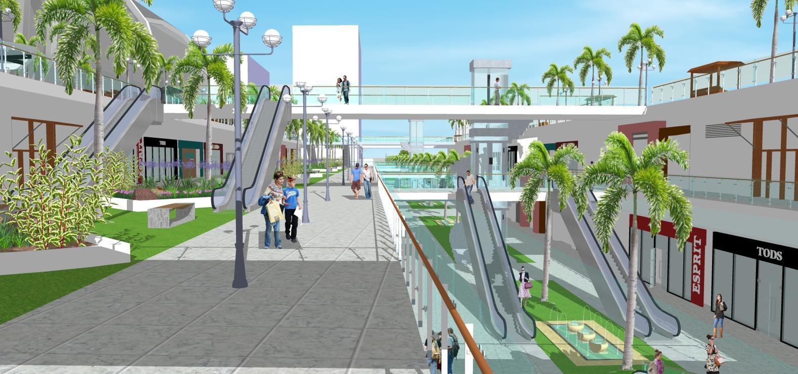
 Main Pedestrian Corridor along Arab Street at Parcel C
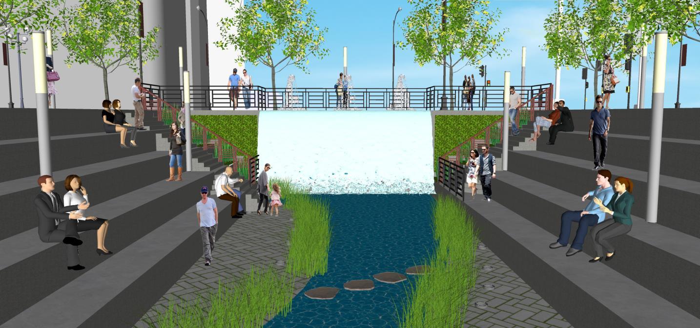
Rochor Riverfront
Main Pedestrian Corridor along Arab Street at Parcel C
Rochor Riverfront