Queen’s Crossing
Singapore
Massachusetts Institute of Technology Site Planning Online Project
Individual work
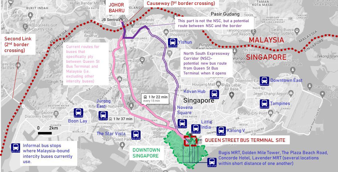
This project attempts to resolve the lack of a consolidated facility of an intercity/international bus terminal in Singapore for the numerous bus/coach services to Malaysia, while proposing the development of underused pieces of land at the nexus of three of Singapore’s most significant downtown neighborhoods of Bugis, Little India and Kampung Glam. The existing, ramshackle Queen Street Bus Terminal will be moved and given proper infrastructure inside a mixeduse development that connects the three neighborhoods and offers commercial, residential, office, hotel and public/ green space for everyone.

Analysis of Context and Existing Conditions

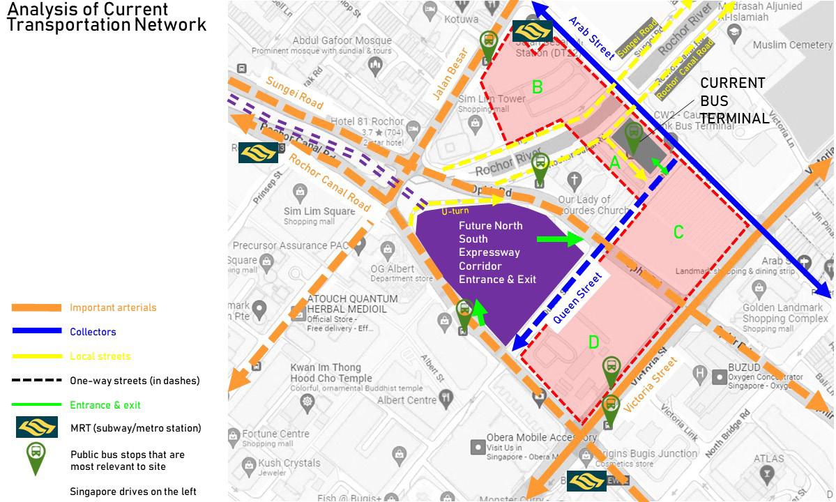
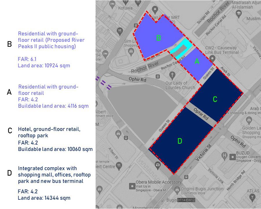
Currently the land on Parcels A, B, C and D (a combined 12 acres or 4.9 hectares) are underdeveloped and mostly used for construction storage. The current Queen Street Bus Terminal is located on Parcel

Current Queen’s Crossing
Transportation
Site Current Land

4
Flows Around
Intercity long-distance buses between Singapore and Malaysia currently ply many nonstandard routes to & from many informal bus stops around Singapore. Only cross-border city buses to & from the neighboring Malaysian city of Johor Bahru use the current Queen Street Bus Terminal and ply the routes in pink. Uses B A C D
Concept Plan & Strategies
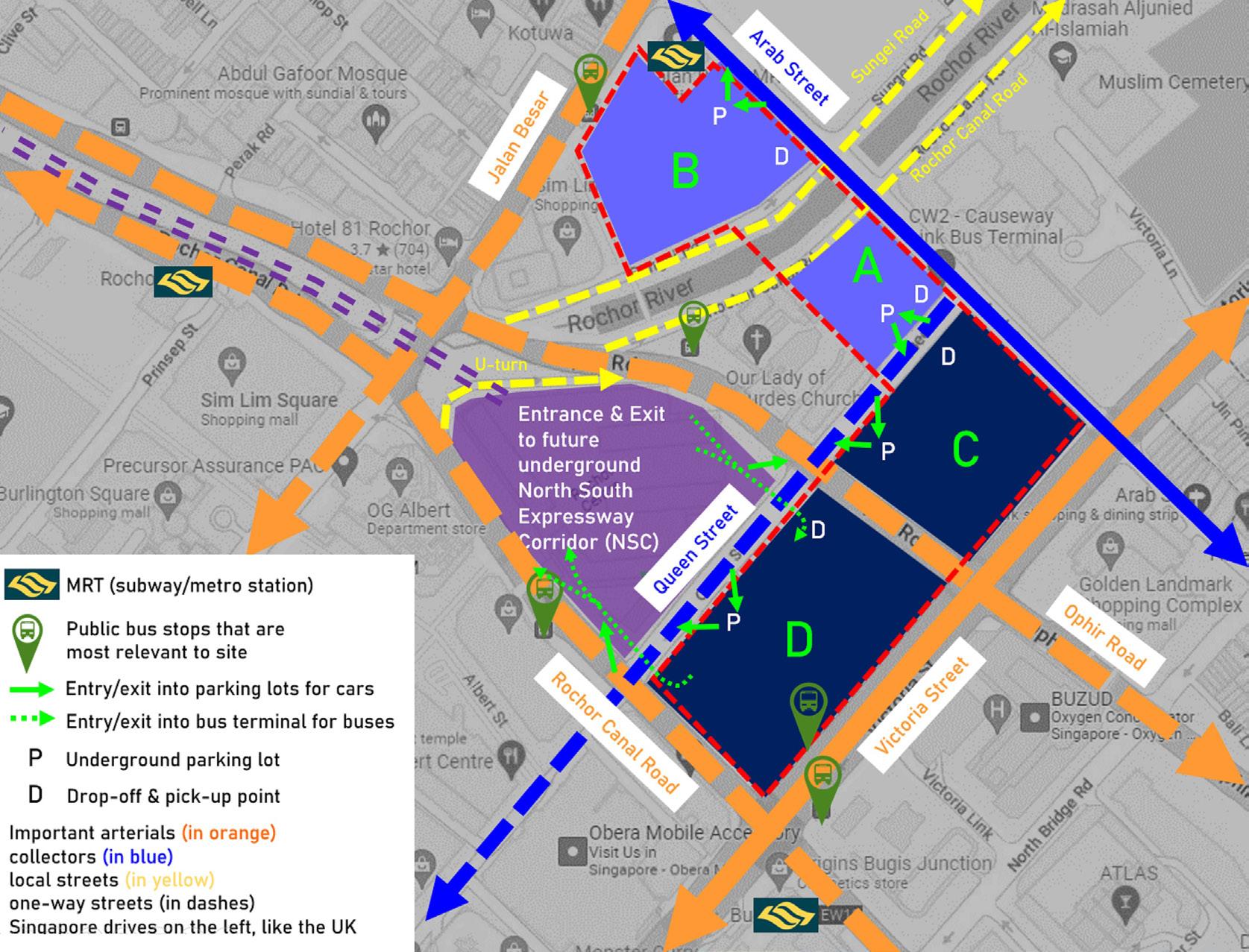
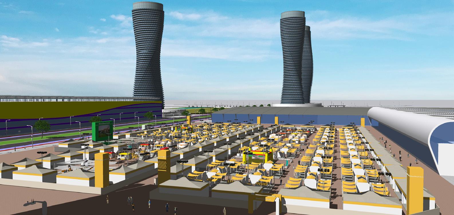
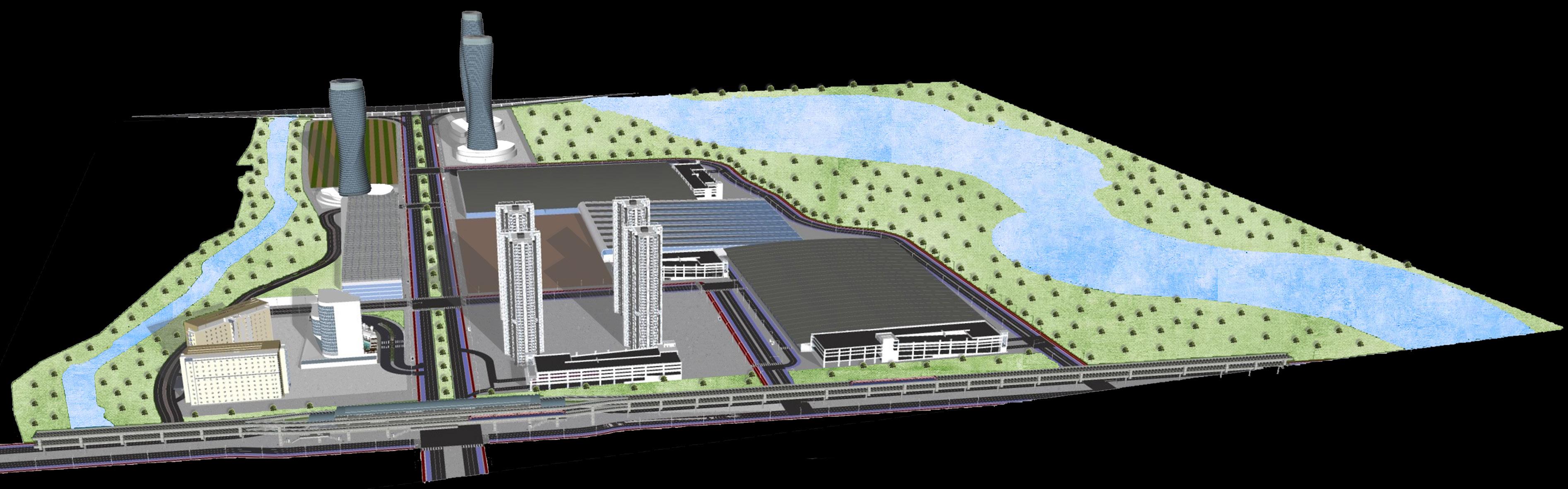
There are already plans for Parcel B for new high-rise public housing, whereas a mixed-use development is planned on Parcels A, C and D, integrated as a single complex, and connected with underground and surface-level pedestrian corridors- which also link the three neighborhoods. The intercity bus terminal, which would be the terminus for and consolidate all bus services to Malaysia, would be relocated to Parcel D built as a much larger air-conditioned facility, with 50 bus bays inside and as part of a new mixed-use building, much closer for pedestrians to Bugis MRT station and for buses to the North South Expressway Corridor which provides a more straightforward path to the Malaysian border..


5
Crossing
Queen’s
Renderings


4 1 2 3 4
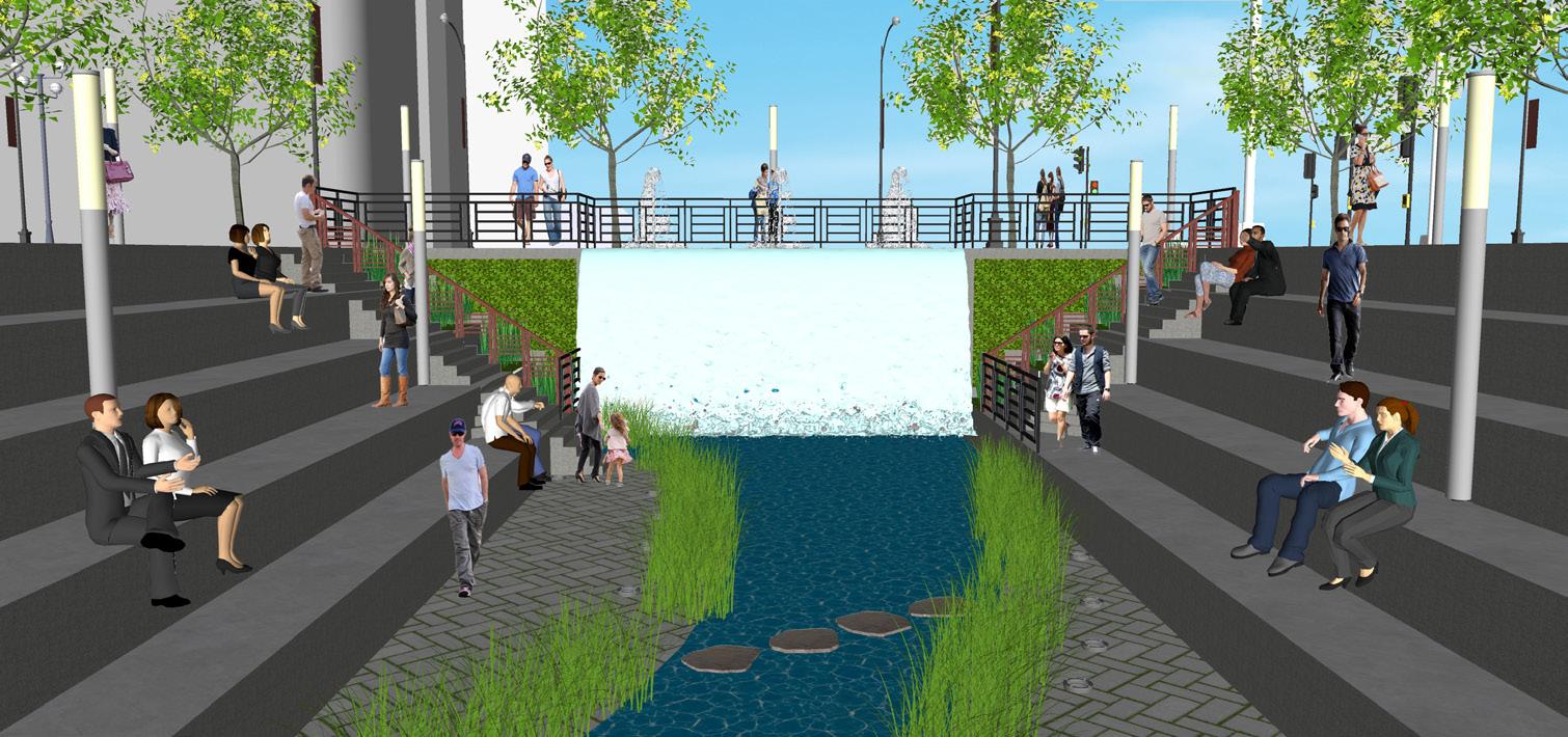
1: The redesign of Rochor River
2 3
Queen’s Crossing


7
6 7 8 9 9 8
6 5
5
7
Queen’s Crossing
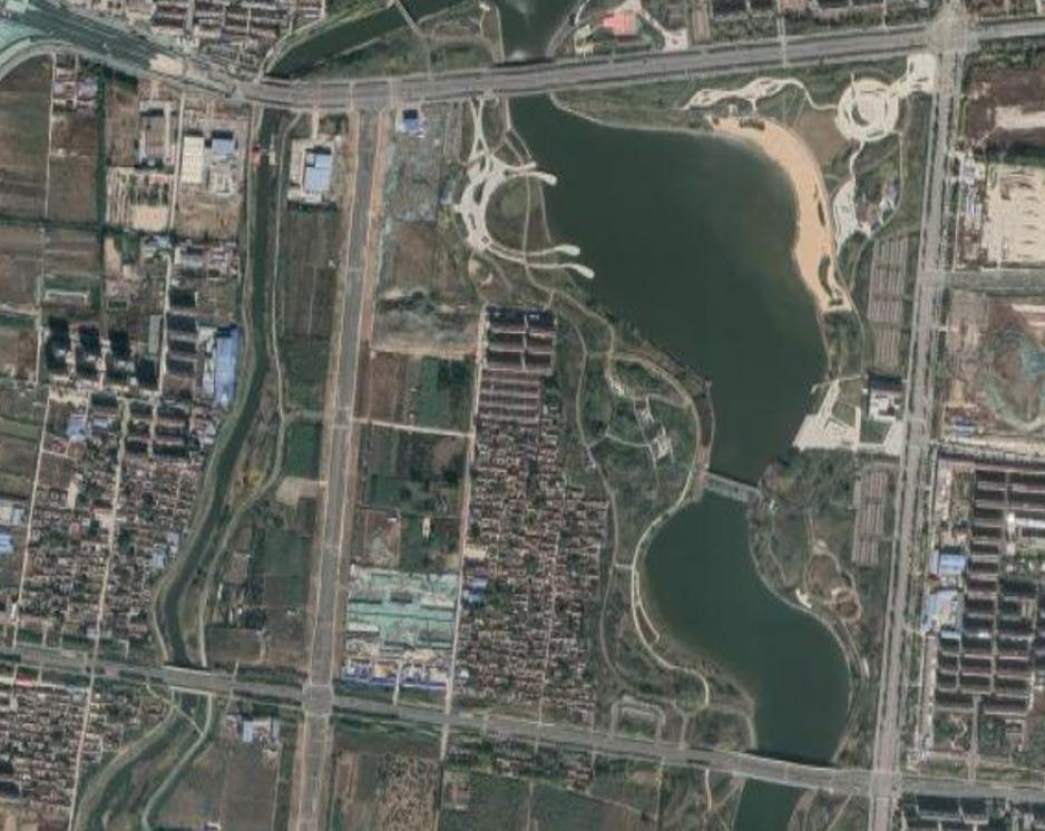
A multi-stage large-scale masterplan for a city of 4.4 million residents at a size of 2,989 sq km (1,154 sq mi) based on the Singapore planning model. In addition to the overall city masterplan, I designed a subarea plan for a new convention center and its neighborhood, as well as a new “High-Tech City”, with a Silicon Valley-inspired technological/business park, a downtown mixed-use character neighborhood, and a butterfly-inspired lake and city park.
Zibo High-Tech City and Convention Center
Zibo, Shandong, China
Morrow Architects & Planners Collaborative work

Analysis of Context and Existing Conditions
Proposed Regions and New Towns of Zibo

High-Tech City and Convention Center
The macro-level masterplan of the entire city of Zibo follows the Singapore planning model, where Zibo is broken up into 6 regions (the red boundaries) and 21 New Towns (the black dashed lines) as seen in the first plan. Two subareas, the High-Tech City and Convention Center, are the focus of detailed planning and urban design in this project. The masterplan was done collaboratively at the macro level, but individually at the High-Tech City and Convention Center subarea level.

Proposed Land Use Plan of Zibo

LEGEND
Residential
Town Centers/Transit-Oriented Developments/Commercial Industrial (in different shades of brown according to industrial type)
Preserved Historic Neighborhoods
Green Corridors, Green Spaces/Parks
Civic Institutions & Spaces
Highways
High-Speed & Conventional Rail
Subway Lines
Transportation lines include both existing and planned
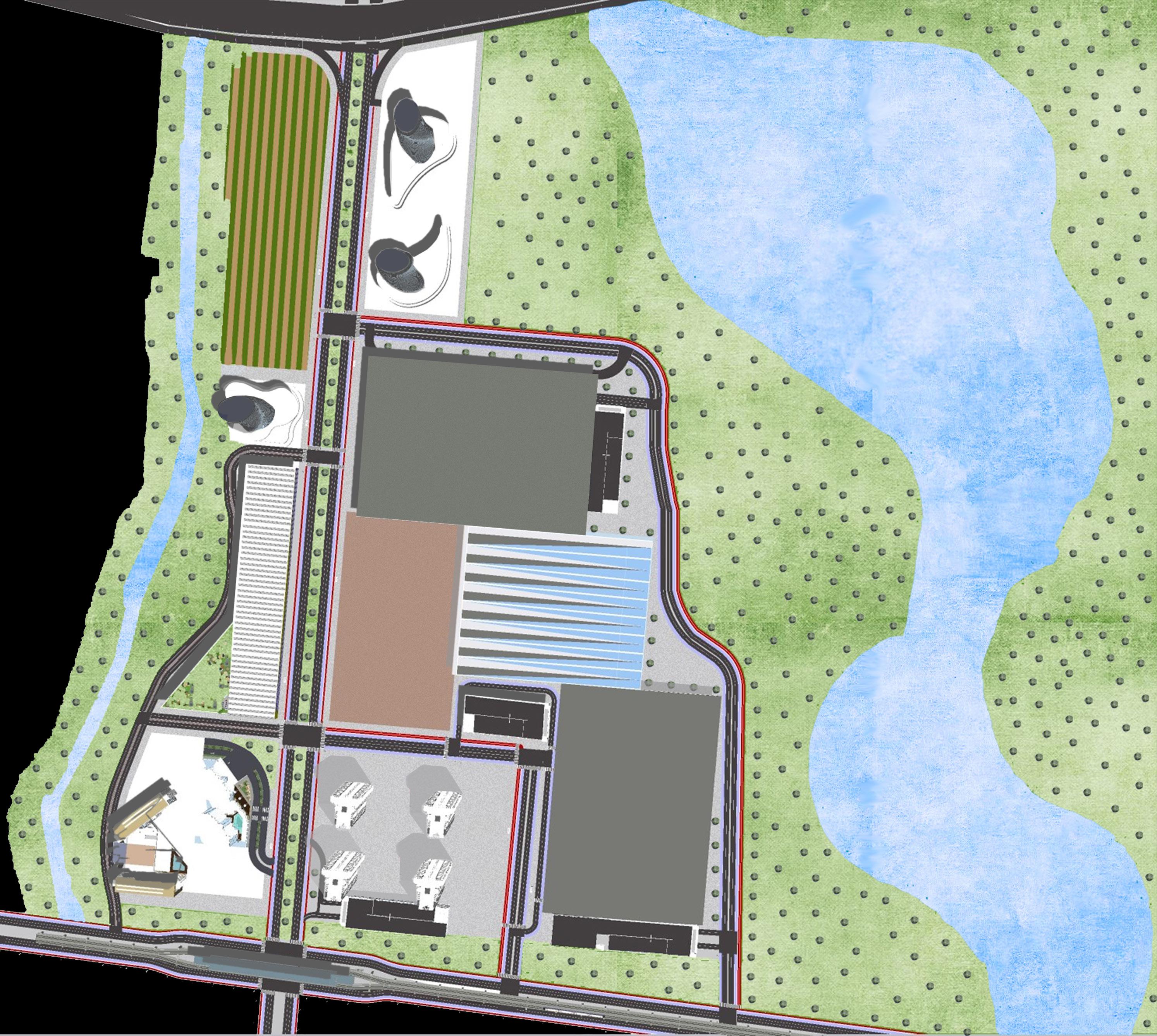
Existing conditions of the proposed High-Tech City- mostly undeveloped farmland next to the new high-speed railway station


Existing conditions of the proposed Convention Center & surrounding neighborhood- mostly underdeveloped land
9
High-Tech City
Convention Center
Zibo
Detailed Plan for Zibo’s High Tech City
Updated Overall Renderings
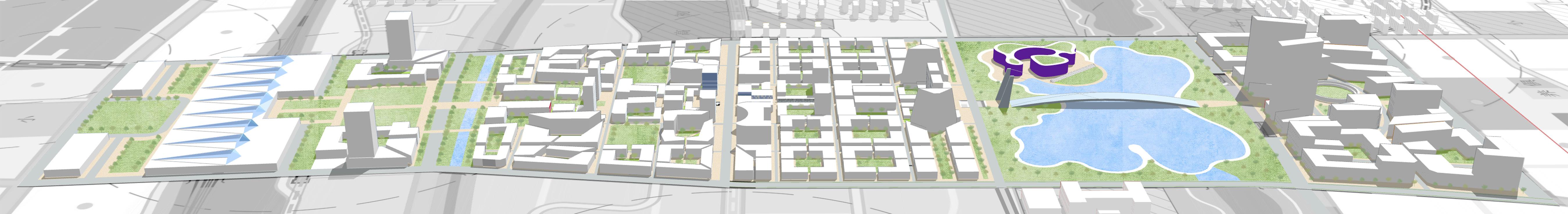
A 219-hectare/542-acre mixed-use city with a downtown urban character, orienting around the new high-speed railway station, and a high-tech Silicon Valley-style business district/industrial park as an economic driver


10
Zibo High-Tech City
Proposed Transportation/Circulation Network Plan

Proposed Green & Blue Network Plan

Proposed Main Features & Neighborhoods of the Plan


The plan facing north, focusing on the Business District/Technological Park in the foreground
Proposed Land Use Plan


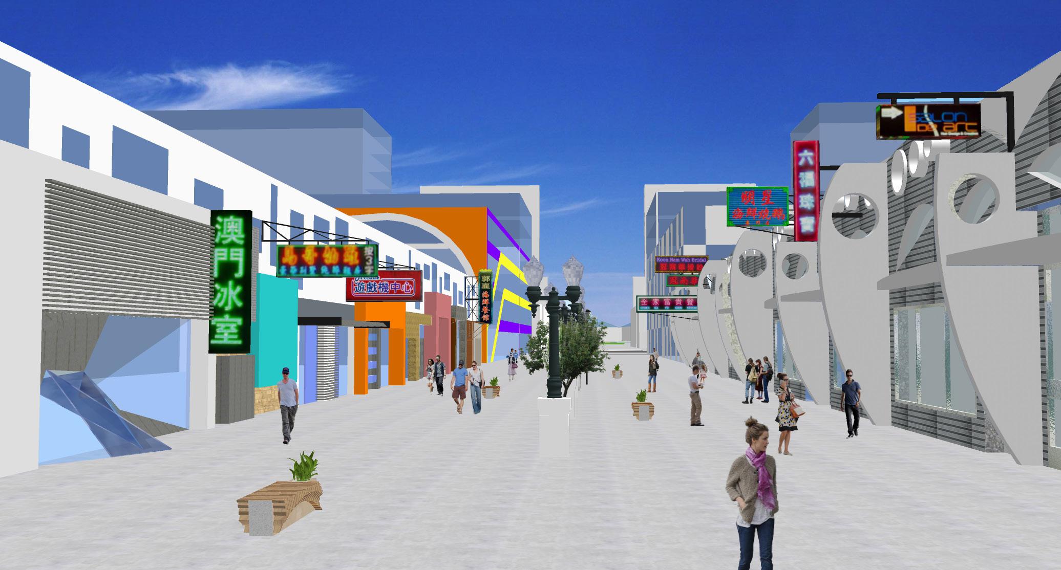
Rendering of the “Main Street” Commercial Pedestrian Corridor
11
Entrance to railway station relocated north to ease potential traffic congestion at entrances to bus terminals in the south Main railway station Bus Terminals Redesigned Station Plaza “Main Street” Commercial Pedestrian Corridor Hospital Performing Arts Theater Cable-stayed Pedestrian Bridge connecting neighborhoods (and vantage point) Preserved Archaeological Site to be opened to public as an attraction Pedestrians are given highest priority within the High-Tech City, as is public transportation to & from the rest of Zibo and beyond. Places are within walking distance or transit reach. The circulation plan allows for seemless pedestrian and vehicular movement throughout the High-Tech City. Densest commercial developments along the “Main Street” and the business district (business/technological park) where high-tech industries congregate. Plenty of green space within each block is offered, with connection to the larger Green & Blue network of the entire city of Zibo as planned in the macro-level masterplan Zibo High-Tech City
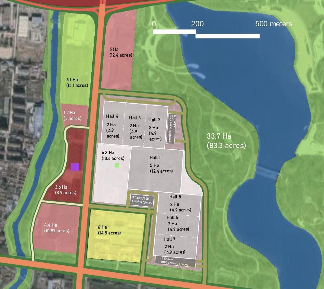
Detailed Plan for Zibo’s Convention Center
A new convention center and surrounding neighborhood with a seemless circulation network, offers a complimenting mix of uses and public spaces (including a plaza for outdoor exhibitions/events), and connections to green spaces and transit.
Proposed Land Use Plan

Updated Overall Rendering

12
Hotel
Hotel
Preserved Agriculture
Park Outdoor Plaza
Existing
Commercial/
Existing
Residential Hotel
Retail
Zibo Convention Center

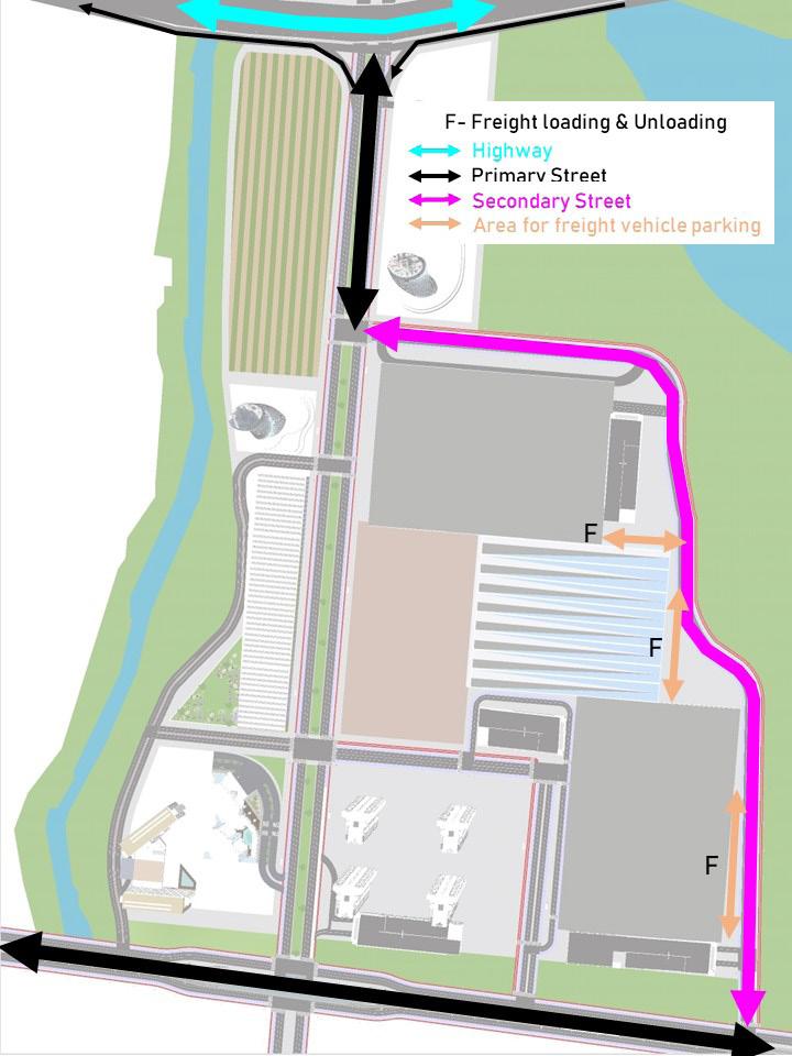


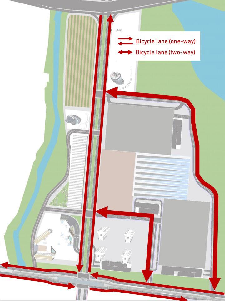

A circulation network that offers multimodal options, including seemless pedestrian and cycling mobility as well as connections to the subway/metro station and green spaces, yet with consideration given to heavy freight movement to & from the convention center halls.
Land area of convention center: 21.2 ha (72.1 acres)
Land area of entire development (including hotels, commercial): 35.4 ha (87.5 acres)
Gross floor area of single-floor convention center halls: 17 ha (42 acres)
Number of parking spaces: 2000
13
Vehicular Circulation Network Plan
Freight Routes Plan
Proposed
Proposed
Cycling
Plan Proposed Pedestrian, Subway/Metro, Green Corridors
Proposed
Network
Zibo Convention Center


1 2 3 4 1 2 3 4
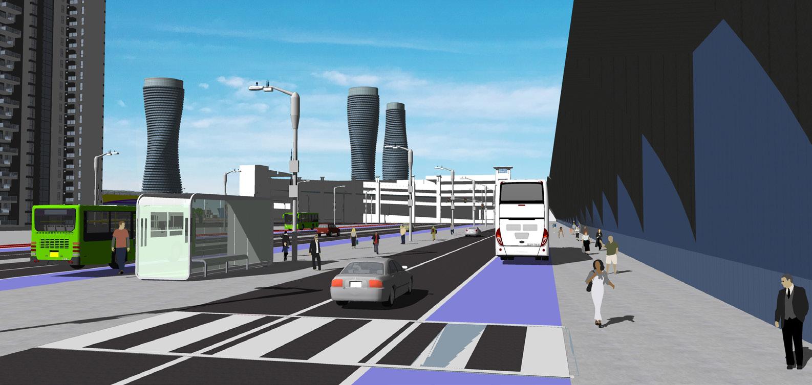
Updated 3D Renderings
Zibo Convention Center
American Street
Philadelphia, Pennsylvania, United States Rutgers University Collaborative work
This project endeavors to transform this dilapidated post-industrial corridor in North Philadelphia into a thriving mixed-use “Main Street” corridor for the community


15
0 500 1000 feet
Analysis of Context and Existing Conditions
The prime location of this neighborhood being just north of downtown Philadelphia and east of Temple University, next to a subway/ metro line and major streets presents an opportunity for a thriving redevelopment for the benefit of the local community.

16
American Street
Concept Plan & Strategies
Total study area: 278 acres/112.5 hectares
My section: 70 acres/28.3 hectares
The overall concept plan strives to bring context-sensitive urban redevelopment to the corridor to empower the local community and stimulate equitable economic development. The whole corridor has generally mixed land uses, but is also broken up into 5 subareas with focused uses. While the concept plan was done collaboratively, each subarea’s detailed plan was done individually. The subareas are seemlessly connected by the main American Street corridor, a multimodal streetscapes prioritizing public transportation and walkability, and dotted with public and green spaces.
The entire corridor would consist of mixed-income housing, a youth activity center (technical job training, after school programs, youth empowerment), commercial businesses that sell household daily essentials (e.g. grocery, hardware, dollar stores), a job training center, and high-traffic intersections that act as high-density centers where the neighborhoods come together.

17
American Street


18 Proposed Land Use Plan American Street
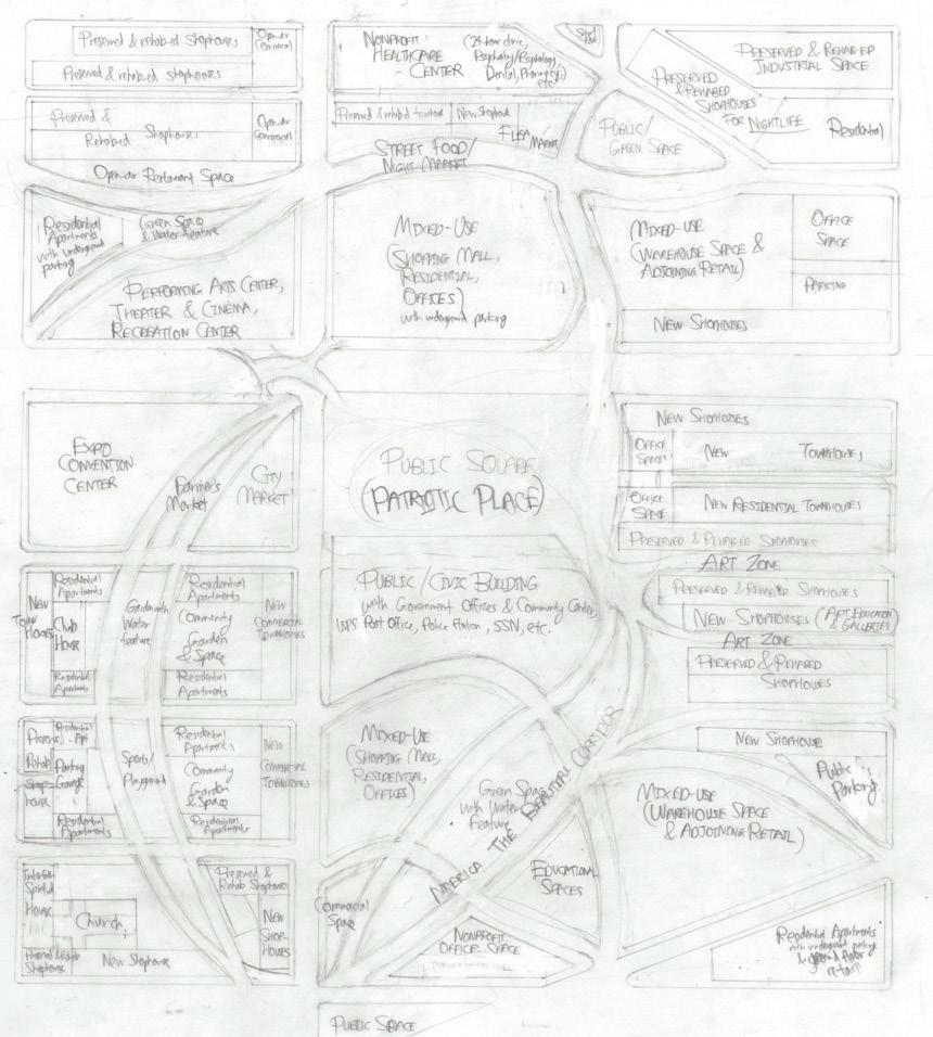
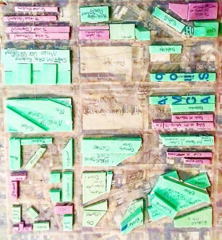


My assigned subarea is a neighborhood of primarily civic, government, public and nonprofit institutions in dedicated stately buildings, surrounded with dense mixed-income residential communities, vibrant retail/commercial activity in shopping malls and shophouses, office spaces for public,nonprofit & private uses, streets of preserved character and urban culture, and multiuse open and green spaces. Temple University’s bus services would extend down Berk Street to serve this area as well as train station to the east.

19
Concept development process of my subarea
3D digital rendering of my subarea
American Street
3D hand rendering of my subarea with downtown Philadelphia in the background
Liberty Harbor North
Jersey City, New Jersey, United States
Rutgers University
Individual work
Liberty Harbor North is an 80-acre/32-hectare brownfield site in Jersey City, west of the Hudson River north of Morris Canal. With New York City to the east and the Statue of Liberty to the southeast, there is huge potential for dense commercial mixeduse development, something this project capitalized on.

20
Liberty Harbor North is located near downtown Jersey City (Exchange Place), and developing it could worsen traffic congestion in the area. However, its prime location also means convenient connections to existing transit systems, including the Hudson-Bergen Light Rail and Port Authority Trans-Hudson cross-state lines. Therefore the planned circulation network prioritizes seemless walkability and access to these transit stations over vehicular access, which incidentally mimics the same patterns in Exchange Place itself.
Existing Conditions
Existing & Anticipated Circulation Network Around Site

Anticipated Circulation Network Within Site
Liberty


Anticipated heavy traffic
Anticipated regular traffic volume
21
Harbor North
Renderings
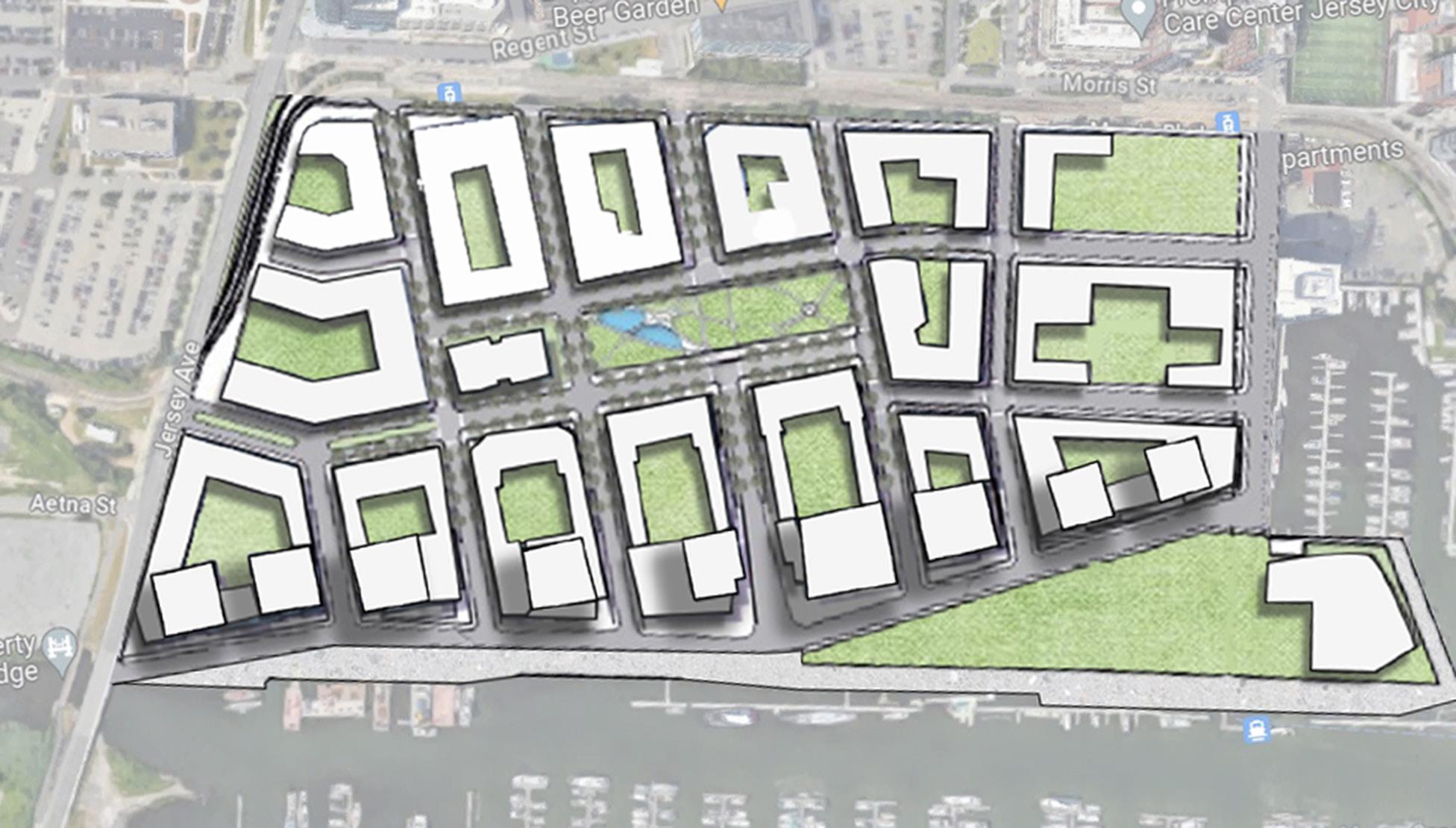
The blocks and streets of Liberty Harbor North are designed to orient towards Liberty State Park and the Statue of Liberty to the southeast, making it a visual termination point on streets facing southeast (and northwest).

Program includes
8000-10 000 residential units
600 000 sq ft retail space
500 000 sq ft hotel
Remainder for offices

22
Liberty Harbor North
Camden Waterfront
Camden, New Jersey, United States
Rutgers University
Collaborative work
A new vision for the waterfront of downtown Camden facing Philadelphia, with a canal bringing the life of Delaware River into town, textured promenades to bring pedestrians to the water and around the area, as well as mixed-use developments to accommodate human activity from home to business to pleasure. A lighthouse pays tribute to the region’s maritime cultural heritage, and serves as a landmark and entrance to the canalboth of which face the Benjamin Franklin Bridge.


Final Concept and Land Use Plan
While this plan is done collaboratively, each team member is assigned a parcel to design and render a mixed-use building

(42 acres/17 hectares)
(residential, offices, commercial/retail)
24
Existing Conditions
Concept Development by Hand
Waterfront
Camden


Waterfront
3D Renderings Camden

Jervis Jia-Xiong Yeo jy590@scarletmail.rutgers.edu www.linkedin.com/in/jervisjiaxiongyeo/

Ewing Town Center
ewing, new jersey
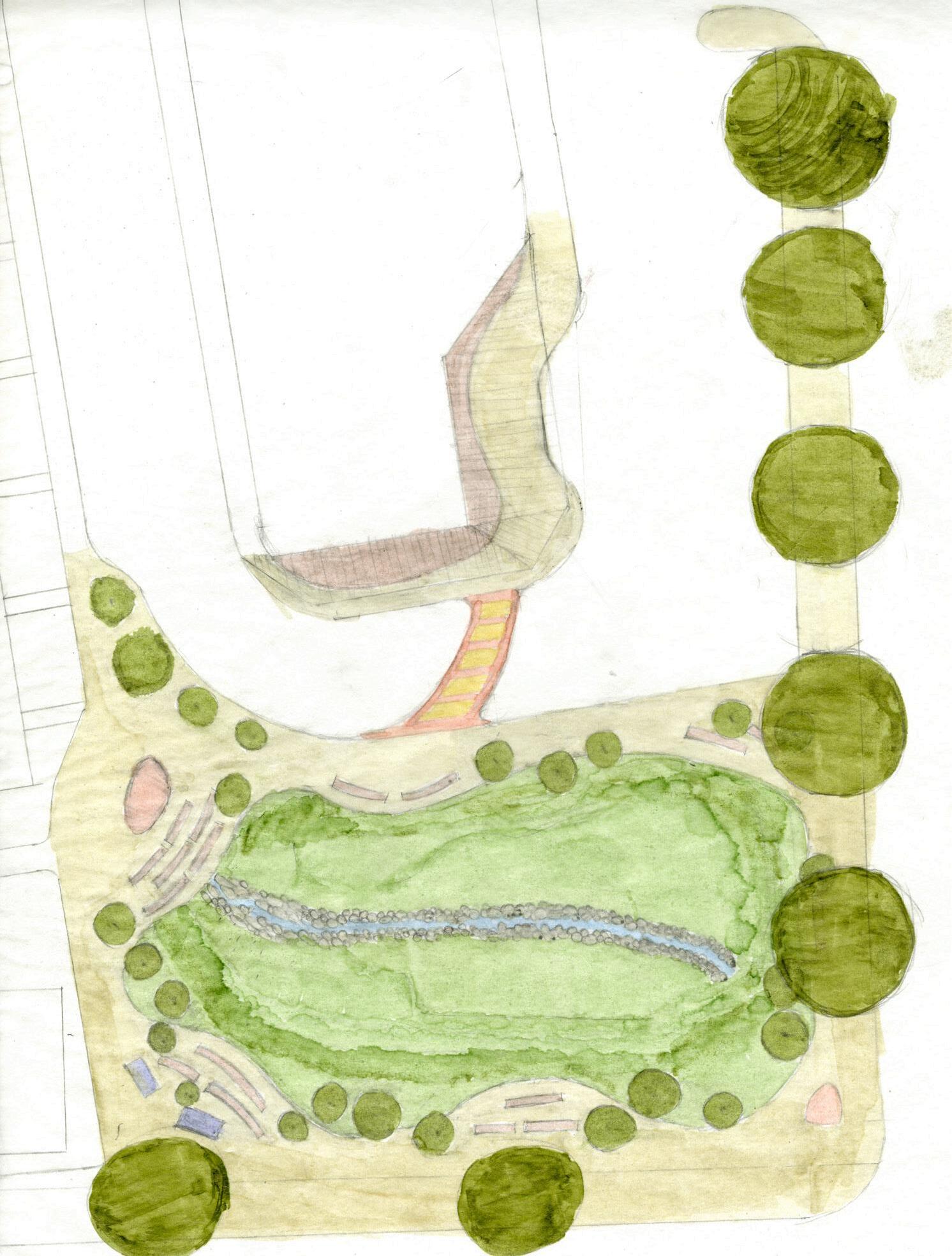 A landscape design project that transforms a stormwater basin into a landscaped pedestrian plaza for a proposed town center
25
Back Home Again In Indiana
GRAPHIC SCALE
1 inch = 40 feet
0 40 80 120 160 feet
PROGRAM
15 acre site
1.5 acres of wetlands with a small stream 3 acres of forest
10.5 acres of farmland, fields, farmhouses & other

24