ARCHITECTURE

PORTFOLIO
UNSW - Faculty of Built Environment Master of Landscape Architecture Aashaka Parikh aashaka.parikh@gmail.com 2014 - 2019

ARCHITECTURE
PORTFOLIO
UNSW - Faculty of Built Environment Master of Landscape Architecture Aashaka Parikh aashaka.parikh@gmail.com 2014 - 2019
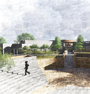
The Museum of Indian Language 03
The Institute of Rock Mining Studies 07


Within a study of Varanasi 10

Library in a Park Hyde Park Competition 12
“The landscape is never complete: neither built or un-built, it is perpetually under construction. This is why the conventional dichotomy between the natural and the artificial, or manmade components of the landscape is so problematic”.
- Roberto da Matta as quoted by Peter Jacobs in “Echoes of Paradise: The gardens of Fernando Chacel in the coastal plain of Jacarepagua”, Contemporary Garden Aesthetics, Creations and Interpretations.

Multifaith Centre 15
Exploring timber construction 17

Project Type: Thesis
Project Scale: 30 000 mts sq.

Semester: Fifth Year (Semester 10)
Date: January to September 2019
Thesis Guide: Prof. Percy A. Pithawala
Professor S.E.D.A. Navrachana University pithawalapercy@gmail.com
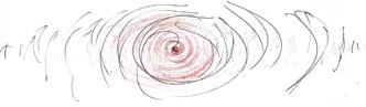
The idea truth exists; and it is a continuous phenomenon. Humans however, are not able to realise it. During the ancient times humans were more aware of the truth through the use of languages Pali and Prakrit. Today humans are lost in search of new forms of communication, bringing themselves further away from ‘reality’.
The ancient methods of communication required the use upto five senses simultaneously, keeping them complex but grounded. These methods were raw, and involved physical movement such as hand gestures and facial expressions. The simplicity of their lifestyle and communication helped them stay connected to the ‘Truth’.

The communication system started to change since the agricultural revolution and emergence of empires which required information to be physically stored rather than mentally. This lead to the invention of numerical and partial scripts which had certain rules and regulations. Information was stored in an orderly fashion.
As these partial scripts developed into full scripts, the ad -hocness reduced since grammer divided the languages into the different tenses and so on. The languages further branched themselves into other languages and dialects which had their own set of rules. Humans now used the methods of speech or writing to transmit information.
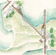
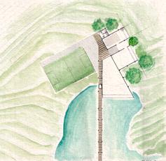
Location:
Delhi being the hub of India’s primary political and institutional structures, provides the opportunity for Indian Languages to have a centre from where all the depleting and extinct languages can be accessed and studied.
The site was chosen in context of the surrounding institutions (such as The Jawal Lal Nehru Academy of Language and The Bhartiya Vidya Bhawan) of which functions can be interlinked with that of the museum in the future.
Bhasa, Language; the way in which we communicate information, opinions and feelings to one another. It has almost become one of the human senses without which we are physically and mentally incomplete. It is because of which the human civilization exists as it does today (what exists today has been evolved from the learnings of the past). It is important for us to preserve this medium of communication not only to keep a record of the past but also for the knowlegde of future generations.
There were many events throughout history which have led to the fall of Indian Languages, leaving behind only ruins and impressions. This continues to happen today with the help of technology. As humans use only technology to store all information including their experiences and memories, physical language will evaporate leaving traces.

Eventually as the traces of memory too disperse away from the human brain, the only thing remaining will be the absolute existing Truth. It will still exist within all beings whilst surrounding them at the same time. However, this will be only discovered from afar, (objectively) as it will be ‘lost’ somewhere far away from the minds of the people.
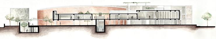
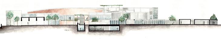
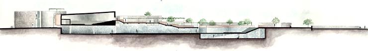
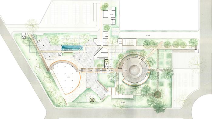
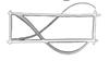
Tree of knowledge within a forest area where teachers sit on the pedestal and transmit knowledge verbally.
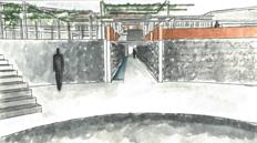
The passage of Truth from the open-air theatre leads to a submerged space below the auditorium.

Temporary and permanent exhibition displaying native and deteriorating scripts in various dialects.
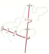
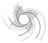
The entire journey of language in relation to the continuous notion of the Truth is represented in diagrams (six individual aspects put together in chronological order)

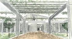
Entry to Museum allowing visitor to chose their own path to explore the journey of various Indian languages
Path of visitor gradually becomes restricted further along the journey
Natural materials such as stone change to man-made materials such as concrete, then steel and glass
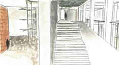
View of the passage of Truth from the amphitheatre.
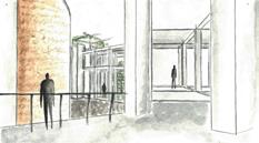
The library acts as an archive of ancient languages which is also available for the local public.
Rammed Earth walls of auditorium with engraved scripts of Sanskrit, Pali and Prakrit.
Corridor leading to the seminar hall, digital library and interactive screen for further research
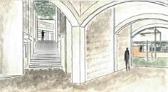

View of main and digital library block
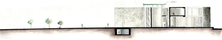
The meditation space being the core of all human activities (including understanding communication), rests underground from where the rest of the aspects of language rise. Ancient scripts of Pali and Prakrit are engraved on the on the surrounding stone wall.
The amphitheatre is a place where the cultural aspects of language such as drama, dance and music are explored. This place provides an opportunity to communicate ancient stories using the older oral methods of communication. Display of Siddham, Sarada, Nagari, Sinhala and Pallava scripts which are engraved on the rammed earth wall surrounding the amphitheatre.
This narrow passage displays a series of scripts which are declining at a high rate or are almost extinct and are individually used to write Sanskrit (known as the mother of all languages in India). Thus, none of the main circulation axes connect to this passage; these scripts can only be explored through the amphitheatre. Display of Brahmi scripts and immediate descendants such as the Kharoshthi, Vateluttu, Grantha, Gupta, Kadamba and Kalinga scripts which are engraved on the stone wall
The Passage of Truth leads to a lost cave-like dark space beneath the auditorium, which acts as a burial ground with undeciphered scripts and extinct languages of the Indus Civilization painted and carved into the mud-finished curved walls. Display of Indus Script and its immedidiate decsendants such as the Harrapan script and SaraswatiSindhu script.
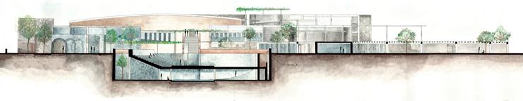
The exhibition spaces on the ground floor and first floor include a display of scripts and artifacts used as communication. Also workshops of learning olden scripts and languages can be conducted in those spaces. Display of relatively recent scripts such as Telegu, Kannda, Bengali, Punjabi and Devnagari script.
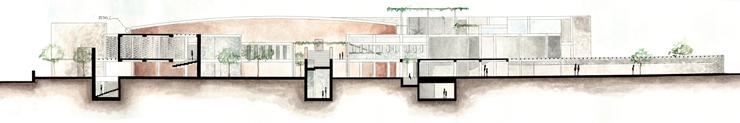
These libraries store information and scripts of all Indian languages in the form of books (one of the current ways of storing information). The public will be able to access this information to learn the extinct, declining or current languages of India.
One of the current and future methods of storing information is the digital way. The interactive screen near the digital library is programmed in a way to translate speech into the desired Indian Language. This way anyone will be able to learn various declining or lost Indian Languages.
Part Model showing the shift in materials through the museum.
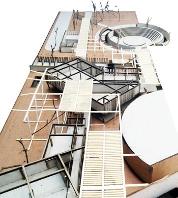
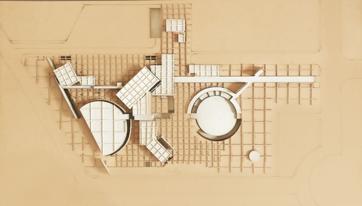
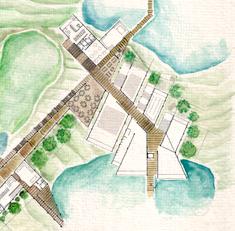
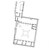
Plan at lvl +4.5mts
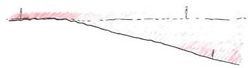
As a visitor circulates horizontally or vertically through the site, he/she experiences various methods of communication and the different languages and scripts in chronological order. As one enters from north-east, one will encounter a forest in which ancient scripts such as brahmi script, its descendants and sanskrit will be engraved on the barks of the treets. Gradually, as one travels towards the south west part of the museum, the forest will start to disappear and buildings will emerge which will store relatively recent scripts in the form of books and digital media.
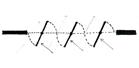
Process model showing the shifts in the structure of languages through time (represented by a grid). Initially the grid is sparse, representing a lack of rules in communication. One is free to choose his own way (imagery, verbal, musical or any other raw way of communication). The grid densifies as scripts are created with rules and grammer. One becomes more confined to a written or verbal way of communication. However, at the same time one can get lost in the complex labrynth of various scripts, its languages and dialects. The grid again starts to disperse as people move towards the digital ways of communication. The grid starts to break when rules and grammer dissipate as people start to communicate using a mix of languages, broken languages and slangs.
Project Type: Free Studio
Project Scale: 130,000 mts sq.
Semester: Fifth Year (Semester 9)
Date: July to November 2019
Porject Guide: Prof. Gurdev Singh

Dean S.E.D.A. Navrachana University (2010-2018)
Prof. Percy A. Pithawala
Professor S.E.D.A. Navrachana University pithawalapercy@gmail.com
Location:
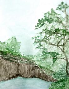
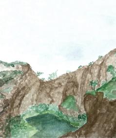
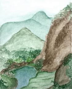
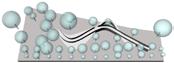
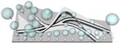
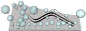
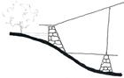
The five descending plateaux of Pavagadh Hill accomodate the world UNECSO heritage site of Champaner city. The artistic landscape which holds great cultural value has been scarred through rock mining activities in the past. This activity was banned and since then the quarries have been abandoned, allowing it to be filled with rainwater creating large water bodies amidst the terrain
“I stand at the foot of a gigantic beast curving around the descending edges almost as if entrapping me; forcing me to surrender. Intimidated, I think of marking my presence by setting foot on the head of the mound, so I start climbing up the sides but only to reach the top and find myself gasping at the sight before me. Looking down the fall was frightening but it also compelling me to experience the height throughout the entire stretch of the quarry, only imagining the feeling of walking above the waterbody to the other end just didn’t seem to be enough…”
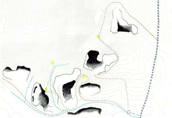
KEY: Walking trail Cattle trail
Quarry with water body
Main Road
Helical stepwell
Major viewing/pause points
Selected site area
The selected part of the site is a group of three quarries which are connected through a cattle and foot trail. A large water body is created towards the far west of the site during the mosoon season. One can easily navigate in between the three quarries and explore them. Together they form one large landscape. These quarries are easy to access from the helical stepwell using the cattle trial or the foot trail.
Areas of maximum average intensity of sunlight in the quarries
Primary circulation axes across the site connecting the major view points
An exhibition alley connects the three quarries at a common space and acts as a thoroughfare through the entire terrain.
Movement of the wind across the site and though the quarries
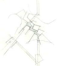
Secondary circulation and common area connecting all axes of circulation
Major viewing points in and around the quarries
Placement of common function and individual units.
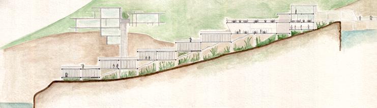
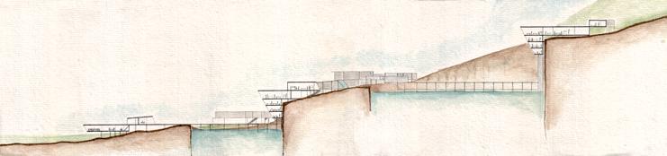
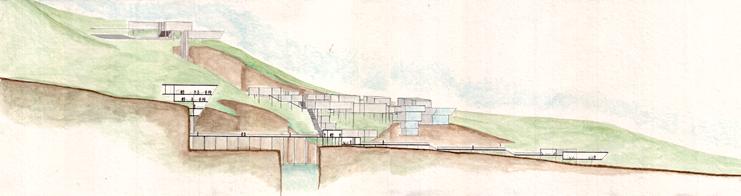
Section BB’
Site Plan Section CC’
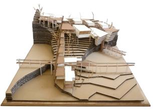
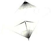
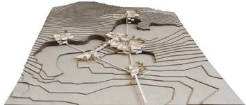
Site Model
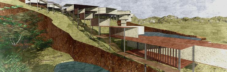
The quarries of Pavagadh are voids created in the landscape resulting in the loss of connectivity from one point to another; the flow of movement throughout the entire topography is disrupted. Therefore, a journey can be created through the entire landscape which will be enhanced by the voids, creating a unique experience altogether. Along with creating connections between the quarries, it is important to respect the nature and therefore least disturb the surrounding and preserve the new ecosystem whilst creating a structure. Imagining the original form of the landscape, without the human disruption is challenging due to the large scale of the quarries. However, that is an advantage for the students of the rock mining school; being at such close proximity to the depths of the rock enhances their learning and research.
Plan ‘a’
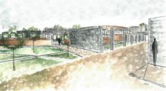
Functions of course 1 program which include a (halfsize) football ground which can be utlized by students for many sport activities, workshop, seminar hall, classroom and washrooms
Plan ‘b’
Common areas including study rooms, cafeteria, research lab, auditorium, exhibition alley, and washroom. Functions of course 2 which include workshop, seminar hall, classroom and washrooms
Plan ‘c’
Staff areas including staff rooms, maintenance room, staff kitchen and washroom. Entry and waiting foyer including reception, board room, head office, kithcen and washroom.
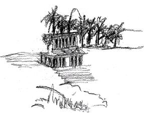
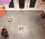
Within a study of Varanasi
Semester: Fifth Year (Semester 7)
Date: July to November 2017
Porject Guide: Prof. Sunita Dalvi
Prof. S.E.D.A. Navrachana University
“Banaras is older than history, older than tradition, older even than legend and looks twice as old as all of them put together”
- Mark Twain
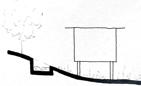
Banaras, Varanasi, Kashi, is a city which is mythologically said to exist before its own stories. Known to be the world’s oldest city, Banaras is one of the most sacred pilgrimage sites for Hindus. It is a place of worship as well as a place where people come/are brought for the last part of their journey - their last rites. It is believed that the Mahashamshan - ‘the great cremeation ground’ at the Manikarnika ghat is a place where one attains moksha - the liberation of one’s soul from the infinite cycle of birth, death and rebirth.
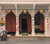
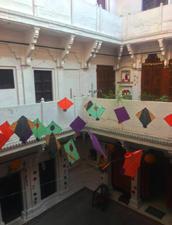
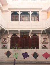
What was once a lush green forest in an area of gently rolling hills and natural springs and lakes bordered by the holy and ever-pure river of Ganga - Ganges; the city is now crowded, polluted and densely populated with narrow streets and markets. One of these markets is the “Thatheri bazaar” or “Thatheri gali” meaning “market/street of utensils”. The street includes small shops, temples and residences, one of which is a typical Banarasi house - the House of Bhartendu - a famous poet of the 19th century.
Banaras is located on the North-Eastern part of India, in the state of Uttar Pradesh
The city is situated on the meandering banks of the holy river Ganga.
The settlement has largely grown between two rivers and three mounds.


Three mounds (north to south) named Omakreshwar, Visheshwar and Ankleshwar contain the city


Two tributary rivers of Ganga, Varun (north) and Assi (south) enclose the eighty-four ghats of the city
The terrain on the other side of river Ganga is relatively flat with farmlands and small villages.
The streets are a complex web in which one can get lost. However the streets always lead one to the ghats.
The smaller water bodies are enclosed between Varun river and Assi river.
The city has many fragmented water bodies and many which are inter-connected.


Project Type: Studio
Project Scale: 8500 mts sq.

Semester: Third Year (Semester 6)
Date: January to June 2017
Porject Guide: Prof. Percy A. Pithawala
Professor S.E.D.A. Navrachana University pithawalapercy@gmail.com
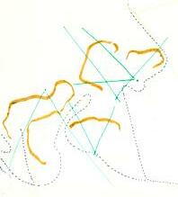
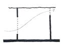
What happens if we look at the phenomenons of Sound and Silence as elements which run parallel to each other rather than them being contradictory?
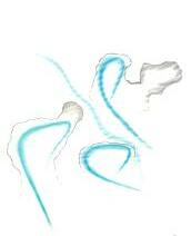
The experience of hearing any sound/noise and the state of being in silence is subjective to every human being; for example, one can interpret the act of listening to music or hearing the sounds of nature (such as the wind or bird calls) as silence. Therefore, merely a deviation from the continuous path of sound is required for one to find their personal state of silence.
Intially an experiment was carried out using a hypothetical site and placement of trees. The aim was to create a form and spaces which include both the aspects of sound and silence according to the position of each of the trees, and to realise the number of trees which have to be eliminated in the process.
Location:
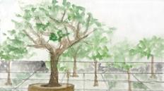
Hyde Park being the green heart of central London is itself a historical monument cherished by the local people as well as tourists. It is known to host large crowds for many various activities from exhibitions and concerts to protests which continue till today. Therefore, it is a place which symbolizes freedom of the people; freedom to celebrate, express thoughts and emotions.The natural surroundings including trees, animals and water bodies (The Serpentine river and the Long Water lakes), are the elements which give one a sense of freedom. They are the essence and the very reason for the existence of the park as it is today. Therefore, it is important to preserve these landscape elements whilst creating a structure with the required functions. The aim is to build minimally and construct around the natural elements without disrupting the surroundings. For example, building around the trees (minimal cutting of trees) and leaving a large offset from the edge of the river keeping it undisturbed.
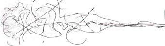
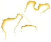
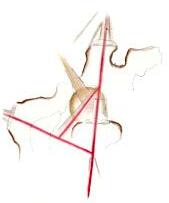
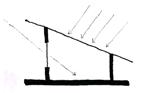
A few trees randomly placed around a space which is representing sound.
Lines generated due to the placement of trees, which can be possible spaces of silence
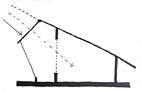
Two primary walls are introduced using the generated lines Retracing the diagram


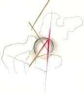
Few spaces are created within the walls. Two trees eliminated in the process.
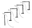
This process was carried out to create spaces and the form of the library across the site within Hyde Park:
An attenpt to create a larger space has led to restrictions in the future growth of a couple of trees
To generate spaces at different levels, one tree was relocated. A total of 2 trees are eliminated in the entire process
Model of the Hyde Park library
Looking down onto visitor’s bridge and children’s library from main library.
A
B’
View of amphitheatre and south gardens from reading balcony
Plan at Lvl +4.5mts
Section AA’
Serpentine river bank and visitor’s bridge


C’
D’
South Elevation
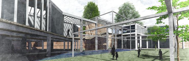
The central spine (shown in Plan at lvl +4.5mts and Section AA’) is the book shelf area which is sliced through by the visitor’s bridge. It is the space where many people are gathered and are occupied in search of their reading preference. A small is reading space is created through a deviation from the bookshelf area. The reading area, is quiet as one feels outside of the building and closer to the surrounding nature.


The visitor’s bridge is an independant structure which is not linked to any of the internal functions of the library. It provides a visual access for the visitors who want to experience the serpentine river at a height and catch a glimpse of the internal part of the library.
The two main entries (east and west entries) into the library are atypical to conventional libraries. The entries are open and inviting which lead into a large double-height space with the reception and admin area. Staircases lead them to the children’s and main library spaces. A restricted access (for the library staff) is provided to the archival library areas on the ground floor.
The children’s library is on the first floor with large reading areas adjoined to the book shelf area. It is enclosed with a glass facade, which allows viewing the gardens on the south and provides security for the children.

The main library is on the second floor which includes a shelf area as well as a balcony which can be used as a reading space and provides a view of the south gardens. The shelf area is the area of sound, where many people are gathered; though quiet, they are occupied in a search of particular type/s of book/s. The balcony on the other hand is a space where one’s mind is silent; though small, the space allows one to indulge in his/her reading, appreciate the surrounding views and listen to the sounds of nature.
The open-air theatre acts as a large outdoor gathering space which is easily accessible to all visitors of Hyde Park. It is a place where activities of the library public readings, theatre acts and other performances can take place; similar to other activities which take place regularly at Hyde park.
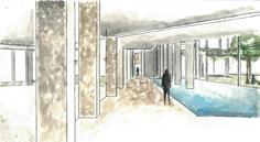
The seating area under the library provides direct access from the south gardens of the library to the north Serpentine river edge. It can also act as a silent reading space which is isolated and hidden from the park, the river and the rest of the library.

The archival area is on the ground floor which is only accessible through the admin and reception area.
The Digital / Research lab is on the ground floor enclosed with a glass facade providing a view of the Serpentine river edge.

Project Type: Diagramming
Project Scale: 2500 mts sq.
Semester: Second year (Semester 4)
Date: January to June 2016
Porject Guide: Prof. Gurdev Singh
Dean S.E.D.A. Navrachana University (2010-2018)
Religion: a very delicate and sensitive issue for many people. A multifaith center aims to dilute the tensions that exist between the different religions today and help them grow in harmony. The concept is to unify people by converging beliefs from various parts of the world and therefore also different religions.
Almost all the religions ultimately aim for people to understand and look within themslves or find their purpose; whether it be through the means of prayer and/or meditation. This center therefore, aims to provide various types of spaces which are comfortable for people to read, sit in silence, pray or meditate. It is believed that when people meditate or concentrate on themselves, their thoughts or even simply their own breaths, they sink into self exploration but rise at the same time as spiritual beings. As a person completely indulges themselves into medidation, they can hear a humming sound from within. The hum therefore holds signficance in most religions.
A multifaith center welcomes people with different views, beliefs, religions etc and unifies them at one place. This diagram represents the convergence of the people and their respective beliefs and religions from different parts of the world.
A multifaith center aims to unite people, help them respect all beliefs and understand their own. One needs to focus and concentrate on their own thoughts for that.
“The deeper one sinks into self exploration, the closer one brings himself to enlightenment / self-awakening”
The more one indulges in self-exploration of his/her own mind/thoughts, the importance of the physical presensce decreases while that of the conciousness increases.
“The exploration of a power / oneself’s power in whose presence the physical form of person is negligable.”
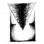
The point of converegence at the center of the building has a conical structure which represents the convergence of light at one point. This signifies the unification of knowledge / conciousness of all people.


A dimly lit, empty, circular space sits at the lowest level of the multifaith center which is where people practice meditation in isolation. It is a place which helps one concentrate without disturbance and calms their mind.
One enters the by walking along the slant curved walls which rise higher as one progresses further below. The curved walls direct one to different parts of the center which ultimately lead to a gathering space.
Sketch of the central meeting area (the hall/place of convergence) with the conical structure above.


Sketch of the stairway and entrance to the meditation space at the last level of the centre.

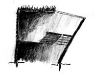
Sketch of the entrance to the center through a ramp or a stairway with a pause area for sitting or reading

mts Top view of model Functions: 1. Meditation Hall (dimly lit)


Meditation Area (well lit)
Hall of convergence (central gathering space)
Library and Reading Area
Circular bridge (for exploration of the conical structure and light wells)


The structure is exposed concrete, including the slanted circular walls and the floor slabs. The circulation elements (ramp. staircase treaders and bridges) are constucted of timber. The ramps are suspended from steel rafters which are supporting the cement board and glass roof, (the glass roofs lie above the circulation pathways allowing light to percolate into the building). The steps are cantilevered from the main circular walls and supported by steel brackets. The conical element is a light-weight pre-fabricated ferro-cement structure which is supported by the central circular concrete bridge.
Walking down the longesr series of steps helps one to be patient and focus on their experience of the space before they reach the Hall of meditation. The long descend gives also gives one the time to observe the material, structure of the centre and the gradual change in light quality through the journey. The three similar entries to the Hall of convergence help people understand that they are all equal beings. The quadruple height (12 mts) space, with the conical structure at the center, signifies the vastness, the strength and the power of unity. One standing in the space alone can feel lost, and realise how insignificant their ego and their pride of themselves is.
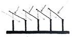
A few methods to block the summer sun and allow winter sun into the units. Ways of maximising the utilization of north and east light are also important.
Roof tilted to block south sun and allow north light
Flexible roof to block summer sun and allow winter sun
Sharing walls to block southwest and allow north-east sun
Adjustable louvered windows blocking the south and west sun
Project Type: Matrix
Project Scale: 5600 mts sq.
Semester: Second year (Semester 3)
Date: July to November 2015
Porject Guide: Prof. Gurdev Singh
Dean S.E.D.A. Navrachana University (2010-2018)
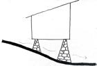
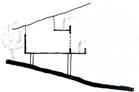
The winds come from the south west and are cool due to the large water body behind the dam Therefore, methods of crossventilation during the summer are explored
Windows on either side of the unit for cross - ventilation (warm air rises and escapes)
The slope allows cool air from the water body to rise and enter from the bottom of the unit
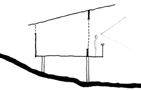
Adjustable vertical fins to block west sun but allow cross ventilation through the units
Staggering walls which help in redirecting the winds from the water body into the units
Due to the surrounding ecology and landscape, views are one of the most important factors to be considered. The diagrams show techniques which allow for maximum view coverage.
Location:
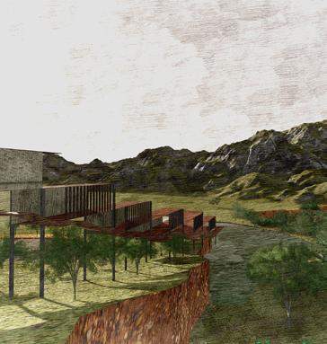
Kada Dam; one of the most beautiful dams in the state of Gujarat is located in the Jambughoda wildlife santuary. The area has a rich flora and founa including large bamboo and saag forests which inhibit a wide range of wild animals from leopards and hyena’s to the blue bull, sloth bears and porcupines. The aim was to create a working and living space for the rangers, forest conservators, visiting scientists and environmentalists, who are able to come to the dam for a brief period of time form cities nearby during the day. The challenge was to build on the site of the dam according to the surroundings, wildlife and ecosystem. Therefore, the process of analysing the basic situations of the site such as the sun path, wind direction, water levels throughout the year and the topography of the site is most important. Also, part of the challenge, was to use simple techniques to solve problems that were arising due to the site conditions (such as hot summers and cold winters) so that the site remains undistrubed and the structure was to be mainly built from locally available materials (timber and bamboo).
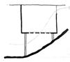
The monsoon rainfall causes the water level to rise by aprroximately 1.5 meters. The following the diagrams show different design techniques and ways to control the water without disturbing the natural cycle accross the year
Cut-and-fill of the slope to allow staggering terraces for views
The unit rests above a slope to allow views from a height.
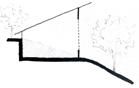
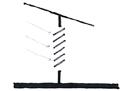
Balconies at different levels to allow for views.
Larger decks which for provide full views.
Wooden stilts which do not disturb the natural topography

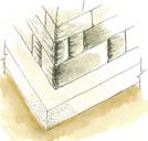
Stone piers that can withstand the force of the surface runoff.
Stone retaining wall to prevent water from flooding the stay area
Large moats channel the water back to the large water bodies
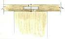
The gutter and perlins are made from bamboo - a locally available material on site. A layer of bitumen is applied between the timber rafters for waterproofing.
A steel L- section is screwed between the timber column and the floor binder preventing the transfer of any infection from one member to another

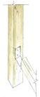
Tongue - and - groove joinery between floorboards includes a gap filled with rubber which allows for the expansion and contraction during different seasons


Concrete slab - acts as a barrier between soil and stone pier which reducing chances of termite infections.


I Aashaka Parikh, hereby declare that the sketches, models and drawings shown in the portfolio are a record of original work done by me; except for the references taken and the contribution of others which are mentioned below.

The sketch diagrams on page 10 are done by Tvisha Shah.
The views of Bhartendu House, on page 10 (collage of 4 pictures, top right) and page 11 (bottom photo) are photographed by Ajinkya Desai
The view from ghats on the bank of River Ganga on page 11 (top photo) is photographed by Tvisha Shah
The view of Thatheri Street on page 11 (middle photo) is a google image from www.incrediblevaranasi.com
The model of the matrix project shown on page 18 is a group project done by myself, Bansari Makadiya, Aditi Patel and Aditi Patalia
Thank you
“I don’t divide architecture, landscape and gardening; to me they are one”
- Luis Barragan
DOB: Tel: Email:
Aashaka Parikh 09. 07. 1996 +91 7600069796 +248 2712910 aashaka.parikh@gmail.com
