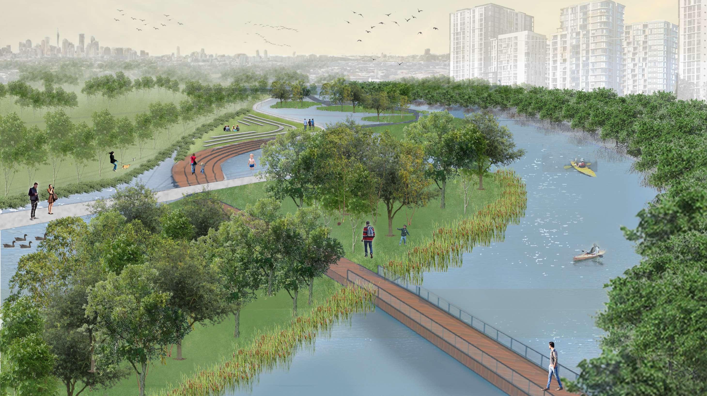
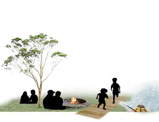
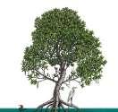
Wolli Waterfront
Explore the Lost Landscape
 Aashaka Parikh z5343115
A3
Capstone
II
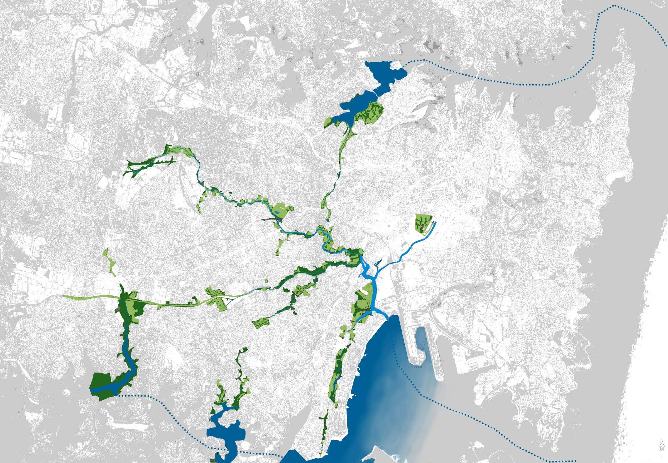
Blue Green Network Sydney
By the year 2050 sea level is expected to rise by 25 cm; by 2080 15 inches and by 2100 a staggering 2.3 meters according to IPCC considering the melting of ice caps and greenhouse gas emissions.
Sydney being a coastal city will be critically impacted. Many endangered land and aquatic species such as the long finned eel and green & golden bell frog are likely to become extinct. Human interaction with nature is decreasing at an exponential rate affecting physical and mental well-being.
As landscape architects it is our responsibility to design for the future and as global citizens it is our duty to look beyond manmade boundaries, recognize natural systems, understand their importance and contribute to environmental and ethical solutions.
Project Aspiration

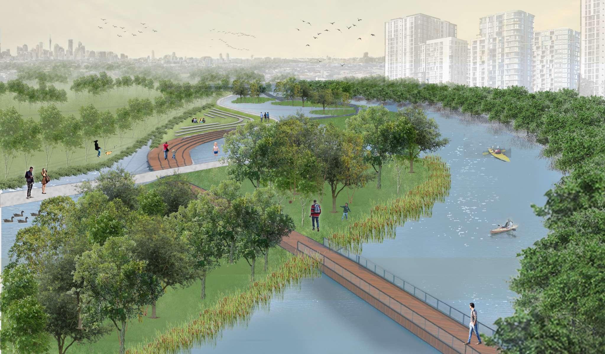
This project aspires to bring back the essence of the original landscape of the confluence of Wolli creek and Cooks River which is also adaptable to future environmental changes ie water level rise.
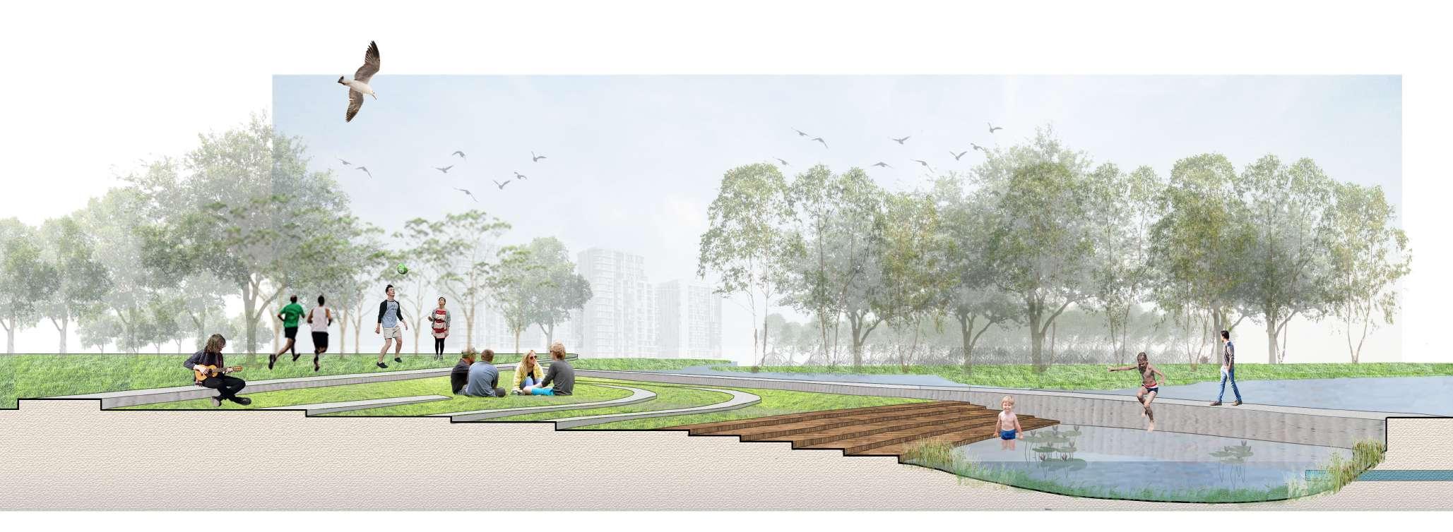
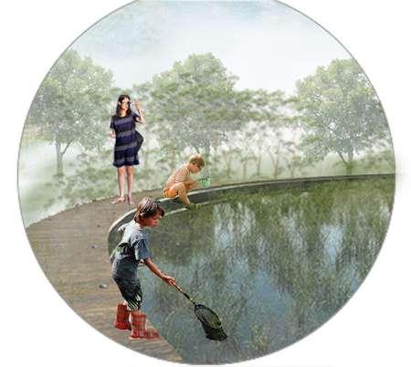
The design project also aims to physically connect people to the native landscape of Sydney by providing opportunities for all age groups to interact with and within what usually is considered as ‘undesired’ landscapes such as dense mangrove vegetation, mud flats and water edges.
This BPWCGGC being central to the blue-green network of Sydney holds the potential to positively impact the city
Aashaka Parikh z5343115 Capstone II A3
Bardwell valley Parklands and Wolli Creek Green Grid Corridor (BPWCGGC)
Botany Bay
Sydney Airport
Tasman Ocean
0 2 4 km
Parramatta River
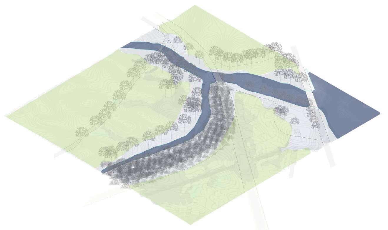
THE CONFLUENCE of Wolli Creek and Cooks River
The site lies on the eastern edge of the BPWCGGC towards and in close proximity to Sydney International Airport. The site includes the junction where Wolli Creek meets Cooks River along with it surroundings. There site brings together 3 waterway systems: Cooks River, Wolli Creek, Cooks River to Botany Bay. The site boundaries lie between Tempe Station, Wolli Creek Station, Turella industrial area and Waterworth Park.
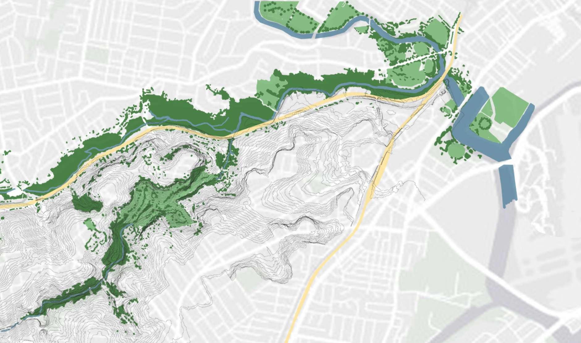
Therefore, the site is an influential point for the water systems of the city.
Aashaka Parikh z5343115 Capstone II A3
Tempe Station
Cooks River
Cooks River
Wolli Creek
Bardwell Creek
Waterworth Park Turella Reserve
Girrahween Park Shepherd Reserve
Silver Jubilee Park
Kendrick Park Discovery Point Park
Bardwell Valley Golf Course
Bardwell Creek Reserve
Bexley Pool Bexley Park
Stotts Reserve
Wolli Creek Regional Park
Coolibah Reserve
Wolli Creek Station
Sydney Airport Created by Author, adpated from Parikh 2022
Turella Station BPWCGGC SCALE 1: 10000
0 0.5 1 km
BayviewAvenue
TEMPE
Wolli Creek
Total Population: 6394 Families: 1553
Primary to High School Children (0 - 19 years): 10.8%
Working/Studying Adults (20 - 39 years): 73.0%
Middle aged (40 - 64 years): 14.0% Senior citizens (65 - 85 and above): 2.2%
Tempe
Total Population: 3356 Families: 899
Primary to High School Children (0 - 19 years): 22.9%
Working/Studying Adults (20 - 39 years): 30.2%
Middle aged (40 - 64 years): 34.7% Senior citizens (65 - 85 and above): 12.3%
Earl Wood
Total Population: 17 741 Families: 4782
Primary to High School Children (0 - 19 years): 24.4%
Working/Studying Adults (20 - 39 years): 22.3%
Middle aged (40 - 64 years): 34.3%

Senior citizens (65 - 85 and above): 19.1%
Aashaka Parikh z5343115 Capstone II A3
Park
Lusty Street Residential Area Discovery Point Park Kendrick Park Cooks River Cooks River WOLLI CREEK STATION
Wolli Creek
EARLWOOD Waterworth
Waterworth Park
TEMPE STATION
PrincesHighway WOLLI CREEK Residential
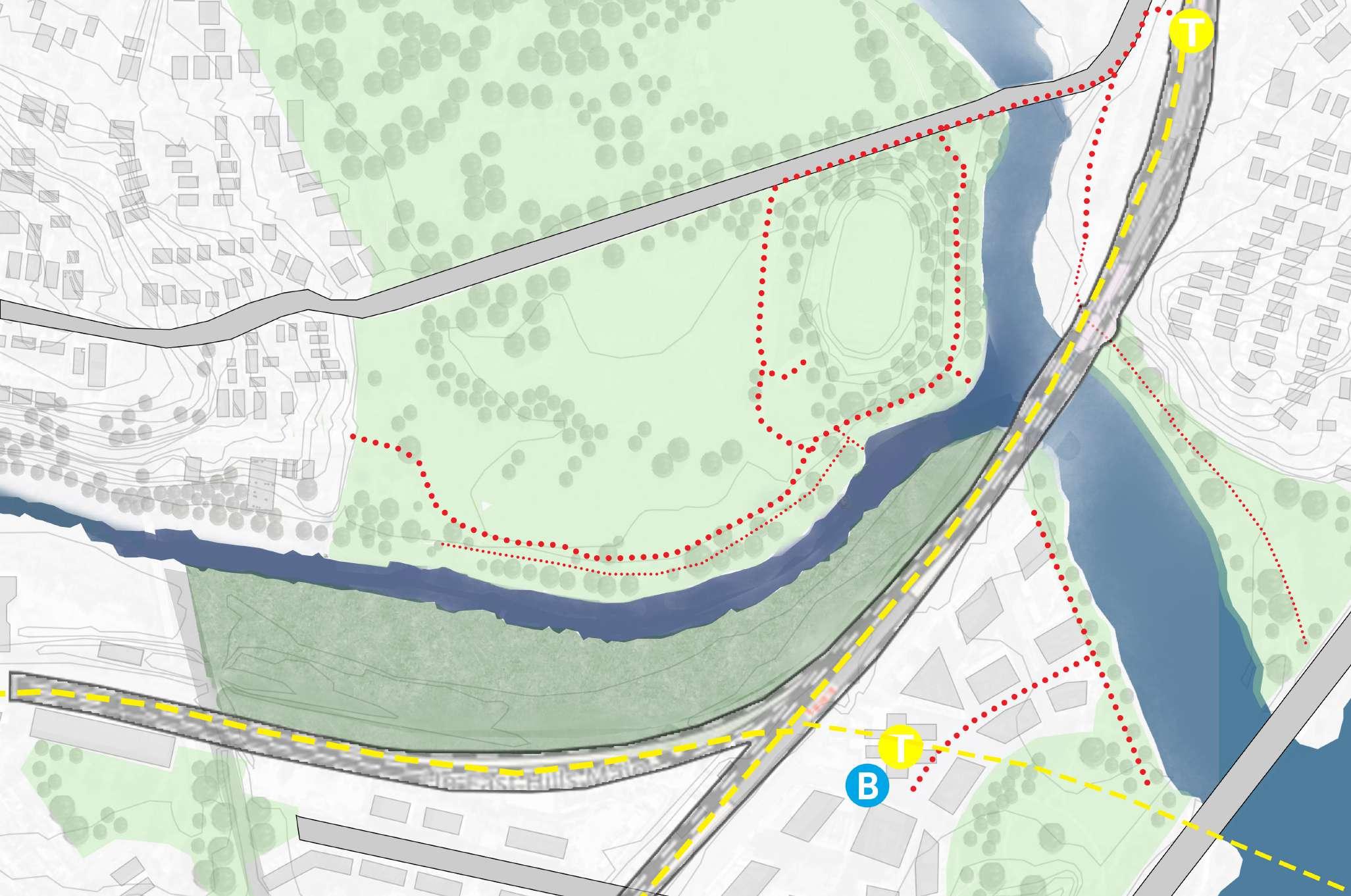
Industrial Area Lusty Reserve Residential & Commercial Area ACCESSIBILITY & DEMOGRAPHICS Suburb Boundary Site Boundary 61% 0 100 m 200 m
suburbs (Tempe, Wolli Creek and Earlwood), are children and young adults who are in the learning phase of
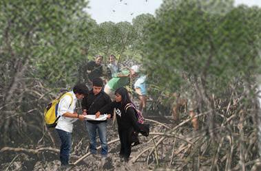
programs revolve around interactive learning with nature. The site hold potential to attract people from across the neighborhood and city due to close proximity from Wolli Creek and Tempe Station. The walking trails however are poorly managed.
Area
61% of the combined population of 3
their life therefore, the
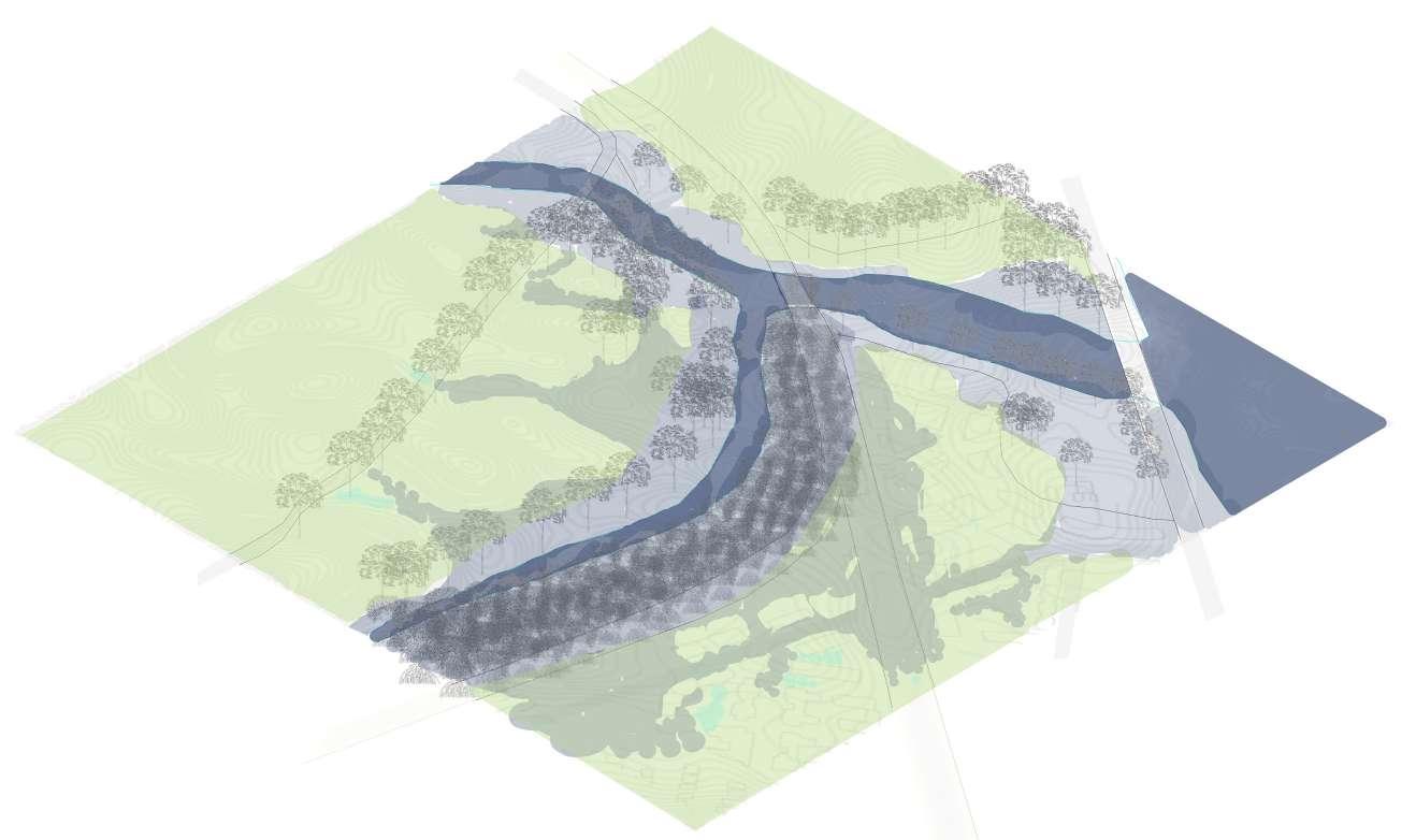
EDGE CONDITIONS OF WOLLI CREEK
Although the site being a large floodplain; it has been occupied by residential buildings, parks and infrastructure and has restricted Wolli Creek and its confluence with Cooks River a narrow channel
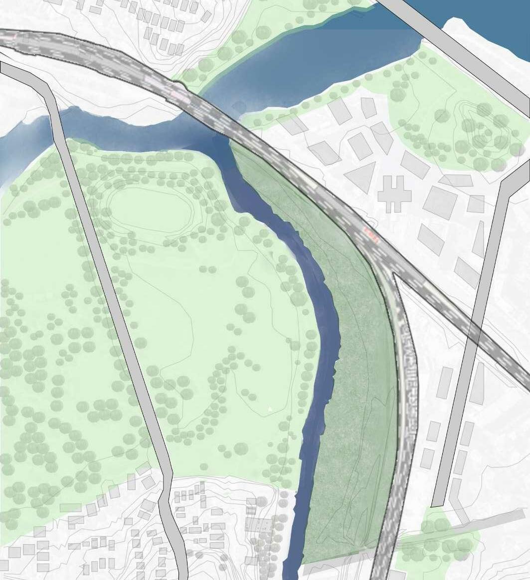
The north edge of Wolli Creek (Waterworth Park) attracts people to spend time amongst native trees, whereas the southern edge is inaccessible with a dense mangrove forest. Currently Wolli Creek is narrow channel from West to East.
Aashaka Parikh z5343115 Capstone II A3 0 50 m 100 m
0 100 m 200 m
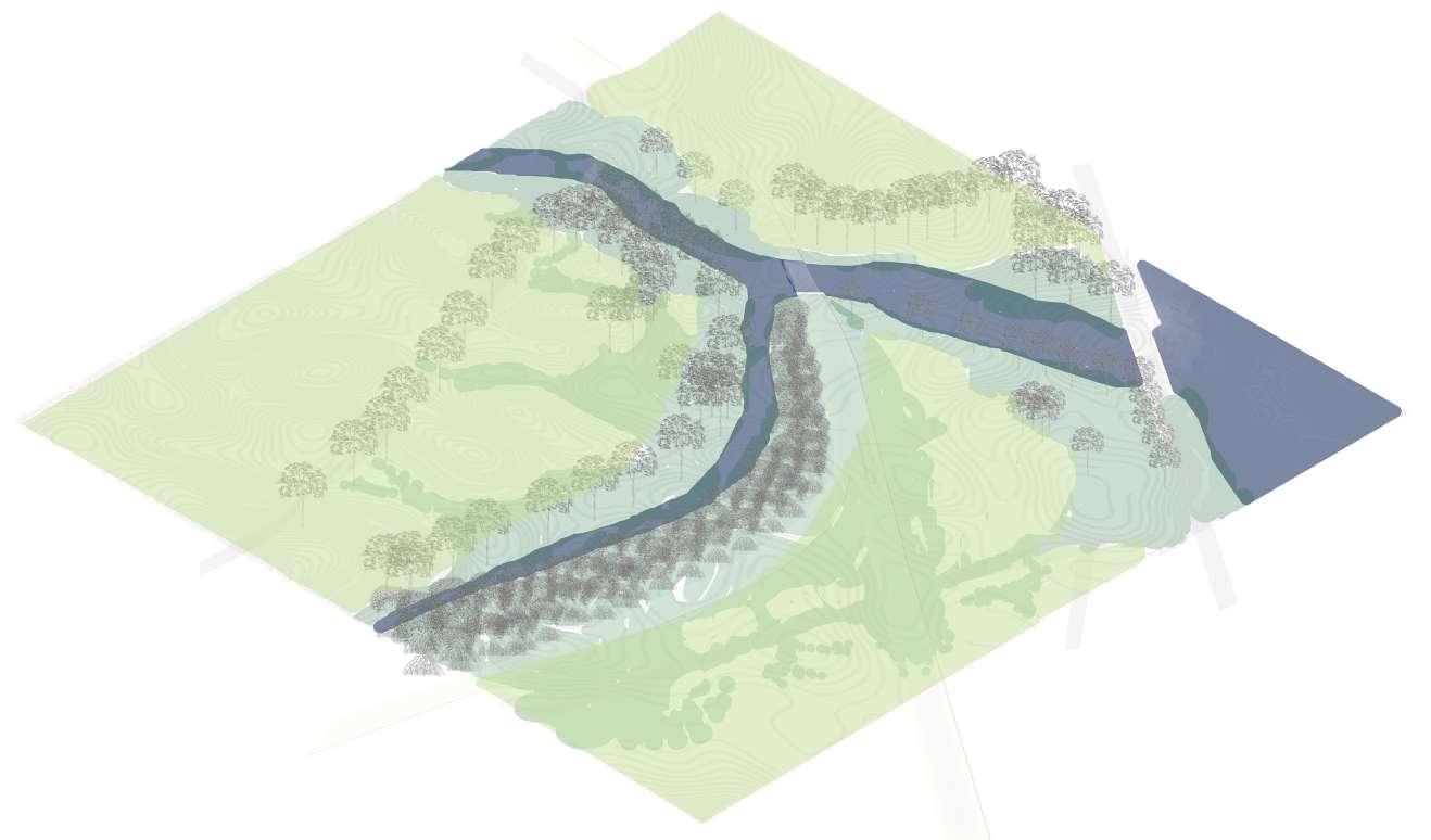
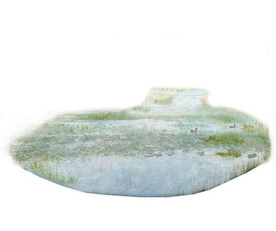
ORIGINAL FLOODPLAIN FLORA AND FAUNA
Green & Golden Bell Frog habitat now endangered Original Floodplain of the confluence area
The site is originally a flat low-lying vast floodplain. Thus it currently floods during high rains and water level rise.
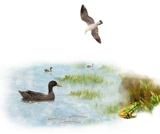
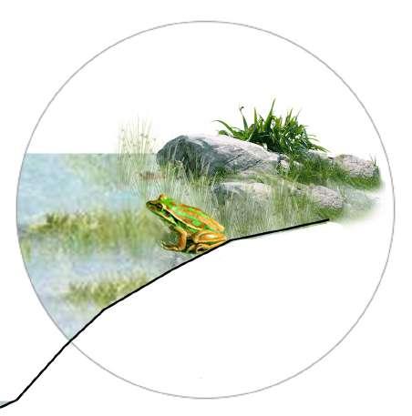
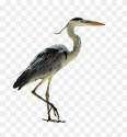
The site is a natural habitat for the Green &Golden Bell Frog which is now endangered as the site continues to be encroached and upon and degraded.
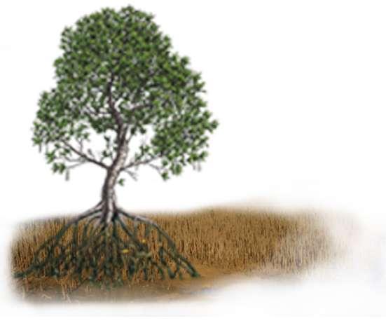
The original landscape includes mangroves, and mud flats
Mangrove habitat
Native trees Mud flats
Canoeing routes Camping Spots
The first nations people travelled in kayaks and camped on the banks of the creek and river.
Aashaka Parikh z5343115 Capstone II A3
DESIGN PRINCIPLES
As depicted in the diagram the First Nations people regarded humans as an equal (rather than superior species) to the other apecies, vegetation, soil and other elements on Earth. The design principles focus on providing for other elements and species along with humans.
Plants Water Animals Humans
Enhance and Protect Natural Vegetation
Create room for the Creek to allow for future Flooding
Design Principles:
Create habitats and routes for land and aquatic Species
Allow people to experience different types of landscapes
Research Question: How can design restore the essence of the original landscape and help people become a part of it?
Aashaka Parikh z5343115 Capstone II A3
Diagram by Steffan Lehmann adapted by Connecting with Country Draft Framework
DESIGN VISION
Design Driving Question: What is this site meant to be? (rather than what do we the people want it to be)
To bring back the essence of the lost landscape which merges the life of plants and animals to people’s activities
Aashaka Parikh z5343115 Capstone II A3
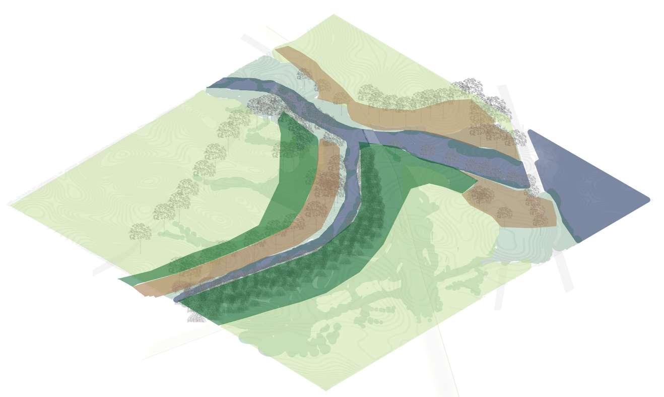
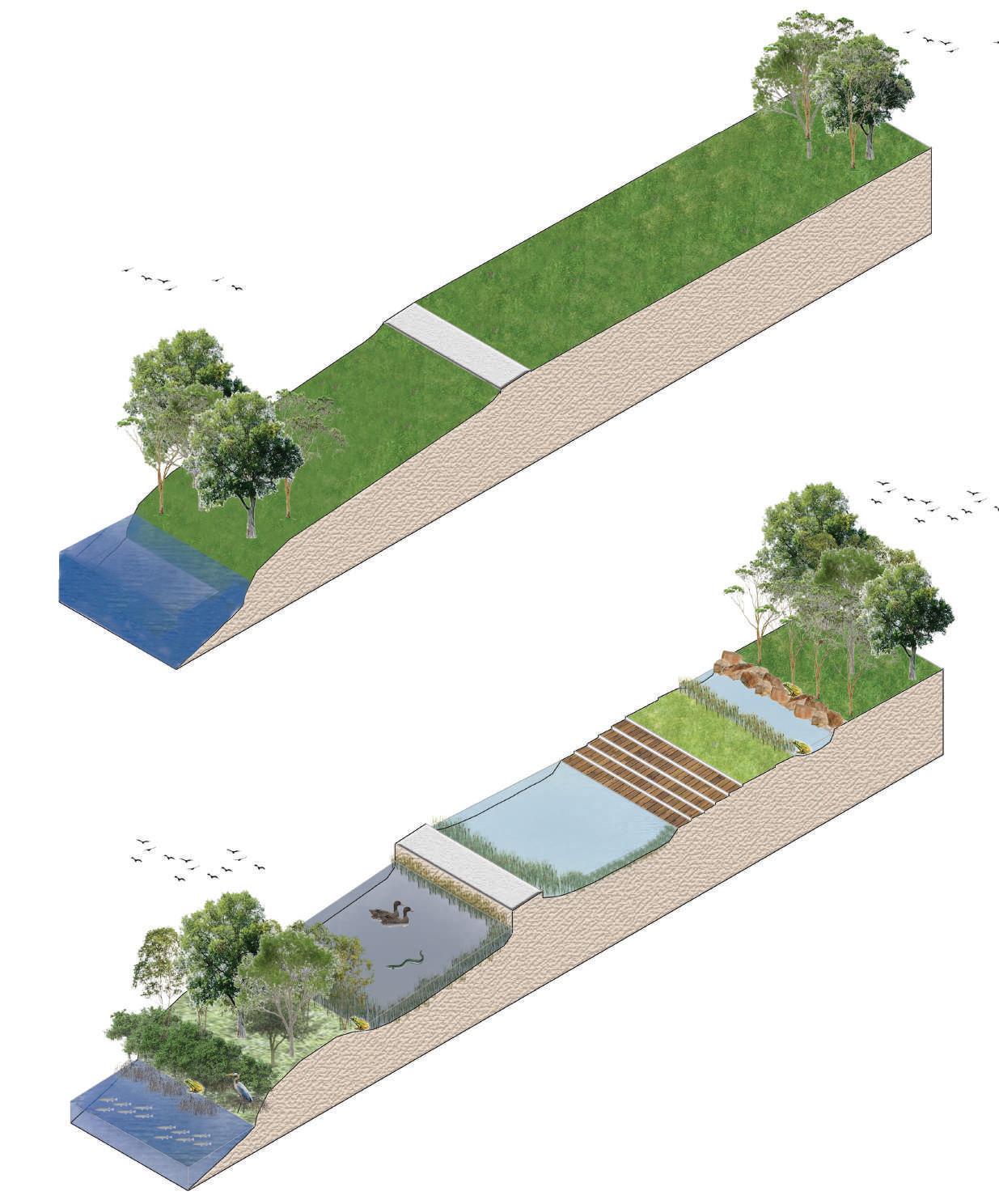
KEY MOVES & DESIGN PROCESS
Identify and Preserve existing vegetation
Allow for water cleaning and future flooding
Create habitat islands for plants, birds and animals
Create new water way with connections to Wolli Creek

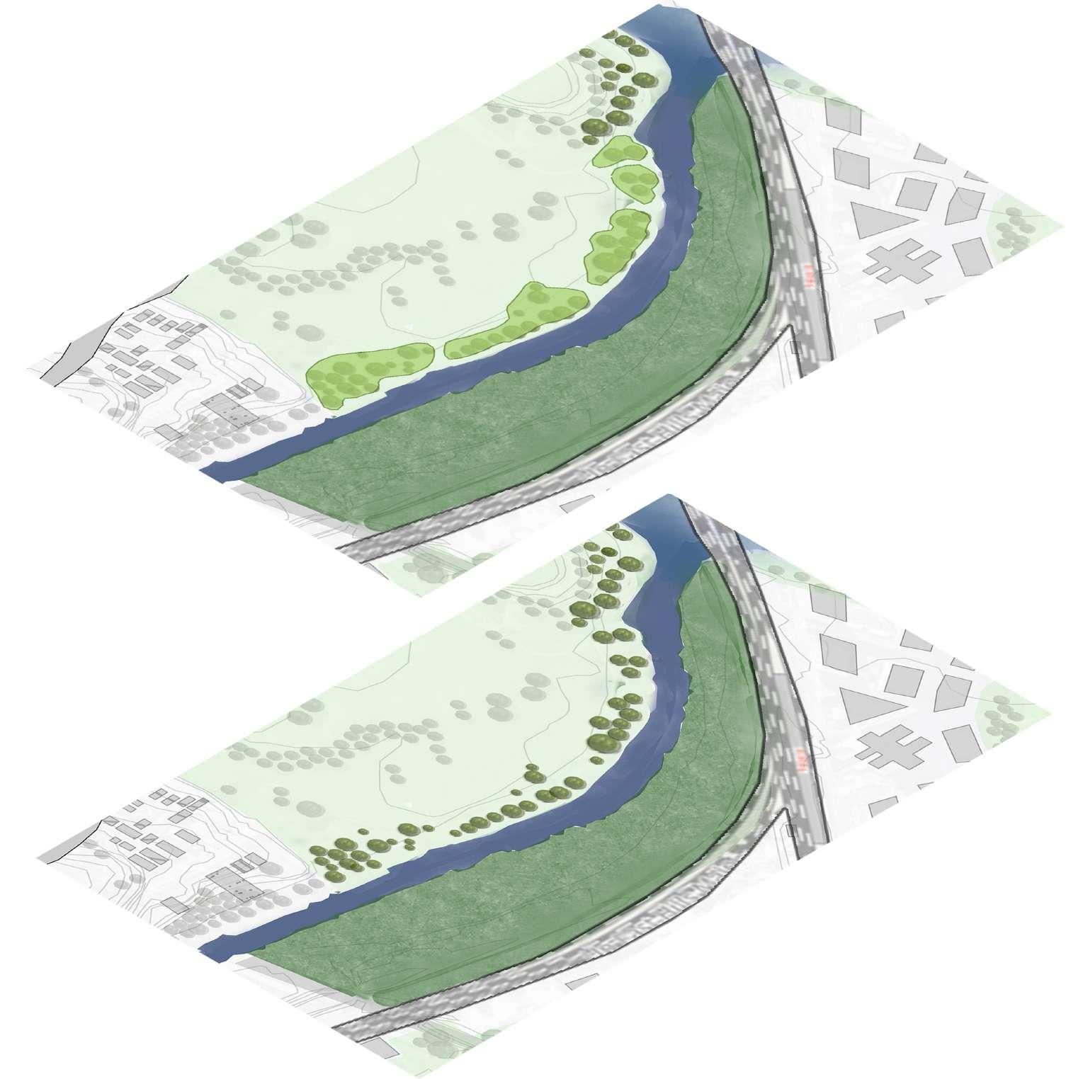
Identification of existing trees and vegetation on creek edge
Topographical modifications in contours to create series of ponds
Aashaka Parikh z5343115 Capstone II A3
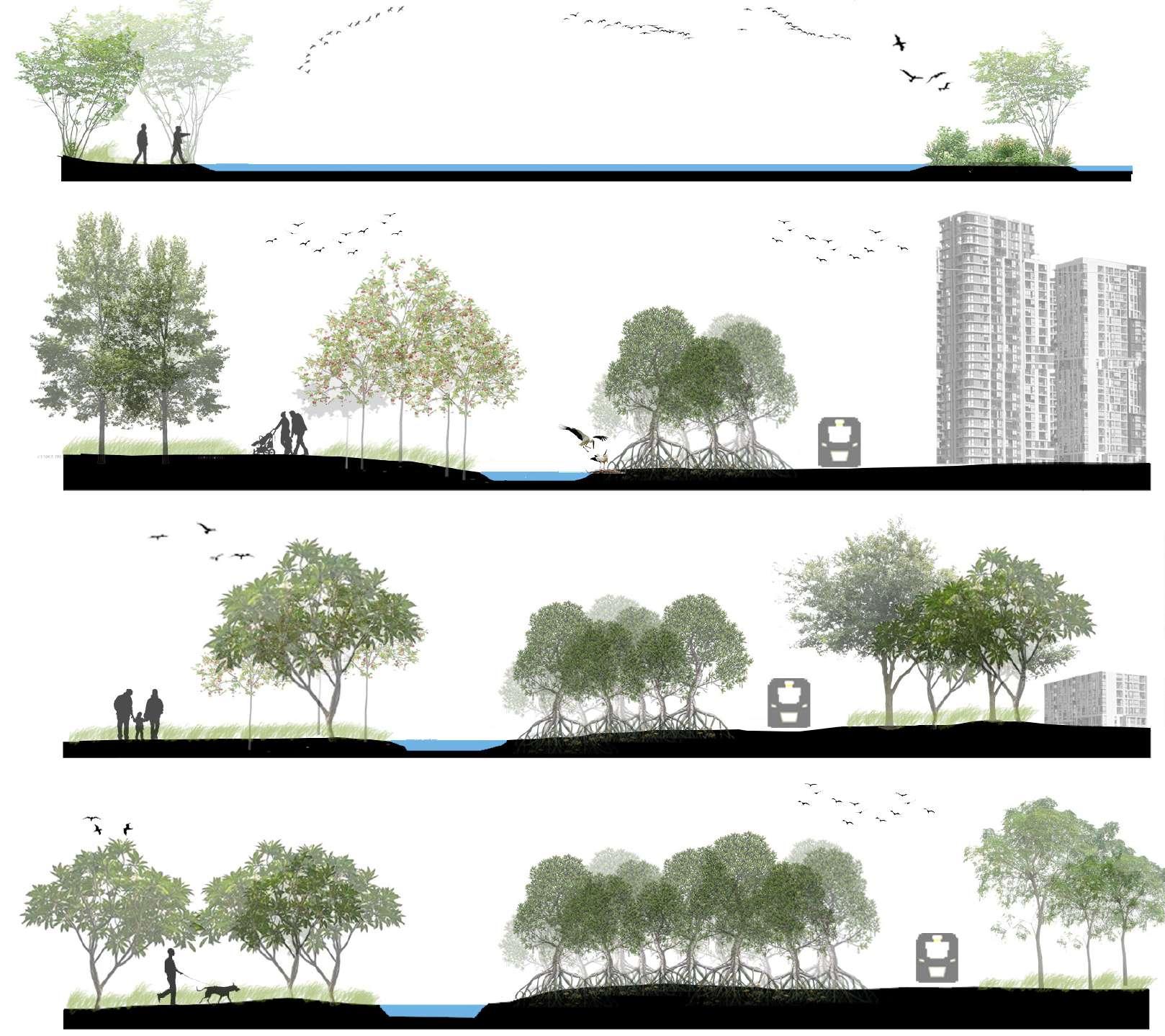
Enhance Vegetation and water for birds, animals and humans
KEY MOVES & DESIGN PROCESS
Plant habitat islands with native plants to provide for birds and frogs
Allow and encourage the new growth of mangroves on both edges of the creek as they provide habitats for small fish
Parts of old pathway is retained
Various Pathways connecting different landscapes
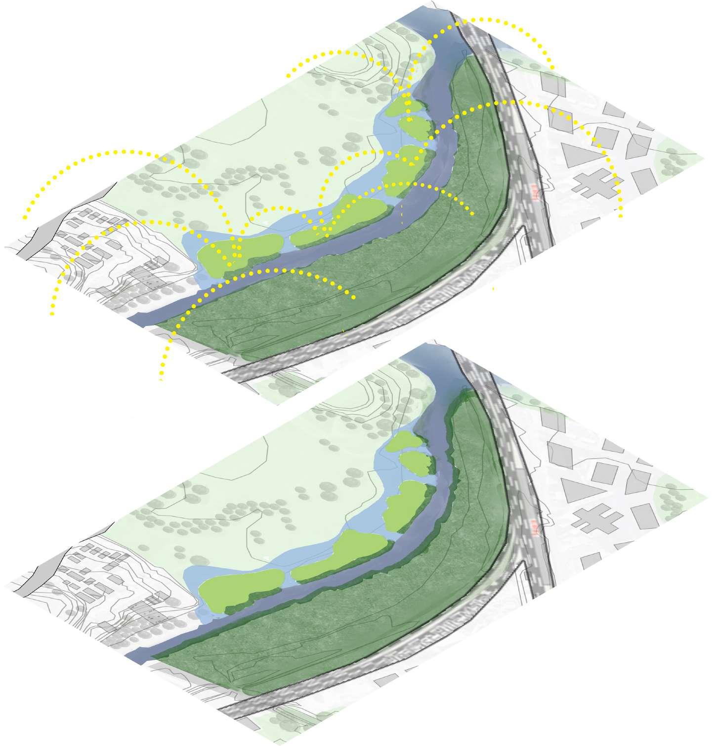
Water ponds planted with reeds to provide cleaner passage for aquatic species including Long-finned Eels
Aashaka Parikh z5343115 Capstone II A3
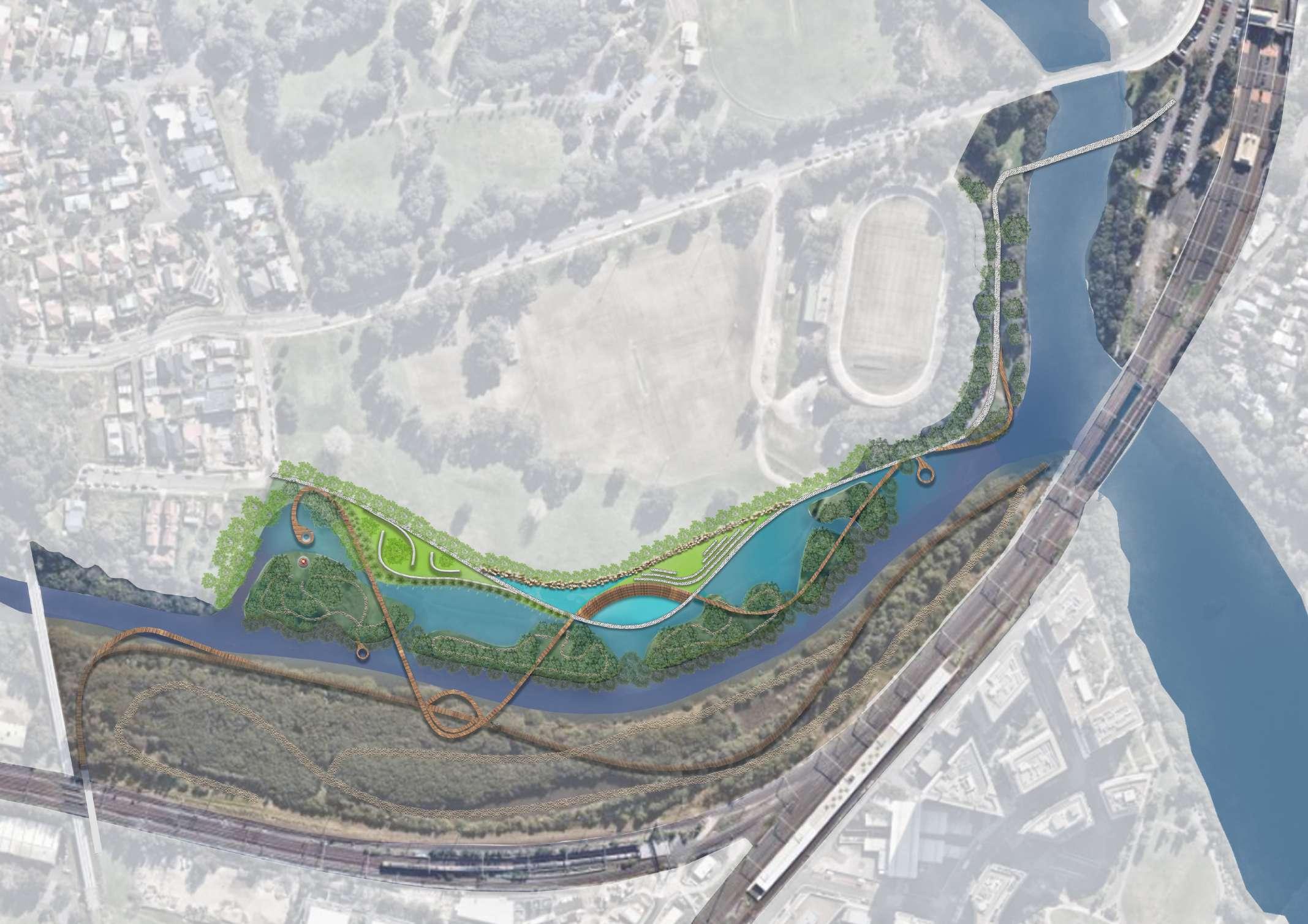


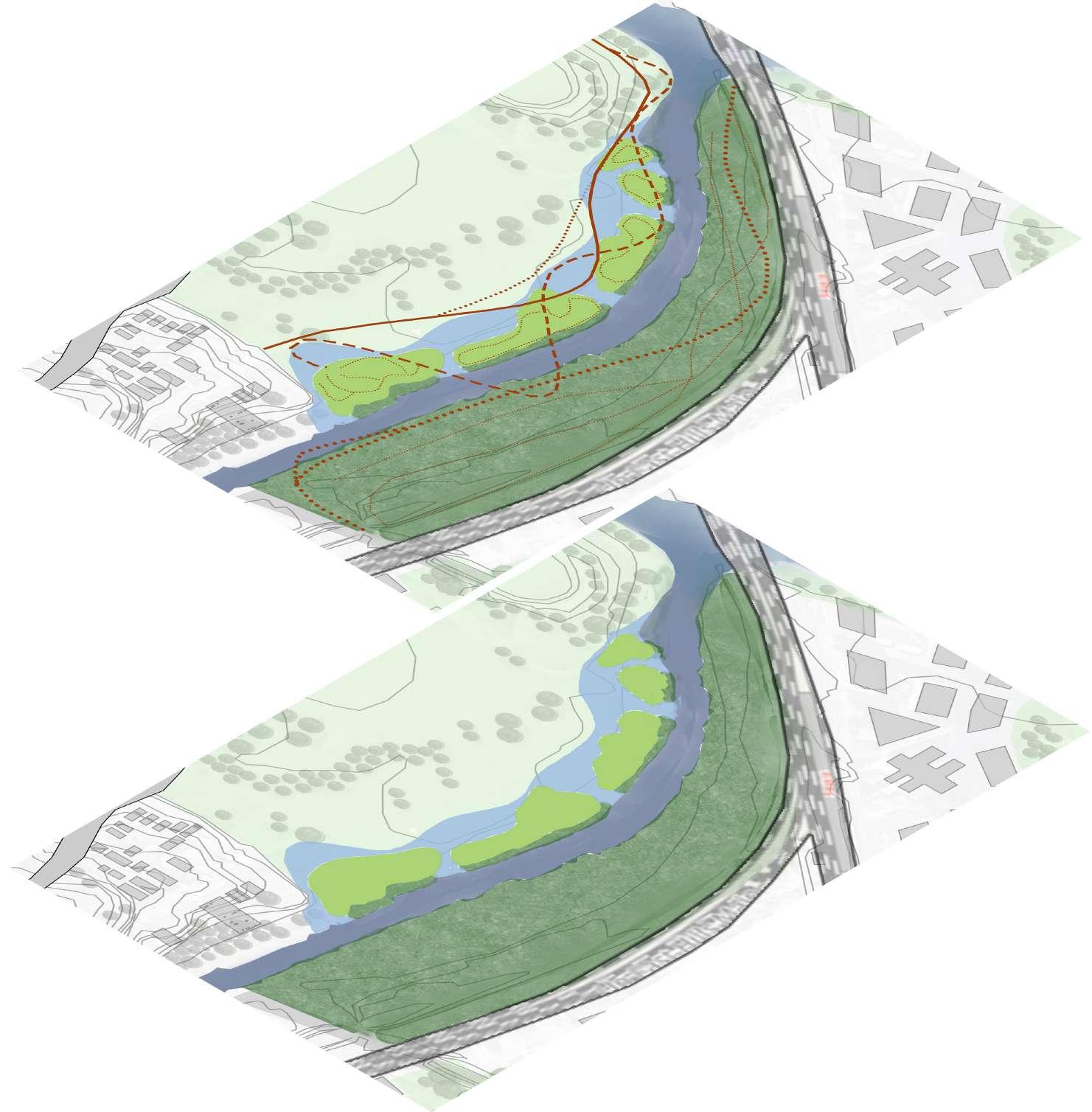
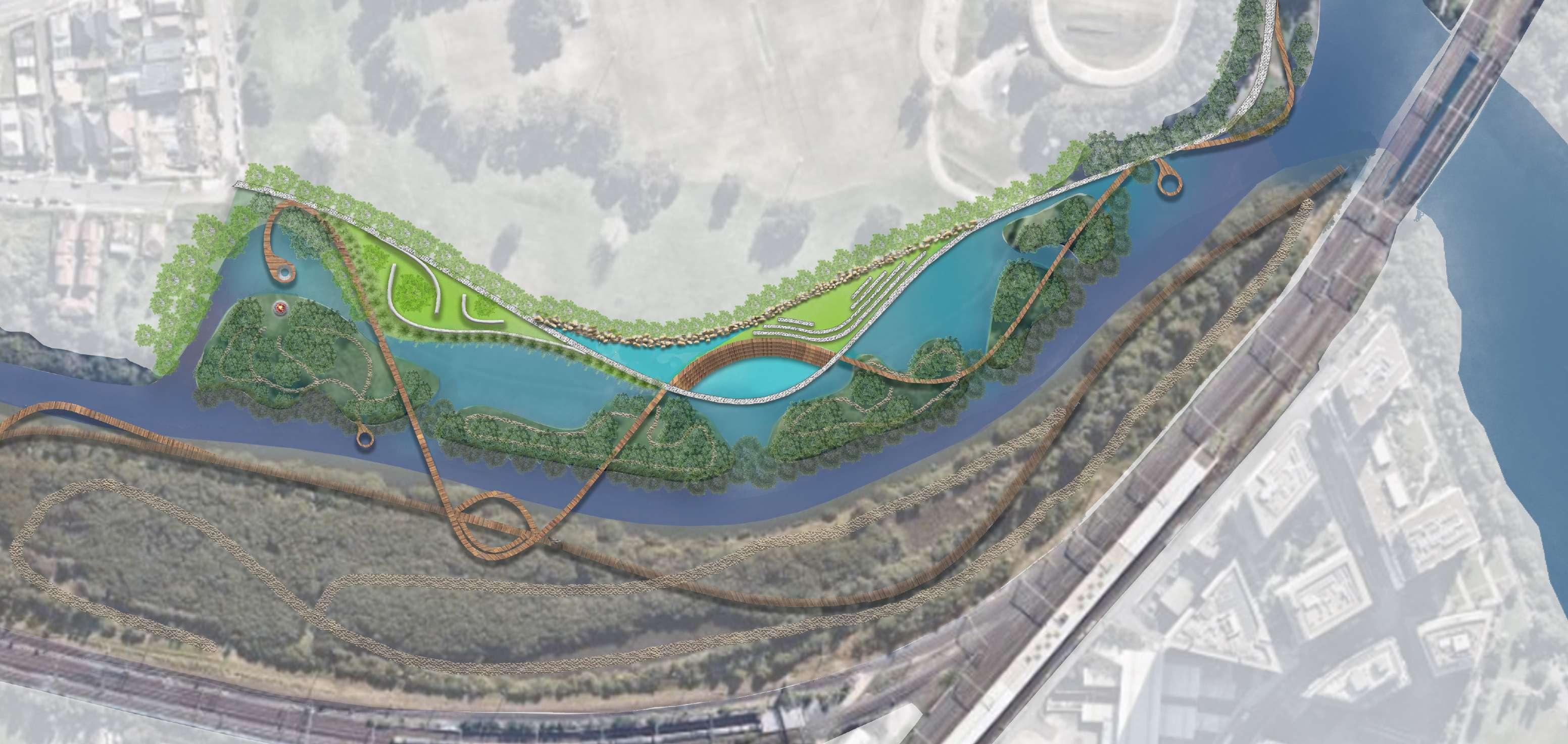
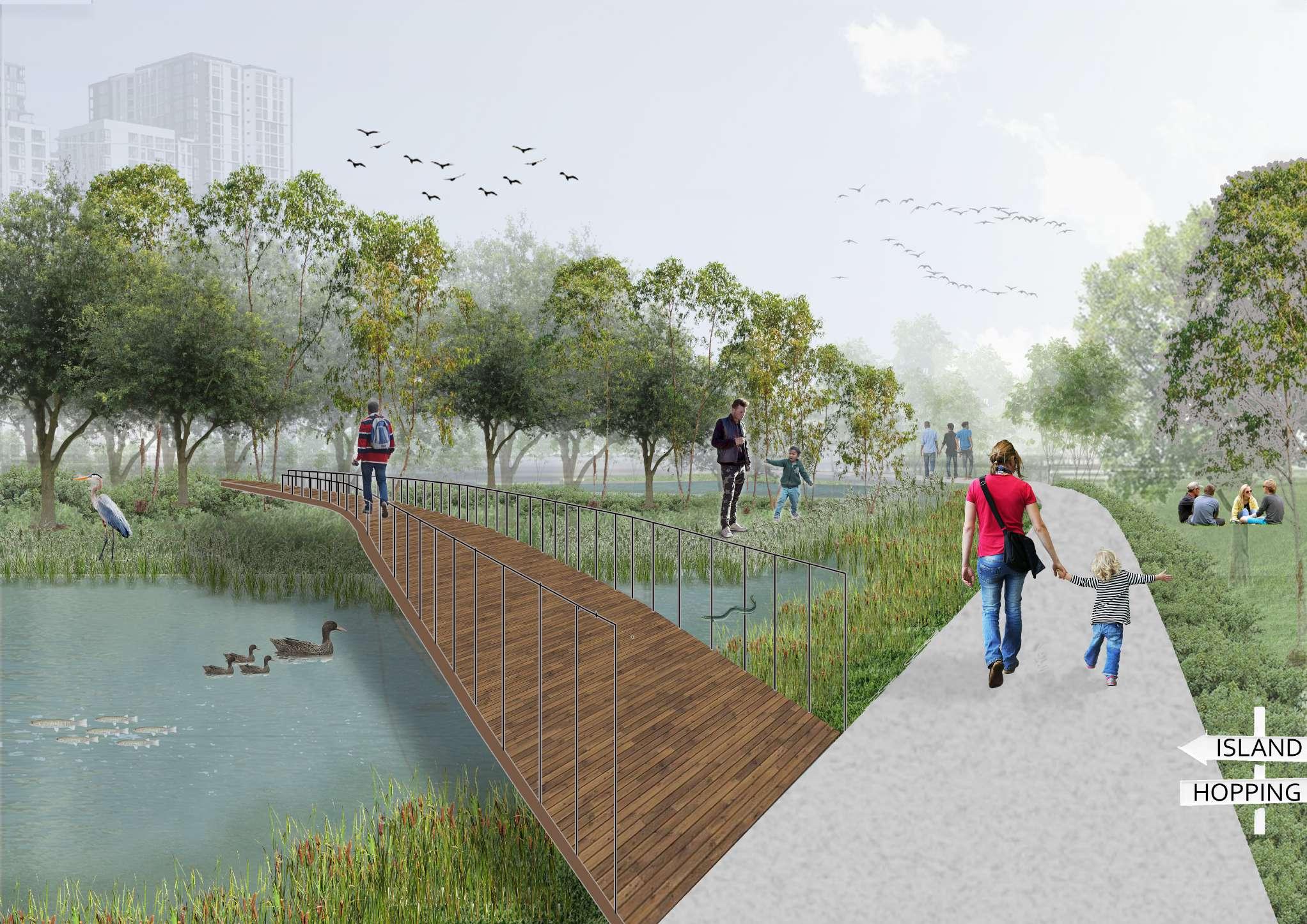
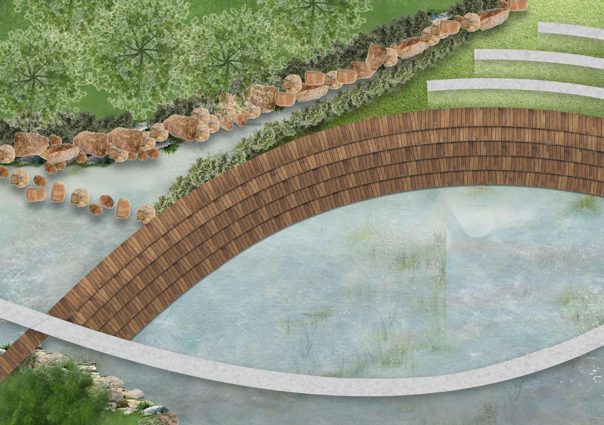
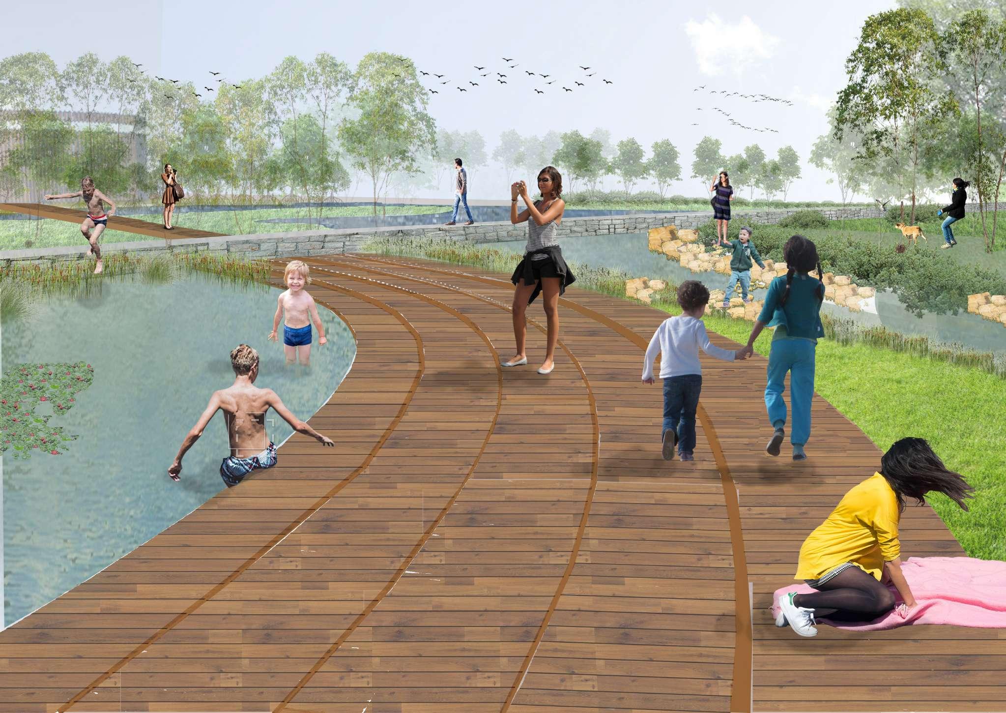
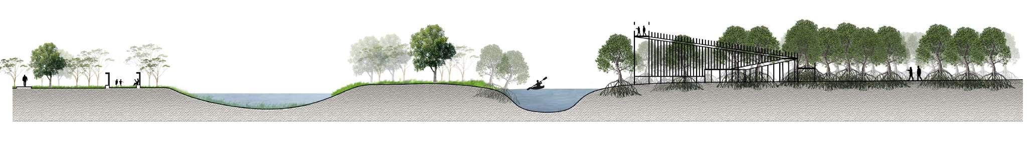
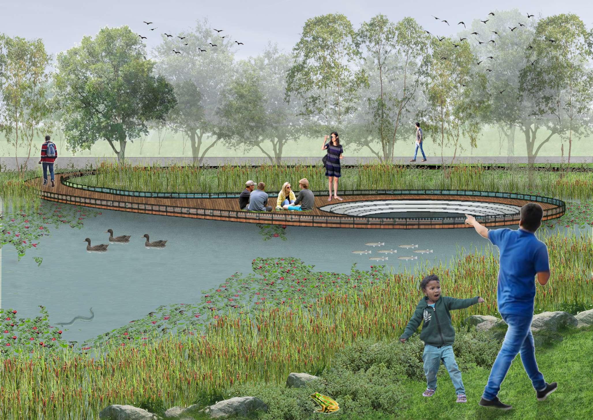
Aashaka Parikh z5343115 Capstone II A3 MASTER PLAN Tempe Station Bayview Ave Lusty Reserve 3 2 1 4 5 6 7 8 9 10 11 12 3 13 2 14 11 Waterworth Park 3 Program KEY: 01. Pedestrian Bridge from Tempe Station 02. The confluence viewing deck 03. Canoeing Deck 04. Resting Lawn 05. Pond Pool 06. Water play 07. Open exhibtion/resting space 08. Place of Peace 09. Wolli Island 10. Bird watching platform 11. Ramp to mangrove area 12. Wolli Creek viewing deck 13. Underground Bridge to Mangrove area 14. Rocks for jumping through KEY: Entry points to site Existing Trees New Trees Exisiting Mangroves New Mangroves Lawn Forest areas Mud flats Timber Concrete Water 0 100 m 200 m There are 3 major pathways: 1. Concrete pathway which
activities
of
2.
3.
islands
connects all
on the edge
Waterworth Park;
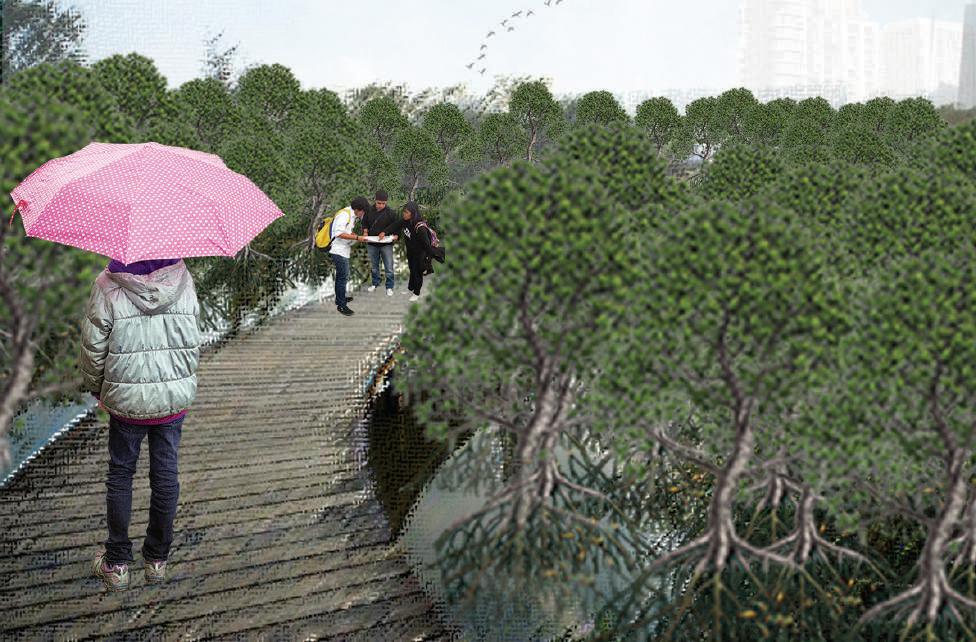
A timber bridge which runs across all landscapes includes the mangrove area across Wolli Creek;
A lower level timber bridge which primarily goes through the mangrove forest. There are smaller unbuilt and raw paths within the mangrove forest and the habitat


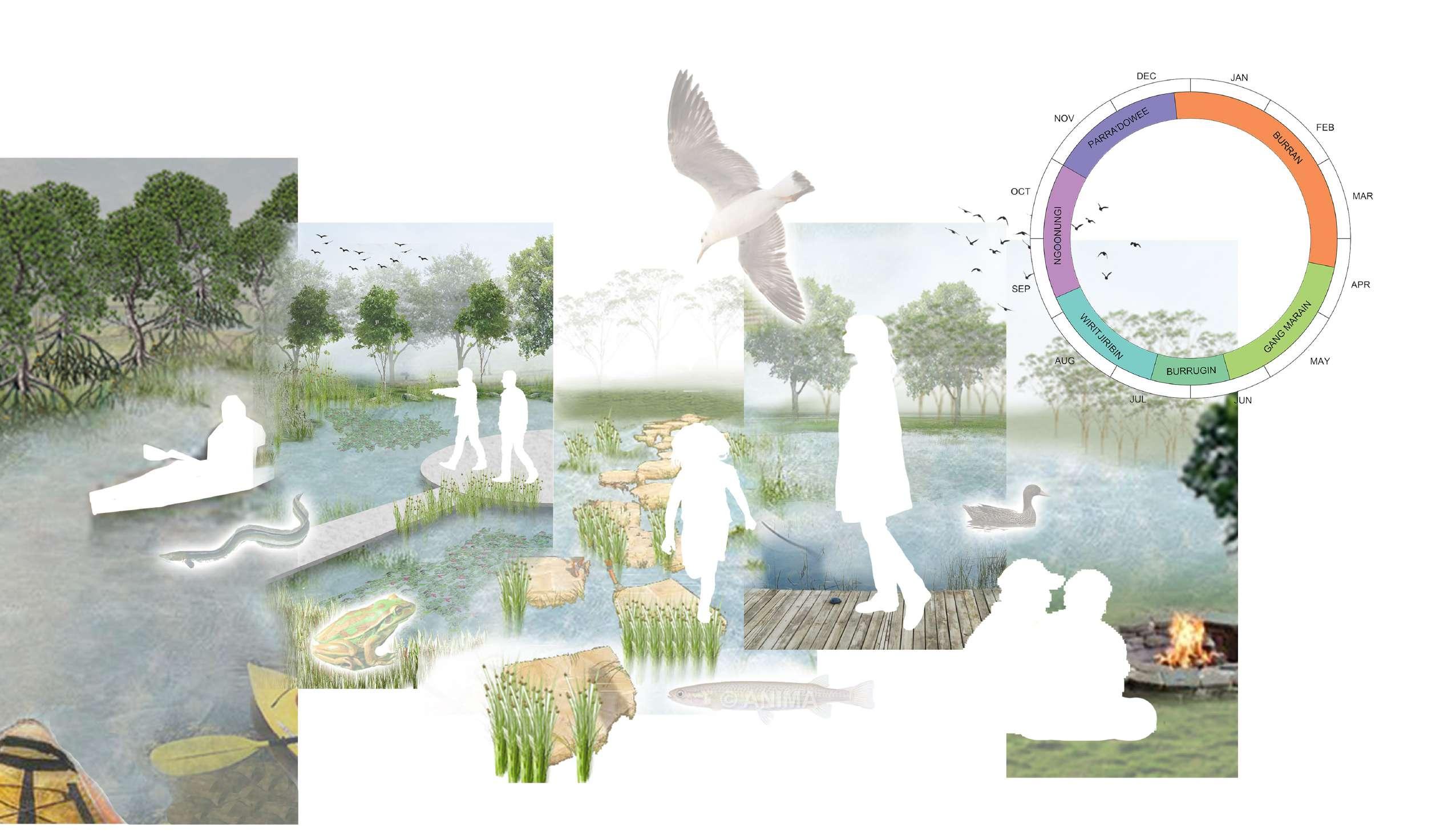
Aashaka Parikh z5343115 Capstone II A3 Gaia 16 years old, student Loves exploring nature Canoeing Walking / Exploring Camping Water play Sitting / Relaxing Exibition / Learning View / Bird - watching Playing EXPLORATIONS
The site provides various relaxing exploring and learning activities whereby people can naturally and effortlessly come into contact with nature and learn from nature
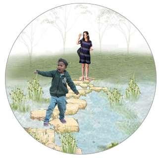
ISLAND HOPPING OR TO THE WATERFRONT?


Aashaka Parikh z5343115 Capstone II A3
KEY PLAN
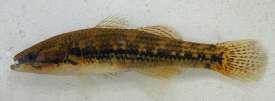
Green-Golden Bell Frog
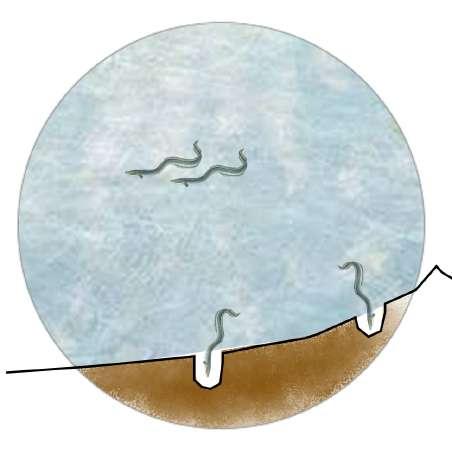
Parra’dowee Season - eels swim up Frogs lay low during hot and dry climate
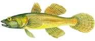
Long-finned Eel
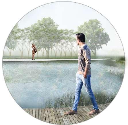
Waterfront can be explored by the timber bridge, concrete pathway and stepping stones throughout the year


Aashaka Parikh z5343115 Capstone II A3
KEY PLAN 0 10 m 20 m
WATER PLAY
WATER PLAY
Picnics are mostly likely during pleasant to hot weather Pond dipping and other activities are likely prior to hot/dry climate
Aashaka Parikh z5343115 Capstone II A3
KEY PLAN
WATER PLAY
DETAIL SECTION 1: 50
The water-play area being central to the site provides spaces for a variety of fun and social activities for all age groups including gathering, playing and swimming in the natural ponds.
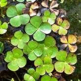
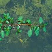
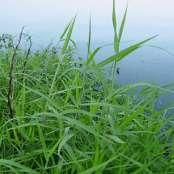
Plants of the natural pond that purify water and are suitable to semipermanent wetlands
Aashaka Parikh z5343115 Capstone II A3
KEY PLAN
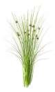
Juncus Effusus Cattail Reed
Nardoo Water crouch
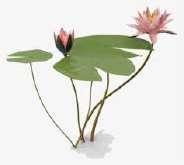
Water Lilly Water Primrose
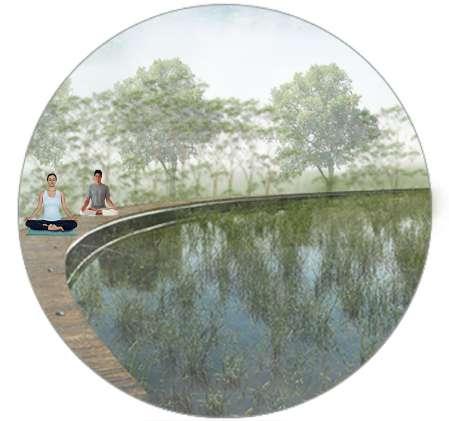
WOLII WATCH OVER


The mangrove forest areas including the timber bridges and the viewing platform are accessible all throughout the year.

Aashaka Parikh z5343115 Capstone II A3
KEY PLAN 0 10 m 20 m
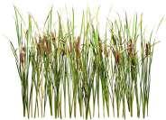
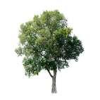
Paperbarks The Grey Mangrove
Native Vegetation River Red Gum Eucalyptus Swamp Oaks Swamp Mahogany
Ramp to top To the Confluence
Wolli Camp
Water Play Platform at 9 meters level
Wolli Bridge
WOLLI WATCH OVER


Aashaka Parikh z5343115 Capstone II A3
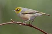
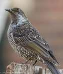
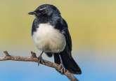
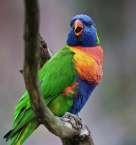
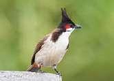
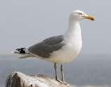
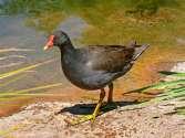
Bird Species
Seagulls
Little and Red Wattle
Rainbow Lorikeet Silvereye New Holland Honey eater
Red whiskered bulbul Willie Wagtail
Dusky Morgen Cormorants Ducks Great Egret
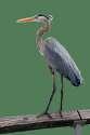
White faced Heron
MANGROVE MEANDERS
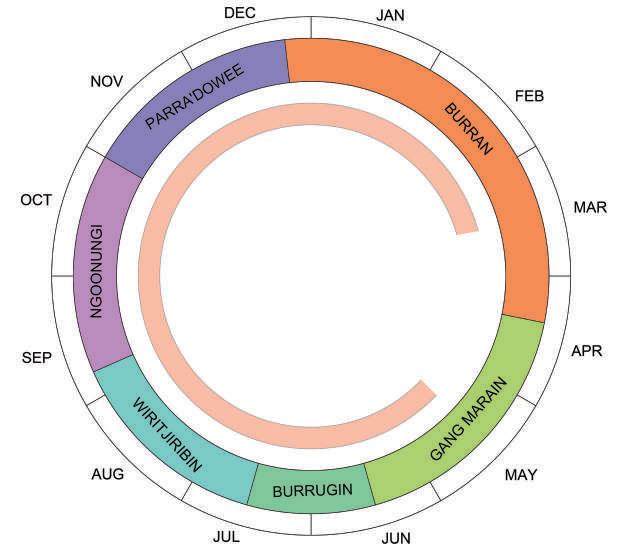
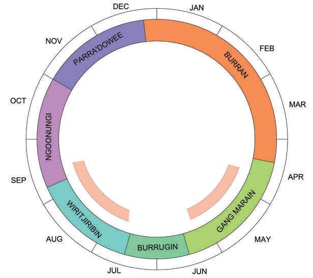
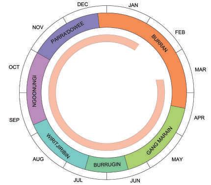
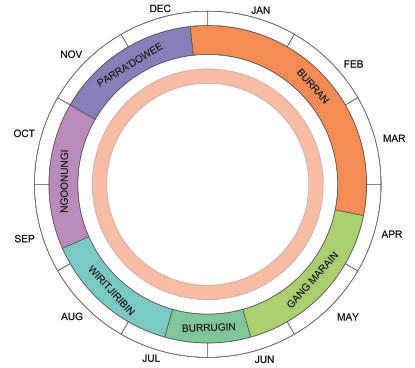
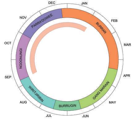
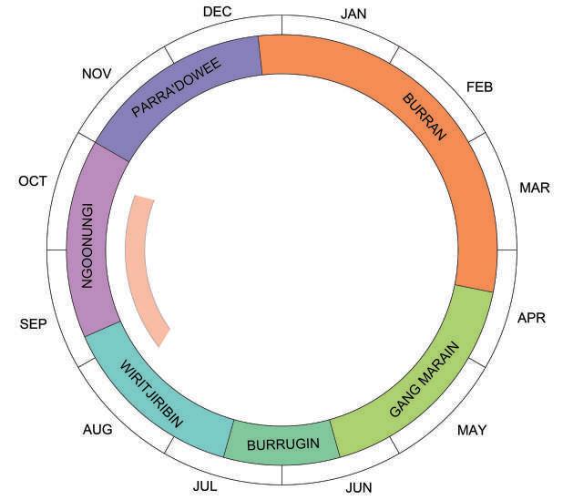
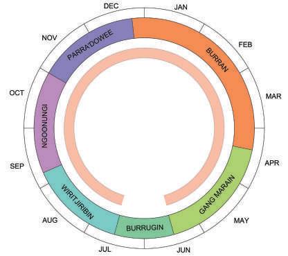
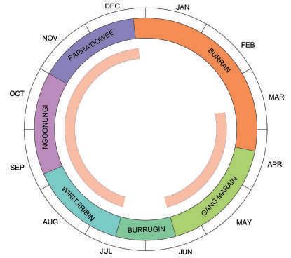
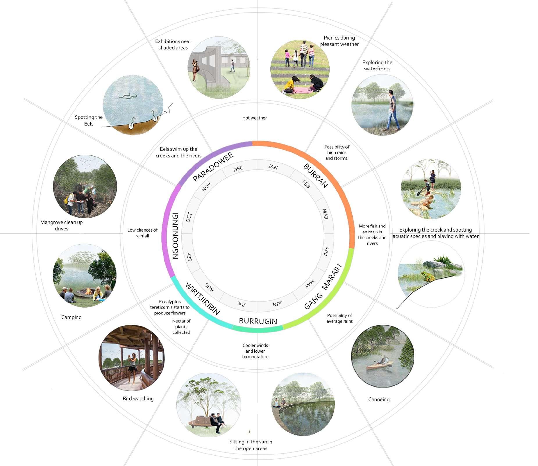
Birds are best visible during the Writjiribin season and Gang Marrain season since the Eucalyptus flowers and the Lilly Pilly (westwards to the site) flowers then respectively.
It is advisable to walk through the mangrove areas all throughout the year except the start of Gang Marrain season when it is humid which can make the area smell.

Clean up drives
Clean up drives for all ages are arranged between the Writjiribin and Ngoonungi seasons when rainfall is least likely.
Aashaka Parikh z5343115 Capstone II A3
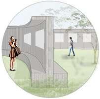
Walk through timber bridge
Bird watching tower
EXHIBITION
DETAIL SECTION 1: 50
Exhibitions can be held all year round except during the rainy days
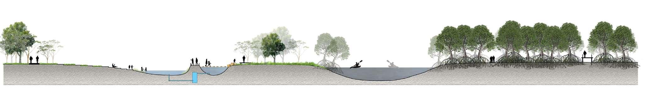
SITE SECTION 1: 200
Aashaka Parikh z5343115 Capstone II A3
KEY
PLAN
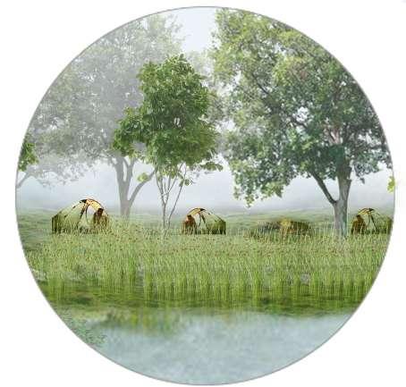
Traditionally camping is forbidden during the peaks of Burran season due to hot and dry weather which can cause forest fires as well the possibility of large storms arise towards the end of the season.


Aashaka Parikh z5343115 Capstone II A3
KEY PLAN 0 10 m 20 m
WOLLI CAMP
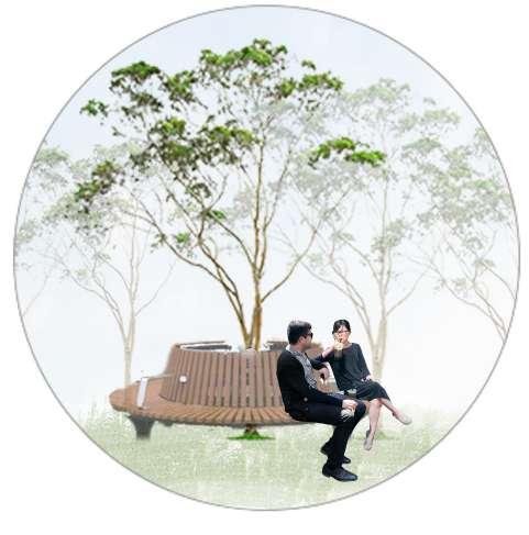
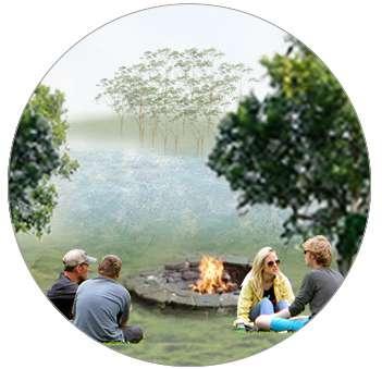
PLACE OF PEACE
People can relax all year round at the deck. Children can also collect water samples foreducational workshops during the camping season.
Aashaka Parikh z5343115 Capstone II A3
KEY PLAN
CANOEING THROUGH THE CREEK
Fish
Canoeing is arranged in the most ideal seasons when there are low chances of heavy rains and stroms

Aashaka Parikh z5343115 Capstone II A3
KEY PLAN
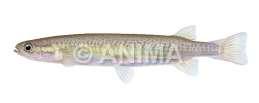
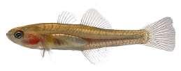
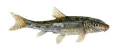
Species Gudgeon Empire Gudgeon Flathead Gudgeon
Flathead Gudgeon Firetail Gudgeon Common Galaxia
Many of the fish species can be spotted whilst canoeing through the creek
SEASONAL ACTIVITIES
All the activities are programed to spread across all seasons of the year. These programs are governed by the changing seasons.
For example, the canoing activities will be at halt during the high rains and storms in Burran season. They will resume again in the Gang Marain season.
Also camping will be banned at Wolli Island in the Burran season since there are higher chances of forest fires. During this hot weather children and other people can play in the water at the stepwell to beat the heat.
During the Ngoonungi season Mangrove clean up drives can take place since chances of rainfall are the lowest so people can walk between the mangroves.
These seasonal activities enable people to learn from the natural characteristics and patterns of the country at an early age.
Aashaka Parikh z5343115 Capstone II A3
Research Question: How can design restore the essence of the original landscape and help people become a part of it?
RESEARCH: ORIGINAL ESSENCE OF
THE SITE:
- floodplain
- mangrove marsh and mud flats
- habitat for eels and frogs
- camping site - travelling using canoes
SOIL MEMORY:
The capacity of the soil to store and revive lost ecological values of the landscape
DESIGN ASPECTS:
Creating a flexible and seasonal water way
Allowing the site to seasonally change and function
Allowing new mangroves to grow on the edges of Wolli Creek
Introduing new programs: camping, canoeing
Introducing educational activities - mangrove clean up drives, exhibitions
Creating human interaction program according to seasonal changes
Designing to help nature takeover and reclaim the land using its soil memory
OUTCOMES OF THE SITE:
- The new water channels flood during water level rise and act as exposed mud flats during dry seasons
- Increased diversity of mangroves along Wolli Creek increasing fish and eel species.
- Camping and canoeing ctivities bring back values of the site
- Educating the citizens of the importance of these landscapes in the green and ble networks of Sydney
- Creating awarness of the 7 original seasons governed by nature
Aashaka Parikh z5343115 Capstone II A3
RESEARCH AND DESIGN CONCLUSIONS
OUTCOMES
Water Vegetation

The levels of the creek were usually high and the water was polluted
The water level is lower in the creek, the creek is less polluted and there are other cleaner water ponds
There were few vegetation patches with sparse trees
The existing vegetation is enhanced and more dense with a variety of trees

Water purifying plants are introduced in the new ponds
New mangroves are grown on the edge of Wolli Creek
Aashaka Parikh z5343115 Capstone II A3
OUTCOMES
The existing trees provided little habitat for birds, the creek was polluted reducing the number of aquatic species
Dense vegetation and variety of trees provide stopping stations and habitats for native birds
Smaller water bodies and edges provide habitats for fogs
New cleaner ponds and vegetated edges provide habitats for ducks and shallow ground for Eels to dig burrows
New mangroves clean the water and provide habitats for small fish and frogs
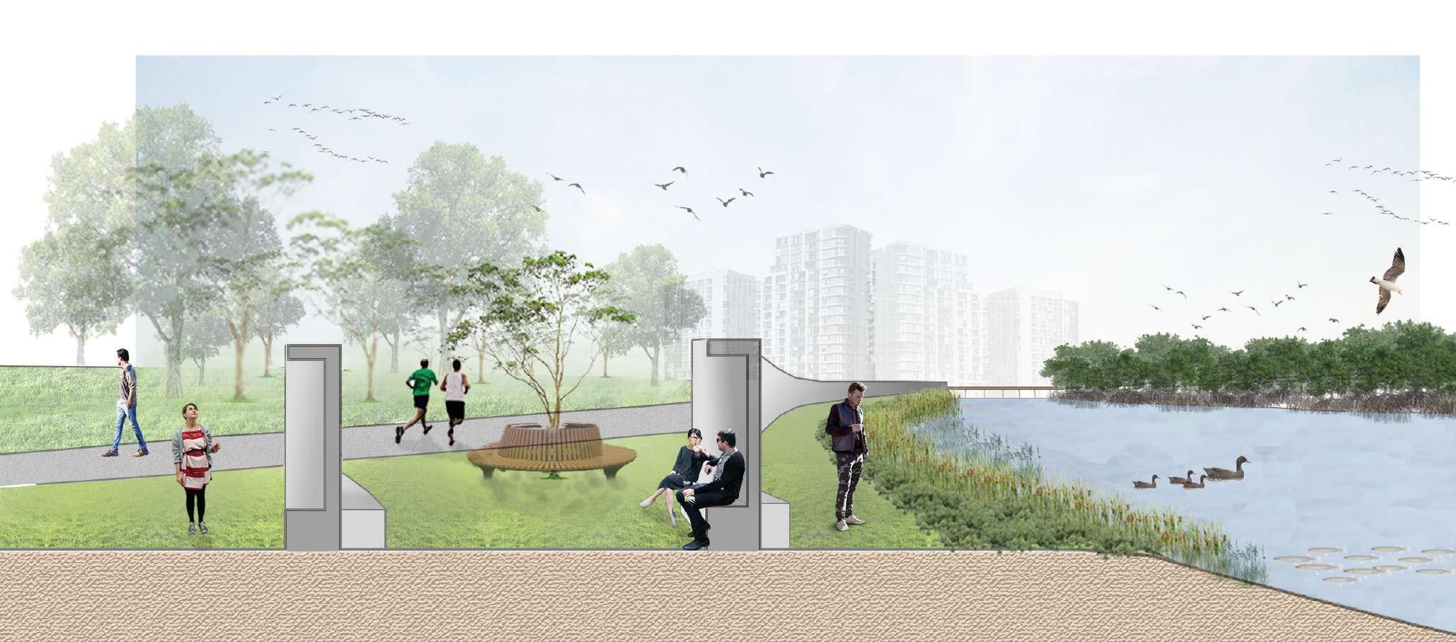
The space provides open area for walks, jogs, walking the dog and small picnics
Walking the dog, jogging, running
Stepping stones and pond dipping
Sitting in the lawn or the timber deck
Jumping / Swimming in the ponds
Partly existing solid walkthrough pathway
Exploring the native forests, spotting the native species
Canoeing and camping activities Island hopping
Aashaka Parikh z5343115 Capstone II A3
Animal Species People
APPLICATION TO GREEN BLUE NETWORK
A chain of projects similar to the Wolli Waterfront can be created at several points alongside the creeks and rivers of Sydney.
Only a small portion of large open spaces such as parks or abandoned lands, left over and underused spaces can be converted into projects which enhance the blue-green network of the city.
Wolli Waterfront
Assuming that pollution in rivers and water channels will decrease in the coming years, these additions can purely function as floodplains or wetlands which can help reduce the flood levels and its its impacts in the city.
These spaces have the potential to become primary habitat locations for endangered species and they can be designed accordingly.
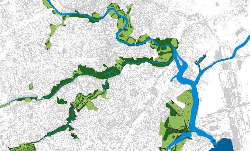
The red spots (new interventions) can form a chain of stops for species which migrate or travel through the city by air, water or land, (just the way humans have train stations across the city).
0
Aashaka Parikh z5343115 Capstone II A3
0.5 1 km
Targets to acheive by reintroducing native plants and heritage landscapes:
Targets to acheive by creating new habitat islands:
GOALS AND TARGETS
SDG 11.4
Strengthen efforts to protect and safeguard the world’s cultural and natural heritage
SDG 15.1
By 2020, ensure the conservation, restoration and sustainable use of terrestrial and inland freshwater ecosystems and their services, in particular forests, wetlands, mountains and drylands, in line with obligations under international agreements
SDG 15.2
By 2020, promote the implementation of sustainable management of all types of forests, halt deforestation, restore degraded forests and substantially increase afforestation and reforestation globally
SDG 15.3
By 2030, combat desertification, restore degraded land and soil, including land affected by desertification, drought and floods, and strive to achieve a land degradation-neutral world
National Level Priority for action 2
Building ecosystem resilience in a changing climate (Australia’s Biodiversity Conservation Strategy 2010–2030)
SDG 14.2
By 2020, sustainably manage and protect marine and coastal ecosystems to avoid significant adverse impacts, including by strengthening their resilience, and take action for their restoration in order to achieve healthy and productive oceans
SDG 15.4
By 2030, ensure the conservation of mountain ecosystems, including their biodiversity, in order to enhance their capacity to provide benefits that are essential for sustainable development
National Level Goal 2.2
Maintaining and re-establishing ecosystem functions (Australia’s Biodiversity Conservation Strategy 2010–2030)
National Level Goal 2.3
Reducing threats to biodiversity (Australia’s Biodiversity Conservation Strategy 2010–2030)
Local Government Target
Local Strategic Planning Statement a land-use vision to 2036.
Targets to acheive by creating new waterways:
Targets to acheive by providing connections betweeen people and the native landscape:
SDG 6.3
By 2030, improve water quality by reducing pollution, eliminating dumping and minimizing release of hazardous chemicals and materials, halving the proportion of untreated wastewater and substantially increasing recycling and safe reuse globally
SDG 6.a

By 2030, expand international cooperation and capacity-building support to developing countries in water- and sanitation-related activities and programmes, including water harvesting, desalination, water efficiency, wastewater treatment, recycling and reuse technologies
National Level Objective 5: Improve conservation management of Australia’s landscapes, waterways, wetlands and seascapes (Australia’s Strategy for Nature 2019–2030)
SDG 6.b
Support and strengthen the participation of local communities in improving water and sanitation management
SDG 11.7
By 2030, provide universal access to safe, inclusive and accessible, green and public spaces, in particular for women and children, older persons and persons with disabilities
National Level Goal 1:
Connect all Australians (Australia’s Strategy for Nature 2019–2030)
National Level Goal 3.1
Improving and sharing knowledge (Australia’s Biodiversity Conservation Strategy 2010–2030)
Local Government Plan
Bayside council plan of management for community land and public open space 2016
Local Government PRINCIPLE 4. Participation (Greener Places
Aashaka Parikh z5343115 Capstone II A3
Australian Bureau of Statistics 2016, Census All persons Quick Stats accessed 14 June 2022 <https://www.abs.gov.au/census/find-census-data/quickstats/2016/SS C14353#:~:text=In%20the%202016%20Census%2C%20 there,up%200.3%25%20of%20the%20population.&text=The%20median%20age%20of%20people%20 in%20Wolli%20Creek%20was%2029%20years>
Broffman Andrew 2022, Connecting with Country: A Pathway to Listening accessed 08 July 2022 <https://www.architectureau.com/articles/connecting-with-country-a-pathway-to-listening/?utm_source=ArchitectureAU&utm_campaign=03a68e03AAU_2022_07_04&utm_medium=email&utm_term=0_e3604e2a4a-03a68e03f7-40519521&mc_cid=03a68e03f7&mc_eid=18f9b188f>
Caterbury Bankstown 2017, Exhibition of Draft Master Plan for Gough Whitlam and Waterworth Parks, accessed 10 June 2022 < https://haveyoursay.cbcity.nsw. gov.au/goughwhitlamandwaterworth>
Herrington 2017, Landscape Theory in Design, Routledge, 711 Third Avenue, New York.
Parikh 2022, ‘BPWCGGC Analysis’, UNSW Moodle, accessed 11 June 2022 < https://moodle.telt.unsw.edu.au/mod/assign/view.php?id=4465490>
Parikh 2022 Ecological Restoration, Applications of Soil Memory
Parikh 2022, ‘Re-tracing Remnants of the Confluence’, UNSW Moodle, accessed 09 June 2022 <https://moodle.telt.unsw.edu.au/mod/assign/view. php?id=4465496>
Parikh 2022, ‘Soil Memory: A study on the concept and applications to the Environmental Reconstruction of Sydney Wolli Creek’, Landscape Theory and Re search, UNSW.
United Nations 2022, Department of Economic and Social Affairs, Sustainable Development, accessed 4 June 2022, <https://sdgs.un.org/goals>
Aashaka Parikh z5343115 Capstone II A3 References
