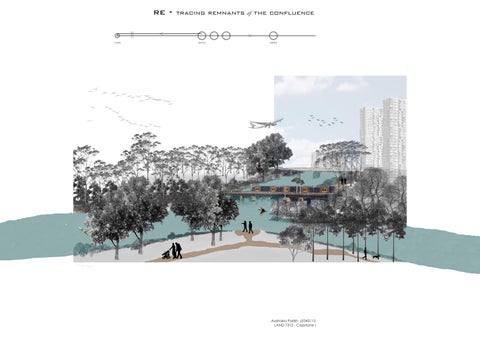
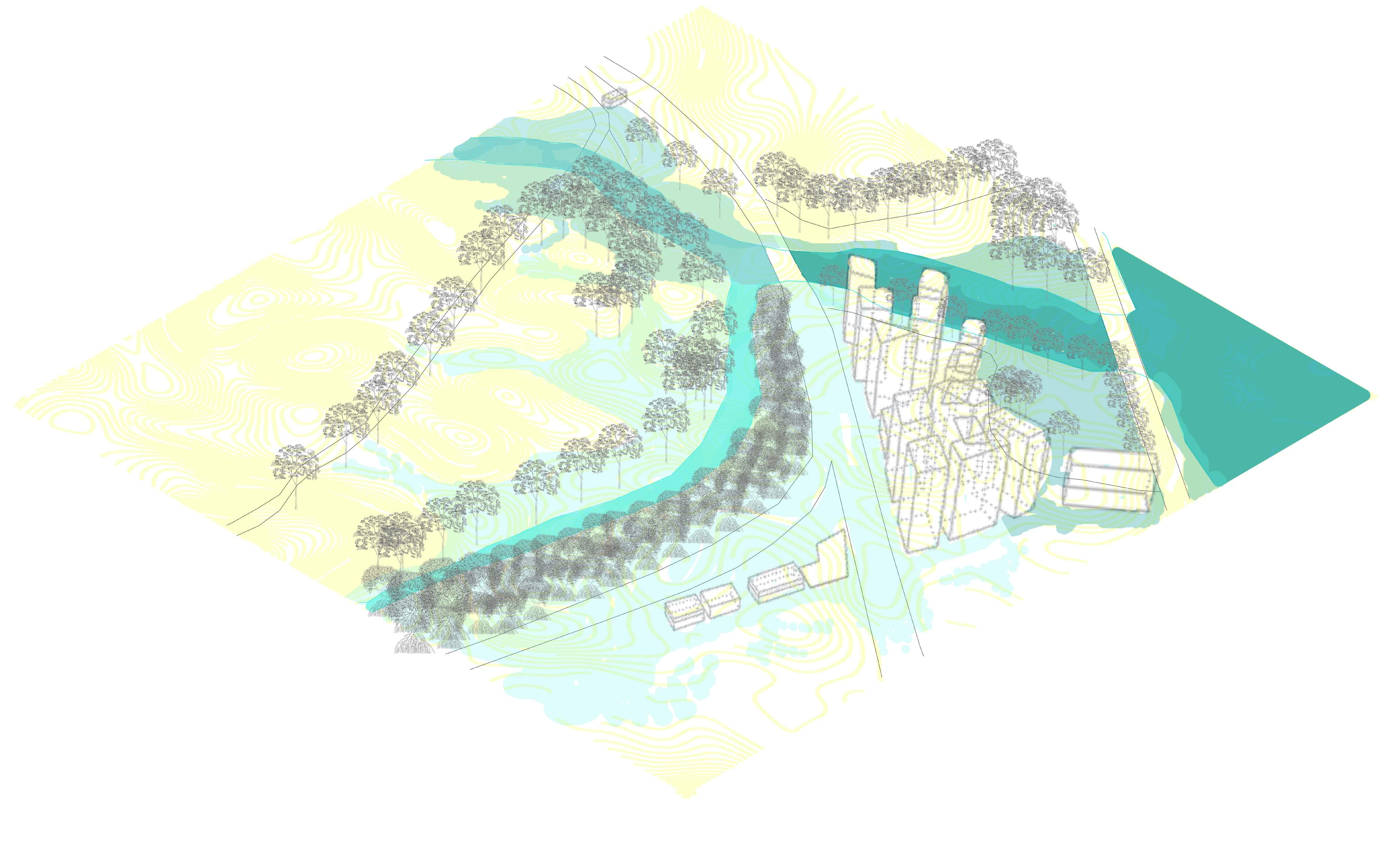
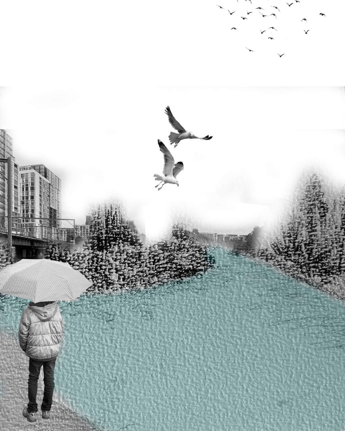
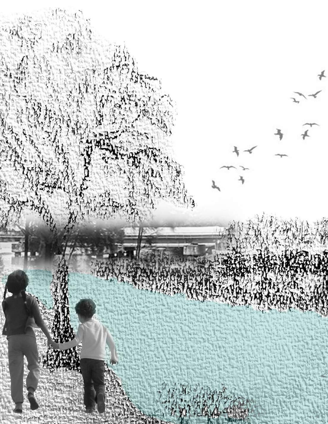
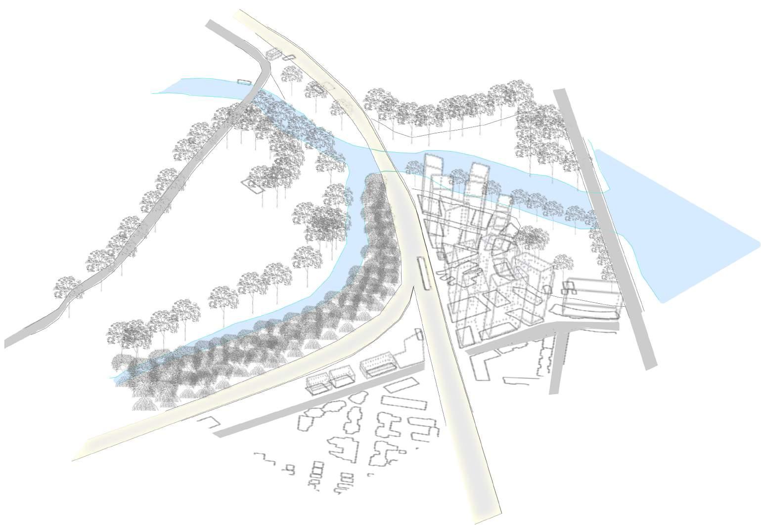
A confluence of narrow waterways
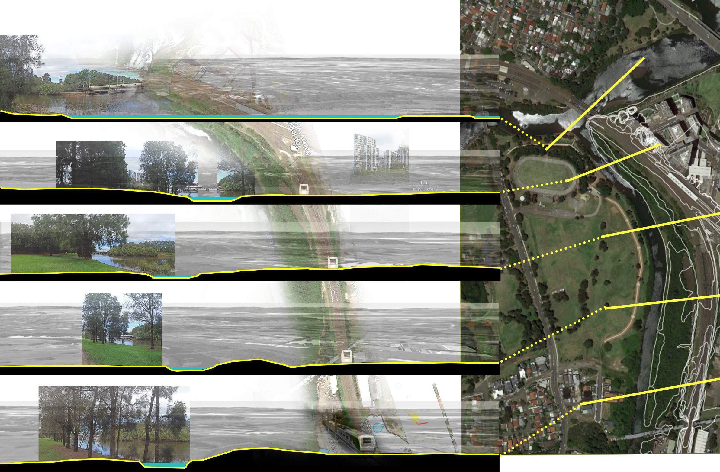
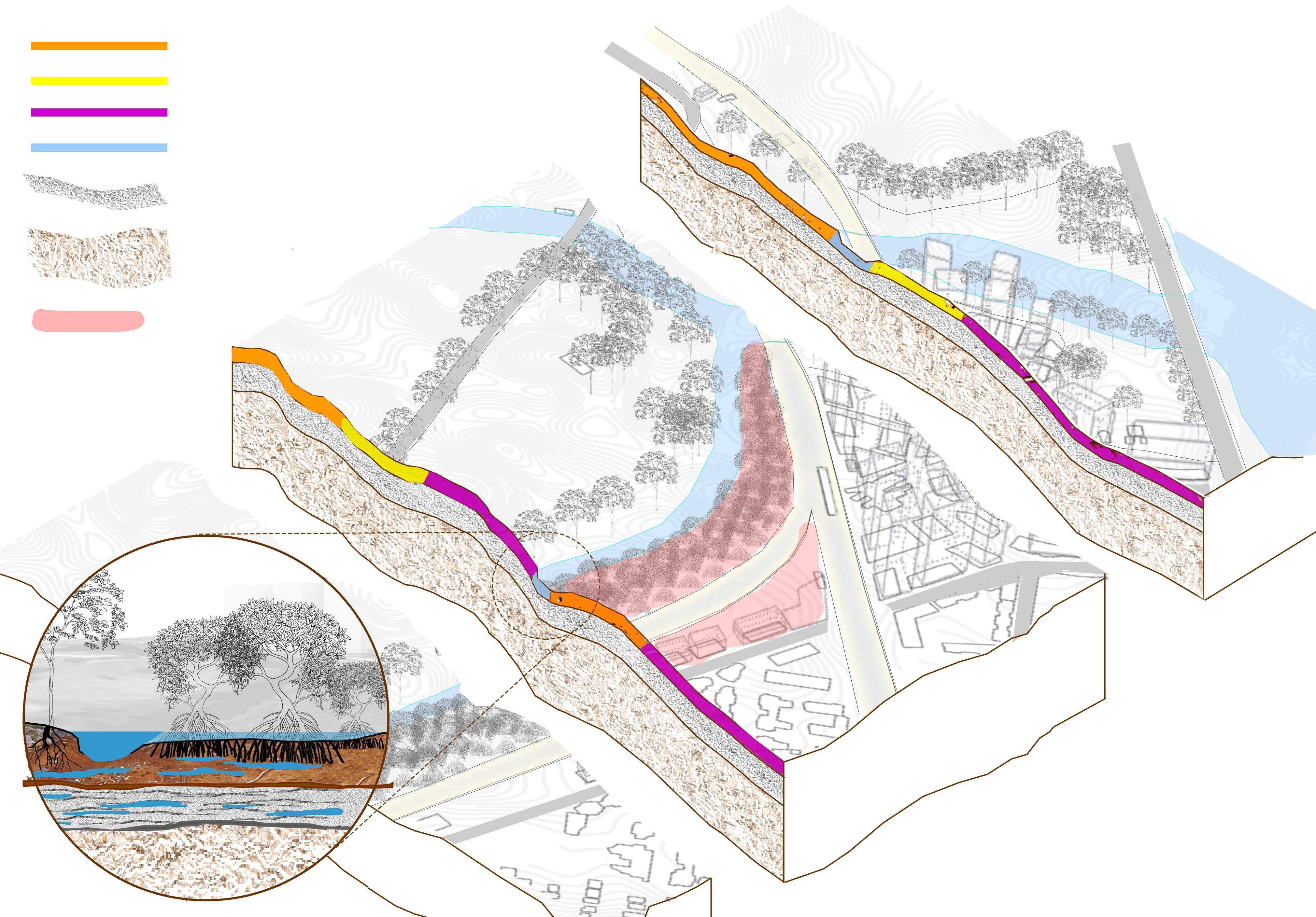
cross section series
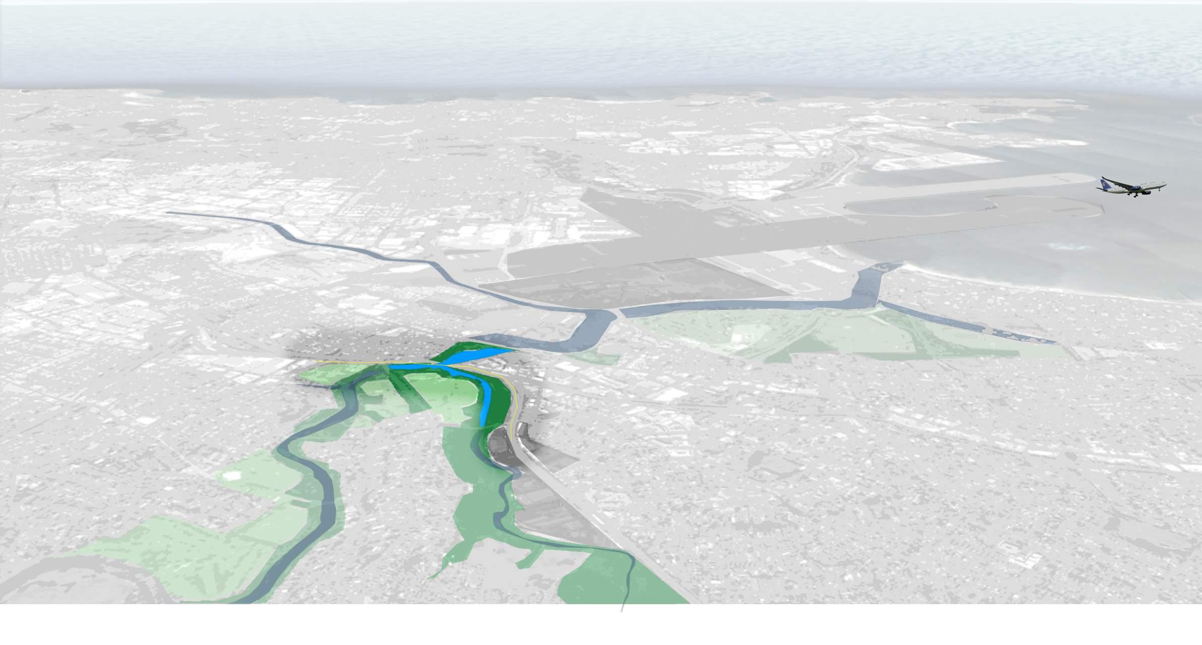
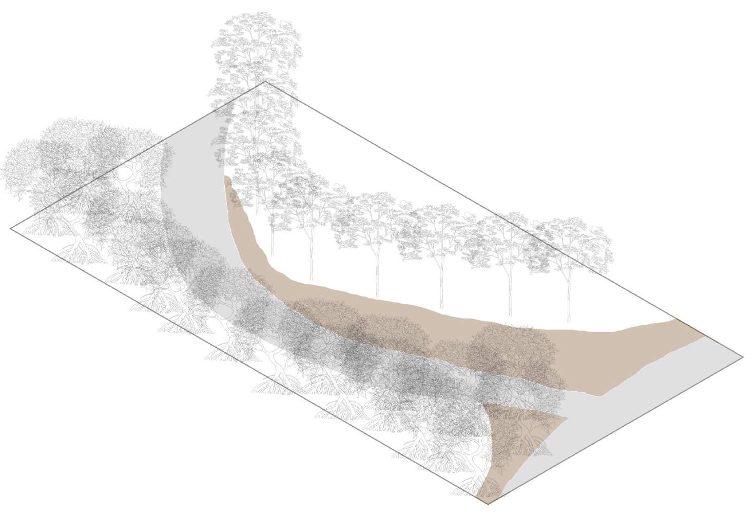
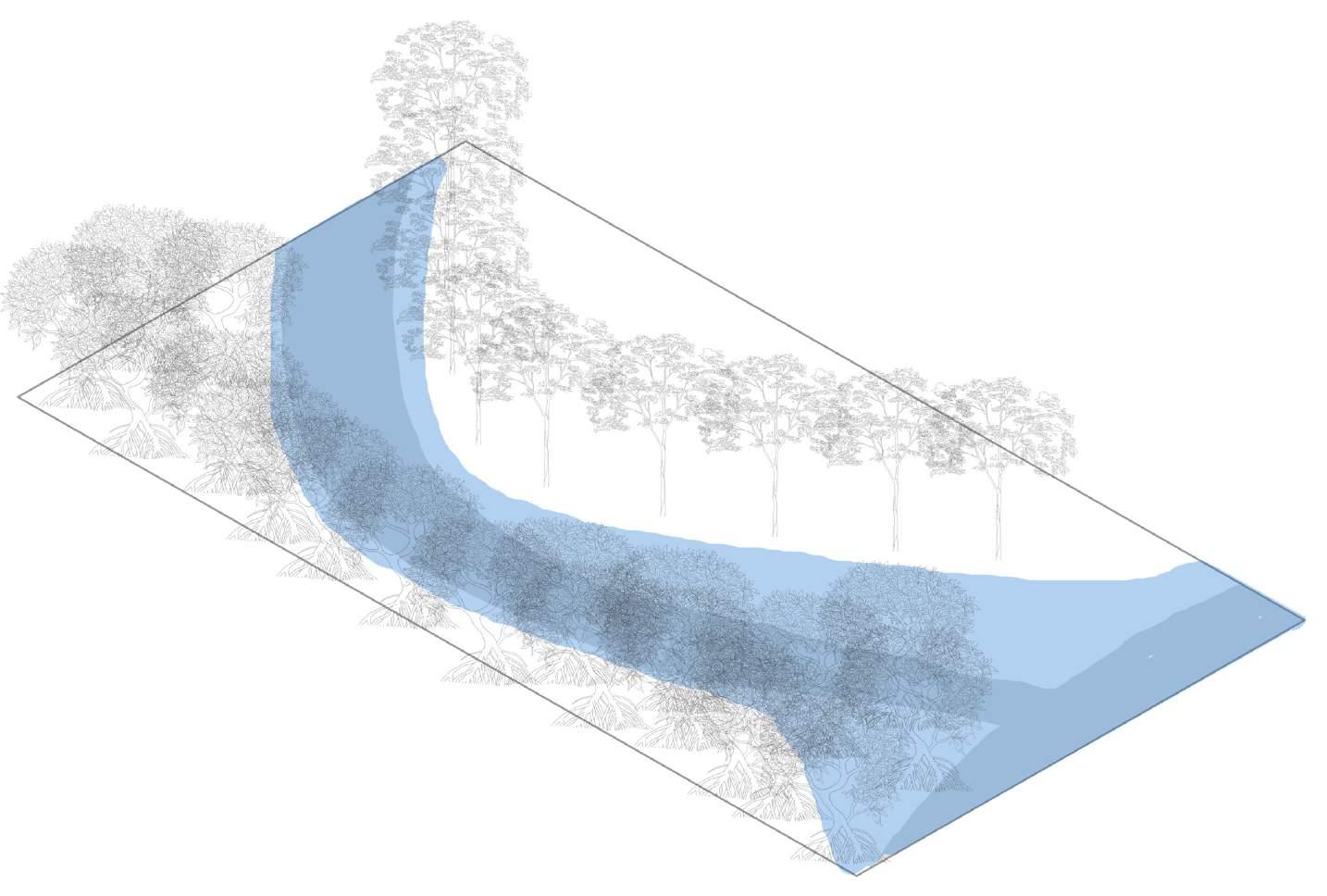
The site although being a flat floodplain (with a maximum height of 12m above sea level), it has restricted the flow and form of Wolli creek in a particular manner. Currently there is no room for the creek.
7
2022 2082 1500
3m 6m 12m 4m 3m 8m 5m 4m 3m 6m 1m 1m 4m 3m 5m
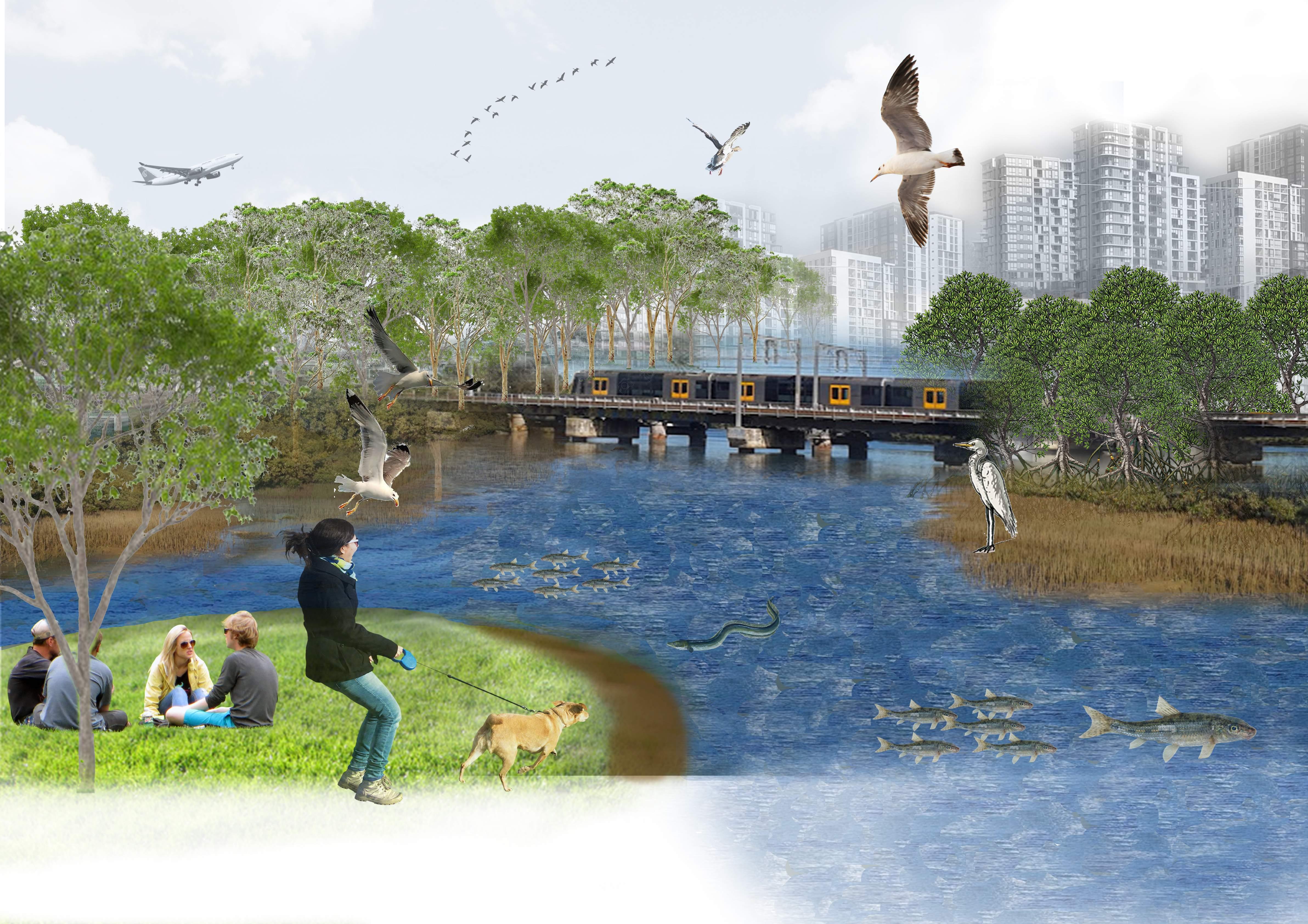
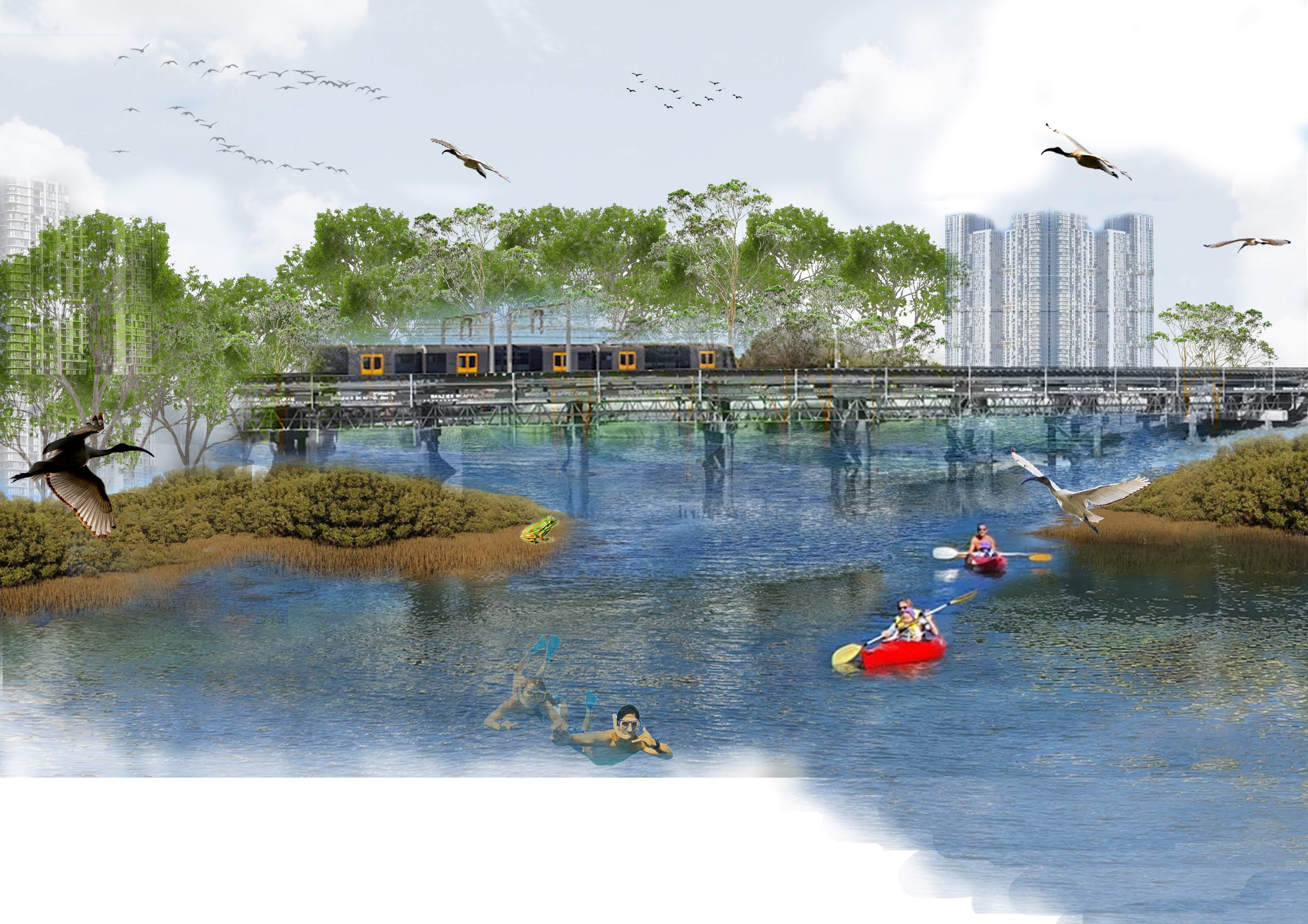
These views showing the spatial characteristics have been drawn from the points which are safely accessible from Tempe and Wolli Creek train stations. From any of these points at least two different edges of the waterway are seen. Each of these edges hold a different character with different vegetation types and different habitats.

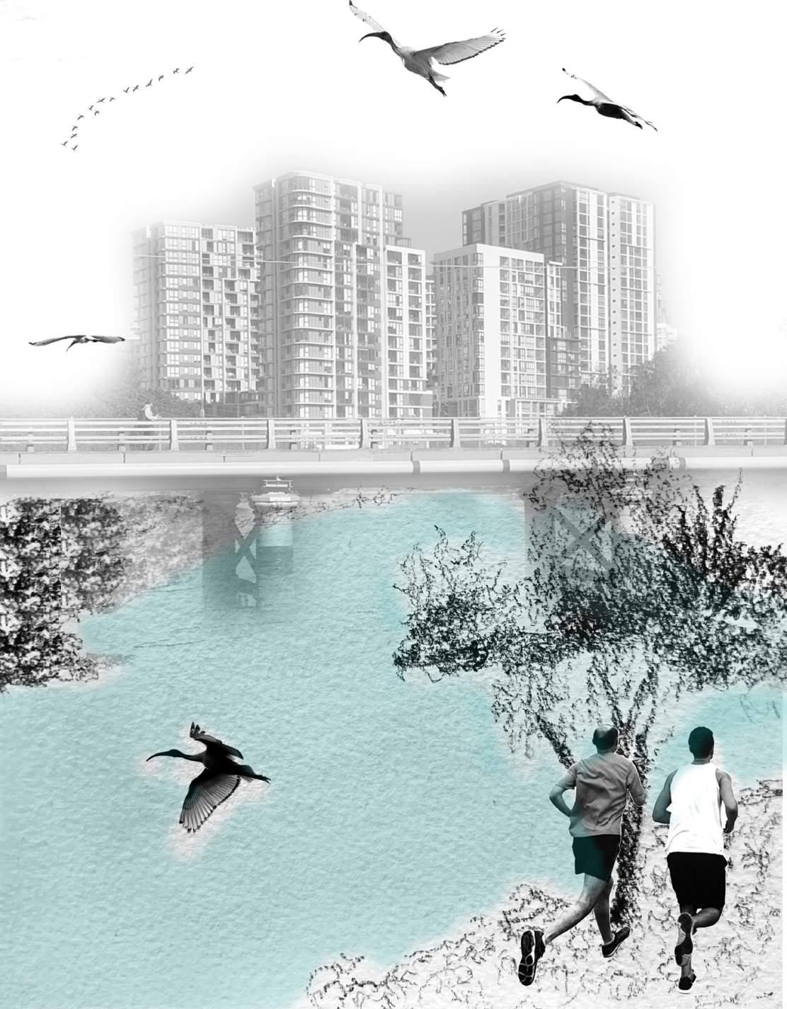
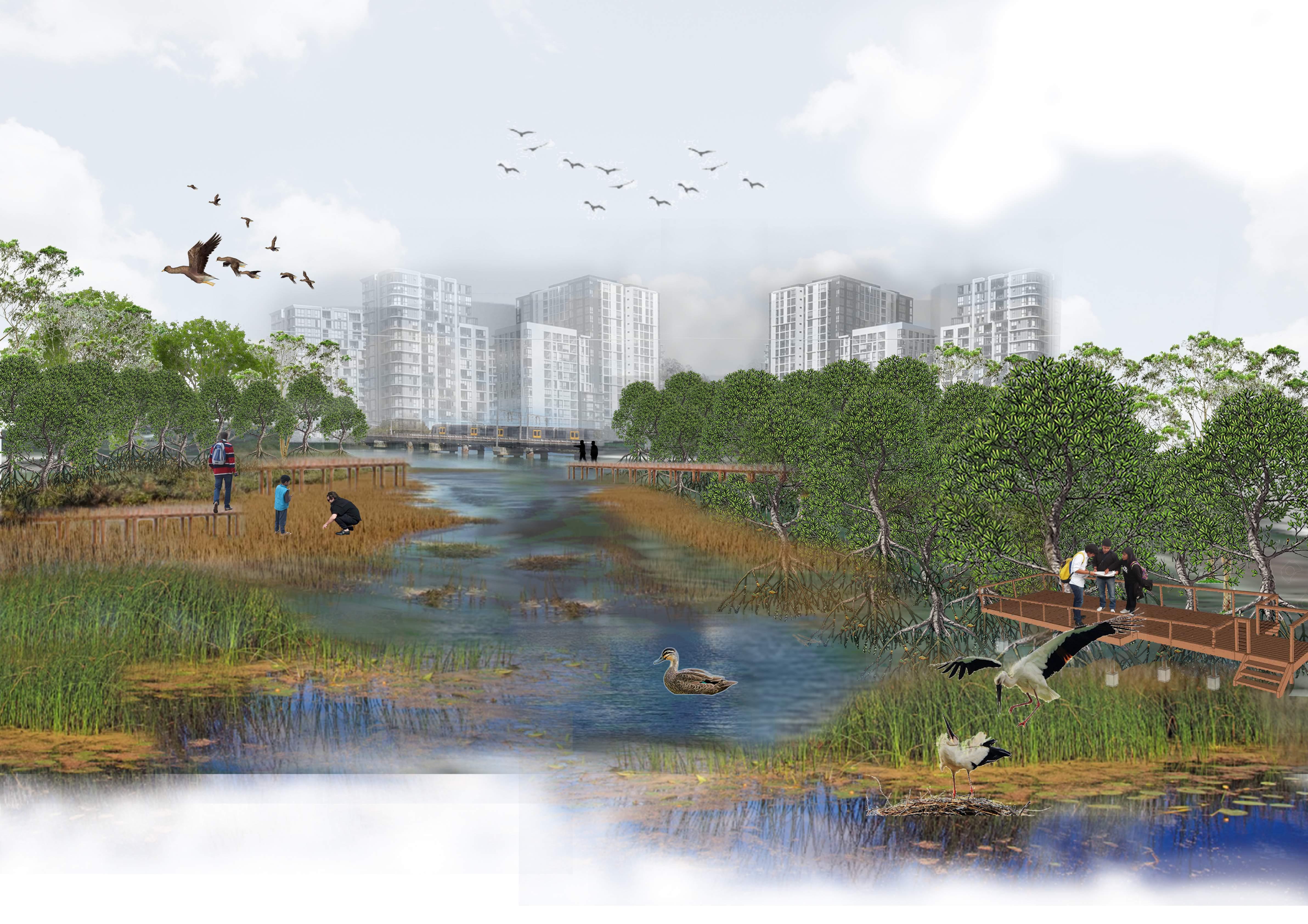
However there aren’t as many people as one would imagine to celebrate this union of waterways: probably a couple people from the neighbourhod to take a walk or maybe a couple of landscape architecture students like us who have come with hopes of improving site conditions.
(After reading historical texts) - “walking through the quiet plain grassland on the edge of Wolli creek, one can imagine the the edges of Wolli creek lively with men fishing with their large spears and women picking lilly pilles whilst the ducks swim creating ripples behind them and the egrets swoop down to catch small fish.One can hear faint laughters in the distance; probably children laughing and playing. Suddenly, a train crosses the bridge and we wake up from the beautiul dream. “
 - Author
8
spatial and physical characteristics 2022 2082 1500
A confluence of landscapes
“About 4,500 years ago a group of Aboriginal people sat by the river at Tempe and cooked a meal of shellfish gathered from the mudflats nearby”
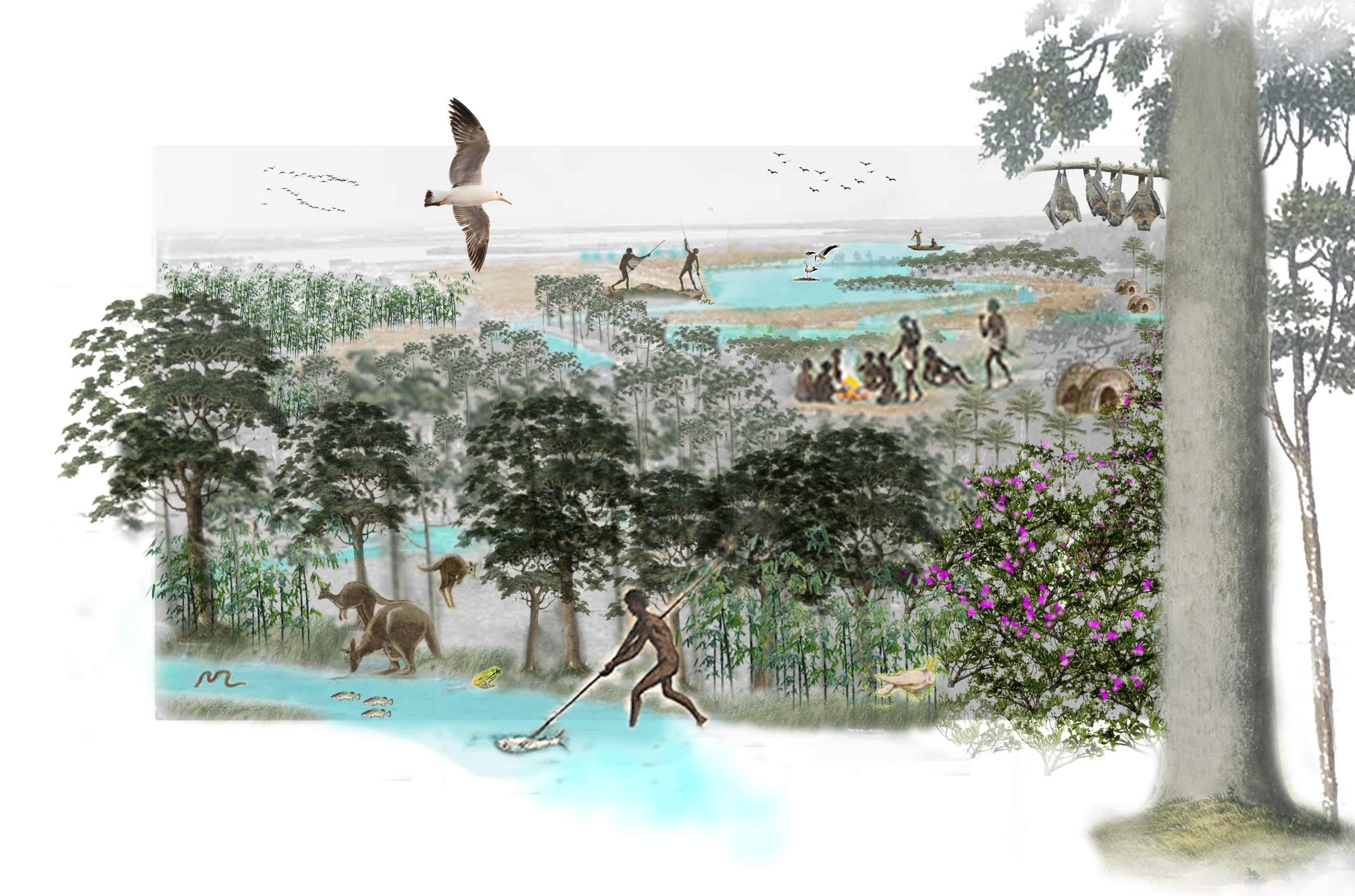
“Aboriginal people living along the Cooks River is a 10,500 year old fireplace discovered during an archaeological dig next to Tempe House at Wolli Creek.”
“They fished all day and sometimes into the night by torchlight. Their canoes often contained a small fire burning on a clay pad, which women used to cook”
9 historical scenario of the lost landscapes
2022 2082 1500
A confluence of culture and nature
Lilly pilly bushes
Ironbark tree forest
Mangrove habitat and mudflats
Cabbage tree palm
- Irish Paul, 2017
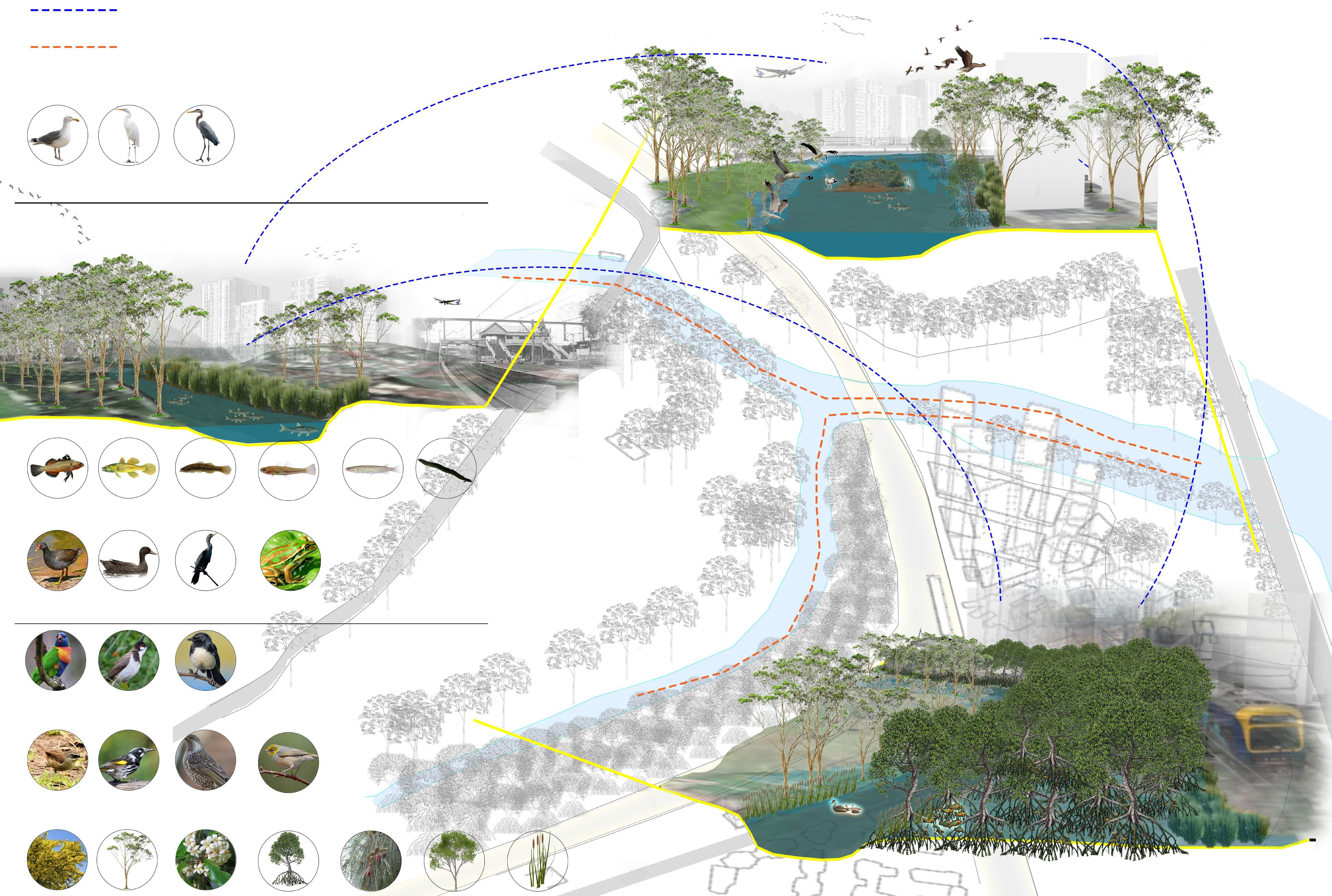
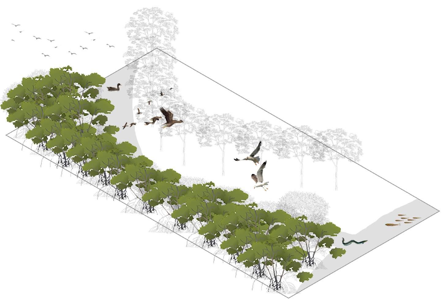
Movement of Birds between Tempe, Wolii creek and Fatima Island
Movement of fish, eels and ducks upstream and downstream
A confluence of habitats
2022 2082 1500 flora and fauna
Seagulls Empire Gudgeon
Dusky Moorgen
Rainbow Lorikeet Willie Wagtail
Little and Red Wattle Silvereye
Red whiskered bulbul New Holland Honey eater Red-browed finch
Wattle Gum tree Pittosporums Mangroves Casuarinas Eucalyptus Reeds and weeds
Ducks Cormorants Green and golden bell frog
Flathead Gudgeon Firetail Gudgeon Common Galaxia Long finned eel
Gudgeon
Great Egret White faced Heron
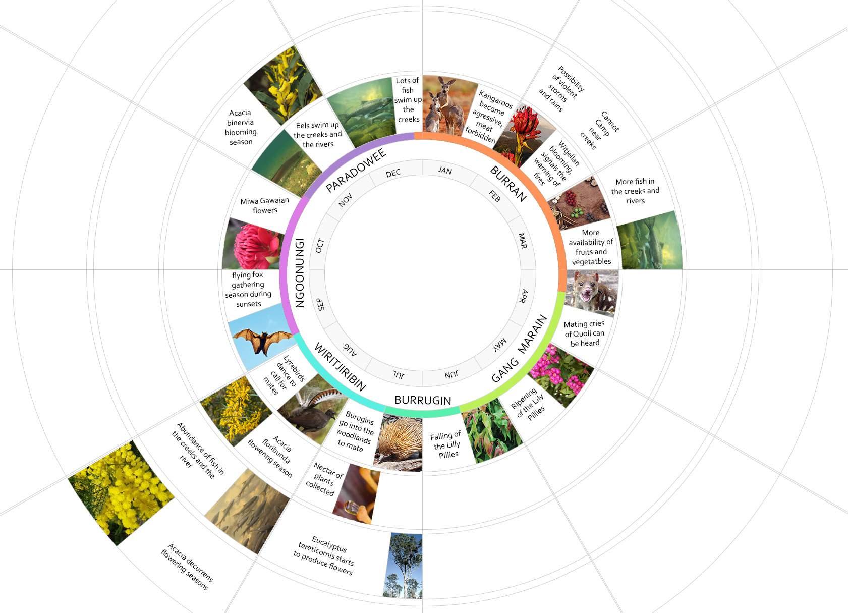
aboriginal seasons in relation to the modern calender
2022 2082 1500
A confluence of habitats
Research Statement: How Herrington’s theories and relevant precedent studies justify the use of the concept of Soil Memory to achieve the set design principles/strategies for ‘The Confluence’ site
Previous studies of site analysis and history
Re-ignite Lost Landscapes
DESIGN PRINCIPLES
Re-introduce Keynote Species
Re-shape the confluence
Justification through Herrington’s Theories
Theory of Memory and Space
ANT (Actor-Network-Theory)
Precedent Studies
Re-naturation of River Aire, Geneva
Barangaroo Reserve Sydney
Theory of Infrastructure
Room for the River, Netherlands
Using Soil Memory as the topic and Ecological Restoration as the frame of reference revealed that the project is an amalgamation of mainly two of Susan Herrington’s theories: 1. Spatial Practices - particularly the idea of ‘Space and Memory’ is studied; 2. Systems Logic – focusing on’ Systems theory and cybernetics’ and ‘Infrastructure’. Herrington’s theories justify the design strategies allocated to achieve each design principle and help obtain the relevant information from case studies and examples related to the aims of the design.
12
SOIL MEMORY
research topic statement applications of soil memory
re - ignite lost landscapes re - introduce keynote species re - shape the confluence
Good design promotes less valued landscapes e.g mud flats, and their related species. They help people interact with and understand their importance.
Good design means historic flora and fauna flourish and are healthily maintained on site.
Good design ensures that the river floodplain is celebrated in high rainfall events
13 re - designing the confluence
design principles and strategies
Create awareness and understanding of the significance of lost landscapes on site
Create opportunities for people to interact with ‘undesired’ landscapes
Initiate educational opportunities for people
Increase areas in meter square dedicated to ‘undesired landscapes’
Expose the mudflats and mangrove swamp marshes
Bridge both edges of Wolli creek using the existing steel structure Enhance existing social activities such as walking, jogging exercising etc through design and design elements
Create opportunities for seasonal activities such as kayaking, swimming, camping by the river edge and lilly pilly picking
Create circulation within the mudflats and mangrove areas
Create access for people beyond the rail line and create a pathway through the mangroves.
Introduce activities for school children to explore and learn about the importance of mangroves such as visiting days, clean-up drives.
14
re - ignite lost landscapes
(UN Sustainability Goal 6.3, 15.1, 15.4) (UN Sustainability Goal 11.7, 6.b, 3.9, 3.d) (UN Sustainability Goal 8.3, 8.9)
Initiate the process of reintroducing lost or endangered species such as eels and the green and golden bell frog.
Enhance vegetation and re-introduce native plants, bushes and trees
Create habitats for soil-disturbing mammals that will soil quality (theyare currently absent from site)
Create habitats for keynote species, i.e. steep mud flats where eels can dig burrows
Re-introduce the mangrove species as mentioned in texts which used to exist prior to the constrcution of Sydney Airport
Create habitats for endangered species, i.e. coastal swamps for the Green and Golden Bell Frog
Clean the water coming from the industrial area of Turella using natural elements such as reedbeds and purifying weeds
New planting of banksia bush, lilly pillies, cabbage tree palm along with the existing gum trees and eucalyptus trees. Improve quality of soil to maintain rich flora within the site
Create habitats for endangered and/or extinct species quolls, or possums, bush rat, bandicoot, etc.
15
re - introduce keynote species
(UN Sustainability Goal, 15.1, 15.4, 15.5) (UN Sustainability Goal 14.2)
Allow the surrounding creek and river edges to act a floodplain
Create flexibility for the creek to change form in different seasons
Re-build the infrstructure to create more room for the creek and the confluence
Exntend the creek boundary into Waterworth park area
Create a larger and more flexible creek bed with topographical changes to allow for seasonal changes in water levels
Impose changes onto the railway track between Tempe station and Wolli Creek station to allow more room for the creek
16 re - shape the confluence
(UN Sustainability Goal 6.3, 6.a)
Minimum 20% increase in Mangrove species Introduce 1 Hectare of mangrove habitats in the next 5 years
Increased value of mangrove landscape by 25% through educational visits
Reedbeds naturally purify 109500L of water per year
Reduced water purification costs by 80% in the next 5 years
2022 2082 1500
Increase population of sea birds by 50% in the next 10 years
Increase eel, fish and duck population by minimum 50% in the next 10 years
Increased social activities and accessibility to water.
2022 2082 1500
Increase water holding capacity of the area by 40%
Generate revenue by creating social seasonal activities such as kayaking, swmming etc
Decrease flooding damage costs by 90% within the next 50 years
2022 2082 1500
The aim is to create an ecologically rich site which functions and maintains itself soundly. The design principles set for future design works are focused on bringing back lost elements of the site which enabled all 3 water systems to function sustainably in a holistic way. These lost elements include native vegetation, endangered and extinct aniamls, mammals, amphibians, birds and also the extinct natural and flexible form of the water flowing through the site. The idea is to initiate the ecological restoration process throughout the site and let nature take over. Therefore, by creating habitats for plants and animals and by creating room for the water, the system will become self-sustaining and adaptable to future effects of climate change such as water level rise. This will reduce negative impacts of flooding on the economy as well as the environment. Re-establishing these lost landscapes and allowing them to be accessible to public will highly increase their value and more awareness will be created of the importance of these landscapes amongst various age groups of people.
20 SUMMARY
REFERENCES:
Benson and Howell 1990, Taken for Granted, Kangaroo Press, New South Wales
Bureau of Meteorology 2016, ‘Indegenous Weather Knowledge’, Australian Government, accessed 29 April 2022 < http://www.bom.gov.au/iwk/calendars/dharawal.shtml>
Cahill Justin 2014, A Natural History of Wolli Creek, Smashwords Edition, Lindfield 2070
De Heer, R. Ryan, J. DJiggir, P. Gulpilil, Kurddal, C. Gulpilil, J., Birrinbirrin, R., Minygululu, P. Djulibing, F. & Thomson, D. F. 2007, Ten Canoes. New York, N.Y., [Distributed by] Palm Pictures.
Graham Craig Wilson 2015, ‘Uncovering the Hidden History of the Wolli Creek Valley’, Wolli Creek Preservation Society, accessed 22 April 2022, <http://www.wollicreek.org.au/wp-contentwolliupload/Wolli_Creek_Arch_Report_smallest.pdf>
Herrington, 2017, Landscape Theory in Design, Routledge, 711 Third Avenue, New York
Irish Paul 2017, ‘Aboriginal History Along the Cooks River’, Cooks River Alliance, accessed 25 April 2022, <https://cooksriver.org.au/wp-content/uploads/2017/06/Cooks_River_Aboriginal_history_WEB.pdf>
Map Data 2022, eSpade, NSW Government accessed 30 April 2022, < https://www.environment.nsw.gov.au/eSpade2Webapp>
Wolli Creek Preservation Society n.d., ‘Waterworth Park Development’, Wolli Creek Preservation Society, accessed 29 April 2022, <http://www.wollicreek.org.au/wp-content/wolliupload/2.-Wwthdevt-posn.pdf>
Aashaka Parikh z5343115
LAND 7312 - Capstone
Tutors: Sara Padgette Kjaersgaard and Patrick Franklin Master of Landscape Architecture, Faculty of Arts, Design and Architecture UNSW 05.22
21