N. PARIKH
+ ARCHITECTURE PORTFOLIO LANDSCAPE ARCHITECTURE
AASHAKA
AASHAKA N. PARIKH
Master of Landscape Architecture (UNSW)
Bachelor of Architecture (NUV)
This portfolio presents selected works from academic and affiliated professional projects showcasing creativity, analysis and knowledge from academic and professional experiences of learning, working and teaching.
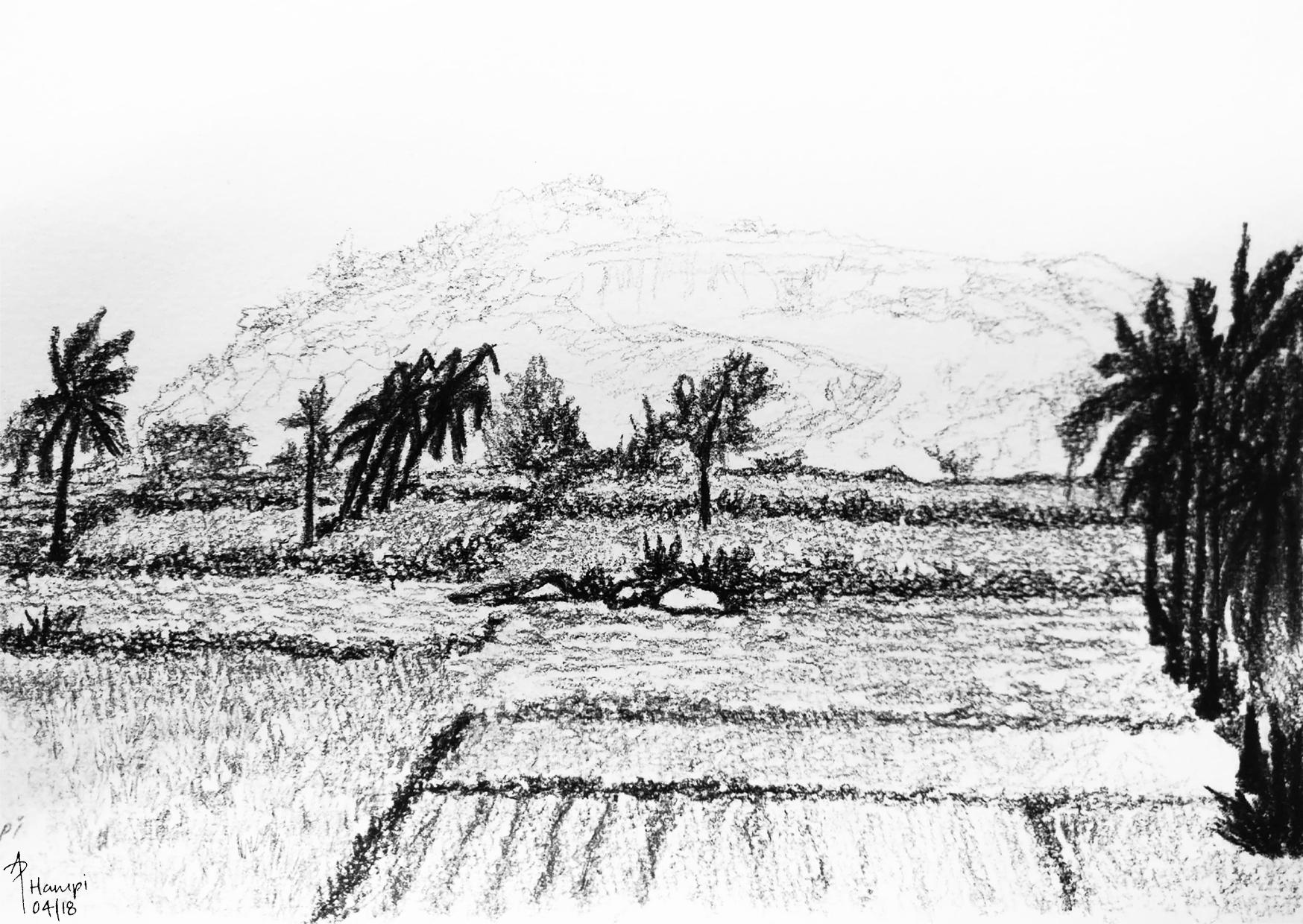
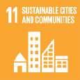
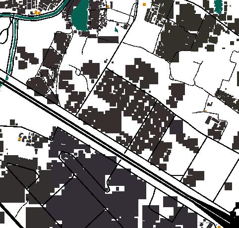
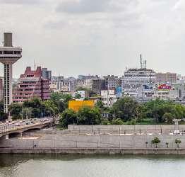
WOLLI WATERFRONT
The Confluence of Wolli Creek & Cooks River
UNSW Capstone Project
KINGSFORD ECO-PLAZA
A Constructed Ecology UNSW Design Studio
RANDWICK OASIS
The Concept of an Urban Oasis UNSW Design Studio
THE SECRET GARDEN
Permaculture of "The Cage", UNSW Campus UNSW Certification Course
THE YELLOW QUAD
Matraville Sports High School Quad Design UNSW Professional Placement
GARDEN OF PLANTS
Garden of Radicepura, Italy Design Competition, 2022
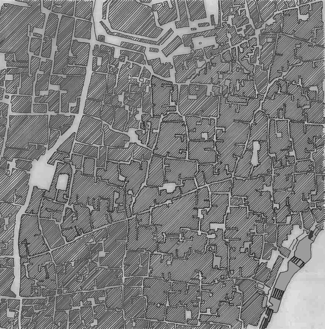
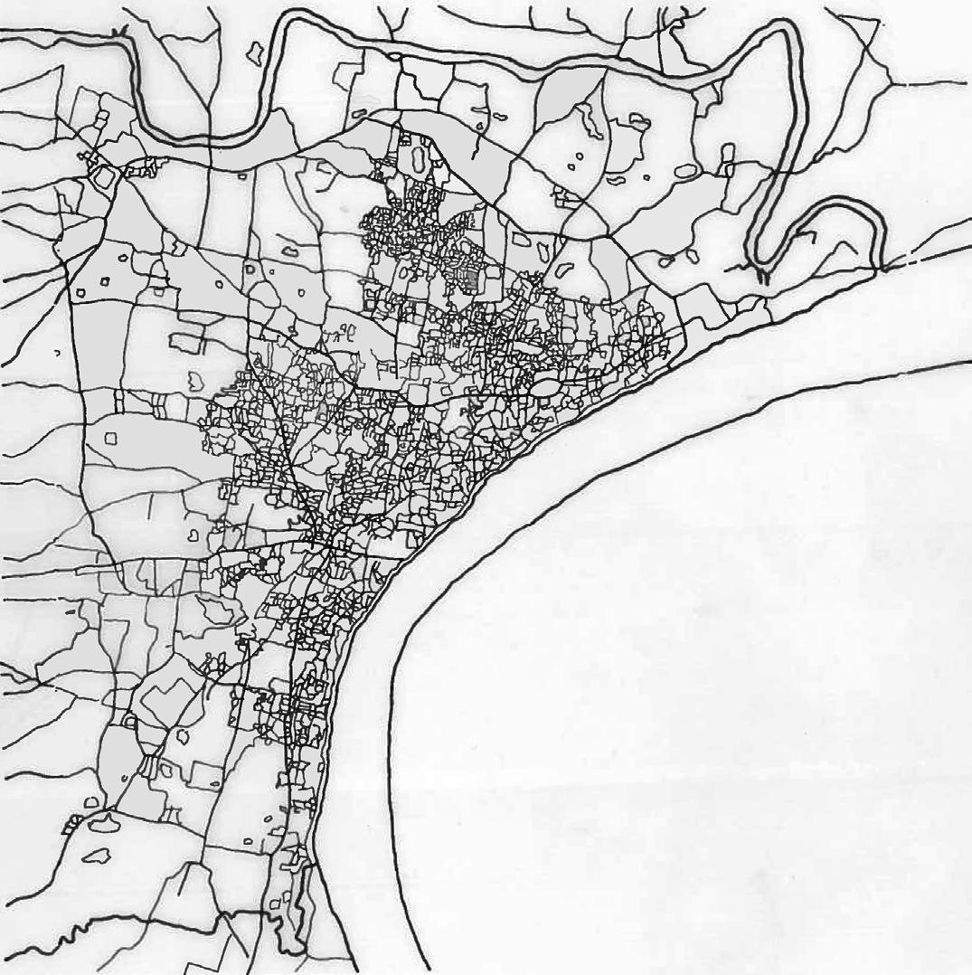
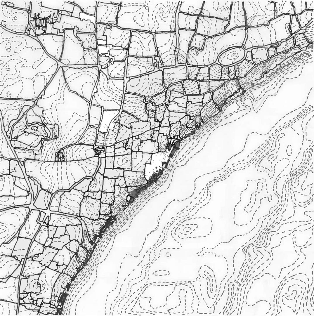
MAPPING CITIES

Sydney - Australia
Varanasi, Ahmedabad - India
ARCHITECTURAL PROJECTS
Design Overview
Bachelor of Architecture, India
With acknowledgment of the People of the First Nations of the country, the aim is to design for all elements of Mother Earth; including our landscape, waterscape, flora & fauna, and humans.
CONTENT
LANDSCAPE ARCHITECTURE
UNSW Master Studio Projects
Master of Landscape Architecture (UNSW) design studio projects include: 1. The Wolli Waterfront - capstone project of the course with an amalgamation of research, analysis and design to achieve certain goals; 2. Kingsford Eco-Plaza - a design project involving detail drawings for bio-swales, ponds and technical design such as balanced land cut & fill and road networking; 3. Randwick Oasis - a concept level design brief within a dense urban area of Sydney.
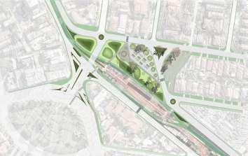
WOLLI WATERFRONT
THE CONFLUENCE of Wolli Creek and Cooks River
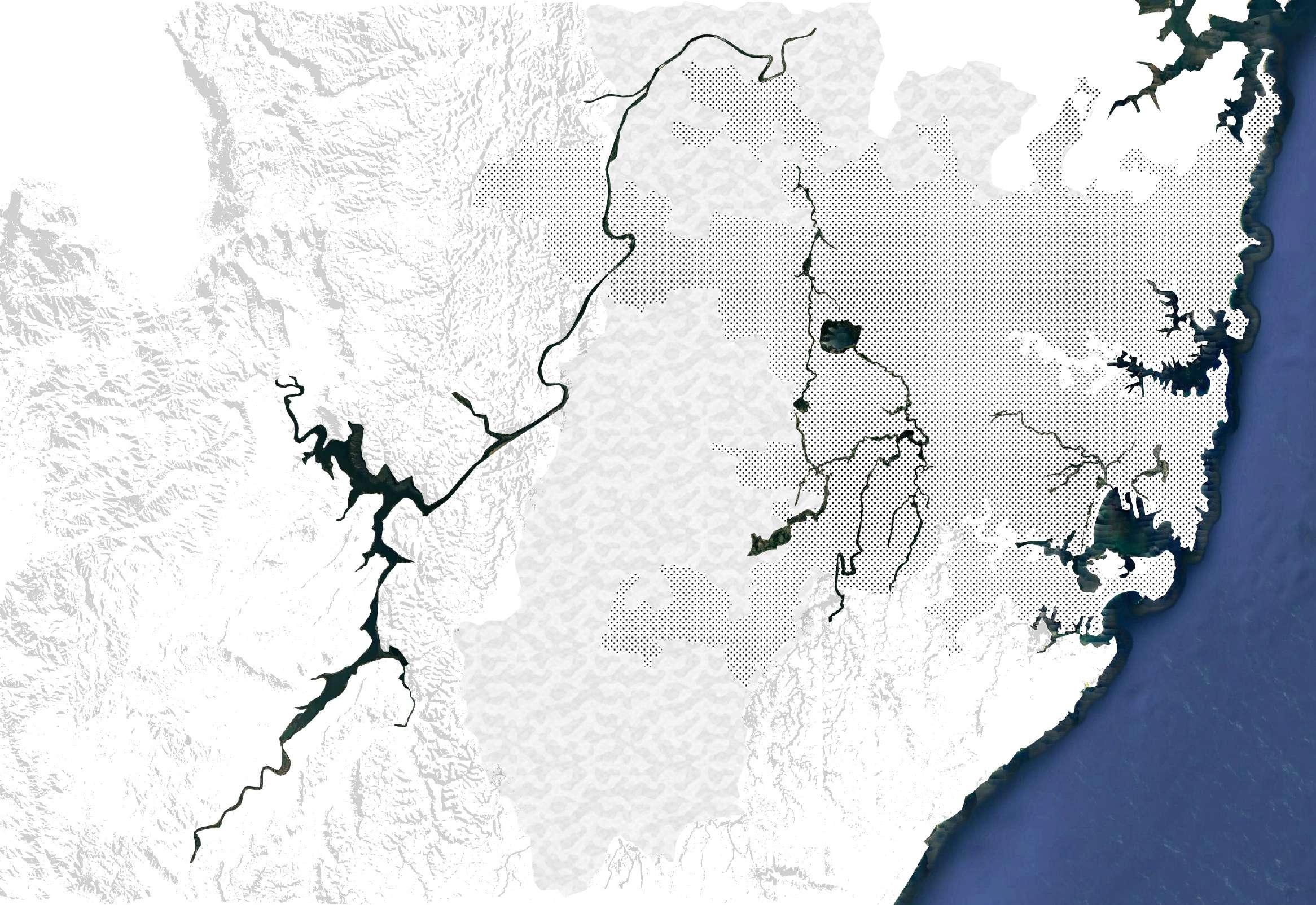
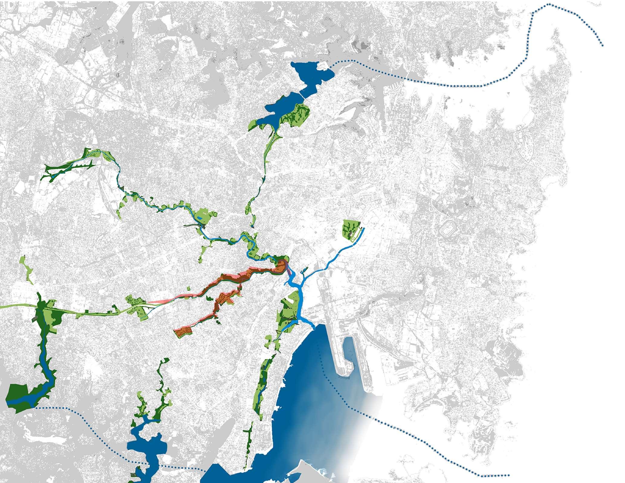
The Bardwell valley Parklands and Wolli Creek Green Grid Corridor (BPWCGGC) is central to the Green and Blue Network of Sydney.
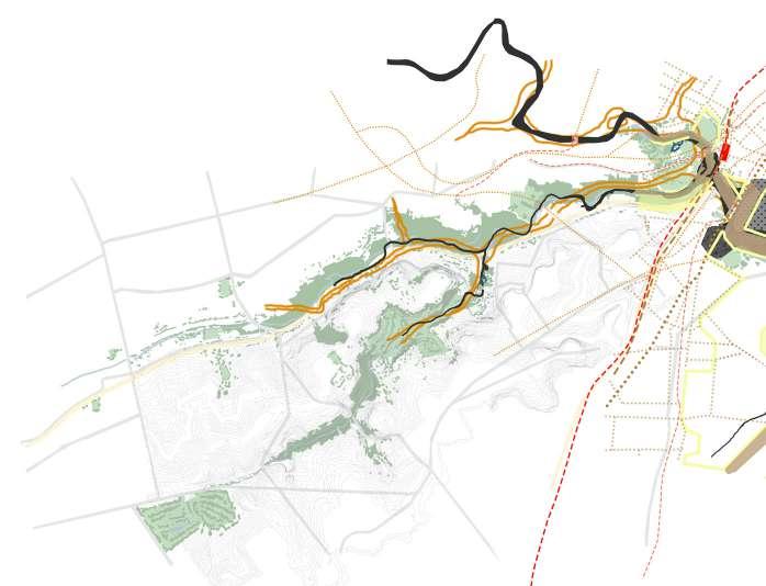
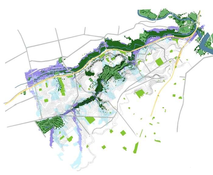
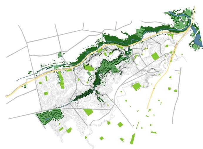
The site holds potential to impact the network and create better conditions for the future.
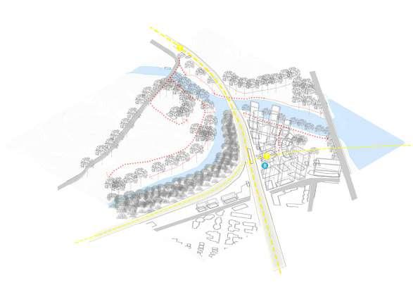
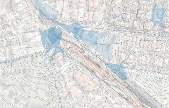
The site of THE CONFLUENCE lies on the far east end of the BPWCGGC. This site brings together 3 waterway systems: Cooks River, Wolli Creek, Cooks River to Botany Bay. The site also brings together people of 3 suburbs, Tempe, Wolli Creek and Earlwood. They each have differing characteristics such as landscape, flora/fauna, geology and soil type.
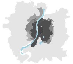
The site slopes downwards in both directions South East to North West and South West to North East towards The Confluence. Although there are many parks there is little canopy cover and vegetation which can be the primary reason for heavy flooding in the Valley areas (which is likely to increase in the coming years).
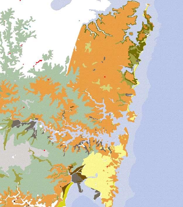
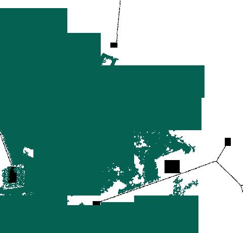
As the map shows, there has been a major loss in biodiversity (around 1952), which is the time when Sydney airports construction was commenced. The mouth of Cooks river was diverted and the landscape suffered great loss of the mangrove habitat and mud flats which were construction ground and temporary transport networks.
ANALYSIS DESIGN PROCESS
Accessibility to the North edge of the site (Waterworth Park) and east edge of Cooks River is quite strong through walking trails from Tempe Station and Wolli Creek Station; as opposed to the South edge of Wolli creek which is an existing mangrove forest.
Flooding of Wolli Creek and Cooks River has always been a concern for the area, especially the residential and commercial area South of the site.
Due to the confluence of Wolli Creek and Cooks River, the flooding amount and area affected increases per year as water levels rise.
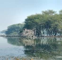
The dense mangrove forest to the South of Wolli Creek is currently an area consisting of endangered species of mangroves and other trees. Some of the surrounding areas also habituate the endangered green and golden bell frog.
The site is also a confluence of different types of soils including sandy soil, clayey soil and alluvial soil.
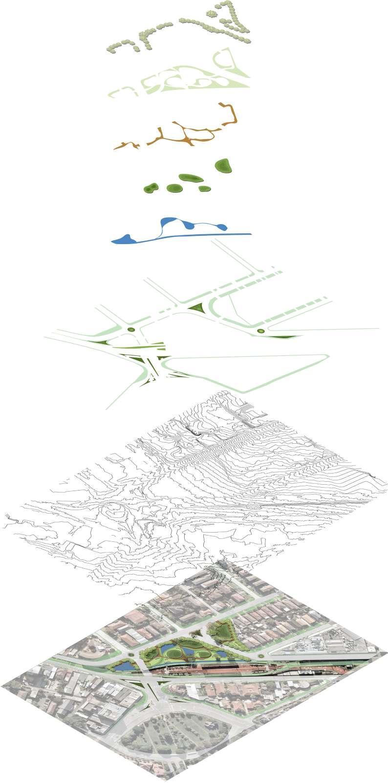
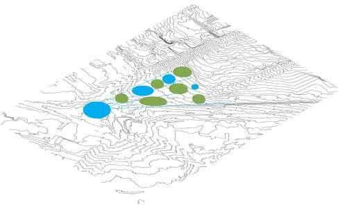
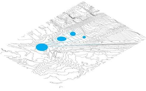
The islands become resting spots from surrounding green areas such as Kendrick Park, Discovery Point Park and north Waterworth Park.
The connected ponds create an alternate cleaner waterway to and from cooks river for aquatic animals.
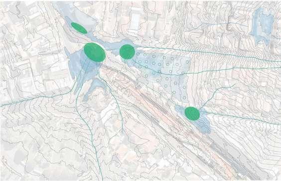
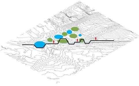
Parts of old pathway (as shown by the red lines) are retained to create a new primary path way represented by the solid line
Various other pathways connect different landscapes such as the Waterworth Park, the new habitat & vegetated islands and the mangrove forest south of Wolli Creek
Filtration ponds are created according to the contours and positions of the marked trees.
Water passes from Wolli Creek through each of the consecutive ponds vegetated of aquatic plants with filtrating abilities.
Contours are mapped and topographical modifications are carried out to create a series of connected water bodies around the plotted habitat islands.
The locations of the existing trees form clusters which can be converted into habitat islands for local flora and fauna.
Existing trees on the North edge of Wolli Creek (within Waterworth Park) are mapped with the intension of preserving all of them throughout the design process.
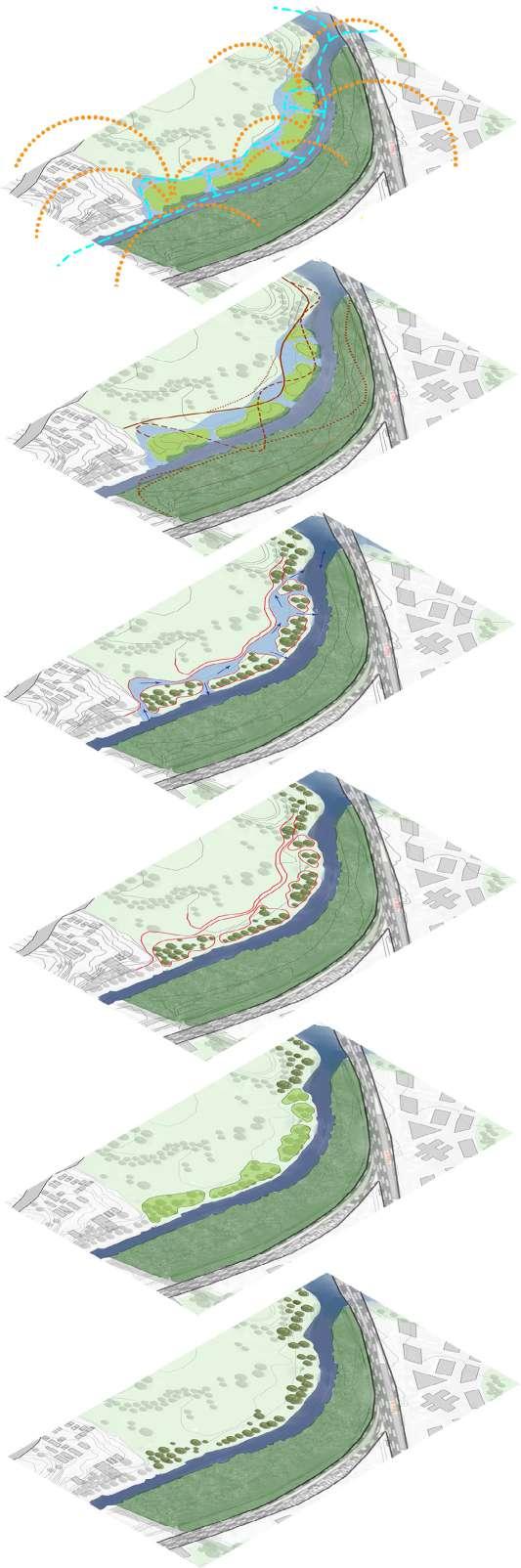
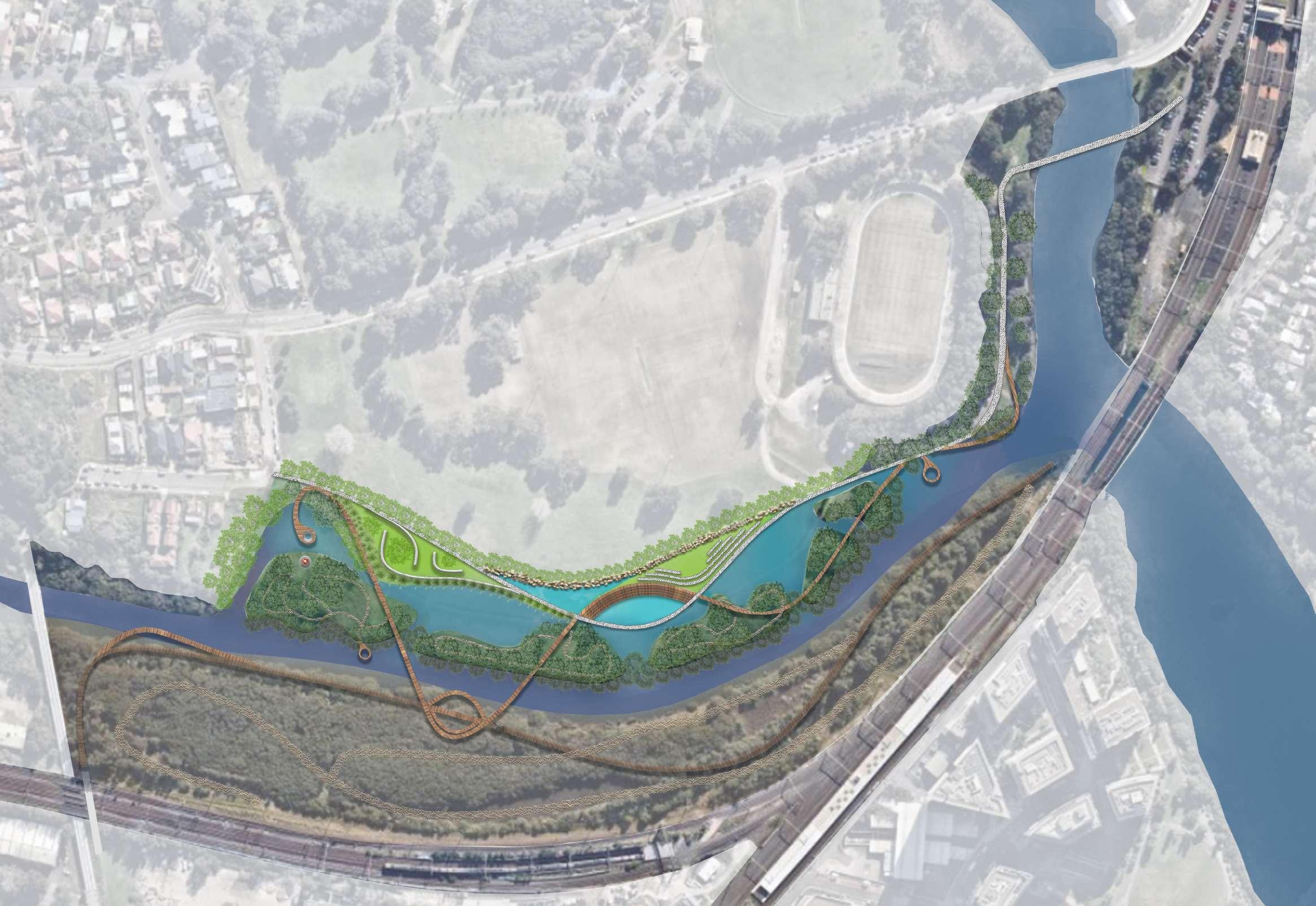
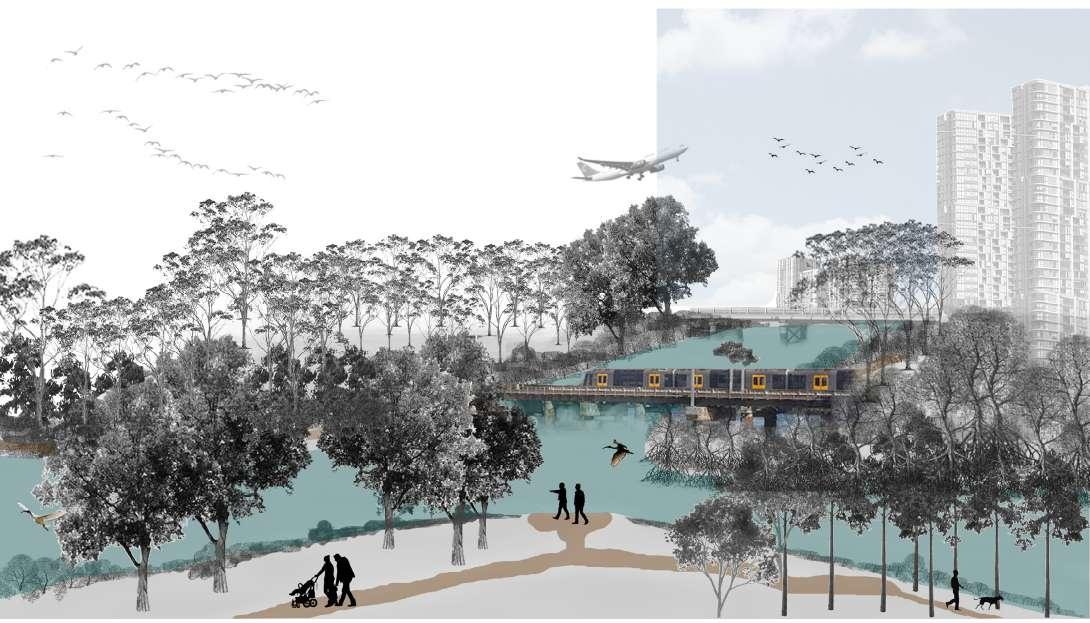
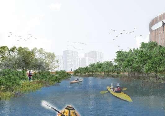
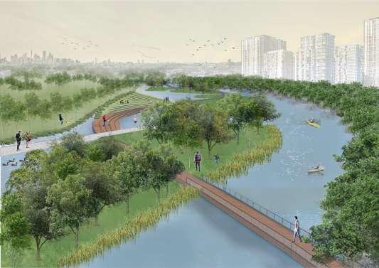
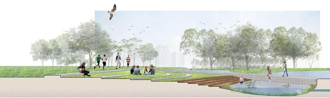
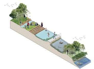
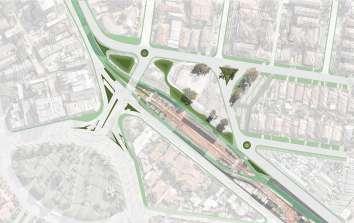
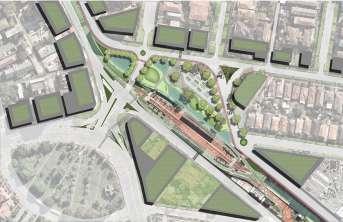
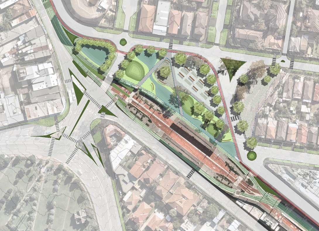
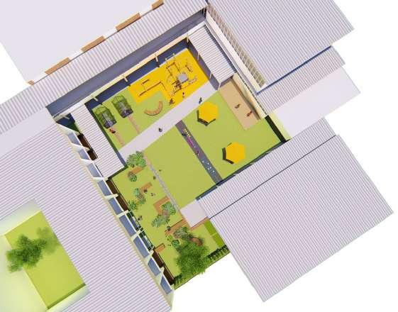
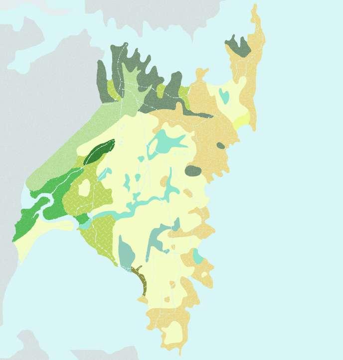
5 6 7 8 9 3 10 11 12 13 Program KEY: 01. Pedestrian Bridge from Tempe Station 02. The confluence viewing deck 03. Canoeing Deck 04. Resting Lawn 05. Pond Pool 06. Water play 07. Open exhibition/resting space 08. Place of Peace 09. Wolli (“camping”) Island 10. Bird watching platform 11. Ramp to mangrove area 12. Wolli Creek viewing deck 13. Underground Bridge to Mangrove area 14. Rocks for jumping through Master Plan - Wolli Waterfront This Master Plan shows that the project intends to The design project also aims to physically connect people to the
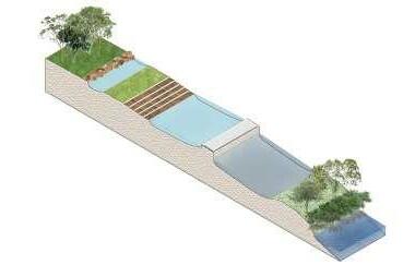
of Sydney by providing opportunities for all age groups to interact with and within what usually is considered as undesired landscapes such as dense mangrove vegetation, mud flats and water edges. There are 3 major pathways: 1. Concrete pathway which connects all activities on the edge of Waterworth Park; 2. A timber bridge which runs across all landscapes includes the mangrove area across Wolli Creek; 3. A lower level timber bridge which primarily goes through the mangrove forest. There are smaller unbuilt and raw paths within the mangrove forest and the habitat islands.
1 2 3 4 11
native landscape
Waterworth Park Wolli Creek Station Bayview Avenue Tempe Station
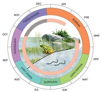
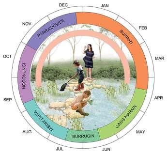
Camping is most suitable during the Ngoonungi & Parra'dowee season usually between September & December as opposed to Burran season when fires are likely.
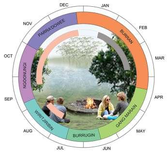
Visitors and residents can canoe and experience the waters of Wolli Creek and Cooks River almost all year around except during times of high rainfall.
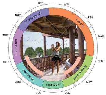
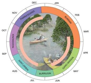
Visitors can enjoy water play and swimming activities during pleasant and warm/hot weather conditions in clean ponds and streams adjacent to Wolli Creek.
Mangrove clean-up drives are initiated for students during the dry season to raise awareness and knowledge of the importance of mangroves in Sydney.
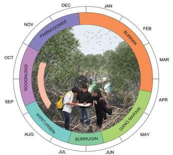
Gang Marain and Wiritjiribin are the best seasons for spotting local and migratory birds through the bird-watching tower within the quiet mangrove forest.
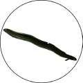
Throughout most of the seasons children can spot the rare green & golden bell frog and Long-finned Eels as their habitats are created and later flourish.
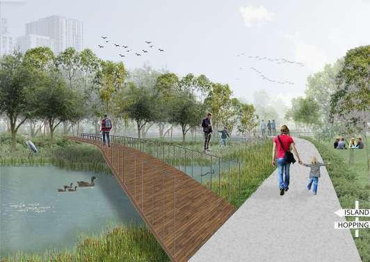
There are several options and opportunities for people to explore the waterfront. Concrete pathway take one through the waterfront whereas timber walkways allow explorations of the habitat islands and forests.
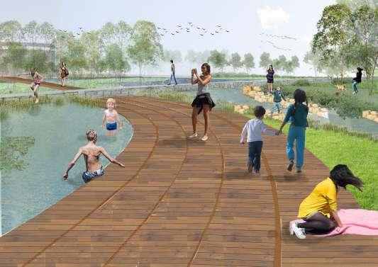
Several types of spaces cater various age groups of people ranging from children (who can swim in pond pools and learn about nature at an early age) to adults and elderly who currently access the area for walks.
Canoeing through Wolli Creek between the mangrove forest enables visitors and local people to experience and connect with the landscape of the city whilst learning about the importance of them.
Along with the opportunity to spot rare birds, the bird-watching tower provides an enchanting view of Wolli Waterfront, Wolli Creek, the habitat islands and beyond towards the city and center point.
The design results in three distinct water bodies from south to north. Firstly the existing Wolli Creek; next, beyond the habitat islands shallow ponds with plants of filtrating abilities to provide a cleaner environment and passage of linked ponds for aquatic animals such as the long-finned eels; and lastly pond pools with further filtered water through and underground filtration system therefore the water is safe for people to swim.
The mangrove area has very little construction and remains largely untouched. Walking trails are created through the mangroves for the clean-up drives and student studies. Other areas have elevated timber bridges spiraling through the mangrove forest for regular joggers and other visitors. The timber bridges also provide access to the ground and the bird watching tower.
SEASONAL ACTIVITIES
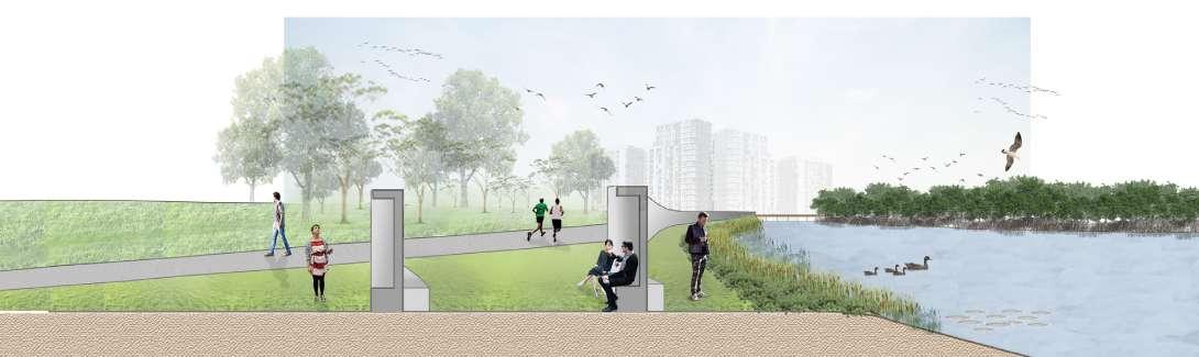
SECTIONAL VIEWS
PROGRESS
The existing condition of the North edge of Wolli Creek largely consists of lawns within Waterworth Park which is prone
Creating ponds and streams will reduce the amount of water currently in Wolli Creek and will act as flood ponds during heavy
The resulting edge will create various types of spaces for people, increased biodiversity of plants, birds, animals and aquatic species.
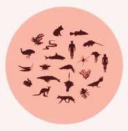
The Confluence is an extremely rich site for the native flora & fauna of Sydney. Unfortunately some of the species such as the green & golden bell frog and the long-finned Eels are currently at threat. The project aims to provide a habitat for the species and improve the ecology and ecosystems.

The project aims to positively impact Environmental, Social and Economical conditions of the city. With improved water systems risks of flooding will reduce, aquatic life will flourish as water quality and sanitation increases. Due to the location of the site, different suburbs can work in partnership to achieve a more sustainable outcome for the betterment of the overall climate. This will provide more social and economic opportunities for the people of the city.


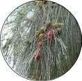
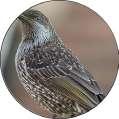
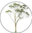
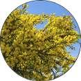
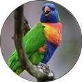
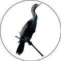
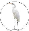
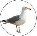
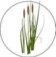
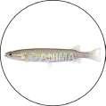
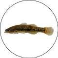
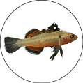
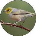
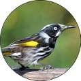
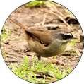
Seagulls Rainbow Lorikeet Empire Gudgeon Wattle Grey Mangrove Weeds and Reeds Gum Tree Casurinas Eucalyptus Pittosporums
Firetail
Common Galaxia Long-finned Eel Green & Golden Bell Frog
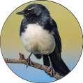
Willie
Red-whiskered Bulbul New
honey eater Little and red
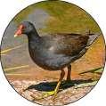
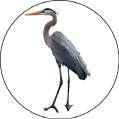
Red-browed finch Land & Sea Birds Aquatic Species Vegetation Waterworth Park Concrete Pathway Waterworth Park Wolli Creek Concrete Pathway Creek-Edge walk Seating niche Exhibition space Resting Lawn Timber Decking Pond Pool Sandbank Ducks Cormorants Silvereye Dusky Moorgen Great Egret White faced Heron
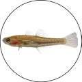
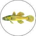
Flathead Gudgeon
Gudgeon
Gudgeon
Wagtail
holland
wattle
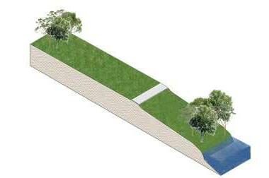
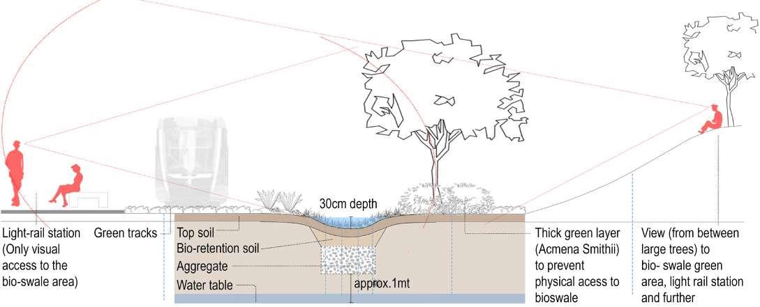
KINGSFORD ECO-PLAZA
A Constructed Ecology
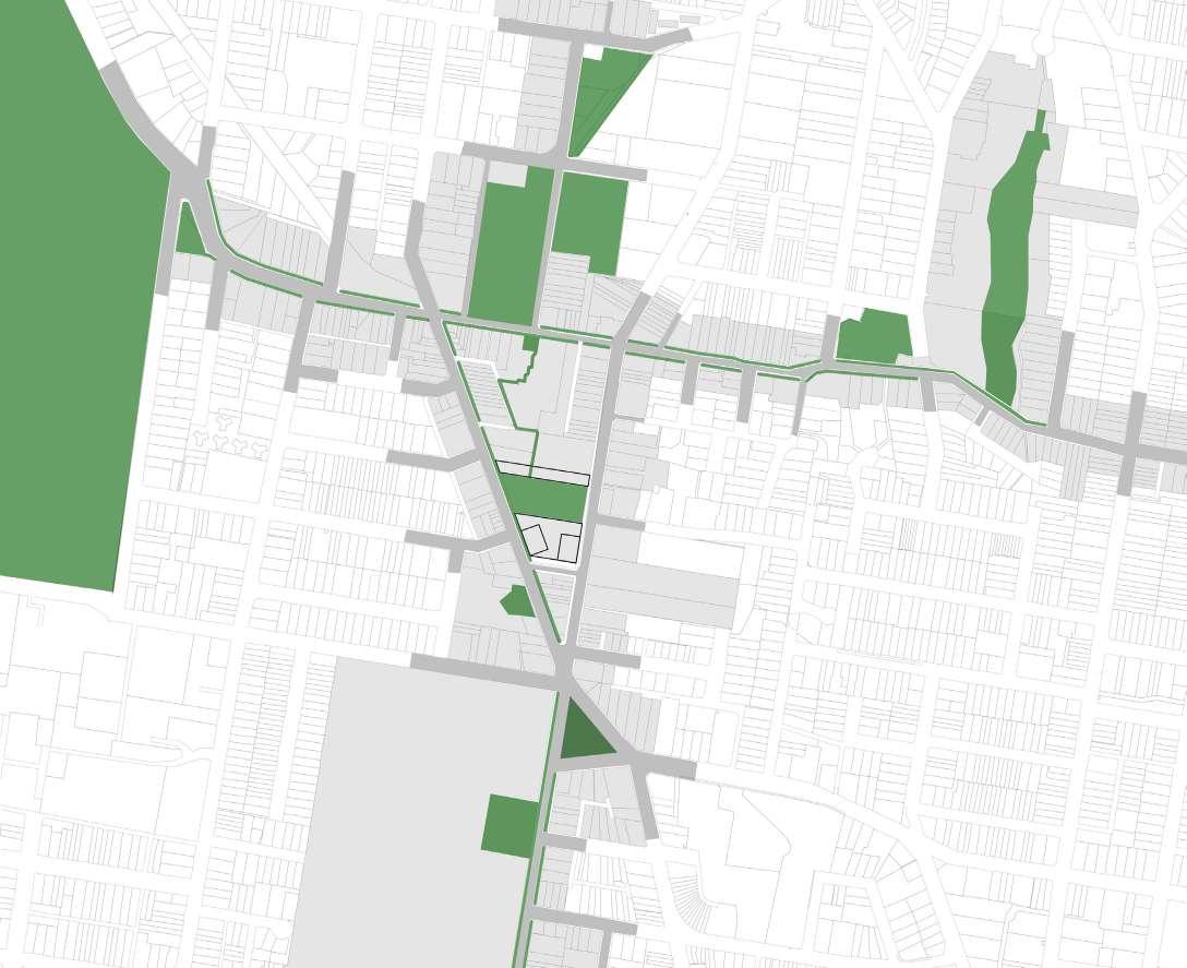
The site is currently a concreted parking spot which is rarely occupied although in the heart of Kingsford. There is a potential to convert the site into a lively space for the people of Sydney with local vegetation and spaces to explore. This will also encourage more citizens to use public transport as opposed to private cars.
Large trees for created shaded spaces
Green areas on the periphery of the plaza
Pathways through the plaza
Hillocks to reduce noise within the plaza and create spaces within
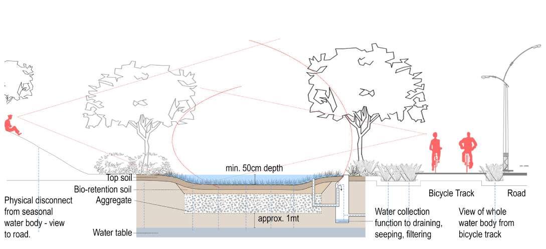
Bio-swales within the central parking lot
One of the main problems is flooding of the central parking lot and noise pollution from surrounding tram and road network
Creating bio-swales in the areas required on site for maximum absorption of rain water.
Reforming road edges to create permeable green patches and bio-swales at the center of cross roads and round-abouts.
The largest water clogs are to the North-West of the site towards the end of the parking lot.
Creating Hillocks on the edges of tram lines and roads to reduce noise pollution
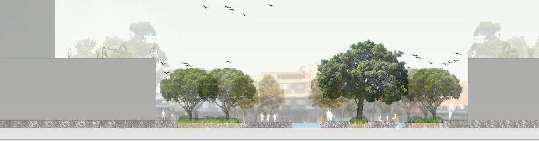
The road network has been re-formed to create a plaza as part of the Kingsford Light-rail Station
Kingsford junction becomes a plaza space extended to the Kingsford Light rail station.
The areas highlighted need maximum permeable surfaces to counter events of flood.
The topographical changes provide various types of and interesting spaces for people to explore.
Landscape Layers
The design will be implemented in phases
Phase 1 - The road network is reformed and bio-swales are constructed
Phase 2 - Hillocks are constructed and pathways link roads to the station
Phase 3 - The trees within the plaza grow to provide shaded spaces
The plaza space provides different experiences through different types of constructed spaces ranging from concrete plaza spaces, green hillocks and water bodies; where people can along the water bodies, climb the hillocks, escape the heat under trees and children can play in the plaza. Local people can easily access the plaza space from the station.
The topography of the site is altered using the system of a balanced cut and fill to create voids for bio-swales and mounds for hillocks. The modifications in the naturally sloping concrete land mass also prevents quick water runoff. from the south-east edge of the site to the north-west edge of the site.
Detail Sections Master Plan - Kingsford Plaza
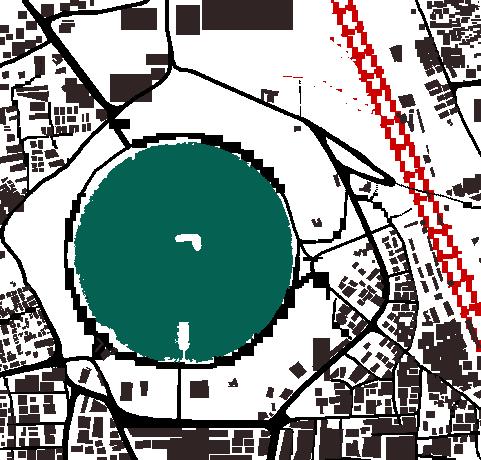
RANDWICK OASIS
The Concept of an Urban Oasis
This concept design focuses on creating a green space within a concreted urban space where UHI levels exceed each year. The green space will provide a habitat and pause space near other vegetated areas for birds of the city.
Concept Design Process
The dispersion of trees transit from sparse to dense from the West to the East end of the site.
Design Vision
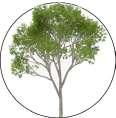
Amongst the densely constructed buildings and complexes Randwick the vision is to create an oasis for the local bird species of the city. Native trees such as the Red gum and Blue gum trees, Eucalyptus trees and the large Mahogany trees which can flourish for future generations amongst rapid urbanization.
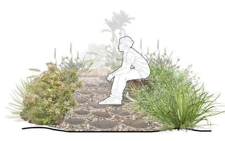
The secondary pathway entwines around the water body also creating resting and seating spaces
An artificial water body becomes part of the plaza which can also collect rainwater and reduce flooding.
Secondary pathways are created to connect the segregated spaces within the plaza
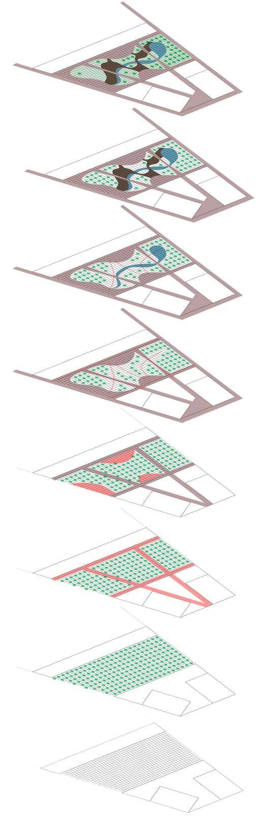
Gathering spaces are allocated in connection to the primary pathways.
Primary pathways are designed to connect all four edges of the space through the plaza.
Trees are placed within each grid square to create a forest between buildings.
The plaza is firstly divided into a tight grid of 1m x 1m
LANDSCAPE ARCHITECTURE
UNSW Projects and Competition
Master of Landscape Architecture (UNSW) coursework projects include: 1. The Secret Garden - a design proposal for the UNSW Gardening team using the principles, techniques and knowledge of Permaculture; 2. The Yellow Quad - a multidisciplinary group project as part of the UNSW Professional Placement course, proposing the development of the Senior Quad within Matraville Sports High School (MSHS), Sydney; 3. Garden of Plants - a UNSW group project for a design proposal submitted to the Garden of Radicepura Competition, Italy.
THE SECRET GARDEN
Permaculture of “The Cage”
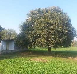
A Permaculture project for an existing site within the campus of UNSW which provided the opportunity to contribute to the campus of UNSW, Sydney as a return on what the campus has provided for the students.
Sector Analysis
Site acts as passage for wind, with more winds from the east and less from north & north-west
No winds come into the inner garden (currently named "The Cage" area) due to the fencing, therefore pollination is difficult.
Occasional noise on site due to vehicles using the car bridge
Large existing generator on site
Natural light Analysis
The site has an interesting mix of - completely shaded areas, - partially shaded areas (depending on the time of the day and year) - fully lit areas throughout all the days of the year.
This provides great opportunities to nurture different types of fruits, vegetables and herbs. The spaces also provide opportunities for students to gather during different seasons
Master Plan - The Secret Garden
A Permaculture project for an existing site within the campus of UNSW which provided the opportunity to contribute to the campus of UNSW, Sydney as a return on what the campus has provided for the students.
Water bowl for birds Seating under feston lights
Existing Tree Road
Tents
Fire pit Mushroom
Orange trees
5000L water tanks (on the terrace)
Galangal Lily Pillies Wild Raspberries
Banana trees
Existing bushes
Barbecue pits Lemon grass
Permaculture Zone & Planning
Zone 1 - Largely Annual plants including herbs, and few vegetables and fruit trees
Zone 2 - Small farm including chickens (under the bridge )
Zone 3 - Large storages including water tanks
Zone 4 - Forestry, other plantations
Zone 5 - The wild where native plants grow freely
5000L water tank (on the terrace)
Bamboo Tool shed
Passion Fruit vine passage, on pergolas Strawberry
Money Plant creeper
Chicken run Compost and bins Ginger
Carriander, Shallots, Parsley, Basil
Silver-beet Lemonbalm Sweet Potato Carrot Lettuce Zucchini Capsicum Cherry Tomato
Portable Greenhouses for seedlings
Pomengranate Lime trees Bee house
The design is set to be accomplished in 5 phases, starting from raising awareness and funds for the project to gradually gathering materials, constructing pergolas and bringing in the new plants and animals.
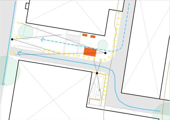
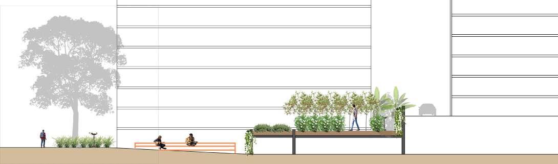
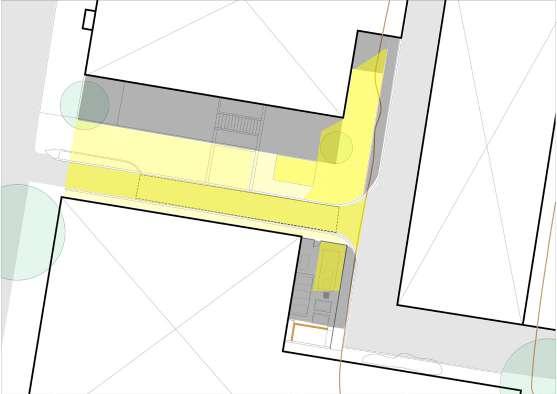
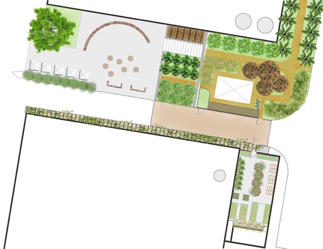
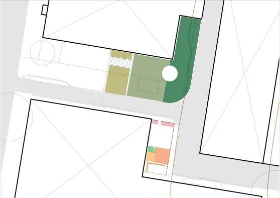
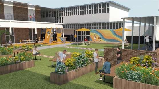
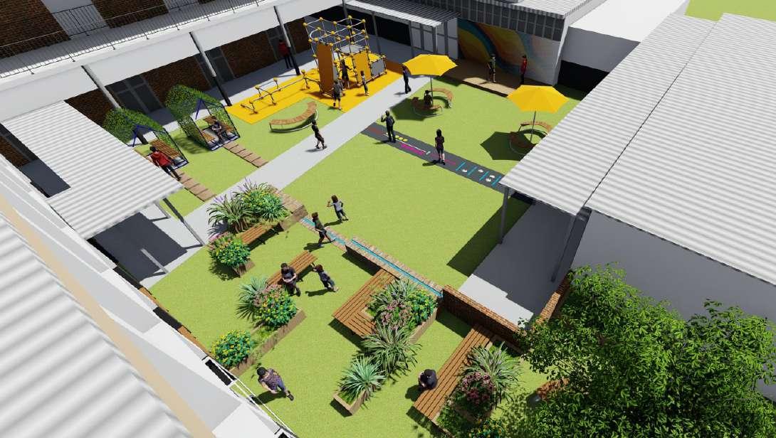
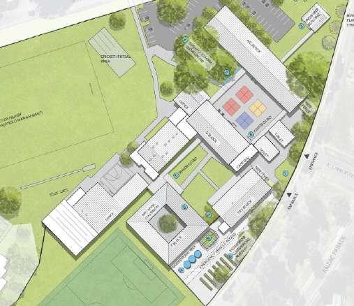
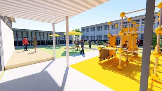
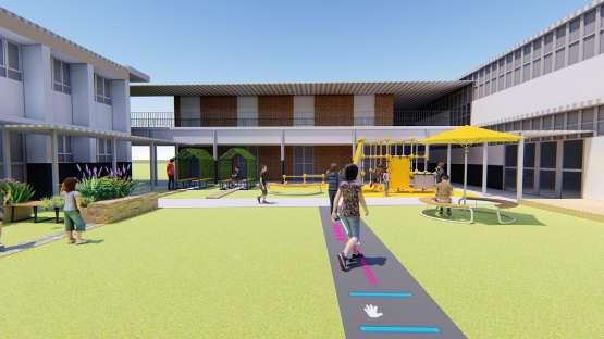
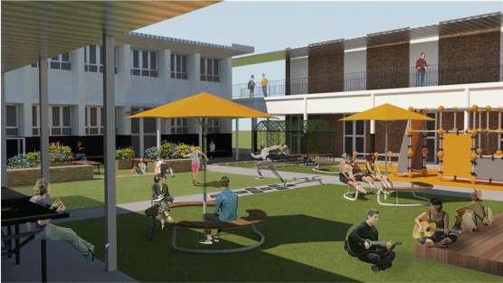
THE YELLOW QUAD
MSHS Quad Design
The Yellow Quad (currently named Senior Quad) is a space designed for students of various age groups and abilities within the campus of Matraville Sports High School, Sydney. The design process also included engagement sessions with the teachers and students to understand their requirements and vision for the school which has to be achieved in a given budget. The project is a multi-disciplinary team project including landscape architects and students of the field from bachelor and master programs of UNSW.
The planter boxes are positioned to create mazelike space which also provides seating areas.
The plants include species selected ones from the IndigeGrow group in collaboration with MSHS who nurture seedlings of native and foreign plants.
The selected plants include: the Lemon, Olive, Lilly Pilly, Gumbi Gumbi, Golden Pea, Australian Indigo and Gravillea firecracker
The existing condition of the site is a plain lawn with concrete pathways connecting the surrounding buildings. The site suffers from harsh conditions of sun, rain and wind.
The proposed plan includes shaded seating spaces, open areas and play equipments along with opportunities to practice gardening & permaculture as a way for students to learn about native plants and their importance.
The large yellow umbrellas invite students from afar and create a more lively environment.
The umbrellas also provide a shaded seating space opposite the Mural paint wall and the stage area.
The timber stage area can also be used as a seating space, a platform for sitting and an area for students to paint the mural wall.
The Agility Course is painted on an existing concrete pathway.
The course can be re-designed and painted at any given time to allow changes each year.
The agility course is positioned between the play lawn to allow freedom for students.
The parkour is designed to allow for physical activities within the quad.
The equipment is placed on a rubber mat to avoid injuries.
The parkour area is adjacent to shaded spaces whereby teachers can supervise the students.
Seating umbrellas
Parkour play
Shaded seatings with covered Wicking beds & planter boxes Water feature Lawn & playspace Agility course Mural & stage
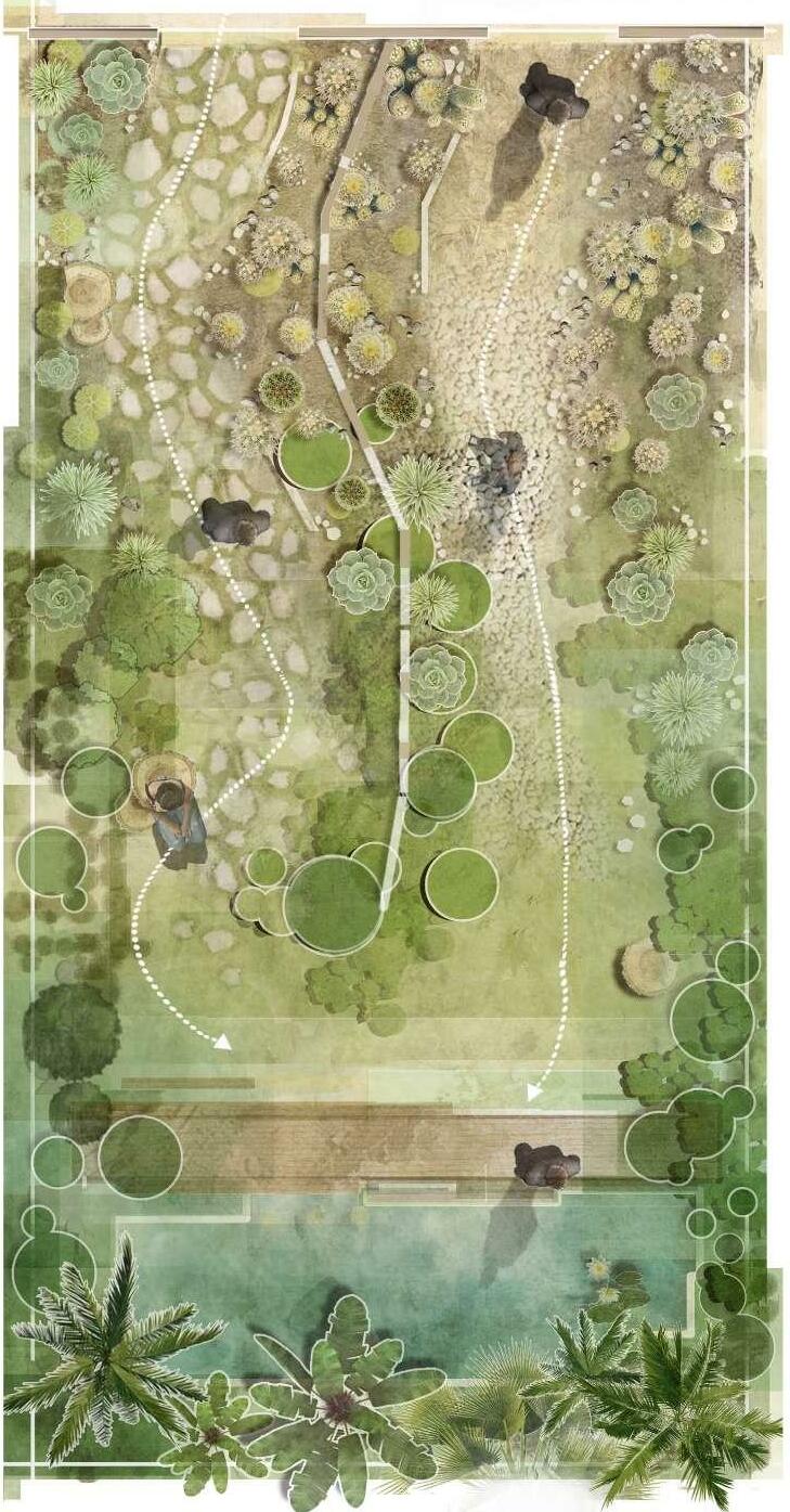
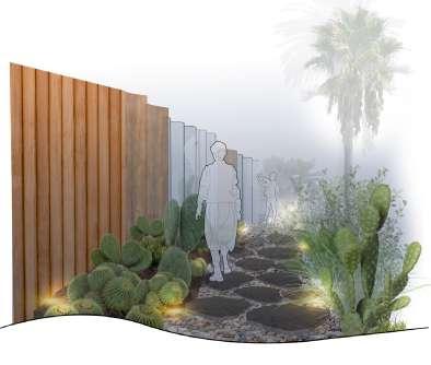
GARDEN of PLANTS
Garden of Radicepura
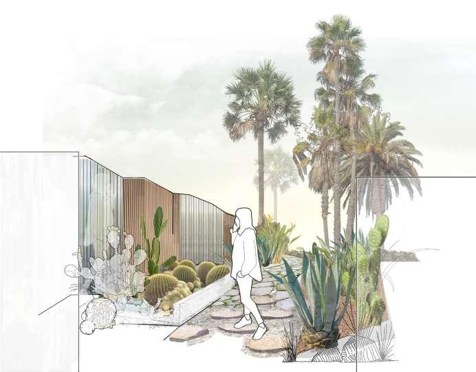
The theme of the competition is "Garden of Plants" and allowing people to experience different plants. This garden is dedicated to all those who have suffered the disconnect between their surroundings including the nature and other people in the last few years of lock-down.
Design Process Experiences
Plan - Garden of Plants
The atmosphere of the garden transits from a desert-like environment to a tropical environment. The initial phase of the garden is planted with cacti and succulents which represent the harsh conditions that people have had to go through, but at the same time they represent resilience and strength to survive in difficult times. The paths gradually transform into pleasant environments with a pond that creates a cool micro-climate under the dwarf palm trees.
Divide the garden to create two separate journeys and with a meeting point at the end
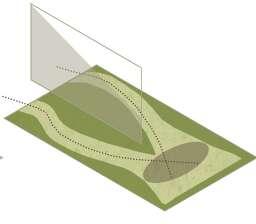
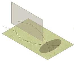
A facade divides the length of the Garden to create two separate journeys which represent a people's separation from one another and their surroundings.
Enclose the periphery of the garden and adding the facade to increase connectivity
Further into the garden, the facade faces away and plants begin to take over providing a more open space for people to explore and rest within
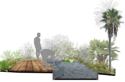
Water body to improve the micro-climate and sensation within the garden
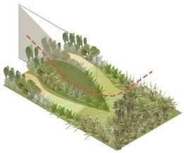
Instrumentalize plants with changing types, heights, and textures allowing visitors to reconnect with the nature
The final gathering space at the end of the garden is a pleasant microclimate created by the tropical
Entry 1 Entry 2 Facade Seating Open space Decking
Grass Seating Wood chips
Pond Sand
Stepping stones
Different Entries
The has garden two separate entries, each ultimately reaching the end point where the water body lies depicting how every individual had their own experiences.
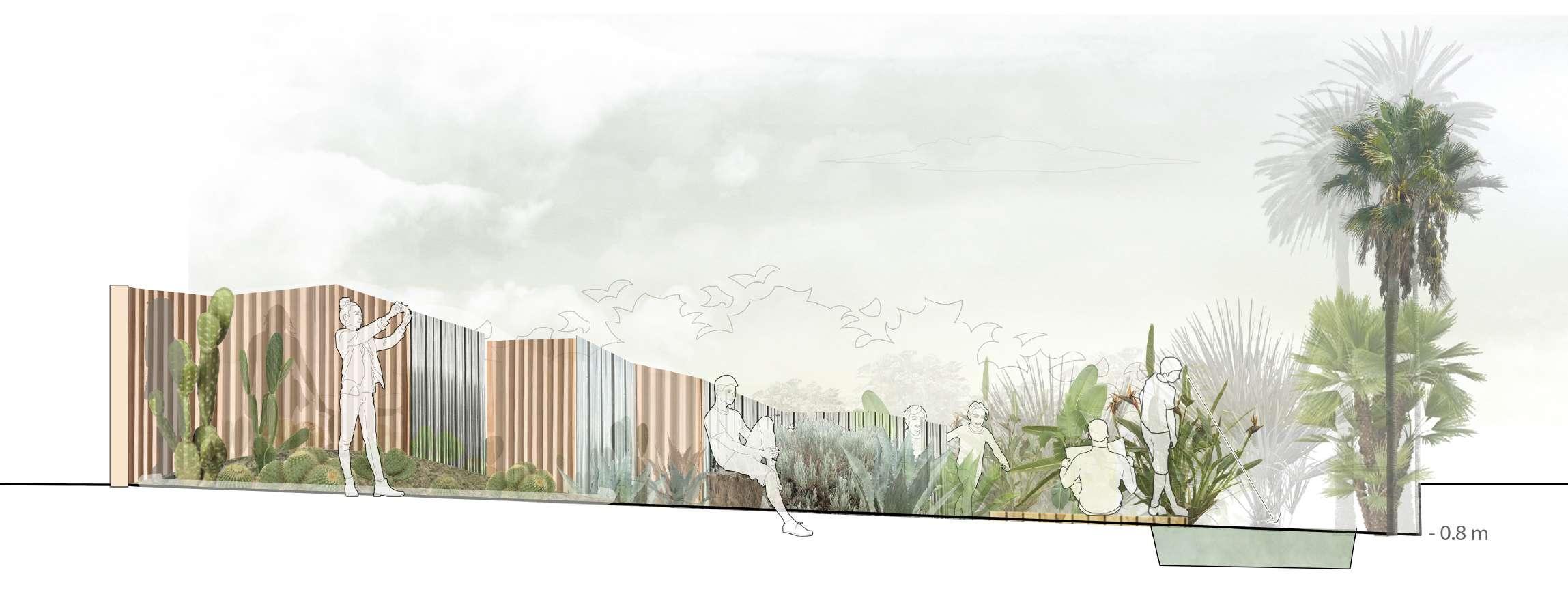
The paths are different in material and textures which provide a different experience altogether however they lead to the same positive environment.
Echinocactus grusonii

Optunia robusta

Opuntra robusta
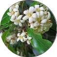
Agave attenuata Viburnum odoratissimum


The entries also become each other's exists, therefore the visitor has to experience the harsh environment again before leaving the garden as a humble reminder of the struggles they have been through. It is also conveying that hardships may come again.
Archontophoenix cunninghamiana
Strelitzia juncea

Nymphea Mexicana

Cool
Chamaerops humilis Hot
Transition of plants:
MAPPING CITIES
UNSW and NUV coursework
The Master of Landscape Architecture (UNSW) and Bachelor of Architecture (NUV) coursework included studying, mapping and documenting cities, with a different perspective and approach each time projects. The documentations include: 1. Sydney - research of the city's natural history including Geology, Soil and Vegetation; 2. Ahmedabad - a holistic approach to understanding a city's character by looking at the historical growth, generating weather diagrams and mapping different zones of the city. 3. Varanasi - mapping the urban fabric of the city from a large scale such as the city grid to a small scale such as one house.
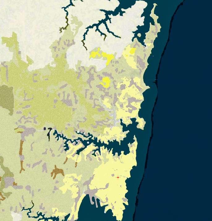
Mapping SYDNEY
An Environmental Base Study
At the time of European settlement in 1788, the land between Botany Bay and Port Jackson would have been a place of extraordinary biodiversity... James Cook described the area as "mostly a barren heath diversified with marshes and Morasses" In the First Fleet journals Dr Worgan described the natural landscape as "swampy, rocky ground and on the whole it was tedious" - (Lawrence, J., 2005, p.2).
Soil Type
Sandstone
Dark grey to black Shale and Laminite
Fine sand
Quartz, shale, sandstone
Silt, clay, quartz sand
Quartz sand
Shale, Laminite


Shale, claystone, laminite, sandstone


Mud, sand
Geology Natural Heritage
Volcanic braccia and basalt
Man-made fill
Sandstone Heaths, Woodlands, and Forests
Castlereagh Woodlands
Estuarine and freshwater wetlands
Eastern suburbs Banksia Scrub
Cumberland plain woodlands
River-flat forests
Turpentine-Ironbark forest
Blue gum high forest
Data not recorded

Calcareous Sands
Alluvial Soil
Solodic soils / Soloths (saline)


Humic gleys soil (loamy/clayey)
Solonchaks (grey-soil)
Solonized brown soils (high in minerals near salt marsh)
Grey-brown podozic soils
Red podozic soils (more fertile)
Vegetation
Woodland on Sandstone
Turpentine - Ironbark forest
Mangroves and salt marsh
Juncus swamp
Unstable sand
Banksia scrub on sand
Heath on Sandstone
Freshwater Melaleuca Swamp
Swamp with Casuarina glauca and Euclyptus robusta
Freshwater Melaleuca Swamp
Freshwater Sedge Swamp
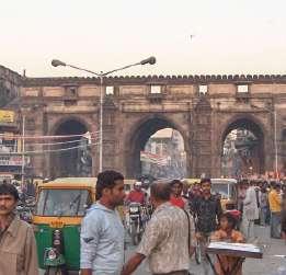
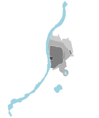
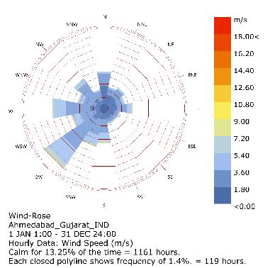
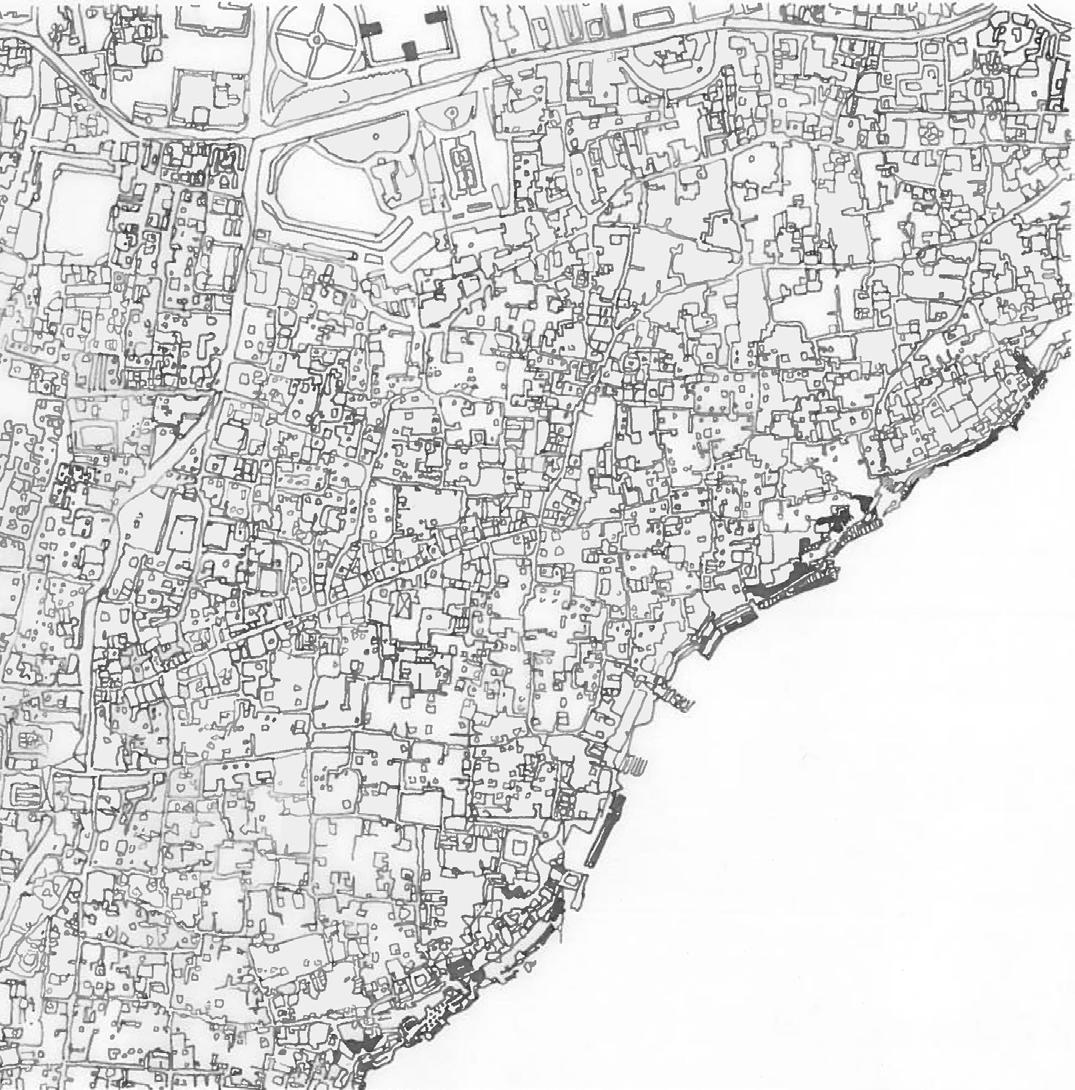
Mapping AHMEDABAD
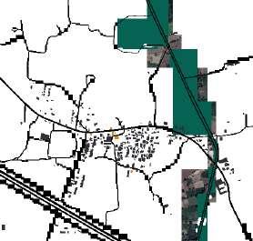
A Character Study
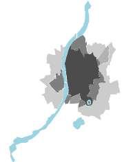
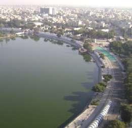
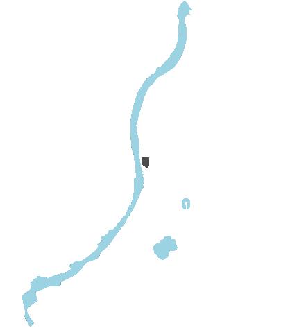
Ahmedabad is located in the northern region of the state of Gujarat and the western part of India. The growing city situates itself on the banks of River Sabarmati and extends upto the two main lakes: Vastrapur Lake and Kankaria Lake.
The city has served as an economical and political capital since its establishment. It is a UNESCO world heritage site and also the cultural capital and 7th largest city of India
The city lies on a flat plain with a gradual downward slope towards south-west. The city has been developed in a sandy and dry area, with an arid and dry climate.
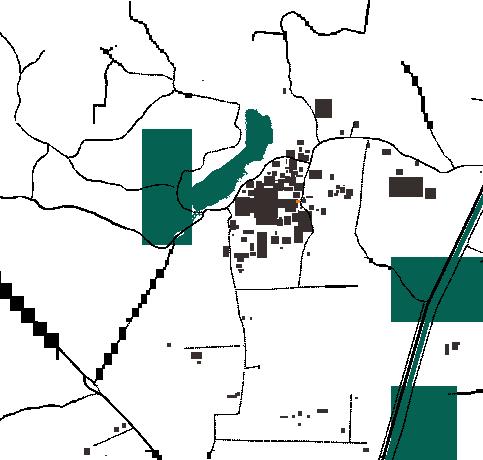
Development History
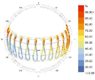
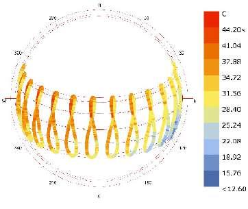
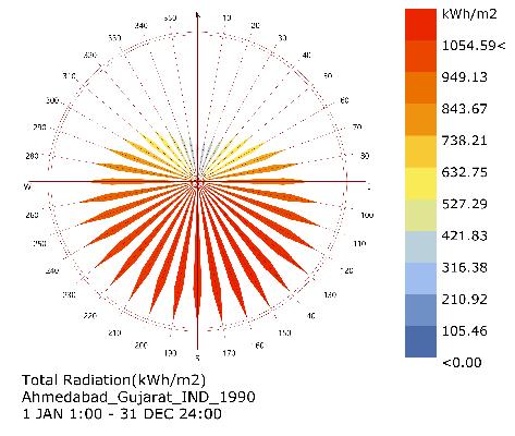
Apart from monsoon (Jun-Oct), the climate stays dry with low levels of humidity. During summers (Mar-Jun) temperature rises to 43 C; during winters (Nov-Feb) the temperature drops to 15 C.
The oldest settlement was recorded in the 12th century however the present city was founded on 26.02.1411 by Ahmed Shah on the eastern side of Sabarmati River. Ahmedabad became the center-stage of the Indian Independence Movement after Mahatma Gandhi arrived in the city in 1915.
The wind direction changes from South West majorly to North during winters. This has caused the temperature to drop to a lowest recorded 5.6 C; the highest recorded being 47.2 C.The average rainfall is 761mm.

 Nature Rural Industrial Urban Core- (new city) Urban Central- (old city) Urban General Industrial/Residential Rural
Mapping VARANASI
Macro to Micro
Banaras, Varanasi, or Kashi, a city which is mythologically said to exist before its own stories. Known to be the world's oldest city, Banaras is one of the most sacred pilgrimage sites in the country. It was once a lush green forest in an area of gently rolling hills and natural springs and lakes bordered by the holy river of Ganga.
The city and its settlement has grown organically between the Varun River (North) and Assi River (South). A Gradual densification of the city through intricate street network is visible towards River Ganga
The city gradually slopes towards the river with 3 main mounds from which the city junctions have grown. All the streets in the city have been designed to ultimately reach River Ganga (Ganges).
The city is now densely populated with narrow streets and markets. Dense urban fabric of the city encroached to the banks of river Ganga; with Thathery Street at its center
The "Thathery bazaar" or "Thathery Street" meaning market/street of utensils. The street includes small shops, residences and temples with an informal layout of the dense urban blocks around the market street
Bhartendu - a famous Indian poet. The Bhartendu House situated at the center of Thathery Street; therefore in the heart of the city.
The Bhatendu House is a typical Banarasi house with h a small entrance directly to the large central courtyard.
The central courtyard is open-to-sky, where festivals and prayers are held. It is encircled by corridors on its periphery that provide access to the rest of the rooms
All the windows of the rooms open out to the secondary and tertiary streets which are on the south and east end of the house.
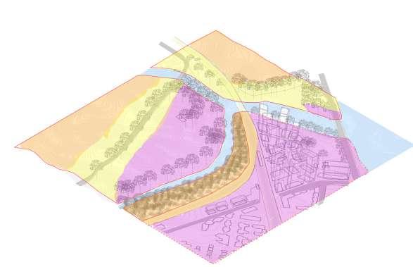
ARCHITECTURE DESIGN
NUV, Architecture Studio Projects
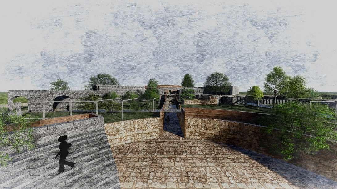
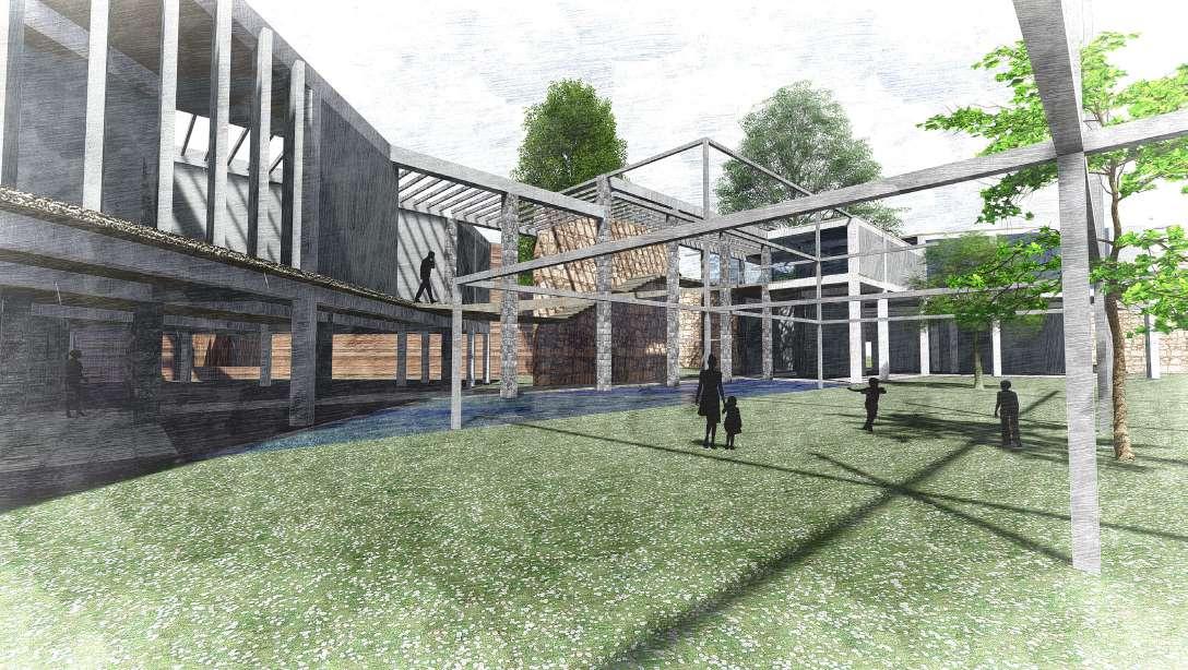
The Bachelor of Architecture (NUV) studio projects include: 1. The Museum of Language - a thesis project involving depth research in the transition of Language through the eras followed by a museum design proposal to restore and preserve lost and endangered languages. 2. Multi-faith Centre - a design for a peaceful harmonious structure inviting people of all beliefs; 3. Library in a Park - a competition entry for establishing a Library in the heart of Hyde Park for the people of the city; 4. Rock Mining Institute - a studio design project amongst an abandoned quarry on the outskirts of the city of Baroda, India; 5. Ranger Residence - a residential design project for the rangers working on Kada Dam, India ensuring construction t5echniques which naturally create a comforting environment.
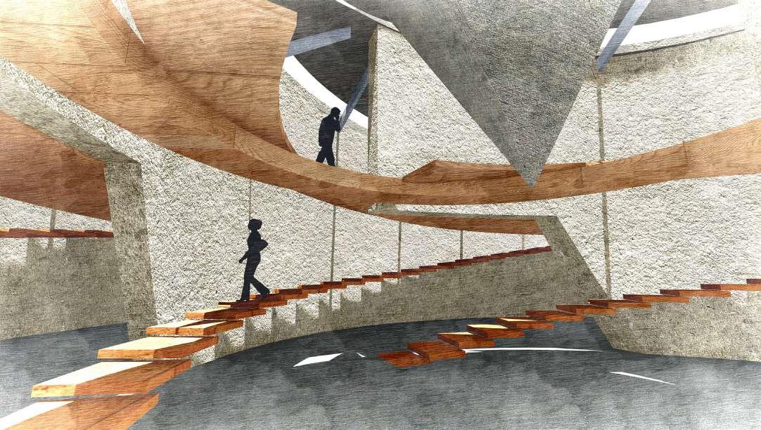
Bhasa, Language; the way in which we communicate information, opinions and feelings to one another. It has almost become one of the human senses without which we are physically and mentally incomplete. It is because of which the human civilization exists as it does today (what exists today has been evolved from the learnings of the past). It is important for us to preserve this medium of communication not only to keep a record of the past but also for the knowledge of future generations.
Delhi being the hub of India's primary political and institutional structures, provides the opportunity for Indian Languages to have a center from where all the depleting and extinct languages can be accessed and studied. The site was chosen in context of the surrounding institutions (such as The Jawal Lal Nehru Academy of Language and The Bhartiya Vidya Bhawan) of which functions can be interlinked with that of the museum in the future.
The structure of the museum shifts across the linear site representing the shift in the structure of languages through time (represented by a grid in the design).
Initially the grid is sparse, representing a lack of rules in communication. Spaces are more open; such as amphitheaters and gathering spaces. One is free to choose his own way (imagery, verbal, musical) or any other raw way of communication. Therefore the museum offers a range of multi-functional spaces for visitors and the people of the city and country.
The grid densifies as scripts are created with rules and grammar. One becomes more confined to a written or verbal way of communication. However, at the same time one can get lost in the complex labyrinth of various scripts, its languages and dialects.
The grid again starts to disperse as people move towards the digital ways of communication. The grid starts to break when rules and grammar dissipate as people start to communicate using a mix of languages, broken languages and slangs.
MUSEUM of LANGUAGE
Religion: a very delicate and sensitive issue for many people. A multi-faith center aims to dilute the tensions that exist between the different religions today and help them grow in harmony. The concept is to unify people by converging beliefs from various parts of the world and therefore also different religions. Almost all the religions ultimately aim for people to understand and look within themselves or find their purpose; whether it be through the means of prayer and/or meditation. This center therefore, aims to provide various types of spaces which are comfortable for people to read, sit in silence, pray or meditate. It is believed that when people meditate or concentrate on themselves, their thoughts or even simply their own breaths, they sink into self exploration but rise at the same time as spiritual beings. As a person completely indulges themselves into meditation, they can hear a humming sound from within. The hum therefore holds significance in most religions.
Hyde Park being the green heart of central London is itself a historical monument cherished by the local people as well as tourists. It is known to host large crowds for many various activities from exhibitions and concerts to protests which continue till today. Therefore, it is a place which symbolizes freedom of the people; freedom to celebrate, express thoughts and emotions. The natural surroundings including trees, animals and water bodies (The Serpentine river and the Long Water lakes), are the elements which give one a sense of freedom. They are the essence and the very reason for the existence of the park as it is today. Therefore, it is important to preserve these landscape elements whilst creating a structure with the required functions. The aim is to build minimally and construct around the natural elements without disrupting the surroundings. For example, building around the trees (minimal cutting of trees) and leaving a large offset from the edge of the river keeping it undisturbed.
MULTIFAITH CENTRE LIBRARY in a PARK
ROCK MINING INSTITUTE RANGER RESIDENCE
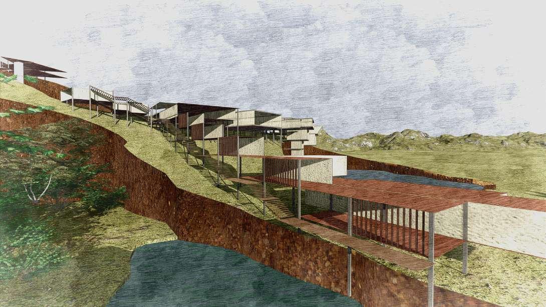
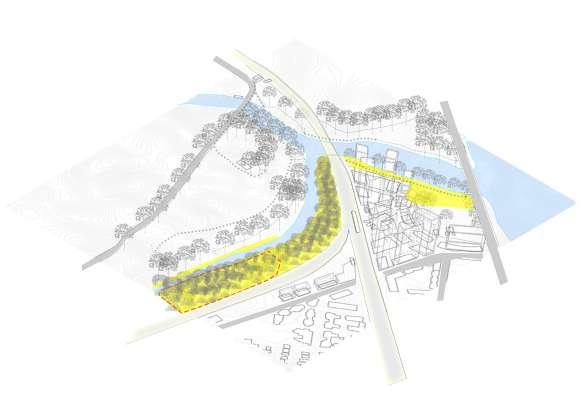
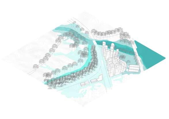
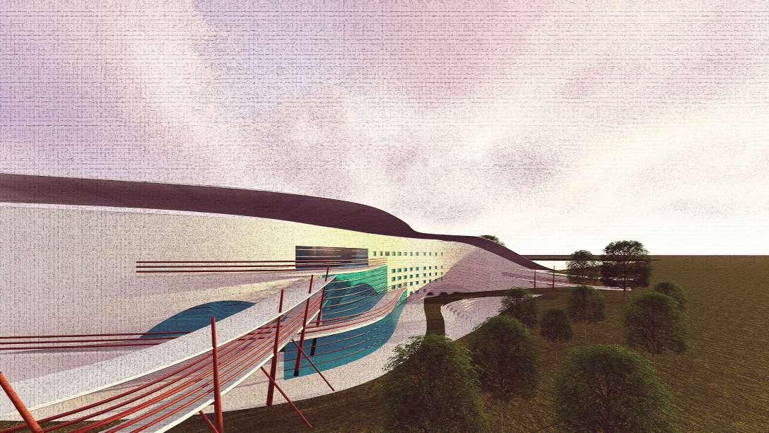
The five descending plateau of Pavagadh Hill accommodate the world UNECSO heritage site of Champaner city. The artistic landscape which holds great cultural value has been scarred through rock mining activities in the past. This activity was banned and since then the quarries have been abandoned, allowing it to be filled with rainwater creating large water bodies amidst the terrain.
"I stand at the foot of a gigantic beast curving around the descending edges almost as if entrapping me; forcing me to surrender. Intimidated, I think of marking my presence by setting foot on the head of the mound, so I start climbing up the sides but only to reach the top and find myself gasping at the sight before me. Looking down the fall was frightening but it also compelling me to experience the height throughout the entire stretch of the quarry, only imagining the feeling of walking above the waterbody to the other end just didn't seem to be enough"
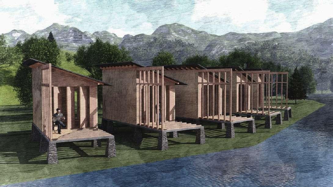
Kada Dam; one of the most beautiful dams in the state of Gujarat is located in the Jambughoda wildlife sanctuary. The area has a rich flora and fauna including large bamboo and 'saag' forests which inhibit a wide range of wild animals from leopards and hyena's to the blue bull, sloth bears and porcupines. The aim was to create a working and living space for the rangers, forest conservators, visiting scientists and environmentalists, who are able to come to the dam for a brief period of time form cities nearby during the day. The challenge was to build on the site of the dam according to the surroundings, wildlife and ecosystem. Therefore, the process of analyzing the basic situations of the site such as the sun path, wind direction, water levels throughout the year and the topography of the site is most important. Also, part of the challenge, was to use simple techniques to solve problems that were arising due to the site conditions (such as hot summers and cold winters) so that the site remains undisturbed and the structure was to be mainly built from locally available materials (timber and bamboo).
l.ar.parikh@gmail.com