
A
The lake of Venice scenario for Venice and its lagoon Lorenzo Fabian, Ludovico Centis

Photos: G. Streliotto Translation and revision of the English text: L. Centis & Just!Venice
Citation: Fabian L., Centis L. (2022), The lake of Venice. A scenario for Venice and its lagoon. Conegliano: Anteferma Edizioni. Research group: L. Fabian (coordinator), C. Cangiotti, L. Centis, L. Iuorio, G. Magnabosco, G. Mantelli, E. Longhin, I. Visentin. Texts: L. Fabian, L. Centis. Images and maps: L. Fabian with C. Cangiotti, G. Mantelli, I. Visentin & the students of the Urban Design course and the City and Landscape Laboratory of the Bachelor of Architecture at the Università Iuav di Venezia (Academic years 2019-2020; 2020-2021; 2021-2022). Design and layout: L. Fabian, C. Cangiotti, G. Mantelli.
Publisher: Anteferma Edizioni, Conegliano, Italy The research group discussed and shared every part of the publication, however for the analytical detail of the attributions of texts, maps, images, and exploratory projects see the credits in the publication's appendix. This book was published with the help of the Department of Architecture and Arts, Università Iuav di Venezia. Copyright This book is published under a Creative Commons license
Colophon The lake of Venice A scenario for Venice and its lagoon ISBN: 979-12-5953-022-6
Attribution - Non Commercial - Share Alike 4.0 International
A
Lorenzo
The lake of Venice scenario for Venice and its lagoon Fabian, Ludovico Centis
The walls of Venice Elements / Key concepts. Immaterial division devices Land is land, water is water Elements / Key concepts. Physical division Photographicdevicesexploration. Division devices 108162232 4842 56 64 1081009078102 114 120132
Contents The lake of Venice IntroductionForeword Chapter 1: On the lake of Venice Intro. Venice, year 2100. On the lake of Venice Lagoon Elementspalaeochannels/Keyconcepts.
What we talk about when we talk about the Venice Photographiclagoon?exploration. The Lagoonlagoon Pressure.scenariosWhatthreatens the Venice What-if.lagoon? Lagoon Scenarios Chapter 2: On the lake defences Intro. Venice, year 2100. On the lake Divideddefences Designinglagoonsedges
Chapter 3: On Venice Intro. Venice, year 2100. On Venice Defining Venice Elements / Key concepts. Venice, What-if.Venices Scenario: an accessible Elementsmetropolis?/Key concepts. Knowledgebased Enterprisingresidents?betweenWhat-if.DestinationPressure.Cutting-edgeeconomyVeniceVenetianovertourismVeniceScenario:Asynergytourists,students,andVenice
Chapter 4: On the amphibious space
Intro. Venice, year 2100. On the amphibious space A large Elementslagoon/Key concepts. The lagoon as a transition space The lagoon as a mountain What-if. Scenario: regenerating the space of the barene of the northern and southern lagoons What-if. Scenario: living in an amphibious world An amphibian metropolis Photographic exploration. An amphibious space Appendix ReferencesCredits 160150138 164 168172178 184 206198192216222230 248240 266258275279
Venice A scenario for Venice and its lagoon
lake
The of
8
Foreword
9Foreword
Once again in its long history, the Venice lagoon needs profound rethinking in the light of the environmental crisis, demographic decline, and the tourist pressure it is under. This book on the future of the lagoon stems from the urgency that emerges from these aspects and as a synthesis of an exhibition, as well as of a series of ongoing research and educational experiences in which we are involved.▶1
Starting from the entry into operation of the MoSE and the scenarios related to the expected climate change, our contribution as architects and urban planners –entrusted with the task of bringing a gaze able to encompass such a broad and articulated framework– is to synthetize the possible vanishing points that the future of the lagoon delineates. The economic, environmental, and social challenges that characterize the metropolitan city built around the Venice lagoon are profound and to some extent unique but, as Secchi reminds us, they are part of a new global urban question with which all cities will be confronted (Secchi, 2011; 2013).
▶1 Exhibition: Venise (2021), expo at the Musée des civilisa tions del'Europe et de la Médi terranée (MuCEM), Marseilles (Fr). Research activities: L2 Tourism and Cultural Heritage LAB (2021-2022), funded by the Industrial Rehabilitation and Reconversion Project, Venice Complex Industrial Crisis Area; VENETO SUS TAINABLE SMART TOURISM 2030, (2020-2021) funded by the European Social Fund Regional Operational Pro gramme, Veneto Region; Pale oalvei della Laguna (2019-2020), research carried out in the framework of the activities of the programme ‘Venezia 2021 Scientific research programme for a regulated lagoon’ funded by CORILA (Consortium for the Coordination of Research on the Venice Lagoon Sys tem). Educational activities: The New Mediterranean System (Academic Years 2019-2020, 2020-2021) design studio of the master’s degree in Archi tecture of Università Iuav di Venezia; MéLiMed Métropoles du littoral méditerranéen, enjeux climatiques et solutions de résilience (Academic Years 2021-2023) educational project Erasmus Plus, Ecole Nationale Supérieure d'Architecture de Marseille (PI), Università Iuav di Venezia, Faculté d’architec ture La Cambre-Horta ULB Bruxelles, Ecole Nationale d'Architecture de Tétouan Maroc; Scenari della laguna (Academic Years 2018-2019, 2019-2020, 2020-2021) design studio of the bachelor’s degree in architecture of Università Iuav di Venezia. For details see the Research and teaching credits in the Appendix at the end of the book.
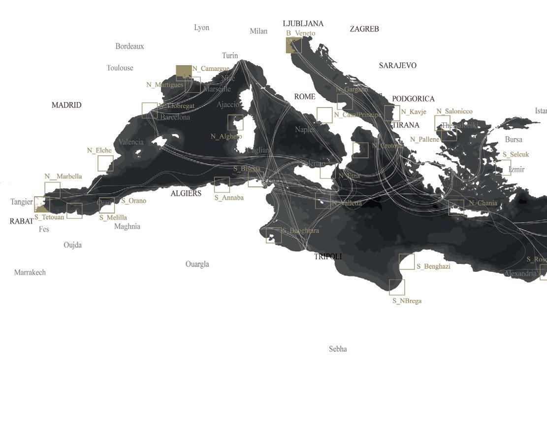
The design studio ‘The New Mediterranean System’▶2 of the mas ter’s degree in architecture of Università Iuav di Venezia had the objective of constructing a framework project for the Mediterranean space and defining an image, a far-reaching proposal towards a peaceful future for 500 million people able to meet the environmental, energy, and geopolitical challenges in progress. The unified Mediterranean project reconceptualizes the original idea of ‘Le Système de la Méditerranée’ introduced at the beginning of the 19th century by Michel Chevalier, where for the first time this ‘sea between the lands’ was understood as a unicum (Chevalier, 1832). From a geopolitical point of view, the Mediterranean continues to be the geographical field described by Fernand Brau del, a ‘fissure in the earth’s crust’ which has become a crossroads of cultures and trade in goods, which united and unites around itself, often in a conflicting way, three types of civilization: that of the Christian West which had its centre in Rome and from which Europe was born; that of Islam, stretching from Moroc-
The Mediterranean is a ‘geopolitical paradox’ (Spadaro, 2020), an increasingly enlarged and fragmented shared space at the centre of one of the geographical areas of greatest transformation due to climate change, profound and tragic social and economic changes, and impetuous demographic transformations. We know the planet is transforming. The dynamics linked to the climate draw unexpected new geographies, and the scarcity of fossil fuels and natural resources reveals new lands to be abandoned and others to be plundered and exploited. The crisis conditions that charac terize this great ‘sea between the lands’ today reflect this worrying climate picture. The Mediterranean has also become the epicentre of violence and urbicide (Albrecht et al., 2017): it is perhaps necessary to have a broad reference horizon in order to solve specific and local problems linked to crisis situations.
The conclusions of the first scientific report on climate and environmental change in the Mediterranean region, presented at the Forum Régional de l’UpM on 10 October 2019 in Barcelona, tell us that the Mediterranean space is warming up 20% faster than the rest of the world. Such changes will have major impacts on tem perature, precipitation, atmospheric circulation, extreme events, sea level rise, seawater temperature, salinity, and acidification (Cramer, Guiot, and Marini, 2020).
Introduction
10
11Foreword co to the Indian Ocean; and finally the Greek-Byzantine one, a bridge between Asia Minor and the Balkans (Braudel, Coarelli, and Aymard, 1977). According to Henri Lefebvre, historically the cultural unity between the Mediterranean countries was organized around multiple forms of exchange based on ‘tacit or explicit forms of alliances’ (1992). In this context, starting from environ mental issues, water can still assume the role of a central and unifying issue. In the south, from the African coasts to southern Italy, Turkey, Greece and Spain, water will increasingly become a problem of scarcity, declared in the themes of the territorial project to defend against desertification and drought, from heat islands and the danger of fires. To the north, in the territories bordering the northern coasts and in the hinterland of the floodplains of large rivers, the water problem is, and will increasingly be, a problem of defence against floods, overflows and sea level rise. These aspects touch the territories of the Camargue and the nearby production area of Martigue in Marseille, Kavaje in Albania, Elche in Spain, and Rosetta, the terminal point of the metropolis of Cairo on the Nile Delta. Territories that, like Venice, will see their existence increasingly threatened by the rise in sea level and for which it seems possible to explore the adaptive dimension of the amphibious project, through the construction of new lagoons, inhabited wetlands, and environmental reserves in the heart of a new met ropolitan dimension. In 1984, to highlight the different conditions of the urban project, Bernardo Secchi published in Casabella an essay entitled ‘The conditions have changed’ in which he pointed out ‘the halting of migratory flows, of the growth of large cities, the slowdown of construction in urban areas and its displacement to other dispersed places, industrial delocalization, the progressive emergence of the urbanized countryside, widespread industrialization, the extension of the landscape of metropolitan suburbs’ (Secchi, 1984) as signs of profound change. Today, in the light of the economic crisis at the beginning of the millennium, the environmental problems linked to climate change, the exhaustion of fossil fuels and the geopolitical tensions that follow, the global change we are experiencing has become increasingly evident. This appears even more true today, when as we write, the crisis deriving from the pandemic we are experiencing has been added to the environmental and economic emergencies. It is the opinion of many that the
▶2 The activities of the de sign studio ‘The new Mediterranean System’ of the master’s degree in Architecture of Università Iuav di Venezia are part of the broader Erasmus+ MéLiMed (Métropoles du littoral méditerranéen, enjeux climatiques et solutions de résilience) an educational and research project to counter the environmental risks that loom over the Mediterranean space. During the three-year duration of the project the issue of the resilience of the Mediterranean coastal territories and metropolises to the challenges posed by climate change and rising seas is addressed, starting from three coastal cities –Venice in Italy, Marseille in France, and Tétouan in Morocco–through educational work shops involving instructors and students from the part ner schools. See Research and teaching credits in the Appendix at the end of the book.
12 world we will find at the end of this health emergency will never be the same again (Harvey, Camp, and Caruso, 2020). On the one hand, together with our lifestyle, the paradigms around which the social and anthropological structures of our societies and of our country, based primarily on human contact, on interpersonal and trust relationships, have now been put into question. On the oth er hand, the faith that had been placed on an economic model based on production chains on a global scale will change. Furthermore, what we are experiencing teaches us that the future is often unpredictable, that what we have achieved should not be taken for granted, that the world and its resources (material, econom ic, environmental, and social) on which we could count and that until yesterday we thought indisputable are actually very fragile, and we must take care of them, because everything can suddenly
System Framing and study areas.
new
The Mediterranean
13Foreword change. This experience speaks to us of our greater or lesser capacity to adapt to risk and disasters, whether they concern health like today, or the environment –and access to resources– as they certainly will tomorrow. It is evident that all this will also have a cascade effect on the territory of the Venetian metropolis and on confidence in the large and small projects that are presently under construction. More generally, if we look away from Venice to the urbanized world, there will be an impact on the ways of rationalizing –and designing– the city, on public space intended as a space for democracy, on production chains and access to raw materials. Our research also fits into this framework dominated by uncer tainty. We need to be prepared, with new planning models that know how to prepare for the unexpected (Arnoldi et al., 2020).
The regulated lagoon In 2018, the CoRiLa consortium launched a new research programme called Venice 2021 which intends to investigate the evolution of the Venetian territory in light of the entry into operation of the MoSE, when the Venice lagoon system will become ‘regu lated’. The broader work programme contemplates the creation of ‘new scenarios’ for the future of Venice and its lagoon and involves a large number of researchers, hydraulic engineers, environmental scientists, technologists, restoration experts, chemists and biologists.▶3 In the aftermath of the tragic flood of 2019, the controversy over the long-term effectiveness of the MoSE and the various hypotheses of closure of the lagoon, our research is the illustration of a possible scenario for the future of the lagoon and the verifica tion of its possible legitimacy. The lake of Venice is neither necessarily the only possible scenario, nor the best one for Venice. It is not even an unprecedented scenario. However, we believe it to be a plausible one. A scenario developed starting from an in-depth historical knowledge and the awareness that, as D’Alpaos and Rinaldo underline, transforma tion represents the only alternative to the extinction of the lagoon: ‘It should be noted, aside from the study on the evolution of the shape and function of the Venice lagoon, that the concept of equilibrium, in the static sense of maintenance and conservation that it suggests, has no place in natural evolutionary phenome na, especially in the Venetian context. As extinction is the only
▶3 Scientific activity carried out in the frame of the Venice 2021 research program, with the contribution of the Interregional Authority for Public Works for Veneto, Trentino-Alto Adige and Friuli Venezia-Giulia, pro vided through the Conces sionaire Consorzio Venezia Nuova and coordinated by CORILA (Consortium for the Coordination of Research on the Venice Lagoon System) with Iuav, Ca’ Foscari, Padua universities and the national research bodies CNR (Nation al Research Center) and OGS (National Institute of Ocean ography and Experimental Geophysics). See Research and teaching credits in the Appendix at the end of the book.

According to Bernardo Secchi, in contexts dominated by uncertainty, ‘The main [task of urban planning is] the idea of a continuous, patient construction of scenarios. [...] In a democratic and open society, everyone is free to make proposals and to justify them by resorting to the arguments they deem most appropriate. [...] But the task of every intellectual who claims legitimacy, including architects and urban planners, is to subject each of these ideas to a severe critical scrutiny, transforming them precisely [...] into scenarios’ (Secchi, 2002). By mobilizing the tools of the terri torial and landscape project –and based on the hypotheses of clo sure and compartmentalization of the lagoon advanced by some authoritative scholars– our research attempts to look at the past in a speculative way to critically rethink the present and imagine an alternative future. For this reason, the history of the lagoon plays an important role here. In fact, on the one hand, it allows us to understand that the environmental threats to which the lagoon is currently subjected are not entirely new. On the other, it assumes a crucial role as an empirical but indispensable framework for reasoning on the legacy of past projects and therefore on the legitimacy of the ideas and projects for tomorrow.
alternative14 to evolution (of the residual lagoon forms and their environmental, physical, cultural services), the study of the many lagoons that have occurred in their evolutionary history aims to provide elements for informed historical analysis and to make transparent the causes and effects of measures aimed at the resto ration, conservation, or use of the lagoon environment. The rigor ous analysis aims to create sharing, conscious cooperation, moral commitment’ (D’Alpaos and Rinaldo, 2015, p. 35).
On the lake of Venice Chapter 1 16
CHAP 1 - On the lake of Venice
Venice, year 2100. In 2100 the ancient Venice lagoon is divided into three parts. The central part, the lake of Venice, is a large hypersaline water space, protected by an embankment that preserves the immense monumental deposit of the historic centre of Venice and the other major islands (Murano, Burano, Torcello ...). The large city of Mestre, as well as Marghera, Favaro Veneto and the Lido, overlook the lake of Venice. This city has consolidated over time into a horizontal metropolis, an active urban space, crossed by mass tourism and trade routes, punctuated by the presence of metropolitan facilities such as the Venetian universities, the Mestre hospital, the Tessera airport, the new industrial and tourist ports located along the former Petroli Canal, between Fusina and the Malamocco lagoon mouth. The large embankment protecting the lake of Venice relies on the one hand on the MoSE system (using the movable bulkheads and adapting them to the new needs), on the other by exploiting the pre-existing morphological elements (dunes, salt marshes, consolidated islands). Furthermore, it will be necessary to strengthen the existing embankments and dams equipped with dewatering pumps with the aim of keeping the average level of the lake water below +90centimetres compared to the zero tide level of Punta della Salute (ZMPS).17
18 The lake of Venice is a protected area, separated from the southern and northern lagoons by the Malamocco channel (formerly Petroli Canal) and the ancient riverbed of the Dese-Sile that runs along the islands of S.Erasmo, Torcello and Burano, on which new waterproof structures have been established. The lake is hermetically sealed on the Adriatic front thanks to the new embankment of walls integrated by breakwaters that preserve the Lido-San Nicolò strip from possible damage caused by storm surges. Access by water to the lake of Venice is allowed only to small-sized ships without carbon emissions through special navigation locks and outflow openings that allow water exchange with the surrounding water surfaces, avoiding stagnation, maintaining healthiness and the correct salinity levels of the water. Territorial trams run along the banks surrounding the lake, where the slow mobility networks that connect Marghera and the Marco Polo airport on the mainland to the coasts of Malamocco and Punta Sabbioni are also located. At the edges of the lake of Venice are located the northern and southern great lagoons. The two lagoons, home to numerous animal and plant species that represent a great environmental heritage for the entire territory, are designed by landscapes of mudflats, sandbanks and tidal creek that recall the
19CHAP 1 -
On the lake of Venice original environment of the ‘dead lagoon’. The ancient system of fishing valleys, interconnected with the centuries-old mechanisms of lagoon fluid dynamics, has been slowly converted into different and more contemporary forms of fish farming, which have become an important resource of the lagoon economy. Within

20 these landscapes the practices of fishing, cultivation and continuous maintenance of a fragile environment still take place thanks to the incessant work of fishermen and aquaculturists. These are the same populations of aquaculturists who in 2100 can count on a larger lagoon area of production, reconquered from the reclaimed agricultural territories following the closure of the water pumps which, until the beginning of the 21st century, kept the lands on the edge of the conterminazione lagunare –the administrative and juridical border of the lagoon– artificially dry. In memory of this ‘paleo-lagoon’, the stones that once defined the ancient boundary emerge from the water space. A large plant system acting as a forest buffer is found all around, punctuated by wetlands with macrophytic plants along the main hydrographic systems. This system guarantees the purification of the waters that come from the hydrographic system and that cross the polluted lands of the “diffuse city” located on the lagoon drainage basin. The territory of the new lagoons is crossed by the main road infrastructures that were built during the 19th and 20th centuries and which, given the original construction in relief with respect to the level of the countryside, survived the average sea rise. The sediments brought in thanks to the completion of the Padua-Venice waterway and an embank-
21CHAP 1 - On the lake of Venice ment overlooking the southern lagoon along the Petroli Canal have allowed the terraforming of areas inside the lagoon, real inhabited islands. New navigable lagoon canals make it possible to reach these islands, secured by reinforcement embankments formed by the material resulting from the excavation of the canals.

A couple of years after the exceptional high water▶1, in the face of the incessant controversy about MoSE and more-or-less scientific ideas about the lagoon that emerge from popular debates, this text tries to deal with ‘the hypothetical in a strong sense’ (Badalo ni, 1983, p. 40). Since the very beginnings of the Serenissima, the Venetian lagoon has been the subject of numerous ideas, plans and projects that have never been fully realized. The hypothesis that we put forward here is that these urban episodes (conceived and documented) may still be topical and capable of building new foundations for discussion about parallel lagoons. The possible story of a series of never-transformed lagoons thus becomes a tool to better understand the success and failure of the projects underway to protect the Venice lagoon. From its origins, in fact, the centuries-old history of Venice is one of techniques, ideas, and projects to make a fragile, some times hostile and insalubrious territory habitable, combining the reasons for economic development with those of environmental protection. A story that in the longue durée is inscribed in the ‘fabric’ of the territory and in a specific geography that also shapes its destiny. This is true for Venice, for the Mediterranean Sea within which it has stubbornly carved out its vital space and its system of relationships, the nature of which ‘[...] cannot be fully understood except in the long perspective of its geological history’ (Braudel, 1998, p. 15) and by the great plain to which it turns, which since prehistoric times has been ‘the kingdom of rampant waters [to be] conquered against hostile swamps’ (p. 15). The expression ‘regulated lagoon’ proposed by CoRiLa is actually an oxymoron that well expresses the ineluctable fate of the Venice lagoon, of its perpet ual and centuries-old battle to oppose a specific hybrid and transitional geographical condition, whose natural future would be that of disappearing to become a part of the sea or an extension of the land. For almost fifteen hundred years, in order to oppose this natural future, man has changed the course of rivers, drained, and reclaimed entire parts of the territory, built embankments, arti ficial canals, bridles, dams, bridges, pumped water, consolidated mud. Within this long-term destiny, environmental, economic, political and health issues have always overlapped, and are part of the same attempt to make an uninhabitable place inhabitable
22
▶1 187 centimetres above the average sea level, recorded at the Punta della Salute survey station at 10.50 pm on Tues day 12 November 2019.
Lagoon palaeochannels
‘Those who write about agriculture affirm for sure that from the corrupted na ture and the stench of manure certain small animals are generated, which cannot be seen and that while breathing enter through the nose, caus ing an almost certain death suffered to animals and men’ (auth.trans.).
▶2
23CHAP 1 - On the lake of Venice through the construction of a ‘regulated’ space. Alvise Cornaro understood this well at the time of the Serenissima, when in support of his arguments for filling up a vast part of the lagoon, together with the need for new land for food resources, he recalled the risks derived from the growing marshes and the impairment of the quality of ‘good air’: ‘Coloro che scrivono dell’agricoltura, affermano per cosa certa, che dall’humore corotto e la puzza delli letami generano certi animaletti di tanta picciolezza, che non si possono vedere, li quali nel respirare del fiato entrano per il naso, et sono causa de una morte quasi certa subita alli animali et agli huomini’ (Cessi, 1941, p. 4).▶2 For Cornaro, of course, the health and environmental issues indissolubly intersect with those of economics and safety, in fact ‘three were [...] the main conditions which could ensure the city long life: healthiness of the air, strength of the place, favourable living conditions for people; not easy to reconcile, because in one way or another subordinated to the maintenance of the lagoon balance, with which they could of ten enter into conflict [...]’ (Cessi, 1941, p. VIII). The debate that arose over time demonstrates, on the one hand, how the problem with which Venice has been called upon to confront –the project of a regulated lagoon– is, and will always be, the same: combining the reasons for development with the environmental, health, social, and political issues. On the other hand, it is a story that shows us how the Venetian issues (of yesterday and today) are actually global issues which all human forms of settlement have had and will have to confront (Bevilacqua, 2009). With respect to these problems, the protagonists of our stories take a stand and propose a vision of the future through clear projects for possible lagoons. From the particular point of view in which we find ourselves to day, it seems important to observe how the need and urgency of a project for Venice with which to embody a specific vision of the world, always reappears in the course of history. This happened with particular impact in the aftermath of health, environmental or economic disasters, which therefore assume the role of planning accelerators. It is a very clear matter to Eugenio Miozzi, who three years after the tragic flood of 1966, in the introduction to the volume Il Salvamento (The Saving), explains to us how Venice ‘has now reached a crucial point in its life, to the point where its survival or its disappearance will be decided; in the present moment any mistake can be fatal’ (1969, p.11). It is in these crucial
In the 14th century, we begin to witness the material evidence of the great work of geographical modification that involved the en tire drainage basin: the lagoon underwent a considerable process of burial caused by the large quantities of sediments introduced by rivers such as the Brenta, Bacchiglione, Dese, Muson, Zero, Sile, Piave (D’Alpaos, 2010a). The stretch of water, however, was an essential condition for the survival –not just commercial– of the population who lived there and had to be protected, safeguarded, defended. From the 15th century, the lagoon thus became an envi-
▶4 The aphorism is attrib uted to Marco Cornaro [12851368] (Cessi, 1960, pp. 49–50)
moments,24 after a disaster but before a possible catastrophe▶3, that the future is written and that the past can still be of fundamental help ‘so that the experiences of the past serve the present and so that yesterday’s mistakes are a warning to the operators of tomorrow’ (Miozzi 1969, p. 12). The history of Venice, its waters, and its disasters, is therefore the centuries-old history of man’s battle to make a home in a fragile and uninhabitable world, made up of floods, swamps and malaria. A story that looking to the past can push us again to imagine the future, even today, in such a critical and delicate moment, because, as Bevilacqua reminds us, ‘today there is a special, deeper reason for recalling this history [of Venice and its waters] to the attention of our contemporaries. [...] Our present situation, our precarious relationship to dwin dling resources, our environment that is steadily deteriorating and threatening us, all make us turn to Venice’s singular past to a history that in a certain sense faced our own problems, centuries in advance’ (Bevilacqua, 2009, p. 2).
Studying Venice, the lagoon and its islands today inevitably means having to deal with a long history of hydrogeological modi fications and the social, political, and economic changes that have resulted from it. The Venetian lagoon, in fact, is a territory in which the work of man has produced a historicized environment capable of containing and assembling cultural and natural information over time and space. It is common knowledge that some emerged areas were inhabited in pre-Roman times, but it is from the 15th century onwards that the hydraulic engineers of the Serenissima began to impose on the territory a model of conceptualization of space collectively supported by the proverbial idea that ‘a great lagoon provides a great port’ ▶4
▶3 On the concept of disaster and on the difference between disaster and catastro phe see Bertin (2018)
If, therefore, the lagoon is a palimpsest (Corboz, 1983) of perma nent nature in which, in the last six centuries, man has imposed his own energy through a tangible system of regulation works, then its future will not only have to deal with projects and ideas in progress but, measuring itself with space, it will necessarily have to deal with all the projects and ideas that have been deposited there.
25CHAP 1 - On the lake of Venice ronmental monument controlled by a continuous, experimental, and incremental anthropic enterprise. An interminable series of interventions and hydraulic conjectures follow one another and freeze this territory.
Methodological notes
The Venice lagoon is, by its nature, a mutable space, in transition between land and water and yet a constant maintenance work –from the great efforts of the Republic to the widespread micro-interventions of fishermen, millers and farmers– has supported the daily subsistence of an entire population for centuries. It can be said that the relationship between Venetians and the lagoon is traditionally risky and precarious. According to Bevilacqua (2009, pp. 20-21), in fact, ‘choices had been made in the past –diverting a river, opening of a channel, enclosing a fish pen– and the present could begin to evaluate the effects. The previous decades and centuries, therefore, gave not just the proof –a submerged island, a filled-in swamp– of what Venice could become in a more or less near future. They also testified to human error or successful choic es, displaying before the eyes of contemporaries the consequence of actions undertaken by their predecessors. [...] This is another reason why the Venetians could only have a strictly secular relationship with their history and an absolutely open-minded, empirical view of the present and the future’
The incessant process of regulation of the Venice lagoon has built up a geographical imaginary that has survived to the present day but has not been homogeneous and smooth. Indeed, it can be said with certainty that various moments of crisis have followed one another. These moments impose themselves in the history of the lagoon as occasions in which institutions and technicians –the first with the power to determine choices even on a large scale according to different models of conceptualization of space, and the others capable of materially implementing the modifications proposed by governments– initiate a series of ‘debates on the fu
ture’.26
In the past, those crises have produced an endless stream of projects, plans, inventions, weird ideas, illegitimate actions, and potential disasters. Some of these were in the process of being realized until shortly before they faltered and then finally collapsed and left room for alternatives. In this regard, Bernardo Secchi wrote in 2004: ‘whoever retraces the history of a city or a territory clearly grasps the periodical going out of its course from “legitimacy” and “necessity”, from what could have been expected. The reasons can be the most diverse and it is often difficult to reconstruct them in convincing ways. This is precisely what opens the way to the attempt of hypothet ical reconstructions of the course of history, reconstructions that help us to better understand current and future decision-making processes’ (Secchi et al., 2004, p. 21).
Urbanism, in recent decades, has trained us in ‘what-if’ as a critical tool of the project to represent potential, plausible and desirable futures. The construction of scenarios, visions and imaginaries has a fertile tradition: the ‘what-if’ responds to the need to visual ize in the medium and long term, starting from contemporaneity, design choices that have vivid repercussions in space (Bozzuto, Costa and Fabian, 2008). The theorization and systematic development of scenarios is a relatively recent phenomenon. The military strategist and systems theorist Herman Kahn is commonly recognized as the father of scenario planning (Fahey and Randall, 1997) during his tenure in the 1950s at RAND Corporation. At the end of this period, he released On Thermonuclear War (Kahn, 1960), a treatise on the nature and theory of war in the nuclear age. Possibly the most celebrated and controversial nuclear strategist and among the founders of the Hudson Institute in 1961, Kahn be lieved in the necessity to address with his work not just specialists and military personnel. It is for this reason that he encouraged people to ‘think the unthinkable’ (Kahn, 1962), reflecting on possible consequences of a nuclear war that in those years seemed to be very close.
Kahn’s insights into the benefits of using scenarios as strategic planning tools stretched further than military matters and sce nario thinking began to emerge everywhere from politics and economics to public policy. A key experience in this sense is the one of Pierre Wack, head of scenario planning for Royal Dutch Shell in the Seventies of the 20th century, who contributed to
27CHAP 1 - On the lake of Venice the creation of a more formalized approach to scenario thinking (Chermack, 2017). Stemming from the work of Kahn and Wack numerous approaches to scenario planning were developed, mainly in practice. This has led to a great diversity of methods and processes, and yet a clearly defined general approach that would result in a successful scenario planning still does not exist. Various typologies of scenarios have been suggested, without a consensus on them (Lena Börjeson et al., 2006). This same variety seems to suggest that the ways of scenario constructing are very flexible and can be adapted to specific tasks and situations. Within this flexibility, it is important to set some boundaries and define how scenario plan ning differs from most other future-oriented approaches, such as forecasts, visions and simulations (Lindgren and Bandhold, 2009, p. 25). Scenarios usually provide a more qualitative description of how the present will evolve into the future, rather than requiring numerical accuracy. Scenarios differ from forecasts because they explore a range of possible outcomes resulting from uncertain ty, while the purpose of forecasts is to identify the most likely paths and reduce uncertainty. Visions address a desired future, while scenarios –Kahn’s work on thermonuclear war is a perfect example– engage also with undesirable events. A vision builds a picture of a desired future together with strategies for achieving the goals. Lastly, there are also simulations, systematic quantita tive models of the future without the assessment of probability, possibility, or desire. The variety in defining methods and processes to build scenarios is reflected also in the definition of scenario itself. A scenario is ‘a set of hypothetical events set in the future constructed to clarify a possible chain of causal events as well as their decision points’ (Kahn, Wiener, and Hudson Institute, 1968, p. 6), ‘a means to represent a future reality with the aim of clarifying present action in the light of the possible and desirable future’ (Durance and Godet, 2010, p. 1488), ‘a hypothetical illustration of the future that describes a cross section in an established context, describes development paths and serves as a form of guidance’ (Pillkahn, 2008, p. 165). The scenario definition that best matches with this research and the imagination of a future lake of Venice is ‘a focused description of a fundamentally different future presented in coherent script-like or narrative fashion for better understanding
Backcasting Scenario
28 future uncertainties’ (Schoemaker, 1993, p. 195). A definition that suggests how the development of a scenario is not only a planning tool but also an effective learning one, as it encourages an understanding of the development logic, clarifying driving forces, key factors, and actors. It is our belief that the adoption of the scenario tool for long-term planning and strategic foresight for Venice, its lagoon and metropolitan area, can facilitate a necessary adaptation to epochal challenges such as climate change and sea level rise, addressing key issues such as possibility, complexity, and uncertainty.
Counterfactual history In addition to those placed in the context of the production of scenarios, there is a further question: ‘what would have been the course of the urban history of a territory if ...’ (Secchi et al., 2004, p. 21). Thinking about the past –constructing a hypothetical alterna Present FuturePast event pr esenteventevent backcasting alt. futur e alt. futur e alt. futur e
This diagram illustrates the relationship between past, present, and future through periodic events that define the urbanization of a territory. In this process, through a backcasting tech nique, the forecast desired in the scenario becomes normative, establishing a path that from the point of view of temporal logic proceeds from the future to the present.
tive– and talking about the missing present [or future], according to Secchi, is a way to undermine the deterministic conviction of historical events: ‘a rethought story [...] avoids both conservative nostalgia of a narration dominated by the process of worsening, and the naively progressive one of a narration dominated by the process of improvement and its heroes’ (p.21). This question, ‘not very frequented, usually evaded or producing hasty and superficial answers’ (p.21) inevitably intertwines and clashes with the discipline of historiography
29CHAP 1 -
Retroactive Scenario
On the lake of Venice
Present Future
Past alt. future alt. future alt. future alt. event alt. present event pr esent alt. presentalt.eventeventevent backcasting
.
Counterfactual history, in fact, has been the subject of controversy among numerous historians, and various objections have accumu lated over the last century. One of the first systematic efforts in the field of counterfactual history is that carried out in the 1960s by the historian and economic scientist Robert Fogel (1964) who applied quantitative methods to imagine the state of the US economy if the railways did not exist. Fogel’s effort remained almost
The diagram illustrates the methodology with which some past and never realized projects (alter native events) are actualized to be projected into the future
solitary30 until the early Nineties of the 20th century, when the texts –which investigated three different counterfactual scenarios– by the sociologist Geoffrey Hawthorn (1991) were published as well as the collection of essays Virtual History: Alternatives and Counterfactuals (Ferguson, 2011) A collection that provoked bitter re actions, including that of Edward Palmer Thompson, for whom counterfactual history is ‘unhistorical shit’ (Ferguson, 2011, p. 5), a mere exercise of the mind tied to the narrative. Yet, as Niall Ferguson points out, ‘what we call the past was once the future; and the people of the past no more knew what their future would be than we can know our own. All they could do was consider the likely future, the plausible outcome. It is possible that some people in the past had no interest in the future whatever. It is also true that many people in the past have felt quite sure that they did know what the future would be; and that sometimes they have even got it right. But most people in the past have tended to consider more than one possible future. And although no more than one of these actually has come about, at the moment before it came about it was no more real (though it may now seem more probable) than the others. Now, if all history is the history of (recorded) thought, surely we must attach equal significance to all the outcomes thought about’ (p. 86). Starting from the arguments accumulated by counterfactual his tory in recent decades, from the reflections on the role of scenarios in the future to design the present and from the enormous amount of projects that can be discovered by studying the Venice lagoon in history, in this book we will try to explore a possible future for the lagoon and to put it in tension with a series of projects that have never been realized. In a nutshell, some lagoons designed and documented but never completed, or only partially built, will of fer the opportunity to evaluate the legitimacy of a future scenario with the profound awareness that many design ideas have already accumulated (in the archives) and settled (in places) and that the current challenges, from tourist pressure, to economic crises, to health emergencies, to environmental degradation and the risks associated with climate change, are by no means unprecedented challenges.
31CHAP 1 - On the lake of Venice

32 What we talk about when we talk about the Venice lagoon? Elements / Key concepts
33CHAP 1 - On the lake of Venice
The Venice lagoon, by its very nature, is a mutable space in transition between land and water, characterized by natural morphological structures, barene, velme, ghebi, whose rhythms and form are marked by the tidal cycle. However, it is also a “regulated lagoon”, modelled by the incessant presence of man who has preserved over the centuries its equilibrium through drainage and reclamation, embankments and dams, canals, and humps.
Lagoon Surface Lagoon Surface Living lagoon Dead lagoon Island 540540 98116629243 Lagoon ShallowSurfacewaters Islands Canals Barene Velme Fishing540valley540540540 92 Lagoon540Surface540540 2992418 surface 540 km2 elements Shallow waters 243 km2 Velme 98 km2 Fishing valley 92 km2 Canals 66 km2 Islands 29 km2 Barene 11 km2 Laguna viva 418 km2 Laguna morta 92 km2 Islands 29 km2 34 Venice (noun) lagoon (noun) The Venetian lagoon –an enclosed bay with a surface area of around 550 square kilometres– is the largest wetland in the Mediterranean basin. Formed about six to seven thousand years ago, it is the most important survivor of a former system of estuarine lagoons stretching over the entire North Adriatic Sea. 1. laguna (noun) di Venezia (noun) (km2) Surface and elements of the lagoon Source of data: CORILA, Consorzio per il coordinamento delle ricerche inerenti al sistema lagunare di Venezia, 2021.

Lagoon Surface Lagoon Surface Living lagoon Dead lagoon Island 98116629Shallow243waters Islands Canals Barene Velme Fishing92valley Lagoon540Surface540540 2992418 CHAP 1 - On the lake of Venice 35 living (adj.) lagoon (noun) / dead (adj.) lagoon (noun) Laguna viva is the living lagoon, the part which is closest to the mouths and most actively re ciprocated by tidal currents. Here some areas are always submerged, while others are periodically submerged during high tides. Laguna morta is the dead lagoon, the part hydraulically and geographically decentralized with respect to the mouths located towards its mainland edges. The dead lagoon is separated from the living one by the bands of barene 2. laguna (noun) viva (adj.) / laguna (noun) morta (adj.) 0 2,5 5 10 km (km2) Living and dead lagoon In white the dead lagoon, the areas whose sediment residence times are between 12 and 100 days. Source of data: ISMAR, Istituto delle Scienze Marine, 2014.

Surface Lagoon Surface lagoon Dead lagoon Island 540 98116629Surfaceaters Islands Canals Barene Velme Fishing540valley540540540 92 Lagoon540Surface540 2992 36 3. Isola (noun) island (noun) Area of land entirely surrounded by water. The large majority of islands of the Venetian lagoon are the result of the work of man who stabilized the ground and the edges starting from islets or sandbanks. The remaining islands are completely artificial or of natural origin. (km2) Islands of the lagoon Counterclockwise: the coasts, the major islands, the minor islands, the fortified islands. Source of data: IDT-RV 2.0, Infrastruttura Dati Territoriali della Regione del Veneto, 2021; ISTAT, Istituto Nazionale di Statistica, 2021.

Lagoon Surface Dead lagoon Island 540 981166Islands29 Canals Barene Velme Fishing540valley540540540 92 Lagoon540Surface540 2992 CHAP 1 - On the lake of Venice 37 4. canale (noun) canal (noun) Lagoon waterway of considerable width, wider than those of a rio or a ghebo. The channels of the lagoon can be natural or artificially excavated. Some of the main lagoon channels, like the Grand Canal, coincide with the paleo-beds of ancient rivers. (km2) mouthsofLido ofmouthsChioggia mouths Malamoccoof Channels of the lagoon In white the canals, in gold the conterminazione lagunare (juridical and administrative border of the lagoon). Source of data: CORILA, Consorzio per il coordinamento delle ricerche inerenti al sistema lagunare di Venezia, 2021. 0 2,5 5 10 km

Lagoon Surface Dead lagoon Island 98Barene11 Velme Fishing540valley540540 92 Lagoon540Surface540 2992 38 5. barena (noun) salt (adj.) marsh (noun) Physical structure among the most character istic of lagoon environments, it appears as a flat and low plateau, consisting of silty-clayey sediments, generally covered by halophilous vegetation. The sandbanks are located at intermediate altitudes between the islands and the mudflats. They normally have emerged, and are submerged during the syzygy tides, that is, during the full moon and the new moon. (km2) Barene In white the barene, in gold the conterminazione lagunare. Source of data: CORILA, Consorzio per il coordinamento delle ricerche inerenti al sistema lagunare di Venezia, 2021. 0 2,5 5 10 km

lagoonSurface Island 98Barene11 Velme Fishing540valley540540 92 Lagoon540Surface29 CHAP 1 - On the lake of Venice 39 6. velma (noun) marsh (noun) flat (adj.) Portion of the lagoon bottom that remains sub merged in normal tide conditions and emerges only with low syzygy tides. The velma is a habitat for European species that can withstand significant environmental variations –from salinity to oxygen dissolved in water and temper ature– due to periodic and repeated surfacing. (km2) Velme In white the velme, in gold the conterminazione lagunare Source of data: CORILA, Consorzio per il coordinamento delle ricerche inerenti al sistema lagunare di Venezia, 2021. 0 2,5 5 10 km

40 7. ghebo (noun) tidal (adj.) creek (noun) Small channel with a winding course that cuts through the barene and velme, connecting the innermost areas of the lagoon with the deeper canals. Abacus of ghebi Different types of distribution of ghebi (from Allen, 2000). a) linear e) reticulate c) dentritic d) conplex d) meandering dentritic e) superimposed b) linear dentritic
Island 98 Velme Fishing540valley540 92 Lagoon540Surface29 41CHAP 1 - On the lake of Venice 8. valle (noun) da pesca (noun) fishing (noun) valley (noun) Lagoon area artificially separated from the open lagoon by a fixed fence made up of poles or alternatively by embankments. These are shallow pools of water used for breeding fish that are raised and then captured through devices that hinder their natural movement to wards the open sea. (km2) Fishing valleys In white the fishing valleys, in gold the conterminazione lagunare. Source of data: CORILA, Consorzio per il coordinamento delle ricerche inerenti al sistema lagunare di Venezia, 2021. 0 2,5 5 10 km

42 1_dead lagoon_august2021

43CHAP 1 - On the lake of Venice 2_northern lagoon_august2021

44 3_dead lagoon_august2021

45CHAP 1 - On the lake of Venice 4_northern lagoon_august2021

46 5_dead lagoon_august2021

47CHAP 1 - On the lake of Venice 6_dead lagoon_august2021

Some recent events that took place between November 2019 and December 2020 have brought the ‘Venice question’ back to the centre of world attention. On 12 November 2019 the high water hit Venice with exceptional and devastating force. With sirocco winds of up to 120 kilometres per hour and a tidal peak of 187 centimetres, the flood, second only to the ‘aqua granda’ (great water) of 1966, struck violently across the coast and the lagoon, uprooting trees on the shores, lifting vaporetti and boats, killing two elder ly islanders in Pellestrina, flooding houses, restaurants, churches, 96 percent of the surface of the historic centre, submerging the priceless heritage of the crypt and basilica of San Marco with incalculable damage. While citizens and shopkeepers try to repair the damage, in the following days three other exceptional tides hit the city (13 November 2019: +144 centimetres; 15 November 2019: +154 centimetres; 17 November 2019: +150 centimetres): such a per sistence of the phenomenon had not been registered since 1872.
Lagoon scenarios Pigs on the Wing
Eleven months later, on the morning of Saturday 3 October 2020, some 17 years after the start of the works, on the occasion of a strong disturbance on the lagoon with tide forecasts exceeding 130 centimetres, the MoSE (Electromechanical Experimental Module) successfully comes into operation, thanks to the coordinated ac tion of 80 officials, technicians, and workers. The global media show unreal images of the huge yellow bulkheads that in sequence, like the famous flying pigs of Animals, rise slightly from the sea to protect the city. Despite the enormous operating costs calculated at 323,000 00 euros at each closure, this time and perhaps forever Venice seems to be safe. No high water phenomena occurred. Life, commerce, and tourism can return to swarm through the streets and squares of the island ‘for overgrown children who are still capable of dreaming’ celebrated by Braudel (1987, p. 243). Just five months after the high water of November 2019, a new emergency strikes the city: the lockdowns of March and September 2020 once again evoke the images of a ghostly Venice, the scenes of clear waters spread around the whole world, and the deserted streets and canals highlight other and perhaps deeper weaknesses. In the meantime, doubts are increasingly being raised about the longterm effectiveness of the MoSE, in relation to the huge manage-
48
49CHAP 1 - On the lake of Venice ment and operating costs and the changed tidal conditions that will result from climate change. Once again Venice must question its fate as a transitional lagoon environment artificially frozen by human action. As in fact it was already clear in the 18th century and perhaps from the time of Sabbadino ‘if the lagoon tended to silt up because of natural processes [...] now it was being threat ened by a much more serious and opposite phenomenon: the rise in the level of the sea; or perhaps more accurately, the slow but relentless sinking of the whole territory of Venice [...] it was pre cisely this condition that moved Filiasi to say, “if this goes on, in a few centuries it will surely be necessary to rebuild Venice on top of herself”’ (Bevilacqua, 2009, p. 15). To paraphrase Roger Waters, perhaps it is really true that Venice, like men, will change for the better only when pigs will fly.

Two scenarios The concurrence of the exceptional events mentioned above has prompted the community of scientists, operators, and citizens to look again at the challenges for the protection of Venice and its lagoon, and to map concrete scenarios for its evolution where, precisely following the November 2019 flood and at the entry into operation of the MoSE, various ideas about the lagoon are piling up in the local technical debate. Following the various special laws for Venice, the recent disastrous high tides and doubts about the effectiveness of the movable bulkheads in relation to the average sea levels expected with climate change, the issue of safeguarding has become increasingly pressing: also in the local debate there emerges, on the one hand, the collective need to protect the lagoon and its hydraulic functioning; on the other hand, that of preserving the immense historical and artistic heritage deposited in Venice and in the other historical islands. Looking at current environmental pressures and medium and long-term climatic changes, there are two main scenarios that scholars of the equilibrium of the lagoon and the conservation of the immense historical-artistic deposit of the islands are addressing. The first looks at the lagoon as a territorial heritage stratified over the centuries and sees in Luigi D’Alpaos the main representative, aiming to preserve its equilibrium and ideally following in the steps of the design rationalities that were embodied by Cris toforo Sabbadino since the time of the Serenissima. A scenario that implicitly responds to the hypothesis ‘if we want to preserve the equilibrium of the lagoon, then...’ and, in this sense, seeks to ‘[...] restore centrality to safeguarding lagoon preservation issues as it happened at the time of the Republic when Cristoforo Sabbadino, the most famous of the ancient hydraulic engineers who worked in its service, managed to impose his ideas in this regard’ (D’Alpaos, 2010b, p. 13). The hypothesis is developed in some reflections and graphic schemes by D’Alpaos in Fatti e Misfatti di Idraulica Lagunare (Facts and Misdeeds of Lagoon Hydraulics) which concern the re-introduction of sediments into the lagoon to counteract the erosion of the seabed caused in particular by the Canale dei Petroli (Petroli Canal) and the contextual reconstruction of significant areas of the barene (D’Alpaos, 2010a, pp. 275–318). The greatest amount of sediment would be carried through the Padua-Venice waterway in conjunction with the floods of the Brenta.
50
In this setting, Luigi D’Alpaos supports the extreme urgency and need to continue to perpetuate the care and maintenance of the lagoon: this is an immense territorial heritage in which natural and anthropic information is assembled. Although with different outcomes, the scenarios proposed by Luigi Bonometto also move on the line of environmental and morphological restoration for the rebalancing of the central lagoon. Bonometto suggests the re-burial of the Petroli Canal and the restoration of the hydraulic and navigation functions of the Fisolo canal, the terraforming of mudflats and sandbanks to protect the landfill coffers and submerged bumps to contain the turbid waters (2017). These are the scenarios that are inspired by the principles of ‘experimentation, gradualness, and reversibility’, established by the Special Law on Venice for interventions to protect the lagoon▶5 .
D’Alpaos envisages the construction of a discontinuous embankment along the Petroli Canal and along the Vittorio Emanuele III canal in the central lagoon, and lighter and reversible technologies to favour the terraforming of morphological structures useful for reducing the impacts of wave motion along the main waterways, at the same time maintaining the protection system of the shores.
▶5 Special Law for Venice n. 798 of 29 November 1984 ‘New Interventions for the Safeguard of Venice’, Art. 3 point a) Padua-VeniceHydrowayBacchioglioneriver DeseriverriverMusonNaviglio del Brenta riverPiaveriverSile
Equilibrium conservation scenario
51CHAP 1 - On the lake of Venice
The diagram illustrates the future interventions proposed by Luigi D’Alpaos for the conservation of the hydrodynamic equilibrium of the lagoon; in dashed gold on a black background, the mor phological structures between the central lagoon and the southern lagoon; the sea protections in gold on a white background; in black dotted lines the introduction of new sediments through the Padua-Venice waterway, which assumes the function of a spillway channel when the river Brenta floods.
52
The second scenario, advanced mainly by two CNR-ISMAR researchers, the German oceanographer Georg Umgiesser and the Venetian biologist Davide Tagliapietra, is apparently opposite to the previous one and responds to the hypothesis: ‘if we want to safeguard Venice and its historical and artistic heritage, then…’. It looks at the closure of the entire lagoon as the only possible long-term design choice, capable of guaranteeing the protection of Venice and the other historic islands from the rising phenomena that are derived from climate change, effectively proposing the ideas of separation from the sea that in the 16th century were supported by Alvise Cornaro (Umgiesser, 2016, 2020; De Marchi and Iuorio, 2021; Lionello et al., 2021). According to the mathematical models considered by Umgiesser, by the end of the century global warming will lead to a rise of the Venetian sea level of at least 50 centimetres or more, with the consequence of an almost constant closure of the movable bulkheads of the MoSE to defend the lagoon.
If for the protection of the lagoon we can easily act on the causes of endogenous phenomena –wave motion, loss of sandbanks, ero sion and loss of sediments, water pollution– little or nothing can be done to counteract exogenous phenomena of planetary scope, such as those of the rising waters deriving from climate change that threaten the very existence of Venice and the historical islands. To safeguard Venice and the mainland, by 2100 the only solution would be the closure of the entire Northern Adriatic system through a sea wall and double dike, and the complete deviation of the rivers outside the lagoon. In the long run, climate change will sooner or later put us in front of an inevitable choice, in which the futures of Venice and the lagoon are destined to separate, where to save one it will be necessary to sacrifice the other. For the CNR researchers, closing the lagoon does not necessarily mean allowing it to die, but orienting it to a new ecological balance, looking at the narrow and fluvial lagoons and coastal lakes. The hypothesis recognizes the usefulness of the MoSE which, even if ineffective in the long term, allows to gain time for the progressive adaptation of the lagoon to become a lake according to a three-phase process: the first aimed at reducing aquatic pollution, the second aimed at providing the city with an efficient sewage system, the third aimed at the ousting of the industrial and tourist port. Naturally, the project of a coastal lake with few exchanges with the sea has cascading consequences that involve rigid systems
If D’Alpaos looks at the lagoon as a monument in itself, a territorial heritage that ‘exists as a co-evolutionary historical construct, the result of reifying and structuring anthropic activities that have transformed nature into territory’ (Magnaghi, 2010, p. 96), Umgiesser looks to the safeguarding of Venice as an unavoidable mission to deliver to the future that ‘city both unreal and real’ (Braudel, 2005, p.244), made of buildings, praised by history. If in the long history of Venice the theme of safeguarding the historic island was intrinsically connected to the safeguarding of its la goon –a great lagoon provides a great port–, today the scenarios of Umgiesser and D’Alpaos push us to reflect on an unspeakable choice, where to save Venice it seems necessary to sacrifice its lagoon or vice versa. This choice essentially pushes us to reflect on the very idea of heritage and, more generally, on the territory as a renewable resource (Viganò, 2013).
Lagoon closure scenario
Three lagoons In reality these scenarios tend to assume the lagoon (and the strategies underlying its protection) as a homogeneous space. Howev er, it seems to us that it is possible to put forward an intermedi ate hypothesis that responds to the hypothesis: ‘if we separate the riverSile
53CHAP 1 - On the lake of Venice
The diagram illustrates a hypothetical complete closure of the lagoon starting from Georg Umgiesser's observations on the safeguarding of Venice and the other historical islands from the sea rise expected by 2100, when the MoSE will no longer be sufficient; in gold the new embankments and the works at the lagoon mouths. of control and purification of the water, and a transformation of the biological system that today characterizes the lagoon.
Bacchioglioneriver DeseriverriverMusonNaviglio del Brenta riverPiave
Three lagoons scenario The diagram illustrates a hypothetical separation of the central lagoon and expansion of the lateral lagoons by 2100; the new rigid embankments continue in a gold solid line, while the soft separation infrastructures (dunes and sandbanks) are dotted.
Padua-VeniceHydrowayBacchioglioneriver DeseriverriverMusonNaviglio del Brenta riverPiaveriverSile
54
▶6 Scenarios of the lagoon (Academic years 2018-2019, 2019-2020, 2020-2021), design studio of the bachelor’s degree in architecture of Università Iuav di Venezia; Prof. L. Fabian; teaching assistants C. Cangiotti, L. Iuorio, G. Magnabosco, G. Mantelli, I. Visentin.
lagoon into several parts, then ...’. Together with the students of the bachelor’s degree in architecture at the Università Iuav di Venezia▶6 we tried to develop a scenario of separation of the central lagoon for the constitution of a closed lake –the lake of Venice–where the historical islands are located. All of this maintaining and strengthening the northern and southern great lagoons in their conditions of amphibious and osmotic spaces, radicalizing the biological, hydraulic, and practical differences that already characterize the water surface of the Venice lagoon. The scenario draws a lake with impermeable edges to safeguard Venice and the other historical islands –a water and metropolitan space for trade and mass tourism– and two lateral lagoons. The latter ones are intended as sanctuaries for biodiversity and to keep alive the osmotic relationship with the sea and drainage basin, intended for perpetuation of those practices and landscapes related to fish farming and ‘slow’ tourism that still survive in these areas today. A more extreme and perhaps more distant alternative in time en visages after 2100 the shutdown of the water pumps –made nec essary by the exhaustion of fossil fuels– and the extension of the northern and southern great lagoons towards the neighbouring
▶7 ‘Speaking of living lagoon, we mean that part of the lagoon basin which is closest to the mouths and is most actively reciprocated by tidal currents. The dead lagoon, on the other hand, is formed by those parts of the lagoon basin that are located towards its mainland edges and are geographically and hydraulically decentralized with respect to the mouths, being separated from the living lagoon by the first imposing bands of barene’ (D’Alpaos, 2010a, p. 72)
55CHAP 1 - On the lake of Venice reclaimed territories. In this hypothesis, the territories returned to water would not be subject to a retreat process, but would be converted into new inhabited amphibious territories. Experiments with aquaculture and fish farming could be run here, with the use of algae for energy production and halophytic plants for water purification, updating and radicalizing in these areas the ideas that had been put forward by the Front for the Defence of Venice and the Lagoon in the 1970s in response to the 1966 flood, which played a crucial role in the definition of the first special law for Venice of 1973. Architects and activists Piero Pisenti and Paolo Rosa Salva published in 1972 in Casabella and in the local press the idea of an aquaculture project for the lagoon that puts all the rules of modern Venice into play. In this project, the endemic productive characteristics of the territory (such as fishing) extend over the territory to build an alternative development model (Pisenti, 1971; Pisenti and Rosa Salva, 1972). It seems appropriate to emphasize that the idea of subdivision of the lagoon, although radical, is by no means new. In fact, in the long history of Venice, from Cornaro to Sabbadino to Moscatelli to Miozzi, the hypotheses of division or closure of the lagoon have not been lacking. Nor has the lagoon ever been conceptualized as a homogeneous space: in relation to the exchanges with sea water, the ecological and hydrodynamic characteristics, a division of the water space into a ‘living lagoon’ and ‘dead lagoon’ has always been recognized.▶7 Also for Bonometto, as for D’Alpaos, the theme of rebalancing does not allude to indifferentiation: in fact ‘the concept of balance, like that of stability, in the environmental meaning on the contrary implies the tendency of systems to maintain their own complexity and functionality, in a dynamic and evolutionary con text in which the dynamisms themselves, including human action, determine self-preservation capacities’ (Bonometto, 2017, p. 61). These distinctions not only follow a hydraulic rationality but also geographical biological ones and use practices. ‘In this sense we can recognize a subdivision of the lagoon into three vast expanses, not coinciding with the three lagoon basins but, approximately, with the areas indicated as the northern lagoon, central lagoon, and southern lagoon. In these, the combined effects of the actions that took place in past centuries and of the 20th century and current aggressions have led to different scenarios, which require different management strategies’ (Bonometto, 2015, pp. 12–13).
56 What threatens the Venice lagoon? Pressure
The Venice lagoon is a fragile environment whose survival depends on a delicate hydrodynamic equilibrium between sea currents and river deposits, artificially maintained over the centuries. Threatening this equilibrium today and in the future are ever-increasing natural and anthropogenic pressures: natural and human-induced subsidence, sea level rise resulting from climate change, floods, erosion of sandbanks, lack of sediments, the deepening of the bathymetry and the flattening of the lagoon-bed.
57CHAP 1 - On the lake of Venice
+194
58 19201910 30202010100 1940 1960 19801930 1950 1970 induced subsidence inland induced subsidence historical city of Veniceinducedsubsidence coasts inducedsubsidance industrial zone phenomenaerosionofintensification Lidoofporttheofpierstheofcompletion1910 MargheraPortoofareaIndustrialIconstructionofstart1917 CanalEmanueleVittoriotheofinauguration17May1922valleysfishingtheofembankment1920 Margherainlocatedfactories511928 Chioggiaofporttheofdockstheofcompletion1932 lagooncentraltheinseabedtheoferosionincreased Littorio""PontetheofinaugurationApril251933 dell'ImperoRivatheofcompletion1936 shipslargeofdockingthefor ZoneIndustrialIItheforworksofbeginning1956 airportTesseratheofInaugurationJuly311961 ZoneIndustrialIIItheforworksofbeginning1956 excavationPetroli”dei“Canaletheofend1968Tronchettoofislandartificialtheofconstruction1958 pumpingofstartzoneindustrialnewtheforPlanMasternew1925 lineboundarylagoonnew1924 portindustrialthetoaccessforplanmasternew1965 operationalbecomes“Comitatone”the1967 Venice”ofdefensethefor"Fronttheofmanifestations1969porttheofmouthstheforprojectsthepresentsCNR1970 171n°1973,16,Aprillaw1973legislationorganicfirstsafeguard,theforInterventions “Vogalonga”ofmanifestationFirst26,January1975 ProjectMaximumandStudyFeasibility1981WaterHighfromLagoonVenicetheofDefencethefor objectivesstrategicofdefinition798/1984,n.L.1984 SiteHeritageWorldUnescobecomelagoonitsandVenice1987 147+1936April16 151+1951November12 145+1960October15 144+1968November3 140+1979February17166+1979December22 158+1986February1 194+1966November4Subsidence / eustatism / high water / climate
It is a while since the sea level rise and high water phenomena have represented the main threat to the survival of Venice and the other historical islands. Graph A illustrates the increase in high water levels during the 20th cen tury due to the combined effect of the lowering of the ground level (subsidence), the rise in the mid-sea level (eustatism) and the intense me teorological and climatic phenomena caused by the mutations of climate. If eustatism is derived from climatic phenomena of plane tary origin, subsidence is partly derived from natural processes of soil compaction, partly from local processes induced by anthropogenic activity on the subsoil. Starting from the Thirties of the 20th century, the extraction of
Source of data: ISPRA, Istituto Superiore per la Protezione e la Ricerca Ambientale, 2017; CPSM, Centro Previsioni e Segnalazioni Maree del Comune di Venezia, 2019; IPSS, Intergovernmental Panel on Climate Change, 2019.
59CHAP 1 - On the lake of Venice annual average sea level No. high water events naturaleustacy inducedsubsidencesubsidence 20001990 2010 2020Lorem ipsum cm22 coastlinePellestrinatheofReinforcement1995 MoseofconstructiontheforworksofStart14May2003 LidothedefendtodamsuffocatedtheofConstruction2004 MoseofInauguration202131,December2021lineboundarylagoonnewofdefinition1990 360/1991n.L.1991 139/1992n.L.1992 lagoonthefromshipslargeofremovaltheforasksUnesco2012 26Marchof312DDL-15Marchof198DDL2013-DDL1060ofSeptember25 forstudyfeasibilityeconomicandtechnical2018the“progettoidrogeno” 103n°2021July20D.L.2021Urgentmeasuresfortheprotectionofwaterways 156+2018October29187+2019November12143+2013February12149+2012November11e01156+2008December1156+2002November16144+2000November6142+1992December8 145+e+1432009December25e23 144+2010December24
groundwater for the construction of the industrial core of Porto Marghera became intensive. In a multi-layer system (section B) this process has led to a lowering of the ground level of the Venice lagoon by about 10 centimetres over the last century. As mentioned above, the repercussions on sea level resulting from climate change with average increases in the last century of about 35 centimetres on the marine average are added to the subsidence. On the occasion of the floods and storm surges of 1966 and 2019, these combined phenomena resulted in high water levels of about two metres above the av erage sea level –considered as +/- 0– of Punta della Salute. +187 B. Stratigraphy of the Venetian subsoil
A123456
The diagram above illustrates the stratigraphy of the Venetian subsoil. From a geological point of view, the subsoil of the lagoon is a multi-flake system characterized by an alternation of clayey-silty impermeable layers and sandy layers. In the first 350 metres of depth, the latter house the Venetian aquifer that was affected by the artesian exploitation carried out for the construction of the first industrial nucleus of Porto Marghera starting in the Thirties of the 20th century. After the war, exploitation also affected the sixth aquifer, leading not only to a lowering of the piezometric level but also to the lowering of the soil with an average value of 8 millimetres per year.
A. Subsidence, eustatism and high water On the left page, the diagram shows the correlation between subsidence, eustatism, morphological transformation of the lagoon, increase in the mean sea level and high water during the 20th century.
Sediments / currents / wave motion
The Venice lagoon is the result of a complex hydrodynamic equilibrium existing between the tidal currents from the Adriatic and the deposit of sediments from the drainage basin. The difficult conservation of this equilibrium depends on the maintenance of the morpho logical structures of barene, ghebi and emerged lands, and with them the biological health of the entire lagoon. Map A illustrates the system of relationships existing between the currents coming from the Adriatic, the stay times and the transport of sediments of different nature and grain size coming from the drainage basin. If over the centuries the main challenge was to limit the risk of swamping, today the biological and hydrodynamic health of the lagoon appears threatened by the chronic lack of sediments and by the progressive erosion
60 Currents Sediments

61CHAP 1 - On the lake of Venice Today1950 wave propagation19301970 diverging wave transverse wave heightwave boat speed C. Waves and boats Below, the diagram illustrates the propagation mechanisms of wave motion derived from a vessel in relation to direction and speed. processes of the lagoon-bed and of the barene (see diagrams on the right). These latter aspects are largely determined by the hydrodynamic imbalances caused by climate change, by 20th century interventions on canals and lagoon mouths and by the wave motion produced by vessels with speeds and hulls that are not compatible with the fragile nature of the lagoon. B. The erosion of the barene from 1930 to today Source of data: CVN, Consorzio Venezia Nuova, 2012. A. Sediments and currents Below, the map illustrates the nature and stay times of the sediments in relation to sea currents and the speed limits in the lagoon channels. Source of data: ISMAR, Istituto delle Scienze Marine, 2012; DSA - UniVE, Dipartimento di Scienze Ambientali - Università Ca’ Foscari di Venezia, 2012; MAV, Magistrato alle Acque di Venezia, 2012. 0 2,5 5 10 km Sand sandSilt siltSand Silt claySiltSand sandSilt siltSand Silt claySilt

Source of data: Tidal heights delays in relation
CPSM, Centro previsioni e Seganalazioni Maree, Comune di Venezia, 2020; ISPRA, Istituto Superiore per la Protezione e la Ricerca Ambientale, 2020; CNR-ISMAR, Istituto di Scienze Marine del Consiglio Nazionale delle Ricerche, 2020. A.
62 + 187 cm+ 130 cm + 130 cm + 128 cm+ 85 cm - 14 hPa + 1,4 hPa- 1,8 hPa - 8,7 hPa- 5,5 hPa nov12 nov13 nov14 Tides / propagation times / bathymetry The processes of erosion of the seabed and high water are closely related to the timing and prop agation of the tide. Map A illustrates how the propagation times of the tides (white curves) and tidal waves (gold curves) are significantly damped due to the friction developed by sand banks and shallow waters (vertical sections). The capacity of resistance to the tidal wave and to the impacts of high water have varied over time, with greater evidence after 1964, also fol lowing the changes in the hydrodynamic and bathymetric structure of the lagoon caused by the excavation of the Petroli Canal (see maps C-E). If before 1964 the tidal delay between B. Tide, pressure, and sea level during the November 2019 flood.
to bathymetry

Source of data: ISPRA,
Istituto Superiore per la Protezione e la Ricerca AmbientaleVenezia, 2020.
and
63CHAP 1 - On the lake of Venice + 115 cm + 100 cm - 0,5 hPa nov15 Recorded tide level Atmospheric MeteorologicalAstronomicalpressuretidecontribution 140 40 40 80 60 60 120 120 100 10080 140160180200220 100 8060 60 80 100 120 14016018040 40 36 38 34 34 34 32 32 30 323028262422 2018 36 38 38 3436 32 30 2628 After 1964 After 1964 After 1964 Before 1964 Before 1964 Before 1964E.D.C. the lateral and the central lagoons was in the or der of 160 minutes with tides that could vary up to 20 centimetres, at the beginning of the 21st century the tidal differences have almost disap peared and remain only partially at the far end of the North lagoon. Diagram B below the map shows how, during the November 2019 flood, the normal tidal oscillations of an astronomical nature (solid white line) were exacerbated by specific meteorological conditions, sirocco winds and atmospheric pressure differences (dotted white line) which, on the night between 12 and 13 November, brought the sea level (gold line) to reach a height of 187 centimetres. The effects of 20th century transformations on sea currents and tidal propagation Right, from top to bottom: C) Propagation of marine currents, before and after 1964; D) Delays in propagation of the tide in minutes, before and after 1964; E) Astronomical tide heights expressed in centimetres, before and after 1964. Source of data: ISPRA, Istituto Superiore per la Protezione e la Ricerca Ambientale - Venezia, 2020. 0 2,5 5 10 km

What-If64 Lagoon Scenarios
65CHAP 1 - On the lake of Venice
The incessant process of regulation of the Venice lagoon has not built a homogeneous and smooth geographical image. Indeed, it can be said with certainty that various moments of crisis have followed one another. These moments impose themselves in the history of the lagoon as occasions in which institutions and technicians initiate a series of “debates on the future”. Starting from the long history of Venice and the challenges that await its lagoon in the future, in the following pages we will try to explore some alternative lagoon scenarios for 2100, when the movable bulkheads of the MoSe will no longer be sufficient.
The Business-as-usual scenario answers the question: “what would happen if there were no major changes in people's attitudes and priorities, in technology, in the economy or in local public policies, such as to expect normal circumstances to continue unchanged?” For the lagoon and its drainage basin, this means assuming that entire territories will be rendered uninhabitable due to the combined effect of the average sea rise and the intrusion of the saline wedge. Venice and the islands will be subject to repeated high water which will increase the need to close the MoSE. The ef fects induced by the tropicalization of the cli mate will increase, reducing the return times of floods. 66 DeseMarzenegoBrenta Sile 01. Business-as-usual ScenarioScenario 1 Application of the business-as-usual scenario. Source of data: PAI, Piano di Assetto idrogeologico della Regione Veneto, 2016; DTM, Digital Terrain Model della Regione Veneto, xxxx. 0 2,5 5 10 kmm0-0,5 m0,5-1 m1-2RiseLevelSea ConterminationLagoon Flooding

.
The scenario is inspired by the interventions proposed by Luigi D’Alpaos, concerning the re-introduction of sediments into the lagoon through the completion of the Padua-Venice waterway to counteract the erosion of the lagoon-bed and the contextual reconstruction of significant areas of barene The scenario in cludes the construction of a discontinuous embankment along the Petroli Canal and along the Vittorio in the central lagoon, technologies to the of reducing the impacts of wave motion along the main waterways.
favour
morphological structures useful for
67CHAP 1 - On the lake of Venice DeseMarzenegoBrenta Padua-Venicewaterway Sile 02. Conservative lagoon ScenarioScenario2 Application of the conservative scenario of the hydrodynamic equilibrium of the lagoon. 0 2,5 5 10 kmmarshessaltNew structuresmorphologicalNew canalsLagoon flowsMarine flowsSediment networkhydrographicSecondary riversMain

Emanuele III canal
and lighter and reversible
The scenario answers the question: “what would happen if we wanted to preserve the fluid dynamic equilibrium of the lagoon by following the ration alities that had characterized the interventions of the great hydraulic engineers of the Serenissima?”
terraforming
-
The scenario for 2100 answers the question “what would happen if we want to safeguard Ven ice and the historic islands from the rising sea?” The scenario, which is inspired by the hypotheses put forward by Georg Umgiesser, looks to the closure and separation of the lagoon as a long-term solution, when the rise in sea level will lead to an almost constant closure of the movable bulkheads of the MoSE to defend the lagoon. The transformation of the lagoon into a lake will have cascading consequences that involve rigid water control and purification systems, a transformation of the biological sys tem that today characterizes the lagoon, inter ventions aimed at reducing aquatic pollution, providing the city with an efficient sewage sys tem, as well as the ousting of the industrial and tourist port. 68 industrial and tourist port Mestre -Marghera DeseMarzenegoBrenta Bacchiglione Sile 03. Enclosed lagoon ScenarioScenario 3 Application of the lagoon closure scenario. 0 2,5 5 10 kmpumpsWater treatmentWater dykesdoubleAdriatic dykesLake systemSewage systemtreatmentWater

The scenario dates forward to 2100 and answers the question: “what would happen if we separat ed the lagoon into three interconnected parts with different water levels, hydrodynamic, biological and use characteristics?” The scenario explores the possibility of separating the central lagoon by means of embankments, sheet piles, navigation basins, dewatering pumps, and technological infrastructures such as to ensure a water level and use practices compatible with Venice and the other historical islands. The lateral lagoons, and with them the fishing valleys and the barene areas, expand into the territories maintained today through mechanical drainage: after the water pumps are turned off these are converted into new amphibious territories. 69CHAP 1 - On the lake of Venice Mestre -Marghera DeseMarzenegoBrenta Bacchiglione Sile 04. Three lagoons Scenario Scenario 4 Application of three lagoons scenario. Padua-Venicewaterway 0 2,5 5 10 kmmarshessaltNew structuresmorphologicalNew aquaculturesNew Embankment flowsSediment networkhydrographicSecondary riversMain

Business-as-usual Scenario 70 RiseLevelSea (Tr)timereturnwithriskHydraulic m0>hyears,100Trmoderate:-P1 0m>h>1myears,50Trmedium:-P2 1m>hyears,20/50Trhigh:-P3

71CHAP 1 - On the lake of Venice Business-as-usual Scenario Application of the business-as-usual scenario. Source of data: PAI, Piano di Assetto idrogeologico della Regione Veneto, 2016; DTM, Digital Terrain Model della Regione Veneto, 2020. 0 2,5 5 10 km
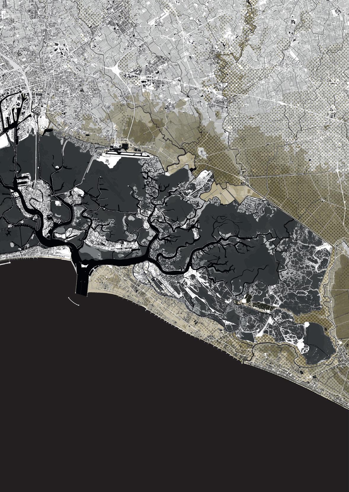
The graph compares from 1900 to 2020 –and projects to 2100– the trends of barene surfac es, eustatism, natural and induced subsidence, number of high water events. It compares the IPCC trend scenarios with the conservative and the partial or total closure scenarios for the lagoon, as well as with the hypothesis to pump sea water into the ground depths to “lift” Venice.
Comparing scenarios Source of data: ISPRA, Istituto Superiore per la Protezione e la Ricerca Ambientale, 2017; CPSM, Centro Previsioni e Segnalazioni Maree del Comune di Venezia, 2019; IPSS, Intergovernmental Panel on Climate Change, 2019.


Adriatic South Lagoon Park new amphibious lands 74 Three lagoons Scenario

Sea Lake of Venice (Central Lagoon) new amphibious lands North Lagoon Park CHAP 1 - On the lake of Venice 75 Three lagoons Scenario Application of the lagoon division scenario. 0 2,5 5 10 km
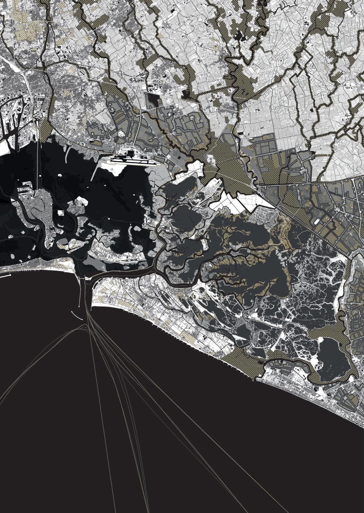
new amphibious lands 76 Three lagoons Scenario South Lagoon Park new barene fish valleys fish valleysamphibious city amphibious city amphibious city fish valleys new barene

CHAP 1 - On the lake of Venice 77 Lake of Venice (Central Lagoon) Adriatic Sea new barene new barene fish valleys fish valleys amphibious city Malamocco-Margheraembankment

78 On the defenceslake Chapter 2
79CHAP 2 - On the lake defences Venice, year 2100. The tram that runs on the large embankment along the edge of the lagoon canal and connects the new districts of Marghera with the beaches of the Lido, offers a unique vantage point across the stretches of water that embrace Venice. From one side, towards the east, the view runs over the lake to frame the monuments with the historic islands and, closer and all around, the swarming of boats that have always ploughed the waters around Venice. On the other side, looking west, the gaze is still projected towards a liquid world but slower and denser, lingering on the amphibious landscapes of the large park of the southern lagoon. Dominating this point of view are the stretches of water with the light infrastructures for fish farming that form the backdrop to the daily work of fishermen and the vegetated wetlands that give home to cormorants, ducks, gulls, herons, as well as teals, mallards and a whole human and animal world united by the search for fish and shellfish. The robust strip of land –the Malamocco-Marghera embankment– built to protect Venice divides these two aquatic worlds. The trams are mainly used by the citizens of Mestre and Marghera who make the beaches of the Lido their daily destination for free time and seaside relaxation, but
80 also by the many tourists who can find cheaper and more comfortable accommodation in Mestre than the limited places now available to stay in the historical islands. The few minutes that today separate the Lido from Mestre have brought the industrious world of the mainland much closer to the beach, its practices, and frivolous rituals. Construction of the Malamocco-Marghera embankment was slow and did not happen easily. The embankment was consolidated following an incremental process, such as the progressive stratification that leads to the solidification of sedimentary rocks. It took years to convince the islanders to metabolize the trauma of the partition of the lagoon and the construction of the lake, and above all to accept the inevitability of the separation and transformation of the central lagoon. Already in the early years of the new century, engineer Luigi D’Alpaos, the greatest expert in lagoon hydraulics of the time, although starting from assumptions devoted to safeguarding the lagoon –and therefore to the salvation of the integrity of the stretches of water around Venice which by then enjoyed very bad health– spoke of the necessary construction of ‘morphological structures’ to be placed along the edges

of82 what was once the Petroli Canal . On closer inspection, the artificial barene imagined by engineer D’Alpaos have little to do with the current embankment that dominates the liquid plain from its height of 2.5 metres, although looking at them today we can perhaps say that they already represented the first involuntary traces of foundation. The artificial barene around the canal were slowly built starting from the Twenties of the 21st century. The construction site began the day after the entry into operation of the first version of the MoSE and the scandals that led to its construction, to counter the wave motion produced by large ships, when tankers filled with oil and cruise ships loaded with cheering tourists were still passing from the mouth of Malamocco towards Marghera. For years, these tiny sediments around 45 centimetres high, covered with a dense layer of glasswort and halophytic plants, had represented a fundamental safeguard for maintaining the fluid-dynamic equilibrium of the lagoon. They limited the phenomena of resuspension of sediments by wave motion, first responsible for the erosion of the lagoon slums which had already led to a strong flattening of the bathymetry and simplification of the landscapes of the central lagoon.
The idea of placing at the edge of the canal some morphological structures that never existed before in that part of the lagoon had initially aroused perplexity on the part of supporters of a poorly understood protection of the lagoon environment, but the elderly engineer did not care too much and loved to repeat often: ‘it would be desirable that these people, hastily judging the intervention beyond its potential effectiveness to be impossible, knew how to stifle their feelings, giving space to reasoning and a well-conducted and controlled experimentation, able to shed light on the complex interactions of lagoon morphodynamics produced by the insertion of these structures’. Beyond the inertia of the decision-making mechanisms, the construction of the sandbanks at the edge of the canal was nevertheless necessary to counter the amplitude of the waves deriving from the increasingly frequent bora storms that regularly cross the lagoon on one side, and the growing lagoon traffic that crossed the channel on the other. D’Alpaos, who, as already mentioned, dedicated a large part of his life as a scholar and professional to the integrity of the lagoon and its equilibrium, could never have imagined that these first terraforming processes would become a pretext for upsetting the initial project, plotting the concep-
83CHAP 2 - On the lake defences

85CHAP 2 - On the lake defences tual foundations of a process which, by legitimizing the idea of a radical transformation of the central lagoon, would sooner or later also authorize the possibility of its division. In fact, it is precisely on these first salt marshes, initially created through the simple arrangement of cordons of polyester huts filled with stones, that over the years, together with the higher sea levels, the increasingly solid elements have settled, thus giving rise to the current massive embankment that separates the central lagoon. The consolidation of the salt marshes and their transformation into the current embankment followed the acceleration of the rhythms dictated by the return times of the high waters which with climate change became more and more frequent, imposing after more than fifty years the almost daily closure of the mobile dams located at the Lido and Malamocco mouths. Naturally, the daily closure of the MoSE, even if widely expected at the beginning of the century, had now become unsustainable as well as a continuous source of quarrels and accusations between the various decision-making bodies. The tensions due to the continuous closures were determined not only by the huge management costs exacerbated by the energy crisis, but also by the damage to the lagoon and to the nu-
86 merous activities linked to the tourist and industrial port, which was partly still located on the mainland. To further exacerbate the situation were the divergent interests represented by the defenders, on the one hand of the safeguarding of Venice, on the other of the fluid-dynamic equilibrium of the lagoon, not to mention the functioning of the port located between the mainland and the mouth of Malamocco. The first to introduce the idea of the permanent closure of the lagoon to protect Venice was Georg Umgiesser, a German oceanographer of the CNR of Venice. He did so more or less in the same years in which D’Alpaos formulated the operational hypotheses useful for preserving the fluid-dynamic equilibrium of the lagoon. According to Umgiesser, who had made mathematical models of the lagoon to simulate its breathing, closing the lagoon was not optional. ‘The problem is not if it will happen, but when it will happen ...,’ he would often repeat to the local press, which relaunched the news with sensational headlines. It was a few decades later, towards the second half of the 21st century, when it became clear that the MoSE, despite its name, would no longer be enough to save everything (Venice, together with its port and the lagoon), when the only solution which at that point seemed fea-
87CHAP 2 - On the lake defences sible gained ground. The construction site was thus launched for the largest work built after the MoSE to save Venice, an embankment of 14,350 metres located to enclose the central lagoon which, having reached the tip of the Alberoni on the Lido, was linked to the ancient system of Murazzi in Istrian stone, accordingly extended and raised for the entire length of the island. The infrastructure was connected to a system of 46 kilometres of reinforced banks and beaches to defend against storm surges towards the sea, and 45 kilometres of waterproofed shores and banks towards the polluted sites of the hinterland to build a single large infrastructure of embankments, dunes and sheet piles that isolate the central lagoon. The construction of the tram line above the embankment appeared then to be the most obvious thing to do, as a natural consequence of an unexpected opportunity or compensation for the bereavement suffered. Together with the construction of the embankment, the former Petroli Canal has gradually been transformed and today has become the fundamental connection between the two port facilities, now located between the inlet of Malamocco and the ancient port of Marghera. Along the canal run hundreds of medium and large-sized ferries used for the transport of
88 goods and people, powered by the nearby Hydrogen Park in Marghera. The connection between the canal and the lake of Venice is governed by complex systems of navigation basins, pumps, and transfer ports that selectively cut into the embankment. These hydraulic devices and great works of architecture inspired by Leonardo da Vinci are entrusted with the task of maintaining the heights of the lake at the warning levels of the first half of the 20th century, when the high waters marked the rhythms of the Serenissima and were still a manageable threat. Alongside the embankment towards the lake, and on the other side of the channel towards the lagoon, remain the now consolidated traces of the ancient barene built by D’Alpaos, that define a modern archaeology of mudflats on which the new southern lagoon, at least in part, was founded.

DeseriverriverMusonNaviglio del Brenta riverPiaveriverSile 90
, and locks
The myth of the origin of Venice, carefully constructed and updated by the Serenissima Republic of Venice over the centuries until its definition in the 13th century (Bettini 2006, p. 125), went and often still goes hand in hand with another myth. Or rather, with another dogma: the unity of the lagoon. On the contrary, historical maps show how the lagoon space has always been understood in a non-homogeneous way, and how in fact there was never a single lagoon. We are also aware of centuries-old customs linked to the presence in the Venice lagoon of watersheds that transformed it in everyday life into independent lagoons that can be traced back to the inlets. Watersheds that both fishermen and ship captains were well aware of, and whose existence had been taken into account by hydraulic experts in order to develop projects for the lagoon. Starting from the 16th century, a new awareness and sensitivity regarding the consistency of the urban fabric and its relationship with the surrounding environment developed in Venice, as well as in other Italian cities including Milan, Florence, Verona, Ferrara, and Rome (Calabi 2006, p. 2). It is precisely in this perspective that Sabbadino’s lagoon Approx. year 1550. The diagram illustrates the project for the diversion of rivers and protection of the lagoon developed by Cristoforo Sabbadino: the diversion of rivers outside the lagoon in gold; inside the lagoon the new embankments in gold; towards the sea, along the shores, the coastal pro tections. Note on the left the embankments protecting the outlet to the sea of the new course of the Brenta, that separate the ancient Brondolo lagoon (now filled in) from the southern lagoon; between the central lagoon and the southern lagoon the preparation for the traversagno to protect Venice.
Divided Watersheds,lagoonsembankments
Bacchioglioneriver
DeseriverriverMusonNaviglio del Brenta On the lake defences the proposals made by the proto of the Magistrato alle Acque (Magistrate to the Waters), Cristoforo Sabbadino, should be read: in two maps from 1547 (Archivio di Stato di Venezia, Savi ed Esecutori alle Acque, Disegni, Laguna 9) (Image 1, p.96) and 1556 (Archivio di Stato di Venezia, Savi ed Esecutori alle Acque, Disegni, Lagu na 13) (Image 2, p.96) he elaborates one of the first attempts to avoid that the sediments carried by the rivers were pushed by the sirocco towards Venice through a ‘light’ instrument. This tool –alternatively referred to as a traversagno or parador– consisted of a barrier of wooden poles coinciding with the watershed south-west of Venice. Only later, in 1558, did Sabbadino himself elaborate a more radical project (Archivio di Stato di Venezia, Savi ed Esecutori alle Acque, disegni, Diversi n.106) (Image 3, p.97) of deviation of the major rivers that flow into the lagoon, first of all the Brenta which is directed towards the sea by two robust embankments through the mouth of the port of Chioggia, effectively separating the southernmost part from the rest of the lagoon. In the same years Alvise Cornaro, contrary to Sabbadino who wanted to allow free expansion of the lagoon waters towards the mainland, proposed clearly separating the lagoon from the mainland through the construction of an embankment (Archivio di Cornaro’s lagoon Approx. year 1550. The diagram illustrates the hypotheses for the closure of the lagoon developed by Alvise Cornaro: towards the mainland, in gold a continuous embankment separating the land and the water; towards the sea, in gold, the coastal protections along the shores; inside the lagoon, in dotted white, the navigable canals. Note the contraction of the lagoon caused by the reclama tion and conversion of dead lagoon areas into arable land; the closure of the lagoon mouths.
Bacchioglioneriver
91CHAP 2 -
A few years later, in 1673, engineer Alfonso Moscatelli –originally from Brescia– presented a plan for dividing the lagoon into four phases to ensure its survival, radically changing its morphology (Archivio di Stato di Venezia, Savi ed Esecutori alle Acque, b.131, dis.2) (Image 6, p.99)▶1 .
Phase 2: - Construction of an embank ment that closed the Chioggia lagoon behind the Mont’Al bano canal to maintain a sustained level of water in Chioggia; - construction of locks to allow navigation from the Chioggia lagoon to the Lombardy canal (which connected the lagoon to the river Po).
Viewed from a contemporary angle, Moscatelli’s proposal may appear naive, difficult to implement –in particular with the technical means of the late 17th century– and of dubious effectiveness. How ever, it reiterates once again how in past centuries the hydraulic engineers –even the most ‘unlikely’ ones like Sabbadino himself– did not consider the unity of the lagoon as a dogma and were willing to make radical choices in order to guarantee its existence. Bridges, roads, and docks Radical choices, such as those proposed by the engineer Eugenio Miozzi in the second half of the last century. In the Sixties of the 20th century, at the end of a long career and a few years after the dramatic flood of 1966, the engineer proposed a futuristic solution to the ‘sinking’ of Venice caused by the combined action of sea level rise and land subsidence: to lift the entire city by injecting large quantities of water into the subsoil to reconstitute the artesian aquifers, emptied in particular by the feverish industrial activity of Porto Marghera. Through the construction of a compression chamber –delimited in the lower and upper part by layers of ▶1 The four phases of Mos catelli’s proposal respectively
Phase 3: - Construction of an embankment punctuated by openings that longitudinally separated the dead from the living lagoon; - creation of a canal parallel to the embankment on the side of the dead lagoon; - maintenance of canals and cuts in the dead lagoon so
92 Stato di Venezia, Savi ed Esecutori alle Acque, Atti, filza 231, reg.3, 0006, 003r) (Image 4, p.98). This structure was also extended into the lagoon to ensure that the sediments of the Brenta –in the meantime forced into a new bed that diverted it from the lagoon–were led towards the sea and as far as possible away from Ven ice. The alternative visions developed by Sabbadino and Cornaro would have a strong echo also in the following centuries. It is no coincidence that around 1660 an expert in hydraulics (probably Federico Gualdi or Fantin Contarini) reworked Alvise Cornaro’s proposal to create an embankment that embraced the entire lagoon, locating it halfway between the mainland and the urbanized islands, including Venice (Archivio di Stato di Venezia, Savi ed Esecutori alle Acque, filza 123, 0790, 362-r) (Image 5, p.98). In this way the structure separated the living lagoon and the dead lagoon, while channels that led in a straight line to the lagoon mouths were dug.
The locks could be opened for maintenance purposes, thus letting the water flow from the lagoon to the canal, favouring the excavation of the latter; - creation of gates to be opened as needed to replace the water in the Chioggia la goon and reinforce the zosane (ebb tides) in the lagoon area adjacent to the Malamocco mouth.
-Phaseinvolved:1:Closure of the Chioggia mouth with construction of navigation locks for maritime -navigation;closureof the Sant’Erasmo mouth; - creation of a watershed be tween the mouths of Chioggia and Malamocco following the closure of the mouth of Chioggia; - creation of a watershed be tween the Port of Venice and the Treporti mouth following the closure of the Sant’Erasmo mouth.
93CHAP 2 - On the lake defences that the water could drain as needed when the locks that dotted the embankment separating the two lagoons were opened.
DeseMuson Brenta PiaveSile
Phase 4: - Simultaneous opening of one or more locks that dotted the embankment that separated the two lagoons to excavate the living lagoon; - construction of a lock in the embankment that divided the Taglio Novissimo del Brenta from the dead lagoon, and opening of the same lock during the flood waves of the Brenta in order to excavate the dead lagoon and reinforce the zosane in the living lagoon. phase 1 phase 2 phase 3 phase 4 Moscatelli’s lagoon Year 1673. The diagrams illustrate the four phases of subdivision of the lagoon elaborated by Alfonso Moscatelli. Note the reconceptualization of the dead lagoon as a hydraulic service system in function of the living lagoon.
Bacchioglione
94 caranto, a thick layer of natural clay, and on the sides by artificial diaphragms– the goal was to raise the ground, which over the centuries had lowered also due to the phenomenon of eustatism, and bring the average piezometric altitude back to +4.00 m, the altitude measured in 1858 (Miozzi 1974, pp. 1-47).
Faced with the enormous technological challenge that the solution of raising the ground would have represented, Miozzi imagined two alternative and more pragmatic versions for the protection of Venice at the end of the fourth volume, Il Salvamento, of his work Venezia nei secoli (Venice over the centuries) (1969, pp. 475–494). The first alternative consisted in the creation of a basin of 27,000 hec tares including Venice and the entire northern lagoon. The sec ond, more limited, was the creation of a basin of 9,000 hectares including Venice and the other historic island centres (Murano, Burano, Mazzorbo, and Torcello). The regulated closure of the basin provided for the mechanical removal of the ‘old water’. It would have taken place through a system of vehicular embank ments –which at the same time would have also radically rede signed the mobility of the lagoon– and the construction of gates and navigation locks at the Lido mouth, to some extent anticipating the MoSE project. In the first case (basin of 27,000 hectares), the barrier would have been double, built between Sant’Erasmo and Cavallino and between Sant’Erasmo and the Lido; in the sec ond case (basin of 9,000 hectares), it would have been completed only between Sant’Erasmo and the Lido, thus leaving the northern lagoon with an open basin of about 18,000 hectares▶2 . In more recent times, some of the protagonists of the debate around the advisability of creating the MoSE have raised once again the fundamental issue of lagoon unity, hypothesizing alternative solutions to the MoSE that in some ways recalled a centuries-old Venetian design tradition. In this sense, it is worth mentioning the proposal made by Professor Antonio Foscari▶3 to divide the lagoon into three parts through the use of palancole, thus allowing to maintain different levels of water according to the preservation needs of the historic centres and operational conditions of Porto Marghera. This proposal pertains to the logic of graduality and reversibility that has guided the interventions in the lagoon area over the centuries, and has many elements in common with the barrier imagined centuries earlier by Sabbadino.
Today, in the light of the repetition of extreme high-water events,
▶3 During a lecture held by Professor Foscari on 25 Octo ber 2019 at Palazzo Badoer in Venice as part of the ‘Forms of knowledge, forms of rationali ty’ module (lecturer Ludovico Centis) of the European Master in Urbanism.
▶2 As a demonstration of the profound historical knowledge of Venice and its lagoon, Miozzi recalls in his proposal (1969, pp. 482–483) precisely the traversagno located west of Venice, which specifically for the 27,000-hec tare basin envisaged: _ isolating the Lido basin from that of Malamocco with an earth bank crossing the entire lagoon, from the Terre Perse in the Lido to Fusina, ‘renovating’ the traversagno embankment built in the 16th century; - closing existing communi cations with the open sea or with canals in turn communi cating with the sea: in order not to jeopardize river naviga tion, these outlets would have been equipped with locks, in which one of the two doors would always be closed, thus ensuring isolation; - closing the Canale di S. Erasmo with an embankment partly in earth and partly in masonry; - closing the Lido mouth be tween S. Nicolò and S. Erasmo with an earth embankment in the shallower area and with a masonry dam in the naviga tion channel; - the construction of two lifting stations for the ‘old waters’, one of them in Mal contenta, and one in Cava di Caligo near Jesolo; - the construction of a dam with coastal pressurization on the lagoon edge with the mainland between Malcon tenta and the area currently occupied by Marco Polo airport.
DeseMuson Brenta PiaveSile
95CHAP 2 - On the lake defences the environmental effects of the hydrodynamic and morpholog ical relations between water and land re-emerge in a form particularly accentuated by the phenomena of subsidence and eustatism. As hypothesized by Umgiesser, the gates of the three mobile dams –under construction in the respective mouths of the Lido, Malamocco, and Chioggia– with an average sea level increase of 50 centimetres by the end of the century, will come into operation on average at least once per day. In the perspective of a gradual but total closure of the lagoon, the studies and hypotheses developed over the centuries that we have retraced constitute a fundamental source of reflection for the ad vancement of the idea of a possible division of the lagoon into areas characterized by different landscapes, uses, hydraulic and ecological characteristics. Not only that: they oblige us to understand that the need to safeguard Venice necessarily implies –then as today– a project of radical transformation of the environment in which it is located. hypothesis a hypothesis b Miozzi’s lagoon Year 1969. The diagrams illustrate the two hypotheses for dividing the lagoon developed by engi neer Eugenio Miozzi after the 1966 Venice flood: the separation embankments in gold; hypothesis a) basin of 27,000 hectares; hypothesis b) basin of 9,000 hectares. Bacchioglione
96 01 02


03
In red at the top the quarries that intercept the terminal stretch of the Brenta diverting its waters towards Malamocco. In the centre, the straight line of the traversagno (perhaps only planned) which coincides with the watershed and consists of a double order of poles and planks to prevent the sediments of the Brenta from being carried towards Venice by the sirocco.
Image 02. Map of the entire lagoon produced by Cristoforo Sabbadino (1556), copy by Angelo Minorelli from 1695 Archivio di Stato di Venezia, Savi ed Esecutori alle Acque, disegni, Laguna n.13.

Image 03. Map of the lagoon produced by Cristoforo Sabbadino (1558) with the Brenta diversion project Archivio di Stato di Venezia, Savi ed Esecutori alle Acque, disegni, Diversi n.106. Deviation project of the Brenta-Muson to wards the mouth of Chioggia. Real embank ments that separate the southern lagoon from the rest of the lagoon are imagined.
Map showing rivers and canals in dark blue and the barene in light brown. The watersheds are indicated in text form on the map; the traversagno between Venice and the mouth of Malamocco is also traced.
Image 01. Map of the central lagoon basin produced by Cristoforo Sabbadino (1547) Archivio di Stato di Venezia, Savi ed Esecutori alle Acque, disegni, Laguna n.9.
97CHAP 2 - On the lake defences
04 05
Image 05. Anonymous map (Federico Gualdi? Fantin Contarini?) dating back to around 1660, depicting an embankment that embraces the entire lagoon Archivio di Stato di Venezia, Savi ed Esecutori alle Acque, filza 123, 0790, 362-r. A new embankment that separates the living and dead lagoon as well as canals that connect to the lagoon mouths is built.

98
Image 04. Map by Alvise Cornaro dating back to the mid-16th century, depicting an embankment that clearly separates the lagoon from the mainland Archivio di Stato di Venezia, Savi ed Esecutori alle Acque, Atti, filza 231, reg.3, 0006, 003r. A new embankment is built that clearly sepa rates the lagoon from the mainland and which also extends into the lagoon to ensure that the sediments of the Brenta are diverted towards the sea away from Venice. It is relevant to note the presence of more lagoon mouths than those existing today.

Image 06. Phased project by the Brescian en gineer Alfonso Moscatelli to divide the living lagoon from the dead lagoon (1673)

06
Archivio di Stato di Venezia, Savi ed Esecutori alle Acque, b.131, Dis.2. Moscatelli updates and develops the sugges tions of Alvise Cornaro. Specifically, he plans to close the ports of Chioggia and Sant’Eras mo, an embankment to enclose the lagoon of Chioggia, the excavation of a large perimetral collector channel along the demarcation between the living and dead lagoon, and the introduction of the Brenta Novissima into the dead lagoon.
99CHAP 2 - On the lake defences
The lagoon is made up of amphibious territories on which the ef fects of climate change and sea rise will become more evident. For this reason, in the future, as has already been the case in the past, it will be subject to the definition of new limits and the modelling of its edges, followed by important and radical transformations.
100
The embankment and the canals associated with it were a com plex infrastructure, operating at the same time on a hydraulic, ecological, and territorial governance level, that was to ‘act as a clear element of separation between fresh and salt water’ (D’Al paos 2010, p. 32) setting the limits, including political ones, between the interior and exterior of an environment which by na ture would otherwise be in continuous and perennial transition.
At the northern limit of the central lagoon, in the stretch between the park of San Giuliano and the airport of Tessera, the effects of the transformations induced by the construction of the embankment and the Osellino canal in 1507 can still be read: a straight line of about 15 kilometres on which the waters of the Marzenego, Dese, Zero and Sile rivers flow. Here, beyond the net limit defined by the edge, a system of barene that were previously cultivated fields is located on the side towards the lagoon. On the other side, towards the hinterland, there is countryside where once stood marshes and lowland forests. The barene along the Osellino canal are ‘well known because they can be easily reached from the ground [...], they owe their high stability to the continental soils on which they rest, so that to this day can be recognized the signs of the agrarian structure prior to their separation from the mainland in some straight ghebi, which once were ditches’ (Bonometto 2014, p. 22). On the other side of the canal are the territories today characterized by widespread urbanization, and the countryside resulting from the 20th century reclamation, readable by the reg
Designing edges
The construction of the argine di intestadura (an embankment act ing as a dam), begun by the Venetians starting from the 14th century with the aim of diverting the rivers that were responsible for the lagoon’s silting phenomena, continued through trial and error until the mid 16th century (D’Alpaos 2010, pp. 32–37).
A privileged point of view on these aspects can be more clearly grasped at the edges of the lagoon, where the effects of transformation on the territory induced by the interventions initiated with the government of the Serenissima are still clearly visible.
101CHAP 2 - On the lake defences
gunare and the jurisdiction of the Magistrato alle Acque. Here the border takes on the character of a peremptory straight line that artificially separates two worlds that would otherwise be blurred and, with them, the main design rationalities that from the times of Cornaro and Sabbadino to Umgiesser and D’Alpaos define these spaces. The edge separates, on the one hand, a lagoon whose survival is linked to the maintenance of those environmental systems of barene and halophytic plants on which the health of its own waters depends; on the other, a territory of countryside, towns, metropolitan infrastructures and widespread urbanity, whose survival depends on the sophisticated and fragile mechanical drainage system and dewatering pumps inherited from the past.

As we have seen, since the days of Sabbadino and Cornaro, defining both a physical and political/administrative boundary of the Venice lagoon poses tremendous issues in terms of space and time. In spatial terms, we face the problem of the management and the construction of the border –as a territorial and legal entity– for a mutable physical body with an extension of 550 square kilometres fed by a hydrographic basin more or less four times larger. In temporal terms, we face the phase displacement between geological time and human providential time, between the natural and man-driven evolution of the morphology of the lagoon and the myth of the origin of the Venetian Republic. The case of the Venice lagoon is one of the most fascinating case studies in territorial terms. If, according to Robert Sack, we consider territoriality as the means by which space and society are interrelated, as the basic geographic expression of influence and power, as ‘the attempt by an individual or group to affect, influ ence, or control people, phenomena and relationships, by delim iting and asserting control over a geographic area’ (Sack 1986, p. 19), few other cases might be more relevant –and thoroughly historically documented– than that of the Venice lagoon. Territoriality is the first form of spatial expression of political
102
In recent years there has been discussion of a possible division of the Venetian metropolitan area not only in physical terms, through projects involving the construction of barriers made of sheet piles or embankments, but also in administrative terms. Various ref erendum, the most recent in 2019, have proposed the division into two different municipalities, those of Venice and Mestre. Despite having all had negative results, these referendums expose unsolved problems and tensions by now consolidated between the lagoon and mainland spheres of the metropolitan city. The definition of a possible new administrative border has pushed both citizens’ committees in favour of separation, and research groups in the university field (DeVine et al. 2016) to reflect on a boundary that can realistically be shared and effective for this purpose. In most cases this boundary takes up large sections of the perimeter of the conterminazione lagunare, the area historically under the control of the Magistrato alle Acque.
The walls of Venice 100 Venetian markers
Venice, according to Carlo Ossola (2003), has always anticipated its beginnings and on the other hand has precipitated its end, dissolving by its own initiative a pluri-centennial Republic in 1797. Only a few years earlier, between 1791 and 1792, the Venetian Re public had placed 100 markers –for the sake of precision, 98 mark ers and one wall with an inscription that counted as two markers (Caniato 1991, p. 52)– to define once and for all the borders of the Venice lagoon. Yet, as we know, the boundaries of Venice and the boundaries of its lagoon are by their very nature unstable and subject to continuous negotiations. The whole operation revealed a paradox: how to define for eternity the boundary of 550 square kilometres of marshes and navigable waters that made the existence of the Republic possible? The positioning of these humble markers –made either in Pietra d’Istria or bricks and mortar, and ranging from 1 to 1.5 metres in height– proved obviously inade-
Venezia, Città-Stato insulare, offre invece il singolare esempio di Stato che lotta soprattutto per la difesa della “qualità” del suo territorio lagunare. La tutela della laguna contro gli eventi suscettibili di mutarne lo status inteso come “qualitas soli” costituisce sul piano giuridico la ratio di tutta la legislazione sulle acque, mentre su quello polit ico diviene la ragion di Stato che determina le scelte che portano alla realizzazione di grandiose opere di ingegneria idraulica’ (auth.trans.). power, and this also translates into legislation. Silvano Avanzi, superintendent of the Guardia di Finanza in Venice and among the three experts who guided the most recent process of redefinition of the area of conterminazione lagunare in 1991, expressed very clearly the relevance of the Venice lagoon case study in territorial terms: ‘The assumption that the territory constitutes an essential element for the existence of the state –together with the people and the legal system– is normally understood as a reference to that well-defined amount of space in which sovereignty is exercised.
103CHAP 2 - On the lake defences
▶4 ‘L’assunto che il territorio costituisce elemento essen ziale per l’esistenza dello Stato – congiuntamente al popolo e all’ordinamento – viene inteso di regola come riferimento a quella quantità ben definita di spazio nel cui ambito si esercita il potere di sovranità.
As Tafuri reminded us, after having carefully shaped and redefined through the Late Medieval period its own origin, ‘Venice tried to endure within her origin: Venice will become the symbol of such a resistance, when continuity in her begins to be betrayed by repetition and impotent fetishism’ (Tafuri 1995, p. X).
[...] Venice, an island city-state, offers the singular example of a state that fights above all for the defence of the “quality” of its la goon territory. The protection of the lagoon against events likely to change its status understood as “quality of the soil” constitutes the rationale for all legislation on water, while on a political level it becomes the raison d’état that determines the choices that lead to the creation of grandiose hydraulic engineering works’ (Avanzi 1989, p. 55).▶4 And if the quality of the lagoon territory is rather unique, it is also rather unique the way in which different notions of time overlap above and below the surface of this expanse of water and islands.
104 quate to fulfil such an ambitious goal and represented the swan song of the Republic that dissolved itself a few years later before Napoleon conquered it.
▶7 Sabbadino underlined that while Alvise Cornaro considered the lagoon only the laguna viva, he considered fun damental the preservation of both the laguna viva and morta for the survival of the lagoon: ‘Ben è vero che essa laguna è divisa, parte lago disocupato e parte canedi e canali salsi, e dove puol entrar il salso, non essendo ocupato dal dolze, ma tutto in un corpo della laguna, e volendola conservar, il tutto bisogna conservar, e pur es sendo sforzati in qualche par te perderne per salvar il resto, perderne mancho che si possa, com’ei dice nel suo fondamen to 22 delle acque salse, là dove dice che la conservation della laguna consiste in conservarla in largezza, grandezza et em piezza. Hor volendo lui quella parte, ch’egli intende laguna, conservar, consiglia che’l si faci l’arzere e canali soprascri ti. Dico io ch’egli propone non solamente cosa difficilissima e quasi impossibile a farsi, ma cosa dannosissima quando la si facesse’. See Cessi (1987, p. 122).
Venetorum urbs | divina disponente Providentia | in aquis fundata | aquarum ambitu circumsepta | aquis pro muro munitur. | Quisquis igitur | quoquomodo detrimentu | publicis aquis inferre ausus fuerit | et hostis patriae iudicetur | nec minore plectatur poena | quam qui sanctos muros patiae violasset. | Huius edicti ius ratum perpetuumque esto. ▶6 (Latin inscription for the headquarters of the Magistrato alle Acque in the Doge’s Palace, 16th century, Museo Correr). The conservation of the lagoon has always been a dogma and represented one of the major economic and technological efforts for the Venetian Republic. It is not by chance then that in the collective imaginary guaranteeing eternal life to the lagoon equalled guaranteeing eternal life to the Republic. The fact that the lagoon should have been preserved for eternity did not obviously mean that the Venetians –and above all experts in hydraulics such as Cristoforo Sabbadino, head of the Magistrato alle Acque around the mid-16th century– were not aware that the lagoon was a living and mutable body. A mutable body divided in laguna viva –living lagoon, where some areas are always submerged and others are pe riodically submerged during high tides– and laguna morta –dead lagoon,▶7 where the areas have emerged or are invaded only exceptionally by the waters (Morandini 1960, p. 71). A mutable body related both to daily cycles, as the one of the rising and decreasing tide illustrated by Sabbadino himself, and long-term modifica tions, as reported by ancient historians such as Strabo and by the capillary activity of survey and preservation led by the Venetian Republic since the Late Medieval period. The borders of the Venice lagoon played a crucial role in the military and political tradition –historic or mythical– of the Republic, to the point of being considered as the true walls of the Republic (Ortalli 2003, p. 104). The history related to the maintenance of these ‘walls’ has been described as an ‘ecological fable’ (Bevilacqua 2009, p. 13), with a wise governance capable of preserving a delicate and vulnerable habitat with the consent and contribution of the universality of citizens.
An ecological fable Essendo il principal objecto del Stado nostro la conservation de queste nostre lacune ▶5 (Savi ed Esecutori alle Acque, 1534)
▶6 The islands of the Venetians at the behest of divine Providence founded on the waters and surrounded by the waters, are protected by waters instead of walls. Any one therefore daring to cause harm in any way to public waters is condemned as an enemy of the homeland and is punished no less seriously than the one who violated the holy walls of the homeland. The right of this edict is immutable and perpetual (auth. trans.)
▶5 Being the main objective of our state the conservation of our lagoon (auth.trans.)
105CHAP 2 -
Drawing of a marker in bricks and mortar, 1791. Archivio di Stato di Venezia, Savi ed Esecutori alle Acque, Busta 152

The prevailing attitude when dealing with the Venice lagoon has been one of extreme caution: if measures to control the evolving morphology of the lagoon have been taken since the origins of human settlements in this region, it was only between the 15th and 16th centuries that an original hydraulic doctrine was developed and institutionalized (Cessi 1960, p. 23). This was made possible by two fundamental facts: the sovereignty of the Republic over the Venetian hinterland, that meant control over the entire hydrographic basin of the Venice lagoon, and the division of the original lagoon, that in ancient times extended from Ravenna to Trieste. A further push came from the recognition, after the de feat of Agnadello in 1509 and the ensuing siege, of the fundamen tal role that the lagoon played in military terms.
On the lake defences
The planned or realized interventions on the Venice lagoon therefore varied between a set of extremes, ranging from daily maintenance and fixing recurrent damage to radical modification of the morphology of the bodies of water to prevent long term problems; between a conservative approach that put military and salubrious aspects first and the pressure exercised by a diverse set of pri-
The conterminazione lagunare
106 vate economic interests; between the determination to safeguard the lagoon guaranteeing public control and the free expansion of waters and the inexorable manmade transformation and possible overexploitation of resources.
While the unstable balance between water and earth has been allegorically represented on multiple occasions –as in the fron tispiece of Bernardo Trevisan’s Trattato of 1718 that carries the motto Opponesi elemento ad elemento,▶8 where the two elements are depicted as two fighting women– the tangle of private but also public general interests that shaped this environment meant that for centuries the question of clearly delimiting the Venice lagoon did not arise. It was not discussed even during the intense debate on the destiny of the lagoon between Cristoforo Sabbadino and Alvise Cornaro in the mid 16th century. This inertia was broken only at the beginning of the 17th century, and it took more or less two hundred years to establish a final definition with the positioning of the 100 markers of the conterminazione lagunare, a kind of ‘lagoon protection belt interposed between salt and fresh water’ (Cessi 1960, p. 58). The safeguard of the lagoon required on one hand a juridical action, including the revising of specific legislation, and on the other technical interventions that radically modified the morphology of the borders of the lagoon. Since the 17th century the Magistrato alle Acque had continually issued proclamations related to the harm that incautious and fraudu lent activities were causing and could cause to the Venice lagoon, stipulating very harsh punishments for those caught in violation. These proclamations were obviously not sufficient: the defence of this environment required a coordinated normative action to be enforced ‘nel giro d’una fissa linea di conterminazione...per indi-
▶8 ‘Elements opposing each other’ (auth.trans).
At the beginning of the 18th century –after many radical inter ventions on rivers carried out during the 17th century, many of which had already been proposed by Sabbadino around 1550– the future of the Venice lagoon was to some extent considered to be secured from what in earlier centuries had been seen as the main menace, the landfilling caused by river sediments. The government of the Republic aimed thereafter at securing this status quo through a form of enforcement that took the name of contermina zione lagunare.
▶9 ‘Within a fixed boundary line ... to indicate it truly sacred within the assigned boundaries’ (auth. trans.).
One hundred years passed between the completion of the third phase and the beginning of the fourth and final phase. A fundamental push came from the report produced in 1762 by Angelo Emo on the deterioration of the lagoon. The report followed his appointment to produce a map where every alteration to the la goon border morphology, whether produced by nature or by private interests, was to be highlighted (E. Bevilacqua 1992, p. 56).
After noticing severe alterations throughout the border of the lagoon, Emo strongly suggested that measures be taken to complete the conterminazione lagunare and the positioning of new markers as substitutes for those placed in the 17th century, which had in the meantime largely disappeared.
carla veramente sacra dentro gli assegnati termini’ , ▶9 as Rompiasio (1733, p. 126) stated. The conterminazione lagunare was completed in four phases, starting from the south-western area of the lagoon, proceeding towards the north-east and then concluding with the coastal tract (Tiepolo 1992, p. 91): - 1605-1615, between Chioggia and Lizza Fusina, in relation to the deviation of the Brenta river with the realization of the Brenta Novissima riverbed; - 1616-1636, between Lizza Fusina and Marghera, continuing then along the Osellino canal until the Dese river; - 1670-1683, between the Dese river and Torre del Caligo, following the deviation of the Sile river with the realization of the Taglio del Sile riverbed and the deviation of the Piave river; - 1783-1792, from Torre del Caligo to Chioggia along the coast of Cavallino, Sant’Erasmo, the Lido and Pellestrina.
Even if since the fall of the Republic of Venice the pre-eminence of the symbiotic relation between Venice and its lagoon in relation to the mainland has disappeared, the conterminazione lagunare is still relevant as an expression of political and technical aware ness, as a morphological and juridical element that reminds us of the necessity of defining a space devoted to the daily as well as long-term safeguarding of the unique environment of the Venice lagoon.
107CHAP 2 - On the lake defences
108 Immaterial division devices Elements / Key concepts
The Venice lagoon is a space with mutable borders also from an administrative point of view. It is a ‘regulated lagoon’ not only with respect to its morphology but also through a series of legislative instruments that overlap and sometimes ‘collide’, creating a complex system of cross-linked constraints and safeguards that respond to heterogeneous rationalities.
109CHAP 2 -
On the lake defences
Contermination
110 Immaterial division devices
Administrative perimeters of the lagoon of the lagoon, watersheds, municipal boundaries, reclamation consortia
Numerous intangible perimeters have been recognized, conceived, defined, and retraced over the centuries. The first, linked to the morphology of the Venice lagoon itself and to the presence of the lagoon mouths and related ar eas of influence, are the watershed lines. While not representing a fixed obstacle, these implied a relevant limit to navigation across the lagoon in the event of low tide. The conterminazione lagunare was officially established at the end of the 18th century: however, it had already been conceived at the beginning of the 17th century and was implemented over a long period, in the face of considerable discussions. To these borders were then added further ones, such as the administrative borders of the municipali

111CHAP 2 - On the lake defences Unesco site Site "Venice and its Lagoon" Administrative boundaries of the Lagoon municipalities Drainage consortia of the catchment basin lagoon contermination and watersheds ties –which have undergone various modifications over the years, such as the redefinition of the borders of the Municipality of Venice at the beginning of the 20th century– and of the reclamation consortia that manage the com plex mainland hydraulic machine.
112 cippo (noun) marker (noun) Border marker –originally in brick and coc ciopesto, then in Pietra d’Istria– placed by the Republic of Venice starting from 1791 to delimit the lagoon boundary. Originally there were about a hundred stones, to which another twenty in concrete were added in the Twenties of the 20th century following a modification of the boundary line. Venetian feet00meters 1 1
CHAP 2 - On the lake defences 113 conterminazione (noun) lagunare (adj.) A delimitation of the lagoon territory within which the provisions and regulations for the environmental protection of the lagoon are valid. It was delimited with markers indicating the border, and its construction was completed in 1792. In 1990 the borders were updated to also include the stretches of water of the three lagoon mouths and the island of Sant’Erasmo. 0 2,5 5 10 km
‘The future of the Mu nicipality is not Venice, it is Mestre where there are people who live in’. Auth trans. Quot ed from (La Nuova di Venezia 2016).
The reasons behind the land and water disputes during the 16th century between Alvise Cornaro and Cristoforo Sabbadi no –the greatest experts in lagoon hydraulics at the time of the Republic of Venice– are to be found on a tiny triangle between the island of Chioggia, the port of Brondolo and the agricultural lands reclaimed from the lagoon. On a portion of reclaimed land facing the lagoon overlooking Chioggia are clustered the opposing lines of reasoning that still characterize an important part of the implicit and unspoken rationalities of the ‘Venice problem’. Ideas about the lagoon realized only in part, which in a few kilometres precipitate and crystallize in space and in a territorial capital built on expertise, forms of government, but also of devices such as artificial canals, embankments, reclaimed agricultural fields as well as bridles, dams, pumps, dewatering pumps, and fishing valleys. Chioggia is the island where Cristoforo Sabbadino spent his childhood and where he declared that he had learned about the lagoon phenomena (Cessi 1941). On the mainland, in the nearby Fogolana, a hamlet of Codevigo, were located the headquarters of Cornaro in the lands inherited from his uncle. Here he was able to experiment and become one of the leading reclamation experts, recovering the techniques that were introduced in the Paduan countryside by Benedictine monks, burying and cultivating portions of the lagoon, erecting embankments to achieve a clear separation between water and land, and building part of their economic fortune based on cultivation. This is the place that more than any other gave form and voice to the thinking of the ‘agrarian party’ and that found in Cornaro ‘its main and pleased exponent, who exalted [...] the role of “holy agriculture” and considered decisive for the destiny of Venice, together with a more marked projection of its influence towards the mainland, which was already well consolidated, the conquest of new lands to be reclaimed and cultivated, in order to make the Serenissima auton omous with respect to its primary food needs’ (D’Alpaos 2010, p. 42). It was here, around the Fogolana embankments built illegally by Cornaro, that the most exciting debate on the future of the
114 Land is land, water is water Il futuro del Comune non è Venezia, è Mestre dove c’è la gente che vive▶10 Luigi Brugnaro, Sindaco di Venezia
▶10
On the embankments built to protect the lagoon and, at the same time, separate land, water, and sea, Cornaro wrote many texts be tween 1540 and 1560. As mentioned, Cornaro became a precursor of the reclamation of these territories in the Codevigo areas located to the south-east of the lagoon, between Venice and Padua, made uninhabitable and marshy due to the construction of the ‘Brenta Nova’ excavated during the 15th century. It was to protect these reclaimed lands that Cornaro erected the Fogolana embank ment on the lagoon, which was later demolished by order of the Magistrato alle Acque and that generated a judicial and intellectual confrontation with Sabbadino. It is from the stubborn defence of
115CHAP 2 - On the lake defences lagoon during the Republic of Venice era would begin, and where the private interests of a land entrepreneur and those of the ‘mar ket party’, represented by Sabbadino on behalf of the Magistrato alle Acque, became intertwined. Within this debate between the two Savi (saviours), a geographical shift between water and land crystallized, to create a conceptual gap that introduced the specif ic and well-characterized visions of the lagoon that are still with us today.
The extreme weather events and the devastation that in recent decades have affected the metropolitan city of Venice on several occasions have, on the one hand, highlighted the close and indissoluble relationship that exists between the lagoon and the city that has grown on its drainage basin, while on the other, they have revealed the main rationalities that have shaped this territory since the times of Cornaro and Sabbadino. Within this speculative exercise it is not difficult to recognize who the representatives of one point of view or another are today: on one side there is the ‘agrarian party’, with an often unscrupulous –even if enlightened– vision of entrepreneurship which aspires to become an active part of po litical action, while on the other side the ‘market party’ places Ven ice and its waters at the centre, often promoting an implicit project whereby safeguarding the balance of the lagoon must be put above any other interest. In fact, it should not be forgotten that at the time of the Republic of Venice the action of safeguarding the lagoon was often carried out to the detriment of the liminal ter ritories: ‘Focusing on the Brenta for now, it must immediately be pointed out that if its exclusion from the lagoon saved the stretches of water around Venice from silting, a heavy price was paid immediately by the mainland’ (D’Alpaos 2010, p. 43).
116 this first embankment that Cornaro began to gradually formulate the idea of a lagoon entirely closed and separated from the surrounding territory. A healthier, richer, safer, and more beautiful lagoon.
▶12 ‘È donque necessario chiuder prima il porto deli Treporti, e poi quello di San Rasmo, e poi quello di Malamocco, che essi sonno quelli, che han tolto la laguna a questo, e sono porti aperti senza difesa alcuna, onde si può entrar nella laguna, che è aperta, e massime per quello di Malamocco, che non è pur aperto e patente, ma profondo e commodo ad ogni grande armata nemica’ (Cornaro 1565, p. 57). ‘It is therefore nec essary to close first the port of Treporti, and then that of Sant’Erasmo, and then that of Malamocco, which are those which have taken the lagoon away from it, and are open ports without any defence, so that one can enter the lagoon, which is open, and especially for that of Malamocco, which is not only open and apparent, but deep and convenient for every great enemy army’. (auth.trans).
▶13 ‘E ricordo che questa città sia recinta de muri, nel terrapieno vi sia uno bosco e dentro di essa città la sia ador nata di theatro, di fontana del Sil, come si po’, e di uno
If for Cornaro the separation and protection devices are initially tools intended to defend and protect his lands from mal-aere (bad air) and to define a clear limit of ownership of his possessions, they quickly become the hallmark of an overall idea of the lagoon understood as a defined space, in which the land is land, the ‘lake’ is a ‘lake’ –lake here stood for lagoon– and the sea is sea. Thus, the embankments towards the land become walls with bastions, doors, and wooded embankments. Along the shores they become barriers against storm surges and dams towards the sea, to ‘lock’ the ports of Treporti, Sant’Erasmo and Malamocco that expose the lagoon to incursions of the sea and enemy armies. The actions of excavation, reclamation, separation, and protection become design devices capable of satisfying the request for a healthy▶11 , safe▶12 and beautiful▶13 place. A project made possible by the con struction of ever larger embankments, walls, and dams. Technological devices that are simultaneously protection and territorial specialization; they define a hinterland which is the productive belly of the region and a lagoon which, isolating itself from floods and storm surges, preserves Venice and crystallizes it over time. Large-scale works on a territorial scale, made possible by the ac tion of the State because, as Cornaro constantly reminds us, ‘non si conciede a una privata persona per bonificare li suoi luoghi aprire et serrare l’acque, tagliar arzeri, far scoladori nuovi, cambiar alvei a fiumi, levar via molini, rimover livelli [...]’▶14 (Cornaro 1540, p. 8).
Water and land today Long after the 16th-century controversy between Sabbadino and Cornaro, it is still possible to glimpse the strong relationships but also the (historicized) conflicts that emerge between Venice, in the lagoon, and the metropolitan city that has been created around it, on the mainland. In other words, the two great sets of antithetical arguments are revealed: on the one hand, a territory that in its long history has been extensively altered in order to protect the lagoon and on the contrary, the city of Venice which, in recent decades, has been rethought (first politically then spatially) also as a function of its metropolitan area. Indeed, from the ▶11 ‘ [...] il parer mio saria, che fusse fatta una división di questi paludi, o con arzeri, o con altro, et li paludi più bassi [...] vorei che fossero cavati et datogli fondo fino a confine delli arzeri, acciò s’agrandisse la laguna et si levasse la causa del mal aere, che è il nascer della canella.’ (Cornaro 1540, p. 6). ‘it is my opinion that a division of these swamps should be made, with embankments or something else, and the lowest swamps [...] I would like them to be excavated and levelled up to the border with the em bankments, so that the lagoon could become larger and the cause of the sickness –which is the growth of cane thicket–eliminated’ (auth.trans.).
117CHAP 2 - On the lake defences post-war period to today, the opposing parties (of mercadura and ‘agrarians’) seem to acknowledge each other, even in the local debate. On the one side, the ardent defenders of the conservation of the equilibrium of the lagoon, of its landscape and artistic forms, of the cultural and microeconomic practices that have consolidat ed here (Montanelli 1969; Mencini 2011; Mencini et al. 2013) and on the other those who interpret Venice and the lagoon –also in anticipation of potential economic development processes– within a complex territorial framework (Rollet-Andriane and Conil-Lacoste 1969; Zucconi 2002; Fondazione di Venezia 2019).
Starting from the multifaceted reclamation project, Cornaro’s Detail of an ancient map of the lagoon drawn by Zuane Trevisan in 1542 depicting the Fogolana embankment built by Alvise Cornaro and his associates. Archivio di Stato di Venezia, Savi ed Esecutori alle Acque, Disegni, Laguna, n.6. intellectual legacy informs us about the possibility of looking at the decentralized lands of Venice –the reclaimed and urbanized countryside, the mainland shore, the industrial areas, the islands, the seashores, and the coastal strip– as active places in a necessary transition process. Cornaro pictured a scenario that still appears profoundly timely, separating the lagoon and repositioning it in a wider field of relations within a territory that is made healthy and vago monticello, le quali, perchè sono cose belle, che si possono fare, sono certo che si faranno, e la vego hora, come si fusseno fatte. Oh che bella città vego, che sarà questa veramente illustre!’ (Cornaro 1566, 69). ‘And I remember that this city should be enclosed by walls, on the embankment there would a forest and within it there will be a city I adorned with a theatre, a fountain with Sile river water, as it will be possible, and with a vague mound, which, because they are beautiful things, which can be done, I am sure they will be done, and I foresee now as they were done. Oh, what a beautiful city I foresee, which will be truly illustrious!’ (auth.trans). ▶14 ‘it is not granted to a private person to reclaim his possessions, open and close the waters, cut embankments, make new drainers, change riverbeds, remove mills, remove levels’ (auth.trans).

118 productive by the work of man. Looking at the cultivated countryside, Cornaro sheds light on a development model based on autonomy, access to local resources and circularity. Through the obstinate defence and construction of a landscape made of water, of a dense network of navigable rivers and ports, of previously marshy soils transformed into productive agricultural spaces and woods, Cornaro reconceptualized the idea of heritage and brought it back to the territory. In this sense, the lagoon and its drainage basin are not just a background for Venice but, together with the landscapes and practices that cross it, they constitute her fundamental significant frame. In light of environmental emergencies, cyclical economic crises, depopulation, and land consumption phenomena, looking at the areas covered by the Cornaro reclamation plans means examining the problems –but also considering possible solutions– which, inevitably, also affect the lagoon as an environment and Venice as a city. Conversely, also following the various special laws for Venice and the recent disastrous high tides, the issue of safeguarding the la goon has become increasingly pressing; even in popular debates the collective need to protect the hydraulic, biochemical, and sociocultural space of Venice emerges. In this setting Luigi D’Alpaos argues, as mentioned, the need to continue with the maintenance work of the lagoon that was carried out by the proti (magistrates) to the waters of the Serenissima: this, in fact, has always been an important cultural heritage, between nature and anthropization (D’Alpaos 2010; 2019). Today, the cultural heritage of Sabbadino brings the gaze back to the lagoon intended precisely as heritage: a territory that must be protected and maintained, firstly through the ousting of all that is considered incongruous, irreconcilable (large ships, the industrial port, mass tourism); secondly, through a large project composed as a sum of small works aimed at maintaining the balance between salt and fresh waters that the transformations of the 20th century and the new environmental emergencies risk to irreparably compromise. Thus, on the edges of the lagoon, the logics of water and land congregate in a contemporary kaleidoscope through incongruous demands, apparently irreconcilable political claims, movements from below, and great modernizing works supported by the Italian state in Rome. The opposing rationalities settle on the ground, populating the territory with a schedule of building works, in-
119CHAP 2 - On the lake defences
Today, in the light of the repetition of extreme high-water events and the consequent environmental effects, the hydrodynamic and morphological relationships between water and land re-emerge in a particularly accentuated form by the phenomena of subsidence and eustatism. As hypothesized by Umgiesser (2016; 2020), the gates of the three mobile dams –in anticipation of an average sea level rise of 50 centimetres by the end of the century– will have to come into operation on average at least once a day. As already mentioned, this perspective will lead us to have to choose between safeguarding Venice –through a progressive but total closure of the lagoon– and safeguarding the lagoon for the maintenance of which, as mentioned, the exchanges between sea and salt water are vital. The closure of the lagoon would be incompatible with both navigability and the industrial port on the one hand, with the ecological needs of the natural environment on the other. In facing this choice, Umgiesser mixes the logic of water and land and accepts the idea that the body of water could one day be separated from the sea and the land, returning implicitly –and par adoxically– to the ideas that belonged to the party of agrarians. Therefore, in the perspective of a gradual but total closure of the lagoon, the studies advanced by Cornaro still constitute an important source of reflection: they push us to think about the surface of water around Venice as an artificial space that is the result of the work of man. A space which is neither fixed nor immobile, which can be modelled and transformed.
frastructures, technological devices whose framework of shared meaning is hard to grasp. In a certain sense, looking at the logic of the land, these are often resistant and hierarchical devices, large works aimed at defining a territorial and functional specialization: sheet piling, embankments, dams, bridles, mobile bulkheads, information and high speed infrastructures; by contrast, looking at the water, they seem to be weaker devices, often inspired by the paradigm of resilience and transition: micro-artifacts made of halophytic plants, aquatic grasslands, clod transplants, bundles of twigs, new amphibious morphological structures, reeds and wetlands.
120 Physical division devices Elements / Key concepts
CHAP 2 - On the lake defences
Even if the division of the lagoon may seem immoral, it should be remembered that it has always been a territory-palimpsest designed by physical devices whose purpose is to define, separate and regulate what by nature would be unstable and in transition. The definition occurs through corrugations of the ground, such as embankments, sometimes through small deformations of the soil surface of an incremental type, such as the protection systems of the salt marshes, sometimes through peremptory and resistant limits, as with the sheet piles of the marginal systems of the lagoon or the protection systems towards the sea. Secular corrugations of the ground that have made an uninhabitable territory habitable and whose future is still –as always– threatened by the same water that Venice has been attempting to contain or eliminate for centuries.
121
Physical division devices
122
The material divisions that structure the space of the lagoon follow rationalities of control, defence and separation of a space which by nature would otherwise be indefinite and in perennial transformation. In the water space of the lagoon, the briccole separate the flows of the boats, define the edges of the canals and therefore accessibility, making manifest the bathymetry that would otherwise be invisible. Burghe, palafitticole and fascinate protect the barene, setting the limits of a microtopography of a few tens of centimetres which by nature would be mutant, osmotic, and alveolar. The banks define the islands and the lands that Lagoon protection and division devices A. briccole (dolphins); B. burghe (coarse basket), fascinate (fascines); C. embankments of fishing valleys; D. sea defences; E. sponde (banks); F. embankments of the drainage basin.

123CHAP 2 - On the lake defences E.C.A.D.B.F. have emerged, consolidating and outlining their edges. The levees and sewers of the fish farms compartmentalize the streams, trap, and care for the fish. Towards the lagoon eaves, embankments, sheet piles, pumps and water pumps divert rivers, define the edges and limits of the lagoon, turning into land what would otherwise be a swamp. Towards the sea muraz zi, dunes, groynes and mobile dams protect the shores and the lagoon, separate the salt from the brackish water, and protect the space of the lagoon from storm surges. 0 2,5 5 10 km

idrovora (noun) water (noun) pump (noun) Pump (or pump system) for the disposal of masses of water used in reclamation works. They are housed in a network of buildings that, together with the farmhouses (now largely abandoned), dot and characterize the agricul tural areas of the Venetian mainland.

124 argine (noun) embankment (noun) Structure built to shelter from the water that can also serve as a defensive purpose in military terms. The first large embankment built by the Republic of Venice was the Saint Mark’s Em bankment in 1543, following the flood of the Piave river in 1533 which caused the burying of large areas in the northern lagoon near Torcel lo, Burano and Mazzorbo.

CHAP 2 - On the lake defences 125 coarse (adj.) basket (noun)


Coarse basket of willow branches, cylindrical or conical in shape, which, filled with stones, works in river defences against the erosion of the barene. burga (noun) fascinata (noun)
biodegradable naturalistic engineering intervention with low environmental impact to protect the margins of the barene from waves and currents. It consists in the hand-making of wicker bundles that are placed and fixed, to gether with the trawling of sediment deposits, transplanting of vegetated clods and installa tion of wavebreaks, windbreaks and groynes.
fascine (noun)
Component with a structural function –com monly steel in hot or cold rolled form– which once driven into the ground below the excava tion plane and connected appropriately with other modules forms a continuous vertical el ement called “sheet piling”. This acts as terrain support and/or hydraulic barrier and can be designed as temporary or permanent.


Portion of the drainage basin in which rainwa ter flows towards the lagoon itself.
126 gronda (noun) lagunare (adj.)
palancola (noun) sheet (noun) pile (noun)
sponda (noun) bank (noun) The Venetian banks usually have Pietra d'Istria edges, may or may not have a parapet and are dotted with landing stages with steps that de scend into the water for mooring boats and loading and unloading goods. They are also commonly called fondamenta, a term deriving from the consistent continuous piling and the overlying foundation masonry works necessary to build them.
CHAP 2 - On the lake defences 127 palafitticole (noun)
Biodegradable naturalistic engineering inter vention with low environmental impact to protect the edges of barene from waves and currents. It consists of a barrier of logs implanted in the lagoon-bed with the function of sup porting the ground.


128 diga (noun) soffolta (adj.)
dolphin (noun) Venetian term that indicates the poles planted on the bottom of the lagoon and used to delimit the navigable canals and occasionally for the mooring of large boats. Today the originally wooden briccole are often replaced by models made of artificial materials that require less maintenance.
briccola (noun)
underwater (adj.) dike (noun) Modular structure in reinforced concrete, placed and juxtaposed on the seabed along a continuous line parallel to the coast and at a distance of at least one hundred metres from it. The dam is placed in order to dissipate the en ergy of wave motion, favour the sliding of the sand towards the shore and counteract its re turn in order to limit the erosion of the coasts.


CHAP 2 - On the lake defences 129 duna (noun)

dune (noun)
Heap or cord of sand, generally fine-grained and uniform, mostly horseshoe-shaped, with asymmetrical slopes that are formed on the coasts by the action of the wind blowing constantly in the same direction. In addition to the wind, the prevailing sea current, which circu lates counterclockwise, also affects the deposit of sand and the consequent formation of dunes in the upper Adriatic. lunata (noun)
Curvilinear artificial reef that dampens the strength of the tidal currents entering the lagoon.

130 murazzi (noun) The set of dams parallel to the coast close to the shores to protect them from erosion caused by the sea. They were designed as defence works from the sea in Pietra d’Istria and pozzolana by the mathematician Bernardino Zendrini start ing from 1739 on behalf of the Republic of Ven ice along the coasts of Malamocco, Pellestrina and Sottomarina. MoSE (acronym) The Modulo Sperimentale Elettromeccanico (Electromechanical Experimental Module) is a project developed since the late Seventies of the 20th century (following the 1966 flood) to protect the Venice lagoon from high tides. The main feature of the project are the rows of mo bile gates –installed at the lagoon mouths of Chioggia, Malamocco and the Lido– capable of temporarily isolating the lagoon from the sea. The works only started in 2003 and should be completed by 2022.


CHAP 2 - On the lake defences 131 lido (noun)

Narrow sandy strip of land parallel to the coast that divides the lagoon from the sea, also known as “coastal strip”.
pennello (noun) groyne (noun) Structure for the defence of the shores or marine beaches that stretches towards the water, perpendicularly or inclined, against or accord ing to the current, built in stone masonry or obtained with simple piles of boulders resting against a reinforced concrete wall, or with ga bions.

132 7_mouth of Malamocco_august2021

133CHAP 2 - On the lake defences 8_mouth of Malamocco_august2021

134 9_lagoon contermination_august2021

135CHAP 2 - On the lake defences 10_ southern lagoon border_august2021

136 11_dead lagoon_august2021

137CHAP 2 - On the lake defences 12_ dead lagoon_august2021

138 On Venice Chapter 3
CHAP 3 - On Venice 139 Venice, year 2100. ‘Grandpa, grandpa, where is Venice?’ ‘Alvise, how many times do I have to tell you, we are in Venice, you live in Venice!’ Alvise and his grandfather are travelling on the new tram that leads from Dolo along the Brenta Riviera to the historic island. This weekend they will take advantage of the absence of Alvise’s mother’s –she has to work at the laboratory until late– to take a walk on the historic island and then, on Sunday, given the good springtime weather, take a hovercraft ride in the southern lagoon. At this time of the year the glasswort is bright green. They will sleep in the spare room of the elderly grandparents’ house –now rented to a couple of American climate researchers– that overlooks Riva degli Schiavoni. Alvise is very excited and impatient, as always when he goes to the historic island. He doesn’t know what to make of the words of his grandfather who insists on calling it Great Venice, he just can’t comprehend how Venice is one thing, and the great metropolis overlooking the lake is another... Alvise does not know that the issue of the administrative separation of Venice from the mainland was actually much debated for at least fifty years between the 20th and 21st centuries. The last of the five referendums on the division of Venice from Mestre was
140 held the day after the high water in 2019. The first three –1979, 1989 and 1994– rejected the dismemberment of the two realities by an overwhelming prevalence of ‘no’ votes . The fourth in 2003 failed because it did not meet the quorum. At the end of 2019, on the one hand there was the front composed of those who argued that separate administrations were required, addressing the specific and distinct needs of land and water; on the other hand, those who argued that Venice with Mestre and the other municipalities that overlook the lagoon should become a single city. Those who leant towards separation consisted predominantly of resistant islanders, exhausted by the violent effects of the high water and by the madness of skyrocketing house prices. Supporters of the separation were convinced of the specificity of Venice and the lagoon and sustained the reasons for an administration that needed to be able to deal with the slow rhythms of the tides and the ‘invasions’ of the high tourist season. Against the division there was instead a variegated and composite front in terms of cultural background and political orientation. In the end, abstention still prevailed, a sign of a whole complex world of reasoning and feelings that have always been located in that amphibious space that lies between the extremes of water and land. A debate that seems from another time if today we look at the great horizontal metropolis that extends seam-
141 lessly from Padua to Treviso, passing along the Brenta Riviera to incorporate the centres of Mira and Dolo, along the new lagoon boundary up to Marghera and Mestre and then bending upwards towards the north along the Terraglio road. The idea of a metropolitan city was debated for a long time, then with the stratification of time and the consolidation of urbanization it became a reality. The tram on which Alvise and his grandfather travel leaves on time from Dolo and silently crosses a peculiar

metropolitan142 city with an intermittent density made up of Venetian houses, buildings and villas, warehouses and production slabs, small and large historic centres, islands, canals, and large voids, made of water, swamps and cultivated fields. Arriving on the new front of the lagoon, where the petrochemical factories of Marghera were once situated and today are home to the university and research centres in Via Torino where Alvise’s mother also works, the Venetian metropolis suddenly becomes denser. The grandfather looks at the city

143 built on the new lagoon shore from the tram, thinks of what remains of the urban centres once immersed in the countryside and of the old industrial centre. The tram window frames a stratification of waterways, drawbridges and roads, old factories transformed into research laboratories, spaces for start-ups, as well as greenhouses, vertical farms, and fields for algae aquaculture, and biodigesters for the production of the energy necessary to separate the hydrogen that feeds the nearby thermoelectric plants from whose chimneys to-

day144 only water vapor is emitted. Alvise has studied it at school, so asks his grandfather about this wonderful world made of liquids and technology and thinks about where all the energy which powers the big city and moves everything comes from: the trains, the cars, the many boats on the waterfront, and also the tram they are travelling on, a water steam tram. Partly because of journalistic simplification, Alvise does not know that in Marghera, in reality, for years hydrogen energy has been used only for heavy

145 industry, such as the shipyards that produce floating giants exported all over the world and for the transport in Great Venice. These are the so-called ‘hard-toabate’ sectors, where widespread forms of renewable energy can do little. For the rest, the model based on micro-production and distributed generation from biomass and photovoltaics still powers homes and buildings extensively. The Hydrogen Valley of Marghera arose in the first half of the 21st century thanks to the enormous fund-

ing146 provided to counter the economic crisis and the damage caused by the global pandemic. Released from COVID-19 and plunged into the energy crisis in 2022, the money passed from Europe to the government, then to the Region, finally landing in the city in the Hydrogen Valley as a substantial part of the larger project called ‘Venice, world capital of sustainability’. His grandfather explains to Alvise how in reality hydrogen, despite being everywhere in the universe, must be extracted to be used for energy purposes, sep-

147 arated by force from its indissoluble connection with other elements. An unnatural separation that costs effort, money and above all, a lot of energy… Thus, at the beginning the hydrogen produced in Marghera was ‘black’: it was extracted from the water using the current produced by an oil-fired power plant; then it became ‘blue’ by extracting the hydrogen from fossil hydrocarbons and conveying the anhydride carbon dioxide resulting from the underground production process, as an extreme attempt to raise the water ta-

ble and combat climate change. Finally, but for limited quantities, it has finally become ‘green’, extracted from water using the electricity produced by a power station powered by renewable energy. Much of the renewable energy needed to produce green hydrogen today still comes from what remains of the large hydroelectric basins located in the Venetian Alps after the melting of the Dolomite glaciers. The grandfather explains how the idea on which the Hydrogen Val-

‘Alvise
CHAP 3 - On Venice 149 ley project is based takes up the original vocation of the industrial area, and with it the territorial myth that was promoted more than two centuries earlier by Count Giuseppe Volpi di Misurata. Founder in 1902 of SADE, the Società Adriatica di Elettricità (Adriatic Electricity Company), Volpi foresaw the sea crossed by oil tankers and the mountains where the great hydroelectric basins of the Dolomites were located connected to the industrial port of Marghera. Today, due to the intermittent availability of water caused by climate change, the massive production of microalgae has become essential to power the electrolysis plants from which hydrogen is extracted. While the tram slows down, the grandfather shows Alvise the columns of photobioreactors saturated with emerald-green algae, the ones his mother studies to find the essences most efficient at absorbing CO2 and then transforming it into biogas through very complicated anaerobic digestion devices. When the tram reaches the HUB located on the embankment that separates the lake of Venice from the southern lagoon, the view opens clearly on the immense pools of water cut by the spring sunlight. look !!’ ‘Venice!’grandpa?’
‘What
Affirming –or wondering– where Venice is may seem banal, or even provocative. Yet, the question is the subject of the interest and studies of specialists and public figures who have talked at length about the definition of where Venice is –and consequently what Venice is– writing stories, discussing policies, and producing visions for the future. Recently a group of scholars led by Paolo Costa published a report in which four Venices are recognized: historic Venice, lagoon Venice, everyday Venice, metropolitan civitas Venice. The study –still in progress– concerns in particular this last metropolitan dimension, the ‘daily urban system’ (Fondazione di Venezia 2019, p. 18) which would include the functional urban areas of Venice, Padua, and Treviso. A vision for the future of a metropolitan civitas Venice as a response to tourist monoculture, which becomes a reference area for services and transport –thanks to the pres ence of the port, the airport and the interport– of the quadri lateral made up of the cities of Milan, Bologna, Ljubljana, and Munich. While this intellectual and planning effort is based on the recent debate on Italian metropolitan areas and the definition of the European MEGA (Metropolitan European Growth Areas), the conceptual and spatial complexity of the Venetian case gives rise –according to the same members of the research group▶1– to a series of problems, theoretical and operational, not yet resolved, or Thesolvable.operation of recognizing multiple Venices, both in spatial and temporal terms, given the coexistence in the collective imagi nation of synchronic and diachronic Venices, is typical of various disciplines. It is found, as we have seen, in the context of strate gic studies on a territorial and continental level, and it is equally recurrent in the historiographical field. The historian Gherardo Ortalli, in the essay Storia e miti per una Venezia dalle molte origini (History and myths for a Venice with many origins), lists at least three different Venices, partly coexisting with each other, which have followed one another and overlapped over the centuries: the orig inal Venice as a large mainland area included in the Roman Ordinator system, the coastal-lagoon Venice from Grado to Cavarzere which later constituted the Dogado, and the urban Venice that de-
Defining Venice Where is Venice
150
▶1 We refer in particular to the online conference at Università Iuav di Venezia Venezia Civitas Metropolitana. Population and spaces in trans formation from yesterday’s urbs to tomorrow’s civitas held on 15 May 2020 by Corinna Nicosia, researcher and member of the group who wrote the report published by Fondazione di Venezia.
Suspended modernization Costa’s study for a Venice that in the future detaches itself more and more from its lagoon, expanding to coincide with an extended dimension from Padua to Treviso again, brings us back to the theme of metropolisation and modernization of the lagoon city.
Zucconi points out that the lagoon does not allow ‘natural expansion processes’ but only ‘topographically discontinuous forms of expansion’ (2002, p. 12), the same discontinuity that today repre sents an important conceptual and operational obstacle for the research group directed by Costa. This geographical condition meant that at the end of the 19th century a neo-insular tendency of development spread, often experienced as a constraint. ‘The lagoon holds us back’ stated the Mayor of Serego Alighieri. A neo-insular trend which was largely opposed by the driving force given by the development of Porto Marghera. A thrust that seems to run out in the mid-Sixties of the 20th century and crystallizes in ‘a complex system of physically separate but functionally linked nuclei as parts of a single metropolitan entity’ (Zucconi 2002, p. 12). A system in which the historic centre is spatially straddling the leisure centre, from the Gardens of Sant’Elena to the Lido, and that of work on the mainland. Key moments in the establishment of this system are on the one hand the new administrative perimeter in 1926, and on the other, the construction of the automobile bridge, parallel to the railway bridge of the mid-19th century and designed by engineer Eugenio Miozzi in 1933.
If Ortalli’s reflections concern a remote temporal dimension with uncertain outlines given the strong influence of mythologies artfully constructed by the Serenissima in relation to its origins, the research coordinated by Guido Zucconi, collected in the volume La grande Venezia. Una metropoli incompiuta tra Otto e Novecento (The Great Venice. An incomplete metropolis between the 19th and 20th centu ries) tells of the attempt made by the entrepreneurial and political class that led the city between the 19th and 20th centuries to make Venice the heart of a great metropolis, spread over a vast territory that included leisure –the Lido– and industrial –Porto Marghera–poles, with the latter undertaking requiring an administrative re organization that extended the boundaries of the Municipality of Venice to the mainland.
151CHAP 3 - On Venice veloped around the nucleus of Rivoalto (Ortalli 2003, pp. 86–87).
▶2 ‘Questa città ha ormai, per volere di Eminenti suoi cittadini e per sapienza di governo, una serie di fattori efficacissimi per la sua ri nascita; ne cito alcuni: porto industriale, nuovo ponte sulla Laguna, la stazione turistica del Lido; a questi fattori cittadini se ne aggiungono altri delle contrade circostanti: le grandi bonifiche del Polesine e dell’Alto Ferrarese già realizzate, l’autostrada Venezia-Padova. Ma tutti questi fattori hanno un valore che sarebbe non del tutto improprio ritenere allo stato potenziale; occorre il cataletti co che trasformi questi valori potenziali in valori effettivi. Questo catalettico sarà la stra da Venezia-Chioggia’ (‘This city now has, at the behest of its Eminent citizens and for the wisdom of government, a series of very effective factors for its rebirth; I will mention a few: an industrial port, a new bridge over the Lagoon, the tourist resort of the Lido; to these city factors are added others of the surrounding districts: the already complet ed major reclamation of the Polesine and the Alto Ferra rese, the Venice-Padua motor way. But all these factors have a value that it would not be entirely improper to consider in the potential state; a cat alyst is needed to transform these potential values into actual values. This catalyst will be the Venice-Chioggia road’, auth. trans.) (Miozzi 1934, p. 4)
Eugenio Miozzi was a key player in the process of modernizing the island of Venice in the 20th century, shaping strategic infrastructures for the city, and imagining unconventional solutions to its growing environmental problems. In addition to the design and construction supervision of the automobile bridge –Ponte Littorio, today Ponte della Libertà, parallel to the railway bridge built in the mid-19th century by the Austrians– which crosses the lagoon, shortly afterwards he completed the Ponte degli Scalzi, the pedestrian bridge that crosses the Grand Canal in front of the train station. An unrealized project by Miozzi himself –a road of national inter est along the coast of the Adriatic Sea, passing through Chioggia, Pellestrina, Lido and Cavallino– could have radically changed the destiny of Venice. First conceived in the 1930s (Miozzi 1934) and then continuously refined over the decades until the 1950s, the engineer was firmly convinced that this road would guarantee the city a future of metropolitan interest, adding a key element to the maritime and rail terminals. Miozzi attributed to this road connection a catalytic value in order to definitively activate the ‘chemical reaction’ which would translate into an effectively metropolitan dimension of the city.▶2 This road would have balanced the expansion on the mainland towards Mestre and transformed
Costa’s152 image is not new, already in the 1970s Progetto 80 (Project 80) identified in the area between Padua, Venice, and Treviso a ‘reticular urban structure’ to be strengthened in the internal cohesion and complementarity of the individual settlements (Renzoni 2012). In the 1990s, studies on the Veneto ‘città diffusa’ (diffuse city) highlight the characteristics of a metropolitan system char acterized by settlement dispersion that extends into the quadrilateral between Padua, Venice, Treviso and Castelfranco Veneto (Indovina 1990). More recently, the acrostic of PaTreVe has been proposed to indicate a metropolitan system of about 2.7 million inhabitants between the three cities. In this metropolitan dimen sion, however, the island of Venice always struggles to assume a strategic location, also due to its condition of delivery terminal within a system of relations and flows, that on the mainland is instead widely consolidated and of a reticular nature. Throughout history, however, there has been no lack of alternative images that try to reposition the historical island within a wider system of metropolitan relations.
Eugenio Miozzi, Study for the road of national interest between Ravenna and Venice designed in the 1930s Detail of the possible lagoon route. Università Iuav di Venezia, Archivio Progetti, Fondo Eugenio Miozzi, pro/023.
153CHAP 3 - On Venice

the154 lagoon and the city at its centre from an infrastructural cul de sac into a vibrant hub for a vast region that stretched from Trieste to the Polesine marshes recently reclaimed by the Fascist regime. Only at the beginning of the 1950s, after the dramatic period following the fall of Mussolini and the establishment of the Italian Republic in 1946, Miozzi was able to reflect again on his proposal for a new road that would redesign the metropolitan area of Venice. A first variant conceived in 1952 (Miozzi, Croff, and Miozzi 1952) abandoned the idea of a coastal road and provided only for the connection of Tessera on the mainland with Murano through a path on floating docks parallel to the Ponte della Libertà. From Murano the road would have contin ued towards Sant’Erasmo, with a branch to reach the island of Vignole, and the Cavallino peninsula.
Eugenio Miozzi, alternative route proposed in 1952 Università Iuav di Venezia, Archivio Progetti, Fondo Eugenio Miozzi, pro/023.

Eugenio Miozzi, Study for the Lido-Ponte Lit torio section for the first version of the road of national interest designed by Miozzi in the 1930s Università Iuav di Venezia, Archivio Progetti, Fondo Eugenio Miozzi, pro/023.

155CHAP 3 - On Venice

156
Subsequent changes to the project –such as the one presented in 1953 (Miozzi, Croff, and Miozzi 1953) and entitled Progetto di massima per la metropolitana sublagunare (Preliminary project for the sub-lagoon subway), where subway stood for the110 submarine highway–envisaged replacing most of the route on pontoons with a route in an underwater tunnel, returning to the idea of a ring around the city. Although founded on a profound historical knowledge, Miozzi’s vision for the future of Venice was clearly modernist, the result of a precise idea of progress in which industrialization on the one hand and motorization on the other played a central role. It goes without saying that if the ambitious visions sketched by Miozzi had been completed, we would now find ourselves facing a radically different Venetian metropolitan area and lagoon landscape, where alternative life models and ‘slow’ tourism that can be experienced from the northern lagoon –from the Certosa to Sant’Erasmo islands– to Pellestrina would probably have disap peared completely.
Eugenio Miozzi, sectional detail of briccole masking the air recirculation intakes and the evacuation of exhaust fumes from the underwater tunnels (1953) Università Iuav di Venezia, Archivio Progetti, Fondo Eugenio Miozzi, pro/023.

157CHAP 3 - On Venice
In 1966, a few years after Miozzi’s proposals that resurfaced also in the Piano Regolatore Generale (General Zoning Plan) of the Municipality of Venice produced by Miozzi himself with Mario Baldin in 1959, the first catastrophic aqua granda (great flood) occurred, followed only, in intensity and duration, by the more recent event in 2019. Seven years later, in 1973, the first of the Special Laws for Venice –followed by those of 1984 and 1992– established that the city was of pre-eminent national interest and conferred decision-making primacy on the state authority in issues such as environmental protection, regulation of watercourses, protection of hydraulic and hydrogeological balance, reduction and regulation of tide levels, coastal defence works and protection from pollution. This orientation showed a significant break with respect to a centuries-old tradition that saw the highest authority on the matter in the local Magistrato alle Acque (Magistrate to the Waters). In the heated debate that anticipated and then followed the promulgation of the 1973 Special Law, the figure of the historian –and for a short time Councillor for Urban Planning of the City of Venice– Wladimiro Dorigo emerged. In the essay ‘A favore’ di Venezia? (‘In favour’ of Venice?), subtitled Saggio di analisi tecnica e giuridica sulla proposta interministeriale del disegno di legge per Venezia (Technical and legal analysis essay on the inter-ministerial pro posal of the Venice bill), Dorigo strongly questioned the appro priateness of the choice of territorial areas included in the district plan developed in the context of the law on the protection of the city of Venice and its lagoon following the flood of 1966, raising doubts about the ‘poor technical-scientific reliability of the chosen delimitation and therefore lack of clarity about the objectives’ (Dorigo 1971, p. 19). Reporting both examples of municipal territories such as those of Jesolo and Quarto d’Altino largely unrelated to the presence and management of the lagoon and criticisms from prominent leaders of the Veneto Region, who recognized that a merely binding logic, not linked to a planning rationality, was at the basis of the delimitation made, Dorigo peremptorily stated that ‘the territory identified by the law therefore constitutes […] a scientifically unreliable and operationally irrational aggregate’ (Ibid, p. 20). Dorigo therefore complained of too wide a perimeter of the territorial areas included in the district plan for the protection of the city
Borders and floods
The examples and reflections reported above, from the Middle Ages to the present day, identify from time to time an area of different extension in relation to where and what Venice is, almost always going beyond the clearly defined boundaries of the historic centre and also the mutable ones of the lagoon itself. Despite their diversity, however, they are always united by a concept, that of territorial continuity and contiguity, even if made problematic by the presence of the lagoon waters. This concept, which seems unavoidable for thinkers, historians, and designers of the 20th and 21st centuries, was actually over come both from a conceptual and operational point of view by the Serenissima. With an administrative act of the Republic of Venice dated 1 April 1406, the city of Cologna Veneta, in the centre of a thriving agricultural area south-east of Verona, was spun off from the recently conquered Veronese district and established as an autonomous podesteria, ruled by a podestà. Not only that, Co logna Veneta was then united with the Dogado▶3 to put an end to the claims of the Veronese and Vicentines who had aims on the town: ‘Retinuimus super iurisdictione nostra civitatis Venetiarum pro non displicendo communitati Verone nec communitati Vicentie, quarum utraque petebat ipsam’, were the exact words
▶3 The Venetian term Dogado, corresponding to the English ‘duchy’, was one of the three administrative areas into which the Republic of Venice was divided, together with the Stato da Mar (Mar itime territories under the Venetian rule) and the Domini di Terraferma (Terrestrial territories under the Venetian rule). The Dogado included the coastal strip between the mouths of the rivers Po and Isonzo –including the ancient Duchy of Venice– and starting from 1406 the territory of Cologna.
158 of Venice and its lagoon, which met administrative criteria –the municipal boundaries– and not morphological and environmental ones, such as the effective extension of the lagoon and of the areas contiguous to it.
Starting from the end of the 20th century, also thanks to de bates such as the one triggered by the Venice flood of 1966, the awareness of the need to control and possibly reverse climate change and its consequences has grown exponentially, as well as the need to think and act in terms of complex ecosystems rather than through single-disciplinary approaches. In this framework, as already mentioned, Venice has been recognized as a planetary metaphor that embodies the prospects for our planet (Bevilacqua 2009). A city –and a region in general, from the Adriatic Sea to the Alps (Fabian and Viganò 2010; Fabian, Secchi, and Viganò 2016)– at the forefront of the process of adapting our mentality and lifestyle, and subsequently territories, in face of the global challenge of climate change.
Beyond continuity
159CHAP 3 - On Venice reported by the official document (Chiappa 2005, pp. 10-11). In 1408 the Venetian Senate confirmed to the podestà Maffeo Donà how the territory of Cologna Veneta had become part of the sestiere (district) of Dorsoduro –in contravention of any principle of territorial continuity– and that civil and criminal jus tice was administered for the citizens of Cologna as for those of the city of Venice: ‘secundum ordines, et consuetudines civitatis venetianum regere, et gubernare, et propterea ius, et iustitiam’ (Chiappa 2005, pp. 26-27).
This act once again demonstrates the extraordinary pragmatism and resoluteness of the Venetian ruling class in its heyday. Colo gna Veneta was not simply under Venetian control, like many col onies of the Stato da Mar (Maritime territories under the Venetian rule) scattered around the Mediterranean, from the Dalmatian coast to the Aegean islands. It was to all legal and juridical effects part of the Dogado, of the Dorsoduro district. A part of Venice without islands and canals, far from the lagoon. A part of Venice in fact in the middle of the fields, over a century before Alvise Cornaro’s theses. The same act resonates today in relation to widespread themes that become extreme in Venice, such as the tension towards homogeneity for ever larger administrative entities or the management of transport of a discontinuous settlement system (De Marchi, Iuorio, and Pace 2022, p. 37). Thus, alternative models to the monocentric city re-emerge, alternative to the idea of a modern city that makes the relations between its parts homogeneous.
Alternative models –such as Colin Rowe’s and Fred Koetter’s collage city, Oswald Matthias Ungers’ archipelago city or Willem Jan Neutelings’ patchwork metropolis– which take on new meaning even in the face of recent events such as the pandemic that have opened up new perspectives on crucial issues such as the relationship between residential spaces and workplaces, mobility, and permanence. In this sense, Venice, its lagoon, and metropolitan area again represent a fundamental place for experimentation and innovation.
160 Venice, Venices Elements / Key concepts
There are many Venices. There is a Venice that coincides with the historic city and the islanders, a Venice extended to the islands and the entire lagoon, a political Venice coinciding with its administrative limits, a metropolitan Venice from Padua to Treviso, a Venice diffused in the central Veneto Region, a Venice that extends to the territory of the entire drainage basin of the lagoon. They are all legitimate Venices, conveyed by multiple and different visions, histories and interests, whose rationalities are not always consistent with each other and at times appear to be driven by conflicting interests.
CHAP 3 - On Venice 161
0 2,5 5 10
162 Venices The first Venice coincides with the historical island that often overlaps and only apparently coincides with the icon of the city that is con veyed, dreamed about, and reproduced all over the world. However, inside the island there is also the Venice of the Venetians, the natives by blood or by choice, the few resistant citi zens who, despite the difficulties linked to the increase in costs and environmental fragility, have decided to stay and live on the historic island. Then there is a Venice extended to the lagoon and other islands, an internal Venice in which the pressure of mass tourism suddenly becomes less intense, but relations with water, fishing and the rhythms dictated by the tides sharpen considerably. There is a Venice extended to its administrative borders and therefore to relations with Mestre, Porto Marghera, the port, and the industrial area. Then there is metropolitan Venice, defined by the daily kmA.

D. The metropolis of the drainage basin Rivers and drainage basin network (in white). B. D.C.

C. Metropolitan Venice Traffic flows between Padua, Venice, and Treviso (in gold) and the mobility network (in white).

A. Venices Opposite page: historic Venice (in white), the traffic flows that define metropolitan Venice (in gold), the hydrographic network that defines the water basin of the lagoon (in black).
CHAP 3 - On Venice 163 flows of millions of citizens who move in an area extending from Padua to Treviso for work, study or leisure. A Venice defined by a terri torial hierarchy that is strongly anchored to the main mobility infrastructures, such as the motorway and the Padua-Venice railway, the Mestre road link. There is the “diffuse city” that goes from Venice to Treviso and Castelfranco Veneto to define the quadrilateral of the Veneto central area. A Venice where homes, small historic centres, agricultural fields, and industrial warehouses overlap within an expanded and isotropic urban fabric. Finally, there is a Venice related to the hydraulic rationality of the lagoon which finds its conceptual reference territory in the hydrographic network of the drainage basin that extends up to the foothills.
B. Venice and its lagoon The historic island of Venice (in white) and the conterminazione lagunare (in gold).
What-If164 An metropolis?accessible 3km2km
CHAP 3 - On Venice 165 In the perspective of a metropolis extending from Padua to Venice and Treviso and a future scenario without the use of fossil fuels, it is necessary to devise an efficient public transport system that can be independent of the private car. Venice, a historic city, has always been a city without cars and whose public space is entirely pedestrianized. Also due to this exceptional condition, today 49% of citizens commuting to and from Venice use the train. What would happen if we assumed the urban space and the modal distribution data of commuters relating to the island of Venice as benchmarks for modelling a metropolis in the lagoon? What and how much urban space should we pedestrianize? How many new passengers could we reach? With what consequences for the design of equipment and public spaces, infrastructures, and railway spaces?
166 49% are commuters residing on the island of Venice who choose the train for their daily extra-urban journeys. What would happen if we rethought the urban space between Padua and Mestre, taking the island of Venice as a model? = 2km = 10 min = very high accessibility Padova Ponte di Brenta Vigonza PianigaDolo Mira Mirano Venezia Mestre Venezia S Lucia Padova Ponte di Brenta Vigonza PianigaDolo Mira Mirano Venezia Mestre Venezia S Lucia FASCEMETRICHE 2 KM 0 20 40 60 000 0 1 2 3 4 5 6 000 28% 23% 49% 65% 13% 22% 77% 7% 16% 79% 7% 14% 78% 12% 10% 86% 11% 2% 78% 7% 15% SMFR Inhabitants and commuters Inhabitants 17.497 total commuters 2.927 train passengers auto commuters trainbus Modal split of commuting 49% Venice Santa Lucia station 3km 2km An accessible metropolis between Padua and Venice existing situation DOLO FS VIGONZA PIANIGA DOLO FS VIGONZA PIANIGA DOLO FS VIGONZA PIANIGA CASELLO N. MIRA MIRANO railway tramway WaterwayPD-VE isometrickm2 isometrickm3 isometrickm4pathcycleandbus

CHAP 3 - On Venice 2 000 4 000 6 000 8 000 10 000 0 2 000 4 000 6 000 8 000 10 000 Padova Ponte di Brenta Vigonza PianigaDolo Mira Mirano Venezia Mestre Venezia S Lucia scenario 1 Source of data: FS Ferrovie dello Stato 2018, ISTAT Istituto Nazionale di Statistica, 2020. 167 oaaaoea Padova Ponte di Brenta Vigonza PianigaDolo Mira Mirano Venezia Mestre Venezia S Lucia FASCEMETRICHE 2 KM 0 20 40 60 000 0 1 2 3 4 5 6 000 28% 23% 49% 65% 13% 22% 77% 7% 16% 79% 7% 14% 78% 12% 10% 86% 11% 2% 78% 7% 15% Venice accessibility Scenario Venice accessibility Scenario Extended + 5,4 the existing situation SMFR 28901984138029792442 4060 15.750 from 2.927 to 15.750 passengers calculated at 2km from the train station (about 10 min by bike) 15.278 total commuters (extending the high acces sibility area to the "Brenta32.143Riviera")total commuters (current situation) 23.236 train passengers (32143 + 15278) x 49% = 23236 + 7,9 the existing situation calculated at 3km from the train station (about 15 min by bike) The scenario explores the possibilities of generalized accessibility by exploiting the existing railway line between Padua and Venice as a metropolitan line that can be associated with a tram along the Brenta Riviera and the wa terway as a new water transport system. The measurement exercises carried out in the scenarios show that if we adopted the modal split values of the commuters inferable from the is land of Venice (50% train, 30% car, 20% bus) as a benchmark for the other urban centres reached by the stations on the line, we can easily quintuple the number of passengers who leave the car in favour of the train. In fact, on average, we would go from operating quotas equal to about 10% of commuter passengers who choose the train to 50% of the Venetian model, with stations such as Ponte di Brenta which, if the scenario were to be realized, starting from the current 2%, would undergo an increase from 240 passengers per day (Istat 2001 census) to an estimated 2,890 passengers. If the highly accessible spaces were further ex tended to reach the urban centres located on the Riviera –approximately 3km away from the station on average– the increase in passengers would be about eight times higher. The scenario highlights the accessibility poten tial for a metropolis that takes the historic city of Venice as a model of sustainable mobility, based on the absence of cars, pedestrian traffic, and proximity to a widespread public transport system. SMFR 1074119240302424908 2.927 -49%-49%-49%-49%-49%-49%-49% existing situation Venice Scenario Venice Scenario Extended
168 economyKnowledge-based Elements / Key concepts
CHAP 3 - On Venice 169
Over the centuries Venice has been a model of innovation in administrative, land management, social, public health, and technological terms. Although the situation appears radically different today, the attractiveness of the island can still play a fundamental role in establishing in Venice the foundations of an alternative economy to tourism based on knowledge. Today many scholars, politicians and administrators see a renewed alliance between universities and innovative start-ups as a possible escape route from the depopulation of the city. According to this perspective, the island of Venice could become an international ‘Campus City’ in the future, attracting a larger population of foreign students, teachers, researchers, and innovators to the historic city.
170 Innovation / entrepreneurship / university Unlike other metropolitan cities such as Milan or Turin, the Venetian innovation system –ex pressed in the relations existing between uni versities and innovative companies located in the area– shows a reality that from a territorial point of view appears to be very fragmented and which, in order to be competitive, is or ganized today in reticular form (see map). The university system of the region today consists of small and medium-sized structures whose offices are distributed in the metropolitan area between Padua, Venice, and Treviso and which sees the city of Padua as its epicentre. If en rolment at the University of Padua numbers 0 2,5 5 10 kmUniversity and start-ups in Venice, Padua, and Treviso Innovative start-ups in gold (the size of the circle is pro portional to the capital class), universities in white. Source of data: Camera di Commercio, registroimprese.it, 2022; data pro cessed from official data of each university institution, 2022.

CHAP 3 - On Venice 36%25%19% 23%8% 12% 21% 16% 11% 15% 21%18%31%16%21% 41%49%23%23%20% PadovaBoston Eskisehir Bologna Ghent MontpellierVENEZIA Lausanne Uppsala Oxford Heildeberg Cambridge Salamanca Coimb Leuven Delft Tubingen Pavia Urbino St. Andrews Venetian universities 28,2% (Iuav + Ca' Foscari) 24692 students University of Padua 71,8%62876 students 171 62,876 students, the two Venetian universities can count on less than 25,000 units overall. Comparison with other university campus cit ies also shows the extent of the gap to be filled: in the face of the depopulation of the island of Venice, students now represent only 8% of the resident population. To get an idea of the significance of these figures, it should be not ed that in Boston –a city which in relation to the subject of university cities is often used as a benchmark– students represent 25% of the res ident population, in Delft 20%. This data high lights how the prospect of Venice understood as a Campus City with an international reach, on the one hand represents a great opportunity to counter the depopulation that today looms over the historic island, while on the other will imply a radical revision of the current local university organizational system, with major repercussions on the regional territory, the city, and the historic island. University towns Percentage of students out of the total population. Source of data: processed from official data of each university institution, 2022. On the right: ratio of university students enrolled in the University of Padua and Venetian universities Source of data: MUR, Ministro dell'Università e della Ricerca, 2022.
To hit the historic centre first of all there is a crisis linked to the social dimension and the loss of residents and, with them, the loss of a manufacturing base in favour of an economy today based almost exclusively on mass tourism. The historic island is today crossed by growing processes of converting houses, shops, theatres, and churches into places destined for consumption and mass tourism (Engramma 2018). The process of touristification with the expulsion of the resident population has its origins far back in time but becomes manifest in a significant way starting from the 1950s, when the number of residents of the historic centre, from 144,000 units, gradually and inexorably begins to decrease with a trend inversely proportional to the number of tourists and to the rise in sea levels, down to almost 50,000 units today. Concurrent phenomena contribute to the progressive loss of residents on the historic island: the progressive shift towards the mainland of the port and of production activities which began in the first half of the 20th century; the impact of extreme climatic phenomena and high waters which have cyclically hit the ground floors of an increasingly fragile and degraded urban fabric since the 1966 flood; the constant growth of real estate values in the historic cen tre driven by the increase in tourist pressure; the progressive and more recent loss of artisan businesses and neighbourhood busi nesses; the progressive ageing of the population.▶4 Also, in reference to these interconnected phenomena during the electoral campaign that led Luigi Brugnaro to become mayor of Venice in 2015, the slogan ‘Venice like Boston’ was used in refer ence to the university and advanced research vocation that charac terizes the North American city. Today, also in light of the excep tional investments made possible by the implementation of the PNRR (National Recovery and Resilience Plan), the idea is taken up by the Minister for Public Administration Renato Brunetta▶5
If the prospects of a reticular and isotropic Venetian metropolis slowly begin to consolidate in policies, behavioural habits and daily practices that speak to us of an increasingly extensive use of the territory, the future of the historic island remains more un certain, where environmental and demographic issues that seem to jeopardize its survival have been looming for at least fifty years.
172
Cutting-edge Venice Venice calls Boston
Venice in the 1500s had 40 publishing houses and printed half of the books in the whole world […]’. Thus, Renato Brunetta, Minister of public administration of the Mario Draghi's government and president of the Venice Foun dation, the world capital of sustainability in the Corriere del Veneto (Zorzi 2022).
▶4 In this regard, see the surveys and initiatives conducted by O.CIO, Osservatorio CIvicO sulla casa e la residenza (Civic observatory on home and residence) established in 2018 as the result of a process of meetings and discussions between some Venetian asso ciations, individual citizens, and researchers to analyse the housing issue in insular Venice (historic city + islands). See also: the data on the hospital ity sector 1997-2018 (Statistics Office of the Veneto Region); the population data 1997-2018 (Municipality of Venice - Sta tistics and research service on municipal registry data); the data updated daily on tourist facilities in Venice (GeoIDS portal); the data updated daily on the population in Venice (Daily estimates of the Venice Municipality Registry). ▶5 ‘We need to bring back to the city an economic base based on human capital.
Over the past centuries Venice has been a bearer of innovation and a place of cultural and commercial openness, so much so as to make it an essential place of exchange for a broad geographical context from Asia to Europe. Innovation therefore not only in terms of land management –both from an administrative and engineering point of view– but also in political, economic, tech nological, social, and public health terms. Suffice it to recall how the Serenissima developed an avant-garde health organization in the 15th century, which prompted it to establish the practice of quarantine for people and goods in times of pandemics and to ask commercial competitors and political opponents to participate in the notices on health matters, informing the Venetian authorities about suspected diseases and deaths of humans and animals (Ci polla 1976, p. 48; Selmi 1979, p. 31). Or remember how from the beginning of the 13th century there is evidence of credit activity and the existence of banks in the Rialto and San Marco areas, up to the beginning of the 16th century when the banking system of the city was reorganized, reaching the point of turning the Rialto into the centre of the international financial market (Calabi and Morachiello 1987, pp. 63-65). Given the diversity of origins and the multitude of cultures and faiths to which the owners of the
Tolerance, pragmatism, and innovation
173CHAP 3 - On Venice and by the Veneto Region through a series of integrated interven tions aimed at the sustainable development of the Veneto region, which have as their main objective the nomination of the city of Venice as ‘World capital of sustainability’ (Regione Veneto 2021).
Venice today welcomes around 28,000 students, but few reside in the historic centre and few are foreigners, despite the attractive ness of the city worldwide. Out of about 13,000 ‘off-site’ students, it is estimated that only 5,000 reside in the historic centre, for rea sons of cost and housing availability. The goal is therefore to reverse the trend towards depopulation and tourist monoculture by making Venice a Campus City at an international level, attracting a larger population of foreign students, teachers, researchers, and innovators to the historic city. The new social fabric as imagined would support a knowledge-based economy where research and development projects, re-startups of traditional businesses, acceleration processes and incubation of new entrepreneurial realities can flourish from research.
▶6 ‘Being therefore Venice dissimilar from other cities where they exercise trade with private faith, this city needs public authority to regulate commerce; if the other cities make their payments without official transactions, here for the same reason a bank is necessary’ (auth.trans.)
money174 exchange shops and private banks belonged, the need soon arose to establish a public authority to act as guarantor. Prominent figures such as Senator Tommaso Contarini recalled in fact that ‘essendo adunque dissimile Venetia dall’altre piazze, se quelle esercitan la mercantia con la fede privata, questa ha bisogno per mantener il negotio, dell’autorità publica; se quella senza scritture autentiche fan i suoi pagamenti, a questa per il medesimo effetto è necessario un banco’▶6 (Lattes 1869, p. 122). Thus, the Banco del Giro was founded in 1524, a permanent institution of the state and a sort of progenitor of central banks. A few years earlier, in 1516, once again following a mixture of tolerance and pragmatism, the Venetian government decided to formally welcome the Jewish community to the city. Only a few years earlier in 1492, the Jews were persecuted and expelled from Spain, after having suffered the same fate in previous centuries in France and England. The choice was probably also a consequence of the very complex period that followed the defeat of Cambrai in 1509, so that exceptions to pre vious laws and prohibitions were made to meet extraordinary eco nomic needs. After centuries of alternating fortunes and relationships and despite having to comply with specific restrictive rules, the Jews were then assigned the area of the Ghetto in the sestiere of Cannaregio. Thanks to the pledge loan, this soon became the second nucleus –together with the Rialto– of the Venetian banking business. Both managed by public control systems, these replaced the institution of charity elsewhere controlled by the ruling class and mendicant religious orders (Lane and Müller 1985, pp. 76-79), thus introducing a secular form of welfare structure. The same secularism and the consequent relative loosening of censorship controls –in particular when compared to the situation in force at the beginning of the 16th century in many other Italian and Euro pean states– is what allowed the rapid spread in Venice of another economic activity that it would have revolutionized the fate of the whole world, that of publishing. The compact size of the historic city combined with the incredible global attractiveness still allows us to imagine the future Venice as the centre of cultural, artistic, and scientific studies at the forefront in the international field, able to attract, train and retain the best minds operating in what seems today the greatest intellectual, technological, and industrial challenge, namely the sustainable transition.
175CHAP 3 - On Venice
Just as humanity has increasingly found itself faced with epochal challenges since the beginning of this millennium, in the same way the passage between the 15th and 16th centuries marked a period of great changes. Changes linked not only to the geopolitical upheavals linked to the colonization of the Americas by some European states, but also to the maturation of the Renaissance cultural revolution which in those decades manifested itself and took place throughout Europe. As in the artistic field, also in the editorial one this revolution in Venice was delayed for a few decades but then established itself with great strength. The figure of Aldus Manutius is exemplary in this sense. Suffice it to recall how in 1516, the same year in which the Venice Ghetto was established, Thomas More published Utopia in Leuven: in the ideal society described by the English humanist, the books that were read there were Greek editions printed in Venice by Manutius. This anecdote reveals the extent of the Venetian publisher’s production, whose cultural project in those years came to coincide with the very idea of an ideal library (Infelise 2016, p. 157).
Design, entrepreneurship, and culture
When Manutius arrived at the turn of the 15th and 16th centuries, Venice was already the largest publishing centre in Europe. The foundations of this primacy had been laid by figures such as Petrarch and Cardinal Bessarione, who had consciously built their collections of codes in order to make Venice the capital of the arts and spirit of modern Europe (De Michelis 2016, p. 20). Al though, as is well known, movable type printing in the West –in Asia it had already existed since the year 1000– was introduced by Gutenberg in Mainz around the mid-15th century, Venice was the first city in the world to see the impact of this industry on an urban scale. The great freedom of access to the profession and the ease of purchasing a press meant that in particular the Mercerie area between the Rialto and San Marco was teeming with stalls selling books. There was also the other side of the coin: securing use-resistant and legible typefaces was very complicated, just as the great competition meant that the businesses experienced great economic insecurity and failed very easily, exposed to the risk of unsold copies, plagiarism, and an unpredictable market. This se ries of risks ended up favouring those who had capital, contacts and experience, and even more people like the Frenchman Jenson, capable of controlling the entire production chain (Lowry 2000,
information about the origins and first decades of his life –we know that he was originally from Bassiano in Lazio and that he worked at various courts in northern Italy as an educator– just as the reasons that led him to become a publisher are uncertain, once he had arrived in Venice. What is certain is that Manutius arrived in the city in a period of transition and change –late compared to other Italian realities– between the Gothic and Renaissance periods. A period of particular ferment in Venice, according to Aldo himself ‘a place more like a whole world than a city’ (Infelise 2016, p. 158). As with other technologies that have revolutionized society, the printing press also initially encountered strong opposition and resistance in Venice. Figures such as Fra Filippo di Strata –sometimes not without foundation, due to the frequent approximate control of the contents and the correctness of the published texts–questioned the authority of culture handed down through manuscripts and its uncontrolled transmission to ever larger groups of society. The quality and innovation introduced by Manutius’ project swept away any form of residual resistance. In fact, the modern book was born with him. An object with attention to every detail, of incomparable structure, clarity, and harmony (Nuvoloni, Parkin, and Sachet 2016, p. 79). The fundamental move of Manutius was the introduction in 1501 of the octavo format, lighter and more manageable than all the other volumes on the market at that time. Mindful of Jenson’s lesson, the publisher used a highly legible italic font –using the Bolognese Francesco Griffo, the best punch cutter of the time– which guaranteed revolutionary accuracy and reproducibility. If on the one hand Manutius’ success was linked to precise design choices, on the other it was based on his ambition to produce a catalogue that collected the entire tradition of human knowledge (De Michelis 2016, p. 22), bringing together Greek and Latin classics with more recent works in the vernacular. Also new was the role of the publisher, whose responsibility in his intention was to give stability and provide a point of
176 p. 18). The first printers operating in Italy were foreigners: figures such as the German Johann von Speyer, pioneer of publishing in the Serenissima and the first to obtain a five-year monopoly on the art of printing in Venice in 1469, and Jenson himself, the most important printer in city after von Speyer and before the arrival of ThereManutius.isvague
Back to the Future
Tooteko srl (www.tooteko. com) which has developed a technological ring that makes museum itineraries accessible to the blind. reference through culture –Greek and Latin in the first place– to a world that was experiencing continuous revolutions. Manutius’ vision produced remarkable results (Infelise 2016, p. 165): the catalogue of texts he published constituted the founding canon of the philosophical and scientific training of Europeans up to the 20th century.
177CHAP 3 - On Venice
▶7 Some companies, such as Fablab Venezia (www. fablabvenezia.org), interpret the themes of the new digital manufacturing well and are more evidently inspired by the American Maker culture and prototypes (Gershenfeld 2005); others are coopera tives committed to social innovation, such as Rebiennale and MepArt (www.rebiennale. org) which, through the recycling of waste from the Venice Biennale asandcombineurbancommunities,promotionself-constructioninstallations,andtheofcollaborativedealwithregeneration.Othersnewtechnologieshumanisticculture,such
The possible seeds of change in a vision in which Venice returns to being a city inhabited by students, researchers, and innova tors, a centre of attraction for the ‘new Manutius’ can perhaps be grasped in the daily and point-like work of a variegated range of micro-companies, especially innovative start-ups with high technological value, which already operate in the Venetian territory. These individual and small actors are driven by different motivations ranging from a system of values related to environmental issues to specific missions of social responsibility. Some of these realities effectively interpret a dimension that is at the same time urban regeneration, social and technological innovation, revisiting the design disciplines on which the city’s universities were originally founded.▶7 Overall, they are enterprises straddling the world of research and production, whose incisiveness cannot be judged on the basis of turnover alone. They find their own reason for being in the gaps left by the traditional economy, the long tail that the Internet and new technologies have made possible: they are companies founded on open and collaborative communities; they are part of the Internet generation and know how to exploit it (for the search for suppliers or partners, for the realization of a new project, for the construction of collaborations and consen sus). They are entities strongly anchored in the Venetian territory, but which thanks to the web are already connected to a global relationship system from the outset (Anderson 2007; 2014). They are located on an intermediate level between the large international economic entities, universities, public institutions, and the local production system of small and medium-sized enterprises spread across the mainland.
Pressure178 Venetian overtourism
The process of increasing tourism on the island began slowly between the end of the 19th century and the beginning of the 20th century and underwent a significant acceleration starting from the 1950s. At the same time, also due to these processes, the population of the historic centre is decreasing to almost 50,000 units today.
CHAP 3 - On Venice 179
Among the causes of depopulation of the historic centre, its progressive specialization as a place dedicated to mass tourism plays a fundamental role: the growth of real estate value derives from overtourism, the consequent conversion of houses, shops, churches and theatres into places specialized in accommodation, catering and trade for tourists, the expulsion of residents with less economic capital and the main neighbourhood activities related to residential care.
MUNICIPALITY OF VENICE Tourist73,83intensity: VENICE HISTORICAL CENTRE Tourist PROVINCE370,00intensity:OFVENICETouristintensity:39,06 Tourist2,76intensity: TouristBARCELONAintensity:5,16TouristLONDONintensity:2,33 TouristAMSTERDAMintensity:9,82 Tourist6,93intensity: TouristMILANintensity:5,97 Tourist4,75intensity:Tourist Tourist2,81intensity:intensity:2,56 Tourist2,47intensity: NEW YORK Tourist1,49intensity: Tourist2,58intensity:Tourist1,24intensity: Tourist Tourist3,49intensity:intensity:0,85Tourist0,24intensity: Tourist TouristPRAGUE0,65intensity:intensity:4,85 Tourist1,26intensity: Tourist6,93intensity: 20.000.00020.000.000261.00053.133855.69633.427.369BANGKOK PARIS DUBAISINGAPORETAIPEI ROME OSAKASEOUL VIENNATOKIOSHANGHAI ISTANBUL HONG KONG KUALA LUMPUR /TouristsKm2 okkBang London Paris Dubai Singapore orkYNew Seoul LumpurualaK okyoT Istanbul KHogong elonaBarc damAmster Milan Taipei Rome Osaka Vienna Shanghai Prague Venice 0100.000200.000300.000400.000500.000600.000 180 World capitals of tourism Above: tourist intensity; ratio between the number of tourists (overnight and non-overnight stays) by year and number of residents. Opposite: tourist density; ratio between number of tour ists per year and land area. Source of data: reworked on data from the Mastercard Global Destination City Index, 2019. The problem of overtourism in Venice is not so much linked to the absolute number of tour ists, but to the intensity of the phenomenon, which can be expressed in the actual tourist intensity –a relationship that relates the num ber of tourists to the residents– and in the tourism density –ratio between the number of tourist presences (the number of nights spent in the city by tourists) and the space on which the phenomenon falls. Up until the pandem ic, in 2019, Venice was the first destination in the world in terms of intensity and density of tourism with almost 13 million overnight stays and an estimated value of 20 million visitors (overnight and not) concentrated on an island of little more than 50,000 residents and about five square kilometres of surface. Concurrent ly with the growth of the tourist population, Venice has undergone important depopulation processes with curves of tourists and residents Venetian touristification 12.948.519 number of tourists (2019) 52.143 number of residents (2019) Venice Island
CHAP 3 - On Venice -10123 1950 1960 1970 1980 1990 20102000 2020 1.380.000 Tourist presences 12.948.519Residents52.143TouristpresencesResidents174.808 53% 0 % 50 % 100 % 35% 12% Tourist trade Mix Residenttradetrade 0 0,50 1,50 km0,25Historical centre 54.705Mainland179.003 Historical28.197Lido centre 54.705 68,3%261.905Venice20,9%10,8%Residents 429.807Lido3.701.089MainlandHistorical8.817.623centre 68,1%12.948.519Venice28,6% 3,3% Tourist presences 181 which, from 1950 to today, have had an inverse ly proportional trend. Processes of gentrifica tion are made evident by the inverse relationship between tourists and residents that exists in the historic city and on the mainland. After the war, services and commerce began to adapt, concentrating on the most attractive points of the city and gradually expelling ser vices and neighbourhood trade. On the Touristic Tour –an ideal circuit that includes the most famous sites of Venice– are concentrated today the commercial activities aimed at a predom inantly tourist use. It highlights how tourists are not distributed uniformly in the historic centre and, by being concentrated only in cer tain places, accentuate even more the effects of congestion derived from the intensity and density of tourism mentioned above.
Opposite: trend of residents in the historic centre (in white) and tourist numbers (in gold).
Tourists VS residents Above left: distribution of residents and tourist presences (overnight stays and not) in the mainland (in white), historic centre (in gold), the Lido (in black). Reference year: 2019. Above right: trade distribution along the ‘touristic tour’.
Sources of data: re-elaboration of data from the Venice Project Centre - Shopp Mapp App and from the Statistics and Research Service of the Municipality of Venice, 1950-2019.
Sources of data: reworking of data from Inside Airbnb (2018), from the Statistics and Research Service of the Municipality of Venice and Airbnb Report, 2018.
Seasonal trend of bookings Evolution of Airbnb in relation to other accommoda tion Hypertourismfacilities
8.0006.0004.0002.0001.00003.0005.0007.000 200420022000 2006 2008 2010 2012 2014 2016 2018 Entire apartments6.092 1.716roomsPrivate87roomsShared76,7% 22,2%1,1%Municipality7.940 2016 2017 G F M A M G L A S O N D 11,46% 29,10% 35,29% 24,15% Reviews05k10k15k 2017 2018 G F M A M G L A S O N D 12,43% 32,74% 33,92% 20,91% Reviews05k10k15k 182 76,7% Since its appearance, the Airbnb home sharing portal has quickly become one of the main players in the hospitality sector in the global and Venetian tourism scene. The analysis of the data of its trend over time and its distribution in space today allows us to develop some reflections and provisional hypotheses on the new geographies and modes of operation of tourism in Venice. The images show in particular the very rapid growth of the service over the years in relation to traditional accommodation facil ities, the cyclical seasonal trend, with tourist concentrations in the months from May-Sep tember and the distribution in the municipality of private rooms and apartments. In 2018, bookings for overnight stays in Airbnb rooms Types of Airbnb existing in the Municipality of Venice Airbnb mapping On this page, top left: evolution of Airbnb in relation to other accommodation facilities (years on the abscissa; the number of accommodation facilities on the ordinate); above right: types of Airbnb present in the Municipality of Venice. Reference year: 2000 - 2018. On this page, opposite: seasonal trend of bookings. Reference year: Opposite2017-2018.page, above: distribution of bookings (the con tour lines are classified with increasing colours according to the growth in the number of bookings for overnight stays). Opposite page, below: Airbnb hotel size (the circles are proportional to the number of beds for a single ad.).
CHAP 3 - On Venice > 250< 1 Gradient concentration161 Beds 0 0,50 1,50 km 9,5Dorsoduro2,35GiudeccaAirbnb/haAirbnb/ha San Marco 20 Airbnb/ha Castello 9,5 Airbnb/ha San Polo 15 12CannaregioAirbnb/haAirbnb/haSanta Croce 12 Airbnb/ha 0,25 183 16 beds 250 bookings/year Distribution of bookings Number of beds or apartments amounted to over 8,000, compared to 6,000 bookings in complementary ac commodation facilities and approximately 500 bookings in traditional hotels. The maps show the size and territorial impact of the phenom enon starting from the dimensional characteristics of the accommodation (number of beds for each individual ad). The spatial distribu tion and size of many lodgings offering up to 16 beds per ad, shows that larger lodgings are now comparable to small hotels with little or no contact with residents.
Venice Live like a local, spend like a tourist
As already mentioned in conjunction with the growth of the tour ist population, Venice has undergone depopulation processes that have distant roots in time (Mencini et al. 2013). Over-tourism and the gentrification processes deriving from mass tourism have led from 1950 to today to a radical transformation of the Venetian social fabric: on the one hand, over the years, as is well known, we have witnessed an inversely proportional trend of the growth curves between tourists and residents in some parts of the municipal area; on the other hand and as a consequence of this same phenomenon, there is a progressive but ever increasing specialization of entire parts of the conurbation. Also, on the island of Venice we are witnessing the specialization of some parts, with itineraries and areas on which tourist pressure is concentrated. Especially in these parts of the city, from the second half of the 20th century and well before the arrival of the Internet, services and commerce have progressively begun to adapt to user demand, concentrating on the most attractive points and gradually expelling people, ser vices and neighbourhood trade from these areas. Even within the historic centre, tourists are not distributed uniformly but are con centrated in certain spots, accentuating even more the effects of congestion resulting from the intensity of tourism involved. Over the years, on the Touristic Tour –an ideal circuit that touches the
184 Destination
According to the Healthy Travel and Healthy Destinations report published by Airbnb in 2018, Venice is the world capital of mass tourism. A record that in the main historical islands is cyclically the cause of queues, congestion of some places and public trans port, increase in prices for access to primary services with important and often uncontrolled negative consequences on the quality of life of residents and for the experience of tourists themselves. The analysis of data shows that the problem of mass tourism in Venice is in particular linked to the density of tourism, which can be expressed in a relatively small number of tourists (Venice has a quarter of the number of visitors to Bangkok, less than a third of visitors to Paris, and less than half of visitors to New York) concentrated in an excessively small space (Venice historic centre has a tourist intensity 130 times higher than Bangkok, 250 times higher than New York).
most famous points of Venice– churches and public buildings of great historical and cultural value have been converted into shops, supermarkets, and shopping centres. The original Airbnb slogan, ‘Live like a Local’, today has to deal with a city where residents are increasingly rare and where tourism itself is often the primary source of gentrification phenomena that afflict the city. If tourism today represents a monoculture that can threaten the future of the historic city, it is nevertheless possible to observe how even in this field Venice has been a place of innovation throughout history.
185CHAP 3 - On Venice
A global magnet Through its publishers, first of all Manutius, Venice has contrib uted to forming the European culture and science of the last cen turies. The city also played this role on another level, that of edu cation through travel. The Italian peninsula –and Venice within it– has a long history as a travel destination. Documented travel practices related to religion, culture, or leisure date back at least to Medieval times with Christian pilgrimages, followed by the educational journey, ther malism and the Grand Tour. Starting in the 19th century tourism emerged as a new phenomenon that only in formal aspects can be compared to the previous practices, since it originated from a new relationship with the world. The maturation and evolution of bourgeois society led to a radical transformation of travel, and not simply to a transition from the Grand Tour to organized tour ism (Berrino 2011, p. 11). Italy played a fundamental part in this process, actually being a leading destination for longer than it has been a modern state (Hom 2015, p. 3). Within Italy, and globally as well, Venice assumed –and still assumes– a paradigmatic role. The maturation and evolution of bourgeois society in the 19th century led to the transformation of the act of travelling: the economic expansion allowed increasingly large parts of the population to travel for pleasure. The aristocracy’s private networks of relationships on which the Grand Tour was based were no longer effective and a demand for new services emerged. This demand was met by new entrepreneurs who gave shape to organized form of tourism. Venice was no exception. The development of tourist and leisure facilities in the historic city and the Lido perfectly exemplifies the evolution of tourism between the 18th and 20th century: from trips and stays system-
186 atically configured as cognitive explorations of the natural space to sensory explorations led by emotionality in the Romantic age; from the search of confirmation of scientific and industrial progress in the second half of the 19th century to a more playful attitude at the beginning of the 20th. What indeed remains constant is the search for points of reference for the construction of a new Western cultural identity, through trips and pilgrimages to the vestiges of its own history (Berrino 2011, p. 11).
A similar dynamic was put in motion in the mid-19th century by the increasingly relevant role of tourism in the local economy. The apex of this hype for urban renewal was touched in 1853, when entrepreneur Giovanni Busetto ‘Fisola’ presented to the Venice Municipality a proposal for a monumental building with the function of a bathing establishment on Riva degli Schiavoni. Prior to this proposal, which foresaw the construction of a brand-new facility explicitly conceived for touristic and leisure needs, all new hotels in Venice –a pattern still recurrent today– were located in pre-existing palaces and residential buildings. The complex designed by architect Lodovico Cadorin would have stretched for 600 metres and be 46 metres deep, with an average height of five floors above ground (Romanelli 1977, p. 319). Surprisingly the project did not find any opposition in the Municipal Commission and was blocked only by the Provincial Delegate in 1854 (Romanelli 1977, p. 323), adducing issues of environmental compatibility as well as military ones. The failure of Fisola’s project for Riva degli Schiavoni finally pushed the entrepreneur to realize the first mod-
In this continuous coming and going between universalization on the one hand and differentiation on the other, Venice increasingly embodied the tension between the search for antiquity and the desire for modernization. If this tension pertains to a cultural dimension, another issue that proved to be crucial in the complicated relationship between the city and tourism is the scale of interventions and their effect on the evolution of the morphology and character of the metropolitan area.
Glamour and industrialization
The political and intellectual crisis that emerged in Venice in the 16th century, following the shift from a maritime to an agricultural economy, pushed the government of the Serenissima to proceed in the renewal of the urban fabric of the city (Tafuri 1980, p. 16).
187CHAP 3 - On Venice A. Luigi Querena, Veduta di Venezia: Riva degli Schiavoni da San Biagio, 1852 Museo Correr, Cl. I n. 2044. View of the monumental building with the function of bathing establishment on Riva degli Schiavoni proposed by Giovanni Busetto ‘Fisola’.

C. Giovanni Sardi, Hotel Excelsior, the Lido, 1908 For kind concession of IPAV Venezia, © Fondo Fotografico Tomaso Filippi. C.

B.A.
B. Osvaldo Boehm, First bathing establishment at the Lido, around 1890 Archivio Naya-Boehm.

188 ern bathing establishment in the Lido in 1857 (Plant 2002, p. 151). It became increasingly clear that this demand for advanced services and new facilities could not be satisfied by the historic city and that investments and business operations should have been redirected towards peripheral areas. The Lido stood at the forefront of this process (Savorra 2002), with private and public operators that gave shape to a brand-new urbanization constellated by private villas and punctuated by grand hotels –such as The ExcelsiFrancesco Marsich, Hotel des Bains, the Lido, 1908 For kind concession of IPAV Venezia, © Fondo Fotografico Tomaso Filippi.

189CHAP 3 - On Venice or– that set a global standard during the Nouvelle Epoque. Hotels that were at large owned by the Compagnia Italiana Grandi Alberghi that saw between its associates many of the same investors –such as Giuseppe Volpi di Misurata– that developed Porto Marghera starting from 1917. Fifteen years later, under the initiative of the same Volpi di Misurata, the first edition of the Venice Film Fes tival at the Lido would be inaugurated. The future of the Venetian Metropolitan area seemed defined: the largest industrial and energy production hub of North-Eastern Italy in the mainland, the glamorous touristic development on the coast, Venice and its monuments at the centre of the lagoon.

After World War II the trend seemed to continue with artists flocking to Venice attracted by patrons such as Peggy Guggenheim; Ernest Hemingway sojourned in Hotel Gritti –acquired by CIGA in 1947– where he wrote a large part of the novel Across the river and into the trees. In the meantime, Italy experienced the eco nomic boom that brought with it increasing wealth and new lifestyles. As in other Western countries, the development of modern society was accompanied by the exponential growth of modern mass leisure and international tourism (MacCannell 2013). In those same years the historic centre of Venice reached the peak of inhabitants –nearly 175,000 in 1951– prior to the beginning of a depopulation process that seems to have no end, to the point that today just 50,000 people live in it. If in other contexts the development of modern tourism often brought with it environmental and urban imbalances, in Venice the main outcomes have been over-tourism and gentrification processes that led to a transfor mation of the social fabric from the 1950s to today. While the urban fabric remained mainly untouched, its use has radically changed and witnessed the specialization of some parts following the emergence of touristic itineraries and areas. Commerce and services have progressively begun to adapt to tourist pressure since the end of the 20th century and prior to the boom of the Inter net, concentrating in strategic locations and gradually eradicat ing from these areas any form of traditional neighbourhood life. This phenomenon resulted in the accentuation of the effects of tourist congestion. The advent of Airbnb acted as a detonator of this process that was already underway and resulted in the further
From over- to hyper-tourism
▶8 The data elaborations we refer to were developed as part of the research Veneto Sustainable Smart Tourism 2030 supported by the Veneto Region with funding from the European Social Fund. Work ing group: Lorenzo Fabian (scientific director) Giacomo Mantelli and Camilla Cangio tti and as part of the Master’s Thesis in Architecture and Arts Tourist at home: Tourism as a phenomenon that restores the community of Venice (student: G. Mantelli; supervisor: L. Fabian; Università Iuav di Venezia).
relocation190 of local residents, students, and neighbourhood retail in peripheral areas of the historic city. The exponential growth of Internet-related practices since the beginning of the 21st century led to a shift from over-tourism to hyper-tourism, intended as a translation of the concept of hyper-capitalism as introduced by Jeremy Rifkin (Rifkin 2001). The experience of tourism in Venice thus becomes a manifest expression of that path that led from the commodification of space –the first resource of proto-capitalism–to the total commodification of experience, made possible by new communication technologies. In this sense, Venice seems to be a perfect territory for the conquest of hyper-tourism, a historicized space in which, with the ‘economy of experience, goods are not produced but memories’ (Rifkin 2001, p. 194).
The economic model that began to consolidate downstream of the 2008 crisis and the possibilities offered by digital technolo gies are generating important and profound repercussions not only on productive spaces but on the entire system of functioning and organization of cities and territories (Rifkin and Canton 2018; Anderson 2014). Digital technologies have superimposed an intangible infrastructure that has enormously amplified the potential for customizing the tourist offer for territories, citizens and consumers who express increasingly articulated demands. At the same time, the technological revolution when applied without regulation to mass tourism destinations has often been a harbinger of processes of gentrification and increase of the cost of living. The analysis of data relating to Airbnb in Venice shows the rapid growth of the phenomenon.▶8 In 2018, the rooms and apartments registered on the Airbnb platform numbered over 8,000, com pared to the 6,000 complementary accommodation facilities and approximately 500 traditional hotels. The distribution in space and the size of much accommodation (which offer up to 16 beds for each single ad) shows how the various brokerage companies for tourist rentals active in the Venetian territory increasingly resemble actual new generation diffused hotels. In recent years European cities such as Paris and Barcelona have tried to tackle these phenomena. They respectively introduced measures such as a temporal limit of 90 days per year by which an apartment can be rented through Airbnb (ALUR 2014) or approved an urban
Governing the digital
191CHAP 3 - On Venice tool (Ajuntament Barcelona 2017) that governs the establishment of tourist accommodation, trying to find a balance between the pursuit of a relevant source of income and access to the city for Backresidents.toVenice, it seems appropriate to highlight how since late 2019 the combined effects of the exceptional high water and of the pandemic have temporarily suspended hyper-tourism with heavy economic consequences that have suddenly highlighted the extreme fragility of the model adopted. In reality, digital tools, and ancillary services, if accompanied by a clear vision and sound urban policies, could become very useful tools to support the de sire for residentiality, which over time has seen its power to access the market eroded. Digital tourism, if limited to a single room and organized through brokerage companies –property managers– managed by resident cooperatives, could activate effective synergies between housing and tourism. On the one hand, it could be a useful tool for the community in the daily management of apartments that are often too large and old, providing assistance to elderly population and residents who often do not have the tools (cultural, economic, and technological) to take advantage of the opportunities offered by the digital revolution. On the other hand, it could, in concert with the municipal administration, become an engine for the recovery of an important part of the public housing stock today in a state of underutilization. Thanks to an accurate reading of seasonal and weekly flows, it could also help to manage the rhythms of a possible alternation between tourists and students. Finally, digital tourism, recovering the diffused hotel model extended to the territory, could support alternative forms of tourism in the smaller islands and in the innermost ar eas of the lagoon, diluting and redistributing at least in part the tourist pressure –and the resulting wealth– now exclusively concentrated in the historic centre.
What-If192 A synergy between tourists, students, and residents?
Venice seems to be the perfect territory for the conquest of hyper-tourism, a historicized space in which, with the ‘economy of experience, goods are not produced but memories’ (Rifkin 2001, p. 194). Co-hosting companies accelerate the phenomenon where they are configured as diffuse hotels that ‘sell the experience’ of living as a resident, without however the need to own a single property.
What would happen if digital tourism became a tool to support the Venetian residentiality of elderly and fragile populations currently excluded from the opportunities of the sharing economy? What if co-hosting companies were run by resident cooperatives forced to reinvest in community real estate?
CHAP 3 - On Venice 193
A synergy between tourists, students, and residents Tourist marOnlineketplace Co-HostHost Ad creation Reservation management Relations with guests Administrative management Laundry supply Laundry Service Cleaning Service Room maintenance Reception of guests (Check-in / Check-out) 0 1000 2000 3000 4000 5000 6000 Ads Sources of data: reworking of data from Inside Airbnb (2018), from the Statistics and Research Service of the Municipality of Venice and Airbnb Report, 2018. As194 already mentioned in the previous pages, in Venice the short-term rentals of Airbnb have shown to be more profitable than traditional rentals in the face of a more complex management derived from the necessary and frequent reception services, cleaning, supply of linen, and ordinary maintenance. For these reasons, many owners of second homes, in the face of a deduction on the costs of the lease, prefer to entrust the management of their Venetian properties to co-hosting companies which, taking advantage of online services, act as inter mediaries between the owner and the tourist. Analysis of the data relating to Venice shows Multiple ads 68% Single ads 32% 5349 ads 2521 ads 5% of hosts manage 33% of ads whatcooperativeif of local residents as Co-Host? 98 Airbnb for a single Co-Host
CHAP 3 - On Venice 9 78Living room for yoga sessions Splitting the large flat into a mini-apartment for tourist rental Shared laundry in the Airbnb flat storage room PIANO SECONDTHIRDFIRSTGROUNDINTERRATOFLOORFLOORFLOORFLOOR 4532 1 Shared laundry in the Airbnb flat storage room Residentialspacescare Shared kitchen New spacescoworkingforresidents and workshopSharedstudentsrepairs Shared spaces for waste collection 195 that one in five hosts on Airbnb is actually a co-host company that manages multiple list ings, with 5% of co-host companies managing 33% of the total listings. In the face of these phenomena and ever-increasing house prices, many owners are excluded from access to the possible advantages of home sharing and digital tourism. These are mainly a fragile population, often lonely elderly people with little digital knowledge and little economic capital, however, in possession of very large houses that would need renovation. What would happen if in the historic centre of Venice short online rentals were granted only to residents and only
for fractions of apartments? What would happen if the co-hosting activity were managed by resident cooperatives and the proceeds put back into circulation to support widespread welfare services for the neighbourhood? The simulations of the scenario were carried out in the district of Santa Marta, less characterized by tourist pressure where today some venues of Venetian universities are located and characterized by a social mix with a high percentage of elderly population, university students and a social fabric of families of res idents engaged in neighbourhood activities. In the face of the proceeds from the splitting of

some apartments made into income for tourist rentals, the scenario explores the inclusion of activities such as shared laundry, co-work ing spaces for residents and students, kitchens, kindergartens and workshops, serving the neighbourhood, created in the warehouses located on the ground floor. The cleaning and repair services organized by the residents’ cooperative and aimed at tourists are extended to the elderly and frail population who have made a room or a fraction of the apartment available for tourists.

198 Enterprising Venice Fishing and Hydrogen Valleys
▶9 See for example the project by Veneto Nanotech S.c.p.A. for the development of storage systems of hydrogen in cylinders, of storage sys tems for solid state absorption and development of sensors for hydrogen, approved by resolution of the Regional Council of the Veneto Region no. 2611 of 18.12.2012.
If today this represents only a gamble –the first steps for its establishment were taken by some pioneers a decade ago–▶9 it is very likely that the considerable investments (between 2.5 and 4 billion euros) that will be allocated to start the sustainable development plan of the Veneto area as part of the PNRR (National Recovery and Resilience Plan) will translate it into an essential reality in the coming decades. The Venetian metropolitan area will thus be able to become one of the world capitals of sustainability not only in terms of ecology, lifestyle and cultural models but also in a cru cial aspect such as energy. To counter the industrial and employment decline in Porto Mar ghera and given the need to conclude the recovery of the site from an environmental point of view –through containment of toxic materials, cleaning up of areas and aquifers, new administrative procedures– the Veneto Region has identified the Hydrogen Val ley as the main engine of industrial and environmental regenera tion of Porto Marghera (Regione Veneto 2021). A vast industrial area of 2,000 hectares which, as underlined in the Deliberation of the Regional Council of Veneto n. 278 of 12 March 2021, has lost two thirds of the employed compared to the peak of over 30,000
The territory of the Venice lagoon has been dotted for hundreds of years by only one type of valley, that of fishing. A spatial and productive model that has slowly evolved and given shape to large areas of the northern and southern lagoon, providing jobs for the inhabitants of these areas and food for the city. A model that in the face of a globalized market economy has presented some critical issues, but which in view of climate change represents one of the possible strengths in an essential redesign and rethinking of these territories. In addition to the fishing valleys, the Venetian metropolitan area in the near future could be crossed by a new valley, that of hydrogen. A technology still in its infancy in Italy but with great potential in environmental and economic terms (Confindustria 2020). The scope in terms of innovation of the Venetian Hydro gen Valley should contribute to the decarbonisation of transport, heating systems, waste, and the circular economy for the Veneto Region and potentially for the entire North-East of the country.
The result of the Dutch director’s work was a three-episode docu mentary released in 1960 entitled L’Italia Non è un Paese Povero (Ita ly is not a poor country). The narrative intertwined state-of-the-art oil infrastructures with scenes of daily life in the poorest Italian regions, provoking strong opposition and censorship from both the government and the national media. The second part of the documentary, entitled Due Città (Two Cities), told of the crossed destinies of Venice and Ravenna. Cities united by the boom in the oil and natural gas industry in the 20th century, but even earlier by a millenary history of settlements founded in an unstable lagoon environment, strenuously defended by the Serenissima in the first case and instead slowly disappearing over the centuries in the second. Although originating from a specific assignment by a large corporation, Due Città can be framed within the ideological battle between tradition and progress that marked the second half of the 20th century in Venice. In those same years, other films
199CHAP 3 - On Venice in the 1960s, and where 40% of the entire surface is in a state of neglect. The benefits related to hydrogen would extend to the regional –with the creation of another three or four districts, potentially up to twenty, starting from an estimated investment of between 300 million and 1 billion euros over 5 years (2022-2027)–and national dimension, with an impact forecast on GDP in the order of 5-10 billion euros.
The Hydrogen Valley finally seems like a realistic and convincing prospect –despite the great challenges and unknowns in terms of reclamation of the areas that the project brings with it– for the regeneration of Porto Marghera, after several decades of political and industrial stalemate and a lack of clear vision regarding the productive destiny of a crucial actuality of the Italian industrial and energy system located in a nerve centre of the Venetian metropolitan area. Cinema and progress in the lagoon In the aftermath of the Second World War, the two main econo mies in the Venetian metropolitan area seemed clear: that of tour ism in the historic centre and islands, and that of industry in the lagoon eaves. In 1959 Enrico Mattei –president of ENI, one of the main players in the development of Porto Marghera– asked Joris Ivens to produce a film relating to the key role that hydrocarbons were playing in the Italian economic boom after World War II.
200 were in fact produced that touched on this crucial question (F. Zucconi 2021, p. 242), including Quattro passi per Venezia (A stroll around Venice) (1954) by Francesco De Feo, Venezia città moderna (Venice modern city) (1957) by Ermanno Olmi and L’altra faccia di Venezia (The other side of Venice) (1962) by Emilio Marsili. The initial scenes of Due Città are a manifesto of the role that the Venetian Porto Marghera –founded in 1917 in the barene of Bottenigo as a new industrial area and expansion of the commercial port built in 1870 in Santa Marta– in those years at the height of its productivity carried out as the fulcrum of energy and industrial
Frames from the initial scenes of Due Città, the second episode of the documentary L’Italia non è un Paese povero by Joris Ivens, 1960

▶10 It is worth mentioning the conference Il porto di Venezia nel problema adriatico (The port of Venice in the frame of the Adriatic problem) held by Foscari in 1904 at the Ateneo Veneto and dedicated to the proposal to establish a new port in Marghera.
If on the one hand the project led by the latter originated ‘from the hatching of an idea of port development, and from its skilful transformation into a national plan of industrial exploitation’ (Mancuso 1990, 186), on the other it was based on a vision of a ‘Great Venice’ conceived as early as the second half of the 19th century (Zucconi 2002) in which the historic centre would have ‘expelled’ the productive functions to concentrate on cultural, touristic, and commercial activities. Between 1924 and 1928 the excavation of the West canal and the consequent availability of new areas –to which was added the new Regulatory Plan approved in 1926, that authorized the expansion of the original nucleus of Porto Marghera towards the south– favoured the settlement of new industries, including SAVA-Società Alluminio Veneto Anonima (Veneto Aluminium Anonymous Society). The result of a mixed partnership between Venetian industrialists in the electricity sector and the Swiss company Aiag-Alusuisse, together with Montecatini was the largest pro ducer of alumina and aluminium in Porto Marghera and assumed a strategic role in particular during the years of the Second World War (Bianchi 1985). Aluminium and ferries Between 1962 and 1964, a few years after the release of Ivens’ doc umentary, the new second SAVA factory was built in Fusina, one of the largest and most iconic in Porto Marghera. This included two groups of works. The first directly concerned the production of aluminium and included the alumina silo, the furnace shed, the foundry and other buildings comprising a shed with electrolysis furnaces –450 m long, 23 m wide and 22.5 m high– built along the lines of a similar building at the Alusuisse in Zurich. The second was linked to the thermoelectric plant that operated the entire plant and consisted of the plant itself, the fuel oil tanks, and the water intake and drainage works (Colombo and Failla 1965, p. 45).
201CHAP 3 - On Venice
production in north-eastern Italy: an oil tanker carrying crude oil from Egypt crosses the San Marco basin before reaching the refineries located on the mainland via the lagoon. A highly symbolic passage that recalled the new role imagined for Venice at the beginning of the century by figures such as Piero Foscari,▶10 Luciano Petit, Ruggero Revedin, Achille Gaggia and Nicolò Papadopoli, and then concretized by Count Giuseppe Volpi (Dorigo 1973, p. 165).
▶11 Specifically, in Annex A of the legislation implementing the PAT regarding the transformation of the indus trial area of Porto Marghera it is emphasized that ‘the residual areas of the second industrial zone, currently dis used or underused, need, in particular, a priority industri al reconversion, addressed to environmentally sustainable types of production and the expansion of port functions as well as the productive ones integrated with these’. For the area of the former SAVA, through a Programme Agree ment between the Veneto Region, the Municipality of Venice and the Port Author ity of Venice, a variant was approved to the PRG - Piano Regolatore Generale (General Zoning Plan) for Porto Margh era, which now identifies it as a future commercial port. Not surprisingly, following the expulsion of large ships from the San Marco basin starting in 2021, the Fusina terminal
IROM refinery in Porto Marghera, 1954 ENI Historical Archive.
202
IROM refinery in Porto Marghera, 1954 ENI Historical Archive.


203CHAP 3 - On Venice has become the docking point for cruise ships, pending a definitive solution to the problem.
▶12 Ro-ro is an abbreviation of the English term roll-on/ roll-off and indicates a horizontal or rolling loading ferry-ship designed for the transport of road vehicles that embark and disembark on their own wheels.
Following financial difficulties in 1973, SAVA was acquired by the state finance company EFIM and in 1988 it was renamed Alumix. The constant economic losses, covered by the Italian state over the years, led to the gradual disposal of most of the Porto Marghera plants until its definitive closure in 1991. The only plants still active in Fusina were sold in 1996 by EFIM to the multinational Alcoa, which subsequently discontinued the production of the primary plant. Since 1997, the production of aluminium, one of the most polluting and expensive in terms of energy and water consumption, has been definitively stopped. Given its strategic position, overlooking the lagoon, and located in the southernmost part of Porto Mar ghera, the area was therefore acquired by the Port Authority of Venice, which developed a programme and a project for its transformation between 2004 and 2014, now being implemented. This design, in line with the functions contemplated by the current PAT-Piano di Assetto del Territorio (Long-term territorial plan) of the Municipality of Venice, which envisages the strengthening of the port functions and the possible location of a new cruise offer▶11 for the Porto Marghera area, supports the main redevelopment interventions of an urban nature already implemented in the first industrial area –such as the Venice VEGA (Venice Gateway) Scientific and Technological Park– and prefigures for the former SAVA area of Fusina a new role as a strategic intermodal centre for the Upper Adriatic. The relevance of this transformation, which is still underway, is not so much based on the design of new office and logistics buildings –which include cutting-edge solutions in terms of energy production and consumption reduction– but on breakthroughs in terms of development vision, long-term economics and new standards in the reduction of fossil fuel consumption that it recommends. The former plant for the manufacture of alumina and aluminium, in fact, is involved in the Fusina Logistics Platform project which is transforming it into a ro-ro terminal▶12 for ferries of European significance and inserted in the network of the Mo torways of the Sea (MoS). Introduced by the 2001 White Paper on Transport–European Transport Policy (European Commission 2001), the MoS are designed as new intermodal sea-based logistics chains which will decongest roads and make better use of the rail network and mainland waterways.

Epochal challenges
The first is not only a Venetian challenge but a global one, namely climate change and the rise in the average sea level. A first response in the local area was the creation and commissioning of the MoSE, including ancillary and compensation works. This is an experimental project, conceived and completed over decades, which hopefully will guarantee the salvation of Venice, the historic island centres and the lagoon until at least 2100.
The third is the rethinking of the tourism model that focuses on Venice and its metropolitan area. Compared to the other two challenges, this possibly requires less effort –and imagination– in physical terms, territorial projects, and new infrastructures, but more effort in intangible terms, as well as new cultural, economic and housing policies.
The204 transformation of the former SAVA area, which today partly falls within the area protected by the landscape regulation of the Naviglio Brenta (D.M. February 18, 1964), and the stretch of water in front of it, which is also protected (D.M. August 1, 1985), is part of a global process that sees as its objective a more equitable use and consumption of resources and the recovery of so-called brownfields –polluted areas where transformation interventions produce both environmental and economic benefits for the community– in order to rethink economic and ecological chains, imagining new development paradigms.
It is the opinion of many observers that the economic model that began to consolidate downstream of the 2008 crisis and the pos-
The territory of the Venetian metropolitan area is now facing three major challenges, different in nature but closely linked to each other from a political, economic, and environmental point of view. Challenges to be addressed through a wide range of tools: embankments, reclamation, demolition and reconstruction of buildings and entire areas, administrative acts and laws, digital applications, and tools.
The second is the conversion of large areas of Porto Marghera. Areas that have been abandoned for a long time, almost always heavily polluted, or areas still in operation, which for logistical reasons or respect for environmental parameters require a radical adjustment or rethinking. The case of the ex-SAVA plant is just one of these, with many others besides waiting for a new future.
205CHAP 3 - On Venice sibilities offered by digital technologies is generating important and profound repercussions not only on production spaces but on the entire system of functioning and organization of cities and territories (Rifkin 2015; Anderson 2014c). As is known, the new production matrix is made possible and operational thanks to the pervasiveness of the Internet: an enabling platform for ubiquitous communication of anything and everything. With the progressive diffusion of the Internet of things, most objects, buildings, machines, energy infrastructures and cities will become ‘smart’ because they are globally interconnected by thousands of data-producing sensors. In this case too, a global dynamic intersects with complex Vene tian themes. Issues such as mobility and the functioning of an ‘amphibious’ public transport service which can ensure that even the most remote places in the lagoon are served and reached by both residents and visitors who aspire to alternative rather than mass tourism experiences. Or like the redesign of the borders: the cyclical recurrence of the municipal referendum to divide the historic centre and the lagoon area from the mainland; the expansion of administrative borders –from Padua-Treviso-Venice to the metropolitan city that follows the perimeter of the pre-existing province– in order to better govern environmental processes, adaptation of the buffer zone edges and other areas of monumental and environmental protection in order to respect the dictates of UNESCO. Or even themes such as the strong demographic decline suffered by the historic centre in the last seventy years and the need to support forms of residential care, both in the long term and for students and professionals who in the short-medium term bring new vitality and stimuli, fully establishing Venice as a global place of innovation in terms of sustainability, economy, and culture.
Chapter 4
On spaceamphibiousthe
206
207CHAP 4 - On the amphibious space Venice, year 2100. Like every morning, Cristoforo walks along the canal that takes him to work from the Eraclea pier at 7:15 am. From the vaporetto window, he sleepily contemplates the tired awakening of men, machines and construction sites that dot the large lagoon east of the Piave. A little to pass the time, a little out of professional habit, every day he mentally measures the progress of work compared to the day before: another new construction site for the recycling of an old house; the rapid progress of the consolidation works of the lands necessary for the construction of the small polders that will host the fish market; the continuous maintenance of the protective embankments of the new island of Eraclea. And then on one side he observes the maintenance works of the photovoltaic fields in the middle of the water, while on the other the stratification of the stilts for the hydroponic cultivation of the ancient agricultural products of this land, as well as the floating infrastructures that extend as far as the eye can see for the aquaculture of microalgae, fish and mussels, where he himself works. Cris measures the number and progress of the works, thinks about how much this landscape has changed in the last twenty years, when he was among the few to inhabit these territories. Cris is an engineer specialized in terraforming and cultivating humid environments, one of the many

209CHAP 4 - On the amphibious space professions that came about as a result of the transition at the beginning of the millennium. Today he works as a freelancer at Venetian Aquaculture, a cooperative of which he himself is a member and which, for at least, ten years has been one of the largest outdoor fish farms in the Mediterranean. Cris deals in particular with the preparation of the land necessary to host the cultivation of oysters, which today represent the flagship product of the cooperative. Cris’ oysters are of the native variety Ostrea edulis (flat oyster), historical inhabitant of the Venice lagoon at least until the end of the 19th century. The native oyster was reintroduced in 2021 by Professor Bertolini, a marine biologist who founded the research centre where Cris himself worked for a short period of time. There, under the teachings of the elderly teacher, he acquired the soil preparation methods that were already used by the Venetians at the end of the Republic. The technique still involves the dispersion of crushed mussel shells in the lagoon bottoms to increase the calcium content in the soil. It was originally tested in the 19th century by Professor Molin, a member of the Reale Istituto Veneto di Scienze (Royal Veneto Institute of Sciences) and reintroduced in 2020 in an aquaculture area of the southern lagoon. Here, with the collaboration of local aquaculturists, the first 2,200 ‘mother’ oysters imported from Croatia were sown, becoming founders of the new colony lagoon.
210 The Venetian large aquaculture fields extend into agricultural lands that had been farmed for over a century and a half by Cris’ family. He knows very well that the fields on which his lifelong ancestors broke their backs were only countryside for a short period of time. His great-grandfather worked in the lands that before the 20th century were marshes; during the 17th century they had become il lago della Piave (the lake of the Piave), but even earlier, around the year 1000, they were part of a system of lagoons that extended over the whole upper Adriatic Sea from Ravenna to Grado. The family lands were made arable and kept dry only after the First World War with the reclamations that set a precedent throughout Italy. A huge operation which, thanks to the creation of embankments, ditches, drains and, finally, the decisive installation of dozens of water pumps capable of pumping thousands of litres of water per second, has made an amphibious territory habitable. The large pump motors then created the impression of an earthly world for decades, until they were finally shut down. The last pump was turned off in 2050, when it was now clear that the cost of energy was higher than the benefits of a harvest made increasingly scarce due to the worsening of the saline wedge, the repeated flooding of the Piave and the rising sea. Before the decision to reconvert, it took years to out-


213CHAP 4 - On the amphibious space line a clear destiny for these lands. At the two extremes of the debate stood those who argued that these places should have been abandoned and given back to water to take on the role of large reserves of biodiversity, and those who explored the possibilities of building ever larger embankments and ever more powerful engines. It was then that first in a targeted way, then more and more widely, the ancient land reclamation consortia slowly reorganized to explore the habitability of an amphibious territory. The process took place gradually and was not linear: once the mechanical drainage was interrupted, the depressions of the ditches at the edges of the fields slowly transformed into the canals on which today we move into the reconquered lagoon, the farmhouses became new amphibious villas, the old, inhabited centres became new islands protected by embankments. The territory has been kept productive by hundreds of families organized in aquaculture cooperatives, to transform themselves from farmers of the land into farmers of the sea. Cris’ ancestors have always been pioneers who stubbornly decided to inhabit territories that nature had deemed uninhabitable. Cris thinks of them and the long day that awaits him when the vaporetto reaches his place of work.


In relation to the adaptation challenges posed by climate change, wetlands can play a very important role. On the one hand, in fact, they are fragile environments whose survival is directly threatened by the effects induced by the rise in sea level, on the other hand they play a decisive role in the absorption of global climate-altering emissions.▶1 Despite their small surface area –wetlands occupy only 6% of the earth’s surface– they contribute in proportion more than woods and forests to the global absorption of CO2 and to the mitigation of the effects of climate change. In addition to this, wetlands are very important reserves of biodiversity, essen tial for the purification and oxygenation of surface waters, for the regulation of the hydrodynamic balances of the tides, for the control of soil erosion and for the protection of the coast from storm surges. Among the wetlands, lagoons are also natural nurseries for fish and molluscs, and for this reason they can make an important contribution to human nutrition on a global scale. Wetlands are naturally adaptive and resilient territories, in transition by vocation and amphibious by necessity. Despite these aspects and, more generally, the high value in terms of ecosystem services that can be attributed to wetlands, their existence is increasingly threatened by a series of concomitant causes.▶2
A large Designinglagoonanamphibious territory
216
Today, when we think about the project for the wet areas of the Venetian metropolis and its amphibious environments, we must think above all about the project for water spaces of the so-called dead lagoon and the territories on the edge along the coast and the waterways of the drainage basin. The first are the endo-lagoon territories where the currents and hydraulic exchanges between fresh water and sea water are less intense and the life and the ‘lungs of the lagoon’ will be guaranteed by the strengthening and maintenance of the dense halophilic vegetation of the salt marshes that populate these territories (Bonometto 2014). The second are the reclaimed territories with mechanical drainage kept artificial ly dry by embankments and water pumps, which extend from Ra venna to Grado along the entire edge of the Upper Adriatic and which will require a radical rethinking depending on the average sea rise, on the necessary energy transition and the consequent de-polderization of parts of the soil. To these territories are add-
▶1 ‘Undisturbed coastal wetlands are a powerful carbon sink, with long-term carbon sequestration rates up to 55-times faster than tropical rainforests […]. Coastal wetlands store significant amounts of atmospheric carbon – on average 512 tonnes carbon per hectare for seagrass, 917 tonnes carbon per hectare for salt marshes and 1,028 tonnes carbon per hectare for mangroves […]. This blue carbon is stable and can remain for hundreds or thousands of years’ (Ramsar Convention on Wetlands 2021, pp. 37-38)
▶2 ‘Among these are: the erosion of the coasts and the rising of the sea due to cli mate change; the introduction of alien species; uncontrolled population growth and urban ization; the eutrophication of water linked to the excessive release of nutrients; settlement or tourism activities that threaten the precarious ness of natural ecosystems; the production systems that cause water and soil pollution; eco nomic activities that challenge the traditional production systems linked to these fragile areas’ (Tosi, De Marchi, and Pace 2021). See also in this regard Ramsar Convention on Wetlands (2021).
Map by Antonio Vestri depicting the status quo after all the main rivers have been deviated from the lagoon. 1709. Archivio di Stato di Venezia, Savi ed Esecutori alle Acque, Disegni, Diversi 109
217CHAP 4 - On the amphibious space ed the spaces on the edges of the rivers of the drainage basin of the lagoon, which will increasingly assume the role of integrated infrastructures, amphibious places to give more space to the lamination of the waters in the event of a flood, ecological corridors, biodiversity deposits, buffer strips for the purification of surface water, and linear parks for leisure time. It is in these places at the extremes between land and water, when the environment becomes wilder and the presence of man apparently more discreet, that it is easier to understand the true essence that characterizes the construction and maintenance project of an amphibious territory.

The history of Venice is full of myths. The origin of Venice as a republic born free and founded in wild uninhabited lagoon terri tories by the people of Altino fleeing from Attila’s army has been dismantled by authoritative studies (Dorigo, Codato, and Vench ierutti 2002) (Calaon 2014) which have shown how some portions of the lagoon were centuriated in Roman times. Not only that: historians such as Cassiodorus and Procopius tell how these territories were already shaped at that time by water infrastructures such as canals and fossae transversum that guaranteed the intra-la goon passage (Canal 2015, p. 24). A sea level on average between 2 and 2.5 metres lower than that of the present, in fact, from the 1st century AD onwards allowed for a massive colonisation of the territory; where there were still areas covered by water, such as
The218 water spaces of the dead lagoon are most evident through the project for permanent construction and maintenance of a liquid world that is only apparently natural and in reality is defined and preserved in all its parts by man. An environment whose water depth varies from twenty centimetres to one metre, regulated by the daily oscillation of the tides and which owes its ecological health to its amphibious conditions, and for this reason is kept in perennial suspension between the ancient risk of landfill and the opposite and more current risk of the deepening of waters. It is here that it is still most evident today that the space of the entire lagoon was (and will always be) the result of a centuries-old project of modelling the soil and corrugations of the earth, aimed at the diversion of water and the definition of limits and equilibria that are hydraulic and biological but also political, social and legal. The result of this ‘training’ project for the current and permanent micro-modelling of surfaces are the territories that were initially marshes and then became stable emerged lands, portions of the mainland that became ghebi and barene, wetlands gradual ly transformed into fishing valleys and then salt marshes, sometimes natural, sometimes trained by man, to whom we owe the healthiness and oxygenation of the shallow lagoon beds. Naturally unstable territories modified in the long term by a society and a culture, that of Venice, which has gradually refined to the point of remodelling not only the natural elements but also its own his tory, its very origins. Foundation myths, remodelling stories
219CHAP 4 - On the amphibious space 00 3.5465centurieskm ARIMINUM PATAVIUM ALTINUM Ze T2 MeC1MaZi Sp Mi OrCh Ra ctcc Ga C3 S.I. T5 Lu T3T4 O Me S.N.S.M.Ar C2Ol S.C.S.G.S.E. T1 tt PATAVIUM VIAANNIA POPILLIAVIA
Legend Limites quintarii of the centuriation Ancient embankments and ditches Administrative and ecclesiastic boundaries Other possible limites Roman roads Limites quintarii of the centuriation Ancient embankments and ditches Administrative and ecclesiastic boundaries Other possible limites Roman roads
Diagram of the Roman centuriation Patavium III (“mestrina”) superimposed on the Venice lagoon contours. Drawing by the authors after the original diagram published in Wladimiro Dorigo, Venezia Origini, Vol. 1, 83.
Localization of sites: Ma: Maerne; Zi: Zigarago; Mi: Mirano; Sp: Spinea; Ze: Zelarino; Ch: Chirignago; Or: Oriago; Ga: Gambarane; Lu: Lugo; Me: Mestre; Ra: Rana/Ponte di Bottenigo; S.I.: S.Ilario; S.E.: S.Eufemia; S.M.: S. Michele; S.C.: S.Croce; S.G.: S. Giorgio; Ar: Arsenale; Ol: Olivolo; O: Ottagono; Me: Metamauco; S.N.: S. Nicolo di Lido; Cl: Castello di Mestre; C2: Castel Olivolo; C3: Castel S. Ilario; T1: Torre di Marghera; T2: Torre di Mestre; T3: Torson di Sotto; T4: Torson di Sopra; TS: Torre di Curan; c: confine; t: termine.
the220 marshes near the Lido and Pellestrina, salt pans were later located (Canal 2015, pp. 11, 51–52, 64). Starting from the 4th century, the increase in the salinity of the water and the rise in sea levels pushed the inhabitants of these areas to the construction of works to raise and refill lagoon land. As a consequence of the repetition of these events over the centuries, every significant increase in sea level corresponded to a real ‘break’ from the settlement point of view (Canal 2015, pp. 24, 28, 65). Between the 9th and 12th centuries the archaic territory was radically remodelled by the action of rivers and the sea. Incessant human action tried to oppose it through a capillary series of small interventions to cope with the degradation of habitability condi tions and the construction of embankments-roads that today signal climate and sea level changes (Canal 2015, p. 206). This action made it possible to save some fragments of land that emerged, passing from a widespread ancient colonisation to targeted settlements of a monastic and military character in the early medi eval period. Venice was morphologically formed in parallel with the evolution of the lagoon, with the abandonment in 810 AD of the ancient dogal seat of Malamocco hit by a fearful environmental crisis and its transfer to today’s Rialto. A process of ‘islands which, through desperate synechism, become cities’ (Dorigo 1995, p. 164). In that period, in fact, ‘two destinies of conservation (of the city and of the lagoon) were indissolubly welded in the face of two destinies of death, implying aspects of ecological policy and public works that can be united in a defensive strategy (mythical element of resistance to Pepin) and of integrality of the environmental-urban nexus, which tended to re-signify the ancient extensive and polycentric conception of the Duchy, from archaic communities of populi (Torcello, Chioggia, Rivoalto, Murano) to Rivoalto’s hegemony. The lagoon was conceived and manipulated for the life of Venice’ (Dorigo 1995, p. 181). This infinite process of stratification and remodelling of the territory has left indelible traces, both on the surface and below it. A process confirmed by the discovery in the area of the Venice lagoon of remains from the Neolithic age at about 6 metres low er than the current ground level and at about two to three metres lower compared to the Roman age (Leonardi 1960, pp. 8586). Geological, archaeological and historical studies testify how the coastal strip of the upper Adriatic and its system of coastal
221CHAP 4 - On the amphibious space
It is evident how archeology –suitably combined with and supported by morphological and environmental data– in the la goon context can prove extremely relevant not only in producing knowledge about the past, but also in defining scenarios for the future concerning the cyclic repetition of phenomena such as sea level rise. Hand in hand with archaeology, a long-term geographical reading of what is the ‘support line’ (Febvre 1980) on which Venice is built is fundamental. That is the upper Adriatic, and even more specifically, the water space of the lagoon. A non-ho mogeneous space, defined by two main complementary environments, with mobile and porous borders: the living lagoon and the dead lagoon.
lagoons –of which that of Venice is a part– constitute a fragile and unstable system, once punctuated by numerous river mouths that have now disappeared. The interdependence of physical and biological factors has given rise to phenomena that in the past millennia have had a strong impact on human activity and settle ments in the area. Settlements but also mobility infrastructures, as evidenced for example by the traces found in a double system of road and water transport in Roman times between present day Chioggia and Jesolo (Dorigo 1995, p. 151).
Reconstruction of the the central and northern Venice lagoon morphology in Roman times by Eugenio Miozzi Università Iuav di Venezia, Archivio Progetti, Fondo Eugenio Miozzi, pro/023.

222 The lagoon as a transition space Elements / Key concepts
CHAP 4 - On the amphibious space 223 If on the one hand the closure of the lake of Venice has allowed us to reflect on the lagoon as an artificial space, defined and regulated incessantly by man, on the other hand the prospect of the expansion of the water surfaces beyond the limits of the current conterminazione lagunare gives us the opportunity to reflect on the lagoon as an amphibious space, in perennial and irreducible transformation. The lagoon is a transitional space that is expressed in historical, morphological, hydrodynamic and biological terms.
The historical reading allows us to observe how the space of the upper Adriatic, and with it the Venice lagoon, has always been an amphibious one. As evidence of this and of the ancient lagoons that were distributed throughout the northern coast of the Adriatic Sea, today remain the stretches of water that from Raven
224 na, along the Adriatic coast up to the delta of the Po, extend to the lagoon of Venice and the lagoon of Marano and Grado. Miozzi's recon struction of the state of the Venice lagoon in Roman times and around the year 1000 (Mioz zi, 1969, pp. 48-64) tells us of a lagoon that expanded beyond its current limits to the south-
Transition over time
Map of the upper Adriatic, highlighting the stretches of water and lagoons that extend from Ravenna to Grado The contour lines highlight the portions of soil subject to the phenomena of sea rise and salt wedge intrusion, whose altimetry is between 0 and 2.5 metres.

TARTAROLUXORR.
225CHAP 4 - On the amphibious space west up to, incorporating pieces of countryside that before the deviation of the Brenta river and until the end of the 16th century were part of the Brondolo lagoon; to the north-east up to the systems of lagoons and marshes that ex tended beyond the mouth of the Piave and as far as the Livenza river. These maps show how Redesign of the map of the Venice lagoon in the year 1000 (from Miozzi, 1969) The map highlights the stretches of water to the east and west of the current conterminazione lagunare. The current morphology of the lagoon is overlaid in gold. the spaces of the cultivated countryside overlooking the lagoon, mostly the result of the reclamation that took place in the last five-six centuries, are actually territories whose nature was –and will always be– in transition.

226 Ground transition Among the fundamental layers that can affect the development of a territory over time, the first derives from the orography, reliefs and geological nature of the ground. Once the water is removed, the lagoon territory speaks to us of a continuum whose true nature of amphibious and indefinite ground is today inter rupted only by the microreliefs of man-made defences which, however, tend to disappear on a geographical scale. The limits become more precise in the centre and towards the sea, ap pearing more and more uncertain as one goes towards the lateral and innermost portions of the lagoon. Bathymetry of the lagoon and orography of the drainage basin 0 2,5 5 10 km

CHAP 4 - On the amphibious space 227 Water transition The lagoon regulation has been a project aimed for more than five centuries at governing the hydrodynamic equilibrium of the space be tween water and land. To define an interior and an exterior and fix the peremptory limits of the lagoon, canals have been built, rivers dammed and diverted, entire territories drained. How ever, the geographic layer of water still gives the image of a continuous network in which borders tend to dissolve. Especially towards the north-east, as the rivers move towards the val ley, they take on increasingly sinuous courses until they transform seamlessly into meander ing canals and then into the ghebi that structure the lagoon. Main and minute hydrographic network of the lagoon and drainage basin 0 2,5 5 10 km

odays3d.6d.9d.18d.24d.27d. 01a .02 .03.04 .05 .06 .07 .08 .09 .10 .11 .12 .13 .14 .15 .16 .17 .18 .19 228 Transition gradient The transition gradient allows to combine and connect in a macro descriptor the complex re lationships that exist between the variation of the hydrodynamic forces from the sea towards the hinterland and the variation of ‘other eco logical factors, such as water exchange, salin ity variation, structure sediment, turbidity, nutrient load [...]. All these variables combine in a compound gradient that we will call the transition gradient’ (Tagliapietra and Sigovini, 2009, p. 21). To describe the importance of these aspects and the operating mechanisms of the transition gradient, biologist Davide Tagliapietra proposes thinking of the lagoon as a mountain and, by analogy, as the salinity of the water and the currents that characterize the lagoon vary, associating them with the variation of heights and in the temperature that char The lagoon as a mountain Three-dimensional representation of the lagoon built according to the original idea of Tagliapietra and Sigovini (2009), associating the residence times of the sediments in the lagoon to the Z axis of the model. On the left page is an isometric representation, on the right page the corresponding sections and, in a standard section, the distribution of plant species in the different heights of the section.
CHAP 4 - On the amphibious space 01a 01b.02 .03 .05 .06 .07 .08 .09 .10.11.12 .13.14 .15.16 .17 .19.18 01a 01b.02 .03 .05 .06 .07 .08 .09 .10.11.12 .13.14 .15.16 .17 .19.18 229 acterize the mountain. The analogy allows us to think of the lagoon in terms of valleys –the inlets, where the water exchange is greater and which also corresponds to higher biodiversity–, and peaks –the innermost and less oxygenated parts of the lagoon, where the environmental conditions are more extreme and only a few highly specialized species can survive. The met aphor of the mountain, however, could allow us other analogies, for example in relation to the conditions of use that characterize the lagoon, where the transition between the dead lagoon and the living lagoon also corresponds to transitions in the practices that cross it, with mass tourism and cities located mostly on the plains, and less inhabited and increasingly abandoned conditions towards the innermost areas and the less accessible valleys of the lagoon. o days 3 d. 6 d. 9 272418d.d.d.d. zoosteramarina spartina stricta limoniumserotinum arthrocnemunfruticosum tripolumaster salicornia veneta pragmiteausiralis lagoon inh.10.000≈islands;major ..... inh.100≈islands;minor .inh.55.000≈Venice; ............ inh.50<valleys;fishinginh.23.000≈Lidos; ...... velme barene sea counterminationlagoon mouthslagoon stay times of sedimentsthe inhabitants biodiversity 27 days
The lagoon as a mountain Designing embankments, barene, fishing valleys
230
If the water space of Venice were an entire territory, the dead lagoons would probably be its ‘internal areas’.▶3 The northern and southern dead lagoons, so named for the shallow depth and diffi cult navigability of the waters, like the mountain peaks and other inland areas of the country, are inaccessible territories, at high risk of abandonment but characterized by a high availability of natural resources. These are fundamental spaces because, as mentioned, they have important ecological functions on which the health of the entire lagoon depends. If to outline the foundations of an ethics of the earth and the origins of an ecological thought Aldo Leopold invited us to ‘think like a mountain’ (Leopold 1949), today the metaphor of the ‘lagoon like a mountain’ is mobilized by some biologists to explain the strong interdependent relationships that exist between the various parts of the lagoon, the val ue of the heterogeneity of its environments and the fundamental functions that we can attribute to shallow waters (Tagliapietra and Sigovini 2009). If we think of the lagoon as a mountain, ‘the valleys represent areas with fast water exchange while the peaks of the mountains are highly confined sites, in which water stagnates most’ (p. 26). These internal parts of the lagoon, like the mountain peaks, ‘will be inhabited by a few species well adapted to harsh environmental conditions’ (p. 27). Most of these ecolog ical functions are carried out by the dense vegetation that populates the salt marshes and on which the oxygenation of the shallow waters depends. ‘This vegetation, made up of a few highly specialised halophilic species, is of vital importance for the origin and maintenance of the salt marshes thanks to the functions it ensures: it retains the sediments and debris carried by the tide and those produced by the vegetation itself, with nourishing effects that counteract the loss of altitude due to contraction or subsidence; it filters the waters, purifying them; it determines shading on the ground, especially important in prolonged summer emersions as a factor in maintaining humidity and therefore cohesion; it protects the surfaces from wind erosion and the edges from the natural erosion of currents and waves; and it has a braking effect from the tidal expansion when it is submerged’ (Bonometto 2014, pp. 13-14).
▶3 According to the Annual Report on the SNAI-Strate gia Nazionale per le Aree Interne (National Strategy for Internal Areas), ‘are internal those areas characterized by a significant distance from the main service supply centers (Health, School, Mobility), but also by a high availability of important environmental (water, agricultural systems, forests, natural and human landscapes) and cultural resources (archaeological her itage, historical settlements, abbeys, small museums, craft centres)’.
For the inhabitants of the metropolitan city that rises around the
HIGH PIANASALTBARENASCHORREMARSHMARSHdiALTA
Typical section indicating the parts that compose a barena located at the margins of a channel Redesign from Albani et al., (1984). lagoon, the salt marshes are the amphibious lands where they can experience a possible urban wilderness (Daniel 2008). Although due to the biological characteristics mentioned above these plac es can be compared to a ‘third landscape’, ‘an unexploited place [which] appears by subtraction from the anthropized territory’ (Clément 2014, p. 7); they are (and always will be more often) object of small projects of transformation, consolidation and maintenance. These are hardly ever major works but examples of minimal urban planning whose effects reverberate on the one hand on the hydraulic and biological regime of the entire lagoon, on the other on the complex of landscape relations on which the entire metropolitan city is structured. Like the mountain peaks, these parts of the lagoon are, and will increasingly be, the subject of widespread micro-interventions on which the healthiness of the ‘downstream’ area depends. In these parts of the lagoon the pro ject is the result of an incremental transformation process that is positioned between landscape ecology, techniques that are derived from environmental engineering, materials, and the local know-how of inhabitants and fishermen (Grechi et al. 2018).▶4
231CHAP 4 - On the amphibious space
SALT MARSH CHANNEL TIDAL or MARSH FLAT CHANNELCHANNELCANALCANALEEMERGED ZONE LOW MARSH TIDESLIKKEFLATHAUT SLIKKEINTERDIALVELMAZONE E PALUDE TIDAL FLAT PIANA DI MAREA MARSH FLAT VELMA e PALUDE MARSH EDGE BARENA di CANALE MARSHCIGLIOBAR MARSH RETROCIGLIOSLOPE
MAREA (Tumba o Barena Emersa) (TIDALGHEBO CREEK)
The consolidation interventions on the barene margins ensured by various techniques contribute to the preservation of the barene
MINIMUM LOW TIDE LEVEL AVERAGE LOW TIDE LEVEL MEDIUM SEA LEVEL AVERAGE HIGH TIDE LEVEL MAXIMUM HIGH TIDE LEVEL LOCAL TERMINOLOGY (Venetian Lagoon) COASTAL ENVIRONMENT PHLEGERDUTCH 1977 ENGLISH
▶4 In this regard, see the LIFE VIMINE project (20132017) which proposed to define and apply a new type of integrated approach to land management, based on the protection from erosion of the innermost barene and marshes of the Venice lagoon through the implementation of small naturalistic engi neering interventions with low environmental impact involving local communi ties and stakeholders. The demonstration project tested the effectiveness of this type of approach in the northern lagoon, in the area of the islands of Burano, Mazzor bo, Torcello and the Palude dei Laghi. See in this regard Grechi et al. (2018).
facing232 the canals that are most exposed to wave motion. The most effective include the insertion, at the edges, of burghe disposed on mattresses, cylinders filled with stones or other degradable mate rial capable of absorbing the stresses deriving from wave motion without constituting an impermeable barrier to the free flow of tides and nutrients. For the consolidation of the edges of the barene on the minor canals, micro-devices made of bundles of twigs or straw have been successfully tested, kept solid in the ground by small wooden poles whose purpose is to retain the sediments naturally carried by the currents on the shallows (Bonometto 2008). In some cases the barene are the subject of actual replanting projects for the morphological restoration of lagoon areas that have been degraded over time, in other cases they may be amphibious lands imagined where they never existed, such as the morphological structures conceived by D’Alpaos to counter the wave motion of large ships along the Petroli Canal, environmental systems capable of slowing
halophilic environments in the "fishing valleys" "Sediment tanks" filled with the excavation muds from Petroli Canal lagoon edge secondary barene on pre-existing continental soils airport fishing valley
Barene areas differentiated by origin and current state Redesign from Bonometto, 2015, p.19.
barena formed on an ancient coastal dune secondary barene formed by salinization of pre-existing brackish or freshwater reeds primary barene from lagoon canal, origi nated from the marine sediments brought from the incoming tide fishing valleyprimary barene originated from river contributions still partially active ▶5 In reality, as pointed out by D’Alpaos and also by Bonometto, the morphologi cal protective structures along the Malamocco Marghera canal, at least along the side directly facing the canal, could hardly be defined as barene due to their probably higher altitudes than those of a natural barena and edges that should be protected with cliffs or other materials capable of withstanding the important stresses that in that stretch of channel are caused by wave motion. ‘In this section containment works have been designed and built several times, in several cases presented as ‘artificial barene’. It should be clarified that the containment structures cannot be barene, even if consolidated with heavy inter
The issue of the modelling of amphibious areas, in particular of the conservation and restructuring project of the lagoon morphology, is a recent and not very historicized issue, largely attributable to the first Special Law for Venice of 1973 (n. 171) and to the ventions, but protections of a very different nature such as cliffs or the like’ (Bonometto 2008, p. 84) (auth. trans.).
233CHAP 4 - On the amphibious space down the tidal expansion and reducing the degenerative effects on other parts of the lagoon (D’Alpaos 2010, pp. 275–318).▶5
However, not all the surfaces of the dead lagoon are uninhabited territories. In the interstices between canals and salt marshes, on the margins and in the innermost parts of the lagoon, the centu ries-old fishing practices take place in the valleys dedicated to the planting and breeding of juveniles, through micro-architectures made of gratings, sewers, small embankments, buildings for fishing and boat storage. The fishing valleys are amphibious lands, artificial landscapes furrowed by labyrinths of canals with an average section of seventy centimetres that reach up to two metres deep. In them every inch of the soil is modelled to regulate the currents, saline balances, temperatures, and to satisfy the needs of the fish in the different phases of its production cycle: whipping, breeding and growth, descent and collection. Depending on their hydraulic nature, the fishing valleys can be: closed, because they are surrounded by embankments; semi-embanked, when the banks are interrupted and the flow of the tide is guaranteed by racks of marsh reeds; open, because they lack any protection. In addition to their nature, the different structures of the valleys can also be subdivided according to their functional nature: ‘structures of connection and hydraulic interchange; water supply structures, capture structures and fish relaying; housing and technical and technological service structures; structures for hunting; defensive structures’ (Zanetti 1995, p. 299).
▶6 On the relationship between the embankment of the valleys and the malaria phenomena in the lagoon, see Rosa Salva and Sartori (1979).
▶7 In the aforementioned LIFE VIMINE project for the maintenance of the salt marshes, local workers were also chosen, such as the fishermen of the island of Burano. ‘Choosing local workers has several advantag es: they are able to effectively navigate the shallow waters and the intricate canals of the northern lagoon of Venice, which they know well; they are better able to interpret the variability of local weath er and sea conditions; they manage to quickly reach the barene, which they live near, reducing the time and costs of travelling by boat; they can constantly monitor the barene during their daily fishing activities and promptly com municate the need for routine maintenance’ (Grechi et al. 2018, p. 25).
Although the presence of fishing valleys has been opposed since the times of the Serenissima due to the major implications that these forms of urbanization have on the maintenance of the lagoon’s hydraulic system,▶6 it seems appropriate to note that since the Middle Ages they were a model of polyculture ‘based on re spect and support for the reproductive rhythms of the fish’ (Bevilacqua 2009, p. 33). Moreover, today many of those processes of incremental transformation, not to mention the daily maintenance that make the innermost amphibious lands of the lagoon healthy and habitable, are actually related to the fishermen who live in the valleys and small islands.▶7
234 subsequent variants and regulations of implementation in which ‘the safeguarding of Venice and its lagoon is declared a problem of pre-eminent national interest’ (L.171, 1973, Art.1). In this sense, the 1966 flood represents a point of no return for the history of the Venice lagoon. If on the one hand the completion of a more modern Venice comes to a halt –and the lack of expansion of the third industrial zone condenses the paradigmatic nature of the event– on the other hand a slow rethinking of the territorial project is launched to face the environmental challenges, whose first signs begin to show in the 1970s. From that moment, the eustatism of the Adriatic Sea (a matter of global significance), subsidence, the pollution phenomena caused by hydrocarbons, the structural risks associated with the passage of oil tankers, become themes that increasingly concern Venetians; some of these are grouped in the Fronte per la Difesa di Venezia e della Laguna (Front for the Defense Manifesto of the Front for the Defence of Venice and the Lagoon, 1970 (?) ‘WHILE UNAWARE we celebrated Christmas, on the barene front the barges in the pay of the Consortium for the expansion of the in dustrial zones continued day and night to fill the sediment caissons with sand to defini tively kill the barene. To put us all in front of the fait accompli, to put the Comitatone also in front of the fait accompli theVENETIANS barene are the lungs of the lagoon: without the barene the lagoon dies, with the destruction of the lagoon our city LET'Sdies.DEFEND OURSELVES We demand the suspension of all work until the studies on the model of the Lagoon are Frontcompleted.forthe Defence of Venice’

The Front had a project for the lagoon that subverted and called into play all the rules of modern Venice. An article entitled ‘Acquicoltura in laguna’ (Aquaculture in the lagoon), published in the pages of Casabella magazine in 1971, illustrates a project for the lagoon in which the endemic productive characteristics of the territory (such as fishing) are radicalized and extended to build an alterna tive development model to that experimented in the petrochem ical plant of Marghera (Pisenti 1971). In the idea of the Front ‘the lagoon is the physical concretization of a series of relationships that gave life to the city and that must be revitalized’. For this reason, the project envisaged the restoration of the jurisdiction of the territory included within the conterminazione lagunare under a single municipality (Venice); the expropriation and opening of closed fishing valleys, transforming the banks into grids for the free expansion of the tide; the reduction of the depths of industrial canals, the deviation of the Petroli Canal to the site of the original Fisolo-Molini and Lussariol canals; the reduction of inlets from the current 400-900 metres in width to about 100 metres; the removal of industrial waste from the lagoon (Pisenti 1971, p. 19). The project reinterpreted in a contemporary key and placed at the centre of the economic and social life of the Venetian metropolitan area activities such as fishing and fish farming that had been practiced in these areas for a very long time (Lanaro 2015, p. 43). It is no coincidence that already in the Byzantine age there is evidence of the transfer –if not usurpation– of vast water surfaces and barene, used respectively for fishing and hunting, from state Logo of the Front for the Defence of Venice and the Lagoon 1970 (?), author unknown
235CHAP 4 - On the amphibious space of Venice and the Lagoon), whose protagonists would have a crucial role in the definition of the first Special Law in 1973 and in the demand for political instances, even at a national level, which refer to ecological thinking (Mencini et al. 2020).

authorities236 to communities of inhabitants and religious institutes (Crouzet-Pavan 2015, pp. 99-100). Parallel to the physical transformations, Pisenti’s project therefore investigated a new development model based on the fish market, shellfish and fish farming reorganized into forms of cooperatives with participation in the profits of workers. A system that, putting in place the other centres of the lagoon ‘from Chioggia to Lio Piccolo’, could have ‘attempted an economic discourse of the same magnitude as that of the industrial development of Marghera’ (Pisenti 1971, p. 20).
An alternative development model based on industrial aquaculture, university sector research and local resources, should have brought Venice back to the centre of a series of global relations, where ‘man is increasingly impoverishing the emerged lands and running out of the possibilities that these offer; the reserve of resources is constituted by the sea and it is therefore to it that humanity must turn in order to survive’ (Pisenti 1971, p. 20).
In the development scenario outlined by the Front, the territo ries of sandbanks and fishing valleys are no longer conceptualized Vittore Carpaccio (Italian, about 1460 - 1526) Hunting on the Lagoon (recto); Letter Rack (verso), about 1490–1495. Oil on panel 75.6 × 63.8 cm (29 3/4 × 25 1/8 in.) 79.PB.72 The J. Paul Getty Museum, Los Angeles
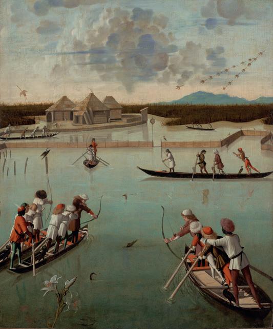
ValleGrassabò-765,58ha
237CHAP 4 - On the amphibious space
VallediLioMaggiore-183,95haVallePerini-310,53haValleOlivari-63,89haValleCavallino-381,08 ha Valle Fosse - 171,01 ha VallePaleazza-341,72ha ValleDrago-1070,32haValleLiona-140,35haValleDogà-1673,97ha ha295,26-CornioValle-ha357,25-ZappaValleha399,90-FigheriValleValleSerraglia462,97ha ha490,73-PerimpièValle ha342,55-Contarini-TrezzeValle ha507,67-avertovalle gLaunaNordSLagunaud SURFACE COVERED BY FISHING VALLEYS 11’000 Ha NUMBER OF FISHING VALLEYS 17 The system of fishing valleys of the Venetian Lagoon, denominations, and surfaces
as238 reserves, internal areas, biological service spaces. The internal spaces of the lagoon become inhabited and productive places, the heart of an economy based on industrial aquaculture which, looking to the future, to the challenges posed by the energy transition and average sea rise could one day extend beyond the limits of the lagoon itself. Faced with the current crisis of lagoon agriculture on an industrial scale that has developed in recent decades between the Cavallino peninsula and the surroundings of Chioggia (Zanetti 1995, p. 135), the rethinking of the aquaculture system can be complementary to a return to forms of more refined and niche agriculture, linked to vegetable gardens, orchards and vineyards that dot the most peripheral areas of the lagoon. Designing beyond the lagoon. A heritage of embankments and ditches Beyond the limit of the lagoon it is now possible to observe the liminal territory of the upper Adriatic and, more precisely, the space that was once occupied by the prehistoric lagoon that stretched from Ravenna to Grado, as if it were a large hydraulic machine made up of cultivated fields, wetlands, lagoons, dunes, beaches, polluted production areas, and tourist areas, whose survival is threatened today, like Venice, by rising water and by the risks deriving from climate change. Today this territory contains 25% of the national coastal areas at risk due to the concomitant threat of subsidence and eustatism. Natural phenomena, the latter, to which the origin of the lagoon itself is due, but which today are exacerbated by processes that are largely attributable to human action (Cavalieri 2016). Today the great plain surrounding the lagoon is a territory-pal impsest designed by the microreliefs of the water. Sometimes they are excavations, such as canals, ditches and drains. Sometimes they are corrugations of the earth, such as embankments, dams, and bridles. Sometimes they are small deformations of the soil surface, as is the system of bedding of the fields. Sometimes they are decisive reliefs, such as the sediments of the great road and railway arteries that connect the Venetian capital to Padua, Treviso and the Po Valley infrastructure system. Sometimes they are walls, like the sheet piles of the lagoon marginal systems towards the polluted waters of the industrial areas of Porto Marghera. A territory of embankments and ditches that specialize the soil of the Venetian
239CHAP 4 - On the amphibious space metropolis, define its grain, its geometries; they dissect and design spaces that collect and separate parts of the territory: the cultivated countryside of the reclamation at the edge of the lagoon; the production areas and places of residence of the agglomerations that from Mestre to Dolo and to Mira branch off towards Padua along the Brenta Riviera, to the north, along the Terraglio; the large territorial parks and natural areas along the Sile, the Brenta, the Bacchiglione, the Marzenego; and the wetland systems on the lagoon. Secular corrugations of the ground that have made habitable an uninhabitable territory that was once a swamp, and whose future is still –as always– threatened by the very same water that attempts have been made to eliminate for centuries. According to Davide Tagliapietra, in the future the lagoon will increasingly find itself at the centre of very large areas that will have to be rethought through a territorial scale project that provides for the de-polderization and conversion of use of vast agricultural areas maintained today through mechanical drainage, creating in these territories ecological gradients between marine systems, new freshwater marshes, hydrophilic forests, spaces for lamination and recharge of the inland aquifers (Fabian et al. 2021); Transformations so relevant that they legitimize the rethinking of the ecological role of entire parts of the dead lagoon. In a recent interview Tagliapietra affirms that ‘the lagoon could also lose certain characteristics, for example the circulation of the water [from which it could derive], the disappearance of the salt marshes, a simplification of the morphologies, a reduction of species, unmanageable changes in salinity, however, these ecological functions or ecosystem services [could] be moved elsewhere. If we act in time, the barene can be reformed elsewhere in thirty to fifty years. In this case, by de-poldering and managing the whole area where possible, we could have both areas in which we try to reorient nature through the re-appropriation of water and land, and on the other hand there could be places where some ecosystem services can be optimized. [...] Salty fields [for the cultivation of glasswort and other halophytic species], nursery areas for some fish species [...], an area of oligohaline gutter [...] with reeds or hy drophilic woods’ (Fabian et al. 2021, p. 165).
What-If
240
Scenario: regenerating the space of the barene of the northern and southern lagoons
241CHAP 4 - On the amphibious space In the project for the care and maintenance of the innermost space of the lagoon, sandbanks and fishing valleys play a fundamental role. If well preserved and strengthened, the barene can help to mitigate the waves and tides, favour the deposition of sediments, and through the halophilic vegetation can contribute to the oxygenation of inland waters. The activities related to the fishing valleys, and more generally to the support structures for fishermen, constitute a fundamental defence of the internal territories, making the less accessible parts of the lagoon a low intensity inhabited and productive place. The scenario investigates the strengthening and conservation of sandbanks and fishing valleys, intended as large reserves of biodiversity, production sites with important ecological functions, CO2 absorption devices to counter the effects of climate change, inhabited wetland parks in the heart of the lagoon.
242 Designing barene Barene are corrugation points of the lagoon ba thymetry that emerge above the surface of the water. Below the surface they become velme, changing their behaviour and name. There is no conceptual difference between barene and velme: a velma turns into a barena and vice ver sa, depending on the deposit or the erosion of sediments brought by currents, the share of the water and the oscillation of the tides. Be tween +25 centimetres (internal tabular barene) Scenario of restructuring and strengthening of the barene in the northern and southern lagoons in 2100 Section 0 2,5 5 10 km DeseMarzenegoPD-VEWaterway Brenta Sile and +45 centimetres (strong barene) in height compared to mid-sea levels, the barene are amphibious devices, periodically submerged by high tides, eroded by small alveolar chan nels called ghebi and by small water surfaces in correspondence to internal depressions called chiari di barena (barena clearings). They are pop ulated by dense, highly specialized halophilic vegetation, the most common species of which are Limonio and Salicornia, which are respon Southern Lagoon Central Lagoon Northern Lagoon conterminazionelagunare
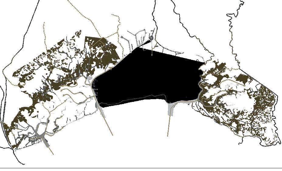

CHAP 4 - On the amphibious space 60kmq50304020201010030401910 1920 1930 1940 1950 1960 1970 1980 1990 2000 2010 2020 2030 2040 2050 2060 2070 2080 2090 2100 km242,1km2barenekm226,86km2bareneoferosion13,92km2km2bareneoferosion basinMarcoSanfromnavi)(grandishipscruisestop 16.09.2021ofn.125Law lagoonfromshipscruiseallstopwaterwayVenice_Paduatheofopening lagoontheintosedimentsnewofintroduction structuresbarenalofbuilding PetrolideiCanaletheprotectto theinbareneofrestructuring lagoonssouthernandnorthern +42,1 kmq (2000) 243
Scenario: objectives and strategic actions Evolution from 1910 to 2100 Circulation patterns of lagoon currents: before 1965, nowadays and in the hypothesis investigated by the proposed scenario sible for fundamental ecological functions for the health of the entire lagoon, including the shading of the soil, the maintenance of organic sediments, the purification of water, protec tion of surfaces from erosion, absorption of CO2, and oxygenation of the water in the in nermost areas of the lagoon. The scenario of the restructuring of the barene in the northern and southern lagoons investi gates the possibility of a continuous mainte before 1965 today 2100 scenario nance project, partly aimed at countering the erosive action of wave motion, partly to con solidate barene that have been lost over time, partly still for the introduction of morpholog ical structures to counter the fragility of the lagoon. The scenario envisages the insertion of new sediments in the lagoon: in the southern lagoon through the Padua-Venice waterway, which in this way also assumes the role of flood channel for the Brenta river; in the northern

Section start of the formation process newly formed barene lagoon through the construction of locks on the rivers that originally flowed into the lagoon. These actions, together with the new la goon currents deriving from the closure of the central lagoon, make it possible to restructure surfaces of barene to extensions prior to 1965. The process of formation of the new barene takes place through the construction of bound ary structures aimed at trapping the sediments coming from the adjacent velme. The sediments are deposited in the containment structures partly by the lagoon currents, partly through mechanical refluent processes. The boundaries can be used for the construction of artificial barene or for the protection of of the existing ones from currents and waves. They can be made using systems with strong mechanical resistance such as piles made of trunks driven into the ground or ditches filled with stones or by means of biodegradable fascinate systems.
244 flowscurrentlagoon systemscontainmentresistant systemscontainmentbiodegradable systemssupportcontainment sediments
Processes of contermination, backflow and formation of natural or artificial salt marshes


CHAP 4 - On the amphibious space erosion barenabarenabarena average sea level average sea level formedsedimentsbarena bathymetry replenishmentreplenishment replenishment replenishment replenishmentpalificatafascinate average sea level average sea level average sea level burghe average sea level formedsedimentsbarena bathymetry replenishment replenishment 245 Process of protection and confinement of existing barene Functional scheme of a fishing valley Process of forming new barene margin erosion of the barena resistant protection with piling resistant protection with burghe and mattresses protection with biodegradable systems of fascinate existing situation contermination and replenishment with sediments of the adjacent velma formed barena The fishermen of the smaller islands and of the fishing valleys are entrusted with the task of garrison and continuous maintenance of the surfaces of barene. The side lagoons become large parks on which low-intensity forms of tourism are organized. fish farms canal hunting observation tower barene submersible fish cage (botte) embankment boats entrance shed valley buildings water gate (chiavica)

Three Lagoons Scenario Detail


What-If248 Scenario: living in an amphibious world
CHAP 4 - On the amphibious space 249 In view of the sea level rise of about 50-80 centimetres by 2100, entire parts of the lagoon could be closed to defend Venice. However, these actions will not be sufficient to protect the depressed territories of the upper Adriatic, nowadays inhabited and kept dry by a complex hydraulic system made up of embankments, canals, pumps and dewatering pumps, the result of a long process of hydraulic reclamation stratified over the centuries. Given the prospect of the energy crisis and climate change, this complex hydraulic system will become unsustainable and ineffective. The scenario explores the possibilities of habitability of territories returned to water as a result of the expansion of the lagoon beyond the current conterminazione lagunare.
250 Living in an amphibious world beyond the lagoon The territories to the east and west of the la goon have ground altitudes between -100cm and +80cm above sea level, defining an extensive ag ricultural area inhabited by small urban centres and scattered buildings. The chronological reading of the anthropization processes shows how these areas were still largely uninhabited salt marshes until the 17th century. Starting from the 19th century, first through the work of private individuals and then with the intervention of the Lagoon expansion scenario in territories with altitudes below 80 cm SLR 0 2,5 5 10 km state, these regions have become the laboratories of an imposing reclamation project that has made it possible to develop techniques and forms of governance that after 1920 were then exported to many other Italian regions. The scenario explores the conversion possibilities of these territories due to the rising seas and the energy cost deter mined by the mechanical drainage of the entire region (see timeline of historical events from 1660 and the projection to 2100). In the scenario, the 1664 aaslakePiavetheofcreation theforsystemdrainageflood riverPiave marshessaltandlagoons EracleaandJesolobetween malariaofspread drainage"Ongaro"theofestablishment hectares)(14,000consortium marshes,Grisoleratheofreclamation RevedolitoDonàSanfrom 1856 'OngaroandSuperiore''Ongarotheofestablishment lowertheofdrainagetheforconsortiaInferiore' valleyPiave 1660 1670 1680 1690 1700 1710 1720 1730 1740 1750 1780 1790 1800 1810 1820 1830 1840 1850 1860 1870 1890 DeseMarzenegoPD-VEWaterway Brenta Sile Piave new lagoons new lagoons ofconstructionthethroughexperimentsreclamation operatorsprivatebyembankmentsandcanals Southern Lagoon Central Lagoon Northern Lagoon

CHAP 4 - On the amphibious space natural drainage natural drainage mechanical drainage dewatering pump shutdown dewatering pump barene campo agricolo bankbank barenebarene ditchditch canal lagoon aquaculture canalcanal canal barene lagoon mechanicaldewateringdrainagepump bank ditch dewateringcanal pump ditch canal water square reinforced bank urban protectedcenterisland scenario2013IPCCbestcm25-50 scenario2013IPCCworstcm-12095 eustacyeustacy 2020 baseline 251 1900 1910 1920 1930 1940 1950 1960 1970 1980 1990 2000 2010 2020 2030 2040 2050 2060 2070 2080 2090 2100 entiretheofreclamationmechanicalthefor60)(aroundstationspumpingofconstruction areaValleyPiaveLower Strategic objectives and actions for the realization of the scenario Evolution from 1660 to 2100 of the territories east of the northern lagoon. historical facts and forecasts design actions Conversion processes of urban centres into protected islands and of agricultural space into surfaces of barene and aquaculture fields deposit of infrastructures inherited from the past is converted to the new hydraulic rationalities thanks to an incremental process that is governed by the reclamation consortia (see diagrams top right): the ditch system is converted into a dense network of navigable canals, the dewatering pumps are progressively shut down, the agricul tural fields gradually transformed into new surfaces of barene and aquaculture valleys of fish or algae for food and energy purposes, experiment existing situation existing situation reinforcement of the embankments, construction of water squares and maintenance of water pumps in urban centres shutdown of dewatering pumps, conversion of ditches into canals and conversion of crops into aquaculture fields ing with forms of polyculture that were typical of fishing valleys; the urban centres become islands protected by reinforced embankments, in them the drainage of the water is guaranteed by the wa ter square and by small water pumps powered by bio-diesel obtained from the cultivation of algae. The multiplication of this strategy in territories with altitudes lower than 80 centimetres allows the expansion of the northern and southern la goons beyond the current limits of the lagoon. 1915-1918 WarWorldFirsttheduringconditionsmarshlandofrestoration 1918 AuthorityWaterVenicethebyreclamationlandofrestoration 1922 PiavediDonàSanincongressreclamationlandnational 1966 VeniceofFloodGreat 2019 Veniceinflooding 2020 operationalbecomesMoSethe reachedoilpeakglobal eventsclimaticextremefromfloodingincreasing 1977 warmingglobalcombattoProtocolKyoto levelssearising embankmentsbycentresurbanofprotection wedgesalineincreasing floodingplannedforlandagriculturalsomeofconversionsofstarting areasurbaninsquareswateranddepaving costsenergyincreasing areasagriculturalinpumpswateroffturntostarting ofproductionandaquaculturetocropsagriculturalofconversion biogasforalgae installationofbio-diesel-poweredwaterpumpsinurbanareas fishforaquaculturetoareasagriculturalofconversionfull purposesfoodandenergyforproductionalgaeandislandsprotectedintoareasurbanofconversionfull100cm 90 80 3040506070 -20-10o1020
252 San Donà di Piave (42.000) Jesolo (26.314) San Stino di Livenza (12.863) Eraclea (12.322) Ceggia (6.145) Torre di mosto (4.785) Torre di Fine (950) Cà Turcata (310) A new amphibious territory beyond the North Lagoon 21 2100 scenario: the new islands of the extended eastern lagoon 0,5 - 2 2 - 3 3 - 5 5 - 10 0,5 / 2,5 -0,25 / -0,5 Subsidence rate (mm/year) water network water pumps moderatelylow low moderately high veryhigh Micro-reliefurbanhighareas(m) Micro-reliefs and subsidence Water and drainage Water permeability


0 2,5 5 10 km
CHAP 4 - On the amphibious space 253 2100 scenario: a new amphibious territory beyond the northern lagoon Extension of the northern lagoon between Caposile and Eraclea Mare. The territory located east of the northern lagoon is entirely included in the low humid Venetian plain, characterized by the presence of clayey depressed soils and of an aquifer located 1-2 m below the surface of the countryside level. The microrelief shows a territory with altitudes between 0 and minus 1.5 metres above sea level, in terrupted by the natural embankments –result of the deposits of the river courses– or artificial –coinciding with the road infrastructures and in the more urbanized parts of the territory. The subsoil is characterized by the presence of finegrained sediments (silts-clays) which cause little or no permeability of the soil. This condition, together with the waterproofing of the soils determined by the ever increasing urbanization, tends to exacerbate the propensity for flood ing. The drainage of water, now guaranteed by a dense network of canals, ditches and dewatering pumps whose purpose is to eliminate excess wa ter, will no longer be effective, nor sustainable in the perspective of an increase in sea level, of the intrusion of the saline wedge and of the depletion of fossil fuels.

Vegetable
A new amphibious territory: devices
Crops processing centers Canals network Stilt systems 254
Polder New protected islands Existing buildings Soil Water Buildings overwriting gardens and aquaculture systems
The scenario explores an alternative development model both to the abandonment of the territory and to the strategies of mechanical resistance to the intrusion of marine waters. It investigates the possibilities of amphibious life forms through the organization of a territory that remains productive thanks to the conver sion of existing crops into modern aquaculture systems for the production of food or energy. New islands are created, resulting from the em bankment of existing urban centres in which depaving processes, the installation of water squares and off-grid systems are tested to facili tate the disposal of rainwater. In the countryside returned to the water, prototypes of pile dwell ings are investigated as a result of the redesign of existing buildings and micro-polders for farms to support aquaculture. A capillary network of navigable canals, resulting from the conversion of the hydrographic network and of the mesh of existing water drainage ditches, overlaps with public mobility systems organized by land along the embankments and elevated roads.
CHAP 4 - On the amphibious space Hydroponic cropsBiodigestersWarehousesStorage AquacultureGreenhouses Structures for fishing activities Floating greenhouses 255 STRETTI CREPALTO PORTO DI FINE PORTO MARGHERITAST. BRIAN LA SALUTE DI LIVENZA aquaculture aquaculture monorail newcanals newcanals new canalsmonorail peoplemover Livenza river Piaveriver aquaculture micro-polder barene barene micro-polder micro-poldermicro-polder micro-polder aquaculture ERACLEA

256 sitesconstruction sitesconstruction monorail newcanals bank bank barene drainageurbanNEW ISLANDPROTECTED aquaculture systems culturealgae new canals poldernew poldernew station station new canals

CHAP 4 - On the amphibious space 257 monorail sitesconstruction sitesconstruction barene barene mainland culturealgae aquaculture systems gardensvegetable poldernew poldernew buildingsoverwritten buildingsoverwritten

Today the Venetian metropolis has extended until it largely coincides with the drainage basin of the lagoon itself, a widespread city where more than two million people live, which develops be tween the Brenta and Piave rivers and includes within it the cit ies of Mestre, Padua, Treviso, and Castelfranco Veneto.▶8 Some recent research has highlighted the need to study this vast territory starting from its water networks (Fabian and Viganò 2010; Fabian, Secchi, and Viganò 2016). Observing the main systems of rationalization of the water network deposited over the centu ries (Rusconi 1991) it appears evident that the “diffuse city” of the Venetian metropolis is the result of a long process of territorial construction based on the governance of water and its environmental infrastructures, aimed at domesticating a part of that Mediterranean which for Braudel was the ‘liquid plain’ (Braudel, Coarelli, and Aymard 1977).
258
▶8 Among the many publications, see Fondazione di Venezia (2019) and in par ticular the chapter ‘Definizione dell’area di programma: da civitas a polis che ne valorizza la struttura policentrica’ (Definition of the programme area: from civitas to polis that enhances the polycentric structure) (Costa, Ferranna, and Nicosia 2021).
An amphibian metropolis
Today in the drainage basin, due to the changing climate, wide spread urbanization and waterproofing as well as the lack of maintenance of the water network, 18% of the land area is at risk of flooding; in the metropolitan area of Venice alone, it is estimated that 28% of the surface is sensitive to flooding (LIFE VENETO ADAPT 2018). In the territories on the edge of the lagoon, the combined effect of tides, eustatism, and subsidence is exacerbat ed by intense meteorological phenomena and the average sea rise caused by global warming. Often in autumn, in the presence of sudden and violent rainfall, the environmental fragility of the territories on the edge of the lagoon reverberates in a catastrophic way on the wet plain and the entire hydrographic system of the drainage basin of the Venetian metropolis. It is no coincidence that the weather-climatic conditions that led to the flood of 2019 are very similar to those of the last great flood that hit the heart of the “diffuse city” between the end of October and the beginning of November 2010, involving 262 municipalities in the provinces of Verona, Vicenza, Padua, Treviso, and Belluno, leading to devasta tion estimated at 426 million euros (Regione Veneto 2011; Regione Veneto, Servizio Statistica 2011). In addition to floods, forecasts and mathematical models for the study of climate change show how the problem of water will be increasingly related to scarcity in the future. A study conducted by ARPAV and the University
259CHAP 4 - On the amphibious space ▶9 See in particular the ongoing research by Giacomo Magnabosco (Magnabosco 2022) of Padua, having as its object the analysis of the drought index on a historical series of 43 years for 20 meteorological stations in the Veneto Region, has in fact highlighted how extreme and sudden meteorological phenomena are also accompanied by a general increase in drought phenomena and a substantial and progressive reduction of their return time (Cacciatori et al. 2005). The studies contained in the Piano di Gestione del Rischio Alluvioni del Distretto idrografico delle Alpi Orientali (Flood Risk Management Plan of the Eastern Alps Hydrographic District) of 2016 show how the combined effect of the average reduction in rainfall and the increase in temperatures expected for the next 100 years will have consequences in the evaporation of water reserves, leading to an exacerbation of the already existing problems of water scarcity that characterize the region (Hydrographic District of the Eastern Alps, 2016).
The adaptation scenarios that have arisen from climate change may seem unrealistic, alluding to a radical transformation of the territory that will involve considerable economic resources, time and a capacity to govern the territory that would seem beyond our reach. In recent years, however, under the pressure of the devastation caused by the changed territorial and meteorological conditions, the “diffuse city” of the drainage basin has already begun to adapt and, slowly, to transform itself towards directions that are not always coherent, within which the urban and territorial project must urgently know how to position itself.
Walking along the water landscapes it is not difficult to come across small and large projects for adapting the water system which, slowly and pervasively, are profoundly changing the backbone of the hydrographic system that innervates the Venetian metropolis. An ongoing study is attempting to reconstruct a synthetic image of the adaptation projects that are affecting the drainage basin starting from the great flood of 2010.▶9 The mapping of reservoirs, dams, new embankments, resections of canals, sub-irrigation systems, and recharging wells, presents the synoptic picture of an imposing project, the result of the incremental mobilization of a multitude of public and private subjects who in different ways try to offer a common response to the various environmental frailties.
Some of these adaptation projects concern the body of the territory, almost always interpreting the soil as a plastic material that can be freely modelled according to the new hydraulic ra-
Large reservoirs, expansion tanks, reinforcement and recalibration of existing embankments, dams, bridles, bulkheads; these are mostly the outcome of the Piano di Mitigazione del Rischio Idraulico (Hydraulic Risk Mitigation Plan) in response to the flood of 2010 (Regione Veneto 2011). The reinforcement and recalibration projects of the embankments visible above all in the low humid plain, near the areas closest to the lagoon, belong to this family. To these are added the numerous expansion tanks built at the edges of the rivers on the alluvial plain, such as the monumental 3.3 million cubic metre tank located to protect the city of Vicenza, north of the municipality of Caldogno, compressed between the margins of the springs and the Timonchio stream, or the Colom baretta rolling mill on the Alpone stream, or the expansion tank on the Muson stream in the Municipalities of Fonte and Riese Pio X. These are interventions that adapt the pre-existing and traditional agricultural function to the new rationalities imposed by hydraulic efficiency. The large basins for the expansion of rivers in the event of a flood are recognizable in the orthophotos where the grain of the position of the fields expands into large surfaces and the semantic depth of the agricultural landscape suddenly becomes simpler. Seen from within, they draw large spaces cultivated with monoculture or stable grasses, located within a new embanked territory which, near the transfer vents, reveal their nature as ‘disposable voids’, places designed to be flooded. They are almost always large works which, responding to a sectorial and emergency logic, owe their functioning to correct dimensioning; they are not the result of an incremental process, they are not adaptive, nor are they available for other functions capable of integrating the needs of hydraulic risk with ecological and social issues. They define, separate and specialize the territory into dry parts and freely floodable parts, interpreting the infrastructures within a purely hydraulic rationality, giving up the ecosystem potential that is intrinsic to water and its environmental resources.
An ecosystem vision: towards the possible construction of parks on a territorial scale Water understood not only as infrastructure but in its broader meaning as an environmental resource brings us back to the concepts of territorial capital and heritage and to the idea of an ecosystem that knows how to integrate the complex schedule of
tionalities.260
261CHAP 4 - On the amphibious space tangible and intangible services that pass through it. The concept of ecosystem services, developed in an attempt to find a space for reconciliation between economic rationalities and ecology, pushes us to interpret the environmental resources of water in the broadest sense, as a reserve capable of producing wealth, providing ser vices aimed at benefitting quality of life (through access to water resources for energy and agricultural uses and the related benefits), safety (through the regulation of vulnerability, risk reduction and the ability to live in safe surroundings), health (through the possibility of having access to water for human sustenance and nourishment), cultural capital (through the opportunity to satisfy historical, social, aesthetic, recreational and spiritual values) (Bet tinetti, Crosa, and Galassi 2007; Giupponi, Galassi, and Pettenella 2009; Boyd and Banzhaf 2005; Reid 2005).
It is possible to grasp the elements of an ecosystemic tension of the water project in some widespread interventions carried out in the last ten years and under construction, which integrate the hydraulic risk with new important ecological, social and active mobility functions. An example of this are the renaturalization interventions of the loan quarries located on the high dry plain, which in this perspective are converted into retention basins connected to the hydrographic network, such as the conversion project for Merotto quarry, from disused quarry to water basin of the plain to ensure water in summer and reduce the risk of flooding of the Meschio river in the Treviso area (Viganò 2009): a project financed in part with European funds, today a space of naturalness, a new centrality and a device for the lamination of flood waters. The interventions connected to ‘LIFE Risorgive’ also head in this direction: the overall project plans to re-establish and consolidate a ‘green infrastructure’ made up of a network of springs, irrigation channels and canals in the territory of Bressanvido in the province of Vicenza (Comune di Bressanvido 2016). This infrastructure is located in an area with a high agricultural activity, mainly for the breeding of dairy animals, in which the loss of biodiversity caused by excessive land use can be significantly counteracted. The pro ject was consolidated in the Risorgiva Lirosa, whose restoration completed in 2018 is linked to the wider system of existing springs and as an expansion of the vegetation systems and ditches on the edge of agricultural fields (Consorzio Brenta 2018). Through a stabilized gravel path that crosses the riparian groves and connects
Synoptic
262 embankments channelsdrainage basinsexpansion pumpsdewatering wellsrechargegroundwater systemssub-irrigation systemsdrainageurbansustainable-SuDS meanderingandareasfloodplain areasinfiltrationforest springsofregeneration marshessaltnew dunes invariancehydraulicofbasins
representation of the adaptation works of the hydrographic system for the drainage basin of the Venice lagoon
263CHAP 4 - On the amphibious space to the Napoleonic road, to the wider system of dirt roads and shrub vegetation that cross the agricultural landscape, the project integrates the recreational functions of active and cultural mobility with the hydraulic and biodiversity-related functions. It is connected to various small forestry interventions to facilitate the infiltration of the surface waters of the aquifer that dot the area with the aim of restoring the ancient agroforestry systems that characterized the Veneto landscape of the upper Vicenza area. The system of forest infiltration areas, conceived and developed starting from 2007 by Sezione Ricerca e Gestioni Agroforestali di Veneto Agricoltura (Research and Agroforestry Management Section of Veneto Agriculture), in addition to restoring the original level of the aq uifers, also triggers natural wastewater purification phenomena, improving the quality and the availability of water. Furthermore, the forest areas, which are planted and cultivated to favour the introduction of surface water into the subsoil, can be managed with further multiple purposes, such as the production of renewa ble energy in the form of woody biomass (Dal Prà, Mezzalira, and Niceforo 2010). The idea of a project capable of integrating the complex of tangible and intangible services that revolve around water landscapes finds perhaps its clearest explanation in the widespread interventions concerning the hydrographic system between Venice and Treviso, on the eastern edge of the drainage basin of the lagoon. In this portion of the territory, the interven tions of the Piano per la prevenzione dell’inquinamento e il risanamento delle acque del bacino idrografico immediatamente sversante nella Laguna di Venezia (Plan for the prevention of pollution and the rehabilitation of the waters of the drainage basin immediately flowing into the Venice Lagoon) have been developed for more than ten years, aimed at en hancing the ecological complexity of these territories (Cornelio et al. 2012). The interventions that, relying on the Dese, Zero and Sile hydrographic system, are wedged in the city spread between small urban centres, cultivated fields, houses and productive activities, ensure the recalibration of the riverbeds in order to renaturalize the reclamation network, for the construction of wetlands in or der to increase residence times and the lamination of the waters of the Zero and Dese rivers in the event of a flood and, through phytodepuration processes of the new riparian strips of reed beds and herbaceous marsh plants, reduce nitrogen and phosphorus inputs and pollution of the waters that flow into the lagoon. The
▶10 See Parco Naturale Re gionale del Fiume Sile, n.d.
Opposite page: a. groundwater well_MontecchiorechargePrecalcino (VI)_March 2022; b. dunes vegetation_Cà Roman (VE)_June 2021; c. water intake for sub-irriga tion system_Loria (PD)_Feb ruary 2022; d. spring efficiency improve ment_Schiavon (VI)_April 2021; e. bank recalibration_Dueville (VI)_January 2022; f. intake mouth of a flood-re tention and basin_Caldognoflood-retarding(VI)_Febru ary 2022; g. flood-retarding basin_Mon ticello Conte Otto (VI)_Feb ruary 2022; h. SuDS - sustainable urban drainage systems_Vigonza (PD)_May 2021; i. spillway channel_Piazzola sul Brenta (PD)_February 2022; l. renaturalisation and mean dering_Cazzago (VE)_Decem ber 2020; m. freshwater inlet sluice-gate into the Lagoon_Porto Trezze (VE)_December 2020; n. forest infiltration are as_Schiavon (VI)_November 2020.
interventions264 resulting from an incremental process promoted by the Consorzio di Bonifica Acque Risorgive (formerly the Consorzio di Bonifica Dese Sile) effectively show how the objectives of increasing biodiversity, construction and strengthening of ecological corridors, and a reduction of pollutants through natural purification processes are associated with a drastic reduction in the risk of the flooding that characterizes these territories (Cornelio et al. 2012, p. 310). This landscape is associated with new important functions for active mobility on foot, by bicycle and canoe which, especially along the Sile, give rise to the progressive construction of a park on a reticular territorial scale, in support of the city spread be tween Venice and Treviso.▶10 Already today a multiplicity of sub jects, who find new resources for their free time here, are using this network for active mobility: those looking to practise some form of citizenship sport but also students, home helpers and carers. Along the paths of water one can move running or strolling, to go to school or to work, or to be outdoors in leisure time and walk with friends, rediscovering and drawing ever more dense and interesting plots of land that get wedged into the systems of urban areas of the “diffuse city”. The water infrastructures thus understood, together with the hydraulic and ecological functions, participate in the construction of a new ‘layer’, a layer for the active mobility of the “diffuse city” that we should also consider as ‘fundamental’ (Bozzuto, Fabian, and Munarin 2021). By overcoming images linked to emergency and forced constraint within a specialized and sectorial field, the project for the water aspires to affect the entire territory of the Venetian metropolis again, through the creation of ‘integrated green infrastructures’ which are spaces for hydraulic government but also places for lei sure time in support of the “diffuse city”, for the diffusion of nat uralness and biodiversity. The project for the water can rethink the spaces of the hydraulic infrastructures as places from which to start a process of overall recycling of the materials that make up the Venetian metropolis, rethinking its own sustainability.
265CHAP 4 - On the amphibious space a b c d e f g h i l m n


266 13_northern lagoon_august2021

267CHAP 4 - On the amphibious space 14_border southern lagoon_august2021

268 15_northern lagoon_august2021

269CHAP 4 - On the amphibious space 16_northern lagoon_august2021

270 17_northern lagoon_august2021

271CHAP 4 - On the amphibious space 18_northern lagoon_august2021

272 km2128area:use2 mainland:shorelines:islands:893,062933lagoon:540sea:632 sea level rise: 995,84 floods: 168,94 salt wedge: 893,06 artificial surfaces: 115,00 agricultural surfaces: 414,96 forest and seminatural areas: 9,28 wetlands: 185,74 water bodies: 295,00 elementsterritory pressure useland1)(levelThe graph summarizes the surfaces, the ele ments, the main pressures deriving from cli mate change and land uses, expressed in square kilometres, of the territory considered in the scenario of the three lagoons. Finally, for the surfaces and land uses affected by the phe nomenon of average sea level rise, the related planning strategies and actions considered are summarized on the right and in white. Scenario, summary
CHAP 4 - On the amphibious space 273 deepwaterembankmentssquareseawater pumping off grid water disposal depavement of large surfaces new infiltration areas pile conversions new roads on embankment new waterways new fishing valleys new halophytic cultures algae cultivation river nourishment river meandering lamination areas buffer infiltrationwoodsforest phyto-purificationareassystems continuous urban fabric: 4,12 discontinuous urban fabric: 36,10 other: mineral15,39extraction sites: 0,02 dump sites: construction0,69sites: 2,00 other: 1,70 green urban areas: 5,16 sport and leisure facilities: 5,5 port areas and airports: 5,13 industrial units: 22,67 road and rail networks: 21,69 not irrigated arable land: 19,48 irrigated land: 350,86 vineyards: 7,46 fruit trees: 1,89 other: broad-leaved6,44 forest: 38,99 coniferous forest: 0,66 water courses: 224,00 water bodies: 8,80 fluvial wetlands: 0,57 peatbogs: 0,38 intertidal flats: 98 inland marshes: 153,97 urban fabric: 45,86 industrial, and transport units: 49,50 mine, dump and construction sites: 4,50 artificial, non-agricultural vegetated area: 10,68 arable land: 370,34 permanent crops: 15,80 pastures: heterogeneous26,91 agricultural area: 1,89 forest: 39,65 shrub: 0,43 no vegetation 4,28 inland wetlands: 185,74 inland waters: 234,00 marine waters: 61,00 2)(level 3)(level devices/strategies
274 Appendix
L. Fabian. Cutting-edge Venice 172-173 Venice calls Boston, L. Fabian; 173-174 Tolerance, pragmatism, and innovation, L. Centis; 175-177 Design, entrepreneurship, and culture, L. Centis; 177 Back to the Future, L. Fabian. Pressure. Venetian overtourism 178-183 L. Fabian. Destination Venice; 184-185 Live like a local, spend like a tourist, L. Fabian; 185-186 A global magnet, L. Centis; 186-189 Glamour and industrialization, L. Centis; 189190 From over- to hyper-tourism, L. Centis; 190-191 Governing the digital, L. Fabian. The text takes up and develops the themes previously dealt with in (Centis and Fabian, 2022).
Text 8-9Forewordcredits L. Fabian, L. Centis. 10-14Introduction L. Fabian. Chapter 1: On the lake of Intro.VeniceVenice, year 2100. On the lake of Venice 17-21 L. Fabian. Lagoon paleochannels 22-25 L. Fabian; 25-28 Methodological notes, L. Fabian, L. Centis; 28-31 Counterfactual history, L. Fabian. The text takes up and develops the themes previously dealt with in (Fabian and Iuorio 2021). Elements / Key concepts. What we talk about when we talk about Venice lagoon? 32-41 L. Fabian. Lagoon scenarios 48-55 L. Fabian. Pressure. What threatens the lagoon of Venice? 56-63 L. Fabian. What-If. Lagoon Scenarios 64-76 L. Fabian. Chapter 2: On the lake Intro.defencesVenice, year 2100. On the lake 79-89defences L. Fabian. Divided lagoons 90-99 L. Centis. Designing edges 100-101 L. Fabian. The walls of Venice 102-107 L. Centis. Elements / Key concepts. Immaterial division devices 108-111 L. Fabian; 112-113 L. Centis. Land is land, water is water 114-119 L. Fabian. Elements / Key concepts. Physical division devices 120-123 L. Fabian; 124-131 L. Centis.
Appendix 275
Chapter 3: On Venice Intro. Venice, year 2100. On Venice 139-149 L. Fabian. Defining Venice 150-159 L. Centis. Elements / Key concepts. Venice, 160-163Venices L. Fabian. What-If. Scenario: an accessible 164-167metropolis? L. Fabian. Elements / Key 168-171Knowledge-basedconcepts.economy
Chapter 4: On the amphibious Venice,space year 2100. On the amphibious 207-213space L. Fabian. A large lagoon; 216-218 Designing an amphibious territory, L. Fabian; 218-221 Foundation myths, remodelling stories, L. Centis. Elements / Key concepts. Lagoon as transition space 222-229 L. Fabian. The lagoon as a mountain 230-239 L. Fabian.
What-If. Scenario: regenerating the space of the barene of the northern and southern lagoons 240-247 L. Fabian.
Chapter 1: On the lake of Intro.VeniceVenice, year 2100. On the lake of Venice; 19, 21 L. Anzanello, G. Bastianel, E. De Nadai, A. Drigo, C. Longoni, Ritorno alla laguna del futuro, design studio Scenari della laguna of the bachelor degree in Architecture, Università Iuav di Venezia (AY 2021-2022), L. Fabian [professor], C. Cangiotti, G.. Mantelli, I. Visentin [teaching assistants], reworking by C. Cangiotti, 2022. Lagoon paleochannels; 28-29 L. Fabian, L. Iuorio, 2019; 31 L. Fabian, 2021. Elements / Key concepts. What we talk about when we talk about Venice lagoon? 34-41 L. Fabian, C. Cangiotti, G. Mantelli, 2022. Photographic exploration. The lagoon; 42-47 G. Streliotto, 2021. Lagoon scenarios; 49 L. Fabian, 2021; 51-54 L. Fabian, C. Cangiotti, G. Mantelli, 2022. What threatens the lagoon of Venice?; 58-63 L. Fabian, C. Cangiotti, G. Mantelli, 2022. What-If. Lagoon Scenarios; 66-77 L. Fabian, C. Cangiotti, G. Mantelli, 2022. Chapter 2: On the lake Intro.defensesVenice, year 2100. On the lake defences; 81-89 L. Fabian, C. Cangiotti, G. Mantelli, 2022. Divided lagoons; 90-95 L. Fabian, C. Cangiotti, G. Mantelli, 2022; 96_01 C. Sabbadino, Archivio di Stato di Venezia, Savi ed Esecutori alle Acque, disegni, Laguna n.9, 1547; 96_02 C. Sabbadino copy by Angelo Minorelli from 1695, Archivio di Stato di Venezia, Savi ed Esecutori alle Acque, disegni, Laguna n.13, 1556; 97_03 C. Sabbadino, Archivio di Stato di Venezia, Savi ed Esecutori alle Acque, disegni, Diversi n.106,
276 What-If. Senario: A synergy between tourists, students, and residents? 192-197 L. Fabian. Enterprising Venice 198-205 L. Centis.
What-If. Scenario: living in an amphibious world beyond the lagoon 248-257 L. Fabian. An amphibian metropolis 258-265 L. Fabian. Images, scenarios and exploratory projects credits Introduction; 12 L. Fabian.
277Appendix 1558; 98_04 A. Cornaro, Archivio di Stato di Venezia, Savi ed Esecutori alle Acque, Atti, filza 231, reg.3, 0006, 003r , dating back to the mid-16th century; 98_05 F. Gualdi(?) Fantin Contarini(?) Archivio di Stato di Venezia, Savi ed Esecutori alle Acque, filza 123, 0790, 362-r, dating back to around 1660; 99_06 Alfonso Moscatelli, Archivio di Stato di Venezia, Savi ed Esecutori alle Acque, b.131, 1673.
Designing edges; 101 L. Fabian, C. Cangiotti, G. Mantelli, 2022. The walls of Venice; 105 Anonymous, Archivio di Stato di Venezia, Savi ed Esecutori alle Acque, Busta 152, 1791.
Elements / Key concepts. Physical division devices; 122-123 L. Fabian, C. Cangiotti, G. Mantelli, 2022; 124-131 B. Cipriani, S. Maso, D. Rostellato Salicornia Love, design studio il nuovo Sistema Mediterraneo of the master degree in Architecture, Università Iuav di Venezia (AY 2021-2022), B. Albrecht, L. Fabian [professors], A. Fantin, J. Galli, E. Longin, M. Marino, G. Piacenti, C. Semenzin, S. Righi, E. Vendemini [teaching assistants], reworking by G. Mantelli, 2022. Photographic exploration. Division devices; 132-137 G. Streliotto. Chapter 3: On Venice Venice, year 2100; 141-148 M. Biancato, I. Campello, D. Perini, F. Pieropan, S. Puddu Saluti da Dolo e non solo, design studio Scenari della laguna of the bachelor degree in Architecture, Università Iuav di Venezia (AY 2021-2022), L. Fabian [professor], C. Cangiotti, G. Mantelli, I. Visentin [teaching assistants], reworking by I. Visentin, 2022. Defining Venice; 153-156 E. Miozzi, Università Iuav di Venezia, Archivio Progetti, Fondo Eugenio Miozzi, pro/023, 1930s, 1952. Elements / Key concepts. Venice, Venices; 162-163 L. Fabian, C. Cangiotti, G. Mantelli, 2022. What-If. Scenario: an accessible metropolis? 164-167 L. Fabian 2022, the scenario takes up and develops the design hypotheses previously advanced in Viganò, Secchi and Fabian (2016).
Elements / Key Knowledge-basedconcepts.economy, 170-171 L. Fabian, C. Cangiotti, G. Mantelli, 2022. Pressure. Venetian overtourism; 180183 G. Mantelli, ‘Turista a domicilio: La turistificazione come fenomeno ricostituente la comunità di Venezia’, Degree in Architecture, L. Fabian [supervisor], Università Iuav di Venezia (AY 2018-2019).
Elements / Key concepts. Immaterial division devices; 110-111,113 L. Fabian, C. Cangiotti, G. Mantelli, 2022; 112 L. Centis, 2020. Land is land, water is water; 117 Z. Trevisan, Archivio di Stato di Venezia, Savi ed Esecutori alle Acque, Disegni, Laguna, n.6, 1542.
Destination Venice; 187_A L. Querena, Museo Correr, Cl. I n. 2044., 1852; 2022 © Archivio Fotografico - Fondazione Musei Civici di Venezia; 187_B O. Boehm, Archivio Naya-Boehm, around 1890; 187_C C. G. Sardi, Hotel Excelsior, Lido, For kind concession of IPAV Venezia, © Fondo Fotografico Tomaso Filippi, 1908; 188 F. Marsich, For kind concession of IPAV Venezia, © Fondo Fotografico Tomaso Filippi, 1908.
Chapter 4: On the amphibious Venice,space year 2100. On the amphibious space; 208-213 A. Beato, E. Velludo, G. Verdinelli, Gli alveoli orientali, design studio Scenari della laguna of the bachelor degree in Architecture, Università Iuav di Venezia (AY 2020-2021), L. Fabian [professor], C. Cangiotti, G. Mantelli, I. Visentin [teaching assistants], reworking by C. Cangiotti, 2022; 214-215 I. Visentin, 2022. A large lagoon; 217 A. Vestri, Archivio di Stato di Venezia, Savi ed Esecutori alle Acque, Disegni, Diversi 109, 1709; 219 L. Centis, 2022; 221 E. Miozzi, Università Iuav di Venezia, Archivio Progetti, Fondo Eugenio Miozzi, pro/023. Elements / Key concepts. Lagoon as transition space; 224-229 L. Fabian, C. Cangiotti, G. Mantelli, 2022. The lagoon as a mountain; 231 L. Fabian, C. Cangiotti, G. Mantelli, 2022, redesign from Albani et al. (1984); 232 L. Fabian, C. Cangiotti, G. Mantelli, 2022, redesign from Bonometto (2015, p.19); 236 V. Carpaccio, 1400-1495; 237 L. Fabian, C. Cangiotti, G. Mantelli, 2022. What-If. Scenario: regenerating the space of the barene of the northern and southern lagoons; 242-247 L. Fabian, C. Cangiotti, G. Mantelli, 2022. What-If. Scenario: living in an amphibious world beyond the lagoon; 250-251 L. Fabian, C. Cangiotti, G. Mantelli, 2022; 252-257 A. Beato, E. Velludo, G. Verdinelli, Gli alveoli orientali, design studio Scenari della laguna of the bachelor degree in Architecture, Università Iuav di Venezia (AY 2020-2021), L. Fabian [professor], C. Cangiotti, G. Mantelli, I. Visentin [teaching assistants], reworking by L. Fabian, G. Mantelli, C. Cangiotti, 2022. An amphibian metropolis; 262 G. Magnabosco, Il futuro del progetto di territorio. Adattamento in Veneto tra introiezione e proiezione, PhD Thesis, Università Iuav di Venezia, Venezia, 2022; 265 G. Streliotto. Photographic exploration. An amphibian space; 266-271 G. Streliotto. Scenario, summary; 272-273 L. Fabian, C. Cangiotti, G. Mantelli, 2022. The authors have been careful to try to contact all copyright holders of the illustrations that appear in this book, but it was not possible to find all of them. If you claim ownership of any of the illustrations appearing in this book and have not been properly credited, please contact us and we will be happy to print a formal acknowledgement in the next reprint.
Enterprising Venice; 200 J. Ivens, 1960; 202 Archivio Storico ENI, 1954.
278 What-If. Scenario: A synergy between tourists, students, and residents? 194-197 G. Mantelli, Turista a domicilio: La turistificazione come fenomeno ricostituente la comunità di Venezia, Degree in Architecture, L. Fabian [supervisor] Università Iuav di Venezia, (AY 2018-2019).
L2 Tourism and Cultural Heritage LAB (2021-2022), research funded by the Industrial Rehabilitation and Reconversion Project, Venice Complex Industrial Crisis Area; Università Iuav di Venezia, L. Fabian [scientific coord.]; L. Centis, E. Longhin. Veneto Sustainable Smart Tourism 2030 (2020-2021), research funded by the European Social Fund Regional Operational Programme, Veneto Region; Università Iuav di Venezia, L. Fabian [scientific coord.]; C. Cangiotti, G. Mantelli. Paleoalvei della Laguna (2019-2020), research carried out in the framework of the activities of the programme “Venezia 2021 Scientific research programme for a regulated lagoon” funded by CORILA (Consortium for the Coordination of Research on the Venice Lagoon System); Università Iuav di Venezia, L. Fabian [scientific coord.]; L. Iuorio.
The New Mediterranean System (Academic Years 2019-2020, 20202021) design studio of the master degree in Architecture, Università Iuav di Venezia; B. Albrecht, L. Fabian [professors]; A. Fantin, Jacopo Galli, E. Longhin, M. Marino, G. Piacenti, C. Semenzin, S. Righi, E. Vendemini [teaching assistants]. MéLiMed Métropoles du littoral méditerranéen, enjeux climatiques et solutions de résilience (Academic Years 2021-2023) educational project Erasmus Plus, Ecole Nationale Supérieure d’Architecture de Marseille, PI and supervisor L. Hodebert; Università Iuav di Venezia, supervisor L. Fabian; Faculté d’architecture La Cambre-Horta ULB di Bruxelles, supervisor V. Brunfaut; Ecole Nationale d’Architecture de Tétouan Maroc, supervisor H. Cherkaoui. Scenari della laguna (Academic Years 2019-2020, 2020-2021, 2021-2022) design studio of the bachelor degree in Architecture, Università Iuav di Venezia; L. Fabian [professor]; C. Cangiotti, G. Mantelli, I. Visentin [teaching assistants]. References Airbnb (2018) ‘Healthy Travel and Healthy Destinations’. Airbnb. Available at: Ajuntament16Healthy-Destinations.pdfsites/4/2018/05/Healthy-Travel-and-airbnb.com/wp-content/uploads/https://news.(Accessed:October2021).Barcelona(2017)
Venise (2021), permanent exhibition, Musée des civilisations de l’Europe et de la Méditerranée (MuCEM), Marseille; Università Iuav di Venezia, L. Fabian [scientific coord.]; C. Cangiotti, L. Centis, L. Iuorio, E. Longhin, G. Mantelli, G. Magnabosco, I. Visentin.
279Appendix
Research and teaching credits
PEUAT | Plan Especial Urbanístico de Alojamiento Turístico. Available 16allotjaments-turistics/es/https://ajuntament.barcelona.cat/pla-at:(Accessed:October2021).
Berrino, A. (2011) Storia del turismo in Italia. Bologna: Società Editrice Il Bertin,Mulino.M. (2018) Per esser pronti: ripensare la gestione dell’emergenza in città. Milano: FrancoAngeli.
ALUR, J.O.D.L.R.F. (2014) LOI n° 2014-366 du 24 mars 2014 pour l’accès au logement et un urbanisme rénové (1), 2014-366 Anderson, C. (2007) The long tail: how endless choice is creating unlimited demand. London: Random House Anderson,Business. C. (2014) Makers: the new industrial revolution. New York: Random House USA Inc. Arnoldi, S., Balducci, S., Bovo, M., Bozzuto, P., Bricoli, M., Bruzzese, A. (2020) Spazio e preparedness. Sulle sfide del Covid-19 per un rinnovato ruolo pubblico della pianificazione territoriale e delle politiche urbane. Società Italiana degli Urbanisti. Available at: https://siu. bedita.net (Accessed: 2 December 2021).
Avanzi, S. (1989) ‘Il territorio lagunare di Venezia: profili di demanialità’, Tributi, rassegna mensile di economia, tecnica e legislazione tributaria, anno XXV(9/10), pp. 55–119.
Bettinetti, R., Crosa, G., Galassi, S. (2007) Ecologia delle acque interne Torino: Città Studi. Bettini, S. (2006) Venezia: nascita di una città. Edited by A. Cavalletti. Vicenza: Neri Pozza. Bevilacqua, E. (1992) ‘La conterminazione della Laguna di Venezia considerata attraverso i documenti cartografici’, in. Conterminazione lagunare: storia, ingegneria, politica e diritto nella Laguna di Venezia. Atti del Convegno di studio nel bicentenario della conterminazione lagunare. Venezia, 14-16 marzo 1991, Venezia: Istituto Veneto di Scienze, Lettere ed Arti, pp. 39–78. Bevilacqua, P. (2009) Venice and the water: a model for our planet. Solon, ME: Polar Bear & Co. Bianchi, B. (1985) ‘L’economia di guerra a Porto Marghera: produzione, occupazione, lavoro: 1935-1945’, in Paladini, G. and Reberschak, M. (eds) La Resistenza nel Veneziano. Venezia: Comune di Venezia, pp. 163–233. Bonometto, L. (2008) ‘Modalità di deposito di sedimenti, di conterminazione delle strutture artificiali e di difesa delle barene naturali nella laguna di Venezia’. Università di Padova, Dipartimento IMAGE. Available at: Bonometto,2Bonometto-2008_rid.pdfwp-content/uploads/2019/10/L.-https://www.mosevenezia.eu/(Accessed:December2021).L.(2014)
Albrecht,280 B., Ferlenga, A., Galli, J. (2017) W.A.Ve. 2017: Syria - the making of the future: from urbicide to the architecture of the city. Conegliano/ Venezia: Incipit - Università Iuav di Allen,Venezia.J.R.L. (2000) ‘Morphodynamics of Holocene saltmarshes: A review sketch from the Atlantic and Southern North Sea coasts of Europe’, Quaternary Science Review, 19, pp. 1151–1231.
Il respiro della Laguna: Origini, caratteri e funzioni delle barene. Kindle Edition. Venezia: Corte del Fontego Editore Bonometto, L. (2015) Il respiro della Laguna: Origini, caratteri e funzioni
Canal, E. (2015) Archeologia della Laguna di Venezia 1960-2010. Verona: Cierre Edizioni.
281Appendix delle barene. Venezia: Corte del Fontego Bonometto,Editore.L.(2017) ‘Scenari possibili per il riequilibrio della Laguna Centrale’, in D’Alpaos, L. (ed.) la laguna di Venezia e le nuove opere alle bocche. Venezia: Istituto Veneto di Scienze, Lettere ed Arti. Börjeson, L., Höjer, M., Dreborg, K.M., Ekvall, T., Finnveden G. (2006) ‘Scenario types and techniques: Towards a user’s guide’, Futures Futures, 38(7), pp. 723–739. Boyd, J. W, Banzhaf, H. S (2005) ‘Ecosystem Services and Government Accountability: The Need for a New Way of Judging Nature’s Value’, Resources, (158), pp. 16–19. Bozzuto, P., Costa, A., Fabian, L. (2008) ‘Storie del futuro: perchè costruire scenari?’, in Storie del futuro. Gli scenari nella progettazione del territorio. Roma: Officina Edizioni, pp. 19–38. Bozzuto, P., Fabian, L., Munarin, S. (2021) ‘Ripensando Codice della strada, reti e nodi per favorire l’intermodalità e la mobilità attiva’, in Coppola, A., Del Fabbro, M., Lanzani, A., Pessina, G., and Zanfi, F., Ricomporre i divari. Politiche e progetti territoriali contro le disuguaglianze e per la transizione ecologica, Bologna: Il Mulino. Braudel, F. (1987) Il Mediterraneo: lo spazio, la storia, gli uomini, le tradizioni Milano: Braudel,Bompiani.F.(1998)Memorie del Mediterraneo, Kindle edition. Milano: Braudel,Bompiani.F. (2005) ‘Venezia’, in De Angeli, E. and Braudel, F. (eds)
Rialto: le fabbriche e il ponte: 1514-1591 Torino: Einaudi. Calaon, D. (2014) ‘Ecologia della Venetia prima di Venezia: uomini, acqua e archeologia’, Hortus Artium Medievalium, 20, pp. 355–364.
Il Mediterraneo: lo spazio, la storia, gli uomini, le tradizioni. Milano: Bompiani, p. 243. Braudel, F., Coarelli, F., Aymard, M. (1977) La Mediterranee: l’espace et l’histoire. Paris: Arts et Métiers Graphiques. Cacciatori, G., Chiaudani, A., Tridello, G., Borin, M., Salvan, F. (2005) ‘Studio della siccità in Veneto negli anni 1961-2004: SPI (Standardized Precipitation Index)’, Italian Journal of AgrometeorologyRivista Italiana di Agrometeorologia Available at: veneto.it/temi-ambientali/https://www.arpa. irrigazione/SPI.pdfagrometeo/file-e-allegati/documenti/(Accessed:3April Calabi,2021).
D. (2006) ‘“Far la città”. Controllo e manutenzione del suolo pubblico a Venezia in età moderna’, in Zaggia, S. (ed.) Fare la città: Salvaguardia e manutenzione urbana a Venezia in età moderna. Milano: Paravia/Bruno Mondadori Editore, pp. Calabi,1–12.D., Morachiello, P. (1987)
Canal, E. (1995) ‘Le Venezie sommerse: quarant’anni di archeologia lagunare’, in Caniato, G., Turri, E., and Zanetti, M. (eds) La laguna di Venezia. Verona: Cierre Edizioni, pp. 193–224.
Confindustria (2020) ‘Piano d’azione per l’idrogeno’. Available at: wcm/connect/552759de-3bb8-472f-https://www.confindustria.it/ Piano+d%27azione+per+l%27idrogeno_a20b-07ab2aa5f21f/Position+Paper_ (Accessed:ott+2020_Confindustria.pdf3April2021).
Caniato,282 G. (1991) ‘La conterminazione della laguna di Venezia’, in Armani, E., Caniato, G., and Gianola, R. (eds) I cento cippi di conterminazione lagunare. Venezia: Istituto Veneto di Scienze, Lettere ed Arti, pp. Cavalieri,11–52.C.(2016)
‘7. Cambiamenti climatici: Verso nuove geografie costiere’, in New Urban Question (ed.) Un manifesto per il Veneto Milano: Mimesis. Centis, L., Fabian, L., (2022) ‘Pilgrims and Followers. Venice between the needs of residents and the demands of tourists’, Topos, 118, 62–67. Cessi, R. (1941) Antichi scrittori d’idraulica veneta. Venezia: Ferrari. Cessi, R. (1960) ‘Evoluzione storica del problema lagunare’, in Atti del convegno per la conservazione e difesa della laguna e della città di Venezia Venezia: Istituto Veneto di Scienze, Lettere ed Arti, pp. 23–64. Cessi, R. (1987) Antichi scrittori d’idraulica veneta. Venezia: Ministero dei Lavori Pubblici, Ufficio Idrografico del Magistrato alle Acque. Chermack, T.J. (2017) Foundations of Scenario Planning: The Story of Pierre Wack. London: Routledge. Chevalier, M. (1832) Système de la Méditerranée. Paris: Aux bureaux du Chiappa,Globe. B. (ed.) (2005) Statuti di Cologna Veneta del 1432. Roma: Viella. Cipolla, C.M. (1976) Public health and the medical profession in the Renaissance. Cambridge: Cambridge University Press. Clément, G. (2014) Manifesto del terzo paesaggio. Edited by F. De Pieri. Macerata: Quodlibet. Colombo, P., Failla, G. (1965) ‘Terreni ed opere di fondazione nel porto industriale di Venezia-Marghera. I nuovi stabilimenti SAVA’, Rivista Italiana di Geotecnica, 3, pp. 45–57. Comune di Bressanvido (2016) ‘Life Risorgive, Conservazione della Biodiversità nel Comune di Bressanvido’, Life Risorgive. Available at: (Accessed:http://www.liferisorgive.it/it/22November2020).
Consorzio Brenta (2018) ‘Valorizzazione ambientale Risorgiva Lirosa’. Consorzio Brenta. Available http://www.consorziobrenta.it/news-at: iniziative/Lirosa%20-%20Maggio%20 2018.pdf (Accessed: 22 November 2020). Corboz, A. (1983) ‘The Land as Palympsest’, Diogenes, 31(121), pp. 12–34. Cornaro, A. (1540) ‘Discorso de messer Alvise Corner da Padova delle provision della cavation della laguna, et accrescer l’ intrada pubblica et della vittuaglia, apresentato al dominio dal detto’, in Cessi, R. (ed.) Antichi scrittori d’idraulica Veneta. Volume II - Parte II. Scritture sopra la laguna di Alvise Cornaro e Cristoforo Sabbadino, 1941 first edn. Venezia: Ferrari.
D’Alpaos, L. (2010a) Fatti e misfatti di idraulica lagunare. La laguna di Venezia dalla diversione dei fiumi alle nuove opere alle bocche di porto. Venezia: Istituto Veneto di Scienze Lettere ed Arti. D’Alpaos, L. (2010b) L’evoluzione morfologica della laguna di Venezia attraverso la lettura di alcune mappe storiche e delle sue mappe idrografiche Venezia: Comune di Venezia. D’Alpaos, L. (2019) SOS laguna: salviamo Venezia e la sua laguna dai prenditori ingordi e dai tecnici e politici senz’anima. Milano: La Libreria del D’Alpaos,Mare. L., Rinaldo, A. (2015) ‘Forma e funzione della laguna’, in Calabi, D. and Galeazzo, L. (eds) Acqua e cibo a Venezia. Storie della laguna e della città. Venezia: Marsilio, pp. 35–38. Daniel, E. (2008) Urban wilderness: exploring a metropolitan watershed. Chicago, IL: Center for American DePlaces.Marchi, M., Iuorio, L., (2022)
uploads/2021/05/MedECC_MAR1_ complete.pdf (Accessed: 3 April 2022). Crouzet-Pavan, E. (2015) ‘Acque nutrienti: Venezia e la sua laguna’, in Calabi, D. and Galeazzo, L. (eds) Acqua e cibo a Venezia. Storie della laguna e della città. Venezia: Marsilio, pp. 99–102. Dal Prà, A., Mezzalira, G., Niceforo, U. (2010) ‘Esperienze di ricarica della falda con aree forestali di infiltrazione’, L’acqua, 2, pp. 97–104.
283Appendix Cornaro, A. (1565) ‘Scrittura sopra la regolazione dei porti’, in Cessi, R. (ed.) Antichi scrittori d’idraulica Veneta. Volume II - Parte II. Scritture sopra la laguna di Alvise Cornaro e Cristoforo Sabbadino, 1941 first edn. Venezia: Ferrari. Cornaro, A. (1566) ‘Trattato di acque’, in Cessi, R. (ed.) Antichi scrittori d’idraulica Veneta. Volume II - Parte II. Scritture sopra la laguna di Alvise Cornaro e Cristoforo Sabbadino, 1941 first edn. Venezia: Ferrari. Cornelio, P. et al. (2012) ‘Interventi estesi di riqualificazione fluviale lungo gli affluenti del medio corso del Fiume Dese’, in Trentini, G., Monaci, M., Goltara, A., Comiti, F., Gallmetzer, W. and Mazzorana, B., Riqualificazione fluviale e gestione del territorio. 2° Convegno italiano sulla riqualificazione fluviale, Bolzano, 6-7 novembre 2012, Bolzano: Bolzano University press, pp. 311–319. Costa, P., Ferranna, L., Nicosia, C. (eds) (2021) Venezia metropolitana per il Nordest post-COVID. Rapporto su Venezia Civitas Metropolitana 2021. Venezia: Marsilio/Fondazione di Venezia (rapporti su Venezia Civitas Metropolitana). Available at: nordest-post-covid-rapporto-civitas-c-cur-/venezia-metropolitana-costa-p-cur-ferranna-l-cur-nicosia-https://www.unilibro.it/libro/ (Accessed:2021/9788829714827?idaff=facebook3April2022). Cramer, W., Guiot, J., Marini, K. (eds) (2020) ‘MedECC (2020) Climate and Environmental Change in the Mediterranean Basin – Current Situation and Risks for the Future. First Mediterranean Assessment Report’. Available at: www.medecc.org/wp-content/http://
‘Non parleremo più di “chiusura” ma di “apertura” del Mose...Intervista a Davide Tagliapietra e Georg
Umgiesser’,284 in Fabian, L., De Marchi, M., Iuorio, L., Tosi, M.C. (eds) Voci: echi: laguna. Conegliano: Anteferma, pp. 162–171. De Marchi, M., Iuorio, L., Pace, M. (2022) ‘Intervista a Guido Zucconi’, in Fabian, L., De Marchi, M., Iuorio, L., Tosi, M.C. (eds) Voci: echi: laguna Conegliano: Anteferma, pp. 28–37. De Michelis, C. (2016) ‘Aldo Manuzio e l’umanesimo veneziano’, in Beltramini, G., Manieri Elia, G., and Gasparotto, D. (eds) Aldo Manuzio: il rinascimento di Venezia. Venezia: Marsilio, pp. 157–166. DeVine, J., Lundgren, M., Vouldjeff, D., Wey, J. (2016) ‘The boundaries of Venice. Digitally mapping historical Venetian borders and their modern day implications’. Worcester Polytechnic Institute. Available unrestricted/VE16_BOUNDS_Available/E-project-121616-054255/https://web.wpi.edu/Pubs/E-project/at: Report.pdf (Accessed: 3 April 2022). Dorigo, W. (1971) A “Favore” di Venezia? Saggio di analisi tecnica e giuridica sulla proposta interministeriale del disegno di Legge per Venezia. Pro manuscripto. Venezia: Tipo-litografia Armena. Dorigo, W. (1973) Una legge contro Venezia. Natura, storia, interessi nella questione della città e della laguna Roma: Officina Edizioni. Dorigo, W. (1995) ‘Fra il dolce e il salso: origini e sviluppi della civiltà lagunare’, in Caniato, G., Turri, E., and Zanetti, M. (eds) La laguna di Venezia. Verona: Cierre Edizioni, pp. 137–191. Dorigo, W., Codato, P., Venchierutti, M. (2002) Venezia prima di Venezia: dai municipi romani a San Marco. Udine: Magnus. Durance, P., Godet, M. (2010) ‘Scenario building: Uses and abuses’, Technological forecasting and social change, 77(9), pp. 1488–1492. Engramma (ed.) (2018) Vuoto/pieno. I caratteri della Venezia che cambia: La Rivista di Engramma 155, Aprile 2018, vol. 155. Venezia: Edizioni Engramma. European Commission (2001) ‘White Paper - Roadmap to a Single European Transport Area – Towards a competitive and resource efficient transport system’. Available https://eur-lex.europa.eu/LexUriServ/at: LexUriServ.do?uri=COM:2011:0144:F
Fabian,IN:en:PDF.L., De Marchi, M., Iuorio, L., Tosi, M.C. (eds) (2021) ‘Non parleremo più di ‘chiusura’ma di “apertura” del Mose...Intervista a Davide Tagliapietra e Georg Umgiesser’, in Voci: echi: laguna Conegliano: Anteferma, pp. 162–171. Fabian, L., Secchi, B., Viganò, P. (eds) (2016) Water and asphalt : the project of isotropy, Water and asphalt : the project of isotropy. Zürich: Park Books. Fabian, L., Viganò, P. (2010) Extreme City - Climate Change and the transformation of the waterscape Venezia: Università Iuav di Venezia. Fahey, L., Randall, R.M. (1997) Learning from the future: competitive foresight scenarios. New York: John Wiley & Sons. Febvre, L. (1980) La terra e l’evoluzione umana: introduzione geografica alla storia. Torino: Einaudi. Ferguson, N. (2011) Virtual History: alternatives and counterfactuals. Second edition (First edition 1997). London: Penguin Books.
di Architettura di Venezia. Dipartimento di analisi economica e sociale del territorio. Infelise, M. (2016) ‘Aldo Manuzio: da Bassiano a Venezia’, in Beltramini, G., Manieri Elia, G., and Gasparotto, D. (eds) Aldo Manuzio: il rinascimento di Venezia. Venezia: Marsilio, pp. 157–166. Kahn, H. (1960) On thermonuclear war. Princeton. NJ: Princeton University Kahn,Press. H. (1962) Thinking about the unthinkable. New York: Avon. Kahn, H., Wiener, A.J., and Hudson Institute (1968) The Year 2000; A Framework for Speculation on the Next Thirty-Three Years, by Herman Kahn and Anthony J. Wiener, With Contributions From Other Staff Members of the Hudson Institute. Introd. by Daniel Bell. New York: Macmillan <1968, C1967>. La Nuova di Venezia (2016) ‘Il futuro è a Mestre? Brugnaro tradisce Venezia’, La Nuova di Venezia. Available at: https://nuovavenezia. gelocal.it/venezia/cronaca/2016/05/31/ news/il-futuro-e-a-mestre-brugnarotradisce-venezia-1.13574126 (Accessed: 22 November 2020). Lanaro, P. (2015) ‘Pesca, pescicoltura, pescatori e l’impatto sull’habitat lagunare’, in Calabi, D. and Galeazzo, L. (eds) Acqua e cibo a Venezia. Storie della laguna e della città. Venezia: Marsilio, pp. 43–48. Lane, F.C., Müller, R.C. (1985) Money and banking in Medieval and Renaissance Italy. Baltimore: Johns Hopkins University Press. Lattes, E. (1869) La libertà delle banche in Venezia dal secolo XIII al secolo XVII
285Appendix Fogel, R.W. (1964) Railroads and American economic growth. Baltimore: Johns Hopkins Press. Fondazione di Venezia (2019) Quattro Venezie per un Nordest: rapporto su Venezia Civitas. Venezia: Marsilio Fondazione di Venezia. Gershenfeld, N. (2005) Fab: the coming revolution on your desktopfrom personal computers to personal fabrication. New York: Basic Books. Giupponi, C., Galassi, S., Pettenella, D. (2009) ‘Definizione del metodo per la classificazione e quantificazione dei servizi ecosistemici in Italia. Verso la Strategia Nazionale per la Biodiversità’. Roma: Ministero dell’Ambiente e della Tutela del Territorio e del Mare. Grechi, L., Zangaglia, A., Baldan, D., Barausse, A., Cavalli, I. (2018) ‘Linee guida per la conservazione e il ripristino di ambienti lagunari interni soggetti ad erosione tramite un approccio integrato basato sull’ingegneria naturalistica e la manutenzione ordinaria’. Padova: Progetto Life Vimine. Harvey, D., Camp, J.T., Caruso, C. (2020) The anti-capitalist chronicles Available at: https://search.ebscohost. com/ (Accessed: 2 December 2021).
Hawthorn, G. (1991) Plausible Worlds Possibility and understanding in history and the social sciences. Cambridge: Cambridge University Press. Hom, S. (2015) The Beautiful Country. Tourism and the Impossible State of Destination Italy. Toronto: University of Toronto Press. Indovina, F. (1990) La città diffusa Venezia: Istituto Universitario
porto alla grande industria, Venezia e Porto Marghera’, in Mancuso, F. (ed.) Archeologia industriale nel Veneto Cinisello Balsamo: Silvana Editoriale, pp. Mencini,186–191.G. (2011) Fermare l’onda: la secolare battaglia contro il moto ondoso Venezia: Corte del Fontego. Mencini, G., Michielli, M., Pierobon, V., Tanucci, E. (2013) Il turismo a Venezia e nel Veneto: problema o risorsa? Venezia Lido: Supernova. Mencini, G. (ed.) (2020) ‘Pino’ Rosa Salva: Venezia e la sua laguna. Venezia Lido: Supernova. Miozzi, E. (1934) ‘Progetto di massima per il congiungimento di Venezia con Chioggia e il Cavallino – Relazione’. Venezia, Archivio Progetti Iuav. Miozzi, E. (1969) Venezia nei Secoli. Il Salvamento. Venezia: Casa Editrice Libeccio.
uploads/2020/03/Del%20A2%20-%20 State%20of%20the%20art%20VenetoADAPT%20Adaptation%20 assessment.pdf (Accessed: 3 April Lindgren,2022). M., Bandhold, H. (2009)
Scenario Planning - Revised and Updated: the Link Between Future and Strategy, London: Palgrave Macmillan UK. Lionello, P. Nicholls, R. J., Umgiesser, G., and Zanchettin, D. (2021) ‘Venice flooding and sea level: past evolution, present issues, and future projections (introduction to the special issue)’, Natural Hazards and Earth System Sciences, 21(8), pp. doi:10.5194/nhess-21-2633-2021.2633–2641.
286 secondo i documenti inediti del R. Archivio de’ Frari. 1977 edn. Sala Bolognese: Arnaldo Forni Editore. Lefebvre, H. (1992) ‘Rythmanalyses des villes méditerranéennes’, in Lefebvre, H., and Lourau, R., Eléments de rythmanalyse: introduction à la connaissance des rythmes. Paris: Editions Syllepse. Leonardi, P. (1960) ‘Cause geologiche del sprofondamentogradualediVenezia e della sua laguna’, in Atti del convegno per la conservazione e difesa della laguna e della città di Venezia. Venezia: Istituto Veneto di Scienze, Lettere ed Arti, pp. 83–103. Leopold, A. (1949) A Sand Country Almanac. London: Oxford University Press. Life Veneto Adapt (2018) ‘Vulnerabilità al cambiamento climatico per il Veneto Centrale – Report dello stato dell’arte.’ Available at: venetoadapt.it/wp-content/https://www.
Lowry, M. (2000) Il mondo di Aldo Manuzio. Affari e cultura nella Venezia del Rinascimento. Roma: Il veltro. MacCannell, D. (2013) The tourist: a new theory of the leisure class. Berkeley, CA: University of California Press. Magnabosco, G. (2022) Il futuro del progetto di territorio. Adattamento in Veneto tra introiezione e proiezione. PHD Thesis in Architettura, città e design, curriculum di Urbanistica, XXXIV Ciclo. Università Iuav di Venezia. Magnaghi, A. (2010) Il progetto locale: verso la coscienza di luogo. Torino: Bollati Mancuso,Boringhieri.F.(1990)‘Dal
Montanelli, I. (1969) Per Venezia Venezia: Sodalizio del libro. Morandini, G. (1960) ‘Elementi geografici ed aspetti morfologici della Laguna’, in Atti del convegno per la conservazione e difesa della laguna e della città di Venezia. Venezia: Istituto Veneto di Scienze, Lettere ed Arti, pp. Nuvoloni,65–82.
287Appendix Miozzi, E. (1974) Sugli interventi che sono stati proposti per salvare Venezia dalle acque alte e dagli sprofondamenti, a cura del Provveditorato al Porto di Venezia. Venezia: Tipografia Emiliana. Miozzi, E., Croff, M., Miozzi, G. (1952) ‘Progetto della costruzione di una autostrada galleggiante per connettere la terraferma (Mestre) con il Lido e Punta Sabbioni passando per le isole di Murano e Sant’Erasmo. Società Veneziana per le autostrade galleggianti, G. Miozzi, M. Croff con la consulenza di E.Miozzi. Venezia, 30 maggio 1952’. Archivio Progetti Iuav, FEM, 1.pro/100, b., 1952. Miozzi, E., Croff, M., Miozzi, G. (1953) ‘Progetto di massima per la metropolitana sublagunare: Autostrada Subacquea tra il Molo del Tronchetto e lo Arsenale lungo le Fondamente Nuove, e su galleggianti, pontili e terrapieni lungo le isole dell’Estuario, per congiungere Venezia con la strada Fausta a Punta Sabbioni, 25 ottobre 1953’. Archivio Progetti Iuav, FEM, 1.pro/108, b, 1953.
Pisenti, P., Rosa Salva, P. (1972) Ut sacra aestuaria urbis et libertatis sedes perpetuum conserventur. Venezia: Istituto Veneto di Scienze, Lettere ed Plant,Arti.M. (2002) Venice: Fragile City 1797-1997. New Haven: Yale University RamsarPress. Convention on Wetlands (2021) Global wetland outlook: Special edition 2021. Gland. Gland: Secretariat of the Convention on Wetlands. Regione Veneto (2011) ‘Piano delle azioni e degli interventi di mitigazione del rischio idraulico e geologico - Relazione di sintesi’. Commissario Delegato, per il superamento dell’emergenza derivante dagli eventi alluvionali, che hanno colpito il territorio della Regione Veneto, nei giorni dal 31 ottobre al 2 novembre 2010 Regione Veneto. Available at: BurvServices/pubblica/Download.https://bur.regione.veneto.it/ aspx?name=1643_AllegatoA_235593.
Pillkahn, U. (2008) Using trends and scenarios as tools for strategy development: shaping the future of your enterprise. Erlangen: Publicis Corporate Publishing. Pisenti, P. (1971) ‘Acquicoltura in Laguna’, Casabella, vol. 356, pp. 16–20.
L., Parkin, S., Sachet, P. (2016) ‘Aldo Manuzio e l’oggetto libro’, in Beltramini, G., Manieri Elia, G., and Gasparotto, D. (eds.) Aldo Manuzio: il rinascimento di Venezia. Venezia: Marsilio, pp. 157–166. Ortalli, G. (2003) ‘Storia e miti per una Venezia dalle molte origini’, in Ossola, C. (ed.) Venezia nella sua storia: morti e rinascite. Venezia: Fondazione Giorgio Cini/Marsilio, pp. 81–109. Ossola, C. (2003) ‘Invece del fossato, la cinta del tempo’, in Ossola, C. (ed.) Venezia nella sua storia: morti e rinascite. Venezia: Fondazione Giorgio Cini/Marsilio, p. VII–X.
Veneto, Servizio Statistica (2011) ‘Rapporto Statistico 2011, CAP 17’. Available at: Reid,DecemberCapitolo17.pdfRapportoStatistico2011/pdf/regione.veneto.it/Pubblicazioni/http://statistica.(Accessed:112020).W.V.C.(2005)
Washington, DC.: Millennium Ecosystem Assessment. Renzoni, C. (2012) Il Progetto ‘80. Un’idea di Paese nell’Italia degli anni Sessanta. Firenze: Alinea. Rifkin, J. (2001) The age of access: the new culture of hypercapitalism, where all of life is a paid-for experience. New York, NY: Jeremy P. Tarcher/Putnam. Rifkin, J. (2015) The zero marginal cost society: the Internet of things, the collaborative commons, and the eclipse of capitalism. New York: Palgrave Macmillan. Rifkin, J., Canton, P. (2018) La terza rivoluzione industriale: come il ‘potere laterale’ sta trasformando l’energia, l’economia e il mondo. Milano: Rollet-Andriane,Mondadori.
Millennium Ecosystem Assessment synthesis report
L.-J., ConilLacoste, M. (eds.) (1969) Rapporto su Venezia. UNESCO. Milano: Edizioni scientifiche e tecniche - Mondadori. Romanelli, G. (1977) Venezia Ottocento: materiali per una storia achitettonica e urbanistica della città nel secolo XIX. Roma: Officina Edizioni. Rompiasio, G. (1733) Metodo in pratica di sommario, o sia compilazione delle leggi, terminazioni ed ordini appartenenti agl’illustrissimi ed eccellentissimi collegio e magistrato delle acque... 1988 edn. Edited by G.Caniato. Venezia: Ministero per i beni culturali e ambientali-Archivio di RosaStato.Salva, P., Sartori, S. (1979) Laguna e pesca: storia, tradizioni e prospettive. Venezia: Arsenale cooperativa editrice. Rusconi, A. (1991) ‘Evoluzione della rete idrografica di ieri e di oggi attraverso il confronto delle osservazioni’, in Istituto Veneto di Scienze, Lettere e Arti (ed.), Trasformazioni del territorio e rete idrica del Veneto. Venezia: La Garandola. Sack, R.D. (1986) Human territoriality: its theory and history. Cambridge: Cambridge University Press. Savorra, M. (2002) ‘La città balneare del Lido’, in Zucconi, G. (ed.) La grande Venezia. Una metropoli incompiuta tra Otto e Novecento Venezia: Marsilio, pp. 175–189. Schoemaker, P. J. H. (1993) ‘Multiple Scenario Development: Its Conceptual and Behavioral Foundation’, Strategic management journal, 14(3), pp. 193–213. Secchi, B. (1984) ‘Le condizioni sono cambiate’, Casabella, 498-499, pp. 12–15.
288 pdf&type=9&storico=False (Accessed: 22 November 2020). Regione Veneto (2021) Progetto per la realizzazione di interventi integrati volti a promuovere lo sviluppo sostenibile del territorio. Manifestazione di interesse a proporre la città di Venezia quale capitale Mondiale della Sostenibilità. Available at: BurvServices/Pubblica/DettaglioDgr.https://bur.regione.veneto.it/ aspx?id=443800 (Accessed: 3 April Regione2022).
Tafuri, M. (1995) Venice and the Renaissance. First English edition. Translated by J. Levine. Cambridge: MIT Tagliapietra,Press.
D., Sigovini, M. (2009) ‘La biodiversità e la metafora della montagna’, in MELa4. Acque, Benthos, Macroalghe. Venezia: Consorzio Venezia Nuova, pp. 21–28. Tiepolo, M.F. (1992) ‘La conterminazione nei documenti dell’Archivio di Stato di Venezia fino al 1797’, in Conterminazione lagunare: storia, ingegneria, politica e diritto nella Laguna di Venezia. Atti del Convegno di studio nel bicentenario della conterminazione lagunare. Venezia, 14-16 marzo 1991, Venezia: Istituto Veneto di Scienze, Lettere ed Arti., pp. 79–130. Tosi, M.C., De Marchi, M., Pace, M. (2021) ‘Pensare come una laguna. Verso un Contratto di area umida per la Laguna nord di Venezia’, in Atti della XXIII Conferenza Nazionale SIU - Società italiana degli Urbanisti RIGHTSIZING.DOWNSCALING,Contrazione demografica e riorganizzazione spaziale, Torino: Planum Publisher e Società Italiana degli Urbanisti, pp. 197–203. doi:10.53143/PLM.C.421. Umgiesser, G. (2016) ‘Salvare Venezia significa salvare la laguna o salvare la città?’ Available at: uploads/2016/11/07_Relazione-veneziacambia.org/wp-content/http://www. Umgiesser-4.11.2016.pdf (Accessed: 3 April 2022). Umgiesser, G. (2020) ‘The impact of operating the mobile barriers in Venice (MOSE) under climate change’, Journal for Nature Conservation, 54, p. doi:10.1016/j.jnc.2019.125783.125783. Viganò, P. (2009) Landscape of water. Paesaggi d’acqua. Pordenone: Risma Editore. Viganò, P. (2013) ‘Cicli di vita, energia e riciclo’, in Marini, S. and
Secchi, B., Viganò, P., Costa, A., Fabian, F. (2004) ‘Scenari retroattivi per il territorio di Modena: la storia si fa con i “se”’, in Mazzeri, C. (ed.)
289Appendix Secchi, B. (2002) Diario 10 | Progetti, visions, scenari. Planum association. Available at: scenari-bernardo-secchinet/diario-10-progetti-visions-http://www.planum.(Accessed: 2 December 2021).
Per un atlante storico ambientale urbano. Modena: APM Edizioni, pp. 21–26. Secchi, B. (2011) ‘La nuova questione urbana: ambiente, mobilità e disuguaglianze sociali’, Crios, 1, pp. Secchi,83–92. B. (2013) La città dei ricchi e la città dei poveri. Roma: Laterza. Selmi, P. (1979) ‘Il magistrato alla sanità’, in Difesa della sanità a Venezia, secoli XII–XIX. Venezia: Ministero per i beni culturali e ambientali –Archivio di Stato di Venezia, pp. 28–38. Spadaro, A. (2020) Essere mediterranei: fratelli e cittadini del ‘Mare Nostro’ Milano: Àncora - La civiltà cattolica. Tafuri, M. (1980) ‘“Sapienza di stato” e “atti mancati”: architettura e tecnica urbana nella Venezia del ‘500’, in Architettura e Utopia nella Venezia del Cinquecento: Venezia, Palazzo Ducale, Luglio-Ottobre 1980. Milano: Electa, pp. 16–39.
Santangelo,290 V. (eds) Viaggio in Italia Re-Cycle Italy 03. Roma: Aracne Editrice, pp. 21–25. Zanetti, M. (1995) ‘La valle da pesca lagunare: caratteri strutturali e funzionali’, in Caniato, G., Turri, E., and Zanetti, M. (eds.) La laguna di Venezia. Verona: Cierre Edizioni, pp. 299–310. Zorzi, A. (2022) ‘Brunetta: «Venezia come Boston». Il ministro: la salveremo con studenti, laboratori e imprese e con i soldi del PNRR’, Corriere del Veneto, 20 February. Zucconi, F. (2021) ‘Rotte nel cinema di laguna’, in Fabian, L., De Marchi, M., Iuorio, L., Tosi, M.C. (eds.) in Voci: echi: laguna. Conegliano: Anteferma, pp. 237–245. Zucconi, G. (ed.) (2002) La grande Venezia: una metropoli incompiuta tra Otto e Novecento. Venezia: Marsilio.
June 2022 printed by Digital Team, Fano
Euro 24,00 9 791259 530226
