EXAMINE UNDERSTAND CREATE
To look at or consider a person or thing carefully in order to discover something about the person or thing.
To know the meaning of something, or to know how a person feels and why the person behaves in a particular way.
To cause something to exist, or to make something new or imaginative.
verb [ T ] US /ɪɪɪzæm·ɪn/ verb US /ɪɪn·dɪrɪstænd/
verb [ T ] US /kriɪeɪt/
Definition of “examine” from the Cambridge Academic Content Dictionary © Cambridge University Press
Definition of “understand” from the Cambridge Academic Content Dictionary © Cambridge University Press
Definition of “create” from the Cambridge Academic Content Dictionary © Cambridge University Press
CONTENT
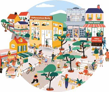
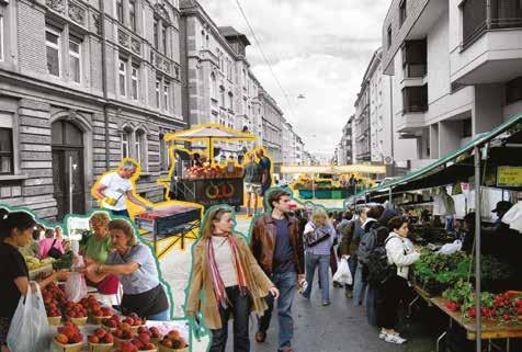
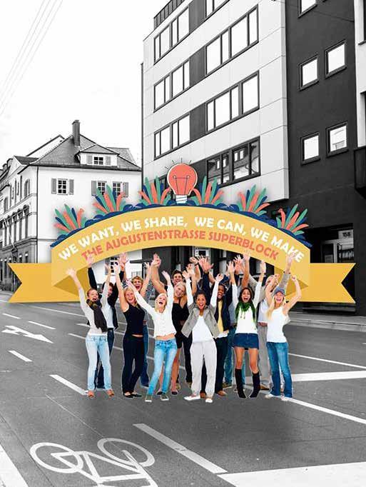
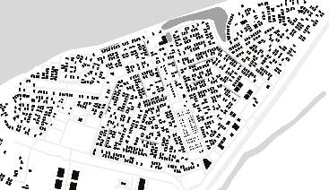
AUGUSTENSTRAßE SUPERBLOCK
01
MASTER’S PROJECT
Co-producing the concept of barcelona superblock in augustenstraße, stuttgart, Germany.
RESEARCH ASSITANCE RESULTS
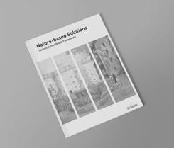
Unalab NBS (Natural Based Solutions) technical handbook factsheets founded by the european union’s horizon 2020 programme.
LAND

MASTER’S PROJECT
Designing a community-based experience for sharing research results on mechanisms for mitigating rapid urbanization in hay al maarifah in muscat, Oman.
BACHELOR’S THESIS
Characterization and diagnosis Guide for design projects in agricultural communities.
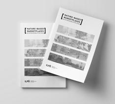
ILPÖ’S ANNUAL RESULTS PUBLICATION
04 05
RESEARCH ASSITANCE RESULTS
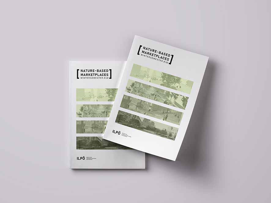
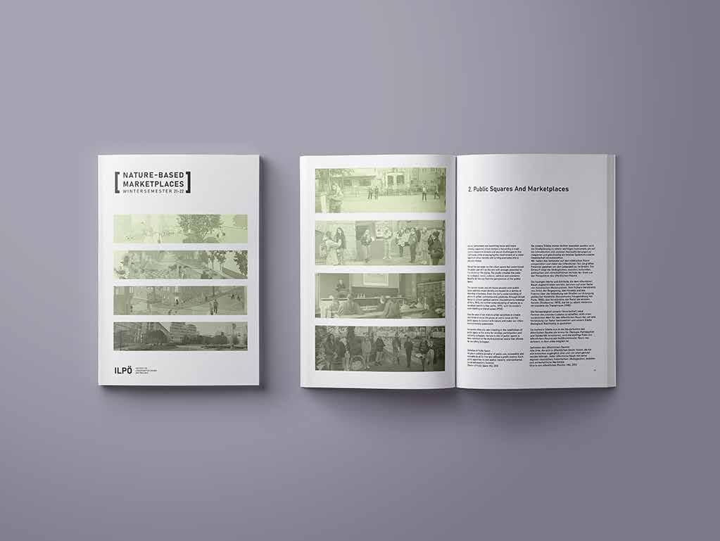
Results of bachelor and master’s projects in nature-based marketplaces workshops.
NATIONAL MUSEUM OF SOILS
06
PROFESSIONAL PROJECT
Design and development of the national museum of soils in the city of Bogotá - Colombia.
DAQPHIBIAN DAQPHIBIAN
MANAGEMENT DISCOVER & CONSTRUCT 02 03
NBS TECHNICALL HANDBOOK
TECHNICAL COMPONENTS Management
Organization of work teams and management of monetary resources.
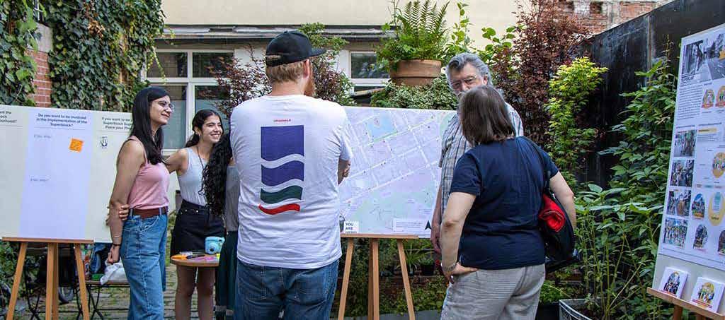
AUGUSTENSTRAßE SUPERBLOCK
CO-PRODUCING THE CONCEPT OF BARCELONA SUPERBLOCK IN AUGUSTENSTRAßE, STUTTGART
MASTER’S PROJECT (Team Project)
Developed in: Universität Stuttgart
2021
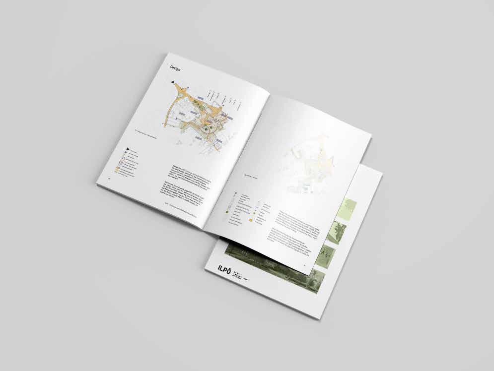
Design
Design of graphic tools that complement the participatory planning activities.
Methodologies
Planning of the methodology for data collection and selection of the use of participatory tools.
Research Synthesis
Design of the final presentation for the community with the results of the participatory planning activities.
Interdisciplinarity
coordination with the community organization, the people, and governmental organizations involved.
01

OBJECTIVES


VISION Co-Producing Augustenstraße Superblock AIM Enabling local governance and designing site implementation PLANNING Create a framework for a community-led social lab policy evel long term 1 2 IMPLEMENTATION Designing interventions anchored in site site evel | shor t term THE PROPOSAL II. Facilitating dialogue & outreach III. Fostering empowerment IV. Devising par ticipatory processes & suppor t infrastructure I. Bringing people together
THE CONCEPT
STAKEHOLDER ANALYSIS
Funding Advice Resources Research & Information
Neighbourhood Association
Superblock Superheros
University Of Stuttgart District Advisory Council
Reciclaje.pe Kulturinsel Farbwerk Stuttgart Parkett Studio
Stuttgart HobbyHimmel Allianz für beteiligung Merlin Wanderbaumalle
Gemeinderat (Municipal Council)
Urban Planning Advisory Board
Policy Planning and Sustainable Mobility Dp.
Office of Public Order, Road Traffic Urban Development and Technology Committee
Urban Development, Housing and Environment Dp.
Office for Urban Planning and Housing
Stuttgart Change Lab
Future City Lab, Uni Stuttgart
Strong Weak Conflict Type
Direct Indirect
of Relationship
Mutual Characteristic of Relationship
PRIVATE CIVIL PUBLIC KEY PRI M A R Y SECON D A R Y P O TE N T I AL
Commercial Local Media Residents Users And Passerbys Allianz Greenpeace Initiative "Hasenberg Im Blick" Office For Public Space Club International, Stuttgart Stadtlücken E.V.
Basurama, Spain Stuttgart Solar e.V. Parklets fur Stuttgart Media Health & Fitness Italo Disco Food & Beverage
ACTIONS AND MILESTONES STRATEGY DESIGN
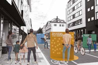

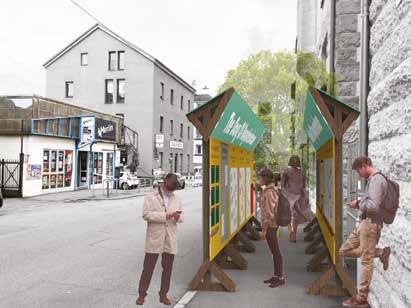
THE PASSAGE TO THE FUTURE
REAL WORLD EXPERIMENT
COMMUNITY-EXPERTS ROUNDTABLE

Evaluation Points
 Awareness Campaign
Community Groups
Digital Portals
COMMUNAL BAZAAR
Seed
Organisational Structure
WALL OF IDEAS
Streetscape Design
Collab. Implementation
Awareness Campaign
Community Groups
Digital Portals
COMMUNAL BAZAAR
Seed
Organisational Structure
WALL OF IDEAS
Streetscape Design
Collab. Implementation
‘S U P E R L A B’ Augustenstraße towards a community-led social lab
The Superlab is a community led social lab that double acts as a support platform to enable participatory planning and allow the community to together create their Superblock. We propose an organisational structure for the lab that is fun, social and practical, that helps in building friendships and kinship, that is democratic and deliberative, and one that is multidisciplinary and incorporates experts, businesses and students. We aim to create a people’s Superblock through a people’s Superblock that acts as a bridges between city government and local politics.
OPEN PARTICIPATION ON THE COMMUNITIES’ EXPECTATIONS
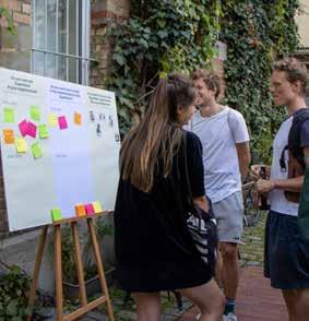
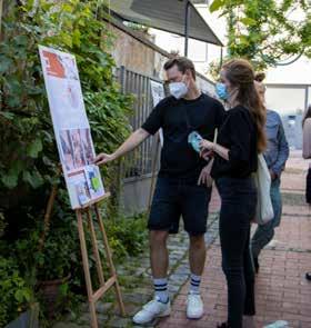

CERATING WITH THE COMMUNITY
MAPPING STRATEGIES AWARENESS CAMPAING WALL OF FUTURE
TECHNICAL COMPONENTS Management
Planning and delimitation of deliverables and coordination of scopes for the workshop with the community.
LAND MANAGEMENT AWARENESS CAMPAIGN
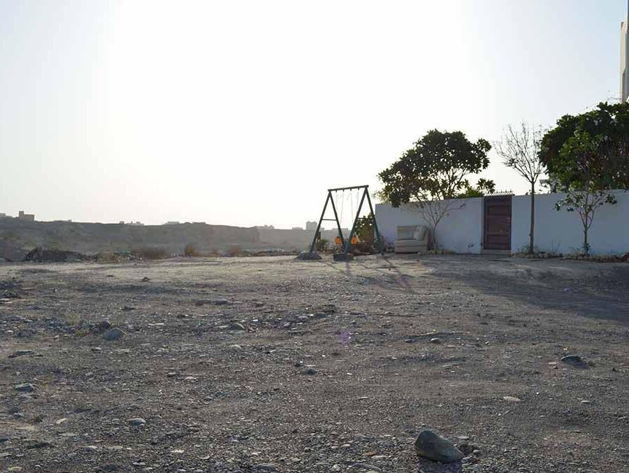
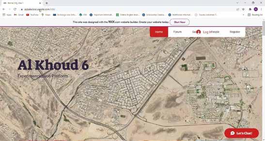
DESIGNING A COMMUNITY-BASED EXPERIENCE FOR SHARING RESEARCH RESULTS ON MECHANISMS FOR MITIGATING RAPID URBANIZATION IN HAY AL MAARIFAH IN MUSCAT, OMAN
MASTER’S PROJECT (Team Project)
Developed in: Universität Stuttgart
2021
Design
Design of the website as a digital platform for the participatory creation of solutions for accelerated urbanism.
Methodologies
Planning of the methodology for data collection and selection of the use of participatory tools.
Research Synthesis
Creation of the awareness campaign according to the political and social research on land management in Oman. coordination with the community organization, the people, and governmental organizations involved.
Interdisciplinarity
02
GENERAL AIM
To empower the community members through the knowledge of their civic rights and duties in regard to land management. Implementing a hybrid bottom-up/top-down approach, starting with the successful case of self-governance in Hay al Maarifah and expanding to other hays and the whole of khoud 6
OBJECTIVES
Identify the main components of an inclusive and connective platform for land management.
Create gathering and sharing possibilities for diverse self-expression and exchange.
Exchange of knowledge to enable community members as the main drivers.
Creating a scalable catalyst network.
VISION
Fostering a connected and aware community that is included and involved in the land management and development system of Muscat.
AWARENESS
WHAT IS IT?
A connective campaign that works both online and an offline, implementing both top-down and bottom up approaches.
Centralize information Create awareness

WITH WHAT PURPOSE?
Connect & encourage interaction
Invite people to question
Foster experimentation
Collect feedback and empower people
MULTI-STAKEHOLDER INITIATIVE

Sultan Qaboos University, … Academic & Professional Experts Knowledge
THE FACTS

Land is a limited resource Co-development is more flexible than you think Land Block Macro Mezzo How can we assure the success of the Awareness Initiative? Constant process of monitoring: Feedback Analysis and Critical revision of missing links Impact assessments, indicator evaluations, metrics revision
AWARENESS CAMPAIGN
Land
As a Limited Resource Offline
● Mapping of vacant land and identify ownership (land registry) : MoHUP
● Lecture on policies
● Informative interactive workshops:
- Oman Vision 2040
- Spatial Strategy


- Sustainability of land
….
Online
● Podcast: Land Series

- Rights & Duties
- Dessert Sp Urbanization
- Land Allocation
● Land management in numbers
● Guide: Process of land in Muscat
Guided Question: Guess the % of the vacant land in Khoud 6?
How can we optimize our use of land?
Khoud 6 Pilot project - MoHUP
● Khoud 6 working group -> represented in the committee
● Reconfigure governance structure for ease of citizen engagement & cross ministry communication
● Alternatives to undeveloped (+owned) land. - time sensitive -
Based on your use of land as follows; Muscat will run out of land by ..
Vertical vs. Horizontal Shared vs. Individual Soc. Housing vs. Lottery
Ministry of Housing Explained I Land Allocation System I Get to Know Procedures & Documents
Information Discussion Experiment
AWARENESS CAMPAIGN
Block & Neighborhood Clusters
Offline
● Informative interactive workshops:
- Process of urban experiment
- Building a sense of community
- (outcome of forum)
● Posters and street signs
● Urban walks (local and professional experts)
Reintroduce Majles & Sabla in each “Hay” as a gathering point

Historical relevance
Online
● Podcast: Block Series
- Spontaneous public Spaces
- Public Services
- People of the block
● Informative Videos
Opportunity to upload designs and provide a narrative for design

● Implement agreed upon deign outcomes of online design
● Create an identity for each of the clusters (Hay)
Online design tools Street Design (Streetmix)

- Public space (Mincraft)


First step would include identifying the different clusters (Hay) in a participatory manner

Information Discussion Experiment
Urban Planning Explained I Opening Event Of Majles & Sabla I Talk with Seeb Municipality
FINAL EXHIBITION - PRESENTATION OF THE RESULTS TO THE COMMUNITY


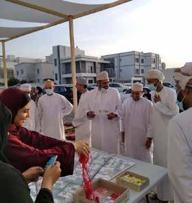
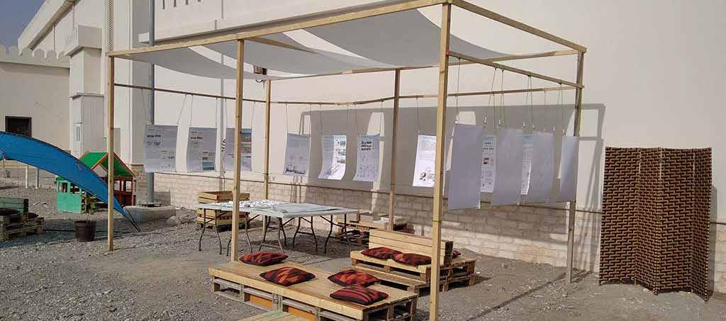
SHARING TO THE COMMUNITY
PARTICIPATION
MATERIAL EXHIBITION SET-UP
COMMUNITY
CREATION OF THE
TECHNICAL COMPONENTS Management
Support in applying for project funding calls and negotiation with producers.
DISCOVER & CONSTRUCT
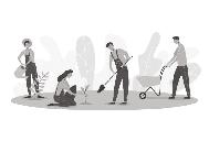
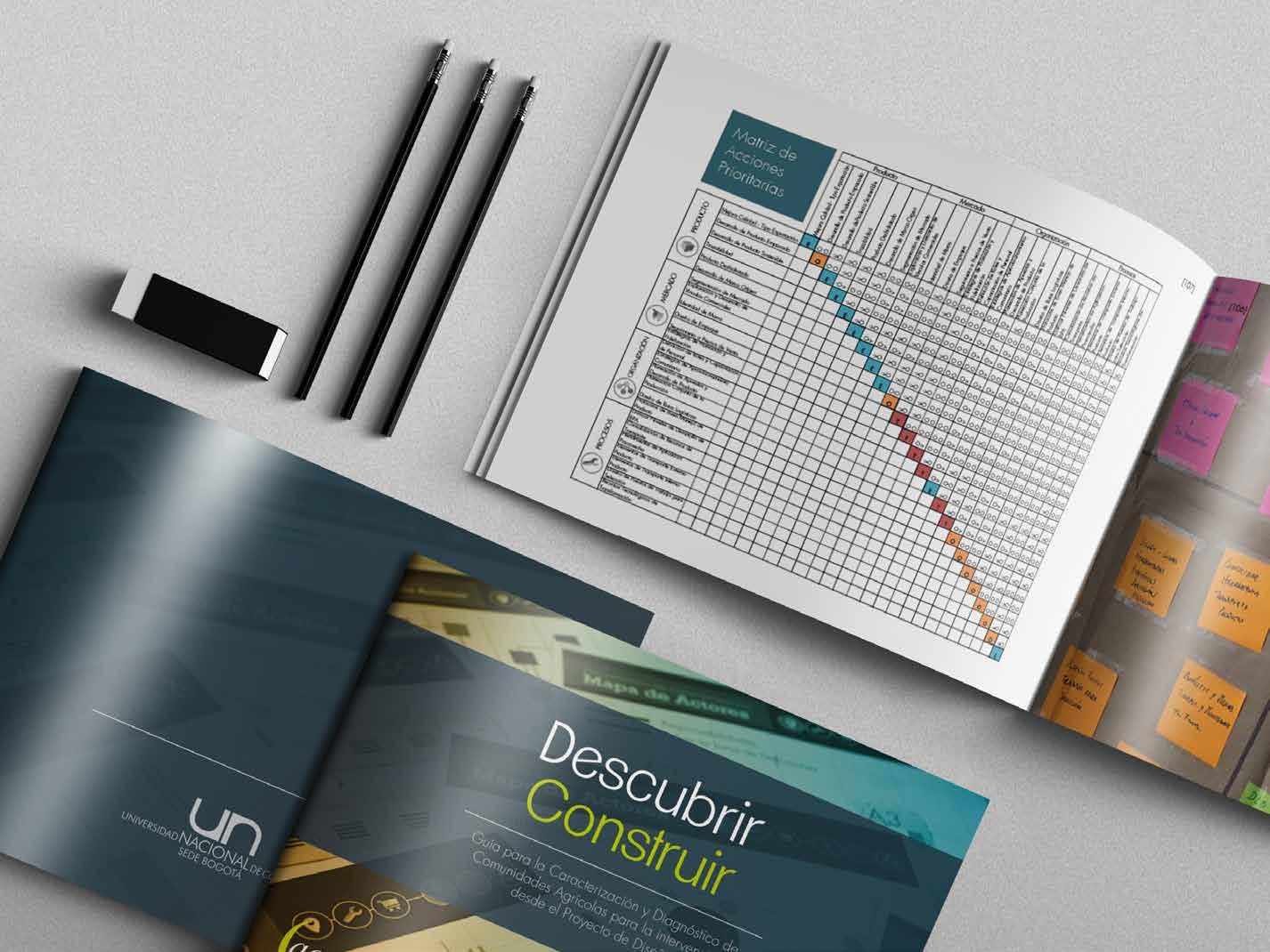
CHARACTERIZATION AND DIAGNOSIS GUIDE DESIGN PROJECTS IN AGRICULTURAL COMMUNITIES.
BACHELOR’S PROJECT (Pair work)
Developed in: National University of Colombia
2015
Design of the forms for the social and participatory innovation activities and design of the final guide.
Design Methodologies
Design of the logical framework for the application of characterization and diagnostic tools.
Research Synthesis
Design of the guide for the use of results in the creation of the strategic innovation plan.
Interdisciplinarity
Coordination with the different stakeholders, the project funders, the research group and the producers.
03
CHARACTERIZATION AND DIAGNOSIS PROCESS
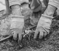
The main objective of the research project was to generate a guide for the characterization and diagnosis of emerging agricultural communities, through a series of tools that will complement the model of the ACUNAR research group (research group of the National University of Colombia), for innovative development in agricultural production.
Communicate and Implement
Participatory Methodologies

3
Interpretation
Creative Act
Design 2 Recognize 1
Decision Making Collection of Information
Intervention Model

INTERACTION I NFORMATION Transfer
MODEL RESEARCH
The development of the toolkit, as well as the application model for a characterization and diagnosis process, incorporates elements from the IAP application methodologies, where the participation of the community, their knowledge, and their resources are necessary to guarantee a positive result. This guide for innovative development in the countryside was created with the agricultural community in Chipaque, a municipality in Colombia.
Criteria For Design Of Toolkit
 Characterization And Diagnosis Toolkit
2. REVIEW
3. DELIMIT
1. APPROACH
Existing Toolkit
Process Of Characterization And Diagnosis Conceptual Framework
4. ASSESS
5. DEFINE
7. EXPERT PANEL
8. APPLY / VALIDATE
9. PROPOSE
6. DEVELOP
Lids Wheel
Case Study With Herbal Aromatic Producers In Chipaque, Colombia
Toolkit Evaluation Characterization And Diagnosis Guide
Characterization And Diagnosis Toolkit
2. REVIEW
3. DELIMIT
1. APPROACH
Existing Toolkit
Process Of Characterization And Diagnosis Conceptual Framework
4. ASSESS
5. DEFINE
7. EXPERT PANEL
8. APPLY / VALIDATE
9. PROPOSE
6. DEVELOP
Lids Wheel
Case Study With Herbal Aromatic Producers In Chipaque, Colombia
Toolkit Evaluation Characterization And Diagnosis Guide
A ROUTE, A MAP, A SET OF TOOLS
The characterization and diagnosis guide contains a plan of execution and an application of the design tools described within. This plan is the backbone of this process, and its correct application guarantees successful results. The objective of the methodological processes is an execution plan, created from a design approach, that will increase the competitiveness of agricultural producers through innovative development.

Walk and Conversation
Territory
Photographic Processes Map
Market Map ARA Positioning of Marketing Chain Value Analysis Priority Interventions Matrix Benchmarking Process Evaluation Product Market Value Chain Actors Map Semi Structured Interview Resource Map Building the Territory Awareness Activity Activities for Interaction Value Chain Construction Establishing the business model Participative Diagnosis Flow of Strategic Actions Diagram Strategic Vision Construction
CHARACTERIZATION DIAGNOSIS
Touring the
Safari
Touring the Market
WHAT’S INCLUDED IN THE GUIDE?
Researcher´s Construction Usage Guide
Conceptual Bases
C&D Process Map
Nature Of The Process Toolkit
Exemplification Use Design´s Plan Strategic Vision
RESULT THE FINAL
The result of the research process is presented in a report that records the development and completion of the guide for the characterization and diagnosis process in agricultural communities. This guide contains the methodological process for the implementation of the recommended design tools. Likewise, each tool has a description, implementation process, a list of materials necessary for its application, and an example of the implementation made during the development process in the municipality of Chipaque. Most important, the guide contains the strategic vision plan that lists and prioritizes the actions needed to increase competitiveness from a design perspective.

TECHNICAL COMPONENTS Management
Coordination of the meetings with the expert groups for the collection of information.
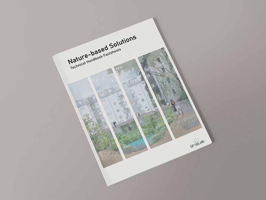
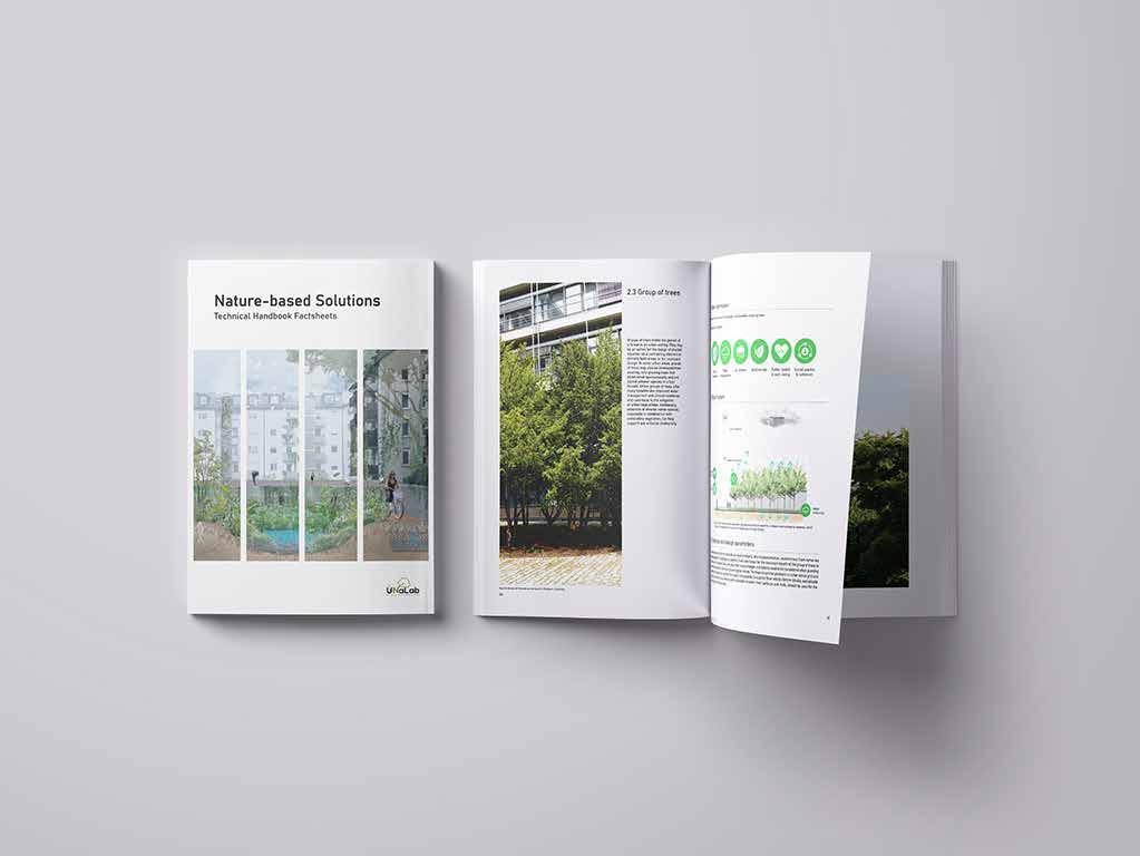
NBS TECHNICAL HANDBOOK
UNALAB NBS TECHNICAL HANDBOOK FACTSHEETS FOUNDED BY THE EUROPEAN UNION’S HORIZON 2020 PROGRAMME.
RESEARCH ASSISTANT PROJECT
(Team Project)
Developed in: Universität Stuttgart
Design
Design of the layout, aesthetics, diagrams, user experience and graphic identity of the publication.
Methodologies
Planning of the methodology for data collection.
Research Synthesis
Systematization of the technical information in the property charts for each of the NBS.
Interdisciplinarity
Joint work with the university institute, project funders and NBS experts.
04
2022


TECHNICAL COMPONENTS
Management
Coordination of the meetings with the expert groups for the collection of information.
ILPÖ’S ANNUAL RESULTS
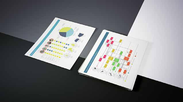
RESULTS OF BACHELOR AND MASTER’S PROJECTS IN NATURE-BASED MARKETPLACES WORKSHOPS IN THE INSTITUT FÜR LANDSCHAFTSPLANUNG UND
ÖKOLOGIE
RESEARCH ASSISTANT PROJECT
(Team Project)
Developed in: Universität Stuttgart
Design
Design of the layout, aesthetics, diagrams, user experience and graphic identity of the publication.
Methodologies
Planning of the methodology for data collection.
Research Synthesis
Selection of material and strategic organization for efficient and clear communication of the results achieved.
Interdisciplinarity
Joint work with the working team, the institute’s management and the students of the courses.
05
2022

TECHNICAL COMPONENTS Management
Coordination with the different working groups, time management and resource management.
NATIONAL MUSEUM OF SOILS
DESIGN AND DEVELOPMENT OF THE NATIONAL MUSEUM OF SOILS IN BOGOTA , COLOMBIA.
PROFESSIONAL PROJECT
(Team Project)
Developed in: Instituto geográfico Agustín Codazzi
2018
Design Methodologies
Conceptualization of the museum, architectural design, design of experience and interaction mechanisms.
Planning of the methodology for data collection and selection of the use of participatory tools.
Research Synthesis
Design of the graphic material for the content of the museum with scientific rigor for children.
Interdisciplinarity
Coordination with material suppliers, construction team, purchasing team and public officials.
06
INTERACTIONS NODES
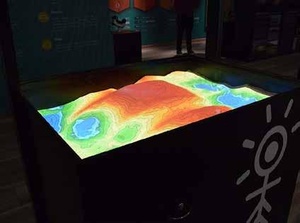
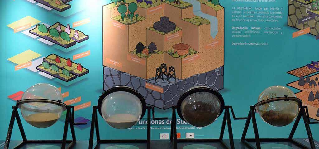
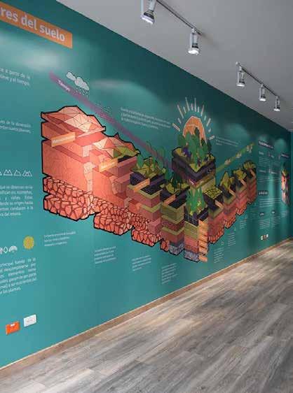
The main subjects to consider in the design of the National Museum of Soils are grouped into three different nodes of interaction, centered on the users and their relations with the museum space. The first is architecture and the distribution of space; the second is the user’s experience within the graphic identity of the museum; the third is the user’s ability to interact with the analog and digital devices.
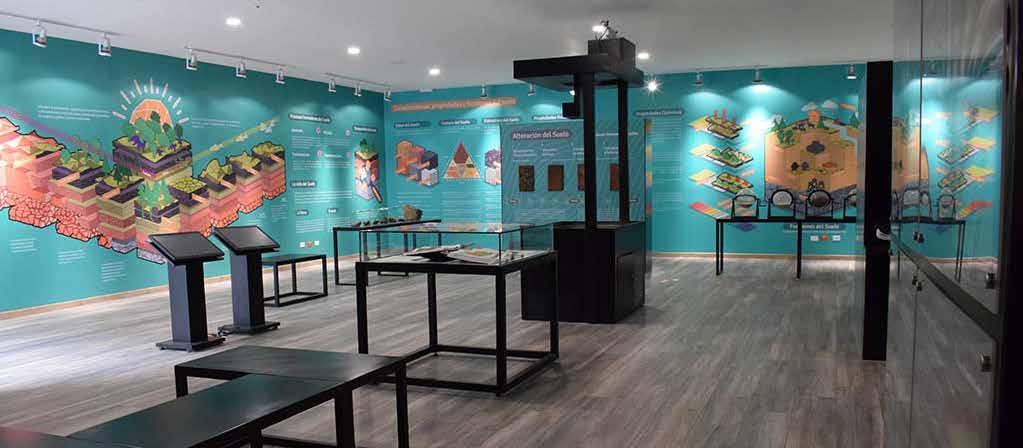
ARCHITECTURE Space distribution Illumination design Coverings and architectural finishes Ephemeral and permanent architecture. Museography Identity branding Educational program Soil monolith experience EXPERIENCE Interactive screens Color / texture interactions Augmented reality sandbox 360° photos in virtual reality. USER
A JOURNEY THROUGH THE SOILS
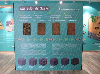
The reinterpretation of geography and edaphology through graphic elements aims to communicate the importance of soil in the development and survival of human life. Without losing the technical rigor, the theoretical contents are presented for a professional public, as well as children and general audiences, and illustrate the dynamics of the soils and their vital importance for ecosystems. We distributed the contents in the museum according to their difficulty, starting with basic knowledge such as the processes and relevant factors of soil formation at the entrance. It then advances to explain physical and chemical properties, so the public can understand the classes of soil present in the country and its physical representation through monoliths.
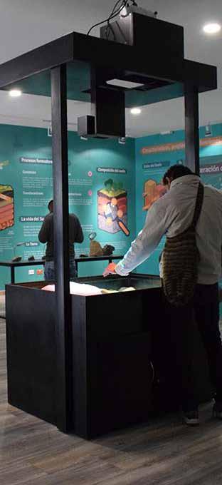
INTERACTIONLINETHEORETICALLINEOBSERVATION LINE FORMATION FACTORS AND PROCESSES 1 2 3 4 5 6 PHYSICAL AND CHEMICAL PROPERTIES COUNTRY'S SOIL TYPES SOIL MONOLITH EXPERIENCE APPLICATIONS OF THE STUDY OF SOILS GEOGRAPHY Augmented reality sandbox Parent material Soil textures 360 ° photos in virtual reality Regional collections Meteorization of the rocks Soil colors regional monoliths Interactive screens Types of geoforms
ARCHITECTURAL INTERVENTIONS

The renovation of architectural spaces included lifting the ceiling, plating the walls, and changing the floor. We also calculated the amount of light needed for the area of the room and selected the light sources and electrical adjustments needed for the internet network. The scope of the project included the design of furniture and ephemeral architecture according to the area of the museum and its spatial distribution. We planned the route for the users inside the room relative to the soil´s theoretical content.


THE MUSEUM AS A CLASSROOM
The museum was conceived as a space that can also convert into a classroom. Through digital screens, teachers can show presentations on topics related to soil science.

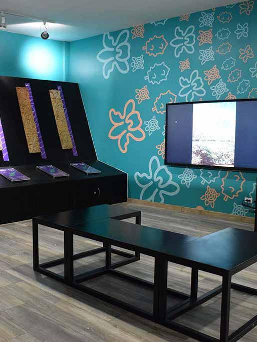
THE USER
EXPERIENCE
The design of the visitor’s experience is based on the theory that the museum is a classroom, where users can visit temporary exhibitions on specific topics throughout the year. Children, the main audience, will use digital applications with interactive screens that complement their knowledge of soils. As part of the museology and museography, we also designed a brand identity for the museum (including logos, typography, colours, packaging, and messaging) so that the museum´s graphic pieces are consistent, permanent, and defined.
GRAPHICAL PIECES
Graphic pieces that are supported by diagrams and illustrations effectively communicate complex scientific information about soils to common audiences.
THE MUSEUM BRAND
Design of a brand around the museum that creates clear and appealing graphic visuals for the user during the visit.
thanks
