Diagnostic Code Analysis and Findings Report


Christopher C. Rosenquest, Mayor
Julie Baughn, City of Plattsburgh Ward 2 Councilor
Elisha Bartlett, Project Lead, Senior Planner, City of Plattsburgh Community Development Office
Shelise Marbut, Assistant Project Lead, Planner, City of Plattsburgh Community Development Office
Matthew Miller, City of Plattsburgh Community Development Director
Kyle Burdo, Code Enforcement Officer, City of Plattsburgh
Jim Abdallah, Planning Board, City of Plattsburgh
Abby Meuser-Herr, Planning Board, City of Plattsburgh
Scott Demane, Zoning Board of Appeals, City of Plattsburgh
Kellie Porter, Zoning Board of Appeals, City of Plattsburgh
Karl Weiss, Engineer, Clinton County
Trevor Cole, Senior Planner, Town of Plattsburgh
Jessica Kogut, Planner, Town of Plattsburgh
Susan Matton, VP of Economic Development, North Country Chamber of Commerce
Bransen Duke, City of Plattsburgh High School Student
Consultant Team


The City of Plattsburgh is undertaking a detailed review and update of the City’s land use regulations, referred to as SmartCode Plattsburgh. The City’s existing land use regulations (Chapter 360 Zoning and Chapter 300 Subdivision of Land) were developed in the late 1990s to promote orderly, economical, and desirable development in the community and to protect and enhance the value of property and life in the City. As with most land use regulations, the City has undergone continuous updates to address new issues as they have arisen along with deficiencies in the existing codes.
On September 9, 2023, the City adopted a new Comprehensive Plan and is in the process of finalizing and adopting an updated Local Waterfront Revitalization Program (LWRP). The implementation strategy from the Comprehensive Plan recommends an update to the City’s zoning and subdivision regulations as a first action to be taken to achieve the goals of the community, with the Plan stating: “The importance of this task cannot be overstated and the opportunity to implement substantial and lasting reforms must be seized by the community.”
The current zoning law is a typical Euclidean Code with an emphasis on land use separation and density control. An in-depth analysis of the code is necessary to modernize it to fit the goals, policies, and implementation strategies of the City’s new Comprehensive Plan. Further, through this Code Update, the City aims to prepare a land use planning and regulatory approach that positions the community to welcome and foster new residents and businesses, while preserving and improving quality of life.
The Comprehensive Plan identifies over 35 objectives, policies, and implementation recommendations related to both zoning and subdivision regulations to guide the City toward achieving the community’s goals. In addition, the Comprehensive Plan recommends evaluating the feasibility and effectiveness of a hybrid form-based code approach to achieve these goals. A hybrid code combines traditional zoning controls with form-based zoning techniques. Adopting a hybrid approach would allow the City to identify specific design elements desired for new development, thereby achieving a similar outcome to that of a form-based code without having to start from scratch.
The City also recognizes that additional chapters of the City Code are in need of review and revision, including, Chapters: 295-Streets & Sidewalks; 278-Sewers & Sewage Disposal; and 144-Building Code Administration & Enforcement.
The opportunity to consolidate applicable land use-related chapters of the City’s Code into a Unified Development Code will also be considered, as suggested in the Comprehensive Plan.
In addition to the above objectives, the following overarching goals were identified in the Comprehensive Plan and will help guide the City’s Code Update:
• Design the code to be user-friendly – easy to navigate, understand, administer, and interpret.
• Incorporate diagrams, tables, graphics, and illustrations that clarify and enhance understanding of relevant code sections.
• Address where the code is silent and where regulations are lacking, or conversely, where regulations are overly restrictive.
• Utilize modern and innovative zoning approaches (i.e., form-based, function-based, overlay districts) and design guidelines where appropriate, particularly in the downtown and historic districts.
• Incorporate mixed-use districting to achieve a more walkable community with nearby commercial amenities where appropriate within neighborhoods.
• Advance diverse and flexible housing options, styles, and “missing middle” housing to accommodate housing trends and greater density needs within the city.
• Moving toward lot size maximums, based on context, rather than strictly applied minimums.
• Moving away from strict parking minimums and allowing flexibility and discretion in the development approval process.
• Streamlining/incentivizing compliant development proposals.
• Combining or aligning all city codes that impact land use with the Zoning Code, potentially through the exploration of a Unified Development Code.
• Ensure compliance with federal and state laws.
The Diagnostic Report is divided into three Volumes. Volume I has the following primary purposes:
• Land Use Policy Understanding: To review and summarize all land use recommendations from the City’s 2023 Comprehensive Plan, Draft Local Waterfront Revitalization Program, and additional applicable planning reports. The purpose of this analysis is to identify and confirm the City’s planning goals, objectives, key recommendations, and policy initiatives that will guide the Code Update process.
• Code Evaluation: Conduct a detailed assessment of the City’s land use regulations, with a focus on Chapters 360-Zoning and 300-Subdivision of Land, to determine if the regulations advance or acts as a barrier to the land use principles and planning vision set forth in the Comprehensive Plan.
This evaluation also seeks to understand current planning and development practices and the dynamics of administration, procedures, common bottlenecks, and any outdated regulations.
• Additional Chapter Evaluations: Conduct supplemental analyses of City Code Chapters: 295-Streets & Sidewalks; 278-Sewers & Sewage Disposal; and 144-Building Code Administration & Enforcement to determine if additional amendments are necessary to implement the Comprehensive Plan and address procedural issues, inconsistencies between Chapters and outdated regulations.
• Recode Guidance: Prepare the City to evaluate alternatives, develop appropriate recommendations, and set clear priorities for calibrating and codifying new land use regulations.
Volume II will include a land use analysis of existing Zoning Districts, Walkshed Analyses, a Housing Availability Analysis, and the results of stakeholder and focus group meetings.
Volume III will include an analysis of potential Zoning District and associated density adjustments and design options, best practices analyses for potential regulatory approaches to identified issues, recommended alternative formats for a revised Code, and an overall summary of the Diagnostic Report’s findings.
To assist in completing a comprehensive land use regulation update, the City retained the consulting team of LaBella Associates, ZoneCo, and Sidekick Creative (the “Labella Team”). The LaBella Team is tasked with working with the City’s Community Development Office (CDO) and the Project Advisory Committee (PAC) comprised of representatives from the Common Council, CDO, Building Department, Zoning and Planning Boards, the Town of Plattsburgh, SUNY Plattsburgh, Clinton County, and the North Country Chamber of Commerce. The PAC will act as a sounding board to provide information and guidance on necessary updates and will review and contribute to draft materials.
In preparing this report, a variety of documents were reviewed to develop a working knowledge of the City’s existing regulations, plans, and policy reports. In addition to the adopted 2023 Comprehensive Plan and the 2022 Draft Waterfront Revitalization Program, the LaBella Team reviewed the 2021 Bike Friendly Plattsburgh, 2022 Plattsburgh City Beach Implementation Plan, the 2022 Plattsburgh Housing Advisory Committee: Final Report, the Harborside Master Plan, and evaluated the ongoing efforts of the City’s Downtown Revitalization Initiative.
The analysis and findings of existing City policies and codes is based both on the review of these documents and broader conversations with City staff and members of the PAC. It is also based on the LaBella Team’s own knowledge and experience, gathered through the years of preparing codes in other communities, of what is considered “best practice.”
Stakeholder and public input will continue to be gathered as the process moves forward. This will happen in three key phases:
• Focus Group Meetings: In coordination with City Staff and the PAC, a series of focus group meetings on key issues identified through the Past Plan & Reports Summary and Diagnostics Evaluation to further identify any new or updated data, common problems, issues, and opportunities.
• Community Information and Design Workshops: Community information and design workshops will be held at key project milestones to present initial findings, assist in conceptualizing potential redevelopment alternatives, and to review and comment on proposed code recommendations. There will also be ongoing opportunities for online community participation to review and contribute to the City’s findings and recommendations.
• Public Hearings: Formal public hearings will occur before the Common Council adopts the revised land use regulations.
The following is a summary of relevant goals, objectives, and guidance from the City’s 2023 Comprehensive Plan (adopted September 7, 2023), 2022 Draft Local Waterfront Revitalization Program, 2021 Bike Friendly Plattsburgh Margaret Street Concept Plan, the Downtown Revitalization Initiative, the 2022 Plattsburgh Housing Advisory Committee: Final Report, and the Harborside Master Plan. The recommendations and policies from these plans and reports will help guide the City’s Code Update process.

• 15-Minute Neighborhood:
è Embrace a multimodal, Complete Streets approach and encourage alternatives to decrease automobile dependency and promote environmental sustainability. (Infrastructure & Accessibility Goal 2)
è Develop a zoning code that embraces a “15-minute” neighborhood concept reflecting the ability to participate in all aspects of the of City life within a small geographic radius. (Infrastructure & Accessibility Objective 2.8)
A major focus of the City’s Comprehensive Plan is on maintaining and enhancing connectivity and preserving overall walkability within the City. A 15-minute neighborhood promotes
mixed land uses and walkability with the intent of allowing residents to access, within a reasonable walking distance, various services that support their everyday needs.
A complete neighborhood is built by fostering land use, zoning, and transportation policies that promote a diverse mix of housing. Permitting flexible uses and increased density, where appropriate, will enable neighborhoods to accommodate more diversity and growth while preserving their character. Moderate and incremental infill development will expand the housing supply without significantly impacting the existing scale and pattern of development.
Allowances for mixed land uses will also encourage the establishment of small, service-based commercial enterprises in residential areas that will provide valuable amenities to nearby properties.
Future development should be guided through updated regulations to incorporate multimodal connections from neighborhoods to community resources and recreational areas such as schools, parks, the waterfront, the SUNY Campus, downtown, and the City’s commercial clusters.
• Infill Development: “Encourage infill development City-wide to prevent unnecessary sprawl and create dense, walkable neighborhoods.” (Economic Development Goal #7)
The Comprehensive Plan identified opportunities for expansion within the City’s municipal boundaries, including, but not limited to the underutilized Skyway Plaza along Route 9 in the southern portion of the City, the vacant and underutilized warehouse and manufacturing buildings located on Jay Street in the Point Historic District, and Plattsburgh Plaza along the Cornelia Street commercial corridor on the City’s western boundary with the Town of Plattsburgh.
The initial stages of the Code Update process will include detailed evaluations of key infill sites along with mixed-use corridors (further discussed below under “Strengthen Priority Areas”) to identify preferred infill and redevelopment scenarios and desired form and scale. This process will guide the preparation of design guidelines and requirements sensitive to the context and character of the City’s varying and diverse neighborhoods.
• Highlight the Waterfront: “Highlight our waterfront as a key component of economic growth for recreation tourism.” (Economic Development Goal 5)
The Comprehensive Plan envisions the need for quality connections between the City’s various assets including its waterfront. Specifically, multimodal connections between neighborhoods and the waterfront is prioritized.
The City anticipates that changes consistent with the land use policies prescribed by the Comprehensive Plan and recommendations included in the City’s Draft Local Waterfront Revitalization Program (LWRP) will occur on the waterfront and that these changes will provide additional opportunities for investment. New waterfront development and improvements that expand public access to the waterfront will bolster the City’s standing as a community that values and highlights its natural assets. The LWRP recommendations are addressed later in this report.
• Strengthen Priority Areas: “By identifying areas of the City in need of revitalization, we can facilitate responsive development in support of the City’s vision and goals. By encouraging the expanded use of vacant and underutilized properties and by promoting opportunities for infill development, we support environmentally sustainable practices. Further, these investments will expand the City’s tax base and strengthen its financial position.” (Land Use & Zoning – Zoning Strategy, Pg. 68)
Priority areas are those exhibiting significant mixed-use activity and those with the potential for such activity. Downtown is a great example of a priority area as it includes a wide variety of land-uses with a dense geographic footprint.
The following additional priority areas will be evaluated during the Code Update process to identify desirable and compatible redevelopment and infill characteristics to guide preparation of design guidelines and recommendations:
è Upper Cornelia Street Corridor (NYS Rt. 3)
è Rt. 9 Corridor (south of S. Platt & S. Peru Streets)
è S. Catherine (south of Broad Street)
è Four Corners (Weed St., Riley Ave., Miller St., and Margaret St.)
è Boynton Avenue
• Preserve our Natural and Historic Resources:
è Fostering the efficient use of natural resources. (Natural Resources Goal 3)
è Assess the suitability of new construction techniques, products, and materials for use on historic structures. (Historic Resources Objective 3.5)
è Revise the historic site review standards prescribed by the City’s zoning ordinance to ensure uniformity of review when subject projects come before the Planning Board. (Historic Resources Objective 3.6)
è Establish a zoning protocol for administrative review of minor, in-kind alterations to registered historic buildings and buildings located within registered historic districts to simplify the building maintenance and improvement processes. (Historic Resources Objective 3.7)
The City’s land use plan must ensure the preservation of natural and historic resources for future generations without impairing the public’s ability to access and enjoy them. Balancing these priorities will be an ongoing obligation.
• Connect Our Assets:
è Support efforts to increase connectivity and access to our City’s natural spaces. (Natural Resources Objective 2.3)
è Identify and improve the physical connections between SUNY’s campus, downtown,the waterfront, and other key destinations to expand the connection and collaboration between the City and SUNY. (Infrastructure & Accessibility Objective 2.3)
While the City’s transport corridors were built to accommodate vehicular traffic, with careful planning they can also serve the needs of pedestrians, cyclists, and those using public transport.
The Comprehensive Plan identified the following areas where connections should be prioritized:
è NYS Rt. 3/Cornelia Street Corridor: New streetscape amenities and improved accommodations for pedestrians and cyclists would beautify this crucial gateway into the City.
è The corridor from SUNY’s campus to the City’s downtown core: Modern designs for “human-scaled” connections in this area will reinforce the symbiotic relationship between SUNY and the City by promoting the movement of pedestrians and cyclists through the construction of streetscape improvements, art installations and wayfinding.
è Between downtown and the Harborside Area.
è Multimodal connections between neighborhoods, community resources and recreational areas.
• Zoning Considerations: In addition to the above-described land use and zoning-related recommendations, the Comprehensive Plan includes the “Land Use & Zoning – Zoning Strategy” Section (beginning on pg. 66) addressing known issues with the City’s land use regulations and provides general policy considerations, guidance, and specific recommendations for consideration during the Code Update process:
è The goals of this code update should include formatting changes to increase the ease of reading and reference, the promotion of sustainable economic development, implementation of a zoning approach that incorporates both design guidelines and form-based zoning in certain commercial/mixed-use districts deemed appropriate, and a modernization of the code to address contemporary issues including, but not limited to, provisions for accessory dwelling units and other alternative housing options to increase supply, neighborhood walkability/bikeabiltiy, affordable housing, adaptive reuse, green building/ green infrastructure practices, environmental sustainability, and similar measures.
è Best practices for crafting zoning ordinances have evolved. For example, overview statements included with each section/chapter assist users’ understanding as to why certain provisions have been established. It is important for the City to modernize its ordinance, so the community has the best tools available to manage growth and investment efficiently, creatively, and equitably.
è With respect to form-based codes, design guidelines, and overlay districts, the City should proceed carefully to avoid creation of an overly prescriptive code that limits the flexibility necessary for development within a modern built environment.
è It will be important to recognize and document the subtleties of neighborhood character, specifically the “public realm” along the streetscapes and the transitional front yard spaces and façade lines in the commercial districts.
è The development of review criteria and recommended protections for new and existing design elements should be included.
è Consider establishing a mutually agreeable process for coordinated review between the Town and City for projects along our shared border, recognizing the benefits of collaboration including reduced costs and expedited project timelines.
è A successful land use and zoning strategy will establish a set of clear expectations and clarify all aspects of the review process to minimize confusion among project sponsors, potential developers, and the community.
è Special attention should also be paid to the following when updating the zoning ordinance:
n Protections for the City’s existing stock of affordable housing and provisions encouraging the expansion of that supply while protecting neighborhood character as the City evolves.
n Providing increased clarity as to the appropriate jurisdiction and role of the local boards involved in land use decision making including the Common Council, the Planning Board, and the Zoning Board of Appeals.
n Facilitating beneficial additions to community assets via the development process by clarifying desirable outcomes (e.g., design guidelines that illustrate what success looks like).
n Consider provisions for an administrative review process whereby minor projects could be reviewed against established criteria by City staff to streamline permitting.
n Simplify comprehension of the zoning code via the use of illustrated fact sheets, conveniently located links to referenced provisions, and similar techniques.
Additional Comprehensive Plan recommended updates include:
è Allow for mixed-use, infill development.
è Establish criteria for permitting small-scale commercial enterprises in residential areas.
è Clarify the process and approval criteria for PUD and site plan review.
è Include provisions for addressing protections for shorelines, riparian buffers, and wetlands.
è Evaluate the list of uses requiring Special Use Permits (SUP) for continued suitability and reassess the approval process for SUPs.
è Examine the ordinance’s area/bulk formulas and evaluate whether simplification is warranted.
è Provide more appropriate zoning district designations for areas in transition (e.g., the Harborside Industrial District area).
è Clarify guidance for determining conformity of a proposed project’s character with a particular district of neighborhood.
è Review parking requirements regarding their continued suitability and consider modifications where appropriate.
è Create definitions for land uses and other items that are not defined in the ordinance.
è Modify zoning district provisions appropriately. Certain districts appear overly restrictive while others appear overly flexible.
è Consider expansion of historic districts and the establishment of design review guidelines and a historic commission to evaluate proposed changes to subject sites and districts.
è Review standards governing streets in the subdivision regulations and elsewhere and consider modifications to align with Complete Streets policies.

The City’s Draft LWRP includes a series of land use and regulatory recommendations specific to the Waterfront Revitalization Area (WRA). The primary regulatory component is found in LWRP Appendix B. Local Waterfront Revitalization Program Consistency Review and Development Design Guidelines. Additional land use and zoning recommendations are found in LWRP Section IV. Proposed Land & Water Uses & Proposed Projects.
• LWRP Appendix B. Appendix B. Local Waterfront Revitalization Program Consistency Review and Development Design Guidelines.
Appendix B consists of draft regulations proposed to be inserted into in the City’s zoning regulations. The regulations provide special controls to guide land use and development within the Waterfront Revitalization Area (WRA). Specifically, the regulations are designed to protect the sensitive waterfront areas and to maintain land uses consistent with the City of Plattsburgh LWRP. The regulations are not intended to substituted for other zoning district provisions.
The City has an existing WRA located along the City’s Lake Champlain shoreline and is included on the City’s Zoning Map. The 2022 LWRP proposes to expand the WRA boundary to include the entirety of the Saranac River within the City. The WRA is referred to as the Waterfront Overlay District (OD-W) within the proposed regulations. The City’s Official Zoning Map will be amended to formally establish and include the proposed updated configuration of the OD-W. The OD-W will be superimposed on the principal zoning district provisions and should be considered as additional requirements to be met in establishing a use within the respective principal zoning district.
The consistency review process provides a framework for the agencies of the City of Plattsburgh to incorporate the policies and purposes contained in the City’s LWRP when reviewing applications for actions or direct agency actions located within the WRA; and to assure that such actions or direct agency actions undertaken by City agencies are consistent with the LWRP policies and purposes. These regulations will be reviewed with the PAC, edited where necessary consistent with the LWRP, and incorporated into the Code Update.
The draft regulations also include Waterfront Revitalization Design Guidelines. The guidelines were prepared to aid applicants in the development of plans for projects in the WRA and also support the City’s Planning Board during the site plan review process. By considering these guidelines as projects are planned, applicants can be responsive to the principles established in the LWRP to create projects that appropriately fit and enhance Plattsburgh’s waterfront character and add to the community assets.
These design guidelines will be review and revised as part of the Code Update and inserted into the appropriate section(s) of the new code.
• Section IV. Proposed Land & Water Uses & Proposed Projects
Section IV is a key component of Plattsburgh’s Waterfront Revitalization Program and consists of the specific land and water uses, development projects, and revitalization programs – both public and private – proposed for the WRA. The following amendments to the City’s zoning regulations have been recommended:
Development in Flooding and Erosion-Prone Areas (Pgs. 163-164): The LWRP provides recommended land use regulations for new development within floodways and flood hazard areas. The draft regulations in the LWRP will be reviewed and incorporated into the appropriate section of the new Code.
Marina-Downtown Subarea Design Guidelines (Pg. 184): Since the Dock Street area has the potential to become a major entry point into the City, the development of design guidelines are recommended, building upon the 2009 Streetscape Design Guidelines for the Downtown Area. These design guidelines are one option to improve the waterfront and landside ambience.
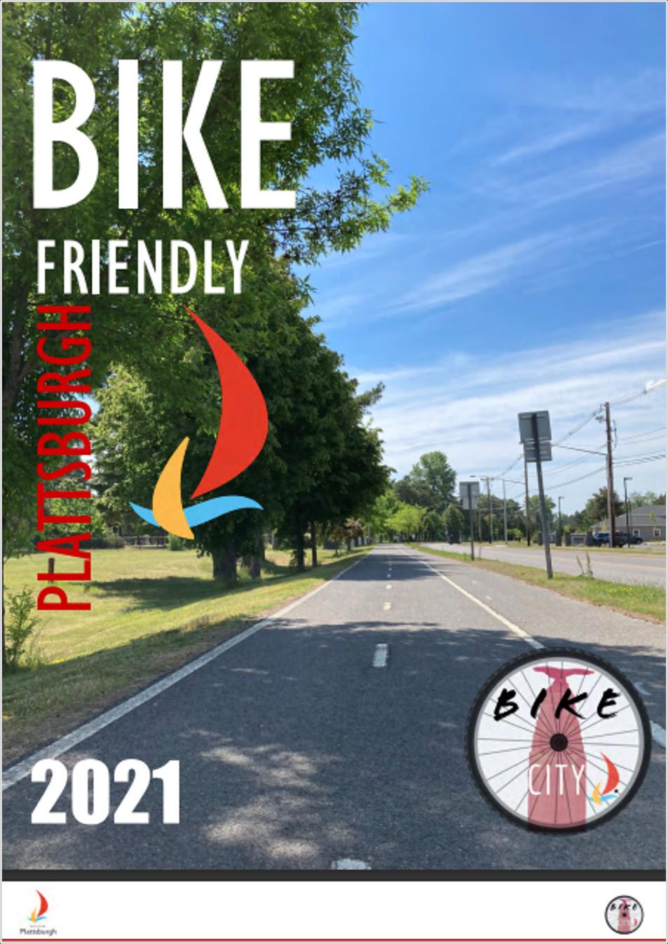
• The City’s goal is to develop “bike friendly” streets to provide safe and equitable movement of people of all abilities via a network of sharrows, bike lanes, bike boulevards, multi-use paths all connected to move people where they need to go within a reasonable distance. (pg. 12)
• With guidance from Bike Friendly Plattsburgh, the Code Update will incorporate Complete Street design requirements for developments involving new streets or improvements to adjacent roadways in locations where the City has yet to make the recommended improvements.
• In addition, Bike Friendly Plattsburgh will be integrated into the Code as a guidance document for the Planning Board and applicants, where applicable.
• The report will also provide guidance on how new developments/infill projects could continuously improve bike access and safety.
• The City is in the process of implementing the recommended Margaret Street improvements. The Code Update process will take into consideration the new streetscape environment and consider building and streetscape design elements for new development that will be consistent with and capitalize on the recent work.
• The Code Update process will identify necessary code amendments to facilitate implementation along with potential future development on adjacent private properties.
• Durkee Lot Mixed-Use Development: The DRI’s centerpiece was approved by the City’s Planning and Zoning Boards in accordance with the current zoning ordinance and remains under litigation as of the drafting of this Report. Based on discussions with City Staff, the overall design characteristics and zoning flexibility incorporated into that project should be incorporated into this Code Update and be applied to the rest of downtown.
• Downtown Grant Program: A series of 8 building rehab projects (7 privately owned, 1 publicly owned) are spread around downtown. The DRI funding focused on first floor commercial space and second/third floor residential space which was driven by current zoning restrictions in the Central Business district. The publicly owned project was the Green St. farmer’s market relocation. A rezoning of the current industrial zone in which it operates will need to be part of this Code Update.
• Strand Center for the Arts Renovations: Interior renovations to the Strand Theater and a maker space for the Arts Center were completed. Care should be taken when updating the Permitted Use Tables to ensure they reasonably accommodate the Strand’s operations.


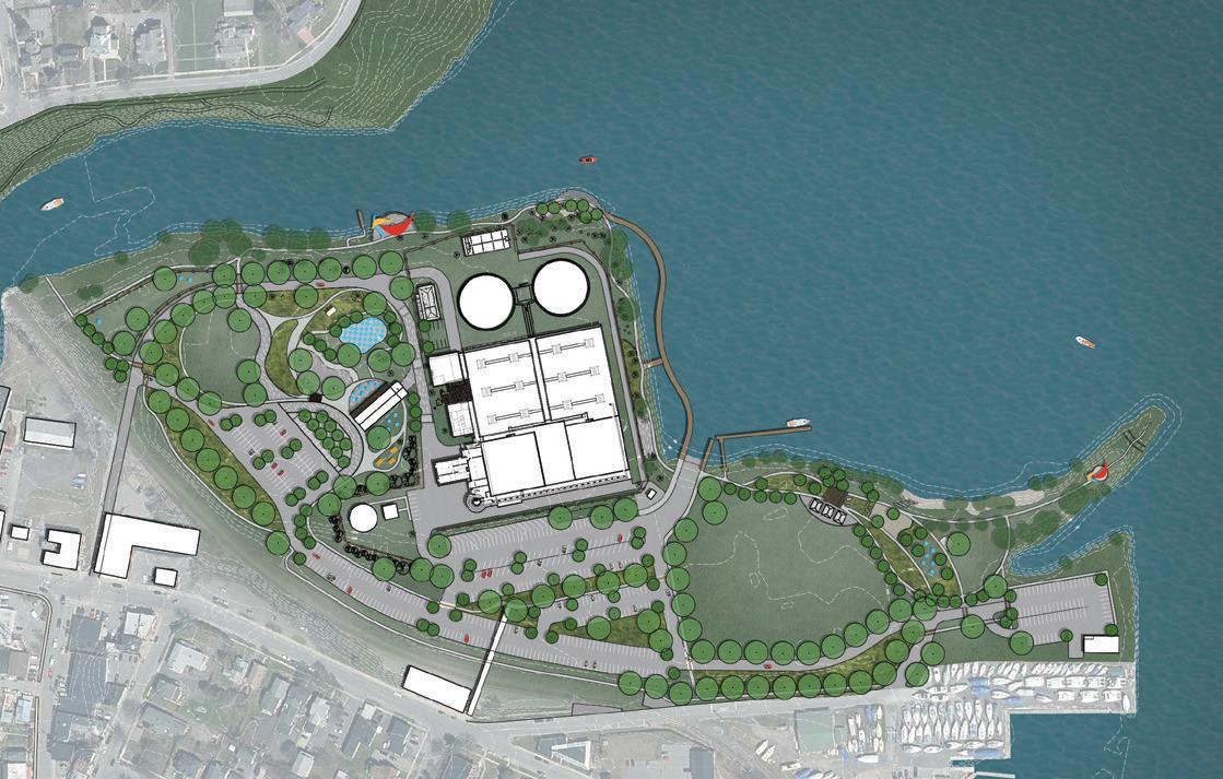
The Harborside Master Plan project established a future development plan for Harborside in the Dock Street Landing Area on Lake Champlain and the Saranac River. The process resulted in preliminary designs for an Environmental Learning center, an exercise trail, farmer’s market area, along with numerous recreational amenities and proposed connections between the 30-acre Harborside site and redevelopment opportunities on Lake Champlain and in the City’s downtown.
Based on the proposed Master Plan and as reference above in the DRI summary, the existing Industrial zoning west of the City’s wastewater treatment plant should be evaluated to determine if district and/ or allowable use adjustments should be considered to more closely align with the Master Plan.
The remainder of the Dock Street Landing Area is zoned RC-1, and all proposed uses are currently allowed within the existing zoning classification. With this said, the RC-1 district allowable uses and associated approval procedures should be reviewed to determine if adjustments are necessary to better facilitate the proposed uses identified in the Master Plan.
The southern portion of the Master Plan includes the Saranac St. MGP NYSEG Site, with a mix of recreational opportunities proposed. The area is zoned R-2 and all proposed uses are permitted under the existing zoning, although a review of the overall use and approval procedures should be completed to ensure future desirable uses are allowed and with appropriate approval procedures.
The following zoning-related recommendations from the 2022 Final Report will be considered during the Code Update:
• Consider instituting an administrative review process to fast-track simple modifications in Historic Districts.
• Adopt an inclusionary zoning policy that could includereductions in parking requirements and density bonuses in exchange for selling/renting 10-30% of new residential units to low-to-moderate income residents.
• The following zoning reforms to incrementally increase density were recommended:
è Reduce or eliminate minimum lot size requirements.
è Reduce or eliminate off-street parking minimums.
è Allow for the creation of Accessory Dwelling Units (ADUs).
è Allow for multi-family housing by-right by eliminating single family zoning.
è Allow for more than one principal structure per lot.
è Allow for more mixed-use development.
è Encourage construction of a variety of housing types and price points, including micro-apartments and tiny homes.
è Consider short-term rental regulations that meet the needs of the community.
è Encourage multi-generational housing
• Embrace and encourage development of Missing Middle Housing: duplexes, fourplexes, small multiplexes, live-work units, and bungalows. According to the Report, missing middle housing, if properly designed, can bridge the gap between dense mid-rise residential neighborhoods and
lower-density, auto-oriented neighborhoods. Missing middle housing has a small footprint and medium density (but is perceived as lower), and can be walkable. This type of housing preserves many of the community and neighborhood aspects of single-family homes, but allows for the added densities that are needed to reduce sprawl and retrofit American neighborhoods.
• Consider enhanced building codes. Building techniques that reduce maintenance and risk, while costlier at the outset, may have a substantial positive impact on the total cost of occupancy over time. For example, exceeding minimally acceptable insulation requirements during construction will typically reduce utility bills over the tenancy of the dwelling unit.
• Enact a mechanism to encourage reasonable, timely remedy of code violations by landlords. In testimony provided by the public and representatives of agency experts, it has been determined that some landlords elect to forgo necessary repairs as a form of “illegal eviction.” Rather than perform the necessary repairs, the landlord opts to run out the clock to force the property to be deemed “uninhabitable” – resulting in the displacement of the tenants. After the tenants have left the premises, the landlord will perform the repairs. The Report also recommends the City require a mandatory rental reimbursement schedule for the length of time the tenant is unable to occupy the premises.
This diagnostic report (this “Report”) is an assessment of the extent to which the City of Plattsburgh’s Zoning Law (the “Zoning Code”), the City of Plattsburgh Subdivision of Land (the “Subdivision Law”) and other related regulations within the City’s Code, advances or acts as a barrier to the land use principles and planning vision set forth in the 2022 update to the City of Plattsburgh Comprehensive Plan (“the Plan”). The applicable regulations were also reviewed to identify errors, inconsistencies, and other issues requiring updates.
As the City begins the process of crafting new, modern, streamlined zoning regulations, this Report is an important first step in illuminating the strengths and weaknesses of the City’s land use regulations as it relates to the Plan.
This Report is not scientific and is based on our best professional judgment and experience with zoning codes and best practices throughout municipalities across America. Its purpose is to inform, highlight, and coalesce the City around those regulations that are no longer best serving the City protecting against bona fide public harms, advancing the vision, and encouraging capital investment.
The Comprehensive Plan, and other related planning documents, identify numerous opportunities to increase the City’s livability and desirability. The Plan outlines eight key policy objectives (collectively, the “Policy Guides”), Land Use and Zoning objectives, and priority areas throughout the City in need of revitalization. It is with these objectives in mind that the analysis in this Report seeks to provide a detailed analysis of how the current Zoning Code can be amended to achieve these planning goals and objectives.
The review, analysis, conclusions, and recommendations of this Report are guided by three general principles of zoning:
Zoning Should Respect Existing and Reflect Desired Development Patterns 1
Regulations that fail to relate or respond to existing development patterns or fail to promote the community’s vision for future development patterns erode the relevance of both the existing and planned built environment. Places that lose their relevance experience a decline in demand and investment. Supply ultimately exceeds demand, property values drop, and investment becomes less and less likely over time.
Zoning should be a tool to implement the community’s vision in its plan. To do so, zoning districts should be focused less on use segregation, which can lead to disjointed development patterns, and more on the desired character of the unique areas of the City.
2
Zoning
Should Regulate Only What Actually Needs to Be Regulated and Focus on Desired Outcomes.
Regulations that do not justify government intervention or merit investment of precious local government resources should be reconsidered and removed if possible. First and foremost, zoning regulations that no longer relate to any public interest may not be enforceable if challenged. Even if they are not challenged, they are unlikely to be enforced since they do not address any actual or potential public harm. Expending resources administering zoning regulations that do not address actual or potential public harms can create unproductive friction in the process and an unnecessary expenditure of local government resources.
Regulations that impose requirements that are out of context and do not respect or relate to the existing development patterns unnecessarily require administrative relief and numerous approvals when a development is proposed. This adds expense and uncertainty, which increases the cost of investment and may result in less desirable development outcomes. It also requires significant governmental resources to administer these processes. When the costs of administering a regulation outweigh the benefits, such regulation should be reconsidered and potentially eliminated.
3
Zoning Should Be the Implementation of a Plan, not a Barrier to Achieving the Vision.
Outdated, confusing, inconsistent, and disorganized zoning regulations are often cumbersome to use and administer and can be an impediment to achieving a community’s economic development goals and planning vision. Because zoning regulations are the implementation of a plan, the plan should lead, and the regulations follow. In many instances, much effort has been expended on the plan, but the zoning regulations are overlooked or revised in a disjointed or piecemeal manner. Zoning regulations that make it more difficult, or even impossible, to achieve the planning vision should be reconsidered and removed if possible.
For example, zoning regulations that are inconsistent, unclear, poorly worded, disjointed, disorganized, or confusing can be intimidating, time consuming, and costly for property owners, which may discourage investment. Likewise, cumbersome approval and administrative processes can add significant time and cost to property development and redevelopment.
This is not to say that the process should always be paved for development. Public review and input are a necessary and valuable part of the process. If the regulations and processes are based on the community’s vision in the plan, then the public should be comforted in knowing that the regulations are setting the plan in motion. Clear, usable, defensible, and consistent regulations operate to protect the public visioning process while balancing the needs of property owners.
Through extensive community outreach, the Plan put forward eight Policy Guides related to natural resources, infrastructure and accessibility, community resources, recreation, arts and culture, historic resources, housing, and economic development with a total of 37 goals. In addition, the Plan includes a wide range of zoning and land use recommendations. To establish the benchmarks for which this report looks to analyze the current Zoning Code, the following consolidated objectives were established:


1. Accessibility - Embrace a multi-modal, complete streets approach and encourage alternatives to decrease automobile dependency and promote environmental sustainability.
2. Housing - Create a diverse and equitable housing market that provides safe, affordable, and accessible options.
3. Natural Resources - Improve and protect the City’s natural resources and promote adaptation to climate change.
4. Historic Resources - Preserve the City’s historic resources and stabilize and enhance historically significant areas through compatible infill development and effective review and design standards.
5. Economic Development - Streamline the development review process, foster existing and future neighborhood businesses and compatible waterfront development, and facilitate infill and mixeduse development to prevent unnecessary sprawl and create dense walkable neighborhoods.
The current Zoning Code was adopted in November 2001 and was amended seven subsequent times as recently as 2022. These amendments are minor in nature and largely focused on definitions, administrative procedures, and additional use regulations. The zoning code itself is a fairly concise document totaling 94 pages in addition to four attachments (Schedules I-IV) which include tables and equations for uses and development standards of each district.
Chapter 360 includes nine articles and four attachments which can generally be placed in three categories:
1. Administrative Regulations (Articles I, II, VI, VII, and IX)
2. Zoning District Regulations (Articles III and IV, and Schedules I, II, III, and IV)
3. Generally Applicable Regulations (Articles V and VIII)
While the Zoning Code has been regularly updated and maintained, amendments have not been pursued to better align the zoning with the City’s current needs or vision. Some amendments have been undertaken to address more modern topics, such as the commercial mining of cryptocurrencies or domestic keeping of chickens, but the integration of these modern issues into the framework of the Zoning Code has left them disjointed. For example, no other commercial or industrial use regulated by the Zoning Code has the same degree of definition, restriction, and environmental regulation imposed upon it as was amended in 2018 to address Cryptocurrency mining operations. Similarly, the regulations governing the keeping of domestic chickens, including the required size and setback of chicken coops, and the regulatory process for permitting is set forth in its own unique Article, making it easier to understand the regulations governing chicken coops than a residential home.
While both of the above examples are honorable and worthwhile pursuits in zoning, it is clear that the existing structure and framework of the Zoning Code cannot accommodate the types of changes needed to address the City’s current issues. At approximately 100 pages in length, the structure of the current Zoning Code is very simple. While simplicity is a key objective of any modern zoning ordinance, the structure of the Zoning Code prioritizes being concise over being user-friendly and easy to use. While navigating the document, a user needs to reference multiple sections of the Zoning Code and multiple tables and formulas included as attachments. Definitions and specific use standards are spread throughout the document rather than consolidated into easy to navigate sections.
Lastly, the attachment (Schedules I-IV) are challenging to navigate. While the simplicity of tabular information is core to a modern, user-friendly zoning ordinance, the presentation and references to the tables leave the purpose and intent of each district unclear. Additionally, the formulas of Schedule III governing the development standards for higher density development contain numerous typographic errors, are extremely difficult to understand, and contain no graphics or diagrams to aid a user in applying the formulas. This presents a challenge for the general public, practitioners, and administrators to be fully aware of what can or should be built in a given area.
Overall The Zoning Code’s regulatory approach is largely based on a traditional Euclidean approach to zoning. Furthermore, the structure and organization of the Code make it such that implementing different techniques, such as form-based standards or contextual zoning tools would be challenging to implement and difficult to understand.
Purpose and Intent
While the zoning code follows the convention of including an intent statement in the first article, the intent of all subsequent provisions, districts and overlays is not clearly stated.
Definitions Definitions are located throughout the Zoning Code with the majority of them prominently featured in Article II. Modern convention encourages the consolidation of all defined terms into a single glossary for ease of use and administration.
Graphics The zoning code does not utilize explanatory graphics and diagrams to better illustrative concepts. Graphics should be included to demonstrate development standards, rules of measurement, and generally applicable regulations such as landscaping, parking, and signage.
Tables While the zoning code relies heavily on tables, tables should be better integrated into the document rather than included as attachments. This will allow for the consolidation of information about each district into a single easy to understand location.
Formulas Formulas for determining the development standards of higher-density buildings in select districts are overly complex. Formulas in the zoning code should be limited to basic mathematic functions (addition, subtraction, multiplication, division) to the greatest extent possible.
(Chapter 360, Articles I, II, VI, VII, and IX)
Articles I, II, VI, VII, and IX contain the code’s administration sections, which include general introductory provisions and definitions, nonconforming use and buildings, site plan approval, and administration and enforcement. These sections establish the framework for governing the Zoning Code and outline the process for zoning applications, approvals, and appeals.
Of the 28 unique sections of zoning reviewed in the Administrative Regulations, the vast majority were found to be neutral toward advancing the objectives of the Plan compared to the five consolidated benchmarks. In total, three sections include at least one provision that is generally supportive, and three sections include at least one provision that is generally a hinderance to the Plan’s goal. Given the content of these sections, this is a typical outcome and indicates that the base of the Zoning Code is largely straightforward and similar to language used in other Zoning Code’s.
The purpose statement of the resolution provides an opportunity to codify the City’s planning agenda and intent of the regulations. These provisions help establish a clear vision for the City and aid the Planning Board and zoning officials in making discretionary decisions. The current intent statements could be strengthened to better state the Plan’s objectives with regard to several goals, including housing production, natural resources, and historic preservation.
Defined terms should be presented in a consolidated section using easily understandable language. Current definitions list does not appear to define all permitted of special permit uses. Additional definitions are located outside of this section and may be confusing to the reader.
Some defined terms use outdated terminology and convention. For instance, the terms “Family” and “Functional Family” both include elaborate definitions intended to govern occupancy of a building and draw distinction between a residence for full time occupancy and transient or temporary living accommodations. This language can be seen as exclusionary and may pose problems for units occupied by multiple student renters who may not meet the criteria of this section. Many modern codes instead choose to remove this term and instead regulate only “Dwelling Units” or “Residential Units”.
The provisions of Article VI are generally neutral towards the plan objectives and provide a relief from the zoning approval process for single-family developments and other simple actions. However, this same permissive regulation is not granted for two- and three- family developments which may be a disincentive to the production of new housing units within the City.
The Site Plan applicability and criteria should be presented with and integrated into other administrative procedures outlined in the Zoning Code. These sections should include simple tables, flow charts, and other graphic tools to clearly indicate for a user what the process is to gain approval of simple and common actions in the City.
The guidelines for review of Section 360-38 are extremely clear and thoughtful regulations that include provisions that allow the Planning Board the ability to make decisions that are supportive of the Plan’s goals. Several of the guidelines seek to promote harmonious building design, safety and accessibility, and planting and alternative energy objectives. These findings should be retained and elaborated on in the zoning update to continue to provide clarity and transparency to the Planning Board’s decision-making process.
(Chapter 360, Articles III and IV, and Schedules I, II, III, and IV)
The Zoning Code includes 10 total zoning districts and two overlay districts that are mapped throughout the City. This includes three residential districts (R-1, RH, R-2), three commercial districts (B-1, B-2, C), one industrial district (I), three recreational/mixed-use districts (RC-1, RC-2, RC-3) and two overlays (Parking and Waterfront). Many districts are extremely similar to another with very limited distinctions in permitted use or development standards. For example, the required lot size, yards, and other bulk regulations of the R-1 and RH district are identical, and the permitted uses of the B-1 and B-2 districts are the same with only minor differences in lot size or development standards. This presents an opportunity to reevaluate the necessity of each district and calibrate them for the unique built form of the existing context and priority planning areas outlined in the Plan.
Throughout each of the districts, there is a clear lack of intent statements that clearly outline the intended purpose of a district, its unique characteristics and features, and what its planning objectives may be. For example, the RC districts are mapped in unique areas of the City and allow a very wide range of uses unique to each district; however, there is no clear indication of the purpose or rational for how these districts are mapped and their intended form. Clear purpose and intent statements make it easier for the general public to understand their City and participate in the public review and planning processes. They can also help to ensure that future planning staff and Board members have a full understanding of the background and purpose of a zoning district to more effectively administer or issue discretionary decisions in the future.
Generally, throughout each district, there were provisions in development standards, and permitted and special permit use structures that were contrary to many of the goals of the Plan and benchmarks established to conduct this analysis. The housing objective was particularly challenged by these district provisions. Two of the three residential (R-1 and RH) districts permit only single-family homes and require larger lot sizes. The remaining R-2 district is the most broadly mapped and permissive district in the zoning code and allows all typologies of residential development. However, development parameters of each building typology do not allow for dramatically differing densities, and when combined with parking per unit may disincentivize the creation of two- and three- unit development over single-unit buildings.
The development parameters of Schedule III governing the high-rise standards within the B-2, C, and RC districts are amongst the most problematic regulations in the Zoning Code. Many of the formulas to determine the development parameters include inconsistent and inaccurate use of mathematical notation. Additionally, the calculations themselves require the use of more complex mathematical functions, such as determination of the square root and use of factors that are not easily understandable. Lastly, the objective of the City to facilitate contextually appropriate infill development is not likely to
be facilitated through the use of formulaic development parameters that may produce dramatically different building heights, setbacks, and densities for any buildings greater than 2.5 or 3 stories tall.
In our assessment of the current zoning districts within the city, it has come to our attention that there are discrepancies between the designated zoning district names and their actual land use characteristics. Zoning districts should accurately represent their intended land uses; several districts do not align with the existing land uses within them. This incongruity poses challenges in understanding and managing land use regulations effectively.
Additionally, certain districts, such as parks and open spaces or areas designated for recreational purposes, should not permit residential land use. However, upon review, it has been observed that residential land use is allowed within these districts, which contradicts their intended purpose.
To address these issues and promote a more accurate representation of the city’s land use diversity, we propose the following recommendations:
1. Renaming of Zoning Districts: It is recommended to rename the zoning districts to reflect better the mixed-use approach, and the variety of land uses present within each district. This will clarify and ensure that the district names accurately portray their intended land use characteristics. For instance, districts permitting a combination of residential and neighborhood uses/amenities can be renamed accordingly.
2. Development of District Intents: In conjunction with the renaming process, it is crucial to develop district intents that clearly articulate the mixed-use approach in the city. These districts’ intents should accurately describe the range of permitted land uses and guide stakeholders, planners, and developers.
3. Review of Permitted Land Uses: A comprehensive review of the permitted land uses in each zoning district is recommended to ensure alignment with the proposed district intents. This review process will help refine the regulations and guidelines associated with each district, ensuring that permitted land uses support the mixed-use approach and are consistent with the city’s vision.
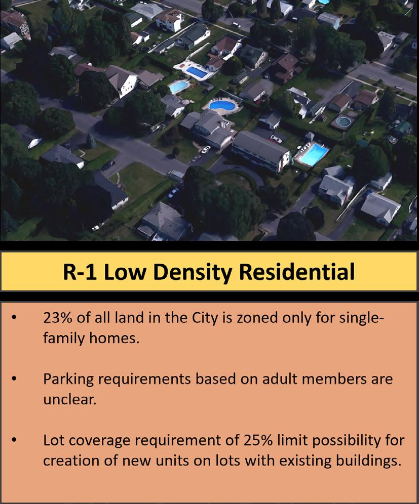
The R-1 Low Density Residential District is widely mapped throughout Plattsburgh and primarily permits single-family homes on larger lots. The R-1 district is mapped primarily in the western portion of the City, with two smaller areas located along the Saranac River and Lake Champlain. Most development within the R-1 District consists of 2 –2.5 story detached homes with multiple off-street parking spaces and appears to comply with the development standards of the district. While the required minimum lot size (7,500 square feet) is the largest of any other lower density typology within the City, it is well suited for the existing size, character and density of Plattsburgh.
General Observations:
• The district regulations require one parking space per dwelling as well as an additional parking space per adult family member within the home. This method for determining parking is unclear, unpredictable, and likely difficult to administer as residents relocate to different homes throughout the City and demographic trends shift.
• Explore opportunities to retain alignment of parking spaces based on size of a dwelling.
• Given that the R-1 District is the second most mapped zoning district within the City, limitation to single-family development may present a hurdle to the creation of new housing units.
• The existing minimum lot size of 7500 sf and low maximum lot coverage of 25% are unlikely to allow opportunities for infill housing opportunities on lots with existing buildings.
• High open space requirements allow for ample space on a lot to allow for trees, planting, or permeable surfaces that support the environmental goals of the City. While single-family development is generally considered the least intense land use, it has been largely accepted that the use of land for only single-family development within a City can be detrimental to the environment and may be contrary to the City’s natural resource preservation goals.
• The development standards of the R-1 district are identical to that of the RH Historic Residential District and are likely to produce buildings similar in scale and context with the significantly historic character of Plattsburgh.
The RH Residential Historic District is mapped across 16 blocks located in the center of Plattsburgh immediately west of Downtown. The development standards of the district are identical to that of the R-1 district including its primary use being restricted to single-family homes; however, there are a greater number of Special Permit uses that may be sought to encourage adaptive reuse of existing structures.
• The existence of a zoning district or tool focused on historic preservation is supportive of this communities Historic Resource preservation goals; However, the limited geographic area that the district is mapped likely leaves many buildings that residents feel contribute to the historic character of Plattsburgh, such as downtown, unprotected and without unique, contextual zoning considerations.
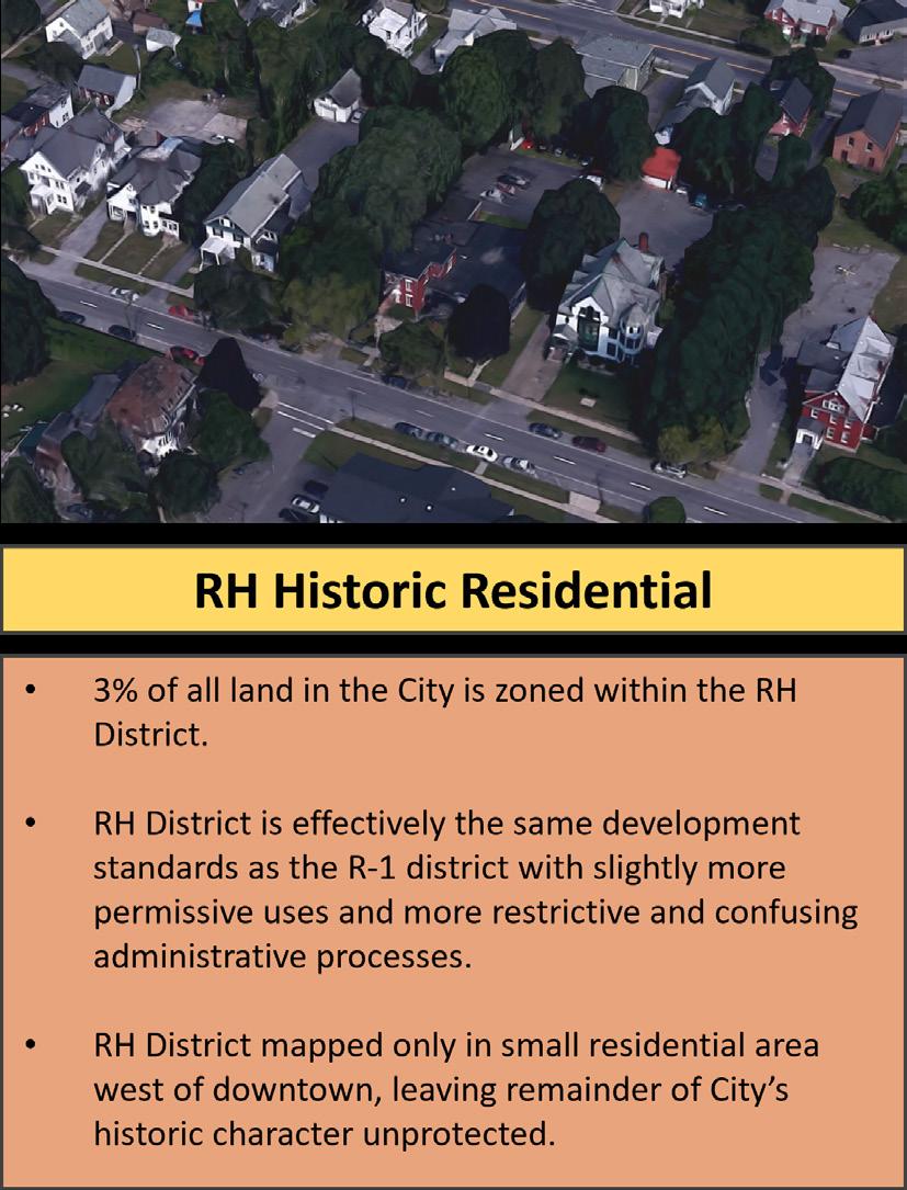
• The RH zoning district includes the Court Street and Brinkerhoff Street Historic Districts. However, the boundaries of the RH zoning district includes a greater area than the established historic districts as per the National Register of Historic Places..
n There are opportunities to clarify mapping, applicable provisions, and ease of administration of Historic Sites regulations.
• Zoning code definitions and applicability of Section 360-32 (Historic Sites) are confusing and unclear on whether provisions of this section apply to all buildings within the RH district.
• Given the RH districts location immediately west of Downtown, the district’s limitation to single-family development and additional development criteria that must be met for historic sites may impede upon the creation of additional housing in an area that is in very close proximity to City services, retail, and other amenities.
• It is also important to note that based on a land use analysis using Clinton County Real Property data, the RH zoning district has 46 two-family dwellings, 16 three-family dwellings, 88 apartments/multi-family dwellings, and 83 single-family dwellings. Based on this information, the boundaries of the RH District should be reevaluated to better reflect the existing built environment and the boundaries of the Historic Districts.
The R-2 General Residential District is the most widely mapped district in the City. The district permits one-, two, and three- unit residences, townhomes, and multifamily buildings of varying scales. While the district is primarily residential, various commercial and community facility uses may be allowed by Special Permit, including neighborhood retail, hospitals, and professional office buildings. The lot size and other development criteria for detached buildings are similar to that of the R-1 district, however multi-family buildings are regulated through the use of formulas and equations based on the size of a lot.
• For one, two and three family detached residences and townhouses the yard, height, lot coverage and open space requirements are the same or extremely similar despite the narrower lot frontages required for each typology. While this is likely to produce buildings that are consistent in scale to one another, the parameters offer little flexibility to gradually increase density per building typology to produce additional housing.
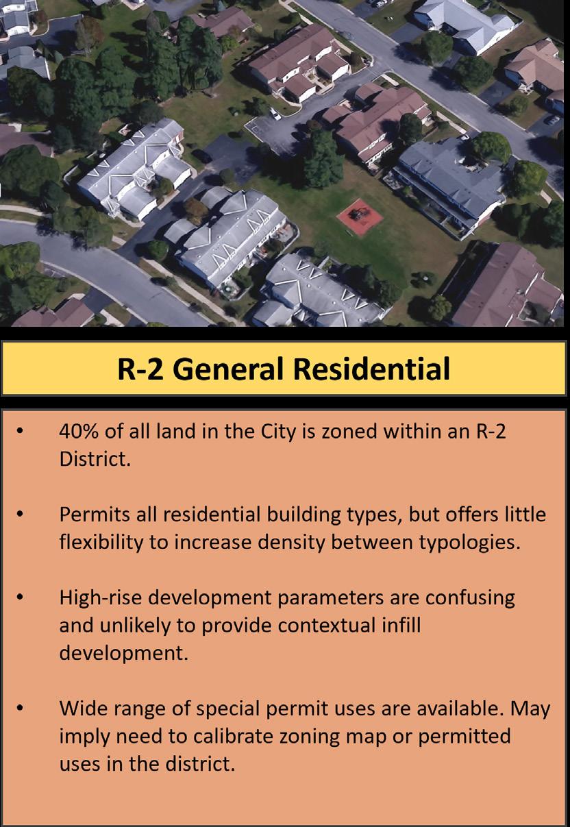
• Multi-family buildings: Development parameters from schedule III to determine maximum area per acre, lot dimensions, height are overly complex, difficult to understand, and contain typos and inconsistent use of mathematical notation conventions.
• Multi-family buildings: Given the form-based equations used to determine many MF buildings parameters, new development may not be contextually similar to other buildings.
• Vacant lots that are large enough to produce high-rise multifamily housing are primarily located further away from downtown and other resources/amenities.
• Restrictions of Section 360-18 impose a maximum number of units (24) without seeking approval for a Planned Unit Development. This number appears arbitrary and should be calibrated to better reflect appropriate densities for each district and area of the City rather than generally applied.
• Special Permit uses including universities, hospitals, assisted living, professional offices, and neighborhood commercial allow for creation of job-generating uses. However, unpredictability of the special permit process may stifle creation of these uses in locations where they would be generally accepted and supportive of the economic goals of the City.
• Parking rates for three family and multi family buildings produce a significantly higher parking requirement per unit than lesser density typologies. This is contrary to nationwide trends that indicate that residents of multi-family buildings, including young adults and seniors, are likely to own less vehicles.
• No requirement for bicycle storage/designated spaces for multi-family buildings are contrary to encouraging alternative transportation.
The B-1 and B-2 General Business Districts are zoning districts with a wide range of commercial, community facility, and institutional uses throughout the City. The B-1 district is primarily mapped in the eastern portion of the City adjacent of the downtown core, and serves as a continuation of the Margaret Street commercial corridor to the north and to the east of the Saranac river. The B-2 district is mapped around the perimeter of the City’s limits including: a large swath to the North that contains a mix of commercial and residential uses, vacant land and Plattsburgh City Beach; the area along Dock Street which contains the Amtrak train station and a marina; the commercial area in the southern portion of the City which contains Skyway Plaza; and, the western gateway to the City along Cornelia Street. Both the B-1 and B-2 districts permit the same uses by-right and by special permit. Both districts are primarily differentiated by the permitted building form, with the B-2 district requiring a larger minimum lot area, larger yards, and higher lot coverage. Parking requirements are the same, per use, in each district.
• Development standards for B-2 district and generally more intense than that of B-1 district, however differentiation is minimal.
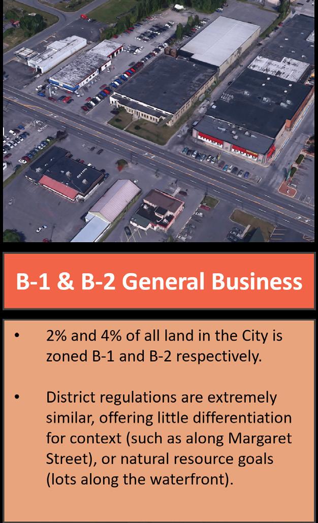
• Development standards are highly generalized. While similar in height and setback to other districts, the regulations do not require contextually sensitive commercial development (such as along Margaret Street).
• Select semi-industrial uses are permitted by Special Permit, which allows for greater flexibility for job generating uses.
• Zoning limits development to only one principal use per lot as-of-right. Developments proposing more than one principal use are required to seek approval for a Planned Unit Development.
• Parking requirements per use do not differentiate between districts. Some uses have extremely high parking requirements for their locations, such as along Margaret Street.
• Generalized development standards do not require or encourage buildings that would support walkable commercial corridors, such as limited setback, transparency, and amenities.
• No requirements for accommodating visitor bicycle storage which could encourage alternate transportation.
• Given that both B-1 and B-2 districts are located along Lake Champlain and the Saranac River, the zoning does not include any specific development criteria to ensure buildings and uses align with City’s natural resource goals.
• No zoning standards exist to encourage waterfront development to maximize views, access, or proximity to the water.
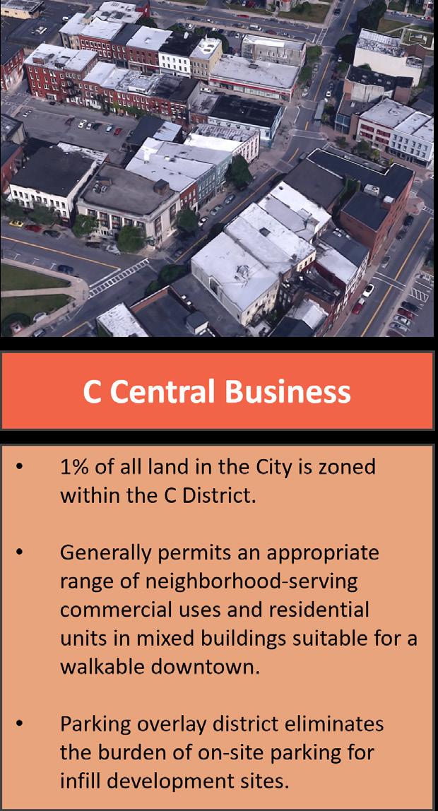
The Central Business District encompasses approximately 16 blocks in the core of Plattsburgh’s downtown area. The area is predominantly built out and contains several institutional uses, a mix of neighborhood scale commercial uses, residential apartments located in mixed-use buildings, and several municipal parking lots. The district permits a range of neighborhood-oriented commercial, civic, and residential uses. Both low-rise and high-rise development standards are available.
• Generally, permits an appropriate range of neighborhood-serving commercial uses appropriate for a walkable downtown core
• High-rise development calculations are complicated and difficult to understand and administer. These regulations are not likely to support contextually appropriate infill development that reflects the character of downtown.
• A permitted low-rise building scale of 36 feet/3 stories, no yard requirements, high lot coverage is in context with the existing development pattern in the district. However, this building form may limit the creation of new commercial and housing opportunities on the existing lots downtown.
• The allowance for apartments to be located above non-residential first floors encourage housing in the downtown area.
• Mapped in the core of downtown Plattsburgh, it supports a highly walkable commercial and mixed-use environment.
• Parking overlays which allow for buildings within the district to not provide on-site parking support the walkable character of the area and reduce burden of on-site parking per development site.
The Industrial District is mapped across approximately 12% of the land area of Plattsburgh in four specific locations. Areas in the southern and central portions of the City are primarily built out and contain a broad mix of manufacturing uses. The portion mapped to the northern portion of the City contains several industrial uses, including warehouses, and large tracts of vacant land.
• The development standards for the Industrial District can support a wide range of businesses and building types. Modest lot sizes and permissive height, lot coverage, and open space requirements lend themselves to supporting industrial businesses of various sizes.
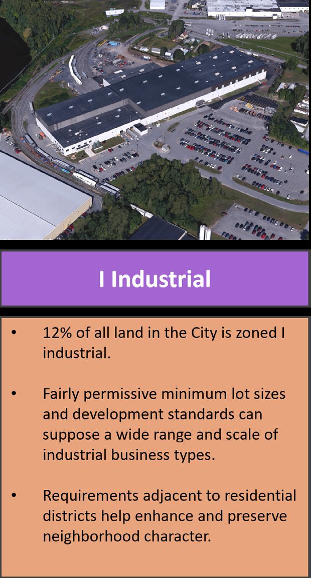
• Use regulations within the district are generally permissive towards most job generating uses and specifically permit for industrial business types that support the City’s manufacturing and engineering history in support of the former Air Force Base.
• Specific Use restrictions for Commercial Cryptocurrency Mining Facilities are the most prescriptive of any use discussed in the zoning code. These facilities are widely considered to be of resource intensive use with very few jobs generated and strict regulation may be supportive of the City’s natural resource preservation and sustainability goals.
• Setback, yard, and screening requirements from adjacent residential uses help to preserve and enhance the character of adjacent residential districts.
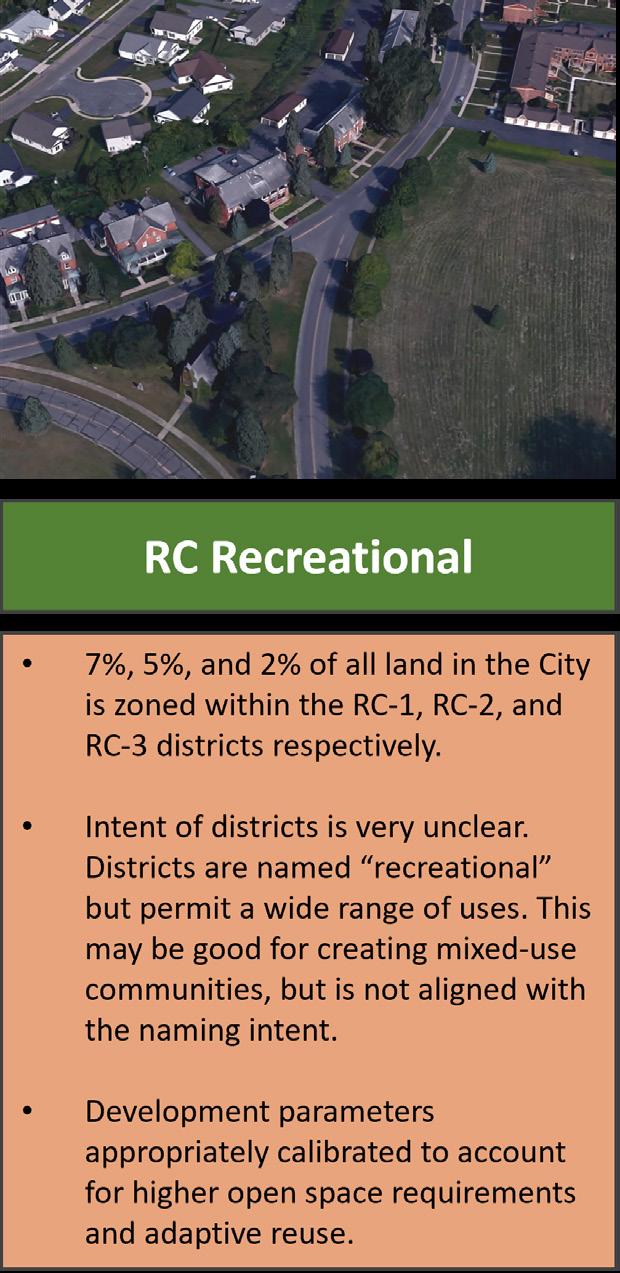
The RC-1, RC-2, and RC-3 Recreational and Related Use Districts are mapped primarily along Lake Champlain and support a wide range of residential, commercial, recreational and institutional uses. These districts provide the greatest range of permitted and special permit uses as well as flexible design standards with a high open space ratio.
• Mix of uses and development standards create zoning tools that are flexible and can be used to create and expand upon new mixed-use communities.
• The high open space requirement of the district is coupled with increased building height to not limit the development potential of sites.
• Wide range of permitted uses and adaptive reuse of historic buildings within RC-2 support the City’s historic preservation goals.
• Given the wide range of permitted uses and building typologies, and the zoning codes lack of applicability and intent statements for each zoning district, the purpose and intent of the RC districts is unclear. This zoning code update presents an opportunity for the City to more clearly state the vision for these areas.
(Chapter 360, Articles V and VIII)
Articles V and VIII contain the code’s generally applicable regulations, including some specific use standards, off-street parking regulations, signage, and other provisions applicable across multiple zoning districts.
Of the 40 unique sections of zoning reviewed in the Generally Applicable Regulations, the majority were found to be neutral toward advancing the objectives of the Plan compared to the five consolidated benchmarks. In total 10 sections include at least one provision that is generally supportive, and 14 sections include at least one provision that is generally a hinderance to the Plan’s goal. Of the provisions that are considered detrimental to achieving the objectives of the Plan, eight sections of zoning were a hinderance in two or more of the benchmarks.
Use of graphics, diagrams, and tables
Generally applicable regulations, such as: parking layout and maneuverability standards; signage regulations; and measurement provisions often benefit from the use of graphics, diagrams, and tables to help demonstrate concepts. While the code does use tables in some sections (such as parking rates), the overall document would benefit from inclusion of additional explanatory graphics.
Mapping Article V includes regulations governing Overlay Districts and Historic Districts; however, maps of these districts are not easily located or included within the ordinance or its attachments.
Chicken keeping
Lot, Yard, and Structure
The Chicken keeping regulations of the ordinance added in 2022 are an example of the current code’s structure not lending itself to the surgical insertion of a contemporary planning issue. The requirements of Article VIII may be better suited for a public health or other regulatory framework outside of the Zoning Code. If they remain incorporated into the Zoning Code, they should not be featured more prominently (as their own Article) than the sections that govern development and uses.
Sections 360-14 through 360-19, 360-22
The provisions of these sections were generally neutral toward the benchmarks used to conduct the analysis; however, a number of these provisions were contrary to the Housing, Historic Resources, and Economic Development benchmarks. Generally, the City hopes to preserve the historic resources and context of Plattsburgh and create diverse and equitable housing through infill opportunities. Many of the provisions of these sections include an increase or reduction of yard and other measurements requirements such Section 360-16(F) which requires a minimum front yard for commercial buildings adjacent to residential districts aligned with the residential district, but does not make distinctions between the character of different commercial areas of the City or neighborhood context.
The provisions of Section 360-18 (Number of buildings and dwelling units restricted) impose a limit of only one principal use and a maximum of 24 dwelling units per lot without seeking approval for a Planned Unit Development. This restriction is counter the City’s goals of encouraging walkable neighborhoods, the “15 Minute City” concept, and housing production more generally. This provision may be especially problematic in the focus areas for revitalization identified in the Plan.
Accessory structure provisions which require that the attached structures shall comply with district yard regulations and specifies specific yard and height requirements for the structure are common elements to include within the zoning text. However, the provisions of Section 360-19 (Accessory structures) may need to be amended to accommodate the Plan’s goals of exploring ways to permit accessory dwelling units on a lot.
The fencing regulations of Section 360-20(B) require that a property owner seek Planning Board approval to demonstrate compliance with the fencing and screening requirements of the section. This type of action is an example of something that should be reviewed and managed at an administrative level.
Planned Unit Development
Section 360-21
The Planned Unit Development (PUD) provisions are intended to offer greater flexibility in building form, location, and use on large lots throughout the City. Generally, the regulations of this section are neutral toward the benchmarks used for this analysis; however, there are some elements that should be further reviewed to support the Plan’s goals:
• Parking provisions: While the PUD provisions offer flexibility from the development standards of the district in which the lot is mapped, this zoning tool does not afford the Planning Board the ability to modify or amend the parking requirements. The ability to modify parking should be explored as a component of the PUD approval, specifically the ability for development to consider how shared parking may be used for mixed-use developments.
• Minimum lot sizes: While the intent of the PUD is to allow flexibility for development on large lots, the applicable minimum lot sizes of five acres for each district is not particularly large. While this does mean that a greater number of lots may be able to seek a PUD, it may also be a hinderance to development as the PUD process is more administratively intensive than as-of-right development. It may also mean that smaller lots do not have the ability to incorporate common elements, such as open and public spaces.
• Development Bonuses: The PUD provisions do not allow for an increase in density beyond what is permitted within the district. The City should consider exploring zoning incentivebased bonuses for the inclusion of key elements sought in the Plan, such as publicly accessible open space, affordable housing, cultural institutions, and historic resources.
Sections 360-23 through 360-25, 360-29 through 360-31
The Zoning Code differs from many existing and modern zoning codes in that it does not contain a dedicated Use section or clear definitions for all uses. While not all uses require detailed and bespoke development standards, there are likely many common uses within the City that would benefit from these (such as community facilities, industrial, or healthcare uses). Additionally, some elements of Section 360-29 (Miscellaneous Uses) include regulations that are not pertinent to a particular use and should be included instead as a generally applicable standards in a dedicated section (such as fencing and grading regulations) for clarity.
Section 360-26
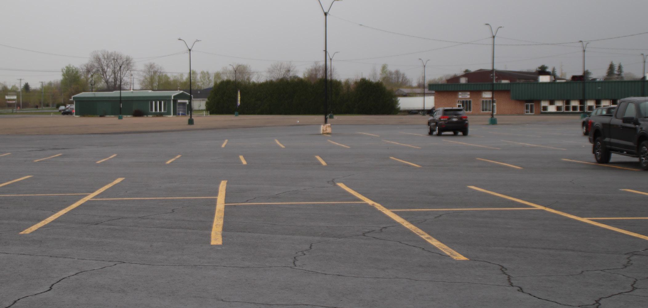
Further analysis is needed to determine if the proposed parking rates are excessively high or low for the context of Plattsburgh; however, the rates for residential development are high and difficult to clearly administer. Furthermore, the parking rate for a use is not calibrated per each zoning district and will result in similar uses requiring the same parking rate whether they are located in auto-oriented shopping centers or closer to the more walkable mixed-use downtown.
The parking rates for residential uses require more parking spaces for multi-unit buildings despite nationwide trends that indicate that those living in apartments, renting, or living in smaller units are less likely to own a car. Additionally, the method for determining the number of spaces per residential uses being based on number of adult occupants is problematic, difficult to administer, and does not accommodate for shifting trends in household size and car ownership.
The overlay parking districts are an example of a successful zoning tool in the current code. Section 36026(B) provides the opportunity for shared parking to be located on public lots in the downtown core, reducing the burden of providing on-site parking to development within the area. While the zoning tool has merit and can help to support infill development opportunities, the lack of clear mapping to determine the boundaries of the overlay pose a difficulty in understanding and administering the provisions.
(Chapter 360, Articles IX)
During our review of the variance log over the past four years, it has become evident that unnecessary processes are in place, which create barriers to achieving a user-friendly code and efficient approval process. Notably, 45% to 70% of the variance requests presented were granted. Many of these variances pertain to fencing, screening, garages, setbacks, lot area, lot coverage, porches, and pools, and they were approved and granted. [NOTE: A more detailed analysis of variances will be provided in the next draft of the report depicting a breakdown of the numbers and types of variance requests submitted, and the total number of and types of requests granted.
Considering the high approval rate for area variances, evaluating the approved aspects, and exploring options for streamlining the review process for smaller area variances is strongly suggested. A potentially acceptable approach could be to allow administrative reviews of certain area variances instead of going to the Zoning Board of Appeals (ZBA) through a tiered approach. For example, area variance requests seeking up to 10% relief could be reviewed administratively, while all other requests would still be reviewed by the ZBA. Additional alternatives should be considered during the Code Update process, including classifying other simple variance requests that would generally not result in adverse impacts and allowing for similar administrative reviews.
On the other hand, it was noted that the items primarily denied were use variances. One recommendation is to increase the number of uses permitted by right to address this issue. However, it would be beneficial to establish special regulations or criteria for those specific uses. If an applicant’s proposal adheres to these predetermined regulations, the staff would have the authority to approve it, reducing the need for use variances and promoting a more efficient process.
By implementing these recommendations, the zoning process can become more user-friendly, efficient, and aligned with the community’s needs. Balancing flexibility and adherence to regulations is crucial while ensuring that the code supports responsible development practices.
This Article is not clear, the different application processes are not clearly described for applicants. There are definitions nestled within processes. Definitions should be in one section. Under 360-53, Permit requirements, the first item is 360-53.A is zoning and building permits, but one would expect to see variances, site plan applications, special use permits, or sign permits. However, the formatting and organization of this section needs to be completely rewritten and the processes described clearly. Special use permits are mentioned, but not in a clear manner that spells out the process.
The majority of the provisions in Chapter 300 (Subdivision of Land) were neither supportive of nor detrimental to the City’s goals and benchmarks used to conduct this analysis. While some of provisions are supportive of these goals in theory, such as the consideration of natural resources, existing street networks, and open space needs in determining the appropriateness of a subdivision application, the discretionary process for administering the rules and the lack of clear considerations and findings add an unpredictability to the subdivision process.
To support the City’s economic development goal of streamlining the development process, the City should consider implementing a process by which some actions, such as minor subdivisions of land (e.g., four or fewer lots), can be administered at a staff level to save applicants the time and money required by preparing for and attending a Planning Board hearing to receive this determination. Similarly, the Subdivision Code can be improved to provide clear, concise, and practical findings to guide the Planning Board in their decision making.
Findings and Planning Board Discretion
Determination between major and minor subdivisions
Findings and considerations of the Planning Board in determining the appropriateness of a subdivision, open space requirements, or waivers should be clearly stated to improve clarity and predictability for applicants.
The process for determining whether a subdivision is major or minor should be streamlined to not require a Planning Board hearing to seek the determination. To achieve this, the definition of minor subdivision should be further analyzed to ensure that it adequately captures the types of applications that will not impact the City at large.
Administrative Review
References and Consistent Language
Graphics
Consider allowing Staff administrative reviews of Sketch Plans and Minor Subdivisions to further streamline the process.
Language and definitions used within the Subdivision Code should align with the Zoning Code (Chapter 360). Terms such as “Planning Board” and “Planning Commission” should align between the documents. Mentions of the “Master Plan” should be explicitly referenced. This issue could be alleviated through a Unified Code approach.
Design and street layout standards should be updated to include graphics, where appropriate and integrate Complete Streets requirements.
The three subsequent sections of Article I are largely neutral toward the established benchmarks of this analysis; however, the article can be improved to increase clarity and ease of use.
Section 300-1 (Authority established; references): Section 300-1(C) notes the governing structure of the “Planning Board” as they are a decision-making authority in the subdivision process.
• The terms “Planning Board” and “Planning Commission are used interchangeably through the zoning and subdivision codes (as well as in the City of Plattsburgh Code). The zoning code update should align terminology throughout both ordinances.
• The authority and structure of the Planning Board are established by Part II, Chapter 14, Article I of the City Code, although it refers to the Planning Board as the Planning Commission.
If a unified code approach is chosen, regulations establishing the Planning Board’s authority should be moved into the unified code. If Chapters 300 and 360 remain separate, references should be made to an updated Chapter 14 using consistent language. Section 300-3 (Definitions)
• Subdivision Type – The code establishes a framework for differentiating “major” and “minor” subdivisions. A framework based on this distinction can positively impact the City’s Economic Development of streamlining the development review process.
• While the code addresses the subdivision of land, it is silent on regulations or procedures surrounding the consolidation or reapportionment of land. These terms should be included to allow for clarity and ease of administering the code in these instances.
Of the nine sections within Article II, four sections may be a detriment to achieving the City’s Economic Development objective of streamlining the development review process. Additionally, one provision may support the City’s Economic Development goals.
Section 300-5 (Sketch Plan) & 300-6 (Minor Subdivision)
• The determination of whether a subdivision is major or minor by the Planning Board can be cumbersome and introduce uncertainty for applicants, adding to the time and expense of the development process. The definition of a “minor subdivision” in Section 300-3 and procedures in Article II should be reviewed to create a process by which City staff could administratively review and grant the authority to subdivide land if the proposed subdivision meets these conditions.
• To further improve the efficiency of the initial applicant stages, the sketch plan review process could be addressed administratively by City Staff.
• The section does not clearly state objective criteria used by the Planning Board in their decisionmaking process to authorize an applicant to move from sketch to submission of a minor subdivision application, nor for approving a minor subdivision. For ease of administration and clarity, findings or conditions should be stated in this section or clearly reference the appropriate section of the Chapter.
• While it is encouraged to not include the amount of associated fees in the subdivision ordinance for ease of future changes, the code should provide resources to where the user can find this information
Section 300-7 (Preliminary plat for major subdivisions) & 300-8 (final plat for major subdivisions)
• Similar to Section 300-5, the findings and conditions for a major subdivision to guide the Planning Board’s decision making are not present in Sections 300-7 and 300-8. The omission of these findings may allow for a highly subjective approval process and discourage or delay development. The City should consider clearly outlining findings that align with the objectives of the comprehensive plan within this section.
Section 300-9 (Required improvements for major subdivisions)
• This section is generally supportive of the City’s economic development goals, and depending on the agreed upon improvements may be supportive of the other benchmarks. The use of a performance bond is a positive way to ensure that improvements are made. The section clearly outlines the steps for filing a performance bond, confirming completion, and modifying the design of improvements.
Of the eight sections of this article, four provisions are generally supportive of the accessibility and natural resource benchmarks used to perform this analysis. Overall, these provisions provide the Planning Board with the authority to ensure that the layout and design of new streets are safe and compatible with the existing network and that development may be balanced with the preservation of natural areas. These provisions can be further strengthened to consider multi-modal transportation options and through incorporation of complete street requirements.
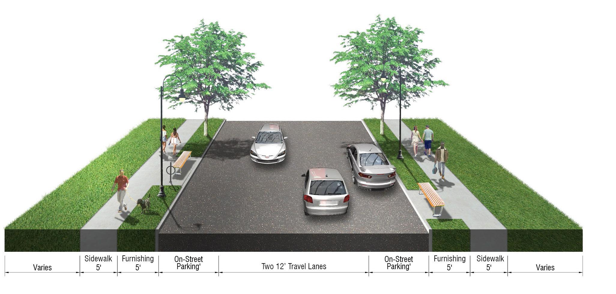
Section 300-15 (Street layout) & 300-16 (Street design)
• Street layout requirements provides exceptions for natural topography, and road layout to be constructed in alignment with the natural grades, reducing unnecessary modifications of topography and impact to the runoff of storm water.
• Provisions require intersections, access to main roads, and adjacent parcels to consider connectivity, traffic, and safety.
• Street layout requirements are silent on the inclusion of cycling infrastructure, such as bicycle lanes or dedicated bicycle parking, for subdivision applications and should be revised accordingly consistent with desired complete street requirements.
• Street design regulations require sidewalks installed on both side of streets, separate storm, and sanitary sewer connections, and require design consideration for watercourses promoting the City’s accessibility and natural resource preservation goals.
• Reference should be made to Chapter 295, Article I Sidewalks and Curbs, to ensure consistency between related to sidewalk requirements.
• Provide authority to require “as-built” drawings for streets and utilities.
Section 300-18(D) restricts the creation of buildings on interior lots. While this provision is not problematic, lifting this restriction may allow for the creation of new housing units on existing lots that are larger than the required minimum lot area, but lack the required frontage to subdivide. If the City were to eliminate this provision, the subdivision code would need to require appropriate easements and access to be in place for the interior lot.
• The provisions of this section are generally supportive of the City’s natural resources benchmark used to conduct this analysis. The provisions limit interruption of springs and other sources of surface water and require the subdivision of land and future development account for upstream runoff and downstream impacts.
• The provisions of Section 300-19(D) provide the Planning Board with the authority to determine that land subject to flood hazard shall not be platted for residential use. This provision allows the Planning Board to use their discretion to ensure the safety of future occupants. This section would benefit from clearer findings to improve transparency and the administration of this regulation, including a reference to the applicable standards within Chapter 176 Flood Damage Prevention.
The provisions of this section are generally supportive of the City’s natural resources benchmark used to conduct this analysis and encourage large subdivisions to include open space resources to benefit the future occupants of a site and the City at large.
• The administration and clarity of these regulations can be improved by more clearly stating when open space is required and documenting the Planning Board’s findings for determining the appropriateness of open space. The law should be revised to be consistent with the requirements of the General City Law with respect to the findings needed to require land be set aside for parks or other recreational purposes and the process and standards for requiring money in lieu of parkland.
• Section 300-20(F) specifically regulates the preservation of natural features including a prohibition of the removal of trees greater than eight inches in diameter. Tree preservation regulations are generally supportive of the City’s natural resources goals. However, requiring discretionary approval for the removal of trees can be balanced with increased flexibility and clarity of situations and conditions when the City may require the preservation of additional trees and vegetation.
• The provisions of Article IV clearly state the required documentation for a subdivision application to the Planning Board.
• The materials requested appear to be well calibrated for the purposes of administering major and minor subdivisions.
• The additional requirements focus on the natural environment for major subdivisions provide the Planning Board with the information needed to exercise their discretion over the prescription of natural area preservation and are supportive of the City’s natural resources goals.
• Documentation related to the surrounding context, including roadways, topographic conditions, utilities, etc. should be amended to include provisions for bicycle and pedestrian infrastructure consistent with desired complete streets requirements.
The provisions of Article V are all neutral towards the benchmarks used to conduct this analysis. As is noted above, the inclusion of a required performance bond is generally supportive of the City’s economic development goals and can ensure that future development provides the agreed upon improvements associated with a subdivision application.
• To obtain a variance, Article VI requires the Planning Board obtain specific approval from the City Council to vary the regulations. It is recommended that variance requests be reviewed by the Zoning Board of Appeals.
• Article VI also requires the Planning Board obtain approval from the City Council to waive certain requirements. The Planning Board should retain this authority to streamline the approval process.
• The provisions of Articles VII and VIII are administrative in nature and are generally neutral toward the benchmarks established to conduct this analysis.
• The language in Article VII is, Section 300-34 Officers authorized to sign plats, is incorrectly labeled as it refers to the City Council’s authority to amend, supplement, or repeal these regulations. This subsection will need to be corrected.
Chapter 144, Building Code Administration and Enforcement (City Building Code) provides for the administration and enforcement of the New York State Uniform Fire Prevention and Building Code (Uniform Code) and the State Energy Conservation Code (the Energy Code) in the City of Plattsburgh.
• The 2022 Plattsburgh Housing Advisory Committee: Final Report, recommends enhancing the City’s building code to improve tenant housing conditions. Specifically, the Final Report recommends:
è Increasing the energy efficiency of construction including insulation, that would typically reduce utility bills over the tenancy of the dwelling unit. In consideration of this recommendation, the City does have the authority to adopt the NYS Stretch Energy Code which includes enhanced insulation requirements along with numerous other improvements that would increase the overall energy efficiency of homes.
è Enact a mechanism to encourage reasonable, timely remedy of code violations by landlords to limit the potential for landlords electing to forgo necessary repairs, a form of “illegal eviction.” Rather than perform the necessary repairs, the landlord opts to run out the clock to force the property to be deemed “uninhabitable” – resulting in the displacement of the tenants. After the tenants have left the premises, the landlord will perform the repairs.
è Require a mandatory rental reimbursement schedule for the length of time a tenant is unable to occupy the premises.
• Amendments to the City’s Building Code enacting one or more of the above recommendations from the 2022 Plattsburgh Housing Advisory Committee: Final Report, if desired, would be undertaken separate from this Code Update.
• A individual review and update of Chapter 144 is recommended to ensure the chapter complies with the most recent version of New York State Uniform Code and Energy Code.
• Chapter 144 should remain separate from the Zoning and Subdivision chapters.
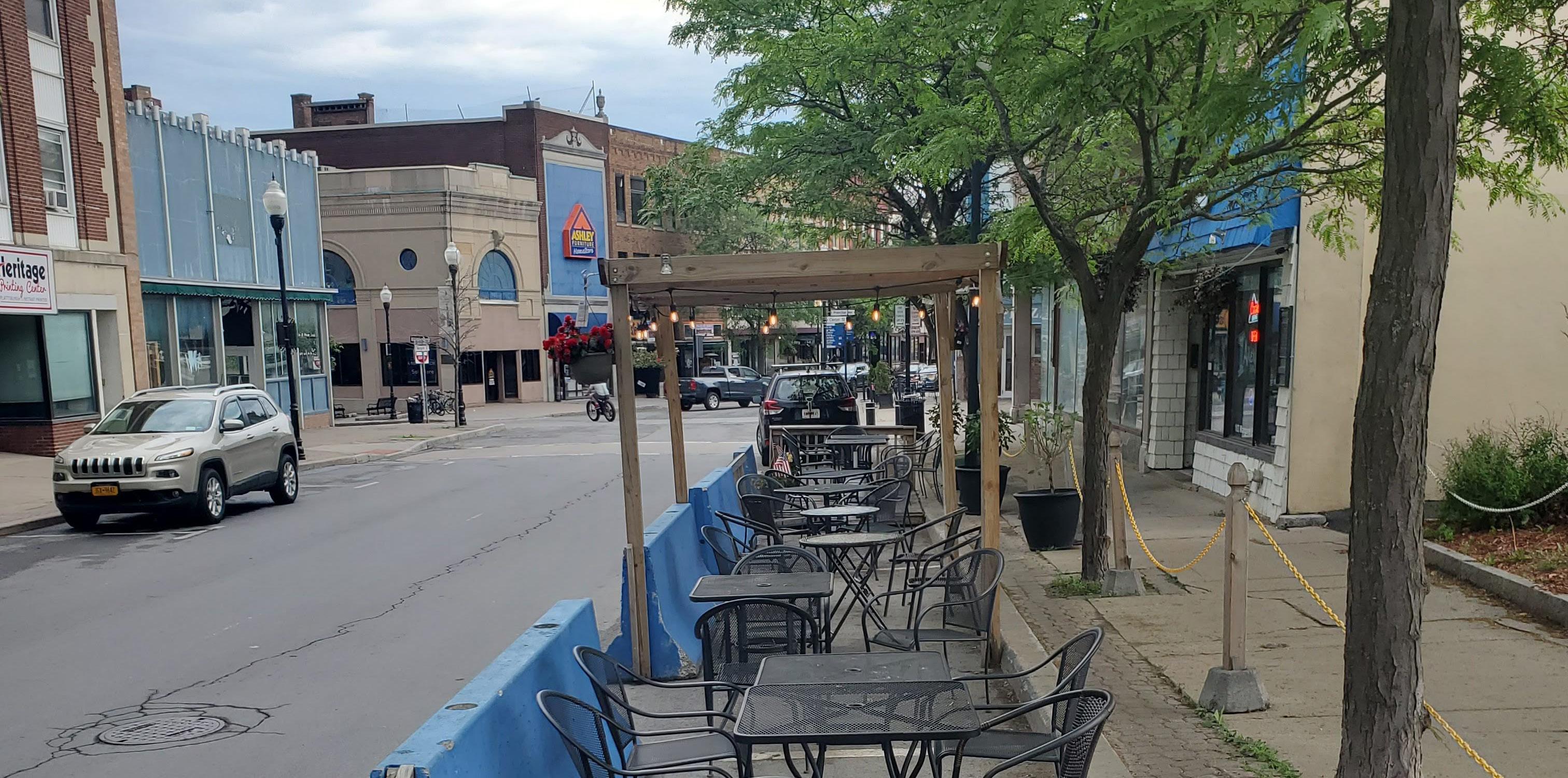
Chapter 295 Streets and Sidewalks is divided into numerous Articles and is primarily focused on specific construction standards. Recommended edits, improvements, and clarifications are summarized below. Given the specific nature of Chapter 295, it should remain separate from the Zoning and Subdivision Chapters.
Article I Sidewalks and Curbs
Section 295-2 Sidewalk and curb required
• Ensure consistency with Section 300-16 Street Design of the Subdivision Law with respect to when a sidewalk may not be required.
Section 295-8 Construction material standards
• Recommended providing flexibility to allow alternative construction materials for sidewalks when and where appropriate, including, but not limited to recycled materials and pervious surfaces. Approval of alternative construction materials should be obtained from the City Engineer prior to securing of materials. Proposed materials specifications should also be submitted.
Section 295-12 Planting of trees, hedges and shrubs
• This section should reference a preferred list of native street tree and vegetation species and prohibited species and the review and approval process to be used if alternative species are proposed.
Section 295-18 Construction, Installation and Maintenance
• The Code Update will involve new design standards and guidelines. Where applicable, the design standards and guidelines will be consistent with Article II.
Section 295-19 Signage on awnings
• Ensure consistency with any updated applicable sign regulations.
Section 295-20 Awnings on historic sites
• Ensure consistency with any changes to the review and approval process and standards for improvements on historic sites.
• Ensure consistency with any updated design guidelines and standards related to outdoor cafes.
Chapter 278 establishes uniform requirements for direct and indirect contributions into the City’s wastewater collection and treatment system and enables the City to comply with all applicable state and federal laws required by the Clean Water Act. Chapter 278 is focused on sewage disposal and no changes are recommended with respect to consistency with the Zoning and Subdivisions regulations.
Accessibility: Embrace a multi-modal, complete streets approach and encourage alternatives to decrease automobile dependency and promote environmental sustainability.
Housing: Create a diverse and equitable housing market that provides safe, affordable, and accessible options.
Natural Resources: Improve and protect the City’s natural resources and promote adaptation to climate change.
Historic Resources: Preserve the City’s historic resources and stabilize and enhance historically significant areas through compatible infill development and effective review and design standards.
Economic Development: Streamline the development review process, foster existing and future neighborhood businesses and compatible waterfront development, and facilitate infill and mixed-use development to prevent unnecessary sprawl and create dense, walkable neighborhoods.
No stated purpose of the zoning code speaks to housing objectives; Objective D supports adaption to climate change through solar reference.
Recommend definitions as glossary
Defined terms are located in several places throughout the text and should be consolidated for ease of use. Some definitions, such as types of adult uses, should be consolidated. Several permitted and SE uses are not defined in this section. Definition of “Family”, while common, likely means that many households (especially student renters) are in violation of the zoning.
Provision somewhat redundant with 360-9 and 360-13(A). Can combine in newly crafted introductionary sections.
Development standards included as an appendix, referenced in a footnote, is confusing. Districts and development standards should be incorporated more directly in the code.
360-14(B) - If small lots are common, the reduced yard minimum of 5’/15’ may be large for denser areas. 36014(C) does not require reduction in front and rear yard. Section should include diagrams for clarity and ease of use, in addition to specifics on measurement standards.
Exceptions could be updated speak to rooftop solar installations.
360-16
360-16(F) - Transition yard requirements require deeper front yard in non-residential district, May be contrary to supporting infill, neighborhood context. Can be revised to be use or district specific. 360-17
360-17(B) - Supports open space planning through limits on what can count as open space. 360-18
Imposes limits to single principle use per lot and unit density maximum of 24 units without PUD. Does not support mixed use development, production of housing on large lots without seeking PUD.
Attached accessory uses having to comply with all yard regulations of the district can pose challenges for contextually appropriate enlargements in infill areas, or be contrary to historic character.
(B) Further define “unenclosed uses… Front on a public right of way”. (C) Requiring Planning Board approval for compliance with fencing/ screening regulations contrary to effort to streamline rules. Recommend adding explicit by-right standards.
Parking - Sum of all uses could stifle mixed-use development; explore combined parking methods. Modification of Standards - Zoning text imposes height and density limits of mapped district; may lack incentive to encourage mixed use development and open space goals. Distance between buildings - Formula is confusing and likely unnecessary in districts with predictable bulk requirements.
Regulations are all somewhat unrelated. Can likely incorporate into relevant sections elsewhere. (B) excavation rules promoted preservation of land until permits are issued.
For clarity, incorporate into use standards section with all other uses
For clarity, incorporate into use standards section with all other uses
For clarity, incorporate into use standards section with all other uses. Provisions require auto-oriented businesses be located away from residences. Cryptocurrency mining facility regulations provide safety and environmental standards to minimize impact on communities and the environment.
360-26 (A)
Overall parking rates do not allow for differentiation in different districts/areas of the city (outside of overlays). Certain uses, like residences, community facilities, propose very high parking rates. Requiring high rates of parking in areas within the CBD and close proximity to neighborhoods discourages walkability and other transit modes, best use of land in downtown or historic areas, and has negative impact on the environment and climate goals. 360-26
Explore not requiring that the underlying regulations and sum of all uses provisions apply to maximize use of parking areas and allow for nuance between uses with different peak demands.
360-26
360-26
Section would benefit from diagrams for clarity; Provision (2)(b) could be expanded to allow parking outside of the lot in central business districts.
Could consider distance between curbcuts and allowing of share curbcuts along lot line to provide greater flexibility for lots and ensure on-street parking
Requires further study - 60% of lot frontage for curb cuts and driveways likely does not align with historic character and pedestrian safety. Should provide some differentiation between districts. High allowance limits front yard planting areas.
Requirement of impervious pavement for parking areas poses limit to new technologies and other substrates that allow for greater stormwater infiltration.
Recommend broadening design criteria for barriers beyond just wood for longevity
Section would benefit from graphics to further clarify type of signage permitted; Recommend consolidating all definitions to glossary.
Inquire with City as to relevance of these regulations. 360-29 Miscellaneous
Substandard lot language should be simplified; Requiring that parking be provided for a conversion may limit adaptive reuse of structures.
360-29 (B)
Home occupations provide a narrow definition of what is permitted; Provisions should be consolidated into general use standards along with all other uses in dedicated section 360-29 (C)
Consolidate into larger use/ use standards section.
Minimizing height of retaining walls allows for site grading to blend more harmoniously with surrounding topography. Recommend stregnthening terracing rules to explore planting options between terraces. 360-29
Provision may allow for offices, beyond home occupation, in the residential neighborhoods they serve. Sepecial permit to establish use may want to be revisited in select areas.
Providing a pathway for accessory units is supportive of the larger goals, the process for doing so provides several major road blocks, including permitting/renewal periods, parking requirement, locational requirement (within the primary building)
Crypto mining facilities are known to require significant power and may have a negative impact on the environment; however, the moratorium may result in missed economic opportunities within the City.
Incorporate into broader administration section for
Historic preservation standards are clear and support maintenance of existing resources, however process and procedures may pose an impediment to minor improvements, adaptive reuse or renovation of historic structures.
Intent and applicability are unclear. Only speaks to community garden regulations for subdivision
List of work not requiring site plan approval is clear and permissive for smaller developments; however distinctions are made that would require site plan approval for creation of two- and three- unit developments in some instances.
360-35
360-37
requirements and compliance with other local, county or state codes required
360-38
Unclear how unique site conditions would hinder ability to produce a site plan for review.
Revise 360-36(2) to include other site elements to be considered in calibration, such as bicycle parking areas, pedestrian infrastructure, etc.
Guidelines are generally supportive of the plan objectives, including promoting harmonious building design, safety and accessibility, and planting/solar objectives. However, some findings are vague and should be elaborated on. Additionally, guidelines limit PC ability to modify some key requirements, like parking count.
Opportunity to explore unique termination clauses in response to damage/acts of god, or other circumstances that have severe economic impact, like the pandemic.
Parameters and list for more/less conforming uses is clear
Limiting enlargement/not offering pathways for expansion and investment in non-conforming buildings may hinder reuse and reoccupancy of nonconforming structures.
Section provides clear parameters regarding the location and standards for maintaining hens. Promoting urban agriculture is generally considered a net positive for adaptation to climate change and sustainability. Question whether backyard hens requires is own article in the zoning code? Are there other types of urban agriculture zoning regulations that should be included?
Intent of each district is unclear and not clearly stated. While including as attachment is concise and easy to understand, use regulations should be consolidated with use standards, and permitted uses should be displayed with district for clarity.
Limitation to only single-family poses restriction to housing production. Requiring special permit for community gardens may disincentivize this use that has a larger environmental and public health benefit.
Special Permit uses provided a wider range of uses appropriate for historic buildings, like B&Bs and encourage adaptive reuse of structures; however, requiring special permit may disincentivize these types of uses.
District provides a wide range of building typologies, encouraging varied housing types located throughout the City. Restrictions on community gardens - see above note.
Permitting “apartments above first floor” allows for housing in CBD; Allows common local services in close proximity to residences; Should explore size thresholds to differentiate from Highway business uses and make appropriate for downtown scale.
Intent of districts is unclear given wide range of permitted uses. Certain Special Permit uses may be revisited (museums, galleries, PACs) upon review of zoning map.
Intent of districts is unclear given wide range of permitted uses.
Intent of districts is unclear given wide range of permitted uses.
Reference to Schedule III - Formulas is confusing and difficult to use, especially as compared to finite value limits presented in remainder of the table; generally, development standards for higher density development are high and unlikely to encourage infill development and housing production.
General standards appear appropriate for medium-density suburban context, except for multi-family and Business high rise where standards are unlikely to result in many lots that can develop.
Formulas are very confusing and appear to result in inconsistent development outcomes. Unlikely to facilitate appropriate infill development
Planning Board vs. Planning Commission - unclear use of term throughout code. Responsibilities and makeup of board are defined by charter and may be redundant in introductory text.
Most subdivision applications will fall within the definition of “minor subdivision,” which will avoid unnecessary delays in the review process. However, the definition of “subdivison” appears to not include consolidations; if the City wishes to regulate these, consider broadening the definition.
300-4
300-6
Requiring a subdivider to attend a hearing just to find out whether the application will be classified as major or minor is overly cumbersome for the subdividuer and the City. This should be a ministerial act: the subdivider submits the application, and a staff member then informs him whether he can proceed through the minor or the major subdivision process.
Minor subdivisions should not require a Planning Board hearing. Hearings increase time and expense for economic development and should be reserved only for major subdivisions. Additionally, there appear to be no objective criteria on which approval or disapproval of a minor subdivision is made. 300-7
Requiring a Planning Board hearing for major subdivisions can be a proper and effective means to ensure that development will be adequately served by roads and utilities, will conserve natural resources, and otherwise be consistent with the City’s goals. However, those criteria are not currently in the regulations; the basis for the Planning Board’s approval appears very subjective, which could discourage or delay development. Consider outlining very specific factors which an applicant must meet in order to quality for a major subdivision. 300-8
As with the preliminary plat, the final plat needs more concrete standards for approval and disapproval. 300-9
Requiring a performance bond is a good way to ensure that improvements are actually completed.
Stating that “the Planning Board shall be guided by the standards set forth herein” is too vague. Are these mandatory rules or discretionary guidelines? Applicants need to know exactly what they need to do in order for a subdivision to be approved.
Provides exceptions for natural topography, and road layout to be laid out in alignment with the natural grades; Requires intersections, access to main roads, and adjacent parcels to consider connectivity, traffic, and safety. Does not speak to cycling infrastructure. For major subdivisions, consider requiring County’s approval for design of new roads.
Requires sidewalks installed on both side of streets; Requires separate storm and sanitary sewer connections; Requires design consideration for watercourses. For major subdivisions, consider requiring the County’s approval for these issues, so as to outsource some of this review for issues in which staff might not be experts.
Consider allowing interior lots if they have an easement providing access to a public street.
Requires consideration given downstream drainage and land subject to flooding.
Standards are only for optional open space resources, does not impose requirements; Preservation of natural features regulations allow PB to establish preservation areas on plat.
These plat requirements strike a good balance between the level of detail necessary to protect the public while also not imposing a significant burden on a minor subdivider.
The level of detail requested for major plats ensures that the City’s concerns with traffic safety, natural resources, and more will be adequately addressed.
Article V Performance Bonds or Other Security 300-25 Decision of Planning Board
Article VI Variances and Waivers
300-31 Waiver of requirements; exemptions
300-32
This test for a variance is too general; it allows for unnecessary discretion on the part of the Planning Board, which can open the door to undermining the City’s goals.
This test for a waiver is too general; it allows for unnecessary discretion on the part of the Planning Board, which can open the door to undermining the City’s goals.
Accessibility: Embrace a multi-modal, complete streets approach and encourage alternatives to decrease automobile dependency and promote environmental sustainability.
Housing: Create a diverse and equitable housing market that provides safe, affordable, and accessible options.
Natural Resources: Improve and protect the City’s natural resources and promote adaptation to climate change.
Given unclear parking requirement per unit, parking ratemay be very high
While minimum lot size is not excessively large, existing lots of this size are one third or more of the density permitted in the R2 district
Given widespread mapping of XXX% of lots in the City, limitation to Single Family development presents a hurdle to creation of new housing
Existing lots of 7500sf or larger can allow for opportunities to permit additional dwelling units on lots with one family homes
Observations of R-1 apply to RH as well given similar development standards
Given location immediately west of downtown, singlefamily only development/ conversion is an impediment to creating additional housing units in close proximity to services.
Historic Resources: Preserve the City’s historic resources and stabilize and enhance historically significant areas through compatible infill development and effective review and design standards.
Economic Development: Streamline the development review process, foster existing and future neighborhood businesses and compatible waterfront development, and facilitate infill and mixed-use development to prevent unnecessary sprawl and create dense, walkable neighborhoods.
Community Gardens requiring special permit may prevent use which is generally aligned with positive environmental and public health goals
Development parameters of R-1 district are the same as RH district and likely to produce a building envelope aligned with historically significant areas
Limited number of permitted and SP uses
Existence of a zoning district or tool geared toward historic preservation is supportive of this community goal.
Limited mapping and building types acknowledged by the RH district likely leaves most of the historic character of Plattsburgh, such as downtown, unprotected and without unique contextual consideration in zoning.
Larger number of special permit uses are allowed and can encourage adaptive reuse of existing historic structures
Parking rates for three family and multi family buildings produce a significantly higher parking requirement per unit than lesser density typologies. This is contrary to nationwide trends that indicate that residents of multi-family buildings, including young adults and seniors, are likely to own less vehicles.
No requirement for bicycle storage/designated spaces for multi-family buildings may be contrary to encouraging alternative transportation.
Permits all residential building typologies, with one, two, and three unit development as well as townhomes permitted on lots the same as or slightly smaller than the R-1 district.
Parking requirements per use do not differentiate between districts. Some uses have extremely high parking requirements for their locations, such as along Margaret Street.
No requirements for accommodating visitor bicycle storage which could encourage alternate transportation.
Generalized development standards do not require or encourage buildings that would support walkable commercial corridors, such as limited setback, transparency, and amenities.
For one, two and three family detached residences the yard, height, lot coverage and open space requirements are the same or extremely similar despite the narrower lot frontages. This is likely to limit the usefulness and function of new residential units when considering
Multi-family buildings: Development parameters from schedule III to determine maximum area per acre, lot dimensions, height are overly complex, difficult to understand, and contain typos and inconsistent use of mathematical notation conventions.
Multi-family buildings: Given the form based equations used to determine many MF buildings parameters, new development may not be contextually similar to other buildings.
Vacant lots that are large enough to produce high-rise multifamily housing are primarily located further away from downtown and other resources/amenities.
Given that both B-1 and B-2 districts are located along Lake Champlain and the Saranac River, the zoning does not include any specific development criteria to ensure buildings and uses align with City’s natural resource goals
No zoning standards exist to encourage waterfront development to maximize views, access, or proximity to the water.
Similarity in development parameters with RH district align generally with detached buildings in R-2 districts and may produce buildings similar in context and scale.
Special Permit uses including universities, hospitals, assisted living, professional offices and neighborhood commercial allow for creation of jobgenerating uses. However; unpredictability of special permit process may stifle creation of these uses in locations where they would be generally accepted and supportive of the economic goals of the City.
Development standards for B-2 district and generally more intense than that of B-1 district, however differentiation is minimal.
Development standards are highly generalized. While similar in height and setback to other districts, the regulations do not require contextually sensitive commercial development (such as along Margaret Street).
Select semi-industrial uses are permitted by Special Permit, which allows for greater flexibility for job generating uses.
Zoning limits development to containing only one principal use by-right
Mapped in the core of downtown Plattsburgh, supports a highly walkable commercial and mixed use environment.
Parking overlays which allow for buildings within the district to not provide on-site parking support the walkable character of the area and reduce burden of onsite parking per development site.
The allowance for apartments to be located above non-residential first floors encourages housing in the downtown area.
Setback, yard, and screening requirements from adjacent residential uses help to preserve and enhance the character of adjacent residential districts.
Specific Use restrictions for Commercial Cryptocurrency Mining Facilities are the most prescriptive. These facilities are widely considered to be of resource intensive use with very few jobs generated and strict regulation may be supportive of the City’s natural resource preservation and sustainability goals
Permitted low-rise building scale of 36 feet/3 stories, no yard requirements, high lot coverage is in context with the existing development pattern in the district.
Generally permits an appropriate range of neighborhood-serving commercial uses appropriate for a walkable downtown core
High-rise development calculations are complicated and difficult to understand and administer.
High rise development calculations unlikely to support contextually appropriate infill development.
The development standards for the Industrial District can support a wide range of businesses and building types.
Modest lot sizes and permissive height, lot coverage, and open space requirements lend themselves to supporting industrial businesses of various sizes.
Use regulations within the district are generally permissive towards most job generating uses and specifically permit for industrial business types that support the City’s manufacturing and engineering history in support of the former Air Force Base.
Wide range of permitted uses and adaptive reuse of historic buildings within RC-2 support the City’s historic preservation goals.
Mix of uses and development standards create zoning tools that are flexible and can be used to create and expand upon new mixed-use communities.
The high open space requirement of the district is coupled with increased building height to not limit the development potential of sites.
Given the wide range of permitted uses and building typologies, and the zoning codes lack of applicability and intent statements for each zoning district, the purpose and intent of the RC districts is unclear. This zoning code update presents an opportunity for the City to more clearly state the vision for these areas.

