Part Eleven – Planning and Zoning Code
Twinsburg, Ohio
Table of Contents
Title 1 – General Provisions...............6
Chapter 1101 – Authority, Intent..........6
1101.01 – Title....................................6
1101.02 – Intent 6
1101.03 – Effective Date.....................6
1101.04 – Relationship to Comprehensive Plan6
Chapter 1102 – Severability, Repeal....6
1102.01 – Severability.........................6
1102.02 – Repeal 7
Chapter 1103 – Interpretation and Construction of Language 7
1103.01 – General Interpretations 7
1103.02 – Effect of This Code.............8
1103.03 – Interpretation of Uses 9
Chapter 1104 – Calculations and Measurements 10
1104.01 – Computation of Time 10
1104.02 – General Measurement Methodologies 10
1104.03 – Building Height Measurements 15
Title 2 – Zone, District and Overlay Regulations 18
Chapter 1105 – General Provisions...18
1105.01 – Establishment of Zones, Districts, and Overlays 18
1105.02 – Official Zoning Map 19
Chapter 1106 – Zones and Districts..19
1106.01 – R-2 Single-Unit Residential Zone 19
1106.02 – R-3 Single-Unit Residential Zone 20
1106.03 – R-4 Single-Unit Residential Zone 22
1106.04 – R-5 Single-Unit Open Space/Cluster Zone 24
1106.05 – PUD Residential Planned Development Zone 25
1106.06 – R-6 Multi-Unit Zone 27
1106.07 – R-7 Senior Residence Zone29
1106.08 – C-1 Local Commercial Zone30
1106.09 – C-2 Community Commercial Zone 32
1106.10 – C-3 Interchange Business Zone 35
1106.11 – DWTN Downtown District 37
1106.12 – I-1 Intensive Commercial and Light Industrial Zone 40
1106.13 – I-M Innovation & Manufacturing Zone 42
1106.14 PF Public Facilities Zone 45
Chapter 1107 – Overlays....................47
1107.01 – FD Flood Damage Reduction Overlay General Provisions 47
1107.02 – FD Flood Damage Reduction Overlay Development Standards 51
1107.03 – FD Flood Damage Reduction Overlay Flood Carrying Capacity 54
1107.04 – FD Flood Damage Reduction Overlay Map Maintenance Activities 55
1107.05 – RO Riparian Overlay 56
Title 3 – Land Use Standards...........58
Chapter 1108 – General Use Provisions58
1108.01 – Applicability of Use-Specific Standards 58
1108.02 – Comprehensive Use Permissions 58
1108.03 – Prohibited Uses................67
1108.04 – Multiple Uses on a Lot 68
Chapter 1109 – Accessory Buildings, Features, and Uses 69
1109.01 – Accessory Buildings and Uses 69
1109.02 – Fencing 74
1109.03 – Outside Storage, Sales, and Services 77
Chapter 1110 – Temporary Buildings and Uses 77
1110.01 – Temporary Buildings and Uses 77
Chapter 1111 – Use-Specific Standards78
1111.01 – Attached accessory dwelling Unit 78
1111.02 – Automotive Sales and Rental, Automotive Service, Car Wash, and Off-Street Parking Lot or Garage Uses 80
1111.03 – Child Day Care Center 81
1111.04 – Entertainment Establishment (Adult) 82
1111.05 – Gasoline and Fuel Service Station 84
1111.06 – Helistop............................85
1111.07 – Home Occupation 86
1111.08 – Solar Energy Collection Systems 88
1111.09 – Telecommunication Towers91
1111.10 – Vape/CBD Sales...............94
1111.11 – Wind Energy Turbines 94
Title 4 – Development Design Standards 105
Chapter 1112 – Environmental and Performance Standards 105
1112.01 – Waste Material Storage and Disposal 105
1112.02 – Industrial Performance Standards 105
1112.03 – Environmental Performance Standards 107
1112.04 – Environmental Impact Assessment 108
1112.05 – Outdoor Lighting 110
Chapter 1113 – Buildings and Lots. 114
1113.01 – General Standards 114
1113.02 Comprehensive Dimensional Standards 114
1113.03 – Residential Infill Development Standards 118
1113.04 – Lot Standards 118
1113.05 – Commercial Zone Architectural Design Standards 119
Chapter 1114 – Landscaping and Buffering 122
1114.01 – General Provisions.........122
1114.02 – Landscape Materials 123
1114.03 – Landscaping and Buffering Standards 125
1114.04 – Street Tree and Public Tree Requirements 129
1114.05 – Clear Sight Triangle 133
1114.06 – Tree and Vegetation Protection 135
1114.07 – Landscaping Plan Submission and Approval 139
Chapter 1115 – Parking, Loading, and Circulation 140
1115.01 – Applicability 140
1115.02 – Comprehensive Parking Standards 140
1115.03 – Design Standards 143
1115.04 – Parking Area Setback Standards 148
1115.05 – Parked Vehicle Standards148
Chapter 1116 – Signs........................149
1116.01 – General Provisions 149
1116.02 Signage Measurements.....152
1116.03 – Comprehensive Sign Permissions and Standards 155
1116.04 – Prohibited and Nuisance Signs 182
1116.05 – Signage Illumination.......183
1116.06 – Removal of Signs 184
Chapter 1117 – Historic Preservation185
1117.01 – Purpose and Applicability185
1117.02 – Historic Preservation Guidelines 185
Chapter 1118 – Subdivision Construction and Design Standards 186
1118.01 – Purpose and Applicability186
1118.02 – Physical Conditions........187
1118.03 – Blocks 187
1118.04 – Lots.................................187
1118.05 – Design Elements 188
1118.06 – Classification of Streets and Private Driveways 190
1118.07 – Sidewalks, Driveways and Trails 192
1118.08 – Pavement Widths, Grades, and Design Speed. 193
1118.09 – Drainage Requirements..195
1118.10 – Stormwater Detention/Retention 197
1118.11 – Erosion and Sediment Control (Stormwater Pollution Prevention) 199
1118.12 – Recreation and Open Space Land 201
1118.13 – Subdivision Construction Plans and Details 202
1118.14 – Required Improvements 205
Title 5 – Nonconformities...............207
Chapter 1119 – General Provisions. 207
1119.01 – Purpose 207
1119.02 – Regulations 207
Chapter 1120 – Nonconforming Buildings, Structures, Uses, Lots 209
1120.01 – Nonconforming Buildings and Structures 209
1120.02 – Nonconforming Uses......209
1120.03 – Nonconforming Lots 210
Chapter 1121 – Nonconforming Signs210
1121.01 – Nonconforming Signs 210
Title 6 – Administration...................212
Chapter 1122 – Administrative Bodies212
1122.01 – Purpose..........................212
1122.02 – Architectural Review Board212
1122.03 – Board of Zoning and Building Code Appeals 213
1122.04 – City Council 215
1122.05 – City Engineer..................216
1122.06 – Floodplain Administrator 216
1122.07 – Planning Commission 217
1122.08 – Zoning Administrator......219
Chapter 1123 – Administrative Applications 219
1123.01 – Site Plan Review............219
1123.02 – Sign Permit 223
1123.03 – Zoning Permit.................225
1123.04 – Zoning Use Certificate 227
Chapter 1124 – Legislative Applications 227
1124.01 – Development Agreement 227
1124.02 – Text and Map Amendment231
Chapter 1125 – Quasi-Judicial Applications 231
1125.01 – Appeal of Administrative Decision 231
1125.02 – Certificate of Appropriateness 233
1125.03 – Conditional Use Permit 236
1125.04 – Development Variance...242
1125.05 – Exception 243
1125.06 – Signage Variance...........244
1125.07 – Floodplain Development Permit 245
1125.08 – Floodplain Development Appeals and Variances 248
Chapter 1126 – Subdivision Applications 252
1126.01 – Applicability and Classification 252
1126.02 – Minor Subdivision Review Procedure 253
1126.03 – Major Subdivision Review Procedure 255
1126.04 – Preliminary and Final Plat Application Requirements 256
Chapter 1127 – Enforcement, Penalties, and Remedies 262
1127.01 – Enforcement...................262
1127.02 – General Penalties 265
1127.03 – Subdivision Regulations Penalties 266 Title 7 - Definitions..........................267
Chapter 1128 – Defined Terms 267
1128.01 – “A” Terms 267
– “B” Terms.......................267
1128.03 – “C” Terms 268 1128.04 – “D” Terms.......................268
and Zoning
Title 1 – General Provisions
CHAPTER 1101 – AUTHORITY, INTENT
(A) Title. This Code shall be known, cited, and referred to as: The City of Twinsburg Zoning and Development Regulations, the City of Twinsburg Zoning Code, or “this Code.”
(A) Intent. The City of Twinsburg Zoning Code is adopted for the following purposes:
(1) Improving and protecting the public health, safety, and welfare of the residents of the city;
(2) Maintaining and enhancing the quality of life within the city;
(3) Preserving and enhancing environmental quality;
(4) Assuring compatibility of uses and practices within zones and districts;
(5) Facilitating the economic provision of public utility facilities and services;
(6) Establishing design standards for adequate public streets, roads, and highways necessary for adequate levels of service; and
(7) Providing for other purposes stipulated in this Ordinance, the Ohio Revised Code, and common law rulings.
(A) Effective date. This ordinance shall be in full force and effective from and after its passage and publication, as approved by the City Council of the City of Twinsburg and upon publication by the City Clerk according to Charter Section 12.04.
(A) Relationship to the comprehensive plan. The City of Twinsburg sets forth in the City of Twinsburg Zoning Code, regulations and performance standards to guide and control land development in conformance with the adopted Twinsburg Comprehensive Plan(s). The City of Twinsburg Zoning Code is intended to implement the goals, objectives, and policies of the Twinsburg Comprehensive Plan(s).
CHAPTER 1102 – SEVERABILITY, REPEAL
(A) Sections and subsections of this Code and the several parts and provisions thereof are hereby declared to be independent sections, subsections, parts, or provisions. The
holding of any such section, subsection, part, or provision thereof to be unconstitutional, void, or ineffective for any such cause shall not affect nor render invalid any other section, subsection, part, or provision thereof.
(A) The zoning regulations of the City of Twinsburg, as previously adopted by the City, and all amendments thereto, shall be repealed upon passage by the electorate at the General Election on November 5th, 2024. The repeal of these regulations does not affect or impair any act done, offense committed, or right accruing, accrued, or acquired, or any liability, penalty, forfeiture, or punishment incurred prior to the time enforced, prosecuted, or inflicted. All ordinances or parts of other ordinances in conflict herewith are hereby repealed.
CHAPTER 1103 – INTERPRETATION AND CONSTRUCTION OF LANGUAGE
(A) References to separate laws and regulations
(1) All references within this Code to laws and/or regulations that exist outside of this Code shall be construed to refer to the most current version and citation for those laws and/or regulations unless expressly indicated otherwise.
(2) If a referenced law or regulation is repealed and not replaced, any requirements within this Code for compliance with such law or regulation shall no longer be in effect.
(B) Minimum requirements
(1) The provisions of this Code shall be considered minimum requirements and shall be construed to further its underlying purposes and objections. These provisions shall apply uniformly to each zone or district, lot, and structure.
(2) Where provisions of this Code impose restrictions upon structures or land more restrictive than those imposed or required by other regulations or covenants running with the land, this Code shall govern; and conversely, other regulations or covenants shall govern if they are more restrictive than this Code.
(C) Uncertainty of zone, district, and overlay boundaries. Where uncertainty exists with respect to the boundaries of any zones or districts as shown on the Zoning Map, the following rules shall apply:
(1) Boundaries following streets. Where zone or district boundaries are indicated as following the center line of the street or the center line or right-of-way of highways, such lines shall be construed to be such zone or district boundaries.
(2) Boundaries following right-of-way lines. Where zone or district boundaries are so indicated as following a right-of-way line, such zone or district boundaries shall be construed as such zone or district boundaries.
(3) Boundaries following lot lines. Where zone or district boundaries are indicated as following lot lines, such lot lines shall be construed to be said boundaries.
(4) Vacation of public ways. Whenever any street or other public way is vacated in the manner authorized by law, the zone or district adjoining each side of such street or public way shall be automatically extended to the center of such vacation and all areas included in the vacation shall then and henceforth be subject to all regulations of the extended zone or district.
(5) Other determinations. In instances of uncertainties regarding the location of zone or district boundaries, the Planning Commission shall interpret the boundary and submit a recommendation to the City Council for confirmation and final determination.
(A) In-progress construction or operation of a use. Nothing contained in this Code shall hinder the construction of a building or prohibit its use where construction has started before the effective date of this Code, provided the ground story framework including structural parts of the second floor shall have been completed before the effective date of this Code.
(B) Conflict and Inconsistencies
(1) Nothing in this Code shall remove, abrogate, or render inoperative any lawful covenant running with the land, easement, or other agreement between parties.
(2) The provisions of this Code shall apply to all structures and land of any political subdivision, zone, district, taxing unit, or bond-issuing authority located within the corporate limits of the city to the extent allowed by law.
(3) In the event any of the requirements or regulatory provisions of this Code are found to be inconsistent with one another, the more restrictive or greater requirement shall be deemed in each case to be applicable.
(4) All public officials of the City, vested with the duty and authority to issue legal documents, shall not issue permits or certificates for any structure that would result in conflict with this Code. Should a permit or certificate be issued and conflict with this Code, it shall be deemed null and void. This language shall not be construed to nullify or void previously issued permits or certificates for work that standards which were applicable at the time.
(A) Interpretation of defined or undefined uses. The following provisions shall apply to the interpretation of uses:
(1) Each use type included in Table 1108.02-AD: Residential Zones Use Permissions or Table 1108.02-AE: Non-Residential Zones Use Permissions is defined in Chapter 1101 – Defined Terms
(2) A proposed use that is not listed in Table 1108.02-AD: Residential Zones Use Permissions or Table 1108.02-AE: Non-Residential Zones Use Permissions or that is not defined elsewhere in this Code may be interpreted by the Planning Commission as an allowed use, a conditionally allowed use, an allowed accessory use, or an allowed temporary use if they determine that the proposed use is functionally the same as a defined use that is similarly allowed in the same zone or district according to the considerations provided within Subsection (B), below.
(3) If Planning Commission determines that an undefined proposed use is not functionally the same as a defined use, then the proposed use shall be reviewed and classified as allowed, conditionally allowed, or prohibited based on the criteria of Subsection (B), below
(B) Classification of uses. In determining the classification of a proposed use that is undefined, or in determining if a proposed use qualifies as a principal, accessory, or temporary use, the Planning Commission may consider, but shall not be limited to, the following criteria as applicable:
(1) If the proposed use is not listed in any other classification of allowed buildings or uses;
(2) If the proposed use is more appropriate and conforms to the basic characteristics of the zone or district to which it is to be added than to any other zone or district;
(3) If the proposed use does not create dangers to health and safety and does not create offensive noise, vibration, dust, heat, smoke, odor, glare, or other objectionable influences to an extent greater than normally resulting from other uses listed as allowed in the zone or district to which it is to be added;
(4) If the proposed use does not create traffic to a greater extent than the other uses listed as allowed in the zone or district to which it is to be added;
(5) Information provided by the lot owner, including the contents of a zoning permit application;
(6) Actual or projected characteristics of typical or customary instances of the use, their common association with established uses on a lot, and their effects on allowed uses within the zone or district of the subject lot;
(7) Amount of floor space and/or equipment that would be provided for the use;
(8) Amount of pedestrian, bicycle, and/or vehicular traffic typically associated with the use;
(9) Size (including footprint area and height) of the building(s) and/or feature(s) proposed for the use;
(10) Noise, lighting, dust, and/or odors typically associated with the use;
(11) Number of employees on a typical shift, or the peak number of patrons, clients, students, or other visitors to the site at one time;
(12) Use and/or storage of hazardous materials; and/or
(13) Hours of operation for the use.
(C) Determination. The determination as to whether a use is similar to uses allowed shall be considered as an expansion of the use regulations of the zone or district and not as a variance applying to a particular situation. Any use found similar shall thereafter be included in the enumeration of uses allowed.
(D) Application. All applications for a use not specifically listed in any of the allowed use classifications in any of the zones or districts shall be submitted to the Planning Commission and, if approved by the Planning Commission, must be confirmed by City Council resolution affirming the same.
CHAPTER 1104 – CALCULATIONS AND MEASUREMENTS
(A) In computing any period of time prescribed or allowed by this Code, the date of the application, act, decision, or event from which the designated period of time begins shall not be included. The last date of the period of time to be computed shall be included, unless it is a Saturday, a Sunday, or a legal holiday, in which case the period runs until the end of the next day that is not a Saturday, Sunday, or legal holiday.
(B) When the period of time prescribed is less than 7 days, intermediate Saturdays, Sundays, and legal holidays shall be excluded from the computation (i.e., business days and not calendar days).
(C) Unless the terms of a specific provision state otherwise (e.g., “business days”), periods of time defined by a number of days shall mean a number of consecutive calendar days including all weekend days, holidays, and other non-business/non-working days.
(D) When the City offices are closed to the public for the entire day which constitutes the last day of the period of time or when the offices close before its usual closing time on such day, then such application, act, decision, or event may be performed on the next succeeding day which is not a Saturday, a Sunday, or a legal holiday.
(A) Standards for rounding.
(1) When a measurement results in a fractional number, any fraction less than ½ shall be rounded down to the next whole number. Any fraction of ½ or greater shall be rounded up to the next higher whole number.
(2) When a calculation or measurement results in a fractional percentage, any percentage ending between .0 and .5 shall be rounded down to the next lower whole number. Any percentage ending in .5 or greater shall be rounded up to the next higher whole number.
(B) Distance measurements. Unless otherwise expressly stated, all distances specified in this Code are to be measured as the length of an imaginary straight line joining those points.
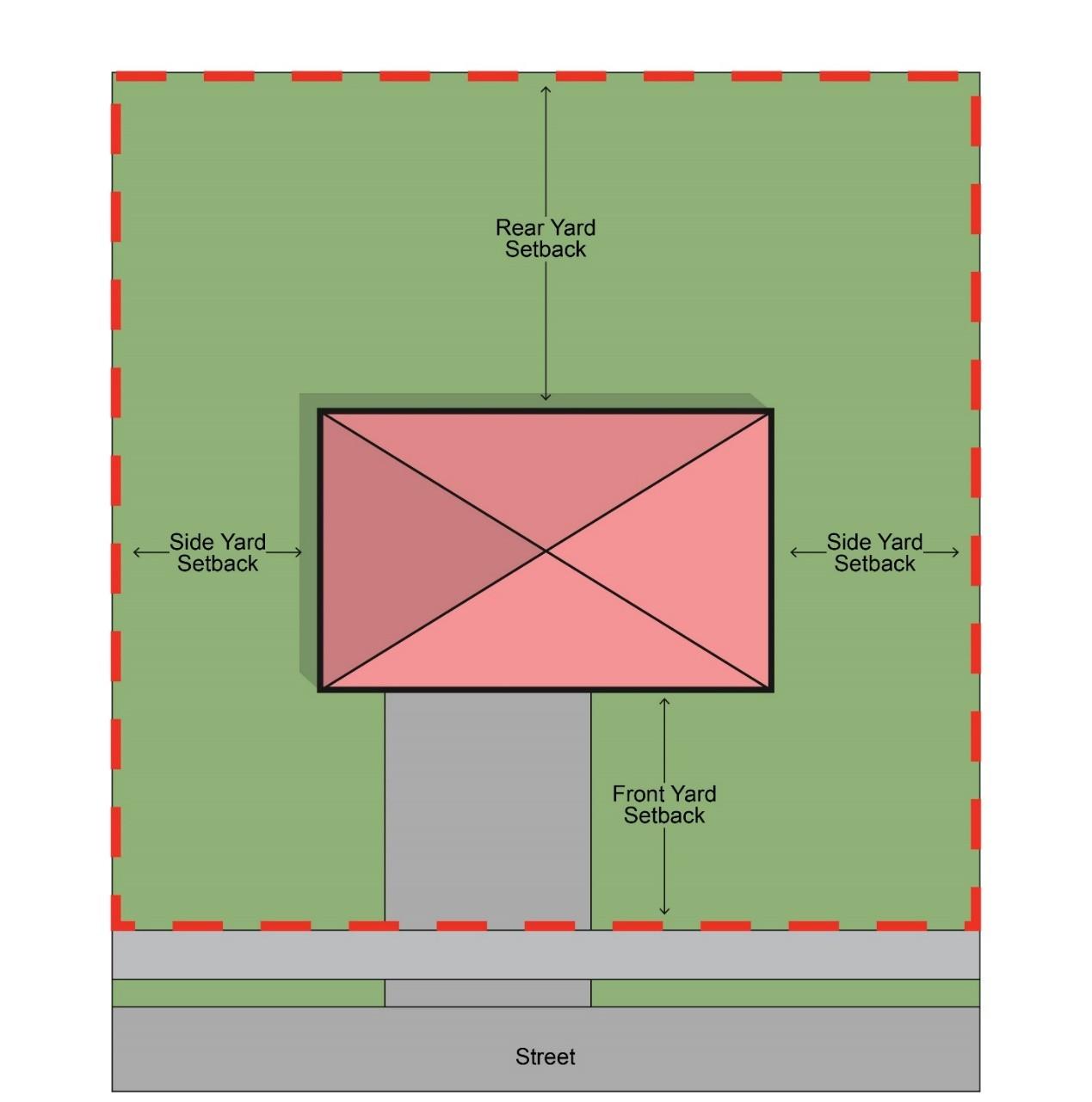
(C) Separation measurements. Where a minimum separation is required or provided between a given use or lot and a separate use, lot, zone, or district, such separation shall be measured as the shortest distance between the lot line associated with the given use or lot and the nearest point of the separate lot, zone, or district, as required, without regard to intervening buildings.
(D) Illumination level measurements. Generally, levels of illumination or lighting shall be measured in footcandles with a direct reading from a portable light meter (or lux meter) at grade level. Illumination levels for a sign shall be measured in accordance with the following:
(1) The ambient illumination level must be recorded at least 30 minutes after sunset using a lux meter held 5 feet above grade level and pointed at the center of the sign while the sign’s illumination source(s) is inactive.
(2) From the same location, the illumination level must be recorded using a lux meter held 5 feet above grade level and pointed at the center of the sign while the sign’s illumination source(s) is active and not blocked.
(3) The difference between these measurements will show the brightness level in footcandles above ambient light.
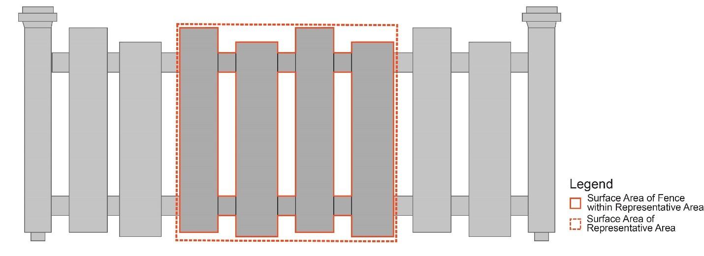
(E) Fence opacity. Fence opacity shall be measured as the combined surface area of all visible posts and pickets within a representative area divided by the total surface area of the representative area. For example, the opacity of a typical wood picket fence could be measured as the combined surface area of the pickets and posts within a selected 3foot-by-3-foot area, divided by 9 (the total square footage of the representative area), as shown in Figure 1104.02-A: Fence Opacity Measurement Example
Figure 1104.02-A: Fence Opacity Measurement Example
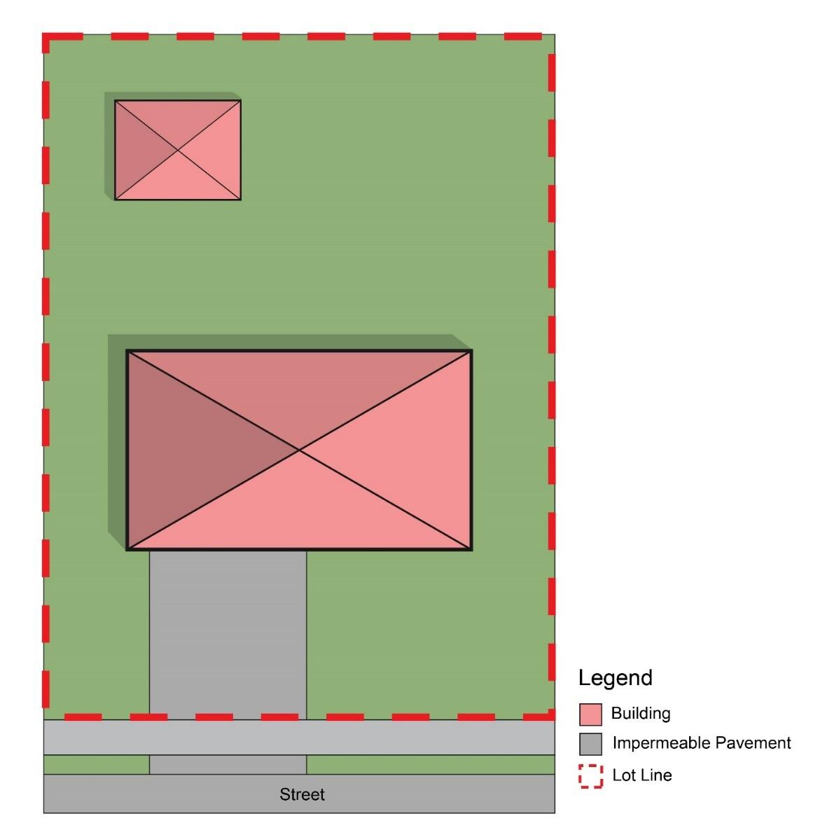
(F) Impervious surface measurements
(1) The ratio of impervious surfaces to pervious surfaces on a lot shall be calculated as the total surface area (when viewed from an aerial perspective) of all principal structures, accessory structures, and impermeable surfaces (including nonpermeable paving and driveways) within a lot divided by the total surface area of the lot, as shown in Figure 1104.02-B: Lot Coverage Measurement Example
1104.02-B: Lot Coverage Measurement Example
(2) The surface area of ground-mounted solar energy collection systems shall be calculated against the lot’s open space.
(3) Fences shall not be calculated against a lot’s open space.
(4) Significant features of the land identified through an environmental impact assessment (per Section 1101.04 – Environmental Impact Assessment) may be included in the calculation of a lot’s open space, where such features are incorporated into open space portions of a development.
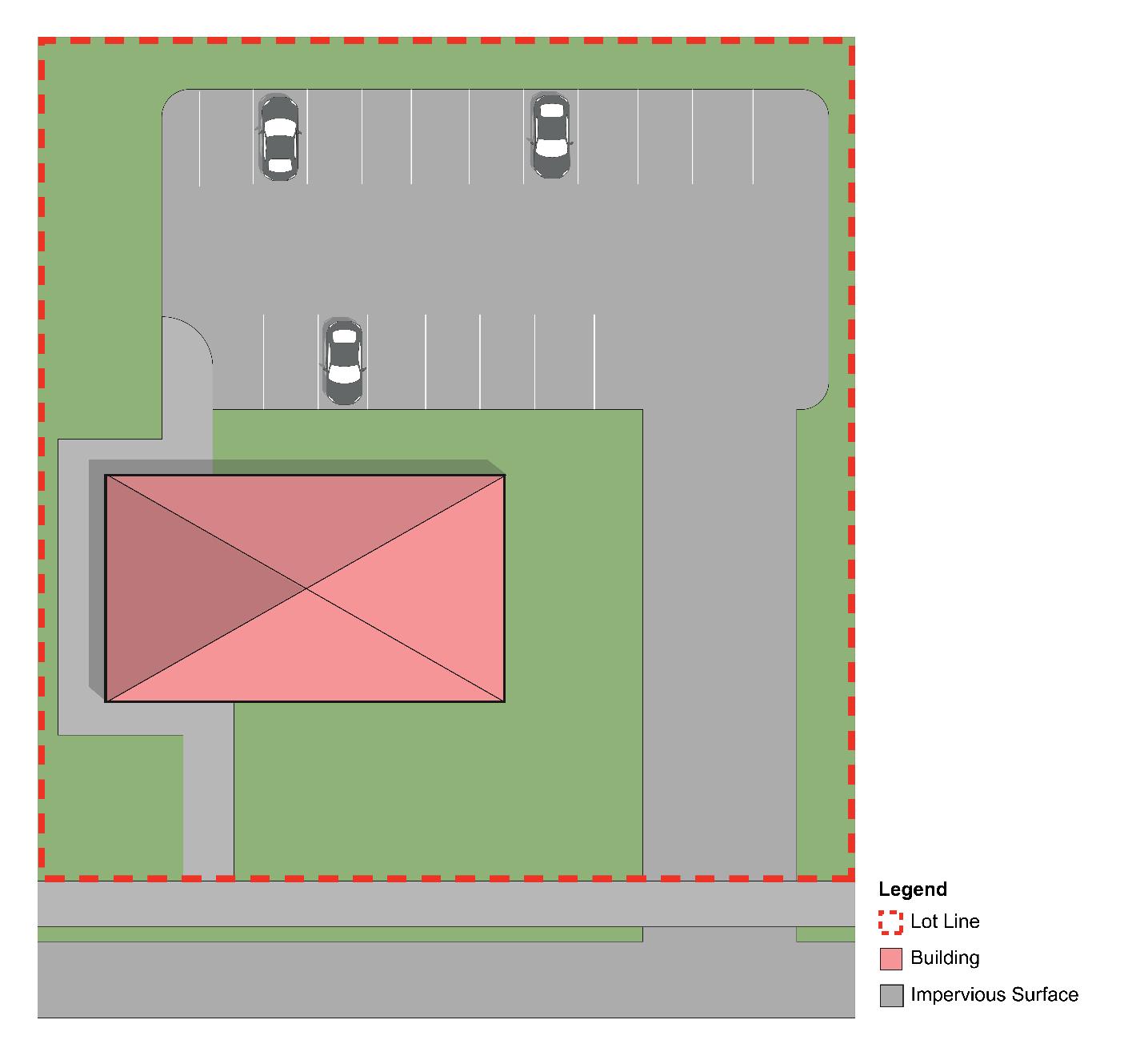
(G) Building coverage measurements
(1) The ratio of building coverage shall be calculated as the total surface area (when viewed from an aerial perspective) of all principal structures and accessory structures within a lot divided by the total surface area of the lot, as shown in Figure 1104.02-C: Building Coverage Measurement Example.
Figure
Figure 1104.02-C: Building Coverage Measurement Example
(2) The surface area of ground-mounted solar energy collection systems shall be calculated as a structure, adding to a lot’s building coverage.
(3) In nonresidential zones, driveways, surface-level parking lots, grade-level patios, and other paving and hardscaping shall not be calculated as part of a lot’s building coverage.
(4) In residential zones, driveways, surface-level parking lots, grade-level patios, and other paving and hardscaping shall be calculated as part of a lot’s building coverage.
(H) Setback measurements.
(1) A building or structure’s setback shall be measured as the shortest distance between the exterior surface of such building or structure and the applicable lot line,
an example of which is shown in Figure 1104.02-D: Setback Measurement Example.
(2) Bay windows, belt courses, cornices, ornamental features, and porches are allowed to project from a building into a required setback a distance no greater than 3 feet.
1104.02-D: Setback Measurement Example
(A) Measuring building height. Building height shall be measured as the vertical distance from the highest point of the coping of a flat roof, or the deck line of a mansard roof, or the mean height level between the eaves and ride of a gable, hip, and gambrel roof, to the average elevation across the face of the building containing its principal entrance, as shown in Figure 1104.03-E: Building Heights Measurement Examples
Figure
Side Lot Line
Side Lot Line
Rear Lot Line
Front Lot Line
Figure 1104.03-E: Building Heights Measurement Examples
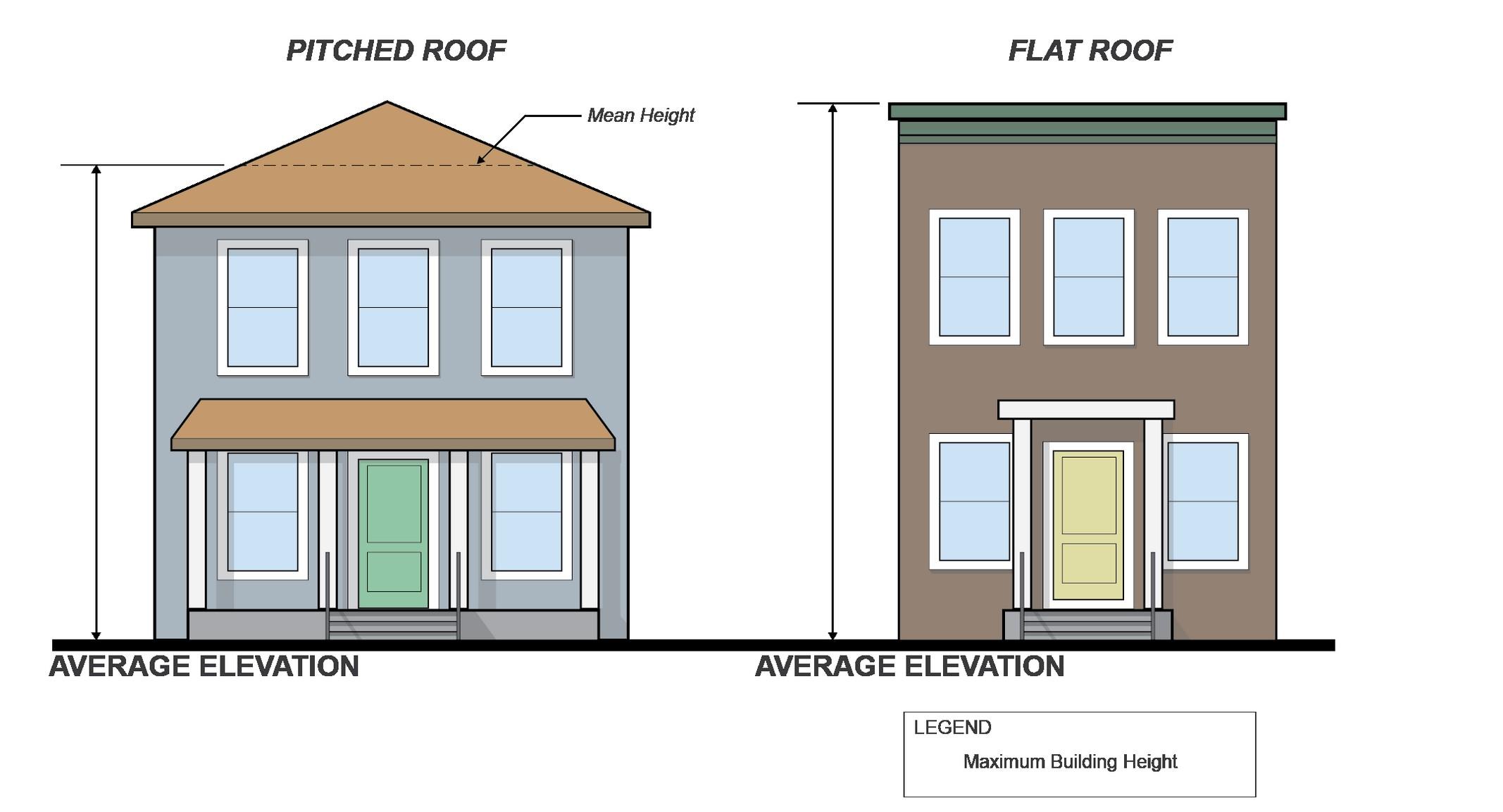
Building Height
Building Height
(B) Buildings exempted from maximum height limits
(1) Public and semipublic or public service buildings, including churches, temples, mosques, and similar places of religious assembly when permitted in a zone or district, may be erected to a height not to exceed 60 feet.
(C) Elements exempted from maximum height limits. Except as specifically stated in other parts of this Code, no building shall be erected, converted, enlarged, reconstructed, or structurally altered to exceed the maximum allowed height hereinafter established for the zone or district in which the building is located, except that the following elements may be constructed above such height limits:
(1) Penthouse or roof structures for the housing of elevators, stairways, tanks, ventilating fans, or similar equipment required to operate and maintain the building;
(2) Fire or parapet walls;
(3) Skylights, towers, steeples, and stage/screen lofts;
(4) Flag poles, chimneys, and smokestacks;
(5) Radio and television aerials (up to 35 feet above grade level in any residential zone, or with no maximum height limit in nonresidential zone, subject to approval by the Planning Commission);
(6) Wireless masts (up to 35 feet above grade level in any residential zoning district, or with no maximum height limit in nonresidential zoning districts, subject to approval by the Planning Commission);
(7) Water tanks; and
(8) Structures similar to those aforementioned.
(D) Maximum exemption. Unless otherwise stated, no structure excepted from the calculation of building height in Subsection (C) above, may:
(1) Be erected to exceed by more than 15 feet the height limits of the zone or district in which it is located;
(2) Where applicable, have a gross floor area greater than 25% of the roof area of the building;
(3) Be used for any residential purpose other than a use incidental to the main use of the building.
END OF TITLE 1
TITLE 2 – ZONE, DISTRICT AND OVERLAY REGULATIONS FOLLOWS
Title 2 – Zone, District and Overlay Regulations
CHAPTER 1101 – GENERAL PROVISIONS
(A) Applicability. The provisions for each zone, district, and overlay shall set minimum and maximum standards, as applicable, and shall apply uniformly to each zone, except as hereinafter provided or as otherwise legally granted by issuance of approvals required or allowed in this Code.
(B) Zones, districts, and overlays. The zones, districts and overlays provided in Table 1105.01-A: Zone, District and Overlay Names and Map Symbols are hereby established for the City of Twinsburg. Land within said areas shall be designated on the Zoning Map by the indicated symbols.
Table 1105.01-A: Zone, District and Overlay Names and Map Symbols Zone/District/ Overlay Categories
(C) Purpose of overlays, generally. Overlays modify specified provisions of the underlying zone or district. Except where expressly provided otherwise, the provisions of an overlay shall modify and supersede any separate conflicting provisions within this Code.
(A) Zoning Map established. The boundaries of the established zones, districts, and overlays are indicated upon the Zoning Map for the City of Twinsburg, Ohio. This Zoning Map, together with all explanatory matters thereon, is hereby made a part of this Code and attached hereto and incorporated herein as Exhibit (A).
(B) Location of Zoning Map. The Zoning Map is properly attested and is on file in the offices of the Twinsburg Engineering Department.
(C) Mapped geographies. No provision within this Title 2 – Zone, District and Overlay Regulations shall be construed to require or limit the location of any zone, district, or overlay on the Zoning Map. Amendments to the Zoning Map are allowed and shall follow the provisions of Section 1103.02 – Text and Map Amendment
(D) Interpretation of Zoning Map. The boundaries of the Zoning Map shall be interpreted according to the applicable provisions of Section 1103.01 – General Interpretations.
CHAPTER 1102 – ZONES AND DISTRICTS
(A) Purpose. This zone is established to provide for low-density, large-lot residential development.
(B) Governing tables. In case of discrepancy with the content of any excerpt table provided within this Section, the following tables shall govern the standards specified:
(1) Table 1108.02-AD: Residential Zones Use Permissions shall govern the uses allowed within each residential zone.
(2) Table 1113.02-AM: Residential Zones Dimensional Standards shall govern the dimensional development standard within each residential zone.
(C) Zone use and dimensional standards tables. The following tables provide applicable use permissions (see Table 1106.01-B: R-2 Zone Use Permissions) and dimensional standards (see Table 1106.01-C: R-2 Zone Dimensional Standards).
Table 1106.01-B: R-2 Zone Use Permissions
● = Allowed with Permit = Conditionally Allowed
= Allowed as Accessory Use
Table Notes: (1) Conditionally permitted on HOA or publically owned lands
Table 1106.01-C: R-2 Zone Dimensional Standards
Table Notes: (1) Replacement of nonconforming dwellings shall be subject to the provisions of Title 5 – Nonconformities
(A) Purpose. This zone is established to accommodate a medium-density residential development type with sufficient open space for public enjoyment and environmental benefits.
(B) Governing tables. In case of discrepancy with the content of any excerpt table provided within this Section, the following tables shall govern the standards specified:
(1) Table 1108.02-AD: Residential Zones Use Permissions shall govern the uses allowed within each residential zone.
(2) shall govern the dimensional development standard within each residential zone.
(C) Zone use and dimensional standards tables. The following tables provide applicable use permissions (see Table 1106.02-D: R-3 Zone Use Permissions) and dimensional standards (see Table 1106.02-E: R-3 Zone Dimensional Standards).
Table 1106.02-D: R-3 Zone Use Permissions
● = Allowed with Permit = Conditionally Allowed ◑ Ⓐ = Allowed as Accessory Use
Table 1106.02-E: R-3 Zone Dimensional Standards
Setback from Rear Lot Lines (min.)
Setback from Side Lot Lines (min.)
Building Height (max.)
Principal Dwelling Floor Area (min.) 1,500 square feet (2)
Table Notes:
(1) Conditionally permitted on HOA or publically owned lands
(2) Replacement of nonconforming dwellings shall be subject to the provisions of Title 5 – Nonconformities
(A) Purpose. This zone is established to accommodate one-unit dwellings at a slightly higher density than that permitted in the R-3 Zone.
(B) Governing tables. In case of discrepancy with the content of any excerpt table provided within this Section, the following tables shall govern the standards specified:
(1) Table 1108.02-AD: Residential Zones Use Permissions shall govern the uses allowed within each residential zone.
(2) Table 1113.02-AM: Residential Zones Dimensional Standards shall govern the dimensional development standard within each residential zone.
(C) Zone use and dimensional standards tables. The following tables provide applicable use permissions (see Table 1106.03-F: R-4 Zone Use Permissions) and dimensional standards (see Table 1106.03-G: R-4 Zone Dimensional Standards).
Table 1106.03-F: R-4 Zone Use Permissions
Allowed with Permit
Conditionally
Table Notes:
(1) Conditionally permitted on HOA or publically owned lands.
Table 1106.03-G: R-4 Zone Dimensional Standards
Table Notes:
(1) Applies to major subdivisions only.
(2) Replacement of nonconforming dwellings shall be subject to the provisions of Title 5 – Nonconformities.
(A) Purpose. This zone is established to allow a greater concentration of residential uses, to allow flexibility and utilization of space to obtain a more urban environment compared with less-dense zones, to accommodate contiguous and clustered one-unit dwellings, and to create functional and interesting residential areas that meet a variety of living arrangement preferences and needs.
(B) Governing tables. In case of discrepancy with the content of any excerpt table provided within this Section, the following tables shall govern the standards specified:
(1) Table 1108.02-AD: Residential Zones Use Permissions shall govern the uses allowed within each residential zone.
(2) Table 1113.02-AM: Residential Zones Dimensional Standards shall govern the dimensional development standard within each residential zone.
(C) Zone use and dimensional standards tables. The following tables provide applicable use permissions (see Table 1106.04-H: R-5 Zone Use Permissions) and dimensional standards (see Table 1106.04-I: R-5 Zone Dimensional Standards).
Table 1106.04-H: R-5 Zone Use Permissions
● = Allowed with Permit = Conditionally Allowed
= Allowed as Accessory Use
Table Notes
(1) Not more than four (4) single family cluster units may be attached in any building group.
(2) Conditionally permitted on HOA or publically owned lands.
Table 1106.04-I: R-5 Zone Dimensional Standards
Lot Frontage (min.) See table note (1)
SETBACKS AND BUILDINGS
Setback from Front Lot Lines (min.) See table note (2)
Setback from Rear Lot Lines (min.) See table note (3)
Setback from Side Lot Lines (min.)
(4)
Table Notes:
(1) This requirement is established through a site plan review in accordance with Section 1102.01 – Site Plan Review. All developments in the R-5 Zone shall not exceed a maximum density of 3.5 units/acre.
(2) Within the R-5 Zone, dwellings shall be setback a minimum of 30 feet from the nearest edge of the street or sidewalk pavement.
(3) Within the R-5 Zone, dwellings shall be setback a minimum of 50 feet from a rear lot line that abuts a lot improved with a one-unit dwelling or a commercial or industrial zone boundary.
(4) Within the R-5 Zone, dwellings shall provide a minimum separation of 10 feet from separate dwellings, and a minimum separation of 25 feet from common open spaces.
(5) Replacement of nonconforming dwellings shall be subject to the provisions of Title 5 – Nonconformities
(A) Purpose. This zone is established to promote large-scale development in an integrated manner. This zone allows for residential and commercial uses combined in a harmonious manner, accommodating a variety of housing types with common open space areas within a single development area.
(B) Governing tables. In case of discrepancy with the content of any excerpt table provided within this Section, the following tables shall govern the standards specified:
(1) Table 1108.02-AD: Residential Zones Use Permissions shall govern the uses allowed within each residential zone.
(2) Table 1113.02-AM: Residential Zones Dimensional Standards shall govern the dimensional development standard within each residential zone.
(C) Zone use and dimensional standards tables. The following tables provide applicable use permissions (see Table 1106.05-J: PUD Zone Use Permissions) and dimensional standards (see Table 1106.05-K: PUD Zone Dimensional Standards).
Table 1106.05-J: PUD Zone Use Permissions ●
Table Notes
Table 1106.05-K: PUD Zone Dimensional Standards
Standards
Lot Area (min.)
Impervious Surface Area (max.)
Development Open Space Set-Aside (min.)
Lot Frontage (min.)
SETBACKS AND BUILDINGS
Setback from Front Lot Lines (min.)
Setback from Rear Lot Lines (min.)
Setback
Principal Dwelling Floor Area (min.)
Table Notes:
See table note 1 and 2
square feet (3)
(1) The dimensional standards applicable to individual PUD developments that are made part of a duly executed development agreement with the City of Twinsburg may be modified where such development agreement applies specific dimensional standards. Where a duly executed development agreement for a PUD is silent on a given dimensional standard, the applicable standard(s) of this table shall govern.
(2) PUDs require a minimum development area of 200 acres.
(3) Replacement of nonconforming dwellings shall be subject to the provisions of Title 5 – Nonconformities
(A) Purpose. This zone is established to provide for apartments and multi-unit dwellings designed to meet the varying housing needs of the City’s present and future populations.
(B) Governing tables. In case of discrepancy with the content of any excerpt table provided within this Section, the following tables shall govern the standards specified:
(1) Table 1108.02-AD: Residential Zones Use Permissions shall govern the uses allowed within each residential zone.
(2) Table 1113.02-AM: Residential Zones Dimensional Standards shall govern the dimensional development standard within each residential zone.
(C) Zone use and dimensional standards tables. The following tables provide applicable use permissions (see Table 1106.06-L: R-6 Zone Use Permissions) and dimensional standards (see Table 1106.06-M: R-6 Zone Dimensional Standards).
Table 1106.06-L: R-6 Zone Use Permissions
= Allowed with Permit = Conditionally Allowed
Table 1106.06-M: R-6 Zone Dimensional Standards
(A) Purpose. This zone is established in recognition of the special nature of the housing needs of elderly persons in areas of the city in which the location of such housing would be in accordance with the objectives of the Comprehensive Plan.
(B) Governing tables. In case of discrepancy with the content of any excerpt table provided within this Section, the following tables shall govern the standards specified:
(1) Table 1108.02-AD: Residential Zones Use Permissions shall govern the uses allowed within each residential zone.
(2) Table 1113.02-AM: Residential Zones Dimensional Standards shall govern the dimensional development standard within each residential zone.
(C) Zone use and dimensional standards tables. The following tables provide applicable use permissions (see Table 1106.07-N: R-7 Zone Use Permissions) and dimensional standards (see Table 1106.07-O: R-7 Zone Dimensional Standards).
Table 1106.07-N: R-7 Zone Use Permissions
● = Allowed with Permit = Conditionally Allowed
= Allowed as Accessory Use
Table 1106.07-O: R-7 Zone Dimensional Standards
Table Notes:
(1) The standards of this column apply to properties with multi-unit uses within the R-7 zone.
(2) The standards of this column apply to properties with one-unit uses within the R-7 zone.
(3) Replacement of nonconforming dwellings shall be subject to the provisions of Title 5 – Nonconformities
(A) Purpose. This zone is established to accommodate commercial uses primarily focused on the sale of retail goods and personal services that are purchased frequently for daily or weekly needs. This zone is further intended to support groupings of establishments located on unified sites.
(B) Governing tables. In case of discrepancy with the content of any excerpt table provided within this Section, the following tables shall govern the standards specified:
(1) Table 1108.02-AE: Non-Residential Zones Use Permissions shall govern the uses allowed within each commercial zone.
(2) Table 1113.02-AN: Commercial and Public Zones Dimensional Standards shall govern the dimensional development standard within each commercial zone.
(C) Zone use and dimensional standards tables. The following tables provide applicable use permissions (see Table 1106.08-P: C-1 Zone Use Permissions) and dimensional standards (see Table 1106.08-Q: C-1 Zone Dimensional Standards).
Table 1106.08-P: C-1 Zone Use Permissions
● = Allowed with Permit = Conditionally Allowed
= Allowed as Accessory Use
Table 1106.08-Q: C-1 Zone Dimensional Standards
BUILDING
SETBACKS AND HEIGHTS
(A) Purpose. This zone is established to provide for a principal central shopping center of community importance, where concentrations of convenience shopping such as financial services, business services, and similar community-wide facilities may be provided in efficient and well-designed centers.
(B) Governing tables. In case of discrepancy with the content of any excerpt table provided within this Section, the following tables shall govern the standards specified:
(1) Table 1108.02-AE: Non-Residential Zones Use Permissions shall govern the uses allowed within each commercial zone.
(2) Table 1113.02-AN: Commercial and Public Zones Dimensional Standards shall govern the dimensional development standard within each commercial zone.
(C) Zone use and dimensional standards tables. The following tables provide applicable use permissions (see Table 1106.09-R: C-2 Zone Use Permissions) and dimensional standards (see Table 1106.09-S: C-2 Zone Dimensional Standards).
Table 1106.09-R: C-2 Zone Use Permissions
(A) Purpose. This zone is established to provide standards for well-designed and efficient facilities oriented towards highway travelers. Where possible, access roads with controlled egress and ingress to highways and local roads should be encouraged.
(B) Governing tables. In case of discrepancy with the content of any excerpt table provided within this Section, the following tables shall govern the standards specified:
(1) Table 1108.02-AE: Non-Residential Zones Use Permissions shall govern the uses allowed within each commercial zone.
(2) Table 1113.02-AN: Commercial and Public Zones Dimensional Standards shall govern the dimensional development standard within each commercial zone.
Table 1106.09-S: C-2 Zone Dimensional Standards
(C) Zone use and dimensional standards tables. The following tables provide applicable use permissions (see Table 1106.10-T: C-3 Zone Use Permissions) and dimensional standards (see Table 1106.10-U: C-3 Zone Dimensional Standards).
Table 1106.10-T: C-3 Zone Use Permissions
● = Allowed with Permit = Conditionally Allowed
= Allowed as Accessory Use
Allowed with Permit = Conditionally Allowed
= Allowed as Accessory Use
Table 1106.10-U: C-3 Zone Dimensional Standards
Table Notes:
(1) Maximum allowed height may be increased to 50 feet after a public hearing by Planning Commission (per Section 1104.04) if, for every foot in height above 35 feet, the following is provided: additional 2-foot setback from front lot lines, 2-foot setback from rear lot lines, and 1-foot setback from side lot lines above applicable minimum requirements.
(A) Purpose. This zone is established to encourage compact, sustainable, mixed-use development in the central part of the city. Residential mixed-use development with Planning and Zoning Code | Twinsburg, OH 7-12-2024 FINAL Page 38 of 276
offices, retail, and residential components are encouraged. Multi-unit dwellings shall not exceed 50% of the residential component of a mixed-use development or a development site that exceeds 3 acres. Multiple uses are permitted on a single lot or in a single building provided each use and building meets all applicable standards of this Code.
(B) Governing tables. In case of discrepancy with the content of any excerpt table provided within this Section, the following tables shall govern the standards specified:
(1) Table 1108.02-AE: Non-Residential Zones Use Permissions shall govern the uses allowed within each commercial zone.
(2) Table 1113.02-AN: Commercial and Public Zones Dimensional Standards shall govern the dimensional development standard within each commercial zone.
(C) District use and dimensional standards tables. The following tables provide applicable use permissions (see Table 1106.11-V: DWTN District Use Permissions) and dimensional standards (see Table 1106.11-W: DWTN District Dimensional Standards).
(D) Existing one-unit dwellings. One-unit dwellings existing in the DWTN District as of the effective date of this Code are deemed to be permitted by-right and shall not be considered nonconforming uses and may be continued, enlarged, and expanded unless deemed by the City to be abandoned; provided that no new one-unit dwellings shall be permitted in the DWTN District.
Table 1106.11-V: DWTN District Use Permissions
Standards
Development Open Space Set-Aside (min.)
Lot Frontage (min.)
BUIDLING
SETBACKS AND HEIGHTS
Setback from Front Lot Lines (min.)
Setback from Front Lot Lines (max.)
Setback from Rear Lot Lines (min.)
Setback from Side Lot Lines (min.)
Table Notes:
(1) Any portions of a building that are higher than 25 feet above grade level must be set back a minimum of 35 feet from front property lines.
(A) Purpose. This zone is established to support land uses that provide both retail and wholesale services and products. These uses do not have substantial traffic, parking, and storage demands stemming from these commercial and industrial activities.
(B) Governing tables. In case of discrepancy with the content of any excerpt table provided within this Section, the following tables shall govern the standards specified:
(1) Table 1108.02-AE: Non-Residential Zones Use Permissions shall govern the uses allowed within each industrial zone.
(2) Table 1113.02-AO: Industrial Zones Dimensional Standards shall govern the dimensional development standard within each industrial zone.
(C) Zone use and dimensional standards tables. The following tables provide applicable use permissions (see Table 1106.12-X: I-1 Zone Use Permissions) and dimensional standards (see Table 1106.12-Y: I-1 Zone Dimensional Standards).
Table 1106.12-X: I-1 Zone Use Permissions ● = Allowed with Permit = Conditionally Allowed
= Allowed as Accessory Use
Table 1106.12-Y: I-1 Zone Dimensional Standards Standards
Development
BUILDING SETBACKS AND HEIGHTS
Parking
Building
Parking Lot Setback from Side Lot Lines (min.)
Building Setback from Side Lot Lines (min.)
Parking Lot Setback from Rear Lot Lines (min.)
Building Setback from Rear Lot Lines (min.)
Building
Abutting residential district: 25 feet
Abutting nonresidential district: 5 feet
Abutting residential district: 100 feet
Abutting nonresidential district: 15 feet
Abutting residential district: 25 feet
Abutting nonresidential district: 5 feet
Abutting
:
(A) Purpose. This zone is established to provide for industrial uses that are compatible with one another, free from the encroachment of residential and commercial development.
(B) Governing tables. In case of discrepancy with the content of any excerpt table provided within this Section, the following tables shall govern the standards specified:
(1) Table 1108.02-AE: Non-Residential Zones Use Permissions shall govern the uses allowed within each industrial zone.
(2) Table 1113.02-AO: Industrial Zones Dimensional Standards shall govern the dimensional development standard within each industrial zone.
(C) Zone use and dimensional standards tables. The following tables provide applicable use permissions (see Table 1106.13-Z: I-M Zone Use Permissions) and dimensional standards (see Table 1106.13-AA: I-M Zone Dimensional Standards).
Table 1106.13-Z: I-M Zone Use Permissions
I-M Zone
Standards
Table Notes:
(1) In coordination with any applicable requirements of Chapter 1103 – Landscaping and Buffering and Chapter 1104 –Parking, Loading, and Circulation, the required setback area from a front lot line for a parking lot that is visible from the abutting right-of-way must be improved with landscape planting and/or low masonry walls or fences to screen the view of the parking lot.
(2) The building setback required from a front lot line for the I-M zone may be reduced to 50 feet if the front lot line abuts a collector street or a local street that does not abut a residential zone. Such classifications shall be determined in accordance with Section 1107.06 – Classification of Streets and Private Driveways
(3) Maximum allowed height may be increased to 50 feet after a public hearing by Planning Commission (per Section 1104.04) if, for every foot in height above 35 feet, the following is provided: additional 2-foot setback from front lot lines, 2foot setback from rear lot lines, and 1-foot setback from side lot lines above applicable minimum requirements.
(A) Purpose. The PF Zone is established for the following purposes:
(1) To provide a proper zone for public-serving uses;
(2) To protect such public-serving uses from the encroachment of other incompatible uses;
(3) To ensure that such public-serving uses are compatible with adjoining residential uses; and
(4) To support the proper functioning of such public-serving uses in relation to the Comprehensive Plan and other plans for community facilities.
(B) Governing tables. In case of discrepancy with the content of any excerpt table provided within this Section, the following tables shall govern the standards specified:
(1) Table 1108.02-AE: Non-Residential Zones Use Permissions shall govern the uses allowed within each PF Zone.
(2) Table 1113.02-AN: Commercial and Public Zones Dimensional Standards shall govern the dimensional development standard within each PF Zone.
(C) Zone use and dimensional standards tables. The following tables provide applicable use permissions (see Table 1106.14-AB: PF Zone Use Permissions) and dimensional standards (see Table 1106.14-AC: PF Zone Dimensional Standards).
Table 1106.14-AB: PF Zone Use Permissions
● = Allowed with Permit = Conditionally Allowed
= Allowed as Accessory Use
the health, safety, and general welfare of its citizens. This Chapter has been adopted by the City Council for those purposes.
(B) Purpose. The City of Twinsburg has within its jurisdiction special flood hazard areas that are subject to periodic inundation which may result in loss of life and property, in health and safety hazards, in disruption of commerce and governmental services, in extraordinary public expenditures for flood protection and relief, and in impairment of the tax base. Additionally, structures that are inadequately elevated, inadequately floodproofed, or otherwise inadequately protected from flood damage also contribute to the flood loss. This Chapter is adopted to address these facts, promote the public health, safety, and general welfare, and to:
(1) Protect human life and health;
(2) Minimize expenditure of public money for costly flood control projects;
(3) Minimize the need for rescue and relief efforts associated with flooding and generally undertaken at the expense of the public;
(4) Minimize prolonged business interruptions;
(5) Minimize damage to public facilities and Utility Facilities such as water and gas mains, electric lines, telephone lines, sewer lines, streets, and bridges located in areas of special flood hazard;
(6) Help maintain a stable tax base by providing for the proper use and development of areas of special flood hazard so as to protect property and minimize future floodblighted areas;
(7) Ensure that those who occupy the areas of special flood hazard assume responsibility for their actions;
(8) Minimize the impact of development on adjacent properties within and near floodprone areas;
(9) Ensure that the flood storage and conveyance functions of the floodplain are maintained;
(10) Minimize the impact of development on the natural, beneficial values of the floodplain;
(11) Prevent floodplain uses that are either hazardous or environmentally incompatible; and
(12) Meet community participation requirements of the National Flood Insurance Program.
(C) Applicability. This Chapter shall apply to all areas of special flood hazard within the jurisdiction of the City of Twinsburg, Ohio, including any additional areas of special flood hazard annexed by the City of Twinsburg, Ohio, and including any areas mapped on the official Zoning Map as part of a Flood Damage Reduction Overlay (FD).
(D) Methods of reducing flood loss. The following methods and actions are proposed to achieve flood damage reduction:
(1) Restricting or prohibiting uses which are dangerous to health, safety, and property due to water hazards, or which result in damaging increases in flood heights or velocities;
(2) Requiring that uses vulnerable to floods, including facilities, which serve such uses, be protected against flood damage at the time of initial construction;
(3) Controlling the alteration of natural floodplains, stream channels, and natural protective barriers, which help accommodate or channel flood water;
(4) Controlling filling, grading, dredging, excavating, and other development which may increase flood damage; and
(5) Preventing or regulating the construction of flood barriers, which will unnaturally divert flood waters, or which may increase flood hazards in other areas.
(E) Basis for establishing the areas of special flood hazard. For the purposes of this Chapter, the following studies and/or maps are hereby adopted:
(1) Areas of special flood hazard as identified by the Federal Emergency Management Agency (FEMA) in a scientific and engineering report entitled “Flood Insurance Study for the City of Twinsburg, Ohio.” This study with accompanying Flood Boundary and Floodway Maps and/or flood insurance rate maps dated August 4, 1988 (or as updated and adopted by FEMA) and any revisions thereto is hereby adopted by reference and declared to be a part of this Chapter. The Flood Insurance Study is on file with the City of Twinsburg.
(2) Any hydrologic and hydraulic engineering analysis authored by a registered professional engineer in the State of Ohio which has been approved by the City of Twinsburg, Ohio, as required by Section 1103.02 – FD Flood Damage Reduction Overlay Development Standards
(3) Any revisions to the aforementioned maps and/or studies are hereby adopted by reference and declared to be a part of this Chapter. Such maps and/or studies are on file with the City of Twinsburg.
(F) Abrogation and greater restrictions
(1) These regulations are not intended to repeal any existing ordinances (or resolutions) including the Subdivision Regulations, Zoning Code, or Building Code. In the event of a conflict between this Chapter and any other ordinance (or resolution), the more restrictive provision shall govern.
(2) Where a provision of this Chapter may be in conflict with a State or Federal law, such State or Federal lay shall take precedence over this Chapter.
(3) These regulations shall not impair any deed restriction, covenant, or easement. However, the land subject to such interests shall also be governed by these regulations.
(G) Interpretation. In the interpretation and application of these regulations, all provisions shall be:
(1) Considered as minimum requirements;
(2) Liberally construed in favor of the governing body; and
(3) Deemed neither to limit nor repeal any other powers granted under state statutes.
(H) Warning and disclaimer of liability
(1) The degree of flood protection required by this Chapter is considered reasonable for regulatory purposes and is based on scientific and engineering considerations. Larger floods can and will occur on rare occasions. Flood heights may be increased by human-caused or natural causes.
(2) This Chapter does not imply that land outside the areas of special flood hazard, or uses permitted within such areas, will be free from flooding or flood damage.
(3) This Chapter shall not create liability on the part of the City of Twinsburg, Ohio, any officer or employee thereof, or the Federal Emergency Management Agency for any flood damage that results from reliance on this Chapter, or any administrative decision lawfully made thereunder.
(I) Severability. Should any section or provision of this Chapter be declared by the courts to be unconstitutional or invalid, such decision shall not affect the validity of the regulations, or any part thereof, other than the part so declared to be unconstitutional or invalid.
(J) Data use and flood map interpretation. The following guidelines shall apply to the use and interpretation of maps and other data showing areas of special flood hazard:
(1) In areas where the Federal Emergency Management Agency (FEMA) has not identified special flood hazard areas, or in FEMA-identified special flood hazard areas where base flood elevation and floodway data have not been identified, the Floodplain Administrator shall review and reasonably utilize any other flood hazard data available from a federal, state, or other source.
(2) Base flood elevations and floodway boundaries produced on FEMA flood maps and studies shall take precedence over base flood elevations and floodway boundaries by any other source that reflect a reduced floodway width and/or lower base flood elevations. Other sources of data showing increased base flood elevations and/or larger floodway areas than are shown on FEMA flood maps and studies, shall be reasonably used by the Floodplain Administrator.
(3) When Preliminary Flood Insurance Rate Maps and/or Flood Insurance Studies have been provided by FEMA, and upon the issuance of a Letter of Final Determination by FEMA, the preliminary flood hazard data shall be used and shall replace all previously existing flood hazard data provided from FEMA for the purposes of administering this Chapter.
(4) When Preliminary Flood Insurance Rate Maps and/or Flood Insurance Studies have been provided by FEMA, and prior to the issuance of a Letter of Final Determination by FEMA, the use of preliminary flood hazard data shall only be required where no bae flood elevations and/or floodway areas exist, or where the preliminary base flood elevations or floodway area exceed the base flood elevations and/or floodway widths in existing flood hazard data provided from FEMA. Such preliminary data may be subject to change and/or appeal to FEMA.
(5) The Floodplain Administrator shall make interpretations, where needed, as to the exact location of the flood boundaries and areas of special flood hazard. Person contesting the determination of the location of the boundary shall be given a reasonable opportunity to appeal the interpretation in accordance with Section 1104.08 – Floodplain Development Appeals and Variances.
(6) Where a map boundary showing an area of special flood hazard and field elevations disagree, the base flood elevations or flood protection elevations (as found on an elevation profile, floodway data table, established high water marks, or the like) shall prevail.
(K) Substantial damage determinations. Damage to structures may result from a variety of causes including flood, tornado, wind, heavy snow, fire, and the like. After such a damage event, the Floodplain Administrator shall:
(1) Determine whether damaged structures are in special flood hazard areas;
(2) Conduct substantial damage determinations for damaged structures located in special flood hazard areas;
(3) Make reasonable attempt to notify owners of substantially damaged structures of the need to obtain a floodplain development permit (in accordance with Section 1104.07 – Floodplain Development Permit) prior to repair, rehabilitation, or reconstruction; and
(4) Shall implement other measures to assist with substantial damage determinations and subsequent repair processes. Such measures include but are not limited to issuing press releases, public service announcements, and other public information materials related to floodplain development permits and repair of damaged structures. Such measures further include but are not limited to coordinating with other federal, state, and local agencies to assist with substantial damage determinations, providing owners of damaged structures with materials and other information related to the proper repair of damaged structures in special flood
hazard areas, and assisting owners of substantially damaged structures with Increased Cost of Compliance insurance claims.
(A) Water and wastewater systems. The following standards apply to all water supply, sanitary sewerage, and waste disposal systems not otherwise regulated by the Ohio Revised Code:
(1) All new and replacement water supply systems shall be designed to minimize or eliminate infiltration of floodwaters into the systems;
(2) New and replacement sanitary sewerage systems shall be designed to minimize or eliminate infiltration of floodwaters into the systems and discharge from the systems into floodwaters; and
(3) On-site waste disposal systems shall be located to avoid impairment to or contamination from them during flooding.
(B) Subdivisions and large developments
(1) All subdivision proposals shall be consistent with the need to minimize flood damage and are subject to all applicable standards in these regulations.
(2) All subdivision proposals shall have public Utility Facilities and facilities such as sewer, gas, electrical, and water systems located and constructed to minimize flood damage.
(3) All subdivision proposals shall have adequate drainage provided to reduce exposure to flood damage.
(4) In all areas of special flood hazard where base flood elevation data are not available, the applicant shall provide a hydrologic and hydraulic engineering analysis that generates base flood elevations for all subdivision proposals and other proposed development containing at least 50 lots or 5 acres, whichever is less.
(5) The applicant shall meet the requirement to submit technical data to the Federal Emergency Management Agency in accordance with Subsection 1103.04(B)(4), below, when a hydrologic and hydraulic analysis is completed that generates base flood elevations as required by Subsection (4), above
(C) Residential structures. Residential structures in locations that are subject to this Chapter must comply with the following:
(1) New construction and substantial improvements shall be anchored to prevent flotation, collapse, or lateral movement of the structure resulting from hydrodynamic and hydrostatic loads, including the effects of buoyancy. Where a structure, including its foundation members, is elevated on fill to or above the base flood elevation, the requirements for anchoring (as provided herein) and for construction
materials resistant to flood damage (as provided in Subsection (2), below) are satisfied.
(2) New construction and substantial improvements shall be constructed with methods and materials resistant to flood damage.
(3) New construction and substantial improvements shall be constructed with electrical, heating, ventilation, plumbing, and air conditioning equipment and other service facilities that are designed and/or elevated so as to prevent water from entering or accumulating within the components during conditions of flooding.
(4) New construction and substantial improvement of any residential structure, including manufactured homes, shall have the lowest floor, including basements, elevated to or above the flood protection elevation.
(5) New construction and substantial improvements, including manufactured homes, that do not have basements and that are elevated to the flood protection elevation using pilings, columns, posts, or solid foundation perimeter walls with openings sufficient to allow unimpeded movement of waters may have an enclosure below the lowest floor provided such enclosure meets the standards of Subsection (D), below
(6) Manufactured homes shall be affixed to a permanent foundation and anchored to prevent flotation, collapse, or lateral movement of the structure resulting from hydrodynamic and hydrostatic loads, including the effects of buoyancy. Methods of anchoring may include, but are not limited to, use of over-the-top or frame ties to ground anchors.
(D) Allowed lower-level enclosures for residential structures. Where allowed per Subsection (C), above, an enclosure below the lowest floor of a residential structure must:
(1) Be used only for the parking of vehicles, building access, or storage; and
(2) Be designed and certified by a registered professional engineer or architect to automatically equalize hydrostatic flood forces on exterior walls by allowing for the entry and exit of floodwaters; or
(3) Have a minimum of two openings on different walls having a total net area not less than one square inch for every square foot of enclosed area, and the bottom of all such openings being no higher than one foot above grade. The openings may be equipped with screens, louvers, or other coverings or devices provided that they permit the automatic entry and exit of floodwaters.
(E) Exemption for historic structures. Upon a determination by the Floodplain Administrator in consultation with the Architectural Review Board that a proposed repair or rehabilitation of a historic structure will not preclude the structure’s continued designation as a historic structure, and that such work is the minimum necessary to preserve the historic character and design of the structure, the proposed repair or rehabilitation work shall be exempt from the requirements of Subsection (C), above
(F) Nonresidential structures. New construction and substantial improvement of any commercial, industrial, or other nonresidential structure shall meet the requirements of Subsection (C), above, excluding Subsection (C)(4). The lowest floor, including basements, must be elevated to or above the level of the flood protection elevation or, together with attendant utility and sanitary facilities, meet all of the following:
(1) Be dry flood-proofed so that the structure is watertight with walls substantially impermeable to the passage of water to the level of the flood protection elevation;
(2) Have structural components capable of resisting hydrostatic and hydrodynamic loads and effects of buoyancy; and
(3) Be certified by a registered professional engineer or architect, through the use of a Federal Emergency Management Agency Floodproofing Certificate, that the design and methods of construction are in accordance with this Subsection (F)
(G) Accessory structures. Relief to the elevation or dry flood-proofing standards may be granted for accessory structures containing no more than 600 square feet. Such structures must meet the following standards:
(1) They shall not be used for human habitation;
(2) They shall be constructed of flood-resistant materials;
(3) They shall be constructed and placed on the lot to offer the minimum resistance to the flow of floodwaters;
(4) They shall be firmly anchored to prevent flotation;
(5) Service facilities such as electrical and heating equipment shall be elevated or floodproofed to or above the level of the flood protection elevation; and
(6) They shall meet the opening requirements of Subsection (D)(3), above
(H) Recreational vehicles. Recreational vehicles must meet at least one of the following standards:
(1) They shall not be located on sites in special flood hazard areas for more than 180 consecutive days; or
(2) They must be fully licensed and ready for highway use; or
(3) They must meet all standards of Subsection (C), above
(I) Above-ground gas or liquid storage tanks. All above-ground gas or liquid storage tanks shall be anchored to prevent flotation or lateral movement resulting from hydrodynamic and hydrostatic loads.
(A) Ensuring flood carrying capacity. Pursuant to the purpose and methods of reducing flood damage stated in this Chapter, the following standards of this Section – FD Flood
Damage Reduction Overlay Flood Carrying Capacity are adopted to ensure that the reduction of the flood carrying capacity of watercourses is minimized.
(B) Criteria for development in floodways and riverine areas. In floodway areas and in riverine special flood hazard areas, development shall cause no increase in flood levels during the occurrence of the base flood discharge. Prior to the issuance of a floodplain development permit (in accordance with Section 1104.07 – Floodplain Development Permit), the applicant must submit a hydrologic and hydraulic analysis, conducted by a registered professional engineer, demonstrating that the proposed development would not result in any increase in the base flood elevation.
(C) Alternative criteria for development in floodways and riverine areas. A floodplain development permit may be granted (in accordance with Section 1104.07 – Floodplain Development Permit) for work that causes an increase in the base flood elevation in floodways or in riverine special flood hazard areas provided the application meets or provides the following:
(1) The development meets the requirements to submit technical data in Subsection 1103.04(B);
(2) An evaluation of alternatives, which would not result in increased base flood elevations, and an explanation of why these alternatives are not feasible;
(3) Certification that no structures are located in areas that would be impacted by the increased base flood elevation;
(4) Documentation of individual legal notices to all impacted property owners within and outside the community, explaining the impact of the proposed action on their property; and
(5) Concurrence of the Mayor of the City of Twinsburg, Ohio and the Chief Executive Officer of any other communities impacted by the proposed actions.
(D) Alterations of a watercourse. For the purpose of this Chapter, a watercourse is altered when any change occurs within its banks. The extent of the banks shall be established by a field determination of the “bankfull stage.” The field determination of the “bankfull stage” shall be based on methods presented in Chapter 7 of the USDA Forest Service General Technical Report RM-245, Stream Channel Reference Sites: An Illustrated Guide to Field Technique or other applicable publication available from a Federal, State, or other authoritative source. For all proposed developments that alter a watercourse, the following standards apply:
(1) The bankfull flood carrying capacity of the altered or relocated portion of the watercourse shall not be diminished. Prior to the issuance of a floodplain development permit, the applicant must submit a description of the extent to which any watercourse will be altered or relocated as a result of the proposed development, and certificate by a registered professional engineer that the bankfull flood carrying capacity of the watercourse will not be diminished.
(2) Adjacent communities, the U.S. Army Corps of Engineers, and the Ohio Department of Natural Resource, Division of Water, must be notified prior to any alteration or relocation of a watercourse. Evidence of such notification must be submitted to the Federal Emergency Management Agency.
(3) The applicant shall be responsible for providing the necessary maintenance for the altered or relocated portion of said watercourse so that the flood-carrying capacity will not be diminished. The Floodplain Administrator may require the permit holder to enter into an agreement with the City of Twinsburg, Ohio, specifying the maintenance responsibility. If an agreement is required, it shall be made a condition of the approval of a floodplain development permit (in accordance with Section 1104.07 – Floodplain Development Permit).
(4) The applicant shall meet the requirements to submit technical data in Subsection 1103.04(B)(3) when an alteration of a watercourse results in the relocation or elimination of the special flood hazard area, including the placement of culverts.
Activities
(A) Purpose. The map activities identified within this Section are intended to meet National Flood Insurance Program minimum requirements to have flood data reviewed and approved by the Federal Emergency Management Agency (FEMA), and to ensure that City of Twinsburg flood maps, studies, and other data identified in Subsection 1103.01(E) accurately represent flooding conditions so that appropriate floodplain management criteria are based on current data.
(B) Requirement to submit new technical data. It is the responsibility of the applicant to have technical data for a development proposal that impacts floodway delineations or base flood elevations be prepared in a format required for a Conditional Letter of Map Revisions or a Letter of Map Revision and submitted to the Federal Emergency Management Agency (FEMA). Submittal and processing fees for these map revisions shall be the responsibility of the applicant. Technical data reflecting such changes must be submitted to FEMA within 6 months of the date such information becomes available and must include:
(1) Floodway encroachments that increase or decrease base flood elevations or alter floodway boundaries;
(2) Fill sites to be used for the placement of proposed structures where the applicant desires to remove the site from the special flood hazard area;
(3) Alteration of watercourses that result in a relocation or elimination of the special flood hazard area, including the placement of culverts; and
(4) Subdivision or large-scale development proposals requiring the establishment of base flood elevations in accordance with Subsection 1103.02(B).
(C) Conditional letter of map revision requirement. The Floodplain Administrator shall require a Conditional Letter of Map Revision prior to the issuance of a floodplain
development permit (in accordance with Section 1104.07 – Floodplain Development Permit) for:
(1) Proposed floodway encroachments that increase the base flood elevation; and
(2) Proposed development which increases the base flood elevation by more than one foot in areas where the Federal Emergency Management Agency has provided base flood elevations but no floodway.
(D) Right to submit new technical data. The Floodplain Administrator may request changes to any of the information shown on an effective map that does not impact floodplain or floodway delineations or base flood elevations, such as labeling or planimetric details. Such a submission shall include appropriate supporting documentation made in writing by the Mayor of the City of Twinsburg, Ohio, and may be submitted at any time.
(E) Annexation or detachment.
(1) Upon occurrence, the Floodplain Administrator shall notify the Federal Emergency Management Agency in writing whenever the boundaries of the City of Twinsburg, Ohio have been modified by annexation, if the community has assumed authority over an area, or if the City no longer has authority to adopt and enforce floodplain management regulations for a particular area.
(2) In order that the City of Twinsburg Flood Insurance Rate Map accurately represents the City of Twinsburg, Ohio boundaries, the City shall include within such notification a copy of a map of the City of Twinsburg, Ohio suitable for reproduction, clearly showing the new corporate limits, or the new area for which the City of Twinsburg, Ohio has assumed or relinquished floodplain management regulatory authority.
(A) Purpose. The purpose of this overlay is to implement targeted regulations to land in the vicinity of watercourses to better protect water quality, support ecological integrity, and promote public health.
(B) Applicability.
(1) (1) The Riparian Overlay shall be the Riparian Setbacks as mapped by Summit County. https://summitmaps.summitoh.net/EnvironmentalViewer2.0/.
(2) For the purposes of this Section, the ordinary high-water mark shall be as interpreted or defined by the United States Army Corps of Engineers.
(C) Allowed uses and activities. Land within the RO Riparian Overlay and other areas to which this Section applies may be used only for the following purposes:
(1) Preservation of land in its natural state;
(2) Walking or other non-motorized recreation trails up to 10 feet in width and open to the public; and
(3) Ecological restoration and maintenance activities, including prescribed burns, invasive species removal, and planting of native species.
(D) Maintenance required. Areas subject to this Section must be kept in a condition that facilitates native plant and wildlife habitation, free from mowing, chemical treatments, clear cutting, grading, and other types of work (permanent or temporary) that disturb or prohibit natural plant and wildlife. Such maintenance shall be executed by the land owner.
(E) Stormwater management. No landowner shall allow a structure, paved area, construction activities, or other work cause the discharge of stormwater directly or indirectly into a stream or area subject to this Section except when such stormwater is first intercepted by a detention basin, rain garden, or other stormwater best management practice that is engineered to process a 2-year 24-hour storm event.
(F) Existing development. No building, structure, or vehicle use area shall be constructed or expanded within an area subject to this Section. Where this provision renders a property unusable, an applicant may seek a development variance (in accordance with Section 1104.04 – Development Variance), a floodplain development variance (in accordance with Section 1104.08 – Floodplain Development Appeals and Variances), or other form of relief provided within this Code. This provision shall not be construed to prevent regular maintenance of a legally established use or structure within such areas.
END OF TITLE 2
TITLE 3 – LAND USE STANDARDS
Title 3 – Land Use Standards
CHAPTER 1101 – GENERAL USE PROVISIONS
(A) Compliance; modifications of use-specific standards. Where a use within Table 1108.02-AD: Residential Zones Use Permissions or Table 1108.02-AE: Non-Residential Zones Use Permissions is included within Chapter 1104 – Use-Specific Standards, any such applicable provisions shall be construed to be a condition of the use’s approval, except where explicitly modified through the approval of a conditional use permit per Section 1104.03 – Conditional Use Permit or through the approval of a variance per Section 1104.04 – Development Variance
(B) Use-specific standards may apply to undefined uses. If, per Section 1103.03 –Interpretation of Uses, a use is determined to be functionally the same as a defined use that is subject to use-specific standards in Chapter 1104, such use-specific standards shall also apply to the proposed use.
(C) Use specific standards apply to principal and accessory uses. The provisions of Chapter 1104 – Use-Specific Standards apply to each instance of a use, whether the use is a principal use or an accessory use on a lot, unless otherwise expressly stated in this Code.
(A) Use permissions. The use permissions in Table 1108.02-AD: Residential Zones Use Permissions and Table 1108.02-AE: Non-Residential Zones Use Permissions identify for each zone or district the principal and accessory uses that are allowed by right through approval of a zoning permit, allowed through approval of a conditional use permit, allowed as an accessory use, or prohibited per the following key:
(1) A solid circle identifies a use as allowed through the approval of a zoning permit (per Section 1102.03 – Zoning Permit) within a specified zone or district.
(2) A half-filled circle identifies a use that is allowed through the approval of a conditional use permit (per Section 1104.03 – Conditional Use Permit) within a specified zone or district.
(3) A circled letter ‘A’ identifies a building, feature, or use that is allowed as an accessory use through the approval of a zoning permit (per Section 1102.03 –Zoning Permit) within a specified zone or district.
(4) A hyphen identifies a building, feature, or use that is prohibited within a specified zone or district.
(B) Modification of use permissions. The use permissions in Table 1108.02-AD: Residential Zones Use Permissions and Table 1108.02-AE: Non-Residential Zones Use
Title 3 – Land Use Standards | Chapter 1111 – Use-Specific Standards 1111.05 – Gasoline and Fuel Service Station
Permissions may be modified by other provisions of this Code, including but not limited to:
(1) Chapter 1104 – Use-Specific Standards; and
(2) Section 1102.03 – Residential Infill Development Standards.
Table 1108.02-AD: Residential Zones Use Permissions ● = Allowed with Permit
Conditionally Allowed
= Allowed as Accessory Use
= Prohibited
Table 1108.02-AE: Non-Residential Zones Use Permissions
● = Allowed with Permit = Conditionally Allowed
= Allowed as Accessory Use
= Prohibited
USES
= Allowed with Permit
Conditionally Allowed
= Allowed as Accessory
= Prohibited
(A) Uses not identified. Any use not expressly set forth and defined in this Code shall be deemed to be prohibited.
(B) Hazardous, noxious, and offensive uses prohibited. No use shall be allowed or authorized to be established which, when conducted in compliance with the provisions of this Code and any additional conditions or requirements prescribed, is or may become hazardous, noxious, or offensive due to the emission of odor, dust, smoke, cinders, gas, fumes, noise, vibration, refuse matters, or water-carried wastes.
(C) Specific prohibited uses identified. The following uses are hereby declared undesirable for location with the corporate limits as being incompatible with suburban residential developments and the development and location of commercial businesses and industries which do not have an adverse effect upon the community. These uses are known to cause adverse effects upon public safety, health, roads, and lands due to excessive air pollution, unsightliness, and commonly involved processes and products or byproducts:
(1) Abattoir or slaughter house, stockyards, tannery, curing and storage of raw hides, manufacture and refining of tallow, grease and stock food manufacture from refuse, manufacturing, treatment, or handling of fertilizers (other than the sale of fertilizers as part of allowed retail uses), and the treatment or handling of offal and dead animals;
(2) Sewage disposal plants, garbage disposal plants, the treatment or handling of refuse, and landfills (other than those controlled by a political subdivision);
(3) Stone crushing processes, nitrating processes, and ferrous and nonferrous manufacturing processes;
(4) Manufacture of oiled cloth, oiled clothing, wood scouring, rayon, synthetic cloth and fiber, bricks, gypsum, cement, plaster, plaster of paris, lime, bronze powder, explosives, fireworks, matches, paper, pulp, carbon, lampblack, graphite, explosive or inflammable celluloid or pyroxylene products, acid, gas, coal gas, coal tar, mineral dye or dyestuffs, creosote, or byproducts from distillation processes;
(5) Impregnation of any fabric by oxidizing oils;
(6) Manufacture of rubber through a reclaiming process;
(7) Manufacture of chemicals or other processes that give off noxious fumes, smoke, odors, and/or vapors;
(8) Distillation of tar, bones, coal, or wood;
(9) Bulk storage of explosives, fireworks, gas, or acid (other than as accessory to an allowed industrial use);
(10) Hog feeding (other than in the ordinary practice of a farm’s operation);
(11) Mobile home parks and temporary housing such as cabins (other than motels and hotels);
(12) Aviation fields for commercial aircraft (other than heliports);
(13) Junkyards or automotive graveyards;
(14) Commercial breeding, raising, and feeding of any animal such as fox, mink, skunk;
(15) Strip or open mining or extracting operations for clay, gravel, stone, coal, and other natural resources, except upon issuance of a condition use permit (per Section 1104.03 – Conditional Use Permit);
(16) Manufacturing and processing of uranium and plutonium;
(17) Storage, handling, and transportation of hazardous waste material;
(18) Warehousing and distribution of hazardous materials as a primary use; and
(19) Incineration of medical, pathological, and anatomical waste.
(D) Authorization through conditional use permits. Prohibited uses identified within this Section are hereby declared to be nuisances and shall not be allowed except where authorized by a conditional use permit (per Section 1104.03 – Conditional Use Permit), and only in the zone or district where such a conditional use may be allowed per Table 1108.02-AD: Residential Zones Use Permissions or Table 1108.02-AE: Non-Residential Zones Use Permissions
(E) Prohibited accessory uses. Any use that is accessory to a prohibited use shall itself be prohibited.
(A) Multiple principal uses allowed. The following types of lots are allowed to have more than one principal use, so long as each principal use is allowed within the given zone or district and the associated building(s) meet the applicable standards:
(1) All lots within a C-1 Zone; and
(2) All lots within a nonresidential zoning or district (other than the C-1 Zone) that are not improved with a one-unit dwelling or a two-unit dwelling.
(B) Multiple accessory uses allowed. Multiple accessory uses are allowed on a lot, provided that such accessory uses each meet the standards of Chapter 1102 –Accessory Buildings, Features, and Uses and other applicable standards of this Code.
CHAPTER 1102 – ACCESSORY BUILDINGS, FEATURES, AND USES
(A) Applicability. For the purposes of this Section, an accessory building shall be any occupiable structure that includes a roof. Pools, patios, and decks that are not covered by a roof shall not be considered an accessory building.
(B) Attached accessory buildings. An accessory building that is attached to the principal building of a lot shall be made structurally a part thereof and shall comply in all respects with the requirements of this Code that are applicable to the principal building.
(C) Placement of detached accessory buildings in the R-2, R-3 and R-4 zones.
(1) Any detached accessory buildings, including, but not limited to, detached garages, shall be located not less than 20 feet from the principal building of the lot, and shall be located not less than 20 feet from any dwellings on adjacent lots.
(2) Detached accessory buildings shall not project into a required front lot line setback or a required side lot line setback except that within a rear yard, a detached accessory building, except for a detached garage, may be located not less than 5 feet from a rear lot line.
(D) Accessory buildings on lots with single-unit dwelling use. In addition to a detached garage, up to two additional separate accessory buildings not exceeding 120 square feet in floor area each may be allowed on a lot with a one-unit dwelling use.
(E) Accessory buildings on corner lots. On corner lots, an accessory building shall be setback from the side street lot line not less than the required setback of the principal building plus an additional 5 feet.
(F) Accessory buildings in the R-5 zone. Accessory buildings shall not be allowed in the R-5 zone as an accessory use to a cluster dwelling.
(G) Accessory buildings in the R-6 zone. Accessory buildings may be allowed in the R-6 zone where they are accessory to multi-unit dwellings and meet all applicable dimensional standards. The uses of such buildings may include on-site leasing offices, on-site laundry facilities, on-site workout facilities, and accessory uses for the exclusive use and benefit of the residents of the property.
(H) Accessory buildings in non-residential zones. Accessory structures shall be located behind the main building and shall have a minimum side yard not less than that of the main building. Accessory buildings located in rear yards and less than 600 square feet shall be exempt from submittal to Planning Commission for site plan review and shall be eligible for administrative review and approval. Security shelters such as guard houses, fee booths, attendant booths and other similar buildings may be located in a front yard upon site plan approval by the Planning Commission.
(I) Attached garages. Up to one attached garage constructed as part of a residential dwelling may be allowed where such construction complies with the following:
(1) Attached garages shall comply with applicable setbacks for the respective zone or district.
(2) The vehicle storage area of an attached garage shall generally not exceed 600 square feet in floor area (see item 3).
(3) The vehicle storage area of an attached garage may be increased above 600 square feet in floor area based on the greater of (A) adding an additional 25 square feet of vehicle storage area for every 100 square feet of first floor living area above 1,000 square feet; or (B) adding an additional 10 square feet of vehicle storage area for every foot of side lot line setback above the minimum for the respective zone or district.
(4) An attached garage that faces a street other than that which the primary entrance to the principal structure faces shall be setback from the lot line along such street not less than 25 feet.
(5) An attached garage shall be set back not less than 3 feet from the nearest front building wall of the principal building.
(J) Multiple Attached Garages. Residential dwellings on lots that are 1 acre or greater in area may have two attached garages, where each attached garage meets the dimensional standards of subsection H above.
(K) Detached garages. Up to one detached garage constructed on a lot with a residential dwelling may be allowed where it complies with the following:
(1) The vehicle storage area of a detached garage shall not exceed 600 square feet in floor area except that for every 1,000 square feet of lot area in excess of 17,000 square feet of lot area, an additional 20 square feet of vehicle storage area shall be allowed.
(2) A detached garage shall not be larger in floor area than the associated principal building on the same lot.
(3) A detached garage shall not be taller than 12 feet in height.
(4) A detached garage shall not be located closer to a front lot line or side lot line than the principal building on the same lot.
(5) A detached garage shall be located no closer than 15 feet from the rear lot line.
(6) A detached garage that faces a street other than that which the primary entrance to the principal structure faces shall be setback from the lot line along such street not less than 25 feet.
(7) If a detached garage is constructed to serve as both a vehicle storage facility and as an accessory building for non-vehicle storage uses, then the maximum allowed size
shall be determined by combining the maximum allowed size of a detached garage per this Subsection (K) with the maximum allowed size of an accessory building per Subsection (M), below
(L) Carports
(1) Carports may be allowed but shall not replace an enclosed parking space as may be required per Chapter 1104 – Parking, Loading, and Circulation
(2) Carports shall comply with all setbacks that apply to the lot per Section 1102.02Comprehensive Dimensional Standards
(M) Placement and size standards for specified accessory buildings. Excluding attached garages, detached garages, and buildings for the keeping of personal livestock, accessory buildings shall comply with the following:
(1) The total floor area of all accessory buildings on a lot within a residential zone shall not exceed 140 square feet, except that for every 1,000 square feet of lot area in excess of 18,000 square feet of lot area, an additional 20 square feet of floor area shall be allowed to a maximum of 1,500 square feet total. As accessory buildings increase in size, the minimum applicable setbacks shall be increased by 5 feet for every increase of 100 square feet of floor area.
(2) The height of accessory buildings shall not be more than 12 feet.
(3) Accessory buildings on lots in non-residential zones shall be located within the rear yard and shall be no closer to side lot lines than the associated principal building.
(N) Swimming pools
(1) Swimming pools in excess of 24 inches in depth constructed either in the ground or above the ground shall be allowed as accessory to a dwelling, provided the pool and its surrounding structure shall be located in the side or rear yard not less than 10 feet from any lot line.
(2) For the protection of life and limb of the public, a temporary fence of at least 48 inches in height must be installed completely around the area of excavation for a swimming pool, with such temporary fence remaining fully functional and in place until the construction of a permanent fence is complete.
(3) Every pool which is constructed either partially or wholly by means of an excavation or depression below grade shall be enclosed by a fence at least 48 inches tall and shall be designed and constructed in a manner so as to prevent access to such pool by small children. Such pools constructed within a completely fenced yard that meets these requirements shall not require an additional fence.
(4) Pools constructed completely above grade which have a self-contained fence or siding with a removable access do not require a fence.
(5) Permanent fencing enclosing a swimming pool shall conform to the applicable standards in Section 1102.02 – Fencing.
(6) Pool equipment such as pumps, filters, and heaters, shall be located at least 15 feet from any lot line.
(O) Keeping of personal livestock. The keeping of personal livestock and bees shall be allowed only within residential zones, provided:
(1) The type, number, and applicable lot size requirements for a keeping a given domesticated adult animal are met, as provided in Table 1109.01-AF: Personal Livestock and Hobby Bee Keeping Limits;
Table 1109.01-AF: Personal Livestock and Hobby Bee Keeping Limits
Table Notes:
(1) No more than 12 hives (including nucleus hives) are allowed on any lot.
(2) Roosters are not allowed.
(3) Enclosed fencing is required for the keeping of livestock, chickens and other fowl.
(2) A stable, hen house, rabbit hutch, farm building, or the like is provided to retain such animals. The total floor area of such buildings on a lot shall not exceed 140 square feet, except that for every 1,000 square feet of lot area in excess of 18,000 square feet, an additional 20 square feet of floor area shall be allowed to a maximum of 1,500 square feet total. As accessory buildings increase in size, the minimum applicable setbacks shall be increased by 5 feet for every increase of 100 square feet of floor area. The height of such buildings shall not exceed 20 feet;
(3) Beekeeping equipment must be oriented away from neighboring properties, entrances to bee hives must not directly face an adjacent property, bee hives must be located within the rear yard of the lot and must be kept a minimum of 20 feet from lot lines;
(4) A fresh water supply supporting bee hives must be maintained on a subject property with beekeeping and such water supply must be closer to the bee hives than any
other water source not on the subject property (e.g., a bee hive may not be closer to a pool on a neighboring property than the fresh water supply source provided on the subject property);
(5) Beekeepers must be residents of the property;
(6) A “flyaway barrier” is required for lots less than .5 acres in area. The “flyaway barrier” must be a solid screen or dense hedge, at least 6ft high, extending at least 2ft on either side of the hive, and located within 5 ft of the hive. It must be placed along the entrance side of the beehive
(7) All apiaries in the state of Ohio must be registered with ODA as required by ORC 909.02 and must follow all State of Ohio rules and regulations
(8) The stable or corral, exclusive of perimeter fences in which livestock is kept, shall not be located in a front yard, shall not be closer to a front lot line than 20 feet behind the front elevation of the principal building on the lot, shall be set back at least 75 feet from side or rear lot lines, and shall provide a separation of at least 500 feet from any dwelling on adjacent lots that were constructed as of the date of a received complete approval application for such stable or corral. Such buildings may be located not less than 20 feet from those portions of a side or rear lot line that abut a park;
(9) The corral shall be screened from the public right-of-way by a landscaped screen or by the building itself; and
(10) The stable or corral shall be located so as not to cause a health hazard, shall be not less than 100 feet from any stream, and shall be not less than 300 feet from any well.
(P) Vegetable gardens and roadside stands
(1) A roadside stand and signs offering for sale agricultural products grown on the premises may be erected on private property in front of the principal building’s setback from a front lot line. Off-street parking associated with a roadside stand shall be located so as not to create a traffic hazard for pedestrians, bicyclists, and vehicles operating or maneuvering near or past the site.
(2) Vegetable gardens with varieties of crops and herbs that grow less than 3 feet tall are allowed in any yard provided they are set back at least 5 feet from all lot lines.
(3) Vegetable gardens with varieties of crops that grow taller than 3 feet are allowed in side yards and rear yards provided they are set back at least 10 feet from side and rear lot lines.
(4) Vegetable gardens shall not be allowed to become unkempt. High weeds must be removed from all outdoor spaces, including gardens.
(5) The provisions of this Subsection (P) shall not be construed to prevent the planting of non-invasive flowers or the planting of non-invasive trees.
(Q) Composting. Composting shall be allowed only within residential zones, provided:
(1) Such use is not conducted as a business, or as accessory to a business;
(2) The materials to be composted must originate on the same property as the location of the principal building for which it serves;
(3) The composting site shall be maintained in a safe, sanitary, neat, and orderly fashion to prohibit the spread of disease vectors, rodents, and insects, and minimize odors;
(4) The composting structure shall permit proper aeration of the composted material;
(5) The compost structure shall not be located in any front yard, and shall be located 20 feet from the rear or side lot line.
(6) All composting structures shall enclosed on the top and all sides; and
(7) No composting structure shall exceed four feet in height.
(8) Total composting volume shall not exceed 75 cubic feet per lot.
(R) Attached accessory dwelling units. Attached accessory dwelling units shall be regulated by the provisions of Section 1104.01 – Attached accessory dwelling Unit
(S) Accessory electric vehicle charging station. Electric vehicle charging stations are an allowed accessory use of a parking lot, a parking structure, or a garage.
(T) Outside storage
(1) For the purposes of this section, “storage” shall mean the maintenance of a location containing various items overnight.
(2) Outside storage shall generally be subject to the provisions of Section 1102.03 –Outside Storage, Sales, and Services, except as provided herein.
(3) Outside storage of materials or equipment in residential zone is not permitted
(A) Applicability. The provisions of this Section 1102.02 apply to all new fences and alterations of existing fences other than the following:
(1) Shrubbery fences, hedges, or other natural growth along property lines.
(2) Small ornamental lattice-type fences that are no taller than 4 feet in height and that are attached to or adjoining a dwelling and forming part of its decoration and/or landscaping.
(3) Fences serving as enclosures for swimming pools, where such fences meet the applicable standards of Subsection 1102.01(N), above.
(4) Fences serving as enclosures around telecommunications towers and associated structures and equipment, where such fences meet the applicable standards of Section 1104.09 – Telecommunication Towers
(B) General fence material and design standards
(1) All fencing shall have openings a minimum of 1-5/8-inch wide to allow for the movement of light and air between boards.
(2) All chain link fencing, where allowed, shall be vinyl clad.
(3) Vinyl cladding on fencing shall be black, dark brown, or dark green in color.
(4) Vinyl fencing shall be white, black, dark brown, or dark green in color.
(5) Wood fences and/or simulated wood fencing shall be white, natural, or earth tones, with both sides of the fence being the same color.
(6) Wrought iron and aluminum fencing shall be white, black, dark brown, or dark green in color.
(C) Fencing in residential zones. In residential zones, fences other than those exempted by this Section 1102.02 may be erected subject to the following standards:
(1) Fences no taller than 6 feet in height are allowed in rear and/or side yards but shall not be located closer to a front lot line than the principal building. Fences in rear and/or side yards may be up to 8 feet tall along the portions of rear and/or side lot lines that abut commercial or industrial uses or that abut lots that are within a nonresidential zones.
(2) Fences not taller than 4 feet in height are allowed in a front yard. Such fences shall not be constructed of chain link and may have a maximum opacity of 50%.
(3) The side of the fence that is closes to an adjacent lot line and that faces outward from the yard being fenced shall have a smooth or flat finish with all horizontal, diagonal, and vertical supporting members being located on the side of the fence that faces into the yard being fenced.
(4) In keeping with the other provisions of this Code, owners of adjacent lots may agree on the size, character, construction, and location of boundary line fences, and the proportion in which they shall bear the expense thereof.
(5) A snow fence or fence of a similar type may be erected or placed in any yard during the period from November 1st to April 30th for the purpose of preventing the drifting of snow on highways, driveways, and sidewalks. Such fence shall not be used at any time as a temporary or permanent fence or enclosure, except during the construction of a swimming pool or any other type of excavation where a temporary protective fence is required.
(6) A combination split rail and mesh fence may be allowed in rear yards only. The mesh in such fences shall be vinyl clad 9-gauge wire with openings that are a minimum of 2 inches and a maximum of 4 inches wide.
(D) Fencing in nonresidential zones. In nonresidential zones, fences may be erected subject to the following standards:
(1) Lots that are improved with a building or upon which a nonresidential use operates must provide an 8-foot-tall fence of at least 80% opacity within 6 inches of those portions of the property lines that abut residential zones, unless a separate design and/or location is approved or required by the Board of Zoning and Building Code Appeals (BZBA).
(2) 8-foot fences are allowed in rear yards and side yards on non-corner lots within industrial zones.
(3) Except for fences described in Subsection (1) and (2), above, fences no taller than 6 feet in height are allowed in any location on the lot but shall have a maximum opacity of 50%, unless a separate design is approved or required by the BZBA.
(E) Prohibited fences and/or fencing areas.
(1) No fences shall be constructed, erected, or maintained in a manner that may cause damage, in any degree, to the sidewalk, curb, gutter, berm, sewers, water lines, paving, or other property of the City of Twinsburg; nor shall any fence create a safety hazard for pedestrians or vehicular traffic.
(2) No fence shall be constructed, erected, or maintained within a utility easement, except where, as part of their approval application, the applicant provides a written approval from the easement holder for the proposed fence’s location.
(3) No fence shall be constructed, erected, or maintained with materials inherently dangerous to life or limb, including but not limited to barbed wire and electrically charged wire. This prohibition does not apply to areas where agriculture is the principal use of such lands and such proposed fence is a type normally used in husbandry. This prohibition does not apply where a variance has been approved by the Planning Commission based upon the need for security. The basis for security fencing must be adequately demonstrated by the applicant.
(4) Fences in a stockade design are prohibited.
(5) Fences on corner lots shall be no closer than 10 feet from an adjacent right-of-way.
(6) Fences are limited or prohibited within required vision clearance triangles per the provisions of Section 1103.05 – Clear Sight Triangle.
(A) Accessory outside storage, sales and services prohibited. All storage, retail sales, and services shall be conducted within enclosed buildings unless a conditional use
permit (per Section 1104.03 – Conditional Use Permit) has been secured for storage or conduct of business outside the walls of the principal building.
(B) Outside storage and conditional use permits (commercial zones). Where authorized through an approved conditional use permit, outside storage on lots that are within a commercial zone shall be confined to locations in the immediate vicinity of the principal building.
(C) Outside storage and conditional use permits (industrial zones). Where authorized through an approved conditional use permit, outside storage may be permitted, provided:
(1) Screening must be provided in a manner that prevents direct views of the storage area from vantage points outside of the subject lot for those portions of the lot that are adjacent to a non-industrial use.
(2) Screening other than trees shall not be taller than 10 feet.
(3) Materials stored outside shall not be taller than the screening provided.
(4) Storage yards shall be paved.
(5) Outside storage may be permitted only if it is an essential component of the primary business function.
(D) Increased parking requirements for outside retail sales and services. The Planning Commission is hereby authorized to require additional parking spaces above the applicable requirements of Chapter 1104 – Parking, Loading, and Circulation where retail sales and services are accommodated outside of enclosed buildings.
(E) Specified retail sales in open yards allowed. Retail sales in open yards limited to garden equipment, supplies, nursery stock, monuments, and automobile and equipment rental may be allowed provided such sales are in connection with a legal conforming use in the zone or district and are activities normally associated with business conducted within a business building on the same lot.
CHAPTER 1103 – TEMPORARY BUILDINGS AND USES
(A) Permit required. Temporary buildings and uses may only be legally established through the approval of a zoning permit (per Section 1102.03), conditional use permit (per Section 1104.03), and/or any approval required as though the temporary building or use were a principal building or use.
(B) Prohibited uses as temporary uses. Any uses that are prohibited per Table 1108.02AD: Residential Zones Use Permissions or Table 1108.02-AE: Non-Residential Zones Use Permissions shall not be allowed as temporary uses.
(C) Temporary construction buildings. Temporary construction buildings, such as trailers and enclosures for construction materials held onsite, shall meet the following standards:
(1) Temporary construction buildings shall only be allowed on lots that are the location of an active construction site for an approved construction project, or on lots immediately abutting such active construction site.
(2) Temporary construction buildings shall not be required to meet setback requirements of Table 1113.02-AM: Residential Zones Dimensional Standards, Table 1113.02-AN: Commercial and Public Zones Dimensional Standards, Table 1113.02-AO: Industrial Zones Dimensional Standards, but must at all times provide a minimum setback of 10 feet from any lot lines, unless a separate staging plan is approved by the City as part of an approved permit for the associated construction.
(3) Temporary construction buildings may only be located in an approved location for the duration of the associated construction activities. Temporary construction buildings must be removed from the site when construction activities are complete or when the associated construction activities have been abandoned (no work has been completed within a period of 3 months).
(D) Temporary anemometers. A temporary anemometer may only be legally established through the approval of a zoning permit (per Section 1102.03), in compliance the applicable regulations of Section 1104.11 – Wind Energy Turbines, and in compliance with the following:
(1) The construction, installation, or modification of an anemometer tower shall require a building permit and shall conform to all applicable local, state, and federal applicable safety, construction, environmental, electrical, communications, and FAA requirements.
(2) An anemometer shall be subject to the minimum requirements for height, setback, separation, location, safety, and decommissioning standards that correspond to the size of the wind energy turbine proposed to be constructed on the lot.
(E) Temporary signs. Temporary signs shall be regulated by the provisions of Chapter 1105 – Signs.
CHAPTER 1104 – USE-SPECIFIC STANDARDS
(A) Allowed number of accessory dwelling units. To increase housing alternatives while maintaining neighborhood aesthetics and quality, one attached accessory dwelling unit, when allowed within the zone or district, may be permitted provided the following conditions are met:
(1) Where applicable homeowners association covenants, conditions and restrictions do not permit accessory dwelling units, no such unit shall be allowed.
(2) Attached accessory dwelling units shall not include more than 2 bedrooms.
(3) Attached accessory dwelling units shall be permitted only on properties containing an owner-occupied single-family dwelling.
(4) There shall be not more than one attached accessory dwelling unit per lot.
(5) The owner of a property containing an attached accessory dwelling unit shall reside in either the principal or the attached accessory dwelling.
(6) An attached accessory dwelling unit shall contain self-sufficient living quarters consisting of adequate sleeping, bathing and eating accommodations.
(7) An attached accessory dwelling unit shall be subsidiary in size and function to the principal dwelling and be compatible with the principal dwelling in appearance, design, colors, and materials.
(8) An attached accessory dwelling unit may be located within or added to the principal structure. When a unit is added, the attached accessory dwelling must share a wall with the primary structure. A breezeway or other extension of the principal structure is not an allowable attachment for an accessory dwelling unit to a principal structure.
(9) An exterior entry to the attached accessory dwelling unit shall not face the street as a second front door.
(10) All required setbacks shall be in compliance with the zone or district in which the attached accessory dwelling unit is located.
(11) If the accessory dwelling unit site is not served by centralized utilities, well and septic provisions shall comply with Summit County Health Department regulations.
(12) There shall be one parking space in the rear or side yard for the accessory dwelling and no additional curb cut.
(13) The structure and lot shall not be converted to a condominium or any other form of legal ownership distinct from the ownership of the principal single-family dwelling.
(14) An attached accessory dwelling unit shall not be considered to be an additional dwelling unit for the purposes of determining minimum lot size or development density of the property.
(15) Accessory dwelling units that are detached from the principal building are prohibited.
(B) Size standards. The square footage of an attached accessory dwelling unit shall be:
(1) Minimum 400 square feet.
(2) Maximum 1,000 square feet; or a maximum of 50% of the gross floor area of the associated principal dwelling.
(C) Separate entrance allowed. Attached accessory dwelling units may have a separate exterior entrance from the principal use.
(D) Attachment requirements
(1) An accessory dwelling unit shall be considered attached only if it is connected to the principal use via shared ceilings/floors, shared walls, and/or enclosed spaces. Such enclosed spaces may include but are not limited to an indoor stairway or an enclosed breezeway. Such breezeway may not be longer than 20 feet at its longest dimension.
(2) An unenclosed or open-air breezeway shall not be considered an enclosed space for the purpose of developing an attached accessory dwelling unit.
1104.02 – Automotive Sales and Rental, Automotive Service, Car Wash, and Off-Street Parking Lot or Garage Uses
(A) Applicability. The provisions of this Section 1104.02 apply to the following uses:
(1) Automotive sales and rental;
(2) Automotive service, major;
(3) Automotive service, minor;
(4) Car wash; and
(5) Off-street parking lot or garage.
(B) Minimum separation from uses. Except for within the DWTN District, the above automotive/vehicular uses shall not be operated, erected, altered, or otherwise located within 500 feet of any schools, public playground, church, hospital, public library, park picnic area, or institution for dependents or for children, nor within 500 feet of a block front that has such a use.
(C) Minimum lot dimensions. The specified uses shall not be erected or constructed on a lot which does not meet the minimum lot area and/or minimum lot frontage requirements, as applicable, of Section Title 41102.02 - Comprehensive Dimensional Standards
(D) Parking lot or garage in DWTN District. Within the DWTN District, off-street parking lots and/or garages may be allowed as the principal use of a lot only where such parking lot and/or garage is owned by the City of Twinsburg.
(E) Driveway approach standards. Driveway approaches from a right-of-way to a lot with any of the uses specified in Subsection (A), above, must meet the following standards:
(1) Driveway approaches shall not be located within 60 feet of a lot line within any residential zones that are within the same block front.
(2) No more than 2 driveway approaches shall be allowed directly from any thoroughfare. Such driveway approaches shall not exceed 30 feet in width along the lot lines.
(3) Driveway approaches shall be located as far from street intersections as practicable and shall not be located within 40 feet of a street intersection.
(F) Pedestrian safety curb required. Lot lines along public and private rights-of-way shall be improved with a pedestrian safety curb that is at least 6 inches tall, exclusive of driveway approaches.
(G) Operating hours and standards
(1) The uses specified shall not be operated unless the owner(s), proprietor(s), employees, or authorized agents are on the premises.
(2) All activities associated with the specified uses, except the dispensing of air, the outside storage of vehicles for rent or sale, and other similar activities, shall be carried out entirely within buildings.
(H) Automotive service standards. The following standard apply to uses that provide repair services (major or minor) to automotive vehicles:
(1) Only 2 motor vehicles per service bay that are needed in the furtherance of the business shall be stored on the premises outside of buildings (excluding rental vehicles, towing trucks, and similar vehicles).
(2) No motor vehicles, accessories, or parts shall be stored, kept, or maintained outside the principal building except that tires, propane tanks, and ice may be stored in metal, fireproof enclosures. Such enclosures shall not be used as billboards and signs thereon shall meet the applicable standards of Chapter 1105 – Signs
(3) Used tires shall be stored in an area at the rear of the principal building that is screened from public view.
(4) There shall be no litter upon the property except in closed metal containers provided with enclosures.
(I) Automotive rental standards. Any rental vehicles, whether pulled (such as trailers) or self-propelled, shall not be located closer to a front lot line than the principal building on the lot.
(A) DWTN district standards. Within the DWTN district, child day care center uses shall meet the following standards:
(1) Outdoor play areas shall be screened from adjacent uses with a landscaping or vegetative buffer that is at least 20 feet wide, except where abutting a building that is on the same lot as the play area. Required or voluntarily provided fences may be placed within this buffer.
(2) All child day care centers shall possess a current license to operate from the State of Ohio.
(A) Purpose. It is the purpose of this Section to regulate adult entertainment establishments to promote the health, safety, moral, and general welfare of the citizens of the City, and to establish reasonable and uniform regulations to prevent the deleterious secondary effects of adult entertainment establishments within the City. The provisions of this Section have neither the purpose nor effect of imposing a limitation or restriction on the content or reasonable access to any communicative materials, including sexually oriented materials. Similarly, it is neither the intent nor effect of this Section to restrict or deny access by adults to sexually oriented materials protected by the First Amendment, or to deny access by the distributors and exhibitors of sexually oriented entertainment to their intended market. Neither is the intent nor effect of this Section to condone or legitimize the distribution of obscene material.
(B) Findings and rationale. Based on evidence of adverse secondary effects of adult uses presented in hearings and in reports made available to the Planning Commission and City Council, and on findings, interpretations, and narrowing constructions incorporated in the cases of City of Littleton v. Z.J Gifts D-4, L.L.C., 541 U.S. 774 (2004); City of Los Angeles v. Alameda Books, Inc., 535 U.S. 425 (2002); Pap's A.M v. City of Erie, 529 U.S. 277 (2000); City of Renton v. Playtime Theatres, Inc., 475 U.S. 41(1986), Young v. American Mini Theatres, 426 U.S. 50 (1976), Barnes v. Glen Theatre, Inc., 501 U.S. 560 (1991); California v. LaRue,409 U.S. 109 (1972); and Deja Vu of Cincinnati, Inc. v. Union Township, Ohio, 411 F.3d 777 (6th Cir. 2005); DLS, Inc. v. City of Chattanooga, 107 F.3d 403 (6th Cir. 1997); Brandywine, Inc. v. City of Richmond, 359 F.3d 830 (6th Cir. 2004); Currence v. City of Cincinnati, 28 Fed. Appx. 438 (6th Cir. 2002); Broadway Books v. Roberts, 642 F.Supp. 486 (E.D. Tenn. 1986); Bright Lights, Inc. v. City of Newport, 830 F.Supp. 378 (E.D. Ky. 1993); Richland Bookmart v. Nichols, 137 F.3d 435 (6th Cir. 1998); Center for Fair Public Policy v. Maricopa County, 336 F.3d 1153 (9th Cir. 2003); Deja vu v. Metro Government, 1999 U.S. App. LEXIS 535 (6th Cir. Jan. 13,1999); Bamon Corp. v. City of Dayton, 923 F.2d 470 (6th Cir. 1991); Triplett Grille, Inc. v. City of Akron, 40 F.3d 129 (6th Cir. 1994);State v. Ullman, 2003-0hio-4003; State ex. rel. Nasal v. BJS No.2, Inc., 127 Ohio Misc.2d 101 (2003) O'Connor v. City and County of Denver, 894 F.2d 1210 (10th Cir. 1990); Deja vu of Nashville, Inc., et al. v. Metropolitan Government of Nashville and Davidson County, 274 F.3d 377 (6th Cir. 2001); Z.J Gifts D-2, L.L.C. v. City of Aurora, 136 F .3d 683 (10th Cir. 1998); ILQ Investments, Inc. v. City of Rochester, 25 F.3d 1413 (8th Cir. 1994); Threesome Entertainment v. Strittmather, 4 F.Supp.2d 710 (N.D. Ohio 1998); Bigg Wolf Discount Video Sales, Inc. v. Montgomery County, 256 F. Supp. 2d 385 (D. Md. 2003); Kentucky Restaurant Concepts, Inc. v. City of Louisville and Jefferson County, 209 F.Supp.2d 672 (W.D. Ky. 2002); Lady J Lingerie, Inc. v. City of Jacksonville, 176 F.3d1358 (11th Cir. 1999); Restaurant Ventures v. Lexington-Fayette Urban County Gov't, 60 S.W.3d 572 (Ct. App. Ky. 2001); World Wide Video of Washington, Inc. v. City of Spokane, 368 F.3d 1186 (9th Cir. 2004); Ben's Bar, Inc. v. Village of Somerset, 316 F.3d 702 dh Cir. 2003); and based upon reports concerning secondary effects occurring in and around sexually oriented businesses, including, but not limited to, Austin, Texas - 1986; Indianapolis, Indiana -
1984; Garden Grove, California - 1991; Houston, Texas - 1983; Phoenix, Arizona - 1979; Chattanooga, Tennessee - 1999-2003; Minneapolis, Minnesota - 1980; Los Angeles, California - 1977; Whittier, California - 1978; Spokane, Washington - 2001; St. Cloud, Minnesota - 1994; Littleton, Colorado - 2004; Oklahoma City, Oklahoma-1986; Dallas, Texas - 1997; Greensboro, North Carolina - 2003; Amarillo, Texas - 1977; New York, New York Times Square - 1994;and the Report of the Attorney General's Working Group On The Regulation Of Sexually Oriented Businesses, (June 6, 1989, State of Minnesota), the City Council finds:
(1) Entertainment establishments (adult), as a category of commercial uses, are associated with a wide variety of adverse secondary effects including, but not limited to, personal and property crimes, prostitution, potential spread of disease, lewdness, public indecency, obscenity, illicit drug use and drug trafficking, negative impacts on surrounding properties, urban blight, litter, and sexual assault and exploitation.
(2) Entertainment establishments (adult) should be separated from sensitive land uses to minimize the impact of their secondary effects upon such uses, and should be separated from other sexually oriented businesses, to minimize the secondary effects associated with such uses and to prevent an unnecessary concentration of sexually oriented businesses in one area.
(3) Each of the foregoing negative secondary effects constitutes a harm which the City has a substantial government interest in preventing and/or abating. This substantial government interest in preventing secondary effects, which is the City's rationale for this Section, exists independent of any comparative analysis between sexually oriented and non-sexually oriented establishments. Additionally, the City's interest in regulating entertainment establishments (adult) extends to preventing future secondary effects of either current or future entertainment establishments (adult) that may locate in the City. The City finds that the cases and documentation relied on in this Section are reasonably believed to be relevant to said secondary effects.
(C) Minimum distance requirements. No Entertainment Establishment (Adult) shall be approved or established within 500 feet of:
(1) A lot line within any residential zone.
(2) Any nonconforming residential dwelling.
(3) Any school – primary/secondary, school – post-secondary, child day care center, civic use, or religious institution.
(4) Any residential care facility.
(5) Any Public Facilities zone (PF).
(6) Any separate entertainment establishment (adult).
(D) Lighting required. Lighting on the exterior of associated buildings and within parking areas shall be arranged to illuminate the entire off-street parking area with sufficient
intensity to provide illumination of not less than two-foot candles as measured at the floor level.
(A) Minimum separation from uses. Gasoline and fuel service stations shall not be operated, erected, altered, or otherwise located within 500 feet of any schools, public playground, church, hospital, public library, park picnic area, or institution for dependents or for children, nor within 500 feet of a block front that has such a use.
(B) Minimum lot dimensions. A gasoline and fuel service station shall not be erected or constructed on a lot which does not meet the minimum lot area and/or minimum lot frontage requirements, as applicable, of Section Title 41102.02 - Comprehensive Dimensional Standards
(C) Driveway approach standards. Driveway approaches from a right-of-way to a lot with a gasoline and fuel service station must meet the following standards:
(1) Driveway approaches shall not be located within 60 feet of a lot line within any residential zones that are within the same block front.
(2) No more than 2 driveway approaches shall be allowed directly from any thoroughfare. Such driveway approaches shall not exceed 30 feet in width along the lot lines.
(3) Driveway approaches shall be located as far from street intersections as practicable and shall not be located within 40 feet of a street intersection.
(D) Pedestrian safety curb required. Lot lines along public and private rights-of-way shall be improved with a pedestrian safety curb that is at least 6 inches tall, exclusive of driveway approaches.
(E) Minor repairs allowed. A gasoline and fuel service station may provide services of minor tune-ups to vehicles and trucks that do not exceed a one-ton weight rating. Such minor tune-ups include tire repair, replacement of small parts, and replacement of spark plugs, subject to the standards that apply to automotive service uses as provided in Section 1104.02 – Automotive Sales and Rental, Automotive Service, Car Wash, and Off-Street Parking Lot or Garage Uses
(F) Prohibited storage. Storage of inoperative vehicles is prohibited on lots with a gasoline and fuel service station use.
(G) Prohibited work. A gasoline and fuel service station shall not provide services that involve automotive body work.
(H) Operating hours and standards
(1) Gasoline and fuel service stations shall not be operated unless the owner(s), proprietor(s), employees, or authorized agents are on the premises.
(2) Except for the sale of gasoline, oil, and similar activities, all authorized outside storage and sales shall be confined to the immediate vicinity of, and on the same lot as, the principal building.
(I) Pump island standards. No pump shall be located less than 20 feet from any pedestrian sidewalk.
(J) Principal building standards. Gasoline and fuel service stations shall be of modern fireproof construction and shall contain at least 2 lavatories separated by soundproof walls.
(K) Parking. No vehicles may be parked closer to a front lot line than the principal building, except for vehicles that are being serviced at pump islands.
(L) Abandonment. An abandoned service station is presumed to be a nuisance affecting or endangering surrounding property values, is presumed to be detrimental to public health, safety, and welfare, and must be abated. An abandoned station is defined to be one which is not in operation for at least 90 consecutive days provided further that the casual or intermittent use of such station during the 90-day period shall not prevent enforcement of this Section. Upon 120 days’ notice from the City, the owner shall abate the abandoned condition by installing barriers to prevent vehicular access to the lot and by:
(1) Placing the service station in operation; or
(2) Adapting or using the building for another allowed use; or
(3) Razing the service station structure, removing pumps, signs, underground tanks, and restoring the land to conform to adjoining grades.
(M) Inoperative stations. Inoperative service stations shall be maintained according to the following standards:
(1) Any grass on the property must remain cut;
(2) The lot must remain free of rubbish and weeds;
(3) Parking of motor vehicles is prohibited; and
(4) All advertising and identification signs shall be removed.
(A) Conditional use permit required. Helistops, as defined and regulated by other regulatory enactments of this Council under the Business Regulation Code, may only be established after approval of a conditional use permit (per Section 1104.03 – Conditional Use Permit) in those zones or districts where such a use is allowed per Table 1108.02AD: Residential Zones Use Permissions and Table 1108.02-AE: Non-Residential Zones Use Permissions
(B) Minimum separation from other uses required. Helistops shall be no closer than 300 feet from any dwelling in a residential zone.
(C) Helistop in C-3 and PF Zones. A helistop in the C-3 Zone or the PF Zone may be accessory only to a hospital use.
(A) Intent. The intent of this Section is to permit and regulate certain commercial activities at a limited scale within residential dwellings or on lots within a residential zone that have no or minimal adverse impacts on surrounding residential uses.
(B) Classification of home occupations. The Zoning Administrator is hereby authorized to classify and accordingly process proposed uses as minor home occupations, major home occupations, or prohibited home occupations based on the provisions of Table 1111.07-AG: Classified Home Occupations and the following criteria, as applicable:
(1) Location of the proposed use (in relation to a dwelling on the same lot);
(2) Proposed physical changes to the property;
(3) Anticipated demand of visitors to the property, or lack thereof;
(4) Percentage of the floor area of the principal building and the percentage of the floor area of other buildings on the property proposed to be used by the home occupation;
(5) Proposed and anticipated equipment and supplies that would be maintained on the property in association with the proposed use;
(6) Level of noise, dust, vibration, glare, odors, and/or electrical interference from the operation of the proposed use;
(7) Number of, and primary residency of, employees; and
(8) The peak number of patrons, clients, students, or other visitors to the lot at one time.
Table 1111.07-AG: Classified Home Occupations
Classification Type
Prohibited Home Occupations
Type of Home Occupation (1)
Automotive repair and related services
Use, storage, or sale of ammunition or the materials necessary for the manufacture of ammunition
Coffee bean roasting
Table Notes:
(1) Home occupations listed in this table are provided as a non-exhaustive list of examples, subject to the criteria of this Section and other applicable sections of this Code, and subject to confirmation by the Zoning Administrator where required.
(A) Parking. In any residential zone, not more than 2 vehicles per household used for a home occupation shall be parked in a front-yard driveway.
(B) Operation.
(1) Home occupations shall operate inside permitted and legally established buildings on the lot.
(2) In-person operations of home occupations shall be facilitated exclusively by persons who occupy the dwelling as their primary residence. Home occupations shall not have in-person employees who are not occupants of the dwelling on the lot. This provision shall not be interpreted to prevent exclusively remote-based employees from supporting the operation of the home occupation.
(C) Signage. Signage for home occupations may be allowed subject to the provisions of Chapter 1105 – Signs
(D) Minor home occupations. Minor home occupations are characterized as computerand telephone-based businesses that have no or limited in-person customer or client traffic to the subject lot. Further, minor home occupations:
(1) Do not require a zoning use certificate per Section 1102.03 – Zoning Permit to be legally established;
(2) Shall not generate more in-person traffic, including vehicular parking and deliveries, than would be normally expected in a residential neighborhood. Additional off-street parking beyond minimum requirements for the principal residential use shall not be required; and
(3) Shall not involve the use of equipment or processes that create noise, vibration, glare, fumes, odors, or electrical interference detectable to the average person outside of the subject lot.
(E) Major home occupations. Major home occupations are characterized as businesses that provide services to in-person customers or clients on a regular scheduled basis. Further, major home occupations:
(1) Require an approved Conditional Use Permit per Section 1104.03 – Conditional Use Permit to be legally established;
(2) Shall occupy less than 50% of the floor area of the principal building on the same lot and less than 50% of the total floor area of any accessory structures on the same property;
(3) Shall not generate more in-person traffic, including vehicular parking and deliveries, than would be normally expected in a residential neighborhood. Additional off-street parking beyond minimum requirements for the principal residential use shall not be required; and
(4) Shall not involve the use of equipment or processes that create noise, vibration, glare, fumes, odors, or electrical interference detectable to the average person outside of the subject lot.
(F) Prohibited home occupations. A proposed home occupation shall be prohibited if:
(1) It is listed as a prohibited home occupation in Table 1111.07-AG: Classified Home Occupations;
(2) The Zoning Administrator classifies the proposed home occupation as being similar to a use listed as prohibited for the given zone or district in Table 1108.02-AD: Residential Zones Use Permissions or Table 1108.02-AE: Non-Residential Zones Use Permissions;
(3) The Zoning Administrator determines that the use would substantially change the residential character of the subject lot or adversely impact the surrounding residential area based on the criteria in Subsection (B), above; or
(4) A requested conditional use permit is denied per the provisions of Section 1104.03 –Conditional Use Permit
(G) Expansion of existing home occupations. Any proposed expansion of an existing home occupation – including in terms of the occupied square footage, or number of customers or clients – shall require an approved zoning permit or an approved conditional use permit as applicable per the provisions of this Section and per the applicable provisions of Title 6 – Administration
(A) Purpose and intent. The purpose of this Section is to establish regulations for siting solar energy collection systems based on the following goals:
(1) To promote the safe, effective, and efficient use of solar energy collection systems and reduce the consumption of fossil fuels in producing electricity; and
(2) To preserve and protect public health, safety, and welfare by minimizing potential adverse impacts of solar energy collection systems.
(B) Applicability
(1) This Section applies to all solar energy collection systems proposed to be constructed after the effective date of this Section, except as otherwise expressly stated.
(2) All solar energy collection systems constructed prior to the effective date of this Section shall not be required to meet the requirements of this Section. However, any physical modification to an existing solar energy collection system that materially alters its size, type, equipment, or location shall be subject to compliance with the standards of this Code and require approval of permits as specified within this Section.
(3) Building-integrated photovoltaic systems that adhere to applicable building codes and that do not increase a building’s height or reduce a building’s setbacks beyond the applicable dimensional standards shall be exempt from requiring separate permits per this Section.
(C) Solar energy system permissions. Solar energy collection systems shall be allowed or prohibited per Table 1111.08-AH: Solar Energy System Permissions
Table 1111.08-AH: Solar Energy System Permissions
● = Allowed with Permit = Conditionally Allowed
= Prohibited
Mounted)
Table Notes:
(1) Except in the PF Zone, ground-mounted solar energy collection systems in nonresidential and non-industrial zones may only be allowed as accessory to a use on a lot that is improved with a principal building. Within the PF Zone, groundmounted solar energy collection systems may be approved on lots that are not improved with a principal building, subject to a site plan review (in accordance with Section 1102.01 – Site Plan Review).
(D) General design requirements
(1) Solar energy collection systems must adhere to industry standard best practices for installation and maintenance.
(2) Solar energy collection systems shall not at any time cause a glare onto abutting or nearby properties, nor onto abutting or nearby rights-of-way.
(E) Residential zones. Solar energy collection systems in residential zones shall comply with all applicable dimensional standards in Table 1113.02-AM: Residential Zones Dimensional Standards and shall not increase a building’s height or reduce a building’s setbacks beyond the applicable dimensional standards.
(F) Nonresidential and non-industrial zones. Solar energy collection systems in nonresidential zones shall comply with the following standards:
(1) Solar energy collection systems shall comply with all applicable dimensional standards in Table 1113.02-AN: Commercial and Public Zones Dimensional Standards or Table 1113.02-AO: Industrial Zones Dimensional Standards, as applicable.
(2) Ground-mounted solar energy collection systems shall not be closer to a right-ofway than the principal building on the lot.
(3) Ground-mounted solar energy collection systems shall provide a minimum setback of 20 feet from side and rear lot lines.
(4) Screening shall be required along the portions of lots lines surrounding a groundmounted solar energy collection system that abuts a lot within a residential zones. Such screening may include shrubbery, trees, and other vegetation that prevents the direct view of the solar energy collection system from the abutting lot(s). Such screening may include fencing that complies with the applicable standards of 1102.02 – Fencing
(G) Industrial zones. Solar energy collection systems in industrial zones shall comply with the following standards:
(1) Solar energy collection systems shall comply with all applicable dimensional standards in Table 1113.02-AO: Industrial Zones Dimensional Standards, as applicable.
(2) Ground-mounted solar energy collection systems may be allowed as the principal use of an industrially zoned lot.
(3) Screening shall be required along the portions of lots lines surrounding a groundmounted solar energy collection system that abuts a lot within a residential zones. Such screening may include shrubbery, trees, and other vegetation that provides at least 80% opacity and prevents the direct view of the solar energy collection system from the abutting lot(s). Such screening may include fencing that complies with the applicable standards of 1102.02 – Fencing
(A) Purpose. This Section provides for the regulation of communication towers and antennas so as to:
(1) Protect residential areas and land uses from the potential adverse impacts of towers and antennas;
(2) Encourage the location of towers in non-residential areas;
(3) Minimize the number of towers throughout the community;
(4) Strongly encourage the joint use of existing towers;
(5) Protect the public and adjacent property from the potential of damage resulting from tower failure; and
(6) Minimize the visual impacts associated with towers and antennas.
(B) Applicability. The requirements of this Section apply to all new towers and antennas in the City of Twinsburg except as follows:
(1) Amateur radio station operators and receive-only antennas under 35 feet in height owned and operated by a federally licensed amateur radio station operator or used exclusively for receive-only antennas.
(2) Pre-existing towers or antennas shall not be required to meet the requirements of this Section except as required to meet or exceed current standards and regulations of the FCC, the FAA, and any other agency of the state or federal government with the authority to regulate towers and antennas. If such standards and regulations are changed, the owners of the towers and antennas governed by this Section shall bring such towers and antennas into compliance with such revised standards and regulations within 6 months of the effective date of such standards and regulations, unless a different compliance schedule is mandated by the controlling agency. Failure to bring towers into compliance with such revised standards and regulations shall constitute grounds for the removal of the tower and antenna at the owner’s expense.
(3) For the purpose of implementing this Section, an AM array, consisting of one or more tower units and supporting ground system, which functions as one AM broadcasting antenna shall be considered one tower. Measurements for setbacks and separation distances shall be measured from the outer perimeters of the towers included in the AM array. Additional units may be added within the perimeter of the AM array by right.
(C) Principal or accessory use. Antennas and towers may be considered either principal or accessory uses. A different existing use of an existing structure on the same lot shall not preclude the installation of an antenna or tower on such lot.
(D) Lot size. For purposes of determining whether the installation of a tower or antenna complies with applicable development regulations, including but not limited to setback requirements, lot-coverage requirements, and other such requirements, the dimensions of the entire lot shall control, even though the antennas or towers may be located on leased portions of such lot.
(E) Inventory of existing sites. Each applicant for an antenna and/or tower shall provide to the Zoning Administrator an inventory of its existing towers, antennas, or sites approved for towers or antennas that are either within the City of Twinsburg or within one mile of the border thereof, including specific information about the location, height, and design of each tower. The Zoning Administrator may share such information with other applicants applying for administrative approvals or permits under this Section or other organizations seeking to locate antennas within the City of Twinsburg provided, however, that the Zoning Administrator is not, by sharing such information, in any way representing or warranting that such sites are available or suitable.
(F) Aesthetics. Towers and antennas shall meet the following requirements:
(1) Towers shall either maintain a galvanized steel finish or, subject to any applicable standards of the FAA, be painted a neutral color so as to reduce visual obtrusiveness.
(2) At a tower site, the design of the buildings and related structures shall, to the extent possible, use materials, colors, textures, screening, and landscaping that will blend them into the natural setting and surrounding buildings.
(3) If an antenna is installed on a structure other than a tower, then the antenna and supporting electrical and mechanical equipment must be of neutral color that is identical to, or closely compatible with, the color of the supporting structure so as to make the antenna and related equipment as visually unobtrusive as possible.
(4) All towers above 100 feet shall be artificially illuminated. In addition, all FAA regulations addressing safety marking and obstruction lighting shall be followed when necessary. Security lighting around the equipment shelter is allowed. However, such lighting shall not cause glare or disturbances to adjacent properties.
(G) Building codes and safety standards. To ensure the structure integrity of towers, the owner of a tower shall ensure that it is maintained in compliance with standards contained in applicable state or local building codes and the applicable standards for towers that are published by the Electronic Industries Association, as amended from time to time. If, upon inspection, the Zoning Administrator concludes that a tower fails to comply with such codes and standards and constitutes a danger to persons or property, then upon notice being provided to the owner of the tower, the owner shall have 30 days to bring such tower into compliance within said 30 days shall constitute ground for the removal of the owner or antenna at the owner’s expense.
(H) Franchises. Franchise owners and/or operators of towers or antennas shall certify that all franchises required by law for the construction and/or operation of a wireless communication system in the City of Twinsburg have been obtained and shall file a copy of all required franchises including Federal Communications Commission (FCC) Licensor with the Clerk of Council which shall be acknowledged in writing annually to the Clerk of Council.
(I) Signs. No signs shall be allowed on antennas or towers.
(J) Administrative approval. The following may be allowed by the Zoning Administrator after conducting an administrative review:
(1) Installing antennas on existing structures that are on lots within an industrial zone, provided that the antenna is not taller than the maximum allowed height in the zone;
(2) Installing antennas on existing towers, which is encouraged to minimize adverse visual impacts associated with the proliferation and clustering of towers; and
(3) Modifying or reconstructing existing towers to accommodate collocation of antennas provided that after a tower is modified or rebuilt, only one such tower may remain on a lot.
(K) Towers in residential zones. Towers in a residential zones shall be subject to the following standards:
(1) Towers shall not exceed 35 feet in height above ground level.
(2) The lot upon which the tower is proposed to be located must meet all applicable lot size standards per Table 1113.02-AM: Residential Zones Dimensional Standards
(3) Structures associated with a tower, including equipment shelters but excluding the towers themselves, shall be placed on a lot so as to conform with all applicable dimensional standards per Table 1113.02-AM: Residential Zones Dimensional Standards
(4) Towers shall be located not less than 35 feet from any lot line.
(5) The tower, equipment shelter, guy wires, and any other associated structures shall be surrounded by security fencing that is at least 8 feet in height. Such fencing may encompass the entire site, or it may encompass individual elements of the site.
(6) An evergreen screen shall be required along property lines of abutting lots within a residential zone. Such screening shall consist of either a hedge planted no further apart than 3 feet on center, or a row of evergreen trees planted no further apart than 5 feet on center.
(L) Towers in nonresidential zones. Towers in nonresidential zones shall be subject to the following standards:
(1) The lot upon which the tower is proposed to be located must meet all applicable lot size standards per Table 1113.02-AN: Commercial and Public Zones Dimensional Standards or Table 1113.02-AO: Industrial Zones Dimensional Standards, as applicable.
(2) Structures associated with a tower, including equipment shelters but excluding the towers themselves, shall be placed on a lot so as to conform with all applicable dimensional standards per Table 1113.02-AN: Commercial and Public Zones Dimensional Standards or Table 1113.02-AO: Industrial Zones Dimensional Standards, as applicable.
(3) Towers shall be located not less than 300 feet from a lot that is within a residential zones.
(4) Towers shall not exceed 250 feet in height above ground level.
(M) Removal of abandoned towers and antennas. Any antenna or tower that is not operated for a continuous period of 12 months shall be considered abandoned and the owner of such antenna or tower shall remove the same within 90 days of receipt of notice from the City of Twinsburg. Failure to remove an abandoned antenna or tower within said 90 days shall be considered a violation of this Code upon which time the City of Twinsburg may remove the tower at the owner’s expense.
(A) Minimum distance requirement. No Vape/CBD Sales use shall be approved or established within 1,000 feet of a lot line within any residential zone.
(A) Purpose and intent. The purpose of this Section is to establish regulations for siting wind energy turbines (WETs) based on the following goals:
(1) To promote the safe, effective, and efficient use of a WET in order to reduce the consumption of fossil fuels in producing electricity;
(2) To preserve and protect public health, safety, welfare, and quality of life by minimizing the potential adverse impacts of a WET;
(3) To establish standards and procedures by which the siting, design, engineering, installation, operation, and maintenance of a WET shall be governed; and
(4) To regulate various sizes of WETs for the protection of public health, safety, and welfare.
(B) Applicability
(1) This Section applies to all wind energy turbines (WETs) proposed to be constructed after the effective date of this Section.
(2) All WETs constructed prior to the effective date of this Section shall not be required to meet the requirements of this Section. However, any physical modification to an existing WET that materially alters its size, type, equipment, or location shall be subject to compliance with the standards of this Code and shall require approval of permits as specified within this Section.
(C) Types of wind energy turbines. The following types of wind energy turbines are defined within Chapter 1101 – Defined Terms and are subject to applicable provisions of this Section 1104.11:
(1) Horizontal axis wind turbine (HAWT);
(2) Large wind energy turbine (LWET);
(3) Medium wind energy turbine (MWET);
(4) Small structure-mounted wind energy turbine (SSMWET); and
(5) Small tower-mounted wind energy turbine (STMWET).
(D) Permissions for energy turbines. Wind energy turbines shall be allowed or prohibited per Table 1111.11-AI: Wind Energy Turbine Permissions
Table 1111.11-AI: Wind Energy Turbine Permissions ● = Allowed with Permit
Conditionally Allowed
Prohibited
Axis Wind Turbine (HAWT)
Small Structure-Mounted Wind Energy Turbine (SSMWET)
Small Tower-Mounted Wind Energy Turbine (STMWET)
Table Notes:
(1) In residential zones, medium wind energy turbines (MWETs) are allowed as a conditional use only within residential subdivision common areas or public open spaces of more than 2 acres.
(E) Temporary anemometer permit. Sampling anemometers may be allowed as temporary uses per Section 1103.01 – Temporary Buildings and Uses
(F) General safety requirements. All wind energy turbines shall meet the following safety standards:
(1) If the wind energy turbine is connected to a public utility system for net-metering purposes, it shall meet the requirements for interconnection and operation as set forth in the public utility’s then-current service regulations meeting federal, state, and industry standards applicable to wind power generation facilities and the connection shall be inspected by the appropriate public utility.
(2) The wind energy turbine shall be equipped with an automatic gracing, governing, or feathering system to prevent uncontrolled rotation, over-speeding, and excessive pressure on the tower structure, rotor blades, and other wind energy components unless the manufacturer certifies that a braking system is not necessary.
(3) Each wind energy turbine shall have one sign, not to exceed 2 square feet in area, posted at the base of the tower and on entrances through security doors or fences, as applicable, that identifies the danger of high voltage, the manufacturer’s and owner/operator’s names, and any applicable the emergency contact names and phone numbers.
(4) The structural integrity of the wind energy turbine shall conform to the design standards of the International Electrical Commission, specifically IEC 61400-1, “Wind Turbine Safety and Design,” and/or IEC 61400-23, “Blade Structural Testing,” or any similar successor standards.
(5) Security measures must be in place and operable to prevent unauthorized access to wind energy turbines and associated equipment. Each wind energy turbine shall not be climbable up to 15 feet above ground surfaces. All access doors to wind energy turbines and associated equipment shall be locked and/or fenced as appropriate to prevent unauthorized access.
(6) All spent lubricants, cooling fluids, and any other hazardous materials shall be properly and safely removed in a timely manner.
(G) Signal interference prohibited. Wind energy turbines shall not interfere with communication systems such as, but not limited to, radio, telephone, television, satellite, or emergency communication systems.
(H) General decommissioning standards. All wind energy turbines shall meet the following standards for decommissioning:
(1) Decommissioning required. A wind energy turbine is presumed to be at the end of its useful life if no electricity is generated for a continuous period of 12 months. The wind energy turbine owners or operators shall complete decommissioning within 12 months after the end of the turbine’s useful life. Upon request of the turbine owners or operators for good cause, the Zoning Administrator may grant a reasonable extension of this time limit. All decommissioning expenses are the responsibility of the owners or operators.
(2) Failure to decommission. If the wind energy turbine owners or operators fail to complete decommission with the required period, the City of Twinsburg may designate a contractor to complete decommissioning with the expense thereof to be charged to the violator and/or to become a lien against the premises. If the wind energy turbine is not owned by the lot owners, a bond must be provided to the City of Twinsburg for the cost of decommissioning each turbine.
(3) Decommissioning standards. Decommissioning of a wind energy turbine shall include the removal of each turbine, buildings, electrical components, and any other associated facilities. Any foundation shall be removed to a minimum depth of 60 inches below grade or to the level of bedrock if less than 60 inches below grade. The site and any disturbed earth shall be stabilized, graded, and cleared of any
debris by the owners of the facility or its assigns. Unless the site is approved to be used for agricultural uses, the site shall be seeded to prevent soil erosion.
(I) Review of maintenance plans and bonds. The City reserves the right to review all maintenance plans and bonds required under this Section to ensure that all conditions of any associated conditional use permit are followed.
(J) Electrical system standards. All electrical controls, control wiring, grounding wires, power lines, and system components shall be placed underground within the boundary of each parcel at a depth designed to accommodate the existing land use to the maximum extent practical. Wires necessary to connect the wind generator to the tower wiring are exempt from this requirement.
(K) Large wind energy turbine (LWET) standards. Large wind energy turbines (LWETs) shall not be erected, constructed, installed, or modified unless in compliance with the following standards:
(1) Finishes. Each LWET, including accessory buildings and other related structures, shall be mounted on a tubular or lattice tower and be of a non-reflective, nonobtrusive color (e.g., white, gray, or black), with such finish maintained and faded or flaked areas repaired in kind throughout the life of the wind energy turbine.
(2) Illumination. LWETs shall not be artificially illuminated, except to the extent required by the FAA or other applicable authority, or as otherwise necessary for the reasonable safety and security thereof.
(3) Signage. LWETs shall not be used for displaying any signs (including flags, streamers, or decorative items), except for any information or identification required by law.
(4) Shadow flicker. Shadow flicker on a building shall not exceed 30 hours per year. The owner(s) and/or operator(s) of LWETs shall conduct an analysis on potential shadow flicker at any occupied building with a direct line of sight to the wind energy turbine. The analysis shall identify the locations of shadow flicker that may be caused by the project and the expected durations of the flicker at these locations from sunrise to sunset over the course of a year. The analysis shall identify situations where shadow flicker may affect the occupants of the buildings for more than 30 hours per year and describe measures that shall be taken to eliminate or mitigate the problems.
(5) Certificate required. If applicable, applicants seeking a conditional use permit for an LWET must provide a copy of a Certificate of Environmental Compatibility and Public Need issued by the Ohio Power Siting Board of the Public Utility Facilities Commission.
(6) Allowed location. LWETs shall only be allowed within a Wind Energy Overlay on properties with a parcel size with sufficient dimensions to enable compliance with applicable setbacks.
(7) Ground clearance. The lowest extension of any blade or other exposed moving component of a LWET shall be at least 20 feet above the ground level (at the highest point of the natural grade within 150 feet of the base of the tower).
(8) Noise. Noise emanating from the operation of a LWET shall not at any time exceed the lowest ambient sound level that is present between the hours of 9:00pm and 9:00am along the property lines of abutting or nearby lots with residential uses, parks, schools, hospitals, and/or churches. Noise emanating from the operation of a MWET shall not at any time exceed the lowest ambient noise level plus 5 dBA that is present between the hours of 9:00pm and 9:00am along the property lines of abutting or nearby lots with nonresidential uses.
(9) Quantity. A lot may have multiple LWETs provided each LWET meets all applicable setback, separation, and related standards.
(10) Minimum setback from lot lines. A LWET shall be set back from all lot lines a minimum distance equal to 125% of the total height of the LWET as measured from the base of the tower. (For example, a 100-foot-tall LWET shall provide a setback of at least 125 feet from lot lines.) This setback may be reduced to a distance agreed upon as part of the conditional use permit if the applicant provides a registered engineer’s certification that the LWET is designed to collapse, fall, curl, or bend upon structural failure within a distance or zone shorter than the height of the LWET.
(11) Minimum setback from rights-of-way. Each LWET shall be set back from rightsof-way a minimum distance equal to 120% of the total height of the LWET. (For example, a 100-foot-tall LWET shall provide a setback of at least 120 feet from rights-of-way.)
(12) Minimum setback from above-ground communication and electrical lines Each LWET shall be set back from above-ground public electric power lines and telephone lines a minimum distance equal to 120% of the total height of the LWET. (For example, a 100-foot-tall LWET shall provide a setback of at least 120 feet from above-ground communication and electrical lines.)
(13) Minimum separation from occupiable buildings. The base of the tower of a LWET shall be set back a minimum distance equal to 200% of the total height of the LWET. (For example, a 100-foot-tall LWET shall provide a setback of at least 200 feet from occupiable buildings.)
(14) Minimum separation from other towers. The base of the tower of an LWET shall be no closer to a separate LWET than the minimum recommended separation based on industry standards and the manufacturer of the LWET.
(15) Access driveway. Each LWET shall require the construction of a private road to offer adequate means by which the City may readily access the site in the event of an emergency. All private roads shall be constructed to the specifications of the City Engineer.
(16) Change of ownership. The City must be notified of a change in ownership of LWETs, and of a change in ownership of the property on which the wind energy turbines are located.
(17) Inspection by owner. The owner(s) and/or operator(s) of the LWET shall provide to the Zoning Administrator a copy of a yearly maintenance inspection.
(18) Inspection by Twinsburg. The City reserves the right to inspect any LWETs to ensure compliance with this Section. Any cost associated with the inspections shall be paid by the owner/operator of the wind energy turbine.
(19) Sound pressure level analysis. A sound pressure level analysis shall be conducted from a reasonable number of sampled locations at the perimeter and in the interior of the property containing any LWETs to demonstrate compliance with the requirements of this Section. Proof of compliance with the noise standards is required within 90 days of the date the LWET becomes operational. Such an analysis shall be measured by a third-party qualified professional.
(20) Access road post-decommission. In addition to other decommissioning standards required by this Section 1104.11, all access roads to the LWET shall be removed, cleared, and graded by the owners unless the lot owners request in writing to maintain the access road.
(21) Determining net decommissioning costs. In addition to other decommissioning standards required by this Section 1104.11, an independent and certified professional engineer shall be retained to estimate the total cost of decommissioning with no regard to salvage value of the equipment and the cost of decommissioning net salvage value of the equipment (“Net Decommissioning Costs”). When determining this amount, the City may also require an annual escalator or increase based on the Federal Consumer Price Index (or equivalent, or its successor). Said estimates shall be submitted to the Zoning Administrator after the first year of operation and every fifth year of operation thereafter.
(22) Decommissioning performance bond required. In addition to other decommissioning standards required by this Section 1104.11, the owner(s) or operator(s) of a LWET shall post and maintain decommissioning funds in an amount equal to the net decommissioning costs, provided that at no point shall decommissioning funds be less than 100% of the decommissioning costs. The decommissioning funds shall be posted and maintained with a bonding company or Federal or State chartered lending institution chosen by the owner(s) or operator(s) and participating landowner(s) posting the financial security and approved by the City of Twinsburg Law Director. Such decommissioning funds shall be in the form of a performance bond made out to the City of Twinsburg.
(23) Performance bond conditions. A condition of the bond shall be notification by the bond company to the Zoning Administrator when the bond is within 6 months of expiration or termination. Failure to keep the bond in effect while an LWET is in
place will be a violation of the conditional use permit. If a lapse in the bond occurs, the City of Twinsburg may take action up to and including requiring ceasing operation of the LWET until the bond is reposted.
(24) Release of performance bond. The escrow agent shall release the decommissioning funds when the owner(s) has demonstrated, and the Zoning Administrator concurs, that decommissioning has been satisfactorily completed.
(25) Failure to complete decommissioning. In addition to other decommissioning standards required by this Section 1104.11, if neither the owner(s), operator(s), or landowner(s) complete decommissioning within the required period, then the City of Twinsburg may take such measures as necessary to complete decommissioning. The entry into and submission of evidence of a participating landowner agreement to the City of Twinsburg shall constitute agreement and consent of the parties to the agreement, their respective heirs, successors, and assigns that the City may take such action as necessary to implement the decommissioning plan.
(26) Post-construction certification required. Following the complete construction of an MWET, the applicant shall certify to the City in writing that all construction is completed pursuant to the conditions of the associated conditional use permit, if approved.
(L) Medium wind energy turbine (MWET) standards. Medium wind energy turbines (MWETs) shall not be erected, constructed, installed, or modified unless in compliance with the following standards:
(1) Finishes. Each MWET, including accessory buildings and other related structures, shall be mounted on a tubular or lattice tower and be of a non-reflective, nonobtrusive color (e.g., white, gray, or black), with such finish maintained and faded or flaked areas repaired in kind throughout the life of the wind energy turbine.
(2) Illumination. MWETs shall not be artificially illuminated, except to the extent required by the FAA or other applicable authority, or as otherwise necessary for the reasonable safety and security thereof.
(3) Signage. MWETs shall not be used for displaying any signs (including flags, streamers, or decorative items), except for any information or identification required by law.
(4) Shadow flicker. Shadow flicker on a building shall not exceed 30 hours per year. The owner(s) and/or operator(s) of MWETs shall conduct an analysis on potential shadow flicker at any occupied building with a direct line of sight to the wind energy turbine. The analysis shall identify the locations of shadow flicker that may be caused by the project and the expected durations of the flicker at these locations from sunrise to sunset over the course of a year. The analysis shall identify situations where shadow flicker may affect the occupants of the buildings for more than 30 hours per year and describe measures that shall be taken to eliminate or mitigate the problems.
(5) Minimum lot size and allowed location. A MWET shall only be allowed within a rear yard of lots that are at least 2 acres in size.
(6) Maximum height. The total height of a MWET shall not exceed 150 feet.
(7) Ground clearance. The lowest extension of any blade or other exposed moving component of a MWET shall be at least 15 feet above the ground level (at the highest point of the natural grade within 50 feet of the base of the tower), and at least 15 feet above any outdoor surfaces intended for human use, such as balconies or roof gardens, that are located within 30 feet of the base of the tower.
(8) Noise. Noise emanating from the operation of a MWET shall not at any time exceed the lowest ambient sound level that is present between the hours of 9:00pm and 9:00am along the property lines of abutting or nearby lots with residential uses, parks, schools, hospitals, and/or churches. Noise emanating from the operation of a MWET shall not at any time exceed the lowest ambient noise level plus 5 dBA that is present between the hours of 9:00pm and 9:00am along the property lines of abutting or nearby lots with nonresidential uses.
(9) Quantity. A lot may have multiple MWETs provided each MWET meets all applicable setback, separation, and related standards.
(10) Minimum setback from lot lines. A MWET shall be set back from all lot lines a minimum distance equal to the total height of the MWET as measured from the base of the tower. This setback may be reduced if the applicant provides a registered engineer’s certification that the MWET is designed to collapse, fall, curl, or bend upon structural failure within a distance or zone shorter than the height of the MWET.
(11) Minimum setback from rights-of-way. Each MWET shall be set back from rightsof-way a minimum distance equal to 120% of the total height of the MWET. (For example, a 100-foot-tall MWET shall provide a setback of at least 120 feet from rights-of-way.)
(12) Minimum setback from above-ground communication and electrical lines Each MWET shall be set back from the nearest above-ground public electric power line or telephone line a distance equal to the total height of the MWET, as measured from the base of the tower.
(13) Minimum separation from occupiable buildings. The base of the tower of a MWET shall be set back at least 20 feet from all occupiable buildings on the same lot.
(14) Minimum separation from other towers. The base of the tower of an MWET shall be no closer to a separate MWET than the minimum recommended separation based on industry standards and the manufacturer of the MWET.
(15) Change of ownership. The City must be notified of a change in ownership of MWETs, and of a change in ownership of the property on which the wind energy turbines are located.
(16) Inspection by Twinsburg. The City reserves the right to inspect any MWETs to ensure compliance with this Section. Any cost associated with the inspections shall be paid by the owner/operator of the wind energy turbine.
(17) Decommission standards. In addition to other decommissioning standards required by this Section 1104.11, all access roads to the MWET shall be removed, cleared, and graded by the owners unless the lot owners request in writing to maintain the access road.
(18) Post-construction certification required. Following the complete construction of an MWET, the applicant shall certify to the City in writing that all construction is completed pursuant to the conditions of the associated conditional use permit, if approved.
(M) Small tower-mounted wind energy turbine (STMWET) standards. Small towermounted wind energy turbines (STMWETs) shall not be erected, constructed, installed, or modified unless in compliance with the following standards:
(1) Vertical axis required. A STMWET must have a vertical axis design.
(2) Finishes. A STMWET, including accessory buildings and related structures shall be finished in a non-reflective, non-obtrusive color (e.g., white, gray, or black), with such finish maintained and faded or flaked areas repaired in kind throughout the life of the STMWET.
(3) Illumination. A STMWET shall not be artificially illuminated, except to the extent required by the FAA or other applicable authority, or as otherwise necessary for the reasonable safety and security thereof.
(4) Signage. A STMWET shall not be used for displaying any signs (including flags, streamers, or decorative items), except for any information or identification required by law.
(5) Ground clearance. The lowest extension of any blade or other exposed moving component of a STMWET shall be at least 15 feet above the ground level (at the highest point of the natural grade within 30 feet of the base of the tower), and at least 15 feet above any outdoor surfaces intended for human use, such as balconies or roof gardens, that are located within 30 feet of the base of the tower.
(6) Noise in residential zones. Within residential zones, noise emanating from the operation of a STMWET shall not at any time exceed the lowest ambient sound level that is present between the hours of 9:00pm and 9:00am along the property lines of abutting or nearby lots with residential uses, parks, schools, hospitals, and/or churches.
(7) Noise in nonresidential zones. Within nonresidential zones, noise emanating from the operation of a STMWET shall not at any time exceed the lowest ambient noise level plus 5 dBA that is present between the hours of 9:00pm and 9:00am along the property lines of abutting or nearby lots with nonresidential uses.
(8) Vibration. A STMWET shall not cause vibrations that are perceptible to a human without the aid of specialized equipment beyond the lot on which the STMWET is located.
(9) Maximum height. The total height of a STMWET shall not exceed 120 feet.
(10) Minimum lot size and allowed location. A STMWET shall only be allowed within a rear yard of lots that are at least 2 acres in size.
(11) Minimum setback. A STMWET shall be set back from all lot lines, public easements, and overhead public utility lines a minimum distance equal to 120% of the total height of the STMWET. (For example, a 100-foot-tall STMWET shall provide a setback of at least 120 feet.)
(12) Minimum separation from occupiable buildings. The base of the tower of a STMWET shall be set back at least 20 feet from all occupiable buildings on the same lot.
(13) Minimum separation from other STMWETs. Where more than one STMWET is installed on a lot or on abutting lots, the bases of such STMWET towers shall be no closer than a distance equal to the height of the tallest such STMWET.
(14) Public inquiries and complaints. Should an aggrieved property owner allege that the STMWET is not in compliance with the noise requirements of this Section, the property owner shall notify the Zoning Administrator in writing, regarding such concerns. If the complaint is deemed sufficient by the Building Commissioner, the City will request the aggrieved property owner to deposit funds in an amount sufficient to pay for a noise level test conducted by a certified acoustic technician to determine compliance with the requirements of this Section. If the test indicates that the noise level is within the noise requirements of this Section, then the City will use the deposit to pay for the test and the City shall notify the aggrieved property owner of such results. If the test indicates that the STMWET is in violation of the noise requirements of this Section, then the owner of the STMWET shall reimburse the City for the cost of the test and take immediate action to bring the STMWET into compliance. Such action may include ceasing operation of the STMWET until violations are corrected. The City of Twinsburg will refund the deposit to the aggrieved property owner.
END OF TITLE 3
TITLE
4 – Development Design Standards Follow
Title 4 – Development Design Standards
CHAPTER 1101 – ENVIRONMENTAL AND PERFORMANCE STANDARDS
(A) In the R-6 Zone and nonresidential zones, outside storage areas for garbage, rubbish, waste material, empty containers, or waste processing equipment must be approved by the Planning Commission prior to their construction and use.
(B) Waste containers and outside storage areas for such containers shall be screened from public view. The type and method of such screening is subject to approval by the Planning Commission.
(C) No liquid waste shall be discharged into an open body of water or a sewer. Liquid waste, such as oils, grease, acids, alkalines, and other chemicals shall not be released into the
sanitary sewer without proper pretreatment and does not exceed the amounts permitted by other Federal, State, County, or City codes.
(D) Disposal of construction and demolition debris:
(1) Clean hard fill, as defined by the EPA, may be used in properly authorized fill operations where such fill provides a proper gradation.
(2) Asphalt and concrete shall not be buried but may be recycled and converted into aggregate for the base of pavement.
(3) Trees and brush shall not be buried on site. Wood chips, due to their biodegradable nature, may be properly disbursed on a site.
(E) No waste containing material harmful to the sewerage system or the sewage treatment process shall be discharged into the municipal sewerage system.
(F) Damage resulting from accidental spills or emissions of solid, liquid, or gaseous waste shall be the responsibility of the offender.
(A) Applicability.
(1) The provisions of this Section 1101.02 apply to all industrial uses unless otherwise noted.
(2) Any industrial use established prior to the effective date of this Code shall not be altered, added to, or otherwise modified in a manner that conflicts with, or that increases the degree of conflict with, the performance standards set forth in this Section.
(3) The City may require statements of compliance from the owner of the land on which an industrial use operates. The City may select and arrange for an independent survey by a professional engineer qualified in an applicable field to review such a use’s compliance with this Section, with the costs of such survey being paid by the owner.
(B) Enclosure required.
(1) All uses categorized as “industrial uses” within Table 1108.02-AE: Non-Residential Zones Use Permissions shall be performed wholly within an enclosed building or buildings.
(2) All raw materials, finished products, and mobile or other equipment shall be stored within enclosed buildings.
(C) Fire and explosive hazards. The storage, handling, and use of flammable or explosive materials shall be permitted only in structures having noncombustible exterior walls. All operations in connection therewith shall be provided with adequate safety and protective devices against hazards of fire and explosion including firefighting equipment, fire
suppression equipment, and safety devices standard to the operation involved, pursuant to the Ohio Building Code and the Ohio Fire Code.
(D) Dust and smoke. The emission of smoke, soot, fly ash, fumes, dust, and other types of air pollution borne by the wind shall be controlled so that the rate of emission and the quantity deposited at any adjacent lot shall not be detrimental to or endanger the public health, safety, comfort, or welfare, or adversely affect property values.
(E) Odorous matter. The emission of odorous matter in such quantities as to produce a public nuisance or hazard beyond the lot occupied by the use shall not be permitted.
(F) Toxic or noxious matter. The emission of toxic, noxious, or corrosive fumes or gases which would be demonstrably injurious to property, vegetation, animals, or human health at or beyond the boundaries of the lot occupied by the use shall not be permitted.
(G) Noise. No person shall operate or maintain any noise-making device, noise-amplifying device, or noise-producing device in any public or private place at or louder than 62 dBA between the hours of 9:00 p.m. to 7:00 a.m. on weekdays and 9:00 p.m. to 9:00 a.m. on weekends. No person shall operate such devices in any public or private place at or louder than 67 dBA at all other times.
(H) Vibration. Vibrations shall not be permitted beyond the lot line occupied by the use which would be perceptible without the aid of instruments.
(I) Radioactive or electrical disturbances. Radioactive or electrical disturbances shall not be created which would adversely affect any form of life or equipment at or beyond the boundaries of the lot occupied by the use.
(J) Incineration facilities. Incineration facilities emitting neither smoke nor odor shall be provided or located within a principal building.
(A) Intent. The provisions of this Section are intended to:
(1) Protect environmental resources essential to the public health, prosperity, and character of Twinsburg, including its water resources; and
(2) Mitigate potential adverse impacts to local flora and fauna; and
(3) Increase the resiliency of Twinsburg in the face of potential crises, such as energy supply disruptions, heavy storms, and sustained droughts.
(B) Environmental requirements. No proposed development shall receive an approval and/or permit required by this Code except where such proposed development satisfies the following standards, as applicable:
(1) Protection of wetlands and streams. A wetlands survey is required for proposed development sites subject to site plan approval by the Planning Commission (in accordance with Section 1102.01 – Site Plan Review). Site plans and associated
submittal information must include details on anticipated impacts to Waters of the United States and Waters of the State of Ohio. Site development and construction activities shall not cause the filling, dredging, draining, deepening, clearing, straightening, or other alteration to Waters of the United States or Waters of the State of Ohio unless such alteration has been approved and permitted by the US Army Corps of Engineers, the Ohio Department of Natural Resources, and the Ohio Environmental Protection Agency. Documentation of such approval or permit shall be provided upon submittal of a site plan application for Planning Commission consideration.
(2) Erosion control. For developments that cause land disturbance to one acre of land or greater, erosion and sediment control measures shall be implemented until soil stabilization has been achieved through revegetation or other stabilization measures. For the purposes of this provision, erosion and sediment control measures shall be interpreted to mean those practices recommended or required by the Summit County Soil and Water Conservation District and by the Ohio Environmental Protection Agency Division of Surface Water, subject to permits and approvals that such agencies may require.
(3) Permeable materials. Impervious area shall not exceed applicable open space requirements of Section 1102.02 - Comprehensive Dimensional Standards for a proposed development at full build-out. For this provision, impervious area shall be viewed as a plan view over a horizontal plane. For this provision, impervious area is any area, when viewed from a plan view over a horizontal plane, covered by a surface that significantly impedes the infiltration of rain water into the substrate below the surface, including asphalt or concrete driveways, walkways, patios, and other outdoor hardscaped areas, rooftops, swimming pools, and the like. Impervious area shall not include areas that permit the passage of rainwater through the surface and into the substrate below the surface, including vegetated areas, decking, bare soil, gravel paving or permeable paving technologies, ponds, green roofs, and stormwater retention basins.
(A) Disturbance identified. For the purposes of this Section, disturbance includes, but is not limited to, grading, clearing, or excavating the surface of the earth.
(B) Applicability. The provisions of this Section apply to the following types of activities:
(1) Disturbance of 10 or more contiguous or discontinuous acres of ground surface associated with any land development project. All phases of a development, even if they occur at different time periods, shall be included in determining the application of these regulations;
(2) Disturbance of 5 acres or more of ground surface that has been determined to be within the flood plain of Tinker’s Creek;
(3) Disturbance of 1 acre or more of land determined to be severely sloping as identified on the City’s map of Steep Slope Topography;
(4) Disturbance of 2 acres or more of land determined to be jurisdictional wetlands, as determined by the Army Corps of Engineers, or where disturbance of one-third (1/3) acre or more of wetlands is proposed with mitigation outside the corporate limits of the City of Twinsburg; and/or
(5) Development which includes the filling, piping, relocation, or re-contouring of more than 500 linear feet of any perennial or intermittent stream located in or adjacent to previously undeveloped land.
(C) Environmental assessment required
(1) For all applicable types of work, an environmental impact assessment conforming with the minimum requirements of this Section shall be required and shall be provided as part of a submittal for a site plan review (per Section 1102.01 – Site Plan Review).
(2) Any required environmental impact assessment shall be prepared by qualified professional environmental scientists or firms with qualified personnel who have experience in preparing environmental impact studies.
(D) Required contents of environmental impact assessments. Environmental impact assessments shall include an identification and/or assessment of the below-listed topics, narratively and graphically described. If no impact is anticipated or if the applicant has determined that the condition or resource is not present at the project site, the assessment shall so indicate, along with the basis for such determination:
(1) Cultural resources. The presence of prehistoric archaeology, historic archaeology, and historic architecture;
(2) Ecological resources. The presence of aquatic streams, perennial streams, intermittent streams, aquatic vertebrates and invertebrates, vegetation, amphibians, potential endangered/threatened species, terrestrial flora, terrestrial fauna, and wetlands (by type);
(3) Physiography. The slope, drainage patterns, and groundcover of the subject site;
(4) Soils characteristics. The depth, permeability, erosion proneness, and engineering properties of the soils on the subject site;
(5) Flood hazards. The presence of flood hazards;
(6) Land use. The proposed land use on the subject site and the existing uses of the subject site and adjacent sites;
(7) Zoning. The zoning classifications of the subject site and the adjacent sites;
(8) Visual character. The visual characteristics of the subject site;
(9) Proposed development activity. A summary of the proposed development activity, the proposed end use(s), and the anticipated impacts of the proposed development, traffic and noise associated within the development, and end uses on the previously listed topics;
(10) Mitigation. A summary of the mitigation measures proposed to reduce or eliminate detrimental impacts on the above-listed topics; and
(11) Social resource impacts. The property tax and income tax revenues associated with and anticipated for the proposed development activities and end use(s).
(E) Review process. Environmental impact assessments will be subject to the following:
(1) Staff will review the assessment for completeness and thoroughness in consultation with appropriate staff, boards, and commissions of the City. Staff may also consult with subject matter experts. Staff will forward the complete environmental impact assessment and all collected comments to the Planning Commission; then
(2) The Planning Commission will evaluate the assessment together with all collected comments and will identify and review mitigation measures with the applicant. The Planning Commission may also consult with subject matter experts.
(F) Relationship to development open space requirements. Where significant features have been identified through compliance with this Section 1101.04, or where mitigation measures have been recommended, the preservation of such features is encouraged and may be accomplished by incorporating such features into required development open space portions of the development, where such development open space is required per the provisions of Section 1102.02 - Comprehensive Dimensional Standards
(G) Variances authorized. The Planning Commission is hereby authorized to grant variances of up to 50% from applicable setback requirements in any zone or district where they find that such variance is the smallest deviation from an applicable setback standard necessary to accommodate:
(1) The preservation of a significant feature identified through compliance with this Section 1101.04; or
(2) To accommodate adequate mitigation measures of the impacts to a significant feature identified through compliance with this Section 1101.04
(A) Purpose. The purpose of this Section is to regulate outdoor lighting, promote safety and security, and reduce or prevent light pollution and negative impacts of lighting on surrounding properties. Such effects to be reduced or prevented include but are not limited to glare, light trespass, and conservation of energy.
(B) Applicability.
(1) The regulations of this Section shall apply to all lighting that illuminates the exterior of a building, structure, open space, parking area, loading area, and/or other exterior features of a lot.
(2) Illumination of signage must comply with the requirements of Section 1105.05 –Signage Illumination.
(C) Lighting plan required. Except where explicitly exempted, a lighting plan must be submitted for approval with all applications for a site plan review (per Section 1102.01) or a zoning permit (per Section 1102.03) for work in the following zones:
(1) R-6;
(2) R-7; and
(3) All nonresidential zones.
(D) Exemptions. The following types of outdoor lighting shall not be subject to the provisions of this Section:
(1) Lighting required by State or Federal regulations;
(2) Illuminated poles for government-installed flags; and
(3) Seasonal holiday lighting that is in place for less than 60 days in any calendar year.
(E) Prohibited outdoor lighting. The following types or features of outdoor lighting are prohibited:
(1) Non-cutoff lighting affixed to a wall;
(2) Flashing lights within or casting light onto outdoor display areas or parking lots;
(3) Lighting that exceeds applicable illumination standards in Table 1112.05-AJ: Outdoor Illumination Levels and Table 1112.05-AK: Specified Maximum Outdoor Area Illumination Levels; and
(4) Lighting that is designed or located in such a way that causes light to shine or glare directly onto or into a dwelling on an abutting or adjacent lot.
(F) Nonconforming outdoor lighting. The use of legally established, nonconforming lighting may continue until the luminaire is replaced, at which point replacement lighting must comply with this Section.
(G) Lighting plan requirements. Lighting plans shall include the following information, as applicable, in a format approved by the City of Twinsburg:
(1) A site plan showing the location and height of proposed outdoor lighting fixtures and the locations of associated controllers and transformers;
(2) A site plan delineating separate outdoor display areas, customer and employee parking areas, outdoor storage areas, and building entrances and
(3) A photometric plan showing the illumination levels for each area designated in the site plan, in accordance with Table 1112.05-AJ: Outdoor Illumination Levels.
(H) Maximum allowed illumination. Outdoor illumination shall be subject to the following:
(1) The maximum illumination permitted in each zone shall be as provided in Table 1112.05-AJ: Outdoor Illumination Levels.
(2) Where there are two or more abutting lots with different zones and different maximum illumination requirements, the more restrictive standards shall apply to both lots along the shared property line.
(3) When a use is adjacent to any one-unit dwelling, the most restrictive standards in Table 1112.05-AJ: Outdoor Illumination Levels shall apply to such use.
Table 1112.05-AJ: Outdoor Illumination Levels
(I) Height of lighting
(1) Non-cutoff outdoor lighting (such as the example shown in Figure 1112.05-F: Example Cutoff and Non-Cutoff Light Fixtures) shall be designed, located, and mounted at heights no greater than 12 feet above grade level.
(2) Cutoff outdoor lighting (such as the example shown in Figure 1112.05-F: Example Cutoff and Non-Cutoff Light Fixtures) shall be designed, located, and mounted at heights no greater than 24 feet above grade level.
Figure 1112.05-F: Example Cutoff and Non-Cutoff Light Fixtures
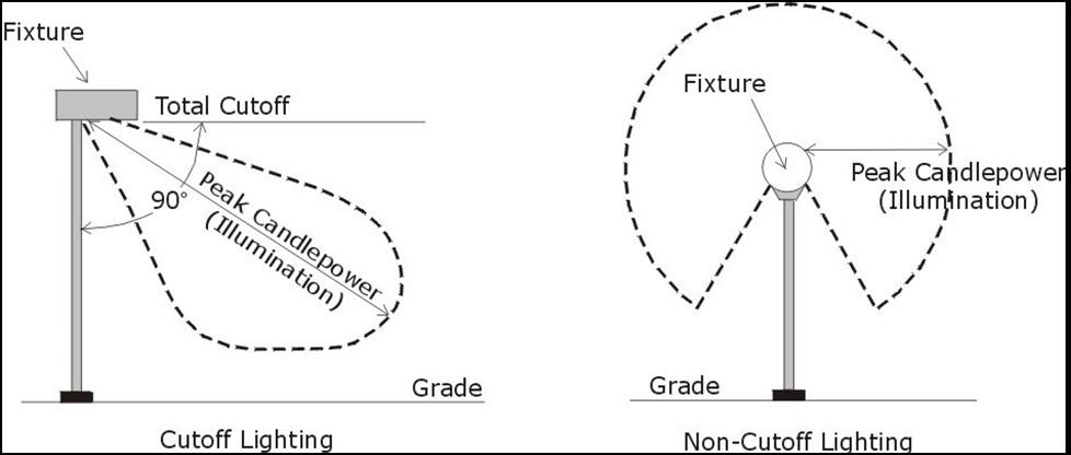
(J) Additional design standards. The following design standards apply to certain outdoor lighting, as described below:
(1) The placement of light poles within raised curb planter areas or within landscaped islands is encouraged. Any conflicts with trees in parking lots that can obscure lighting shall be avoided through alternative lighting locations.
(2) No outdoor lighting shall be of such an intensity or color distortion as to cause glare or to impair the vision of drivers or pedestrians.
(3) Uniform lighting shall be provided throughout a given parking area to prevent varying intensities of lighting. Such uniform lighting shall be illustrated in any required lighting plan.
(4) All outdoor lighting fixtures within a development shall be the same, similar, or complementary in design and appearance.
(5) Lighting shall be dimmed between the hours of 11:30pm and 6:30am, as shown in
Table 1112.05-AK: Specified Maximum Outdoor Area Illumination Levels, to limit light pollution and preserve the opportunity for appreciation of the night sky.
Facilities that serve customers, students, clients, and other visitors on-site 24 hours per day may be granted an exemption by the Zoning Administrator upon compliance with all other requirements of this Section.
Table 1112.05-AK: Specified Maximum Outdoor Area Illumination Levels
(6) In addition to other applicable standards of this Section, lighting in parking areas must meet the minimum requirements provided in Table 1112.05-AL: Required Minimum Parking Area Illumination Levels. Parking and circulation areas, pedestrian areas and related outdoor use areas in non-residential and mixed-use zones shall be illuminated to provide safety and security for the users of these areas, to provide security for property, and to maintain privacy for adjacent residential properties.
Table 1112.05-AL: Required Minimum Parking Area Illumination Levels
Table Notes: (1)
must be met as an average across the entire given activity area.
(7) Except for street lighting and lighting of public outdoor recreation areas, exterior lighting in parking areas must be extinguished when not in use. Exterior lighting in pedestrian areas may be reduced to the property security level provided in Table 1112.05-AL: Required Minimum Parking Area Illumination Levels during hours when these areas are not in use.
(8) Exterior lighting along a separately owned property that is within a residential zone must be designed and maintained to provide a maximum of 0.0 footcandles of illumination along such adjoining lot lines.
CHAPTER 1102 – BUILDINGS AND LOTS
(A) General standards. No building shall be erected, converted, enlarged, reconstructed, or structurally altered except in conformity with the applicable standards stated in this Code.
(A) Applicability Table 1113.02A: Residential Zones Dimensional Standards, Table 1113.02B: Commercial and Public Zones Dimensional Standards, and Table 1113.02C: Industrial Zones Dimensional Standards provide a comprehensive reference of minimum and maximum dimensional standards, as applicable, for lot sizes, lot and development open space, lot frontage, building setbacks, and buildings heights as required by this Code.
(B) Principal and accessory structures. The standards of Table 1113.02A: Residential Zones Dimensional Standards, Table 1113.02B: Commercial and Public Zones Dimensional Standards, and Table 1113.02C: Industrial Zones Dimensional Standards apply to all principal and accessory structures unless otherwise specified or allowed in this Code.
Table 1113.02-AM: Residential Zones Dimensional Standards
Table Notes:
(1) The standards of this column apply to properties with multi-unit uses within the R-7 zone.
(2) The standards of this column apply to properties with one-unit uses within the R-7 zone.
(3) The dimensional standards applicable to individual PUD developments that are subject to a duly executed development agreement with the City of Twinsburg may be modified where such development agreement applies specific dimensional standards. Where a duly executed development agreement for a PUD is silent on a given
dimensional standard, the applicable standard(s) of this table shall govern.
(4) This requirement is established through Section 1123.01– Site Plan Review. All developments in the R-5 Zone shall not exceed a maximum density of 3.5 units/acre.
(5) PUDs require a minimum development area of 200 acres.
(6) The requirement for development open space set-aside does not apply to minor subdivisions in the R-2, R-3, and R4 zones.
(7) Within the R-5 Zone, dwellings shall be setback a minimum of 30 feet from the nearest edge of the street or sidewalk pavement.
(8) Within the R-5 Zone, dwellings shall be setback a minimum of 50 feet from a rear lot line that abuts a lot improved with a one-unit dwelling.
(9) Within the R-5 Zone, dwellings shall provide a minimum separation of 10 feet from separate dwellings, and a minimum separation of 25 feet from common open spaces.
(10) Replacement of nonconforming dwellings shall be subject to the provisions of Title 5 – Nonconformities
Table 1113.02-AN: Commercial and Public Zones Dimensional Standards
Table Notes:
(1) The minimum required lot area for a lot in the PF zone shall be through a site plan review in accordance with Section 1123.01 – Site Plan Review
(2) Any portions of a building that are higher than 25 feet above grade level must be set back a minimum of 35 feet from front property lines.
(3) The minimum required setback from a side lot line for construction other than parking lots shall be reduced to 20 feet where the lot line does not abut a residential zone.
SETBACKS AND BUILDINGS
Parking Lot Setback from Side Lot Lines (min.)
Non-Parking-Lot Setback from Side Lot Lines (min.)
Parking Lot Setback from Rear Lot Lines (min.)
Non-Parking-Lot Setback from Rear Lot Lines (min.)
Abutting residential zone: 25 feet
Abutting nonresidential zone: 5 feet
Abutting residential zone: 100 feet
Abutting nonresidential zone: 15 feet
Abutting residential zone: 25 feet
Abutting nonresidential zone: 5 feet
Abutting residential zone: 50 feet
Abutting zone: 25 feet
Abutting residential zone: 25 feet
Abutting nonresidential zone: 10 feet
Abutting residential zone: 100 feet
Abutting nonresidential zone: 25 feet
Abutting residential zone: 25 feet
Abutting nonresidential zone: 10 feet
Abutting residential zone: 100 feet
Abutting zone: 50 feet
Abutting residential zone: 25 feet
Abutting nonresidential zone: 10 feet
Abutting residential zone: 100 feet
Abutting nonresidential zone: 50 feet
Abutting residential zone: 25 feet
Abutting nonresidential zone: 10 feet
Abutting residential zone: 100 feet
Abutting zone: 50 feet
Table 1113.02-AO: Industrial Zones Dimensional Standards
Building Height (max.)
Table Notes:
feet
feet (3)
feet (3)
(1) In coordination with any applicable requirements of Chapter 1114 – Landscaping and Buffering and Chapter 1115 –Parking, Loading, and Circulation, the required setback area from a front lot line for a parking lot that is visible from the abutting right-of-way must be improved with landscape planting and/or low masonry walls or fences to screen the view of the parking lot.
(2) The non-parking-lot setback required from a front lot line for the I-2 and I-3 zones may be reduced to 50 feet if the front lot line abuts a collector street or a local street that does not abut a residential zone. Such classifications shall be determined in accordance with Section 1118.06 – Classification of Streets and Private Driveways
(3) Maximum allowed height may be increased to 50 feet if, for every foot in height above 35 feet, the following is provided: additional 2-foot setback from front lot lines, 2-foot setback from rear lot lines, and 1-foot setback from side lot lines above applicable minimum requirements.
(A) Applicability. This Section applies to residential developments platted prior to enactment of this Code which may have vacant platted lots.
(B) Intent. The intent of this Section is to provide flexibility for compatible construction of infill development within established neighborhoods.
(C) Least restrictive standards apply. Infill development on applicable lots shall be subject to the least restrictive and most permissive standards among:
(1) The applicable zoning standards in effect at the time of final plat approval, based on available documentation of prior zoning regulations, recorded plats, approved final site plans, or other documentation; or
(2) The applicable standards of this Code.
(D) Modification of certain standards. The provisions of this Section allow for the modification of the following and related standards:
(1) Minimum lot dimension and area requirements;
(2) Maximum and minimum building size requirements, including gross floor area and height;
(3) Minimum setback requirements from front, rear, and side lot lines;
(4) Restrictions on accessory uses, including storage sheds and pools;
(5) Off-street parking requirements;
(6) Restrictions on dwelling unit types and residential use permissions;
(7) Minimum ground floor area requirements; and
(8) Dedication or reservation of easements, rights-of-way, or parkland.
(A) Visibility required. Every part of a required yard shall be open to the sky unobstructed except for approved accessory buildings and projections of skylights, sills, belt courses,
cornices, and ornamental features projecting from an approved building a distance not to exceed 36 inches into a setback required per Section. These requirements shall not be construed to prohibit the construction of approved fences.
(B) Residential front lot line setbacks modified. For a proposed dwelling within a residential zone:
(1) The minimum required setback from a front lot line shall be modified from the applicable requirements of Table 1113.02-AM: Residential Zones Dimensional Standards to be the average setback from a front lot line calculated between the closest lot on both sides of the subject lot that are improved with a dwelling, where such improved lots are within 300 feet of the subject lot and are within the same block and on the same side of the street as the subject lot.
(2) For a corner lot, if the immediately adjoining lot is improved with a dwelling, the minimum required setback from a front lot line shall be modified from the applicable requirements of Table 1113.02-AM: Residential Zones Dimensional Standards to be not less than the established front lot line setback of the immediately adjoining lot.
(C) Building façade design restrictions. The design of the building façade of any dwelling shall not be repeated within 160 feet of another dwelling on the same street.
(D) Sewage and water facilities. Where central sanitary sewage facilities and water facilities are not available, the minimum required lot size shall be modified from the applicable requirements of Table 1113.02-AM: Residential Zones Dimensional Standards to be 1 acre for one-unit dwellings, and 2 acres for two-unit dwellings, where such uses are permitted, unless a larger area is required by the responsible Health Authority.
(A) Intent. The intent of the standards in this Section is:
(1) To encourage creative and innovative design that is harmonious throughout a given area;
(2) To protect the value of buildings and property;
(3) To preserve and promote a unique small town community image;
(4) To encourage visual attractiveness;
(5) To encourage high-quality architecture; and
(6) To prevent deterioration of buildings.
(B) Applicability. Unless otherwise provided, the provisions of this Section apply to new principal buildings, additions to principal buildings, and alterations to principal buildings that are within a commercial zone.
(C) Appearance. Buildings must be designed to be compatible with surrounding architectural styles. Corporate stylized architectural elements (building features that are used for advertising or national image) shall be minimized to the extent that they are not the dominant architectural elements and so that the building remains compatible with the surrounding architecture.
(D) Building materials. Traditional building materials such as masonry, wood, or glass shall be used on all exterior visible portions of structures. Other materials may be approved if their use is appropriate for the location and architectural style proposed, where approved by the Architectural Review Board.
(E) Building façade
(1) Plain, monolithic exterior treatments with long uninterrupted walls and roof plane surfaces are discouraged.
(2) Each building façade shall incorporate design elements such as changes in color or texture, projections, recesses, reveals, arcades, or pergolas providing pedestrian interest, or equivalent elements that subdivide a wall into human-scale proportions.
(3) Building façades shall have highly visible customer entrances that feature canopies, overhands, arcades, distinctive roof forms, arches, display windows, or landscaped features.
(4) Public entrances should face an abutting public right-of-way.
(5) Buildings must have well-defined rooflines with attention to architectural detail. Consideration should be given to the prevailing pattern of roofs in the surrounding area.
(6) Exterior materials and treatments must provide consistent architectural character and detail on all sides of the given building.
(F) Building scale.
(1) New, remodeled, or altered buildings must be in relative proportion to the original building elements and/or neighboring buildings.
(2) Wherever feasible, buildings shall be designed to provide massing configurations with a variety of different wall planes.
(3) Where applicable, a large building mass must be broken into smaller components, creating functional open spaces and pedestrian-oriented areas between buildings or components that visually appear to be separate buildings.
(G) Color. Structure and building color shall be in harmony with the existing neighboring buildings. Colors must be architecturally and aesthetically pleasing.
(H) Screening
(1) Site design and development must consider impacts of noise and light on adjacent properties, providing proper screening as needed and as required pursuant to Chapter 1103 – Landscaping and Buffering. Such screening may also incorporate sound barriers and acoustic panels that meet standards applicable to fences and walls.
(2) Vegetative screening in combination with fence materials may be utilized.
(3) Plant materials used in screening must be moderately fast-growing, evergreen (providing opaque screening year-round), and require minimal maintenance. Invasive plant species are prohibited.
(4) Plant materials used in screening must be of a height and density so that it provides the full desired effect within 3 growing seasons.
(I) DWTN District exterior material requirements
(1) New buildings and additions to buildings within the DWTN district are subject to the exterior material requirements of Table 1113.05-AP: DWTN Exterior Material
Requirements. Submissions to the Architectural Review Board must include architectural drawings of all building and/or addition exterior elevations with detailed descriptions of all exterior construction materials, including the percentage of the exterior walls covered by each material.
(2) Strict adherence to the standards of Table 1113.05-AP: DWTN Exterior Material
Requirements shall not be applied in a manner that prevents architectural creativity. Requests for exceptions to these standards may be considered by the Architectural Review Board based on architectural design and creativity and compatibility with surrounding developed properties. Exceptions may also be considered for building additions or modifications which are designed to be compatible with existing or adjacent structures.
Table 1113.05-AP: DWTN Exterior Material Requirements
Primary Materials
(shall be a minimum of 80% of street-facing elevations, minimum of 50% of side elevations, and minimum of 35% of rear elevations) (1)
Accent Materials
(may be a maximum of 20% of any side or rear elevation) (1)
Kiln-fired clay brick / terracotta Stucco
Stone (natural – including field stone, river rock, cut stone, and dimensioned stone)
Cast stone
Vinyl, steel, aluminum, and fiber cement siding
Split-faced block
Architectural metals Wood shingles
Architectural / finish-grade wood or timber
Prohibited Materials
(may not be used on an exterior elevation)
Plywood
Cinder block or smooth-faced block
EIFS (exterior insulation and finish systems)
Primary Materials (shall be a minimum of 80% of street-facing elevations, minimum of 50% of side elevations, and minimum of 35% of rear elevations) (1)
Accent Materials (may be a maximum of 20% of any side or rear elevation) (1)
Prohibited Materials (may not be used on an exterior elevation)
Table Notes: (1) Minimum and maximum requirements shall not apply to doorways and windows.
CHAPTER 1103 – LANDSCAPING AND BUFFERING
(A) Intent. The provisions of this Chapter 1103 are intended to:
(1) Improve the appearance of vehicular use areas and property abutting public rightsof-way;
(2) Require buffering between different land uses;
(3) Protect, preserve, and promote the aesthetic appeal and value of neighborhoods that surround a given site;
(4) Promote public health and safety through the reduction of noise pollution, air pollution, water pollution, visual pollution, air temperature fluctuations, and artificial light glare; and
(5) Promote the preservation and replacement of trees and significant vegetation removed over the course of land development.
(B) Applicability. Except as otherwise explicitly provided within this Chapter, the provisions of Chapter 1103 apply as follows:
(1) No zoning permit or building permit shall be issued hereafter for any site development or the construction or improvement of any building, structure, or vehicular use area except where landscaping for such development construction has been approved as required by the provisions of this Chapter.
(2) No building, structure, or vehicular use area shall be constructed or expanded unless the minimum landscaping required by the provisions of this Chapter is provided on the subject property to the extent of its alteration or expansion. In the case of a substantial alteration or a substantial expansion, the entire site must be brought into compliance with the minimum requirements of this Chapter.
(3) An alteration or expansion is considered substantial, as referenced within this Subsection, when the area or square footage of the expanded or altered land or structure or building, respectively, exceeds 25% of the area or square footage of the existing land or structure or building, respectively, exclusive of the alteration or expansion.
(C) Modification of standards. The standards of this Chapter may be modified by the provisions of Chapter 1104 – Use-Specific Standards and other sections of this Code.
(D) Permitted tree species. All trees and vegetation planted shall be common to northeast Ohio or similar climates, in good condition, and properly installed using accepted planting procedures. New trees shall be staked, watered, and mulched.
(E) Standards for new trees. New trees planted to meet the minimum tree standards and buffering requirements shall be at least two inches in caliper and at least five feet in height.
(F) Prohibited trees. The following types of trees are prohibited:
(1) Silver maple;
(2) Honey locust (varieties with thorns);
(3) Poplar;
(4) Box elder;
(5) Basswood;
(6) Willow (including but not limited to aspen and cottonwood varieties);
(7) Tree of heaven;
(8) Callery pear;
(9) Sawtooth oak;
(10) Siberian elm; and
(11) White mulberry.
(A) Landscape materials, generally. Any landscaping materials provided to meet the requirements of Chapter 1103 – Landscaping and Buffering must comply with the provisions of this Section 1103.02, as applicable.
(B) Earth mounds.
(1) Earth mounds shall be physical barriers which block or screen the view similar to a hedge, fence, or wall.
(2) Earth mounds shall be constructed with proper and adequate plant material to prevent erosion. Where mounds are to be mowed, the maximum permitted slope is 3:1.
(3) A difference in elevation between areas requiring screening does not constitute an existing earth mound and shall not be considered as fulfilling any screening requirement.
(C) Plants. Artificial plants are prohibited. All plant materials shall be living plants that meet the following standards, as applicable:
(1) Quality. Plant materials used in conformance with provisions of this Chapter shall be nursery grown in accordance with good horticultural practices, shall be grown under climatic conditions like those in Northeast Ohio, shall conform to the standards of the American Association of Nurserymen, and shall have passed any inspections required under State regulations. In addition, trees shall be free of disease, insects, and/or damage, and shall be correctly labeled indicating genus, species, and cultivar.
(2) Deciduous trees. Trees that normally shed their leaves in the fall shall be species having an average mature crown spread of greater than 15 feet in Northeast Ohio. Trees placed within a clear sight triangle must provide a minimum clear wood area (free of low-hanging branches) that meets the standards of Section 1103.05 – Clear Sight Triangle. Trees having an average mature spread of crown less than 15 feet may be substituted by grouping of the same as to create the equivalent of a fifteenfoot crown spread. A minimum of 10 feet overall height or a minimum caliper measured above ground for trees up to 4 inches caliper of at least 2 inches immediately after planting shall be required.
(3) Evergreen trees. Evergreen trees shall be a minimum of 5 feet tall with a minimum caliper of 2 inches immediately after planting.
(4) Shrubs and hedges. Shrubs and hedges shall be at least 2 feet tall when placed within vehicular use areas, and at least 3 feet tall when placed within a required perimeter buffer. All shrubs and hedges must conform to applicable opacity standards and other requirements of this Chapter within 4 years after planting.
(5) Vines. Vines shall be at least 12 inches high at planting and should generally be used in conjunction with walls or fences.
(6) Grass or ground cover. Grass of the fescue (Gramineae) or bluegrass (Poaceae) family shall be planted in species normally grown as permanent lawns in Northeast Ohio and may be sodded or seeded. In swales or other areas subject to erosion where solid sod, erosion reducing net, or suitable mulch shall be used, nurse-grass seed shall be sown for immediate protection until complete coverage otherwise is achieved. Grass seed shall be clean and free of weeds and noxious pests or diseases. Ground cover shall be planted in such a manner as to present a finished appearance and 75% of complete coverage after complete growing seasons, with a maximum of 8 inches on center. Where approved by the City, ground cover may also include rocks, pebbles, sand, and similar approved materials, so long as such materials do not cover more than 25% of a total yard surface area.
(D) Managed natural landscaping. Managed natural landscaping areas are allowed subject to the following:
(1) Height exemptions. Height restrictions on plant life and weeds provided in Chapter 1313 (International Property Maintenance Code) of the City of Twinsburg Code of Ordinances shall not apply to native plants on privately owned, occupied residential property and properties contiguous to such properties, provided that such contiguous properties are owned by the same individual and native plants are part of a managed natural landscaping area. Height restrictions provided in in Chapter 1313 (International Property Maintenance Code) of the City of Twinsburg Code of Ordinances shall not apply to naturally occurring vegetation located within riparian zones, common open spaces, and public parks.
(2) Setback requirements. Managed natural landscape areas shall be set back a minimum of five (5) feet from all property lines, roads, alleys, and/or driveways unless the area is abutted by a fence or similar barrier separating it from adjoining residential properties. If a fence or similar barrier is provided, such managed natural landscape areas may be planted up to the fence or barrier. Managed natural landscape areas shall not be allowed within a right-of-way and shall be set back a minimum of 10 feet from any sidewalks. Managed natural landscape areas shall not be permitted to overhang or encroach onto any abutting public or private properties.
(E) Maintenance and installation. All landscape materials shall be installed in accordance with accepted, good construction and planting procedures. The owner of the property shall be responsible for the continued proper maintenance of all landscaping materials, and shall keep them in a proper, neat, and orderly appearance, free from refuse and debris at all times. All unhealthy or dead plant material shall be replaced within 1 year, or by the next planting period, whichever comes first.
(F) Pruning and growth inhibitors.
(1) Landscape materials used to fulfill code requirements or conditions of approval, as authorized by City Council, Planning Commission, Board of Zoning Appeals, Architectural Review Board, or other appropriate body, may not be pruned or otherwise treated so as to reduce overall height or level of opacity below required standards.
(2) Landscape materials are intended to grow, spread, and mature over time. Pruning and other inhibiting measures including removal may only be practiced to ensure the public safety, to maintain a neat and attractive appearance, and to preserve the relative health of the material involved.
(3) The use of growth inhibitors is not permitted to be used on any plant material used to fulfill code requirements or conditions of approval.
(A) Screening for business buildings required. Whenever a business building is located on a lot that adjoins a residential zone, the Planning Commission may require an additional buffer in the form of a wall, fence, vegetation, or trees of 5 to 8 feet in height with supplementary landscape planting to shield adjacent residential areas from parking
lot illumination, headlights, fumes, heat, blowing papers, and dust, and to reduce the visual encroachment of business buildings, signs, and activities.
(B) Minimum standards for perimeter buffers. Where applicable pursuant to Section 1103.01, perimeter buffers are required and must meet the following standards:
(1) Required locations. Perimeter buffer landscaping must be provided along rights-ofway, along property lines where the abutting use is different from the subject property, and along the outermost extents of all vehicular use areas (including but not limited to parking lots and driveways).
(2) Minimum buffer height. In front yards, perimeter buffers must meet the minimum required opacity standards of this Subsection between grade level and 4 feet above grade level. In yards other than a front yard, perimeter buffers must meet the minimum required opacity standards of this Subsection between grade level and 6 feet above grade level.
(3) Minimum buffer width. The minimum width of a required perimeter buffer shall be not less than 5 feet along the entire extent of the required area. However, such width must be expanded where necessary to accommodate landscape materials that meet the opacity standards of this Subsection.
(4) Opacity standards. Landscape materials, fences, and walls used to satisfy perimeter buffer requirements must be installed to provide at least 80% opacity year-round. Landscape materials must be predominantly evergreen species and meet opacity requirements within 4 years of installation.
(5) Buffer with right-of-way. A required perimeter buffer must be provided by the property owner adjoining the street unless the authority building the street provides landscaping within the right-of-way along the subject property that meets all applicable requirements.
(6) Location conflicts. A required perimeter buffer may be combined with a utility or other easement as long as all of the landscape requirements can be provided in addition to, and separate from, any other easement. Cars or other objects shall not overhang or otherwise intrude upon a required perimeter buffer by more than 2.5 feet. For parking spaces that abut a perimeter buffer, wheel stops or curbs that restrict the overhand of vehicles must be provided.
(7) Existing landscape materials. Existing landscape materials must be shown on a site plan submitted for an application for a zoning permit. Any landscape material in satisfactory condition may be included as part of the fulfillment of these requirements when, at the discretion of the City, such material meets the requirements and achieves the intent of this Chapter.
(8) Fence materials in a perimeter buffer. Any fences included within, or proposed to be included within, a perimeter buffer must meet the applicable standards of Section 1102.02 – Fencing
(C) Interior landscaping for vehicular use areas. Any open vehicular use area containing more than 6,000 square feet of area, or more than 19 vehicular parking spaces, must provide interior landscaping in addition to any required perimeter buffer, subject to the following standards:
(1) Design of interior landscaping. Interior landscaping may be peninsula or island types and must include at least one deciduous shade tree per peninsula or island to be counted towards the required landscape area.
(2) Minimum landscape area. For each set of 20 vehicular parking spaces provided within a vehicular use area, a minimum of 4 planting islands, each with at least 1 tree and a minimum dimension of 4 feet by 8 feet is required. 1 vegetated swale may replace 1 required planting island for each required set of 4 planting islands.
(3) Tree well soils. Tree wells within vehicular use areas must be excavated to a depth of at least 3 feet below grade level, with such excavated areas replaced with suitable soil to support healthy tree growth and stability.
(4) Recommend tree species Table 1114.03-AQ: Schedule of Recommended Trees for Vehicular Use Areas provides tree species, organized by their standard mature height, that are recommended for use within vehicular use areas.
Table 1114.03-AQ: Schedule of Recommended Trees for Vehicular Use Areas
Tree Genus
Small Trees (Under 25 Feet Tall)
Acer buergerianum
Quercus prinoides
Styphnolobium japonicum
Tree Species
Trident Maple
Dwarf Chinkapin Oak
‘Pendulum’ weeping Japanese pagoda tree
Syringa reticulate ‘Ivory Silk’ Japanese Tree Lilac
Tilia cordata Littleleaf Linden
Zelkova serrata Japanese zelkova
Medium Trees (26 – 50 Feet Tall)
Celtis laevigata
Koelreuteria paniculata
Parrotia persica
Sugar Hackberry
Goldenrain Tree
Persian Ironwood
Ulmus parvifolia Lacebark Elm
Large Trees (Over 50 Feet Tall)
Betula nigra River Birch – tree form, single stem
Gleditsia triacanthos var. inermis Honey Locust
Gymnocladus dioica
Kentucky Coffee tree
Platanus x acerifolia London Plane tree
(5) Tree species diversity. Every fourth tree in a landscape area must be of a different species from other trees included in the vehicular parking area.
(6) Maximum contiguous area. To encourage the required landscape areas to be properly dispersed, no individual landscape area shall be larger than 350 square feet within a vehicular use area that is 30,000 square feet or less in size; no individual landscape area shall be larger than 1,500 square feet within a vehicular use area that is larger than 30,000 square feet. Individual landscape areas larger than these standards may be permitted so long as the additional area is in excess of the required minimums.
(D) Interior landscaping for non-vehicular use areas. Separate from landscaping required for perimeter buffers, vehicular use areas, or street trees, all new developments, regardless of type, and all alterations or expansions to existing developments shall provide interior landscaping consistent with the following standards:
(1) Interior site landscaping shall consist primarily of new tree plantings or the preservation of existing trees and/or hedges within the development site.
(2) Consideration shall be given to laying out streets, lots, structures, and parking areas to avoid unnecessary destruction of heavily wooded areas or outstanding tree specimens. It is further encouraged that whenever possible, heavily wooded areas be designated as preserves.
(3) Trees that are a minimum caliper of 2 inches must be planted on individual lots per Table 1114.03-AR: Schedule of Minimum Number of Trees. New tree plantings shall not be required where existing healthy, non-invasive trees meet or exceed these requirements, provided such trees are evenly distributed throughout the development area and are not confined to single dense cluster or to the perimeter of the development area.
Zone or District
Residential Zones
Commercial Zone or District
Industrial Zones
Minimum Required Number of Trees for Each Lot
acre
All other lots: 4 trees per lot
Each lot: 10 trees per acre
Each lot: 8 trees per acre
(4) Proposed plantings that are part of an approved landscape plan must be planted prior to the issuance of a certificate of occupancy or during the next planting season following the issuance of a certificate of occupancy.
(E) Screening for service structures. Screening must be provided in a manner that prevents direct views of service structures from vantage points outside of the subject lot, subject to the following standards:
(1) Service structures may be grouped together within a provided set of screening.
Table 1114.03-AR: Schedule of Minimum Number of Trees
(2) The height of screening must be at least 1 foot taller than the service structure being screened, except that no screening shall be required to exceed 12 feet in height.
(3) Dumpsters and donation box enclosures must be screened from public view by an enclosure constructed of material approved by the Planning Commission or Zoning Administrator.
(4) Non-mobile service structures must be enclosed in a continuous set of screening that provides 100% opacity.
(5) Where service structures abut a building on the same lot, the building wall(s) along the service structures may be included as part of the required screening.
(6) Plant materials used to screen a service structure shall be an evergreen species which retains its needles throughout the year. Deciduous plant material cannot be used to fulfill this screening requirement. The height of evergreen plant material at installation must be equal to, or greater than, two-thirds of the height of the service structure(s) and must meet the height and opacity requirements within 4 years of planting.
(7) Interior landscaping shall not be required within an area screened for service structures.
(8) Where screening material is placed around any trash disposal unit or waste collection unit which is emptied or removed mechanically on a regularly occurring basis, a curb to contain the placement of the container shall be provided within the screening material on these sides where there is such material. The curbing shall be at least 1 foot from the material and shall be designed to prevent possible damage to the screening when the container is moved or emptied.
(A) Applicability. In all zones and districts, the planting of street trees shall be required at the time a parcel is developed or redeveloped in accordance with the standards of this Section 1103.04
(B) Classification and required spacing of trees. For the purposes of this Section 1103.04, trees shall be classified by their mature height and subject to minimum spacing requirements as follows:
(1) Large trees are mature trees of 70 feet or greater in height. Such trees shall have a planting area of pervious ground cover of a diameter of 20 feet or more in width and not located where there will be any overhead wiring.
(2) Medium trees are mature trees between 30 feet and 70 feet in height. Such trees shall have a planting area of pervious ground cover that is a diameter of at least 15 feet.
(3) Small trees are mature trees less than 30 feet in height. Such trees shall have a planting area of pervious ground cover that is a diameter of at least 10 feet.
(C) Trees located on city-owned public property. The following are requirements for the planting, pruning, and removal of trees within City-owned property. For the purposes of this section, City-owned property shall include all public ways, streets, alleys, parks, or other property owned by the Municipality:
(1) It shall be required that all developers plant trees along public streets of their developments in such a manner, type, quantity, and location as approved by the Planning Commission and as defined by the following conditions, and that any undeveloped street or existing street with undeveloped frontage shall conform to these requirements at the time of the development.
(2) The spacing of trees planted along streets will be in accordance with the tree species size classes (large, medium, and small). No trees may be planted closer together than the applicable standards. Large trees shall be spaced not less than 50 feet apart. Medium trees shall be spaced not less than 40 feet apart. Small trees shall be spaced not less than 30 feet apart. The size of species should be taken into consideration when applying these standards, except in special plantings designed or approved by the Tree Board.
(3) No tree shall be planted closer than 40 feet from any street corner, measured from the point of nearest intersecting curbs or curbings. No tree shall be planted closer than 10 feet from any fire hydrant.
(4) The distance trees may be planted from curbs or curblines and sidewalks will be in accordance with the species size classes listed in this Chapter. No trees may be planted closer to any curb, curbline, or sidewalk than as follows: large trees – 4 feet; medium trees – 3 feet; small trees – 2 feet. For streets that do not have curbs, trees shall not be planted closer than the clear zone measurement based on the speed and grading of the street.
(5) No public tree other than those species referred to as small trees in this Chapter may be planted under or within 10 lateral feet of any overhead utility wire or planted over or within 5 lateral feet of any underground water line, sewer line, or other utility.
(6) The developer shall be required to maintain new trees for 1 year after the trees are planted and to replace any tree which fails to survive or does not exhibit normal growth characteristics of health and vigor within such 1-year period. This 1-year period shall begin at each planting and shall recommence as trees are replaced.
(7) All trees planted pursuant to these requirements must be at least 1 and 3/4 inches in diameter, as measured 1-foot above grade level, at the time of planting. The lowest branches shall be not less than 7 feet above grade level.
(8) Tree planting in the spring shall occur between March 1st and June 15th. Tree planting in the fall shall occur between October 15th and November 30th
(9) Tree limbs extending over a sidewalk shall be trimmed to such an extent that no portion of the same shall be less than 7 feet above the sidewalks. Tree limbs
extending over a street shall be trimmed to such an extent that no portion of the same shall interfere with the normal flow of traffic.
(D) Tree topping. Tree topping is prohibited within all public rights-of-way. It shall be unlawful for any person to top any public tree. Topping is defined as the severe cutting back of limbs so as to remove the normal canopy and disfigure the tree. Public trees severely damaged by storms or other causes or certain trees under utility wires or other obstructions where other pruning practices are impractical may be exempted from this prohibition at the written determination of the City.
(E) Public tree care and municipal rights reserved
(1) The Municipality shall have the right to plant, prune, maintain, and remove all public trees as may be necessary to ensure public safety or to preserve or enhance the symmetry and beauty of public sites.
(2) The City may remove or cause to be removed any public tree or part thereof which is in an unsafe condition or which by reason of its nature is injurious to sewers, electric power lines, gas lines, water lines, or other public improvements, or is affected with any injurious disease, insect, or fungus.
(3) This Section does not prohibit the planting of a tree along streets by property owners providing that the selection of said tree is in accordance with this Chapter.
(4) All public trees located near any excavation or construction of any building, structure, or street work shall be protected at the dripline. All laborers, building materials, dirt, or other debris shall be kept outside this barrier.
(5) No person shall excavate any ditches or trenches within the dripline of a public tree or lay any drive within 15 feet of a public tree without first obtaining the written approval of the City Engineer.
(6) No person shall hinder, prevent, delay, or interfere with the City, or any of its agents, while engaged in carrying out the execution of enforcement of this Chapter on public or private property; provided, however, that nothing herein shall be construed as an attempt to prohibit the pursuit of any remedy, legal or equitable, in any court of competent jurisdiction for the protection of property rights by the owner of any property within the Municipality.
(F) Reducing tree lawn area prohibited. No person shall, by any type of construction, temporarily or permanently reduce the size of a tree lawn without first procuring permission from the City Engineer.
(G) Appeal to adjust standards.
(1) Any request to adjust the standards required by this Chapter or to appeal a decision of the City in regards to this Chapter shall be made to the Board of Zoning and Building Code Appeals (BZBA) in accordance with Section 1104.01 – Appeal of
Administrative Decision. The BZBA shall, upon receipt of a written request, have the authority and duty to consider and act upon the request.
(2) Such an appeal shall clearly and in detail state what adjustments are being sought, the reasons such adjustments are warranted, and shall be accompanied with such supplementary data as is deemed necessary to substantiate the adjustment.
(3) The BZBA may approve, modify, or deny the requested adjustment, based upon the protection of public interest, preservation of the intent of this Chapter, and possible unreasonable hardships involved in the request.
(H) Violations and penalties
(1) Any person, firm, or public utility company violating any provision of this Chapter or who fails to comply with any notice issued pursuant to the provisions of this Chapter, upon being found guilty of violation, shall be subject to a fine not to exceed $500.00 for each separate offense.
(2) Each day during which any violation of the provisions of this Chapter shall occur or continue shall be a separate offense.
(3) If, as the result of the violation of any provision of this Chapter, the injury, mutilation, or death of a tree is caused, the cost of repair or replacement of such tree shall be borne by the party in violation. The replacement value of trees shall be determined in accordance with the latest revision of “Valuation of Landscape Trees, Shrubs, and Other Plants” as published by the International Society of Arboriculture.
(I) Public utility companies. Regarding trees in a public right-of-way, public utility companies shall operate according to the following:
(1) Public utility companies shall not trim or remove trees located within the public rightof-way without first providing at least 72 hours advance notice of said tree trimming or tree removal to the City of Twinsburg, Ohio. Said notice shall be accomplished by written notice to the City Engineer.
(2) The requirements for advance notice shall not be required in emergency service restoration work, when said emergency service restoration work is due to acts of God or acts of nature.
(3) Any public utility failing to provide advance notice prior to trimming or removing trees located within the public right-of-way within the City of Twinsburg shall be guilty of unlawful trimming or removal of trees.
(J) Removal, replanting, and replacement in public places. No person shall remove a public tree for the purpose of construction or any other reason without the written permission of the City. The City may require replacement of a removed tree as a condition to said approval. Such replacement shall be in accordance with the species listed in this Chapter. The person or property owner shall bear the cost of removal and replacement of all affected public trees.
(K) Abuse or mutilation of public trees. Unless specifically authorized in writing by the City:
(1) No person shall intentionally damage, cut, carve, transplant, whether above or below ground, or transplant or remove any public tree; attach any rope, wire, nails, advertising posters, or other contrivance to any public tree, allow any gaseous liquid or solid substance which is harmful to such trees to come in contact with them; or set fire or permit any fire to burn when such fire or heat therefrom will injure any portion of any public tree.
(2) No person shall pour salt water or a chemical or chemicals upon any street or rightof-way in such a manner as to injure any tree planted or growing thereon.
(3) The City shall not be restricted in the use of anti-icing materials.
(4) No person shall install a driveway or sidewalk within a radius of 10 feet from the trunk of any public tree or shrub without first obtaining written approval from the City Engineer.
(L) Placing materials on public property. No person shall deposit, place, store, or maintain upon any public place or within the city any stone, brick, sand, concrete, or other materials which may impede the free passage of water, air, and fertilizer to the roots of any public tree growing therein, except by written approval of the City Engineer.
(M) Public tree care. The City shall have the right to enter private property to access trees adjacent to public areas for the purposes of proper pruning, after reasonable prior notice has been given to the property owner. To ensure that street trees thrive, homeowners are encouraged to water the trees as needed.
(N) Dead or diseased tree removal on private property. The City shall have the right to cause the removal of any trees on private property within the City when such trees constitute a hazard to life and property.
(1) Notice to remove. Should any person or persons fail to remove trees as herein provided, the City shall order such person or persons within 30 days after receipt of written notices to remove such trees.
(2) Order required. The order herein shall be served by certified mail to the last known address of the property owner.
(3) Failure to comply. When a person to whom an order is directed shall fail to comply within the specified time, it shall be lawful for the City to remove such trees and assess the property owner for the cost of services rendered.
(A) Clear sight triangle required. A clear sight triangle shall be observed at all street intersections or intersections of driveways and streets as follows:
(1) At the intersection of 2 or more rights-of-way, the clear sight triangle shall be the area formed by measuring 35 feet from a corner point in each direction with a line connecting the end points; the resulting area subject to the clear sight triangle standards shall be the stretch of land from this line to the corner point, as shown in Figure 1114.05-G: Example Clear Sight Triangles.
(2) At the intersection of a driveway and a right-of-way, the clear sight triangle shall be the area formed by measuring 20 feet from a corner point in each direction with a line connecting the end points (as taken for each corner point on either side of the driveway); the resulting areas subject to the clear sight triangle standards shall be the stretch of land from this line to the corner point, as shown in Figure 1114.05-G: Example Clear Sight Triangles.
Figure 1114.05-G: Example Clear Sight Triangles
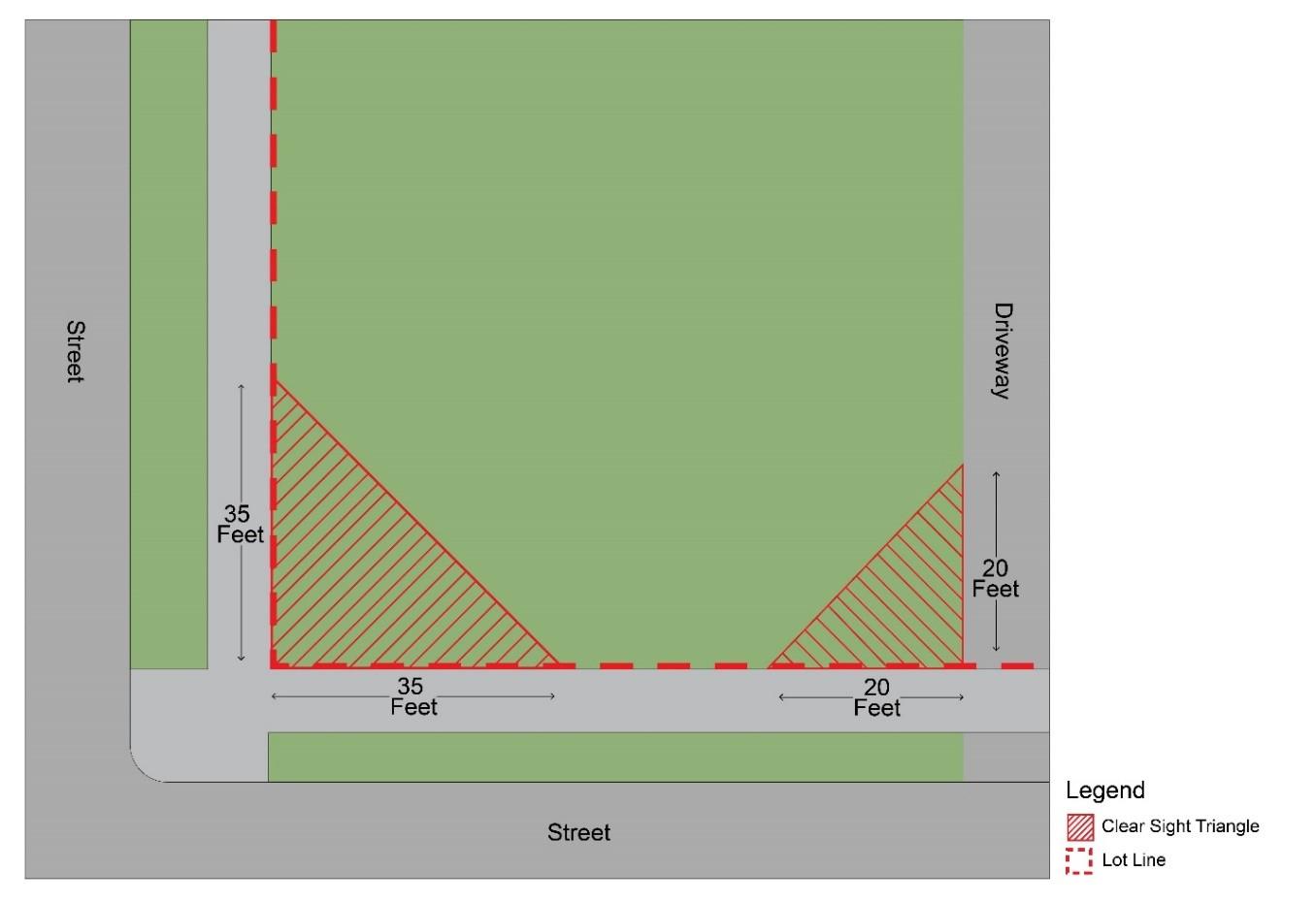
(B) Intrusions restricted. Within a required clear sight triangle, objects shall not obstruct a clear view across the sight triangle in a vertical range between 2 feet above grade level and 8 feet above grade level, except as provided herein. The following standards apply to objects and materials within a required clear sight triangle:
(1) Parked cars are prohibited.
(2) Required grass, no-mow native plans, and ground cover are allowed.
(3) Trees shall only be allowed if, after early growth stages, only the tree trunk (and not its branches or leaves) is visible between 2 feet and 8 feet above grade level, or otherwise does not present a traffic visibility hazard.
(4) Signage is prohibited within, or limited within, a clear sight triangle per the provisions of Subsection 1105.03(F) – Comprehensive Sign Permissions and Standards.
(A) Purpose. The purpose of this Section is to promote the public health, safety, and general welfare through the preservation, replacement, and planting of vegetation and trees to:
(1) Lessen air pollution;
(2) Intercept airborne particulate matter;
(3) Reduce noise and light glare;
(4) Moderate air temperature;
(5) Moderate storm water runoff;
(6) Reduce erosion and sedimentation;
(7) Maintain wildlife habitats;
(8) Provide visual screening;
(9) Provide natural shading;
(10) Protect property values; and
(11) Enhance the natural beauty of the community.
(B) Applicability
(1) The regulations for this Section shall apply to all lands in the City, except as exempted herein.
(2) No person shall carry out any development plan, building activity, or the making of any material change to any structure or the natural surface of the land, including activities that change or disturb the natural surface of the land such as clearing (cutting of trees and woody vegetation), grading, excavating, and filling, except in conformance with the provisions of this Section.
(3) No building permit, grading permit, or erosion and sediment control permit shall be issued for the construction, alteration, or addition to a building, or the grading or alteration of the land surface except as in conformance with the provisions of this Section.
(4) No tree and vegetation removal permit shall be issued for any parcel of land or development that requires an approved site plan (pursuant to Section 1102.01 –
Site Plan Review) until a site plan including a tree and vegetation preservation plan is submitted to and approved by the Planning Commission.
(5) No tree and vegetation removal permit shall be issued for any parcel of land or development which requires a subdivision plan approval (pursuant to Chapter 1105 – Subdivision Applications) until a final subdivision plan is approved by the Planning Commission and City Council, and the improvement plan is approved by the City Engineer.
(C) Exemptions. The following activities and properties are exempt from the requirements of this Section and no tree and vegetation removal permit is required:
(1) The removal of dead, diseased, damaged, or hazardous trees (hazardous trees are damaged, dead, or deceased trees which may represent a hazard to public safety or to adjacent property or trees).
(2) Any tree or vegetation within the street right-of-way.
(3) The removal of trees or vegetation required for the installation, maintenance, and repair of underground and overhead Utility Facilities.
(4) The removal of trees and vegetation by an individual homeowner on an owned dwelling lot where such removal is not in conflict with required buffer provisions within Section 1103.03 – Landscaping and Buffering Standards
(D) Trees protected based on size. All trees having a trunk diameter of 8 inches or greater as measured 4.5 feet above grade level shall be protected from damage, destruction, or removal. Any type of work, including the construction of new buildings or additions to existing buildings, shall not cause damage, destruction, or removal of such trees. The following trees are exempted from this provision:
(1) Trees that are within public rights-of-way, utility easements, or temporary construction easements as approved by the City Engineer;
(2) Trees on a lot within a nonresidential zones; and
(3) Trees that, in the judgment of the City, are damaged, diseased, over mature, or that interfere with utility lines or are an inappropriate or undesirable species for the given location.
(E) Tree and vegetation survey. A tree and vegetation survey shall be prepared and submitted as part of a required site plan (pursuant to Section 1102.01 – Site Plan Review), subject to the following requirements:
(1) The tree and vegetation survey shall be prepared by a landscape architect, arborist, environmental scientist, or similarly qualified individual or company.
(2) The three and vegetation survey shall be drawn at a scale not less than 1 inch = 50 feet unless, due to the size of the site, a different scale is recommended by the City Engineer.
(3) The tree and vegetation survey shall delineate vegetative cover areas by type (early successional farm field, late successional farm field, shrubs, immature forest, mature forest, etc.). The delineation shall be indicated on a site map by a circumferential line drawn around the approximate limits of groupings of plants of similar age and composition.
(4) A map key or other notation shall be made on the survey map for each vegetative cover type indicating predominant species, average caliper size of woody vegetation, and general appearance in terms of health.
(5) All trees greater than 24 inches in diameter at breast height, or which are otherwise noteworthy because of species, uniqueness, rarity, or landmark quality shall be located on the survey with a notation indicating species and general condition in terms of health.
(F) Preservation plan. A preservation plan shall be prepared at the same scale as the tree and vegetation survey. The preservation plan shall consider the data contained in the tree and vegetation survey in planning any activities that change or disturb the natural surface of the land such as clearing, grading, excavating, and filling. A preservation plan shall be filed prior to the commencement of any of the above activities and must be approved by the Planning Commission. All structures and construction activity shall be located upon a parcel of land in such a way as to minimize tree and vegetation removal, and to preserve wildlife habitat while complying with various setback requirements of the Zoning Code. Building and road elevations shall be designed to minimize the change in existing natural grade. Tree wells, aeration systems, retaining walls, and other methods should be considered to preserve existing tree root systems in and adjacent to construction areas. The preservation plan shall specify the following information:
(1) A construction line indicating all building, parking, vehicular use areas, grading, cut and fill and material stockpile areas, and any other area to be disturbed or cleared of vegetation;
(2) Existing site grading;
(3) Location of all utility lines;
(4) The location of all trees within the construction line which are to be preserved;
(5) The location of all protective fencing and tree protection measures to be employed on site;
(6) Specific locations for parking of all construction vehicles and equipment, and storage of solvents and hazardous materials;
(7) Locations of proposed root pruning or construction pruning; and
(8) Undisturbed areas.
(G) Construction measures. During all phases of construction, all steps necessary to prevent the destruction or damage to natural vegetation, trees, and wildlife habitat that is shown to remain shall be taken, including but not limited to the following:
(1) No construction activity, movement or placement of equipment, vehicles, or materials or spoils storage shall be permitted outside the construction line indicated on the preservation plan.
(2) No excess soil, additional fill, liquids, or construction debris shall be placed outside the construction area.
(3) Trees to be removed must be marked with X.
(4) Trees to be protected must be marked with a paint marker (outer trees to be marked where clusters are to remain) and the location of protective fencing or other physical barriers around trees and other vegetation to be preserved must be approved by the City Engineer prior to the beginning of construction, including site clearing. For trees, the fencing or other protective barrier must be located a distance from the trunk that equals, at a minimum, the distance of the critical root zone or 15 feet, whichever is greater, unless otherwise approved by the City Engineer.
(5) Unless otherwise authorized by the plan notes, no soil is to be removed from or placed upon the critical root zone of any tree that is to remain.
(6) All Utility Facilities, including service lines, shall be installed in accordance with an approved preservation plan. The developer has the responsibility of informing utility companies of the approved preservation plan. Public Utility Facilities which have been notified of the approved preservation plan shall be responsible for adhering to said plan during installation of necessary utility service lines. Every effort shall be made to protect trees during placement of utility service lines including auguring and/or jacking as opposed to open cutting.
(H) Tree and vegetation replacement. Trees and vegetation shall only be replaced in conformance with all applicable standards of this Chapter 1103 – Landscaping and Buffering
(I) Exceptions and variances. The City Engineer may approve the removal of trees, if required, without an approved preservation plan if such tree removal is deemed an emergency or hardship. An emergency may include the removal of hazardous trees, or tree removal to accommodate urgent public improvements. Any denial by the Planning Commission, City Council, City Engineer, or other administrative official in the administration of this Section can be appealed to the Board of Zoning and Building Code Appeals in accordance with Section 1104.01 – Appeal of Administrative Decision.
(J) Penalty. Whoever violates any provision of this Section shall be guilty of a misdemeanor of the fourth degree. Punishment shall be as provided in Section 501.99 of the General Offense Code. A separate offense shall be deemed committed on each day such violation continues.
(A) Applicability. Whenever a property is subject to landscape requirements from this Chapter 1103 – Landscaping and Buffering, the property owner or developer shall prepare a landscape plan for submittal to the Planning Commission for review.
(B) Landscape plan contents. The contents of a complete landscape plan must include the following:
(1) A site plan, drawn to an easily readable scale no smaller than 1 inch = 20 feet, showing and labeling by name and dimensions all existing and proposed property lines, easements, buildings and other structures on the subject lot and on adjoining lots, vehicular use areas, driveways, service areas, water outlets, existing trees and landscape materials, and the proposed landscape materials, including botanical name and common name, installation size, on center planting dimensions where applicable, and quantities for all plants used;
(2) Typical elevations and/or cross sections as necessary to document conformance with applicable standards;
(3) Title block with the pertinent names and addresses, property owner, scale, date, north arrow, zones, and person drawing the plan; and
(4) Site grading with a minimum of 1-foot contour intervals.
(C) Building permits and certificates of occupancy. Where landscaping is required, no building permit shall be issued until the required landscaping plan has been submitted and approved. If the required landscaping has not been completed and a temporary certificate of occupancy is issued, a performance bond or irrevocable letter of credit from a banking institution may be required.
(D) Posting of bond or irrevocable letter of credit
(1) Sites must be stabilized, temporarily and/or permanently, in accordance with the requirements of Ohio EPA Construction Permits
(2) After a bond or irrevocable letter of credit has been posted, the landscaping material required in the approved landscaping plan shall be installed within 6 months after the date of posting the bond or irrevocable letter of credit.
(3) A 3-month extension of the planting period may be granted by the City Engineer upon a demonstration by the property owner of developer that such an extension is warranted because of adverse weather conditions or unavailability of required plant materials. No more than 2 such extensions may be granted.
(4) Foreclosure proceedings shall be brought against the performance bond or irrevocable letter of credit if the required landscaping plans have not been complied with by the end of the approved planting period.
(E) Appeals of denied landscape plan. Any landscape plan submitted to and denied by the Planning Commission may be appealed according to the procedure provided for in Section 1101.03 – Board of Zoning and Building Code Appeals
CHAPTER 1104 – PARKING, LOADING, AND CIRCULATION
(A) Compliance required. The standards of this Chapter 1104 apply to proposed new buildings and uses on a lot in any zone or district.
(B) Change of use or enlargement of premises. In all zones or districts, when a building, structure or premises has a change of use, addition of dwelling units, expansion of gross floor area, expansion of seating capacity, or other units of measure specified herein for required parking facilities which creates a need for an increase of more than 15% in offstreet parking spaces, additional facilities as required herein shall be provided only for such increase in use.
(C) Modification of standards.
(1) The standards of this Chapter may be modified by the provisions of Chapter 1104 –Use-Specific Standards
(2) Minimum parking requirements may be reduced by up to 10% if pervious pavement or pervious pavers are used for an area and number of spaces equivalent to the reduction from the applicable standards of Table 1115.02-AS: Schedule of Minimum Required Parking Spaces.
(A) Off-street parking. In all zones or districts, in connection with every building or part thereof hereinafter created, off-street parking facilities shall be provided as prescribed by this Chapter.
(B) Schedule of parking requirements. Parking facilities shall be provided on each lot for a given use in quantities not less than as set forth in Table 1115.02-AS: Schedule of Minimum Required Parking Spaces
Table 1115.02-AS: Schedule of Minimum Required Parking Spaces
Multi-Unit, One-Unit, Two-Unit Dwelling
living: 1.5 per dwelling unit Senior living: .25 per dwelling unit Commercial and Office Uses
Proposed Land Use
Entertainment Establishment (Non-Adult)
Fast Food Eating Establishment
Hotel or Motel 1.2 per guest bedroom
areas)
Monument Sale and Display
Microbrewery and/or Microdistillery
Life
Office (Medical)
Office (Non-Medical)
Off-Street Public Parking Lot and Garage
Passenger
of (A) 1 per 400 sf. of GFA; or (B) 2.5 per patient room
Retail Sale (Perishable Goods) 1 per 500 sf. GFA
Retail Sale (Non-Perishable Goods)
per 750 sf. GFA Service-Oriented Use
Bar, and Pub
per 500 sf. GFA
per 500 sf. GFA Telecommunication
Proposed Land Use
Mortuary/Funeral Home
Minimum Number of Parking Spaces
1 per 750 sf. of indoor spaces
Recreation Use 1 per 1,000 sf. GFA
Religious Institution 1 per 750 sf. GFA
School – Primary/Secondary 1 per 1,000 sf. GFA
School – Post-Secondary 1 per 1,000 sf. GFA
School – Vocational 1 per 1,000 sf. GFA
Utility Facilities 1 per lot
Veterinarian Hospital or Clinic 2 per clinic room
Industrial Uses
Brewing or Distilling of Liquor 1 per 1,000 sf. GFA
Gas and Oil Well 2 per well
Industry, Light
For GFA less than 40,000 sf.: 1 per 1,000 sf. GFA
For GFA 40,000 sf. or greater: 1 per 2,500 sf. GFA
Industry, Medium For GFA less than 40,000 sf.: 1 per 1,000 sf. GFA
For GFA 40,000 sf. or greater: 1 per 2,500 sf. GFA
Industry, Heavy 1 per 1,000 sf. GFA
Marijuana Cultivation 1 per 3,000 sf. GFA
Marijuana Dispensary 1 per 1,000 sf. GFA
Marijuana Processing 1 per 1,000 sf. GFA
Outside Storage
1 per 750 sf. of indoor spaces
Pet Cremation 1 per 1,000 sf. GFA
Steam Plant 1 per 2,000 sf. GFA
Accessory/Temporary Uses
Accessory Dwelling Unit
1.5 per accessory dwelling unit (3) Helistop
Home Occupation
Solar Energy Collection System
Wind Energy Turbine
Table Notes:
GFA = Gross Floor Area, the total floor area of the given use. sf. = square feet.
(1) Minimum required parking for automotive charging services shall only apply to lots where such use is the principal use (and not to lots where electric vehicle charging is exclusively an accessory use).
(2) Minimum required parking for a drive-up service window shall only apply if separate minimum required parking for other uses on the lot would yield less than 1 parking space per 1,000 square feet of gross floor area.
(3) Minimum required parking for an accessory dwelling unit applies in addition to other applicable parking requirements for the subject lot.
(C) Undefined uses. For uses not explicitly included in Table 1115.02-AS: Schedule of Minimum Required Parking Spaces, the Planning Commission shall apply the unit of measurement from the table that is deemed to be similar to the proposed use. If no similar use is listed, the Planning Commission may assign a standard it deems appropriate for the site and nature of the use proposed.
(D) Floor area identified. For the purposes of this Chapter and the provisions of Table 1115.02-AS: Schedule of Minimum Required Parking Spaces:
(1) “Floor area” in offices, merchandising, and service types of uses shall mean the area used for services to, and accessible by, the public – excluding those areas used principally for nonpublic purposes such as storage, incidental repair, processing, and show windows.
(2) “Gross floor area” shall mean the total floor area of the particular use.
(E) ADA standards. The Americans with Disabilities Act (ADA) requires universal accessibility to goods and services for people of all abilities. Parking spaces reserved for accessibility compliance with ADA, in addition to the minimum parking requirements provided in Table 1115.02-AS: Schedule of Minimum Required Parking Spaces, shall be provided in quantities not less than as set forth in Table 1115.02-AT: Schedule of Required Accessible Parking Spaces
Table 1115.02-AT: Schedule of Required Accessible Parking Spaces
and over 20 + 1 for each set of 100 parking spaces provided, or fraction thereof, over 100 parking spaces
Table Notes:
(1) For every 6 (or fraction of 6) parking spaces required by the table shown, at least 1 shall be an accessible van parking space.
(A) Parking area design.
(1) Parking areas shall be designed in accordance with the standards of Table 1115.03AU: Required Parking Facility Dimensions and shall be so graded and drained as to dispose of all surface water accumulation within the parking area.
(2) The maximum grade within a parking area shall not exceed 5% for parking stalls and shall not exceed 6% for driveways and roadways within parking areas
(3) Except within the PF Zone, hard-paved, non-gravel surfaces with continuous concrete curbing or permeable pavement as approved by the City Engineer must be provided for off-street parking areas and associated driveways of 5 or more parking spaces. Continuous curbing may be omitted only upon a recommendation of the City Engineer after a determination that an alternative to continuous concrete curbing is preferred for water quality concerns or similar reasons.
(4) On lots within the PF Zone, parking areas serving parks and natural areas may be constructed of gravel or pervious surface materials and without continuous curbing. Entry drives serving such facilities must be paved with asphalt or concrete for the first 45 feet of drive length to avoid the transport of stones or loose material to the public right-of-way.
(B) Parking stall and aisle dimensions.
(1) Off-street parking facilities shall be designed per the standards of Table 1115.03AU: Required Parking Facility Dimensions, as applicable. An example of a parking area layout illustrating the standards of Table 1115.03-AU: Required Parking Facility Dimensions is shown in Figure 1115.03-H: Example Parking Lot Layout
(2) Circulation aisles having a dimension of less than 23 feet shall be one-way aisles. Dimensions for parking angles other than those listed above shall be approved by the City Engineer.
Table 1115.03-AU: Required Parking Facility Dimensions
Figure 1115.03-H: Example Parking Lot Layout
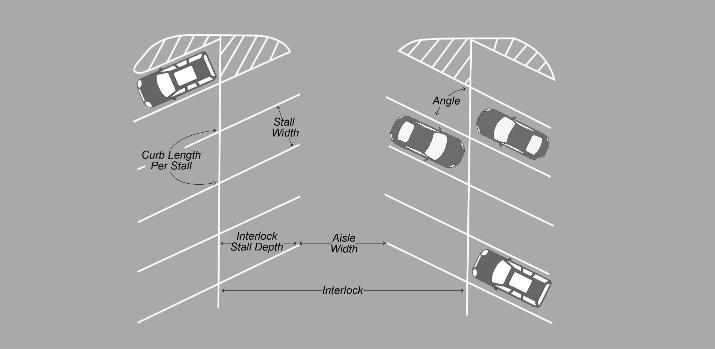
(C) Vehicular access drives
(1) No property located on a major arterial thoroughfare or collector street shall have more than 1 vehicular access drive, unless the property has over 200 feet of frontage upon such a street, in which case the property may have 1 vehicular access drive for each full 200 feet of frontage, with such vehicular access drives spaces no less than 200 feet apart.
(2) In residential zones, vehicular access drives from a right-of-way shall not be less than 10 feet wide and shall not be wider than 24 feet along the curb line of the street and up to an intervening sidewalk (if applicable).
(3) In nonresidential zones, vehicular access drives from a right-of-way shall not be less than 24 feet in width and shall not be wider than 34 feet along the curb line of the street.
(4) Vehicular access drives from a right-of-way in the C-3 Zone shall not be permitted to be closer than 400 feet from the centerline of the nearest interchange ramp, where such ramp intersects an arterial highway or major thoroughfare.
(5) The apron width along a right-of-way shall be a minimum of 6 feet wider than the width of the access drive.
(D) Location of parking areas restricted. Parking areas may only be located within side and/or rear yards except as follows:
(1) In any residential zone, parking may be permitted in front-yard driveways except that no vehicle over 8,000 pounds gross vehicle weight, and not more than 2
vehicles per household used for a home occupation or business purpose shall be parked in the front-yard driveway.
(2) In the C-1, C-2, C-3, and I-1 zones, off-street parking facilities may be located in the front yard provided that points of access and related landscaping are compliant with all applicable provisions of this Code.
(3) In the I-M zone, the majority of off-street parking spaces on a lot must be constructed in side and/or rear yards with limited parking constructed in a front yard, provided that points of access and related landscaping are compliant with all applicable provisions of this Code.
(E) Parking areas in DWTN district. Parking areas within the DWTN district may not be located in a front yard and may not be closer to a front lot line that the principal building on the same lot.
(F) Driveways in residential zones. Driveways within any residential zone may not be closer to a side lot line than 5 feet.
(G) Shared parking agreements. Parking spaces required for a use shall be located on the lot of such use except as follows:
(1) Churches, civic clubs, community centers, and clubs/lodges may, subject to approval by Planning Commission, make parking arrangements with business establishments which normally have different hours of operation for sharing up to, but not more than, 50% of their requirements in adjacent parking areas which are accessory to such business uses. Where there is a sharing of facilities by different owners or tenants, there shall be a written agreement covering a period of time as may be required by the Planning Commission, to be signed by the owner and joint user and filed in the Building Department. Should any of the uses be changed or the facilities discontinued, then the required spaces for the use or uses remaining shall be provided elsewhere as a condition precedent to the continued use of such building or buildings.
(2) For businesses and industrial uses, the Planning Commission may modify the number of spaces required where free parking areas or public parking areas are readily accessible and/or where public transportation is regularly available.
(3) Parking facilities must be provided on the same lot as the use being served, except where modified by the Planning Commission in recognition of binding joint use agreements. At least 50% of the parking spaces required by these regulations must be provided on the lot of the use generating the demand. Where there is a sharing of facilities by different owners or tenants, an agreement specifying the number of spaces and period of time the agreement will be binding must be submitted, reviewed, and recommended by the Planning Commission. Such agreement must be by lease or deed restriction properly filed in the Recorder’s office.
(H) Continuation of facilities. Off-street parking and loading facilities accessory to an existing use on the effective date of this Zoning Ordinance and those required as accessory to a use created or a building constructed or altered thereafter, may be continued and maintained in operation and shall not be reduced below the requirements of this Zoning Ordinance during the period that the main use is maintained, unless an equivalent number of spaces is provided for such use in another location approved by the Planning Commission.
(I) Parking area landscaping requirements. Parking areas must provide landscaping and screening in compliance with the applicable provisions of Chapter 1103 – Landscaping and Buffering
(J) Loading and unloading space requirements. Every building or use customarily receiving or distributing goods by motor vehicle shall provide space on the premises for loading purposes subject to the following standards:
(1) At the discretion of the Planning Commission, every such use having over 5,000 square feet of gross floor area shall be provided with at least 1 truck loading and unloading space not less than 12 feet in width, 40 feet in length, and 14 feet in height clearance across the entirety of such space. One additional loading/unloading space meeting these dimensions shall be required per additional 20,000 square feet of gross floor area in the building.
(2) Loading spaces may be regulated for specific delivery hours and allowed for use by the public outside of such restricted hours.
(3) Access to truck loading and unloading space shall be provided directly from a public street or alley that will not interfere with public convenience and that will permit the orderly and safe movement of such trucks.
(4) Loading space as required under this section shall be provided in addition to the offstreet parking spaces required and shall not be considered as supplying off-street parking space.
(K) Landbanked parking. If the Planning Commission determines that the total number of off-street parking spaces required by this chapter is not reasonably necessary to meet the actual parking demand for a specific facility, it may allow the developer to construct a lesser number of actual parking spaces in accordance with the following provisions:
(1) A site must plan be presented to the Commission indicating the accommodation of the total number of spaces required and indicating which spaces are proposed to be constructed;
(2) The entire landbanked parking area(s) shall be improved with appropriate landscape treatment acceptable to the Planning Commission; and
(3) If the Planning Commission determines that the actual parking demand, a future change of use or tenancy, and/or expansion of the use requires additional off-street
parking spaces, such additional parking shall be provided in the previously landbanked area(s) on the site.
(L) Parking area illumination. Illumination is required within parking areas and must meet the applicable standards of Section 1101.05 – Outdoor Lighting
Table 1115.04-AV: Parking Area Setback Standards
(A) Non-passenger vehicles and nonresidential equipment in residential zones. Within residential zones, the placing, storing, or parking of commercial vehicles or equipment including trucks, vans, panel trucks, bulldozers, backhoes, semi-tractors/trailers, buses, and the like on a lot or on a public street is prohibited except as follows:
(1) Such vehicles may be so placed, parked, and allowed to stand for a period during the delivery therefrom or the pickup of articles or materials to be used or consumed on the related premises.
(2) Vehicles displaying license plates issued to a person with disabilities and imprinted with the international wheelchair symbol, or vehicles displaying a valid parking card issued by the State of Ohio to persons with disabilities is allowed.
(3) Vehicles and equipment that are used in connection with constructing, altering, repairing, maintaining, or cleaning a building on such lot when the described work is in progress are allowed to be so placed, parked, and/or allowed to stand.
(4) The use and storage of a truck within a garage must not result in a public nuisance which is offensive to neighboring property owners or residents by reason of excessive noise, late hours of truck use, intensity of activity, or other such reasons.
(5) The vehicle has only equipment as originally purchased which may include a top on a pickup truck but does not include ladders or other equipment or materials placed or stored on the exterior of the vehicle.
(B) Recreation vehicles and recreational equipment in residential zones. The placing, parking, and/or storing of recreational vehicles and/or equipment associated with recreational uses in a residential zone shall be subject to the following:
(1) Not more than one open air parking space for a recreational vehicle used for recreational purposes by the occupants of the dwelling may be located in a side or rear yard area provided that such vehicle is set back at least 5 feet from side and rear lot lines, and that such vehicle is not temporarily located within the front lot line setback area for a period exceeding 48 hours.
(2) All such vehicles and equipment shall be maintained in good repair, in operable condition, and must carry a current and valid license and/or registration, if required by law.
(3) No such vehicles or equipment shall be connected to electricity, sewers, water, or gas Utility Facilities, nor be occupied for housekeeping or living purposes for more than 3 days and nights.
CHAPTER 1105 – SIGNS
(A) Purpose and objectives. The provisions of this Chapter 1105 are intended to promote the general safety and welfare of the citizens of the city by facilitating communication between people and their environment through the establishment of a comprehensive system of sign regulations. The objectives of these provisions are:
(1) To promote the construction of functional signs;
(2) To encourage variety and visual interest in the design and usage of signs;
(3) To protect the rights and investments of individual property owners;
(4) To require all signs to be properly constructed, installed, and maintained;
(5) To regulate signs to be appropriately scaled and located within their respective zone or district;
(6) To encourage signs to be legible and harmonious in design with surrounding properties;
(7) To reduce visual clutter through the broadly applicable limits on the number, size, and location of signs; and
(8) To eliminate conflicts between signs and traffic control devices to avoid or mitigate hazards to the safety of pedestrians, bicyclists, and vehicle operators.
(B) Intent
(1) The provisions of this Chapter 1105 are not intended to infringe upon, or restrict, rights of free speech protected by the First Amendment to the Constitution of the United States, or Article I, Paragraph 11 of the Ohio Constitution.
(2) These regulations shall be interpreted in a content-neutral manner except for those legally recognized exceptions explicitly identified herein.
(3) These regulations shall be applied in compliance with such other federal and state laws as may be now or hereafter enacted, when not in conflict with them.
(C) Applicability. Except as otherwise specified, the provisions of this Chapter 1105 apply to the following:
(1) All signage within the city that may be directly viewed from a right-of-way;
(2) All signage that may be directly viewed from a lot other than the lot on which the sign is located; and
(3) All signage that may be directly viewed from an unrestricted, publicly accessible outdoor space, including but not limited to surface parking lots, unenclosed yards, and driveways that are not gated.
(D) Applicability of building code and electrical code
(1) A sign regulated by this Chapter 1105 shall be subject to the construction, installation, and maintenance requirements of this Chapter and of the Ohio Basic Building Code (OBBC).
(2) A sign that incorporates illumination and/or electronic components shall be subject to the provisions of the National Electric Code (NFPA 70).
(E) Sign permit required. Except where explicitly exempted, no sign shall be installed, constructed, erected, altered, relocated, or replaced without first receiving an approved sign permit pursuant to Section 1102.02 – Sign Permit
(F) Exempt and unregulated elements. The provisions of this Chapter 1105 do not apply to:
(1) Addresses, as defined in Title 7 - Definitions and as required by Chapter 907 of the Twinsburg Codified Ordinances, that are 10 square feet or less in surface area;
(2) Signage that is an integral part of the original construction of vending or similar machines, fuel pumps, and similar devices;
(3) Cornerstones and permanent building plaques that are carved into stone and/or that are an integral, structural component of a load-bearing wall;
(4) Seasonal lighting, decorations, and related elements that are in place for less than 61 consecutive days and do not require heavy equipment to move or remove;
(5) Signs and/or notices issued by any court, officer, or other person in performance of a public duty;
(6) Signs required by law to be installed;
(7) Signs installed by a government entity;
(8) Scoreboards and related components in athletic fields that are oriented towards the field of play;
(9) Signs on operable, licensed motor vehicles (except for such signs that are prohibited per Section 1105.04 – Prohibited and Nuisance Signs);
(10) Signs under 6 square feet that are located within or immediately abutting a parking stall; and
(11) Signs that are flat to a horizontal surface, such as a sidewalk or a parking lot, and that are designed to be walked, driven, or otherwise traveled over.
(G) Signs allowed without a permit. Signs that are allowed without a permit per Table 1116.03-AX: Comprehensive Sign Permissions and Design Standards do not require an approved sign permit but must comply with all applicable design standards provided in this Chapter.
(H) Modification of standards. The standards of this Chapter may be modified by the provisions of Chapter 1104 – Use-Specific Standards and other sections of this Code.
(I) Sign program requirements. In addition to a sign permit (in accordance with Section 1102.02) multi-tenant commercial properties must receive approval of a sign program that specifies the following characteristics of signs to be placed on the property. Properties other than multi-tenant commercial properties may apply for approval of a sign program. Such sign program shall provide a unified approach to signage across a given multi-tenant commercial property. An approved sign program shall apply to all current and future signs on the property unless the sign program is duly amended in accordance with Section 1102.02 Such characteristics shall specify:
(1) The palette of colors that may be used in a sign’s background and copy;
(2) Signage illumination style(s);
(3) The palette of materials that may be used for sign faces and sign support structures;
(4) Number of signs that may be installed;
(5) Types of signs that may be installed;
(6) Types of signs that will not be installed; and
(7) Similar design elements of signs.
(A) Surface area of ground signs and projecting signs. The following provisions apply in calculating the surface area of ground signs and projecting signs:
(1) The sign area of a ground sign or projecting sign shall be the area of the largest sign face, whether a single-faced, double-faced, or multi-faced sign.
(2) Supporting structures, pole covers, and other decorative elements displaying no copy shall not be included in the calculation of the sign surface area.
Sign area shall be determined by enclosing the entire perimeter of the largest sign face enclosed within simple rectangular envelopes and calculating the area contained therein, as shown in the red outlined area in
(3)
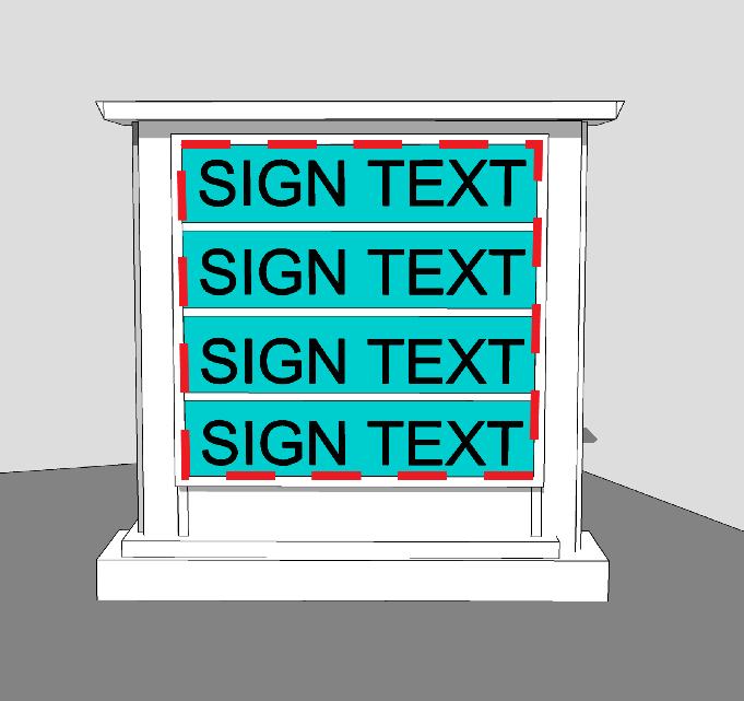
Figure 1116.02-I: Sign Surface Area Measurement Example 1
(B) Surface area of wall signs, window signs, awning signs, and canopy signs. The following provisions apply in calculating the surface area of window signs, awning signs, and canopy signs:
(1) The supporting wall, window, or surrounding fascia, awning, or canopy shall not be included in the calculation of sign surface area, except where there is a change of color or material which forms a background for the sign copy.
(2) Sign surface area for awning, canopy, and other signs consisting of individual letters or symbols against a surface shall be measured as the minimum area enclosed by rectangular envelopes completely enclosing the extreme points or edges of letters, images, logos, or attached groups thereof, as shown in Figure 1116.02-J: Sign Surface Area Measurement Example 2
Figure 1116.02-J: Sign Surface Area Measurement Example 2
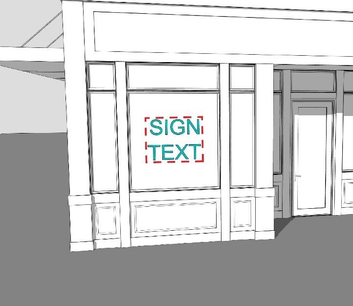
(A) Height to sign top edge. The height to the top edge of a sign shall be measured as the distance between grade level at the base of or beneath the sign or associated sign support structure and the highest point of the highest element of the sign, including the height of sign support structures that are not a building, as shown in Figure 1116.02-K: Height to Sign Top Edge Measurement Example
Figure 1116.02-K: Height to Sign Top Edge Measurement Example
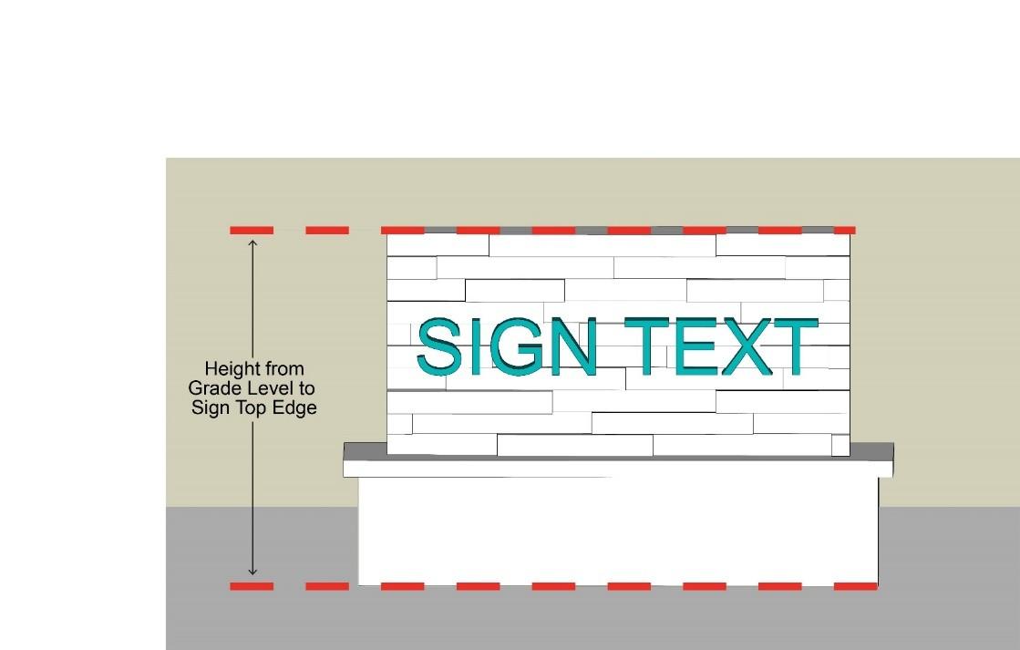
(A) Height to sign bottom edge. The height to the bottom edge of a sign shall be measured as the distance between grade level at the base of or beneath the sign or associated sign support structure and the lowest point of the lowest element of the sign that can be traveled under, including sign support structures that are not a building, as shown in Figure 1116.02-L: Height to Sign Bottom Edge Measurement Example
Figure 1116.02-L: Height to Sign Bottom Edge Measurement Example
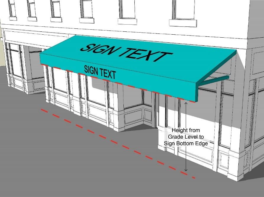
1105.03 – Comprehensive Sign Permissions and Standards
(A) Overview of sign types. Table 1116.03-AW: Sign Types Overview provides the definition and an example illustration of specified types of signs.
Table 1116.03-AW: Sign Types Overview
Sign Type and Definition Example Illustration
Awning/Canopy (Building-Mounted) Sign.
A sign affixed flat to the surface of an Awning or to a Building-Mounted Canopy and which does not extend vertically or horizontally beyond the limits of such awning or canopy.
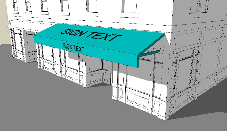
Banner (Temporary) Sign. A sign other than an awning sign that is made of or printed on flexible material like fabric or vinyl and designed to be quickly installed or easily removed. Examples of banners include, but are not limited to, streamers, bunting, pennants, ensigns, and standards.
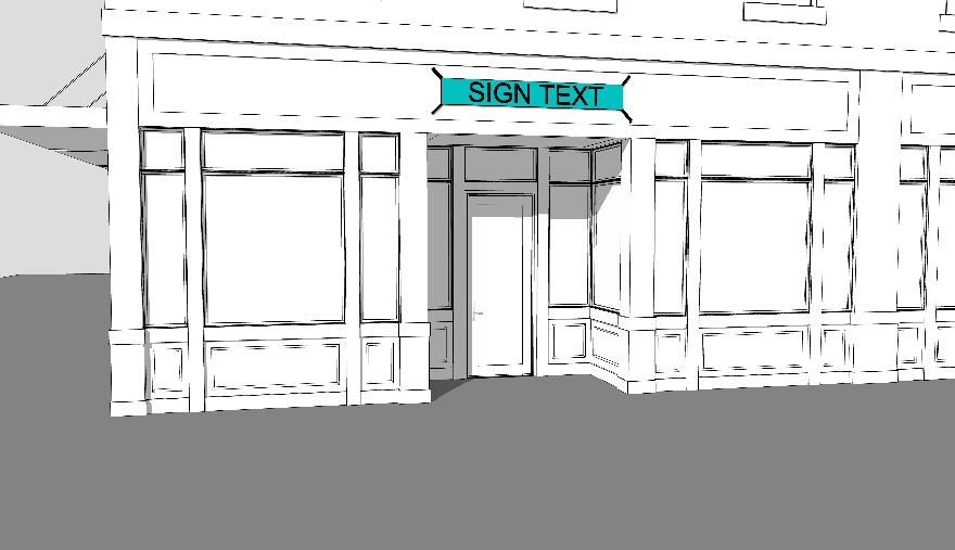
Sign Type and Definition
Canopy (Ground-Mounted) Sign. A sign that is attached to a vertical face of a Ground-Mounted Canopy.
Development ID Sign. A permanent sign placed at a Vehicular Entrance to a Development.
Example Illustration
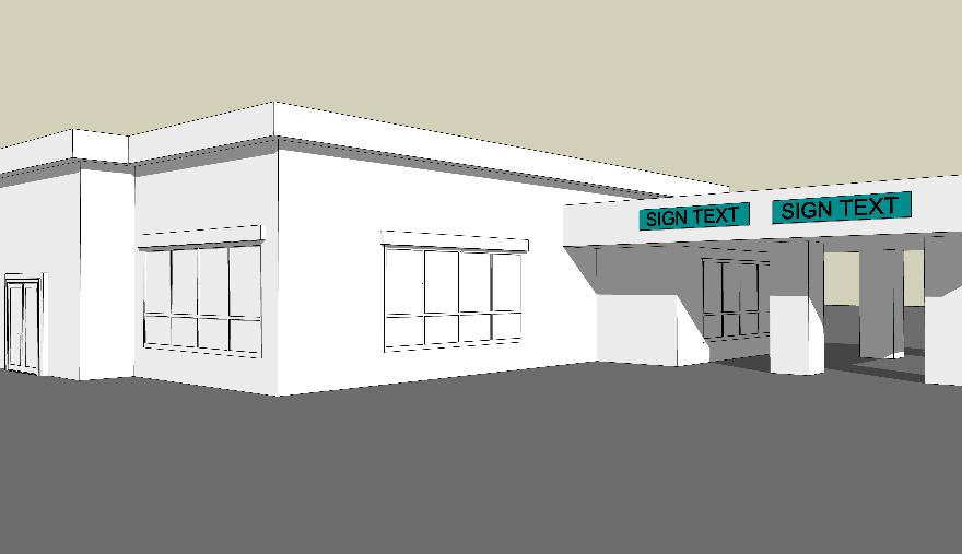
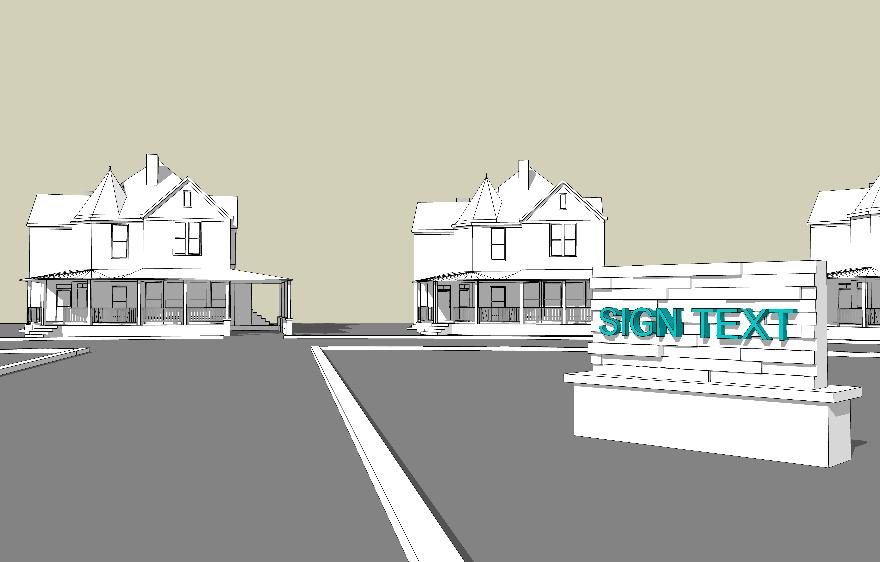
Sign Type and Definition
Electronic Message Center Sign. A sign or portion thereof displaying illuminating letters, numbers, characters, symbols, graphics, or illustrations. Such illumination may consist of cathode ray tubes, light emitting diodes, liquid crystals, plasma, fiber optics, light bulbs, reflective or refractive digital light processing, or other illumination devices. Such signage includes images or messages that may change in sequence immediately, by means of fading or other similar processes. Such displays may change automatically at predetermined intervals or may be changed by an operator. This definition includes signs that are projected by any means onto a Building or a Lot
Feather Sign. A temporary sign made of flexible material that may bend or move in the wind. Such signs are typically mounted to the ground and are not hoisted on a pole through a pulley system or similar mechanical device.
Example Illustration
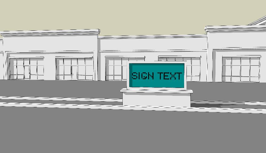
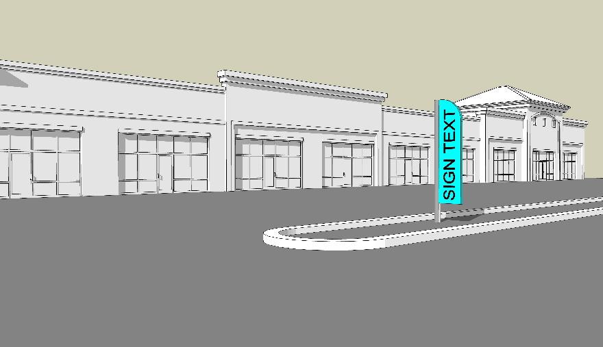
Sign Type and Definition
Manual Changeable Copy Sign. A sign or portion thereof whose copy can be changed by mechanical or manual means without altering the face or surface of the sign.
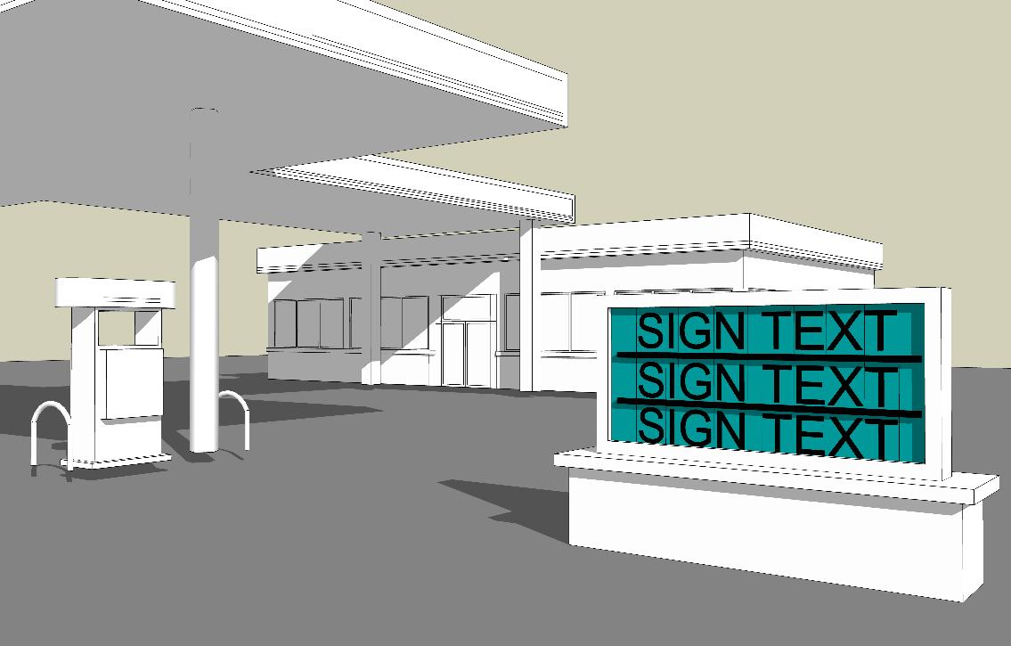
Monument Sign. A sign that is incorporated in, affixed to, or otherwise mounted to a ground-supported masonry wall or masonry pedestal and that does not have a gap between the bottom edge of the sign face and the top edge of the supporting masonry wall or masonry pedestal.
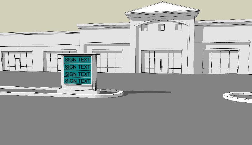
Sign Type and Definition
Off-Premises Sign. Any sign, including Electronic Message Center Signs, relating to products, accommodations, service, or activities available to the public off the premises on which the sign is located.
Post and Panel Sign. A sign suspended from or otherwise connected to one or more posts that are mounted directly into the ground.
Example Illustration
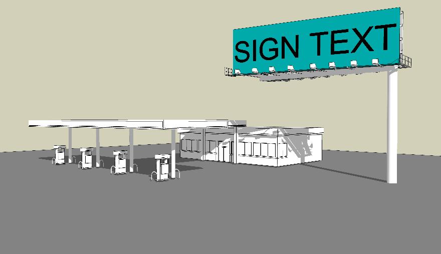
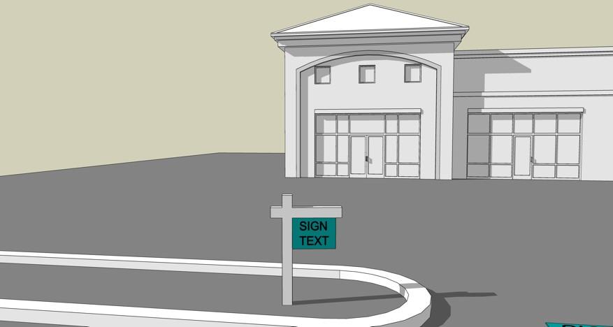
Sign Type and Definition
Projecting Sign. A sign that is substantially perpendicular to the surface to which it is attached. Such a sign is typically attached to or hanging from a bracket.
Roof Sign. A sign that is attached to or supported by the roof of a building; or a sign that extends above the roofline of the building to which it is attached.
Example Illustration
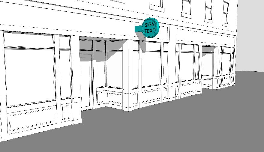
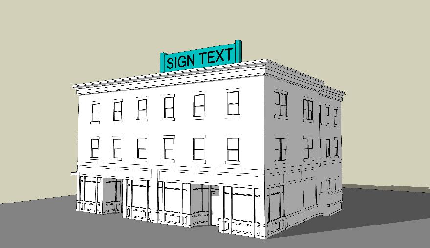
Sign Type and Definition
Sandwich Board Sign. A stationary, double-faced temporary sign that rests on the ground.
Vehicular Use Area Sign. A relatively small sign that is located in a vehicular use area. Such sign may be placed on a post, above a pathway, or flat on the ground to be traveled over, in addition to other configurations.
Example Illustration
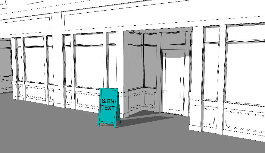
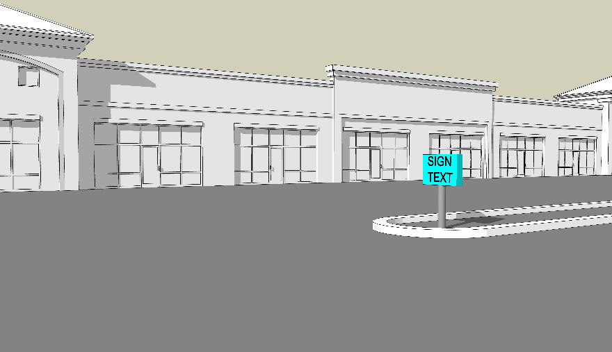
Sign Type and Definition
Wall Sign. A sign applied on a non-window surface of a Building with a sign face parallel to such surface.
Example Illustration
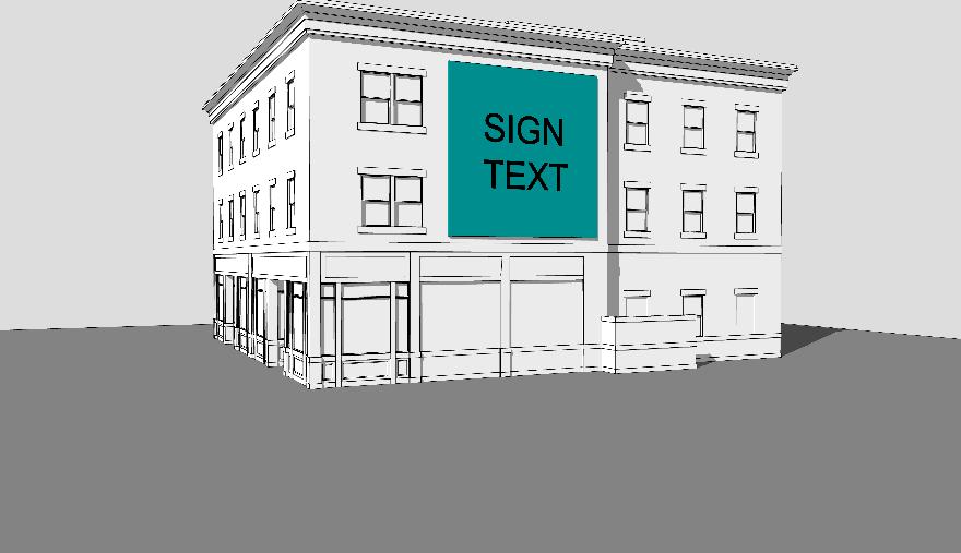
Window Sign. A sign that is painted, attached, or affixed to the interior or exterior surface of windows or doors of a Building or suspended on the inside or outside of the windows or doors. A single window sign includes any portions of a message and associated graphics that span across separate panes of glass where such areas of separation or interruption are not wider than 18 inches.
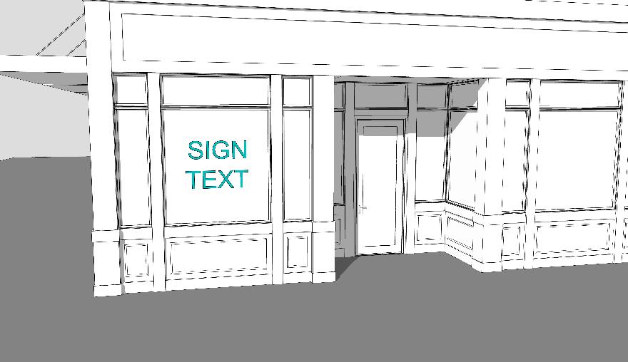
Sign Type and Definition
Yard Sign. A freestanding sign that is intended to be displayed for a limited period. Such signs do not include signs and/or associated supporting structures that are anchored in concrete, constructed of masonry, or that require heavy equipment to be moved within a lot or removed from a lot.
Example Illustration
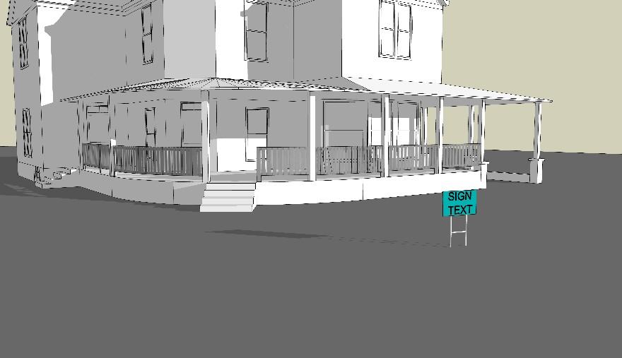
(B) Comprehensive sign table. Specified types of signs shall be subject to the standards of Table 1116.03-AX: Comprehensive Sign Permissions and Design Standards. Signs shall be allowed with a permit, allowed without a permit, or prohibited per the following key:
(1) A solid circle identifies a sign type that is allowed through the approval of a sign permit (pursuant to Section 1102.02 –Sign Permit) subject to all applicable standards.
(2) A half-filled circle identifies a sign type that is allowed without approval of a sign permit, subject to all applicable standards.
(3) A hyphen identifies a sign type that is not allowed within a specified zone or district.
(4) Signs that are allowed and do not require a sign permit will not be counted against the maximum cumulative number of signs allowed.
(5) Notwithstanding anything to the contrary contained herein, in addition to any other permitted signs, where permitted, only one monument sign or one post and panel sign shall be permitted on a parcel.
Table 1116.03-AX: Comprehensive Sign Permissions and Design Standards Sign Type | Name of Standard
BANNER (TEMPORARY) SIGN
Canopy (GroundMounted) Sign
CANOPY (GROUND-MOUNTED) SIGN
Sign Type | Name of Standard
= Allowed with Sign Permit
Allowed without Sign Permit
= Not Allowed Location Requirements N/A
Monument signs shall provide a minimum separation of 200 feet from other monument signs on the same lot
Monument signs shall provide a minimum separation of 25 feet from other monument signs on separate lots
Monument signs shall provide a minimum separation of 200 feet from other monument signs on the same lot
Monument signs shall provide a minimum separation of 25 feet from other monument signs on separate lots N/A
Monument signs shall provide a minimum separation of 200 feet from other monument signs on the same lot Monument signs shall provide a minimum separation of 25 feet from other monument signs on separate lots
Sign Type | Name of Standard
VEHICULAR USE AREA SIGN
Table Notes: (2) This (3) This standard for minimum
Sign Type | Name of Standard
= Allowed with Sign Permit
standard for maximum height from grade level shall not apply to vehicular use area signs that are installed above a passable pathway (by pedestrians and/or vehicles).
height from grade level shall only apply to vehicular use area signs that are installed above a passable pathway (by pedestrians and/or vehicles).
WALL/AWNING SIGN
Sign Type | Name of Standard
Location Requirements N/A
= Allowed with Sign Permit
Table Notes: (4) Each separate wall/awning sign will be counted against the maximum cumulative number of signs allowed.
Wall/Awning signs shall provide a minimum separation of 50 feet from monument signs on the same lot
= Allowed without Sign Permit – = Not Allowed
Wall/Awning signs shall provide a minimum separation of 50 feet from monument signs on the same lot
Wall/Awning signs shall provide a minimum separation of 50 feet from monument signs on the same lot
Wall/Awning signs shall provide a minimum separation of 50 feet from monument signs on the same lot
Table Notes: (5) Window signs that are 10 square feet or less in surface area will not be counted against the maximum cumulative number of signs
and Zoning Code | Twinsburg, OH 7-12-2024 FINAL
WINDOW SIGN
Sign Type | Name of Standard
= Allowed without Sign Permit – = Not Allowed allowed.
YARD
Sign
Setback from Front Lot Lines, Rear Lot Lines, and Rights-ofWay
Height from Grade Level to Sign
Table Notes:
(1) Signs that are allowed without a sign permit will not be counted against the maximum cumulative number of signs allowed.
(2) This standard for maximum height from grade level shall not apply to vehicular use area signs that Planning and Zoning Code | Twinsburg, OH 7-12-2024 FINAL Page 172 of 276
Sign
Type | Name of Standard
are installed above a passable pathway (by pedestrians and/or vehicles).
(3) This standard for minimum height from grade level shall only apply to vehicular use area signs that are installed above a passable pathway (by pedestrians and/or vehicles).
(4) Each separate wall/awning sign will be counted against the maximum cumulative number of signs allowed.
(5) Window signs that are 10 square feet or less in surface area will not be counted against the maximum cumulative number of signs allowed.
(6) Yard signs shall be removed from the lot at the end of the allowable display period or within seven (7) calendar days of the completion of the project, election, sale, or lease or event, whichever occurs first.
(C) Temporary signs
(1) In nonresidential zones, yard signs must include the date (day, month, and year) that the sign is installed, legibly displayed on the sign or sign supports.
(2) Flags and/or banners shall not be hung across any public right-of-way unless the Mayor and the Zoning Administrator approve upon a finding that such placement will not be detrimental to public safety. If approved, such flags and/or banners may only be installed for a period of up to 35 days.
(3) In addition to other signs allowed per this Chapter 1105, lots that are subject to active construction related to an approved site plan review (per Section 1102.01 –Site Plan Review) are allowed one temporary construction sign along each separate right-of-way abutting the subject lot. Such temporary sign shall not exceed 32 square feet in area, shall not exceed 8 feet in height, and shall not be displayed for a duration longer than 18 months or until a final certificate of occupancy is issued, whichever is sooner.
(4) A temporary sign may be displayed continuously for up to forty (40) days. Such sign shall be removed from the lot at the end of the allowable display period, or within seven calendar days of the completion of the project, election, sale, lease or event, whichever occurs first.
(5) A temporary identification sign may displayed for up to 120 days with approval of a permanent sign application by the Architectural Review Board.
(D) Electronic message center signs. Electronic message center signs are allowed subject to the following:
(1) Electronic message center signs are allowed only on lots with public and institutional uses within the PF Zone as part of an allowed sign (per Table 1116.03-AX: Comprehensive Sign Permissions and Design Standards). For the purposes of this provision, public and institutional uses include the following, as defined in this Title: civic use, school – primary/secondary, and school – post-secondary.
(2) Individual messages within an electronic message center sign must be displayed for a duration of at least 8 seconds.
(3) Images, copy, logos, accent lines, and all other elements within a message displayed on an electronic message center sign must be static. Transitions between separate messages must be instantaneous without the use of transition effects such as wipes, fades, and similar effects that give the appearance of motion.
(4) Electronic message center signs must be equipped with a light-sensing device that automatically adjusts the brightness of the sign to meet the requirements of Section 1105.05 – Signage Illumination, when ambient light conditions change.
(5) Electronic message center signs must be equipped with a feature that automatically turns the sign off or changes the sign to an all-black display in the event of damage or malfunction.
(E) Manual changeable copy signs. Manual changeable copy signs are allowed subject to the following:
(1) Manual changeable copy signs are allowed only with nonresidential zones as part of an allowed sign (per Table 1116.03-AX: Comprehensive Sign Permissions and Design Standards).
(F) Signs in clear sight triangles Signage within a clear sight triangle, as may be required per 1103.05 – Clear Sight Triangle, is prohibited or limited per the following:
(1) Ground-mounted signs must not be placed within a clear sight triangle.
(2) Where an existing building is within a clear sight triangle, building-mounted signs may only be placed on those portions of the building that are within the clear sight triangle if they do not project from the building within the vertical range between 2 feet above grade level and 8 feet above grade level.
(A) Prohibited signs. The following types of signs or features of signs are prohibited:
(1) Roof signs;
(2) Portable electronic message center signs;
(3) Pole signs;
(4) Pylon signs;
(5) Off-premises signs;
(6) Inflatable, windblown, and/or air-activated signs;
(7) Feather signs and pennant signs;
(8) Any sign not expressly permitted by this Chapter;
(9) Signs containing profane words, images of obscene character, or words and/or images that are harmful to juveniles, as defined by the Ohio Revised Code Section 2907.01(E) and (F);
(10) Signs that are the principal use of a lot;
(11) Signs that obstruct any doorway, fire escape, or window;
(12) Signs located on utility poles;
(13) Signs located on trees;
(14) Signs on trailers that are directly viewable from a public right-of-way and that are parked for a period exceeding 48 hours;
(15) Signs made of materials that are not durable in inclement weather, including but not limited to paper and cardboard; and
(16) Signs with electronic or mechanical components that cause radio, radar, or television interference.
(B) Nuisance signs. Nuisance signs are identified as follows and are subject to the following provisions:
(1) Any sign or other object placed, displayed, erected, constructed, reconstructed, altered, or permitted to remain on any premises in violation of this Code or the Building Code, or without legal authorization, is hereby declared to constitute a nuisance.
(2) In addition to any penalty provided in the Twinsburg Codified Ordinances for such violation, the nuisance may be abated in the manner provided by the statutes of Ohio, in the manner provided in the Codified Ordinances of Twinsburg, or in the manner provided by Section 1105.06 – Removal of Signs. The procedural requirements of these alternative abatement remedies shall not be cumulative. Only the procedures of the abatement remedy implemented shall be required.
(A) Applicability. Except where illumination on a given type of sign is prohibited or restricted per Table 1116.03-AX: Comprehensive Sign Permissions and Design Standards, the provisions of this Section 1105.05 shall regulate the illumination of signs, including electronic message center signs.
(B) Types of illumination identified. Where illumination is allowed, the following shall apply:
(1) Direct illumination. Direct illumination shall be accomplished by directing a shielded external light source to a given sign. Such a light source must have a white color.
(2) External Illumination. External illumination shall be accomplished by applying an unconcealed light source, such as neon tubes, to letters, numbers, symbols, logos, and accent lines, or forming the illumination in a manner that portrays letters, numbers, symbols, logos, and accent lines.
(3) Internal illumination. Internal illumination shall be accomplished by allowing light only through letters, numbers, symbols, logos, and accent lines. Such a light source may not utilize more than 2 colors. The background of an internally illuminated sign must remain opaque.
(4) Shadow illumination. Shadow illumination shall be accomplished by back-lighting letters, numbers, symbols, logos, and accent lines with a concealed light source.
(C) Prohibited illumination. The following types or features of illumination are prohibited:
(1) No temporary sign allowed by this Chapter may be illuminated.
(2) Open flames as a source of illumination are prohibited.
(3) Flashing signs and flashing lights are prohibited.
(4) Storefront and window track/module lighting systems are prohibited
(D) Maximum illumination level. The brightness level for signage illumination shall not exceed 0.3 foot candles above ambient light levels, as measured per Section 1104.02 –General Measurement Methodologies
(E) Shielding required. The light source of any sign using direct illumination must be shielded from view from any public right-of-way and from any dwelling unit.
(A) Authorization to order sign removal. The Zoning Administrator is hereby authorized to order the removal or maintenance of any sign that constitutes a nuisance.
(B) Serving notice of order. Any order to remove or repair and maintain a nuisance sign must be served to the owner or person in possession of the sign by personal or certified mail service, provided that, where service has been refused, no further service shall be required. The time for compliance shall commence from the date such service is accepted or refused, as recorded in the records of the Building Department.
(C) Compliance timelines
(1) Whenever the removal or maintenance of a permanent sign has been ordered and served, the person served must comply with such order within 14 days of the service.
(2) Whenever the removal or maintenance of a temporary sign has been ordered and served, the person served must comply with such order within 48 hours of the service.
(3) Whenever removal or maintenance of a sign is ordered, served, and not complied with in the required timeline, the Zoning Administrator may thereafter cause the removal or maintenance of such sign at the expense of the owner of the sign or the owner of the lot on whose premises it was erected, affixed, or attached. Such person shall be individually and separately liable for the expense incurred in the removal or maintenance of such sign.
(D) Specifications of removal. An order to remove a sign shall include the complete and total removal of the sign face, enclosing frame, and all sign supporting members and based, unless otherwise explicitly ordered.
CHAPTER 1106 – HISTORIC PRESERVATION
(A) Purpose. The purpose and intent of Chapter 1106 is:
(1) To safeguard historic buildings, structures, and sites that are listed on the Twinsburg Local Landmarks List, as approved by the City Council;
(2) To seek alternatives to demolition or incompatible alterations within the city to listed properties before such acts are performed; and
(3) To encourage historic preservation best practices of listed properties.
(B) Applicability
(1) The provisions of Chapter 1106 shall apply to all lots, buildings, structures, and sites that are listed on the Twinsburg Local Landmarks List, as approved by the City Council.
(2) No building or other structure on the Twinsburg Local Landmarks List – or building or other structure immediately adjacent thereto – shall be erected, altered in exterior construction or appearance, enlarged, moved, or demolished unless a certificate of appropriateness for such action (per Section 1104.02 – Certificate of Appropriateness) is issued in compliance with the provisions of this Chapter.
(A) In the review of applications for a certificate of appropriateness (per Section 1104.02 –Certificate of Appropriateness), the Architectural Review Board must interpret and apply the guidelines provided herein.
(B) Preservation of features. The distinguishing original qualities or character of an historically significant feature shall not be destroyed. Removal or alteration of historic material or distinctive architectural features shall be avoided.
(C) Replacement of features. If replacement of architectural features on a historically significant property cannot be avoided (as confirmed by the Architectural Review Board), the proposed replacement material shall closely match the character-defining material in composition, design, color, texture, and other visual qualities.
(D) Compatibility in design. All buildings, structures, and sites shall be recognized as products of their own time. Alterations, additions, and new development shall be compatible in size, scale, color, material, and character with the design of historically significant properties – both the subject property and those in proximity to the subject property. However, uniformity for the sake of uniformity shall not be required. Prevailing setbacks and orientations of structures to streets and sidewalks shall also be respected.
(E) Accessory structures. Fences, walkways, benches, streetlights, and other accessory structures located on properties listed on the Twinsburg Local Landmarks List, or on
properties immediately adjacent thereto shall be compatible in design with the character of such properties.
(F) Signs. In addition to the requirements of Chapter 1105 – Signs, signs located on properties listed on the Twinsburg Local Landmarks List, or on properties immediately adjacent thereto shall be compatible in color, material, placement, and character with the architectural style of such properties.
(G) Illumination. Internally illuminated signs shall not be permitted on properties listed on the Twinsburg Local Landmarks List, or on properties immediately adjacent thereto.
(H) Sign types. Although no sign types are specifically prohibited by regulations of this Section, certain sign types may be deemed incompatible upon review by the Architectural Review Board with the above guidelines.
CHAPTER 1107 – SUBDIVISION CONSTRUCTION AND DESIGN STANDARDS
(A) Purpose. The design standards prescribed herein are intended to be the minimum standards which, when applied with the professional skills, will produce attractive and harmonious development, convenient and safe streets, and economical layouts for development of land in the city. These standards are further intended to establish infrastructure and other construction that is optimally functional and durable, resulting in minimum layouts for maintenance and repair dollars in the future.
(B) Adopted standard details
(1) There is hereby adopted, as part of the subdivision regulations of the municipality of Twinsburg, Ohio, “General Notes and Standard Construction Drawings for the City of Twinsburg,” to be prepared, amended, and updated from time to time by the City Engineer.
(2) The adopted and current version of this document shall govern and establish minimum standards on construction within public right-of-way or areas intended to be dedicated in the future to the public, whether within subdivisions or elsewhere.
(3) The City Engineer is hereby granted and vested with the authority to enforce such standards or technical engineering data and construction techniques setting forth the same in the “General Notes and Standard Construction Drawings for the City of Twinsburg” which is made a part hereof by this reference as if reappearing in whole in this enactment.
(4) A copy of the “General Notes and Standard Construction Drawings for the City of Twinsburg” shall be placed on file in the office of the Clerk of the City Council after review and approval by the Mayor and City Council. This document may be accessed online at https://www.mytwinsburg.com/DocumentCenter
(C) Land use and thoroughfare plan. The location, layout, and density of all proposed subdivisions shall conform to the Land Use and Thoroughfare Plan of current adoption by the City.
(A) Natural land use. Subdivisions shall be planned to take advantage of the topography of the land to economize in the construction of drainage facilities, to reduce the amount of grading, and to minimize the destruction of trees and topsoil.
(B) Flood hazards. If any portion of the land within the subdivision is subject to flooding or other hazards, due consideration shall be given to such conditions in the design of the subdivision. Land subject to flooding and land otherwise uninhabitable shall not be platted for residential occupancy nor for other uses that may increase danger to health, life, or property, or that may aggravate the flood hazard.
(A) Residential blocks. The lengths, widths, and shapes of blocks will be determined with due regard to:
(1) Provisions for adequate building sites suitable for the special needs of the type of use contemplated.
(2) Zoning requirements as to lot size and dimensions.
(3) Need for convenient access, circulation, control, and safety of street traffic.
(4) Limitations and opportunities of topography.
(B) Block lengths. The longest dimension of a residential block shall not exceed 1,500 feet or be less than 800 feet.
(A) Lot size. A lot’s size, width, depth, public street frontage, and minimum building setback lines shall conform to the existing zoning code.
(B) Lot depth. No lot depth for a lot in a major subdivision shall exceed 3.5 times the lot width.
(C) Frontage. Lots shall not be laid out so that they have frontage on more than one street except:
(1) Where the lots are adjacent to the intersection of 2 streets.
(2) Where it is necessary to separate residential lots from arterial or collector streets.
(3) Where double frontage lots are created adjacent to arterial or collector streets, a reserve strip along the major arterial thoroughfares shall have a minimum 20-footwide landscape easement to be maintained by the HOA. The plat shall state that
there is no right of access across such reserve strip. The Planning Commission may require a landscape buffer including a mound or a wall.
(D) Corner lots. Corner lots that abut a collector or arterial with any other street shall have a minimum setback as shown in Table 1113.02-AM: Residential Zones Dimensional Standards, Table 1113.02-AN: Commercial and Public Zones Dimensional Standards, Table 1113.02-AO: Industrial Zones Dimensional Standards, as applicable, on both streets.
(E) Lot lines.
(1) Side lot lines shall be substantially at right angles or radial to street lines. Lot lines shall follow municipal, township, and county boundary lines rather than cross them where possible.
(2) If there is a defined rear lot line, that line shall be used for the rear setback.
(A) Streetlights. The subdivider shall install and pay for all street lighting facilities, including poles, fixtures, underground wiring, and all connection costs, all of which shall be done in accordance the applicable franchise agreement with the Ohio Edison Company. The subdivider shall pay directly to Ohio Edison or shall promptly reimburse the City of Twinsburg for all charges related to the connection of street light service including charges for service tap in or start up. Upon acceptance of dedication of street right-ofway, such underground lighting facilities shall become the property of the Ohio Edison Company and shall be repaired and maintained by them. There shall be no waiver of this requirement unless such modifications have been first considered and approved by the Planning Commission.
(B) Street signs.
(1) A developer shall provide for the installation of street signs such as, but not limited to, stop signs, no parking signs, and speed signs. The street signs shall conform to the specifications of the Municipality, and the developer shall pay the Municipality to install such signs at all intersecting streets in the subdivision.
(2) The developer shall designate a primary entry into the subdivision. A sign which conforms with the signage regulations of the City shall be provided at this entry on property to be designated as recorded common property. The signage area shall be appropriately landscaped by the developer and shall be permanently maintained by the homeowner association.
(C) Street trees. Street trees within the right of way shall be provided as required in the improvement schedule. Trees required by this section shall be installed by the City at the cost of the Developer. Funds for the installation of trees shall be deposited with the City after approval of the final plat and before commencement of the project. The amount deposited by the Developer shall be the City's cost for all required trees and installation.
(D) Planting screens or fences. The Planning Commission may require and permit planting screens or fences where reverse frontage lots abut a major arterial street provided that such planting screens or fences shall not constitute a safety hazard. A plan of proposed planting screens or fences shall be submitted for approval with the final plat.
(E) Utility Facilities. All Utility Facilities, including water, sanitary sewer, storm sewer, communications facilities, and gas line facilities, but not necessarily limited thereto, shall be installed and paid for by the subdivider and shall be constructed underground in accordance with the Subdivision General Notes and Standard Detail of the City of Twinsburg, Ohio or in accordance with the construction standards of the purveyor. The subdivider shall install new systems or, where appropriate, connect onto existing systems which are deemed adequate by the City Engineer to handle the additional demands and volume which will result from the proposed subdivision. Storm water easements shall be graded to final grade and maintained by the developer until transfer of the site. The subdivider, prior to the submission of the preliminary plan, must receive prior written approval for the extension or installation of said central water system and central sanitary sewer system from the City Engineer, and the public Utility Facilities involved. There shall be no deviation or waiver here from unless the same shall have been first considered by the Planning Commission and authorized by the enactment of City Council.
(F) Monuments. A monument shall be accurately placed at each corner and at changes in direction of the boundary, at each street intersection, at points of curves of streets, and at intermediate points as may be required by the City Engineer. The monuments shall be as shown on the Standard Details of the Municipality of Twinsburg, Ohio. The top of the monuments shall be set at the finished grade upon the completion of the grading of the streets and lots. Iron pins shall be set at all lot corners.
(G) Oversize and/or off-site improvements. Oversize and/or off-site extensions of Utility Facilities, pavements, and other improvements shall be designed and constructed to facilitate the orderly development of nearby land which is an integral part of the neighborhood service or drainage area. Where the City Engineer determines that improvements in excess of the size needed to serve the proposed subdivision are necessary in order to facilitate orderly development, or where they determine that offsite improvements are necessary to facilitate orderly development of the area, the subdivider (at the subdivider’s cost) shall install all improvements required to serve their subdivision plus the additional oversize and/or off-site improvements required. The subdivider may contract with adjacent property owners and/or subdividers of adjacent land for reimbursement of the oversize and/or off-site improvements required. Such improvements shall be available for connections by individual property owners and/or subdividers of adjoining land.
(H) Standards for Utility Easements. For utility lines serving a subdivision, easements as set forth hereunder shall be provided. Such easements may be considered as part of the lot adjoining it in computing the lot area, but shall be kept clear of structures, trees, or
other improvements which would interfere with installation or maintenance of utility lines or related appurtenances.
(1) Sanitary sewer, storm sewer, and water lines may be located within the road rightof-way but shall be outside of the pavement. In the alternative, easements may be shown on the preliminary and final plats parallel and contiguous to the road right-ofway. Such easements shall have a minimum width of 10 feet. Easements may also be shown on the preliminary and final plats parallel and contiguous to side and rear lot lines, whenever feasible. Such easements shall have a minimum width of 20 feet.
(2) Electric power, natural gas, cable television, and telephone lines shall be located outside of the road right-of-way. Easements for such purposes shall be shown on the preliminary and final plats parallel and contiguous to the road right-of-way. Such easements shall have a minimum width of 12 feet. Easements may also be shown on the preliminary and final plats parallel and contiguous to side and rear lot lines. Such easements shall have a minimum width of 20 feet. Utility lines shall be placed underground.
(A) Classifications. Streets shall be classified per the provisions of this Section 1107.06
(B) Interstate highways, freeways, and expressways. Interstate highways, freeways, and expressways shall be planned for continuation of major interstate and interstate high speed traffic of large volumes between areas within and outside of the state. All locations of such highways and intersections shall be by Federal, State, and City agreement.
(C) Arterial streets. Arterial streets shall be planned to facilitate traffic movement between points of heavy traffic generation and from one section of the community to another. They shall contain as few intersections with minor streets as possible. Such thoroughfares should traverse the community and should be spaced approximately one mile apart.
(D) Collector streets. Collector streets shall provide a traffic route from local streets to arterial streets. Collector streets normally contain a relatively large number of intersections with local streets and few intersections with arterial streets. These streets should be spaced at least 1/4th mile apart.
(E) Local streets. Local streets shall provide direct and full access to each abutting lot, site, or structure, and shall be laid out so that their full use by through traffic will be discouraged. Local streets shall typically connect to other local streets, collector streets, or arterial streets.
(F) Cul-de-sac or dead-end streets. Cul-de-sac and dead-end streets shall be constructed with a cul-de-sac or turn-around area and be designed to provide direct and full access to each abutting lot, site, or structure. The cul-de-sacs or dead-end streets shall be laid
out to accommodate only those lots, sites, and structures fronting the street and cul-desac.
(G) Six-unit drives (private). Six-unit drives may be in general private driveways to service up to six building sites.
(H) Two-unit drive (private). Two-unit drives shall be in general private driveways to service building sites for two lots, two buildings sites, and/or structures containing two units or double occupancy or use.
(I) Single-unit drives (private). Single-unit drives shall be in general private driveways to service building sites for one lot, one building site, and/or single structures designed for the purpose of a single occupant or use.
(J) Streets, drives, and driveway right-of-way width for public and private use
Minimum permanent unobstructed public or private right of way easement or common area width for street, drive, and driveway areas for street and drive pavements, curbs, tree lawns, sidewalks, sewers, water lines, driveway aprons, and Utility Facilities shall conform to the following minimum widths:
(1) Interstate highways, freeways and expressways: by agreement with the City.
(2) Arterial and collector streets: 80 feet.
(3) Local streets and drives, loop streets and drives, and dead-end streets and drives: 60 feet.
(4) Private access easements including maintenance requirements for driveways that serve 2 or more units are required.
(K) Utility easements. Easements of minimum width of 12 feet shall be provided for:
(1) Each side of rights-of-way; and
(2) Easements of common areas for private streets and drives proposed for access to sites proposed for lots and/or structures for 3 or more units.
(L) Half streets and drives. Half streets and drives, or streets or drives with reduced rightof-way, easement width, or common area width for pavements, curbs, walks, tree lawns, and Utility Facilities are prohibited.
(M) Alleys. The creation of alleys within a platted subdivision are prohibited.
(N) Corner radii. Property lines, easement lines and/or common area lines, pavements, and curbs at street and drive intersections shall be rounded with minimum radii as follows:
(1) Interstate highways, freeways, and expressways: by agreement with the City.
(2) Arterial streets shall have a minimum corner radius of 50 feet at the property line and 50 feet at the pavement curb.
(3) Collector streets shall have a minimum corner radius of 30 feet at the property line and 30 feet at the pavement curb.
(4) Residential local, loop, dead-end, and cul-de-sac streets shall have a minimum corner radius of 25 feet at the property line and 25 feet at the pavement curb.
(5) Industrial local, loop, dead-end, and cul-de-sac streets shall have a minimum corner radius of 30 feet at the property line and 30 feet at the pavement curb.
(6) The required apron width of one-, two-, and six-unit drive aprons are established in Table 1118.06-AY: Drive Width and Apron Standards
Table 1118.06-AY: Drive Width and Apron Standards
(A) Sidewalks. Sidewalks shall be provided as specified in Table 1118.14-BB: Schedule of Required Subdivision Improvements and as follows:
(1) Sidewalks in residential subdivisions must be made of concrete and must be 4 inches thick with the thickness increased to 6 inches where the sidewalk is crossed by a driveway. In industrial and commercial areas, the thickness of the sidewalk concrete shall be increased to 8 inches where the sidewalks are crossed by a driveway. (See Standard City of Twinsburg Detail.)
(2) In subdivisions to be constructed and improved or which are in the process of improvement and development, and before bonds shall be released, sidewalks shall be installed by the developer/builder abutting all platted lots which abut a paved street whether a structure has been constructed upon the lot or not.
(3) The City has the right to have a public sidewalk installed within 270 days after the public streets are installed, not including the final course.
(4) On corner lots, sidewalks shall be provided along both street frontages and shall be extended to the edge of the street pavement with ADA-compliant wheelchair access.
(B) Driveways. The required driveway width in residential subdivisions must be as specified in Table 1118.06-AY: Drive Width and Apron Standards.
(C) Trails. Trails are subject to the following standards:
(1) The design must be ADA compliant with a surface material as approved by the City Engineer;
(2) The minimum width of a trail is 8 feet; and
(3) Proper drainage must be provided and approved by the City Engineer.
(D) Small construction sites (individual lots)
(1) Prior to any excavation for foundation or footers, the developer shall saw cut a curb in the driveway area and install a construction drive entrance and other site controls per the Rainwater and Land Development manual: Ohio’s standards for stormwater management, land development, and urban stream protection.
(2) Further, the berm area of the public right-of-way shall be seeded and maintained by the developer/builder until such time as a dwelling or other structure is occupied, and thereafter the same shall be the obligation of the occupant of said structure. Failure to comply with any provision of this enactment will be considered a public nuisance, and the City may take legal action.
(A) Pavements. The minimum pavement standards as indicated in the Standards Details shall be required on all City Streets. Higher pavement standards and/or greater widths indicated herein may be required by the Planning Commission and/or City Engineer to adequately provide for unusual soil conditions, or where extraordinary traffic volumes or loads indicate need.
(B) Comprehensive table Table 1118.08-AZ: Roadway Dimensional Standards provides the standards for minimum pavement widths as measured from back of curb to back of curb when curb is required, requirement of curb, percentage of grade, and design speed (not necessarily the legal or posted speed limit) shall be used for all designs of streets and drives for public or private development.
Table 1118.08-AZ: Roadway Dimensional Standards
Table Notes: (1) These standards shall be set per agreement with the State of Ohio. Where applicable, sound barriers shall be permitted.
(C) Cul De Sac Streets and Six Unit Private Drives. Table 1118.08-BA: Select Cul-de-sac and 6-Unit Drive Standards provides the standards for minimum lengths, maximum lots served, and minimum curb diameter of cul-de-sac streets and 6-unit private drives.
Table 1118.08-BA: Select Cul-de-sac and 6-Unit Drive Standards
Table Notes:
(1) Cul-de-sac streets shall be measured from the center point of the cul-de-sac to the center line intersection with the connecting through roadway. Multiple cul-de-sacs sharing a single through road connection shall be considered one cul-de-sac street.
(A) Drainage. A drainage system shall be designed and constructed by the subdivider to provide for the proper drainage of the surface water of the subdivision and the drainage area of which it is a part. To this end the subdivision shall be graded as follows:
(1) Prior to the start of any construction (houses or streets), the subdivider shall furnish a site plan showing by use of arrows how they propose to surface drain each lot. This information shall also be shown on the street plan and profile sheets.
(2) The subdivider shall submit topographic maps showing the area to be drained with calculations prepared by a registered civil engineer in determining the proposed storm water collection system. The maps shall be reviewed and approved by the City Engineer.
(B) Grading, generally The subdivider shall grade each subdivision to establish street block and lot grades in proper relation to each other and to existing topography as provided within this Section.
(C) Street grading. The subdivider shall prepare a grading plan for streets along with street improvement details. The grading of the roadway shall extend the full width of the rightof-way. Planting strips shall be graded at a gradient of not less than 2% nor greater than 3% upward from the curb to the sidewalk or property line.
(D) Block grading. Block grading shall be as follows:
(1) From a high point of the lot draining into the streets or from a drainageway;
(2) Parts of all lots draining to a natural waterway or drainage system along rear lot lines and a portion of all lots draining to the street; and
(3) Draining across rear or side lot lines provided that drainage onto adjoining properties shall be engineered by a professional engineer and inspected by the City.
(E) Lot grading
(1) Any open storm water draining course or basin which is adjacent to the rear, side, or front of a dwelling shall be a minimum of 50 feet from the dwelling at the top bank of drainage course or basin and the slope shall be a minimum of 4 to 1. This includes
all drainage courses or basin, active and nonactive and if the Engineer requires slope protection, it shall be included.
(2) Lots shall be graded so that water drains away from each building at a minimum grade of 1% to a storm water swale.
(3) Surface storm water drainage swales shall have a minimum grade of 0.5% and shall be designed so that surface water will drain into a driveway, street gutter, storm sewer, drain inlet, or natural drainage course.
(4) The minimum grades of driveways shall be 0.4% and a maximum of 10%.
(F) Topsoil and ground cover. If grading results in the stripping of topsoil, the developer/builder shall uniformly spread new topsoil to a depth of 2 inches over the lot or lots as grading is finished.
(G) Road drainage system. The road drainage storm sewer system shall serve as the prime drainage system. It shall be designed to carry drainage from roadways, adjacent lands, and house stormwater. The City of Twinsburg uses the Summit County Drainage Manual Part II for technical guidance and design criteria.
(H) Off-road drainage system. The design of the off-load drainage system shall include the watershed affecting the allotment and shall be extended to a watercourse adequate to receive the storm drainage, based on the requirements in Subsections (I), (J), and (K), below.
(I) Drainage easements. Easements for drainage purposes shall be a minimum of 20 feet in width. Where the watercourse is large, easement widths shall be increased as determined by the City Engineer.
(1) Easements for drainage purposes shall be staked out or be laid out on the ground before construction is started.
(2) In instances where the existing watercourse is well defined because of past storm drainage, the Planning Commission may require the subdivider to plat the lots to take advantage of the natural watercourse. Where it is not feasible to plat such lots, the subdivider is required to reconstruct the watercourse along sublot lines. Such reconstruction shall be piped in conduit and shall be completed to the satisfaction of the City Engineer.
(J) Protection of drainage systems.
(1) All land adjacent to a watercourse or drainage facility, where the vegetation has been impacted or erosion control devices have left unsightly conditions, shall be restored and protected as directed by the City Engineer.
(2) In all cases, any drainage facility within the subdivision shall be in a stable condition, free from either erosion, sedimentation, and/or other debris.
(K) Pipe policy. All pipes shall be installed as specified by the Subdivision General Notes and Standard Details of the Municipality of Twinsburg.
(A) Purpose. Storm water retention and/or detention shall be required for the prevention of accelerated flooding and stream channel erosion in conjunction with urban development. Developers and contractors must follow the Rainwater and Land Development manual, Ohio EPA construction permit requirements and NPDES permit requirements for stormwater, and Summit County Drainage Manual Part II. The purpose of this storm water detention and water quality is to:
(1) Permit commercial, industrial, and residential development without increasing the flooding of other lands;
(2) Limit and/or reduce the adverse impact on receiving streams, storm sewers, and other drainage facilities caused by accelerated runoff; and
(3) Provide a basis of design of storm drainage systems on lands above or below undeveloped areas which will preserve the rights and options of both contributing and receiving property owners and assure the long-term adequacy of storm drainage systems.
(B) Approval. The design and construction of stormwater management facilities shall require the review and approval of the City Engineer.
(C) Design criteria. The design criteria requires that peak discharge flow be controlled in proportion to increased runoff volume. If development does not increase runoff volume, peak flows will not be required to be controlled. However, as development increases the runoff volume due to increased area of impervious surfaces, the criteria will be more stringent.
(D) Allowable stormwater management types. Acceptable post-construction stormwater management practices can be found in the Ohio Rainwater and Land Development manual.
(E) Work sites. All project sites or development areas required to implement stormwater management practices and facilities shall at a minimum limit the peak rate of discharge from the project site or development area to the downstream receiving water course as follows:
(1) Stormwater management measures shall be required to maintain the postdevelopment peak discharge at rates consistent with the critical storm method as described in the Ohio Rainwater Development manual; and
(2) Stormwater management facilities shall be designed to control the volume, timing, and rate of flows.
(F) Construction of stormwater detention/retention facilities
(1) The construction of a stormwater management facility which impounds water and is made by constructing a dam or an embankment or by excavating a pit or dugout shall be designed and meet the requirements of the United States Department of Agriculture, Soil Conservation Service, Agricultural Handbook Number 590 as supplemented by the standards provided in Soil Conservation Service, State of Ohio Engineering Standard, Technical Guide Section IV, Pond (No.) - 378. The Ohio Dam Safety Laws, Title XV, Chapter 1521 of the Ohio Revised Code, shall be reviewed for compliance. The subdivider shall submit construction plans and details for the storm management facility.
(2) Calculations used in determining the capacity of storm sewers and design criteria for stormwater management facilities (e.g. depth, volume, spillway discharge, etc.) shall be prepared by a registered civil engineer. The subdivider shall also submit a topographic map showing the area served by the stormwater facility. Plans, maps and calculations shall be reviewed for approval by the City Engineer.
(G) Maintenance of stormwater detention/retention facilities and existing ponds
Maintenance of storm water management facilities which impound water and existing ponds are the responsibility of the property owner. For the protection of life, health, and property of the public, the City has established the following minimum maintenance requirements for all facilities and ponds located within the City of Twinsburg:
(1) Ponds shall be inspected on an annual basis and after heavy rains to determine whether they are functioning properly or need minor repairs.
(2) Repairs to walls on the side slopes of the dam and any washes in the spillway are required immediately with suitable material and compact it thoroughly. Reseed or resod these areas and fertilize as needed.
(3) If the upstream face of the earth fill shows signs of serious washing or sloughing because of wave action, install protective devices such as booms or riprap.
(4) If there is evidence of seepage through or under the dam, consult an engineer at once so that proper corrective measures can be implemented before more serious damage.
(5) To maintain the protective plant cover on the dam and on earth spillway, mow it frequently and fertilize when needed.
(6) Keep trickle tubes, trash rocks, outlet structures, valves, and watering troughs free of trash at all times.
(7) Burrowing animals such as badgers, gophers, ground hogs, etc. can cause severe damage to dams or spillways. Such damage shall be immediately repaired. Recommended prevention measures include adding a heavy layer of sand or gravel on fill and installing poultry netting under seeded areas.
(8) Ponds shall be maintained as clean and unpolluted as possible. In ponds that have a significant growth of algae and other forms of plant life and become objectionable because of odors, mosquitoes breeding, etc., the property-owners shall initiate management practice to remove these problems. Top-feeding fish may be stocked in the ponds to address and/or reduce these concerns.
(9) The recommended minimum pond depth for this area of the country per the United States Department of Agriculture is 6 – 7 feet. Existing ponds which have excessive sediment shall be dredged to maintain the minimum pond depth.
(10) If compliance with minimum maintenance requirements on stormwater facilities or existing ponds is not met, the City may enforce the penalties provided in Chapter 1106 – Enforcement, Penalties, and Remedies.
(A) Purpose. This section is adopted for the purpose of controlling the pollution of public waters by sediment from accelerated soil erosion and accelerated stormwater runoff caused by earth disturbing activities and land use changes connected with developing urban areas. The development of commercial, industrial, residential, recreational, public service, or other non-farm projects in the City of Twinsburg shall require a Storm Water Pollution Prevention Plan.
(B) General. The work shall consist of temporary and permanent control measures as shown on the Storm Water Pollution Prevention Plan and as directed by the City Engineer to control soil erosion and sedimentation through the use of straw or hay bales, sediment traps, sediment basins, silt fences, earth diversion dikes, check dams, storm drain inlet protection grasses, and mulches per the construction plan details of the Ohio Department of Transportation (ODOT) in accordance with Standard Construction Drawing MC 11, and "Rainwater and Land Development Manual". The implementation of soil erosion and sediment control shall also conform to the requirement of the Ohio Environmental Protection Agency (OEPA) under the NPDES Permit Program for the discharge of storm water from construction sites and the erosion and sediment control practices. If conflicts exist regarding the soil and sediment control practices, the most restrictive shall apply.
(C) Erosion control procedures. To control sediment pollution of watercourses, the owner or person responsible for the development shall use conservation planning and practices to maintain the level of conservation established by the following standards:
(1) Sediment control practices shall be functional throughout earth disturbing activity. Settling facilities, perimeter controls, and other practices intended to trap sediment shall be implemented as the first step of grading and within 7 days from the start of grubbing. They shall continue to function until the upslope development area is restabilized. Other erosion control items may be necessary due to environmental conditions.
(2) Disturbed areas shall have soil stabilization applied within 7 days if they are to remain dormant (undisturbed) for more than 45 days. For areas within 50 feet of any live stream, soil stabilization practices shall be initiated within 2 days on all inactive, disturbed areas. Permanent or temporary soil stabilization shall be applied to disturbed areas within 7 days after final grade is reached on any portion of the site. When seasonal conditions prohibit the application of temporary or permanent seeding, non-vegetative soil stabilization practices such as mulching and matting shall be used.
(3) Concentrated stormwater runoff from disturbed areas shall pass through a sediment settling facility. Sediment Basins shall be constructed in accordance with ODOT standard construction drawing MC-11 using free draining rock discharge control devices. The temporary sediment basin shall have volume capacities per the “Manual for Lotus Trap Efficiency, Template (TE) Developed by Summit SWCDUSDA Soil Conservation Service and Summit County Engineers" and the contractor shall periodically clean out sediment as needed.
(4) Sheet flow runoff from disturbed areas shall be intercepted by sediment barriers. Sediment barriers such as sediment fences, straw bale barriers, or diversion directing runoff to settling facilities shall protect adjacent properties and water resources from sediment transported by sheet flow.
(5) Streams, including beds and banks, shall be restabilized immediately after inchannel work is completed, interrupted, or stopped. Where in-channel work is necessary, precautions shall be taken to stabilize the work area during construction to minimize erosion. All ditches with grades over 1.5% should have ditch protection applied.
(6) Measures shall be taken to prevent soil transport onto surfaces where runoff is not checked by sediment controls, or onto public roads.
(7) Cut and fill slopes shall be designed and constructed in a manner which will minimize erosion. Consideration shall be given to the length and steepness of the slopes, soil type, upslope drainage area, groundwater conditions, and slope stabilization.
(8) Outfalls and construction of modified channels shall be designed and constructed to withstand the expected velocity of flow from a post-development, 10-year frequency storm without eroding. Rock channel protection shall be in accordance with ODOT Item 601 and shall be provided at all outfalls.
(9) A permanent vegetative cover shall be established on disturbed areas not otherwise permanently stabilized. This shall include furnishing of all topsoil, seed, commercial fertilizer, mulch, and water and placing all materials on a prepared bed per ODOT Item 659. Permanent vegetation shall not be considered established until ground cover is achieved which, in the opinion of the City Engineer, provides adequate
cover and is mature enough to control soil erosion satisfactorily and to survive adverse weather conditions.
(10) All temporary and permanent erosion and sediment control practices shall be inspected at least once every 7 days and within 24 hours after any storm event greater than 0.5 inches of rain per 24-hour period. The owner's designated representative shall inspect the practice and direct maintenance and repairs by the contractor to assure continued performance of their intended function.
(11) Construction activities which cross environmental easement areas shall endeavor to preserve these areas with as little damage to the vegetation and soils as possible. The placement of earth or fill material shall be minimized. Heavy equipment working in the wetlands shall be placed on mats. All temporary fills shall be removed in their entirety. The vegetation and soils shall be restored to the conditions prior to construction activities.
The above standards are general guidelines and shall not limit the right of the City Engineer to impose additional, more stringent requirements, nor shall the standards limit the right of the City Engineer to waive individual requirements.
(A) Applicability
(1) All residential subdivisions of land shall provide for open space and recreational areas for the benefit of existing and future residents of the subdivision.
(2) Residential subdivisions of less than 5 lots shall be considered de minis, as shall individual infill developments, and therefore are not subject to the requirements of this Chapter.
(B) Character of land
(1) Dedications of land for open space and recreation shall be consistent with the land use plan contained within the Comprehensive plan.
(2) Every effort should be made to incorporate land within the community that possesses significant natural or scenic resources.
(3) Specific locations proposed for dedication of park and open space land shall be at locations deemed appropriate by the Planning Commission.
(4) Detention and retention ponds shall not be used towards the computation of required park and open space areas unless such areas provide accessible facilities and usable open space area for the enjoyment of the public or residents of the subdivision.
(C) Amount of park land dedication. For final subdivisions, dedication of parkland shall be made in an amount equivalent to the community-wide level of service in the community. That need shall be determined by computing the anticipated need generated by the
proposed development based on an equivalent of 16 acres of parks and recreation facilities per 1,000 population.
(D) Payment of fees in lieu of dedication
(1) If the amount of land required to be dedicated for public park purposed is less than 3 acres, then the Planning Commission, at its sole discretion, may allow the subdivider to contribute funds in lieu of dedication.
(E) Parkland acquisition fund. All fees paid by a developer in lieu of dedication of park and open land space shall be paid to the City of Twinsburg and upon receipt shall be used specifically for public park and open space acquisition or improvements.
(F) General design criteria. Land set aside for park uses shall meet the following minimum standards:
(1) Land shall be contiguous, and efforts should be made to join open spaces with previously dedicated open space areas.
(2) If the developer is constructing recreation facilities on the dedicated or set-aside land, such facilities shall be constructed in accordance with the current standards established by the National Recreation and Park Association.
(G) Trails and linear parks. The Planning Commission may require as a condition of final plat approval the dedication and improvement of linear parks (trails, habitat corridors, or bikeways) which shall be credited toward all applicable park and open space land dedication requirements provided such linear parks involve the dedication of land at least 25 feet in width and the linear park shall conform to any park and open space plan adopted by the City.
(H) Ownership. The Planning Commission will review and approve the form of ownership for any land utilized to meet the requirement of this Chapter. The Planning Commission shall consider the recommendations of the Parks Board in its review of ownership arrangements.
(I) Maintenance. The owner of the property will be responsible for the maintenance of all open space and parks unless dedicated to the City of Twinsburg.
(A) Authorship and ownership of plans. Plans that include cross-sections, profiles, elevations, construction details, construction specifications, and cost estimates for all required improvements shall be prepared by a registered civil engineer. If approved by the City Engineer, such plans shall become the property of the Municipality.
(B) Hardcopies required. Plans shall be prepared in ink on mylar film and shall be on standard size 24” x 36” sheets. Should more than 3 plan sheets be required, a title sheet shall also be included, on which shall be shown the allotment name, and a small-scale index map showing the names or letter designation of all proposed streets. The distance
from the allotment line, or a street in said allotment, to a known landmark shall also be shown. A suitable title block shall be included on each sheet in the lower right corner.
(C) Plan requirements. A complete application for a subdivision shall include the following information as may be applicable and as further described within this Section:
(1) A drainage study;
(2) Plans for bridges and/or culverts;
(3) Plans and profiles of streets;
(4) Construction details of special features;
(5) Details of alterations to nearby watercourses and proper permits; and
(6) Other applicable information, as described in this Section.
(D) Drainage study required. A complete drainage study with a computation sheet showing the pipes or sewer sizes shall be made subject to the following:
(1) The areas to be drained shall be shown on U.S.G.S. Topo maps, or other suitable maps obtained from the Summit County Ohio GIS. Each area shall be numbered or lettered and clearly outlined in the associated maps.
(2) The study shall be completed using the Ohio EPA Rainwater and Land Development manual and Summit County Drainage Design Manual Part II.
(3) Such a study shall be subject to approval of the City Engineer.
(4) The designer shall provide both stormwater detention and water quality for the fully developed site. The 100-year flood route shall be provided, and routing shall be shown through the site.
(5) All data used by the registered civil engineer to design the drainage ditches and to determine pipe sizes, structures, and water quality/detention facilities shall be included. The methods used in calculating, designing, and locating pipes and structures must be approved by the City Engineer.
(E) Required bridges or culverts. Should a structure larger than standard pipe size be required within the allotment, a bridge, or concrete box culvert may be designed, subject to approval of the City Engineer. Separate sheets for such structure shall be included in the plans, completely detailed, and indicating the highway loading for which it was designed. If the structure is a bridge, it shall be added to the national bridge inventory and provided to ODOT for inclusion in the municipal bridge inspection program.
(F) Street plans and profiles. Plans and profiles for streets shall be prepared according to the following:
(1) Plans and profiles of all streets shall be prepared on half-plan and half-profile sheets, with the street plan at the top of the sheet and the profile at the bottom. The
horizontal scale shall be no greater than 50 feet to the inch and the vertical scale shall be no greater than 5 feet to the inch, or 1/10th of the horizontal scale.
(2) Plan sheets shall show the street centerline, centerline sectioning, street names or letter designation, sublot numbers, right-of-way lines, pavement lines, storm and sanitary sewer lines, water lines, inlets, manholes, culverts, gutter lines, guard rail, monuments, the point of curvature and the point of tangency of all horizontal curves, together with the curve data, appropriate notes covering construction, a title block, and north point.
(3) The profile portion of the sheet shall show the original ground profile at the centerline and at both building setback lines and the proposed profile grade with all vertical curve data including the calculated non-passing sight distance for all convex curves. The 100-year hydraulic grade line and basement elevations shall be plotted in profile.
(4) Streets shall be designed per the City of Twinsburg Standard Construction Notes and Drawings, AASHTO, ODOT L& D Manual, and Highway Access Manual as industry standards.
(5) Plans shall include the proposed water line, storm sewers, sanitary sewers, sewer holes, inlets, and culvert pipes with the locations, sizes, grades, and invert elevations of the two ends of each described.
(6) Stationing, corresponding to the plan stationing, shall be shown on the profile, and sea level elevations shall be indicated thereon. Location and description of the U.S.G.S. benchmark used shall be shown in a box, either on the plan or profile portion of the sheet.
(7) Plans shall include sections that show the right-of-way width, pavement width, berm width or curbs, location of gutters or curbs, storm sewers, sanitary sewers, water mains, inlets, guardrails, and other associated features. In such sections, the vertical scale may be exaggerated to show the thickness of each layer or roadway material, its kind, and its covering specifications. Such sections shall further include appropriate notes for each type of proposed material directly below the section drawing.
(G) Construction details of special features. Construction details for all special types of construction not otherwise described in this Section shall be provided as part of the submitted plans.
(H) Adjacent watercourses. Watercourses shall not be included within the street right-ofway unless as a culvert/bridge crossing or designed maintainable open ditch. Watercourses adjacent to the right-of-way or alongside lots shall be evaluated for stability and naturally reinforced if required to support development.
(I) Development with frontage along public streets. Any development with frontage on an existing public-dedicated street shall be improved as required by City Council. In no
case shall the improvement required be less than setting ditches back a standard distance from the existing pavement and back sloping the lots in accordance with the typical section.
(J) Submission of plans. 2 complete sets of all construction plans and computations shall be submitted to the City Engineer for approval pursuant to Chapter 1105 – Subdivision Applications, along with a copy of the Stormwater Long-Term Maintenance Agreement. Electronic submission is also required for use by the City and shall be incorporated into the City’s GIS database. In cases where only slight modification in the plans is found to be necessary, a copy will be marked and made available to the designing engineer for these corrections. If extensive modifications are required, the City Engineer may reject the plan and approval will not be given. If the City Engineer approves, the tracings shall be brought to the City Engineer for their signature. The design engineer will retain the original to add “as built” information. The design engineer shall submit 5 copies of the signed plan for construction purposes to the City Engineer. Contractors must work from an approved, signed copy of the plans.
(K) Modifications of plans
(1) If it becomes necessary to modify the improvements as approved due to unforeseen circumstances, the subdivider shall inform the City Engineer in writing of the conditions requiring the modifications. Written authorization from the City Engineer to make the required modifications must be received by the subdivider before proceeding with the construction of any modified improvements.
(2) At the completion of the construction and before acceptance, the subdivider shall submit to the City Engineer all “as built” information on the plans as a permanent record, showing the locations, sizes, and elevations of all improvements as constructed.
(A) Applicability. Improvements which are hereby required shall be designed, furnished, and installed by the subdivider in accordance with the provisions of these regulations and other regulations of the State and County.
(1) The improvement plan shall be approved by the Engineer.
(2) The project design engineer shall provide a detailed cost estimate and the City Engineer shall set the estimated cost for financial guarantees.
(3) Appropriate financial guarantees and construction agreement, as approved by the Engineer and Law Director, shall be submitted with the final plat for approval by Planning Commission and Council.
(4) No improvements shall be installed until all required documents, agreements, plans, drawings, and plats required in these regulations are approved as provided, and until the Mayor gives written confirmation of same to the developer.
(5) The subdivider shall provide and install, within the proposed subdivision, improvements not less than set forth in Table 1118.14-BB: Schedule of Required Subdivision Improvements
Table 1118.14-BB: Schedule of Required Subdivision Improvements
Type of Improvement Required
Drainage Grading Streets and blocks Streets and blocks Streets, blocks, and lots
Storm System Sewer system Sewer system Sewer system (1)
Paved Streets Required Required Required
Curbs and Gutters Required Required Required
Sidewalks Both sides Both sides (1) Both sides (1)
Street Signs Required Required Required
Street Lights Required Required Not required
Street Trees Required Required (1) Not required
Sewer & Water Central system (2) Central system Central system
Public Sites Required Required (1) Required (1)
Monuments Required Required Required
Detention/Retention Required Required Required
Table Notes:
(1) The Planning Commission may vary these required improvements upon recommendation from the City Engineer. (2) If a central system is not proposed, an approved permit from the Summit County Health Department for a septic tank is required.
END OF TITLE 4
TITLE 5 – Nonconformities to Follow
Title 5 – Nonconformities
CHAPTER 1101 – GENERAL PROVISIONS
(A) The purpose of this section is to provide for the eventual and equitable elimination of uses that do not conform to zoning requirements, but which were in legal operation prior to the enactment of this Code.
(A) Standards for continuance of nonconformity. The lawful use of any building or land existing at the effective date of this Code or amendment thereto may be continued although such use does not conform with the provisions of this Code provided the following conditions are met:
(1) Alterations. No existing building, structure or use of the land not permitted by this Code in the zone or district in which such building, structure or use of land is located shall be reconstructed, structurally altered, enlarged, or extended in any way unless the use is changed to a use permitted in the zone or district in which the building or land is located.
(2) Restoration. When a building or structure, the use of which does not conform to the provisions of this Code, is damaged or destroyed by any means, to the extent of more than 75% of its gross floor area is condemned as unsafe for human occupation, neither the use nor the building shall be restored except in conformity with the regulations of the zone or district in which the building or structure is situated.
(3) Construction approved prior to Code. Nothing in this Code shall prohibit the completion of construction and use of a nonconforming building or structure for which a zoning permit has been issued prior to the effective date of this Code, provided that the construction is commenced within 90 days after the issuance of such certificate; that construction is carried on diligently and without interruption for a continuance period in excess of 30 days; and that the entire building or structure shall have been completed within two years after the issuance of said zoning permit.
(4) Displacement. No nonconforming use shall be expanded.
(5) Illegal Uses. Nonconforming uses existing at the effective date of this Code not validly established under existing zoning laws shall be declared illegal nonconforming uses and shall be discontinued within a period of two years following the effective date of this Code. Conditionally permitted uses in any zone or district shall not be considered a legally established use, unless validly nonconforming,
under this or any prior Code unless a valid conditional use certificate has been issued pursuant to the relevant Code and unless such certificate remains valid.
(6) Unsafe buildings or structures. Nothing in this Code shall prevent the strengthening or restoring to a safe condition of any portion of a building or structure declared unsafe by the Chief Building Official.
(7) District changes. Whenever the boundaries of a district shall be changed to transfer an area from one district to another of a different classification, the foregoing provisions shall also apply to any nonconforming use created thereby.
(B) Discontinuance. Whenever a nonconforming use has been discontinued, the nonconforming use shall not be reestablished, and any further use shall be in conformity with the provisions of this Code. For the purposes of this regulation, a nonconforming use shall be interpreted to have been discontinued when any of the following situations occur:
(1) The use is voluntarily vacated by the property owner through the demolition of all principal buildings on the subject property and no replacement building has been constructed within 365 days of the demolition, or construction of a replacement building has not commenced with physical evidence visible on the subject property within 365 days of the demolition;
(2) The use is voluntarily vacated by the property owner through the submission of a complete application to change the use of the property and/or to demolish associated buildings on the subject property and no other applications related to the maintenance or continuance of the use are received within 365 days;
(3) Vacancy of the use is evidenced by a lack of activity and the cessation of the use over a period at least 365 days, including physical inspections with documented signs of neglect;
(4) A building associated with the use is condemned and not repaired to a level that is safe for human occupation within 365 days of the condemnation, or repairs have not commenced with physical evidence visible on the subject property within 365 days of condemnation;
(5) Any Utility Facilities that service the property are shut off and not returned to service within 180 days;
(6) The buildings and/or land associated with the use are foreclosed and the owner does not resume the use within 365 days of the foreclosure; and/or
(7) The buildings and/or land associated with the use are sold or leased without the continuation of the use within 365 days of such sale or lease.
(C) Exemption for dwellings. The provisions of Subsection (A)(1), above, and Subsection (A)(2), above, shall not apply to existing dwellings, including dwellings in a nonresidential zone or district. Nonconforming dwellings may be replaced in kind to their existing
extents and in their existing locations, even if such dwellings do not meet the applicable standards of Section Title 41102.02 - Comprehensive Dimensional Standards.
CHAPTER 1102 – NONCONFORMING BUILDINGS, STRUCTURES, USES, LOTS
(A) Classification of nonconforming buildings and structures. Buildings and structures that were lawfully constructed prior to the effective date of this Code and that do not comply with the applicable dimensional standards of this Code in the zone or district in which such buildings or structures are located shall be deemed nonconforming.
(B) Continuation. A nonconforming building or structure that lawfully occupies a lot on the effective date of this Code and that does not conform with the standards for yards, buffers, height, gross floor area of structures, driveways, location of parking, or open space for the zone or district in which the structure is located may be used and maintained, subject to the standards and limitations in Section 1101.02 – Regulations
(C) Maintenance, repair, and structural safety. The provisions of this Title shall not be construed to prevent normal maintenance and incidental repair on a nonconforming building, a nonconforming structure, or a conforming structure that contains a nonconforming use.
(A) Classification of nonconforming uses.
(1) Uses that were lawfully established prior to the effective date of this Code and that do not conform to the use regulations of this Code in the zone or district in which such uses are located shall be deemed nonconforming. Uses not legally established at the effective date of this Code shall be declared illegal, nonconforming uses and shall be discontinued within two years.
(2) A dwelling shall not be considered a nonconforming use solely for a failure to comply with the provisions of Chapter 1104 – Parking, Loading, and Circulation
(B) Continuation of nonconforming use. A nonconforming use that lawfully occupies a structure or a land site on the effective date of this Code may be continued so long as it remains otherwise lawful, subject to the standards and limitations in Section 1101.02 –Regulations
(C) Change of use. A nonconforming use shall not be changed to another nonconforming use. A change in tenancy or ownership shall not constitute termination or abandonment of the nonconforming use, provided that the use itself remains unchanged and is continuously maintained.
(A) Classification of nonconforming lots
(1) Any lot that was lawful on the date of enactment of this Chapter, or amendment thereto, which has been continued in existence although otherwise rendered unlawful by such enactment or amendment thereto, or as a result of public action, which causes said lot to not meet lot area and/or lot frontage requirements shall be deemed nonconforming.
(2) Any lot that was unlawful on the date of enactment of this Code, or amendment thereto, shall remain unlawful unless such lot is granted legal nonconforming status.
(B) Permitted construction on a nonconforming lot. A single, allowed-by-permit use and its customary accessory uses may be constructed, reconstructed, or expanded on a nonconforming lot, provided that the development requirements, and all applicable city building and housing codes are fully complied with.
(C) Nonconforming lots in nonresidential zones. If a nonconforming lot is in a nonresidential zone, then a building may be constructed on it for any use permitted in that zone or district in which the lot is located, provided that the off-street parking and loading requirements, including all yard requirements for the applicable zone or district, are complied with.
(D) Nonconforming lots in residential zones. If a nonconforming lot is in a residential zone, then a one-unit dwelling may be constructed, so long as all dimensional standards that apply to the building are met. A development variance may be required (in accordance with Section 1104.04 – Development Variance) if, for example, the proposed dwelling does not meet the required setback from side lot lines (for a nonconforming lot that has less frontage than otherwise required).
CHAPTER 1103 – NONCONFORMING SIGNS
(A) Grandfathering and restrictions. Any sign lawfully in existence and in use prior to the effective date of this Code, or to subsequent dates of amendment, which does not conform to the provisions of this Code, may remain in use; however, such nonconforming sign shall not be altered, rebuilt, or re-constructed, unless done in conformance to the provisions of this Code.
(B) Discontinuation. Any nonconforming sign that is not used or leased for a continuous period of one year shall not be reused for sign purposes unless and until it fully conforms with this Code.
(C) Limitations on structural modifications. No structural repairs, or changes in shape, size, or design, to any nonconforming sign shall be permitted except to make a nonconforming sign comply with all requirements of this Code. Routine maintenance and
changing of copy shall be allowed if such maintenance or changing of copy does not result in or change the shape, size, location, or design.
(D) Replacement of damaged or destroyed nonconforming signs. A nonconforming sign structure may not be replaced by another nonconforming sign structure.
END OF TITLE 5
TITLE 6 – Administration to Follow
Title 6 – Administration
CHAPTER 1101 – ADMINISTRATIVE BODIES
(A) Purpose. This chapter sets forth the power and duties of the various judicial and administrative bodies, boards, and commissions with respect to administration of the provisions of this Zoning Code.
(A) Duties and powers. The Architectural Review Board (ARB) shall review signs and building design, scale, materials, and the design's compatibility with adjacent uses and structures. Certain building permits shall not be granted until the Architectural Review Board has taken action to approve the design, scale, materials, and design compatibility of the proposed improvement. The Architectural Review Board shall have the following responsibilities and powers:
(1) Review of building elevations associated with building permit applications and plans for the construction of new buildings and building additions.
(2) Review of building elevations associated with building permit applications and plans for the enlargement, alteration, or repair of any existing one-unit dwelling in which the total square footage impacted equals or exceeds twenty percent (20%) of the existing finished square footage of the structure or when visible from a public rightof-way. Building permit applications and plans for the enlargement, alteration, or repair of any one-unit dwelling in which the total square footage impacted is less than twenty percent (20%) of the existing finished square footage of the structure may be reviewed through the building permit process;
(3) Review of building elevations and structures associated with applications and plans for the enlargement, alteration, or repair of existing buildings or structures located in the DTWN district. Exterior alterations, including changes in materials or colors, affecting buildings or structures located in the DTWN district shall also be subject to review.
(4) Review applications for sign permits (per Section 1102.02 – Sign Permit), except as exempted elsewhere in this Code, and approve or disapprove the same;
(5) Establish and implement procedures for the identification, review, designation, and listing of individual landmarks and historic districts in the city;
(6) Establish and maintain procedures for evaluating applications for certificates of approval (per Section 1104.02 – Certificate of Appropriateness) and hear, review, grant, deny, or recommend modifications to the same;
(7) Maintain files, available to the public, containing all applications granted or denied by the Architectural Review Board to serve as the basis for prospective applicants to conform their plans with established policy; and
(8) Make recommendations to the City Council regarding amendments to Chapter 1106 – Historic Preservation and to other legislation affecting properties of historic significance.
(A) Establishment. The Board of Zoning and Building Code Appeals (BZBA) is established in accordance with the provisions of Section 7.09 and 7.10 of the Twinsburg City Charter.
(B) Duties and powers. For the purpose of this Zoning Code, the Board of Zoning and Building Code Appeals (BZBA) shall have the following powers and duties in addition to those granted by the Charter:
(1) The BZBA shall have general appellate jurisdiction regarding administration of this Code, except where a different appellate procedure is prescribed in the Twinsburg City Charter or Codified Ordinances.
(2) In accordance with Section 1104.01 – Appeal of Administrative Decision, the BZBA is authorized to hear and decide appeals where it is alleged there is an error in any order, requirement, decision, interpretation, or determination made by Planning Commission, Architectural Review Board, or an administrative official in the administration or enforcement of this Zoning Code, unless otherwise provided in this Code. In doing so, the Board must carry out the intent or purpose of this Code. The Board shall not, in the process of interpretation, vary the requirements of this Code.
(3) In accordance with Section 1104.05 – Exception, the BZBA is authorized to hear and decide upon requests for exceptions from the applicability of specified provisions of this Code.
(4) In granting a variance or exception, the BZBA may impose such conditions as it deems necessary to protect the public health, safety, and welfare and in the furtherance of the purposes and intent of this Zoning Code.
(5) In accordance with Section 1104.04 – Development Variance, where practical difficulty will result from the strict application of this Code, the BZBA shall have the power to vary or modify the regulations related to yard, setback, height, and area requirements of this Code so that the spirit of this Code shall be observed, public safety secured, and substantial justice done. However, the BZBA shall not possess the authority or power to hear, determine, or grant variances to land use classifications (i.e., uses not allowed in the given zone or district).
(6) In accordance with Section 1104.06 – Signage Variance, the BZBA shall have the power to vary or modify the regulations of Chapter 1105 – Signs
(7) The BZBA shall have the authority to hear appeals related to determinations of substantially similar uses as specified in Section 1103.03 – Interpretation of Uses.
(C) Notices of hearings. It is the intention of this Section to require notice to interested parties, to afford opportunities to inspect public documents, and to encourage interested parties to observe and participate in public proceedings. The failure to notify as provided in this Section shall not invalidate any proceedings or actions taken as a result thereof. Hearings by the Board of Zoning and Building Code Appeals (BZBA) must meet the following:
(1) When a notice of appeal or an application for an exception or a development variance has been filed in the proper form with the BZBA, the Zoning Administrator shall place the request upon the calendar for a hearing and shall cause notices stating the time, place, and subject of the hearing to be served personally or by mail addressed to the parties making the request at least 14 days prior to the date of the scheduled hearing.
(2) A written 14-day notice of such hearing shall also be given by mail to any person, firm, or corporation owning property located contiguous to and directly across the street from a property subject to such appeal or application.
(3) All notices shall be sent to addresses given in the last Summit County Auditors’ assessment roll. The failure of delivery of any such notice shall not invalidate any action of the BZBA.
(4) Such hearings shall be advertised by one publication in one or more electronic advertisements posted on the City’s official website at least 14 calendar days before the date of such hearing.
(5) The BZBA, at its discretion, may recess such hearings for any reasonable purpose. If the time and place of the continued hearing is publicly announced at the time of adjournment, no further notices shall be required.
(D) Issued decisions. Every decision of the BZBA shall be made by motion, each of which shall contain a full record of the findings of the BZBA by case number under one or another of the following headings, together with all documents pertaining thereto:
(1) Interpretation;
(2) Exception; or
(3) Variance.
(E) Compensation of members. The salary of each member of the BZBA shall be at the rate established by City Council.
(F) Organization and meetings. The BZBA shall elect a chairperson and vice chairperson from its membership and shall prescribe rules for the conduct of its affairs. Additionally:
(1) Meetings of the BZBA shall be public and held whenever necessary
(2) A quorum requires the attendance of at least 3 members.
(3) The BZBA shall keep minutes of its proceedings, showing the vote of each member upon every question. If a member is absent or fails to vote, the minutes shall indicate such fact.
(4) The final disposition of any appeal shall be in the form of a motion.
(G) Witnesses. The chairperson or acting chairperson of the Board of Zoning and Building Code Appeals may administer oaths and compel the attendance of witnesses in all matters coming within the purview of this Code.
(H) Calling on subject matter experts. If the BZBA finds it necessary to draw upon any planning, legal, engineering, or other expert testimony during their review of an application, all such costs associated with the expert testimony shall be paid by the petitioner.
(I) Appeal of BZBA decision. Any person aggrieved by a final decision of the Board of Zoning and Building Code Appeals may seek relief therefrom in a court of competent jurisdiction.
(A) Duties and powers. Twinsburg City Council, as the municipal legislative body, shall make such laws as are necessary for the protection of public health, safety, and welfare including laws regulating the use of the land. The stated or implied powers and duties in this Zoning Code do not exclude any and all powers of the City Council as granted by the Charter of the City of Twinsburg and the laws of the State of Ohio. For the purpose of this Zoning Code, Twinsburg City Council shall have the powers and duties described herein:
(1) Approve the appointments of members to all Boards and Commissions.
(2) Take action on a site plan upon a recommendation of the Planning Commission and in accordance with Section 1102.01(l) – Site Plan Review
(3) Act upon a request for a conditional use permit, upon a recommendation of the Planning Commission and in accordance with Section 1104.03 – Conditional Use Permit
(4) Initiate or act upon proposed amendments to the Zoning Code text or Zoning Map in accordance with Section 1103.02 – Text and Map Amendment. Final action upon a proposed zoning amendment shall be taken at or after a public hearing and after approval by a majority of the electorate, consistent with Section 7A.01 of the Charter of the City of Twinsburg.
(5) Override a recommendation of the Planning Commission provided that such action is passed by a vote of at least 5 members of the City Council.
(6) Enter into development agreements binding the City and developers to the provision of specific public facilities and infrastructure in accordance with Section 1103.01 –Development Agreement
(7) Approve appointments of consultants to Commissions and Boards.
(8) In accordance with Section 1104.08 – Floodplain Development Appeals and Variances, act upon requests for appeals of decisions of the Floodplain Administrator.
(9) In accordance with Section 1104.08 – Floodplain Development Appeals and Variances, act upon variance requests for properties within a floodplain.
(A) Duties and powers. The City Engineer shall have the following powers and responsibilities:
(1) Review all site plans relative to site infrastructure requirements and advise Planning Commission of same.
(2) Recommend to Planning Commission the classification of proposed subdivisions as "minor", "major," or exempt from the provisions of Section 711.001(B) of the Ohio Revised Code.
(3) Review proposed subdivisions in accordance with this Zoning Code and Chapter 711 of the Ohio Revised Code.
(4) Advise the Planning Commission and the Administration on issues related to capital improvements planning.
(5) Act as Floodplain Administrator (pursuant to 1101.06 – Floodplain Administrator).
(A) Duties and powers. The duties and responsibilities of the Floodplain Administrator include but are not limited to:
(1) Evaluate applications for permits to erect, construct, alter, repair, improve, move, or install a building, structure, or mobile home within a designated flood zone as indicated on the Flood Insurance Rate Maps provided by the Federal Emergency Management Agency (FEMA). The Floodplain Administrator shall have a maximum of 7 working days from receipt of the application from the Building Department to make a flood hazard determination. Upon determination, a written copy thereof shall be returned to the Building Department.
(2) Interpret floodplain boundaries and provide flood hazard and flood protector elevation information.
(3) Conduct reviews and advise the Chief Building Official in the issuance of permits to develop in special flood hazard areas when the provisions of Chapter 1103 – have
been met or recommend the refusal to issue the same in the event of noncompliance.
(4) Inspect buildings and land to determine whether any violations of Chapter 1103 –have been committed.
(5) Make and permanently keep all records for public inspection necessary for the administration of Chapter 1103 – , including Flood Insurance Rate Maps, Letters of Map Amendment and Revision, records of issuance and denial of permits to develop in special flood hazard areas, determinations of whether development is in or out of special flood hazard areas for the purpose of issuing floodplain development permits (in accordance with Section 1104.07 – Floodplain Development Permit), elevation certificates, floodplain development variances (in accordance with Section 1104.08 – Floodplain Development Appeals and Variances), and records of enforcement actions taken for violations of Chapter 1103 –
(6) Enforce the provisions of Chapter 1103 – in cooperation with the Zoning Administrator.
(7) Review and decide on applications for floodplain development permits, in accordance with Section 1104.07 – Floodplain Development Permit;
(8) Provide information, testimony, or other evidence as needed during floodplain variance hearings, in accordance with Section 1104.08 – Floodplain Development Appeals and Variances
(9) Coordinate map maintenance activities and FEMA follow-up.
(10) Conduct substantial damage determinations to determine whether existing structures, damaged from any source and in special flood hazard areas identified by FEMA, must meet the development standards of Chapter 1103 – .
(A) Duties and powers. Planning Commission shall have all powers to consider the following matters:
(1) To adopt and recommend to City Council a Comprehensive Plan for the physical development of the City or to adopt and recommend the redevelopment of any area, zone, or district through the preparation of a business area plan which shall include the location of streets and other public ways, parks, playgrounds, recreation areas and other public places;
(2) To review and recommend to City Council plans and maps for dividing the City or any portion thereof into zones or districts representing the recommendations of the Planning Commission in the interest of the public health, safety, convenience, comfort, prosperity or general welfare for the regulation and restriction of the location of buildings and other structures and of premises to be used for trade,
industry, residence or other specified uses; the regulation and limitation of height of buildings and other structures to be erected or altered; regulation of bulk and location of buildings and other structures to be erected or altered, including the percentage of lot occupancy, setback building lines, and the area of yards, courts and other open spaces in such zones or districts;
(3) To review all site plans required by this Code and make recommendations to City Council as provided in this Code, in accordance with Section 1102.01 – Site Plan Review;
(4) To review all applications for conditional use permits and make recommendations to the City Council in accordance with Section 1104.03 – Conditional Use Permit;
(5) To consider and make plans for the location, or vacation of public buildings, thoroughfares, public ways, open spaces, public and private Utility Facilities;
(6) To recommend to City Council that a proposed use not specified in this Code shall be considered substantially similar to an existing principal use or conditionally permitted use that is listed and provided for in this Code, in accordance with Section 1103.03 – Interpretation of Uses;
(7) To review all proposed amendments to the Zoning Code Text and/or Map and to submit to City Council the Planning Commission's recommendations with respect to such proposed amendments, in accordance with Section 1103.02 – Text and Map Amendment;
(8) To investigate and to propose on its own initiative such amendments to the Zoning Code which further the public health, safety, and general welfare, in accordance with Section 1103.02 – Text and Map Amendment;
(9) To adopt rules and bylaws for the holding of regular and special meetings, for the transaction and disposition of its business and the exercise of its powers;
(10) To review proposals for subdivision, platting, replatting, and consolidations of land and platting of development, in accordance with Chapter 1105 – Subdivision Applications;
(11) To grant variances of up to 50% of any setback for the purpose of avoiding or minimizing adverse environmental impacts – in reviewing environmental impact statements as may be required by Chapter 1101 – Environmental and Performance Standards;
(12) To review landscape plans pursuant to Section 1103.07 – Landscaping Plan Submission and Approval; and
(13) To evaluate and recommend consultants for land use, land development, and zoning issues.
(B) Notices of hearings. It is the intention of this Section to require notice to adjacent property owners, to afford opportunities to inspect public documents, and to encourage
the public to observe and participate in public proceedings. The failure to notify as provided in this Section shall not invalidate any proceedings or actions taken as a result thereof. Except for hearings related to a development agreement (subject to Section 1103.01 – Development Agreement), hearings by the Planning Commission must meet the following:
(1) Following receipt of a complete application for a conditional-use permit or a project located in a PF zone, the Planning Commission Secretary shall place the request upon the calendar for a hearing and shall electronically publish notice on the City’s website stating the time, place, and subject of the hearing at least 14 days before the date of such hearing.
(2) At least 14 days before the date of the hearing, the Planning Commission Secretary shall send such notice to the parties making the request either by serving such parties in-person or mailing notice to such parties.
(3) At least 14 days before the date of the hearing, the Planning Commission Secretary shall send such notice by mail to any person, firm, or corporation owning property located contiguous to and directly across the street from a property subject to the application.
(4) All notices shall be sent to addresses given in the last Summit County Auditors’ assessment roll.
(A) Duties and powers. The Zoning Administrator, or designee, shall issue all zoning permits (in accordance with Section 1102.03 – Zoning Permit) after appropriate reviews and approvals have been obtained and shall have the following responsibilities and duties:
(1) Administration and enforcement of this Zoning Code;
(2) Act as the Zoning Inspector; and
(3) Keep and maintain all records related to zoning permits, zoning verification requests, and zoning enforcement.
CHAPTER 1102 – ADMINISTRATIVE APPLICATIONS
(A) Purpose. The purpose of this Section is to provide adequate review by the Planning Commission or the City Council, as applicable, of proposed development in those zones or districts where the allowed uses are of such a nature because of their size, scale, or effect on surrounding property, that review of specific plans is deemed necessary to protect the public health, safety, and general welfare of the community.
(B) Applicability. Site plans for all development, except for development of one-unit dwellings and two-unit dwellings, shall be submitted and subject to the review of the
Planning Commission and recommendation to City Council before any building permits may be issued.
(C) Review and decision authority
(1) The Planning Commission is hereby authorized to hold public meetings, review, and take final action on proposed site plans, unless the site plan application is called up by the City Council for its review, as provided within this Section.
(2) If the Planning Commission does not take action within 90 days of the City’s receipt of a complete application, then the application shall be deemed to have been favorably recommended and shall thereafter proceed for final review by the City Council.
(D) Notice of hearing. Notices of a meeting by the Planning Commission must meet the applicable standards provided in Section 1101.07 – Planning Commission
(E) Extension of Planning Commission decision deadline. The applicant for a site plan review may waive the 90-day decision deadline referenced in Subsection (C), above and consent to an extension of such period by giving written notice of such a waiver to the Planning Commission.
(F) Review by Planning Commission
(1) A complete application for site plan review shall be submitted to the Planning Commission for review at a public meeting. No review shall commence, and no time limits set forth in this Section shall begin, unless and until a complete application and fee is received by the City. Completeness of the application shall be determined based upon the information required in official application forms and upon confirmation by the City Planner.
(2) Prior to the review by the Planning Commission, the City Planner shall distribute the complete application to appropriate administrative departments for review and comment. Such a review and all written comments shall be incorporated into a report that is made available to the Planning Commission at the time of their review at a public meeting.
(3) During the course of their review of an application, the Planning Commission shall consider, in addition to the criteria of Subsection (G), below, the location of buildings, parking areas, and other features with respect to the topography of the lot and existing natural features such as streams and large trees. The Planning Commission shall also consider the efficiency, adequacy, and safety of the proposed layout of internal streets and driveways, parking lot landscaping and screening, comments from City departments and consultants, and other such matters as the Planning Commission may find to have a material bearing upon the applicable criteria and standards.
(G) Approval criteria. The applicable reviewing authority shall approve a site plan application, and send its findings in writing along with the reasons therefor, to the applicant upon finding that:
(1) The plan is consistent with the Comprehensive Plan;
(2) Uses and values of property within and adjacent to the site will be safeguarded;
(3) The proposed site plan provides for a logical arrangement of buildings within the proposed development that provides consistent building spacing, proportions, and alignment, in addition to adequate space to maintain all exterior elevations of such buildings;
(4) Proposed developments will be adequately served by public Utility Facilities, public services, roadways, parking, and open space, or that such facilities and services will be provided concurrently with phased development of the site;
(5) The proposed site plan is sensitive to the natural character of site and, to the extent practical, preserves significant natural features;
(6) Adequate provision is made for stormwater drainage within and through the site, and plans demonstrate the ability to comply with Section 1107.10 – Stormwater Detention/Retention and Section 1107.11 – Erosion and Sediment Control (Stormwater Pollution Prevention) of these regulations;
(7) Vehicular and pedestrian circulation within the site and to adjacent property meets accessible route guidelines and standard best practices; and
(8) If the site is to be developed in phases, each phase shall be planned so that the above conditions are complied with at the completion of each phase.
(H) Denial. If the applicable reviewing authority finds that a proposed site plan does not meet the criteria of Subsection (G), above, it shall disapprove of the proposed site plan, submitting its findings in writing along with the reasons therefor, to the applicant.
(I) City Council authority to call up site plan applications. The City Council may call upon a site plan for its review according to the following:
(1) Notwithstanding the authority of the Planning Commission to review and approve site plans as set forth herein, the City Council may, after Planning Commission review and action, call up a site plan application for its review and final action if the City Council determines that the development’s complexity, projected impacts, or proximity to conflicting land uses merits such action. Such determination shall be made by a vote of 5 or more City Council members, by submittal of a letter to the Clerk of Council signed by 5 or more City Council members, or by email from 5 or more City Council members to the Clerk of Council requesting such a call up.
(2) The City Council shall exercise its authority to call up site plan applications within 14 days after final action by the Planning Commission. The Clerk of the City Council
shall notify and direct the City Planner to provide the staff report for City Council review.
(3) Within 30 days from the date that it receives the application and staff report for a site plan, the City Council shall take final action by either approving, approving, with conditions, or denying the application based on the factors provided in Subsection (F)(3), above, and criteria provided in Subsection (G), above
(J) Approval, expiration, and revocation
(1) Where approved, a copy of the site plan and all written findings shall be provided to the applicant. Approval of such a site plan shall remain in effect for no longer than 24 months from the date of approval.
(2) If the approval expires and construction has not commenced through substantial physical alterations to the subject property, then said approval shall be considered as having lapsed and shall be of no effect unless resubmitted according to the procedures of this Section. Construction shall be deemed as commenced when all necessary excavation and the installation of piers or footings of one or more principal buildings included in the approved site plan has been completed.
(3) All construction and development under any building permit shall be in accordance with the approved site plan. Any departure from such a plan shall be cause for revocation of a building permit or an occupancy permit.
(K) Modification of approved site plan. Any proposed changes to an approved plan must be resubmitted for approval according to the procedures of this Section.
(L) Denial, resubmission, and appeal.
(1) Where denied, a copy of the site plan and all written findings shall be provided to the applicant.
(2) An application for a site plan review that is substantially similar to a formally denied site plan shall not be accepted by the City within 90 days of the final action by the Planning Commission or the City Council, as applicable. The City Planner shall confirm if a submitted application is or is not substantially similar based on a comparison of the denied application and the submitted application. Such confirmation shall include a review of the proposed uses and the locations of buildings, structures, roads, and other features.
(3) Any person aggrieved by a final decision of the Planning Commission may seek relief therefrom in a court of competent jurisdiction.
(M) Application requirements. Applications for final site plan review shall include the following information. Where the information includes dimensions, such information shall be provided at a scale permitting adequate detail to ascertain compliance with dimensional standards of this Code:
(1) Location, height, and square footage of all buildings and structures;
(2) Location and dimensions of parking facilities, parking space summary data, access roads, and drives;
(3) Location of exterior lighting and photometric plan;
(4) Topography of the subject property;
(5) Current existing features and improvements on the subject property;
(6) Proposed grading of the subject property;
(7) Locations, dimensions, and types of landscaping, screening, green areas, open space calculations, and building coverage calculations;
(8) For final site plan approval: stormwater management calculations;
(9) A draft inspection and maintenance agreement for stormwater control measures;
(10) A tree and vegetation survey and protection plan;
(11) An environmental impact assessment (if applicable per Section 1101.04 –Environmental Impact Assessment);
(12) The application fee as established by ordinance; and
(13) Any other information necessary to evaluate the application against the approval criteria and to evaluate compliance with applicable provisions of this Code.
(A) Applicability. A sign permit must be approved prior to the installation, construction, erection, alteration, relocation, or replacement of all signs that are not explicitly exempted from requiring a sign permit per Chapter 1105 – Signs.
(B) Review and decision authority. Pursuant to Chapter 1105 – Signs, signs that are only allowed with approval of a sign permit are subject to the following:
(1) Sign permit applications for signs that are 6 square feet or less in surface area are reviewed by, and a final decision is made within 10 business days by, the Zoning Administrator (Section 1101.08 – Zoning Administrator).
(2) Sign permit applications for signs that are greater than 6 square feet in surface area are reviewed by, and a final decision is made by, the Architectural Review Board at a public meeting (Section 1101.02 – Architectural Review Board).
(C) Approval criteria. The Zoning Administrator or the Architectural Review Board, as required per Subsection (B), above, shall approve a sign permit application only upon finding:
(1) The design, size, scale, shape, color, illumination, location, and orientation in relation to the street, site, topography, other structures on the site for the proposed sign(s) meets all applicable standards of Chapter 1105– Signs; and
(2) The proposed sign(s) and its associated features does not conflict with the purposes, objectives, and intent of Chapter 1105– Signs.
(D) Notice of public meeting. Notices of a meeting by the Architectural Review Board must meet the applicable standards provided in Section 1101.02 – Architectural Review Board.
(E) Required application information. A sign permit application must include the following information for each proposed sign:
(1) A site plan that identifies on a lot the location of public entrances associated with the sign application;
(2) A proposed sign program, if required by and in accordance with Subsection 1105.01(I);
(3) A site plan showing any required clear sight triangles (as required per Section 1103.05 – Clear Sight Triangle);
(4) The number and type of sign proposed;
(5) A site plan showing the sign’s location, orientation, and setback from each property line of the subject lot;
(6) The proposed sign design and layout, including the materials, colors, letters, lines, symbols, surface area, height from grade level to the sign’s top edge, and height from grade level to the sign’s bottom edge;
(7) If a maximum display period applies: the proposed display duration and the date that the sign will be removed;
(8) For proposed monument signs: a site plan measuring the proposed separation between the proposed monument sign and existing or proposed walls signs on the same lot, and the proposed separation between the proposed monument sign and existing or proposed monument signs on the same lot and/or abutting lots;
(9) The proposed illumination of the sign, including the number and types of lamps and lens material;
(10) Color photographs of existing buildings on the subject lot;
(11) Colored renderings of the sign design;
(12) The name of the sign contractor or company;
(13) The application fee as established by ordinance; and
(14) Details and specifications for the construction, erection, and attachment of the sign, as may be required by the building code.
(A) Applicability. A zoning permit shall be issued only in conformity with the provisions of this Zoning and Development Code and with other provisions of the City’s Codified Ordinances. Accessory buildings, structures, uses, site facilities/fixtures and grading/drainage projects shall require review and approval of a Zoning Permit Application prior to their construction, erection, installation, alteration or commencement.
(B) Specific Standards.
(1) Accessory Buildings and Uses (subject to the provisions of Section 1102.01 –Accessory Buildings and Uses); an;
(2) Fences (subject to the provisions of Section 1102.02 – Fencing); and
(3) Outdoor Lighting (subject to the provisions of Section 1101.05 – Outdoor Lighting); and,
(4) Donation Box (subject to Chapter 769 of the Twinsburg Business Regulation Code); and
(5) Mobile Food Vehicle (subject to Chapter 743 of the Twinsburg Business Regulation Code); and
(6) Garage Sale (subject to Chapter 741.08 of the Twinsburg Business Regulation Code).
(C) Exemptions The following types of work are exempt from requiring an approved zoning permit:
(1) Removal of fences that do not enclose a pool (as required by Subsection 1102.01(N), above).
(2) Projects previous approved by Planning Commission through the site plan review process.
(D) Review and decision authority and criteria. Zoning permit applications are reviewed by the Zoning Administrator (Section 1101.08 – Zoning Administrator). A zoning permit shall be approved only if the following conditions are met:
(1) The submitted application provides complete information to allow for review against applicable standards of this Code;
(2) The content of an application for a proposed use meets all applicable standards of this Code, including the standards of Table 1108.02-AD: Residential Zones Use Permissions or Table 1108.02-AE: Non-Residential Zones Use Permissions, as applicable;
(3) The content of an application for a proposed building meets all applicable standards of this Code, including the standards of Title 41102.02 - Comprehensive Dimensional Standards; and
(4) The City Engineer has reviewed and approved any required topography plans and survey documents associated with the application.
(E) Approval and issuance
(1) Where an application meets the review criteria, the Zoning Administrator shall issue an approval in writing to the applicant and retain a copy of the approval for the City’s records.
(2) The zoning permit shall become void at the expiration of 6 months after the date of issuance if the approved construction has not started or if the approved use has not been implemented. Following the expiration of approval, a new zoning permit approval will be required before the work can begin.
(F) Denial and appeal
(1) Where an application does not meet the review criteria, the Zoning Administrator shall issue a denial in writing to the applicant and retain a copy of the denial for the City’s records. This provision shall not be construed to prevent an application from being amended in a timely manner to facilitate additional review by the Zoning Administrator.
(2) A written denial by the Zoning Administrator may be appealed to the Board of Zoning and Building Code Appeals per Section 1104.01 – Appeal of Administrative Decision.
(G) Application requirements. Applications for a zoning permit shall include the following information, as applicable:
(1) A plot plan drawn to scale showing the exact dimensions of the lot to be built upon;
(2) A site plan showing any required clear sight triangles (as required per Section 1103.05 – Clear Sight Triangle);
(3) The location of all building existing upon said lot;
(4) The location, dimensions, height, and bulk of structures to be erected;
(5) The intended use;
(6) The proposed number of sleeping rooms, dwelling units, occupants, employees, and other uses;
(7) The yard, open area, and parking space counts and dimensions;
(8) The application fee as established by ordinance; and
(9) Any other pertinent data that may be necessary to determine and provide for the enforcement of this Code.
(H) Additional required information for fence work. In addition to any pertinent information required in Subsection (G), above, a zoning permit application for a fence must be made in writing upon printed forms furnished by the Zoning Administrator and must include the following:
(1) Fence specifications including material, height, color, etc.
(2) Where a fence is proposed to be constructed on a lot line but is not designed of maintenance-free materials or constructed so that it can be dismantled exclusively from the owner’s side of the fence: A written and executed agreement between abutting lot owners regarding the fence type and composition that provides access from the abutting lot owner to the fence owner on the abutting lot owner’s property for the purpose maintaining the fence.
(I) Additional required information for landscaping work. In addition to any pertinent information required in Subsection (G), above, if the protection of existing trees and/or new tree plantings are required for conformance with the landscaping requirements of Section 1103.03 – Landscaping and Buffering Standards, a zoning permit application must include a landscape plan with information indicating the location and size of such existing and/or proposed trees.
(A) A Zoning Certificate shall be applied for by the owner or proposed occupant prior to the establishment of a business or a change in occupancy. Before constructing, changing the use of, or altering any building, including accessory buildings, or changing the use of the premises, application for a Zoning Certificate shall be made to the Department of Planning and Economic Development. Applications for a Zoning Certificate shall be subject to review for compliance with all applicable zoning regulations and standards. Site plans and conditional uses subject to Planning Commission review shall be certified through the Planning Commission and City Council approval process.
CHAPTER 1103 – LEGISLATIVE APPLICATIONS
(A) Purpose. A development agreement is a voluntary, binding contract which may be used by the City of Twinsburg and developers to define the scope and substance of a proposed development. A development agreement assures that applicable development review regulations will not change over a projected construction period, thus securing the reasonable investment-backed expectations of landowners. From the public perspective, such assurances encourage a developer to plan comprehensive projects with consideration for efficient use of resources and to delineate major infrastructure and public benefits in association with the project. The provisions contained herein establish uniform standards for the preparation, review, and adoption of development agreements.
(B) Development agreement as legislative act. A development agreement shall be a legislative act of the City of Twinsburg and shall be approved by ordinance.
(C) Applicability and eligible parties. The City of Twinsburg may enter into a development agreement with any person having a legal or equitable interest in real property for the development of that property.
(D) Contents of a development agreement. A development agreement shall include the following:
(1) A legal description of the land subject to the agreement and the identification of all persons having legal or equitable ownership therein;
(2) A description of the uses permitted on the property and uses specifically prohibited;
(3) A preliminary site plan, if requested by the City, containing the information required for a site plan review (in accordance with Section 1102.01 – Site Plan Review);
(4) The density or intensity of proposed uses, including the maximum size and height of buildings;
(5) Provisions for the reservation or dedication of land for public purposes;
(6) The timing and phasing of the construction of public improvements and of the development project;
(7) Assurances that adequate public facilities (including roads, water, sewer, schools, fire protection, and emergency medical services) will be available to serve the development and the areas within the project site proposed for division of real property;
(8) Provisions to protect environmentally sensitive land on the property and other measures to mitigate anticipated impacts from the development on the general public;
(9) The termination date of the development agreement, which in no case shall be later than 10 years from the date of execution of the development agreement;
(10) A statement acknowledging that the failure of the agreement to address a particular permit, condition, term, or restriction shall not relieve the eligible parties of the necessity of complying with the law governing said permitting requirements, conditions, term, or restriction;
(11) Terms and conditions relating to applicant financing of necessary public facilities and subsequent reimbursement over time, which may take the form of a letter of credit or other surety to be deposited with the City;
(12) Terms, conditions, restrictions, and requirements for subsequent discretionary actions, provided such terms, conditions, restrictions, and requirements shall not prevent the development of the property for the uses and to the density and intensity of development set forth in the agreement; and
(13) The City Council may provide for any conditions, terms, restrictions, or other requirements determined to be necessary for the public health, safety, or welfare of
its citizens. Such conditions, terms, or restrictions may be more onerous or demanding than those otherwise specifically required by the land development standards then existing in the City of Twinsburg, and may provide for off-site improvements, screening, buffering, setbacks, building height restrictions, land coverage restrictions, and similar types of standards that would not otherwise be required of the development under existing City ordinances and regulations.
(E) Regulations prevailing at the time of execution. Unless otherwise provided by the development agreement, the ordinances, rules, regulations, and official policies applicable to development of the subject property shall be those ordinances, rules, regulations, and official policies in force at the time of execution of the agreement or those specified within the agreement, governing the permitted uses of the land, density, and design, improvement, and construction standards and specifications.
(F) Regulations enacted subsequent to a development agreement – general rule Ordinances, rules, regulations, and official policies that govern permitted uses of the land, density, and design, improvement, and construction standards and specifications, and that are enacted subsequent to execution of the development agreement shall not be enforced against the subject property.
(G) Exceptions from regulations enacted subsequent to a development agreement Notwithstanding Subsection (F), above, a development agreement shall not prevent the City, in subsequent actions, from applying any of the following to the subject property:
(1) New ordinances, rules, regulations, and policies that do not conflict with those rules, regulations, and policies applicable to the subject property as set forth in the development agreement;
(2) New ordinances, rules, regulations, and policies that are specifically anticipated and provided for in the development agreement;
(3) New ordinances, rules, regulations, and policies that are necessary to address a significant and immediate threat to the public health, safety, and welfare; or
(4) New ordinances, rules, regulations, and policies when the City finds that the development agreement is based on substantially inaccurate information supplied by the developer.
(H) Procedures for consideration of applications for development agreements
(1) At such time as the City Law Director has reduced the terms of the proposed development agreement to written contractual form, the Mayor shall transmit the draft development agreement to City Council.
(2) Prior to City Council action, the development agreement shall have been reviewed at a public hearing by the Planning Commission and its recommendations shall be provided to City Council. The Planning Commission shall post public notice of the hearing 14 days before the public hearing date.
(3) The City Council may, by a majority vote, approve the form and execution of the development agreement at any regular or special meeting following Planning Commission consideration of the preliminary site plan and public hearing. Public notice shall be made in the same manner as the Planning Commission public hearing.
(I) Modification and termination
(1) Mutual consent. A development agreement may be canceled or modified by the mutual consent of the developer and the City acting through the City Council.
(2) Noncompliance by developer. The City Council may terminate or modify a development agreement based upon evidence that the developer, or successor in interest thereto, has not complied with the terms or conditions of the agreement.
(3) Change in applicable state or federal law. In the event that state or federal laws or regulations are enacted after execution of the development agreement and prevent or preclude compliance with one or more provisions of the development agreement, such provisions of the agreement shall be modified or suspended to the extent necessary to comply with such state or federal laws or regulations.
(4) Procedure. The City Council may modify or terminate a development agreement using the same legislative procedures for adopting the original development agreement ordinance.
(J) Recording of the development agreement. No later than 14 days after execution of a development agreement, the City shall cause it to be recorded at the Summit County Auditor's office. Said development agreement and the burdens thereof shall be binding upon, and the benefits thereof shall inure to, all successors in interest to the parties to the development agreement.
(K) Subsequent passage of state laws and the effect on existing development agreements. In the event that State and Federal laws are enacted after the execution of a development agreement which are applicable to and preclude the parties compliance with terms of the development agreement, such agreement shall be modified or revoked as is necessary to comply with the relevant State or Federal laws. Such modification or revocation shall take place only after the notice provisions provided for in the adoption of a development agreement have been complied with. Such persons as are defined by State law shall have standing to enforce the development agreement.
(L) Enforcement. Unless amended or terminated pursuant to this chapter, a development agreement shall be enforceable by any party thereto.
(A) Applicability. As specified in Section 7A.01 of the Charter of the City of Twinsburg, voter approval is required for any and all of the following:
(1) Any changes to zone or district boundaries (except as otherwise exempted in Article VIIA of the Charter);
(2) Any change in the allowed uses or prohibited in any zone or district; and
(3) Any change to the limitations and requirements related to height, density, percentage of lot occupancy, building set back lines, area dimensions of yards, and open space requirements within a zone or district.
(B) Procedure. The procedure for a text and/or map amendment that requires voter approval shall follow the requirements of Section 7A.01 of the Charter of the City of Twinsburg.
(C) Fees. A petitioner seeking a change in their property’s zone or district must deposit a fee which is prescribed by ordinance, payable to the City of Twinsburg.
(D) Authority. Except where otherwise prescribed by the Charter of the City of Twinsburg, the City Council may on its own motion or on petition, after public notice and hearing, amend or change the regulations, zone, district, or building lines herein established, but no such amendment or change shall be effective unless the ordinance or petition proposing such amendment or change shall first be submitted to the Planning Commission for approval, denial, or suggestions, and the Planning Commission shall have been allowed a reasonable time, not more than 75 days, for consideration and report.
(E) Public hearing. Except where otherwise prescribed by the Charter of the City of Twinsburg, the City Council shall hold a public hearing prior to considering an amendment. At least 30 days’ notice of such amendment and of the time and place of the hearing thereon shall be on the official website of the City of Twinsburg. If the amendment intends to rezone or redistrict 10 or less parcels of land, as listed on the tax duplicate, written notice of the hearing shall be mailed by first class mail at least 20 days before the date of the public hearing to the owners of property within and contiguous to and directly across the street from such parcel or parcels, at the addresses given on the last assessment roll. The failure of delivery of any such notice shall not invalidate any such amendment.
CHAPTER 1104 – QUASI-JUDICIAL APPLICATIONS
(A) Applicability. An appeal of an administrative decision may be filed by an aggrieved party following a final decision or a written interpretation by an administrative body in their administration of this Code. Such appeal must be filed within 20 calendar days after the decision is made or the interpretation is provided in writing. In addition to other applicable types of appeals specified in this Code, appeals may be filed against any decision made in the course of administering this Code by the:
(1) City Building Commissioner;
(2) City Engineer;
(3) Planning Commission;
(4) Architectural Review Board (except as related to1125.02(F)); or
(5) Zoning Administrator.
(B) Review and decision authority
(1) The Board of Zoning and Building Code Appeals (BZBA) is hereby authorized to review, hear, and decide upon appeals of administrative decisions.
(2) The BZBA must decide on an appeal within 10 days after the public hearing, unless additional time is deemed necessary by the BZBA due to unusual circumstances, upon an adopted resolution stating the same.
(C) Effect of filed appeal. A filed appeal shall stay all proceedings in furtherance of the action appealed from. A stay in proceedings shall not be granted if, after the notice of appeal has been filed, the administrative officer whose decision is being appealed certifies to the Board of Zoning and Building Code Appeals (BZBA) that a stay would cause imminent peril to public health, safety, and/or welfare by reason of the facts stated in the certification. If the prevention of a stay is certified and approved, a restraining order may still be granted by the BZBA or by a court having competent jurisdiction.
(D) Decision criteria and issuance. In deciding on an appeal, the Board of Zoning and Building Code Appeals (BZBA) shall utilize the same decision criteria as applicable to the decision being appealed. Following their review, the BZBA shall issue in writing a final decision on an appeal to the application. Such a decision may, as applicable:
(1) Affirm the interpretation or decision of the administrative body, following the BZBA’s confirmation that the administrative body was correct in their interpretation of the Code and/or the information supplied in a complete application; or
(2) Replace the interpretation or decision of the administrative body, following the BZBA’s confirmation that the administrative body was incorrect in their interpretation of the Code and/or the information supplied in a complete application.
(E) Notice of hearing. Notices of a hearing by the Board of Zoning and Building Code Appeals must meet the applicable standards provided in Section 1101.03 – Board of Zoning and Building Code Appeals
(F) Required application information. All appeals and applications made to the Board of Zoning and Building Code Appeals (BZBA) shall be made in writing and on the forms prescribed therefor. Complete applications shall include:
(1) A description of the specified provision of this Code involved;
(2) A description of the interpretation that is being sought;
(3) A copy of the information supplied to the administrative body that made the decision for which the appeal is being sought;
(4) A copy of the determination made by the administrative body;
(5) The application fee as established by ordinance; and
(6) Any additional information deemed necessary by the BZBA to complete their review.
(A) Applicability. An approved certificate of appropriateness is required per the following:
(1) A certificate of appropriateness must be issued per the provisions of this Section 1104.02 prior to any change, alteration, moving, or demolition of or on a lot, building, structure, or site that is subject to the provisions of Chapter 1103 –
(2) A certificate of appropriateness must be issued per the provisions of this Section 1104.02 prior to the approval of a building permit or other municipal authorization that affects a historically significant property or that affects a property in proximity to a historically significant property. Applications for building permits or other municipal authorization must be promptly transmitted to the Architectural Review Board to determine if the provisions of Chapter 1106 – Historic Preservation apply.
(3) Nothing within this Section shall be construed to prevent or delay the reconstruction, alteration, or demolition of a structure or feature that has been ordered by the Building Commissioner upon certification of an unsafe condition constituting an emergency.
(4) Nothing within this Section shall be construed to govern or restrict routine maintenance activities which do not represent alterations in the exterior appearance of a historically significant building, historically significant structure, or a property in proximity thereto.
(B) Decision authority and review criteria. Certificate of appropriateness applications are reviewed by, and a final decision is made by, the Architectural Review Board (Section 1101.02 – Architectural Review Board) according to the following provisions:
(1) The Architectural Review Board (ARB) shall hold a public meeting on applications for a certificate of appropriateness, notifying the applicant of the time and location of the meeting.
(2) The ARB shall evaluate the application against the purpose and intent statements of Section 1106.01 and the guidelines of Section 1106.02 – Historic Preservation Guidelines, as applicable.
(3) After the public meeting, if an application is approved, the ARB shall issue the certificate of appropriateness to the applicant.
(4) After the public meeting, if an application is denied, the ARB shall notify the applicant in writing of its determination, stating the reasons and findings that were the basis for the denial.
(5) The Architectural Review Board shall make a final decision on an application for a certificate of appropriateness within 30 days following receipt of a complete application.
(C) Demolition and moving. For applications proposing the demolition or moving of a building or structure in a location that is subject to the provisions of Chapter 1106 –Historic Preservation, the Architectural Review Board (ARB) is empowered to act in the following manner:
(1) Determination of significance. The ARB shall determine whether the proposed action will significantly detract from an area’s historic character. The ARB shall consider both the intrinsic significance of the building and its significance to adjoining properties. In its consideration, the ARB shall evaluate the probably impact of the proposed action on property values and economic activity in a zone or district.
(2) Nature of action. If the ARB determines that the proposal will not significantly detract from an area’s historic character, the ARB shall approve the application. Upon their determination otherwise, the ARB shall deny the application.
(3) Demolition. No structure on the historic register shall be demolished until a permit has been issued by the Zoning Administrator.
(D) Approval and issuance. Where the applicable criteria are met, the Architectural Review Board may approve an application or approve an application with modifications and issue the same to the applicant. A certificate of appropriateness shall be approved only if the Architectural Review Board finds that the application meets and does not conflict with:
(1) The purpose and intent statements of Section 1106.01; and
(2) The applicable provisions of 1106.02 – Historic Preservation Guidelines
(E) Denial. Where the applicable criteria are not met, the Architectural Review Board (ARB) must deny an application. The denial of an application for a certificate of appropriateness is subject to the following proceedings:
(1) Upon denying an application for a certificate of appropriateness, the ARB shall impose a waiting period of at least 30 days but not more than 180 days from the date of denial during which time the ARB shall negotiate with the applicant to develop a compromise proposal. The first meeting between the ARB and the applicant shall be held within 30 days from the date of denial. A follow-up meeting shall be held at least every 45 days thereafter. If a compromise is accepted by both parties, the ARB may issue a certificate of appropriateness reflecting such a compromise.
(2) If the applicant fails to meet with the ARB in good faith at the time(s) specified, then the ARB’s denial of the application will stand.
(3) In the case of applications for demolition or moving, if after holding such good faith meetings the ARB determines that failure to issue a certificate of appropriateness will create a substantial hardship to the applicant, and that such certificate may be issued without substantial detriment to the public welfare and without substantial derogation from the purposes of this Code, then the ARB may issue the certificate of appropriateness.
(F) Appeal. A decision on an application for a certificate of appropriateness by the Architectural Review Board may be appealed to the City Council according to the following provisions:
(1) Notice of an appeal must be made within 10 days of the final good-faith meeting between the applicant and the Architectural Review (as required in Subsection (E), above), but shall not be made sooner than 180 days from the Architectural Review Board’s initial notification of denial of a certificate of appropriateness.
(2) The City Council shall consider an appeal of a decision on a certificate of appropriateness within 30 days of receipt and shall utilize the written findings of the Architectural Review Board as to present historic architectural and aesthetic features of such structure, the nature and character of the surrounding area, the use of such structure, and its importance to the community. Consideration of all appeals shall be in open public meetings. The City Council shall solicit the opinions of all interested parties present prior to deciding on the appeal. A two-thirds majority vote of the City Council shall be required to overturn a decision of the Architectural Review Board.
(3) No building permit or other permit required for the activity applied for shall be issued for the property that is subject to the appeal during the waiting period or while an appeal is pending.
(G) Notice of hearing. Notices of a hearing by the Architectural Review Board must meet the applicable standards provided in Section 1101.02 – Architectural Review Board.
(H) Application requirements. Each application for a certificate of appropriateness must include clear drawings and descriptions of proposed exterior alterations, additions, or changes to an applicable property and/or structure. For new construction, all existing buildings and other site improvements on the subject property must be provided in the drawings. For demolition, all proposed changes to any remaining structures and other site improvements must be provided. Drawings and descriptions shall include the following information, except where waived by the Architectural Review Board:
(1) Current photographs of the subject property documenting the current conditions of buildings and other site improvements;
(2) Existing and proposed buildings and structures on the subject property, including locations, dimensions, height, and lot lines of the subject property;
(3) Existing and proposed driveways, sidewalks, walkways, and other paved surfaces on the subject property;
(4) Existing and proposed fences, walls, lighting, signs, and other site improvements on the subject property;
(5) Existing and proposed exterior finish materials, textures, and colors for all work subject to review; and
(6) The application fee as established by ordinance.
(I) Expiration of approval.
(1) Where approved, a certificate of appropriateness shall remain in effect for no longer than 24 months from the date of approval.
(2) If the approval expires and construction has not commenced through substantial physical alterations to the subject property, then said approval shall be considered as having lapsed and shall be of no effect unless resubmitted according to the procedures of this Section for reapproval. For the purpose of this Section, construction shall be deemed as commenced when physical alterations to the subject property in accordance with the approved work is visible from a yard on the property.
(A) Purpose. The regulation of all uses of land and structures through this Code is accomplished by assigning each use to one or more zone or district. However, the functions and characteristics of an increasing number of new kinds of land uses, combined with conclusive experience regarding long-established types of uses, call for a more flexible and equitable procedure for properly accommodating these activities in the community. The purpose of this Section 1104.03 is to afford such flexibility in a careful, sensitive, and consistent manner.
(B) Applicability
(1) An approved conditional use permit is required prior to the implementation of any use of a building, lot, or portion thereof where such use is listed as “conditionally allowed” in Table 1108.02-AD: Residential Zones Use Permissions or Table 1108.02-AE: Non-Residential Zones Use Permissions
(2) An approved conditional use permit is required prior to the expansion of any existing use of a building, lot, or portion thereof where such use is listed as “conditionally allowed” in Table 1108.02-AD: Residential Zones Use Permissions or Table 1108.02-AE: Non-Residential Zones Use Permissions.
(C) Review and decision authority. The Planning Commission is hereby authorized to hold public hearings, review, and make formal recommendations action on applications for conditional use permits subject to the following:
(1) Such recommendations shall be sent to the City Council for their final review and action.
(2) The Planning Commission shall place complete applications on the agenda for their next regularly scheduled public hearing for which a posted application deadline has not passed.
(3) The Planning Commission shall make a recommendation on a complete application within 30 days of the date of the public hearing. This time may be extended for an additional 30 days if additional information is required and requested by a majority vote of the Planning Commission for a given application.
(D) Notice of hearing. Notices of a hearing by the Planning Commission must meet the applicable standards provided in Section 1101.07 – Planning Commission.
(E) Approval criteria and recommendation. The Planning Commission shall recommend approval of an application for a conditional use permit to the City Council only upon finding that the proposed use:
(1) Will be harmonious with and in accordance with the general objectives or with any specific objectives of the Twinsburg Comprehensive Plan;
(2) Will be designed, constructed, operated, and maintained to be harmonious and appropriate in appearance with the existing or intended character of the general vicinity and that such a use will not change the essential character of the same area;
(3) Will not be hazardous or disturbing to existing or future neighboring uses;
(4) Will not be detrimental to property in the immediate vicinity or to the community;
(5) Will be served adequately by essential public facilities and services such as highways, streets, sewers, police and fire protection, drainage structures, refuse disposal, and schools – or that the persons or agencies responsible for the establishment of the proposed use are able to adequately provide any such services;
(6) Will be served by structures, roads, and Utility Facilities that are in compliance with the Twinsburg Subdivision Regulations, the Board of Health standards, and the building code; and
(7) Will be served by vehicular approaches to the property that are so designed as not to create an interference with traffic on surrounding public streets or roads.
(F) Final action. The City Council shall have the final authority to approve or disapprove an application for a conditional use permit subject to the following:
(1) The City Council shall consider the formal recommendation of the Planning Commission on the application.
(2) If the Planning Commission fails to make a formal recommendation on an application within the timeframe required per Subsection (C), above, then the application shall be deemed to have received a recommendation of approval from the Planning Commission and thereafter forwarded to the City Council for their review and final action.
(3) An application for a conditional use permit shall be approved by the City Council only upon the majority vote of its elected or appointed members.
(4) At its discretion, the City Council may depart from the recommendations and/or conditions of the Planning Commission in accordance with Section 7.08 of the City Charter.
(G) Conditions authorized.
(1) The Planning Commission is hereby authorized to include conditions as part of its formal recommendation, where such conditions would, in its opinion, be necessary to ensure that the application complies with the provisions of this Code.
(2) The City Council is hereby authorized to impose conditions as part of its final action approving an application, where such conditions would be necessary to ensure that the application complies with the provisions of this Code. The City Council may accept, modify, or reject any conditions recommended by the Planning Commission.
(H) Denial and reapplication
(1) If the City Council disapproves an application for a conditional use permit, it shall notify the application in writing of its determination, stating the reasons and findings that were the basis for the denial.
(2) No application for a conditional use permit which has been denied wholly or in part in a final decision by the City Council or the Planning Commission, as applicable, shall be resubmitted until the expiration of 1 year or more from the date of such denial, except on the grounds of newly discovered evidence or proof of substantially changed conditions, as confirmed by the Zoning Administrator.
(I) Expiration of approval. An approaching expiration may be extended by an applicant that seeks in writing such an extension, where approved by the Planning Commission. An approved conditional use permit shall automatically expire with or without any action taken by the City if any of the following occurs:
(1) The applicant fails to present to the Planning Commission all required submittals for the next required approval within 6 months from the date of the last approval granted by the City;
(2) No construction upon the authorized project is undertaking within 6 months from the date of the last required approval by the City; and/or
(3) Substantial construction activity evidenced by the placement of materials and use of construction equipment on the subject lot lapses for a period of 12 months or longer.
(J) Violations, penalties, and appeals. The breach of any condition, safeguard or requirement shall automatically invalidate the permit granted, and shall constitute a violation of this Code. The Zoning Administrator shall be responsible for the enforcement of this Section and shall refuse any application for additional permits based upon their determination that the conditional use permit granted pursuant to this Section has terminated. Such determination by the Zoning Administrator may be appealed to the Board of Zoning and Building Code Appeals as provided for in this Code.
(K) Required application information. Any application for a conditional use permit shall be submitted to the Planning Commission on a form produced by the City for this purpose. Each application shall include the following information:
(1) A completed application;
(2) A site plan of the entire property being considered, drawn to a scale that allows the plan to fit on a paper size of up to 24 inches by 36 inches but at a scale of not less than 1 inch = 100 feet and showing the location of all existing and proposed structures, the type of building, and their uses;
(3) A statement supported by substantiating evidence regarding the requirements enumerated in Subsection (E), above;
(4) The application fee as established by ordinance; and
(5) Any other information deemed necessary to evaluate compliance with applicable provisions of this Code.
(L) Required information for small tower-mounted wind energy turbine (STMWET) permit. A conditional use permit application for a small tower-mounted wind energy turbine (STMWET) must be made in writing upon forms furnished by the City of Twinsburg and must include the following:
(1) Name of property owner(s), address, and parcel number;
(2) A site plan with maps drawn to scale that show the proposed location of all components and ancillary equipment of the STMWET, property lines, physical dimensions of the property, existing buildings, setback lines, right-of-way lines, public easements, overhead utility lines, sidewalks, non-motorized pathways, roads, contours, and the location and uses of structures on adjoining lots;
(3) The proposed type and height of the STMWET to be constructed, including the manufacturer and model, product specifications including maximum noise output (measured in decibels), total rated generating capacity, dimensions, and a description of ancillary facilities;
(4) Documented compliance with the noise requirements of Section 1104.11 – Wind Energy Turbines;
(5) Documented compliance with applicable local, state, and national regulations including, but not limited to, all applicable safety, construction, environmental, electrical, communications, and FAA requirements;
(6) Proof of applicant’s liability insurance;
(7) Evidence that the utility company has been informed of the customer’s intent to install an interconnected, customer-owned generator and that such connection has been approved. Off-grid systems are exempt from this requirement;
(8) A description of the methods that will be used to perform maintenance and lower or remove the STMWET, should the need arise;
(9) Other relevant information as may be reasonably required to review compliance with applicable standards; and
(10) Signature of the applicant.
(M) Required information for medium wind energy turbine (MWET) or large wind energy turbine (LWET) permit. A conditional use permit application for a medium wind energy turbine (MWET) or a large wind energy turbine (LWET) must be made in writing upon forms furnished by the City of Twinsburg and must include the following:
(1) The address and parcel number of the location for the proposed MWET or LWET;
(2) Name, address, and contact information of property owner(s) and operator(s);
(3) A site plan with maps drawn to scale that show the proposed location of all components and ancillary equipment of the MWET or LWET, property lines, physical dimensions of the property, land use, zone or district, contours, setback lines, rights-of-way, public and utility easements, public roads, access roads (including width), sidewalks, non-motorized pathways, large trees, existing buildings on the lot, and the location and uses of all structures and Utility Facilities within 300 feet of the lot;
(4) The proposed locations and heights of all MWETs or LWETs, buildings, structures, ancillary equipment, underground Utility Facilities and their depth, towers, security fencing, access roads (including width, composition, and maintenance plans), electrical sub-stations, and other above-ground structures and Utility Facilities associated with the proposed MWET or LWET;
(5) The proposed types of each MWET and LWET to be constructed including their manufacturer and model, product specifications (including maximum noise output as measured in decibels), total rated generating capacity, rotor diameter, and a description of ancillary facilities;
(6) Documentation from the turbine developer/manufacturer confirming specifications for the MWET or LWET minimum required tower separation;
(7) A copy of the lease, or other similar recorded document, with the property owner, if the applicant does not own the land for the proposed MWET or LWET, along with a statement from the landowner(s) of the leased property confirming that they will abide by all applicable terms of the conditional use permit, if approved;
(8) Where an MWET or LWET is proposed to be located in a subdivision or attached one-unit development: a copy of the deed, covenants, and bylaws addressing the legal arrangement for the MWET or LWET;
(9) Documented compliance with the noise and shadow flicker requirements set forth in Section 1104.11 – Wind Energy Turbines;
(10) Engineering data concerning construction of the MWET or LWET and its base or foundation, which may include but not be limited to soil boring data;
(11) Certification from a registered engineer that the MWET or LWET meets or exceeds the manufacturer’s construction and installation standards;
(12) Anticipated construction schedule of the MWET or LWET;
(13) A copy of the maintenance and operation plan, including anticipated regular and unscheduled maintenance;
(14) A description of the methods that will be used to perform maintenance and lower or remove the MWET or LWET, should the need arise;
(15) Documented compliance with applicable local, state, and national regulations, including but not limited to, all applicable safety, construction, environmental, electrical, and communications regulations, including Federal Aviation Administration (FAA) requirements;
(16) Proof of the applicant’s liability insurance;
(17) Evidence that the utility company has been informed of the customer’s intent to install an interconnected, customer-owned generator and that such connection has been approved. Off-grid systems are exempt from this requirement;
(18) A written description of the anticipated life of each MWET or LWET, the estimated cost of decommissioning, the method of ensuring that funds will be available for decommissioning and site restoration, and removal and restoration procedures and schedules that will be employed if the MWET(s) or LWET(s) become inoperative or non-functional;
(19) A written description of the agreement with the landowner(s) regarding equipment removal upon termination of the lease, if the property is not owned by the owner of the MWET or LWET;
(20) For LWETs: a site grading, erosion control, and storm water drainage plan;
(21) For LWETs: a description of the proposed routes to be used by construction and delivery vehicles and any road improvements that will be necessary to
accommodate construction vehicles, equipment, or other deliveries, along with an agreement or bond which guarantees the repair of damage to public roads and other areas caused by construction of the LWET;
(22) For LWETs: a statement indicating what hazardous materials will be used and stored on the site;
(23) For LWETs: a study assessing any potential impacts on the natural environment (including, but not limited to, assessing the potential impact on endangered species, eagles, birds, other wildlife, wetlands, and fragile ecosystems, as conducted by a qualified individual);
(24) Other relevant information as may be reasonably required to review compliance with applicable standards; and
(25) Signature of the applicant.
(A) Applicability. An approved development variance is required prior to the construction of any building or structure that varies from the applicable dimensional standards of Table 1113.02-AM: Residential Zones Dimensional Standards, Table 1113.02-AN: Commercial and Public Zones Dimensional Standards, and Table 1113.02-AO: Industrial Zones Dimensional Standards.
(B) Review and decision authority. The Board of Zoning and Building Code Appeals is hereby authorized to hear, review, and decide upon requests for variances. The BZBA shall not consider variances to land use permissions, and variances within a floodplain (subject to Section 1104.08 – Floodplain Development Appeals and Variances).
(C) Approval criteria. The Board of Zoning and Building Code Appeals (BZBA) shall approve a development variance only upon finding:
(1) The strict application of the provisions of the Zoning Code would result in practical difficulty or unnecessary hardship inconsistent with the general purpose of the intent of this Code;
(2) There are exceptional circumstances or conditions applying to the property involved or to the intended use or development of the property that do not apply generally to other properties or uses in the same zone or district or neighborhood; and
(3) The granting of such a variance will not be of substantial detriment to the public interest or to property or improvements in such zone or district in which the variance is sought and will not materially impair the purpose of this Zoning Code.
(D) Summary statement required. When granting a variance, the Board of Zoning and Building Code Appeals shall provide a summary statement in the minutes describing the authority and circumstances justifying said variance.
(E) Variances for environmental impact assessments. Additional variances may be granted as provided in Section 1101.04(G).
(F) Notice of hearing. Notices of a hearing by the Board of Zoning and Building Code Appeals must meet the applicable standards provided in Section 1101.03 – Board of Zoning and Building Code Appeals.
(G) Appeal. Appeals of decisions from the BZBA must follow the applicable provisions of Section 1101.03 – Board of Zoning and Building Code Appeals
(H) Application requirements. A complete application for a development variance must include the following information. Where the information includes dimensions, such information shall be provided at a scale permitting adequate detail to ascertain compliance with dimensional standards of this Code:
(1) A site plan showing the lot lines, dimensions, and square footage of the subject lot;
(2) A site plan showing existing buildings on the lot with setbacks marked and a calculation of existing area of impervious surfaces;
(3) A site plan showing proposed buildings or additions thereto with setbacks marked and a calculation of proposed area of impervious surfaces;
(4) Elevations of existing and proposed buildings showing the dimensions of their heights;
(5) The application fee as established by ordinance; and
(6) Any other information necessary to evaluate the application against the approval criteria and to evaluate the application for compliance with applicable provisions of this Code.
(A) Applicability. An exception must be approved prior to the extension of a nonconforming use as provided herein.
(B) Review and decision authority. Requests for exceptions are reviewed and decided by the Board of Zoning and Building Code Appeals. The BZBA is hereby authorized to impose conditions as it deems necessary to protect the public health, safety, and welfare in the furtherance of the purposes and intent of this Code upon an approval of exception.
(C) Approval criteria and issuance. The Board of Zoning and Building Code Appeals shall approve an exception only upon finding the following and issuing an approval in writing to the applicant:
(1) Such extension or alteration is necessary and incidental to the existing use(s);
(2) Such extension or alteration will not be of substantial detriment to the public interest or to property or improvements in the neighborhood;
(3) Such extension or alteration will not materially impair the purpose and intent of this Code; and
(4) For the extension of a nonconforming use, such extension or alteration is not a change in use or a substantial addition (representing 50% or more of the square footage of the existing use).
(D) Denial. Where an application does not meet the approval criteria, the Board of Zoning and Building Code Appeals shall issue a denial in writing to the applicant and retain a copy of the denial for the City’s records.
(E) Notice of hearing. Notices of a hearing by the Board of Zoning and Building Code Appeals must meet the applicable standards provided in Section 1101.03 – Board of Zoning and Building Code Appeals.
(F) Required application information. A complete application for an exception must include:
(1) A site plan showing the zone or district boundaries (if applicable), lot lines of the subject lot, and existing buildings and lot improvements;
(2) The existing footprint of the use(s) on the lot;
(3) The proposed areas of extension of the building and/or use;
(4) A description of the use(s) affected;
(5) The application fee as established by ordinance; and
(6) Any additional information deemed necessary by the Board of Zoning and Building Code Appeals to complete their review.
(A) Applicability. The provisions of this Section apply to requests to vary from the standards of Chapter 1105 – Signs.
(B) Review and decision authority. The Board of Zoning and Building Code Appeals (BZBA) is hereby authorized to hear and decide upon applications for sign variances per the provisions of this Section 1104.06.
(C) Approval criteria. A signage variance shall be approved only upon a finding by the BZBA that:
(1) There are special circumstances or conditions, such as the existence of buildings, topography, vegetation, sign structures, or other matters on adjacent lots or within the adjacent public right-of-way that would substantially restrict the effectiveness of the proposed sign, provided however, that such special circumstances or conditions must be peculiar to the particular use of the lot and are not generally applicable to all allowed uses within the given zone or district; and
(2) The variance would be in general harmony with the purposes, objectives, and intents of Chapter 1105 – Signs, and specifically would not be injurious to the neighborhood surrounding the subject lot; and
(3) The variance is the minimum deviation from the standards of Chapter 1105 – Signs necessary to allow for a reasonably effective sign.
(D) Conditions authorized. The BZBA is hereby authorized to impose conditions upon its approval of a signage variance. Such conditions must be the smallest and/or least restrictive conditions necessary to cause or ensure that a proposed sign is compatible with the purpose, objectives, and intent of Chapter 1105 – Signs
(E) Notice of hearing. Notices of a hearing by the BZBA must meet the applicable standards provided in Section 1101.03 – Board of Zoning and Building Code Appeals.
(F) Appeal. Appeals of decisions from the BZBA must follow the applicable provisions of Section 1101.03 – Board of Zoning and Building Code Appeals.
(G) Application requirements. A complete application for a signage variance must include the following information. Where the information includes dimensions, such information shall be provided at a scale permitting adequate detail to ascertain compliance with dimensional standards of this Code:
(1) A site plan showing the lot lines and existing buildings of the subject lot;
(2) A site plan showing the locations of existing signs and the setback dimensions provided between such signs and the nearest lot lines;
(3) A site plan showing the location of the proposed sign(s) and the setback dimensions between such sign(s) and the nearest lot lines;
(4) Elevations showing the locations, design, and dimensions of existing signs on the subject lot;
(5) Elevations showing the proposed location, design, and dimensions of the proposed sign(s);
(6) A description of the illumination, if any, proposed for the sign;
(7) The application fee as established by ordinance; and
(8) Any other information necessary to evaluate the application against the approval criteria and to evaluate the application for compliance with applicable provisions of this Code.
(A) Applicability
(1) Unless explicitly exempted within this Section, an approved floodplain development permit is required for all development activities located wholly within, partially within,
or in contact with an area subject to the provisions of Chapter 1103 – . Such development activities include, but are not limited to, filling, grading, construction, alteration, remodeling, or expanding of any structure, or alteration of any watercourse.
(2) Where it is unclear whether a development site is subject to the provisions of Chapter 1103 – , the Floodplain Administrator may require the submission of a complete application to determine if such provisions apply.
(B) Exemptions. An approved floodplain development permit shall not be required for the following work, and such work is exempt from the provisions of this Chapter 1103 – :
(1) Maintenance work such as roofing, painting, and basement sealing;
(2) Small, nonstructural development activities (other than filling and grading work) valued at less than $5,000;
(3) Development activities in an existing or proposed manufactured home park that are under the authority of the Ohio Department of Health and subject to the flood damage reduction provisions of the Ohio Administrative Code Section 3701;
(4) Major utility facilities permitted by the Ohio Power Siting Board under Chapter 4906 of the Ohio Revised Code;
(5) Hazardous waste disposal facilities permitted by the Hazardous Waste Siting Board under Chapter 3734 of the Ohio Revised Code; and/or
(6) Development activities undertaken by a federal agency, and which are subject to Federal Executive Order 11988 – Floodplain Management.
(C) Review and decision authority.
(1) The Floodplain Administrator is hereby authorized to make a review and make a recommendation to the Planning Commission regarding applications for floodplain development permits. The Floodplain Administrator shall consider the approval criteria of Subsection (D), below, as part of its recommendation to the Planning Commission. The Floodplain Administrator shall recommend approval or denial to the Planning Commission within 30 days of receipt of a complete application.
(2) The Planning Commission is hereby authorized to hold public hearings, review, and take final action on applications for floodplain development permits.
(D) Approval criteria. A floodplain development permit shall be approved only upon a finding by the Planning Commission that:
(1) The application meets all applicable standards of Chapter 1103 – ; and
(2) All necessary permits for the work associated with the application have been received from those federal, state, or local governmental agencies from which prior approval is required, including permits issued by the U.S. Army Corps of Engineers under Section 10 of the Rivers and Harbors Act and Section 404 of the Clean Water
Act, and the Ohio Environmental Protection Agency under Section 401 of the Clean Water Act.
(E) Conditions authorized. The Planning Commission is hereby authorized to include conditions as part of its final decision on an application where such conditions would, in its opinion, be necessary to ensure that the application complies with the provisions of this Code.
(F) Revocation of permit and appeal. The Floodplain Administrator shall revoke an approved floodplain development permit upon confirmation if the actual development activity does not conform to the terms of the application and permit granted thereon. The Floodplain Administrator’s decision to revoke a floodplain development permit may be appealed in accordance with the provisions of Section 1104.08 – Floodplain Development Appeals and Variances
(G) Expiration of permit. An approved floodplain development permit shall automatically expire 2 years after issuance unless the permitted activity has been substantially begun and is thereafter pursued to completion without a lapse of construction activity longer than 6 months.
(H) Periodic inspections. The Floodplain Administrator shall make periodic inspections at appropriate times throughout the period of construction in order to monitor compliance with an approved floodplain development permit.
(I) Post-construction certifications required. The following as-built certifications are required after a floodplain development permit has been issued:
(1) For new or substantially improved residential structures, or nonresidential structures that have been elevated, the applicant shall have a Federal Emergency Management Agency (FEMA) Elevation Certificate completed by a registered surveyor to record as-built elevation data. For elevated structures in Zone A and Zone AO areas without a base flood elevation, the elevation certificate may be completed by the property owner or owner’s representative.
(2) The applicant must obtain a Letter of Map Revision from the Federal Emergency Management Agency for any development proposal subject to Subsection 1103.04(B)
(J) Required application information. An application for a floodplain development permit shall be made by the owner of the property or their authorized agent on a form furnished by the City for this purpose. A complete application includes the following:
(1) Site plans drawn to scale showing the nature, location, dimensions, and topography of the area in question, the location of existing or proposed structures, fill, storage or materials, drainage facilities, and the location of the foregoing;
(2) Elevation of the existing, natural ground where structures are proposed;
(3) Elevation of the lowest floor, including basements, of all proposed structures;
(4) A technical analysis conducted by an appropriate design professional registered in the State of Ohio that certifies flood-proofing for nonresidential floodproofed structures are compliant with Subsection
(5) A technical analysis conducted by an appropriate design professional registered in the State of Ohio that certifies fully enclosed areas below the lowest floor of a structure not meeting the design requirements of Subsection Title 21103.02(F) are designed to automatically equalize hydrostatic flood forces;
(6) A technical analysis conducted by an appropriate design professional registered in the State of Ohio that confirms any watercourse alteration or relocation will not cause their flood-carrying capacity to be diminished, and that the standards of Subsection Title 21103.02(D) are met;
(7) A hydrologic and hydraulic technical analysis conducted by an appropriate design professional registered in the State of Ohio demonstrating that the cumulative effect of the proposed development, when combined with all other existing and anticipated development, will not increase the water surface elevation of the base flood by more than one foot in special flood hazard areas where the Federal Emergency Management Agency has provided base flood elevations but no floodway in compliance with Subsection Title 21103.02(B);
(8) A hydrologic and hydraulic engineering analysis conducted by an appropriate design professional registered in the State of Ohio showing that the impact of any development of flood heights in an identified floodway is in compliance with Subsection Title 21103.02(B), or in compliance with Subsection – FD Flood Damage Reduction Overlay Development Standards Base flood elevations for subdivisions and large-scale developments as required by Subsection – FD Flood Damage Reduction Overlay Development Standards(B);
(9) The application fee as established by ordinance; and
(10) Such other material and information as may be requested by the Floodplain Administrator to determine conformance with, and provide enforcement of, this Code.
(A) Applicability.
(1) Any person believing that the use and development standards of Chapter 1103–would result in unnecessary hardship may file an application for a variance.
(2) An approved floodplain variance is required prior to construction or other development activity that includes but is limited to filling, grading, construction, alteration, remodeling, or expanding of any structure, or alteration of any watercourse wholly within, partially within, or in contact with any identified special flood hazard area, as established in Subsection 1103.01(E), that does not conform with the standards of Chapter 1103 –
(3) A requested variance shall not be issued within any designated floodway if the associated development would result in any increase in flood levels during the base flood discharge.
(B) Review and decision authority. The City Council shall have the power to authorize, in specific cases, variances in accordance with the provisions of this Section, not inconsistent with Federal regulations, as will not be contrary to the public interest where, owning to special conditions of the lot or parcel, a literal enforcement of the provisions of this Chapter would result in unnecessary hardship.
(C) Approval criteria. A variance for a property within a floodplain shall be issued only upon the City Council evaluating the factors provided in Subsection (D), below, and finding the following:
(1) A good showing of sufficient cause;
(2) A determination that failure to grant the variance would result in exceptional hardship due to the physical characteristics of the property. Increased cost or inconvenience of meeting requirements does not constitute an exceptional hardship to the applicant;
(3) A determination that the granting of a variance will not result in increased flood heights beyond the permitted maximum, additional threats to public safety, extraordinary public expense, nuisances, fraud on or victimization of the public, or conflict with existing local locals;
(4) A determination that the structure or other development is protected by methods to minimize flood damages; and
(5) A determination that the variance is the minimum necessary, considering the flood hazard, to afford relief.
(D) Required consideration factors. In considering such variance applications, the City Council shall consider and make findings of fact on all evaluations, all relevant factors, standards specified in other sections of these regulations and the following factors:
(1) The danger that materials may be swept onto other lands in the injury of others;
(2) The danger to life and property due to flooding or erosion damage;
(3) The susceptibility of the proposed facility and its contents to flood damage and the effect of such damage on the owner;
(4) The importance of the services provided by the proposed facility to the community;
(5) The availability of alternative locations for the proposed use that are not subject to flooding or erosion damage;
(6) The necessity to the facility of a waterfront location, where applicable;
(7) The compatibility of the proposed use with existing and anticipated development;
(8) The relationship of the proposed use to the comprehensive plan and floodplain management program for that area;
(9) The safety of access to the property in times of flood for ordinary and emergency vehicles;
(10) The expected heights, velocity, duration, rate of rise, and sediment transport of the floodwaters and the effects of wave action, if applicable, expected at the site; and
(11) The costs of providing governmental services during and after flood conditions, including maintenance and repair of public Utility Facilities and facilities such as sewer, gas, electrical, and water systems, and streets and bridges.
(E) Conditions for floodplain variances. The City Council is authorized to impose conditions on the approval of a floodplain variance as it deems necessary to further the purposes of these regulations. The following conditions apply generally to floodplain variances:
(1) Generally, variances may be issued for new construction and substantial improvements to be erected on a lot of one-half acre or less in size contiguous to and surrounded by lots with existing structures constructed below the base flood level, providing items listed above have been fully considered. As the lot size increased beyond one half acre, the technical justifications required for issuing the variance increased.
(2) Any applicant to whom a variance is granted shall be given written notice that the structure will be permitted to be built with a lowest floor elevation below the base flood elevation and the cost of flood insurance will be commensurate with the increased risk resulting from the reduced lowest floor elevation.
(F) Appeals of Floodplain Administrator decisions. The decision to revoke a floodplain development permit may be appealed to the City Council in accordance with the following:
(1) Any person affected by any notice and order, or other official action of the Floodplain Administrator may request and shall be granted a hearing on the matter before the City Council provided that such person shall file, within 30 days of the date of such notice and order, or other official action, a brief statement of the grounds for such hearing or for the mitigation of any item appearing on any order of the Floodplain Administrator's decision. Such an appeal shall be in writing, signed by the applicant, and be filed with the Floodplain Administrator.
(2) Upon receipt of the appeal, the Floodplain Administrator shall transmit said notice and all pertinent information on which the Floodplain Administrator's decision was made to the City Council.
(3) Upon receipt of the notice of appeal, the City Council shall fix a reasonable time for the appeal, give notice in writing to parties in interest, and decide on the appeal within a reasonable time after it is submitted.
(G) Notice of hearing. The Clerk of Council shall schedule a public hearing within 30 days after the receipt of an application for a variance from the Floodplain Administrator. Prior to the hearing, notice of such hearing shall be published on the City’s official website at least 10 days before the date of the hearing.
(H) Procedure at hearing.
(1) All testimony shall be given under oath.
(2) A complete record of the proceedings shall be kept, except confidential deliberations of the City Council, but including all documents presented and a verbatim record of the testimony of all witnesses.
(3) The applicant shall proceed first to present evidence and testimony in support of the appeal or variance.
(4) The Floodplain Administrator may present evidence or testimony in opposition to the appeal or variance.
(5) All witnesses shall be subject to cross-examination by the adverse part or their counsel.
(6) Evidence that is not admitted may be proffered and shall become part of the record for appeal.
(7) The City Council shall issue subpoenas upon written request for the attendance of witnesses. A reasonable deposit to cover the cost of issuance and serve shall be collected in advance from the applicant.
(8) The City Council shall prepare conclusions of fact supporting its decision. The decision may be announced at the conclusion of the hearing and thereafter issued in writing, or the decision may be issued in writing within a reasonable time after the hearing.
(I) Required application information. Any owner, or agent thereof, of property within a floodplain for which a variance is sought shall make an application for a variance by filing it with the Floodplain Administrator, who upon receipt of the variance shall transmit it to the City Council. Such an application at a minimum shall contain the following information:
(1) The name, address, and telephone number of the applicant;
(2) A legal description of the property;
(3) A parcel map;
(4) A description of the existing uses;
(5) A description of the proposed uses;
(6) The location of the floodplain;
(7) A description of the variance sought;
(8) The full fee, as set by ordinance; and
(9) A statement detailing the reason for the variance request.
CHAPTER 1105 – SUBDIVISION APPLICATIONS
(A) Applicability
(1) A subdivision must be approved prior to the issuance of building permits, occupancy permits, and/or zoning permits for proposed subdivisions of land. All applications for divisions of land shall be reviewed in accordance with the regulations of this Chapter 1105 and with Chapter 711 of the Ohio Revised Code.
(2) The Planning Commission will not review any portion of a subdivision located in areas subject to periodic flooding as shown on the City of Twinsburg Flood Insurance Rate Map, unless the developer or subdivider can prove to the satisfaction of the City Engineer by construction plans that such improvement will be made so as to render the area substantially safe from such flooding and that they will complete the work before approval by City Council of the record plat.
(B) Classification of subdivisions. Upon the submission of an application to divide property, the Planning Commission, upon the recommendation of the City Planner or their authorized representative, shall classify the proposed division as a minor subdivision, as a major subdivision, or as being exempt from the provisions of Section 711.001(B) of the Ohio Revised Code. Major subdivisions are any subdivisions that do not qualify as minor subdivisions. Minor subdivisions include the following:
(1) Subdividing a property into 5 or less lots with no new roads or road widening required;
(2) Replatting previously platted property into the same number of lots or fewer lots than as previously platted; and
(3) Consolidating two or more existing lots into a single lot.
(C) Subdivision design standards. The design of subdivisions and associated features must conform to the applicable standards of Chapter 1107 – Subdivision Construction and Design Standards
(A) Review procedure for minor subdivisions. The following procedures shall apply in the review of applications classified as minor subdivisions:
(1) The City Planner or their authorized representative will confirm if an application is complete and provide a written recommendation to the Planning Commission regarding the application’s compliance with applicable standards of this Code.
(2) If the Planning Commission determines, following review of a recommendation from the City Planner, that the application complies with applicable platting, subdividing, and/or zoning regulations, then the Planning Commission shall approve the application and provide the applicant and Mayor with a written notice of this action. Approved Planning Commission minutes shall serve as written notice.
(3) On presentation of an instrument of conveyance of said parcel, the Mayor or their authorized representative shall sign and date it.
(4) If the Planning Commission does not approve the proposed division, then it shall notify the applicant in writing with a copy of the meeting minutes, stating that the application has been denied and the reasons therefor.
(B) Minor subdivision application requirements. When approval of a division of real property classified as a minor subdivision is sought by an applicant, the following items shall be submitted to the Planning Commission:
(1) 1 copy of a completed minor subdivision application, signed and dated by the applicant;
(2) The review fee;
(3) An accurate and current survey description of the proposed minor subdivision prepared in accordance with Chapter 4733-37 of the Ohio Administrative Code (also known as “Minimum Standards for Boundary Surveys in the State of Ohio”) by a professional surveyor registered with the State of Ohio. The distance and bearing of each lot line shall be provided. Distances shall be to the nearest 1/100th of a foot and bearings to the nearest second. The dimensions of all curves shall include the following information: radius, arc length, and chord or chord bearing. The area in acres shall be provided for the lot. The area in the lot shall be calculated to the third decimal place. The surveyor’s name, registration number, and date of survey shall be provided; and
(4) A survey map prepared in accordance with Chapter 4733-37 of the Ohio Administrative Code (also known as “Minimum Standards for Boundary Surveys in the State of Ohio”), signed and dated by a professional surveyor registered with the State of Ohio (including registration number and seal) of the proposed minor subdivision. The surveyor shall certify that they have surveyed the premises and prepared the survey map in accordance with the provision of Chapter 4733-37 of the Ohio Administrative Code. In addition to the Ohio Administrative Code requirements, the survey map shall show the information specified in Subsection (C), below
(C) Survey map requirements. Survey maps submitted as part of an application for a minor subdivision must show the following or comply with the following, in addition to the applicable requirements of Chapter 4733-37 of the Ohio Administrative Code:
(1) Scale, north arrow, township name, tract name, and lot or section number;
(2) All lot boundaries showing the distances, bearings, and curve date (if any), and the total area of the lot (in acres);
(3) All easements with distances and bearings, both existing and proposed, within or adjacent to the lot;
(4) All existing roads with distances and bearings within or adjacent to the lot and all proposed adjacent roads;
(5) The location, type, dimensions, and distances to property lines of any existing buildings or structure on the lot and adjacent thereto;
(6) Unless existing iron pins are found, iron pins shall be set at all lot corners;
(7) The current zone or district classification of the lot(s);
(8) The sheet size shall be 18 inches x 24 inches, or 24 inches by 36 inches, with a border of 0.5 inches, provided, however, that the border on the left-hand side of each sheet shall be 2.5 inches. Each sheet shall be numbered (e.g., 1 of 2, 2 of 2, etc.). If the subdivision is on more than one sheet, match lines and page references must be provided;
(9) If applicable, the proposed name of the subdivision, which shall not duplicate the name of any other subdivision already recorded in the county or a similar name in the city;
(10) A scale of 1 inch = 100 feet or a legible and easily interpreted standard engineer’s scale;
(11) A vicinity map with a north arrow, drawn to a scale of 1 inch = 1,000 feet, showing the boundaries of the subdivision and proposed roads in relationship to existing and planned roads;
(12) The names of all adjacent lot owners or adjacent subdivision names with volume and page number of owner’s deed or plat book volume and page number of subdivision as recorded with the County Recorder;
(13) If jurisdictional wetlands exist within the subdivision, it shall be the responsibility of the developer to consult with the U.S. Department of the Army, Corps of Engineers. The developer is encouraged to place jurisdictional wetlands in common open space or to delineate an easement generally around such wetlands and to devise and record covenants and restrictions running with the land to preserve and protect them;
(14) If applicable: notarized certification by the owner of the subdivision, signature, and date that the survey represents their subdivision of land that they have offered for dedication to public use improvements or other areas shown thereon that will be used for public purposes and granted any easement(s) shown on the survey to the appropriate entity;
(15) The following notations for approval with spaces for signatures and dates shall be provided on the survey: (a) approval by the City Engineer confirming their review of the proposed minor subdivision, (b) approval by the chairperson and secretary of the Planning Commission, and (c) approval by the Mayor of the City of Twinsburg; and
(16) For recording by the County Recorder.
(A) Review procedure for major subdivisions. Applications for major subdivisions shall be reviewed according to the following procedures and as further described within this Section 1105.03:
(1) An introductory meeting and sketch plan;
(2) Submission of a preliminary plat and a final plat;
(3) Review of a preliminary plat; and
(4) Review of a final plat.
(B) Concept plan.
(1) The developer or their representative is encouraged to meet with the City Engineer, Mayor, and City Planner prior to the submission of a preliminary and final plat for review. The purpose of this meeting is to informally discuss the regulations (including the criteria and standards) that apply to major subdivisions through the City’s thoroughfare plan, applicable zoning regulations, and other matters relative to the platting process in order to provide direction to the developer or their representative in the preparation of the preliminary and final plats.
(2) The developer or their representative is also encouraged to submit a concept plan to the Planning Commission for discussion purposes at a work session meeting. No review fee shall be imposed for a concept plan review.
(C) Submission of a preliminary plat and a final plat
(1) A preliminary plat and a final plat for a major subdivision may not be submitted concurrently by the developer or applicant.
(2) No final plat for the subdivision of land shall be recorded until approved by the Planning Commission and the approval is endorsed thereon by the chairperson of the Planning Commission.
(3) No final plat for the subdivision of land shall be recorded until such plat is accepted by City Council and all necessary guarantees are submitted and approved by the City Administration.
(4) Prior to the time of submission of the final plat, the developer must also submit the improvement plans and the Stormwater Pollution Prevention Plan (SWPPP) to the applicable reviewing agencies.
(D) Submission requirements for a preliminary plat. The developer or applicant shall submit the following documents to the Planning Commission, which the secretary of the Planning Commission shall stamp with the date of receipt, as part of a review of a preliminary plat:
(1) A completed preliminary plat application, signed and dated by the applicant or their authorized representative;
(2) The review fee; and
(3) Copies as required per the application for a preliminary plat with all of the content specified in 1105.04– Preliminary and Final Plat Application Requirements
(A) Purpose. The purpose of this Section is to inform the developer or their authorized representative of the specific information they must provide to permit adequate review and consideration by the Planning Commission for proposed plats for major subdivisions.
(B) Required preliminary plat contents. A preliminary plat shall be prepared by a registered surveyor or licensed civil engineer. The preliminary plat shall, at a minimum, contain the following information or comply with the following:
(1) Each sheet shall be 18 inches by 24 inches in size, or 24 inches by 36 inches in size. Each sheet shall be numbered (e.g., 1 of 2, 2 of 2, etc.). If the subdivision is on more than one sheet, match lines and page references shall be provided;
(2) The proposed name of the subdivision, which shall not duplicate the name of any other subdivision already recorded in the county or a similar name in the city;
(3) Township, tract, and original lot or section number in which the subdivision is located;
(4) Scale of 1 inch = 100 feet or a legible and easily interpreted standard engineer’s scale;
(5) North arrow and date of plat;
(6) The name and address of the owner and/or developer;
(7) The name and address of the registered surveyor who surveyed it and prepared the plat;
(8) The subdivision boundary dimensions may be based upon a survey of the premises or upon existing deed records, as recorded in the County Recorder’s office, provided such records are adequate. Certification, signature, and seal of the
registered surveyor who surveyed the subdivision and prepared the plat, that the plat represents a boundary survey made by them in accordance with the provisions of Chapter 4733-37 of the Ohio Administrative Code, that they have prepared the plat, and that the dimensions shown thereon are correct to the best of their knowledge and belief. If the surveyor who surveyed the subdivision did not prepare the plat, then they also should sign the plat and place their seal thereon and certify that they have surveyed the boundary of the subdivision in accordance with the provisions of Chapter 4733-37 of the Ohio Administrative Code and that the survey is correct to the best of their knowledge and belief. If the subdivision boundary dimensions are from existing deed records, then the surveyor who prepared the plat shall indicate the same thereon. They shall also state that they have prepared the plat, sign and date the plan, place their seal thereon;
(9) A vicinity map with a north arrow, drawn to scale of 1 inch = 1,000 feet, showing the boundaries of the subdivision and proposed roads in relationship to existing and planned roads;
(10) A statement outlining the proposed method of sewage disposal and water supply to service the subdivision;
(11) A statement outlining the following municipal zoning requirements in effect at the time the plat is submitted: the zone or district, minimum lot area(s), minimum lot frontage requirement(s), and minimum required setbacks from front, side, and rear lot lines;
(12) The approximate locations and types of any existing buildings or structures in the subdivision or that are adjacent to its boundaries including historical structures;
(13) The names of all adjacent lot owners or adjacent subdivision names with volume and page numbers of owner’s deed, or plat book volume and page numbers of such subdivisions as recorded with the County Recorder;
(14) The names of all existing and proposed roads adjacent to or within the subdivision. Proposed road names shall not duplicate existing road names recorded in the city. In addition, roads with similar names shall not be allowed (e.g., Oak Tree Trail, Oak Ridge Drive, Oak Wood Court, etc.). If an existing road is to be continued, such continuation shall have the same name as the existing road;
(15) The location, right-of-way width, and dimensions both at the right-of-way margin and centerline for all existing and proposed roads both adjacent to and within the subdivision. The dimensions may be approximate according to scaled measurements;
(16) The purpose, location, width, and dimensions of all existing and proposed easements, including utility and oil and gas easements, both adjacent to and within the subdivision pursuant to existing deed records or other available information. Existing and proposed utility lines, drainage pipes and structures, oil and gas pipelines, wells, tank batteries, pipelines, cable, or any other appurtenant structures
and the like, whether for public or private use, shall be within specifically delineated easements on the plat. Such easement rights may include the right to install, construct, reconstruct, maintain, and remove such facilities and related appurtenances within said easement as well as the right of ingress and egress. The dimensions of easements may be approximate according to scaled measurements;
(17) The location, boundaries, owner’s name, and volume and page number of the recorded deed of any lot(s) not platted and already divided out of the original tract. Such lot(s) shall be labeled “not a part of this subdivision.” Such lot(s) shall not be numbered;
(18) Existing ground elevations in the subdivision, showing contours with an interval of not more than 5 feet if ground slope is in excess of 4%, or with an interval of 2 feet if ground slope is 4% or less;
(19) Pursuant to 4 CFR 60.3 (B)(3), if a subdivision contains more than 50 lots or 5 acres, whichever is the lesser, the 100-year base flood elevation data shall be provided and the boundary of the flood hazard area shall be delineated on the plat as shown on the Flood Insurance Rate Map(s) issued by the Federal Emergency Management Agency. The base flood elevation data and the boundary of the flood hazard area shall be delineated on the plat. The developer is encouraged to place flood hazard areas in common open space or to delineate an easement generally around such areas and to devise and record covenants and restrictions running with the land to preserve and protect them. If a subdivision is in a flood-prone area, the Planning Commission shall review such proposals to assure that all public Utility Facilities and facilities such as sewer, gas, electrical, and water systems are located and constructed to minimize or eliminate flood damage. If there are no flood hazard areas in the subdivision pursuant to the Flood Insurance Rate Map(s), then a statement shall be provided on the preliminary plat indicating the same;
(20) The detailed soils in the subdivision shall be identified and the boundaries thereof shall be delineated on the plat. Any jurisdictional wetland area(s) under the purview of the U.S. Department of the Army, Corps of Engineers, shall be identified and the boundaries thereof shall be delineated on the plat. The source of information pertaining to detailed soils and wetlands (if any) within the subdivision shall be documented on the plat. Such information pertaining to detailed soils and wetlands (if any) should be based upon an on-site investigation conducted by a qualified professional geologist or professional geotechnical engineer. If jurisdictional wetlands exist within the subdivision, it shall be the responsibility of the developer to consult with the U.S. Department of the Army, Corps of Engineers, and the Ohio Environmental Protective Agency, regarding applicable regulations. The developer is encouraged to place jurisdictional wetlands in common open space or to delineate an easement generally around such wetlands and to devise and record covenants and restrictions running with the land to preserve and protect them. If no jurisdictional wetlands exist within the subdivision, a statement on the plat shall be provided indicating the same. The developer shall be responsible for following
applicable federal and state regulations for jurisdictional wetlands, regardless of the statement on the plat;
(21) The boundary lines of the subdivision showing the bearings and dimensions as surveyed by a registered surveyor or pursuant to existing deed records, as recorded in the County Recorder’s office;
(22) The boundary lines of each lot in the subdivision with dimensions;
(23) Lots in the subdivision shall be numbered progressively. If the subdivision is phased, lots shall be numbered in progressive order as each phase is submitted;
(24) The area in square feet shall be given for each lot, which may be rounded to the nearest tenth of a foot;
(25) The dimensions and location of the minimum building setback requirements in accordance with the applicable zone or district in which the subdivision is located;
(26) The location, boundaries, dimensions, and acreage of any open space areas, recreation areas, common areas, water and sewage treatment sites, storm water retention or detention sites, and any other public or private sites or lots. The dimensions may be approximate according to scaled measurements; and
(27) A tabulation of the total subdivision data including the area in sublots (in acres), area in roads (in acres), area in open spaces, common areas, recreation areas, water and sewage treatment sites, and any other public or private sites (in acres), the total area in the subdivision (in acres), the total length of roads (in lineal feet), the total number of sublots, and if two-unit dwellings or multi-unit dwellings are proposed, a statement regarding the number of buildings and dwelling units contained therein for each proposed lot and the total number of buildings and dwelling units for the entire subdivision.
(C) Required final plat contents. A final plat shall be prepared and legibly drawn by a professional surveyor, registered with the State of Ohio, based upon their survey of the premises in accordance with the provisions of Chapter 4733-37 of the Ohio Administrative Code. The final plat shall, at a minimum, contain the following information or comply with the following:
(1) All information required in Subsection (B), above, except as modified herein;
(2) A hardcopy set of drawings completed in black in on mylar sheets sized 18 inches x 24 inches, or 24 inches x 36 inches, with a border of 0.5 inches, provided, however, the border on the left-hand side of each sheet shall be 2.5 inches, with each sheet numbered (e.g., Page 1 of 3, Page 2 of 3, etc.);
(3) A label including the phrase “Final Plat;”
(4) A digital file containing the same information as the hardcopy(ies) and submitted in a format compatible with the City’s GIS system;
(5) If the subdivision drawings require more than one sheet, the pages must include match lines and page reference numbers;
(6) All dimensions, angles, and bearings are to be referenced to the nearest established road lines, recognized permanent monuments, township tract, lot lines, section lines, and other established control points;
(7) All bearings shall be to the nearest second, and all dimensions shall be to the nearest 1/100th of a foot, unless otherwise specified;
(8) All curve dimensions shall include measurements of the radii, arcs, chords, chord bearings, central angles, and tangents, unless otherwise specified;
(9) The location, right-of-way width, bearings, and dimensions of all existing and proposed roads both adjacent to and within the subdivision both at the right-of-way margin and centerline;
(10) The boundary lines of the subdivision showing the bearings and dimensions as surveyed by a registered surveyor;
(11) The boundary lines of each lot in the subdivision with bearings and dimensions;
(12) The bearings of all existing and proposed easements, both adjacent to and within the subdivision, in addition to other information required for such elements per Subsection (B), above;
(13) The location, boundaries, bearings, dimensions, and acreage of any open space areas, recreation areas, common areas, water and sewage treatment sites, storm water retention or detention sites, and any other public or private sites or lots, with acreage measured to the third decimal place;
(14) The location and description of all existing monuments and iron pipes or pins found and those set in the subdivision. Where new, monuments shall be encased in concrete and set in place at all subdivision corners, cast iron monument boxes shall be set at all appropriate road centerline locations and all road intersections, and iron pins shall be set at all sublot corners in accordance with the rules, regulations, and standard specifications for road improvements adopted by the City of Twinsburg pursuant to Ohio R.C. 711.01;
(15) If jurisdictional wetlands existing within the subdivision, it shall be the responsibility of the developer to consult with the U.S. Department of the Army, Corps of Engineers. The developer is encouraged to place jurisdictional wetlands in common open space or to delineate an easement generally around such wetlands and to devise and record covenants and restrictions running with the land to preserve and protect them.
(16) A tabulation of the total subdivision data including the area in sublots (in acres), area in roads (in acres), area in open spaces, common areas, recreation areas, water and sewage treatment sites, and any other public or private sites (in acres),
the total area in the subdivision (in acres), the total length of roads (in lineal feet), and the total number of sublots;
(17) The plat shall be superimposed on a survey of the lands of the dedicators from which such plat is drawn, and shall contain an accurate background drawing of any metes and bounds descriptions of the lands of the dedicators from which such plat is drawn;
(18) The required final plat certifications as provided in Subsection (D), below;
(19) The required final plat notations for approval as provided in Subsection (E), below; and
(20) Prior to recording the final plat, the owner should record the covenants and restrictions (if any) for the subdivision with the County Recorder. The volume and page number assigned by the County Recorder for the covenants and restriction should be referenced on the plat. If a homeowners’ association is to be formed, the association should be created prior to the recording of the final plat. A copy of the documentation relative to the creation of a homeowners’ association should be provided to the Planning Commission.
(D) Final plat required certifications. Final plats must include the following:
(1) Certification, signature, seal, and date by a registered surveyor that they have surveyed the premises and prepared the plat in accordance with the provisions of Chapter 4733-37 of the Ohio Administrative Code and that the plat is correct to the best of their knowledge and belief. If the surveyor who surveyed the subdivision did not prepare the plat, then they should also sign the plat and place their seal thereon and certify that they have surveyed the subdivision in accordance with the provisions of Chapter 4733-37 of the Ohio Administrative Code and the survey is correct to the best of their knowledge and belief;
(2) Notarized certification by the owner of the subdivision, signature, and date that the plat represents their subdivision of land and that they have offered for dedication to public use those roads, improvements, and other areas shown thereon that will be used for public purpose and granted any easement(s) shown on the plat to the appropriate entity;
(3) A notarized mortgage release statement by the financial institution that it has released its lien on the roads or other areas shown on the plat to be dedicated to public use. The statement shall be signed and dated by the appropriate official of the financial institution; and
(4) The Planning Commission shall require proof of compliance with applicable Municipal zoning ordinances regarding lot size and frontage as a basis for the approval of a final plat.
(E) Final plat required notations for approval. The following notations for approval shall appear on final plats:
(1) For approval of the plat by the chairperson and the secretary of the Planning Commission;
(2) For acceptance of the utility easement by the applicable public utility companies and the acceptance by the appropriate entity of any other easement(s) granted by the owner of the subdivision and shown on the plat;
(3) For certification of the City Engineer that they have inspected the construction of the road and related improvements on the premises and that the road has been constructed in accordance with the specifications set forth on the approved plat and plans or adequate financial guarantees have been provided;
(4) For acceptance and approval of the plat by the Mayor and Clerk of the City Council for record purposes and dedication;
(5) For transfer by the County Auditor; and
(6) For recording by the County Recorder.
CHAPTER 1106 – ENFORCEMENT, PENALTIES, AND REMEDIES
(A) Violations and penalties, generally.
(1) Violation of the provisions of this Code or failure to comply with any of its requirements shall be deemed to be a strict liability offense and shall constitute a misdemeanor.
(2) Any person who violates this Code or fails to comply with any of its requirements shall upon conviction thereof be fined or imprisoned as provided by the laws of the City of Twinsburg, Ohio. Each day such violation continues shall be considered a separate offense.
(3) Nothing herein contained shall prevent the City of Twinsburg, Ohio from taking such other lawful action as is necessary to prevent or remedy any violation.
(4) The City of Twinsburg, Ohio shall prosecute any violation of these regulations in accordance with the penalties stated herein.
(B) Violations regarding historic preservation. The following enforcement provisions and penalties apply to violations of the requirements of Chapter 1106 – Historic Preservation:
(1) Whoever constructs, reconstructs, alters, changes, or demolishes any exterior feature of any structure, work of art, object, or area in violation of Chapter 1106 shall be deemed guilty of a misdemeanor and shall be fined not less than $50.00, nor more than $5,000.00.
(2) Whoever demolishes a substantial part of or all of any building in Twinsburg in violation of Chapter 1106 shall be deemed guilty of a misdemeanor and shall be fined not less than $1,000.00, nor more than $25,000.00.
(3) Whoever causes, by willful action or willful neglect, any alteration of or demolition of any building in Twinsburg in violation of Chapter 1106 shall be required to restore or reconstruct such building in accordance with plans to be approved by the Architectural Review Board. The costs of restoration or reconstruction shall be borne by the responsible party and shall apply in addition to any criminal penalty and not in lieu thereof.
(4) Notwithstanding the above provisions, in the event any environmental change is made in violation of the requirements of Chapter 1106 – Historic Preservation in any property which has been designated on the Twinsburg Local Landmarks List, the City of Twinsburg may institute appropriate proceedings to prevent such unlawful environmental damage.
(C) Violations regarding floodplains
(1) Failure to obtain a floodplain development permit (in accordance with Section 1104.07 – Floodplain Development Permit), where applicable, shall be a violation of this Code and shall be punishable in accordance with the applicable provisions of this Chapter 1106
(2) Floodplain development permits issued based on plans and applications approved by the Floodplain Administrator authorize only the use and arrangement set forth in such approved plans and applications or amendments thereto. Use, arrangement, or construction contrary to that authorized shall be deemed a violation of this Code and shall be punishable in accordance with the applicable provisions of this Chapter 1106
(D) Floodplain violation notices. Whenever the Floodplain Administrator determines that there has been a violation of any provision of this Code, they shall give notice of such violation to the person responsible therefore and order compliance with this Code as hereinafter provided. Such notice and order shall:
(1) Be put in writing on an appropriate form;
(2) Include a list of violations, referring to the section or sections of this Code that have been violated, and order remedial action, which, if taken, will affect compliance with the provisions of this Code;
(3) Specify a reasonable time for performance;
(4) Advise the owner, operator, or occupant of the right to appeal; and
(5) Be served on the owner, occupant, or agent in person; or be served by registered or certified mail to the person’s last known mailing address, residence, or place of business; or be posted in a conspicuous place in or on the affected dwelling.
(E) Violations deemed a nuisance
(1) Buildings erected, altered, moved, razed, or converted, or any use of land or premises carried on in violation of any provision of these regulations are declared to be a nuisance per se.
(2) Any building or land use activities considered possible violations of the provisions of this Code which are observed by any Municipal Official shall be reported to the Building Commissioner or official designee.
(F) Inspection. The Zoning Administrator or Floodplain Administrator, as applicable, shall inspect each alleged violation and shall, in writing, order correction of all conditions which are found to be in violation of this Code.
(G) Correction period
(1) All violations shall be corrected within a period of 30 days after a written order is issued or for a longer period of time as indicated by the Zoning Administrator or Floodplain Administrator, as applicable, in the written order.
(2) The Zoning Administrator or Floodplain Administrator, as applicable, shall initiate prosecution procedures for any violations not corrected within the specified period of time.
(H) Revocation of permits and approvals
(1) The Zoning Administrator may revoke any permits they have issued pursuant to this Code for violations of the standards required for issuance of the permit. Any decision to revoke such a permit is appealable to the Board of Zoning and Building Code Appeals pursuant to Section 1104.01 – Appeal of Administrative Decision.
(2) Other permits and approvals shall be subject to revocation in accordance with the provisions specified in this Title 6 – Administration
(A) Applicability. The provisions of this Section 1106.02 apply to violations of this Code where a specific penalty is not otherwise imposed.
(B) Penalty for first violation
(1) The owner or owners of any building or premises or part thereof where anything in violation of this Code shall be placed or shall exist, and any tenant or occupant of such building or premises, and any architect, engineer, or contractor who shall assist in the commission of any such violation, and any person who shall violate any of the provisions of this Code or fail to comply therewith shall for each violation or non-compliance be deemed guilty of a misdemeanor of the third degree, the penalty for which shall be a maximum fine of $500.00 and imprisonment for a maximum period of 60 days, or both.
(2) Each day such violation or failure to comply shall exist shall constitute a separate offense.
(C) Penalty for subsequent violations
(1) Each subsequent violation within two years of previously being convicted of or pleading guilty to the same provision of this Code shall be a misdemeanor of the first degree, the penalty for which shall be a maximum fine of $1,000.00 and imprisonment for a maximum of six months, or both.
(2) Each day such violation or failure to comply shall exist shall constitute a separate offense.
(3) The court may require a person who is convicted of a violation of this Code to make restitution for all or part of the property damage it has caused by the offense and the court may require the person who is convicted to correct any violation of this Code.
(D) Authority to act. In case any building is, or is proposed to be located, erected, constructed, reconstructed, enlarged, changed, maintained, or used, or any land is or is proposed to be used in violation of this Code, the City Council, the Mayor, the Law Director, the Zoning Administrator, or any adjacent or neighboring property owner who would be especially damaged by such violation in addition to other remedies provided by law, may institute injunction, mandamus, abatement, or any other appropriate action or proceeding to prevent, enjoin, abate, or remove such unlawful location, erection, construction, reconstruction, enlargement, change, maintenance, or use.
(A) Applicability. The provisions of this Section 1106.03 apply to violations of the subdivision and landfill regulations.
(B) Violation of the subdivision regulations. For any violations of the subdivision regulations, the penalty shall be as follows:
(1) Any person, whether they are the owner or an agent of the owner, who transfers any sublet, parcel, or tract of such land from or in accordance with a plat of a subdivision before such plat has been recorded in the office of the County Recorder, shall forfeit and pay the sum of not less than $100.00, nor more than $500.00 for each sublet, parcel, or tract of land so sold. The description of such sublot, parcel, or tract by metes and bounds in the deed or transfer shall not serve to exempt the seller from the forfeiture provided in this Section.
(2) Any person who disposes of, or offers for sale or lease, for a time exceeding five years, any lot, or any part of a lot in a subdivision with intent to violate the provisions of these regulations, shall forfeit and pay the sum of not less than $100.00, nor more than $500.00 for each lot or part of a lot sold, offered for sale or leased, to be recovered with costs in a civil action in the name of the City for use of the City.
(C) Other subdivision violations. Except as provided in Subsection (B), above, the following penalties shall apply:
(1) Any person, firm or corporation found guilty of a violation of any of the provisions or requirements of these subdivision development regulations shall for a first offense be deemed guilty of a misdemeanor of the third degree, the penalty for which shall be a maximum fine of $500.00 and imprisonment for a maximum period of 60 days, or both.
(2) Each subsequent violation within two years of previously being convicted of or pleading guilty to the same provision of these subdivision development regulations shall be a misdemeanor of the first degree, the penalty for which shall be a maximum fine of $1,000.00 and imprisonment for a maximum of six months, or both.
END OF TITLE 6
TITLE 7 – Definitions to Follow
Title 7 - Definitions
CHAPTER 1101 – DEFINED TERMS
Accessory Use. A use that is located on the same lot as, and is incidental to or customarily associated with, the Principal Use.
Address. The number, label of an adjoining right-of-way, or combination thereof assigned to a housing unit, piece of land, business establishment, or other structure for the purposes of mail delivery, emergency service access, and similar functions. An address is not considered a Sign.
Adult Day Care. A facility that provides care for the elderly and/or functionally impaired adults in a protective setting for a portion of a 24-hour day.
Automotive Charging Station. The retail use of charging stations for battery-powered vehicles.
Automotive Sales and Rental. A use, typically unenclosed, that primarily displays new or used motor vehicles for sale or rent. This definition does not include Automotive Service, Minor or Automotive Body Repair.
Automotive Service, Major. A business that provides repairs automotive vehicles including but not limited to rebuilding or reconditioning engines, body work, and framework. Such a business may incorporate body repair, welding, vulcanizing, and major painting services among other practices into their provided services.
Automotive Service, Minor. A business that provides minor repairs to automotive vehicles including but not limited to replacement of components, oil change and lubrication, tire service and sales, installation of accessories, and engine repairs. This definition does not include Automotive Body Repair.
Awning. A permanent or temporary structure other than a Canopy (Building-Mounted) that is attached to a Building wall, that is made of flexible material (which can move from the movement of air) stretched over or attached to a frame, and that projects from said wall over a passable sidewalk, driveway, or similar pathway. An awning may be fixed in place without operating parts, or it may be retractable.
Brewing or Distilling of Liquors. A use that processes and produces alcoholic beverages such as beer, wine, or spirits through fermentation and/or distillation. This involves fermenting grains, fruits, or other ingredients to create alcoholic beverages like beer or wine, or distilling them to produce spirits like whiskey, vodka, or rum.
Building. A Structure which is permanently affixed to the land, having one or more floors and a roof, being bounded by either open space or lot lines, and used as a shelter or
enclosure for humans or animals or an enclosure for personal property or goods. References to “building” shall be construed as if followed by the words “part or parts thereof.”
BZBA. Board of Zoning and Building Code Appeals.
Canopy, Building-Mounted. A flat cover or shelter constructed of rigid materials that is attached onto or under a supporting framework that is fixed in place to a Building without elements that connect such canopy directly into the ground below.
Canopy, Ground-Mounted. A flat cover or shelter that is directly connected to the ground below on a supporting framework that is fixed in place. A ground-mounted canopy may or may not also be partially attached to a Building
Car Wash. An establishment for the washing and cleaning of passenger vehicles, recreational vehicles, or other light-duty equipment.
Cemetery. A facility providing care, protection, and supervision for children on a regular basis away from their primary residence for less than 24 hours per day.
Child Day Care Center. A facility providing care, protection, and supervision for children on a regular basis away from their primary residence for less than 24 hours per day.
Condominium. A building or group of buildings in which units are owned individually and common areas and facilities are owned by all the unit owners on a proportional basis. It is a legal form of ownership and not a specific building style. See O.R.C. Sec. 5311.01.
Civic Use. Uses that provide services towards public education and fellowship including libraries, museums, places for public assembly (other than those defined as Religious Institution or Entertainment Establishment (Non-Adult)), memorials, monuments, and similar types of establishments. This definition does not include School –Primary/Secondary or School – Post-Secondary
Club or Lodge. A voluntary association of persons organized for cultural, recreational, fraternal, civic, charitable, or similar purpose, but not including an organization engaged primarily in a service or activity customarily conducted as a business.
Destination Trailer. A type of recreational vehicle that is specifically designed for extended stays at a particular destination, such as a campground or resort. Unlike traditional recreational vehicles, destination trailers are not intended for frequent travel and are typically designed with amenities like full-sized kitchens and multiple bedrooms to provide a home-like experience for longer-term or semi-permanent stays.
Development. A residential subdivision, apartment complex, office park, commercial project, industrial park, or similar project situated on one or multiple lots with multiple buildings under a common plan with any or all of the following characteristics:
(1) A common or shared identity (e.g., “Town Square Shopping Plaza;” “Homes at The Vineyard”);
(2) A commonality of design or appearance; and
(3) A commonality of use.
Drive-Up Service Window. A building opening (window, door, or mechanical device) through which occupants of a motor vehicle receive or obtain a product or service.
Dwelling. A Building or portion thereof used exclusively for residential purposes, including multi-unit, one-unit, and two-unit dwellings. An attached garage shall be considered a part of a dwelling. This term excludes Hotel-Motel, tents, Recreational Vehicles, Destination Trailers, cabins, or boarding or lodging houses. This term includes the following defined categories:
(1) One-Unit Dwelling. A Building designed for or used exclusively for residential purposes with only one Dwelling Unit. Per Ohio Revised Code Sec. 5119.341(A), this definition includes a Residential Facility that provides accommodations and personal care services for 1 to 5 unrelated persons, where such use meets applicable Ohio licensing requirements.
(2) Two-Unit Dwelling. A Building or portion thereof design for or used exclusively for residential purposes with two separate housekeeping units.
(3) Multi-Unit Dwelling. A Building or portion thereof designed for or used exclusively for residential purposes with three or more separate housekeeping units. This term includes apartment buildings, Attached one-unit, elderly housing, and buildings where three or more Dwelling Units are attached by common walls or floors within a single Structure. Per Ohio Revised Code Sec. 5119.341(B), this definition includes a Residential Facility that provides accommodations and personal care services for 6 to 16 unrelated persons, where such use meets applicable Ohio licensing requirements.
(4) Attached One-Unit Dwelling. A Building or portion thereof designed for or used for residential purposes with three to ten separate housekeeping units. This term is exclusive to owner-occupied units and does not include multi-unit dwellings such as apartment buildings. Attached one unit dwellings in the R-5 zone shall mean not more than four (4) single family attached cluster units in building group.
(5) Attached Accessory Dwelling Unit. An accessory dwelling that is within, attached, and immediately abutting the primary dwelling on the lot and that is used for the exclusive independent occupancy of one household. Such an attached dwelling unit shall have a separate exterior entrance and must be subordinate and incidental to the primary dwelling.
(6) Detached Accessory Dwelling Unit. An accessory dwelling that is an independent residential dwelling unit located on the same lot as a detached one-unit dwelling or structure located in the C-1 zone. A detached accessory dwelling unit is smaller than the associated primary structure.
Dwelling Unit. A space comprised of living, dining, and sleeping rooms, storage closets, and the space and equipment for cooking, bathing, and toilet facilities, all used by one household. This term includes modular industrialized units. This term excludes Manufactured Homes that are not permanently sited, Mobile Homes, tents, camping equipment, cabins, Hotels and Motels, Recreational Vehicles, Destination Trailers, or other temporary or transient structures or facilities.
Entertainment Establishment (Adult). Any of the following uses: adult bookstore, adult video store, adult cabaret, adult motel, adult motion picture theater, semi-nude model studio, sexual device shop, or sexual encounter center. As applied in this Code, no use shall be classified as an Entertainment Establishment (Adult) by virtue of showing, selling, or renting materials rated NC-17 or R by the Motion Picture Association of America.
Entertainment Establishment (Non-Adult). Uses and establishments providing passive or active activities for the public including movie theaters, Live Performance Theaters, auditoriums, exhibit halls, music, dance, comedy, and karaoke. This definition does not include uses that qualify as Entertainment Establishment (Adult), or as Recreation Use, Indoor.
Family. One or more persons occupying a premise and living as a single housekeeping unit, whether or not related to each other by birth or marriage.
Gas and Oil Well. A use that extracts petroleum products, natural gas, and/or similar products to the surface for temporary on-site storage. Such a use does not include the processing, refining, or retail sale of gas and oil products.
Gasoline and Fuel Service Station. A facility associated with the sale of gasoline and/or other fuel used in motor vehicles.
Governmental, Municipal, County, State, and Federal Use. A building, lot, or portion thereof which hosts offices or other supportive space for personnel either directly employed or contracted to provide a government administrative function.
Greenhouse. A structure used for cultivating plants that require controlled temperature and humidity.
Group Fitness Instruction. Uses that provide instruction, typically in group settings, for sports, training, and recreation purposes. Such uses include but are not limited to boxing studio, cycling studio, dance studio, personal training studio, pilates studio, and yoga studio. This definition is separate from Service-Oriented Use and Indoor Recreational Use
Helistop. A designated area, typically a small landing pad or platform, designed for helicopters to take off from and land on.
Home Occupation. A use that is accessory and incidental to an associated Dwelling Unit that is operated exclusively by members of the household and that complies with all applicable standards.
Hospital. A facility in which patients or injured persons are given medical, surgical, and/or psychiatric care on an inpatient or outpatient basis, or an institution for the care of contagious or incurable diseases. This definition does not include Office (Medical) or Veterinarian Hospital or Clinic
Hotel or Motel. A building containing rooms for the temporary accommodation of transients which may provide a variety of rooms for dining, entertainment, exhibition, and convention or sales activities as well as personal services for guests.
Industrial: Light Industry. Industrial uses that may have commercial components and that are generally characterized as having limited on-site retail activity with consequently limited traffic volumes and parking needs. Such uses have low-volume retail sales of merchandise on-site and have limited storage of materials and products and include the following uses (and uses similar to the following):
(1) Carpentry, cabinetry, upholstering, sheet metal fabrication, plumbing, electrical, roofing, painting, HVAC, and similar trade contracting offices.
(2) Dry cleaning and laundry facilities.
(3) Sign construction.
(4) Vehicle decaling and detailing.
(5) Landscaping, extermination, radon detection, and similar contracting offices.
(6) Artisanal workshops (that take place in a building or a tenant space that has less than 15,000 square feet of gross floor area) for custom-made small industry uses, including but not limited to candle making, glass blowing, coffee roasting, and smallscale metal working.
(7) Vocational counseling and placement services.
(8) Greenhouse or Nursery as a principal use.
Industrial: Medium Industry. Uses that are engaged in the warehousing, packaging, repackaging, and fabrication of products by physically assembling solid parts and/or using mechanical reshaping; and uses that are engaged in the sale, rental, or repair of bulk items or large equipment. This definition includes the following uses (and uses similar to the following):
(1) Automobile, truck, trailer, and equipment sales, rental, service, and storage of new and used equipment.
(2) Casting of lightweight nonferrous metals.
(3) Cold storage plant/creamery and bottling plant.
(4) Food and goods distribution warehousing and storage.
(5) Governmental storage garage and yards.
(6) Manufacture, compounding, processing, and assembling of products.
(7) Musical instruments, toys, novelties, rubber or metal stamps, and other small rubber products.
(8) Printing, publishing, and allied industries.
(9) Professional, scientific, or control instruments and research laboratories.
(10) Repair services for machinery and equipment.
(11) Self-service mini-storage facility (also referred to as “self-storage”).
(12) Special trade contractors, building materials, and wholesalers.
(13) Refrigerated and general storage.
(14) Wholesale establishments.
Industrial: Heavy Industry. Uses that are engaged in the manufacturing, assembly, or processing of chemicals, animal products, and metals – the activities of which are likely to negatively affect the health, safety, and welfare of nearby Dwellings. Such uses may involve processes of transformation by way of heating, chilling, adding a liquid, adding a coating, or chemical or biochemical reaction or alteration. This definition includes the following uses (and uses similar to the following):
(1) Automotive assembly.
(2) Bag, carpet, and rug cleaning.
(3) Blacksmith, welding, or other metal working shop.
(4) Boiler shops, machine shops, structural steel fabricating shops, railway car or locomotive shops, and metal working shops employing reciprocating hammers and presses.
(5) Brewing and/or distilling.
(6) Cooperage works.
(7) Enameling, lacquering, or japanning.
(8) Forge or foundry works.
(9) Foundry, or electric foundry not causing noxious fumes or odors.
(10) Fuel warehousing and distribution, but excluding bulk storage and distribution of coal and coke.
(11) Ice manufacturing
(12) Laundry, cleaning, and dyeing plant.
(13) Meat packing but not slaughtering of animals or stockyards.
(14) Pottery and figurines manufacturing.
(15) Sandblasting or cutting.
(16) Wire or rod drawing, nut screw, or bolt manufacturing.
[Reserved]
Kennel. A building or structure used to board or care for dogs, cats, domestic animals, or exotic pets.
Life Care Facility. A category of institutional residential facilities that includes Nursing Home, assisted care living facility, memory care facility, respite care, and similar institutional residential facilities.
Live Performance Theater. An indoor facility that has an audience viewing hall or room and a performance area or stage for the presentation of live performances by live actors to a live audience in a theater setting. Theater performances may include but are not limited to, the presentation of music, dance, plays, poetry readings, and speeches, other than those performances that qualify as Entertainment Establishment (Adult)
Lot. A parcel of land for the purpose of sale, lease, separate use, or ownership either existing or proposed and described on a subdivision plat, survey map, or by metes and bounds on a deed. This definition includes the following types of lots, an example of which is shown in Figure 1128.12-M: Example Lot Types:
(1) Corner Lot. A lot located at the intersection of 2 or more streets.
(2) Double Frontage Lot. A lot other than a Corner Lot with frontage or Front Lot Lines on more than 1 street. A double frontage lot may also be referred to as a through lot.
(3) Interior Lot. A lot other than a Corner Lot with only one Front Lot Line along a right-of-way.
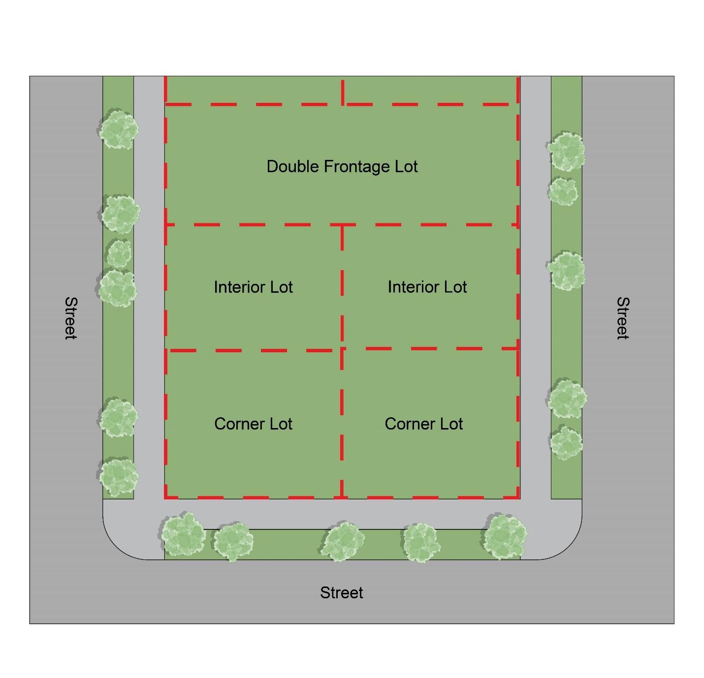
Lot Line. The boundary of a lot which separates it from adjoining lots, public land, private land, common, public, or private open spaces, and public or private roads. This definition includes the following types of lot lines, an example of which is shown in Figure 1128.12-N: Example Lot Line Types:
(1) Front Lot Line. The boundary of a lot which abuts a public or private right-of-way. In the case of a Double Frontage Lot, each lot line abutting a right-of-way is classified as a front lot line. In the case of a Corner Lot, the front lot line is the shortest complete lot line abutting a right-of-way. Where there are 2 or more lot lines of the same distance abutting a right-of-way, the front lot line shall be designated by the Engineer.
(2) Rear Lot Line. The boundary of a lot which is parallel or within 45 degrees of being parallel to the front lot line.
(3) Side Lot Line. Any boundary of a lot which is neither a Front Lot Line nor a Rear Lot Line.
Manufactured Homes. A Structure, transportable in one or more sections, which is built on a permanent chassis and is designed for use with or without a permanent foundation when connected to the required Utility Facilities. This term excludes Recreational Vehicles. For the purposes of this Code, this definition includes manufactured homes and mobile homes as defined in Chapter 3733 of the Ohio Revised Code.
Marijuana. Shall be as defined within Ohio Revised Code Section 3719.01, as may be amended. As of the enactment of this Code, that definition is as follows: “‘Marihuana’ means all parts of a plant of the genus cannabis, whether growing or not; the seeds of a plant of that type; the resin extracted from a part of a plant of that type; and every compound,
Figure
manufacture, salt, derivative, mixture, or preparation of a plant of that type or of its seeds or resin. ‘Marihuana’ does not include the mature stalks of the plant, fiber produced from the stalks, oils or cake made from the seeds of the plant, or any other compound, manufacture, salt, derivative, mixture, or preparation of the mature stalks, except the resin extracted from the mature stalks, fiber, oil or cake, or the sterilized seed of the plant that is incapable of germination. ‘Marihuana’ does not include ‘hemp’ or a ‘hemp product’ as those terms are defined in section 928.01 of the [Ohio] Revised Code.”
Marijuana Cultivation. An establishment that plants, grows, tends to, and/or facilitates the harvesting of Marijuana
Marijuana Dispensary. An establishment that sells, disposes of, delivers, gives away, or allows a person to leave the premises with Marijuana
Marijuana Processing. An establishment that turns harvested Marijuana into products prepared for human use and consumption.
Medical Marijuana. Shall be as defined within Ohio Revised Code Section 3796.01(A)(2), as may be amended. As of the enactment of this Code, that definition is as follows: “’Medical marijuana’ means marijuana that is cultivated, processed, dispensed, tested, possessed, or used for a medical purpose.”
Microbrewery or Microdistillery. An establishment where alcoholic beverages are manufactured, and where such beverages may be consumed on-premises. The term may include a Tavern when such uses are operated in conjunction with the manufacturing of alcoholic beverages. This term applies only to the manufacturing capacity of 20,000 barrels per year or less; a manufacturing capacity of more than 20,000 barrels per year constitutes a Heavy Industry use.
Mobile Homes. A self-propelled or non-self-propelled vehicle designed in a manner to permit the use and occupancy thereof for human habitation, whether or not resting on wheels, jacks, or other foundations.
Monument Sale and Display. A use focused on the sale and showcasing of tombstones, markers, and gravestones intended for use in cemeteries and memorial spaces. This encompasses the presentation and exhibition of these monuments outdoors, often at a dedicated facility or showroom, where customers can view and select from a variety of designs and materials.
Mortuary or Funeral Home. A use that provides services for the care, preparation, and disposition of deceased humans.
Nacelle. The encasement which houses the generating components, gear box, drive tram, and other equipment associated with a Wind Energy Turbine (WET)
Nursery. Land or greenhouses used to raise flowers, shrubs, trees, and/or plants for sale.
Nursing Home. An institution, residence, or facility that provides, for a period of more than 24 hours, accommodations to three or more individuals who are dependent upon the services of others, including the aged, infirm, chronically ill, or incurably ill. This use may
include accessory physical rehabilitation facilities. This use does not include uses that meet the definition of Hospital or Office (Medical).
Off-Street Parking Lot or Garage. An open or enclosed area, other than a street, which is used for the temporary storage of motor vehicles.
Office (Medical). Establishments other than Office (Non-Medical) providing professional and/or licensed services including the dispensing of medicinal supplies (including prescription drugs and medical marijuana); the provision of counseling and therapy; urgent care facilities; body art studios (including tattoo studios); health spas; and clinics for dentists, physicians, specialists, chiropractors, acupuncture, physical therapy (including massage), and similar human-health-related service providers. This definition does not include Life Care Facility, Nursing Home, Hospital, or Veterinarian Hospital or Clinic.
Office (Non-Medical). Establishments other than Office (Medical) providing executive, management, administrative, or professional services including, but not limited to, real estate, architecture, legal, travel, employment, advertising, design, engineering, accounting, insurance, photography, recording, and similar uses.
Outside Storage. An outdoor area used for the long-term storage (more than 24 hours) of any goods, material, merchandise, or equipment.
Passenger Transportation Agency and Terminal. A facility that serves as a hub for various passenger transportation services. Such a use typically encompasses waiting areas for travelers, loading zones for passengers and their cargo, and administrative offices that facilitate the agency’s operation.
Pet Crematory. A crematory providing loss services exclusively for pets.
Pet Grooming. The hygienic care and cleaning of pets to maintain their health and physical appearance.
Principal Use. The main use or uses operated on a property or located within a building, or within a portion of a building, not including accessory uses.
Public Entrance. An exterior entrance that allows public pedestrian access into or out of a Building or a tenant space within a building. Public entrances into the same tenant space that are within 25 feet of each other (as measured in a straight line from the leading edges of the framework surrounding such doorways) shall not be considered separate entrances for the purpose of this Code. This definition does not include emergency-only exterior doorways, employee-only doorways, entrances into dwelling units, or garage doors. [Reserved]
Radio and Television Broadcasting Station. A facility dedicated to transmitting audio and visual content to the public via radio waves or television signals. It encompasses broadcasting equipment located indoors, such as studios and control rooms, as well as exterior equipment like towers, antennae, radar systems, and satellite dishes that facilitate signal transmission. Additionally, such a facility may have outdoor storage areas for commercial vans, recording equipment, and other related assets essential for the production and distribution of radio and television programming.
Recreation Use, Indoor. Uses that provide for recreational activities inside of a building, including but not limited to bowling, skating, laser tag, trampoline facility, and racquetball, pickleball, and other court games. This definition does not include uses that qualify as Entertainment Establishment (Non-Adult)
Recreation Use, Outdoor. Uses that provide primarily for active and passive recreational activities outdoors, typically in park-like settings, including but not limited to picnics, birding, sledding, skating, baseball, golf, tennis, basketball, pickleball, and other court games.
Recreational Vehicle. A vehicle which is:
(1) Built on a single chassis;
(2) 400 square feet or less when measured at the largest horizontal projection;
(3) Designed to be self-propelled or towed; and
(4) Designed primarily not for use as a permanent dwelling but as temporary living quarters for recreational, camping, travel, or seasonal use.
Religious Institution. An establishment where people assemble for religious, philosophical, or cultural purposes. Such establishments include but are not limited to churches, mosques, synagogues, and temples.
Residential Facility. A publicly or privately operated home or facility that falls into one of the following categories:
(1) Residential Facility – Class One. Facilities that provide accommodations, supervision, personal care services, and mental health services for one or more unrelated adults with mental illness or one or more unrelated children or adolescents with severe emotional disturbances.
(2) Residential Facility – Class Two. Facilities that provide accommodations, supervision, and personal care services to any of the following: (a) 1 or 2 unrelated persons with mental illness; (b) 1 or 2 unrelated adults who are receiving payments under the residential state supplement program; or (c) 3 to 16 unrelated adults.
(3) Residential Facility – Class Three. Facilities that provide sleeping and living space, meals or meal preparation, laundry services, housekeeping services, or combination thereof for 5 or more unrelated adults with mental illness.
Restaurant. An establishment in which the principal use is the preparation and sale of food and beverages for consumption on the premises. Prepared food may be carried out for consumption off-premises. This use includes fast food eating establishments. This use is separately defined from Drive-Up Service Windows
Retail Outside Sale. The sale of retail goods in primarily unenclosed spaces including Greenhouses and Nursery uses. This definition excludes outside dining areas.
Retail Sale (Perishable Goods). The sale of perishable retail goods such as food and plants in primarily enclosed spaces. Such types of uses include but are not limited to delicatessens, grocery stores, Restaurants, and associated outdoor dining areas. This use is separately defined from Retail Outside Sale, Microbrewery or Microdistillery, and Vape/CBD Sales.
Retail Sale (Non-Perishable Goods). The sale of non-perishable retail goods including but not limited to antiques, art, appliances, automotive parts, books, clothing, furniture, hardware, jewelry, shoes, sporting goods, and other general merchandise.
School – Primary/Secondary. An educational establishment for children ranging from kindergarten through 12th grade. Such establishments include elementary, middle, and high schools.
School – Post-Secondary. An educational establishment for continued education following the 12th grade. Such establishments include, but are not limited to, college, university, seminary, and comparable advanced or continuing education facilities. This definition does not include gyms or sports instruction or Vocational Schools
School – Vocational. An educational establishment for specialized instructional training that employs machinery and/or specialized tools as a means of instruction. Such establishments may be referred to as vocational schools, trade schools, business schools, and technical schools. Examples of such schools include but are not limited to welding school, barbering school, and similar establishments that prepare students and trainees to work in licensed or unlicensed trades. This use is defined separately from Post-Secondary Schools.
Self-Storage Facility. A building or group of buildings divided into separate compartments with controlled access and leased to customers for self-service storage of property. Such use may also be referred to as a mini-warehouse or ministorage facility.
Service-Oriented Use. Uses that provide non-medical services that are generally needed on a recurring basis, and generally require one-to-one interaction between the proprietor or employee and the customer over the course of providing the service. Such uses include group instruction other than School – Primary/Secondary or School – Post-Secondary Businesses that meet this definition include but are not limited to barber and beauty shops, dry cleaning and laundry facilities, household appliance repair, nail salon, Pet Grooming, shoe repair, tailor/dressmaker, and tool and appliance rental. This definition does not include Group Fitness Instruction uses or Kennel uses.
Service Structure. Non-occupiable elements of a building, a building’s supportive systems, and/or infrastructure including, but not limited to, loading bocks, storage tanks, electrical
transformers, utility vaults that extend above ground, cooling towers, dumpsters, rooftop air conditioning units, and similar equipment or elements providing service to a building or a site.
Sewage Disposal Plant. A facility designed to treat and manage wastewater and sewage from homes, businesses, and industries.
Sign. Any words, lettering, parts of letters, figures, numerals, phrases, sentences, emblems, devices, structures, costumes, designs, trade names, or trademarks by which anything is made known (all or any of which are sometimes referred to as “copy”) and that are visible from any public street or adjacent lot. A sign includes the sign structure and the sign face on which any copy is displayed. Separate types of signs are defined, with examples illustrated, in Section 1105.03, Table 1116.03-AW: Sign Types Overview.
Solar Energy System. A device used to capture the sun’s radiation and transform it into usable heat, usually consisting of a solar collector, a transfer system, a storage system, and a control system. This definition includes the following:
(1) Building-Integrated Photovoltaic System. A photovoltaic system that is integrated into a building’s exterior envelope – such as solar roof tiles, solar windows, or solar façades – and serving both structural and energy-generation purposes.
(2) Photovoltaic System. A solar energy system that converts sunlight directly into electricity by using solar panels. Such solar panels can be mounted to buildings (building-mounted) or mounted directly onto the ground (ground-mounted).
(3) Solar Farm. A utility-scale solar installation of ground-mounted photovoltaic arrays that generate a significant amount of energy primarily for use and distribution to lots other than the lot on which the installation is installed.
(4) Solar Water Heating System. A solar energy system that uses solar thermal collectors to absorb sunlight and heat water for functional uses including cooking and cleaning. Such systems can be mounted to buildings (building-mounted) or mounted directly onto the ground (ground-mounted).
Steam Plant. A facility that generates steam as a source of energy, typically by heating water using fossil fuels or other heat sources.
Structure. A combination of materials to form a construction for use, installed on, above, or below the surface of land or water.
Tavern, Bar, and Pub. A building where liquors are sold to be consumed on the premises and where food may or may not be served or sold.
Telecommunication Tower. Any freestanding structure, or any structure to be attached to a building or other structure, that has or is proposed to have attached to it any radio frequency transmission or reception equipment. This definition excludes framing and/or support structures for satellite dishes under 4 feet in diameter and excludes framing and/or support structures for antennas that are not collectively taller than 10 feet.
Tree Topping. The practice of disfiguring trees through severe cutting of limbs to stubs larger than 3 inches in diameter within the tree’s crown, typically removing the tree’s canopy.
Utility Facilities. Infrastructure that serves the general community, that may or may not be maintained or regulated by a public or municipal entity, and that may or may not have on-site personnel. Such uses include, but are not limited to, electric current generation and distribution, water treatment and distribution, sewage collection and treatment, public transportation, and public communications equipment.
Vape/CBD Sales. The sale of electronic vaporizers (vape devices) and products containing cannabidiol (CBD), typically found in the form of oils, e-liquids, or other consumables. This use is separately defined from Retail Sale (Perishable Goods)
Vehicular Entrance. A driveway or curb cut that affords access by vehicle into a Development
Veterinarian Hospital or Clinic. An animal hospital or clinic that provides medical care for large or livestock animals and small animals or pets, including but not limited to horses, cows, sheep, goats, chickens, pigs, dogs, cats, and birds.
Wind Energy Turbine (WET). Any structure-mounted wind energy conversion system that converts wind energy into electricity using a wind-powered generator, including the base, nacelle, rotor, tower, blades, vane, shroud, pad, foundation, wire, inverter, batteries, and transformer, if any. This definition includes the following types of wind turbines:
(1) Horizontal Axis Wind Turbine (HAWT). A type of wind turbine where the main rotor shaft is set horizontally and driven by rotor blades which drive the shaft and electrical generator that is typically located at the top of a tower.
(2) Large Wind Energy Turbine (LWET). A tower-mounted wind turbine that has a nameplate capacity above 250 kilowatts, typically supplying electricity to off-site customers.
(3) Medium Wind Energy Turbine (MWET). A tower-mounted wind turbine that has a nameplate capacity of no greater than 250 kilowatts.
(4) Small Structure-Mounted Wind Energy Turbine (SSMWET). A wind turbine that is attached to a structure’s roof, walls, or other elevated surface and that has a nameplate capacity of not greater than 10 kilowatts.
(5) Small Tower-Mounted Wind Energy Turbine (STMWET). A tower-mounted wind turbine that has a nameplate capacity of not greater than 30 kilowatts.
[Reserved]
Zoning Administrator - Zoning Administrator shall mean the person(s) designated by the Mayor.
Zones. A section or sections of the City of Twinsburg for which regulations uniformly govern the use and development of land, as delineated on the official Zoning Map. This definition includes the following categories:
(1) Commercial Zones. A collective reference to the C-1, C-2, C-3, and DWTN zones and districts.
(2) Industrial Zones. A collective reference to the I-1 and I-M zones.
(3) Nonresidential Zones and Districts. A collective reference to the PF, C-1, C-2, C3, DWTN, I-1, I-M, and FD zones and districts.
(4) Residential Zones. A collective reference to the R-2, R-3, R-4, R-5, R-6, R-7, and PUD zones and districts.
Zoning Administrator. The person(s) designated by the Mayor.
Zoning Map. The officially adopted map that indicates the boundaries of Zones and Districts
END OF TITLE 7
End of Zoning Code
Exhibit A – Zoning Map
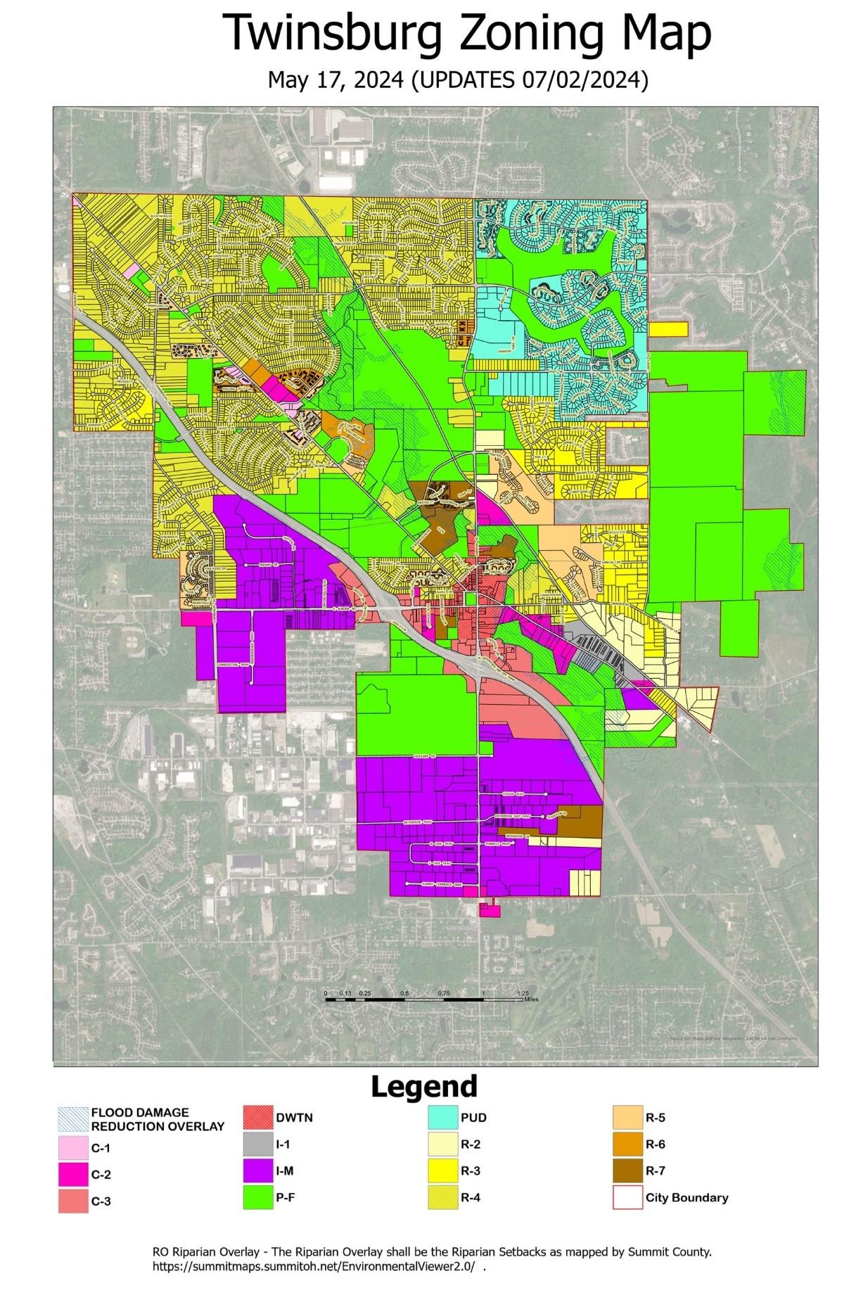
Planning and Zoning Code | Twinsburg, OH 7-12-2024 FINAL