
Bulletins 4000 - Agriculture
12-2022
Geology, soils and climate of Western Australia's wine regions
Geology, soils and climate of Australia's regions
Peter J. Tille
Angela Stuart-Street DepartmentofPrimaryIndustriesandRegionalDevelopment,WesternAustralia
Peter S. Gardiner DepartmentofPrimaryIndustriesandRegionalDevelopment,WesternAustralia
Follow this and additional works at: https://library.dpird.wa.gov.au/bulletins
Part of the Environmental Studies Commons, Food Studies Commons, Geology Commons, Geomorphology Commons, Other Environmental Sciences Commons, Physical and Environmental Geography Commons, Soil Science Commons, Sustainability Commons, and the Viticulture and Oenology Commons
Recommended Citation Recommended Citation Tille P, Stuart-Street A and Gardiner P (2022) ‘The geology, soils and climate of Western Australia’s wine regions’, Bulletin 4925, Department of Primary Industries and Regional Development, Western Australian Government.
This bulletin is brought to you for free and open access by the Agriculture at Digital Library. It has been accepted for inclusion in Bulletins 4000 - by an authorized administrator of Digital Library. For more information, please contact library@dpird.wa.gov.au
Digital Library Digital

Geology, soils and climate of Western Australia’s wine regions
Department of Primary Industries and Regional Development
Geology, soils and climate of Western
Australia’s wine regions
Peter Tille, Angela Stuart-Street and Peter Gardiner
Bulletin 4925
© State of Western Australia (Department of Primary Industries and Regional Development), 2022
ISSN 1833-7236
Cover: Karri forest (Eucalyptus diversicolor) provides a pleasing backdrop for vines growing in the Pemberton wine region (photo: A Stuart-Street)
Unless otherwise indicated, ‘The geology, soils and climate of Western Australia’s wine regions’ by Department of Primary Industries and Regional Development is licensed under a Creative Commons Attribution 4.0 International Licence. This bulletin is available at dpird.wa.gov.au.
The Creative Commons licence does not apply to the State Crest or logos of organisations.
Recommended reference
Tille P, Stuart-Street A and Gardiner P (2022) ‘The geology, soils and climate of Western Australia’s wine regions’, Bulletin 4925, Department of Primary Industries and Regional Development, Western Australian Government.
Acknowledgement of Country
The Department of Primary Industries and Regional Development (DPIRD) acknowledges the Traditional Custodians of Country, the Aboriginal people of the many lands that we work on and their language groups throughout Western Australia, and recognises their continuing connection to the land and waters. DPIRD respects the continuing culture of Aboriginal people and the contribution they make to the life of our regions and we pay our respects to Elders past, present and emerging.
Disclaimer
The Chief Executive Officer of the Department of Primary Industries and Regional Development, and the State of Western Australia accept no liability whatsoever by reason of negligence or otherwise arising from the use or release of this information or any part of it.
Copies of this document are available in alternative formats upon request.
+61 1300 374 731 | enquiries@dpird.wa.gov.au | dpird.wa.gov.au
Geology, soils and climate of Western Australia’s wine regions v Contents Acknowledgements vii Summary viii Part 1: The south-west 1 1 Introduction 2 Viticulture in Western Australia 2 A short history of WA winemaking 2 2 The wine regions 5 Current and future trends 10 3 Geology and landforms 11 The importance of geology to viticulture 11 How geology influences the south-west wine regions 12 Broad geological patterns across the wine regions 13 The main geological units underlying the wine regions of WA 17 Ancient ground 24 Geology in relation to topography and landforms 28 Deep weathering and the lateritic profile 32 Geology in relation to soils 39 4 Soils 41 Soils and viticulture 41 Main Soils of the WA wine regions 44 Descriptions of the Main Soils used for viticulture in the south-west 51 5 Climate 77 Rainfall summary 78 Temperature indices for viticulture 81 Wind patterns 88 Irrigation 91 Changing climate 92
Geology, soils and climate of Western Australia’s wine regions vi Part 2: The wine regions 95 6 Margaret River wine region 97 7 Great Southern wine region 117 Frankland River subregion 139 Mount Barker subregion 148 Porongurup subregion 156 Albany subregion 163 Denmark subregion 170 8 Swan District wine region 177 Swan Valley subregion 196 9 Geographe wine region 205 10 Pemberton wine region 227 11 Blackwood Valley wine region 245 12 Manjimup wine region 265 13 Perth Hills wine region 283 14 Peel wine region 301 Appendixes 321 Appendix A Wine grapes planted in regions and subregions 322 Appendix B Geological age data 323 Appendix C Main Soils in relation to other soil classifications 324 Appendix D Area of Main Soils for each region 327 Appendix E Accuracy of area estimates of Main Soils 333 Appendix F Climate indices for WA wine regions 335 Shortened forms 338 Glossary 339 References 344
Acknowledgements
This bulletin contains an expansion of information describing the soils and landscapes of Western Australia’s main wine growing regions originally prepared for the second edition of ‘Viticulture’ (Coombe and Dry 2004) by Peter Tille, a soil scientist with the Department of Agriculture (now Department of Primary Industries and Regional Development [DPIRD]). When some of the originally collated information was not required for that book, he recognised a need to produce a separate publication describing WA’s viticultural regions in more detail. Over time, and with assistance from other staff, it evolved into this comprehensive bulletin.
The WA wine industry strategic plan 2014–2024 notes the need for the industry to articulate regional identity. This bulletin provides a clear, scientific foundation for the narrative for WA’s fine wine producing regions and, consequently, Wines of Western Australia has been a strong supporter of this work.
Staff from the DPIRD horticulture group, particularly Glynn Ward and Richard Fennessy, provided invaluable assistance.
Special thanks to:
• David Maschmedt for reviewing the soil information for Part 1 on an earlier version of the text and providing many helpful comments
• Philip Commander for reviewing the geology and landform information for Part 1
• Jim Campbell-Clause (AHA viticulture) for reviewing the entire document
• staff from the South West Aboriginal Land and Sea Council for reviewing specific wording for acknowledgements of the Traditional Custodians.
DPIRD staff who generously provided support include:
• Senior research scientist Neil Lantzke for reviewing the entire document
• Senior technical officer Colin Gordon for reviewing the Swan District wine region
• Research scientist Paul Galloway for undertaking World Reference Base classifications for the common soils described in the bulletin and offered many helpful comments
• Research scientist Don Bennett for reviewing the geology and landform information for Part 1
• Research scientists Ian Foster and Andrew Taylor for reviewing the climate information for Part 1.
DPIRD directors Melanie Strawbridge and Rohan Prince, and managers Tim Overheu and Igor Veljanoski, supported us to complete this work. Rhonda Bracey (CyberText Consulting) and Angela Rogerson (DPIRD) edited this bulletin. Graphic design is by Megan Hele Design.
Geology, soils and climate of Western Australia’s wine regions vii
Summary
This bulletin details what is special and unique about the geology, soil and climate of the south-west of Western Australia (WA), an area that encompasses the state’s 9 wine regions.
We have arranged the information into 2 parts:
• In Part 1, we broadly describe the special geological, soil and climate features of the south-west of WA to provide context for the wine regions.
• In Part 2, we describe the geology, soil and climate of the regions and subregions of the Geographical Indications (GI) scheme (administered by Wine Australia1) for WA.
Through this work we have found that the wine regions of south-west WA are unique and special in many ways and believe that the combination of characteristics contribute to the south-west’s reputation for producing the grapes that make fine wines. Although we are still a long way from fully understanding the interactions between environmental conditions and wine production in WA, 3 features of the south-west stand out:
• the ubiquitous ironstone gravelly soils
• the ancient granitic geology
• the influences of afternoon sea breezes, such as the Fremantle and Albany doctors.
This study only describes the regions contained within the GI scheme’s South-west Australia Zone and the Greater Perth Zone. The other GI zones in WA have no regions allocated to them, despite the presence of a few isolated vineyards. Viticulture in these other zones is mainly limited by climatic conditions, water availability and isolation.
1 Wine Australia – Geographical Indications: https://www.wineaustralia.com/labelling/register-of-protectedgis-and-other-terms/geographical-indications
Geology, soils and climate of Western Australia’s wine regions
viii
Part 1
The south-west


1 Introduction
Viticulture in Western Australia
The Western Australian (WA) wine industry produces about 42 million litres of premium fine wine each year, which is almost 5% of the volume of Australia’s wine production but represents 12% of its value (Wines of Western Australia 2014).
In 2019, WA had a little over 12,000 hectares (ha) of wine grapes under cultivation (DPIRD 2019), which is down from the area estimated in 2010 of about 14,000 ha (Fisher et. al. 2010) (Figure 1.1). Some 350 wineries in WA produce wine grapes, with 56% of the production being white and 44% red varieties. Most of the grapes are used to produce premium quality table wines; the main varieties include Sauvignon Blanc, Cabernet Sauvignon, Shiraz, Chardonnay, Semillon and Chenin Blanc.
This bulletin focuses on grape production for winemaking.
A short history of WA winemaking
The first grapevines introduced into WA appear to have been far from successful due to poor site selection. In 1829, the first year of the Swan River Colony, Captain Fremantle planted vines near the mouth of the river and the botanist James Drummond tried to establish cuttings on Garden Island (Zekulich 2000). The combination of poor coastal sands and exposed location would explain why these plantings amounted to little more than a footnote in history.
The future was much more promising for vine cuttings and rooted grapevines brought out by the botanist Thomas Waters from the famous Constantia vineyard near Cape Town, South Africa. The vines were planted on Swan River alluvial loams at Olive Farm near Guildford in 1829. He dug a wine cellar and produced the first wine in 1834. By 1842, his winery was in commercial production, preceding the development of commercial viticulture in both South Australia and Victoria (Halliday 1998). The original Olive Farm winery at Guildford closed early in the 21st century to make way for housing and relocated to its new premises in the Swan Valley. This winery is still in production today, making it Australia’s oldest wine company (Australian and New Zealand Wine Industry Directory 2018).
Further up the Swan River, the larger Houghton and Sandalford vineyards were established in 1836 and 1840, respectively. These 2 vineyards are also among the 5 oldest wine companies in Australia (Australian and New Zealand Wine Industry Directory 2018). By 1860, 165 ha of vines were producing 90,000 litres of wine and nearly 20 tonnes of dried fruit (Zekulich 2000). Over the following century, the grapegrowing industry remained largely focused on the Swan Valley, though additional plantings occurred along the Helena and Canning Rivers, at South Perth, Fremantle, Australind and Toodyay.
Geology, soils and climate of Western Australia’s wine regions 2
By the late 19th century, vineyards had expanded into other areas including the Perth Hills (Glen Forrest, Mundaring and Darlington); Wanneroo; Armadale; Bakers Hill; York; New Norcia; Katanning; and Vasse—some had surprising early successes.2 In the decade from 1895 to 1905, the growing population and wealth associated with the gold rush saw production increase almost fourfold, rising from 225,000 to 837,000 litres (Zekulich 2000). Back then, fortified wines dominated and were very popular.
Growth continued in the early years of the 20th century, with vineyards established at Bolgart, Merredin, Kellerberrin, Dardanup, Boyanup, Donnybrook, Kirup, Bridgetown and Manjimup.
After the First World War, several large farming estates in the Swan Valley were broken up and European migrants established vineyards on many of these smaller blocks.
2 In 1908, wine from the Piesse vineyard in Katanning won a gold medal at the Franco–British exhibition in London (Lost Katanning 2020).
Geology, soils and climate of Western Australia’s wine regions 3
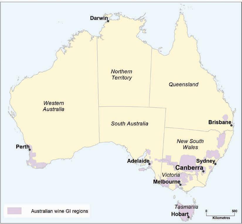
Figure 1.1: Location of the wine regions (Geographic Indications or GI) of Australia
By 1950, 3,690 ha of WA land was under vines, producing table grapes or fruit for drying and 3.6 million litres of wine (Halliday 1998); most of the activity remained centred in the Swan Valley. The increasing trend for wine production reversed in the 1950s when vineyards in the wheatbelt and south-west were abandoned as the price of wool made sheep a more profitable option. Vines on poorly drained soils in the Swan Valley were also removed.
By now, winemakers like Jack Mann were turning their attention to producing dry table wines rather than sweet, fortified varieties. Jack’s first vintage of Houghton’s White Burgundy was in 1937 and today, it is credited as being Australia’s first widely accepted table wine (Hardy 1987).
A turning point came in 1955, when Professor Harold Olmo, a visiting Californian viticulture expert, suggested the suitability of cooler regions ‘in a wide band of territory in the south-west ideally located from the temperature standpoint’ for producing quality table wines (Olmo 1956). He specifically recommended the Frankland district, believing that the higher rainfall areas of the south-west would be too problematic. Ten years later, after considerable research into the climate and environment of the south-west, Dr John Gladstones supported Olmo’s suggestions for the Frankland and Mt Barker areas. He also shone a spotlight on the favourable potential of the Margaret River district.
After initial failure, the WA Department of Agriculture successfully established vines on the Pearce property (Forest Hill) at Mount Barker in 1966. In 1967 the first vines were planted at what was to become Houghton’s Frankland River Vineyard (also known as Westfield), followed by the establishment of the first Plantagenet Vineyard at Denbarker the following year. By 1975, Plantagenet was producing wine at Mt Barker.
Inspired by Gladstones’ findings, Doctor Tom Cullity planted Margaret River’s first commercial vines in 1967. He established the Vasse Felix Vineyard at Wilyabrup with the initial vintage in 1971. By this time other vineyards (such as Moss Wood, Cape Mentelle, Evans and Tate, and Cullen’s) were established or being planted. The next few years saw the beginnings of large vineyards in the Margaret River area, such as Sandalford and Leeuwin Estate. Vineyards and wineries also developed at Capel, Boyup Brook and Baldivis around this time. Although the emphasis in the late 1960s and early 1970s was on the cooler southern regions, Houghton also expanded northwards in 1969, planting vines at Moondah Brook near Gingin.
In the 1980s and 1990s, rapid expansion in viticulture occurred in most areas initially developed in the late 1960s, with vineyards established at Pemberton, Manjimup, the Ferguson Valley, Donnybrook, Harvey and Wandering. The Margaret River and the Great Southern regions overtook the Swan Valley as WA’s main wine producing area—in 1980, the Swan Valley produced nearly 60% of WA’s wine production but by 1997 its proportion had dropped dramatically to 16.5% (Halliday 1998).
Expansion continued in the early 21st century. Wine grape production rose from 17,000 to 62,000 tonnes between 1997 and 2003 (Australian Wine and Brandy Corporation 20053). But by the end of the first decade a global oversupply of wine grapes, coupled with the Global Financial Crisis, led to reduced production and many operators exited the market. In 1987 there were 87 wine producers in WA. By 2000, this had jumped to 208, peaking at 394 in 2011 then gradually declining to 342 by 2017 (Australian and New Zealand Wine Industry Directory 2018).
3 Australian Wine and Brandy Corporation became Wine Australia Corporation in 2010.
soils and climate of Western Australia’s wine regions
Geology,
4

2 The wine regions
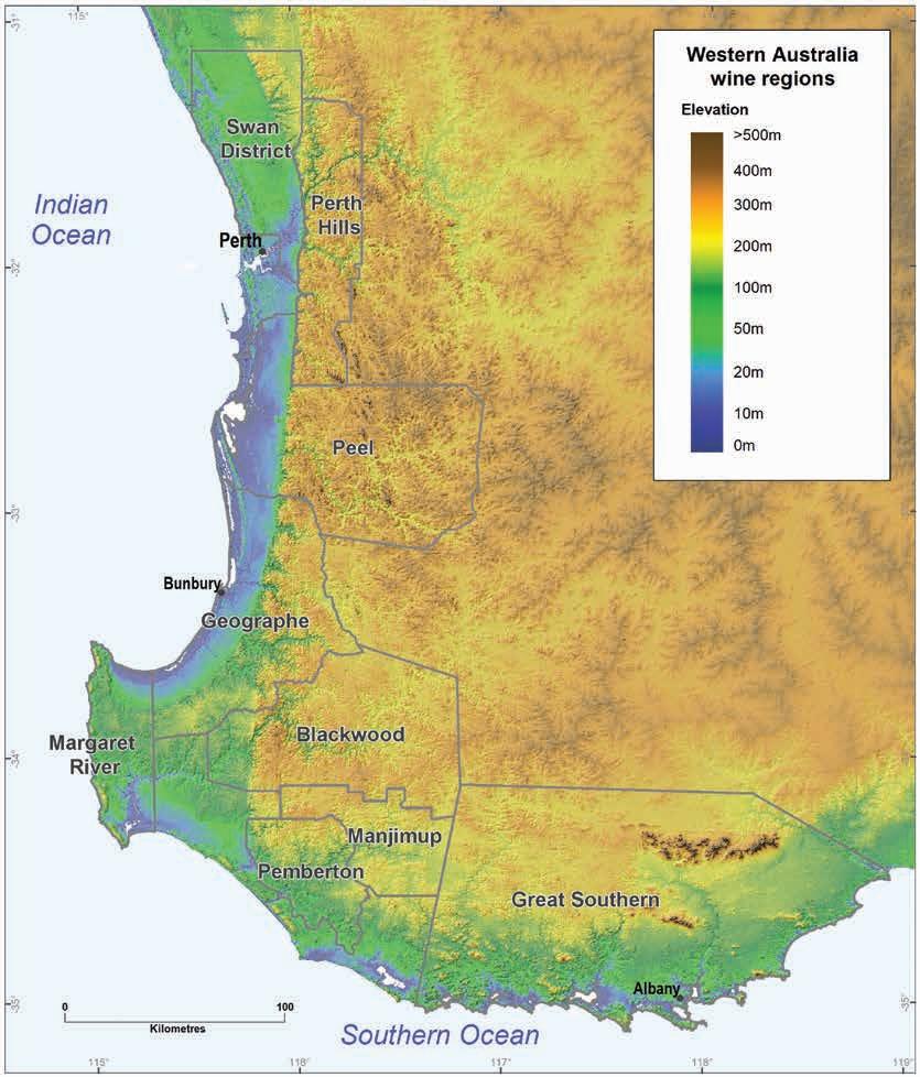
There are currently 9 wine regions in WA covering a total area of almost 50,000 km2 (Table 2.1). They form a continuous belt of land that occupies most of the south-west corner of Australia (Figure 2.1), from Guilderton at the mouth of the Moore River (70 km north of Perth) to Beaufort Inlet at the mouth of the Pallinup River (130 km east of Albany).
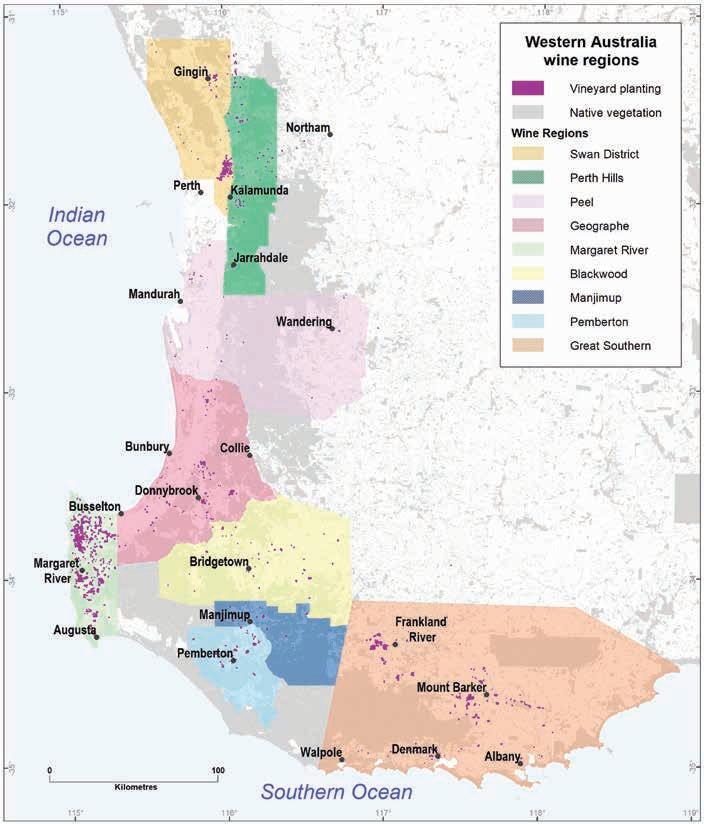
Figure 2.1: Wine regions of the Greater Perth and South-west Australia Zones showing current locations of vineyards
Geology, soils and climate of Western Australia’s wine regions 5
The regions extend inland up to 115 km but exclude most of the Perth metropolitan area and a section of the southern coast between Augusta and Walpole.
National recognition for WA’s winegrowing areas came on 1 May 1996 with the registration of South-west Australia and Greater Perth as zones in the Australian Geographical Indications4 (Table 2.1). Delineation and recognition of the individual regions and subregions occurred at different times (more detail on the regions and subregions are in Part 2 of this bulletin).
The South-west Australia Zone incorporates the Margaret River, Great Southern, Geographe, Pemberton, Blackwood Valley and Manjimup wine regions. The Great Southern region includes these subregions: Albany, Denmark, Frankland River, Mount Barker and Porongurup.
The Greater Perth Zone incorporates the Swan District, Perth Hills and Peel regions. Within the Swan District region is the historic Swan Valley subregion.
2.1:
Area of each WA wine region
Source: Wine Australia
These 9 regions are incredibly isolated nationally and globally—the closest wine region is Kangaroo Island in South Australia, some 1,700 km east directly across the Great Australian Bight.5 To the west, the vineyards of South Africa’s Cape Province are more than 8,600 km across the Indian Ocean.
As shown in Figure 2.1, WA’s wine regions contain extensive areas of non-agricultural land, mostly covered by forest and other forms of native vegetation. Cleared agricultural land makes up almost half of total combined area of the wine regions.
4 Wine Australia, https://www.wineaustralia.com/labelling/geographical-indicators/labelling-gi-western-australia
5 By road, the closest wine region is the Southern Flinders Ranges, more than 2,300 km from Albany.
Geology, soils and climate of Western Australia’s wine regions
6
Zone Wine region Total area (ha) South-west Australia Margaret River 212,006 Great Southern 1,668,682 Geographe 553,220 Pemberton 205,345 Blackwood Valley 592,952 Manjimup 224,910 Greater
Swan District 358,882
Peel
Table
Perth
Perth Hills 327,577
769,627
Total 4,913,201
The total area planted to wine grapes in these regions is currently just under 12,000 ha (DPIRD 2019) (Figure 2.2). About 140 ha of vines are outside the regions. Unlike some wine regions around the globe, those in WA do not feature ‘wall-to-wall’ plantings. Except for a few small clusters, grapevines rarely dominate the landscape and individual vineyards are often isolated, surrounded by farmland and forest. Even in the most densely planted WA wine region—Margaret River—grapes cover less than 3% of the land (and less than 5% of the agricultural land).
Table A1 in Appendix A shows details of areas and proportions of the total planting for each region, while Table A2 provides details for the subregions.
Hectares of vineyards
Margaret River
Great Southern
Swan District
Geographe
Pemberton
Blackwood Valley
Manjimup
Perth Hills
Peel
Source: DPIRD (2019)
Figure 2.2: Area (ha) of each WA wine region planted to wine grapes
In the 2021 vintage crush report compiled by the Agricultural Produce Commission (APC 2022), they indicate that 54,116 tonnes of wine grapes were harvested in WA, a little over the 4-year average of 52,767 tonnes. Some 58% of that wine grape tonnage comprised white varieties, with 42% red (Table 2.2).
Sauvignon Blanc was the dominant white wine grape grown in WA in 2021 (from more than 24 white varieties), followed by Chardonnay and Semillon. Chenin Blanc, Riesling and Verdelho were also important. Combined, these varieties made up about 95% of the white wine grape harvest.
Geology, soils and climate of Western Australia’s wine regions 7
0 1,000 2,000 3,000 4,000 5,000 6,000 7,000
Cabernet Sauvignon and Shiraz were the dominant red wine grape varieties grown in WA in 2021 (from more than 27 red varieties), followed by Merlot, Pinot Noir, Malbec, Tempranillo and Grenache. Combined, these varieties made up about 97% of the red wine grape harvest.
Apart from these wine grape varieties, many alternative varieties are now grown across all WA regions—although only small tonnages of these alternatives are produced currently, they are very important to all regions for the future. The Agricultural Produce Commission reports that, of the lesser-produced white varieties, Trebbiano, Gruner Veltliner, Gewürztraminer, Verdejo and Prosecco showed the most growth in tonnages; of the lesser-produced red varieties, Sangiovese, Grenache, Barbera and Pinot Meunier showed the most growth in tonnages (APC 2022).
# Combined totals from the Manjimup and Pemberton regions.
Source: APC (2022)
The size of the region is not an indicator of vintage size. The Margaret River region was well above all others for tonnages of grapes produced for the 2021 vintage, for both red and white varieties (Figure 2.3). The Great Southern was the next highest producer, followed by the Swan Valley, Geographe and Southern Forests (combined Manjimup and Pemberton Regions) regions.
Geology,
Western Australia’s wine regions 8
soils and climate of
Zone Red varieties White varieties Total tonnage Proportion of total SW tonnage (%) Tonnes % Tonnes % Margaret River 12,460 55 19,192 61 31,652 58 Great Southern 6,498 29 5,771 18 12,269 23 Swan District 1,035 5 2,545 8 3,580 7 Geographe 1,410 6 1,085 3 2,495 5 Southern Forests# 551 2 1,985 6 2,536 5 Blackwood Valley 435 2 791 3 1,226 2 Perth Hills 262 1 68 <1 330 1 Peel 13 <1 15 <1 28 <1 Total WA 22,664 31,452 54,116
Table 2.2: 2021 wine grape tonnages by variety and wine region
Source: APC (2022)
Geology, soils and climate of Western Australia’s wine regions 9
Figure 2.3: 2021 Red and white wine grape tonnages by region
0
10,000 12,000 14,000 16,000 18,000 20,000
Margaret River Great Southern Swan District Geographe Blackwood Valley Southern Forests Perth Hills Peel
2,000 4,000 6,000 8,000
Tonnes
WA wine region
2021 Red grape tonnage
2021 White grape tonnage
Current and future trends
Since the end of the last century, domestic consumption of wine has increased and changing preferences in wine styles that has reoriented the regional focus towards the consistent production of quality wine (Lereboullet et al. 2013). In 2011, Gladstones observed 2 major changes in the market—the industry had become global, and quality standards had risen. He predicted that both trends would continue.
Today, WA is a relatively low-yield, high-cost producer of high-quality fine regional wines. The future of the industry lies in producing fine wines from WA’s premium wine regions at premium prices (Wines of Western Australia 2014).
In their 2017 research strategy review, Wines of Western Australia identified emerging industry trends including:
• moving from conventional practices (including overuse of chemicals) to sustainable practices
• moving away from using poor-quality grapevine clones
• exploring alternative varieties (linked to climate change and consumer requirements and tastes)
• using technology to tell the story of the wine better and marketing directly to the consumer.
Buying wine online has emerged as the most important single sales medium for overseas and local customers. Good online presence, in addition to direct sales, allows growers to tell the story of their wine and their label and helps form direct connections between the wine producer and the consumer. Wine Australia (2020) reported that, Australia-wide, direct-to-customer marketing, particularly cellar door and online, has had the strongest growth in sales. Wineries generally have a positive outlook for sales, especially regarding these channels, and expect that online sales will be the strongest channel.
The relative youth of the WA industry is suggested as an advantage moving forward, particularly in the southern regions, compared to more established locations such as the Swan Valley and the Barossa Valley in South Australia. Jones et al. (2010) suggest that because of the comparatively new viticulture development in some WA regions, growers may be more adaptable to change, such as experimenting with new grape varieties, and that this may make some regions more resilient in the face of constant shifts.
Wine Australia’s 2021 Export Report indicated that the impacts on the wine trade from the COVID-19 pandemic, including global freight problems and some increased wine tariffs, affected prices and overall export opportunities. The industry is now focusing on expanding and diversifying markets and the early signs are positive.
One of the main drivers of future wine production is a changing climate, which we discuss in Section 5.
Geology, soils and climate of Western Australia’s wine regions 10
3 Geology and landforms
The importance of geology to viticulture
Geology is usually considered an important component of terroir, as the nature of the rocks beneath the planted vines is thought to directly or indirectly affect the quality of wine produced. However, the level of actual influence that the geology exerts is subject to intense debate.
Most controversial is the connection between minerals present in the rocks and any ‘mineral flavours’ in the wines produced.6 Wine writers often note this connection, while scientists tend to dismiss any direct links. Although mostly used in relation to European wines, minerality has occasionally been ascribed to WA wines.
Johnson and Robinson (2019) state that geology ‘is the subject of more myth, romance and marketing hyperbole than any other part of the vineyard’ but also observe that ‘in some instances there do seem to be indirect connections between the hidden rocks and the wines from the surface’.
What is beyond doubt is the role that geology plays in soil formation and that some soils are better suited to grapegrowing than others. In the language of the wine world, geology and soil can be so closely linked that they are often interchangeable. References to granite soils, limestone soils, slate soils and chalk soils are common in wine regions across the globe.
There are good reasons for this—rocks weather according to their mineral composition to produce different soil-forming materials. The texture, structure, and chemistry of these soils vary depending on the composition of their parent rock. These elements help determine the soil’s fertility, moisture retention, and drainage characteristics that not only affect the growth of grapevines, but also influence fruit development and therefore the qualities of the wine produced.
The geology of an area is not just a matter of the types of rock present. The geological history (the events and processes that have occurred over geological time) is also important. The rock types7 and the history8 both play a major role in determining the topography and landforms of an area, influencing elevation, slope and aspect. These characteristics all combine to determine the suitability of a location for viticulture, and each can influence temperature, rainfall and other climatic factors.
6 There are tales of the medieval Benedictine monks of Burgundy tasting the soil to determine where the best wines would come from.
7 Different rocks weather and erode at different rates. The harder igneous and metamorphic rocks are more resistant than most sedimentary rocks and therefore more likely to be associated with elevated terrain.
8 The history of movements in the Earth’s crust determines where mountains or basins have formed.
Geology, soils and climate of Western Australia’s wine regions 11
How geology influences the south-west wine regions
The land beneath the wine regions of WA has a long and complex history, shaped over deep time.9 Understanding this history and the types of rock present helps explain the pattern of landforms and soils in which today’s vineyards are established.
Main rock types and their mineral composition
When considering the size of the area covered by the WA wine regions and the existing variety of rock types, it is remarkable how dominant just a few crystalline igneous and metamorphic rock types (with similar mineral compositions) are. Igneous granite rocks cover around 41% of the total area, with metamorphic gneiss rocks covering a further 22%. Many of the remaining crystalline10 rock types are of a similar nature to the granite and gneiss.
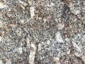
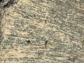
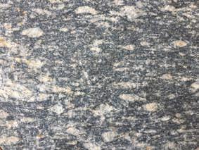
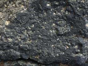
The main minerals found in the silica-rich granite are quartz and feldspars (mostly the potassiumrich orthoclase and some sodium-rich plagioclase). Lesser amounts of mica (biotite and muscovite) and amphiboles (hornblende) occur. Quartz, feldspar and muscovite are light-coloured minerals while biotite and hornblende are dark-coloured. The individual mineral crystals of granite are relatively coarse and the combination of the light and dark give granite its speckled appearance (Plate A).
The minerals found in gneiss can be more variable. Many formed from a granitic parent (granitic orthogneiss) and have the same basic mineral composition. The crystals in gneiss tend to be smaller than those in granite and are typically arranged in bands of darker and lighter-coloured minerals (Plates B and C). Some gneisses have a higher content of biotite, hornblende or garnet so the darker bands are more prominent (Plate C).
9 A sense of time that goes far beyond the typical Western concept of history (McGrath 2020).
10 A crystalline rock is any rock composed of crystallised minerals and includes virtually all the igneous and metamorphic rocks found in the south-west of WA. Not included are glassy volcanic rocks (locally absent) and sedimentary rocks, such as sandstone, where the individual grains are cemented together. Some limestones formed by precipitation of carbonates are considered crystalline, but these are rarely encountered in this part of the world.
Geology, soils and climate of Western Australia’s wine regions 12
Plate A: Granite dominated by quartz and feldspars
Plate B: Gneiss dominated by quartz and feldspars
Plate C: Gneiss with more biotite and hornblende
The lighter-coloured metamorphic and igneous rocks rich in feldspar and quartz are known as felsic crystalline rocks.
Igneous and metamorphic rocks rich in magnesium and iron tend to be dark-coloured rocks, including dolerite and basalt. Collectively called mafic crystalline rocks (Plate D), these are less common in the south-west of WA. It is these darker mafic rocks that typically weather into richer soils in both colour and fertility.
The minerals found in the rocks are important in determining the nature of the soils that form following weathering. For example, quartz is relatively resistant to chemical weathering and tends to produce sand grains while feldspar is less resistant and usually weathers into kaolinitic clay.
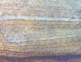
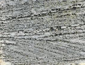
Given the dominance of felsic crystalline rocks in the south-west, it is unsurprising that the areas of sedimentary rocks and unconsolidated sediments appear to be largely made of weathered particles dominated by the quartz sand grains ubiquitous to the south-west of WA. These quartz grains are the main components of most sandstones and are a significant component of the aeolian limestones11 found along the coast (Plates E and F). The finer clay and silt material from weathered feldspars and quartz are major components of shales and siltstones.
Despite being far less abundant, the biotite and amphiboles are important in WA because they are the major source minerals of the iron in the gravels that also characterise this part of the world. The high mobility of this iron allows it to concentrate in parts of the environment and form ironstone.
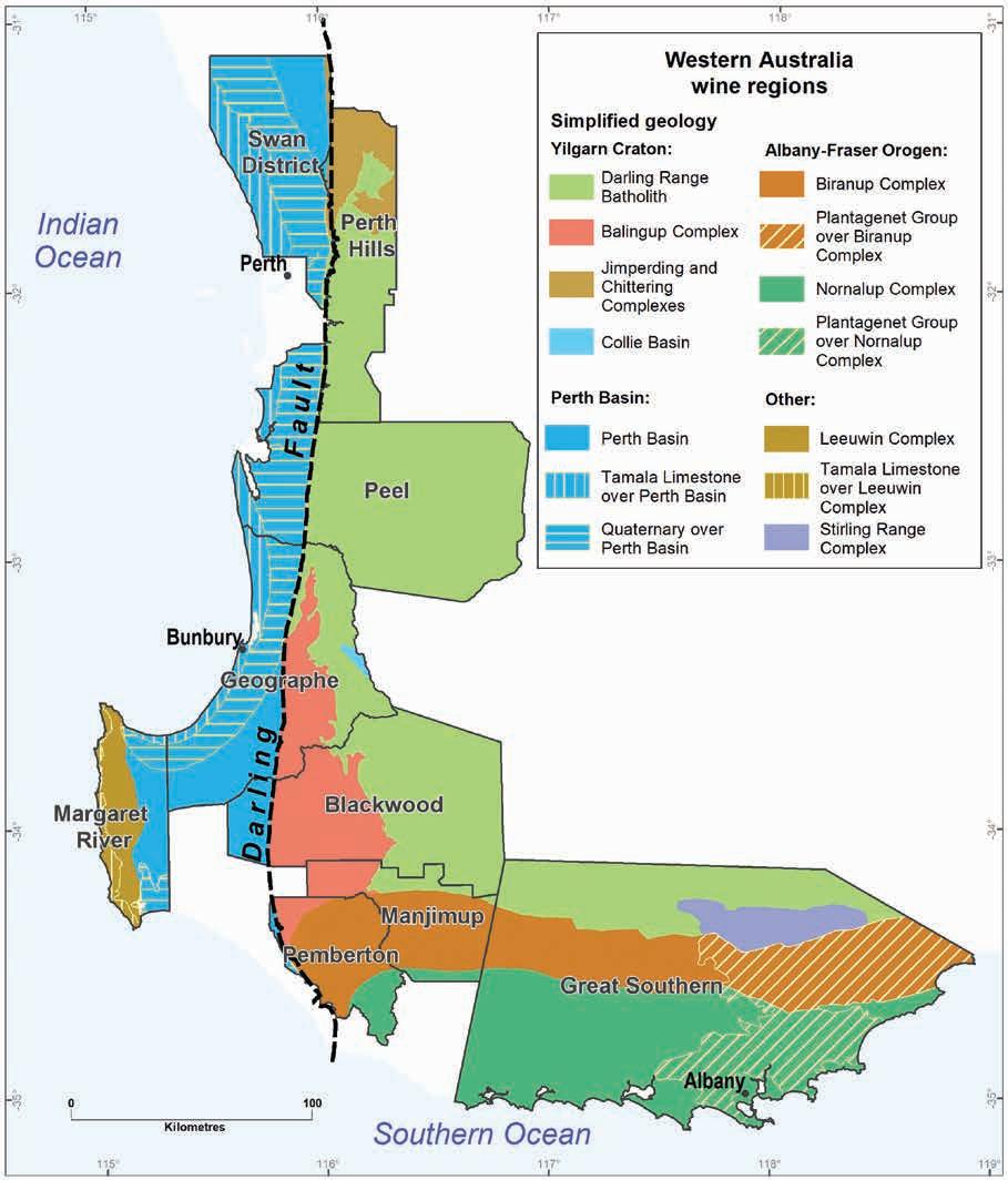
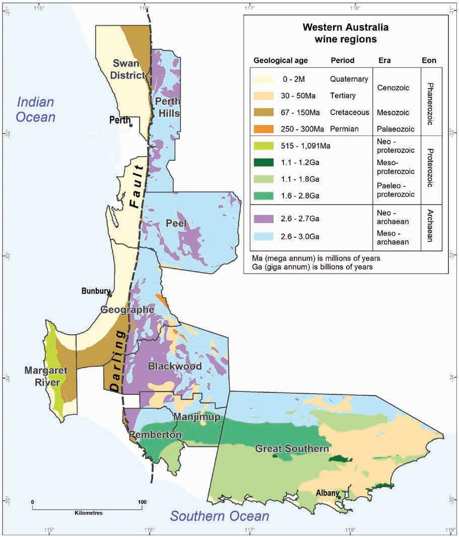
Broad geological patterns across the wine regions
The Darling Fault is a prominent geological feature that effectively splits most of WA’s wine regions along a north–south axis (Figure 3.1). It also marks the western boundary of the Yilgarn Craton, one of the most ancient and stable portions of the Earth’s crust.
Table 3.1 summarises the main geological units in Figure 3.1, including the area of each geological unit within the wine regions of WA and the proportion of the total area of the combined regions. The table also includes the area of each geological unit currently used for viticulture.
11 These aeolian limestones have formed in situ in wind-blown dunes containing of a mixture of quartz sand grains and small fragments of calcareous seashells.
Geology, soils and climate of Western Australia’s wine regions 13
Plate D: Basalt, a mafic igneous rock
Plate E: Sandstone
Plate F: Aeolian limestone
Australia
Geology, soils and climate of Western Australia’s wine regions 14
Figure 3.1: Simplified geology of the south-west of Western
Table
3.1: Main geological units underlying Western Australia’s wine regions
Biranup and Nornalup
* Tamala Limestone over Perth Basin and Leeuwin Complex
† Part of the Albany–Fraser Orogen.
‡ Part of the Yilgarn Craton.
The Darling Fault
At more than 1,000 km long, the Darling Fault is one of the longest lineaments on the Earth’s surface (Middleton et al. 1995). Starting about 600 km north of Perth, this fault runs south to the shores of the Southern Ocean. Along its course, it forms the boundary between the Swan District and Perth Hills wine regions—running between Gingin and Chittering, through to Bullsbrook and Armadale. Continuing south it divides both the Peel and Geographe regions into eastern and western portions, passing just east of Waroona, Harvey and Donnybrook. From here, it runs through the western portion of the Blackwood Valley region, passing through Nannup on its way to the rugged south coast.
Geology, soils and climate of Western Australia’s wine regions 15
Location Geological unit Main rock types Total area Planted to vines (ha) (%) (ha) (%) West of the Darling Fault Leeuwin Complex Granitic orthogneiss 83,100 2 4,115 34 Quaternary over Perth Basin Unconsolidated sediments 601,400 12 1,620 14 Perth Basin Sandstone, siltstone and shale 310,800 6 1,375 11 Tamala Limestone* Aeolian limestone 107,400 2 10 <1 East of the Darling Fault Biranup Complex† Gneiss and granite 487,500 10 2,040 17 Nornalup Complex† Granite and gneiss 604,200 12 1,065 9 Balingup Complex‡ Gneiss and granofels 357,300 7 875 7 Darling Range Batholith+ Granite 1,671,600 34 610 5 Jimperding and Chittering complexes‡ Granite, schist and gneiss 109,500 2 155 1 Plantagenet Group over
complexes† Siltstone, sandstone and spongolite 473,500 10 95 1 Stirling Range Complex Sandstone and quartzite 100,800 2 0 0 Collie Basin Sandstone, shale and coal 6,100 <1 0 0 Total 4,913,200 11,960 100
combined.
West of the fault
Of the 4.9 million ha making up the total area of the wine regions of WA, only about 1.1 million ha are west of the Darling Fault. Although this may be less than one-quarter of the wine region’s combined area, most of the vines (7,120 ha or 60% of the total) grow here.
As an example, the Leeuwin Complex, which accounts for only 2% of the total area, supports more than one-third of WA’s wine grapes (Table 3.1). Located on the south-west corner of the continent and entirely within the Margaret River region, the Leeuwin Complex is dominated by metamorphic granitic orthogneiss.
The Mesozoic-aged rocks of the Perth Basin underlie the remaining land lying between the Leeuwin Complex and the Darling Fault.12 Apart from a few minor outcrops of Bunbury Basalt, the Perth Basin comprises entirely of sedimentary rocks (including sandstone, siltstone, shale, chalk and marl). Almost two-thirds of these sedimentary rocks are blanketed by younger Quaternary-aged deposits of unconsolidated sediments, including alluvial sand and clay as well as the windblown dunes of sand that cover much of the Tamala Limestone that has formed along the coast.
Along the west coast, these deposits collectively form the Swan Coastal Plain while on the south coast, they form the Scott Coastal Plain (Figure 3.2). The Perth Basin accounts for about one-quarter of WA’s wine grapes, mostly growing on Quaternary deposits of the Swan Coastal Plain.
East of the fault
Layered sedimentary rocks and unconsolidated sediments dominate west of the Darling Fault, but east of the fault, hard metamorphic and igneous rocks dominate, and comprise 2 major geological units.
The first unit, which lies east of the fault and north of the towns of Manjimup and Frankland River, is the south-west corner of the enormous Yilgarn Craton, a major building block of the Australian continent.13 The craton underlies around 43% of the total area of the WA wine regions (around 2.1 million ha) but only 13% of the vines grow here.
The second unit, which is found between the Yilgarn Craton and the Southern Ocean, is the western portion of the Albany–Fraser Orogen. This is a belt of metamorphic and igneous rocks that underlies around one-third of total area of the WA wine regions (1.5 million ha) and about 27% of all the vines grow in this area. A layer of Eocene-aged sediments of the Plantagenet Group blankets the orogen in the south-east of the Great Southern wine region.
The geological units shown in Table 3.1 and Figure 3.1 are described in more detail in the following section, with reference to the main physiographic regions.
12 There are further occurrences of metamorphic geology west of the Darling Fault, but these are well north of the wine regions.
13 Covering around 650,000 km2, the Yilgarn Craton dominates the southern half of WA and played an integral role in the formation of the Australian continent.
Geology, soils and climate of Western Australia’s wine regions 16
The main geological units underlying the wine regions of WA
Leeuwin Complex
The intensely deformed granite and gneiss rocks of the Leeuwin Complex–considered part of the largely submerged Pinjarra Orogen14 –protect the south-western extremity of the Australian continent from the relentless battering of the Indian and Southern Oceans. This complex forms a strip of land less than 20 km wide and almost 100 km long, extending from Cape Naturaliste to Cape Leeuwin. The total area is just over 83,000 ha.
The Leeuwin Complex lies beneath the western half of the Margaret River wine region (and the towns of Yallingup, Cowaramup, Margaret River and Witchcliffe). The eastern boundary of the complex is the Dunsborough Fault (Figure 3.2), which extends between Augusta and Dunsborough.
The rocks of the Leeuwin Complex are mainly granitic orthogneiss. They comprise felsic gneisses, plagioclase-hornblende gneiss and mafic gneiss rocks and share a similar geochemistry (Janssen et al. 2003).
Adjacent to the Indian Ocean, coastal sand dunes have formed a ridge overlying the Leeuwin Complex, rising to heights of up to 210 m AHD (Australian Height Datum). At the core of this ridge is Tamala Limestone, formed by the leaching of calcium carbonate from the once calcareous dune system.
Perth Basin
This large sedimentary basin houses WA’s main population centres. It formed during the breakup of the supercontinent Gondwana, when Greater India ‘peeled away’ from Perth in the Permian to Early Cretaceous periods. The breakup caused part of the Pinjarra Orogen west of the Darling Fault to submerge. This left a deep linear trough (from north of the Murchison River to the south coast) that slowly filled with sediments. These sediments consolidated to form the sandstones and shales of the Perth Basin. Today, the Basin has between 2–15 km of sedimentary rocks that overlay the displaced (or submerged) Pinjarra Orogen.
On the western margin, the Dunsborough Fault separates the Perth Basin from the Leeuwin Complex.
The Darling Fault—and its highly visible surface expression, the Darling Scarp (Figure 3.3)—marks the eastern boundary of the Perth Basin with both the Yilgarn Craton and the Albany–Fraser Orogen. Even though the Pinjarra Orogen rests kilometres below the surface of the Yilgarn Craton, the Darling Scarp only rises to a maximum of 250 m above the Swan Coastal Plain. This is the result of the steady accumulation of sediments the blanketing Perth Basin over time.
14 Tectonic movement split the Proterozoic Orogen (which the Pinjarra Orogen is a subcomponent of) and scattered its pieces far and wide. Other sections now lie under the Denman Glacier in Antarctica and on the part of the Greater Indian Plate that was subducted under the Tibetan Plateau during the collision that led to the formation of the Himalayas (Janssen et al 2003). Within Australia, the Leeuwin Complex segment remained attached to Australia instead of migrating north across the Equator. The rest of the Pinjarra Orogen (apart from the Northampton Complex north of Geraldton) is buried deep below the Perth and Carnarvon Basins.
Geology, soils and climate of Western Australia’s wine regions 17
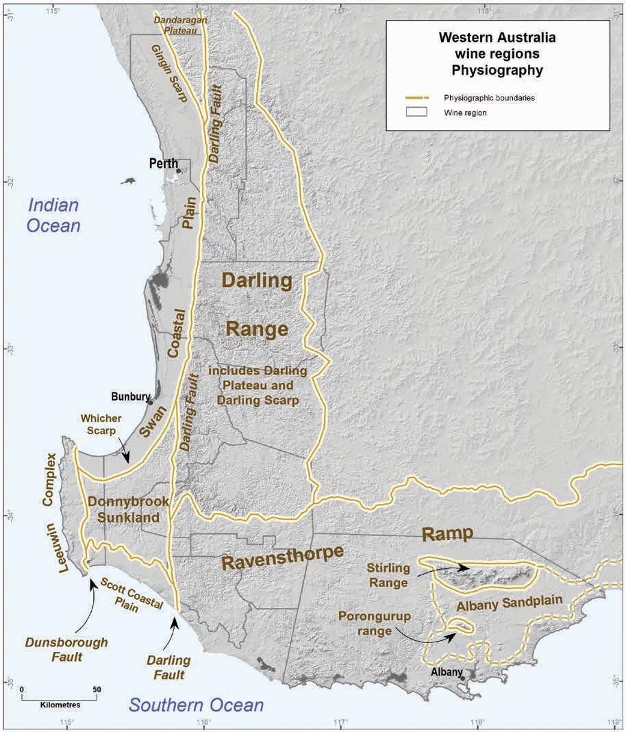
3.2: Broad physiographic regions of south-west Western Australia
wine regions 18
Geology, soils and climate of Western Australia’s
Figure
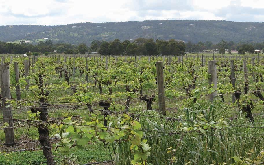
Figure 3.3: Looking across vineyards on the alluvial plain of the Swan Valley subregion to the backdrop of the abrupt Darling Scarp, which is the surface expression of the Darling Fault and the boundary between the Swan District (foreground) and Perth Hills (background) wine regions
The Swan Coastal Plain—the most widely recognised part of the Perth Basin—accounts for around 601,000 ha (14%) of WA’s wine regions (Figure 3.2). It comprises the bulk of the Swan District region and runs through the west of the Peel and Geographe regions as well as the north-eastern portion of the Margaret River region.
The western portion of the Swan Coastal Plain comprises a series of Quaternary sediments, with windblown sand dunes and ridges formed as sea levels rose and fell in response to glacial and interglacial cycles. Three dune systems (Quindalup, Spearwood and Bassendean) run subparallel to the coast and rise 10–70 m AHD. Closest to the coast are the Quindalup dunes, the sand of which is a mixture of quartz grains and calcareous fragments of marine organisms. The Spearwood dunes, with iron-stained quartz sands overlying Tamala Limestone, lie inland. Further inland are the pale quartz sands of the Bassendean dunes.
The inland portion of the Swan Coastal Plain is an area of flats on mostly clayey sediments of the Guildford Formation sitting about 10–30 m AHD. Along with the swales of the dune systems, these flats have significant areas of poor drainage.
The coastal plain supports around 1,600 ha of wine grapevines, most of which are located around Jindong (Margaret River region) or in the Swan Valley (Swan District region). Better-drained areas of more recent alluvial deposits are next to major watercourses and most of the vines are planted here.
Geology, soils and climate of Western Australia’s wine regions 19
Portions of the Perth Basin have been protected from marine erosion—these areas rise above the level of the Swan Coastal Plain but are lower than the adjoining areas east of the Darling Fault. The rocks closest to the surface in these elevated areas are from the Cretaceous Period and are 66–140 million years old. This is much younger than the felsic crystalline rocks of the Yilgarn Craton,
In the south, the Donnybrook Sunkland15 sits at 120–280 m AHD between the Dunsborough and Darling Faults, bounded on its northern edge by the Whicher Scarp (Figure 3.2). This area falls mainly within the Geographe, Blackwood Valley and Margaret River wine regions. The rocks typical of this area include interbedded sandstone, siltstone and shale, with minor conglomerate and coal seams.
In the north-east of the Swan District region is the Dandaragan Plateau, which sits at 140–300 m AHD between the Gingin16 and Darling Scarps (Figure 3.2). Sedimentary rocks include chalk, greensands, glauconitic sandstone, and marl.
Almost 1,400 ha of vines grow on these elevated areas of the Perth Basin.
Yilgarn Craton
The Yilgarn17 Craton is a massive chunk of the Earth’s Archaean crust—one of the most ancient landscapes and most stable portions of the Earth’s surface—and forms part of the original landmass of Australia. It contains the oldest rocks beneath any wine grapes planted, not only in WA (see the Ancient ground section below and Table 3.2), but also in Australia.
The Yilgarn Craton underlies all WA wine regions to some degree, except the Margaret River region. This ancient bedrock dominates the Perth Hills, Peel and Blackwood Valley regions. It comprises almost half the Geographe region and makes up the northern parts of the Manjimup and Great Southern regions.18 Almost all the areas where the Yilgarn Craton underlies the wine regions are part of the area known as the Darling Range (Box 3.1 and Figure 3.2).
Along the western margin of the Craton, abutting the Darling Fault, are the metamorphic belts, including the Balingup, Jimperding and Chittering complexes.
The Balingup Complex covers over 350,000 ha of the WA wine regions and runs from the centre of the Geographe region, through the Blackwood Valley region to the western end of the Manjimup region and the north-west corner of the Pemberton region.
The main rocks of the Balingup Complex are metamorphic, with layered quartz-feldspar-biotite gneiss, with some granitic orthogneiss and granofels, and some minor areas of igneous rock, typically granites and quartz-mica schist derived from granite.
15 Sometimes known as the Blackwood Plateau, the Cretaceous sedimentary rocks of the Donnybrook Sunkland are elevated only in comparison to the coastal plains to the north and south. They sit below the level of the adjoining rocks of the Yilgarn Craton, Albany–Fraser Orogen and Leeuwin Complex.
16 Like the Whicher Scarp, the Gingin Scarp marks a former shoreline.
17 ‘Yilgarn’ is a word used by the Kaalamaya people of the goldfields area of WA to describe quartz or white stone (Western Australian Museum 2020).
18 The Darling Range Batholith comprises only a minor portion of the Swan District and Pemberton regions.
Geology,
regions 20
soils and climate of Western Australia’s wine
The Jimperding and Chittering complexes cover just under 110,000 ha of WA’s wine regions, almost entirely in the Perth Hills region, and creep into the edge of the Swan District region. The rocks here include granite and granodiorite (moderately to strongly deformed), with some migmatite, quartz-mica schist, gneiss and granofels, and some minor areas of mafic metabasalt. The rocks are of similar age to the Balingup complex.
The remaining part of the Yilgarn Craton surrounding these complexes is the Darling Range Batholith. Granites dominate the 1.6 million ha of this unit that partially underlies all WA wine regions except Margaret River.
Sediments on the Yilgarn Craton
Locally significant deposits of younger sedimentary rocks are found on the Yilgarn Craton, mainly in the Geographe wine region. Comprising less than 1% of WA’s wine regions is 6,000 ha of the Collie Basin, which currently supports no vineyards. These sediments deposited in a depression in the Yilgarn Craton during the Permian. Rocks of the Collie Basin include feldspathic sandstone, conglomerate, carbonaceous shale, siltstone, and coal.
Patches of the Donnybrook Sandstone19 and Kirup Conglomerate cover around 6,000 ha, mostly between Donnybrook and Balingup, and support 25 ha of vineyards in the Geographe region.
Elsewhere across the Craton, scattered pockets of Eocene sediments can be found forming a thin veneer on plateau surfaces.
19 The age of the Donnybrook Sandstone is uncertain. It was formerly ascribed to the Cretaceous period, but a Permian age may be more likely. Ages ascribed to the Kirup Conglomerate range from the Permian to the Eocene.
Geology, soils and climate of Western Australia’s wine regions 21
Box 3.1: Confused Darling?
The name Darling crops up repeatedly in the terminology applied the geology and physiography of the south-west of WA. This is both confusing and perplexing as the name honoured General Sir Ralph Darling who was governor of New South Wales for just 6 years (1825–1831) and never set foot in WA.20
In 1827, the escarpment rising above the Swan Coastal Plain east of Perth was named the ‘General Darling Range’. The shortened version—Darling Range—has persisted and proliferated for the past 200 years, despite the escarpment being known as Kadamordo21 for many thousands of years before the Swan River Colony was established in 1829.
Although the intention for the name ‘Darling Range’ was for the escarpment only, its geographic use has expanded to incorporate the plateau and valleys to the east and has become interchangeable with the term ‘Perth Hills’, which is closer to the city. The term is also applied collectively to the scarp and its hinterland well beyond the Perth Hills, extending north to Moora and south to Bridgetown (and sometimes beyond). The inland boundary can be even more vague but is generally considered to coincide with the eastern extent of the jarrah forests.
Figure 3.2 shows the extent of the Darling Range as used in this bulletin, based on the Eastern and Western Darling Range Soil-landscape Zones (Schoknecht et al. 2004). The Darling Range has 3 main physiographic components:
• Along its western margin is the Darling Scarp, rising abruptly from the adjoining coastal plain and forming a strip of land around 1-4 km wide (Note: To add confusion, the Darling Fault derives its name from its surface expression, the Darling Scarp).
• Inland from this escarpment, the gently undulating terrain dominating the Darling Range has led to the use of the term Darling Plateau to define its upland surface.
• Dissecting the plateau are the major valley systems named after the rivers that formed them (Avon, Helena, Murray, Collie, Preston and Blackwood Valleys etc.).
To add to the confusion, some authors use the term Darling Plateau to include both the plateau surface and the valleys while others collectively use the term Darling Range.
Two geological units in the area also use the prefix of Darling: the previously described Darling Fault, and the granitic Darling Range Batholith. This latter unit is a major geological unit underlying the plateaus and valleys of the Darling Range, even though the Balingup and Jimperding and Chittering complexes underlie significant areas of the Darling Range (and all are component parts of the larger Yilgarn Craton). To add more to the confusion, the Darling Range Batholith extends up to 100 km inland of the eastern boundary of the geomorphic Darling Range.
So given this terminology confusion and Darling’s tenuous (and, at best, fleeting) link to this part of the world, perhaps in time his name will be disassociated from some of our most significant geological and geomorphic features.
20 His one action in relation to WA seems to have been in determining its eastern border.
21 From the Noongar Dictionary, Whitehurst (1997).
Geology, soils and climate of Western Australia’s wine regions 22
Albany–Fraser Orogen
The Albany–Fraser Orogen sits south of the Yilgarn Craton. More than 1.5 million ha of WA’s wine regions are on this section of the continental plate. It was initially crumpled and uplifted during the Paleoproterozoic era as the Yilgarn Craton collided with Antarctica (Lane 2017). It lies south of a line running from Manjimup to Frankland River townsites and on to the Stirling Range. The orogen dominates the geology of WA’s 3 southernmost wine regions—Great Southern, Pemberton and Manjimup.
The orogen gradually descends from a northern elevation of around 250 m AHD to sea level at the shores of the Southern Ocean. It forms part of a tilted physiographic feature called the Ravensthorpe Ramp (Figure 3.2), which developed when the Albany–Fraser Orogen and the southern margin of the Yilgarn Craton sagged towards the rift created during the breakup of Gondwana as Australia drifted northwards away from Antarctica (Cope 1975).
Within the wine regions, the Albany–Fraser Orogen comprises 3 main geological units—the Biranup Complex, the Nornalup Complex and the Plantagenet Group.
In the north–adjoining the Yilgarn Craton–is the Biranup Complex. Almost 490,000 ha (about 10% of the total area) of the Biranup complex are within wine regions. This is the dominant geology of the Pemberton and Manjimup regions and runs through the centre of the Great Southern Region. Around 17% of WA’s wine grapes are planted here.
Between the Biranup Complex and the Southern Ocean are the rocks of the Nornalup Complex, covering over 600,000 ha (around 12% of WA’s wine regions) and with around 9% of the grapevines, which are mainly planted in the Great Southern region.
The most common rock types are layered quartz-feldspar-biotite22 gneiss with some granitic orthogneiss. Some prominent areas of granites, which are younger in age than the surrounding gneiss, are in this area and were formed at depth during the disruption of the Gondwanan separation (Lane 2017). With gradual erosion of the surrounding land, these granites now protrude well above the general landscape. The most prominent example is the Porongurup Range whose peaks rise more than 400 m above the surrounding terrain to heights of up to 670 m AHD.
In the eastern half of the Albany–Fraser Orogen, Eocene deposits forming the sedimentary rocks of the Plantagenet Group (part of the Bremer Basin), lie over the Nornalup and the Biranup Complexes. These sediments form a veneer of dark grey siltstone, sandstone, claystone and spongolite. The Plantagenet Group sediments comprise around 10% of WA’s wine region area but support only 1% of the grapevines.
The Stirling Range Complex covers around 100,000 ha within the Great Southern wine region. Most is within a national park, so no vineyards are established on this unique and rugged geological feature that dominates the skyline from many kilometres away.
22 Hornblende-garnet biotite
Geology, soils and climate of Western Australia’s wine regions 23
The Stirling Range Complex is not strictly part of the Albany–Fraser Orogen. Instead of granite and gneiss rocks, the range features sandstone, metasandstone, quartzite slate, and phyllite. It originally formed when marine deposits laid down in a rift basin were compressed between continental plates during the breakup of Gondwana. The ongoing tectonic movements and faulting occurring during the separation from Antarctica led to folding and uplift and the formation of a mountain range, including 5 peaks more than 1,000 m high. These peaks are the highest in the wine regions, with Bluff Knoll (1,098 m AHD) being the highest peak in WA’s south.
Ancient ground
The south-west of Australia is an ancient terroir. As far as we can ascertain, few—if any—of the world’s winegrowing regions are established over bedrock with such a long pedigree. Even the younger rocks of the Yilgarn Craton lying beneath WA wine regions are probably more than 2 billion years older than the most ancient rocks of the winegrowing areas in Europe23 and the west coasts of the Americas.24 They are least one billion years older than the oldest rocks of South Africa’s winegrowing regions. The following points help to illustrate that context:
• Almost 70% of the total area of the WA wine regions—and threequarters of the vines—is over rocks that are older than 600 million years. These rocks formed when life on Earth was largely restricted to the oceans and the land was barren.
• About 40% of the vines grow over rocks older than 1 billion years, developed in a time before evolution of the earliest plants and animals in the oceans.
• About 14% of the vines grow over an Archaean basement that is at least 2.6 billion years old— formed at a time when virtually no oxygen existed in the Earth’s atmosphere.

Rocks from the Balingup Complex (at least 2.6 billion years old) outcropping adjacent to a Ferguson Valley vineyard in the Geographe wine region
23 Some of the wine regions around the Black Sea are a possible exception. 24 This includes the winegrowing areas of California and Chile.
soils and climate of Western Australia’s wine regions
Geology,
24
There appears to be very few areas around the globe that produce wines on rocks this old. Perhaps the most significant are parts of Uruguay (and adjoining areas of southern Brazil) where vines grow on Archean granites.25
Table 3.2 lists the age range of the dominant rocks of the geological units, from youngest to oldest, and Figure 3.426 illustrates their distribution across the south-west of WA.
Figure 3.5 summarises the proportions of the main geological units and their ages for each wine region in WA. See Appendix B for more details on the data used to prepare Table 3.2, Figure 3.4 and Figure 3.5.
Ga (giga annum) = billions of years; Ma (mega annum) = millions of years
* Mostly Pleistocene.
† Mostly Pleistocene epoch of the Quaternary period, some Holocene epoch.
‡ Eocene epoch of the Tertiary period.
25 Some of the winegrowing areas of southern Moldova and Ukraine may also be located over Archaean rocks. In North America, vineyards in Minnesota, Quebec and central Ontario may also be located on soils formed from similar-aged rocks. The same is possible for some of the emerging viticultural areas in China.
26 Some of the geological units comprise rocks from more than one era (e.g. Nornalup Complex has rocks from both the Mesoproterozoic and Paleoproterozoic).
Geology, soils and climate of Western Australia’s wine regions 25
Location Age of rocks Geological unit Total area Planted to vines (%) (ha) (%) Cenozoic 1 Ma Tamala Limestone* 107,400 2 10 <1 2 Ma Quaternary over Perth Basin† 601,400 12 1,620 14 30–50 Ma Plantagenet Group‡ 473,500 10 95 1 Mesozoic 67–150 Ma Perth Basin 310,800 6 1,375 11 Paleozoic 250–300 Ma Collie Basin 6,100 <1 0 0 MesoproterozoicCambrian 515–1,091 Ma Leeuwin complex 83,100 2 4,115 34 MesoPaleoproterozoic 1.14–1.81 Ga Nornalup Complex 604,200 12 1,065 9 Paleoproterozoic 1.80 Ga Stirling Range Complex 100,800 2 0 0 Paleoproterozoic–Neoarchean 1.60–2.80 Ga Biranup Complex 487,500 10 2,040 17 Neoarchean 2.64–2.70 Ga Balingup Complex 357,300 7 875 7 Jimperding and Chittering complexes 109,500 2 155 1 Neo-Mesoarchean 2.60–3.01 Ga Darling Range Batholith 1,671,600 34 610 5 Total 4,913,200 100 11,960 100
Table 3.2: Age of main geological units of Western Australia’s wine regions
3.4: Geological ages of the south-west of Western Australia27
27 See Appendix B for more information.
Geology, soils and climate of Western Australia’s wine regions 26
Figure
Darling Range Batholith (2.6-3 Ga)
Jimperding and Chittering Complex (2.6-2.7 Ga)
Nornalup Complex (1.1-1.8 Ga)
Stirling Range Complex (1 8 Ga)
Tamala Limestone over Leeuwin Complex (1 Ma)
Quaternary Sediments over Perth Basin (2 Ma)
Balingup Complex (2.6-2.7 Ga)
Biranup Complex (1.6-2.8 Ga)
Plantagenet Group (30-50 Ma)
Leeuwin Complex (515-1,091 Ma)
Perth Basin (67-150 Ma)
Ga (giga annum) = billions of years; Ma (mega annum) = millions of years
Figure 3.5: Estimated proportions of the main geological units and their ages for each wine region in Western Australia
Geology, soils and climate of Western Australia’s wine regions 27
0% 20% 40% 60% 80% 100%
Margaret River
Great Southern
Swan District
Geographe
Pemberton
Blackwood
Manjimup
Perth Hills
Peel
Geology in relation to topography and landforms
Rock types and geological history of the south-west have combined to influence the area’s topography, landforms and soils. The extreme age of the bedrock, coupled with the long period of geological stability that this corner of the Australian continent has experienced since the breakup of the Gondwana supercontinent 100 million years ago, has resulted in a subdued landscape.
Over time, glaciers and other forms of erosion have worn down the mountain peaks. Rift valleys, ancient rivers and other low-lying areas filled with the sediments that were products of this erosion.
The nature of rock types influenced the shape of the land surface. Because harder igneous and metamorphic rocks are more resistant to weathering and erosion than most of the softer sedimentary rocks, they are more likely to be associated with elevated terrain.
The weathered landforms of the exposed granitic terrain of the Yilgarn Craton and Albany–Fraser Orogen tend to have a more rounded, gently rolling nature. These resilient rocks give rise to dome-shaped peaks such as the Porongurup Range or the monadnocks28 of the Darling Range. By contrast, the tilted metasediments of the Stirling Range Complex erode to produce sharper, dramatic peaks.
The most dissected parts of the Yilgarn Craton generally coincide with occurrences of older metamorphic rocks in the Balingup and Jimperding and Chittering complexes closer to the Darling Fault. Where major rivers have cut through the granites of Darling Range Batholith on their way to the coast, the valleys tend to be deep and narrow, and follow planes of weakness in the rock. An example is the Murray River, which follows the Kojonup Fault.
The sedimentary rocks on the elevated areas of the Perth Basin and those of the Plantagenet Group subjected to minimal tilting, form relatively flat plateau surfaces incised by river systems into narrow valleys. The rocks of the plateau surfaces are more likely to be sandstones relatively resistant to weathering, with the more erodible shales, siltstones and spongolites mostly outcropping in narrow bands on the valley slopes. Breakaways, where the plateau surface gives way to a minor cliff face or steep slope, are another feature of these sedimentary landscapes.
In locations where unconsolidated alluvial deposits (transported by water) are found—such as the inland portions of the Swan Coastal Plain and Scott River Plain—a very flat landscape is encountered, often with considerable areas of poor drainage.
Some areas of these unconsolidated deposits were transported by wind (known as aeolian deposits) rather than water, creating a landscape of sand dunes. While these are most common and pronounced along the coast, more subdued dunefields are also present over the Perth Basin’s sedimentary rocks of the Dandaragan Plateau and the Plantagenet Group sediments of the Albany Sandplain.
28 Isolated hills of bedrock standing conspicuously above the general level of the surrounding area, such as Mounts Cuthbert, Vincent and Cook in the Monadnocks Conservation Park.
Geology, soils and climate of Western Australia’s wine regions 28
Elevation
The elevation of an area is very important when selecting a site for viticulture and when planning wine style and variety because it is closely linked with climate variations at the macro and meso29 scale—every 100 m increase in elevation decreases mean temperatures by 0.5–0.6 °C (Smart and Dry 2004).
The highest parts of the landscape are where the most recent mountain formation occurred. The Stirling Range, which has dramatic peaks that rise abruptly from the surrounding plains to heights of 750–1,099 m AHD, has the highest elevations in the south of WA (Figure 3.6).30 Less than 50 km south of the Stirling Range, the prominent granitic domes of the Porongurup Range reach 670 m AHD.31
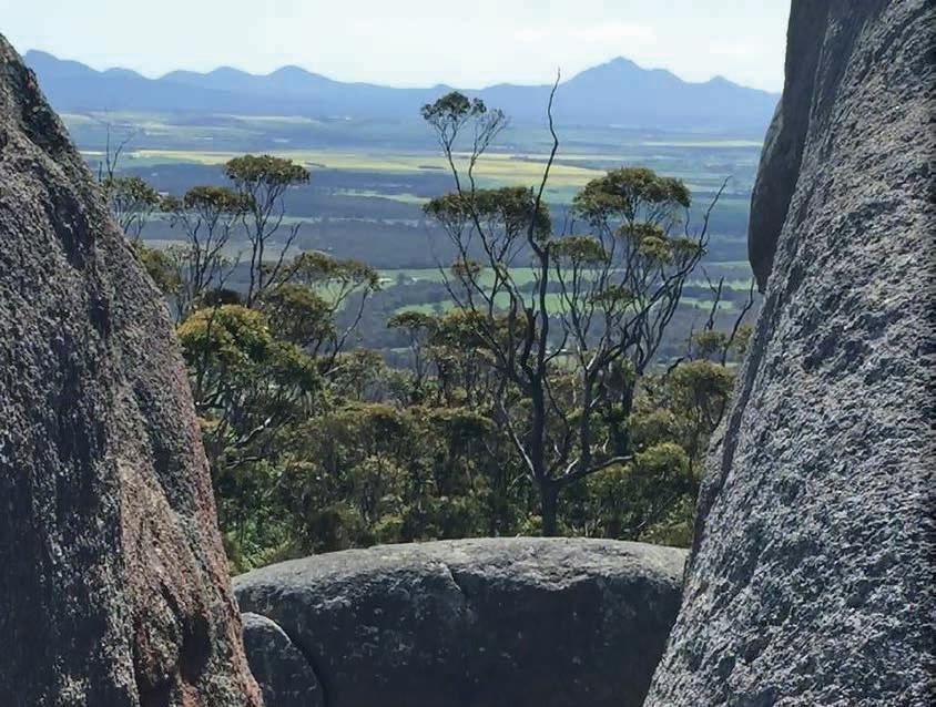
Figure 3.6: Looking north through a gap in the granite boulders of the Porongurup Range across cropping land to the tilted metasediments of the Stirling Range Complex in the Great Southern wine region.
29 Macroclimate is a regional climate; Mesoclimate is a more localised site climate (Smart and Dry 2004).
30 This is the only place in WA to experience occasional snowfalls with any regularity, with an average of less than 2 light falls each year.
31 Both the Stirling and Porongurup ranges were raised up around 1.2 billion years ago as Antarctica collided with the Yilgarn Craton (Lane 2017). While recent by WA standards, it is not recent by global standards.
Geology, soils and climate of Western Australia’s wine regions 29
Apart from these prominences, the highest areas of land are on the Darling Range in the western Yilgarn Craton (including the monadnocks in the Perth Hills and Peel wine regions), which reach almost 600 m AHD in places (Figure 3.7).
At the western edge of the Yilgarn Craton and Albany–Fraser Orogen, the Darling Scarp rises between 50 and 250 m above the surface of the Perth Basin. This is most prominent where the Scarp forms a backdrop to the low-lying Swan Coastal Plain.
Geology, soils and climate of Western Australia’s wine regions
30
Figure 3.7: Elevation map of south-west Western Australia
The bulk of the Great Southern (excluding the Stirling and Porongurup Ranges and a few other peaks), Pemberton and Manjimup wine regions, all sit at lower elevations than the regions located mainly on the Yilgarn Craton to the north. This is because of their location on the Ravensthorpe Ramp—a broad bench of land that tilted gently southwards during the continent’s separation from Antarctica (Figure 3.2).
The most elevated vines in WA currently grow on the slopes of Mount Barrow near Mount Barker (371 m AHD). However, the region with the greatest mean elevation of its plantings is Manjimup32 where the average height of the vines is 256 m AHD (Figure 3.8). This reflects the lack of low-lying coastal terrain in the Manjimup region. The region with the most low-lying vines is Swan District (mean height around 19 m AHD), where most of the vines grow adjacent to the Swan River just upstream of the point reached by tidal waters connecting to the Indian Ocean.
Along with elevation comes the consideration of aspect. Slopes across individual hills or valleys vary regarding the amount of sunlight they receive depending on the direction they face, the season, and the time of the day (Gladstones 2011). North- and west-facing slopes are more exposed to warmer conditions, which means they are better for ripening later varieties and fullerbodied red wines. Conversely, south and east aspects are cooler, making them more suited for growing aromatic white wine varieties.33 The impact of aspect is greatest on deeper valleys, higher hills and steeper slopes.
Aspect can also determine the degree of exposure to damaging winds or cooling sea breezes (Smart and Dry 2004).
32
Geology, soils and climate of Western Australia’s wine regions 31
Manjimup is the only region with no plantings below 100 m AHD.
33 Jim Campbell-Clause, AHA Viticulture (personal communication, 27 June 2022).
range of
(m AHD)

range of Vines (m AHD)
3.8: Elevation ranges of regions and vine plantings
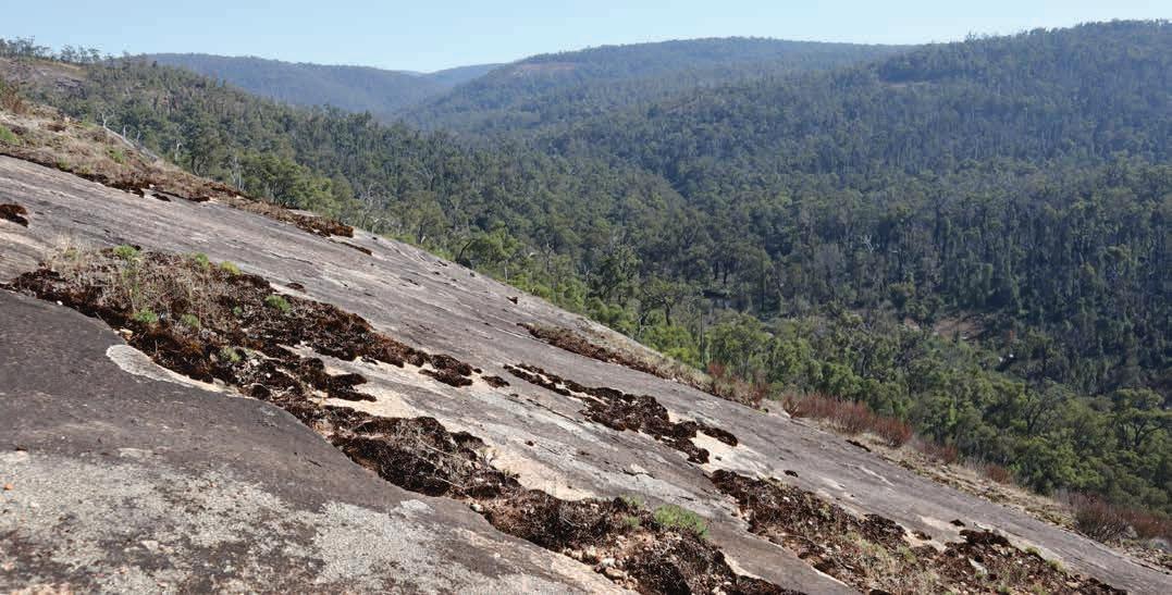
Deep weathering and the lateritic profile
The preceding pages describe the bedrock geology and unconsolidated sediments of WA’s wine regions but they omit 2 highly significant and distinguishing features in the formation of the soils in which the vines are grown. The most characteristic vineyard soils (except for those found on the Swan Coastal Plain) have developed in materials that are the results of the processes of deep weathering and the formation of the lateritic profile. Deeply weathered lateritic profiles sit in a somewhat ambiguous area between the realms of geology and pedology—they can be mapped as geological features but also treated as soil profiles.
Geology, soils and climate of Western Australia’s wine regions 32
Australian Height Datum (metres) Region Elevation
Elevation
0 100 200 300 400 500 600 700 800 900 1,000 1,100
Figure
Region
Great Southern Swan
Margaret River
District Geographe Pemberton Blackwood Manjimup Perth Hills Peel
Deep weathering
The venerable age of the land beneath most of the wine regions, coupled with a long period of geological stability34, gives rise to another distinguishing feature of this subdued landscape—its deeply weathered nature.
For 10’s of millions of years, the slow processes of weathering35 have steadily altered the bedrock. But in most of this gently undulating, stable environment, erosion was unable to keep pace with the rate of weathering, resulting in the weathered material remaining in place over much of the landscape.
The depth of this weathered material can be quite astounding—in some places, unweathered bedrock is not encountered within 50 m of the soil surface. On the Darling Range, typical weathering profiles over granite average about 20 m in thickness (Anand and Butt 2003).
Not surprisingly, the deepest weathering profiles are over the most ancient rocks of the Yilgarn Craton. The younger sedimentary rocks have also been subjected to deep weathering. In fact, virtually no outcropping of sedimentary rocks occurs in the southern Perth Basin. Despite being younger than the felsic crystalline rocks, these sedimentary rocks weather more rapidly.
Of course, the weathering profile does not cover the entire south-west landscape. The processes of erosion, where it has had an impact, has more commonly exposed areas of harder felsic crystalline rocks rather than sedimentary rocks. For example, the southern coastline has imposing granite headlands that are pounded by strong ocean swells. Further inland, isolated domes comprising more recent and resistant granite intrusions emerge above the surrounding landscape to form the conspicuous monadnocks.
The metasediments (metamorphosed sediments) of the Stirling Range Complex have also proved resistant to deep weathering, with many rock outcrops covering the peaks and upper slopes and only a thin veneer of soil.
Elsewhere across the south-west, rivers such as the Brockman, Avon, Murray and Blackwood have carved valleys up to 250 m deep through the weathering profile and underlying bedrock, exposing granites and gneiss that are referred to as ‘fresh rock’ despite their extreme age.36
34 Most of WA has been stable for at least 250 million years (and often much longer) with the last major mountain building occurring more than a billion years ago (Lane 2017). About 320–280 million years ago, thick sheets of glacial ice blanketed the Yilgarn Craton that ground down and flattened out the topography across large areas. Since then, it has never been completely covered by the sea and has seen no glaciers or mountain building activity (Western Australian Museum 2020).
35 Altering some minerals and reducing solid rock into sand, silt and clay. This is the first stage in the creation of soil.
36 A more accurate term would be ‘freshly weathered rock’. It seems incongruous to call a rock that is more than two billion years old ‘fresh’, but it may have been exposed to weathering relatively recently in geological terms; many of today’s major valleys may have only begun forming in the past 1–2 million years (Commander et al. 2001).
Geology, soils and climate of Western Australia’s wine regions 33
The lateritic profile
The extraordinary geological history of deep weathering has given rise to a ‘rock type’ that, while not considered part of the bedrock, is widespread on the surface, blanketing the underlying geology in many cases. It is in these deeply weathered materials that the characteristic lateritic profile of the south-west corner of the continent has formed (Figure 3.9 and Box 3.2).
The long weathering process results in the lateritic profile that has significant chemical differences to younger soils freshly weathered from similar rocks. Turton et al. (1962) found that, in general, the lateritic profile is low in organic matter, carbon, nitrogen and phosphorous and has low cation exchange capacity.
The concentration of iron near the surface of the lateritic profile is an interesting feature. Ironstone caprock (Figure 3.11) is not necessarily an indication of iron-rich parent material. It is even found over granites and sandstones that are dominated by silica and/or feldspar that usually have very small amounts of iron-rich minerals such as biotite, hornblende and haematite. The iron, which is weathered from these minerals over depths of many metres, is highly mobile. When concentrated near the surface it gives rise to iron-rich duricrust.
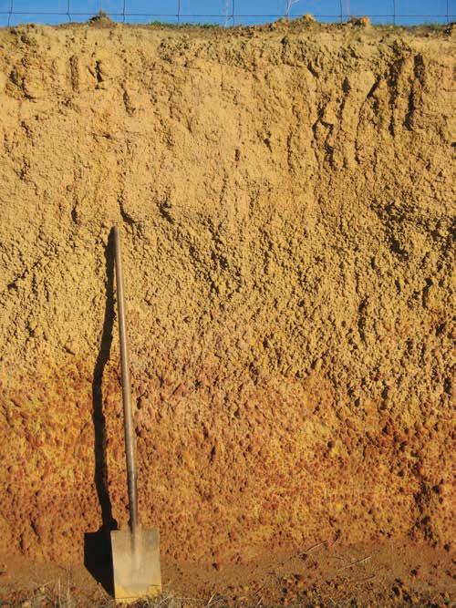
Typically, on the surface, laterite appears as a layer of sandy material with abundant ferruginous nodules and pisoliths (Box 3.3). Below this surface layer, lateritic duricrust is often encountered. This material—usually dominated by ferruginous nodules and pisoliths—is cemented together by iron oxides and is sometimes referred to as ‘caprock’ (Figure 3.11).
The duricrust is not usually a continuous sheet. It is typically a series of closely interlocking large stones and boulders with fractures leading to the clayey substrate of the mottled and pallid zones. Fragments of the duricrust often appear on the soil surface giving the casual observer the impression that the soil profile is incredibly shallow, even though the bedrock is many metres below the surface.
Geology, soils and climate of Western Australia’s wine regions 34
Figure 3.9: Example of the top layers of a lateritic profile, extending down to the duricrust layer (at the base of the spade)
Box 3.2: What on Earth is laterite?
The term laterite37 often causes confusion. Sometimes it refers only to the iron and aluminium-rich duricrust, but in other cases it applies to the whole deeply weathered profile, including the underlying leached clays. The lateritic profile can be anywhere from 2–150 m thick and the typical profile has 5 main horizons:
• Topsoil: Sand or sandy loam material, typically with abundant ferruginous nodules (ironstone gravel).
• Duricrust or ironstone caprock: An iron-indurated crust of cemented gravel beneath the topsoil.
• Mottled zone: Pale-coloured clay material with extensive red, orange or yellow mottles.
• Pallid zone: Pale-coloured sandy clay from which the iron has been removed. It is the intensely weathered result of lateritisation.
• Saprock: Partially weathered rock, typically comprising a gritty material that retains the fabric of the parent rock.
The lateritic profile develops as iron and aluminium oxides are removed from the lower horizons and accumulate near the surface. Although the lateritic profile is common throughout the south-west of WA, the greatest extent of intact laterite is found on gently undulating upland areas such as the Darling Plateau, east of the Darling Fault.
It is believed that such profiles once covered almost all the south-west (with the notable exception of the coastal plains).
In many areas, stripping and erosion have truncated the lateritic profile, removing some or all the horizons described above. There are extensive areas inland where an undulating landscape has formed on the mottled or pallid zones.
37 In 1807, English surgeon Francis Buchanan coined the term ‘laterite' to describe iron-indurated clays in India, which are so soft while in the ground that they can be cut and shaped by iron tools but become hard as a brick when exposed to air. Because of these properties, laterite clays in Asia have been used as building materials for more than 1000 years.
Geology, soils and climate of Western Australia’s wine regions 35
1m Typical depth Horizon Topsoil Duricrust Mottled zone Pallid zone Pallid zone Saprock Bedrock 2m 4m 18m 20m+
Box 3.3: Ferruginous nodules and pisoliths
Ferruginous nodules and pisoliths are a defining feature of WA wine regions.
They are growths that form within weathered rock or soil materials, in this case by the accumulation of iron (and sometimes manganese and aluminium). They often start forming as soft red or orange mottles in a kaolin clay material. As the accumulation continues, the concentrating iron replaces the kaolin and the mottle becomes increasingly cemented.
Eventually hard nodules or pisoliths form. They can vary in size, shape and composition but are usually 2–25 mm in diameter and an orange to dark red colour (Figure 3.10).
Nodules, while usually semi-rounded, have more irregular shapes and no internal layering. In contrast, pisoliths are made up of concentric layers, sometimes around a sand grain core, and are generally smaller and rounder in shape. Both are often referred to as ironstone gravel, with pisoliths also colloquially referred to as pea or buckshot gravel.
NOTE: The use of term ‘gravel’ is common in the world of viticulture, where growers generally regard its presence in soil favourably; in this case, it often refers to small rounded siliceous stones deposited by rivers. However, in WA our use of the term ‘gravel’ refers to the ferruginous nodules and pisoliths described above (unless otherwise stated). The most common of the Main Soils in this bulletin is named ‘Ironstone gravels’, and we use this term only for areas with soil profiles dominated by abundant ferruginous nodules and pisoliths (see examples in Section 4). Whenever referring specifically to the presence of ferruginous coarse fragments within these (and other soil profiles), we use the term ‘ferruginous nodules and pisoliths’ to avoid confusion.
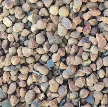
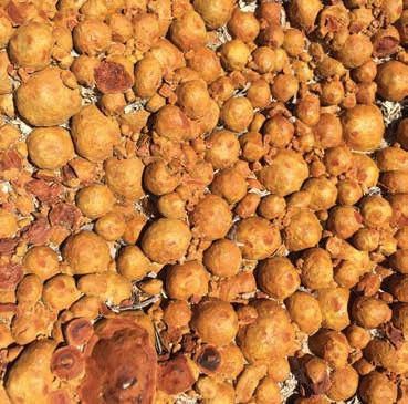
Geology, soils and climate of Western Australia’s wine regions 36
Figure 3.10: Examples of ferruginous nodules (left) and pisoliths (right)
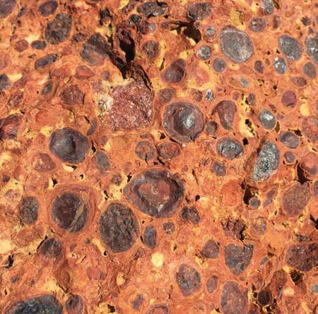
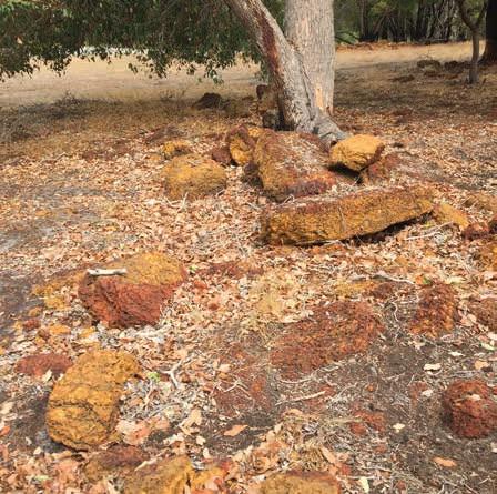
Figure 3.11: Close up of ferruginous nodules and pisoliths cemented together to form duricrust (left) and duricrust fragments on the ground surface (right) giving the appearance of rock outcrop
The ancient Yilgarn Craton landscape—especially the Darling Range Plateau—is most renowned for the ferruginous duricrust, nodules and pisoliths of the lateritic profile, but it is also a prominent part of the environment of several wine regions. For example, the lateritic profile caps the Leeuwin Complex (Margaret River wine region), creating a plateau sitting at 20–80 m AHD. The deep weathering and laterite formation processes have also occurred on the Albany–Fraser Orogen, most extensively on the Biranup Complex and Plantagenet Group. Dissection and exposed crystalline rock are more common on the Nornalup Complex.
Extensive deep weathering and the formation of the laterite profile has also occurred across both the Donnybrook Sunkland and Dandaragan Plateau landscapes of the sedimentary Perth Basin. Valley systems have partially dissected these lateritic plateaus over time. In the Donnybrook Sunkland, this dissection seems to have mainly exposed the lower horizons of the lateritic profile rather than the sedimentary rocks of the Perth Basin. Few examples of the lateritic profile are found on the Swan Coastal Plain as the sediments are too young.
Although some controversy remains about how the lateritic profile formed (see Box 3.4), the importance of the ubiquitous laterite to WA’s viticultural industry is undeniable—most of the vines in the south-west are planted on soils derived from the lateritic profile.
Geology, soils and climate of Western Australia’s wine regions 37
Box 3.4: Where does laterite come from?
The genesis of the lateritic profile has long been the subject of speculation and controversy It was widely believed that laterite was a ‘fossil soil’ and had formed under tropical or subtropical conditions in flat landscapes with fluctuating water tables.
Woolnough (1927) postulated that all Australian laterite was formed in the Miocene (5–24 million years ago), but Mulcahy (1960) argued that several ages of laterite formation occurred in the south-west and observed that the profiles have formed on valley slopes and floors as well as on the old plateau surface.
In 2001, Pate et al. (2001) demonstrated the role of symbiotic bacteria associated with proteaceous plants (e.g. banksias and grevilleas) in the formation of lateritic materials. They believe that a cycle of laterite formation and erosion occurred throughout the Tertiary Period and continues today.
They also show that the formation of laterite helped these plants by maintaining a lessfertile environment compared to soils formed from fresh rock where other species have competitive advantage.

Lateritic profile with duricrust absent and ferruginous pisoliths in the topsoil directly overlying mottled zone clay subsoil.
Geology, soils and climate of Western Australia’s wine regions 38
Geology in relation to soils
The rock types beneath planted vines are of interest primarily because they are an extremely important factor in the physical and chemical development of the soils from which the vines’ roots extract the moisture and nutrients they require. The materials produced by the weathering of the rocks make up the bulk of the soil. These weathering materials in turn influence the other soil components, such as the organic matter and soil water.38
The dominant parent material of soils of WA’s wine regions are from the felsic crystalline rocks (mainly granite, gneiss and similar rocks) of the Yilgarn Craton, Albany–Fraser Orogen or Leeuwin Complex.
The siliceous sands that the south-west is renowned for (which dominate not only the topsoil but sometimes extend more than a metre deep) originate from the resistant quartz crystals weathered from the granite and gneiss.
The feldspars from the granite and gneiss have weathered to form the kaolinitic clays that are so common in subsoils across the regions. Oxidation of these felsic minerals tends to produce grey or paler colours in soils. The mafic minerals also present in these rocks are a source of the iron, magnesium and calcium in the soils, oxidising to create the richer red and brown soils so often favoured by farmers.
Although the felsic crystalline rocks may be the original source of the bulk of the parent materials,39 many soils have formed on the deeply weathered profile over these rocks. This material has been subjected to further alteration over time, which can lead to concentrations of mobile minerals, such as iron, in areas that were a relatively minor component of the original rock (most notably the formation of the seemingly ubiquitous lateritic caprock and gravel).
The impacts of erosion on the weathered material means that, frequently, a soil (or a least the topsoil material) does not sit directly over its original parent bedrock. It may have been transported downslope by colluvial processes40 or carried further afield by streams and rivers and deposited as alluvium. In drier periods of geological history, wind has also moved weathered products extensively. These processes of erosion and transportation have led to further sorting of the weathered material, separating the sands from the clays.
In the case of the sedimentary rocks of the Perth Basin, Plantagenet Group and elsewhere, the sediments that originated from the felsic crystalline rocks have now compacted and cemented. Extra elements may be added during this process, depending on the environment where the sediments are deposited. In swampy terrain, the build-up of plant-based materials adds carbon to the sediments giving rise to carbonaceous shale or coal. In marine environments, calcium from the remains of a vast array of organisms gives rise to calcareous shales or limestone.
Although areas of sedimentary rock can feature soils on freshly weathered rock, the deeply weathered lateritic profile dominates in the south-west of WA.
38 Materials with good moisture retention and aeration characteristics tend to have greater biological activity and therefore higher levels of organic matter. Elements dissolved in the soil water solution are typically derived from the surrounding soil materials.
39 Many of today’s major valleys may have only begun forming in the past 1–2 million years (Commander et al. 2001).
40 A continuous downslope creep of materials
Geology, soils and climate of Western Australia’s wine regions 39
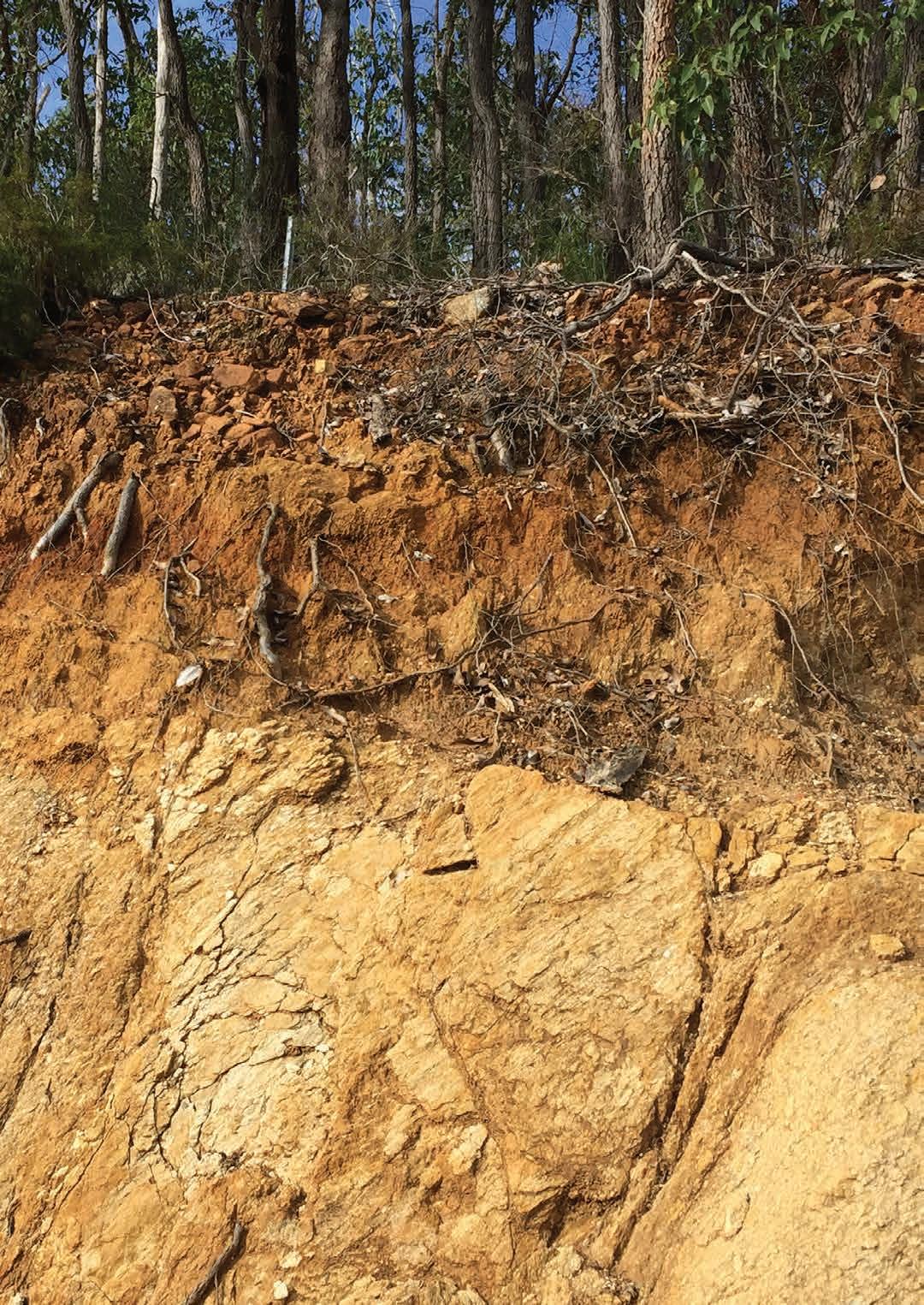
Geology, soils and climate of Western Australia’s wine regions 40
4 Soils
In WA, viticulture occurs on a wide range of soils, from nutrient-poor, deep bleached quartz sands to rich red loams and heavy clays. But the geological history of the wine regions has resulted in some characteristic soils accounting for the bulk of the wine production.
The geological history also influences soil variability in the south-west, where soil can change markedly over short distances. It would not be uncommon to find a deep sand, a gravelly loam and a poorly drained clay occurring together in the same paddock. This may be due to changes in the underlying geology, the extent of deep weathering (and laterite formation), and the degree to which the landscape has been dissected. The soil diversity relates in part to the localised reworking of surface materials by water and wind over the past 10 million years or so.
The variation in profile drainage and soil moisture characteristics can present difficulties for vineyard block design, irrigation scheduling, fertiliser regimes and vine management.
Soils and viticulture
While climate is the major factor influencing grape production for wine, the nature of the soil also influences the vines’ ability to survive, thrive and produce fruit. The relationship between soils and viticulture can be quite complex.
White and Krstic (2019) discuss the widespread concept of a ‘balanced canopy’ based on the ratio of the vine leaf area to the fruit weight. If the leaf area is too small, the vine struggles to produce enough carbohydrate to support the developing fruit. Conversely, a leaf area that is too large can limit fruit production, inhibit fruit ripening or lead to poor flavour characteristics.
They go on to state: ‘the grape vine tends to reflect the environment in which it is growing. Although management methods play a role in vine balance, they are secondary to the inherent growth potential of a site (soil and climate) and the plant genotype (variety/clone and rootstock). Vineyards on deep, fertile soils with good water-holding capacity grow larger vines and produce higher yields than vineyards on sites with shallow or light textured soils of poor water-holding capacity. Depending on the site potential and wine-style aims, vine spacing, trellis system, pruning, canopy management and yield targets all need to be selected to allow the vine to reach a balance of canopy and fruit growth’ (White and Krstic 2019).41
41 Note: Mathews (2016) argues that ‘more than half a century, pruning and fruit-thinning studies have reported small or undetectable effects on fruit and wine when fruit is harvested at similar Brix’ (i.e. similar fruit sugar level).
Geology, soils and climate of Western Australia’s wine regions 41
Waterlogging from winter and spring rainfall is the biggest soil constraint for vines in the south-west of WA. Nutrition and irrigation etc. can all be managed, but seasonal rainfall is more difficult. Some soil types (for example, Sandy duplexes) are problematic as they can remain wet after budburst when the vine is not tolerant to waterlogging and it becomes more susceptible to disease. Artificial drainage is often used but rarely solves the problem fully. Avoiding these areas is usually the best option (see Difficult soils).
Unlike most other agricultural producers, maximum yield is not always the aim of the viticulturist. Soil conditions that reduce fruit tonnage are often considered beneficial if the result is improved grape quality for winemaking. This can occur in soils where root growth is restricted by physical impediments, allowing for manipulation of irrigation applications, subjecting the vines to water stress.42 However, yield reductions do not automatically lead to improved grape quality (Coombe and Iland 2004).
Maschmedt (2004) states that the capacity to supply moisture, while remaining sufficiently well drained to avoid waterlogging in the root zone, is the most important characteristic for viticultural soils in Australia. The south-west of WA contains many areas (especially on the coastal plains) where vines struggle because the soil remains saturated well into the growing season. Conversely, maintaining sufficient water supply for the vines in summer, even under irrigation, is more challenging on some of the poorer sands and very shallow soils, and requires carefully managing the system and closely monitoring the water supply.
Fortunately, most of the south-west’s soils fall in a range between these 2 extremes. A combination of the soils’ landscape position, texture, porosity, and structure allow for sufficient aeration, water retention and availability. These characteristics also affect vine rooting depth. Vine roots may not be able to penetrate deep enough to extract sufficient water and nutrients if solid rock is close to the surface,43 or where heavy clays with poor structure are found at shallow depths.
In the south-west, subsoil clays with poor structure are often sodic (having a high exchangeable sodium percentage) and their dispersive nature further limits the penetration of roots and water into the profile. These soils are most common inland, in lower rainfall areas.
Nutrient supply to the vines is another important soil-related factor. Macronutrients and micronutrients are obtained by roots from the soil solution. The levels of some nutrients occurring naturally in the soil varies according to the minerals in the parent material.
42 Growers use regulated deficit irrigation (the practice of regulating or restricting the application of irrigation water) to reduce vigour and improve flavour.
43 In very shallow soil, roots may not even penetrate deep enough to hold up the vine.
Geology, soils and climate of Western Australia’s wine regions 42
Examples include:
• Pure quartz sand usually contains very low levels of nutrients.
• Red soils formed from mafic minerals are relatively high in magnesium (Mg), iron (Fe), and calcium (Ca) with lesser amounts of copper (Cu), manganese (Mn), zinc (Zn) and molybdenum (Mo).
• Soils derived from parent materials with high mica content are also likely to contain these nutrients, with potassium (K) and sodium (Na) also being prominent and with scarcer Mo.
• If feldspars are the dominant parent material, K, Ca and Na are the most common nutrients, with minor Cu and Mn.
Across the globe, phosphorous (P) levels of soils in their natural state are generally low, but the P levels in WA’s soils are especially low (Hamza 2008).44 The presence of nitrogen (N) and sulfur (S) are not determined primarily by the soil mineralogy—these macronutrients exist in the soil mainly in organic forms (White 2015).
Vine nutrition is often supplemented by applying fertilisers. As nutrients are adsorbed onto the surface of clay particles, organic matter and sesquioxide, soils with higher levels of these components can hold higher levels of nutrients.45 The type of clay present in the soil is also important. The kaolinitic clays that dominate the wine regions have a lower cation exchange capacity than the less common illite, vermiculite and smectite clays, which are usually only a minor component of the soil profile.46
In contrast, nutrients added by fertilisers will pass rapidly through pale sands dominated by quartz grains with low clay, sesquioxide, or organic content. Some soils with high levels of clay and/or sesquioxide can bind nutrients like P tightly, reducing their availability to vine roots.
Soil pH is another consideration. Some soils across the south-west have acidic subsoils, which inhibit deep root penetration and thus limiting effective rooting depth and the ability of the vines to take up nutrients. Topsoils are often prone to acidity.47
Toxic materials in the soil can also be an issue for vines. In WA’s south-west, the main concern is salt, which is mostly associated with soils on waterlogged valley floors on the inland margins of the wine regions.
The physical properties of the soil also affect soil temperatures, which in turn affects vine growth and fruit development. Soils with high water content can take longer to warm in the spring. Soil colour and gravel/stone content also affect the absorption and retention of heat and reflection of sunlight into the canopy.
44 The mineral apatite is a source of P found in a wide range of rocks. However, it usually occurs only as very small grains. Rainfall is another source of the natural P found in WA soils (Rob Summers, DPIRD, personal communication, February 2022).
45 Sesquioxides are weathering products formed through oxidation. Common types in WA soils include the iron oxides, haematite and goethite and the aluminium hydroxide, gibbsite.
46 Cation exchange capacity (CEC) is the total capacity of a soil to hold exchangeable cations. It influences the soil’s ability to hold onto essential nutrients and provides a buffer against soil acidification.
47 The south-west’s topsoils are also prone to developing acidity and often require regular applications of lime.
Geology, soils and climate of Western Australia’s wine regions 43
Vines require water and nutrients from the soil to grow and produce fruit, but the effects of soil properties on wine quality remains controversial. Gladstones (1992) stated that ‘little objective evidence is available that soil chemical attributes directly influence wine qualities48’, yet he finds it hard to dismiss the widely held importance of the ‘terroir’ concept.
Main Soils of the WA wine regions
There are many ways of categorising soils, ranging from scientific international classifications, such as the World Reference Base49 for Soil Resources, to more common names recognised only regionally.50 There is no standard soil terminology adopted throughout the wine world.51
The Australian Soil Classification (Isbell and National Committee on Soil and Terrain 202152) provides a consistent terminology recognised by soil scientists across Australia’s wine regions. However, the high level of technical detail makes it difficult to use this classification to present a simplified portrayal of the vineyard soils in WA.53
In this bulletin we have identified 10 Main Soils relevant to viticulture in WA:
• Ironstone gravels – sand and loam topsoils containing ferruginous nodules and pisoliths
• Sandy duplexes – sand topsoils over clay subsoils at a depth of 30–80 cm
• Red–brown loams – red to brown coloured loamy topsoils
• Pale deep sands – pale-coloured sands greater than 80 cm deep
• Coloured deep sands – yellow, brown or red coloured sands more than 80 cm deep
• Alluvial sands and loams – brown and red sands and loams on recent river deposits
• Heavy soils – clays and other soils with clay subsoils close to the surface
• Shallow sands – sands over rock at less than 80 cm deep
• Alkaline soils – soils with lime throughout or with alkaline subsoils
• Difficult soils – soils with major impediments to viticulture (e.g. waterlogging54)
See the following section (Descriptions of the Main Soils used for viticulture in the south-west) for detailed descriptions and images of these Main Soils, with special emphasis on those soils favoured for viticulture.
48 Provided there are no gross nutritional deficiencies or imbalances.
49 See https://www.fao.org/soils-portal/data-hub/soil-classification/world-reference-base/en/ for more information about the World Reference Base.
50 Typically based on place names or the associated vegetation; examples include Forest Grove gravel, Abba sand, white gum soil, karri loam and banksia sand.
51 One exception is the term terra rossa used to describe a specific soil prized by viticulturalists worldwide.
52 See https://www.soilscienceaustralia.org.au/asc/ for more information.
53 The 6 most common Main Soils in this bulletin comprise at least 25 suborders in the Australian classification.
54 The Difficult soils are the most diverse of the Main Soils. The only characteristic they share is that they would not normally be considered suitable for viticulture because they are non-arable or very difficult to manage for wine production.
Geology, soils and climate of Western Australia’s wine regions 44
Unsurprisingly, not all soils found across the wine regions fit neatly into one of these 10 Main Soils. For example, some Ironstone gravels share most of the characteristics of the Red–brown loams (apart from the presence of ferruginous nodules and pisoliths).
Although there can be considerable variation within each of these 10 Main Soils, certain traits characterise these soils in relation to viticulture.
These Main Soils are adapted from the classification system Soil Groups of Western Australia (Schoknecht and Pathan 201355) used in the digital soil mapping across WA.56 Each of the Main Soils identified here include 2 or more of the WA Soil Groups, although in some cases we have divided some WA Soil Groups between 2 or more of the Main Soils based on their characteristics (see more explanation and examples in descriptions of Main Soils following and in Appendix C).
Our estimates of the proportions of the Main Soils found across the combined area of WA’s 9 wine regions are in Figure 4.1. Together, 3 of the Main Soils often favoured for viticulture—Ironstone gravels (33%), Sandy duplexes (12%) and Red–brown loams (11%)—cover more than half the combined area. In this pie chart, the slice labelled ‘Other soils’ combines the Coloured deep sands, Alluvial sands and loams, Heavy soils, Shallow sands, and Alkaline soils.
Figure 4.2 shows our estimates of the Main Soils planted to wine grapes in WA with the 3 soils mentioned above accounting for more than two-thirds of the plantings. In this pie chart, the slice labelled ‘Other soils’ include the Alluvial sands and loams, Heavy soils, Shallow sands, Alkaline soils, and Difficult soils.
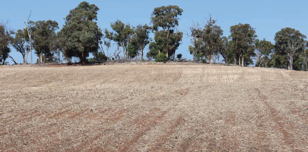
55 See https://researchlibrary.agric.wa.gov.au/rmtr/348/
56 For each unit in the digital soil-landscape mapping (see NRInfo) there is an estimate of the proportional area covered by individual Soil Groups (Schoknecht et al. 2004).
Geology, soils and climate of Western Australia’s wine regions 45
Figure 4.1: Estimated proportional area of the Main Soils occurring across the wine regions of Western Australia (includes land not planted to vines)
Figure 4.2: Estimates of the proportional area of the Main Soils planted to wine grapes in Western Australia
Geology, soils and climate of Western Australia’s wine regions 46
Ironstone gravels 33% Sandy duplexes 12% Pale deep sands 11% Difficult soils 17% Other soils 16% Red-brown loams 11% Ironstone gravels 44% Sandy duplexes 23% Red-brown loams 11% Pale deep sands 6% Coloured deep sands 5% Other soils 11%
Figure 4.3 compares the proportion of Main Soils planted to wine grapes in each of the wine regions. The data on which these 3 figures are presented in Appendix D.
The estimates shown in Figure 4.1 should be treated as more accurate than those in Figure 4.2 and Figure 4.3 due to the different scale of mapping datasets used. The actual areas planted to the favourable soils such as the Ironstone gravels and Red–brown loams are probably greater than our estimates, while the area planted to soils such as Pale deep sands and Sandy duplexes may be overestimated. See Appendix E for further explanation.
Ironstone gravels
Pale deep sands
Heavy soils
Sandy duplexes
Coloured deep sands
Minor soils
Red-brown loams
Alluvial sands and loams
Figure 4.3: Estimates of the proportion of wine grapes within each wine region planted to the various Main Soils
Geology, soils and climate of Western Australia’s wine regions 47
0% 20% 40% 60% 80% 100%
Margaret River
Great Southern
Swan District
Geographe
Pemberton
Blackwood
Manjimup
Perth Hills Peel
Overview of soil distribution and formation
Figure 4.4 presents a simplified distribution of the Main Soils across the wine regions. The map units represent soil complexes, with each complex comprising multiple soils distributed in a much more intricate pattern than can be shown on this map. For the sake of brevity, only the most prominent soils present in each complex are mentioned on the legend.
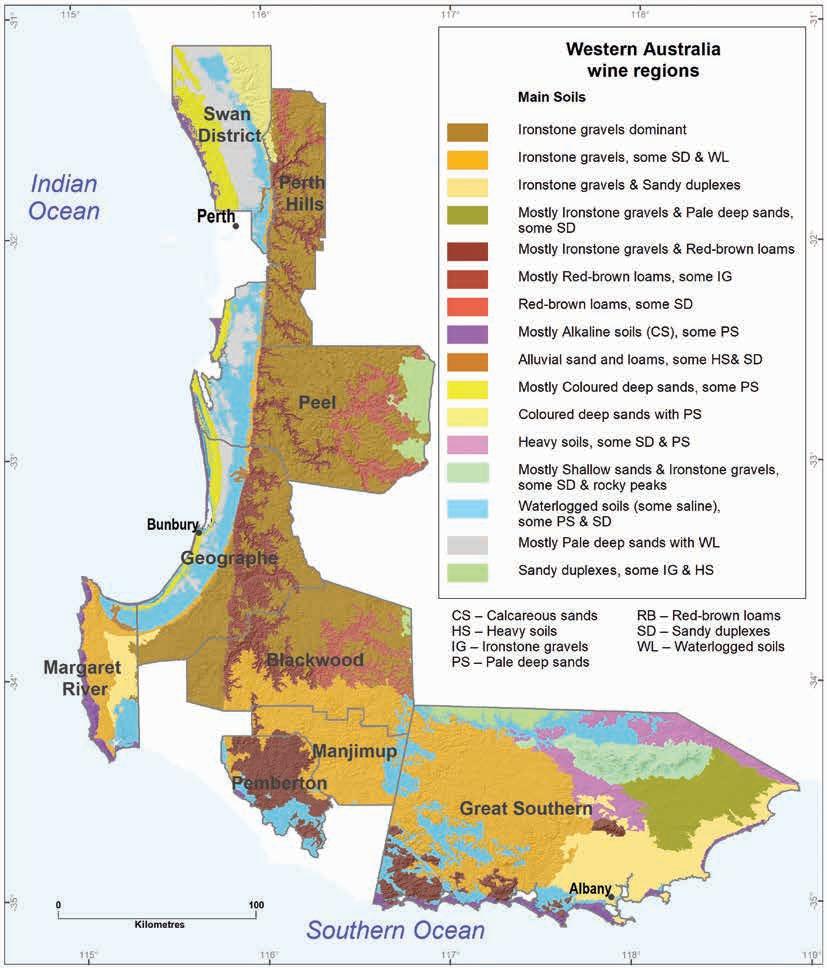
Geology, soils and climate of Western Australia’s wine regions 48
Figure 4.4: Main Soils of the wine regions of Western Australia
Most57 vines in WA grow on soils formed in the weathering products of the felsic crystalline rocks that dominate the wine regions. Most of the remaining vines are on soils formed on sediments derived from these rocks, or the weathering products of sedimentary rocks whose original source is the felsic crystalline rocks.
Extensive laterite formation—typically associated with deep weathering across a range of rock types from the granites of the Yilgarn Craton to the sandstones of the Perth Basin—has given rise to the Ironstone gravels that most characterise WA’s viticulture. Ironstone gravels cover around one-third of the combined area of the wine regions, with around 45% of WA’s wine grapes (about 5,300 ha) being planted on these soils. We believe that the relative dominance of these gravels is one of the factors that sets WA’s viticultural regions apart from others, not only in Australia but also from the rest of the world.58
On plateau surfaces and crests, Ironstone gravels often comprise the upper horizons of laterite profile (as shown in Box 3.2, with or without duricrust). They are just as common on valley slopes, where a topsoil of colluvial gravel overlies a subsoil of pallid or mottled zone material. In more stripped landscapes, colluvial topsoil with ferruginous nodules and pisoliths can be found over a subsoil of freshly weathered bedrock.
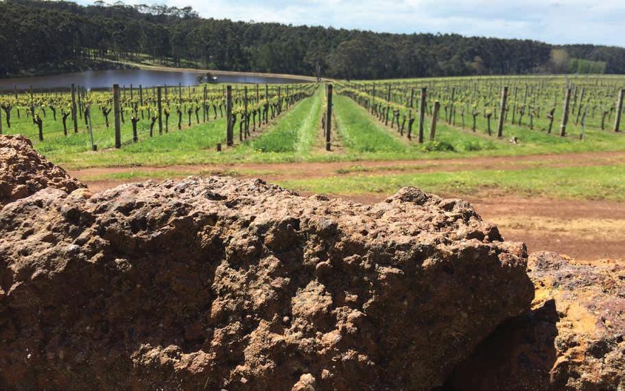
57 As shown in Table 3.1, almost three-quarters of the vines grow over the granite, gneiss and related rocks of the Leeuwin Complex, Albany–Fraser Orogen and Yilgarn Craton
58 Some vines are on similar soils in McLaren Vale (South Australia) and possibly Western Cape Province of South Africa but, as far as we can ascertain, Ironstone gravels are only minor soils in these areas.
Geology, soils and climate of Western Australia’s wine regions 49
Laterite boulders overlooking vines planted on Ironstone gravel soils
Where the duricrust, nodules and pisoliths have been stripped from the landscape and the soils are formed mainly on a truncated (reduced) laterite profile, Sandy duplexes are common. They cover around 12% of the combined wine regions, but account for up to one-quarter of the plantings (about 2,700 ha). The sandy duplexes have a topsoil of colluvial or windblown sand over a subsoil of mottled and pallid zone clays. The subsoil may also be freshly weathered bedrock (typically granite or sedimentary rock) or an alluvial clay found in Quaternary deposits on a valley floor or coastal plain.
Areas of deeper sands are found where erosion by wind or water have sorted and accumulated the coarser quartz grains. These are most common on extensive dune systems of the coastal plains and inland sandplains associated with sedimentary rocks. They are also sometimes deposited in small patches at the break of slope or in sheltered positions.
The Pale deep sands are highly leached and have little iron in the topsoil, although there may be concentrations in the subsoil. The Pale deep sands cover around 11% of the combined wine regions but account for about 6% of the plantings (720 ha).
Goethite (yellow oxides) and haematite (red oxides) coat the quartz grains in the Coloured deep sands. These sands are more favoured by viticulturists, covering around 6% of the combined wine regions and accounting for about 5% of the plantings (610 ha).
The Red–brown loams are usually on valley slopes where dissection of the landscape by watercourses has exposed freshly weathered gneiss or sometimes granite. These soils cover around 11% of the combined wine regions and account for around 1,300 ha (11%) of vines.
Eons of erosion and deposition have created large expanses of sediments on the broad valley floors of the Yilgarn Craton and especially on the Swan Coastal Plain. Many of these Quaternary sediments are poorly drained.
More recently deposited sediments, like the alluvial fans at the base of the Scarps and the terraces of major rivers, are not only better drained, but are relatively fertile because they come from freshly weathered rocks. The Alluvial sands and loams cover only 1% of the combined wine regions and account for about 4% of the plantings (470 ha). Heavy soils are on pallid zone clays and freshly weathered rocks on hillslopes and on clayey alluvial sediments of the coastal plains and valley floors. The Heavy soils cover around 5% of the combined wine regions but only account for about 3% of the plantings (330 ha).
Except on the slopes and peaks of the Stirling Range, patches of Shallow sands are found in association with outcrops of lateritic duricrust, granite, sandstone, or coastal limestone. The Shallow sands cover around 3% of the combined wine regions and account for about 2% of the plantings (220 ha).
Unlike many other winegrowing areas around the globe, calcareous soils are quite insignificant in WA viticulture. In the south-west, limestone is largely restricted to the coastal dune systems and only 2% of the combined area comprises Alkaline soils, of which only around 30 ha (< 1%) have been planted.
Soils subjected to extended periods of waterlogging, saline soils and very shallow or stony soils have been grouped together as Difficult soils. Such soils have major obstacles to overcome to be productive for viticulture. They cover around 17% of the combined wine regions but by our estimates account for only 2% of the plantings (260 ha).59
59 See Appendix E for how we estimated the area of vines planted on Difficult soils.
Geology, soils and climate of Western Australia’s wine regions 50
Descriptions of the Main Soils used for viticulture in the south-west
In this section we summarise the characteristics of each of the Main Soils identified in the wine regions of WA. We discuss the distribution of each Main Soil in relation to the individual wine regions, the geology, and landforms. We also briefly mention the native vegetation associated with the soil and the local names used to identify the soil.
We include descriptions of the typical topsoils and subsoils in relation to the soil texture, structure, colour and pH, and indicate some variations that can occur in the Main Soil.
To compare the Main Soils between regions and with those found in other Australian wine regions, we have included the most common classifications of profiles within the Main Soil in terms of the Soil Groups of Western Australia and the Australian Soil Classification. To aid global comparisons, World Reference Base classifications for each of the Main Soils are in Appendix C.
Each of the Main Soils is discussed in relation to viticulture—how the soil properties affect the growth of grapevines and development of wine grapes. Attention is paid to rooting depth, profile drainage, water retention and nutrient availability. Finally, images of the Main Soils are included as examples.
Ironstone gravels
Covers around 1,630,000 ha of the wine regions with about 5,300 ha under vines.
Ironstone gravels are widespread throughout the south-west of WA and are the most common soils in this part of the world (Figure 4.5). They are characterised by sandy and loamy topsoils containing more than 20% ferruginous nodules and pisoliths.
Ironstone gravels are actively sought out for planting vines, and we estimate that around 45% of WA’s wine grapes are grown on these soils.60 As far as we have been able to ascertain, no other winegrowing areas around the globe are so typified by such soils.61
The association between these soils and wine production goes back long before the emergence of the modern WA wine industry. Around 120 years ago, Despeissis (1902) observed that the loamy ironstone gravels associated with the growth of marri trees (Corymbia calophylla) were ‘par excellence the best suited for making high class wine; clean to the taste, rich in colour, and pleasant of bouquet’.
Gladstones (2005) recounts how the presence of well-drained ironstone gravels carrying healthy marri were part of the reason that he first started to consider the potential of the Margaret River district for winegrowing back in the early 1960s.
Distribution
Ironstone gravels account for around one-third of all soils found across the wine regions of south-west WA. They dominate large swathes of country and make up around of half the soils in the Perth Hills, Manjimup, Blackwood Valley, and Pemberton regions. Only in the Swan District region do they comprise less than one-quarter of the total soils.
60 The actual area planted may be bigger than we estimated. See explanation in Appendix E.
61 Small patches of soils with ferruginous nodules and pisoliths are described in other Australian wine regions such a McLaren Vale (South Australia) and Heathcote (Victoria).
Geology, soils and climate of Western Australia’s wine regions 51
Ironstone gravels are most prominent in elevated positions (plateau surfaces, ridge crests and hilltops) where the intact lateritic profile protects the landscape from dissection. These soils are found on laterite formed over the crystalline rocks of the Yilgarn Craton, Albany–Fraser Orogen and Leeuwin Complex as well as the sedimentary rocks of the Perth Basin and Plantagenet Group.
Even in major valley systems, Ironstone gravels often extend well downslope from the crests, with colluvial gravelly topsoils overlying clayey subsoils formed from the lower layers of the lateritic profile or freshly weathered bedrock. Sometimes Ironstone gravels are found on laterite formed on lower slopes or low rises on valley floors. It is only on the Swan Coastal Plain that these soils are largely absent.
In their natural condition the Ironstone gravels supported forest and woodlands of jarrah (Eucalyptus marginata) and marri/red gum (Corymbia calophylla) with a proteaceous understory often including species such as bull banksia (B. grandis), parrot bush (Banksia sessilis), snottygobble (Persoonia longifolia) and woody pear (Xylomelum occidentale). In lower rainfall areas, wandoo/white gum (E. wandoo) may also be present. Loamy gravels in the high rainfall areas of the south can support majestic forests of towering karri (E. diversicolor).
Ironstone gravels are known by various colloquial names including forest, jarrah, red gum, buckshot, or pea gravels. In the Margaret River wine region, the soil series name ‘Forest Grove’ (Smith 1951) is associated with these soils. In the southern regions, redder versions are often called ‘karri loams’.
Soil description
The distinguishing topsoil feature of the Ironstone gravels is the presence of gravel sized (2–60 mm) ferruginous nodules and pisoliths (Figure 4.6). These commonly comprise 20–60% of the soil volume.62 They may be rounded or irregularly shaped and are commonly an orange or brownish-red colour.
The fine earth components of the topsoils are typically a yellow–brown loamy sand to sandy loam texture,63 with a darker grey–brown surface layer from organic matter. The sand usually comprises fine to medium sized quartz grains with a clay content ranging from about 5–20%. Soils with lower clay content tend to have a loose consistency, while loamy soils may be weakly coherent and friable.
Clay content in the topsoil is often lower where the parent laterite has formed over sedimentary rocks—here the sand can be a pale grey colour (with a dark grey staining from organic matter in the surface). At the other end of the scale, Ironstone gravels in areas with a strong influence from freshly weathered gneiss may be a light sandy clay loam with a red–brown colour.64 Topsoil pH is usually slightly to moderately acid.
Typically, a clear boundary to the subsoil occurs at around 50 cm, with the texture ranging from a light to medium clay. The colour is mostly a yellowish–brown to yellow, (with red and orange mottles often present), usually becoming paler with depth. The subsoils typically have a neutral to acid pH. Ferruginous nodules and pisoliths are often in the top of the clay subsoil but decrease with depth.
62 Sometimes up to 80% of the soil volume.
63 The yellow colours are due to goethite coating the sand grains.
64 Ironstone gravels with a red loamy topsoil are most common south of Manjimup. Here they are referred to colloquially as ‘karri loams’.
Geology, soils and climate of Western Australia’s wine regions 52
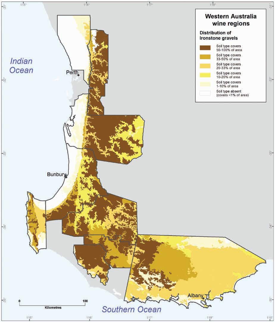
Geology, soils and climate of Western Australia’s wine regions 53
Figure 4.5: Distribution of Ironstone gravels across WA wine regions
These clays are mostly weakly to moderately structured. Poorly structured clay subsoils do occur, usually associated with wandoo forest.
The sudden boundary to the clay subsoil can vary from 30–80 cm below the surface. In some profiles there is only a gradual increase in texture to the clayey subsoil while in others, the clay content does not rise above 10% within the top metre. Sometimes, ironstone duricrust is present below 50 cm.
Soil classification
In terms of the Soil Groups of Western Australia, around half of the Ironstone gravels are from the Duplex sandy gravels and Loamy gravels groups with some from the Deep sandy gravels and Shallow gravels groups.
In terms of the Australian Soil Classification, the Ironstone gravels are mainly Ferric Yellow or Brown Chromosols with some Ferric Kandosols and Sesqui-nodular Tenosols.
In terms of the World Reference Base, Ironstone gravelly soils are generally those in which a pisoplinthic diagnostic horizon is present at, or close to, the soil surface.
Ironstone gravels and grapevines
Ironstone gravels are desired by vignerons because they are generally well drained and their physical and chemical characteristics seem to help vignerons maintain the vines in balance. They usually provide sufficient moisture and nutrients without promoting over-vigorous growth.
Clay subsoils—especially when poorly structured65—may restrict water movement and root penetration but they also act as a reservoir of soil moisture and nutrients.
Profile drainage is often assisted by the landscape positions in which these soils occur—on crests, upper or mid slopes. These positions are also less prone to frost and often receive maximum sunlight. Drainage is more of an issue where Ironstone gravels are found on low-lying or flat terrain.
In some profiles, old root channels from the jarrah and marri trees these soils originally supported provide a preferential pathway to the deep subsoil for both water and roots. Duricrust present in the top metre can be a major barrier to root growth, although some pathways usually exist to the underlying clays through cracks and fissures.
The topsoils generally have low levels of nutrients, with phosphorous levels typically lower than in most other grapegrowing areas of Australia. The clay and goethite present in these sandy topsoils help retain added nutrients, but some of the soils bind phosphate due to the high iron content.
Subsoils derived from kaolinitic clays also have low inherent fertility, but they will store some added nutrients. Deficiencies of trace elements, such as copper and zinc, can also occur. The red and loamy gravels tend to be more fertile, while the pale and sandy gravels are less fertile.
65 Drawing from European examples, Beeston (2002) describes the benefits of stony or pebbly soils as allowing easy root penetration and improving moisture infiltration. This argument does not always apply in WA where the gravel rarely extends far into the clayey subsoils.
Geology, soils and climate of Western Australia’s wine regions 54
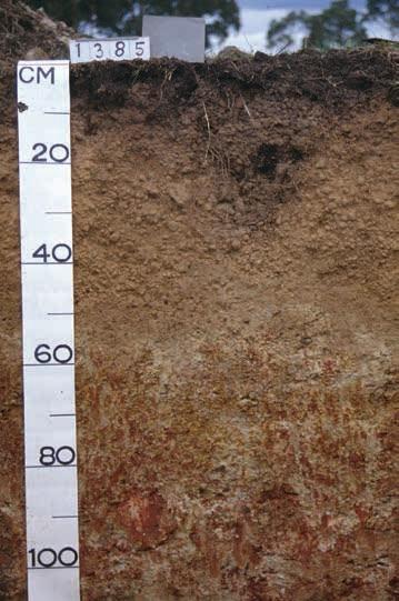
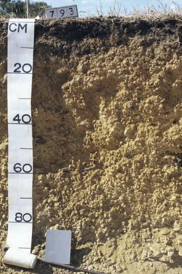
Note: WA Soil Group names are in italics
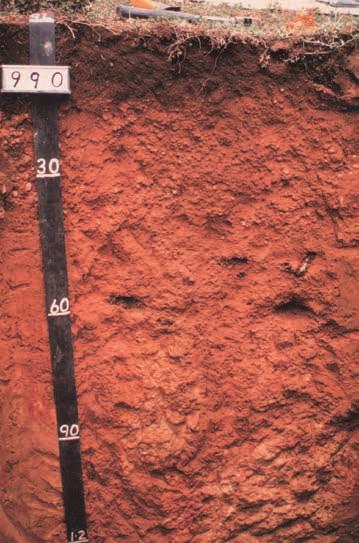
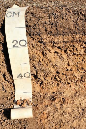
south-west WA wine regions
Geology, soils and climate of Western Australia’s wine regions 55
Figure 4.6: Examples of Ironstone gravels from the
Deep sandy gravel
Duplex sandy gravel
Shallow gravel over duricrust
Loamy gravel
Although clay subsoils have good moisture-holding ability, the moisture characteristics of the topsoil are more complex. The fine earth fraction has low to moderate moisture retention depending on the clay and organic matter content. The high proportion of ferruginous nodules and pisoliths would seem to significantly reduce the plant-available water in the main root zone. But these gravels do absorb and store significant amounts of water. The question remains: How much of this water are the vines’ roots capable of using?
Pate et al. (2001) highlighted surprising relationships between the lateritic materials and the native vegetation in WA. They argue that symbiotic bacteria associated with proteaceous plants (e.g. banksias, grevilleas) may play a part in forming duricrust and ferruginous gravels. They go on to argue that this interaction enables the plants to manipulate the availability of water and nutrients in the soil to their advantage.
We do not yet understand how grapevine roots interact with the ferruginous nodules and pisoliths.66 However, if native plants have engineered soil conditions to suit themselves, this action also seems to suit vines. The high-quality wine grapes67 growing on the Ironstone gravels indicate that WA vignerons have certainly learnt how to manage their water and nutrient balance.
An additional benefit from Ironstone gravels may be that they absorb heat during sunny daylight hours and re-radiate it to the vines at night or during cloudy periods, thus maintaining even soil temperatures (Gladstones 1992). Soils with gravels (usually river gravels rather than ferruginous nodules and pisoliths) are sought out worldwide because they help maintain warmth; however, this factor may be more important in some northern hemisphere sites (Maschmedt 2004).
It is interesting to note that wine writers such as James Halliday and Ray Jordan sometimes use the term ‘ironstone minerality’ in tasting notes for some wines produced on these soils.
As stated above, Ironstone gravels are the soils most planted to wine grapes in WA. We estimate that just over half of WA plantings on these soils are in the Margaret River wine region, with a further quarter in the Great Southern region. These soils are particularly significant in the Manjimup region where they comprise more than two-thirds of all the soils planted. It is only in the Peel, Perth Hills and Swan District regions that they account for less than one-third of the total plantings.
Sandy duplexes
Covers around 569,000 ha across the wine regions with about 2,700 ha under vines.
Sandy duplex soils have a sandy topsoil and a sudden change to a clay subsoil (texture contrast) within a depth of 80 cm.68 The subsoil provides some barrier to water movement down the profile.
66 It is possible that a mild moisture stress on these soils control vigour and, as the vine is ‘in balance’ on such soils there is a reduced need for canopy management practices such as trimming and crop thinning.
67 Johnson and Robinson (2019) state that Margaret River’s ‘free draining ironstone gravels are most prized for the region’s exceptionally fine reds’. They go on to place Margaret River along with Bordeaux (France), Bolgheri (Italy), Napa/Sonoma (California) and the Limestone Coast (South Australia) in producing ‘some of the most satisfying, and age worthy, red wine in the world’.
68 Sandy topsoil usually ranges from 30–80 cm deep in the Sandy duplexes but profiles with 10–30 cm of sand have been included where the clay subsoil does not provide a major barrier to water movement or roots.
Geology, soils and climate of Western Australia’s wine regions 56
Distribution
Sandy duplexes are widespread across the regions, accounting for around 12% of all soils (Figure 4.7). They comprise about 20% of the soils in the Great Southern and Margaret River regions.69
These soils often occur where the slow process of geological erosion has removed the ferricrete nodules, pisoliths, and duricrust layers from the lateritic profile. This stripping has left a truncated profile, with the mottled or pallid zone clays now near the surface. A layer of sandy colluvial topsoil transported from upslope lies over the (typically kaolinitic) clay subsoil. Sandy duplexes formed in this manner are most common on the hillslopes (especially the lower slopes) of inland areas of the Margaret River, Peel, Blackwood Valley, Manjimup and Great Southern regions.
In other examples of Sandy duplexes, the colluvial sandy topsoil overlies a clay subsoil derived directly from ‘freshly’ weathered felsic crystalline70 or sedimentary rocks. Sandy duplex soils are also common on the older alluvial deposits of valley floors and on the Swan Coastal Plain. In relatively recent times, the forces of wind or water have deposited the sandy topsoil onto older clay deposits. They are also associated with the sandplains on the Plantagenet Group sediments.
Native vegetation is quite variable but is typically woodland that may include wandoo/white gum (E. wandoo), marri/red gum (Corymbia calophylla) or stunted jarrah (E. marginata). Sandy duplexes may be named after the vegetation they support (e.g. white gum or red gum soils) or simply called ‘sand over clay’ or sometimes ‘sandplain soils’. In the Margaret River wine region, the names Mungite, Busselton and Abba soils are sometimes used.
Soil description
Sandy duplex topsoils are typically a sand to loamy sand texture with up to 5% clay content. They are usually coloured light grey–brown to pale grey, often with dark grey staining on the surface from organic matter. Less frequently, the sandy topsoils may be yellow–brown to yellow coloured, with up to 10% clay content (Figure 4.8).
The sand grains are typically medium sized, and the topsoil is often loose but can be weakly cohesive. The sand can be coarse or gritty, especially where the soil has formed over felsic crystalline rocks. A small amount of ferruginous nodules or pisoliths may occur in the topsoil, usually close to the boundary with the clay subsoil. Elsewhere are small fragments of crystalline rocks. The pH is slightly to moderately acid and the paler coloured sands are deficient in nutrients.
There is usually a clear boundary to the clay subsoil at 30–80 cm; occasionally this may be less than 30 cm. Also included with Sandy duplexes are similar soils that have a gradual increase in clay down the profile, mostly in the Margaret River wine region.71 Although these are not technically texture contrast soils, they have comparable drainage, soil water and nutrient characteristics.
Sandy duplex subsoils range in colour from a pale grey to yellow–brown. Mottling is usually present and textures range from a light to medium clay. These clays are often weakly structured. They are typically neutral to acid in pH.
69 They account for 12% of the soils in the Peel wine region and no more than 10% in all other regions.
70 Sandy duplexes seem to form over granites of the Darling Range Batholith more often than over the gneisses of the Balingup and Biranup complexes where the duplex soils are more likely to have loamy topsoils.
71 These include the Mungite soils of the elevated terrain and Busselton soils on the Swan Coastal Plain.
Geology, soils and climate of Western Australia’s wine regions 57
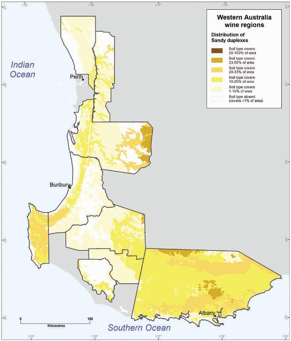
of Western Australia’s wine regions 58
Geology, soils and climate
Figure 4.7: Distribution of Sandy duplex soils across WA wine regions
Soil classification
In terms of the Soil Groups of Western Australia, around half of the Sandy duplexes are Grey deep sandy duplexes and around one-quarter are Yellow/brown deep sandy duplexes. Other Soil Groups include Yellow/brown shallow sandy duplexes and Pale sandy earths. 72
In terms of the Australian Soil Classification, the Sandy duplexes are mainly Grey, Yellow or Brown Chromosols. Some may be Dermosols or Sodosols or Grey Kandosols.
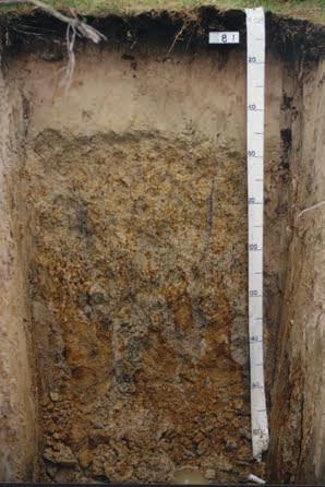
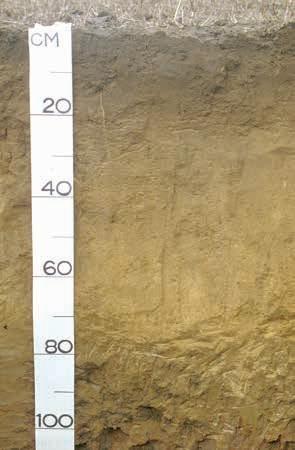
deep sandy duplex Yellow/brown deep sandy duplex
Note: WA Soil Group names are in italics
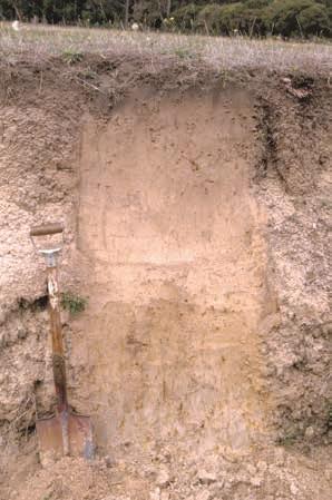
Figure 4.8: Examples of Sandy duplexes from the south-west wine regions
Sandy duplexes and grapevines
Sandy duplexes are a significant soil for WA viticulture. With careful management they do support good vine growth but are generally not the most preferred soils. In the Margaret River wine region, Sandy duplexes are most often planted where they occur in an intricate complex with the more desirable Ironstone gravels or Alluvial sands and loams. The flatter areas dominated by Sandy duplexes are less likely to be planted.
Waterlogging can be an issue on Sandy duplexes. The clayey subsoils can restrict drainage, especially in flat or low-lying locations where perched watertables may persist into spring when budburst occurs. Despite lower rainfall making this less of an issue than it was last century, sloping sites are still preferred for these soils.
The clay subsoils do not seem to present a major physical barrier to root penetration. In some places vine roots tend to follow old root channels of the original native vegetation.
72 The Pale sandy earths are the soils mentioned above with a gradual increase in clay down the profile.
Geology, soils and climate of Western Australia’s wine regions 59
Grey
Pale sandy earth (Mungite soil)
These soils have moderate to good moisture-holding capacities. Although some of the grey sandy topsoils have a very low clay content, the clayey subsoil stores water. Nutrients can also leach from these grey sandy topsoils but are retained in the subsoil.
Sandy duplexes with yellow to brown coloured topsoils have better moisture and nutrient levels than their paler counterparts. This includes the creamier yellow topsoils gradational profiles (especially the Mungite and Busselton soils73) where clay and organic matter content tend to be higher and the sand finer-grained.
Our estimates show the Sandy duplexes currently support almost one-quarter of all vines planted across the wine regions, but it is likely that the actual proportion is a little lower (see explanation in Appendix E). The largest area of vines planted on these soils is in the Margaret River region. Significant areas are also in the Swan District74 and Great Southern regions.
Red–brown loams
Around 535,000 ha across the wine regions with about 1,300 ha under vines.
Red–brown loams are widely considered as fertile soils; they are associated with towering forests, lush pastures, and bountiful horticultural crops. They include soils with a brown to red coloured loamy topsoil and friable or well-structured subsoil.75 Although soils with red colouration are most likely to catch the eye, the brown coloured soils dominate, except in the Pemberton wine region.
Distribution
Red–brown loams occur mainly east of the Darling Fault, where the crystalline rocks of the Yilgarn Craton and Albany–Fraser Orogen are exposed by dissection of the lateritic plateau (Figure 4.9). They are found along the Darling Scarp and on the slopes of major river valleys (such as those of the Brockman, Helena, Murray, Collie, Preston, Blackwood, Donnelly and Warren rivers), and in hilly terrain between Pemberton and Albany.
The greatest areas of the Red–brown loams are in the Blackwood Valley, Geographe and Peel wine regions, but they are most common in the Pemberton wine region where they account for around 30% of the soils. They are minor soils of the Leeuwin Complex and virtually absent in the Perth Basin.
These soils are most common on sloping terrain incised into freshly weathered crystalline rocks. The mafic rocks (e.g. basalt and dolerite) tend to give rise to the reddest soils. Redder coloured soils are also found on felsic rocks with higher concentrations of dark minerals (e.g. biotite and hornblende), especially some of the gneisses.
In the higher rainfall areas of the south, these Red–brown loams are often named ‘karri loams’ due to their association with forests of karri (Eucalyptus diversicolor), the world’s second tallest flowering tree. Marri (Corymbia calophylla) and blackbutt (E. patens) trees are other trees often associated with these loams. The forest understory is often a dense tangle of tall shrubs.
73 Excess vigour can be a problem on Mungite soils where the subsoil remains moist throughout the growing season, especially in the higher rainfall districts south of Margaret River.
74 In the Swan Valley subregion, Sandy duplexes comprise about half the soil planted to wine grapes.
75 The Red–brown loams exclude some soil with similar characteristics found on coastal plains and river flats that are included as Alluvial sands and loams.
Geology, soils and climate of Western Australia’s wine regions 60
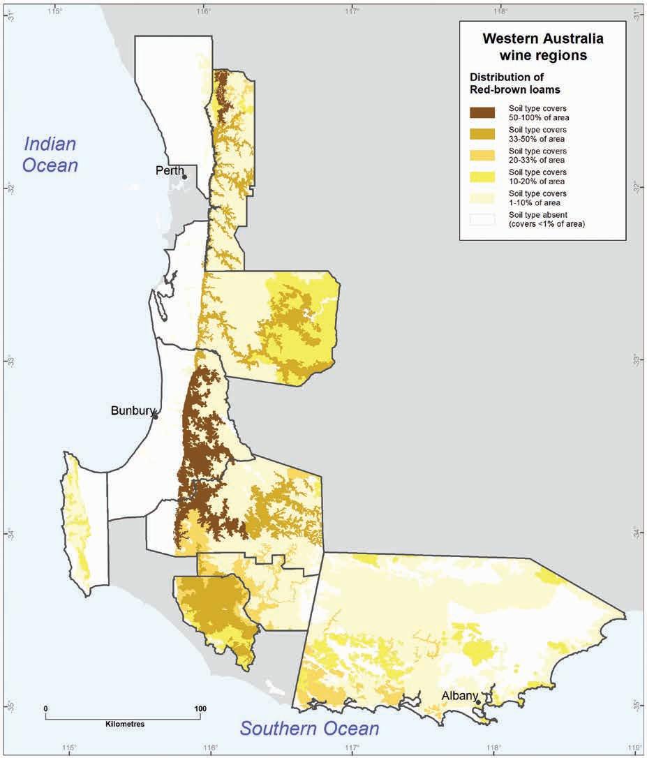
Geology, soils and climate of Western Australia’s wine regions 61
Figure 4.9: Distribution of Red–brown loams across WA wine regions
Soil description
The topsoils are typically a brown to reddish–brown sandy loam to clay loam (Figure 4.10). Fragments of gneiss and other crystalline rocks are often present in the profile, but the content of ferruginous nodules and pisoliths is less than 20%.76
In higher rainfall areas these topsoils can have relatively high organic matter contents and are often friable and crumbly. Further inland and to the north, hard-setting77 topsoils are more common. Hard, compacted topsoils are also encountered where the soil has been subjected to repeated cultivation, heavy traffic or trampling by livestock. Topsoils generally have a neutral to slightly acid pH.
Subsoils range in colour from a bright red to yellowish–brown, and in texture from clay loams to clays. Again, rock fragments are often encountered. These subsoils are usually porous due to their typical good structure (the arrangement of soil particles) or an earthy fabric (the soil is coherent and porous). They are usually neutral in pH.
The subsoils are typically found at depths of 30–80 cm, usually with a gradual transition between the topsoil and subsoil. Soils with a clear boundary between the loamy topsoil and clay subsoil (duplex profiles) are also common, dominating in the Margaret River, Peel and Perth Hills wine regions. Red–brown loams are usually more than a metre deep, however weathered bedrock is sometimes encountered at 50–100 cm.
Soil classification
In terms of the Soil Groups of Western Australia, more than two-thirds of the Red–brown loams are Brown deep loamy duplexes, Brown loamy earths or Friable red–brown loamy earths
In terms of the Australian Soil Classification, the Red–brown loams are mainly Chromosols, Dermosols and Kandosols, typically Brown or Red and sometimes Yellow
Red–brown loams and grapevines
These soils provide an excellent growth medium for grapevines. Their structured/porous subsoils provide few barriers to root growth and water movement down the profile. This and the sloping terrain on which they most commonly occur means these soils are well drained.78
Red–brown loams may be well drained, but they also have a high capacity to store and supply water to the vine roots due to their texture and porosity. Sufficient clay content exists throughout the profile to hold water, but not to the stage of holding so tightly that the roots have trouble extracting that water.
76 We class red–brown coloured loamy soil, with more than 20% ferruginous nodules and pisoliths content, as Ironstone gravels.
77 Topsoils that are soft when moist but which set to a hard structureless mass when dry, making management difficult.
78 The presence of bedrock may restrict root growth and water movement in some profiles. This is also the case for clayey subsoils in Red–brown loams that border on being Heavy soils.
Geology, soils and climate of Western Australia’s wine regions 62
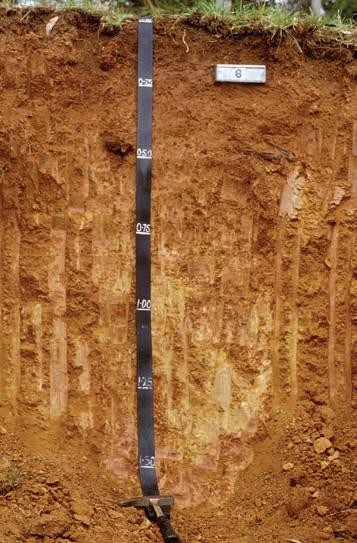
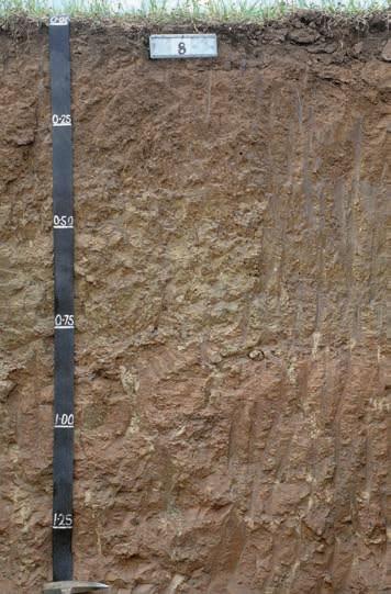
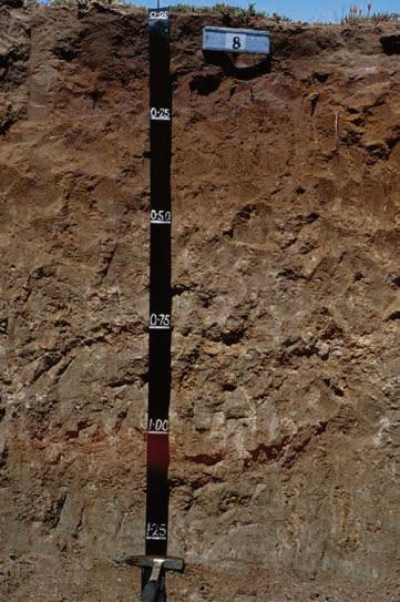
Note: WA Soil Group names are in italics
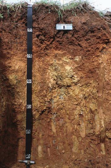
from the south-west wine regions
Geology, soils and climate of Western Australia’s wine regions 63
Figure 4.10: Examples of Red–brown loam and duplex soils
Brown deep loamy duplex
Friable red/brown loamy earth
Red deep loamy duplex
Brown loamy earth
The clay content and the combination of felsic and mafic minerals in the parent rock result in these soils having relatively high inherent fertility and the ability to retain added nutrients. The high iron content that gives rise to the red colours in these soils can also bind up added phosphorus, reducing its availability to the vines (Lantzke and Goldspink 2000).
The favourable moisture and nutrient properties of the Red–brown loams can lead to over-vigorous growth (especially in higher rainfall areas) and many viticulturalists consider that vines on these soils require careful management to achieve a balanced canopy.
Gladstones (1992) contends that the dominance of healthy vigorous marri (and karri in high-rainfall areas) in the natural vegetation found on the redder soils is the best indicator of suitability for viticulture. He discusses the effect of red soil colours on vine performance, noting that the French traditionally favoured red soil for growing red grapes. This was in part ascribed to the ability of red soils to absorb and re-radiate heat but may also relate to the reflection of red wavelengths into the lower vine canopy, which is believed to affect fruit ripening.
We estimate that the Red–brown loams currently support about 11% of the vines planted across the wine regions, but the actual figure may be a little higher (see Appendix E). They are most significant to viticulture in the Perth Hills, Blackwood Valley, Geographe and Pemberton wine regions. Within each of these regions they account for 30% or more of the planted vines.
Coloured deep sands
Around 270,000 ha across the wine regions with about 610 ha under vines.
Coloured deep sands are predominantly yellow to yellowish–brown siliceous sands more than 80 cm deep. Some of the sands are more a brown or red colour and some increase in texture to a sandy loam with depth. With a well-managed irrigation and fertiliser regime, Coloured deep sands are generally considered good soils for growing wine grapes.
Distribution
Coloured deep sands occur in scattered patches across all wine regions, but they rarely cover more than 10%, except for the Swan District region.79 They are most common on the Perth Basin, where about half of these sands are found. They dominate the low Spearwood dunes that overlie Tamala Limestone in a strip running along the west coast north from Cape Leeuwin (Figure 4.11). They are often referred to as ‘tuart sands’ as they support tuart (Eucalyptus gomphocephala) forests and woodlands; this coastal strip is the only place on Earth that these trees grow.
Elsewhere on the Perth Basin, the Coloured deep sands are most common on the sandplains of the Dandaragan Plateau and the northern edge of the Donnybrook Sunkland, where the parent material is typically sandstone or laterite formed over sandstone. These sands are also found in colluvial or windblown deposits derived from eroded laterite and are often associated with Ironstone gravels. The vegetation is likely to be a woodland of jarrah (Eucalyptus marginata) and marri (Corymbia calophylla) with parrot bush (Banksia sessilis) or bull banksia (B. grandis) often present.80
79 Here they make up around one-quarter of the soils. They are least common in the Great Southern, covering around 1% of the total area, mainly in the west.
80 These species are often also found in association with tuarts on Tamala Limestone.
Geology, soils and climate of Western Australia’s wine regions 64
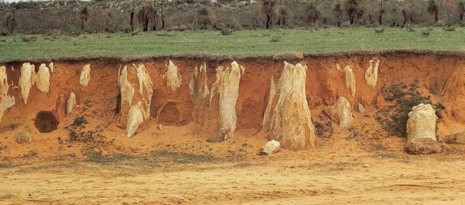
Soil description
The topsoils are predominantly yellow to yellowish–brown sand to clayey sand, with the surface layer stained grey–brown by organic matter. The yellow, brown and sometimes red colours are derived from iron oxides coating the quartz sand grains (Figure 4.12).
The clay content of these topsoils is 1–10%, with the sand grains being fine- to medium-grained (occasionally coarse). The sand grains are usually loose. Topsoils generally have a neutral to acid pH.
The subsoils are also yellow to yellowish–brown. Sand to clayey sand textures are most common, with the clay content often increasing gradually down the profile.81 The sand texture usually extends to a metre deep, but in some soils the texture will increase gradually to a sandy loam by 50 cm and a sandy clay loam by a metre. If the clay content is higher, the subsoils of these sands can become coherent with an earthy fabric.82
The subsoil pH of the Coloured deep sands is generally neutral to moderately acid. On the coast, small fragments of limestone are sometimes encountered in the subsoil. Somewhat surprisingly, Coloured deep sands found over Tamala Limestone usually have a neutral to slightly acid pH in the subsoil, with only the bottom few centimetres of the profile being alkaline.83
Away from the coast, ferruginous nodules and pisoliths may be present, mainly in the subsoil, and often increase with depth. Clay or cemented ferricrete nodules and pisoliths may be encountered below a metre.
81 Clay content in the subsoil very rarely exceeds 10% in the Spearwood dunes.
82 Coherent soils are where two-thirds of the soil material will remain united at the given moisture state unless force is applied; an earthy fabric is an unstructured soil that is coherent and porous (NCST 2009).
83 The limestone has formed by the carbonates leaching from the sand.
Geology, soils and climate of Western Australia’s wine regions 65
Figure 4.11: Exposed area of Spearwood dunes with Coloured deep sand and Tamala Limestone on the Swan Coastal Plain
Soil classification
In terms of the Soil Groups of Western Australia, around two-thirds of these soil are Yellow deep sands. Yellow sandy earths and Brown deep sands are the next most common Soil Groups.
In terms of the Australian Soil Classification, the Coloured deep sands are mainly Yellow Arenosols, with some Yellow and Brown Kandosols and Brown and Red Arenosols

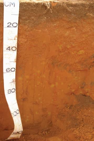
Note: WA Soil Group names are in italics
Coloured deep sands and grapevines
With well-managed irrigation and fertiliser applications, these sands can produce good yields of high-quality wine grapes. They tend to perform better than the Pale deep sands. Gladstones (1992) contends that healthy vigorous tuart trees on coastal sands is a good indicator of soil suitability for viticulture. According to Jordan (2010), WA’s coastal limestone soils give the wines excellent flavour and longevity.
The sandy subsoils allow for deep-rooted vines and are generally very well drained. Moisture retention is mainly determined by the grain size and the amount of clay present. Although soil water storage is low compared to soils with more loam and clay, a fine-grained clayey sand (with up to 10% clay content) will retain significantly more moisture than coarse-grained sands with minimal clay. Soils in which the clay content increases with depth have even better storage capacity.
66
Geology, soils and climate of Western Australia’s wine regions
Figure 4.12: Examples of Coloured deep sand soils from the south-west wine regions
Yellow deep sand
Red deep sand
Although these soils have low inherent fertility and nutrients (especially nitrogen) leach away easily, some phosphorous is retained due to this iron coating on the sand grains or in soils with a higher clay content.
We estimate that the Coloured deep sands currently support about 6% of the vines planted across the wine regions. The Swan District wine region accounts for around 40% of all plantings on this soil type,84 and the Margaret River region a further 25%.
Pale deep sands
Around 548,000 ha across the wine regions with about 720 ha under vines.
These siliceous sands are grey to white, to pale yellow–brown on the surface and the sand texture extends to more than 80 cm deep. Pale deep sands have similarities to Coloured deep sands but have poorer moisture- and nutrient-holding capacity, especially in the topsoil. Although capable of supporting vines, areas of pale deep sand are not specifically sought out for planting.
Distribution
Across the wine regions of WA, you do not usually have to travel far to find at least a small patch of Pale deep sand,85 and they are dominant in some areas, notably the Bassendean dune system running through the middle of the Swan Coastal Plain.
These sands are also prominent in areas where the underlying geology is sandstone (or other sedimentary rocks) such as the Dandaragan Plateau and the Albany Sandplain.86 Pale deep sands are found in around one-third of the Swan District region and about 10% of the Geographe, Great Southern and Peel regions.
The largest concentration of these soils is typically found in some extensive accumulations of windblown sand, either as dunefields or broad sand sheets. In other locations they can be found in more isolated areas of low narrow linear dunes or as small patches of sand accumulated by the wind. Elsewhere these sands have been deposited by water on hillslopes or valley floors. Small patches of wind- or water-generated pale sand deposits are often found in association with Ironstone gravels in lateritic country.
Banksia (Banksia attenuata, B. menziesii, B. prionotes, B. ilicfolia and B. grandis) woodlands typically grow on these sands, giving rise to the common name ‘Banksia sands’.87 These woodlands may include stunted jarrah (Eucalyptus marginata) or munjah/Western Australian Christmas tree (Nuytsia floribunda),88 the latter giving rise to the term ‘mungie sand’. On the Swan Coastal Plain, the presence of marri (Corymbia calophylla) trees—an indication of the presence of better-quality sand subsoils—sees the same Pale deep sands referred to as ‘marri sands’.
84 Even though Coloured deep sands are the dominant soil planted to vines in the Swan District region outside the Swan Valley subregion, they are of only minor importance within the Swan Valley.
85 These soils are least likely to be found in the deeply incised valleys of the Yilgarn Craton where the soils have formed on freshly weathered crystalline rock.
86 Derived from the Plantagenet Group sediments in the Great Southern region.
87 A more dismissive and anatomically confusing common name referring to the poor water- and nutrient-holding capacity is ‘gutless sands’.
88 Also called Mungai, Mooja, Mungah, Moondjak and Moodgar (Hansen and Horsfall 2019).
Geology, soils and climate of Western Australia’s wine regions 67
Soil description
The surface of these soils is loose sand stained dark grey by organic matter.89 The surface staining often extends 30–50 cm deep. Below this is more loose sand almost entirely comprising quartz grains,90 giving the remainder of the topsoil a pale grey to white colour. The grains are typically medium to coarse in size with ferruginous nodules and pisoliths usually absent. These topsoils generally have a slight to moderately acid pH and are water repellent (Figure 4.13).
The pale grey sand often extends more than 2 m deep, especially in dunefields. In some cases, iron coating on the sand grains gives the subsoil a yellow colour at around 50 cm and ‘coffee rock’ layers91 may also be present. Away from the sand dunes, a sudden change to clay substrate can occur at 80–160 cm. Ferricrete nodules and pisoliths may be present in the sandy subsoils.
Soil classification
In terms of the Soil Groups of Western Australia, these soils are mostly Pale deep sands with a few Gravelly pale deep sands
In terms of the Australian Soil Classification, most of the Pale deep sands are Bleached and Grey Arenosols, with some Aeric and Semiaquic Podosols, Sesqui-nodular Tenosols and Yellow Chromosols
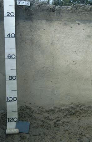
Pale deep sand (over ferruginous nodules)
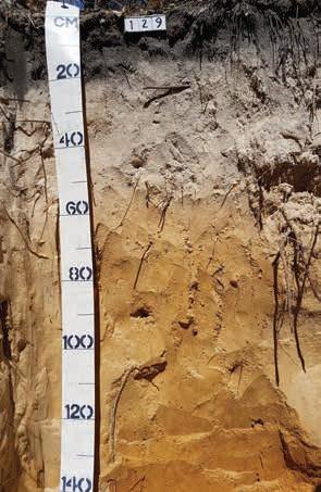
Pale deep sand (with coloured sandy subsoil)
Note: WA Soil Group names are in italics
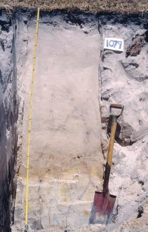
Pale deep sand (over clay)
89 If the topsoil has been disturbed, the organic matter often blows away leaving the surface looking pale grey to white.
90 Clay content in the topsoil is typically less than 5% and the iron coating of the grains found in the coloured sands is largely absent.
91 Coffee rock is a local name for soil horizons with accumulations of organic matter, aluminium and/or iron.
Geology, soils and climate of Western Australia’s wine regions 68
Figure 4.13: Examples of Pale deep sand soils from the south-west wine regions
Pale deep sands and grapevines
As stated above, these sands are rarely, if ever, sought out for planting grapevines. Although they allow for deep-rooted vines and are generally very well drained, moisture and nutrient retention is very low in the absence of clay and iron. The finer-grained sands hold moisture better than medium- to coarse-grained sands. Soils in which the texture increases with depth has better storage capacity.
The performance of grapes on these sands is greatly influenced by the nature of the subsoil. A yellow sand or a subsoil with ferricrete nodules and pisoliths can improve moisture retention and prevent nutrients from leaching below the roots.92 The presence of a clay horizon below 80 cm will also dramatically improve subsoil retention but may increase the risk of subsurface waterlogging.
Our estimates show that these sands currently support about 6% of the vines planted across the wine regions—the real figure may be less than this.93 Although these soils tend to be avoided where possible, pockets of Pale deep sands often occur in areas of more favourable soils and thus are included in many of the plantings. These patches require careful management, not only for irrigation and fertiliser application, but also for non-wetting and pH issues.
Alluvial sands and loams
Around 40,000 ha across the wine regions with about 470 ha under vines.
The Alluvial sands and loams are a variable mix of soils that could otherwise be grouped with either the Red–brown loams or Coloured deep sands. Their distinguishing feature is that they have formed in more recent alluvial deposits.94 These are deep, well-drained, mostly brown to red–brown coloured loamy sands to sandy clay loams. They occur on flat landforms and have a relatively high inherent fertility.
Distribution
The Alluvial sands and loams are found in most wine regions but comprise less than 2% of the soils in any region.95 East of the Darling Scarp and south of the Whicher Scarp they occur in long narrow strips on the floor of major valleys such as those of the Blackwood and Preston Rivers.
They can cover broader areas on the Swan Coastal Plain, notably in the Swan Valley, around Harvey and at Jindong south-east of Busselton. Here these soils are found on alluvial fans at the base of the scarps and along the banks and terraces of major rivers that meander across the coastal plains. The alluvial deposits in which these soils have formed are mostly derived from recent erosion96 of the Yilgarn Craton, with the Donnybrook Sunkland being an important source of alluvium south of Bunbury.
92 Native vegetation (e.g. the presence of marri trees) is a good indication of these better subsoils.
93 See Appendix E for an explanation.
94 Rather than over freshly weathered crystalline rocks (Red–brown loams) or as colluvial (Red–brown loams and Coloured deep sands) and windblown deposits (Coloured deep sands).
95 They are very minor soils of the Manjimup, Pemberton and Perth Hills regions, which together have less than 200 ha of the Alluvial sands and loams.
96 Recent in geological terms, probably over the past 10,000 years or so.
Geology, soils and climate of Western Australia’s wine regions 69
Tall woodlands and forests of marri (Corymbia calophylla), and sometimes blackbutt (Eucalyptus patens), once grew on these soils before clearing the land for agriculture, but in most cases only remnants remain, typically on road verges.
In the Margaret River wine region these soils are often referred to as ‘Marybrook loams’,97 whereas in the Swan Valley subregion these soils are known as Houghton, Belhus, Swan and Pyrton (series names as mapped by Pym in 1955).
Soil description
The topsoil textures are typically a rich brown to reddish–brown loamy sand to clay loam. Sand particles, where present, tend to be fine- to medium-grained. There is often a build-up of organic matter in the surface 10–40 cm resulting in a darker brown colour (Figure 4.14). Topsoils with higher organic or clay content are often friable and crumbly, and some of the sandier topsoils are loosegrained or weakly cohesive. The topsoils generally have a neutral to slightly acid pH.
Subsoils are usually brown to reddish–brown colour, sometimes yellowish–brown. Some slight mottling may be present. The topsoil texture can extend to more than a metre deep, but there is more often a gradual increase in clay content down the profile. The texture is often a sandy clay loam to medium clay at 50–80 cm. In some cases, there is a clear boundary between a loamy topsoil and clayey subsoil at around 50 cm or more. The subsoils are usually porous due to good structure or an earthy or sandy fabric. They are typically neutral in pH.
Soil classification
In terms of the Soil Groups of Western Australia, around half of the Alluvial sands and loams are Brown deep sands or Brown loamy earths with some Brown deep loamy duplexes, Friable red–brown loamy earths and Red and Brown sandy earths
In terms of the Australian Soil Classification, the Alluvial sands and loams are mainly Brown and Red Kandosols. There are also some Chromosols, Arenosols and Dermosols
Alluvial sands and loams and grapevines
These soils provide a good to excellent growth medium for grapevines. Their structured/porous subsoils provide few barriers to root growth and water movement down the profile. They are generally well drained, although the flat landscape and clayey subsoils can lead to subsurface waterlogging in some places. Some of these soils can also be prone to occasional flooding due to their proximity to major rivers.98
The texture and porosity of Alluvial sands and loams means they have a moderate to high capacity to store and supply water to the vine roots. Except in the sandier profiles, there is usually sufficient clay content throughout the profile to hold water. The deep sandy profiles tend to have superior water-holding capacity compared to most other deep sands found across the wine regions.
97 This term is applied to those alluvial soils in which the texture is a loamy or clayey sand as well as those that are truly loams.
98 Flooding is more of an issue in the Swan Valley than the Marybrook–Jindong district.
Geology, soils and climate of Western Australia’s wine regions 70
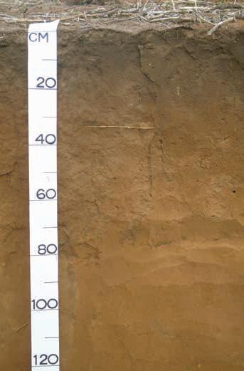
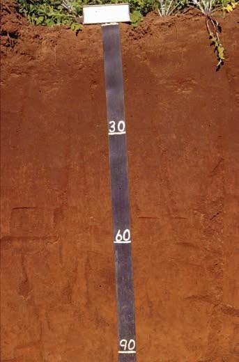
Note: WA Soil Group names are in italics
These recent alluvial deposits typically have higher inherent fertility than most soils found across the wine regions. The organic matter and clay content help retain added fertilisers, though phosphorous binding may be an issue in the redder soils. The favourable moisture and nutrient properties of the Alluvial sands and loams can lead to over-vigorous growth (especially in higher rainfall areas) and many viticulturalists consider that vines on these soils require careful management to achieve a balanced canopy (Lantzke and Goldspink, 2000).
We estimate that the Alluvial sands and loams currently support about 4% of the vines planted across the wine regions. These are overwhelmingly on the Swan Coastal Plain, mainly in the Marybrook-Jindong district of the Margaret River wine region, with most of the remainder in the Swan Valley subregion.99
Minor soils
There is a mixture of other soils supporting vines across all the regions, but these are much less common or desirable for planting than the others described above because of inherent challenges. These are mainly Heavy soils, Shallow sands and Alkaline soils, collectively making up about 10% of all the regions and supporting just 7% of the vines.
99 Of all the Main Soils, the Alluvial sands and loams have the highest proportional area planted to wine grapes. Across the wine regions, 1.5% of all these soils are producing wine. All other soils have less than 0.5% of their total area planted.
Geology, soils and climate of Western Australia’s wine regions 71
Figure 4.14: Examples of Alluvial sands and loams from the south-west wine regions
Brown deep sand Red sandy earth
Heavy soils
Around 258,400 ha across the wine regions with about 330 ha under vines.
We have grouped a variety of soils as Heavy soils. What they have in common is a clay texture within the top 30 cm of the profile. Most of these soils are shallow duplexes, with a thin topsoil of sand or loam over a clay subsoil.
The Heavy soils are minor soils in most wine regions.100 Around three-quarters of them are in the Great Southern region, mostly concentrated in the north-east beyond the Porongurup subregion. They are also locally significant along the eastern half of the Swan Coastal Plain.101 Vegetation on the Heavy soils is varied and includes woodlands of wandoo (Eucalyptus wandoo) or moort (E. platypus).
In the duplex profiles the topsoil is predominantly a grey–brown (occasionally yellow–brown or red–brown) sand to clayey sand texture. Some of the profiles have a sandy loam to loam surface horizon. The topsoils are shallower than 30 cm and usually have a neutral to acid pH. They may be loose or hardsetting.
The duplex subsoils are medium to heavy clays, typically poorly structured. Colours range from yellow–brown to grey and mottling is often present. Subsoil pH is often slightly acid, but alkaline and calcareous subsoils are also common. These clays are often sodic.
Those profiles with clay at the surface are typically a grey colour but sometimes red–brown. They are often hardsetting but may swell when wet and shrink and crack when dry.
Some of the Heavy soils can be quite suitable for grapegrowing, especially those where the clay is moderately to well structured. These soils have high moisture and nutrient storage capacity. However, in many of the Heavy soils, poorly structured clays create an impediment to vine root development and water movement down the profile. Drainage can be a problem in these soils, especially on the Swan Coastal Plain or where they occur in low-lying landscape positions.
We estimate that the Heavy soils currently support less than 3% of the vines planted across the wine regions. About half of these are in the Great Southern region, with most of the remainder in the Swan District, Geographe and Margaret River regions.
Soil classification
In terms of the Soil Groups of Western Australia, the most common Heavy soils are Grey shallow sandy duplexes with some Alkaline grey shallow sandy duplexes, Grey shallow loamy duplexes and Yellow–brown shallow sandy duplexes
In terms of the Australian Soil Classification, the Heavy soils include Yellow and Grey Sodosols and Chromosols (sometimes Calcic).
100 Only in the Great Southern region (where they comprise 10% of the soils) do they cover more than 5% of the total area.
101 Running through the Swan District, Peel and Geographe regions.
Geology, soils and climate of Western Australia’s wine regions 72
Shallow sands
Around 131,000 ha across the wine regions with about 220 ha under vines.
The Shallow sands are sandy soils with a solid substrate forming a barrier to roots at 30–80 cm depth. They are scattered in pockets across most wine regions but comprise less than 5% of the soils in any region and only 3% of the total area of the wine regions. Not surprisingly, most shallow sands are in the Great Southern region and are prominent on the Stirling Range. Here they comprise loose grey to yellow–brown medium to coarse coloured sands with many rocks and boulders of sandstone and quartzite. The vegetation on these soils is a species-rich heath.
Away from the Stirling Range, Shallow sands are often on the lateritic uplands102 in association with Ironstone gravels. Here they are typically loose grey to yellow–brown medium-grained sands, sometimes with ferruginous nodules and pisoliths at depth. Clay content is less than 10% and pH is neutral to acid. The substrate is usually an ironstone duricrust and the vegetation is jarrah (Eucalyptus marginata) and bull banksia (Banksia grandis) woodlands. Shallow sands are also found where granite is exposed on hills and in valleys. Here the sand may be gritty.
In the dunes along the west coast, Shallow sands are found in association with the Coloured deep sands, where loose brown to yellow–brown medium sands sit on top of Tamala Limestone. Limestone boulders are sometimes present. pH is neutral.
Shallow sands have many similar properties to Pale deep sands and Coloured deep sands, with the obvious difference being the limitation to rooting depth. This barrier is not always impenetrable. In areas of laterite duricrust, some vine roots may find their way through cracks to exploit the clay present below the duricrust layer. Stones and boulders are often present in these sands.
The limited soil depth has a major impact on soil water storage in the profile, especially considering the very low to low clay content of these sands. This problem is exacerbated where many rocks are present in the sand. Despite this, some viticulturalists have actively sought out these sands for planting. They believe that the limited root depth and water storage allows them to practice regulated deficit irrigation. This controls how much water the vines access (especially between fruit set and veraison103) and manipulate fruit development (White and Krstic 2019) with the added benefit of saving water if supplies are scarce. The presence of rocks can also present problems for preparing the ground for planting vineyards and moving machinery around the vineyard. We estimate that the Shallow sands currently support about 2% of the vines planted across the wine regions, most of which are in the Margret River region, with much of the remainder in the Great Southern.
Soil classification
In terms of the Soil Groups of Western Australia, around half the Shallow sands are Stony soils with the remainder as Pale shallow sands and Yellow–brown shallow sands.
102 On Darling Range, Donnybrook Sunkland and Dandaragan Plateau as well as on laterite formed over the Leeuwin Complex.
103 The start of ripening and colour change of grapes.
Geology, soils and climate of Western Australia’s wine regions 73
Alkaline soils
Around 83,500 ha across the wine regions with about 30 ha under vines.
Despite calcareous soils being a prominent feature of many winegrowing regions around the world, Alkaline soils are insignificant in WA viticulture. This is partly due to their relative scarcity in the winegrowing areas of the south-west. Where they do occur, the location is often undesirable as are the characteristics of many local Alkaline soils.
Alkaline soils are minor soils in the wine regions of WA, only covering around 2% of the total area. These are a mixture of soils that share the characteristic of a subsoil with an alkaline pH.104 Most are also calcareous throughout.
Over half of the Alkaline soils are deep sands in which the component grains are a mixture of quartz, coral and seashell fragments. These sands dominate a narrow strip of dunes and beach ridges that run along the coasts of the Indian and Southern Oceans.
These sands have a pale grey–brown colour, with the surface sometimes stained black through the presence of organic matter. They can be several metres deep. Limestone is often present in the profile, sometimes close to the surface. These sands have a very low clay content and a high pH throughout.
Away from the coast, Alkaline soils are mostly found in association with Heavy soils, mainly in the north-east of the Great Southern region.105 Here, there is a clear boundary between the grey sandy topsoils and the mottled yellow or grey clay subsoils at around 50 cm. Although the topsoil typically has a neutral to slightly acid pH, the subsoil is alkaline and often calcareous. These subsoils are often sodic and poorly structured.
The deep coastal sands are well drained but have poor moisture- and nutrient-holding abilities. Proximity to the coast and exposure to strong, salt-laden winds, coupled with rugged terrain on some dunes, are other reasons these soils are rarely used for vines.
Inland, Alkaline soils tend to occur in areas of lower rainfall where there are unsuitable water supplies for irrigation. Poor subsoil structure can also limit rooting depth and drainage.
Soil classification
In terms of the Soil Groups of Western Australia, the Alkaline soils found around the coast are mostly Calcareous deep sands with some Calcareous shallow sands and Calcareous stony soils Inland, they are mostly Alkaline grey deep sandy duplexes
104 Excluded are those soils that have a clay subsoil with an alkaline pH within 30 cm of the surface—these are grouped with the Heavy soils.
105 They are also found along the eastern half of the Swan Coastal Plain, running through the Swan District, Peel and Geographe wine regions.
Geology, soils and climate of Western Australia’s wine regions 74
Difficult soils
Around 849,000 ha across the wine regions with about 260 ha under vines.
The Difficult soils comprise a mixed collection of soils. What they share is challenging issues with regards to successfully growing grapevines. They include soils found in areas subject to extended periods of waterlogging, areas of saline soils, areas of rock outcrop and very shallow soil. Despite this, some vines are planted on Difficult soils.
The Difficult soils cover up to 20% of the total area of most individual wine regions. Extensive areas of wet, low-lying country are found across the Swan Coastal Plain and along the south coast. These waterlogged soils range from deep sands to heavy clays and shallow loams over impenetrable bog iron. The soils remain wet well into the vine growing season. With suitable drainage, some of these soils may be productive, but this option is often impractical or too expensive.
Waterlogged soils are also encountered further inland where they tend to cover smaller areas. One of the more significant inland occurrences is around Lakes Muir and Unicup on the border between the Manjimup and Great Southern Wine regions. Upstream from here a strip of waterlogged soils follows the alluvial flats of the Gordon River. Adjacent to the northern edge of the Stirling Range, where salinity often occurs in combination with waterlogging, many of the soils are totally unsuitable for grapes. Smaller areas of soils subject to salinity and waterlogging occur in other wine regions, mostly inland, but also on the coastal plains.
Areas of rock outcrop and very shallow soils are probably most prominent on the Stirling and Porongurup Ranges as well on the coastal headlands of the Margaret River and Great Southern wine regions. Smaller areas of these soils are scattered throughout the Yilgarn Craton and Albany–Fraser Orogen, especially where hills rise above the lateritic plateau or on steep valley slopes.
Our estimate is that just under 2% of all vines in the south-west of WA are found on these soils. In some cases, this may reflect poor site selection, but few vineyards are established on land in which Difficult soils predominate. Small patches of Difficult soils have been planted with vines in some vineyards, but typically only when surrounded by more desirable soil. In some cases, the Difficult soils have been modified (e.g. by drainage or mounding) before planting.
Soil classification
In terms of the Soil Groups of Western Australia, around half the Difficult soils are Semi-wet soils and Wet soils with lesser areas of Bare rocks and Saline wet soils
Geology, soils and climate of Western Australia’s wine regions 75
Western
wine regions 76
Geology, soils and climate of
Australia’s
5 Climate
Only a few areas of the world—including southern Europe, California, central Chile, the Western Cape region of South Africa, and the south-west of WA—enjoy a ‘Mediterranean climate’ dominated by cool wet winters and warm to hot dry summers (see Box 5.1).
Although evidence of winemaking dates back at least 7,000 years, the wines that we recognise today had their origins with the Phoenicians and Greeks106 who colonised the land around the Mediterranean Sea—wine made its real home in the Aegean, Italy, France and Spain (Johnson and Robinson 2019). Consequently, this Mediterranean climate, with its beneficial growing and ripening conditions, along with its relatively steady and predictable nature, presents distinct benefits for the viticultural industry. It is no coincidence that some of the world’s premium wines are produced from regions experiencing a similar climate, even though this climate type covers only around 2% of global land surfaces.107
The drivers of this climate pattern are subtropical ridges that lie at mostly between 30–35° latitude in both hemispheres. These are belts of anticyclones or high-pressure cells, which direct air in an anticlockwise direction in the southern hemisphere.108 They are characterised by fine, dry conditions with few clouds and little rain.
In summer, the Southern Subtropical Ridge moves southwards as the region of maximum solar heating shifts into the Southern Hemisphere. High-pressure cells are often located in the Great Australian Bight and direct warm, dry air from the inland of the continent over the south-west of WA, suppressing precipitation and cloud formation. The heat of the day is typically ameliorated by afternoon sea breezes.
In winter, the Southern Subtropical Ridge retreats northwards allowing the penetration of cold fronts generated in the Southern Ocean on the boundary between cold polar and warmer subtropical air. These fronts—associated with low-pressure cells that move moisture-laden air in a clockwise direction—bring rain that has been scarce over the preceding months.
Comparative climate summaries for all regions are in Appendix F, including a map indicating the climate data points used for the south-west wine region analysis. Detailed climate maps and tables for individual regions are in Part 2 of this document. Unless otherwise stated, all climate data are from the SILO database109 and the Australian Bureau of Meteorology (BoM).
106 Starting around 3,000 years ago.
107 These include Provence and the southern Rhone Valley (France), Tuscany (Italy), Andalusia (Spain), Napa Valley and Sonoma (California), the Western Cape (South Africa), Coonawarra and the Barossa Valley (South Australia).
108 They direct air in a clockwise direction in the northern hemisphere.
109 SILO (Scientific Information for Land Owners), https://www.longpaddock.qld.gov.au/silo/
Geology, soils and climate of Western Australia’s wine regions 77
Box 5.1: Six seasons, not four
After living continually in the south-west of WA for more than 45,000 years, the Noongar (First Nations) people have a deep knowledge of their country (South-west Aboriginal Land and Sea Council n.d.). Noongar people recognise 6 seasons, rather than the 4 seasons imported by European settlers 200 years ago.
Noongar people rely on natural signs or triggers such as timing of budding flowers or ripening fruit, animal hibernation or changing rainfall, rather than dates, to direct their activities through the year.110 Their 6 seasons are:
• Birak – first summer; dry and hot (around December and January)
• Bunnuru – second summer; hottest part of the year (around February and March)
• Djeran – autumn; cooler weather begins (around April and May)
• Makuru – winter; wettest time of the year (around June and July)
• Djilba – first spring; coldest time of the year (around August and September)
• Kambarang – second spring; warming period (around October and November).
There are parallels in the way that Noongar activities are based on observed seasonal triggers, rather than calendar dates, and the way many viticulturists manage their vines throughout the year. As shown by Pearce and Coombe (2004), the growth stages of the vines, rather than calendar dates, often provide cues for vine management.
Rainfall summary
Mean annual rainfall across the wine regions of WA ranges from around 1,250 mm in areas fronting the Southern Ocean to around 350 mm along the inland margins (Figure 5.1). Most rain falls during the winter dormancy of the vines across all regions (Figure 5.2).
Although there is a general pattern of rainfall decreasing from the south to the north and from the west to the east, landforms also play a role. Wine regions extending from the Indian Ocean coast across the Darling Scarp, such as Perth Hills, Geographe and Peel, all benefit from the orographic effect of its sudden rise in elevation above the coastal plain, bringing increased rainfall (Figure 5.1). The map also shows the rain shadow effect north of the Stirling Range in the Great Southern wine region.111
110 More information about Noongar seasons is available from https://www.noongarculture.org.au/food/ and from the BoM at http://www.bom.gov.au/iwk/calendars/nyoongar.shtml
111 Because there is no climate station in the Stirling Range National Park, Figure 5.1 does not show its orographic effect, with higher localised rainfall than the surrounding land (Stuart-Street and Marold 2009).
Geology, soils and climate of Western Australia’s wine regions 78
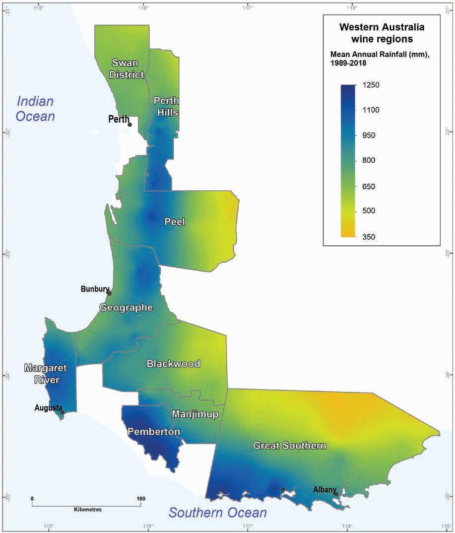
5.1: Mean annual rainfall for the WA wine regions (1989–2018)
Geology, soils and climate of Western Australia’s wine regions 79
Figure
McFarlane et al. (2020) observes that compared with other areas of similar latitudes (28°–34°S) the south-west of WA is wetter than expected. Coastal land at similar latitudes in South America and southern Africa are deserts, with climates mainly driven by cold, north-flowing coastal ocean currents. The Indian Ocean has a similar anticlockwise flowing current bringing Antarctic water up the west coast of Australia, but this is countered by a strong southerly-flowing tropical offshoot that hugs the coastline—the Leeuwin Current. Beginning seasonally off the north-west of WA, the Leeuwin Current transports warmer tropical waters nearshore, down the west coast, around the capes and eastward to the Great Australian Bight. The outcome is annual rainfall totals that are up to 400 mm higher in the south-west than for coastal locations in equivalent latitudes112 (McFarlane et al. 2020).
Remenyi et al. (2019) shows that, compared with other Australian wine regions, the WA regions receive some of the highest non-growing season (May-September) rainfall. Conversely, WA wine regions receive some of the lowest growing season (October to April) rainfall in Australia.113
Millimetres (mm)
Geographe
Growing season rainfall (Oct–Apr)
Mean winter rainfall (May–Sept) 0
Figure 5.2: Mean annual rainfall (1989–2018) across each wine region in the south-west of WA for the growing season (October to April) and winter (May to September)
112 Long-term annual mean rainfall at Bunbury (Geographe Region; 33°33′S) is 871 mm, compared to 515 mm at Cape Town (South Africa; 33°55′S) and 462 mm at Valparaiso (Chile; 33°10′S).
113 For comparison, in this bulletin we have retained the Australian convention of the viticultural growing season—October to April—despite budburst typically occurring in September (or even late August in the north) and harvest completing as early as the end of February in the Swan District (and often well underway by mid-March in the south).
Geology, soils and climate of Western Australia’s wine regions
80
200 400 600 800 1,000
1,200
Pemberton
Margaret River
Perth Hills
Manjimup
Peel
Blackwood
Great Southern
Swan District
Figure 5.2 shows the mean rainfall across the entire area of each of WA’s regions. We subdivided the rainfall for each region into two components—growing season rainfall (October to April) and winter rainfall (May to September). About 65–80% of annual rain in the south-west of WA falls between May and September, with much of the remainder coming in April or October. Only 10–20% falls between November and March. Although these rainfall patterns are strongly seasonal, they are generally reliable and rarely vary by more than 20% from the annual mean.
Temperature indices for viticulture
Gladstones (2011) considers temperature central to all aspects of viticulture, calling it the ‘driving force’. Viticulturists use several specific temperature measurements or indices to select suitable grape varieties or predict important seasonal phases of vine growth, such as budburst or harvest. In this section, we present maps of these indices:
• mean growing season temperature (GST) covering October to April (Figure 5.3)
• mean January temperature (MJT) representing the mean temperature throughout the day across January, the warmest month (Figure 5.4)
• growing degree days (GDD) – a measure of heat (between 10 and 19 °C) accumulation114 predicting the vines’ development rates for the growing season months of October to April115 (Figure 5.5)
• biologically effective degree days (BEDD) – linked to the GDD calculation and adjusted for latitude/daylength and accounting for diurnal temperatures116 (Figure 5.6)
• diurnal temperatures – a mean of the daily range between the minimum and maximum mean daily temperature from October to April (Figure 5.7).
The GST, MJT, GDD and BEDD maps all show similar trends—the coolest temperatures are in the regions adjacent to the Southern Ocean (closer to Antarctica) and the highest temperatures occur from Perth northwards (closer to the tropics).
Jarvis et al. (2017), Hall and Jones (2010), and Dry and Coombe (2004) provide more details about these indices. Further climate details for each wine region in south-west WA and other Australian regions are in Remenyi et al. (2019).
Appendix F shows, in tabular form, the mean value for each of these temperature indices across each of WA’s wine regions.
114 These calculations use the base 10 method (Hall and Jones 2010).
115 More recently, Jarvis et al (2017) suggest that September to March may be more appropriate.
116 Hall and Jones (2010).
Geology, soils and climate of Western Australia’s wine regions 81
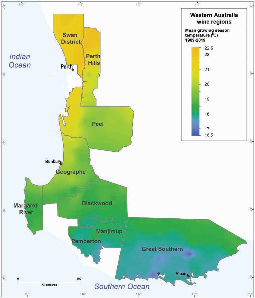
The Swan District and Perth Hills regions have mean GSTs of up to 22.5 °C. These are some of the highest temperatures found across all of Australia’s wine regions (Remenyi et al. 2019). At the other end of the scale, mean GSTs are less than 18 °C over much of the Pemberton and Great Southern regions and as low as 16.5 °C in some parts of the Great Southern.
wine regions 82
Geology, soils and climate of Western Australia’s
Figure 5.3: Mean growing season temperatures for south-west WA (1989–2019)
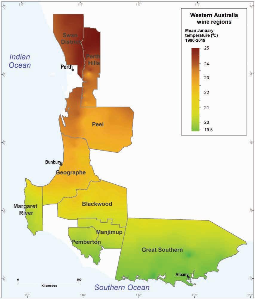
5.4: Mean January temperatures for all WA wine regions (1989–2019)
MJTs range from 25 °C in the east of the Swan District and north of the Perth Hills to 19.5 °C in the south of the Great Southern.
Geology, soils and climate of Western Australia’s wine regions 83
Figure
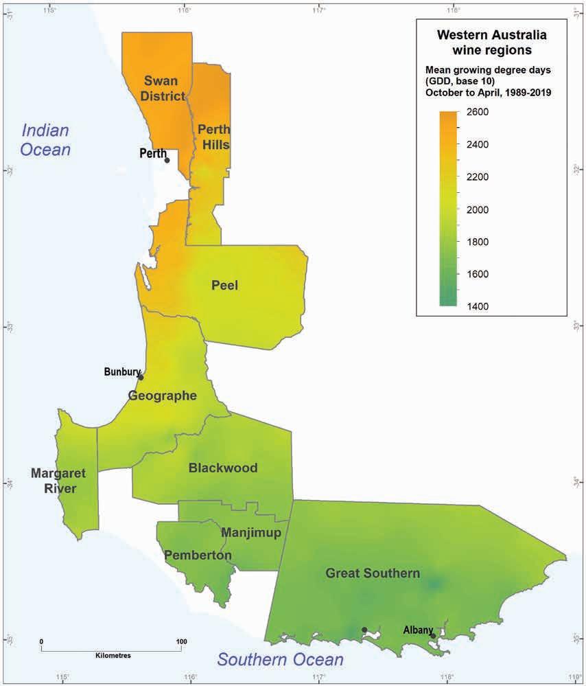
GDDs range from 2,600 in the north to 1,400 in the south, with BEDDs ranging from 1,800 to 1,200 (Figure 5.6).
wine regions 84
Geology, soils and climate of Western Australia’s
Figure 5.5: Growing degree days for WA wine regions (1989–2019)
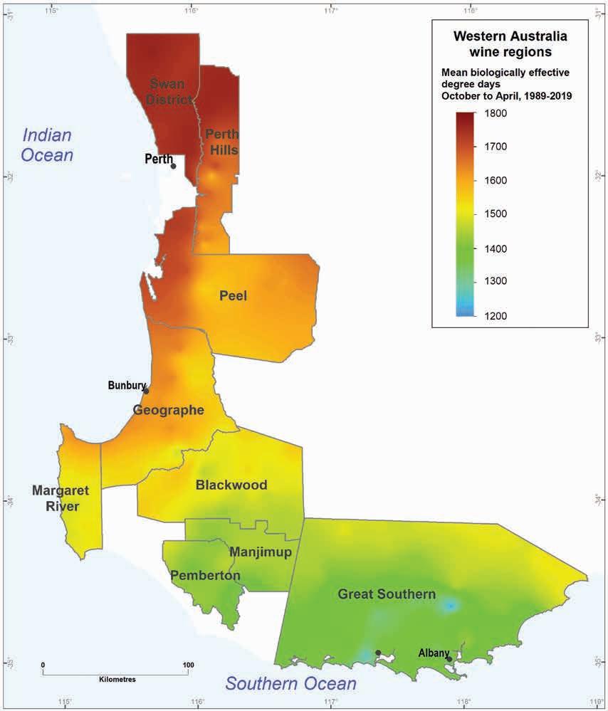
5.6: Mean biologically effective degree days for WA wine regions (1989–2019)
Geology, soils and climate of Western Australia’s wine regions 85
Figure
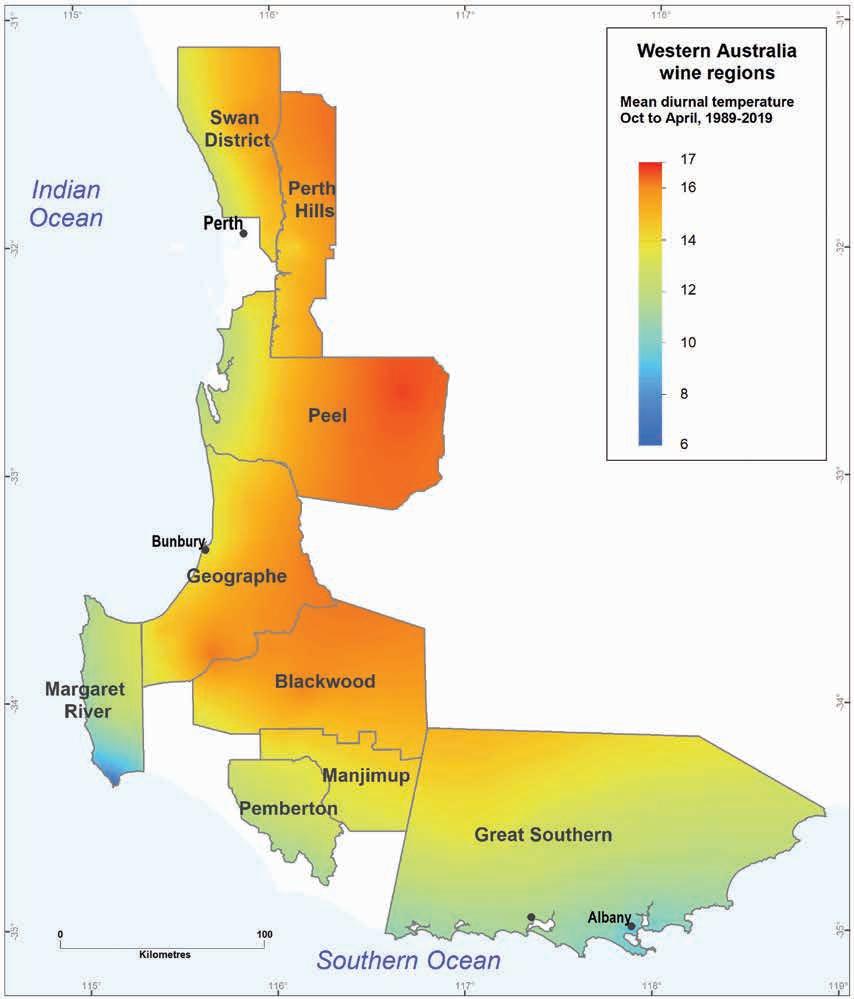
Within regions, areas closer to the coasts have a stronger maritime influence, usually bringing more moderate temperatures in both winter and summer. Figure 5.7 shows a trend for diurnal temperature ranges (the difference between daily minimum to maximum temperatures during the growing season) to increase with distance from the coast. This change is due to increasing elevation and decreasing maritime influences and is particularly pronounced when travelling east across the Darling Scarp.
Geology, soils and climate of Western Australia’s wine regions
86
Figure 5.7: Mean diurnal temperatures (October to April) for WA wine regions (1989–2019)
The highest diurnal ranges (up to 17 °C) occur furthest inland on the eastern margin of the Peel region. Naturally, the regions extending furthest inland display the greatest variation in seasonal diurnal temperature range.
The moderating maritime influence is strongest in the Margaret River region, which fronts 2 oceans, and along the coast of the Great Southern region. The lowest diurnal range is around 6 °C at Cape Leeuwin (south-western tip of Australia, Figure 5.8). The moderating influence extends further inland from the Southern Ocean than from the Indian Ocean, with the diurnal range increasing to 15 °C within 30 km of the coast in the Swan District region while remaining below this value 100 km inland from Albany (Figure 5.9).
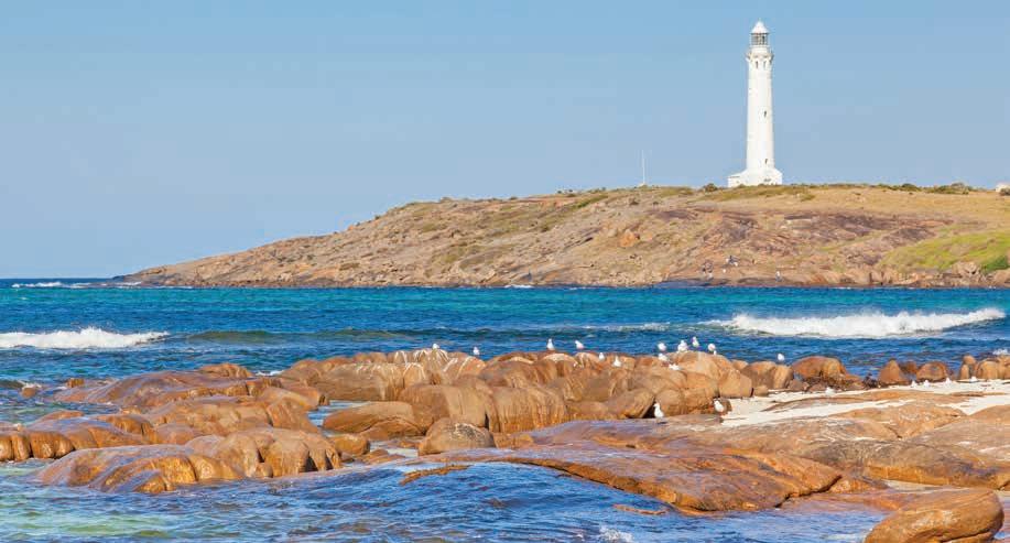
Figure 5.8: Cape Leeuwin lighthouse at the south-west tip of Australia, at the approximate meeting point of the Indian and Southern Oceans
Figure 5.9: Satellite image (BoM, 15:00 WST 03022021) showing how climatic influences from the south coast can move a long way north; arrows represent wind direction
Geology, soils and climate of Western Australia’s wine regions 87
Wind patterns
Winds play a big role in the moderating maritime influence, significantly affecting both daily and seasonal temperatures across the wine regions. A defining characteristic of the south-west is the regular spring and summer pattern of easterly winds that arrive overnight and continue until morning (Figure 5.10), then make way for moist sea breezes later in the day (Figure 5.11).
6. Manjimup (Manjimup Region)
9. Mt Barker (Great Southern Region)
Figure 5.10: Wind roses for 9am January (BoM) from selected locations in each region showing overall dominance of east to south-easterly winds in summer
Geology, soils and climate of Western Australia’s wine regions 88 Rose of Wind direction versus Wind speed in km/h (01 May 1944 to 11 Aug 2022) Custom times selected, refer to attached note for details PERTH AIRPORT Site No: 009021 Opened Jan 1944 • Still Open Latitude: -31.9275° Longitude: 115.9764° Elevation 15.m An asterisk (*) indicates that calm is less than 0.5%. Other important info about this analysis is available in the accompanying notes. SE SW >= 0 and < 10 km/h CALM >= 10 and < 20 >= 20 and < 30 >= 30 and < 40 >= 40 9 am Jan 2417 Total Observations 10% 20% 30% 40% Calm 4% Copyright © Commonwealth of Australia 2022 Prepared on 11 Aug 2022 Prepared by the Bureau of Meteorology. Contact us by phone on (03) 9669 4082, by fax on (03) 9669 4515, or by email on climatedata@bom.gov.au We have taken all due care but cannot provide any warranty nor accept any liability for this information. TCZMONTH Page 1 Rose of Wind direction versus Wind speed in km/h (01 Jan 1957 to 03 Aug 2022) Custom times selected, refer to attached note for details DONNYBROOK Site No: 009534 Opened Jan 1900 Still Open Latitude: -33.5719° • Longitude: 115.8247° Elevation 63m An asterisk (*) indicates that calm is less than 0.5%. Other important info about this analysis is available in the accompanying notes. N NE E W NW CALM >= 0 and < 10 km/h >= 20 and < 30 >= 40 9 am Jan 1942 Total Observations 10% 20% 30% Calm 5% Copyright © Commonwealth of Australia 2022 Prepared on 11 Aug 2022 Prepared by the Bureau of Meteorology. Contact us by phone on (03) 9669 4082, by fax on (03) 9669 4515, or by email on climatedata@bom.gov.au We have taken all due care but cannot provide any warranty nor accept any liability for this information. TCZMONTH Page 1 Rose of Wind direction versus Wind speed in km/h (17 Apr 1999 to 26 Oct 2021) Custom times selected, refer to attached note for details WITCHCLIFFE Site No: 009746 Opened Apr 1999 Closed Oct 2021 Latitude: -34.0281° Longitude: 115.1042° Elevation 80m An asterisk (*) indicates that calm is less than 0.5%. Other important info about this analysis is available in the accompanying notes. N SE S SW >= 0 and < 10 CALM >= 10 and < 20 >= 20 and < 30 >= 30 and < 40 >= 40 9 am Jan 672 Total Observations 10% 20% 30% 40% 50% Calm * Copyright © Commonwealth of Australia 2022 Prepared on 11 Aug 2022 Prepared by the Bureau of Meteorology. Contact us by phone on (03) 9669 4082, by fax on (03) 9669 4515, or by email on climatedata@bom.gov.au We have taken all due care but cannot provide any warranty nor accept any liability for this information. TCZMONTH Page 1 Rose of Wind direction versus Wind speed in km/h (05 Mar 1998 to 10 Aug 2022) Custom times selected, refer to attached note for details BRIDGETOWN Site No: 009617 • Opened Dec 1997 Still Open Latitude: -33.9486° Longitude: 116.1311° • Elevation 178.6m An asterisk (*) indicates that calm is less than 0.5%. Other important info about this analysis is available in the accompanying notes. N NE E W NW CALM >= 0 and < 10 km/h >= 20 and < 30 >= 40 9 am Jan 715 Total Observations 10% 20% 30% Calm 1% Copyright © Commonwealth of Australia 2022 Prepared on 11 Aug 2022 Prepared by the Bureau of Meteorology. Contact us by phone on (03) 9669 4082, by fax on (03) 9669 4515, or by email on climatedata@bom.gov.au We have taken all due care but cannot provide any warranty nor accept any liability for this information. TCZMONTH Page 1 Rose of Wind direction versus Wind speed in km/h (01 Jan 1957 to 11 Aug 2022) Custom times selected, refer to attached note for details PEMBERTON Site No: 009592 • Opened Jan 1941 Still Open Latitude: -34.4478° Longitude: 116.0433° Elevation 174m An asterisk (*) indicates that calm is less than 0.5%. Other important info about this analysis is available in the accompanying notes. N SE SW >= 0 and < 10 CALM >= 10 and < 20 >= 20 and < 30 >= 30 and < 40 >= 40 9 am Jan 1929 Total Observations 10% 20% 30% Calm 3% Copyright © Commonwealth of Australia 2022 Prepared on 11 Aug 2022 Prepared by the Bureau of Meteorology. Contact us by phone on (03) 9669 4082, by fax on (03) 9669 4515, or by email on climatedata@bom.gov.au We have taken all due care but cannot provide any warranty nor accept any liability for this information. TCZMONTH Page 1 Rose of Wind direction versus Wind speed in km/h (01 Jan 1957 to 11 Aug 2022) Custom times selected, refer to attached note for details MANJIMUP Site No: 009573 Opened Jan 1915 Still Open Latitude: -34.2508° Longitude: 116.145° Elevation 286.m An asterisk (*) indicates that calm is less than 0.5%. Other important info about this analysis is available in the accompanying notes. N NE E W NW CALM >= 0 and < 10 km/h >= 20 and < 30 >= 40 9 am Jan 1958 Total Observations 10% 20% 30% Calm 10% Copyright © Commonwealth of Australia 2022 Prepared on 11 Aug 2022 Prepared by the Bureau of Meteorology. Contact us by phone on (03) 9669 4082, by fax on (03) 9669 4515, or by email on climatedata@bom.gov.au We have taken all due care but cannot provide any warranty nor accept any liability for this information. TCZMONTH Page 1 Rose of Wind direction versus Wind speed in km/h (01 Jan 1957 to 08 Aug 2022) Custom times selected, refer to attached note for details MOUNT BARKER Site No: 009581 Opened Jan 1886 Still Open Latitude: -34.625° • Longitude: 117.6361° Elevation 300m An asterisk (*) indicates that calm is less than 0.5%. Other important info about this analysis is available in the accompanying notes. N SE SW >= 0 and < 10 CALM >= 10 and < 20 >= 20 and < 30 >= 30 and < 40 >= 40 9 am Jan 1351 Total Observations 10% 20% 30% Calm 6% Copyright © Commonwealth of Australia 2022 Prepared on 11 Aug 2022 Prepared by the Bureau of Meteorology. Contact us by phone on (03) 9669 4082, by fax on (03) 9669 4515, or by email on climatedata@bom.gov.au We have taken all due care but cannot provide any warranty nor accept any liability for this information. TCZMONTH Page 1 Rose of Wind direction versus Wind speed in km/h (11 Feb 1994 to 11 Aug 2022) Custom times selected, refer to attached note for details BICKLEY Site No: 009240 Opened Jan 1969 • Still Open Latitude: -32.0072° Longitude: 116.1369° Elevation 384m An asterisk (*) indicates that calm is less than 0.5%. Other important info about this analysis is available in the accompanying notes. SE SW >= 0 and < 10 km/h CALM >= 10 and < 20 >= 20 and < 30 >= 30 and < 40 >= 40 9 am Jan 803 Total Observations 10% 20% 30% 40% 50% 60% Calm 1% Copyright © Commonwealth of Australia 2022 Prepared on 11 Aug 2022 Prepared by the Bureau of Meteorology. Contact us by phone on (03) 9669 4082, by fax on (03) 9669 4515, or by email on climatedata@bom.gov.au We have taken all due care but cannot provide any warranty nor accept any liability for this information. TCZMONTH Page 1 Rose of Wind direction versus Wind speed in km/h (01 Jan 1957 to 11 Aug 2022) Custom times selected, refer to attached note for details DWELLINGUP Site No: 009538 Opened Jan 1934 Still Open Latitude: -32.7103° Longitude: 116.0594° Elevation 267m An asterisk (*) indicates that calm is less than 0.5%. Other important info about this analysis is available in the accompanying notes. SE SW >= 0 and < 10 km/h CALM >= 10 and < 20 >= 20 and < 30 >= 30 and < 40 >= 40 9 am Jan 1917 Total Observations 10% 20% 30% Calm 2% Copyright © Commonwealth of Australia 2022 Prepared on 11 Aug 2022 Prepared by the Bureau of Meteorology. Contact us by phone on (03) 9669 4082, by fax on (03) 9669 4515, or by email on climatedata@bom.gov.au We have taken all due care but cannot provide any warranty nor accept any liability for this information. TCZMONTH Page 1
1. Perth Airport (Swan District Region)
4. Donnybrook (Geographe Region)
7. Witchcliffe (Margaret River Region)
2. Bickley (Perth Hills Region)
5. Bridgetown (Blackwood Region)
8. Pemberton (Pemberton Region)
3. Dwellingup (Peel Region)
High-pressure cells, typically situated over the Great Australian Bight, drive the easterly winds and, in most regions, bring warm, dry air from inland.117 The West Coast Trough, which usually develops parallel to the coast in an offshore location and is thought to relate to the Leeuwin Current, is also implicated in these seasonal patterns (Reason et al. 1999).
1. Perth Airport (Swan District Region)
Region)
(Perth Hills Region)
3. Dwellingup (Peel Region)
6. Manjimup (Manjimup Region)
Region)
8. Pemberton (Pemberton Region)
9. Mt Barker (Great Southern Region)
Figure 5.11: Wind roses for 3pm January (BoM) from selected locations in each region showing dominance of south coast (‘Albany Doctor’) and west coast (‘Fremantle Doctor’) summer seabreezes in many locations
117 The exception is locations close to the south coast where south-easterly winds come directly off the Southern Ocean.
Geology, soils and climate of Western Australia’s wine regions 89 Rose of Wind direction versus Wind speed in km/h (01 May 1944 to 11 Aug 2022) Custom times selected, refer to attached note for details PERTH AIRPORT Site No: 009021 Opened Jan 1944 • Still Open Latitude: -31.9275° Longitude: 115.9764° Elevation 15.m An asterisk (*) indicates that calm is less than 0.5%. Other important info about this analysis is available in the accompanying notes. SE SW >= 0 and < 10 km/h CALM >= 10 and < 20 >= 20 and < 30 >= 30 and < 40 >= 40 3 pm Jan 2413 Total Observations 10% 20% 30% 40% 50% Calm 1% Copyright © Commonwealth of Australia 2022 Prepared on 11 Aug 2022 Prepared by the Bureau of Meteorology. Contact us by phone on (03) 9669 4082, by fax on (03) 9669 4515, or by email on climatedata@bom.gov.au We have taken all due care but cannot provide any warranty nor accept any liability for this information. TCZMONTH Page 1 Rose of Wind direction versus Wind speed in km/h (01 Jan 1957 to 03 Aug 2022) Custom times selected, refer to attached note for details DONNYBROOK Site No: 009534 Opened Jan 1900 • Still Open Latitude: -33.5719° Longitude: 115.8247° Elevation 63m An asterisk (*) indicates that calm is less than 0.5%. Other important info about this analysis is available in the accompanying notes. N NE E S W NW CALM >= 0 and < 10 km/h >= 20 and < 30 >= 40 3 pm Jan 1708 Total Observations 10% 20% 30% Calm 3% Copyright © Commonwealth of Australia 2022 Prepared on 11 Aug 2022 Prepared by the Bureau of Meteorology. Contact us by phone on (03) 9669 4082, by fax on (03) 9669 4515, or by email on climatedata@bom.gov.au We have taken all due care but cannot provide any warranty nor accept any liability for this information. TCZMONTH Page 1 Rose of Wind direction versus Wind speed in km/h (17 Apr 1999 to 26 Oct 2021) Custom times selected, refer to attached note for details WITCHCLIFFE Site No: 009746 Opened Apr 1999 Closed Oct 2021 Latitude: -34.0281° Longitude: 115.1042° Elevation 80m An asterisk (*) indicates that calm is less than 0.5%. Other important info about this analysis is available in the accompanying notes. N SE S SW >= 0 and < 10 CALM >= 10 and < 20 >= 20 and < 30 >= 30 and < 40 >= 40 3 pm Jan 671 Total Observations 10% 20% 30% 40% Calm * Copyright © Commonwealth of Australia 2022 Prepared on 11 Aug 2022 Prepared by the Bureau of Meteorology. Contact us by phone on (03) 9669 4082, by fax on (03) 9669 4515, or by email on climatedata@bom.gov.au We have taken all due care but cannot provide any warranty nor accept any liability for this information. TCZMONTH Page 1 Rose of Wind direction versus Wind speed in km/h (05 Mar 1998 to 10 Aug 2022) Custom times selected, refer to attached note for details BRIDGETOWN Site No: 009617 • Opened Dec 1997 Still Open Latitude: -33.9486° Longitude: 116.1311° • Elevation 178.6m An asterisk (*) indicates that calm is less than 0.5%. Other important info about this analysis is available in the accompanying notes. N NE E S W NW CALM >= 0 and < 10 km/h >= 20 and < 30 >= 40 3 pm Jan 726 Total Observations 10% 20% 30% Calm * Copyright © Commonwealth of Australia 2022 Prepared on 11 Aug 2022 Prepared by the Bureau of Meteorology. Contact us by phone on (03) 9669 4082, by fax on (03) 9669 4515, or by email on climatedata@bom.gov.au We have taken all due care but cannot provide any warranty nor accept any liability for this information. TCZMONTH Page 1 Rose of Wind direction versus Wind speed in km/h (01 Jan 1957 to 11 Aug 2022) Custom times selected, refer to attached note for details PEMBERTON Site No: 009592 • Opened Jan 1941 Still Open Latitude: -34.4478° Longitude: 116.0433° Elevation 174m An asterisk (*) indicates that calm is less than 0.5%. Other important info about this analysis is available in the accompanying notes. N SE S SW >= 0 and < 10 CALM >= 10 and < 20 >= 20 and < 30 >= 30 and < 40 >= 40 3 pm Jan 1792 Total Observations 10% 20% 30% Calm 1% Copyright © Commonwealth of Australia 2022 Prepared on 11 Aug 2022 Prepared by the Bureau of Meteorology. Contact us by phone on (03) 9669 4082, by fax on (03) 9669 4515, or by email on climatedata@bom.gov.au We have taken all due care but cannot provide any warranty nor accept any liability for this information. TCZMONTH Page 1 Rose of Wind direction versus Wind speed in km/h (01 Jan 1957 to 11 Aug 2022) Custom times selected, refer to attached note for details MANJIMUP Site No: 009573 • Opened Jan 1915 Still Open Latitude: -34.2508° Longitude: 116.145° Elevation 286.m An asterisk (*) indicates that calm is less than 0.5%. Other important info about this analysis is available in the accompanying notes. N NE E W NW CALM >= 0 and < 10 km/h >= 20 and < 30 >= 40 3 pm Jan 1923 Total Observations 10% 20% 30% Calm 7% Copyright © Commonwealth of Australia 2022 Prepared on 11 Aug 2022 Prepared by the Bureau of Meteorology. Contact us by phone on (03) 9669 4082, by fax on (03) 9669 4515, or by email on climatedata@bom.gov.au We have taken all due care but cannot provide any warranty nor accept any liability for this information. TCZMONTH Page 1 Rose of Wind direction versus Wind speed in km/h (01 Jan 1957 to 08 Aug 2022) Custom times selected, refer to attached note for details MOUNT BARKER Site No: 009581 • Opened Jan 1886 Still Open Latitude: -34.625° • Longitude: 117.6361° Elevation 300m An asterisk (*) indicates that calm is less than 0.5%. Other important info about this analysis is available in the accompanying notes. N SE SW >= 0 and < 10 CALM >= 10 and < 20 >= 20 and < 30 >= 30 and < 40 >= 40 3 pm Jan 1131 Total Observations 10% 20% 30% Calm 4% Copyright © Commonwealth of Australia 2022 Prepared on 11 Aug 2022 Prepared by the Bureau of Meteorology. Contact us by phone on (03) 9669 4082, by fax on (03) 9669 4515, or by email on climatedata@bom.gov.au We have taken all due care but cannot provide any warranty nor accept any liability for this information. TCZMONTH Page 1 Rose of Wind direction versus Wind speed in km/h (11 Feb 1994 to 11 Aug 2022) Custom times selected, refer to attached note for details BICKLEY Site No: 009240 Opened Jan 1969 • Still Open Latitude: -32.0072° Longitude: 116.1369° Elevation 384m An asterisk (*) indicates that calm is less than 0.5%. Other important info about this analysis is available in the accompanying notes. SE SW >= 0 and < 10 km/h CALM >= 10 and < 20 >= 20 and < 30 >= 30 and < 40 >= 40 3 pm Jan 799 Total Observations 10% 20% 30% Calm 2% Copyright © Commonwealth of Australia 2022 Prepared on 11 Aug 2022 Prepared by the Bureau of Meteorology. Contact us by phone on (03) 9669 4082, by fax on (03) 9669 4515, or by email on climatedata@bom.gov.au We have taken all due care but cannot provide any warranty nor accept any liability for this information. TCZMONTH Page 1 Rose of Wind direction versus Wind speed in km/h (01 Jan 1957 to 11 Aug 2022) Custom times selected, refer to attached note for details DWELLINGUP Site No: 009538 • Opened Jan 1934 Still Open Latitude: -32.7103° Longitude: 116.0594° Elevation 267m An asterisk (*) indicates that calm is less than 0.5%. Other important info about this analysis is available in the accompanying notes. SE SW >= 0 and < 10 km/h CALM >= 10 and < 20 >= 20 and < 30 >= 30 and < 40 >= 40 3 pm Jan 1912 Total Observations 10% 20% 30% Calm 1% Copyright © Commonwealth of Australia 2022 Prepared on 11 Aug 2022 Prepared by the Bureau of Meteorology. Contact us by phone on (03) 9669 4082, by fax on (03) 9669 4515, or by email on climatedata@bom.gov.au We have taken all due care but cannot provide any warranty nor accept any liability for this information. TCZMONTH Page 1
4. Donnybrook (Geographe
7. Witchcliffe (Margaret River
2. Bickley
5. Bridgetown (Blackwood Region)
As the land heats up during the morning, the rising hot air creates a shift in wind direction as air from the ocean begins to flow inland. The resultant sea breezes, such as the iconic ‘Fremantle Doctor’ on the west coast and the lesser known ‘Albany Doctor’ on the south coast, often begin in the late morning or early afternoon and deliver cool, humid ocean air (Figure 5.11).
In summer, the breezes have a moderating effect, keeping temperatures relatively equable. On some days, the breeze is gentle, only affecting the immediate coastal strip. However, on days when they arrive as stronger winds, they can penetrate more than 100 km inland. Sometimes in summer, weak cold fronts can also brush the south coast, bringing cooler temperatures.
South-west climate in relation to viticulture
Gladstones (1991) views the summer wind patterns described previously as encompassing the ‘best of both worlds’ for vines. The dry easterlies reduce the risk of disease problems developing in the evening (such as Powdery or Downy Mildew and Botrytis), while the cooling sea breezes, with their high relative humidity, bring relief from the heat and aridity when it is most needed. This allows photosynthesis to continue under favourable conditions for most of the day.
Climate is often a driver of disease susceptibility in vineyards; therefore, mesoclimate is often used as a factor in determining site selection. Generally, warmer climates with lower growing-season rainfall have less risk of many pests and diseases, but there are differences in the ideal conditions for these diseases to thrive (Smart and Dry 2004).
The cool temperatures experienced throughout winter in the south-west promote vine dormancy allowing vines to be pruned. The relatively reliable winter rainfall results in a good store of soil moisture giving the vines a good start to the coming growing season. Winter waterlogging of the soil can result from heavy rains, but this has minimal effect on the vines during their dormant period. However, if the rainy season extends well into the spring, waterlogging can become a problem following budburst.
Winter rains are also important because the capture and storage of run-off from heavy winter rains is used for irrigating the vines later in the growing season and when the grapes are ripening.
The warm summer temperatures promote vine growth and fruit development. Dry summer conditions with few clouds and little rain reduce the risk of damage from rain or diseases (especially fungal diseases). Dry conditions are especially important in the weeks leading up to harvest as excess moisture can cause the berries to swell or burst and increases the risk of bunch rot. Low rainfall in the growing and ripening period also reduces the risk of hail damage to fruit.
Associated with summer aridity are long hours of sunshine that promotes growth and ripening and has a positive influence on both the yield and quality of grapes, as long as temperature variability and relative humidity remain favourable (Gladstones 1992).
Geology, soils and climate of Western Australia’s wine regions 90
Spring in the south-west’s ‘Mediterranean climate’ presents some challenges to viticulturists. Warm spring weather, associated with increasing soil temperatures, can lead to early budburst exposing the new shoots and flowers to wind and rain damage from late-season cold fronts. Strong winds often accompany these fronts, especially in coastal areas, which can damage the weak undeveloped shoots of young vines, potentially affecting yields (Gladstones 2004).
Spring frosts can be a risk in inland locations, particularly if they occur during the period immediately following budburst. Gladstones (1965) indicated that moderating effects of the Southern and Indian Oceans on temperatures and the air circulation from the passage of fronts influenced the frost risk for plantings close to the west coast and along the south coast. This means that frost is less of an issue in those areas than in many other grapegrowing regions. Frosts are most frequent at inland locations, particularly east of the Darling Scarp, and especially in valley floors and depressions that trap cold air.
Irrigation
Irrigation is an accepted practice for most commercial grape production in the south-west wine regions.118 Although crops were produced successfully without irrigation in the early days of WA viticulture (and irrigation was widely believed to have a detrimental effect on wine quality), the importance of being able to control the moisture available to the vine is now widely understood. Irrigation is not only important to produce good yields but helps ensure consistent quality from year to year.
Irrigation requirements mean that grapegrowers now depend on adequate, reliable and good quality water supplies. In some regions, access to groundwater is available, but many vineyards in the main wine regions must capture and store winter run-off in dams.
In seasons with below mean rainfall, it may be difficult to capture and store enough water to last through to the crucial weeks between veraison and harvest—a time when the vines should not suffer moisture stress.
Planning to develop sufficient water supplies is important because water storage is often the factor limiting the area that can be planted to vines. Climate change and the predicted decline in rainfall and increase in temperatures increase the importance of water supply planning.
In the inland lower rainfall areas where water shortages are most common, water quality and supply issues can often be compounded by rising saline watertables that can result from clearing native vegetation. The valley floors that should be most suitable locations for constructing large dams are often too salty or at risk of becoming saline. In these locations there is now a trend to build structures, such as roaded catchments, capable of capturing run-off and harvesting water higher up in the landscape (Tille et al. 2001). This increases the proportion of run-off harvested and thus decreases the risk of water shortages.
118 The exception is locations close to the south coast where south-easterly winds come directly off the Southern Ocean.
Geology, soils and climate of Western Australia’s wine regions 91
Changing climate
Climate change represents a major challenge to viticulture everywhere because high-quality wine is extraordinarily sensitive to the vagaries of the weather (Bardsley 2015). To illustrate this sensitivity, the harvest date for grapes in some areas has moved forward by as much as a day per year over the past few decades as Australia has warmed (Barlow 2019).
The most recent assessment report by the Intergovernmental Panel on Climate Change (IPCC 2021) states that the climate of Australia has warmed by around 1.4 °C and warming is virtually certain to continue. They state that a significant decrease in April to October rainfall in the southwest of the state of Western Australia observed from 1910 to 2019 is attributable to human influence with high confidence and is very likely to continue in future.
A broad summary of climatic variability specific to south-western Australia by the Indian Ocean Climate Initiative (IOCI 2012) showed that:
• Winter rainfall (particularly May to July) has decreased substantially since the mid-20th century and this decrease was associated with the increasing prevalence of highpressure systems.
• Spring rainfall has shown mixed trends (from 1950 to 2007), with decreased October rainfall and increased August–September rainfall.
• Summer rainfall (November to April) shows no clear trend but southern areas of WA have experienced increases in extreme summer rainfall events, which is expected to continue.
• Since 2000, autumn rainfall has decreased overall by 15%, mainly due to the large decrease in May rainfall (25% reduction), offset slightly by a small increase in April rainfall over the past century. Again, the reductions are due to the increase in high-pressure systems.
Despite winter rainfall decreasing sharply by about 15–20% from the mid-1970s, this decrease continues. This decrease was particularly observed in early winter (May–July) with rainfall increasing by a smaller amount in late winter and early spring (August–September). Another change is that extreme daily rainfall events in winter have become rarer. The decrease in winter rainfall and extreme events has led to a sharp decline in run-off and streamflow in the south-west, which has implications for water availability.
The sudden decrease in rainfall observed in the 1970s predates the major period of vineyard expansion in the south-west of WA. Although most people still refer to long-term averages when considering rainfall, most vineyard water supplies were developed during the period of below average falls. However, the continuation of this trend is still concerning. The IOCI (2012:10) found that the ‘observed patterns of large-scale atmospheric change associated with SWWA119 rainfall reductions are consistent with what would be expected in an atmosphere influenced by increasing greenhouse gas concentrations’.
119 SWWA – South-west of Western Australia
Geology, soils and climate of Western Australia’s wine regions 92
According to the IOCI (2012), the climate of the south-west will continue to exhibit wet and dry periods over the 21st century, with a probability of decreased winter rainfall and warming temperatures. We must assume that future irrigation supplies from traditional sources in the lower rainfall inland grapegrowing districts are far from guaranteed.
A recent review (McFarlane et al. 2020) of hydrological changes in response to climate change for the south-west highlights reduced run-off and falling groundwater levels in many areas. This has strong implications for future irrigation supplies, and they note that this is a potential indicator for what may be seen in similar Mediterranean climates around the world.
In some winegrowing areas, such as the Swan Valley, a reduction of rainfall has been somewhat positive. Some yields of vines in landscapes historically hampered by waterlogging are now more productive (Tille and Stuart-Street 2016). McFarlane et al. (2020) also notes the potential benefits, including reduced flooding, waterlogging and salinisation risk. They also emphasise the associated problems, including the serious impacts on native vegetation and—importantly for viticulture—the reduced availability of surface and groundwater resources in the Darling Range and Perth Basin.120
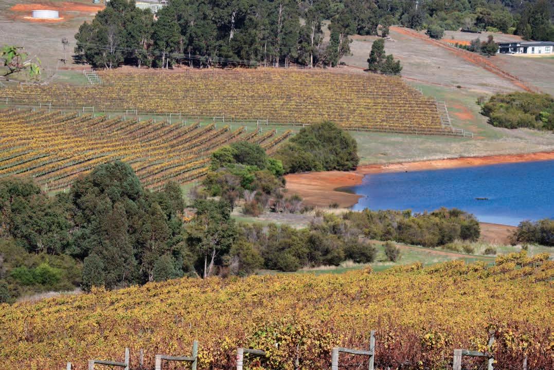
Geology, soils and climate of Western Australia’s wine regions 93
120 Cuts of 10% to water allocations from the Gnangara Mound in 2021 have already affected Swan Valley growers.
Temperatures have also increased gradually over the last 50 years, particularly in winter and autumn. Further increases in mean winter and spring temperatures will result in new management issues. Expectations of earlier budburst, along with a predicted increase in spring frosts, may cause a rise in the percent of emergent buds and flowers suffering damage. An increase in daily temperatures will result in shorter growing seasons leading to condensed and earlier harvest dates (Webb 2006).
The IOCI (2012:28) found that ‘Station scale …. climate projections for SWWA indicate that both maximum and minimum temperatures will warm by mid-century through to the end of the [21st] century under a high greenhouse gas emissions scenario’. Jarvis et al. (2017) report a finding that growing season temperatures are increasing, with more rapidly warming growing season conditions inland compared to coastal locations, such as the Margaret River region. They also indicate that springtime temperatures may be warming at a more rapid rate than at other times of the year.
Jones et al. (2010) suggest that future climate projections in Australia indicate that shifts in production to southerly and coastal regions is the most likely alternative to maintaining viability, which would probably benefit Margaret River and other southern regions.
Jones et al. (2010) compiled a comprehensive report after a workshop regarding the emerging impact of climate change on the Margaret River region. Feedback from workshop participants indicated that, while they had not seen impacts from rising temperatures, water availability or harvest dates, they had observed abnormal weather variability such as unseasonal extreme heat days. Thus, while climate change effects might be slow in coming, wine companies should proactively prepare if more severe climatic disruption does become a reality in the medium term.
The likely impacts stated by Jones et al. (2010) are relevant to all south-west wine regions, including:
• Climate change will directly affect grapevine phenology and wine quality. This may potentially influence future varietal selection and wine styles.
• Climate change will increase the demand and reduce the availability of water resources for viticulture. This may limit potential expansion of the industry and in some areas (where the demand for water resources is approaching the supply limits) resource availability will limit activities.
• Climate change will place pressure on the land resources of the region for both wine grapes and other agricultural products. However, although the south-west of WA is likely to be profoundly influenced by climate change in a range of ways, its probable future environment is likely to be far more favourable than those of more marginal wine production areas.
A recent publication co-produced by Wine Australia (Remenyi et al. 2019) provides more detailed climate trends for each wine region to assist growers’ management decisions over the long term. This viewpoint is emphasised by Gladstones (2011) who observed that because vines have a commercial life of more than 30 years any reliable pointers to future climate must play a crucial part in vineyard planting and management.
Geology, soils and climate of Western Australia’s wine regions 94
Part 2
The wine regions
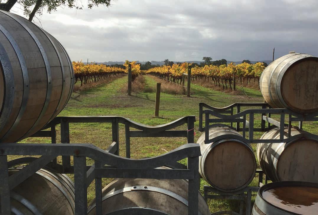
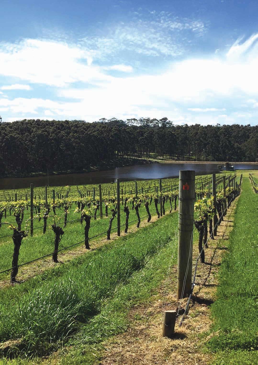
of Western Australia’s wine regions 96
Geology, soils and climate
6 Margaret River wine region
Regional snapshot
Size: 212,000 hectares
Vine plantings area: 6,035 hectares
Elevation range: 0–231 m AHD
Vine plantings range: 3–139 m AHD
Geology: Felsic crystalline rocks of the Leeuwin Complex in western half; Perth Basin sediments in eastern half
Geological age: Up to 1 billion years old on the Leeuwin Complex
Soil: Vines mainly grow on Ironstone gravels (‘Forest Grove’ soils)
Climate: Mediterranean climate with a strong maritime influence bringing high relative humidity. Temperatures and hours of sunshine decrease from the north to the south of the region
Main grape varieties:
White – Sauvignon Blanc, Chardonnay, Semillon Red – Cabernet Sauvignon, Shiraz, Merlot
Geology, soils and climate of Western Australia’s wine regions 97
Location and history
The Margaret River wine region lies west of the Geographe wine region in the extreme south-western tip of the Australian continent and is located on Wardandi Noongar Boodja (Country), who are the Traditional Custodians of the land.121 Its eastern boundary follows longitude 115°18′E (locally called ‘the Gladstone Line’) running south from the town of Vasse to the Southern Ocean east of Augusta.122 About 40% of the region is cloaked in tall forests of jarrah, marri and karri trees (Eucalyptus marginata, Corymbia calophylla and E diversicolor), which create a pleasing setting for many wineries.
Towns within the wine region include Margaret River, Dunsborough, Augusta, Yallingup, Witchcliffe, Karridale and Cowaramup (Figure 6.1).
Although there are some early records of wine production at Margaret River in the 1850s and 4 hectares (ha) of Doradillo grapes were established in 1914 (Beeston 2002), widespread interest in viticulture did not develop until Dr John Gladstones (1965; 1966) identified and promoted the potential of the district for wine grapes. He described it as having distinct advantages over all other winegrowing regions in Australia.
Gladstones’ work encouraged commercial plantings by Dr Tom Cullity at Vasse Felix in Wilyabrup in 1967. In 1970 Dr Bill Pannell began planting his property, Moss Wood, followed by Dr Kevin Cullen and his wife Di who established their commercial vineyard in 1971.123 In 1978 the region, led by Dr Cullen, was among the first in Australia to adopt a regional certification of wines (Beeston 2002).
By the late 1980s, around 350 ha of vines were planted and because of major expansion during the 1990s, the Margaret River region’s production swelled to yield more than 40% of WA’s wine grape tonnage (Dry et al. 2004). The 2018 vintage shows that Margaret River now easily surpasses the previously dominant Swan Valley, contributing more than 60% of WA’s wine grape tonnage. Recent estimates suggest the area of vineyards has now expanded to cover more than 6,000 ha in the region (DPIRD 2019).
Varieties and production
By the late 1990s / early 2000s, the main varieties grown in the Margaret River wine region were Cabernet Sauvignon, Chardonnay, Semillon, Sauvignon Blanc, Merlot, Shiraz, Chenin Blanc, Verdelho, Cabernet Franc, Pinot Noir and Riesling (Beeston 2002).
In 2021 the wine grape harvest from the region yielded over 31,000 tonnes from more than 38 different varieties. The white wine grape harvest in 2021 was 19,192 tonnes—the dominant varieties grown were Sauvignon Blanc, Chardonnay and Semillon. Chenin Blanc, Riesling, Pinot Gris and Savignin Blanc are also important white varieties.
121 See https://www.noongarculture.org.au/south-west-boojarah/
122 Note: a separate publication for the Margaret River wine region was produced by DPIRD in 2020 at https://researchlibrary.agric.wa.gov.au/pubns/150/
123 A trial planting by the Cullens on a neighbour’s property dated back to 1966.
Geology, soils and climate of Western Australia’s wine regions 98
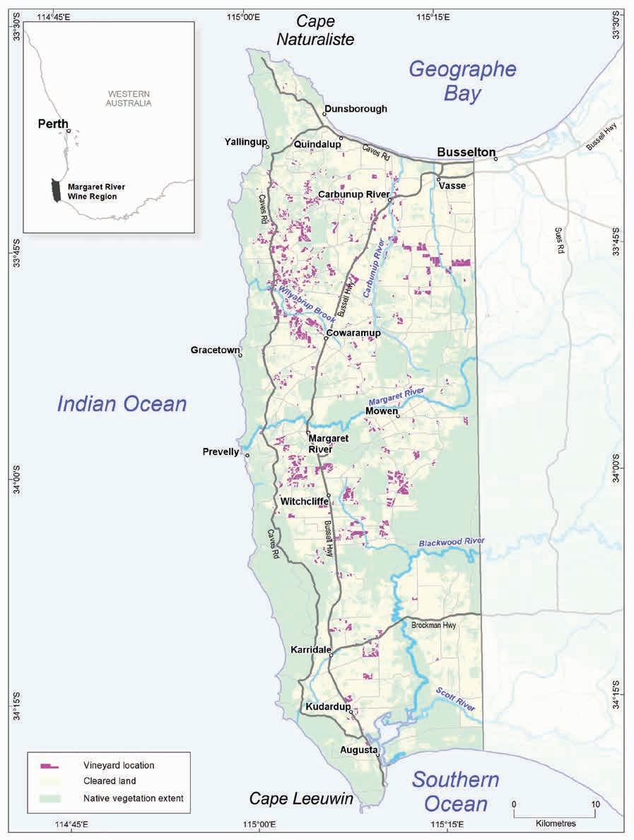
Geology, soils and climate of Western Australia’s wine regions 99
Figure 6.1: Margaret River wine region
The 2021 harvest of red wine grapes reached 12,460 tonnes—the dominant varieties grown were Cabernet Sauvignon, Shiraz, and Merlot. Malbec, Tempranillo, Pinot Noir, Cabernet Franc and Petit Verdot are also important varieties.
Jordan (2010) stated that Margaret River is now one of the best-known wine regions in the world, with plaudits for the quality of its Cabernet Sauvignons and Chardonnays. High land prices and a lack of land with suitable soil types and topography are some of the limits to the region’s potential for further expansion. Agricultural activity, including viticulture, will continue to face increasing pressure from alternative land uses, particularly rural subdivision, hospitality and recreation.
Geology and physiography
The Margaret River region has 2 dominant geological formations that influence its appearance and its soils: the felsic crystalline rocks of the Leeuwin Complex forming the western half; and the sediments of the Perth Basin in the east. The Dunsborough Fault (running from Dunsborough south to Augusta and passing inland of Margaret River) separates the Leeuwin Complex from the Perth Basin (Figure 6.2).
Intensely deformed metamorphic rocks (including granite gneiss, porphyritic granite and anorthosite) make up the Leeuwin Complex. Forming part of the Pinjarra Orogen, the complex rose up along the Dunsborough Fault around 1.1 billion years ago. A lateritic plateau has formed over the Leeuwin Complex, which has since been dissected by several relatively shallow valleys (Tille and Lantzke 1990). Parts of the elevated western fringe of the Leeuwin Complex (mostly west of Caves Road) is cloaked by deposits of deep windswept sands underlain by Tamala Limestone.
The breakup of Gondwana led to the separation of the Australian continental mass and Greater India in the Permian to Early Cretaceous periods (about 250 million years ago). This resulted in the formation of a deep, linear trough of sedimentary rocks known as the Perth Basin, which lies east of the Dunsborough Fault in the Margaret River region. The more recent (Tertiary and Quaternary) marine and terrestrial sediments deposited on the rocks have been weathered and shaped over time into a diversity of landscapes, including coastal plains (Swan and Scott coastal plains), low marine escarpments (Yelverton Shelf and Whicher Scarp) and an undulating upland lateritic plateau (Donnybrook Sunkland).
The Swan Coastal Plain is relatively flat, reaching only 40 metres (m) Australian Height Datum (AHD) (Figure 6.3). It has a series of dune systems running parallel to the shoreline, including calcareous and non-calcareous sand dune ridges underlain by Tamala Limestone along the coast. A sequence of alluvial and estuarine deposits makes up the remainder of the coastal plain.
The curved boundary south of the Swan Coastal Plain in this region is an ancient shoreline marked by the Yelverton Shelf. In areas further around the coastline, this former marine escarpment rises abruptly to about 60 m AHD. Closer to the Dunsborough Fault, it is more subdued. Towards the eastern boundary of the region, the Yelverton Shelf is backed by the more prominent Whicher Scarp formation, which gently rises further to 90 m AHD.
Geology,
100
soils and climate of Western Australia’s wine regions
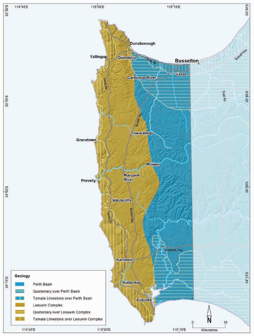
Geology, soils and climate of Western Australia’s wine regions 101
Figure 6.2: Margaret River wine region: Simplified geology
South of these 2 defining escarpments is an undulating, dissected lateritic plateau on Cretaceous sedimentary rocks (mainly sandstones, siltstones and shale) known as the Donnybrook Sunkland. Unlike the coastal plain, this area has had no exposure to the ocean (Lane 2017). This plateau gradually descends to the winding Blackwood River and on to the Scott Coastal Plain surrounding Hardy Inlet, to meet the Southern Ocean east of Augusta. The flat terrain of the Scott Coastal Plain features extensive Quaternary deposits. These deposits creep westward from both the Swan and Scott coastal plains across the Dunsborough Fault to cover small areas of the Leeuwin Complex near Augusta and Dunsborough.
The plateau surface of the Leeuwin Complex rises gently from an elevation of 20 m at Augusta to 140 m AHD near Dunsborough. In the valleys, vineyards are mostly at elevations between 60–100 m at Wilyabrup, while those close to Margaret River and Upper Chapman Brook are often at 40–80 m AHD. Around Carbunup and Jindong elevations are 20–40 m. The ridge of sand dunes extending from Cape Naturaliste to Cape Leeuwin rises to 140–210 m high but is generally not used for viticulture.
Soils and landforms
A lateritic mantle has formed across the felsic crystalline rocks of the Leeuwin Complex, extending east to cover the Perth Basin sediments of the Donnybrook Sunkland and beyond. The soils derived from the laterite are Ironstone gravels that dominate more than one-quarter of the land in the Margaret River region (Figure 6.4). These soils are particularly common on the flats, gentle slopes and valleys overlying the Leeuwin Complex.
On the Donnybrook Sunkland east of the Dunsborough Fault, Ironstone gravels can dominate on broad ridge crests, but on sloping land below the crests, they are more commonly found in a mix with Sandy duplex soils. Ironstone gravels are very minor on the coastal plains and are present on just a few areas of land rising above the flatter terrain east of the Blackwood River
Sandy duplexes are the next most common group, making up almost one-quarter of the region’s soils. They are usually more prominent on the undulating terrain and valley slopes of the Perth Basin sediments in the east of the region, frequently in a mix with Ironstone gravels on the Donnybrook Sunkland and the sloping Yelverton Shelf.
West of the Dunsborough Fault, Sandy duplexes tend to be on flatter valley divides and gentle upper valley slopes where they are also usually found in combination with Ironstone gravels.
Sandy duplexes are also quite common alluvial soils of the Swan Coastal Plain, usually on plains and low rises sitting above winter-wet flats. On the gentle plains south and east of the Blackwood River, they are in similar landscapes or sometimes associated with areas of Coloured deep sands.
Coloured deep sands are in about 10% of the region. They are prominent on the western edge of the Leeuwin Complex, where a discontinuous ridge of sand dunes, underlain by Tamala Limestone, runs along the coast between Cape Naturaliste and Cape Leeuwin (Figure 6.5). Coloured deep sands dominate the band of coastal dunes, also over Tamala Limestone (Spearwood dunes), on the Swan Coastal Plain. Broad areas of Coloured deep sands are also on flat terrain flanking the Blackwood and lower Scott rivers.
Geology, soils and climate of Western Australia’s wine regions 102
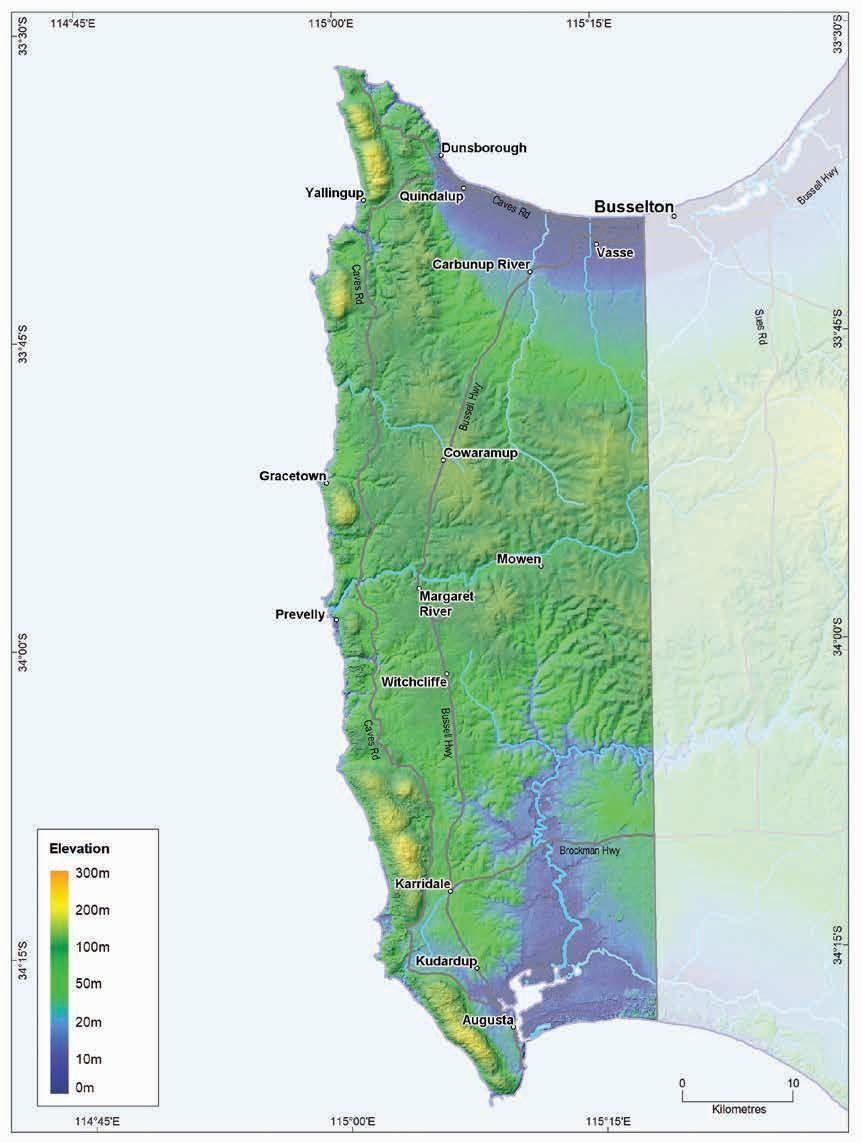
Geology, soils and climate of Western Australia’s wine regions 103
Figure 6.3: Margaret River wine region: Elevations
Ironstone gravels
Difficult soils
Sandy duplexes
Coloured deep sands
Pale deep sands
Alkaline soils
Shallow sands
Red-brown loams
Alluvial sands and loams
Heavy soils
Proportion of soil in region (%)
Proportion under vines (%)
Figure 6.4: Margaret River wine region: Proportion of main soils in the region compared against main soils used for viticulture
Pale deep sands occur in patches across about 9% of the region. They are most prominent on low dunes and flats on the Scott Coastal Plain and east of the Blackwood River. At the western edge of the Leeuwin Complex, Pale deep sands occur as sandy rises at the inland margin of the coastal dunes, and on the Donnybrook Sunkland they appear sporadically on slopes. On the Swan Coastal Plain, low dunes of deep bleached sands are arranged in an arc running parallel to the coast, marking the location of an ancient shoreline. Pale deep sands are also on the gently curved marine escarpment of the Yelverton Shelf rising gradually from the coastal plain.
Red–brown loams are not such common soils here, found in only about 2% of the region. They tend to have brown, or occasionally red, loamy topsoils over clay subsoil. These soils are mostly on valley slopes over the Leeuwin Complex, where freshly weathered rock has been exposed and the soil profile is derived from the underlying crystalline parent material. Patches of these soils are also on the Swan Coastal Plain, and these are derived from terrestrial sediments. They are associated with better-drained areas of alluvial river terraces.
Areas featuring Alluvial sands and loams are more prominent on the Swan Coastal Plain, on well-drained flats flanking watercourses and at the base of the Yelverton Shelf where short drainage lines descending from the upland plateau deposited fine, fertile sediments. Well-drained valley flats around other rivers feature areas of these soils, including Margaret River, Chapman Brook and the Blackwood and Scott rivers.
Geology, soils and climate of Western Australia’s wine regions 104
0% 10% 20% 30% 40% 50%
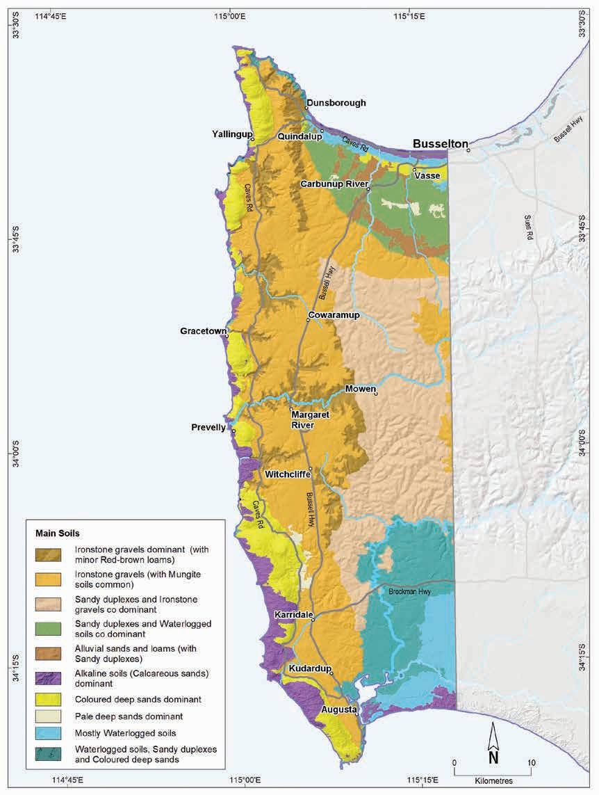
Geology, soils and climate of Western Australia’s wine regions 105
Figure 6.5: Margaret River wine region: Main soils
The region’s more minor soils include Alkaline sands, closely associated with the region’s coastal fringes, which typically retain a cover of native vegetation. These are mainly deep windswept calcareous dunes and beach ridges, frequently underlain by Tamala Limestone.
Shallow sands are also minor, generally on dunes of Coloured sand over Tamala Limestone on the exposed, steep west coast, where limestone is frequently shallower than 80 cm below the surface. Small areas of shallow sands over cemented ironstone are also on slopes on the Donnybrook Sunkland.
The small occurrences of Heavy soils are usually as poorly drained clays concentrated on the Swan Coastal Plain, close to coastal wetland areas.
We have grouped together, as Difficult soils, the areas where productivity may be affected by seasonally high watertables; valley floors, swamps and lakes; or where exposed or shallow rock, cemented laterite or stony soils are prevalent. These soils are typically unsuited for any form of agriculture but often occur in combination with more productive soils in various landscape positions. Particularly frequent on the coastal plains, most of these areas remain uncleared, making up about 20% of the region. Some of the Difficult soils have been altered (mounded, drained or rocks removed) to allow wine grape cultivation.
Soil-landscape mapping covering this entire region is published in the Busselton-Margaret RiverAugusta Survey (Tille and Lantzke 1990); the mapping can also be viewed online at NRInfo 124
Main viticultural soils of the Margaret River region
The earliest sites selected for grapegrowing in the region were in the valley formed by the Wilyabrup Brook. The Ironstone gravels (locally named Forest Grove soils125) are the most common profiles in these and similar valleys found across the Leeuwin Complex.126 Despite dominating in just over one-quarter of the region, Ironstone gravels are the most widely planted group of soils (more than 40%) in the Margaret River region (Figure 6.6). They comprise lateritic colluvium sitting over clay derived from the deeply weathered mantle. The topsoil is usually yellowish-brown loamy sand to sandy loam with up to 60% rounded ferruginous nodules and pisoliths. This overlies mottled yellow clay at about 50 cm deep.
Less common in these valleys (hosting about 5% of plantings) are the Red–brown loams derived from freshly weathered basement rock (locally named Keenan soils127). These soils typically have red–brown loam topsoils over well-structured loam to clay subsoils. They are often in combination with Ironstone gravels and areas of rock outcrop and stony soils. Small pockets of Pale deep sands are also encountered among some of the valley’s plantings.
124 See https://www.agric.wa.gov.au/resource-assessment/nrinfo-natural-resource-information-western-australia
125 Smith (1951)
126 Valleys such as for Calgardup, Boodjidup, Ellen, Cowaramup and Gunyulgup Brooks, as well as the Margaret River valley.
127 O'Donnell and Lockhart (1945)
Geology, soils and climate of Western Australia’s wine regions 106
Figure 6.6: Margaret River wine region: Main soils used for viticulture (Minor soils include Shallow sands, Coloured deep sands and Heavy soils)
About 26% of vines grow on the lateritic plateau surface west of the Dunsborough Fault where there is a mixture of Ironstone gravels (Forest Grove soils) and the Sandy duplexes (locally known as Mungite128 soils, which are sometimes poorly drained in areas). Ironstone gravel soils are mainly pale grey to yellow–brown coloured sandy topsoils with abundant ferruginous nodules and pisoliths over pale yellow loam to clay subsoils. Sandy duplexes usually have pale grey to creamy yellow sand to loamy sand topsoils over loam to clay subsoils. The clay loam to clay subsoils in this area all are often paler than similar soils west of the Dunsborough Fault, indicating the deeply weathered sedimentary rocks of the Perth Basin. Mixed among the Ironstone gravels and Sandy duplexes are smaller areas of seasonally wet soils and pockets of sandy Ironstone gravels sitting on cemented ironstone within 80 cm. North of the lateritic plateau area, the flatter Yelverton Shelf also supports plantings on a similar combination of soils as the plateau, along with some yellow Coloured deep sands.
In the north-east of the region, the Tertiary and Quaternary sediments of the Swan Coastal Plain overlie the Perth Basin. Plantings in this area are located around the Jindong area, mostly on Alluvial sands and loams (locally named Marybrook129 soils). These soils mainly have red to red–brown coloured clayey sand to loamy sand topsoil textures over neutral loam to clay subsoils, all formed on recent alluvium on the Pinjarra Plain.
128 Smith (1951) was first to describe Mungite soils.
129 Tille and Lantzke (1990)
Geology, soils and climate of Western Australia’s wine regions 107
Ironstone gravels 45% Sandy duplexes 29% Pale deep sands 6% Alluvial sands and loams 7% Red-brown loams 5% Minor soils 8%
Plantings on some areas of the less well-drained Sandy duplex soils on the Swan Coastal Plain (locally called Busselton130 soils) are mainly on soils with creamy yellow fine sandy topsoils gradually increasing in clay content with subsoil depth. These soils can be in a mixture with Pale deep sands and grey–brown sandy loams.
About 6% of the region’s vines grow on Pale deep sands. The sands are generally pale grey and extend more than 80 cm deep. Sometimes they contain ferricrete nodules and pisoliths below a sandy topsoil and in some cases, a clay layer occurs at more than 80 cm below the sandy surface. These soils are generally not preferred for planting but often occur as small pockets amongst the better soils in vineyards.
On the western edge of the Leeuwin Complex a discontinuous ridge of sand dunes underlain by Tamala Limestone runs along the coast between Cape Naturaliste and Cape Leeuwin. Alkaline soils (deep alkaline sands) and yellow and red Coloured deep sands are common here. Although most of this area is national park and unavailable for viticulture, some vines grow on freehold land at the leeward foot of the dunes.
Climate
Gladstones (1992) identified that there is a strong maritime influence on the climate of the Margaret River region, indicating that it has generous but equable warmth and sunshine. Sunshine hours during the growing season and ripening period are marginally more than in the Great Southern region, while relative humidity is within the optimal range.
Rainfall in the region ranges from more than 700 mm in the north to 1,120 mm in the south, with annual evaporation around 1,200 mm (Table 6.1 and Figure 6.7).
According to Remenyi et al. (2019), the Margaret River region has the second highest non-growing season (May to September) rainfall of all Australian wine regions (the Pemberton wine region to the east has the highest rainfall). This creates a high potential for good quality surface water storage. Mean 3 pm October to April relative humidity ranges from 56% at Margaret River to 60% at Karridale (Gladstones 1992).
Table 6.1: Margaret River wine region: Rainfall statistics (1989–2019)
130 McArthur and Bettenay (1958)
Geology, soils and climate of Western Australia’s wine regions 108
Value Annual rainfall (mm) Seasonal (October–April) rainfall (mm) Minimum 732 143 Maximum 1,123 261 Mean 977 214
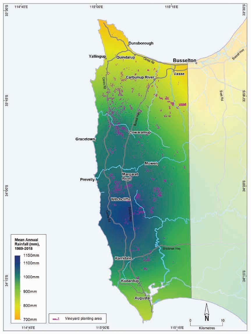
Geology, soils and climate of Western Australia’s wine regions 109
Figure 6.7: Margaret River wine region: Mean annual rainfall (1989–2018)
Table 6.2 summarises the temperature statistics for the Margaret River region, supported by maps on the following pages, including:
• mean growing season temperature (GST), which covers the months October to April (Figure 6.8). Across the region there is a GST range of 18.2 to 19.6 °C, with a mean of 18.7 °C.
• mean January temperature (MJT), which represents the mean temperature throughout the day during the warmest month (Figure 6.9). Across the region there is an MJT range of 20.1 to 22 °C, with a mean of 20.6 °C.
• growing degree days (GDD), which are a measure of heat (between 10 and 19 °C) accumulation131 predicting the vines’ development rates for the growing season months of October to April132 (Figure 6.10). The Margaret River region has a range of 1,750 to 2,026 GDD units (°C) and a mean of 1,849.
• biologically effective degree days (BEDD), which are linked to the GDD calculation and adjusted for latitude/daylength and account for diurnal temperatures133 (Figure 6.11). The Margaret River region has a range of 1,502 to 1,653 BEDD units (°C).
• diurnal temperatures, which are the mean of the daily range between the minimum and maximum mean daily temperature from October to April (Figure 6.12). With a mean daily range of 5.8 to 12.4 °C, the Margaret River region has the lowest mean diurnal temperatures of all wine regions in WA.
* Average estimates are from locations in the Margaret River region in Gladstones (2021).
Beeston (2002) notes that although the temperature can technically be classified as being warm, it is widely considered ‘cool’ because of the long, slow ripening season. Because of its proximity to the ocean (which defines the region on 3 sides), temperature variability is low and spring frosts are uncommon. Mean minimum temperatures in the coldest month near Augusta are as high as 11 °C while mean July temperatures at Margaret River are 12.8 °C.
131 These calculations use the base 10 method (Hall and Jones 2010).
132 More recently, Jarvis et al. (2017) suggest that September to March may be more appropriate.
133 Hall and Jones (2010)
Geology, soils and climate of Western Australia’s wine regions 110
Measurement Value Mean January temperature (°C) 20.7 Mean growing season (October–April) temperature (°C) 18.7 Mean growing degree days (October–April) 1,849 Mean diurnal temperature (°C) 10.5 Average daily sun hours (October–April)* 7.4 Average (October–April) cloud cover (Okta)* 4.2
Table 6.2: Margaret River wine region: Temperature statistics (1989–2019)
The warmest and driest conditions occur around Jindong and Carbunup on the Swan Coastal Plain in the north-east (Beeston 2002). This area is relatively sheltered from southerly and westerly winds by the Leeuwin Naturaliste Ridge and the Whicher Scarp but is exposed to warm dry winds from the north-east.
There is a downward gradient of both temperature and sunshine hours from the north to the south of the region, with an abrupt increase in cloudiness south of Witchcliffe being a common summer feature. South of Witchcliffe, the main climatic influences are the cool coastal winds and clouds streaming in from the Indian and Southern oceans, with limited impact from the warm northerly winds. However, exposure to strong ocean winds can damage new shoots and flowers (thus reducing fruit set) all along the coast between Capes Naturaliste and Leeuwin. Halliday (2011a) identified that, in physical terms, the degree of protection offered by the landscape and vegetation from the sea wind is the most important factor for the vines.
Halliday (2011a) also stated that the climate here is more strongly influenced by maritime factors than any other Australian wine region, with the lowest mean annual temperature range. The low diurnal and seasonal temperature range results in an unusually even accumulation of warmth. This can result in less than full dormancy for vines. In warmer winters, vines do not go into full dormancy and early and uneven budburst can be a problem with some varieties, resulting in low yields.
Remenyi et al. (2019) has shown that a changing climate is influencing the region. They identified an increase in mean growing season temperatures (GST) over the past few decades and predict a further increase to more than 20 °C in the next 20 years. They also predict that the mean growing season rainfall could fall below 200 mm in the next 20 years. These are all important factors to consider for the future viability of each vineyard, particularly in relation to water availability, planting and management.
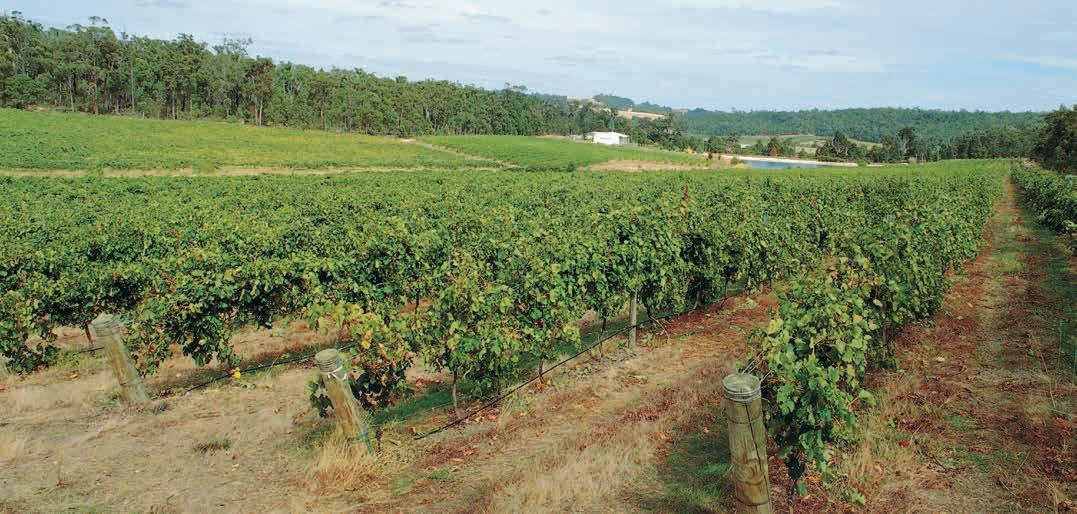
Geology, soils and climate of Western Australia’s wine regions 111
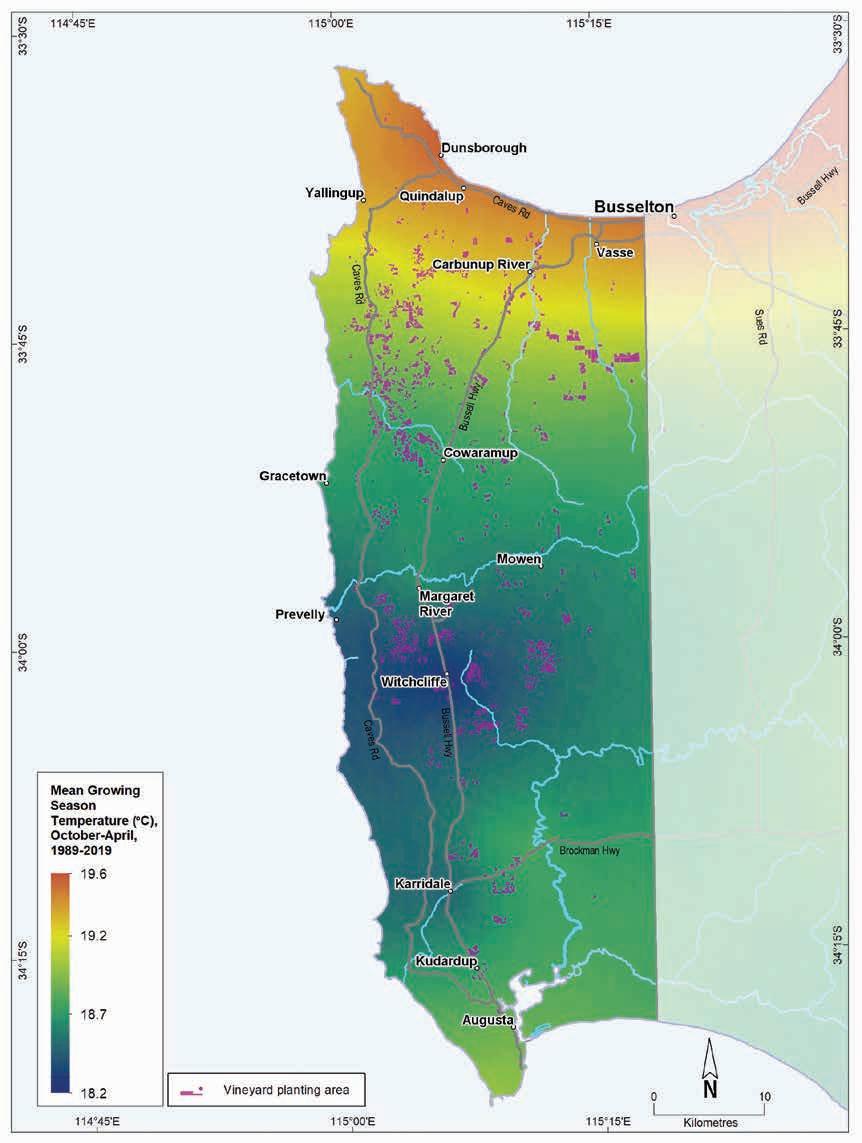
(October–April, 1989–2019)
Geology, soils and climate of Western Australia’s wine regions
112
Figure 6.8: Margaret River wine region: Mean growing season temperature
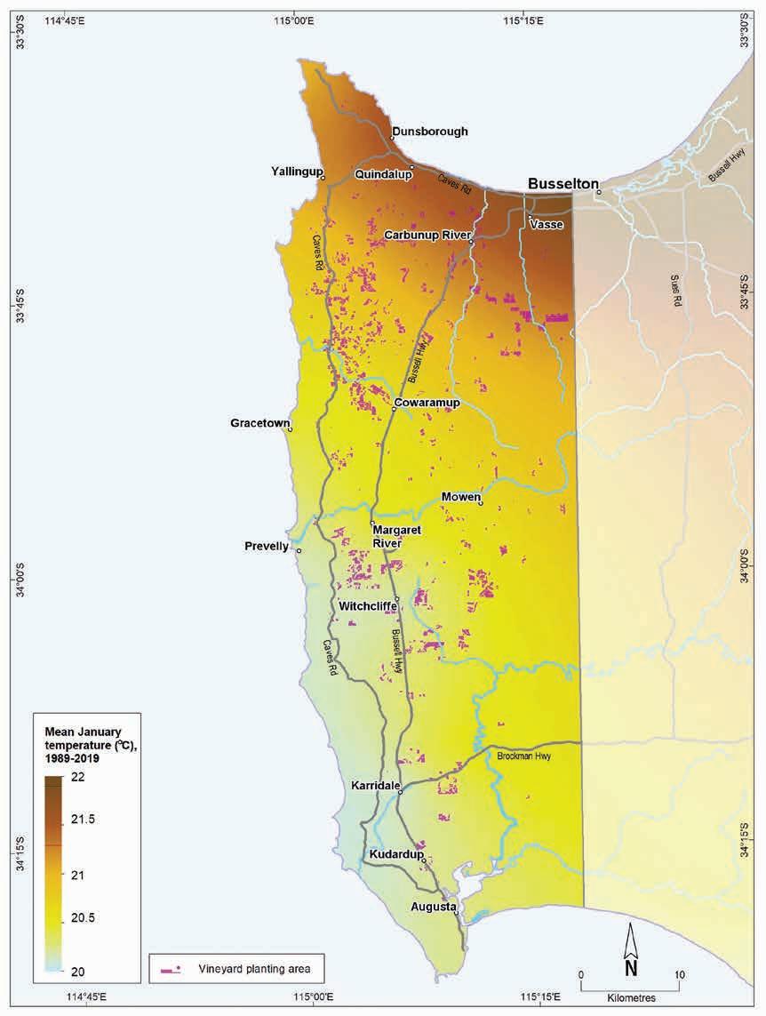
Geology, soils and climate of Western Australia’s wine regions 113
Figure 6.9: Margaret River wine region: Mean January temperature (1989–2019)
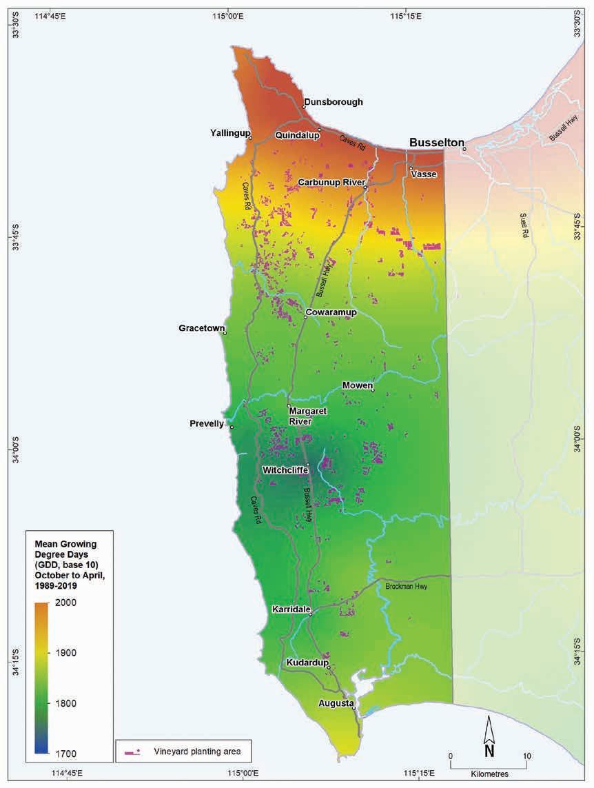
Margaret
region: Mean seasonal growing degree days (October–April, 1989–2019)
Geology, soils and climate of Western Australia’s wine regions
114
Figure 6.10:
River wine
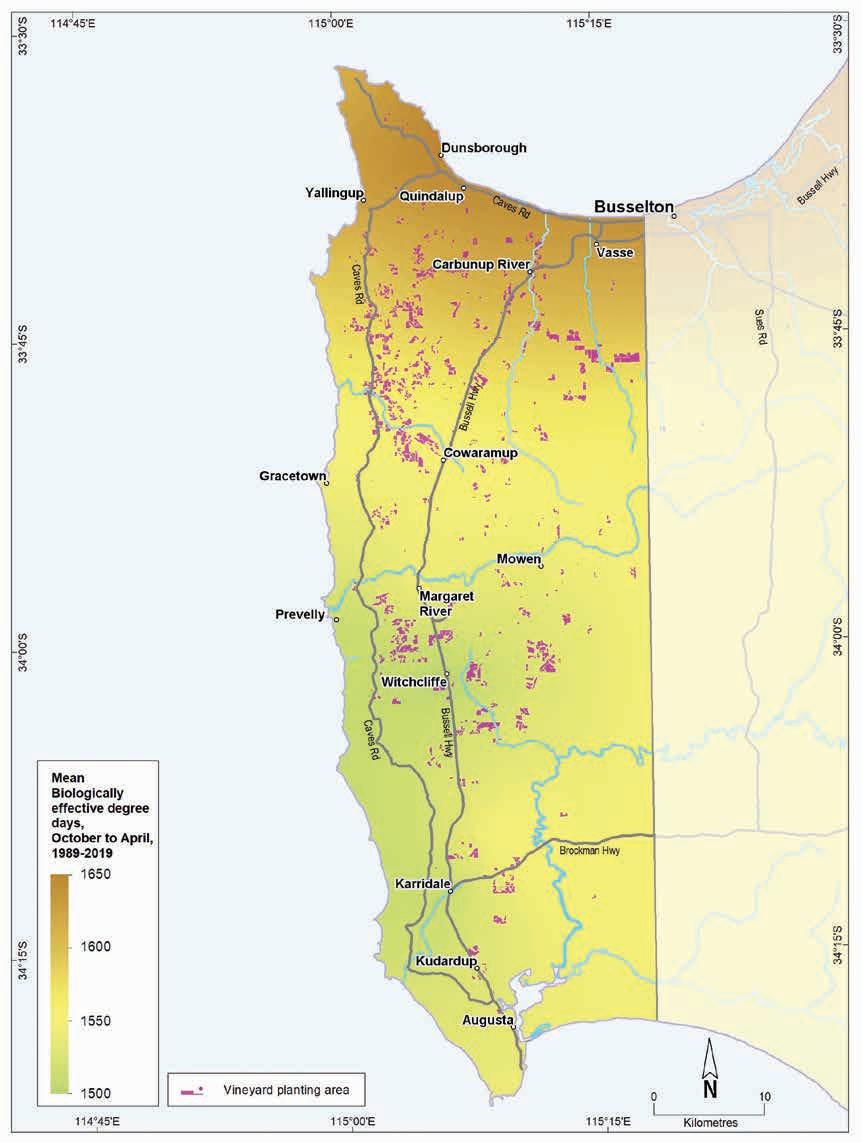
6.11: Margaret River wine region: Biologically effective growing degree days (October–April, 1989–2019)
Geology, soils and climate of Western Australia’s wine regions 115
Figure
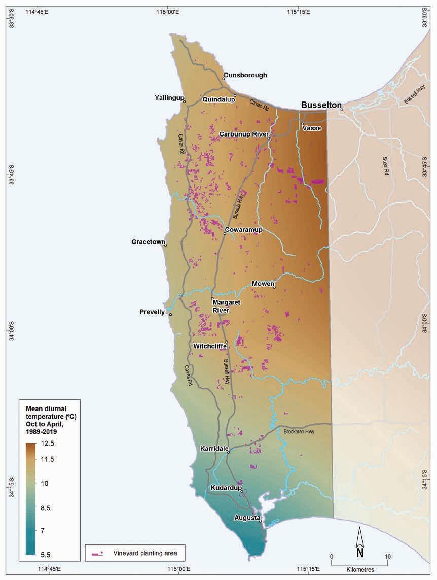
6.12: Margaret River wine region: Mean diurnal temperature (October–April, 1989–2019)
Geology, soils and climate of Western Australia’s wine regions
116
Figure
7 Great Southern wine region
Regional snapshot
Size: 1.7 million hectares
Vine plantings area: 2,853 hectares
Elevation range: 0–1,093 m AHD
Vine plantings range: 6–371 m AHD
Geology: Felsic crystalline rocks of Yilgarn Craton in the north and the Albany–Fraser Orogen in the south
Geological age: Ranges from 1.1–2.8 billion years
Soil: Vines mainly grow on Ironstone gravels
Climate: The Great Southern has the coolest Mediterranean-dominated climate of all WA wine regions. The maritime influence of the Southern Ocean decreases further inland with increased daytime temperatures
Main grape varieties:
White – Sauvignon Blanc, Chardonnay, Riesling, Semillon Red – Shiraz, Cabernet Sauvignon, Pinot Noir, Merlot, Malbec
Geology, soils and climate of Western Australia’s wine regions 117
Location and history
Registration of the Great Southern GI as a region took place in 1996. In area, it is the largest wine region in Western Australia and the second largest producer of grapes in WA. It lies on the southernmost part of the state, on Minang, Ganeang and Goreng Noongar Boodja (Country), who are the Traditional Custodians of the land.134 Today, more than half the region is agricultural land, with the remainder covered in native forests, woodlands and heath, and boasting some areas of outstanding botanical diversity.
Albany is the main population centre in the Great Southern wine region. Other towns and settlements include Denmark, Walpole, Mount Barker, Rocky Gully, Frankland River, Cranbrook, Kendenup, Tenterden and Manypeaks (Figure 7.1).
The first recorded attempts at viticulture in the Great Southern region was in the Mount Barker area in 1859, when settler George Egerton-Warburton planted wine grapes on his St Werburgh's property and bottled his first vintage 2 years later.
Between the World Wars, viticultural pioneers such as Jack Mann and Maurice O’Shea identified the suitability of the region’s climate.
After the Second World War, Professor Harold Olmo’s (1956) and Dr John Gladstones’ (1965) investigations confirmed the suitability of the Mount Barker, Kendenup and Rocky Gully areas for making table wines in the light, traditional European style, and the region’s potential gradually became more widely recognised. The Pearse family and Bill Jamieson (the State Viticulturalist) attempted the first plantings at Forest Hill in 1965 (Beeston 2002). Although this failed due to waterlogging in the wet spring of that year, a second attempt the following year was a success.
In 1967, John Roche planted 2 ha of vines at Frankland River, which was the precursor to Westfield Vineyard. This evolved into the region’s first large-scale plantings in the 1970s. Another small vineyard planted by Tony Smith at Denbarker around the same time became the Plantagenet vineyard, which produced its first wines at Mount Barker in 1975 (Beeston 2002). By the mid-1970s there were 7 vineyards between Mount Barker and Frankland River. Plantings in the Porongurups and around Denmark soon followed, with rapid expansion occurring in the late 1980s and into the 1990s.
In 2004, 2,071 ha of vines (wine grapes) were planted in the Great Southern region, increasing by 2019 to more than 2,800 ha (DPIRD 2019). Currently, most of the Great Southern region’s vineyards are established within one of the 5 subregions: Frankland River, Mount Barker, Porongurup, Albany and Denmark (Table 7.1 and Figure 7.2). We describe the subregions in greater detail on the following pages.
134 See https://www.noongarculture.org.au/wagyl-kaip/
Geology, soils and climate of Western Australia’s wine regions 118
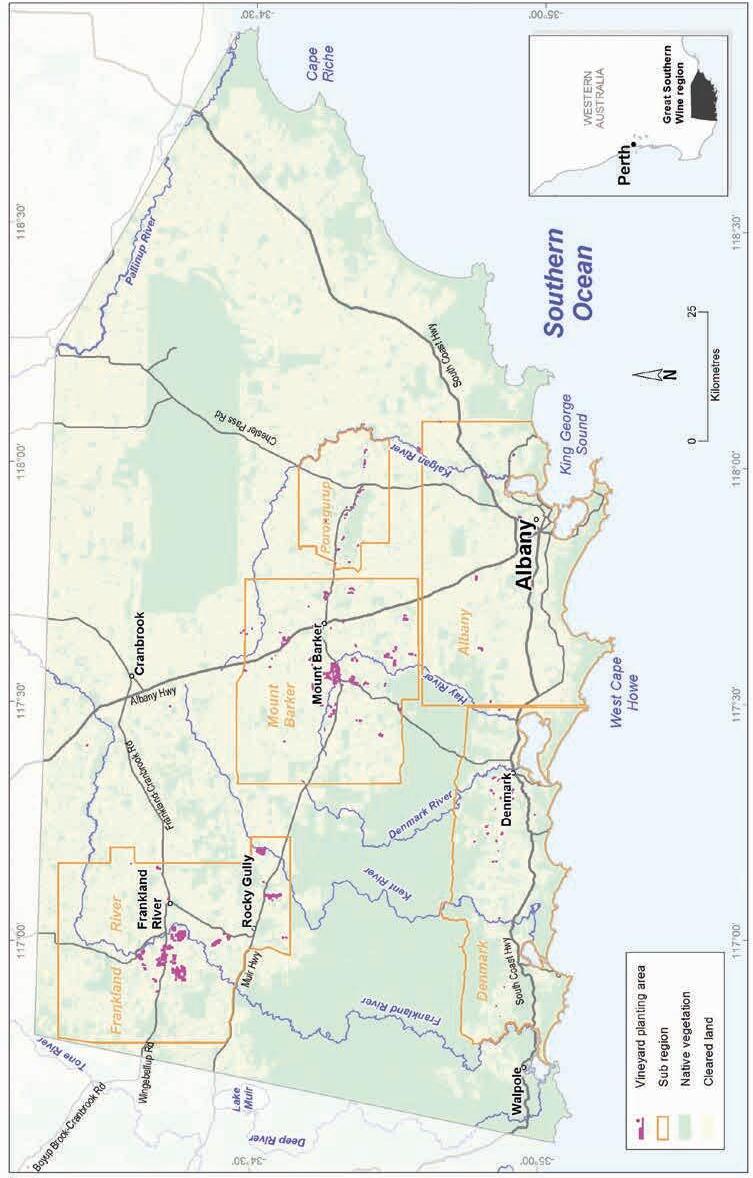
Geology, soils and climate of Western Australia’s wine regions 119
Figure 7.1: Great Southern wine region and subregions
Table 7.1: Great Southern wine region: Estimated area of vine plantings in each subregion (DPIRD 2019)
7.2: Great Southern wine region: Proportion of vine plantings in each subregion
Geology, soils and climate of Western Australia’s wine regions 120
Subregion Total area (ha) Vines currently planted (ha) Frankland River 143,679 1,526 Mount Barker 132,216 994 Porongurup 39,384 105 Denmark 115,558 102 Albany 157,338 94 Not in a subregion 1,080,322 32 Total 1,668,497 2,853
Porongurup 3% Denmark 3% Not in subregion 1% Albany 3% Frankland River 59% Mount Barker 31%
Figure
Varieties and production
In 2021 the wine grape harvest from Great Southern wine region yielded 12,269 tonnes from more than 29 different varieties (APC 2022). This was up from almost 7,000 tonnes in 2002, with the range of varieties grown across the region increasing over that time.
In 2021 5,771 tonnes of white wine grapes were harvested—the dominant varieties were Sauvignon Blanc, Chardonnay, Riesling and Semillon. Pinot Gris and Gewürztraminer are becoming more important white varieties. The 2021 red wine grape harvest reached almost 6,500 tonnes—the dominant varieties grown were Shiraz and Cabernet Sauvignon. Pinot Noir, Merlot, Malbec and Tempranillo are increasingly common varieties.
Geology and physiography
The Great Southern region lies across the Ravensthorpe Ramp, where the southern part of WA gently tilts from the ancient central plateau down to the cool, windswept waters of the Southern Ocean. The development of the Ravensthorpe Ramp dates to the breakup of Gondwana, when the southern part of the Australian continent ‘sagged’ as it drifted away from the Antarctic continent (Cope 1975).
The southern extent of the ancient, deeply weathered Yilgarn Craton reaches the northern part of the wine region (Figure 7.3). Formed during the Archaean geological period more than 2.5 billion years ago, this is one of the oldest parts of the Earth’s surface—a massive, stable area of Precambrian Shield measuring almost 750 km by 1,000 km (600,000 km2). In the Great Southern region, the Yilgarn Craton comprises even-grained granite at an elevation of about 250–300 m AHD.
East of Cranbrook on the craton’s southern margin (around 240 m AHD), the salt lake dotted plain gives way to the abrupt peaks of the Stirling Range, which rise to 500–1,000 m AHD. These peaks include Bluff Knoll, the highest point in the south of WA. The geology of the Stirling Range is completely different to its surrounds, comprising a complex of metamorphosed sandstone and shale, originally laid down as sediments in shallow marine waters.
South of the Stirling Range and the Yilgarn Craton, most of the remaining area of the Great Southern region overlies the high-grade metamorphic rocks of the Proterozoic Albany–Fraser Orogen.
Although the Albany–Fraser Orogen is not as ancient as the rocks of the Yilgarn Craton, it still dates from around 1.1 billion years ago. A blanket of more recent sedimentary deposits obscures the boundary between these significant formations.
The Albany–Fraser Orogen has 2 main components: north of Mount Barker is the Biranup Complex running from approximately between the Frankland River and Rocky Gully settlements eastward to Cape Riche, while south of Mount Barker, the Nornalup Complex underlies the remaining area of the Great Southern region.
Geology, soils and climate of Western Australia’s wine regions 121
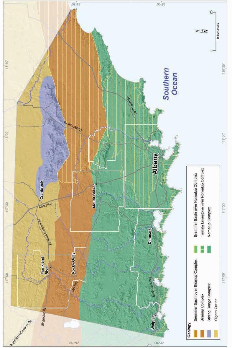
Geology, soils and climate of Western Australia’s wine regions
122
Figure 7.3: Great Southern wine region: Simplified geology
The rocks of the Biranup Complex are mainly gneiss, granitic orthogneiss and some even-grained granite. The rocks of the Nornalup Complex include layered quartz-feldspar-biotite gneiss, granitic orthogneiss, porphyritic granite and even-grained granite. The most prominent peaks emerging above the surrounding terrain tend to be found on the Nornalup Complex and include the Porongurup Range (rising to around 600 m AHD), Mount Frankland, Mount Manypeaks and Mount Barker.
In the eastern half of the region, the crystalline rocks of the Albany–Fraser Orogen are partly overlain by the Tertiary sediments of the onshore portion of the Bremer Basin (Clarke et al. 2003). These mainly include Eocene sedimentary rocks of the Plantagenet Group (pale spongolites and low-energy marine carbonate and light-coloured siltstone), deposited in several broad topographic depressions and shallow seaways, giving rise to the gently inclined landscape of the Albany Sandplain. Protruding granitic domes, including the Porongurup Range, sporadically outcrop above the sandplain sediments overlying part of the Nornalup Complex. The Albany Sandplain is also dissected by rivers and creeks, especially on its southern margins.
As evidence of its long geological history and deep weathering, a lateritic profile blankets much of the region’s land surface, including parts of the Plantagenet Group sediments. The laterite varies from massive and cemented to loose uncemented stones, known as ferruginous nodules and pisolites (commonly called jarrah, forest or pea gravels).
Influenced by the tilted Ravensthorpe Ramp, the overall elevation trend is a gradual decline from the region’s northern boundary to the south coast (Figure 7.4). This descent is interrupted by a series of ‘shelves’ as well as the prominent ranges and peaks. The shelves typically take one of two main forms: in some areas they are undulating lateritic plateau surfaces with some low emergent hills, dissected by river valleys; elsewhere they are flats where sediments were deposited during the Eocene by sluggish ancient river systems. These flats are often swampy and dotted with lakes.
Vine plantings range in elevation from near sea level on the south coast to nearly 300 m AHD in the north-west of the Frankland River subregion, and more than 350 m AHD on the slopes of the Mount Barker and Porongurup subregions (Table 7.2). Higher elevations exist within the region, such as the jagged peaks of the Stirling Range, which rise to more than 1,000 m, but these steep rocky peaks are in conservation reserves, unsuited to and unavailable for viticulture.
Geology, soils and climate of Western Australia’s wine regions 123
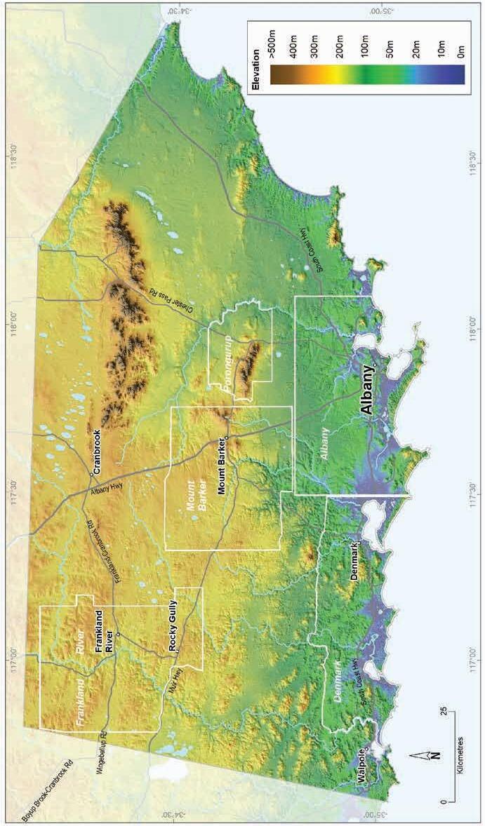
Geology,
regions 124
soils and climate of Western Australia’s wine
Figure 7.4: Great Southern wine region: Elevations
Table 7.2:
Great Southern wine region: Elevation of the subregions and vineyards
Soils and landforms
The section provides only a broad overview of the region’s soils and landforms. For more detail, see the individual subregion descriptions that follow. Figure 7.5 presents the main soil types found across the Great Southern wine region with their distribution displayed on Figure 7.6.
The region’s age and geology has had a strong influence on the soils. The blanket of laterite that formed across much of the area resulted in Ironstone gravels being the most prolific soil, particularly on the undulating terrain in the north-west of the region. The Ironstone gravels are especially prominent in the Frankland River and Mount Barker areas, but they are generally seen across the entire region, typically in association with other soils.
Many of the concentrations of Sandy duplex and Pale deep sands are related to the veneer of sediments (Plantagenet Group) deposited by shallow marine incursions in the eastern part of the region. After Ironstone gravels, Sandy duplexes are the next most widespread group of soils. These are particularly common near the Porongurup Range and other eminences, on gently sloping terrain around granite hills. They are also more typical on the subdued terrain north and west of Cranbrook, particularly north of the Gordon River, on the southern part of the Yilgarn Craton. The Sandy duplexes are frequently found in association with Ironstone gravels.
Pale deep sands occur sporadically across most of the region, often in a mix with other soils. The terrain south-east of the Stirling Range and east of the Porongurup Range has greater concentrations of Pale deep sands, associated with Plantagenet Group sediments. They are also often on valley slopes in the south of the region, usually with Ironstone gravel and Sandy duplex soils, and feature on windswept coastal dunes in a mix with other sands, usually over Tamala Limestone.
Heavy soils, seen in about 11% of the region, tend to be more frequent on the flat to gently undulating plain north of the Porongurup Range in a mix with Ironstone gravels. These soils are also related to the underlying sediments of Pallinup Siltstone (part of the Plantagenet Group).
Red–brown loams are typically associated with freshly weathered gneiss and granite on the hilly terrain of the Porongurup Range and in the south-west around the Mount Shadforth area. They are minor soils on cleared land in the region but are desirable for many activities.
Geology, soils and climate of Western Australia’s wine regions 125
Wine region Total subregion elevation (m AHD) Vineyards elevation (m AHD) minimum maximum mean minimum maximum mean Albany 0 267 62 6 133 66 Denmark 0 308 62 10 219 102 Frankland River 155 331 237 184 291 228 Mount Barker 41 484 208 73 371 203 Porongurup 60 666 195 102 352 247
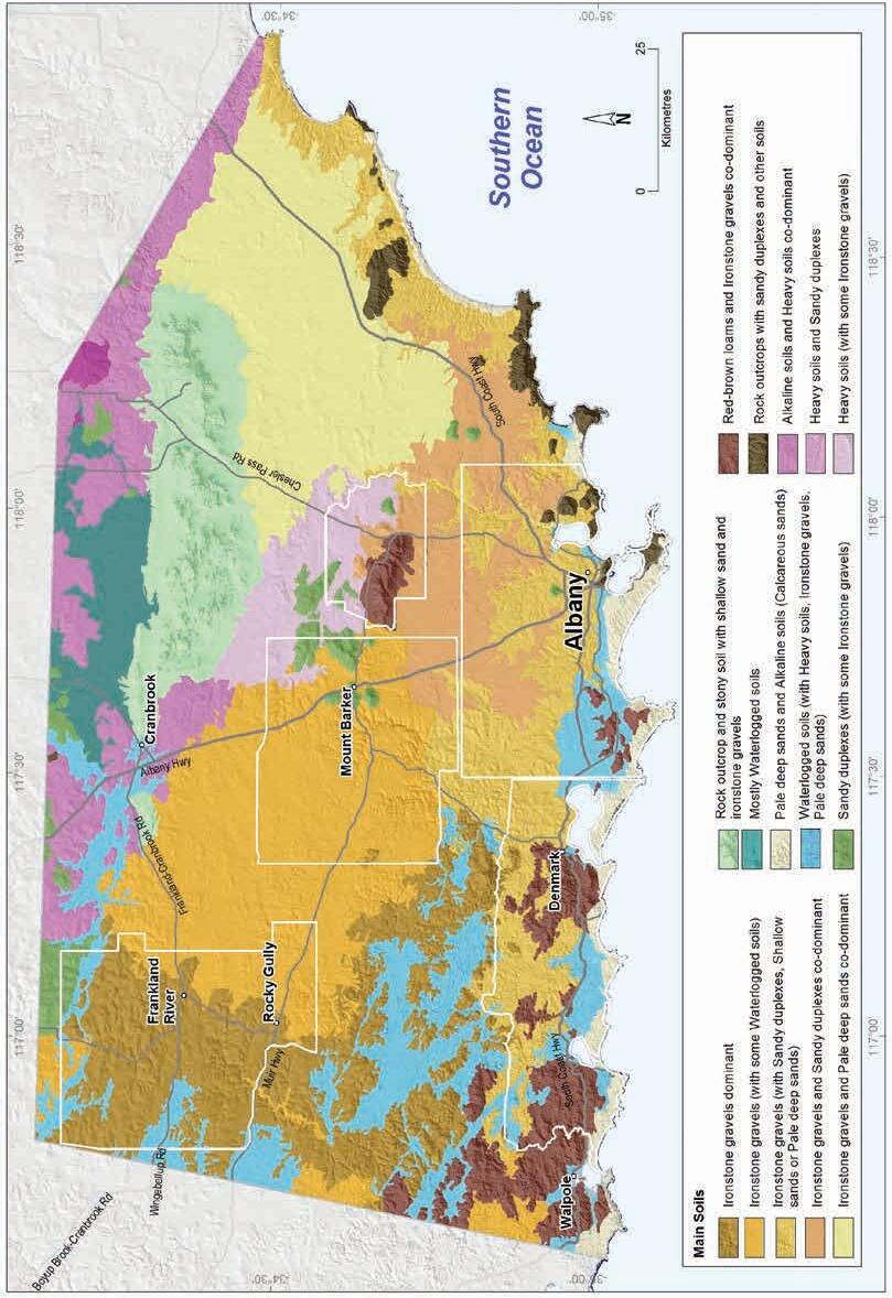
Geology,
regions 126
soils and climate of Western Australia’s wine
Figure 7.5: Great Southern wine region: Main soils
Ironstone gravels
Difficult soils
Sandy duplexes
Pale deep sands
Heavy soils
Shallow sands
Red-brown loams
Alkaline soils
Coloured deep sands
Alluvial sands and loams
Proportion of soil in region (%)
Proportion under vines (%)
Figure 7.6: Great Southern wine region: Proportion of main soils in the region compared against main soils used for viticulture
The region has extensive areas of restricted drainage, which are mostly associated with Eocene sedimentary deposits found across the wide plain surrounding the Gordon River, on the undulating lateritic plain west of Mount Barker, and low-lying land leeward of the extensive coastal dunes. Areas of shallow soils and bare rock outcrops are also prominent in some locations. We grouped all these as Difficult soils, which make up about 19% of the region. These soils are typically unsuited for any form of agriculture but often occur in combination with more productive soils in various landscapes. Some have been altered (mounded, drained or rocks removed) to allow wine grape cultivation.
Soil-landscape mapping covering this region includes these surveys: South Coast and Hinterland (Churchward et al. 1988), Tonebridge-Frankland (Stuart-Street 2005), Tambellup-Borden (StuartStreet and Marold 2009), and Jerramungup (Overheu [unpublished]); the mapping can also be viewed online at NRInfo 135
135 See https://www.agric.wa.gov.au/resource-assessment/nrinfo-natural-resource-information-western-australia
Geology, soils and climate of Western Australia’s wine regions 127
0% 10% 20% 30% 40% 50% 60%
Main viticultural soils of the Great Southern region
The most extensively planted soils across the Great Southern region are the Ironstone gravels (Figure 7.7). We estimate that about half of the region’s vine plantings are currently on these soils, even though they cover less than 30% of the region. This may be partly because Ironstone gravels are typically found on better-drained landscapes but could also indicate the preference many growers have for gravelly soils.
Figure 7.7: Great Southern wine region: Main soils used for viticulture (Minor soils include Shallow sands, Coloured deep sands and Alkaline soils)
The Ironstone gravels with clayey subsoils are the most widely planted on the lateritic plateau and undulating low hills in the region’s north-west. In some areas where there is lower rainfall, they can have poorly structured, sodic clay subsoils. Before clearing for agriculture, many of these sodic soils originally supported wandoo (Eucalyptus wandoo) woodlands.
Sandy duplexes are also important soils, supporting almost 20% of the vines in the region. They usually have grey coloured sandy topsoils or less frequently, yellow to brown sandy topsoils, over clay. It is not uncommon to find a layer of ferricrete nodules and pisoliths sitting above the clay. If the vines are on Sandy duplexes close to granite hills, they may have rock fragments in the subsoil.
Almost 10% of the region’s vines grow on well-structured Red–brown loams (often called ‘karri loams’). These are generally near exposed or shallow areas of crystalline bedrock, often on steeper valley and hill slopes. These soils usually have brown (or less commonly, red or yellow) loamy topsoils over well-drained neutral clay subsoils.
Geology, soils and climate of Western Australia’s wine regions 128
Ironstone
Sandy duplexes 19% Pale deep sands 6% Heavy soils 6% Minor soils 7% Red-brown loams 9%
gravels 53%
The remaining soils supporting vines, particularly the Pale deep sands featuring deep bleached sands and Heavy soils with sandy loam topsoils and shallow reddish colour clay subsoils, are typically found among a mixture of other soils in vineyards.
Climate
The Great Southern wine region is large and has quite marked climatic differences from north to south and east to west. In general, the Great Southern’s subregions are cool, with high humidity (similar to Margaret River wine region) and usually have low temperature variability. The inland areas feature occasional excessive heat events in summer and moderate frost risk in winter and spring. Specific details of each subregion’s climate are in the following subregion descriptions.
According to Gladstones (1992), the Great Southern is WA’s coolest winegrowing region, reflecting the strong influence of the Southern Ocean. Recent analysis by Remenyi et al. (2019) shows that it has the lowest mean growing season temperature of all WA wine regions. Gladstones (2021) identified that locations in the Great Southern region also have the lowest average daily sun hours and highest average cloud cover of all WA regions. The prominence of these moist coastal onshore south to south-east winds (especially from January to February) creates this coastal cloudiness, which typically dissipates about 20–50 km inland.
Mean annual rainfall ranges from more than 1,000 mm at Denmark on the coast in the south-west of the region to 450 mm in the north-east, reflecting the dominance of cold fronts from the Indian and Southern oceans bringing more rain to the west and south (Figure 7.8, Figure 7.9 and Table 7.3). A rain shadow effect north of the Stirling Range creates drier conditions east of Cranbrook136 (Stuart-Street and Marold 2009). Mean 3pm October to April relative humidity ranges from 67% at Denmark to 49% at Rocky Gully and probably lower to the north (Gladstones 1992).
136 As there is no official weather station in the Stirling Range National Park, the orographic effect of the Stirling Range is not captured on Figure 7.9.
Geology, soils and climate of Western Australia’s wine regions 129
Value Annual rainfall (mm) Seasonal (October–April) rainfall (mm) Minimum 373 145 Maximum 1,257 427 Mean 677 242
Table 7.3: Great Southern wine region: Rainfall statistics (1989–2019)
What these single regional mean annual or seasonal rainfall figures do not capture is the range in rainfall experienced across the full extent of the Great Southern wine region. Despite the southern coast receiving some of the highest rainfalls experienced in WA’s wine regions, the mean annual rainfall across the whole Great Southern wine region is one of the lowest of all regions (Figure 7.8).
Source: SILO (n.d.)137
the entire region (1989–2018)
137 SILO (Scientific Information for Land Owners), https://www.longpaddock.qld.gov.au/silo/; Jeffrey et al (2001)
Geology, soils and climate of Western Australia’s wine regions
130
Figure 7.8 Great Southern wine region: Variation of mean annual, winter and growing season rainfall for the subregions compared with
Denmark Albany Mount Barker Frankland River Porongurup Great Southern region Location Mean growing season rainfall (Oct-April) Mean winter rainfall (May-Sept) 0 200 400 600 800 1,000 1,200
Millimetres
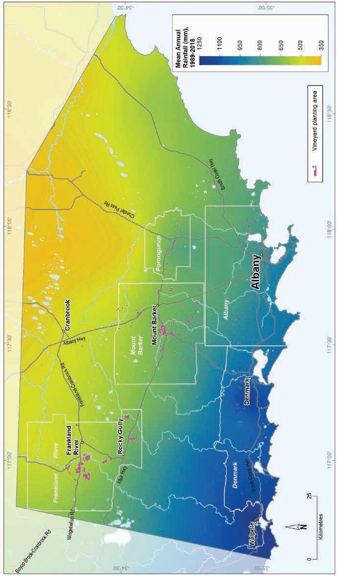
Geology, soils and climate of Western Australia’s wine regions 131
Figure 7.9: Great Southern wine region: Mean annual rainfall (1989–2018)
These factors also affect the ability and methods used to capture and store surface water supplies across the region—an issue compounded by the saline conditions in some of the lower landscape positions and valley floors that occur in some inland locations.
Mean temperatures and variability decrease from the north of the region to the south, with the increasing and cooling influence of the Southern Ocean (Table 7.4). As Halliday (2011a) states, the Southern Ocean has a strong hand in moderating temperatures in the Great Southern, although there are variations as you travel throughout the subregions. Inland, the summers are warmer and the winters are colder. Dry et al. (2004) identify Frankland River as the warmest subregion, and closer to the coast the Denmark and Albany subregions are the coolest and most influenced by maritime factors. Mount Barker and Porongurup are intermediate.
The relatively low spring rainfall, except along coastal areas, and moderate ripening temperatures are well suited to varieties such as Riesling and medium-bodied reds.
Table 7.4 summarises the temperature statistics for the Great Southern region, supported by maps on the following pages, including:
• mean growing season temperature (GST), which covers the months October to April (Figure 7.10). The Great Southern region has a mean GST range of 16.6 °C at Porongurup to 18.5 °C at Frankland River, with the overall mean of 17.9 °C being the lowest of all WA regions.
• mean January temperature (MJT), which represents the mean temperature throughout the day across the warmest month (Figure 7.11). The Great Southern region has a MJT ranging from 18.5 °C close to the coast to 21.5 °C in the north.
• growing degree days (GDD), which are a measure of heat (between 10 and 19 °C) accumulation138 predicting the vines’ development rates for the growing season months of October to April139 (Figure 7.12). The Great Southern region has a range of 1,400 to 1,900 GDD units (°C), the second lowest of the WA wine regions.
• biologically effective degree days (BEDD), which are linked to the GDD calculation and adjusted for latitude/daylength and account for diurnal temperatures140 (Figure 7.13). The Great Southern region has a range of 1,200 to 1,600 BEDD units (°C).
• diurnal temperatures, which are the mean of the daily range between the minimum and maximum mean daily temperature from October to April (Figure 7.14). The Great Southern region has a mean daily range of 8 °C in Albany to 14 °C in Frankland River, with the mean of 11.6 °C.
138 These calculations use the base 10 method (Hall and Jones 2010).
139 More recently, Jarvis et al. (2017) suggest that September to March may be more appropriate.
140 Hall and Jones (2010)
Geology, soils and climate of Western Australia’s wine regions 132
Table 7.4: Great Southern wine region: Temperature statistics (1989–2019) Measurement
* Average estimates are from average measurements across the Great Southern region (Gladstones (2021).
Although Gladstones (2005) stated that the risk of spring frosts in the area has proved less than originally feared, frost can be a serious issue in the Frankland River, Mount Barker and Porongurup subregions and care is needed when selecting sites for planting.
Remenyi et al. (2019) has shown that a changing climate is influencing the region. They identified an increase in mean growing season temperatures (GST) over the past few decades and predict a further regional average increase to more than 19 °C in the next 20 years. They also observed a trend towards drier conditions, particularly in the western third of the region. They predict that the mean growing season rainfall for the region could fall below 190 mm over the next 20 years. These are all important factors to consider for the future viability of each vineyard, particularly in relation to water availability, planting and management.
For more information on the Great Southern region’s climate see the descriptions for individual subregions below (Note: We have not created temperature maps for individual subregion descriptions).
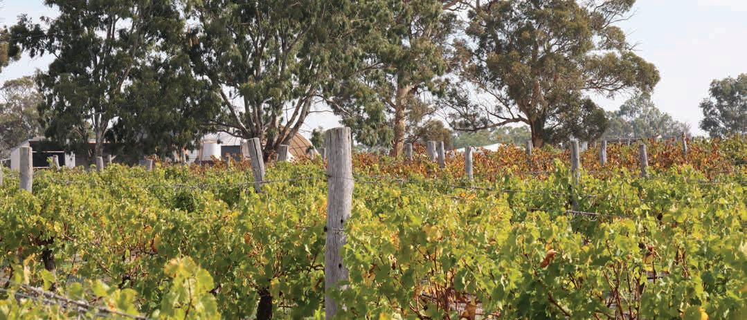
Geology, soils and climate of Western Australia’s wine regions 133
Value Mean January temperature (°C) 20.1 Mean growing season (October–April) temperature (°C) 17.9 Mean growing degree days (October–April) 1,693 Mean diurnal temperature (°C) 11.6 Average daily sun hours (October–April)* 7.2 Average (October–April) cloud cover (Okta)* 5.1
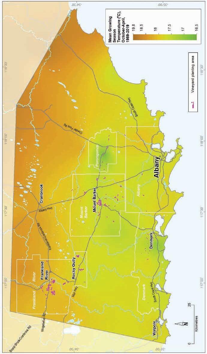
7.10: Great Southern wine region: Mean growing season temperature (October–April, 1989–2019)
Geology, soils and climate of Western Australia’s wine
134
regions
Figure
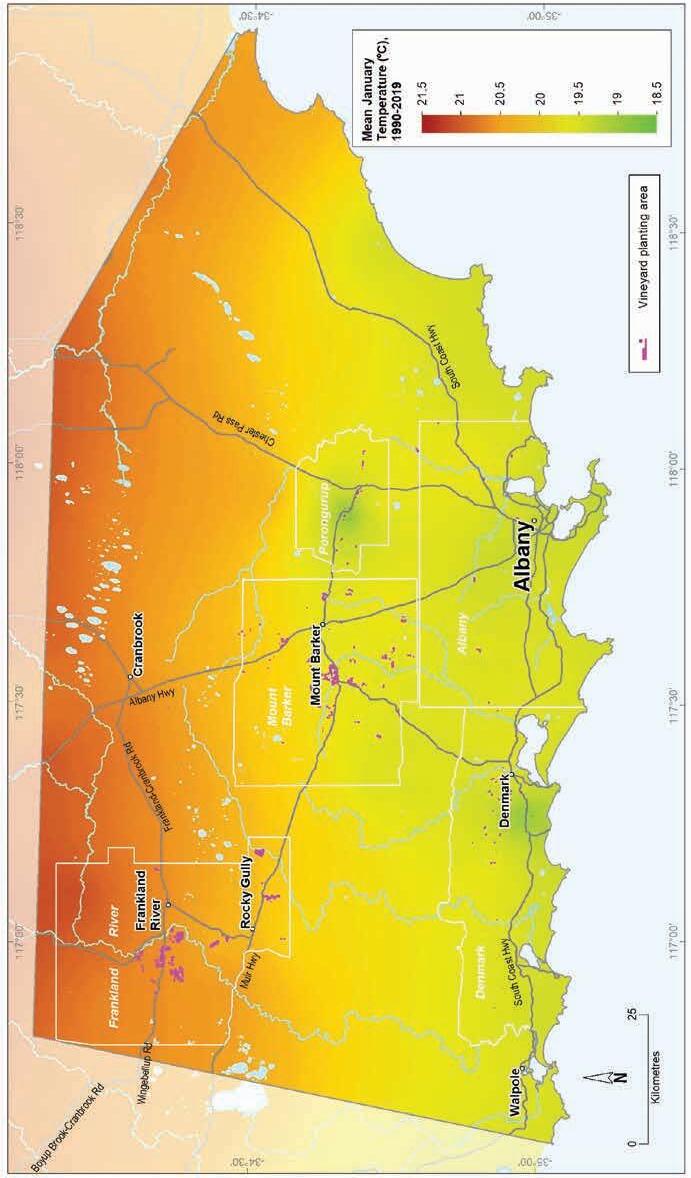
(1990–2019)
Geology, soils and climate of Western Australia’s wine regions 135
Figure 7.11: Great Southern wine region: Mean January temperature
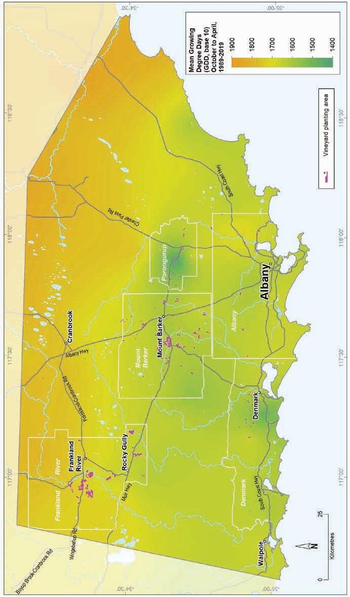
7.12: Great Southern wine region: Mean seasonal growing degree days (October–April, 1989–2019)
regions 136
Geology, soils and climate of Western Australia’s wine
Figure
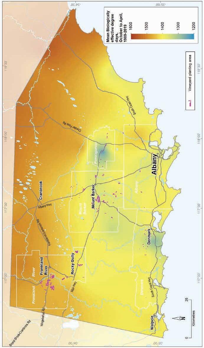
7.13: Great Southern wine region: Biologically effective degree days (October–April, 1989–2019)
Geology, soils and climate of Western Australia’s wine regions 137
Figure
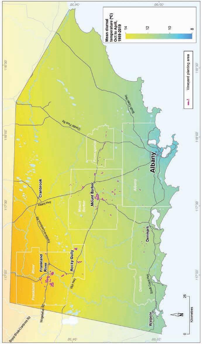
7.14: Great Southern wine region: Mean diurnal temperature (October–April, 1989–2019)
regions 138
Geology, soils and climate of Western Australia’s wine
Figure
Frankland River subregion
The Frankland River subregion is in the north-west of the Great Southern region. It covers almost 143,700 ha and includes the towns of Frankland River and Rocky Gully (Figure 7.15). About three-quarters of the subregion is used for farming, with the remaining area cloaked by dense, tall jarrah, marri and wandoo forest, with low woodlands and heath on small areas of wetlands and swampy terrain.
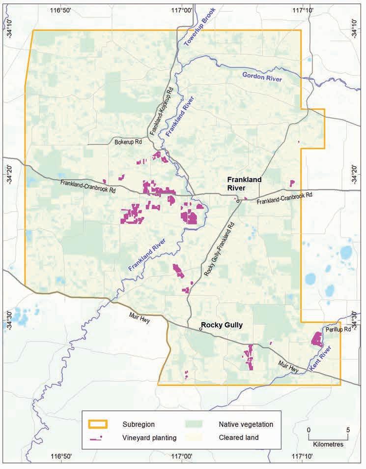
Geology, soils and climate of Western Australia’s wine regions 139
Figure 7.15: Frankland River subregion
The Frankland River area was promoted by State Viticulturalist, Bill Jamieson, with support and recommendations by visiting specialist, Professor Harold Olmo in 1955, who held the Frankland area in high regard for its table wine potential. In 1968, the first vineyard—Westfield—was established in the Frankland River subregion (Beeston 2002). In 1971, Merv and Judy Lange began developing the substantial Alkoomi Vineyard and Winery and by the end of the 1990s, the subregion had about 200 ha of vineyards.
The Frankland River subregion has the largest area of vines in the Great Southern region, with around 1,500 ha in 2019 (DPIRD 2019), making up about 59% of the region’s entire plantings. Our data also suggests that this subregion has a higher proportion of large vineyards than any other region or subregion in WA. The average area of vines per viticultural property is 55 ha.141 This probably reflects the size of the properties in this subregion, but also the relatively uniform soils and gently undulating topography that is ideal for large vineyards that can take advantage of economies of scale.
Geology and physiography
The Frankland River subregion has undulating low lateritic hills and rises that overlie granite and gneiss rocks dated at more than 1.6 billion years of age. It sits on a southward-tilting area known as the Ravensthorpe Ramp (Figure 3.2)—a slumping linked with the separation of the Australian continent from Antarctica during the breakup of Gondwana.
The subregion straddles 2 major geological bodies. North of the Frankland River settlement is the even-grained granite of the ancient Archaean Yilgarn Craton, one of the geological building blocks of south-west Australia. To the south is the layered gneiss of the Biranup Complex, a component of the Proterozoic Albany–Fraser Orogen (Figure 7.16).
Exposed to a long history of stability, these rocks—particularly the Yilgarn Craton—were subjected to deep weathering, which led to the development of the lateritic profile and ironstone gravel that blankets much of the surface of the Yilgarn Craton and large areas of the Albany–Fraser Orogen. In the Frankland River subregion, the laterite varies from massive and cemented blocks and boulders, to loose uncemented laterite stones known as ferricrete nodules and pisolites (commonly called jarrah, forest or pea gravels).
More recent sediments and deposits have formed over both the Yilgarn Craton and Albany–Fraser Orogen. Significant deposition took place across the area during a drier Eocene period when drainage became sluggish. This period of deposition led to the infilling of ancient valleys and depressions previously incised into the Albany–Fraser Orogen and the southern part of the Yilgarn Craton. The broad sandy flats around the Gordon River and the Muir–Unicup wetlands are examples of this.
141 In all other regions and subregions, the average area of vines per viticultural property is less than 20 ha, and Frankland River’s neighbour Mount Barker has the next highest average at 19 ha.
Geology,
wine regions 140
soils and climate of Western Australia’s
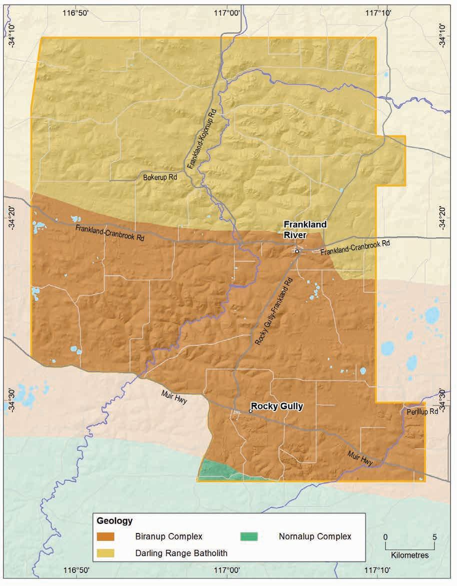
Geology, soils and climate of Western Australia’s wine regions 141
Figure 7.16: Frankland River subregion Simplified geology
The subregion is dissected by the broad, valley flats surrounding the Gordon River, which flows across from the north-east becoming the Frankland River as it arcs south and begins its journey towards the coast. The Kent River meanders across the gently undulating lateritic plain at the south-east corner. The region’s elevation ranges from 155–331 m AHD, with the highest mean elevation in the Great Southern region, from 200 m on the floor of the Kent River in the south-east to 300 m on the hills around Frankland River to 330 m in the north-west corner. The elevation range of the vines is 184–291 m AHD.
Soils and landforms
Ironstone gravels are the most dominant soils across the Frankland River subregion, covering about half of the area. They can appear on the surface as cemented rocks and boulders or as the more familiar loose stones called ferruginous nodules and pisoliths and commonly known as jarrah or pea gravel (Figure 7.17).
Ironstone gravels are in most landscapes of the subregion, but they dominate on the broad hill crests and upper slopes of the undulating terrain. They frequently occur in combination with Sandy duplex and Red–brown loam soils.
Ironstone gravels
Sandy duplexes
Difficult soils
Red-brown loams
Pale deep sands
Heavy soils
Coloured deep sands
Shallow sands
Alluvial sands and loams
Alkaline soils
Proportion of soil in region (%)
Proportion under vines (%)
Figure 7.17: Frankland River subregion: Proportion of main soils in the subregion compared against main soils used for viticulture
Geology, soils and climate of Western Australia’s wine regions 142
0% 10% 20% 30% 40% 50% 60%
Sandy duplexes are the subregion’s second most common soils, found in about 17% of the area, mostly on gentle hillslopes, low rises or undulating plains. Sandy duplexes are more dominant in the north of the subregion and are associated with the weathered rocks of the Yilgarn Craton; in the remaining parts, they are in landscape combinations with Ironstone gravels, Red–brown loams and Pale deep sands (Figure 7.18).
Red–brown loams are not such common soils, found in less than 10% of the subregion. They tend to have brown, or occasionally red, loamy topsoils over clay subsoil. These soils are mostly on valley slopes surrounding the Frankland River and where freshly weathered rock is close to the soil surface or is exposed. The richer coloured soil profile is derived from underlying crystalline parent material such as gneiss of the Biranup Complex or mafic rocks such as dolerite dykes, more commonly seen on the Yilgarn Craton. These soils are often near outcrops of granite, or stony soils on hillslopes, or as isolated rises sitting above surrounding terrain and are frequently associated with Ironstone gravel and Sandy duplex soils.
Pale deep sands in the subregion can be found in patches in a mix with other soils on undulating hillslopes. They are more widespread in areas of flatter terrain with Eocene sediments, floodplains and undulating plains in lower landscape positions.
The remaining soils in the subregion are less common and are generally in a mixture with the Ironstone gravels, Sandy duplex and Red–brown loam soils.
We grouped together as Difficult soils those areas that can affect productivity such as the regularly waterlogged soils associated with valley flats, swamps and lakes; or where exposed or shallow rock, cemented laterite or stony soils are prevalent. These soils are typically unsuited for any form of agriculture but are often found in combination with more productive soils in various landscape positions. Many of these areas remain uncleared, making up about 13% of the subregion.
The soil-landscape mapping for this subregion is included in these surveys: Tonebridge-Frankland (Stuart-Street 2005) and South Coast and Hinterland (Churchward et al. 1988); the mapping can also be viewed online at NRInfo 142
Main viticultural soils of the Frankland River subregion
Ironstone gravels with grey–brown sand to loam topsoils containing abundant ferruginous nodules and pisoliths over well-structured, neutral, yellow–brown loam to clay subsoils are the most widely planted soils in the subregion (Figure 7.19). Currently, almost 60% of all plantings are on Ironstone gravels—the highest proportion of vines in these soils in the Great Southern region. If the crystalline bedrock is closer to the surface, the subsoil can be redder in colour. In areas where Ironstone gravels support jarrah and marri trees, they generally have reasonably well-structured subsoils, while those supporting wandoo vegetation typically have poorer structured, sodic or dispersive clay subsoils. The vine plantings are usually on hillslopes and undulating rises.
142 See https://www.agric.wa.gov.au/resource-assessment/nrinfo-natural-resource-information-western-australia
Geology, soils and climate of Western Australia’s wine regions 143
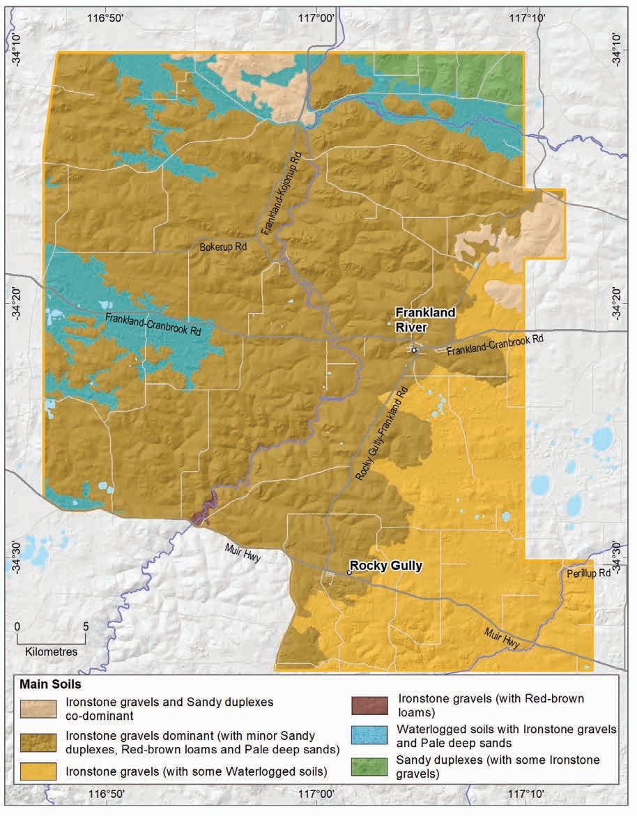
soils and climate of Western Australia’s wine regions 144
Geology,
Figure 7.18: Frankland River subregion: Main soils
Almost 20% of vines grow in areas with Sandy duplex soils. They usually have grey coloured sandy topsoils or less frequently, yellow to brown sandy topsoils, over clay. It is not uncommon to find a layer of ferricrete nodules and pisoliths sitting above the clay. These soils are mainly on hillslopes and further east, on the broad, undulating rises of weathered gneiss of the Biranup Complex in the upper Kent catchment.
Almost 10% of the subregion’s vines are planted on well-structured Red–brown loams generally near exposed crystalline bedrock or where it is close to the surface. These are often on steeper valley and hill slopes closer to the meandering course of the Frankland River. These soils usually have brown (or less commonly, red or yellow) loamy topsoils over well-drained neutral clay subsoils.
Smaller areas (about 5%) have vines growing on Pale deep sands. The sands are generally pale grey and extend more than 80 cm deep. Sometimes they contain ferricrete nodules and pisoliths below a sandy topsoil and in some cases, a clay layer can be found more than 80 cm below the sandy surface. These soils are generally not preferred for planting but often occur as small pockets amongst the better soils in vineyards.
Frankland River subregion: Main soils used for viticulture (Minor soils are mainly Coloured deep sands and Shallow sands)
Geology, soils and climate of Western Australia’s wine regions 145
Ironstone gravels 59% Sandy duplexes 17% Pale deep sands 5% Heavy soils 5% Minor soils 4% Red-brown loams 9%
Figure 7.19:
Climate
Smart and Dry’s criteria (1980) classifies the climate in the Frankland River subregion as warm, moderately maritime, moderately sunny, arid and moderately humid. Halliday (2011a) describes the climate as still being Mediterranean in terms of rainfall but with greater continentality.143
Rainfall ranges from about 480 mm in the north-east to 790 mm in the south-west. Annual evaporation is greater than 1,400 mm in the south-west rising to almost 1,600 mm in the northeast. Mean 3pm October to April relative humidity is 49% at Rocky Gully and probably lower to the north (Gladstones 1992). The Frankland River subregion has the lowest mean annual rainfall of all the winegrowing areas in the south-west (Table 7.5), but the seasonal rainfall is like the Peel and Blackwood Valley regions.
The subregion has the Great Southern region’s warmest temperatures and greatest ripening period sunshine hours (Table 7.6). Temperature variability can be a problem with extreme high temperatures sometimes experienced, despite the low mean temperatures. Most heat extremes occur before ripening, reducing the impact on fruit quality. Spring frosts can also be a problem with temperatures below 2 °C that can extend into November so site selection is important.
Gladstones (2021) estimates that the Frankland River subregion has an average 7.6 daily sun hours (October to April) and an average October to April cloud cover, which are important considerations for temperatures and night-time cooling.
In spring, the dominant winds are about 17–20 km/h, swinging from the north-west in the mornings to the west and south-west in the afternoons. The characteristic summer sea breeze (the Albany Doctor) generally makes its way inland and cools the late afternoon temperatures by about 2 °C. These southerly afternoon winds are usually at speeds of 21 km/h, increasing in strength from the dominant warm, easterly morning winds of about 18 km/h.
Gladstones (2021) states that the sea breeze moderates hot summer temperatures in the subregion, bringing an increase in afternoon humidity, potentially reducing the period of cumulative afternoon stress and rapid loss of evaporative moisture and flavour volatiles from the berries.
143 Continentality refers to a climatic effect that emerges because of the different range of temperatures for areas located in the interior of the continent away from the moderating influence of the oceans.
Geology, soils and climate of Western Australia’s wine regions 146
Value Annual rainfall (mm) Seasonal (October–April) rainfall (mm) Minimum 481 151 Maximum 793 253 Mean 593 190
Table 7.5: Frankland River subregion: Rainfall statistics (1989–2019)
Table 7.6: Frankland River subregion: Temperature statistics (1989–2019)
Measurement
* Average estimates are from a site at Westfield Vineyard, Frankland River (Gladstones 2021).
Due to the relatively low mean rainfall and warm temperatures in this subregion, supplementary irrigation of vines is essential to reduce stresses in summer. To avoid poor water quality often found in lower parts of the valleys, there are many extensive water catchment systems (such as roaded catchments) in upper parts of the landscape. These are designed to maximise the capture of betterquality run-off, with many vineyards relying on large dams to store water for more than one season.
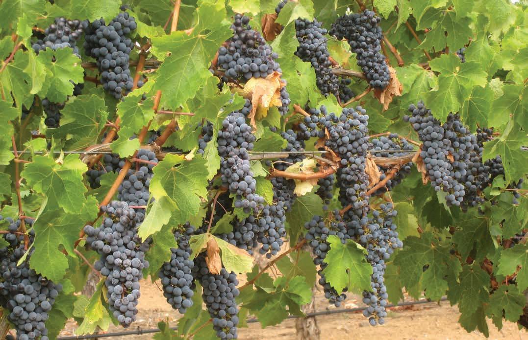
Geology, soils and climate of Western Australia’s wine regions 147
Value Mean growing season (October–April) temperature (°C) 18.1 Mean January temperature (°C) 20.6 Mean growing degree days (October–April) 1,722 Mean diurnal temperature (°C) 13.3 Average daily sun hours (October–April)* 7.6 Average (October–April) cloud cover (Okta)* 4.8
Mount Barker subregion
The Mount Barker subregion lies south-east of the Frankland River subregion, north of the Albany subregion and west of the Porongurup subregion. It is 132,216 ha in size and includes the town of Mount Barker, the settlements of Narrikup and Pardelup, with Kendenup on the northern border (Figure 7.20). About 75% of the area is used for farming and other land uses. The local vegetation features low jarrah and marri forests and heathlands around poorly drained swampy areas.

Geology, soils and climate of Western Australia’s wine regions 148
Figure 7.20: Mount Barker subregion
This area was the focus of early viticulture trials after Dr John Gladstones supported Professor Harold Olmo’s suggestions for the potential of the Frankland River and Mount Barker areas for production of quality table wines (Gladstones 1965). Small trials were established here in the late 1960s—by 2019 more than 990 ha of vineyards were planted in the subregion (DPIRD 2019) making up almost one-third of the total region’s plantings. This was the first subregion to gain GI recognition in Australia (Beeston 2002).
Geology and physiography
An undulating plateau dominates the landscape of the Mount Barker subregion, which is formed on deeply weathered rocks of the Albany–Fraser Orogen. The Orogen has 2 main components: north of Mount Barker is the gneiss and metasediments of the Biranup Complex, and to the south is the gneiss and granite of the Nornalup Complex. The prominent peaks at Mount Barker and Mount Barrow are part of the Nornalup Complex (Figure 7.21).
At the eastern edge of the subregion, the rocks of the Albany–Fraser Orogen are partly cloaked by the Tertiary sediments of the onshore portion of the Bremer Basin. These mainly include Eocene sedimentary rocks of the Plantagenet Group, commonly Pallinup Siltstone (pale spongolite and low-energy marine carbonate and light-coloured siltstone), originally deposited in several broad topographic depressions and shallow seaways.
These Tertiary sediments, along with the crystalline rocks of the Albany–Fraser Orogen, were subjected to deep weathering over long periods of geological stability, which led to the development of the lateritic profile and ironstone gravel that blankets many parts of the subregion. The laterite varies from massive and cemented blocks and boulders, to loose uncemented laterite stones known as ferruginous nodules and pisolites (commonly called jarrah, forest or pea gravels). The Hay River and its tributaries have carved a prominent route through this blanketing laterite to the bedrock of the Nornalup Complex in the southern part of the subregion. At the north-east corner is the Kalgan River catchment, with rocks of the Biranup Complex often exposed on valley slopes.
Influenced by the southward-tilting Ravensthorpe Ramp, the trend in elevation is for a gradual decline from the subregion’s northern boundary towards the south coast. A series of topographic benches or shelves interrupts this descent, including the gently undulating lateritic plateau in the west of the subregion, dotted by low hills emerging above the plateau. Sluggish ancient river systems deposited sediments in some areas, forming poorly drained flats, which are often swampy with occasional wetlands (such as Lake Kwornicup).
The plateau landscape dominating the subregion rises gently from 140 m in the south-east to 240 m in the north-west. A few prominent hills rise above the plateau including Mount Barrow (485 m) and Pardelup Hill (312 m). Many of the vineyards are planted in valleys incised into the plateau. These include the Hay River, the floor of which drops from 180 m at the Muir Highway to 60 m on the southern margins of the subregion.
Geology, soils and climate of Western Australia’s wine regions 149
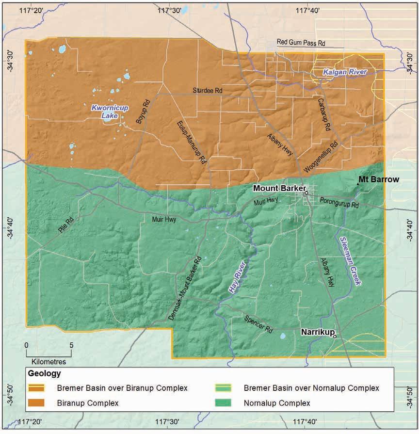
Soils and landforms
Cloaking the ancient, deeply weathered felsic crystalline rocks of the Albany–Fraser Orogen is an undulating lateritic plateau that dominates the landscape of the Mount Barker subregion, with areas of alluvial plains and restricted drainage. Consequently, about one-third of the soils found in the Mount Barker subregion are Ironstone gravels (Figure 7.22 and Figure 7.23). They are mainly on broad, undulating rises or alluvial plains that sit above the sometimes poorly drained surrounding terrain. These soils are frequently found in combination with Sandy duplexes in many areas of the subregion.
Western Australia’s wine regions 150
Geology, soils and climate of
Figure 7.21: Mount Barker subregion: Simplified geology
Sandy duplex soils dominate in about 20% of the subregion, more so east of Mount Barker where influences from Eocene sediments and shallow bedrock are more marked. These soils are prominent in shallow valleys, on broadly undulating plateaux and are also associated with low granitic hills. They are often found in combination with Ironstone gravels and Red–brown loams.
Ironstone gravels
Difficult soils
Sandy duplexes
Heavy soils
Pale deep sands
Red-brown loams
Shallow sands
Alkaline soils
Coloured deep sands
Alluvial sands and loams
Proportion of soil in region (%)
Proportion under vines (%)
Figure 7.22: Mount Barker subregion: Proportion of main soils in the region compared against main soils used for viticulture
About 8% of the subregion’s soils are described as Heavy soils, which are often found on alluvial plains around undulating low lateritic hills in the northern part of the subregion.
Pale deep sands, dominant in only 7% of the subregion, are generally found in patches in a mix with other soils. They can be more concentrated in low dunes close to swamps and shallow valleys, in depressions and on gently sloping uplands. They typically occur in combination with Sandy duplex soils, Ironstone gravels and outcrops of deeply weathered granite.
Red–brown loams are generally derived from the underlying crystalline parent material, mainly over the gneiss of the Nornalup Complex in this subregion. These soils are not widespread, found in only about 3% of the area. They often occur near outcrops of crystalline rock or stony soils on hillslopes or isolated rises sitting above surrounding terrain. The Red–brown loam soils are more common around the hills and peaks of the eastern half of the subregion at Carbarup Hill, Mount Barrow and Mount Barker. They are also associated with deeper valley slopes such as the Hay River.
Geology, soils and climate of Western Australia’s wine regions 151
0% 10% 20% 30% 40% 50%
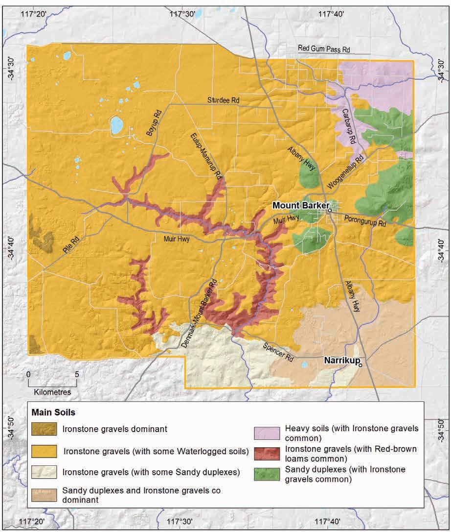
Geology, soils and climate of Western Australia’s wine regions 152
Figure 7.23: Mount Barker subregion: Main soils
About 20% of the subregion has patches of land with swamps and lakes, frequent waterlogging, rock outcrops and salt-affected waterways. We grouped these together into Difficult soils. They occur mainly in the low-lying alluvial terrain associated with the lateritic plateau west of Mount Barker and small areas of swampy plains in the south. The rocky peak of Mount Barker and other low granite rises, usually in the Nornalup Complex, also sit with this group. Difficult soils are typically unsuited for any form of agriculture but can combine with more productive soils in various landscapes.
The remaining soils in the subregion are minor (Shallow sands, Alluvial sands and loams and Alkaline soils) and generally occur intermittently in a mixture with the Ironstone gravels, Sandy duplex, Pale deep sand and Red–brown loam soils.
The South Coast and Hinterland survey (Churchward et al. 1988) contains soil-landscape mapping covering this subregion; the mapping can also be viewed online at NRInfo.144
Main viticultural soils of the Mount Barker subregion
Ironstone gravel soils are the most widely planted soils in the Mount Barker subregion, supporting about 48% of all the vines (Figure 7.24). These soils generally have grey sandy topsoils containing abundant ferruginous nodules and pisoliths overlying yellow–brown clay at depth. If the crystalline bedrock of the Albany–Fraser Orogen is closer to the surface, the subsoil clay is sometimes redder in colour. Ironstone gravels usually have reasonably well-structured subsoils with some exhibiting more poorly structured, sodic or dispersive clay subsoils.
The vines growing on Ironstone gravels are typically on the better-drained rises that emerge above the surrounding terrain. Some of the hill crests and upper slope positions feature patches of shallower Ironstone gravels over cemented laterites amongst the preferred soils. These are generally grey to pale yellow sands with abundant ferruginous nodules and pisolites over a cemented layer at less than 80 cm deep.
Almost one-quarter of all vines in the subregion grow in Sandy duplex soils. Most of these have pale grey to yellow–brown coarse- to medium-grained sandy topsoils over clay subsoils, which can be poorly structured. These soils are often associated with weathered felsic crystalline rocks on the slopes of granitic hills and valleys, as well as in a mix with Ironstone gravels and Pale deep sands.
About 8% of the subregion’s vines grow in Heavy soils, which are more common on the alluvial plains surrounding the undulating lateritic rises in the northern part of the subregion. These soils usually have shallow, poorer structured subsoil clay beneath pale grey sandy or loamy topsoils. In some cases, the clay is over shallower areas of bedrock. In vineyards, these soils are often found amongst better soils, particularly Sandy duplexes.
About 9% of the subregion has vines growing on areas dominated by deep sands, collectively the Pale deep sands and Coloured deep sands, which are sometimes found together. Pale deep sands, with fine to coarse pale grey sand, tend to be more prominent on gentle slopes and minor valleys and depressions, sometimes with clay found below 80 cm. The Coloured deep sands are usually yellow in this subregion typically with fine sands over a deep clay layer beyond 80 cm. Deep sands (particularly Pale deep sands) are generally not preferred for planting in the subregion, but they often occur as small pockets amongst the better soils found in vineyards, such as Ironstone gravels and Sandy duplex soils.
144 See https://www.agric.wa.gov.au/resource-assessment/nrinfo-natural-resource-information-western-australia
Geology, soils and climate of Western Australia’s wine regions 153
Figure 7.24: Mount Barker subregion: Main soils used for viticulture (Minor soils are Coloured deep sands, Shallow sands and Alkaline soils)
Red–brown loams supporting vines occur in about 6% of the subregion. They tend to be on valley slopes formed on the gneiss of the Nornalup Complex, such as at the Hay River (often in combination with Ironstone gravels). The Red–brown loams are also on footslopes of hills where crystalline bedrock is close to the surface or exposed, sometimes making the soil quite stony. These soils mainly have red–brown to yellow–brown loamy topsoils over well-structured loam to clay subsoils.
Climate
Smart and Dry (1980) classified the Mount Barker subregion climate as being warm, moderately maritime, sunny, not arid and moderately humid. At 50 km away from the Southern Ocean, climatic conditions in the subregion are like those in the Frankland River subregion, with slightly cooler temperatures, higher rainfall, fewer extremes and fewer sunshine hours (which increase from south to north, while relative humidity decreases) (Table 7.7 and Table 7.8). Annual evaporation is around 1,400 mm in the south-west rising to 1,500 mm in the north-east.
Frost is a risk in the Mount Barker subregion, with mean minimum temperatures below 2 °C experienced about 4 days per year, usually between May and October; frost risk is greatest in the north of the subregion.
Geology, soils and climate of Western Australia’s wine regions 154
Ironstone gravels 48% Sandy duplexes 21% Pale deep sands 6% Heavy soils 8% Minor soils 11% Red-brown loams 6%
Table 7.7: Mount Barker subregion: Rainfall statistics (1989–2019)
Table 7.8: Mount Barker subregion: Temperature statistics (1989–2019) Measurement
* Average estimates for the Mount Barker subregion are from Gladstones (2021).
Spring winds are typically from the west and north-west at about 10–12 km/h. The winds swing around in the summertime, with mornings usually having east to south-east winds of about 9 km/h, followed by the afternoon southerly summer sea breeze (the Albany Doctor), which makes its way inland to cool temperatures with wind speeds of about 13 km/h.
To avoid poor water quality often found in lower parts of the valleys, there are many extensive water catchment systems (such as roaded catchments) now operating in upper parts of the landscape. These are designed to maximise the capture of better-quality run-off, with many vineyards relying on large dams to store water for more than one season.
Geology, soils and climate of Western Australia’s wine regions 155
Value Annual rainfall (mm) Seasonal (October–April) rainfall (mm) Minimum 489 190 Maximum 845 305 Mean 670 249
Value Mean growing season (October–April) temperature (°C) 17.7 Mean January temperature (°C) 19.8 Mean growing degree days (October–April) 1,609 Mean diurnal temperature (°C) 11.5 Average daily sun hours (October–April)* 7.3 Average (October–April) cloud cover (Okta)* 4.7
Porongurup subregion
The Porongurup subregion is directly east of the Mount Barker subregion and covers almost 40,000 ha, including the rocky peaks and imposing karri forest (Eucalyptus diversicolor) of the Porongurup Range National Park. About 75% of the subregion is used for agriculture. The northern boundary is approximately Washpool Road, the eastern boundary follows the sinuous path of the Kalgan River to Kallamup, the western boundary follows Barrow, Watermans and Woodlands Roads, while the south extends to Yellanup locality (Figure 7.25).
Interest in viticulture grew slowly from the early 1970s (Beeston 2002), and by 2019 around 105 ha of vineyards were in the subregion (DPIRD 2019), comprising about 3% of the Great Southern region’s plantings.
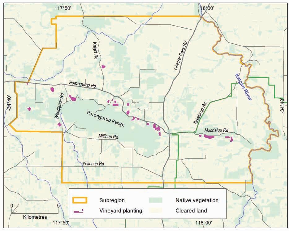
Geology, soils and climate of Western Australia’s wine regions 156
Figure 7.25: Porongurup subregion
Geology and physiography
The Porongurup subregion lies on the deeply weathered felsic crystalline rocks of the Albany–Fraser Orogen. In this area the Orogen features 2 main components: north of the Porongurup Range is the gneiss and metasediments of the Biranup Complex, and to the south is the gneiss and granite of the Nornalup Complex (Figure 7.26). The picturesque peaks of the Porongurup Range that rise abruptly above the surrounding terrain are part of the Nornalup Complex.
The elevated landscape of the range is almost an island of gneiss and granitic basement rock surrounded by a veneer of Eocene sedimentary deposits derived from the onshore extent of the Bremer Basin. These are sedimentary rocks of the Plantagenet Group, usually Pallinup Siltstone (containing pale spongolite, low-energy marine carbonate and light-coloured siltstone). The sediments were deposited in several broad topographic depressions and shallow seaways across this part of the Albany–Fraser Orogen. Over time, a lateritic mantle has formed on top of the sediments.
The peaks of the Porongurup Range rise to 670 m AHD above a plain, which is 100–130 m in the south and 160–200 m in the north. Vines are grown between 102 m and 352 m AHD, with a mean height of 247 m AHD, the highest in the Great Southern region.

Figure 7.26: Porongurup subregion: Simplified geology
Geology, soils and climate of Western Australia’s wine regions 157
Soils and landforms
The soils of the Porongurup subregion strongly reflect the geology. Unlike other subregions in the Great Southern, the Sandy duplexes, which comprise about one-quarter of the soils in the area, are co-dominant with Ironstone gravels (Figure 7.27). This relates to the dominating presence of both the granitic bedrock and the surrounding Eocene sediments of the Plantagenet Group, both of which also have a lateritic mantle. The Sandy duplexes, along with the Ironstone gravels, are locally known as marri soils referring to marri (Corymbia calophylla), the prominent eucalypt supported by these soils. These soils are better-drained and suitable for viticulture. These are usually on the lower slopes of the granitic range and on the gently sloping footslopes surrounding the hills.
Ironstone gravels are dominant in about one-quarter of the subregion. These soils are most prominent on ridge crests and undulating rises, sometimes associated with granite, on areas surrounding the range, and in combination with Sandy duplex soils in many locations (Figure 7.28).
Heavy soils, found in about 16% of the subregion, tend to be more frequent on the flat to gently undulating plain north of the Porongurup Range, usually in a mix with Ironstone gravels. Underlain by Pallinup Siltstone, the Heavy soils tend to be sandy or loamy duplexes with poorer structured clay or clay loam subsoils within 80 cm, and in many cases, within 30 cm, which can impede root growth and water movement.
Ironstone gravels
Sandy duplexes
Heavy soils
Difficult soils
Red-brown loams
Pale deep sands
Coloured deep sands
Shallow sands
Proportion of soil in region (%)
Proportion under vines (%)
Figure 7.27: Porongurup subregion: Proportion of main soils in the region compared against main soils used for viticulture
Geology, soils and climate of Western Australia’s wine regions 158
0% 10% 20% 30% 40%
Red–brown loams occur in only about 10% of the subregion. They are associated mainly with shallower granitic bedrock on the lower slopes of the range, near rock outcrops or stony soils on hillslopes or on isolated rises sitting above the surrounding terrain. They are often found in combination with Sandy duplex soils.
Deep sands are minor soils here, covering only about 8% of the area, with Coloured deep sands being slightly more common than Pale deep sands. Pale deep sand is usually in small patches across the subregion, occasionally as hummocky dunes close to the Kalgan River and on the undulating plateau north of the Porongurup Range. To the south they are also found in broad depressions. Coloured sands are generally found in areas on lower slopes surrounding granitic hills and around the valley slopes of the Kalgan River.
In terrain where swamps, waterways and rock outcrops dominate, we grouped them together as Difficult soils. These terrains comprise about 13% of the subregion and include the rocky peaks of the Porongurup Range and other low granite rises, as well as small areas of swampy plains south-east of the range. These Difficult soils usually occur in combination with better-drained, more arable terrain.
The South Coast and Hinterland survey (Churchward et al. 1988) contains soil-landscape mapping covering this subregion; the mapping can also be viewed online at NRInfo.145
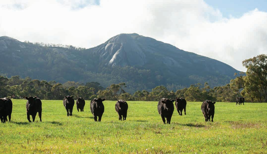
145 See https://www.agric.wa.gov.au/resource-assessment/nrinfo-natural-resource-information-western-australia
Geology, soils and climate of Western Australia’s wine regions 159
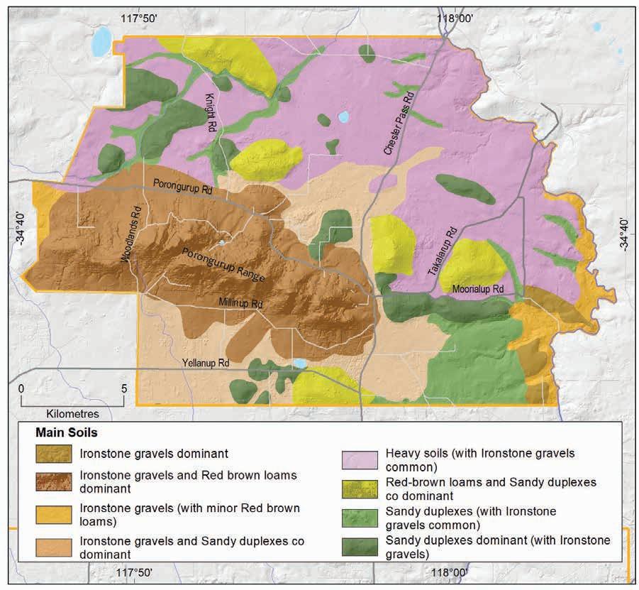
Main viticultural soils of the Porongurup subregion
Most of the plantings in the Porongurup subregion are fringed by the spectacular karri forests on the lower northern footslopes of the granitic Porongurup Range that rises dramatically above the surrounding terrain.
The most widely planted soils in the subregion are Sandy duplexes (Figure 7.29). These tend to have yellow–brown moderate to fine sandy topsoils over well-structured yellow to yellow–brown mottled clay subsoils below 30 cm. Less often the sandy topsoils are grey or grey–brown coloured. On the hillslopes it is not unusual to encounter shallow granitic rock within 80 cm. The Sandy duplexes on the undulating plateau areas often feature a layer of ferruginous nodules and pisoliths above the clay.
Geology, soils and climate of Western Australia’s wine regions 160
Figure 7.28: Porongurup subregion: Main soils
Figure 7.29: Porongurup subregion: Main soils used for viticulture (Minor soils are Heavy soils and Shallow sands)
Almost one-quarter of the subregion’s vines grow in Ironstone gravels with sand to loam topsoils containing abundant ferruginous nodules and pisoliths over well-structured neutral yellow clayey subsoils. Many of the Ironstone gravels on the granitic slopes are brownish red coloured indicating shallower bedrock.
Red–brown loams are popular for viticulture in the subregion, and with the redder Ironstone gravel soils, they are known locally as ‘karri loams’ after the towering karri trees (Eucalyptus diversicolor) that frequently grow in these areas. Although Red–brown loams only occur in about 10% of land in the entire subregion, more than 20% of vines grow on these soils. The Red–brown loams usually have brown to red–brown loamy topsoils over well-structured loam to clay subsoils. Areas of rocky or stony soils are not uncommon amongst these soils and they can also contain some ferricrete nodules and pisoliths.
Coloured deep sands are also somewhat preferentially planted with vines, making up about 7% of plantings, even though these sands occur in just 3% of the subregion. These soils typically have more than 80 cm of fine deep yellow sand, usually over yellow–brown clay or coffee rock beyond that depth. They are generally found on the lower slopes of some hills and can be associated with Ironstone gravel soils.
A small area of the subregion’s vines grown in Pale deep sands. These deep, pale grey to grey–brown sands extend beyond 80 cm in small patches on lower hillslopes. These sands are not generally preferred for viticulture but often occur in vineyards in combination with other more desirable soils.
Geology, soils and climate of Western Australia’s wine regions 161
Ironstone gravels 24% Sandy duplexes 36% Coloured deep sands 7% Minor soils 9% Pale deep sands 4% Red-brown loams 21%
Climate
Gladstones (2021) indicates that the subregion’s vineyards have distinctive and highly favourable air drainage patterns because they are on the lower slopes of a strongly isolated small mountain range (Table 7.9). This subregion’s overall temperatures are lower, making aspect an important consideration. Most vineyards are on the north side of the Porongurup Range, where the slope aspect is warmer and better for ripening later varieties and fuller-bodied reds.
The Porongurup subregion’s mean annual rainfall is second lowest of the subregions, after the Frankland River. Conversely, its mean seasonal rainfall is one of the highest, after the Denmark subregion. Annual evaporation is around 1,450 mm.
Table 7.9: Porongurup subregion: Rainfall statistics (1989–2019)
To improve rainfall capture for supplementary irrigation requirements, water catchment systems (such as roaded catchments) are placed in upper parts of the landscape. These are designed to maximise the capture of better-quality run-off, with many vineyards relying on large dams to store water for more than one season.
Much of the Porongurup subregion is at a higher altitude than the Mount Barker subregion, with temperatures probably 1 °C cooler with less variability during ripening. Its mean diurnal temperature range is higher than coastal locations, but lower than other inland subregions (Table 7.10). The Porongurup subregion has the lowest mean seasonal growing degree days (GDD) of all the Great Southern subregions, and a mean January temperature (MJT) about the same as the Albany and Denmark subregions and lower than the remainder.
7.10: Porongurup subregion: Temperature statistics (1989–2019)
The slopes of the Porongurup Range exhibit good air drainage, although spring frosts can still be a problem. Halliday (2011a) describes a feature of the climate in the Porongurup subregion as having a night-time thermal zone, which is created by a layer of warm air rising above the denser cold air that slides down the hillslopes and settles on the lower valley floors.
Geology, soils and climate of Western Australia’s wine regions 162
Value Annual rainfall (mm) Seasonal (October–April) rainfall (mm) Minimum 522 210 Maximum 769 309 Mean 663 269
Measurement Value Mean growing season (October–April) temperature (°C) 16.8 Mean January temperature (°C) 19.5 Mean growing degree days (October–April) 1,566 Mean diurnal temperature (°C) 11.0
Table
Albany subregion
The Albany subregion is south of the Mount Barker and Porongurup subregions and abuts the wild coastline of the Southern Ocean. It covers 157,338 ha surrounding the town of Albany and the settlements of Torbay, Kalgan and King River. About 60% of the land is used for agriculture and other activities (Figure 7.30).
The Sippe family at Redmond Vineyard planted the first vines in the subregion in 1975, followed by Wignalls Wines who planted their first vines in 1982 (Beeston 2002). By 2019 the subregion had about 94 ha of vineyards (DPIRD 2019), which contribute about 3% of the Great Southern region’s plantings.
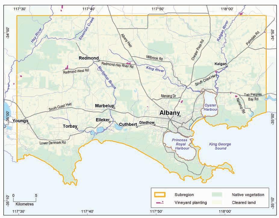
Geology, soils and climate of Western Australia’s wine regions 163
Figure 7.30: Albany subregion
Geology and physiography
The Albany subregion sits entirely within the Nornalup Complex of the Proterozoic Albany–Fraser Orogen (Figure 7.31). These crystalline basement rocks are mainly gneiss and granite.
Shallow marine waters and other sediments encroached onto this part of the Albany–Fraser Orogen in the later Eocene period (around 40 million years ago). The waters eventually receded around the end of the Eocene leaving behind a relatively smooth veneer of sediments known as Pallinup Siltstone (siltstones and spongolite as part of the Plantagenet Group), which cover a large part of the Albany subregion. A covering mantle of laterite formed on much of the Pallinup Siltstone over time. The land of higher relief, including the domes of weathered felsic crystalline rock found closer to the south coast, are often surrounded by the sediments. In many places, the Hay, Kalgan and King Rivers, with their tributaries, have also carved sinuous paths through large parts of the laterite and Eocene sediments down to the crystalline bedrock.
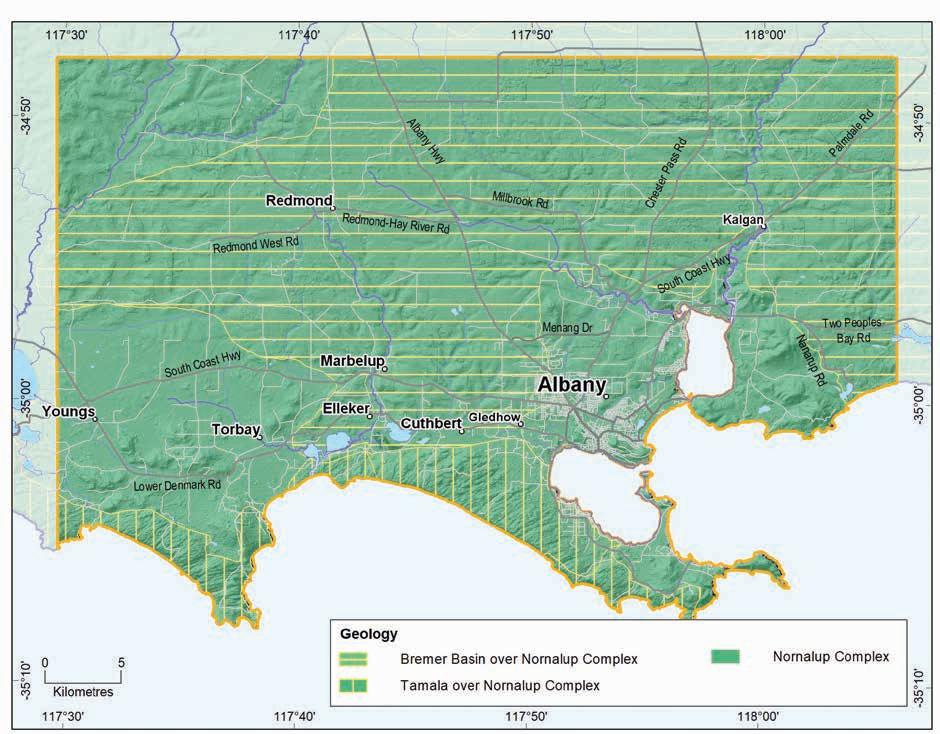
Figure 7.31: Albany subregion: Simplified geology
Geology, soils and climate of Western Australia’s wine regions 164
The imposing granite and gneiss headlands and coastal eminences of the Nornalup Complex at the south coast of the subregion are frequently overlain by broad ridges of Tamala Limestone. Large, windswept parabolic dunes cover the limestone in many areas. The limestone ridges and dunes often act as barriers behind which are areas of swamps with alluvial and estuarine deposits.
Elevation ranges from near sea level at the coast to just over 100 m AHD in the north.
Soils and landforms
The lateritic mantle cloaking the Eocene siltstone and sandstone sediments is the source of the Ironstone gravels found across much of the Albany subregion’s hinterland (Figure 7.32). Ironstone gravels are the dominant soils in more than one-quarter of the area and frequently occur in combination with Sandy duplex and Pale deep sandy soils.
Over eons, rivers and other watercourses have carved into the gently sloping upland sandy plain that dominates the northern part of the subregion. This created a dissected landscape at the plain’s southern edge and leaving low undulating hills with long spurs and ridges that feature more concentrated areas of Ironstone gravels, particularly on crests and upper slopes (Figure 7.33).
Ironstone gravels
Difficult soils
Pale deep sands
Sandy duplexes
Alkaline soils
Heavy soils
Shallow sands
Red-brown loams
Coloured deep sands
Proportion of soil in region (%)
Proportion under vines (%)
Figure 7.32: Albany subregion: Proportion of main soils in the subregion compared against main soils used for viticulture
Geology, soils and climate of Western Australia’s wine regions 165
0% 10% 20% 30% 40%
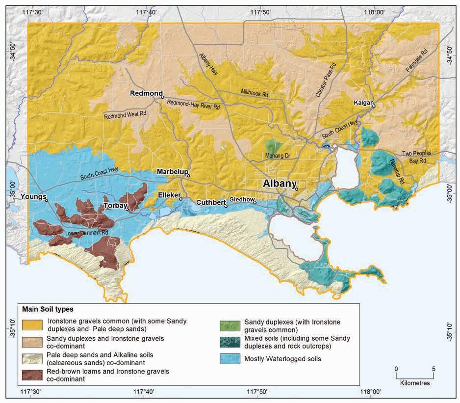
Pale deep sands occur on about 20% of the land across the subregion, generally in patches mixed with Sandy duplex and Ironstone gravel soils. In some landscapes these sands are dominant, including in shallow valleys and depressions over sandstone and siltstone. Most significantly, however, they fringe the southern coastline, in association with imposing sand dunes over Tamala Limestone and granite.
Sandy duplex soils are the next most prominent in the subregion and are related to the deep weathering of the sedimentary rocks. These soils mainly occur on the broadly undulating plateau in the subregion’s north and in smaller upland plains above valley slopes. They are also more common on lower slopes around granite hills fringed by sedimentary rock. Sandy duplex soils are often found in combination with Ironstone gravels and Pale deep sand.
Geology, soils and climate of Western Australia’s wine regions 166
Figure 7.33: Albany subregion: Main soils
Where swamps, waterways and rock outcrops dominate the subregion’s soils, we have grouped them together as Difficult soils. Found in about one-quarter of the subregion, these soils tend to be found on valley floors and scattered lakes and swamps dotted on the inland plateau area that are prone to waterlogging. Closer to the coast are broad areas of flat swampy plains and lakes that lie behind impressive coastal dunes and vast domed granitic headlands.
The South Coast and Hinterland survey (Churchward et al. 1988) contains soil-landscape mapping covering this subregion; the mapping can also be viewed online at NRInfo 146
Main viticultural soils of the Albany subregion
The highest concentration of the Albany subregion’s plantings is on land dominated by Ironstone gravels, which support more than one-third of all the vines (Figure 7.34). These soils are located mainly on broad crests of sandy and lateritic spurs and ridges and upper north-facing slopes on dissected terrain.
Figure 7.34: Albany subregion: Main soils used for viticulture (Minor soils are Shallow sands, Red–brown loams and Coloured deep sands)
The most common Ironstone gravels usually have pale yellow–brown to pale grey sand topsoils containing abundant ferruginous nodules and pisoliths over yellow clay subsoils. The clay is usually above 80 cm, but occasionally deeper. Hard, cemented ironstone layers or other rocks are common on hill crests.
146 See https://www.agric.wa.gov.au/resource-assessment/nrinfo-natural-resource-information-western-australia
Geology, soils and climate of Western Australia’s wine regions 167
Ironstone gravels 38% Sandy duplexes 26% Heavy soils 5% Minor soils 13% Pale deep sands 18%
Sandy duplexes are the next most frequently planted soils, supporting over one-quarter of the subregion’s vines. These are generally on the undulating plateaux, on broad valley slopes and at footslopes of the granitic hills emerging above the surrounding terrain north-east of Oyster Harbour. Sandy duplex soils commonly have light grey–brown coloured coarse- to medium-grained sandy topsoils over yellow clay subsoils, or less often, the sandy topsoils are coloured yellow–brown. They are more common around the lower footslopes of some granitic outcrops.
Pale deep sands can be co-dominant with Sandy duplex soils in many of the Albany subregion’s landscapes, particularly on slopes of broad valleys that have carved into sedimentary rocks. They tend to be pale grey–brown fine- to coarse-textured sand extending more than 80 cm deep, often with a yellow–brown clay layer below that depth. In some cases, a cemented laterite or coffee rock layer is found deep below the deep sand.
About 5% of the region’s vines grow in Heavy soils, which typically have shallow grey coloured loamy sand topsoils over poorer structured subsoil clays within 30 cm below the surface. These, like the other minor soils, generally occur in patches amongst Ironstone gravels, Sandy duplex and Pale deep sands in various landscapes.
Climate
Because of its proximity to the Southern Ocean, the Albany subregion is cooler than the more northerly subregions of the Great Southern region, with a greater maritime influence. The coastal location brings warm humid winds with afternoon sea breezes (the Albany Doctor) and summer drizzle, which is rarely experienced in other areas of WA (Table 7.11). For this reason, soils tend to remain moister than elsewhere and fungal diseases and over-vigorous vine growth need to be managed.
The Albany subregion’s sunshine hours are similar to those experienced at Mount Barker; however, the moderating effect of the ocean reduces temperature variability, particularly for vineyards closer to the coast (Table 7.12). Halliday (2011a) states that moderate humidity in summer assists ripening by reducing stress on the vines. Diurnal temperature range is minimal. Annual evaporation is between 1,300 and 1,400 mm.
Geology, soils and climate of Western Australia’s wine regions 168
Value Annual rainfall (mm) Seasonal (October–April) rainfall (mm) Minimum 690 227 Maximum 1,003 318 Mean 836 294
Table 7.11: Albany subregion: Rainfall statistics (1989–2019)
Table 7.12: Albany subregion: Temperature statistics (1989–2019) Measurement
* Average estimates for the Albany subregion are from Gladstones (2021).
Beeston (2002) suggests that the release of heat accumulated during the day by the Albany subregion’s numerous granite outcrops has a further moderating effect on evening temperatures. The maritime influence also means that frost risk is low, with temperatures in Albany rarely dipping below 2 °C in July.
Wind exposure can be a problem in coastal areas and shelter from the wind is an important management consideration to prevent damage to tender shoots and buds. Morning winds have a mean speed of 14 km/h, increasing to about 19 km/h in the afternoons. On summer afternoons, the humid, cooling Albany Doctor usually increases to about 21 km/h.

Geology, soils and climate of Western Australia’s wine regions 169
Value Mean growing season (October–April) temperature (°C) 17.8 Mean January temperature (°C) 19.5 Mean growing degree days (October–April) 1,626 Mean diurnal temperature (°C) 9.9
daily
7
5.6
Average
sun hours (October–April)*
Average (October–April) cloud cover (Okta)*
Denmark subregion
The Denmark subregion covers 115,558 ha and hugs the coastline of the Southern Ocean west of the Albany subregion. Towering karri forest (Eucalyptus diversicolor) cloaks much of the subregion; less than half the land is used for farming or other land uses. The Denmark subregion includes the town of Denmark and the settlements of Nornalup, Peaceful Bay and Bow Bridge (Figure 7.35). By 2019, the Denmark subregion had around 102 ha of vineyards (DPIRD 2019) making up about 3% of the Great Southern region’s plantings.
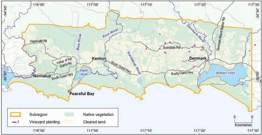
Figure 7.35: Denmark subregion
Geology and physiography
The Denmark subregion sits entirely within the Nornalup Complex of the Proterozoic Albany–Fraser Orogen (Figure 7.36). These ancient, deeply weathered felsic crystalline rocks are mostly gneiss and granite. In many areas these rocks are covered with a mantle of laterite, varying from massive and cemented blocks, to loose uncemented laterite stones known as ferruginous nodules and pisolites (commonly called forest or pea gravel).
The powerful Southern Ocean pounds the coastline at the lower edge of the subregion where outcropping domes of the Nornalup Complex form spectacular headlands and coastal eminences. Broad, imposing ridges of Pleistocene-aged Tamala Limestone overlie the coastal fringe of these prominent coastal domes, often cloaked by large windswept parabolic dunes. The coastal limestone ridges and dunes often act as barriers behind which lie areas of swamps with alluvial and estuarine deposits.
Geology, soils and climate of Western Australia’s wine regions
170
North of the coast, steep hills of the deeply weathered granite and gneiss alternate with broad swampy corridors and sandy deposits underlain by fine-grained sandstone. Many river valleys and tributaries have carved paths through this terrain, including the lower reaches of the Hay and Denmark rivers and Scottsdale Brook in the east and the Kent, Bow and Frankland rivers in the centre and west of the subregion.
Elevation ranges from near sea level at the coast to 310 m on the peak of Mount Shadforth. Most vineyards are at elevations lower than this, but much of the Bennett Range, north-west of Denmark, is more than 100 m.
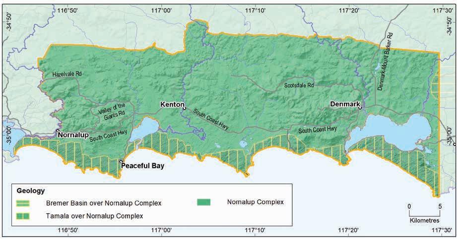
Figure 7.36: Denmark subregion: Simplified geology
Soils and landforms
The subregion’s landforms (and soils) appear to be somewhat defined by the route of the South Coast Highway, which is a broad indicator of the area’s topography.
Ironstone gravels are dominant in the Denmark subregion, comprising almost one-quarter of all the soils. These gravels usually occur on hill crests, ridges and upland plateau remnants, and on valley slopes in granitic terrain, mainly all north of the highway (Figure 7.37).
We grouped together as Difficult soils the areas where productivity may be affected by seasonally high watertables; valley floors, swamps and lakes; or where exposed or shallow rock or cemented laterite or stony soils are prevalent. These soils occur in about one-quarter of the subregion (Figure 7.38), often in combination with more productive soils in various landscapes. Difficult soils are more frequent closer to the coast, and often south of the highway.
Geology, soils and climate of Western Australia’s wine regions 171
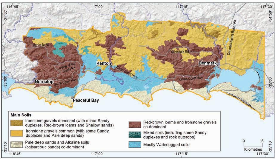
Figure 7.37: Denmark subregion: Main soils
Ironstone gravels
Difficult soils
Pale deep sands
Sandy duplexes
Red-brown loams
Alkaline soils
Coloured deep sands
Shallow sands
Heavy soils
Proportion of soil in region (%)
Proportion under vines (%)
Figure 7.38: Denmark subregion: Proportion of main soils in the subregion compared against main soils used for viticulture
Geology, soils and climate of Western Australia’s
regions 172
wine
0% 10% 20% 30% 40%
About 20% of all the soils are Pale deep sands, making it a more common soil in this subregion than any other in the Great Southern. North of the highway, these soils are mainly on gently undulating terrain and hillslopes, broad drainage floors and sloping flats. In a few areas they are on hill crests and catchment divides.
South of the highway, Pale deep sands are mostly on the ragged edge of the southern coastline, in association with large dune systems pushed inland by strong winds.
Sandy duplex soils are prominent in about 14% of the subregion and are mainly found north of the highway. These soils are more common on gently undulating sandy terrain and weathered sandstone fringing granitic hills, as well as on low hills. They are frequently found in combination with Ironstone gravels and Pale deep sand.
Only about 11% of soils in the Denmark subregion are Red–brown loams. These soils are typically in areas associated with the shallow granitic bedrock of the Nornalup Complex such as the hills around Mount Shadforth. They are generally on broad hill crests and slopes as well as the major valleys, mainly north of the highway. They are often associated with Ironstone gravel soils.
The South Coast and Hinterland survey (Churchward et al. 1988) contains soil-landscape mapping covering the Denmark subregion; the mapping can also be viewed online at NRInfo.147
Main viticultural soils of the Denmark subregion
Despite being a relatively minor soil in the Denmark subregion, Red–brown loams are as popular for growing wine grapes as the more common Ironstone gravels, with both supporting almost threequarters of all plantings (Figure 7.39). Most of the subregion’s viticulture is on these soils, fringed by karri forests and on undulating granitic hill country north of the highway between Denmark and Walpole.
The Ironstone gravel soils most favoured for growing vines in the Denmark subregion are on the granitic slopes. Commonly called ‘karri loams’, these soils generally have loamy or sandy red–brown topsoils (indicating shallower bedrock) containing abundant ferruginous nodules and pisoliths, and gradually increase in clay with depth. The well-structured clay loam to clay subsoils are usually red–brown or yellow–brown in colour.
Other Ironstone gravels also support a good proportion of the Denmark subregion’s vines. These generally have sandy grey–brown topsoils containing abundant ferruginous nodules and pisoliths over yellow–brown subsoil clay.
The main Red–brown loams supporting vines are soils with friable brown or red loamy topsoils (and sometimes yellow–brown) over well-structured red or brown clay loam to clay subsoils. These soils are all associated with the deeply weathered bedrock of the Nornalup Complex where rock outcrops and stony soils are common. These soils are also collectively called ‘karri loams’.
Sandy duplexes, supporting about 12% of vines, usually have yellow–brown or grey–brown coloured coarse sandy topsoils over neutral yellow clay subsoils.
147 See https://www.agric.wa.gov.au/resource-assessment/nrinfo-natural-resource-information-western-australia
Geology, soils and climate of Western Australia’s wine regions 173
Figure 7.39: Denmark subregion: Main soils used for viticulture (Minor soils are Shallow sands and Coloured deep sands)
Small areas (about 6%) have vines growing on Pale deep sands. These soils are generally pale grey and extend more than 80 cm deep. Sometimes they contain ferricrete nodules and pisoliths below a sandy topsoil and in some cases, a hard layer of rock or cemented laterite occurs more than 80 cm below the sandy surface. These soils are generally not preferred for planting but often occur as small pockets amongst the better soils in vineyards.
Climate
Gladstones (1992) described the Denmark subregion as one of the few parts of WA capable of producing true cool climate wine styles.
Rainfall and relative humidity are higher here than elsewhere in the Great Southern region (Table 7.13). Halliday (2011a) suggested that the subregion is wetter and marginally cooler than Albany, but the differences are not significant. The high rainfall also brings abundant potential for surface storage of good quality water. Like the Albany subregion, proximity to the Southern Ocean brings warm humid winds with afternoon sea breezes and summer drizzle, which carries a risk of fungal disease for the vines and fruit, requiring careful management.
Annual evaporation is between 1 200 mm and 1,350 mm and the mean 3pm October to April relative humidity is 67% at Denmark (Gladstones 1992).
Geology, soils and climate of Western Australia’s wine regions 174
Ironstone gravels 38% Sandy duplexes 12% Minor soils 7% Pale deep sands 6% Red-brown loams 37%
Table 7.13: Denmark subregion: Rainfall statistics (1989–2019)
The Denmark subregion has temperature statistics similar to other cooler climate regions in Australia (Remenyi et al. 2019), with mean growing degree days comparable with Tasmania (Table 7.14).
Table 7.14: Denmark subregion: Temperature statistics (1989–2019)
Measurement
* Average estimates for the Denmark subregion are from Gladstones (2021).
Proximity to the Southern Ocean brings a moderating maritime influence. The mean diurnal temperature in the Denmark subregion is low, similar to the Albany subregion and slightly lower than the Margaret River region, with a narrower temperature range. This subregion also has the lowest average daily sun hours and the highest average cloud cover of all WA winegrowing areas (Gladstones 2021).
Inland from the coast, there is an increased risk of frost between May to October where temperatures can fall below 2 °C about 6 days per year, which brings some risk of cold air ponding in areas. Temperature variations are related to altitude, slope and aspect of the vines. Plantings of varieties like Chardonnay and Pinot Noir are often on the warmer north- and west-facing slopes to enhance early ripening.148
Like the Albany subregion, wind exposure can be a problem in coastal areas of the Denmark subregion. Morning winds have a mean speed of 13 km/h. On summer afternoons, the humid, cooling effect of the sea breeze is usually stronger. Exposure to strong ocean winds, particularly in spring, can damage new shoots and flowers (thus reducing fruit set), making the degree of protection from the sea wind by the landscape and the towering forest an important factor for the vines.
148 Jim Campbell-Clause, AHA Viticulture (personal communication, 27 June 2022)
Geology, soils and climate of Western Australia’s wine regions 175
Value Annual rainfall (mm) Seasonal (October–April) rainfall (mm) Minimum 900 313 Maximum 1,221 427 Mean 1,070 348
Value Mean growing season (October–April) temperature (°C) 17.6 Mean January temperature (°C) 19.5 Mean growing degree days (October–April) 1,594 Mean diurnal temperature (°C) 10.3 Average daily sun hours (October–April)* 6.7 Average (October–April) cloud cover (Okta)* 5.2
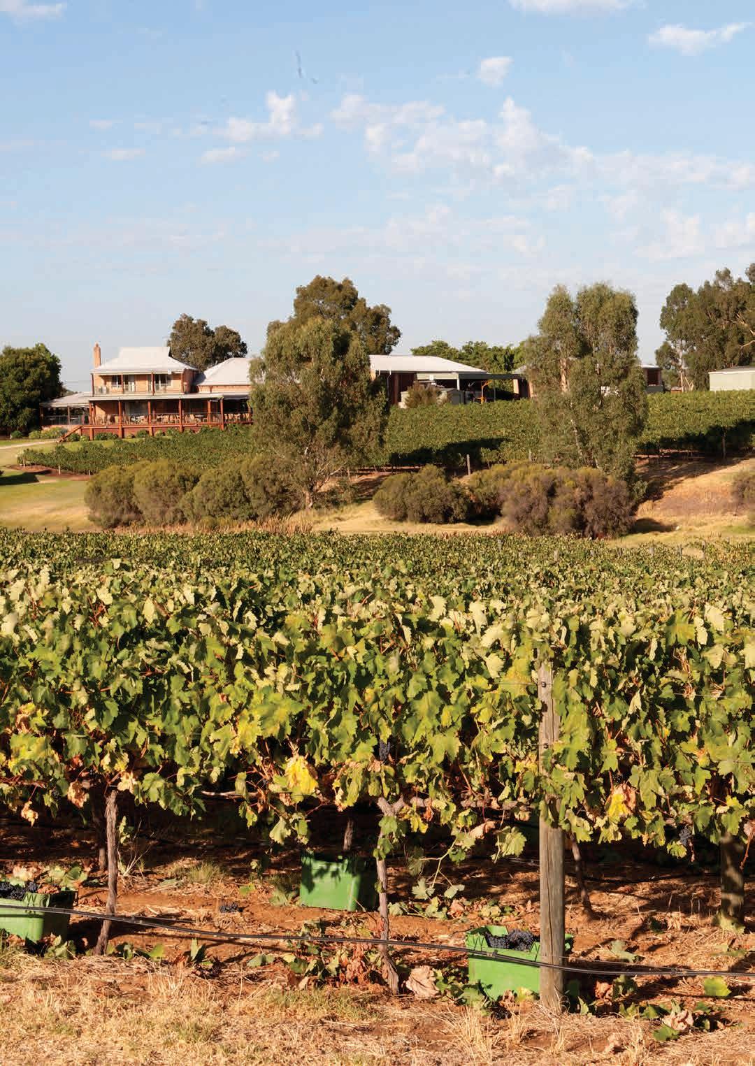
soils and climate of Western Australia’s wine regions 176
Geology,
8 Swan District wine region
Regional snapshot
Size: 359,000 hectares
Vine plantings area: 883 hectares
Elevation range: 0–192 m AHD
Vine plantings range: 1–68 m AHD
Geology: Mesozoic and Cenozoic sedimentary rocks from the Perth Basin
Geological age: Up to 150 million years
Soil: Vines mainly grow on Sandy duplex and Coloured deep sand soils
Climate: The climate is of pronounced Mediterranean type with hot dry summers, very high solar radiation and evaporation, and mild wet winters
Main grape varieties:
White – Chenin Blanc, Verdelho, Chardonnay, Muscadelle, Semillon
Red – Shiraz, Grenache, Cabernet Sauvignon
Geology, soils and climate of Western Australia’s wine regions 177
Location and history
The Swan District region covers almost 359,000 ha immediately west of the Perth Hills region, and it lies across Whadjuk and Yued Noongar Boodja (Country), who are the Traditional Custodians of the land.149 The region’s western boundary is the broad indigo waters of the Indian Ocean and it extends east across the coastal plain to an abrupt boundary shaped mostly by the Darling Fault. The region stretches from the Swan Valley north to beyond Gingin (Figure 8.1) and in 2022 about 40% of the region comprised agricultural land and other land uses.
The region overlies the eastern and northern edges of the Perth Metropolitan Area, covering the localities of Wattle Grove, Forrestfield, Midland, Middle Swan, Warwick, Wanneroo, Quinns Rocks, Carabooda, Yanchep, Two Rocks, Gnangara, Bullsbrook, Muchea and Gingin.
The Swan Valley in the south-east of the region is the historical centre of grapegrowing in WA, with plantings established at Olive Farm in 1829 (Halliday 1998). Houghton and Sandalford vineyards followed Olive Farm in 1836 and 1840, respectively. By the 1850s, plantings had expanded and included table and wine grapes with the first dried fruit produced in 1912 (Dry et al. 2004). For over a century the Swan Valley dominated Western Australia’s viticultural industry, with an emphasis on producing dessert and fortified wines for much of that time. Today lighter table wines dominate.
Outside the Swan Valley, vineyards have been part of the Wanneroo district since at least 1925 when the Conti family established their vineyard. In 1956, Professor Harold Olmo also identified the area between Gingin and Bindoon as being well suited to grape production and by 1968, Houghtons planted vines at Moondah Brook near Gingin; several other vineyards have since established here.
The area planted to vines in the Swan District has declined over recent decades, from almost 3,000 ha in the 1950s to around 1,200 ha in 2019, of which 887 ha were wine grapes (DPIRD 2019).
Varieties and production
In 2021 the wine grape harvest from Swan District wine region yielded 3,580 tonnes (APC 2022), which was around 7% of the State’s total harvest that year. Most of this production was from the Swan Valley subregion.
More than 34 different grape varieties are harvested for wine making in the Swan District region, with a recent shift towards planting warmer-climate European varieties.
About 1,035 tonnes of red wine grapes were harvested across the region in 2021—Shiraz, Grenache and Cabernet Sauvignon were the dominant varieties with increasing tonnages of Tempranillo.
The 2021 white wine grape harvest yielded 2,545 tonnes and was dominated by Chenin Blanc, with Verdelho and Chardonnay remaining as important varieties. Muscadelle and Semillon are less-common varieties followed by smaller tonnages of Sauvignon Blanc, Vermentino and Pedro Ximenez. Alternative varieties of both red and white wine grapes are becoming increasingly important in this region.
149 See https://www.noongarculture.org.au/whadjuk/ and https://www.noongarculture.org.au/yued/
Geology, soils and climate of Western Australia’s wine regions 178
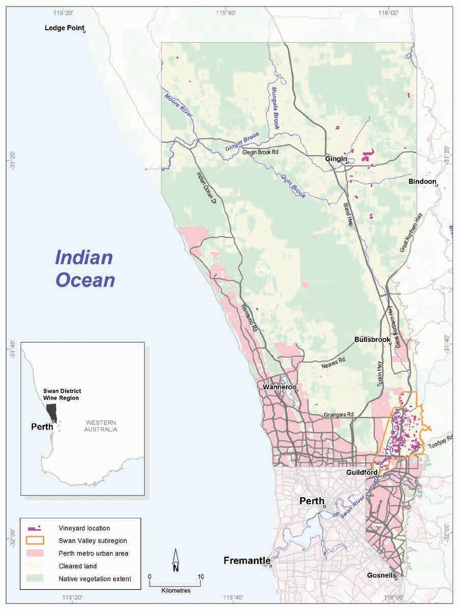
Geology, soils and climate of Western Australia’s wine regions 179
Figure 8.1: Swan District wine region
Geology and physiography
The breakup of Gondwana in the Permian to Early Cretaceous periods led to the formation of the land underlying most of the Swan District region. This rupture created the separation of the Australian continent and Greater India, generating the formation of a deep, linear trough of sedimentary rocks known as the Perth Basin, west of the Darling Fault (Figure 8.2).
As sea levels rose and fell over time, marine deposits of sand formed a series of low, windblown lime and quartz sand dunes or ridges across the Perth Basin to form the familiar Swan Coastal Plain landscape. These include calcareous and non-calcareous sand dune ridges underlain by Tamala Limestone along the coast. The three dune systems (Quindalup, Spearwood and Bassendean) extend inland from the coast.
At the foothills of the Darling Scarp (the surface expression of the Darling Fault), deposits of terrestrial sediments collected from the adjacent upland terrain of felsic crystalline rocks of the ancient Yilgarn Craton create the flat alluvial plains that comprise the remainder of the coastal plain.
From Bullsbrook north, the Perth Basin sediments become more elevated above the adjacent, flatter coastal plain. This is the undulating Dandaragan Plateau, bounded by an ancient shoreline defined by the Gingin Scarp in the west and the Darling Fault to the east.
The Swan District region’s namesake, the Swan River, crosses the southern part of the region, while the Moore River meanders through the northern part. The smaller but regionally significant watercourses (including Gingin, Ellen, Moondah and Lennard brooks) all have their headwaters in the uplands of the Dandaragan Plateau.
Elevations in the Swan Valley mostly range from 20 to 40 m AHD, extending up to 100 m on the foothills (Figure 8.3). The dunes at Wanneroo range from 20 to 70 m AHD and the Swan Coastal Plain elevation at Gingin is around 50 m AHD. Elevations on the Dandaragan Plateau east of the Gingin Scarp mostly range from 100 to 200 m AHD.
Geology, soils and climate of Western Australia’s wine regions 180
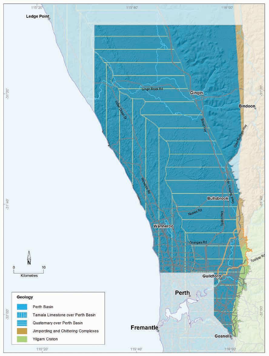
Geology, soils and climate of Western Australia’s wine regions 181
Figure 8.2: Swan District wine region: Simplified geology
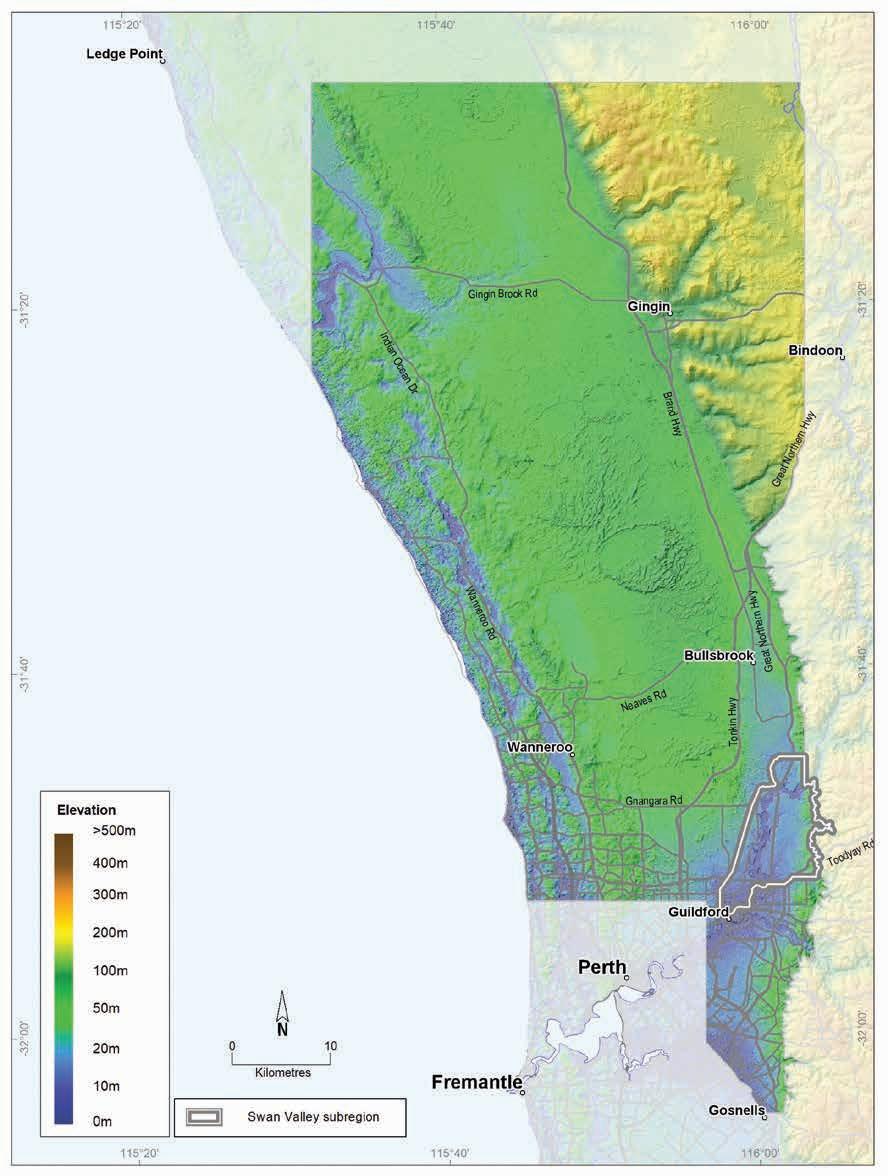
Geology,
soils and climate of Western Australia’s wine regions 182
Figure 8.3: Swan District wine region: Elevations
Soils and landforms
Although wine grape production from the Swan District region is concentrated where the Swan River traverses the eastern edge of the Swan Coastal Plain, the region’s boundary extends east to the Indian Ocean coast and north beyond Gingin (Figure 8.4).
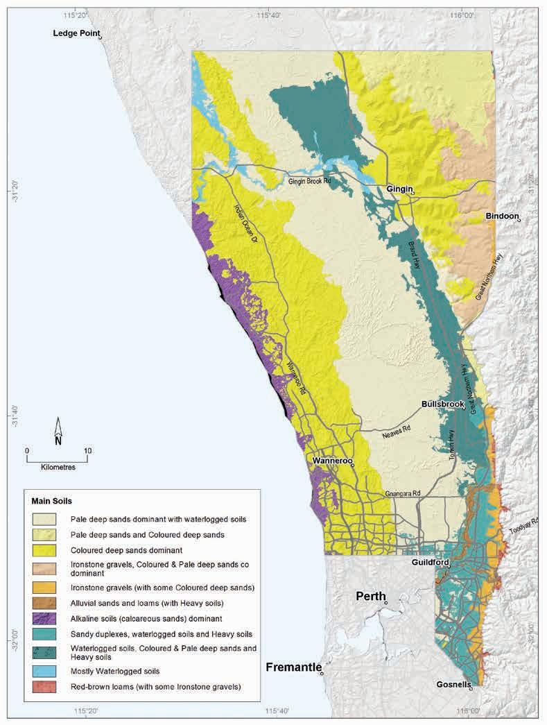
Geology, soils and climate of Western Australia’s wine regions 183
Figure 8.4: Swan District wine region: Main soils
The Swan District region’s soils relate directly to the geology and the eons of movement and deposition of sediments over the rocks of the Perth Basin. Unlike any other region, Deep sands make up more than half of all soils, with Pale deep sand found in about one-third of the area (Figure 8.5). These pale sands are particularly widespread on the Swan Coastal Plain on sandplains and low sandy rises associated with the Bassendean dunes, between the yellow–brown sands of the Spearwood dunes in the west and the Pinjarra Plain in the east. They are also common on gently undulating plains and slopes of the Dandaragan Plateau, particularly at the north-east and the south.
Pale deep sands
Coloured deep sands
Difficult soils
Shallow sands
Ironstone gravels
Sandy duplexes
Alluvial sands and loams
Heavy soils
Red-brown loams
Alkaline soils
Proportion of soil in region (%)
Proportion under vines (%)
Figure 8.5: Swan District wine region: Proportion of main soils in the region compared against main soils used for viticulture
Extensive areas of Coloured deep sands, common in about 26% of the region, are particularly dominant on the elevated Dandaragan Plateau landscape east of the Gingin Scarp. These soils tend to be on the slopes of gently undulating rises and hills. Coloured sands are also strongly associated with the Spearwood dune system (known as Spearwood sands) on the Swan Coastal Plain, generally west of the Bassendean dunes. The Coloured sands of these dunes, also known as tuart sands in reference to the tuart trees (Eucalyptus gomphocephala) they support, lie over ridges of Tamala Limestone.
Sandy duplex soils are minor across the whole region (around 3%). These soils, where they exist, are more common in the east and south of the region, particularly around the Swan Valley area and flanking other smaller watercourses close to the escarpments.
Geology, soils and climate of Western Australia’s wine regions
184
0% 10% 20% 30% 40%
In contrast to most other regions in south-west WA, Ironstone gravels are a very minor soil here, occurring in just 3% of the region. These mainly occur on undulating broad crests and upper slopes on the eastern half of the Dandaragan Plateau and on footslopes of the Darling Scarp, particularly in the Swan Valley.
Heavy soils are minor in the region, but can be locally significant, especially at the eastern fringe of the Swan Coastal Plain. These soils tend to have clays at the surface or have shallow topsoils over clays that are often heavy or poorly structured and drainage can be a problem.
Alluvial sands and loams comprise just 1% of the Swan District region’s soils, and are concentrated in discrete areas along river terraces, particularly in the Swan Valley. They are also below the Darling and Gingin Scarp footslopes, mainly on the Pinjarra Plain close to the region’s eastern boundary.
More than 20% of the Swan District region has areas dominated by Difficult soils, which are generally unsuitable for agriculture but often occur in combination with more productive soils in various landscapes. Difficult soils occur mainly on poorly drained swampy flats, depressions and lakes scattered across the Swan Coastal Plain, and areas of shallow and outcropping limestone among the Spearwood dunes. Some of the Difficult soils have been altered (mounded, drained or rocks removed) to allow wine grape cultivation.
Soil-landscape mapping covering this region includes these surveys: Swan Valley (Pym 1955), (Campbell-Clause and Moore 1991); (Tille and Stuart-Street 2016); Chittering (Bessell-Browne [unpublished]); Gingin West (Smolinski and Scholz 1997); Northwest corridor (McArthur and Bartle 1980); Wanneroo (Wells and Clarke 1986); and Gnangara mound (McArthur and Mattiske 1985); the mapping can also be viewed online at NRInfo.150
Main viticultural soils of the Swan District region
Most of the wine grape plantings in the Swan District region are in the Swan Valley subregion. Detailed descriptions of those soils are in the subsection on that subregion.
Sandy duplex soils support more than one-third of all the wine grape plantings in the entire region even though they make up only about 3% of the soils (Figure 8.6). Most of these have grey–brown sandy topsoils over mottled yellow–brown clay subsoils, and some have yellow to brown coloured sandy topsoils over yellow–brown mottled subsoil clays.
Coloured deep sands are also an important soil for wine grapes, supporting almost one-quarter of all the vines. These soils mostly occur in the western half of the Dandaragan Plateau on gently undulating rises and hills, with vines growing in deep yellow, red or brown coloured sands that are more than 80 cm deep.
Around the Wanneroo area, vines are established on the yellow–brown Coloured deep sands of the Spearwood dunes system overlying aeolian limestone at varying depths.
150 See https://www.agric.wa.gov.au/resource-assessment/nrinfo-natural-resource-information-western-australia
Geology, soils and climate of Western Australia’s wine regions 185
Despite making up just 1% of the region’s soils, the Alluvial sands and loams are an important group of soils for wine grapes in the Swan District region. About 14% of the region’s vines grow in these soils, which are mainly on river terraces and plains in the Swan Valley subregion.
Figure 8.6: Swan District wine region: Main soils used for viticulture (Minor soils include Shallow sands, Red–brown loams and Alkaline soils)
Ironstone gravels are also important soils for viticulture in the region, supporting about 11% of plantings, even though they are also a minor soil (about 3% of the region’s soils). These are mostly found on the footslopes of the Darling Scarp adjacent to the Swan Valley subregion and on crests and upper slopes in the eastern part of the Dandaragan Plateau. Ironstone gravels are predominantly soils with grey–brown sandy topsoils containing abundant ferruginous nodules and pisoliths over yellow–brown clay subsoil.
Heavy soils, which support about 6% of the region’s vines are often together in a mix with Alluvial sands and loams and Sandy duplexes. Heavy soils are mainly sandy or loamy duplex soils with poorer structured clay or clay loam subsoils above 80 cm, which can impede root growth and water movement and require careful management.
Geology, soils and climate of Western Australia’s wine regions 186
Ironstone gravels 11% Sandy duplexes 34% Coloured deep sands 24% Alluvial sands and loams 14% Pale deep sands 6% Heavy soils 6% Minor soils 5%
Pale deep sands are the most widespread soil across the whole Swan District region, yet only 6% of vines grow in areas where these soils are prominent. They are generally pale grey siliceous sands, sometimes becoming yellow at depth and can extend more than 80 cm deep. A clay layer often occurs at more than 80 cm below the sandy surface. These soils are generally not preferred for planting but are often found in pockets amongst the better soils in vineyards.
Climate
The Swan District region’s climate is of a pronounced Mediterranean type with a hot dry summer, very high solar radiation and evaporation, and mild wet winters (Dry et al. 2004). Halliday (2011a) notes that this region has one of the highest mean January temperatures and lowest summer rainfall of any Australian wine region, as well as the lowest relative humidity (47%) and the most hours of sunshine per day.
The rainfall varies slightly across the region—Gingin receives an annual mean of 620 mm, then rainfall increases south, with Perth Airport receiving 762 mm (Table 8.1 and Figure 8.7).
Table 8.1: Swan District wine region: Rainfall statistics (1989–2019)
Value
The Swan District region receives the lowest rainfall of all the WA wine regions. Remenyi et al. (2019) shows that the Swan District region has the second lowest mean growing season (October to April) rainfall of all the Australian wine regions. Conversely, it is among the top 20 Australian wine regions for rainfall during the non-growing season (May to September). Occasionally rainfall from cyclone remnants in summer and autumn can be quite devastating to crops.
From the north to the south there is a slight decrease in temperatures, and inland on the elevated terrain east of Gingin, the minimum temperatures are slightly cooler than on the coastal plain. Annual evaporation ranges from 1,900 mm in the south to 2,050 mm in the north.
Due to the lower mean rainfall and warmer temperatures, water requirements are high in the Swan District region and supplementary irrigation is essential. The Swan District region is unique in that its predominant water source is groundwater. However, groundwater is strictly regulated and there is heavy competition for existing allocations, especially in the east of the region where the soils are most suitable for viticulture.
Geology, soils and climate of Western Australia’s wine regions 187
Annual rainfall (mm) Seasonal (October–April) rainfall (mm) Minimum 537 128 Maximum 932 214 Mean 660 147
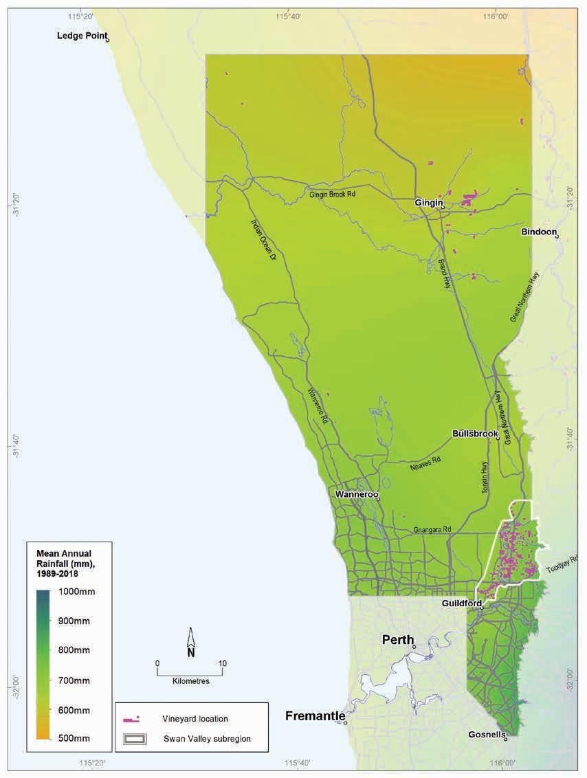
Western
wine regions 188
Geology, soils and climate of
Australia’s
Figure 8.7: Swan District wine region: Mean annual rainfall (1989–2018)
Table 8.2 summarises the temperature statistics for the Swan District region, supported by maps on the following pages, including:
• mean growing season temperature (GST), which covers the months October to April (Figure 8.8). The Swan District region has a mean growing season temperature range of 20.7 to 22.4 °C with a mean of 21.8 °C. This is the highest GST of the WA regions.
• mean January temperature (MJT), which represents the average temperature throughout the day across the warmest month (Figure 8.9). The Swan District region has a mean January temperature range of 23 °C in the west to 26 °C in the east, which is one of the highest for wine regions in Australia.
• growing degree days (GDD), which are a measure of heat (between 10 and 19 °C) accumulation151 predicting the vines’ development rates for the growing season months of October to April152 (Figure 8.10). The Swan District region has a range of 2,200 to 2,700 units (°C), with the maximum GDD being the second highest for Australian wine regions.
• biologically effective degree days (BEDD), which are linked to the GDD calculation and adjusted for latitude/daylength and account for diurnal temperatures153 (Figure 8.11). The Swan District region has a range of 1,650 to 1,800 units (°C).
• diurnal temperatures, which are a mean of the daily range between the minimum and maximum average daily temperature from October to April (Figure 8.12). The Swan District region has a mean daily range of 11 to 15 °C.
* Average estimates are from locations in the Swan District region in Gladstones (2021).
151 These calculations use the base 10 method (Hall and Jones 2010).
152 More recently, Jarvis et al. (2017) suggest that September to March may be more appropriate.
153 Hall and Jones (2010)
Geology, soils and climate of Western Australia’s wine regions 189
Measurement Value Mean January temperature (°C) 24.6 Mean growing season (October–April) temperature (°C) 21.8 Mean growing degree days (October–April) 2,467 Mean diurnal temperature (°C) 13.5 Average daily sun hours (October–April)* 9.7 Average (October–April) cloud cover (Okta)* 3.3
Table 8.2: Swan District wine region: Temperature statistics (1989–2019)
The region’s best table wines are produced in cool to average summers where prevailing late morning to afternoon sea breezes (the Fremantle Doctor) have a major impact. The region receives regular cooling south-west winds on hot summer afternoons ranging from 21 km/h at Perth Airport to almost 26 km/h at Gingin. On summer evenings and mornings, the winds are mostly from the east, reaching up to 21 km/h at 9am in Gingin. Gladstones (1992) also notes that the sea breezes and reverse air convection at night create favourable conditions at Gingin. These winds generally start strengthening by September, which can damage young spring vine growth in exposed locations.
Coastal areas of the Swan District region, such as Wanneroo, have cooler temperatures and lower variability than inland areas. Halliday (2011a) observed that temperatures around Gingin and Moondah Brook are somewhat cooler than in the Swan Valley because of their higher elevation, even though they are further north. Care with site selection is needed on the Dandaragan Plateau as temperatures below 2 °C can lead to frosts in the valleys from about May to October.
Remenyi et al. (2019) has shown that a changing climate is influencing the region. They identified an increase in mean growing season temperatures over the past few decades and predict a further regional average increase to more than 23 °C in the next 20 years. Firth et al. (2017) predicts that the Swan District region may have slightly larger temperature increases than other regions in the south. This may put it into the Very Warm temperature category. Remenyi et al. (2019) have also observed a trend towards drier conditions, particularly in the north and south of the region. They suggest that the mean growing season rainfall for the region could fall below 135 mm by the end of the 21st century. These are all important factors to consider for the future viability of each vineyard, particularly in relation to water availability, planting and management.
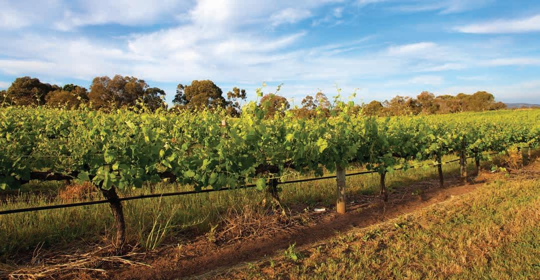
Geology, soils and climate of Western Australia’s wine regions 190
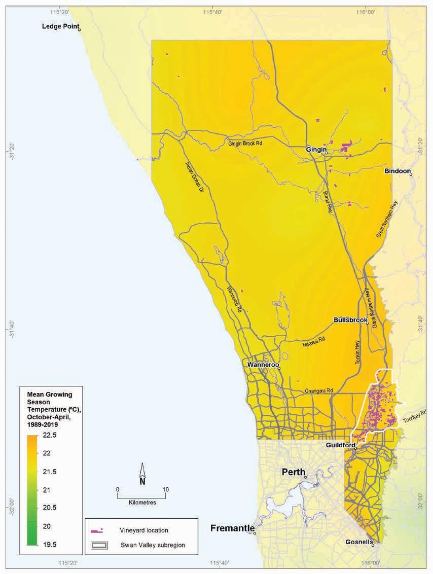
(October–April, 1989–2019)
Geology, soils and climate of Western Australia’s wine regions 191
Figure 8.8: Swan District wine region: Mean growing season temperature
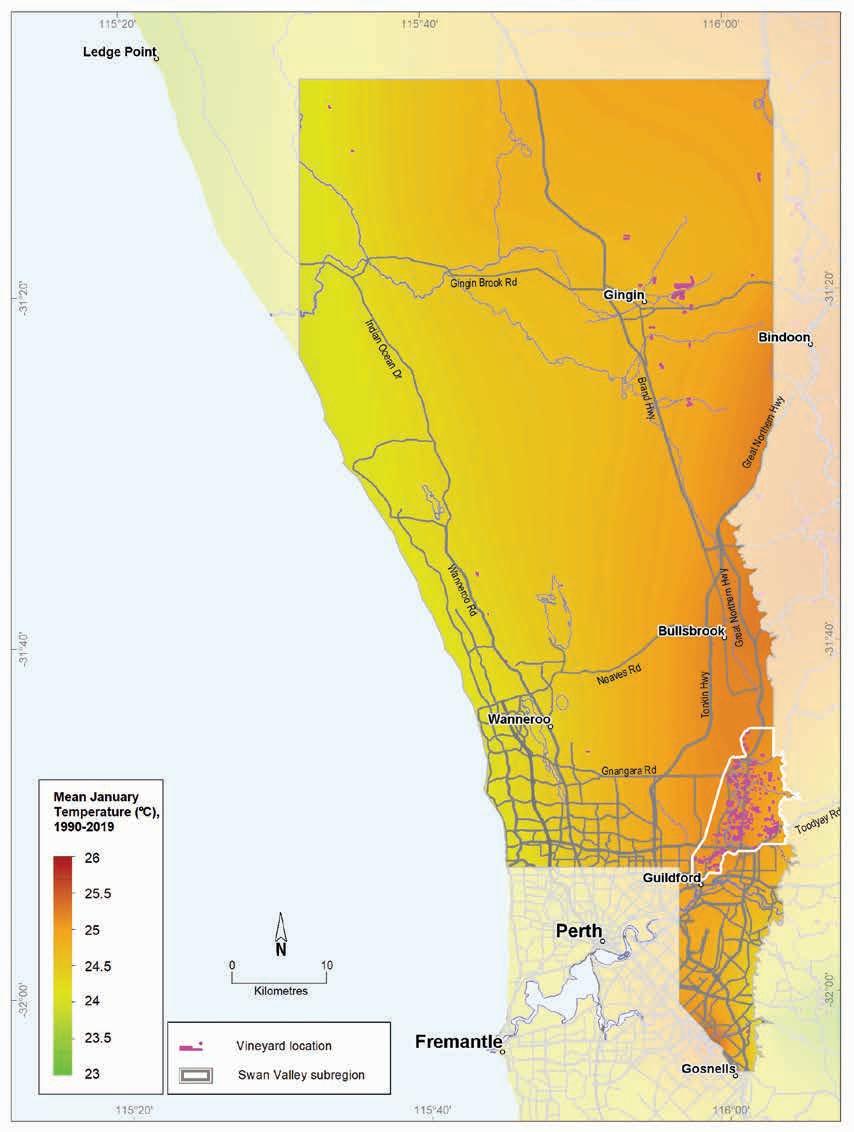
Western
wine regions 192
Geology, soils and climate of
Australia’s
Figure 8.9: Swan District wine region: Mean January temperature (1990–2019)
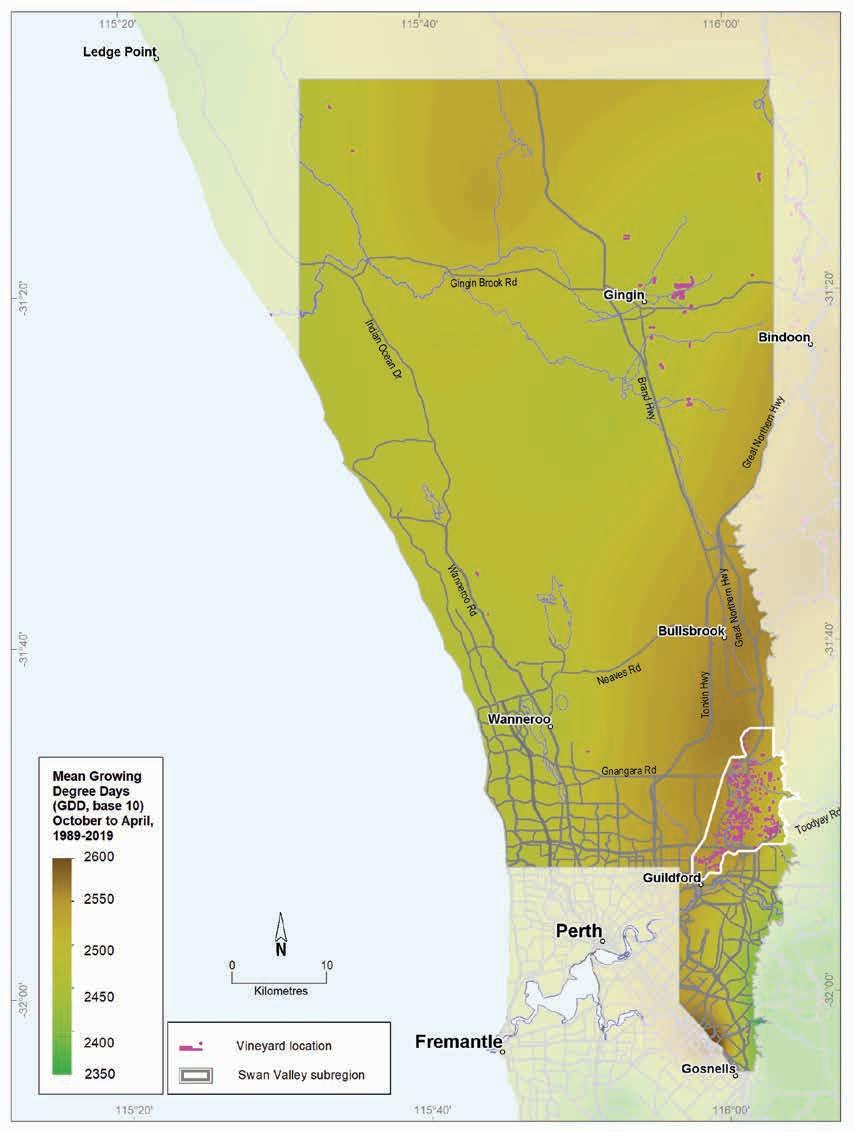
8.10: Swan District wine region: Mean seasonal growing degree days (October–April, 1989–2019)
Geology, soils and climate of Western Australia’s wine regions 193
Figure
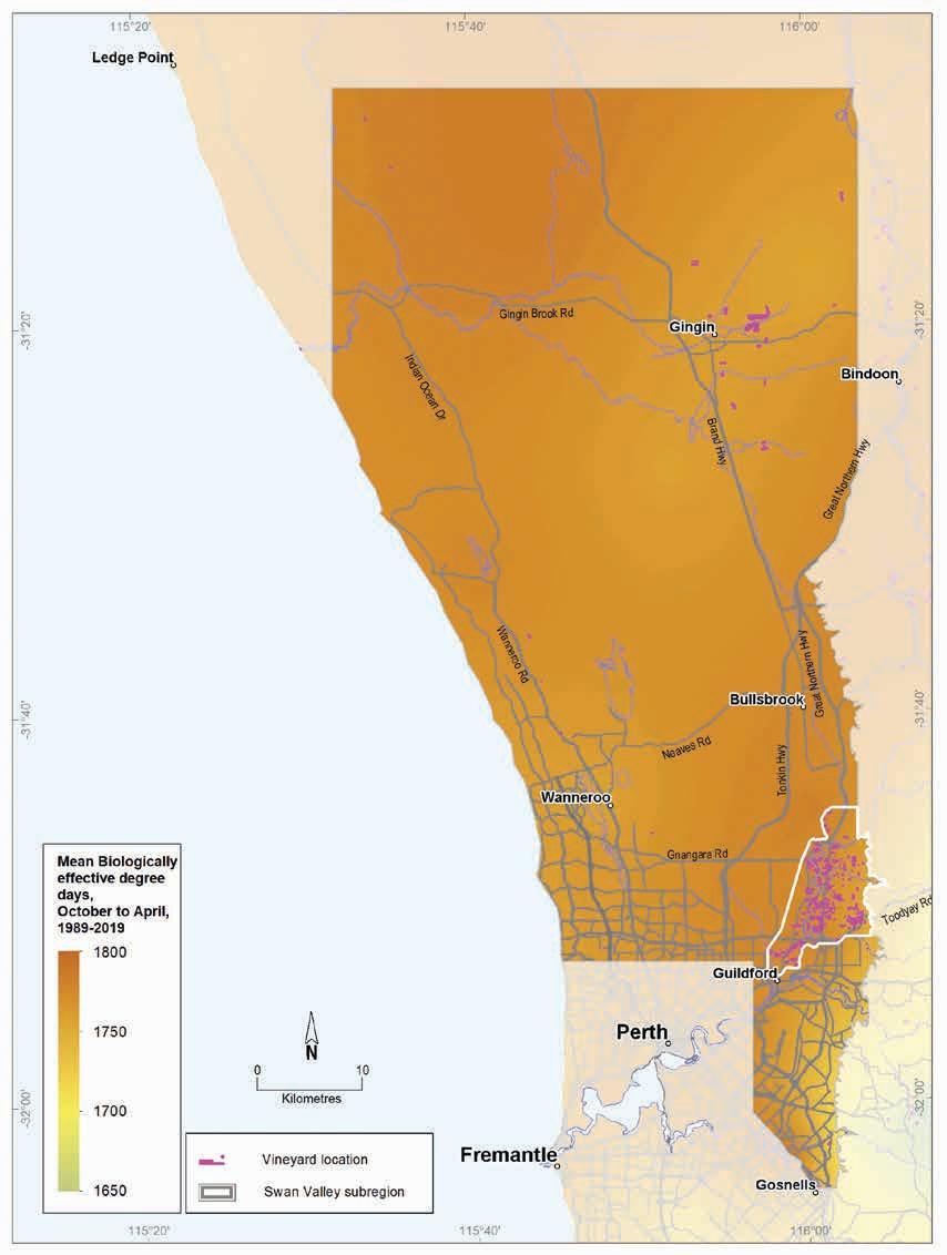
8.11: Swan District wine region: Biologically effective degree days (October–April, 1989–2019)
Geology, soils and climate of Western Australia’s wine
194
regions
Figure
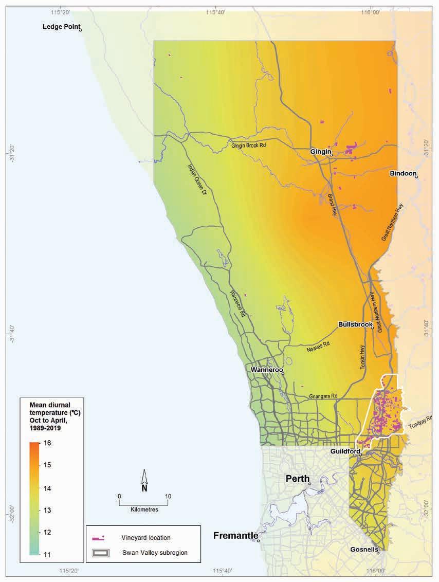
(October–April 1989–2019)
Geology, soils and climate of Western Australia’s wine regions 195
Figure 8.12: Swan District wine region: Mean diurnal temperature
Swan Valley subregion
Location, varieties and production
Although the Swan Valley subregion (Figure 8.13) occupies a relatively small area of almost 9,080 ha in the south-east of the Swan District region (extending north from Midland to Upper Swan and the lower reaches of Ellen Brook), it currently contains most of the vines grown in the Swan District.154
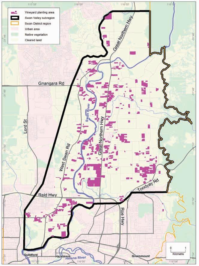
154 The Swan Valley subregion accounts for more than half the area of vines planted across the 3 regions of the Greater Perth Zone (Swan District, Perth Hills and Peel).
Geology, soils and climate of Western Australia’s wine regions
196
Figure 8.13: Swan Valley subregion
The Swan Valley subregion is the acknowledged birthplace of wine and table grape production in WA. The valley became a major exporter of table grapes in the 20th century and many small wineries (often run by Italians or Yugoslavs from Dalmatia) produced fortified wines and bulk table wines (Halliday 1998). For a time, the Swan Valley had more wineries in operation than either NSW or Victoria (Halliday 2011a). Until 2019, 3 of the 5 oldest wine companies in Australia were still based here (Olive Farm, Houghton and Sandalford).
Visiting Californian viticulture expert, Professor Harold Olmo, surveyed the WA grape industry in 1955 with particular emphasis on the Swan Valley. At that time, the Swan Valley had 72% of all the land planted to vineyards in WA, covering about 2,800 ha. The grapes were used for dried fruit, winemaking and table grapes. Olmo (1956) believed that, due to the warmer temperatures in the area, the Swan Valley was well situated to achieve the full ripeness and high sugar needed for producing high-quality sweet dessert wines. Trailblazing Swan Valley winemakers such as Jack Mann also played an important role in pioneering the introduction of quality table wines to WA consumers.
During the second half of the 20th century, the area planted to vines in the Swan Valley subregion declined due to low yields and competition from alternative land uses. Agricultural activity, including viticulture, will continue to face increasing pressure from alternative land uses in the region, particularly rural subdivision and urbanisation, hospitality and recreation. Today, the total area of land planted to grapes (wine and table varieties) is less than 1,000 ha—wine grapes make up approximately two-thirds of that area (Tille and Stuart-Street 2016) although a more recent estimate suggests it may be around 624 ha (DPIRD 2019).
Geology and physiography
The Swan Valley subregion is part of a generally flat landscape known as the Pinjarra Plain, formed as recent alluvial deposits overlaid the Perth Basin sediments (Figure 8.14). These deposits, and the slightly elevated colluvial foothill slopes of the Darling Scarp, are mostly terrestrial, rather than marine, in origin. Sediment transport and deposition was from the rivers and streams flowing across the deeply weathered felsic crystalline rocks of the ancient Yilgarn Craton beneath the Darling Range at the eastern boundary of the subregion.
The Swan River emerges onto the Swan Coastal Plain after a long journey across the upland country of the Darling Range155 and meanders down the centre of the Swan Valley subregion, flanked by alluvial terraces and floodplains. In the west of the subregion, the pale grey quartz sanddominated Bassendean dunes—the oldest of the 3 dune systems at the western part of the Swan Coastal Plain—reaches its eastern extent.
Elevation in the subregion mostly ranges from 20–40 m AHD but rises to 100 m on the footslopes of the Darling Scarp on the eastern boundary.
155 Despite being the same river, the Swan River is named the Avon River east of Walyunga; it is sometimes collectively known as the Swan–Avon River.
Geology, soils and climate of Western Australia’s wine regions 197
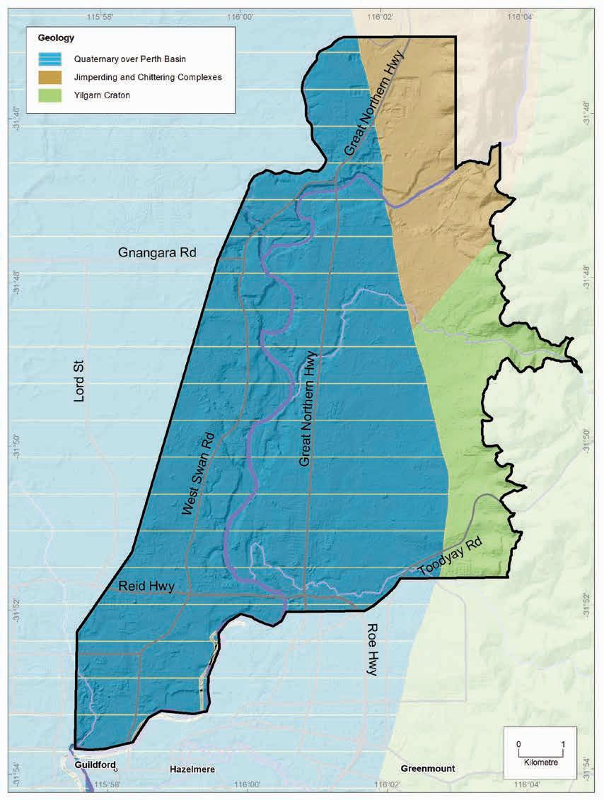
Geology, soils and climate of Western Australia’s wine regions
198
Figure 8.14: Swan Valley subregion: Simplified geology
Soils and landforms
In Pym’s original soil survey of the Swan Valley (Pym 1955), he describes 5 main landforms in the area (from west to east): Aeolian sands, Alluvial floodplains, Alluvial terraces, Plain, Foothills and Darling Scarp face. The main soils found in the Swan Valley subregion align closely with these landforms (Figure 8.15).
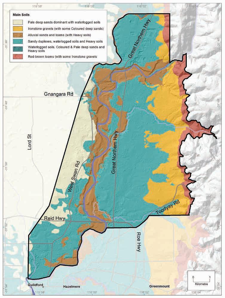
Geology, soils and climate of Western Australia’s wine regions 199
Figure 8.14: Swan Valley subregion: Simplified geology
More than one-third of the soils in the Swan Valley subregion are Sandy duplexes, found mainly on the Pinjarra Plain, mostly between the Ironstone gravel dominated foothill slopes in the east and the Alluvial sands and loams concentrated around river terraces in the west (Figure 8.16). Small areas of Sandy duplexes are also on the foothill slopes, often combined with Ironstone gravel soils.
Sandy duplexes
Difficult soils
Alluvial sands and loams
Ironstone gravels
Pale deep sands
Heavy soils
Red-brown loams
Coloured deep sands
Proportion of soil in region (%)
Proportion under vines (%)
Figure 8.16: Swan Valley subregion: Proportion of main soils in the subregion compared against main soils used for viticulture.
The Alluvial sands and loams, which comprise about 14% of the soils, occur mostly on the Alluvial floodplains and terraces surrounding the Swan River, and usually in combination with Heavy soils. Ironstone gravel soils make up just 9% of soils. As described above, these are mostly found in the east of the Swan Valley subregion and are associated with the footslopes below the Darling Scarp.
Pale deep sands are less common in the subregion, occurring in just 9% of the area. These soils are found mainly on the western margin and are associated with the gently undulating aeolian Bassendean dunes that extend into the subregion. They also occur in minor areas on the Darling Scarp foothills and on the alluvial plains, in combination with Ironstone gravels and Sandy duplex soils.
Geology, soils and climate of Western Australia’s wine regions 200
0% 10% 20% 30% 40% 50%
We grouped together as Difficult soils the patches of swampy land, shallow drainage lines and steep foothill slopes that make up 18% of the subregion. These soils are prone to waterlogging and are typically unsuited for any form of agriculture but are often found in combination with more productive soils in various landscapes. Some of the Difficult soils have been altered (mounded, drained or rocks removed) to allow wine grape cultivation.
Soil-landscape mapping of this subregion is mostly covered by the Swan Valley survey (Pym 1955) and the land capability study (Campbell-Clause and Moore 1991). The edges appear on these surveys: Chittering (Bessell-Browne [unpublished]), Darling Range (King and Wells 1990), and Gnangara mound (McArthur and Mattiske 1985); the mapping can also be viewed online at NRInfo.156 A more recent review of land capability for the Swan Valley is in Tille and Stuart-Street (2015).
Main viticultural soils of the Swan Valley subregion
Most of the vine plantings for wine grapes (about 57%) are on the older alluvial deposits on the Swan Coastal Plain between the foothill slopes and the river terraces (Tille and Stuart-Street 2016). This is where the Sandy duplexes, the most widely planted group of soils, are mainly located; these soils support almost half of the Swan Valley subregion’s wine grapes (Figure 8.17).
Figure 8.17: Swan Valley subregion: Main soils used for viticulture (Minor soils are Coloured deep sands and Shallow sands)
156 See https://www.agric.wa.gov.au/resource-assessment/nrinfo-natural-resource-information-western-australia
Geology, soils and climate of Western Australia’s wine regions 201
Ironstone gravels 14% Sandy duplexes 46% Alluvial sands and loams 20% Pale deep sands 6% Heavy soils 8% Minor soils 6%
Sandy duplexes usually have light grey to brownish–grey sandy topsoils over light yellow–grey mottled clay subsoil. Some duplexes have pale yellow–brown sandy topsoils over brown to yellow–brown clay subsoils. A layer of ferricrete nodules and pisoliths may lie just above the clay in these duplex soils.
About 20% of the vines are planted in more recent Alluvial sands and loam soils closer to the river. These are deep soils with red, brown or yellow–brown sandy or loamy topsoils with wellstructured, porous loam to clay subsoils that allow for good drainage and root penetration.
At the foothills of the Darling Scarp, about 14% of the vines are planted on lateritic Ironstone gravels. These usually have dull yellow–brown sand topsoils containing abundant ferruginous nodules and pisoliths over yellow–brown clay with red mottles. Patches of quartz sand and weathering felsic crystalline rock fragments deposited from the adjoining rocks of the Darling Scarp can also be found on the foothills in amongst the Ironstone gravel soils.
A small proportion of vines grow on Pale deep sands. These soils tend to be light grey to yellowish–grey sands extending beyond 80 cm deep. In some cases, the pale sand becomes yellower with depth and can overlie a deeper clay layer. These soils are generally not favoured for planting, but they tend to be in low dunes scattered in vineyards on the plain, mainly in small patches among other more desirable soils.
Climate
Dry et al. (2004) describe the climate in the Swan Valley subregion as a pronounced Mediterranean type with a hot dry summer with very high solar radiation and evaporation and mild wet winters. It is classified by Smart and Dry (1980) as being very hot, moderately continental, very sunny, very arid and not humid.
The rainfall in the Swan Valley is around 790 mm, falling mainly between May and September. Annual evaporation is about 1,900 mm (Table 8.3). Mean 3pm October to April relative humidity at Guildford on the southern edge of the Swan Valley is 44%. As well as adversely affecting grapes, summer and autumn rainfall events can result in Swan River flood waters inundating low lying vines.
Table 8.3: Swan Valley subregion: Rainfall statistics (1989–2019)
Geology, soils and climate of Western Australia’s wine regions 202
Value Annual rainfall (mm) Seasonal (October–April) rainfall (mm) Minimum 698 154 Maximum 803 177 Mean 731 160
Table 8.4: Swan Valley subregion: Temperature statistics (1989–2019)
Measurement
* Average estimates are for Perth airport from Gladstones (2021).
The Swan Valley area is renowned for its windiness particularly from September onwards, with strengthening overnight and morning easterly winds and west to south-west afternoon sea breezes that funnel up the Swan Valley. Near the Darling Scarp, the warm overnight and early morning easterlies are particularly strong in summer and can affect vine physiology (CampbellClause and Moore 1991). The highest morning wind speeds (averaging almost 18 km/h) during the year are in February, mostly from easterlies. The highest evening wind speeds (almost 23 km/h) are in December, mainly from the south-west. For comparison, the average morning wind speeds throughout the year are about 14.2 km/h, with up to 18.7 km/h in the afternoons.
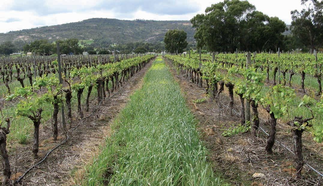
Geology, soils and climate of Western Australia’s wine regions 203
Value Mean growing season (October–April) temperature (°C) 21.0 Mean January temperature (°C) 25.1 Mean growing degree days (October–April) 2,537 Average diurnal temperature (°C) 13.9 Average daily sun hours (October–April)* 9.6 Average (October–April) cloud cover (Okta)* 3.1
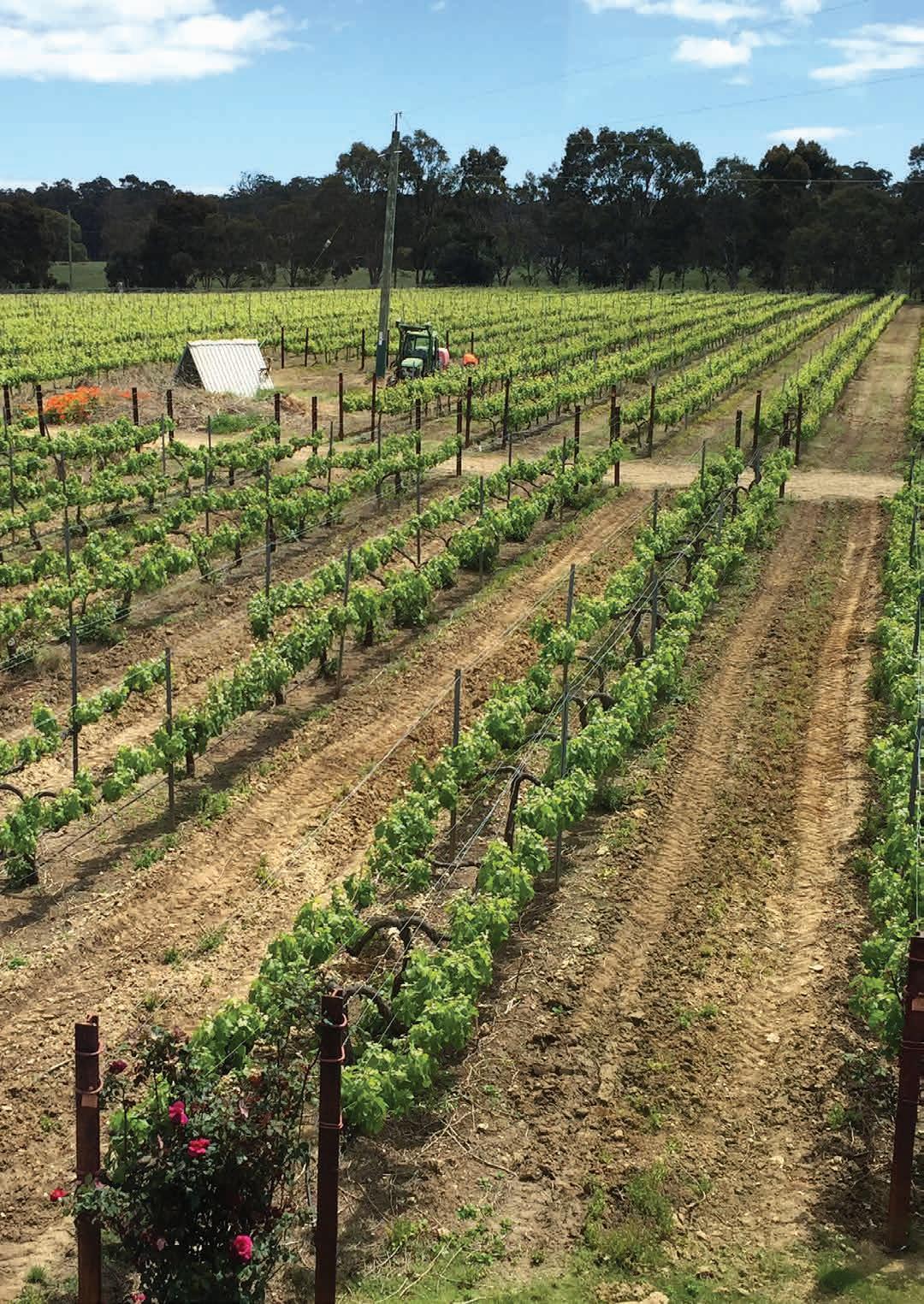
9 Geographe wine region
Regional snapshot
Size: 548,733 hectares
Vine plantings area: 822 hectares
Elevation range: 0–408 m AHD
Vine plantings range: 0–269 m AHD
Geology: The Darling Fault divides the region in two: west are sediments of the Perth Basin and east are Archaean-aged felsic crystalline rocks of the Yilgarn Craton
Geological age: Up to 3 billion years
Soil: Vines mainly grow on Ironstone gravels and Red–brown loam soils
Climate: The coastal plain has a maritime influence while inland it becomes more continental
Main grape varieties:
White – Chardonnay, Sauvignon Blanc, Semillon
Red – Shiraz, Cabernet Sauvignon, Merlot, Tempranillo
Geology, soils and climate of Western Australia’s wine regions 205
Location and history
The Geographe wine region sits between the Margaret River, Blackwood Valley and Peel wine regions. It lies across Binjareb/Pinjarup, Ganeang and Wardandi Noongar Boodja (Country), who are the Traditional Custodians of the land.157 Less than half the region (about 44%) is used for agriculture and other land uses, leaving extensive areas of tall jarrah and marri forest (Eucalyptus marginata and Corymbia calophylla) inland of the coastal plain.
This wine region covers the Geographe Bay hinterland, from which it takes its name. Towns in this region include Bunbury, Busselton, Capel, Dardanup, Donnybrook, Brunswick Junction and Harvey. Kirup, Collie and Yarloop lie on its boundary (Figure 9.1).
Today, wine grape plantings are scattered widely throughout the region. In 1890, Ephraim Clarke (the grandfather of Dr Kevin Cullen) planted a vineyard in Bunbury and continued making wines until 1921 (Halliday 2011a). One of the first to record the suitability of the Geographe region for grapegrowing was Despeissis (1897).
By 1907 John Duce was producing wine further inland at Boyanup. This property flourished for many years and had its own still for making fortified wines. Duce employed up to 30 people and exported wine to London (Zekulich 2000). In the 1920s and 1930s, Italian migrants established a few small vineyards near Harvey but these mostly fell into disuse when their owners were interred during the Second World War (Beeston 2002; Dry et al. 2004).
In the 1970s, 2 wineries were established near Capel—in 1973 Dr Barry Killerby established the Killerby Winery and in 1975 Dr Peter Pratten established the Capel Vale winery. Wine grape vineyards were established in the Ferguson Valley and around Harvey, Donnybrook and Collie in the late 1980s and the 1990s.
In 2004, 985 ha of wine grapes were planted in the Geographe wine region. By 2019, these plantings declined to about 822 ha (DPIRD 2019).
Varieties and production
In 2021 the wine grape harvest from Geographe wine region yielded 2,495 tonnes from 36 different varieties—it was one of the regions with the most diverse varieties (APC 2022). Although in much smaller tonnages, alternative varieties are an important and increasing part of the region’s harvest and future development.
Regional growers harvested 1,085 tonnes of white wine grapes in 2021—the dominant varieties were Chardonnay and Sauvignon Blanc followed by Semillon. About 1,410 tonnes of red wine grapes were also harvested in 2021—the dominant variety grown was Shiraz followed by Cabernet Sauvignon. Merlot, Tempranillo, Malbec and Grenache are other important varieties.
157 See https://www.noongarculture.org.au/gnaala-karla-booja/ and https://www.noongarculture.org.au/south-west-boojarah/
Geology, soils and climate of Western Australia’s wine regions 206

Geology, soils and climate of Western Australia’s wine regions 207
Figure 9.1: Geographe wine region
Geology and physiography
The Geographe wine region contains a diverse range of soils and landscapes. Driving the diversity is the geology, particularly the Darling Fault that runs through Harvey and Donnybrook, effectively dividing the region in two (Figure 9.2). East of the Darling Scarp are the deeply weathered, lateritecovered granite and gneiss rocks of the ancient Yilgarn Craton, including part of the Balingup Complex, one of the oldest sections of the Earth's surface, at more than 2.6 billion years of age.
A lateritic profile formed across the Yilgarn Craton, blanketing much of the surface. It varies from massive and cemented, to loose uncemented laterite stones known as ferruginous nodules and pisolites (commonly called jarrah, forest or pea gravels).
Several rivers have carved deep valleys into the Darling Plateau across the region, cutting down through the laterite layer to expose areas of felsic crystalline rock. These include the valleys of the Harvey, Brunswick, Collie, Ferguson, Preston and Capel rivers and their numerous tributaries. These watercourses descend to the coastal plain west of the Darling Scarp, depositing their rich load of sediments onto the plain at the base of the scarp and along their river courses before reaching Geographe Bay.
The Collie and Preston rivers meander across the plain to flow into the Leschenault Estuary north of Bunbury.
An area of Permian sediments overlies the Yilgarn Craton in the east of the region at Collie, which has WA’s only producing coalfield. The Collie Basin sediments lie in a trough formed by a subsidence of the Yilgarn Craton between fault lines (Wilson 1990). A thick blanket of sand, ironstone gravel and laterite overlie the coal.
The breakup of Gondwana in the Permian to Early Cretaceous periods shaped the landscape in the western half of the region. This fracture began the separation of the Australian continent and Greater India, leading to the formation of a deep, linear trough of sedimentary rocks known as the Perth Basin west of the Darling Fault.
The more recent (Tertiary and Quaternary) marine and terrestrial sediments deposited on the rocks were weathered and shaped over time into a diversity of landscapes. These include the coastal plain (Swan Coastal Plain), low marine escarpments (Yelverton Shelf and Whicher Scarp) and an undulating upland lateritic plateau (Donnybrook Sunkland) (see Figure 3.2).
The Swan Coastal Plain is relatively flat, reaching only 40 m AHD (Figure 9.3). It extends 10–15 km inland from Geographe Bay and the Indian Ocean, curving north in an arc from Busselton to Preston Beach. It has a series of dune systems running parallel to the shoreline, including calcareous and non-calcareous sand dune ridges underlain by Tamala Limestone along the coast. A sequence of alluvial and estuarine deposits makes up the remainder of the coastal plain.
Ancient marine shorelines and escarpments curving parallel with the coast form the abrupt inland boundary of the Swan Coastal Plain to the south. These are the Yelverton Shelf, rising to about 60 m AHD, backed by the Whicher Scarp formation, rising gently up to 90 m AHD. These become less prominent south and west of Busselton where they appear more subdued as ancient shoreline deposits.
Geology, soils and climate of Western Australia’s wine regions 208
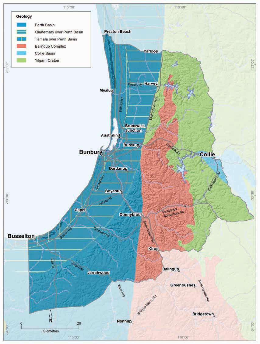
Geology, soils and climate of Western Australia’s wine regions 209
Figure 9.2: Geographe wine region: Simplified geology
Southwards beyond the marine escarpments is an undulating, dissected lateritic plateau on Cretaceous sedimentary rocks (mainly sandstones, siltstones and shale). Known as the Donnybrook Sunkland, it appears near Burekup and sits above the coastal plain south of the defining curve of the Whicher Scarp and west of the abrupt Darling Fault.
The headwaters of many watercourses begin on the plateau, including the Vasse, Sabina, Ludlow and Abba rivers, which then flow north-east across to the coastal plain and into the Vasse-Wonnerup Estuary. The valleys of the Capel, Preston and Ferguson rivers also meander across the Donnybrook Sunkland from the Darling Plateau before descending to the coast. These watercourses have also deposited rich alluvial sediments, carried from upland locations, onto the coastal plain and on terraces flanking the rivers.
North of Burekup, the Whicher Scarp gives way to the more prominent edge of the ancient Yilgarn Craton, marked by the imposing Darling Scarp, which defines the east of the coastal plain.
Elevations across the region generally range from 0 to 406 m AHD (Figure 9.3). Over most of the coastal plain, elevations range from 10 to 40 m AHD (with some of the Spearwood dunes rising to 50 m). On the Darling Plateau at Kirup the elevation reaches 260 m. Some areas of state forest on the Darling Plateau around Collie are at 300 m. Much of the Ferguson Valley and the areas around Donnybrook have elevations from 60 to 220 m.
Soils and landforms
The soils and landforms of the Geographe wine region are varied, reflecting its ancient and diverse geology. The dominant soils on the land used for agriculture today were carefully sought out by the colonial settlers and landholders for their enterprises.
Ironstone gravels are the most common soils, comprising about one-third of the entire region (Figure 9.4). They dominate east of the Darling Fault on intact upland surfaces and on hill crests, ridges and valley slopes of the undulating Darling Range, and west of the Darling Fault on the deeply weathered Donnybrook Sunkland (Figure 3.2).
These soils are frequently associated with extensive tracts of tall jarrah and marri forests, which typify this terrain.
The major valleys winding across the Darling Range east of the fault have carved through the surface of the blanketing laterite to expose areas of soils more closely aligned with the ancient felsic crystalline bedrock of the Darling Range Batholith and Balingup Complex.
The Red–brown loams, usually concentrated in these valleys, occur in about 18% of the Geographe wine region. These soils appear to be desirable for other agricultural production as one-quarter of the region’s farmland is dominated by these soils. They are often associated with Ironstone gravels.
Pale deep sands are the next most common soil, found in about 13% of the region. Reflecting the geology, these soils are more prevalent on the Perth Basin sediments west of the Darling Fault. These soils are particularly common on the Swan Coastal Plain on the sandplains and low sandy rises associated with the Bassendean dunes and at escarpment footslopes. They are less frequent on the upland lateritic plateaux of the Donnybrook Sunkland and Darling Plateau, where they tend to be found in combination with Ironstone gravels, often on gentle valley slopes and footslopes.
Geology, soils and climate of Western Australia’s wine regions 210
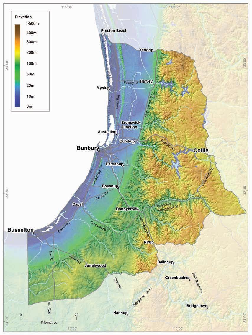
Geology, soils and climate of Western Australia’s wine regions 211
Figure 9.3: Geographe wine region: Elevations
Coloured deep sands, found in about 7% of the region, are particularly associated with the Spearwood dune system (known locally as Spearwood sands) on the Swan Coastal Plain, generally west of the Pale deep sands of the Bassendean dunes. The (mainly yellow–brown) Coloured sands, also known as ‘tuart sands’ in reference to the tuart trees (Eucalyptus gomphocephala) they support close to the coast, lie over ridges of Tamala Limestone (Figure 9.5). Coloured sands also sometimes combine with Ironstone gravels on the Donnybrook Sunkland, usually on broadly undulating crests and on gentle valley slopes and escarpment footslopes. East of the Darling Scarp they are also found in patches associated with Ironstone gravels.
Sandy duplex soils occur only in about 5% of the region. They dominate on the flat alluvial sediments of the Abba and Pinjarra Plains, inland of the dunes on the Swan Coastal Plain. Valley slopes of the Donnybrook Sunkland and Darling Plateau also feature these soils, often in combination with Ironstone gravel and Red–brown loam soils.
Alluvial sands and loams and Heavy soils tend to be closely related in this region, occurring collectively in about 4% of the region. Like the Sandy duplex soils, they are mostly on the alluvial plains (Abba and Pinjarra) of the Swan Coastal Plain and on alluvial fans and terraces flanking watercourses. They are particularly prevalent near the rivers at Harvey and Capel. East of the Darling Fault, they tend to be on valley slopes, generally in combination with Red–brown loams.
Ironstone gravels
Difficult soils
Red-brown loams
Pale deep sands
Coloured deep sands
Sandy duplexes
Heavy soils
Alluvial sands and loams
Shallow sands
Alkaline soils
Proportion of soil in region (%)
Proportion under vines (%)
Figure 9.4: Geographe wine region: Proportion of main soils in the region compared against main soils used for viticulture
Geology, soils and climate of Western Australia’s wine regions 212
0% 10% 20% 30% 40%
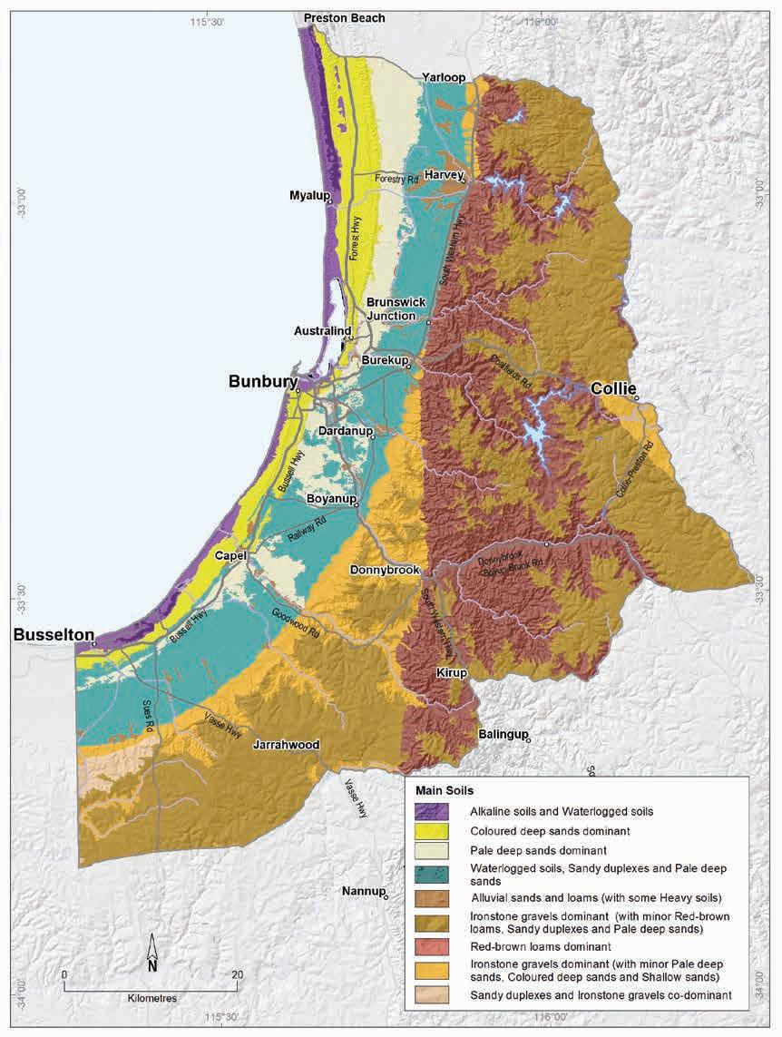
Geology, soils and climate of Western Australia’s wine regions 213
Figure 9.5: Geographe wine region: Main soils
We grouped together, as Difficult soils, areas of land in the region that are generally unsuited for agriculture. This group includes the poorly drained and saline country around the Vasse wetland, land with seasonally high watertables, and other valley floors, swamps and lakes. This group of soils also includes areas with exposed or shallow rock, cemented laterite or stony soils that are more prevalent east of the Darling Fault. These soils are often found in combination with more productive soils in various landscapes. Particularly frequent on the coastal plains, Difficult soils comprise about 20% of the region. Some soil alterations (mounded, drained or rocks removed) may allow wine grape cultivation in these areas.
The sand dunes that fringe the west coast of the Geographe wine region, known as the Quindalup dunes, have a concentration of Alkaline soils, which are typically deep, calcium-rich sands. They are largely unused for agriculture because of exposure to coastal winds and competition from other land uses including conservation, recreation and housing.
Soil-landscape mapping covering this region includes these surveys: Busselton-Margaret RiverAugusta Survey (Tille and Lantzke 1990); Harvey to Capel (Barnesby and Proulx-Nixon 1995); Peel-Harvey South (van Gool and Kipling 1992); and Wellington-Blackwood (Tille 1996); the mapping can also be viewed online at NRInfo.158
Main viticultural soils of the Geographe region
The region’s diverse landscapes—coastal plains, steep valley slopes and undulating plateaux—are ideal for creating specific mesoclimates suited for a wide range of wine grape varieties.
Almost two-thirds of the vines currently growing in the Geographe wine region are planted on the Darling Range east of the Darling Fault. The Swan Coastal Plain supports about one-quarter of the region’s plantings, with the remainder on the Donnybrook Sunkland area.
The vines in the region grow on Ironstone gravels and Red–brown loam soils in about equal proportions, collectively supporting two-thirds of the region’s vines (Figure 9.6).
On the Darling Range the plantings are focused on the valleys where Red–brown loams are dominant. These soils usually have red to brown loamy topsoils over well-structured, neutral brown clay loam to clay subsoils. These soils are associated with the deeply weathered ancient bedrock of the Yilgarn Craton where rock outcrop, stony soils and shallow rock within 80 cm of the surface are common. Red–brown loams are often associated with Ironstone gravels.
Many of the vines are grown on the gently undulating surface, isolated rises and upper valley slopes of the Darling Range. These areas are where the Ironstone gravels dominate, usually with pale yellow sand or loam topsoils containing abundant ferruginous nodules and pisoliths over well-structured yellow–brown neutral subsoil clays.
158 See https://www.agric.wa.gov.au/resource-assessment/nrinfo-natural-resource-information-western-australia
Geology, soils and climate of Western Australia’s wine regions 214
Figure 9.6: Geographe wine region: Main soils used for viticulture (Minor soils are Alluvial sands and loams, Difficult soils and Alkaline soils)
The Donnybrook Sunkland area has experienced extensive laterite formation, also with many vines on Ironstone gravels, mostly on ridges and valley slopes. The sand or loam topsoils with abundant ferruginous nodules and pisoliths and the clay loam to clay subsoils are often paler than similar soils east of the Darling Fault, indicating the deeply weathered sedimentary rocks of the Perth Basin beneath the laterites. The Ironstone gravels are often found in combination with Pale deep sands and earths.
Vines growing on the closely allied Heavy soils and Alluvial sands and loams are mostly located in the Swan Coastal Plain. They mainly grow on very gently undulating alluvial plains, river terraces and alluvial fan deposits, with sediments sourced from crystalline rocks of the interior. Several vineyards have been established on the well-drained recent alluvial soils at Harvey, usually with brown coloured sandy or loamy topsoils over deeper sands or well-structured loams and clays (Harvey series159). Vineyards are also on Alluvial sands and loams along the Capel River. Some plantings also occur on the older Alluvial soils in the Harvey Irrigation District (Boyanup series160). The viability of these soils for viticulture has been enhanced by installing subsoil drains.
159 Pym and Poutsma (1957); McArthur and Bettenay (1956)
160 Pym and Poutsma (1957); McArthur and Bettenay (1956)
Geology, soils and climate of Western Australia’s wine regions 215
Ironstone gravels 34% Sandy duplexes 5% Pale deep sands 10% Heavy soils 6% Coloured deep sands 6% Minor soils 7% Red-brown loams 32%
About 10% of the Geographe region’s vines grow in Pale deep sands, mainly on the undulating Bassendean dunes. These are generally deep bleached grey sands with an intensely coloured yellow subsoil occurring within 1 m of the surface, sometimes with a deeper layer of ferruginous nodules and pisoliths, or more commonly, a clay layer appearing below that depth. The Donnybrook Sunkland area also features vines in Pale deep sands, usually in shallow valley areas, generally in a mix with Ironstone gravel soils. Although these sands can support vine growth, they are usually not preferred because of their poor moisture- and nutrient-holding capacities.
About 6% of vines also grow on Coloured deep sands, mostly on low rises over limestone with these soils found in the Spearwood dune system on the Swan Coastal Plain. These yellow–brown coloured sands have clayey sand and loamy sand textures sometimes with sandy loam to clay textures at depth. Coloured sands, in combination with Ironstone gravels, also support vines near Harvey at the elevated western foot of the Darling Scarp. The marine escarpment fringing the Donnybrook Sunkland and around river headwaters and terraces have vines on Coloured deep sands in patches, typically combined with Ironstone gravels. These tend to be deep yellow sand over a layer of clay loam to clay beyond 80 cm.
Climate
The climate of this region is quite variable, firstly with the Busselton–Harvey coastal strip having a maritime climate strongly influenced by sea breezes and high afternoon relative humidity that alleviates stresses associated with warmer climates. In contrast, the inland area near Donnybrook is cut off from maritime influences by the Darling and Whicher Ranges (Dry et al. 2004), producing a more continental climate.
Gladstones (2021) also notes the climatic variables of the region’s differing landscapes, including:
• the narrow diurnal temperature range, cool regional winds and influence of the Leeuwin Naturalist Ridge and Whicher Scarp in locations near Busselton
• the dominant valley climate influences on inland locations, particularly south of the Preston Valley
• the free drainage of cold air towards the coast and exposure to summer sea breezes on upland locations closer to the Darling Scarp.
Remenyi et al. (2019) ranks the Geographe wine region among the lowest of the 71 Australian wine regions for growing season (October–April) rainfall levels (Table 9.1) and conversely, among the top 5 regions for mean non-growing season (May–September) rainfall amounts. The winter rainfall allows for a good store of soil moisture and promotes annual capture and storage of good quality run-off from heavy winter rains for irrigation during the growing season.
What this single average figure does not capture is the range in rainfall experienced across the Geographe wine region (Source: BoM (2022) Figure 9.7). The orographic effect of the Darling Scarp leads to a jump in rainfall at the western Darling Range compared to the coast. Mean long-term rainfall at Busselton is 678 mm, with a growing season mean of 137 mm. This rises to 969 mm average rainfall and 214 mm growing season rainfall at Donnybrook (Figure 9.8).
Geology, soils and climate of Western Australia’s wine regions 216
Table 9.1: Geographe wine region: Rainfall statistics (1989–2019)
(Oct-April)
Source: BoM (2022)
Figure 9.7: Geographe wine region: Variation of mean annual, winter and growing season rainfall for various locations across the region, 1989–2018
Geology, soils and climate of Western Australia’s wine regions 217
Value Annual rainfall (mm) Seasonal (October–April) rainfall (mm) Minimum 665 138 Maximum 1,075 223 Mean 854 180
Donnybrook
Collie east
Harvey
Busselton aero
growing
rainfall
Mean winter rainfall
Millimetres 0 100 200 300 400 500 600 700 800 900 1,000
Bunbury
Location Mean
season
(May-Sept)
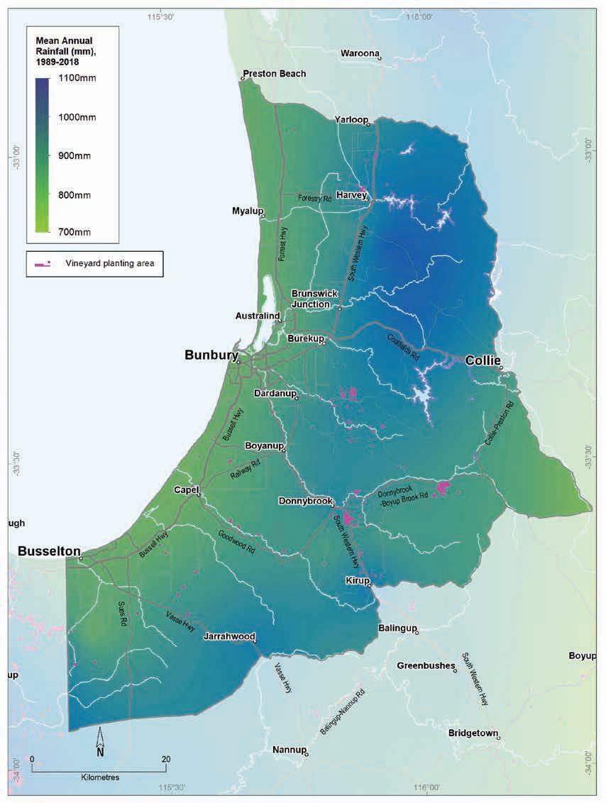
9.8: Geographe wine region: Mean annual rainfall (1989–2018)
Geology, soils and climate of Western Australia’s wine
regions 218
Figure
Summer temperatures are warmer along the Darling Scarp and adjacent valleys, although afternoon relative humidity is moderately high and temperature variability low. Mean 3pm October to April relative humidity ranges from 56% at Busselton on the coast to 36% inland at Donnybrook (Gladstones 1992). The average annual evaporation ranges from 1,100 mm near Busselton to 1,500 mm in the north of the region.
The ripening period is regularly dry and sunny. Around Donnybrook ripening temperatures and sunshine hours are in the upper range for good quality table wines though temperature variability can be high and relative humidity low (Table 9.2).
Temperature variations are also related to altitude, slope and aspect of the vines. The valleys and dissected terrain across the region allow greater choice when planning for a variety of wine styles. Warmer, more exposed north and west aspects are best for bigger, bolder (often) red wine styles. Cooler south and east aspects are more suited for aromatic whites, like Chardonnay.161
Table 9.2 summarises the temperature statistics for the region, supported by maps on the following pages, including:
• mean growing season temperature (GST), which covers the months October to April (Figure 9.9). The Geographe region has a growing season temperature range of 18 to 20.7 °C, with a mean of 19.4 °C.
• mean January temperature (MJT), which represents the average temperature throughout the day across the warmest month (Figure 9.10). The Geographe region has a mean January temperature range of 20.5 °C in the south of the region to 24 °C in the north and north-east.
• growing degree days (GDD), which is a measure of heat (between 10 and 19 °C) accumulation162 predicting the vines’ development rates for the growing season months of October to April163 (Figure 9.11). The Geographe region has a range of 1,782 to 2,272 units (°C).
• biologically effective degree days (BEDD), which are linked to the GDD calculation and adjusted for latitude/daylength and account for diurnal temperatures164 (Figure 9.12). The Geographe region has a range of 1,500 to 1,700 units (°C).
• diurnal temperatures, which are an average of the daily range between the minimum and maximum average daily temperature from October to April (Figure 9.13). The Geographe region has an average daily range of 11.7 to 15.5 °C.
Frost is only a minimal threat on the coastal plain, but east of the Darling Fault, especially around Collie, Donnybrook and Kirup, site selection is important.
Mean morning wind speeds at Donnybrook are typically about 12 km/h, increasing slightly to 16 km/h in the afternoons. The strongest winds during the year usually occur on November afternoons, reaching almost 18 km/h. Strongest morning winds are usually in February (about 16 km/h). Summer winds are mostly from the south and south-east.
161 Jim Campbell-Clause, AHA Viticulture (personal communication, 27 June 2022)
162 These calculations use the base 10 method (Hall and Jones 2010).
163 More recently, Jarvis et al. (2017) suggest that September to March may be more appropriate.
164 Hall and Jones (2010)
Geology, soils and climate of Western Australia’s wine regions 219
Table 9.2: Geographe wine region: Temperature statistics (1989–2019) Measurement
* Average estimates for locations in the Geographe region are from Gladstones (2021).
On the coastal plain, winds are usually stronger throughout the year compared with the inland parts of the Geographe region. The annual mean wind speeds at Busselton airport are about 17 km/h. Winds are mainly easterly in the mornings, increasing to more than 21 km/h in the afternoons when winds are mostly from the north-west and south. Further north at Bunbury and Harvey, morning winds are mostly easterly, and are typically from the west to south-west in the afternoons.
Winds are strongest in January, usually from the south and particularly in the afternoons, with speeds reaching about 24 km/h. Strong north-west and westerly winds can also occur in spring. Exposure to strong ocean winds on the coastal plain locations during spring can be detrimental to vine growth, damaging new shoots and flowers.
Remenyi et al. (2019) has shown that a changing climate is influencing the region. They identified an increase in mean growing season temperatures over the past few decades and predict a further regional increase to a mean of over 21 °C in the next 20 years. They also observed a trend towards drier conditions across the Geographe region. They suggest that the mean growing season rainfall could fall below 162 mm by the end of the 21st century. These are all important factors to consider for the future viability of each vineyard, particularly in relation to water availability, planting and management.
Geology, soils and climate of Western Australia’s wine regions 220
Value Mean growing season (October–April) temperature (°C) 19.4 Mean January temperature (°C) 22.3 Mean growing degree days (October–April) 1,999 Mean diurnal temperature (°C) 14.1 Average daily sun hours (October–April)* 8.3 Average (October–April) cloud cover (Okta)* 3.5
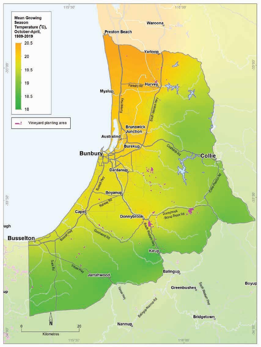
9.9: Geographe wine region: Mean growing season temperature (October–April, 1989–2019)
Geology, soils and climate of Western Australia’s wine regions 221
Figure
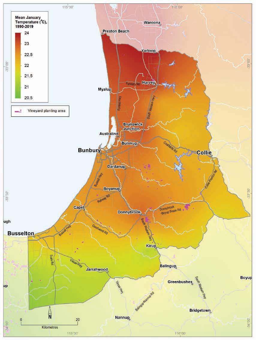
9.10: Geographe wine region: Mean January temperature (1990–2019)
Geology, soils and climate of Western Australia’s wine regions
222
Figure
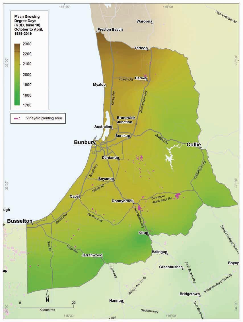
9.11: Geographe wine region: Mean seasonal growing degree days (October–April, 1989–2019)
Geology, soils and climate of Western Australia’s wine regions 223
Figure
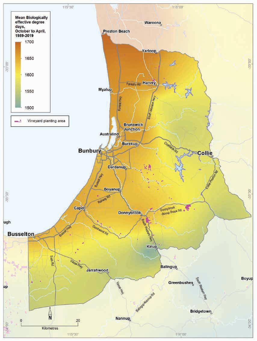
Figure 9.12: Geographe wine region: Biologically effective degree days (October–April, 1989–2019)
Geology, soils and climate of Western Australia’s wine regions
224
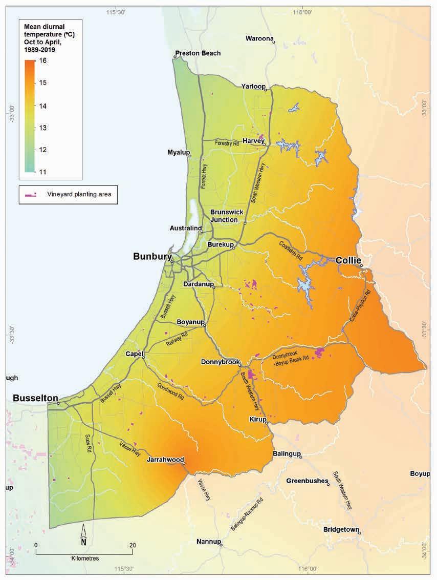
9.13: Geographe wine region: Mean diurnal temperature (October–April, 1989–2019)
Geology, soils and climate of Western Australia’s wine regions 225
Figure
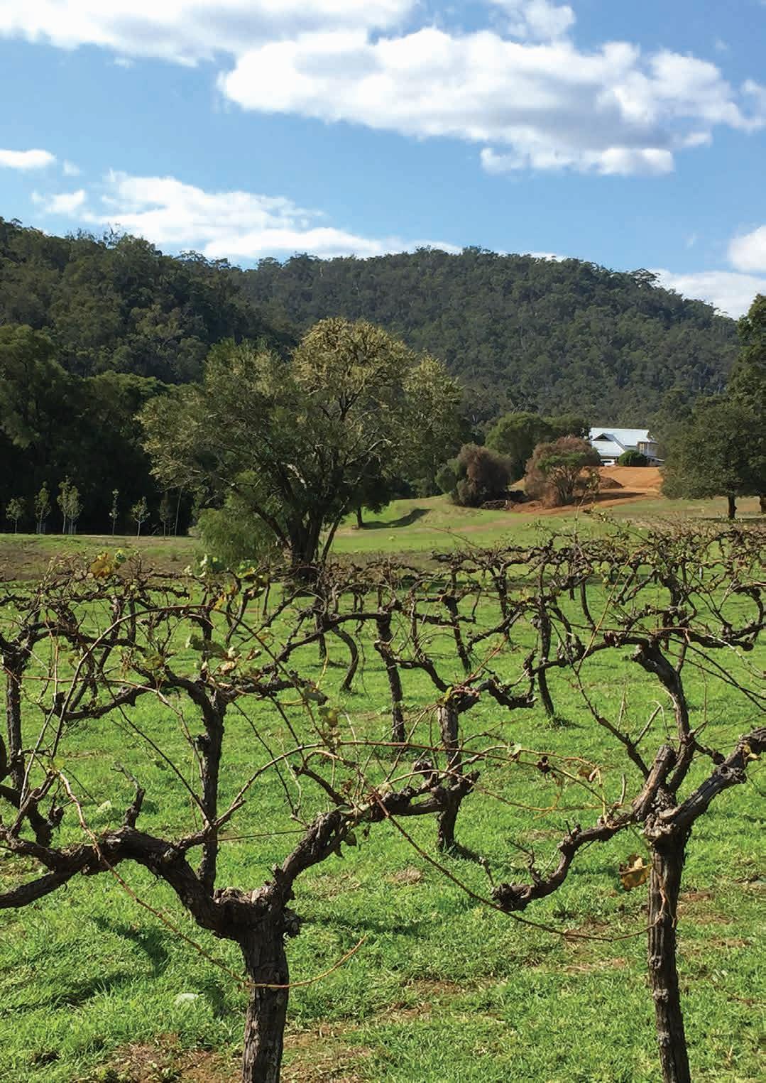
10 Pemberton wine region
Regional snapshot
Size: 205,345 hectares
Vine plantings area: 459 hectares
Elevation range: 2–306 m AHD
Vine plantings range: 25–281 m AHD
Geology: Felsic crystalline rocks of Yilgarn Craton in the north-west; Albany–Fraser Orogen in the south-east; Perth Basin sediments in the west
Geological age: Mostly over 1.1 billion years
Soil: Vines mainly grow on Ironstone gravels and Red–brown loam soils
Climate: A cool, more maritime climate with lower sunshine hours, high rainfall and high relative humidity
Main grape varieties: White – Sauvignon Blanc, Chardonnay, Pinot Gris, Prosecco Red – Pinot Noir, Shiraz, Merlot, Cabernet Sauvignon
Geology, soils and climate of Western Australia’s wine regions 227
Location and history
The Pemberton region adjoins the Manjimup region to the north-east and lies east of the Great Southern region. It lies across Bibulmun/Piblemen Noongar Boodja (Country), who are the Traditional Custodians of the land.165 Just 20% of the land is used for agriculture (almost 37,000 ha) with extensive areas of jarrah, marri, and karri forest (Eucalyptus marginata, Corymbia calophylla and Eucalyptus diversicolor) in state forests and national parks. These forests dominate the region and creating a stunning backdrop for many vineyards.
The main towns within the wine region are Pemberton and Northcliffe (Figure 10.1).
Gladstones (1965) first highlighted the potential for wine grapes west of the Rocky Gully and Mount Barker areas. In 1977, the Department of Agriculture planted an experimental area near the boundary between the Manjimup and Pemberton regions. The first commercial vineyard was established in 1982 (Halliday 1998); several others followed in the remainder of the decade.
Commercial wine production started in 1990 (Beeston 2002). By 2004, 466 ha of vines were growing in the Pemberton region, with 459 ha by 2019 (DPIRD 2019). Most vineyards in the region are currently north of the Warren River.
In 2002, the region’s harvest yielded almost 2000 tonnes of grapes. Today, the harvest volume reporting for the Pemberton region is combined with that from the Manjimup region, collectively termed the Southern Forests. In 2018, the estimated tonnage for the Southern Forests (combined tonnages from Pemberton and Manjimup regions) was 3,354 tonnes.
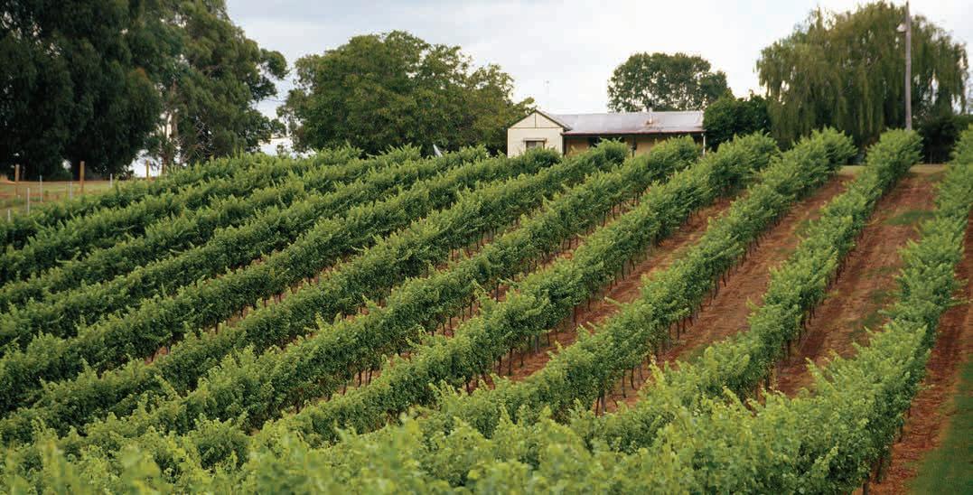
165 See https://www.noongarculture.org.au/south-west-boojarah/
Geology, soils and climate of Western Australia’s wine regions 228
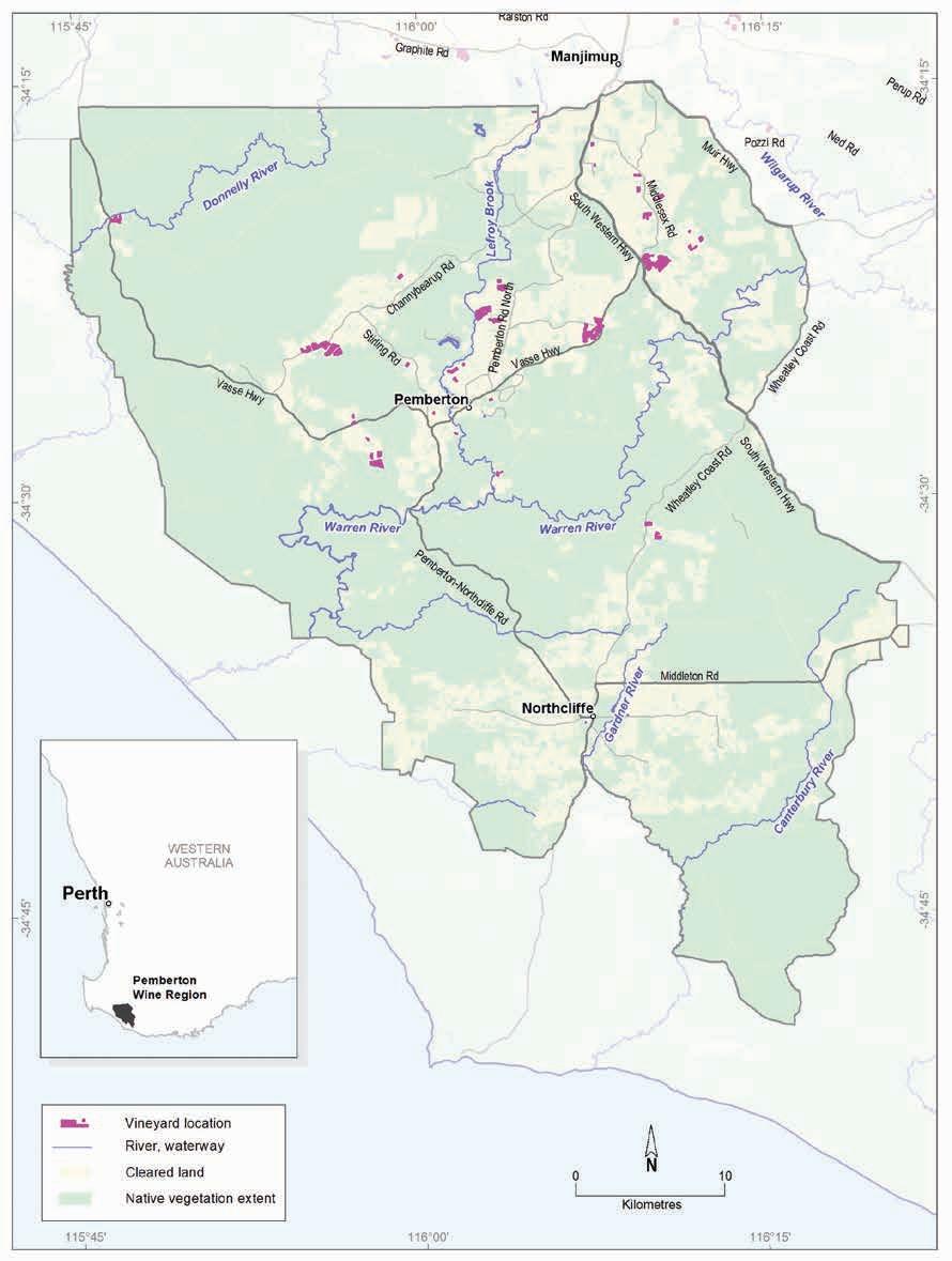
Geology, soils and climate of Western Australia’s wine regions 229
Figure 10.1: Pemberton wine region
Varieties and production
In 2021 the wine grape harvest from the Southern Forests yielded about 2,536 tonnes from more than 24 different varieties (APC 2022). The white wine grape harvest reached about 1,985 tonnes— the dominant white varieties were Sauvignon Blanc and Chardonnay. Pinot Gris, Prosecco and Semillon are also important varieties. The 2021 Southern Forests red wine grape harvest yielded about 551 tonnes—the dominant variety was Pinot Noir, followed by Shiraz, Merlot and Cabernet Sauvignon.
Geology and physiography
The Pemberton region falls across the boundary between the southern, very ancient core of the Yilgarn Craton (the Balingup Complex) and the western extent of the younger Albany–Fraser Orogen (the Biranup and Nornalup Complexes) (Figure 10.2). Deeply weathered crystalline basement rocks mainly comprising layered gneiss and granitic orthogneiss dominates the region’s geology.
The region is on a gently southward-tilting part of the Yilgarn Craton and the Albany–Fraser Orogen land surfaces. The tilting or sagging of the continent in this area was due to the separation of the Australian continent from Antarctica in the Early Tertiary period. It created an area known as the Ravensthorpe Ramp, sloping from a hinge line north of the Pemberton region (known as the Jarrahwood Axis) to the edge of the continental shelf (Cope 1975).
A lateritic profile blankets much of the surface of the crystalline basement rocks of the Yilgarn Craton and Albany–Fraser Orogen. Its appearance varies from massive and cemented, to loose uncemented laterite stones known as ferruginous nodules and pisolites (commonly called jarrah, forest or pea gravels). The dominating lateritic plateau that characterises much of the Manjimup region to the north changes close to the northern edge of the Pemberton region. Heading south, the terrain becomes increasingly stripped due to the actions of watercourses cutting through the laterite to reach the weathered felsic crystalline rocks beneath. These include the deep river valleys of the Donnelly and Warren Rivers, the headwaters of the Gardner and Meerup rivers, and many significant tributaries across the region.
The Darling Fault (located approximately where Vasse Highway crosses the Donnelly River) forms the western boundary of these two massive bodies of felsic crystalline rock. The fault defines the limit of the Perth Basin sediments in the west, which comprise just 5% of the region. A thick cover of Quaternary deposits at the coastal hinterland overlies part of the Perth Basin sediments.
Elevations across the region range from 40 m AHD where the Donnelly River crosses the Vasse Highway to 280 m at Jardee (Figure 10.3). Around Pemberton, elevations are mostly in the 120–180 m range, dropping to 60 m on the Warren River and rising to 200 m near the South Western Highway. Properties along Seven Day Road sit at 200–260 m and elevations around Northcliffe range from 60 to 120 m.
Geology, soils and climate of Western Australia’s wine regions 230
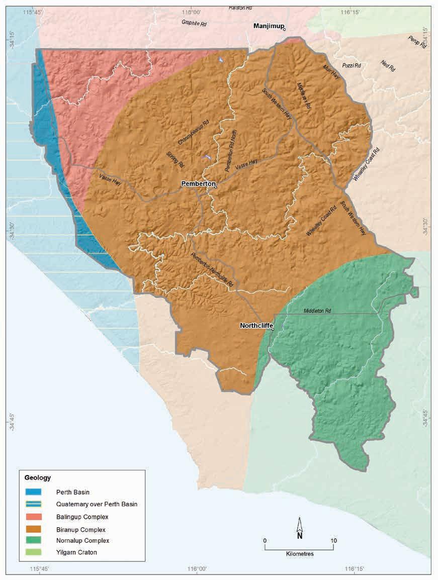
Geology, soils and climate of Western Australia’s wine regions 231
Figure 10.2: Pemberton wine region: Simplified geology
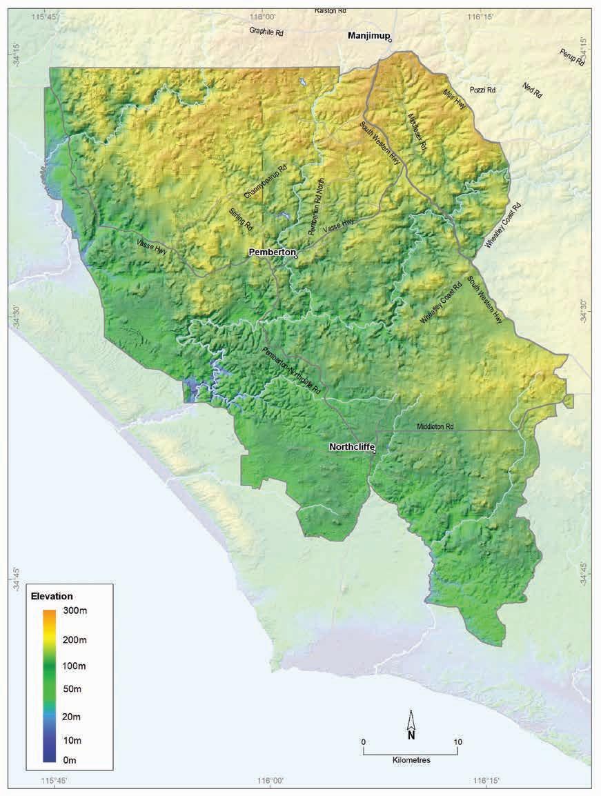
Geology, soils and climate of Western Australia’s wine regions
232
Figure 10.3: Pemberton wine region: Elevations
Soils and landforms
The lateritic mantle found across much of the Pemberton region generates the Ironstone gravel soils that dominate almost half of the region (Figure 10.4). These soils are typically prominent on the undulating upland country, ridges and shallow valleys sitting between the deeper river valleys. East of the Darling Fault they lay over the crystalline basement rocks of the Yilgarn Craton and the Albany–Fraser Orogen, and to the west, they cloak the sedimentary rocks of the Perth Basin (Figure 10.5). Ironstone gravels are often found in association with other soils in many landscapes in the region.
Red–brown loams comprise almost 30% of the soils in the region. These are more prominent on valley slopes and on the flanks of emergent hills. These soils are locally referred to as ‘karri loams’, indicating their association with the towering karri trees (Eucalyptus diversicolor) that characterise the area. Red–brown loams reflect the deeply weathered crystalline bedrock underlying much of the region. They are closely associated with Ironstone gravels, particularly those with red–brown coloured sand or loam topsoils and subsoils.
Ironstone gravels
Red-brown loams
Difficult soils
Pale deep sands
Coloured deep sands
Sandy duplexes
Shallow sands
Proportion of soil in region (%)
Proportion under vines (%)
Figure 10.4: Pemberton wine region: Proportion of main soils in the region compared against main soils used for viticulture
Geology, soils and climate of Western Australia’s wine regions 233
0% 10% 20% 30% 40% 50% 60% 70%
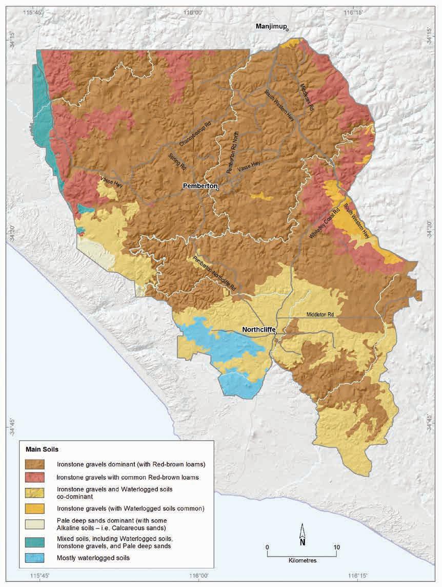
234
Geology, soils and climate of Western Australia’s wine regions
Figure 10.5: Pemberton wine region: Main soils
About 11% of soils in the Pemberton region are Deep sands, mainly Pale deep sands (around 6% of all soils). These are mostly in shallow valleys and at lower elevations closer to the coast and west of the Darling Fault, and occasionally on crests of the upland plateau. A slightly smaller area (about 5%) of Coloured deep sands occur, generally in patches on hillslopes.
Sandy duplexes are a minor soil (about 4%) in the Pemberton region. They mainly occur on low hills and gently sloping terrain, more regularly in the south of the region. Sandy duplexes are more common on the broadly undulating plains west of the Darling Fault, in combination with Ironstone gravels.
About 10% of the region’s soils are grouped as Difficult soils, which are often those unsuited for production. They are mainly found in areas of sandy, swampy plains with associated dunes and poorly drained flats. This group also includes scattered outcrops of bare rock associated with granite bedrock across the region. These areas are more typical in the south around Northcliffe where the landscape becomes more subdued and gently merges into a strip of sandy, swampy plains towards Windy Harbour on the south coast.
Soil-landscapes mapping covering this region include these surveys: Manjimup (Churchward 1992) and South Coast and Hinterland (Churchward et al. 1988); the mapping can also be viewed online at NRInfo 166
Main viticultural soils of the Pemberton region
About 61% of the region’s vines grow in Ironstone gravels (Figure 10.6). These soils are dominantly brown or reddish-brown sand to loam topsoil containing abundant ferruginous nodules and pisoliths, grading to red–brown loam or clay at depth. These soils generally occur on the flanks of hills and on valley slopes. They are frequently included in the grouping called ‘karri loams’ in this area, tending to be deeper, more fertile and better structured than Ironstone gravels that dominate many other regions.
Where plantings are on shallower minor valleys and gently undulating plateau areas, the Ironstone gravel soils tend to have grey–brown loamy sand topsoils containing abundant ferruginous nodules and pisoliths over yellow to brown subsoil clays. In some areas of vines, the sand is deeper than 80 cm.
About 30% of the Pemberton region’s vines grow in Red–brown loams. Like the redder Ironstone gravels, these ‘karri loam’ soils are generally on the flanks of hills and on valley slopes. These soils usually have a brown or reddish-brown sandy to loamy topsoil and red–brown loam to clay textures at depth, derived mainly from the deeply weathered ancient rocks of the Biranup Complex that underlie most of the plantings.
166 See https://www.agric.wa.gov.au/resource-assessment/nrinfo-natural-resource-information-western-australia
Geology, soils and climate of Western Australia’s wine regions 235
Figure 10.6: Pemberton wine region: Main soils used for viticulture
The combination of the area of vines growing in Red–brown loams with those growing in red–brown coloured Ironstone gravel soils, makes these ‘karri loams’ the most widely planted group of soils for growing vines in the Pemberton region. These fertile soils have high water-holding capacity, which can lead to excessive vigour with some varieties.
About 8% of vines grow in areas with Coloured deep sands. These deep sands tend to be yellow in colour and fine textured, extending beyond 80 cm, sometimes over clay below that depth. These sands are usually found in patches with Ironstone gravel soils.
Climate
Although climatically the Pemberton region has much in common with the Manjimup region, there are distinct differences. The Pemberton region is just 50 km inland from the coastline surrounding Point d’Entrecasteaux resulting in a maritime influence on the climate, with lower sunshine hours, higher rainfall, a narrower diurnal temperature range and higher relative humidity (Dry et al. 2004).
The gentle rise in elevation inland from the coast of between 100 and 200 m generates a more cooling influence.
Pemberton has the highest rainfall of all WA wine regions and the highest non-growing season (winter) rainfall of all Australian regions (Remenyi et al. 2019). Rainfall is mainly between 880–1,200 mm in the main growing district, but it ranges from 1,050 mm in the north-west to 1,400 mm at Northcliffe (Figure 10.7). Rain is generated from the Southern Ocean and falls mainly in winter (Table 10.1).
Geology, soils and climate of Western Australia’s wine regions
236
Ironstone gravels 61% Red-brown loams 30% Pale deep sands 1% 8% Coloured deep sands
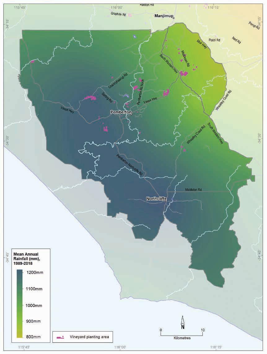
Geology, soils and climate of Western Australia’s wine regions 237
Figure 10.7: Pemberton wine region: Mean annual rainfall (1989–2018)
Annual evaporation is around 1,100 mm in the south of the region and approaches 1,300 mm in the north. Mean 3pm October to April relative humidity ranges from 50% in the north to 60% in the south (Gladstones 1992), with the figure for Pemberton townsite at 56%.
The rainfall combines with good soil water storage, which reduces the reliance on irrigation, and there is good potential for surface water storage. This climate also means the region’s vines are more susceptible to fungal disease.
Gladstones (1992) found there is a slight southwards gradient towards lower temperatures in the region despite decreasing altitude. There is also a southwards trend for falling sunshine hours and greater relative humidity and a slight decline in temperature variability.
Table 10.2 summarises the temperature statistics for the region, supported by maps on the following pages, including:
• mean growing season temperature (GST), which covers the months October to April (Figure 10.8). The Pemberton region has a GST range of 17.4 to 18.5 °C with a mean of 17.9 °C, which is among the lowest for the WA regions.
• mean January temperature (MJT), which represents the mean temperature throughout the day across the warmest month (Figure 10.9). The Pemberton region has a mean January temperature range of 19 to 21 °C.
• growing degree days (GDD), which is a measure of heat (between 10 and 19 °C) accumulation167 predicting the vines’ development rates for the growing season months of October to April168 (Figure 10.10). The Pemberton region has a range of 1,500 to 1,900 units (°C).
• biologically effective degree days (BEDD), which are linked to the GDD calculation and adjusted for latitude/daylength and account for diurnal temperatures169 (Figure 10.11) showing that the Pemberton region has a range of 1,350 to 1,550 units (°C).
• diurnal temperatures, which are the mean of the daily range between the minimum and maximum mean daily temperature from October to April (Figure 10.12) showing that the Pemberton region has a mean daily range of 10.1 °C to 12.8 °C, with a mean of 11.6 °C.
167 These calculations use the base 10 method (Hall and Jones 2010).
168 More recently, Jarvis et al. (2017) suggest that September to March may be more appropriate.
169 Hall and Jones (2010)
Geology, soils and climate of Western Australia’s wine regions 238
Value Annual rainfall (mm) Seasonal (October–April) rainfall (mm) Minimum 833 229 Maximum 1,235 322 Mean 1,111 292
Table 10.1: Pemberton wine region: Rainfall statistics (1989–2019)
Table 10.2: Pemberton wine region: Temperature statistics (1989–2019)
Measurement
* Average estimates for the Pemberton region are from Gladstones (2021).
Frosts are a consideration in the Pemberton region (especially in the north) but are not a major risk as the valleys are less affected because of the greater maritime influences from the Southern Ocean. The mean minimum temperature can fall below 2 °C for almost 2 days each year, and can drop below zero at ground level, mainly between June and September.
Mean morning wind speeds are almost 10 km/h, increasing to about 13 km/h in the afternoon. Winds are usually strongest (almost 15 km/h) on spring afternoons and come from the south and south-west. Morning summer winds are dominated by easterlies, which swing to the south in the afternoon and ease temperatures. The towering karri forest offers the vines some protection from strong sea breezes.
Remenyi et al. (2019) has shown that a changing climate is influencing the region. They identified an increase in mean growing season temperatures (GST) over the past few decades and predict a further rise to a mean GST of over 21 °C in the next 20 years. They also observed a trend towards drier conditions across the region. They suggest that the mean growing season rainfall could fall below 175 mm in the next 20 years. These are all important factors to consider for the future viability of each vineyard, particularly in relation to water availability, planting and management.
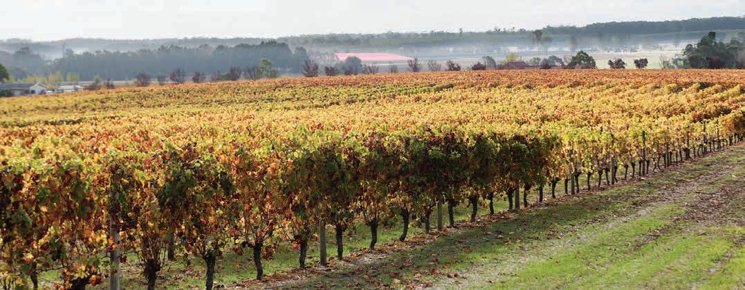
Geology, soils and climate of Western Australia’s wine regions 239
Value Mean growing season (October–April) temperature (°C) 17.9 Mean January temperature (°C) 20.0 Mean growing degree days (October–April) 1,691 Mean diurnal temperature (°C) 11.6 Average daily sun hours (October–April)* 7.0 Average (October–April) cloud cover (Okta)* 4.7
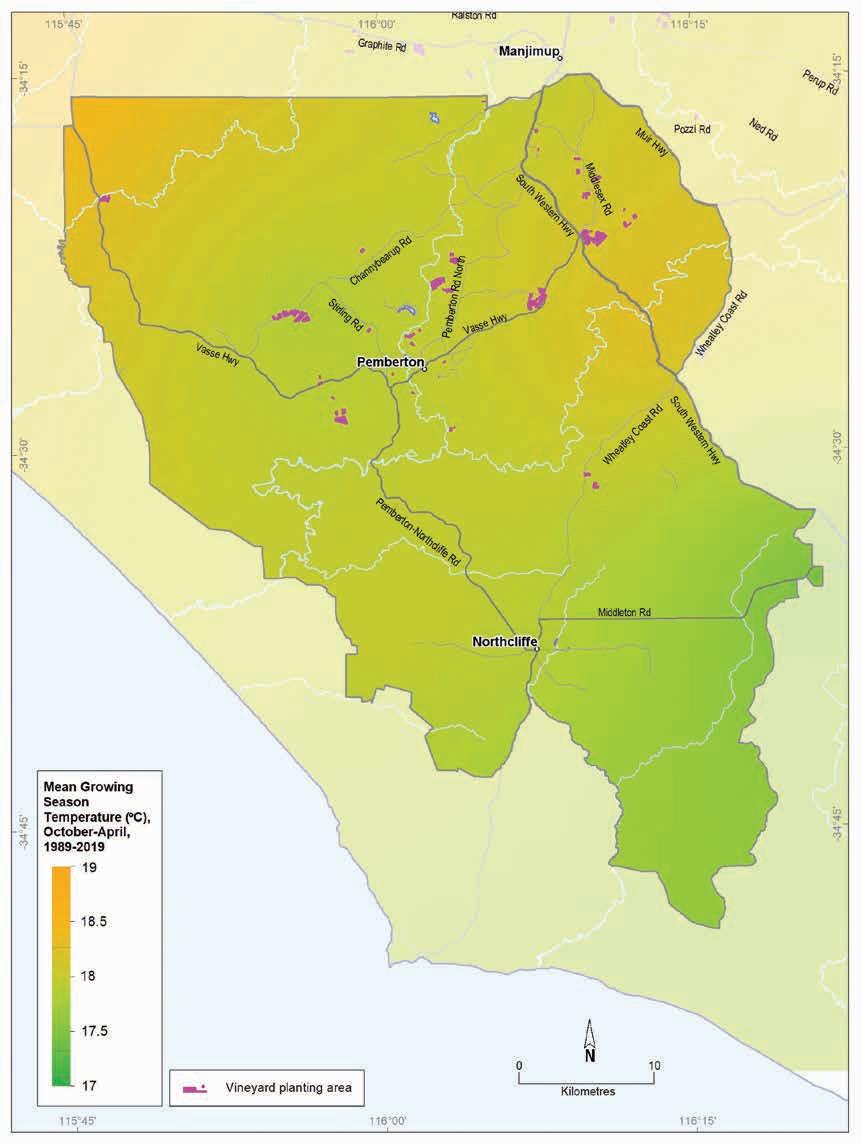
10.8: Pemberton wine region: Mean growing season temperature (October–April, 1989–2019)
Geology, soils and climate of Western Australia’s wine regions
240
Figure
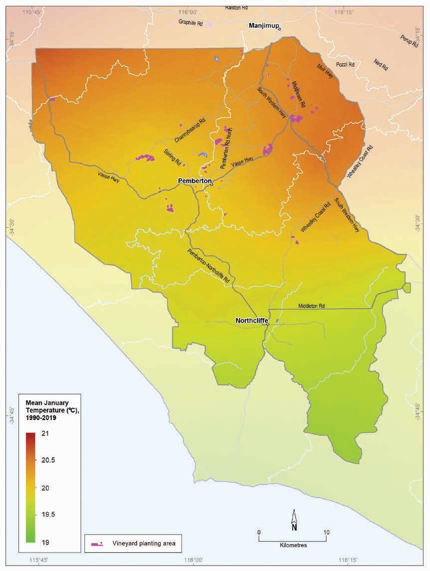
Geology, soils and climate of Western Australia’s wine regions 241
Figure 10.9: Pemberton wine region: Mean January temperature (1990–2019)
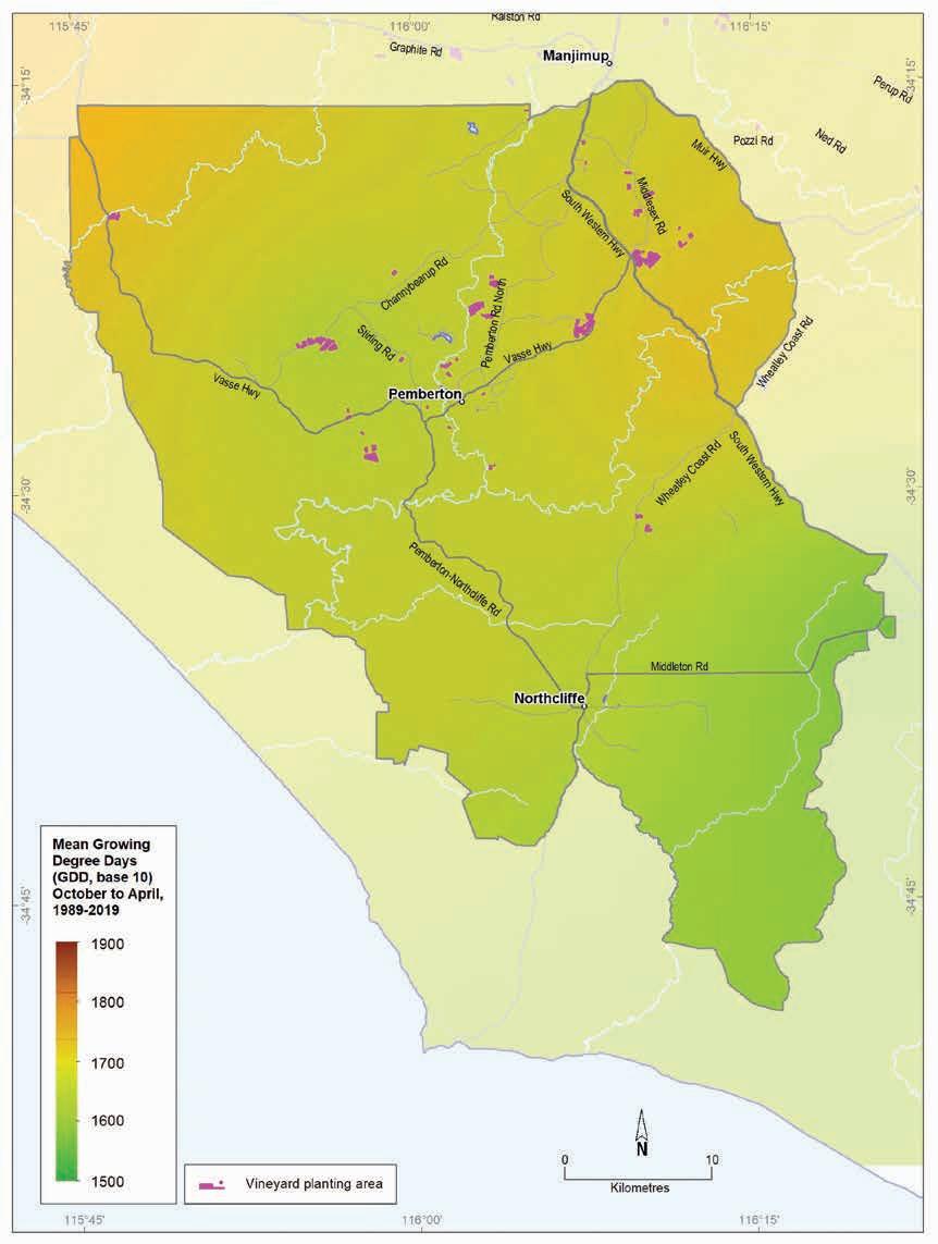
10.10: Pemberton wine region: Growing degree days (uncapped) (October–April, 1989–2019)
Geology, soils and climate of Western Australia’s wine regions
242
Figure
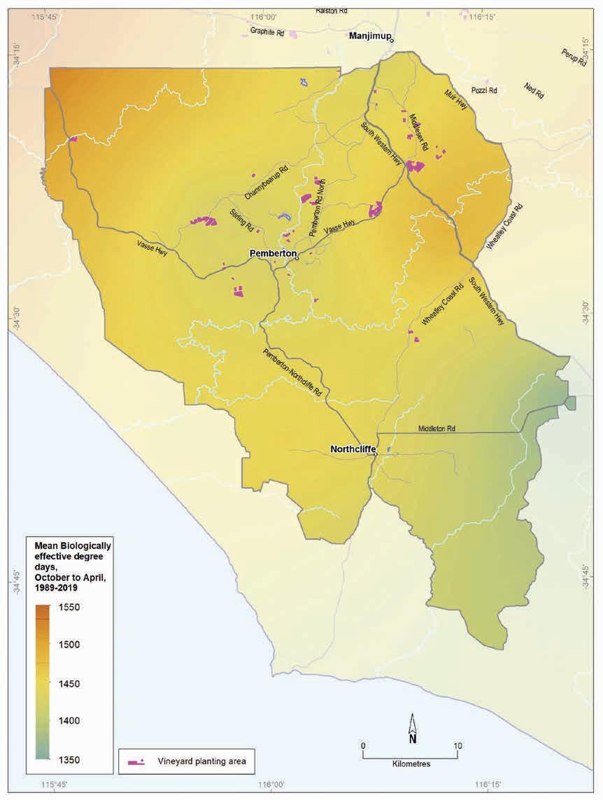
10.11: Pemberton wine region: Biologically effective degree days (October–April, 1989–2019)
Geology, soils and climate of Western Australia’s wine regions 243
Figure
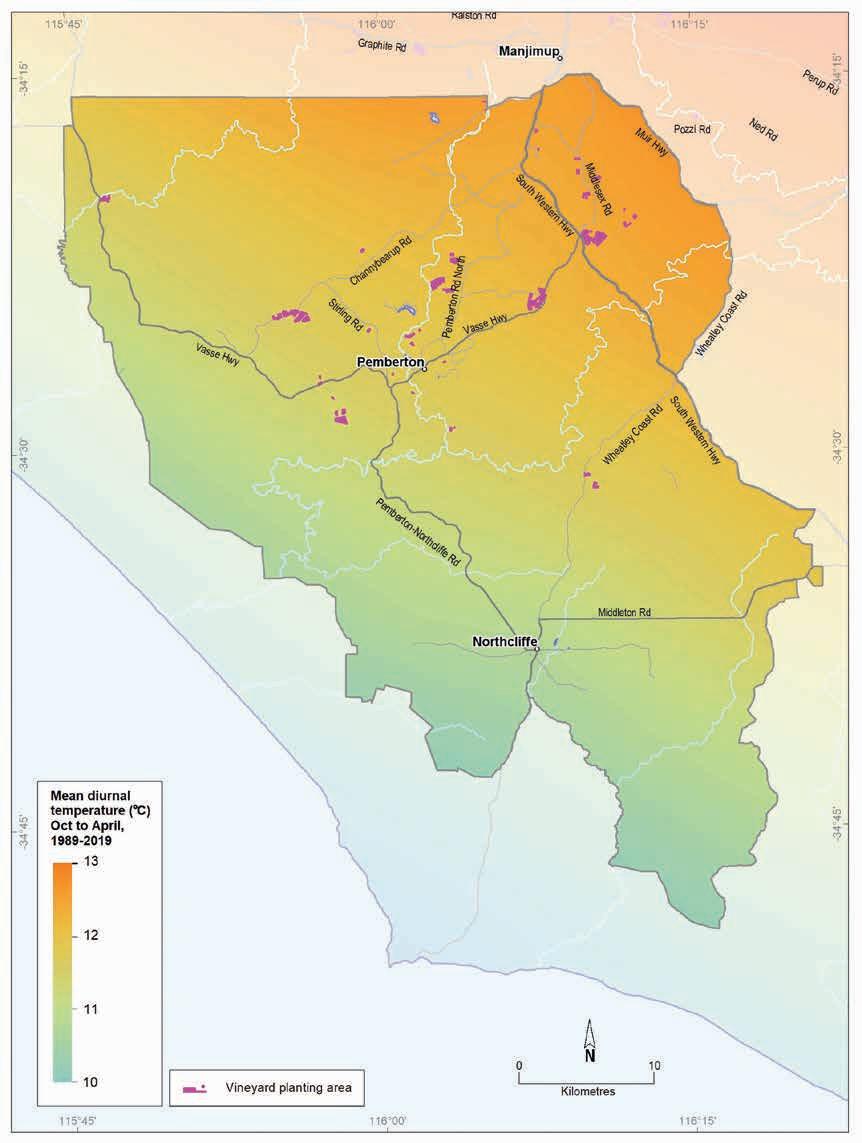
10.12: Pemberton wine region: Mean diurnal temperature (October–April, 1989–2019)
Geology, soils and climate of Western Australia’s wine regions
244
Figure
11 Blackwood Valley wine region
Regional snapshot
Size: 593,000 hectares
Vine plantings area: 382 hectares
Elevation range: 27–382 m AHD
Vine plantings range: 46–310 m AHD
Geology: Felsic crystalline rocks of the Archaean-aged Yilgarn Craton are dominant east of the Darling Fault at Nannup; a small area of Perth Basin sediments is in the west
Geological age: Mainly more than 2.6 billion years
Soil: Vines mainly grow on Red–brown loam and Ironstone gravel soils
Climate: A warmer, more continental climate. Wide temperature variability and severe risk of spring frosts means sites should be selected carefully
Main grape varieties: White – Sauvignon Blanc, Semillon, Chardonnay Red – Shiraz, Cabernet Sauvignon, Merlot
Geology, soils and climate of Western Australia’s wine regions 245
Location and history
The Blackwood Valley region covers almost 593,000 ha across the central portion of the Blackwood River catchment. It lies across Bibulmun/Piblemen and Ganeang Noongar Boodja (Country), who are the Traditional Custodians of the land.170 Dense forests of tall jarrah and marri trees (Eucalyptus marginata and Corymbia calophylla) cloak almost half of the region, with cleared agricultural land more prominent towards the east.
It includes the towns of Bridgetown, Boyup Brook, Nannup and Balingup, and the smaller settlements of Yornup, Mullalyup, Wilga, Dinninup, Mayanup and Tonebridge (Figure 11.1). The region has a similar latitude to the Margaret River region and is situated between the Geographe and Manjimup regions.
In 1978, Max Fairbrass planted the first wine grapevines at Blackwood Crest winery east of Boyup Brook. He thought the area might be suitable because his grandfather once grew table grapes on the property (Beeston 2002). In the 1990s extensive plantings around Boyup Brook commenced, followed by wineries at Bridgetown and Nannup and some sizable plantings near Mullalyup.
By 2004, 336 ha of vines were planted in the Blackwood Valley region, which had increased to around 382 ha by 2019 (DPIRD 2019). The total estimated tonnage across the region for 2018 was 1,457 tonnes.
Varieties and production
The Blackwood Valley wine region harvested 1,226 tonnes of wine grapes in 2021 from over 16 different varieties grown in the region (APC 2022). The white wine grape harvest was 791 tonnes— the dominant varieties were Sauvignon Blanc, Semillon and Chardonnay.
The 2021 red wine grape harvest was 435 tonnes—the dominant varieties were Shiraz, Cabernet Sauvignon and Merlot, with Malbec and Tempranillo in smaller volumes.
170 See https://www.noongarculture.org.au/south-west-boojarah/
Geology,
Western
wine regions 246
soils and climate of
Australia’s
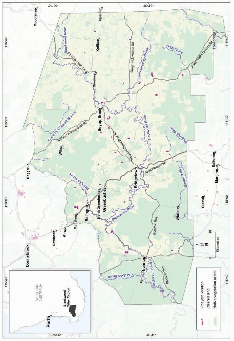
Geology, soils and climate of Western Australia’s wine regions 247
Figure 11.1: Blackwood Valley wine region
Geology and physiography
The Blackwood River and its tributaries have carved deep valleys through the forest-covered lateritic plateaux of the southern and eastern Darling Range. The river valleys expose the underlying granite and gneiss of the ancient Yilgarn Craton, including the Balingup Complex that underlies the central part of the region (Figure 11.2).
Separated from the Blackwood River by a catchment divide (part of the ‘hinge line’ of the southward-tilting Ravensthorpe Ramp171), are the headwaters of south-flowing rivers, including the Donnelly, Perup and Tone, influencing the more gently inclined terrain in the south of the region.
The region’s south-east corner features a small part of an infilled ancient valley and other depressions, previously incised into the southern part of the Yilgarn Craton. Significant deposition took place across this area from a drier Eocene period when drainage became sluggish. Extensive areas of Eocene sediments are also scattered on some of the plateau remnants (such as those in the Kulikup-Qualeup districts). Some of these are poorly drained and are generally avoided for agriculture.
A small part of the Blackwood Valley region also extends west across the Darling Fault at Nannup onto the Donnybrook Sunkland, featuring the gently inclined, laterite-covered sediments of the Perth Basin.
Elevations vary across the Blackwood Valley regions, ranging from 80–260 m in the Nannup district, 100–240 m around Balingup, 140–300 m near Bridgetown, and 200–280 m between Boyup Brook and Dinninup (Figure 11.3).
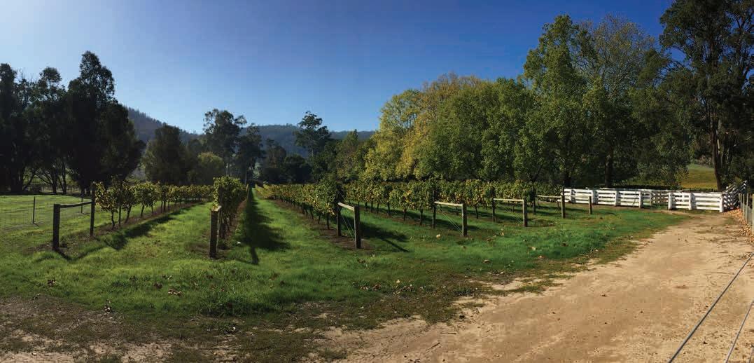
171 See map of physiographic regions in Figure 3.2, Part 1.
Geology, soils and climate of Western Australia’s wine regions 248
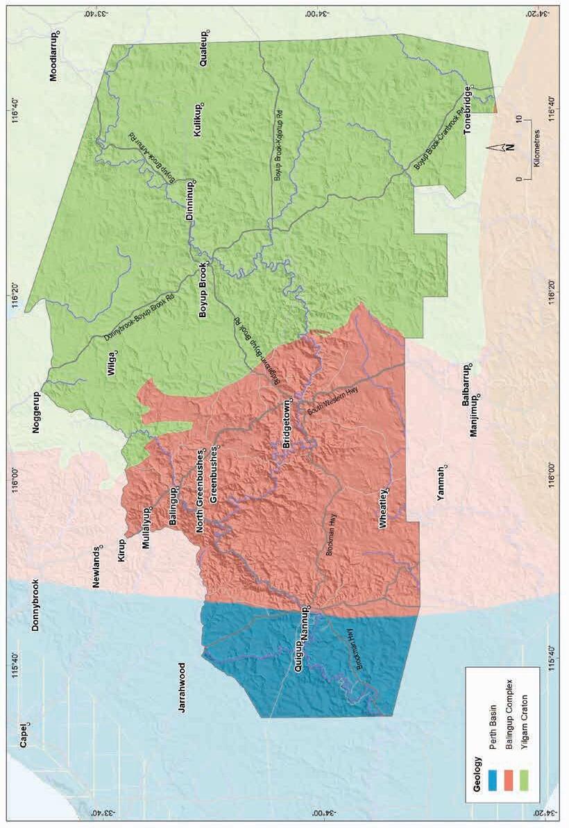
Geology, soils and climate of Western Australia’s wine regions 249
Figure 11.2: Blackwood Valley wine region: Simplified geology
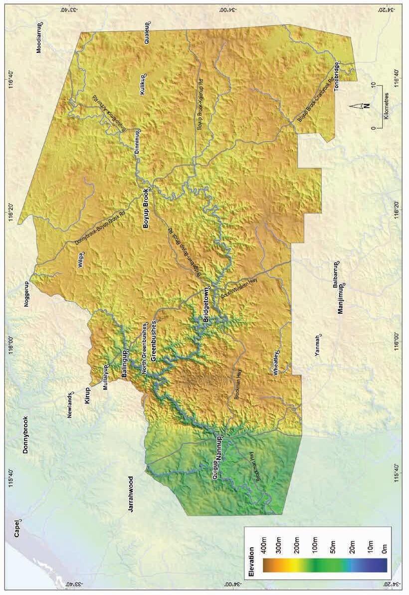
Geology, soils and climate of Western Australia’s wine regions
250
Figure 11.3: Blackwood Valley wine region: Elevations
Soils and landforms
The gently undulating landscape of the Darling Range dominates the Blackwood Valley region. Because a blanketing layer of laterite formed over the plateau and broad ridge crests of the range and across the small part of the Donnybrook Sunkland west of the Darling Fault, Ironstone gravels are the main soils in the region. These soils are a feature on almost half the land in the Blackwood Valley region (Figure 11.4).
Winding across the Darling Range, the Blackwood River has carved a major valley through the surface of the blanketing laterite to expose areas of soils more closely aligned with the ancient crystalline bedrock of the Darling Range Batholith and Balingup Complex components of the Yilgarn Craton (Figure 11.5). These Red–brown loams, concentrated in the valley and its tributaries, cover about 20% of the region, often in association with Ironstone gravels.
Ironstone gravels
Red-brown loams
Difficult soils
Sandy duplexes
Pale deep sands
Coloured deep sands
Alluvial sands and loams
Shallow sands
Proportion of soil in region (%)
Proportion under vines (%)
Figure 11.4: Blackwood Valley wine region: Proportion of main soils in the region compared against main soils used for viticulture
Sandy duplex soils occur in about 8% of the region. These soils are far more prominent in the gentler valley slopes and undulating rises east of Bridgetown, particularly in the north-east of the region. They often combine with Ironstone gravels on broadly undulating plains above the valley slopes across much of the Darling Range and in shallow valleys over Perth Basin sediments west of Nannup.
Geology, soils and climate of Western Australia’s wine regions 251
0% 10% 20% 30% 40% 50%
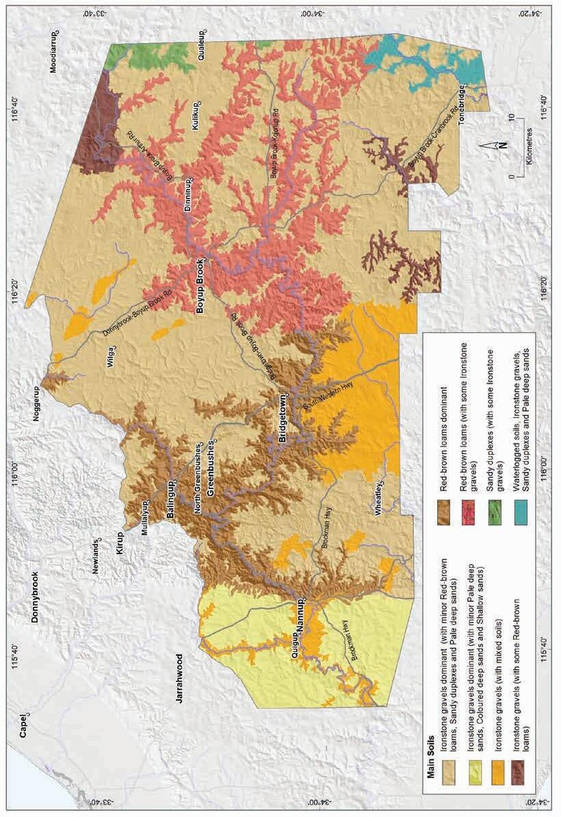
Western
wine regions 252
Geology, soils and climate of
Australia’s
Figure 11.5: Blackwood Valley wine region: Main soils
Deep sands comprise about 10% of soils in the region and are frequently found in association with Ironstone gravels. These are usually Pale deep sands, typically related to the significant era of deposition from a drier Eocene period. They can be in small patches in upland areas or in lower parts of the landscape. Pale deep sands are also common on broadly undulating hill crests and rises on Perth Basin sediments west of the Darling Fault.
The minor areas of Coloured sands are generally in discrete areas on valley slopes and broad divides on the Donnybrook Sunkland west of the Darling Fault. On the Darling Range they are found in patches associated with the headwaters of the Collie River and as low dunes in the east near the Hillman River.
About 14% of the region has Difficult soils, which are mainly areas unsuitable for agricultural production. West of the Darling Fault, flats close to the Blackwood River channel and other poorly drained shallow valleys are the main areas with these soils. On the Darling Range, they are generally poorly drained swampy flats and depressions and valley flood plains. Some of these areas, particularly in the east of the region, are also salt affected. This group also includes scattered outcrops of bare rocky country typically on the granite bedrock across much of the region.
Soil-landscapes mapping covering this region includes these surveys: Wellington-Blackwood (Tille 1996); Manjimup (Churchward 1992); Katanning (Percy 2000); and Tonebridge-Frankland (Stuart-Street 2005); the mapping can also be viewed online at NRInfo.172
Main viticultural soils of the Blackwood Valley region
The picturesque rolling green slopes of the Blackwood River valley support most of the region’s wine grapes, which means that Red–brown loams, typically more dominant on valley slopes, support about the same area of vines in the region as the more widespread Ironstone gravel soils (Figure 11.6).
The Red–brown loam soils are mainly brown to reddish–brown sandy loam to clay loam topsoils usually over well-structured, neutral brown clay loam to clay subsoils. These soils are products of the deeply weathered ancient bedrock of the Balingup Complex and the Darling Range Batholith— rocky outcrops, stony soils and shallow rock commonly occur within 80 cm of the surface. The Red–brown loams are also often associated with Ironstone gravels or contain ferruginous nodules and pisoliths in their topsoils.
Vines growing on the gently undulating plateau surface, isolated rises and upper valley slopes of the Darling Range are on terrain dominated by Ironstone gravels. These are mainly soils with pale yellow sand or loam topsoils containing abundant ferruginous nodules and pisoliths, over well-structured yellow–brown neutral subsoil clays. The Ironstone gravels (and other soils with soil moisture limitations) combine with the region’s warmer, dryer conditions, resulting in controlled vine vigour and high-quality fruit. Red varieties, especially, seem to benefit from moderate crops of grapes that have smaller berries concentrated with flavour and colour 173
172 See https://www.agric.wa.gov.au/resource-assessment/nrinfo-natural-resource-information-western-australia
173 Jim Campbell-Clause, AHA Viticulture (personal communication, 27 June 2022)
Geology, soils and climate of Western Australia’s wine regions 253
The Donnybrook Sunkland also experienced extensive laterite formation, and many of its wine grapes also grow on Ironstone gravels, which are mainly on valley slopes with sand or loam topsoils containing abundant ferruginous nodules and pisoliths over clay subsoils that are usually paler than similar soils east of the Darling Fault. This colour difference indicates deeply weathered sedimentary rocks of the Perth Basin lie beneath these laterites. The Ironstone gravels here are usually found with Alluvial sands and loams.
11.6: Blackwood Valley wine region: Main soils used for viticulture (Minor soils are Alluvial sands and loams, Coloured deep sands and Difficult soils)
Sandy duplex soils have a lower proportion of plantings, supporting just 8% of vines. These soils are mainly light grey–brown coarse to medium textured sandy topsoils over yellow clay subsoils. Less commonly, they have yellow–brown sandy topsoils over yellow clay subsoils.
Smaller areas (about 4%) have vines growing on Pale deep sands. The sands are generally pale grey and extend more than 80 cm deep. Sometimes they contain ferruginous nodules and pisoliths below a sandy topsoil and in some cases, a clay layer can be at more than 80 cm below the sandy surface. These soils, which are generally not preferred for planting, often occur as small pockets among better soils in vineyards.
Geology, soils and climate of Western Australia’s wine regions 254
41% Sandy duplexes 8% Pale deep sands 4% Minor soils 6% Red-brown loams 41%
Figure
Ironstone gravels
Climate
The Blackwood Valley region has the same latitude as Margaret River but it is warmer and more continental (Dry et al. 2004). Gladstones (2021) identified that a valley climate influences many of the vines in the region. The region has broad temperature variability and is largely isolated from the cooling maritime winds of the south and west coasts.
The mean annual rainfall is from 600 mm in the east of the region, increasing to about 1,100 mm in the south-west. The mean rainfall at Bridgetown is 823 mm (Table 11.1, Figure 11.7). The winter rainfall also allows for a good store of soil moisture and promotes annual capture and storage of good quality run-off from heavy winter rains for irrigation during the growing season.
Annual evaporation is 1,200 mm in the west and 1,500 mm in the east. Mean 3pm October to April relative humidity is below 60% and above 40% (Gladstones 1992), with Bridgetown at 43%.
Table 11.1: Blackwood Valley wine region: Rainfall statistics (1989–2019)
Gladstones (1992) identified that Bridgetown’s mean temperatures and sunshine hours over the ripening period are within the optimal range for full-bodied table wines. The region has more sunshine hours and less cloud cover than the adjacent Manjimup wine region.

Geology, soils and climate of Western Australia’s wine regions 255
Value Annual rainfall (mm) Seasonal (October–April) rainfall (mm) Minimum 485 141 Maximum 956 239 Mean 701 182
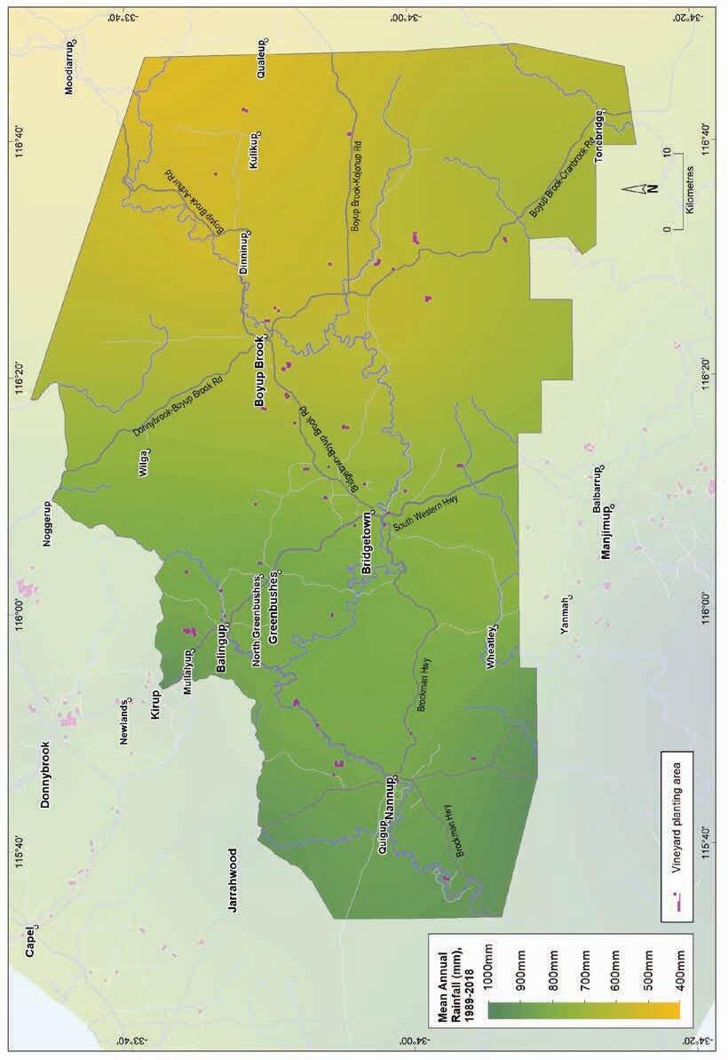
Geology, soils and climate of Western Australia’s wine regions
256
Figure 11.7: Blackwood Valley wine region: Mean annual rainfall (1989–2018)
Table 11.2 summarises the temperature statistics for the Blackwood Valley region, supported by maps on the following pages, including:
• mean growing season temperature (GST), which covers the months October to April (Figure 11.8). The Blackwood Valley region has a mean growing season temperature range of 18 to 19.1 °C, with a mean of 18.6 °C.
• mean January temperature (MJT), which represents the mean temperature throughout the day across the warmest month (Figure 11.9). The Blackwood Valley region has a mean January temperature range of 20.5 °C in the south of the region to 24 °C in the north.
• growing degree days (GDD), which is a measure of heat (between 10 and 19 °C) accumulation174 predicting the vines’ development rates for the growing season months of October to April175 (Figure 11.10). The Blackwood Valley region has a range of 1,706 to 1,934 units (°C).
• biologically effective degree days (BEDD), which are linked to the GDD calculation and adjusted for latitude/daylength and account for diurnal temperatures176 (Figure 11.11). The Blackwood Valley region has a range of 1,455 to 1,591 units (°C).
• diurnal temperatures, which are the mean of the daily range between the minimum and maximum mean daily temperature from October to April (Figure 11.12). The Blackwood Valley region has a daily range of 12.1 to 15.4 C, with a mean of 14.4 °C.
11.2: Blackwood Valley wine region: Temperature statistics (1989–2019)
* Average estimates are from locations in the Blackwood Valley region in Gladstones (2021).
174 These calculations use the base 10 method (Hall and Jones 2010).
175 More recently, Jarvis et al. (2017) suggest that September to March may be more appropriate.
176 Hall and Jones (2010)
Geology, soils and climate of Western Australia’s wine regions 257
Value Mean growing season (October–April) temperature (°C) 18.6 Mean January temperature (°C) 21.4 Mean growing degree days (October–April) 1,817 Mean diurnal temperature (°C) 14.4 Average daily sun hours
8.0
Table
Measurement
(October–April)*
Average (October–April) cloud cover (Okta)* 3.9
The main challenges encountered for wine grapes in the Blackwood Valley region are the wide temperature variability, including hot summers and the risk of spring frosts—sites must be selected carefully to maximise cold air drainage. Plantings are usually on upper slopes of valleys to avoid areas where cold air ponds overnight. Between April and November, Bridgetown can experience up to 34 days per year of minimum temperatures below 2 °C and 11 days at or below 0 °C. Obtaining sufficient water supplies for irrigation can be limiting, especially in the east of the region where rainfall is lower and salinity can be an issue on some valley floors.
Mean wind speeds in the morning are typically about 9 km/h, increasing slightly to 13 km/h in the afternoons with the strongest winds usually in January and February. Summer winds are mostly from the south and south-east, reaching almost 15 km/h in the afternoons.
Remenyi et al. (2019) has shown that a changing climate is impacting the region. They identified an increase in mean growing season temperatures (GST) over the past few decades and predict a further rise to a mean GST of over 20 °C in the next 20 years. They also observed a trend towards drier conditions across the region, particularly in the western half. They suggest that the mean growing season rainfall could fall below 175 mm in the next 20 years. These are all important factors to consider for the future viability of each vineyard, particularly in relation to water availability, planting and management.
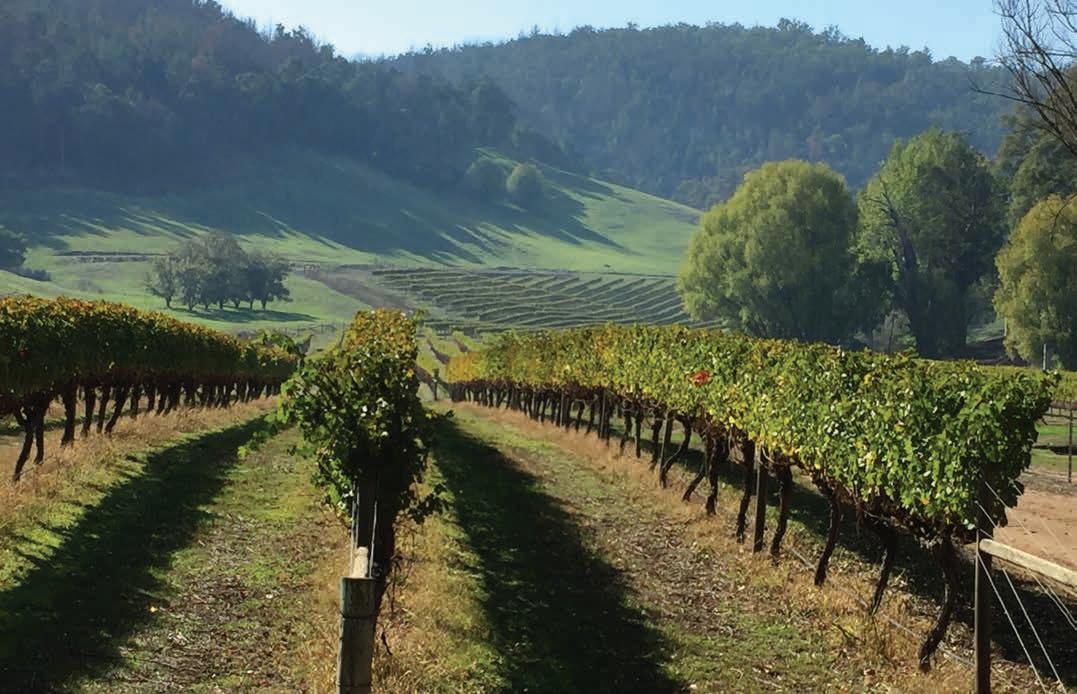
Geology, soils and climate of Western Australia’s wine regions 258
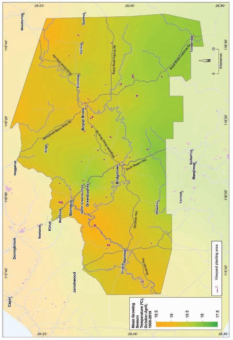
season temperature (October–April, 1989–2019)
Geology, soils and climate of Western Australia’s wine regions 259
Figure 11.8: Blackwood Valley wine region: Mean growing
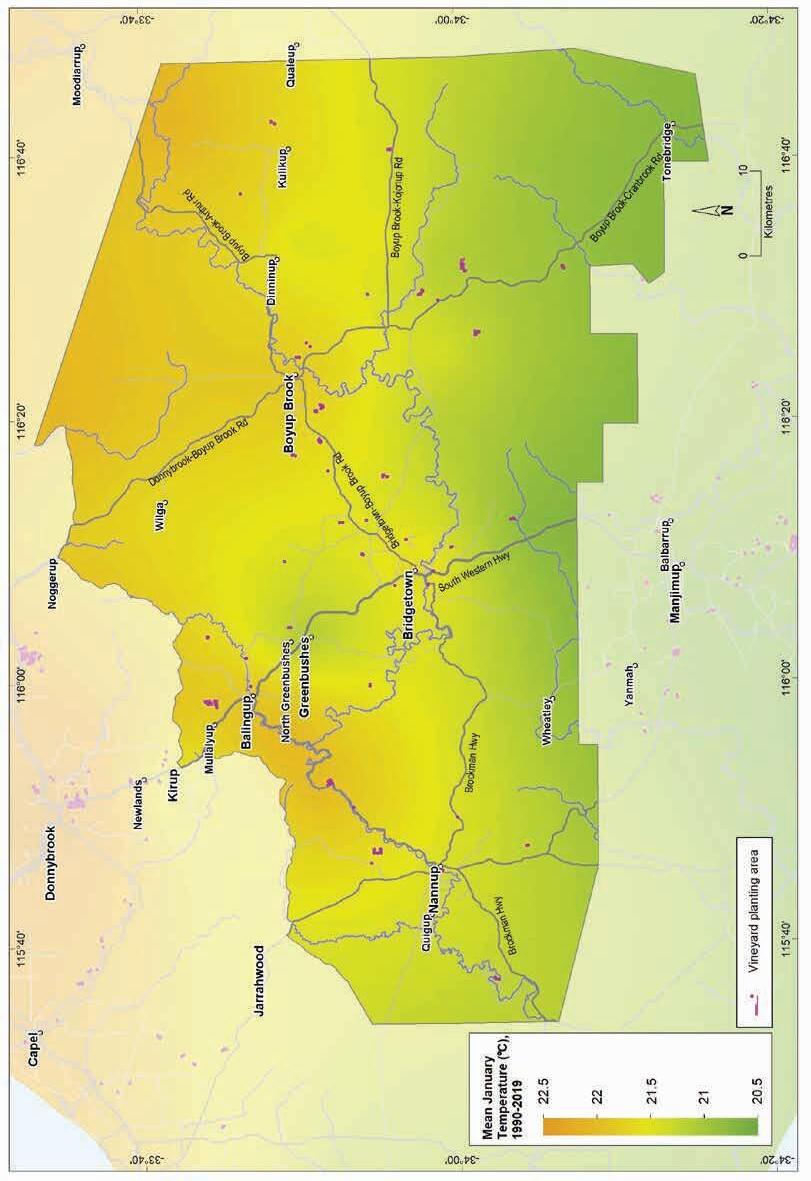
(1990–2019)
Geology, soils and climate of Western Australia’s wine regions
260
Figure 11.9: Blackwood Valley wine region: Mean January temperature
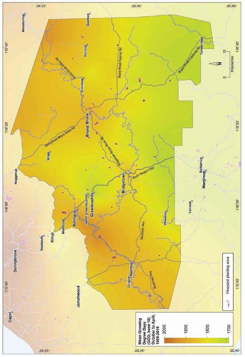
11.10: Blackwood Valley wine region: Mean seasonal growing degree days (October–April, 1989–2019)
Geology, soils and climate of Western Australia’s wine regions 261
Figure
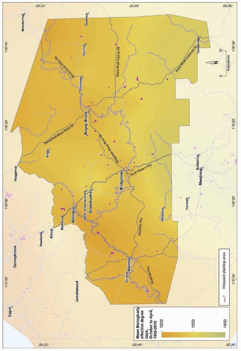
Figure 11.11: Blackwood Valley wine region: Biologically effective degree days (October–April, 1989–2019)
Geology, soils and climate of Western Australia’s wine regions
262
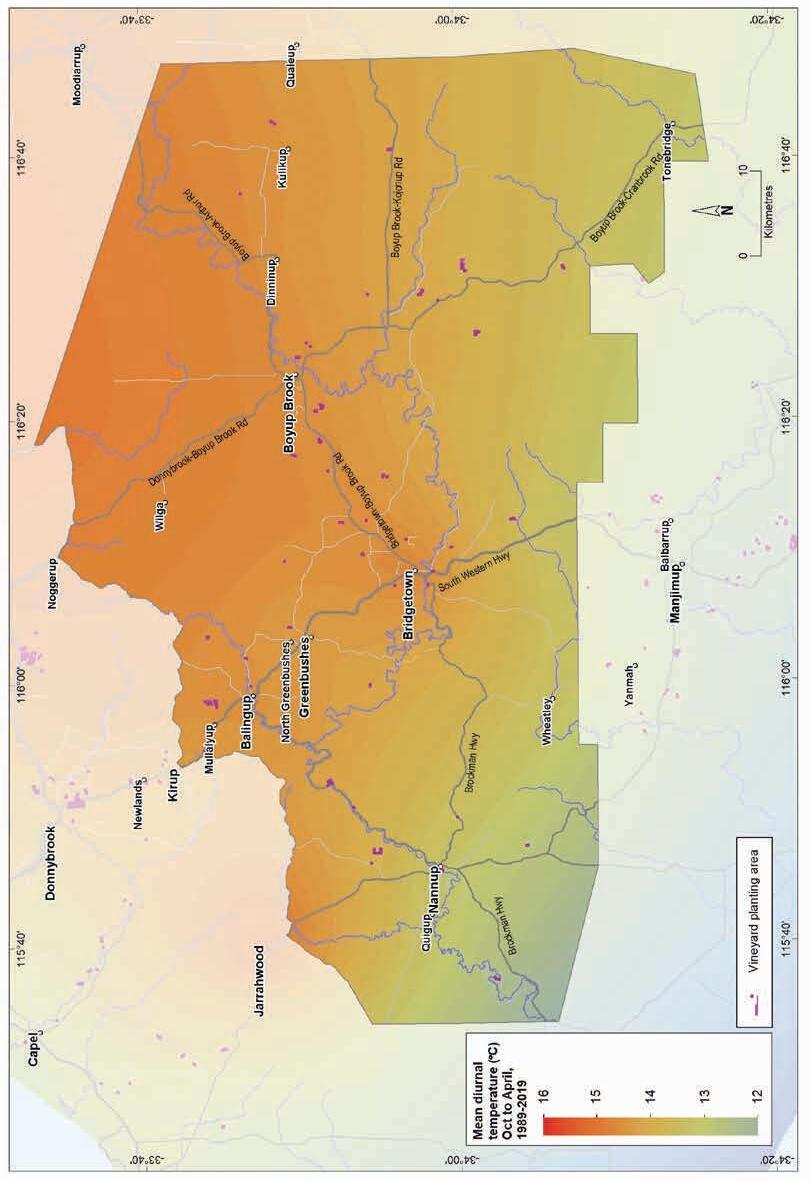
(October–April, 1989–2019)
Geology, soils and climate of Western Australia’s wine regions 263
Figure 11.12: Blackwood Valley wine region: Mean diurnal temperature
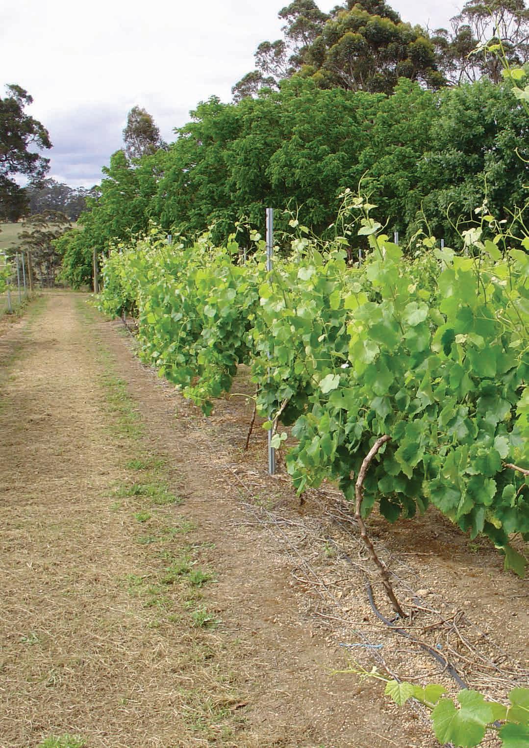
12 Manjimup wine region
Regional snapshot
Size: 225,000 hectares
Vine plantings area: 250 hectares
Elevation range: 99–334 m AHD
Vine plantings range: 127–319 m AHD
Geology: Felsic crystalline rocks of the Archaean-aged Yilgarn Craton in the north; Proterozoic-aged Albany–Fraser Orogen in the south
Geological age: Mainly 1.1–2.7 billion years
Soil: Vines mainly grow on Ironstone gravel soils
Climate: Ocean breezes and the region's elevation (more than 340 m) influence the climate and ensure cold winters
Main grape varieties: White – Sauvignon Blanc, Chardonnay, Pinot Gris, Prosecco Red – Pinot Noir, Shiraz, Merlot, Cabernet Sauvignon
Geology, soils and climate of Western Australia’s wine regions 265
Location and history
The Manjimup region covers about 225,000 ha, and adjoins the Blackwood Valley region to the north, the Pemberton region to the south-west and the Great Southern region in the east. It lies across Bibulmun/Piblemen, Ganeang and Minang Noongar Boodja (Country), who are the Traditional Custodians of the land.177 About 80% of the Manjimup region is cloaked with extensive jarrah and marri forests (Eucalyptus marginata and Corymbia calophylla) and spectacular stands of karri trees (Eucalyptus diversicolor).
The main town in the wine region is Manjimup with settlements at Deanmill, Palgarup and Quinninup on the boundary with Pemberton wine region (Figure 12.1). The Manjimup area has had a long association with horticulture and is renowned for its apples, stone fruit, potatoes, vegetables and more recently, avocados and truffles.
By 2004, about 192 ha of vines were planted in the Manjimup region, increasing to about 250 ha by 2019 (DPIRD 2019). The greatest concentration of plantings is in the westernmost section of the region, north of Manjimup townsite west (and to a lesser extent, east) of the South Western Highway. There are also plantings on the Perup River to the north. In 2002, about 239 tonnes of grapes were produced. Wine grape production reported from this region is now combined with that from the Pemberton region, collectively termed the Southern Forests. In 2018, the estimated tonnage for the Southern Forests area (combined tonnages from Pemberton and Manjimup regions) was 3,263 tonnes.
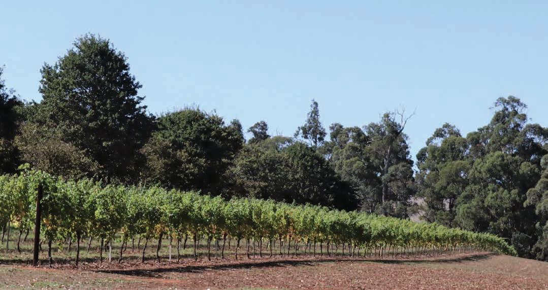
177 See https://www.noongarculture.org.au/south-west-boojarah/ and https://www.noongarculture.org.au/wagyl-kaip/
Geology, soils and climate of Western Australia’s wine regions 266
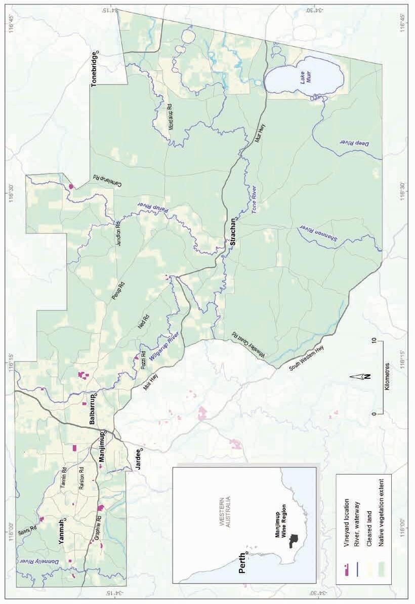
Geology, soils and climate of Western Australia’s wine regions 267
Figure 12.1: Manjimup wine region
Varieties and production
In 2021 the wine grape harvest from the Southern Forests yielded about 2,536 tonnes from more than 24 different varieties (APC 2022). The white wine grape harvest reached about 1,985 tonnes— the dominant white varieties were Sauvignon Blanc and Chardonnay. Pinot Gris, Prosecco and Semillon are also important varieties. The 2021 Southern Forests red wine grape harvest yielded about 551 tonnes—the dominant variety was Pinot Noir, followed by Shiraz, Merlot and Cabernet Sauvignon.
Geology and physiography
The granite and gneiss of the Yilgarn Craton dominates the region’s geology, approximately from Manjimup townsite northward (Figure 12.2). The western part of the Craton is an area called the Balingup Complex. A gently undulating lateritic plateau surface with shallow valleys developed over these ancient felsic crystalline rocks which dominates the northern part of the Manjimup region.
South of Manjimup are the Biranup and Nornalup Complexes, which are part of the Albany–Fraser Orogen. The terrain gradually descends in a series of gently inclined benches towards the Southern Ocean as part of the Ravensthorpe Ramp (Cope 1975). It is believed this tilting or sagging in this area occurred when the Australian continent separated from Antarctica in the Early Tertiary period, before drifting slowly north.
A lateritic profile blankets much of the surface of the Yilgarn Craton and Albany–Fraser Orogen. Its appearance varies from massive and cemented, to loose uncemented laterite stones known as pisolites (commonly called jarrah, forest or pea gravels).
South of Manjimup, the lateritic plateau surface becomes increasingly stripped, gradually transitioning into a series of undulating valleys (up to 100 m deep in places) and remnants of lateritic ridges. More substantial watercourses have carved through the lateritic plateau, notably the Perup and Tone rivers in the north, which join downstream to form the Warren River. The Donnelly River is in the west and the headwaters of the Shannon and Deep rivers are in the south. Exposure of the underlying gneiss and granite of the Yilgarn Craton and Albany–Fraser Orogen is common in this dissected terrain.
The subdued landscape of the region’s south-east around Lakes Muir and Unicup reflects a time (from a drier Eocene period) when significant sediment deposition took place. Drainage became sluggish, infilling ancient valleys and depressions previously incised into the southern part of the Yilgarn Craton and the Albany–Fraser Orogen. Scattered areas of poorly drained flats formed on old (Eocene) sedimentary deposits and are also found on the upland Darling Plateau surface.
As the only wine region with no plantings below 100 m AHD, the Manjimup region boasts the greatest mean elevation of planted vines of all WA regions (Figure 12.3). Elevations range from 100 to 160 m AHD at Quinninup (along the Warren River) to 300 m on the plateau surface. Elevations are mostly in the 220–300 m range north-east of Manjimup (Yanmah–Graphite Road); 220–240 m near Lake Unicup; and 140–220 m along the Tone River.
Geology, soils and climate of Western Australia’s wine regions 268
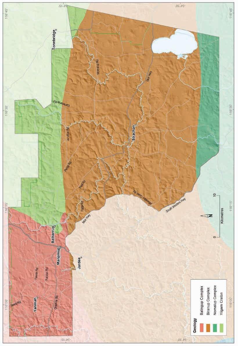
Geology, soils and climate of Western Australia’s wine regions 269
Figure 12.2: Manjimup wine region: Simplified geology
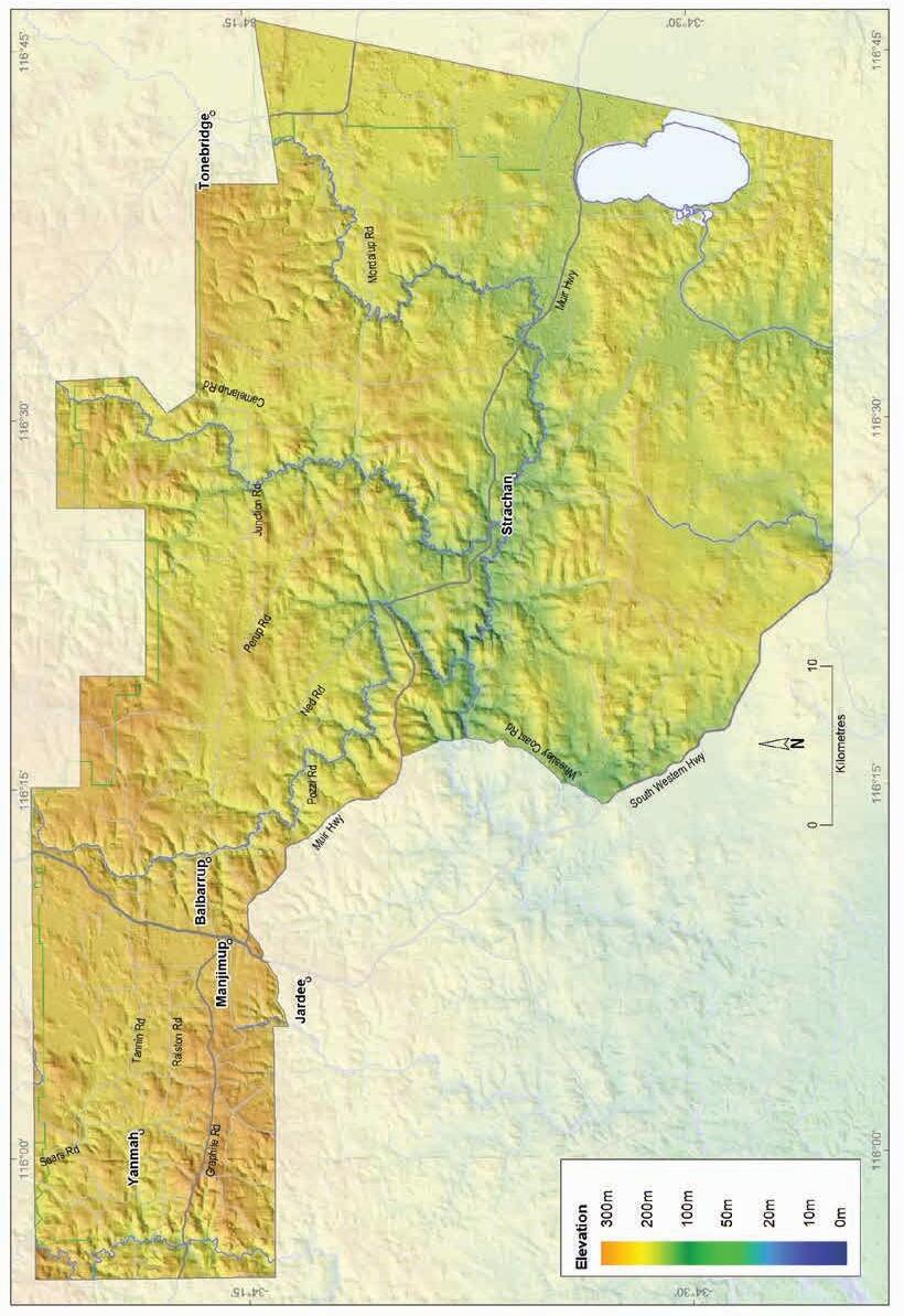
Geology, soils and climate of Western Australia’s wine
270
regions
Figure 12.3: Manjimup wine region: Elevations
Soils and landforms
Ironstone gravels are the most prominent soils in the Manjimup region and dominate many landscapes (Figure 12.4).
Ironstone gravels
Difficult soils
Red-brown loams
Sandy duplexes
Pale deep sands
Coloured deep sands
Heavy soils
Proportion of soil in region (%)
Proportion under vines (%)
Figure 12.4: Manjimup wine region: Proportion of main soils in the region compared against main soils used for viticulture
Ironstone gravels are particularly widespread on upper slopes, crests and undulating upland country of the plateau area north and east of Manjimup, with more varied soils found in valleys (Figure 12.5).
The erosive actions of watercourses in the south-west of the Manjimup region have exposed areas of ‘fresher’ soils over the crystalline basement rocks beneath. The valley slopes around the Donnelly, Wilgarrup, Perup, Yerraminup and Tone rivers and tributaries of the Warren River have carved through the undulating lateritic plateau. The Red–brown loams are prominent in these areas of the region, comprising about 11% of all soils.
Sandy duplex soils are less common in this region and are frequently mixed with Ironstone gravels across the undulating plateau. They tend to be slightly more prevalent in the east and south of the region on gently undulating rises and in shallow valleys, often associated with areas of Eocene sediments.
Geology, soils and climate of Western Australia’s wine regions 271
0% 10% 20% 30% 40% 50% 60% 70%
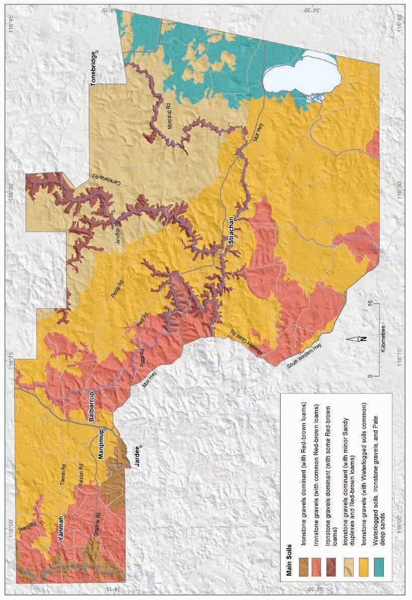
Geology,
regions 272
soils and climate of Western Australia’s wine
Figure 12.5: Manjimup wine region: Main soils
Areas of deep sands collectively comprise about 11% of the soils in the region. Pale deep sands are generally associated with areas of Eocene sediments deposited around very gently undulating swampy areas and low rises in the south and east, particularly around Lakes Muir and Unicup. Coloured sands tend to be in shallow valley areas in the south of the region and across the plateau in patches associated with Ironstone gravels.
About 17% of the subregion has Difficult soils, which are areas usually unsuitable for agricultural production. These are mainly the waterlogged and poorly drained swampy plains, shallow drainages and depressions in the north, east and central parts of the region. This group also includes small outcrops of bare rocky country. These soils are often combined with more productive soils in various landscapes.
Soil-landscape mapping covering this region includes these surveys: Manjimup (Churchward 1992); South Coast and Hinterland (Churchward et al. 1988); and Tonebridge-Frankland (StuartStreet 2005); the mapping can also be viewed online at NRInfo 178
Main viticultural soils of the Manjimup region
Almost two-thirds of the vines in the Manjimup region grow in Ironstone gravel soils (Figure 12.6). Most vineyards with these soils are on the better-drained crests and rises and on slopes of shallow minor valleys found across the plateau. More than half of these vineyards are planted in soils with sandy loam topsoil containing abundant ferruginous nodules and pisoliths with a clear to gradual boundary to a well-structured yellow–brown to red clay subsoil at around 50 cm.
Many of these soils also feature yellow–brown (sometimes grey) sand to clayey sand topsoils with ferruginous nodules and pisoliths over yellow–brown subsoil clays. In some areas, vines grow in grey–brown sand with nodules and pisoliths that extend more than a metre deep, and sometimes over cemented ironstone.
Ironstone gravels with red subsoil clays (sometimes called ‘karri loams’) tend to be more strongly associated with Red–brown loams on valley slopes where influences from crystalline parent material are more common.
In dissected terrain, where the underlying gneiss and granite of the Albany–Fraser Orogen have been exposed, vines are planted on Red–brown loam soils (‘karri loams’) including red–brown coloured Ironstone gravels and red and brown coloured sandy loam topsoils over well-structured red–brown loam to clay subsoils.
Sandy duplex soils support vines in a few locations (about 6%), generally in areas mixed with Ironstone gravels. These are typically grey deep sandy duplex soils, with paler grey–brown sandy topsoils over yellow–brown subsoil. They are slightly more common in the east of the region on gently sloping terrain. Coloured deep sands have a similar level of plantings. These are generally yellow-coloured loamy sand to clayey sand soils extending more than 80 cm deep, typically found on broad upland areas, usually in patches amongst Ironstone gravels.
178 See https://www.agric.wa.gov.au/resource-assessment/nrinfo-natural-resource-information-western-australia
Geology, soils and climate of Western Australia’s wine regions 273
Figure 12.6: Manjimup wine region: Main soils used for viticulture (Minor soils are Pale deep sands and Difficult soils)
Climate
Manjimup is 70 km inland from the Southern Ocean coast. Exposure to cooling maritime breezes from this ocean influence the climate, along with the region's elevation, which at more than 330 m, ensures cold winters. Summer and autumn are fairly dry, with the bulk of the growing season rain falling in spring (Table 12.1).
Table 12.1: Manjimup wine region: Rainfall statistics (1989–2019)
The Manjimup region has a mean non-growing season (winter) rainfall of about 575 mm, which is among the highest for all Australian wine regions (Remenyi et al. 2019). The winter rainfall allows for a good store of soil moisture and promotes annual capture and storage of run-off from heavy winter rains for irrigation during the growing season (Figure 12.7).
Geology, soils and climate of Western Australia’s wine regions 274
Ironstone gravels 65% Sandy duplexes 6% Minor soils 6% Red-brown loams 16% 7%
sands
Coloured deep
Value Annual rainfall (mm) Seasonal (October–April) rainfall (mm) Minimum 619 190 Maximum 1,066 281 Mean 797 222
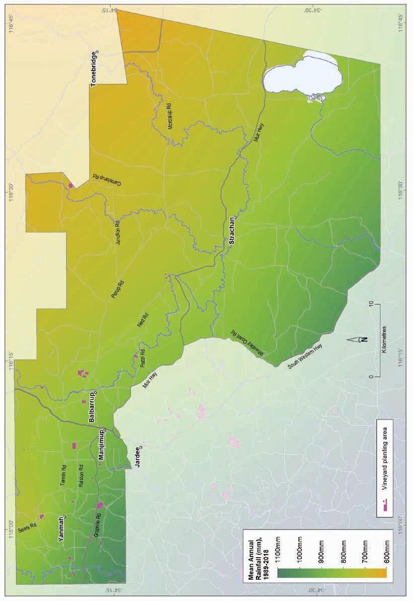
Geology, soils and climate of Western Australia’s wine regions 275
Figure 12.7: Manjimup wine region: Mean annual rainfall (1989–2018)
Annual evaporation is mostly between 1,300 mm and 1,400 mm. Mean 3pm October to April relative humidity at Manjimup is below 49% (Gladstones 1992). Gladstones saw many similarities here to the climate of Mount Barker and Frankland subregions of the Great Southern region, with a few marginal advantages: greater and more reliable winter and spring rainfall and slightly lower temperature variability, which, conversely, leads to increased disease risk for the vines.
Growing season temperatures are marginally warmer in the Manjimup region than in the Pemberton region and sea breezes can temper the effects of summer afternoon temperatures (Table 12.2).
Gladstones (2021) identified that the region has fewer sunshine hours and more average cloud cover than the Blackwood Valley region to the north. South to south-west winds usually strengthen from mid-spring to about 13 km/h and continue through to summer. Typical wind speeds for 3pm in January are 12 km/h.
Table 12.2 summarises the temperature statistics for the region, supported by maps on the following pages, including:
• mean growing season temperature (GST), which covers the months October to April (Figure 12.8). The Manjimup region has a growing season temperature range of 17.6 to 18.4 °C, with a mean of 18.1 °C.
• mean January temperature (MJT), which represents the mean temperature throughout the day across the warmest month (Figure 12.9). The Manjimup region has a mean January temperature range of 20.5 °C in the south of the region to 24 °C in the north.
• growing degree days (GDD), which is a measure of heat (between 10 and 19 °C) accumulation179 predicting the vines’ development rates for the growing season months of October to April180 (Figure 12.10). The Manjimup region has a range of 1,603 to 1,778 units (°C). Remenyi et al. (2019) shows that the Manjimup region has the lowest growing year maximum GDD of all WA wine regions.
• biologically effective degree days (BEDD), which are linked to the GDD calculation and adjusted for latitude/daylength and account for diurnal temperatures181 (Figure 12.11). The Manjimup region has a range of 1,380 to 1,500 units (°C).
• diurnal temperatures, which are the mean of the daily range between the minimum and maximum mean daily temperature from October to April (Figure 12.12). The Manjimup region has a daily range of 12 to 14 °C, with a mean of 12.9 °C.
Frosts are a consideration here (especially in the north) but not a major risk as the valleys are less affected because of warmer temperatures and better air drainage. The mean minimum temperature falls below 2 °C for about 2 days each year, mainly between June and September.
179 These calculations use the base 10 method (Hall and Jones 2010).
180 More recently, Jarvis et al. (2017) suggest that September to March may be more appropriate.
181 Hall and Jones (2010)
Geology, soils and climate of Western Australia’s wine regions 276
Table 12.2: Manjimup wine region: Temperature statistics (1989–2019)
Measurement
* Average estimates are from locations in the Manjimup region in Gladstones (2021).
Remenyi et al. (2019) has shown that a changing climate is influencing the region. They identified an increase in mean growing season temperatures (GST) over the past few decades and predict a further rise to a mean GST of over 19.6 °C in the next 20 years. They also observed a trend towards drier conditions across the region, particularly in the west. They suggest that the mean growing season rainfall could fall below 200 mm in the next 20 years. These are all important factors to consider for the future viability of each vineyard, particularly in relation to water availability, planting and management.
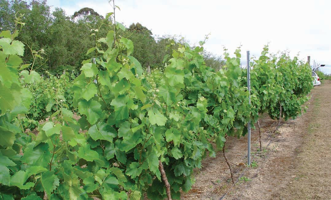
Geology, soils and climate of Western Australia’s wine regions 277
Value Mean growing season (October–April) temperature (°C) 18.1 Mean January temperature (°C) 20.5 Mean growing degree days (October–April) 1,716 Mean diurnal temperature (°C) 12.9 Average daily sun hours (October–April)* 7.3 Average (October–April) cloud cover (Okta)* 4.4
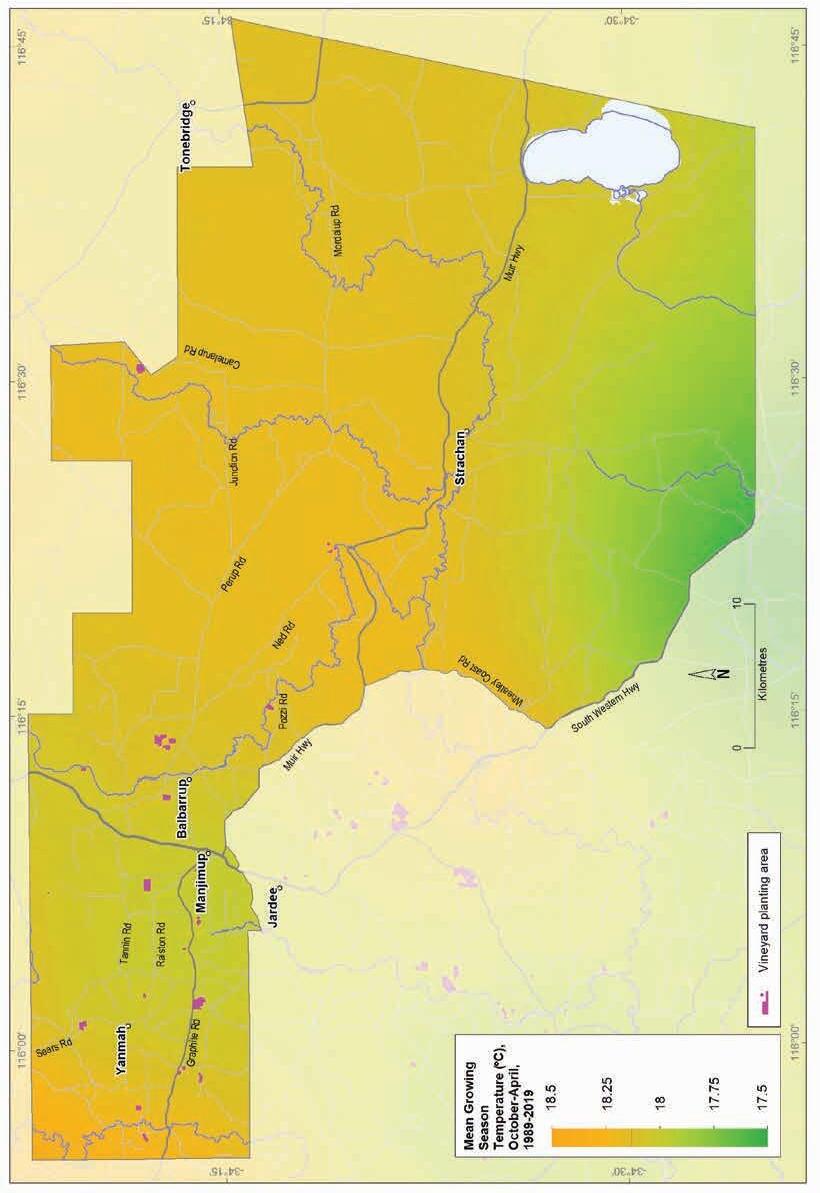
12.8: Manjimup wine region: Mean growing season temperature (October–April, 1989–2019)
Geology, soils and climate of Western Australia’s wine regions
278
Figure
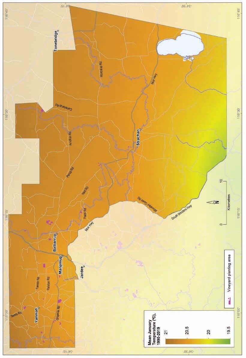
(1990–2019)
Geology, soils and climate of Western Australia’s wine regions 279
Figure 12.9: Manjimup wine region: Mean January temperature

Figure 12.10: Manjimup wine region: Mean seasonal growing degree days (October–April, 1989–2019)
Geology, soils and climate of Western Australia’s wine regions
280
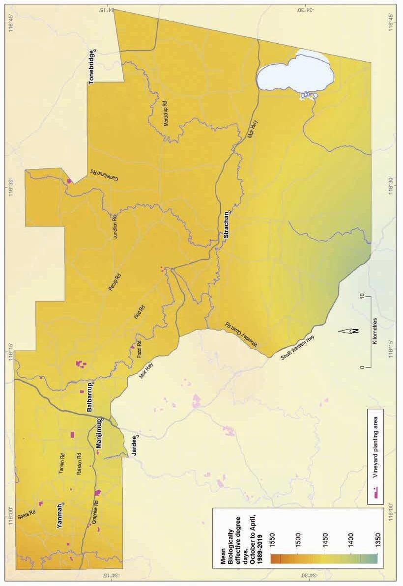
Figure 12.11: Manjimup wine region: Biologically effective degree days (October–April, 1989–2019)
Geology, soils and climate of Western Australia’s wine regions 281
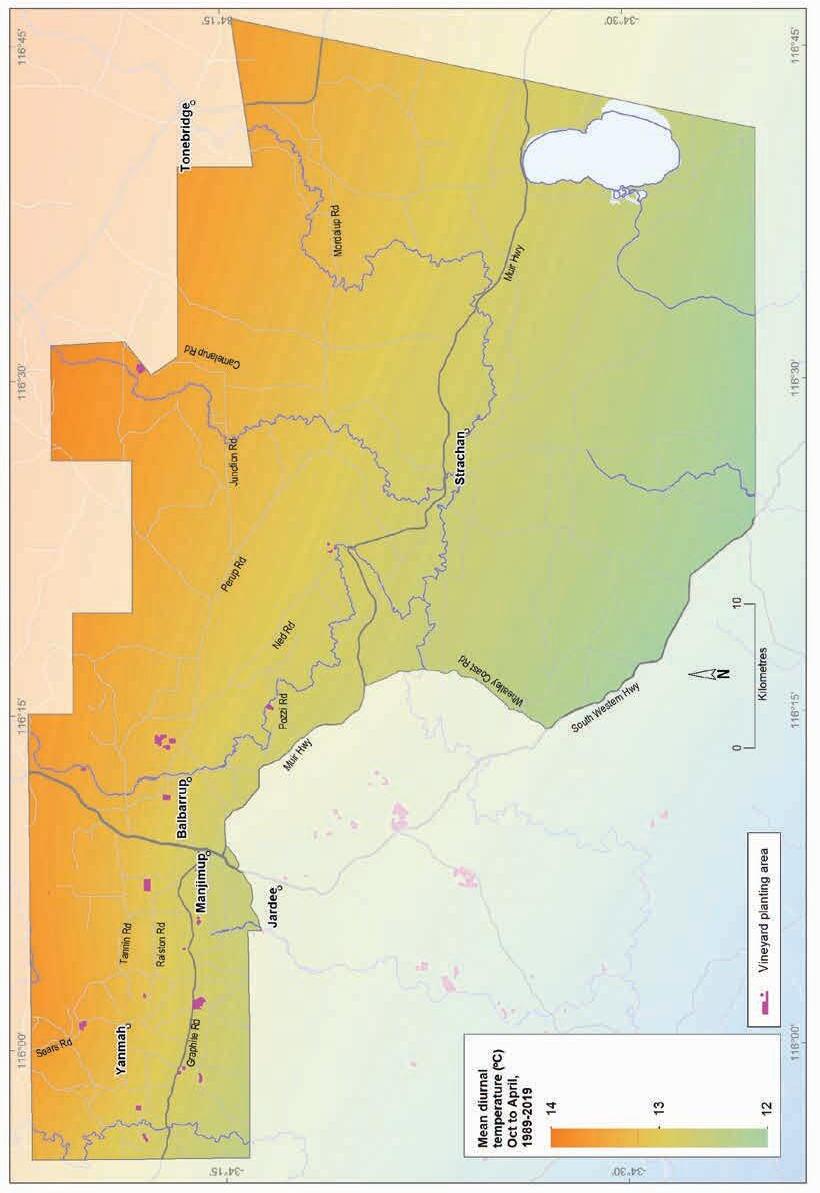
Figure 12.12: Manjimup wine region: Mean diurnal temperature (October–April, 1989–2019)
Geology, soils and climate of Western Australia’s wine regions
282
13 Perth Hills wine region
Regional snapshot
Size: 330,000 hectares
Vine plantings area: 197 hectares
Elevation range: 6–575 m AHD
Vine plantings range: 81–336 m AHD
Geology: Ancient Archean granite and gneiss rocks of the Yilgarn Craton underlie most of the region, with a small area in the north-west on Perth Basin sediments
Geological age: Mainly 2.6–3 billion years
Soil: Vines mainly grow on Red–brown loam and Ironstone gravel soils
Climate: Hot to very hot with moderate maritime influences
Main grape varieties: White – Chardonnay, Vermentino, Viognier, Semillon
Red – Shiraz, Cabernet Sauvignon, Grenache, Tempranillo
Geology, soils and climate of Western Australia’s wine regions 283
Location and history
The Perth Hills region covers almost 330,000 ha in a long narrow strip along the forested Darling Range directly east of Perth. It lies across Yued, Whadjuk and Binjareb/Pinjarup Noongar Boodja (Country), who are the Traditional Custodians of the land.182 The region stretches 130 km from north to south, from Bindoon to Karnet (Figure 13.1), is only 30 km at its widest point from west to east and extends inland to The Lakes area. The western boundary largely coincides with the Darling Scarp that rises above the coastal plain where most of Perth’s population resides. The Swan District region lies west of the Perth Hills region and the Peel region adjoins it to the south.
The centres of Mundaring, Mount Helena, Glen Forrest, Kalamunda, Bickley, Lesmurdie, Roleystone, Jarrahdale, Chidlow, Wooroloo, Gidgegannup and Bindoon are located here.
From 1880 to 1945, a small-scale vineyard in the south of the region produced wine. A few pioneering winemakers established crops at Mundaring in the late 19th century and around half a century later, a small winery was developed at Chittering (Zekulich 2000). Vineyards were present at Darlington and Kalamunda from the early 1990s. Grapes have been a feature in the Perth Hills since the early 1900s, but it was not until the 1970s that most viticultural activities started in the hills. The longest continual present-day winery is Hainault at Bickley, which was planted in 1978 (Halliday 1998).
Today, the Perth Hills region overlaps the heavily populated eastern edge of the Perth Metropolitan Area; however, two-thirds of the region remains under broad stretches of tall jarrah and marri forest (Eucalyptus marginata and Corymbia calophylla). About 106,000 ha of land remains for agriculture and other land uses, but only limited areas are available south of Mundaring, mostly in the valleys and along the Darling Scarp.
Most vineyards in the Perth Hills are relatively small. Several are concentrated between Bickley, Pickering Brook and Carmel, south-east of Kalamunda, with other wineries around Darlington, Mount Helena, Parkerville, Gidgegannup and Chidlow and south to Jarrahdale. In region’s north, larger plantings of wine grapes occur in the Chittering Valley extending north from Bullsbrook to Bindoon, and a sizable table grape plantation also exists at Bindoon.
In the early 2000s, about 152 ha of vines were planted (wine grapes) and about 150 tonnes harvested in the Perth Hills region. Plantings had increased to almost 200 ha by 2019, which makes up about 2% of WA’s plantings (DPIRD 2019). The total estimated tonnage produced in 2018 was 334 tonnes, more than double the 2002 vintage.
182 See https://www.noongarculture.org.au/
Geology, soils and climate of Western Australia’s wine regions 284
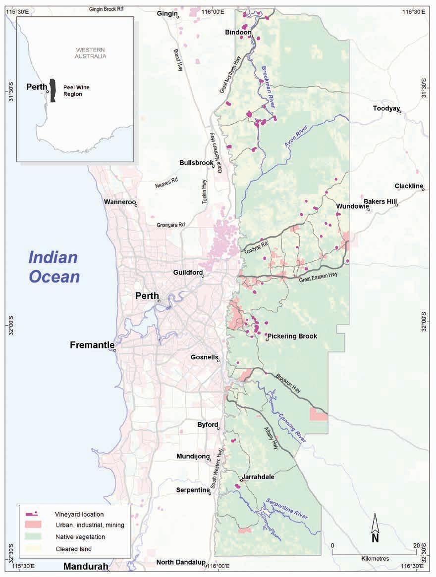
Geology, soils and climate of Western Australia’s wine regions 285
Figure 13.1: Perth Hills wine region
Varieties and production
The Perth Hills harvested 330 tonnes of wine grapes in 2021 from 28 different varieties grown in the region (APC 2022). The white wine grape harvest was 68 tonnes—the dominant variety was Chardonnay with smaller volumes of Vermentino, Viognier and Semillon.
The 2021 red wine grape harvest was 262 tonnes—the dominant variety was Shiraz followed by Cabernet Sauvignon, Grenache and Tempranillo. Other lesser varieties include Merlot, Pinot Noir, and Durif.
Geology and physiography
The forested Darling Range landscape dominates the Perth Hills region. The distinctive Darling Scarp that rises above the Swan Coastal Plain defines the western boundary of the range (and the region), which creates a characteristic backdrop to the Perth Metropolitan Area. Granite and gneiss rocks of the ancient Yilgarn Craton underlie the Darling Range. The Jimperding and Chittering Complex, shown in Figure 13.2 at the northern part of the Perth Hills, are part of the Yilgarn Craton and reach back more than 2.7 billion years. These are derived mainly from granitic igneous rocks.
Despite the Perth Hills name, the region’s terrain is generally a subdued plateau with broad, shallow valleys on the smaller tributaries of the major rivers. A lateritic profile blankets much of the surface of the Yilgarn Craton. Its appearance varies from massive and cemented blocks and boulders, to loose uncemented laterite stones known as ferruginous nodules and pisolites (commonly called jarrah, forest or pea gravels).
Several significant valleys dissect the undulating lateritic plateau, including those created by the Avon, Brockman, Helena, Canning and Serpentine rivers (Figure 13.3). Exposures of granite and gneiss rocks are common where the steep-sided valleys have cut through the plateau, as well as along the Darling Scarp. In some locations, isolated granitic domes (monadnocks) rise above the forest-clad plateau’s surface.
North of Bullsbrook, the Perth Hills region extends across the Darling Scarp in a small westward arc that overlaps the southern tip of the Dandaragan Plateau (Figure 3.2). This area covers around 5,000 ha of gently undulating terrain on Perth Basin sediments. The ancient shoreline marked by the Gingin Scarp forms the western boundary of the Dandaragan Plateau, separating it from the comparatively subdued landscape of the Swan Coastal Plain (Figure 13.3).
Elevations range from the 100 m AHD contour at the foot of the Darling Scarp (which marks much of the region’s western boundary) to 350 m at Wundowie. Most of the Darling Range plateau surface sits at 200–300 m. Elevations in the Lower Chittering–Bindoon area range from 100 to 200 m and rise to 300 m in places. Elevation is an important feature of the region, especially when combined with aspect, when selecting a site and planning for variety and style. The valleys and dissected terrain characterising the Perth Hills allow lots of choice of aspect and slope and are ideal for creating specific mesoclimates suited for a wide range of wine grape varieties. (Figure 13.3).
Geology, soils and climate of Western Australia’s wine regions 286
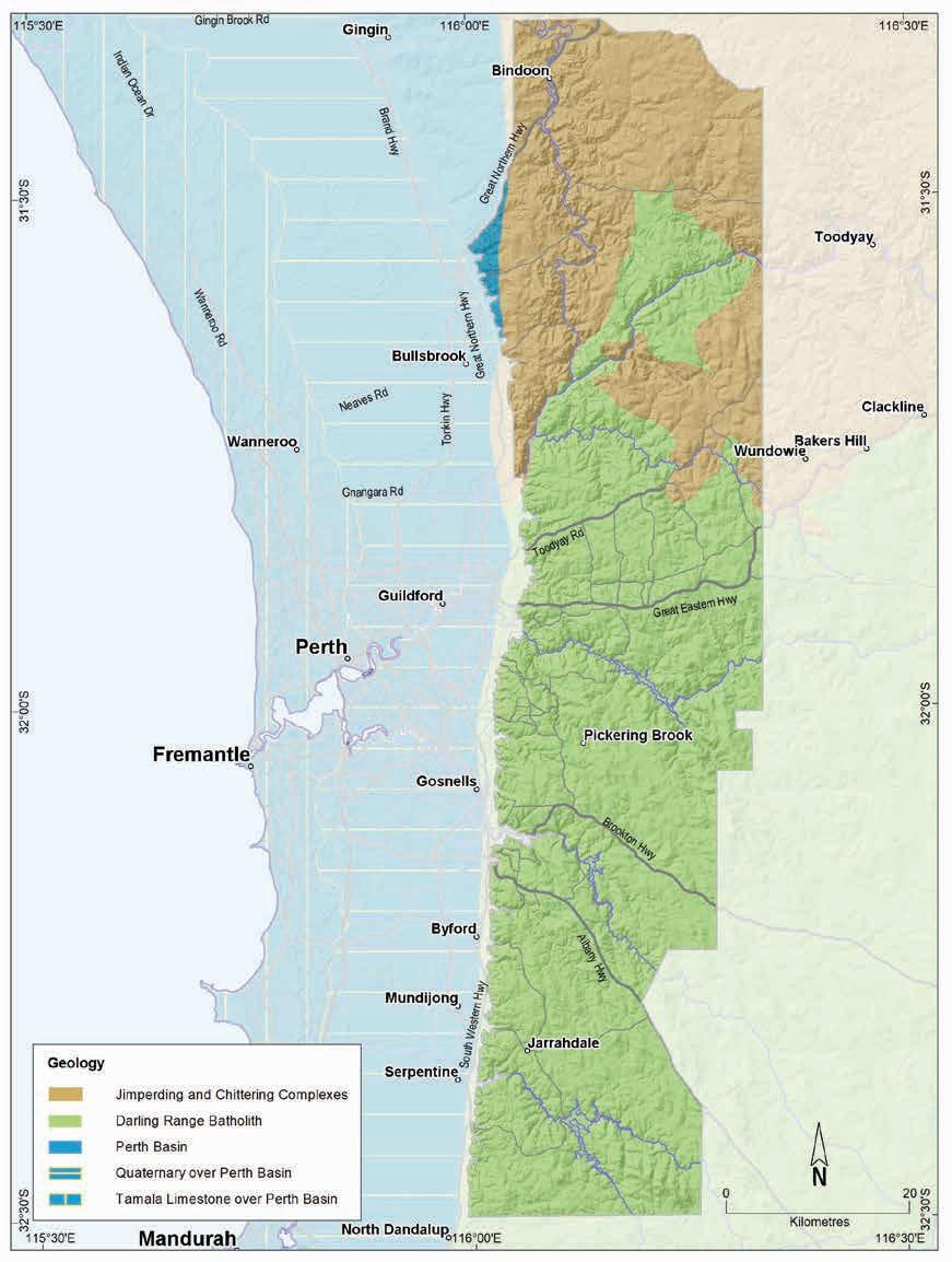
Geology, soils and climate of Western Australia’s wine regions 287
Figure 13.2: Perth Hills wine region: Simplified geology

regions 288
Geology, soils and climate of Western Australia’s wine
Figure 13.3: Perth Hills wine region: Elevations
Soils and landforms
Ironstone gravel soils dominate the Perth Hills, covering over half of the region (Figure 13.4). They are strongly associated with the undulating terrain of the Darling Range. These soils are typically dominant on the plateau’s broad, rolling divides separating the valleys and on lower to upper slopes and hill crests (Figure 13.5).
Ironstone gravels
Red-brown loams
Sandy duplexes
Difficult soils
Coloured deep sands
Pale deep sands
Heavy soils
Shallow sands
Proportion of soil in region (%)
Proportion under vines (%)
Figure 13.4: Perth Hills wine region: Proportion of main soils in the region compared against main soils used for viticulture
Almost 20% of the region’s soils are Red–brown loams. These are usually associated with very gentle to moderate slopes of the deep river valleys, particularly the Brockman River valley, which carve paths through the lateritic surface of the Darling Range to expose younger soils associated with felsic crystalline rocks of the Yilgarn Craton. Red–brown loams are also typical soils on the Darling Scarp.
Sandy duplexes only comprise about 10% of soils. They are usually found in a mix with other soils on valley slopes, particularly in the eastern half of the region.
Geology, soils and climate of Western Australia’s wine regions 289
0% 10% 20% 30% 40% 50% 60%
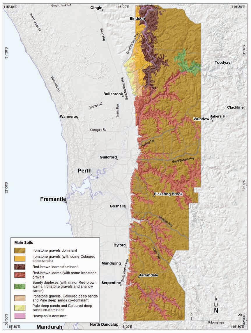
soils and climate of Western Australia’s wine regions 290
Geology,
Figure 13.5: Perth Hills wine region: Main soils
Collectively, the deep sands cover about 7% of the region. Pale deep sands (about 3% of all soils) and Coloured deep sands (about 4% of all soils) are most frequently found on the undulating hillslopes of the Dandaragan Plateau overlying the Perth Basin sediments. Coloured sands are also found with other soils in small areas on valley slopes of the Darling Range. The Pale deep sands also occur on the Darling Range hillslopes in small pockets, often associated with Ironstone gravels, or at valley headwaters.
We grouped together areas of the region that have granite outcrops, extensive laterite duricrust, steep rocky hills, swampy flats and slopes, and salt-affected land as Difficult soils—these comprise about 8% of the area. These soils are typically unsuited for any form of agriculture but are often found in combination with more productive soils in various landscapes. Some of the Difficult soils have been altered (mounded, drained or rocks removed) to allow wine grape cultivation
Soil-landscape mapping covering this region includes these surveys: Chittering (Bessell-Browne [unpublished]); Darling Range (King, and Wells 1990); and Northam (Lantzke and Fulton 1994); the mapping can also be viewed online at NRInfo.183
Main viticultural soils in the Perth Hills region
Around 85% of the vines in the Perth Hills region currently grow on the Darling Range overlying the ancient, weathered felsic crystalline rocks of the Yilgarn Craton and Jimperding and Chittering complexes. The remainder are on the gently sloping Dandaragan Plateau in the north-west of the region, underlain by the sediments on the Perth Basin.
Even though they are not the main soils occurring in the region, close to half of the region’s vines (about 47%) grow on the Red–brown loams commonly found on hill and valley slopes (Figure 13.6).
These soils tend to have red–brown to yellow–brown loamy topsoils over well-structured, neutral loam or clay subsoils, sometimes with shallow bedrock within 80 cm. Stony soils and shallow rock outcrops are fairly common on valley slopes, and are mixed amongst these soils.
Ironstone gravels are the region’s dominant soils, but only about 21% of the Perth Hills region’s wine grapes grow on them. They are usually on the gently undulating terrain of the Darling Range plateau. The Ironstone gravels mainly feature yellow to brown sand or loam topsoils containing abundant ferruginous nodules and pisoliths over occasionally mottled yellow or red clay subsoils. Minor patches of yellow–brown sand with ferruginous nodules and pisoliths extending beyond 80 cm are present in vineyards in a mix with other Ironstone gravel soils, sometimes over cemented ironstone layers within 80 cm.
About 18% of the region’s vines grow in deep sands that are more typical on the Perth Basin sediments. Pale deep sands support most vines (12%) mainly on the gently sloping terrain of the Dandaragan Plateau footslopes. The most common soils in this group generally have loose pale grey to grey–brown gritty sand over rock or pale sand over clay below 80 cm.
The most typical Coloured deep sands, supporting about 6% of vines, are yellow-coloured clayey or loamy sand that extend beyond 80 cm, sometimes with subsoils increasing in clay content marginally with depth.
183 See https://www.agric.wa.gov.au/resource-assessment/nrinfo-natural-resource-information-western-australia
Geology, soils and climate of Western Australia’s wine regions 291
Figure 13.6: Perth Hills wine region: Main soils used for viticulture (Minor soils are mainly Heavy soils and Shallow sands)
Sandy duplex soils also support about 6% of the region’s vines. These tend be soils with yellow/brown sandy topsoils over yellow–brown clay and are generally in a mix with other soils on valley slopes.
Some duplex soils have shallow topsoil depths over clay or have high levels of clay in the subsoil. We call these Heavy soils, and they support about 5% of the vines in the region. Sometimes they lie over a hard rock layer within 80 cm of the surface. These soils commonly have yellow–brown loamy or sandy topsoils over shallow clay subsoils. Like the Sandy duplexes, these are usually found in combination with other soils, generally the Red–brown loams.
Climate
The Perth Hills region’s climate is classed as hot to very hot with moderate maritime influences. Both Gladstones (1992) and Halliday (2011a) noted that locations along the Darling Scarp are the most favourable for vines because of the free air drainage and relative warmth at night combined with desirable exposure to cooling afternoon sea breezes on summer afternoons. The region’s elevation contributes to lower temperatures compared to the adjacent coastal plain and a south or east aspect can also contribute to milder conditions (Gladstones 1992); some more-elevated vineyards with a southerly or easterly aspect can be surprisingly cool.184
184 Jim Campbell-Clause, AHA Viticulture (personal communication, 27 June 2022)
Geology, soils and climate of Western Australia’s wine regions 292
Ironstone gravels 21% Sandy duplexes 6% Pale deep sands 12% Minor soils 8% Red-brown loams 47% 6% Coloured deep sands
The region also benefits from the orographic effect of the Darling Scarp leading to a jump in rainfall on the western Darling Range compared with the coast (Table 13-1 and Figure 13.7). The winter rainfall allows for a good store of soil moisture and promotes annual capture and storage of good quality run-off from heavy winter rains for irrigation during the growing season.
Due to its elevation, temperatures in the Perth Hills regions are significantly lower than in the adjoining Swan Valley. There is a temperature gradient from north to south, where Bindoon is warmer than the south of the region, and from west to east, as minimum temperatures fall rapidly inland. Care with site selection is needed as frosts are common in the valleys from about May to October, particularly further inland.
Table 13.2 summarises the temperature statistics for the region, supported by maps on the following pages, including:
• mean growing season temperature (GST), which covers the months October to April (Figure 13.8). The Perth Hills region has a GST range of 19.8 to 22.2 °C, the second highest of the WA wine regions, with a mean of 21.2 °C.
• mean January temperature (MJT), which represents the mean temperature throughout the day across the warmest month (Figure 13.9). The Perth Hills region has a mean January temperature range of 20.5 °C in the south of the region to 24 °C in the north.
• growing degree days (GDD), which is a measure of heat (between 10 and 19 °C) accumulation185 predicting the vines’ development rates for the growing season months of October to April186 (Figure 13.10). The Perth Hills region has a range of 2,092 to 2,584 units (°C).
• biologically effective degree days (BEDD), which are linked to the GDD calculation and adjusted for latitude/daylength and account for diurnal temperatures187 (Figure 13.11). The Perth Hills region has a range of 1,611 to 1,782 units (°C).
• diurnal temperatures, which are the mean daily range between the minimum and maximum mean daily temperature from October to April (Figure 13.12). The Perth Hills region has a daily range of 13.2 to 15.6 °C and a mean of 14.5 °C.
185 These calculations use the base 10 method (Hall and Jones 2010).
186 More recently, Jarvis et al. (2017) suggest that September to March may be more appropriate.
187 Hall and Jones (2010)
Geology, soils and climate of Western Australia’s wine regions 293
Value Annual rainfall (mm) Seasonal (October–April) rainfall (mm) Minimum 522 137 Maximum 1,123 254 Mean 828 188
Table 13.1: Perth Hills wine region: Rainfall statistics (1989–2019)
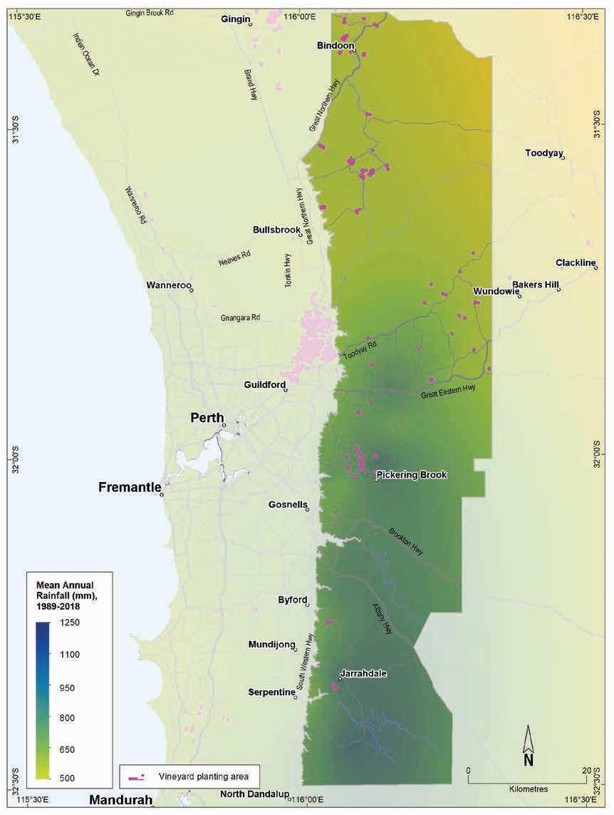
soils
climate of Western Australia’s wine regions 294
Geology,
and
Figure 13.7: Perth Hills wine region: Mean annual rainfall (1989–2018)
Table 13.2: Perth Hills wine region: Temperature statistics (1989–2019)
Measurement
* Average estimates are from locations in the Perth Hills region in Gladstones (2021).
Annual evaporation ranges from 1,700 mm in the south to 2,000 mm in the north. Mean 3pm October to April relative humidity ranges from 51% along the Darling Scarp to around 40% inland (Gladstones 1992). Overnight easterly winds are strong inland, with a mean January 9am wind speed at Bickley of 19.1 km/h. By 3pm, the breeze can still be easterly or the westerly sea breeze may have found its way to the hills, but both are usually lighter than the morning winds, with a mean speed of 16.3 km/h. Closer to the coast, the afternoon January summer sea breeze has more of an impact—9am wind speeds at Bindoon average 17.9 km/h, rising to 20.4 km/h by 3pm.
Strong morning and afternoon winds (often more than 17 km/h) are also common in spring, which can be problematic for new vine shoots on exposed sites. Gladstones (2021) also identified that the region’s vineyards are generally on mid slopes of tributary valleys, relatively protected from the sea breeze. Although this may make sites warmer, cold night air ponding may be an issue if site selection is not done with care. Warm to hot evenings are typical in the Perth Hills region and dry summer heat encourages ripening, while chilly nights ensure ideal fruit setting (Gladstones 2021).
Remenyi et al. (2019) has shown that a changing climate is influencing the region. They identified an increase in mean growing season temperatures (GST) over the past few decades and predict a further rise to a mean GST of more than 22.6 °C in the next 20 years. Firth et al. (2017) predicts that the Perth Hills region may have slightly greater temperature increases than southern regions. This may put the Perth Hills into the Very Warm temperature category. Remenyi et al. (2019) have also observed a trend towards drier conditions across the region, particularly in the south. They suggest that the mean growing season rainfall could fall to 135 mm by the end of the 21st century. These are all important factors to consider for the future viability of each vineyard, particularly in relation to variety selection, water availability, planting and management.
Geology, soils and climate of Western Australia’s wine regions 295
Value Mean growing season (October–April) temperature (°C) 21.2 Mean January temperature
24.4 Mean
2,370 Mean
temperature
14.5 Average daily
9.1
(°C)
growing degree days (October–April)
diurnal
(°C)
sun hours (October–April)*
Average (October–April) cloud cover (Okta)* 3.0
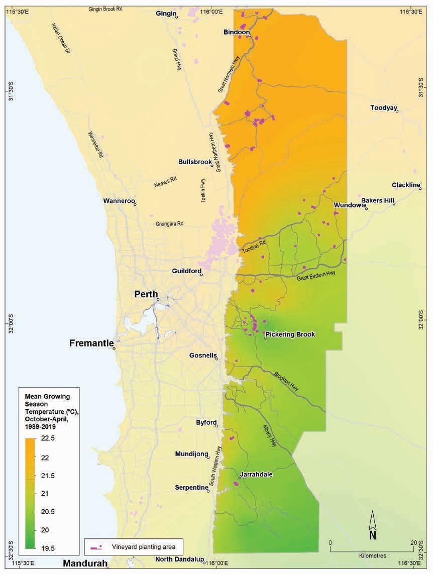
13.8: Perth Hills wine region: Mean growing season temperature (October–April, 1989–2019)
Geology, soils and climate of Western Australia’s wine regions
296
Figure
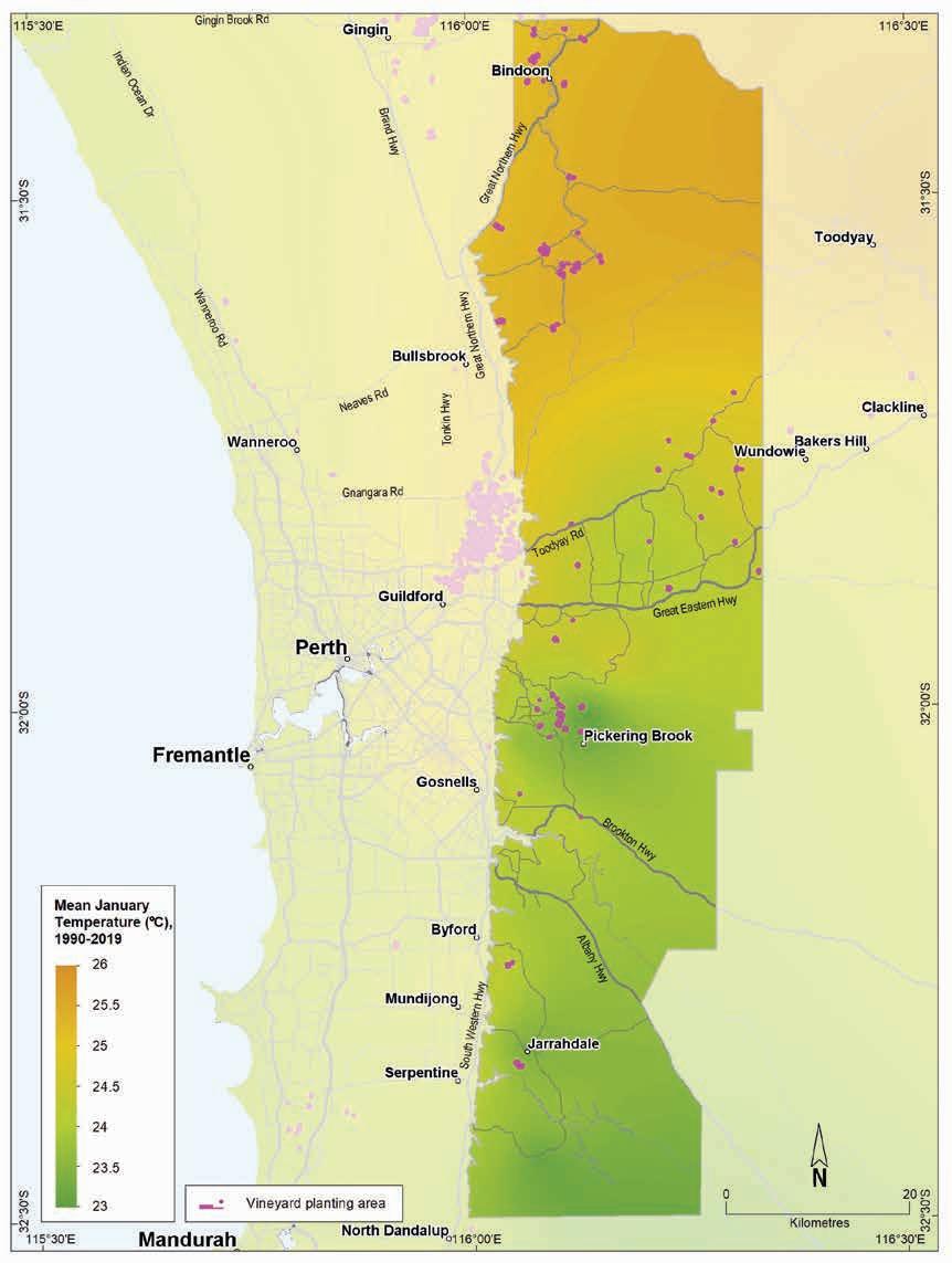
Geology, soils and climate of Western Australia’s wine regions 297
Figure 13.9: Perth Hills wine region: Mean January temperature (1990–2019)
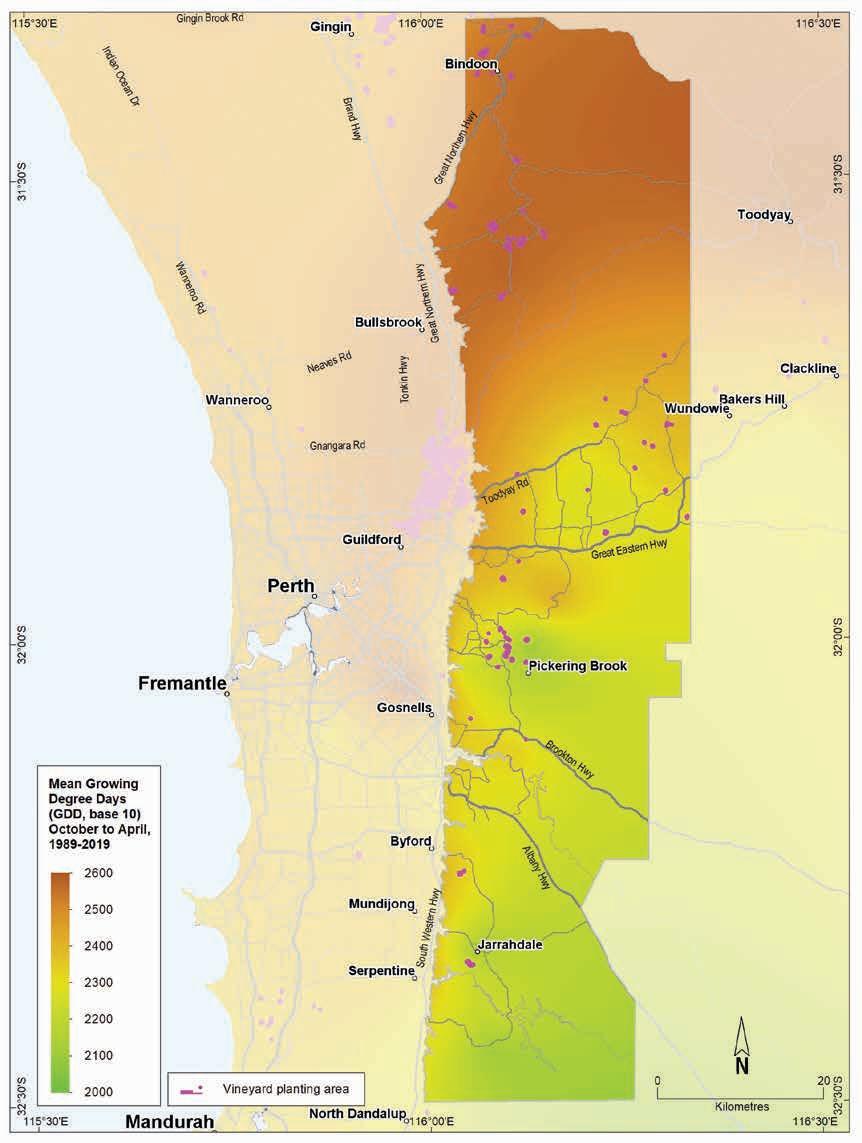
13.10: Perth Hills wine region: Mean seasonal growing degree days (October–April, 1989–2019)
Geology, soils and climate of Western Australia’s wine regions
298
Figure
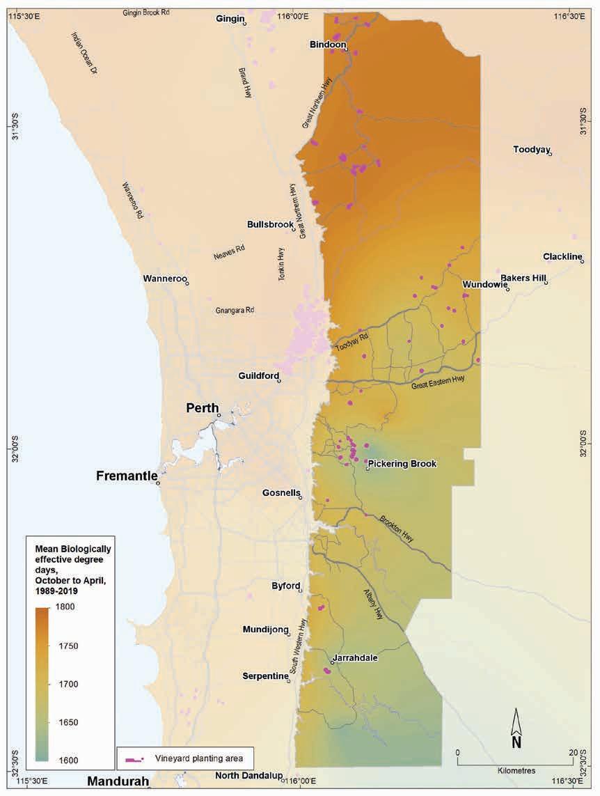
13.11: Perth Hills wine region: Biologically effective degree days (October–April, 1989–2019)
Geology, soils and climate of Western Australia’s wine regions 299
Figure
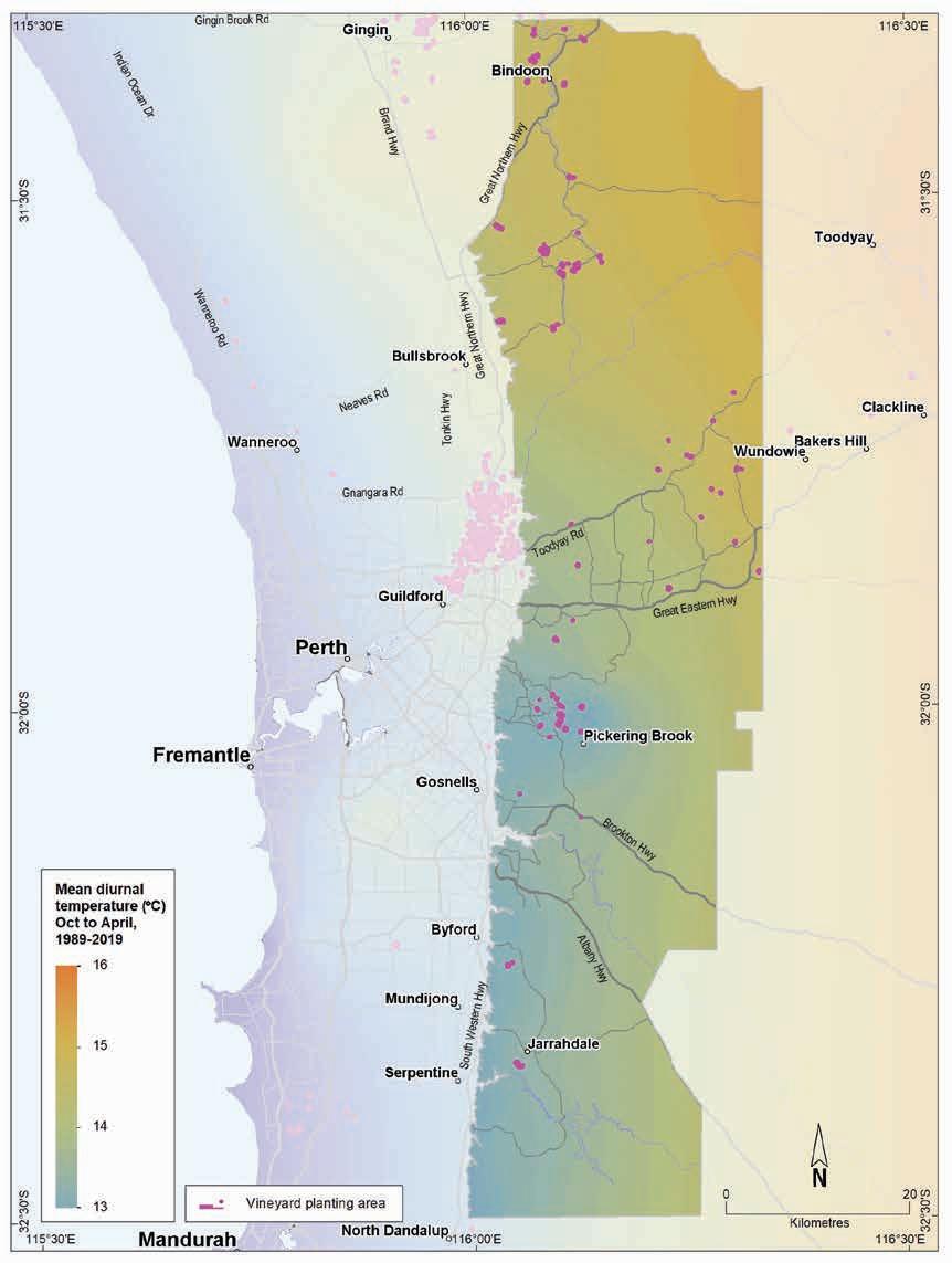
13.12: Perth Hills wine region: Mean diurnal temperature (October–April, 1989–2019)
Geology, soils and climate of Western Australia’s wine regions
300
Figure
14 Peel wine region
Regional snapshot
Size: 747,000 hectares
Vine plantings area: 79 hectares
Elevation range: 0–592 m AHD
Vine plantings range: 2–349 m AHD
Geology: The Darling Fault divides the region in two: west are sediments of the Perth Basin and east are Archaean-aged felsic crystalline rocks of the Yilgarn Craton
Geological age: Ranges from 2 million up to 3 billion years
Soil: Vines mainly grow on Ironstone gravel, Pale deep sand and Sandy duplex soils
Climate: Mediterranean with a good maritime influence. However, the cooling, moderating effects of the ocean diminish as you go further east
Main grape varieties:
White – Chardonnay, Chenin Blanc, Verdelho, Sauvignon Blanc, Semillon Red – Cabernet Sauvignon, Shiraz, Merlot
Geology, soils and climate of Western Australia’s wine regions 301
Location and history
The Peel region is located between the Geographe region to the south and Perth Hills region to the north and covers much of the catchment area of the Murray River (which flows into the Peel–Harvey Estuary). It lies across Binjareb/Pinjarup, Wilman and Ganeang Noongar Boodja (Country), who are the Traditional Custodians of the land.188 The region is almost 747,000 ha in size, extending from the Indian Ocean coast north and south of Mandurah and inland across the undulating Darling Range to Williams189 (Figure 14.1).
Geographically, the Peel region is the second largest in WA, after the Great Southern region. Jarrah and marri forests (Eucalyptus marginata and Corymbia calophylla) cover much of the land and little more than a half the region (about 53% or almost 395,000 ha) is used for agriculture and other land uses.
Mandurah is the main population centre. Other towns are Pinjarra, Waroona, Serpentine, Mundijong, Byford, Dwellingup, Boddington, Wandering and Quindanning.
Wine production started early in the region—records indicate that between 1857 and 1898 a Pinjarra vineyard produced wines and won a gold medal at the Melbourne Centenary Exhibition (Beeston 2002). In the 1930s, Italian settlers planted wine grapes around Waroona, but this activity was curtailed when they were interred during the Second World War. In 1974, Will Nairn established Peel Estate Wines at Baldivis and several vineyards were founded in this area, with other coastal wineries around Lake Clifton, and a few vineyards on the Darling Range near Dwellingup. The Hotham Valley Estate190 near Wandering began in 1987, and today it grows nearly half the Peel region’s wine grapes.
In 2004, about 150 ha of vines (wine grapes) were planted, but by 2019 this region had just 79 ha of vineyards (DPIRD 2019), fewer than 1% of WA’s plantings.
Varieties and production
The total estimated harvest produced across the region in 2002 was 279 tonnes of wine grapes. By 2021, the volume was down to just 28 tonnes from 14 varieties (APC 2022). The 2021 harvest produced about 15 tonnes of white wine grapes—the dominant variety was Chardonnay, with smaller volumes of Chenin Blanc, Verdelho, Sauvignon Blanc and Semillon. Around 13 tonnes of red wine grapes were harvested in 2021—the dominant varieties were Cabernet Sauvignon and Shiraz, with smaller volumes of Merlot.
188 See https://www.noongarculture.org.au/gnaala-karla-booja/
189 The Peel wine region actually extends into the Central Western Australia Zone and includes a small portion of the South West Australia Zone.
190 Now known as the Hotham Ridge Winery.
Geology, soils and climate of Western Australia’s wine regions 302
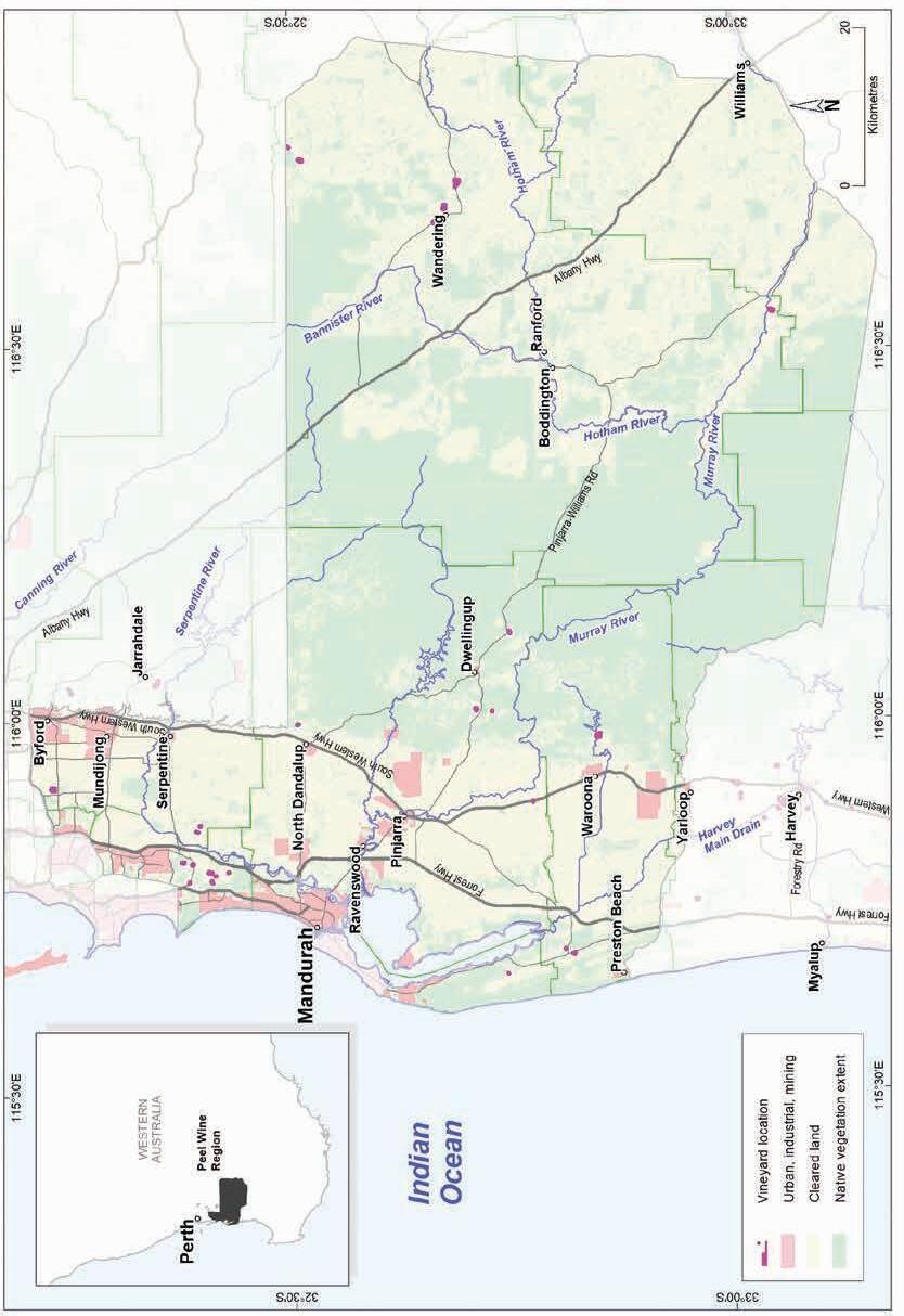
Geology, soils and climate of Western Australia’s wine regions 303
Figure 14.1: Peel wine region
Geology and physiography
The Peel region is large and diverse, extending east from the coastline at Mandurah across the flat sandy coastal plain, rising to the forested areas and into broadacre country, to meet the boundary at the York–Williams Road.
Like the Geographe wine region to the south, the Darling Fault divides the Peel region in two (Figure 14.2). West of the Darling Fault, the soils of the Swan Coastal Plain cloak the Perth Basin sediments, with a series of aeolian deposits of dune systems in the west running parallel to the coast, and a sequence of alluvial deposits in the eastern portion. Major rivers (Serpentine, South Dandalup, Murray and Harvey rivers) flow across the region and into the Peel–Harvey Estuary, which lies behind a barrier of dune-covered Tamala Limestone that hugs the coast.
East of the Perth Basin is the abrupt Darling Fault that forms the western boundary of the uplifted Darling Range. This lateritic plateau forms the central area of the region. The Murray River and its tributaries have carved a channel through the lateritic plateau surface, into the younger soils overlying the ancient granite and metagranite rocks of the Yilgarn Craton. In the east of the region, the erosive action of the watercourses of the upper Murray River catchment, including the Hotham, Williams, Bannister and Crossman rivers, leaves isolated remnants of the lateritic plateau sitting higher in the landscape.
Elevations range from 10 to 40 m AHD over most of the coastal plain (with some of the Spearwood dunes rising to 50 m) to 300 m in places on top of the Darling Scarp (Figure 14.3). Some hills on the plateau rise to more than 500 m (Mount Saddleback is 575 m). In the east of the region along the Williams and Hotham River valleys, elevations range from 200 m on the valley floor downstream from Boddington to 350 m near Dryandra.
Soils and landforms
At the eastern edge of the normally laterite-free Swan Coastal Plain are elevated footslopes of the Darling Scarp, known as the Forrestfield Shelf. The dominance of Ironstone gravels on these elevated slopes, compared with the coastal plain, hints at the change in soils to the east of the Scarp.
Ironstone gravels are the most widespread soil, dominant in more than one-third of the Peel wine region (Figure 14.4). These soils are present across the Darling Range on hill crests, upper slopes, ridges and upland plains east of the Darling Fault.
Sandy duplexes and Red–brown loams are the next most common soils with both covering about 12% of the Peel wine region. The Sandy duplexes are typically associated with valley floors and long gentle slopes of the Darling Range, often in combination with Red–brown loams. They are also on the alluvial sediments of the Swan Coastal Plain, generally on the Pinjarra Plain and river terraces.
Red–brown loams are associated mainly with granitic hillslopes and the valleys of the Murray River and its tributaries. These rivers have carved winding channels through the plateau’s lateritic surface down to the ‘younger’ soils overlying the ancient granite and metagranite rocks.
Geology, soils and climate of Western Australia’s wine regions 304
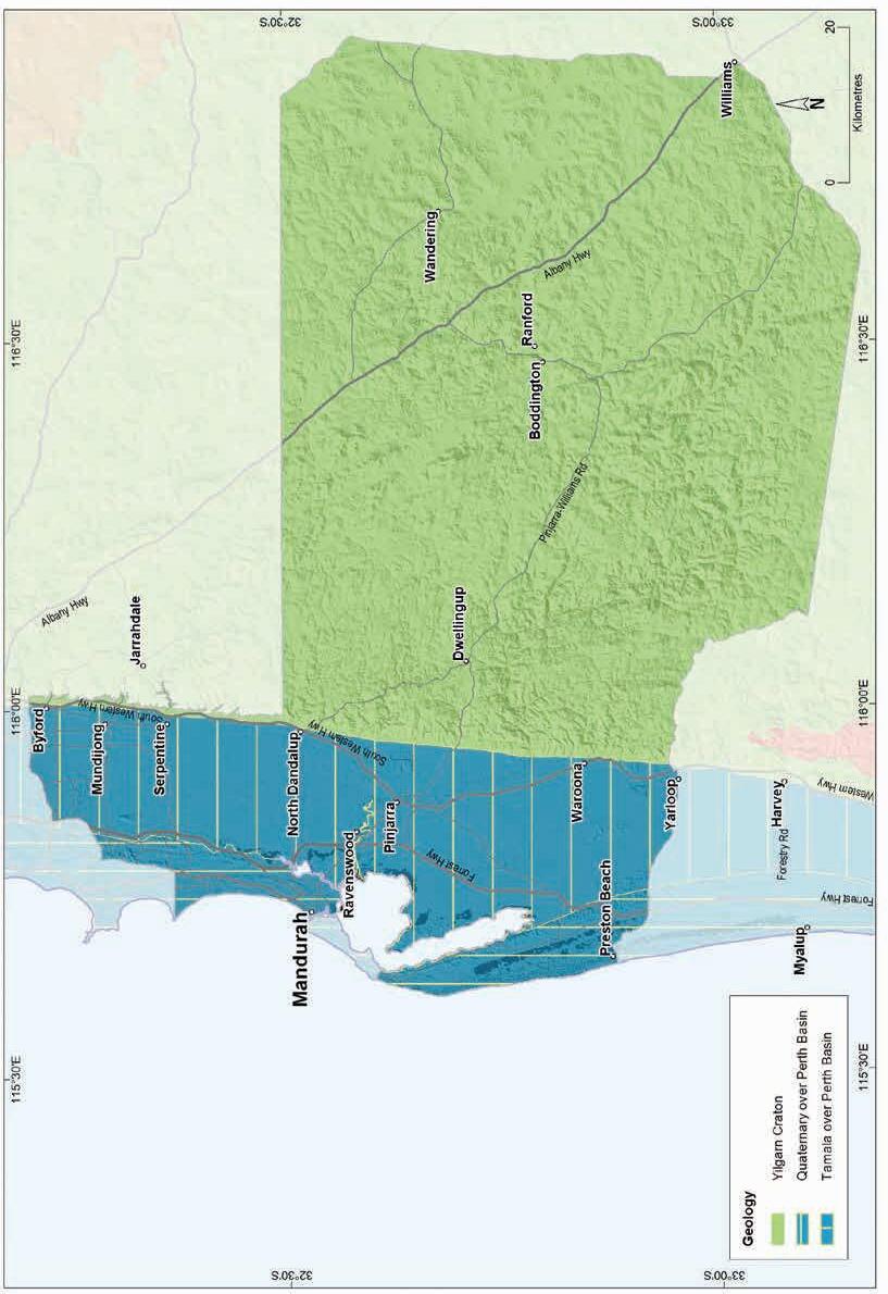
Geology, soils and climate of Western Australia’s wine regions 305
Figure 14.2: Peel wine region: Simplified geology
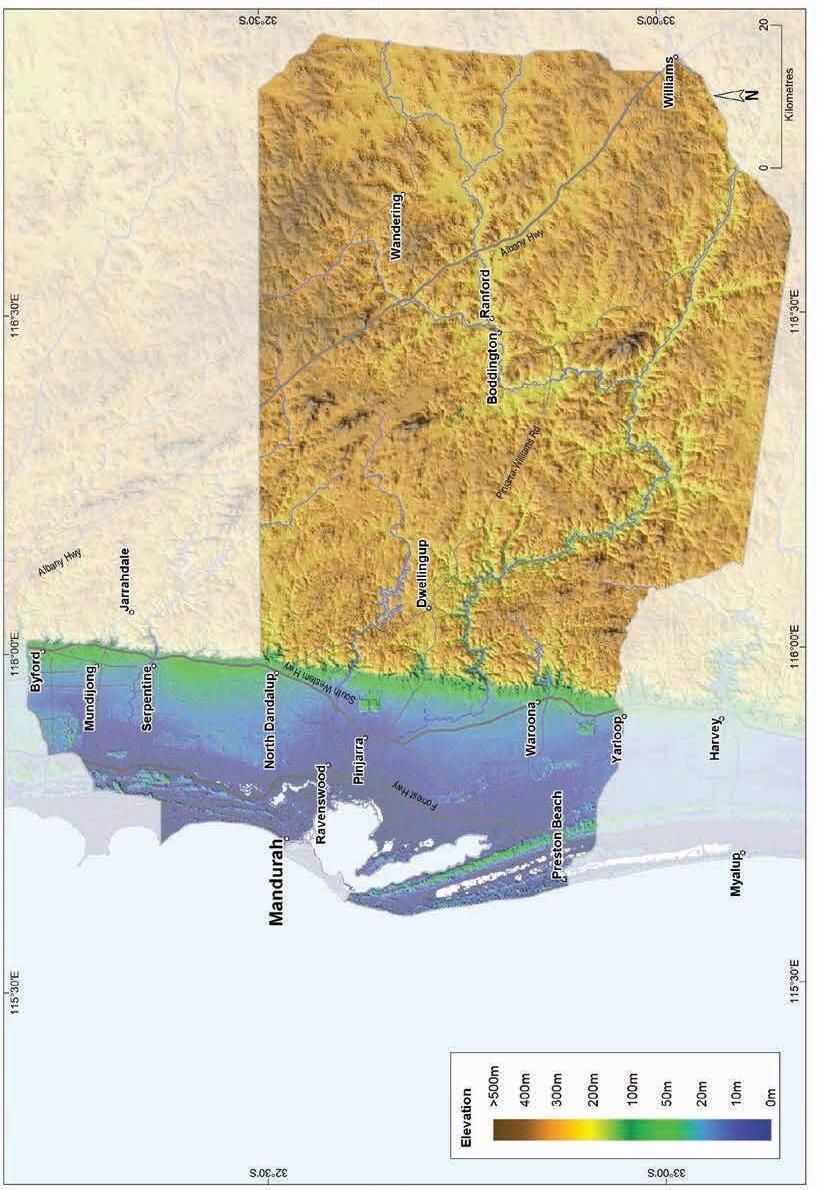
Geology, soils and climate of Western Australia’s wine regions
306
Figure 14.3: Peel wine region: Elevations
The Pale deep sands comprise about 10% of the Peel region (Figure 14.5). These soils are mostly associated with the sandplain and low rises of the Bassendean dunes on the Swan Coastal Plain. Concentrations of Pale deep sands tend to be between the area of yellow–brown Coloured deep sands over limestone associated with the Spearwood dunes and the alluvial sediments of the Pinjarra Plain. Sands at the eastern fringe of the Spearwood dunes can also have patches of paler sands. Discrete areas in shallow valleys on the Darling Range also have some of these soils.
Coloured deep sands, found in just 5% of the region, are particularly associated with the Spearwood dune system (‘Spearwood sands’) on the Swan Coastal Plain. As described above, these yellow–brown sands generally lie west of the pale sands of the Bassendean dunes. The dunes containing Coloured deep sands—also known as ‘tuart sands’ in reference to the tuart trees (Eucalyptus gomphocephala) they support—lie over ridges of Tamala Limestone. Coloured deep sands also combine with Ironstone gravels on the escarpment footslopes. East of the Darling Scarp they are generally found in patches on minor valleys and hillslopes, also associated with Ironstone gravels. We grouped together as Heavy soils those soils with shallow sandy or loamy topsoil depths over clay or high proportions of clay in the subsoil; these soils occur in about 4% of the Peel region. Sometimes these soils lie over a hard rock layer within 80 cm of the surface, and they are often in a mix with others, particularly Sandy duplex and Red–brown loam soils. Heavy soils are more frequent in the very east of the region but also occur amongst alluvial soils on escarpment footslopes and on the Swan Coastal Plain.
Ironstone gravels
Difficult soils
Sandy duplexes
Red-brown loams
Pale deep sands
Coloured deep sands
Heavy soils
Alluvial sands and loams
Alkaline soils
Shallow sands
Proportion of soil in region (%)
Proportion under vines (%)
Figure 14.5: Peel wine region: Proportion of main soils in the region compared against main soils used for viticulture
Geology, soils and climate of Western Australia’s wine regions 307
0% 10% 20% 30% 40%
Concentrations of Alluvial sands and loam soils are in areas of flat to gently undulating terraces flanking the major rivers that meander across the Swan Coastal Plain and on broad valley floors on the eastern Darling Range. These are minor soils (only about 1%) in the Peel region.
We grouped together as Difficult soils those occurring on the poorly drained flats with swamps, lakes and seasonally shallow watertables (typically all wet soils) that dominate the land on the Swan Coastal Plain. Extensive areas of rocky slopes, shallow cemented laterite and bare rock outcrops found on the Darling Range are also part of this group. These soils are typically unsuited for any form of agriculture but are often found with more productive soils in various landscapes. Particularly frequent on the coastal plains, these areas of Difficult soils often remain uncleared, and comprise almost 20% of the Peel region. Some of the Difficult soils have been altered (mounded, drained or rocks removed) to allow wine grape cultivation.
Soil-landscapes mapping covering this region includes these surveys: Peel–Harvey South (van Gool and Kipling 1992); Mandurah–Murray (Wells 1989); Peel–Harvey North (van Gool 1990); and Murray River catchment (McArthur et al. 1977); the mapping can also be viewed online at NRInfo 191
Main viticultural soils in the Peel region
Across the Peel region, about one-third of the wine grapes grow on the coastal plain. The remaining two-thirds are east of the Darling Fault on the lateritic Darling Range and the steeply incised valley slopes that cut through to younger soils over felsic crystalline rock.
About one-quarter of the region’s vines grow in Ironstone gravels, mainly on better-drained lower to upper slopes and hill crests of the Darling Range (Figure 14.6). These soils tend to have grey or yellow–brown sand to clayey sandy topsoils containing abundant ferruginous nodules and pisoliths over well-structured, neutral to acidic yellow–brown clay subsoils. In some areas, vines grow in grey–brown sand with nodules and pisoliths that extend to more than a metre deep, or shallower, over cemented ironstone.
Pale deep sands are the next most planted soil in the region, supporting 21% of vines. The deep sands are mainly on the very low dunes and undulating sandplains associated with the Bassendean dunes on the Swan Coastal Plain. These soils tend to be deep, bleached sands below a dark grey sandy surface, often becoming yellower at depth and may have clay below 80 cm.
Sandy duplex soils support about 17% of plantings and are often encountered on hill and valley slopes in the region’s east and are frequently associated with Red–brown loam soils and areas of rock outcrop. The soils supporting vines are mainly yellow–brown coloured loamy sand or clayey sand topsoil textures over clay subsoils.
Wine grapes also grow in Sandy duplex soils on the Swan Coastal Plain in the region’s west. These also tend to be yellow–brown coloured sandy topsoils over clay on gently undulating alluvial terraces and low rises, often associated with Alluvial sands and loams and Heavy soils.
183 See https://www.agric.wa.gov.au/resource-assessment/nrinfo-natural-resource-information-western-australia
Geology, soils and climate of Western Australia’s wine regions 308
Coloured deep sands
duplexes
Figure 14.6: Peel wine region: Main soils used for viticulture (Minor soils are Heavy soils, Shallow sands and Alluvial sands and loams)
Vines growing in Red–brown loams, dominantly in valleys west of the Darling Fault, have a similar volume of plantings as Sandy duplex soils in the region (about 16%). They are mainly red–brown to yellow–brown coloured loamy topsoils over well-structured, neutral subsoils. It is not unusual to encounter stony soil amongst these, as they are often associated with shallow granitic bedrock, usually on hill and valley slopes, often in combination with Sandy duplexes.
About 12% of vines grow on Coloured deep sands in the region, generally on the ridges or slopes of the Spearwood dune system between Baldivis and Lake Clifton and south of the Peel–Harvey Estuary. These soils tend to have yellow–brown clayey or loamy siliceous sand that extends to beyond 80 cm deep. These well-drained soils have a neutral to slightly acid pH despite the underlying Tamala Limestone that may be encountered at depth.
The remaining soils supporting vines are relatively minor. Heavy soils, with only 4% of the vines in the region, have shallow topsoil depths over clay or have poorly structured clay in the subsoil. Sometimes they lie over a hard rock layer within 80 cm of the surface. These soils are usually found in combination with other soils particularly Red–brown loams and Sandy duplexes.
Only small areas (about 1%) of vines grow in Alluvial sands and loams. These soils typically have loamy topsoils with well-structured and permeable brown to red clay loam to clay subsoils. Alluvial sands and loams are often associated with Heavy soils and Sandy duplexes.
Geology, soils and climate of Western Australia’s wine regions 309
25% Sandy
17% Pale
21% Minor
9% Red-brown
16% 12%
Ironstone gravels
deep sands
soils
loams
Climate
Halliday (2011a) indicated that the Peel region enjoys a Mediterranean climate and that its maritime influence provides optimal growing conditions for various red and white wine grape varieties. The coastal climate with its cooler influences from the Indian Ocean gives rise to an extended ripening period resulting in fruit with optimal flavour and intensity.
Table 14.1 shows the mean annual and seasonal rainfall statistics for the whole region, but there is wide variation in rainfall seen across the region.
Gladstones (2021) identified that there is considerable variation in the climate across the Peel region depending on location and altitude. The orographic effect of the Darling Scarp leads to a jump in rainfall on the western Darling Range compared to the coast (Figure 14.7 and Figure 14.8). It then declines again further eastward. Mean long-term rainfall at Mandurah is 656 mm, rising to 1,228 mm at Dwellingup, then declining by more than half to 613 mm at Wandering.
The coastal plain has access to good quality groundwater for irrigation, but further eastward from the scarp, the inland areas have a lower capacity to store good-quality water to use during the growing season (Gladstones 1992).
The region can be scorching hot in summer, but areas close to the Indian Ocean get the benefit of the refreshing afternoon summer sea breezes. However, the cooling and moderating effects of the ocean gradually diminish the further east you travel. Temperature variation can be related to position in the landscape and whether a site is protected from, or exposed to, up-valley sea breezes.
Geology, soils and climate of Western Australia’s wine regions 310
Value Annual rainfall (mm) Seasonal (October–April) rainfall (mm) Minimum 434 130 Maximum 1,154 254 Mean 737 172
Table 14.1: Peel wine region: Rainfall statistics (1989–2019)
Source: BoM (2022) Location
Mean growing season rainfall (Oct-April) Mean winter rainfall (May-Sept)
Figure 14.7: Peel wine region: Mean annual, winter and growing season rainfall for various locations, 1989–2018
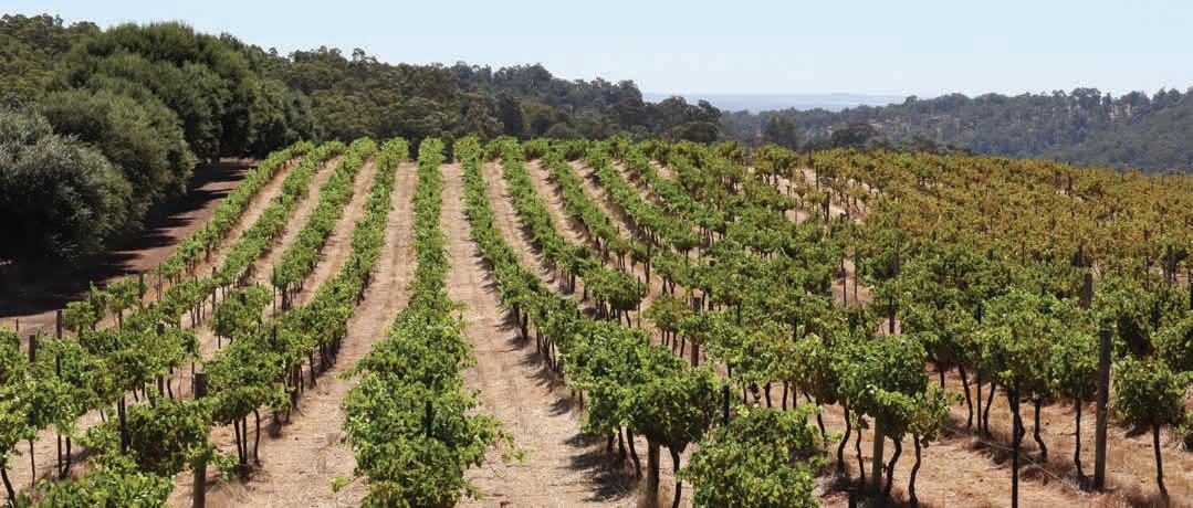
Geology, soils and climate of Western Australia’s wine regions 311
Millimetres 0 200 400 600 800 1,000 1,200 1,400
Dwellingup
Mandurah
Wandering
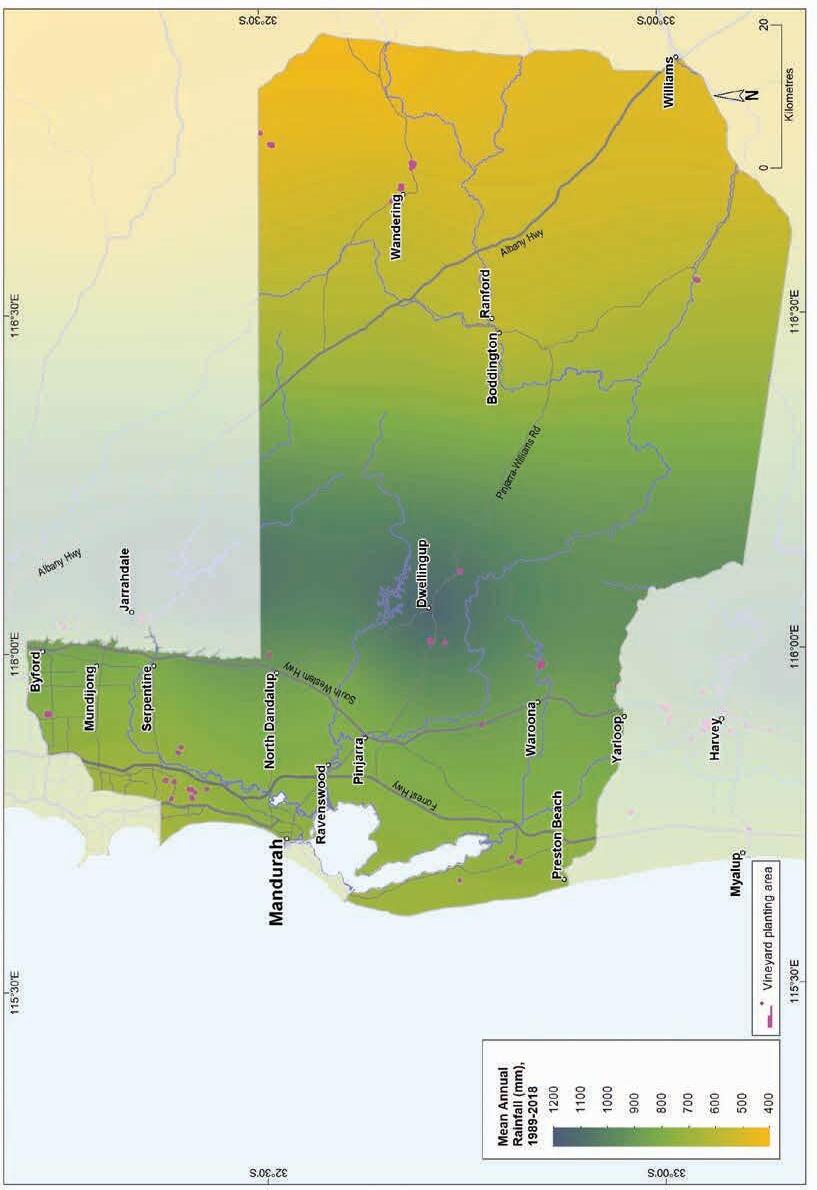
Geology, soils and climate of Western Australia’s wine
312
regions
Figure 14.8: Peel wine region: Mean annual rainfall (1989–2018)
Table 14.2 summarises the temperature statistics for the Peel wine region, supported by maps on the following pages, including:
• mean growing season temperature (GST), which covers the months October to April (Figure 14.9). The Peel region has a GST range of 19.3 to 21.4 °C.
• mean January temperature (MJT), which represents the mean temperature throughout the day across the warmest month (Figure 14.10). The Peel region has a January temperature range of 22.5 to 24 °C, with the mean of 23.3 °C.
• growing degree days (GDD), which is a measure of heat (between 10 and 19 °C) accumulation192 predicting the vines’ development rates for the growing season months of October to April193 (Figure 14.11). The Peel region has a range of 1,966 to 2,422 units (°C).
• biologically effective degree days (BEDD), which are linked to the GDD calculation and adjusted for latitude/daylength and account for diurnal temperatures194 (Figure 14.12). The Peel region has a range of 1,579 to 1,747 units (°C).
• diurnal temperatures, which are a mean of the daily range between the minimum and maximum daily temperature from October to April (Figure 14.13). The Peel region has a daily range of 10.2 to 16.5 °C, with a mean of 15 °C.
Table 14.2: Peel wine region: Temperature statistics (1989–2019)
* Average estimates are from locations in the Peel region in Gladstones (2021).
Annual evaporation across the Peel region ranges from 1,500 mm in the south-west to 1,800 mm in the north-east. Mean 3pm October to April relative humidity ranges from around 52% on the coast at Mandurah to 47% inland at Wandering.
Gladstones (1992) observed that although summer temperatures on the coastal strip are relatively high, the earlier arrival of the sea breezes leads to significantly lower temperatures on the coast than the eastern parts of the coastal plain. Average afternoon wind speeds at the coast (17 km/h) are slightly higher than those inland (15 km/h). Beeston (2002) identified that diurnal temperature variation is significantly greater in the east of the Peel region, ranging from 11 °C at Baldivis to 15 °C at Boddington.
192 These calculations use the base 10 method (Hall and Jones 2010).
193 More recently, Jarvis et al. (2017) suggest that September to March may be more appropriate.
194 Hall and Jones (2010)
Geology, soils and climate of Western Australia’s wine regions 313
Measurement Value Mean growing season (October–April) temperature (°C) 20.1 Mean January temperature (°C) 23.3 Mean growing degree days (October–April) 2,138 Mean diurnal temperature (°C) 15.0 Average daily sun hours (October–April)* 8.9 Average (October–April) cloud cover (Okta)* 3.2
Risk of frost varies across the region, with a very low chance over winter and early spring on the coastal plain. Inland, the frost risk in spring is high and temperature variability is higher, while relative humidity drops. On average, for up to 60 days a year (mainly between April and October) temperatures fall to near frost point in Wandering, which often receives the dubious distinction of having the coldest temperatures in WA. To escape spring frosts, careful site selection on slopes is needed to improve air drainage.
Remenyi et al. (2019) has shown that a changing climate is influencing the region. They identified an increase in mean growing season temperatures (GST) over the past few decades and predict a further rise to a mean GST of more than 22.6 °C in the next 20 years. They also observed a trend towards drier conditions across the Peel region, particularly in the south-west. They suggest that the mean growing season rainfall could fall to 135 mm by the end of the 21st century. These are all important factors to consider for the future viability of each vineyard, particularly in relation to water availability, planting and management.
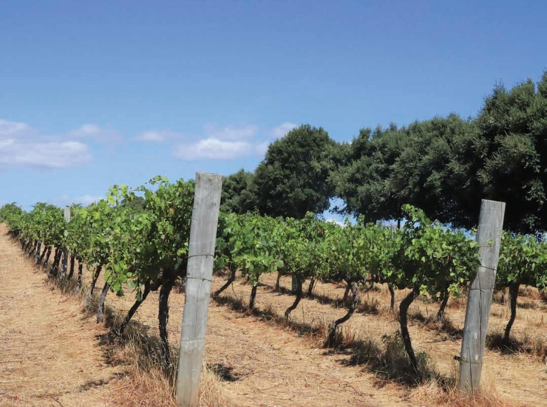
Geology, soils and climate of Western Australia’s wine regions 314
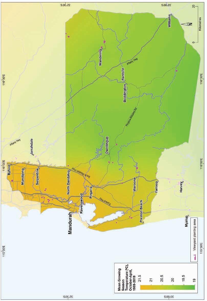
(October–April, 1989–2019)
Geology, soils and climate of Western Australia’s wine regions 315
Figure 14.9: Peel wine region: Mean growing season temperature
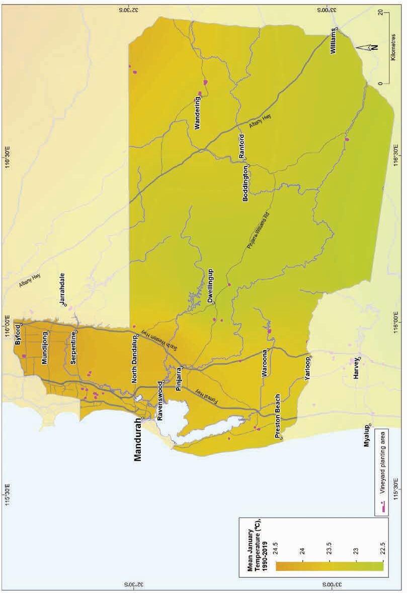
Geology,
316
soils and climate of Western Australia’s wine regions
Figure 14.10: Peel wine region: Mean January temperature (1990–2019)
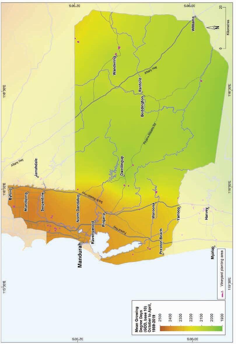
14.11:
region: Mean seasonal growing degree days (October–April, 1989–2019)
Geology, soils and climate of Western Australia’s wine regions 317
Figure
Peel wine
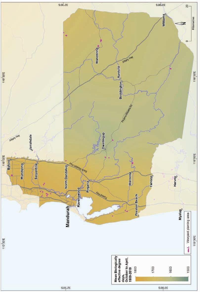
Figure 14.12: Peel wine region: Biologically effective degree days (October–April, 1989–2019)
Geology, soils and climate of Western Australia’s wine regions
318
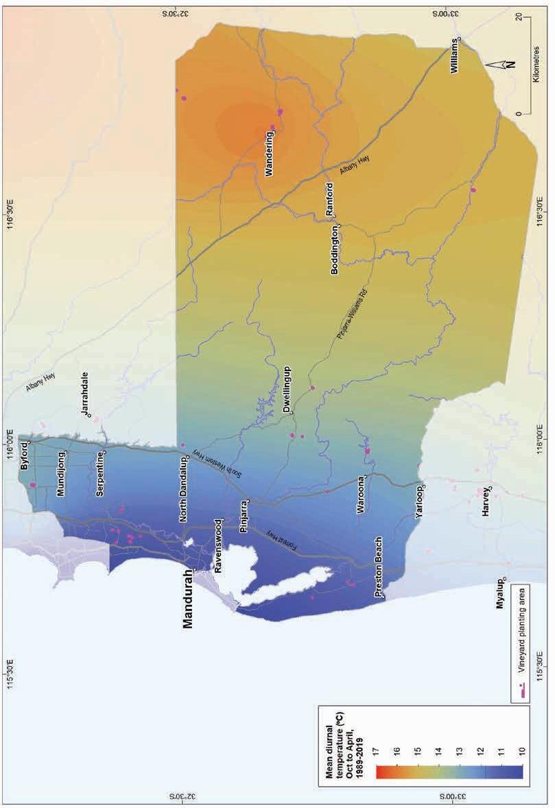
(October–April, 1989–2019)
Geology, soils and climate of Western Australia’s wine regions 319
Figure 14.13: Peel wine region: Mean diurnal temperature
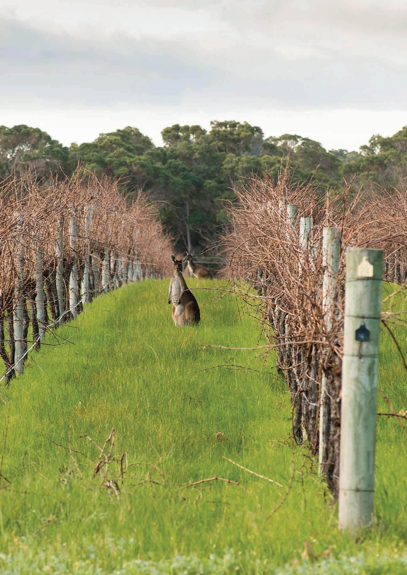
soils and climate of Western Australia’s wine regions 320
Geology,
Appendixes
A Areas of wine grapes planted in regions and subregions
B Geological age data
C Main Soils in relation to other soil classifications
D Areas of Main Soils for each region and subregion
E Accuracy of area estimates for Main Soils
F Climate indices for WA wine regions
Geology, soils and climate of Western Australia’s wine regions 321
Appendix A
Wine grapes planted in regions and subregions
Table A1: Total area of each wine region and area planted to wine grapes
Table A2: Total area of each wine subregion and area planted to wine grapes
Geology, soils and climate of Western Australia’s wine regions 322
Zone Wine region Total area (ha) Area planted to wine grapes (ha) % of total South-west Australia Margaret River 212,006 6,035 50 Great Southern 1,668,682 2,853 24 Geographe 553,220 822 7 Pemberton 205,345 459 4 Blackwood Valley 592,952 382 3 Manjimup 224,910 250 2 Greater Perth Swan District 358,882 883 7 Perth Hills 327,577 197 2 Peel 769,627 79 1 Total 4,913,201 11,960
Zone Wine subregion Total area (ha) Area planted to wine grapes (ha) % of total Great Southern Frankland River 143,679 1,526 54 Mount Barker 132,216 994 39 Porongurup 39,384 105 4 Denmark 115,631 102 3 Albany 157,451 94 3 Not in a subregion 1,080,322 32 1 Total 1,668,683 2,853 Greater Perth Swan Valley 8,940 624 70 Not in a subregion 349,942 263 30 Total 358,882 887
Appendix B
Geological age data
Although the age of the sedimentary rocks found across WA’s wine regions is well known, less data is available on the age of the older crystalline rocks.195 In the past, greater attention has been given to the geology of some less-populated parts of WA (where the most economically important mineral resources are located); however, a program to improve our knowledge of the south-west is currently underway.
We created the map in Figure 3.4 by overlaying the digital linework of the 1:500,000 Cenozoic Geology on the 1:500,000 Interpreted Bedrock Geology (GeoVIEW.WA, Department of Mines, Industry Regulation and Safety n.d.). We obtained both from the WA Department of Mines, Industry Regulation and Safety in 2016. The map units were then correlated to units shown on the Geological map of Western Australia (Martin et al. 2015)196 and the age ranges obtained from its map legend. In some cases, the ages were adjusted to reflect the ages shown in GeoVIEW.WA in September 2022.
We intersected the combined mapping with the boundaries of the wine regions and our mapped distribution of vines to generate the data used to create Table 3.2 and Figure 3.5.
When the current geological investigations are completed and published, the information in the section titled ‘Ancient ground’ can be updated. It may eventuate that some of the crystalline rocks underlying the wine regions will be even older than suggested in this bulletin.
195 The geological age of rocks can be a complex (and sometimes contentious) issue. This is especially true when it comes to metamorphic rocks for which the age relates to when the rock was last significantly altered. The age of the igneous or sedimentary rock from which the metamorphic rock originated is not considered.
196 The correlation was based on the units from the Interpreted Bedrock Geology except where these were overlain by units from the Cenozoic Geology. This linework can be viewed on the GeoVIEW.WA website
Geology, soils and climate of Western Australia’s wine regions 323
Appendix C
Main Soils in relation to other soil classifications
The Main Soils used in this bulletin are based on the Soil Groups of Western Australia (Schoknecht and Pathan 2013). This is because WA Soil Groups are identified in the soil-landscape mapping across the combined area of the WA’s wine regions (see NRInfo197).
Each of the Main Soils comprises multiple WA Soil Groups. However, we split some of the Soil Groups between the Main Soils according to their Soil Group Qualifier. 198 For example, the Main Soil into which most of the Grey shallow sandy duplex Soil Group has been placed is Heavy soil. The exception is those with a ‘good neutral subsoil’ qualifier, which we placed into the ‘Sandy duplex’ Main Soil.
We also split some WA Soil Groups between the Main Soils based on their landscape position. We placed any Soil Group that would otherwise qualify as a ‘Red–brown loam’ or ‘Coloured deep sand’, into the Main Soil ‘Alluvial sands and loams’ if it occurs in an alluvial landscape.
All the Semi-wet soils have been placed into the ‘Difficult soils’ group except those with a ‘deep sandy duplex’ or ‘sandy earth’ Soil Group Qualifier which are found in elevated or sloping landscape positions.
Table C1 lists the main soils described in this bulletin in relation to the WA Soil Groups, the Australian Soil Classification199 (Isbell and National Committee on Soil and Terrain 2021) and the World Reference Base200 for Soil Resources. This table contains only the common classifications for each Main Soil.
197 See https://www.agric.wa.gov.au/resource-assessment/nrinfo-natural-resource-information-western-australia
198 Soil Group Qualifiers are explained in Section 4.3 in Schoknecht and Pathan (2013) at https://researchlibrary. agric.wa.gov.au/rmtr/348/
199 See https://www.soilscienceaustralia.org.au/asc/
200 See https://www.fao.org/3/i3794en/I3794en.pdf
Geology, soils and climate of Western Australia’s wine regions
324
Table C1: Common classifications for the most widespread soils
WA Soil Group
Ironstone gravels
Duplex sandy gravel*
Loamy gravel*
Shallow gravel
Deep sandy gravel
Sandy duplexes
Grey deep sandy duplex*
Yellow/brown deep sandy duplex*
Grey shallow sandy duplex201
Yellow/brown shallow sandy duplex202
Pale sandy earth
Semi-wet soil203
Red–brown loams
Brown loamy earth*
Brown deep loamy duplex*
Australian Soil Classification
Ferric Chromosol or Ferric Sodosol
World Reference Base
Abruptic pisoplinthic Acrisol or Abruptic pisoplinthic Lixisol
Ferric Kandosol Pisoplinthic Ferralsol
Ferric-Petroferric Tenosol Petric, pisoplinthic Plinthosol
Sesqui-Nodular Tenosol Pisoplinthic Cambisol
Yellow, Grey or Brown Chromosol or Sodosol
Yellow, Grey or Brown Chromosol or Sodosol
(Albic) Abruptic Acrisol or Abruptic Lixisol
Abruptic Acrisol or Abruptic Lixisol
Grey Kandosol or Chromosol Dystric Cambisol
Brown Kandosol or Brown Dermosol
Leptic and/or Skeletic, Dystric or Eutric Cambisol
Yellow or Brown Chromosol Abruptic Lixisol or Abruptic Acrisol
Friable red/brown loamy earth* Red or Brown Dermosol or Red or Brown Kandosol
Yellow/brown shallow loamy duplex204
Stony soils205
Red deep loamy duplex
Red shallow loamy duplex206
Ferritic and/or Acric or Lixic or Haplic Ferralsol or Chromic and/or Dystric or Eutric Cambisol
Yellow or Brown Chromosol No information
No information No information
Red Chromosol or Red Sodosol
* One of the most common WA Soil Groups.
Abruptic Chromic Lixisol or Abruptic Chromic Acrisol
(Table C1 continued following page)
201 Where a Grey shallow sandy duplex has a ‘good neutral subsoil’ qualifier.
202 Where a Yellow/brown shallow sandy duplex has a ‘good neutral subsoil’ qualifier.
203 Where a Semi-wet soil has a ‘deep sandy duplex’ qualifier.
204 Where a Yellow/brown shallow loamy duplex has a ‘good neutral subsoil’ qualifier.
205 Where a Stony soil has a ‘loamy soil matrix’ qualifier.
206 Where a Red shallow loamy duplex has a ‘good neutral subsoil’ qualifier.
Geology, soils and climate of Western Australia’s wine regions 325
Table C1: Common classifications for the most widespread soils
WA Soil Group
Pale deep sands
Pale deep sand*
Gravelly pale deep sand
Alluvial sands and loams
Brown deep sand*
Red deep sand
Brown loamy earth
Friable red/brown loamy earth
Brown sandy earth
Red sandy earth
Coloured deep sands
Yellow deep sand*
Australian Soil Classification
Bleached Arenosol, Grey Arenosol, Yellow or Grey Chromosol
World Reference Base
Albic Arenosol or Pisoplinthic, Dystric Cambisol
Sesqui-Nodular Tenosol Pisoplinthic, Dystric Cambisol
Red or Brown Arenosol Dystric Fluvic Arenosol or Dystric Orthofluvic Fluvisol (Arenic)
Red or Brown Dermosol or Red or Brown Kandosol Eutric Fluvic Cambisol (loamic or clayic) or Eutric Orthofluvic Fluvisol (loamic or clayic)
Red or Brown Kandosol Dystric Fluvic Cambisol (loamic) or Dystric Orthofluvic Fluvisol (loamic)
Yellow Arenosol Dystric Arenosol
Yellow sandy earth Yellow Kandosol Xanthic? Cambisol
Brown deep sand
Red deep sand
Brown Arenosol Brunic Arenosol or Dystric Arenosol
Red Arenosol
* One of the most common WA Soil Groups.
Chromic Arenosol or Dystric Arenosol
Geology, soils and climate of Western Australia’s wine regions 326
Appendix D
Area of Main Soils for each region
Table D1 presents an estimate of the area covered by each of 10 Main Soils across the combined area of the nine south-west WA wine regions, rounded to the closest 100 ha. Estimates of the area planted to wine grapes are also shown, rounded to the closest 10 ha.
Table D1: Estimate of area of Main Soils of Western Australia’s wine regions and proportion used for viticulture
Geology, soils and climate of Western Australia’s wine regions 327
Location Total area Area under vines (ha) (%) (ha) (%) Ironstone gravels 1,629,100 33 5,280 44 Sandy duplexes 568,700 12 2,730 23 Red–brown loams 534,600 11 1,310 11 Pale deep sands 548,000 11 720 6 Coloured deep sands 271,200 6 610 5 Alluvial sands and loams 39,600 1 470 4 Heavy soils 258,400 4 330 3 Difficult soils 848,900 17 260 2 Shallow sands 131,000 3 220 2 Alkaline soils 83,500 2 30 <1 Total 4,913,000 11,960
Table D2: Approximate area of Main Soils in each of Western Australia’s wine regions and proportion used for viticulture
D2 continued following
Geology, soils and climate of Western Australia’s wine regions 328
Region Main Soils Total area in region Total area under vines (ha) (%) (ha) (%) Margaret River Ironstone gravels 54,900 26 2,750 45 Difficult soils 43,400 20 200 3 Sandy duplexes 42,900 20 1,750 29 Coloured deep sands 20,550 10 150 2 Pale deep sands 19,800 9 350 6 Alkaline soils 11,400 5 0 0 Shallow sands 8,050 4 150 3 Red–brown loams 4,850 2 300 5 Alluvial sands and loams 4,150 2 450 7 Heavy soils 2,050 1 40 1 Great Southern Ironstone gravels 447,900 27 1,500 52 Difficult soils 324,350 19 50 3 Sandy duplexes 292,000 17 550 19 Pale deep sands 192,100 12 150 6 Heavy soils 188,700 11 150 6 Shallow sands 80,400 5 50 2 Red–brown loams 79,050 5 250 9 Alkaline soils 37,900 2 20 1 Coloured deep sands 20,650 1 50 2 Alluvial sands and loams 5,650 0 1 <1 Geographe Ironstone gravels 176,000 32 300 34 Difficult soils 102,450 19 20 2 Red–brown loams 99,000 18 250 32 Pale deep sands 69,350 13 100 10 Coloured deep sands 38,450 7 50 6 Sandy duplexes 27,200 5 50 5 Heavy soils 12,100 2 50 6 Alluvial sands and loams 10,300 2 50 4 Shallow sands 9,750 2 2 <1 Alkaline soils 8,700 2 10 1 (Table
page)
Table D2: Approximate area of Main Soils in each of Western Australia’s wine regions and proportion used for viticulture
(Table D2 continued following page)
Geology, soils and climate of Western Australia’s wine regions 329
Region Main Soils Total area in region Total area under vines (ha) (%) (ha) (%) Pemberton Ironstone gravels 94,700 46 300 61 Red–brown loams 59,000 29 150 30 Difficult soils 19,600 10 1 <1 Pale deep sands 11,300 6 10 1 Coloured deep sands 10,400 5 50 8 Sandy duplexes 7,500 4 0 0 Shallow sands 2,050 1 0 0 Heavy soils 600 <1 0 0 Alkaline soils 150 <1 0 0 Alluvial sands and loams 100 <1 0 0 Blackwood Valley Ironstone gravels 278,400 47 150 41 Red–brown loams 117,850 20 150 41 Difficult soils 80,750 14 10 2 Sandy duplexes 48,600 8 50 8 Pale deep sands 33,050 6 15 4 Coloured deep sands 2,450 4 10 2 Alluvial sands and loams 5,250 1 10 2 Shallow sands 3,200 1 0 0 Heavy soils 2,200 <1 0 0 Alkaline soils 250 <1 0 0 Manjimup Ironstone gravels 116,350 52 150 65 Difficult soils 38,550 17 5 3 Red–brown loams 25,000 11 50 16 Sandy duplexes 16,300 7 15 6 Pale deep sands 13,950 6 10 4 Coloured deep sands 12,200 5 15 7 Heavy soils 1,550 1 0 0 Shallow sands 850 <1 0 0 Alluvial sands and loams 100 <1 0 0
Table D2: Approximate area of Main Soils in each of Western Australia’s wine regions and proportion used for viticulture
Geology, soils and climate of Western Australia’s wine regions 330
Region Main Soils Total area in region Total area under vines (ha) (%) (ha) (%) Swan District Sandy duplexes 11,550 3 300 34 Coloured deep sands 92,100 26 200 24 Alluvial sands and loams 6,000 2 150 14 Ironstone gravels 9,150 3 100 11 Heavy soils 8,600 2 50 6 Pale deep sands 122,350 34 50 6 Difficult soils 75,900 21 20 2 Shallow sands 15,100 4 10 1 Red–brown loams 2,150 1 5 <1 Alkaline soils 15,950 4 1 <1 Perth Hills Ironstone gravels 171,500 52 50 21 Red–brown loams 57,000 17 100 47 Sandy duplexes 31,750 10 10 6 Difficult soils 24,900 8 5 2 Coloured deep sands 14,200 4 10 6 Pale deep sands 11,350 3 20 12 Heavy soils 11,050 3 10 5 Shallow sands 5,800 2 2 1 Alkaline soils 15 <1 0 0 Peel Ironstone gravels 280,250 36 20 25 Difficult soils 139,050 18 2 3 Sandy duplexes 90,900 12 15 17 Red–brown loams 90,000 12 10 16 Pale deep sands 74,800 10 20 22 Coloured deep sands 38,650 5 10 12 Heavy soils 31,600 4 5 4 Alluvial sands and loams 9,450 1 1 1 Alkaline soils 9,150 1 0 0 Shallow sands 5,750 1 1 2
Table D3: Area of Main Soils in each of Western Australia’s wine subregions and proportion used for viticulture
Geology, soils and climate of Western Australia’s wine regions 331
Subregion Main Soils Total area in subregion Total area under vines (ha) (%) (ha) (%) Frankland River Ironstone gravels 68,600 48 900 59 Sandy duplexes 23,750 17 250 17 Difficult soils 19,250 13 25 2 Red–brown loams 9,950 7 150 9 Pale deep sands 9,550 7 100 5 Heavy soils 7,200 5 100 5 Coloured deep sands 2,700 2 25 1 Shallow sands 1,000 1 15 1 Alluvial sands and loams 850 1 1 <1 Alkaline soils 750 1 5 <1 Mount Barker Ironstone gravels 45,400 34 500 48 Difficult soils 29,300 22 50 4 Sandy duplexes 26,450 20 200 21 Heavy soils 11,250 8 100 8 Pale deep sands 9,350 7 50 6 Red–brown loams 4,300 3 50 6 Shallow sands 2,300 2 50 2 Alkaline soils 1,950 1 20 2 Coloured deep sands 1,850 1 50 3 Alluvial sands and loams 200 0 0 0 Porongurup Ironstone gravels 10,213 26 50 24 Sandy duplexes 9,845 25 50 36 Heavy soils 6,256 16 5 4 Difficult soils 5,184 13 1 1 Red–brown loams 3,991 10 25 21 Pale deep sands 1,817 5 5 4 Coloured deep sands 1,064 3 10 7 Shallow sands 925 2 5 4 Alluvial sands and loams 57 0 0 0 Alkaline soils 33 0 0 0 (Table
page)
D3 continued following
Table D3: Area of Main Soils in each of Western Australia’s wine subregions and proportion used for viticulture
Geology, soils and climate of Western Australia’s wine regions 332
Subregion Main Soils Total area in subregion Total area under vines (ha) (%) (ha) (%) Albany Ironstone gravels 41,500 26 50 38 Difficult soils 38,200 24 5 4 Pale deep sands 32,250 20 20 18 Sandy duplexes 25,050 16 25 26 Alkaline soils 5,000 3 0 0 Heavy soils 4,600 3 5 5 Shallow sands 4,250 3 5 4 Red–brown loams 3,800 2 5 3 Coloured deep sands 2,250 1 5 3 Alluvial sands and loams 650 0 0 0 Denmark Difficult soils 27,050 23 5 2 Ironstone gravels 26,250 23 50 38 Pale deep sands 22,950 20 10 6 Sandy duplexes 16,150 14 15 12 Red–brown loams 12,200 11 50 37 Alkaline soils 4,400 4 0 0 Coloured deep sands 2,800 2 2 2 Shallow sands 2,600 2 3 3 Heavy soils 1,150 1 0 0 Alluvial sands and loams 100 <1 0 0 Swan Valley Sandy duplexes 3,000 34 300 46 Alluvial sands and loams 1,300 14 150 20 Ironstone gravels 850 9 100 14 Heavy soils 750 8 50 8 Pale deep sands 850 9 50 6 Difficult soils 1,600 18 15 2 Coloured deep sands 300 3 15 2 Shallow sands 50 <1 2 <1 Red–brown loams 350 4 1 <1
Appendix E
Accuracy of area estimates of Main Soils
We have more confidence in the estimates of the areas of Main Soils found across each wine region than our estimates of the areas of vines planted to each of the Main Soils.
The broadscale soil-landscape mapping compiled by DPIRD was used to generate this data and can be viewed on NRInfo 207 This mapping is sufficiently detailed to typify the soil pattern within individual wine regions and subregions.
Each wine region covers at least 200,000 ha, with the smallest subregion (the Swan Valley) covering almost 9,000 ha. The soil-landscape mapping in most areas is at a scale of 1:100,000 but ranges between 1:25,000 and 1:250,000.
We calculated the area of each soil-landscape mapping unit within each wine region. We then multiplied this area by the proportional area of each Soil Group of Western Australia found within that map unit (as shown in the summary of soils in NRInfo).208 By adding the area of each Soil Groups for each map unit we calculated the total area for each region. We then converted the Soil Group into Main Soils with the aid of the Soil Group Qualifiers (see Appendix C).
The boundaries of the individual vine plantings were mapped at much more detailed scale (1:5,000) than the soil-landscape map units. Most of the individual blocks of vines mapped range in size between 1 and 15 ha, with only 5 of the 960 blocks mapped exceeding 50 ha.
There is no consistent mapping available at the level of detail209 that shows intricate soil patterns within the individual blocks. Instead, to make our estimates of the area of soils planted to vines, we had to rely on the broadscale soil-landscape map units. We calculated the area of soil-landscape map units underlying each block of vines. We then multiplied the area by the average proportion of WA Soil Groups soils across that map unit and converted them into Main Soils as described above.
Most soil-landscape map units on which vineyards are located have a combination of soils better and less suited to viticulture. Where possible, viticulturists will select the better soils and avoid the less suitable soils. But our calculations assume that the soils are planted in the same proportion as they occur within the map unit.
For this reason, Figure 4.2 and Figure 4.3 most likely underestimate the area of the favoured soils planted to vines (such as Ironstone gravels, Red–brown loams and Alluvial sands and loams) and overestimate the area of poorer soils (such as Pale deep sands).210
207 See https://www.agric.wa.gov.au/resource-assessment/nrinfo-natural-resource-information-western-australia
208 These data show a proportional area for each combination of WA Soil Group and Qualifier present within the map unit. We also used the available data on the landscape position of these combinations.
209 No detailed soil mapping is available for most vineyards, although detailed mapping of some vineyards has been completed over the years. However, this mapping is not always available in a consistent format, and it would be a major task to relate the mapping to the Main Soils.
210 For the Difficult soils only, we reduced our estimates of the area planted.
Geology, soils and climate of Western Australia’s wine regions 333
The proportion of Sandy duplex soils planted to vines may also be overestimated. Most of these are from the Margaret River wine region, where our estimates show almost 30% of the soils planted to vines are Sandy duplexes. In the Margaret River region, some of the major mapping units planted contain a complex of Sandy duplexes and Ironstone gravels. On the Swan Coastal Plain, a complex of Sandy duplexes and Alluvial sands and loams occurs. Although some of the Sandy duplexes have been planted, our observations suggest that the Ironstone gravels are preferentially selected in many cases.
Difficult soils was the only Main Soil for which our estimates of the area planted do not directly reflect the proportion of soils in the underlying map unit. Vineyards are rarely established primarily on these soils, but small patches surrounded by suitable soils can be found within some plantings. Elsewhere, remedial works, such as installing drainage, have been adopted to make these soils productive. Based on these circumstances, we reduced our initial estimates of the area that each map unit is planted to Difficult soils by 70% and added this area to areas of the other Main Soils found within the map unit in proportion to their occurrence.
Geology, soils and climate of Western Australia’s wine regions 334
Appendix F
Climate indices for WA wine regions
Table F1: Mean annual rainfall for WA wine regions (highest to lowest)
Table F2: Mean growing season temperatures and Growing Degree Days for WA wine regions (highest to lowest)
Geology, soils and climate of Western Australia’s wine regions 335
WA wine region Mean annual rainfall (mm) Pemberton 1,111 Margaret River 977 Geographe 854 Perth Hills 828 Manjimup 797 Peel 737 Blackwood Valley 701 Great Southern 677 Swan District 660
WA wine region Mean growing season temperature (Oct–Apr) (°C) Mean Growing Degree Days Swan District 21.88 2,522 Perth Hills 21.60 2,464 Peel 20.42 2,212 Geographe 19.50 2,017 Margaret River 18.71 1,851 Blackwood Valley 18.61 1,828 Manjimup 18.09 1,718 Pemberton 18.03 1,704 Great Southern 17.83 1,662
Table F3: Mean seasonal diurnal temperatures (October–April) for WA wine regions (highest to lowest)
Table F4: Mean January temperatures for WA wine regions (highest to lowest)
Geology, soils and climate of Western Australia’s wine regions 336
WA wine region Mean diurnal temperature (Oct–Apr) (°C) Perth Hills 14.70 Blackwood Valley 14.65 Geographe 14.43 Peel 14.28 Swan District 14.08 Manjimup 13.08 Great Southern 12.25 Pemberton 12.02 Margaret River 10.85
WA wine region Mean January temperature (°C) Swan District 24.7 Perth Hills 24.4 Peel 23.3 Geographe 22.3 Blackwood Valley 21.4 Margaret River 20.7 Manjimup 20.5 Great Southern 20.1 Pemberton 20.0
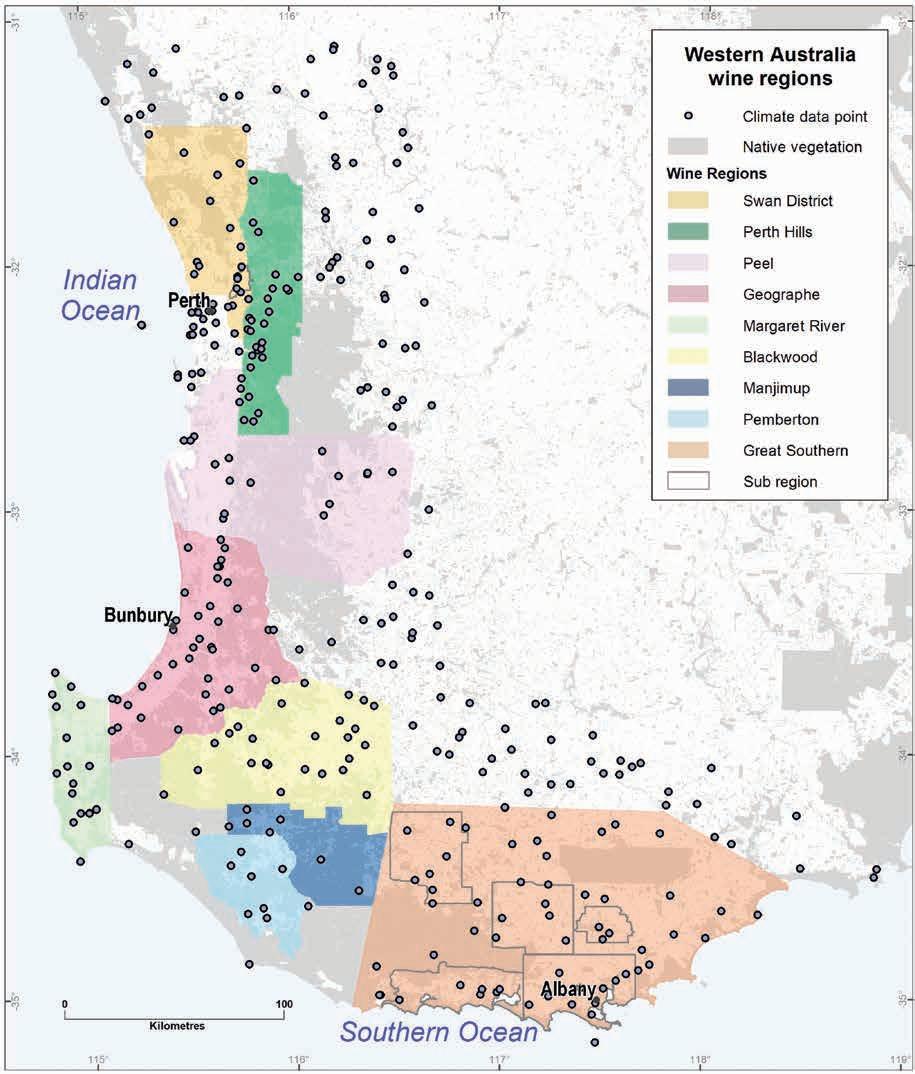
Geology, soils and climate of Western Australia’s wine regions 337
Figure F1: Climate data points for the wine regions of WA
Shortened forms
Short form Long form
AHD Australian Height Datum
BEDD biologically effective degree days
BoM Bureau of Meteorology
Ca calcium
cm centimetre
Cu copper
DPIRD Department of Primary Industries and Regional Development
Fe iron
Ga giga annum or billions of years
GDD growing degree days
GI Geographic Indication
GST growing season temperature
ha hectare
IOCI Indian Ocean Climate Initiative
K potassium
km; km2 kilometre; square kilometre
m metre
Ma mega annum or millions of years
Mg magnesium
MJT mean January temperature
Mn manganese
Mo molybdenum
N nitrogen
Na sodium
P phosphorous
pH The acidity or basicity of a solution.
S sulfur
WA Western Australia
WST Western Standard Time (Australia)
Zn zinc
Geology, soils and climate of Western Australia’s wine regions 338
Glossary
Acidity: A figure derived from the measure of the soil pH on a logarithmic scale from 1 to 14 where 7 is neutral and lower values (1–6) are acidic.
Aeolian: Relating to, or arising from, the action of the wind.
Alkaline: A figure derived from the measure of the soil pH on a logarithmic scale from 1 to 14 where 7 is neutral and higher values (8–14) are alkaline.
Amphibole: any of a group of common rock-forming silicate minerals. Amphiboles are found principally in metamorphic and igneous rocks.
Archean: The Archean Eon is a geological period that covers the second of four eons of Earth's history, representing the time from 4,000 to 2,500 million years ago.
Basin: A low area in the Earth's crust, of tectonic origin, in which sediments accumulate.
Batholith: A large intrusion of igneous rock, usually granite, formed deep beneath the surface so the rock cooled very slowly.
Biotite: A form of black mica widely distributed in igneous rocks (particularly in granites) as lustrous black crystals. In composition, it is a complex silicate, chiefly of iron and magnesium, together with potassium and hydroxyl.
Calcareous: Soil with the presence of carbonate (lime) as segregations or fine earth.
Carbonaceous: Rocks or sediments consisting of, or containing, carbon or its compounds.
Chalk: A soft, white, porous, sedimentary carbonate rock.
Claystone: A sedimentary rock that is composed primarily of clay-sized particles
Complex: A lithodemic unit comprising 2 or more lithodemes of more than one genetic class (metamorphic, igneous or sedimentary). Lithodeme: A body of intrusive, pervasively deformed, or highly metamorphosed rock, generally nontabular and lacking primary depositional structures, and characterised by lithic homogeneity.
Conglomerate: A coarse-grained sedimentary rock composed of rounded fragments embedded in a matrix of cementing material such as silica.
Craton: An old and stable part of the continental crust that has survived the merging and splitting of continents and supercontinents for at least 500 million years.
Cretaceous: a geological period spanning 145.5 million years ago to 66 million years ago. The Early Cretaceous period is considered as 145 – 100.5 million years ago.
Cryogenian: A geologic period that lasted from 720 to 635 million years ago.
Crystalline: (rock): Rock made up of interlocking crystals. Igneous and metamorphic rocks are almost all crystalline, as are salt deposits.
Geology, soils and climate of Western Australia’s wine regions 339
Darling Fault: One of the longest and most significant faults in Australia, extending for at least 1,500 km in a north–south orientation near the west coast of southern Western Australia.
Darling Plateau: The gently undulating plateau surface of the Darling Range, excluding river valleys.
Darling Range Batholith: A section of the Yilgarn Craton, it is the major geological unit underlying the plateaus and valleys of much of the Darling Range.
Darling Range: A general collective term for the plateau and valley landscapes east of the Darling Scarp; often used interchangeably with the term ‘Perth Hills’.
Darling Scarp: A low escarpment, formed by the Darling Fault, running north to south-east of the Swan Coastal Plain and Perth.
Duplex: Soil that has an abrupt increase in clay content over a short vertical distance.
Eocene: Relating to or denoting the second epoch of the Tertiary period, between the Paleocene and Oligocene epochs.
Feldspar: A common mineral in igneous and some metamorphic rocks.
Felsic: Silicate minerals, magmas and rocks enriched in the lighter elements such as silicon, oxygen, aluminium, sodium, and potassium. The term is a mnemonic adjective for igneous rocks having light-coloured minerals derived from ‘feldspar’ and ‘silica’.
Ferric/ferruginous: Soil with abundant ferruginous (ironstone) nodules or pisoliths.
Garnet: Any member of a group of common silicate minerals that have similar crystal structures and chemical compositions. They may be colourless, black, and shades of red and green
Glauconite: An iron potassium phyllosilicate mineral of characteristic green colour which is very friable and has very low weathering resistance. Glauconitic sandstone contains sufficient grains of glauconite to impart a marked greenish colour to the rock.
Gneiss: Coarse-grained, metamorphic rock often showing a ‘banded’ texture due to separation of pale and dark-coloured minerals containing abundant feldspar with quartz, mica, hornblende, and garnet.
Goethite: The most common iron oxide in soils and is widely distributed in WA – it weathers to produce the distinctive brownish yellow colour of many soils.
Granite: Light grey or pinkish, coarse-grained, igneous rock, cooled slowly in large intrusions.
Granitic orthogneiss: Gneiss derived from granite.
Granofel: Medium to coarse grained metamorphic rock.
Granodiorite: A coarse-grained intrusive igneous rock similar to granite but containing more plagioclase feldspar than orthoclase feldspar.
Greensands: A sand or sandstone which has a greenish colour. This term is specifically applied to shallow marine sediments that contain noticeable quantities of rounded greenish grains.
Geology, soils and climate of Western Australia’s wine regions 340
Haematite: An iron oxide widely found in rocks and soils, recognised and named because of its distinctive ‘blood red’ colour. In WA, haematite is often associated with goethite in soils.
Holocene: The current geological epoch. It began approximately 11,650 years before present, after the Last Glacial Period, which concluded with the Holocene glacial retreat.
Hornblende: An important rock-forming mineral of complex composition, essentially a silicate of calcium, magnesium and iron, with smaller amounts of potash, soda and hydroxyl. Hornblende crystallises in the monoclinic system and occurs as black crystals or grains in many different types of igneous and metamorphic rocks.
Igneous: Formed from magma, either erupted from a volcano or cooled below ground in an intrusion.
In situ: Situated in the original, natural, or existing place or position in which it was originally formed.
Ironstone: See Ferric/ferruginous
Kaolinite: A layered silicate clay mineral which forms from the chemical weathering of feldspar or other aluminium silicate minerals. It is usually white.
Limestone: Sedimentary rock composed largely of calcium carbonate (fizzes with dilute acid), usually formed from the remains of living organisms.
Lineament: A linear feature in a landscape which is an expression of an underlying geological structure such as a fault.
Mafic: A dark-coloured silicate mineral or rock that is rich in magnesium and iron.
Marl: An earthy material rich in carbonate minerals, clays, and silt.
Matrix: Refers to all the solid particles found in soil that include the soil particles, organic matter, and other inorganic materials.
Mesoproterozoic: The Mesoproterozoic Era is a geological time period spanning 1,600 to 1,000 million years ago. It is one of the three subdivisions of the Proterozoic Eon.
Mesozoic: The era of geological time including the Triassic, Jurassic and Cretaceous ages.
Metabasalt: A low-grade, mafic metavolcanic rock with preserved evidence of its original basaltic character.
Metamorphic: A rock that has recrystallised because of heat and/or pressure.
Metasandstone: See metasediment
Metasediment: A class of metamorphic rocks where the original rock was sedimentary.
Mica: Any of a set of minerals that crystallise in the monoclinic system.
Migmatite: Rock composed of a metamorphic (altered) host material that is streaked or veined with granite rock; such rocks are usually gneissic (banded) and felsic rather than mafic in composition.
Geology, soils and climate of Western Australia’s wine regions 341
Miocene: A geological time period spanning 23.03 to 5.3 million years ago.
Monadnock: An isolated hill or ridge or erosion-resistant rock rising above a plain.
Mottle: Spots, blotches or streaks of colours in soil that are different to the main soil colour.
Muscovite: The most common mineral of the mica family. It is an important rock-forming mineral, present in igneous, metamorphic, and sedimentary rocks.
Non-wetting: Water-repellent soils
Orogen: A zone of crustal collision generally formed when continents collide, where a belt of the Earth’s crust is involved in the formation of mountains.
Orthoclase: A silicate of potassium and aluminium, which crystallises in the monoclinic system and occurs as an essential constituent in granitic and syenitic rocks and as an accessory in many other rock types.
Orthogneiss: Gneiss derived from igneous rock (such as granite).
Paleoproterozoic: The Paleoproterozoic Era is a geological time period spanning 2,500 to 1,600 million years ago, is the first of the three sub-divisions of the Proterozoic Eon. The Paleoproterozoic is also the longest era of the Earth's geological history.
Pedology: The study of soils in their natural setting and includes the study of soil genesis and soil classification.
Permian: The Permian is a geological period that lasted from 299 to 251 million years ago and was the last period of the Paleozoic Era.
Phyllite: Any of a set of argillaceous rocks in a condition of metamorphism between slate and mica schist.
Pisolith: A pea-sized (usually ferruginous) nodule or concretion. See Ferric/ferruginous
Plagioclase hornblende: A combination of minerals found in some medium-grained, moderately well foliated gneiss (hornblende – dark-coloured silicate mineral; plagioclase – white or grey coloured mineral).
Pleistocene: The geologic epoch that lasted from about 2,588,000 to 11,700 years ago, spanning the world’s recent period of repeated glaciations. The Pleistocene is the first epoch of the Quaternary Period and the sixth epoch of the Cenozoic Era.
Profile: A vertical section of soil from the ground surface downwards, usually divided into layers called horizons.
Proteaceous: Relating to the Proteaceae, a family of flowering plants.
Proterozoic: The Proterozoic is a geological eon following the Archaen eon, spanning the time interval from 2,500 to 538.8 million years ago.
Quartz: Hard, resistant mineral (grey/white/glassy) in granite, many metamorphic rocks and sandstones. Most sand grains are made of quartz, a very hard and chemically resistant mineral.
Geology, soils and climate
Western
wine regions 342
of
Australia’s
Quartzite: A very hard, usually almost white, sandstone made up of quartz grains cemented together by silicon dioxide. Quartzite is always associated with other metamorphic rocks, while cemented sandstone is always associated with other sedimentary rocks.
Quaternary: The Quaternary is the current and most recent of the three periods of the Cenozoic Era. It follows the Neogene Period and spans from 2.58 million years ago to the present.
Sandstone: Medium-grained, sedimentary rock comprising mainly sand grains that have been cemented together.
Schist: A metamorphic rock with a shiny, foliated, medium-grained texture, often containing much mica.
Sediment: Material deposited by water, wind or ice. Includes pebbles, sand, mud, organic remains (e.g. shells) and salts left by evaporation.
Sedimentary rock: Any rock made up of sediment grains; for example, mudstone, sandstone, limestone, rock salt, coal.
Shale: Mudstone that has been compressed to form a fine-grained, flaky, dark-coloured sedimentary rock.
Siliceous: Material containing abundant silica.
Siltstone: Fine-grained sedimentary rock comprising consolidated silt.
Spongolite: A light and porous stone made almost entirely from fossilised sponges.
Terra rossa: A reddish-brown soil with favourable drainage characteristics, found as a mantle over limestone bedrock.
Terroir: The complete natural environment in which a particular wine is produced, including factors such as soil, topography, and climate.
Tertiary: The geologic time period from 66 million to 2.6 million years ago.
Texture contrast: See Duplex
Truncated: A soil profile that has lost all or part of its upper horizons through erosion.
Unconsolidated sediments: Sediment that is loosely arranged or unstratified, or whose particles are not cemented together, found at the surface or at depth.
Geology, soils and climate of Western Australia’s wine regions 343
References
Anand RR and Butt CRM (2003) ‘Distribution and evolution of ‘laterites’ and lateritic weathering profile, Darling Range, Western Australia’, Australian Geomechanics Journal, 38(4):41–58, https://australiangeomechanics.org/papers/distribution-of-laterites-and-lateritic-weatheringprofiles-darling-range-western-australia/, accessed 2 June 2022.
APC (Agricultural Produce Commission) (2022) Vintage 2021: Industry Snapshot, Wines of Western Australia, https://winewa.asn.au/production-reports/ accessed 30 Aug 2022.
Australian Wine and Brandy Corporation (n.d.) https://www.awbc.com.au/winefacts/data/ default.asp, accessed January 2005 (URL no longer available, see Wine Australia https://www. wineaustralia.com/).
Bardsley D (30 July 2015) ‘Message in a bottle: the wine industry gives farmers a taste of what to expect from climate change’, The Conversation, https://theconversation.com/message-in-a-bottlethe-wine-industry-gives-farmers-a-taste-of-what-to-expect-from-climate-change-45361, accessed 2 June 2022.
Barlow S (30 May 2019) ‘How climatic patterns in the Indian and Pacific Oceans affect Australian wines’, ABC News, https://www.abc.net.au/news/2019-05-30/how-climatic-patterns-in-oceansimpact-australian-wines/11161696, accessed 2 June 2022.
Barnesby BA, King PD and Proulx-Nixon ME (1995) Land resources map from Harvey to Capel on the Swan Coastal Plain, Western Australia (Sheets 1 and 2), Land Resources Maps No. 23/1 and 23/2. Agriculture Western Australia, https://researchlibrary.agric.wa.gov.au/land_res/25/, accessed 6 June 2022.
Beeston J (2002) The Wine Regions of Australia, 2nd edn, Allen & Unwin, Crows Nest, NSW.
Bessell-Browne JA (unpublished) Chittering area land resources survey, Land Resources Series, Department of Agriculture, Western Australia.
BoM (Bureau of Meteorology) (n.d.) http://www.bom.gov.au/ [website], accessed 2 June 2022.
Campbell-Clause J and Moore GA (1991) Land capability study for horticulture in the Swan Valley, Land Resources Series 6, Department of Agriculture, Western Australia, https://researchlibrary. agric.wa.gov.au/land_res/6/, accessed 6 June 2022.
Churchward HM (1992) Soils and landforms of the Manjimup area, Western Australia, Land Resources Series 10, Department of Agriculture, Western Australia, https://researchlibrary.agric. wa.gov.au/land_res/10/, accessed 6 June 2022.
Churchward HM, McArthur WM, Sewell PL and Bartle GA (1988), Landforms and soils of the south coast and hinterland, Western Australia: Northcliffe to Manypeaks, Division of Water Resources, Divisional Report 88/1, CSIRO Australia., https://researchlibrary.agric.wa.gov.au/ pubns/9/, accessed 6 June 2022.
Geology, soils and climate of Western Australia’s wine regions 344
Clarke JDA, Gammon PR, Hou B and Gallagher SJ (2003) ‘Middle to Upper Eocene stratigraphic nomenclature and deposition in the Eucla Basin’, Australian Journal of Earth Sciences, 50(2): 231–248, doi.org/10.1046/j.1440-0952.2003.00995.x, accessed 6 June 2022.
Commander P, Schoknecht N, Verboom W and Caccetta P (2001) ‘The geology, physiography and soils of wheatbelt valleys’, in Dealing with salinity in wheatbelt valleys: processes, prospects and practical options: proceedings of a conference held at Merredin, Western Australia, 30th July–1st August 2001, https://www.academia.edu/54072895/The_Geology_Physiography_and_Soils_of_ Wheatbelt_Valleys, accessed 2 June 2022.
Coombe BG and Iland PG (2004) ‘Grape berry development and wine grape quality’, in Coombe BG and Dry PR (eds) Viticulture: Volume 1: Resources, 2nd edn, Winetitles, Adelaide, pp 210–248.
Cope RN (1975) ‘Tertiary epeirogeny in the southern part of Western Australia’, in Western Australia Geological Survey, Annual Report 1974, https://dmpbookshop.eruditetechnologies.com.au/product/ geological-survey-of-western-australia-annual-report-for-the-year-1974.do, pp 40–46, accessed 2 June 2022.
Department of Mines, Industry Regulation and Safety (n.d.) GeoVIEW.WA [interactive geological map], DMIRS website, accessed September 2022.
Despeissis A (1895), cited in Lindley-Cowan L (1897) (ed) The Western Australian settler’s guide and farmer’s handbook, Western Australian Department of Agriculture, https://library.dpird.wa.gov. au/books/2/, accessed 2 June 2022
Despeissis A (1902) The handbook of horticulture and viticulture of Western Australia, 2nd edn, Government Printer, Perth, doi.org/10.5962/bhl.title.33870, accessed 2 June 2022.
DPIRD (Department of Primary Industries and Regional Development) (2019) DPIRD intensive agricultural land use in Western Australia [spatial land use dataset], Australian Land Use Mapping (ALUM) v7, October 2019.
Dry PR and Coombe BG (eds) (2004) Viticulture: Volume 1–Resources, 2nd edn, Winetitles, Adelaide.
Dry PR, Maschmedt DJ, Anderson CJ, Riley E, Bell S-J and Goodchild WS (2004) ‘The grapegrowing regions of Australia’, in Dry PR and Coombe BG (eds) Viticulture: Volume 1: Resources, 2nd edn, Winetitles, Adelaide, pp 17–55.
Firth R, Kala J, Lyons TJ and Andrys J (2017) ‘An analysis of regional climate simulations for Western Australia’s wine regions—Model evaluation and future climate projections’, Journal of Applied Meteorology and Climatology, 56:2113–2138, doi.org/10.1175/JAMC-D-16-0333.1, accessed 6 June 2022.
Fisher DL, Shepherd D, Haswell D and Ward G (2010) ‘The Western Australian vineyard mapping project’, Wine & Viticulture Journal, 14(5):82–83, https://winetitles.com.au/wvj/articles/australianviticulture-volume-14-no-5-2010/the-western-australian-vineyard-mapping-project/, accessed 2 June 2022.
Gladstones JS (1965) ‘The climate and soils of south-western Australia in relation to vine growing’, Journal of the Australian Institute of Agricultural Science, 31:275–88.
Geology, soils and climate of Western Australia’s wine regions 345
Gladstones JS (1991) Western Australian viticulture – then, now and in the future, Inaugural Wine Baron Lecture delivered at the University of Western Australia, 4 October 1990, Miscellaneous Publication 25/91, Department of Agriculture, Western Australia.
Gladstones JS (1992) Viticulture and environment: a study of the effects of environment on grapegrowing and wine qualities, with emphasis on present and future areas for growing winegrapes in Australia, Winetitles, Adelaide, https://winebookcellar.com.au/viticultureenvironment/, accessed 2 June 2022.
Gladstones JS (2004) ‘Climate and Australian viticulture’, in Coombe BG and Dry PR (eds) Viticulture: Volume 1: Resources, 2nd edn, Winetitles, Adelaide, pp 90–118.
Gladstones JS (2005) ‘History of the Margaret River viticulture region – A personal perspective’, Australian & New Zealand Wine Industry Journal, 20(6):18–27.
Gladstones JS (2011) Wine, terroir and climate change, Hyde Park Press, Adelaide.
Gladstones JS (2021) New comparative climate tables for viticulture in Australia and New Zealand, PH Publishing, Bassendean, Western Australia.
Hall A and Jones GV (2010) ‘Spatial analysis of climate in winegrape-growing regions in Australia’, Australian Journal of Grape and Wine Research, 16(3):389–404, doi.org/10.1111/j.17550238.2010.00100.x, accessed 2 June 2022.
Halliday J (1998) Wine atlas of Australia and New Zealand, Harper Collins.
Halliday J (2011a) The Australian wine encyclopedia, Hardie Grant Books, Richmond, Victoria.
Hamza MA (2008) ‘Understanding soil analysis data’, Resource management technical report 327, Department of Agriculture and Food, Western Australia, https://researchlibrary.agric.wa.gov.au/ rmtr/309/, accessed 2 June 2022.
Hansen V and Horsfall J (2019) Noongar Bush Tucker, University of Western Australia Press, Crawley.
Hardy TK (1987) Pictorial atlas of Australian wines, Grape Vision, Melbourne.
Indian Ocean Climate Initiative (2012) Western Australia's weather and climate: A synthesis of Indian Ocean Climate Initiative Stage 3 Research: Summary for policy makers, CSIRO and BoM, Commonwealth of Australia, doi.org/10.4225/08/584c441b75340, accessed 2 June 2022.
IPCC (2021) ‘Summary for Policymakers’, in Climate Change 2021: The Physical Science Basis Contribution of Working Group I to the Sixth Assessment Report of the Intergovernmental Panel on Climate Change, Cambridge University Press, Cambridge, United Kingdom and New York, USA https://www.ipcc.ch/report/ar6/wg1/downloads/report/IPCC_AR6_WGI_SPM.pdf
Isbell RF and the National Committee on Soil and Terrain (2021) The Australian soil classification, 3rd edn, CSIRO Publishing, https://www.soilscienceaustralia.org.au/asc/soilhome.htm, accessed 2 June 2022.
soils and climate of Western Australia’s wine regions
Geology,
346
Janssen DP, Collins AS and Fitzsimons CW (2003) Structure and tectonics of the Leeuwin Complex and Darling Fault Zone, Southern Pinjarra Orogen, Western Australia – a field guide, Western Australia Geological Survey Record 2003/15, https://dmpbookshop.eruditetechnologies. com.au//product/structure-and-tectonics-of-the-leeuwin-complex-and-darling-fault-zone-southernpinjarra-orogen-western-australia-a-field-guide.do, accessed 2 June 2022.
Jarvis C, Barlow E, Darbyshire R, Eckard R and Goodwin I (2017) ‘Relationship between viticultural climatic indices and grape maturity in Australia’, International Journal of Biometeorology, 61:1849–1862, doi.org/10.1007/s00484-017-1370-9, accessed 2 June 2022.
Jeffrey SJ, Carter JO, Moodie KB and Beswick AR (2001) Using spatial interpolation to construct a comprehensive archive of Australian climate data, Environmental Modelling and Software, Vol 16/4, pp 309–330, doi.org/10.1016/S1364-8152(01)00008-1, accessed 2 June 2022.
Johnson H and Robinson J (2019) The world atlas of wine, 8th edn, Mitchell Beazley, London.
Jones R, Wardell-Johnson A, Gibberd M, Pilgrim A, Wardell-Johnson G, Galbreath J, Bizjak S, Ward D, Benjamin K and Carlsen J (2010) The impact of climate change on the Margaret River wine region: developing adaptation and response strategies for the tourism industry. CRC for Sustainable Tourism Pty Ltd, https://sustain.pata.org/wp-content/uploads/2014/12/110008-JonesImpact-Climate-Change-MR-WEB.pdf, accessed 2 June 2022.
Jordan R (2010) Ray Jordan’s 2011 WA wine guide, West Australian Publishers.
King PD and Wells MR (1990) Darling Range rural land capability study, Land Resources Series 3, Department of Agriculture, Western Australia https://researchlibrary.agric.wa.gov.au/land_res/3/, accessed 6 June 2022.
Lane P (2017) Geology of Western Australia’s national parks: Geology and environment, 4th edn, WA Naturally Publications, Perth, Western Australia.
Lantzke NC and Fulton I (1994) Land resources of the Northam region, Land Resources Series 11, Department of Agriculture, Western Australia https://researchlibrary.agric.wa.gov.au/land_ res/11/, accessed 6 June 2022.
Lantzke NC and Goldspink BH (2000) ‘Soil types for wine grapes’, in Goldspink BH and Howes KM (eds) Fertilisers for wine grapes: an information package to promote efficient fertiliser practices, 3rd edn, Bulletin 4421, Agriculture Western Australia, https://researchlibrary.agric. wa.gov.au/bulletins/273/, accessed 2 June 2022.
Lereboullet A, Beltrando G and Bardsley D (2013) ‘Socio-ecological adaptation to climate change: A comparative case study from the Mediterranean wine industry in France and Australia’, Agriculture, Ecosystems & Environment, 164:273–285, doi.org/10.1016/j.agee.2012.10.008, accessed 2 June 2022.
Lost Katanning (2020) Katanning wine industry, https://lostkatanning.com/katanning-wineindustry/, accessed 2 June 2022.
Martin DMcB, Hocking RM, Riganti A, and Tyler IM (2015) Geological map of Western Australia, 1:2 500 000, 14th edn, Geological Survey of Western Australia, https://dmpbookshop. eruditetechnologies.com.au/product/geological-map-of-western-australia-12-500-000-2015.do, accessed 2 June 2022.
Geology, soils and climate of Western Australia’s wine regions 347
Maschmedt DJ (2004) ‘Soils and Australian viticulture’, in Coombe BG and Dry PR (eds) Viticulture: Volume 1: Resources, 2nd edn, Winetitles, Adelaide, pp 56–89.
Matthews MA (2016) Terroir and other myths of winegrowing. University of California Press, Berkley.
McArthur WM and Bartle GA (1980) Landforms and soils as an aid to urban planning in the Perth metropolitan north west corridor, Western Australia, Land Resources Management Series No. 5, CSIRO Australia, https://researchlibrary.agric.wa.gov.au/pubns/11/, accessed 6 June 2022.
McArthur WM and Bettenay E (1956) The soils and irrigation potential of the Capel-Boyanup area, Western Australia, Soils and Land Use Series No. 16, CSIRO Division of Soils.
McArthur WM and Bettenay E (1958) The soils of the Busselton area, Divisional Report No. 3/58, CSIRO Division of Soils.
McArthur WM and Mattiske EM (1985) ‘Appendix C: The Gnangara mound groundwater area landforms, soils and vegetation. Soil-landscape map (scale 1:50,000)’, in Dames & Moore (1986) Gnangara mound groundwater resources, environmental review and management program, Water Authority of Western Australia, Perth.
McArthur WM, Churchward HM and Hick PT (1977) Landforms and soils of the Murray River catchment area of Western Australia, Land Resources Management Series No. 3, CSIRO.
McFarlane D, George R, Ruprecht J, Charles S and Hodgson G (2020) ‘Runoff and groundwater responses to climate change in South West Australia’, Journal of the Royal Society of Western Australia, 103(1):9–27, https://www.rswa.org.au/publications/journal/103/RSWA%20103%20 p9-27%20McFarlane%20et%20al.pdf, accessed 2 June 2022.
McGrath A (19 Aug 2020) ‘“All things will outlast us”: how the Indigenous concept of deep time helps us understand environmental destruction’, The Conversation, https://theconversation. com/all-things-will-outlast-us-how-the-indigenous-concept-of-deep-time-helps-us-understandenvironmental-destruction-132201, accessed 2 June 2022.
Middleton MF, Wilde SA, Evans BJ, Long A, Dentith M and Morawa M (1995) ‘Implications of a geoscientific traverse over the Darling Fault Zone, Western Australia’, Australian Journal of Earth Sciences, 42(1):83–93, doi.org/10.1080/08120099508728181, accessed 2 June 2022.
Mulcahy MJ (1960) ‘Laterites and lateritic soils in south-western Australia’, Journal of Soil Science, 11(2):206–225, doi.org/10.1111/j.1365-2389.1960.tb01080.x, accessed 2 June 2022.
NCST (The National Committee on Soil and Terrain) (2009) Australian Soil and Land Survey Field Handbook, 3rd edn, CSIRO Publishing, Collingwood, Victoria.
O'Donnell J and Lockhart W (1945) ‘Soils of the Keenan plantation: A soil survey of the Keenan pine plantation (at Margaret River, Western Australia)’, Australian Forestry, 9(3):60–38, doi.org/10.1080/00049158.1945.10675233, accessed 6 June 2022.
Olmo HP (1956) A survey of the grape industry of Western Australia, Vine Fruits Research Trust, Perth.
Overheu TD (unpublished) Jerramungup land resources survey, Land Resources Series, Agriculture Western Australia.
soils and climate of Western Australia’s wine regions
Geology,
348
Pate JS, Verboom WH and Galloway PD (2001) ‘Co-occurrence of Proteaceae, laterite and related oligotrophic soil: Coincidental associations or causative inter-relationship?’, Australian Journal of Botany, 49:529–560, doi.org/10.1071/BT00086, accessed 2 June 2022.
Pearce I and Coombe BG (2004) ‘Grapevine phenology’, in Coombe BG and Dry PR (eds) Viticulture: Volume 1: Resources, 2nd edn, Winetitles, Adelaide, pp 150–166.
Percy H (2000) Katanning area land resources survey, Land Resources Series 16, Department of Agriculture, Western Australia, https://researchlibrary.agric.wa.gov.au/land_res/16/, accessed 6 June 2022.
Pym LW (1955) ‘Soils of the Swan Valley vineyard area, Western Australia’, Soils and Land Use Series No. 15, CSIRO Division of Soils.
Pym LW and Poutsma TJ (1957) Soils and land use in the Harvey area, Western Australia, Soils and land use series No. 20, CSIRO Division of Soils, Melbourne, Victoria.
Reason CJC, Gamble D and Pearce AF (1999) ‘The Leeuwin Current in the Parallel Ocean Climate Model and applications to regional meteorology and fisheries’, Meteorological Applications, 6(3):211–225, https://researchrepository.murdoch.edu.au/id/eprint/5751/1/leeuwin_ current.pdf, accessed 2 June 2022.
Remenyi TA, Rollins DA, Love PT, Earl NO, Bindoff NL and Harris RMB (2019) Australia’s wine future – a climate atlas, University of Tasmania, Hobart, https://eprints.utas.edu.au/32250/, accessed 2 June 2022.
Schoknecht N and Pathan S (2013) ‘Soil groups of Western Australia – a simple guide to the main soils of Western Australia’, 4th edn, Resource management technical report 380, Department of Agriculture and Food, Perth, https://researchlibrary.agric.wa.gov.au/rmtr/348/, accessed 2 June 2022.
Schoknecht NR, Tille PJ and Purdie, BR (2004) ‘Soil-landscape mapping in south-Western Australia: an overview of methodology and outputs', Resource management technical report 280, Department of Agriculture and Food, Western Australia, Perth, https://researchlibrary.agric.wa.gov. au/rmtr/263/, accessed 2 June 2022.
SILO (Scientific Information for Land Owners) (n.d.) SILO [database], https://www.longpaddock. qld.gov.au/silo/, accessed 2 June 2022.
Smart RE and Dry PR (1980) ‘A climatic classification for Australian viticultural regions’, The Australian Grapegrower and Winemaker, 196:8–16.
Smart RE and Dry PR (2004) ‘Vineyard Site Selection’ in Coombe BG and Dry PR (eds) Viticulture: Volume 1: Resources, 2nd edn, Winetitles, Adelaide, pp 196–209.
Smith R (1951) Soils of the Margaret River–lower Blackwood District, Western Australia, CSIRO Australia, Bulletin No. 262, doi.org/10.25919/bz2z-tn87, accessed 2 June 2022.
South-west Aboriginal Land & Sea Council (n.d.) Kaartdijin Noongar – Noongar Knowledge, https://www.noongarculture.org.au/, accessed 2 June 2022.
Geology, soils and climate of Western Australia’s wine regions 349
Stuart-Street AM (2005) ‘Tonebridge-Frankland area land resources survey’, Land Resources Series 19, Department of Agriculture, Western Australia, https://researchlibrary.agric.wa.gov.au/ land_res/19/, accessed 6 June 2022.
Stuart-Street AM and Marold RH (2009) ‘Tambellup-Borden area land resources survey’, Land Resources Series No. 21, Department of Agriculture and Food, Western Australia, https://researchlibrary.agric.wa.gov.au/land_res/21/, accessed 2 June 2022.
The Australian and New Zealand Wine Industry Directory (2018) 36th edn, Winetitles Media, South Australia.
Tille PJ (1996) ‘Wellington–Blackwood land resources survey’, Land Resources Series 14, Agriculture Western Australia, https://researchlibrary.agric.wa.gov.au/land_res/14/, accessed 6 June 2022.
Tille PJ and Lantzke NC (1990a) ‘Busselton, Margaret River, Augusta: land capability study’, Land Resources Series 5, Department of Agriculture, Western Australia, https://researchlibrary.agric. wa.gov.au/land_res/5/, accessed 6 June 2022.
Tille PJ and Lantzke NC (1990b) ‘Busselton–Margaret River–Augusta land capability study: methodology and results’ Resource management technical report 109, Department of Agriculture, Western Australia, Perth.
Tille PJ and Stuart-Street A (2016) ‘Review of land capability assessment for the Swan Valley’. Resource management technical report 402, Department of Agriculture and Food, Western Australia, Perth, https://researchlibrary.agric.wa.gov.au/rmtr/352/, accessed 2 June 2022.
Tille PJ, Mathwin TW and George RJ (2001) ‘The south-west hydrological information package, Bulletin 4488, Agriculture Western Australia, Perth, https://library.dpird.wa.gov.au/bulletins/3/, accessed September 2022.
Turton AG (1962) The chemistry and mineralogy of lateritic soils in the south-west of Western Australia, CSIRO, Melbourne.
van Gool D (1990) ‘Land resources in the northern section of the Peel-Harvey catchment, Swan Coastal Plain, Western Australia: Map’, Land Resources Series, Department of Agriculture, Western Australia, https://researchlibrary.agric.wa.gov.au/land_res/28/, accessed 6 June 2022.
van Gool D and Kipling BA (1992) Land resources in the southern section of the Peel-Harvey catchment, Swan Coastal Plain, Western Australia, Land Resources Series Map No. 13, Department of Agriculture, Western Australia, https://researchlibrary.agric.wa.gov.au/land_res/26/, accessed 6 June 2022.
Webb LB (2006) The impact of projected greenhouse gas-induced climate change on the Australian wine industry [PhD thesis], Department of Agriculture and Food Systems, University of Melbourne, https://minerva-access.unimelb.edu.au/items/48db6307-6635-5f5c-a205d69f86767e52, accessed 2 June 2022.
Wells MR (1989) Land capability study of the Shires of Mandurah and Murray, Department of Agriculture, Western Australia, https://researchlibrary.agric.wa.gov.au/land_res/2/, accessed 6 June 2022.
Geology, soils and climate of Western Australia’s wine regions 350
Wells MR and Clarke AJ (1986) ‘Shire of Wanneroo: a study of land resources and planning considerations’, Resource management technical report 47, Department of Agriculture, Western Australia, https://researchlibrary.agric.wa.gov.au/rmtr/42/, accessed 6 June 2022.
Western Australian Museum (2020) The Yilgarn, https://museum.wa.gov.au/explore/wa-goldfields/ ancient-land/yilgarn, accessed 2 June 2022.
White RE (2015) Understanding vineyard soils, 2nd edn, Oxford University Press.
White RE and Krstic MP (2019) Healthy soils for healthy vines – soil management for productive vineyards, CSIRO Publishing.
Whitehurst R (1997) Noongar Dictionary, 2nd edn, Noongar Language and Culture Centre (Aboriginal Corporation), Bunbury, Western Australia, https://www.noongarculture.org.au/wpcontent/uploads/2013/07/Noongar-Dictionary-Second-Edition.pdf, accessed 2 June 2022.
Wilson AC (1990) ‘Collie Basin’, in Department of Mines, Western Australia (1990) Geological Survey of Western Australia: Memoir 3: Geology and mineral resources of Western Australia, pp 525–531, https://dmpbookshop.eruditetechnologies.com.au/product/geology-and-mineralresources-of-western-australia.do, accessed 2 June 2022.
Wine Australia (2018) National Vintage Report, https://www.wineaustralia.com/getmedia/fce5bf18468b-4e1b-a478-d6ca231d40f6/VintageReport2018_full.pdf, accessed 2 June 2022.
Wine Australia (2020) How have wine DTC channels fared in 2019–2020? Results of the wine direct-to-consumer survey 2020, Wine Australia, https://www.wineaustralia.com/report-downloads/ e7eb7280-cbd5-443f-bb23-24ad49ac86ce, accessed 2 June 2022.
Wine Australia (2021) Export Report December 2021, https://www.wineaustralia.com/news/mediareleases/wine-australia-export-report-december-2021, accessed 2 June 2022.
Winemakers Federation of Australia (2002) Vintage: The Australian wine industry statistical yearbook 2002, Winetitles, Adelaide.
Wines of Western Australia (2010) Western Australian wine industry: Submission to the Senate inquiry into the Australian grape and wine industry, Australian grape and wine industry submission 21.
Wines of Western Australia (2014) Western Australian wine industry strategic plan 2014–2024, https://winewa.asn.au/strategic-plan/, accessed 2 June 2022.
Wines of Western Australia (2017) 2017–22 WA wine industry RD&E strategic review. workshop summary.
Wines of Western Australia (2021) 2020–21 Annual report, Wine Industry Association of WA (Inc.), https://winewa.asn.au/wp-content/uploads/2022/03/2020-21-Annual-Report-Online.pdf
Woolnough WG (1927) ‘The duricrust of Australia’, Journal and Proceedings of the Royal Society of New South Wales, 61:24–53.
Zekulich M (2000) Wine Western Australia, St George Books, Western Australia.
Geology, soils and climate of Western Australia’s wine regions 351
Important disclaimer
The Chief Executive Officer of the Department of Primary Industries and Regional Development and the State of Western Australia accept no liability whatsoever by reason of negligence or otherwise arising from the use or release of this information or any part of it.
Copyright © State of Western Australia (Department of Primary Industries and Regional Development) 2022
Department of Primary Industries and Regional Development
+61 1300 374 731 | enquiries@dpird.wa.gov.au | dpird.wa.gov.au
ABN: 18 951 343 745
D000-22-05-03 SEP 2022
PR012-22
