o n o r a 3 0 x 3 0
Report on Sonora’s Protected Areas and Proposal for Implementing the 30x30 Initiative in the State
February 2023

S
Juan Carlos Bravo - Director of Conservation Programs Carlos Castillo -
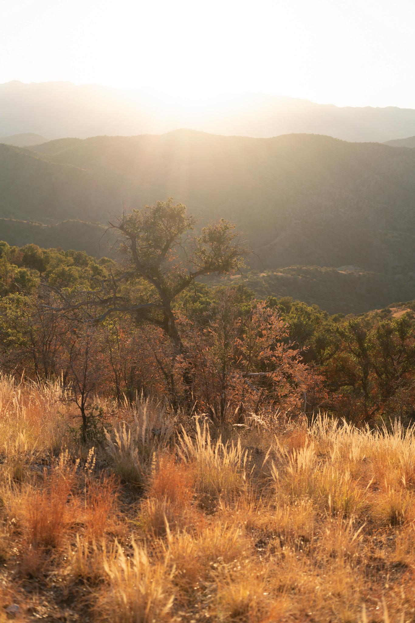
El Pinacate and Gran Desierto de Altar Biosphere Reserve. Photo: Sergio Müller
2 nd Edition
Northwest Mexico Program Co-Director
Table of Contents 8 8-9 10 10 3 4 5 6-7 Results 11-12 Resear ch Resu lt s an d Mit ig ati on Strategies toImprove Wildli fe Co n ne ctivityand H uman Saf etyal on gI-40int he Pi ge onRiverGorge Conclusions and Recommendations 13 Acknowledgements 14 Introduction Sonora 30 x 30 Background on the 30 x 30 Global Objective A 30 x 30 Vision for Sonora Sonora's Protected Area Method for Calculating the Percentage of land protected in Sonora Selection Criteria and General Considerations Sources of information Selected geographic projections calculations
Sonora is a privileged state in terms of biodiversity, as a result of its geographic location and breadth. It is also one of the states most threatened by the impacts of global climate change. These two realities call for implementing effective and ambitious land conservation mechanisms that can simultaneously counteract the loss of biodiversity and the alterations in climate caused or exacerbated by land-use change.
Currently, progress has already been made in conserving land in the state through different categories of Natural Protected Areas of the three levels of government, as well as multiple federally certified Areas Voluntarily Designated for Conservation.
This report presents an analysis of the state's total protected area through December 2022, and calls for the adoption of a statewide conservation policy of protecting 30% of Sonora's land area by 2030, aligned with the 30x30 Initiative adopted by various international organizations, countries and states around the world.
Were such a policy implemented –led by the state government, with significant participation of the federation, municipalities, private and social landowners, academic institutions and citizen organizations– Sonora would be at the forefront in conserving its biodiversity, while contributing to the global goals of combating climate change, through the so-called "Nature-based solutions" identified by the UN.
At first glance it may seem difficult to conserve such a significant portion of the state, however, given the relatively low population density, the forestry and livestock vocation of much of the territory and, above all, the imperative need to change the relationship of our society with the natural environment, it is clear that the goal is not only attainable, but necessary.
3
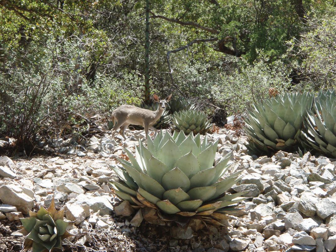
White-tailed deer in the Bavispe Flora and Fauna Protection Area.
Photo: Roberto Torres
Background of the G l obal Ob j ective 3 0 x30
Our planet’s extinction crisis is an issue that concerns governments at all levels. At the highest level, members of the United Nations signed the Convention on Biological Diversity in 1992 as a binding treaty that commits nations to work towards biodiversity conservation. Mexico ratified the Convention in March 1993 and it came into effect in December of that year. The governing body of the Convention is the Conference of the Parties led by its Secretariat
Throughout the previous decade, the members of the Convention worked on protecting biodiversity under the framework of the Strategic Plan 2011-2020. In 2017 the Open-ended Working Group on the Post-2020 Global Biodiversity Framework (WG2020) was created to establish a new guiding document for 2020-2030.
In August 2020, the WG2020 published the Preliminary Draft Update of the Post-2020 Global Biodiversity Framework, setting out for the first time, in a global document, the target of conserving 30% of the planet by 2030. This target responds to the call of the scientific community, summarized in a report by the International Union for Conservation of Nature, to review the Aichi Biodiversity Targets incorporated into the 2011-2020 Strategic Plan, as they are insufficient to conserve global biodiversity.
In the U.S., California set an example for the rest of the country, and across the world, when issuing Executive Order N-82-20 in 2020, which established the goal of conserving 30% of the state's land and coastal area by 2030.

Fifty countries, including Mexico, followed suit by forming the High Ambition Coalition for Nature and People in January 2021, which expressed "their commitment to protect at least 30% of land and oceans by 2030, and to advocate for an ambitious global agreement to halt species loss and protect ecosystems that are vital to human health and economic security."
That same month, the President of the United States issued Executive Order 14008, which kicked off several actions to combat the climate crisis, including a goal of protecting 30% of the country's land by 2030, later identified as the America the Beautiful Initiative.
Finally,in December 2022, the Convention on Biological Biodiversity adopted the Kunming-Montreal Global Biodiversity Framework whose third target was established as:
"Ensure that at least 30 percent of terrestrial, inland and coastal waters and marine areas globally, especially areas of particular importance for biodiversity and ecosystem functions and services, will be conserved and effectively managed through ecologically representative, wellconnected and equitably governed systems of protected areas, and other effective area-based conservation measures, the recognition of indigenous and traditional territories, where appropriate, integrated into broader landscapes, seacapes and oceascapes, while ensuring that any sustainable use, where appropriate in such areas, is fully consistent with conservation outcomes, recognizing and respecting the rights of indigenous peoples and local communities.”
4
Cocóspera River at ADVC Rancho El Aribabi Fraction A. Photo: Myles Traphagen
A 30x30 Vision for Sonora
Sonora is the second largest state in the country and the meeting point between arid, tropical, coastal and mountain ecosystems. The state is privileged to have a wealth of biodiversity, which carries with it an enormous responsibility to protect it.

Implementing a 30x30 policy at the state level would put the state at the forefront in protecting biodiversity and combating climate change, while aligning it with Target 3 of the Global Kunming-Montreal Framework adpoted by the member countries of the Convention on Biological Biodiversity, including Mexico. It should be recalled that the federal government promoted this target in multiple international forums as part of the strategy to ensure its adoption at the global level.
In the recent past, Sonora already played this vanguard role by establishing one of the first Natural Protected Areas (NPA) systems in the country in the early 1990s, known as the Protected Areas System of the State of Sonora (SANPES for its Spanish acronym). The impact of the SANPES implementation effort should not be underestimated, as an example for a new state policy’s commitment to biodiversity, people, and climate stability: In only three years, SANPES came close to quadrupling the state's protected area. Twenty-six years after the last decree resulting from SANPES, the threats to biodiversity have increased, and the international scientific community has made it clear that we need to be more ambitious if we want to protect the planet's natural heritage.
Leaders from around the world, including the President of Mexico (through the Undersecretary of Multilateral Affairs and Human Rights of the Ministry of Foreign Affairs) support the vision of protecting 30% of the territory by 2030. Sonora should not be left behind. The state has the opportunity today to design and implement a SANPES 2030, which identifies priority areas for establishing new NPAs, and guides coordinated actions among the three levels of government and civil society, to protect Sonora's biodiversity and join the global movement to safeguard life on our planet.
A renewed Natural Protected Areas System for the State of Sonora could be supported by the development of up-to-date technologies and scientific models that provide much more information on priority sites for conservation than existed thirty years ago. Likewise, organized civil society has made important advances in managing the conservation of private and communal lands, opening channels of communication with landowners interested in protecting their lands. Finally, in June 2022, the Congress of the State of Sonora approved a set of amendments to the Law of Ecological Balance and Environmental Protection and to the Municipal Finance Law, which will stimulate the voluntary conservation of private lands, thus opening further new opportunities for land conservation.
In addition to seeking to increase the total area protected by legal mechanisms, a SANPES for 2030 should outline a strategy to ensure the effective conservation of state NPAs and Voluntary Conservation Areas, by requesting the necessary resources from the State’s Congress to manage the former and foster the latter.

5
El Pinacate Biosphere Reserve and Gran Desierto de Altar. Photo: Sergio Müller
Protected Surface of Sonora
Prior to SANPES and decreed in the twentieth century, Sonora had four NPAs, all of them federal: the Bavispe Flora and Fauna Protection Area (APFF), as well as portions of the Tutuaca, Campo Verde, and Islas del Golfo de California APFFs. These NPAs together totaled 392,411.88 hectares.
As part of the implementation of SANPES, between 1993 and 1996, three federal NPAs were decreed: the Biosphere Reserves (BR) El Pinacate y Gran Desierto de Altar and Alto Golfo de California y Delta del Río Colorado, and the APFF Sierra de Álamos y Río Cuchujaqui; as well as one state NPA: the Zone Subject to Ecological Conservation (ZSCE) Sistema de Presas Abelardo Rodríguez Luján-El Molinito. To date, and after some modifications, the NPAs resulting from the effort to implement SANPES total 1,028,822.15 hectares of conserved land.
State surface area
In the 21st century this area has increased with the incorporation of a federal NPA, Isla San Pedro Mártir BR; six state NPAs, the ZSCEs Arivechi - Cerro Las Conchas and Estero El Soldado and the State Reserves (RE) El Pinito, San Bernardino, Ojos Calientes and Potrero San Luis, one municipal NPA, the Urban Park (PU) Parque Central de Hermosillo, known locally as Cerro Johnson, 14 Ramsar Sites (RS) and 10 Areas Voluntarily Designated for Conservation (ADVC), which together contribute 504,859. 56 hectares.
Over the years, state decrees and federal certificates have been issued designating areas previously protected totally or partially by other mechanisms, for example, the Agua Dulce Ramsar Site, located entirely
within the El Pinacate and Gran Desierto de Altar Biosphere Reserve. Taking this into account, as well as the most recent modifications that reshape the boundaries of Natural Protected Areas, today the protected area within the state is 1,926,127.37 hectares. This is 10.66% of the state's total surface area, just over a third of the 30 x 30 objective.

Protected surface by category
127.37 6
18,055,989.86
Protected 1 ,9 26 , ha s Without protection 1 6, 12 9 ,8 94 8 4 ha s 89.34% 10.66% Federal NPAs
Sites AD VC s State NPAs Municipal NPAs 72.90% 19.84% 2.56% 4.70% 0.002%
Figure 1: Percentage of protected surface area in the state of Sonora
hectares
Ramsar
7
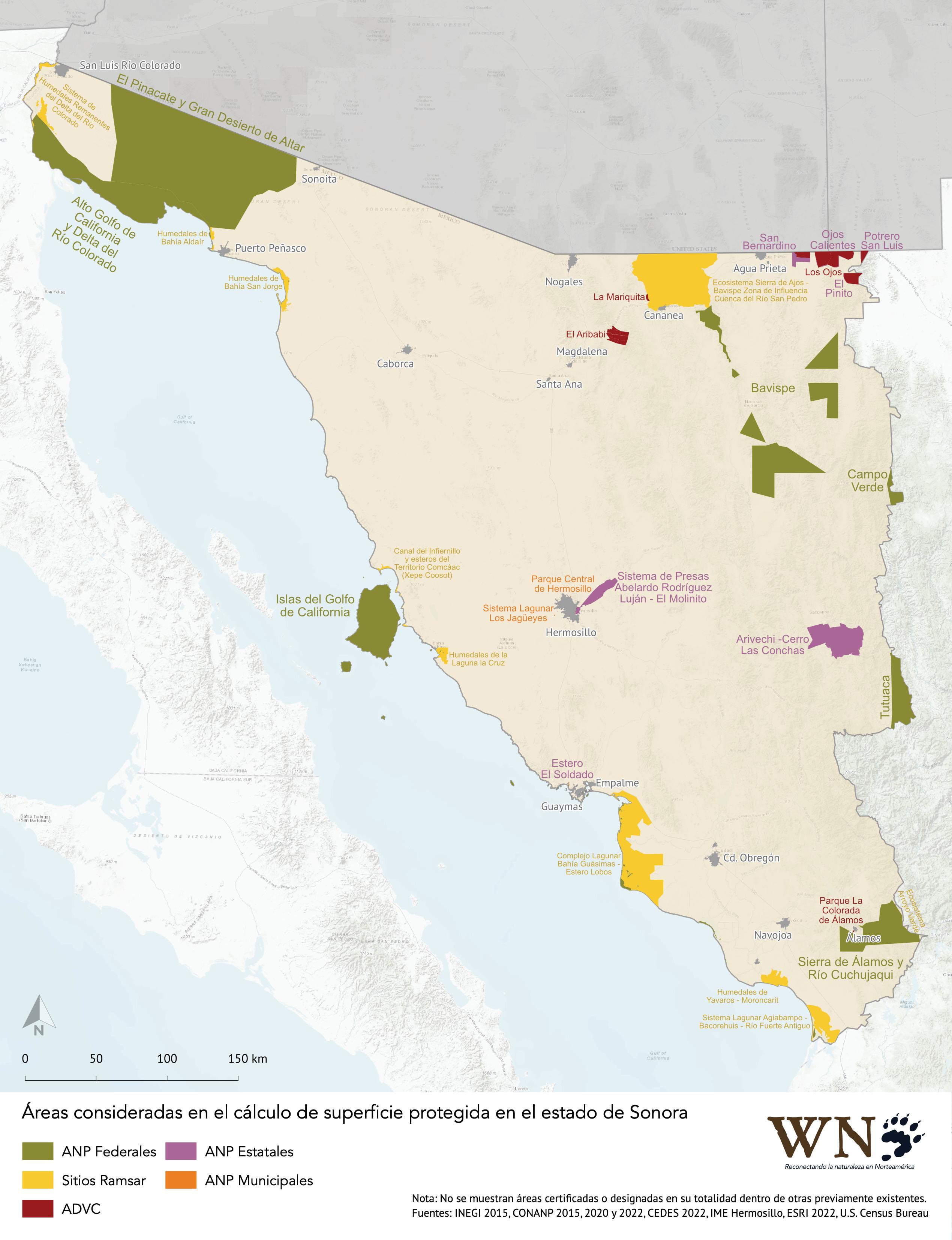
Figure 2: Map of Sonora’s NPAs by category
Method for Calculating the Percentage of Protected Land in Sonora
Determining the protected land surface of the state of Sonora is complicated for several reasons. First, it was necessary to determine how many Natural Protected Areas (NPAs) exist in the state, according to the decrees of the three levels of government, the certificates issued by the federal government for Areas Voluntarily Designated for Conservation (ADVC), and the list of registered Ramsar Sites.
Among the state's current NPA decrees, the oldest date from 1937, 1938 and 1939 (Tutuaca, Campo Verde and Bavispe*, respectively) and do not include detailed information on the boundaries of the areas they encompass, which is also the case with the 1978 decree for Islas del Golfo de California.
In the 1990s, digital Geographic Information Systems (GIS) began to be used to outline the new NPAs and to generate surveys that would give legal certainty to the old decrees. However, the publicly-available documentation of these processes is not sufficient to understand how the areas included in official documentation—such as the Secretary's Agreements for recategorization, Management Programs or the data included in the GIS layers available on the official website of the National Commission of Natural Protected Areas (CONANP)—were calculated.
The calculation is also complicated by the fact that several NPAs are shared with neighboring states, and official datasets do not distinguish between the surface area of the NPA within one state and another. The same is true for coastal and island NPAs, which do not distinguish between the area within the state's territory and the marine areas under the jurisdiction of the federal government.
In turn, the state government of Sonora, through its Commission for Ecology and Sustainable Development (CEDES), has decreed several state NPAs for which there is little publicly-accessible documentation and with boundaries that, in some cases, are located partially on top of protected areas in previously existing federal
instruments. The same is true for some of the Ramsar Sites registered fully or partially on top of federal and state NPA decrees and with two certified ADVCs within a Ramsar Site.
For all of the reasons above, it is impossible to calculate the protected area in the state of Sonora based solely on what is published in decrees and other regulatory documents. An independent GIS analysis was required, using publicly available geographic layers and those obtained directly from the relevant authorities.
Sources of information
To calculate the area of the state of Sonora, we downloaded the shapefile of the State of Sonora included in the Cartografía geoestadística urbana y rural amanzanada Cierre de la Enucesta Intercensal 2015 (Urban and Rural Geostatistical Cartography) from INEGI's official website. We downloaded the individual polygon layers of the following federal NPAs, available (May 2022) on the official CONANP website:
APFF de Campo Verde
Bavispe APFF
APFF Islas del Golfo de California
Reserva de la Biosfera (BR) Alto Golfo de California y Delta del Río Colorado
El Pinacate y Gran Desierto de Altar BR
APFF Sierra de Alamos y Río Cuchujaqui
RB Isla de San Pedro Mártir †
8 Selection criteria and general conside r ations
† This layer was not used to calculate surface areas because it does not distinguish between the insular zones, belonging to the state of Sonora, and the marine zones, belonging to the federal government. Instead, we used the polygons of San Pedro Mártir Island and its three islets included in the APFF Gulf of California islands layer.
1. 2. 3. 4. 5. 6. 7. 8.
*Although the first decree of Bavispe dates from June 30, 1936, it was not cited as a basis for recategorization in the Secretarial Agreement of May 22, 2017 — which gave legal certainty to the ANP — so we do not consider it current for this study.
Área de Protección de la Fauna y la Flora (APFF) Tutuaca
For Ramsar Sites we used the layer that CONANP had available on its site in 2015, which is no longer accessible to the public. We eliminated the sites Humedales del Delta del Río Colorado, Agua Dulce and Isla San Pedro Mártir for not containing hectares outside of previous decrees and only considered the Ramsar Sites:
9. Complejo Lagunar Bahía GuásimasEstero Lobos
10. Sistema Lagunar AgiabampoBacorehuis - Río Fuerte Antiguo
11. Sistema De Humedales Remanentes Del Delta Del Río Colorado
12. Humedales De Bahía Adaír
13. Humedales De Yavaros - Moroncarit
14. Canal Del Infiernillo Y Esteros Del Territorio Comcaac (Xepe Coosot)
15. Ecosistema Sierra De Ajos-Bavispe Zona De Influencia Cuenca Río San Pedro
16. Humedales De Bahía San Jorge
17. Ecosistema Arroyo Verde Apff Sierra De Álamos Río Cuchujaqui

18. Estero El Soldado
19. Humedales De La Laguna La Cruz
We also downloaded a national layer of the boundaries of the Areas Voluntarily Designated for Conservation (ADVC) from CONANP's website corresponding to April 2022, which includes all the ADVCs of the state of Sonora and from which we eliminated the ADVC Los Fresnos because it is contained entirely within a Ramsar Site that was decreed prior to its certification:
20. Área de Conservación Los Ojos 1
Fracciones A y B
21. Área de Conservación Los Ojos 2
Fracciones C y D
22. Área de Conservación Los Ojos 3
Fracciones E, F, G, H, I
23. Rancho El Aribabi Fracción A
24. Rancho El Aribabi Fracción B
25. Predio Potrero de los Silos, Potrero Los Amorosos y Predio Los Vallecitos
26. Fracción C del predio rustico Los Güérigos
For the following State NPAs we used the July 2020 layer that CONANP published on its site that year, but that is no longer is no longer available for download.
29. Zona Sujeta a Conservación Ecológica
(ZSCE) Arivechi – Cerro Las Conchas
30. ZSCE Estero El Soldado
In addition, we obtained the following layers via direct request to the Commission of Ecology and Sustainable Development of Sonora (CEDES) and the Institute of Municipal Ecology of Hermosillo:
31. Zona Sujeta a Conservación Ecológica
Sistema de Presas Abelardo Rodríguez
Luján *
32. Reserva Estatal El Pinito
33. Reserva Estatal San Bernardino
34. Reserva Estatal Ojos Calientes
35. Reserva Estatal Potrero San Luis
36. Parque Urbano (PU) Parque Central de Hermosillo
27.
28. La Mariquita Parque la Colorada de Álamos
9
Molinito, in its modified version that appears in the Management Program published on June 11, 2018 in the Official Gazette of the Government of the State of Sonora, since this does not appear updated in the CONANP layer used for the rest of the NPAs.
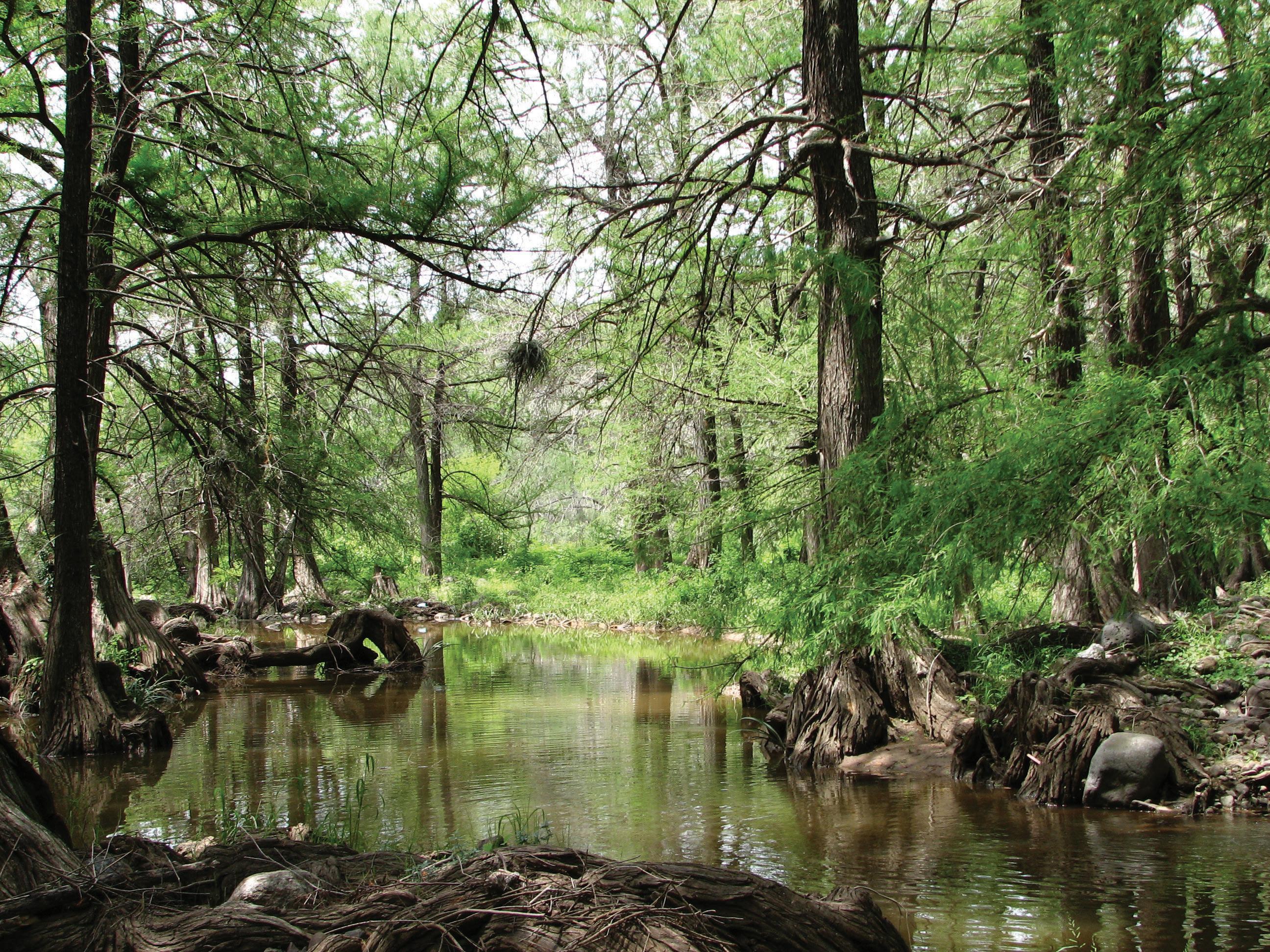
Grassland in Cuenca del Río San Pedro, a Ramsar Site. Photo: Juan Carlos Bravo
*El
37. Zona de Restauración (QR) Sistema Lagunar Los Jagüeyes
Selected geographic projections
We loaded the state and NPA polygons into the software QGIS-LTR Version 3.22.5-Bialowezia and re-projected them using the Reproject layer tool using the Mexico ITRF2008/UTM zone 12 projection (EPSG:6367). We chose this projection because it is the one used by CONANP to calculate the area of the polygon of the Bavispe APFF, which is the most recent among those officially published by CONANP for an ANP completely inside the state. The only exception to the use of this projection was the layer corresponding to the polygon of the BR Alto Golfo de California y Delta del Río Colorado, which was re-projected using the Mexico ITRF2008/UTM zone 11 projection (EPSG:6366) since, unlike the rest, the majority of this NPA is located in the UTM zone 11.
polygons subsequently extracted, we replicated the process used in the previous cases to obtain the surface area.
For the State NPAs Estero El Soldado, El Pinito, San Bernardino, Ojos Calientes and Potrero San Luis we applied the Difference tool to eliminate the portion that duplicates the polygons of the APFF Islas del Golfo de California and the ADVCs Los Ojos 1-3. We applied the same process with Ramsar Sites that are partially within a federal or state NPA. Finally, we replicated this same process to modify the ADVC La Mariquita, because it partially overlaps a Ramsar Site.
With the polygons thus modified, the Field Calculator was used again to obtain the surface area of the NPAs, RS and ADVCs partially established over previously protected polygons.
When calculating the surface area of the State of Sonora, we noticed that the Sonora polygon published by INEGI does not include San Pedro Martir island or the three nearby islets, so we added them by copying them from CONANP's polygon for the APFF Islas del Golfo de California. To calculate the total area, including San Pedro Mártir Island and its islets, we used QGIS’s Field Calculator tool and the expression $area/10,000 to obtain a reading in hectares, with a precision of two decimal places.
To calculate the surface areas of the two federal NPAs that are totally within Sonora (APFF Bavispe and RB Pinacate y Gran Desierto de Altar), of the ADVCs, and of two of the state NPAs (Arivechi - Cerro Las Conchas and Sistema de Presas Abelardo Rodríguez Luján) we used the same tool, Field Calculator, on the corresponding layer, as obtained from its original source.

To calculate the surface area of NPAs and Ramsar Sites with polygons that extend to other states or into the national maritime area, we first used the Clip tool, together with the state polygon layer itself, to isolate the portion corresponding to Sonora and then measured only that portion, again using the Field Calculator
To calculate the surface area of the Isla San Pedro Mártir Biosphere Reserve we extracted the polygons of the island and the three nearby islets from the APFF Islas de Golfo de California layer, since the individual NPA layer did not contain polygons exclusive to the island portions, nor did the State of Sonora layer. In the
10
calculation
Surface
Results
There are 37 areas under some conservation mechanism that contribute to the state's protected area. Of these, eight (8) are federal NPAs, eleven (11) are Ramsar Sites, nine (9) are ADVCs, seven (7) are state NPAs and two (2) are municipal NPA.s
Federal NPAs total 1,404,226.48 hectares corresponding to 7.78% of the state; Ramsar Sites total 382,153.48 ha corresponding to 2.12% of the state; HCVDAs total 49,249.56 ha corresponding to 0.27% of the state, State NPAs total 90,441.31 ha corresponding to 0.50% of the
state, and municipal NPAs total 56.54 has corresponding to 0.003% of the state.
The total aggregate area protected by all these NPAs is 1,926,127.37 hectares, corresponding to 10.6675% of the state.
The complete list of NPAs considered and the calculated surface calculated for each is included in Figure 3.
11
Área de Protección de Flora y Fauna Sierra de Álamos y Río Cuchajaqui. Foto: Thomas Van Devender
and HCVFs considered for the calculation of the protected area of the state of Sonora. Some NPAs were omitted from this list because they were located entirely on the area described in previous instruments, so they did not add conservation hectares to the state when they were established.
12
NUMBER CATEGORY NPA SURFACE AREA H A S PERCENTAGE E STADO SONORA 18, 055, 989. 86 100% 1 AP F F T u tu aca 5 0 , 4 7 0 3 6 0 2 7 9 5 2 AP F F Cam po Ve rde 1 0 , 8 2 0 9 5 0 0 5 9 9 3 AP F F Bavispe 2 0 0 , 9 0 0 6 5 1 1 1 2 7 4 AP F F I slas de l G olfo de Californ ia 1 3 0 , 2 1 9 9 2 0 7 2 1 2 5 RB Alto G olfo de Californ ia y De lta de l Río Colorado 2 0 4 , 8 4 0 4 8 1 1 3 4 5 6 RB El P in acate y G ran De sie rto de Altar 7 1 4 , 5 5 6 5 0 3 9 5 7 4 7 AP F F S ie rra de Álam os y Río Cu ch u jaqu i 9 2 , 1 4 2 5 7 0 5 1 0 3 8 RB I sla S an P e dro Mártir 2 7 5 0 5 0 0 0 1 5 9 S R Com ple jo Lagu n ar Bah ía G u ásim as - Este ro Lobos 1 2 6 , 1 9 7 8 9 0 6 9 8 9 10 S R S iste m a Lagu n ar Agiabam po - Bacore h u is - Río F u e rte An tigu o 2 6 , 2 2 3 4 3 0 1 4 5 2 11 S R S iste m a de Hu m e dale s Re m an e n te s de l De lta de l Río Colorado 1 2 , 8 1 4 7 5 0 0 7 1 12 S R Hu m e dale s de Bah ía Adaír 2 , 1 1 1 0 9 0 0 1 1 7 13 S R Hu m e dale s de Y avaros - Moron carit 1 3 , 4 5 5 7 0 0 0 7 4 5 14 S R Can al de l I n fie rn illo y Este ros de l T e rritorio Com caac ( Xe pe Coosot) 2 , 1 9 1 9 4 0 0 1 2 1 15 S R Ecosiste m a S ie rra de Ajos-Bavispe Z on a de I n flu e n cia Cu e n ca Río S an P e dro 1 8 2 , 5 0 5 7 4 1 0 1 0 8 16 S R Hu m e dale s de Bah ía S an Jorge 1 0 , 2 9 5 2 1 0 0 5 7 17 S R Ecosiste m a Arroyo Ve rde Apff S ie rra de Álam os Río Cu ch u jaqu i 1 4 6 0 0 0 0 1 18 S R Este ro El S oldado 7 7 4 5 0 0 0 0 4 19 S R Hu m e dale s de La Lagu n a La Cru z 6 , 2 6 5 6 8 0 0 3 4 7 20 ADVC Áre a de Con se rvación Los Ojos 1 F raccion e s A Y B 1 1 , 7 1 5 0 4 0 0 6 4 9 21 ADVC Áre a de Con se rvación Los Ojos 2 F raccion e s C Y D 9 , 7 0 6 8 0 0 0 5 3 8 22 ADVC Áre a de Con se rvación Los Ojos 3 F raccion e s E, F , G , H, I 1 3 , 9 5 5 0 8 0 0 7 7 3 23 ADVC Ran ch o El Aribabi F racción A 4 , 1 8 3 6 7 0 0 2 3 2 24 ADVC El Aribabi F racción B 4 , 3 7 0 9 7 0 0 2 4 2 25 ADVC P re dio P otre ro de Los S ilos, P otre ro Los Am orosos y P re dio Los Valle citos 1 , 8 1 1 9 8 0 0 1 26 ADVC F racción C de l P re dio Rú stico Los G ü é rigos 2 , 7 4 6 2 3 0 0 1 5 2 27 ADVC La Mariqu ita 6 5 0 2 3 0 0 0 3 6 28 ADVC P arqu e La Colorada de Álam os 1 0 9 5 6 0 0 0 0 6 29 Z S CE S iste m a de P re sas Abe lardo Rodrígu e z Lu ján - El Molin ito 1 7 , 2 8 2 6 0 0 0 9 5 7 30 Z S CE Arive ch i - Ce rro Las Con ch as 6 6 , 2 5 3 1 2 0 3 6 6 9 31 Z S CE Este ro El S oldado 2 1 6 1 2 0 0 0 1 2 32 RE El P in ito 6 4 4 6 0 0 0 0 4 33 RE S an Be rn ardin o 5 , 6 7 8 7 6 0 0 3 1 5 34 RE Ojos Calie n te s 7 7 0 2 9 0 0 0 4 3 35 RE P otre ro S an Lu is 1 7 5 9 5 0 0 0 1 36 P U P arqu e Ce n tral de He rm osillo 2 2 7 7 0 0 0 0 1 37 Z R S iste m a Lagu n ar Los Jagü e ye s 3 3 7 7 0 0 0 0 2 TOTAL 1,926,127.37 10.66%
Figure 3: List of NPAs
Conclusions and Recommendations
The fact that 10.66% of Sonora is protected means that we are one third of the way to conserving 30% by 2030. It is imperative to accelerate the pace as time is running out for many species and, with each passing year, climate change increasingly affects both entire ecosystems and people, exacerbating the situation for communities most vulnerable to droughts, forest fires and floods. We hope this report will serve to establish a baseline and spur the implementation of the 30x30 goal in our state.

Protecting a total of 3,490,669.59 hectares—19.34% of the state—in the next seven years may seem impossible, but we must recognize that never before has there been so much environmental awareness among the population. This is especially true in the state's livestock and forestry communities, which are already seeking to transition to more sustainable models of production. If they are supported by academic institutions and citizens' organizations, and if there is strong political will, it is possible to achieve and even surpass the goal.
To reach the ambitious goal of having 30% of the state's surface area under some kind of conservation management, we recommend the following actions:
Reactivate the Natural Protected Areas System of the State of Sonora with the participation of representatives from the three levels of government, academia and organized civil society.
Conduct a series of meetings with experts to determine the priority areas for conservation, using the growing number of scientific studies together with the field experience of experts from government, NGOs and research centers.
Promote the creation of new state protected areas and provide them with Management Programs and sufficient resources to operate effectively.
Collaborate with the federal and municipal governments to create new NPAs under the jurisdiction of these other levels of government.
Strengthen and promote the voluntary conservation of private and social properties with financial incentives for their management.
Promote and strengthen state legislation in support of wildlife corridors and ecosystem connectivity through NPAs and other land conservation mechanisms
7 Promote the reactivation of the State Environmental Fund as a mechanism to incentivize conservation.
It isn’t merely a matter of designating any part of the state as an NPA in an effort to complete a numerical goal; a far-reaching strategy is required to help determine priorities. As our study reveals, decrees may not add conservation hectares when they are established in already protected sites, and there are areas where human impact is so great that they are no longer representative of their original ecosystems, all of which must be taken into account when proposing new NPAs. If we really want to be strategic, we must conserve portions of all the ecosystems present in the state, and such portions must be large enough to support complex bioclimatic processes and must be well connected to each other by ecological corridors. Moreover, they should be established in support of the rural communities that inhabit and work landscape and under
Finally, it is important to note that even though the scope of this report is limited to an analysis of the area protected on paper, effective conservation with tangible results in the field requires much more than a designation. Along with the effort to increase the protected territories, it is necessary to create financial structures (e.g., budgets, endowments, etc.) governance structures (e.g., management programs, polygons, action plans) and management structures (e.g., consolidated institutions with offices, park rangers, vehicles, etc.) that are sufficiently robust that the NPAs can exercise real and not just apparent conservation. Currently, existing NPAs lack sufficient personnel, budget for surveillance and monitoring, effective legal defense capabilities and a strategic vision at the state level to govern and coordinate their actions. As communities increasingly value natural spaces for the multiple benefits they provide, the state government must react appropriately, prioritizing conservation in planning and budgeting.
13
1 2 3 4 5 6
Reserva de la Biosfera Isla San Pedro Mártir. Photo: Luis Bourillon
Acknowledgements
The authors would like to thank the Wilburforce Foundation, Gustavo Armenta González, Norma Cira Cruz Molina, Martín Reyes Juárez and Gonzalo Luna Salazar of the Commission of Ecology and Sustainable Development of the State of Sonora (CEDES), and Francisco Jesús Gil Barraza of the Municipal Institute of Ecology (IME Hermosillo) for making this report possible.
 Estero El Soldado, wetland with three different categories of protection. Photo: Zahínn González Soto Estero El Soldado, húmedal con tres distintas categorías de protección. Foto: Zahínn González Soto
wildlandsnetwork.org info@wildlandsnetwork.org
ADVC Rancho El Aribabi Fraction A. Photo: Sergio Müller
