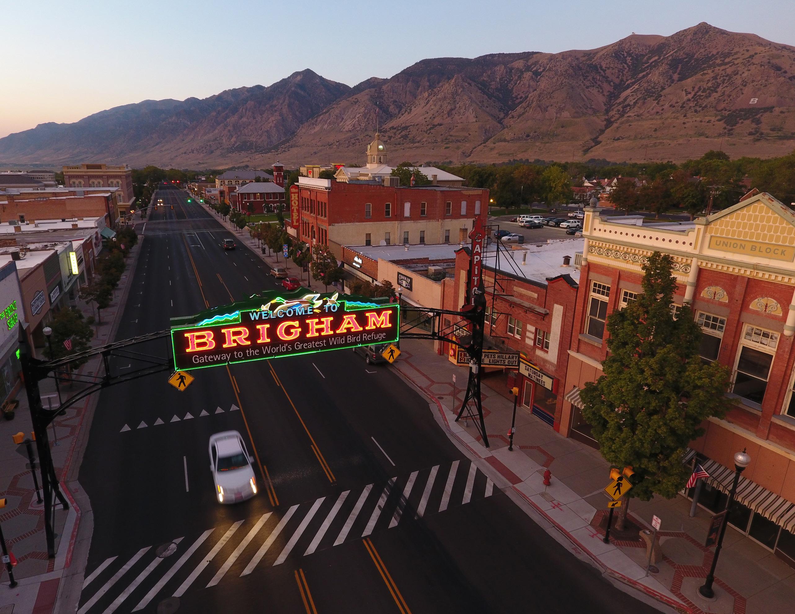
GREAT STREETS
A Framework for Regional Collaboration


This page is intentionally left blank.

This page is intentionally left blank.
Table of contents
Introduction .................................................................. 1
Great Streets Framework .......................................... 2
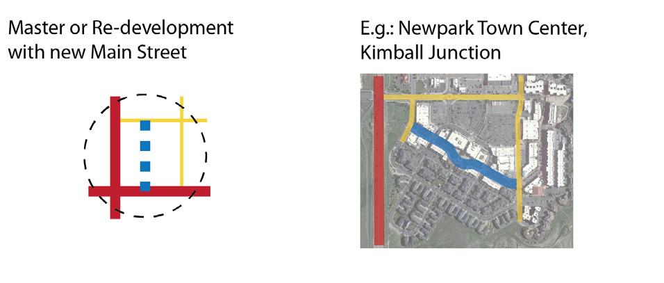
Wasatch Choice Centers
Using the Framework
Regional-Community Balance: Identifying the Context
Complete Multi-Modal Network
Increased Safety
Enhanced Places
Strong Economies
Effective Partnerships
Great Streets Typology ........................................... 22
Overview
Corridors
Main Streets
Hybrid Main Streets
Supporting Streets
Major Regional Corridors
Advisory Committee
Ted Knowlton, Wasatch Front Regional Council
Julie Bjornstad, Wasatch Front Regional Council
Hugh Van Wagenen, Wasatch Front Regional Council
Shawn Eliot, Mountainland Association of Governments
Tim Hereth, Mountainland Association of Governments
Jim Price, Mountainland Association of Governments
Grant Farnsworth, Utah Department of Transportation
Jordan Backman, Utah Department of Transportation
Alex Beim, Utah Transit Authority
Matt Gray, Utah Transit Authority
Consultant Team
Tim Sullivan, Project Manager, Township + Range
Sophie Bellina, Planner, Township + Range
Zeke Peters, Intern Planner, Township + Range
Brent Crowther, P.E., Kimley-Horn and Associates
Jacob Farnsworth, P.E., Kimley-Horn and Associates


This page is intentionally left blank.
Wasatch Choice Great Streets is a framework to make regional transportation planning decisions that complement the communities and places they serve. Its focus is on streets - and how they influence both transportation and the places around them. Great Streets is meant to be used collaboratively by partners throughout the Wasatch Front Region - local, regional, and state; public and private; large and small communities - to promote regional street planning and projects that reflect our shared values and balance our different needs.
Great Streets seeks to create a better fit between streets and the context that surrounds them. When streets and their context complement one another, the benefits are widespread. They include safety, quality of place, stronger economies, and access to opportunity, among many others.
The framework revolves around the relationship between two types of context. Community context refers to the places served by streets but also includes the people who use the streets and the members of the surrounding community, as well as their values. Community context emphasizes a community's vision for a place - not necessarily what is there now but what is desired to be in the future.
Meanwhile, regional transportation context is comprised of streets, highways, rails, trails, transit service, and other elements that move large amounts of people and goods and connect communities. This network utilizes a system of regional corridors focused on arterial streets with supporting collector streets and trails. The regional network often prioritizes moving people to destinations rather than providing access to a particular segment within the corridor.
Community context and regional transportation present two kinds of contexts that must be balanced in making long-term regional decisions for Wasatch Front streets. This balance is often challenged when regional transportation projects and a community’s vision and values are at odds.
Wasatch Choice Great Streets does not intend to be prescriptive for design but instead focuses more on functional outcomes and tools partners can use together to make planning decisions and have conversations. The framework does seek to establish a starting point and a language to utilize when discussing some regionally significant street decisions. This guidance includes how to create regional transportation/community balance, cultivate effective partnerships, create complete networks, achieve safety, and evaluate tradeoffs within and among these areas.
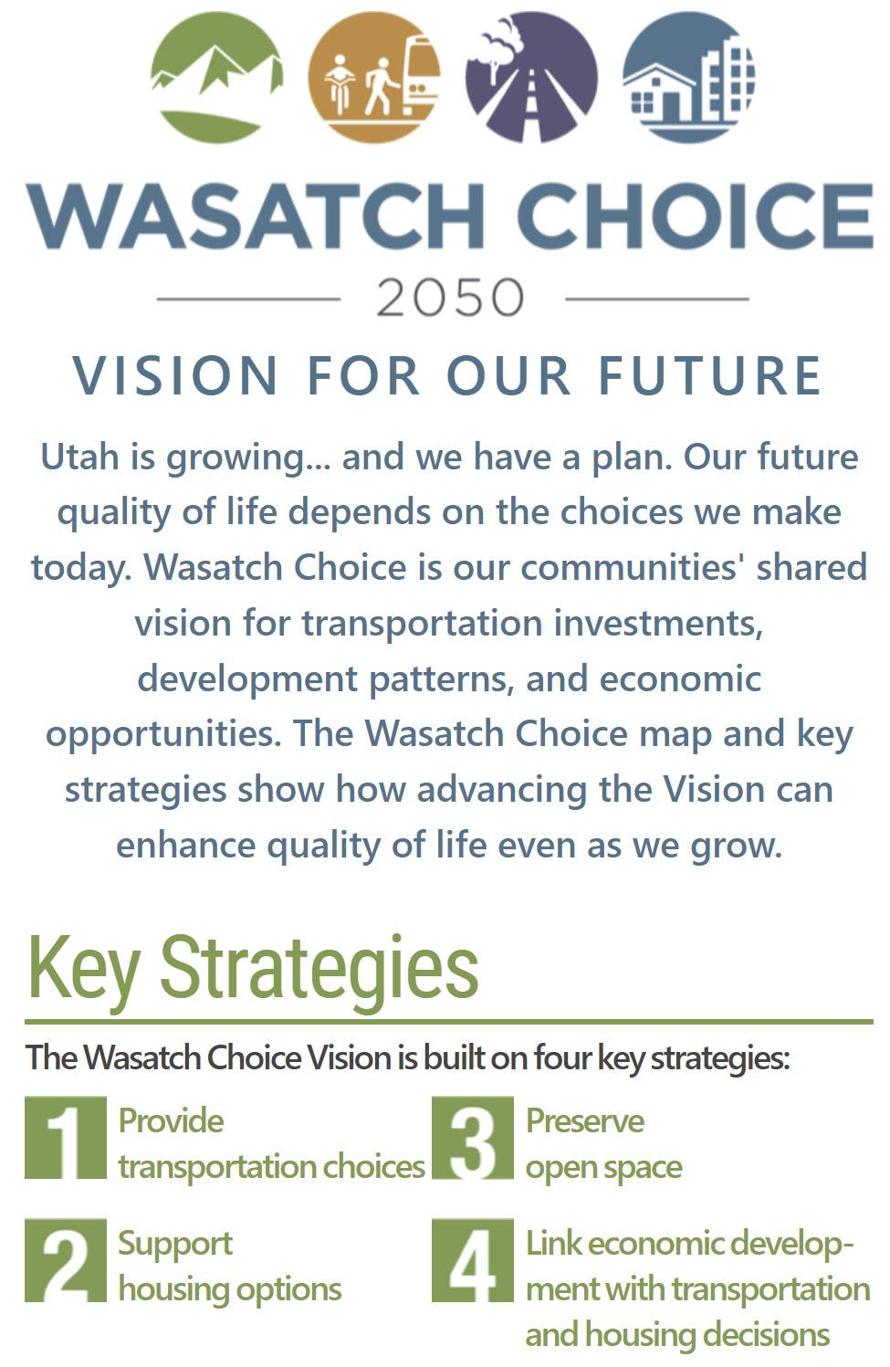
Wasatch Choice Great Streets comes at an opportune time, as Wasatch Front Regional Council (WFRC) and Mountainland Association of Governments (MAG) are working with local communities to create and implement plans for walkable centers and transit station areas, communities are improving and re-envisioning major corridors, and statewide active transportation funding is on the rise - all while Utah continues to grow and face challenges from affordable housing to water resources. Great Streets hopes to do its part in the Wasatch Choice Vision to make the decisions for our Region that will maintain our great quality of life.
The Wasatch Choice Great Streets Framework is intended for partners to use collaboratively, and so it contains a series of elements that partners can consider together. These include:
• Identifying the context: An important first step is identifying the context for streets being considered in plans or other projects.
• Elements: Great Streets includes considerations for a range of elementsa complete multi-modal network, increasing safety, enhancing places, and strengthening economies.
• Partnerships: Consider what partnerships are inherent or will be valuable in collaborations.
• Typology: General guidance about the role of specific streets based on their function and context.
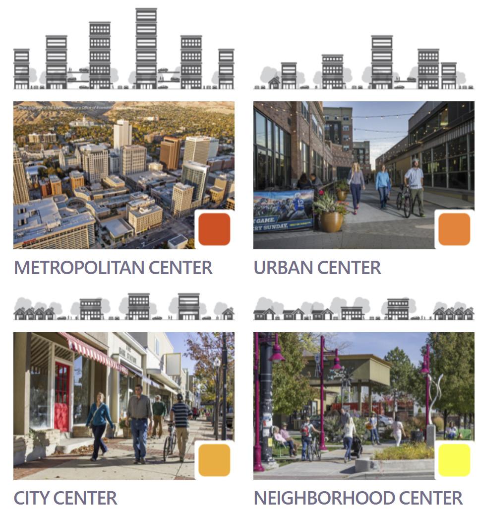
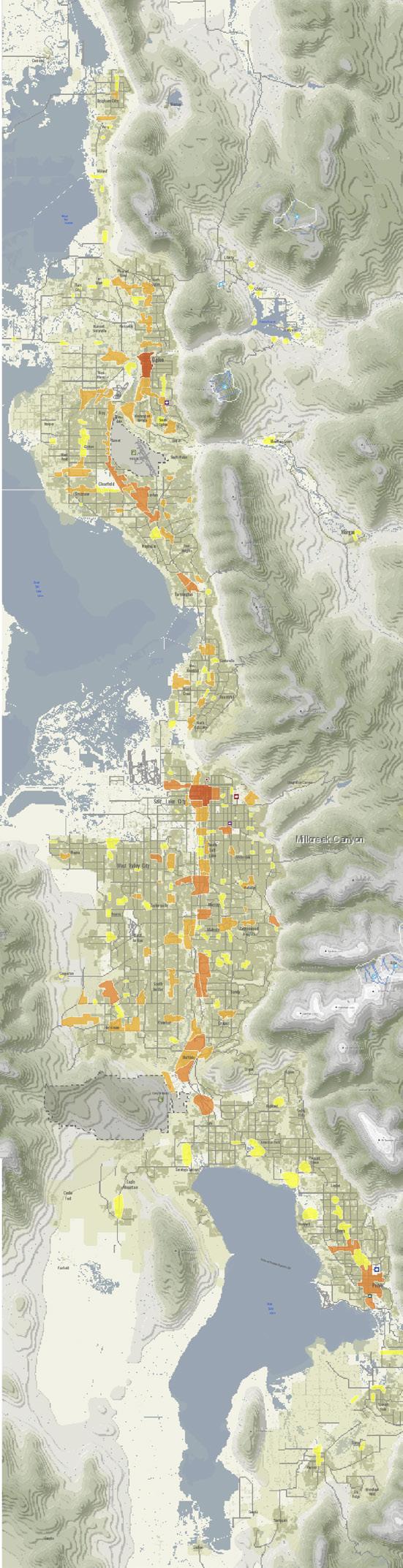
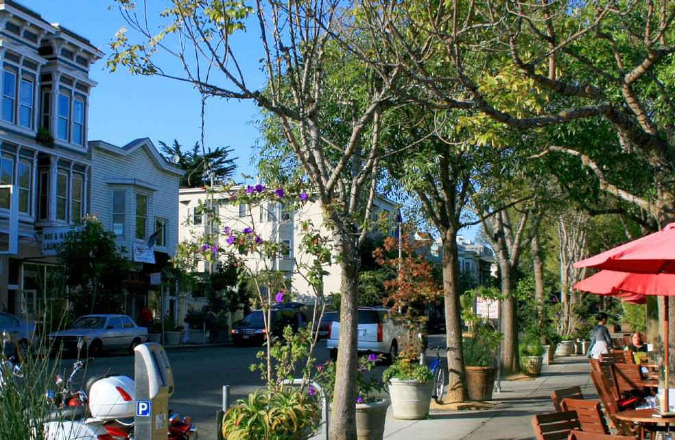
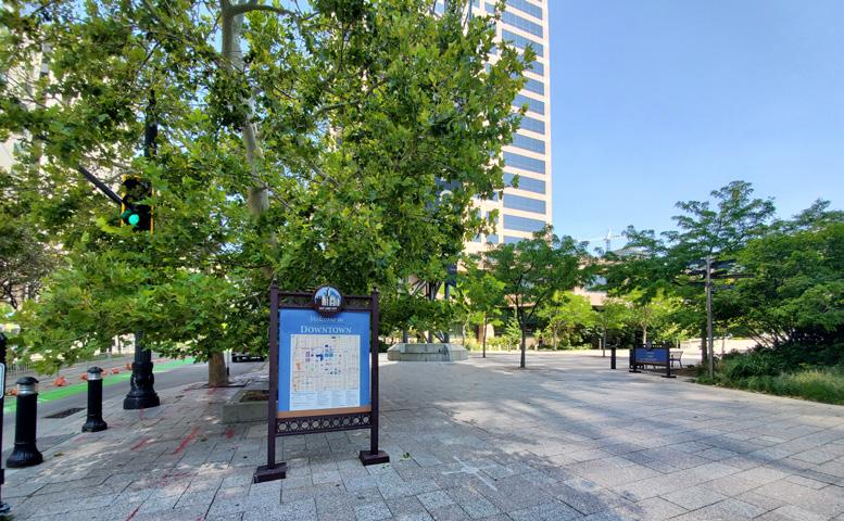
Wasatch Choice Great Streets is initially focused on Wasatch Choice Centers throughout the Region. These Centers include, in order from smallest areas served to largest areas served: Neighborhood Centers, City Centers, Urban Centers, and Metropolitan Centers. They occur throughout the entire Wasatch Front. They offer an established framework of places of activity throughout the Region that were both identified by each community and adopted by WFRC. Perhaps most importantly, they are crucial nodes of regional transportation and important community destinations - for this reason, Wasatch Choice Centers are the places where community and regional transportation contexts are most likely to conflict, as well as to complement one another.
Wasatch Choice Centers also:
• are the hearts of Wasatch Front communities, both socially and economically;
• vary in scale but in all cases are more intense than their surrounding area, and are locations where communities anticipate welcoming more intense buildings, even as they may maintain lower levels of intensity elsewhere;
• are walkable, often served by a variety of transportation options; and
• offer a mix of uses including office, dining, retail, residential, and typically are good candidate locations for providing a variety of housing options, including units that increase housing affordability.
Additionally, the goals of Wasatch Choice Great Streets complement the goals of the Wasatch Choice Vision.
From a practical standpoint, Wasatch Choice Great Streets can be useful for a variety of purposes. These include:
• Awareness: A partner or group of partners wants to become aware of the range of contexts within a center, along a corridor, or influencing a street network. Great Streets is designed to help identify both the community context and regional transportation context and illuminate opportunities and challenges inherent in how they interact. The Regional-Community Balance: Identifying the Context section (p. 4) is the place to look for this.
• Guidance: Throughout Wasatch Choice Great Streets is guidance on integrating context into street planning. These are high-level statements that, without providing specific design details, can help focus a planning process. Guidance to consider is found in the key elements of Complete Multi-Modal Network; Increased Safety; Enhanced Places; and Strong Economies.
• Considerations: Sometimes, Great Streets can be used in a "checklist" fashion - a project manager may want to briefly run down the list of elements and potential strategies to make sure a project or plan has considered every aspect of context it needs to.
• Strategies and tools: For those who are looking for ideas, Wasatch Choice Great Streets offers a range of strategies and tools for each of the framework elements (p. 8 - 21). These range from standard tools to new and innovative ideas.
• Creating complementary networks: Within the Great Streets Framework, the most specific guidance about streets recognizes the street's role in the Wasatch Choice Center's overall network. This is the idea of the Wasatch Choice Great Streets Typology System (p. 22), which provides more specific guidance for five types of streets within a center. All types are intended to increase sensitivity to context, but each is different in the emphasis it places on balancing community and regional transportation context. The typology can be used on its own or as a piece of a broader use of the Great Streets Framework.
• Working together: Great Streets is intended to guide collaborations among partners. The Partnerships section (p. 20) includes guidance on creating street planning partnerships as well as specific types of opportunities to work together using Great Streets.
The diagram to the right shows a process that may be used more broadly, depending on the specific plan or project being considered. Within this sequence, the framework can be used in the full process or in part.
Process for Using Wasatch Choice Great Streets
IDENTIFY THE CENTER, CENTERS, STREETS OR OTHER FOCUS OF THE PLAN OR PROJECT
IDENTIFY ELEMENTS OF COMMUNITY CONTEXT AND REGIONAL TRANSPORTATION CONTEXT
CONSIDER THE FRAMEWORK ELEMENTS:
COMPLETE MULTI-MODAL NETWORK INCREASED SAFETY ENHANCED PLACES STRONG ECONOMIES
IDENTIFY PARTNERS and CREATE PARTNERSHIPS; DEVELOP A COLLABORATIVE PROCESS THAT ADDRESSES THE ELEMENTS ABOVE.
APPLY THE GREAT STREETS TYPOLOGY TO THE PLAN OR PROJECT
Wasatch Choice Centers are places where regional and local community elements mix, and the conflicts between these needs define much of the challenge facing Centers. Planners of streets within Wasatch Choice Centers should first identify the elements and needs of the two types of contexts - community context and regional transportation context - in order to develop strategies to balance them in a Center's street network. The best strategies to balance community context and regional transportation context depend on the specific elements within a Center. The following section reviews these elements, how they interact together, and specific challenges and opportunities to balance them.
In a Wasatch Choice Center, community context elements typically seek to add to the vitality and livability of the Center. These elements of community context can be different types of land use or elements of the public realm. Most centers - such as historic downtowns, employment centers, and transit oriented developments - are envisioned to be complementary mixes of these individual land uses. Community context elements can also include a community's future vision for a Center and its overall way of communicating the community's values and identity.
Regional commercial land uses include retail, service, food and beverage, and other commercial destinations that cater to the Wasatch Front Region or a sub-region. Within a Wasatch Choice center one might see a major mall, a lifestyle center, or big box stores that balance auto access with walkability.
Local commercial land uses include retail, service, food and beverage, and other commercial destinations built in a format that caters to an audience within a neighborhood or surrounding city. Examples in Centers include walkable community and neighborhood "Main Streets," smaller strip commercial centers, and stand-alone retail buildings.
Auto commercial land uses are a subset of either local or regional commercial uses that emphasize auto access and service. Auto-oriented commercial uses are not typical within a Wasatch Choice Center.
Higher density residential land uses primarily focus on multi-story / multifamily housing such as apartments and condominiums.
Middle housing land uses include those "between" higher-density housing and detached single family neighborhoods. They include townhomes, duplexes/triplexes, and even some low-rise multi-family residential buildings.
Office employment land uses are focused on the range of office buildings throughout the region, from office parks to single offices to skyscrapers.
Entertainment, recreation, and arts land uses are community destinations that offer leisure activities such as performances, movies, galleries, and fitness.
Institutions are large, public-facing destinations that attract both regular employees and students and occasional visitors. They include schools of all types, hospitals/medical centers, city halls, and others.
Industrial land uses include light and heavy manufacturing as well as warehousing and wholesale. Industrial land uses are not typical within a Wasatch Choice Center.
Open space land uses include parks and open lands dedicated to recreation or natural places, and are a critical part of many Centers.
Community / public space refers to plazas or other urban public spacesimportant for community gathering and other activities within Centers.
Streetscapes are elements that establish the public environment of streets. They include sidewallks, trees and landscape, street furniture, lighting, and art.
A Center also has regional transportation context, which includes infrastructure bringing people to, from, and through the center - connecting to places throughout the Wasatch Front. These regional transportation elements provide both challenges and opportunities for local community context.
Regional corridors refer to those major surface streets that connect communities. Regional corridors tend to be focused on arterial streets but use collector streets as well, especially in centers. They often move large amounts of people and are important to freight vehicles transporting goods and services to key destinations. Ultimately, corridors often prioritize moving people to destinations rather than providing access to a particular segment within the corridor.
Freeways are limited access high-speed high volume regional or national level roadway corridors. Freeways are relevant to centers in several ways - first, they bring people to and from a center via interchanges. While this access is important, it is also important to transition the high speeds on freeways to slower speeds in centers to foster a walkable environment. Second, they can pose challenging barriers within and along side a center.
Truck routes are designated routes identified for their importance to freight operations and where high amounts of trucks are expected.
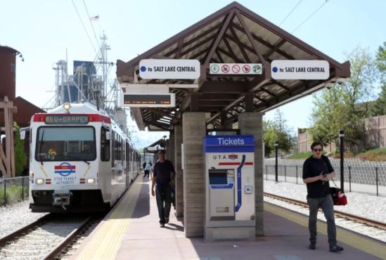
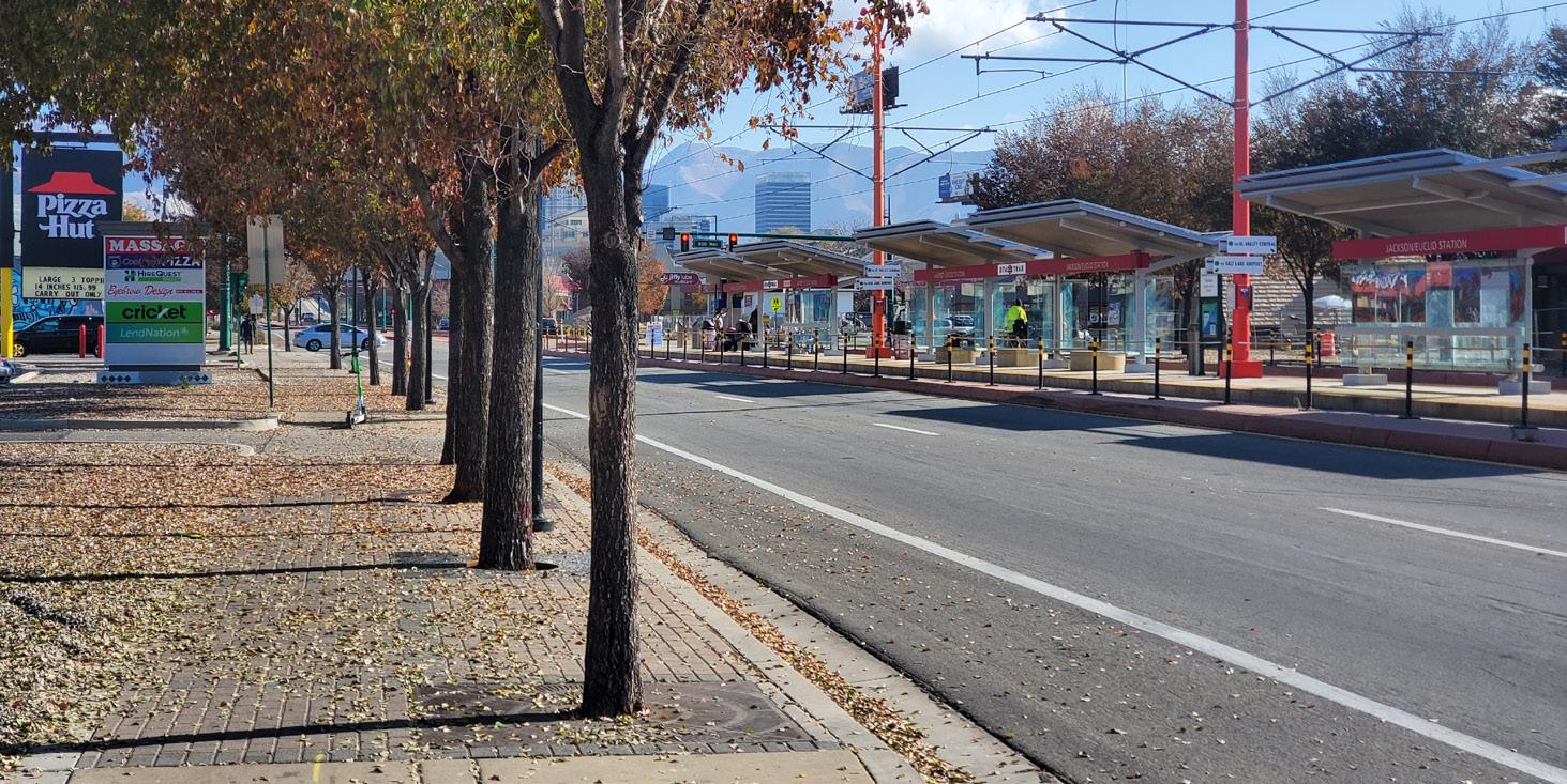
Rail transit refers to TRAX, FrontRunner, and other rail transit like the S Line Streetcar, typically operated by Utah Transit Authority (UTA). Rail transit is a
vital element of Wasatch Choice Centers - it provides regional transportation in a way that supports the kinds of human-scale, walkable places envisioned in many Centers. Many Centers are oriented around a UTA rail station, and state law requires a Station Area Plan that achieves regional goals such as housing, access to opportunity, transportation choice, and sustainability.
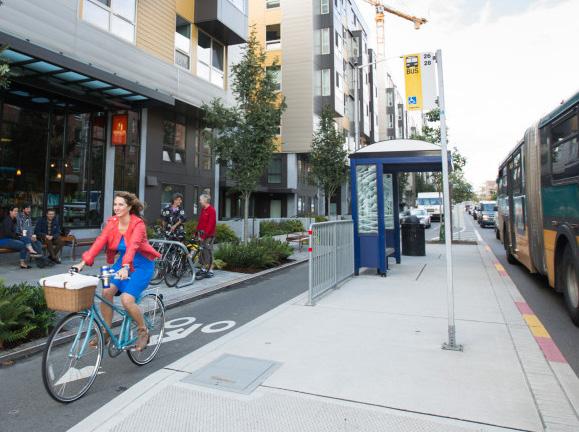
Bus rapid transit (BRT) is a newer type of fixed-guideway, high-capacity transit relying on buses instead of trains but still offering many of the elements of rail such as streamlined boarding and ticketing, enhanced stations, and traffic signal priority. Similar to rail transit, BRT station areas require station area plans where there are dedicated bus lanes.
Bus transit refers to the UTA fixed bus routes and their stops, as well as service provided by other agencies. These routes are also vital to Wasatch Choice Centers, both as connections to rail/BRT transit and on their own, especially for routes traversing major corridors in the Region.
Regional trails are also an important element of regional transportation in Wasatch Choice Centers. These largely focus on trails on their own right of way such as the Jordan River Parkway or on-street trails significantly separated from traffic, such as the 9-Line in Salt Lake City.
The core of Wasatch Choice Great Streets is fostering a good fit and balance between community context and regional transportation. The following chart analyzes the fit between the elements of Community Context and Regional Transportation Context described above. This fit analysis leads to the identification of opportunities and challenges to balance these elements in the next section.
Regional Transportation Context
Regional corridor linking communities
Freeway interchange
High-capacity fixed guideway transit
Bus transit
Regional trail/high-comfort bike corridor
Truck route
Considering the previous pages' descriptions of community context and regional transportation, The following are opportunities and challenges to balance regional transportation with community context in Wasatch Choice Centers.
1) Access to economic opportunity is a vital pairing of community context and regional transportation. Centers that work with regional transportation and the street network increase the number of jobs and shopping locations that households can reach as well as the number of workers or customers for businesses.
2) Access to the regional roadway network is a vital aspect of Wasatch Choice Centers. This access is important for residents living in the center and for regional commercial land uses and regionally significant institutions.
3) Regional commerce is an opportunity for many Wasatch Choice Centers to provide services and goods, create jobs and opportunities, and generate local revenue. Regional commerce relies on multi-modal access to the Center for customers, employees, and other visitors, and the pairing of the commercial land uses with the regional transportation network.
4) Regional customers for local commerce is an important consideration for a Center - while some "Main Street" commercial may be focused on local businesses, it may attract regional visitors, so some centers need to have a way to accommodate access and parking for high numbers of vehicles in a way that supports the walkability of the Center.
5) Access to regional trail network is a benefit for the livability of a center. Trails can also help those living in surrounding communities access amenities and jobs in the Center.
6) Transit oriented communities are an opportunity for Wasatch Choice Centers with rail or BRT stations to pair access to regional rail with walkable, mixed-use community context such as high-density and middle housing, local retail, and employment.
7) Freight access to manufacturing and distribution network where Centers include industrial land uses like manufacturing, warehousing, and wholesale. It is important to leverage opportunities to pair these uses with access to truck routes and regional roadway network in a way that complements the Center as a whole.
8) Identify focused places for walkability in Centers that have walkable development and walkable streets. These enable "park-once" parking efficiency; thereby enhance development intensity; and increase the likelihood that people will choose to access the center without driving.
1) Livability in a Wasatch Choice Center is often challenged by the needs of regional transportation, specifically roadways busy with traffic and trucks. The noise, air quality impacts, and barriers created by roadways are challenges to be overcome for livable Centers.
2) Walkable neighborhoods and districts can be difficult to establish alongside busy roads, intersections, and freeway interchanges.
3) Balance of mobility and access: Centers are hubs for accessing destinations for all types of residents, employees, and visitors, but they are also traversed by corridors emphasizing longer distance mobility, especially for autos and trucks. It can be challenging to provide multi-modal access to destinations along major corridors.
4) Safe and comfortable experiences for walking, bicycling, and other active transportation modes can be difficult to provide on regional roads emphasizing vehicle mobility.
5) Auto commercial land uses near transit investments can create a challenge for accessing the transit on foot, reducing the number of potential transit riders.
A vital element of balancing community context and regional transportation needs in a Wasatch Choice Center is providing a street and transportation network that serves all modes and users. While a given street may emphasize certain modes over others, the overall network of the Center should strive to be complete, with network segments and links complementing one another. The Wasatch Choice Great Streets Typology provides a framework on how streets can serve complementary roles in the overall network. All these modes are important in Wasatch Choice Centers - the following section describes the needs of each mode in a Center. You can go through the following lists and ask whether all these needs are being met in a center's street network.
In a Wasatch Choice Center, walking is the foundation of getting around. The general environment should be considered at the human scale that caters to people. Building a Center's street environment around walking means related benefits for other modes such as bicycling and transit, and doesn't mean that motor vehicle traffic can't successfully move through a center and access its destinations. Ultimately, everyone is a pedestrian in a center, even after exiting a vehicle and walking to a destination.
For a simple act such as walking, the environment in a community and regional transportation context needed to support walking can be complex. Key aspects include:
• The presence and width of the sidewalk and greater pedestrian environment, especially as a significant percentage of the overall street width.
• Streetscape features that foster pedestrian comfort, such as trees for shade, greenery, buffering and scale; seating for resting, waiting, or dining; lighting for security and atmosphere; and art for color, interest and community dialogue.
• The speed of traffic, primarily focused on the environmental factors encouraging speed or traffic calming.
• The frequency of safe pedestrian crossings, and a safe place to comfortably stop, relax, and wait (for a person, a ride, a bus, a breather).
• The shortness and visibility of pedestrian crossings, both at street intersections and at midblock.
• The relationship of the pedestrian environment to the land uses it passes - encouraging direct pedestrian access, interest, safety, human scale, and transparency.
• The presence of separated trails in the Center.
Mobility and access for private motor vehicles is vital in Wasatch Choice Centers, as this is how many people do and will continue to access their destinations. Center streets need to be able to move traffic through and provide safe access to the range of destinations in centers - ranging from shopping malls to schools and universities to offices.
However, traffic needs to be able to safely coexist with walking and other slower modes. In Centers, this often means lower speeds, more frequent pedestrian crossings, and traffic calming elements.
It is also important to recognize the differing needs between regional through traffic and local circulating traffic. Regional traffic is centered on mobilitybecause most of these travelers are trying to go through a center at any given
time, features of access often get in the way. Meanwhile, local circulating travelers are driving short distances and in many cases are looking for parking - this traffic is focused on access, and higher speed mobility creates challenges. Being able to coordinate these varying needs in the same network within Centers is vital.
The system of Wasatch Choice Centers provides a focal point for transit - its service; stops, stations, and hubs; the corridors its routes use; access to it; and development built to promote use of it.
Transit has a range of needs in a Center. Buses, like all motor vehicle traffic, need to be able to achieve reasonable travel times, and their size requires minimum lane widths and ability to make turns. They also need to get in and out of stops quickly, so pulling out of traffic may mean a difficult time pulling back in - in which case stopping in a lane may be a better option for the efficient movement of people.
Rail transit has its own needs - in Utah, rail transit often uses its own right-ofway, so balancing this right-of-way with the rest of a center's transportation network is critical.
However, for transit to be truly successful, people need to be able to access it, especially on foot, using mobility devices, and by other active modes like bicycling and using a scooter - ultimately, all transit riders are pedestrians. Bus stops and trail stations need to be hubs of pedestrian access and closely paired with crossings and quality infrastructure, wayfinding, and streetscape.
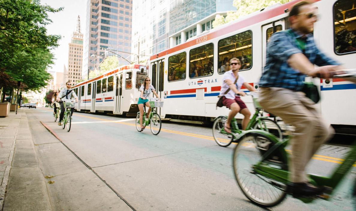
The Wasatch Front's bicycling networks and environments are improving, with more and more lanes and paths and other improvements dedicated to
bicycling and other micromobility options. With their destinations and focus on walkability and transit, Wasatch Choice Centers should be the nexus of these networks.
Just how safe, comfortable and convenient bicycling is integrated into Center networks will vary. Some Centers encompass or adjoin one of the Region's offstreet trail corridors such as the Jordan River Parkway, Parley's Trail, or Porter Rockwell Trail. These trail corridors can be major assets for many different aspects of Centers.
Centers also feature citywide or regional bike corridors coming into the center from surrounding neighborhoods, so linking these routes with destinations and other safe routes is important.
Bicycle facilities can be integrated into a Center's corridors, with the right facility type depending on the size and volume of the road, but sometimes, due to too much demand from motor vehicle traffic on a center's corridors, the bike corridor will have to be created with a parallel route.
In addition, in Wasatch Choice Centers it is vital to have "end-of-trip" facilities as part of the bicycle network. These include both short-term bike racks and longer-term bike parking.
Trucking, loading, and deliveries are a part of every Wasatch Choice Center to different degrees. Some Centers include truck routes and must accommodate different sizes of large trucks to move through and turn accordingly. Most need ways for trucks to deliver to businesses. Some Centers include manufacturing, warehousing, and wholesale uses and require trucks to load.
The primary goal of this element of the Great Streets Framework is to create an overall network in which all modes thrive. The following are key strategies to accomplish this.
Establishing a significant portion of street space designed for people rather than motor vehicles creates a foundation for the walkable character of the Center. It has a multiplier effect - benefiting people bicycling and people riding transit - and can be done in a way that doesn't detract from the ability of traffic to operate to and through the Center. A good goal is 25 to 50 percent people space, depending on the type of street.
Including elements that slow traffic benefits all users and the Center as a whole. Slowing traffic still allows for appropriate volumes of traffic to move, but reduces crashes and makes the street more of an even playing field for all modes. Traffic calming strategies appropriate to Wasatch Choice Centers include narrowing or dividing up the roadway and its lanes; including humanscale elements such as trees and street furniture; and creating places that attract people on foot in the public space of the street.
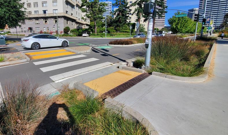
Frequent pedestrian crossings that provide short distances across major streets is a foundational building block of Wasatch Choice Centers. For important regional corridors, the frequency will need to be less than for more minor streets and those with more of an emphasis on walking, but crossings on every street will be more frequent in a center than outside it.
The essence of balancing all modes on the street network is managing conflicts among the modes - these conflicts can occur between vehicles and people, users moving fast and slow, users trying to move through vs. those trying to access destinations, and in many other situations. These conflicts should be addressed in ways appropriate to the context of the Center- both in terms of community and regional transportation. In some cases, on bigger streets, designs should separate out turning traffic from through traffic. In some cases, turns to and from the street should be limited or prohibited. And in other cases, the most multi-modal, walkable slow moving streets, conflicts should be welcome as a way to keep everyone aware of other users.
It is important to balance bus transit speed and reliability with safety of pedestrians, occupants of motor vehicles, and other users. Minimizing conflicts between buses and other users helps keep this balance - these strategies can include having buses stop in traffic lanes and not pulling out of traffic; bringing bike lanes behind bus stops; and ensuring safe pedestrian crossings convenient to alighting passengers and visible to bus operators.
Best practices for bicycle design increasingly emphasize physically separating people riding bikes from motor vehicle traffic - especially the faster that traffic is moving. These practices include bike lanes on the roadway protected by curbs or other barriers, pathways behind the curb alongside the sidewalk, protected intersections, and other infrastructure. In Wasatch Choice Centers, street designers should strongly consider how a network of separated bike facilities can provide access to and through the center.
With high foot traffic, public space, community destinations, transit stations and hubs, and a diversity of people, Wasatch Choice Centers streets need to make vulnerable users more visible to those operating motor vehicles or even micromobility vehicles and devices. Slow speeds, clear transitions, highvisibility markings, advance warnings, and key lines of sight are strategies to increase this visibility.
Wasatch Choice Centers need to be places accessible to all people. This means adhering to Americans with Disabilities Act requirements as well as making streets and the larger transportation network intuitive for everyone.
Centers are designated largely because they encompass a range of destinations, and each of these needs to have access by all modes. While some of these destinations have intuitive multi-modal access, like for transit stations, universities or walkable shopping areas, all community destinations need features such as walkable entries and circulation, intuitive and informative transit stops, clusters of micromobility options and parking, and places for ridesharing.
Parking is a necessity and an opportunity in Wasatch Choice Centers. Effective parking allows people to drive to Centers, park once and walk to access a variety of destinations within the Center. The greatest opportunity for parking in Centers is to treat it as a shared infrastructure rather than individualized. Shared parking makes the most use of parking spaces overall and can best be sited and designed in a way that reinforces the walkability and public realm of the Center. And, when centers are well connected via bikeways and transit, there is less parking needed overall.
Wasatch Choice Centers need to make clear where truck traffic is meant to go and truck access is meant to happen. Doing so helps businesses and truckers and allows other streets and routes to not have to accommodate large trucks, allowing for more walkability and helping to create a complementary network.
Local jurisdictions' plans make decisions about which streets are emphasized for which modes, and how they connect to adjacent communities. These are a valuable tool to create complementary networks in centers.
Great Streets' approach to safety focuses on safe speeds and safe street design. The following guidance promotes safer speeds for all users through contextappropriate motor vehicle speed, road designs, and other practices. Factors to consider when setting a target or design speed or posted speed limit include pedestrian and bicyclist activity, land use context, crash history, driveway density, roadside conditions, traffic volumes, and observed speed. Cross-section elements that are related to the designated design speed of a roadway include lane width, number of lanes, shoulder widths, and roadside features.
Steps project or plan partners may use when considering speed parameters of streets are:
Consider aspects of community context such as land use - see Regional-Community Balance: Identifying the Context section above.
Identify aspects of the street role in the network, such as Functional Classification, Regional Transportation characteristics, or Street Typology - see RegionalCommunity Balance: Identifying the Context and Street Typology sections.
Determine target speed or anticipated operating speed.
Determine the design speed.
Establish geometric information to reinforce the anticipated operating speed.
Check for consistency between design elements and desired operating speed. Set posted speed limit. Utah Code (41-6a-601) establishes 25 mph as a lawful speed in an urban district.
Speed limit: Speeds on surface (non-freeway) streets in Wasatch Choice Centers should generally range from 20 mph (on Main Streets or some Supporting Streets) up to 35 mph on corridors with very low bike and pedestrian activity and low conflict density. Per Utah code, 20 mph speed zones or speed limits are desirable where vulnerable users share the road environment.
Number of lanes: Number of lanes is a major safety factor, but can vary widely on streets throughout Wasatch Choice Centers. In general, reduce the number of general purpose through lanes to allow off-peak capacity to more closely match vehicle volume.
Travel lane width: Generally, lanes in Wasatch Choice Centers can be narrower (11' maximum); use extra space for bus stops or bicycle and pedestrian facilities. 10-foot lanes can be used on low-speed roadways (AASHTO 2011).
Median islands serve as pedestrian refuges. Convert turn lanes into extensions for pedestrian islands where feasible.
Bicycle facilities: Consider providing separated facilities (established by placing elements such as curbs, bollards, landscape between moving motor vehicle traffic and people bicycling), especially on Corridor and Hybrid Main Street types (see Typology section).
Pedestrian crossings: Provide signalized mid-block or Pedestrian Hybrid Beacons (PHB).
Streetscape: Trees and shrubs indicate a different environment, encouraging vehicles to slow down.
On-street parking: Restrictions are expected, limit number of direct driveway access points
Signal timing: Reduce length of signal cycles, program for lower corridor progression speed (e.g. 2-3 mph below target speed).
Pedestrian signals: Include automatic pedestrian signals - walkable places should assume the presence of pedestrians, and not require users to press a button to activate the appropriate signal.
Access management is important, but direct driveways to alleyways, small parking lots, or district parking may be permitted. The pedestrian environment receives top priority.
Safe systems approach: Have the six principles of the “Safe System Approach” been considered?
• Death and Serious Injuries are Unacceptable
• Humans Make Mistakes
• Humans Are Vulnerable
• Responsibility is Shared
• Safety is Proactive
• Redundancy is Crucial
https://safety.fhwa.dot.gov/zerodeaths/docs/FHWA_SafeSystem_Brochure_ V9_508_200717.pdf
Proven Countermeasures: Have FHWA’s Proven Safety Countermeasures been considered for applicability and implementation?
https://highways.dot.gov/safety/proven-safety-countermeasures
Crash analysis: Has the historical crash data been reviewed? What trends are present? Has the crash data been reviewed from a vulnerable road user perspective?
Community goals: Does the community have a “Vision Zero” plan or goal? How is this plan applicable?
Road Safety Audits: Has a Road Safety Audit (RSA) been considered for identified safety issue locations? What recommendations came out of the RSA that will influence the design?
Human scale: What is the overall balance of vehicular space with people space? As roadways get bigger, are pedestrian and bicycle facilities also getting bigger and more buffered: What human scale elements are present in the design?
Streets comprise most of a community's public space. It is important to recognize and promote the non-transportation uses of streets. Especially in Wasatch Choice Centers, communities often seek to make streets reflect their identity and serve as community gathering space. Places are about focusing on people on foot but also people sitting and talking, eating and drinking, performing and spectating, gathering and celebrating. Ultimately, how can streets help centers become memorable places that draw people from the community and region? The following provides ideas for a range of different streets and centers.
Great centers have space designed for people, rather than as leftover space from the roadway. Starting from this perspective lays the foundation for a street to be the core of a great place. For more on designing streets for people, see Walking in Complete Multi-modal Network
Centers should be conceived around great public spaces that complement the types of land uses dominant in the center. Public spaces can be the core of town centers, Main Streets, transit station areas, shopping and entertainment zones, employment areas, campuses, and others. Streets create the frame for these spaces to thrive and link the surrounding land uses to them.
The best places are those where traffic moves the slowest. All centers should be the locations of efforts to slow traffic in ways that support space for people. But even higher-speed areas can be designed to contribute to the sense of place of the center - see the Hybrid Main Street in the Typology section.
Knowing when you are entering a center helps establish it as a distinct place. This transition into a center helps create expectations about lower speeds and more people. These transitions can be created by a change in design elements such as a narrower roadway, more people space, more trees and landscape, as well as by gateway features identifying the community or center.
Regional corridors can create barriers within and alongside Wasatch Choice centers. Design of these corridors within centers should reduce the nature of this barrier and help visitors and residents see the center as one connected place.
In Wasatch Choice Centers, transit stations or even popular or central bus stops are opportunities to reflect a community's identity and add elements of place. Transit stops and stations can include seating, community or wayfinding signage, trees and landscape, lighting, and associated public space. These elements can be customized to reflect a unique identity.
Boulevards are a special type of major street that uses the size of the street to emphasize a grandiose or monumental character. In doing so, the boulevard creates a sense of place while still moving people and goods along an important regional corridor. Key aspects of boulevards are regular streets and landscape, management of access, and provision of people space alongside the traffic space.
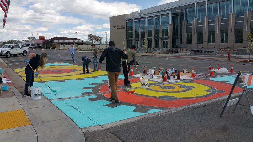
Streets are good canvasses for public art - their surfaces and spaces provide opportunities for unexpected treatments such as painted crosswalks, stained/ scored concrete, sculptures in medians, and creative street furniture. These art elements help create unique places and can help establish human scale.
There is no substitute for trees and plants in streets. While trees and landscape provide benefits like buffering and shade, they also inject life into a street in a way that other elements (shade structures, public art) cannot. It is important to conserve water in public landscaping by moving away from lawns and toward drought tolerant plantings and trees.

A strong factor for establishing a sense of place in Wasatch Choice Centers is creating a humane relationship between streets and adjacent land uses. Storefront commercial, residences, offices, institutions, parks, and other community destinations can all be designed to connect people on sidewalks to them. Often this revolves around well-designed parking that allows for a close pedestrian relationship between streets and land uses.
Wasatch Choice Centers have many important private sector partners, including downtown business alliances, large institutions, and major employers. These partners can be important for helping to create a sense of place along the streets where they are located - from providing quasi-public space to donating and maintaining trees and landscaping to advocating for walkable streets to commissioning murals and other public art.
On many corridors in Wasatch Choice Centers, with high volumes of autos and trucks, establishing places where people want to go and linger is difficult. Sometimes intersecting or parallel complementary streets should be the focus of placemaking in a center.
The vision for many Wasatch Choice Centers is to convert motor vehicle space to people space. This adaptive reuse can occur in the travel space of the roadway in the form of "road diets," but is can also occur in the street in a way that creates public space - converting parking areas to places for outdoor dining or "parklets"; adding bulb-outs to extend pedestrian space and shorten crossings; or consolidating driveways to create more contiguous pedestrian space in the street. These improvements reinforce other Wasatch Choice Center goals.
Wasatch Choice Centers vary in scale - from small Neighborhood Centers all the way up to Metropolitan Centers like downtown Salt Lake City. Placemaking in centers should reflect these differences in scale - there are different opportunities to serve the residents, employees and visitors of each type of center. While smaller centers can aim to provide walkable neighborhood services or small community gathering places, larger centers can host events and gatherings that attract people from throughout the region, and complement larger destinations like regional parks, arenas, and arts centers.
Wasatch Choice Centers are hubs of economic activity - from neighborhood Main Streets to employment centers to metropolitan downtowns. These economies play an important part in both community context and regional transportation context. Streets serve as conduits between the regional travel demand brought on by economic activity and the destinations within centers. The following are areas of the economy impacted by streets and their relationship to community and regional transportation context. Consider how a street or street network can positively affect or leverage these areas.
The daily commute is the most visible manifestation of economic activity in Wasatch Choice Centers on a daily basis. Centers must accommodate this demand through freeway, road, and interchange and intersection capacity, transit service and access, and active transportation infrastructure, but the stakeholders within centers can also find ways to manage the travel demand of the commute - whether through providing and incentivizing alternatives to driving alone, managing parking, or establishing partnerships such as transportation management associations (TMAs).
Goods movement
Wasatch Choice Centers depend on movement of goods - whether as deliveries to stores or transporting products manufactured or warehoused in the center. In many cases, centers are bisected by important freight routes on highways or rails. Trucks, and in some cases, trains, have their own needs in street and transportation network design: space to load and unload, large turning radius, routes to get in and out. By planning a center's network holistically, these needs can be incorporated into streets in a way that is complementary to the walkability and livability of the center.
The vision for many Wasatch Choice Centers is to provide the locally owned unique shops, restaurants, and services that create the core of a town center or community downtown. Especially at the onset, these local, walkable businesses are often disadvantaged compared to those in an auto-oriented strip format or national chains. Local "Main Streets" have a diverse set of needs from the street and transportation network in order to thrive. While a vibrant walkable Main Street with a critical mass of other local walkable businesses is important, so are needs such as parking, deliveries and community and regional access by all modes, especially bicycle and transit. Many Main Street businesses along the Wasatch Front thrive most by a parkonce-and-walk model.
Wasatch Choice Centers help residents easily reach more destinations both by providing more residents with great transportation choices and by linking the residents throughout the Region to employment centers. Keys to this in the street network are providing multi-modal access to affordable housing and jobs and leveraging investments like transit stations to create intensity of housing and jobs.
Creating and maintaining livable Wasatch Choice Centers is good economics. Centers that establish a memorable sense of place often see rising property values. People increasingly desire places to live with transportation choices, services and amenities to walk or bike to. Initial investments in walkable streets and public spaces and catalytic mixed use developments can lead to a positive cycle that attracts further private market investment in housing and commercial uses, oriented to the growing walkability of the center.
Equity refers to addressing the specific needs of disadvantaged demographic groups to achieve a level playing field with society as a whole. In many cases, equity is a tool to achieve equality. Wasatch Choice Centers and the street and transportation networks that serve them have a role to play in equitable communities and an equitable larger region. Centers are perhaps the greatest locations in the region to apply equity related policies and investments such as quality transit service, accessible design, and inclusive community engagement.
Context-sensitive street networks in Wasatch Choice Centers are only possible through partnerships. These partnerships vary over geography and project phases - they can include partnerships among local jurisdictions, metropolitan planning organizations like WFRC and MAG, local jurisdictions, the Utah Department of Transportation (UDOT), Utah Transit Authority (UTA), local merchant and business groups, major institutions such as universities and hospitals, developers, and other private sector participants.
Utah is good at collaborating through partnerships - we have a track record of making and implementing collaborative decisions across our regions. However, Wasatch Choice Great Streets seeks to extend these partnerships from the visioning of Centers' street networks and the places they serve all the way through project implementation and operations and maintenance. Partners come from specific perspectives - while local jurisdictions are responsible for their cities, UDOT is responsible for moving people and goods on a statewide highway network that crosses municipal boundaries.
This new framework for streets within a center offers ways to work through tradeoffs. It offers flexible solutions, enhanced value to users, and reduced or shared project costs, with the potential to increase public support and foster mutual trust. Partnerships begin during planning and continue throughout project design and construction, and may continue into operations and maintenance. The following are strategies to use to forge Wasatch Choice Great Streets Partnerships:
Connect early: Conflicts among partners often arise because a partner is brought in late in the planning process or project implementation. Connecting early allows understanding of needs from all partners from the beginning.
Vision together: Partnering on the earliest parts of a plan or project, the vision, allows partners to forge a deep foundation for the project. There may be disagreement about how to achieve the vision later in the process, but a strong vision allows partners with differing perspectives to always return to shared fundamentals.
Seek common ground: When creating a vision, partners with differing regional or local roles and geographic perspectives can usually find goals they agree on - these can be broad but should be as specific as possible while allowing for a range of ways to achieve them. This common ground is the beginning point for the partnership.
But acknowledge differences: While common ground is important, partners should be honest with one another about differences in opinion and perspective on a project or issue.
Get on the same page internally: When entering a partnership for a street project, agencies, jurisdictions, and organizations should seek to establish an internal vision that can productively represent the group's interests and endure beyond the individuals involved at the time.
Understand the needs and plans of all the partners: For a given Wasatch Choice Center or street corridor, there may be a range of plans and needs from a range of partners. It is important to identify these and understand where they overlap, conflict with, or complement one another.
Include both regional and local perspectives: Nearly every street project in a Wasatch Choice Center has both local and regional considerations. Including partners with these interests and perspectives - such as UDOT or the MPO for regional and the local jurisdiction or local merchants or institutions for the local - provides the backbone to balance these needs.
The community is a partner: View the surrounding community as a partner in the project - community members can be champions and public support can act as social and political currency for getting the project to the finish line.
Involve the private sector: While major street projects are often led and implemented by public agencies, the private sector has a strong interest in them. Not involving private sector partners like business owners, major institutions, or area employers risks opposition at in opportune times, while involving them can reap rewards such as political capital, unforeseen funding, and opportunities to create street environments that are more than the sum of their parts.
Identify roles and responsibilities: Once a plan or project has been established, identify what parter will do what, creating clear roles and responsibilities.
Continue communication: Throughout the life of a plan or project, the lines of communication established early should continue, whether through regular check-ins, committee conversations, ad-hoc check-ins, or project milestones.
Maintain respect: Through the challenges of each planning process to project implementation, respect among individuals and partner organizations must endure.
The following is a list of types of planning or project partnerships in which the Wasatch Choice Great Streets Framework can be employed.
A Regional Transportation Plan (RTP) employs partnerships between the metropolitan planning organization (MAG or WFRC) that leads the plan and other implementing stakeholders like UDOT, UTA, and local jurisdictions. Specific RTP projects are a chance to work through the Great Streets Framework to create a context-sensitive foundation for the project.
A UDOT Solutions Development Study seeks to capture the unique context of an area or corridor and develop a set of solutions to meet its transportation needs. Solutions Development is the "middle stage" between the long range plan and Project Development. Context and stakeholder engagement are at the foundation and core of this process.
A local corridor plan is an opportunity to consider how a street corridor can evolve to achieve a community's vision for its center. Corridor plans, often led by the local jurisdiction or a group of local jurisdictions, can consider how to coordinate both land uses and street improvements, and so are great opportunities for form broad partnerships and use the Great Streets Framework.
A local center plan is an opportunity to create a vision and implementation steps for a Wasatch Choice Center. A core part of these plans is balancing the needs of both regional transportation and the community, and Great Streets can be an integral part of the partnerships created for these plans. There is technical assistance available from WFRC and MAG and state and regional agencies for these and other types of plans.
A Station Area Plan (SAP) is a type of local center plan required by State law where a fixed guideway transit station is present. A SAP seeks to implement the statewide/regional goals of housing, transportation choice, access to opportunity, and sustainability in a way that aligns with the values and vision of the local community. SAPs require partnerships between the local jurisdiction, MPO, UTA, and others, and streets are vital to these planning efforts.
A UDOT Main Street collaboration develops a vision and implementation for the many community Main Streets that are also state highways through early and close collaboration. Between community stakeholders and UDOT regions.
Even road resurfacing projects are opportunities to forge partnerships and consider elements of context laid out in the Great Streets Framework.
A Transportation Management Association can involve street infrastructure projects and is a good opportunity to collaborate among public partners like cities, MPOs and UTA and private sector partners like institutions and employers.
The final element of the Wasatch Choice Great Streets Framework is a street typology system intended to guide complementary roles for major streets* within a Wasatch Choice Center. The system includes five street types, oriented to a street's role relative to regional transportation and community context:
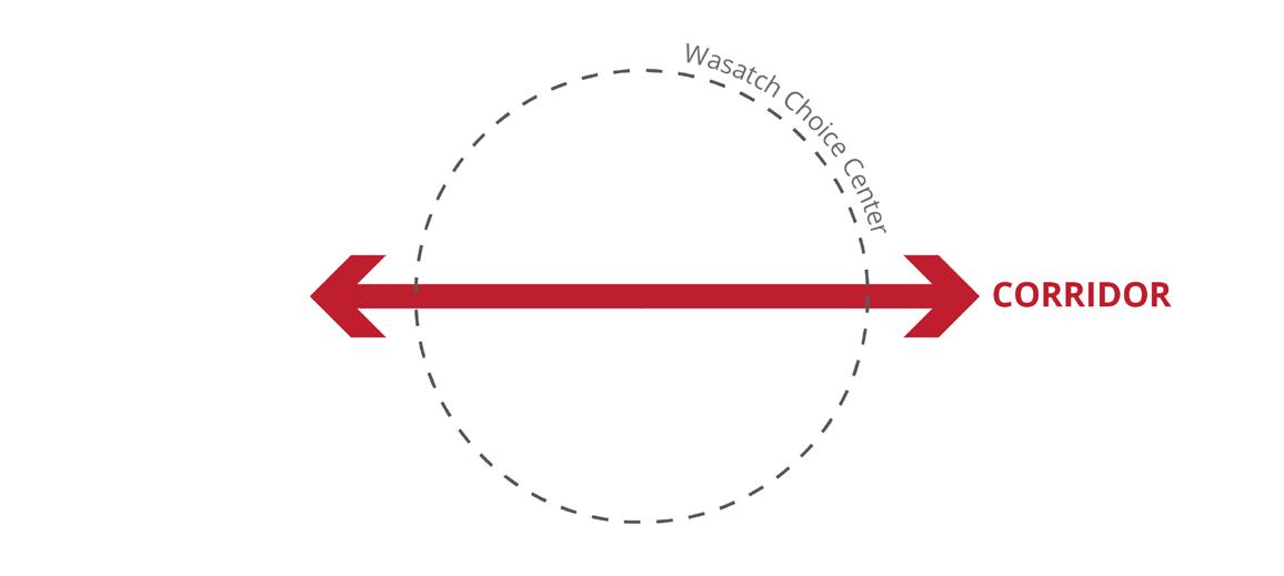
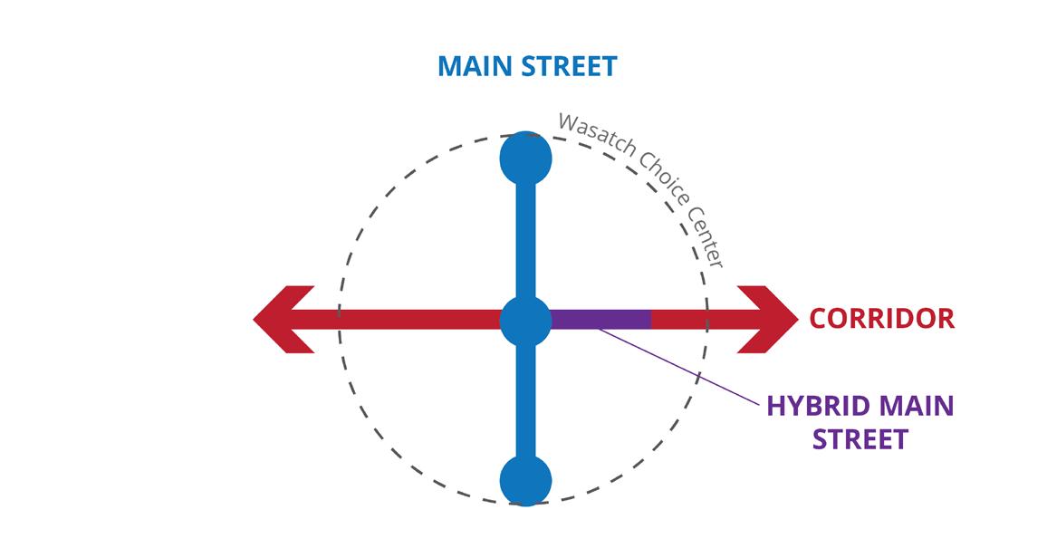
Corridor: A street that is part of an important regional connection and emphasizes moving people and goods. Corridors are different sizes, functional classifications, and scales and have various emphases on transportation modes.
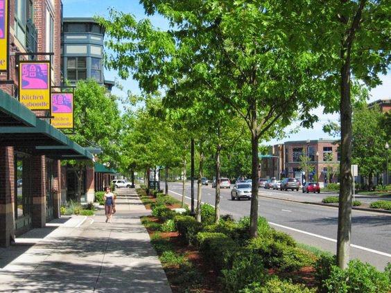
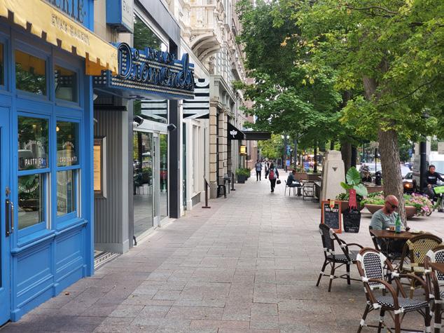
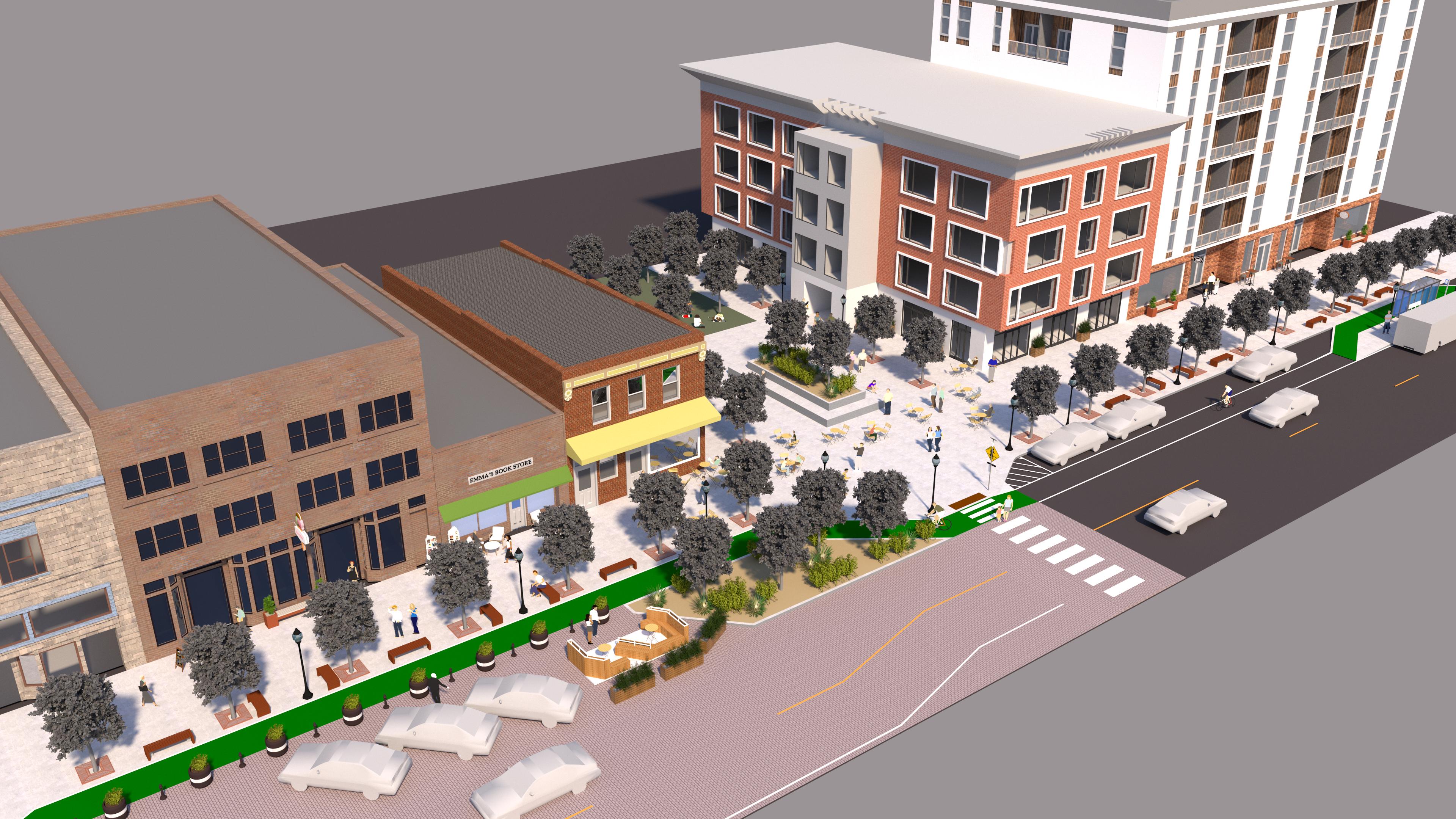
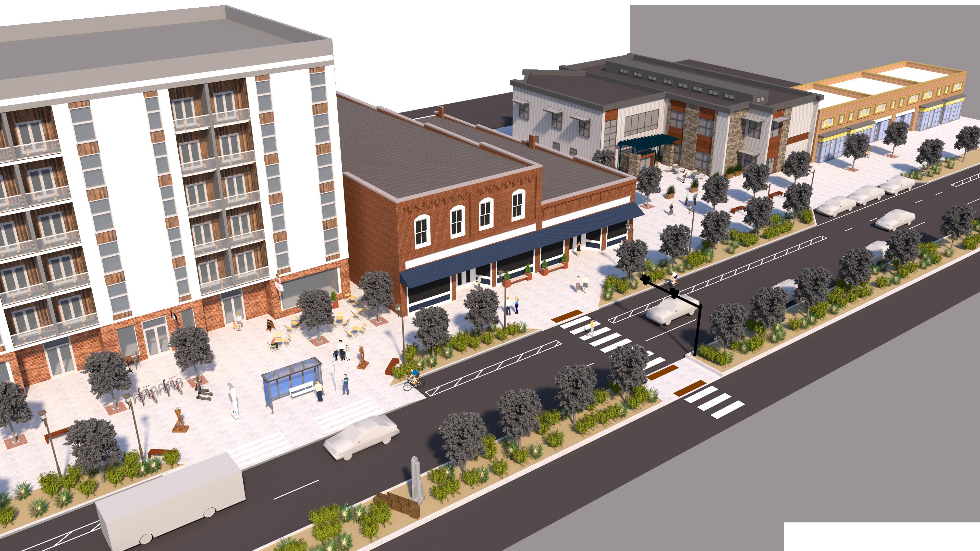
Main Street: A street that is a primary gathering space and place in its community. Main Streets prioritize people, and enable them to walk or spend time in the public space of the street. They have high proportions of pedestrian space; buildings that open to the sidewalk; streetscape; public spaces; auto parking that complements the pedestrian environment.
Hybrid Main Street: A street that, due to competing needs, must balance the elements of both Corridors and Main Streets. They must have a balance of maintaining the movement of people and goods while also slowing speeds and creating a welcoming community gathering space. A Hybrid Main Street is appropriate when: 1) There is no other alternative for a community that envisions a walkable town center; 2) there is existing, often historic, walkable urban fabric but the street also needs to move regional traffic; and 3) there is an existing or planned major transit investment.
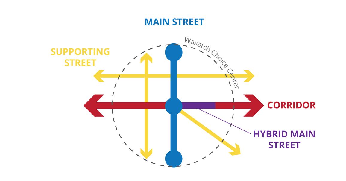
Supporting Street: A street that is neither a Corridor nor a Main Street but still serves an important role in the center's network. Supporting streets play a variety of roles in centers depending on what is needed within the network and for the community context.
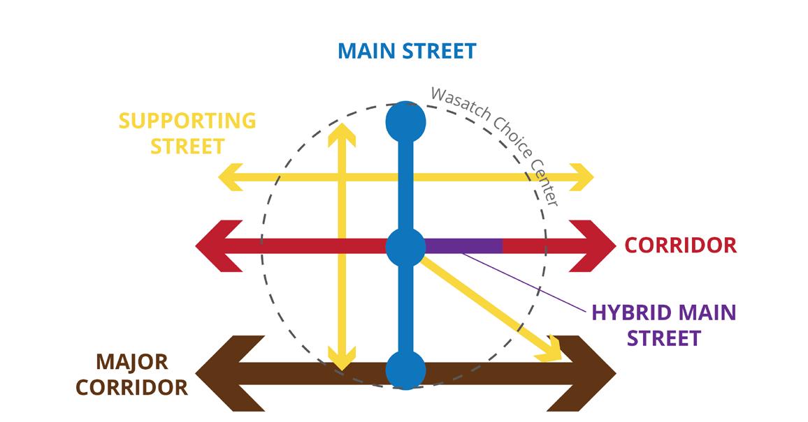
Major Regional Corridor: A rare type that entails a roadway that carries very high volumes of traffic and is a physically large facility with little connection to the Wasatch Choice Centers it runs through, but should be mitigated so as not to be an overwhelming barrier.
These typologies incorporate the elements of multi-modal networks, safety, places, and economies in different ways. They shape complementary roles for streets in centers where the needs of the community and regional transportation are balanced.
* Generally, these typologies are applied to streets falling into the functional classifications of collector and arterial, although some jurisdictions may want to apply them to some local-level streets.
Street typology systems are a way to classify streets that emerged as an alternative or enhancement to the Functional Classification System of Arterial, Collector and Local streets. Street typologies seek to broaden the classification from the auto traffic focus of the Functional Classification to a wider and richer array of characteristics of streets, such as other modes, other uses of streets, and their relationships to the land uses they serve.
Typically, street typologies have been undertaken primarily by cities and other local jurisdictions. For example, Salt Lake City recently developed a street typology system to guide its planning and project decisions on streets and for the context served by the streets.
Because of their focus on integrating community context into street classification, a street typology is a good fit for an effort to integrate context into street planning at the regional level.
Denver Regional Council of Government (DRCOG), one of the few MPOs to establish a regional street typology, states that “street typologies are useful tools in supporting successful design collaborations…[They]can determine how to balance the safety, comfort and convenience of different travelers with the needs and character of the surrounding place. Planning partners can use design recommendations organized by street type as a starting place for envisioning how to reconfigure or redesign a real street to support the achievement of local and regional priorities.”
These emphases on balance and partnership are central to the Wasatch Choice Great Streets Typology. The system is meant to be a tool by which the essential regional and community interests can be balanced and complement one another in centers.
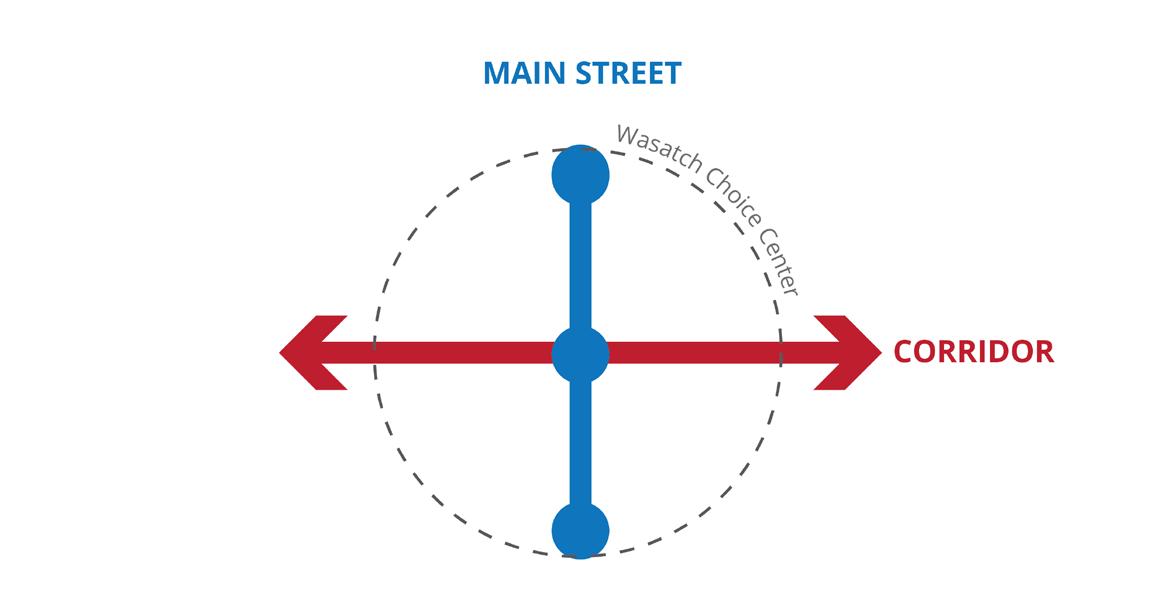
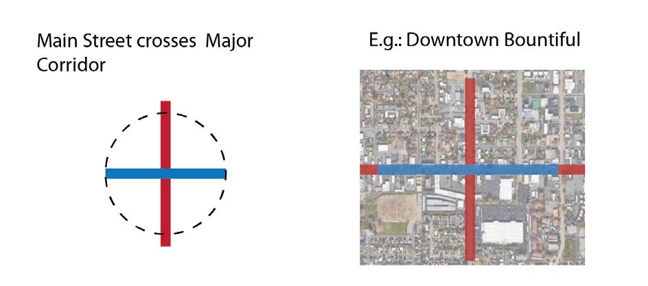
The Wasatch Choice Great Streets Typology begins with the idea of a center, and most major streets in centers are regionally important corridors. In the typology these are called "Corridors."
Some streets, however, are centers of community activity - storefronts, streetscape, community identity. In the typology, these are called "Main Streets."
In some circumstances, because of pre-existing historic Main Street, because of the investment in rail transit or Bus Rapid Transit, or because there are no other options for a Main Street in the center, some streets must take on both functions of Corridors and Main Streets. These are often focused segments of corridors. In the typology these are called hybrid Main Streets.
Other streets must support the functions of Corridors and Main Streets, in a way that complements the specific needs of these major streets. In the typology, these are called Supporting Streets.
Finally, some very large streets must have an almost total focus on motor vehicle mobility. These are rare circumstances but it is important to recognize them. In the typology, these are called Major Regional Corridors.
Together, these roles balance community context and regional transportation context. They form the basis for the five Wasatch Choice Great Streets street types. A center can have any combination of the street types.* While many street typologies are geared toward Functional Classifications, cater to specific land uses, or emphasize specific modes, this typology is broader. A regional typology must be flexible enough to account for the wide range of communities throughout the region. Ultimately its greatest use is to mediate between community and regional transportation context, and to help shape great Wasatch Choice Centers.
*This series of diagrams is for illustrative purposes only - the sequence of streets added and their locations are just to introduce the types and demonstrate their different roles.
This guide provides guidance on each typology individually, but it is worth considering the types together. The Wasatch Choice Great Street Typology is most useful when considering all the streets of a center together and the ways they can complement one another.
Looking at a Wasatch Choice Center in terms of its Street Typology helps illuminate strengths or challenges of the streets and places within the center, and opportunities to make improvements. For example, realizing that a center does not have a Main Street raises whether one is needed, and whether one of the corridors needs to be transformed into a Main Street (a Hybrid Main Street) or if a new Main Street could be created. Centers where it is not clear what the Main Street is - or if there is one at all - raises the potential need for stakeholders to identify and enhance an existing or envisioned Main Street. Centers without supporting streets should consider better street connectivity so as not to place too much burden on corridors. Centers without corridors raise the question of whether access to the center needs to be improved. Centers in undeveloped areas or areas that will receive large scale redevelopment have the opportunity to use this Typology to clearly define roles of streets, especially the location of the Main Street.
Looking at a range of Wasatch Choice Centers throughout the region, patterns emerge. The following are ways that the types can complement one another so that streets support community context while also supporting regional transportation needs.*
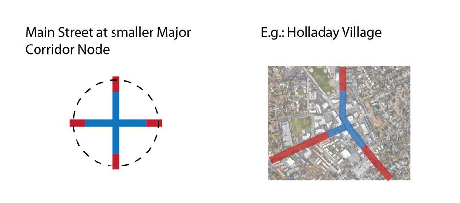
Smaller corridors can transition into Main Streets when they come into the core of centers, creating a central walkable node and place for a small center.
Main Streets can run perpendicular to Corridors, especially where the Main Street can run parallel to a nearby freeway or large corridor. This can create a connected walkable district focused on the Main Street but benefiting from the access of the Corridor.
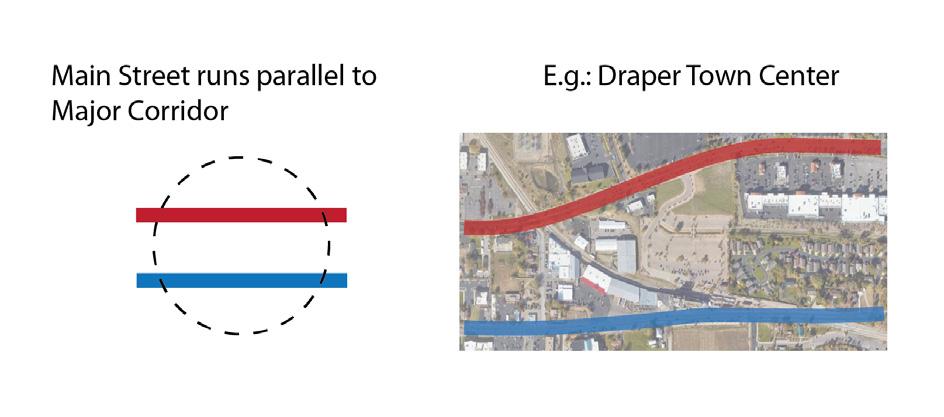
Main Streets can run parallel to Corridors, which can provide a release valve for traffic, preserving the Main Street for a focus on walkability and public space.
* Note that the examples given are locations where this type of network exists, but do not necessarily endorse a complete success.
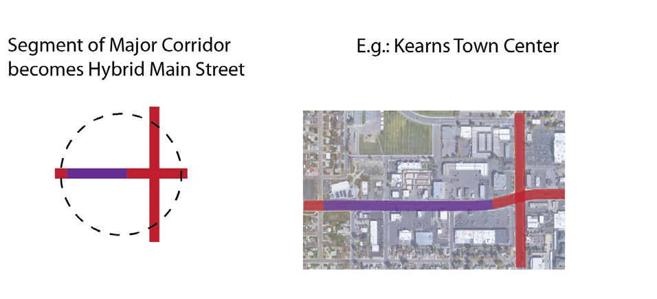
Where there is no other option for a Main Street, sometimes a Corridor may need to serve as a Hybrid Main Street for a short stretch. This requires clear transitions and a feasible segment closely paired with Main Street community context.
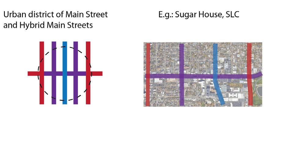
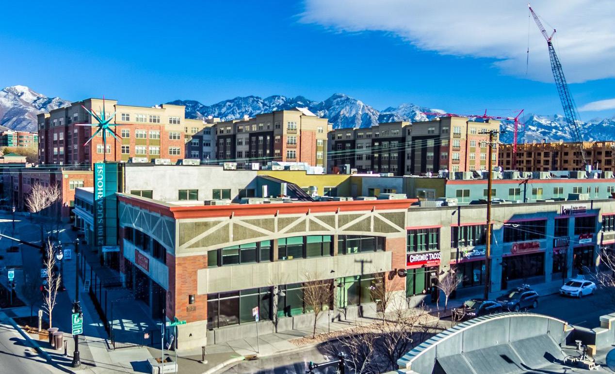
Major city downtowns or urban neighborhoods like Sugar House can integrate a network of Hybrid Main Streets that are busy transportation corridors but also have walkable storefronts. It may be useful to identify a walkable Main Street focus of these districts.
New large greenfield or infill developments present the opportunity to create a brand new Main Street within the development. This strategy is particularly effective where the new development is served primarily by Corridors.
Like the Wasatch Choice Great Streets Framework in general, the Great Streets Typology can be used to inform planning and decision-making by a variety of partners and in a number of ways. The Typology can be utilized in:
• A Regional Transportation Plan
• A plan for a center or station area
• A corridor plan
• A General Plan
• A transportation or streets master plan
• An active transportation or transit master plan
• A new development plan or agreement
• A transportation impact study
The following sections provide specific guidance for each of the five Great Streets Typology.
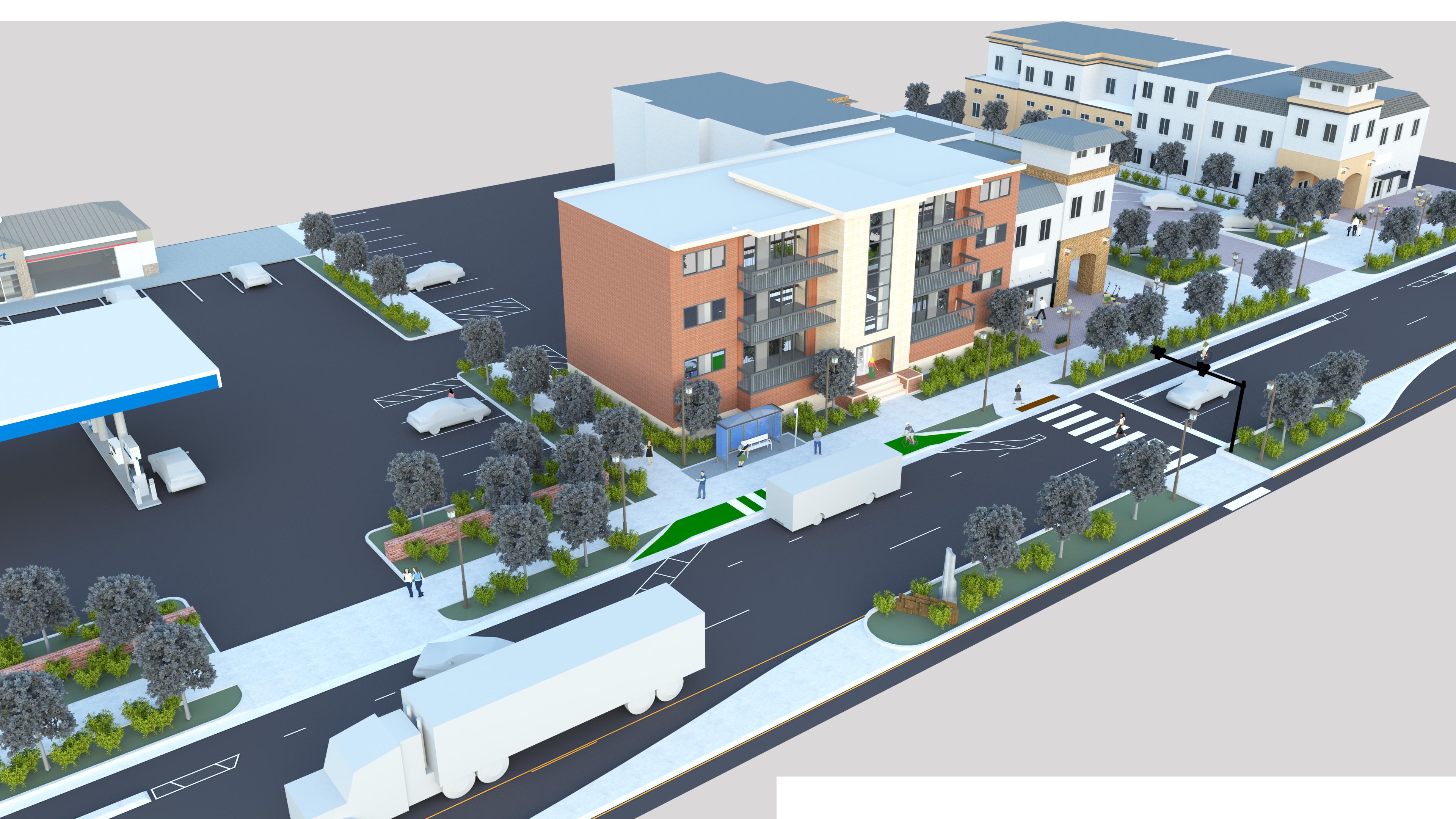
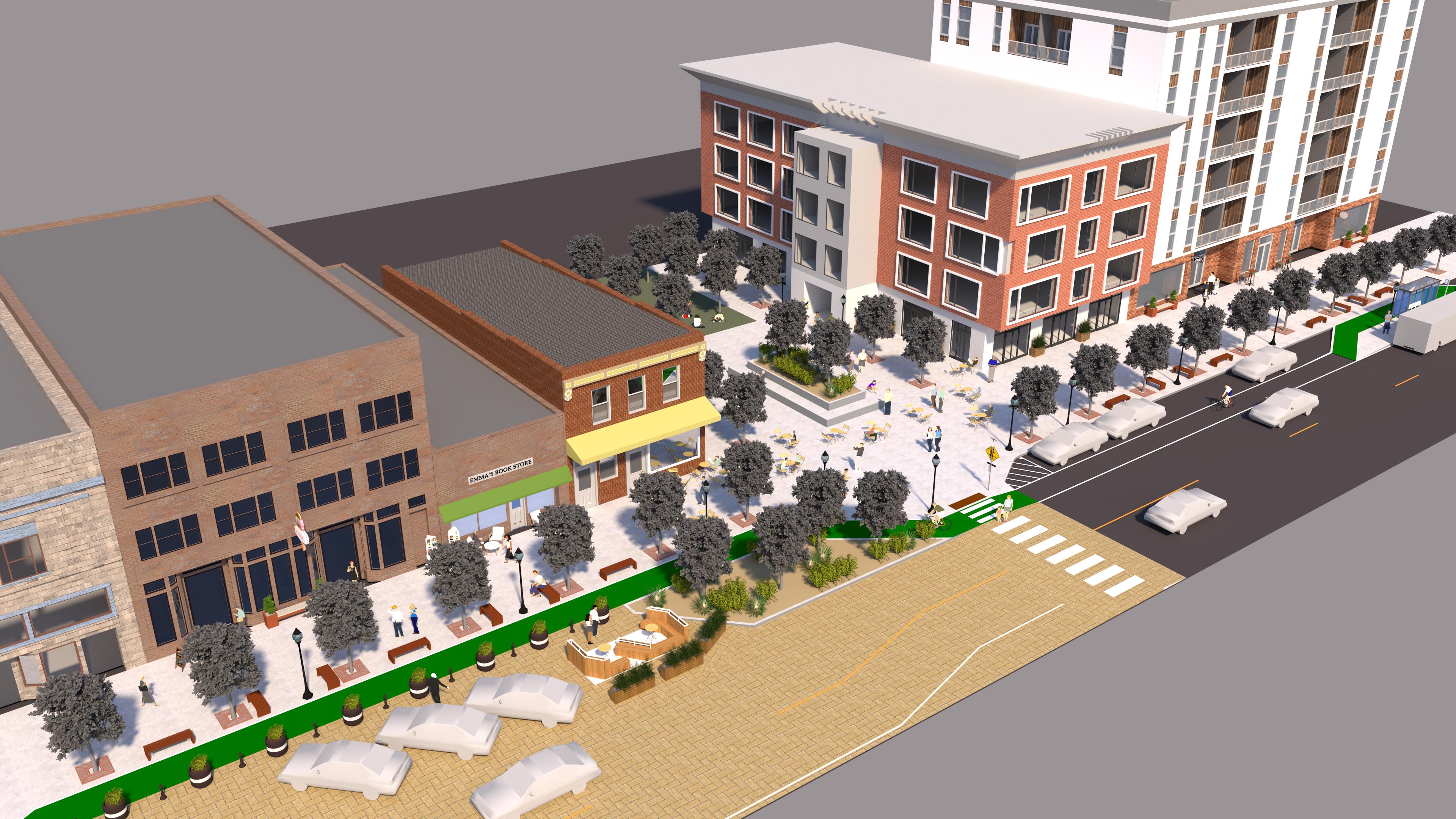
Overview: Each Typology has a graphic that shows a hypothetical place with a street serving a range of community context.
Principles: Each Typology has a set of high-level principles that reflect the "roundtable" conversations among the Wasatch Choice Great Streets partners as part of the development of the Great Streets Framework, as well as a variety of best practices.
Examples: For each typology a set of (largely positive) examples are presented.
Community and Regional Transportation Context: The different typologies pair different community context with different elements of regional transportation - and the hypothetical street incorporates, supports and balances all these aspects of context.
Considerations for context elements: Callouts highlight specific elements of the hypothetical place being shown that relate to the Great Streets Framework elements of Complete Multi-Modal Network, Increased Safety, Enhanced Places, and Strong Economies.


A street that is part of an important regional connection and emphasizes moving people and goods. Corridors are different sizes, functional classifications, and scales and have various emphases on transportation modes.
In a Wasatch Choice Center, a Corridor's role is often to bring people into the center by multiple modes, or to run through or bypass it in a way that achieves good travel times without posing a barrier to and within the center.

1) Emphasize regional transportation needs but balance with local community context needs.
2) Reduce conflicts among modes and users.
3) Moderate speeds compared to the same corridor outside of the Wasatch Choice Center.
4) Where possible, seek to create boulevards - monumental streets designed to move people and goods in a beautiful street environment.
5) More frequent pedestrian crossings than generally built outside a Wasatch Choice center.
6) Buffer pedestrians from vehicular areas on either side of the sidewalk.
7) Scale pedestrian and bicycle facilities to the size and characteristics of the roadway.
8) Develop ways to move and deliver freight in harmony with the other modes and the places they serve.
9) Leverage major destinations to create human scale public spaces along the street.
10) De-emphasize both shoulders and parking on the street, using the space to balance quality mobility experiences for all modes.
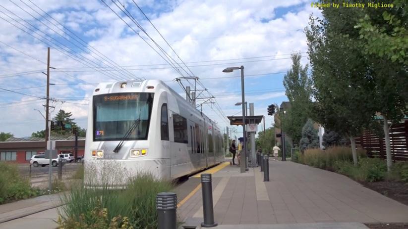
Daybreak Parkway is a street in South Jordan's Daybreak district that is the primary corridor connecting South Jordan City to the east with the southern part of the Daybreak community and the Mountain View Corridor. As the extension of 11400 South, it is an important regional link and also connects to the end of the TRAX Red Line.
Positive aspects of the Corridor type that Daybreak Parkway presents include:
• Wide pedestrian realm and buffered sidewalks
• Traffic calming such as roundabouts
• Positive environment for range of land uses, including residential buildings
• Maintains auto capacity
900 East is a street in Salt Lake City's Sugar House district. The street is part of a corridor that connects that connects the entire Salt Lake Valley from Salt Lake to Draper. In Sugar House it helps provide access to businesses, homes, the S-Line streetcar, Fairmont Park, and other destinations.
Positive aspects of the Corridor type that 900 East in Sugar House presents include:
• Combined raised bike and sidewalk with buffer that were added within a limited right-of-way.
• Multi-modal improvements that adapt to the opportunities available
• Improved pedestrian crossings
• Balance of multi-modal improvements with traffic movement
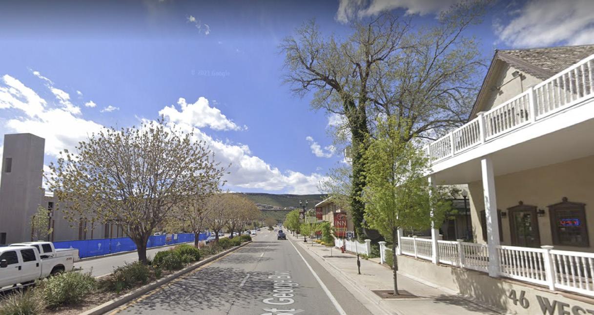
St. George Boulevard is the major east-west corridor connecting downtown St. George with Interstate 15, providing access to downtown businesses and places throughout the region.
Positive aspects of the Corridor type St. George Boulevard presents include:
• Traffic calming created by narrowing of roadway and human scale elements
• Greening through new trees and landscape
• Focus on mobility aspects over parking
• Access management features
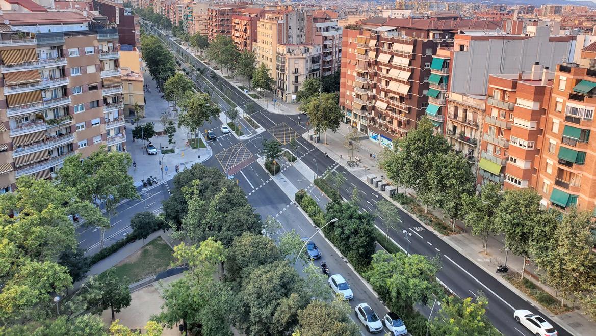
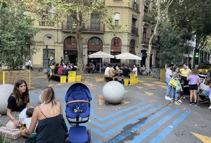
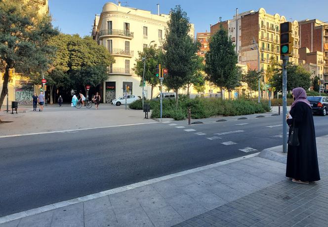
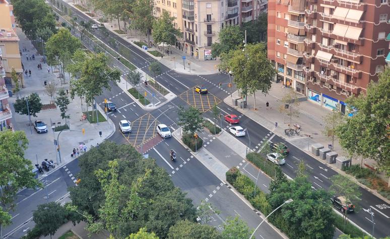
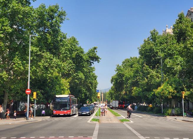
Avenguda Meridiana is a corridor in Barcelona, Spain, that links into the core of the city. It was improved to integrate and balance facilities for all modes in a wide right-of-way.
Positive aspects of the Corridor type Avenguda Meridiana presents include:
• Very wide shaded pedestrian realm
• Bus lanes
• Center two-way bikeway buffered by landscaping
• Short crossings broken up by pedestrian refuges
• Access management streamlining automobility
• Boulevard-style trees and landscape providing a sense of monumentality to the corridor
GAS STATION or other MOTOR VEHICLE-ORIENTED LAND USE
NEWER PEDESTRIANORIENTED RESIDENTIAL BUILDING
COMMUNITY
DESTINATION such as SHOPPING CENTER, LARGE EMPLOYER, OR INSTITUTION
On Corridors, Community Context is typically a wide range of land uses, including commercial, residential, employment, civic and industrial. One key use is major destinations of all kinds. Along Corridors, walkable land uses like new residential buildings are often mixed with auto-oriented uses like gas stations, as shown above.
On Corridors, Regional Transportation Context is typically roadways or highways that connect communities or have statewide significance; trucking routes; major/core transit routes; and key citywide or regional bike corridors.
COMPLETE NETWORK: Wide sidewalk with landscape buffers from vehicular areas.
SAFETY: Access management features
COMPLETE NETWORK: Enhanced bus stop
PLACES: Public spaces at destinations
ECONOMIES: Access to major destinations
REGIONALCOMMUNITY BALANCE: Quality mobility conditions for all modes - auto, transit, freight, bicycle.
SAFETY: Reduce conflicts by limited and shared driveways
ECONOMIES: Accommodate freight mobility and access.
PLACES: Monumental trees and public art
REGIONAL-COMMUNITY
BALANCE: Crossings and pedestrian refuges reduce major street barrier.
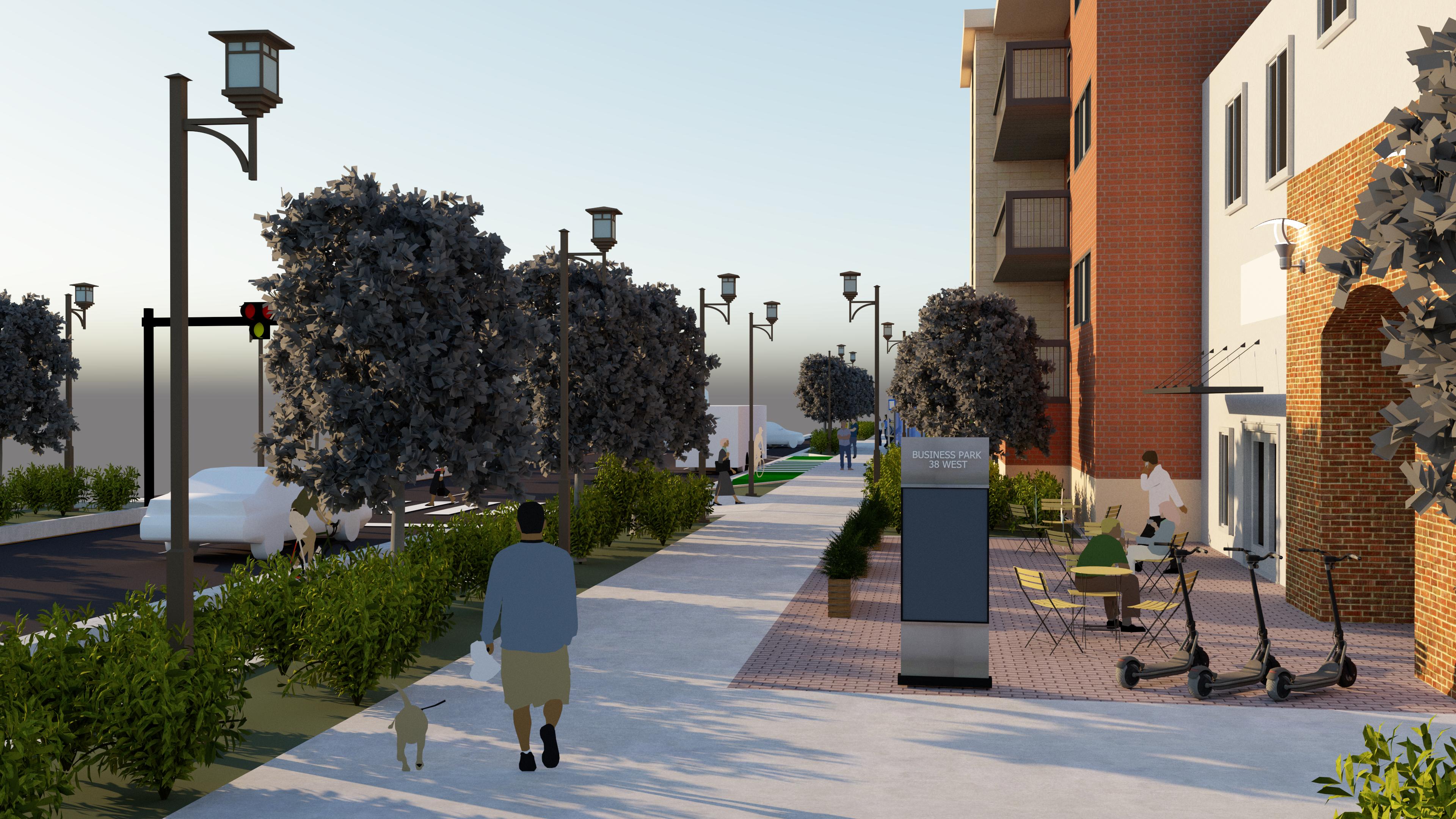
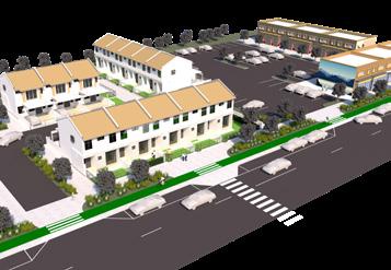
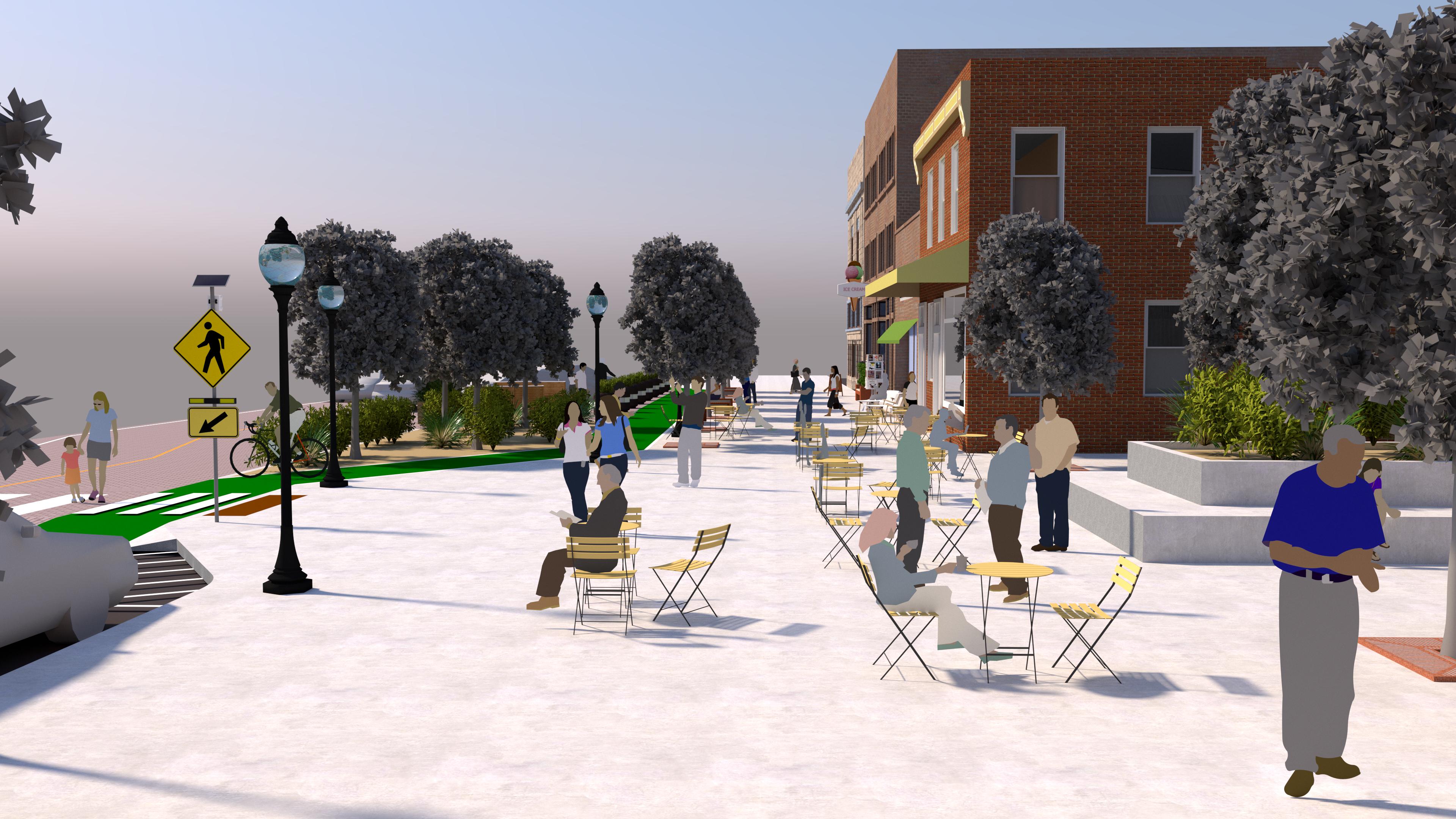
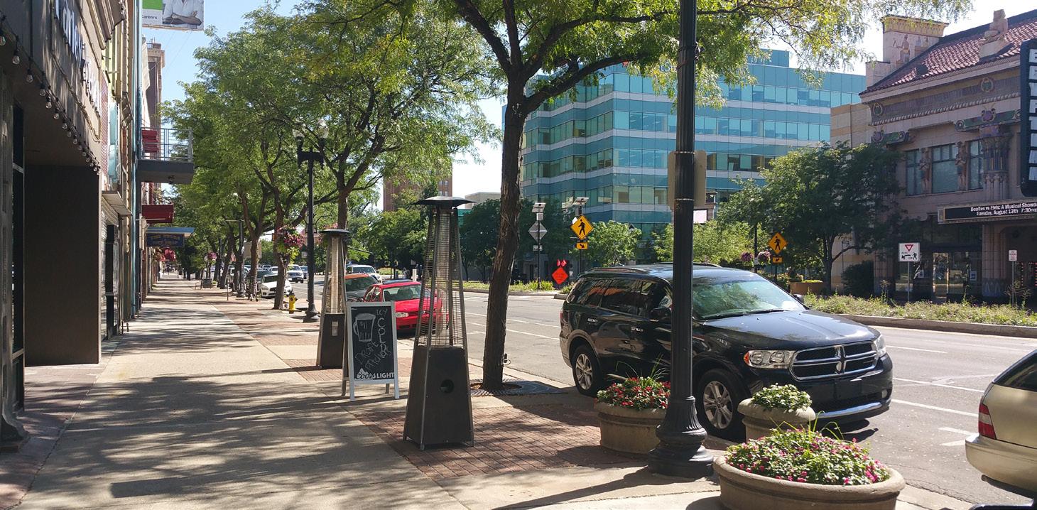
A street that is a primary gathering space and place in its community. Main Streets prioritize people - whether walking or spending time in the public space of the street. They have high proportions of pedestrian space; buildings that open to the sidewalk; streetscape; public spaces; auto parking that complements the pedestrian environment.
For this typology, community visions for new, enhanced, or retrofitted Main Streets are especially important.
1) Emphasize community context needs but balance with regional transportation needs.
2) Establish a very low speed environment for all modes through the design of the street.
3) Create a great, high quality environment for and scaled to people. Seek to have a higher proportion of the street width dedicated to people space than vehicular space.
4) Set up the street to provide outdoor rooms in conjunction with adjacent land uses.
5) Leverage the low speed environment to allow for a permeable street space and safe interaction among modes.
6) Establish regular, very frequent pedestrian crossings and shorten them as much as possible.
7) Green the street with trees and landscape.
8) Seek to have freight mobility and deliveries on other streets in the Center network.
9) Include streetscape infrastructure that reflects and connects to the community.
10) Design bike environment to the level of comfort sharing the space with vehicles and pedestrians.
11) Include on-street parking to create a park once and walk environment.

Center Street is a street in downtown Provo that serves as the City's Main Street. The street has evolved over time with improvements for pedestrians, lane narrowing, and on-street parking. While Center Street is more of a corridor to the west where it connects to I-15, in the downtown core it is clearly a Main Street, with walking and businesses as the priority.
Positive aspects of the Main Street type that Center Street presents include:
• Wide pedestrian realm
• Frequent short crossings with pedestrian refuge
• On-street diagonal parking
• Narrow lanes
• Shade trees
Main Street serves as the walkable core of Lehi's historic downtown. The street has evolved to take on less of a Corridor role with the construction of east-west major streets to the north and south and a design to emphasize sense of place and walkability.
Positive aspects of the Main Street type that Lehi Main Street presents include:
• Streetscape that reflects historic identity and complements buildings
• Curbless design
• Short crossings
• Human scale materials in roadway reflecting flexible use and conveying narrow lanes for slowing traffic
25th Street is a street in downtown Ogden that serves as the City's Main Street. 25th Street is a walkable link connected to the city's historic train station that is well-known for its restaurants, shopping, and nightlife.
Positive aspects of the Main Street type that 25th Street presents include:
• Wide pedestrian realm
• Pedestrian space bulb-outs
• Great connection with active storefronts
• Mid-block crossings
• On-street diagonal parking
Holladay Boulevard serves as the walkable Main Street of Holladay Village, the city's revitalized downtown. The City of Holladay took an active role in building a catalytic project that created new mixed use development, public space and streetscape improvements.
Positive aspects of the Main Street type that Holladay Boulevard presents include:
• Wide sidewalks
• Public plaza spaces
• Coordination with new walkable land uses
• Streetscape elements such as lighting, trees, and landscaping in bulb-outs
• On-street parking
PEDESTRIAN PLAZA THAT CREATES A COMMUNITY GATHERING SPACE
HISTORIC STOREFRONTS WITH A VARIETY OF BUSINESSES THAT PROMOTE STREET ACTIVITY
NEW PEDESTRIANORIENTED MIXED-USE RESIDENTIAL BUILDING
On Main Streets, Community Context is comprised of existing or envisioned land uses that emphasize community needs, places, destinations, and a walkable environment. Historic, low-story buildings with small businesses are mixed with new mixed-use residential buildings, community plazas, and a welcoming streetscape, inviting residents and visitors to stroll and gather along Main Street.
Main Streets de-emphasize Regional Transportation Context. Main Streets do not have a great need to move regional traffic through them, instead comprising complementary pieces to Corridors in centers. Main Streets may serve large community or regional destinations that require regional transportation, but access to these facilities should be strategic. All transportation aspects of Main Streets serve to support people on foot.
COMPLETE NETWORK:
SAFETY: Main Streets are planned
REGIONAL COMMUNITY
REGIONAL COMMU-
ECONOMIES: Main Streets are geared so
COMPLETE NETWORK: Main Streets don’t necessarily emphasize transit stops but it is important to make them accessible, reduce conflicts and support transit mobility.
PLACES: Streetscape features like street furniture, trees, and lighting are an important component of establishing the street as a public space.
ECONOMIES: Parking is vital to Main Streets but parking space can be used flexibly by businesses for other uses such as dining.
SAFETY: Main Streets emphasize more of a mixing of modes - all at a very slow speed.
PLACES: Main Streets create opportunities for and complement quality public spaces such as plazas, activated by surrounding pedestrian-oriented buildings and destinations.
A street that, due to competing needs, must balance the elements of both Corridors and Main Streets. They must have a balance of maintaining the movement of people and goods while also slowing speeds and creating a welcoming community gathering space.
There are three types of situations where a Hybrid Main Street is appropriate: 1) There is no other alternative for a community that envisions a walkable town center; 2) there is existing, often historic, walkable urban fabric but the street also needs to move regional traffic; and 3) there is an existing or planned major transit investment.
1) Strategically balance critical regional transportation needs with critical community context needs.
2) Design for modrate speeds and consider establishment of a targeted segment of the street through the Center environment that encourages slower motor vehicle travel speeds.
3) Create a quality pedestrian environment that is significantly buffered from faster moving traffic on the corridor.
4) Use private frontage and side streets to develop public space separated from moving traffic.
5) Add strategically placed frequent crosswalks, shorten to the degree possible, and include appropriate traffic control to provide safe pedestrian crossings while maintaining vehicle throughput.
6) Emphasize quality access to transit stops and stations and transit waiting environments as high quality public spaces.
7) Green the street with trees and landscape.
8) Seek opportunities for freight mobility and deliveries on other streets in the Center network.
9) Include streetscape infrastructure that reflects and connects to the community.
10) Seek alternative bike/micro-mobility corridors in the Center but treatments on the Hybrid street should maintain appropriate protection.
11) De-emphasize on-street parking to enable buffering between pedestrians and traffic, but keep flexibility for specific needs of land uses for on-street parking.

Washington Boulevard is a street that runs through the core of downtown Ogden. While 25th Street serves more of a pure Main Street role, Washington Boulevard is in the center of downtown and because of location of City Hall and other destinations and historic storefronts, as well as with the addition of bus rapid transit, needs to serve a Main Street function in addition to accommodating the needs of the U.S. 89 corridor.
Positive aspects of the Hybrid Main Street type that Washington Boulevard presents include:
• Relatively wide pedestrian realm with street trees
• Midblock pedestrian crossings with pedestrian refuge
• Bus rapid transit stations
• Good relationship between pedestrian realm and destinations
North Temple is a street that runs through the Westside neighborhoods of Salt Lake City. It was once more of a Corridor, but the investment in the TRAX line to the Airport, a complete street rebuild, and subsequent transit-oriented development has made it a Hybrid Main Street.
Positive aspects of the Hybrid Main Street type that North Temple presents include:
• Relatively wide pedestrian realm with street trees
• Landscape buffer from moving traffic
• TRAX stations with public art
• Midblock pedestrian crossings at TRAX stations
• Bike lane
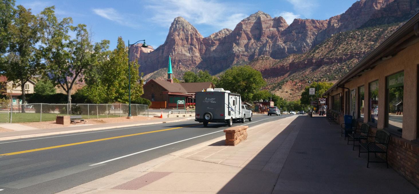
Utah State Route 9 is the "Main Street" of the town of Springdale, in southern Utah, a gateway to Zion National Park. S.R. 9 needs to be both the walkable center of the town and move traffic to and through the national park. Some years ago, UDOT worked with the community to redesign the street to include bike lanes and a better pedestrian environment.
Positive aspects of the Hybrid Main Street type that S.R. 9 presents include:
• A great pedestrian environment that leverages shops and other destinations to create good public space along the street.
• A narrowed roadway
• Unique bus stops
• Bike path that becomes a bike lane in the town
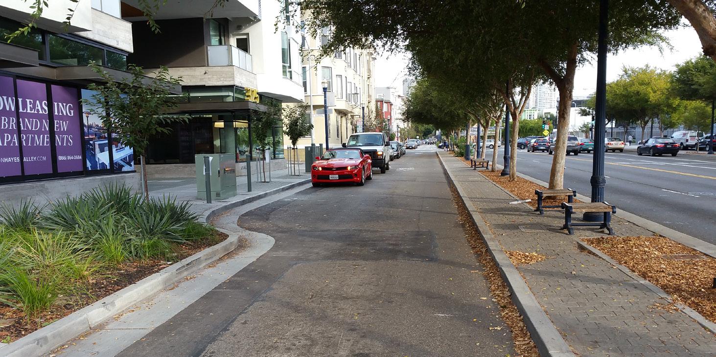
Octavia Boulevard is a street in San Francisco, California that serves as a link between the Central Freeway and the street network of the central neighborhoods of the city. The Central Freeway used to run but a segment of it was torn down and Octavia Boulevard built in its place. The Boulevard has a multi-way boulevard design that contains lanes for faster, longer distance traffic in the center and slower lanes for local access traffic on the sides, separated by medians with street trees. This is a strategy to provide both the regional traffic need and slower, walkable community need.
Positive aspects of the Hybrid Main Street type that Octavia Boulevard presents include:
• A quality pedestrian environment made by the presence of local access lanes.
• Faster central travel lanes
COMMUNITY DESTINATION such as SHOPPING CENTER, LARGE EMPLOYER, OR INSTITUTION
NEW PEDESTRIANORIENTED MIXED-USE RESIDENTIAL BUILDING
STOREFRONTS WITH A VARIETY OF BUSINESSES THAT PROMOTE STREET ACTIVITY
NEWER STOREFRONT OR OFFICE BUILDING
On Hybrid Main Streets, Community Context can be very similar to Main Streets, just paired with a different street environment that requires the Main Street land uses to be more strategic about placemaking, access, and other aspects. On Hybrid Main Streets, the community context can be a mix of historic storefronts, newer walkable residential and other density, large destinations, and other uses evolving toward a community Main Street.
On Hybrid Main Streets, Regional Transportation Context is emphasized, but it must be balanced with community places, and so regional transportation elements such as vehicle, freight, and transit mobility, parking, and access should be strategically included and designed.
PLACES: Transit can be an important part of establishing sense of place and walkability of Hybrid Main Streets through stop environments expressing the community, mobility hubs, and ped/bike access oriented to stops/stations.
SAFETY: To create a
ECONOMIES: Hybrid
PLACES: Larger Main Street
ECONOMIES:
On-street parking not
REGIONALCOMMUNITY BALANCE: Separate pedestrian environment from vehicular environment with buffers.
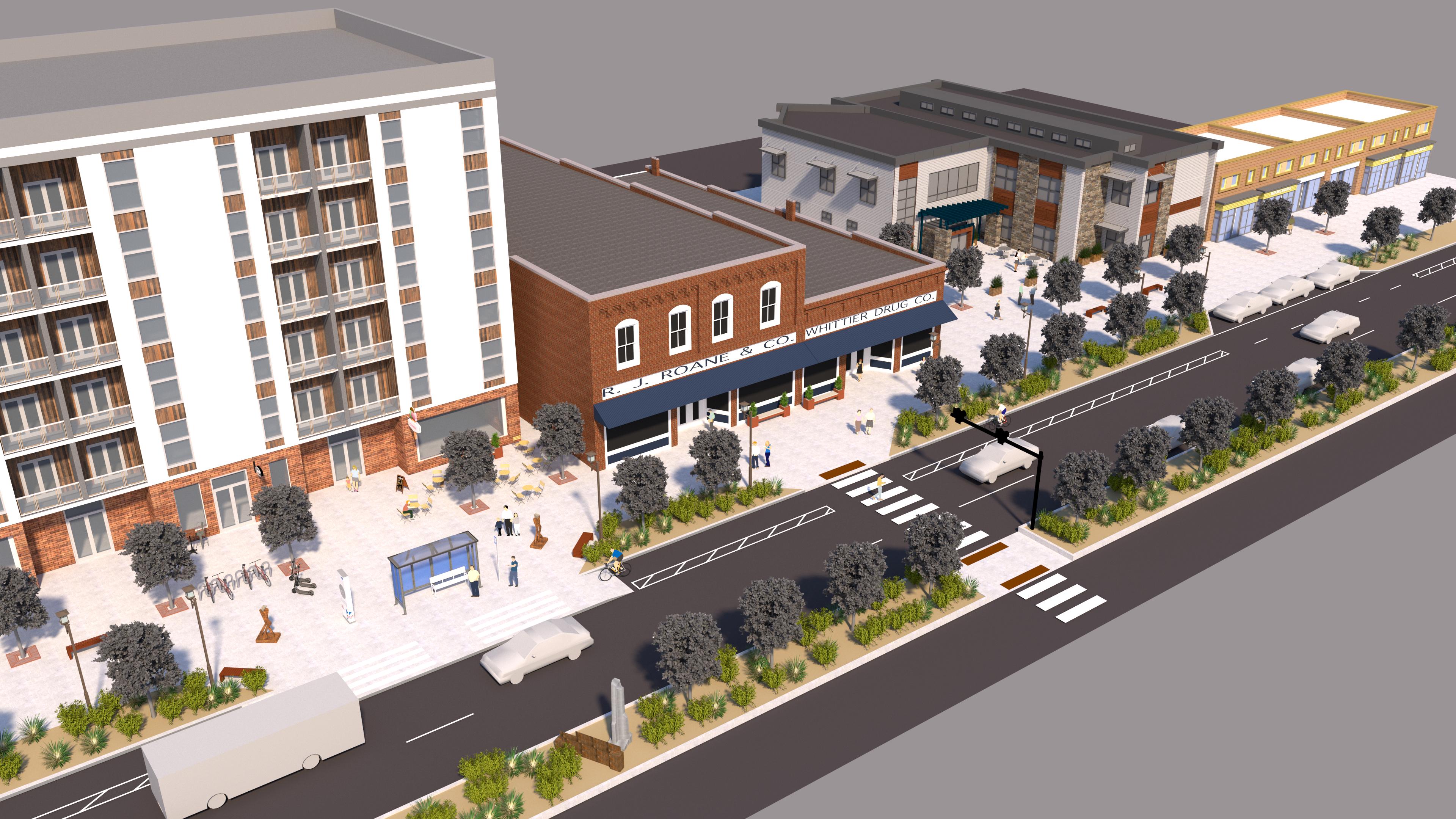
SAFETY: Hybrid Main Streets should avoid/relocate driveways/curb cuts to emphasize roadway mobility and pedestrian realm.
COMPLETE NETWORK: Traffic and transit mobility is important on Hybrid Main Streets, but it must be paired with slow speeds and quality facilities for bike travel and especially safe and comfortable pedestrian space.
COMPLETE NETWORK: Hybrid Main Streets seek to have more frequent pedestrian crossings than Corridors, shortened by elements like pedestrian refuges.
BALANCE: Identify the most important features for the street and seek to place other functions on other streets in the network.
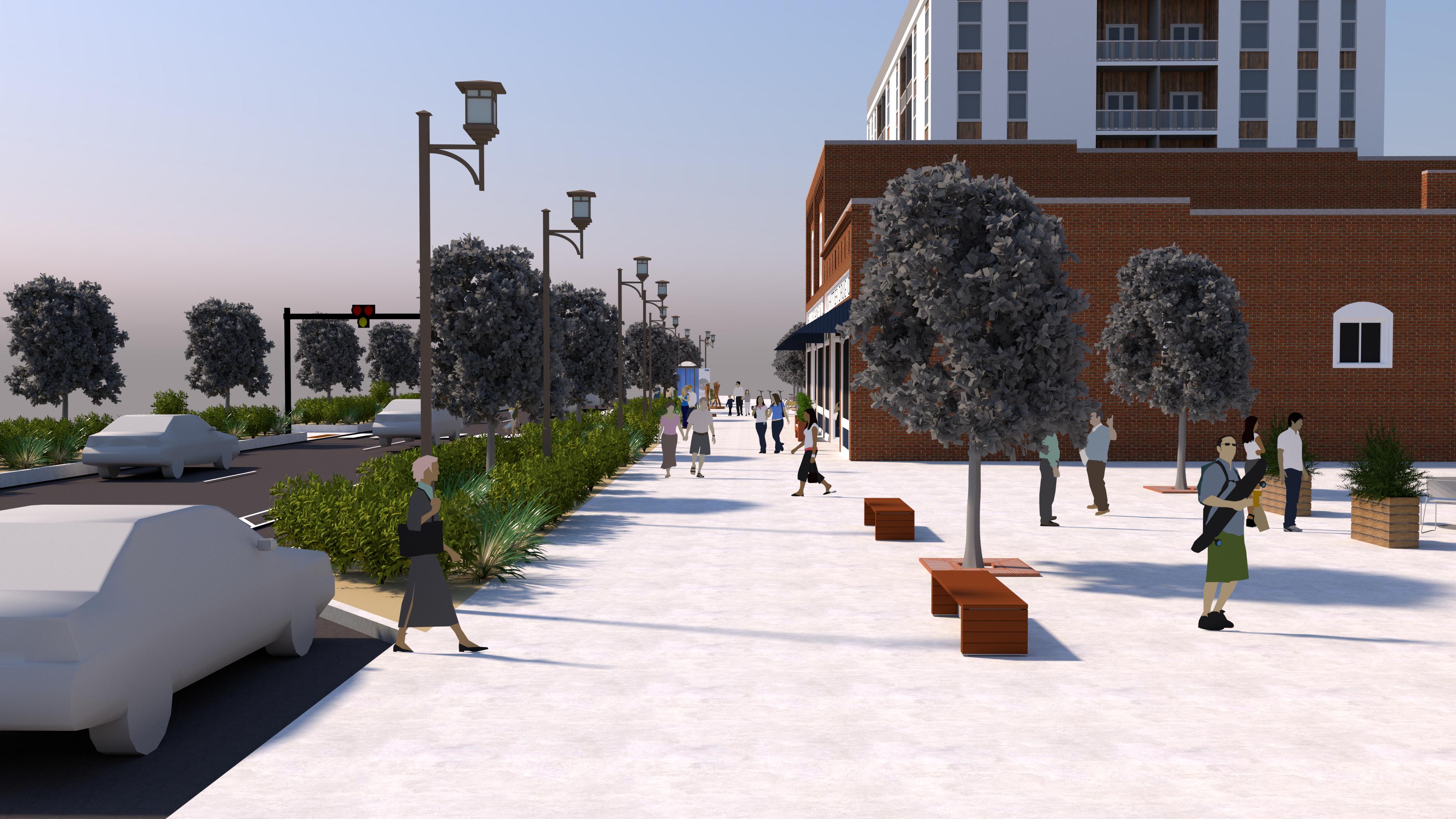
A street that is neither a Corridor nor a Main Street but still serves an important role in the center's network. Supporting streets play a variety of roles in centers depending on what is needed within the network and for the community context.
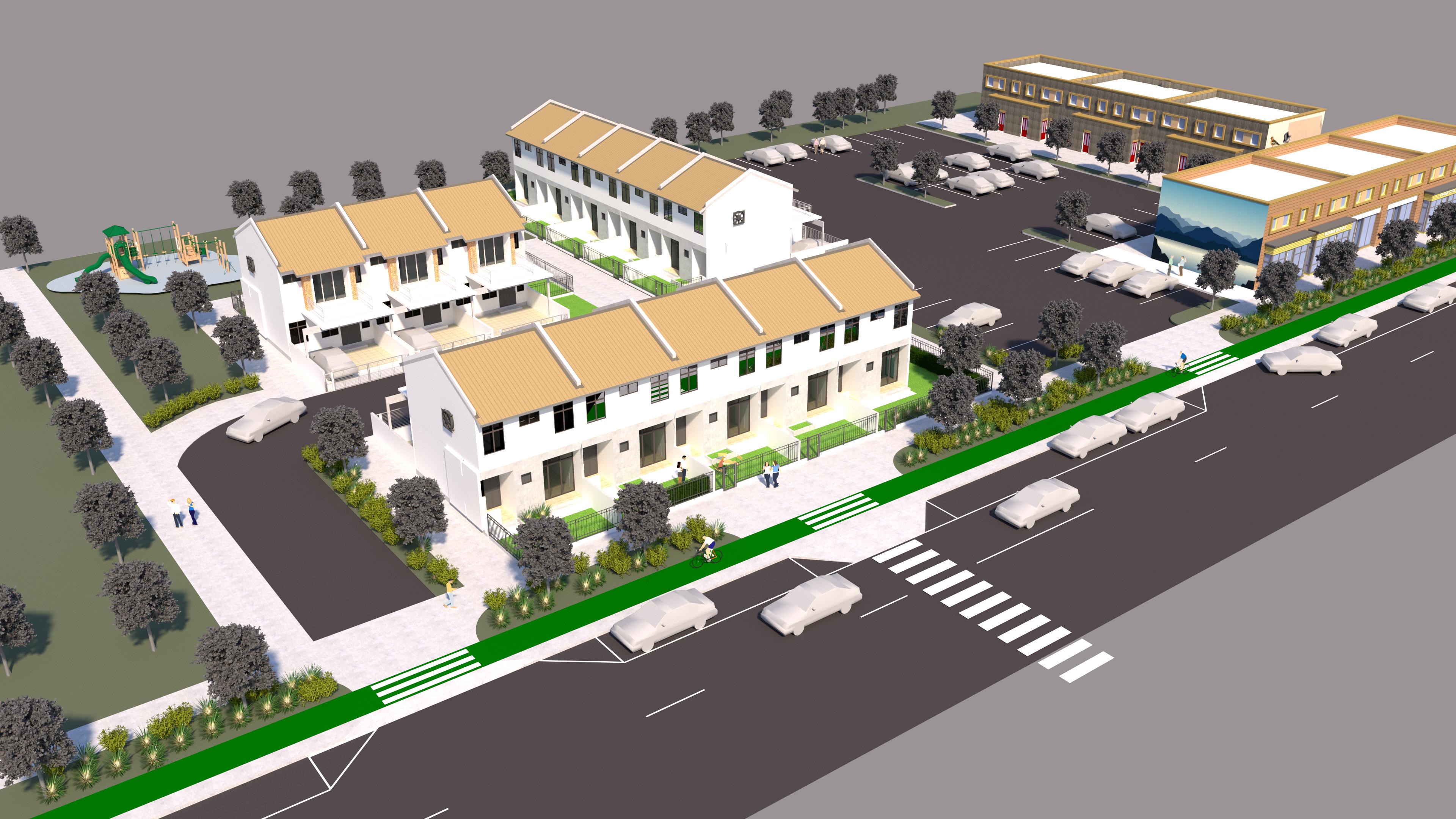
1) Emphasize regional transportation and community context needs of the center complementing or unable to be provided on the Corridors, Main Streets, and Hybrid Main Streets.
2) Establish an environment that encourages slow travel speeds.
3) Ensure pedestrian links - sidewalks, paths, and crossings - that complement and connect the center’s destinations, Main Streets, and Corridors, and overall network.
4) Design the street to emphasize specific network needs - whether active transportation, parking, freight or others.
5) Emphasize livability in the street environment.

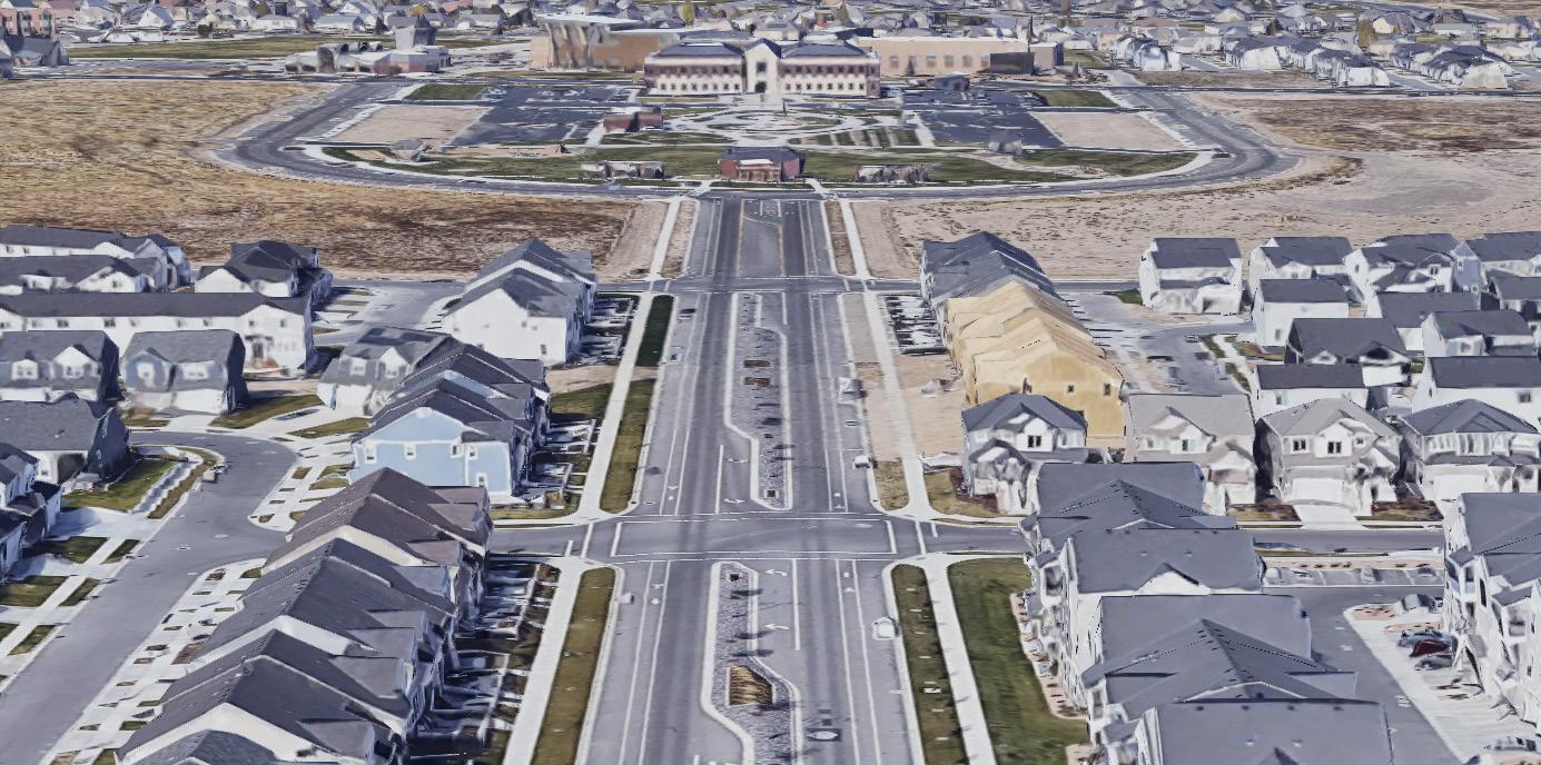
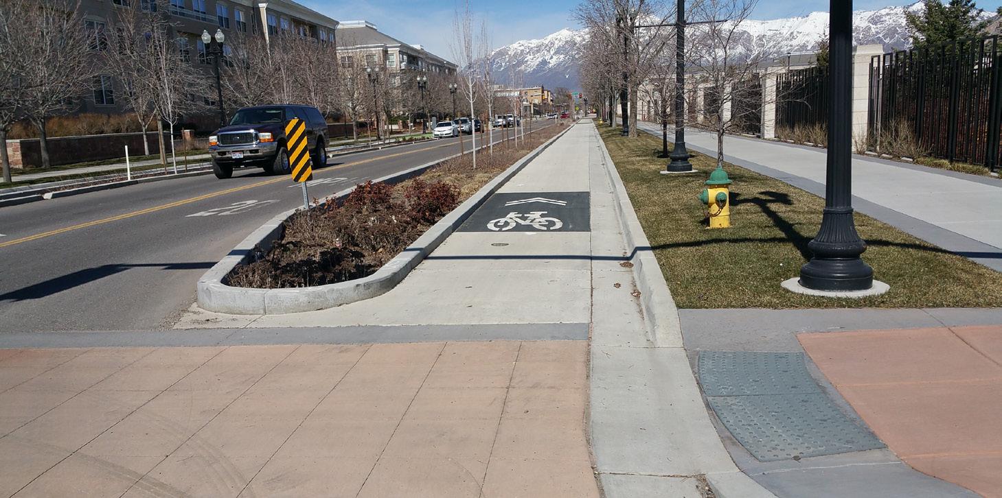
Fort Herriman Parkway is a street in Herriman that connects 13400 South to the Herriman Towne Center. It's a short street but serves this critical connective and access function.
Positive aspects of the Supporting Street type Fort Herriman Parkway presents include:
• Wide pedestrian realm
• Livable location for middle-density housing in the Herriman Towne Center.
• Bike connection to Towne Center
• On-street parking
Grant Avenue is as street in downtown Ogden. It runs parallel to other, more major north-south streets such as Wall Avenue and Washington Boulevard and provides a quality bike connection, a location for housing, and access to parking and destinations like the Ogden Church of Jesus Christ of Latter-day Saints Temple.
Positive aspects of the Supporting Street type that Grant Avenue presents include:
• A protected bike lane
• Parking access balanced with the pedestrian and bike environment
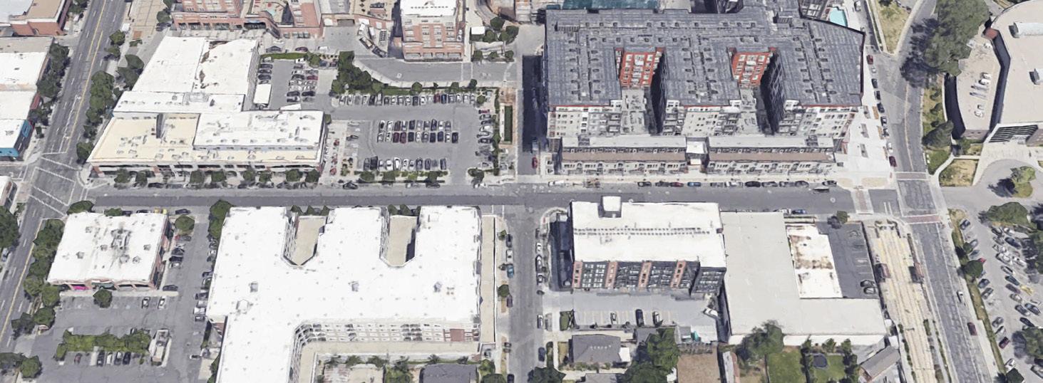
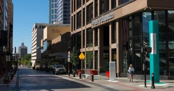
McClelland Street is a street in Salt Lake City's Sugar House district that supports the district's Main Streets with parking access, spillover retail spaces, and housing.
Positive aspects of the Supporting Street type McClelland presents include:
• Parking lot access and on-street parking
• A slow environment for housing
Regent Street is a street in Downtown Salt Lake City that is an "alley" connection through one of the district's large blocks. The street was recently transformed form an auto-oriented alley into a "woonerf" shared street oriented to pedestrians where motor vehicles are guests.
Positive aspects of the Supporting Street type Regent Street presents include:
• An important link within downtown's destinations
• A back alley retail and entertainment environment that complements Main Street
• Maintained access to parking garages in the middle of the block
PARK / OPEN SPACE
WALKABLE STOREFRONTS WRAPPED AROUND FROM MAIN STREET WITH REAR ACCESS
On Supporting Streets, Community Context typically consists of lower intensity uses in the center, such as housing, parks and open space, offices, and district-wide parking.
Supporting Streets generally de-emphasize Regional Transportation Context but should be considered for supporting elements of regional transportation that don’t fit or aren’t appropriate for Corridors or Main Streets, such as freight mobility/delivery, first-last mile links, trails, or parking.
COMPLETE NETWORK:
BALANCE: Supporting streets can reinforce community context by creating quality environments for and access to livable aspects of centers such as housing and parks.
ECONOMIES:
PLACE: Supporting Streets
ECONOMY: Place for freight mobility alternatives and freight deliveries.
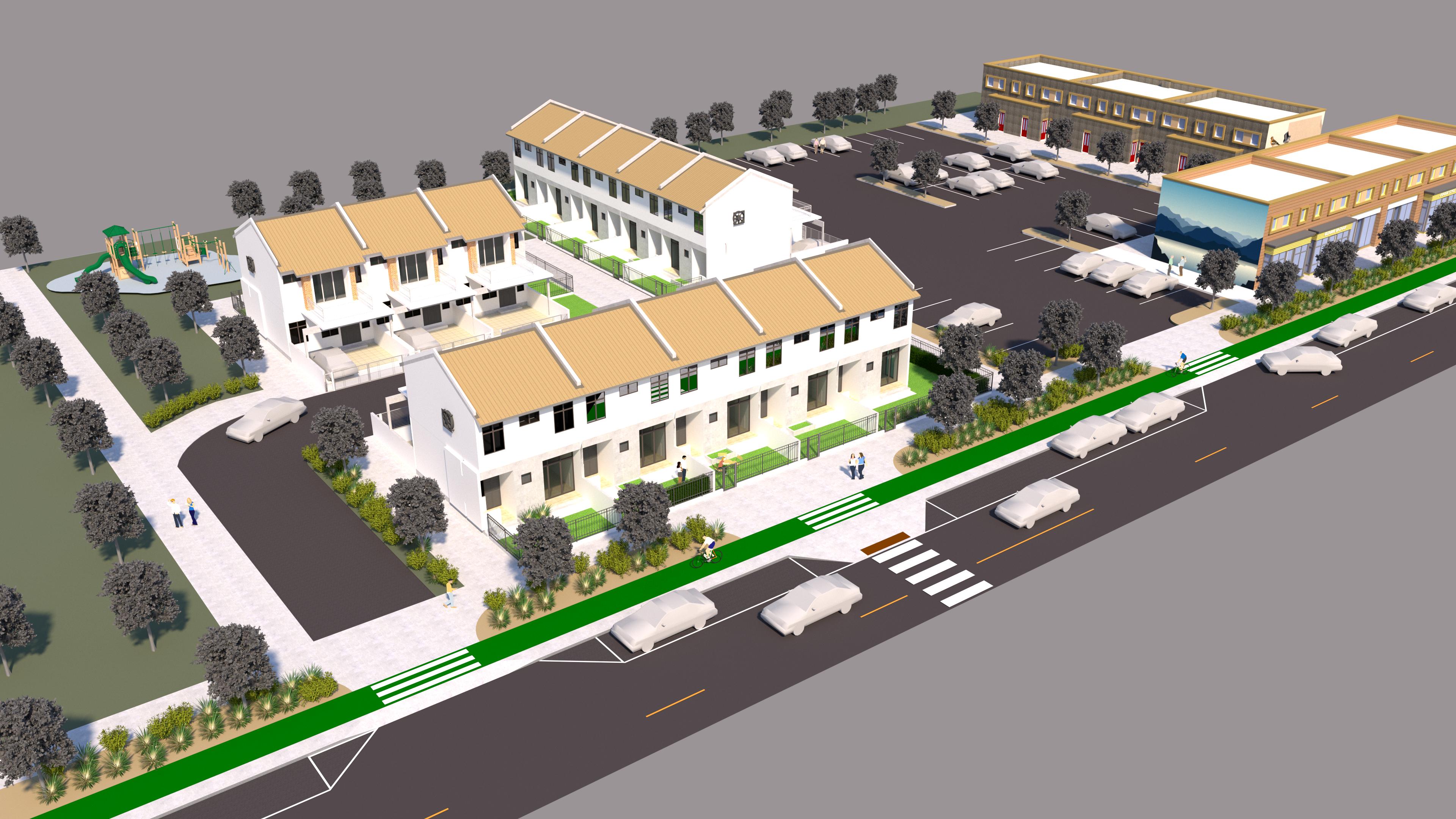
PLACE: Supporting Streets can provide safe access to parks in a center, increasing center livability.
human scale that slows circulating traffic and allows for short safe crossings.
BALANCE: Generally less important to regional transportation - local links and circulation - but can also serve some regional transportaiton niches.
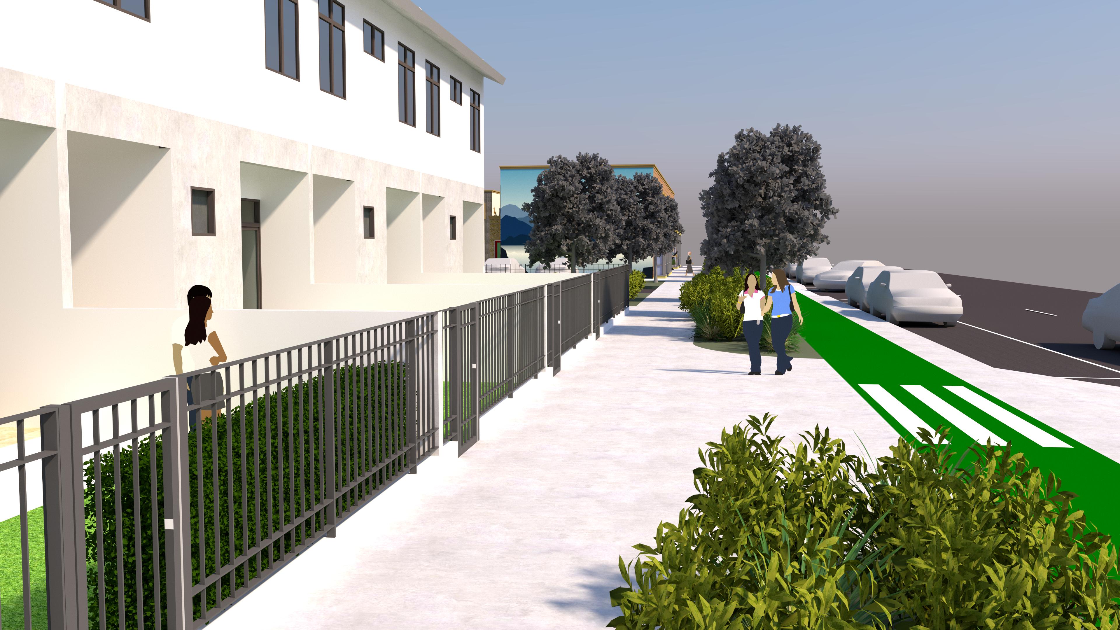
A roadway that carries very high volumes of traffic and is a physically large facility with little connection to the Wasatch Choice Centers it runs through.
Major Regional Corridors are rare in Wasatch Choice Centers; yet it is important to make room for them because they can’t be treated like Corridors - they need to be able to maintain high volumes and speeds. However, they need to minimize the barriers they present to Centers.
1) Designate segments of streets in Wasatch Choice Centers as Major Regional Corridors in rare cases where the corridor is carrying extremely high volumes of traffic and is designed and situated such that it has little interaction with the community context.
2) Limit access to the corridor - typically guided by UDOT corridor agreements.
3) Within a Wasatch Choice Center, strategically reduce the effect of the Major Regional Corridor as a barrier to travel and connectivity throughout the center and to the center from the surrounding community.
4) Consider a separated pathway significantly buffered from moving traffic as part of the Major Regional Corridor.
PROJECT:
1 Identify the context
Aspects of Community Context:
Aspects of Regional Transportation Context:
Opportunities and challenges of the context:
2 Identify the Typology
Street: _________________________________ Type: ___________________________________
Street: _________________________________ Type: ___________________________________
Street: _________________________________ Type: ___________________________________
Street: _________________________________ Type: ___________________________________
Street: _________________________________ Type: ___________________________________
3 Identify the partners
Partner: _________________________________ Role: __________________________________
Partner: _________________________________ Role: __________________________________
Partner: _________________________________ Role: __________________________________
Partner: _________________________________ Role: __________________________________
4 Consider the elements Complete Network: Safety: Places: Economies
How will you incorporate each element into your project?